
Month: October 2018
Circle Alignments on the Planet – Merida Part 1 – Merida, Mexico to Miami, Florida – With Video of Post at the End
I am going to share with you several series of circle alignments that I found. This is the first series involving Merida, Mexico. The next complete series will be a circle alignment involving Amsterdam Island, in the French Subantarctic Islands; and the last series will involve Algiers, Algeria.
This is somewhat different from the global planetary alignments I have previously shared in “How I Found the Silk Road” and “History Reads Like a Book on the Planetary Grid.”
From the work I have done thus far, I have reason to believe this global civilization was aligned with itself on a Flower of Life pattern, with the same characteristics that appear to be bringing the heavens to earth, and aligning earth with the heavens.

The process of doing this work has opened up for me an awareness of a suppressed advanced ancient global maritime civilization which existed up until relatively recent times and the missing positive timeline of Humanity.
Throughout my blog, I go into depth regarding what I believe about this civilization – what I am calling the Muurish/Moorish/Israelite Empire; what happened to it; and provide compelling evidence as to why I believe this.
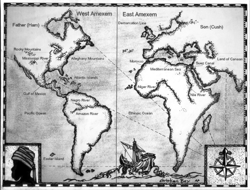
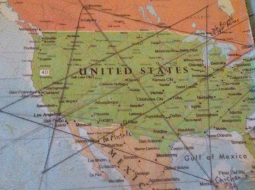
I found this star tetrahedron in early 2016 on a map that had been given to me. I had started to notice that major cities lined up in lines in North America. I found a familiar figure of sacred geometry when I literally started connecting them. I believe it is the terminus of a worldwide grid.
I extended the lines out, and eventually switched to a globe. I used a magnifying glass and wrote down the cities that lined up. I found them lining up primarily in linear or circular fashion.
I have gotten an amazing tour of the world of places I had never heard of with remarkable similarities across countries.
In this series I am going to share with circular alignments I found while tracking alignments emanating from the North American Star Tetrahedron. The first series concerns a circle alignment involving Merida, Mexico which is the southern apex of this star tetrahedron:
Merida is the capital and largest city in the Mexican state of Yucatan.
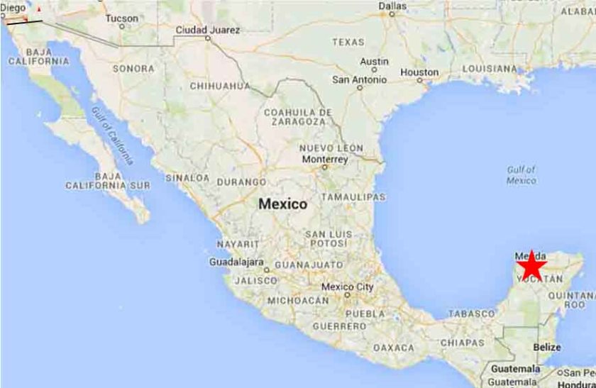
Some historians consider Merida to be the oldest, continuously occupied city in the Americas.
It has one of the largest historic center districts in the Americas, after Mexico City and Havana, Cuba.
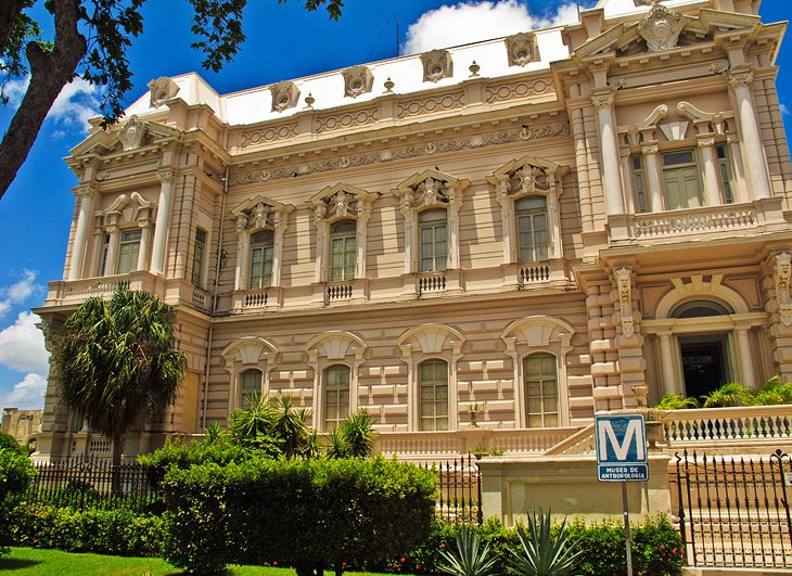
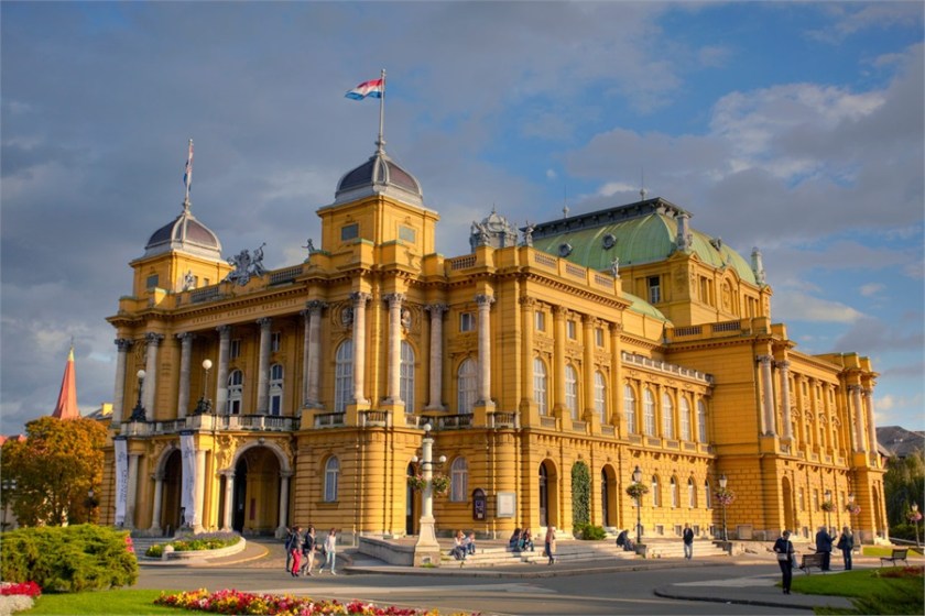
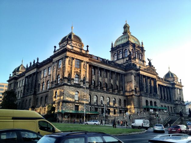
The top photo shown here is the Merida Natural History Museum. For comparison of the similar use of columns and heavy masonry in particular in the architectural style in different places…
…Like that of the Prigorje Museum in Zagreb, Croatia with its second floor double columns and similar style roof in the background to the museum in Merida…
…and this museum in Prague in the Czech Republic with its ornate columns and heavy masonry, and the same style of domes in the foreground to the museum in Zagreb.
While not identical architecture, I find it very compelling in support of an advanced ancient worldwide civilization to have so many statistically significant similarities on different continents in different countries. More examples to come!
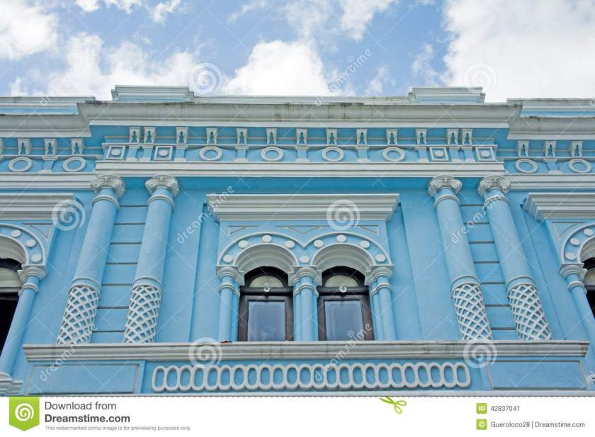
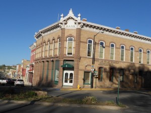
Here’s a historic blue building in Merida’s Centro Historic District. Except for the pastel blue, and creative designs of the building, the columns we see here and in the previous pictures remind me of what could be termed in our present reality classical Greco-Roman architecture.
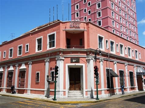
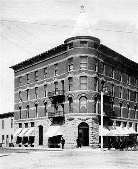
Here is a comparison of the same street corner style architecture – that I have seen all over the world – of hotels. This one is in Merida, Mexico;
The Plaza Hotel in Roswell, NM;
and the Alberta Hotel in Edmonton, Alberta.
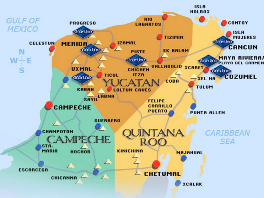
This whole area in the Yucatan Peninsula is filled with major Mayan sites, including Chichen Itza, Coba, Tulum, Uxmal, to name just a few. I counted 29 ruin sites on this map of the Yucatan, and I have found Merida connected to many planetary alignments. To my knowledge, it is not considered a primary nodal point of the planetary grid, but it certainly appears to be a place of great significance on the grid.
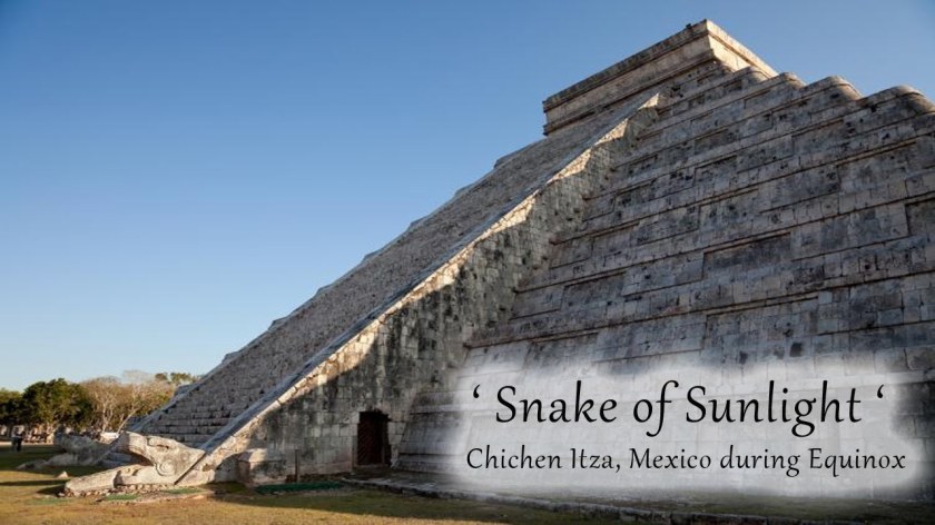
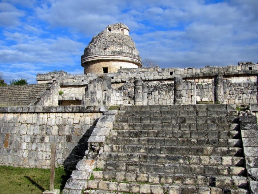
The Chichen Itza temple complex is the best known.
This is the Kukulkan Pyramid, elected as one of the Seven New Wonders of the World in 2007.
Every year, at the time of the Spring and Fall Equinox, on both sides of the north stairway of what is also called the Castle of Chichen Itza, there is a solar projection of a Serpent of Light, consisting of seven inverted triangles of light. There are two serpent heads carved into the bottom of the stairway, completing the serpent imagery.
The Caracol Observatory is part of this temple complex. Twenty sight lines of 29 astronomical events (equinoxes, solstices, eclipses, etc) can be found here, and that is what is known about since a portion of the observatory is missing.
Next shown are of the ruins at Coba. Archeologists believe that Coba is one of the most important ruin sites on the Yucatan Peninsula. This is the main pyramid, called Nohoch Mul. This site is believed to have a different design and purpose from other Mayan sites.
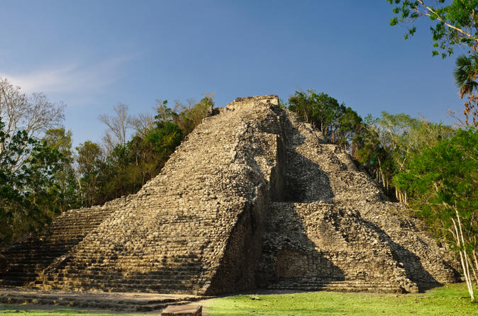
It is surrounded by two lagoons. The Coba site remains largely unexcavated.
Tulum is called a Pre-Columbian walled city that served as a port for Coba.


Tulum is built on a bluff (which is a cover-up code word for the handiwork of the Ancient Civilization) facing the rising sun, and is the only Mayan temple complex built on a Caribbean beach, and is surrounded by on three sides by a wall. It was the primary location for the Maya’s extensive trade network, both on land and sea. It was also thought to be religious center.
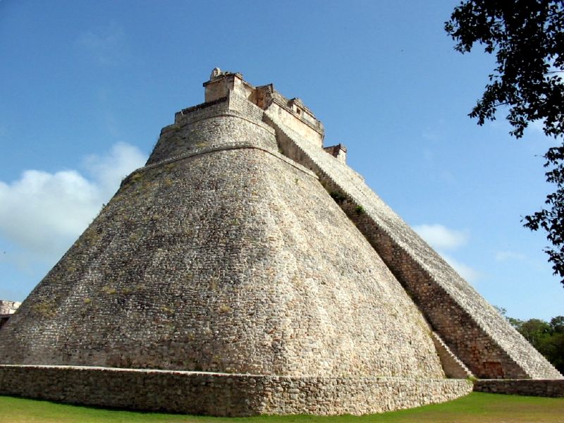
Uxmal is also considered one of the most important and beautiful Mayan sites. This is called the Temple of the Magicians. It is the tallest structure in the complex.
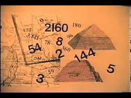
Through the work of Drunvalo Melchizedek, I became aware of Carl Munck’s work in 2010. He wrote a book entitled “The Code” and published a series of videos based on the book.
I watched the videos, and learned about his work introducing an ancient pyramid matrix in which monuments around the world encode their exact positions with respect to longitude, latitude, and each other. Uxmal was one of several of the pyramids he decoded with respect to this pyramid matrix.
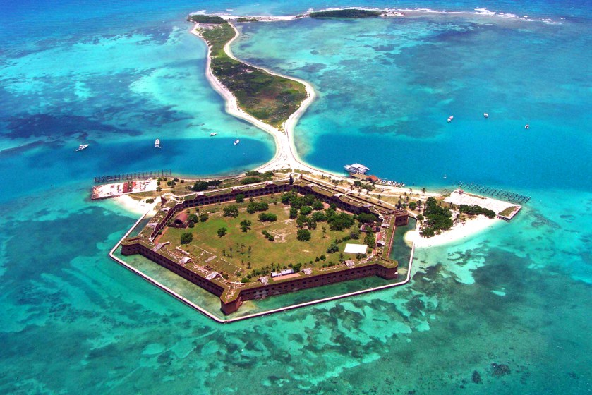
Next the alignment crosses Key West, Florida.
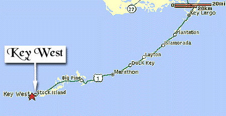
Key West is the southernmost city in the contiguous United States, and the westernmost island connected by highway in the Florida Keys. Note the shaped and protected harbor, which is just like what is seen at other islands world-wide.
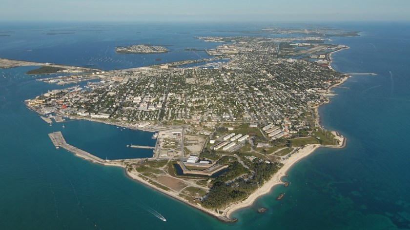
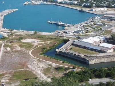
Dry Tortugas National Park, a star fort on an island called Ft. Jefferson, lies further west of Key West, and is only accessible by ferry or boat.
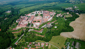
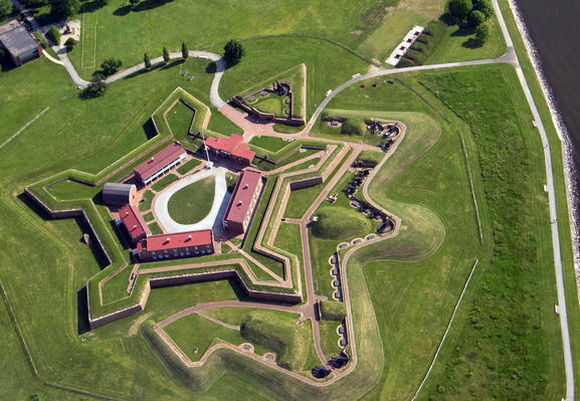
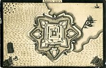
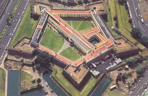
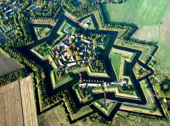
I have talked about Star Forts in previous posts. They are found around the world, and I want to give you more examples of how they are everywhere. While in many cases they have been turned into military/defensive structures, there are many indications that the original intent of these beautiful structures was not for military use or defensive in nature, and had perhaps instead some kind of energy function. These represent a sample of many, many examples.
This is Karlovac in Croatia;
The Josefov Fortress in the Czech Republic;
Fort McHenry in Baltimore, Maryland;
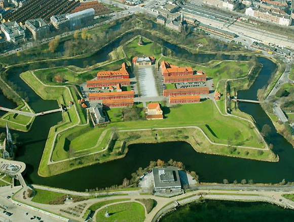
Kastellet in Copenhagen, Denmark.
Fort Carre, France;

And the Castle of Kuressaare, Estonia.
Does this similarity in design features of these structures, in places traditionally not associated with each other, make sense in the historical narrative we have been given?
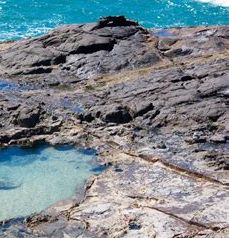
This next set of photos compare the rocky shoreline of Key West on the left with the rocky shoreline of Tulum on the Yucatan coast on the right:


This is Fort Zachary Taylor, and it is near the southern tip of Key West. It is also has star fort design features:
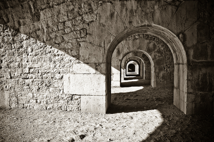
Here is a comparison of a construction feature at Fort Zachary Taylor at Key West, Florida…
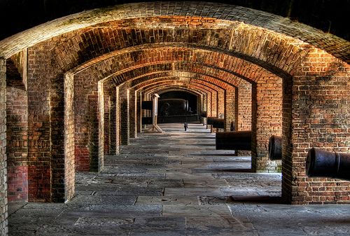
…and at the Fort de la Bastille in Grenoble, France. Certainly not identical, but there is a geometric effect that looks the same to me with the perfect symmetry of the arches.
Next onto Miami, Florida on this circle alignment.
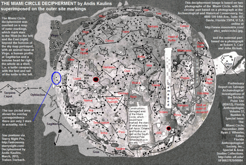
Several years before I put all of this information together, I saw a video on youtube about the discovery of what became known as the Miami Circle. It was discovered in 1998 in downtown Miami, when the building complex sitting on top of it was torn down. in 2002, it was listed on the National Register of Historic Places, and in 2009 it was declared a National Historic Landmark. Radiocarbon dating of burnt wood specimens found at the site are said to have yielded an age of 1,800 – 2,000 years old.


Here is very interesting decipherment of the Miami Circle by the stars, done by Andis Kaulins.
In this set of photos, on the left is the old post office and consulate in Miami, and on the right is the bank in El Paso State National Bank in El Paso, Texas. The heavy masonry of both buildings really strikes me, as well as the buildings being situated at the same angles on their respective street corners.


This next set is a comparison of the original Miami Herald building, which was demolished in 2015, on the left, and a mansion in Merida, Mexico on the right. Many historic buildings have suffered a similar fate as the Miami Herald building. I find most of the similarities I am seeking in historic photos of places because many of the older buildings are simply not there anymore. The Miami Herald building that was torn down was described as “built to be nearly indestructible,” in the article I read about its demolition, so these places are not being torn down because of inherent structural issues.


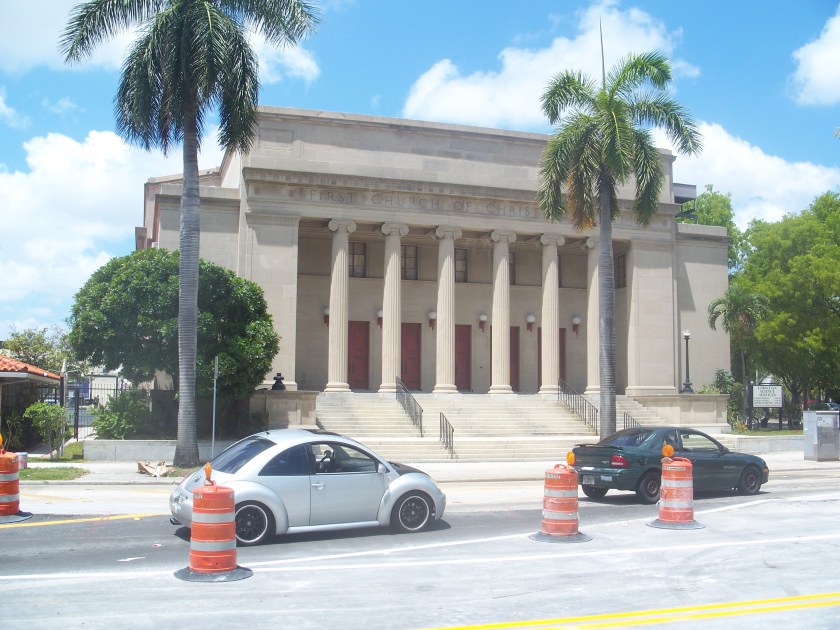
This was the First Church of Christ Scientist in Miami, which was sold to a commercial developer in 2013, with plans approved in 2015 to add a garage structure to the top and a 38-story residential tower next to it. It was listed on the National Register of Historic Places in 1989. Quite a monumental building! It looks more like the classical Greco-Roman architecture we learned about in history class than a modern church building.
I am going to end Merida Part 1 here, and pick up the circle alignment again in the Bahamas, and follow it around through Bermuda, Iceland, Greenland, Siberia, the Aleutian Islands, the Hawaiian Islands, the Revillagigedo Islands off the coast of Mexico, and along the Mexican mainland back to Merida.
Peru & North America – A Comparison of Ancient Sites – With Video of Post at the End
A Closer Look at Onion Domes – With Video of Post at the End
Perceptions, Pinnacles, Palisades, Pillars, and Pyramids – With Video of Post at the End
Master Masons & Canals – with Video of Post at the End
History Reads Like a Book on the Planetary Grid – Part 5 Great Barrier Reef to Cape Town, South Africa – With Video of Post at the End
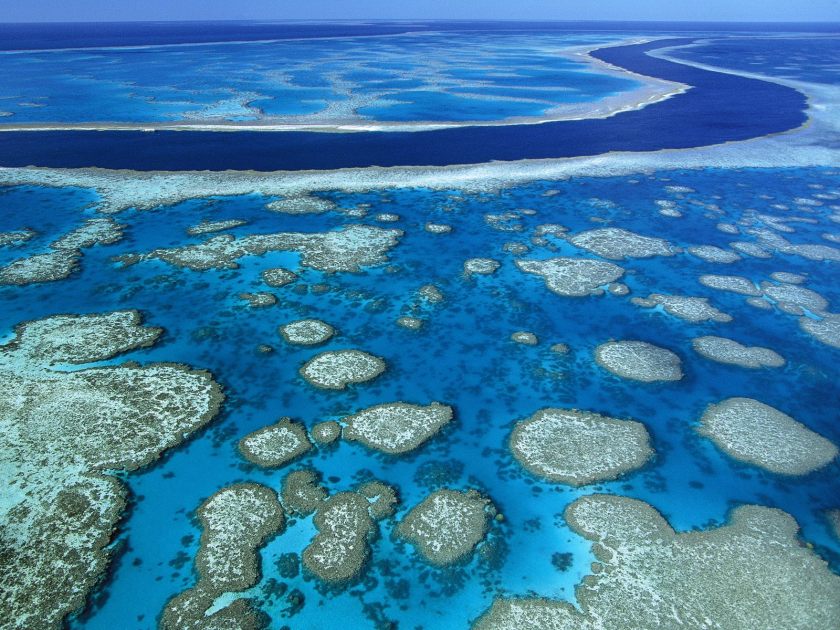
I am including the Great Barrier Reef off of Australia’s coast in this post because it is directly on the alignment I am following. Let’s see what we find out about it.
First of all, the place we where we left off in the last post, Cairns, is considered the gateway to the Great Barrier Reef.
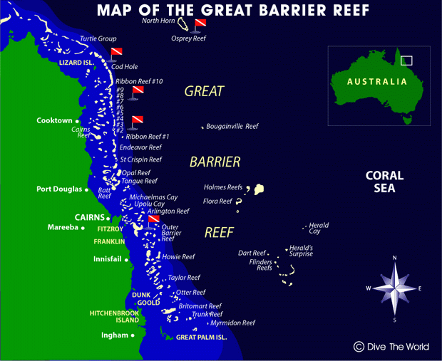
It spans 1,400 miles (2,300 kilometers) off the Queensland coast.
It is the world’s largest coral reef system, with 2,900 individual reefs and 900 islands.
It is visible from space, and has been named a UNESCO World Heritage Site.
It has long been known and used by Aboriginal Australian and Torres Strait Islanders, and is part of their culture and spirituality.
The Torres Strait Islands are a group of at least 274 small islands between Australia’s Cape York and New Guinea.


The Torres Strait Islanders are considered distinct from Australian Aboriginal peoples.
The Torres Strait is between the northernmost island, and the south coast of Papua New Guinea in the north,
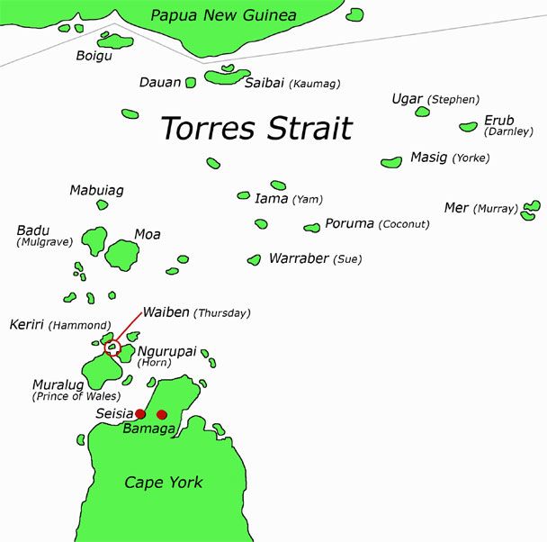
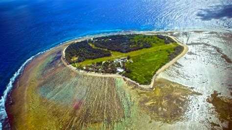
to an unnamed passage between Lady Elliott Island and Fraser Island in the South.
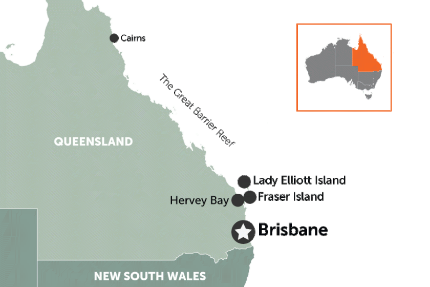
Lady Elliott Island is called a coral cay, has an eco-resort on it, and is a sanctuary for 1,200 species of marine life in the waters surrounding it, including manta rays and turtles…
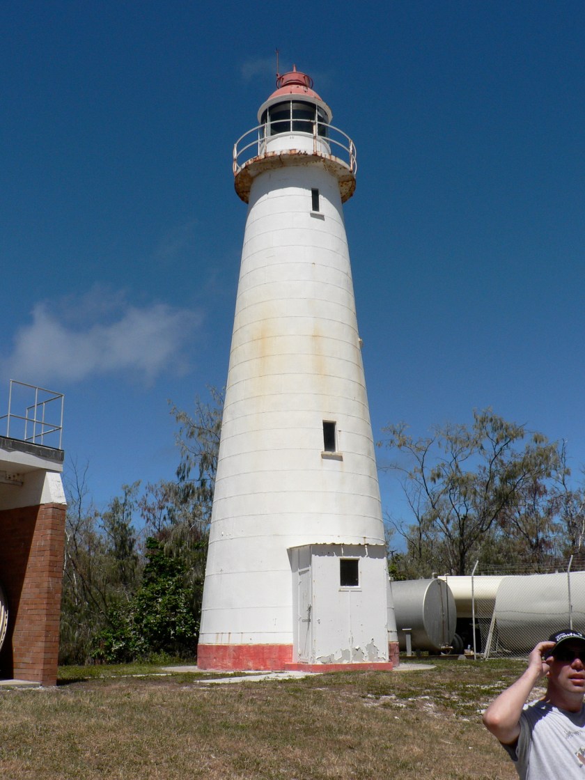
…and an old lighthouse. From what I know, the Ancient Advanced Civilization was a maritime civilization, and lighthouses around the world are remnants of it. I will do a future post on lighthouses to delve into this subject more fully.
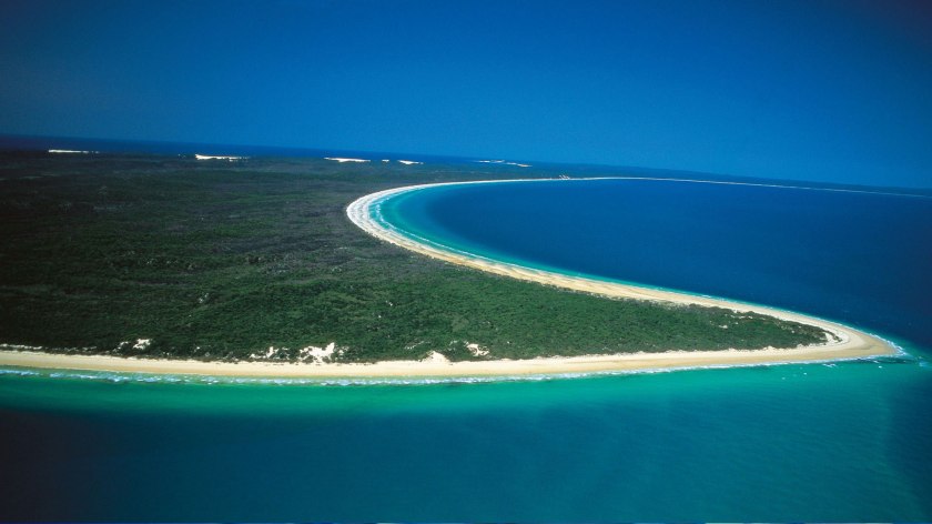
And this is Fraser Island, with its shaped shoreline (a subject for another post as well)….
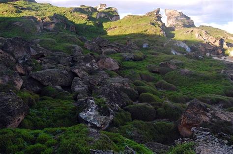
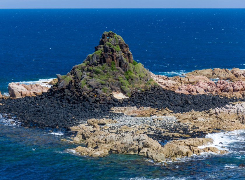
…and rocky coast and a place called the Champagne Pools. I have seen an abundance of rocky places that look similar to this on my journey on the gridlines around the world
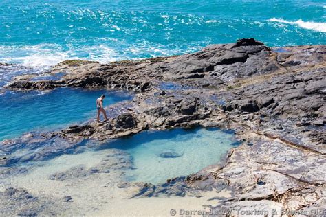
…and I question the narrative that it is all the product of natural forces. So for an example in the above picture, this highlights the presence of straight lines and edges in the stone at this location. Why is it said that straight lines don’t occur in nature when there are clearly straight lines in places like this that we are taught are natural? Food for thought.
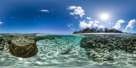
Here are two photos of the Great Barrier Reef
The first looks very much like a river in the water.
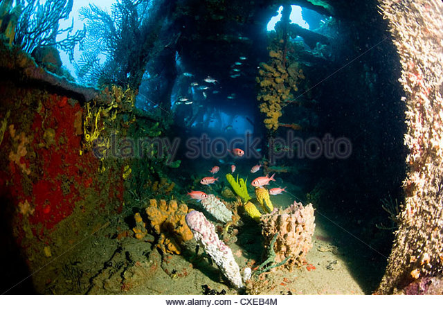
The second is an example of a point that I would like to make with the stone in the foreground. What if the coral and marine life formed on top of sunken ancient infrastructure?
Coral reefs form on sunken ships, like this one….
We are heading into what would be considered the historical location of Mu, also known as Lemuria.
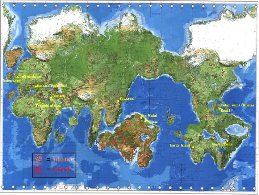
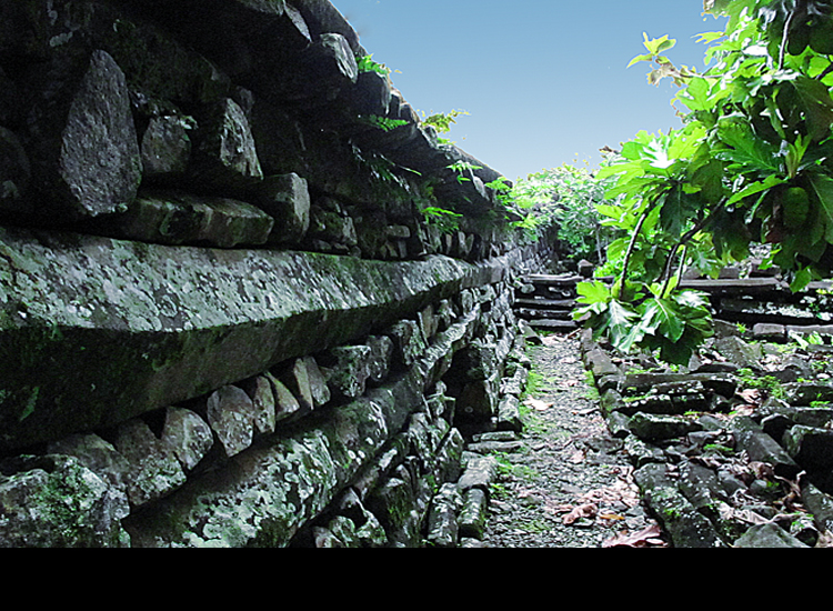
There are some pretty amazing stone remains on the islands of this area, like these here at Nan Madol, shown on the map above as part of a continent. Nan Madol consists of 100 stone and coral platforms built on top of artificial islands, involving 150 million tons of basalt of unknown origin. The structure in this photo is constructed of basalt columns:
As well as these ruins in the water near Yonaguni, now one of the Yaeyama Islands in the Okinawa Prefecture of Japan, is shown on the above map as part of a continent but are now underwater:


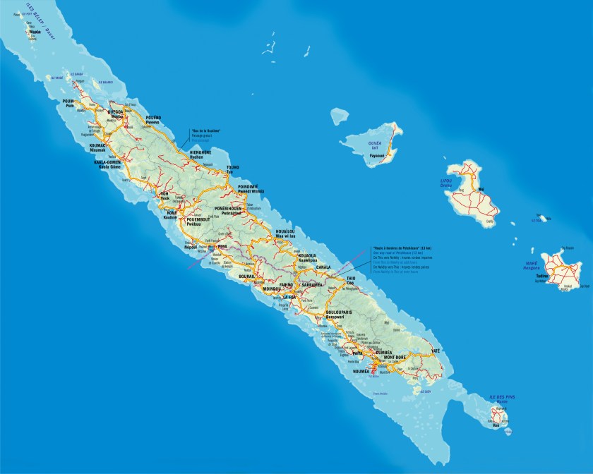
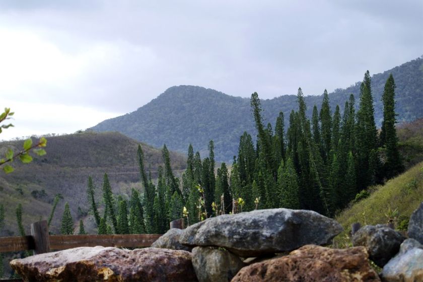
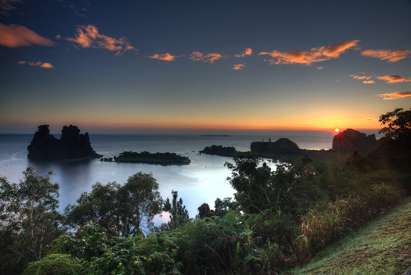
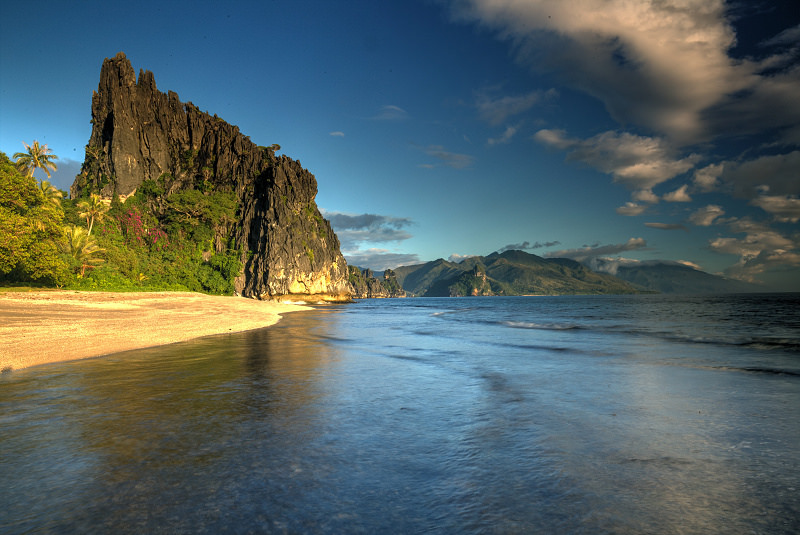
So. moving along the alignment of cities and places that I started following in Edmonton, Albert, the next island stop is New Caledonia.
This island grouping is called a Special Collectivity of France, and the President of France to this day is its Head-of-State. It includes the main island of Grande Terre, the Loyalty Islands, the Chesterfield Islands, the Belep Archipelago, and the Isle of Pines.
The alignment goes through the capital of Noumea, on the west side of the southern end of Grande Terre:
Also in Noumea, notice in the left-side picture, the nicely shaped protected harbor, and the massive stones on the pictures on the right-hand side.


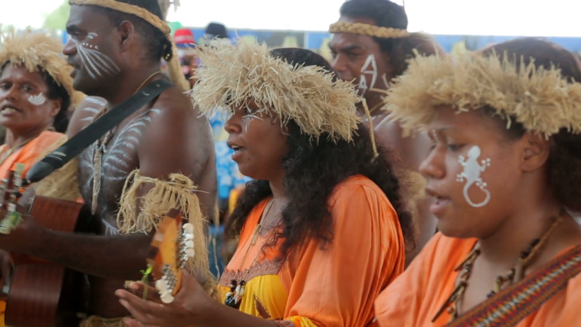
The Kanak people are the original people of New Caledonia, and they currently comprise less than half of the population.
So somewhere in our historical narrative, I believe the real story of the native people of all of these colonized lands/islands by European countries got altered somehow. I say that because how could these people, according to what we have been told, build these?
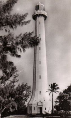
This is the Amedee Lighthouse in Noumea…
…A historic picture of the Bank of Indo-China in Noumea…
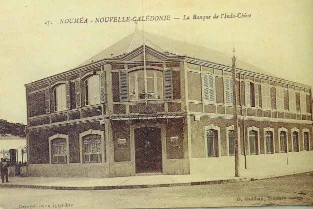
…which has the same street-corner lay-out as buildings literally all over the world, like the one on the left in Juarez, Mexico; the Ohio State Savings and Trust Bank in Toledo Ohio; and the one on the right in Kherson, Ukraine.


…and this is the Noumea Cathedral, said to have been built between 1887 and 1897, with all of its fancy stonework, and what looks to be older stonework on which the cathedral sits…
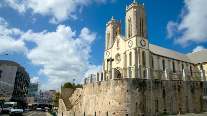
…and entrance-way with arches and columns.
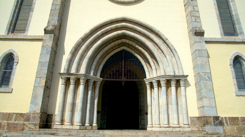
I am saying that I believe these buildings existed before the French colonization, and the existing history we have been taught about was grafted on to the ancient advanced worldwide civilization. I see the same design features everywhere, in places I would not expect to find them, spanning centuries, continents,and oceans. Supposedly during times when communication and mobility between countries weren’t supposed to be there. It doesn’t fit in the narrative we have been taught.
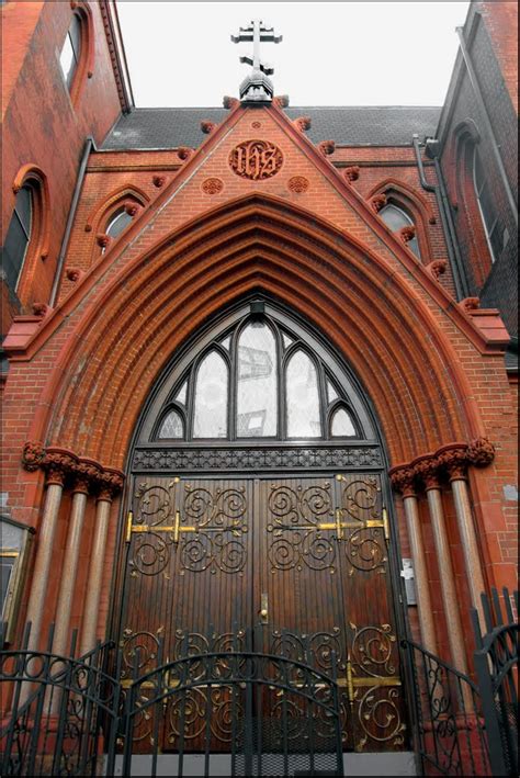
Just like these entrance-ways with similar arches and columns, at St. Nicholas of Myra Russian Orthodox Church in Manhattan, New York, said to have been built in 1883…
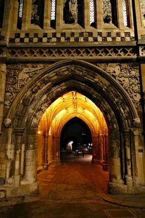
…Church of St. George in Norwich, England, said to have been built in the 1100s…
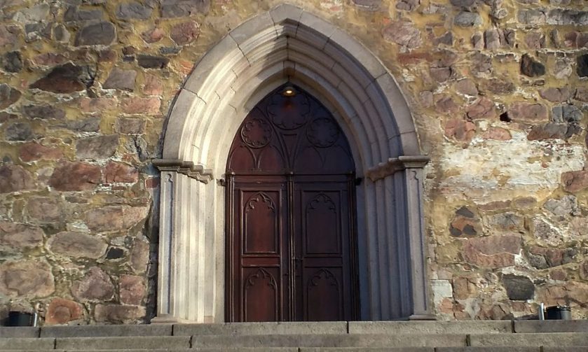
…Turku Cathedral in Turku, Finland, said to have been consecrated in 1300…
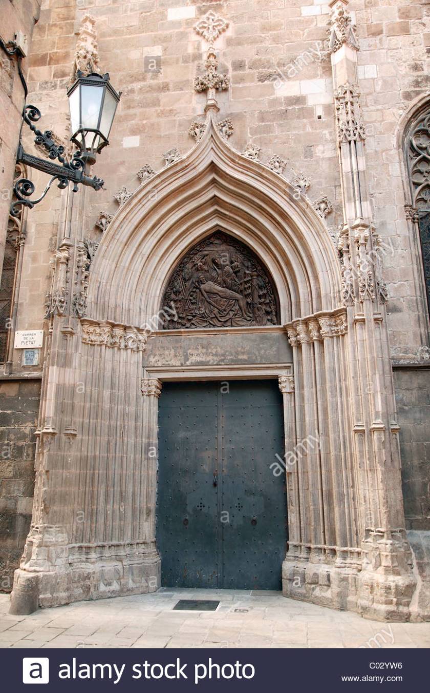
…and this cathedral in Barcelona, Spain, said to have been consecrated in 1339.
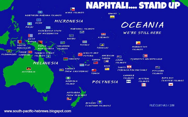
Also, this information is available if you look for it on the Internet- the inhabitants of this region, also known as Oceania, identify as the Hebrew Tribe of Naphtali.
Here are some other sights around the Grande Terre of New Caledonia:
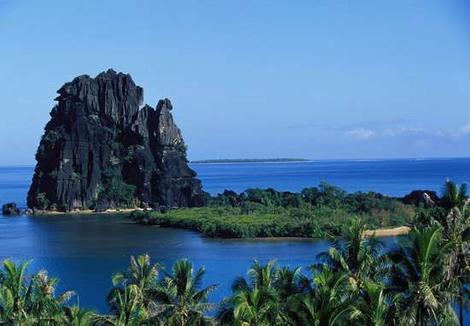
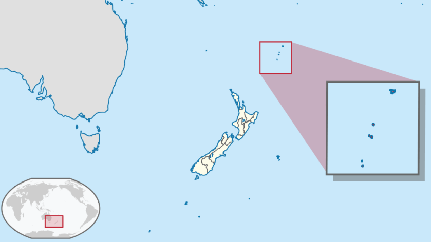
Moving on from here, the alignment goes on to cross the Kermadec Islands. These islands are considered part of New Zealand, and are 600 miles Northeast of there. They are a Nature and Marine Reserve, and the only human presence is a permanently manned station at Raoul Island. This area is notable for earthquake activity.
Photos of the Kermadec Islands include these of:
Raoul Island, where the permanently manned station is located…
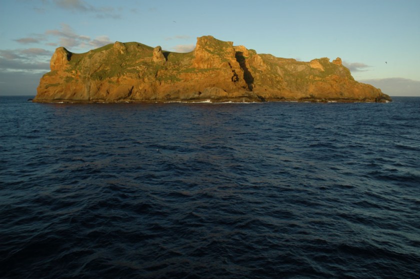
…Cheeseman Island, with nice big blocky rocks…
…Macauley Island, the second largest of the Kermadec Islands, and located halfway between Tonga and the North Island of New Zealand…
…and Curtis Island, on at least one other alignment, and the Kermadec Islands as a whole are on other planetary grid alignments as well.
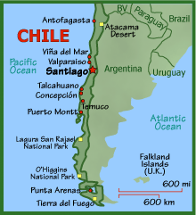
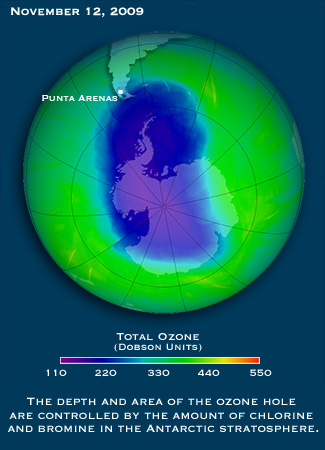
Next we come to Punta Arenas, Chile. It is the capital of Chile’s southernmost province – Magallanes and Antarctica Chilena. It is the largest city south of the 46th Parallel South. It is situated on the Magellan Strait, and is just north of Tierra del Fuego at the tip of South America.
The photos on the left and in the middle are buildings in Punta Arenas, and on the right is in the city of Kresy in Siberia.


And in this set is a comparison of a building in Punta Arenas, the Palacio Sara Braun on the left, and the Town Hall in Kherson, Ukraine on the right:


The first time I remember hearing the name Punta Arenas was when the news stories started coming out about the Ozone Hole over the South Pole, which started coming out in the 1980s, because Punta Arenas was the largest city affected by it.
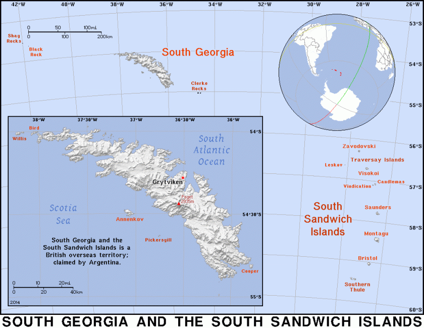
Next, the alignment goes through the South Sandwich Islands. This is interesting – Britain calls it a British Overseas Territory, and these islands are also claimed by Argentina. Not unlike the Falklands dispute (which are also on a gridline).
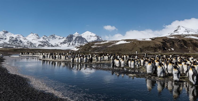
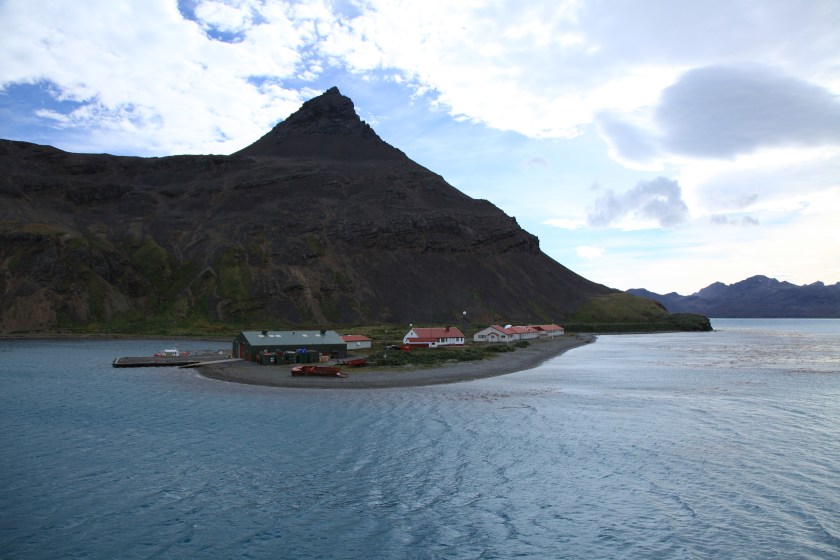
More images from the South Sandwich Islands:
Next we come to Cape Town, South Africa. Cape Town is on at least two global alignments that I have found.
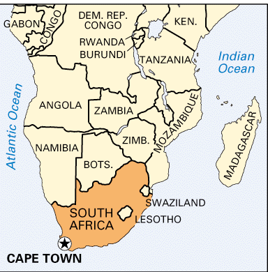
In the interest of organizing this information, I am going to focus on the most famous landscape feature of Cape Town, Table Mountain, as well as historic architecture and canals. While the history of this region is important, including what is happening today, I want to focus my attention primarily on worldwide similarities in infrastructure.
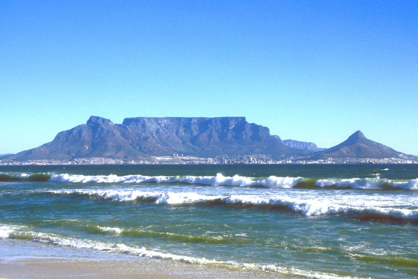
This is Table Mountain, a sandstone formation, and now part of Table Mountain National Park, with a pyramidal shape that is called Devil’s Peak on one side, and on the other a formation that has been dubbed Lion’s Head.
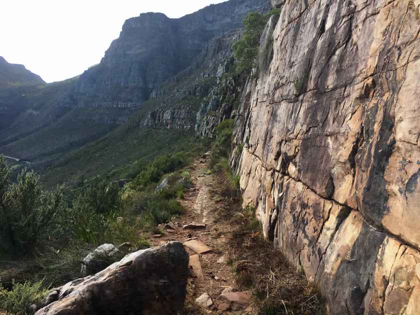
The easiest hiking route to get to the top of Table Mountain is through Platteklip Gorge…
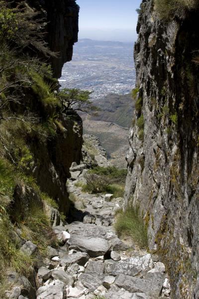
…where we find upon closer examination what looks like a relatively flat surface with straight lines indicative of cut blocks of stone. We just haven’t been taught that is what it is, so that is not how we see it.
Moving on to more modern infrastructure, here is a comparison of the National Library in Cape Town on the left, and the National Archives in Washington, D. C. on the right:


Who is coordinating the architectural styles of all of these places, I wonder? Here are some more examples.
On the left is a building with fancy wrought iron work on Long Street in Cape Town, and on the right is a similar building in the French Quarter in New Orleans, Louisiana.

south africa cape town, Long street, colonial architecture, backpacker,

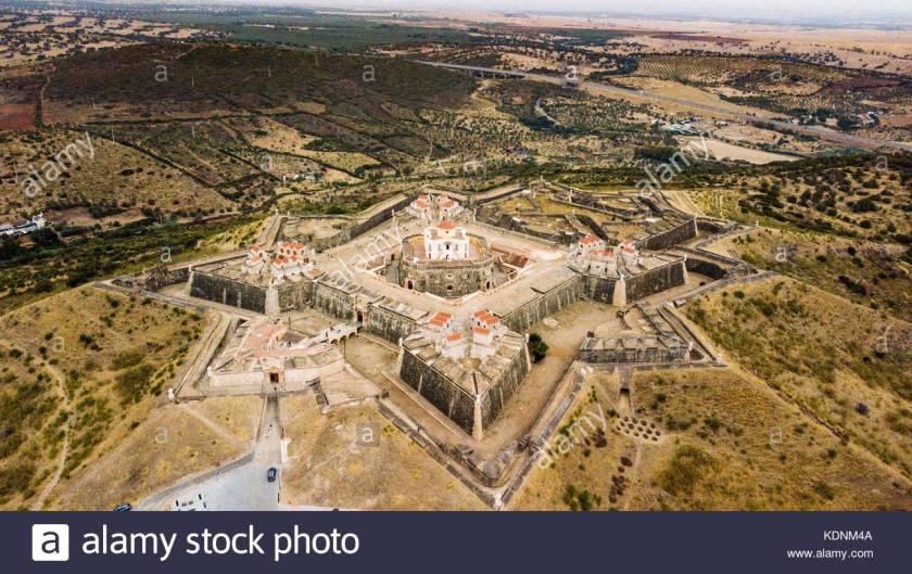
Here is a Star Fort in Cape Town…
…compared with one in Portugal…
…Fort Ticonderoga in northern New York State…

…and this star fort is in Hakodate, on the island of Hokkaido, in Japan.
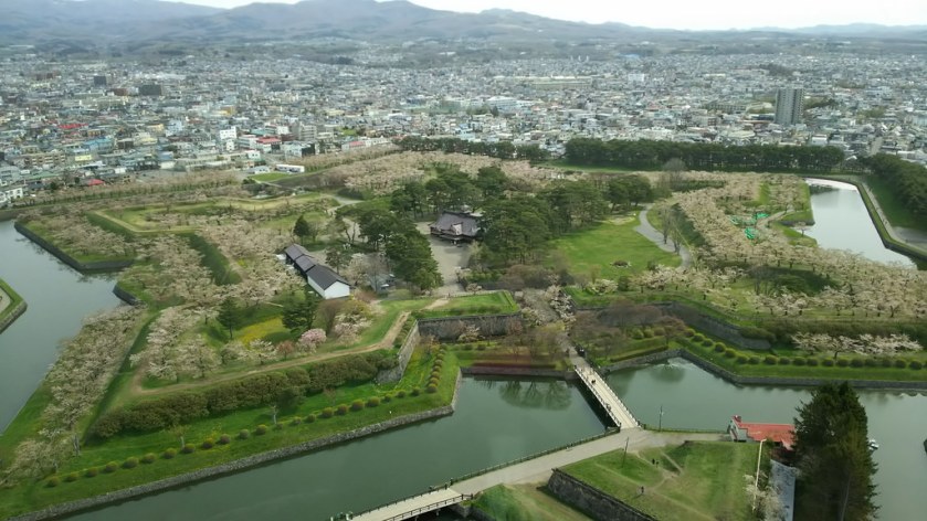
Star Forts are found all over the world, with the same basic star pattern, but differing somewhat in design complexity. In many cases, like with the example of Fort Ticonderoga, they have put to military use. There has been considerable research showing that this was not the original use of these beautiful structures, like perhaps as a component of some kind of energy system.
And like with so many things, up until recently, they have been ignored by conventional history. Again, because their existence doesn’t fit with the historical narrative we have been given. This is Fort Bourtange in The Netherlands.
One last comparison. There are sophisticated canal systems around the world in places you would not expect to find them. Here is a canal in Cape Town on the left, compared with one in St. Petersburg, Russia, in the middle; and the Ankhor Canal in Tashkent, Uzbekhistan on the right.


So I am going to go end the series on this particular alignment here. It goes on to reconnect with Edmonton on its way through Africa, India, Tibet, China, Mongolia,Russia, Siberia, Alaska, the Yukon Territory, and British Columbia.
In the next series, I will continue showing you how “History Reads Like a Book on the Planetary Grids” on a different alignment.
Natural Features…or Intelligently Designed Ancient Infrastructure? – With Video of Post at the End
History Reads Like a Book on the Planetary Grid, Part 4 Sumba Island to Cairns, Australia – With Video of Post at the End
The next island the alignment touches is Sumba in the East Tenggara Nusa Islands, the southernmost province of Indonesia, and the eastern part of the Lesser Sunda Islands.
Sumba Island has a population of over 750,000 people. The Portuguese were the first Europeans to arrive in 1522; then became part of the Dutch East Indies in 1866; and the Jesuits established a mission on Sumba also in 1866.


Sumba was known for its Sandalwood exports, and is still known for being one of the places in the world where megalithic burials still take place.
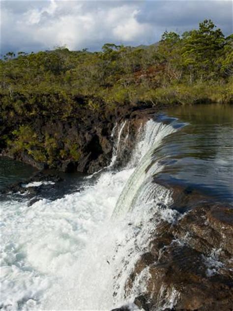
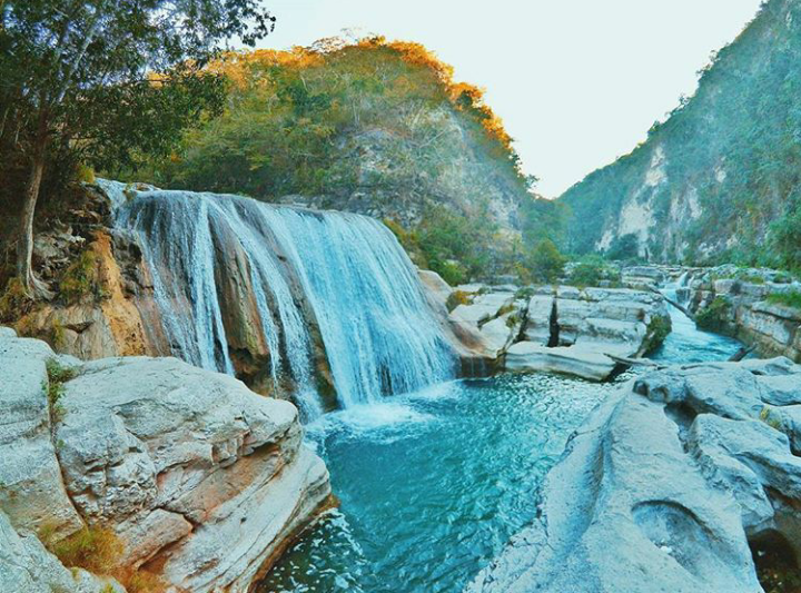
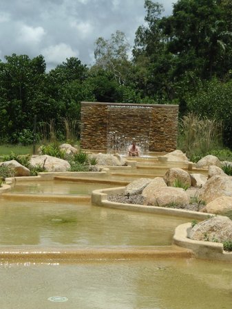
This is Tanggedu Waterfall on Sumba Island. Based on my work and research, I firmly believe waterfalls were constructed by the ancient Advanced Civilization and are part of the planetary grid system, as power generators, and/or representation of Universal Energy flows. I will show you more examples as we go along this alignment.
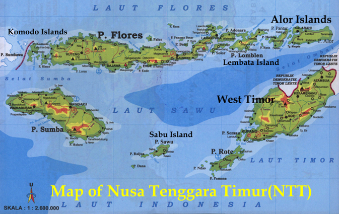
East Nusa Tenggara Province consists of more than 500 islands, with the largest being West Timor.


Kupang in West Timor is the provincial capital of the East Nusa Tenggara Islands.
The Portuguese claimed the whole island of Timor in 1520. Then in 1640, the Dutch East India Company came in and settled West Timor, and then later the Dutch government took over rule.
The Portuguese ended up in East Timor, also known as Timor-Leste, including a small enclave in West Timor called Oecussi-Ambeno, which were two original kingdoms of Timor. More on East Timor shortly.
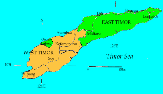
In 1945, after the end of World War II, West Timor became part of Indonesia when its Independence from Dutch rule was proclaimed.
For about 1,400 years, from the 100s AD to 1500, Indonesia was comprised of Hindu and Buddhist Kingdoms. The rise of Muslim States started in the 1200s.
East Nusa Tenggara, however, is the only province in Indonesia that is predominantly Roman Catholic with its early colonization by the Portuguese.
This province includes Komodo Island in the Lesser Sunda Islands, which is a national park, and home of the largest lizard on earth, the Komodo dragon.


Flores Island is also in this province. Flores is the tenth largest island of Indonesia. Flores Island is also known for the discovery of dwarf human skeletons in a cave – homo floresiensis. It is also known for the discovery of large skeletons like giant rats, and is also another home for Komodo dragons.
Just off the coast of West Timor are the islands of Roti and Semau.
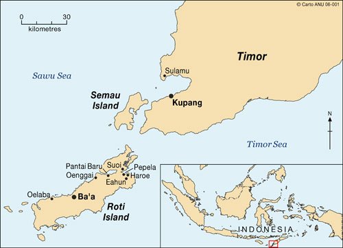
There is a ferry between Kupang and Roti every day. There are seven languages spoken on the island, and it has living ancient arts and traditions. Also, archeological artifacts from here include Chinese porcelain.


Semau lies 3 kilometers from West Timor, near Kupang. The inhabitants of the island of Semau are the Helong people, considered to be the original inhabitants of the Kupang area. The Helong language has two dialects.


These are two Helong weavers with examples of the textiles produced in West Timor and Semau.


I bring all of this up about East Nusa Tenggara Province for several reasons.
One, Kupang, West Timor is on at least two planetary alignments that I know of.
Another is that there are little islands around the world on all the alignments I have found, that are very much a part of the planetary grid system.
Also, there has been quite a bit of interest in this region historically by European countries looking to expand their colonial empires, and the Roman Catholic Church. These are engines by which the Ancient Advanced Civilization was taken down, and its land and people claimed.
One more thing I want to touch on before following the alignment to Australia is the subject of East Timor. East Timor, also known as Timor-Leste, since 2002 has been considered an independent country in Maritime Southeast Asia. It is also predominantly Roman Catholic.
Portuguese colonization began in 1769. Their influence was interrupted during World War II, when Japan occupied East Timor. After the war, Portuguese control was reinstated.
Then in 1974, Portugal abandoned its colony because of unrest at home, and the vacuum was filled for a brief time by the Revolutionary Front for an Independent East Timor. This was countered by an invasion from Indonesia, with Australian, British, and American support, in December of 1975, due to fears of a communist state in Indonesia.
What followed was a brutal and violent occupation of East Timor by Indonesia. Between 1974 and 1999, approximately 102,000 conflict-related deaths were reported, and there were over 200,000 refugees.
Ultimately, on May 20, 2002, a new constitution for the Democratic Republic of East Timor came into force, and a parliamentary government with a Prime Minister, and President as Head of State, came into being.
Again, more examples of my underlying premise, which is that history reads like a book on the planetary gridlines.
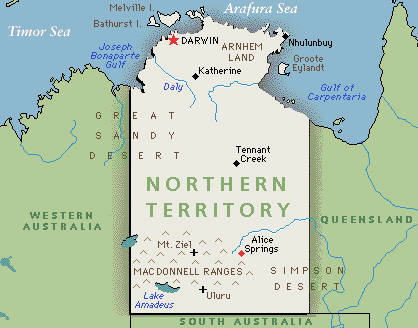
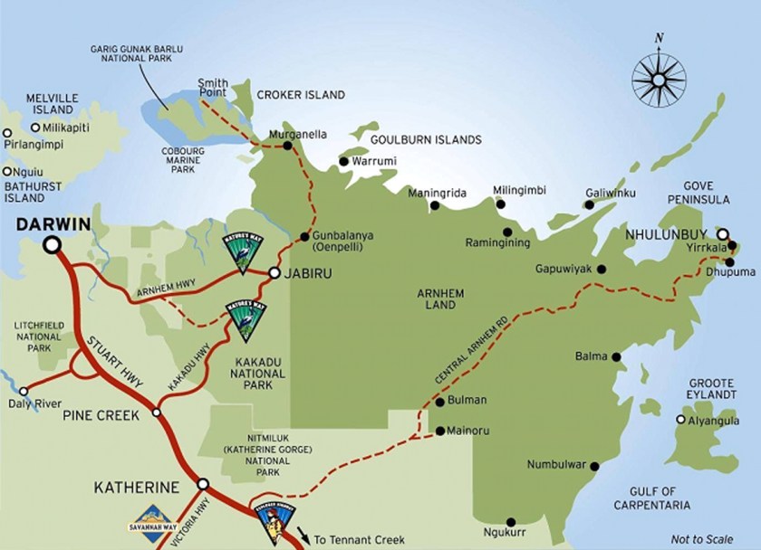
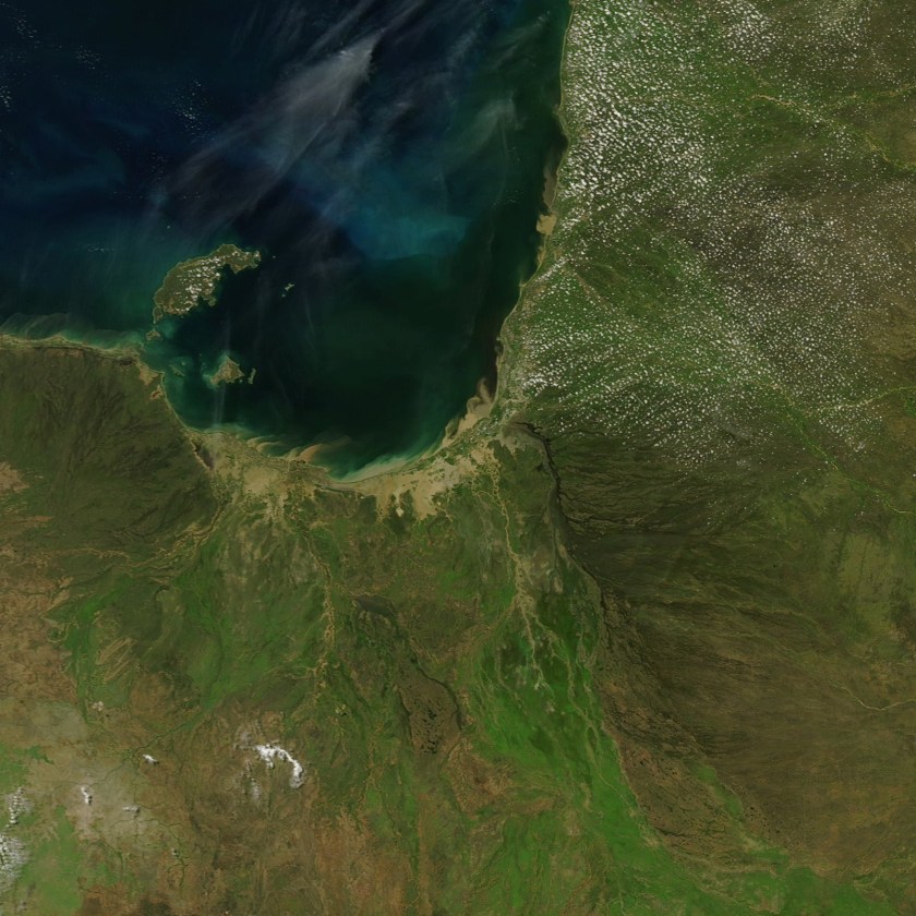
From here the alignment passes between the Timor Sea and the Arafura Sea, to hit land again at Darwin, Australia, which is the capital and largest city of the Northern Territory of Australia, which is sparsely populated. It is also called the Outback Capital of the Northern Territory
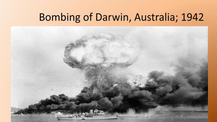
Notably, Darwin was the location of the first bombing in Australia, which occurred in February of 1942, after Australia had officially declared war on Japan on December 9, 1942. Japanese forces bombed military bases in Darwin in one day. One of the first hits, and explosions, was a ship loaded with TNT and ammunition.
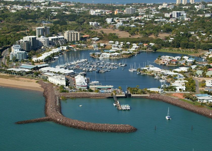
Here is a picture of Darwin today. Of particular note is the shaped harbor in the foreground, which is a signature of places along these planetary alignments.
Leaving Darwin, and just on the outskirts, we find Howard Springs Nature Park.
I see exactly the same kind of thing everywhere. We are taught that there was nothing special going on in these places, nothing to see, so we fail to recognize the ancient megalithic masonry laying all around us.
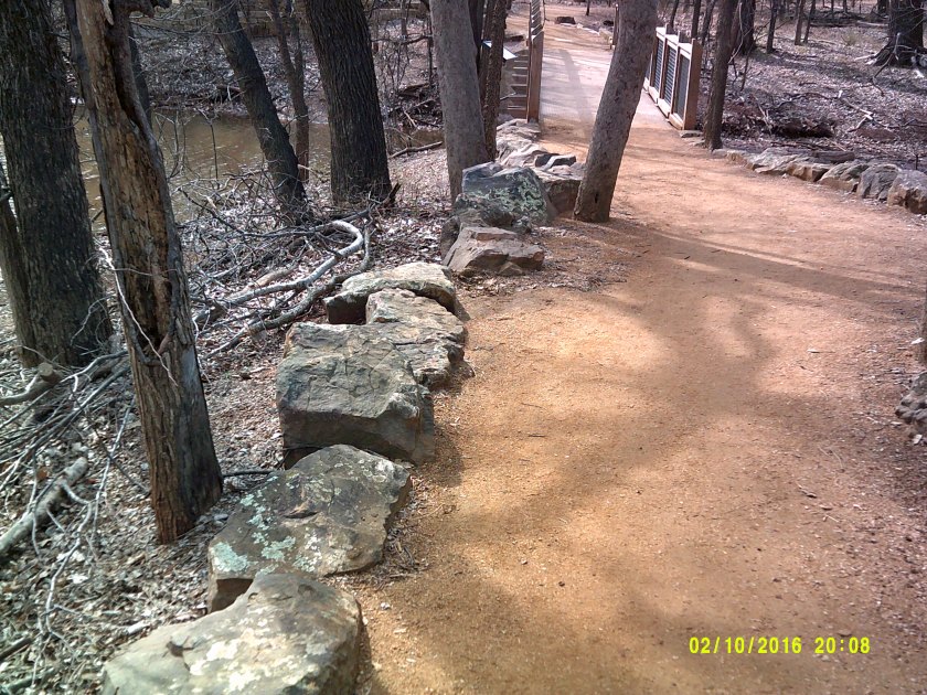
These are cut and shaped stones. These are not natural occurrences, contrary to what we have taught to believe by historical omission. These in Australia…
…are like these two photos at Martin Nature Park in North Oklahoma City. Lying around everywhere with no special attention drawn to them – just there. Taunting us but not telling us.
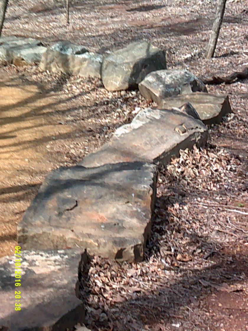
And only when you start realizing they are there. Because until you notice them, they just blend in to the landscape.
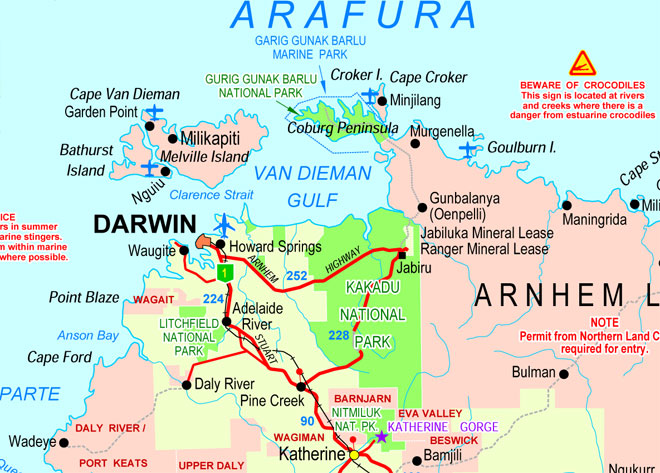
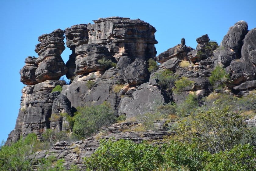
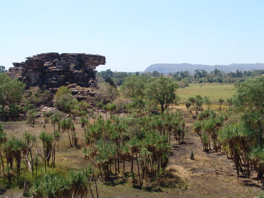
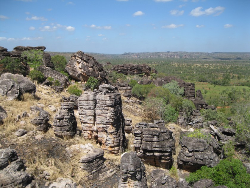
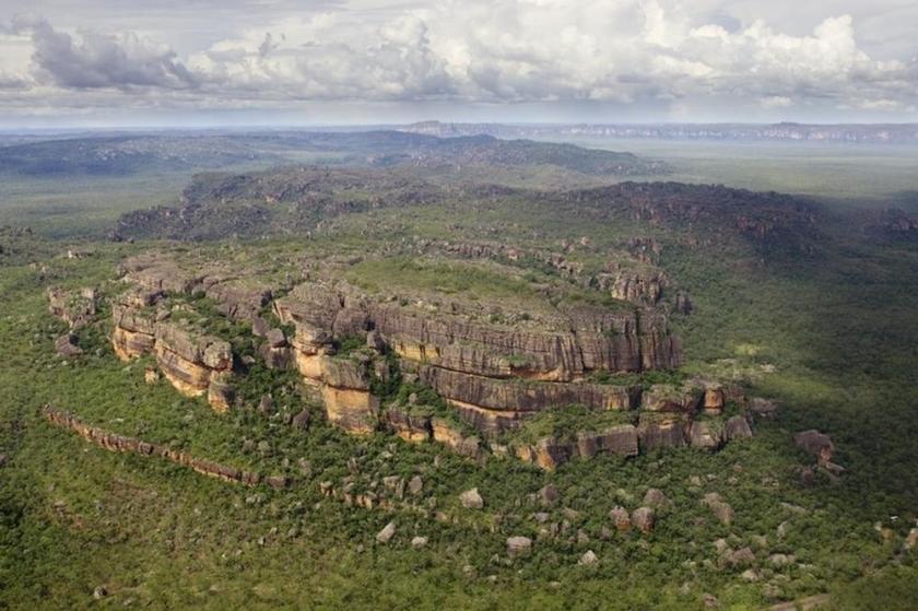
The alignment goes through Kakadu National Park, and then through Arnhem Land.
First Kakadu National Park, which is a UNESCO World Heritage Site. Kakadu covers an area that is 7,646 square miles (or 19,804 kilometers). Besides its incredible biodiversity, land-forms, and river systems, one of the most productive uranium mines in the world is surrounded by the park, shown in the map as the Ranger Mineral Lease.
Aboriginal people have occupied this land continuously for 40,000 years, and approximately half of the land of Kakadu is aboriginal.
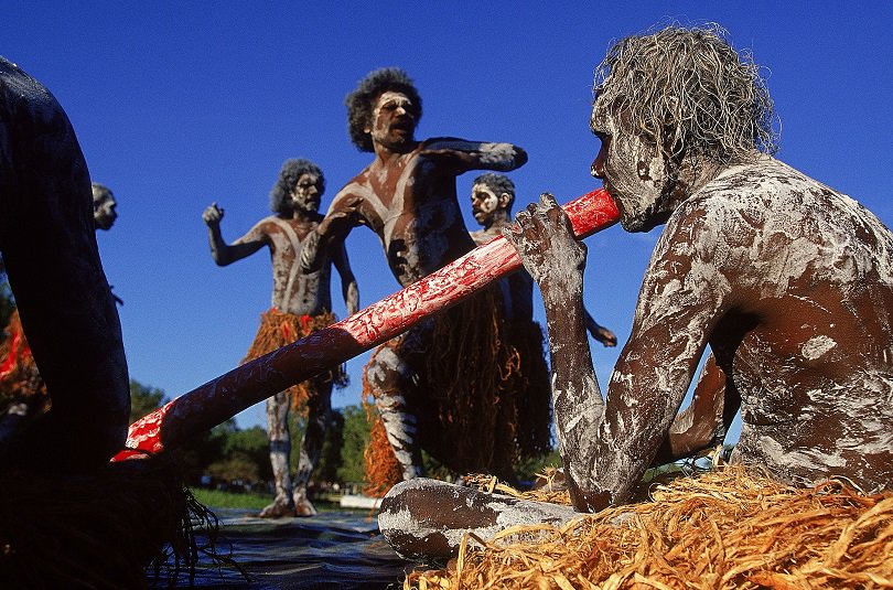
And this is as good as any place to leave this photo here for your consideration. I personally think there is something to it, that the Australian Aborigines are of the Tribe of Reuben. I have expressed my thoughts about this subject in the “The So-Called Lost Tribes of Israel” blog post. This kind of information is well-hidden, so some digging is required to find it. But it is out there on the internet if you start looking for it.

Anyway, back to Kakadu National Park. Here are some landscape pictures of it.


Kakadu National Park is part of Arnhem Land, one of the five regions of the Northern Territory, and which the alignment crosses over. While the land is named for the ship of the Dutch East India Company Captain who sailed it into the Gulf of Carpenteria, which I will be covering soon, the population of this region is actually mostly aboriginal, estimated to be around 16,000.
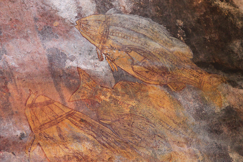
The following photos are of Arnhem Land. I have no difficulty seeing all of this as ancient infrastructure. I had a perceptual shift when I realized there is a code of key words that covers up the ancient civilization. But for most, since we haven’t been taught about this ancient civilization, and have only been taught to believe that it is the result of natural processes, that is how it is perceived.
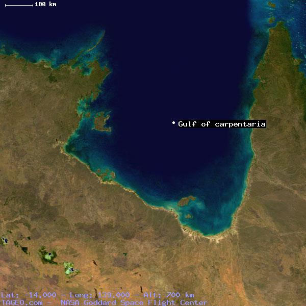
The Alignment crosses the Gulf of Carpenteria in Queensland, Australia. The Gulf of Carpenteria is described as a shallow sea enclosed on three sides, and bounded on the north by the Arafura Sea (which lies between Australia and New Guinea) –
Here is an aerial view of the Gulf of Carpenteria:
The alignment passes through some islands in the Gulf – through Pellew Islands and the Wellesley Islands.
The Pellew Islands are in the southwest corner of the Gulf of Carpentaria.
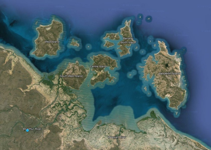
They are a group of five islands with a total area of 2,100 square kilometers, named in 1802 by Matthew Flinders in honor of a fellow naval officer.
The Wellesley Islands are here, also named by Matthew Flinders, this time for the 1st Marquess of Wellesley:
The largest island in the group is Mornington Island.
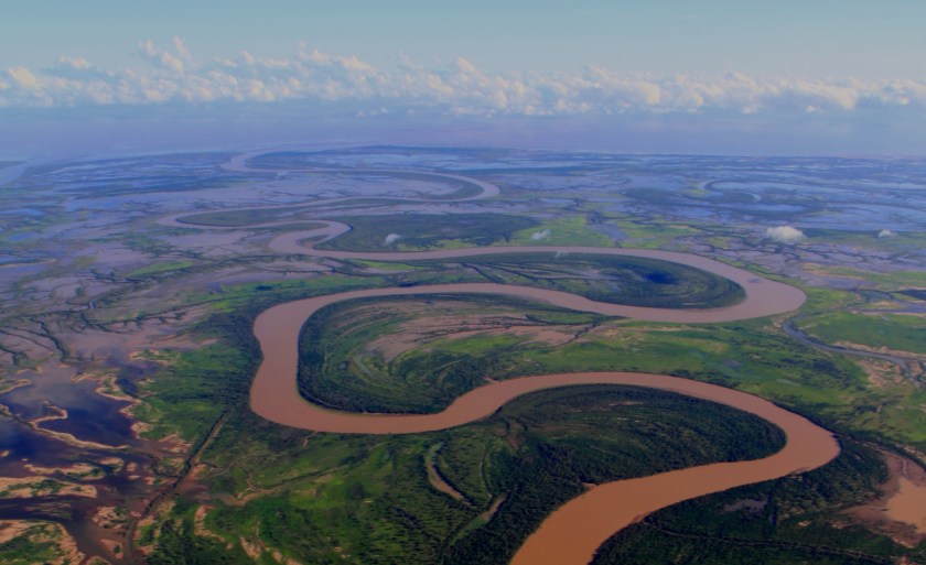
On its way to Cairns, the alignment crosses along the way from Karumba to Normanton, and I will have a future blog post document world-wide S-Shaped riverbends that look like what is pictured here, because they are all over the world. Looking just like this.
The city of Cairns, Australia is next on the alignment.
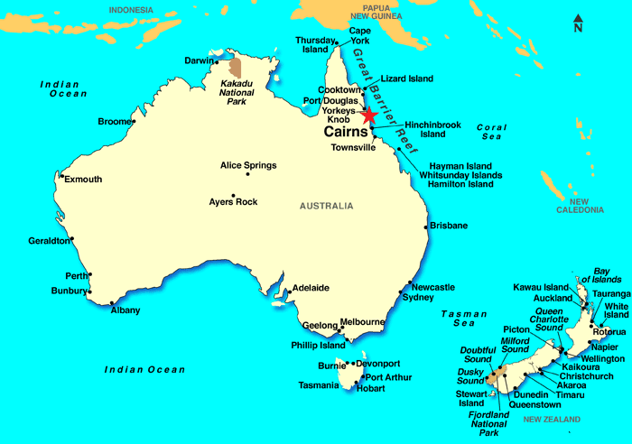
Cairns is the 5th largest city in Queensland, and the 14th largest city in Australia. It is said to have formed…


…to serve miners going to the Hodgkinson River goldfield.


I will end this post here, to pick it up leaving Australia and crossing the Great Barrier Reef on its way around the world.
