
I will be sharing photographs, videos and other information viewers have gathered along the way and sent to me in their explorations and research of places close to where they live, in this sixth volume of what will be a long new series in which I am highlighting places, concepts, and historical events that people have suggested, and is a compilation of work I have previously done presented in a multi-volume format.
MF in Missouri sent me this nugget of information about Victorian homes on the real estate market, and said the following:
“Years of shopping for Victorian real estate sealed the deal for me regarding a previous civilization. Here is just one example.”
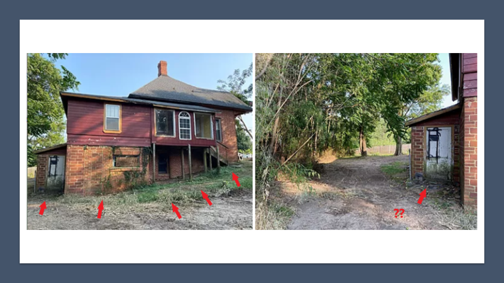
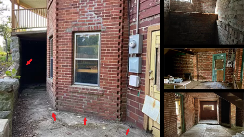
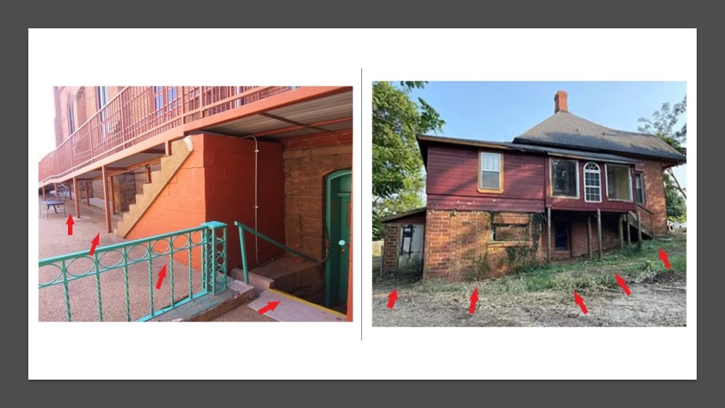
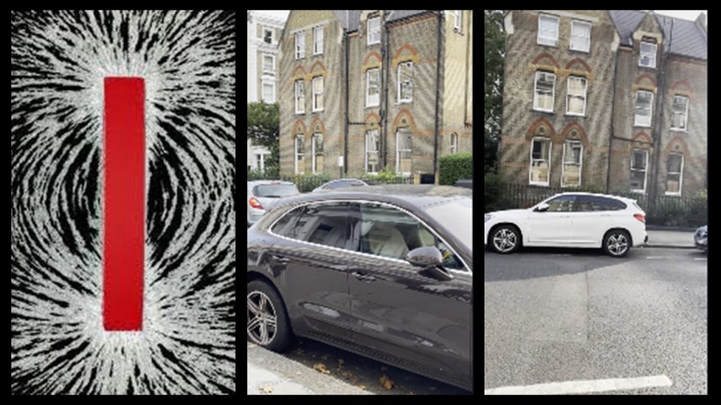
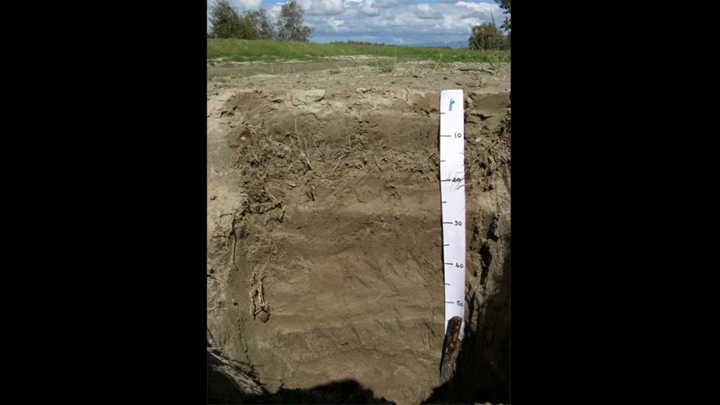
I myself can’t help but notice the mud-flood-type slant that is going on in these photos of different views around this Victorian home in Arkansas.
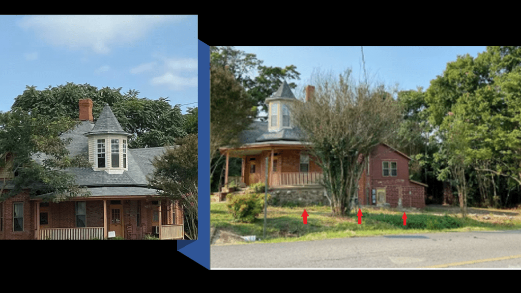
She also said to “Note the basement.”
Also, the red arrows on the right are pointing toward the downward slant of the brick wall of the house where it meets the slanted walkway, as well as the irregular brick-work shown here; and the red arrow on the left points to what looks like an older stone wall that is part of the house’s construction too.
…that “Often the remaining Victorian houses have 3, 6 or 9 gematria addresses…”

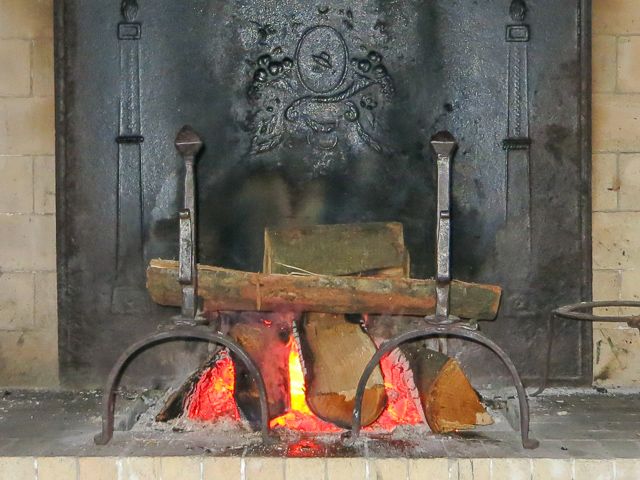
…and that “Many have the shallow ‘fireplace dog ‘ fireplaces.”
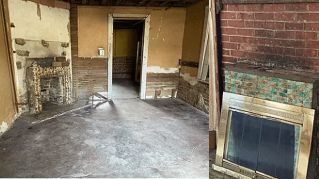
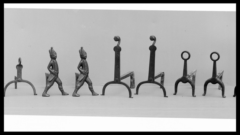
It is interesting to note that “fireplace dog” is another word for “andiron,” which is defined as one of a pair of bracket supports on which logs are laid for burning in an open fireplace, allowing air to circulate under the firewood for better burning and less smoke.”
So here are some examples of andirons out there, starting with “American Iron Firedogs” dated from between 1770 and 1800, and look to be of a more utilitarian design for fireplace use…
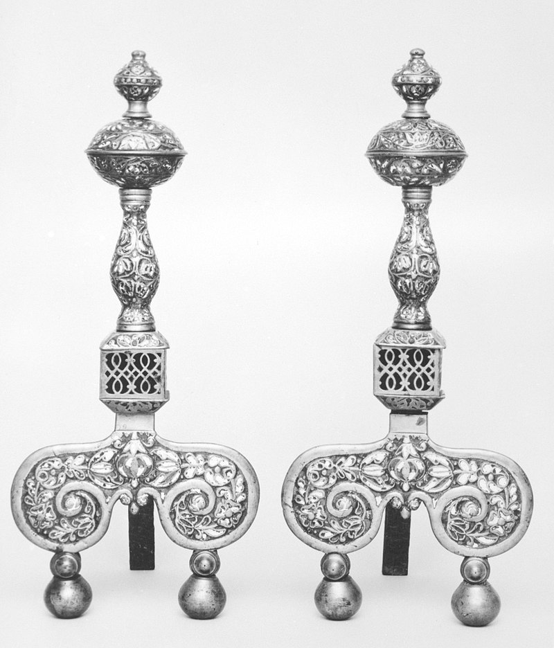
…but there are more elaborate and beautiful andirons, like these English brass and enamel andirons circa 1680…
…and this set of andirons, shown with logs, in a main dining room at the palace of Versailles outside of Paris, France.
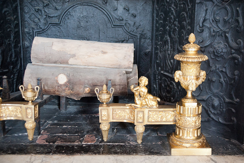
Quite ornate to be designed specifically to hold logs burning in a fireplace!
Next, PH recently visited Keowee-Toxaway State Park in South Carolina and sent me video footage and photos he took during his visit.
Keowee-Toxaway State Park on Lake Keowee was created from lands previously owned by Duke Power, and all part of the historical lands of the Cherokee, which is today in the northwest corner of South Carolina near the state’s border with northeast Georgia and southwest North Carolina.
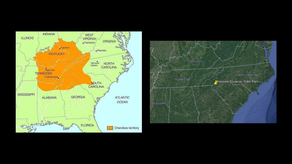
Lake Keowee is a man-made reservoir formed in 1971, that we are told was constructed for the needs of Duke Energy, which it uses for things like cooling three nuclear reactors at the Oconee Nuclear Generating Station, and for public recreational purposes.
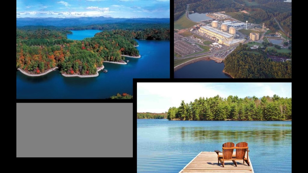
The historic Cherokee Keowee Town had been located on the bank of the Keowee River and was part of what was known as the Lower Town Regions, all of which were inundated by the formation of Lake Keowee, its artifacts and history lost.
Were they hiding evidence of something they didn’t want us to know about in the process of creating these man-made lakes?

PH sent me these photos he took himself at the park, like this one atthe top of the land bridge at the park, what is referred to as the “Natural Bridge…”
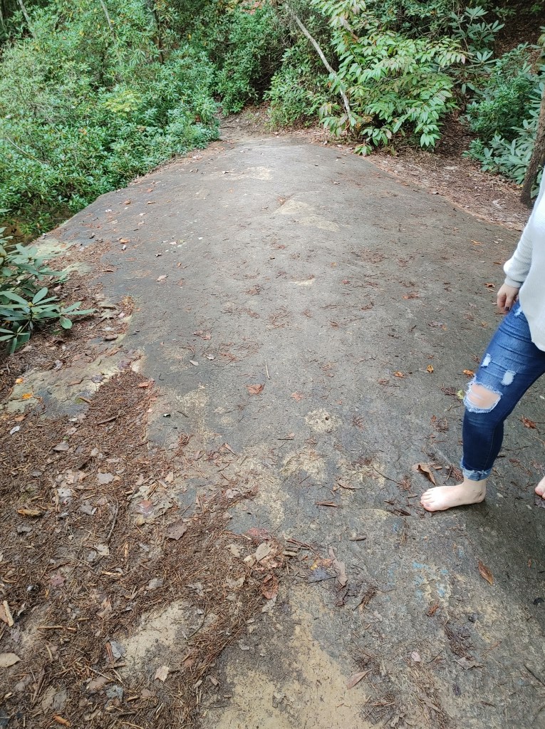
…where he also said there was a nearby golf course, and it was striking to him how close the bridge was located to Route 11.
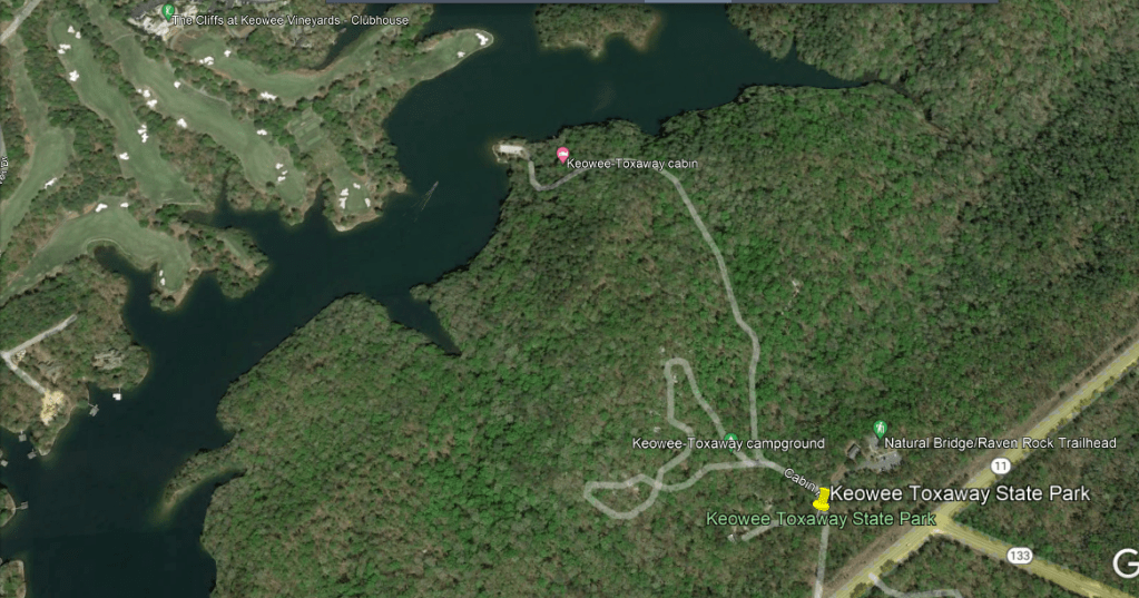
He also took photos he took of the area surrounding the bridge.
Who were the Cherokee, really?
Were they the hunter-gatherers we have been taught to believe in the historical narrative we have been given?

Or were they, and the other indigenous peoples in the Americas and around the world, actually the builders of what we know as civilization, dating back to ancient Mu, or LeMuria, to relatively modern times, and the European colonizers actually stole their legacy, subsequently claimed it for themselves, and then proceeded to banish the Master Builders of this ancient, advanced Mu’urish civilization to primitive status in the minds of the Collective Human Consciousness for eternity?

This is something for us to seriously consider moving forward in our understanding of what has taken place here and to not blindly accept everything we have been told.
I personally don’t think there was a mysterious “other” civilization, or aliens, that built everything, though if the History Channelprogram “Ancient Aliens,” which I appreciate gets these subjects out to the light-of-day on mainstream television, had been called “Ancient Humans,” it probably would not have lasted one season, much less 17 seasons…

…and how about we don’t have to look any further than the people who were already here to find the builders of it.
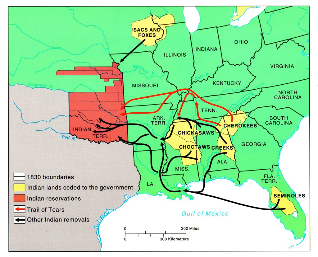
The Cherokee were even considered one of the “Five Civilized Tribes” by the European Colonizers, along with the Chicksaw, Chocktaw Creek and Seminole…
…who proceeded to have the majority of them removed from the land after signing treaties with the U. S. Government which had them cede their traditional land, after President Andrew Jackson signed the Indian Removal Act in 1830, leading to the infamous Cherokee Trail of Tears and those of the other affected tribes.
I was searching for images of “Cherokee,” and saw this image of a tapestry blanket for the city of Murphy, North Carolina, which is the seat of Cherokee County, which is described as long having been part of Cherokee homelands.
The Cherokee County Courthouse depicted in the center of the tapestry…
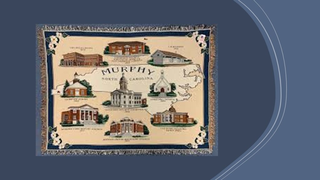
…was said to have been built in 1926 in the Classical Revival-style of architecture.
I wonder why they took down the topmost section of the courthouse’s cupola, which was seen in an earlier photo of it, but not one that was taken more recently.
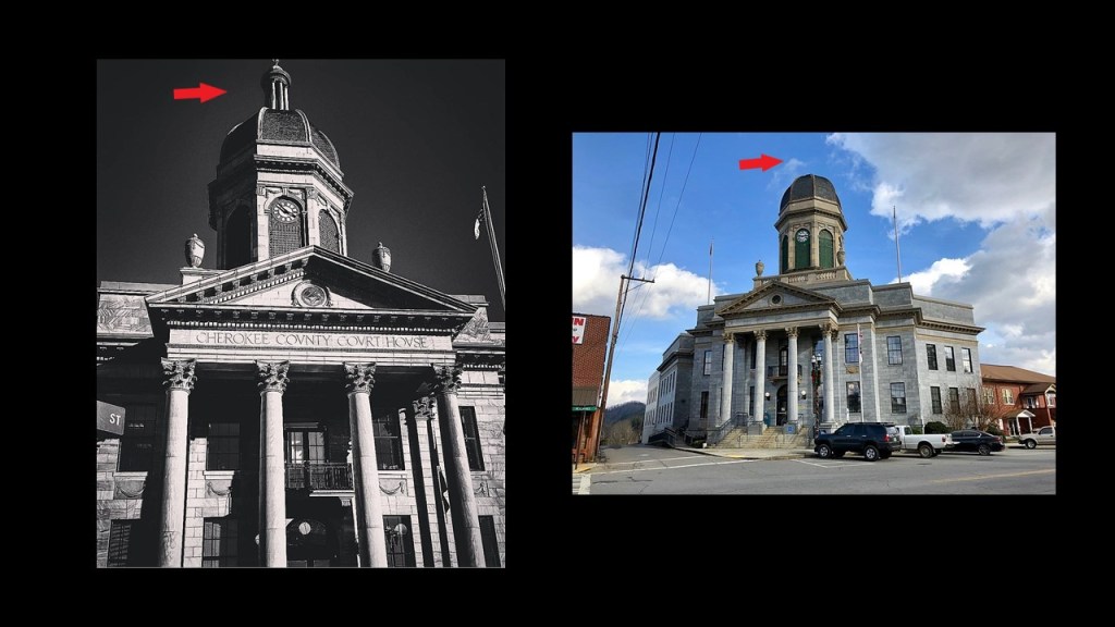
I know there are many more examples of missing building parts like this, but here’s another example for the purposes of comparison of the same thing.
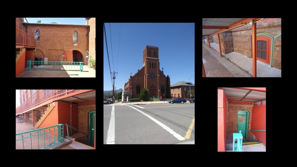
Today this building is the home of the the “Prescott Center for the Performing Arts” in Prescott, Arizona.
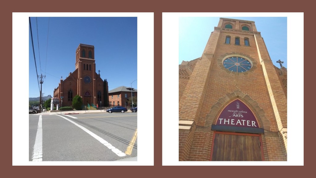
Once upon a time, we are told in our historical narrative, this building was the “Sacred Heart Catholic Church and Rectory,” built here starting in 1891, and the first services held on February 17th of 1895.
According to this plaque at the front of the building, the church had a steeple that was 115-feet, or 35-meters, tall, but that it was removed in 1930, after being struck by lightening several times.
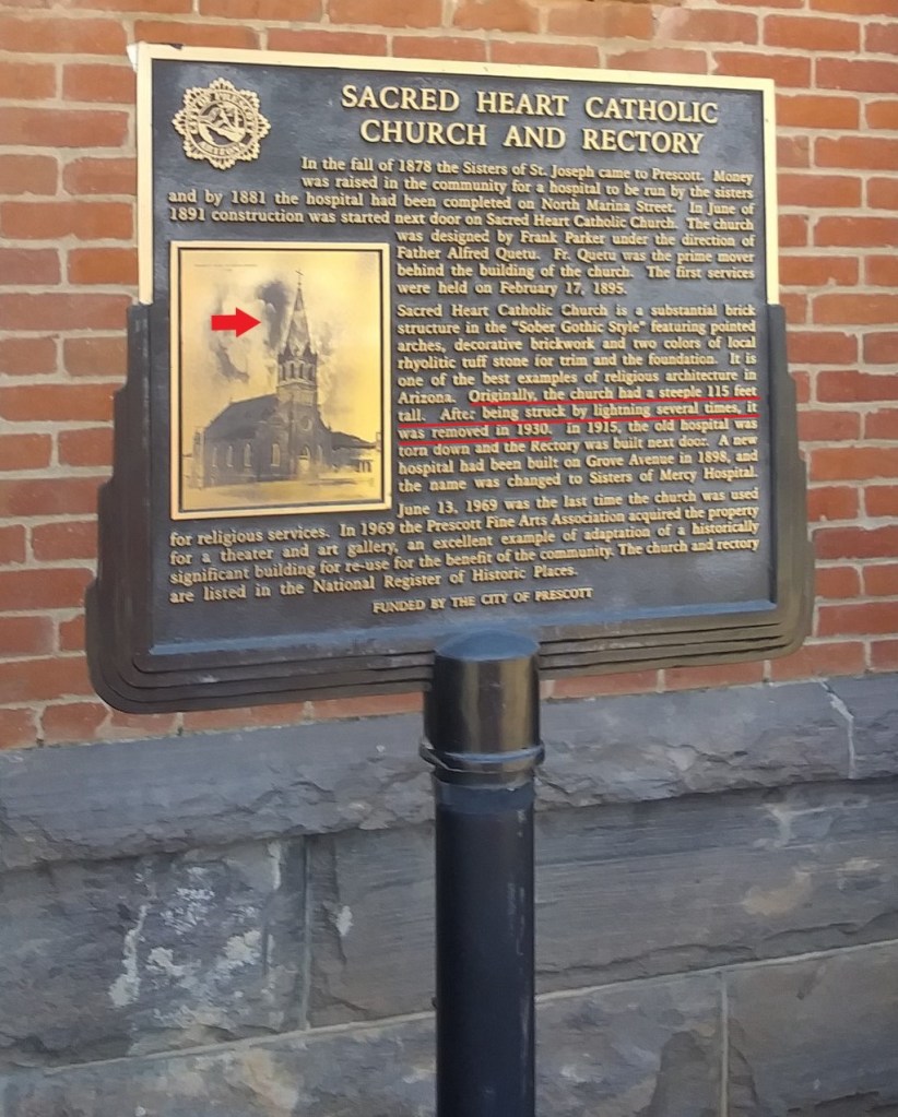
Also notice the older, larger stone-work in contrast with the brick-work., like we saw back at the Victorian home in Arkansas at the beginning of this post.
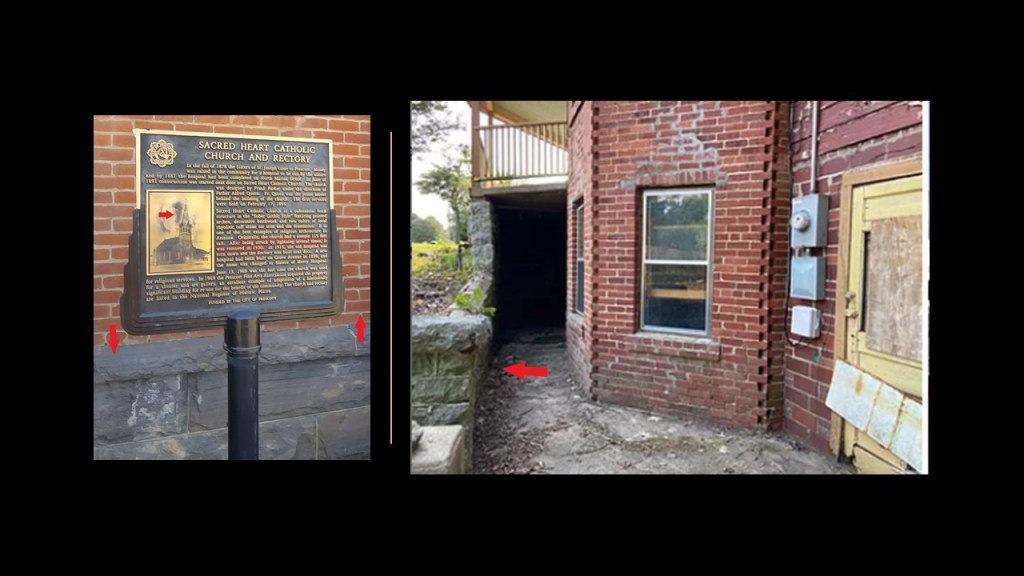
Also interesting to note that, like the Victorian home example in Arkansas, there is a mud-flood-type slant going on around this building in Prescott…
…as well as building features below the ground-level of the building, but not necessarily the street-level.
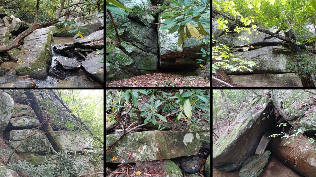
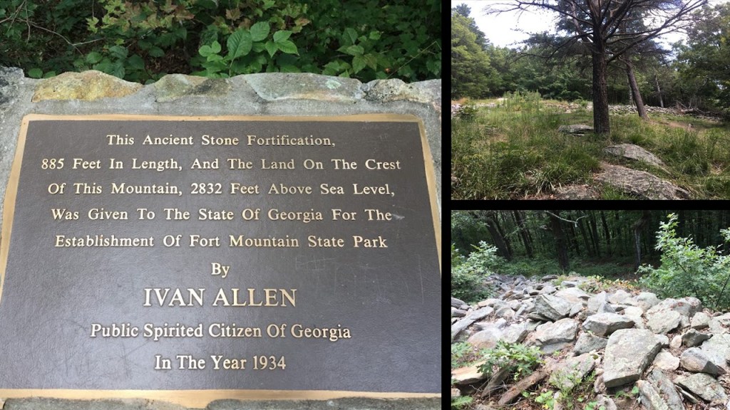
Still in historical Cherokee territory, EJ took a road trip with two of her friends to see if they could find an actual “fort” at Fort Mountain State Park in Georgia, and she sent me photos from their trip to the Fort Mountain State Park outside of Chatsworth, Georgia…
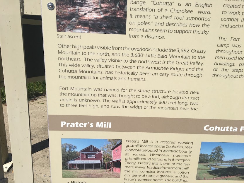
…which happens to be only 103-miles, or 166-kilometers, from Keowee-Toxaway State Park in South Carolina.
She said there were lots of large boulders strewn about, and that it kind of looked like most of them had just been bulldozed into a pile ( just her impression).
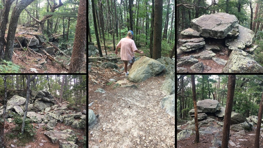
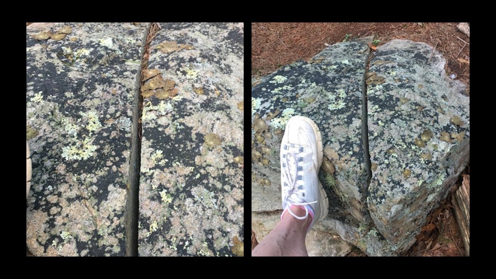
She found one that had a straight cut through it that didn’t look natural, with her foot on it in the picture on the right for size comparison.
She said the 885-foot, or 270-meter, zig zagging stone wall, looked more to her like loose rocks dumped there than a wall.
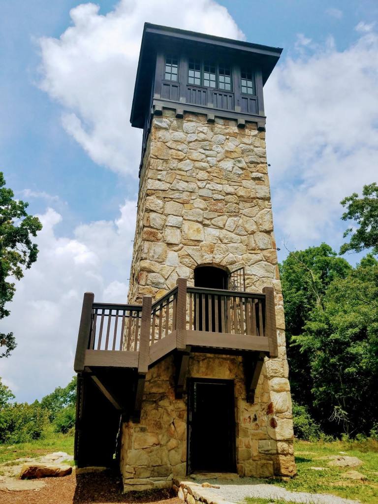
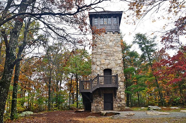
EJ also sent me photos of the stone fire watch tower there, which was said to have been built in the 1930s during the Great Depression by the Civilian Conservation Corps.
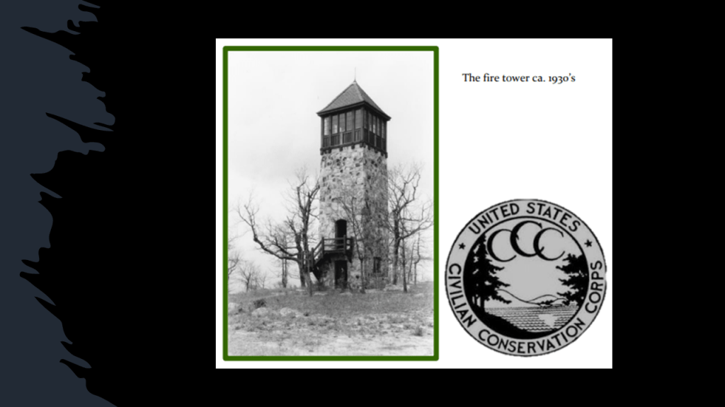
There was a fire at the stone fire watch tower in 1971, which destroyed the cupola at the top…
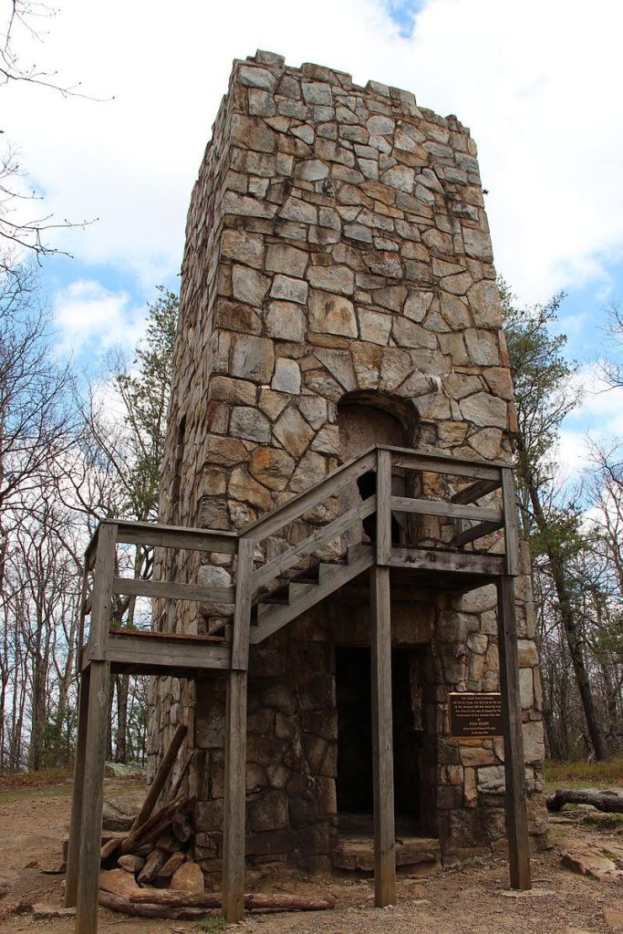
…but there was a major restoration project between 2014 and 2015 that restored the stone fire watch tower on Fort Mountain to its original appearance.
EJ observed while she was there that the stone tower really isn’t tall enough to be an effective fire tower considering the trees are taller then the tower.
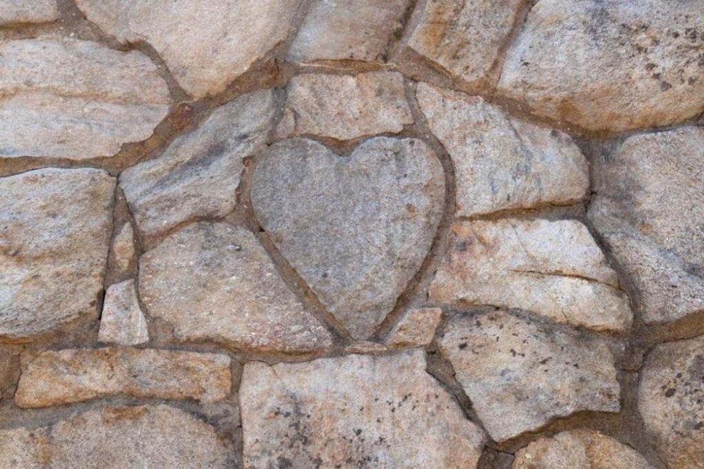
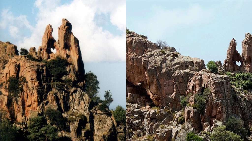
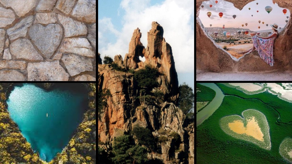
This stone fire watch tower is known for the heart-shaped rock found on one side of it.
The story goes that a young stone mason in the CCC, Arthur Bailey, led the team while missing his sweetheart back home, and to show his love for her, he carved a heart-shaped stone for the tower.
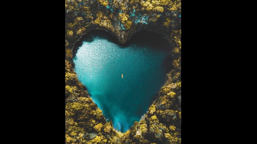
Seeing this stone in the tower got me thinking about other heart shapes that I have seen in the world, like what is called the “Heart of Voh,” in the heart of a mangrove forest in New Caledonia, which is a French territory comprised of dozens of islands in the South Pacific…

…the Heart of Corsica, also known as the Two Lovers, said to be in a natural rock formation in the Regional National Park of Corsica….
…Heart Lake, in the northern part of Brampton, Ontario, Canada…
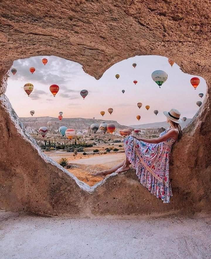
…and this heart-shape in one of Cappadocia’s caves in Turkey.
All of these perfect-heart shapes make me wonder firstly, exactly how long this shape has been associated with love, and secondly, if the Ancients were encoding the emotion of love directly into landscape and architecture of Earth.
I am quite certain the Old World was based on the frequency of love, and not on the fear we have been conditioned with in the false construct of the New World.
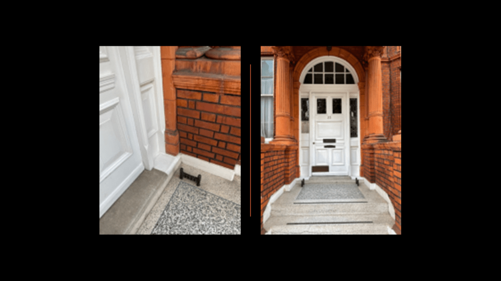
Next, SV sent me quite a bit of information about where she lives in the Kensington District of London, England.
In the first series of information she sent me, she highlights where she lives in South Kensington.
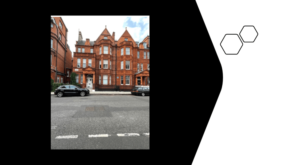
She said that in the older buildings in London, and all over Europe for that matter, it is common to have “mud-scrapers” on both sides of the doors of entrances to remove mud from the soles of shoes.
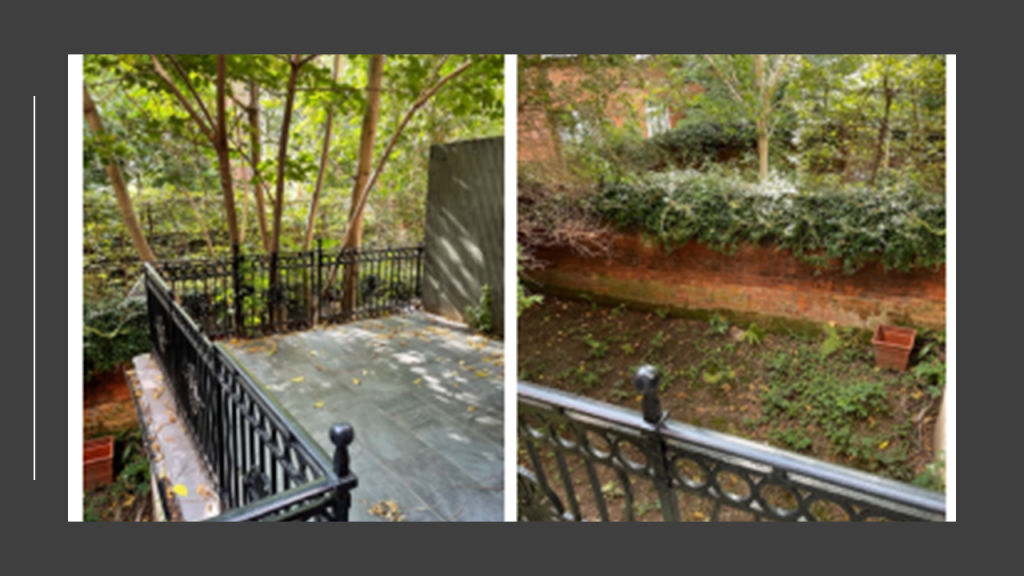
This is the view of the back of the building she lives in from her terrace on the left, and on the right is a view of the garden of her downstairs neighbor on the basement-level.
In this video she sent me, SV is going on a “Mud-Flood Walk-About” around her neighborhood, showing us the buildings and basements of Wetherby Gardens and excavated mud-flooded levels throughout her walk, including: Ashburn Place; Harrington Gardens; Colbeck Mews; and St. Jude’s Church/Millitus College, which still shows the basement level; and the side-view of St. Jude’s from Courtfield Gardens, and other views going around the block there.
Here are a few points of additional information that I have pulled from the video she took.
The term “Victorian architecture” is used to refer to a number of different architectural-styles that we are told emerged between 1830 and 1910, during the reign of Queen Victoria.

.
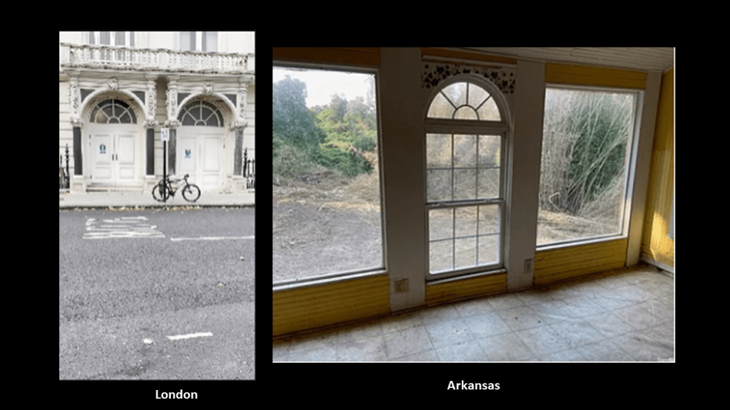
Here is a comparison from two windows in London that she showed us in the video on the left, with the same shape of the window in one of the rooms of the Victorian house seen earlier on the right in Arkansas.
We accept the explanation that these two windows in very different places would be the same design because they came from this same time period because, well, that is the only reason we have ever been given.
It is interesting to note that on her walk, SV’s video camera picked up magnetic patterns on the bricks of several of the buildings she passed by, and these were right next to St. Jude’s Church in Kensington’s Courtfield Gardens.
Then there is this side-picture from the street on the other side of the garden’s wall of St. Jude’s Church showing windows which just happen to resemble atomic wave-form patterns.

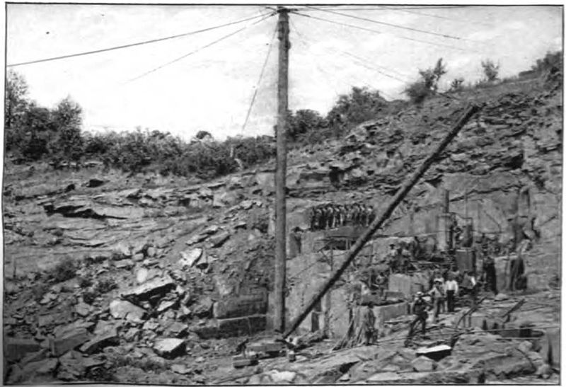
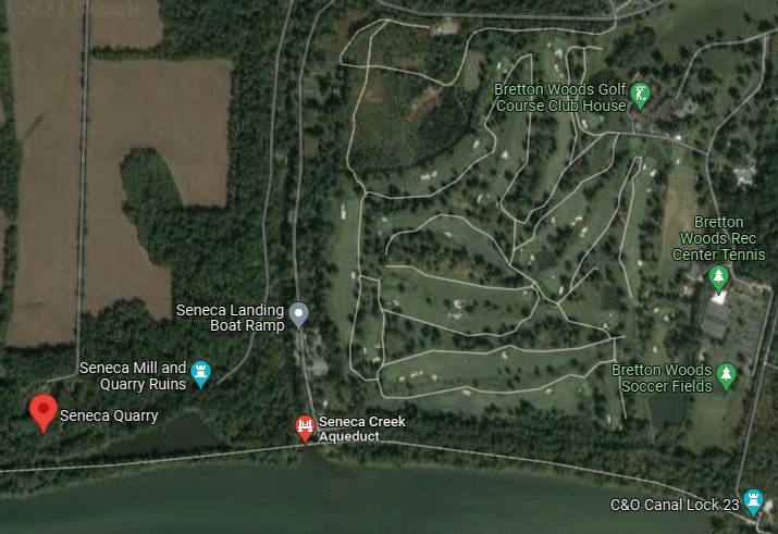
Lastly for this post, MB in Maryland sent me information to look into the story we are given about a big quarry at the C & O Canal and Seneca Creek, and stone-cutting mill located there.
These locations MB speaks of are in Montgomery County, Maryland, where I grew up.
I graduated from Wootton High School in Rockville, and MB graduated from Seneca Valley High School in Germantown, and while I don’t know the Seneca/Germantown area well, I do know it.
These are some old stomping grounds of mine, so to speak, for a variety reasons, when I was growing up.
I moved away from the area permanently when I got married in 1989.
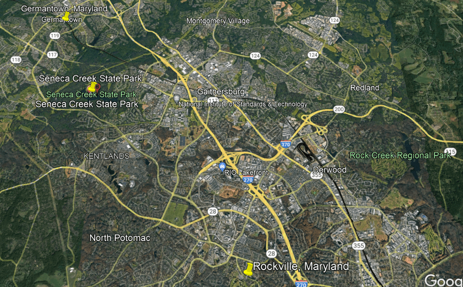
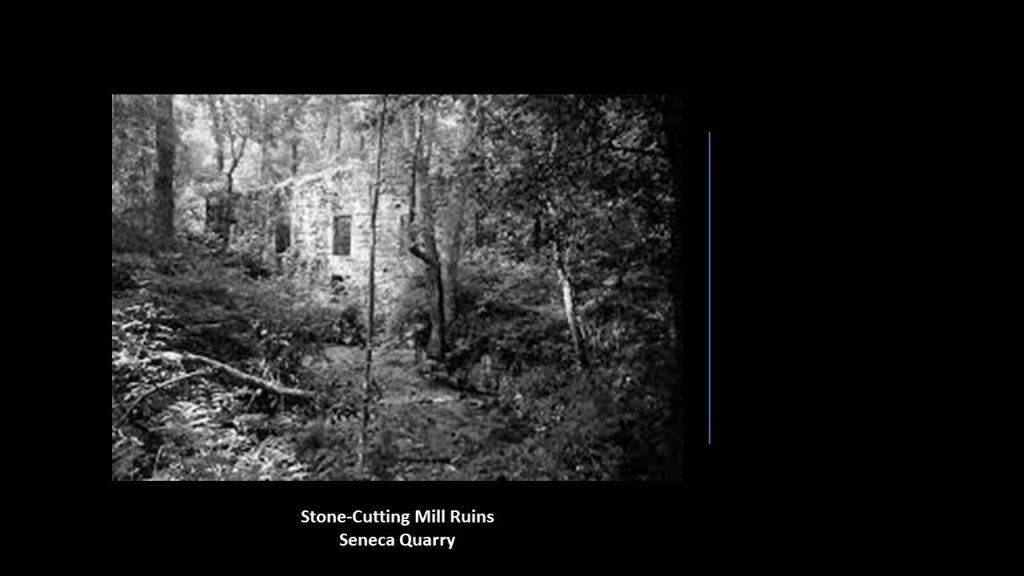
MB visits the Seneca Creek Stone-Cutting Mill often, and said he has been suspicious for decades of the whole story.
It was said to have been built in 1868, and used to cut stone for Baltimore and Washington, DC, until 1901.
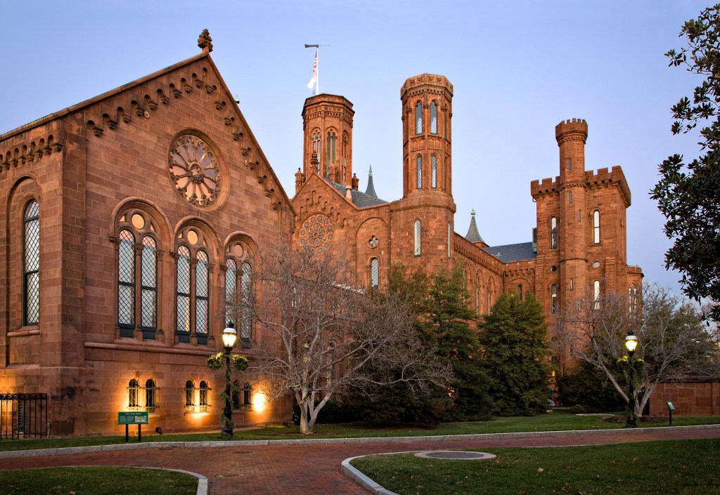
We are told the “brownstone” for Smithsonian castle, also known as “Seneca Red Sandstone,” and numerous buildings and canal locks in the area, came from…
… a big stone quarry at the C&O Canal and Seneca Creek that started operating somewhere around 1781.
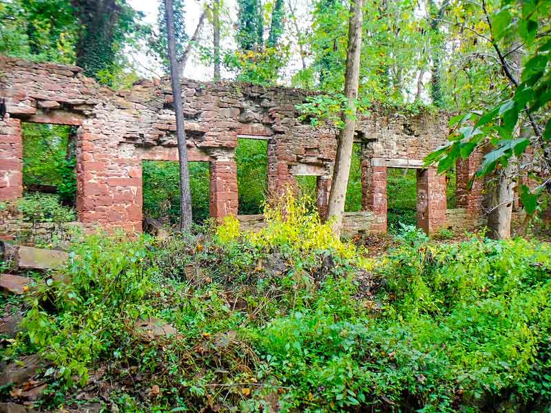
This is listed as an 1898 photograph of the quarry.
Nowadays, the location designated as the former quarry is overgrown with sycamore trees, poplars, and dense brush, and is impenetrable most of the year.
The Seneca Creek Aqueduct is near the location of the quarry and mill, and was said to have been built between 1829 and 1832 out of the Seneca Red Sandstone of the quarry–almost 40-years before the Stone Cutting Mill was said to have opened.
MB said the big problem is there’s no big hole — nothing that could fit the Smithsonian Castle plus the myriad other structures supposedly supplied from the Seneca Quarry.
Excepting a “turn-around basin” that may be natural in the canal, he can find zero trace of any quarry at all in fact.
He indicated there are small-gauge railroad tracks laid down, leaving the stone cutting mill from approximately from its SW corner…but says then they then disappear, and MB has recently has been looking at the ruins here from ‘mudflood’ perspective.
I am going to continue to share photographs and videos viewers have shared with me, and the information they have gathered, in their journeys and explorations close to where they live, in this installment, as well as continuing to look at places viewers have suggested.
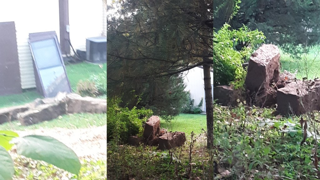
JPT left a comment about already noticing many mudflood building around town, which was “founded” in 1804, and said that when the next-door neighbor was tearing down an old shed recently, the excavator dug slightly into an embankment, and started digging out massive megalithic stones that were huge, 4-feet by 2-feet easily, and shared these photos with me.
JPT said the large stones seemed quite unexpected, and had been buried beneath brick about 10-feet, or 3-meters, or more.
It is interesting that NV left me a comment today with Rudyard Kipling’s entire 1902 poem “The Palace,” just one day after I have finished writing about JPT’s neighbor’s unexpected megaliths.

As much as I enjoyed reading when I was younger, and I read a number of the classics of literature as a teenager beyond what was required reading, I never got into Kipling much beyond Disney’s “Jungle Book” and whatever was required reading of his for high school English classes, so I didn’t know about this one at all.

Here is Rudyard Kipling’s poem “The Palace”:
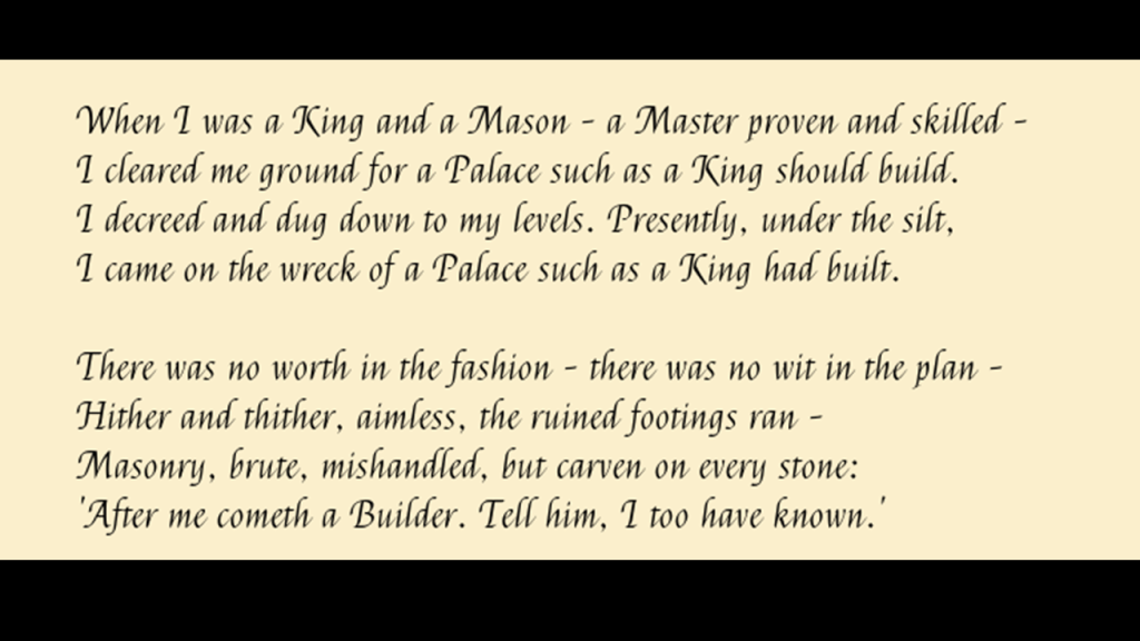
Going back to the first verse, it says: “When I was a King and a Mason – a Master proven and skilled – I cleared me a ground for a palace such as a king should build, I decreed and dug down to my levels. Presently, under the silt, I came on the wreck of a palace such as a King had built.
Silt is defined as fine sand, clay, or other material carried by running water and deposited as a sediment, so it may also exist as soil or a sediment mixed in suspension with water…
…and silt is also associated with liquefaction, which occurs, for one thing, with high-intensity earthquakes.
And was Rudyard Kipling himself a Freemason?
Come to find out, he most certainly was!

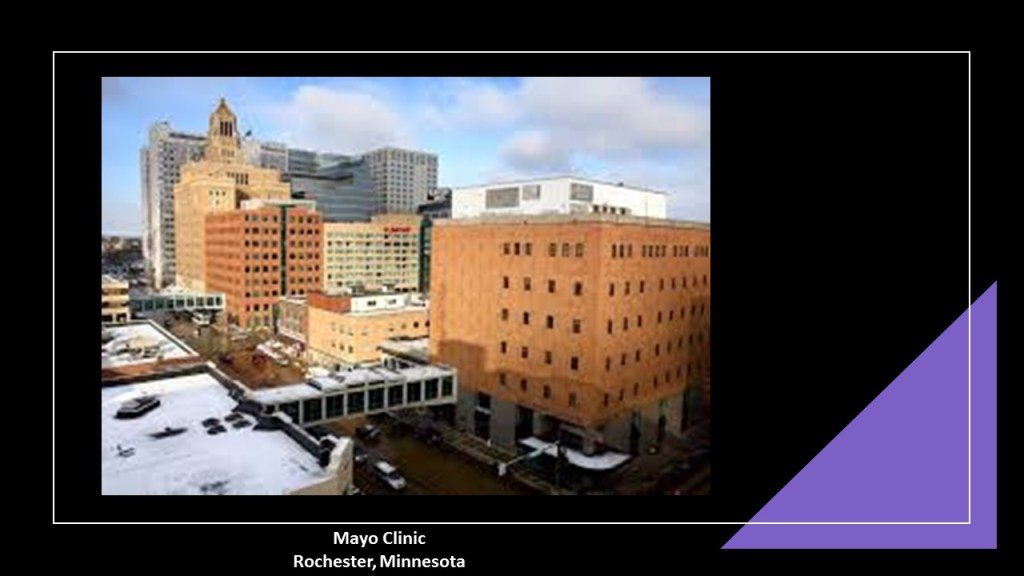
Another commenter, SG, sent me the following information related to Rochester, Minnesota.
Rochester is the home of the Mayo Clinic.
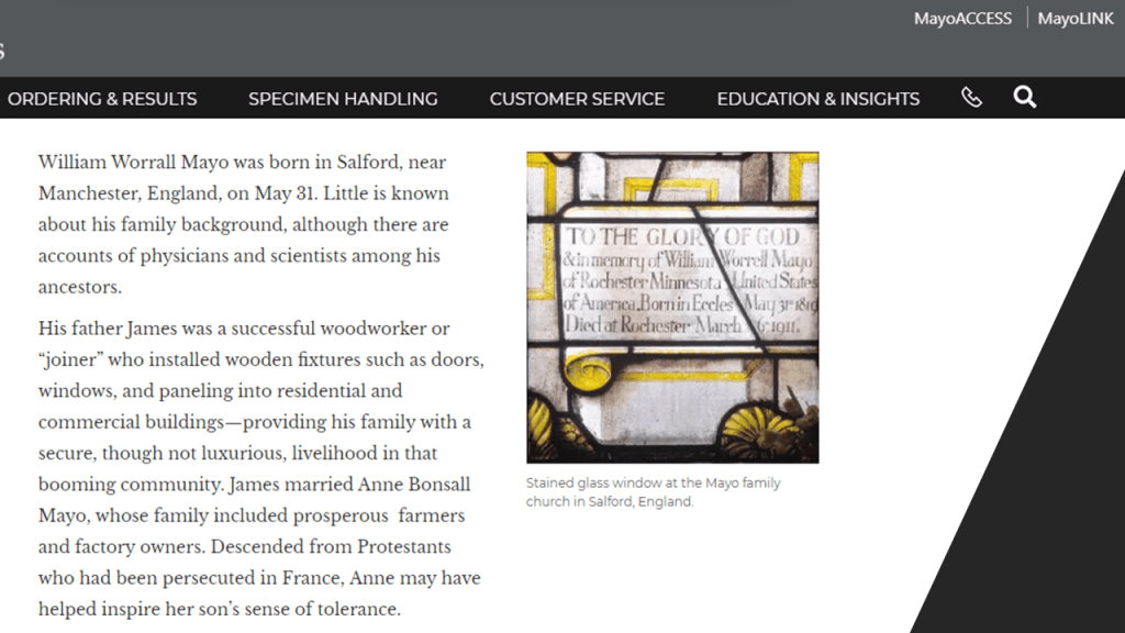
She said Dr. William W. Mayo seems to have come from nowhere.
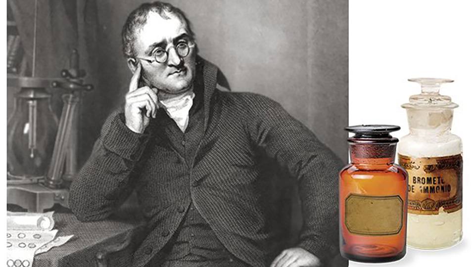
William Worrall Mayo was born in Salford England…
…and studied in Manchester as a scientist under the noted chemist John Dalton, who was credited with developing the modern atomic theory of matter and devising a table of relative atomic weights.
Mayo left England for America in 1846, and landed a job as a pharmacist at the Bellevue Hospital in New York City, the oldest public hospital in the United States.
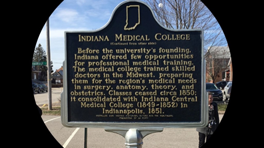
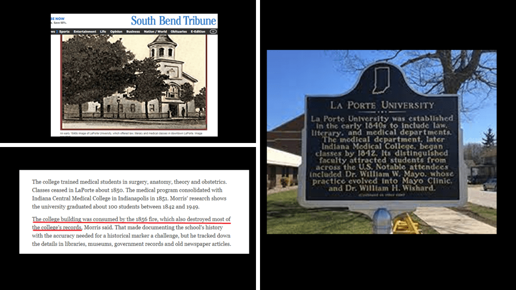
He didn’t stay there long, as he moved progressively westward, from Buffalo, New York, to Lafayette, Indiana, and in 1849, assisted in a cholera outbreak there, after which he was said to have attended Indiana Medical College in LaPorte, Indiana, and graduated in February of 1850.

The same year Mayo was said to have graduated from the Indiana Medical College in 1850, was the same year it stopped offering classes, according to this historical marker….
…and by 1856, according to this article, the building in Laporte that housed the Indiana Medical College burned down, destroying most of the college’s records.
He and his family ended up in Minnesota sometime in the mid-1850s, living in various places in the state, and doing different kinds of jobs, and besides doctoring, he was said to have done work as a census-taker; farmer; ferry-service operator; justice of the peace; newspaper publisher; and working on a steamboat.

He first came to the Rochester-area around 1863 when he was named as the examining surgeon for the 1st Minnesota draft board during the Civil War, and he also opened a medical practice there.
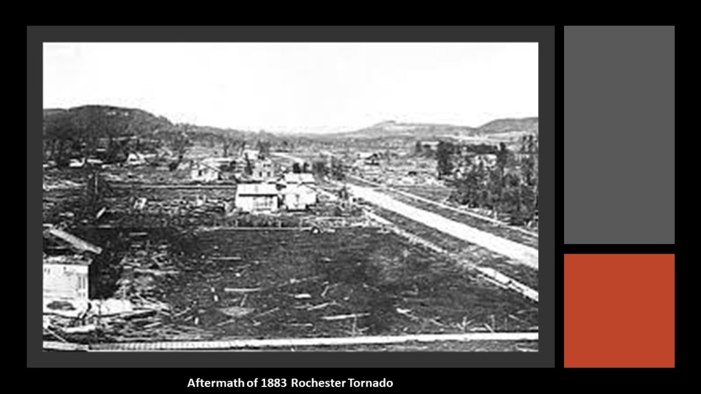
While he was involved in a lot of different things, like politics, and different places, like St. Paul, the event that started the Mayo Clinic is considered to have been the August 21st tornado that devastated Rochester in 1883, when Dr. Mayo and his two sons, William James and Charles Horace, worked together to care for the wounded.
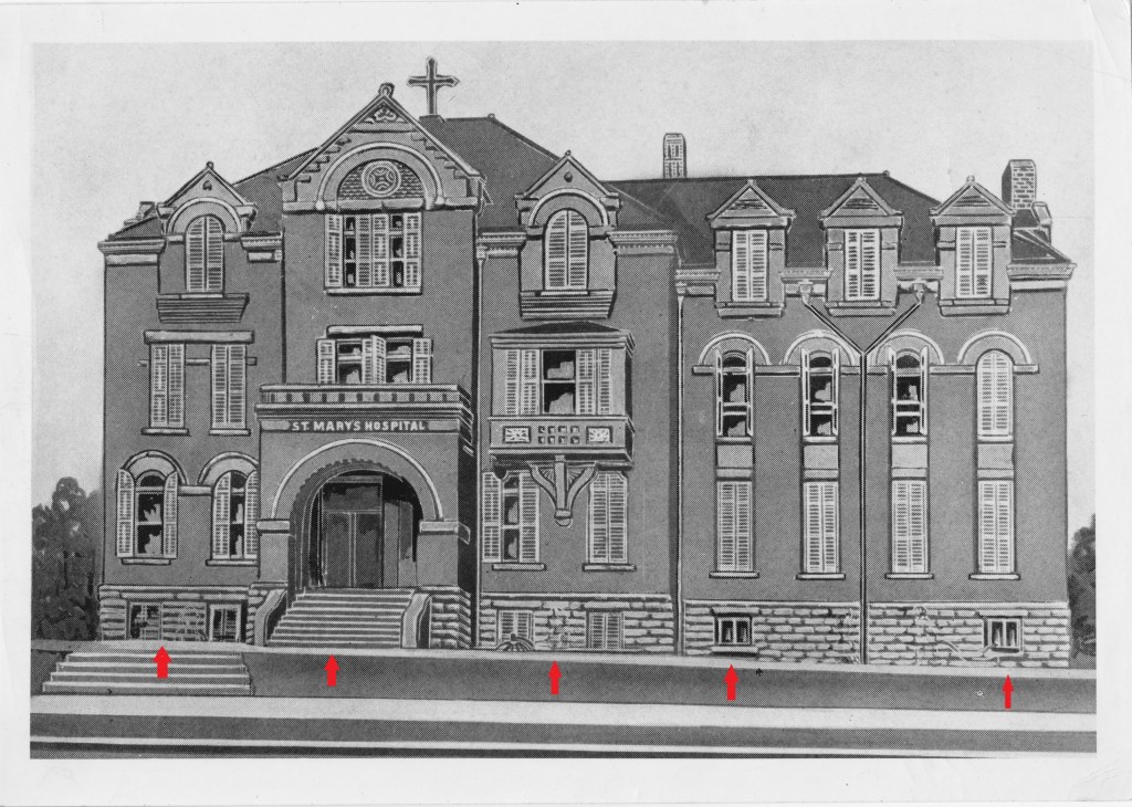
As a result of the devastating tornado, donations totalling USD $60,000 (or what would have been valued in 2016 as $1.5 million) were raised, and with that, the Sisters of St. Francis, assisted by Dr. Mayo, opened St. Mary’s Hospital in Rochester in 1889.
The original St. Mary’s Hospital was demolished in 1953.
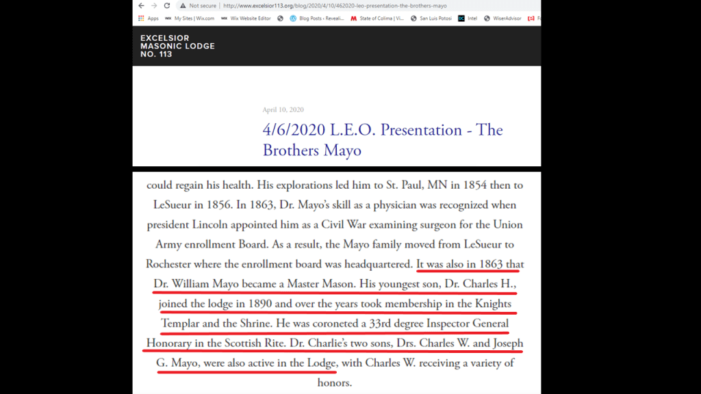
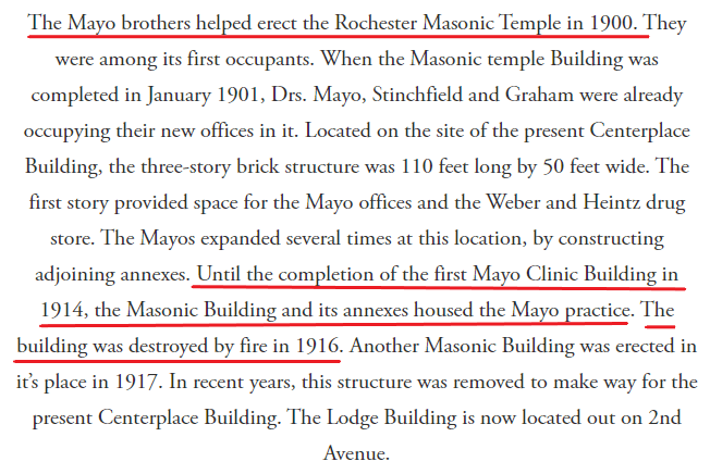
The first Mayo Clinic was in the Rochester Masonic Lodge, that the Mayos were said to have helped build as well…
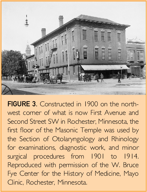
…and indeed Dr. William Mayo, his son Charles Horace, and later his grandsons Charles W. and Joseph G., were listed as also active as Brothers in the masonic lodge…
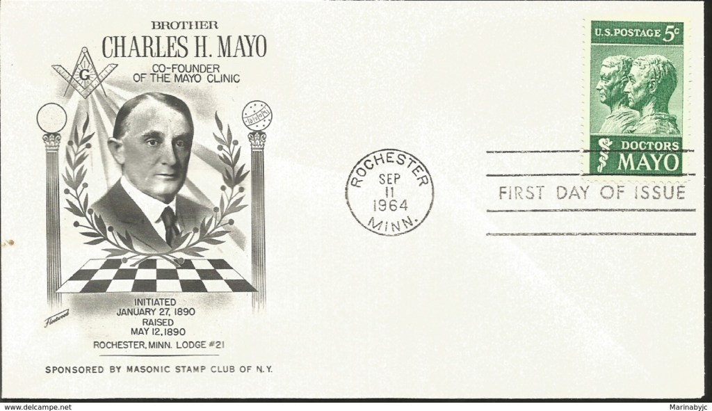
…and this Rochester Masonic Lodge was destroyed by fire in 1916.
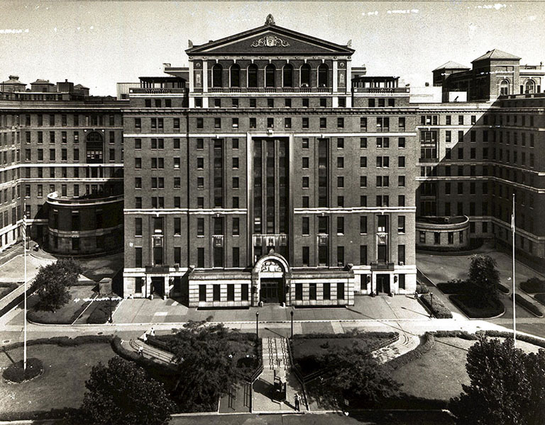
The Plummer Building opened on the expanding Mayo Clinic campus in 1928, and the architect of record is Ellerbe and Company, in collaboration with Henry Stanley Plummer, an internist and endocrinologist who was one of the founding physicians of the Mayo Clinic.
Interesting to see an owl is depicted with him in the architectural detail on the Plummer building.
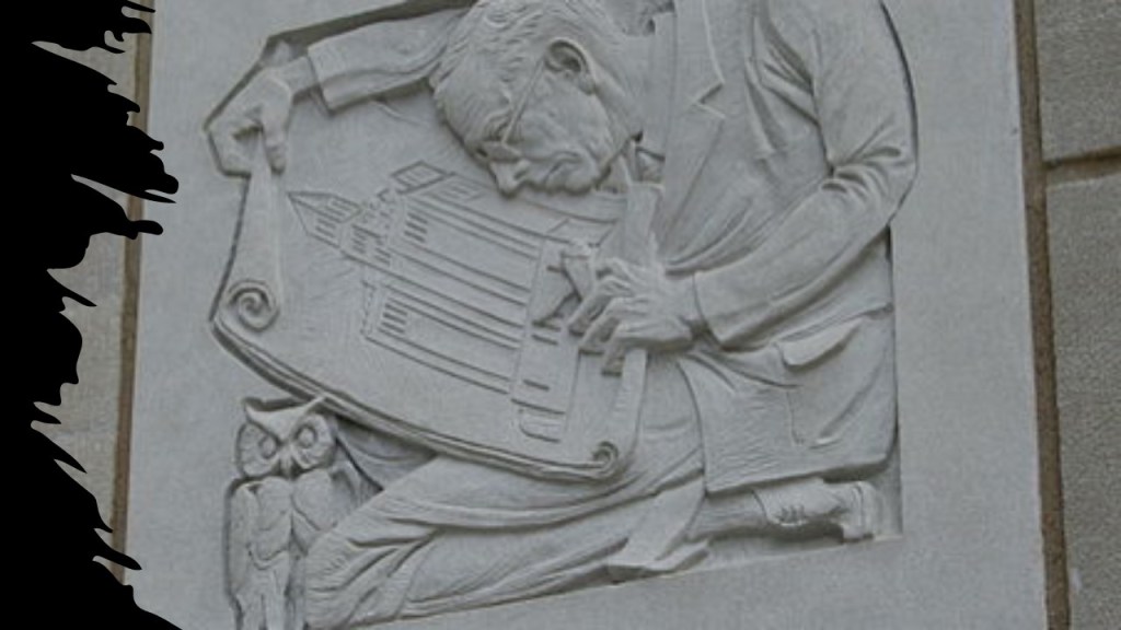
Owl could mean wise. Could mean night owl.
But the symbolism of the owl could mean something else entirely.

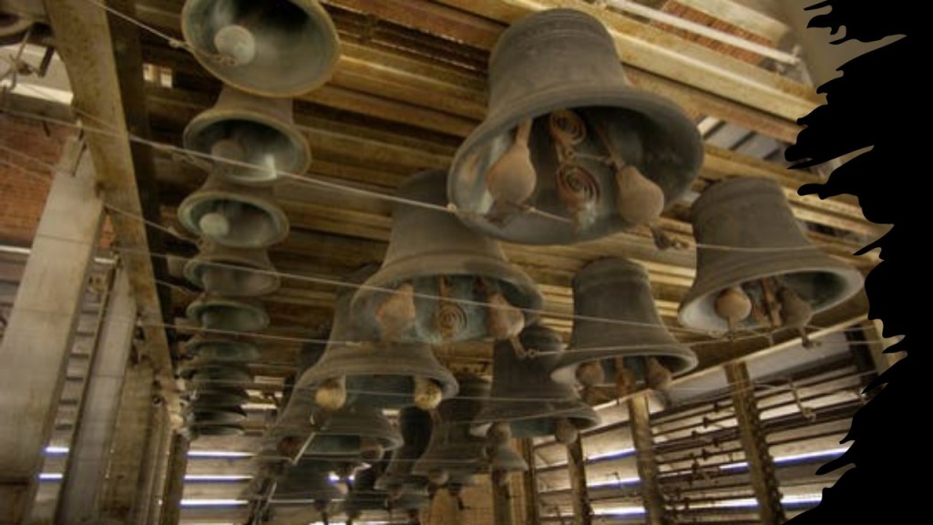
The many notable features of the Plummer Building include its top, which is trimmed by terra cotta…
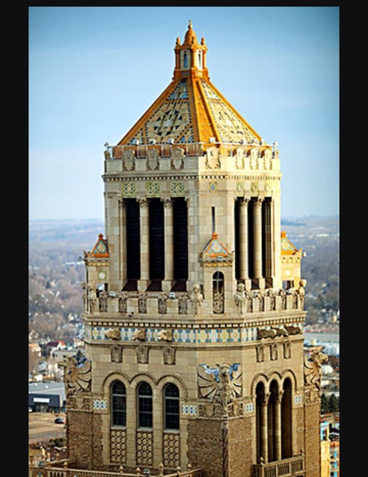
…and contains a 56-bronze-bell carillon, which is played every day.
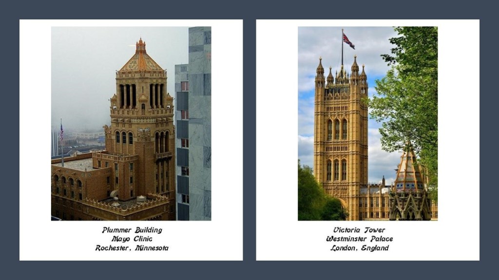
On the left is the Plummer Building in Rochester, and on the right is the Victoria Tower in the Westminster Palace complex in London, which houses the British Parliament, the construction of which was said to have been completed in 1860.
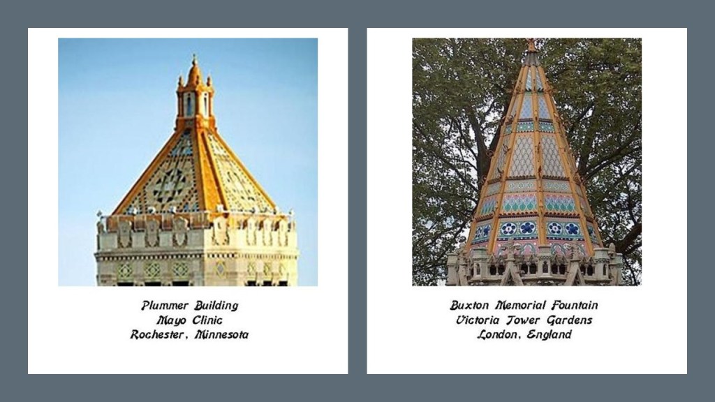
Again, on the left is the top of the Plummer Building, and on the right is the Buxton Memorial Fountain in the Victoria Tower Gardens.
While the Victoria Tower is not a bell-tower, the Elizabeth Tower of the Parliament building is, which houses the Great Bell, better-known by its nickname, Big Ben, of the striking clock at the north-end of Westminster Palace.

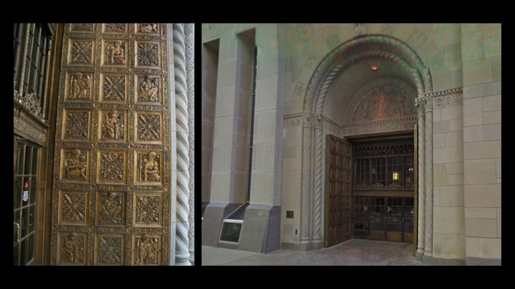
With regards to other notable features of the Plummer Building in Rochester, the 4,000-pound, or 1,800-kilogram, and 216-foot, or 66-meter, -high ornamental bronze-doors are always open, except for significant events in Mayo Clinic, or national, history.
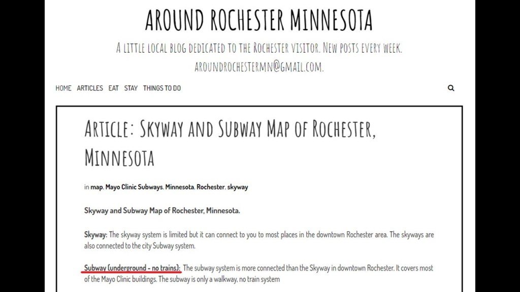
SG also shared the following information about Rochester, including there are “subways” under Rochester, with no subway trains, that are walking tunnels downtown that go for miles outside of downtown as well.
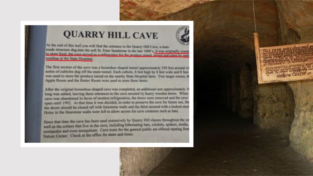
…and at a place called Quarry Hill, there are what are claimed to be caves dug-out for use by the State Hospital, as storage space for the food for its patients.
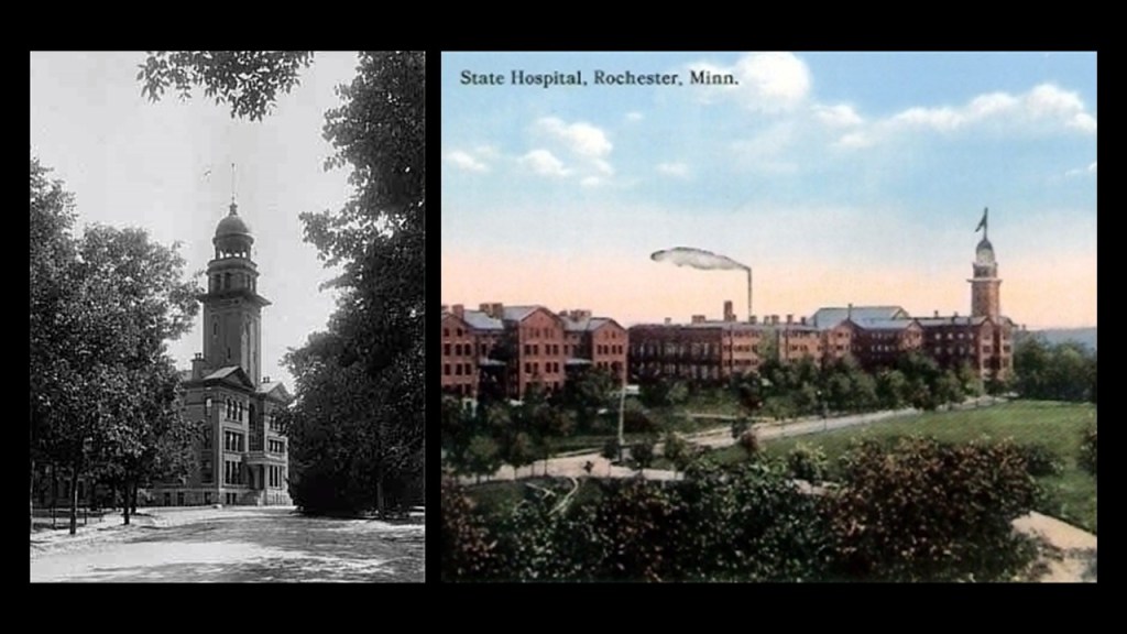
The State Hospital in Rochester was said to have been constructed starting in 1877 as a way to house the increasingly problematic group of residents known as “habitual drunkards,” for which funds for the State Hospital were raised.
Then, at the same time, the St. Peter Hospital for the Insane was having an over-crowding problem apparently, and so the State Legislature changed the facility to have a secondary-focus as the “State Inebriate Asylum, and a primary-focus as the “Second State Hospital for the Insane.”
It functioned as a State Hospital for over 100-years, closing as such in 1982.
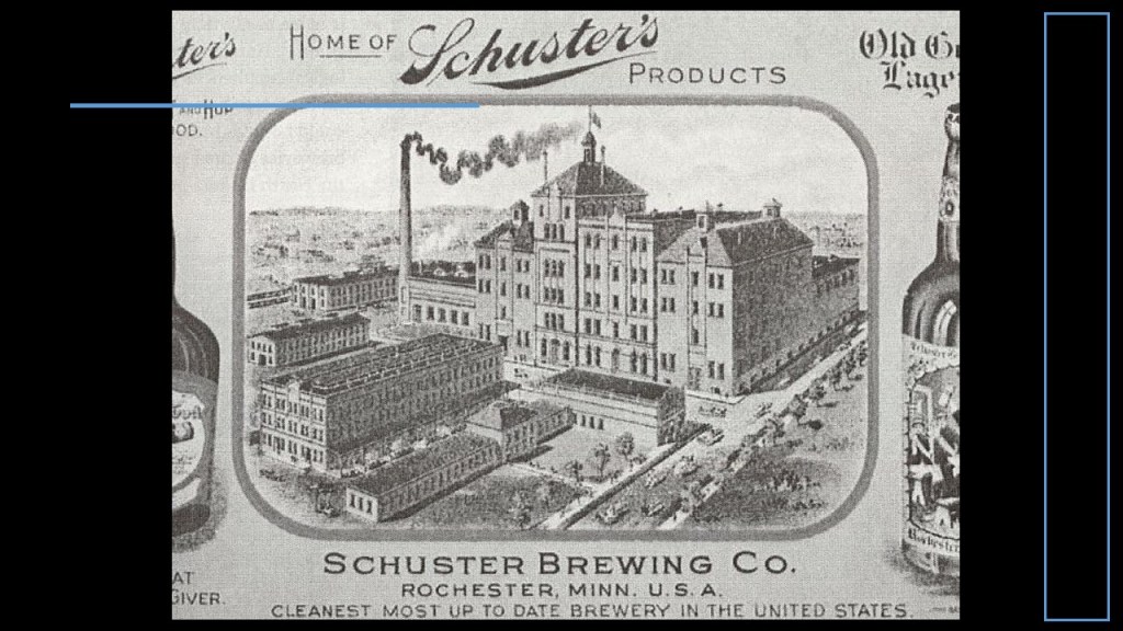
Interestingly, with regards to the increasing problem of “habitual drunkards,” is that by 1870, Rochester was already home to three breweries, the largest of which started in the mid-to-late 1850s, and became known as Schuster’s brewery starting in 1871.
By 1910, Schuster’s Brewery was shipping the 10-million bottles of beer and malt tonic it produced annually to 24 states.
By 1922, it closed its doors, due primarily to Prohibition.
I’ve alluded in past videos to findings in my research that breweries and distilleries popped-up in droves in the beginning in the late 1700s, and I believe introducing copious quantities of beer and hard liquor was done deliberately to lower our collective consciousness and destroy lives.
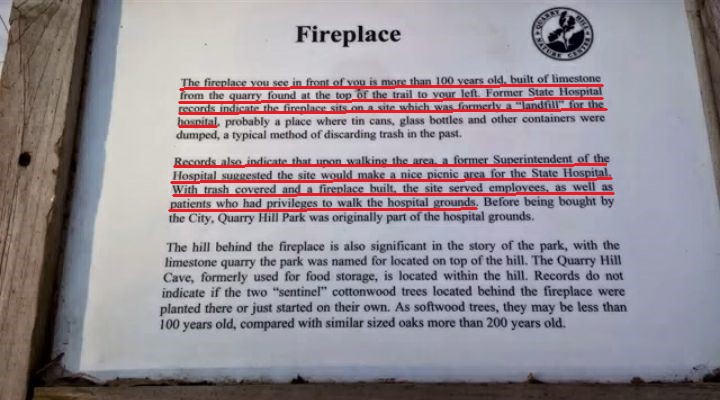
This fireplace on what was formerly the State Hospital grounds is said to be more than 100-years-old…
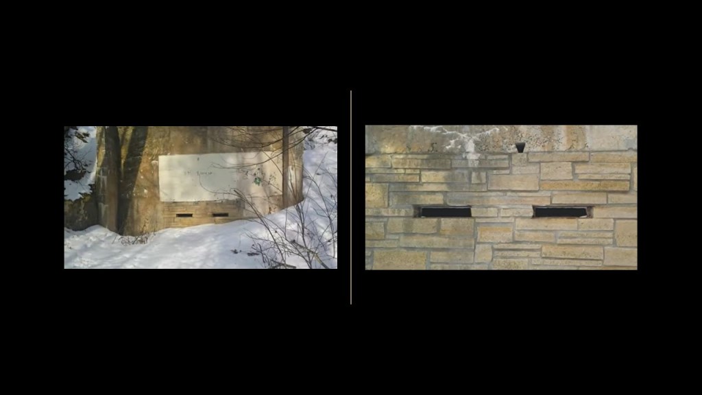
…and built out of limestone from the quarry on top of what was a land-fill for the State Hospital upon the recommendation of one of its former Superintendent’s that it would make a good picnic area.
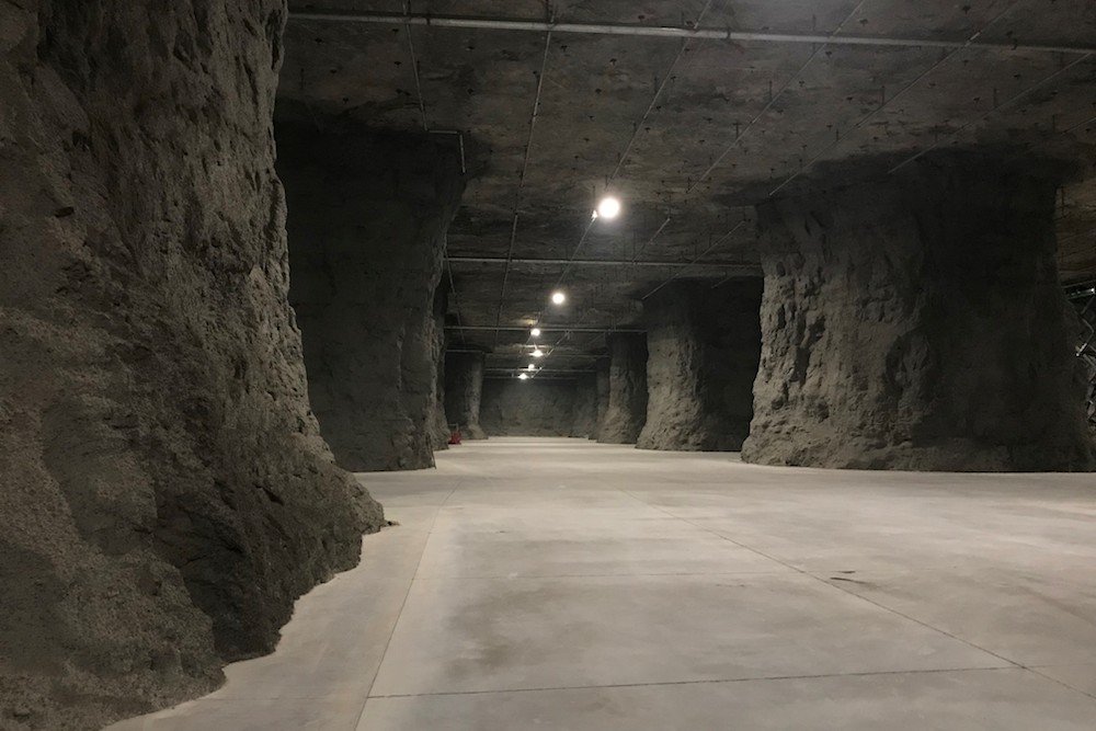
Along similar lines as the underground “caves” in Rochester, CG sent me information about the existence of Springfield Underground, an underground complex that contains 3.2-million-square-feet of leasable space in tunnels said to have been left by a limestone mining operation that started in 1946, and access to the general public is very limited.
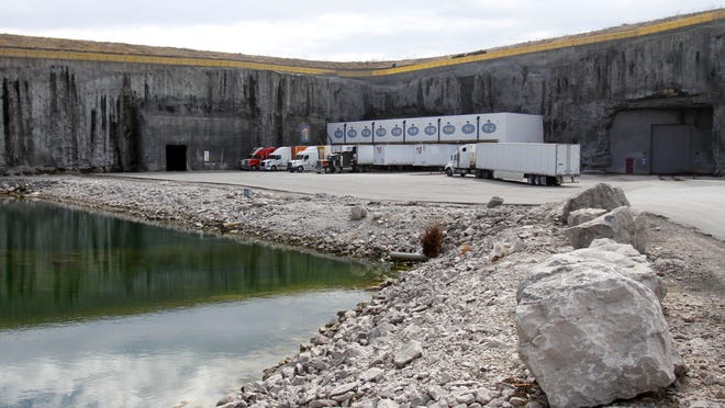
The first tunnels were said to have been dug in 1954.
We are told the limestone mining process that was used left massive 30-foot by 30-foot, or 9-meter by 9-meter, pillars of limestone every 50-feet, or 15-meters, and the buildings and roadways of Springfield Underground are spaced between them; that the ceiling ranges from 27-foot to 45-foot-high, or 8-meters to 14-meters, high and the floor is 100-feet, or 30-meters, deep.
Michael in Austria sent me his finding of what he calls the “Iron Triangle” on Google Earth earlier this year.

I haven’t had a chance to take a deeper look into it yet, but the video he made of it from Google Earth will give you the idea.
BJ emailed me a photo of the first is the National Wallace Memorial in Stirling, Scotland, that stands above where Scottish national hero William Wallace led his troops to victory against the army of King Edward Ist in 1297 at the Battle of Stirling Bridge.
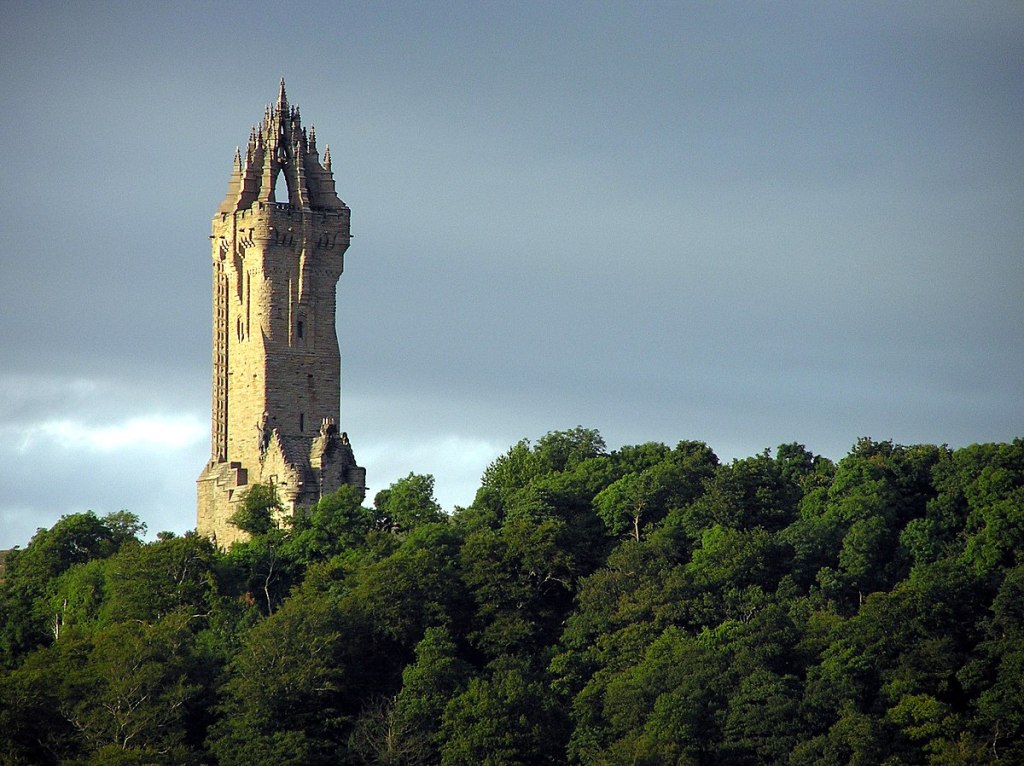
The National Wallace Memorial was said to have been completed in 1869, following a fundraising campaign that was started in Glasgow in 1851 by the Rev. Charles Rogers following a resurgence of Scottish National identity.
I am finding the year 1851 to be a red-letter year in the historical reset narrative, which was the same year as the Great Exhibition of the Works of All Nations, also known as the Crystal Palace Exhibition, in London.

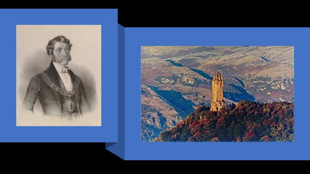
George Murray, the Duke of Atholl and the Grand Master Mason of Scotland, was credited with laying the foundation stone in 1861 for the Wallace Memorial.
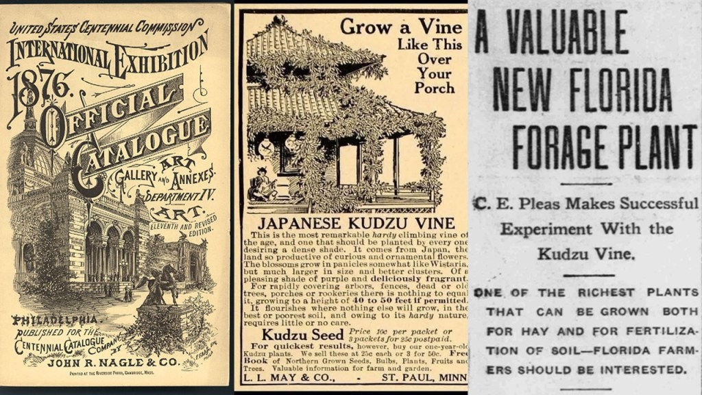
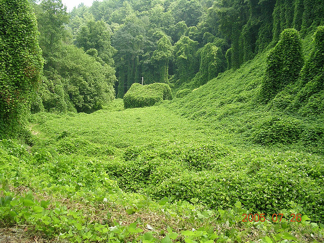
Lastly for this post, PH wondered about how kudzu vine has completely taken over the southern United States…
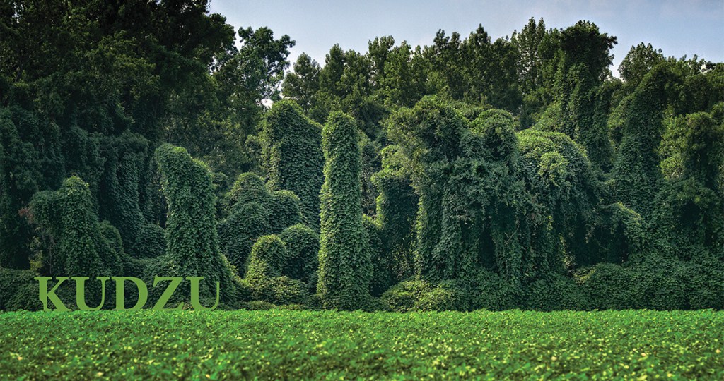
…and shared with me what he found when he looked into the origins.
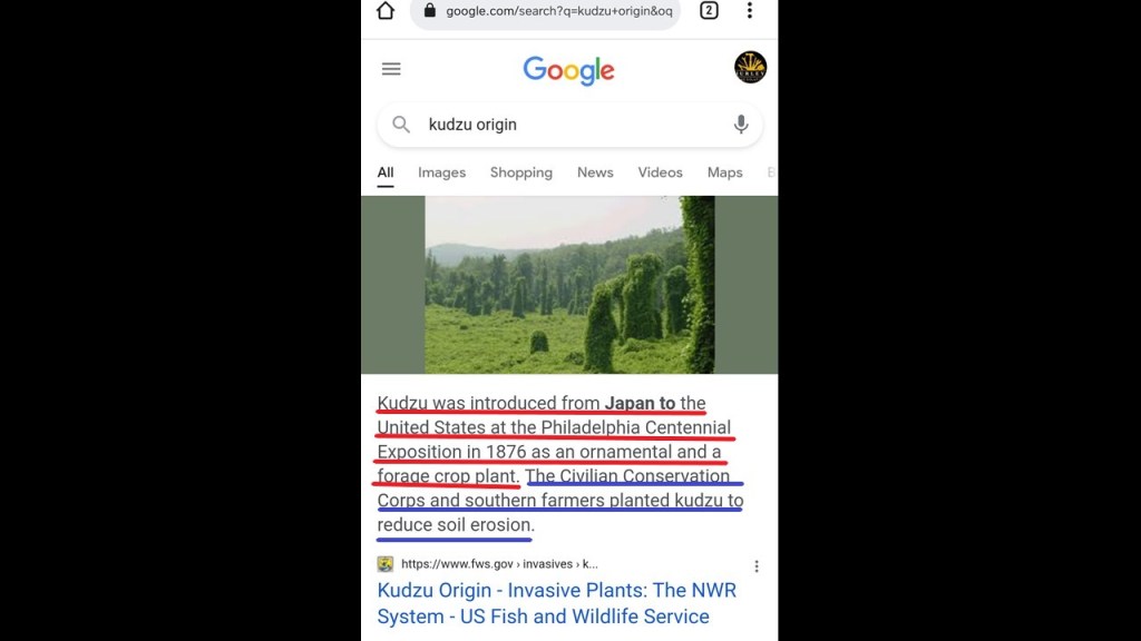
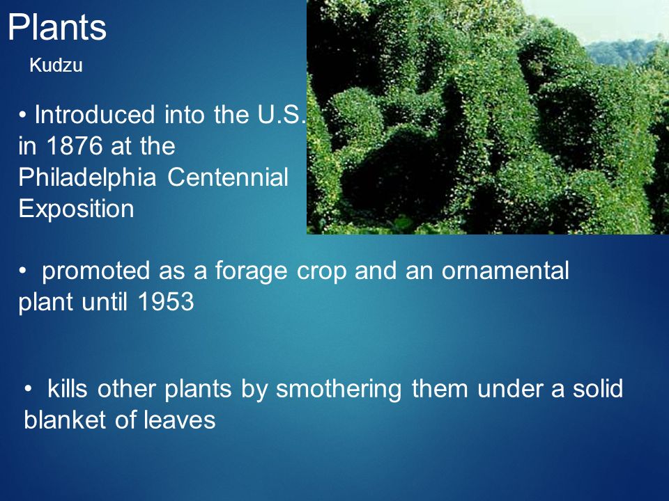
So, the first thing we see is that it was introduced from Japan at the Philadelphia Centennial Exposition in 1876, and promoted as an ornamental and forage crop plant.
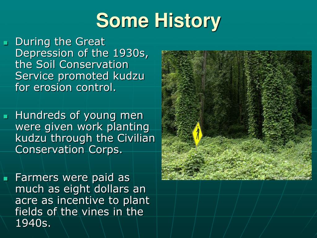
Then kudzu was promoted for erosion control during the Great Depression in the 1930s, and planting it provided work for young men in the Civilian Conservation Corps.
What ended-up resulting from this indiscriminate kudzu planting policy?
Bottom line: it eventually takes over EVERYTHING in its path!
Question is: was this Kudzu take-over of the South an unintended consequence…or a planned act of environmental destruction?
One commenter, LN, said that there is a huge mansion called The Pensmore in Highlandville, Missouri, and located above the network of tunnels in Springfield.
It is one of the largest homes in the United States, and was designed to withstand earthquakes, tornadoes and bomb blasts.
It’s construction is reported as having started in 2008 and it is still under construction today.

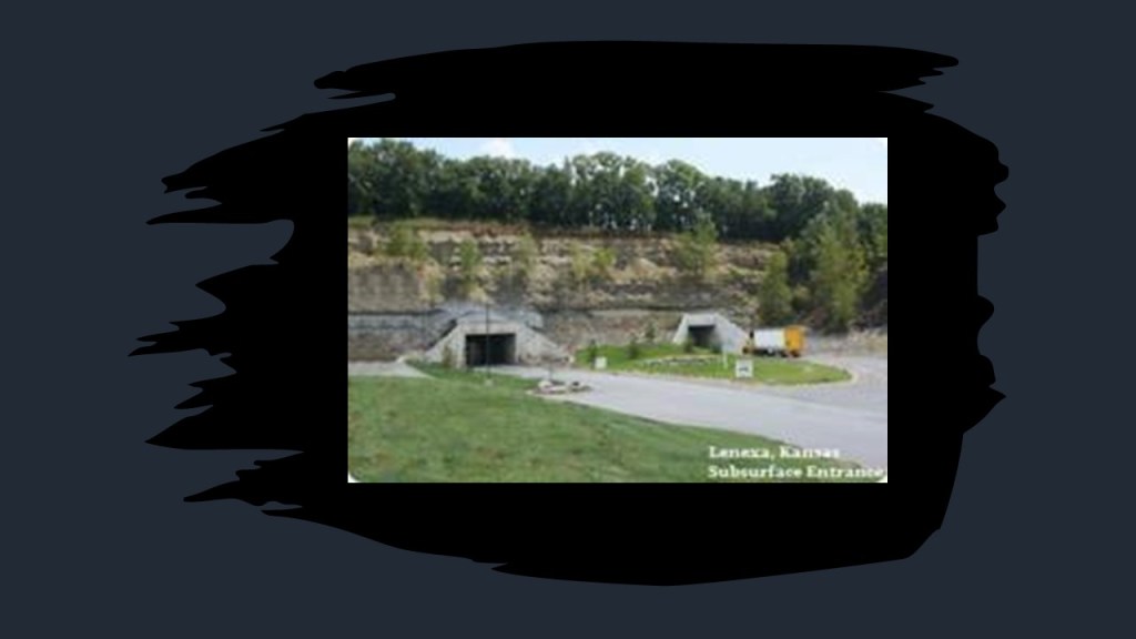
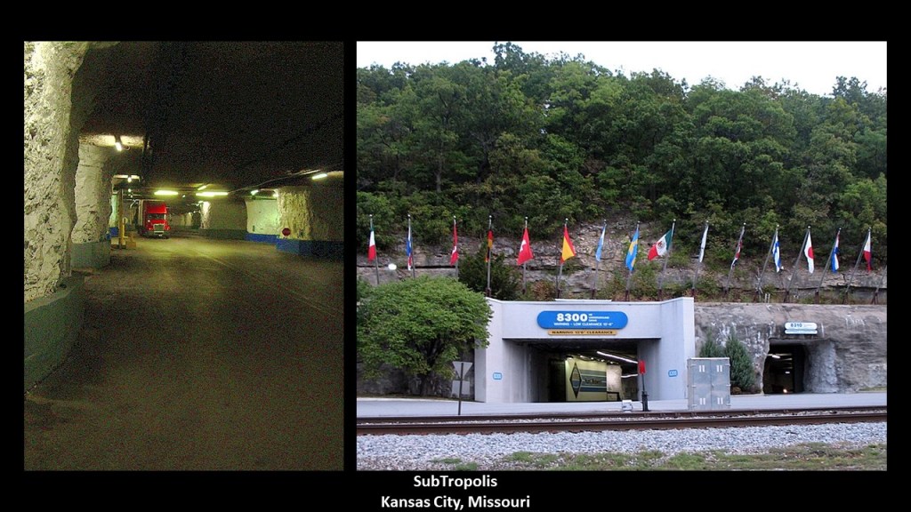
SA used to live just down the street from the Springfield Underground, and was a long-haul trucker at the time and made many different pick-ups and deliveries in the Springfield Underground and others, and said there are several more undergrounds like Springfield, in and around Kansas City – at Lenexa KS…
…SubTropolis in Kansas City, Missouri, which calls itself the “World’s Largest Underground Business Complex…”
…and in Carthage, MO, where the underground there is a collection of marble quarries.
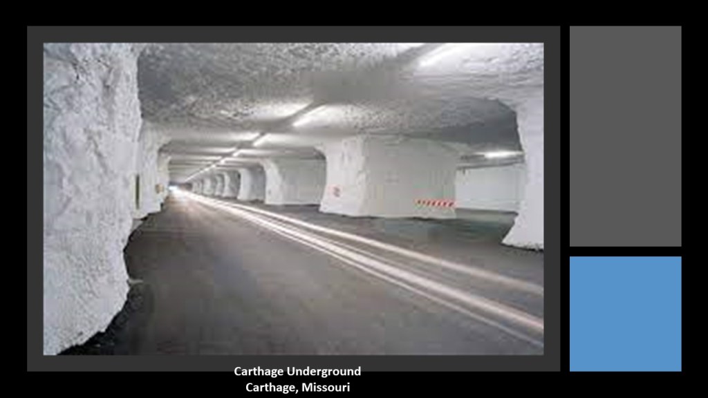
SA’s question while down in there was always “how old are they and how did they build them?”
The answer given never quite hit the mark, and Missouri is “The Cave State,” after all.
Another commenter said that AmeriCold is the largest World Wide owner of underground facilities like these, and that these facilities are highly-classified areas.

AmeriCold started out as “Atlantic Coal and Ice” when Atlanta businessman Ernest Woodruff merged three cold storage warehouses, in 1903, and grew out of many more mergers and acquistions of cold storage companies.

Since 2010 when it acquired Versacold, AmeriCold became the largest, temperature-controlled warehousing and distribution services provider in the world…

…and is controlled by the Yucaipa Companies, an American Private Equity firm specializing in private equity and venture capital for middle-market companies, growth capital, industry consolidation; leveraged buy-outs; and turnaround investments.
Here is a history of the company’s activities from between 1987 and 2014.

I definitely get the feeling that this subterranean subject leads to the Mother of All Rabbit Holes….
The second subject I am going to revisit is based on my mention of the Japanese vine Kudzu in the last post, which has introduced in the United States at the 1872 Centennial Exposition in Philadelphia.
It was promoted as a forage crop and ornamental plant until 1953, and planted by the young men of the Civilian Conservation Corps in the 1930s at the behest of the Soil Conservation Service for erosion control.
Problem is, it kills other plants by smothering them underneath a solid blanket of leaves, and eventually takes over everything in its path, which raises the question about whether or not the Kudzu take-over of the South is an unintended consequence…or a planned act of environmental destruction?
PL left a comment in response to my mention of the kudzu plant, saying there are other possible biological terrorist acts to consider.
One is the Burmese python invasion in the Florida Everglades…
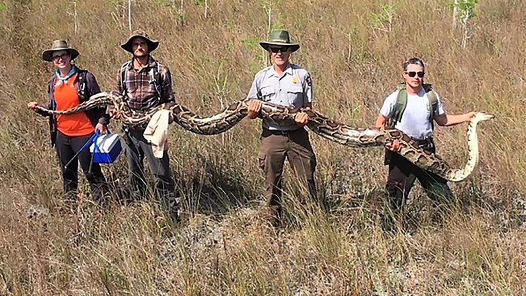
…where the pythons are taking over the land and killing many of the native species.
Researchers estimate there are anywhere between 30,000 and 300,000 of these pythons in South Florida.

The other is the Apple Snail problem in southwest Louisiana’s rice and crawfish farms, and are an invasive species that are not native here.
Apple Snails consume large quantities of plants, and damage important habitats for native fish and wildlife, and overpopulate their environments.
He said we are told that pet owners released these invasive species in significant enough numbers to produce breeding populations, and that those telling us this wont even consider a possible act of terrorism when it would be so easy to pull off.

Now on to new subjects.
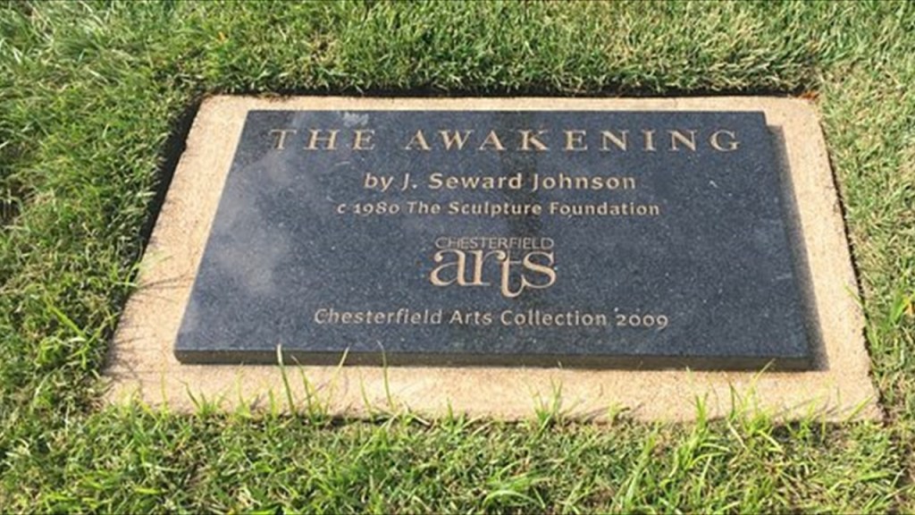
RT suggested that I look into two identical sculptures entitled “The Awakening.”
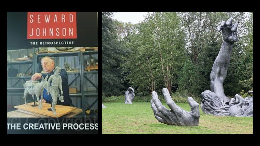
Before I share what both of the “The Awakening’s” look like, I would like to insert that they were designed by John Seward Johnson II of the Johnson and Johnson family.
Seward Johnson was the grandson of Robert Wood Johnson…
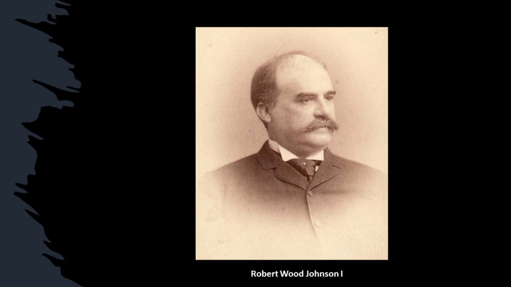
…who had joined in partnership with his two brothers – James Wood Johnson and Edward Mead Johnson – in founding Johnson & Johnson in New Brunswick, New Jersey, in 1886, becoming a major manufacturer of sterile surgical supplies, household products, and medical guides.

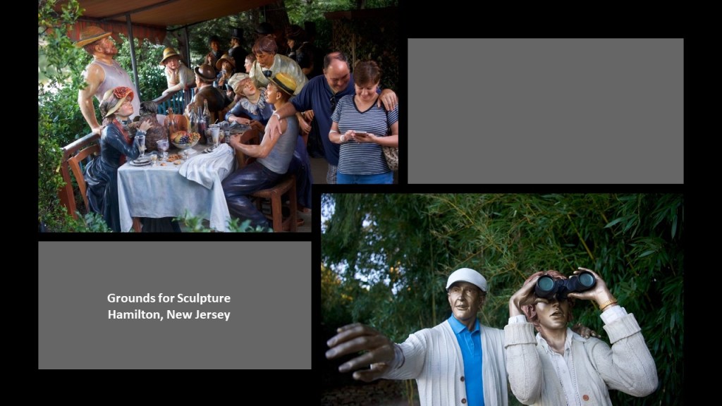
Seward Johnson was best-known for designing life-size bronze statues that were castings of people that were engaged in day-to-day activities, and he was the founder of the “Grounds for Sculpture” in 1992 in Hamilton,New Jersey, constructed on the location of the former Trenton Speedway, which was at the former New Jersey State Fairgrounds, both of which were closed at the same time in 1980.
Interesting that they would construct a sculpture garden on what would have been a power-node related to the State Fairgrounds and Trenton Speedway.
Now, here’s what I can find out about Seward Johnson’s creation “The Awakening.”
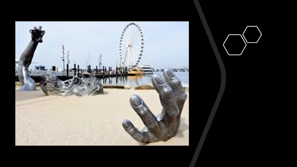
It is a 72-foot, or 22-meter, statue that depicts a giant embedded in the Earth, struggling to free himself.
There is one at National Harbor in Oxon Hill, Maryland.
It consists of 5 aluminum pieces buried in the ground in such a way that it gives the impression of a distressed giant attempting to free himself from the ground…
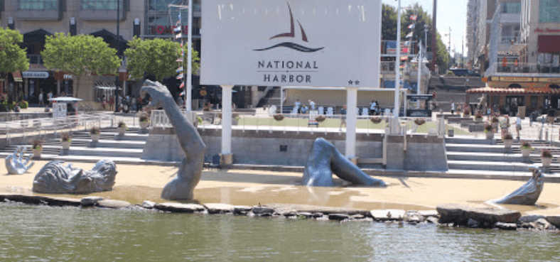
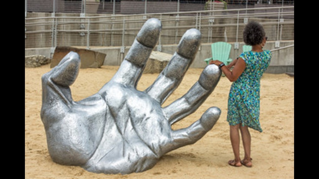
…with mouth in mid-scream as the giant struggles to emerge from the Earth.
Now seeing the Ferris Wheel across the way in this photo brings to mind a commenter’s question about what the deal is with Ferris Wheels.
I don’t know the answer to that question, but its a great question because they show up in a lot of places all over the world.
Are Ferris Wheels for the purpose of having fun, or do they have an ulterior purpose unbeknownst to the general public.
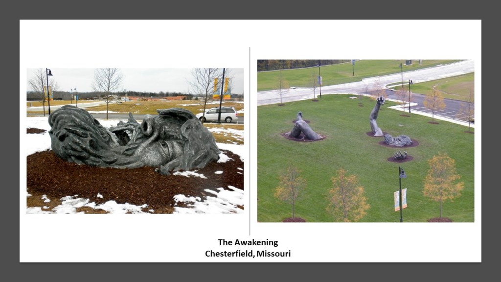
There is an identical sculpture in Chesterfield, Missouri.
There was even a duplicate of “The Awakening” that made a limited appearance at the”Grounds for Sculpture” for a Seward Johnson Retrospective a couple of years ago.
SV shared with me some information about statuary at the Marble Arch in London.
The architect John Nash (b. 1752 – d. 1835) was considered one of the foremost architects of the Regency Era, during the Georgian era from 1714 to 1830…

…and was credited with designing the Marble Arch in London in 1827, as the state entrance to the ceremonial courtyard of Buckingham Palace.
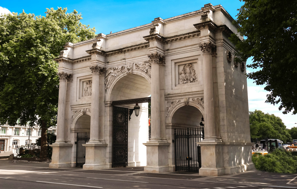
It is also interesting to note that only members of the royal family and its troop are permitted to pass through the arch in ceremonial processions.
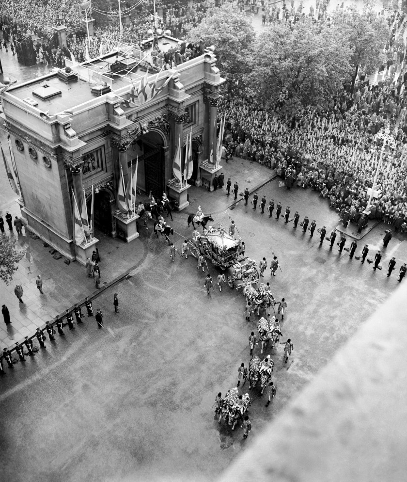
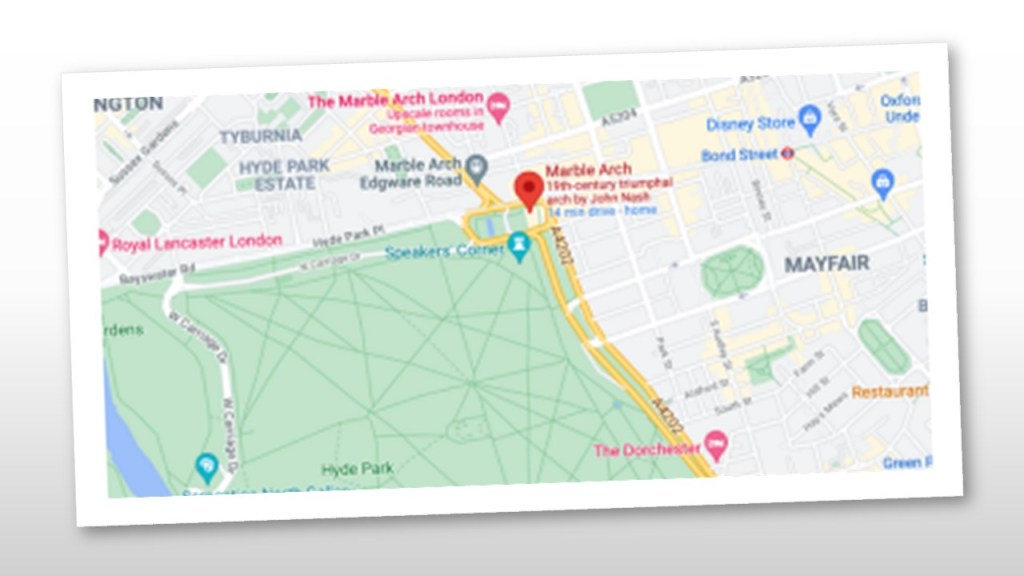
SV explained that the Marble Arch is at a junction of very heavy traffic, redirecting cars and people along really important roads, such as Edgware Road, and Oxford Street…
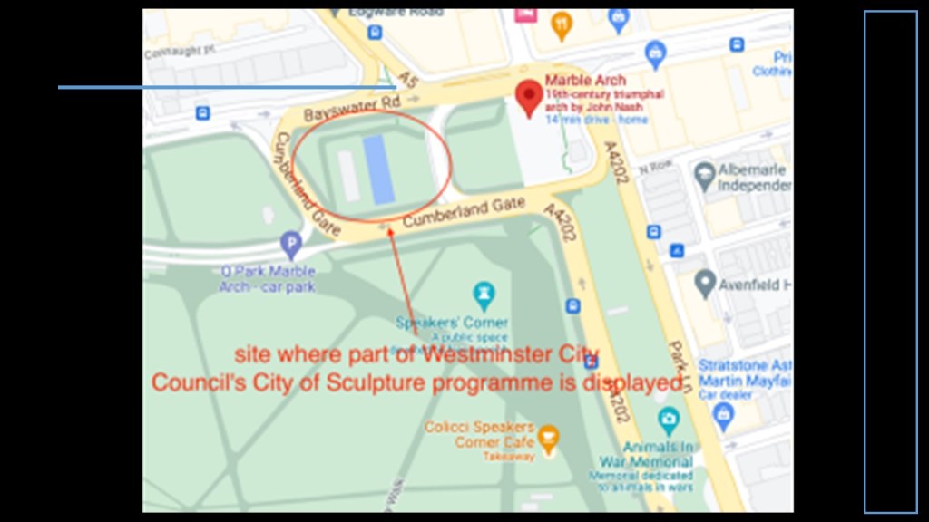
…and that just beside the Arch are grounds with a small water pool, and fountains, where the Westminster City Council’s City of Sculpture Programme displays its commissions.
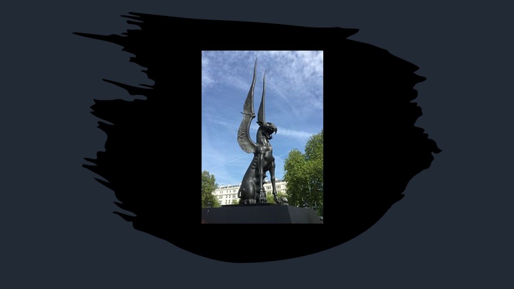
She said this statue was on display at the Marble Arch Park starting in 2015 until 2016, called ‘She Guardian,’ by Russian artist Dashi Namdakov.
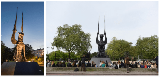
While indications are the image was intended to be a “symbol of female strength and a desire to care for the young,” it’s effect on most on-lookers was that it appeared as demonic, “looking ready to devour with its fangs bared and the huge tips of its wings honed into giant spears.”
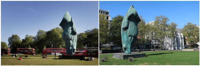
How about the bronze sculpture of a giant disembodied horses’ head captured as though the horse was drinking, sculpted by British artist Nic Fiddian-Green and installed at Marble Arch in 2011.
Ten-years later moved to a spot near Hyde Park Corner in May of 2021.
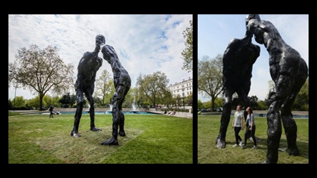
In 2016, David Breuer-Weil’s, 20-foot, or six-meter, high bronze sculpture called the “Brothers” was featured next to the Marble Arch, representing the joining together of two separate but connected individuals that, in this case, are siblings, joined by the head.
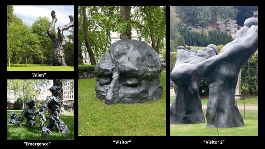
Here are some examples of David Breuer-Weil’s other sculptures around London, very reminiscent of Seward Johnson’s “Awakening” sculptures of the distressed giant attempting to free himself from the ground.
Other sculptures of the Westminster City Council’s City of Sculpture Programme have included:
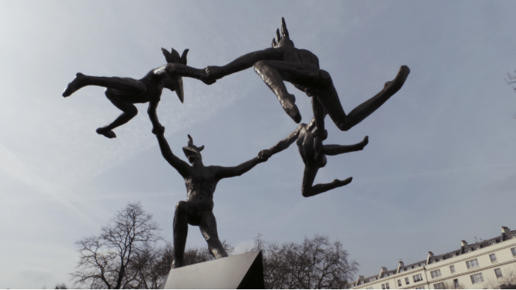
Danse Gwenedour by Bushra Fakhoury in 2017, inspired by a dance performed by French villagers in Pourlet Country in Brittany.
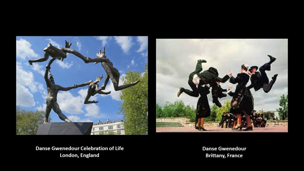
Interesting take on the dancers in the sculpture, with no clothes and wearing bird-like-masks, unlike the dancers in Brittany, who are fully-dressed, and without those masks.
The dancers are depicted like birds, maybe?
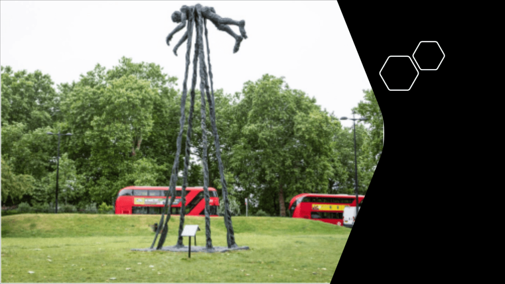
Another sculpture by David Breuer-Weil was featured next to the Marble Arch in 2018, called “Flight…”
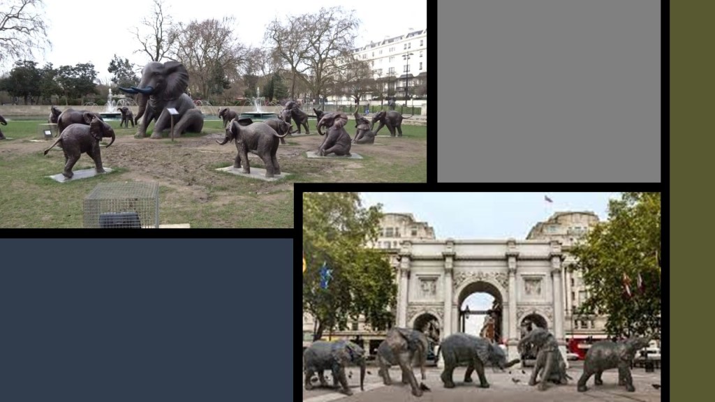
…and in December 2019, the featured sculpture was called “The Orphans, the Elephants of Tomorrow,” the work of artists Gillie and Marc.
The exhibit featured 21 life-size bronze elephants, a mother and 20 orphaned elephants, each orphan symbolizing a real elephant that lived at the “Sheldricke Wildlife Trust” in Kenya.
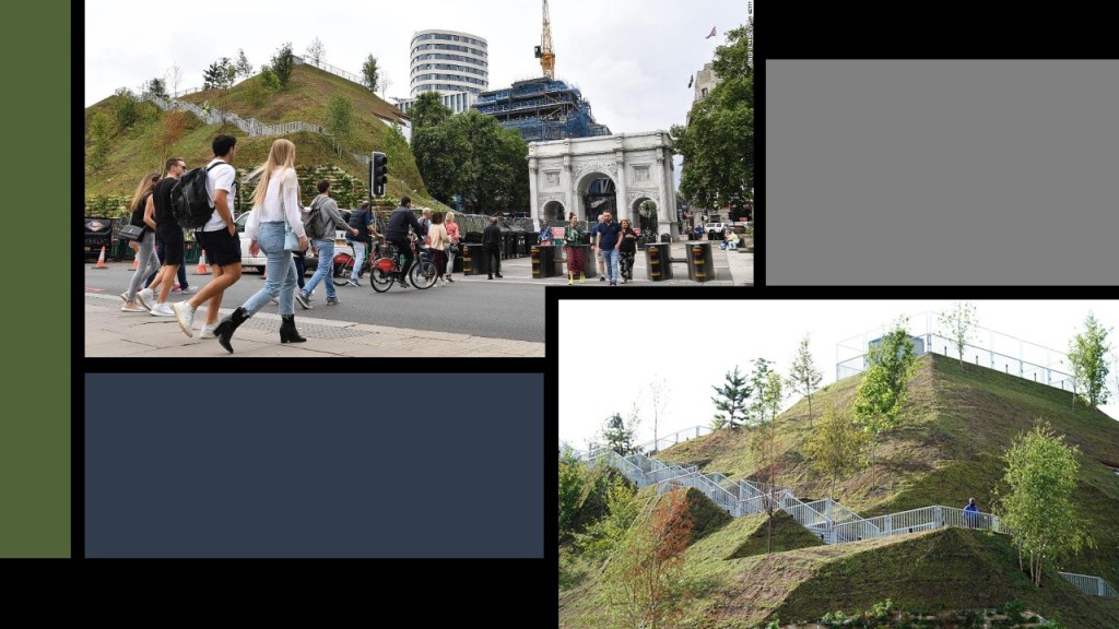
…and the one that is showing now is called “The Mound,” by Rotterdam-based architects MVRDV.
The reason I found given for the Mound having been commissioned by the Westminster Council, was at least in part, a novelty experience to give people a reason to come back to the shops in Westminster, which have suffered a decline in business in the last couple of years.
Other examples of unusual public art that I am aware of include:
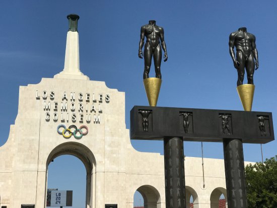
The two headless, but otherwise well-muscled, bodies greeting the people who come to the Los Angeles Memorial Coliseum since the 1984 Los Angeles Summer Olympics, one male and one female, by California sculptor Robert Graham…
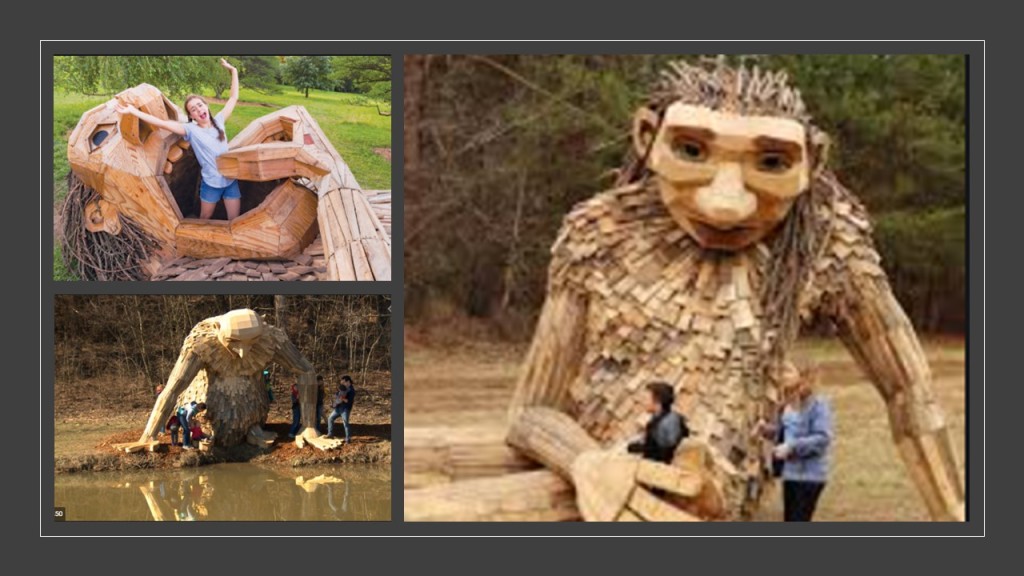
…the trolls at the Bernheim Arboretum and Research Forest south of Louisville, Kentucky, made from recycled wood by Danish artist Thomas Dambo, and which have been on the grounds since 2019….
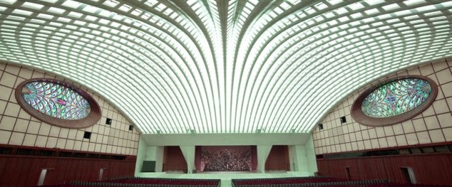
…the sculpture entitled the “Statue of the Resurrection,” said to depict Jesus rising from a crater in the Garden of Gethsemane, as well as the anguish of mankind living under the threat of nuclear war, and is located right behind where the Pope sits…
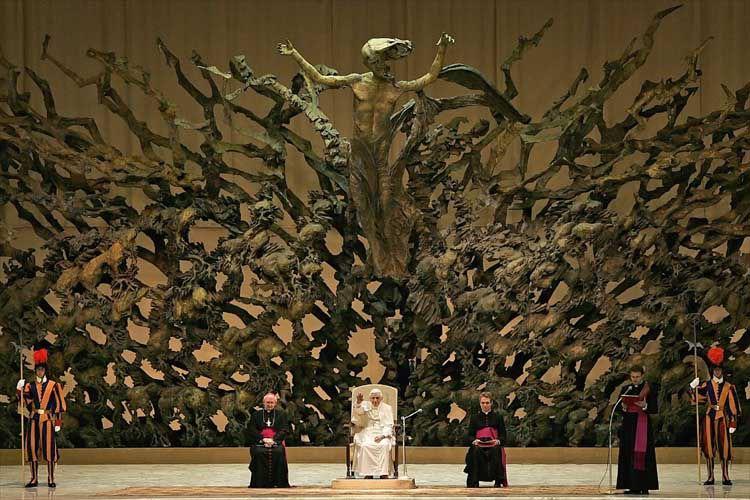
…in the Pope Paul VI Audience Hall at the Vatican…
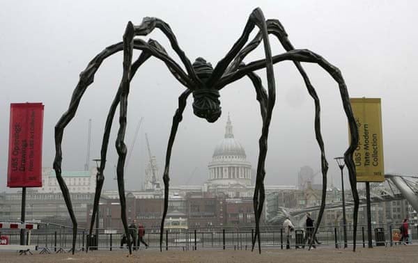
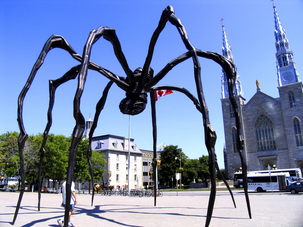
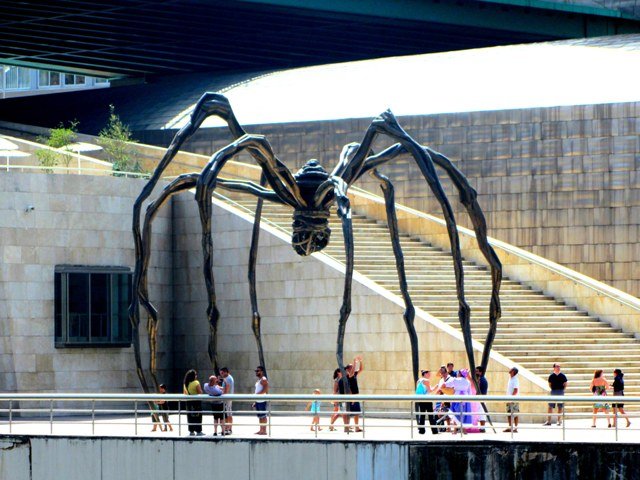
…enormous spider statues, called “Maman,” originally designed by French-American artist Louise Bourgeois, that are found at various permanent locations all over the world, including, but not limited to the Tate Modern in London…
…the National Gallery of Canada in Ottawa…
…and the Guggenheim Museum in Bilbao, Spain….
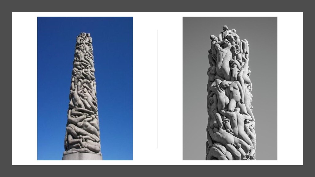
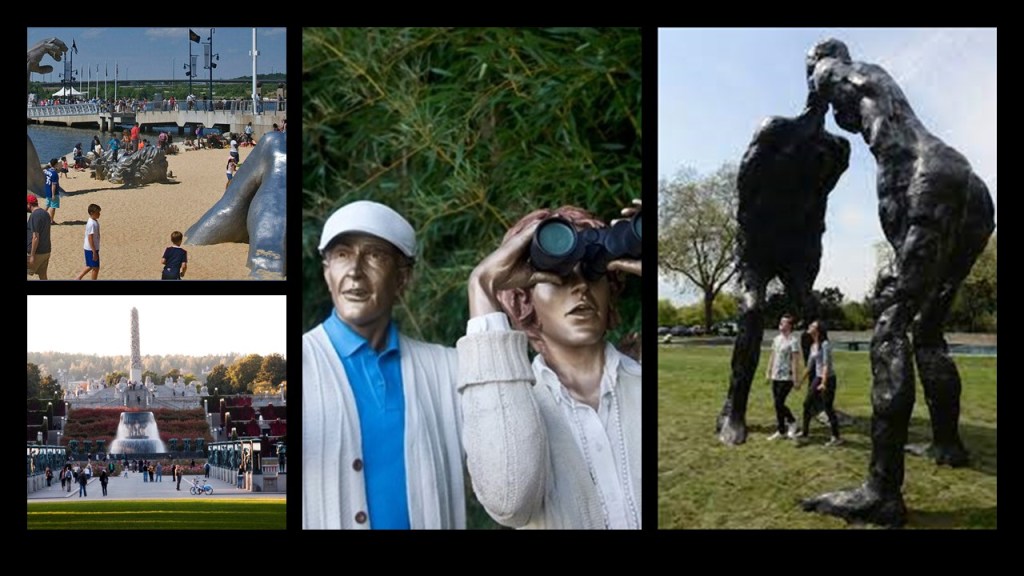
…and lastly the public statues that are found in Frogner Park, also known as the Vigeland Sculpture Park, in Oslo, Norway, dedicated to the works of Norwegian sculptor Gustav Vigeland, and the centerpiece of the park is his 46-foot, or 14-meter, -high sculpture called “The Monolith.”
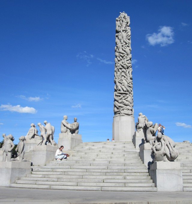
“The Monolith” is described as a symbolic sculpture consisting of 121 intertwined human figures, and said to represent the human desire to reach out to the Divine.
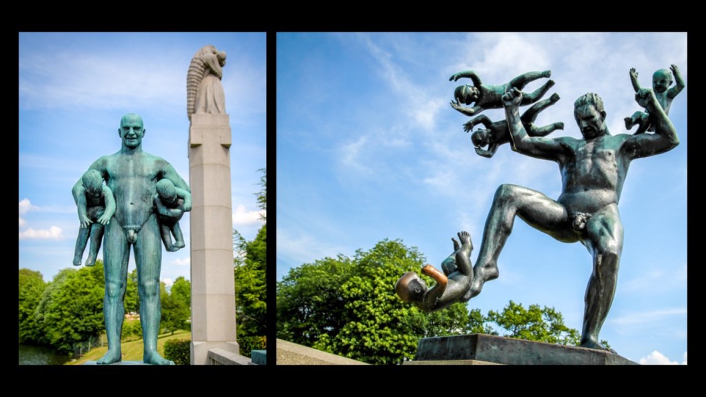
There are thirty-six sculptural groups situated immediately around “The Monolith,” including these…
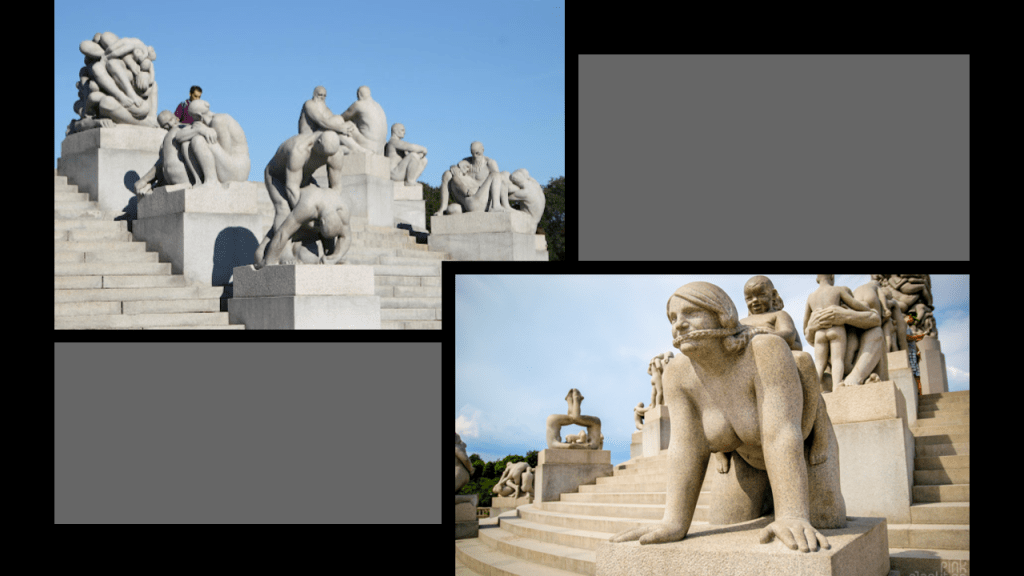
…and these as well are found in the park.
The Vigeland Sculpture Park is the largest sculpture park in the world by one artist, with over 200 sculptures by Vigeland.
The human figures of all of the statues are naked, and the park’s overall theme is said to be the “Human Experience.”
These are just a few examples of these sculptures found in a public setting.
There are many more here, and they are all extremely disturbing.
All I had to do to find this place, which I had heard about in the past, was search for “creepy statue in Oslo, Norway.”
I wonder what are they telling us they are not telling us they are telling us with all of this creepy public art?
Is all of this public art some sort of soft disclosure, to circumvent the requirement of needing to tell us what they have done to Humanity, and are doing, without telling us they are telling us?
Putting this artwork in places where people can interact with it and accept it as “Art,” without knowing it is communicating to us something that has been very well-hidden about the world we are living in?
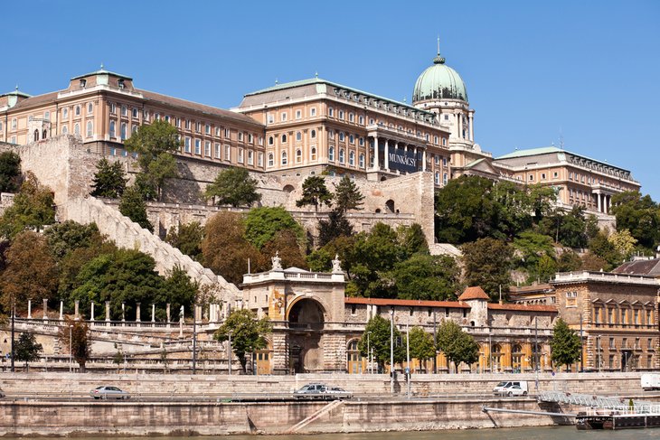
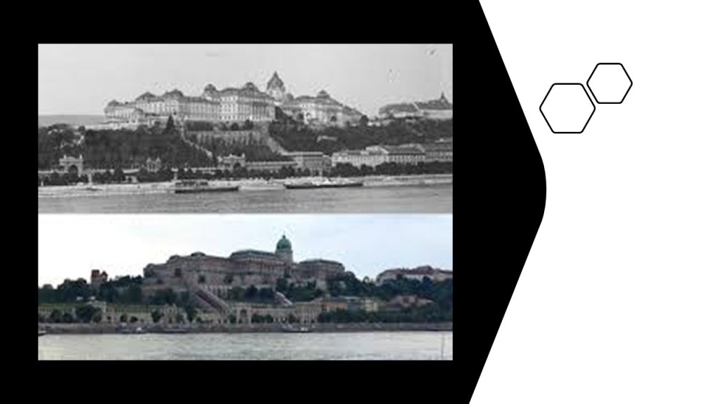
Next, RK suggested that I look into Buda Castle in Budapest, Hungary.
I am somewhat familiar with what is found at Buda Castle from past research, and this is a great place to bring it up, from what I already know about it.
I will get to that in a moment.
First, a quick review of what we are told about the history of Buda Castle.
It was the historical castle and palace complex of the Hungarian Kings, and first completed in 1265 AD, and that later, between 1749 and 1769, the massive Baroque palace occupying most of the site was built
The original royal palace was destroyed during World War II…
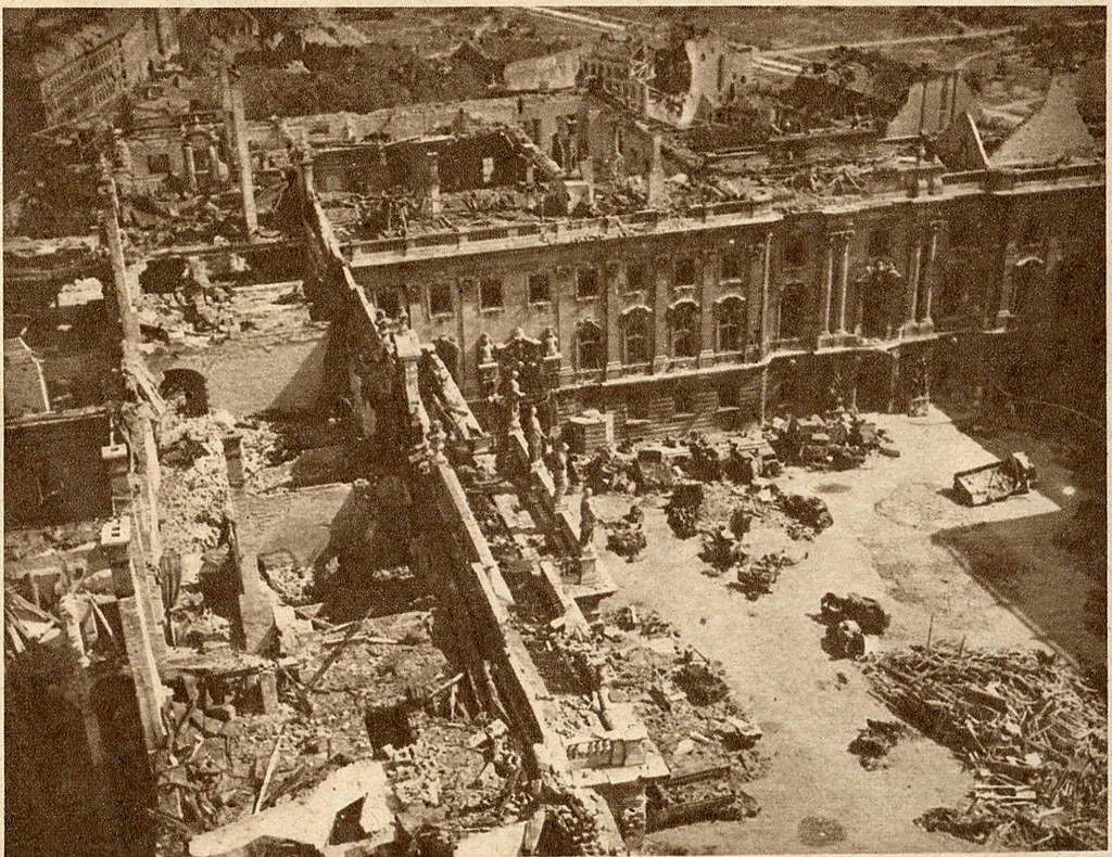
…and rebuilt in a simplified Stalin Baroque-style during the Kadar-era, with the reconstruction work on the castle completed in 1966.
Janos Kadar was a Hungarian Communist leader, and General-Secretary of the Hungarian-Socialist Workers’ Party from 1956 to 1988.
RK’s mother was involved in the reconstruction work on the complex.
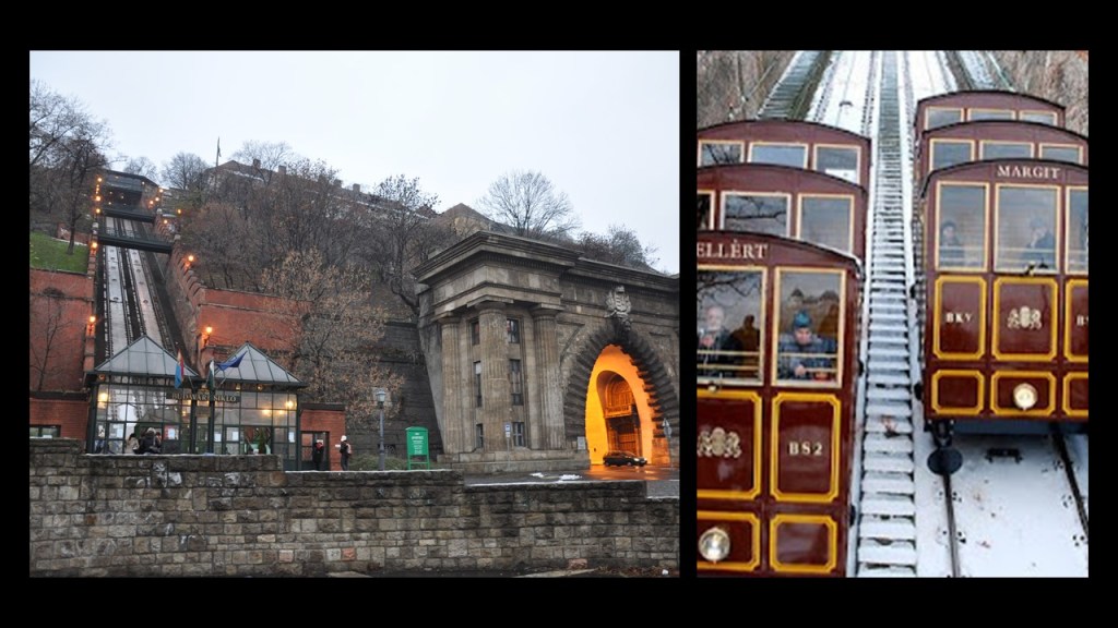
The Budapest Castle Hill Funicular was said to have been first built in 1870.
Part of the destruction of the complex during World War II, it reopened in June of 1986.
Today, Buda Castle is home to the Hungarian National Art Gallery…
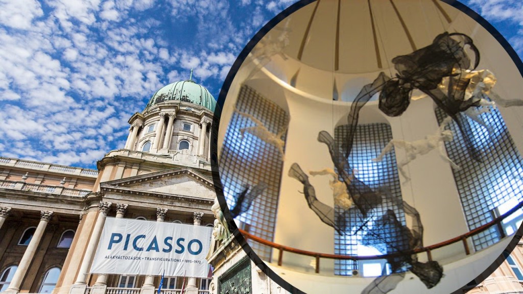
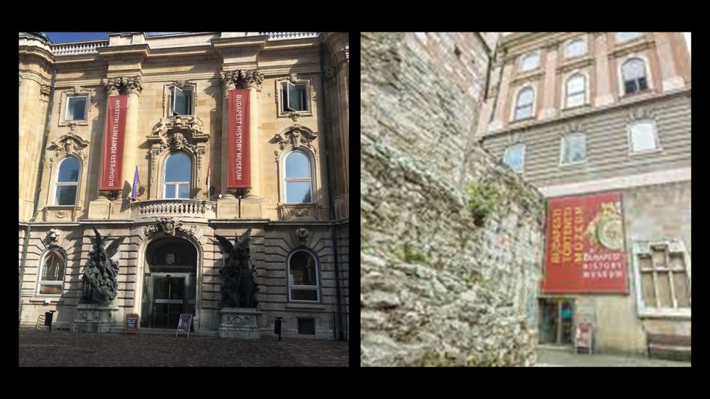
…and the Budapest History Museum.
There is also a labyrinth under Buda Castle.
The Buda Castle labyrinth under Buda Castle Hill is part of a huge underground system, complete with caves, thermal springs, basements and cellars.
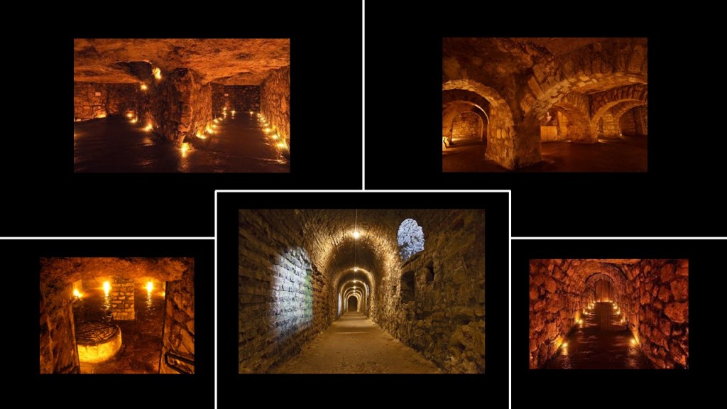
Among other features, there are five separate labyrinths encompassing nine halls.
There is not much detail in the information I can find about this place.
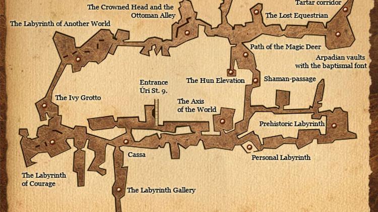
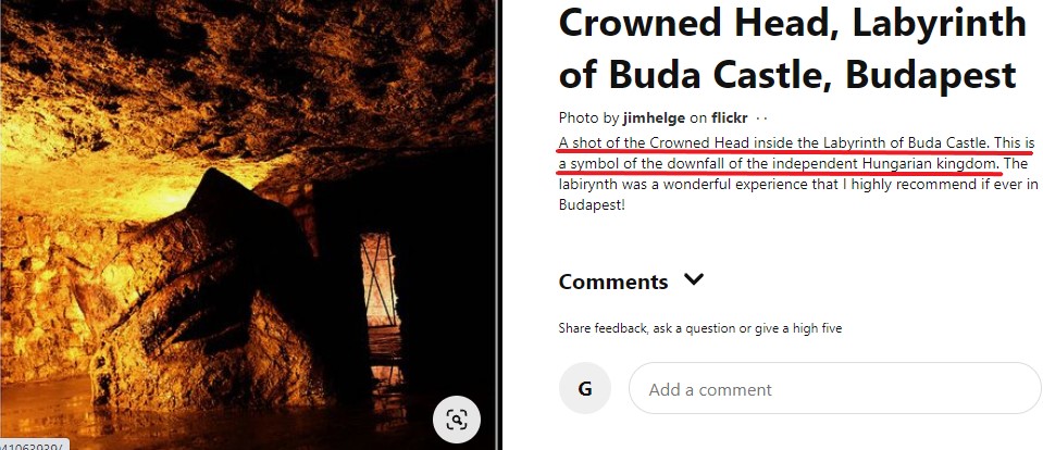
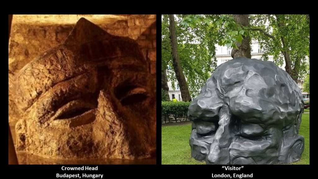
I am going to specifically look at the Crowned Head in the Ottoman Alley because I know what is there from past research.
This half-crowned-head is found in there.
I find it to be extremely odd.
To me, this giant head looks more like a petrified head with long-gone eyes, that is covered up to the nose and ears by mud, than an intentional work of art…
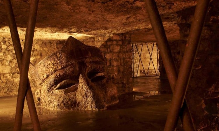
…and this is the most I can find out about it in a search – that it was said to be a symbol of the downfall of the independent Hungarian kingdom.
I can find nothing about it being a work of art.
Yet this crowned-half-head underneath Buda Castle looks remarkably like the David Breuer-Weil sculpture called the “Visitor” back in London.
I don’t know the big picture answer of what we are actually looking at here.
I can only point out the similarity, and high strangeness, of both half-heads.
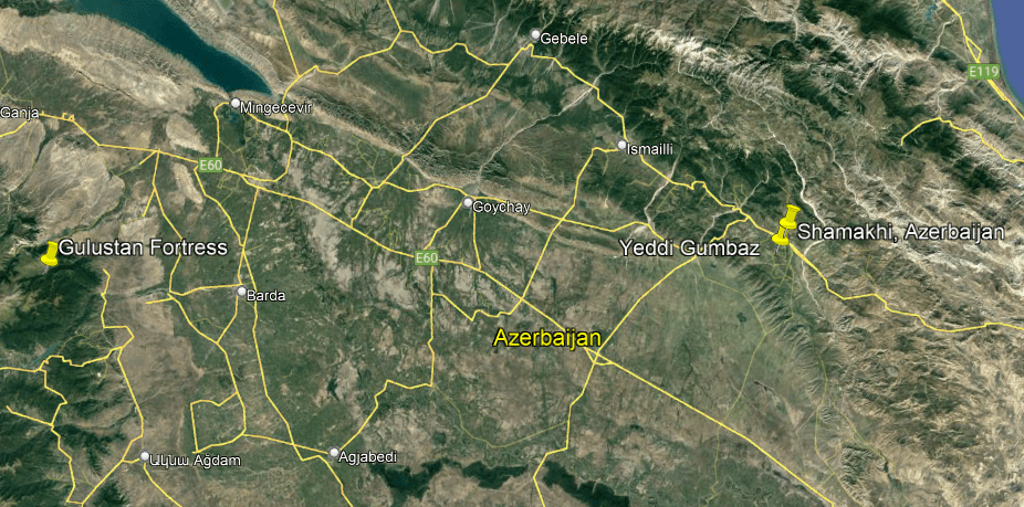
Next, KH was looking at old books of Tartaria in Asia, in an effort to match historical places with modern-day sites, and she came across an example of what she described as the apparent destruction of one of the sites.

She saw two forms of destruction though – one that is old and the other is being carried out today, as they are obliterating the past more and more.
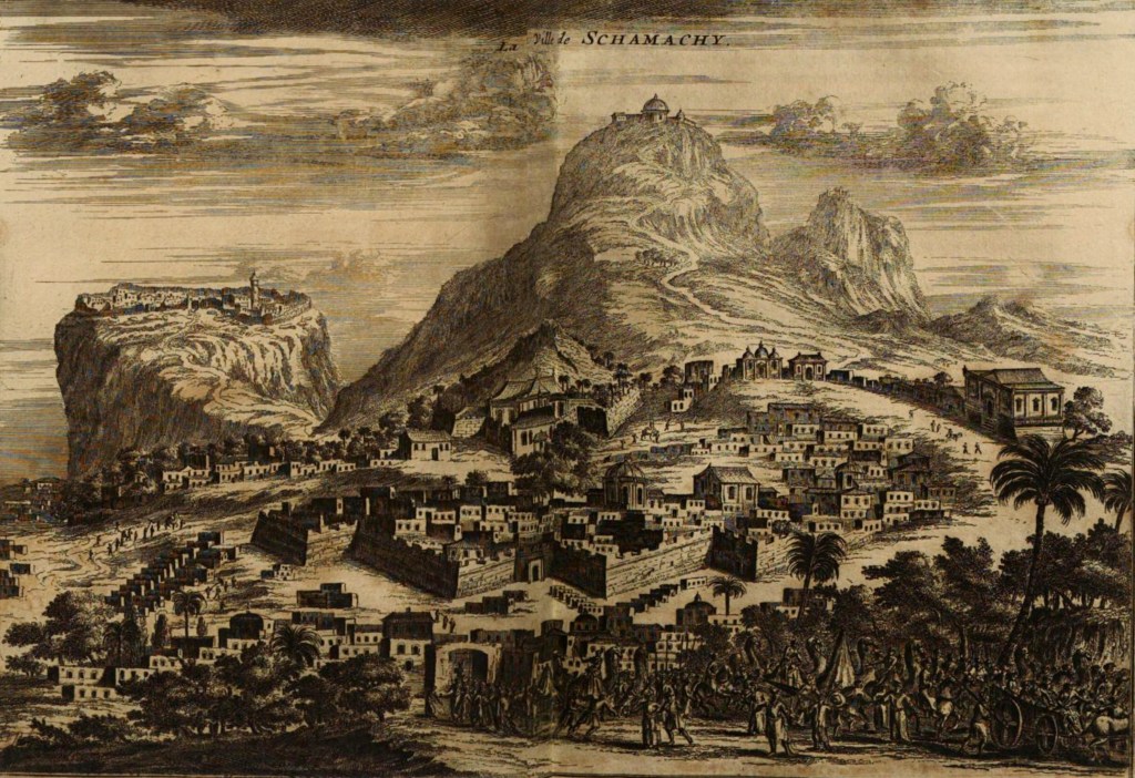
Here is the picture she was looking at and trying to match it to modern day.
She found other references to the place in other old books, but could not find a modern day name, until she stumbled across an old picture of the mountain which led her to the town today.
The picture is entitled “Schamachy,” which she said was part of Persia at the time.
It was one of the key towns of the ancient trade route of the Silk Road that connected East and West.
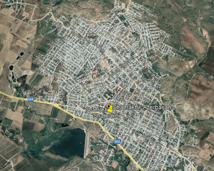
Today, it is the city of “Shamakhi,” in Azerbaijan, in what is considered the South Caucasus region that spans Asia and Europe.
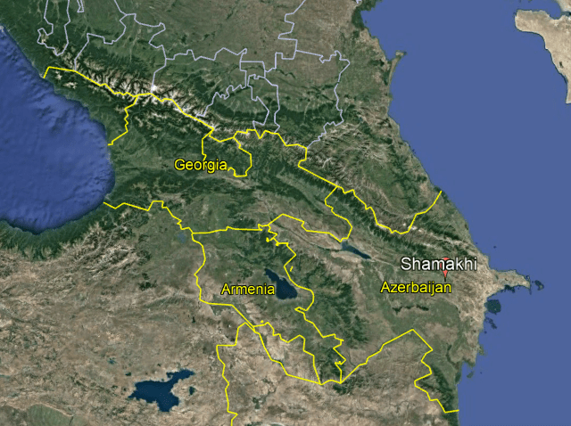
The Caucasus Mountain region is a part of the world that has been hotly-contested in the quest for who’s in control of it, and has seen much civil warfare, as well as horrible atrocities and genocide including what would be termed as ethnic cleansing, well into the present-day into modern times, including, but not limited to, the state of armed conflict which still exists between Azerbaijan and Armenia, and the disputed Nagorno-Karabakh region which is situated between the two countries, and which is officially-recognized as Azerbaijan’s territory, but it is occupied by Armenia.
There has been a literal blood-bath going on in this region for a very long-time.

KH said in the old image you can see where Shamakhi once was a star city.
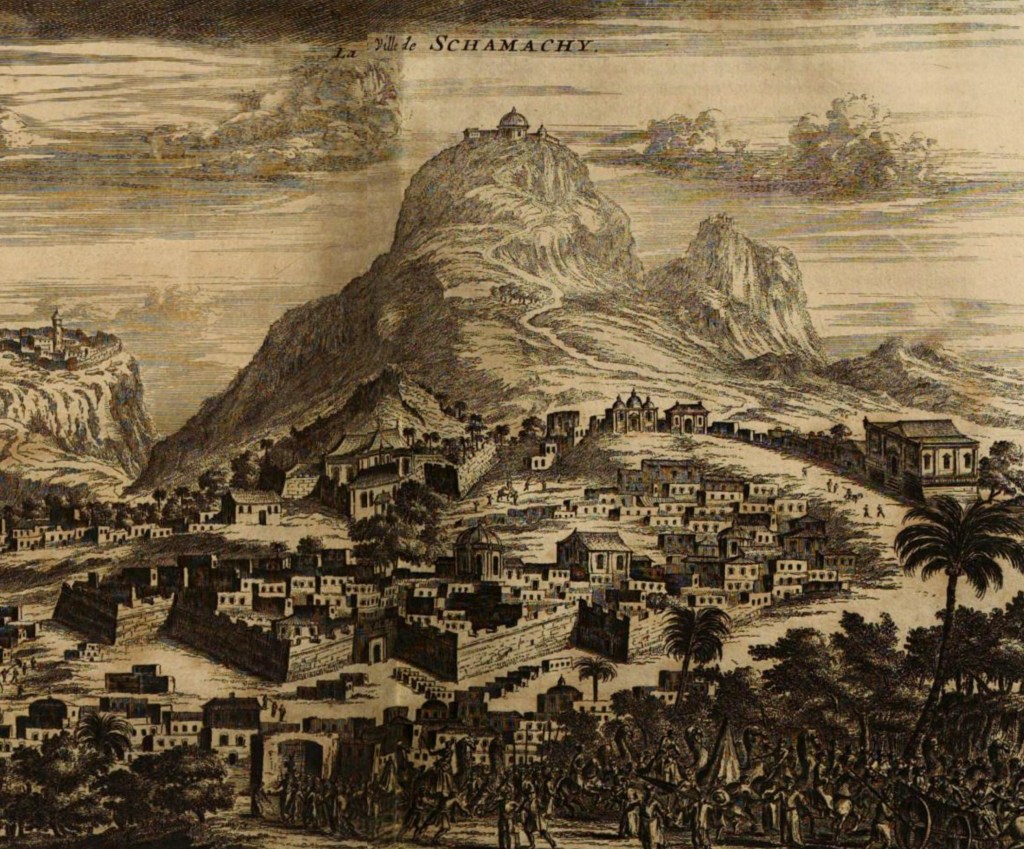
Some places you can tell used to be star cities on modern maps and Google Earth, with the presence of bastions and such, or outlines of where they were, like Trujillo, Peru, pictured here…
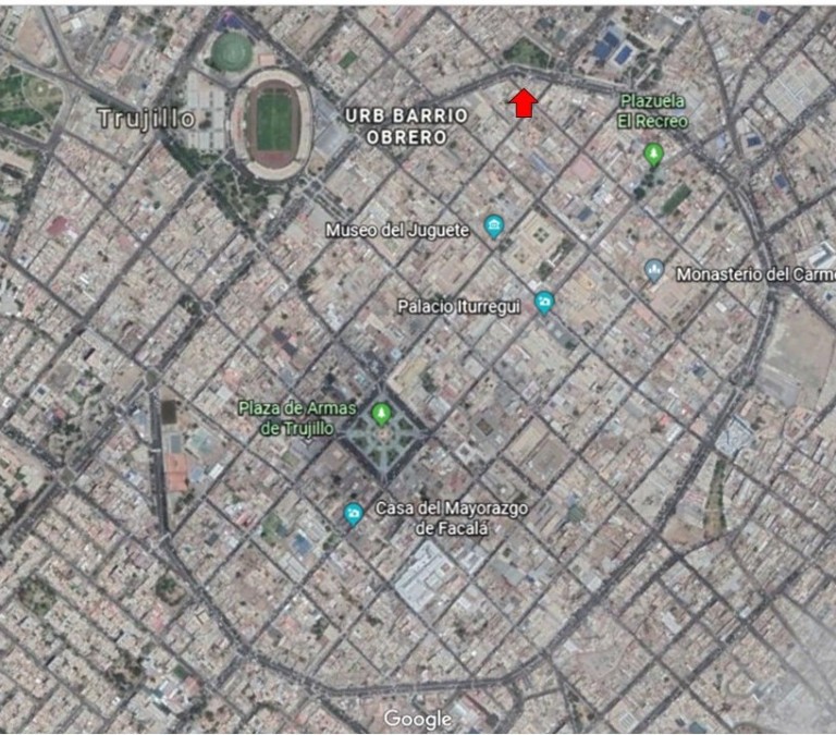
…but apparently Shamakhi is not one of those places where you easily see where it was.
KH was very interested in the city on the hill in the background of the picture image of old Schamachy, and what I am able to find in a search is the location of, and information on, a place relatively nearby called the Gulustan Fortress.
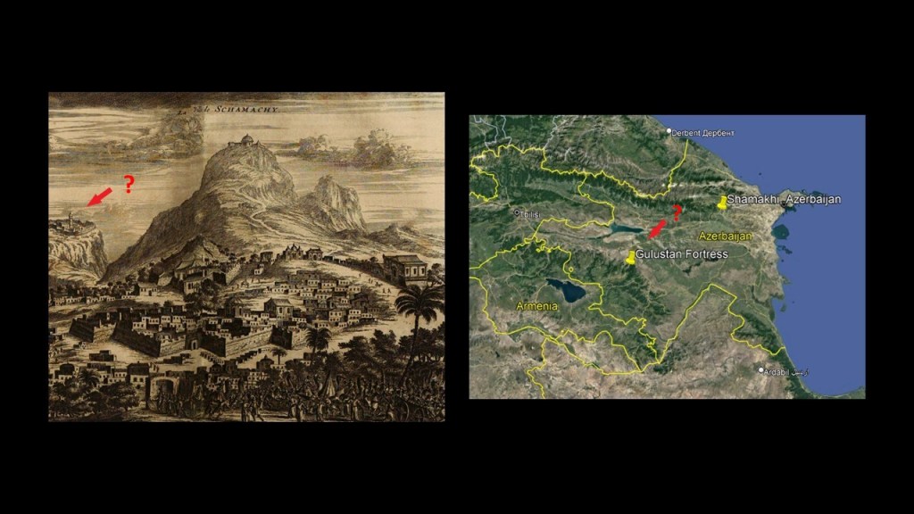
In ruins, the legendary Gulustan Fortress of Shamakhi was said to have been built in the 8th- and 9th-centuries on top of a 656-foot, or 200-meter, -high rocky mountain in the northwest of Shamakhi, and we are told it existed until the end of the 16th-century, having been badly damaged by wars and earthquakes.
Interesting how the original masonry looks all covered over by earth and grass in these photographs of the ruins!
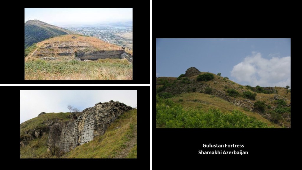
I think looking around the Gulustan Fortress area is even more telling about what might have actually taken place here.
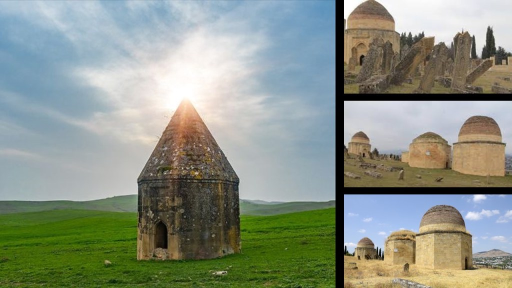
The Yeddi Gumbaz Mausoleum complex and cemetery, also known as the “Seven Domes of Shamakhi,” is located at the foot of the Gulustan Fortress mountain.
Three of the seven mausoleums remain undamaged, and were said to have been built by the architect Usta Taghi in the early 19th-century, starting in 1810, for the family of Mustafa Khan, the last Khan of Shamakhi, who ruled from 1794 to 1820.
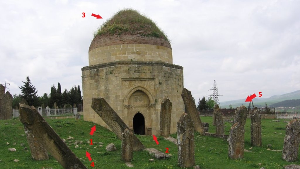
This mausoleum here is of particular interest to me for a number of reasons.
- The slanted Earth on the side of the mausoleum;
- The crooked appearance of the mausoleum from the entrance;
- The grass growing on the stone roof;
- The stones scattered in the grass;
- And the large, in several cases pointed & slanted, ancient stones of what we are told was a cemetery.
I am going to end “Places & Topics Suggested by Viewers – Volume 6” here in Azerbaijan.
Lots more to come!


Hi, Wow, this is an impressive article you have. We have covered many of the same subjects. I just would like to point you to some leads about some of them. I have done quite a bit of work about the Civilian Conservation Corps. They did most of the work putting together the park system on the state and national level but also did side jobs too, for instance they did alot of the grunt work associated with excavating the mound builder sites in the Ohio valley. Its interesting I’d forgotten about kudzu being a World Fair project. The world fairs and international expo’s are one of the largest misunderstood or unacknowledged threads in the Reset/Mudflood arena. It is fitting that the CCC was responsible for distribution of Zudku, they also were called the ‘Tree Army” for the tactic of planting millions and millions of trees across america. These trees were covering up anything that could potentially be a pre-reset artifact. The CCC was landscaping the US to fit the narrative and modifying old sites to meet the new. Kudzu wouldve been perfect for their mission, Im gonna have to include a chapter about this.
One thing to keep in mind, when we talk about covering up the past remains of settlements or villages like the Indians in the valley under the reservoir, dont forget that just as often the lack of evidence is what they are covering up. Lets go back to the mound builders where most often we read sadly about how entire complexes were razed for a parking lot thus destroying crucial evidence but in reality there were no mounds, at least not the way we are told. There were big piles of dirt that was leftover from excavating large cities like St Louis, The ‘Big Dig’. of course, nobody can call their BS bc the mounds were destroyed.
I have a dedicated article to Baku, Azerbaijan that spilled over into the entire Caucasus region and ancient Persia. Its deeper than you think.
The Wallace tower matches the Giles Cathedral in Edinburgh. Edinburgh was a ghost city in the mid 1800’s, at least thats what the year on the label says. This is significant bc you’ll find in a persons bio they went to university here or were born there but they couldn’t have bc a fully developed infrastructure has been abandoned.
Owl symbolism is found all over the place once you start looking, like you dont notice how many red cars there are until you think about it, then all you see are red cars. Its most prominently associated with Minerva who is an allegory for the Reset world order, but its all thinly veiled Luciferianism.
Thanks for the site. I know how much it takes to put into a decent article. A word of constructive criticism, idk if this is supposed to be a single post or not but it could be broken down into at least 4. I do this too. Its hard bc the information wants to branch out into every direction, its difficult to stay on point. It makes the information harder to follow when its scatter brained around like that. Ive had to break some post down and got 9 single out of a run-on post about Asia. This goes from Victorian Appalachia to public art displays in Europe to starforts of the Caucasus. Dont get discouraged though, I like it.
Check my site out when you get a sec
https://its-all-fake.com/2022/12/27/fake-historic-sites-as-the-roadside-tourist-trap-and-the-civilian-conservation-corp/
LikeLike