
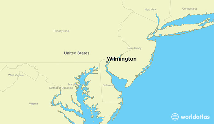
I started this new Circle Alignment in Washington, DC, in the last post, and tracked it as far as Baltimore. This alignment pretty much travels through cities on the east coast along I-95, and comes to Wilmington, Delaware next.
Wilmington is the largest and most populous city in the State of Delaware.
These were the lands of the Lenni Lenape people, also called the Delaware Indians, which also historically included: present-day New Jersey; eastern Pennsylvania along the Delaware River watershed; New York City; western Long Island; and the Lower Hudson Valley.

According the history we have been taught, everything changed for the Lenni Lenape after Henry Hudson sailed up what is now called the Delaware River in 1609.
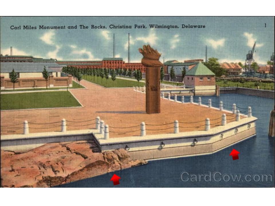
Twenty-nine years after Henry Hudson came through, came the Swedish South Company’s settlement of Fort Christina, named after Queen Christina of Sweden.

It was built in 1638, the first Swedish settlement in North America, and the principal settlement of the New Sweden Colony. Here’s an early map showing a star fort at this location flying a Swedish flag.

This is an old post card showing Fort Christina’s location, with a monument, and arrows are pointing towards a feature known as The Rocks, as well as the nicely-shaped masonry shoreline.
Twelve miles south of Wilmington, Fort Delaware is located on Pea Patch Island in the Delaware River.
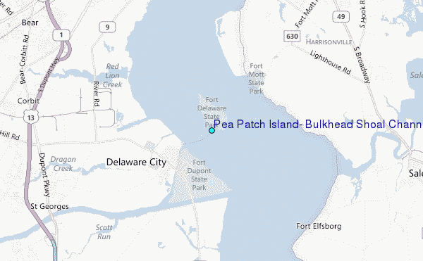
Fort Delaware was said to have been built starting in 1819.
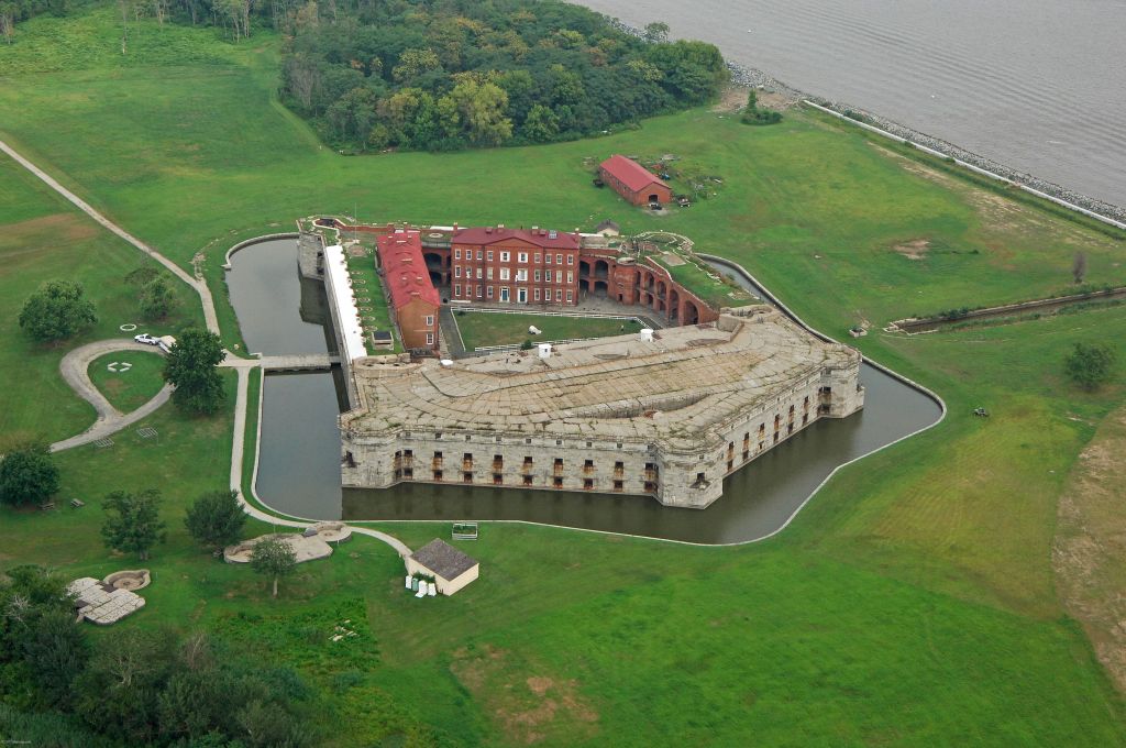
This is a close-up view of one of the points of this star fort.

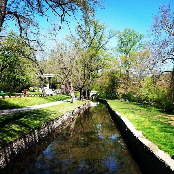
Wilmington is built out around the confluence of the Christina and Brandywine Rivers. I am seeing what is actually a canal system here, like I have seen in other places.

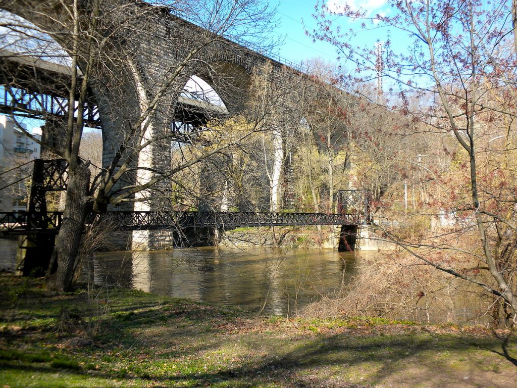
Brandywine Creek State Park is three-miles north of Wilmington. Much of this park was part of the duPont family’s Winterthur Estate. In 1965, the State of Delaware purchased 433-acres (or 175 hectares) of it, and established the park.
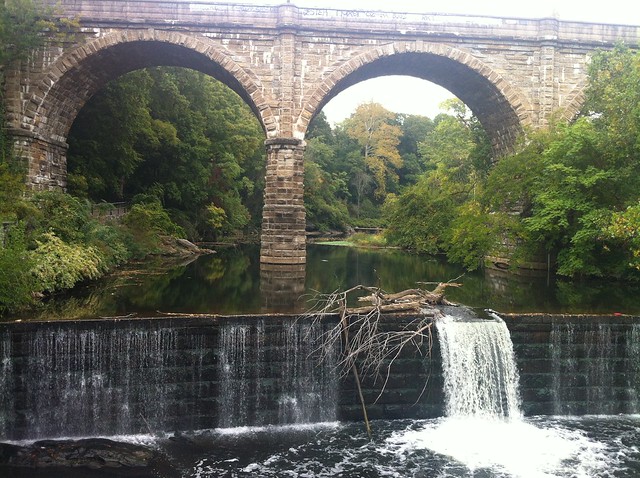
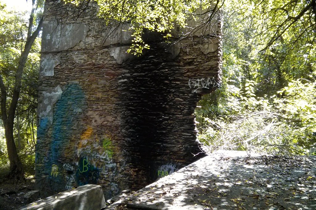
This impressive and huge stone bridge is also found in Brandywine Creek State Park…
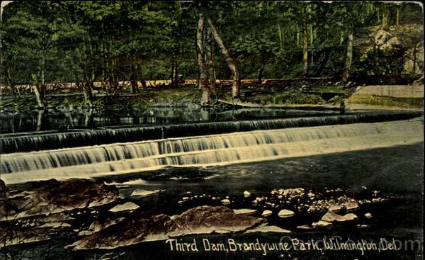
…as well as this feature, called the Third Dam.
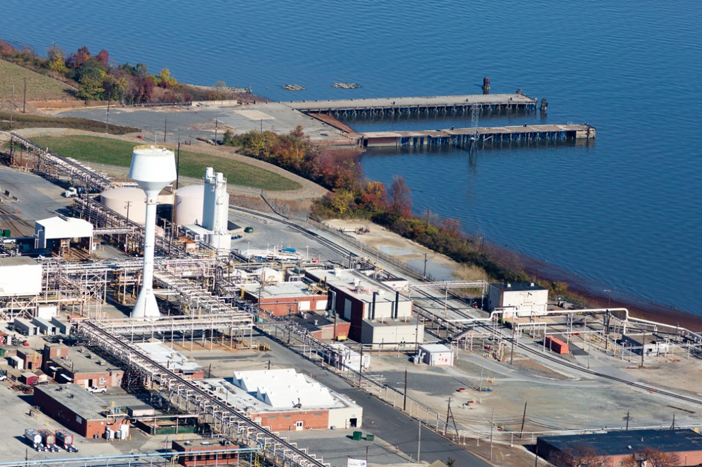
One of Wilmington’s nicknames is “Chemical Capital of the World.”
The Edgemoor Chemours Chemical factory operated here until 2015.

It was purchased by the Port of Wilmington. I was drawn to look at Edgemoor because of the moor in the name. The memory of the people is retained in the name. Then there is a moor sound going on in Chemours…
…as well as Nemours, the 300-acre, or 120-hectare, country garden estate of the late industrialist Alfred I. duPont.
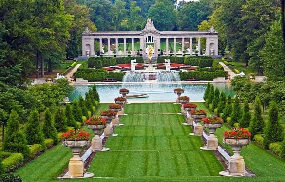
This architectural style is called a folly, which is defined as a decorative building that doesn’t serve much of a purpose, even if it is meant to look like it does. That’s interesting. I wonder what they are not telling us they are telling us. Sounds like a cover-up code word to me, like the use of the word bluff being used to disguise ancient infrastructure.
At any rate, the folly in Wilmington at Nemours Gardens on the left is similar in appearance to the two follies in England on the right.

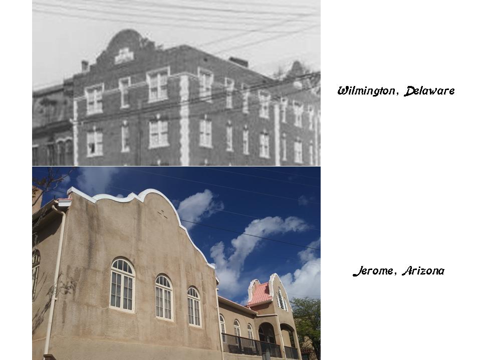
Here is a comparison of a very similar-looking building design detail in Wilmington, Delaware on the top, and in Jerome, Arizona on the bottom.
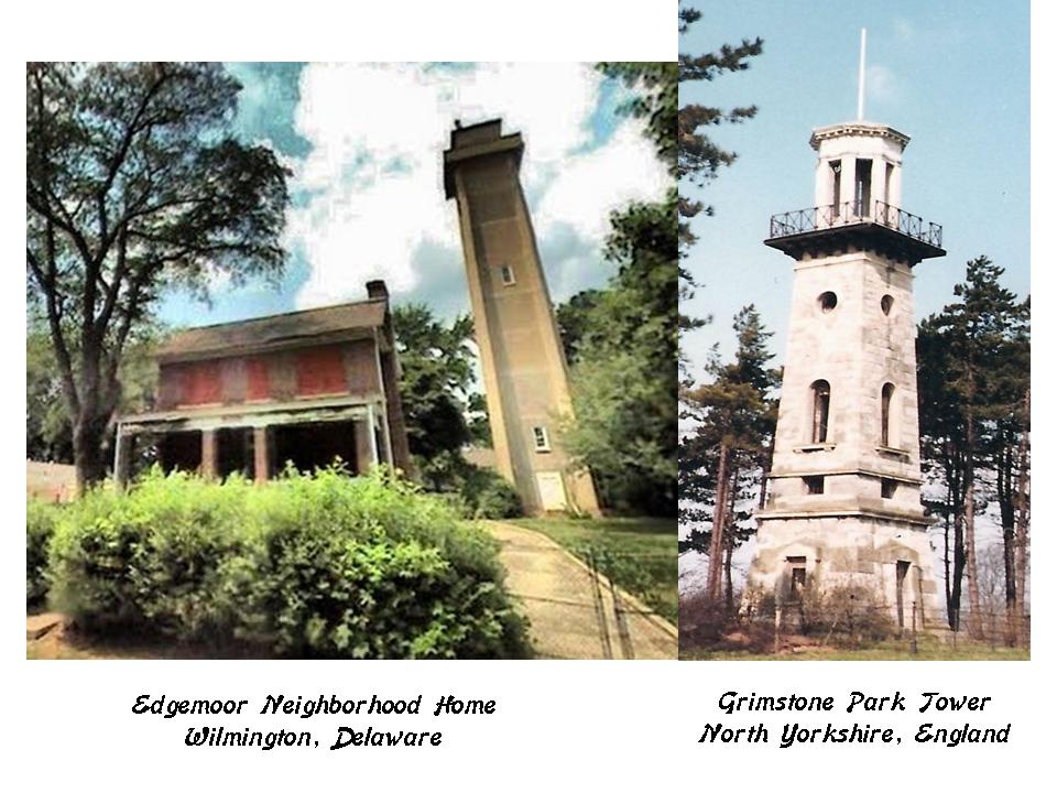
This Edgemoor neighborhood home on the left has an impressive and sturdy stone tower right next to it, and for comparison is the Grimstone Park Tower in North Yorkshire in England on the right.
Close to Wilmington, on the other side of the Delaware River in Penns Grove, I would like to share another architectural similarity to Jerome, Arizona, which is an ancient mining town close to where I live.
Compare the similarities between these three homes in Penns Grove on the left; Jerome, Arizona in the middle; and Providence Rhode Island on the right.

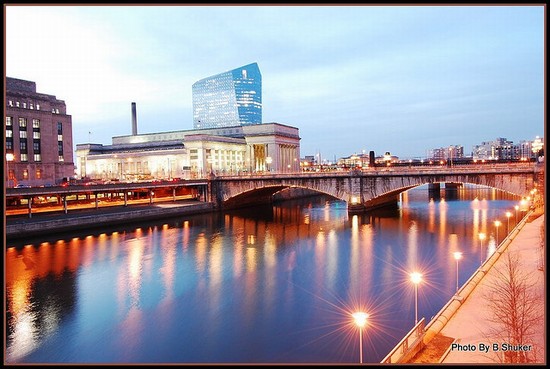
Next on the alignment, we come to Philadelphia, the largest city in Pennsylvania, and the 6th-largest in the United States.
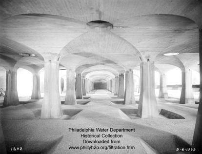
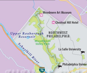
I consistently find interesting things at reservoirs.
So I looked into the Upper Roxborough Reservoir, and found out that it is an abandoned watershed project in northwest Philadelphia. These stately structures are described as filters of the reservoir.
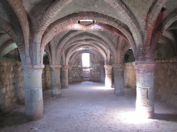
It brought to mind the fort the Portuguese are said to have built on Hormuz Island after they captured the island between the United Arab Emirates and Iran in 1507 – the interestingly named Fort of Our Lady of the Conception (for a fort?)…
…and I first learned of this pedestrian underground located for the Crystal Palace in London from a recent video on “Metaphysical Alignments Across London and Britain” made by the Moorish Culture Classes’ YouTube Channel.
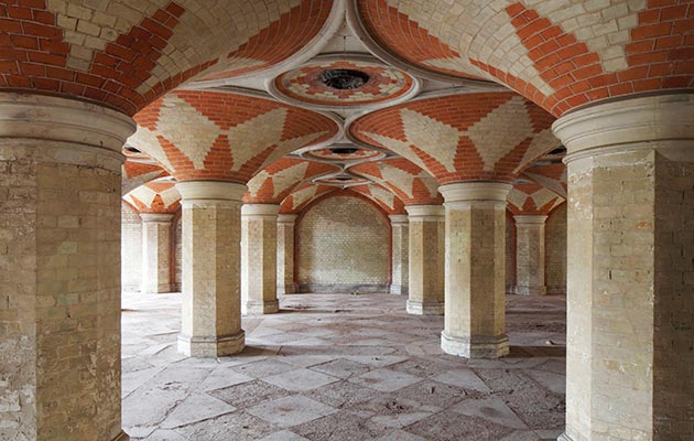
I have talked about the Crystal Palace in past posts because the story we are told about it makes no sense, but I didn’t know about the underground or advanced geometries associated with the Crystal Palace.
These next three photos were taken at the Wissahickon State Park just below the Upper Roxborough Reservoir.
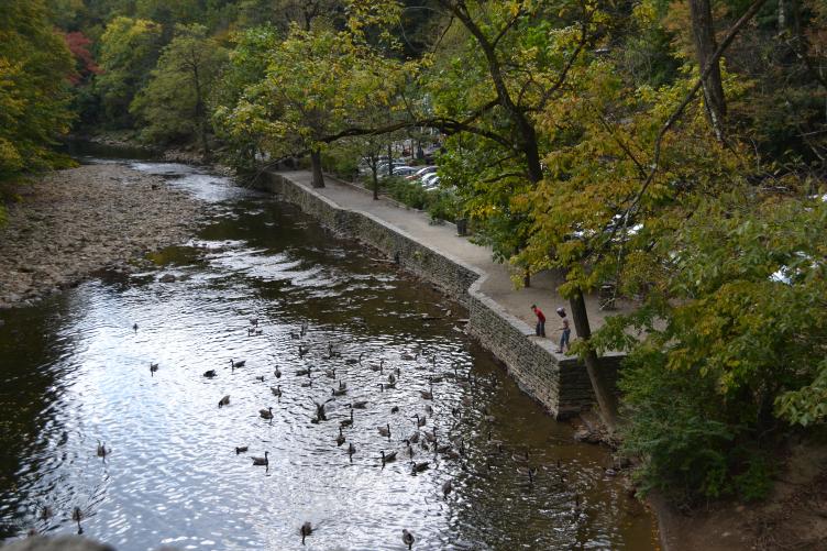
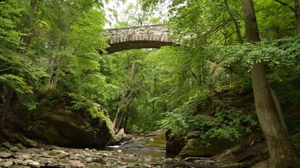
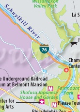
The Schuylkill River flows past near here on its way through Philadelphia to the Delaware River.
The Schuylkill River flows past Fairmount Park.
The Smith Memorial Arch is a gateway to West Fairmount Park, said to be an American Civil War monument…

…on the grounds of the 1876 Centennial Exposition, the first official World’s Fair in the United States.

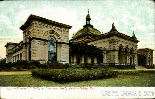
This is the Memorial Hall in Fairmount Park, said to have been built for the 1876 Centennial Expo, and the only major structure from that exhibition to survive.
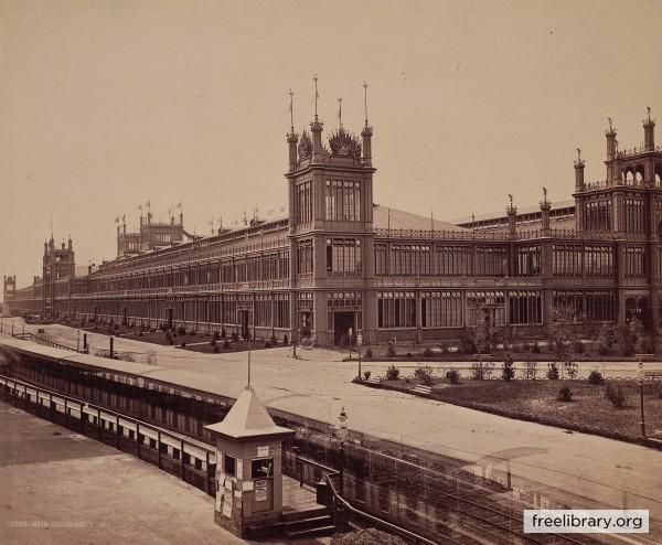
This is the original Horticultural Hall, no longer standing, that was said to be designed for the 1876 Exposition in the Moresque style of the twelfth-century…
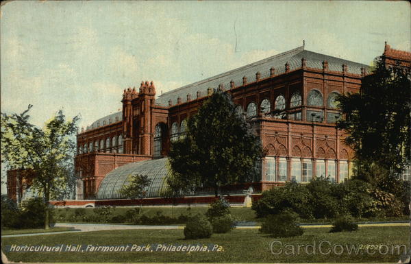
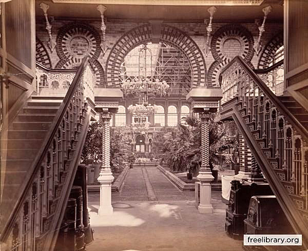
…and looks a lot on the outside like some Oklahoma High Schools to me, like this historic photo of the original Central High School in Tulsa.

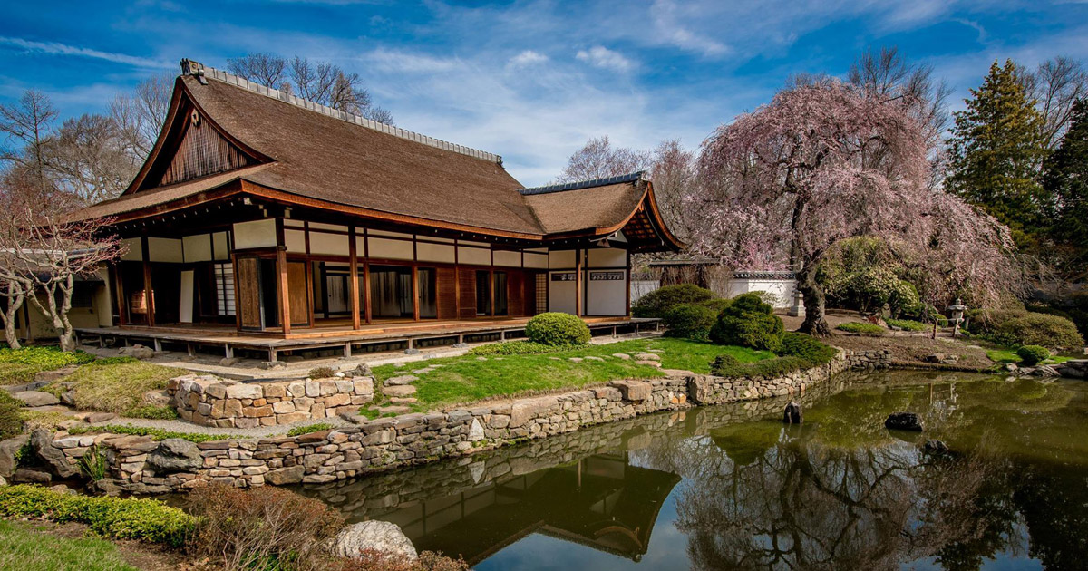
The Shofusa Japanese House and Garden is just across the Schuylkill River from Fairmount Park, with its peaceful appearance, and what looks like ancient stonework next to the water.
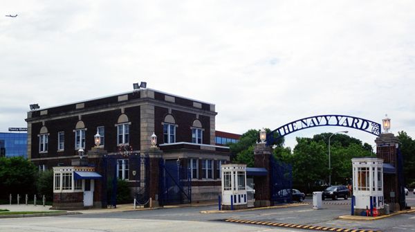
The Schuylkill River enters the Delaware River in the neighborhood of the Philadelphia Navy Yard.
The Philadelphia Navy Yard, or the Philadelphia Naval Shipyard, has been an important naval shipyard of the United States for over two centuries, said to have begun in 1776.
The Philadelphia Navy Yard was also the location for the Philadelphia Experiment in 1942, which I have speculated on as a causal factor for the creation of a new time-loop between 1492 and 1942 in my “An Explanation for What Happened to the Positive Timeline of Humanity & Associated Historical Anomalies and Events” post.

This is the Delaware River on the Philadelphia waterfront, with its nice masonry banks.
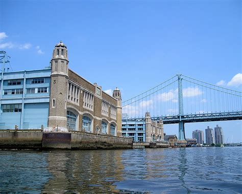
This building on the municipal pier is now the front for condominiums on the Delaware River, but I see the signature features for Moorish architecture here as well.
And this is a view of the Philadelphia Museum of Art from the Schuylkill River. Ummmhhh, this looks like ancient Greco-Roman architecture to me…

…and for comparison, this is the Museum of Art in Budapest, Hungary. What is going on here?

I want to leave you with images from Benjamin Rush State Park, on the far northeastern edge of Philadelphia.
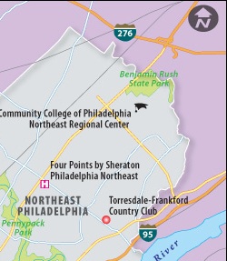
Benjamin Rush was considered a Founding Father of the United States, a physician, politician, social reformer, humanitarian, educator, and founder of Dickinson College.

This is Benjamin Rush State Park in the far northeast corner of Philadelphia….

I will pick up the alignment in the area around Trenton, New Jersey in the next post.

This is a greaat post
LikeLike