
Caroline from California sent me information about what were called “Sanitary Fairs,” a subject I had not heard of before.
She said they were held by northerners during the American Civil War as a fundraiser for the many needs of Union Soldiers, including health.
She found out about them not to long ago when poking around old medical journals on google books, and came across this phenomenon called “Sanitary Fairs.”

She said the “Sanitary Fairs” had everything, including majestic “temporary” buildings said to have been built for the fairs, to be torn down after, and while not as elaborate as the big expositions such as in Chicago, they were still something in and of themselves.

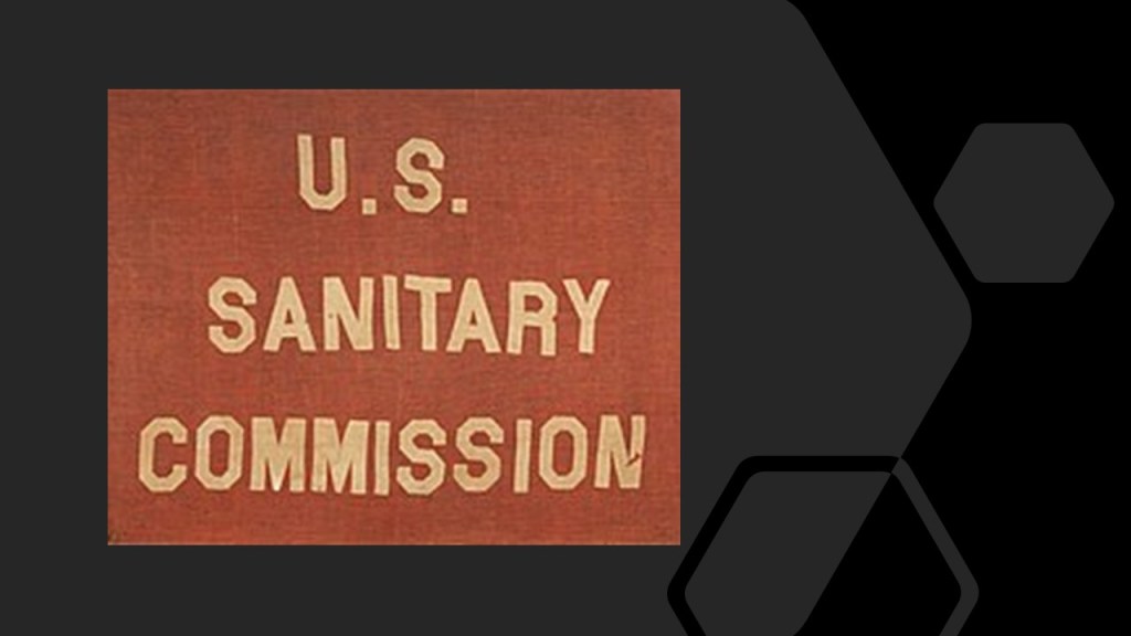
She mentioned that there was an agency, called the the United States Sanitary Commission, formed to raise money, and that these fairs were fundraising events held to support this agency.
The United States Sanitary Commission will be my starting point for this post.
I will delve into the little-known history of Sanitary Fairs, and many thanks to Caroline for bringing this to my attention.
After which, I will bring forward other anomalies of the Civil War that I have encountered in my own research.
The United States Sanitary Commission, a private relief agency with the mission of supporting the sick and wounded soldiers of the Union Army, was created by federal legislation on June 18th of 1861.
We are told the United States Sanitary Commission was modelled after the British Sanitary Commission, which had been set-up for the Crimean War between 1853 and 1856, during which time Florence Nightingale and a team of 38 volunteer nurses came to the Crimea in 1854 to care for British soldiers who were wounded and dying in horribly unsanitary conditions.
Florence Nightingale came to be widely revered as the founder of modern nursing.
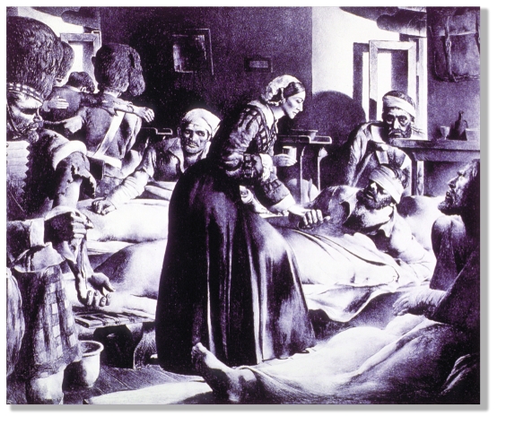
It is also interesting to note the she came from a wealthy family connected to elite circles.

The planner of the United States Sanitary Commission, and its only president from 1861 to 1878, was Henry Whitney Bellows, an American Unitarian Clergyman.
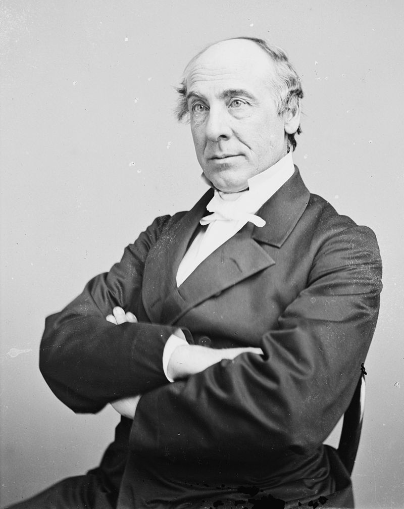
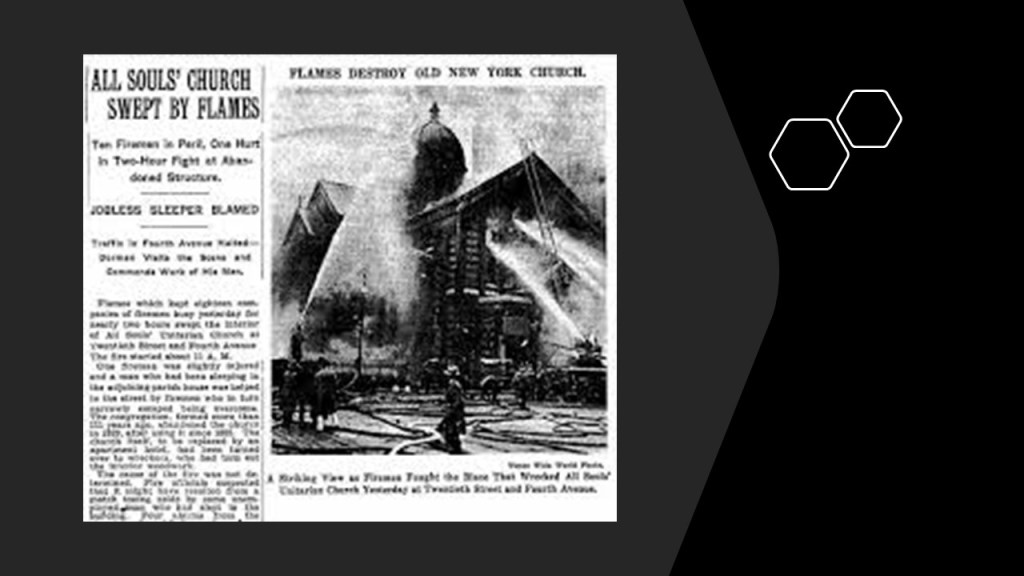
He was the Pastor of the First Congregational Unitarian Church of New York City at the time of the American Civil War, also known as the All Souls Unitarian Church.
This building for Henry Whitney Bellows’ congregation, also known as the “Church of the Holy Zebra,” was said to have been built between 1853 and 1855, and in use only until 1929, at which time they moved uptown,
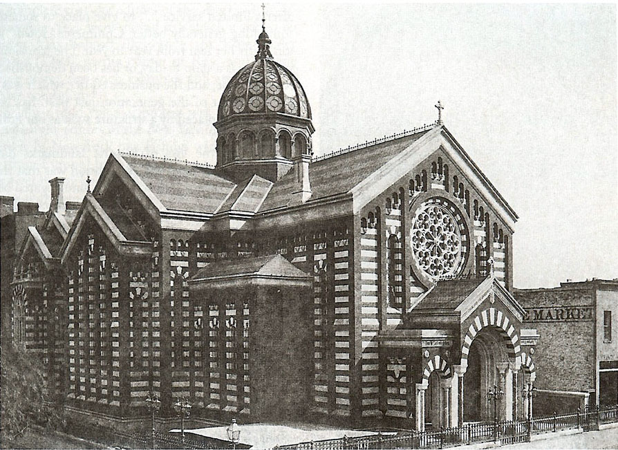
This church building was destroyed by fire on August 23rd of 1931.
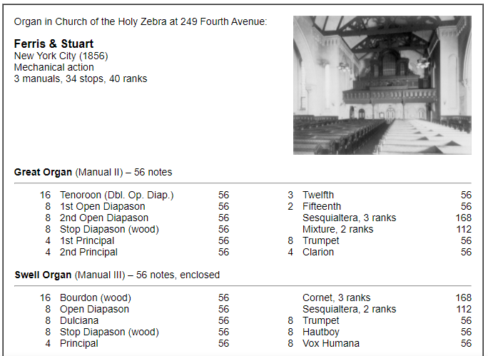
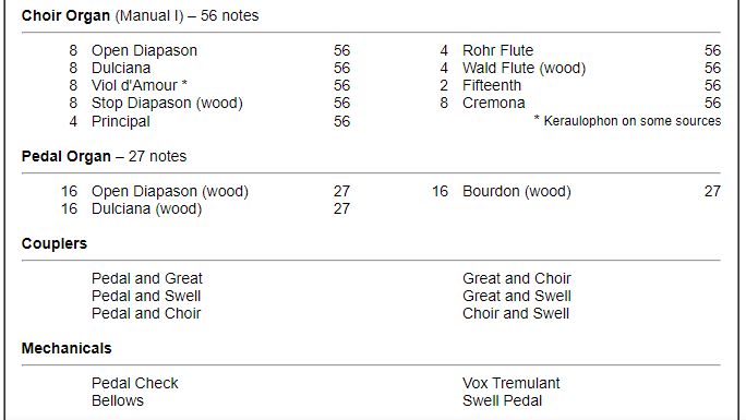
Here is a description of the organs that were once housed in this beautiful building destroyed by fire.
I have come to understand such architecture and instruments as powerful frequency resonators and generators that were once part of a much larger integrated system within the original civilization for the healing and enhancement of All Life.
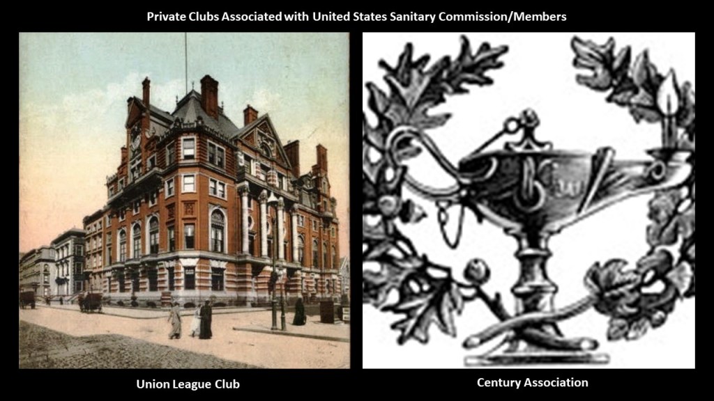
In addition to planning and organizing the United States Sanitary Commission, Henry Whitney Bellows was an organizer of the Union League Club of New York, along with Frederick Law Olmsted, George Templeton Strong, and Wolcott Gibbs.
It was a private social club for wealthy men that opened in New York City in 1863 for pro-Union men could come together “to cultivate a profound national devotion” and “strengthen a love and respect for the Union.”
It became the most exclusive mens’ club in Manhattan, and perhaps in the nation.
This location for the Union League Club was said to have been built on the northeast corner of 5th Avenue and 39th Street between 1879 and 1881.

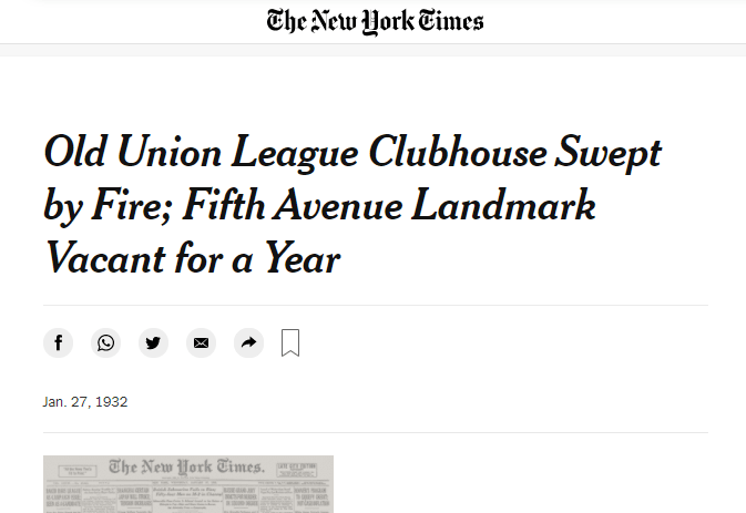
This Union League Clubhouse closed its doors permanently on January 24th of 1931, after a new clubhouse was built on Park Avenue and 37th Street starting in 1929.
A little over a year later, on January 26th of 1932, a fire was said to have started in the basement, and engulfed the whole building in a short-period of time.
Henry Whitney Bellows was also involved in the organizing of the Century Association in New York City, founded in 1847 and incorporated in 1857.
The Century Association was a private social, arts and dining club, and named after the first 100 people proposed as members.
The Century Association Building at 42 E. 15th Street was in-use by the association starting in 1857, and which served as one of the headquarters of the United States Sanitary Commission.

Members of the Century Association have included artists and writers like: poet and journalist William Cullen Bryant; landscape painter Frederick Edwin Church; landscape painter Winslow Homer; and best-known for stained-glass-work, Louis Comfort Tiffany.
Architect members have included: landscape-architects Calvert Vaux and Frederick Law Olmsted; Beaux-Arts architects Carrere and Hastings, as well as York and Sawyer; and architects McKim, Meade and White, who were said to have defined the ideals of the American Renaissance in end-of-the-century New York.
Other members were said to have included: Eight U. S. Presidents; ten U. S. Supreme Court Justices; forty-three Members of the Presidential Cabinet; twenty-nine Nobel Prize Laureates; members of the Rockefeller, Vanderbilt, Roosevelt, and Astor families; as well as financier J. P. Morgan and morse code inventor Samuel P. Morse.

Ever hear the George Carlin quote “It’s one big club, and you ain’t in it?” and wonder where that idea might have come from?

The first executive secretary of the United States Sanitary Commission was Frederick Law Olmsted.
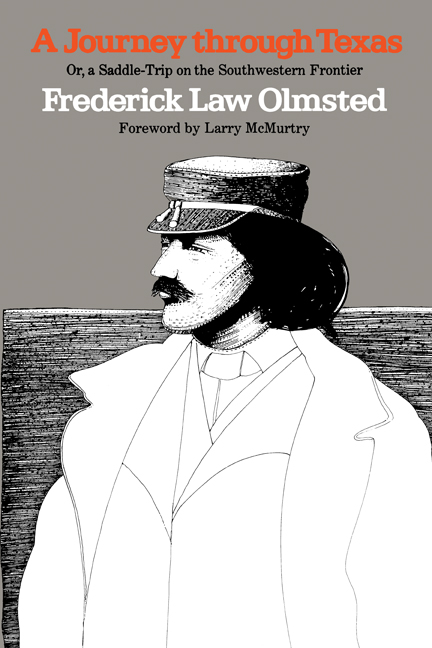
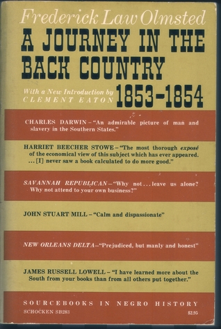
Among other things, during the antebellum time-period, Olmsted was commissioned by the New York Daily Times to start on an extensive research journey in the American South and Texas between 1852 and 1857.
The dispatches he sent to the Times were collected into three books, and considered vivid, first-person accounts of the antebellum South: “A Journey in the Seaboard Slave States,” first published in 1856…

…”A Journey through Texas,” published in 1857…
…and “A Journey in the Back Country in the Winter of 1853 – 1854,” published in 1860.
All three of these books were published in one book, called “Journeys and Explorations in the Cotton Kingdom,” in 1861 during the first six months of the American Civil War at the suggestion of his publisher in England.

All of these books by Frederick Law Olmsted, a journalist before he became a landscape architect with Calvert Vaux, starting with what we are told was Central Park, raised red flags for me as I have come to believe from my research that publications like these are indicative of some kind of setting the stage in seeding the new historical narrative into our consciousness by those responsible for the hijack of the original positive civilization that built all of Earth’s infrastructure, and, as we will see, ultimately what this post is all about.
I have the same question about another founder of the United States Sanitary Commission, and the Union League Club of New York, and that was George Templeton Strong, a New York lawyer and diarist.
His 2,250-page diary was said to have been found in the 1930s, and containing his striking personal account of life in the 19th-century, between 1835 and 1875, including the events of the American Civil War between 1861 and 1865.

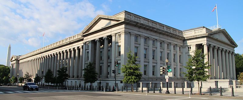
The central office of the federally-authorized private relief agency of the United States Sanitary Commission was set-up inside the federal U. S. Treasury Building in June of 1861…
…and by October of 1861, was receiving detailed reports, along with the U. S. War Department, from Sanitary inspectors about the conditions from around 400 regimental camp inspections.
The need for more frequent decision-making resulted in a standing committee of the United States Sanitary Commission that was formed in New York, with its main members throughout the Civil War consisting of: Henry Whitney Bellows; George Templeton Strong; and surgeons Dr. William H. Van Buren, Dr. Cornelius R. Agnew, and Dr. Wolcott Gibbs, who, as mentioned previously, was a founder of the Union League Club, along with Henry Whitney Bellows, George Templeton Strong, and Frederick Law Olmsted.

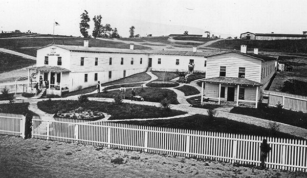
The United States Sanitary Commission operated 30 soldiers’ homes, lodges and rest houses for Union soldiers that were travelling or wounded, most of which closed right after the war, as well as setting -up and staffing hospitals during the war.
Caroline in California provided me with the following links.
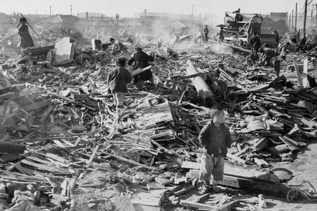
The first is what looks to be the mudflooded building of Camp Nelson, one of the Sanitary Commission’s Soldiers’ camps, from the National Park Service website, with the dirt-covered road in the foreground, and workcrew in the back-ground.
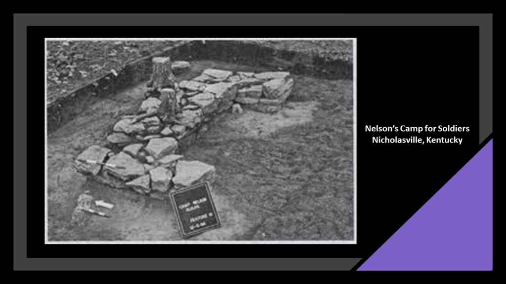
She also provided this image she found at Camp Nelson of what appears to be an intentionally-made rock structure.
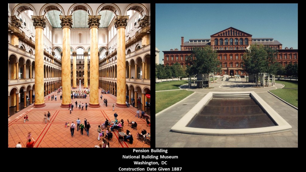
We are told the federal government in 1887 constructed the “Pension Building,” now the National Building Museum, in Washington, DC, to process and administer all of the pension requests from veterans.
Dorothea Dix was the Union Army’s Superintendent of Army Nurses and as such worked in conjunction with the United States Sanitary Commission’s mission.

In her work as an advocate for the indigent mentally ill, Dorothea Dix was credited with creating the first generation of mental asylums through lobbying state legislatures and the U. S. Congress.
With regards to the occurrence of Sanitary Fairs themselves, they were said to have started out as local fund-raising events to benefit the United States Sanitary Commission, and grew more and more elaborate.
The fairs were expositions and bazaars organized and run by civilians to raise funds for the United States Sanitary Commission for food, clothing, bandages, and other supplies for both military hospitals and soldiers in the field.
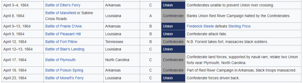
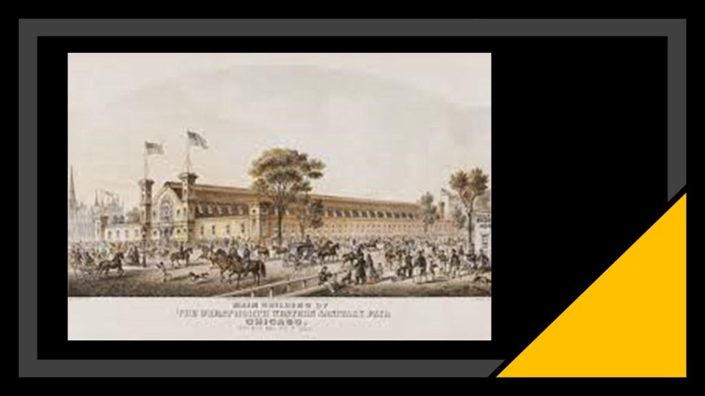
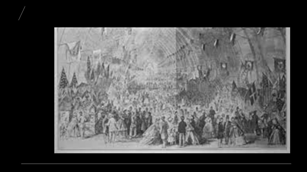
The first Sanitary Fair was the two-day “Mammoth Fair,” which took place in Lowell, Massachusetts in February of 1863, and the largest of the Sanitary Fairs, the Northwestern Soldiers’ Fair, was held in Chicago from October 27th of 1863 to November 7th of 1863, and raising close to $100,000 for the cause.
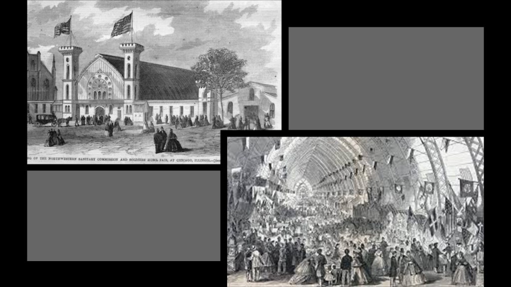
I couldn’t find any illustrations or photos of it, but I did find this reference in the “New York Times” to the Northwestern Soldiers’ Fair opening parade on October 27th of 1863.
It was said to be a three-mile, or 5-kilometer-, long parade of militiamen, bands, political leaders, representatives of local organizations, and a contingent of farmers with carts full of crops.

Sanitary Fairs typically held large-scale exhibitions, and the 1863 Northwestern Soldiers Fair in Chicago featured a “Curiosity Shop” of war souvenirs, with weapons and other artifacts said to have been designed to contrast the barbaric southern enemy with the civilized North.
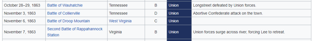
These were the Civil War Battles said to have taken place during the same period of time as the Northwestern Soldiers Fair:
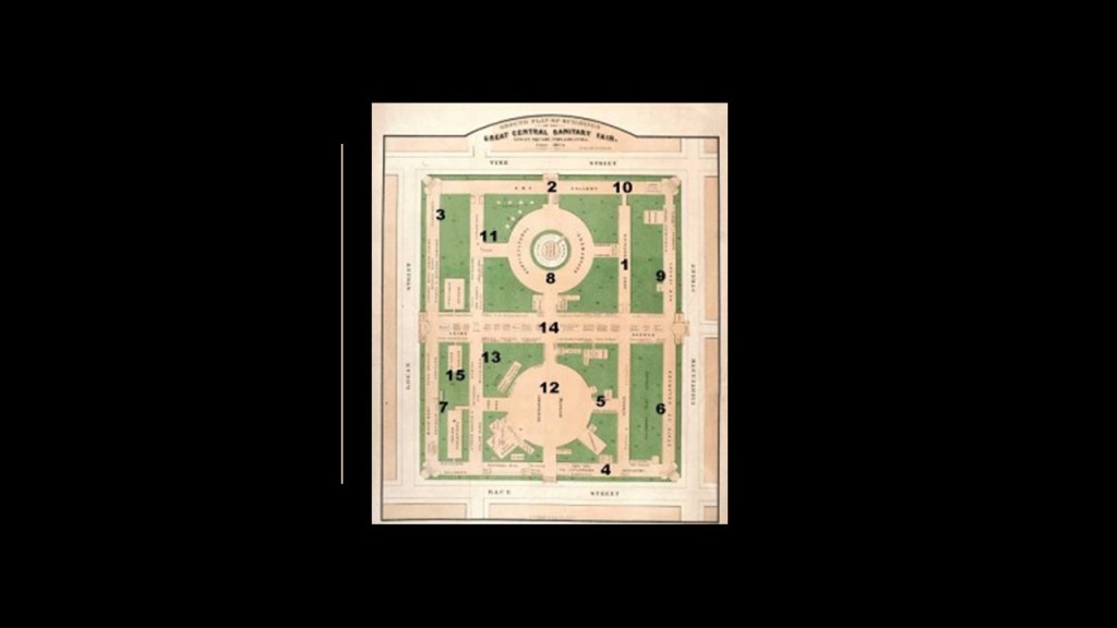
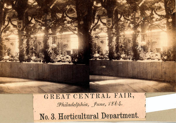
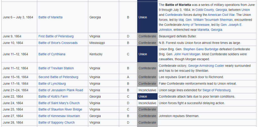
The Great Central Fair in June of 1864 took place in the entirety of Philadelphia’s Logan Square.
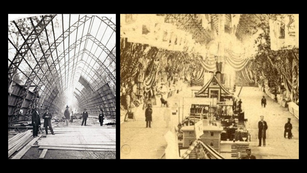
The structures for the Great Central Fair were said to have been built in in 40-working days by volunteer craftsmen…all 6 of them?…in this could-be-staged photograph…
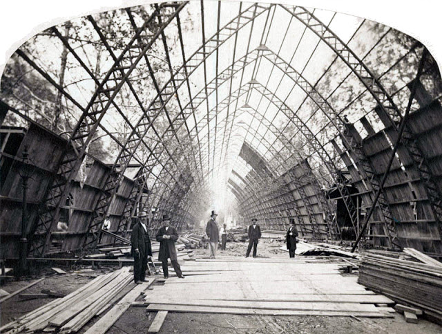
…because when it was completed, the 200,000-square-foot, or 18,581-square-meter complex looked like this, featuring Union Avenue, a 540-foot-, or 165-meter-, long Central Hall…
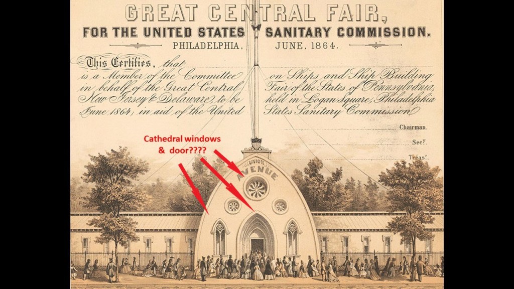
…over flag-festooned, soaring gothic arches.
Come to think of it, both of these photographs look staged, with the few people shown in both photos facing the photographer.
And are the dimensions of the interior the same?
And even if they are photos of the same structure, with the one photo on the right looking wider and higher to me than the photo on the left, could the photo on the left be a “de-construction” photo instead of a “construction” photo as it was said to be?
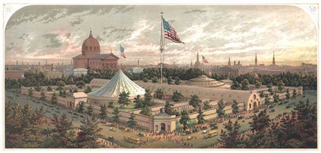
This was an illustration of what the whole Great Central Fair complex looked like, with the long Union Avenue hall flanked on both sides by rotundas and interconnected exhibit corridors.
Said to have raised more than $1,000,000 for the United States Sanitary Commission in its 3-week run from June 7th to June 28th of 1864, in its final form, the fair was said to have around 100 departments, including Arms and Trophies; children’s clothing; homemade fancy articles; Fine Arts; brewers; wax fruit; trimmings and lingerie; umbrellas and canes; curiosities and relics; a steam glass blower; an Art Gallery; and a horticulture exhibit.
These were the Civil War Battles said to have taken place during the same period of time as the Great Central Fair:
Other notable Sanitary Fairs included:
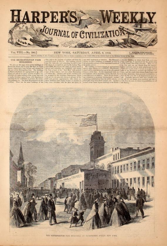
The first Metropolitan Fair, planned for March but ended up being held in New York between April 4th and April 23rd of 1864, also raising over $1,000,000 for the cause, and the largest Sanitary Fair ever.
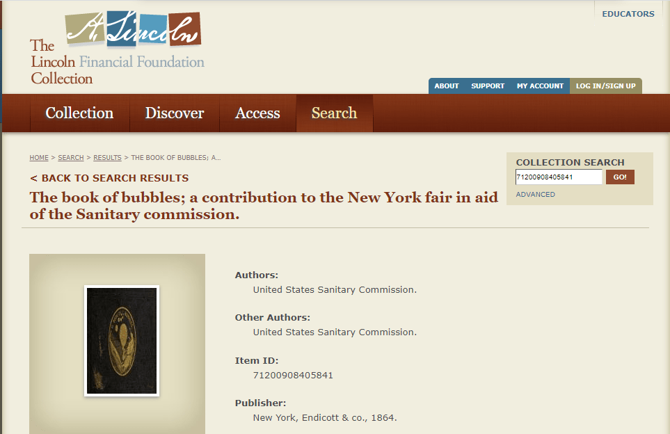
Metropolitan Fair-goers could purchase souvenirs like “The Book of Bubbles…”
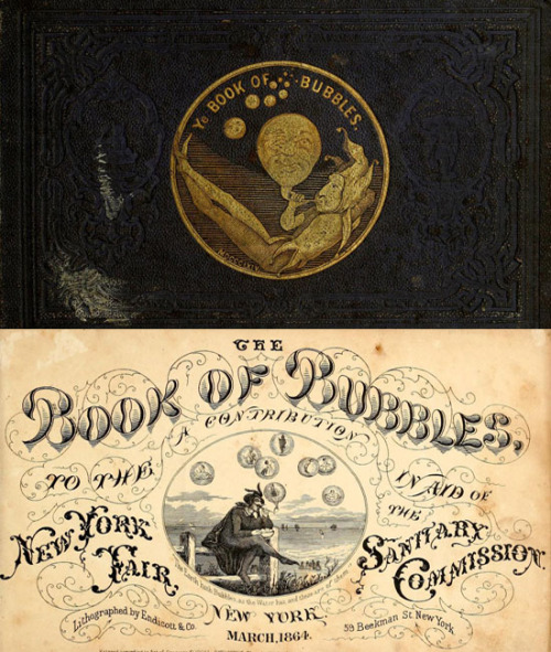
…a book of nonsense verses with illustrations authored by members of the United States Sanitary Commission.
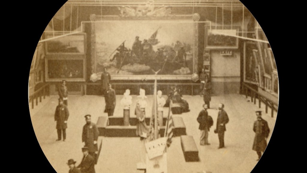
This photo of one of the exhibit halls at the Metropolitan Fair has the same staged look as ones from the Great Central Fair in Philadelphia seen previously in this post, with everyone in the room turned towards the camera in various poses.
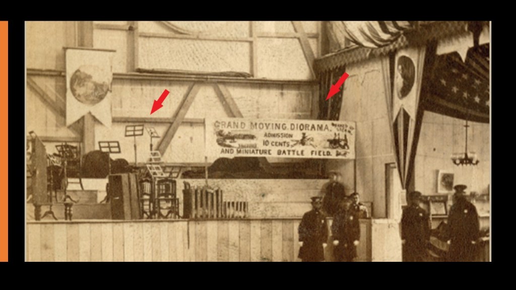
There was even a moving civil war battlefield diorama exhibit at the Metropolitan Fair to tell people about the Civil War!
Don’t know for sure, but it looks like it was accompanied by band music!
It is important to note that prior to the organizing of the 1864 Metropolitan Fair in New York City, Henry Whitney Bellows wrote a paper called “Rough Notes” in November of 1863 on the main principles that needed to be applied to hold a Sanitary Fair in New York, and his suggestions were accepted in a meeting of approximately 50 – 60 ladies at a meeting at the Union League Club House later that month, on November 21st of 1863, who then proceed to commence work on the Metropolitan Fair project.
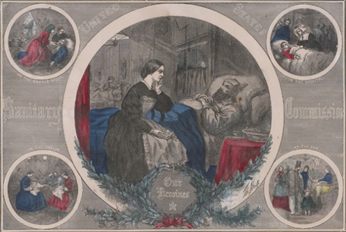
We are told this United States Sanitary Commission print called “Our Heroines” paid homage to the women who nursed the sick and wounded soldiers, and who organized and staffed the Sanitary Fairs.
These were the Civil War Battles said to have taken place during the same period of time as the Metropolitan Fair:
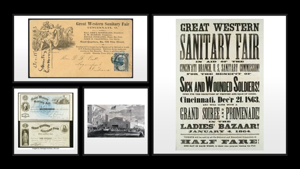
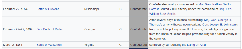
Among other Sanitary Fairs, the Great Western Sanitary Fair was held in Cincinnati at the Opera House, opening on December 21st of 1863 and running through January 4th of 1864…
…and the one battle during the time the fair was happening (though plenty of battles on either side of the dates of the fair)…

…the Brooklyn and Long Island Fair held, starting on February 22nd of 1864 and lasting for two weeks, where women volunteers sold thousands of dollars worth of books, flowers and fancy goods in the Brooklyn Academy of Music…

…and the battles that took place during that time period…
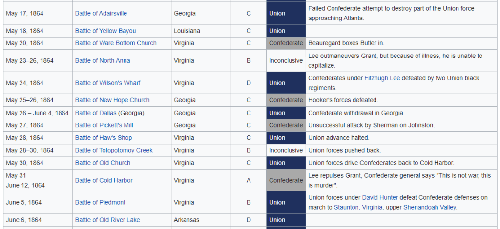
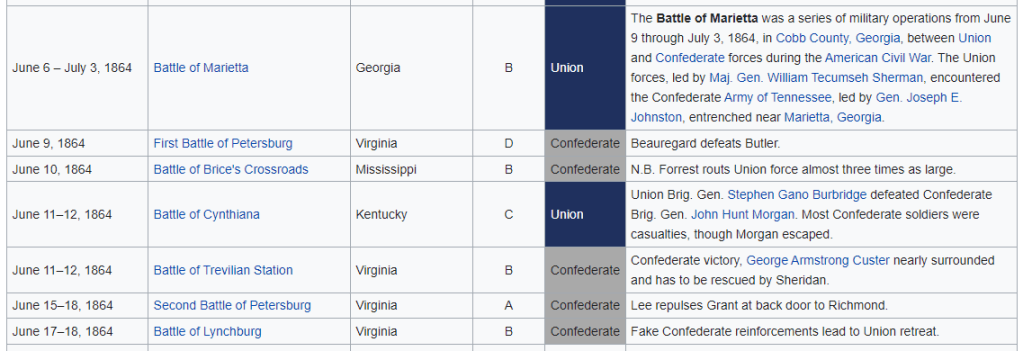
…and the Grand Mississippi Valley Sanitary Fair was held in St. Louis, Missouri, from May 17th to June 18th of 1864, raising $550,000 to assist Union troops…
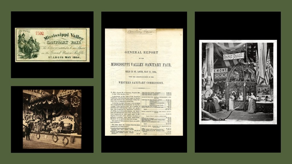
…and the battles that took place during the period of time the St. Louis Sanitary Fair was going on:
From October 27th to November 7th of 1865, there was a second Sanitary Fair held in Chicago, this one called the Great Northwestern Sanitary Fair.
It was the last Sanitary Fair of the War, and was said to have raised $270,000 for sick and wounded soldiers.
Speakers at this last Sanitary Fair included Generals Ulysses S. Grant, William T. Sherman, and Joseph Hooker.
Exhibits at the fair were said to include: the bell from Jefferson Davis’ plantation (he was the President of the Confederacy); the clothing both men were wearing at the 1858 Abraham Lincoln – Stephen Douglas debates about slavery and the extension of slavery into new territories; and General Grant’s horse was raffled off as a fundraiser.
This Great Northwestern Fair in Chicago took place after the assassination of President Abraham Lincoln, which happened on April 15th of 1865.
This medallion commemorating Lincoln and the Great Northwestern Sanitary Fair was minted for the 1865 fair.
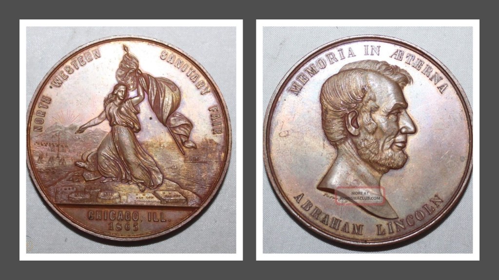
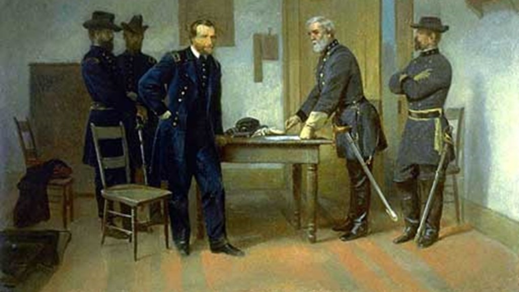
By the time of the Great Northwestern Sanitary Fair in late 1865, the American Civil War had already officially ended on April 9th of 1865 with the meeting of of the Union General Ulysses S. Grant and the Confederate General Robert E. Lee at the Appomattox Courthouse in Virginia, which took place a week before President Lincoln’s assassination.
So, did the U. S. Sanitary Commission and its volunteers really have the wherewithal to both construct the buildings for and pull off these extraordinarily lavish and festive undertakings against the backdrop of national war and suffering?
Or was it a private front comprised of the very same people who organized and were prominent members of the private membership clubs of the day, like the previously mentioned Union League and the Century Association, to set up the new historical narrative for the reset to explain, among other things, how infrastructure came into, and left, existence.
The template for the Sanitary Fairs was the same as that for the World Fairs, Expositions and Exhibitions – infrastructure said to have been built specifically for these events out of “temporary” materials, and then, for the most part, demolished at some point afterwards, like the Trans-Mississippi International Exposition, held in 1898 in Omaha, Nebraska, from June to November of that year, one of countless examples of this story.
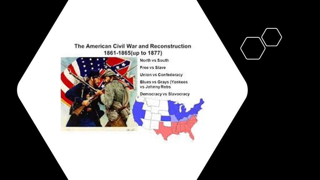
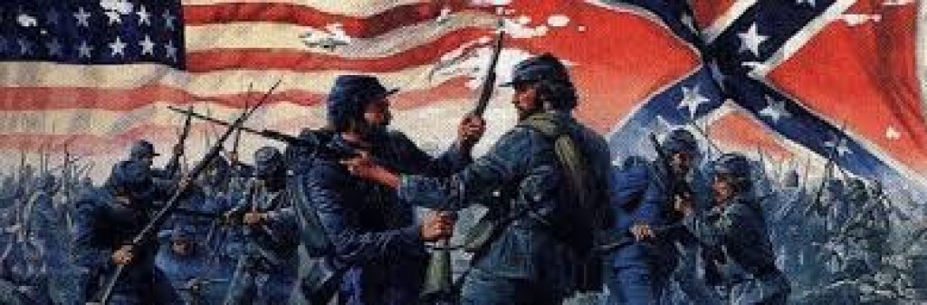
This question about the United States Sanitary Commission and the Sanitary Fairs leads to the larger question of what was really going on during the American Civil War, historically described as a civil war between the northern and Pacific states, known as the “Union,” or “North,” and the southern states, known as the “Confederacy,” or South, over the status of slavery and its expansion into newly acquired land after the Mexican-American War.
Before I go further with the American Civil War, I would like to bring forward three examples of a 20th-century pattern used to create division, discord, violence and war using the same North-South dichotomy, which is a division or contrast between two things that are represented as being opposed or entirely different.
Ireland was partitioned on May 3rd of 1921, when the government of the United Kingdom of Great Britain and Ireland divided Ireland into two home rule territories – Northern Ireland and Southern Ireland – with the stated goal of remaining within the United Kingdom and eventually reunifying.
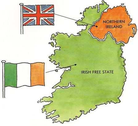
Northern Ireland remained part of the United Kingdom, but after the Anglo-Irish Treaty of December of 1921, Southern Ireland dropped out of the United Kingdom and became the Irish Free State.
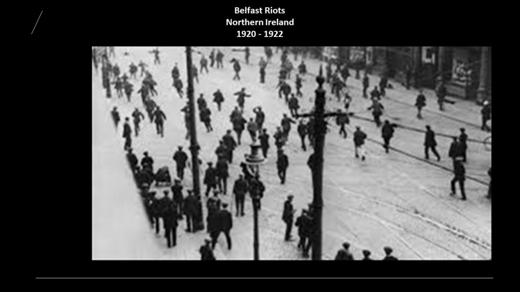
The partition of Ireland took place during the Irish War of Independence, a guerilla conflict between the Irish Republican Army and British Army forces.
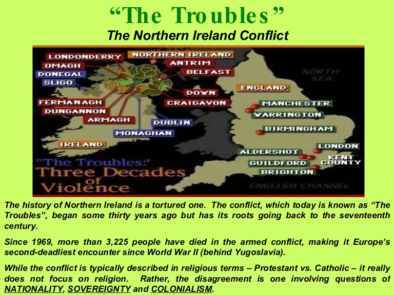
Between 1920 and 1922, during which time the Partition occurred, there was violence in Northern Ireland in defense or opposition to the new settlement, and its capital Belfast saw savage and unprecedented violent riots between Protestant and Catholic civilians, a form of violence in which the violent parties feel solidarity for their respective groups and victims of violence are chosen based on their group membership.
All of this led directly to the”Troubles” a period of unrest and violence that escalated across Northern Ireland between the Irish Catholic Nationalists and Irish Protestant Unionists between 1969 and 1998.
Next, the example of North and South Korea.
After the August 15th surrender of Japan in 1945, the Korean peninsula was divided at the 38th-parallel into two zones of occupation, with the Soviets administering the northern half, and Americans the southern half.
In 1948, as a result of Cold War tensions, the occupation zones became two sovereign states – socialist North Korea and capitalist South Korea.
The governments of the two new Korean states both claimed to be the only legitimate Korean government, and neither accepted the border as permanent.

The Korean War started in 1950, when North Korea invaded South Korea on June 25th following clashes along the border and insurrections in the South.
North Korea was supported by China and the Soviet Union, and South Korea by the United Nations, principally from the United States.

The Korean War was one of the most destructive conflicts of modern times, with around 3,000,000 deaths due to the war, and proportionally, a larger civilian death toll than either World War II or the Viet Nam War; caused the destruction of nearly all of Korea’s major cities; and there were thousands of massacres on both sides.
Lastly, the example of North and South Viet Nam.
The Geneva Conference was convened in 1954 in Geneva, Switzerland, to settle unresolved issues from the Korean War and the First Indochina War in Viet Nam, and attended by representatives from the United States, France, the United Kingdom, the Soviet Union, and the People’s Republic of China, as well as from Korea and Viet Nam.
While no declarations or proposals were adopted with regards to Korean situation, the Geneva Accords that dealt with the dismantling of French Indochina in Southeast Asia would have major ramifications.

The Geneva Accords established North and South Vietnam with the 17th parallel as the dividing line, with North Viet Nam being Communist and South Viet Nam being Capitalist.

The agreement also stipulates that elections are to be held within two years to unify Vietnam under a single democratic government.
These elections never happen.
The non-Communist puppet government set up by the French in South Viet Nam refused to sign.
The United States also refused to sign on, with the belief that national elections would result in an overwhelming victory for the communist Ho Chi Minh who had so decisively defeated the French colonialists.
Within a year, the United States helped establish a new, anti-Communist government in South Viet Nam, and began giving it financial and military assistance.
A mass migration took place after Viet Nam was divided.
Estimates of upwards of 3 million people left communist North Viet Nam for South Vietnam, going into refugee status in their own country, and many were assisted by the United States Navy during Operation Passage to Freedom.

An estimated 52,000 people moved from South to North Viet Nam, mostly Viet Minh members and their families.
In Viet Nam by the time of John F. Kennedy’s death in November of 1963, there were 16,000 American military personnel, and the Gulf of Tonkin incident took place in 1964, an international confrontation after which the United States engaged more directly in the Viet Nam War.
The first Gulf of Tonkin incident took place on August 2nd of 1964 between ships of North Viet Nam and the United States.
The description of what took place is as follows:
Three North Vietnamese torpedo boats approached the naval destroyer U. S. S. Maddox and attacked it with torpedos and machine gun fire.
Damages said to have come about as a result of the ensuing battle were: one U. S. aircraft; all three North Vietnamese torpedo boats and 4 North Vietnamese deaths; and one bullet hole on the naval destroyer, and no American deaths.

There was initially allegedly a second incident on August 4th of 1964, this second occurrence has long been said not to have taken place.
And then there are the people who believe the first Gulf of Tonkin incident never happened either.
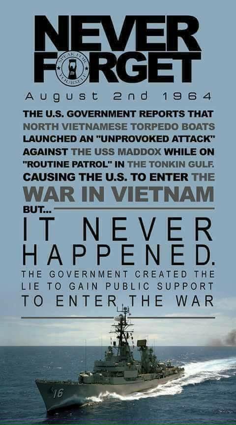
Whether or not the Gulf of Tonkin incidents actually happened, they were used as an excuse for the Gulf of Tonkin Resolution passed by Congress on August 7th of 1964, giving President Lyndon B. Johnson authority to help any Southeast Asian country whose government was considered to be in jeopardy of Communist aggression, and was considered the legal justification for the beginning of open warfare with North Viet Nam and the deployment of American troops to Southeast Asia, of which, with the institution of the draft, there were over 500,000 troops sent by 1966.

The Viet Nam War ended with the Fall of Saigon on April 30th of 1975, when the capital of South Viet Nam was captured by North Vietnamese troops…
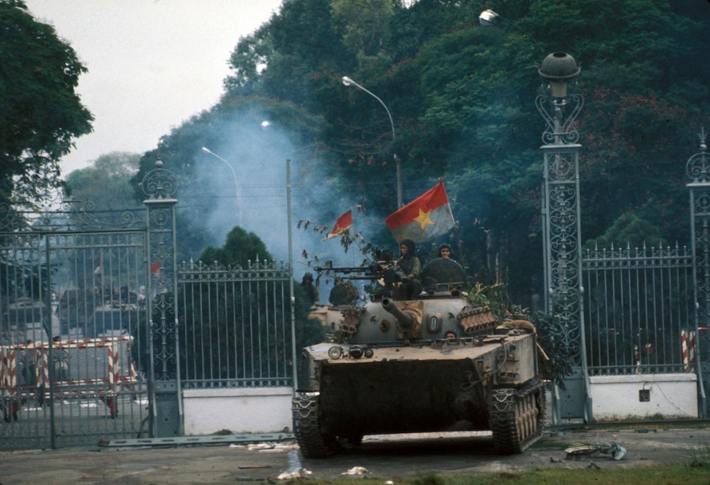
…and the beginning of the re-unification of Viet Nam into the Socialist Republic of Viet Nam.

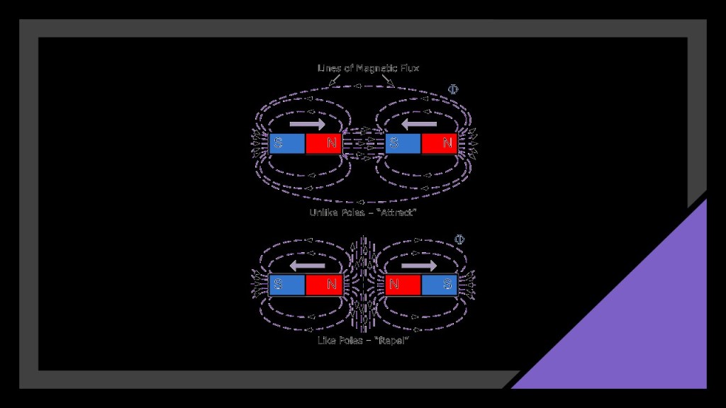
It is interesting to note that the terms North and South are also applied to the poles of magnets.
A magnet is any object that produces its own magnetic field that interacts with other magnetic fields.
The magnetic field is represented by what are called field lines that start at a magnet’s north pole and end at the south pole.

As shown in the top diagram, if you put the north pole of one magnet against the south pole of another, the field lines go straight from the north pole of the first magnet to the south pole of the other, creating an attractive force between the two magnets.
If you have two magnets next to each other, and either their north poles or south poles are facing each as shown in the bottom diagram, the field lines move away from each other, creating a repelling force between the two magnets.
Electricity runs within us, where our cells are specialized to conduct electrical currents, which is required for the nervous system to send signals throughout the body and to the brain, making it possible for us to move, think, and feel.

…and we each generate our own magnetic fields as does the Earth, as well as the other life on Earth.
There is so much more to us than our physical forms.

Electromagnetism is an integral part of existence on Earth and throughout the Universe, which is the physical interaction that occurs between electrically-charged particles, the force of which is carried by electromagnetic fields composed of electrical fields and magnetic fields.

I bring this subject of magnetism and electromagnetism up because of how they appear to have been applied negatively by the controllers to create the conditions necessary for war, destruction and suffering in this realm, by dividing countries into north and south, and then by instilling different belief systems in each pole of this magnet, which created an “attraction,” or perhaps “action” is a better word, to facilitate destruction on each other.
There are more examples of this practice of dividing a country into north and south than the ones I gave, especially in Africa.
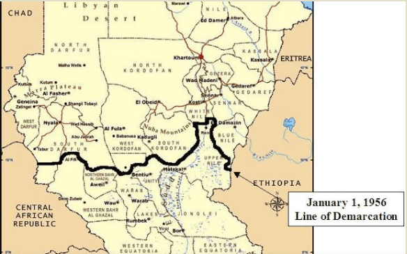
One example is the country of Sudan.
When Sudan was granted independence from its British colonizers in 1956, it was immediately divided into north and south, with each region characterized by different belief systems and loyalties, and Sudan promptly descended into violent civil war that lasted for decades.
The history of Sudan goes back to the Pharaonic period of ancient Egypt, with the Kingdom of Kerma in ancient Nubia (dated from 2500 to 1500 BC)…
…the Egyptian New Kingdom dated between 1500 BC and 1070 BC…
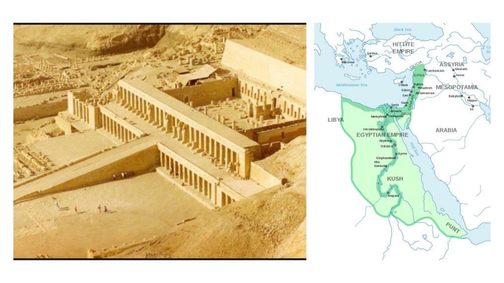
…and the Kingdom of Kush, dated from 785 BC to 350 AD, with its royal capital at Meroe, located on the Nile River where it flows through northeast Sudan in northeastern Africa.

Now back to the American Civil War.
I am going to use the remainder of this post to present information I have found in the course of my research in what we are told in our historical narrative, and my questions about them, that I am calling “Anomalies of the Civil War.”
During the entire course of the American Civil War, between 1861 and 1865, there were an estimated 10,500 battles, engagements, and other military actions fought in 23 states, with over 650,000 casualties.
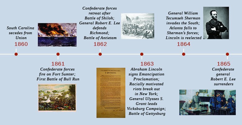
We are told there were three theaters of war during those years: Eastern, Western, and Trans-Mississippi.
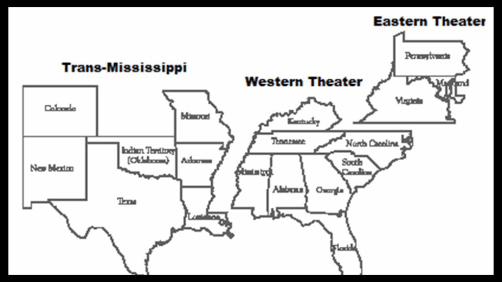
I have often thought that theater, defined as a collaborative form of performing art that uses live performers, usually actors or actresses, to present the experience of a real or imagined event before a live audience in a specific place, like a stage, is a thought-provoking word choice for an area or place in which important military events occur or are progressing.

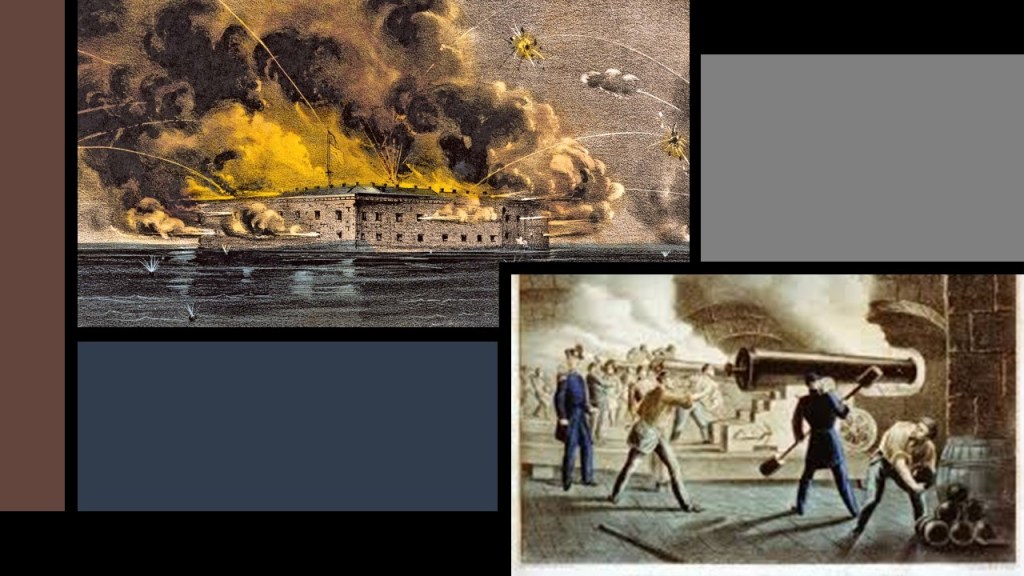
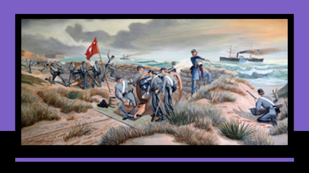
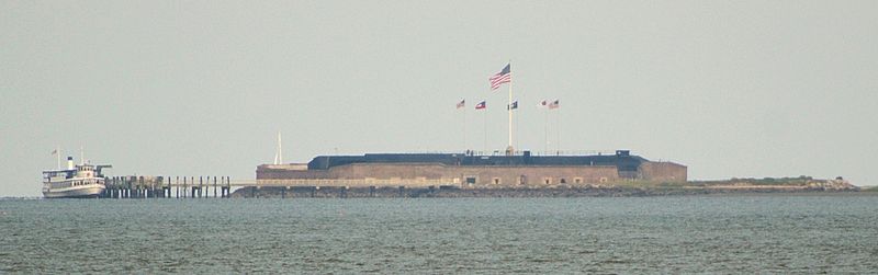
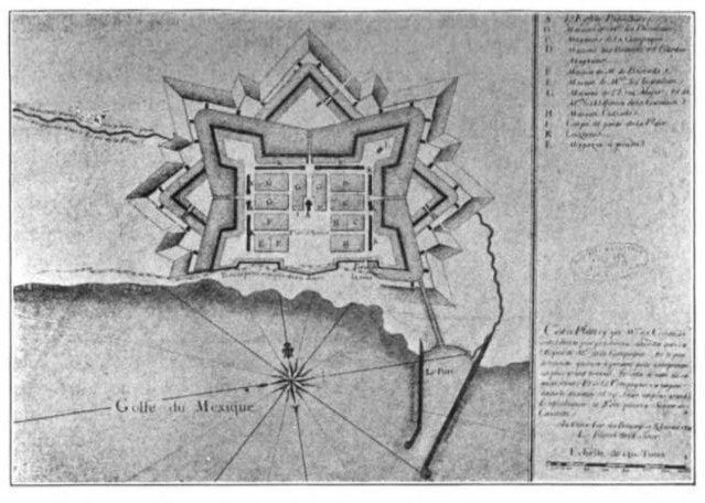
The official beginning of the American Civil War was said to be the Battle of Fort Sumter between April 12th and 13th of 1861, in South Carolina’s Charleston Harbor, with victory going to the Confederate forces under the command of General P. G. T. Beauregard.
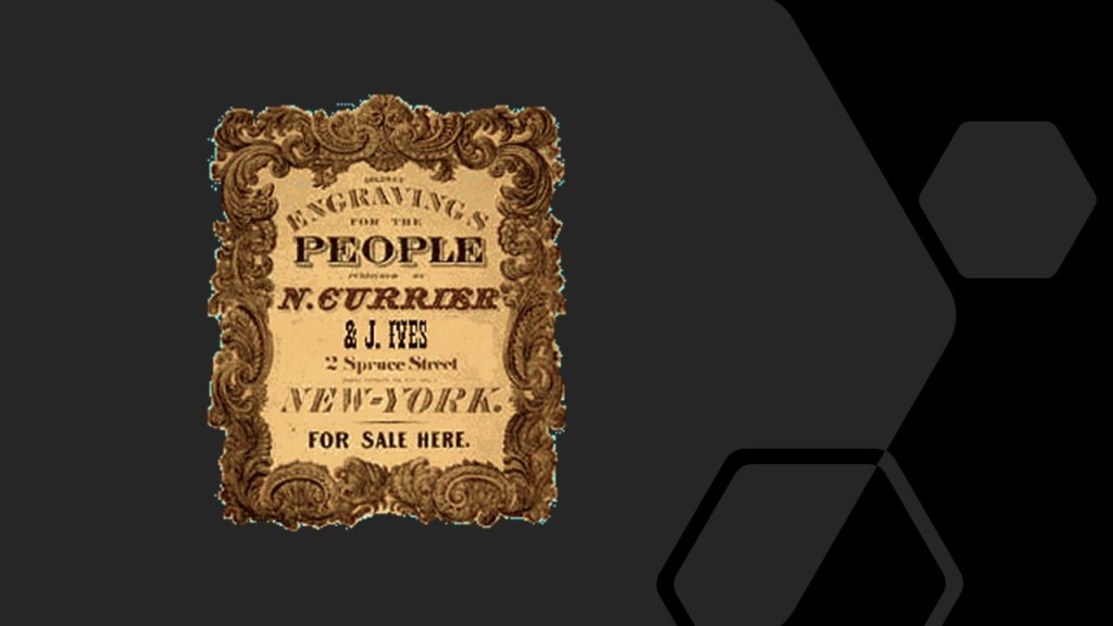
These are Currier and Ives prints depicting the bombardment of Fort Sumter.
Nathaniel Currier got his start in the lithography business in 1835, and he was joined by bookkeeper and marketer James Ives in 1850, and the firm became known as Currier and Ives in 1857.
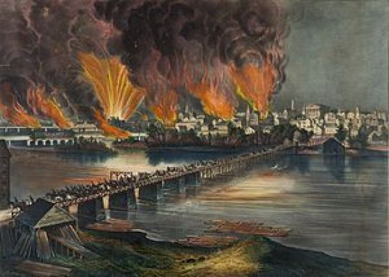
Over the years, they produced about 7,500 images depicting illustrations of current events…
…including other civil war illustrations, like the Burning of Richmond in 1865.
Is it possible these lithographic prints were used to imprint vivid visual historical images in peoples’ minds?
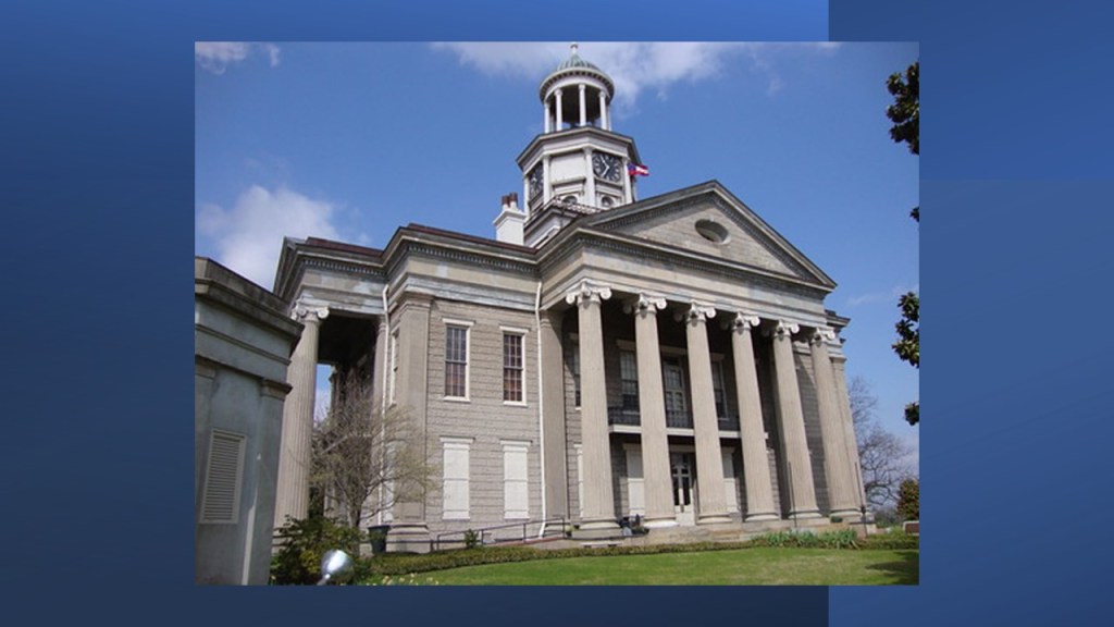
This is Fort Sumter today.
It is described as a sea fort that was said to have been built starting in 1829 as one of a series of fortifications on the southern coast of the United States to protect American harbors from foreign invaders, and said to have never been fully completed.
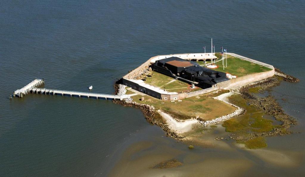
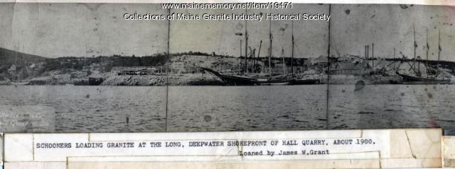
To build up the artificial island the fort is situated on, we are told that 70,000 tons of granite were transported to South Carolina from New England.
70,000 tons of granite? Which is 63,500 metric tons?
How did they manage to accomplish transporting that weight of stone according to the history we have been taught?
Oh…okay…apparently on schooners.
That makes perfect sense, right?!
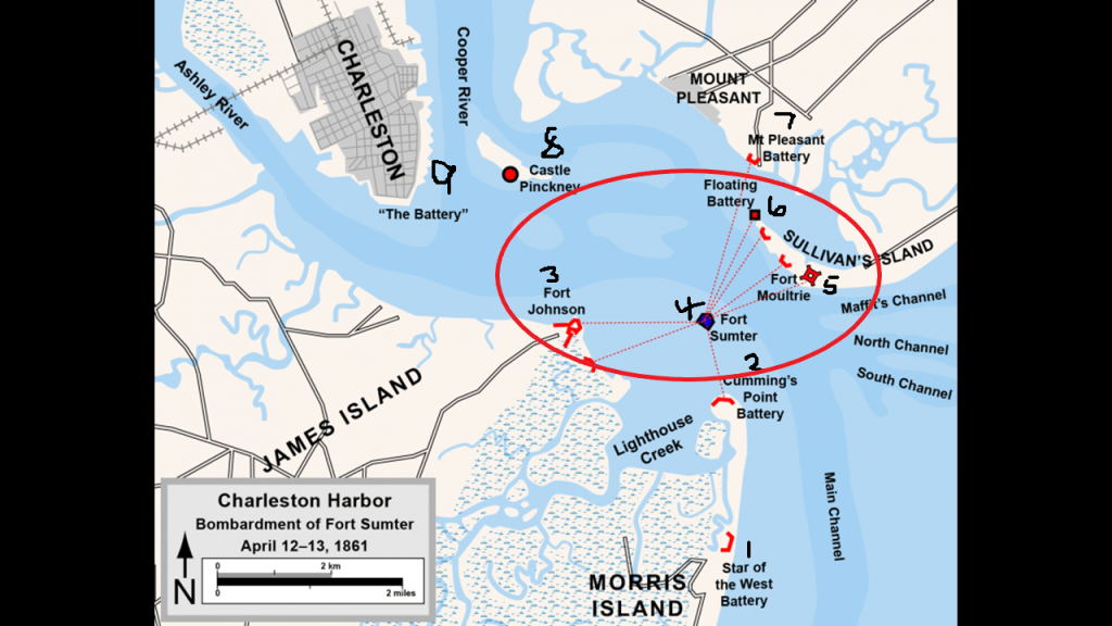
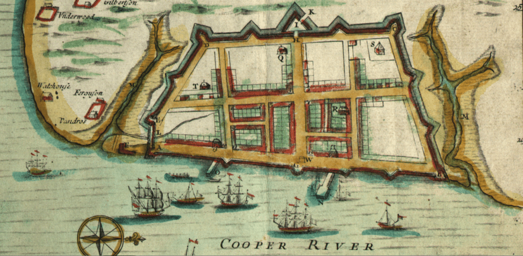
When I pulled up a map looking for Fort Sumter, I found this one showing at least 9 references to forts, batteries, castles in Charleston Harbor.
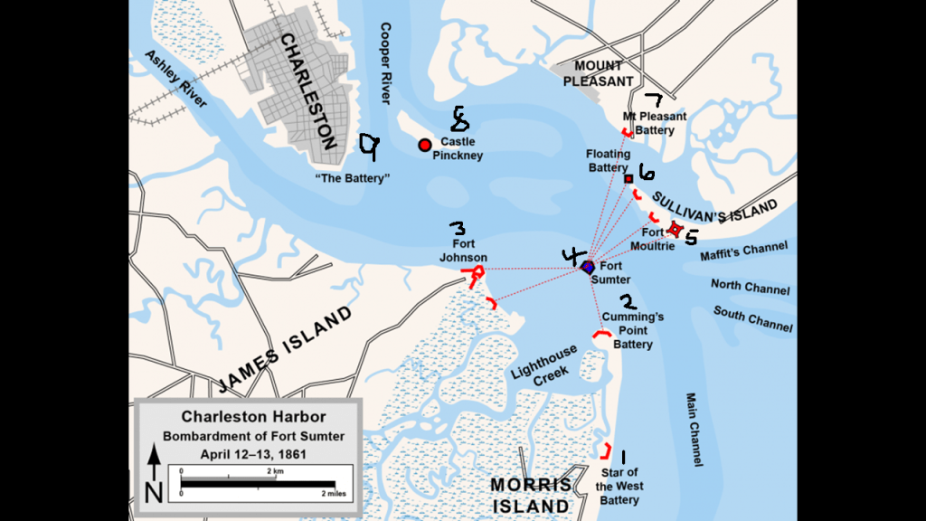
The “Star of the West” Battery is at the head of the Main Channel leading into Charleston Harbor.
Apparently the battery received its name from a civilian steamship that was built in 1852 for Cornelius Vanderbilt.
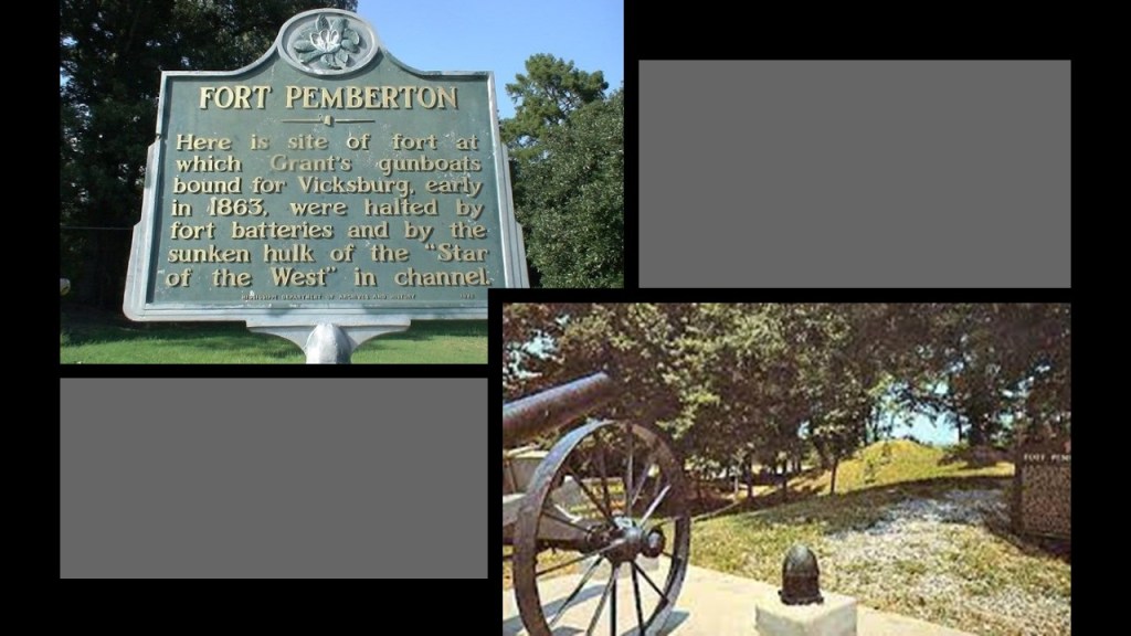
The “Star of the West” was used in an effort to re-supply Union troops at Fort Sumter on January 9th of 1861, several weeks after South Carolina had become the first state to secede from the Union on December 20th of 1860, and was fired upon by an artillery battery situated on Morris Island.
The “Star of the West” steamship ended up having a storied career during the Civil War, and ended up at the bottom of the Tallahatchie Channel near Yazoo City in Mississippi, where she was deliberately scuttled and sunk by Confederate forces before the Battle of Fort Pemberton, an earthen fort said to have been built hurriedly by Confederate forces, which resulted in a victory for them which took place on April 12th of 1863, two years exactly after the Battle of Fort Sumter.
The Cummings Point Battery was located on a promontory of Morris Island, and was directly across the harbor from Fort Sumter.
The battery on Cummings Point was said to be an earthwork in a belt of waterfront fortifications, and to have originally been built in February of 1780, during the American Revolutionary War, under the direction of Colonel William Moultrie when it became clear that the British were going to attack Charleston from the south and west.
By the time of the American Civil War, it had been faced with bars of railroad iron placed side-by-side, and became known to history as the “ironclad battery.”
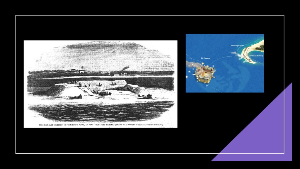
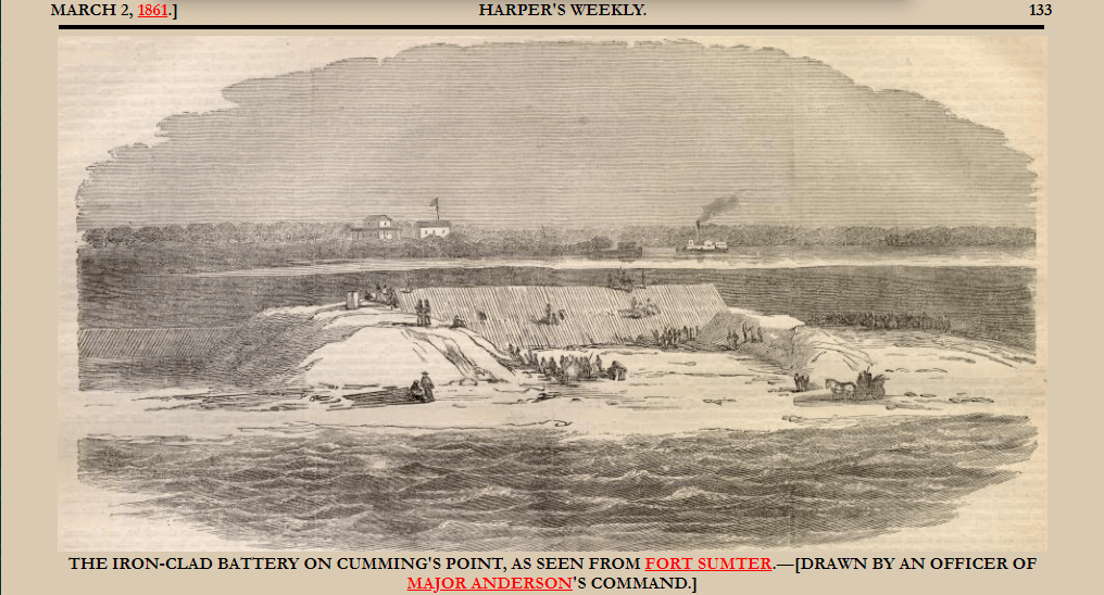
A story about the ironclad battery at Cummings Point appeared in Harper’s Weekly Magazine, on March 2nd of 1861, along with the 21st Chapter of Charles Dickens novel “Great Expectations,” which was first released in a serial format in his weekly periodical “All the Year Round,” starting December 1st of 1860, and apparently it appeared in other magazines as well.
Interesting.
I believe most famous novelists including, but not limited to, Charles Dickens, Victor Hugo, Mark Twain, Jack London, and John Steinbeck, were all involved in delivering the brand-new historical narrative right into our collective minds.
When looking for information on the Cummings Point battery, I found the historical Fort Wagner on Morris Island, which would have been located between the “Star of the West” battery to the south and the Cummings Point battery to the north of it.
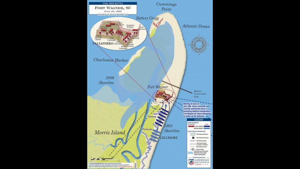
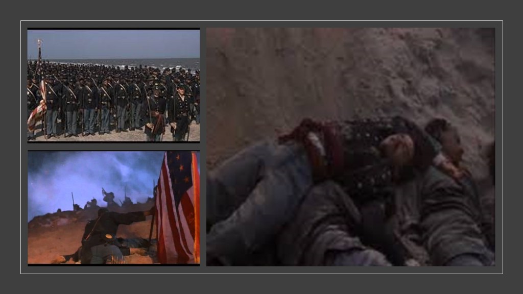
The Battle of Fort Wagner took place on July 18th of 1863, where the 54th Massachusetts, known to history as the first African-American regiment in the Union Army, unsuccessfully assaulted Fort Wagner as depicted in the 1989 movie “Glory.”
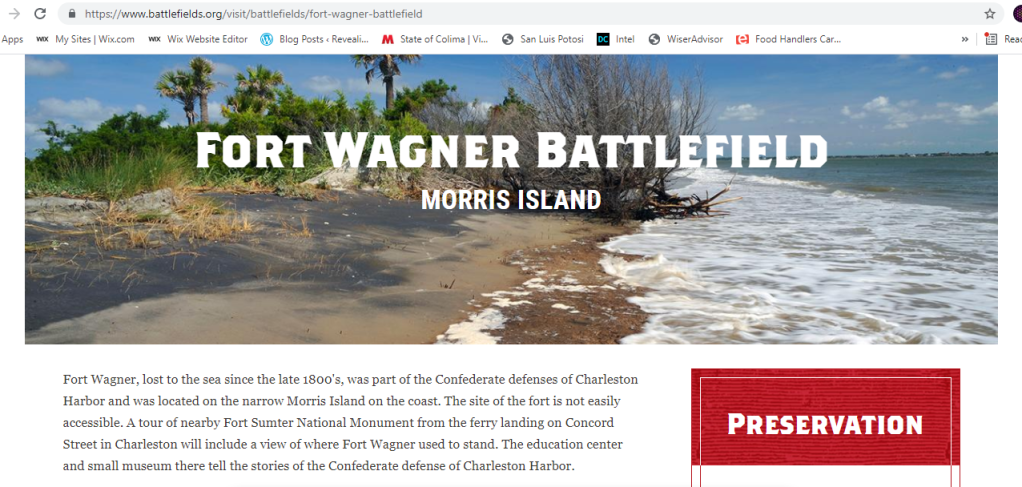
Nothing remains of the physical infrastructure of Fort Wagner today…
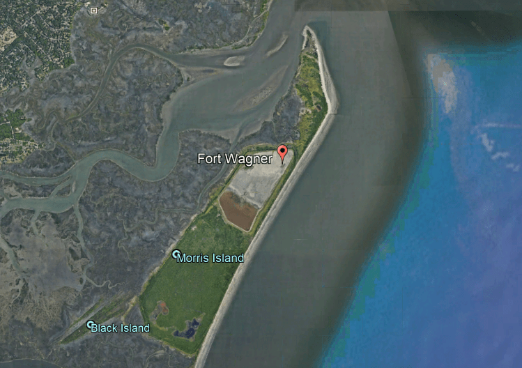
…as apparently it was somehow lost to the sea in the late-1800s.
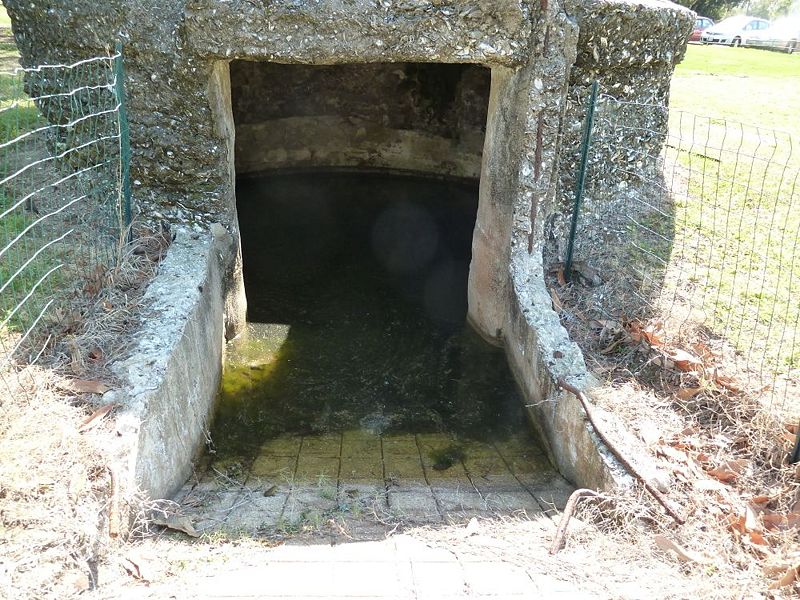
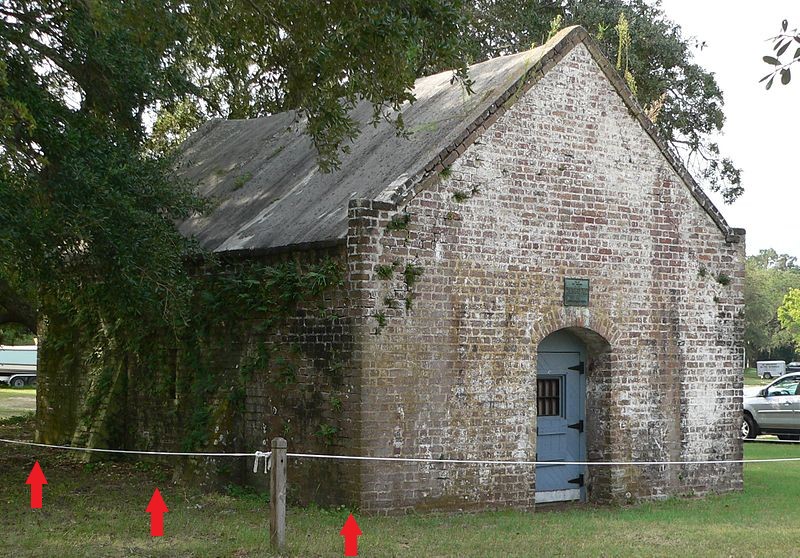
On the same side of the Charleston Harbor as Fort Wagner, and the two batteries I just mentioned, Fort Johnson was located further up towards the city of Charleston, on the coast of James Island, where the first shot of the Civil War was said to have been fired at Fort Sumter by Confederate soldiers…
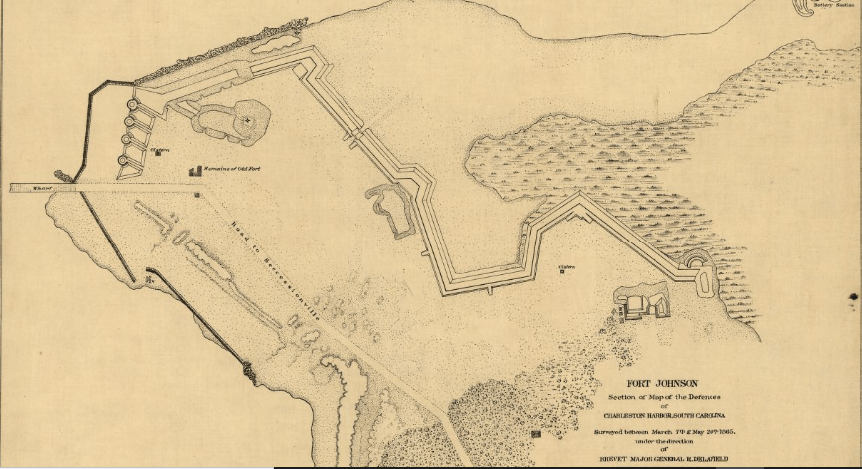
…of which its only remains today are only two cisterns…
…and the old magazine, said to have been built in 1765, buried by Confederate soldiers during the Civil War, and uncovered in 1931.
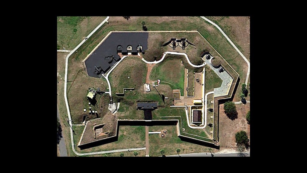
Fort Sumter was located in Charleston Harbor almost directly in-between where Fort Johnson was located on James Island, and Fort Moultrie, which is still standing on Sullivan Island on the other side of the Harbor from Fort Sumter.
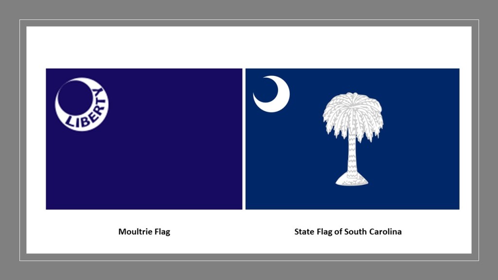
The first fort built on this location, Fort Sullivan, was said to have been built from Palmetto logs, giving the inspiration for the flag of South Carolina and its nickname “The Palmetto State,” and said to have been still incomplete when it was attacked by the British during the American Revolutionary War in 1776, and named after the commander, Colonel William Moultrie.
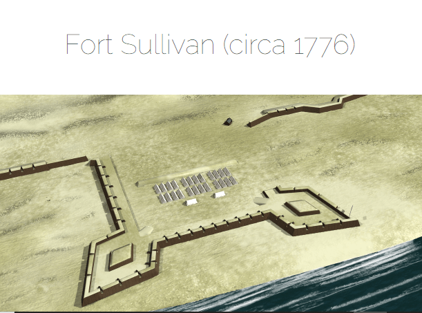
This is the fort standing on Sullivan Island today.
What is called the Moultrie flag on the left was flown during the defense of Fort Sullivan in 1776.
The Palmetto was added in 1861, and it was adopted as the state flag.
Another battle commander’s flag with the crescent symbol in the upper-left-hand corner was the flag of Confederate Army Major General Earl van Dorn, the great-nephew of Andrew Jackson, who led the Confederate forces at the Battle of Pea Ridge in Arkansas in March of 1862.
This was the battle flag of General Van Dorn.
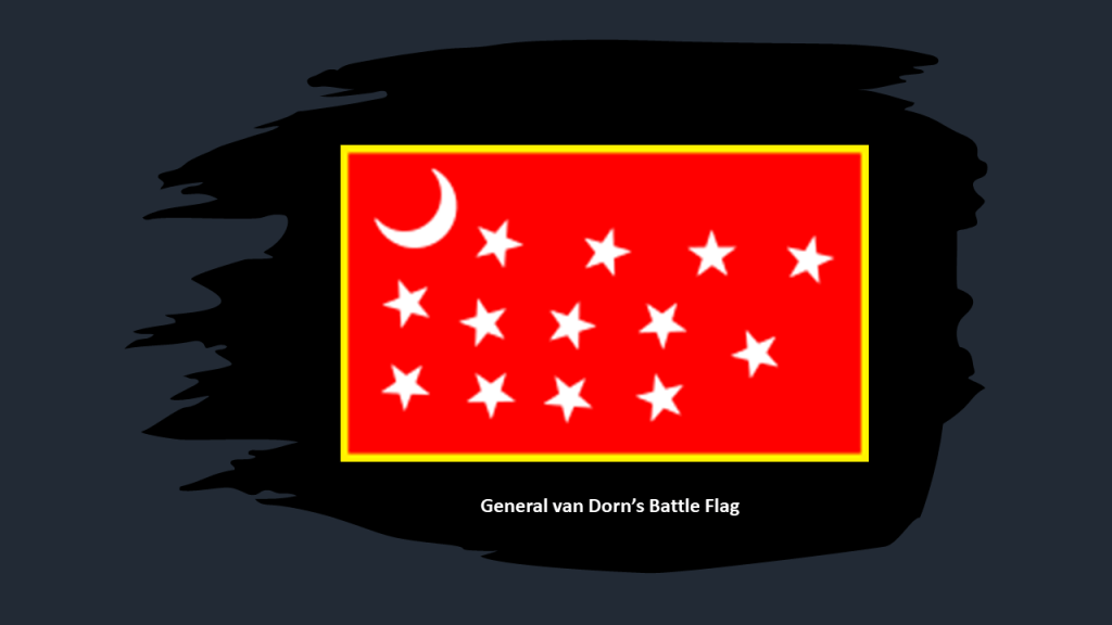
Why are there crescent images on these battle flags?
The star and crescent symbolism has been identified with Islam, and what we are told is that this happened primarily with the emergence of the Ottoman Turks, and for one example of several national flags, are depicted on the modern Turkish flag.

I also read where the Egyptian hieroglyphs of a star and the crescent moon denote the Venus Cycle from morning star to evening star.

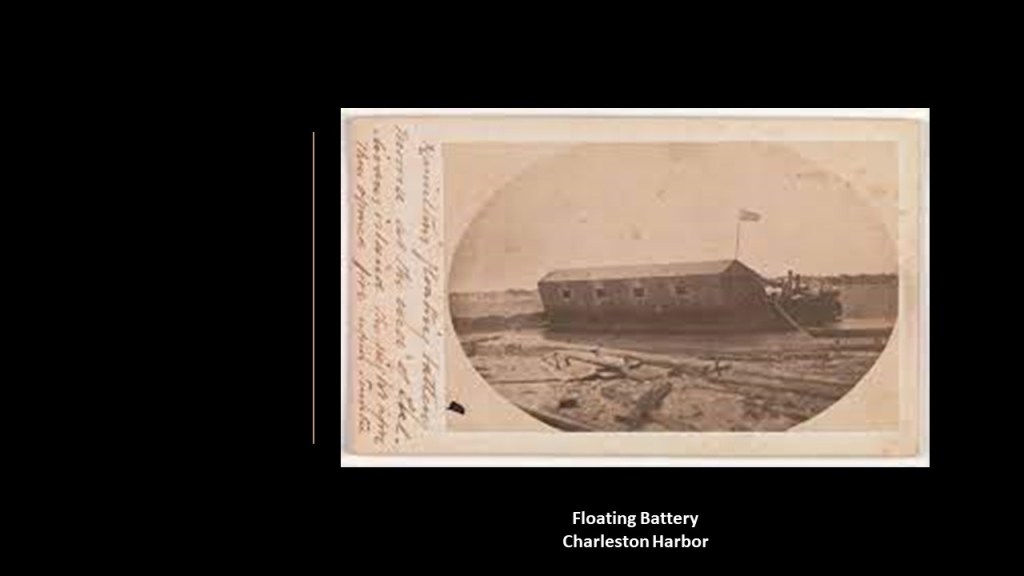
The Floating Battery was said to be located at the northern tip of Sullivan Island, above the location of Fort Moultrie.
We are told it was an ironclad vessel constructed by the Confederacy early in 1861 before the start of the war, and as a strategic naval platform, it was utilized in the April 12th and 13th bombardment of Fort Sumter.
The last three things I am going to look at on the map of the Charleston Harbor Defenses are the Mt. Pleasant Batteries; the Castle Pinckney; and the tip of Charleston known as “the Battery.
Along the coast of Mt. Pleasant which includes Hog Island, there were three Confederate batteries said to have been constructed over the course of the war to defend Charleston Harbor.
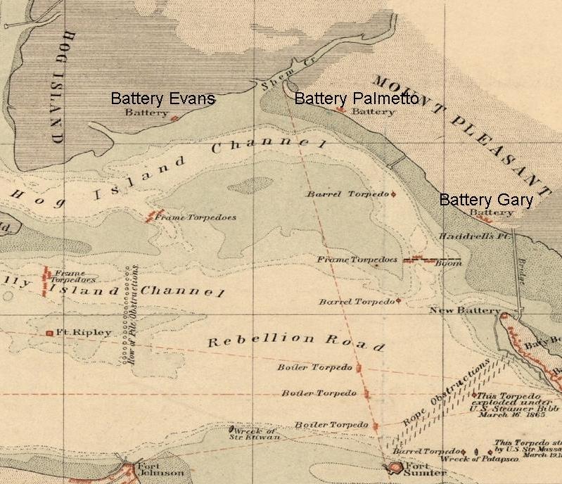
Battery Gary was said to be the first one constructed, and utilized in the bombardment of Fort Sumter in April of 1861.
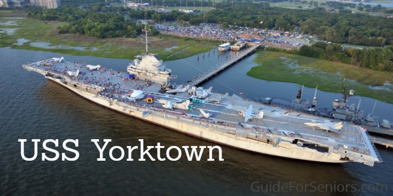
Interesting side-note…Charleston’s professional soccer team is called the “Charleston Battery” and their stadium is located at Patriots Point in Mt. Pleasant.
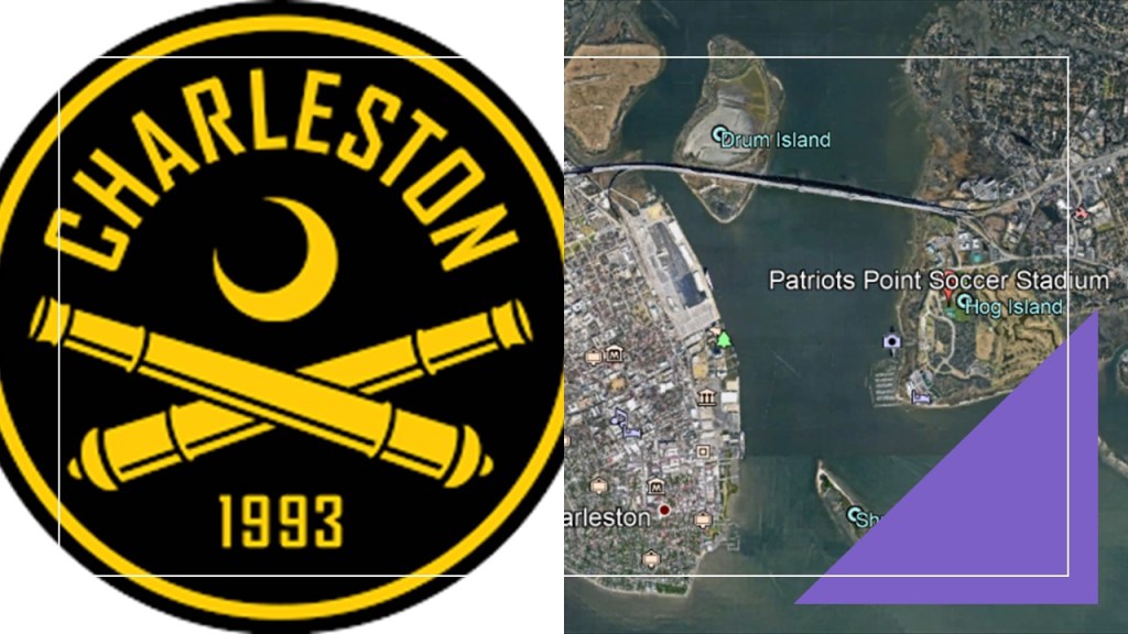
…and where the Patriots Point Naval and Maritime Museum, also known as the U. S. S. Yorktown, is permanently moored.
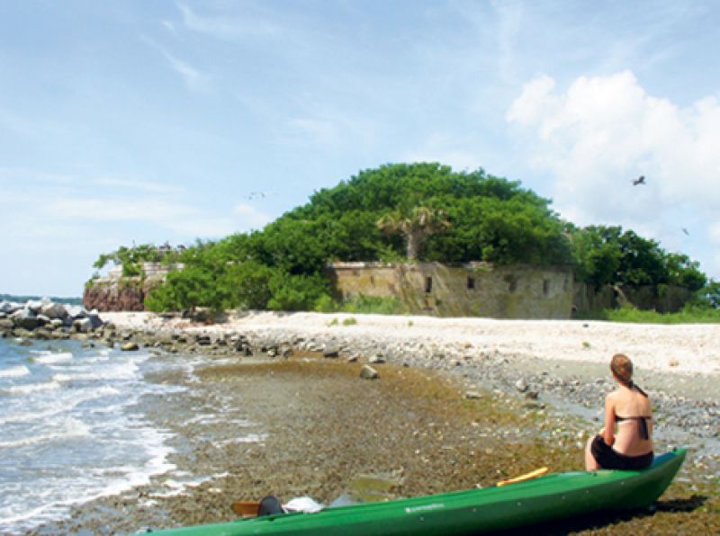
Next up for scrutiny is Castle Pinckney.
Castle Pinckney is located on what is called Shute’s Folly in Charleston Harbor between Patriot’s Point and “The Battery” of Charleston.
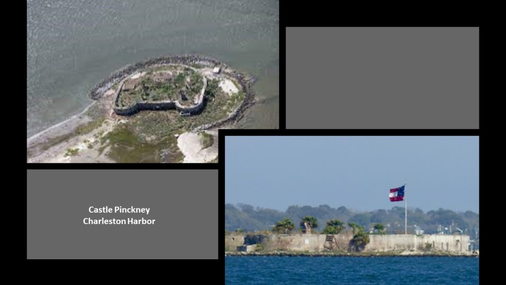
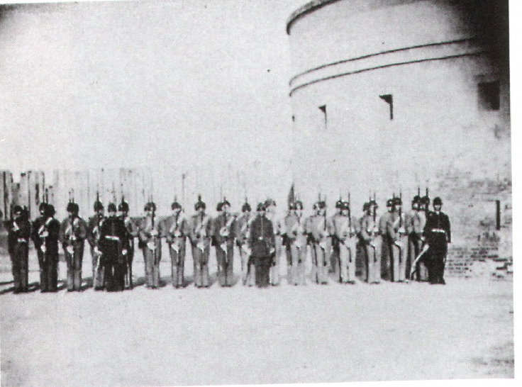
We are told that Castle Pinckney was a small masonry fortification built by the United States government in 1810, and was used as an artillery position during the Civil War, garrisoned by the Charleston Zouave Cadets, a light infantry regiment of the French Army, after the attack on Fort Sumter.
Zouave units were said to have been used on both sides of the conflict.
Castle Pinckney was declared a National Monument in 1924, and then in 1951, Congress passed a bill to abolish its status as a National Monument.
Since then, primarily under state ownership, it has undergone some limited restoration efforts, but is in the process of being reclaimed by nature.
Lastly, I am going to take a look at “The Battery,” described as a defensive seawall and promenade in Charleston, and said to have been named for a civil war coastal defense battery at the site.
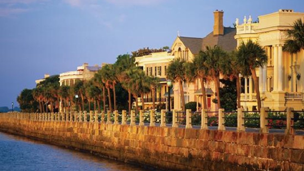
The Battery is famous for its antebellum homes…
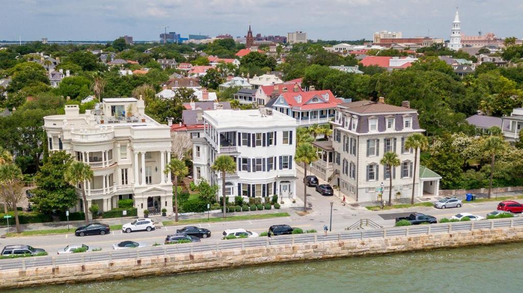
…and its great view of Fort Sumter!
Interestingly, this is called the “Crisp Map of Charleston” from 1711, named after its English publisher Edward Crisp based on a 1704 survey he did, showing Charleston as a walled, bastioned star city.
I found one reference that called this map a “flawed, 19th-century fake.”
Well, that may be, but this is said to be the 1721 Herbert Map, showing the same idea.
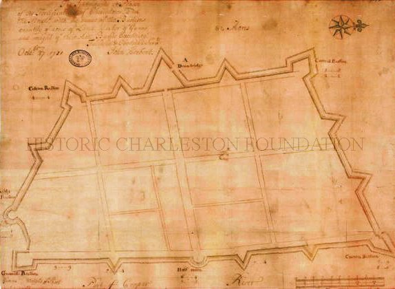
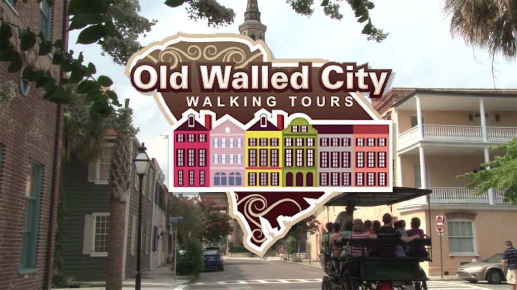
And if anyone lives in or near Charleston, or is planning a visit there, please consider going on an Old Walled City Tour of Charleston.
I would love to know what you find out about it!
Now I am going to take a look at the Civil War Defenses of Washington, D.C.
According to what we are told, Washington was protected from Confederate invasion by a large group of Union Army fortifications, consisting of 68 major enclosed fortifications, as well as 93 batteries for artillery and 7 blockhouses; most never came under enemy fire; and the Confederacy never captured anything in Washington.
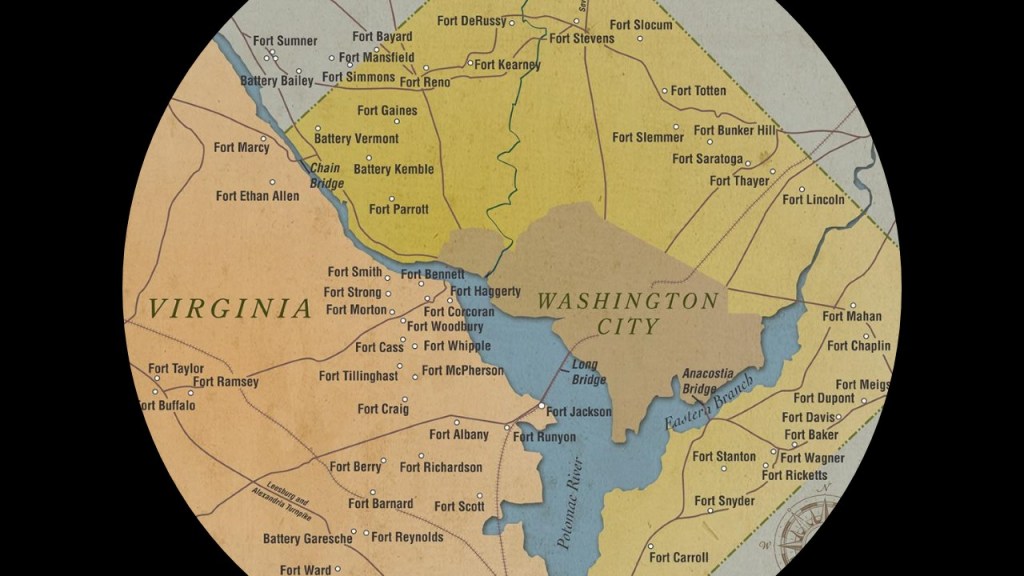
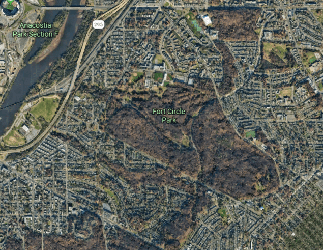
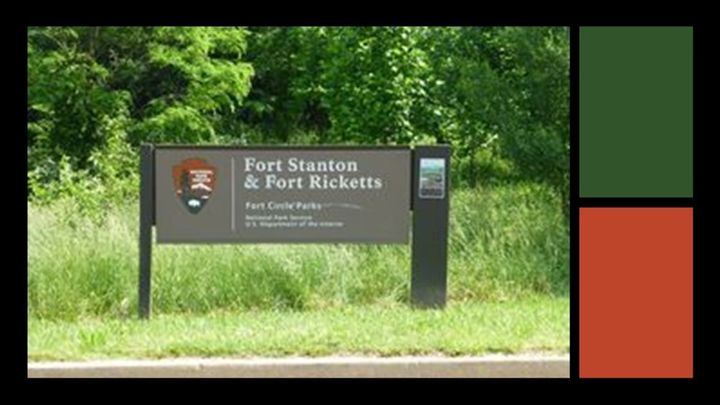
The sites of some of these forts are located in a collection of National Park Service properties that is identified as Fort Circle Park, where there is a 7-mile, or 11-kilometer, hiker-biker trail around the remnants of what are called Civil War-era forts…
…with end-points at Fort Stanton, which was described at one time as a massive earthwork.
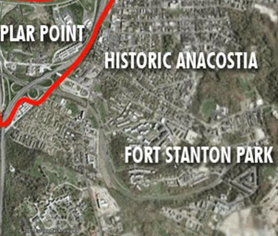
Fort Ricketts was near Fort Stanton…
…and the other end-point of the Fort Circle Trail is where Fort Mahan was located.
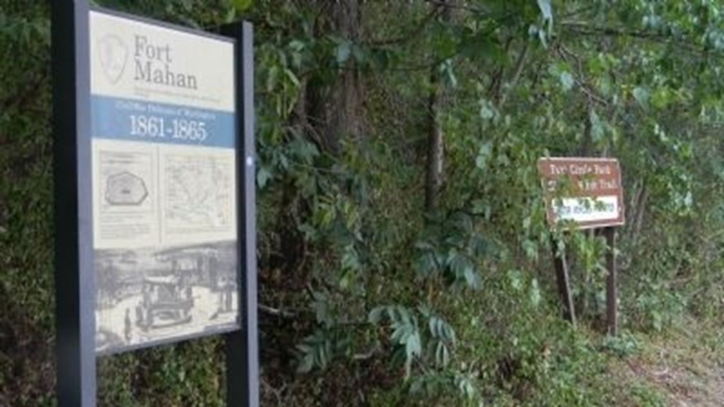
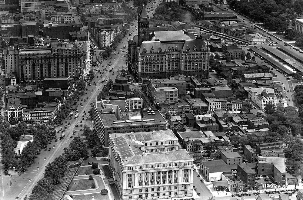
This is an historic photo of Benning, the residential neighborhood in Washington where Fort Mahan Park is located now. Note the massive size and style of the architecture.
There were four other historic forts on the Fort Circle Park Trail, and there is only signage to mark their one-time existence:
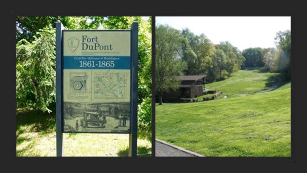
Fort Dupont, which was turned into a recreational park area by the Civilian Conservation Corps between 1933 and 1942…
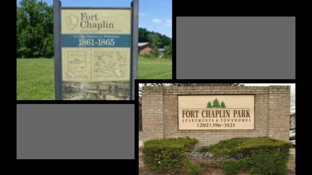
Fort Chaplin, where you now find the Fort Chaplin Park Townhomes…
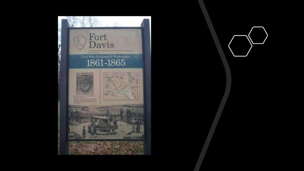
…and the former location of Fort Davis is also on the Fort Circle Parks Trail, also the name of a residential neighborhood in southeast Washington.
This is Fort Reno, where it sits on top of an earthwork, AKA mound. It is located on the highest point in Washington, and said to be the site of the only Civil War battle fought in Washington, the Battle of Fort Stevens, which took place on July 11th and 12th of 1864, and was said to be watched by President Lincoln.
It was said to have been built in the winter of 1861, after the defeat of the Union Army at the Battle of Manassas.
Does this look like a structure that was hastily built, in the middle of winter?
What is very interesting to me is that if you look at Fort Reno on Google Earth, you can see where the top layer of the Earthwork Fort Reno is built upon is being peeled off, and dumped to the side.
I think there is some kind of ancient energy technology is being harvested here, and I have seen this practice in other places as well with earthworks.
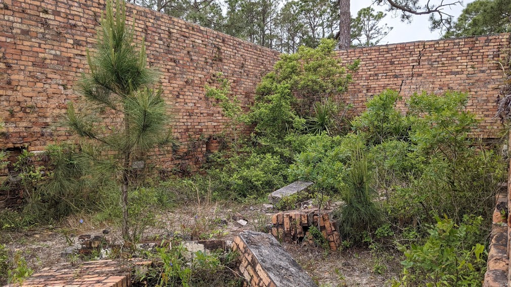
Now I am going to take a look at a line of fort pairs and clusters along the Gulf of Mexico coastline running from southern Louisiana below New Orleans to Pensacola, Florida, called part of the U. S. Seacoast Defense System.
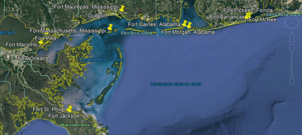
Fort Jackson and Fort St. Philip were situated across from each other on the Mississippi River, and both located 40-miles, or 64-kilometers, upriver from the mouth of the river
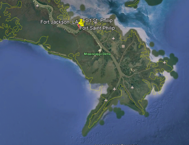
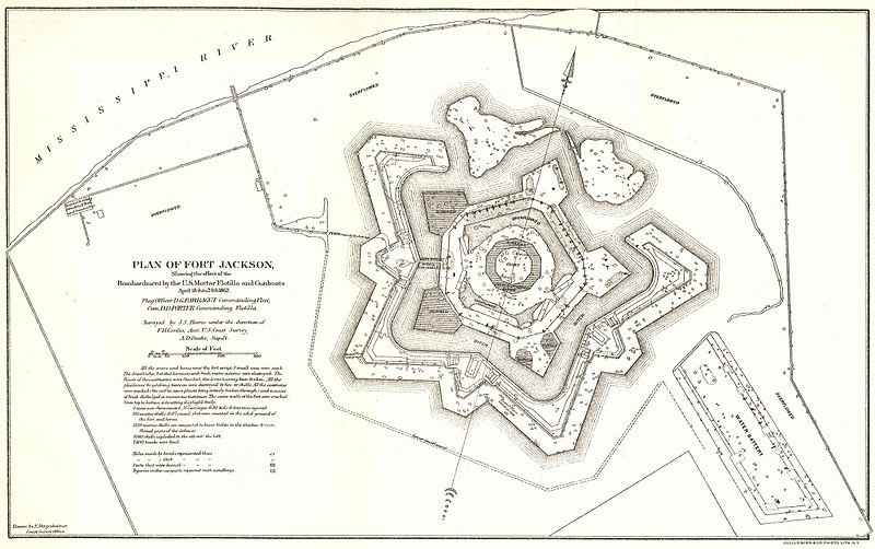
Fort Jackson was an historic masonry fort said to have been constructed as a coastal defense of New Orleans between 1822 and 1832.
It is marked “Battery Millar” on some maps.
Fort Jackson was attacked and damaged by Union mortar and gunboats during the American Civil War from April 18th to April 24th of 1862.
Today, Fort Jackson is a National Historic Landmark and museum.
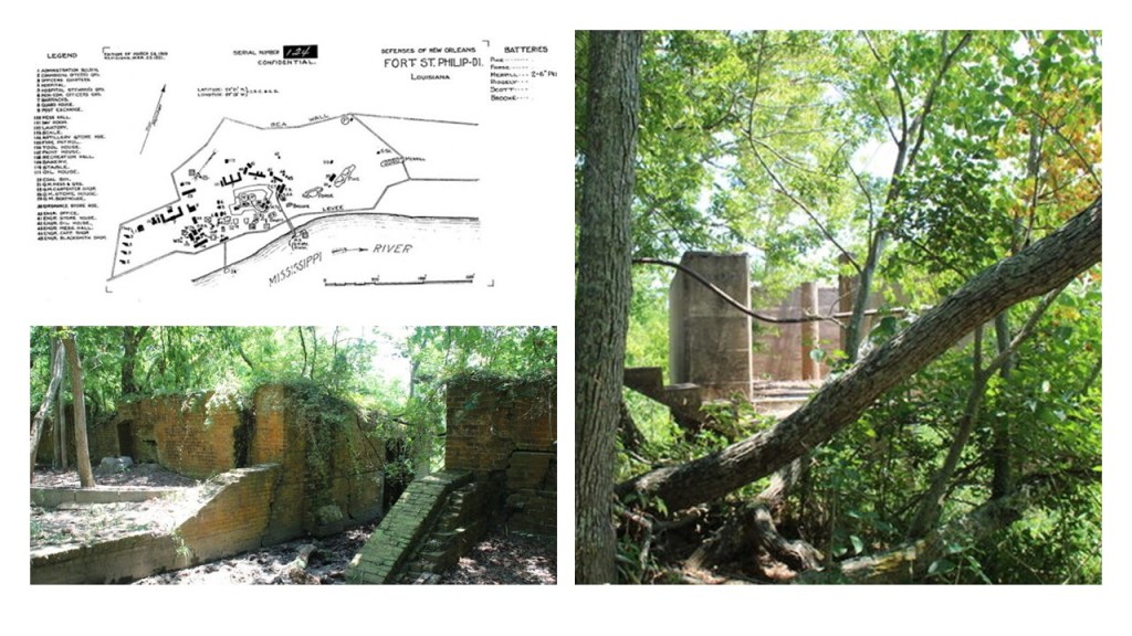
Fort St. Philip was said to have been constructed in the 18th-century when the Spanish governed Louisiana, and is a privately-owned National Historic Landmark in a bad state of deterioration.
It was also said to have been attacked by Union forces at the same time as Fort Jackson, in April of 1862, during the Civil War.
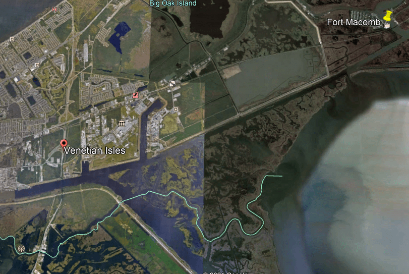
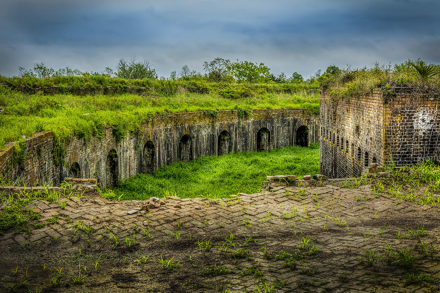
Next, still in Louisiana, we find Fort Macomb and Fort Pike across from each other and situated between Lake Borgne and Lake Pontchartrain, northeast of New Orleans.
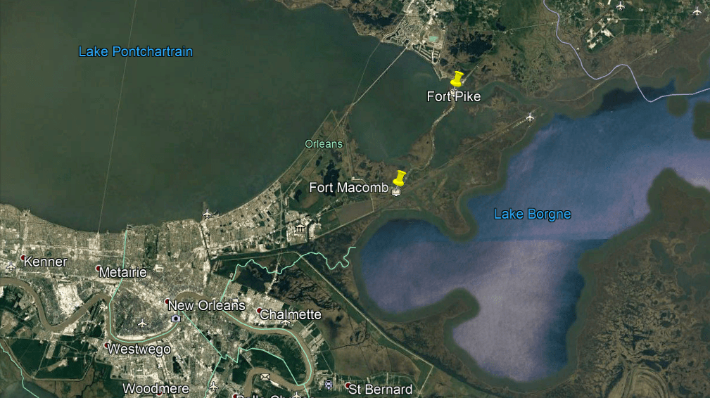
Fort Macomb, formerly known as Fort Wood, is situated on what is called the Chef Menteur Pass, a water route which connects the Gulf of Mexico to Lake Pontchartrain.
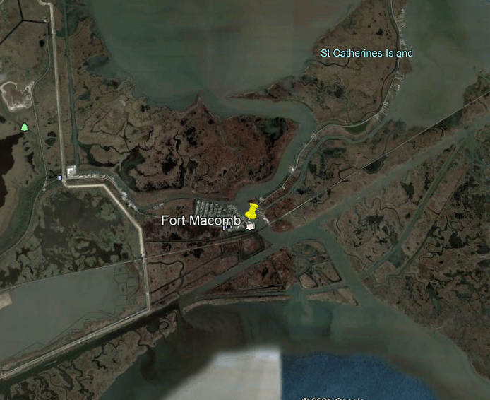
These waterways really start to clearly look man-made when you see what appears to be a straight canal running from Fort Macomb to the adjacent community of Venetian Isles.
More on this subject in a moment.
Fort Macomb was said to have been built around 1820, seven years after the British invasion of New Orleans towards the end of the War of 1812.
It was said to have been occupied at different times by both Confederate troops and Union troops during the Civil War, and then decommissioned in 1871.
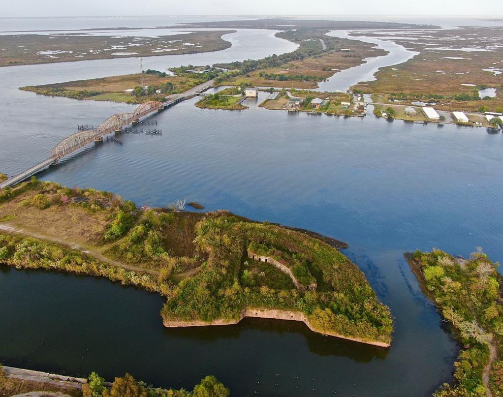
An effort was made by the State of Louisiana to open it to the public in the late 20th-century, but its deteriorated condition was deemed too hazardous for tourism.
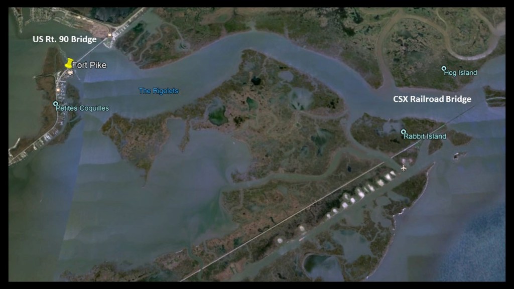
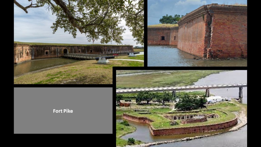
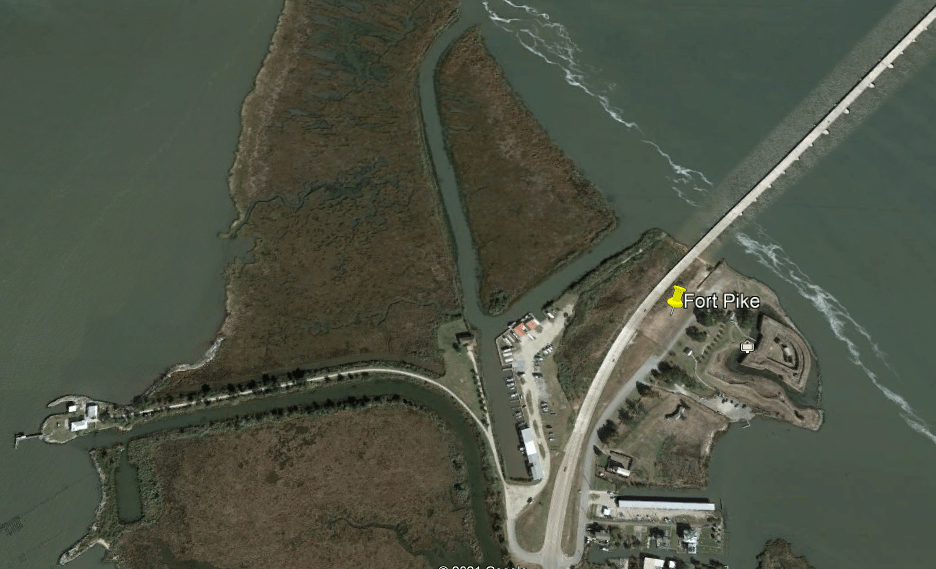
Fort Pike is a short-distance northeast of Fort Macomb, and was said to have been built in 1819, after the War of 1812 like Fort Macomb, to provide a defense against invasion of the United States, and to guard the Rigolets Pass between Lake Borgne and Lake Pontchartrain.

The Rigolets Pass, from the French word “rigole” meaning “trench” or “gutter,” is bounded by bridges on either end – the US Route 90 bridge adjacent to Fort Pike, and the CSX Railroad bridge on the other end, and about which the CSX Railroad tracks are right next to Fort Macomb.
I bring this point forward because I believe the star forts and railroads were connected to each other as integral parts of the circuitry for the Earth’s original worldwide grid system.
In the case of star forts, what I believe originally functioned as actual batteries, defined as a combination of two or more cells electrically connected to work together to produce electric energy, were repurposed as military fortifications, and as such, they became military targets for destruction in the various wars and conflicts of our modern history.
Though railroads were too important to developing economiesin most cases to destroy the infrastructure for, they didn’t go completely unscathed during wartime either.
But that’s not what we are told, now is it!!!
So, like Fort Macomb, Fort Pike was said to have been occupied at different times by both Confederate troops and Union troops during the Civil War, and Fort Pike was decommissioned in 1890.
If you look at the location of Fort Pike on Google Earth, you see clearly man-made channels all around it…and this brings me to the subject of canals.
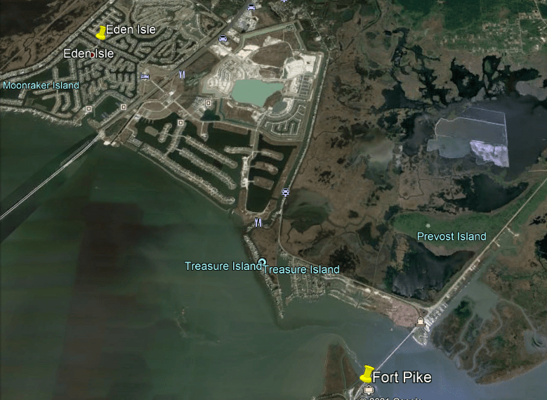
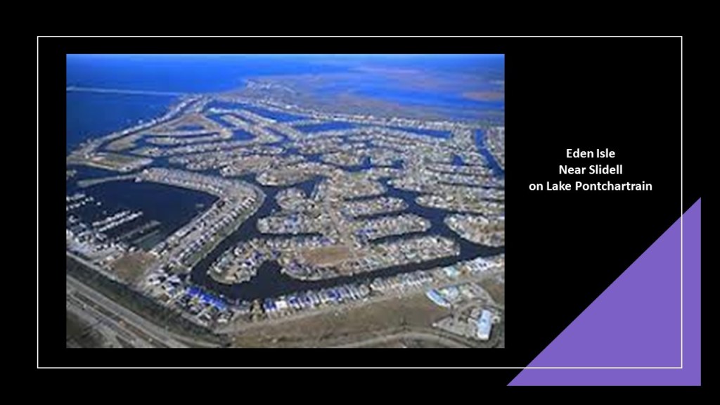
Fort Pike is located quite close to Eden Isle, which is on Lake Pontchartrain, just south of Slidell.
I encountered Eden Isle in past research on an alignment, and the point that I want to make now is that the original civilization was also a canal-building civilization, and there similar-looking canal systems all over the earth.
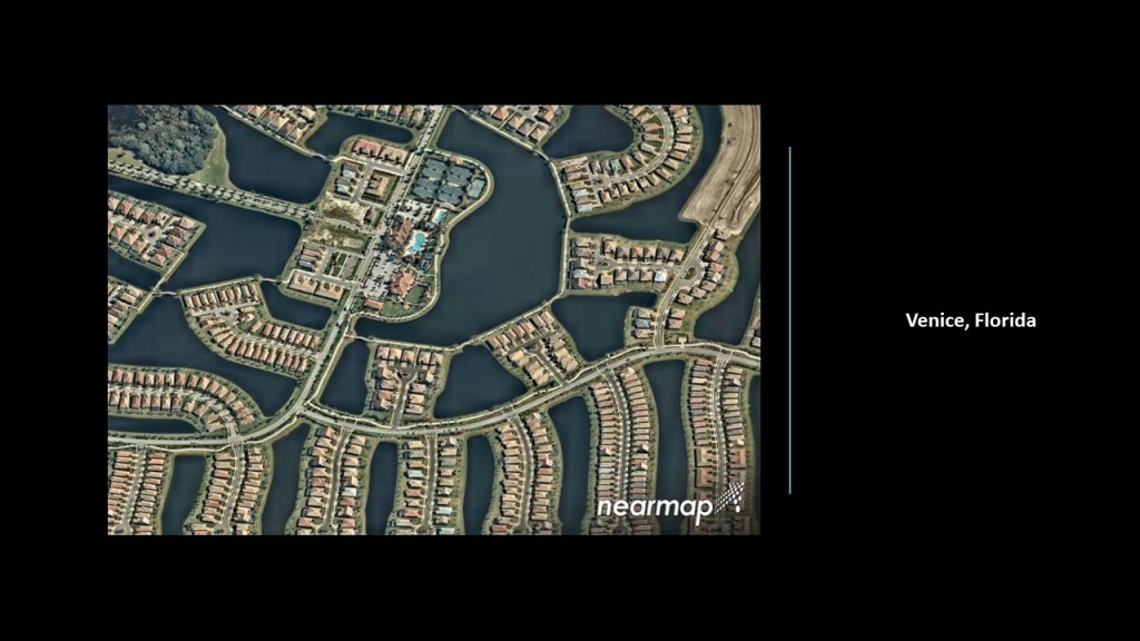
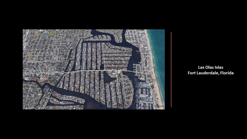
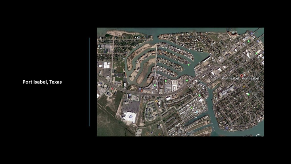
In this part of the world alone, including Eden Isles…
…there are the canals in Venice, Florida…
…Las Olas Isles on Florida’s Atlantic Coast in Fort Lauderdale…
…Port Isabel on the Texas Gulf Coast…
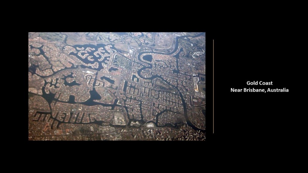
…and all the way over in Australia in the South Pacific near Brisbane in eastern Australia is the Gold Coast ~ same thing!
I know this is off-topic, but I couldn’t help myself with finding man-made channels around Fort Pike, and its proximity to the canals of Eden Isle.
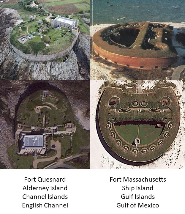
Now back to the Gulf Coast “forts,” and the next pairs of the Forts Massachusetts and Maurepas along the State of Mississippi Gulf Coast region.
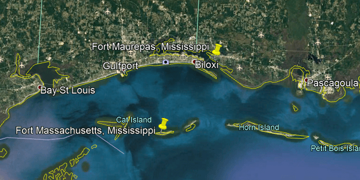
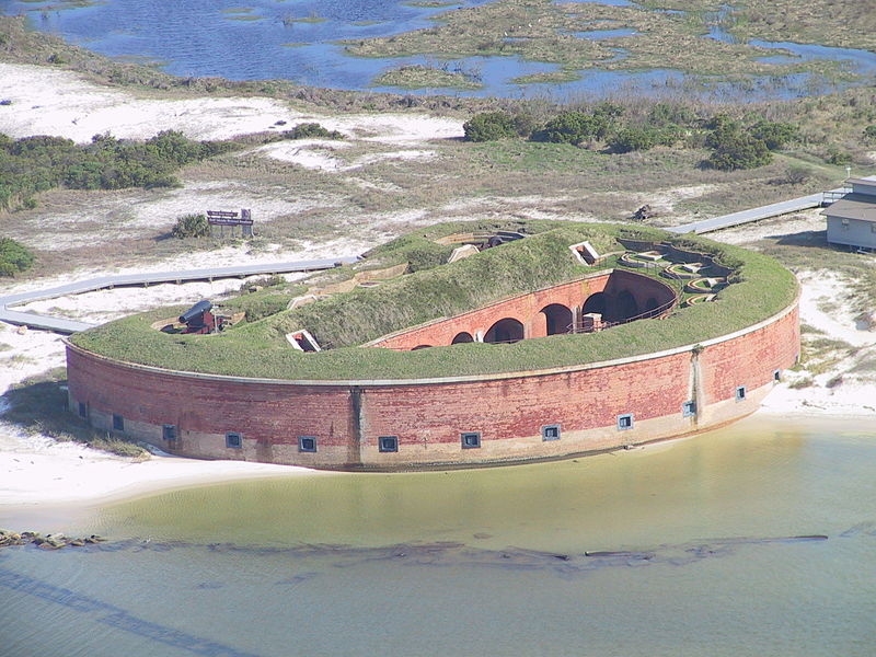
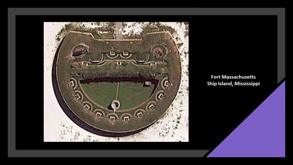
Fort Massachusetts is on West Ship Island near Gulfport, Mississippi.
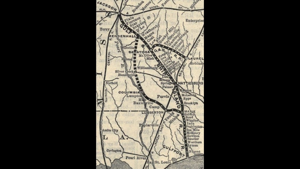
The City of Gulfport was founded by William H. Hardy, and incorporated in 1898. He was the President of the Gulf & Ship Island Railroad that connected inland lumber mills to the coast.
Another railroad connection to the location of a star fort.
Let’s see if I can find more as we go along the coast.
Ship Island refers to a barrier island off the Gulf Coast of Mississippi, part of the Gulf Islands National Seashore.
It was split into West Ship Island and East Ship Island by Hurricane Camille in 1969.
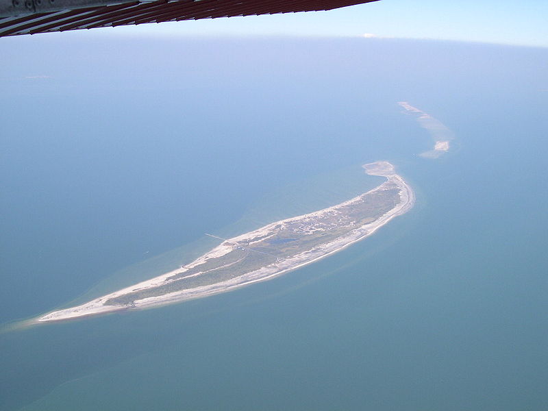
We are told the construction of Fort Massachusetts was said to have started in June of 1859, with the U. S. Army Corps of Engineers supervising around 100 men, primarily civilians who were stonecutters, stonemasons, carpenters and blacksmiths, but that it was never completely finished.
It was involved in different capacities by both sides during the Civil War.
Then, only one-year after the end of the Civil war, it was for all intents and purposes not in use as a military installation as of 1866.
I found a close match in my previous research for Fort Massachusetts in the form of Fort Quesnard on Alderney Island in the Channel Islands.
Fort Quesnard was said to have been built and completed in 1855 as a defense against an attack from France.
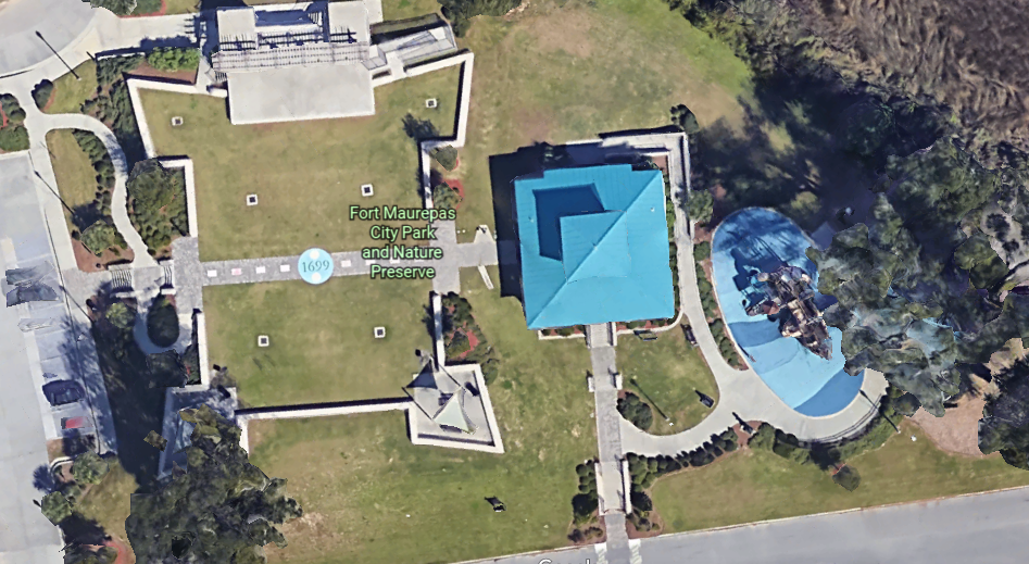
Next in this line of star fort pairs is Fort Maurepas is across the Gulf in Old Biloxi, and was located at present-day Ocean Springs, approximately 2-miles, or 3.2-kilometers, east of Biloxi.
It was said to have been developed by the French in 1699, and we are told it burned down around 1722.
This is Fort Maurepas City Park and Nature Preserve today, which has a pavilion, large green space, playground equipment, and a splash pad.
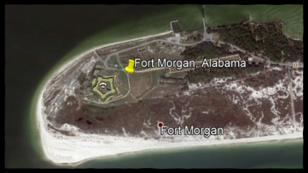
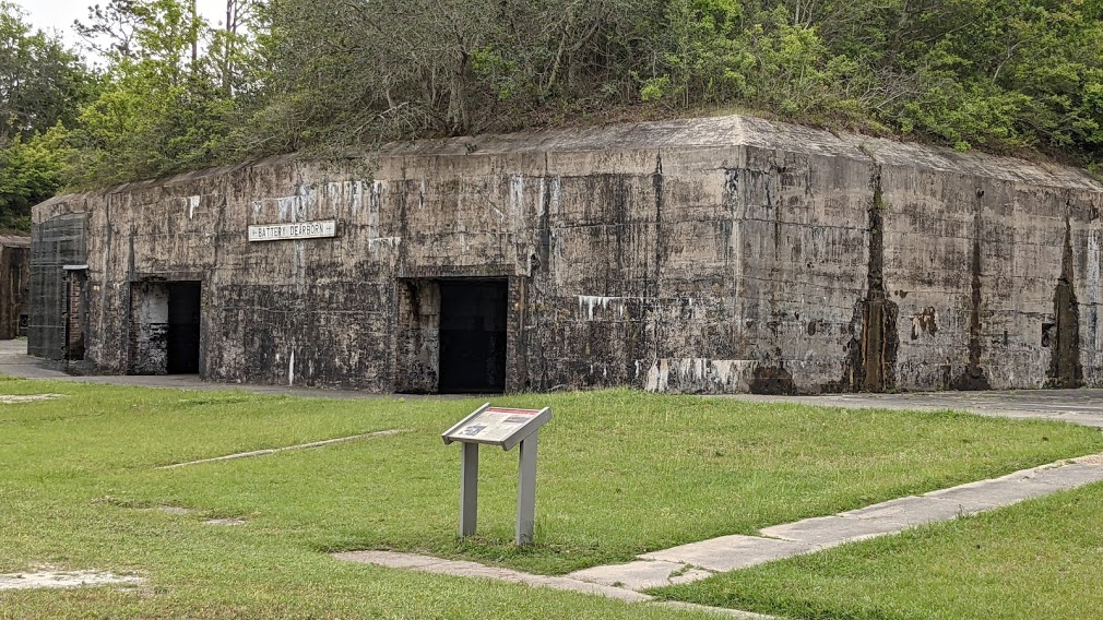
The next pair of forts we come moving from west to east along the Gulf of Mexico coast, are Fort Gaines and Fort Morgan in the State of Alabama.
Huge thanks to sisters Rebecca and Jane P. in Texas for bringing these two forts to my attention.
I was not aware of them before last week, and their sending me photographs they had taken at the two forts provided another link in the chain.
I knew about the forts in Louisiana, Mississippi, and west Florida in this stretch of coast-line, but not these two particular Alabama forts.
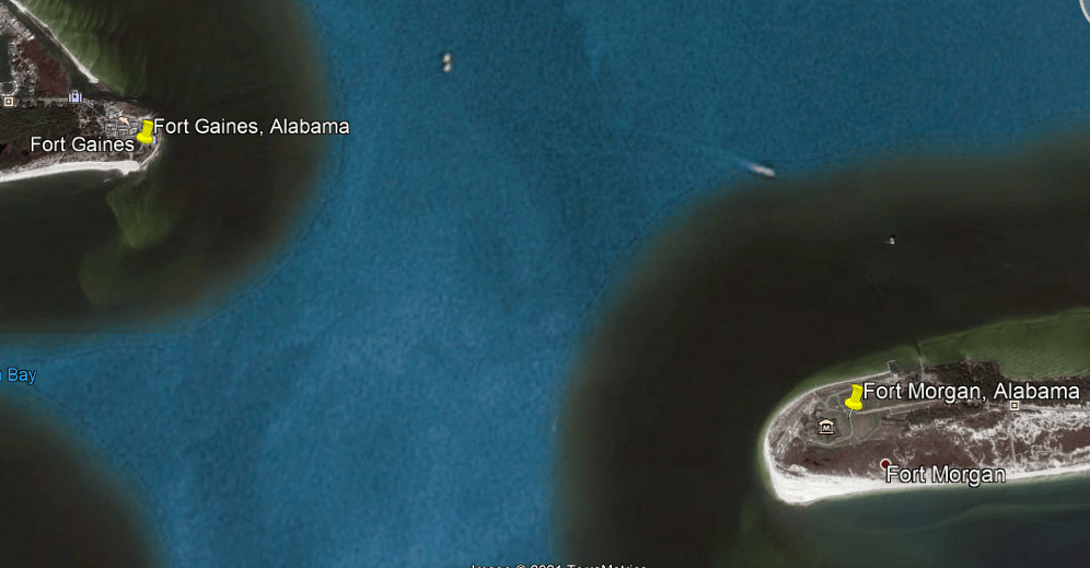
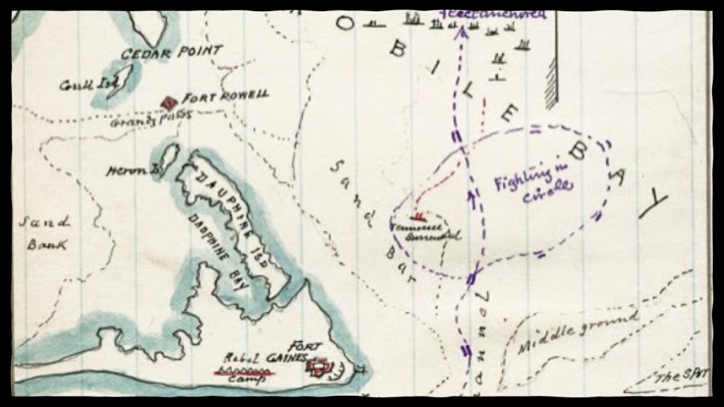
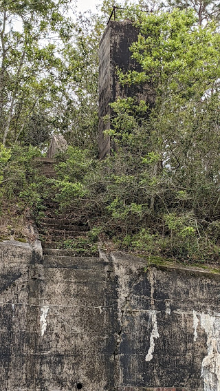
Both Fort Gaines and Fort Morgan were said to play significant roles in the Civil War Battle of Mobile Bay, where the Union naval fleet under the command of Rear Admiral David Farragut victoriously attacked a smaller confederate fleet, as well as the three forts that guarded Mobile Bay, with the other one being Fort Powell, the remains of which are now under water.
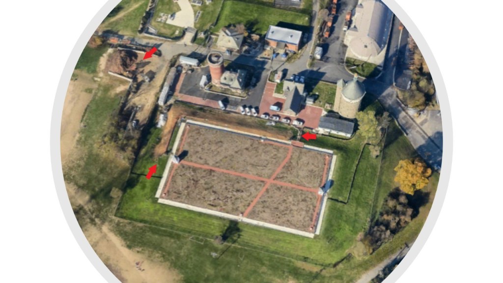
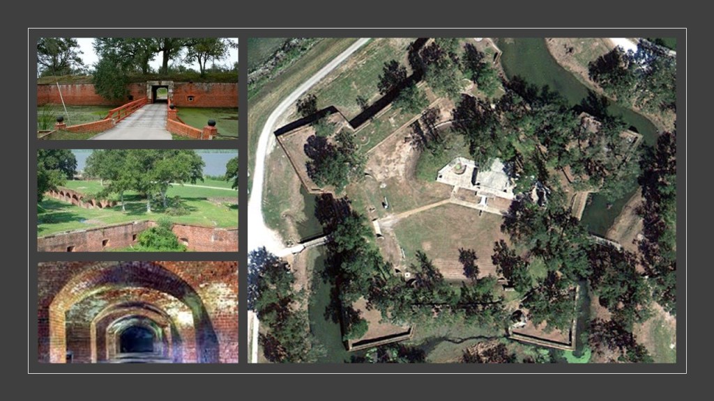
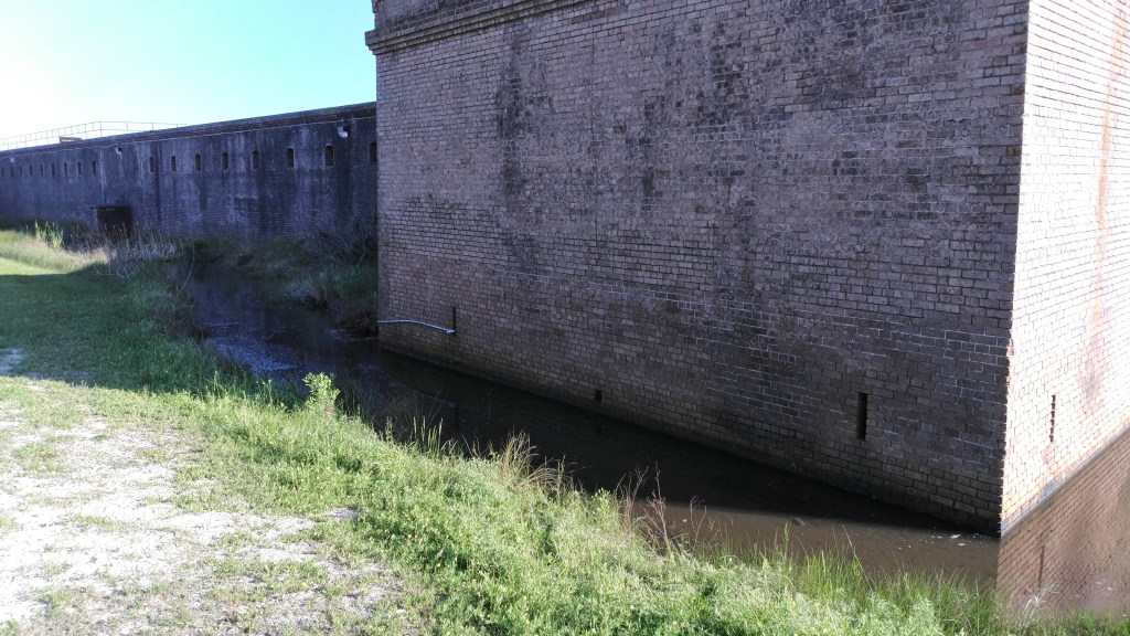
Fort Gaines is located on the eastern end of Alabama’s Dauphin Island, and was said to have been built in 1821.
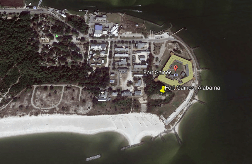
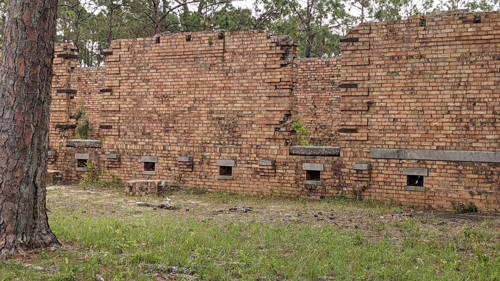
Fort Gaines is considered to be one of the nation’s best-preserved Civil-War-era masonry forts.
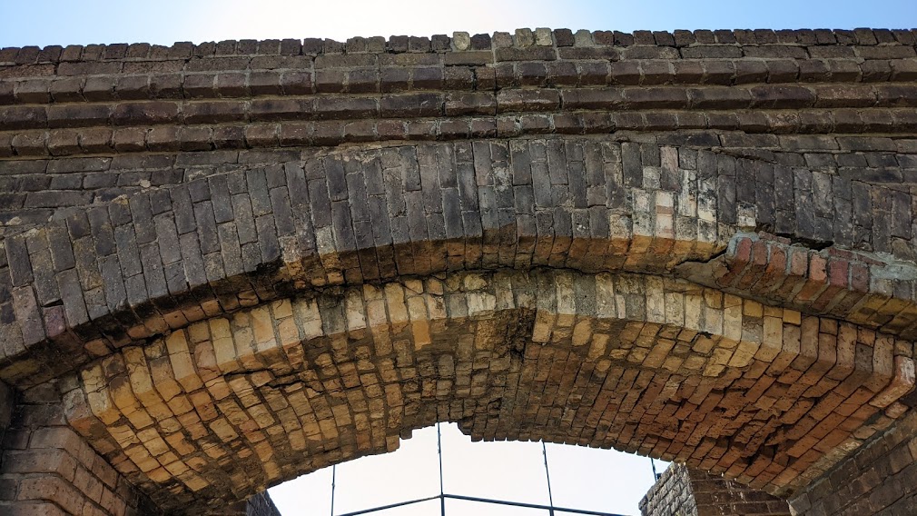
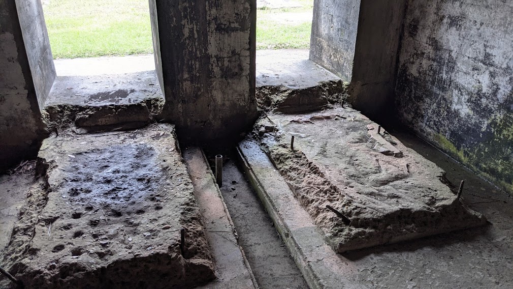
Here are some of the photos of Fort Gaines from Rebecca and Jane, showing its impressive brickwork, with low to the water slot windows…
…impressive archways…
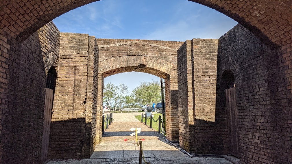
…and spiral staircase.
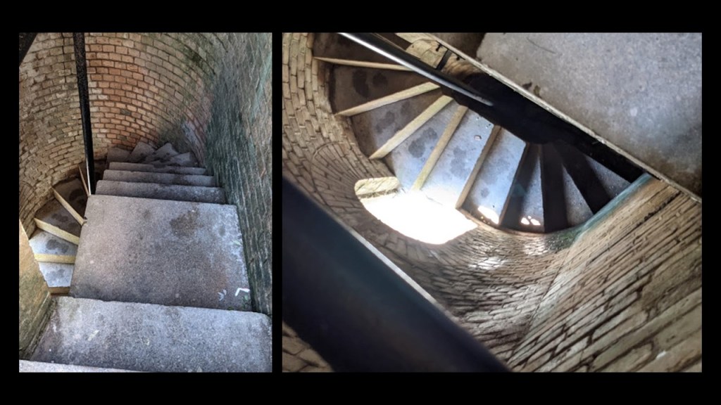
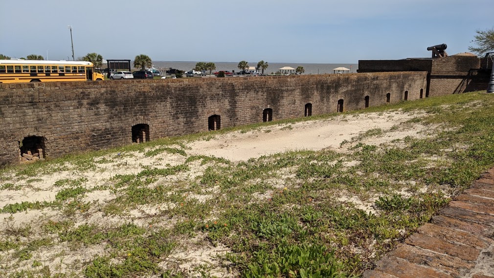
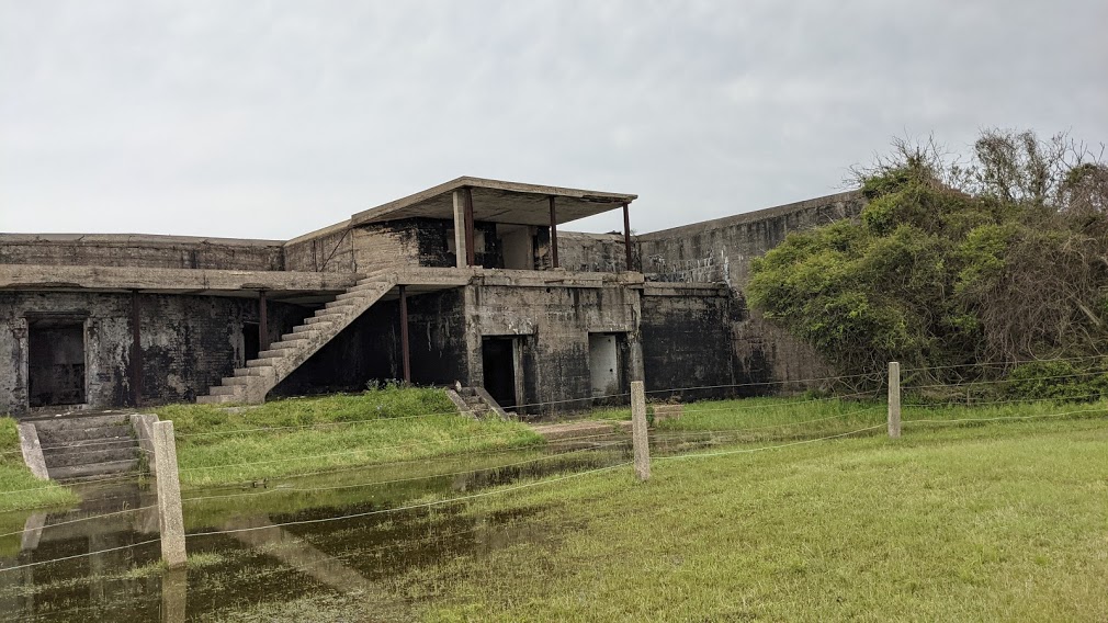
Fort Morgan is located across from Fort Gaines on Mobile Point on what is called the Fort Morgan Peninsula.
It was said to have been built between 1819 and 1833, and addition to its use during the Civil War, it saw intermittent use during the Spanish-American War, World Wars I and II.
It was turned over to the State of Alabama as an historic site in 1946.
Here are some of Rebecca and Jane’s photos of Fort Morgan:
Next are the numerous star forts in Pensacola in western Florida.
I had already learned about several of the star forts of Pensacola from previous research.
Our historical narrative says that the Siege of Pensacola was fought in 1781, and was the culmination of Spain’s conquest of British West Florida during the Gulf Coast campaign.
Here is one of the clusters of star forts I found when I first looked into Pensacola.
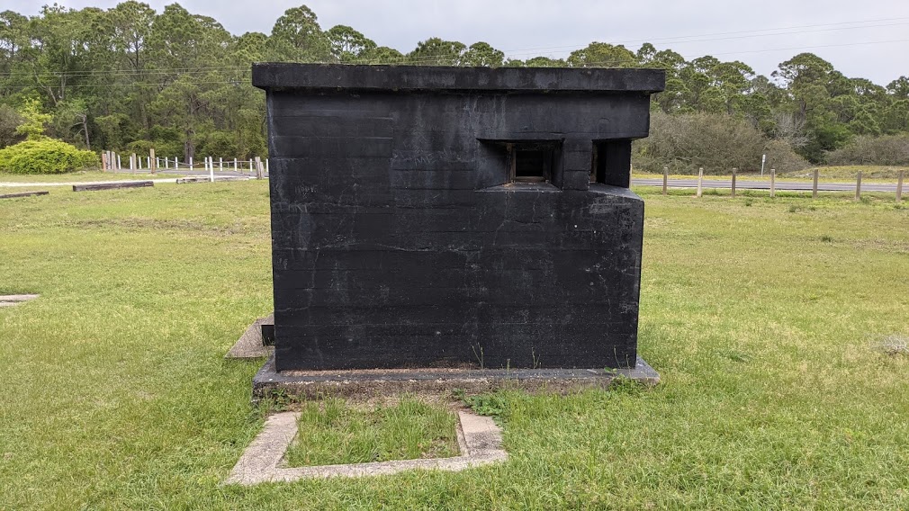
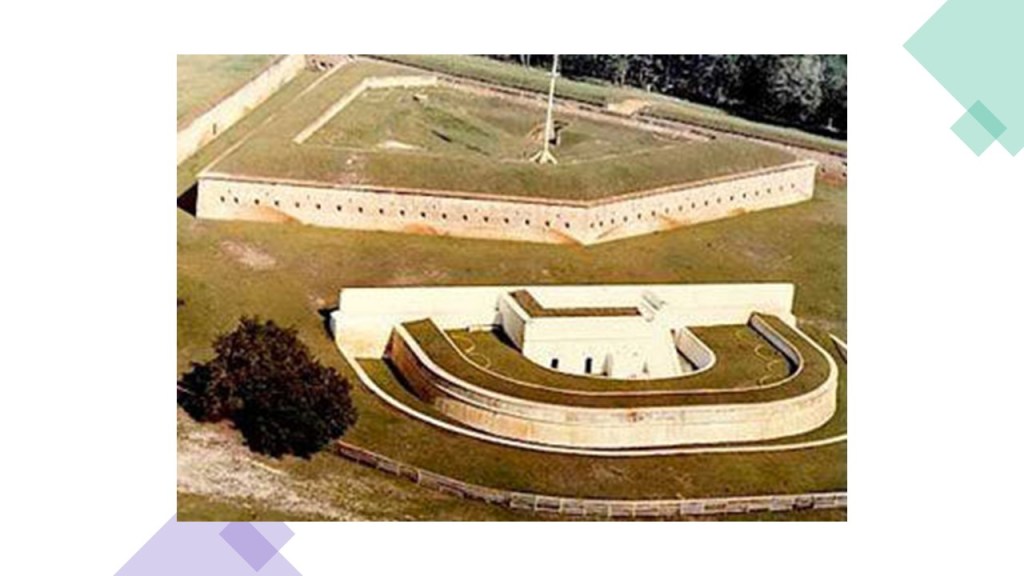
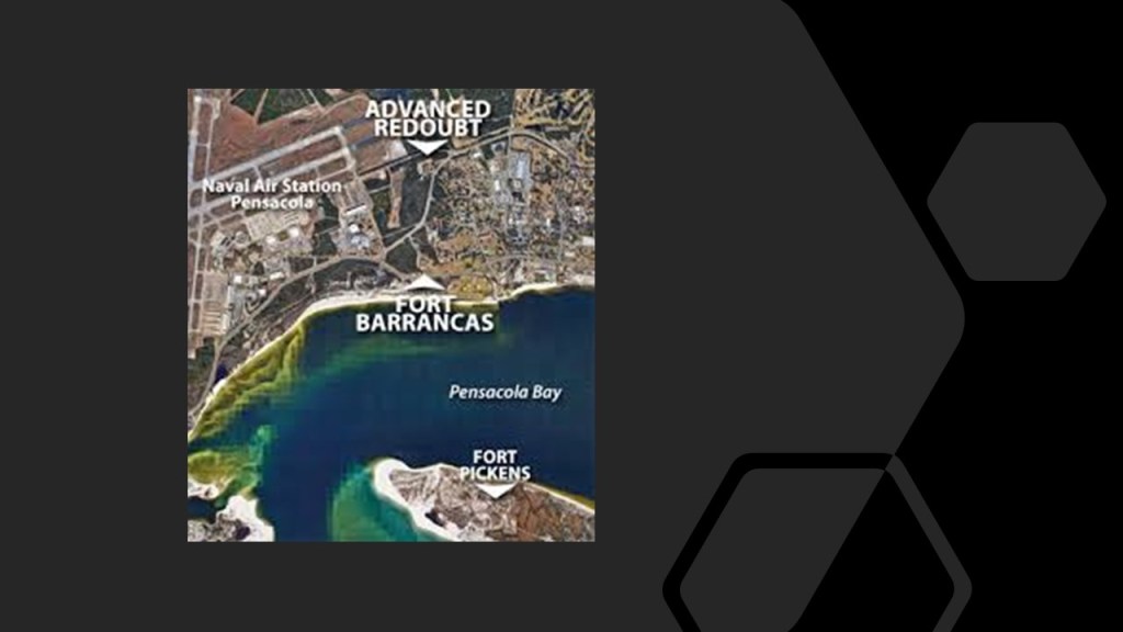
Fort Pickens is on the western end of the Santa Rosa Island…
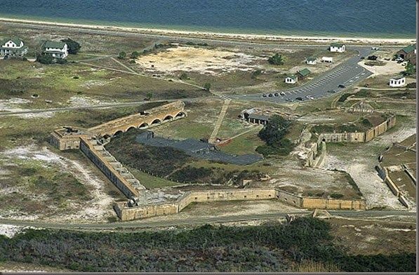
…where it sits on one side of the channel entering Pensacola Bay from the Gulf of Mexico.
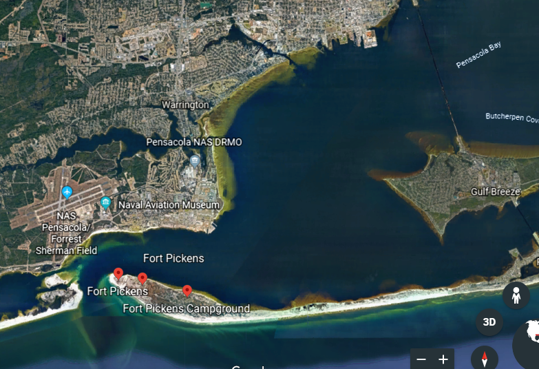
Fort Barrancas is directly across from Fort Pickens on the other side of this channel, and located physically within the Pensacola Naval Air Station…
…and what is called the Advanced Redoubt of Fort Barrancas as well.
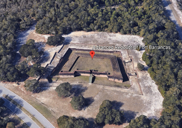
This is how the relationship between these three star forts looks from above.
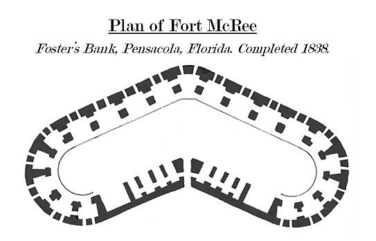
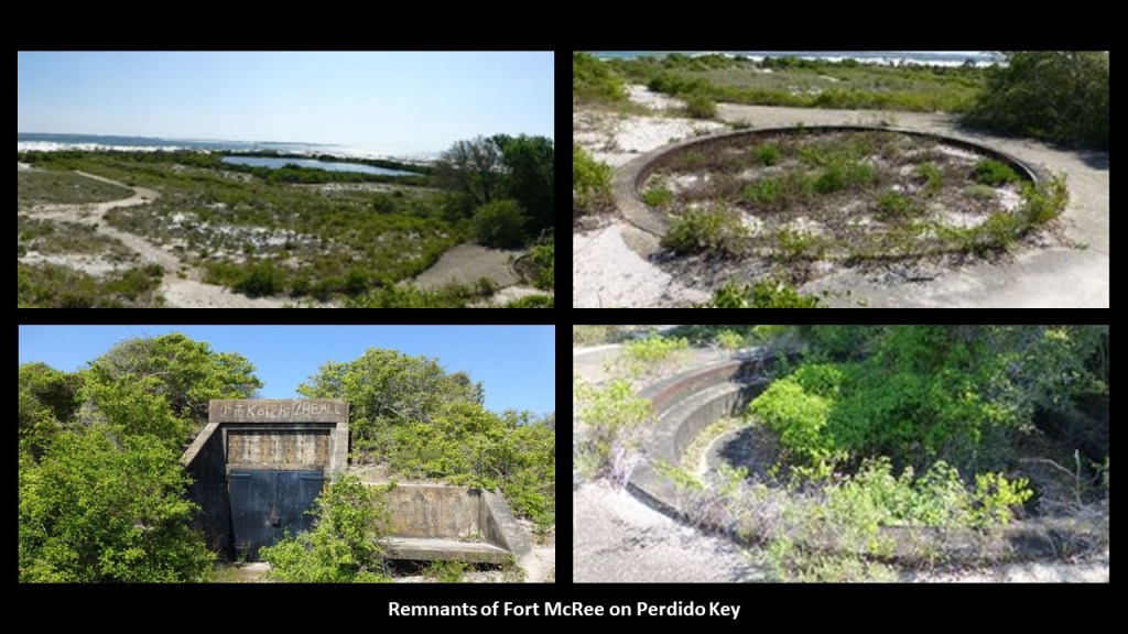
Then when I started looking into the same area as part of the research for this post, and the historical Fort McRee showed up on Google Earth on the eastern end of Perdido Key, and was situated directly across from Fort Pickens on Santa Rosa Island, and was not far from Fort Barrancas either.
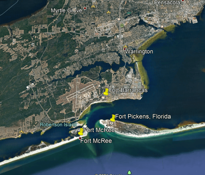
Fort McRee was said to have been constructed between 1834 and 1839 in a strange boomerang shape because of its position on the end of this narrow barrier island.
All three of these forts saw action during the Civil War.
While we are told Fort Pickens and Fort Barrancas remained preserved due to their continued use and later as historic sites, Fort McRee was left to the elements because it was not as accessible, and very little of Fort McRee remains to be seen today.
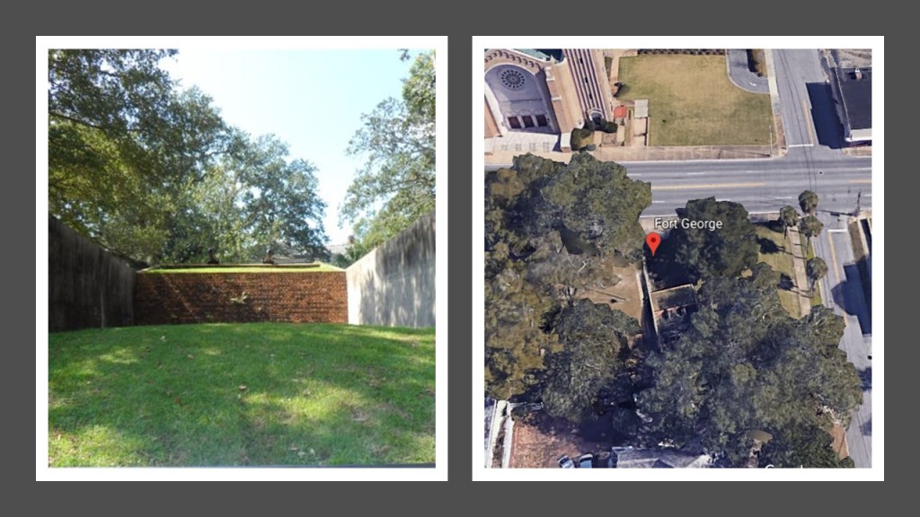
Other forts that I know of in Pensacola included:
Fort George, of which this is what is left:
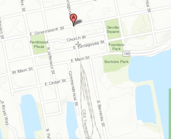
…and there is nothing left of what was the Fort of Pensacola, also known as the Presidio Santa Maria de Galvez.

This was its previous location…
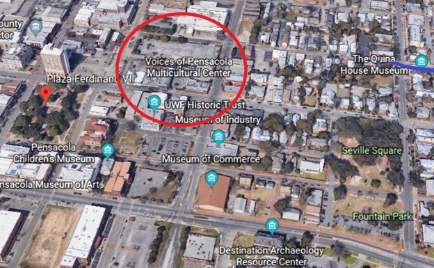
…which I found through the coordinates of the former fort on this map.
I find it interesting to note the head of the CSX Railyards was just one-block due south of where the Fort of Pensacola was located.
But the finding of star forts is not limited to coastal areas, as I consistently find them along the rivers of the world.
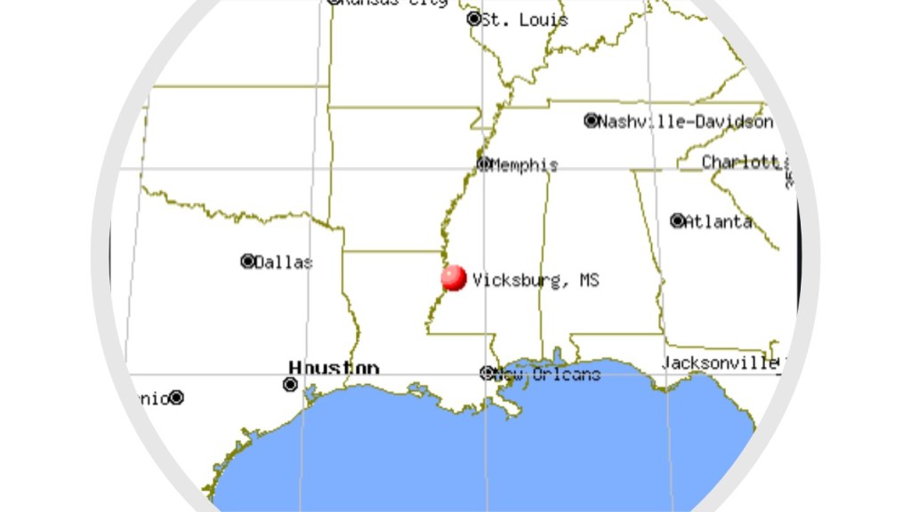
Let’s look at Vicksburg n Mississippi as an example of a star fort location and the site of a major Civil War battle in our historical narrative.
Vicksburg is located roughly half-way between Memphis and New Orleans at the confluence of the Mississippi and Yazoo Rivers.
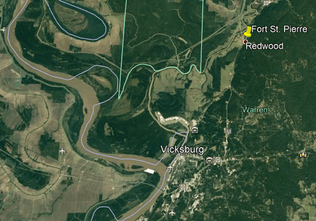
We are told French colonists were the first Europeans to settle the area, which was part of the historical territory of the Natchez people, and that it was the French who built Fort St. Pierre in 1719…
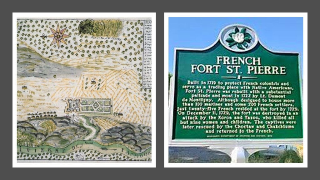
…on the high-bluffs at Redwood on the Yazoo River.
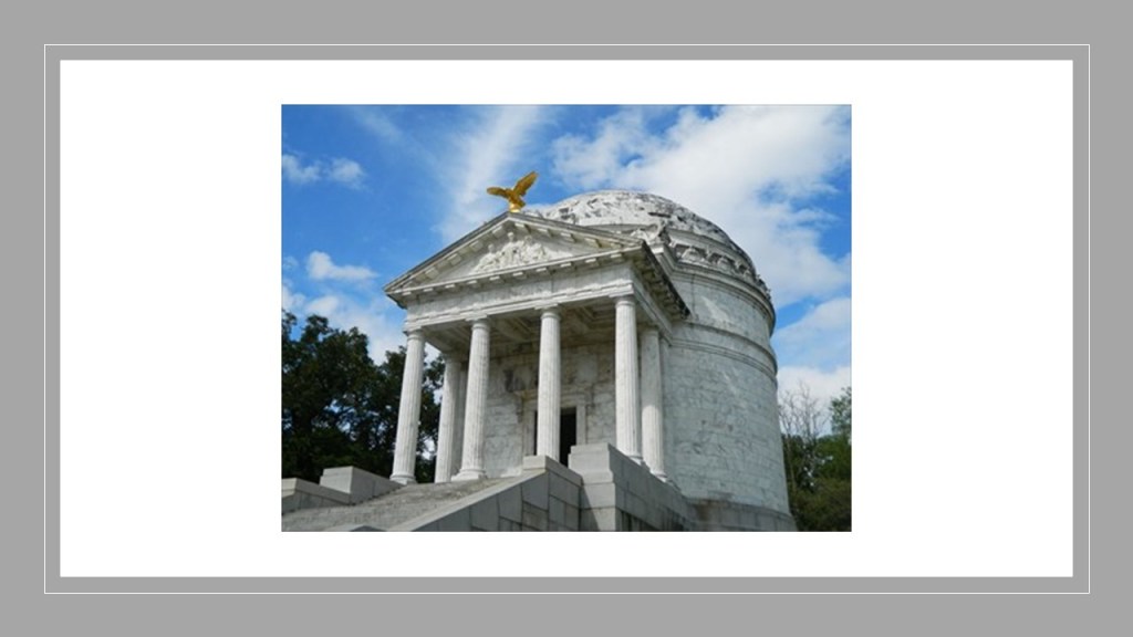
Perhaps Vicksburg is best-known for the Vicksburg Campaign and Siege during the American Civil War, which took place between 1862 and 1863, and at the end of which the Union forces under General Ulysses S. Grant captured the Confederate stronghold of the port of Vicksburg and divided the Confederacy.
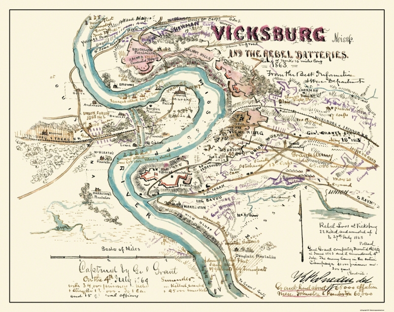
Along with the Battle of Gettysburg in July of 1863, it was considered a turning-point in the American Civil War.
We are told that after the Vicksburg National Military Park was established in 1899, the nation’s leading architects and sculptors were commissioned to honor the soldiers and sailors from their respective states that fought in the Vicksburg campaign, leading it to be called the “Art Park of the World” with more than 1,400 monuments found throughout the park.
Like the Mississippi Memorial…

…the Michigan Memorial…

…and the Illinois State Memorial.
The Shirley House is said to be the only-surviving wartime structure inside the Vicksburg National Military Park.
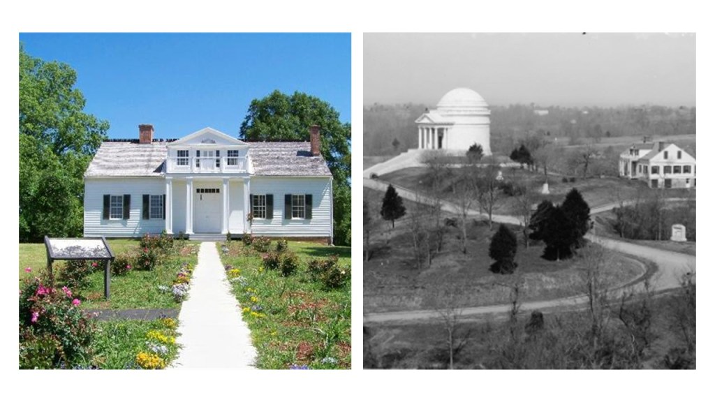
This is a wartime picture of the Shirley House circa 1863, with what is described as the camp of the 45th Illinois Infantry behind it.
But there are things going on in this photo that don’t make sense to me.
Why all the digging and entrances?
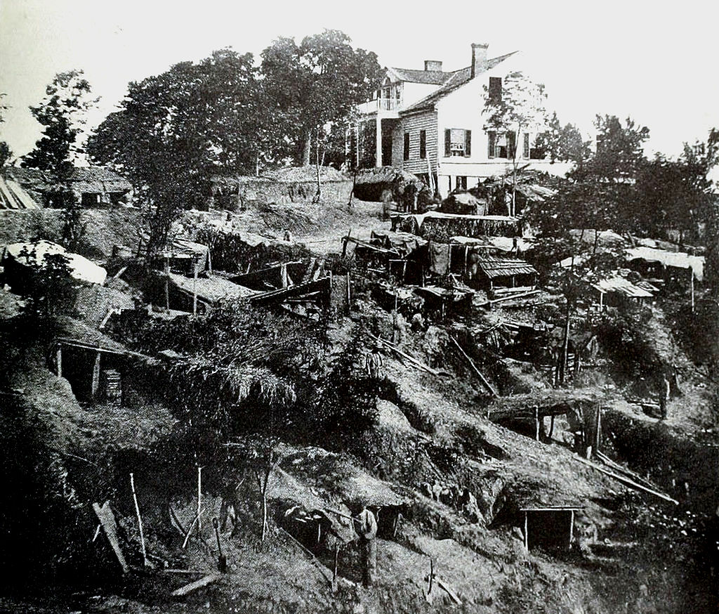
Apparently during the Siege of Vicksburg, the people of the city dug caves into the sides of hills to get out of harm’s way from the hail of iron that was coming their way from Union forces.

A possible explanation…but is it plausible?
This photo was notated as Union soldiers on the lawn of the Warren County Courthouse after the siege.
It was said to have been constructed between 1858 and 1860.
Interesting to note the contrast between the size of the soldiers and that of the courthouse.
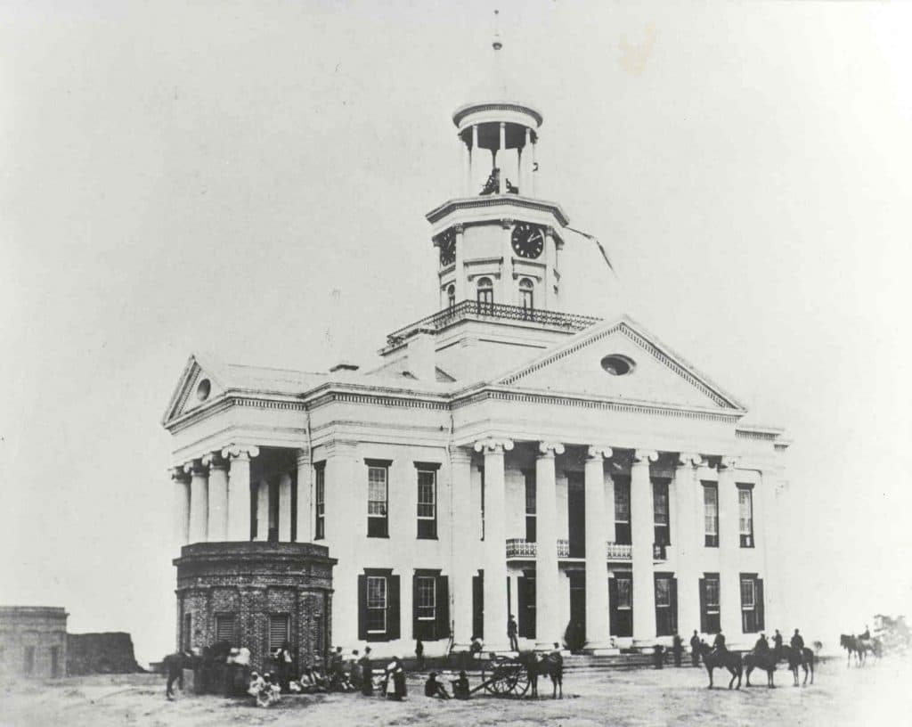
Considered to be Vicksburg’s most historic structure, a museum is operated within the old courthouse today.
The mud-flooded-looking Washington Hotel in Vicksburg was said to have been used as a military hospital during the Civil War.

There was a castle in Vicksburg which was said to have been built in the 1850s, including a moat, but it was destroyed by the Union Army and the site turned into an artillery battery.

The last subject I am going to look at with regards to Civil War Anomalies is that of the role of two secret societies during this time.
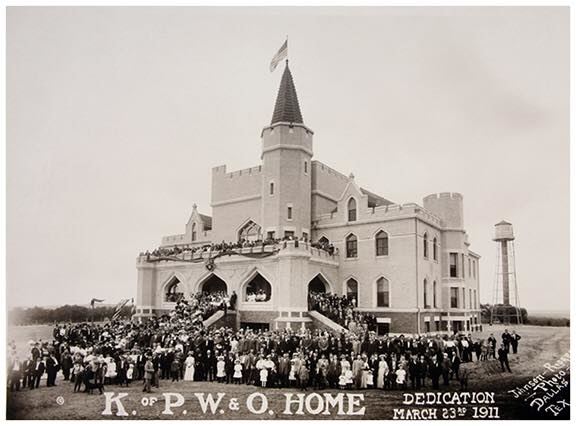
First, the Knights of Pythias.
I first encountered the Knights of Pythias at the Pythian Castle of Springfield, Missouri, when I was tracking a circle alignment that begins and ends in Algiers, Algeria.
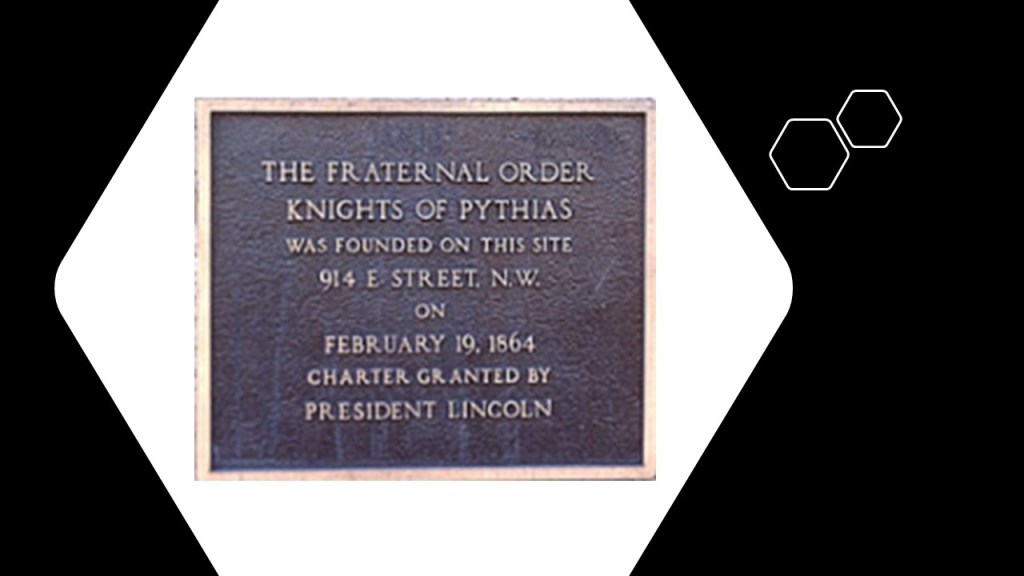
What jumped out at me on learning about the Knights of Pythias is that it was a secret society founded in Washington, D.C in February of 1864, and the Civil War didn’t end until 1865.
It was the first fraternal order to receive a charter by an Act of Congress.
For what purpose would Congress charter a fraternal secret society in wartime?
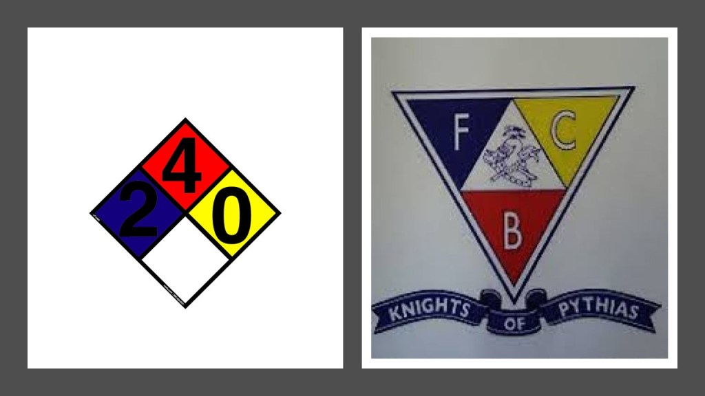
I will just leave this National Fire Protection Association Hazard Diamond signage here for comparison on the left, as I thought of it when I saw the Knights of Pythias logo on the right. Coincidence…or is there some kind of connection?
I don’t discount any possibility with the amount of secret society symbolism that goes on without our awareness.
I will start at the Pythian Home of Missouri where I first encountered the Knights of Pythias in Springfield, Missouri, then give other examples Pythian orphanages.
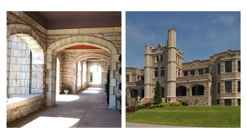
We are told that this Pythian Home was constructed by the order in 1913 as a home for needy members of their order, and their widows and orphans.
The original main floor features things like a grand foyer…
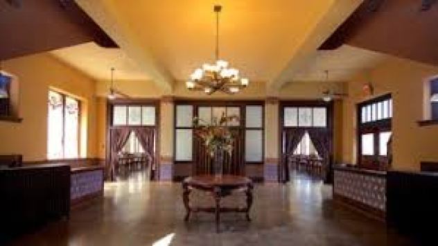
…ballroom…
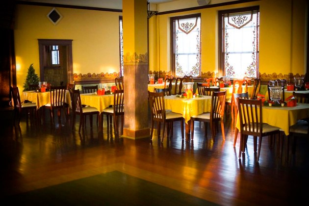
…and sitting parlors.

In addition to this home, the Knights of Pythias built orphanages in places like Clayton, North Carolina, near Raleigh.
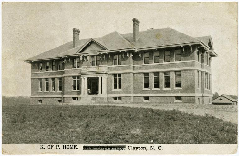
The construction of this orphanage was said to have started in 1910, and it is reported as no longer standing.
The Pythian Home in Weatherford, Texas, opened in 1909 for widows and orphans in Knights of Pythias members.
It is in operation as a children’s home to this day.
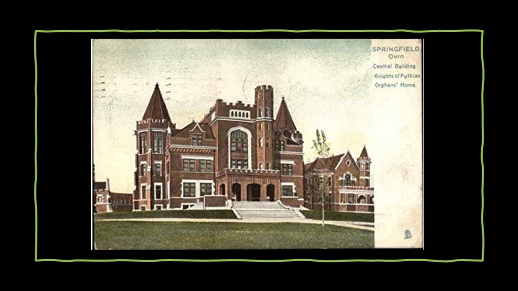
The Pythian Home in Springfield, Ohio, was said to be the first constructed by the order in 1894.
Same idea with the Odd Fellows.
The American lodges formed a governing system separate from the English Order in 1842, and assumed the name Independent Order of Odd Fellows in 1843.
The Independent Order of the Odd Fellows became the first fraternity in the United States to include both men and women in 1851, with its establishment of the “Beautiful Rebekah Degree.”
The command of the Odd Fellows is to “visit the sick, relieve the distressed, bury the dead and educate the orphan.”

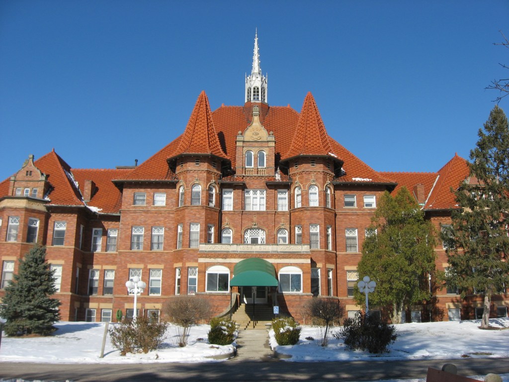
Here are some examples of Odd Fellows Institutions along these lines:
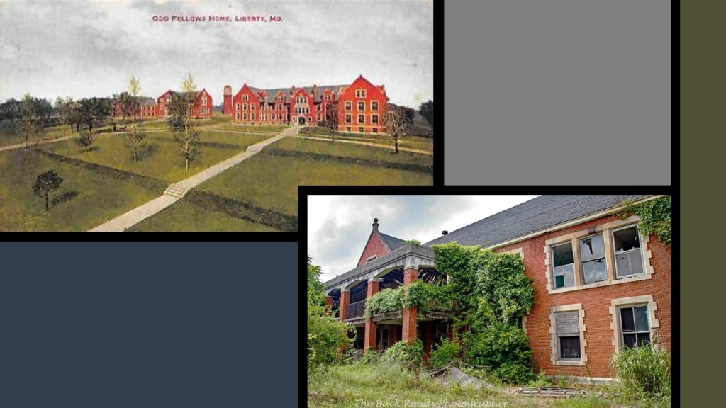
The Odd Fellows Home in Liberty, Missouri, was said to have been built in the late 19th-century, and had an orphanage, school, nursing home, and cemetery, and is in ruins today…
…and like the Pythians, the Odd Fellows also built a Home for Orphans, Indigent, and Aged in Springfield, Ohio, said to have been built in 1898…
…and the Oklahoma Odd Fellows Home at Checotah for Widows and Orphans, said to have been built starting in 1902.
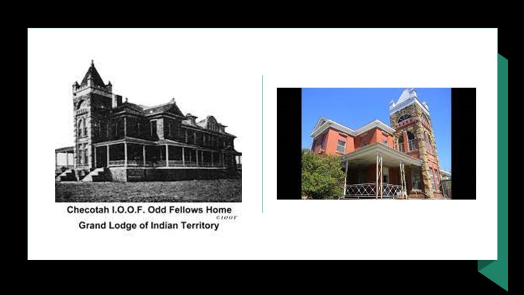
What’s up with the castle-looking appearance of these charitable institutions?
It would be interesting to know what was really going on here with all this focus on helping the sick, distressed, aged, dead and orphans in combination with the elaborate architecture.
The information I received from Caroline in California opened up a new area of research for me that dove-tailed well with other research I have already done seen throughout this post, and was able to pull examples of it together in one-place to share the anomalies that I have serious questions about.
What might have actually been taking place here?
Could the cover of warfare have been used to destroy the infrastructure of the original civilization and create the new narrative?
I could go on with anomalies I have found in my research connected with the Civil War, but I am going to end this post here because they are more of the same idea, and I have provided numerous examples to show why I have many questions about the truth of the historical narrative that we have been taught from cradle-to-grave to accept as absolute fact.

HI , SOME INFO .KIND REGARDS FROM ARMANI Screenshot 06-02-2020 09.58.06.png Screenshot 06-02-2020 09.58.51.png Screenshot 06-02-2020 10.00.46.png
On Tue, Jul 6, 2021 at 12:00 AM Revealing What Has Been Hidden in Front of Our Eyes wrote:
> Michelle Gibson posted: ” Caroline from California sent me information > about what were called “Sanitary Fairs,” a subject I had not heard of > before. She said they were held by northerners during the American Civil > War as a fundraiser for the many needs of Union Soldiers, inclu” >
LikeLike
HI INFO. KIND REGARDS FROM ARMANI
On Tue, Jul 6, 2021 at 12:00 AM Revealing What Has Been Hidden in Front of Our Eyes wrote:
> Michelle Gibson posted: ” Caroline from California sent me information > about what were called “Sanitary Fairs,” a subject I had not heard of > before. She said they were held by northerners during the American Civil > War as a fundraiser for the many needs of Union Soldiers, inclu” >
LikeLike
HI .INFO IND REGARDS FROM ARMANI
LikeLike
The “co-incidence” of the definition of “theater” and “battery” is telling. Also “magazine” is mentioned above. Magazine in firearms is a small compartment for storing cartridges which will be fed into the firing chamber. The word “magazine” as a publication which influences opinion is better known, but are these definitions also affiliated?
LikeLike
Greetings Mrs Gibson. My name is Anne-Marie Bourassa. Im just a janitor at Bishops University and I love to follow your work so I printed for myself the content of your website. I thought you ought to know. I don’t plan to ever abuse your work or ever try to make money from it.
Best regards Anne-Marie
Get Outlook for Android
________________________________
LikeLike
This is by far some of your best work yet, I really enjoyed looking through this post. Keep up your enlightening of Humanity, I’m a big fan.
LikeLike
The quote is:
The Birth of Bishop’s University
“There is a tide in the affairs of men, Which, taken at the flood, leads to fortune”
Such a tide in the affairs of Bishop’s University was taking place 150 years ago. For it was on the 19th of October 1843 that the still fledgling “Legislative Assembly of United Canada” meeting in Kingston was presented with a report on a petition from the Lord Bishop of Montreal to incorporate the “Diocesean College of Canada East….
The flood metaphor is interesting! And they were given the 40 acres land by a mysterious Colonel William Morris
Cheers Me
Get Outlook for Android
________________________________
LikeLike