
I have encountered the incredible engineering of bridges, many of which are still in use today, and many of which are not, throughout the course of my research.
I am bringing forward the question in this post for your consideration:
Could these bridges have been constructed when we are told they were constructed by the people credited with their existence, or were they built by a previous advanced civilization unknown to us that actually built the world’s infrastructure?
Some of these bridges are clearly in the style of what we consider Old World architecture as we will see, said to have been constructed in the mid-to-late 1800s
Many of these bridges were said to have been built quite recently starting in early 1900s, and are quite sophisticated in their design and function.
First, I am going to look at John Augustus Roebling and Ralph Modjeski, famous bridge-builders in our historical narrative.
John Augustus Roebling was an incredibly prolific bridge-builder.
This is what we are told about his life and work.
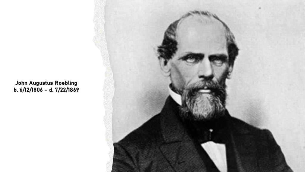
John A. Roebling was born in the Prussian city of Muhlhausen in 1806, and starting in 1824, he received an education in architecture, engineering, and hydraulics in two semesters at Berlin’s Bauakademie, or Building Academy.
We are told that after working as a designer and supervisor in the construction of military roads for four years until 1829, he returned home to prepare for his engineer examination, which he was said to have never taken.
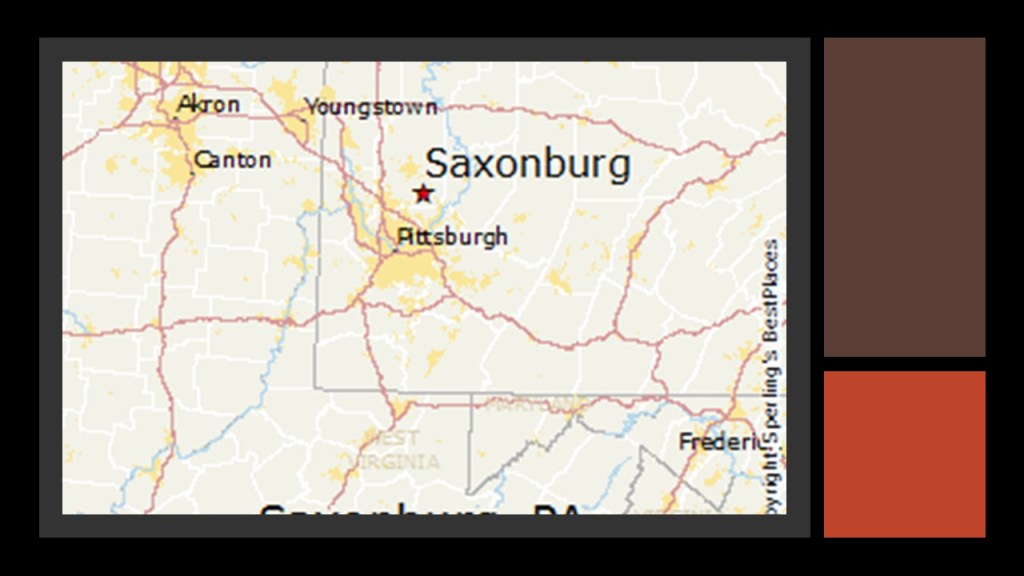
He ended up emigrating to America in 1831 with a group of Prussians including his brother, and the two of them ended up landing in Butler County, Pennsylvania, and purchased land to establish a German settlement, which they named Saxonburg, and John Augustus Roebling was a farmer there for about 5 years.
Then, in 1839, he went back into engineering, starting with improvement of river navigation and the building of canals, and in 1840, he connected with suspension bridge designer Charles Ellet, Jr, to help with the design of a suspension bridge near Philadelphia.
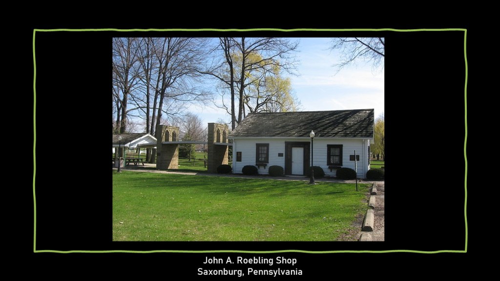
He began producing wire rope in Saxonburg in 1841 for use in such projects as suspension bridges.
A suspension bridge is one where the deck of the bridge is hung below suspension cables on vertical suspenders.

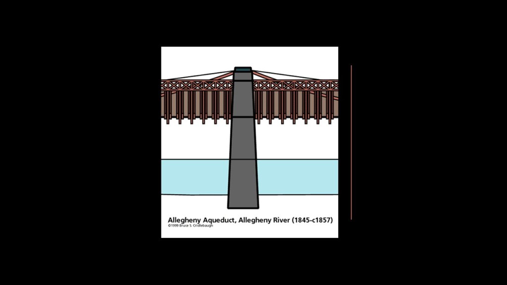
In 1844, Roebling was said to have won a bid to replace the wooden canal aqueduct over the Allegheny River with the Allegheny Aqueduct in Pittsburgh, the first wire suspension bridge he was credited with.
The next bridge project Roebling was credited with building was what is known as the Smithfield Street Bridge in Pittsburgh, with construction starting in 1845.
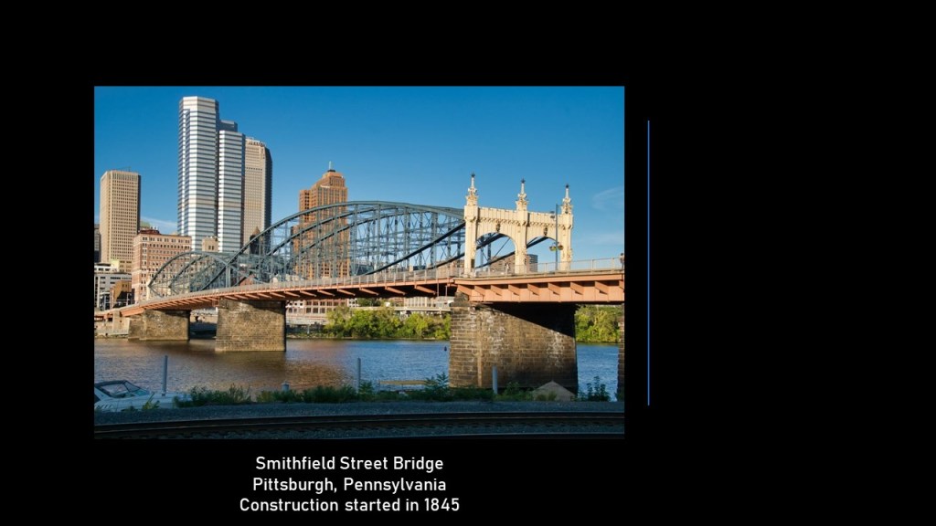
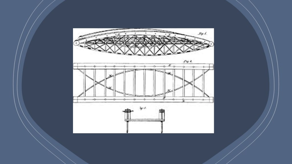
The Smithfield Street Bridge is a lenticular truss bridge, in which top and bottom chords are curved, which gives the truss an oval or lens shape.
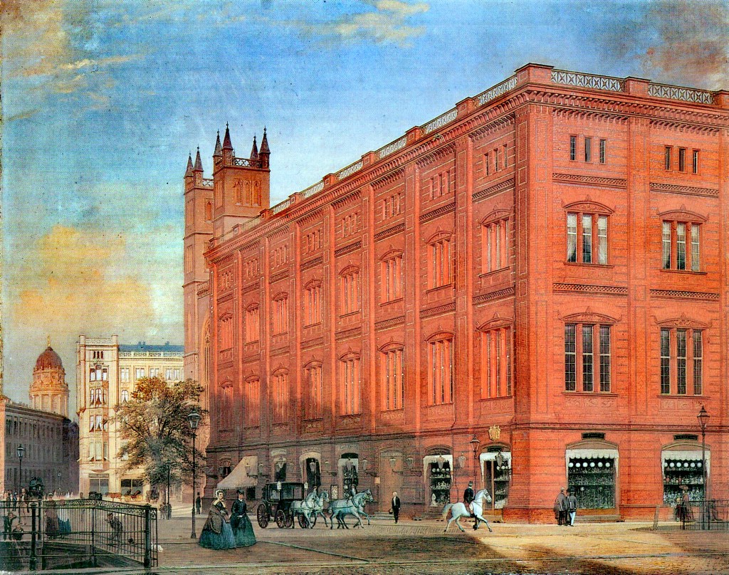
Some time around 1848, he was said to have built a large industrial complex for his growing wire production company in Trenton, New Jersey…
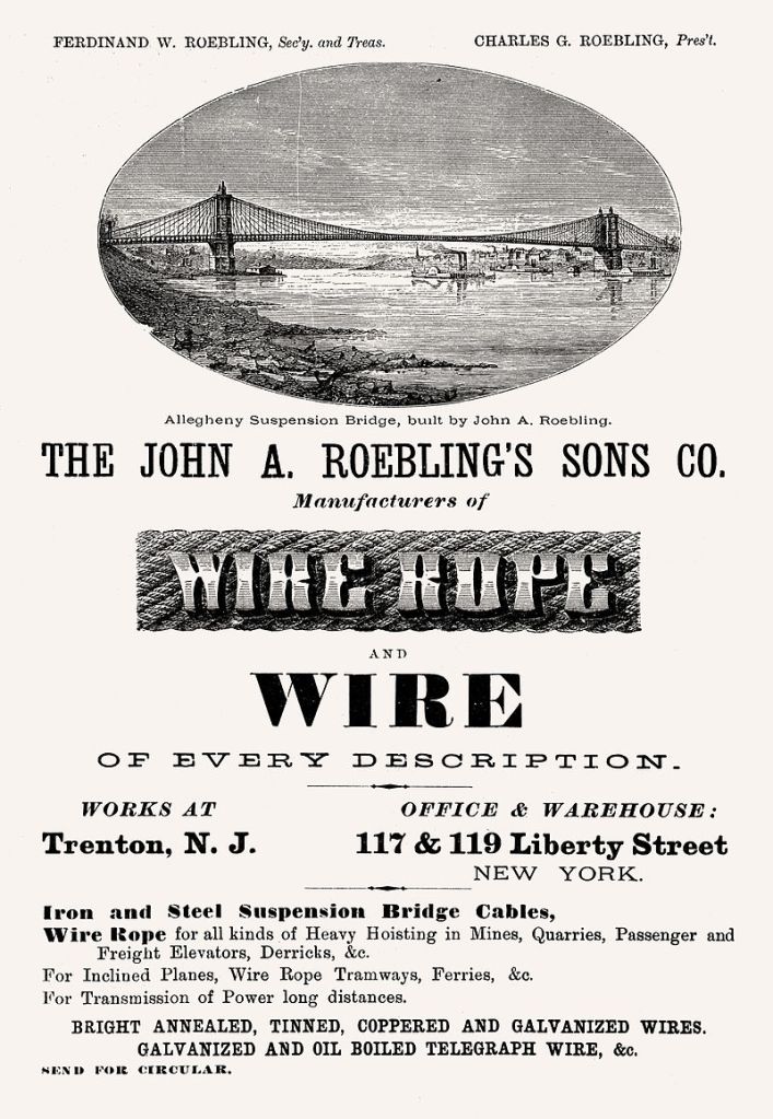
…and this wire production complex was said to have been one of the inspirations for the famous slogan on the Lower Trenton Bridge “Trenton Makes, the World Takes.”
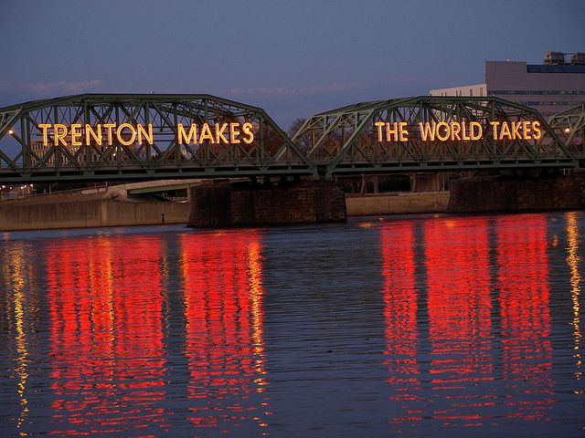
The Lower Trenton Bridge is a truss bridge, a bridge where the load-bearing superstructure is composed of a truss, which is a structure of connected-elements, usually forming triangular units.

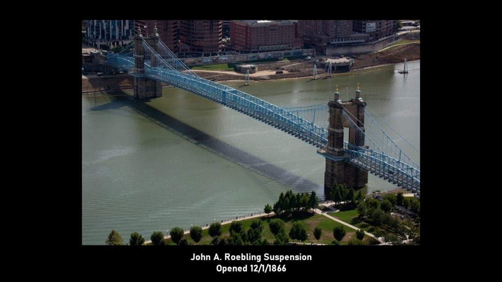
The John A. Roebling Suspension Bridge connects Cincinnati, Ohio, with Covington, Kentucky, across the Ohio River.
We are told that after the Covington and Cincinnati Bridge Company was incorporated in 1846, Roebling was asked to build a bridge, which was perceived as necessary due to the increase in commerce between Ohio and Kentucky that led to highly congested steamboat traffic and constriction of the economy.
We are told that it first formally opened on January 1st of 1867, which would have been less than two years after the end of the American Civil War.

At the time the bridge opened, it was the longest suspension bridge in the world.
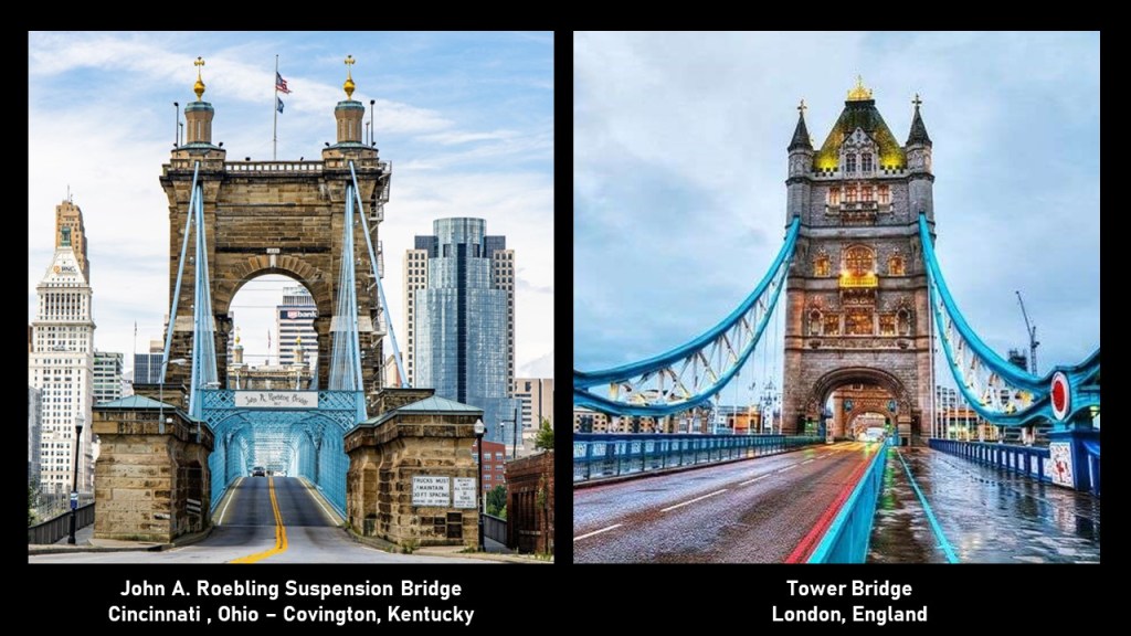
The John A. Roebling Suspension Bridge on the left reminds me in appearance of the famous Tower Bridge in London, England,on the right, which was said to have been built between 1886 and 1894.
The other famous bridge that John A. Roebling received the credit for was the Brooklyn Bridge.
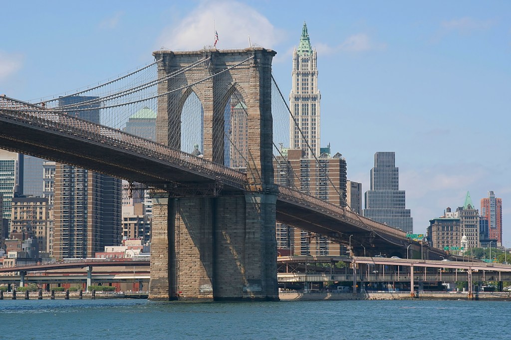
We are told he started the design work on the Brooklyn Bridge in 1867, but that on June 28th of 1869, when he was standing at the edge of the dock to fix the location of where the bridge would be built, his foot was crushed by an arriving ferry, requiring the amputation of his injured toes.
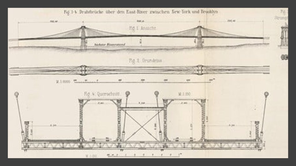
His death on July 22nd of 1869 was caused by tetanus after he refused medical treatment.
The construction of the Brooklyn Bridge was said to have been completed by his son, Washington Roebling.
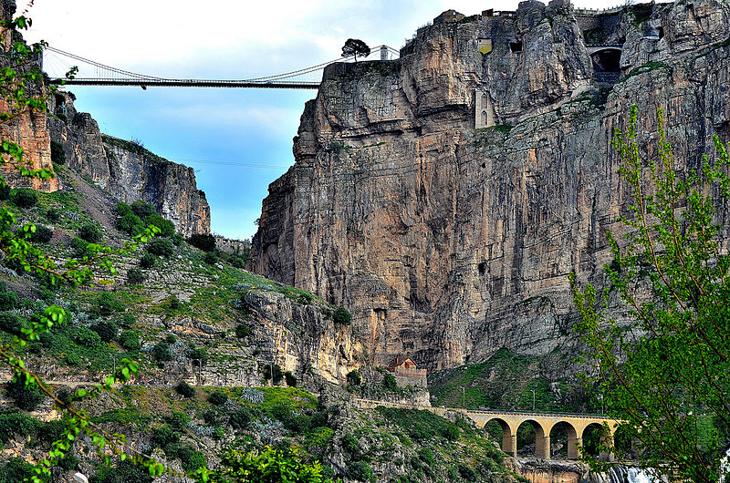
The Brooklyn Bridge on the left reminds me in appearance of the Sidi M’ Cid Bridge on the right in Constantine, Algeria, known as the city of bridges.
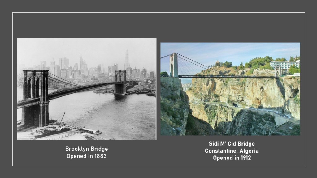
The Sidi M’ Cid Bridge was at one time was the highest suspension bridge in the world.
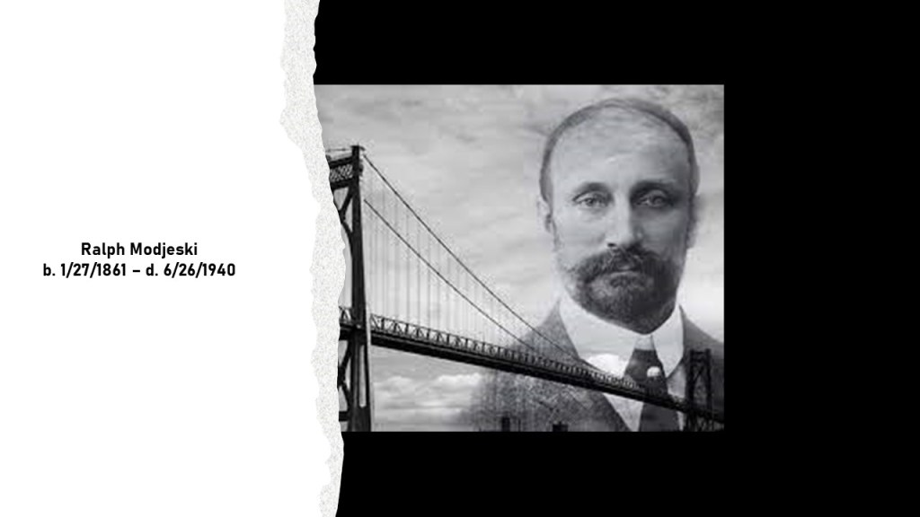
Ralph Modjeski is the next prolific bridge-builder I am going to take a look at, a Polish-American civil engineer who was said to have specialized in bridges.
I first encountered Ralph Modjeski’s name and reputation when I was doing research on the Mississippi and Ohio River Valleys.
One of the bridges he was credited with is in Thebes, Illinois, on the Mississippi River, and located near Cairo, Illinois, which sites at the confluence of the Mississippi and Ohio Rivers, in a part of Illinois that has been long referred to as “Little Egypt.”
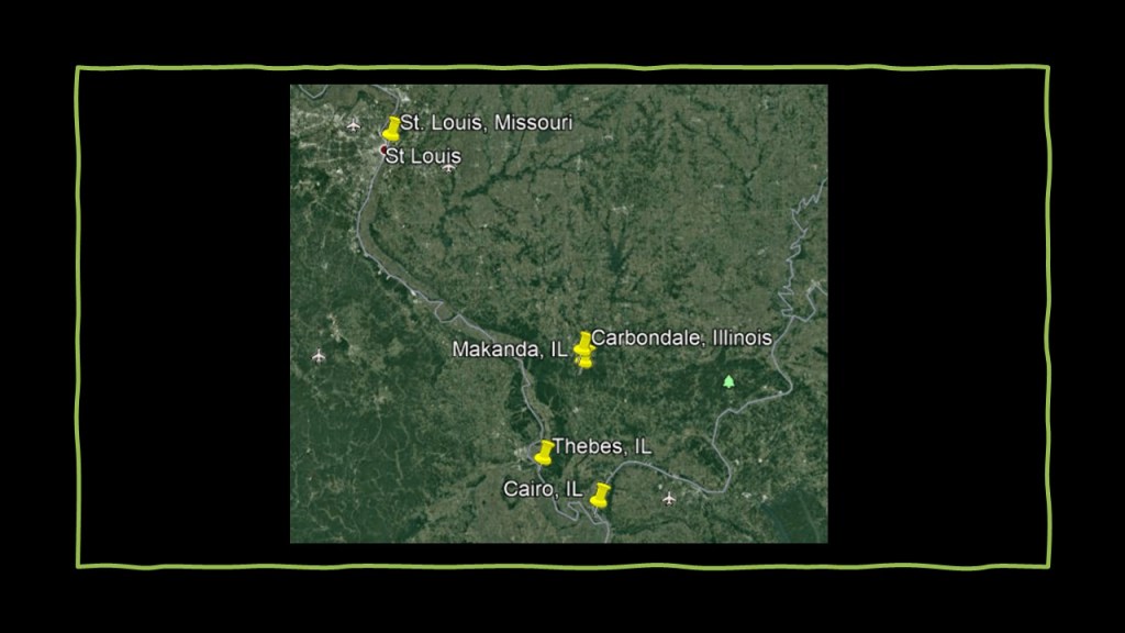
Like Cairo, Thebes was said to have been named for the Egyptian city of the same name, and is perhaps best-known for the Thebes Bridge, a five-span cantilever truss railroad bridge said to have been built for the Union Pacific Railroad and opened for use in 1905, with its construction starting in 1902
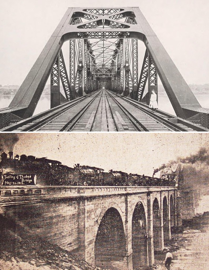
A cantilever bridge is one that is built using structures that project horizontally into space and is only supported at one end by what are called “cantilevers.”
Large cantilever bridges designed to carry road or rail traffic use structural-steel trusses or box girders made from pre-stressed concrete.

Ralph Modjeski was born in Poland in 1861, and emigrated to America with his mother and stepfather in 1876.
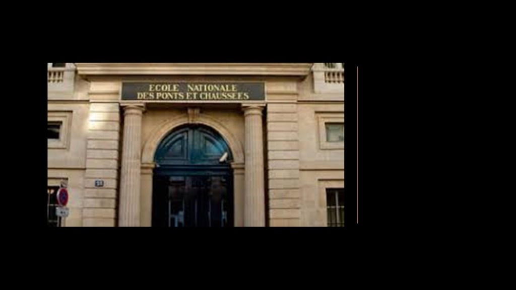
He returned to Europe and studied at the “l’Ecole des Ponts et Chaussées,” or “School of Bridges and Roads,” in Paris, France.
He received his American citizenship while he was in Paris in 1883, and he graduated first in his class from the “School of Bridges and Roads” in 1885.
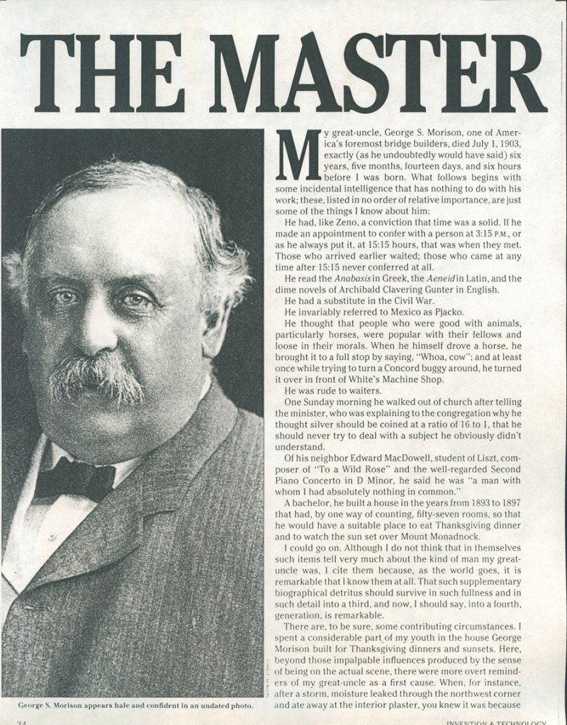
Upon his return to America, Ralph Modjeski worked first for George Morison, an attorney-turned-civil-engineer known as the “Father of American Bridge-Building.”
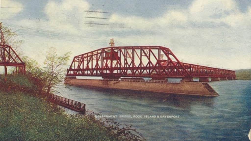
Ralph Modjeski opened his own in Chicago in 1893, the same year as the World Columbian Exposition, and his first project as Chief Engineer was said to be the railroad bridge across the Mississippi River from Davenport, Iowa to Rock Island, Illinois, called the “Government Bridge,” said to have been completed in 1896.
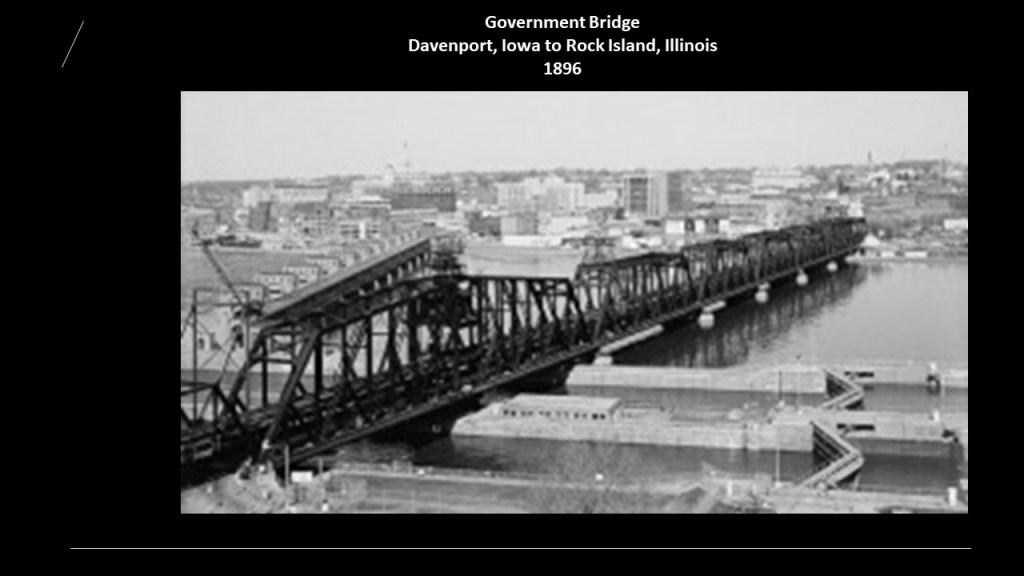
The “Government Bridge” is a double-decker steel-truss bridge, with the upper-deck of this bridge used for railroad traffic, and the lower-deck of the bridge used for vehicular and pedestrian traffic.
The “Government Bridge” has a swing-section to accommodate traffic navigating the river, which can rotate 360-degrees for river traffic, and is one of the oldest bridges of its kind still in use on the Mississippi River.
Besides the Thebes Bridge, Modjeski was credited with the:
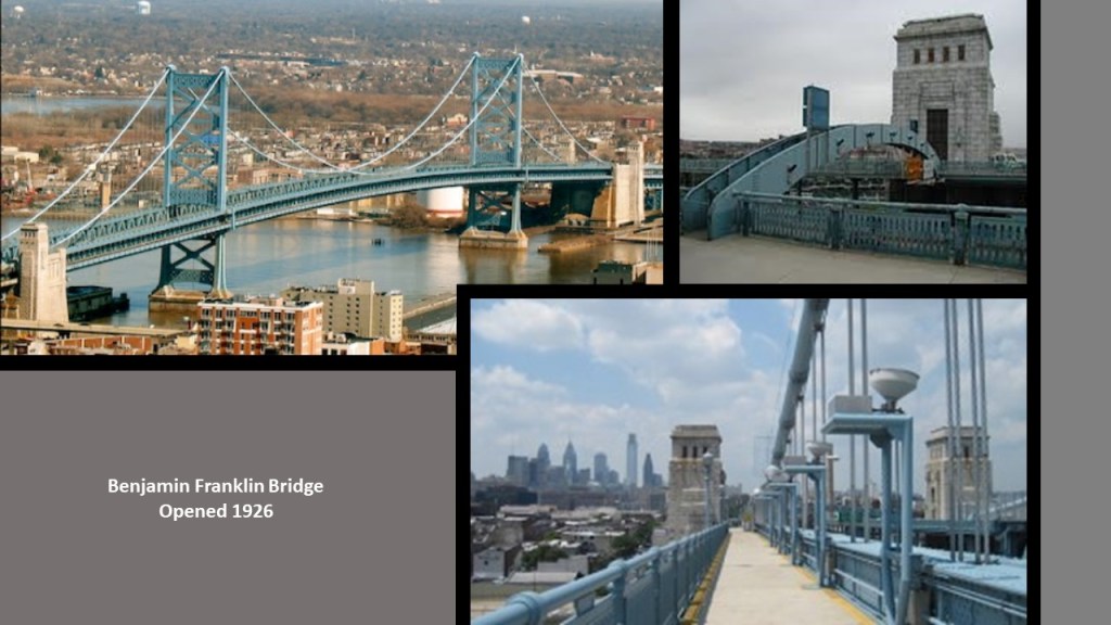
The Benjamin Franklin Bridge, a suspension bridge connecting Camden, New Jersey, and Philadelphia, Pennsylvania, opening in 1904, and one of four primary bridges between Philadelphia and southern New Jersey…
…as well as the Tacony-Palmyra Bridge over the Delaware River in Northeast Philadelphia, a steel-tied arch and double-leaf bascule bridge that opened in 1929.
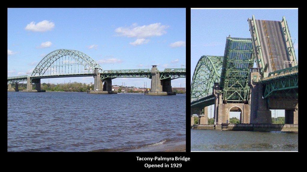
A tied-arch bridge is one in which the outward horizontal forces caused by tension of the arch ends to a foundation countered by equal tension of its own gravity and any element of the total deck that supports it. The arch has strengthened chords that run to a strong part of the deck structure or to independent tie-rods below the arch ends.

The definition of a bascule bridge is one in which there is a moveable counterweight that continually balances a single- or double-leaf, or -span, throughout its upward swing to provide clearance for boat traffic.

Modjeski was also credited with being a consulting engineer for the Trans-Bay Bridge, or Bay Bridge, between San Francisco and Oakland in California, a complex of bridges including steel-truss cantilever- and suspension-style bridges.
When it opened in 1936, the upper-deck carrying vehicular traffic and the lower-deck carrying commuter trains until the Key System mass transit service abandoned rail service in 1958, at which time the lower-deck was converted to all-road traffic as well.

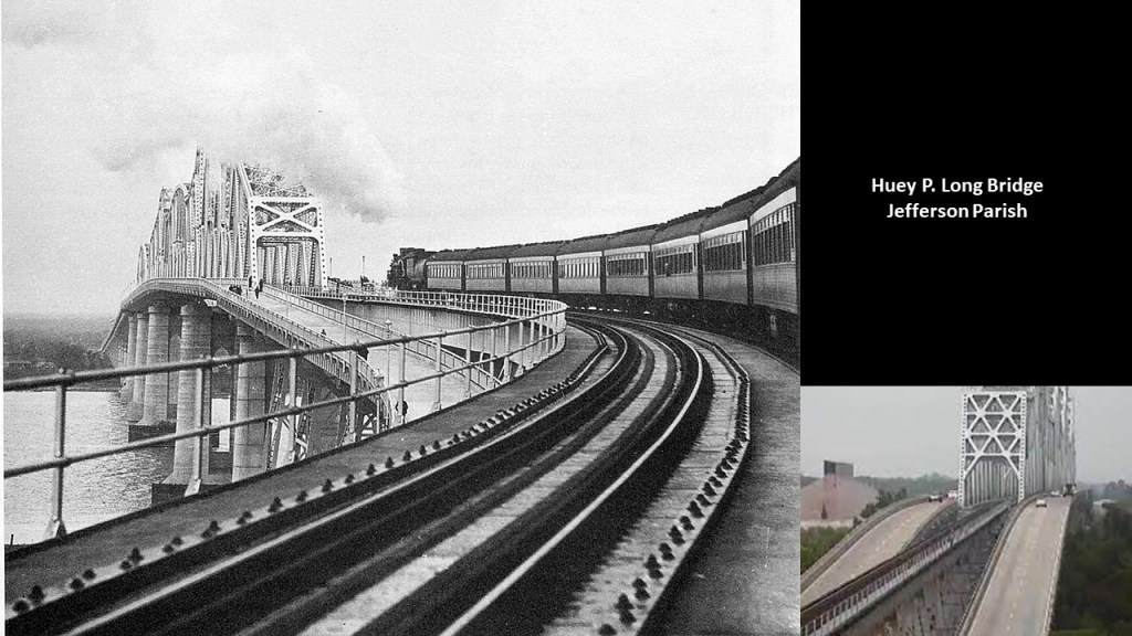
As Chief Engineer of the project, Ralph Modjeski was also credited with the design of the Huey P. Long Bridge in New Orleans, Louisiana, said to have been part of Long’s legacy as Governor of Louisiana as part of his unprecedented public works program, which would have taken place during the Great Depression.
It is a cantilevered, steel-truss bridge carrying six-lanes of U.S. 90 and two-tracks of the New Orleans Public Belt Railroad across the Mississippi River, said to have been constructed between January of 1933 and December of 1935.
Speaking of San Francisco, it was said to have been founded by Spanish colonists in 1776, who built a fortification called “El Presidio Real of San Francisco,” or “The Royal Fortress of Saint Francis of Assisi,” at what is now simply called the Presidio, a park and former U. S. military installation until 1994, which it was transferred to the National Park Service.
I looked at a map of the Presidio, and noticed “Fort Point” at its tip, where Highway 101 crosses the San Francisco Bay over the Golden Gate Bridge…
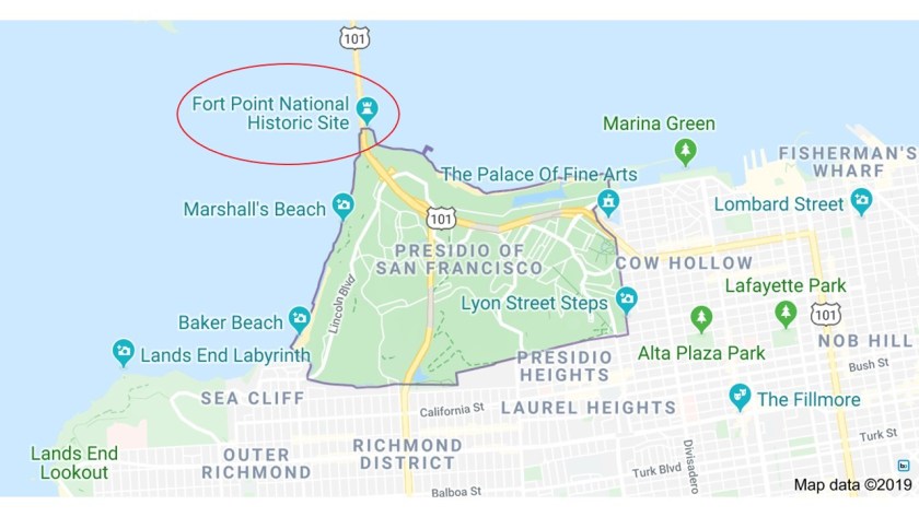
…and sure enough, I found what looks like a star fort tucked away underneath the base of the bridge.

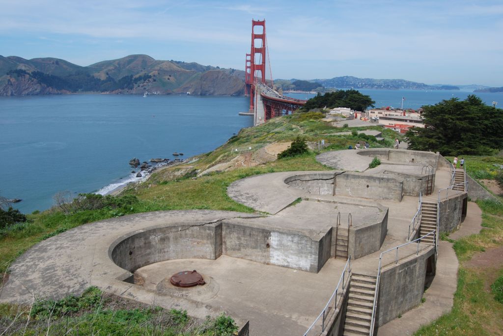
Battery Boutelle is also on the Presidio Grounds beside the bridge.
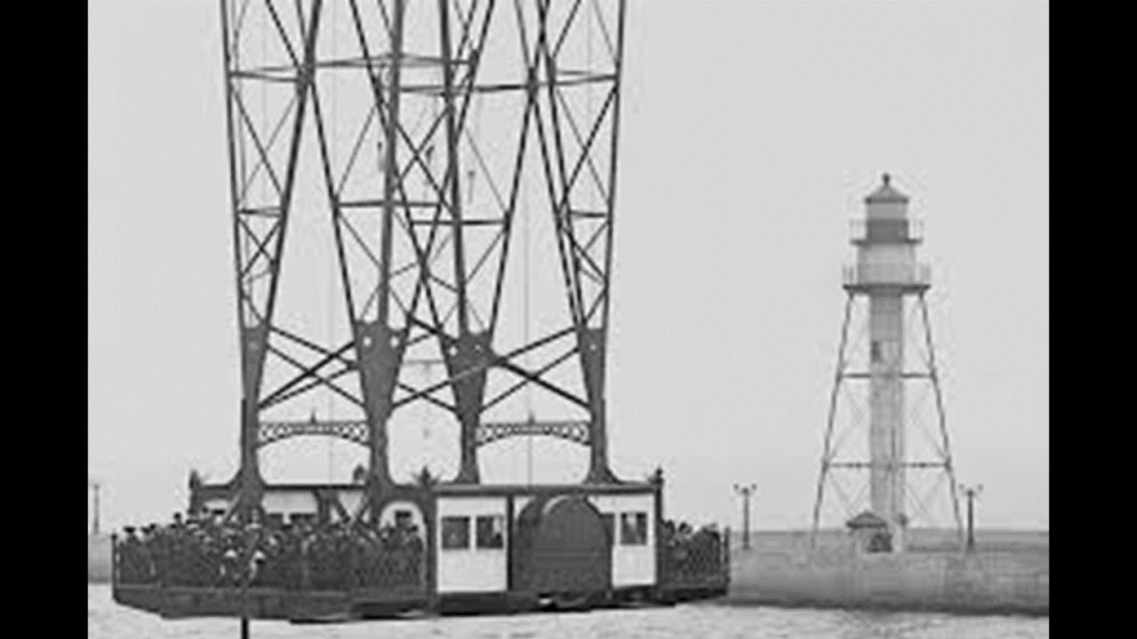
This is what it looks like inside the structure at Fort Point underneath this end of the Golden Gate Bridge, including a lighthouse…
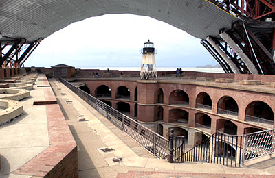
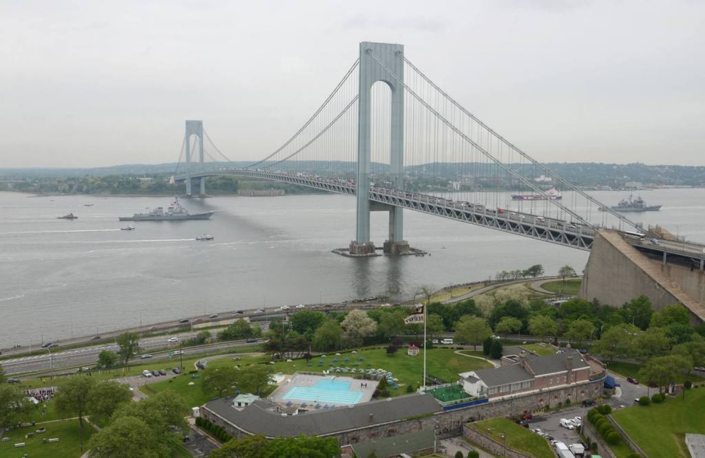
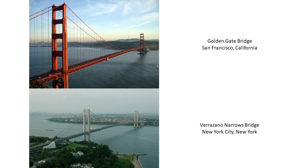
…which reminded me of Fort Wadsworth’s Battery Weed, on the Staten Island side of the Verrazano Narrows Bridge crossing over to Brooklyn in the narrow channel between Lower New York Bay and Upper New York Bay.
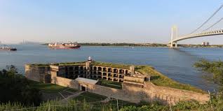
Since I knew that Fort Hamilton is located right next to the base of the Verrazano Narrows bridge on the Brooklyn side…
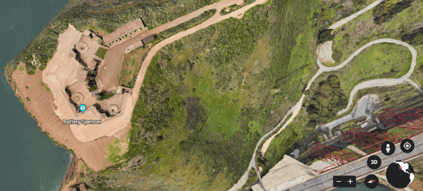
…I looked on the other side of the Golden Gate Bridge since I consistently find star forts in one or more pairs around the world, and I found Battery Spencer on the other side of the bay right next to the bridge…
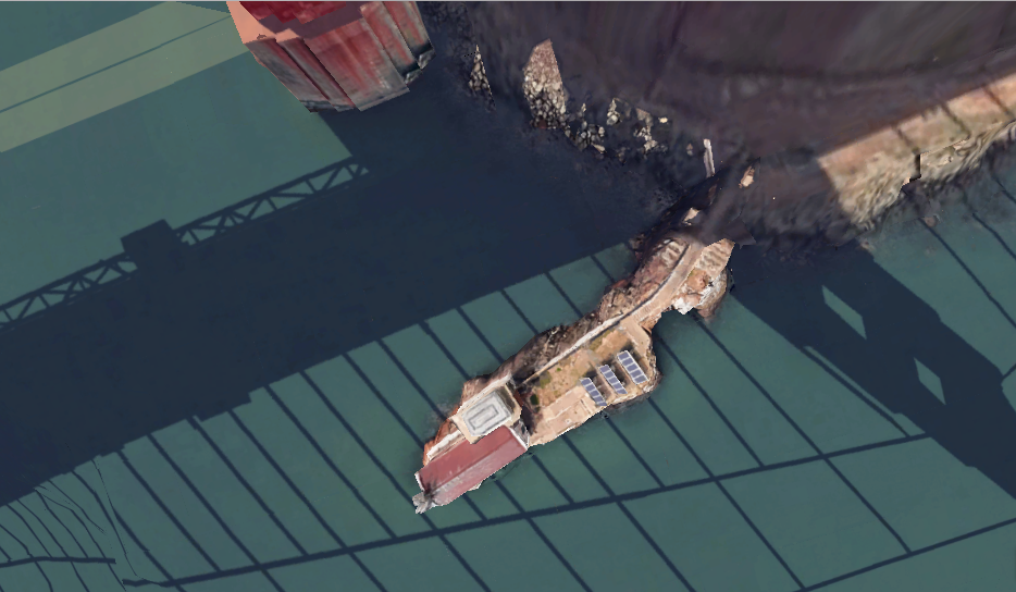
…and beneath the base of the Golden Gate Bridge, I found this old-looking structure with solar panels, and stone steps, which is the Lime Point Lighthouse, said to have been built in 1883 and automated since 1961.
Also, this is a comparison of the Golden Gate Bridge on the top, with the Verrazano Narrows Bridge on the bottom, and they are both suspension bridges.
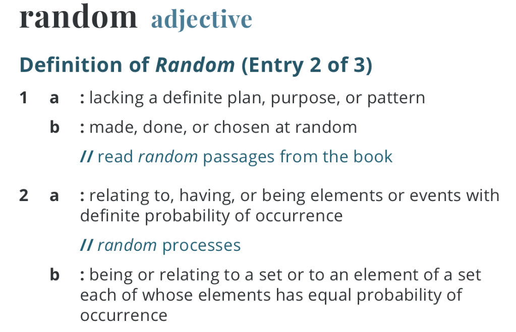
Was there a functional relationship was between bridges, star forts, batteries, and lighthouses that served an integrated purpose as seen in these examples that are exactly the same in San Francisco on the west coast of the United States and New York City on the east coast?
Or was the similarity the result of random occurrences, as we are taught to believe, like the aforementioned Spanish colonists who founded San Francisco in 1776 and built the Presidio as a fortification?

The definition of random includes, among others, “lacking a definite plan, purpose, or pattern.’
Our historical narrative leads us to believe that all of the Earth’s infrastructure came into existence as a result of random factors, like some guy in the past bought the land upon which _________________ eventually became a large city.
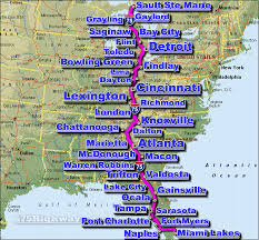
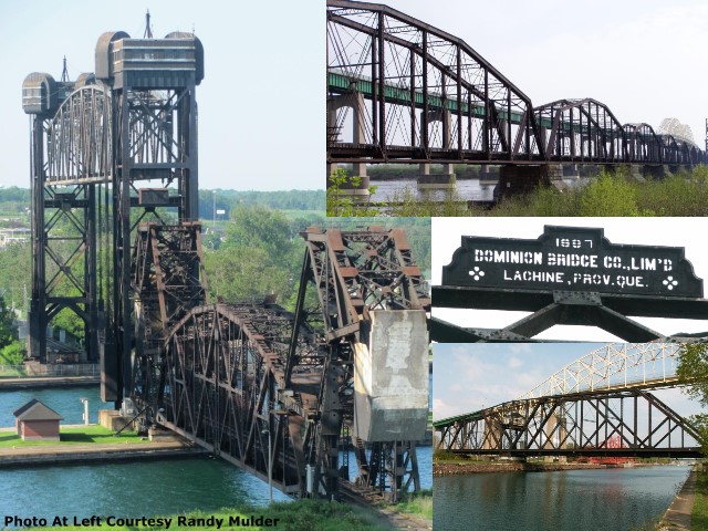
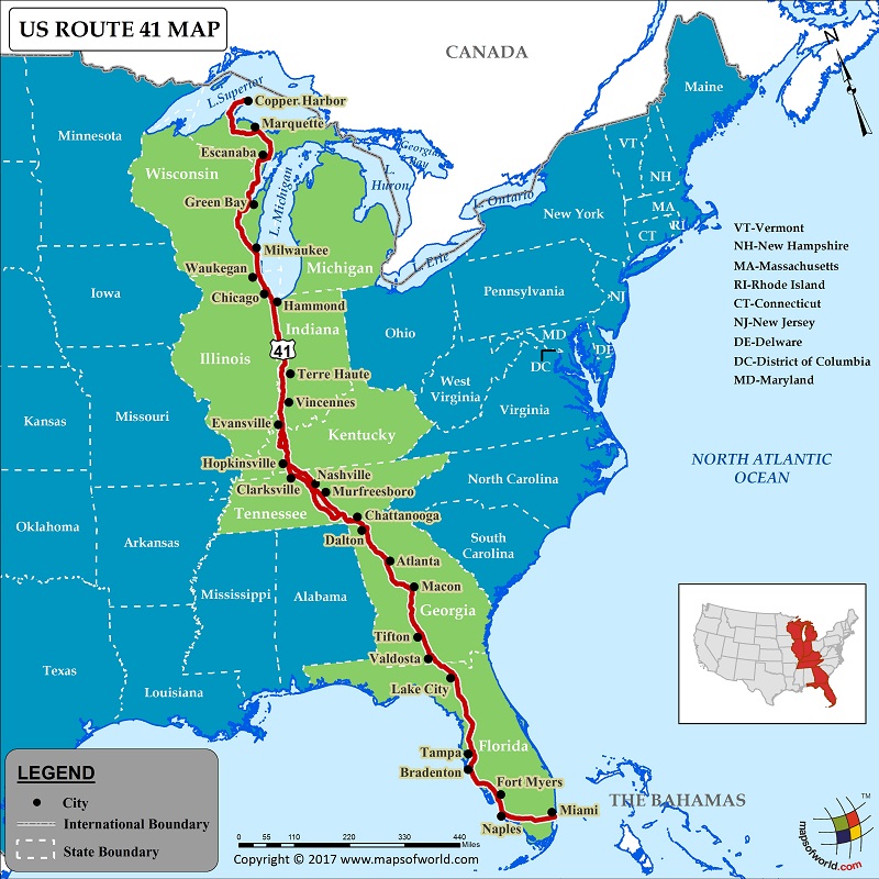
Next, let’s take a look at what’s found at the location of what is nicknamed “The Soo,” an interesting area on the International Border referring to Sault Ste. Marie, Ontario, and Sault Ste. Marie, Michigan, the northern terminus of I-75, which goes all the way to Miami, Florida.
Here we find the Soo Locks, the largest waterway traffic system on Earth, and are called the “Linchpin of the Great Lakes,” allowing ships to travel between Lake Superior and the lower Great Lakes, and where Lake Superior meets Lake Huron.
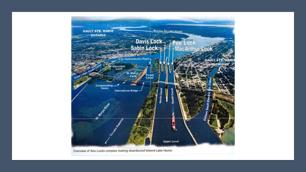
The Soo Locks are considered a wonder of engineering and human ingenuity.
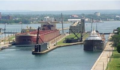
They by-pass the rapids of St. Mary’s River, where the river drops 21-feet, or about 6.4-meters, over hard red sandstone in a short 3/4-mile, or 1.2-kilometer, stretch.
The first locks were said to have been built here in 1855, and operated by the State of Michigan until transferred to the U. S. Army Corps of Engineers in 1881, who own, maintain and operate the St. Mary’s Falls Canal, within which the locks are located.

The Sault Ste. Marie International Bridge connects the United States and Canada, which permits vehicular traffic to pass over the locks.
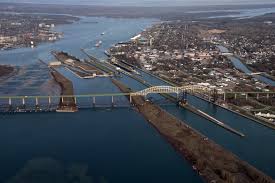
It is a truss-arch bridge with a suspended deck, with the years between 1960 and 1962 given as its construction dates.
The total length of the bridge is 2.8-miles or 4.5-kilometers.
The Sault Ste. Marie International Railroad bridge runs parallel to the International Bridge, and was said to have been built almost 100-years earlier, in 1887.
The railroad bridge has: nine camelback spans; a plate-girder overpass and plate-girder spans; a double-leaf bascule bridge; a vertical-lift bridge; and a swing-bridge and carries a single set of train-tracks.
Now, let’s break down the types of bridge into component parts that we haven’t talked about already.
Firstly, “camelback spans” are trusses that have polygonal upper chords of exactly five slopes.

We are told this saves material, and that the greatest depth of the truss is at the center of the span, where it is most required.

Next, plate-girder spans and overpasses utilize a steel-beam in their construction.

A Vertical-Lift Bridge is a type of movable bridge in which the span rises vertically while remaining parallel to the deck of the bridge.

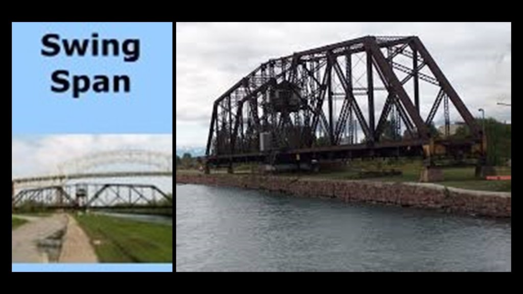
Lastly, a swing-bridge is a type of movable bridge that has a vertical locating pin and support ring as its primary structural support, usually at or near its center-of-gravity.
I have encountered other examples of the sophisticated engineering of bridges like these in the Great Lakes region, like the Duluth Aerial Lift Bridge.
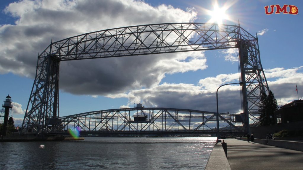
It spans the Duluth Ship Canal and Minnesota Point, and was said to have been first constructed between 1901 and 1905, and modified between 1929 and 1930.
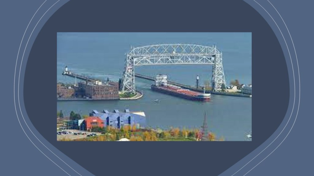
While it has been a vertical-lift bridge since 1930, the Duluth Aerial Lift Bridge started out as a transporter bridge, also known as an aerial transfer bridge, said to be the first of two of its kind in the United States.
It was a type of movable bridge that carried a segment of roadway across a river.
I encountered the “Portage Lake Lift Bridge” when I was researching Michigan’s Keweenaw Peninsula, where it connects the cities of Houghton and Hancock across Portage Lake, which is part of the waterway which cuts across the Keweenaw Peninsula with a canal linking the five-miles to Lake Superior to the northwest.
The vertical-lift bridge was said to have first been built in 1895 to replace a damaged wooden swing bridge that was built in that location in 1875, and that the current steel bridge replaced the previous steel bridge in 1959.
It is the world’s heaviest and widest double-decked, vertical-lift bridge.
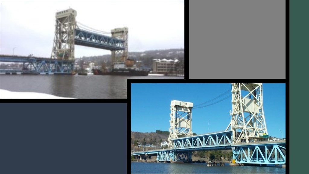
The Portage Lake Lift Bridge is on the only land-route across the waterway, which is U. S. Highway 41, that like I-75, also originates in Miami, Florida.
The oldest bridge crossing the Missouri River was the first Hannibal Bridge, said to have been completed in 1869, two-years after its construction started in 1867, and four-years after the end of the American Civil War.
It was the first permanent rail crossing of the Missouri River, and it established Kansas City as a major city and rail center.
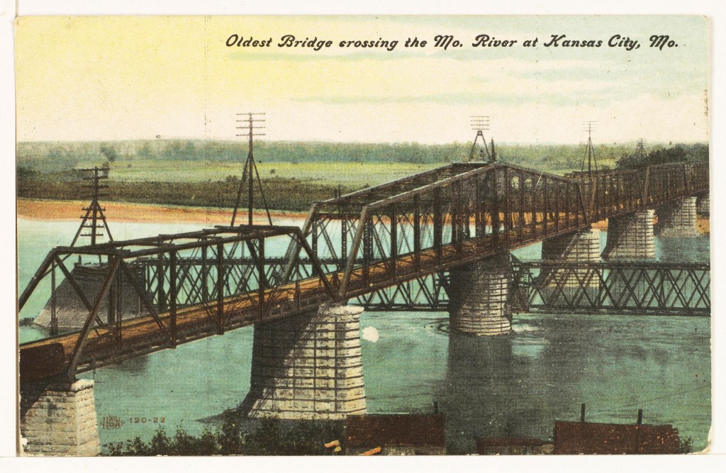
After the completion of the Hannibal Bridge, we are told the need for the Kansas City Union Depot arose.

After all, soon after the Hannibal Bridge opened, it carried eight railroads shipping freight to major trade centers in the east, like St. Louis, Chicago, and New York.
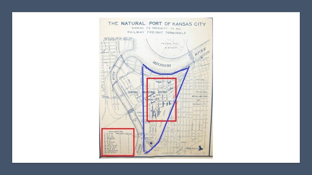
This is a historical map of what was called the “Natural Port of Kansas City,” with the West Bottoms District highlighted in blue, and the freight houses of 12 different railroads are listed by number in the red square on the left-hand-side, and the locations by number of each freight house in the red square that is contained completely within the West Bottoms District.
Here are a number of other bridges I have come across in the course of doing research, though there are countless more examples than the ones I am sharing.
The Dubuque Railroad Bridge is currently operated by the Canadian National Railway, who purchased the Illinois Central Railroad in 1999.
It is a single-track railroad bridge that crosses the Mississippi River between Dubuque Iowa, and East Dubuque, Illinois, that has a swing-span.
The original swing bridge was said to have been built in 1868, and we are told that it was rebuilt in 1898.
The Joliet Railroad Bridge is a vertical lift-bridge over the Illinois River, said to have been built in 1932, which would have been in the middle of the Great Depression, which was considered to have started in August of 1929 and lasted until March 1933.
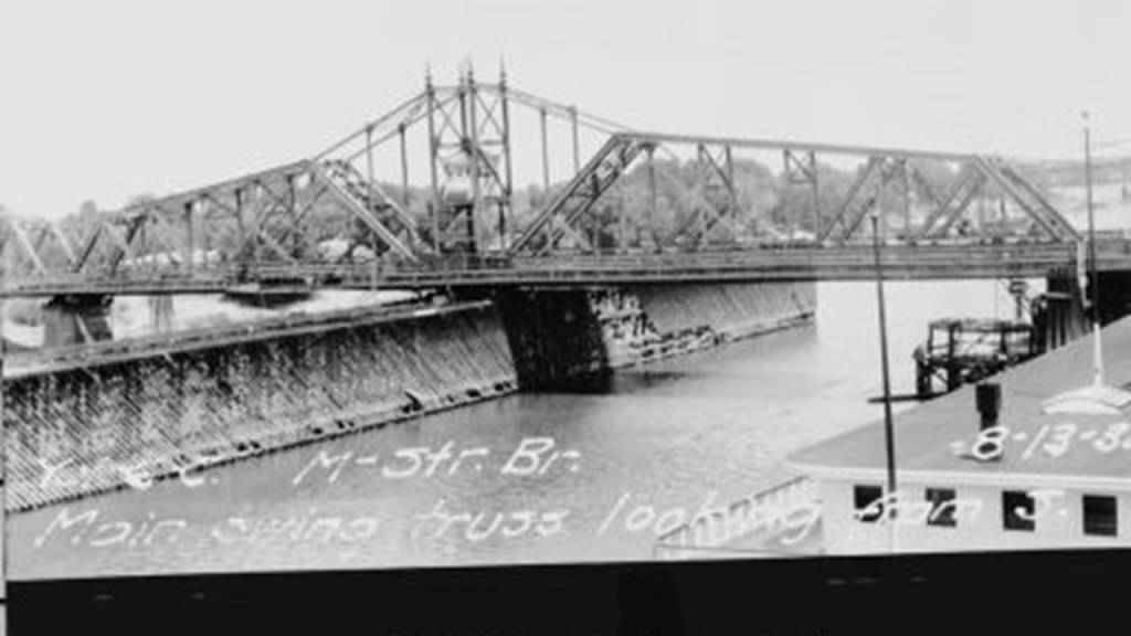
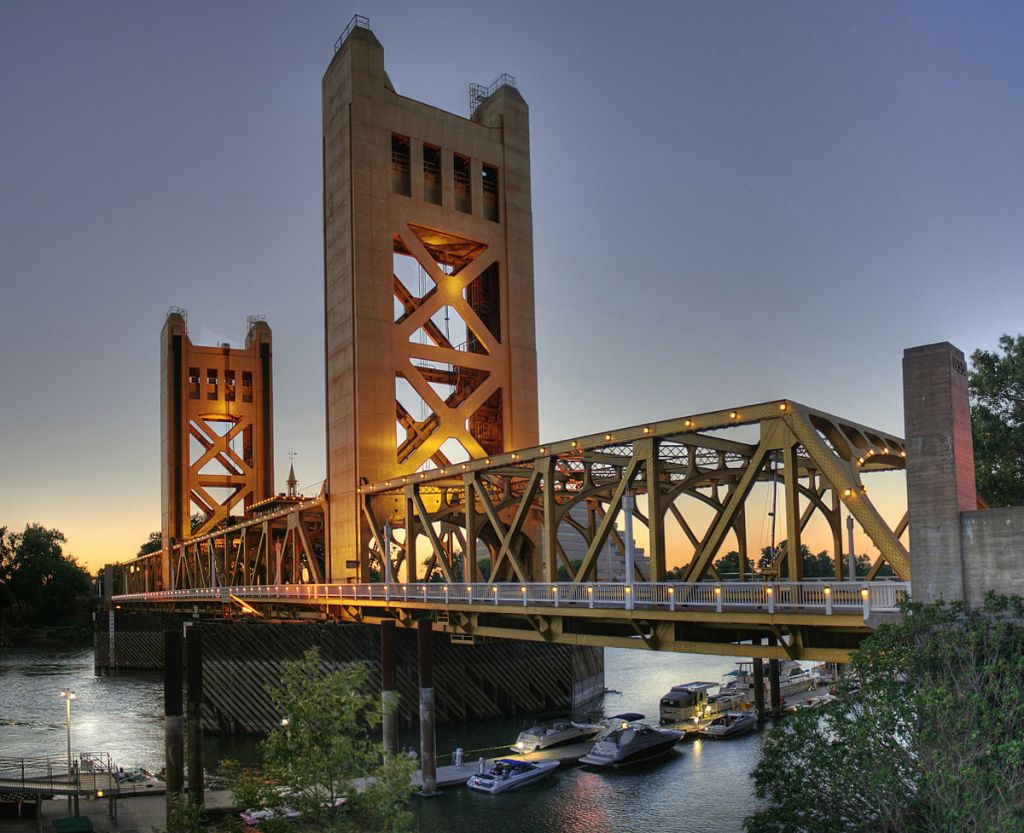
The Tower Bridge is also a vertical-lift bridge, and connects Sacramento and West Sacramento across the Sacramento River.
The construction of the Tower Bridge as a replacement bridge for the 1911 ‘M’ Street bridge was said to have started in 1934 and first opened in 1935.
This also would have been around the time of the Great Depression and the beginning of World War II.
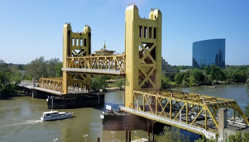
The original 1911 bridge was described as a “swing-through truss railroad bridge” that was determined to be inadequate as the result of Sacramento’s population growth doubling between 1910 and 1935, and the city’s concern for needing a better crossing over the Sacramento River in case of war.
Alfred Eichler was credited as the architect of the Tower Bridge, and its architectural-style described as a rare use of “Streamline Moderne,” a style of “Art Deco” that emerged in the 1930s.
The two towers of the bridge alone are 160-feet, or 49-meters, -high.
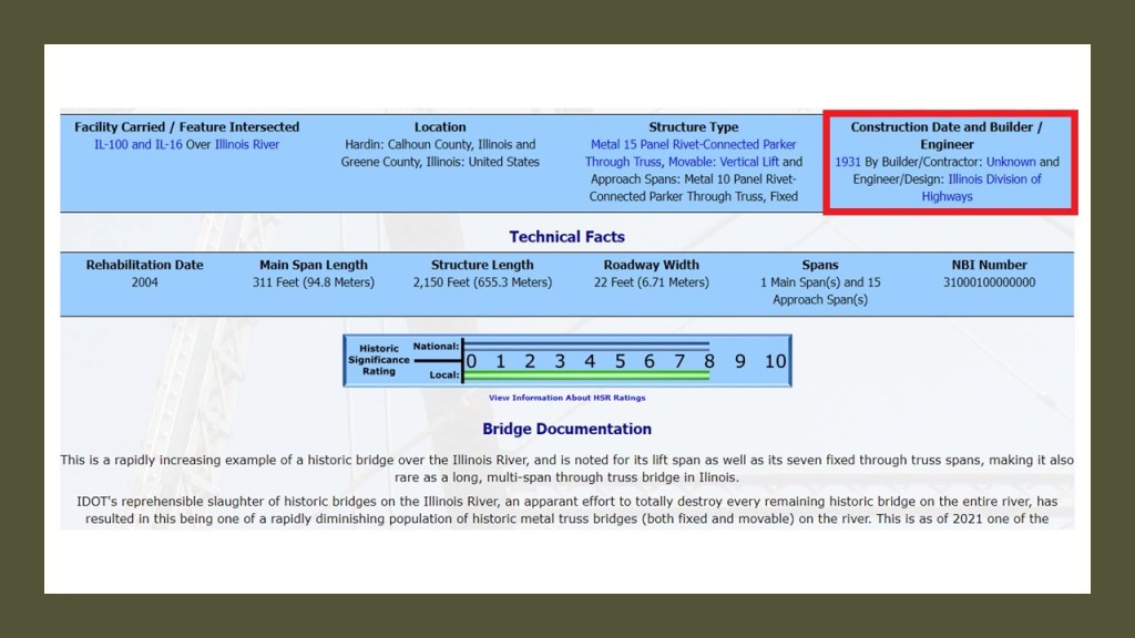
The Joe Page Bridge in Hardin, Illnois, named after a local politician who lived between 1845 and 1938, is a vertical-lift bridge that links Greene and Calhoun Counties across the Illinois River.
It’s lift-span is just a little over 308-feet, or 94-meters, -long, making it the longest span of this type in the world.
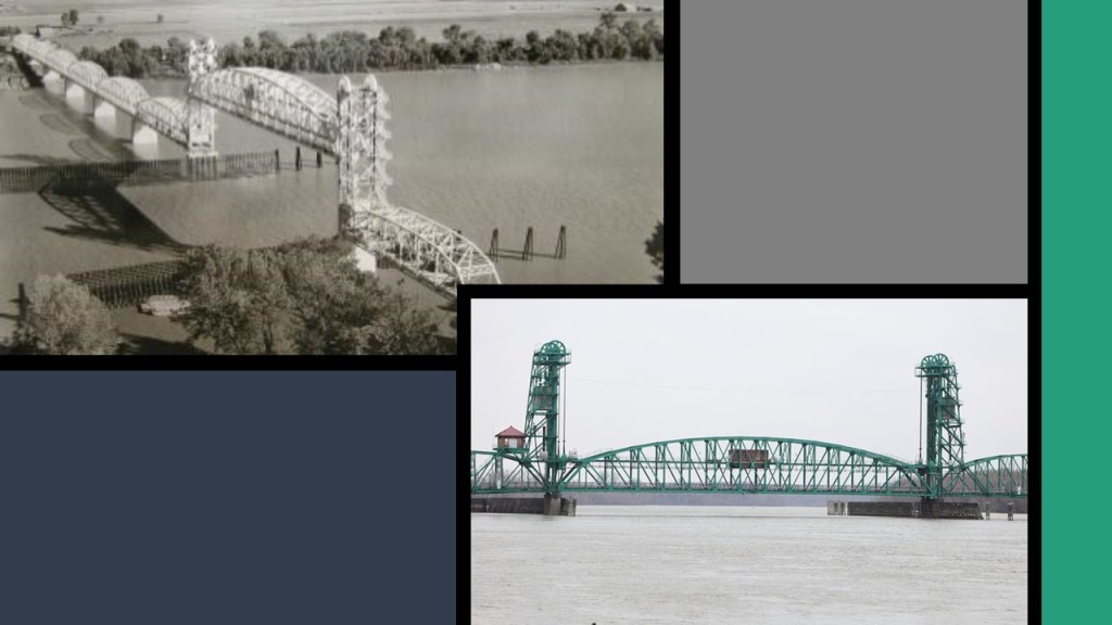
The bridge was said to have been built in 1931 by an “unknown” builder, though the State of Illinois Division of Highways is given credit for the engineering & design work.
The Joe Page Bridge is the southernmost of three vertical-lift bridges on the Illinois River used by Illinois Route 100, which makes up much of the Illinois River Road, a U. S. National Scenic By-way.
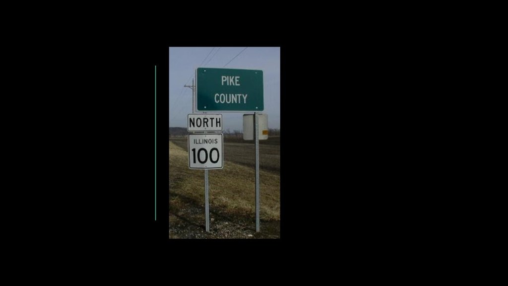
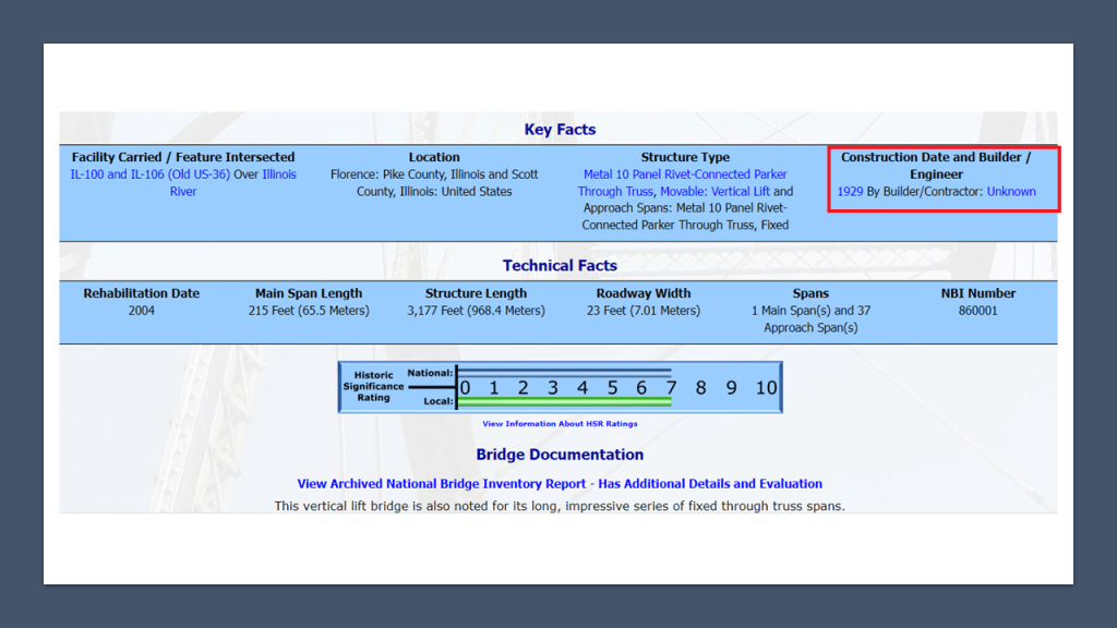
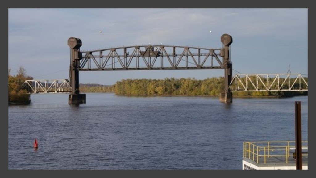
The Florence Bridge on Illinois Route 100 connects the town of Florence, Illinois, to Scott County, Illnois.
The population of Florence was 71 at the time of the 2000 Census, and Scott County is the fourth least-populated county in the State of Illinois.
The Florence Bridge was said to have first opened in 1929…
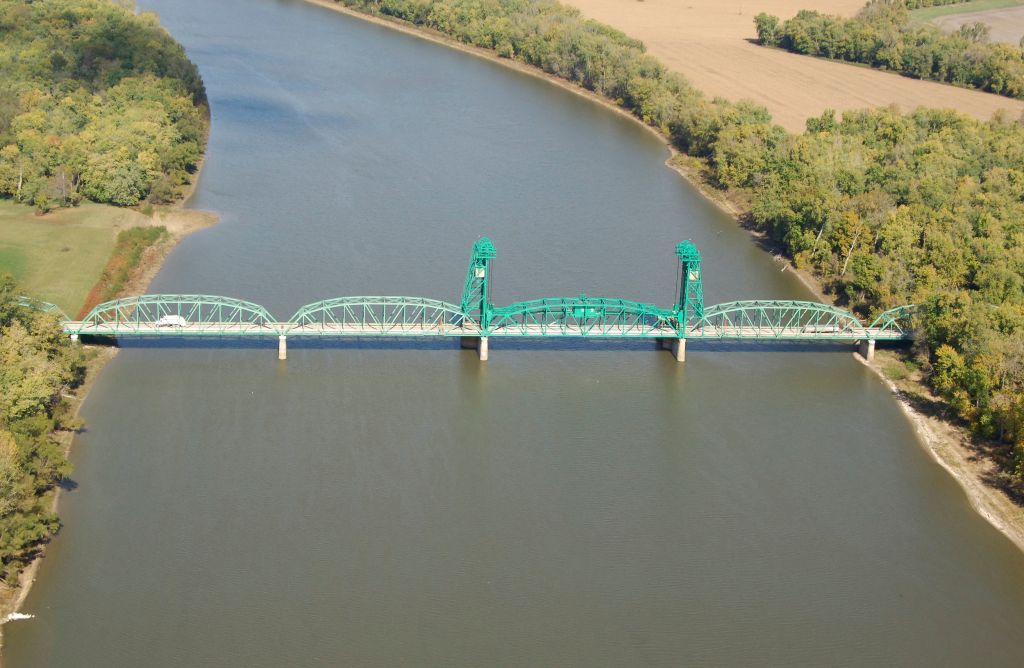
…and like the Joe Page Bridge is also listed as “Builder Unknown.”
The northernmost of the three vertical-lift bridges crossing the Illinois River is the Beardstown Bridge, located at Beardstown, Illinois, between Schuyler County, Illinois, and Beardstown.
The current bridge was said to have been built in 1955, and rehabilitated in 1985.
I can’t find out much information on the Beardstown Bridge either.
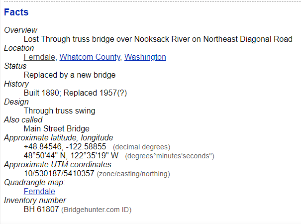
The BNSF Nooksack River Bridge is a swing-bridge for the railroad in Ferndale, Washington.
BNSF is the largest freight railroad network in North America, and Amtrak uses it as well.
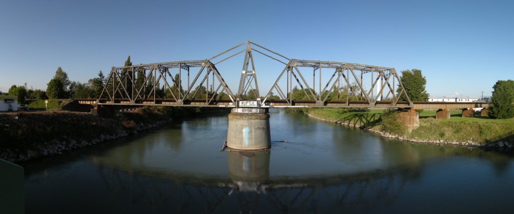
The bridge used to rotate, but it doesn’t anymore.
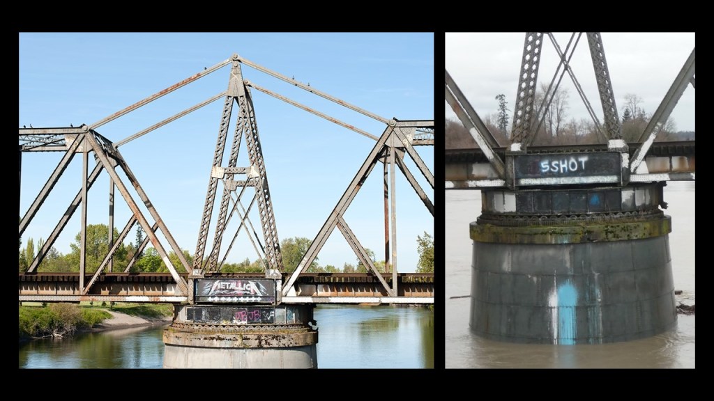
It has come to be known as the Ferndale Metallica Bridge because over the last thirty-years, someone has been painting Metallica logos on it.
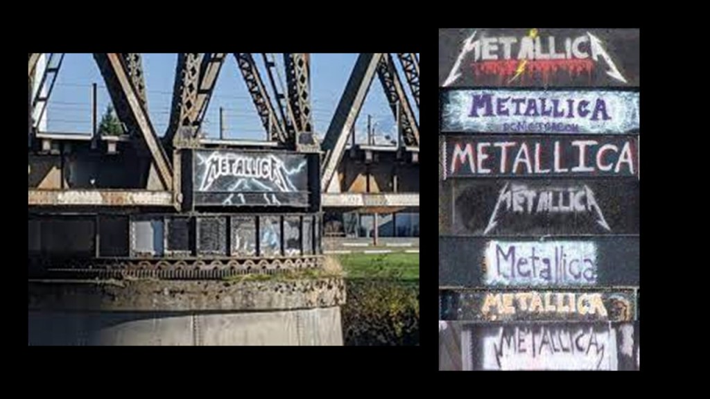
When I started looking for information on the construction date for the bridge, the only thing I could find referencing a construction date was that it was said to have first been built in 1890 and a replacement date of 1957, with a question mark.
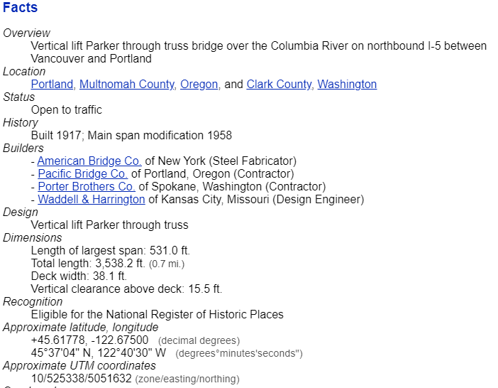
The Pacific Highway Interstate Bridge consists of a pair of steel-truss, vertical-lift bridges that carry Interstate 5 over the Columbia River between Vancouver and Portland.
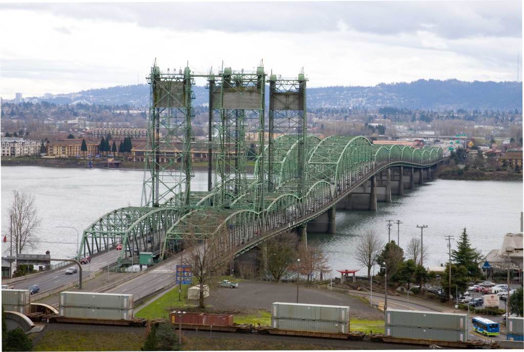
Construction was said to have started in 1915 and opened in 1917 as a single bridge carrying two-way traffic.
I would like to point out that would have been in the middle of World War I, which started in 1914 and ended in 1918.
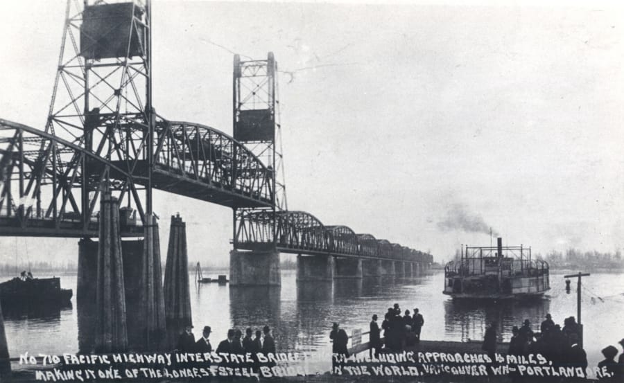
We are told the second bridge opened in 1958.
The Burlington Northern Railroad Bridge 9.6 crosses the Columbia River into Portland just below what is called the the triangular junction.
The 2,807-foot, or 856-meter, -long railroad bridge, which was said to have been built between 1906 and 1908, has a swing-span which pivots on its base to let taller ships pass through.
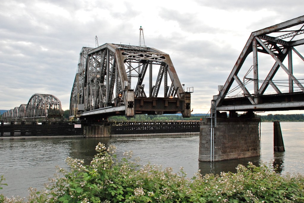
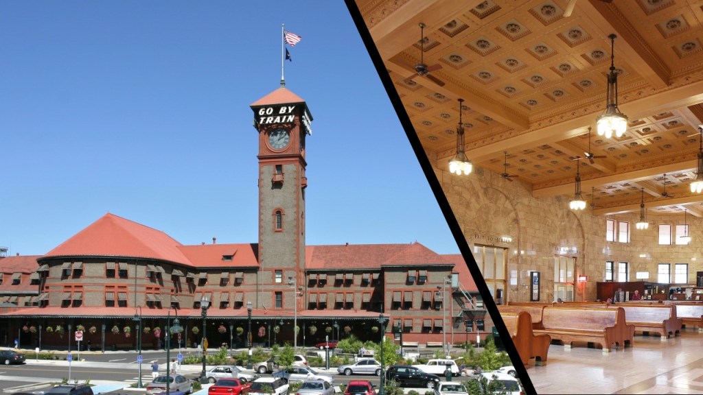
The 9.6 in the bridge’s name refers to the distance between the bridge, and Portland’s Union Station, which was said to have been built between 1890 and 1896 in the Romanesque Revival architectural style.
I want to end this post with some thoughts about bascule bridges.
They first came to my awareness about a year ago when a video about two of Cleveland’s bascule bridges popped up on my YouTube feed.
I didn’t know about them before then.
What really got to my attention is that the bascule bridges being highlighted were long-abandoned, and left permanently in a raised-state.
I can’t help but wonder if this is a message from whoever was behind the deconstruction and reattribution of the sophisticated infrastructure of the original civilization and energy grid system, and is giving it and us the middle finger.
Perhaps not, but something to consider given what has taken place here to destroy the infrastructure and the memory of the original civilization.


4 thoughts on “The Old World Bridges of the New World”