
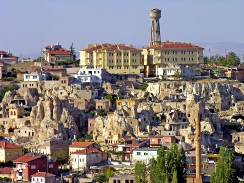
In the last post, I tracked this alignment which originated in San Francisco through Van, the name of a city and province in eastern Turkey, and taking a close look at the history of this region in the Armenian Highlands; to the Valley of the Chimney Fairies in Goreme National Park in the historical region of Cappadocia, as well as taking a look at the region’s underground cities and above-ground rock complexes.
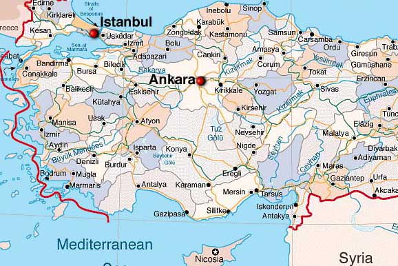
The Anatolian Plateau is called the central upland region of the ancient region of Anatolia, known as Turkey today. The region of Cappadocia and its Valley of the Fairy Chimneys in Goreme National Park from the last post is centrally located on the Anatolian Plateau.
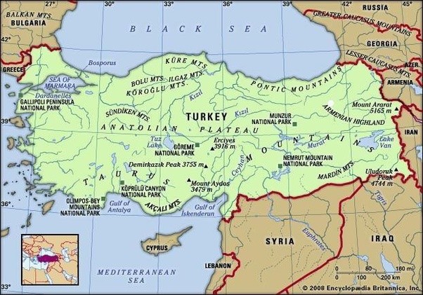
Anatolia is said to mean something along the lines of “Rising Sun” or “the East” in ancient Greek, and has been a bridge between Europe and Asia for thousands of years.
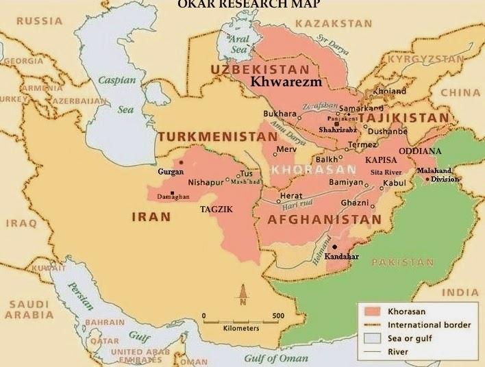
In a similar fashion, Khorasan, the name historically given to the northeastern Persia Empire which came up in previous posts on this alignment, is also said to mean the “Land where the Sun Rises” or the “Eastern Province.”
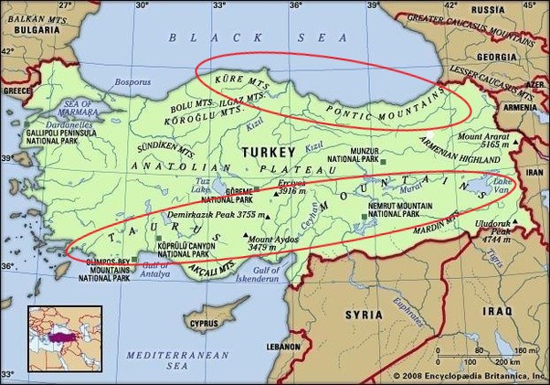
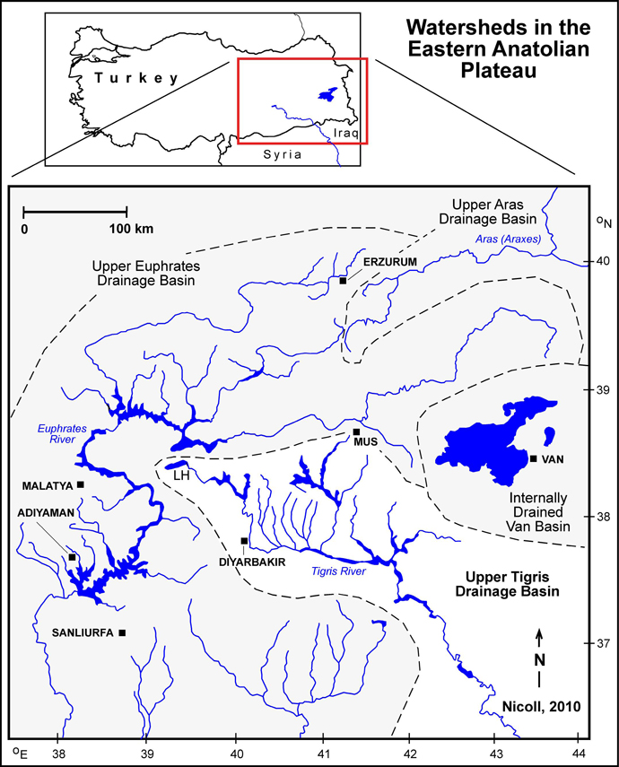
The Anatolian Plateau is hemmed in by two mountain ranges – the Taurus to the South, and the Pontic Mountains in the northeast & the Kure Mountains in the northwest.
While I am here, I am going to take this opportunity to venture off the alignment and explore this ancient place because I know there is a lot to find.
The Taurus Mountains separate the Mediterranean Coastal Region of Turkey from the Central Anatolian Plateau, extending in a curve from the Province of Antalya in the West…
…to the upper reaches of the Tigris and Euphrates Rivers in the East.
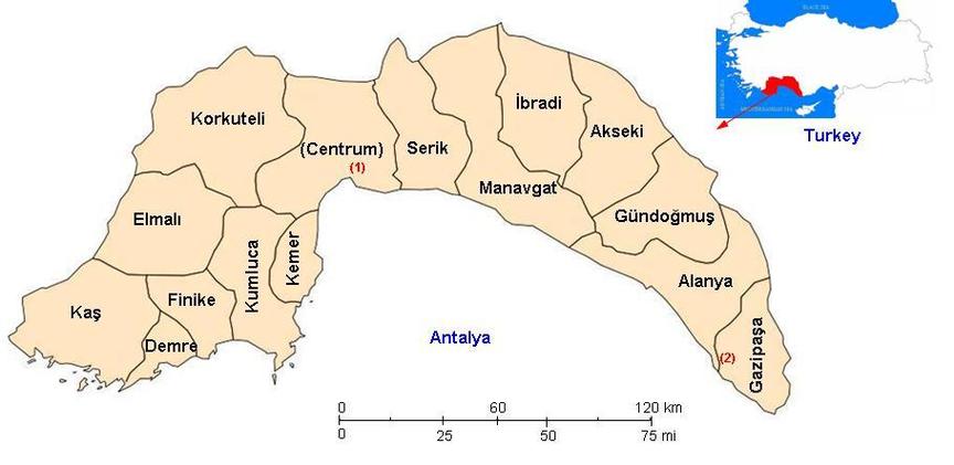
Antalya Province, also known as the Turkish Riveria, is the center of Turkey’s Tourism Industry, and its capital, Antalya, is the fifth-largest city in Turkey.

It is the largest city on Turkey’s Mediterranean coast, with a population of over one-million.
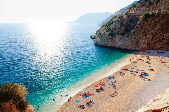
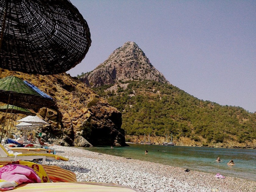
This is Kaputas Beach on the Mediterranean Sea in Antalya…
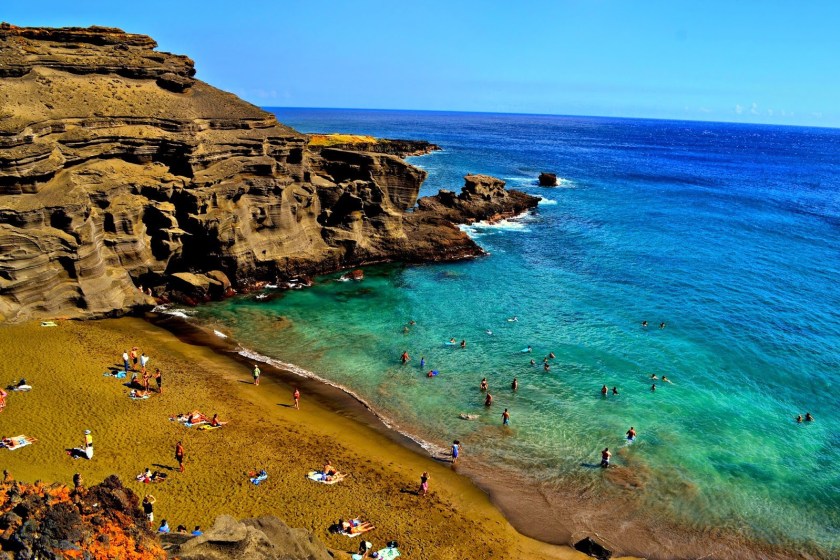
…compared with Green Sand Beach on the big island of Hawaii…
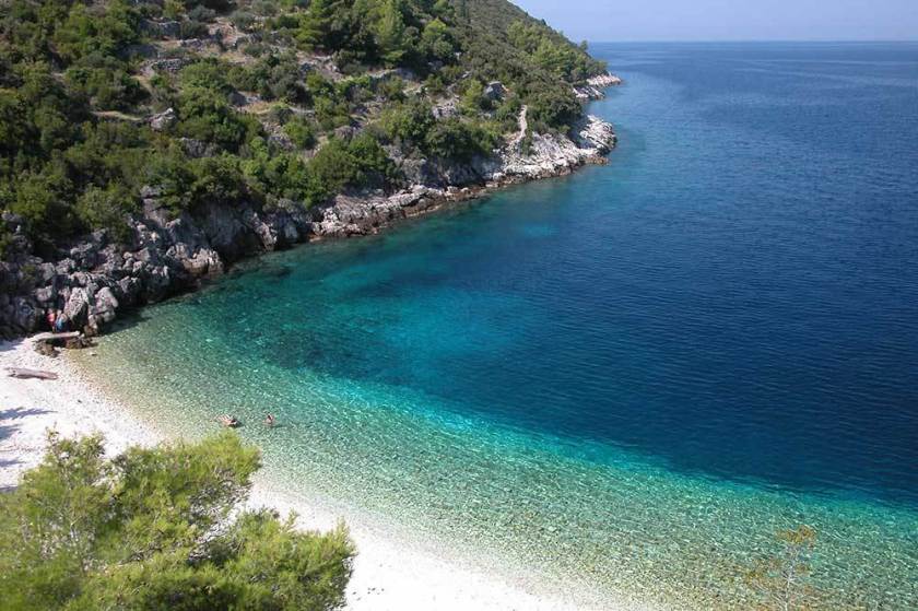
…Vaja Beach in Korcula, Croatia…
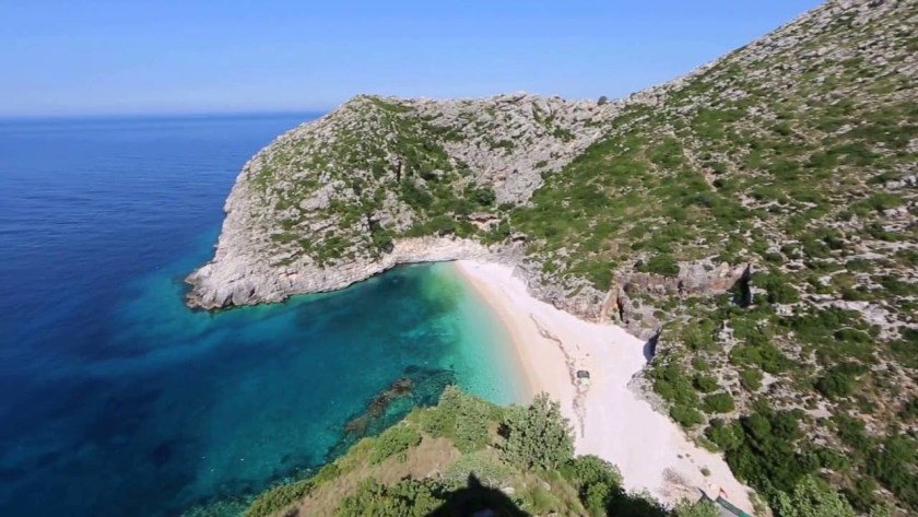
…and Grama Bay in Albania.
These are just a few of many examples I have found that demonstrate similar shapes and angles of beach and rocky coastline in very different places.
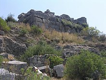
The UNESCO World Heritage Site of Xanthos is in Antalya Province, said to be an ancient Lycian city.
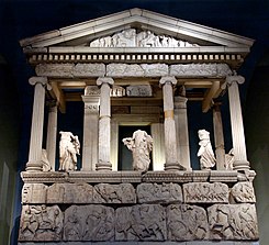
This is what remains of the Nereid Monument in Xanthos, with its megalithic base, and believed to be a tomb…
…that was discovered by a British explorer of Turkey, Charles Fellows, who led the archaeological excavation of Xanthos in the early 1840s and shipped an enormous amount of antique monuments to London, where they were reconstructed in the halls of the British Museum, including the Nereid Monument.
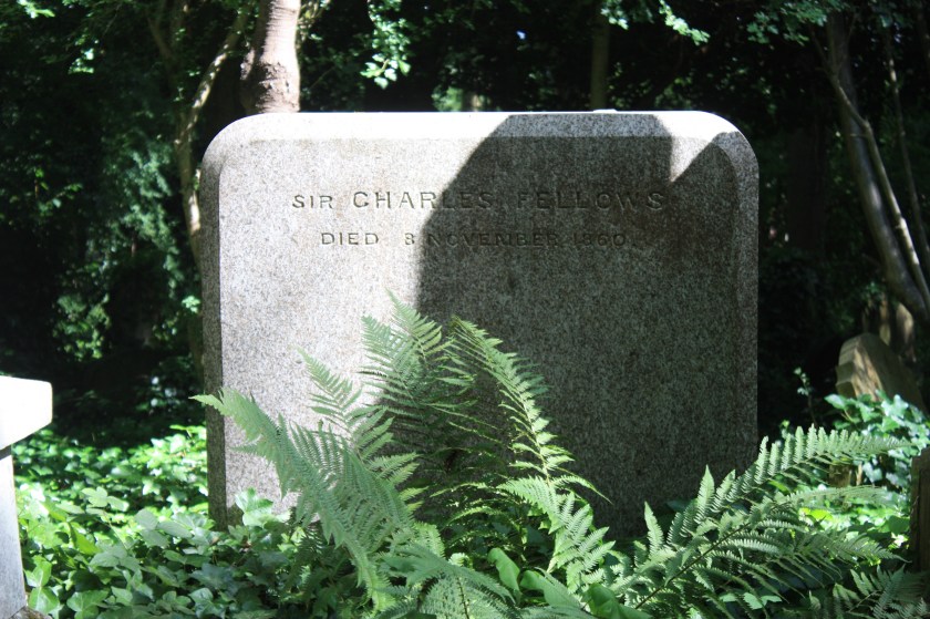
Charles Fellows was knighted in 1845 for his services in the removal of Xanthian antiquities to Britain.
This is a surprisingly plain tombstone for him at London’s Highgate cemetery ~ I wonder what that signified!
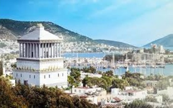
The Lycian Nereid Monument was said to have inspired the Mausoleum of Halicarnassus, said to have been built between 353 and 350 BC as a tomb for King Mausolus, ruler of Caria, a region of western Anatolia north of Lycia…
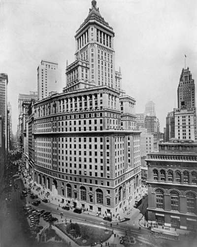
…and the Mausoleum of Halicarnassus was said to have been the inspiration for the old Standard Oil Headquarters in Manhattan…said to have been built between 1884 and 1928??
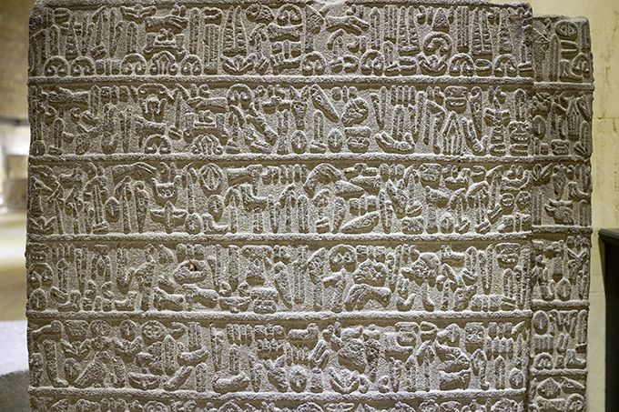
Lycia was a geopolitical region in Southern Anatolia, populated by speakers of the Luwian Language group…
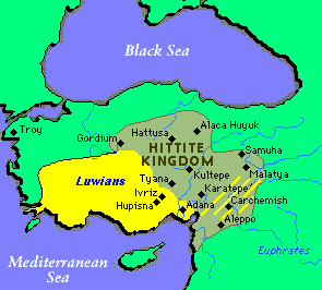
… said to have been a language with a hieroglyphic script in use between 1,300 BC and 600 BC…
…and here are the Lycian rock-cut temple tombs of Dalyan, said to date back to the 4th-century BC.
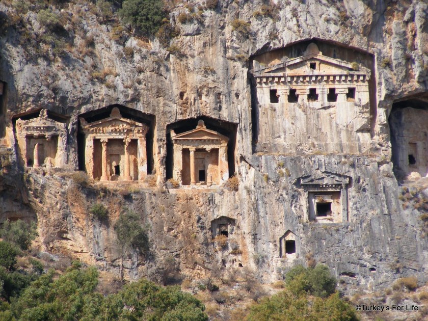
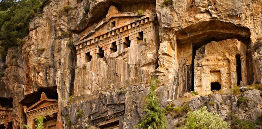
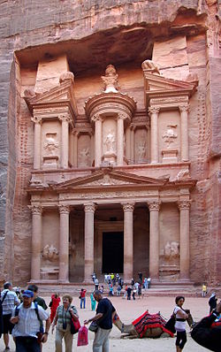
…which are reminiscent of rock-cut Petra in Jordan, attributed to a people called the Nabateans.
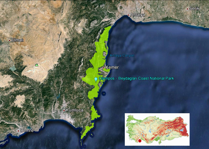
Once considered part of ancient Lycia, the Olympos-Beydaglari National Park is located in the Taurus Mountains in Antalya, along the Mediterranean coast, near the Kemer and Kumluca Districts. It is also called Olympos-Bey National Park.
Hmmm. There is that “Khem” sound again. And Bey is one of the five noble titles of the Moors, along with Dey, El, Al, and Ali. Just a coincidence?
Let’s take a closer look at Olympos-Bey National Park.
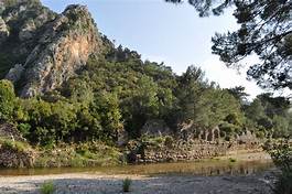
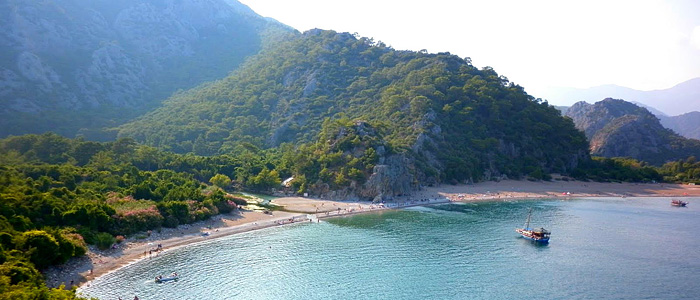
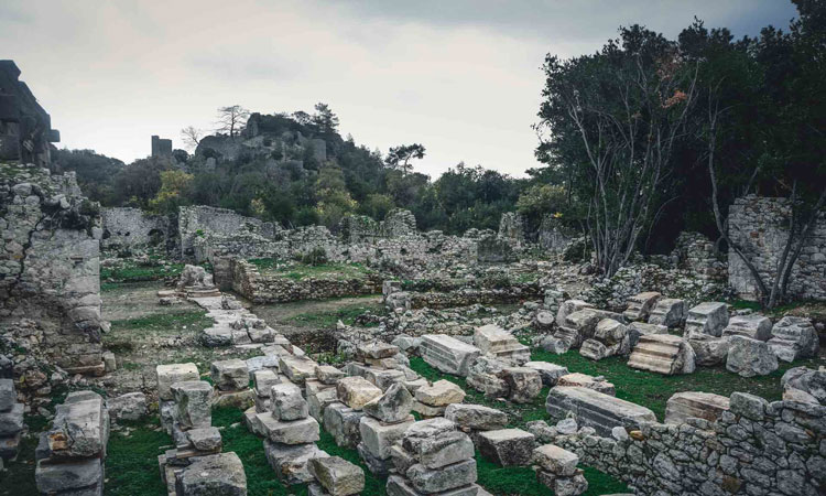
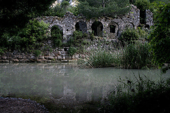
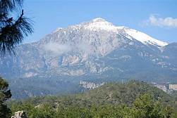
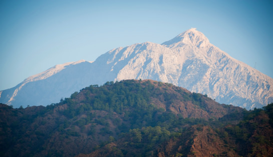
The Olympos-Bey National Park contains the ruins of what was called the city of Olympos…
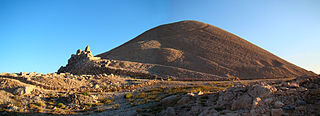
…and the park includes Mount Olympos, the highest mountain in Turkey.
This is not to be confused with Mount Olympus in Greece, on the border between Thessaly and Macedonia.
It is the highest mountain in Greece, and notable in Greek mythology for being the home of the Greek gods.
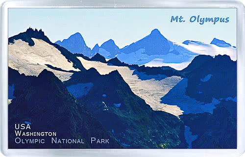
But wait…in North America, there is a Mount Olympus in Washington State, the highest mountain on the Olympic Peninsula there…
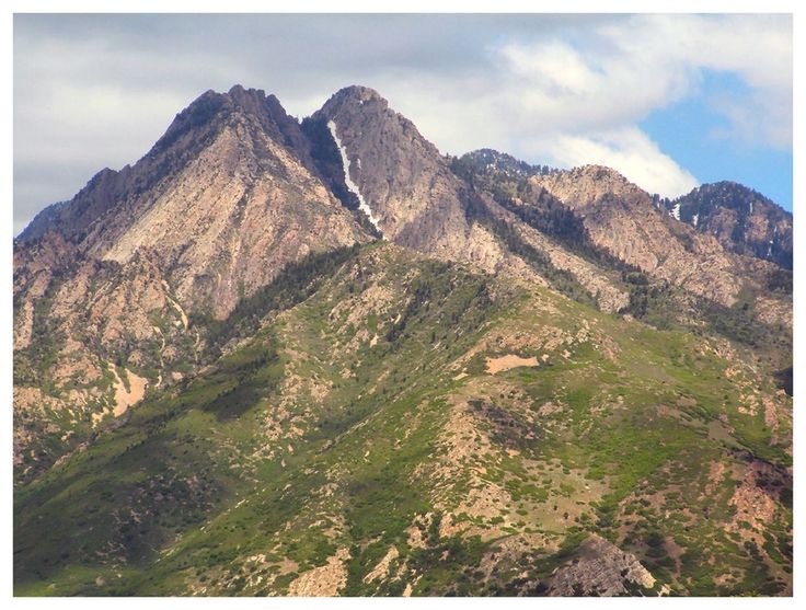
…and there is a Mount Olympus in Utah, near Salt Lake City in the Wasatch Range.
Named after Mount Olympus in Greece? That’s certainly what we are led to believe by historical omission, but what if these two Mount Olympuses in North America, and the ones in Greece and Turkey, are representative in some way of the ancient advanced civilization worldwide that we have not been told about?
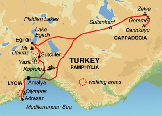
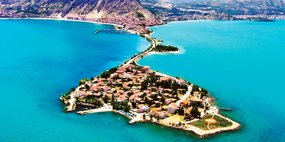
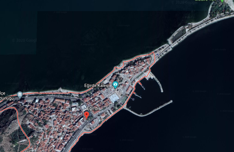
Lake Egirdir is located in the Taurus Mountains.
The ancient town of Egirdir on the lake shore looks to have an artificial island, called “Yesil Ada” or “Green Island,” attached to it by a causeway.
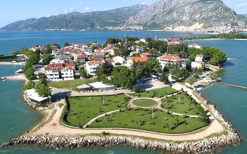
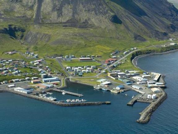
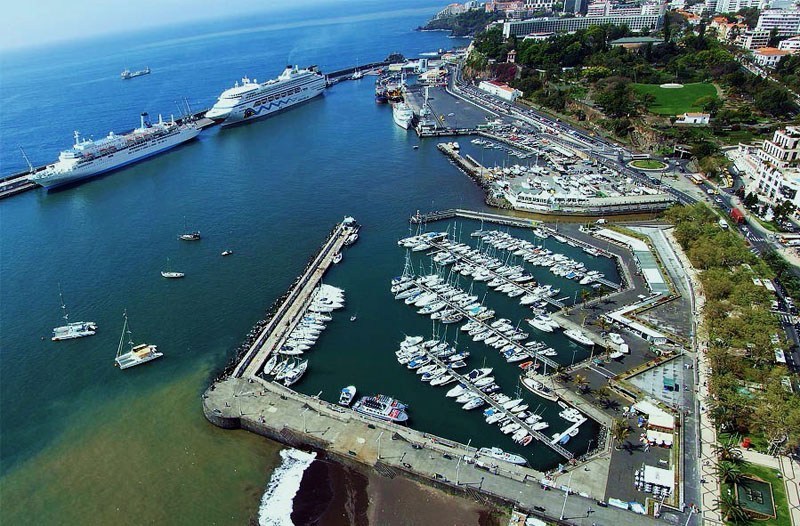
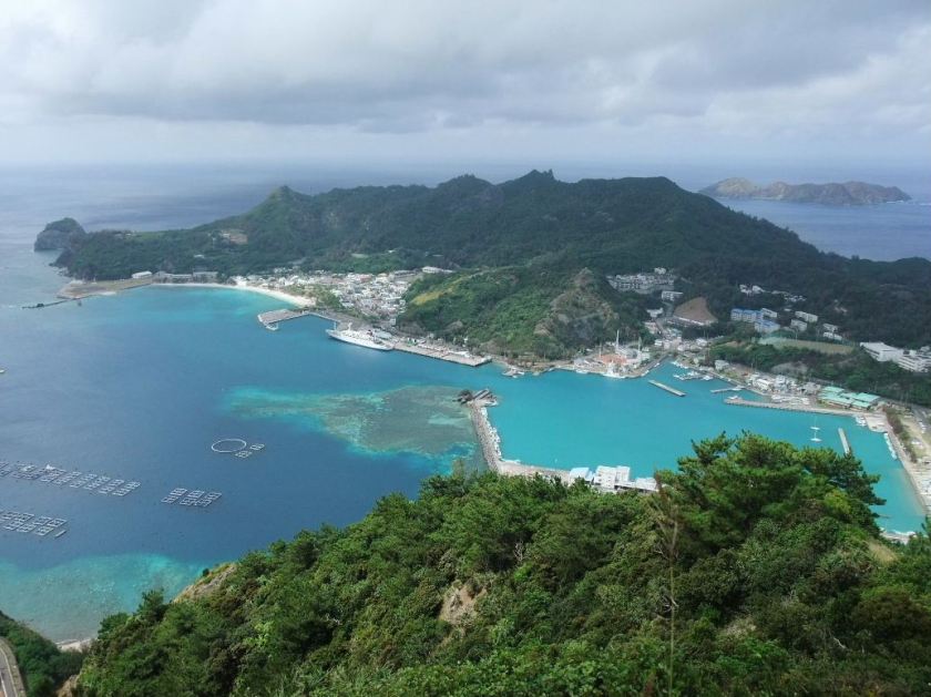
There is also a protected harbor here at Egirdir…
…that looks like protected harbors I have seen around the world, like Olafsvik harbor in Iceland…
…Funchal Harbor on the island of Madeira…
…the harbor at Chichi-Jimi in Japan’s Bonin Island group…
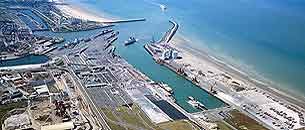
…and the ports of Dover, England and…
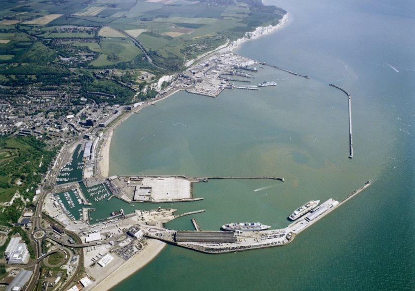
…and Calais, France in the English Channel, to name a very few.
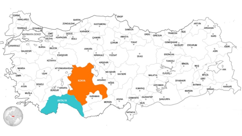
Heading east across the Taurus Mountains running along the southern part of the Anatolian Plateau, we come to the province and city of Konya.
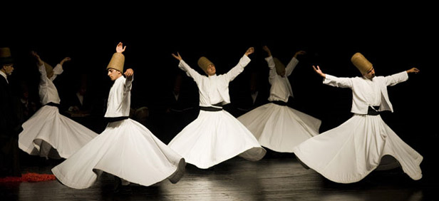
The Mevlana Museum is in the city of Konya.
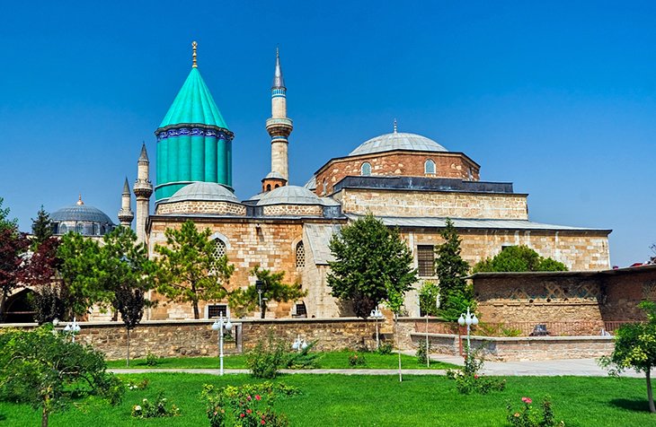
The Mevlana Museum is also the mausoleum of the Sufi Mystic Rumi…

…whose followers founded the Mevlevi Order based there, better known as the Whirling Dervishes, who practice a spinning dance used to connect with the Divine.
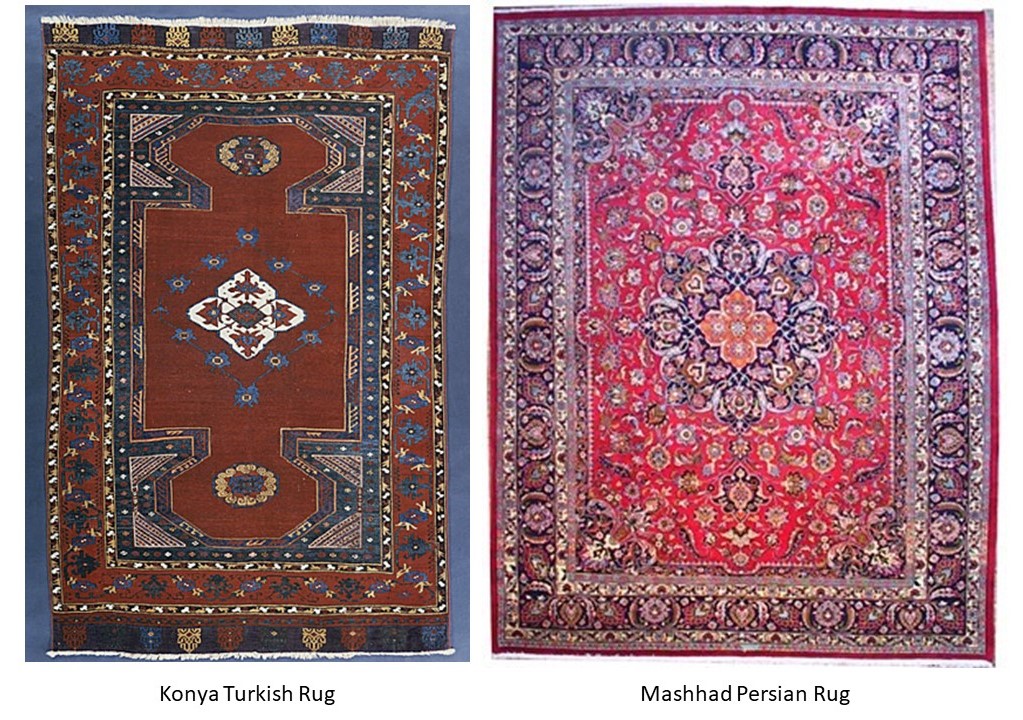
The Turkish rug on the left from Konya has similar design patterns to the Persian rug from Mashhad, Iran, on the right.
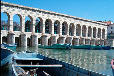
The heavy masonry of the Taskopru, or Stone Bridge, is a combined regular dam and bridge in Konya Province, a flood barrier said to have been built between 1908 and 1912 on what was called a ruined arch bridge…
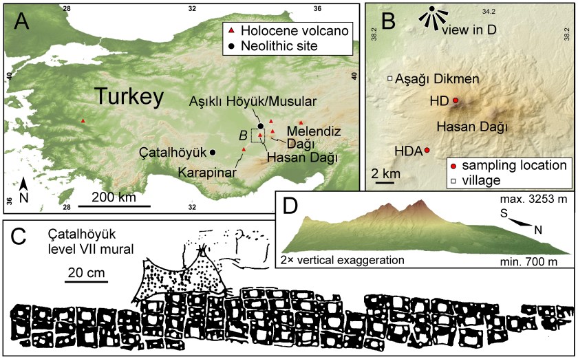
…and Catalhoyuk is located in Konya Province, a neolithic city that is dated back to origins in 7,100 BC…
…and Lake Tuz, pictured on the top, is in Konya Province, the second-largest lake in Turkey, and one of the largest hypersaline lakes in the world. It is compared with the world’s largest salt flat on the bottom, the Salar de Uyuni in Bolivia.
Both are incredibly reflective!
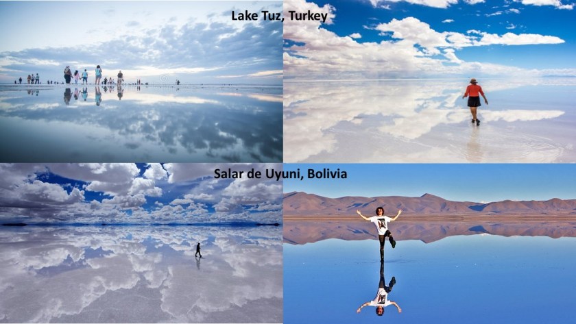
Lake Tuz is situated on this alignment I have been tracking starting in San Francisco, California.
Further east, we come to more interesting places, like Mount Nemrut…
… in Commagene, a historical kingdom of Armenia located in what is now Turkey.
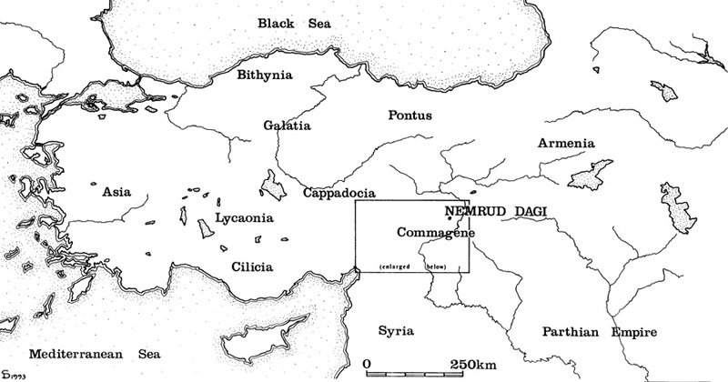
Mount Nemrut is described as a tomb-sanctuary built by King Antiochus I Theos, ruler of Commagene from 70 BC – 36 BC.
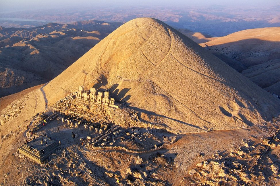
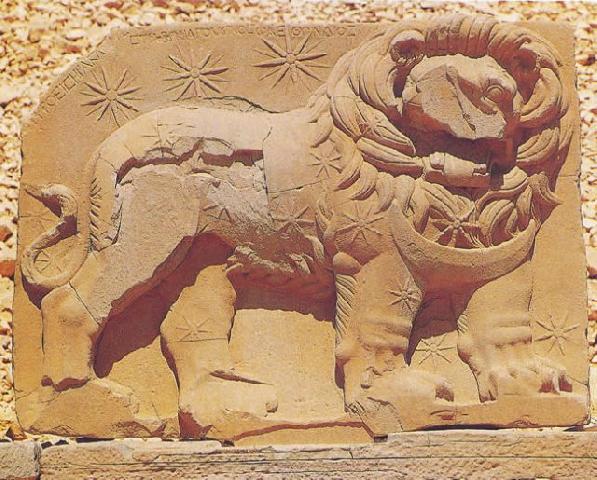
On the eastern side of the complex, there are what appears to be just colossal human and animal heads.
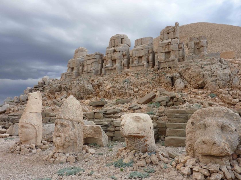
The question is: broken heads, like we are told, or buried heads…
…because, on the western side of the complex, there is a row of intact colossal full statues with similar heads…
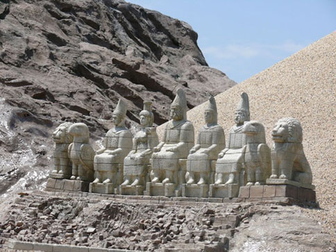
…as well as a large relief with a lion superimposed with an arrangement of stars, and said to depict the planets of Jupiter, Mercury, and Mars as a star chart that gives us the date of July 7th in 62 BC, and is surmised to be an indication of when construction on the complex began.
At any rate, this is what the available information has to say about it.
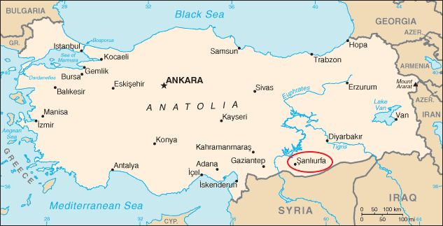
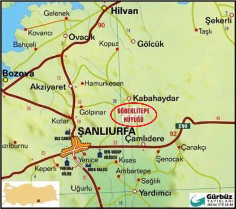
Heading further along towards the eastern end of the Taurus Mountains in the upper reaches of the Tigris and Euphrates Rivers, we are close to the province of Sanliurfa in southeast Turkey near the country’s borders with Syria and Iraq.
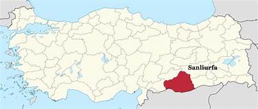
The capital of Sanliurfa Province, is Sanliurfa, also known as Urfa. It is also believed to be Ur Kasdim, or Ur of the Chaldeans, the hometown of Abraham, and is approximately 50-miles, or 80-kilometers, east of the Euphrates River.
The location of Abraham’s birthplace, with the entrance pictured here, is generally believed to have been in Harran, less than 20-miles, or 32-kilometers, from the city of Sanliurfa.
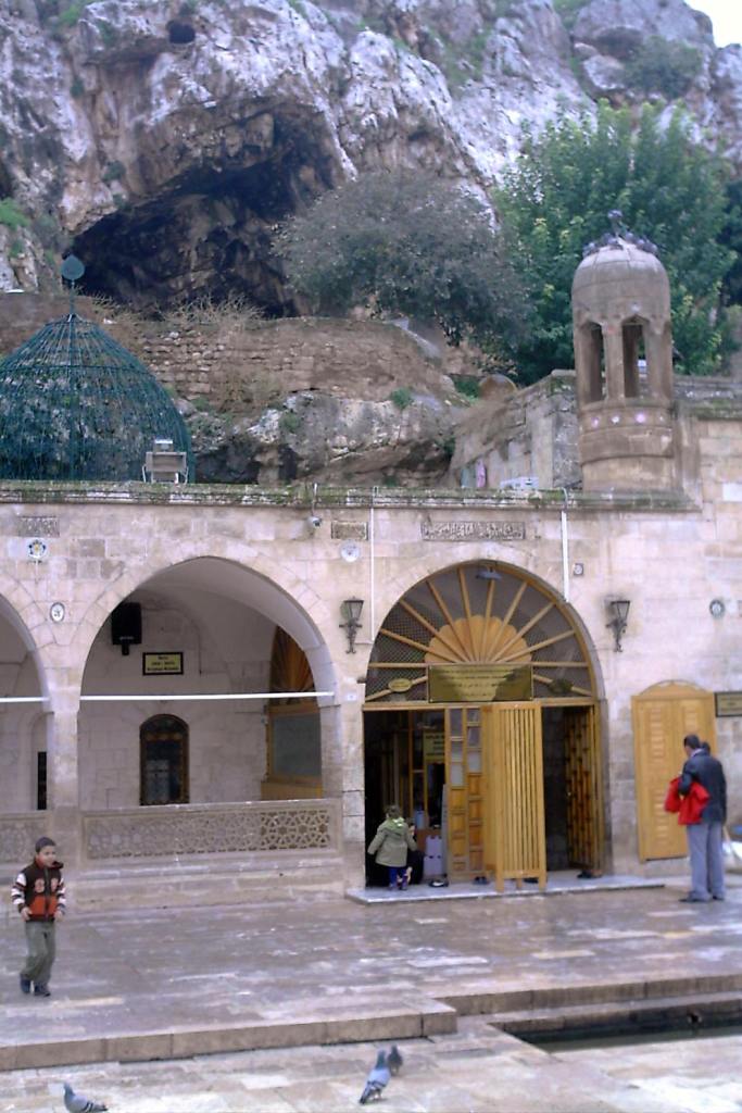
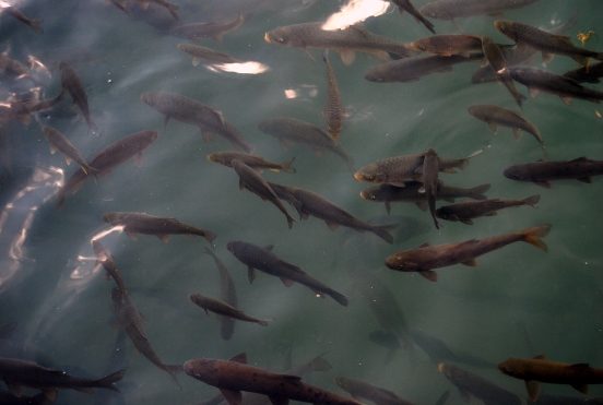
The Pool of Abraham, or Balikli Gol, in the city of Sanliurfa is believed to have been where Nimrod threw Abraham into a fire, but God turned the flames into water, and the logs into fish.
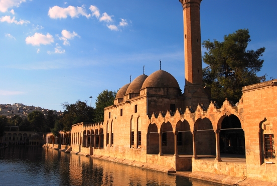
The carp in the Pool of Abraham are held sacred, and protected to this day.
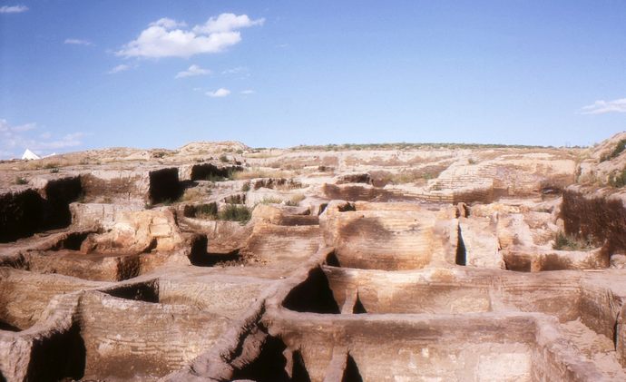
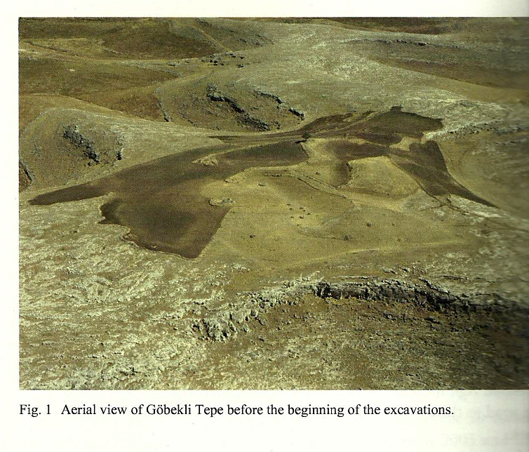
Gobekli Tepe is an archaeological site approximately 7-miles, or 12-kilometers, northeast of the city of Sanliurfa.
In 1994, Klaus Schmidt of the German Archaeological Institute reviewed an archaeological survey done in 1963 conducted jointly by Istanbul University and the University of Chicago.
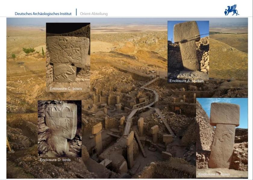
The site was buried, and the following year, in collaboration with the Sanliurfa Museum, Klaus Schmidt unearthed the first of many huge T-shaped pillars.
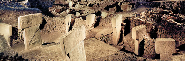
More than 200 stone pillars in about 20 circles are known through geophysical surveys, with heights up to 20 feet, or 6-meters, and weighing up to 10-tons, and fitted into sockets hewn out of bedrock.
It is dated back to the 10th-century BC, or 12,000 years ago, and is considered the oldest man-made temple complex yet discovered.
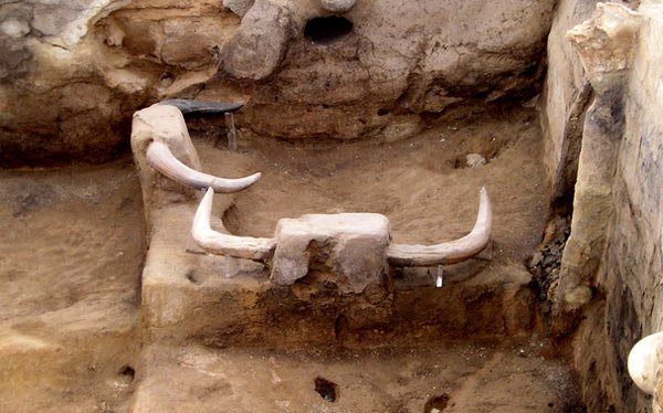
Interestingly, there are animal reliefs carved onto the pillars like this one…
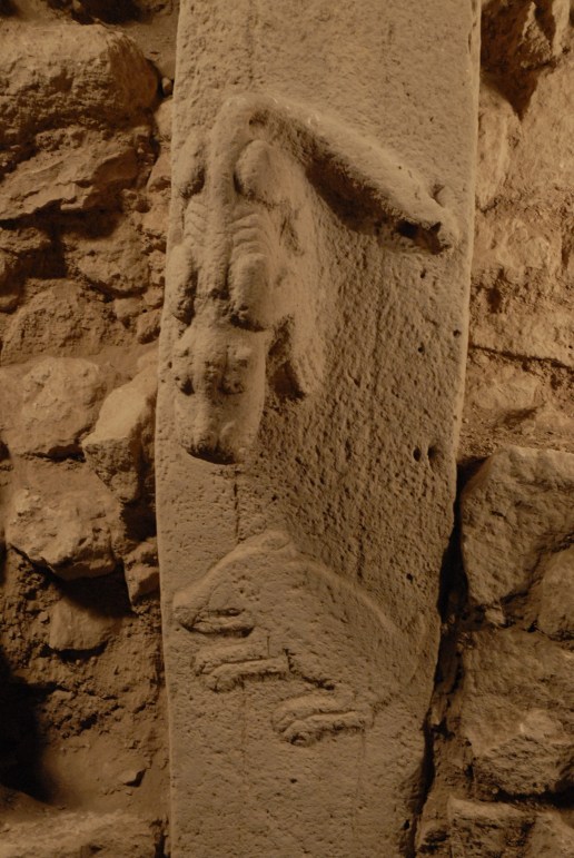
…compared with similar-looking carvings found at Cutimbo in Peru, near Lake Titicaca…
…and at the Lore Lindu National Park on the island of Sulawesi in Indonesia.
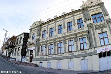
Moving northeast, close to the Pontic Mountains, is the city of Kars, in eastern Anatolia.
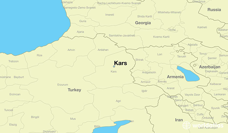
Kars is the largest city along Turkey’s closed border with Armenia, and a settlement that was historically a crossroads of Armenian, Turkish, Georgian, Kurdish, and Russian cultures.
As such, apparently it was of great interest, and the history we are told about it is filled with battles and sieges for control of it.
The Siege of Kars of 1855, for example, was the last major operation to took place during the Crimean War of 1853 to 1856, between the Russian Empire, which ultimately lost the war, and an alliance between the Ottoman Empire, France, Britain, and Sardinia.
Interestingly, in 1854 a British general had been sent to Kars by the supreme commander and chief of British Expeditionary Forces in Crimea to assess the situation.
When I look at this map depicting the siege, I see what appear to be at least thirteen star forts, and which appear to no longer exist in modern times.
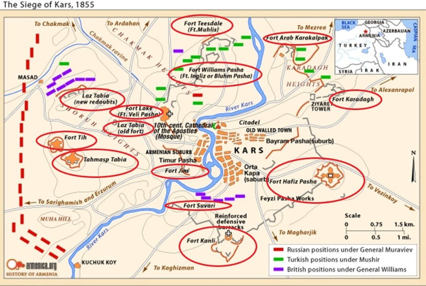
Here is an antique map of Kars which also appears to show shapes that could indicate the presence of star forts.

I believe that star forts functioned as part of the circuitry of the original grid system of the earth, and were not military in nature as we have been told. I find them all over the alignments I have found, and they seem to have been prime targets for explorers and European European colonial empires.
The Kars Citadel is still here, though apparently only seven of the original 220 towers remain.
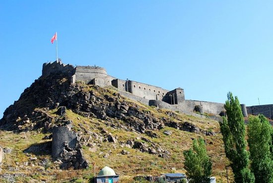
It was said to have been built by the Saltuks in 1152 AD.
There were canals in Kars…
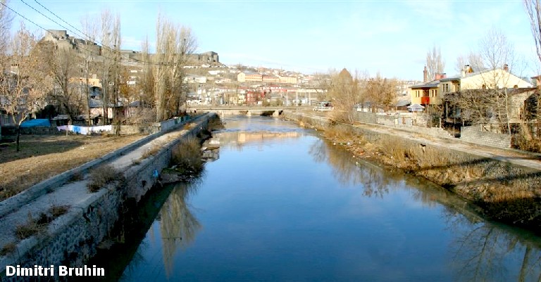
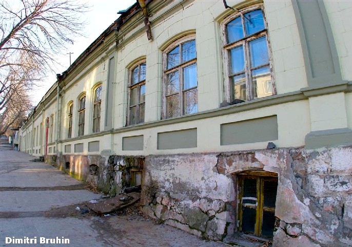
…and these next two photos taken in Kars show classic mud flood evidence of like steep streets with disappearing windows at ground-level, and below-ground level.
Next, I would like to look at Munzur National Park on the Anatolian plateau, situated between the Taurus and Pontic Mountains, and the Armenian Highlands.
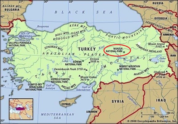
It is the largest national park in Turkey, and was established in 1971.
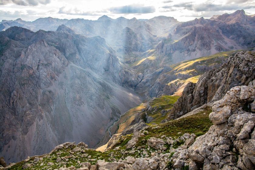
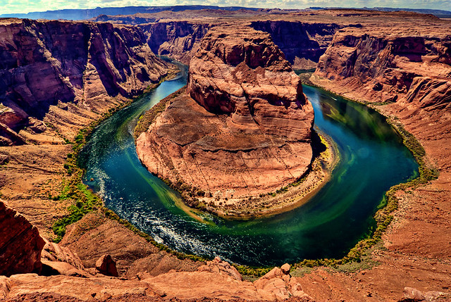
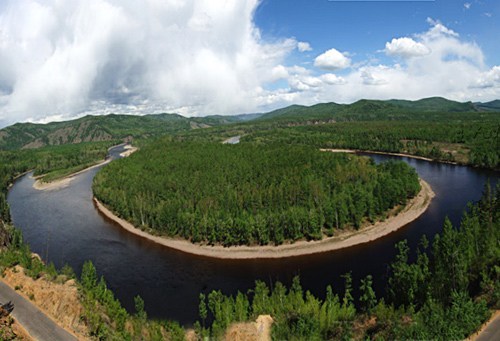
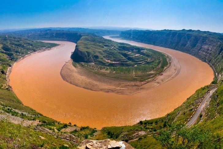
This is a bend of the Munzur River in the national park in Turkey…
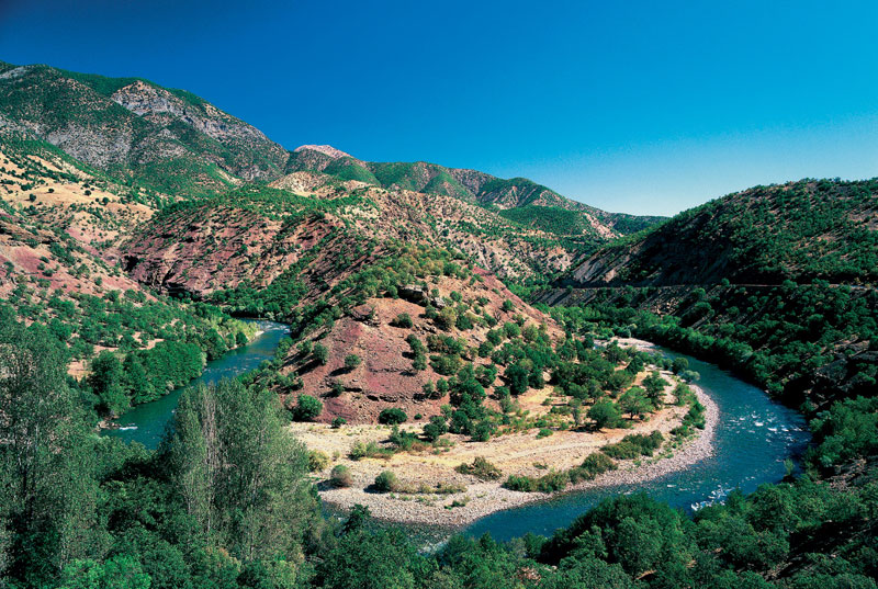
…compared with Horseshoe Bend in Page, Arizona…
…this riverbend in the Hulunbuir Grasslands of Inner Mongolia…
…and the Yellow, or Huang He River, the Mother River of China.
The capital of Turkey was moved to the Anatolian Plateau in 1923, when the city of Ankara was chosen as the capital of the new state to remove it from the former imperial capital of Istanbul and to place the capital it in a more central location in the country.
It appears that Ankara is quite the mix of ancient and modern infrastructure!
Within Genclik Park, which is a public park just across the street from Ankara’s main train station…
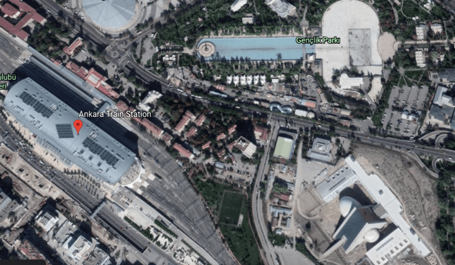
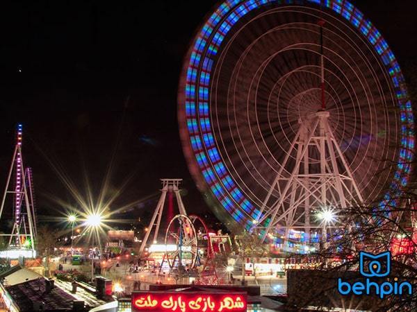
…we find Ankara’s Luna Park amusement park.
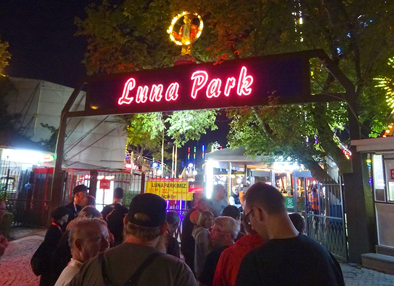
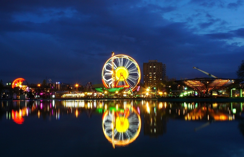
I also found that Mashhad, Iran has a Luna Park as well, in its Mellatt Park.
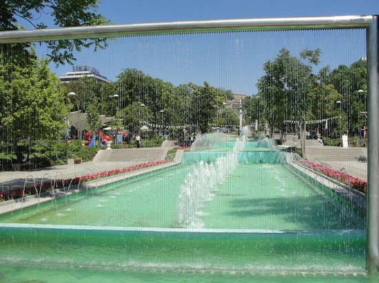
Mellat Park in Mashhad has amazing hydrological features and beautiful fountains…
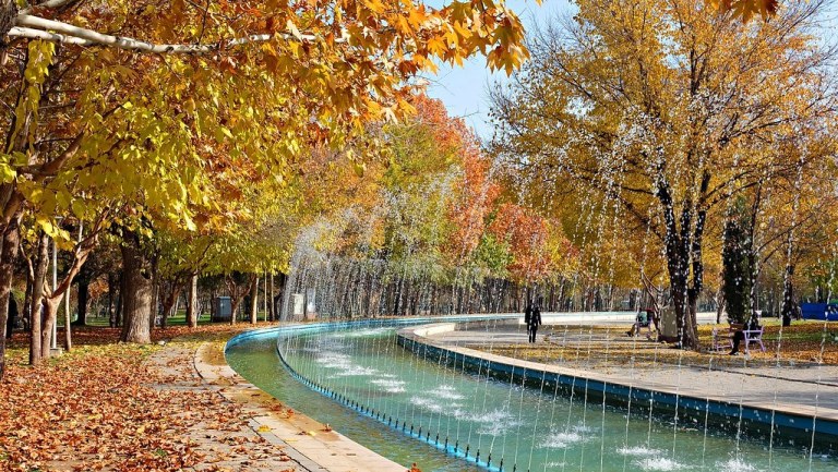
…as does Genclik Park in Ankara.
Ankara was one of the main tribal centers of the Galatians, we are told. Galatia in Anatolia was part of the ancient Celtic World.
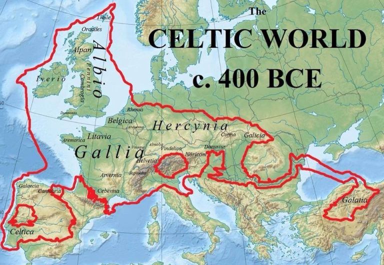
So interestingly, when I see Ankara Citadel, the foundations of which were said to have been laid by the Galatians in more ancient times (no date was given but prior to Roman times) on a prominent lava outcrop…
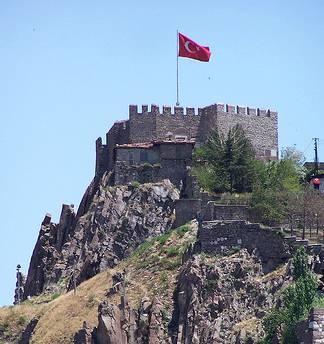
…I am once again reminded of Edinburgh Castle in Scotland, which was said to have been built starting around 1100 AD on the plug of an extinct volcano…
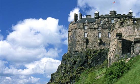
…which is what I thought of when I was looking at the rocky outcrop Van Castle is situated on in Van, Turkey, in the last post, said to have been built by the Urartian King Sarduri in 900 BC…
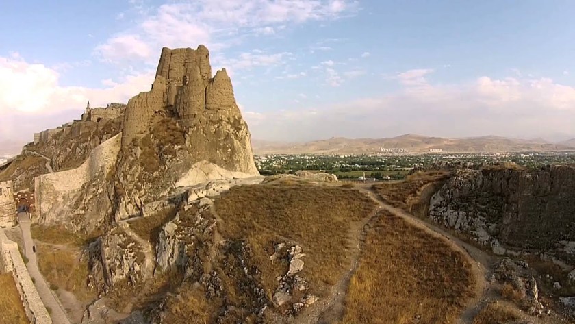
…and the Kars Citadel, circa 1152 AD by the Saltuks, that we just visited looks similar to these other three places.
Yet all built by different civilizations at different times?

When Ankara became the capital of the new Republic of Turkey in 1923, it had been moved from Istanbul, the country’s imperial, historic, economic, and cultural center straddling the continents of Europe and Asia across the Bosporus Strait.
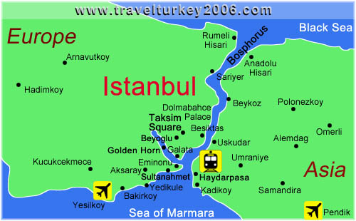
Prior to the capital’s move to Ankara, Istanbul was known as Constantinople, at one time the capital of the Roman Empire, the Byzantine Empire, the Latin Empire, and from 1453 to 1923, the Ottoman Empire.
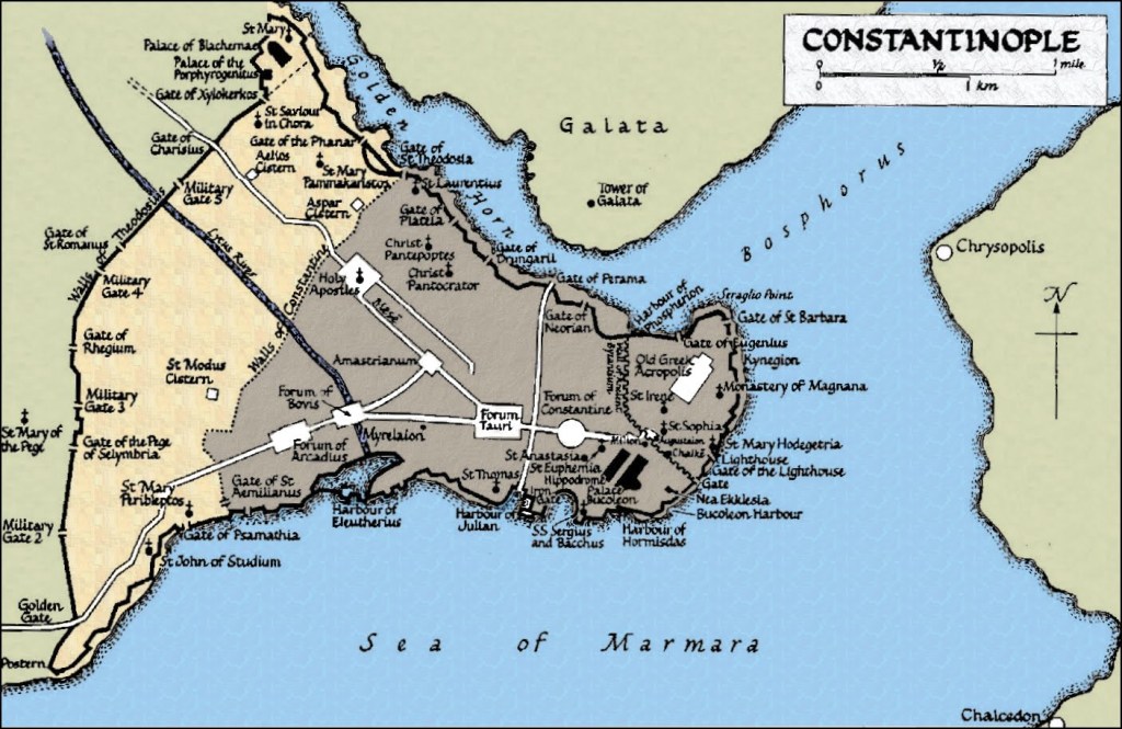
I am immediately drawn to look into Galata, situated between the Bosphorus Strait and what is called the Golden Horn, directly across from the main part of historical Constantinople.
In this history I read about Galata, the name is said to have come from the Greek “Galatai, referring to a Celtic tribe of Gauls who were said to have camped here during Hellenistic times before moving on to the Galatia region in Central Anatolia.
Why would they name a place permanently for temporary inhabitants that were only passing through?
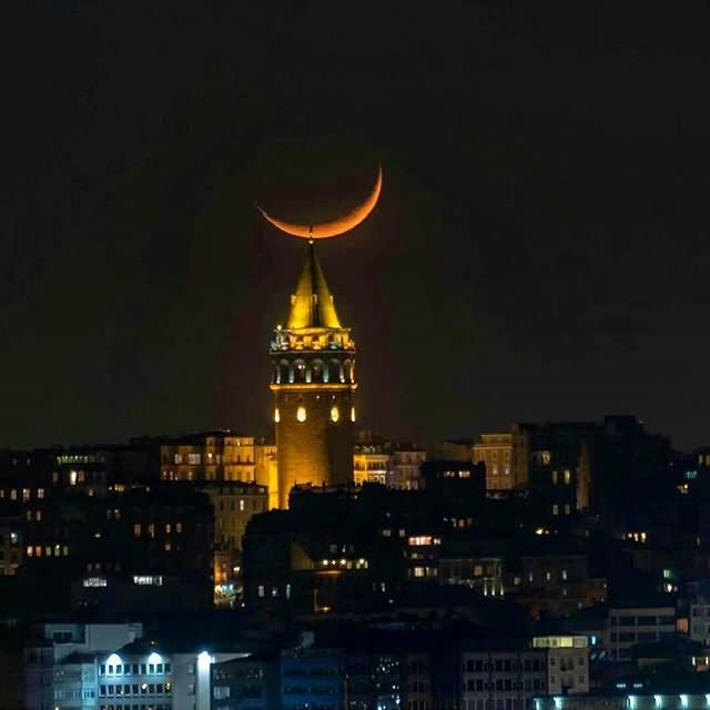
The Galata Tower there absolutely dominates everything in its surroundings!
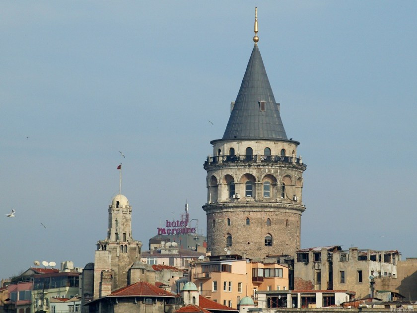
However, we are told the Genoese get the credit for building it in 1378, when they had a colony here between 1273 and 1453, at the apex of the walls of the citadel, also said to have been built by the Genoese, that no longer exists.
Here are more photos of the outside of the Galata Tower…
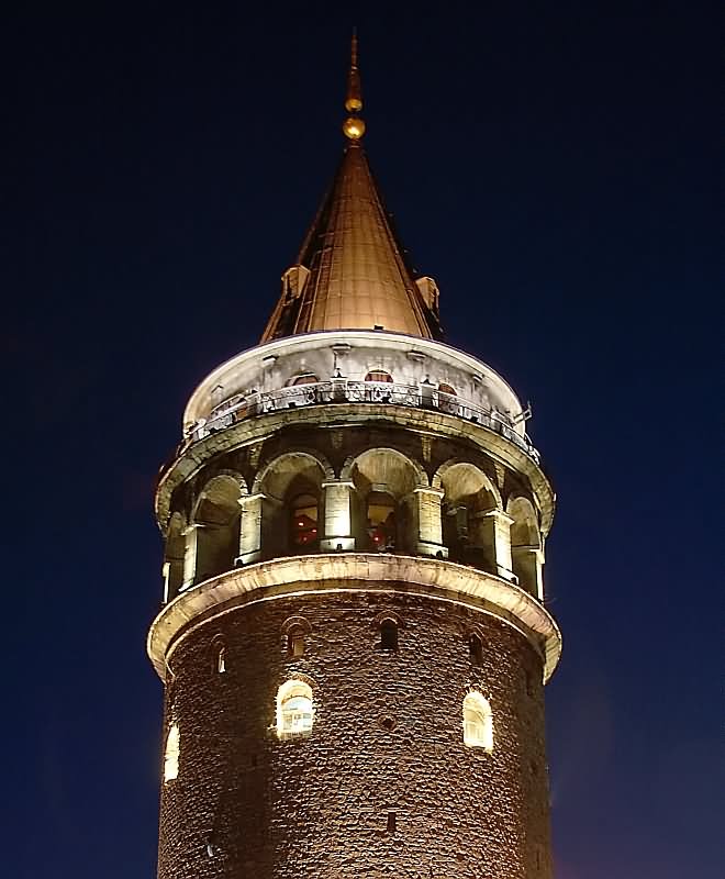
…and of the inside of the Galata Tower.
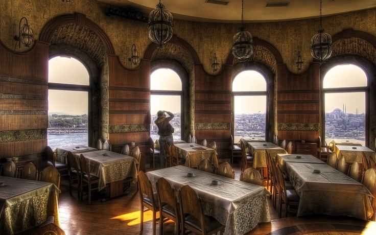
This picture of inside the Galata Tower…
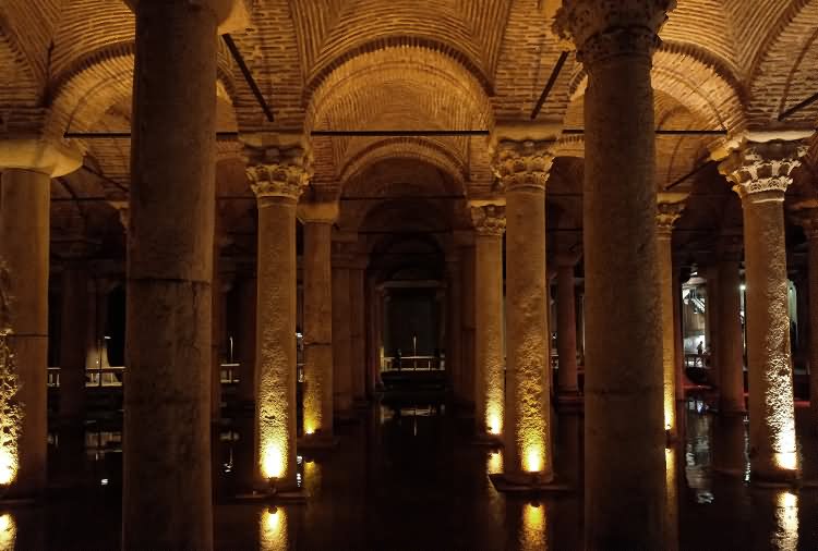
…looks like the Basilica Cistern, the largest of several hundred ancient cisterns that lie beneath Istanbul, and said to have been built during the reign of the Byzantine Emperor Justinian I between 527 to 565.
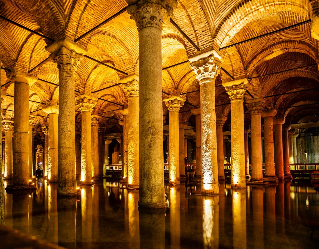
The Basilica Cistern is located…
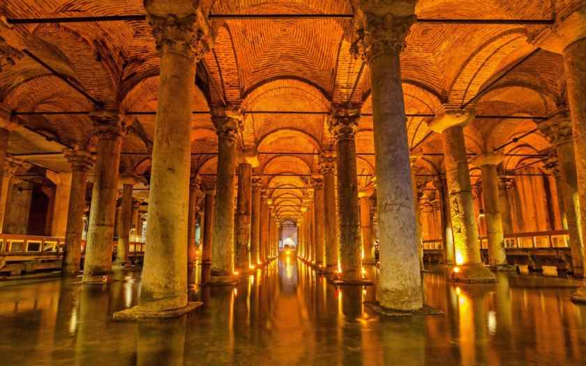
…490-feet, or 150-meters, from the Hagia Sophia, also said to have been built during the reign of Emperor Justinian I, between 532 and 537 AD.
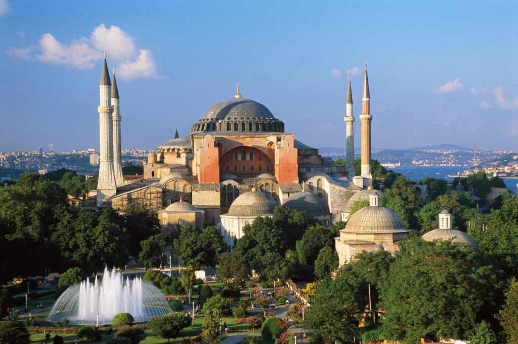
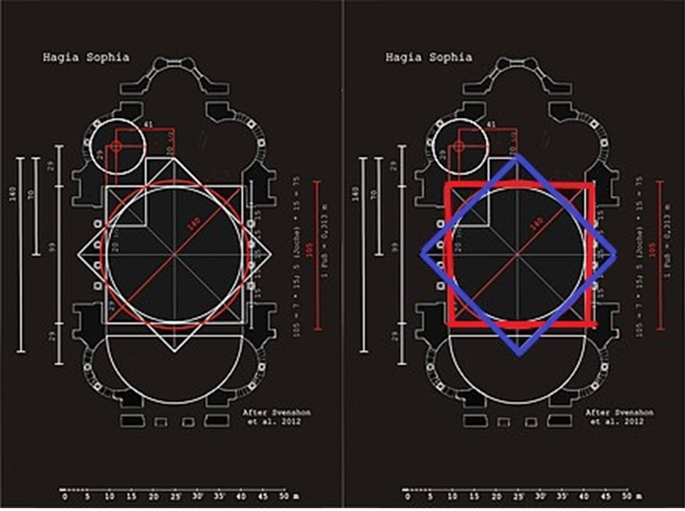
I found this diagram showing the geometric lay-out of the Hagia Sophia…which contains an eight-pointed star.
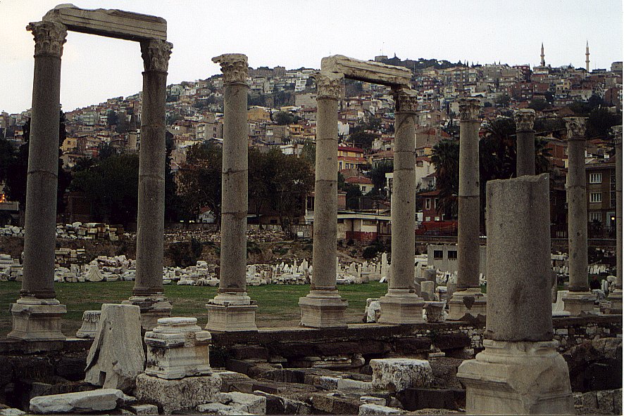
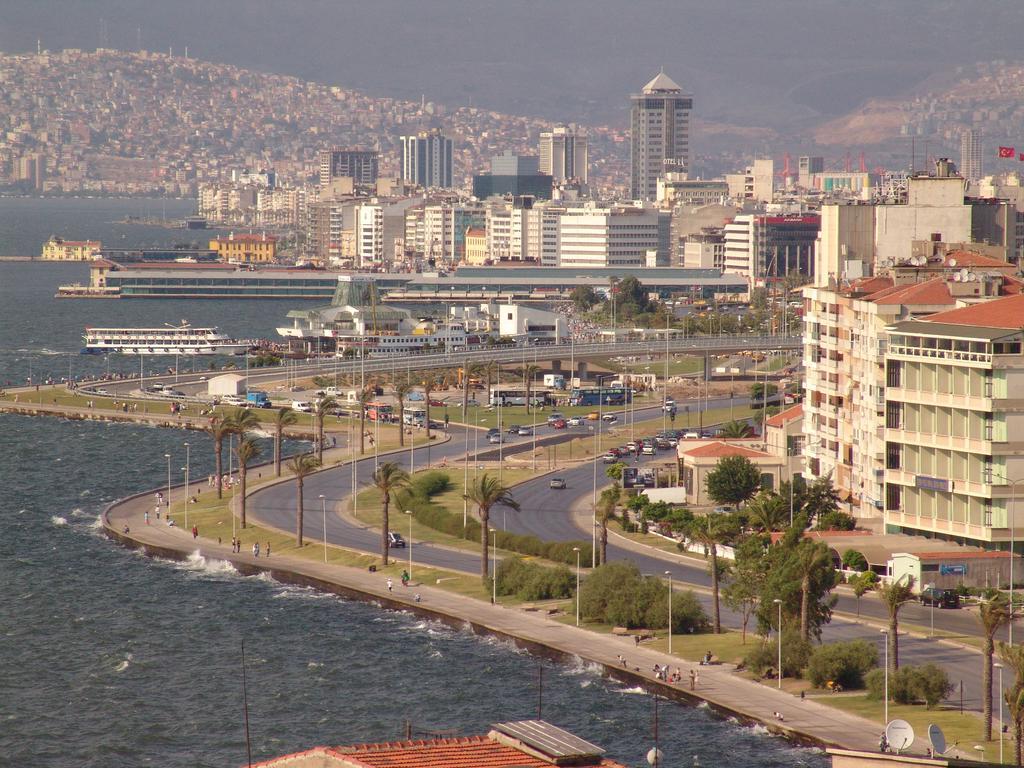
The last place I am going to look at is the city of Izmir, a city on the western edge of the Anatolian Plateau.
The alignment I have been following passes through here on its way towards the Aegean Sea and Greece.
Known in times past as Smyrna, from ancient times to around 1930, at which time it became predominantly known by its Turkish counterpart, Izmir.
Izmir has more than 3,000 years of recorded urban history…
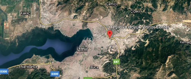
…and up to 8,500 years as a human settlement since the Neolithich area, with Yesilova Hoyuk being continuously inhabited at least between 6,500 BC and to 4,000 BC.
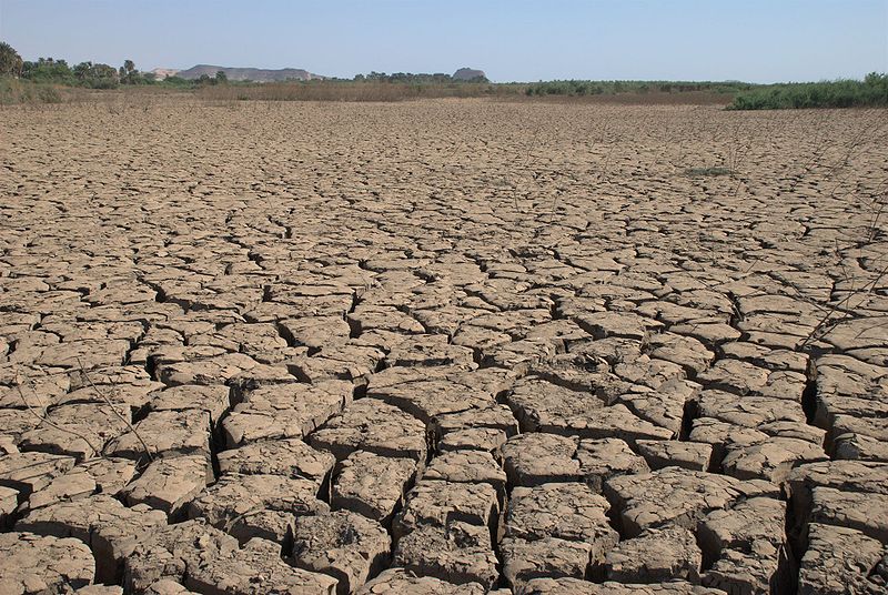
Discovered in 2003, the Yesilova Hoyuk site was at some point in its history…
…covered in silt.
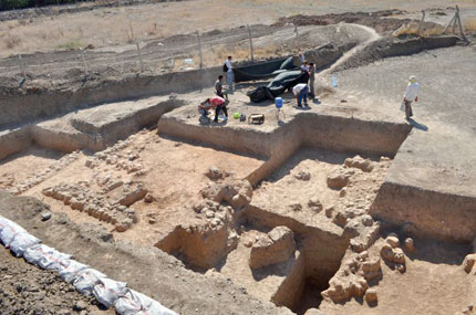
Silt is defined as a fine sand clay, or other material carried by running water and deposited as a sediment.
Izmir’s Metropolitan area extends along the outlying waters of the Gulf of Izmir, where we see what appears to be a shaped, masonry shoreline…
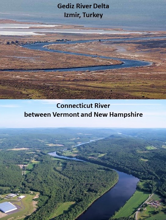
…and inland to the north across the Gediz River Delta, which has a shape similar to the Connecticut River along the Vermont – New Hampshire border in the United States.
The last place I am going to take a look at in Izmir is Konak Square.
This is the clock tower there, said to have been built in the Moorish style in 1901 by the Levantine French architect Raymond Charles Pere.
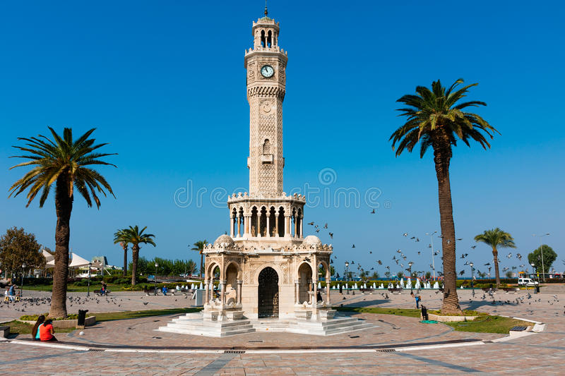
Levantine refers to the Latin Church of the Catholic Church in the Middle East, in the Levant, which included the country now called Turkey.
This is the Konak Pier on the eastern end of Konak Square.
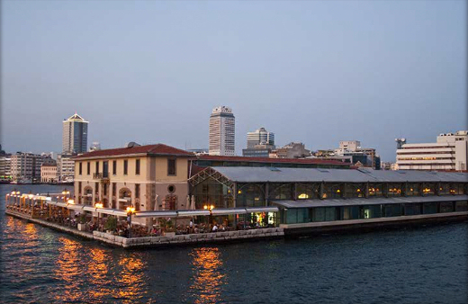
Gustav Eiffel is credited with its construction in 1890, a French civil engineer and architect most famous for the tower in Paris bearing his name.
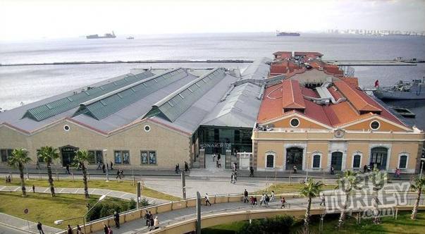
Konak Pier is now an upmarket shopping mall in Izmir.

There is so much more to find, but I am going to end this post here.
It is clear that this geographical region known since 1923 as Turkey, for less than 100-years, and known as Anatolia for far longer, has a very ancient and storied and obscured past, which goes back at least 12,000 years with the dating of the Gobekli Tepe Complex, and with many places showing evidence of having been covered over massively with silt, or mud, or whatever would have caused things like needing to be dug out from the earth.
In the next post, I am going to be picking up the alignment leaving Izmir to where it enters the Aegean Sea.

Great stuff here. I have had similar experiences.
LikeLike