This is the first part of a two-part series on the consistent finding of mining and mineral occurrences directly on the Earth’s alignments and leylines.
I will summarize my findings and interpretations of this material at the end of the second-part of this series.
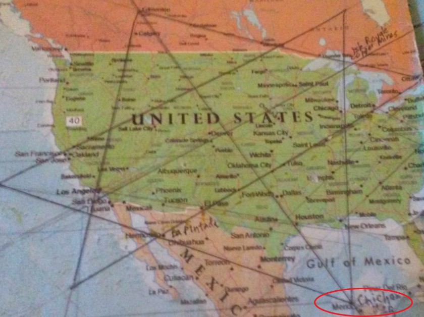
This first part will take us on an alignment from Cape Farewell to Merida, Mexico. The second part will take us on an alignment from Cape Farewell to the Maldives off the east coast of Africa in the Indian Ocean.
In the course of doing the research for these two posts, I found mines and/or mineral occurrences at every single place I had listed on my spreadsheet when I first wrote down cities and places in alignment with each other back in 2016.
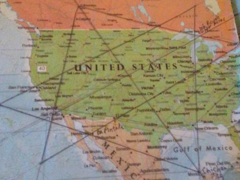
While I already knew I was finding mines along the alignments I have been tracking, I was prompted to focus on mining and mineral occurrences with respect to the world alignments that I uncovered in 2016 after I found the North American Star Tetrahedron by connecting the dots of cities in North America that I noticed lining up in lines, then extending all of the lines coming off of it around the world in linear and circular fashion.
This finding of what I am calling the North American Star Tetrahedron and the alignments I found resulting from this discovery form the basis for my research and work.
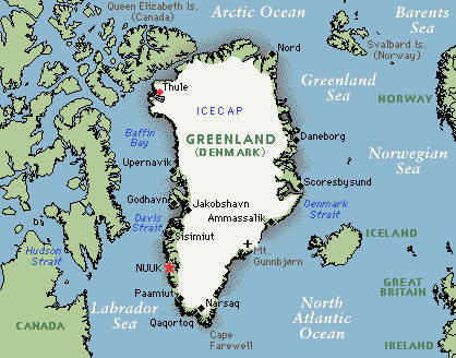
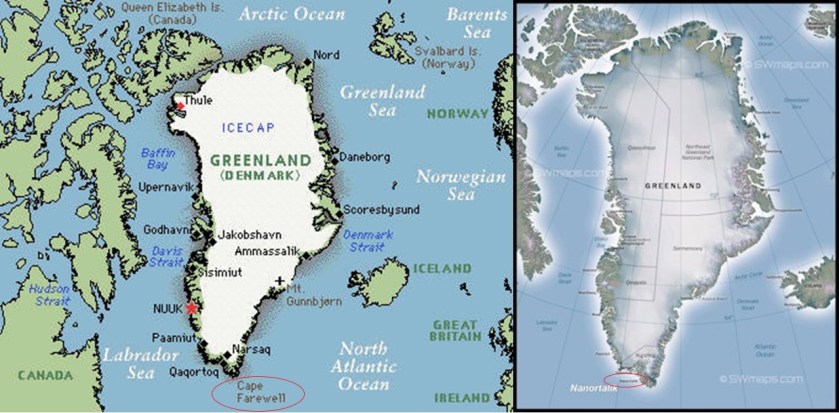
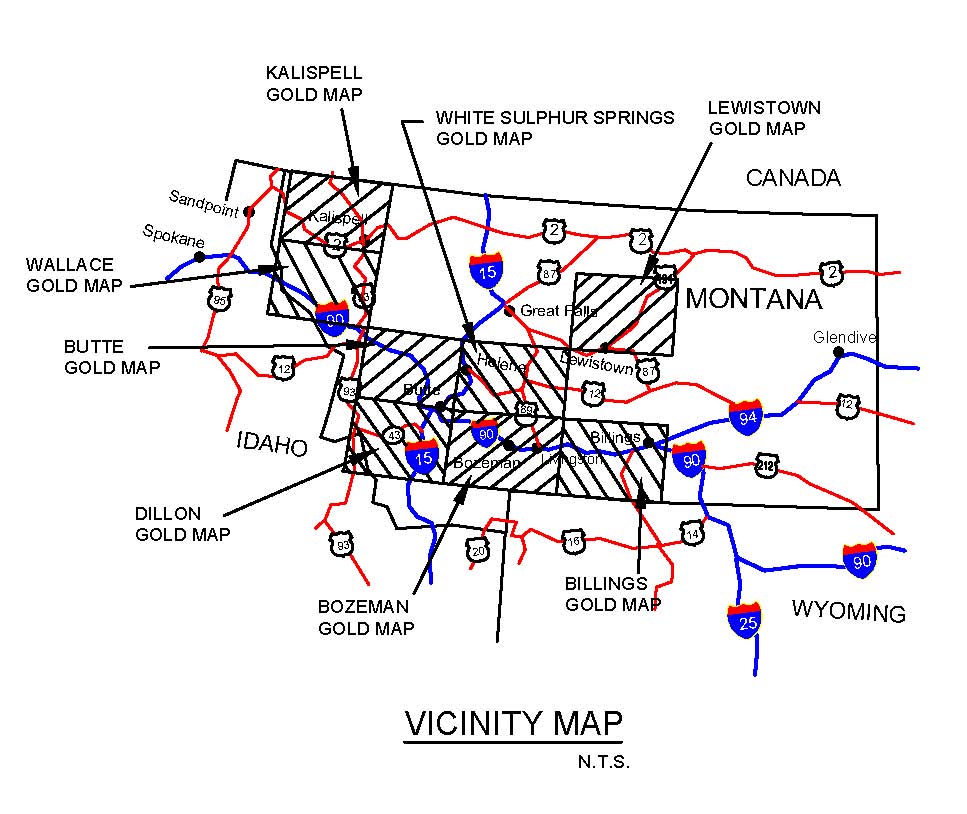
I have chosen Cape Farewell at the southern tip of Greenland as my starting point.
I initially found Cape Farewell when tracking alignments, and it sits on an alignment that globally connects with two different sides of the North American Star Tetrahedron, and this two-part series will cover my findings going in both directions from Cape Farewell.
Cape Farewell is the southernmost point of Greenland, located on the southern shore of Egger Island, part of what is called the Cape Farewell archipelago.
Greenland is an autonomous territory within the Kingdom of Denmark.
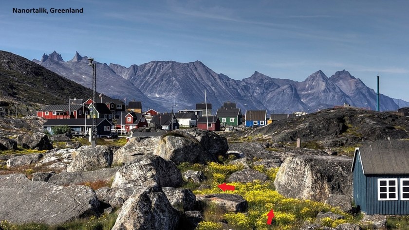
When I searched for Cape Farewell mines, the Nalunaq Gold mine at Nanortalik showed up, approximately 60-miles, or 97-kilometers from Cape Farewell.
Nanortalik is an Inuit community…
…part of a group of culturally-similar indigenous people inhabiting the Arctic regions of Greenland, Canada, Alaska, and the Russian Federation – more commonly known as eskimos.
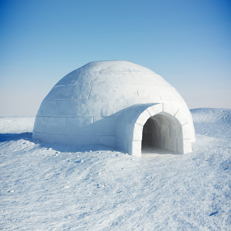
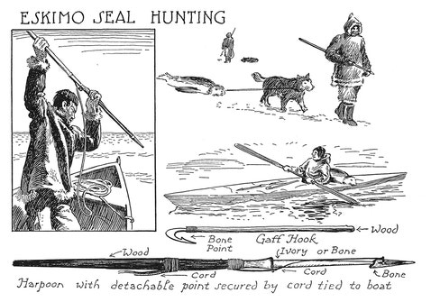
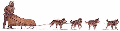
As we travel through their northern lands on this alignment, keep in mind the type of imagery we are taught to associate with eskimos, like igloos…
…whale hunting…

…seal-hunting…
…dog sledding…
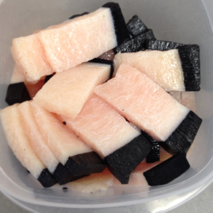
…and eating muktuk, which is whale blubber.
The Nalunaq Goldmine is located in the nearby Kirkespirdalen, or Church Steeple Valley.
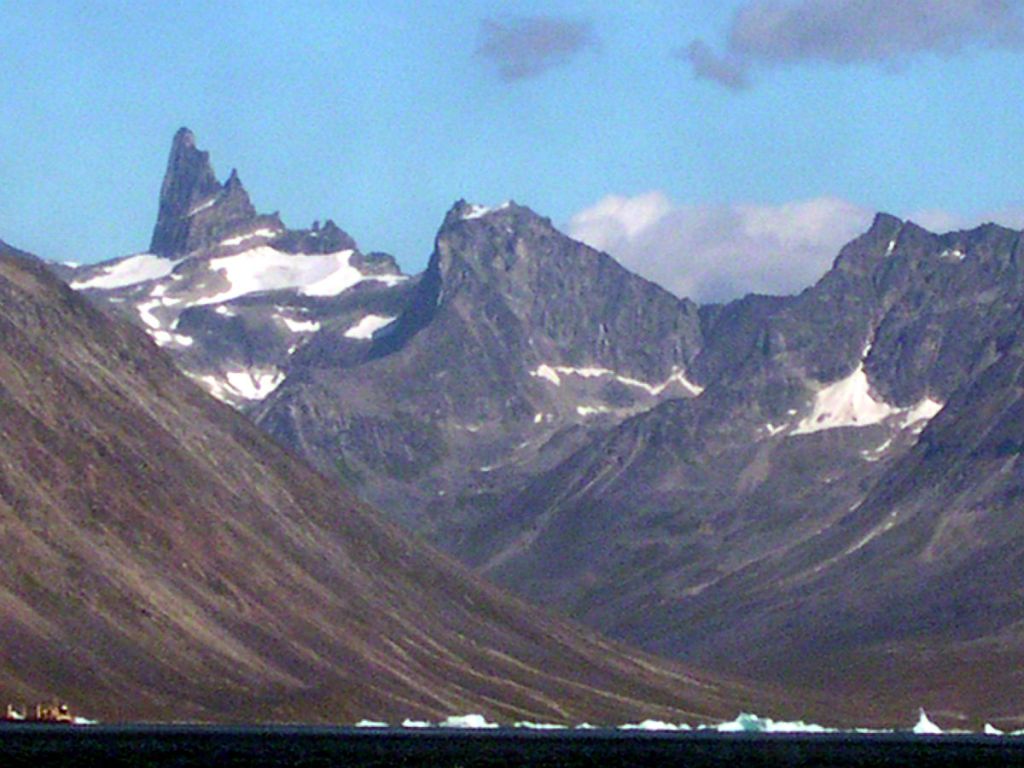
Greenland’s first gold mine, it opened in 2004, and was the first mine developed there in over 30-years.
A narrow-vein, high-grade gold deposit, the Crew Gold Exploration company was the first to mine it for approximately 4-years, producing 308,000 ounces of gold.

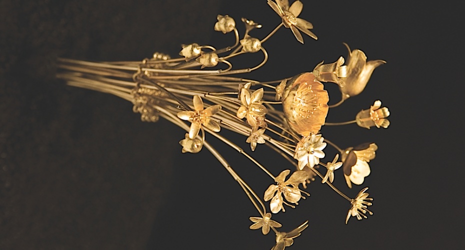
This was Greenland’s gift to Queen Margrethe’s Regent Anniversary in 2012, a bouquet of 18 gold flowers in natural-size that were made from Nalunaq gold.
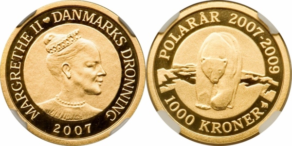
Denmark’s National Bank issued three thematic coins with motifs from the polar regions on the occasion of the 2007 – 2009 International Polar Year that were made from Nalunaq gold.
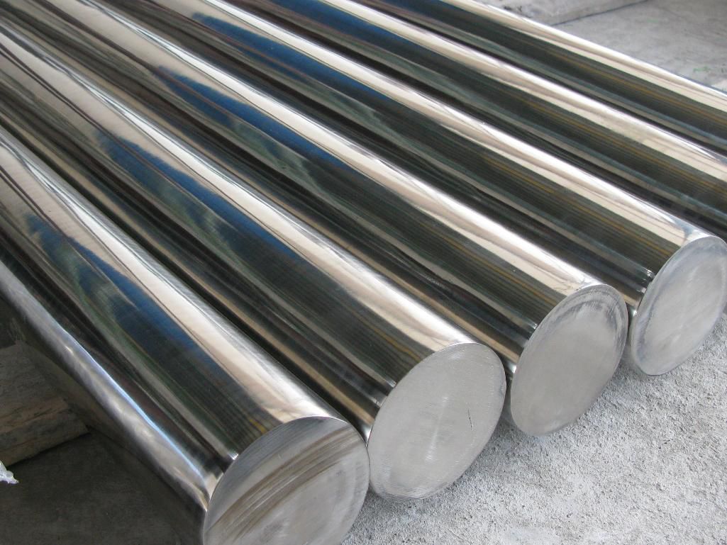
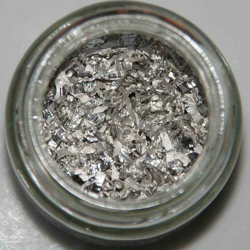
Gold is a chemical element with the symbol “Au”and atomic number 79 or the number of protons found in the nucleus of every atom of that element…
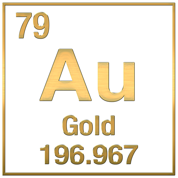
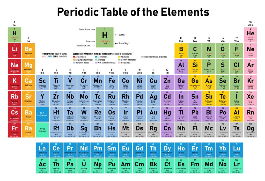
…in the Periodic Table of Elements, a tabular arrangement of the chemical elements organized in order of increasing atomic number.
There is a recurring pattern called the “periodic law” in their properties, in which elements in the same column (group) have similar properties.
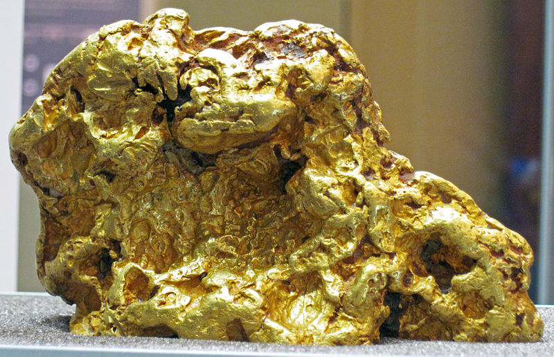
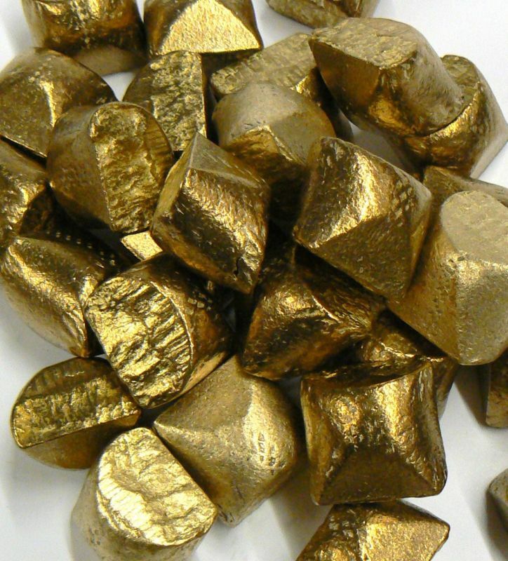
Gold is also a precious metal, a rare, what we are told naturally-occurring, metallic chemical element of high economic value.
In addition to having been used for coinage, jewelry, and other arts throughout history…

…it has also been used as a neutron reflector in nuclear weapons.
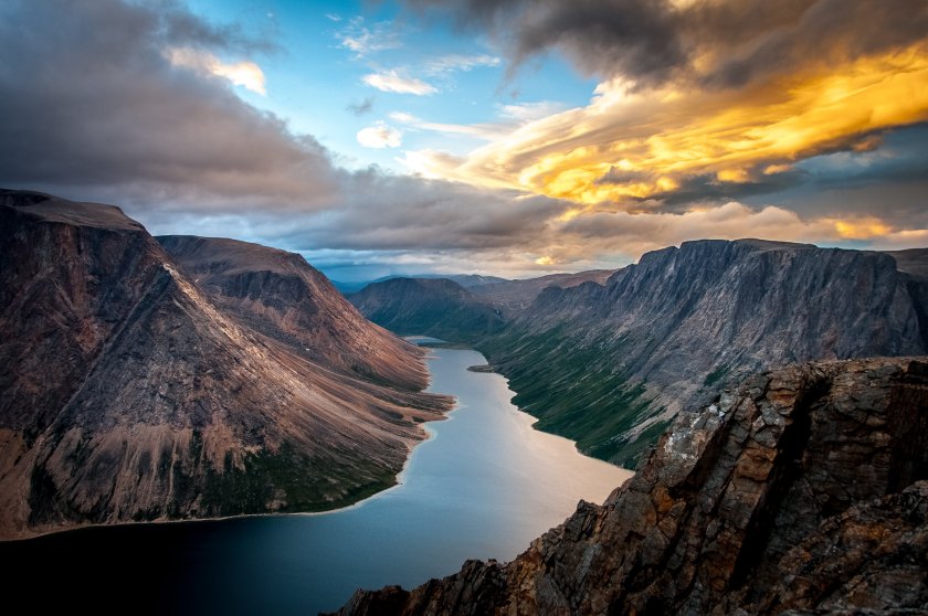
The next place on this alignment is Saglek Bay…
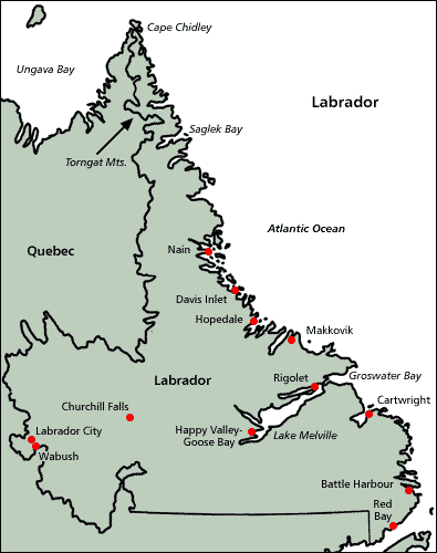
…located in the Torngat Mountains in northern Labrador.
Labrador Inuit have historically occupied most of the Atlantic coast of northern Labrador, and are said to be descendants of the pre-historic Thule people.
Here are some interesting points to ponder on who the Thule people might have actually been.
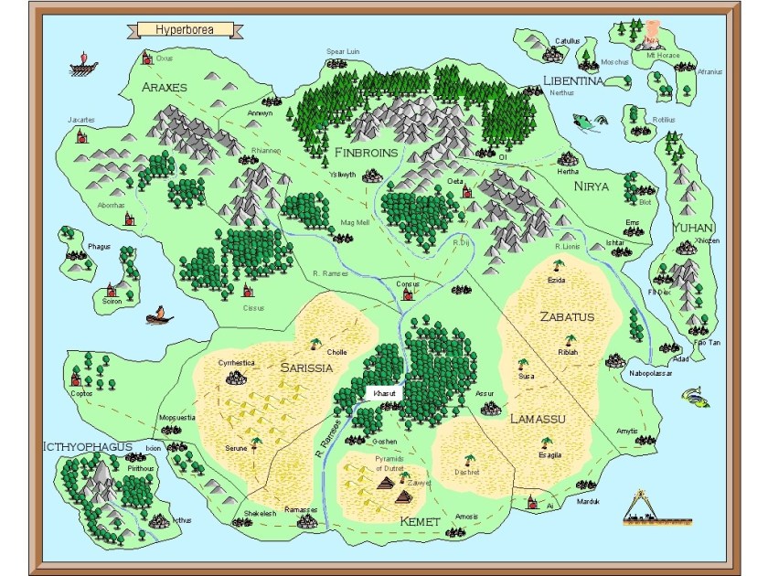
Ultima Thule is the northernmost region of the habitable world as thought of by ancient geographers.

Legendary Hyperborea, a lost ancient land and fabulous world of eternal spring, was said to be located in the Far North.
Its people were said to be giants, with long and blessed lives untouched by war, hard work, old age and disease.
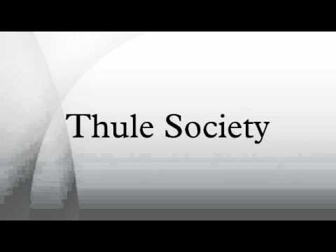
The Nazi Germans were obsessed with Thule.
The Thule Society was a German Occult Secret Society founded initially as a study group in Munich after World War I. It was the organization that sponsored the German Workers Party, which became the Nazi Party under Hitler. The Nazis believed there was a connection to the origins of the Aryan race with Hyperborea.
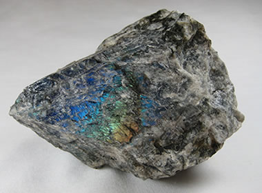
Geological studies done on the Saglek block, which is the northern part of the Nain Province of Labrador, confirm different kinds of gneiss, a high-grade metamorphic rock in which mineral grains recrystallized under intense heat and pressure.
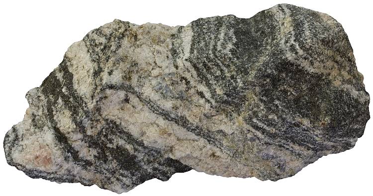
Although gneiss is said to not be defined by its composition, most specimens have bands of feldspar, a silicate mineral which has characteristics that includes silicon and oxygen atoms, and of which labradorite is considered a phenomenal feldspar mineral, like this specimen found in Labrador’s Nain Province…
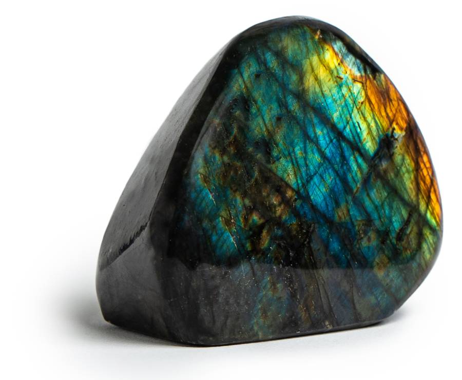
…and this is what labradorite looks like all polished up.
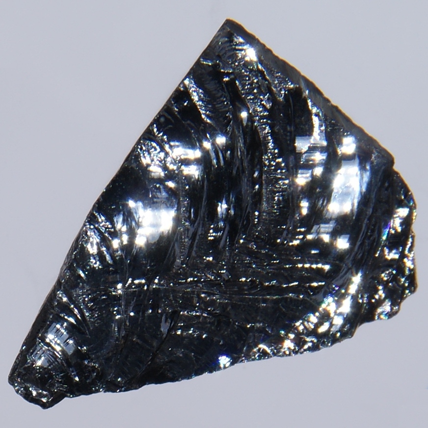
Silicon is a chemical element with the symbol “Si” and atomic number 14.
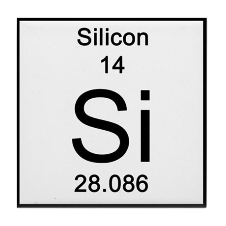
Silicon is a hard, brittle solid with a blue-gray metallic luster.
It is also a semiconductor, a material that has electrical conductivity intermediate to that of a conductor and an insulator.
Semiconductors are essential components of most electric circuits.
A semiconductor can conduct electricity, and its conductance can vary depending upon the current or voltage applied to a control electrode, whose voltage with respect to the voltage of the cathode – the electrode from which a conventional current leaves a polarized electrical device – determines the electron flow to the anode, or the positively charged electrode by which the electrons leave a device.

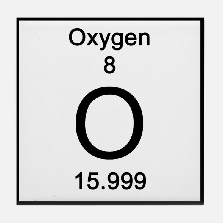
Oxygen is a chemical element with the symbol “O” and atomic number 8.
It is a colorless, odorless reactive gas, and as a member of the chalcogen group on the periodic table, a highly reactive nonmetal, and an oxidizing agent that readily forms oxides with most elements as well as with other compounds.
Gneiss also typically contains bands of quartz.
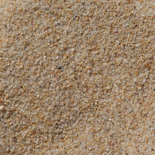
Quartz is a chemical compound consisting of one-part silicon and two-parts oxygen, and is the most abundant mineral found on the Earth’s surface. It is the dominant mineral of mountaintops, and the primary constituent of beach, river, and desert sand.
Quartz is highly resistant to mechanical and chemical weathering; chemically inert in contact with most substances; and has electrical properties and heat resistance that make it valuable in electronic products.
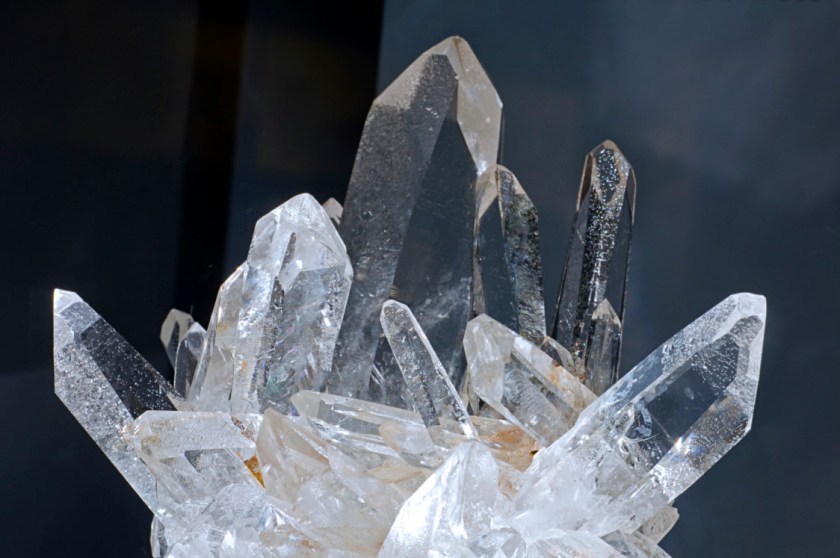
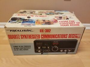
Quartz crystals, of which there are many varieties, have the ability to vibrate at precise frequencies, and can be used to make extremely accurate time-keeping instruments…

…and equipment that can transmit radio and television signals with precise and stable frequencies.
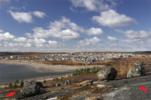
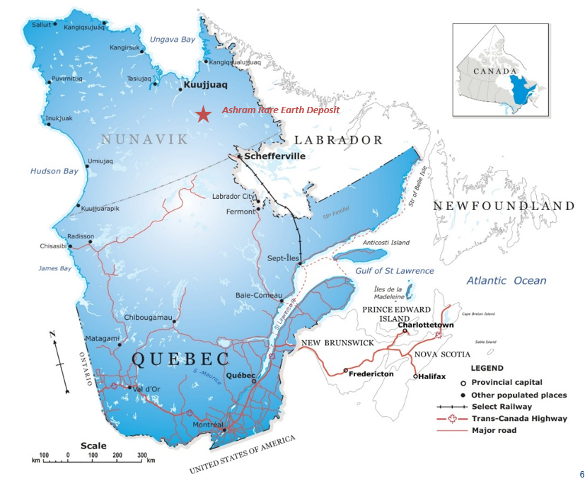
The next place on this alignment is Kuujjuaq, in the Nunavik region of Quebec, Canada.
Nunavik is the homeland of the Inuit in Quebec.
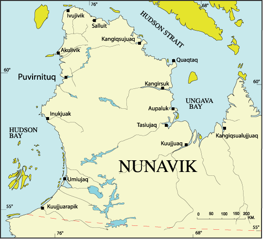
It is a former Hudson’s Bay company outpost, at the mouth of the Koksoak River of Ungava Bay, and the largest northern village in Nunavik.
We are told that on May 2nd, 1670, the Hudson’s Bay Company was granted a permanent charter by King Charles II of England. It conferred two things on a group of French explorers: 1) A trading monopoly with London merchants over the lucrative North American fur trade; and 2) Gave them effective control over the vast region surrounding the Hudson Bay in Canada.
Hudson’s Bay Company is still in operation today as a Canadian retail business group operating department stores in several countries.

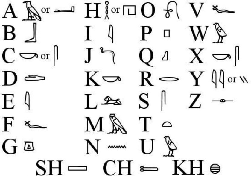
The language of the Inuit is called Inuktitut, the written form of which is a pictographic script.
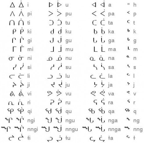
Egyptian hieroglyphs are also an example of a pictographic script.
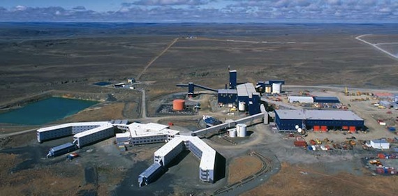
The Cape Smith nickel belt of the region hosts high-grade, polymetallic nickel deposits, including two operating mines.
The Nunavik Nickel Mine produces nickel and copper…
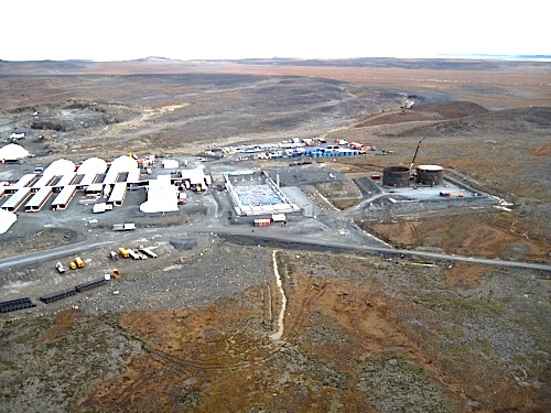
…and Glencore’s Raglan nickel mining operations, considered one of the richest base-metal mines in the world, producing 1.1 million tonnes of ore annually from three underground mines and two open pit operations.
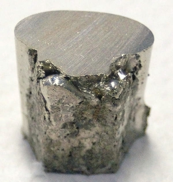
Nickel is a chemical element, with the symbol “Ni” and an atomic number of 28.
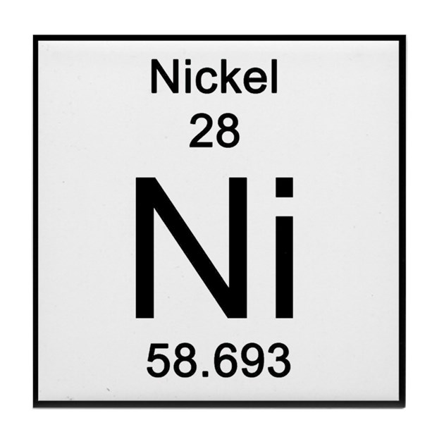
It is a silvery-white, lustrous metal with a slight golden tinge.
Mostly an alloy metal, its chief uses are in nickel steels and nickel cast irons, which typically increases the tensile strength, toughness, and elastic limit.
Copper is a chemical element with the symbol “Cu” and atomic number 29.
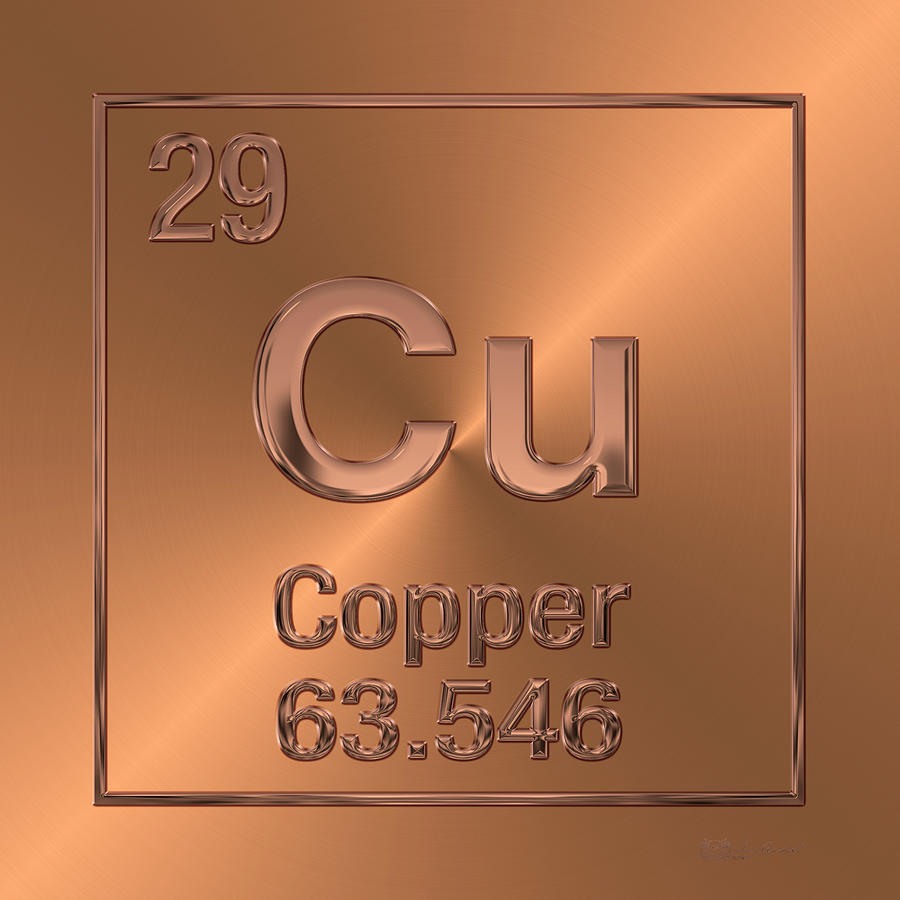
It is a soft, malleable, and ductile metal with very high thermal and electrical conductivity.
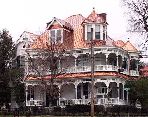
So copper is used as a conductor of heat and electricity…
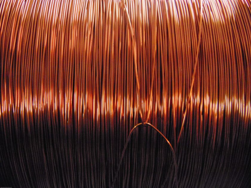
…and as a building material.
In addition to nickel and copper, various mining companies are doing exploratory work for gold and platinum in the region around Kuujjuaq.
In what has been named the Ashram Deposit, located 80-miles, or 128-kilometers, south of Kuujjuak, has been explored and found to have the Rare Earth Elements primarily of monazite, bastnaesite, and xenotime.
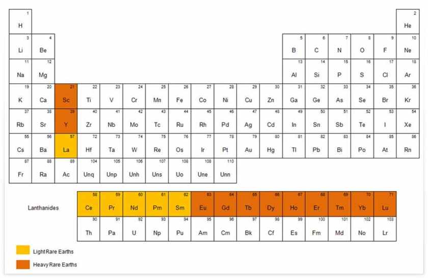
Rare Earth Elements are a set of 17 metallic elements, including 15 lanthanides, plus scandium and yttrium, and are an essential part of many high-tech devices.
All Rare Earth Elements are radioactive to some degree, with radioactive being defined as “emitting or relating to the emission of ionizing radiation or particles.
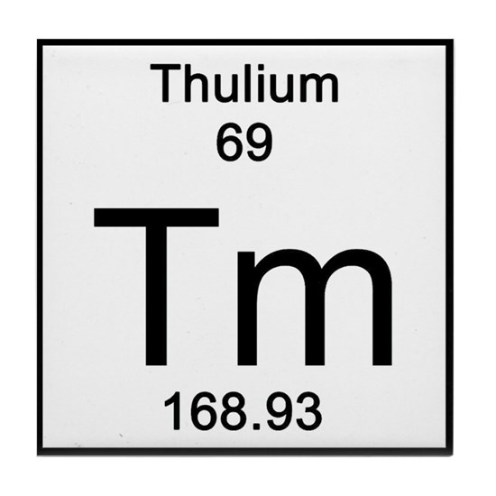
It wasn’t listed as being at the Ashram Deposit, but the name of one of the Rare Earth Elements is “Thulium.”
The etymology of the name of “Thulium” is listed as “named after the mythological northern land of Thule.”
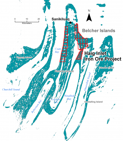
Next on this alignment we come to the Belcher Islands, located in the southeast part of Hudson Bay, and part of the Territory of Nunavut, both of which are predominantly inhabited by Inuit people.
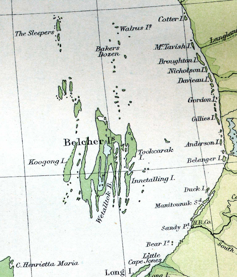
Here is a satellite view of the abstract-art-looking Belcher Islands.
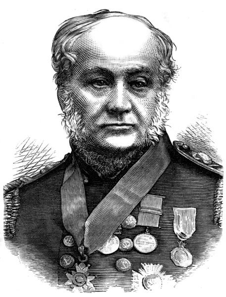
The Belcher Islands were named after Royal Navy Admiral Sir Edward Belcher, a hydrographer and explorer who led the last and largest admiralty expedition of 5 ships to the Arctic some time around the year of 1852, with the stated purpose of rescuing missing British naval officers who were in the Arctic looking for the Northwest Passage.
Rather infamously, he ended up having to abandon four of the five ships in the ice in May of 1854.
Here is an interesting aside. One of Belcher’s ships, the HMS Resolute, broke free of the ice and was ultimately picked up by an American whaling ship, and was returned by the American government to Great Britain.
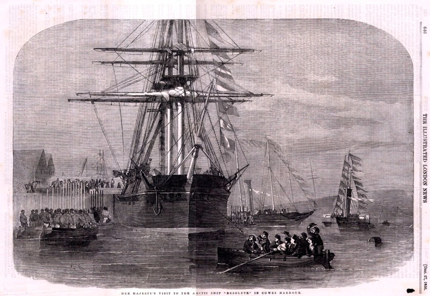
We are told that many years later, when the HMS Resolute was broken-up, its timbers used to make a desk for the American president as a thank you from Great Britain.
What is known as the Resolute Desk is still in the Oval Office.

Now back to the Belcher Islands.
Large deposits of iron ore underly the Belcher Islands.
In 2011, Canadian Orebodies, Inc, conducted an exploratory drill program in its Haig Inlet project in the Belcher islands, an iron ore property the company acquired in the same year.
As a result of its test-drilling, the company estimated there could be up to 230 million tonnes of high-grade iron ore, with samples showing more than 35% iron content.
Iron is a chemical element with the symbol “Fe” and the atomic number 26.
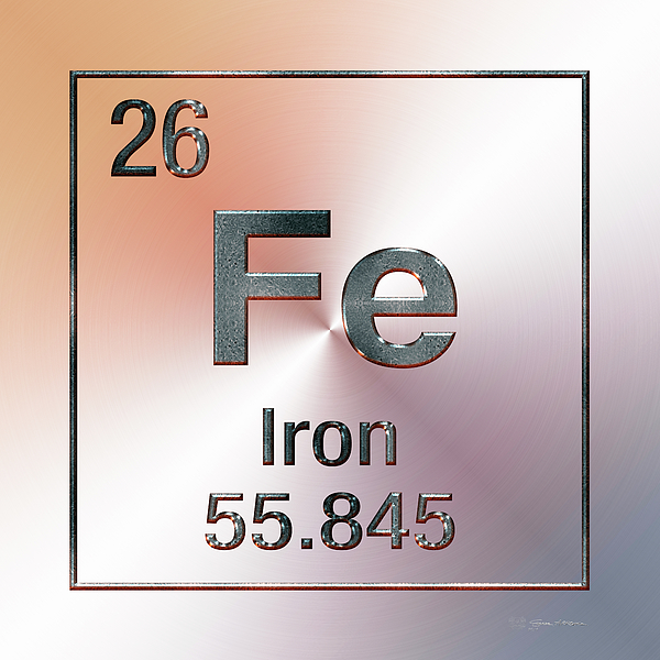
It is a metal, and by mass, the most common element on Earth, forming much of the inner and outer core, and is the fourth most common element in the Earth’s crust.
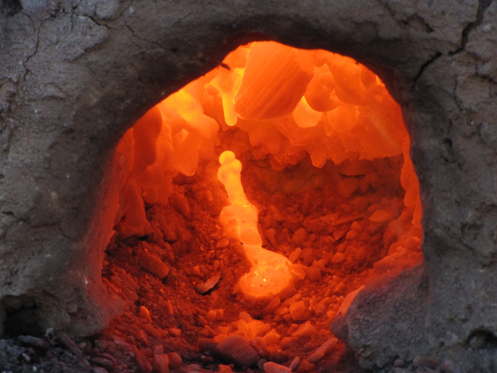
Iron ores are among the most abundant in the Earth’s crust, although extracting usable metal from them requires kilns or furnaces capable of reaching 2700-degrees Fahrenheit, or 1500-degrees Celsius, or higher.
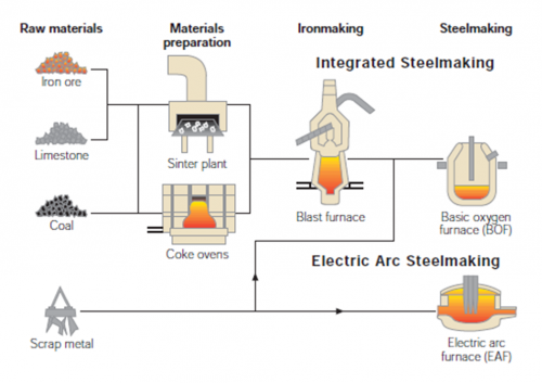
Iron is the most widely used of all metals, accounting for over 90% of worldwide metal production. It is the material of choice to withstand stress or transmit forces, such as the construction of machinery and machine tools, rails, automobiles, ship hulls, concrete reinforcing bars, and the load-carrying framework of buildings.

It is most commonly combined with alloying elements to make steel.
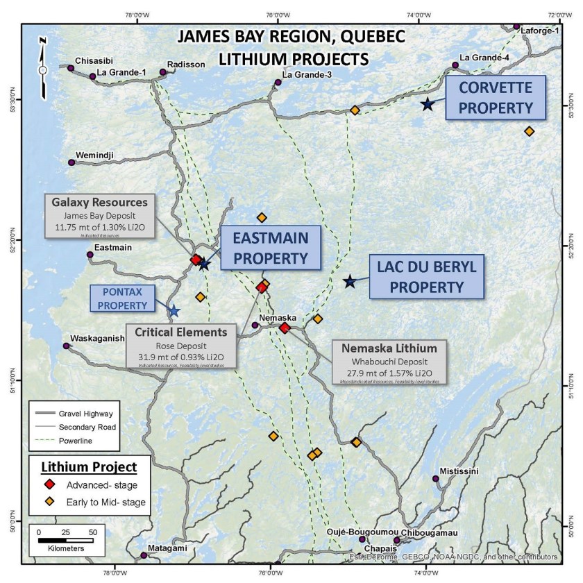
Next on this alignment we come to James Bay, on the southern end of the Hudson Bay.
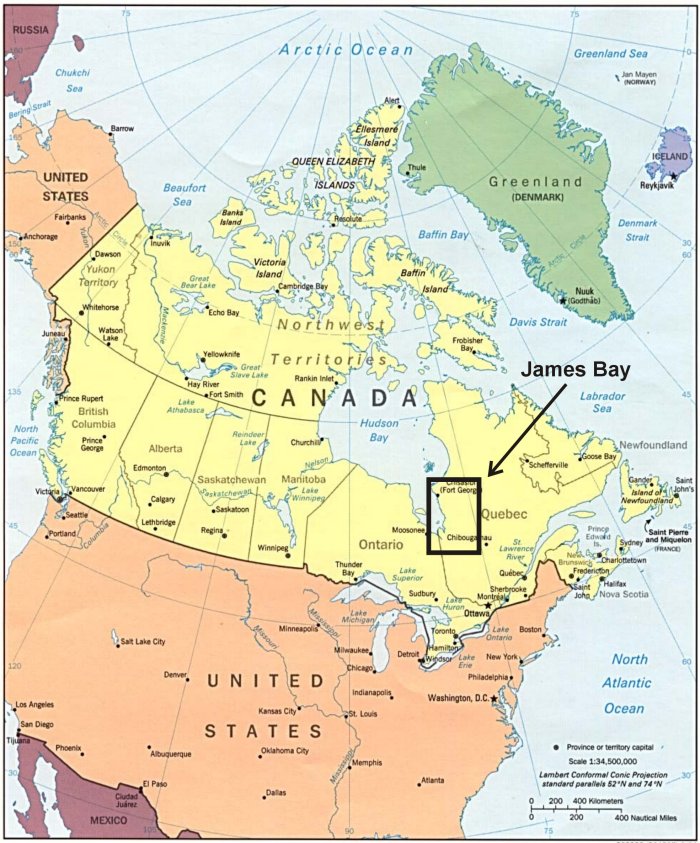
There are different kinds of mining going on in this region.
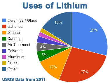
For one, the James Bay region has numerous lithium mines.
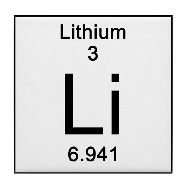
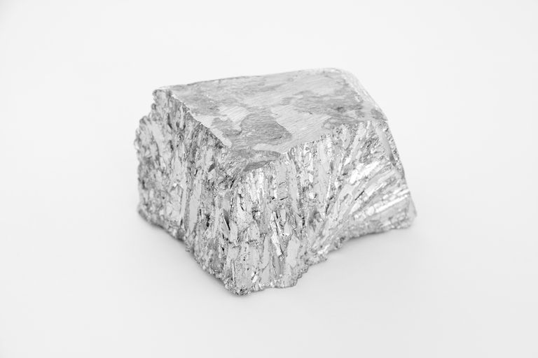
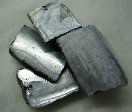
Lithium is a chemical element with the symbol “Li” and the atomic number of 3.
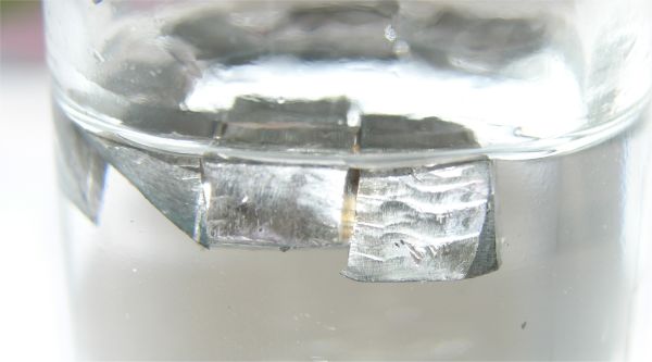
It is the lightest metal, and the lightest solid element.
Lithium is seen floating in mineral oil in this picture, in which it must be stored because it is highly reactive and flammable.
Lithium has important uses in nuclear physics.
The transmutation of lithium atoms to helium in 1932 was the first fully manmade nuclear reaction in our historical narrative, and lithium deuteride serves as a fusion fuel in staged thermonuclear weapons.
As well, lithium and its compounds have several industrial uses, including things like heat-resistant glass and ceramics; lithium grease lubricants; flux additives for iron, steel, and aluminum production; lithium batteries; lithium-ion batteries; and lithium salts have been used as a mood-stabilizing drug in the treatment of bipolar disorder.
The James Bay region also has gold mining projects in Quebec…
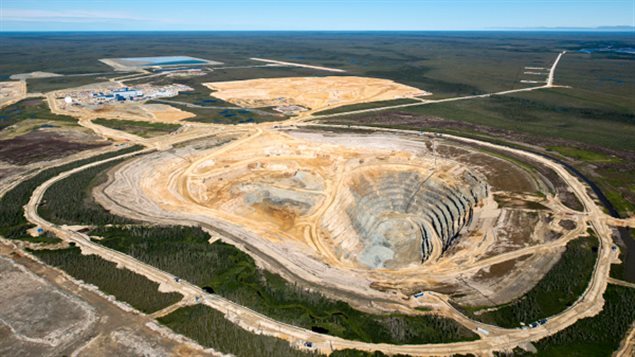
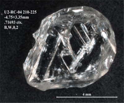
…as well as a diamond mining concern on the other side of James Bay in Ontario called the Victor Mine.
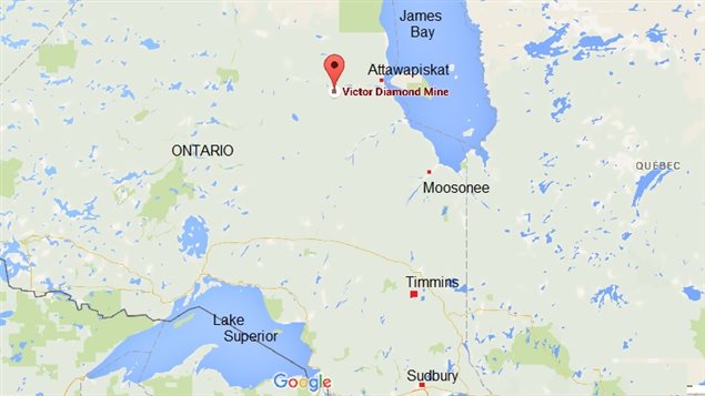
It is owned by DeBeers Canada, and is the first Canadian diamond mine located in Ontario, and the second diamond mine of DeBeers located in Canada.
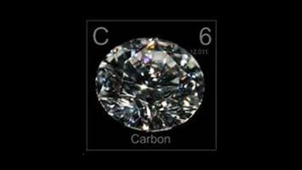
Diamonds are a solid form of the element carbon, with its atoms arranged in a crystal structure called diamond cubic.
This is an example of a diamond from the Victor mine.
Carbon is a nonmetallic chemical element with the symbol “C” and an atomic number of 6.
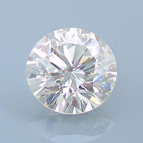
Diamond has the highest hardness and thermal conductivity of any natural material, properties that are used in major industrial applications such as tools used in cutting and polishing…
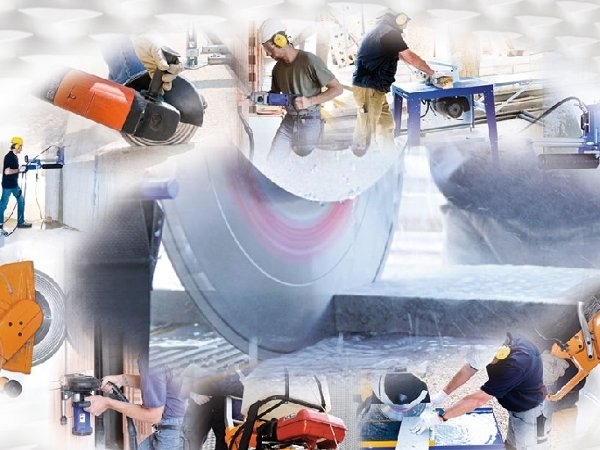
…as well as the large-market trade in gem-grade diamonds.
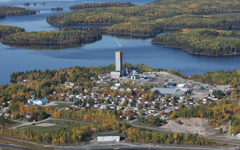
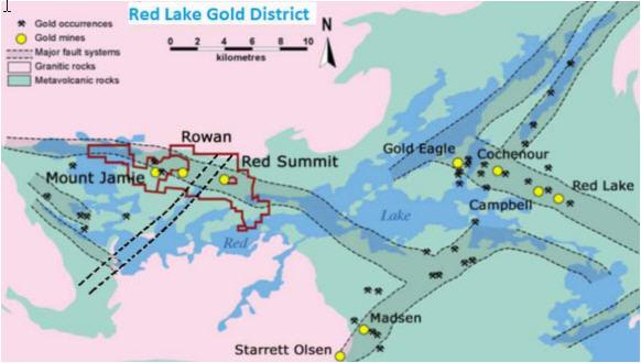
Next on the alignment we come to Red Lake in Ontario, a municipality with town status in Ontario.
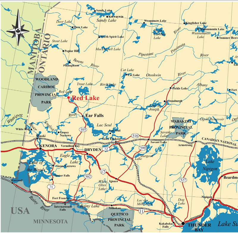
Red Lake just happens to be the location of one of the largest gold mines in Canada and the world with its Red Lake mine, which has estimated reserves of 3.23 million ounces of gold…
…and the Red Lake gold district has some of the richest deposits of gold in the world and has produced 30 million ounces of gold from high-grade zones.
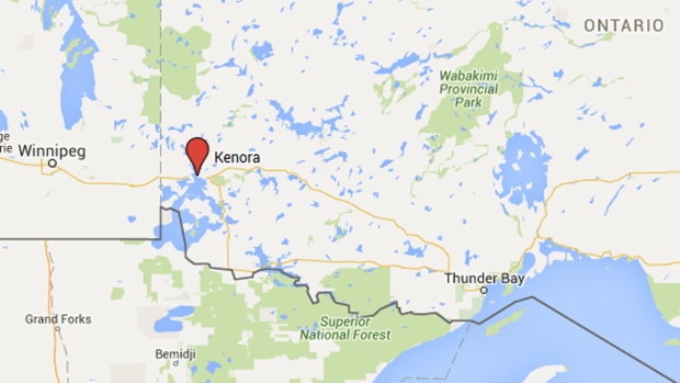
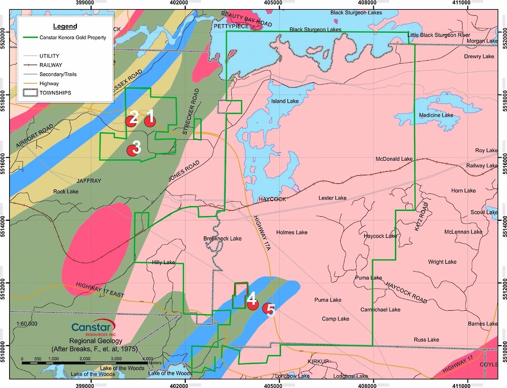
Next we come to Kenora, Ontario, a small city situated on the Lake of the Woods, close to the provincial border with Manitoba.
Kenora is located in the heart of the mineral rich Canadian shield, and there are mines in close proximity to Kenora, including mining for lithium…
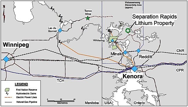
…and the Kenora Gold Project, which represents four separate properties made up of mining claim blocks.
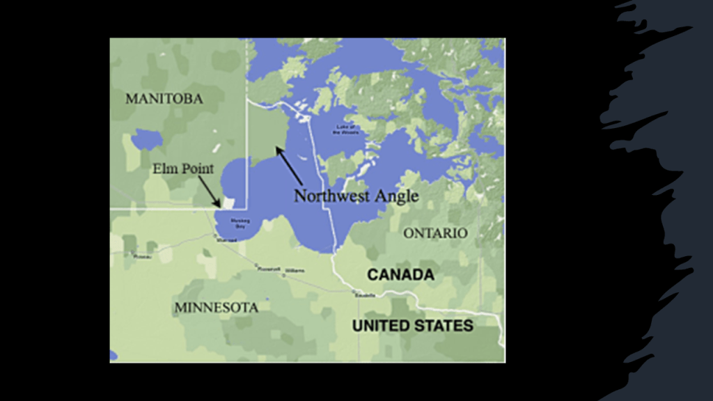
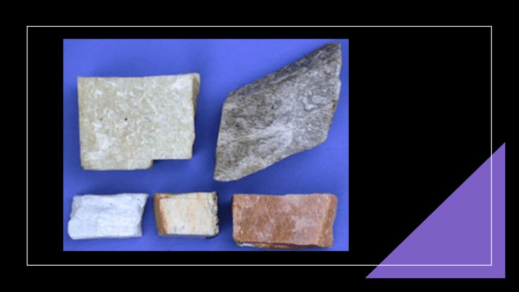
I found an historical feldspar mine on the Angle Inlet of the Northwest Angle of the Lake of the Woods.
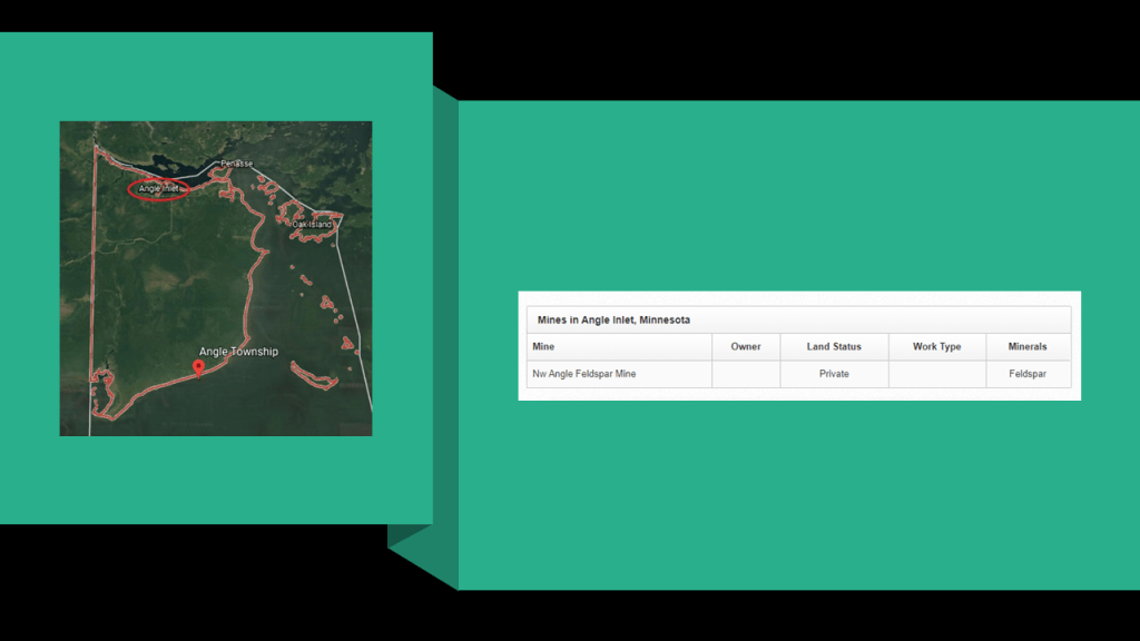
The Northwest Angle looks like it should be in Canada, but it is actually part of Minnesota as a result of American treaties negotiated with Great Britain regarding the northern border.
Feldspar is a group of minerals used in things like glass-making; ceramics; a filler and extender in paint, plastics, and rubber.
______________________________________________
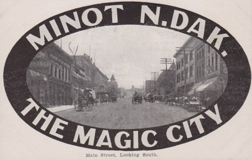
The next place we come to is Minot, the fourth-largest city in North Dakota and a trading hub for a large portion of northern North Dakota, southwestern Manitoba, and southeastern Saskatchewan.
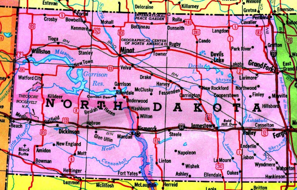
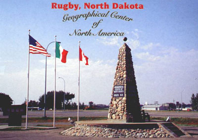
It is located approximately 43-miles, or 69-kilometers from Rugby, North Dakota, which until 2017 was considered the geographic center of North America.
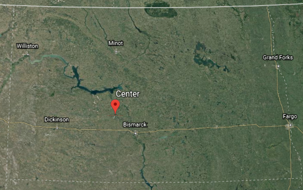
In 2017, the geographic center of North America was officially moved to Center, North Dakota.
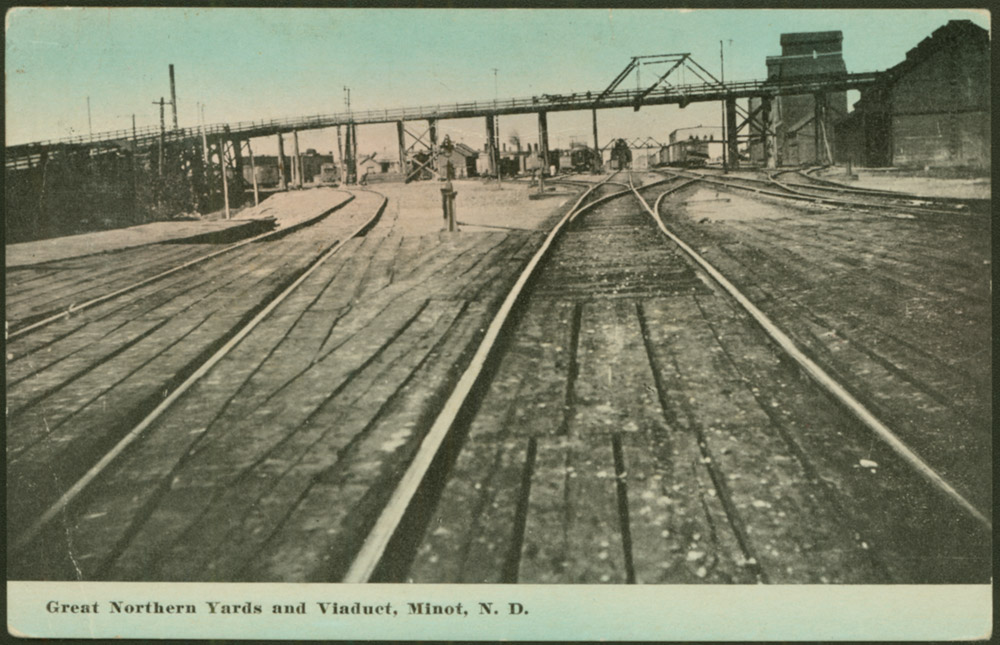
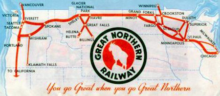
A quick look at the written history of Minot indicates that it was founded in 1886 during the construction of James J. Hill’s Great Northern Railway.
James J. Hill was said to be a Canadian-American railroad executive who came from an impoverished childhood…
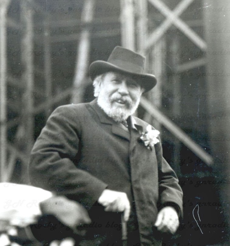
…to eventually become the founder and driving force of the Great Northern Railway Company.
Minot is also known as the “Magic City” for what was called its remarkable growth over a short period of time.
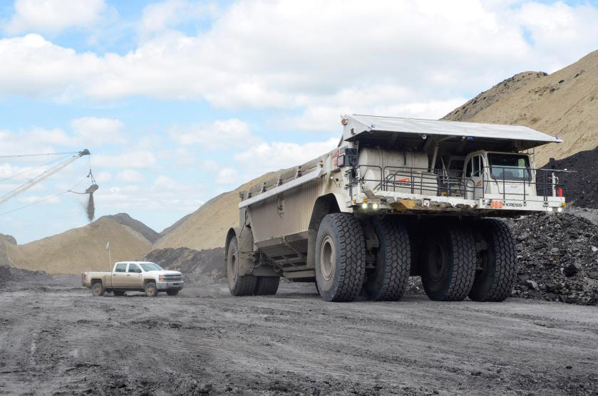
In the United States, North Dakota is one of the top-ten coal-producing states, mining approximately 30 million tons every year since 1988.
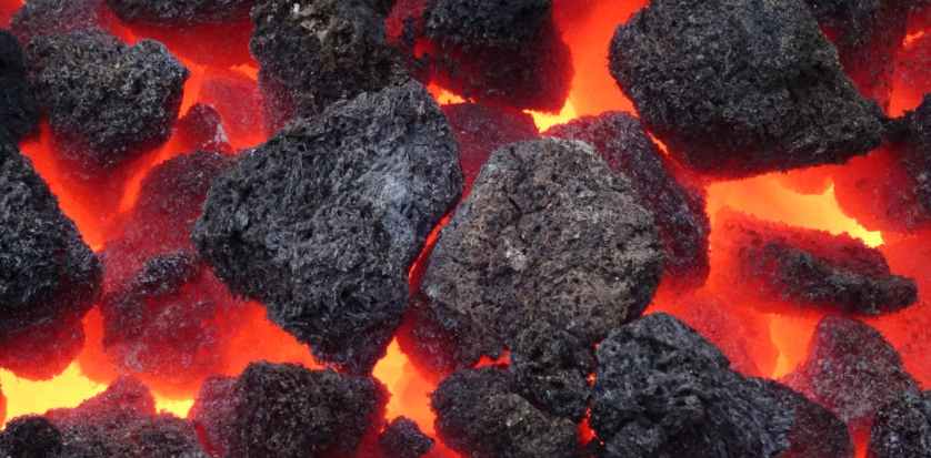
Coal is described as a combustible black, or brownish-black, sedimentary rock composed of mostly carbon, but also with other elements like hydrogen, sulfur, nitrogen, and oxygen.
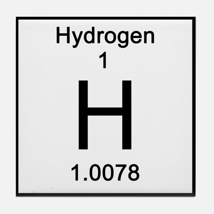
Hydrogen is a chemical element with the symbol “H” and the atomic number of 1.
It is the lightest substance in the periodic table, and the most abundant chemical substance in the Universe.
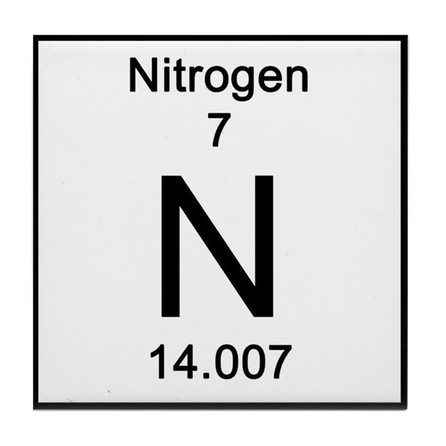
Nitrogen is the chemical element with the symbol “N” and the atomic number of 7.
Nitrogen occurs in all living organisms, and is a constituent element of amino acids, and therefore of proteins and the nucleic acids of DNA and RNA, as well as being found in the chemical structure of almost all neurotransmitters.
Sulphur is a chemical element with the symbol of “S” and the atomic number of 16.
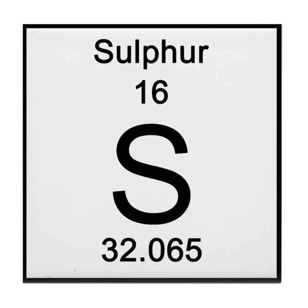
Also known as brimstone, it is abundant and non-metallic, with a bright yellow color.
Sulphur is the tenth-most common element in the Universe by mass, and the fifth-most common on Earth, and is an essential element for all life as one of the core chemical elements needed for biochemical functioning.
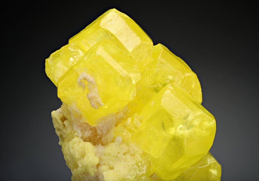
Industrial applications of sulphur include things like matches; insecticides and fungicides; fireworks; gunpowder; and anti-bacterial ingredients in soap, among other things.

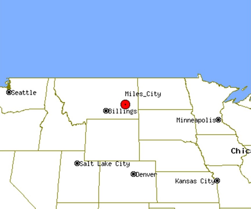
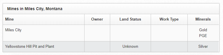
We come to Miles City next on the alignment, in the State of Montana.
Miles City was incorporated in 1887.
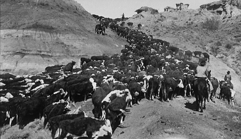
With livestock speculation bringing thousands of cattle from Texas to Montana in the 1880s, we are told Miles City quickly became a hub for the railroad’s transportation of cattle fattened on Montana range grass to their final destination in Chicago stockyards.
While there are quite a few mining locations in Montana…
…in Miles City specifically there was historically the Miles City Mine for gold and Platinum-group-elements…and mining for silver at the Yellowstone Hill Pit and Plant.
Platinum Group elements are six noble, precious metallic elements clustered together in the periodic table.
They have similar physical and chemical properties, and tend to occur together in the same mineral deposits.
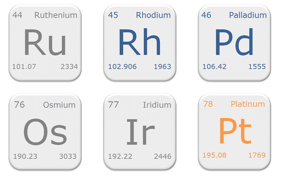
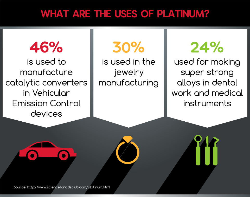
They are highly resistant to wear and tarnish, making platinum metals well-suited for fine jewelry.

Platinum metals are also used in things like the manufacture of catalytic converters for cars and in the making of dental and medical instruments.
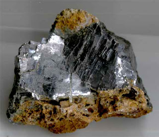
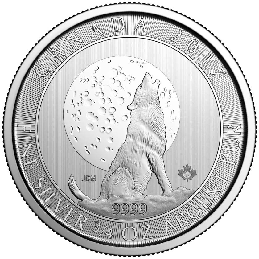
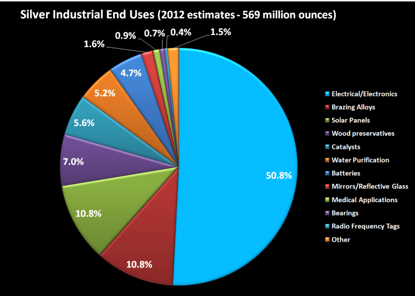
Silver is a chemical element with the symbol “Ag” and atomic number of 47.
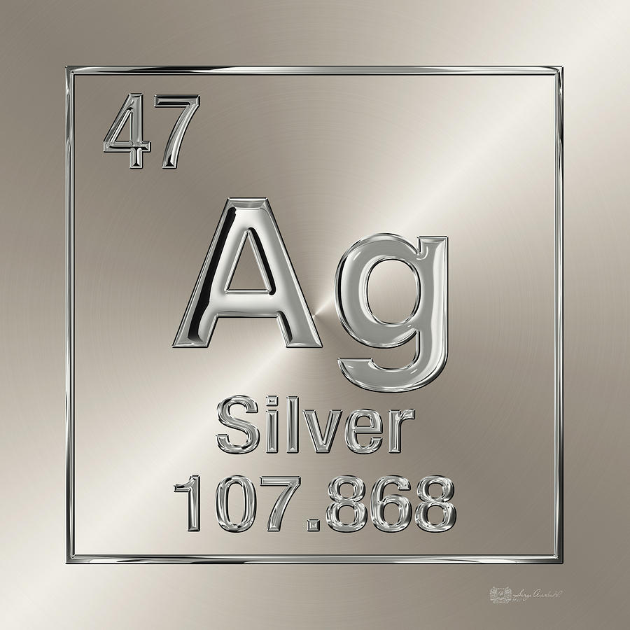
It is a soft, white, and lustrous metal, exhibiting the highest electrical conductivity, and reflectivity of any metal.
Silver has long been valued as a precious metal, and used in many bullion coins.
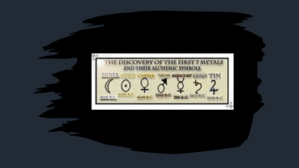
Silver is one of the seven metals of antiquity, along with gold, copper, tin, lead, iron, and mercury.
Other than currency, silver is used in things like solar panels, water filtration; jewelry; high value silverware; electrical contacts and conductors; and many other uses.
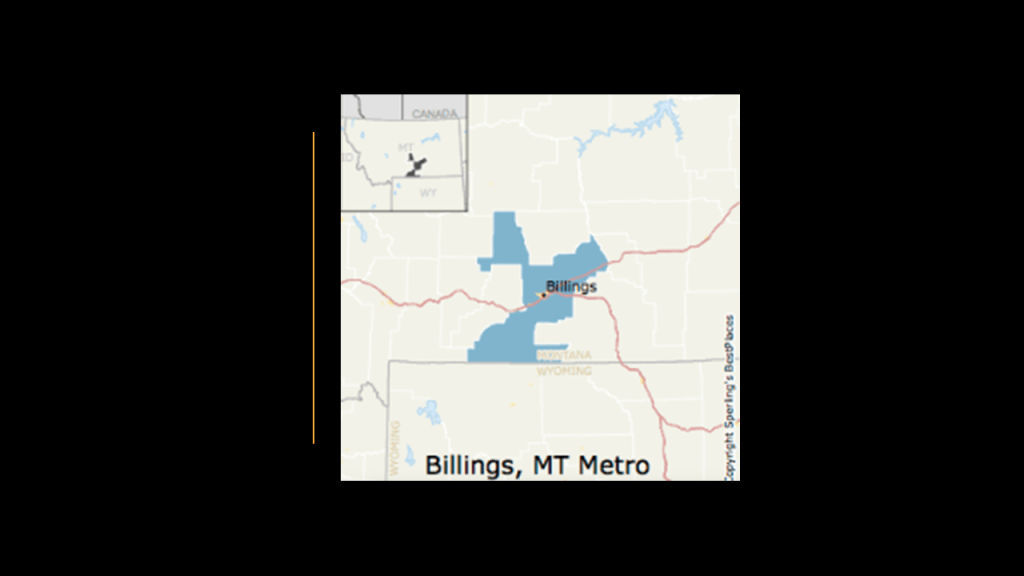
Next, we come to Billings, the largest city in Montana.
Like Minot, Billings was nicknamed the “Magic City,” also for its rapid growth in a short period of time after having been founded as a railroad town in 1882.
We are told the city of Billings went from three buildings to over 2,000 within months of its founding!
Billings was named after the Northern Pacific Railway president Frederick H. Billings, and we are told the railroad formed the city as a western railhead for its further westward expansion.
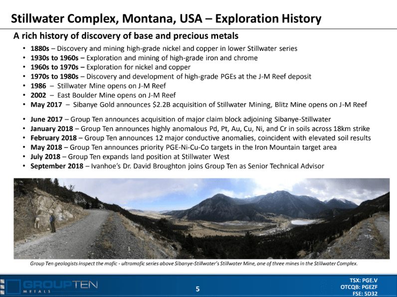
I found the Stillwater Igneous complex in southcentral Montana in the general region of Billings, on the north flank of the Beartooth Mountain Range.
The complex has extensive reserves of Chromium ore, which it was historically mined for.
Chromium is a chemical element with the symbol “Cr” and atomic number of 24.
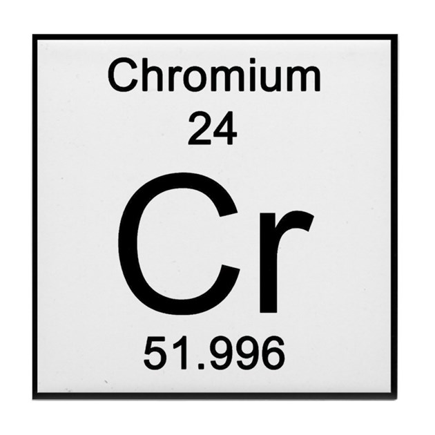
It is a steely-grey, lustrous, hard and brittle metal.
It is the main additive in stainless steel.
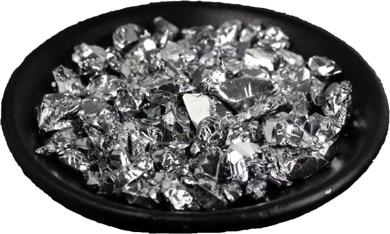
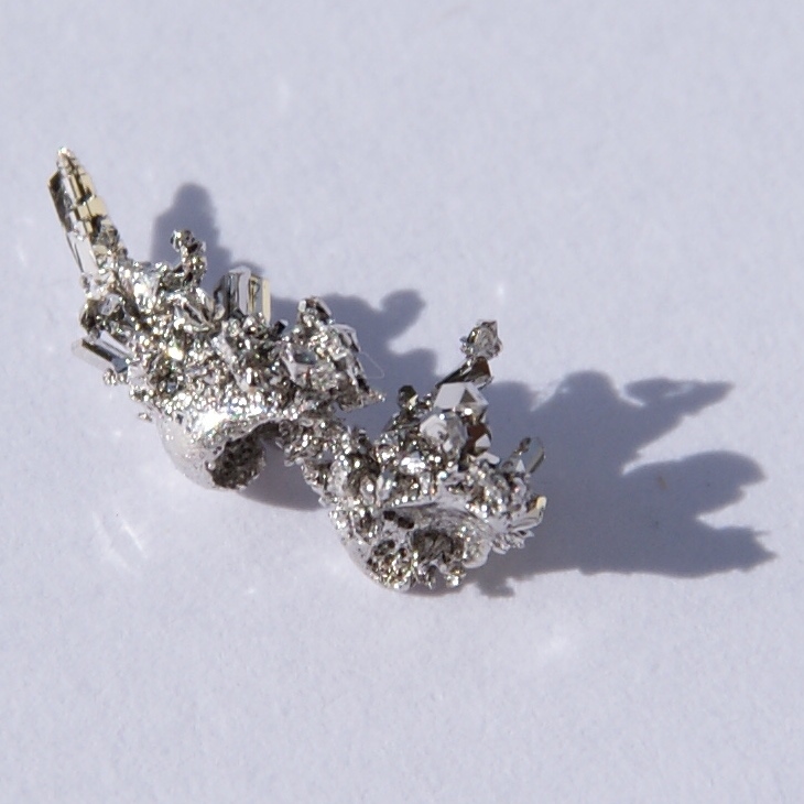
Palladium is currently mined at the Stillwater Igneous Complex.
Palladium is a chemical element with the symbol “Pd” and atomic number of 46.
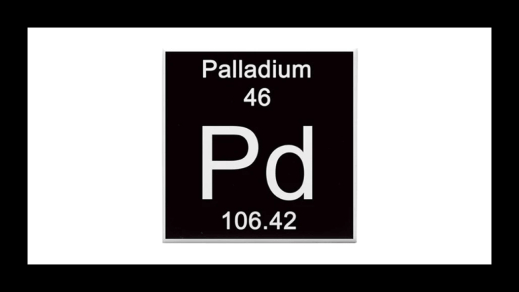
One of the Platinum Group Elements I mentioned previously, Palladium has the lowest melting point, and is the least dense, of them.
Ore deposits of Palladium are rare, and the Stillwater Igneous Complex is one of a handful of extensive deposits that have been found in the world.
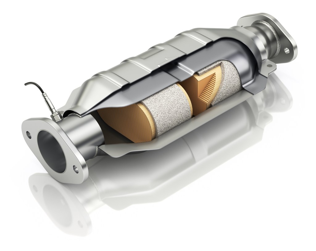
More than half the supply of palladium, as well as platinum, is used in catalytic converters, which convert as much as 90% of harmful gases in automobile exhaust into less noxious substances.
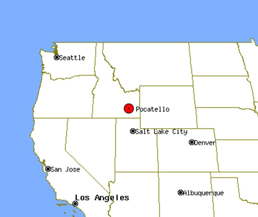
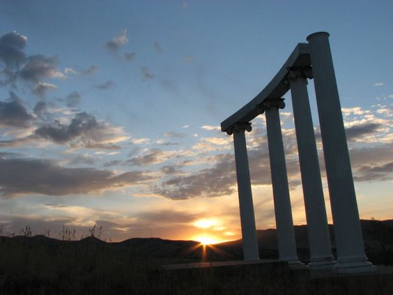
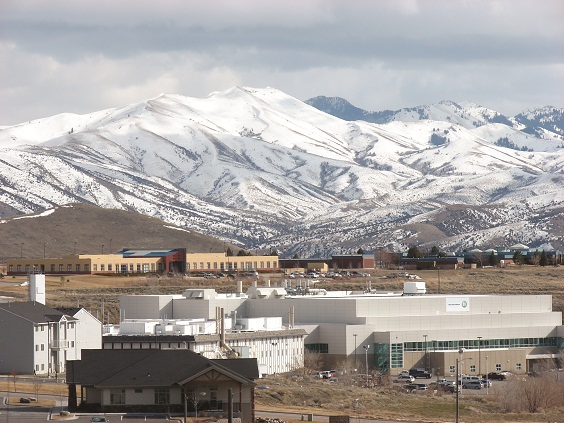
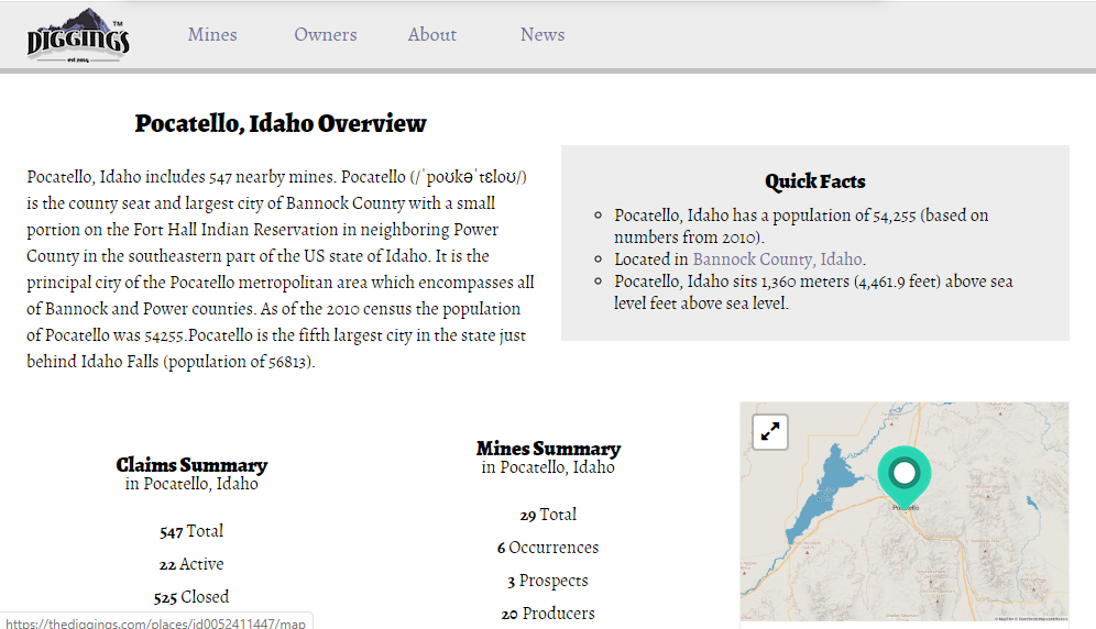
The next place I am going to look at on this alignment is Pocatello, the fifth-largest city in Idaho.
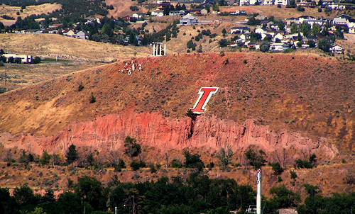
It is the home of Idaho State University, where we find these ancient Greco-Roman-looking columns on the campus on top of Red Hill…
…overlooking the “I” on Red Hill which seems to get more attention than the columns do…
…and Pocatello is the home of one of the manufacturing facilities of ON Semiconductor, a Fortune 500 semiconductors suppliers company.
In a nutshell, the Pocatello area has approximately 547 claims, and 29 mines, which include mines for gold, silver, copper, lead, silica, and phosphorus.
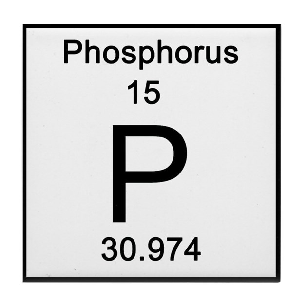
Phosphorus is a chemical element with the symbol “P” and atomic number of 15.
Elemental phosphorus exists in two major forms: white phosphorus, which is used in smoke, tracer, illumination and incendiary munitions…
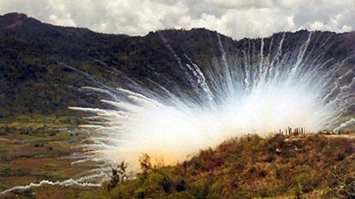
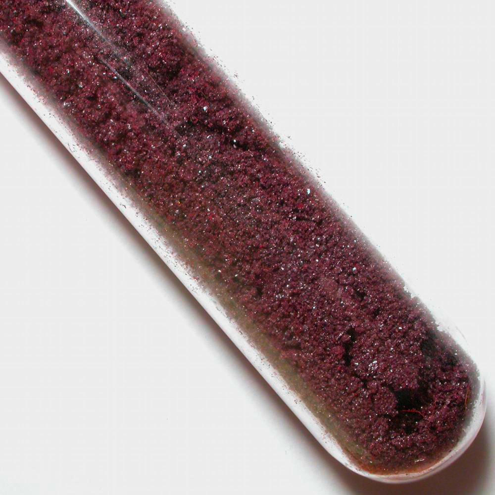
…and red phosphorus, which is known to be an effective flame retardant.
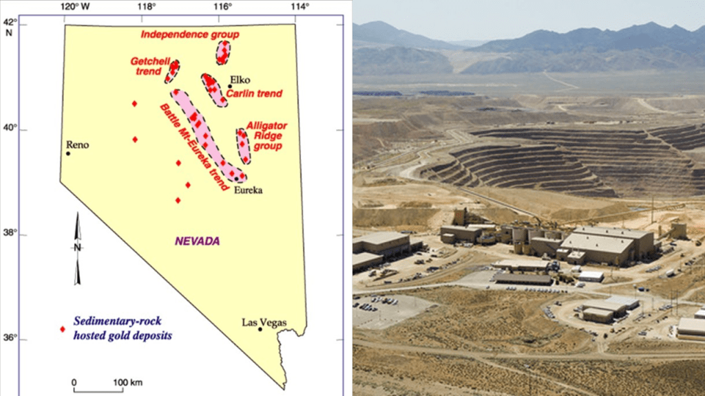
The next place on the alignment is Elko, and, as the largest city in over 130-miles, or 210-kilometers, in all directions, it is called the “Heart of Northeast Nevada.”
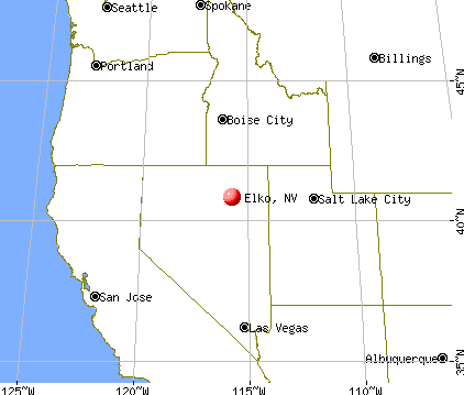
Elko’s economy is based largely on gold mining, and is considered the capital of Nevada’s gold belt.
Here is an interesting aside.
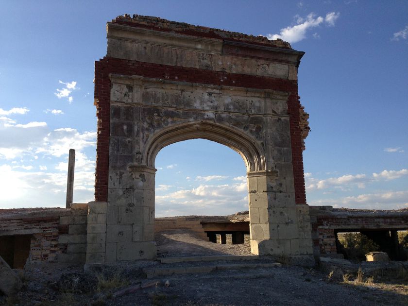
Metropolis is called a “ghost town” in Elko County that was planned by the Pacific Reclamation Company out of New York, starting in 1909, to be the center of a huge farming district, but ended up being pretty much abandoned between 1920 and the 1940s, after water distribution issues were said to cause the farming community to fail.
This is a picture of the Lincoln School of Metropolis before it was demolished after the creation of a new dam in 1911…

…and here is what remains today of what is called the Lincoln School in what was Metropolis.
Next on the alignment we come to Reno in Nevada, known primarily for its casino and tourism industry.
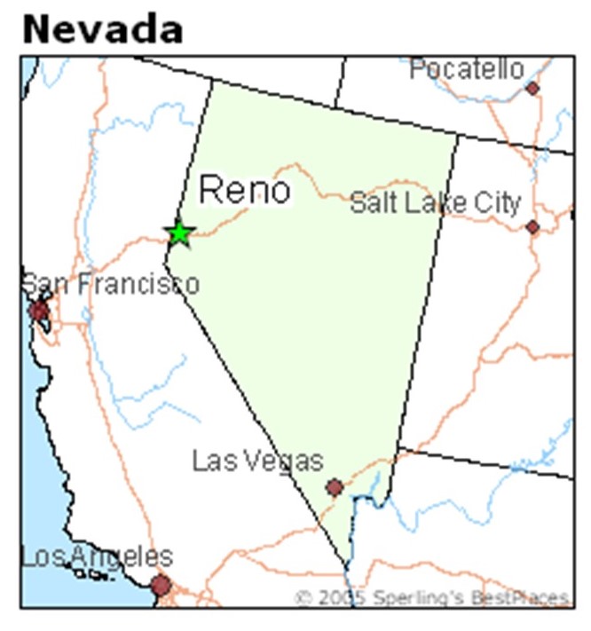
It is located at the foot of the Sierra Nevada Mountains in a high-desert river valley that is called “Truckee Meadows,” a new major technology hub in the United States due to large-scale investments from Amazon, Tesla, Panasonic, Microsoft, Apple, and Google.
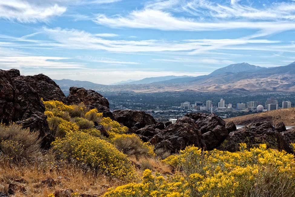
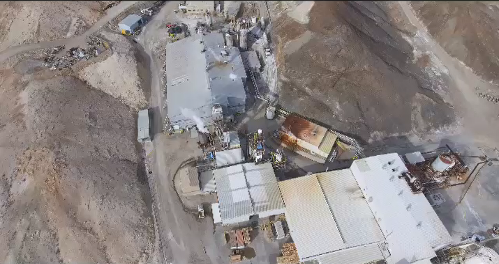
Besides Reno being centrally located between the goldfields of northern Nevada, and California’s Motherlode Country, one of the world’s richest Lithium deposits has been identifed in this part of the world, in the Clayton Valley.
It is the largest known lithium deposit in the United States, where it is found in high-grade, highly-concentrated form.
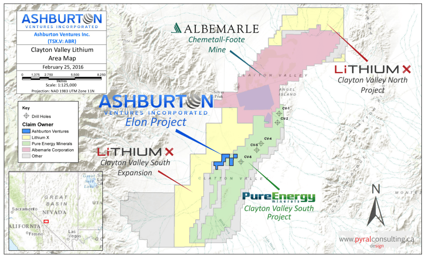
There is lithium mining here via brines…
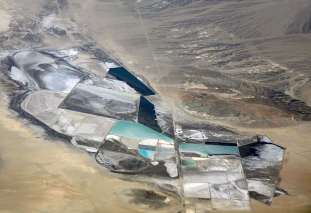
…and mines.
Lithium is a key component in the manufacturing of batteries for electric cars.
From Reno, we cross the Sierra Nevada Mountains.
It is here we find California’s mother-lode country, an historic region in northern part California, on the western slope of the Sierra Nevadas.
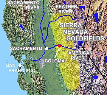
It is about 150-miles, or 240-kilometers, long, from the vicinity of Mariposa, through Tuolumne, Calaveras, Amador, El Dorado, Placer, and Nevada Counties.
It was famed for mineral deposits and gold mines said to have attracted waves of immigrants starting in 1849, known to history as 49ers.
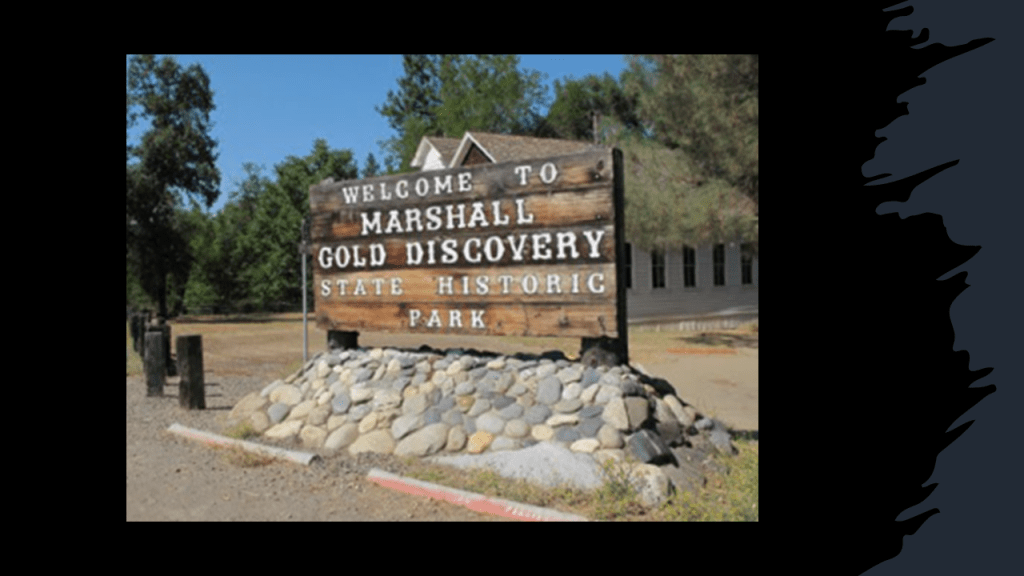
We are told that California’s gold rush was sparked by James Marshall’s discovery in 1848 of placer gold at Sutter’s Mill near Coloma.
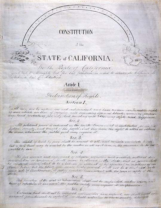
We are also told San Francisco, which is also on this alignment, grew from a small settlement of about 200 residents to a boom town of about 36,000 by 1852, the year this map was said to have been made…
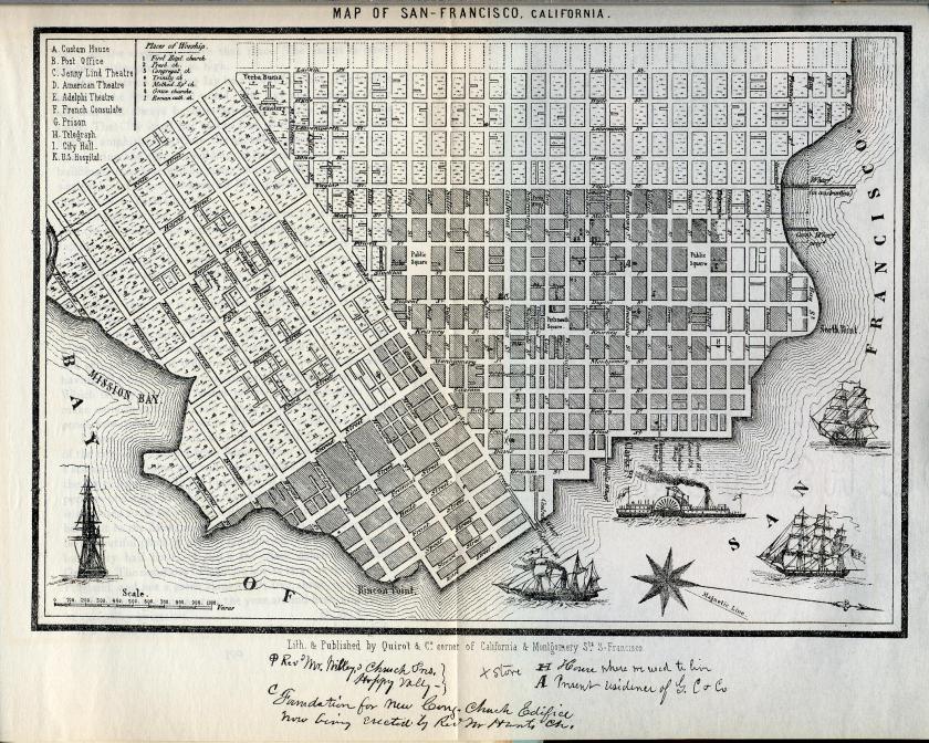
…and the state’s constitution written in 1849.
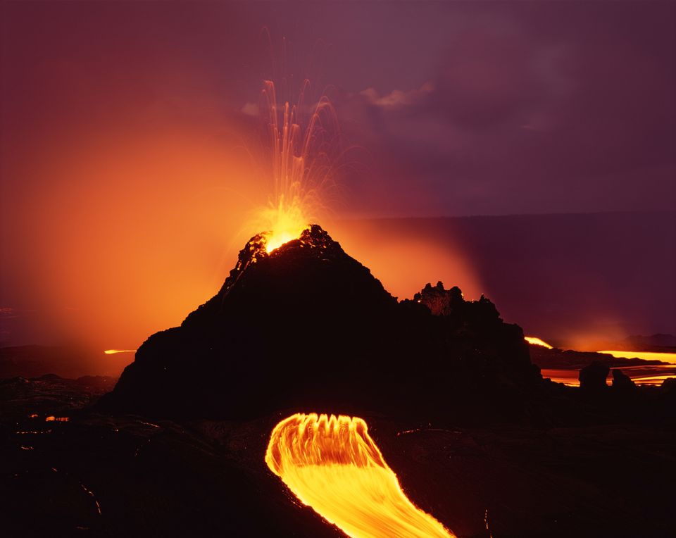
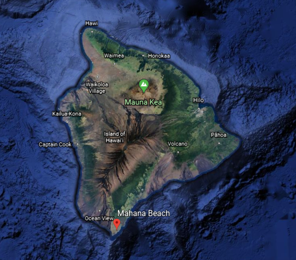
Next, I am heading across the Pacific Ocean after leaving San Francisco, where we next come to the big island of Hawaii.
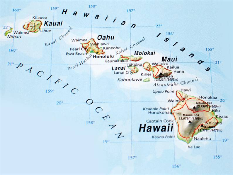
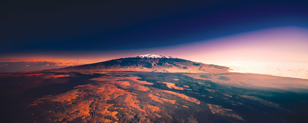
The alignment crosses over Mauna Kea, a dormant volcano and the highest point in the state…
…and Hawaiian Volcanoes National Park, which encompasses the summits of two of the world’s most active volcanoes, Mauna Loa and Kilauea.
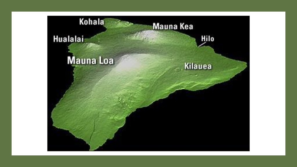
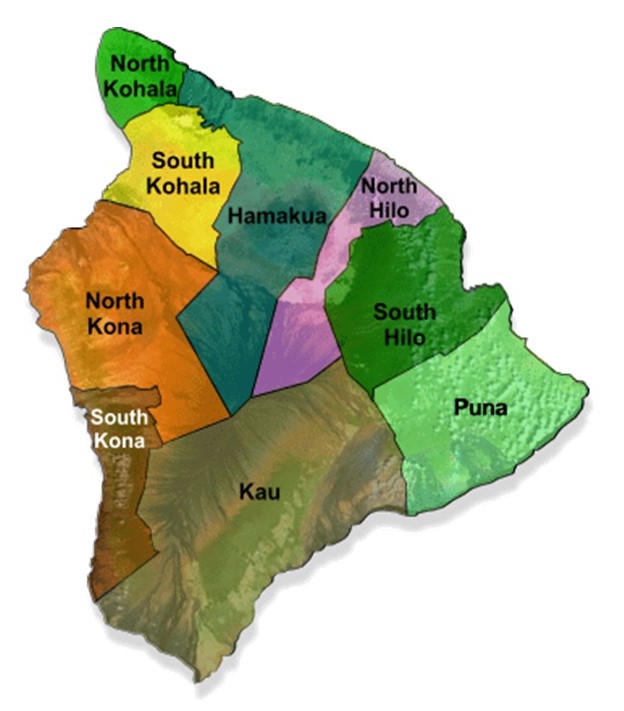
Most of this national park, which is contained in the Kau District, one of the six original districts, known as “moku,” of ancient Hawaii on the island.
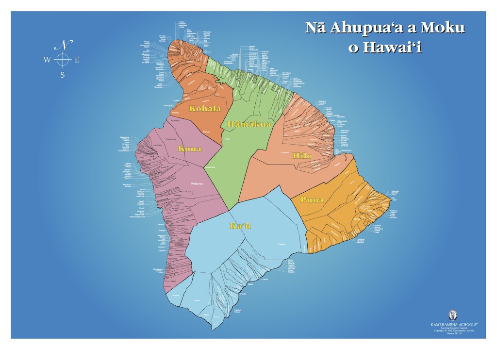
There are nine districts on the island of Hawaii today.
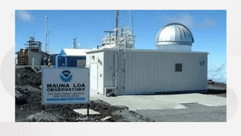
Mauna Loa is described as one of the single, largest mountain masses in the world, constituting half of the island’s area, and is the home to the Mauna Loa Observatory on its north flank, a premier atmospheric research facility…
…and Kilauea is the island’s most active volcano.
All of the eastern flank of Kilauea lies within the neighboring Puna District of Hawaii, with a small portion of Mauna Loa running along the northern part of it.
There are two beaches of particular interest in the Kau District.
One is Punalu’u Black Sand Beach.
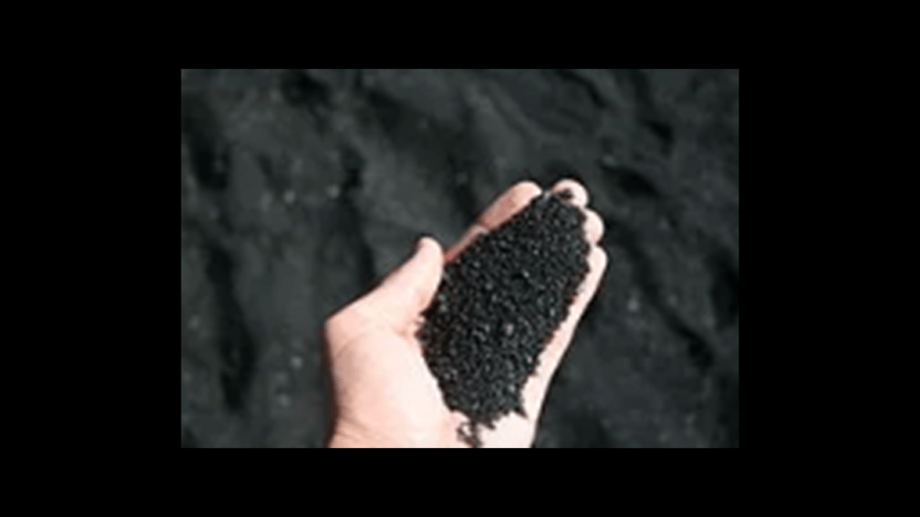
It is considered one of the finest examples of a true black sands beach in the world, made of basalt and said to be created by lava flowing into the ocean, which explodes as it reaches the ocean and cools.
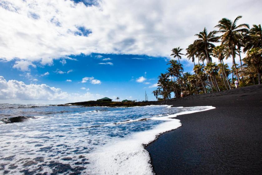
Basalt is a volcanic rock that is low in silica content, and comparatively rich in iron and magnesium.
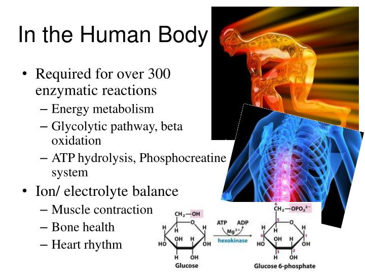
The magnesium in basalt is a chemical element with the symbol “Mg” and atomic number of 12.
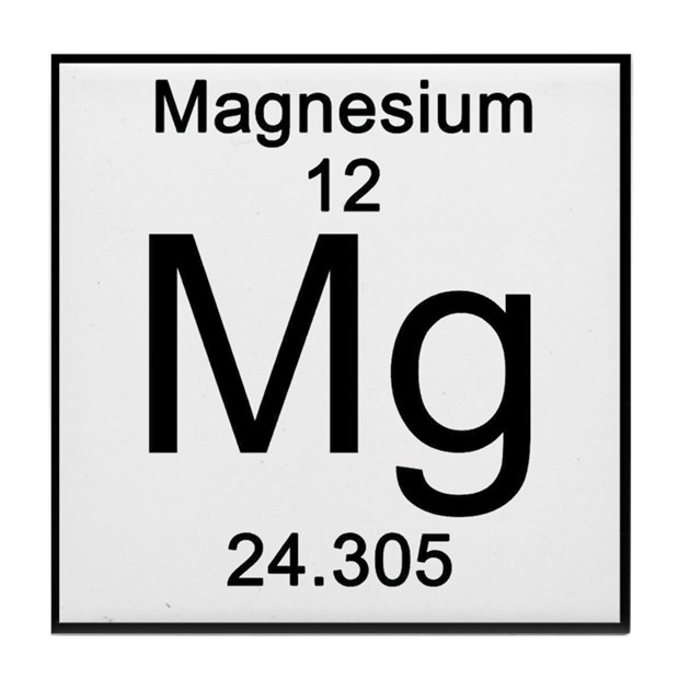
It is a shiny gray solid that occurs in combination with other elements, and the fourth most common element on Earth, after iron, oxygen, and silicon.
It is the eleventh-most abundant element by mass in the human body, and is essential to all cells and over 300 enzymes.
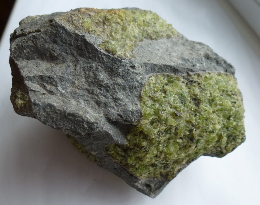
I also found Mahana, also known as “Green Sands,” Beach on the southern tip of the island, also located in the Kau District.
It is known for its green-colored sands, which are comprised of a form of peridot called olivine.
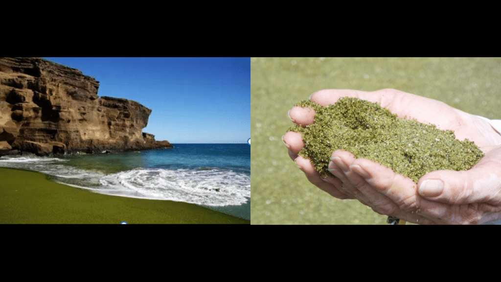
Olivine is a semi-precious translucent stone that is a complex silicate of magnesium and iron.
It is commonly used in refactories for any material which has an unusually high melting point and that maintains its structural properties at very high temperatures.
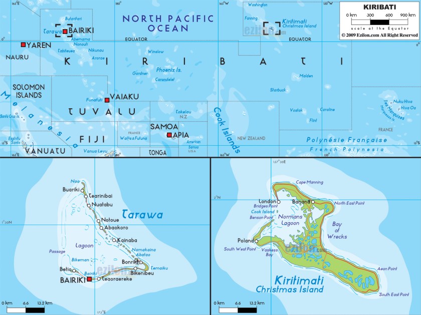
Next we come to the Republic of Kiribati, an island country in the Pacific Ocean, which includes the island of Tarawa, where more than half of the country’s population lives.
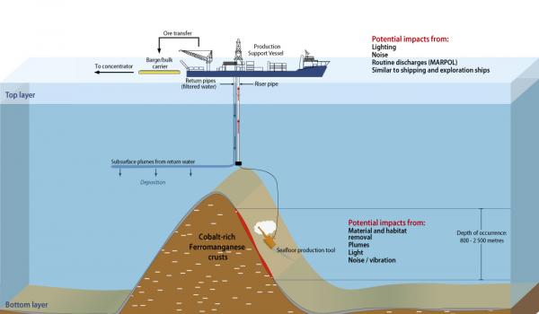
Exploratory activities have taken place to exploit the deep sea mining of polymetallic nodules and cobalt rich crusts that have been identified there in Kiribati.
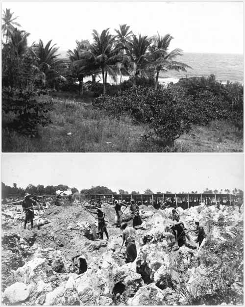
Historically, Kiribati was rich in phosphates, but commercially viable phosphate deposits have long-been depleted through mining.
This, for example, is an historical picture of what the island of Banaba there looked like before, and after, it was mined for phosphates.
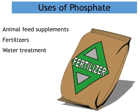
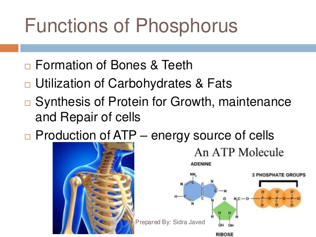
Phosphates are derived from phosphorus, and are used in agriculture and industry…
…and are components as structural materials of bones and teeth, which are made of crystalline calcium phosphate, as well as other biological processes.
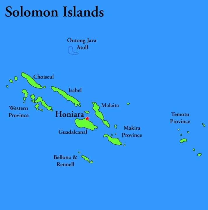
Now we come to the Solomon Islands, a British-protectorate until independence in 1978, yet to this day it is a unitary parliamentary constitutional monarchy, with the British monarch as head-of-state.
We are told the islands were named after the wealthy King Solomon by the Spanish navigator Alvaro de Mendana, who in 1568 came to the islands looking for the source of King Solomon’s wealth, and also that they were the biblically-mentioned land of Ophir, famous for its wealth and fine gold.
Wonder why he thought that?!
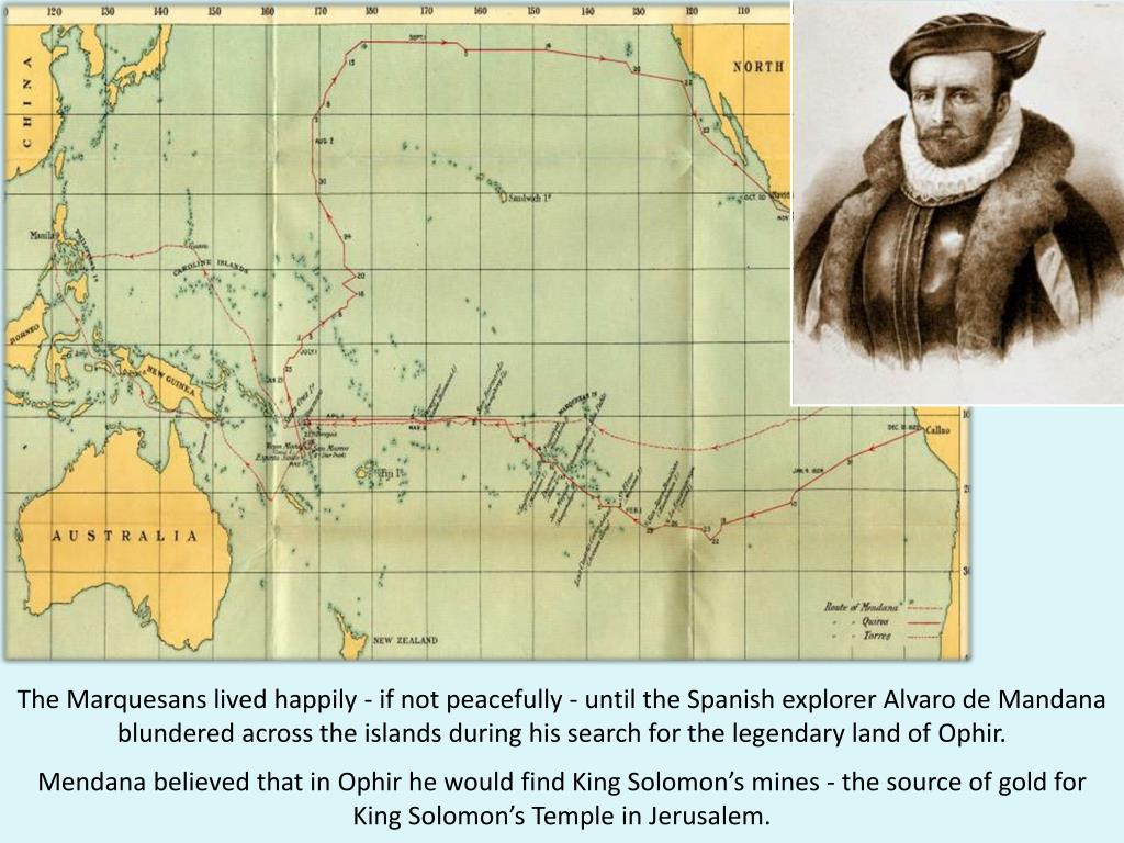
At any rate, de Mendana was said to have found gold at a location where the Gold ridge Mine on Guadalcanal was developed and mined in the late 1990s, with production on and off since then.
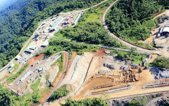
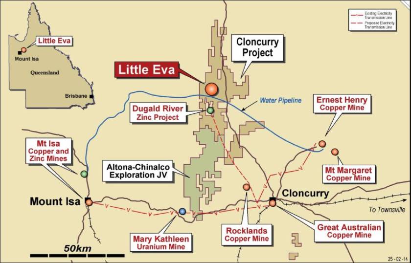
Next, we come to Cloncurry, in the state of Queensland in Australia.
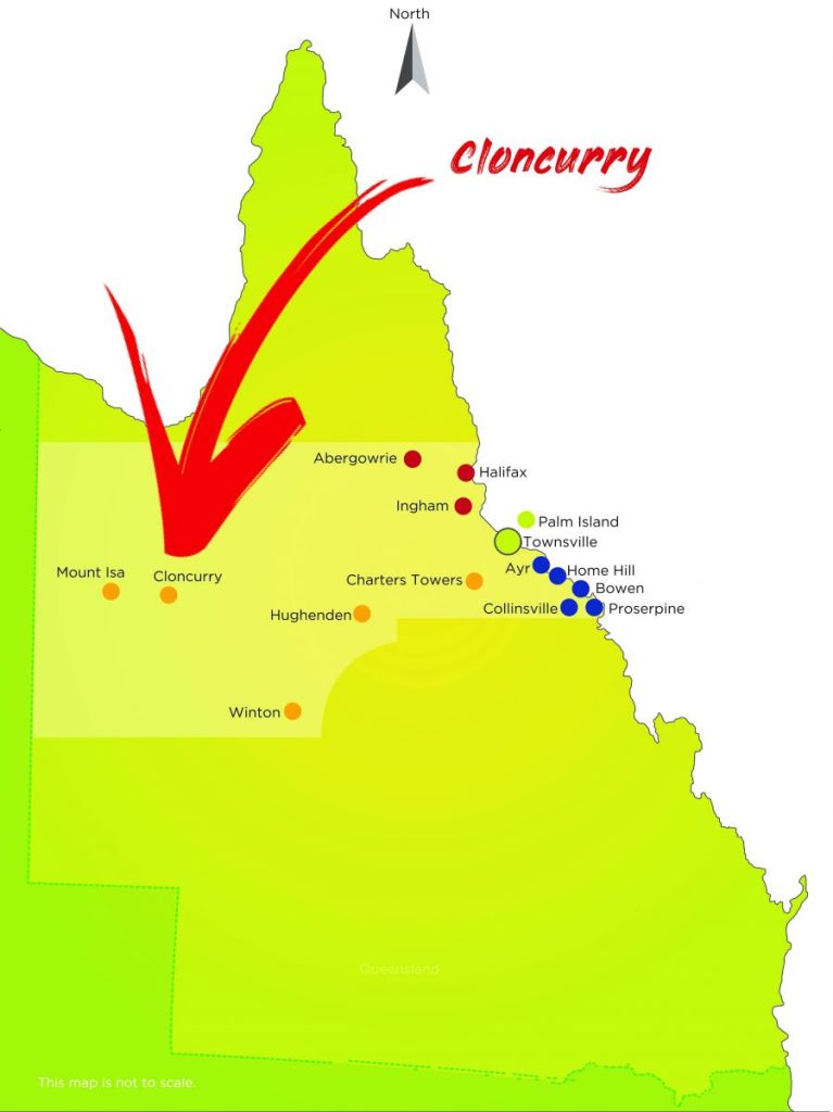
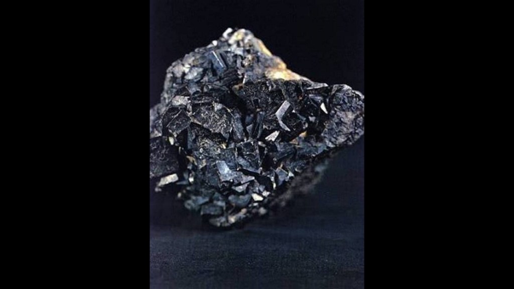
Both Cloncurry, and neighboring Mount Isa, have significant mining activities going on for copper, zinc, and uranium.
Zinc is a chemical element with the symbol “Zn” and atomic number of 30.
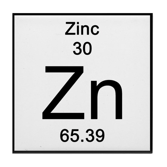
Zinc is a slightly brittle metal at room temperature…
…and, along with copper, is an alloy of brass.
It is used in the zinc-plating of iron, which produces a protective zinc-coating to prevent rust, and is the major industrial application of zinc.
Zinc is also an essential mineral for our good health, aiding in metabolism, digestion, nerve function, liver function, among many other things.

Uranium is a chemical element with the symbol “U” and the atomic number of 92.
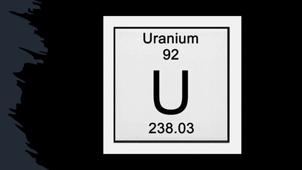
It is a radioactive, silvery-gray metal, with the highest atomic weight of primordially-occurring elements, which are elements that have existed in their present form since before the earth was formed.
We are told that Uranium is widely used in nuclear power plants and nuclear weapons.
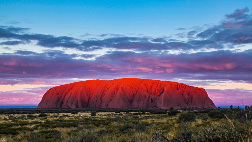
The alignment crosses over Uluru, also known as Ayers Rock, in the Northern Territory…

…a major sacred site to the Australian Aborigines, and to others around the world, considered to be one of the twelve primary nodal points of the Earth’s grid system.
Uluru is composed of arkose, a type of sandstone rich in the mineral feldspar.
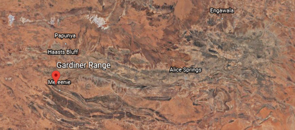
Next we come to the West MacDonnell Ranges, also in the Northern Territory.
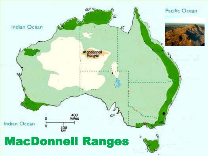
They are quartzite and sandstone parallel ridges that rise from a plateau about 2,000-feet, or 600-meters above sea-level.
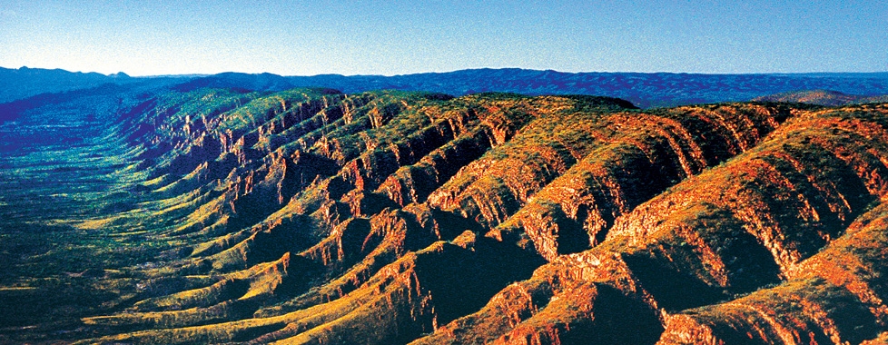
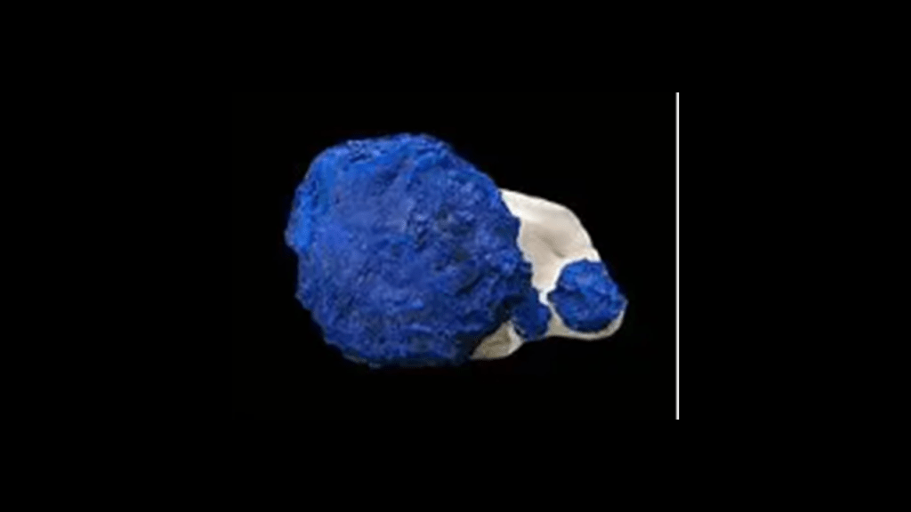
The Malbunka Copper Mine is located in the Gardiner Range of the West MacDonnells.
Besides copper, it is known for its azurites, called azurite “suns.”
Next we come to Lake Carnegie, in the Goldfields-Esperance region of Western Australia…
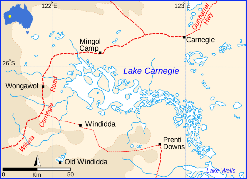
…just north of the main goldfields region of Western Australia.
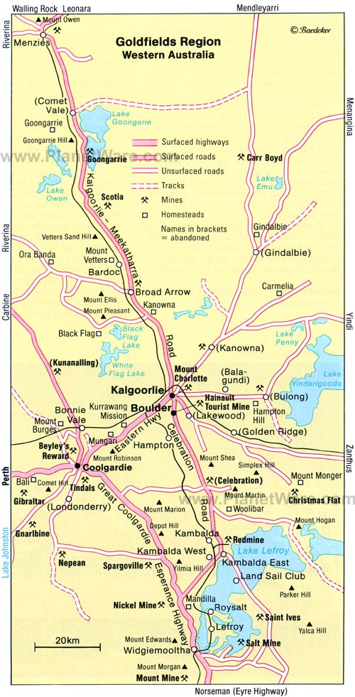
Next we come to Lake Barlee, also in Western Australia…
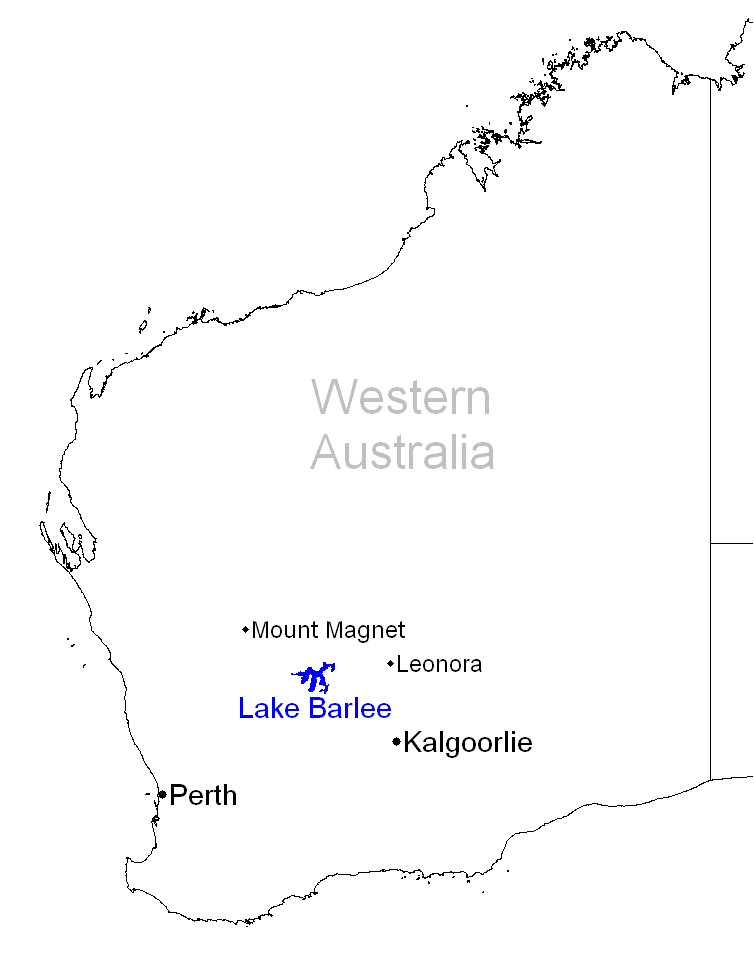
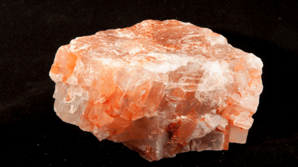
…where potash and lithium brine mining has been explored in this salt lake.

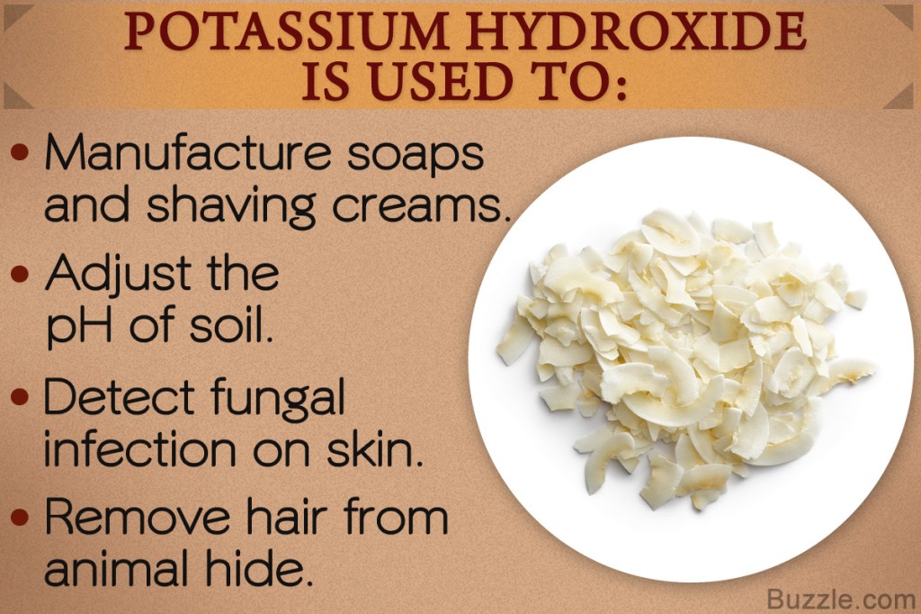
Potash is a salt mixture that contains potassium in a water-soluble form.
Potassium is a chemical element with the symbol “K” and atomic number of 19…
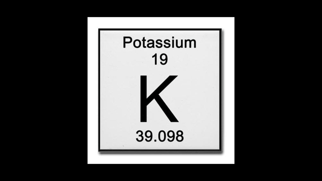
…and is a silvery metal that is soft enough to be easily cut by a knife.
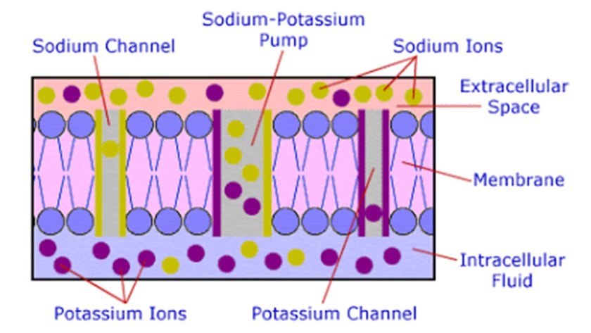
Uses of potassium include potassium soaps, fertilizers, detecting fungal infections on the skin, and removing hair from animal hide.
Potassium ions are vital for the functioning of all living cells, with the transfer of potassium ions across nerve cell membraines being necessary for normal nerve transmission.
The alignment goes through the Ajana District in Western Australia.
Forty-eight lead and copper mines once operated in the Ajana District.
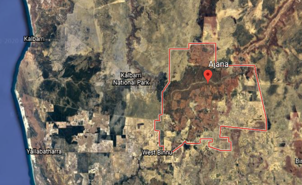
Sir Augustus Charles Gregory discovered the location of the lead outcroppings of what became the first mine there, the Geraldine Mine, in 1848.
The Geraldine mine was in operation by 1849.
Sir Augustus was an English-born explorer and surveyor of Australia.
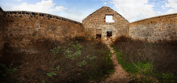
These are the ruins of what was called the “Lynton Convict Hiring Depot,” which provided the convict labor used to work the mine.
The buildings here were said to include a store, bakery, depot, well, lock-up, hospital, lime kiln and administration block that were said to have begun in 1853, and that no sooner were they finished in 1856 than the depot closed because of the harsh living conditions and transportation problems.
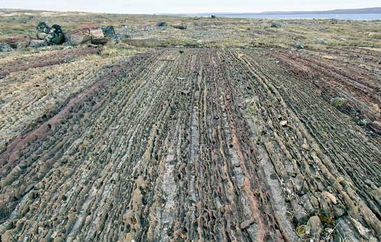
This is a cobblestone floor found at the Geraldine mine, said to have been where the convict miners broke up the ore…
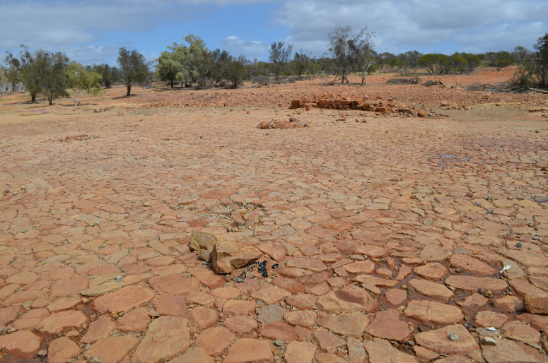
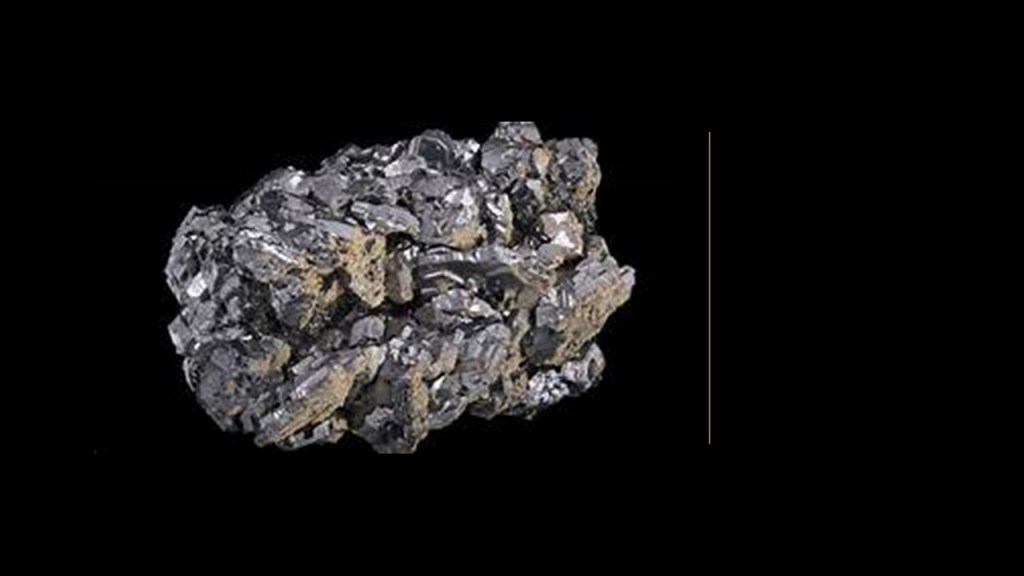
…to pick out the highest-grade galena, which is the primary ore of lead, and contains silver as well.
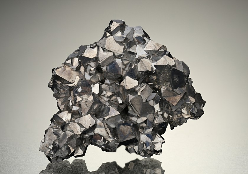
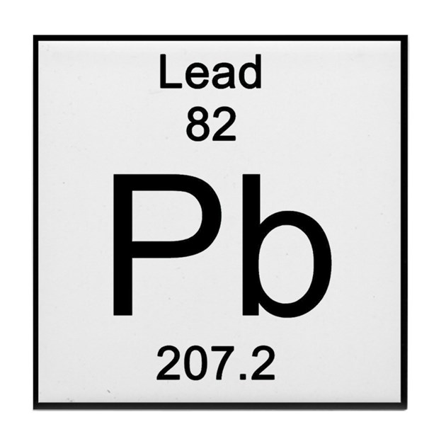
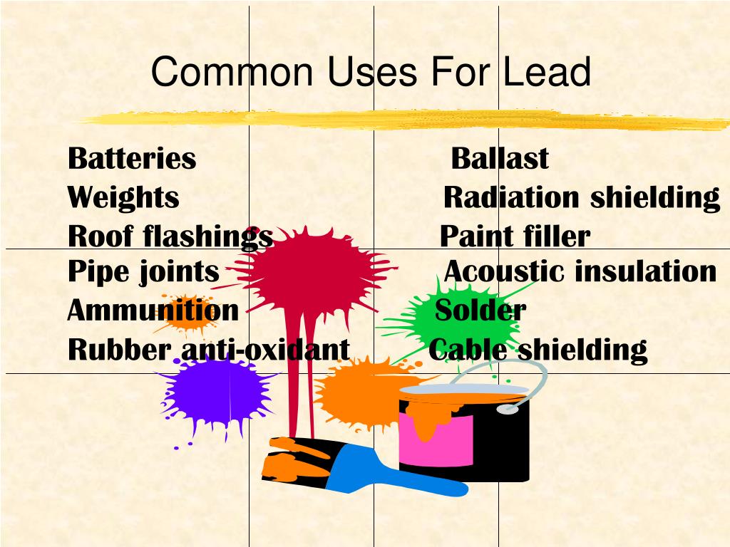
Lead is a chemical element with the symbol “Pb” and atomic number of 82.
Lead is a heavy metal that is denser than most common materials.
As well, it is soft and malleable, and has a relatively low melting point.
Lead’s high density, low melting-point, ductility, and relative inertness to oxidation, make it useful.
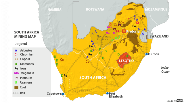
The alignment leaves Australia and next lands at Cape Town at the tip of South Africa, across the South Indian Ocean.
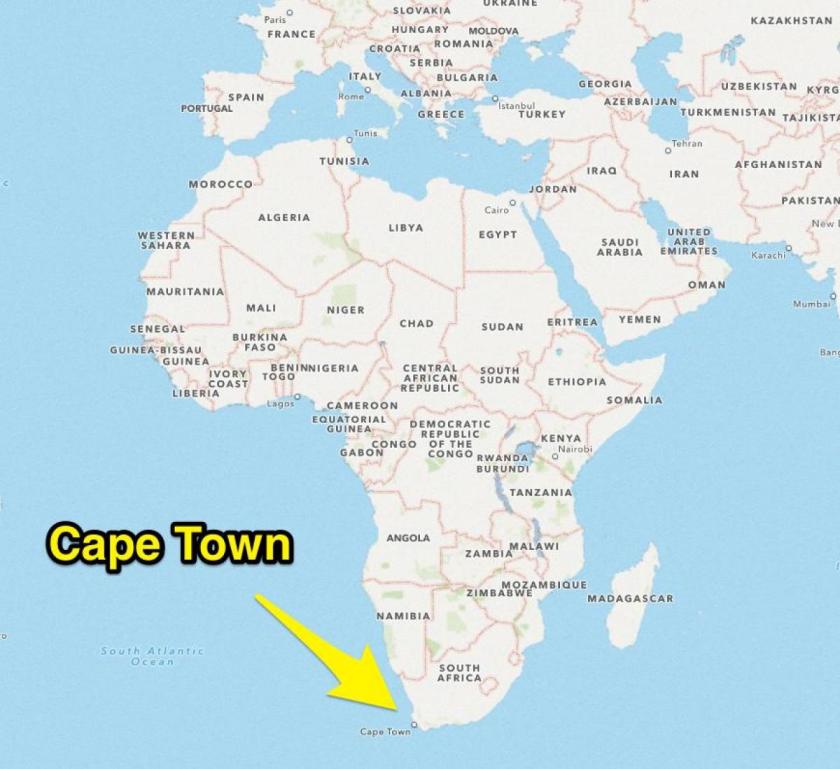
Mining is South Africa’s third-largest business sector, after agriculture and manufacturing, and is the world’s leading producer of copper, platinum, uranium, and vanadium.
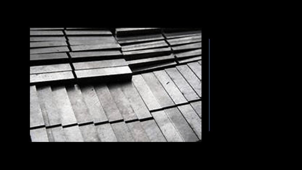
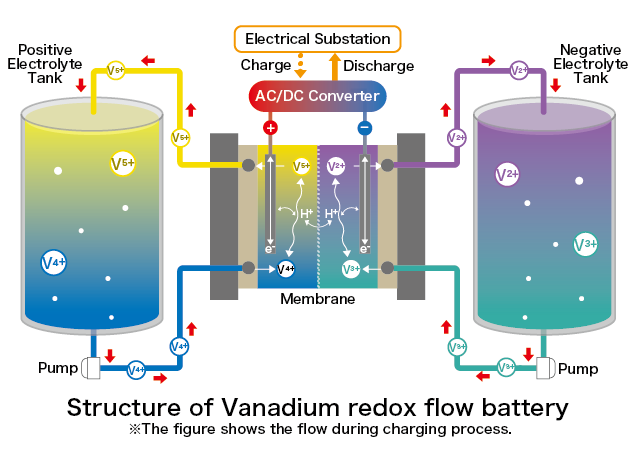
Vanadium is a chemical element with the symbol “V” and atomic number of 23.
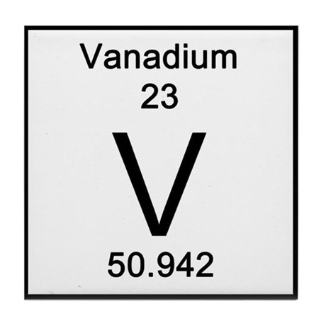
It is a hard, silvery-grey, and malleable metal.
It is mainly used to produce specialty steel alloys, such as high-speed tool-steels…
…and the vanadium redox flow battery system for storage may be an important application for the future.
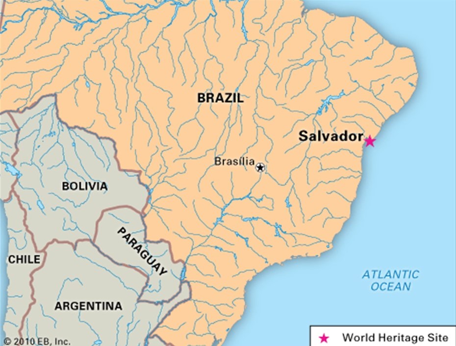
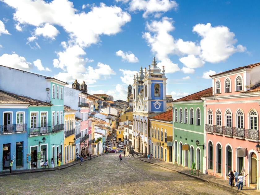
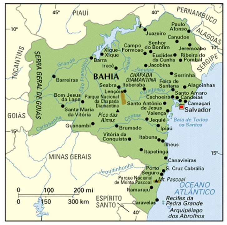
From Cape Town, the alignment crosses the South Atlantic Ocean, and enters Brazil at Salvador, the capital of the Brazilian State of Bahia.
Salvador was said to have been founded by the Portuguese in 1549 as the first capital of Brazil, and is called one of the oldest colonial cities in the Americas.
The Jesuits arrived in 1552, and worked on converting the indigenous people of the region to Roman Catholicism.
I wonder exactly what went down when they arrived!
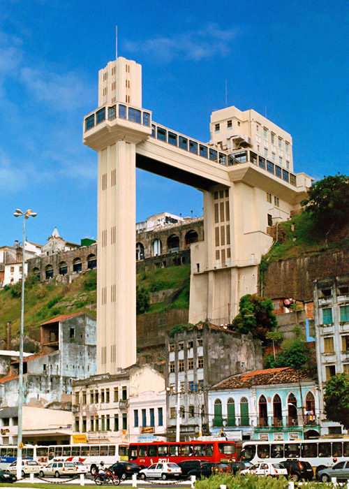
Interesting to note, a sharp escarpment divides Salvador’s Lower Town from its Upper Town by 279-feet, or 85-meters.
We are told Brazil’s first urban elevator, the Elevador Lacerda, has connected the two towns since 1873.
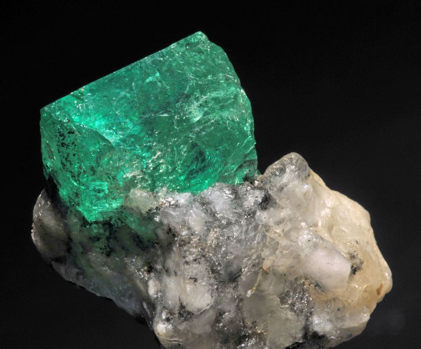
Emeralds are mined in Bahia State, and since the 1970s, Brazil has served as a consistent source of commercial quality emeralds.
As a matter of fact, the Bahia Emerald, unearthed at the Carnaiba mine in Bahia State in 2001, is one of the largest emeralds ever found.
It weighs approximately 752-lbs, or 349-kg, and has been valued at as much as $400-million.
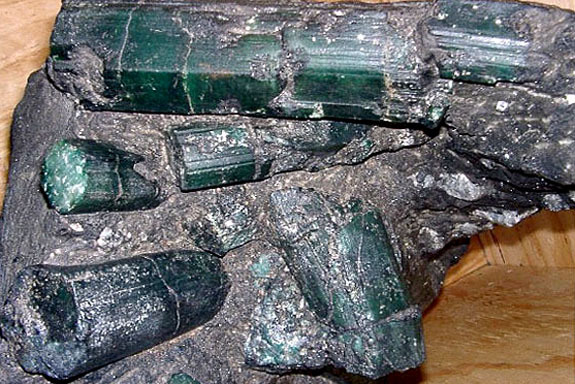
Emerald is a gemstone, and a variety of the mineral beryl, and colored green by trace amounts of chromium and sometimes vanadium.
It is a cyclosilicate, meaning a rock-forming mineral made up of silicate groups.
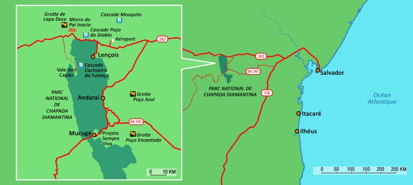
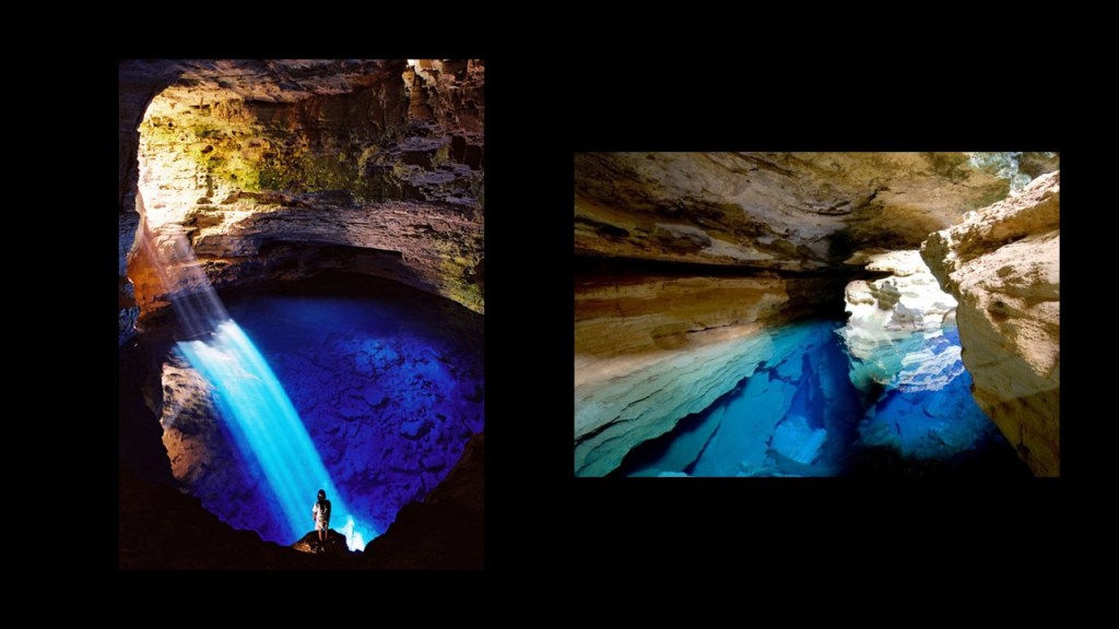
Moving west along the alignment from Salvador, we come to the Chapada Diamantina National Park in the center of Bahia State, and considered one of the ten best national parks in the world.
We are told this region was deserted until the discovery of gold and diamonds here in 1844, which then was said to have triggered a rush of gold and diamond seekers wanting to make their fortunes.
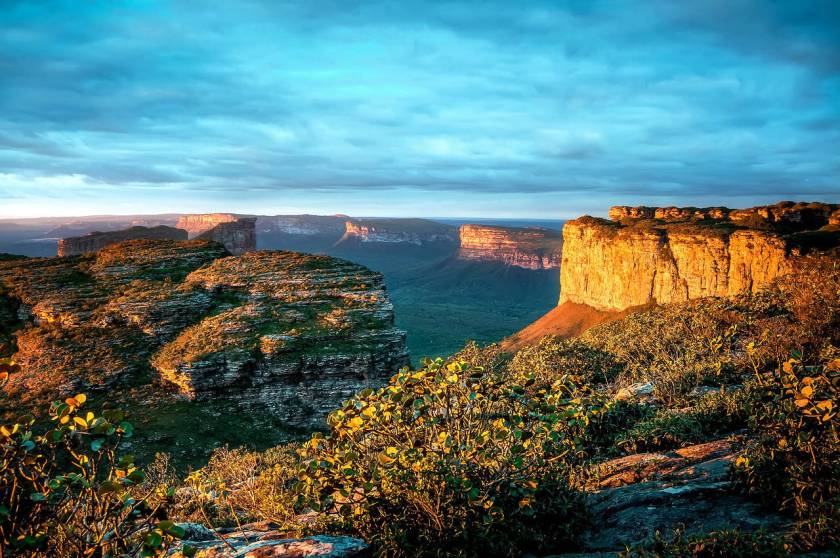
This was 5-years before the San Francisco gold rush started in 1849.
There sure was a lot of “gold-rushing” going on during this time period!
The Chapada Diamantina National Park is known for its numerous rivers, which form impressive waterfalls, and pools of crystalline water.
Next we come to Almeirim, a city on the Amazon River…
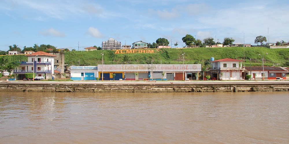
…and a municipality in Brazil’s Para State.
The municipality is crossed by the equator.
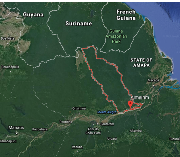
The Ipitina Mining District is in Almeirim, located near the border with Amapa State.
All nine of the deposits listed are being mined for gold…
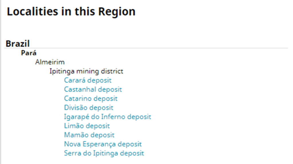
…with the first listed, the Carara deposit, also being mined for…
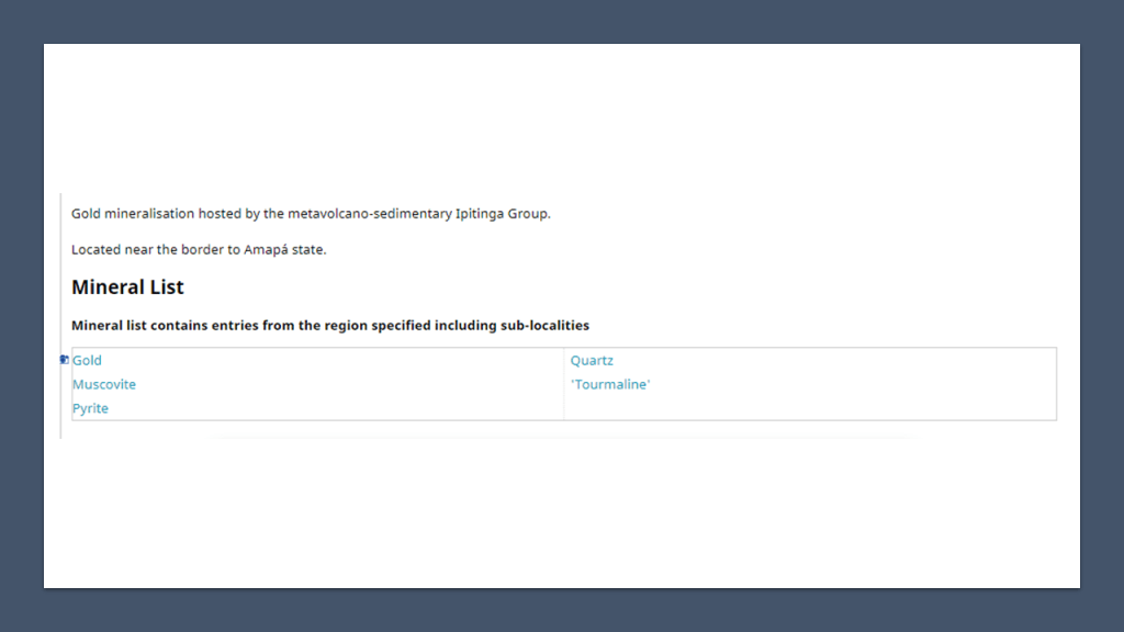
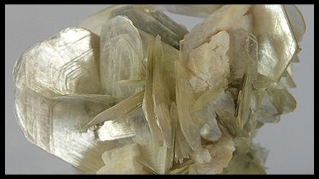
…muscovite, the most common form of mica and a silicate material of aluminum and potassium,which has industrial applications in the manufacture of fireproofing and insulating materials, and to some extent as a lubricant…
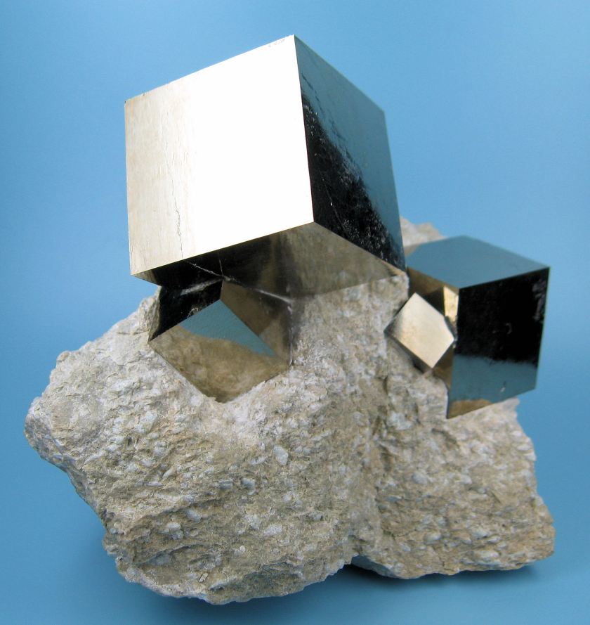
…the mineral pyrite, also known as fool’s gold, which is an iron sulfide, and used commercially in the production of sulphur dioxide…
…quartz, a crystalline mineral composed of silicon and oxygen atoms, which has the ability to vibrate at precise frequencies…
…and tourmaline, a crystalline boron silicate material that is found in a wide variety of colors, with both electrical and magnetic properties.

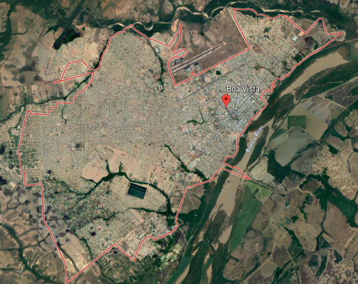
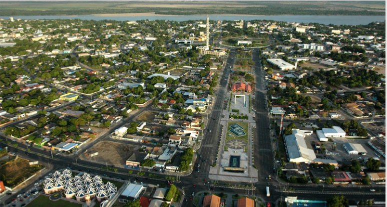
Next on the alignment, we come to Boa Vista in Roraima State.
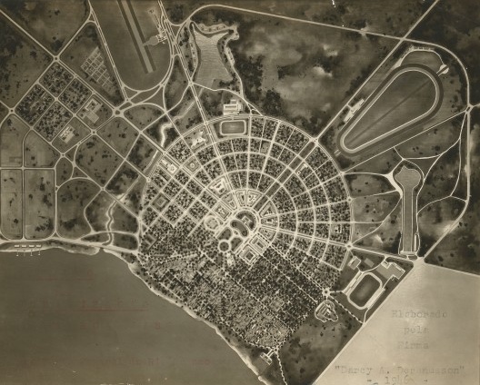
One of the most striking things I found out about Boa Vista right away is that we are told it was a planned city with a radial plan, designed by civil engineer Darci Aleixo Derenusson, who was said to have based his design on that of Paris, France.
Boa Vista was founded in 1890.
Derenusson wasn’t born until 1916, and he died in 2002.

In 1943, Boa Vista became the capital of the recently created Federal Territory of Rio Branco, which was later re-named Roraima.
The Territory was said to have grown from mining operations there.
The main source of employment here once upon a time was machine-based mining, which was prohibited at some point because of the damage it was causing to the environment.
While I am not able to find out anything about what was being mined here through an internet search, those look like diamonds, or some kind of gemstones, in the city’s coat-of-arms….

Derenusson was said to have designed Boa Vista between 1944 and 1946.
Keep in mind this is not the most accessible place in the world, with limited long-distance road system access.
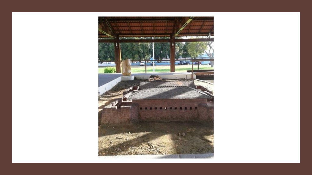
There was also a star fort, São Joaquim do Rio Branco Fort, located at one time approximately 19-miles, or 32-kilometers, from Boa Vista.
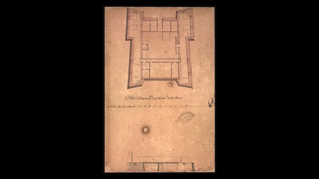
Apparently the full fort no longer exists, but if you go there, you can see a model of what it used to look like!
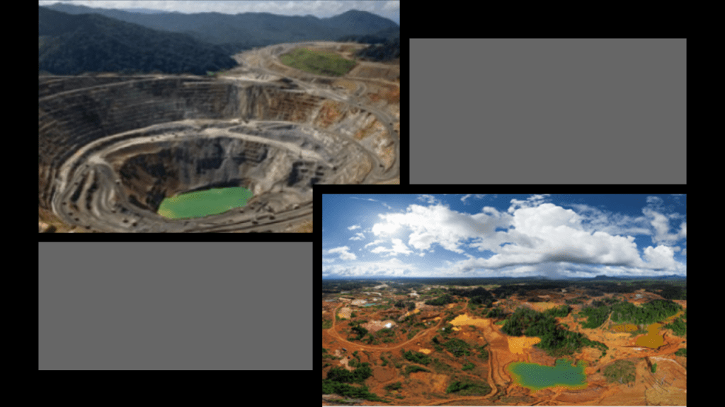
Next the alignment goes through Venezuala, where it crosses over the Orinoco Mining Arc.
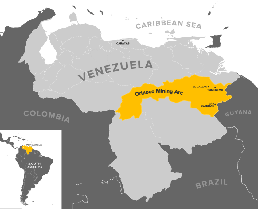
The Orinoco Mining Arc and other areas in Venezuela have the 2nd-highest gold reserves in the world, and 32 certified gold fields.
From Venezuala, the alignment enters Colombia.
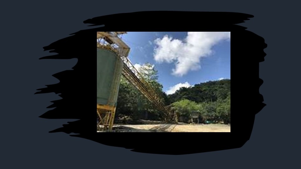
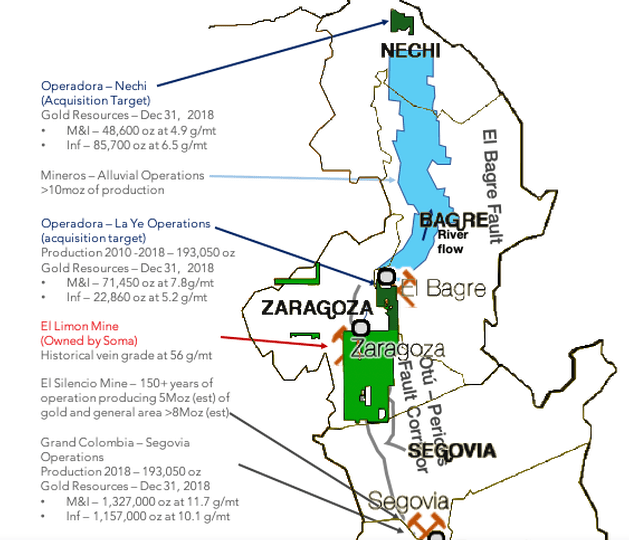
There is a considerable amount of gold-mining in and around Zaragoza, Colombia.
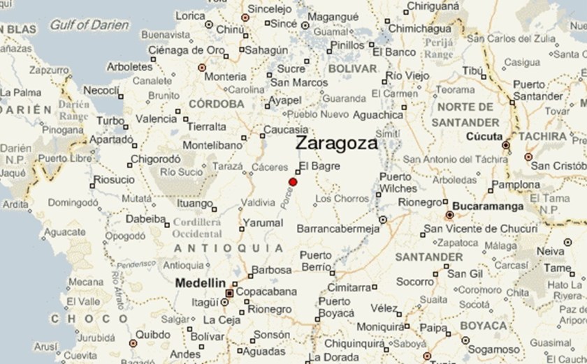
For one, the El Limon Mine near Zaragoza is a high-grade gold mine and mill, but the area surrounding Zaragoza has four other gold mines, three of which are active.
The El Silencio mine was in production for over 150-years, and is no longer being mined.
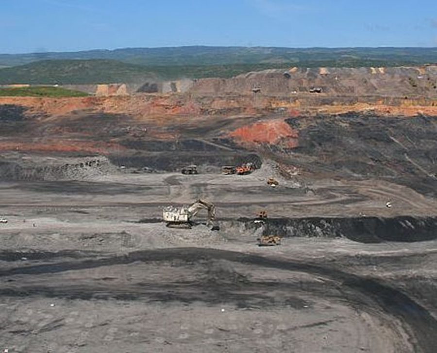
Colombia has the largest coal-resource-base in South America, and is a major coal player globally.
With reserve estimates ranging between twelve and 60-billion tons, Colombia exports more than 90% of its production annually, making it the world’s 5th-largest coal exporter.
The next place we come to on this alignment is Colon, a city and seaport in Panama located beside the Caribbean Sea, near the Atlantic entrance to the Panama Canal.
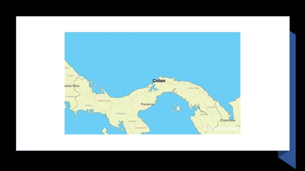
Here are two examples of mining operations in this part of Panama.
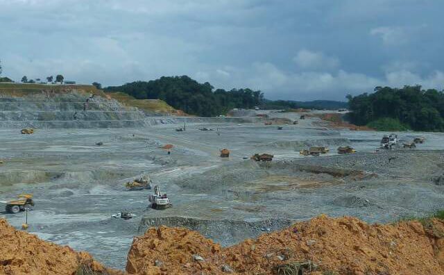
The Cerro Petaquilla Mill in Colon is a surface-mining operation, with copper as its primary commodity, and gold, molybdenum and silver as secondary outputs.
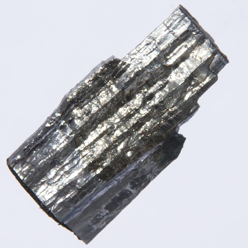
Molybdenum is a chemical element with the symbol “Mo” and the atomic number of 42.

It is a brittle silver-gray metal, used in steel alloys.
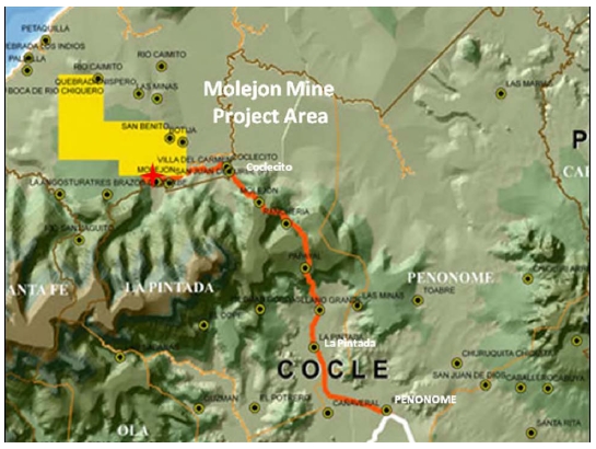
The Molejon Gold Project was west of Colon, located close to the Caribbean coast.
It was said to have produced 100,000 ounces of high-grade gold annually from 2010 until its closure in 2015.
Next the alignment enters Nicaragua at Bluefields, and heads towards Tegucigulpa in Honduras, where it passes numerous gold mines and projects.
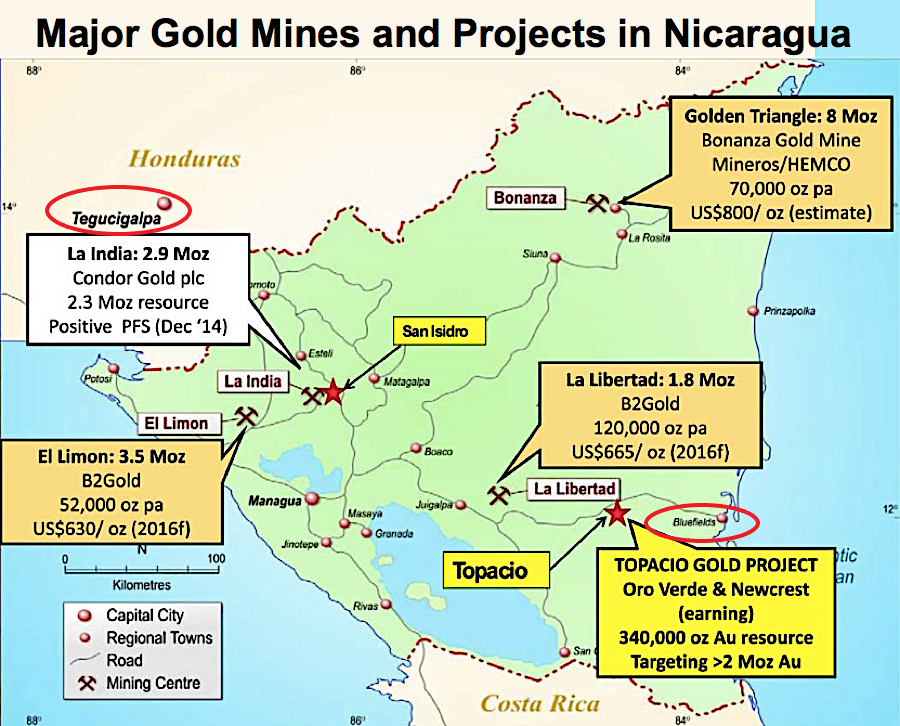
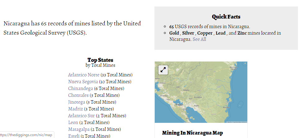
All together there are 65 mines in Nicaragua.
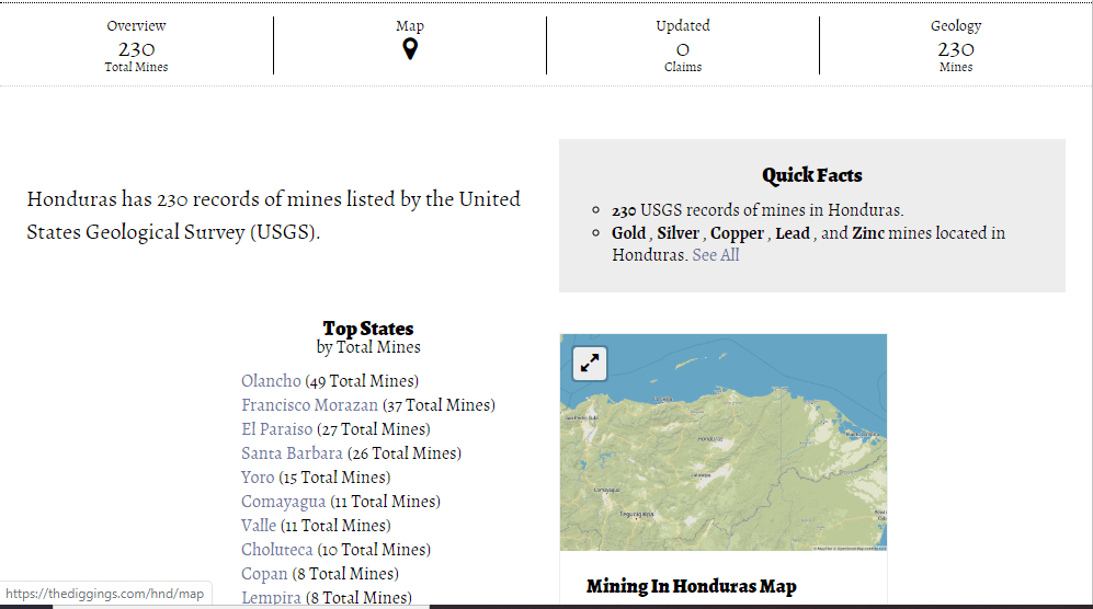
Next we are travelling along the alignment in Honduras from Tegucigalpa through San Pedro Sula, where there is considerably more mining activity than Nicaragua.
There are 230 active mines in Honduras.
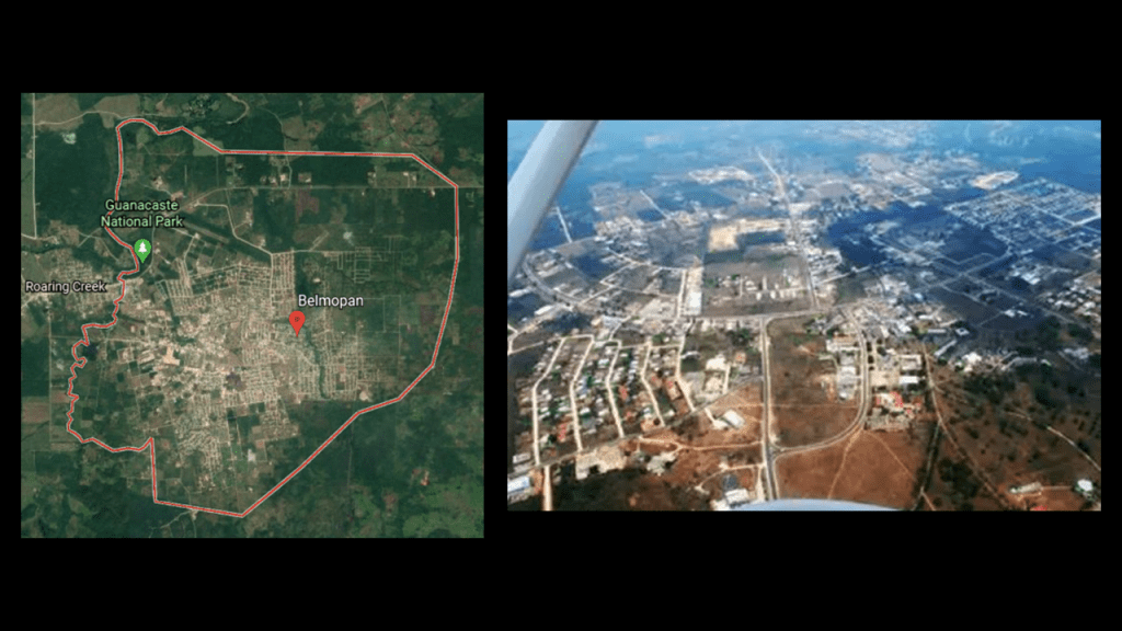
Now we are heading into Belize, and going through Belmopan, the capital city of Belize, and the smallest capital city in the Americas by population.
In 2010, the population was 16, 451.
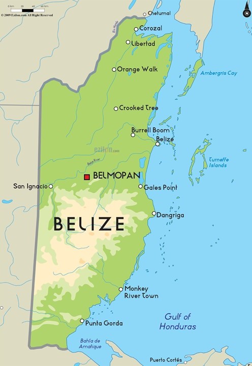
Like Boa Vista in Brazil, we are told that Belmopan was founded as “planned community” in 1970, after Hurricane Hattie destroyed 75% of Belize City in 1961, Belize’s former capital.
Belize was still a British Colony at that time, and didn’t gain its independence from Britain until 1981.
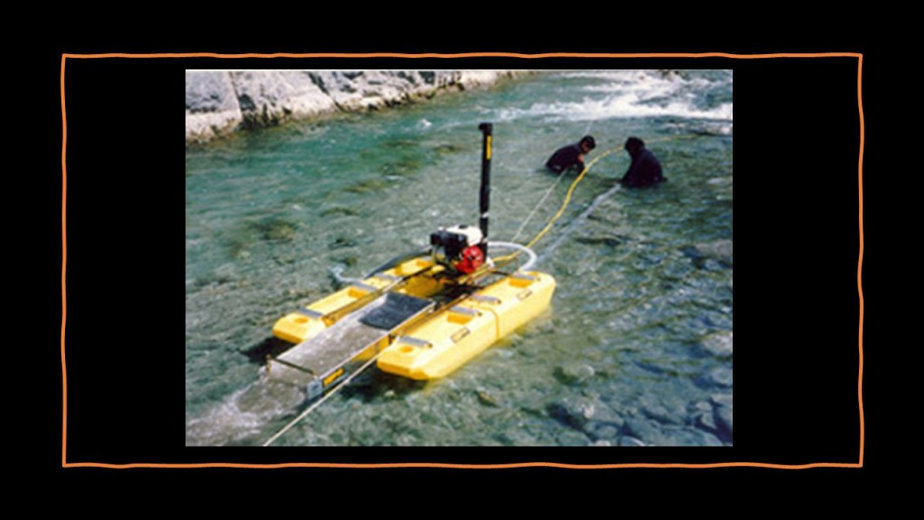
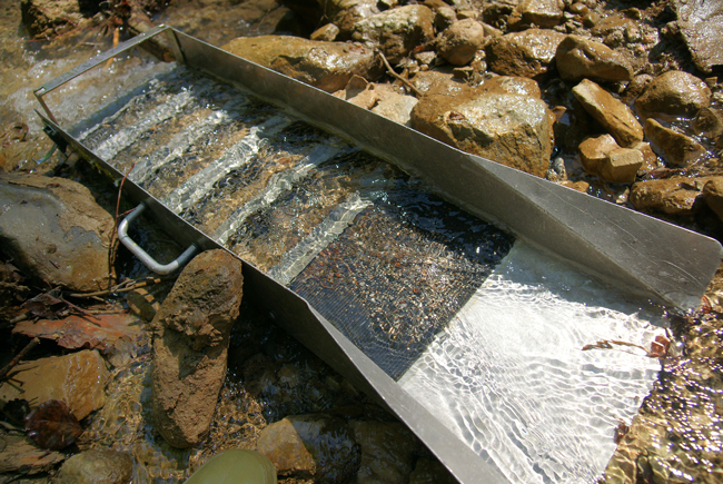
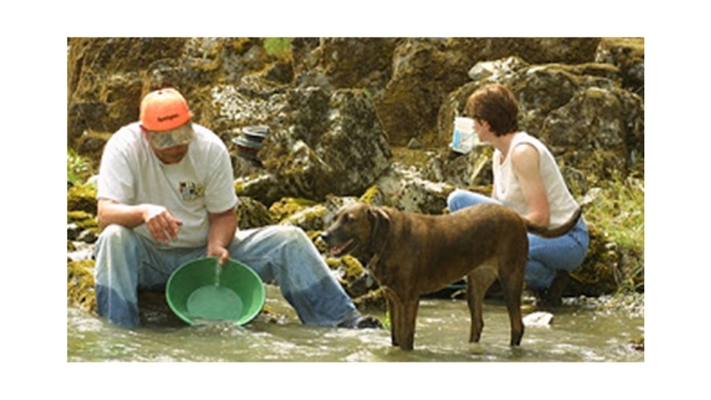
There is placer gold mining in Belize, in rivers, creeks, gravel beds, and other sediments in the southern Belize Alps Maya Mountain chain, with prospectors using things like portable dredges…
…sluice boxes…
…and gold pans.
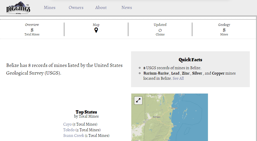
There are also eight active mines in Belize, listed for Barium/Barite, lead and zinc, silver and copper.
Barium is a chemical element with the symbol “Ba” and atomic number of 56.

Barite is the primary ore of barium.
Barium compounds are used for things like x-ray shielding because it has the ability to block x-ray and gamma-ray emissions.
From Belize, we enter Mexico, heading towards Merida, the capital and largest city of Yucatan State in Mexico.
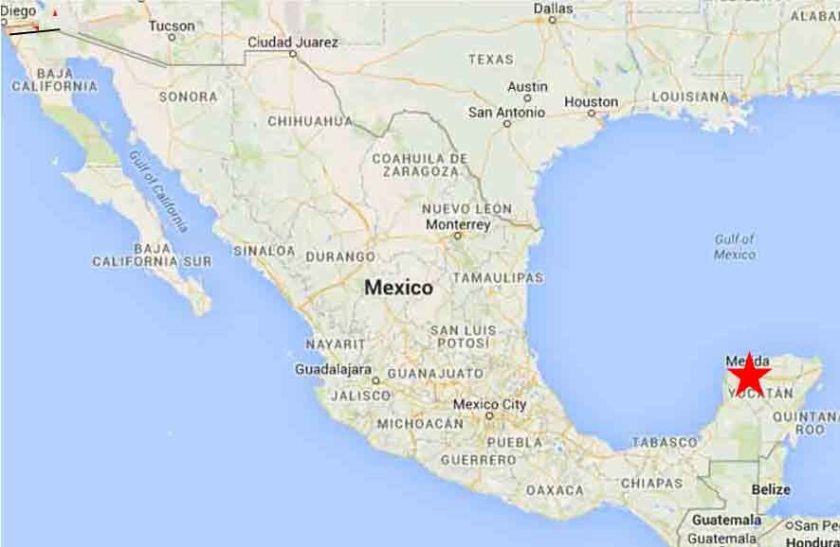
Merida is also the southern apex of the North American Star Tetrahedron.
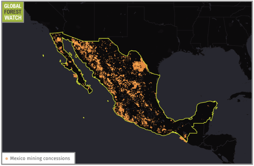
While this part of Mexico has less mining activity compared to other parts of Mexico, currently almost 19% of Mexico’s landmass is parceled out to over 33,000 mining titles, and has the fourth-largest mining industry in the world, with 888 active mining projects, and I have found several long-distance alignments like this going through Mexico.
I am going to end this post at Merida.
I chose Cape Farewell at the southern tip of Greenland as my starting point for this series because it sits on an alignment that globally connects with two different sides of the North American Star Tetrahedron.
In the next post, I am going to cover my findings along an alignment going in the other direction from Cape Farewell all the way to the Maldives in the Indian Ocean.
I will summarize my findings and interpretations of this material at the end of the second part of this two-part series.