
This next series, of several series of circle alignments that I found, involves Amsterdam Island, in the French Subantarctic Islands.
The process of doing this work has opened up for me an awareness of a suppressed advanced ancient global maritime civilization which existed up until relatively recent times and the missing positive timeline of Humanity.
Throughout my blog, I go into depth regarding what I believe about this civilization – what I am calling the Muurish/Moorish/Israelite Empire; what happened to it; and provide compelling evidence as to why I believe this.
From the work I have done thus far, I have reason to believe this ancient global civilization was aligned with itself on a Flower of Life pattern, with the same characteristics that appear to be bringing the heavens to earth, and aligning earth with the heavens.

The start- and end-point of this next circle alignment that I found and am about to share with you over a series of posts is a tiny dot in the South Indian Ocean.
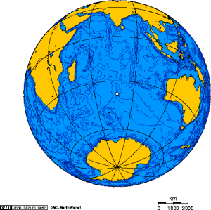
The dot is Amsterdam Island, one of the French Subantarctic Islands, also known as the French Southern and Antarctic Lands, officially claimed by France in 1892.
Amsterdam Island got its name in 1633 from a Dutch sea captain who named it after his ship, Nieuw Amsterdam, which was named after the Dutch settlement of Nieuw Amsterdam (which later became New York City).
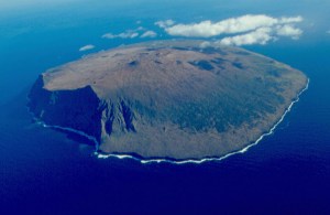
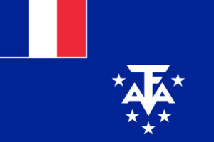
This tiny speck of real estate, for which the only settlement is a seasonal research station, even has its own flag.
The research station studies biology, meteorology, and geomagnetics.
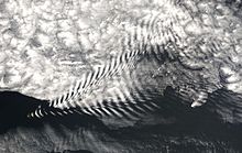
Here is a photograph of Lee Waves taken on Amsterdam Island. Lee Waves are atmospheric stationary waves, and are a form of internal gravity waves. Must be a reason as to why the geomagnetics of this island are studied.
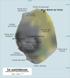
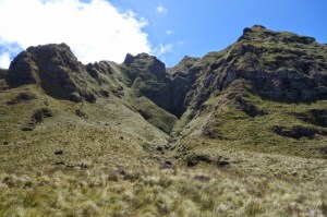
Here is a map of the island with French place names. On the lower left hand side you see the Falaises d’Entrecasteaux, or the Cliffs of Entrecasteaux.
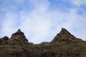
In 2016, when I started to crack the code of key words which covers up the advanced ancient civilization, I realized “cliff” was one of those words.
Here are some photographs of the Cliffs of Entrecasteaux:
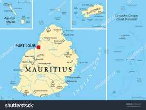
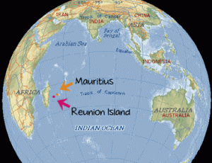
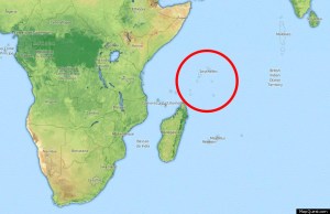
Leaving Amsterdam Island, the next place we come to on the alignment is Port Louis, the capital of Mauritius.
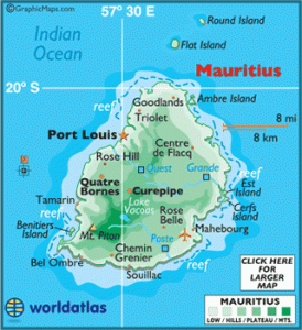
Mauritius is officially the Republic of Mauritius, and in addition to the main island, consists of the islands of Rodrigues, Agalega, and St. Brandon. These islands are 1,200 miles (2,000 km) southeast of the African continent.
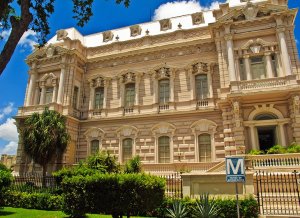
This is the Port Louis Natural History Museum…
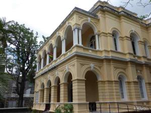
…compared with a building in Merida, Mexico’s Centro Historic District…
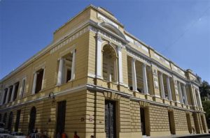
…and the Merida Natural History Museum. All three buildings share the common characteristics of double column arrangements on the second floor of the respective buildings.
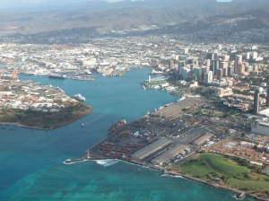
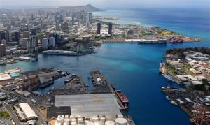
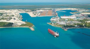
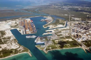
Here are photos of the harbor at Port Louis on Mauritius…
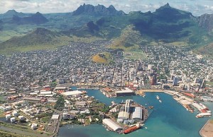
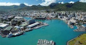
…compared with Honolulu Harbor…
…and Freeport Harbor on Grand Bahama Island.
The advanced ancient civilization was a global, maritime civilization which existed up until relatively recent times, and is the missing positive timeline of Humanity.
They were as comfortable on the waters as on land.
I first learned about Mauritius from an amazing French archaeologist named Antoine Gigal. Much of her work is in Egypt, but she has ventured to other places in her quest for knowledge and understanding, and she has documented much evidence of the sophisticated technology of the ancient civilization.
To learn more about her work on Mauritius, check out this link where she talks about the discovery of massive walls, hydraulic systems and road systems that are all connected with the pyramid complexes there:
http://gigalresearch.com/uk/complexe-ile-maurice.php
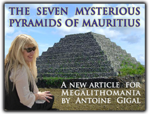
So, I first learned about the seven pyramids of Mauritius several years ago in a 2011 Megalithomania presentation by her.
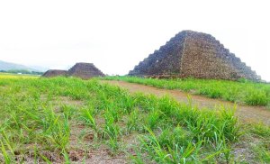
They are terraced structures made of lava stone.
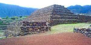
Interesting, there are six terraced pyramids made of lava stone in Guimar on the island of Tenerife in the Canary Islands. In both places they are in perfect astrological alignment with the winter and summer solstice.
Before I leave this part of the Indian Ocean, I want to bring to your attention to the nearby inhabited French island of Reunion, home to nearly 1,000,000.
There is a very active shield volcano on the eastern end of the island, Piton de la Fornaise. Its most recent major eruption was on July 14, 2017.
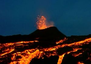
I share this information because of the numerous volcanoes seen on the Merida circle alignment in my last series of posts. It appears that there is a correlation between these alignments and volcanoes.
Next the alignment goes through the Republic of Seychelles, an archipelago country of consisting of 115 islands in the Indian Ocean.
It is an island republic almost 1,000 miles off the coast of East Africa, and now is a member of the African Union. Independence from the United Kingdom was established in 1976.
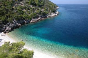
The capital of the Seychelles, Victoria, is on the main island of Mahe. This is a beach-head on Mahe in the Seychelles…
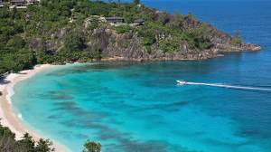
…compared with Myrtos Beach on the Greek island of Kefalonia…
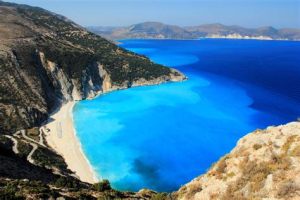
…and Vaja Beach at Korcula, Croatia.
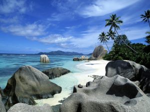
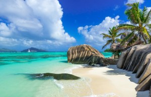
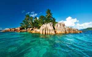
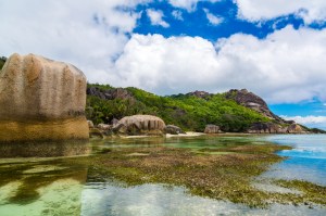
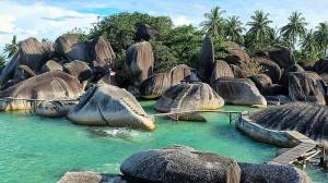
These islands are also known as the Granitic Seychelles. And here is an assemblage of photos of the interesting-looking rock formations on the coasts of these islands. Could be Mother Nature. Could be something else….
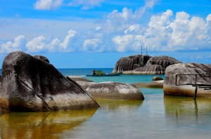
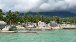
For comparison, here are photos of similar-looking rock formations on the Natuna Islands, part of Indonesia, and located in the South China Sea, off the northwest coast of Borneo. They are found on a different alignment:
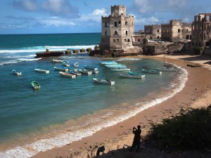
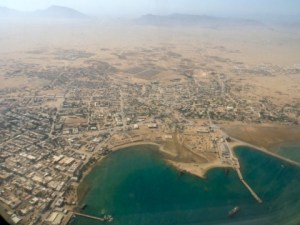
Next on the alignment is Mogadishu, the capital and largest city of Somalia. It is located on the coastal Banadir region on the Indian Ocean, and has been an important port city for millenia. It is known locally is Xamar.
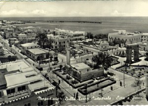
This is a historic photo of Mogadishu. It was the capital of Italian Somaliland from 1889 to 1936. When the Somali Republic became independent from Italy in 1960, it became known as the “White Pearl of the Indian Ocean.”
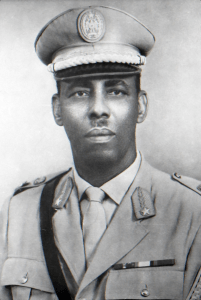
The Somali Civil War started in the early 1990s, after the ousting of Siad Barre in 1991, who had been serving as President of the Somali Republic since 1969.
It went on for years, where various militias fought for control of Mogadishu. The situation started to stabilize in 2011, and in 2012 a new government was formed with a passing of a constitution and election of a president.
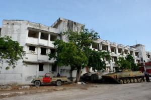
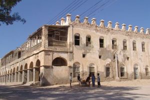
The following photos will show you what happened to the historic buildings of Mogadishu as a result of years of conflict.
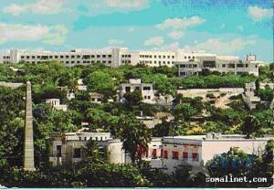
This is the Villa Somalia, the presidential residence, before the president was ousted…
…and after as the result of civil warfare.
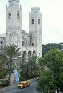
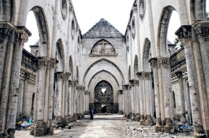
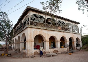
This is an historic picture of Mogadishu Cathedral:
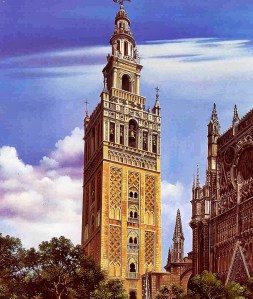
This is Seville Cathedral. Seville was the capital of Moorish Spain. In particular, note the double window design component of both of the cathedrals’ towers.
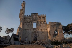
This is what remains of Mogadishu Cathedral today:
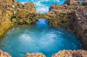
This is a view Xamar Weyne Beach in Mogadishu:
These rock features are also found at Xamar Weyne Beach. I personally don’t think that is a natural bridge, because I don’t think nature made that (and all the other ones around the world).
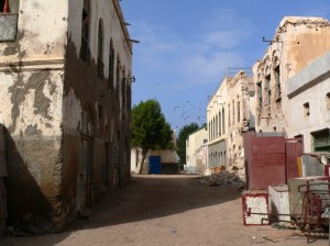
I will leave Mogadishu here, and move on to Berbera, another port city in Somalia. Berbera is located on the Gulf of Aden. It was the capital of British Somaliland Protectorate from 1884- 1941.
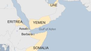
It is the capital of the Sahil Region of Somaliland, a self-declared independent state that is not internationally-recognized. It is strategically on an oil route, and has a deep harbor. It has served as a commercial port since antiquity and had a glorious past in terms of importance to the region.
It was a powerful and well-built city near the entrance to the Red Sea that served as a major commercial center since antiquity. It is looking a looking a bit rough these days. These next photos are of buildings in Berbera’s Old Town.
I am going to end this post here and pick up the alignment in the Gulf of Aden in the next post.

One thought on “Circle Alignments on the Planet Amsterdam Island – Part 1 Amsterdam Island to Berbera, Somalia – With Video of Post at the End”