
I have collected a variety of puzzle pieces about different places that bring a bigger picture into focus that is not immediately apparent on the surface over the course of several years of doing extensive research.
In this post, I am going to be looking into places on that alignment beginning in Manila in the Philippines, and going through places in China, Viet Nam, Laos, Myanmar and Bangladesh.

The research in this post came from a 23-part series called “Sacred Geometry, Ley Lines & Places in Alignment” that I did back in 2020 tracking a long-distance alignment of cities and places that startedin San Francisco, in which I crossed through this part of the world twice, though I did augment my original findings with new research to illustrate what took place according to our historical narrative.
I am doing this now because I am taking a break from several other projects I am working on at the moment, and in going back through my original blog posts from this series, decided to showcase this part of the original series before I go back to the other projects I am otherwise in the middle of.
The more research I do, the more connections I find that show this ancient civilization was advanced, interconnected and worldwide, and when I go back and look at research I have done in the past, I can see these connections even more clearly than before.

The starting point for this post is Manila, the capital of the Philippines.
It is the most densely populated city in the world within its boundaries.
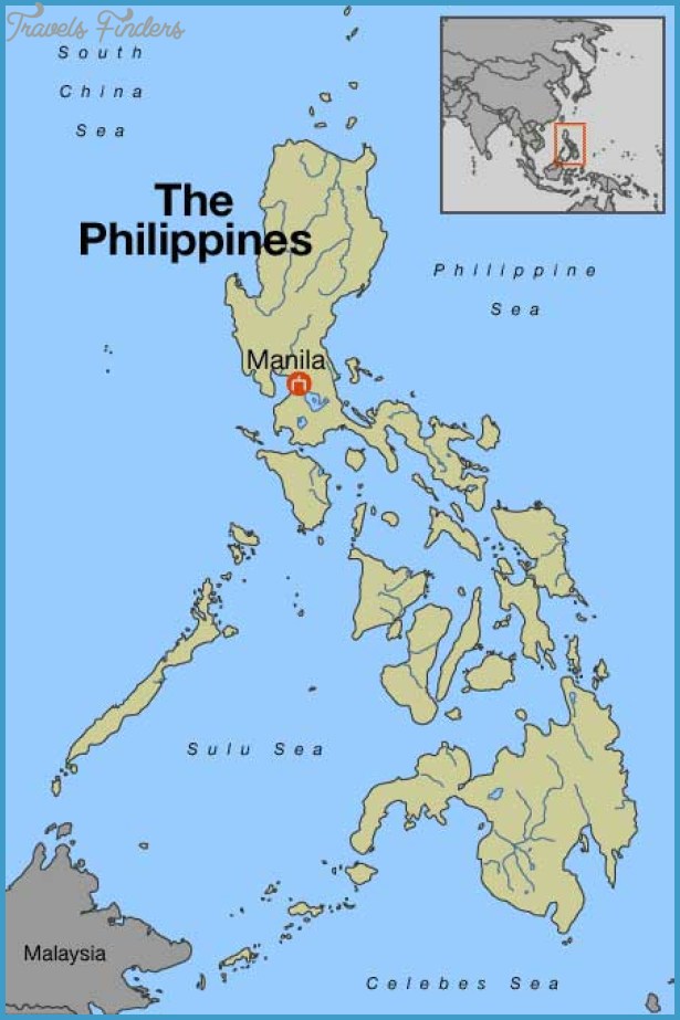
Manila, alongside Mexico City and Madrid, are considered the world’s original global cities, due to Manila’s historic commercial networks connecting Asia with the Americas.
We are told the Spanish city of Manila was founded in 1571 by the conquistador Miguel Lopez de Legazpi.
He was the first Governor-General of the Spanish East Indies from 1565 to 1572.

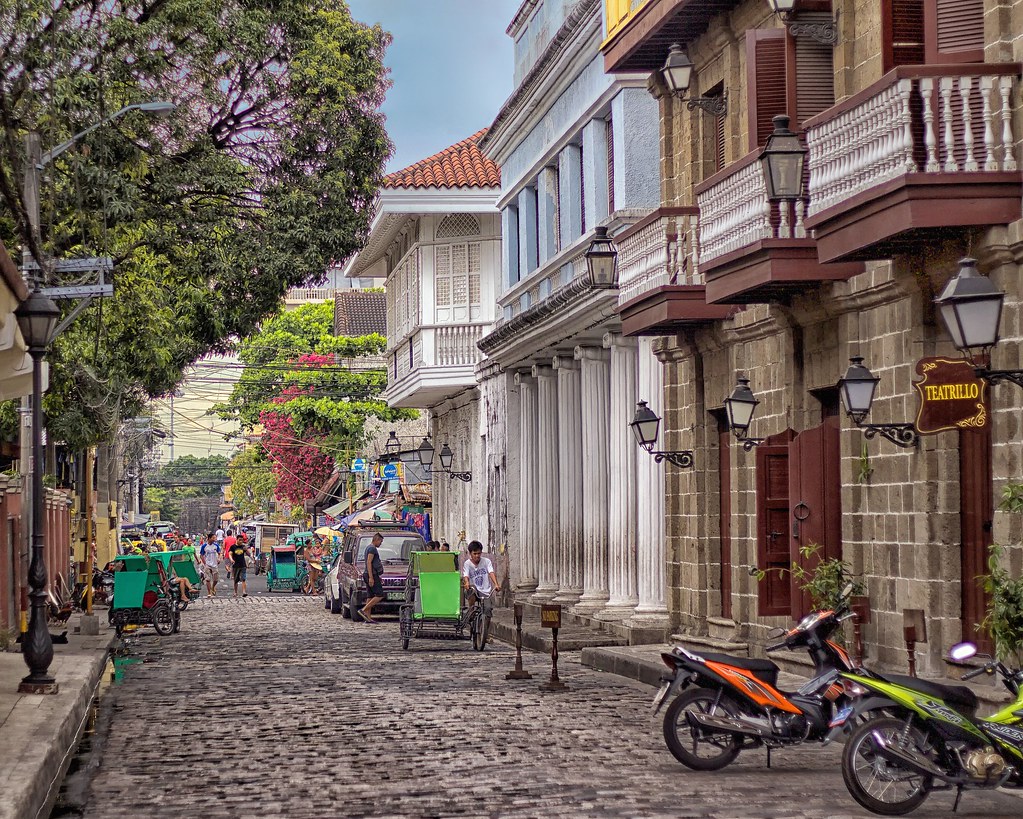
The historic walled city part of Manila is called the Intramuros, said to have been established by the Spaniards in the late 1500s.

Apparently the Intramuros is a star fort.

This is a view of a street inside the Intramuros, with cobblestones, colonnades, stone masonry and balconies.
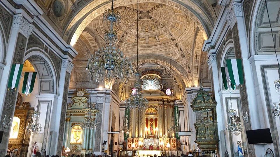
This is the inside of the San Agustin Church in the Intramuros, said to have been completed in 1607.
The first University in Manila, Universidad de San Ignacio, was established in the Intramuro by the Jesuits in 1590.

We are told that Pope Paul III issued a papal bull forming the Jesuit Order In 1540 fifty-years prior to that, under the leadership of Ignatius Loyola, Basque nobleman from the Pyrenees in Northern Spain.
The Jesuit Order included a special vow of obedience to the Pope in matters of mission direction and assignment.

The Pasig River flows through Manila, dividing into north and south sections.
Or is the river actually a canal, with its masonry banks?
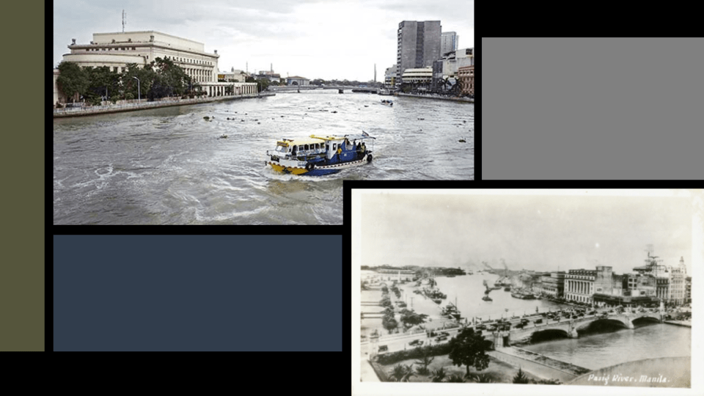
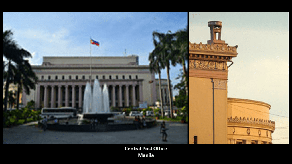
This old post card shows the Jones Bridge and the Manila Central Post Office building on the Pasig River.
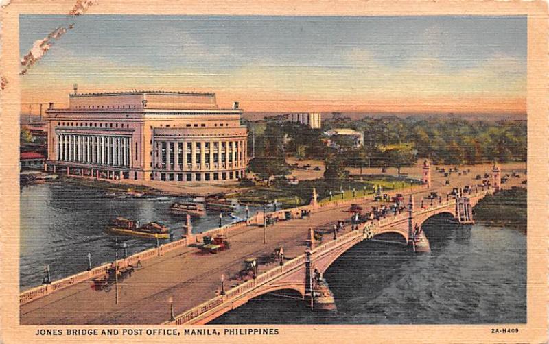
We are told the Central Post Office was built in 1926.
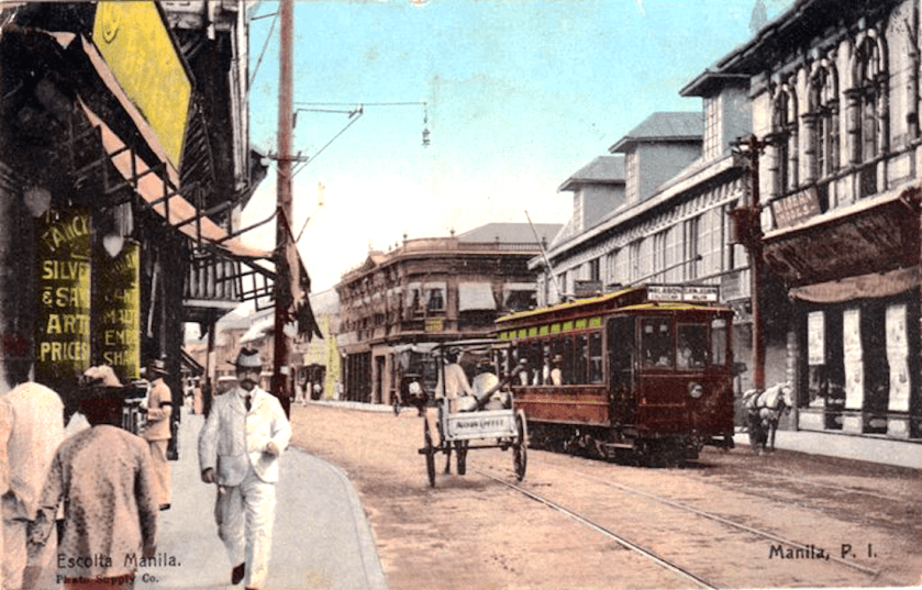
There was a streetcar system in Manila, called the Tranvias, construction of which was said to have been started in 1878, with the first line opening in 1882. This postcard was circa 1900, showing the contrast of the electric streetcar with the horse-drawn carriages.
By 1932, the city and suburbs were well-served by a network of 62-miles, or 100-kilometers, of track.
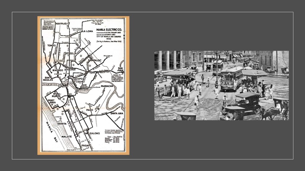
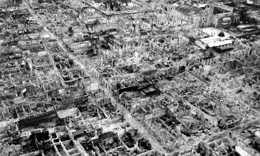
Then, in 1945, in the last months of World War II, the Battle of Manila brought destruction and havoc to the city of Manila and its rail infrastructure.

The Manila Tranvias fleet was damaged beyond repair, and abandoned immediately after the war.
The rails were pulled up from the city streets, and surviving streetcars were hauled away and scrapped.
This was the end of what had previously been considered one of the best street-rail networks in Asia.
Many more examples of destruction of infrastruction and many other things from wars like this through this part of the world to come.
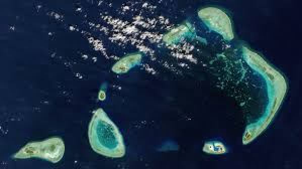
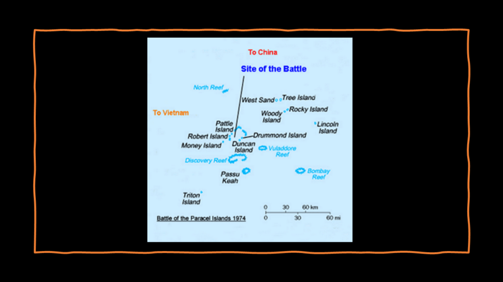
The next place we come to on this particular alignment are the Paracel Islands, located between the Philippines and China’s island of Hainan.
The Paracel Islands are a group of islands, reefs, and banks that are strategically located; productive fishing grounds; and which also hold reserves of natural gas and oil.
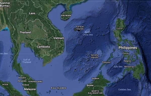
While they are controlled and operated by China, they are also claimed by Taiwan and Viet Nam.
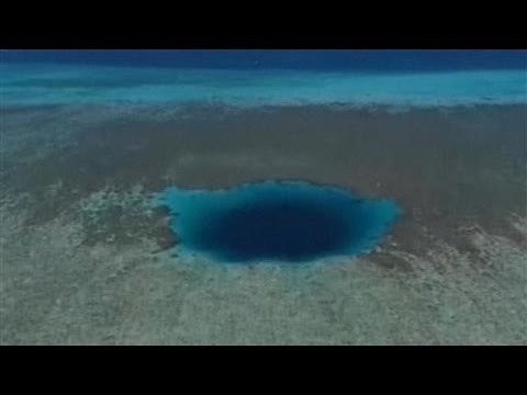
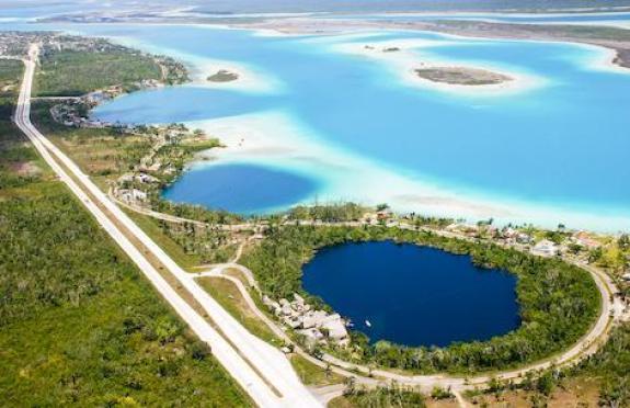
The Paracel Islands are also the location of the Dragon Hole, or Sasha Yongle Blue Hole, the world’s deepest known blue hole at 987-feet, or 301-meters, deep.
Dragon Hole is called the “Eye of the South China Sea.”
Other blues holes include the Cenote Azul Balacar on Mexico’s Costa Maya, one of the deepest cenotes in the Yucatan, believed to be 295-feet, or 90-meters, deep…
…and Blue Hole in Santa Rosa, New Mexico, which is 80-feet, or 24-meters wide and deep.
One of the most popular dive destinations in the United States, it is described as an artesian well with a constant in-flow of water that stays at a constant 62-degrees Fahrenheit, or 17-degrees celsius.

The Battle of the Paracel Islands was a military engagement between the naval forces of South Vietnam and China in 1974, and was an attempt by the South Vietnamese navy to expel the Chinese navy from the vicinity.
As a result of the battle, China established de facto control over the Paracel Islands.
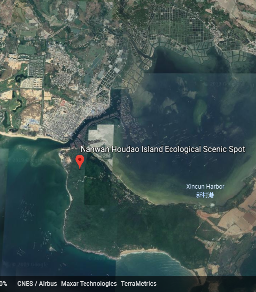
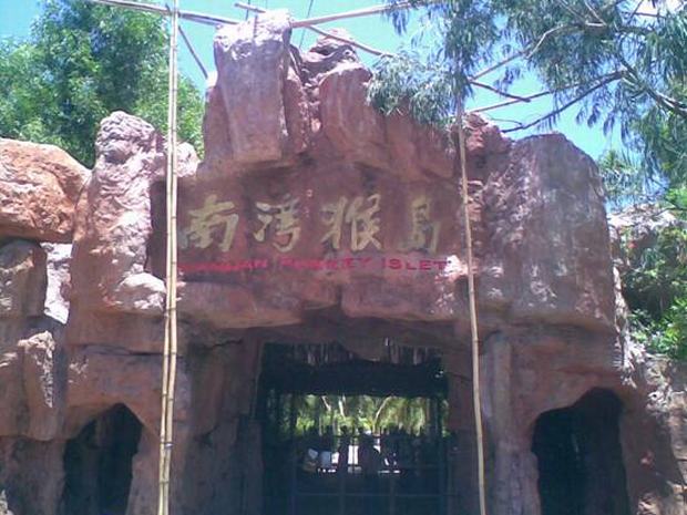
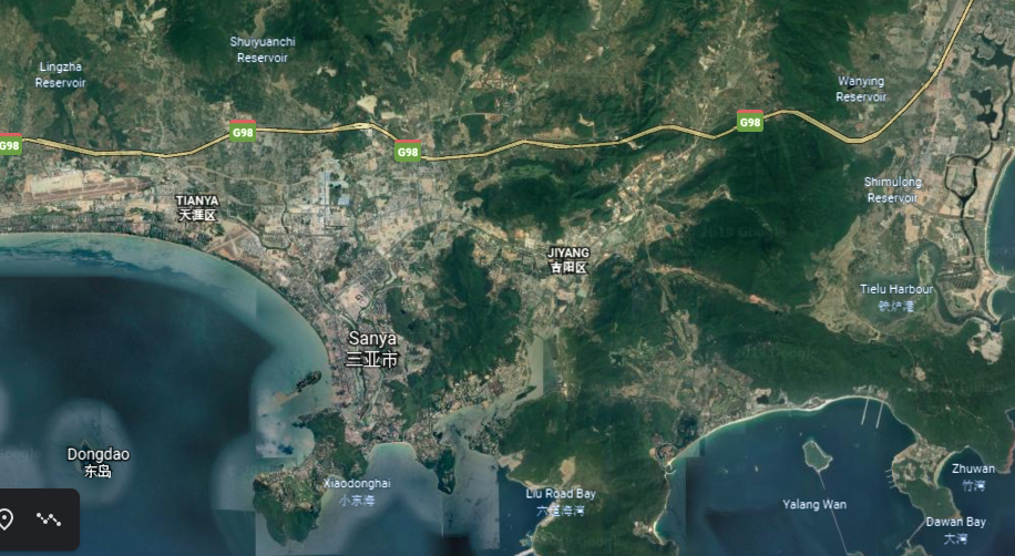
The next place we come to on the alignment is Lingshui Li Autonomous County, in the southeastern part of Hainan, China’s smallest and southernmost province.

Nanwan Houdao Island Ecological Scenic Spot, better known as Nanwan Monkey Island, is adjacent to the Xincun Harbor in Lingshui.
Looking at the view from Google Earth, there are sure some interesting-looking features in the landscape there, including but not limited, to the sunken, marshy appearance of the land around the “Ecological Scenic Spot” and Xincun Harbor seen here in the screenshot.
The only way to get to Nanwan Monkey Island is via a 2-kilometer, or 1-1/4-mile, long cable-way, the longest in China.
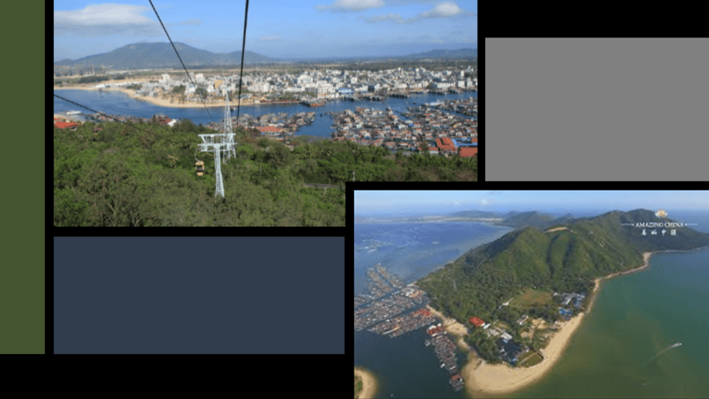
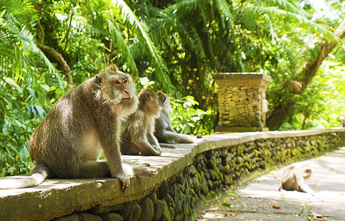
Nanwan Monkey Island, actually a peninsula, is a state-protected nature reserve for Macaque monkeys. This red sandstone feature at the entrance is called the Garden Gate…
…and here are some scenes from inside the reserve, like the nice stone wall here upon which the macaques sit…
…and the heated swimming area for the macaques…
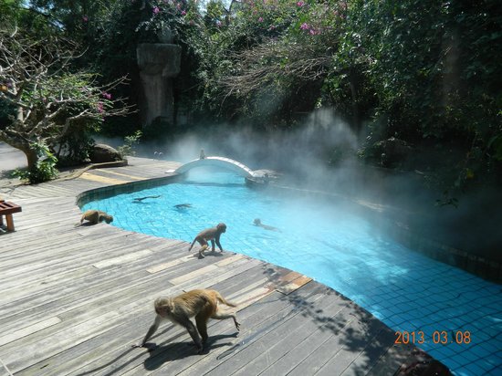
…and just the overall ancient stonemasonry appearance of the place.

We don’t recognize this as ancient stonemasonry because we are taught that all of this is a product of natural forces and geology.

Another thing I noticed about Lingshui is that there sure are a lot of reservoirs here in this part of Hainan Province!

Interesting to note the population density of Hainan is low compared to most Chinese coastal provinces, so high population is not the reason for the proliferation of reservoirs.
Diao Luo Mountain National Park is on the alignment further up in Lingshui Autonomous County.

It is one of five tropical rainforest regions on Hainan.
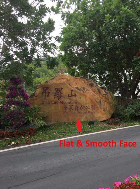
Diao Luo Mountain is the location of the Fengguoshan Waterfall cluster, the largest in Hainan Province.
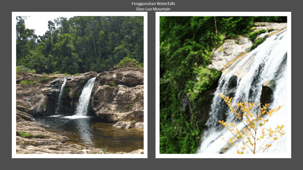
In order to view the falls, there are 1,700 steps on the trail leading to the waterfall cluster.

Wuzhi Mountain is up the alignment from Diao Luo Mountain.

Wuzhishan is the highest mountain in Hainan…
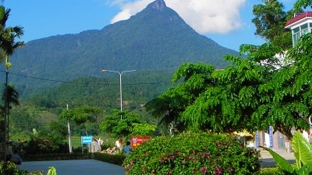
…and is also known as the Five-Fingered Mountain.
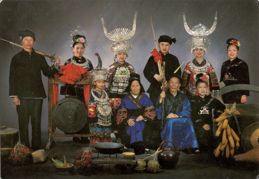
There are several minority ethnic groups on Hainan.
Two are recognized ~ one of these groups is the Li People.
The areas surrounding Wuzhishan are inhabited primarily by Li People, said to be the original inhabitants of Hainan, and the largest of the ethnic minorities there.
Their tradition of making brocade is said to trace back 2,500 years.
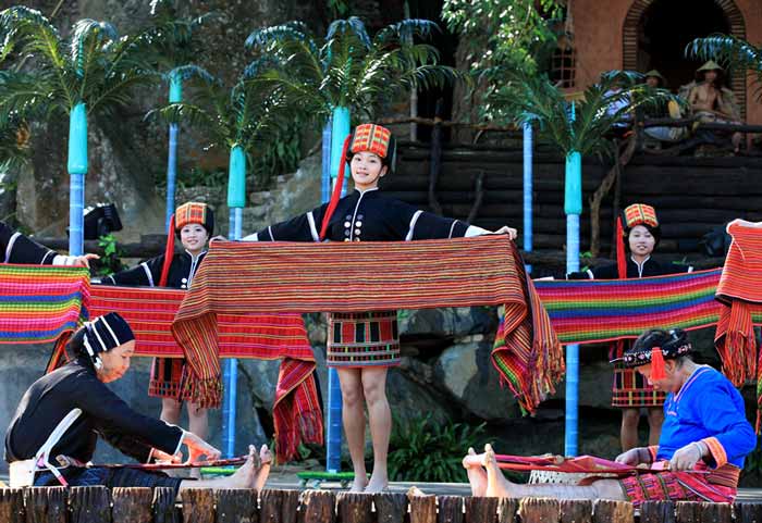
This the Miao minority ethnic group on Hainan.
The Miaos are found through-out the southwestern provinces of China, as well is in Thailand, Laos, and Viet Nam, where they are known as the Hmong people.
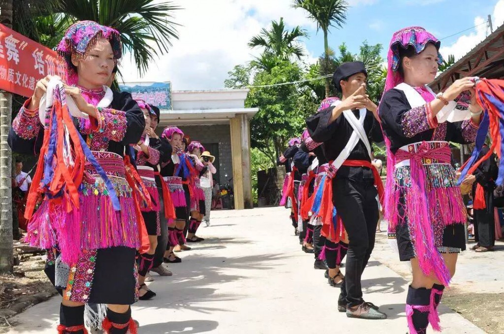
They are also known for lively embroideries and brocades, as well as traditional silver ornaments that include traditional necklaces, bracelets and headwear.
There are two unrecognized minority ethnic groups.
The Muslim Utsul People, or Hainan Hui, are found in Sanya on the southern coast of Hainan.

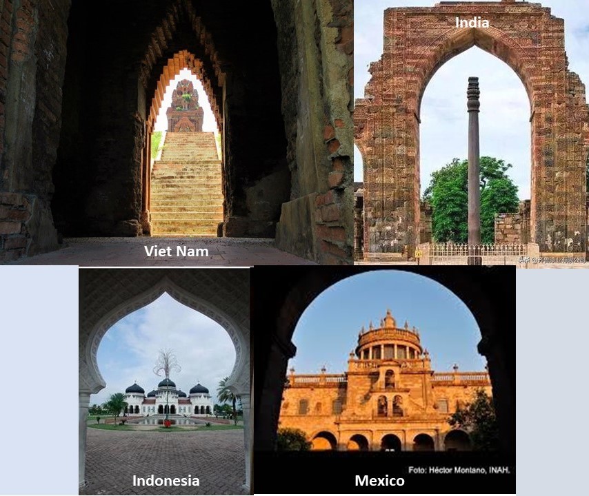
We are told they are a Chamic-speaking people who came to Hainan by way of their Cham homeland in Viet Nam to escape the Vietnamese Invasion of 1471, when the Vietnamese completed their conquest of Cham with the sacking of Vijaya, the last Cham capital.

On the top left is a view of a temple framed by an archway in Vijaya, and on the top right is the Iron Pillar of Delhi framed by an archway in India, which is famous for the rust-resistant composition of metals used in its construction. It is said to have been made 1,600 years ago.
On the bottom left is the archway framing the Baiturraman Grand Mosque in Banda Aceh in Indonesia, which was hard hit by the Boxing Day Tsunami on December 26th, 2004, and the bottom right shows the archway framing the Hospicio Cabanas in Guadalajara, Mexico.
More on the Cham in Viet Nam and other places to come.
The other unrecognized minority ethnic group on Hainan are the Dan people, historically known as the “Boat People,” and “Gypsies of the Sea.” They live along the coasts of the southern China.

The Dan people are said to be traced back to 7,000 years ago to the Hemudu period, a culture that flourished in eastern China between 5,500 BC to 3,300 BC. This is a Hemudu site 22-kilometers, or 13-miles, northwest from Ningbo, and is called the birthplace of the Hemudu Culture.

At the same Hemudu site near Ningbo, you find this exhibit promoting the narrative that Humanity was really primitive back in those days, at the same time it was a megalithic culture.
From China’s Hainan Province, the alignment crosses into the Gulf of Tonkin.

While most immediately recognizable for the Gulf of Tonkin incident, an international confrontation that led to the United States engaging more directly in the Viet Nam War…

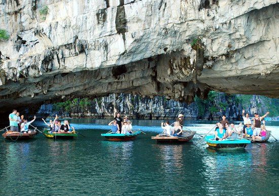
…you also find the UNESCO World Heritage Site of Halong Bay, which has approximately 1,600 islands and islets forming a spectacular landscape of limestone pillars…
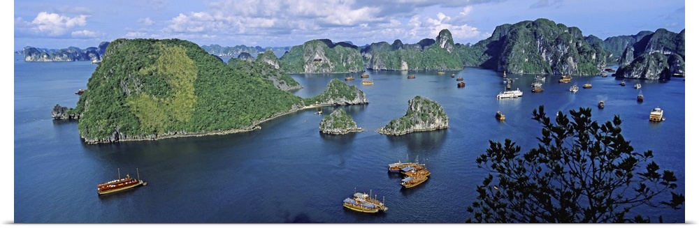
…said to have been formed over 500 million years with very different geologic circumstances. Over the last 20 million years, these formations were said to have formed with a combination of thick limestone, hot and humid climates, and a slow overgrowth of the tectonic process.
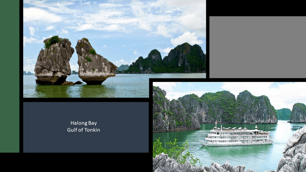
Again, because we haven’t been taught that this could be anything other than natural, and that Humanity was functioning at a primitive level during so-called prehistoric & ancient times, we miss seeing the examples of what appear to be huge masonry blocks and a built-in archway, like what we saw on Cat Ba Island in Halong Bay.
It’s not supposed to be there, so we don’t see it. We don’t even think it.
And it is so old that there is an element of doubt about whether or not it is natural, but there are examples like this worldwide.
Leaving the Halong Bay on the Gulf of Tonkin, just a quick stop along the alignment in the Thanh Hoa, the capital of Thanh Hoa Province, on the Ma River, 150-kilometers, or 93-miles, south of Hanoi.
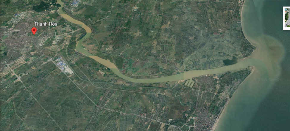
I saw a trident feature off the Ma River between the Gulf of Tonkin and Thanh Hoa on the top, that reminded me of a similar trident-shaped feature I saw on the Brownsville Ship Channel that runs from the Gulf of Mexico at Port Isabel, Texas to Brownsville, Texas on the bottom.

Sites around the city of Thanh Hoa include the Ho Dynasty Citadel, the only stone citadel remaining in Southeast Asia, and said to have been a breakthrough in the construction at the time it was built in 1397 of stone citadels in Viet Nam.
It was a declared a UNESCO World Heritage Site in 2011.
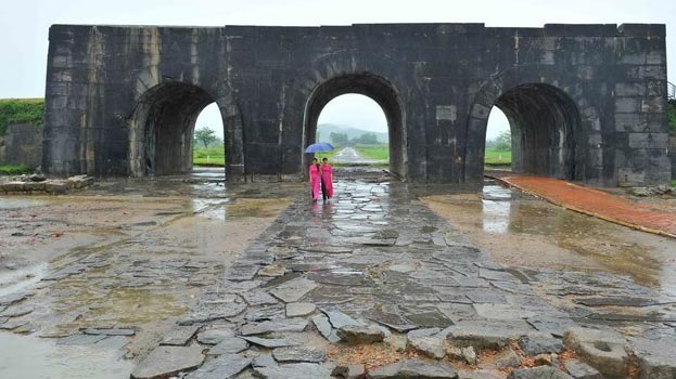
Yet the Ho Dynasty’s reign was said to be short, consisting of two emperors. Ho Quy Ly from 1400 to 1401, and his second son Ho Han Thuong from 1401 to 1406.
Here are some other sights around Thanh Loa.

Now that we are here in Viet Nam, I will bring up once again the Cham presence here…and in other places.
The Kingdom of Champa was said to have existed in Viet Nam from 192 AD – 1832 AD.
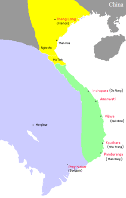
The Chams of modern Viet Nam and Cambodia are the remnants of the former Kingdom of Champa, and were said to have originated as an ethnic group of Austronesian origin in Southeast Asia and were accomplished seafarers that from 4,000 BC populated Southeast Asia.

Hinduism shaped the art and culture of the Champa Kingdom for centuries.
While most Chams in Viet Nam today are Muslim…
…the Balamon Cham, are along with the Hindus of Bali in Indonesia, are the only two surviving indigenous Hindu people in the world outside of India.

This is a Cham head of Shiva said to have been made in 800 AD from an alloy of gold and silver…
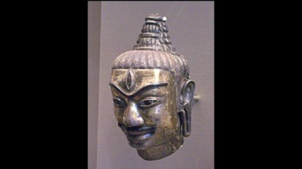
…and a 9th-century statue from a Buddhist monastery in Indrapura, the Champa capital.

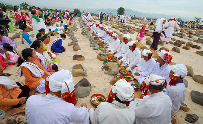
The Champa city of My Son is a UNESCO World Heritage Site and was a religious center of the Cham, and flourished from the 2nd- to the 15th-centuries.
In this first picture, you see a temple in the background, and huge megatlithic stonemasonry in the bottom of the picture…

…as well as a bigger view of the My Son temple complex here, again with the huge megalithic masonry seen in the middle of the photo.

Then there is the Ancient Khmer Empire of Cambodia.
How big of a stretch is it to see the word Khem related to Khmer, Cam, and Cham?
Ancient Khem is a shortened version of Ancient Khemit, the name we are told given to a technologically and spiritually advanced civilization that existed in a Golden Age that predated dynastic Egypt.
But could that civilization of Ancient Khemit existed worldwide?
I think it did.
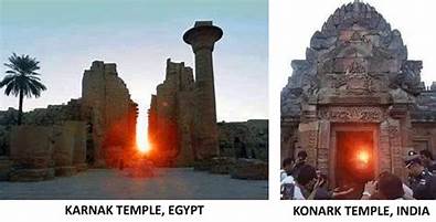
This is a comparison of a solar alignment at Karnak Temple in Egypt on the left, and one at Konark Temple in India on the right.
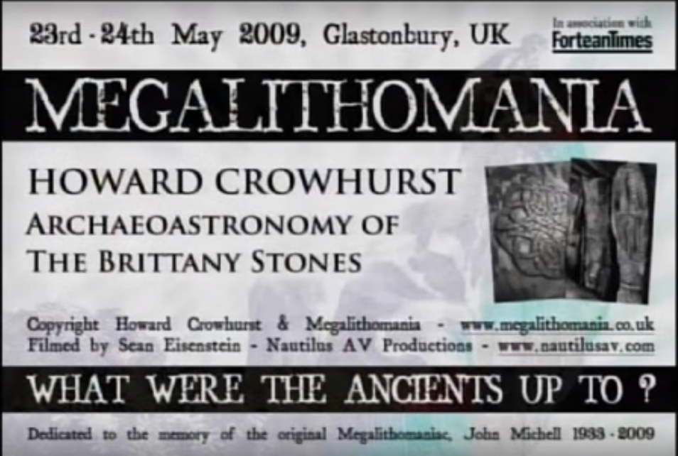
Then there is Howard Crowhurst’s work documenting the geometry and astronomical alignments of Carnac in Brittany France.


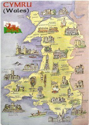
And Robin Heath has done field-work in Wales…

…to record the astronomical alignments…

…and geometric alignments in the landscape with sacred sites there.

The ancient name for Wales is Cymru.
There’s the “Khem” sound again!
So back to Southeast Asia, the Khmers of Cambodia were responsible for building the Hindu-Buddhist temple complex at Angkor Wat, the largest in the world.
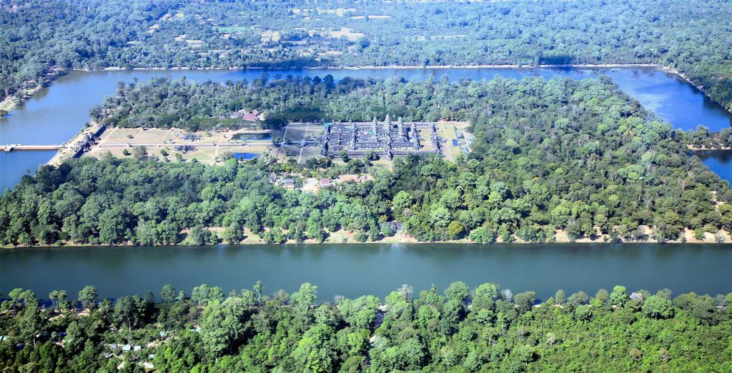
Angkor Wat is located on an artificial island surrounded by a perfectly-square moat.
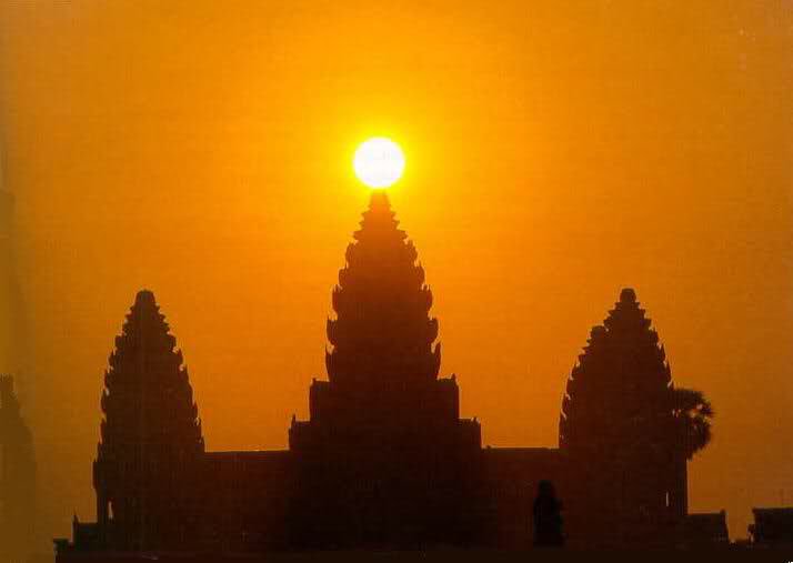
This is what happens at the main Temple of Angkor Wat on the equinoxes, the time of year when the sun crosses the plane of the Earth’s equator, and day and night are of equal length, with the sun sitting right on top of the middle spire…
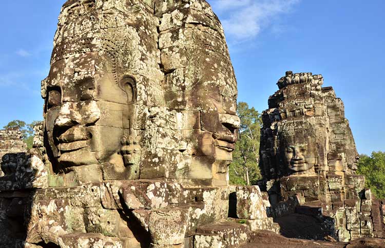
…and these are the Face Towers at the Bayon Temple, located within the Angkor complex.

The memory of these people has been erased from our collective memory, and replaced with a lot of mysteries.
Who built these things?
Why did they build them?
How did they build them?
These are conundrums that confound the constructs that guide our understanding of history because we haven’t been told the True History of Earth.
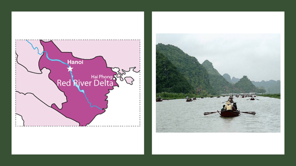
My next stop is Hanoi, the capital of Viet Nam in the Red River Delta.
We are told that Hanoi was founded as Thang Long, the capital of Imperial Viet Nam, in 1010, with the Thang Long Citadel said to have been built around that same time by the Ly Dynasty.
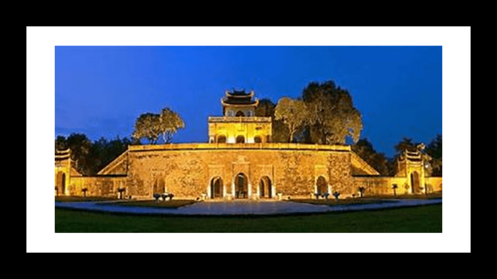
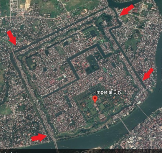
The Nguyen Dynasty, the last imperial dynasty of Viet Nam, moved the capital to the Imperial City of Hue in 1802, in a walled enclosure within the citadel there…
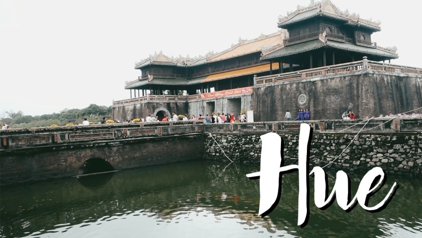
…which has all the hallmarks of…
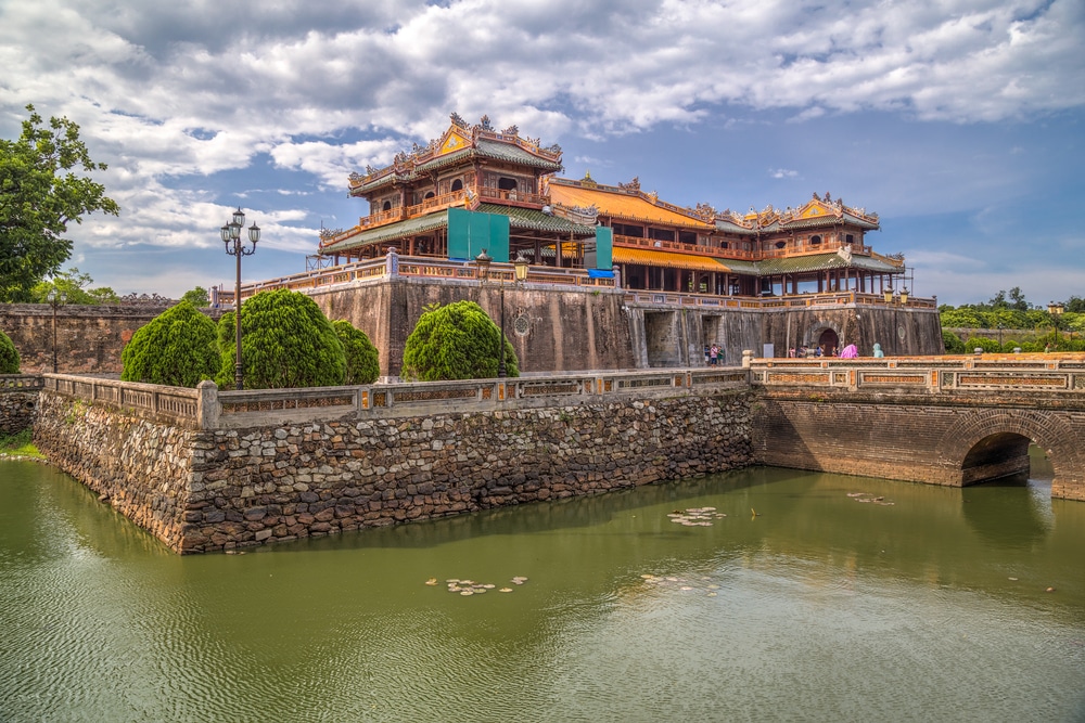
…a star city…
…like what is found in Lucca, Italy…

…and what used to be in Trujillo, Peru…
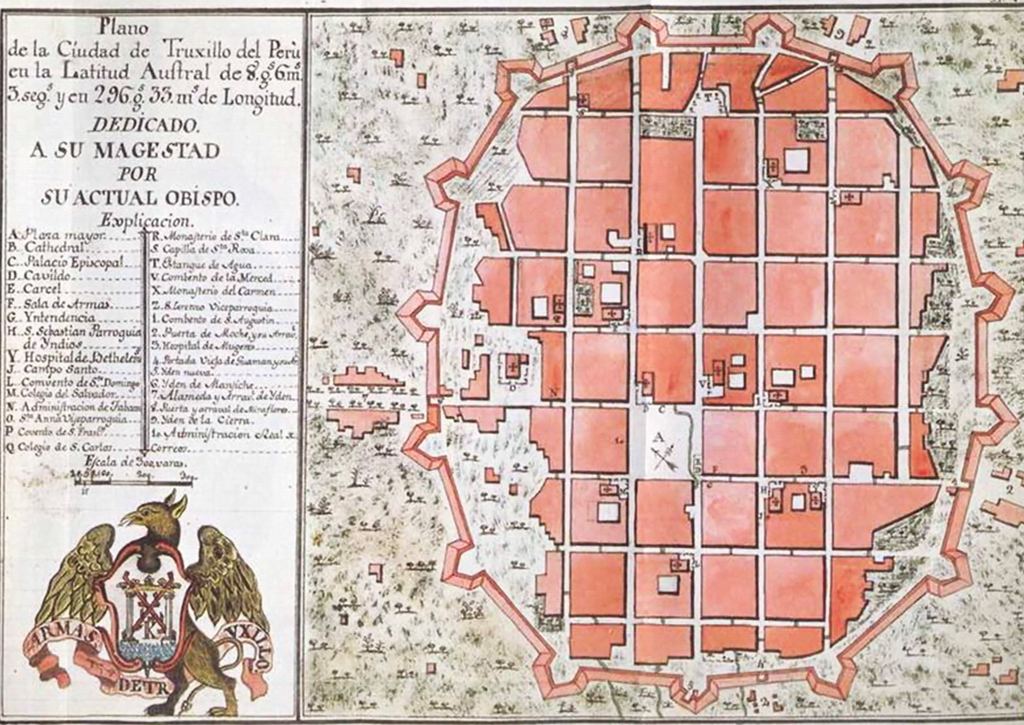
…of which this is all there is left of the bastion walls in Trujillo.

Thang Long was renamed Hanoi in 1831, and conquered by the French in 1873, and from 1883 to 1945 was the capital of French Indochina. We are told the French colonization made a lasting impact on the city’s architecture that is visible today through French-styled avenues, buildings and bridges.
Like the Hanoi Opera House, said to have been built between 1901 and 1911…

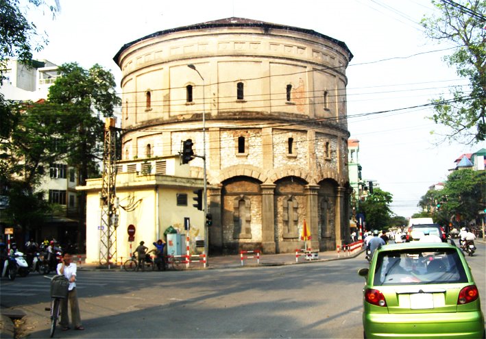
…the Hang Dau Water Tower, said to have been built in 1894…
…the Long Bien Bridge…

…a bridge used by the railroad, mopeds, bicycles, and pedestrians today.

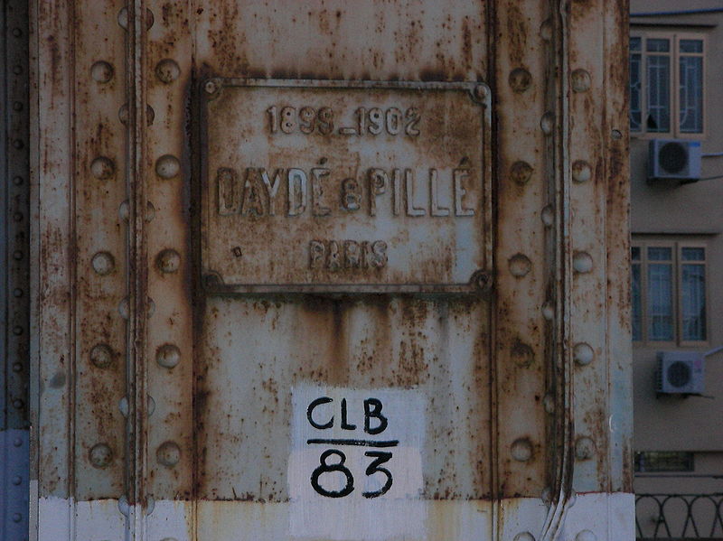
This picture was said to have been taken after the completion of the construction of the Long Bien Bridge by a French architectural firm between 1899 and 1902.

It is far easier to put a plaque on something than to build a massive engineering structure like this, with both steel and masonry.
We are told the plans were laid for a city-wide tramway system in Hanoi in 1894, but by 1899, advances in technology in those five-years made it possible to construct the entire system as state-of-the-art electric system instead of the steam-power which was originally planned…
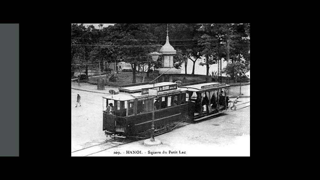
…with construction of the first lines starting in 1900, and the first two lines being opened in 1901.

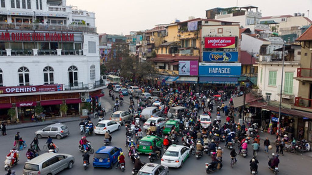
All four lines that were built over the years, we are told, gradually either deteriorated or fell victim to modernization, and these are the chaotic traffic patterns in Hanoi in our day and age.
One more thing before I leave Viet Nam for Laos.
Hanoi was the site of the world’s fair in 1902 and 1903.
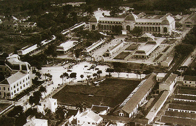
The year 1902 was the year Hanoi replaced Saigon as the capital of French Indochina…and the year of the opening of the Long Bien Bridge.
The Grand Palais was said to have been built specifically for the Hanoi Exposition in 1902.
The Grand Palais of the Hanoi Exposition was completely destroyed by airstrikes at the end of World War II because when the Japanese took over Viet Nam in 1940, at which time they based their military and supply in the palace.

The next place we come to on this alignment is in the land-locked country of Laos.
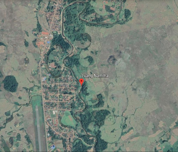
Luang Namtha is the name of a Province in northern Laos, and its capital city.

The city of Luang Namtha is located on the S-shaped Tha River.
This is a site along the Tha River on the left that reminds me in appearance of Thunder Mountain in Sedona, Arizona, on the right.

There is a provincial museum in Luang Namtha City that is largely an anthropological museum…

…containing numerous items relating to the local people like clothing, textiles, household items, Buddhist-related items, and bronze Khamu drums.

The majority of Khamu, or Khmu, now live in northern Laos, though the Khamu are indigenous to Southeast Asia, and are found in Myanmar (formerly Burma), Thailand, Viet Nam (where they are officially recognized), and in the Yunnan Province of China (where they are not officially recognized).
Yet another Kham to connect to the Ancient Kemetic civilization of Egypt.

Other peoples of Laos include the Hmong, a sub-group of the Miao people…

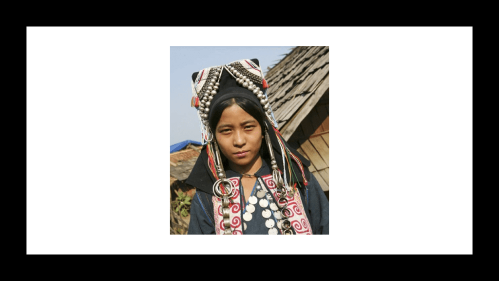
…the Akha people…
…and the Mien People.
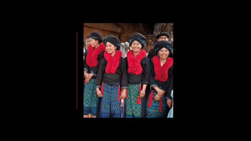
What I find interesting is that the woven textiles and traditional clothing of all of these ethnic groups is not significantly different from each other, nor is it significantly different from that of other places like the Helong weavers of West Timor in Indonesia…
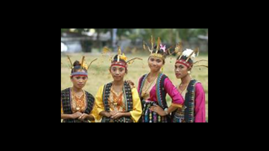
…or the textiles and clothing of Peru.
Is there a much closer relationship between these different groups of people than what we have been told?

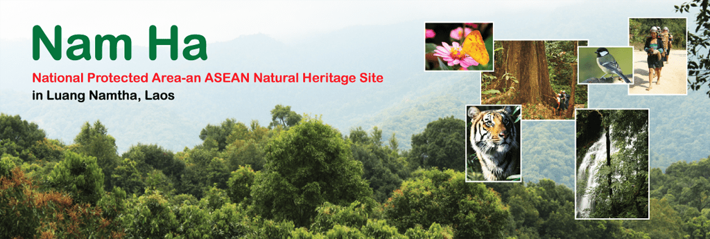
The Nam Ha National Protected Area in Luang Namtha Province is home to some of the Khmu, Hmong, and Akha peoples, among several other of the ethnic minorities in Laos.
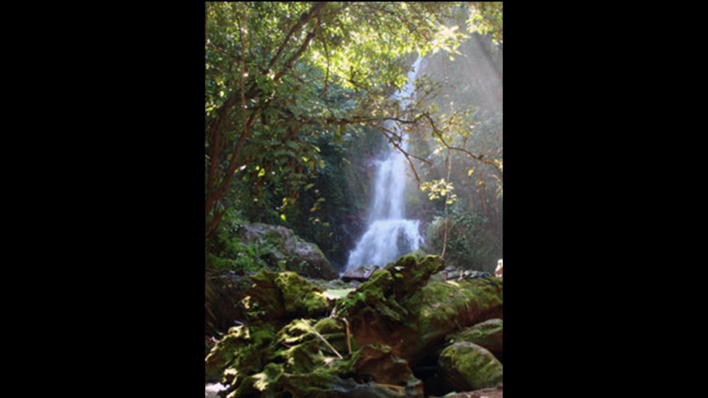
The Pha Yueng Waterfall is located in the Nam Ha Protected Area, on the road from Luang Namtha to Muang Sing.

Muang Sing is a small town and district in Luang Namtha Province, 37-miles, or 60-kilometers, northwest of the town of Luang Namtha, and in close proximity to the border between Laos, and Yunnan Province of China.

The principal Buddhist temple here is called the That Xieng Tung Stupa.
A festival is held here every year on the full moon of the twelfth lunar month (in October or November).

The Nam Keo Waterfall is slightly over 1-mile, or 2-kilometers from this stupa.
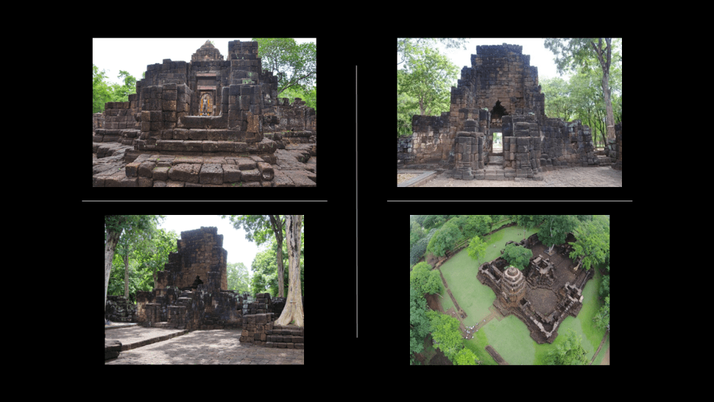
Muang Sing is also the name of an historical park in neighboring Thailand.
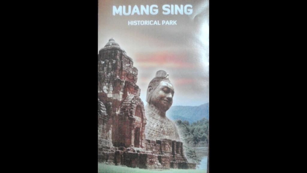
It protects the remains of two Khmer temples said to date from the 13th- and 14th-centuries in Thailand’s Kanchanaburi Province, on the S-shaped Khwae Noi River.

Before I move along the alignment into Myanmar, there are several more things I would like to bring up in or about Laos.
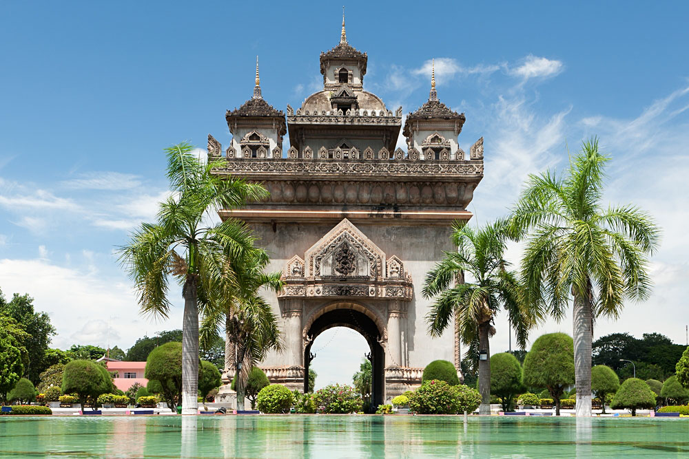
One is the Patuxai, or the Arch of Triumph of Ventiane, built in the capital city of Laos, and which we are told was built in the 1960s as a monument dedicated to those who fought in the struggle for Laos’ independence from France.
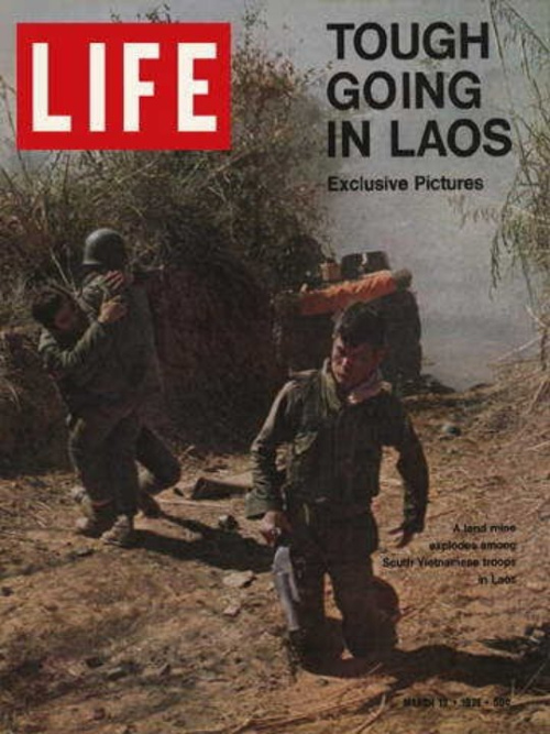
Among other problems with that dating of the construction of this arch is that during the 1960s, Laos had its own problems with the Viet Nam war spilling over into Laos, with Laos being bombed by American planes starting in 1964, in retaliation we are told, for the shooting down of an American plane by insurgents, and after which bombing runs over Laos intensified, with over 100,000 bombing runs on Laos’ eastern border with North Viet Nam.
Don’t we hear the exact same reason given for aggressive military action even today, like what started against Yemen on January 12th of 2024 ?
Same template, same tactic, same reason.
Controlled opposition set-up to wreak havoc on the lands of the ancient civilization and its people.

For example, the Plain of Jars in Laos.
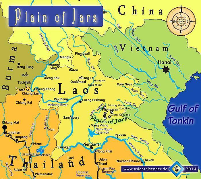
The Plain of Jars is a mystery, with thousands of what look like huge jars cut from stone filling the landscape.

Some of the stone jars are massive in size!
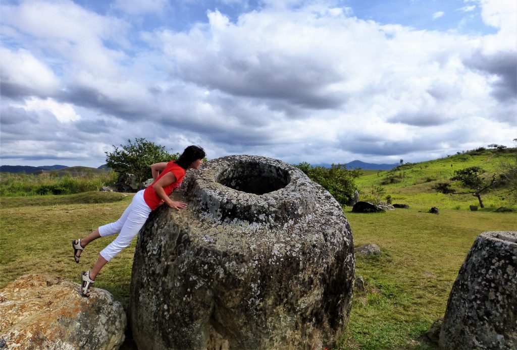
Between 1964 and 1973, the Plain of Jars was heavily bombed by the U. S. Air Force operating against the North Vietnamese and Pathet Lao communist forces, and it was said that the Air Force dropped more bombs on the Plain of Jars than it dropped during the entirety of World War II.

These were some unexploded bombs removed from the Plain of Jars from the secret war in Laos.
Why the incessant and excessive bombing of a megalithic archeological site?
Per capita, Laos is the most bombed country in history.

One last place that I would to mention in Laos is Luang Prabang on the left, where there are beautiful waterfalls that look similar to Havasupai Falls in Arizona’s Grand Canyon on the right.

Leaving the country of Laos, I am tracking the alignment into the country of Myanmar, formerly known as Burma, through the city of Lashio, the largest town in northern Shan State.

The population of Shan State is mostly comprised of the Shan People, Chinese, and Burmans.
The Shan people live primarily here, but they are also found on other parts of Myanmar, China, Laos, Thailand, and India.
The majority of Shan are Theravada Buddhists or practice the animist Tai folk religion.
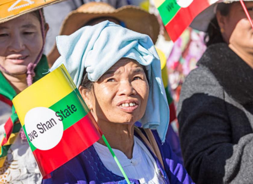
The Shan Hills are found in Myanmar’s Shan State.

There are hot springs in Lashio, of which I come across many tracking planetary alignments.

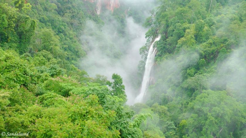
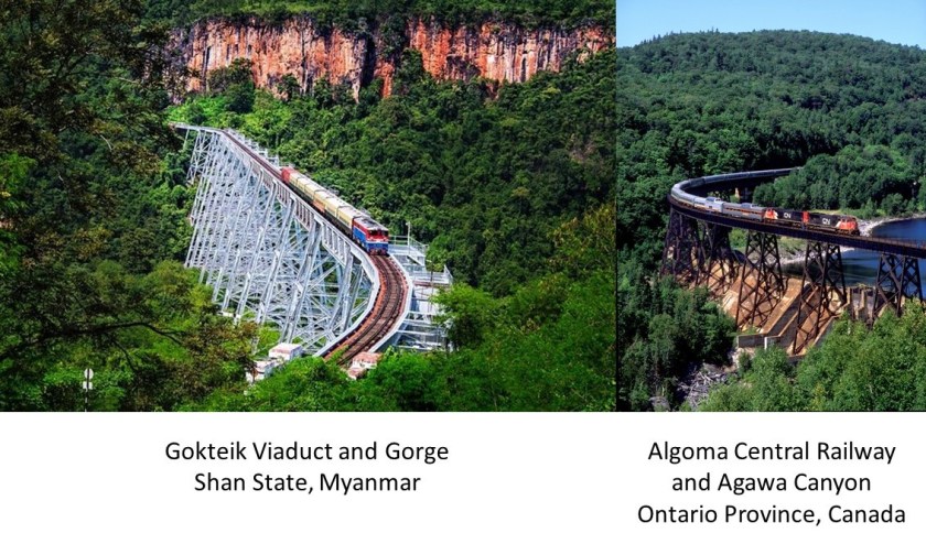
The Gokteik Viaduct was said to have been built in 1899 – 1900 by an American Company on behalf of British Authorities, and is between Lashio and Pyin Oo Lwin in the Mandalay Region of Myanmar, and which became a permanent military outpost for the British in 1897 and eventually the summer capital of British Burma, which existed from 1824 until 1948 when Burma chose to become a fully independent republic instead of a British Dominion.
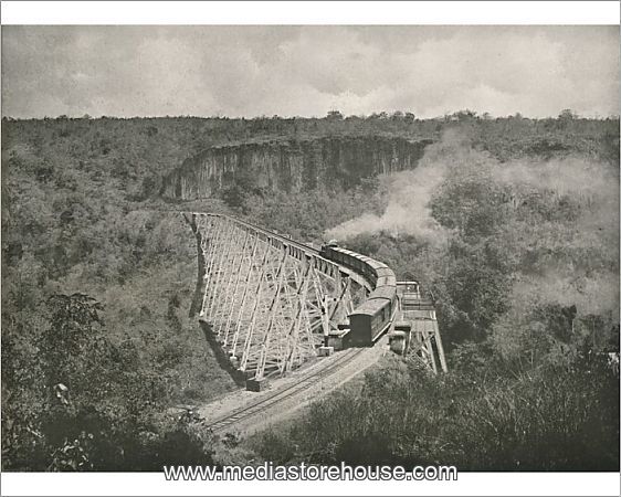
The Gokteik Viaduct goes across the Gokteik Gorge, which has at least one waterfall as seen here.
The appearance of the Gokteik Viaduct reminded me of this trestle of the Algoma Central Railway in Ontario. The Algoma Central Railway was said to have been chartered in 1899 and built between Sault Ste. Marie, Ontario and Hearst, Ontario by 1914.
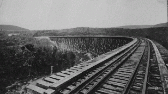
The Algoma Central Railway is known for its daily excursion to Agawa Canyon, 113-miles, or 182-kilometers, north of Sault Ste. Marie, Ontario, through a sparsely populated area with few roads.

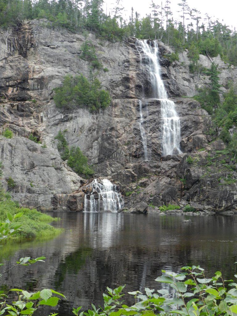
There are waterfalls in the Agawa Canyon as well.
Here is a comparison of the Gokteik Viaduct at the Gokteik Gorge in Myanmar on the left, with the Algoma Central Railway Trestle at the Agawa Canyon on the right.
There is no doubt in my mind that there was an energy-generating connection for the original civilization between the railroad, s-shaped river bends, hydro-electricity generation, waterfalls, gorges and springs.
In 2023, I researched these findings extensively in my blog post “Of Railroads and Waterfalls and Other Physical Infrastructure of the Earth’s Grid System.”
Next, let’s take a look at the British Colonial Summer capital of Pyin Oo Lwin in Myanmar.
This is the All Saints Anglican Church there.

Where have I seen that style of church architecture before, with the Moorish-looking tower next to the nave?
All over the place!!!
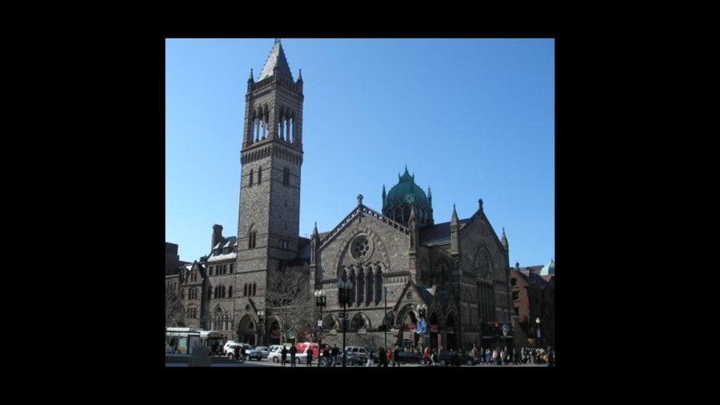
Like the New Old South Church in Boston, Massachusetts…
…this church in Flagstaff, Arizona…

…and the Chapel de Les Alegries in Spain near Barcelona, to name just a few.

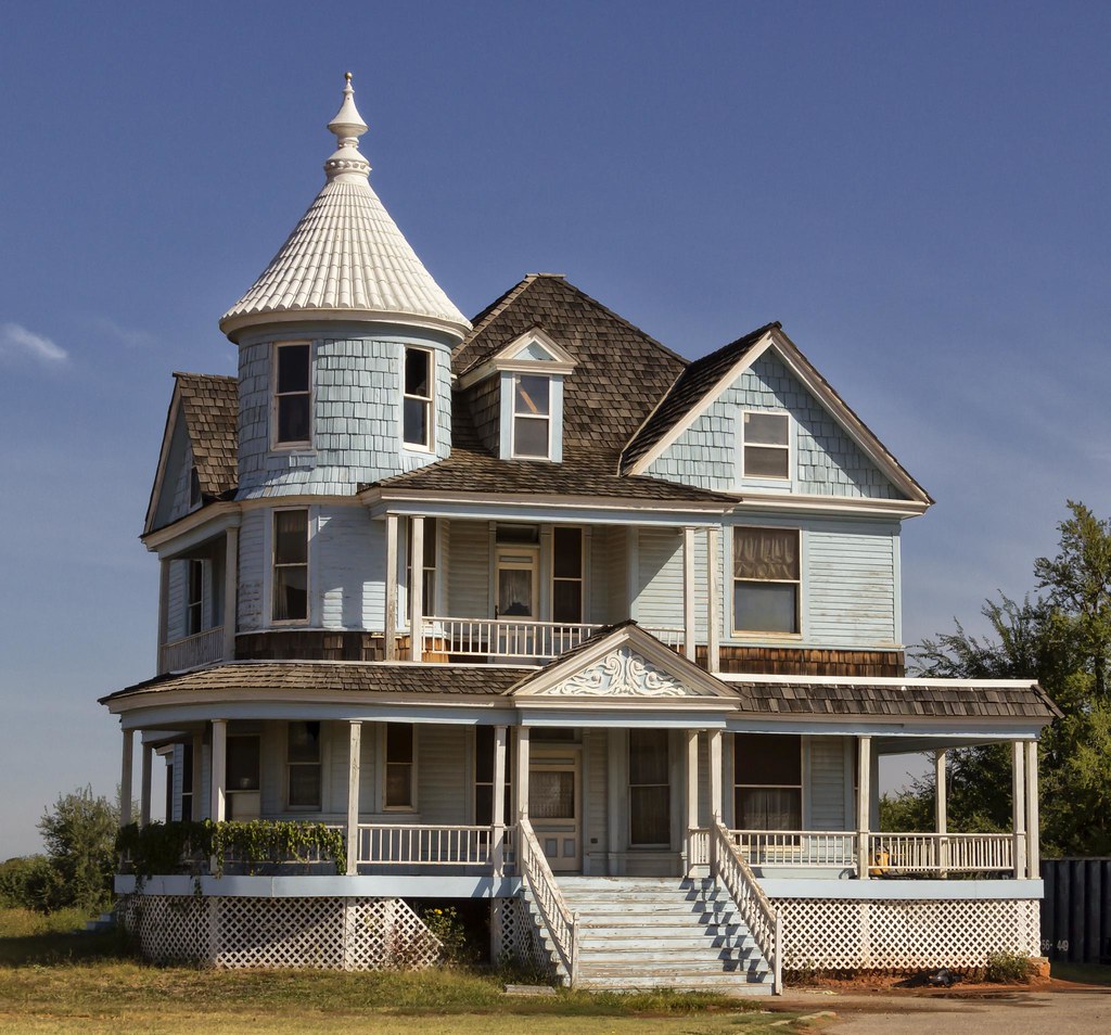
This is the Gandamar Myaing Hotel, said to have been an old British colonial mansion converted into a hotel.

I have seen that style of architecture all over the place as well.
In Nova Scotia, a maritime province of eastern Canada…

…Spencer, Oklahoma just outside of Oklahoma City…
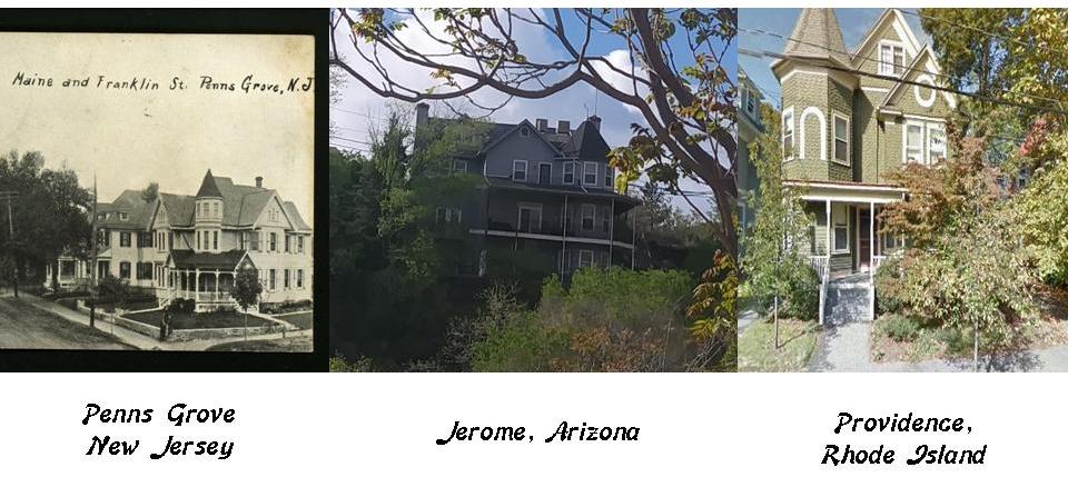
…and on the left, in Penns Grove, New Jersey; in the middle, in Jerome, Arizona; and on the right in Providence, Rhode Island.
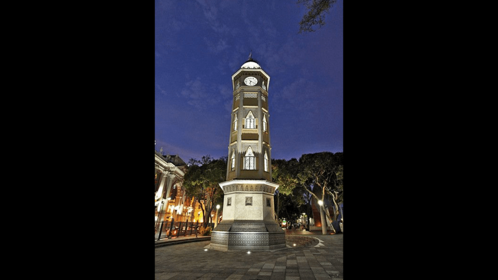
This is the Purcell Tower in downtown Pyin Oo Lwin, said to have been built in 1934 by the Gillette and Johnson Company to commemorate the Silver Jubilee of the reign of George V of Great Britain.
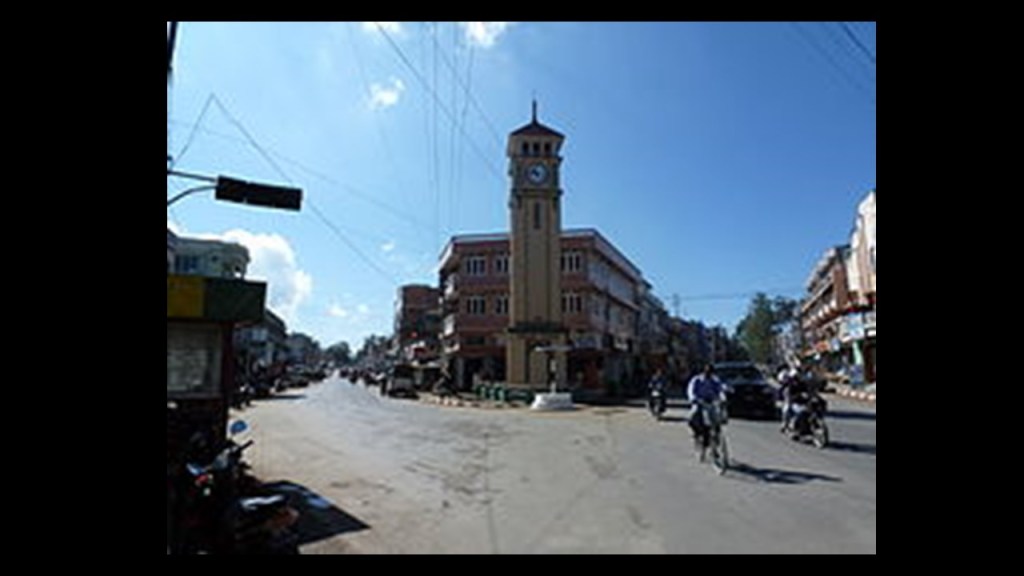
It also looks like a Moorish Clock Tower.
This is actually called the Moorish Clock Tower, and is located in Guayaquil, Ecuador…
…St. Mark’s Campanile in Venice, Italy, which is also a bell-tower…

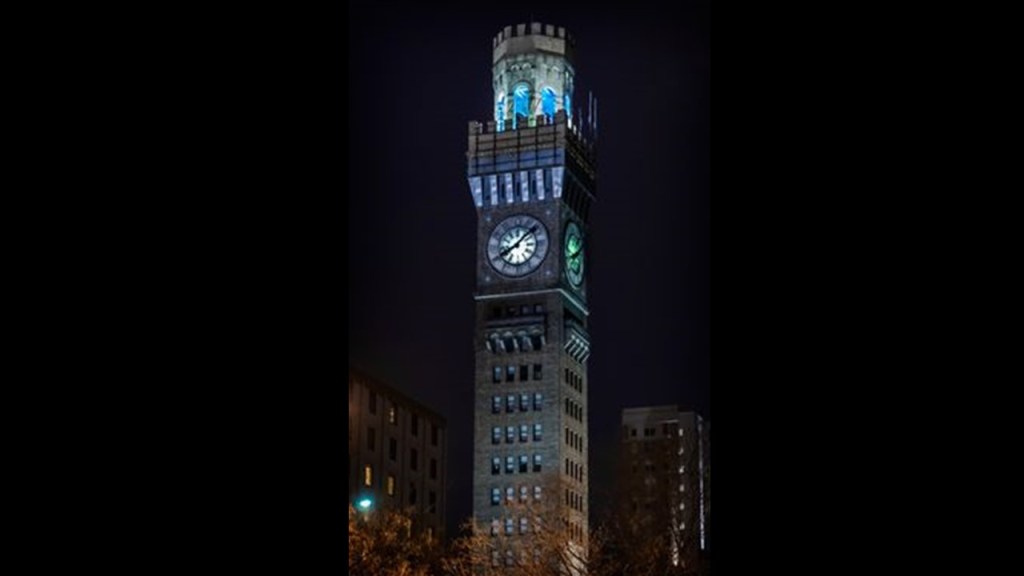
…and in the United States, there is the Emerson Bromo-Seltzer Clock Tower in Baltimore, Maryland…
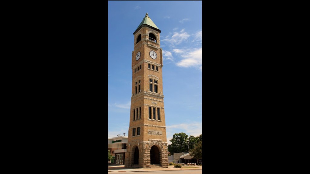
…the Neenah clock tower in Wisconsin…
…and the Port Townsend, Washington clock tower, again to name just a few of many examples.

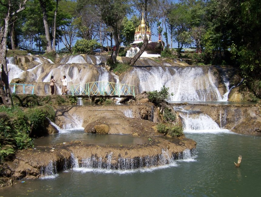
I will end my tour of Myanmar with a picture of waterfalls in Pyin Oo Lwin.
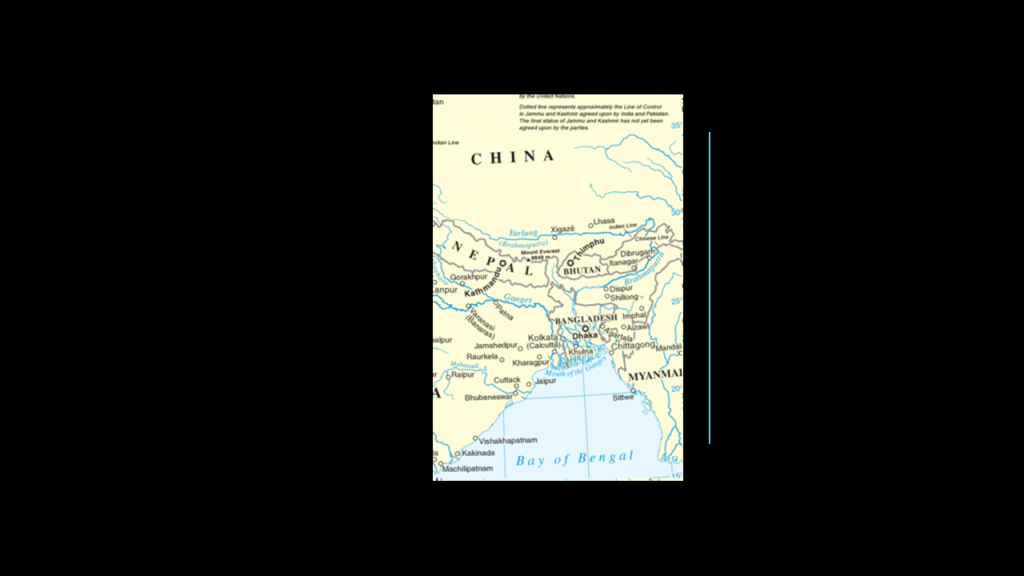
Now we are coming into the last leg of the journey along this part of the alignment in Bangladesh.
The country of Bangladesh’s placement on the Bay of Bengal is such that it contains much of the Ganges Delta, the largest delta on earth formed by the confluence of the Ganges, Brahmaputra, and Meghna Rivers.
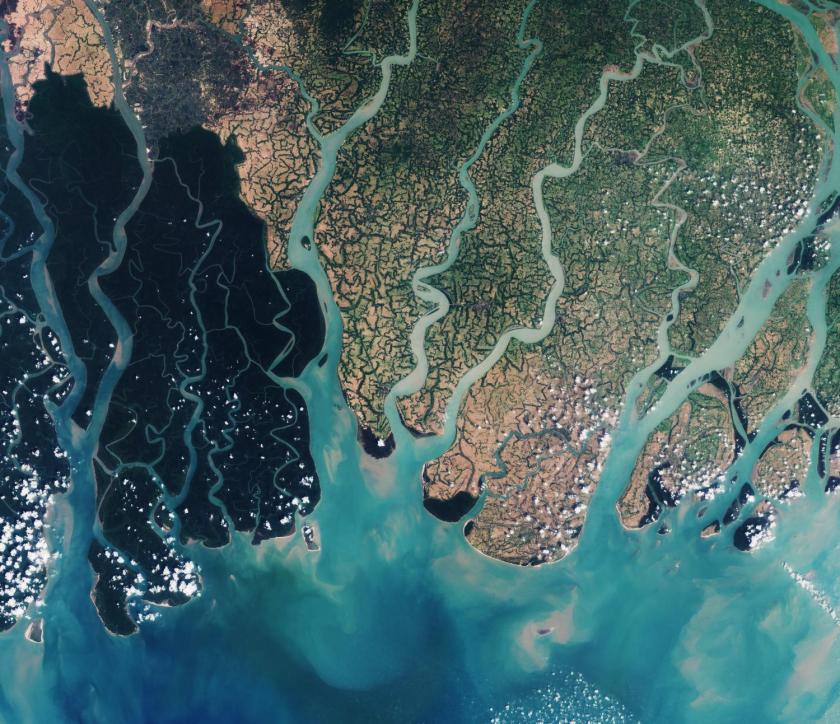
While not directly on this alignment, the Sundarbans are described as consisting of mangrove areas, land for agricultural use, mud flats and barren land, and is intersected by multiple tidal streams and channels.

The Sundarbans National Park in West Bengal, India, is home to the largest population of Bengal tigers.
The Bengal tiger ranks amongst the biggest wild cats alive today, though it is an endangered species.
Note the stone with angles this tiger is standing on, and the large, what looks like stone-work, in the background.

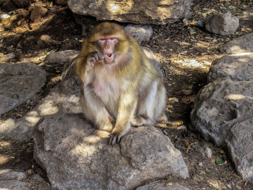
The Bengal tiger was named for a historical place, like the Barbary apes, a species of macaque, of the Atlas Mountains of Algeria and the Rif Mountains of Morocco, and also found in Gibraltar.
This guy is also sitting on top of what looks like old stonework.
The Barbary Coast, or Barbaria, was also the name given to a vast region stretching from the Nile River Delta, across Northern Africa, to the Canary Islands.

Memories of places and people is quite frequently retained in the name of something, in this case species of animals indigenous to particular places.
This slight-of-hand name change seems to be what happened with this part of what was the ancient civilization of Bengal. Change and rearrange a few letters, and you have “Bangla.” No one’s the wiser because the region’s true past history is unknown to the general public.

Interesting to note that we told that the proprietary rights to the Sundarbans were sold to the British East India Company in 1757 by the Mughal Emperor Alamgir II, although I also found a reference to the Battle of Plassey occurring that same year in which the British East India Company defeated the Nawab of Bengal and his French allies.
The British East India Company ruled over parts of the Indian Subcontinent between 1757 and 1858, commencing after the 1757 Battle of Plassey, called a decisive victory over the Nawab of Bengal, and this was considered to be the start of British Imperialism in India, and a key step in the eventual British domination of vast areas there.

The British East India Company held a monopoly granted to it by Queen Elizabeth I of England in 1600 between South Africa’s Cape of Good Hope and Tierra del Fuego’s Cape Horn at the southern tip of South America, until 1834 when the monopoly was lost.
We are told It was initially formed to trade in the Indian Ocean region with the East Indies, which was the Indian subcontinent and southeast Asia, and yet it seized control of large parts of the Indian subcontinent, and ruled the beginnings of the British Empire in India.
Its three Presidency Armies totalled an estimated 260,000 soldiers, twice the size of the British Army at the time.
It ceased operations on June 1st of 1874 when it was dissolved.

Systematic management of the mangrove forest tracts of the Sundarbans was administered by the British starting in 1860s, apparently to simultaneously protect the forests and remove the resources.
The borders of the country of Bangladesh were the major portion of the historic region of Bengal, an ancient civilization dating back at least 4,000 years.
The borders of modern Bangladesh were established with the separation of Bengal and India in 1947, when the region became East Pakistan of the newly formed State of Pakistan following the Boundary Partition of India, even though it was separated from West Pakistan by 994-miles, or 1,600-kilometers.
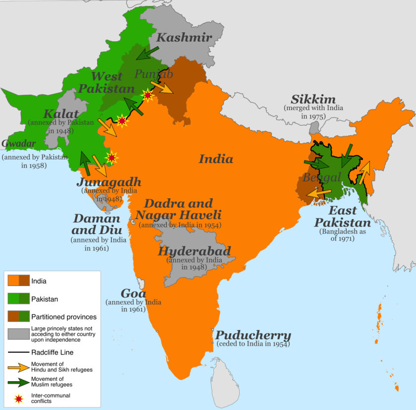
Bangladesh became an independent republic in 1971 after a period of armed conflict.
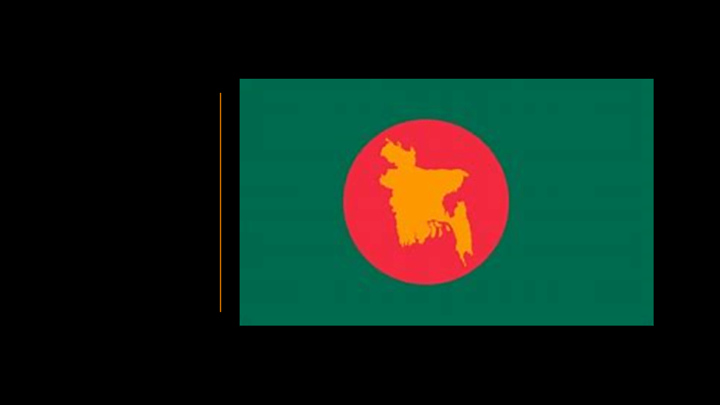
This was the flag of Bangladesh circa 1971.
The only difference in the flag of the country today is that the image of the country is no longer in the circle.
The Meghna River of the Ganges Delta is the one of the most important rivers in Bangladesh, and the widest river to flow completely within the boundaries of Bangladesh.
The river is described as almost perfectly straight in its lower reaches towards the Bay of Bengal.

I believe all so-called river systems are actually canal systems, and I have found extensive evidence all over the world to support this belief.
One example would be the identical appearances of the confluences on the top left of the Raccoon and Des Moines Rivers in Iowa; that of the Missouri and Mississippi Rivers near St. Louis on the right; and where the White Nile and Blue Nile meet at Khartoum in Sudan on the bottom left.

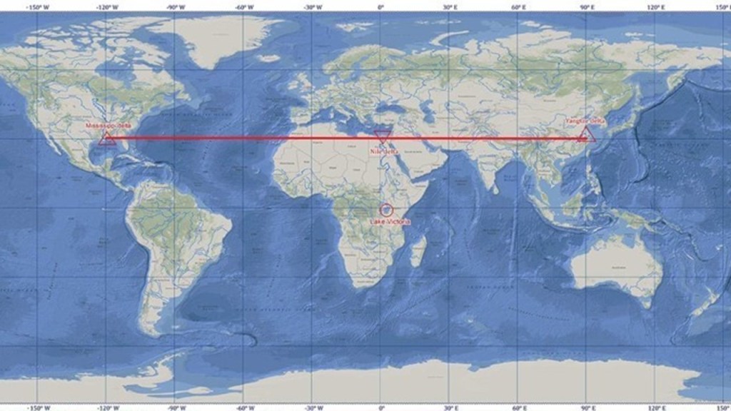
As a matter of fact, the Mississippi River Delta, Nile River Delta, and Yangtze River Delta are in linear alignment with respect to each other, straight across the 30-degree north parallel.
I tracked the alignment starting in Manila through Dhaka, the capital and largest city of Bangladesh, and one of the largest and most densely populated cities in the world, with a population of 20.2 million in the Greater Dhaka area.
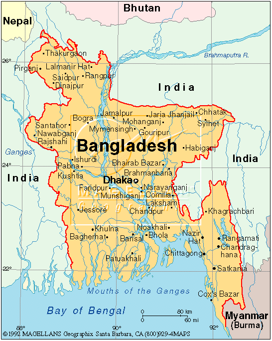
It is the largest city of eastern South Asia, a subregion which besides Bangladesh, also includes the countries of Bhutan, Nepal, and India, and is between the eastern Himalayas and the Bay of Bengal.
We are told the city of Dhaka rose to prominence in the 17th-century in the Mughal Empire in South Asia, and for 75 years was the capital of Mughal Bengal, also known as the Bengal Subah.

This building is what is called the Pink Palace, or Ahsan Manzil, in Dhaka, and was the official palace and seat of the Nawab of Dhaka.
We are told that the construction of it started in 1859, and completed in 1872.
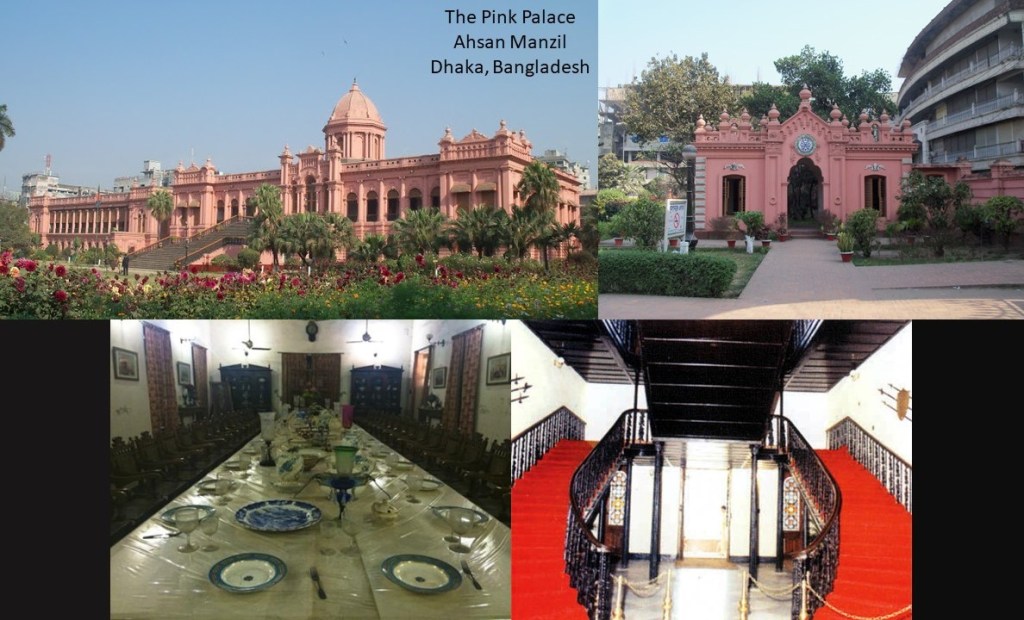
The Pink Palace in Dhaka is described as having been constructed in the Indo-Saracenic Revival architecture style, also known as Indo-Gothic, Mughal-Gothic, and Hindoo Style, and was said to have been utilized by British architects in India in the later 19th-century, especially in public and government buildings.
Here is a comparison on the left of an outdoor spiral, what looks to be iron staircase, at Ahsan Manzil, with the wooden staircase at the Loretto Chapel in Santa Fe, New Mexico on the right.

And when I saw the existence of a pink palace in Dhaka, I was reminded of the pink Don CeSar Beach Resort, a massive building located on St. Petersburg Beach in Florida, and which I drove past many times when I lived in neighboring Clearwater, Florida, for a few years.
The Don CeSar was said to have been developed by Thomas Rowe, with a design by architect Henry H. DuPont, opening in 1928. It was said to have gained renown as a Gulf of Mexico playground for America’s pampered rich at the height of the Jazz Age in the 1920s and 1930s, a has this reputation to this day.

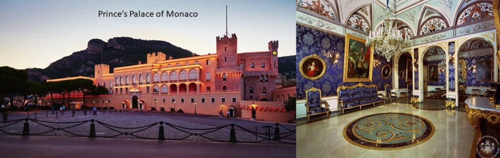
Then there is the pink Prince’s Palace of Monaco, the official residence of the sovereign prince of Monaco, and said to have been built in 1191 as a Genoese fortress, and home of the Grimaldi family since they captured it in 1297.
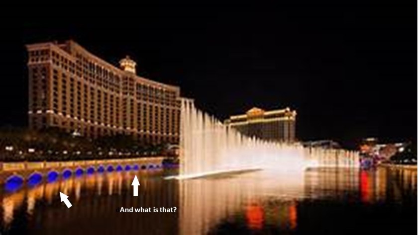
Hatirjheel Lake in Dhaka was said to have been constructed under the Bangladesh Army and Special Works Organization (SWO) in the Center of Dhaka, starting in 2007, which also was said to have built…
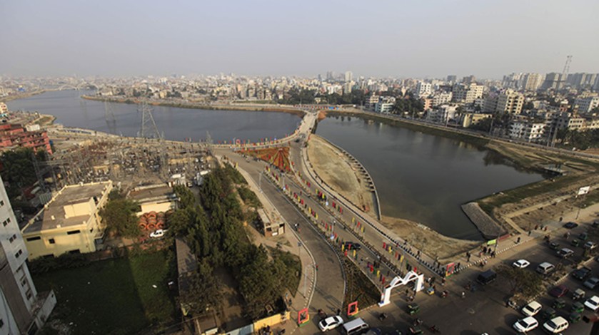
…the Hatirjheel Musical Dancing Fountain, the largest in South Asia, with an amphitheater that seats 2,000 people.
Did they construct it…or get something working that was already built?
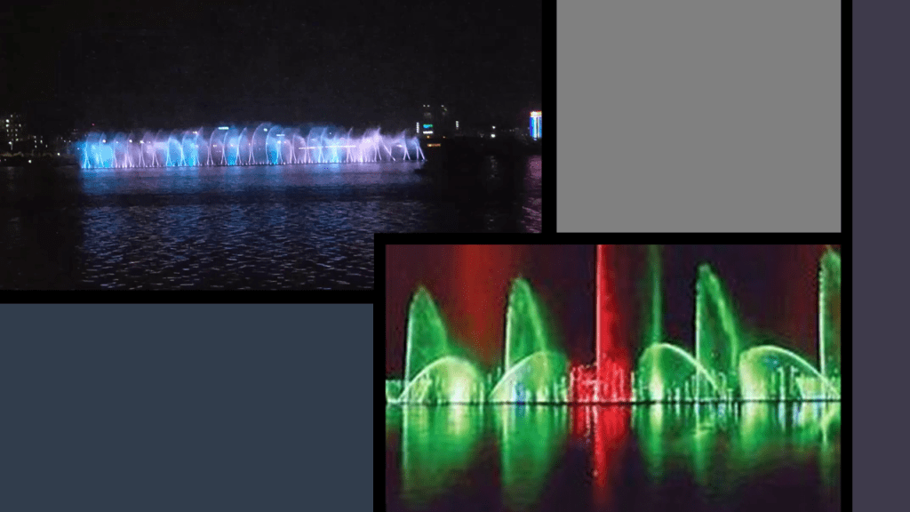
I was reminded of the Fountains of Bellagio in Las Vegas.
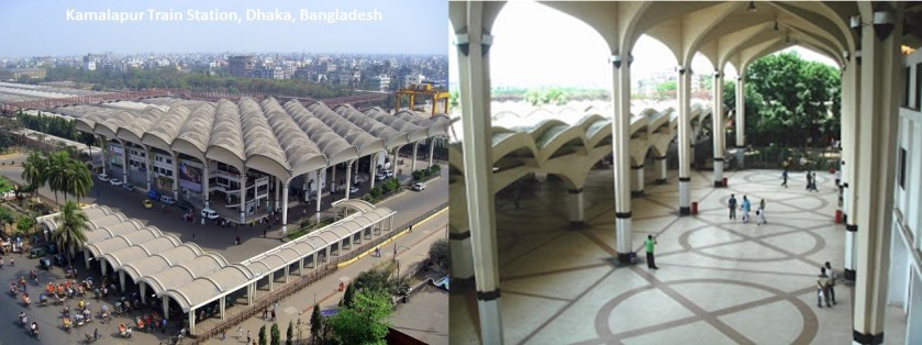
This is the Kamalapur train station in Dhaka, with its gigantic archways. It was also said to have been designed and opened in the 1960s.
The railroad is an important mode of transportation in Bangladesh.

Dhaka was one of several places given the nickname “Venice of the East.”
We are told that there are three major canal systems in Bangladesh that drains into the three major rivers around Dhaka – the Turag; the Balu; and the Buriganga rivers.
This is what the Kallyanpur canal looks like today.
The Dutch East India Company, also known as VOC, was chartered on March 20th of 1602 to trade primarily with Mughal Bengal, India and Southeast Asian countries when the Dutch government granted it a 21-year monopoly for the Dutch spice trade.

The first formally listed public company by widely issuing shares of stock and bonds to the general public in the early 1600s, it was the world’s most valuable company of all-time, with a worth of $7.9-trillion.
It is considered by many to be to have been the forerunner of modern corporations.

Mughal Bengal was described as a “Paradise of Nations,” and its inhabitants living standards were among the highest in the world at one time.
Mughal Bengal was from where 50% of textiles and 80% of silks were imported.
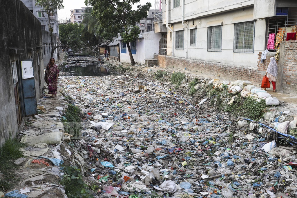
For a then-and-now comparison, this is a typical photo of the poverty found in Bangladesh today.

As of the 2022 statistics of the Bangladesh Bureau of Statistics, 1.82-million people lived in slums, lacking access to clean water, safe sanitation, and wast e management.

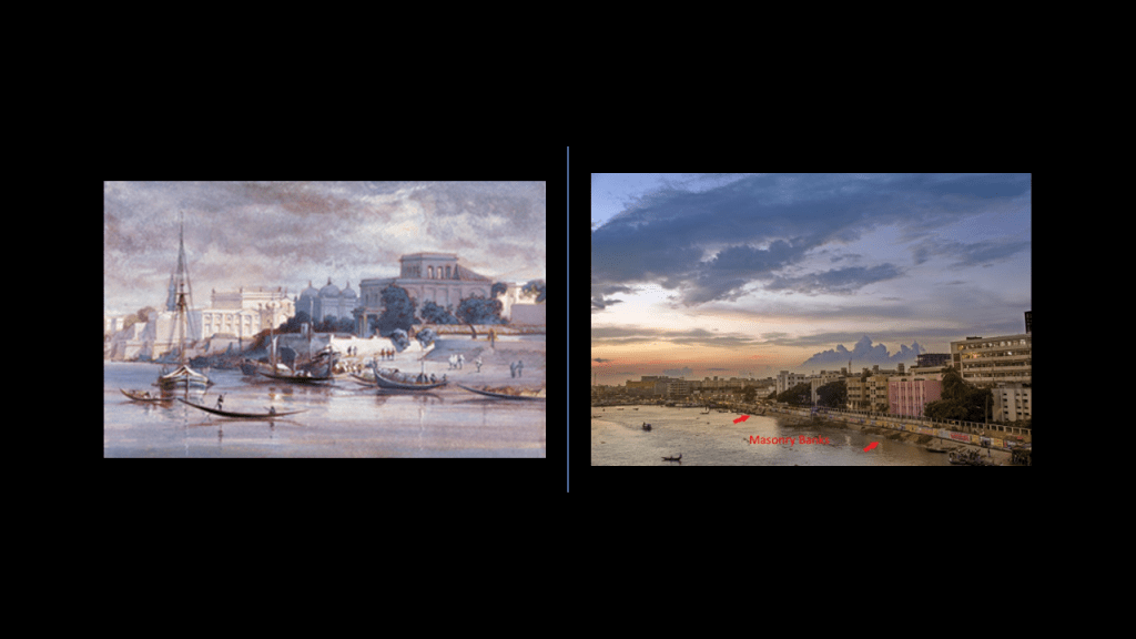
This was a view of Dhaka from across the Buriganga River, said to have been painted in 1861 on the left, and on the right, Dhaka across the Buriganga River today.
This was an historic photo from the 1880s of the Mitford Hospital in Dhaka, which was said to have been established in 1854 after land that was bequeathed by Robert Mitford for public works in Dhaka was made available for that purpose in 1850.

There was a whole lot going on the historical record we have been given around the years on either side of 1850.
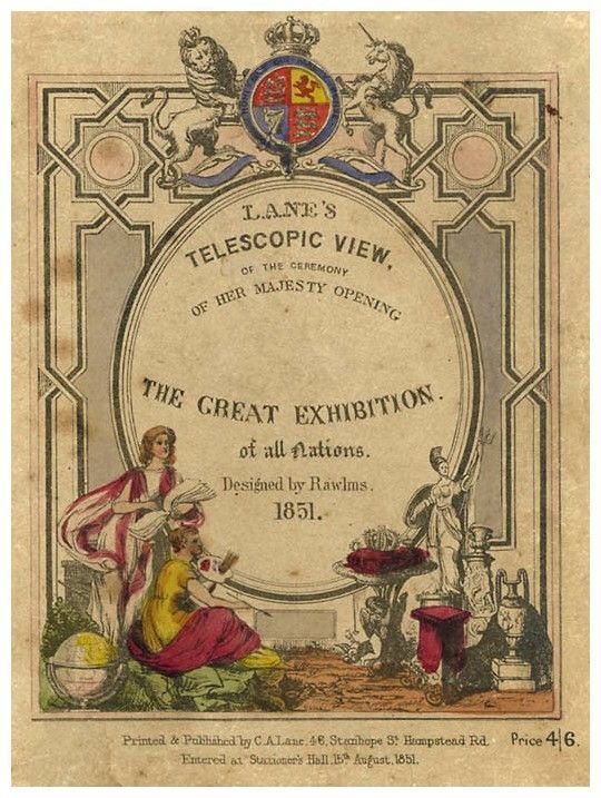
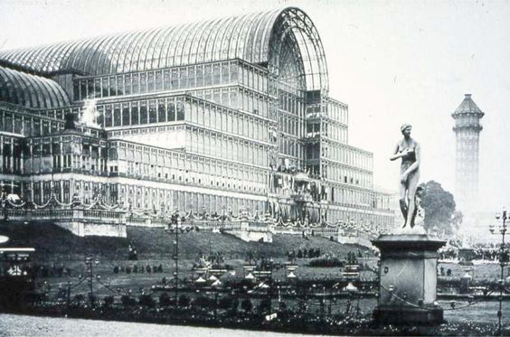
I believe the official kick-off of the new historical reset timeline was the “Great Exhibition of All Nations,” opened by Queen Victoria and Prince Albert in 1851…
…in the Crystal Palace in London…
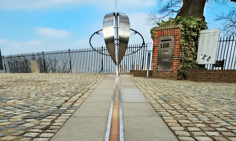
…and 1851 was the same year the Prime Meridian of earth was moved from the Great Pyramid of Giza to Greenwich, London, England, where the Royal Observatory is located.
The parasitic beings who found a way to incarnate into human form engineered a hostile takeover of the planetary grid system, and they invented a new history based to a certain extent on the original civilization, and inserted themselves into the new timeline as royalty, among other things, and objects of worship and veneration.
For one example, this is the Prince Albert Memorial in London’s Kensington Gardens, said to have been unveiled in 1872.

This hostile takeover was not about benefiting Humanity by any stretch of the imagination.
Everything that has taken place since this happened has been about the degradation and diminishment of Humanity, and the destruction of the original beautiful and high civilization, as we have seen all along this alignment from Manila to Dhaka.
There’s much more I could bring forward from this region to talk about, but there is enough in this post to show you that there is a persistent pattern of colonization, economic and social domination, the claiming of the legacy of the original ancient people of the Earth as their own, and the destruction of warfare in this part of the world alone, and these same patterns are visible everywhere else as well, and this is only a snapshot of what has been taking place on Earth.


This is fascinating! I really want to spend more time reading more of your articles! Thank you for sharing with us!
LikeLike
Thank you for your dedication in pursuing this evil. I’m in Australia and keep seeing buildings that do not match with the stories. Also, so many towns and cities are dedicated to military history and celebrating war. Tiny towns have cannons placed in prominent positions and I wonder why…
LikeLike