
When I was researching “The Manner in which a Global Canal System has been Kept from Our Awareness,” I searched for the Sault Ste. Marie Locks. I already knew they were impressive from earlier research into what is the hidden history of not only North America, but of the World.
When this photo with detailed information popped up of what are called the “Soo Locks,” I knew I was looking at a significant complex with respect to the hidden Advanced Ancient Civilization, and was instantly interested in taking a closer look at the area. I got a “Ding, ding, ding, Jackpot!” vibe in my head. Even in my initial foray into research here for this post, I found much to reveal. It seems to have everything Moorish rolled into one place!
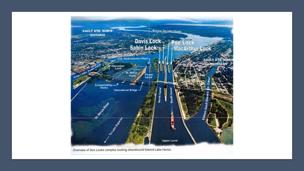
The Soo Locks, the largest waterway traffic system on Earth, are called the “Linchpin of the Great Lakes,” allowing ships to travel between Lake Superior and the lower Great Lakes. Lake Superior meets Lake Huron with a 21-foot drop in elevation.
I am usually not interested in what the historical narrative says, except for the purpose of finding specific physical locations and landmarks for my research, but I think it is important in this case to share a few things about what we are taught in our historical narrative about this location.
The city of Sault Ste. Marie was said to have been founded by the French Jesuit missionary, Father Jacques Marquette, in 1668. It was said to be named for both the “Sault,” the name given to the St. Mary’s River rapids, and the Virgin Mary, and called the first European city in the Great Lakes Region.

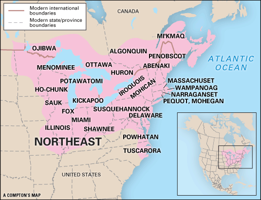
We are told that before the coming of Father Marquette, and “civilization,” this land was inhabited by the Anishinabeg, or Anishinaabe, a name the Ojibwe and Algonquin people use for themselves in their own language, meaning “original people.”

When I searched for a map of where the Algonquin peoples lived in North America, and this is what comes up.
I will be bringing together different strands of this fabric by showing you what is actually here as we go along to weave a different picture of history based on physical evidence, and the inconsistencies in what we are told about it.
Sault Ste. Marie was one city until the border between the United States and Canada was established at the St. Mary’s River in a treaty after the War of 1812, creating Sault Ste. Marie, Michigan, and Sault Ste. Marie Ontario, and on both sides of the river, the area is referred to as the “The Sault” or even “The Soo.”

Sault Ste. Marie is the oldest city in Michigan, and said to be the third-oldest city in the United States.
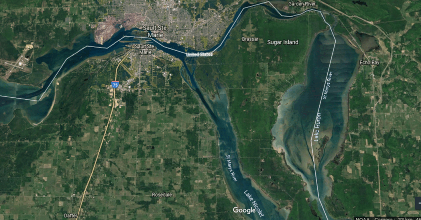
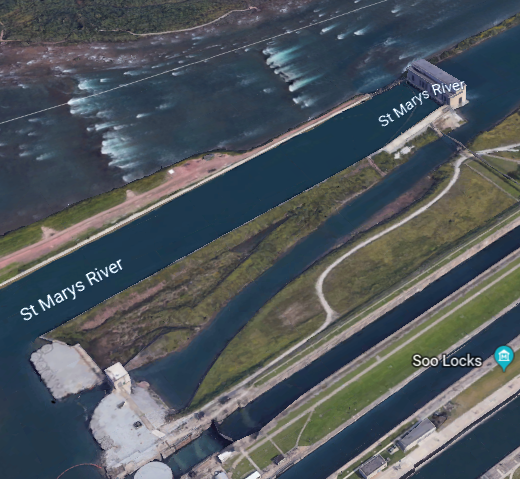
The main course of the St. Mary’s River, starts at Whitefish Bay at the eastern end of Lake Superior, and flows 74.5-miles, or 119.9-kilometers, southeast around Sugar Island into Lake Huron.
At the River of History Museum in downtown Sault Ste. Marie, Michigan, where we find out that St. Mary’s River is 8,000-years-old, and “born out of the trauma of this land as it buckled and ruptured, and gave way amidst thunderous sound and gigantic force – carved and formed by nature’s relentless sculptor – the glacier. So, let’s take a look like what this violently-formed, nature-carved river looks like.
Before the St. Mary’s River even comes to the Lock Systems, from the direction of Lake Superior, this is what the shore-line looks like on the Ontario-side, with points and straight-edges…

…and even another canal going up into the city as pointed out by the arrows, with the last arrow showing where it looks like the canal was cut-off and drained.

The St. Mary’s River also has a so-called branch going into what is called Lake Nicolet on the other side of Sugar Island. Here is a close-up of what it looks like heading in that direction.

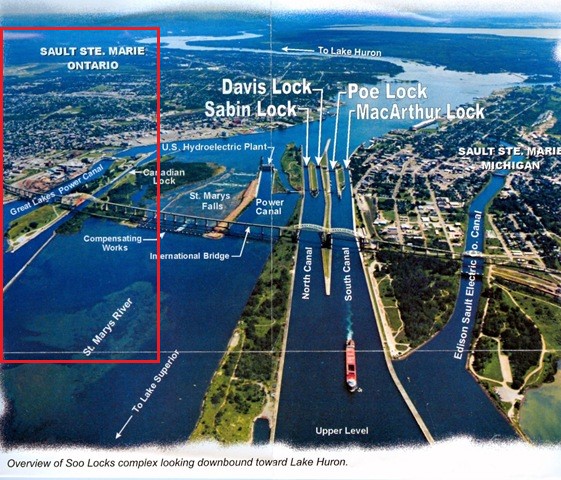
I am going to use the same graphic that I showed at the beginning as a means for organizing the information about this physical location.

I am going to start looking first around Sault Ste. Marie, Michigan on the right side, and work my way across the various features to Sault Ste. Marie, Ontario on the left side.
Brady Park is situated to the east of the Soo Locks on the St. Mary’s River waterfront…

…and were the grounds of the Old Fort Brady. Here we find an obelisk said to have been designed by Charles McKim, of what is called the renowned New York architecture firm McKim, Mead, and White, to commemorate the 50th-Anniversary of the Soo Locks.
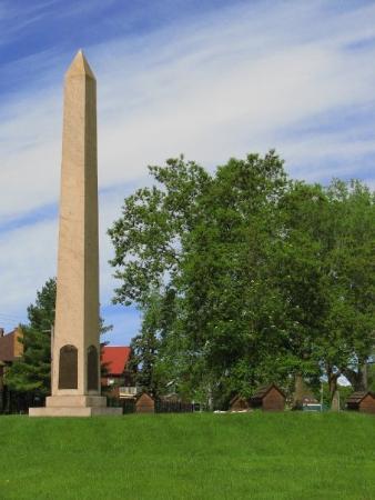
This obelisk is situated on top of a triangular-looking earthwork, as seen here from Google Earth.

Here is what it looks like from the street-view.

This colossal stone is on the earthwork as well, near the obelisk, said to commemorate the location of what we are told was the French Fort Repentigny, said to have been established in 1750, and captured by the British in 1760 during the French and Indian War, and burned down and abandoned in 1762.

Old Fort Brady was said to have been built in 1822 to guard against incursions from the British in Canada.
In my research, I have found that words like fort and fortress are code words that covers up infrastructure that had a specific energy function on the planetary grid, called star forts in the present-day, that were re-purposed to appear to have had a solely military function.
I have also consistently found pairs, and even groups, of star forts in my research, like in Lower and Upper New York Bay…
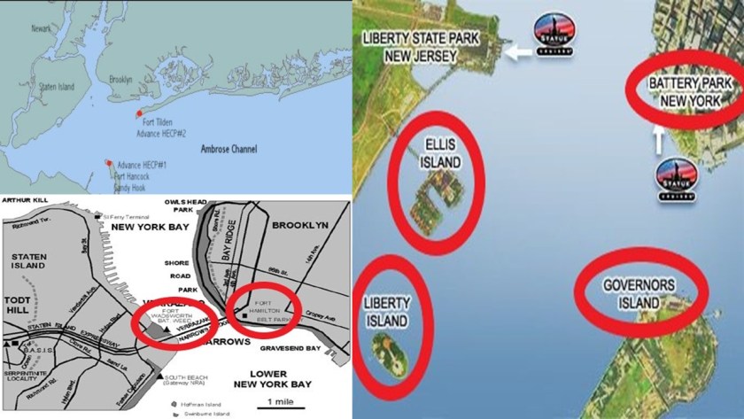
…and Pensacola, Florida, to name a very few.

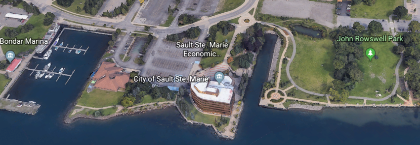
So I looked to see what was across the River in Ontario, and found the area around the John Rowswell Park looking quite pointed.
I think I can make at least a circumstantial case that there was at least one pair of star forts in Sault Ste. Marie in the area’s history.

In 1893, Fort Brady was moved to higher ground. More on the New Fort Brady’s present-day use shortly.
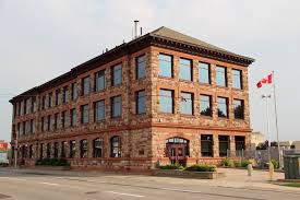
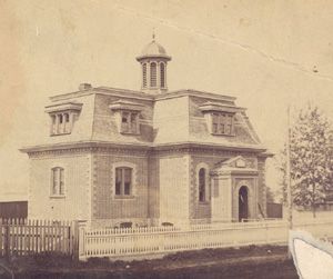
The building now serving as the City Hall for Sault Ste. Marie, Michigan, is the old Federal Building, and is located in the block right across the street from Brady Park.

The Federal Building was said to have been designed by James Knox Taylor, the Supervising Architect of the United States Treasury between 1897 and 1912, and constructed between 1909 and 1910 of limestone from a Bedford, Indiana quarry.
An interesting aside, Bedford, Indiana, was known as the “Limestone Capital of the World” with its large limestone quarries, and said to have also provided the limestone for such noteworthy places as the Empire State Building and the Pentagon. Ever heard of this place before? And…how’d they transport it?
The large stone with the plaque said to be marking the original location of St. Mary’s Church, begun by the Jesuits in 1668, is shown here on the Northwest corner of the City Hall grounds, with the current St. Mary’s Church in the background to the left.

It is now called the St. Mary Proto-Cathedral, and this building was said to have been erected in 1881. This is the third-oldest Roman Catholic parish in the United States after St. Augustine, Florida, and Santa Fe, New Mexico.

An Irish-Canadian architect by the name of Joseph Connelly is given the credit in our historical narrative for the design of it.
The Tower of History towers over the St. Mary Proto-Cathedral to which it is adjacent. It is 210-feet, or 64-meter, high, with an observation deck at the top, and was said to have been built in 1968 by the Catholic Church as a Shrine of the Missionaries.
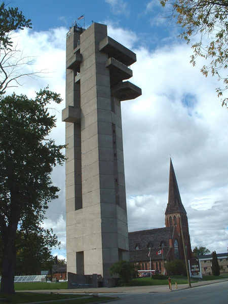
Okay. That’s mighty big, for whatever reason it was built.
On the left, the Tower of History reminded me of the Tour Perret in Amiens, France in the middle, and the Tour de Guet in Calais, France, on the right.

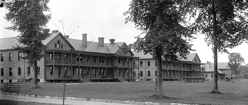
The New Fort Brady site, said to have been established in 1893 to replace Old Fort Brady, and was abandoned in 1944. Today, it is on the campus of Lake Superior State University, with 14 of the original fort buildings re-purposed and in-use.
These include the Officers’ Row houses…

…the now-mens’ dormitory Brady Hall…

…said to have been Fort Brady’s barracks previously…
…the Child Care Center was previously the Fort’s Guard House circa 1893…
…and this was the Commanding Officer’s Quarters.

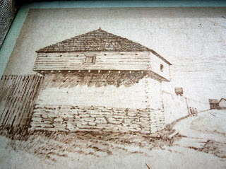
The ancient advanced civilization most certainly built with bricks like this, and in many cases the camera will pick up magnetic energy signatures from these structures. For example, this is Fort Des Moines in Des Moines, Iowa.

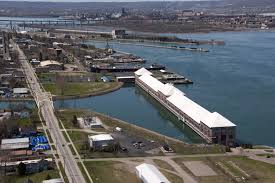
Edison Sault Electric Company Canal, also known as the Edison Sault Power Canal, supplies the St. Mary’s Falls Hydropower Plant, an 18-MW, with capacity up to 30-MW, hydroelectric generating plant.

Made from sandstone masonry, it was said to have been built under the supervision of the U. S. Army Corps of Engineers, starting in 1898, with operation starting in 1902, and is one of the oldest, continuously-operating power plants in North America. Just want to point out the doors in the middle of the building, above ground level. Seems to be an odd location for a full-size set of doors.

The water velocity of the power canal varies at times but can be up to 7-mph, or 11-kph, with the entrance being controlled by four steel headgates.
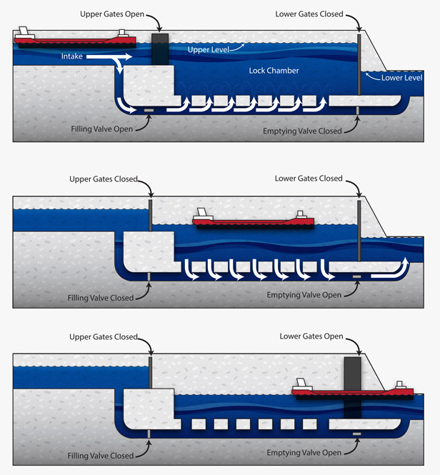
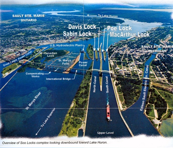
Moving across the graphic, the next place at which to look are the Soo Locks.
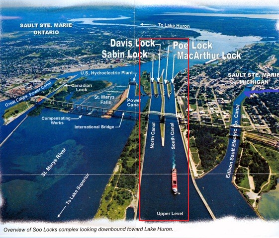
The Soo Locks are considered a wonder of engineering and human ingenuity.
They by-pass the rapids of St. Mary’s River, the river drops 21-feet, or about 6.4-meters, over hard red sandstone in a short 3/4-mile, or 1.2-kilometer, stretch.
The first locks were said to have been built here in 1855, and operated by the State of Michigan until transferred to the U. S. Army Corps of Engineers in 1881, who owns and maintains and operates the St. Mary’s Falls Canal, within which the locks are located.

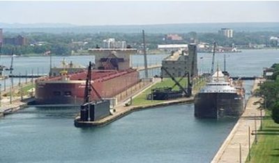
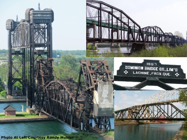
In the South Canal, the smaller MacArthur Lock was said to have been built in 1942, and the wider Poe Lock in 1896.

The two buildings seen here, the larger one beside the MacArthur Lock, and the smaller one beside the Poe lock…
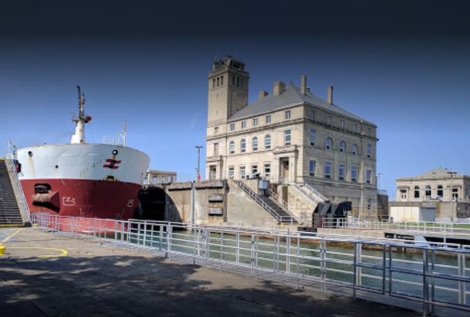
… have all the hallmark features of the heavy masonry architecture of the advanced, ancient Moorish civilization.

In the North Canal, the Davis Lock, said to have been built in 1919, is used infrequently for light freighters, tour boats, and small craft when the traffic warrants, and the Sabin Lock, said to have been built in 1914, is no longer in use.
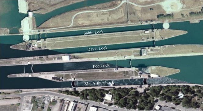
There are two hydroelectric powerhouses next to the Soo Locks, together generating 18.4-MW for the Soo Locks complex.
In the next place in the graphic, I will start at the Sault Ste. Marie International Bridge…

…between the United States and Canada, which permits vehicular traffic to pass over the locks.
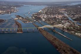
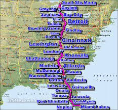
It is the northern terminus of I-75, which goes all the way to Miami, Florida.
The Sault Ste. Marie International Railroad bridge runs adjacent to the International Bridge, and was said to have been built in 1887. It has a vertical lift bridge and swing bridge features as well. Really sophisticated engineering feats!
Next are the St. Mary’s Falls, of which the International boundary goes through the middle.
In the right foreground of those photo, in front of the International Bridges, is what are known as the Compensating Works.
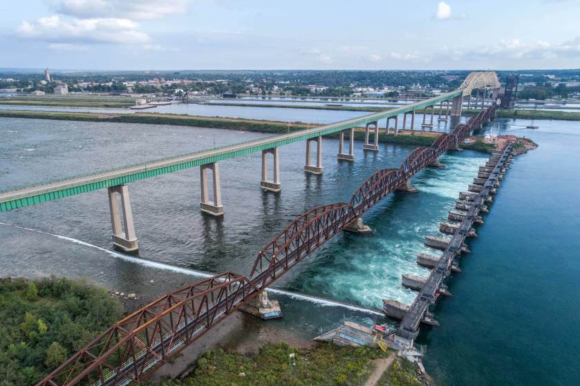
They consist of 17 piers and concrete aprons bearing on sandstone bedrock. Piers 1 – 9 are in Canada, and Piers 10 – 17 are in the United States. These were said to have been constructed between 1913 and 1919 (with World War I occurring between 1914 and 1918), and has an extremely sophisticated sluice gate and gate machinery system.
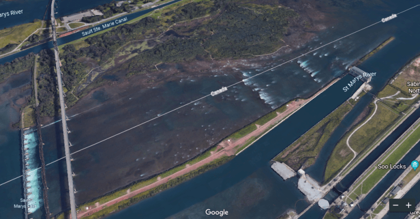
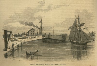
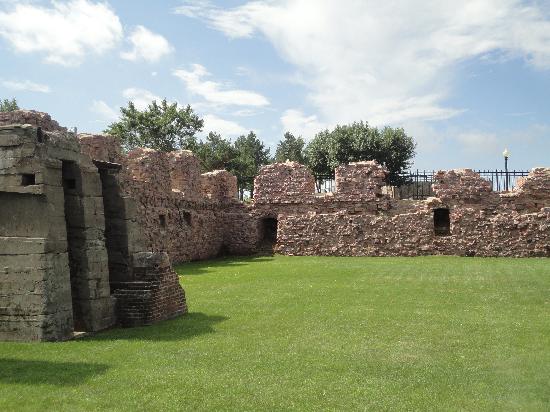
The Sault Ste. Marie Canal is in Canada, on the other side of the St. Mary’s Falls and Compensating Works. It is a National Historic Site, and part of the National Park System of Canada. The date of a lock here is said to go back to 1798, with its destruction in 1814 in an attack by U. S. forces in the War of 1812, and what is here presently was said to have been constructed in 1895.
This is said to be depicting the upper entrance to the Sault Ste. Marie canal in 1857.
Next on the graphic is the Great Lakes Power Canal and the Ontario side of Sault Ste. Marie.
Great Lakes Power was established in the early 1900s by Francis H. Clergue.


Francis H. Clergue was an American businessman from who became the leading industrialist of Sault Ste. Marie, Canada, in the late 1800s and early 1900s.

In addition to Great Lakes Power, he was also credited with establishing other industrial companies, like the Sault Ste. Marie Pulp and Paper Company in 1895.


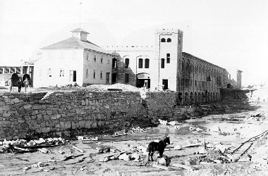
This photo of the Pulp and Paper Mill is interesting. What is it really showing us? A recently built canal and building as they want us to believe? Or far older infrastructure, perhaps after a cataclysm?
We are told Francis Clergue was being the establishment and construction of the Algoma Steel Factory. This February 1901 photo is actually titled “Algoma is Born.” Great contrast of the rudimentary horse-and-buggy shown here, parked right next to rail tracks of some kind…

…with the Algoma Steel Factory, which is said to have opened in 1902, at which time the factory was said to have produced its first rail-tracks, and where it specialized in rails for Canadian Railways as its primary product for the next twenty-years.

The blast furnaces for pig iron manufacture were not said to have been completed until 1904.

This is incredibly high building and industrial technology and expertise for what we are taught we were capable of at the time. Ford’s Model T wasn’t even in production yet ~ it entered the transportation scene in the fall of 1908.
Clergue was also credited with the development of the Algoma Central Railway, connecting it to the Transcontinental artery of Canada. He was said to have initially owned it, and needed a way to transport logs from the Algoma District in northeastern Ontario for his pulp mill, and iron ore for the steel factory, and that it was chartered on August 11th, 1899. It was said to have been completed, in Hearst, Ontario, in 1914. Never made it all the way to Hudson Bay as was planned, we are told.
The details are really sketchy about where the steel for the rails came from since we are told the Algoma Steel Factory didn’t start producing them until 1902.
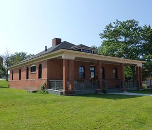
This is the Algoma Central & Hudson Bay Railway Terminal Station in Sault Ste. Marie, Ontario, said to have been built in 1912.
Other things we find in Sault Ste. Marie, Ontario, include:
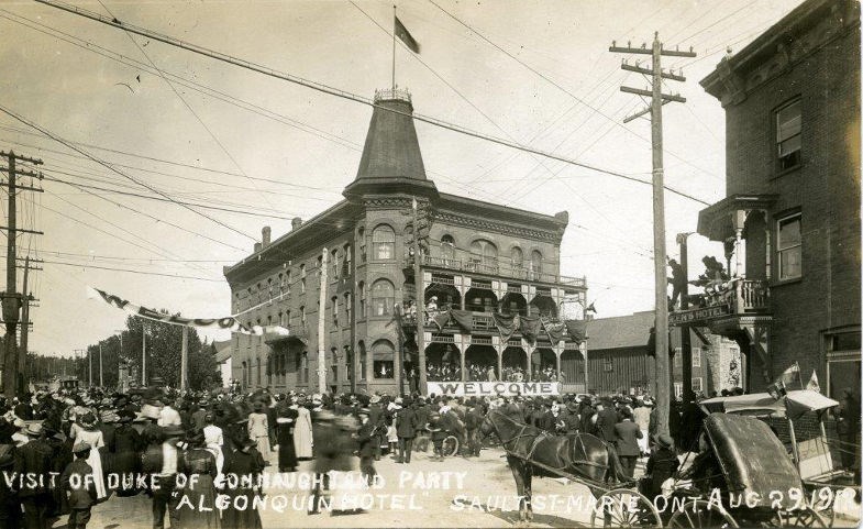
The Algonquin Hotel, circa 1919…
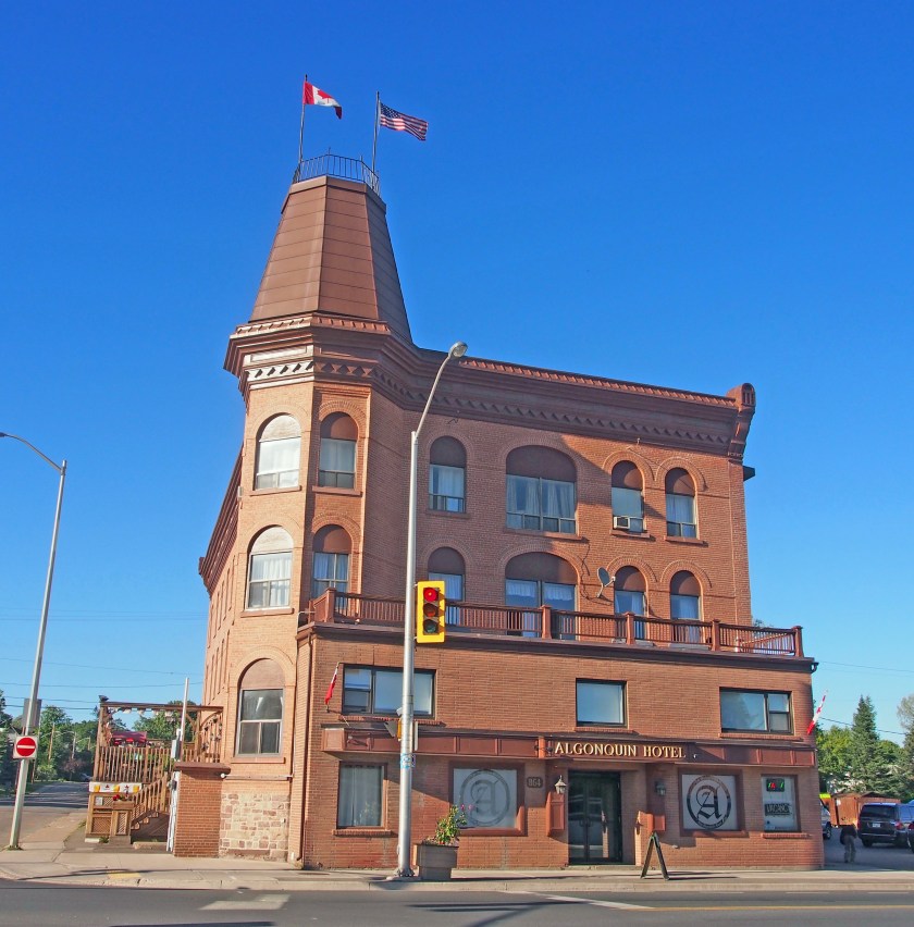
…and the Algonquin Hotel today.
…the International Hotel…

…the Old Post Office…
…and the first Town Hall and Public Library.
Whitefish Island is located between the St. Mary’s Falls and the Sault Ste. Marie Canal in Ontario.

This is a closer view of sights we see on Whitefish Island. This view is facing Sault Ste. Marie, Ontario.

There is plenty more to see here, and I could spend a long time looking around the area. I feel the same way about New York City. There is just a ton of information to be found in places like these.
I am going to end this post with a few words about semantics.
Semantics is the branch of linguistics and logic concerned with meaning, and the relationship between signifiers – like words, phrases, signs, and symbols – and what they stand for in reality.
The pronunciation of the words Sault, Soo, and Sioux are identical.
In the same way, the pronunciation of Washitaw, regarding the ancient, aboriginal Empire Washitaw of North America, and Ouachita, a name given to a variety of places and businesses, is the same as well.
The lands of the Sioux that we are taught about aren’t this far east.
These are the Sioux Falls located in Sioux Falls, South Dakota, where we are taught their lands were.

They are located right next to what we are told are the ruins of the Queen Bee Flour Mill, which was said to have been built between 1879 and 1881, where it had access to all of the city’s five rail-lines…and was destroyed by fire in 1956?
Who were the Sioux, really? I would lay money they were not primarily hunter-gatherers as we have been taught. This fragmentation of the ancient and advanced civilization into a myriad of different tribal nations was done for misdirection about, and deconstruction of, it.
For example, the Menonimee are a federally-recognized tribal nation, with historic territory in Wisconsin, and the Upper Peninsula of Michigan, which is the location of Sault St. Marie.
Images like these come down to us from early painters. This painting is by an artist named Paul Kane, who died in 1871, called “Fishing by Torchlight,” of the Menominee spearfishing at night by torchlight and canoe on the Fox River.

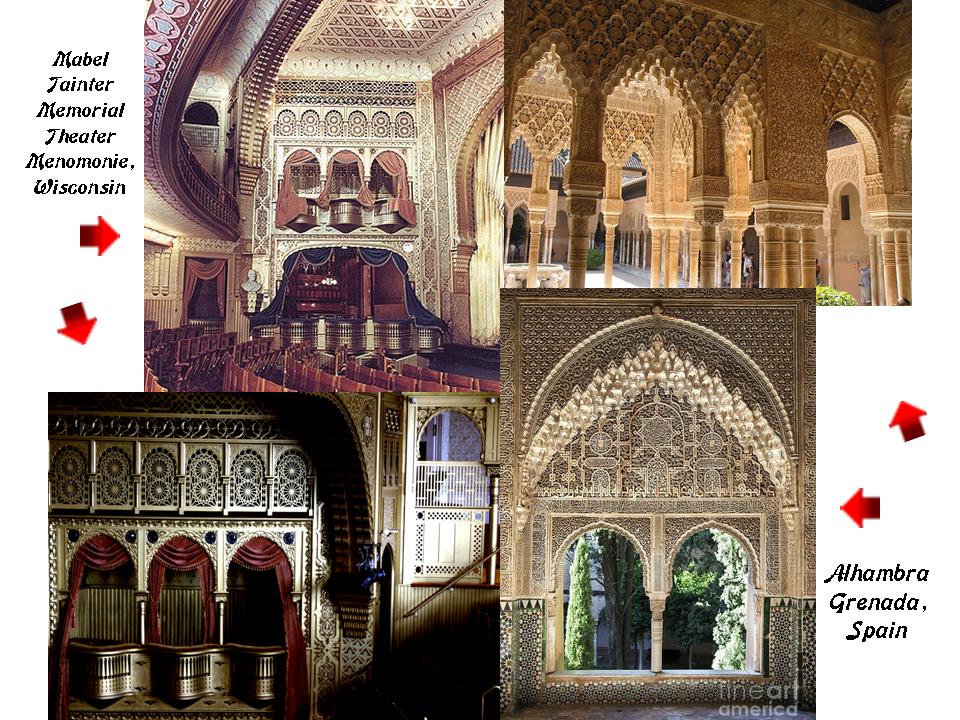
Yet we find architecture of heavy masonry like the Mabel Tainter Memorial Theater in Menomonie, Wisconsin, said to have been built in 1889…

…that looks like the Alhambra in Grenada, Spain, on the inside.
In closing, Sault Ste. Marie is an amazing place, with all of the ancient technologies on display in place up until what we would consider relatively modern times.
It must have been very important as one of the first places the Jesuits came to in North America, after St. Augustine, Florida, and Sante Fe, New Mexico.
I may have to do a study of these two places in the future, but in my next post I think I will be looking at trains. So many subjects to choose from, and I have plenty of material yet to share with you moving forward!

2 thoughts on “Sault Ste. Marie – A Microcosm of the Advanced & Global Moorish Civilization”