
I am spending several posts in this part of the world because it is on the alignment, and there is so much to see. I am only scratching the surface of what is here.
I would like to highlight some places in New York City on the east-side of the Hudson River, and New Jersey on the west-side.
This is a view of the Manhattan Bridge in a part of Brooklyn referred to by the syllabic abbreviation of DUMBO, which stands for “Down Under the Manhattan Bridge Overpass.”
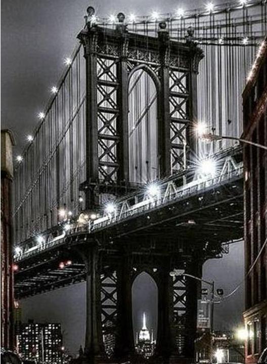
You can see the Empire State Building in the center of the bridge’s structural supports.
This happening was not a coincidental or random occurrence.
The Master Builders of the world were Master Engineers, Master Mathematicians & Geometricians, Master Astronomers, Master Hydrologists, so on. They knew what they were doing, and they knew where they were on the planet related to everywhere else.
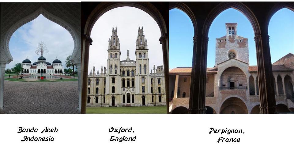
Compare the perfectly proportioned geometric symmetry of the architecture in Banda Aceh in Indonesia on the left (before it was destroyed on December 26th of 2004 in what is called the Boxing Day Tsunami); with the architecture in Oxford, England in the middle; and that of the Palace of the Kings of Majorca on the right in Perpignan, France.
Another example of this is Manhattanhenge, an annual event during which the setting sun or the rising sun is aligned with the East-West street grid of Manhattan on dates evenly spaced around the summer solstice and winter solstice.
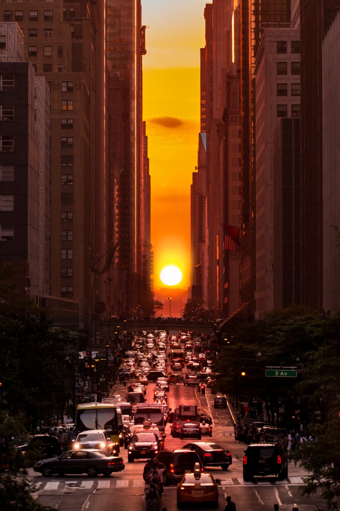
There are similar alignments with the sun and street plan that occur in other major cities, like Toronto, Baltimore, Chicago, and Montreal.
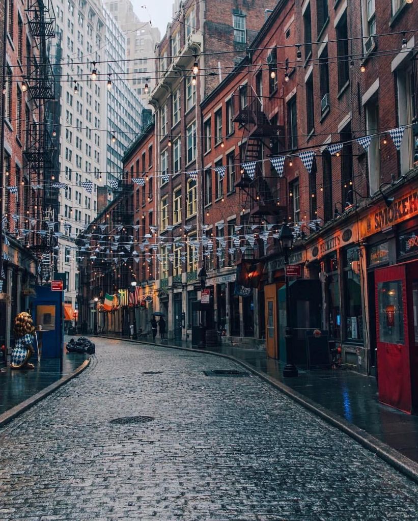
This is the historic Stone Street in the Financial District in Lower Manhattan…
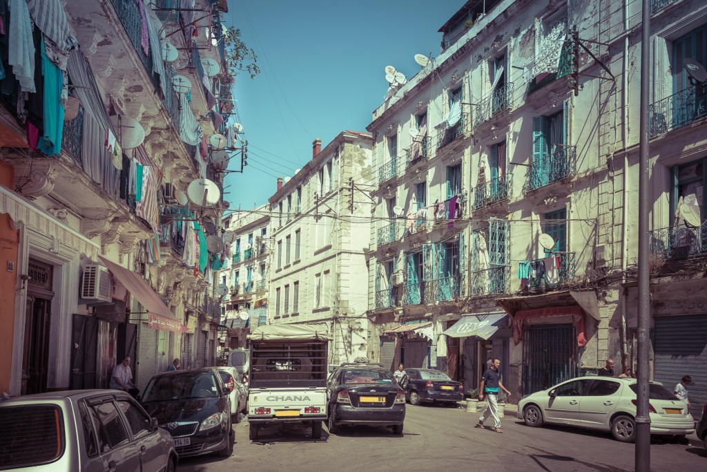
…compared with the Casbah in Old Algiers in Algeria…
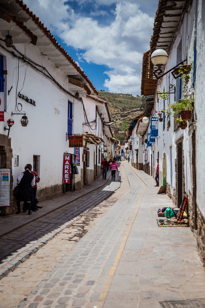
…the city of Cusco in Peru…
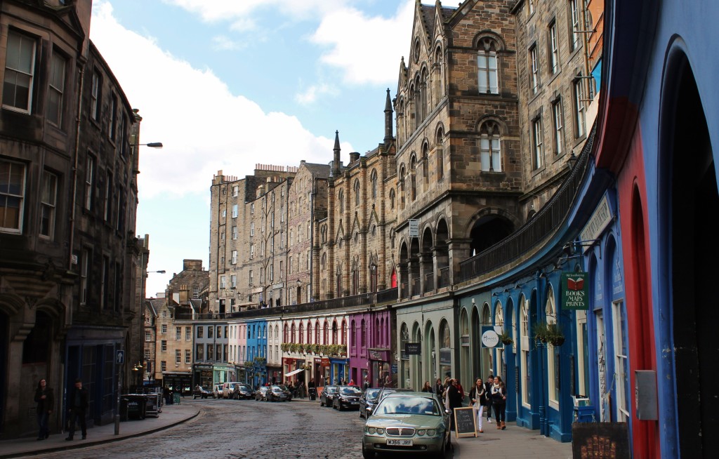
…and the Royal Mile in Edinburgh, Scotland.
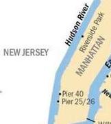
Just north of the Financial Districts on the Hudson River, Piers 25 & 26 are part of the the Hudson River Park, a park that is part of the Manhattan Waterfront Greenway that extends from 59th Street South to Battery Park.
Pier 25 has recreational facilities, and Pier 26 has an ecological education and research center.
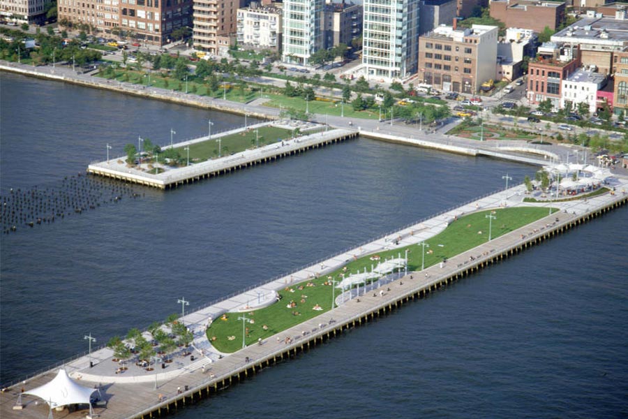
These two piers are part of the TriBeCa section of the Hudson River Park.
The name TriBeCa is also a syllabic abbreviation, of “Triangle Below Canal Street,” though it is actually a trapezoid bounded by Canal Street, West Street, Broadway, and Chambers Street.
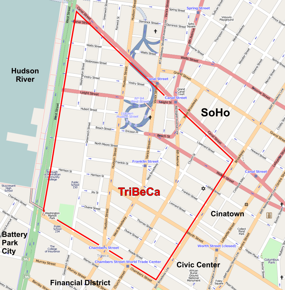
TriBeCa is one of Manhattan’s most desirable and fashionable neighborhoods, and its most expensive.
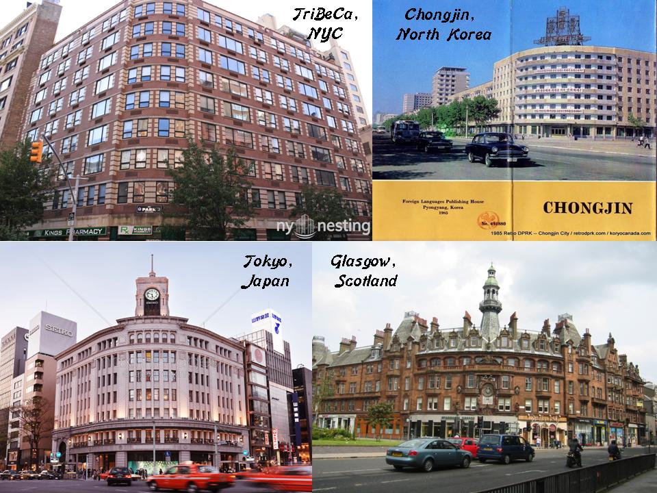
I have put side-by-side comparisons of this building on the top left in TriBeCa, with a building in Chongjin, a port city in North Korea on the top right; and on the bottom left is the Wako Department Store in the Ginza Shopping District of Tokyo; and the same style of building on the bottom right is in Glasgow, Scotland.
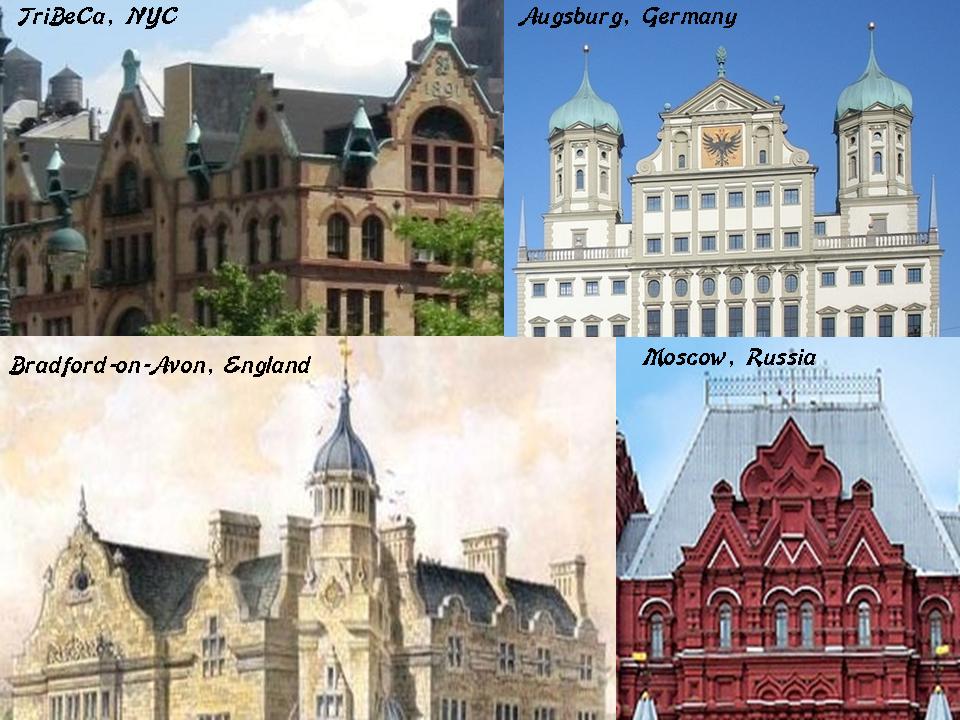
In these next examples are comparisons of design elements in TriBeCa on the top left; the Town Hall of Augsburg Germany on the top right; the Town Hall of Bradford-on-Avon in southern England on the bottom left; and the Moscow State Historical Museum in Russia on the bottom right.
And here is a comparison of examples historic fire departments, with the one in TriBeCa on the left, which has a similar look to this fire department in Los Angeles, all the way across the United States from New York City in the middle; and on the right, the Birmingham fire department in England across the North Atlantic Ocean.
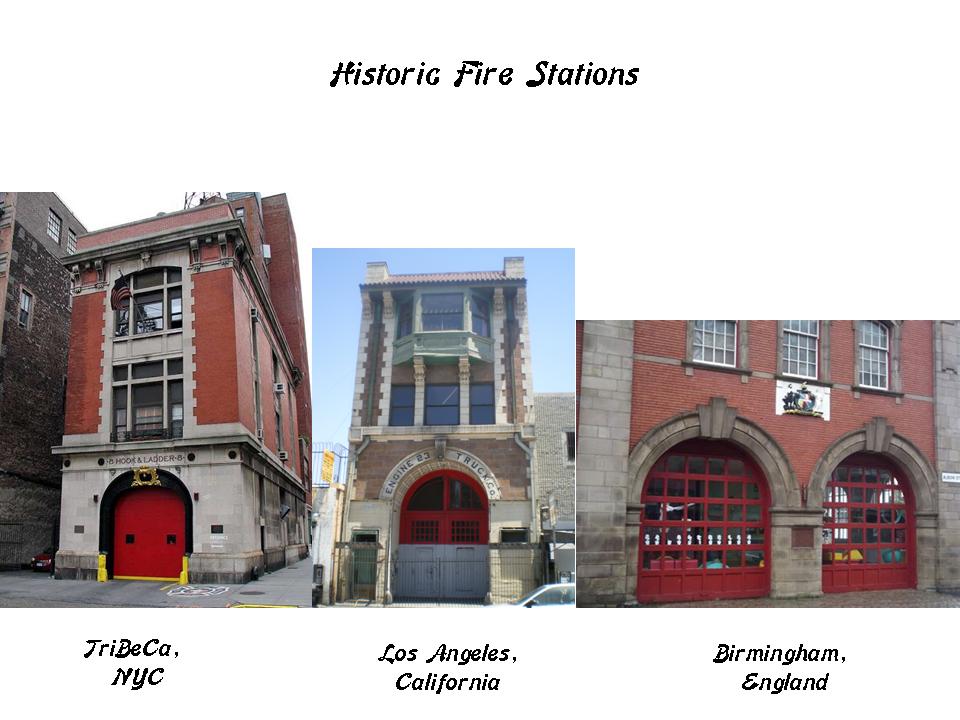
These are just a few examples of essentially the same style for historic fire stations across countries and continents.
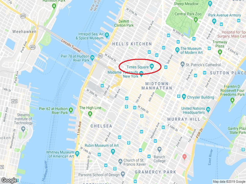
Times Square is the next place of interest I am going to look at in Manhattan, a major commercial intersection, destination for tourism, entertainment center, and residential neighborhood.
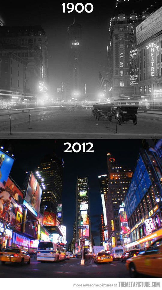
Here is a comparison of Times Square circa 1900, and Times Square of 2012…
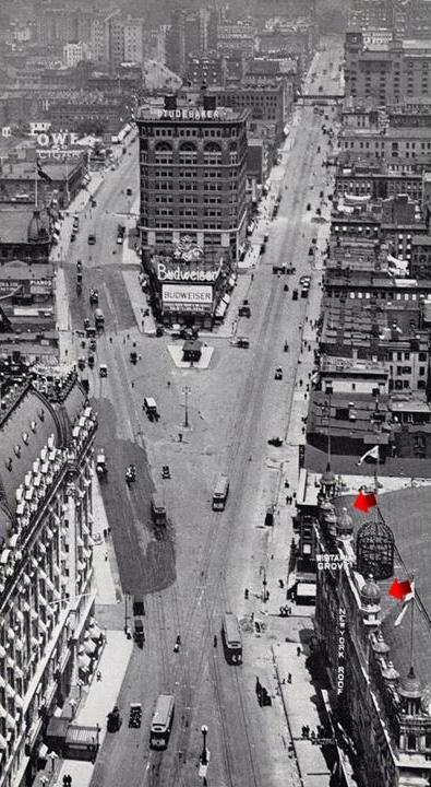
…and a historic view of Times Square in earlier days, with arrows pointing towards onion domes…
…and a presumably more recent historic photo depicting the heavy corporate presence here.

Here is a comparison of a street-corner in Times Square on the top, and a street-corner in Madrid, Spain, on the bottom, like the lay-out was based on the same street-plan.
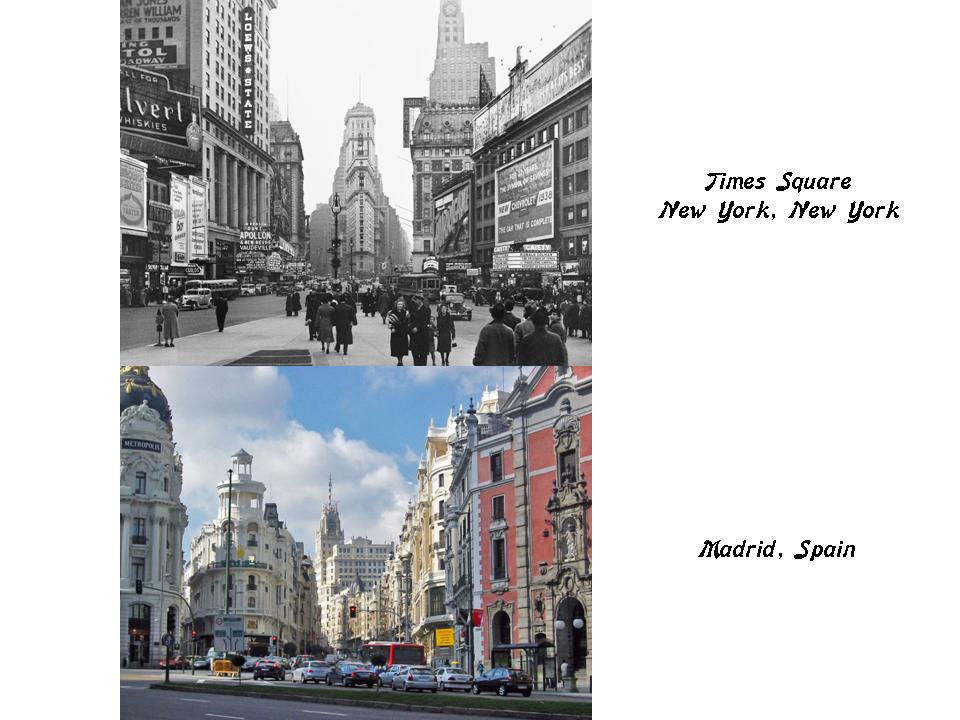
Spain is the only country, outside of North Africa, that the Moors are openly acknowledged to have been.
Next is Central Park, the most visited urban park in the United States. It was designated as a United States Historic Landmark in 1963, and was placed on the UNESCO World Heritage Site tentative in 2017.

Here is a map of the whole of the Central Park map, which I will review here from the bottom to the top.

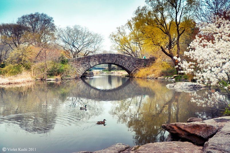
This is the 59th Street schist bridge, the Gapstow Bridge on 59th Street at The Pond, said to be the second bridge built here.
For comparison to the Gapstow bridge, this is a stone bridge in the Peak District National Park in Sheffield, England.
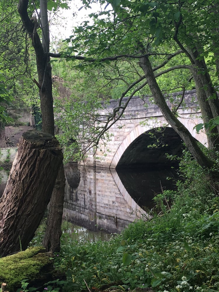
While not identical in construction style, very similar in the peaceful effect and reflection in the water.
This is a view of the lake section of Central Park on the left, with a comparison of one of the bridges of the River Aire in Leeds, England.

Next on the map of Central Park is the Great Lawn Circle, which was said to have been a “Hooverville” site for people made homeless during the Great Depression, and then a Works Project Administration (WPA) Project, hence the ball fields. It is the center of Central Park…
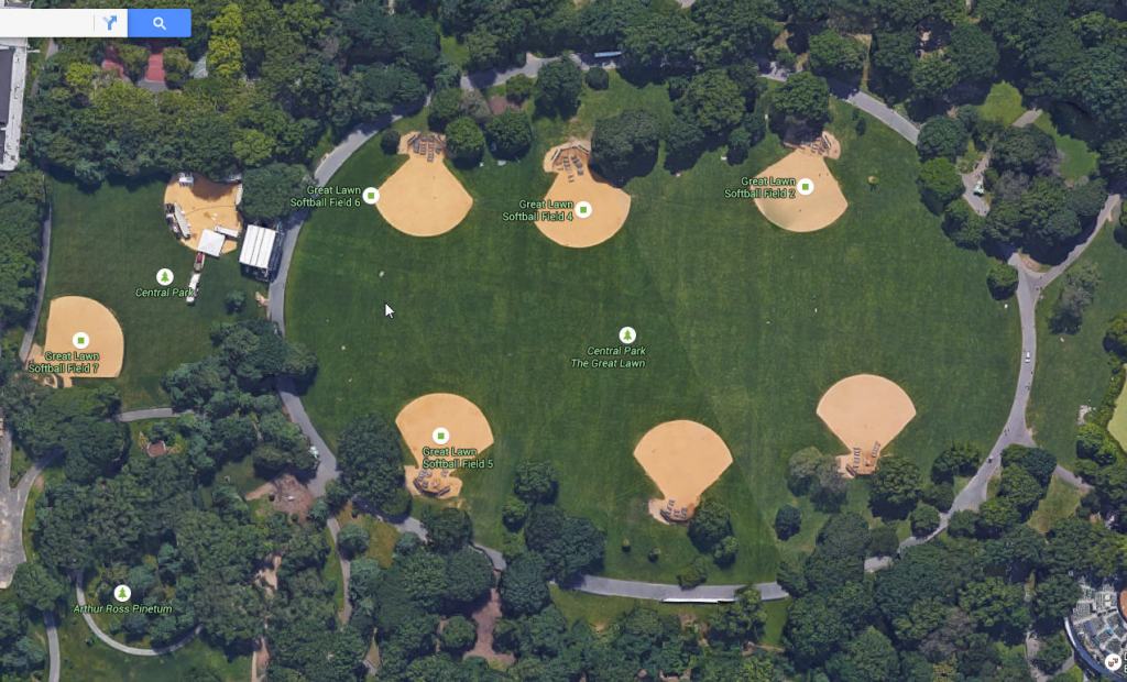
…and looks like the Ellipse in front of the White House, which is the center of Washington, DC.

I wonder if the Great Lawn is center to more than Central Park….
Belvedere Castle sits in the southwestern section of the Great Lawn, and is one of many examples of castles in North America. Castles are all over the place, but because they weren’t supposed to be here, we don’t question the narrative.
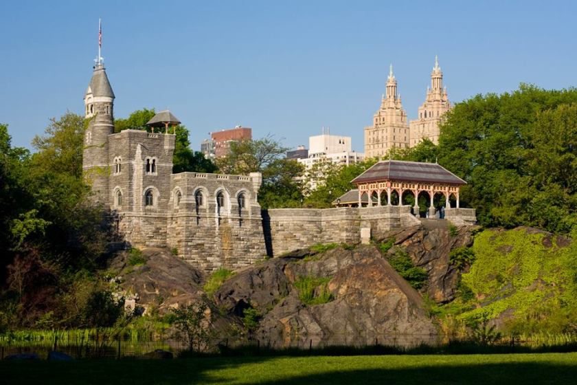
In the foreground of this picture you see ancient stone work; in the middle Belvedere Castle; and in the background you have a building that looks like a Moorish architectural style.
I don’t believe the castle was built in 1869 as we are told, and it’s also being called a “Folly,” which is defined as a decorative building that doesn’t serve much of a purpose, even if it is meant to look like it does.
Something is being covered up!
Along these same lines is the monumental architecture of the Metropolitan Museum of Art on 5th Avenue, adjacent to Central Park and the Great Lawn.
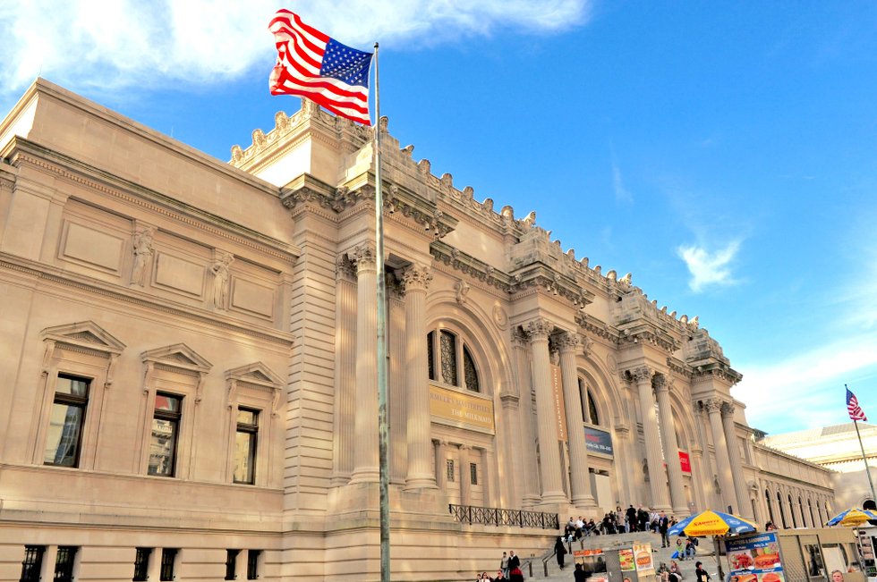
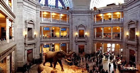
I mean, we don’t even question how this could have possibly built this for its 1880 opening with the history we have been taught. This is huge, heavy masonry and a colossal engineering feat!

By the way, behind the Museum of Art in the Greywacke Knoll is the location of the third obelisk nicknamed “Cleopatra’s Needle,” along with one in London, and another in Paris, and was said to have been given to the United States in 1879.
The 71-foot, or 22-foot, and 244-ton, or 221 metric ton, obelisk was said to have been shipped from Egypt to Upper New York Harbor…
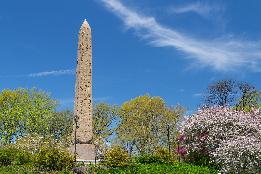
…and that it took 112-days, or almost 4 months, to move the obelisk from the banks of the Hudson River to its present location. The mode of transportation is described as laborers inching the obelisk on parallel beams aided by roll-boxes and a pile-driver engine.
What is harder to believe ~ that it was shipped, and moved as described, or that it was already there?
The Museum of Natural History is on the other side Central Park, between The Lake and the Great Lawn on 81st Street.
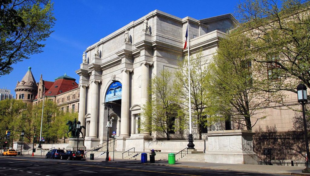
Same idea as the Metropolitan Museum of Art. Amazing architecture!
Makes me wonder about the size of the builders of these places.
Ever wonder about the name of Giants for a New York football franchise?

And giant bones and skulls are frequently uncovered around the world in spite of continuous efforts to make them go away.

Next in Central Park is the Jacqueline Kennedy Onassis Reservoir, said to be a decommissioned reservoir built between 1852 and 1862 (the Civil War took place between 1861 – 1865)…
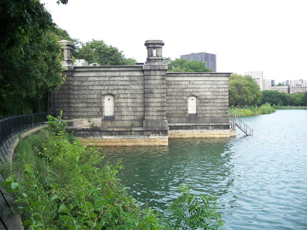
…to receive water from the Old Croton Aqueduct.
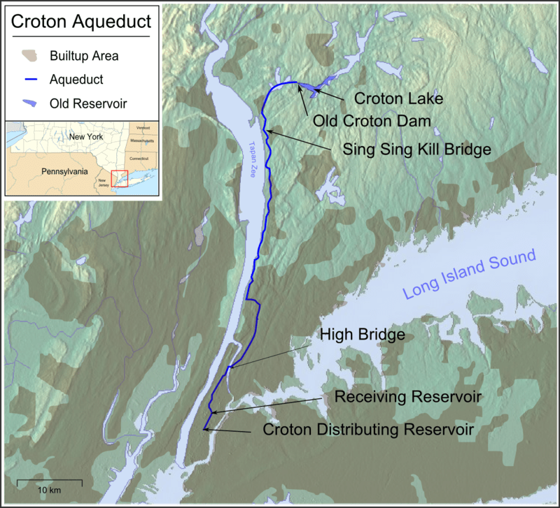
The Old Croton Aqueduct, said to have been built between 1837 and 1842, originates in Croton in Westchester County, and is 41-miles, or 227- kilometers, long.
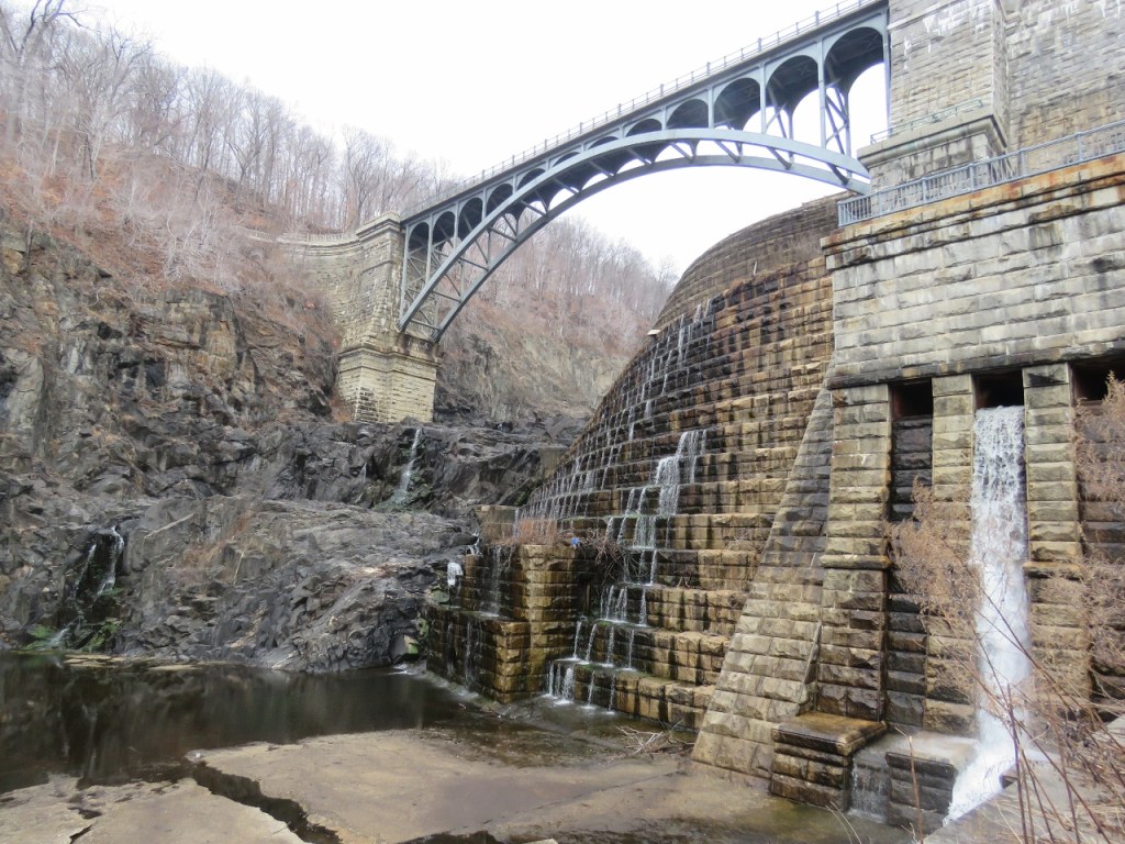
This is the High Bridge of the Croton Aqueduct, which crosses over the Harlem River, on its way to Central Park…
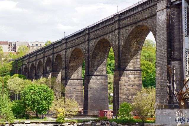
…which reminded me of the Ribblehead Viaduct in the Yorkshire Dales National Park in northern England, said to have been built for the railroad between 1869 and 1874.
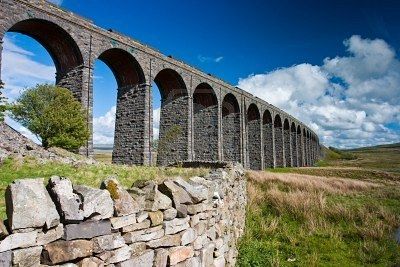
Again, how could they have accomplished these kind of engineering feats in a time period we are taught was low technology?
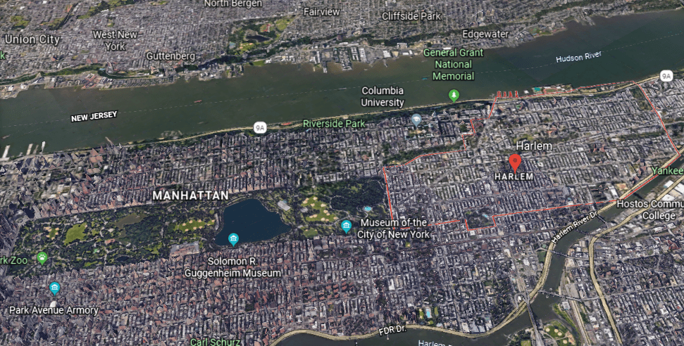
The last place in Central Park I want to look at is called Harlem Meer, or Harlem Lake.
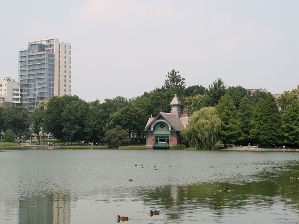
This rocky formation at Harlem Meer is called a bluff, which is one of the code-words used to cover up ancient infrastructure.
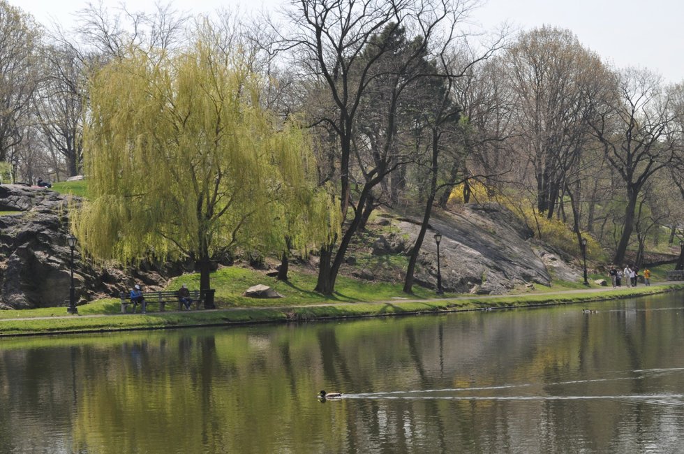
Harlem Meer in Central Park is adjacent to Harlem, in Upper Manhattan.
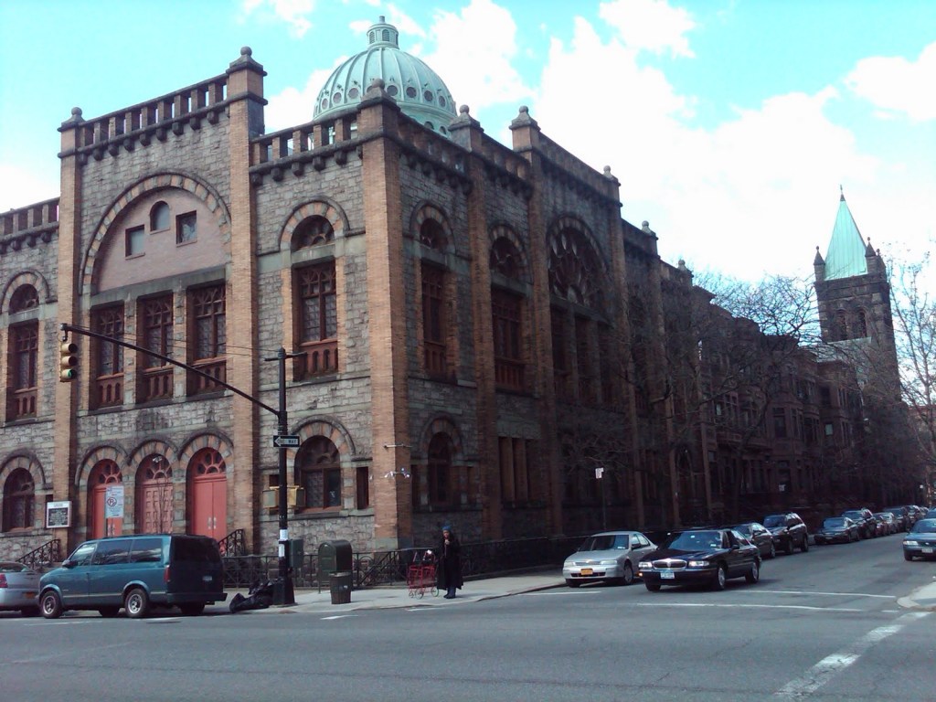
This is the Ascension Presbyterian Church in the Mount Morris Park Historic District in East Harlem, with its impressive architecture…
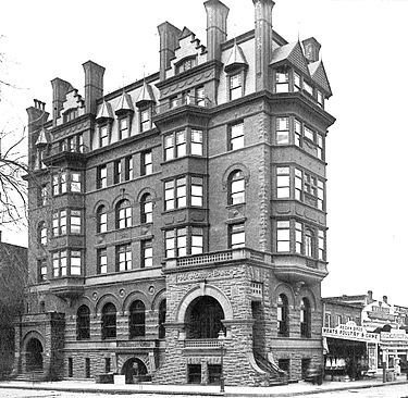
…and a historic photo of the Mount Morris Bank Building.
And this is a building in Harlem on the top left, compared with a building in Madrid, Spain on the top right, and one in Andijan, Uzbekhistan on the bottom.
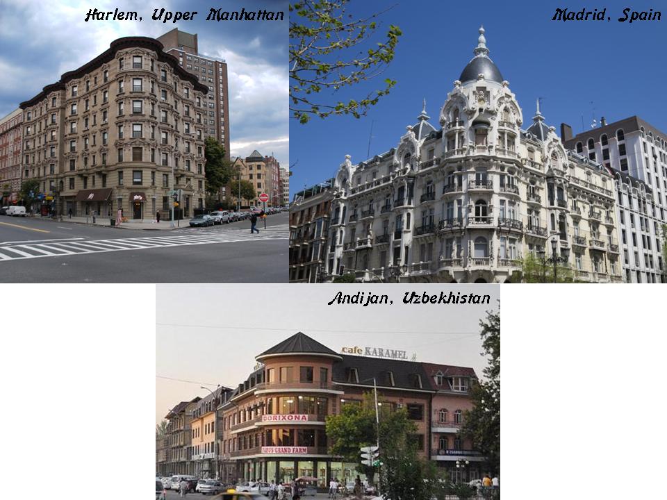
While not identical, the three buildings in very different places share the same rounded building-corner, and angles of lay-out on their respective street corners.
I have found countless identical street-corner configurations like these, and similar to these, all over the world.
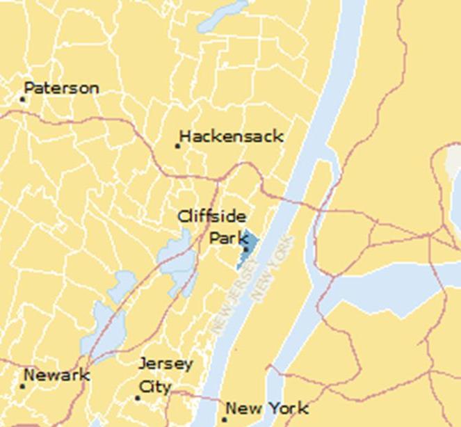
Next, I will take a look at some places on the other side of the Lower Hudson River, in New Jersey.
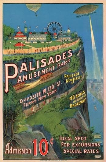
The first place is Cliffside Park, a borough in Bergen County located on top of the Hudson River Palisades…
…and the home of the Palisades Amusement Park, along with the adjacent community of Fort Lee, and one of the most-visited amusement parks in the country from 1898 until its closure in 1971.
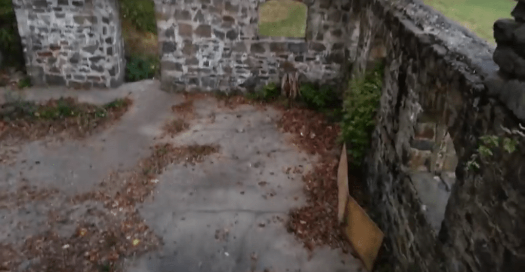
While four high-rise luxury apartments now stand where the amusement park was located, there still old stone ruins on the former park’s grounds.

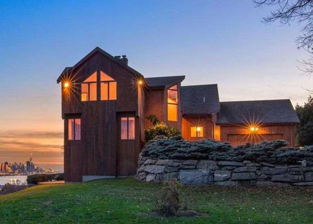
This modern home in Cliffside Park sure has a megalithic-looking stone wall beside it.
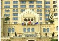
Here is an historic photo of the First Baptist Church of Cliffside Park…

…compared with a similar feature at Neuschwanstein Castle in Bavaria in Germany…
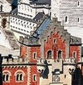
…and the same idea at the Dalian Castle in Dalian, China.
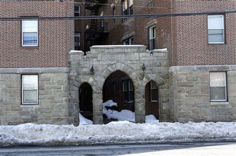
This apartment building in Cliffside Park has an interesting stone wall going on…
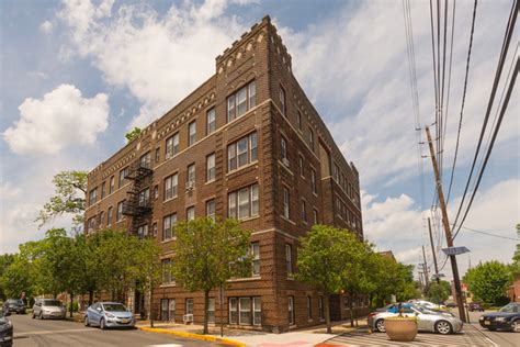
…and this Cliffside Park apartment building is quite ornate and elegant.
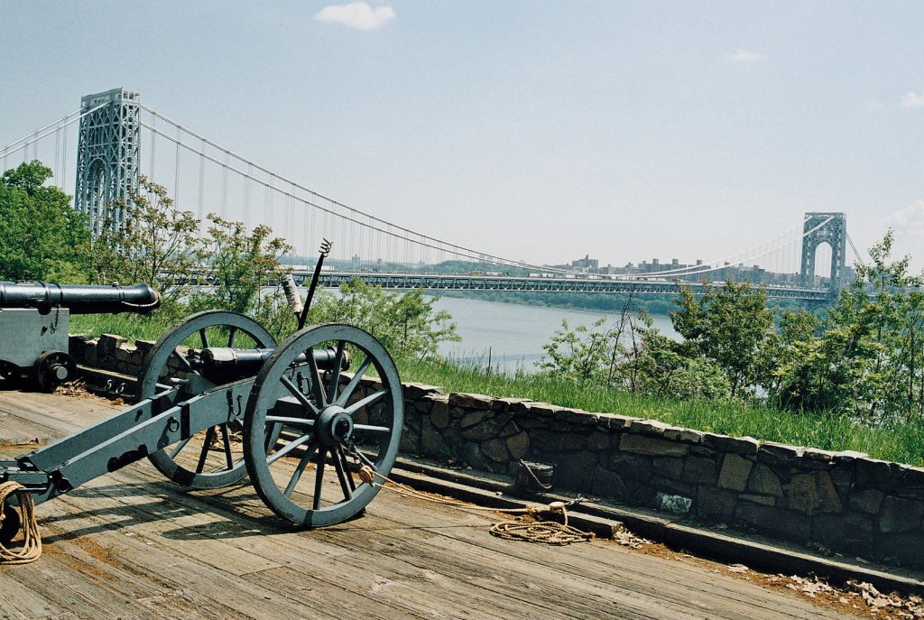
Just a short distance up the Hudson River from Cliffside Park is another city on top of the Palisades, Fort Lee, and the western terminus of the George Washington Bridge crossing over into the Washington Heights neighborhood of Manhattan.

The Fort Lee Historic Park surrounds the base of the bridge.
There are some interesting contrasts going on here.
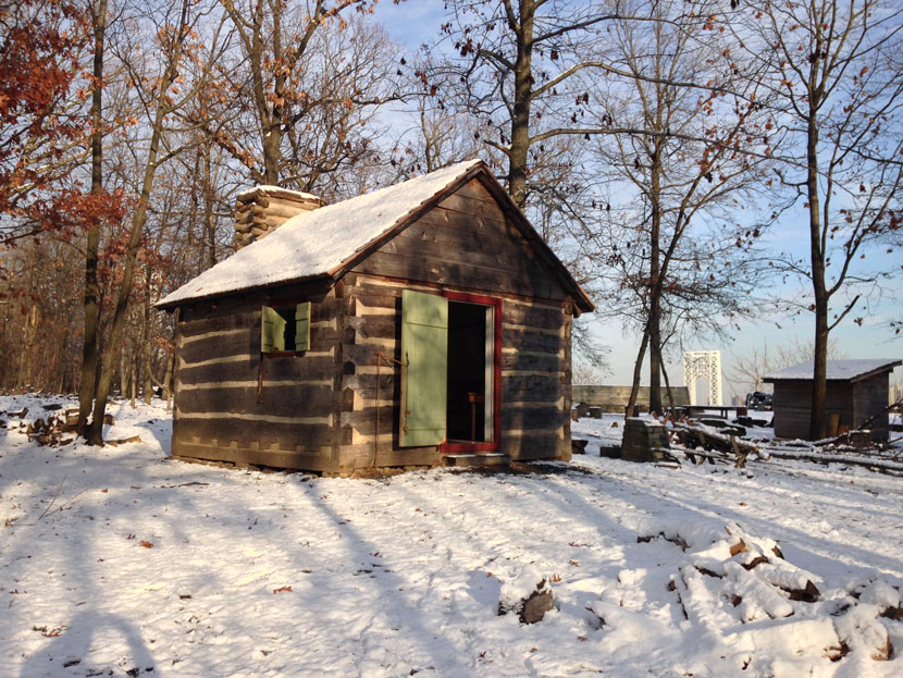
This wooden structure is on the Fort Lee Historic Park grounds…
…as well as these huge cut-and-shaped-looking stones lining the Hudson River bank. There’s a nice view of the Hudson Palisades in the background.
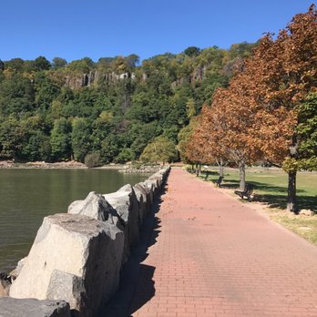
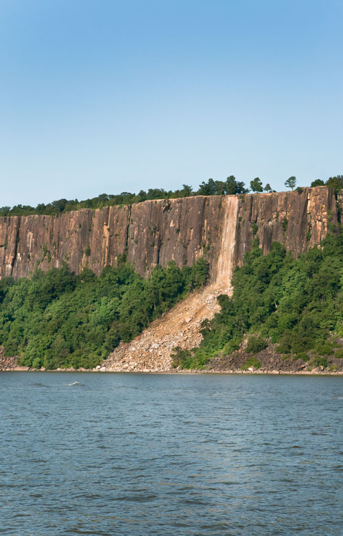
The Fort Lee Historic Park is part of the Palisades Interstate Park…

…and the Palisades Interstate Park was created in 1900, in a response to the destruction of the Palisades by quarry operators in the late 19th-century.
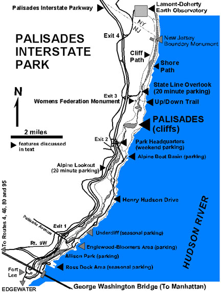
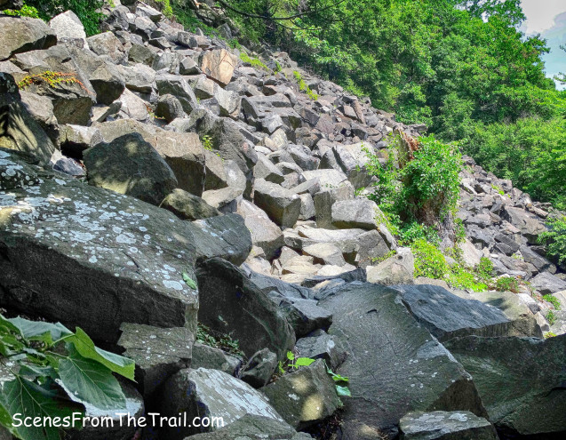
These are photos taken on the Shore Trail at Closter, New Jersey…
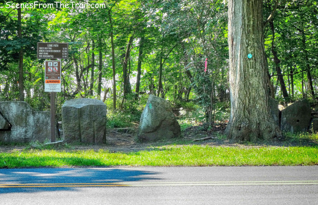
…that leads to what are called the Giant Stairs.
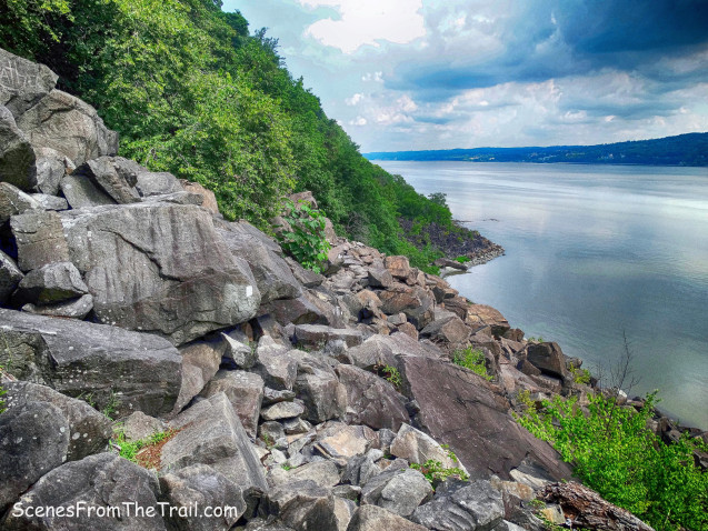
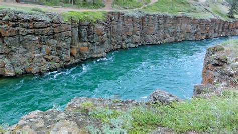
Here is a view of the Palisades from the Hudson River…
…compared with the Lena River Pillars near Yakutsk in Far Eastern Siberia…
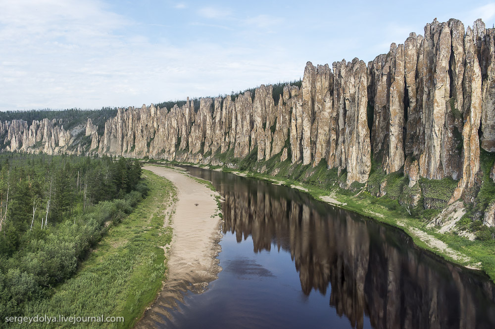
…and the Miles Canyon Basalts on the Yukon River, near Whitehorse in the Yukon Territory.
A few thoughts to provide an explanation for what I have found throughout New York and New Jersey in this post, and previous ones.
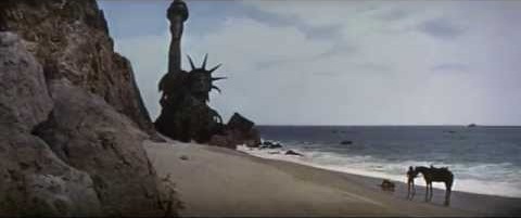
I am reminded of the last scene from the original “Planet of the Apes” movie, when Charlton Heston realized for the first time in the movie where he actually was the whole time, only in the sense that we do not know where we really are. We are living and working in, and on top of, the infrastructure of an advanced, ancient civilization, without knowing it.
This knowledge has been deliberately removed from our collective memory and awareness.
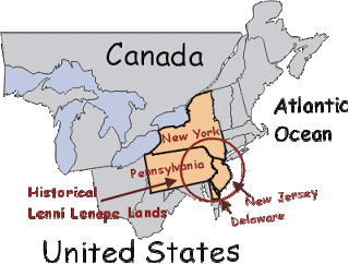
Who were the Lenni Lenape people, who lived throughout this region before what we are taught was the coming of Europeans?
There is agreement this was their land, and they are described hunter-gatherers, with farming as well. There is just not much written information to find out about the Lenni Lenape.
The wisdom keepers of this ancient civilization that was not only in North America, but around the world…
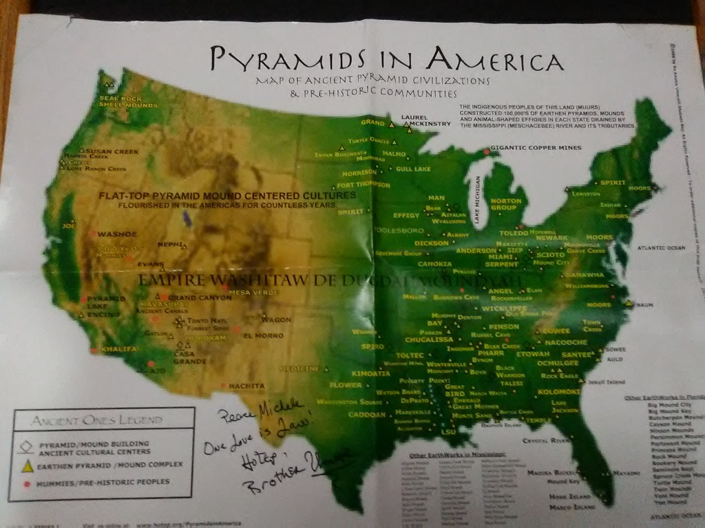
… know who they really were, as shown in the northeastern part of this map.
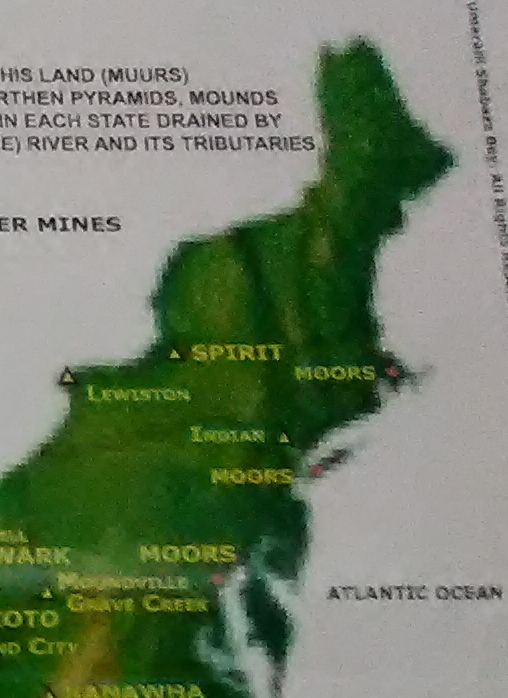
The Lenni Lenape people were Moors.
According to George G. M. James in his book “Stolen Legacy”…
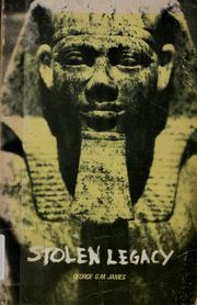
… the Moors were the custodians of the Ancient Egyptian mysteries, and they still are.
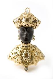
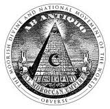
…and this is the Great Seal of the Moors.
The beauty, harmony, and balance of the global Moorish Civilization, from Antiquity, was replaced by a parasitic system, causing human and environmental degradation…relatively recently.
Now is the time of the Awakening, and claiming the original positive Moorish, and higher, timeline and legacy for Humanity.

I will be picking up the circle alignment in Hartford, Connecticut in the next post.
