
In the last post, the circle alignment was tracked from its entry point into western Iceland in the town of Olafsvik on the Snaefellsnes Peninsula, across the Faroe Islands lying between the North Sea and the Norwegian Sea, and on over the Hebrides Islands off the Northwest coast of Scotland in the North Atlantic Ocean.
In this post, I am beginning in Wick, Scotland, a town and royal burgh located in Caithness along the River Wick and Wick Bay in the far north of Scotland.
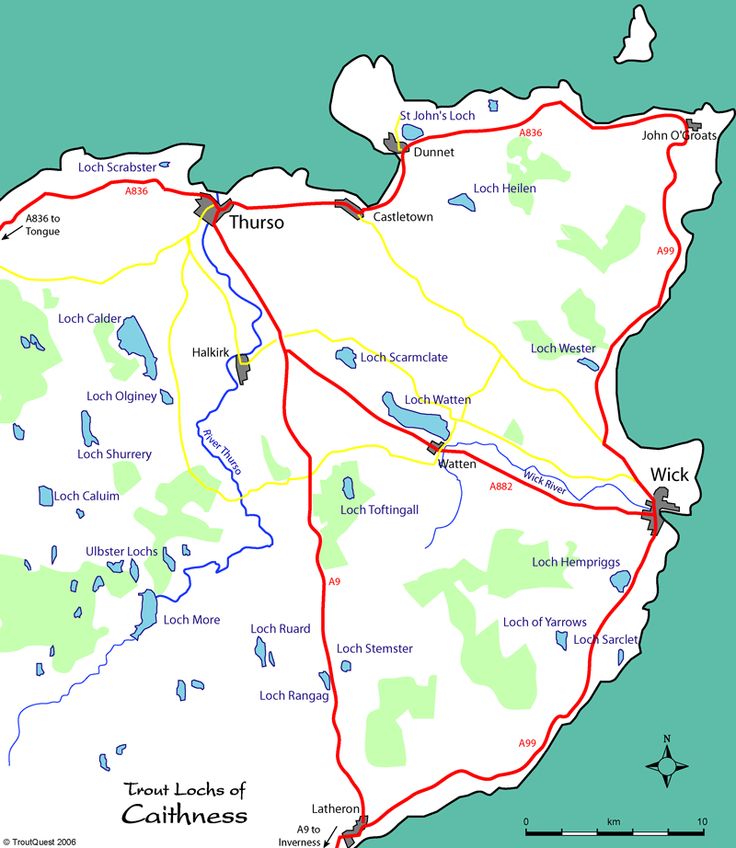
Wick is slightly northeast of the actual circle alignment as it tracks through Scotland, however, this region of Scotland is significant, and has noteworthy things to include on this journey.
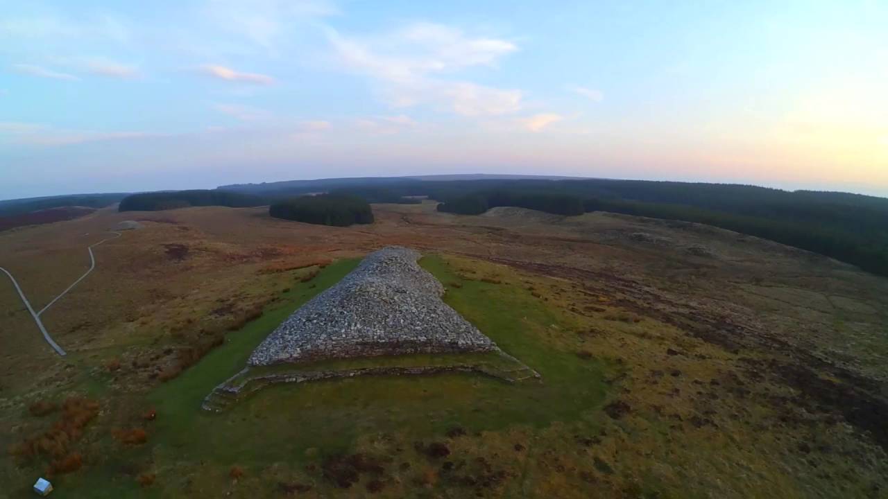
I am going to start this journey through Scotland in the far distant past, at a place called the Grey Cairns of Camster.
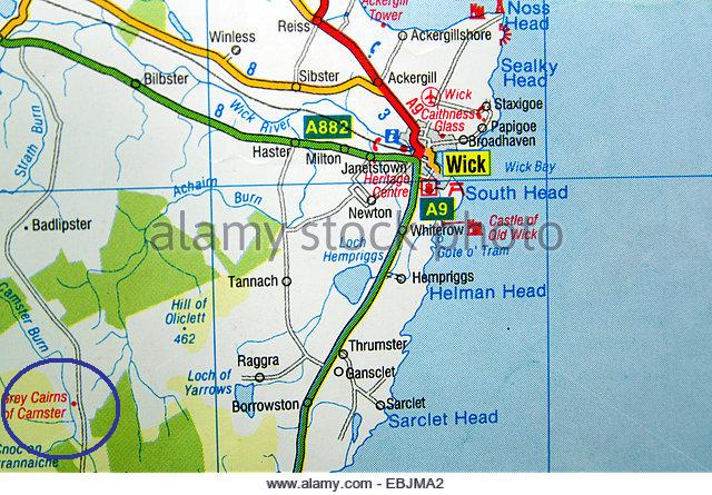
This site has two of Scotland’s oldest, and best-preserved, Neolithic chambered cairns, dating to have been built over 5,000 years ago, in addition to this big mound.
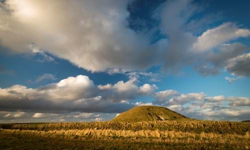
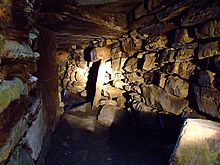
This is Camster Round, said to have been discovered in 1850, and excavated in 1865. It is unique as a chambered cairn in Caithness because its main chamber roofing was found intact.
This is a photo of the interior of Camster Round.
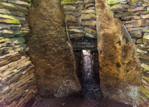
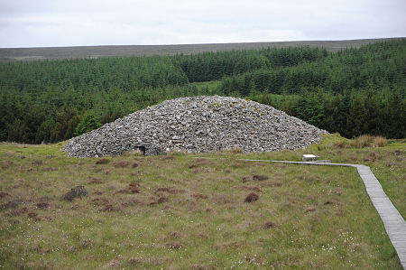
The other chambered cairn is called Camster Long.
This is the inside of Camster Long, with sunlight shining on the stone at the end of the Chamber.
These two cairns are described as burial chambers. I believe Neolithic constructions like these chambered cairns have predominantly astronomical functions, and not burial ones. Like, among other things, being markers of the heavens on earth at the solstices or equinoxes, providing a perfectly aligned avenue in the enclosure for the light to stream into at those times.
Another example of this is found in the Neolithic Complex of Avebury in Southern England…
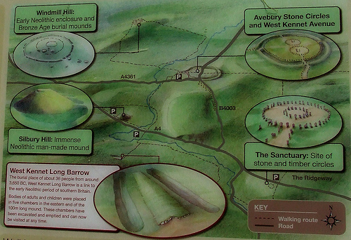
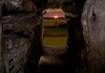
…at the West Kennet Long Barrow. While also called a tomb, it is known to be a solar marker at the equinoxes, as depicted in this photograph of the sun aligned at the entrance of this long barrow. It is also over 5,000 years old, like the Grey Cairns of Camster near Wick.
Both the Grey Cairns of Camster and the West Kennet Long Barrow are contemporaries in time with the Watson Brake Mounds, in Richwood, Louisiana, near Monroe and Poverty Point.
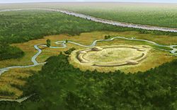
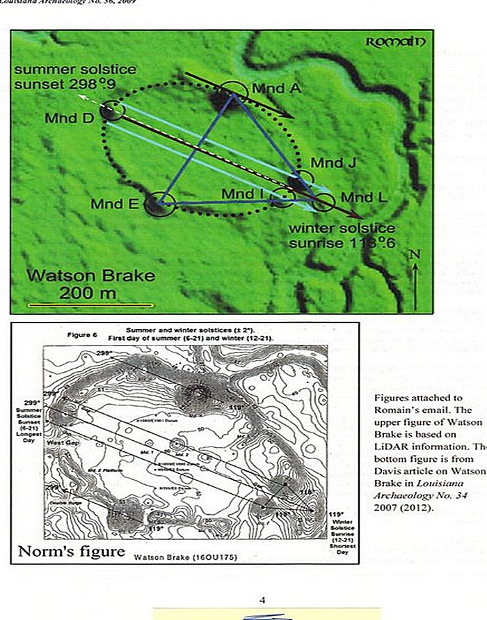
Watson Brake is dated to 5,400 years ago, and is considered the oldest earthwork mound complex in North America. Note the summer and winter solstice alignments depicted here in this diagram of Watson Brake.
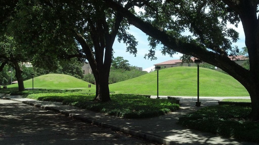
There are two ancient mounds at Louisiana State University in Baton Rouge, believed to be more than 5,000 years old, and considered to be part of the oldest mound system in North America, and also an acknowledged part of the Louisiana mound system. They are on the U. S. National Register of Historic Places.
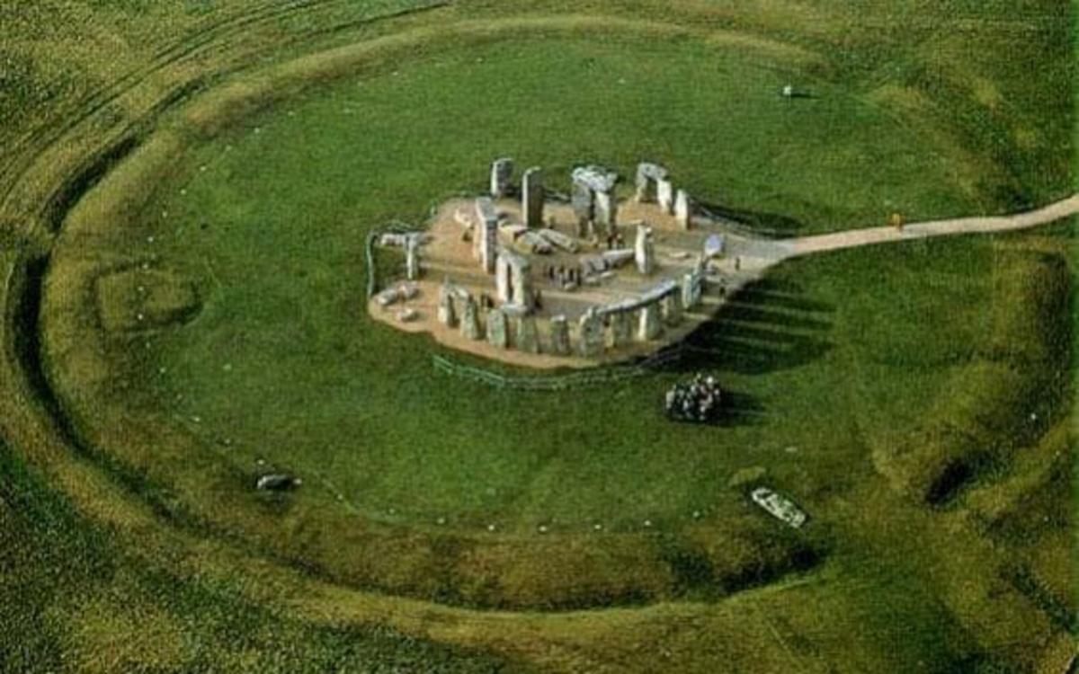
This is Stonehenge, located not far from the neolithic complex at Avebury in Southern England, believed to date to about 5,100 years ago, which has a similar earthwork to what is seen at Watson Brake in Louisiana encircling the big stones,
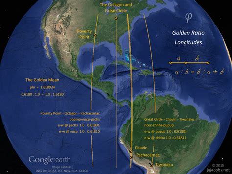
The Octagon and Great Circle Earthworks in Newark, Ohio, is located on a Golden Ratio Longitude, along with Poverty Point in Louisiana.
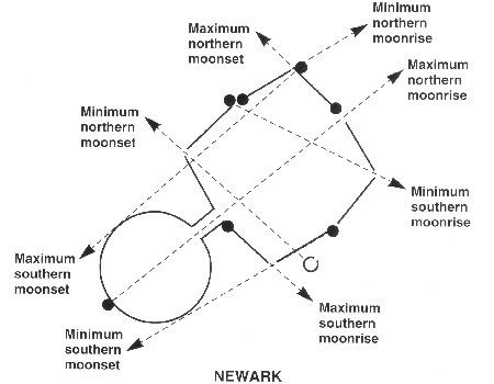
This diagram shows the lunar alignments marked by these earthworks in Ohio.
How is this even possible according to the history we have been taught?
My answer is the Ancient Advanced Civilization, that we have not been told about, aligned Heaven and Earth in everything they did, all over the Earth.
By the way, the Octagon and Great Circle of Newark…
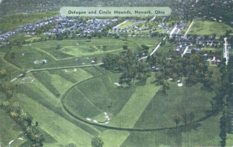
… are now part of the golf course of the Moundbuilders Country Club.
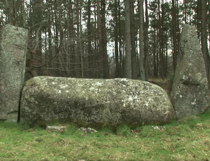
Another striking example of this practice by the Ancient Ones, of the consummate aligning of heaven and earth, is found near Forres, which is located southwest of Wick, across the North Sea and Moray Firth from Wick.
Forres is in the Grampian Mountains, which are said to have the highest concentration of stone circles found anywhere, and include what are called Recumbent Stone Circles, found only in this part of Scotland and in the far southwest of Ireland.
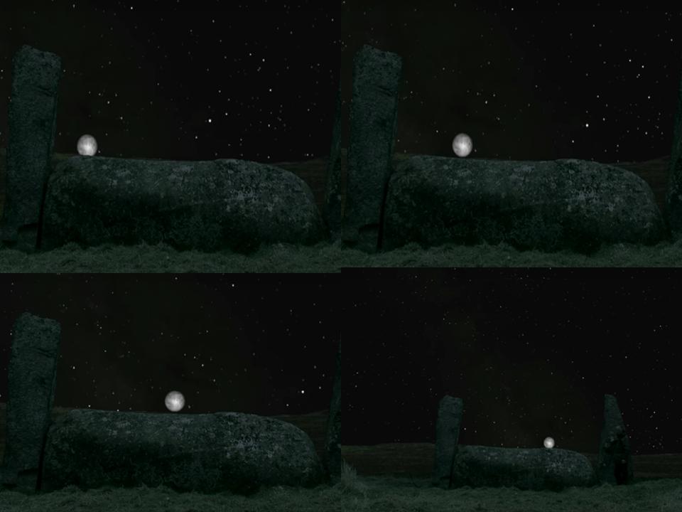
This is the Recumbent Stone Circle of Crowthie Muir near Forres. The center stone, weighing upwards of 50-tons, is perfectly placed in the landscape…
for lunar events like this one, as the moon is seen rolling along the top of the recumbent stone on the same night.
While the stone circles of Great Britain and Ireland are the best-known, there stone circles in many places, including in Africa, like the Bagnold Stone Circle in the Libyan Desert…
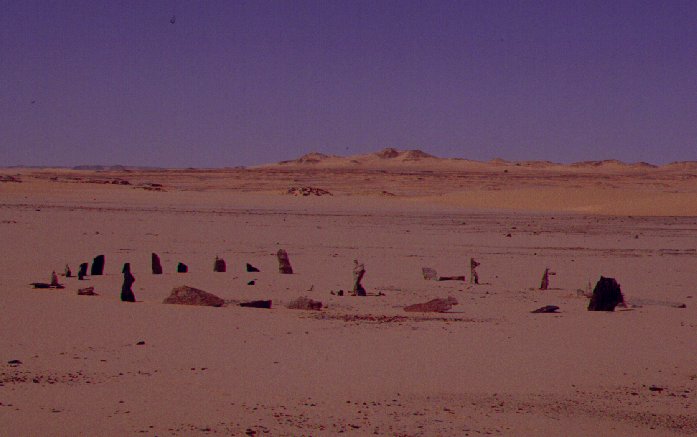
…the Mzora Stone Circle in Morocco…
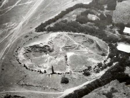
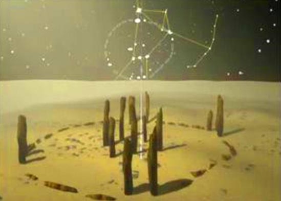
…and Nabta Playa, depicted with astronomical alignments, in southern Egypt, situated on the Tropic of Cancer.
There are a few more things I would like to highlight in Wick.
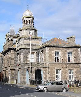
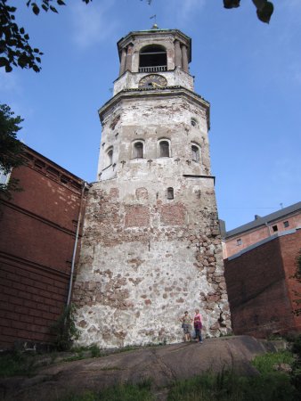
The first is this clock tower in Wick…
…compared with this historical depiction of one in Hong Kong…
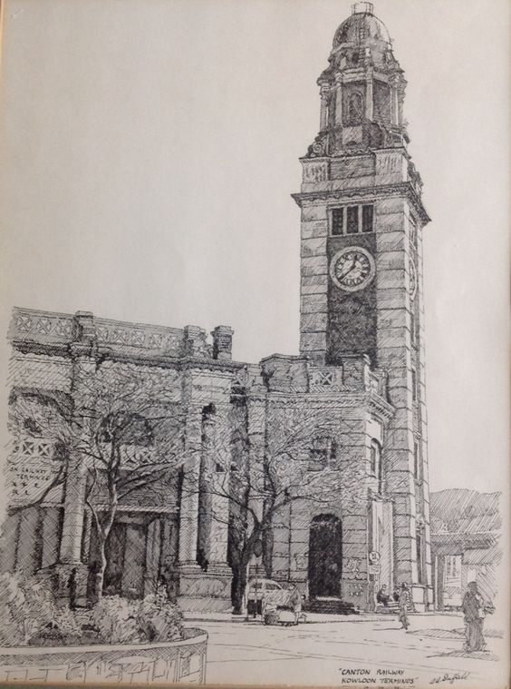
…and this one in Vyborg, Russia. Not identical, but similar constructions of heavy masonry with with the same function of time-keeping in different countries.
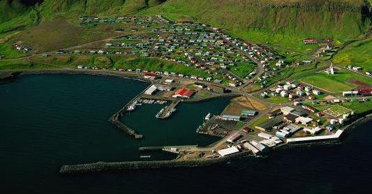
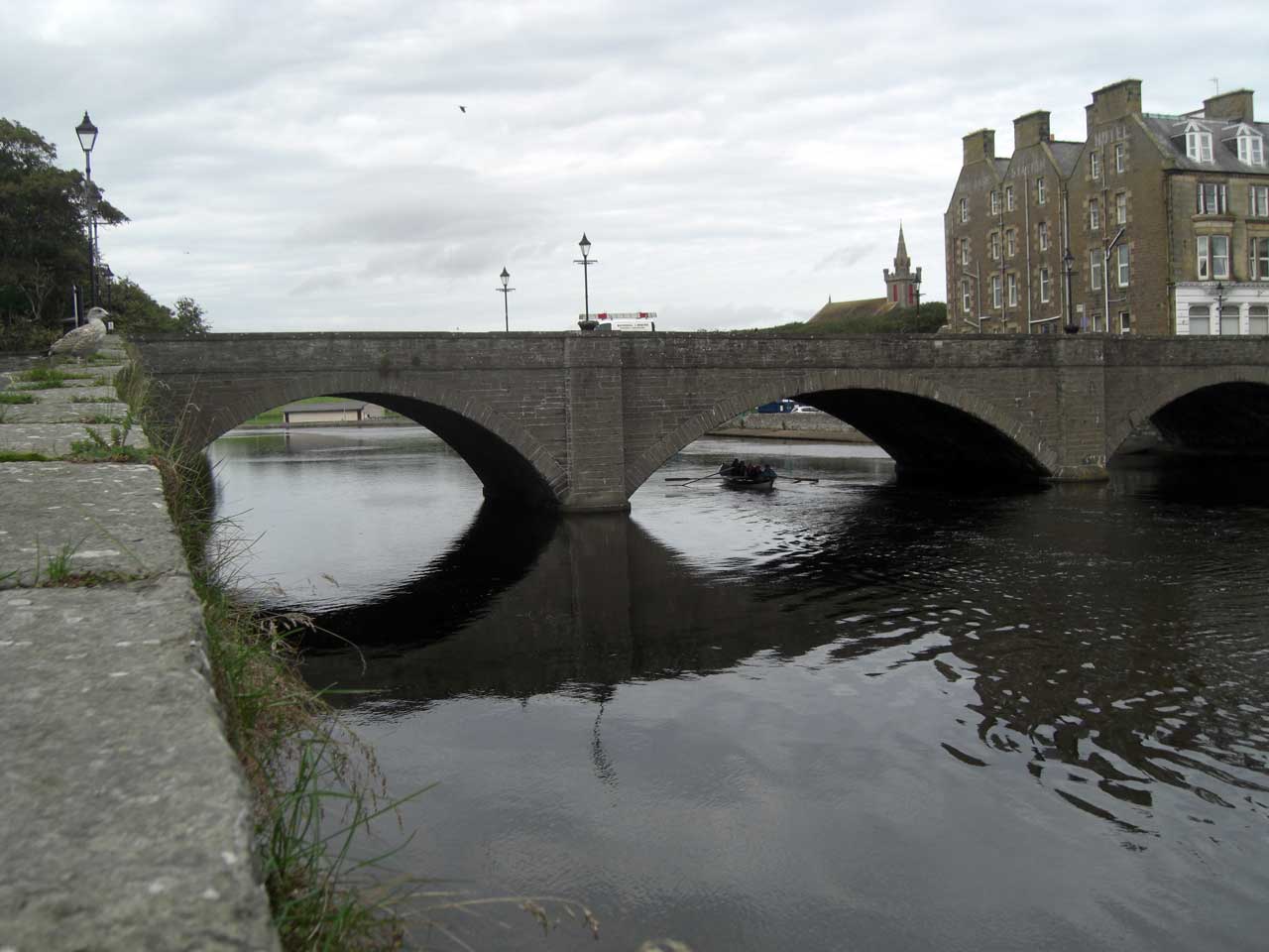
Here is the Wick River, also known as the River Wick, where it flows into Wick Bay…
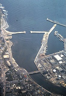
…compared with what Olafsvik back in Iceland looks like again.
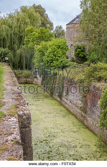
And is the Wick River actually a canal?
Here is a canal called a canal in Wick. Where there is one, there are others….
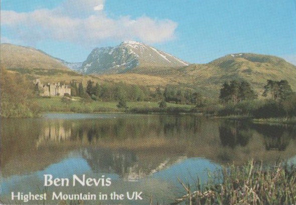
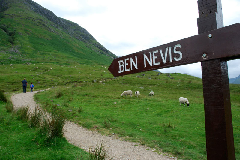
Lots more to see up here in northern Scotland, but now back to the circle alignment. It passes through Ben Nevis…
…the highest mountain in the British Isles. at the western end of the Grampian Mountains.
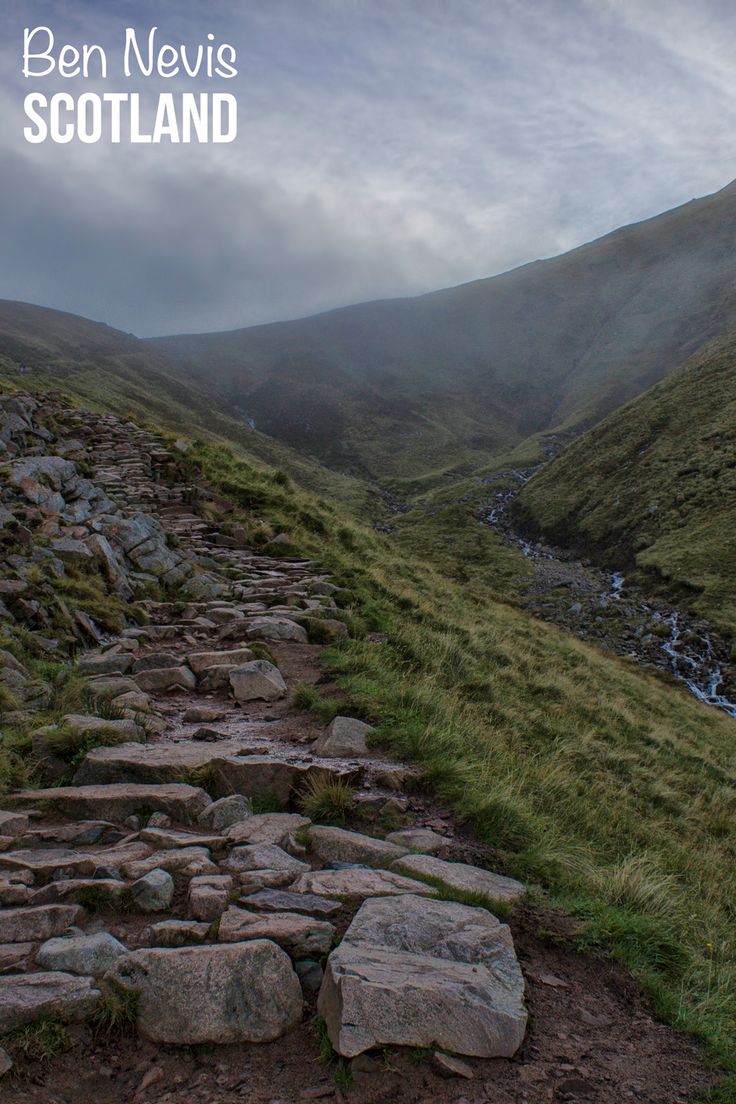
This is what the Climbing hiking trail up Ben Nevis looks like…
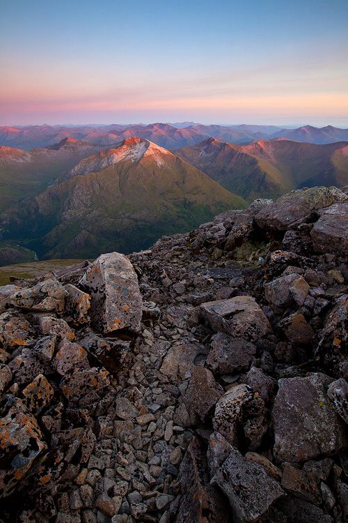
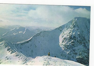
…and this is a view from the summit of Ben Nevis.
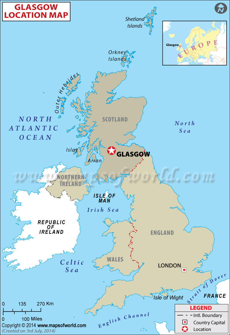
Leaving from Ben Nevis, the alignment passes close to Glasgow, the largest city in Scotland.
This is a view of what is called the River Clyde in Glasgow, with its canal-like appearance, and masonry river-banks…
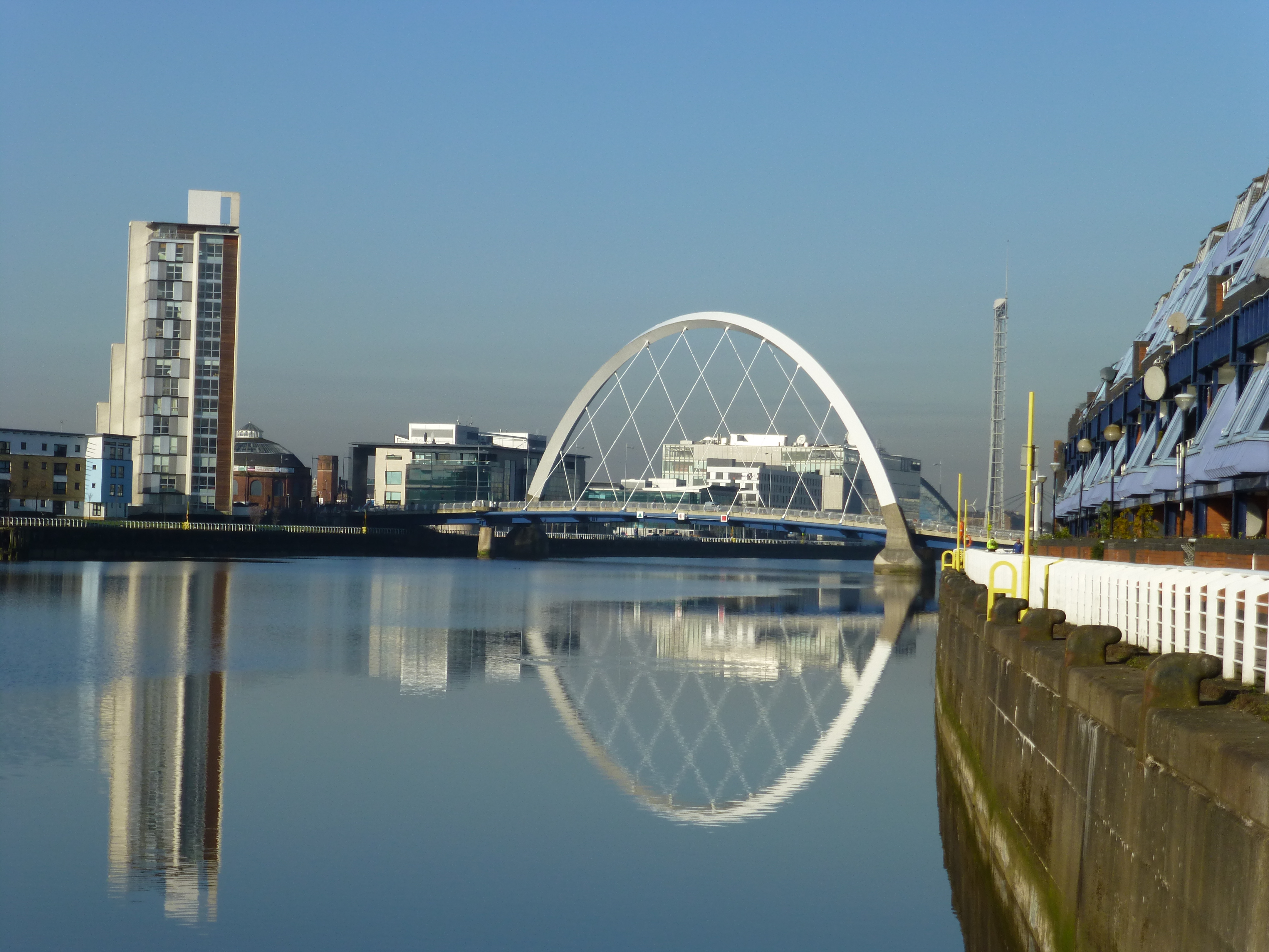
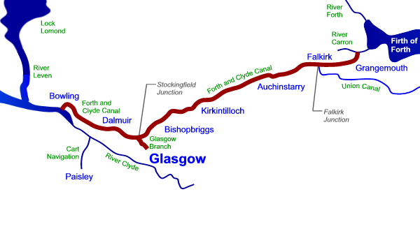
…just like the Forth and Clyde Canal…
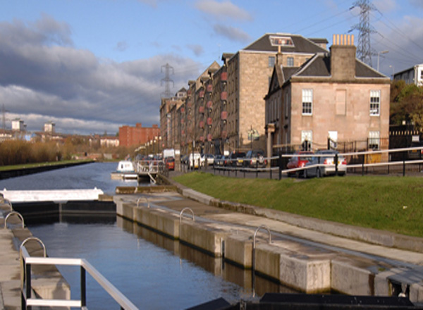
…construction of which is said to have been started in 1768, and opened in 1790. It runs between the Firth of Forth on Scotland’s central-east coast, through Glasgow to the River Firth of Clyde.
Bear in mind, Scotland was said to be rural and agricultural until the Industrial Revolution in Scotland, which is said to have started after 1790.
How could they have built something like this when they said they did?
This is an historic building in Glasgow…
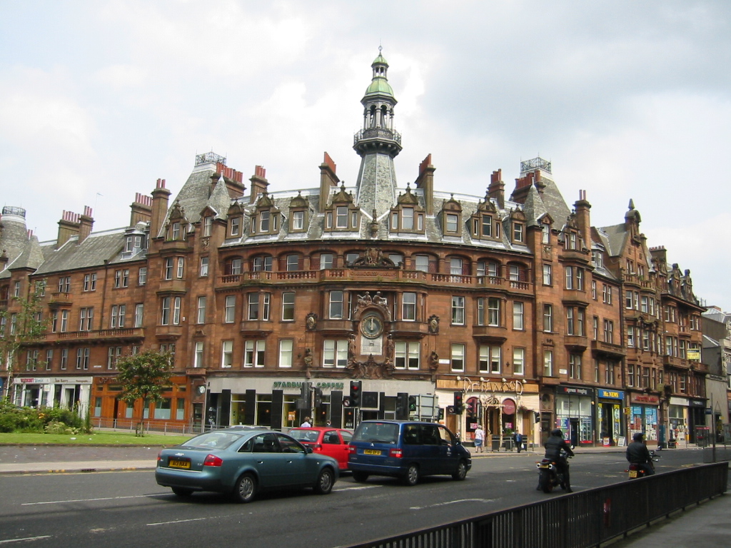
…compared with the Wako Department Store in the Ginza Shopping District of Tokyo…

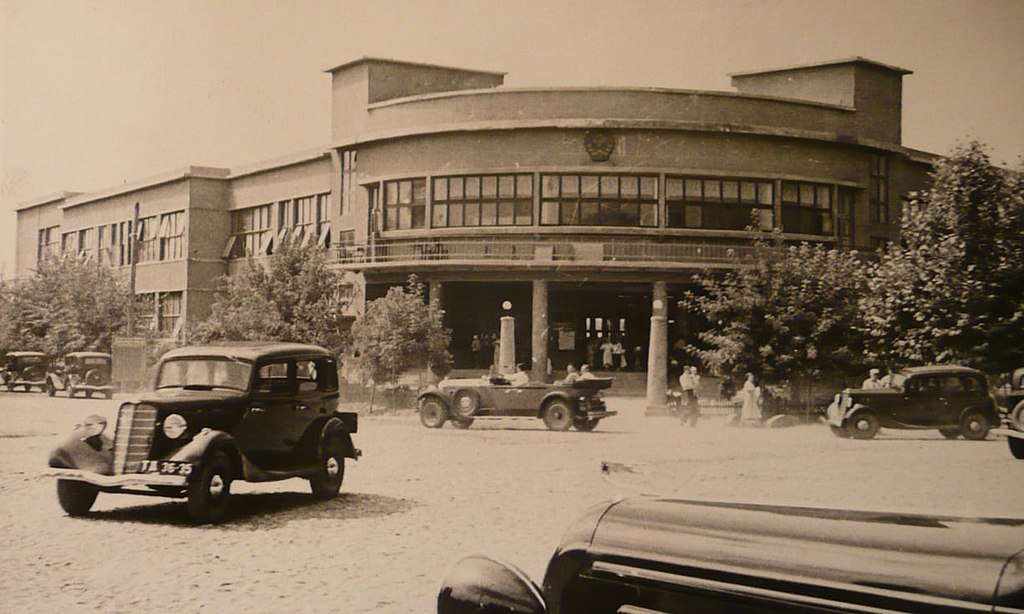
…the historic post office in Dushanbe, Tajikistan, circa 1937…
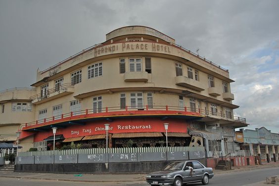
…and the Burundi Palace Hotel in East Africa.
At some point along the way, I learned about the Crystal Palace in London’s Hyde Park, said to have been built of cast-iron and plate-glass solely for the Great Exhibition of 1851 in which to display the technology developed in the Industrial Revolution…
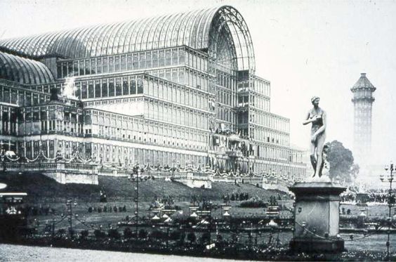
..after which time it was said to have been moved to South London in 1854, and destroyed by fire in 1936.
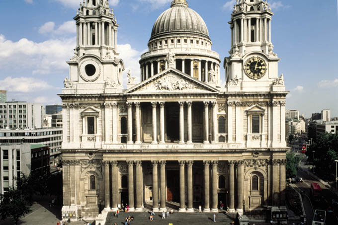
What! A building of plate-glass and cast-iron, said to be three times larger than St. Paul’s Cathedral in London, shown here…
…just up and moved?
The same kind of story is told about the Moorish Kiosk in Mexico City, which is still standing.
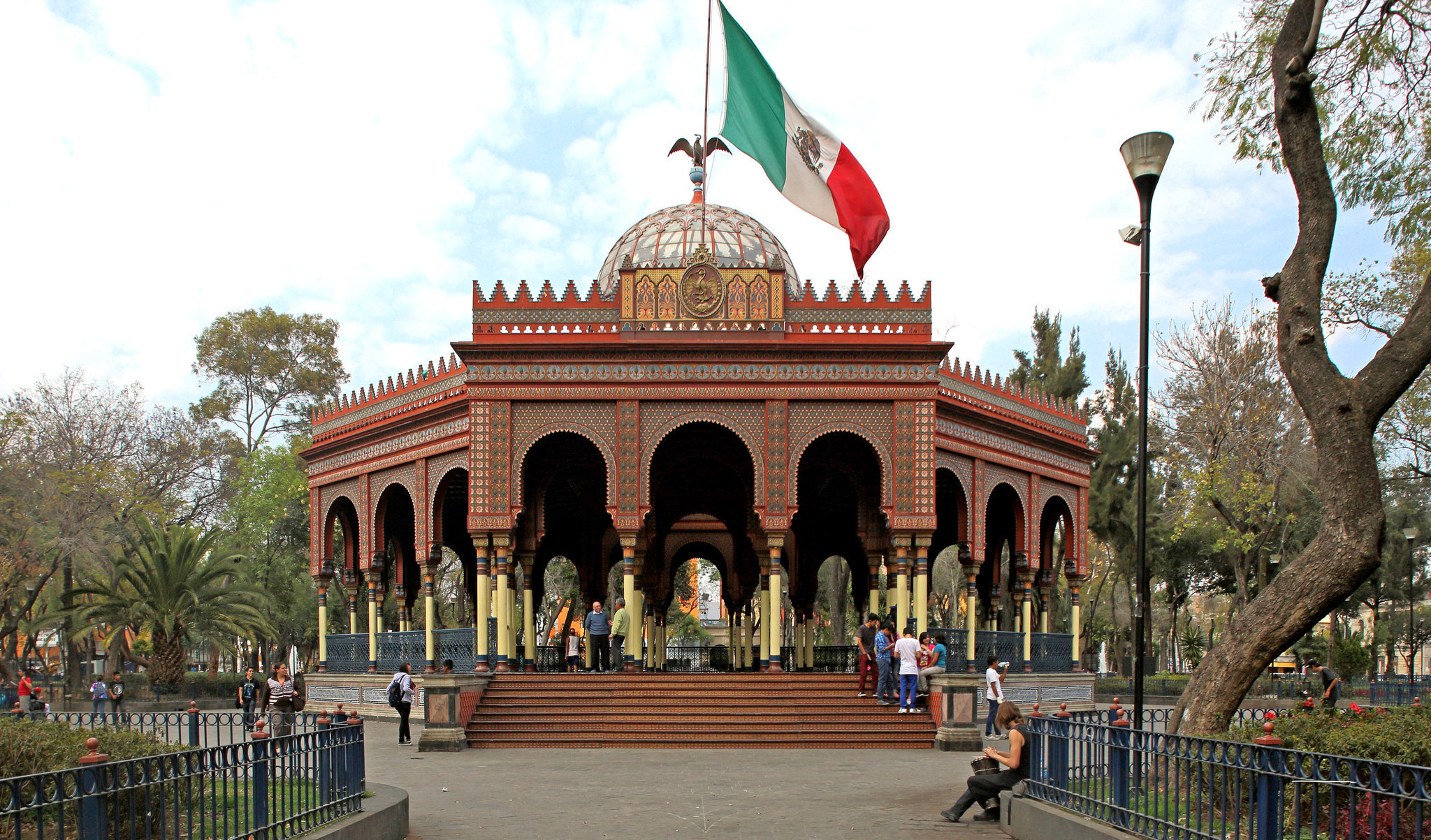
The person who gets the credit for it was a Mexican engineer named Jose Ramon Ibarrola. He is said to have designed it to represent Mexico in the New Orleans International Expo in 1884 – 1885. We are told it was transported there, as well as to the St. Louis Missouri Fair in 1904, and then subsequently came back to Mexico.
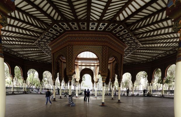
By what means could they have transported this huge, highly ornate structure, twice, in the late 1800s and early 1900s?
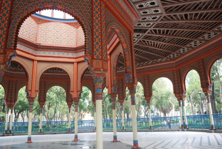
The reason I bring all of this up about the Crystal Palace in London, and the Moorish Kiosk in Mexico City, is because of what I found in Glasgow.
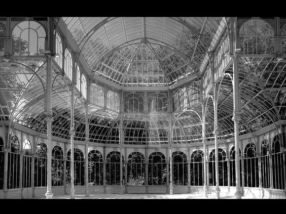
This is inside the Kibble Palace of the Glasgow Botanic Garden.
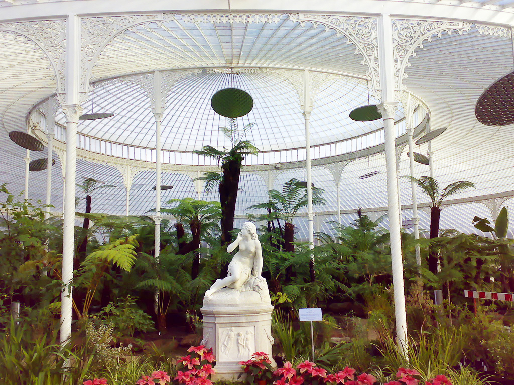
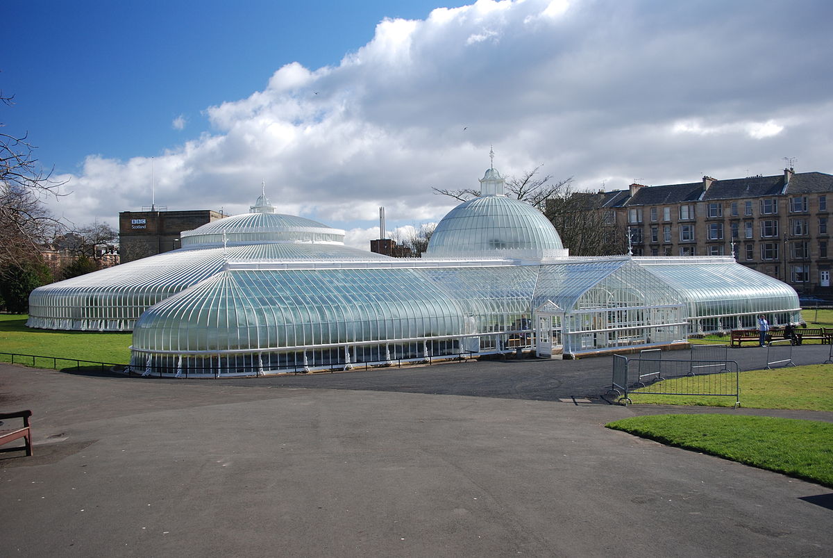
This is an outside view of the Kibble Palace, a wrought-iron, framed, glass-house, said to have been by John Kibble for his home on Loch Long in 1865. It was said to be taken down in 1871, and re-erected here. It opened to the public in 1873.
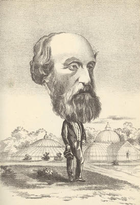
This is an odd depiction of John Kibble, and showing the Kibble Palace in the background too! Monty Python, anyone?
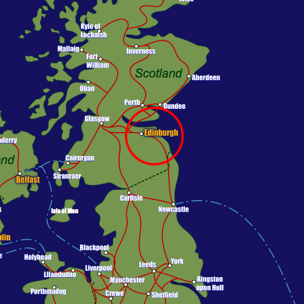
The next place the alignment passes through is Edinburgh, the capital city of Scotland.
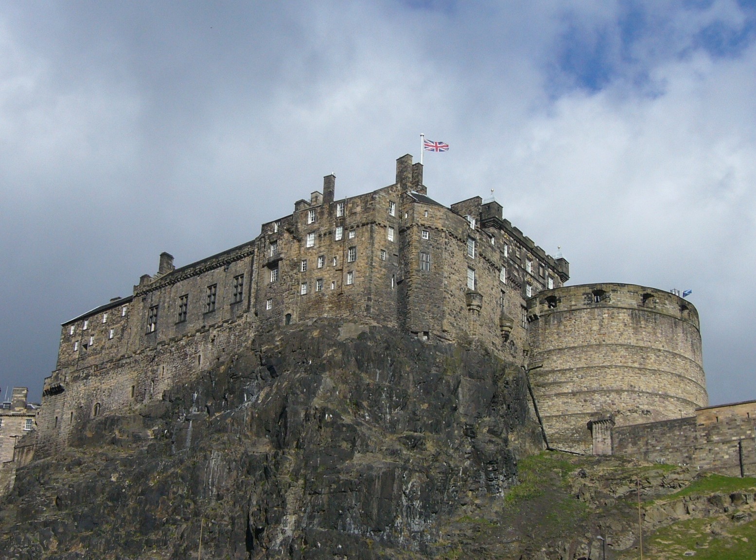
The fortress of Edinburgh Castle dominates the city at the head of Old Town…
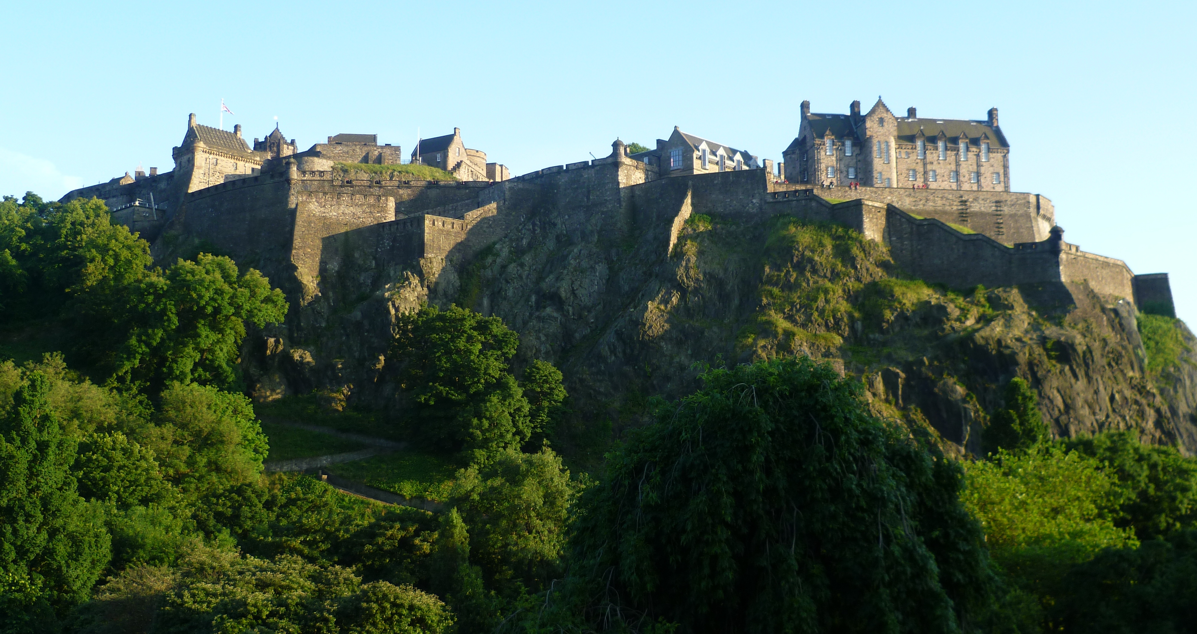
….from its position on Castle Rock, called a crag of basalt formed from an extinct volcano that has a tail that became…
…the gently sloping Royal Mile of Edinburgh, the main thoroughfare of Old Town and seat of government of Scotland…
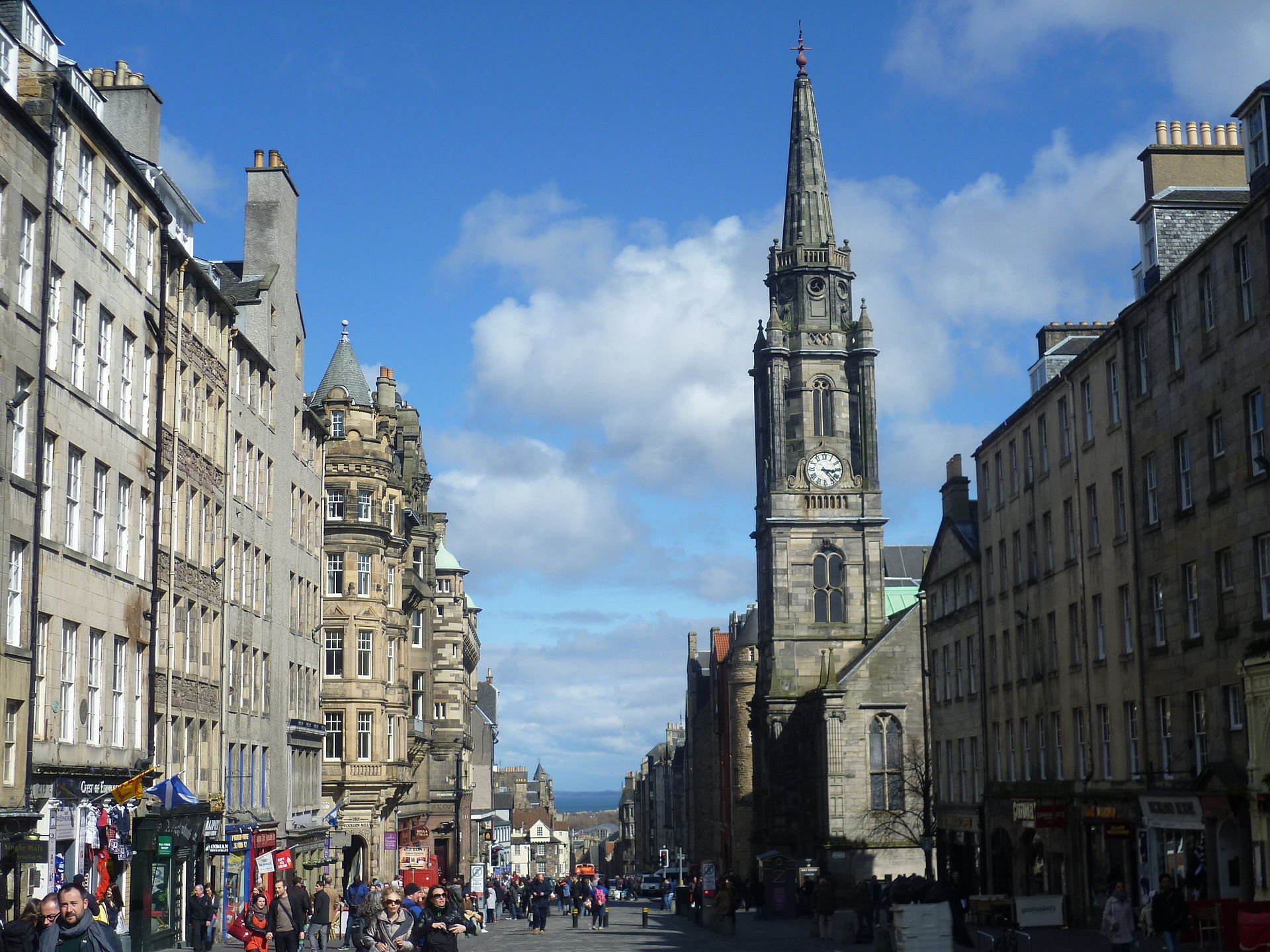
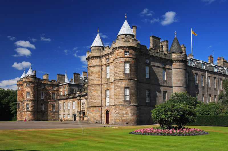
…on its way to the Palace of Holyroodhouse, the official residence of the monarch in Scotland.
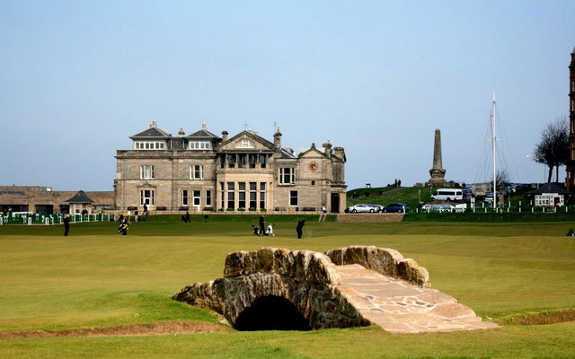
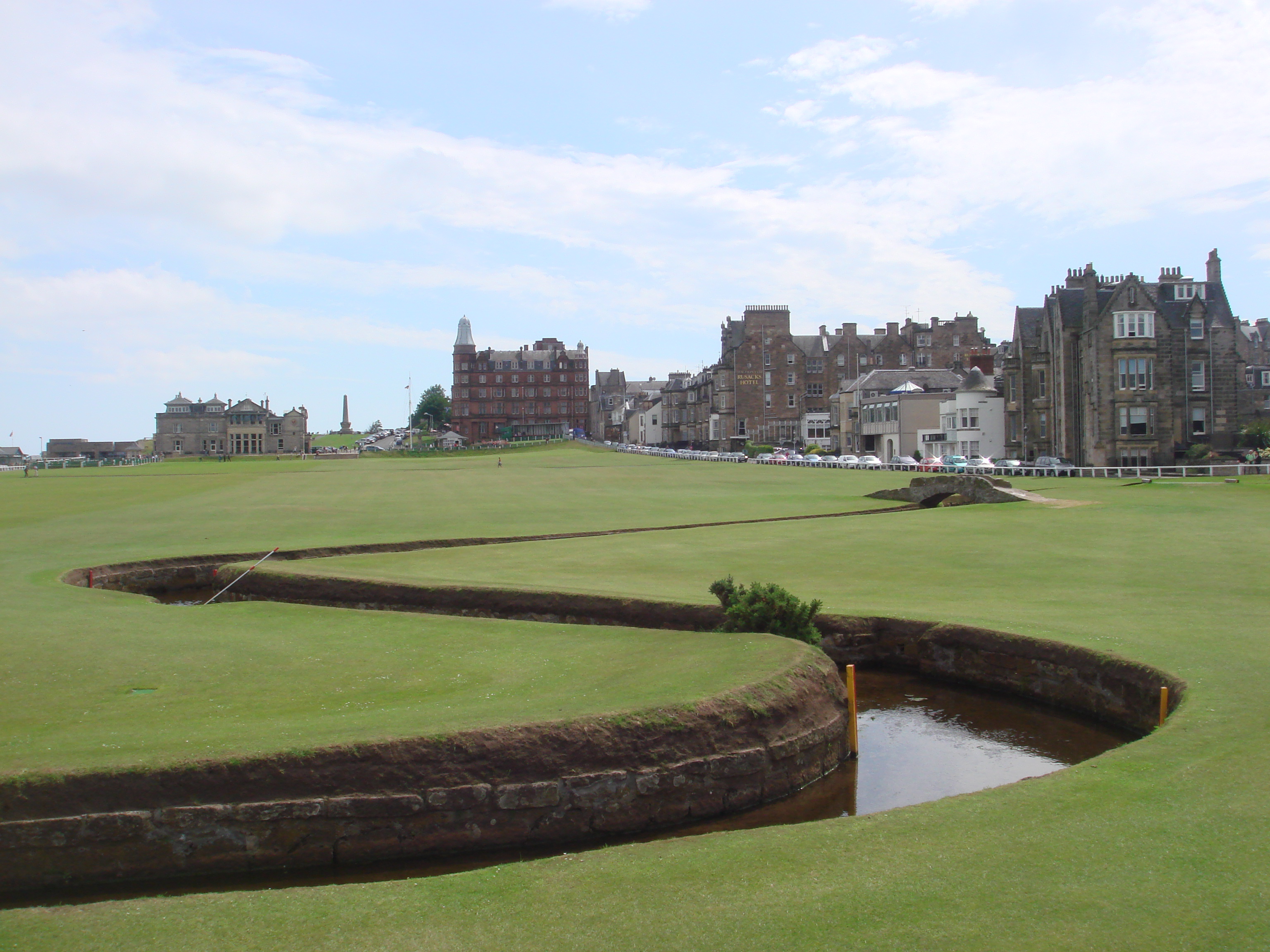
St. Andrews, Scotland, is 30 miles, or 50 kilometers, northeast of Edinburgh. It is referred to as the home of golf, with the founding in 1754 of the “Royal and Ancient Golf Club of St. Andrews,” the world’s oldest and most prestigious golf club.
To be clear, I believe that golf courses are ancient mound sites, and are used as a means to not only cover them up, but to secretly show dominance over the ancient civilization.
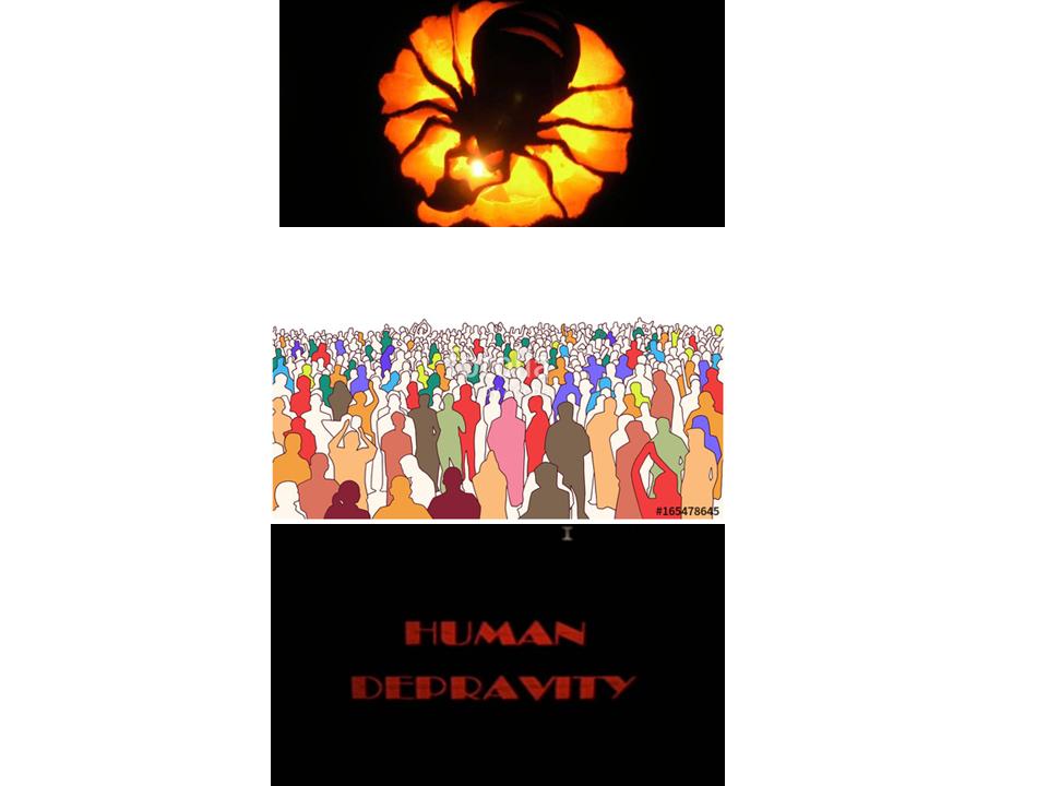
I believe that Humanity was deliberately knocked off its advanced and positive evolutionary timeline of Unity Consciousness relatively recently, and that the planetary grid was hijacked by malevolent forces with a negative agenda that has had disastrous consequences for Humanity.
This is not who we were or who we are. We have been manipulated by race and religion to cause fear and division by parasitic beings who feed on negativity and human energy.
Please read my post “An Explanation for What Happened to the Positive Timeline of Humanity, and Associated Historical Events & Anomalies” for an in-depth exploration of this subject.
A false historical narrative, that we have been completely educated in, was superimposed on top of the already existing infrastructure of the highly advanced and unified civilization, which included free energy powered by the worldwide planetary grid.
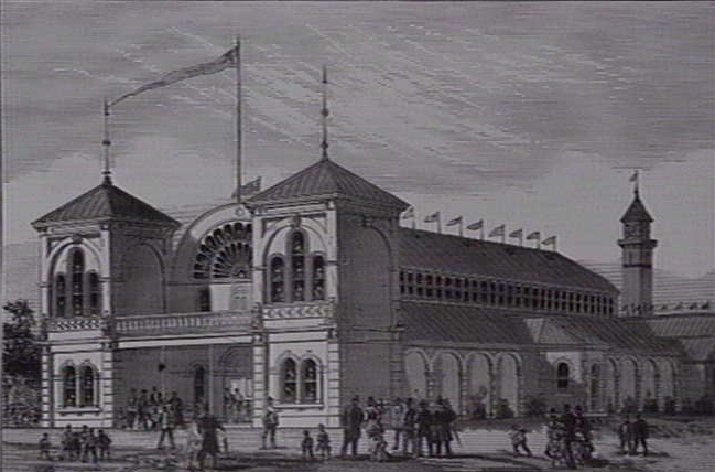
Much of this infrastructure has been torn down, like the Exhibition Hall and Market Square Tower in Geelong, Australia pictured here. This is one of countless examples.
In order to get the level of power and control over Humanity that we have seen in our lifetimes, the higher consciousness of the planet had to be taken down.

I bring all of this up to illustrate this process of manufacturing a new culture and inventing a new history, as already evidenced by the flimsy stories I have covered in this post. We don’t have to look any further than the Scottish House of Stuart.
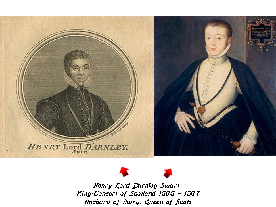
First, here are two portraits of Henry Lord Darnley Stuart. He was the King-Consort of Scotland from 1565 to 1567 as the husband of Mary, Queen of Scots. He was murdered in Edinburgh in 1567. The murder was never solved, however, it appeared to be related to some kind of court intrigue.
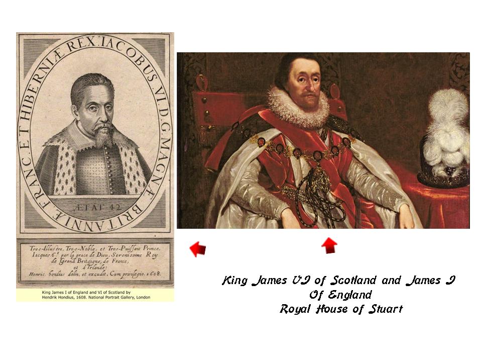
Henry Lord Darnley was the father of King James VI, who became King of Scotland in 1567. In addition to the Scottish throne, he became King James I of England and Ireland, the King James Version of the Bible King James, when Queen Elizabeth I died in 1603.
This is James Francis Edward Stuart. Known to history as the “Pretender,” he was first exiled to France, and then to Rome, where he died in 1766. He would have been heir to the three thrones, but was forcibly prevented from claiming them when he tried to do so.
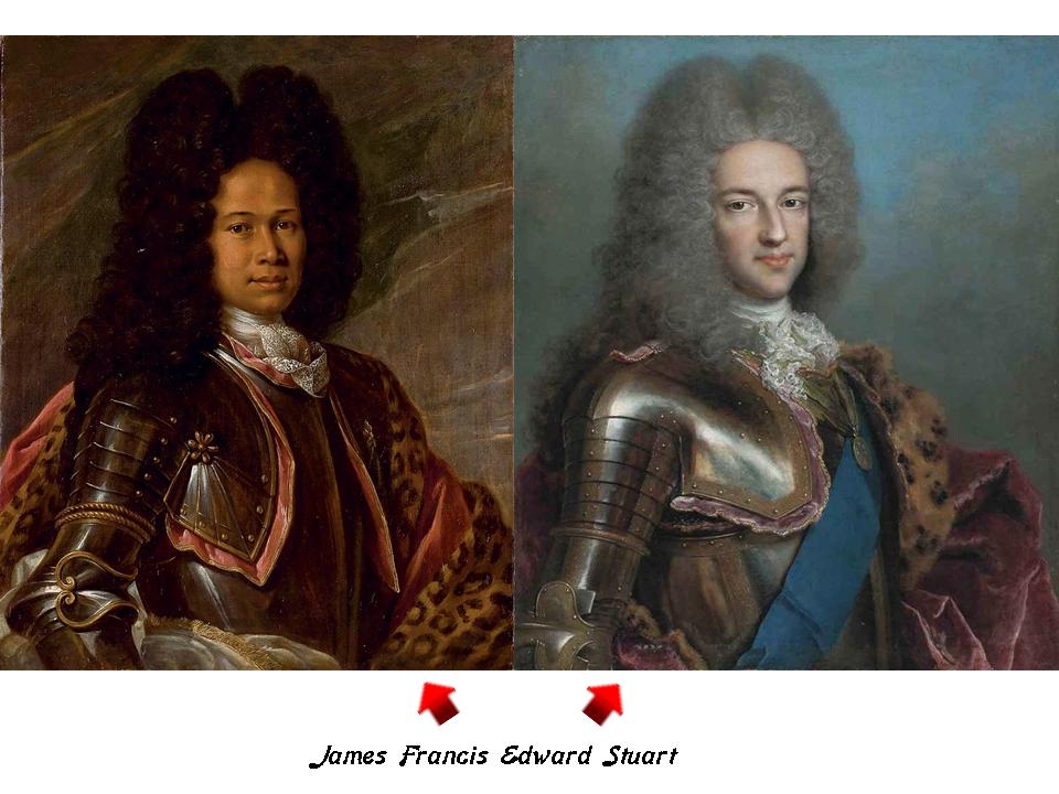
The interesting thing about this specific period of time when James Francis Edward Stuart is forced into exile in France in 1710, was right before George I, of the German House of Hanover, became the British Monarch in 1714. I think Scotland, England and Germany were key places in how the timeline was hijacked.
Here are more examples of manufacturing a new culture, and inventing a new history.
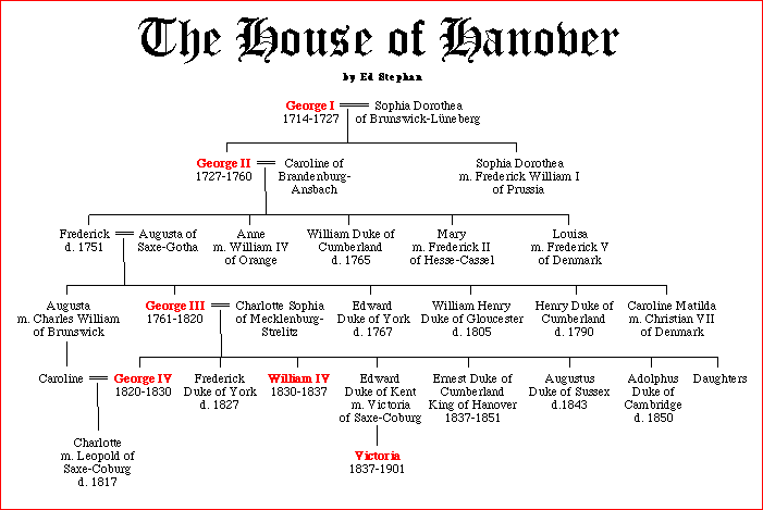
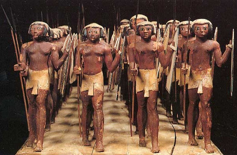
This is an Egyptian kilt. It was called a Shendyt.
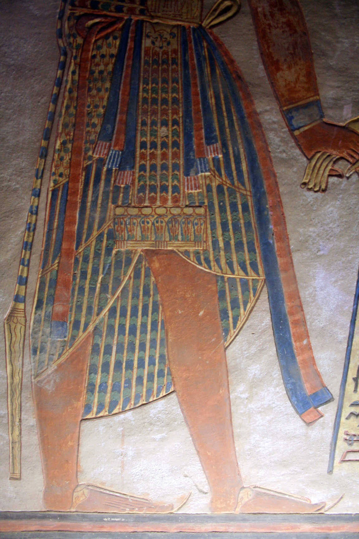
It was worn about the waist by men, usually extending to above the knees.
They were depicted on pharaohs…
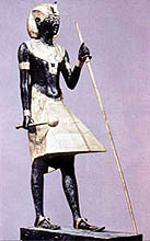
…commoners…
…and soldiers in Egyptian art.
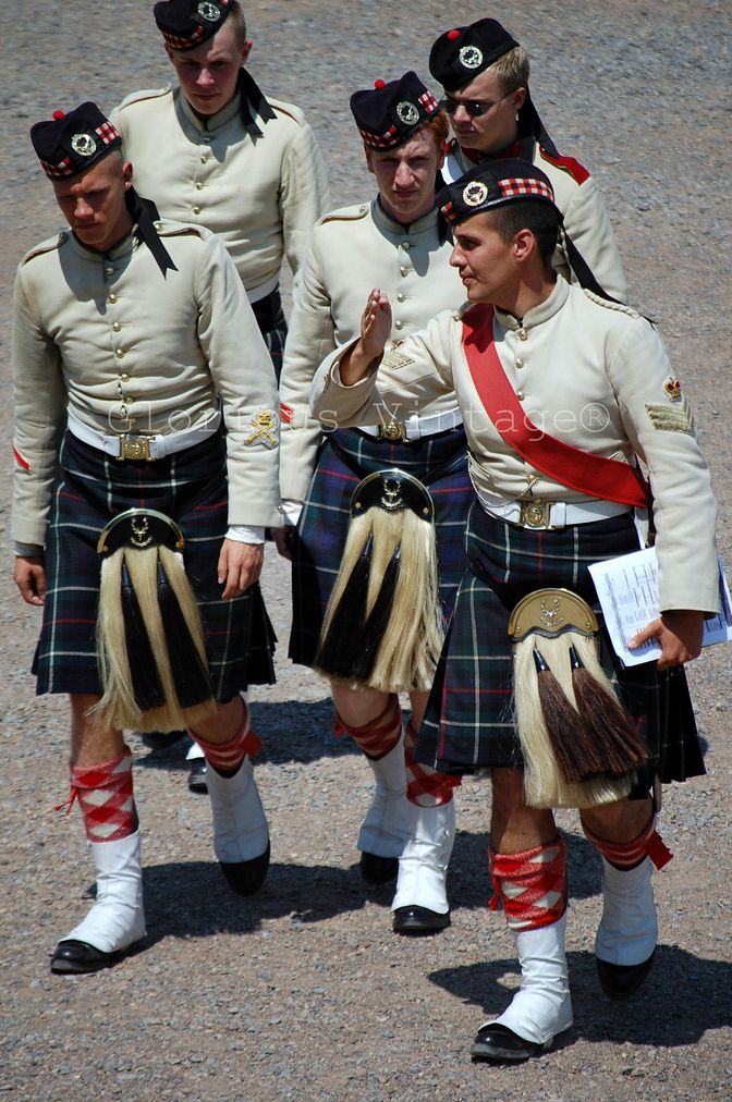
This is a Scottish kilt, the traditional dress of Gaelic men and boys in the Scottish Highlands, worn formally or informally above the knees in the present day…
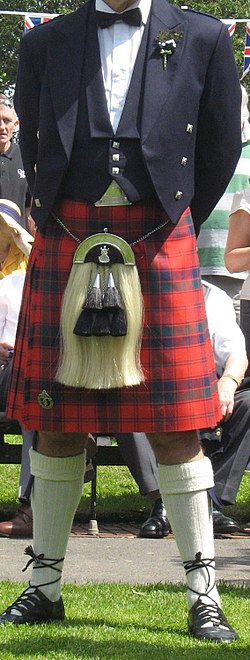
…and is part of the uniform for Scottish regiments.
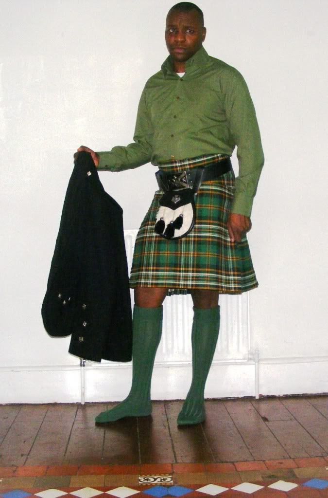
Other Celtic countries and regions have kilts as traditional wear for men. This is an Irish kilt.
So, who were the Celts, really?
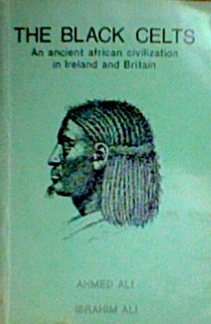
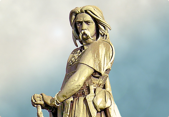
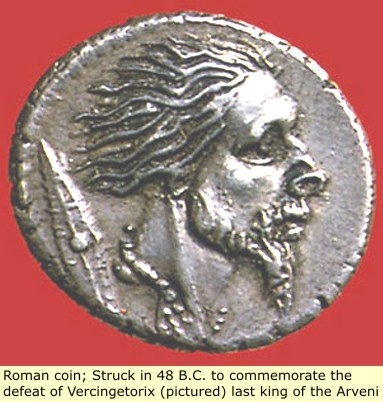
Vercingetorix was a famous Celtic king and chieftain of the Averni in Gaul, now France, who bravely fought Julius Caesar’s Roman troops, but was eventually captured and killed.
This is a typical depiction of Vercingetorix…
…compared with this profile of his head on a Roman coin commemorating his defeat.
I think our history has been white-washed based on real people, and that the truth about historical places and events has been fragmented and falsified. I don’t think the True History of Humanity bears any resemblance to what we have been taught.
It is time to awaken and return to Who We Were and Who We Are. We Are All One. There is No Separation.
In the next post, I will be continuing along the alignment to Leeds, England.

Another wonderful thought provoking post. Thank you
LikeLike