
I am seeing that there was an ancient advanced global civilization called the Moorish Empire, instead of the historical narrative we have been taught about who built the world’s infrastructure. Perhaps with different empires within Empire – Washitaw, Phoenician, Tartarian, Ottoman – but one unified, worldwide civilization, with its roots in ancient Mu, or Lemuria, and Atlantis.

Based on my research, I take very seriously the belief among many researchers that there was a relatively recent worldwide mud flood liquefaction event that wiped out this advanced civilization, and then there was a subsequent historical reset of the timeline by those responsible for the cataclysm. I do not believe the mud flood resulted from natural causes.
The Washitaw Mu’urs are an ancient people of North America living in the present day, and the recently deceased Washitaw Empress Verdiacee was presented a Charter by the United Nations in 1993 recognizing the Washitaw as the oldest indigenous civilization on Earth.

Why hasn’t the general public ever heard of them?
Master Moorish Masons of the Ancient Ones were the Master Builders of Civilization, and their handiwork is all over the planet, from ancient to what would be considered relatively modern.

The Moors were and are the custodians of the Ancient Egyptian mysteries
All of their Moorish Science symbolism was taken over by other groups claiming to be them, falsely claiming their works, or piggy-backing on their legacy. Or given a darker meaning by association with certain things that were not the original meaning.

Islam in its original form is about applied Sacred Geometry and Universal Laws. Islam is a word that means “Peace,” and when Moors greet each other, they typically say “Islam” or “Peace” in greeting.

It was nothing like the weaponized form of radical Islam we see today that is playing a divisive and destructive role in the world today and is not in accordance with Humanity’s best interests.

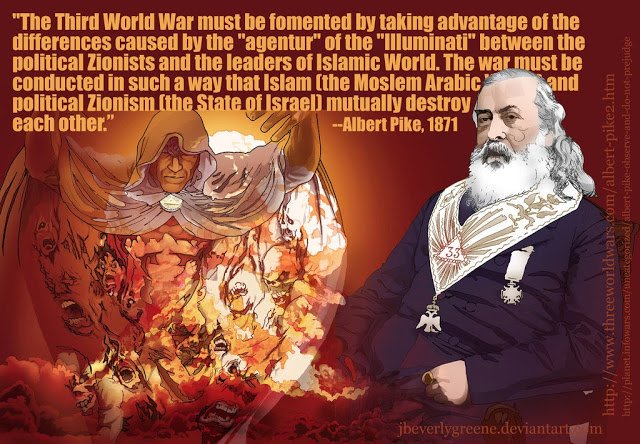
Radical Islam & Sharia Law is what was put in place by European Freemasonry and other secret groups to take down Western Civilization.
Just as Christianity was weaponized against the ancient civilization, including the creation of institutions like the Spanish Inquisition in 1478…
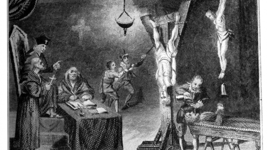
…and orders, including but not limited to, the creation of the Jesuits by Pope Paul III in 1540, that included a special vow of obedience to the Pope in matters of mission direction and assignment.

Like the destruction of the Ancient Civilization, this is another human and social engineering process that has nothing to do with benefiting Humanity. Problem – Reaction – Solution.
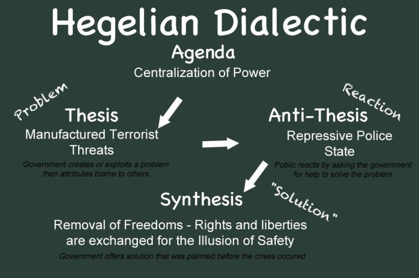
In this case, the destabilization of Western Civilization by radical Islam is going to be restored to order by the New World Order. Or so they planned. I personally believe very soon we will be seeing high-level criminals being held accountable for their crimes, and I will continue to believe so. I don’t believe they will get away with the multitude and magnitude of Crimes against Humanity that have been committed.
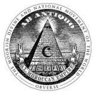
In yet another example of the appropriation of Moorish symbolism, this is the Great Seal of the Moors…
…compared to this symbol on the back of the U. S. one dollar bill.

In my post “An Explanation for What Happened to the Positive Timeline of Humanity and Associated Historical Events & Anomalies,” I shared an extremely cold weather event in the historical record in Ireland between 1740 – 1741, as well as my thoughts about how an artificial time-loop was created between 1492 – 1942, with 1717 as the mid-point year between the two. More on this after the weather event in Ireland.
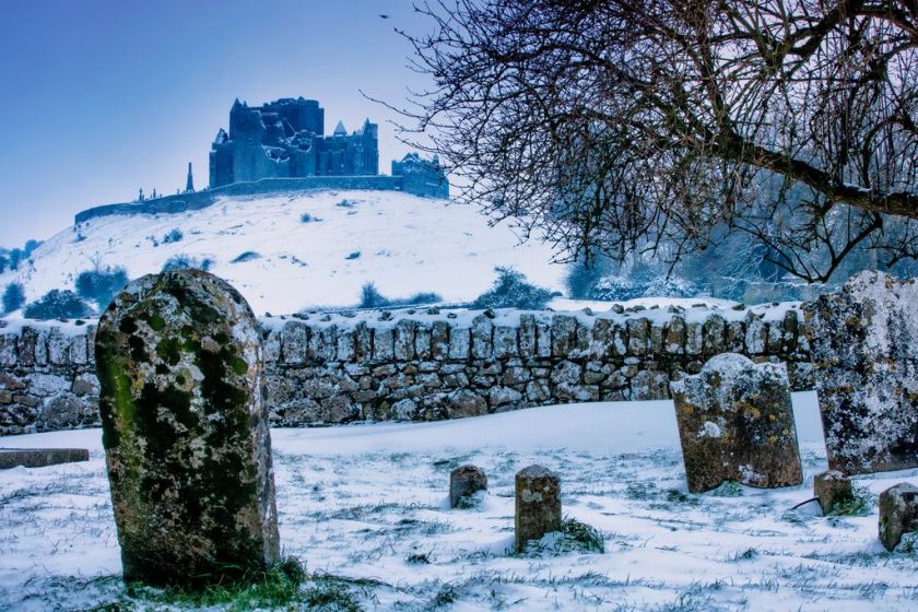
First, on the extreme cold weather in Ireland, Irish Historian David Dickson talks about this little-known event in his book “Arctic Ireland.” I explored the idea that this event was related to the hijack of the original timeline, and that this was the point where a new timeline was pinned.
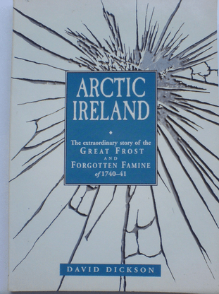
The Irish population endured 21-months of bizarre weather without known precedent that defied conventional explanation. The cause is not known.
Shortly after I learned about the cold-weather event in Ireland, I was connected by someone to the mud flood community.
I learned about the fantastic research that is being done by people looking at their own communities and other places, around the world, at strong evidence that there was a cataclysmic event involving a massive flood of mud, as recently as 200 – 300 years ago.

It is being called a reset event, and that photographic evidence exists that buildings, canals, rail-lines, tunnels, among other things, were purposefully dug out after the event to the point where they could be used.
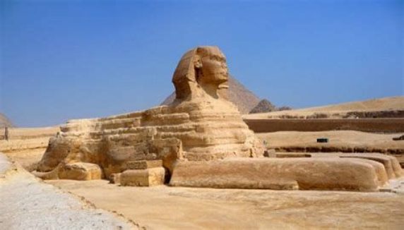
Over the years, I have filled my head with information about megaliths. Long before I became aware of what I am sharing, I learned about such places as the Sphinx in Egypt having been dug out…

…as well as the famous heads of Easter Island…

…that were found to have bodies too!

The explanation of a mud flood makes a lot of sense to me based on what I am finding and seeing.
A sudden cataclysmic liquefaction event creating a flood of mud accounts for how a highly advanced worldwide civilization of giants…
…could be wiped from the face of the Earth and erased from our collective memory.

This is an historic photo of St. Petersburg, Russia, of vastly smaller, and hardly any, people relative to the size of the city in the background and the foot in the foreground.

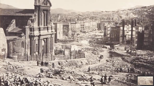
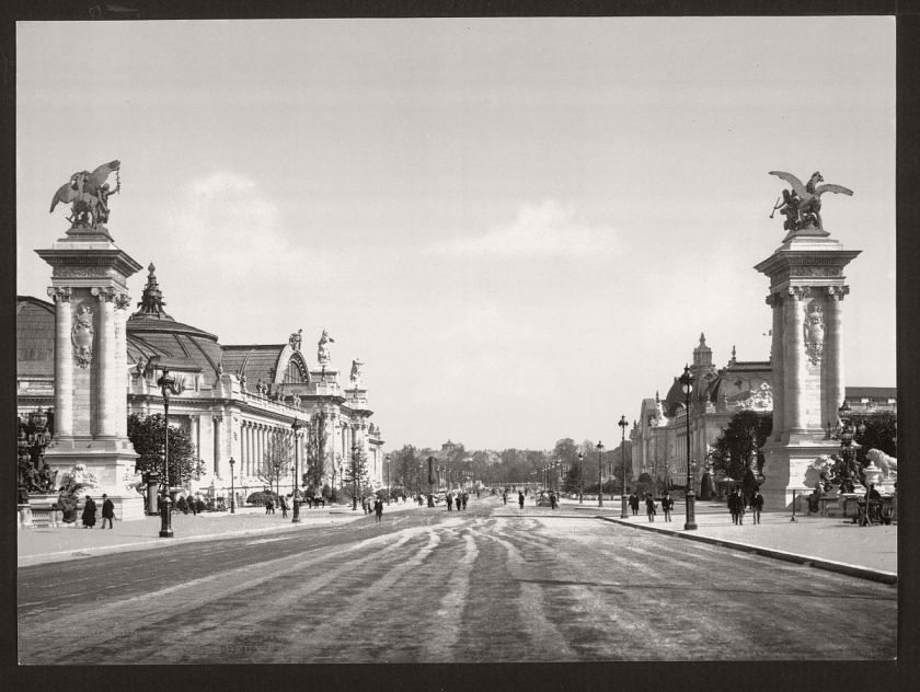
We see the same relative emptiness, and the contrast of the massive size of the architecture and the small size of the people, in this historic photo of Paris…
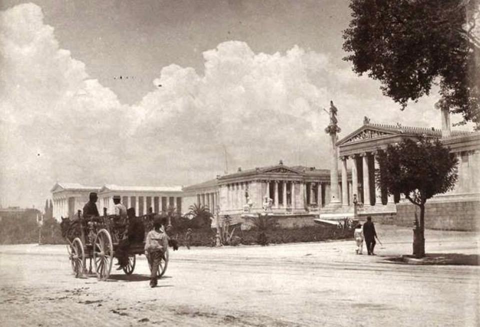
…and this rather empty and rustic-looking photo with virtually no one in it taken at the beginning of the 20th-century of the Trilogy, three major buildings said to have been built in the mid-to-late 1800s, in Athens, Greece.
Next, I will provide the findings of my research of the historical record around the year of 1717.
There are 450 years in between 1492 and 1942, and the midpoint, at 225-years, is 1717.
Based on what I found when I started looking at historical events from around 1717 to 1942, I believe the extremely cold weather event in Ireland was deliberately caused, and is connected to the Mud Flood and the historical reset.
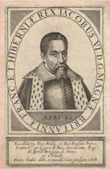
King George I of the German House of Hanover became King of Great Britain and Ireland in 1714.

This marked the end of the rule of the House of Stuart, which originated in Scotland.
On January 4th, 1717, Great Britain, France, and the Dutch Republic sign the Triple Alliance in an attempt to maintain the Treaty of Utrecht, which was signed in April of 1713, in which in order to become King of Spain, Philip had to renounce his concurrent claim to the French throne.

This prevented the thrones of Spain and France from merging together, and ultimately paved the way for the maritime, commercial, and financial supremacy of Great Britain.
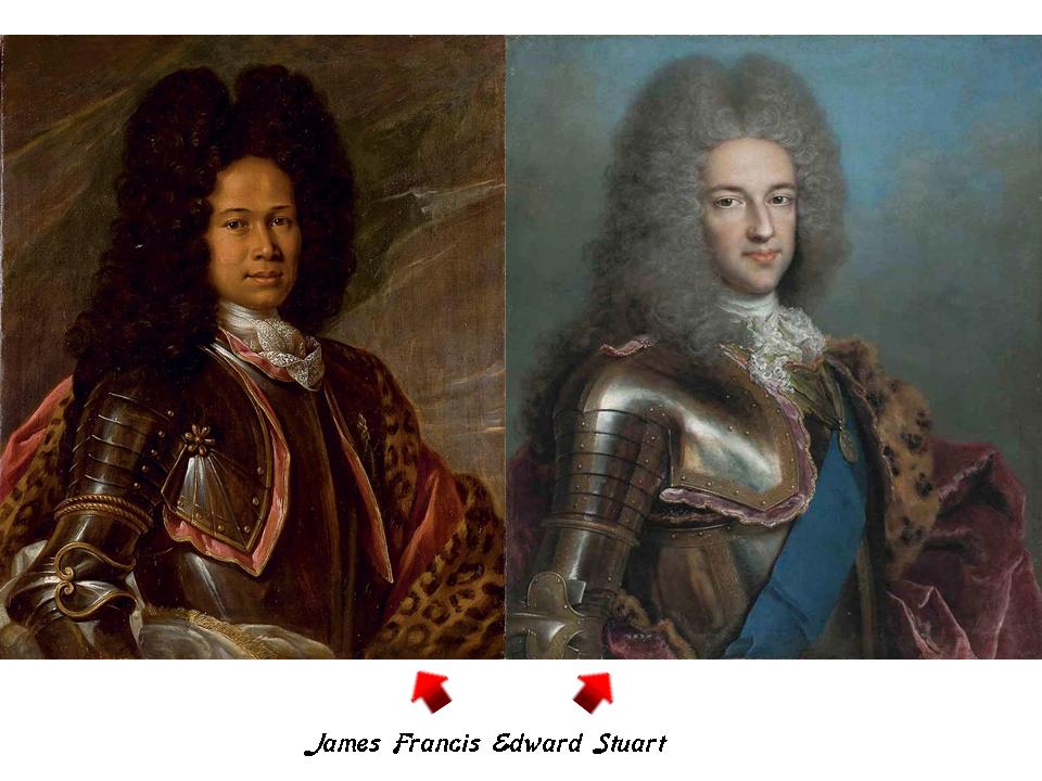
In February of 1717, James Francis Edward Stuart of the House of Stuart, called the Pretender, who at one time was claimant to the throne, left where he was living in France, after the Triple Alliance was signed in January, to seek exile with Pope Clement XI in Rome – why he went specifically there, I don’t know, but he died in Rome in 1766.
This is believed to be a portrait of James Francis Edward Stuart that was painted when he lived in France on the left, and the typical portrait of him on the right.
On June 24th, 1717, the Premier Grand Lodge of England – the first Free-Mason Grand Lodge – was founded in London.

I find it highly significant that this event shows up at the exact mid-point year between 1492 and 1942.
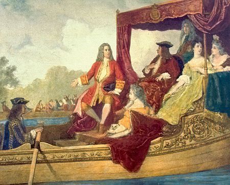
And then on 7/17/1717, an interesting date from a numerological perspective, the premier of Georg Friedrich Handel’s “Water Music” took place for King George I on a barge on the Thames. Eyes are now on Handel.
In 1727, Georg Frederic Handel, the German, becomes George Frederick Handel, a British citizen.
Then I was guided through a psychic friend to look at Ireland in 1742 in my research.
So I searched for it on the internet, and only two things came up.
The first was that Dublin, Ireland, was the location for the premier of Georg Friedrich Handel’s Messiah on April 13th, 1742.
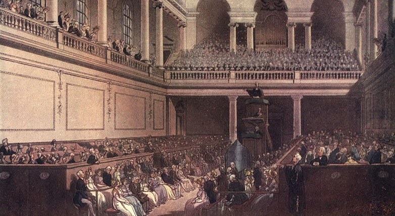
And the other thing that came up was the extraordinary cold weather event in Ireland between 1740 – 1741.
Handel’s Messiah premieres in Dublin right after the extremely cold, lethal weather event???!!!
So, who shows up during this same time period?
Well, in 1744 Mayer Rothschild was born in Frankfurt, Germany. He established his banking business there in the 1760s, which became the start of an international banking family.
Then on February 6th, 1748, Bavarian Illuminati-founder Adam Weishaupt was born in Ingolstadt, Bavaria, Germany. He went to a Jesuit school at the age of 7, and was initiated into Freemasonry in 1777.

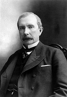
In 1839, John D. Rockefeller, Sr. was born in the United States, the progenitor of the wealthy Rockefeller family and considered to be the wealthiest American of all time. He founded the Standard Oil Company in 1870.
Fast forward to the time period of November 20th through November 30th in 1910. A meeting took pace at Jekyll Island off the coast of the State of Georgia to lay the foundations of the Federal Reserve.

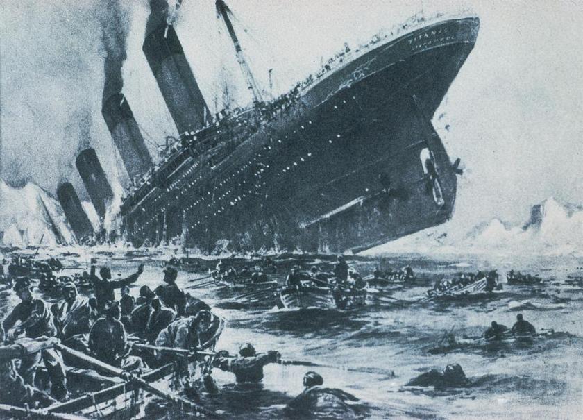
The sinking of the Titanic took place on April 15th, 1912. All the bankers opposed to the creation of the Federal Reserve were on board, including John Jacob Astor IV, one of the richest people in the world at the time.
Then on December 23rd, 1913, the Federal Reserve Act Passed Congress, signed into law by Woodrow Wilson. It created and established the Federal Reserve System, and created the authority to issue Federal Reserve Notes (commonly known as the US dollar) as legal tender.

On July 17, 1917, the reigning royal house of the United Kingdom and its Commonwealth, the House of Windsor is founded after the death of Queen Victoria. It is also of German paternal descent. There’s that 17 numerology showing up again!

World War II started on September 1st in 1939, and ended on September 2nd in 1945 – exactly six years later. It is considered the deadliest conflict in human history.
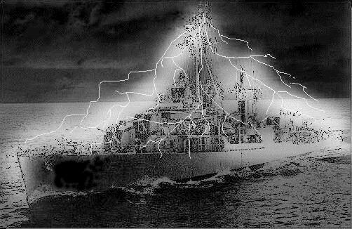
Almost halfway through World War II, on July 22nd, 1942, the strange Philadelphia experiment took place at the Philadelphia Naval Shipyard.
Did the USS Eldridge just become invisible?
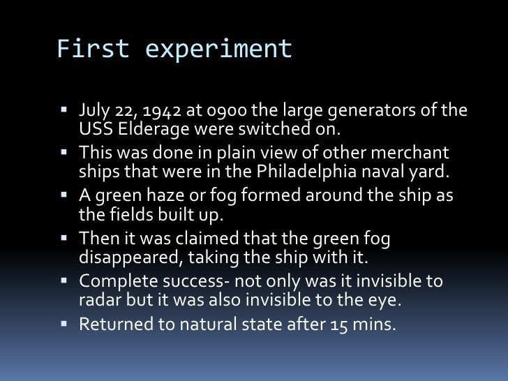
Or did it go somewhere else?

And if it went somewhere else, where might it have gone?
What was the real purpose of the Philadelphia Experiment?
I think it was a deliberate manipulation of time-space, and how the new artificial time-line/loop I am talking about was somehow inserted. Our new history was grafted on to the existing infrastructure on the planet, and falsely attributed in the new historical narrative.
The world history we have been taught is filled with war and violence, death and destruction, which was not our original evolutionary path.
Now to tie the Mud Flood together with the historical reset timeline together based on my research findings.
If in fact the mud flood event took place in 1740 and 1741, it would have taken awhile to dig infrastructure out and get it to the point where it could be used once again.

Who was responsible for the excavation?
Those who became the ruling class, or their associates, and bankers, oilmen, transportation magnates, manufacturers, etc.
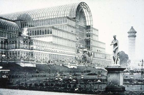
I believe the official start of the Historical Reset Timeline, and the Grand Opening of the New World Order, was The Great Exhibition of the Works of Industry of All Nations of 1851.

Held in the Crystal Palace in Hyde Park in London, it was the first in a series of World’s Fairs, exhibitions, and expositions, that I believe over the next 100 years or so were showcasing the technology and architectural wonders of the original civilization before being hidden away or forever destroyed.
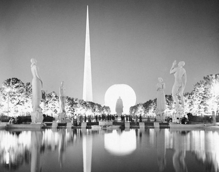
This was a scene at the New York World Fair of 1939 to 1940, almost 100 years later, where we still see incredibly big, what appear to be lumiscent structures in the background, and in the foreground, statues much bigger than the size of the people standing near them.
Also in 1851, the Royal Observatory at Greenwich became the world’s Prime Meridian.
Prior to the time of moving it to Greenwich in England, the Great Pyramid of Egypt was the ancient prime meridian of the Earth.

Commodore Matthew Perry played a leading role in the Opening of Japan, starting on July 8th, 1853, when he led four U. S. Navy ships ordered by President Millard Fillmore to Tokyo Bay with the mission of forcing the opening of Japanese ports to American trade by any means necessary.
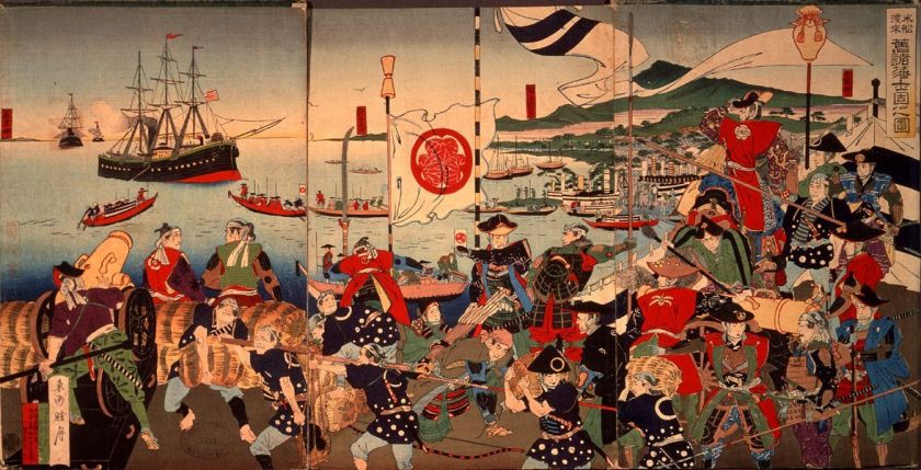
After threatening to burn Tokyo to the ground, he was allowed to land and deliver a letter with United States demands to the Tokugawa Shogun, Ieyoshi.
The Shogun Ieyoshi died a short time after Perry’s departure in July of 1853, leaving effective administration in the hands of the Council of Elders, though nominally to his sickly son, Iesada, who was the Tokugawa Shogun from 1853 to 1858.
The Tokugawa Shogunate is called the last feudal Japanese Military Government…
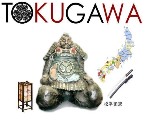
… ruling from 1600 to 1868 from Edo Castle in Tokyo.

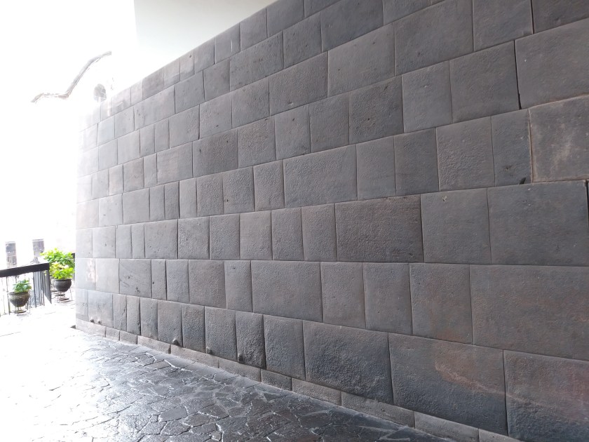
Here is a photo of one of the polygonal megalithic walls found on the grounds of Edo Castle…

…compared with this exquisite example of polygonal masonry at the Coricancha in Cusco, Peru. Polygonal masonry is defined as a technique where the visible surfaces of the stone are dressed with straight edges or joints, giving the stone the appearance of a polygon, with minimal clearance between stones, and no mortar.
Perry returned again with eight naval vessels in February of 1854, and on March 31st of 1854, the Japanese Emperor Komei signed the “Japan and United States Treaty of Peace and Amity” at the Convention of Kanagawa under threat of force if the Japanese government…

… did not open the ports of Shimoda…
…and Hakodate to American vessels.
It looks to me like the Japanese Empire was perhaps not taken out by the mud flood, and needed to be acquired by threat of force.
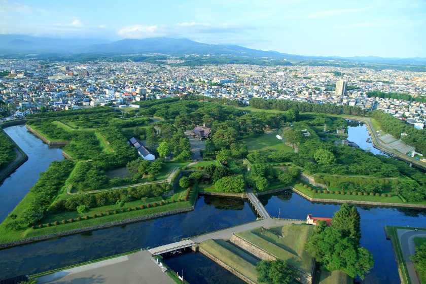
The star fort of Goryokaku at Hakodate on Hokkaido is located on the Tsugaru Strait of the Sea of Japan between the Japanese Islands of Honshu and Hokkaido.

In another part of this series, I will show the numerous star forts, including this one at Hakodate, that I have encountered on planetary alignments. I didn’t know they were there in advance, and found them in my research for these posts when I was tracking various planetary alignments. The information I am sharing with you now comes from “Circle Alignments on the Planet Amsterdam Island – Part 8 Chongjin, North Korea to Yokohama, Japan.”
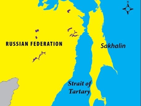
The Sea of Japan is enclosed between the islands of Japan, Sakhalin Island, the Korean Peninsula, and Russia.
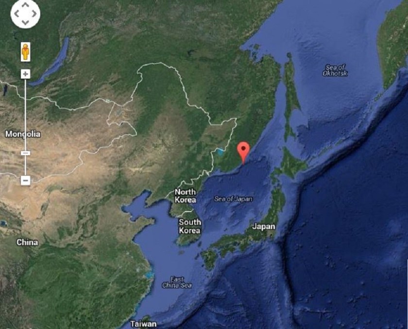
The Strait of Tartary of the Sea of Japan divides Sakhalin Island from southeast Russia, and connecting the Sea of Japan with the Sea of Okhotsk.
The 51st parallel north passes right through here, a circle of latitude that is 51-degrees north of the equatorial plane. The capital cities of London, England, and Astana, Kazakhstan, are at the same latitude as the Strait of Tartary.
It is significant to note that the Sea of Japan was one of the major theaters of operations of the Russo-Japanese War of 1904 and 1905, where these two countries fought over rival imperial ambitions in Manchuria and Korea, and in which Japan defeated Russia.

The vast region depicted on this map in purple was called Chinese Tartary. The regions in yellow were considered independent Tartary. The name of Manchuria was said to have come into use in Europe the 1800s, thus hiding the true identity of this part of the world.

These were early steps in the eventual establishment by the Japanese of the puppet state of Manchukuo, within the historical region of Chinese Tartary, in 1933.

The Last Emperor of China, Puyi, was first installed by the Japanese as the Chief Executive of Manchukuo, and he became its emperor in 1934, a position he held until 1945, when he abdicated as a result of the end of World War II. His life story is very sad, and is told in the movie “The Last Emperor” directed by Bernardo Bertolucci.

I believe all of this was positioning on the part of not only the United States, but ultimately Japan and other powers of the region, to ultimately to take control of the fabulous technology of the Tartarian Empire of northeast Asia, the same advanced technology of which was found worldwide, and which I believe our modern energy system is based on. See my post “Relationship Between the Planetary Grid, Technology of the Ancient Civilization, and the Modern Energy Industry.”

Like I said at the beginning of this post, I believe the Tartarian Empire was part of the Moorish Empire, and not the other way around.
In 1803, the Ames Shovel Works was established in Easton, Massachusetts.
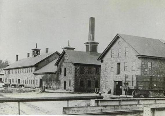
It became nationally known for providing the shovels for the Union Pacific Railroad, which opened the west. It was said to have been the world’s largest supplier of shovels in the 19th-century.
Oliver Ames, Jr, (b. 1807 – d. 1877) was a co-owner of the Ames Shovel Shop. He was also the President of the Union Pacific Railroad from when it met the Central Pacific Railroad in Utah for the completion of the first Transcontinental Railroad in North America.

He was co-owner of the Ames Shovel Shop with his brother, Oakes Ames. Oakes was a member of the U. S. Congress House of Representatives from Massachusetts 2nd District from 1863-1873. He is credited by many as being the most important influence in building the Union Pacific portion of the first Transcontinental Railroad.

He was also noted for his involvement in the Credit-Mobilier Scandal of 1867, regarding the improper sale of stock of the railroad’s construction company.

He was formally censured by Congress in 1873 for this involvement, and he died in the same year.
He was exonerated after his death by the Massachusetts State Legislature on May 10th, 1883, the 10th-Anniversary of the completion of the Transcontinental Railroad.
This is the Ames Monument near Laramie in Wyoming.
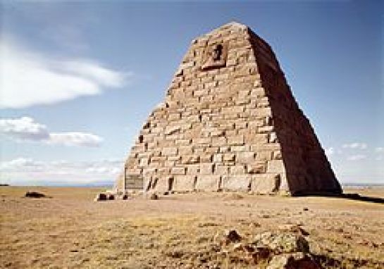
This large pyramid was said to have been also designed and built between 1880 and 1882. It was dedicated to the Ames brothers for their role in financing the Union Pacific Railroad.
On the eastern seaboard of the United States, the Raritan River Railroad was a 12-mile short-line railroad operating freight and passenger service in Middlesex County New Jersey, said to have been built in 1888 when the peak of railroad building in the United States was subsiding in the late 1800s.
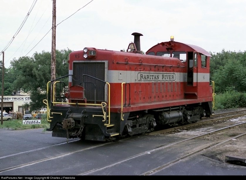
This the logo for the Raritan River Railroad…
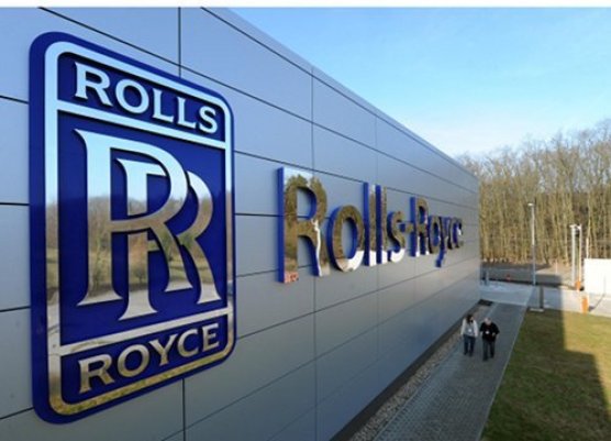
…compared with the logo for Rolls Royce.
The similarity between these two logos tells me these two companies were connected in some way. Besides the fact the logos look virtually identical, it brings to mind what I found when I was looking at Derby, England.
I found Derby near the Algiers’ Circle Alignment as I was tracking it through England. Derby is the geographic center of England, and the Derwent River Valley in Derbyshire is considered the Birthplace of the Industrial Revolution.
Rolls-Royce is a global aerospace, defense, energy, and marine company focused on world-class power and propulsion systems, and its civil aerospace and nuclear divisions are in Derby…
…as well as the Railway Technical Center, the technical headquarters of British Rail, and considered the largest railway research complex in the world…

…and Derby is the location of Bombardier Transportation, the rail equipment division of the Canadian company Bombardier, and for many years the United Kingdom’s only train manufacturer.
There are certainly interconnecting pieces of the puzzle to be found lying around these tidbits of what seems to be otherwise disconnected information.
I think all of the railroad tracks were dug-out, and that locomotives and railroad cars were pre-existing as well. I think it was an electrified railroad system prior to the mud flood, and when the planetary free energy grid was taken down, most energy sources for mass transportation were replaced by oil and coal. I will be doing separate posts on trains, trams, and subways.

Among other things, the new reliance on fossil fuels, etc, was a basis of the fabulous wealth of nouveau riche families.

I am sharing what I have been able to piece together what I found when I looked at the historical record during this time in order to provide a framework for how I came to my conclusions. There is still much to be accounted for because of all of the fabrication and white-washing that has taken place, and who knows exactly what was done to accomplish all of this.
In my next post, I am going to be looking at worldwide canal systems.

if possuble why dont you research a bit on the Fatimid Empire in North Africa…they were in power from 909 AD to 1124 AD….could they have built all of this
LikeLike
I will do that! I know so much has been hidden…removed…scrubbed about Africa’s history. I am finding tantalizing bits and pieces in this journey along the Earth’s planetary gridlines.
LikeLike
There are other anomolis coincidences that could be contributed to this topic. I do believe that the so called “Mandela effect” is one thing that points to a manipulation of timelines. Wildfires in California vs
map of projected high speed railway route. Arial photography of those supposed wild fires is a bit interesting. For further reset connection is the years 1812 and 1600. There was a war in every country in the world in the year 1812 and a huge cataclysmic event in 1600 that was a worldwide event. I among others suspect that large desert areas are void of vegetation for a reason other than climate.
Cudos on the writing sir, I have enjoyed the experience.
LikeLike
I am wondering if the 1851 all nations was a reset to say there were nations, when before there was one, so like the tower of babel it was to create, staff, populate and promote the nations they wanted for this current reset we have been in? Now they want it to go back to one again with the islam migrancy to dominate the cultures. I have no clue but when they mentioned passports at the exhibitions, what if they were assignments, for where these new people were to be sent?
LikeLike
Janie, that sure looks like what I am seeing. The mud-flood created the conditions for the reset of the original unified civilization, it was deliberately caused, and the so-called let’s call them 13 blood-line families for lack of a better description, proceeded to make sure everything got dug out until there was enough infrastructure to re-start civilization, took all the power and control of wealth for themselves, showed off the high technology of the original civilization in world exhibitions, either used it or destroyed it, and then went about populating the earth once again, most likely with a lot of children without parents (orphan trains, etc).
LikeLike
”The mud-flood created the conditions for the reset of the original unified civilization, it was deliberately caused”
How was it caused?
LikeLike
A thousand years was added to the calendar..proven by the i/j being replaced by a 1. It stood for Lesus.
LikeLike
Thx! Would you expand on this. They added a thousand years, so the date is really 1020?
LikeLike
Thank you for all of this! Your information and your research. This is fascinating and makes a lot of sense. I get the feeling the Crown/ British Empire played a huge part in all of this timeline changing as well. The number 17 has been popping up everywhere so much lately, for a very good reason, and so much is happening now in the world with what seems to be setting the timeline right again. Anyway, thank you again for all your work!
LikeLike
Enjoy how you we’re putting the pieces together!
I just realized “they“ were always all One and control the entire world.
Hidden behind so many layers of compartmentalizations… illusion.
I’m looking forward to reading more of your articles.
LikeLike
Just to give an example in Ireland:
St Mary’s Pro Cathedral. You can street view it on google earth. Go to the back (Thomas Lane) then street view and look at the tops of arches at foot level. They will tell you it’s a cript.
Look at all the windows and arches higher up filled in by bricks or plaster. I don’t think this was originally a church but my conjecture is backed up with as much fact as the wiki version.
We have a very convenient issue with building planning. All proof of all architecture was burnt in a fire in the war of independence here 1921/22. Greatest record keepers in history and the English didn’t have a back up file.
Nothing to see here… Move along! 🧐
Also we have a number of terrace style architecture here in Ireland. Anglo Dutch to Edwardian. The design close to sea level seem to have odd looking basements. The higher up you go from sea level the design would appear not to require a basement.
Food for thought
LikeLike
I’m new to the Tartarians. I am absolutely blown away!! I feel a complete resonance and comfort learning about this amazing civilization and the dark forces that have erased them!! I look forward to reading more and doing my own deep diving!!
Thank you all for the enlightenment ❣️❣️❣️❣️❣️❣️👽🖖🏾
LikeLike