
In the last post, I took the opportunity to venture off the alignment and explore the ancient Anatolian Plateau, from the western Taurus Mountains and the Antalya Province, and the Turkish Riviera; east across the Taurus Mountains to Lake Egirdir, Konya Province, Mount Nemrut, and Sanliurfa Province. Then I looked at the city of Kars, in northeastern Turkey, and situated on the country’s closed border with Armenia; Munzur National Park in north-central Turkey; the capital of modern Turkey since 1923, Ankara; the former imperial capital, Constantinople, known since 1923 as Istanbul; and I ended at the coastal city of Izmir in Western Anatolia, where the alignment leaves Turkey and enters the Aegean Sea.
The Aegean Sea is called an elongated embayment, or bay, of the Mediterranean Sea between the Anatolian and Greek Peninsulas.
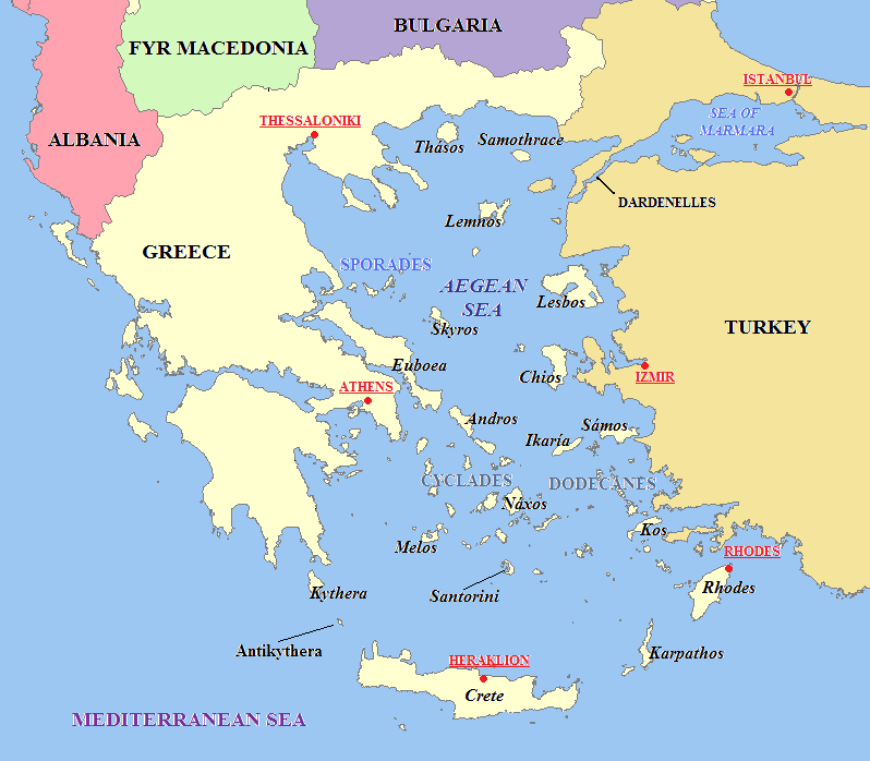
In the North, the Aegean is connected to the Sea of Marmara, entirely within the borders of Turkey, and which connects the Black Sea to the Sea of Marmara, and separates Turkey into its European and Asian parts…
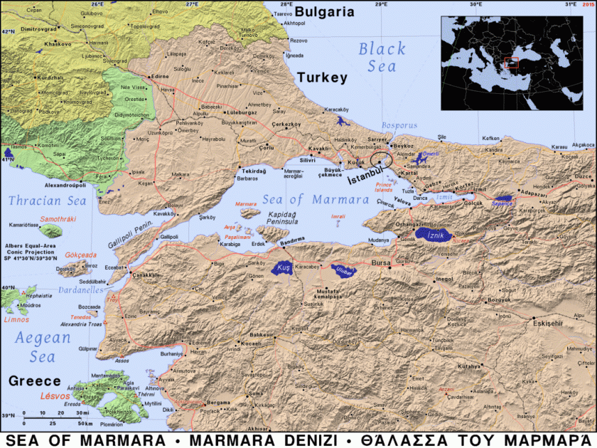
…and said to take its name from Marmara Island, from the Greek word for marble, and it is rich in sources of marble…
…between the Straits of Dardenelles and Bosporus.
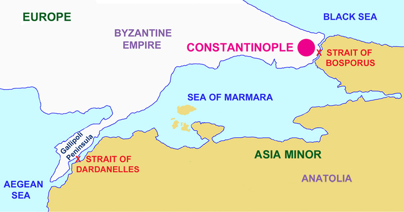
The Strait of Dardenelles was the location of the Gallipoli Campaign, one of the bloodiest battles of World War I.
The Gallipoli Campaign took place between April 25, 1915, and January 9, 1916. A joint British and French operation was mounted to capture the Ottoman capital of Constantinople (known as Istanbul since 1923) and secure a sea route to Russia.
While the Ottomans were victorious at the end of this campaign, they ultimately lost the war. At the end of World War I, the Ottoman Empire was partitioned and lost its Middle East holdings, which were divided between the Allied Forces.
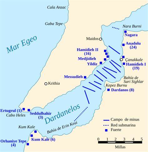
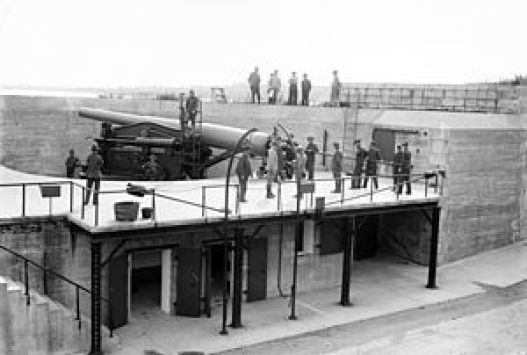
The first thing I am finding in researching information about the Gallipoli Campaign are the presence of many forts on both sides of the entrance to the Strait of Dardenelles, including, but not limited to the places circled here: Cape Helles and Kilid Bahr on the European side of the Strait; and Kum Kale and Chanak, or Canakkale, on the Asian side.
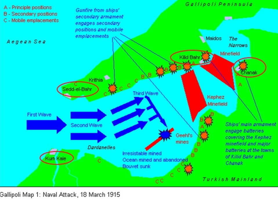
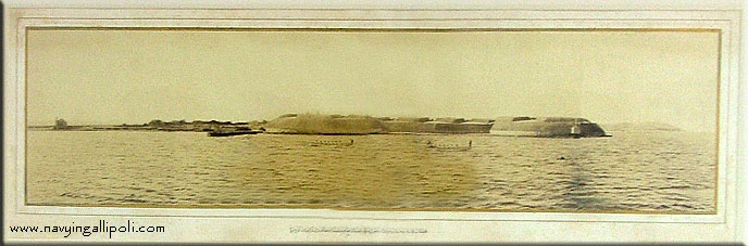
Fort Sedd-el-Bahr, said to mean “Key of the Sea,” was on Cape Helles at the entrance to the Straits.
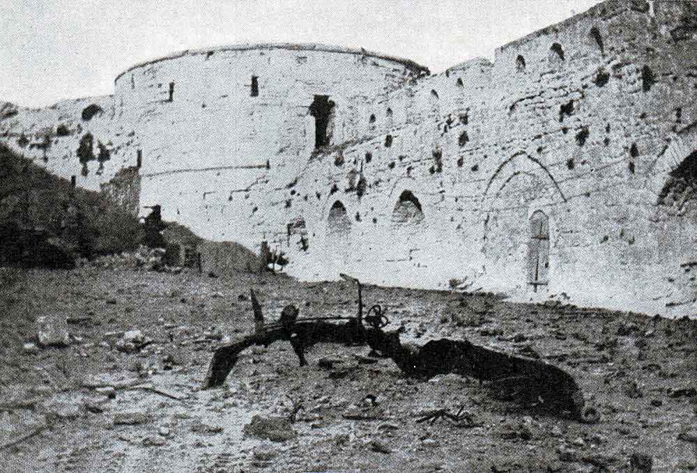
This is a view of the Sedd-el-Bahr from the bow of the SS River Clyde, a collier, at the start of the joint-British-and-French amphibious invasion of the Gallipoli Peninsula at Cape Helles on April 25th, 1915.
Its location was designated as “V Beach” of the Gallipoli Campaign.
The Royal Navy bombarded the Sedd-el-Bahr, also known as Fort #3, along with Fort Ertugrul, known as Fort #1 on the other side of “V Beach.”
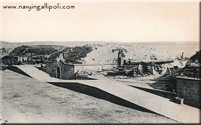
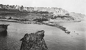
The Fort at Kum Kale was on the opposite side of entrance to the Strait of Dardenelles from Cape Helles
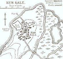
The Battle of Kum Kale was said to have been fought on April 25th, 1915, between Ottoman defenders and French troops as a diversion from the main landings on the Gallipoli Peninsula.
The fort at Kum Kale was completely destroyed by naval gun fire early in the operations.
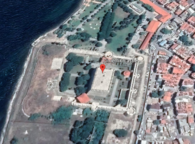
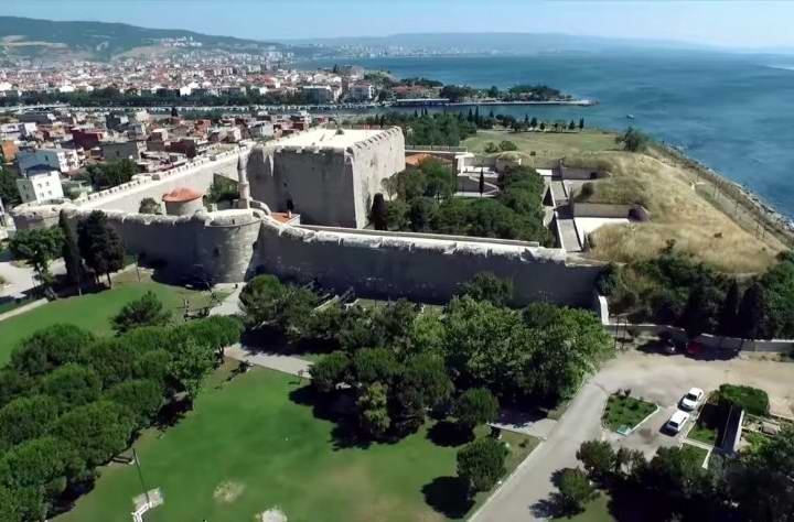
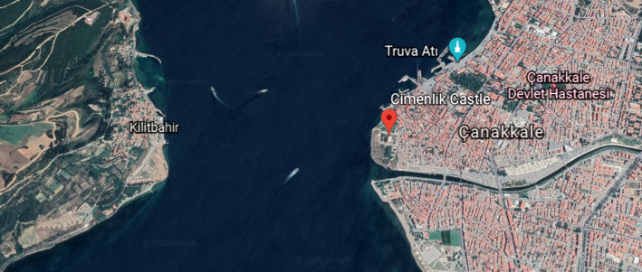
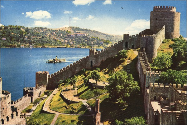
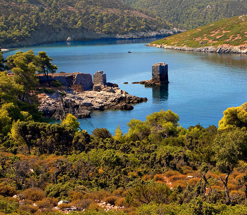
Further up, we find the Fort of Kilitbahir and Cimenlik Castle situated across from other on the Strait of Dardenelles.
Kilitbahir, or “Lock of the Sea,” was said to have been built by Sultan Mehmet II in 1463 in the form of a clover…
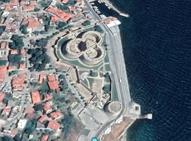
…and Cimenlik Castle was also said to have been built in the same year as Kalitbahir by Mehmet II to be defenses, we are told, to ensure the protection of the Dardenelles, and to control the maritime traffic to-and-from Constantinople.
I have consistently found star forts paired together, among other things, like here in the Strait of Dardenelles…
…and many other places around the world, like the two star forts in Puebla, Mexico, the Fort of Guadalupe…
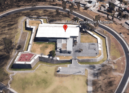
…and Fort Loreto…
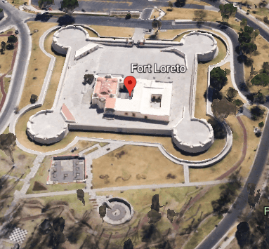
…that are situated relatively close to each other, on a hill not far from the city center of Puebla.
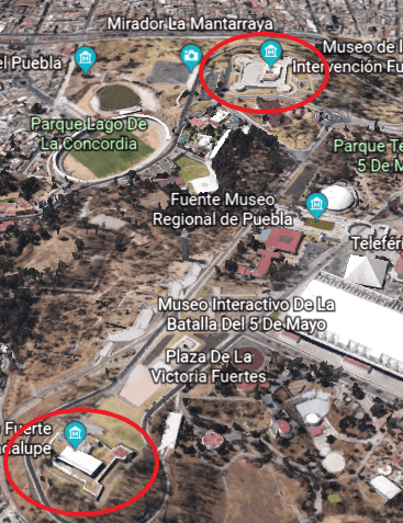
The Battle of Puebla is where the legendary Cinco de Mayo battle took place on May 5, 1862, where poorly-equipped Mexican forces were said to have defeated superior French forces.
I have also found clusters of star forts in the same location.
As I alluded with the numbering of Fort Sedd-el-Bahr and Fort Ertugrul earlier, there were at least 24 numbered forts in the Strait of Dardenelles…because Fort Anadolu Hamidiye was number 24, said to have been built by the Ottoman Sultan Bayezid I between 1393 and 1394.
I found this map of what are described as the Dardanelles defenses circa 1915, showing the places I have shared with you, and many more, situated in pairs, or clusters in alignment with each other.
Along the same lines, I can make a case that there were four pairs of star forts along the Lower and Upper New York Bay, with each pair situated along various points starting from Fort Hancock on Sandy Hook island in New Jersey and Fort Tilden on the Rockaway Peninsula in New York at the entrance of the Lower New York Bay, up through the pair of Fort Jay on Governors Islands and what was Fort Amsterdam in Battery Park in Lower Manhattan.
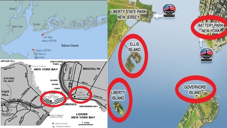
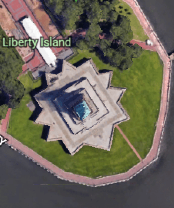
The physical structure of what was called Fort Gibson on Ellis Island is long buried and gone, but the Statue of Liberty stands right on top of Fort Wood.
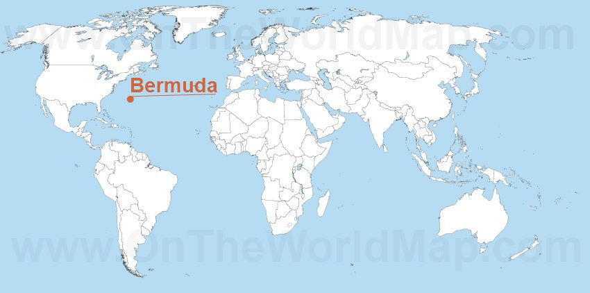
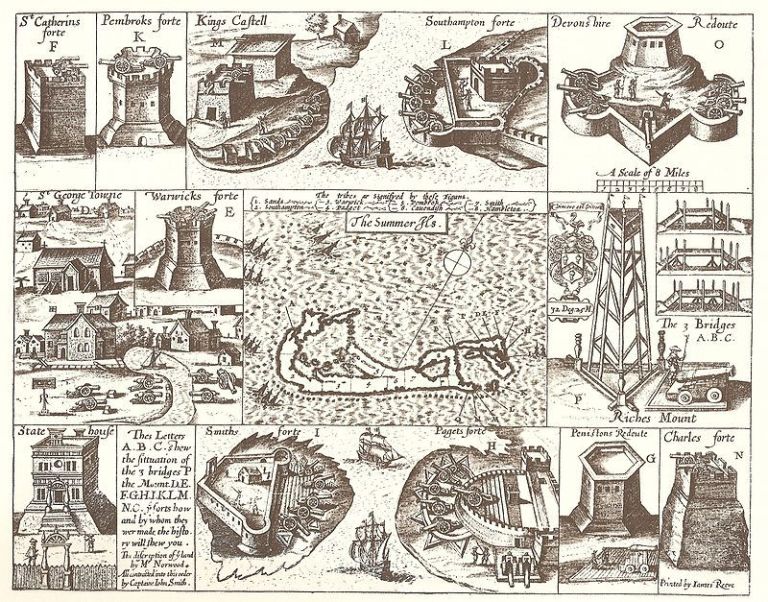
Another shared feature of the Strait of Dardenelles and other places is that there seem to have been certain locations with a high concentration of star forts, like the island nation of Bermuda, which is located in the North Atlantic Ocean, 665-miles, or 1,070-kilometers, east-southeast of Cape Hatteras, North Carolina.
This is a 1624 map depicting numerous star fort looking structures that were found at one time throughout Bermuda, and said to have been made by Captain John Smith of Pocahontas and Virginia fame in our historical narrative.
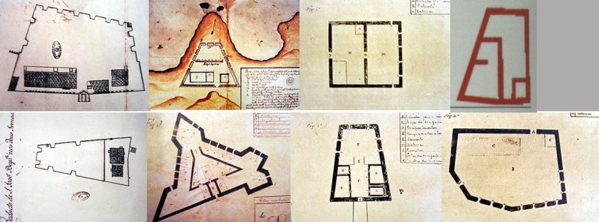
Another place in the Atlantic Ocean with a high-concentration of star forts is Fernando de Noronha, off the coast of Brazil near the coastal city of Natal. Here are historic drawings of eight of the ten I found out about within an archipelago whose area totals 10-square miles, 26-kilometers squared.
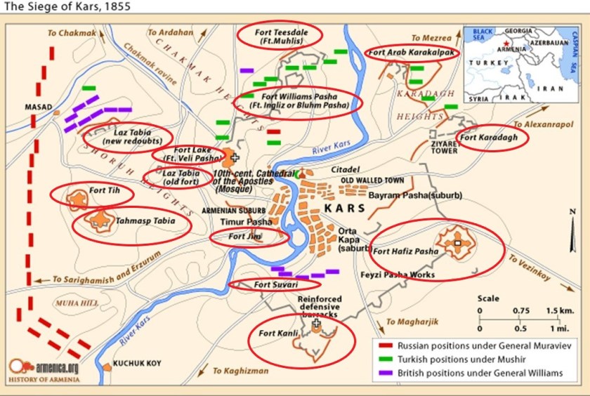
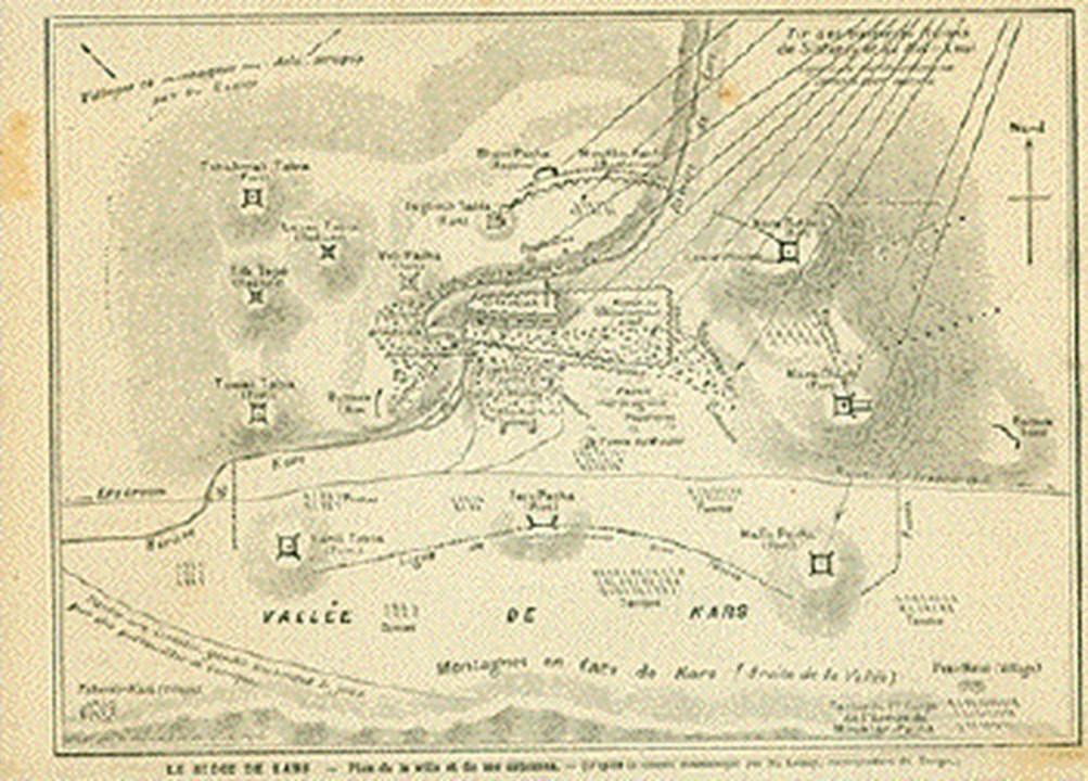
Then I found what appears to have been at least thirteen star forts in the city of Kars at one time, the largest city on Turkey’s closed border with Armenia.
I think places like these were significant power centers for the energy system of the planetary grid, and star forts represented the definition of battery meaning “a device that produces electricity that may have several primary or secondary cells arranged in parallel or series, as well as a battery source of energy which provides a push, or a voltage, of energy to get the current flowing in a circuit…”

…and not the definition of battery meaning “The heavy fire of artillery to saturate an area rather than hit a specific target” that we are led to believe in our current historical narrative.
Before I move on from the Strait of Dardenelles where it meets the Aegean Sea, I would like to point out that ancient Troy, the location of the famous Trojan War between the troops of King Priam of Troy and King Agamemnon of Mycenae, was situated between the mouth of the Strait of Dardenelles…
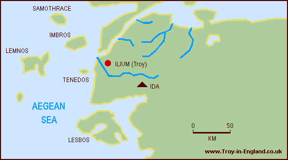
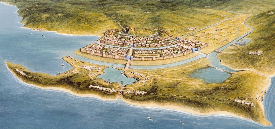
…and Mount Ida, the location in Homer’s Iliad where the Olympian Gods gathered to watch the progress of the Trojan War.
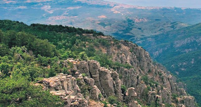
I found this old stone bridge in the Mount Ida region in Turkey…
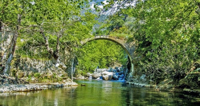
…that looks similar to the Rakotz stone bridge in Gablenz, Germany.

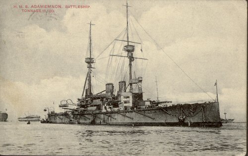
And you can’t make this stuff up. One of the first Royal Navy battleships to bombard the Fort Sedd-el-Bahr, and other places in the Strait of Dardenelles, starting in February of 1915, two-months before the official start of the Gallipoli Campaign in April of 1915, was the HMS Agamemnon, the name of the Mycenaean King who victoriously led the attack against Troy as described in Homer’s Iliad…near the actual geographic location of ancient Troy!
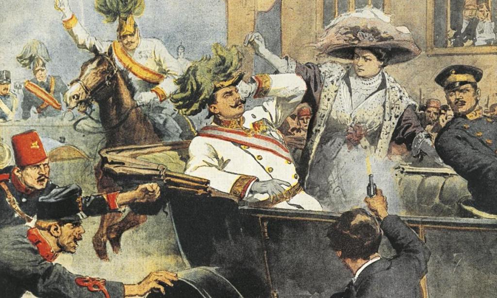
It makes me wonder if the reason for World War I was not the assassination of Archduke Franz Ferdinand and a network of interlocking alliances between countries, but another reason entirely: to assist with the destruction and complete takeover of the ancient and advanced Moorish civilization.
There are numerous islands and island groups in the Aegean Sea, including:
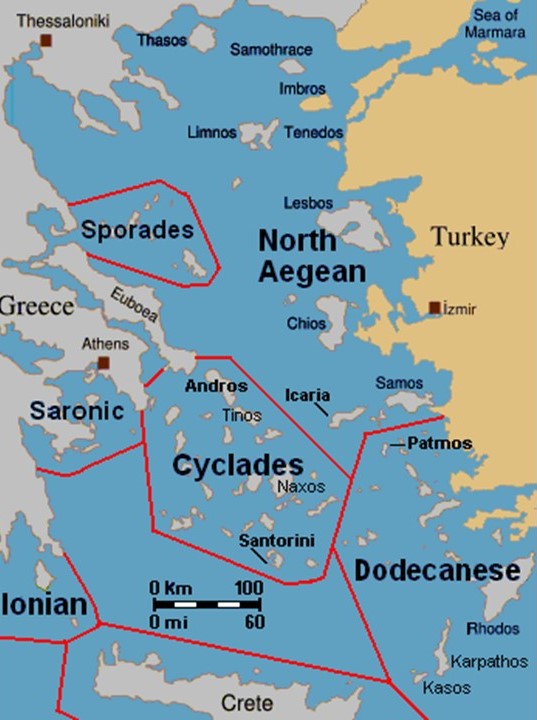
…Crete, the largest and most populous of the Aegean Islands, and a place where the Venetians, Genoese, Byzantines, and Turks were all said to have built forts to defend the island from enemies and pirates, with 15 Genoese forts alone, like the one at Rethymnon…
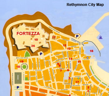
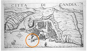
…and Candia was said to have been built by the Venetians, known today as Heraklion, the capital of modern Crete…
…the Dodecanese islands, which includes the Island of Rhodes, which is the place for which the State of Rhode Island was named when Giovanni da Verrazzano likened an island near the mouth of Narragansett Bay to the Island of Rhodes in 1524…
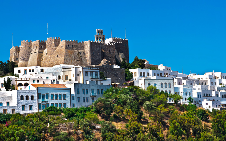
…the island of Patmos, where John the Apostle was given the vision in the Book of Revelations…
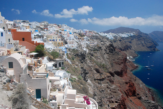
…the Cyclades Island group, which includes Santorini, known for having one of the largest volcanic eruptions in history, and by the way, what an interesting lofty, rocky spot to built on top of…
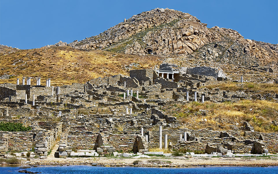
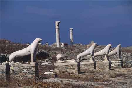
…and Delos, one of the most important mythological, historical and archeological sites in Greece, and once considered a holy sanctuary.
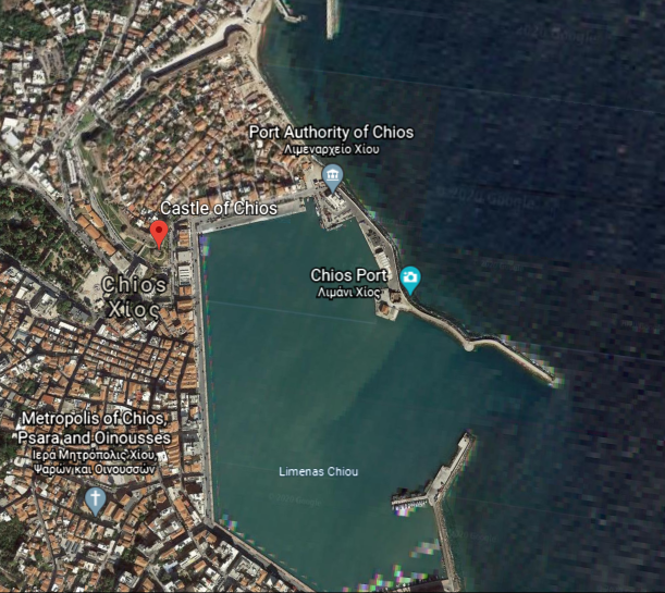
The alignment I have been tracking from San Francisco goes across the island of Chios in the North Aegean Sea. While it is separated only a relatively short distance from Turkey by the Chios Strait, it is part of Greece.
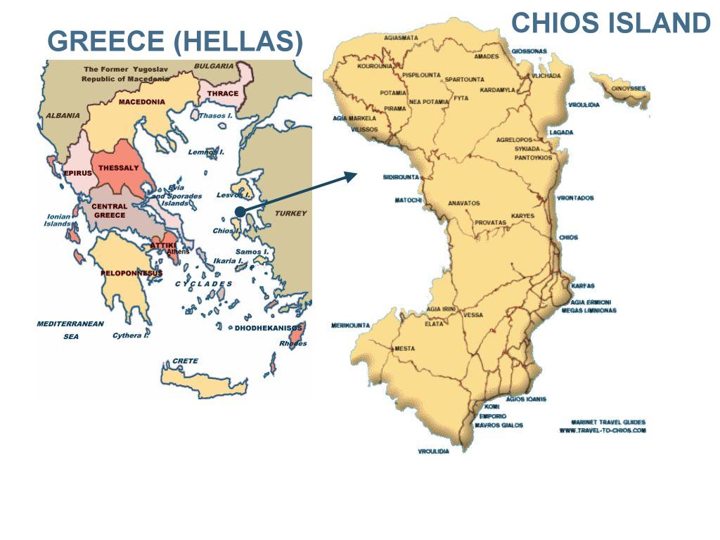
The Nea Moni Monastery on Chios was said to have been constructed during the reign of the Byzantine Emperor Constantine IX Monomachus, starting in 1042 AD, with the main building having been opened in 1049 AD…
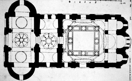

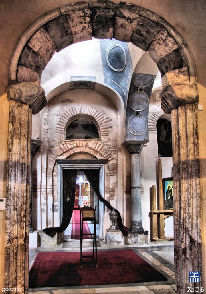
…and the complex having been completed in 1055 AD, after Constantine’s death.
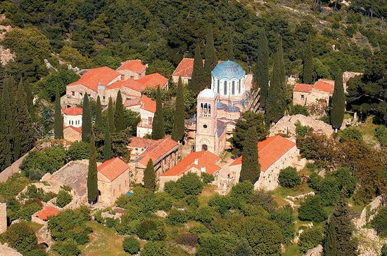
Nea Moni was designated as a UNESCO World Heritage Site in 1990, one of 18 in Greece.
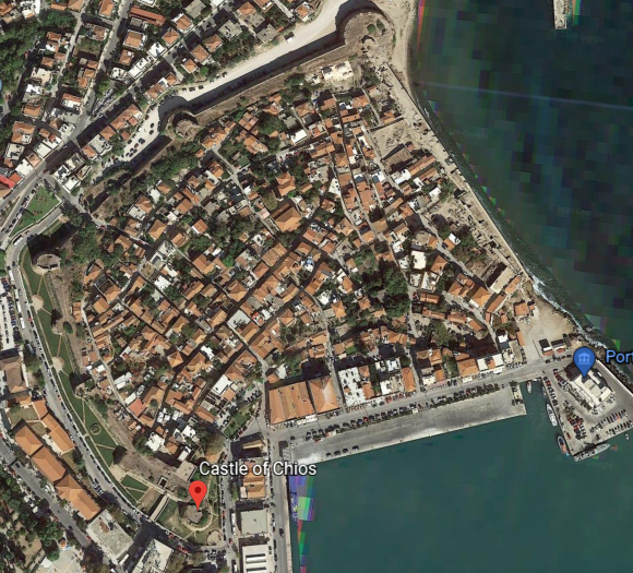
Chios is the main population center of the island, and apparently what is called the Chios Castle, called a medieval citadel said to have been built first by the Byzantines, and then finished by the Genoese…
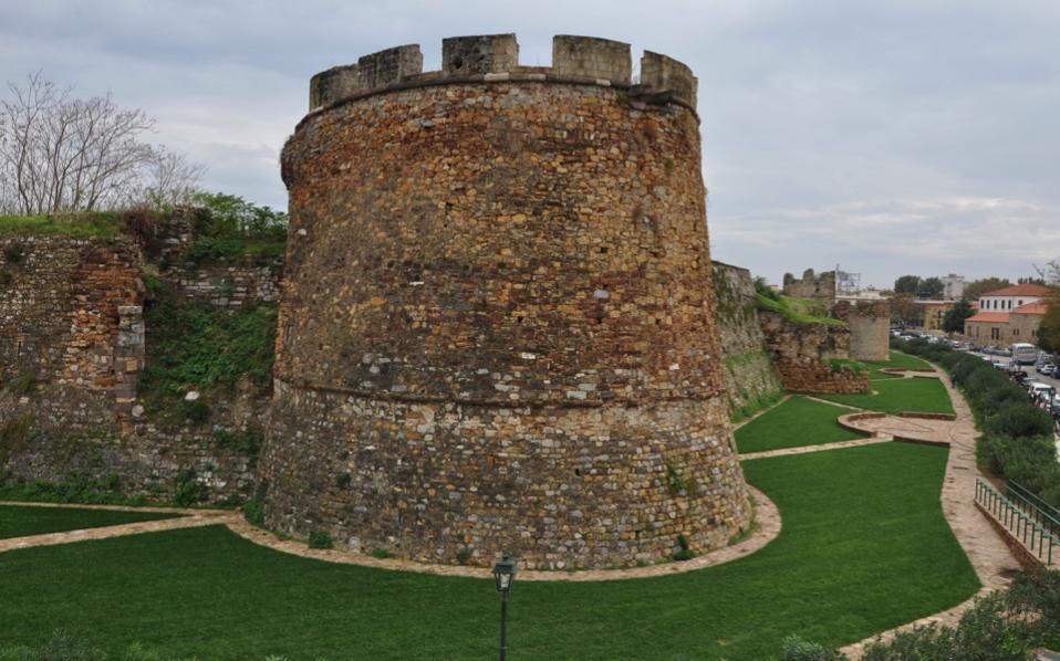
…next to what looks like an artificially made port facility, with its straight lines and angles, and the Chios Citadel contains a portion of the city within its walls…
…and appears to be one of the many shapes a star fort takes.
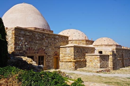
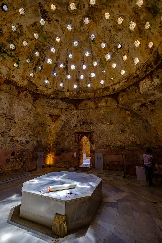
Not only that, there are Turkish, also known as Ottoman, baths at Chios Castle.
Just north of Chios Town is the town of Vrontados…
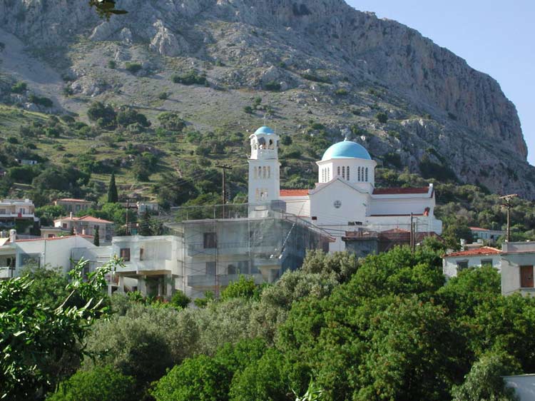
…which claims to be the birthplace of Homer, the blind poet of ancient Greece best known for the epic poems of the Iliad, about the Trojan War, and the Odyssey, about Odysseus’ ten-year voyage trying to get back home after the Fall of Troy.
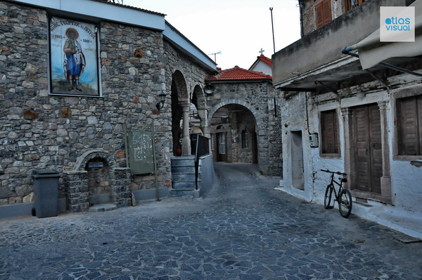
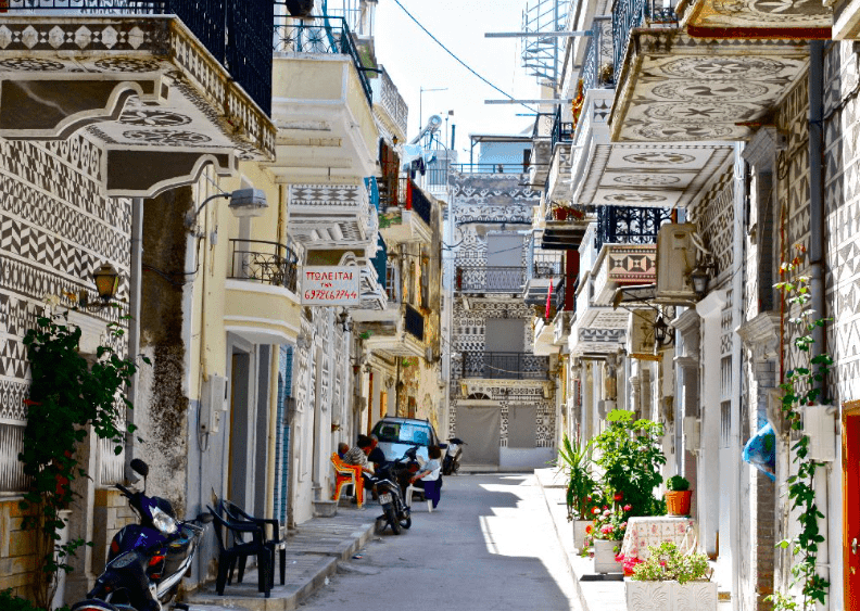
Pyrgi Village is south of Chios, known for the decoration of its houses…
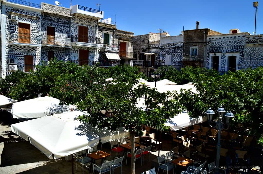

…and as being the traditional seat of the Mastic Villages, where the residents engage in mastic agriculture, farming the resin of the mastic tree, used as a chewing gum, treatment for things like digestive problems, and for making a liqueur and oil.

As of 2018, there were twenty-four Mastic Villages on the island of Chios dedicated to the cultivation and production of mastic.
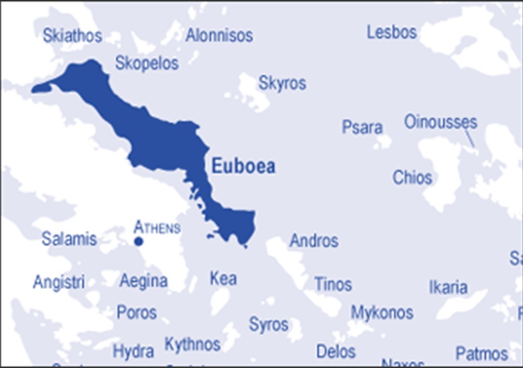
From the island of Chios, the alignment crosses the Aegean Sea to the island of Euboea, which is administered as part of Central Greece.
Euboea is the second-largest Greek island, after Crete, and separated from Boeotia in mainland Greece by the narrow Euripus Strait.
Euboea’s main city of Chalcis is situated around the narrowest point of the Euripus Strait.
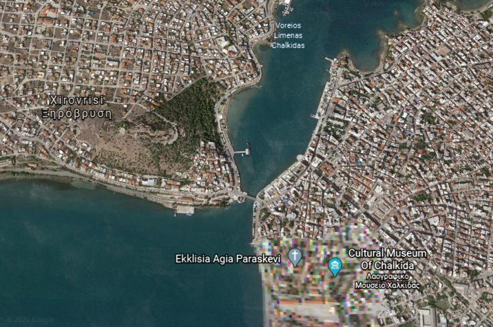
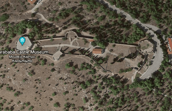
The Karababa Castle is situated on a hilltop right next to this narrow point, and said to have been built by the Ottoman Turks in 1684 to protect the city from Venetians.
And this is the waterfront of Chalcis…with its masonry banks.
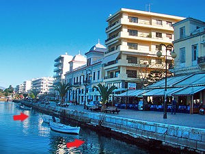
…compared with the masonry banks of the Providence River in Providence, Rhode Island.

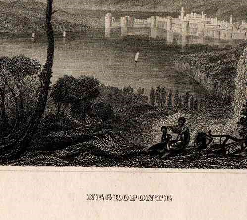
At one time, the island of Euboea was known by another name…Negroponte…
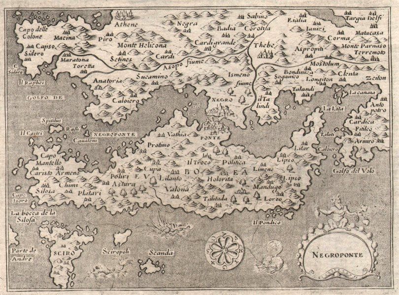
…and part of what was known as the Kingdom, or Realm, of the Morea.
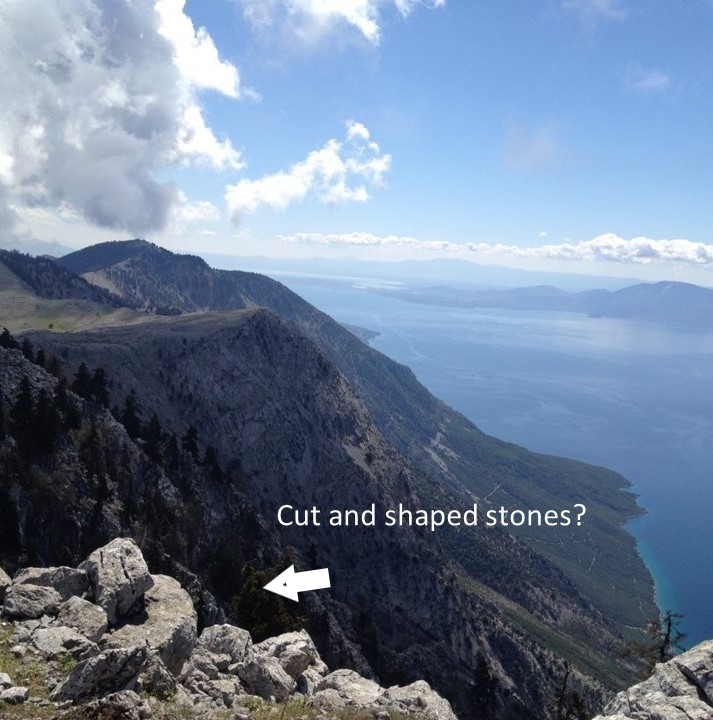
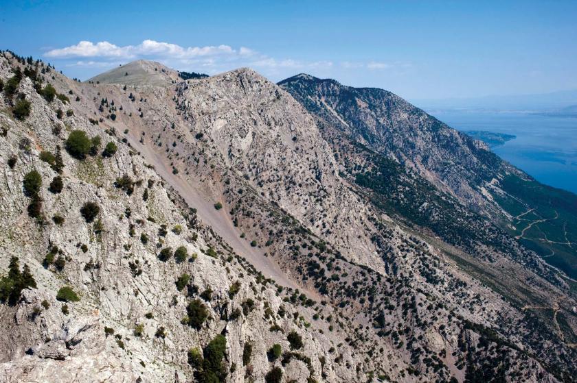
The island of Euboea is long and narrow, with a mountain range, we are told, traversing the length of it.
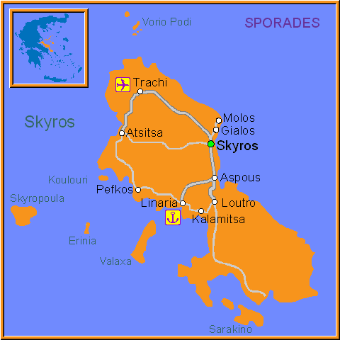
The island of Skyros is a regional unit of Euboea, and is the southernmost of the Sporades Islands.
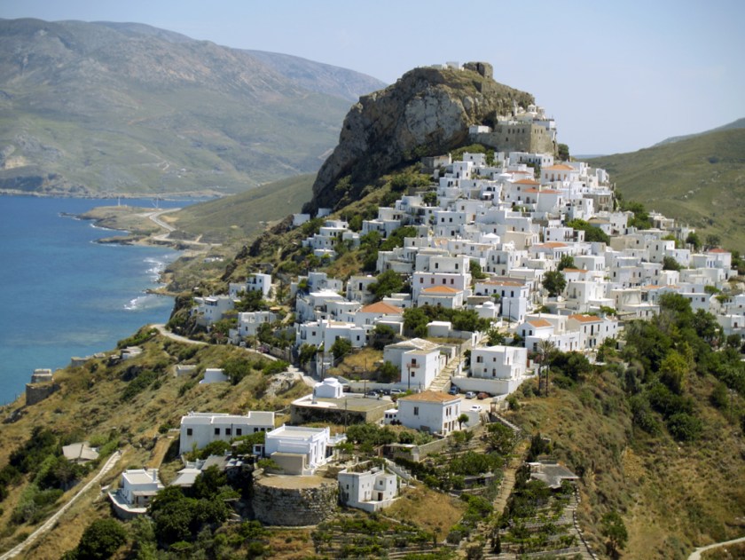
Around 2,000 BC, we are told, Skyros was known as the Island of the Magnetes, identifying their homeland in Thessaly, in a part that is still known as Magnesia.
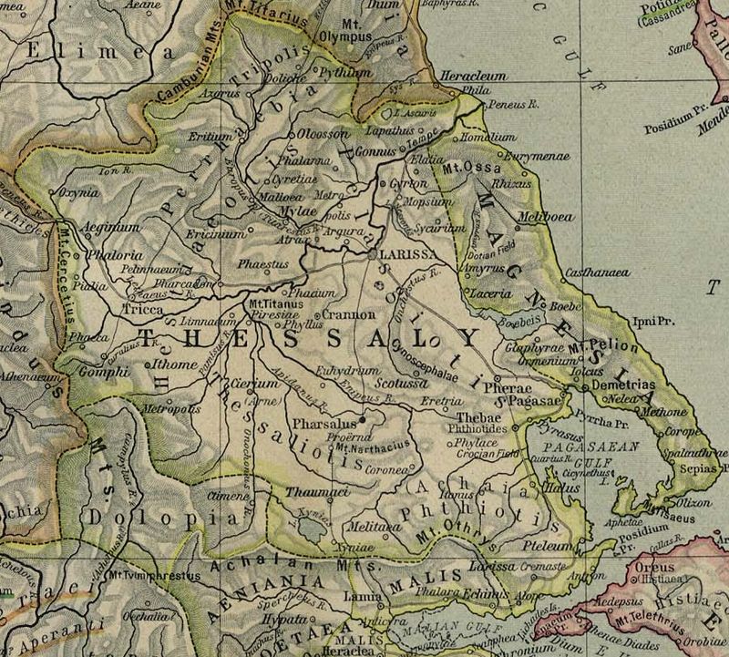
Well, that information caught my attention because awhile back I remembered reading something about Plato describing Magnesia in “The Republic” as an ideal city and society living in harmony.

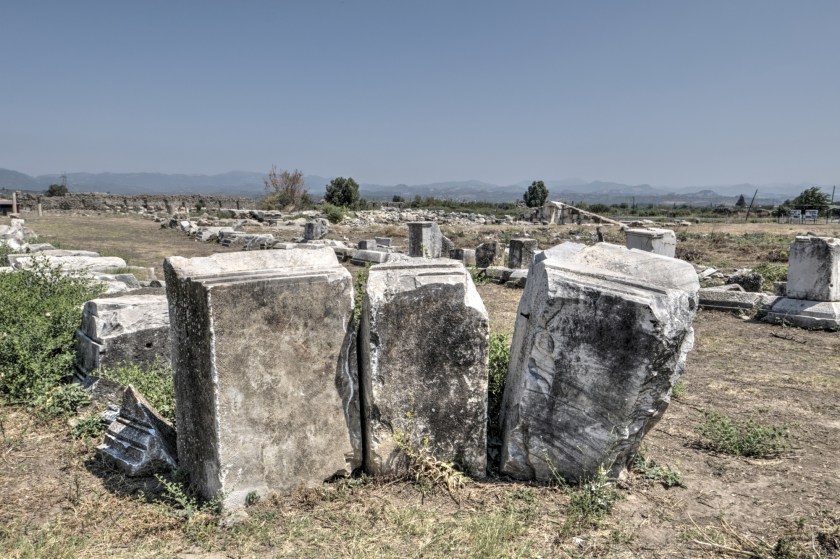
There were two prosperous cities in western Anatolia with the name of Magnesia. They were Magnesia-on-the-Maeander…
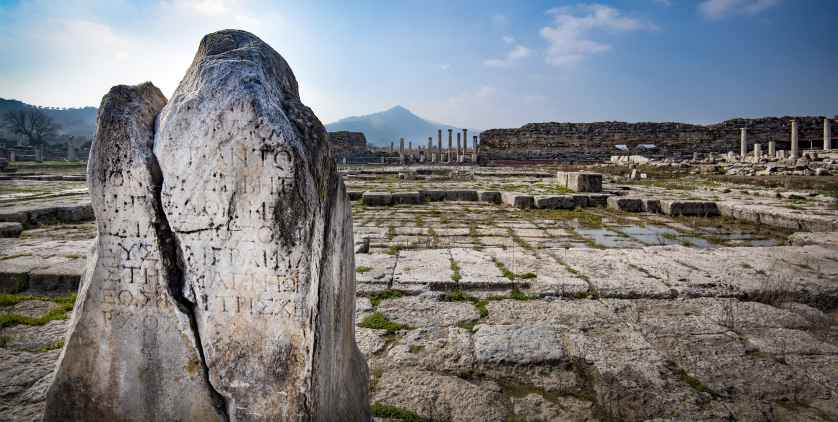
…and Magnesia ad Sipylum.
Given that I believe the ancient advanced Moorish civilization lived in peace, balance, and harmony, the information that Plato described Magnesia as an ideal society really resonates with me as having existed at one time, and wasn’t just a fictional, idealized society.
I will end this post here, and pick up the alignment in Delphi, Greece.
