Interesting Comments and Suggestions I have Received from Viewers – Volume 2 Old World Electri-City Circuits & Springs

In this new multi-volume series that is a compilation of work I have previously done, I am highlighting places, concepts, and historical events that people have suggested to me in comments and emails.

The original series this video was based on, compiled from viewers’ suggestions, was what led me down the trail of discovering “Old World Electri-City Circuits & Springs,” as you shall see.

JC relayed to me that there are many hidden secrets in the Shepherd’s Bush District and its wards of White City and Wormholt in West London.

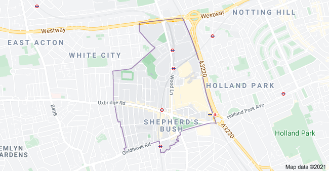
Shepherd’s Bush is a District of West London in the Borough of Hammersmith and Fulham.

One of the explanations for the District’s name is that it was said to have been named Shepherd’s Bush because it was originally a pasture for shepherds as they made their way with their sheep…

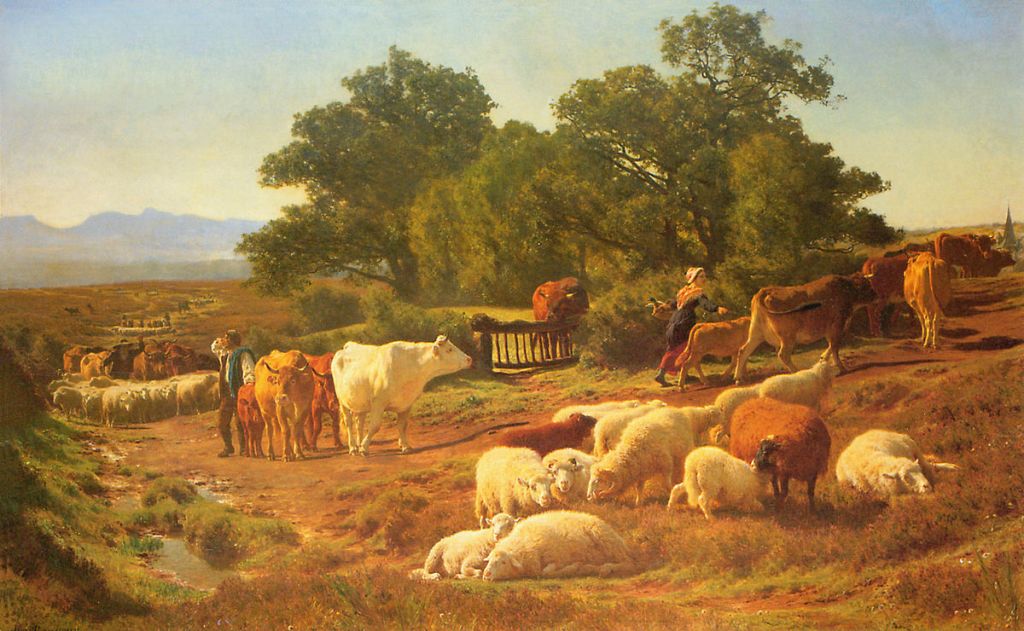
…to the Smithfield Market in the City of London, the current building for which was said to have been designed by Victorian architect Sir Horace Jones and built in the second-half of the 19th-century.

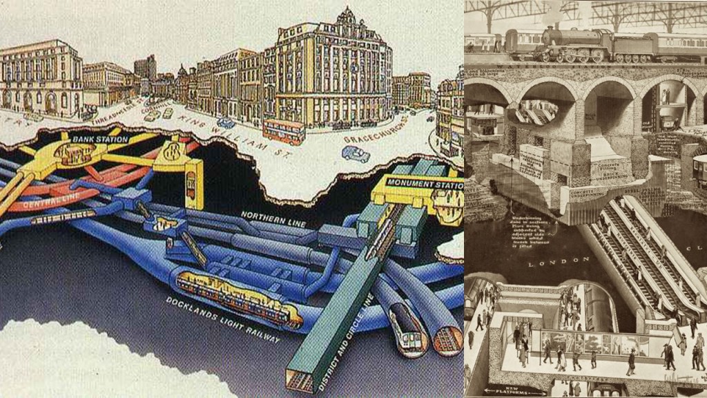
Both the Shepherd’s Bush District and its White City Ward are located on the Central Line of the London Underground System, and along with the Metropolitan Line, one of only two lines to cross the Greater London boundary.

The Central Line first opened in 1900 as the third deep-level Tube line to be built after electric trains were said to have made them possible.

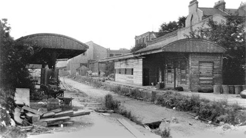
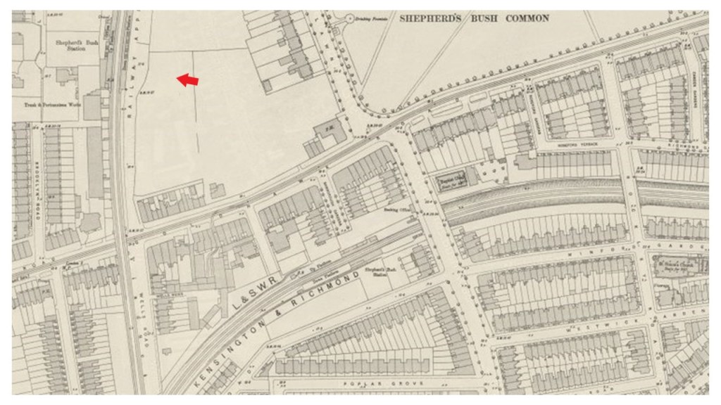
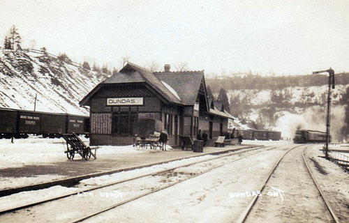
It is interesting to note that the Shepherd’s Bush Train Station was only in use for 42-years, by the London and South Western Railway, between January of 1874 and May of 1916, at which time it was closed, along with other nearby train stations, never to be used again.

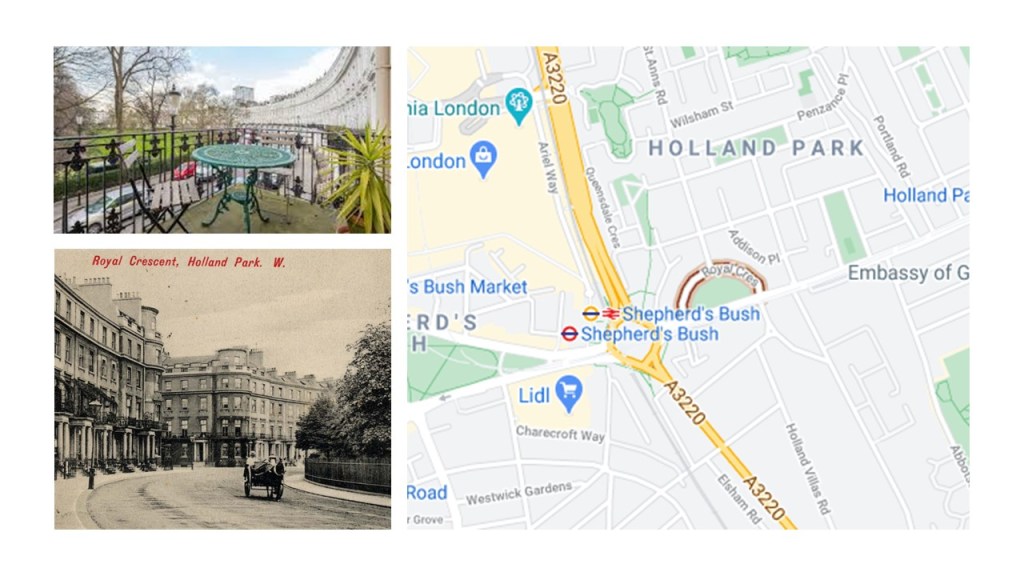
The Shepherd’s Bush Green is an approximately 8-acre, or 3.2-hectare, triangular space of open grass that is surrounded by busy roads on all three sides.

Four main roads radiate from the western side of the green, and three approach from the eastern side, meeting at the Holland Park Roundabout.

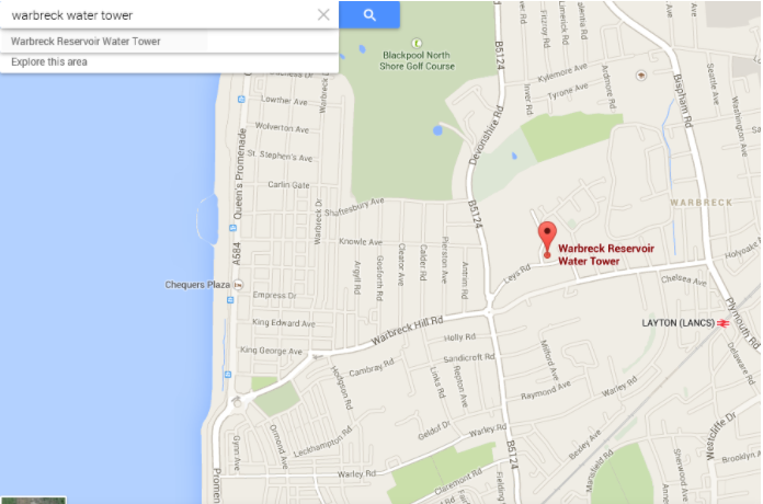
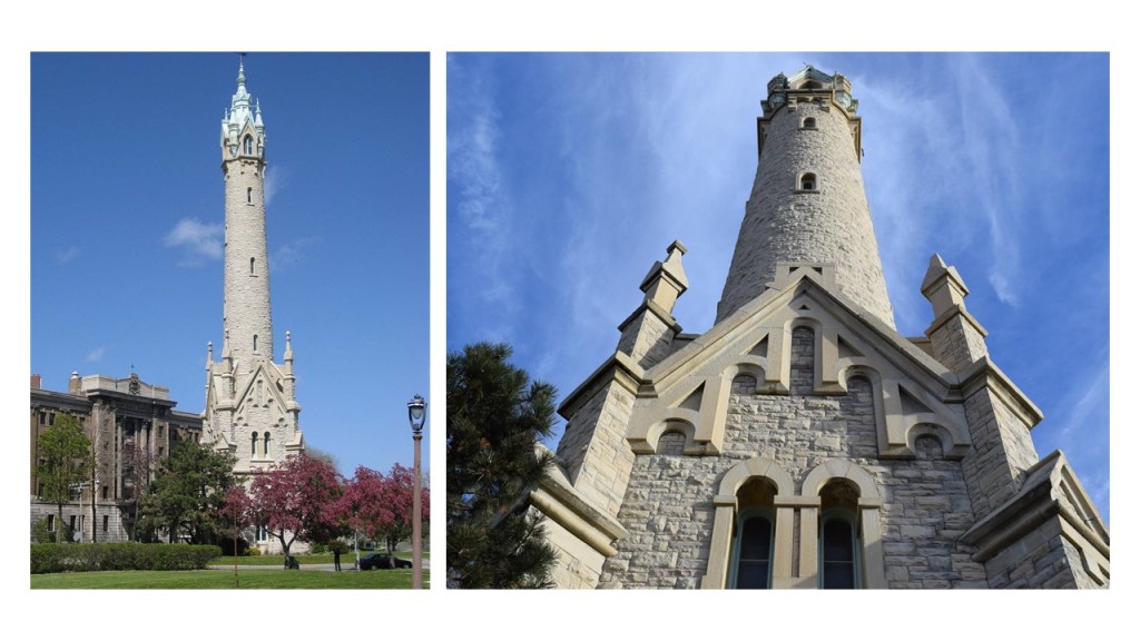
The Thames Water Tower is located in the Holland Park Roundabout.

The Thames Water Tower was said to have been designed and built in 1994 on top of an underground shaft that brings drinking water up from the London Ring Main, an extensive underground tunnel of flowing water 30 meters, or 98-feet, underground.

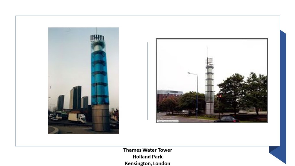
The steel core of the glass-covered tower functions as one of the world’s largest barometers, said to forecast the weather by responding to changes in air pressure, characterized by filling-up with colored water, and turning the tower blue.

Neighboring Shepherd’s Bush, Holland Park is an affluent section of Kensington, known for its Royal Crescent, said to have been designed in 1839 by Robert Cantwell, and considered one of the most architecturally interesting 19th-century developments in Holland Park.

The Shepherd’s Park Green is an important node of the Bus Line, with eighteen bus routes arriving here, as well as being near five underground stations.

In addition to the two mentioned previously at Shepherd’s Bush and White City, the following underground stations are nearby:

The Shepherd’s Bush Market…

…the Goldhawk Road Tube Station…

…and the new Wood Lane Station on the Circle and Hammersmith & City Lines, that opened in 2008.

The original Wood Lane Station on the London Underground’s Central Line was said to have been built to serve the Franco-British Exhibition and the Olympic Games in London, which took place in 1908.

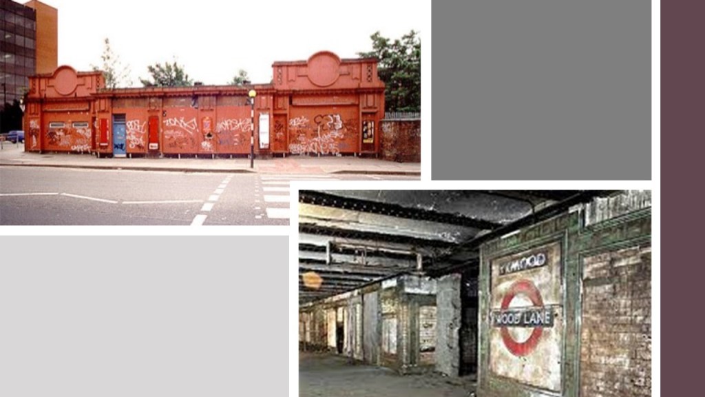
The Wood Lane Tube Station was said to have been closed when the White City Tube Station was opened a short distance north on the Central Line, and while the Wood Lane platforms were abandoned, the depot here became known as the White City Depot, one of three traction maintenance depots on the Central Line.

The depot at this location became operational in 1900.

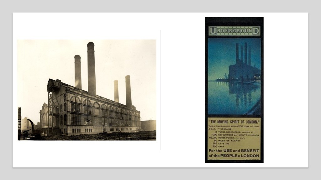
Until 1928, it had the main power station for the Central London Railway (CLR) to generate electricity for the railway’s trains…

…after which time the Lots Road Power Station supplied the London Underground’s electricity until it was decommissioned in 2002.

Uxbridge Road is on the north side of the Shepherd’s Bush Green, a major road through West London that also provides transportation connections for buses and the London Underground.

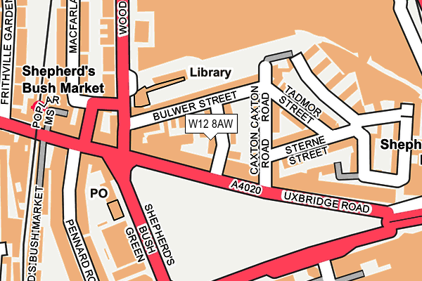
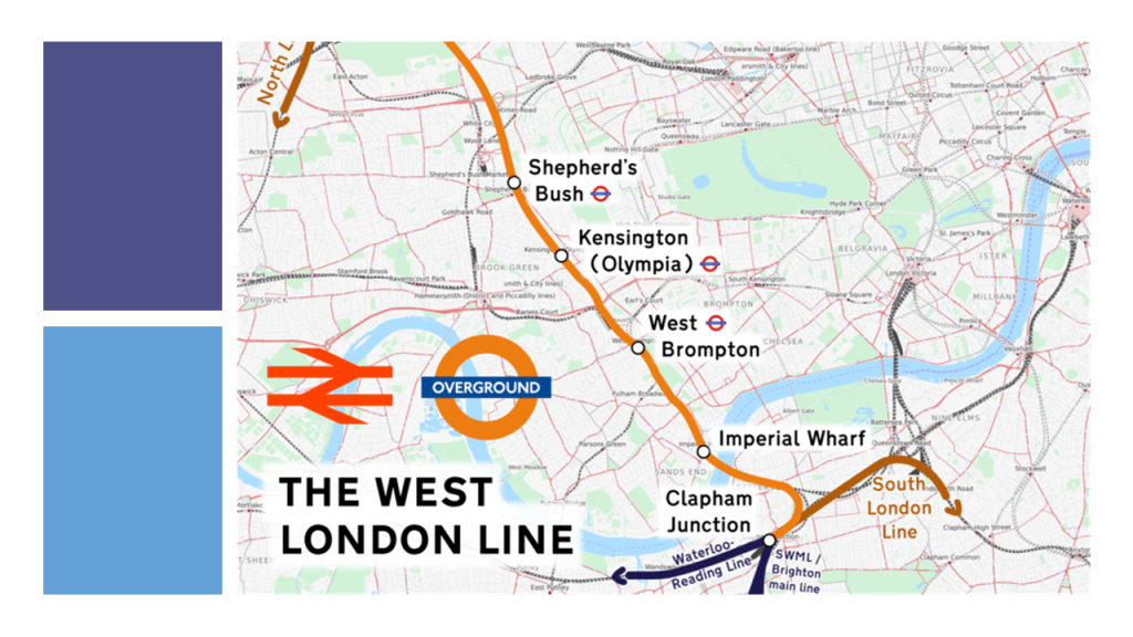
The Shepherd’s Bush Green is bounded to the East by the West London Overland Line…

…and at one time bounded to the west by the rail-line which serviced the Shepherd’s Bush Station.

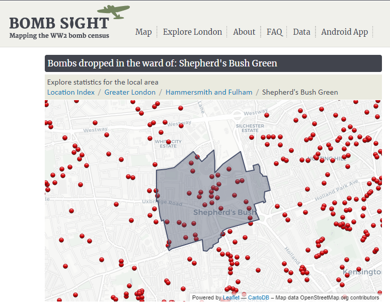
It is important to note that during the Second World War, Shepherd’s Bush and its environs were targeted heavily by German V-1 flying bomb attacks, which would strike with little notice.

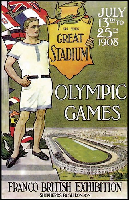
Now I am going to take a look at the Franco-British Exhibition and the Olympic Games in London, both of which took place in 1908 in this complex in the White City Ward of Shepherd’s Bush.

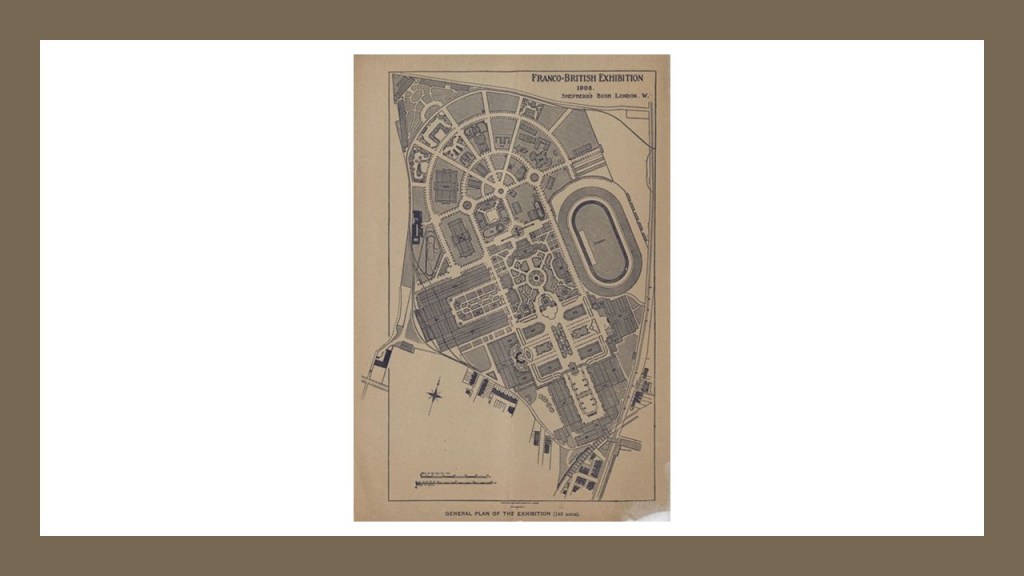
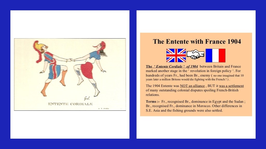
What we are told is that the area now called White City was farmland until it was used as the building site of the Franco-British Exhibition, so-named as a celebration of the 1904 Entente Cordial between the two countries, said to mark the end of hundreds of years of intermittent conflict between the two states and their predecessors…among other things, and one of six Exhibitions held there between 1908 and 1914.

The 1908 Olympic Summer Games were held in London alongside the Franco-British Exhibition, as they were not able to be held in Rome as originally scheduled because of a violent eruption of Mt. Vesuvius in 1906 that put the brakes on that plan.

First on the Exhibitions.

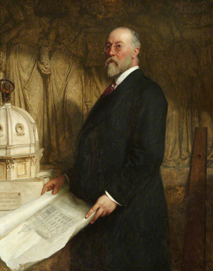
We are told the chief architect of the White City Buildings for the 1908 Franco-British Exhibition…

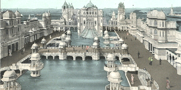
…was John Belcher, President of the Royal Institute of Architects from 1904 – 1906.

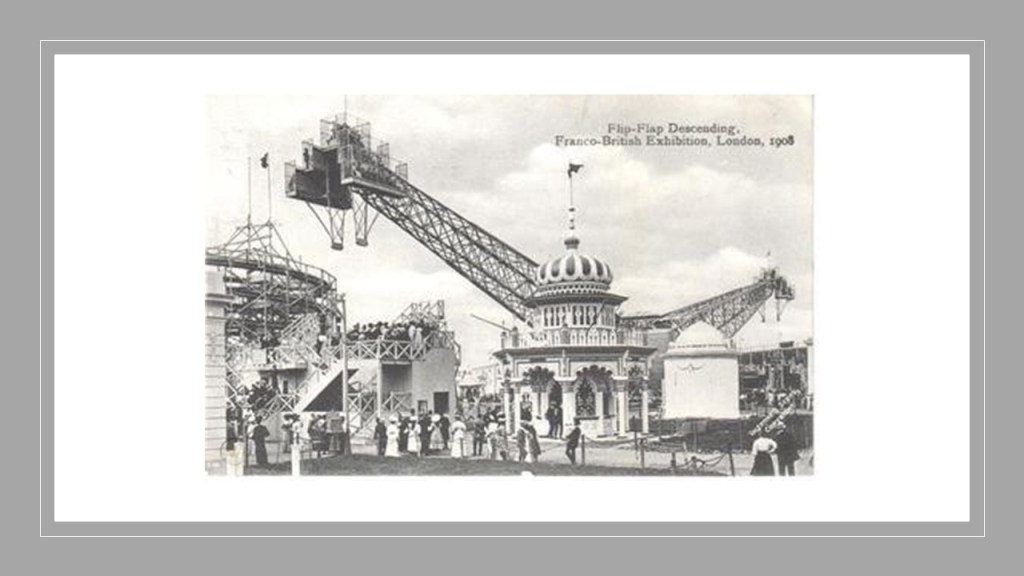
In addition to the twenty palaces and eight exhibition halls that were said to have been built expressly for the 1908 Exhibition, there were a number of amusement attractions featured, including:

The Flip-Flap in the Elite Gardens…

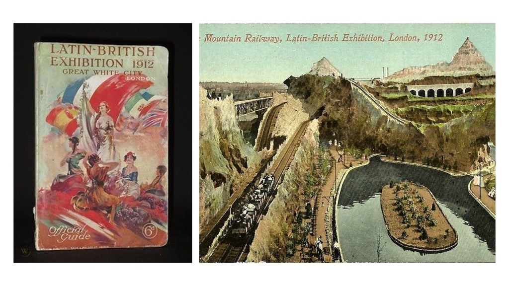
…the Mountain Scenic Railway…

…and the Canadian Toboggan.

The White City was also the location of five more Exhibitions:

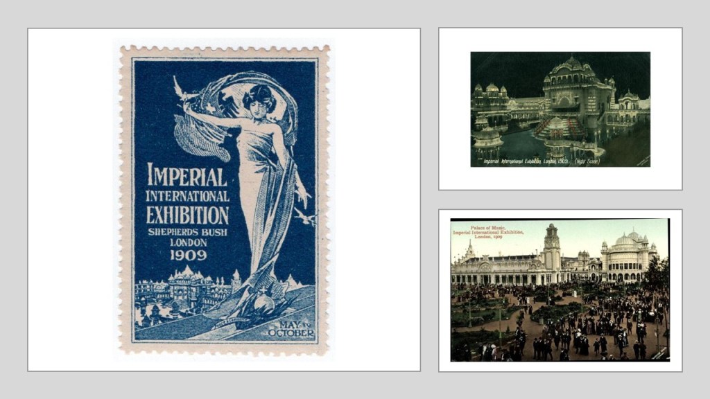
The Imperial International Exhibition in 1909, called an opportunity to reflect upon the achievements of the three members of the 1907 Triple Entente, an accord between Russia, France, and Great Britain…

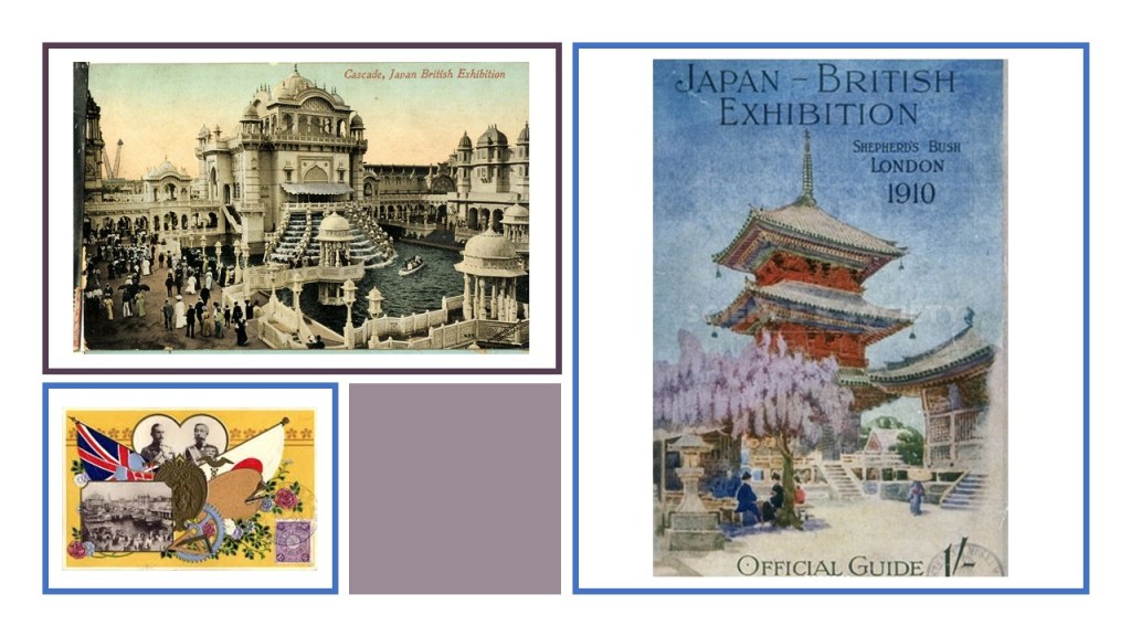
The Japan-British Exhibition was held in 1910 to celebrate and reinforce the Anglo-Japanese Alliance signed between the two countries in 1902, and driven by the Empire of Japan’s desire to develop a more favorable image to Britain and Europe.

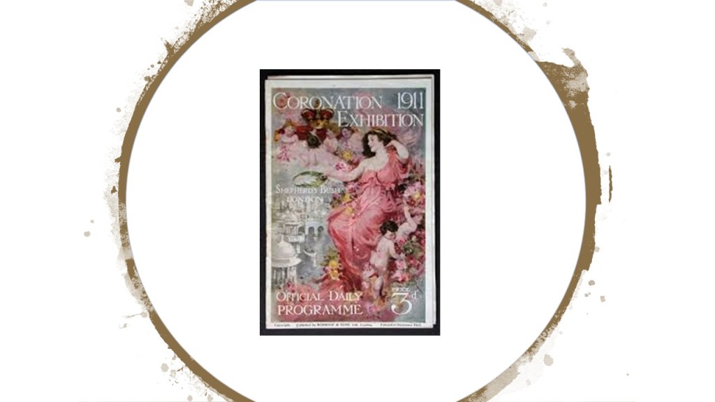
The Coronation Exhibition was held in the White City starting in May of 1911, to showcase highlights of the British Empire and to celebrate the coronation of King George V and Queen Mary in Westminster Cathedral in June of 2011.

The Latin-British Exhibition in 1912 focused on the Latin countries in Europe of France, Spain, Italy, and Portugal, and South America.

In 1914, the White City of London held its last Exhibition, the Anglo-American Exposition.

Following the 1914 Anglo-American Exposition, the White City site fell into disuse and disrepair.

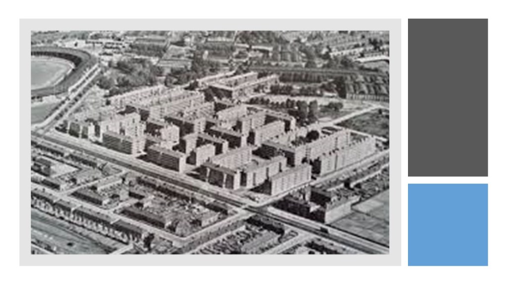
In 1937, a large portion of the White City was cleared to make way for a housing estate

The White City Stadium was the main venue for the 1908 Summer Olympics held concurrently with the Franco-British Exhibition on the White City grounds..

This stadium with a seating capacity for 68,000 was said to have been designed by engineer J. J. Webster, and built in 10-months by the George Wimpey construction firm starting in 1907, on part of the site of the Franco-British Exhibition.

The 1908 London Olympic Games were opened by King Edward VII at the White City stadium on April 27th.

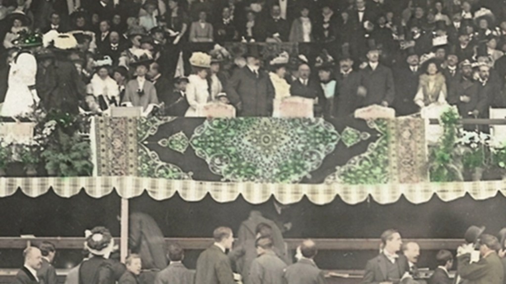
One of the notable outcomes of these particular Olympic Games was that the distance for the marathon was fixed for future games and sporting events, and calculated by the distance from Windsor Castle to a point in front of the royal box.

After the 1908 Olympic Games, only the running track at the White Stadium was used until 1914, and there were attempts to sell it.

Other than that, the White Stadium track was used by some athletes in training for the 1924 Olympic Games in Paris.

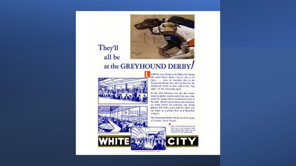
Then the Greyhound Racing Association took-over the White City Stadium in 1926.

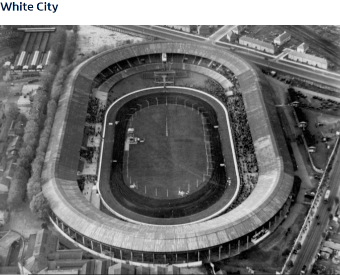
The stadium became the host to the English Greyhound Derby between 1927 until the time of its closure in 1984.

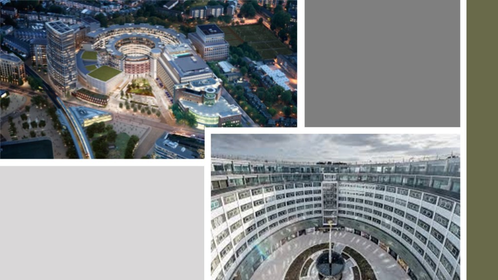
Today, the BBC White City occupies the site of the White City Stadium, which was demolished in 1985.

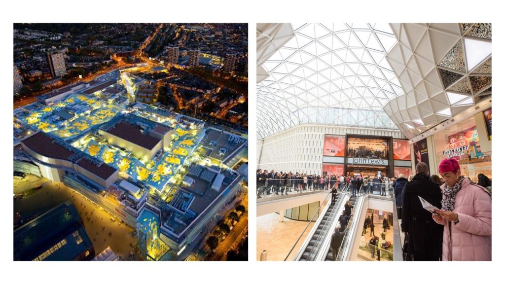
The former White City Exhibition Site now hosts the Westfield Shopping Center, one of the largest in London.

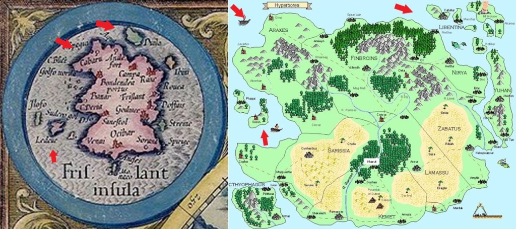
We are told this 1841 map shows a largely rural and undeveloped Shepherd’s Bush, with a lot of open farmland compared to fast-developing Hammersmith.

When I look at the configuration of the blueprint for the lay-out of the Franco-British Exhibition and the White City Stadium, R2D2, the beeping ‘droid from Star Wars comes to mind as a similar match.

This is a detail of a map from 1912 called “Bacon’s Up-to-Date Map of London” showing the White City configuration, along with London Underground lines marked in red, and Tram lines marked in yellow.

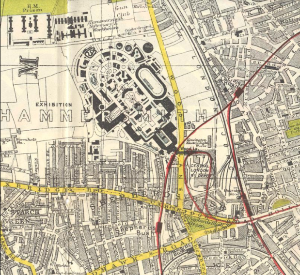
To me, the whole White City configuration reminds me of sophisticated circuitry that appears to plug into the Central London Depot, which I mentioned previously, was the main power station for the Central London Railway (CLR) until 1928.

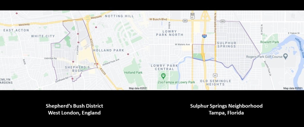
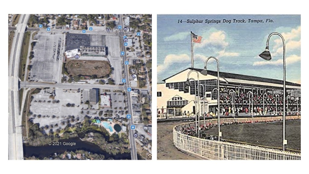
Now, there is a place I want to revisit in Tampa, Florida, which I researched last summer, that reminds me in very many ways of Shepherd’s Bush.

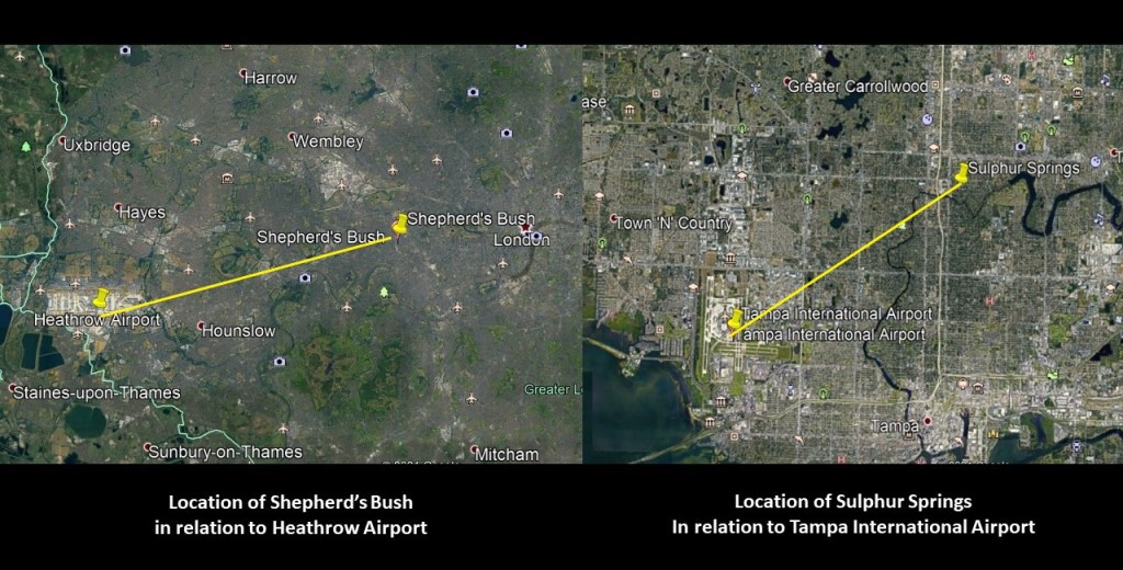
There is a similar relationship in the location of both of these places being close to a major international airport, with Shepherd’s Bush being 10-miles, or 16-kilometers in a straight-line, from London’s Heathrow Airport on the left; and on the right, the Sulphur Springs neighborhood of Tampa in a straight-line is 6-miles, or 10-kilometers, from Tampa International Airport.

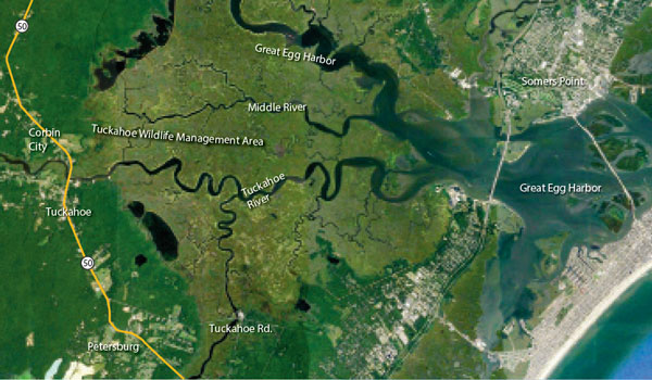
Both places are located in a similar relationship to snaky, s-shaped rivers bends that have the same curvature…

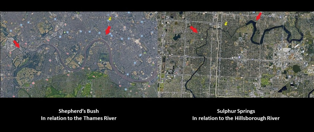
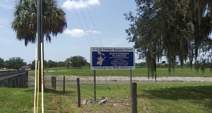
…where the similarity would be even more pronounced had the water of the Hillsborough River not been dammed up and subject to water resource management.

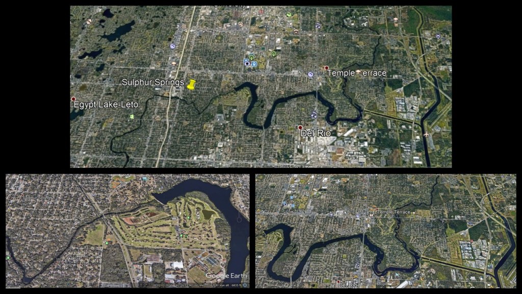
Sulphur Springs is located six-miles north of downtown Tampa.

Its southern boundary is the Hillsborough River; the northern boundary is Busch Boulevard; Florida Avenue, Nebraska Avenue, and the CSX Railroad line forms boundaries on the west and the east.

Going from left to right on this map of Google Earth, there is a water tower here…

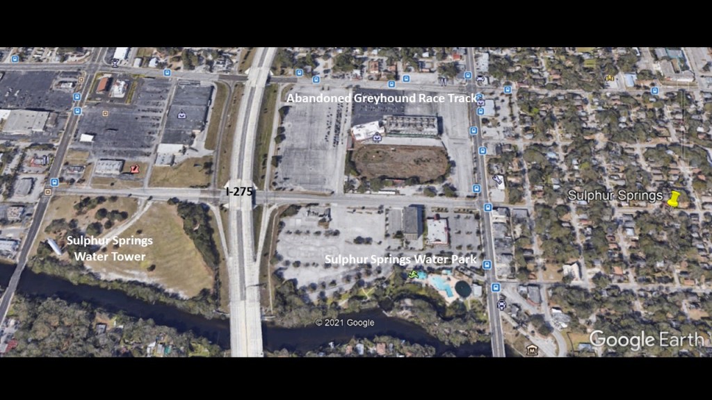
…like finding one in the Holland Park Roundabout right next to the Shepherd’s Bush Green…

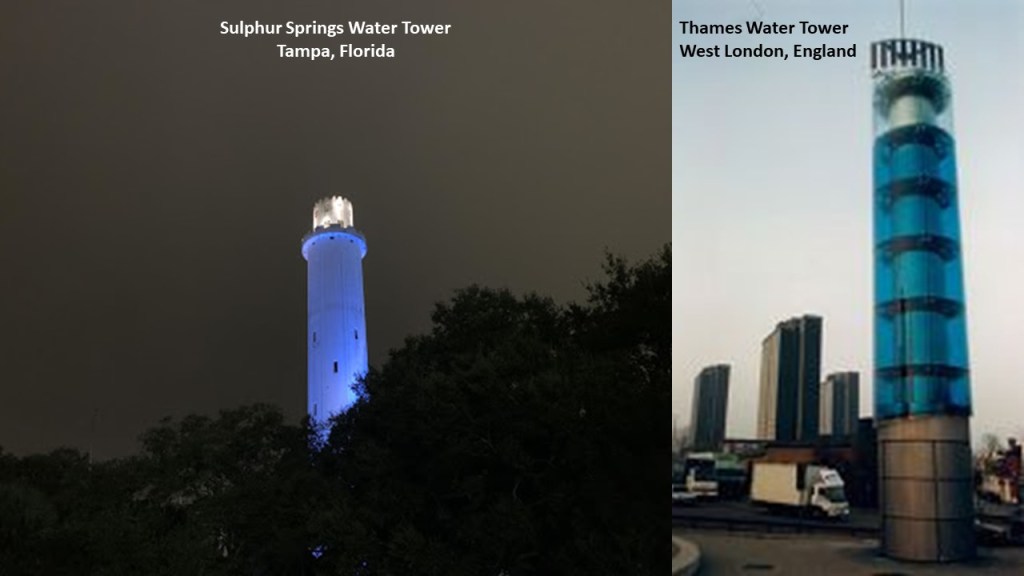
…the construction of which was said to have been finished in 1927, to include a full automatic elevator for some reason, commissioned by local developer Josiah Richardson for the purpose of ensuring an adequate water pressure to supply the building which housed his Sulphur Springs Hotel & Apartments, and the first shopping mall in Florida, Mave’s Arcade.

Also, like the White City Stadium in Shepherd’s Bush, there was a stadium and track here that became a popular Greyhound Racing Track, that is still there but has long been abandoned.

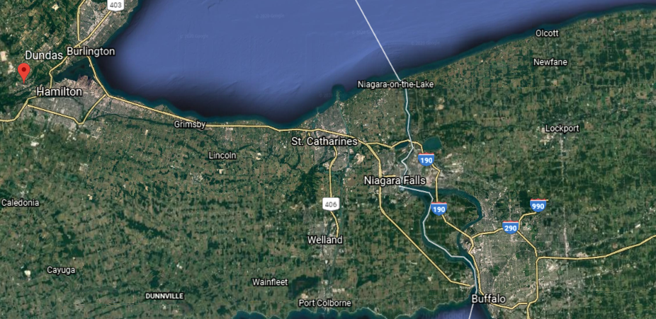
After I started talking about the racing tracks, and proximity to international airports and rivers, in London and Tampa a viewer brought to my attention that the Montreal Hippodrome is located next to rails; is 15-minutes to the Montreal Pierre Trudeau International Airport; and the St. Lawrence River is just south of it.

The Montreal Hippodrome was located 8-miles, or 13-kilometers from Montreal-Pierre Trudeau-International Airport, or a driving distance of 11-miles, or 18-kilometers, from there.

The location of the historical Montreal Hippodrome appears to be situated at a similar angle to major international airports as seen in Shepherd’s Bush in West London and Sulphur Springs in Tampa shown and dicussed in the first part of this series, where both places had had elliptical-shaped race-tracks in their vicinities.

Also known as the Blue Bonnets Raceway, a thoroughbred horseracing track and casino, the Montreal Hippodrome was permanently closed in October of 2009 after 137 years of operation, and the abandoned site was demolished starting 2018.

The Hippodrome was located right next to the Canadian Pacific St. Luc Railyards, and its interesting to note this array of elliptical shapes on the race track grounds between the main ellipse and the railyards.

It is also interesting to note that the roundhouse at the St. Luc Railyards was said to have been completed in 1950…

…and by 2003, it was reduced to 4 or 5 stalls.

Why was a beautiful structure like this deconstructed after only a half-century of use?

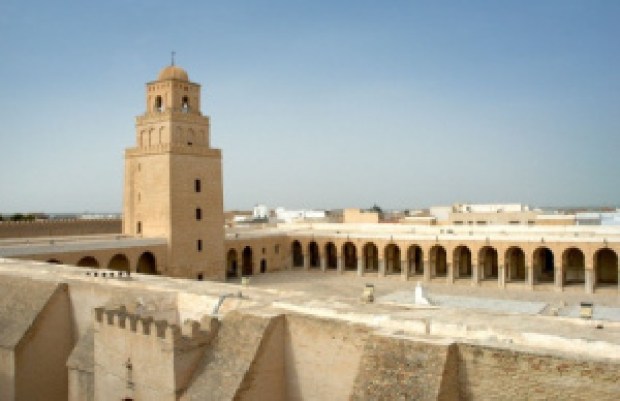
The appearance of the historical St. Luc Roundhouse reminded me of depictions I have seen of the ancient harbor of Carthage in Tunisia, called a cothon, meaning an artificial, protected harbor.

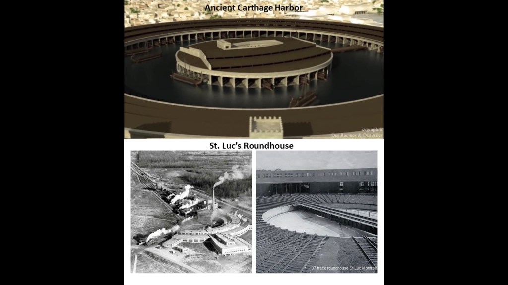
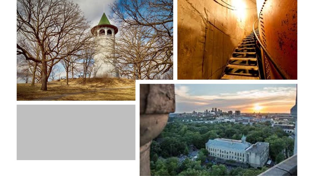
This is a 2017 photo of the former grand 37-stall roundhouse , considered a shining example of the Canadian Pacific Railway when it was built.

Studies and planning have been done to re-develop the hippodrome site into social housing units.

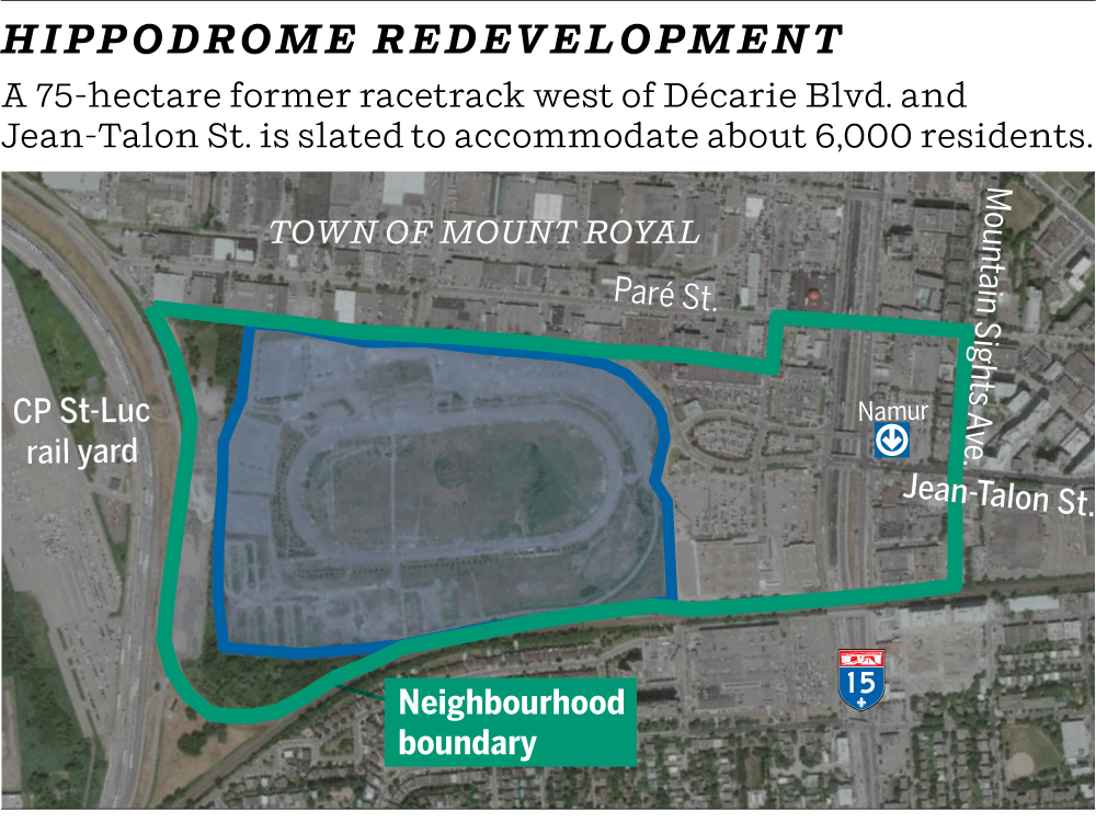
The hippodrome was located in the western part of Montreal’s Cote-des-Neiges neighborhood, which is the geographic center of the Island of Montreal, said to have been founded in 1862…

…and is also the location of the Notre-Dame-des-Neiges Cemetery…

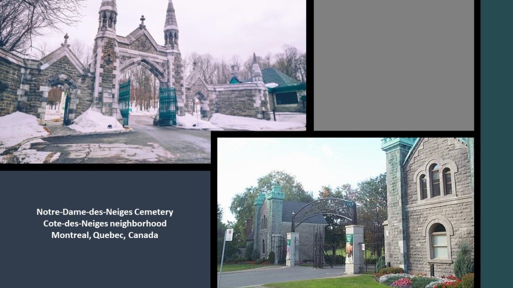
…as well as the nearby Saint Joseph’s Oratory, the construction of which was said to have started in 1914, and completed in 1967.

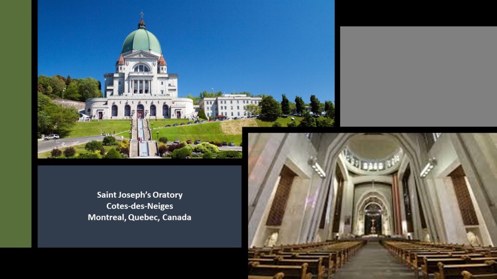
Saint Joseph’s Oratory is: the highest building in Montreal; a National Shrine; a Roman Catholic minor basilica; the largest church in Canada; and has one of largest domes in the world.

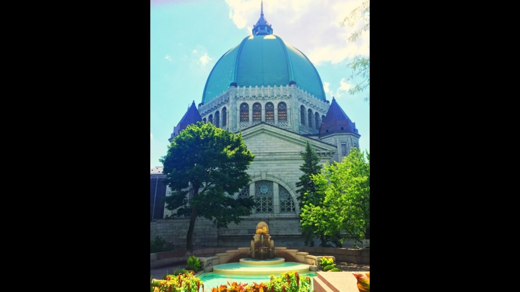
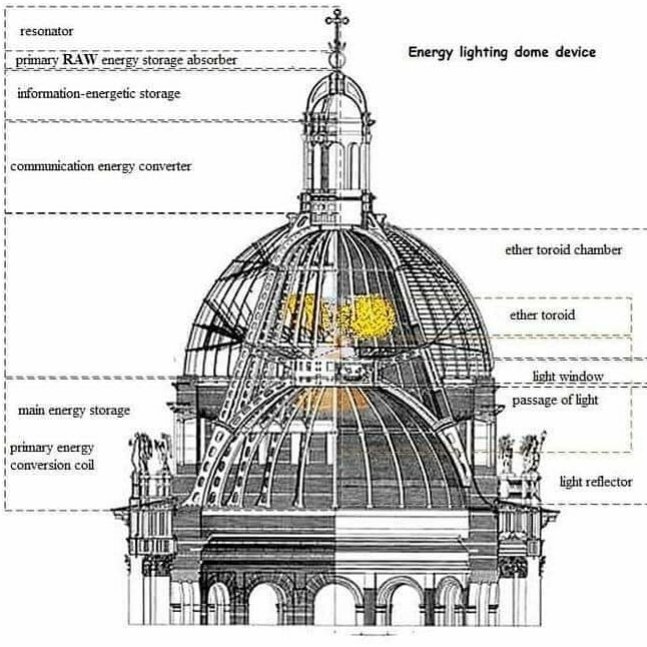
A viewer in Montreal sent me this image of a massive dome, saying it was “interesting,” and I totally agree with him – very interesting!

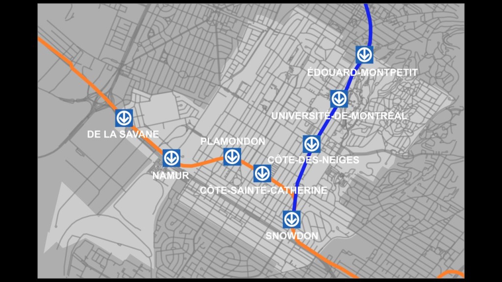
Like Shepherd’s Bush in West London, the Cotes-des-Neiges neighborhood on Montreal is an underground transportation hub, with five Orange Line metro stops, and four on the Blue Line.

Another place I would like to bring your attention to before I move on is in Philadelphia.

I decided to take a peek at Philadelphia, another place I have studied on a map previously, and I knew the Philadelphia International Airport was in the southwestern part of the city.

So I looked at it on a map, and proceeded to look for an elliptical shape nearby to see if I could find one.

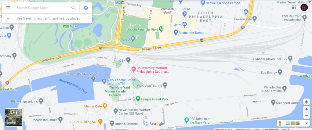
I came across this track on Google Earth, which I was able to identify by looking-up tracks in South Philadelphia.

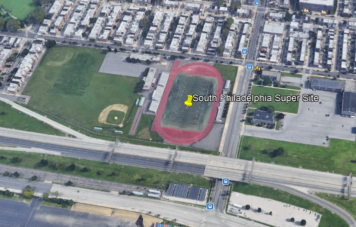
The South Philadelphia Super Site is located 4-miles, or 7-kilometers in a straight-line, from the Philadelphia International Airport, and is a driving distance of 6-miles, or 10-kilometers.

Here is a comparison of the appearance of all four of these locations I have looked at with an elliptical race-track and relatively short-distance to a major international airport.

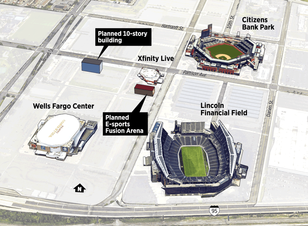
The South Philadelphia Sports Complex is adjacent to the Super Site…

…and which consists of Citizens Bank Park, the home of baseball’s Philadelphia Phillies; the Lincoln Financial Field, the home of football’s Philadelphia Eagles; and the Wells Fargo Center, the home of basketball’s Philadelphia 76’ers and hockey’s Philadelphia Flyers, and the sport of lacrosse’s Philadelphia Wings.

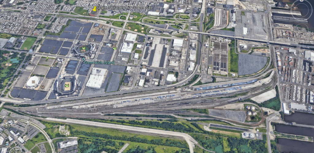
The South Philadelphia Super Site track and the three professional sports venues are both located very close to the CSX railyards…

…below which I noticed there was an abandoned elliptical shape surrounded by trees.

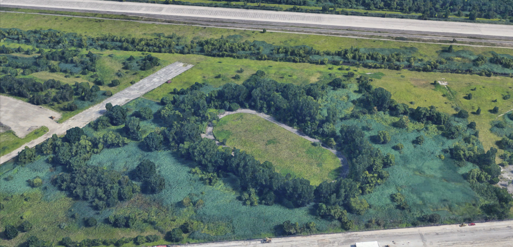
When I looked on a map, the railroad and sports complexes in South Philadelphia are adjacent to the Philadelphia Naval Yard, the location of the Philadelphia Experiment back in World War II.

A couple of thoughts before I move on from here.

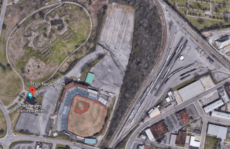
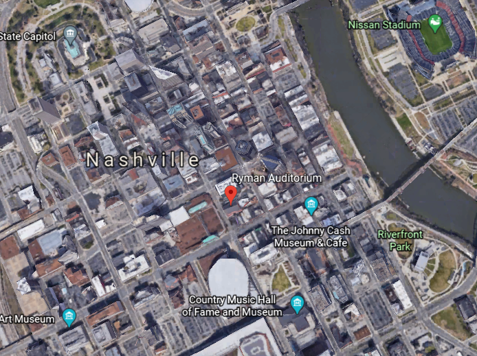
First, I have wondered about a connection between athletic fields to the Earth’s grid system ever since finding ball-fields sandwiched between a star fort in called Fort Negley and the railroad yards in Nashville.

I am definitely beginning to think ellipses, ellipses, and the other varied shapes of sporting venues, served a function similar to star forts as circuitry on the Earth’s electro-magnetic grid system.

A viewer sent me this graphic awhile back saying:

“If you haven’t yet researched the Indianapolis Motor Speedway, I think it’s worth a glance.

Balloon racing and monorail aeroplanes being used there before they were racing cars.

Check this out: Vatican City, the Wimbledon Campus, the Roman Colosseum, the Rose Bowl, Yankee Stadium, and the Kentucky Derby all fit inside the automobile racing CIRCUIT.”

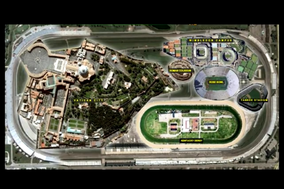
The Indianapolis Motor Speedway is the largest sports’ venue in the world, and said to have been constructed in 1909.

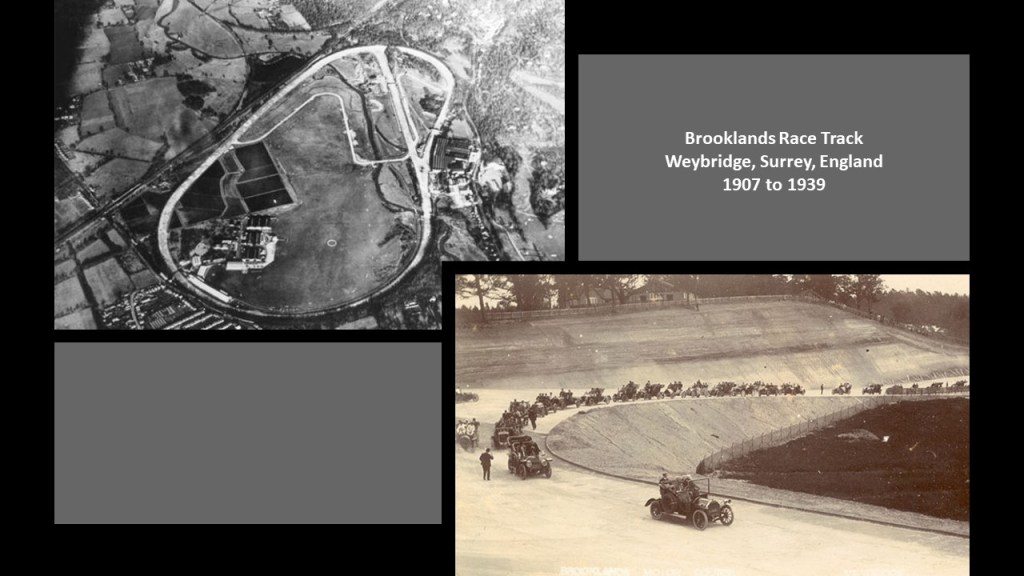
It was the second-purpose built, banked oval racing circuit after Brooklands in Surrey, England, which opened in 1907 and closed in 1939.

It certainly looks like the Controllers’ utilized the existing performance-enhancing features of the physical infrastructure of the Earth’s grid system for the sporting venues of the new historical timeline.

Someone mentioned the Battersea Power Station on the south bank of the River Thames in Battersea in the London Borough of Wandsworth.

The one building comprises two power stations, with Power Station A said to have been constructed between 1929 and 1935, and Power Station B between 1937 and 1941.

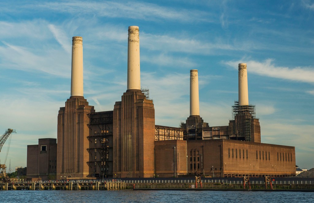
One of the largest brick buildings in the world, and known for its Art Deco.

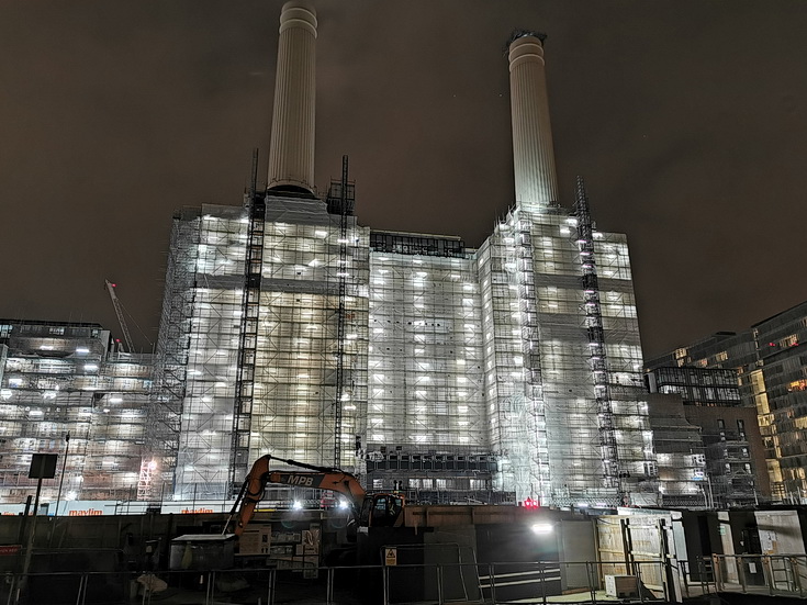
Then, after all that work to design and construct it, both power stations of the Battersea Power Station were decommissioned by 1983…only 42-years later?

After 30-years of abandonment, interest in the redevelopment of the site picked up, and it is currently being turned into luxury apartments, office space, and commercial business space.

Someone mentioned the Efteling Amusement Park, located in the North Brabant Province of the Netherlands, with largest nearby city being called Hertogenbosch, also known as Den Bosch.

Sounds like Shepherd’s Bush, and Busch Boulevard, as noted London and Tampa earlier in this video.

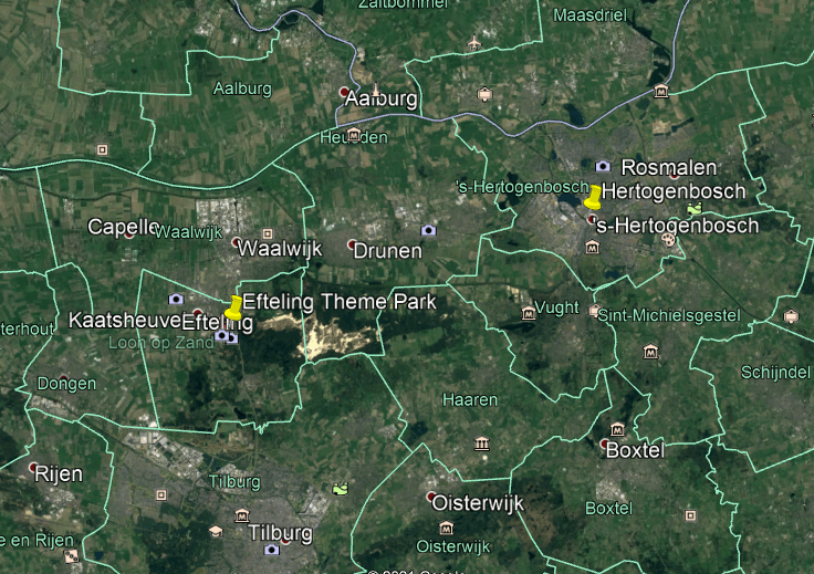
The Efteling Theme Park was opened in 1952 on the grounds of what was a former sports and recreational park under the guidance of the three visionary men who developed the park.

Amusements at the park include the King’s Castle of the Symbolica ride, a trackless dark family ride…

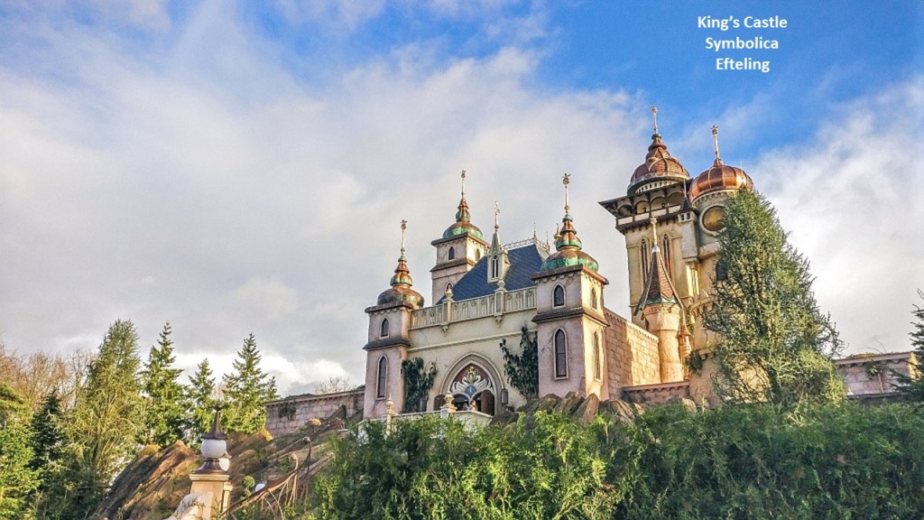
…with a grand ballroom at the end of the ride…
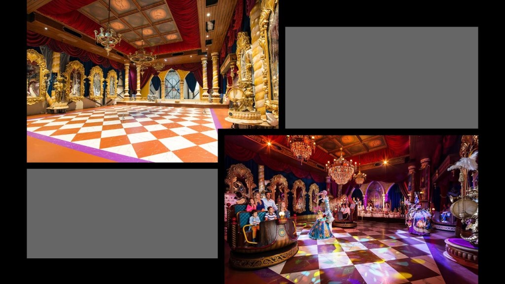
…the Villa Volta…

…an unusual type of ride in which the visitors get the illusion while inside that either the building, or the visitors, or both, are turned-upside down.

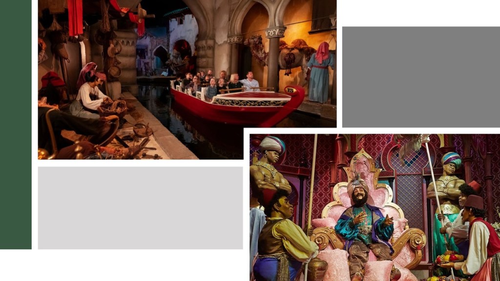
…and the Fata Morgana, also known as the Forbidden City and the 1001 Arabian Nights, an attraction that opened in 1986.

I have to wonder if the infrastructure for the park was already there….

Another place with a theme park that someone brought to my attention was in Chippewa Lake, a town in Ohio at the end of a trolley-line that came from Cleveland.

It operated for 100-years, from 1878 to 1978, after which time it was abandoned, with many of the original rides left to deteriorate in situ.

The Chippewa Lake Park Dance Hall burned-down in June of 2002.

A viewer from Belgium commented about the Antwerp Zoo, one of the oldest in the world as it was established on July 21st of 1842…

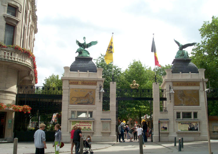
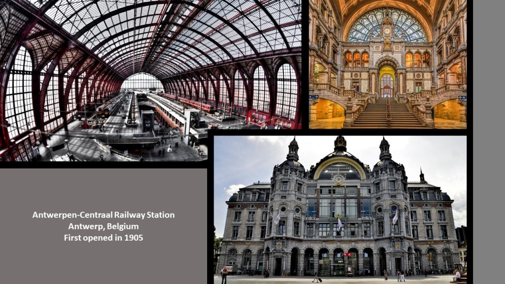
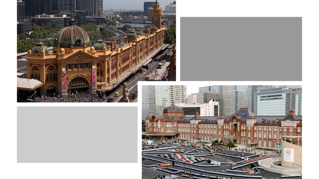
…and is located right next to the Antwerpen-Centraal Railway Station, which first opened in 1905.

The following are some of the architectural features of the Antwerp Zoo:

The Egyptian Temple, said to date from 1856, which houses the giraffes…

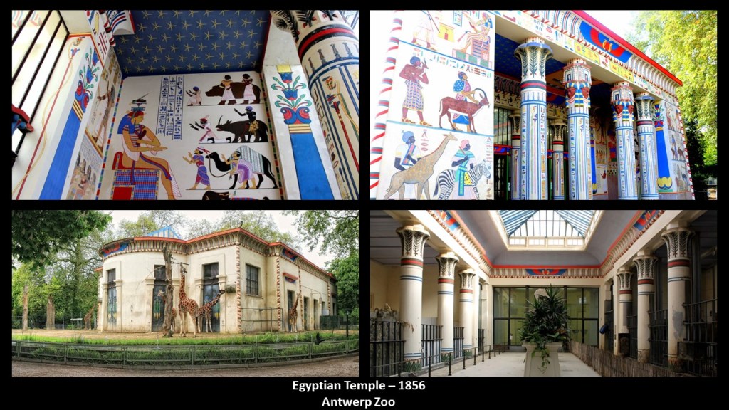
…the Moor Temple, said to date from 1885, which houses okapis, known as forest giraffes and the world’s first zoo with okapis starting in 1918…

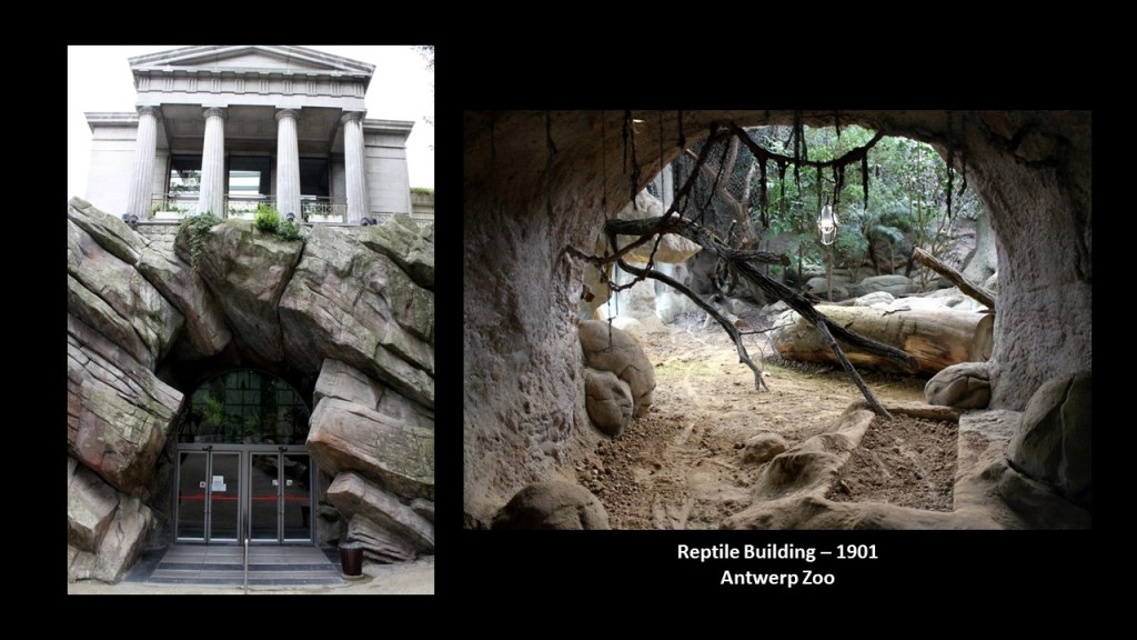
…the Reptile Building, said to date from 1901…

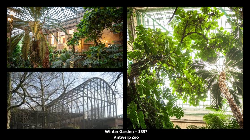
…and the Winter Garden, a tropical garden dated to 1897.

The Belgian viewer also mentioned the Albert Canal, connecting Antwerp and Liege, which was said to have been built first by a German engineering company between 1930 and 1934, and then completed by Belgian companies by 1939…

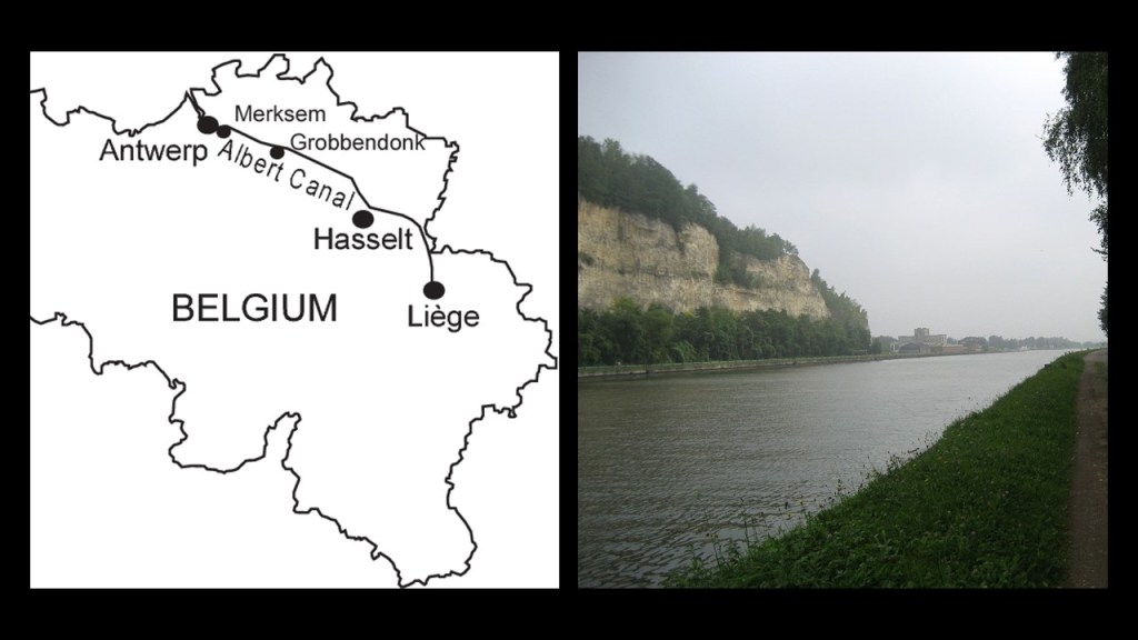
…just in time for the German forces to cross the Albert Canal on May 11th of 1940, the destruction of Fort Eben-Emael, and the beginning of the German Occupation of Belgium.

Fort Eben-Emael was a star fort that was called part of the National Redoubt of Belgium, said to be a network of fortifcations that functioned as the infrastructural cornerstone of the Belgian defensive network and built between 1890 and 1914.

Along with Fort Eben-Emael, near the border with the Netherlands, the National Redoubt included:

The Fortified position of Liege, at the other end of the Albert Canal from Antwerp.

The Belgian government was said to have upgraded and extended the already existing infrastructure of the Fortified Position of Liege after World War I to block Germany’s invasion corridor through Belgium to France.

This was done after World War I because the Belgians were able to hold up the German forces invading France for a week at Liege, which in-turn affected the German timetable for invading France.

Interestingly, the Belgian King Leopold III declared Belgium’s neutrality in 1936 to try to prevent another conflict, which was said to prevent France from making active use for its defense of the Belgian defenses and territory, and as seen with Fort Eben-Emael, the Belgian fortifications did not hold the Germans, who occupied Belgium and France for at least four years during World War II.

Liege is one of the most important railway hubs in Belgium, with its first station opening in 1842…

…and in 1843, becoming the location of the first international railway connection linking Liege to Aachen and Cologne in Germany.

There was even a World’s Fair held in Liege in 1905.

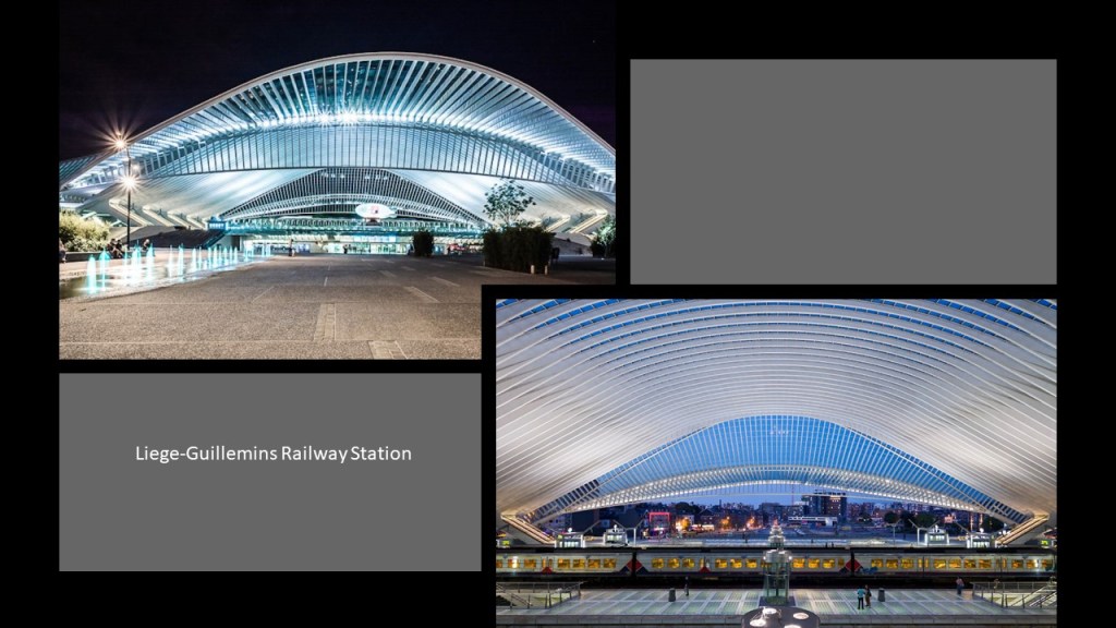
This is the Liege-Guillemins Railway Station, which opened in 2009, one of four Belgian stations on the high-speed rail network.

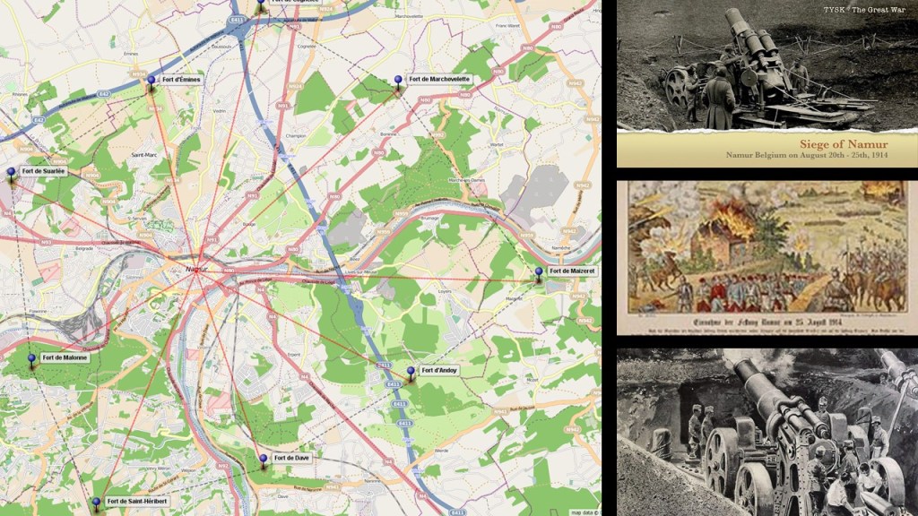
The Fortified Position of Namur of the Belgian National Redoubt was said to have been established for the same reason as the Fortified Position of Liege – to fortify the traditional invasion corridor of Germany through Belgium to France.

The old forts here were said to have been built between 1888 and 1892.

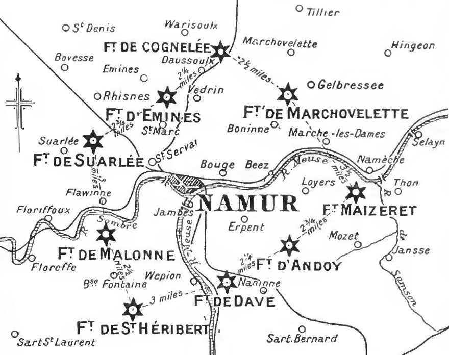
The Siege of Namur took place in World War I, between August 20th and August 25th of 1914, when the German Army bombarded and destroyed the forts with heavy artillery.

This image has an empty alt attribute; its file name is b77d3-siege-of-namur.jpg

I think quite likely star forts were targeted for destruction in both World Wars, and other wars as well, and not because they were military fortifications.

During the Siege, the German Army captured the Namur Citadel…

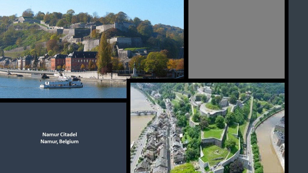
…and Namur was occupied by the German Army for the rest of World War I.

Namur is situated at the confluence of the Meuse and Sambre Rivers, which reminded me in appearance of Pittsburgh in Pennsylvania at the Forks of the Ohio, where the Ohio and Monongahela Rivers meet.

I am really quite sure that what we are told are natural river systems are in fact man-made canal systems.

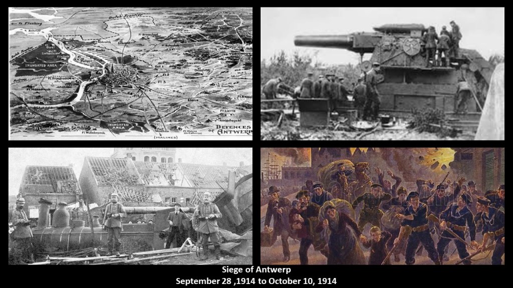
The most important part of the Belgian National Redoubt, we are told, was the double-ring of defensive fortifications around the port city of Antwerp.

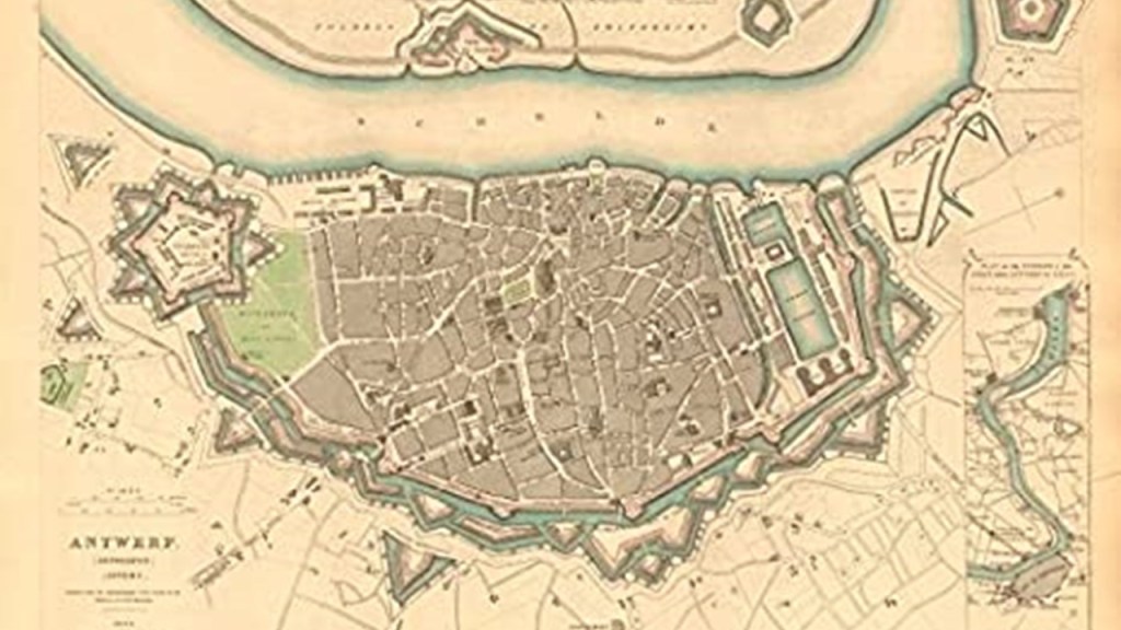
During World War I, the Germans also laid siege to Antwerp, against Belgian, French, and British forces.

The Germans were again victorious after bombarding the so-called Belgian fortifications with heavy and super-heavy artillery.

During World War II, on September 4th of 1944, the British Armored 11th-Division captured the port city of Antwerp intact except for the bridges across the Albert Canal.

Apparently, the retreating Germans blew up these bridges on their way out of town.

Then on October 12th of 1944, Hitler and the German High Command exclusively focused their V-weapon missile attacks on the cities of Antwerp and London, and for a period of 175-days-and-nights, German missile-launching crews fired more than 4,000 V-1s and more than 1,000 V-2s at Greater Antwerp, and Antwerp had become known as the “City of Sudden Death.

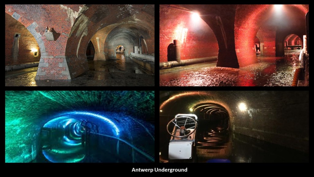
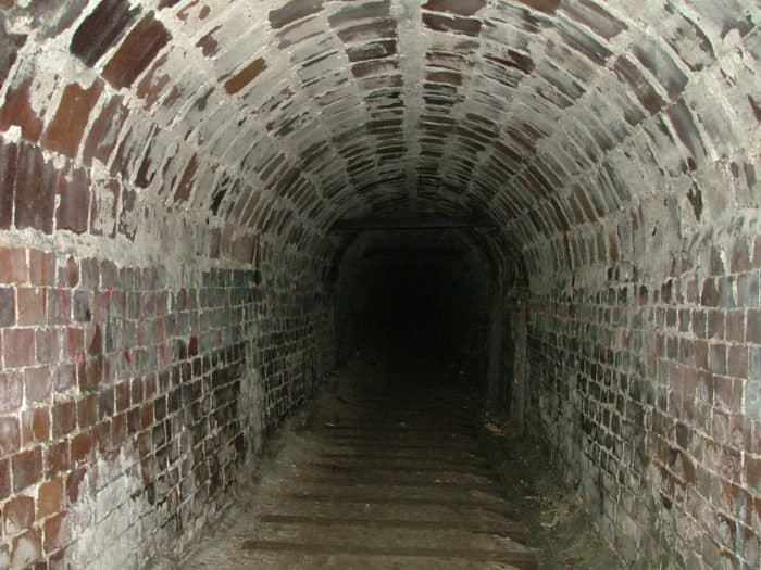
The Antwerp Underground is known as the “Ruien” and here there are vaulted ceilings, narrow canals, bridges, sewers and sluices.

Other places on my list of places suggested by commenters include:

Silloth Harbour and Beach in Cumbria, a northwest County in England near the country’s border with Scotland.

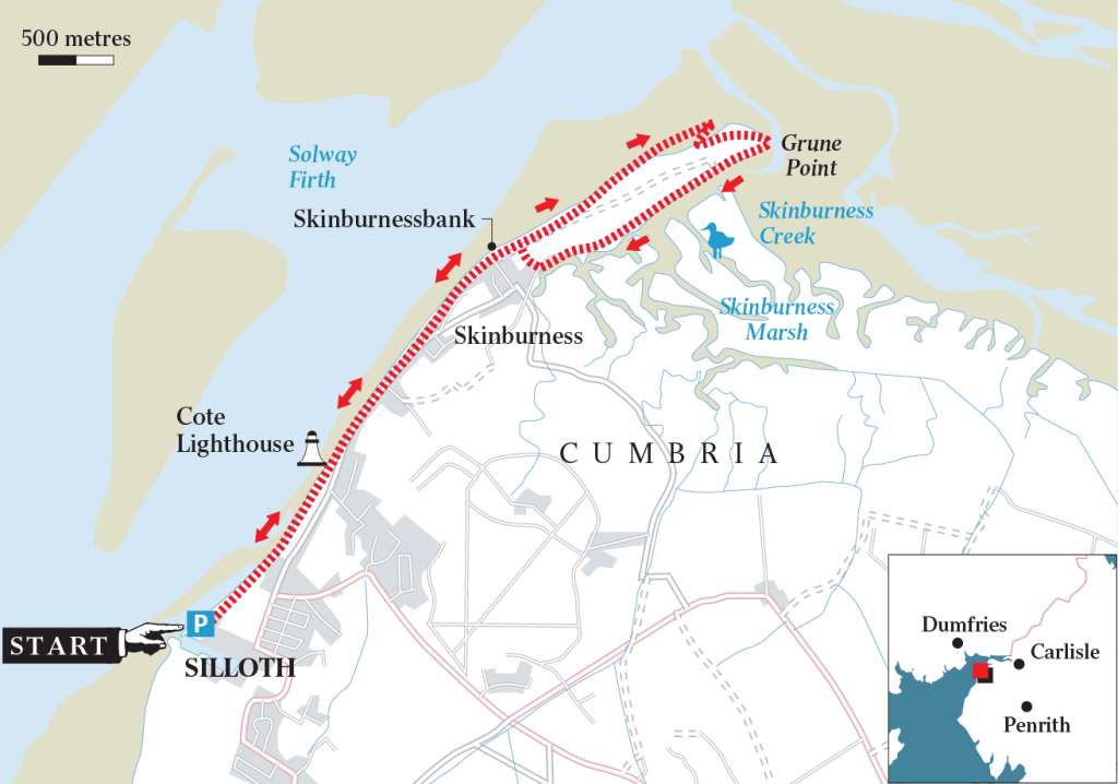
Silloth Beach is located on England’s Solway Coast, which is designated as an Area of Outstanding Natural Beauty in Cumbria.

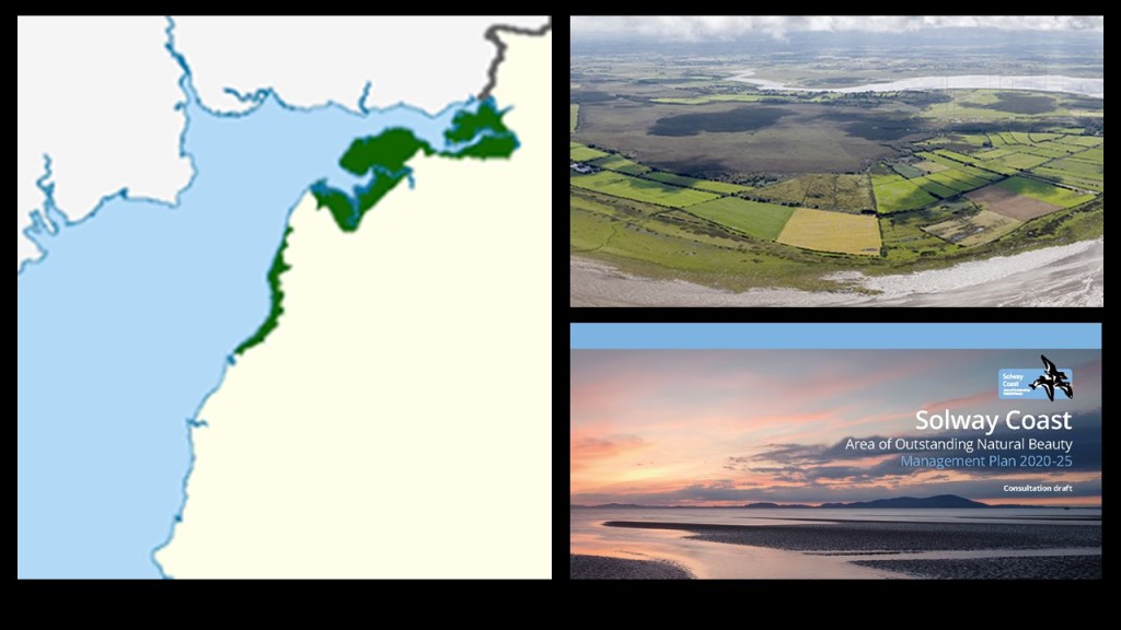
Silloth Harbor and Beach was said to have been inspired by Carlisle business men in the 1850s as a deepwater port, seaside resort and railway hub.

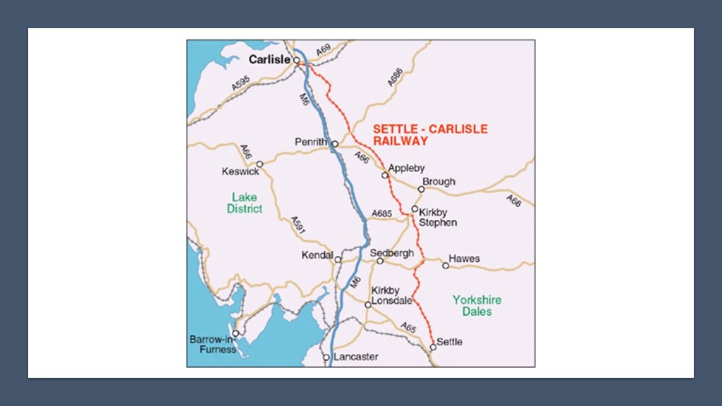
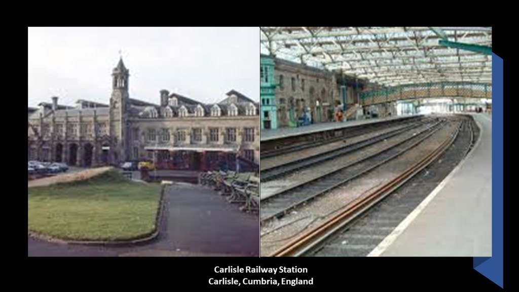
Carlisle, the administrative center of Cumbria, at one time had seven railway companies operating out of the Carlisle Railway Station, which was said to have first opened in 1847.

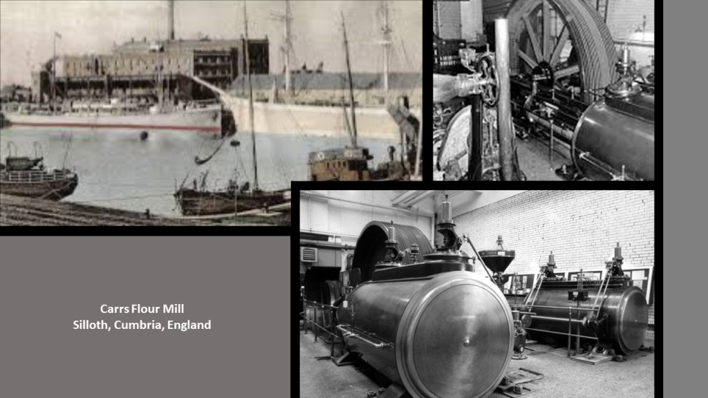
Silloth Port, one of the busiest ports in Cumbria, is clearly man-made, with old-looking walls, with its main cargoes being wheat, molasses, fertilizer, and general cargo.

Carrs Flour Mill is located right next to the port, called a Victorian-era mill that was said to have been built in 1887, and still provides flour to leading food manufacturers.

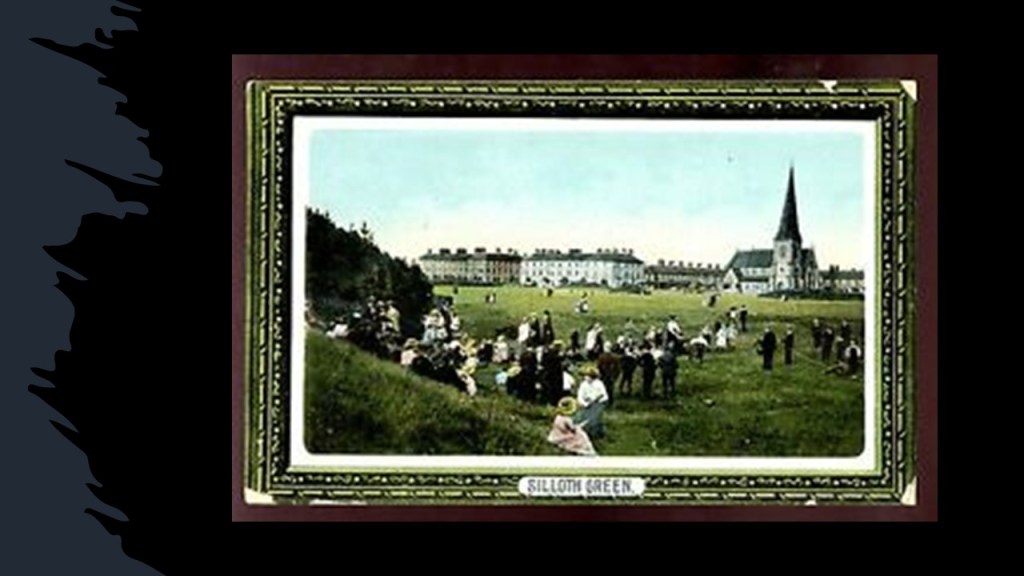
Silloth was called a planned community, and we are told that the railway company even had grey granite shipped here in its own vessels from northern Ireland for the Christ Church, a prominent landmark in Silloth, occupying a complete rectangle of the planned town, and its construction completed, we are told, in 1870.

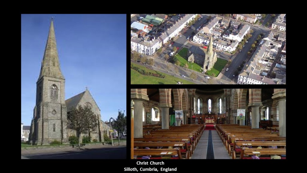
The Silloth Green is considered to be one of the largest and longest greens in England, going back to the 1860s…

…and is fronted by the Silloth Promenade along the shoreline heading up the Solway Coast towards Skinburness.

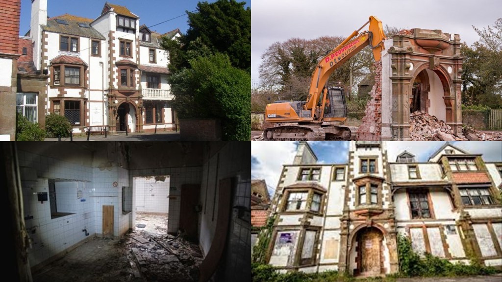
Skinburness is considered a residential area for Silloth…

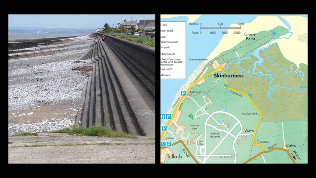
…and its most prominent building, the Skinburness Hotel, said to have opened in the 1880s and demolished in 2017, after having been abandoned for about ten years.

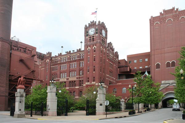
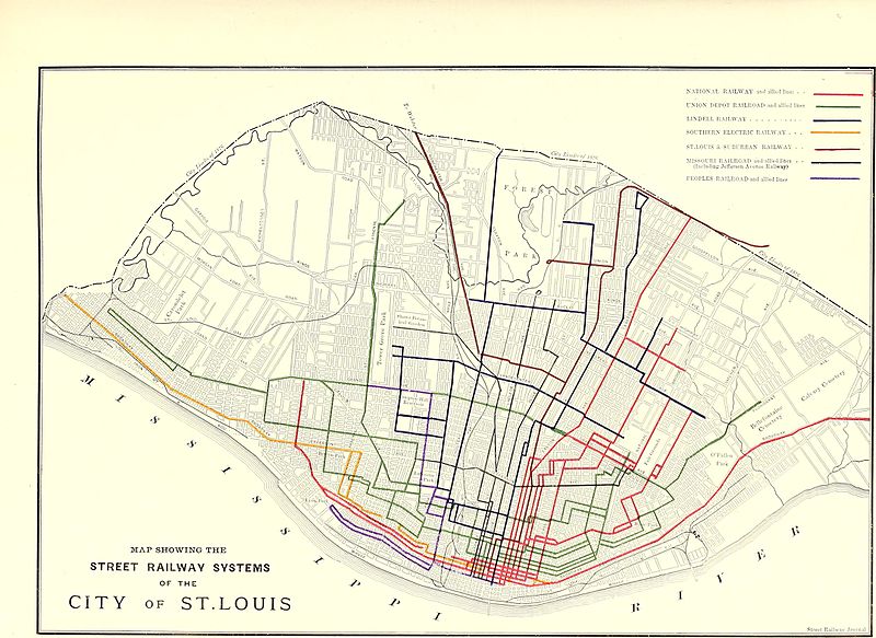
Another commenter pointed out the similarity between the architecture of Shipstone’s Brewery in Nottingham, England, founded in 1852, on the left, and the Anheuser-Busch Brewery in St. Louis, Missouri, on the right, first established as the Bavarian Brewery in 1852.

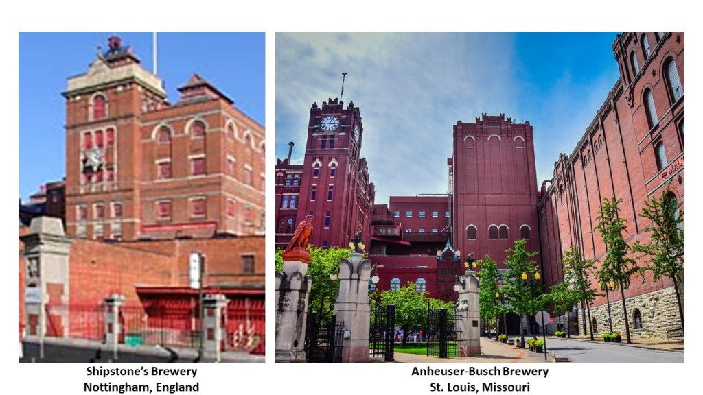
Both Shipstone’s Brewery and Anheuser-Busch Brewery are famous for their Clydesdales, a Scottish breed of draughthorse.

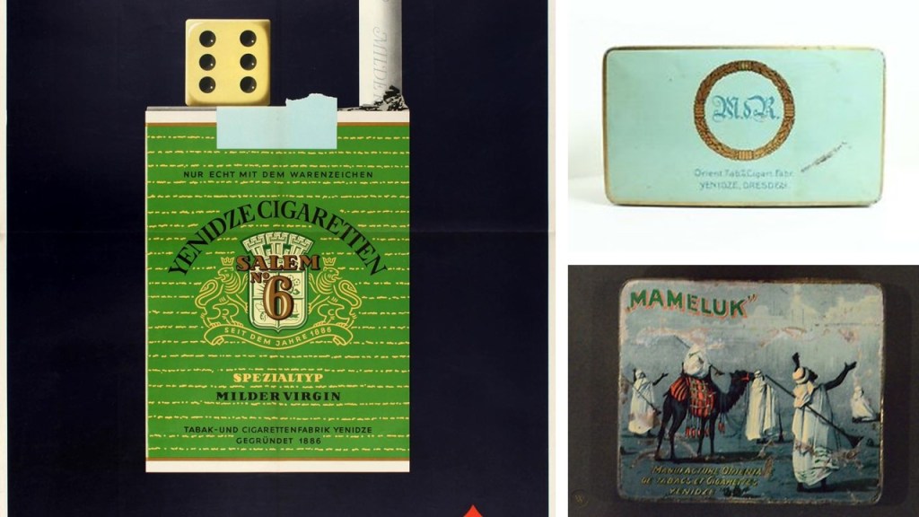
Someone else drew my attention to a place called Yednize in Dresden, Germany.

Come to find out Yenidze was formerly a tobacco and cigarette factory, which was said to have been built between 1907 and 1909, and designed by architect Marvin Hammitzsch in Moorish Revival style.

Often confused for a mosque by tourists, we are told that no, it’s not a mosque, it was just the clever way that the architect designed the mosque as an art-deco, mosque-inspired structure, because according to Dresden law at the time, we are told, it was prohibited to build factory buildings that might spoil the city’s baroque sky-line.

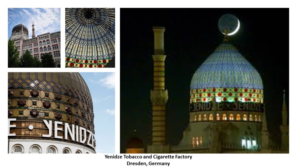
Jewish entrepreneur Hugo Zietz started the tobacco company which imported tobacco from Ottoman Yenidze in Thrace, which is now Genisea, Greece.

The bombing of Dresden took place between February 13th and 15th of 1945, more than 1,200 bombers of the British and American Air Forces dropped more than 3,900 tons of high-explosive bombs and incendiary devices on the capital of the German State of Saxony.

These attacks destroyed more than 1,600-acres, or 6.5-kilometers-squared, of the city-center, and as many as 25,000 people were believed to have been killed.

Several commenters pointed me in the direction of Toronto, and there are several places I am going to take a look at here.

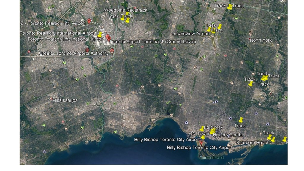
First, the Woodbine Racetrack is a short-distance northeast of the Toronto Pearson International Airport, in a straight-line distance of 3-miles, or 4.5-kilometers.

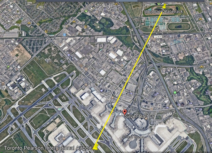
The Woodbine Racetrack has been a Thoroughbred horse-racing venue and there is a casino at this location.

The Downsview Airport further east of the Toronto Pearson International Airport has a number of tracks close by.

And the Billy Bishop Toronto City Airport on Toronto Island has a track located northeast of it in a line that crosses through the real estate containing the CN Tower, Rogers Center, and Roundhouse Park and downtown Toronto.

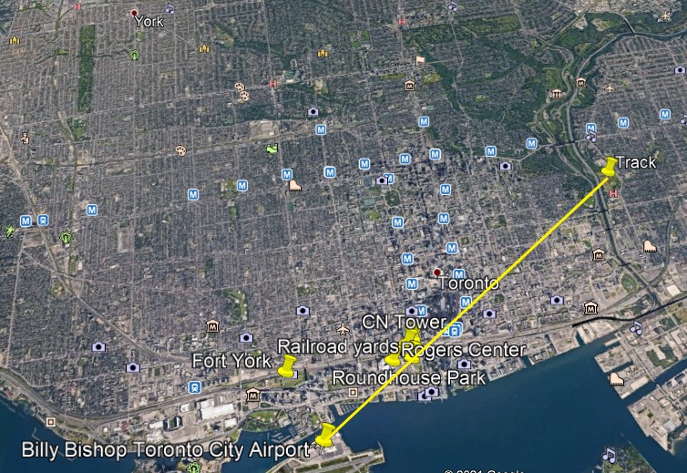
The CN, or Canadian National, Tower is 1,815-feet, or 553-meters, high, a communications and observation tower located on what is known as Railway Lands, a large railway switching yard on the Toronto Waterfront, and said to have been completed in 1976.

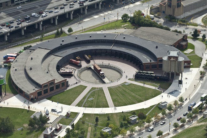
Roundhouse Park next to the CN Tower was the location of the John Street Roundhouse, said to have been built in 1929 to maintain Canadian Pacific Railway trains during the Golden Age of Railways, where maintenance teams worked on as many as 32 trains at a time.

The Roundhouse is the last such building in Toronto, and survived the demolition of other railway facilities nearby that took place to make room for the new stadium, the Rogers Center, which opened in June of 1989.

The Rogers Center is the home of Major League Baseball’s Toronto Blue Jays, as well as a large-event venue.

Fort York is located Just a short distance west of this busy spot on Toronto’s water-front, and a short-distance north of the Billy Bishop Toronto City Airport.

What we see at Fort York was said to have been built between 1813 and 1815 to house soldiers of the British Army and Canadian Militia and to defend the entrance of Toronto Harbor…

…and made of stone-lined earthwork walls, and eight buildings within the walls.

CANADA – ONTARIO – TORONTO – FORTS – FORT YORK – UP TO 1979

_______________________________________________

The Prince’s Gate is in the vicinity of Fort York, and was said to have been constructed out of cement and stone between April and August of 1927.

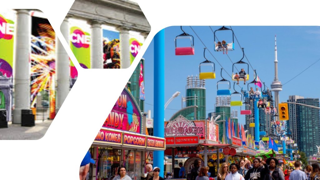
It is a triumphal arch and monumental gateway at Exhibition Place.

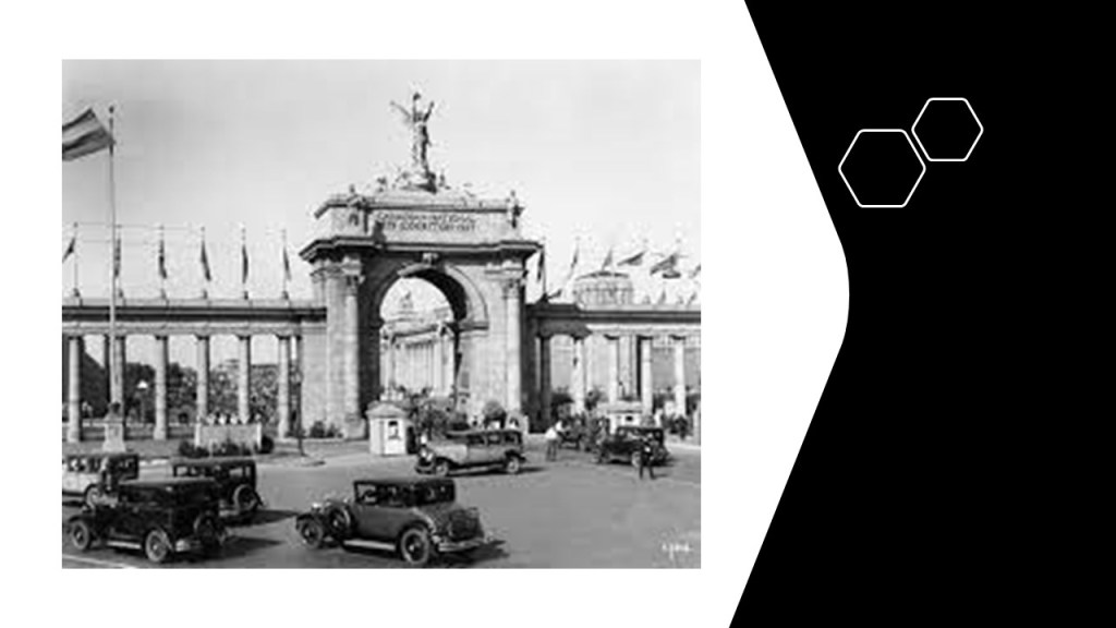
…and serves as the eastern gateway of the Canadian National Exhibition, an annual agricultural and provincial fair.

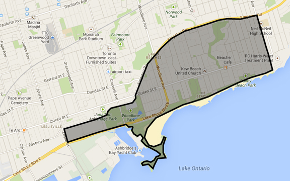
Now I am going to head in the direction of a Toronto neighborhood known as The Beach, or The Beaches.

It is considered part of the old city of Toronto.

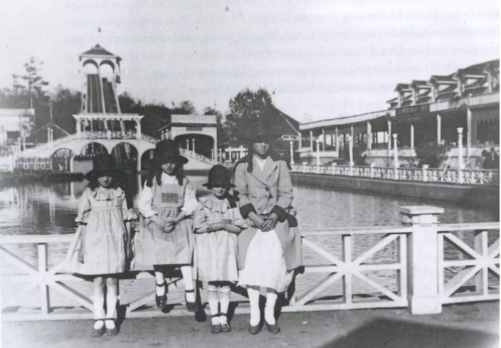
There were historically several amusement parks here, the only pictorially documented one being the Scarboro Beach Park, in operation from 1907 until 1925, when apparently the owner of the park, the Toronto Railway Company, locked the gates to the property.

Eventually the Scarboro Beach Park property was sold to a company which removed the rides and buildings, and replaced the land with housing.

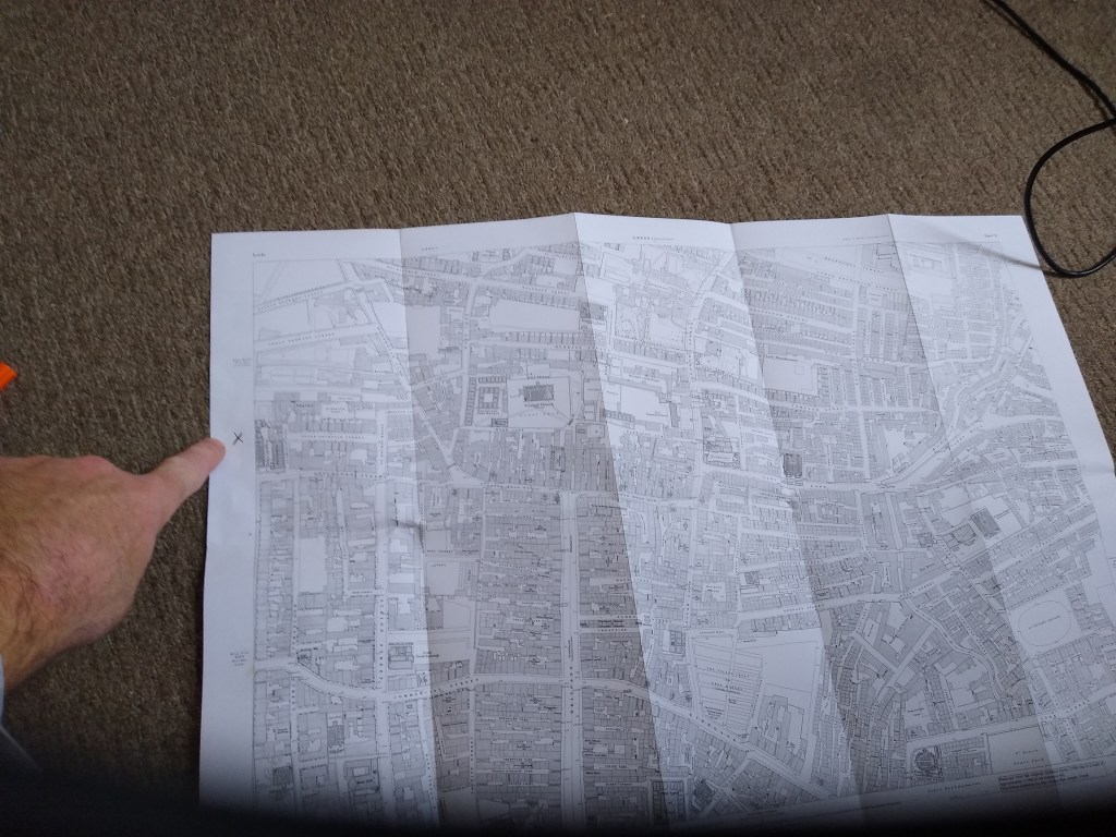
The Victoria Park Amusement Park, said to have been in operation from 1878 to 1906, would have been right about where the “x” is, at the intersection of Queen Street and Victoria Park Avenue.

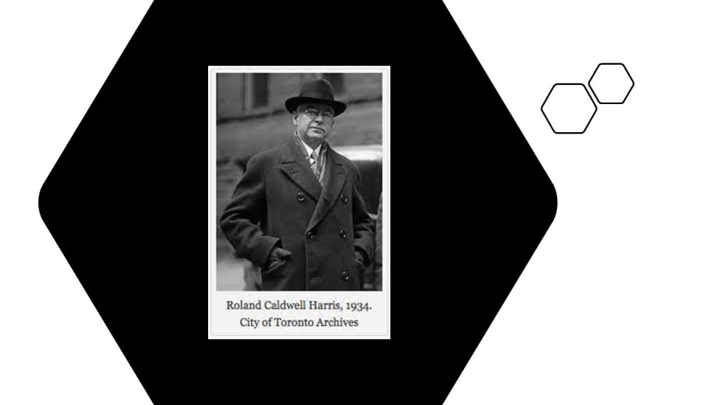
A special thanks to LH from Toronto for sending me not only this map to share with me where the location of the Victoria Park would have been, but she also went exploring and sent me quite a few pictures of the RC Harris Water Treatment Plant Complex to follow.

Based on the photos she sent, and past research on star forts, I am going to postulate that the original purpose of the complex was a star fort.

Here’s why I think that.

First, star forts had many different shapes.

Most have pointed bastions, but some have round bastions, or a different shape altogether, and where I find one, there is at least one more in the vicinity to be found.

Here is the example in Puebla, Mexico, of Fort Guadalupe with pointed bastions, and Fort Loreto with round bastions.

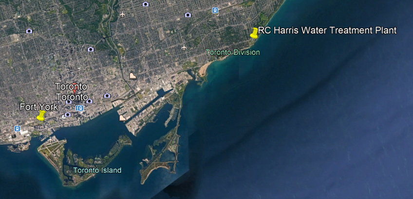
Here is the geographic relationship of the locations of Fort York and the RC Harris Water Treatment Plant.

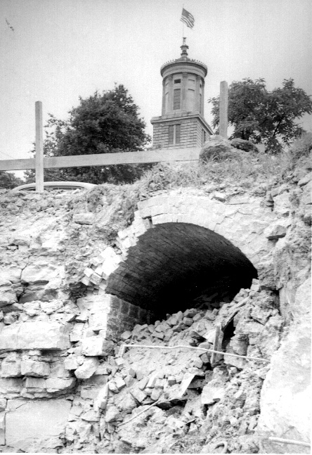
This is a photo of one of the round bastions at the RC Harris Water Treatment Plant, and cut-and-shaped stone blocks with straight edges in the foreground.

We are not given any other explanation in our historical narrative, so we typically don’t ask questions about how they got this way.

Like the buildings of Fort York, the RC Harris Water Treatment Plant is built on top of earthworks…

…and the brick-masonry here is massive, sophisticated and intricate.

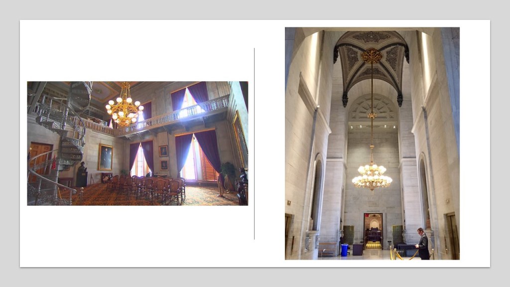
It is definitely quite impressive on the inside as well!

This megalithic stone wall runs parallel to Queen Street at the front-boundary of the complex…

…with the Neville Street Loop for the Queen Street streetcar line the eastern terminus of Toronto’s longest streetcar route, just off the northwest corner of the RC Harris complex.

Here is what we are told about the RC Harris Water Treatment Plant.

Its construction started in 1932, and the building became operational on November 1st of 1941 (during World War II, and a little over a month before the bombing of Pearl Harbor).

It was named after the long-time Commissioner of Toronto’s Public Works, RC Harris, overseer of the construction project.

Another commenter directed my attention to the former horse-racing track next to Los Angeles International Airport, where there used to be a thoroughbred racehorse track.

It was located at Hollywood Park…

…but the racetrack was destroyed and replaced with the new SoFi stadium for the LA Rams and LA Chargers, that first opened in September of 2020.

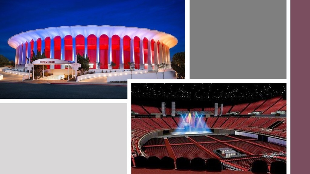
It is 3-miles, or 4.5-kilometers from the Los Angeles International Airport, and just southeast of The Forum, a multi-purpose indoor arena that has been the home of the Major League Basketball and Hockey teams of LA.

Said to have been built in 1966, The Forum has no major support pillars on the inside.

Another person suggested I take a look at Baltimore.

Starting with the airport, I found school tracks at a similar angular relationship to Baltimore-Washington International Airport that I have found in other cities.

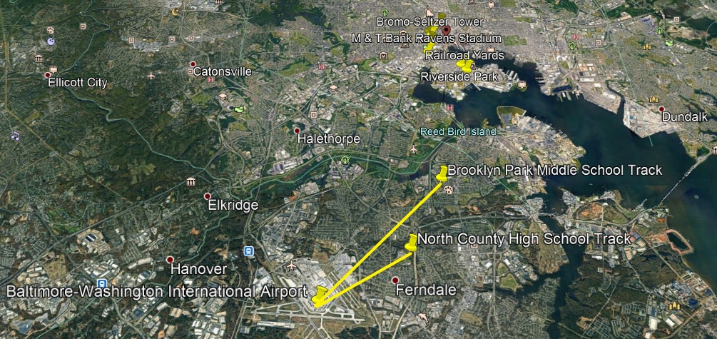
Also, like what I have found in other major cities, the Baltimore professional sports complexes are relatively close to the airport, in South Baltimore.

Camden Yards was previously a yard for the Baltimore & Ohio Railroad, and was converted into today’s Oriole Park for the Baltimore Major League Baseball Team, first opening in April of 1992…

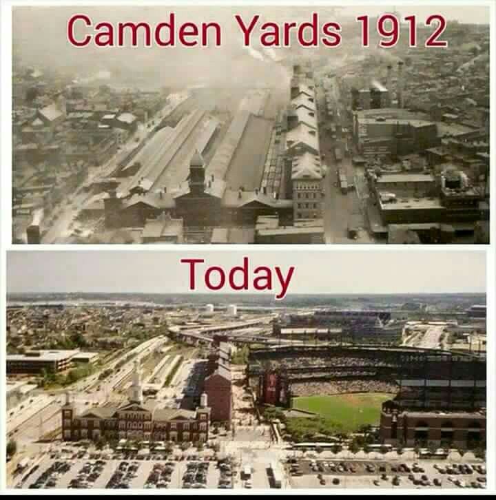
…and the M & T Bank Stadium, the home of the National Football League’s Baltimore Ravens, is located next to Oriole Park at Camden Yards, and first opened in September of 1998.

There are still railyards fairly close to this location today.

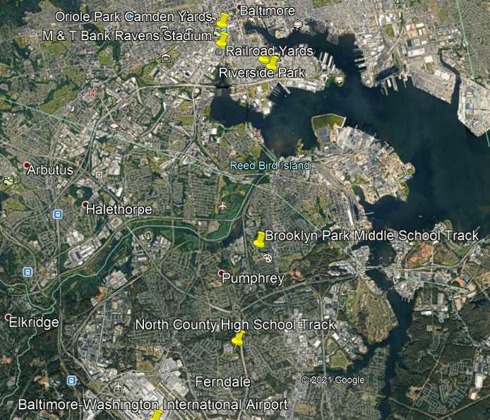
The next three places are located in downtown Baltimore, suggested by the viewer, that are located close to Oriole Park at Camden Yards.

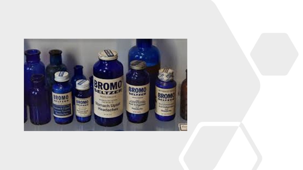
Baltimore’s famous landmark, the Bromo Seltzer tower, was said to have been designed by local architect Joseph Evans Sperry, and erected between 1907 and 1911…

…for Bromo-Seltzer inventor Isaac Edward Emerson.

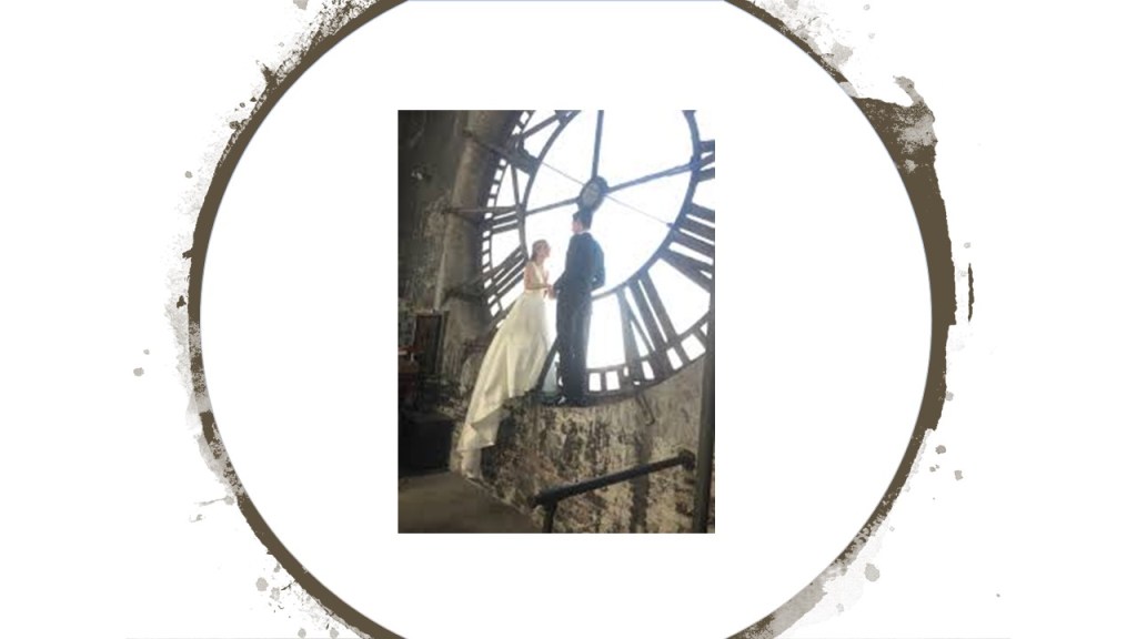
The Bromo-Seltzer Tower is also popular for photo shoots.

Interestingly, Baltimore had a Hippodrome Theater near the Bromo-Seltzer Tower, which was said to have been built in 1914, and was the foremost vaudeville house in Baltimore as well as a movie theater.

It was renovated in 2004, and is now part of the France-Merrick Performing Arts Center.

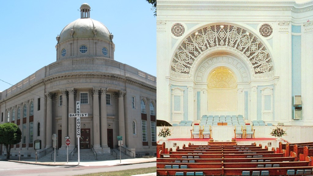
The Basilica of the Assumption is a number of blocks northeast of the Hippodrome in downtown Baltimore, and said to be the first Roman Catholic Cathedral, built in the United States between 1806 and 1821.

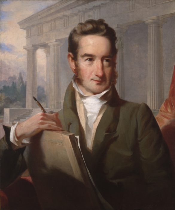
The architect of the Baltimore Basilica was said to be Benjamin Henry Latrobe, the “Father of American Architecture,” and best-known for having been given the credit for designing the U. S. Capitol Building.

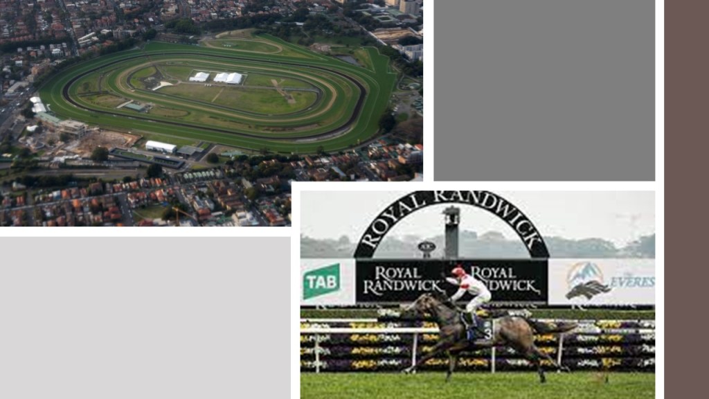
Another commenter mentioned the Sydney International Airport and the Royal Randwick racecourse.

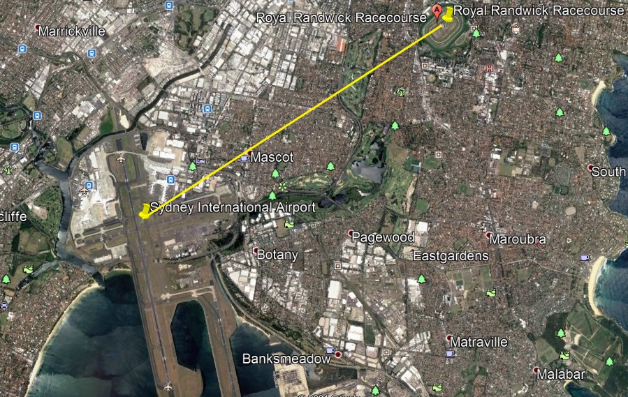
The Royal Randwick Racecourse is a horse-racing track on Crown Land, a territorial area belonging to the British monarch, that is leased to the Australian Turf Club.

The first race at Randwick was held in 1833, and in the present-day is the host of racing championships with millions of dollars in prize-money.

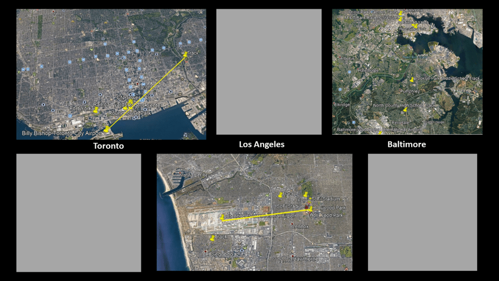
Here is a comparison ofthe relationship between some of the International Airports and racing tracks that I have looked at in this series.

And all the major sporting venues clustered together near railyards like these examples, As well as the nearby presence of historical trolleys, trolley parks, amusement parks and star forts in diverse places.

What are the odds of these similar relationship happening randomly is in diverse places across the world over long periods of time? 

 Well…there’s plenty more examples to show you as brought to my attention by comments on my videos!

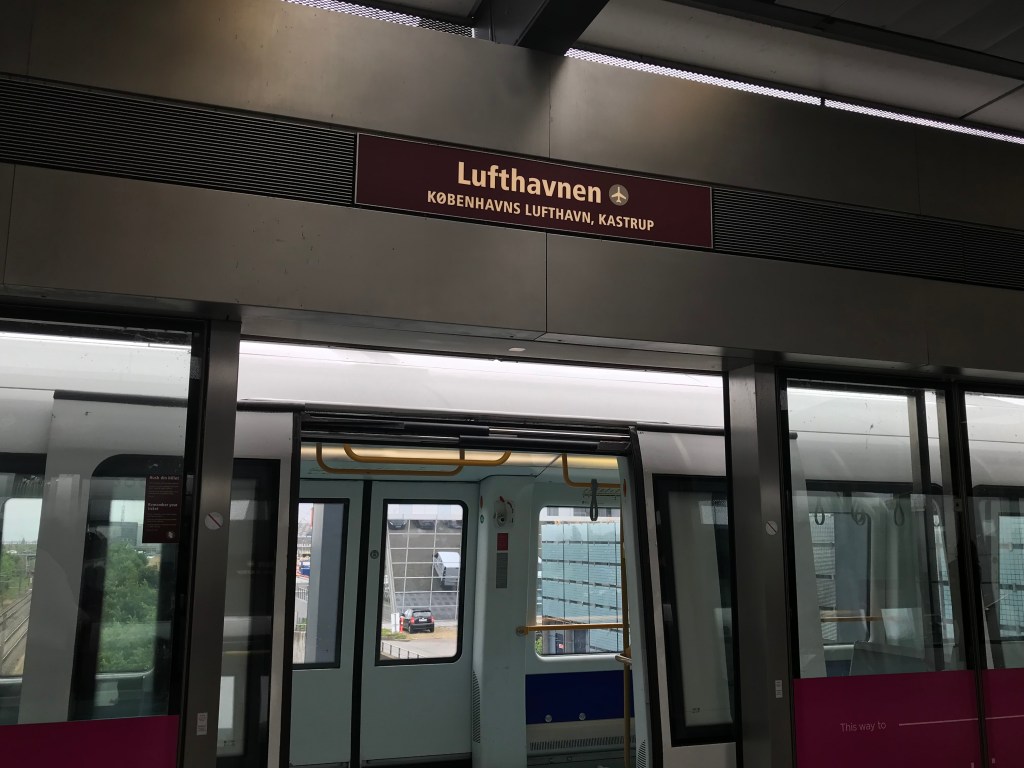
I am going to continue showing you these examples of these relationships with this comment that a viewer in Denmark left me:

“Same thing here in Copenhagen, there is a racetrack in Kastrup, just around the same area as Copenhagen Airport!”

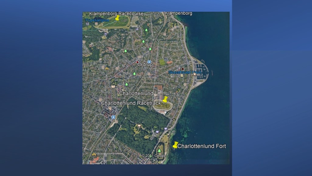
This is what I found on Google Earth the first time when I located Kastrup International Airport and some of the race tracks in Copenhagen.

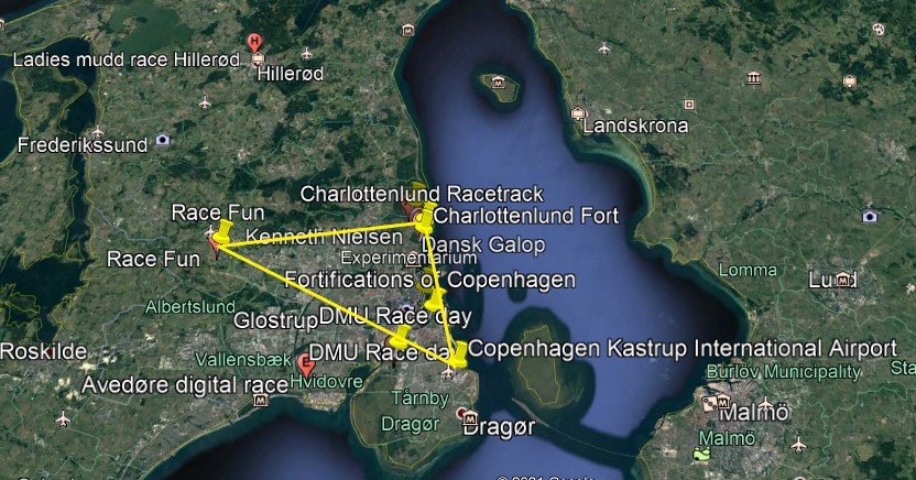
Then the second time, I found an additional race track and star fort, as well as an amusement park, that I didn’t see the first time I looked next to the Klampenborg Racecourse.

For the purposes of this post, I am going to focus on the quadrant northeast of the airport because it has a number of noteworthy features.

I am going to start with the Klampenborg Racecourse and Bakken Amusement Park and work my way down towards the Kastrup International Airport.

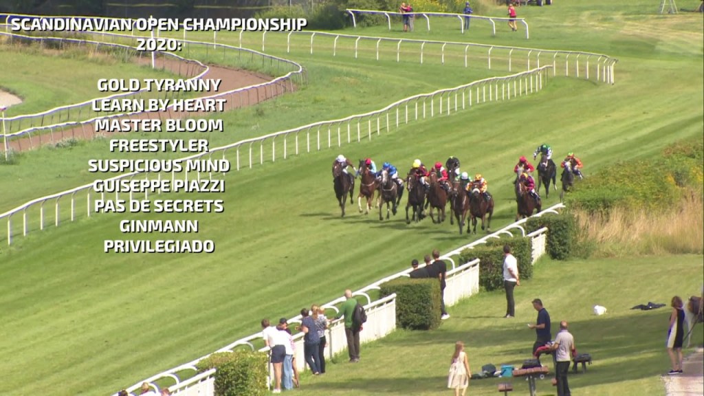
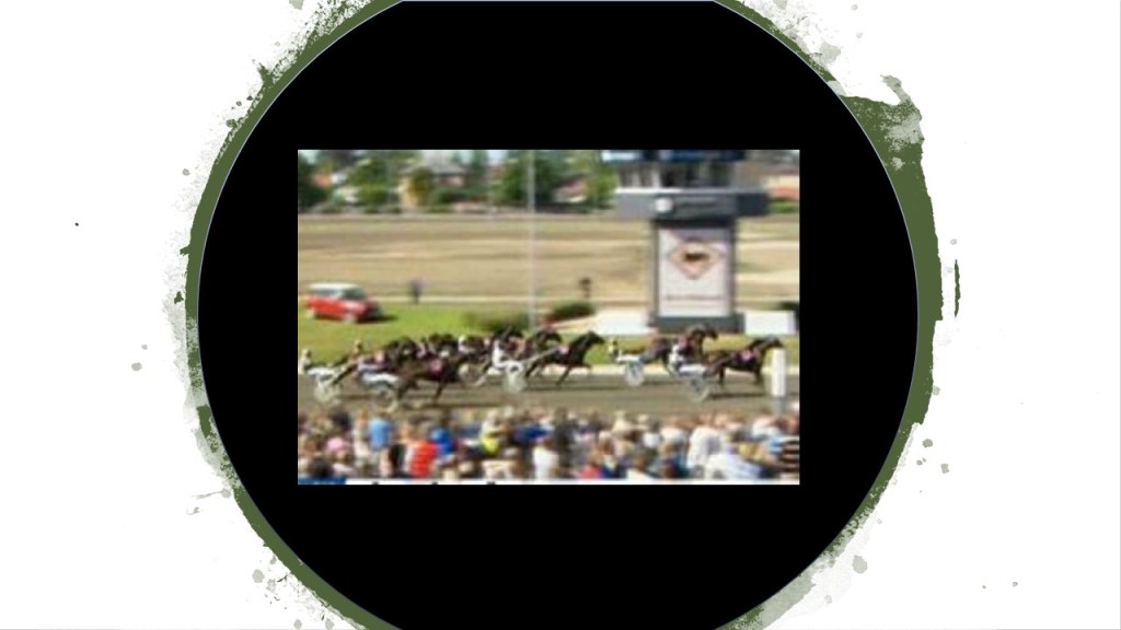
The Klampenborg Racecourse is a flat horse-racing track that first opened in 1910 in this affluent Klampenborg suburb of Copenhagen.

Major races held at the Klampenborg Racecourse include the Scandinavian Open Championship, in which 3-year-old and over thoroughbred horse racing takes place annually in August.

The Bakken Amusement Park is adjacent to the Klampenborg Racecourse…

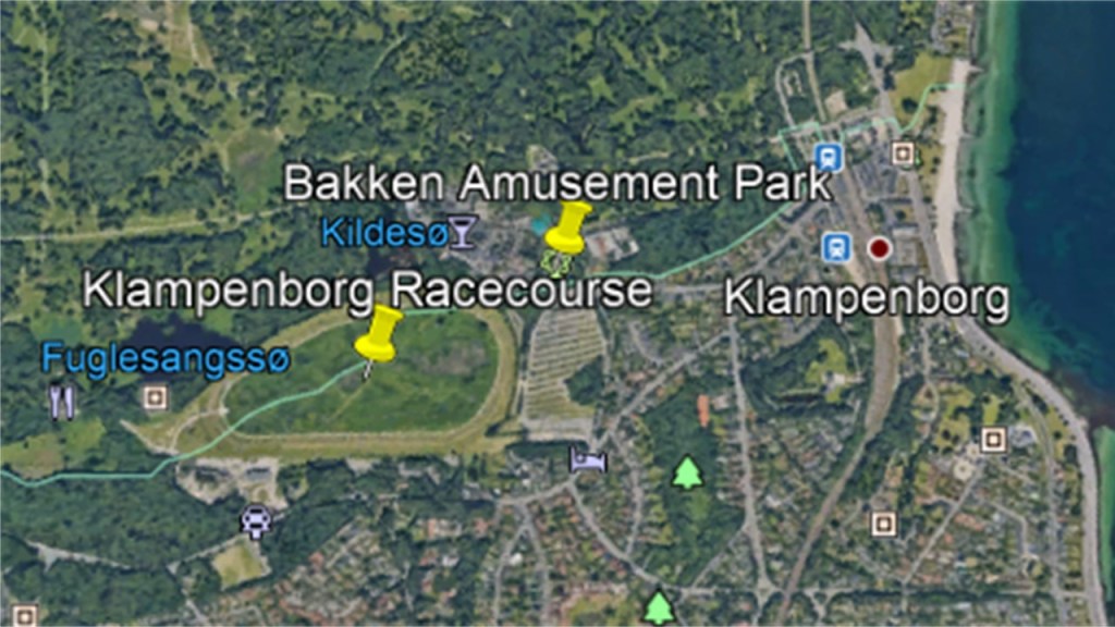
Opening 438 years ago, in the year of 1583, it is the world’s oldest operating amusement park, and the admission is free.

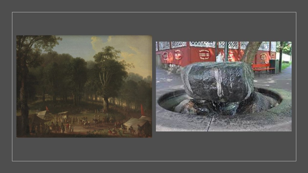
Its origins are related in this way: in 1583, Kristen Pill found a natural spring in a large forest park here. Residents of Copenhagen to the south of it were attracted to the spring because of the poor water quality in Copenhagen, and the belief that it had curative powers. The spring drew large crowds in the warmer months, and the large crowds attracted the entertainers and hawkers which was said to be the origin of the amusement park today.

We are told Bakken continued to grow even throughout the Napoleonic Wars, and became even more popular as time went on, with easy accessibility via steamships, starting in 1820, and railroads starting in 1864.

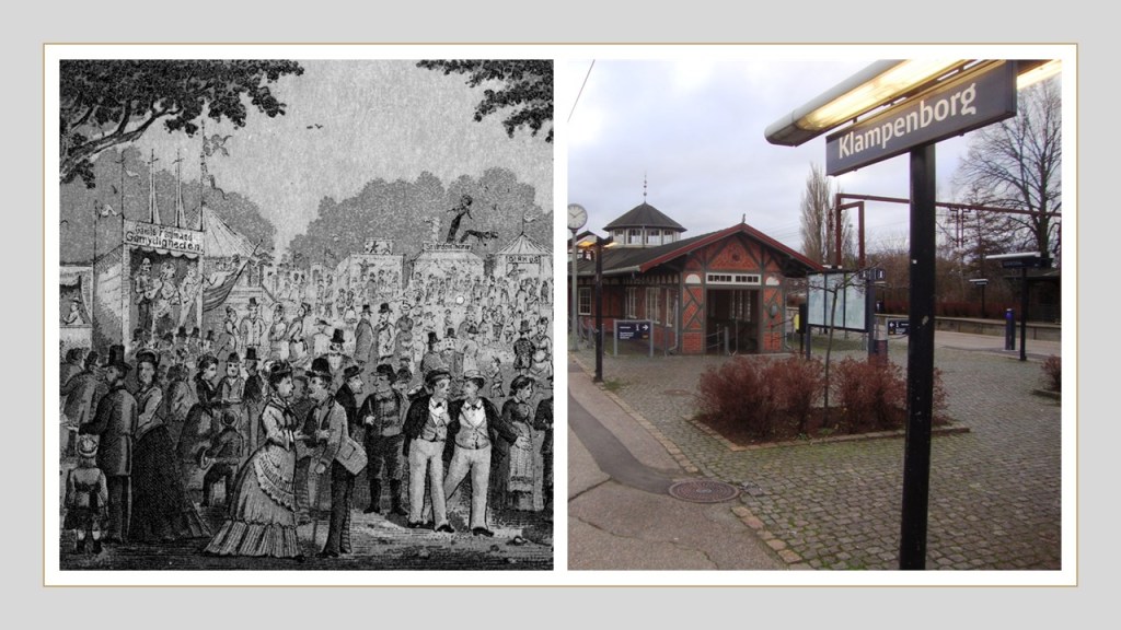
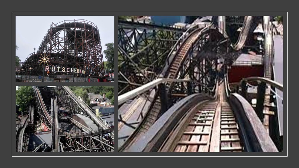
Today the park is filled with rides and amenities, including 5 roller coasters.

The park’s most famous roller coaster is the “Rutschebanen,” a wooden roller coaster that has been open since 1932.

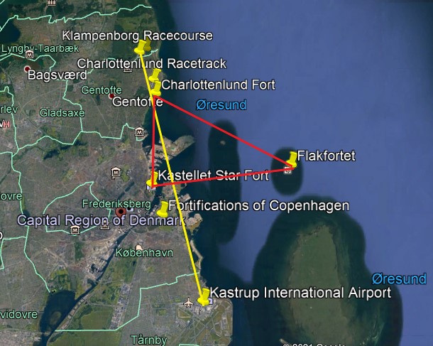
Now I am going to take a look at The Charlottenlund Racetrack and the Charlottenlund Fort, a short-distance to the southeast of Klampenborg.

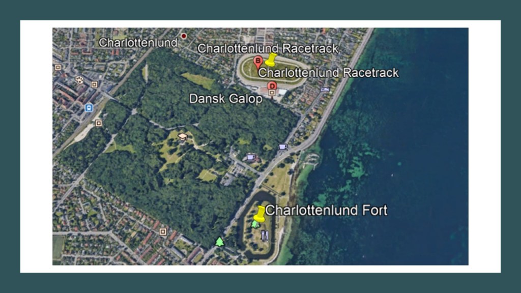
It is interesting to note that the Klampenborg Racecourse at the top-left of this Google Earth screenshot, the Charlottenlund Racetrack in the lower right-middle, and the Charlottenlund Fort on the lower right all have a similar pear-, or egg-elliptical shape.

The Charlottenlund Racetrack, also known as Lunden, is a horse harness-harness racetrack that first opened in 1891.

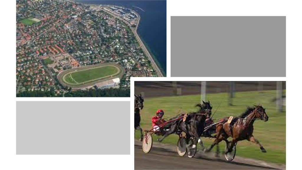
The two major annual events held here are the Danish Trotting Derby…

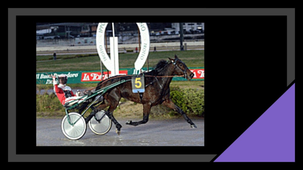
…and the Copenhagen Cup, an international Group One harness racing event that was established in 1928, and known as the International Championship until 1966.

It is held on the second-weekend in June every year.

The Charlottenlund Fort was said to have been built as part of the fortifications around Copenhagen between 1866 and 1868, and that in 1910, it was converted into a fort designed to protect Copenhagen from attacks from the sea.

It is located below Charlottenlund Palace, a former royal summer residence, with construction of it said to have started in 1731 and completed in 1881.

Now a cultural event venue, from 1935 to 2017, the Charlottenlund Palace housed the Danish Biological Station.

The railroad also goes through Charlottenlund.

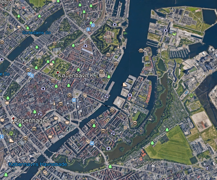
Next, I am going to look at the star forts of Kastellet and Flakfortet, the city fortifications of Copenhagen, and the Tivoli Gardens Amusement Park.

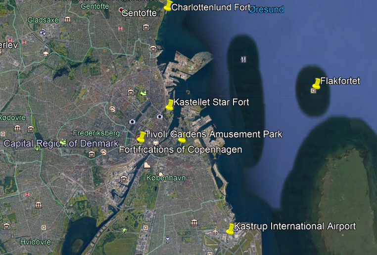
Kastellet is seen here in the top middle of the Google Earth screenshot, and across the water-channel, close to one end of the line of what are called the Copenhagen city fortifications

Kastellet, which translates to “The Citadel,” is considered to be one of the best fortresses in Northern Europe, and was said to have been founded by King Christian IV in 1626.

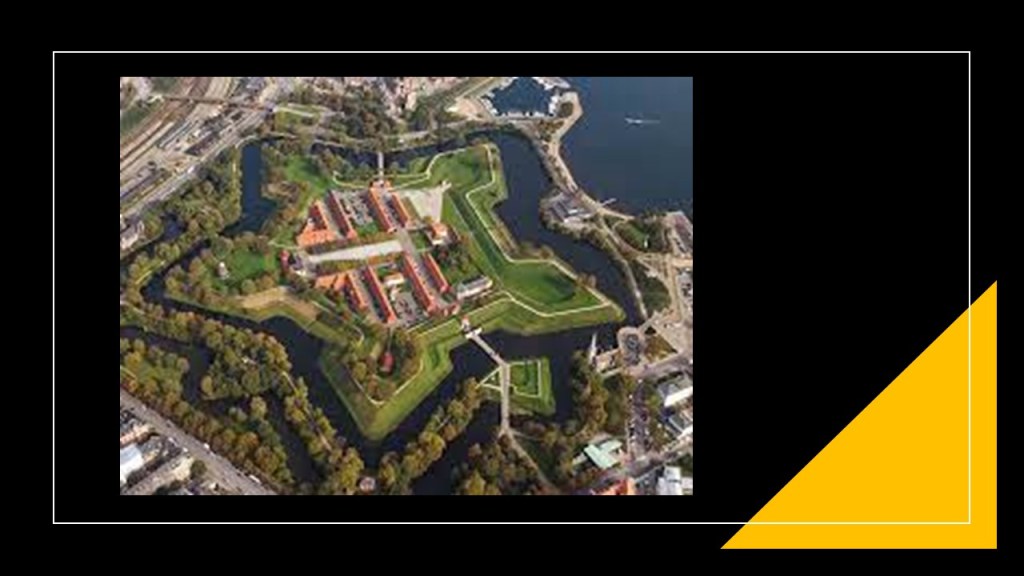
Constructed as a pentagon with bastions at its corners, it looks remarkably similar to the Castle of Good Hope in Cape Town, South Africa, on the top right, and Fort McHenry in Baltimore, Maryland, on the bottom right.

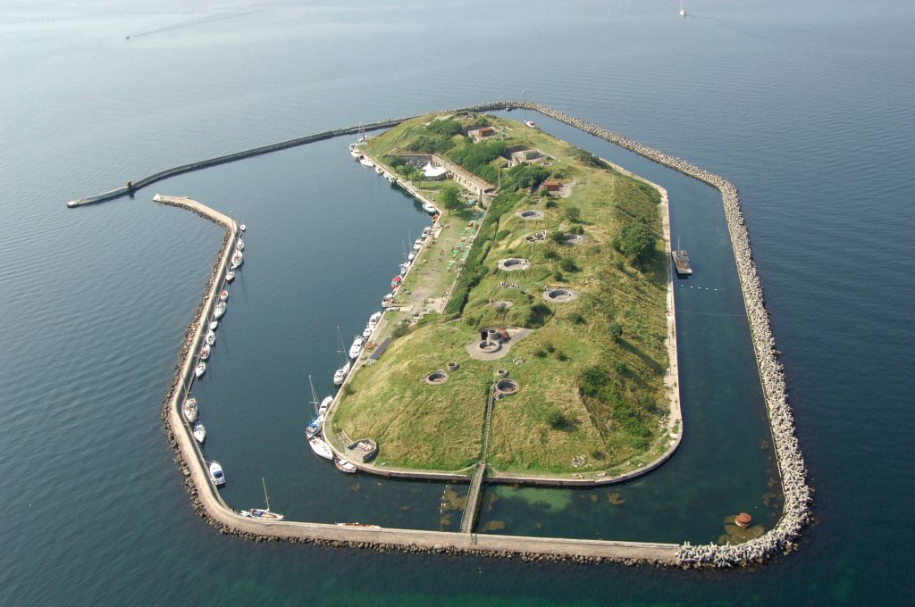
Flakfortet, meaning sand-shoal fortress, is located on Saltholmrev, an artificially-built island in the sound between Copenhagen and the Danish island of Saltholm in the body of water that separates Denmark and Sweden.

We are told that Flakfortet, said to have been built between 1910 and 1914, was the last of three artificial islands that the Danes created to defend Copenhagen Harbor.

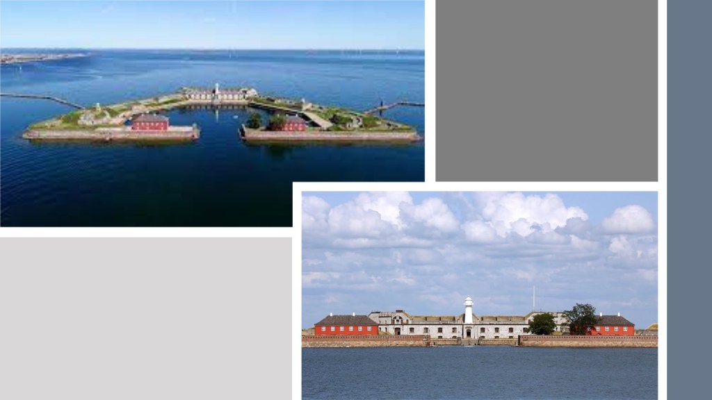
The oldest fort on an artificial island, Trekroner at the entrance of Copenhagen Harbor, was said to have been constructed starting in 1787 as part of the fortifications of Copenhagen.

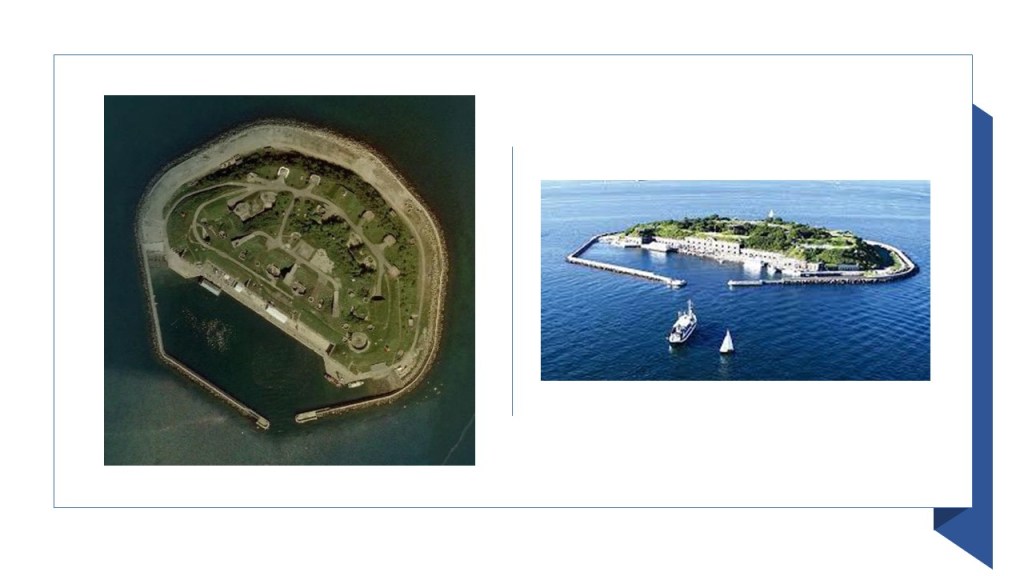
The third fort, Middelgrundsfortet, is located on an artificial island, the largest in the world at one time, in the sound between Copenhagen and the city of Malmo in Sweden, and said to have been constructed by the government of King Christian IX of Denmark between 1890 and 1894 to serve as part of Copenhagen’s coastal fortifications to defend the entrance to Copenhagen’s Harbor.

What are called the “Fortifications of Copenhagen” surround the city.

Here is a comparison between the appearance of the Fortifications of Copenhagen on the left and Valletta, the capital city of the island Republic of Malta, on the right.

The Tivoli Gardens Amusement Park in Copenhagen opened in 1843, making it the third-oldest operating amusement park in the world, after Bakken in Klampenborg, and the Wurstelprater in Vienna, Austria, which opened to the public in 1766.

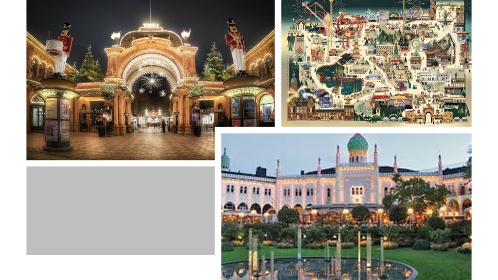
It is located in downtown Copenhagen next to the Central Rail Station…

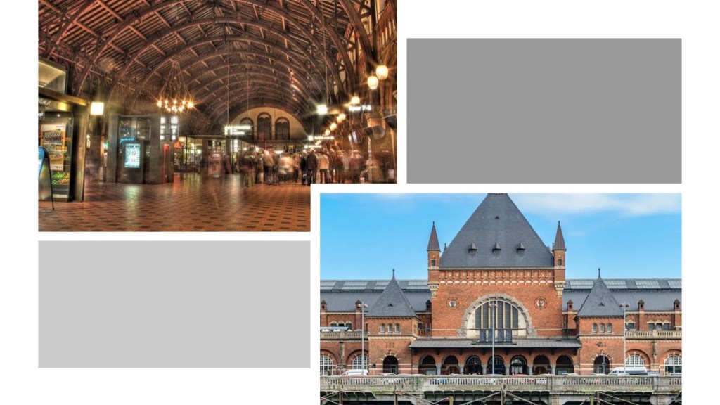
…and the railyards there.

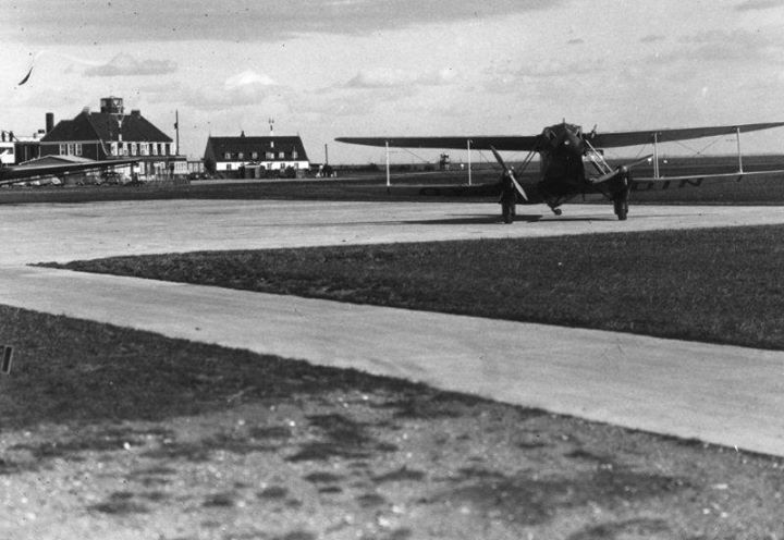
The Copenhagen Airport at Kastrup is the main international airport serving the region, and the largest airport in the Nordic countries.

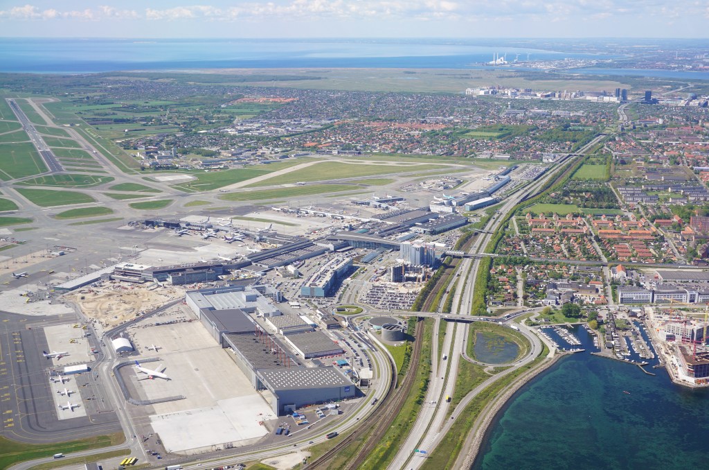
One of the oldest international airports in Europe, it was said to have been inaugurated in 1925 and one of the first civil airports in the world.

There is a train station under Terminal 3 of the Oresund Railway line…

…and the airport is also connected by subway Line M2 of the Copenhagen Metro, which links the airport with the city center in about 15 minutes.

Another viewer left the comment “Check out the Toledo speedway, right next to two large freight yards and a former trolley park which is now a giant ditch.”

This is what I found on Google Earth relate to Toledo Airports and race tracks.

The yellow lines connect airports with race tracks.

The red lines form a triangle between race tracks, and the blue lines from a triangle between the two airports and other race tracks.

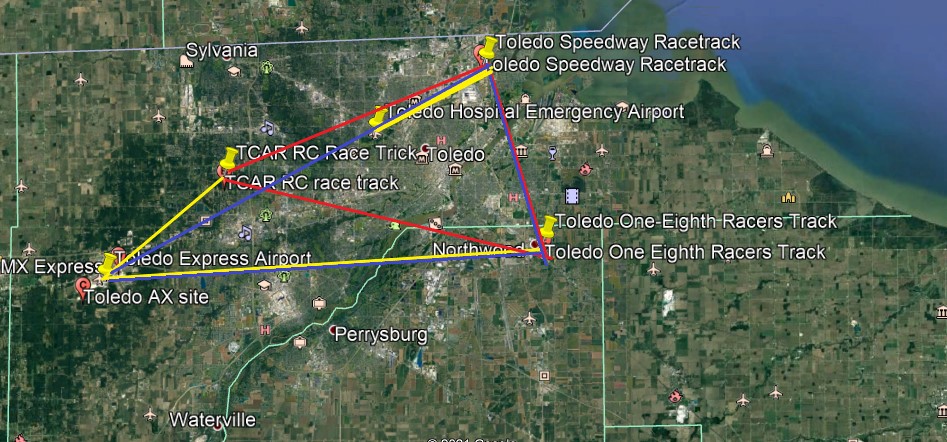
I located the railyards slightly south of the Toledo Speedway Racetrack, and the best candidate for the former trolley park in the vicinity would be the Willow Beach Amusement Park, where Cullen Park is today.

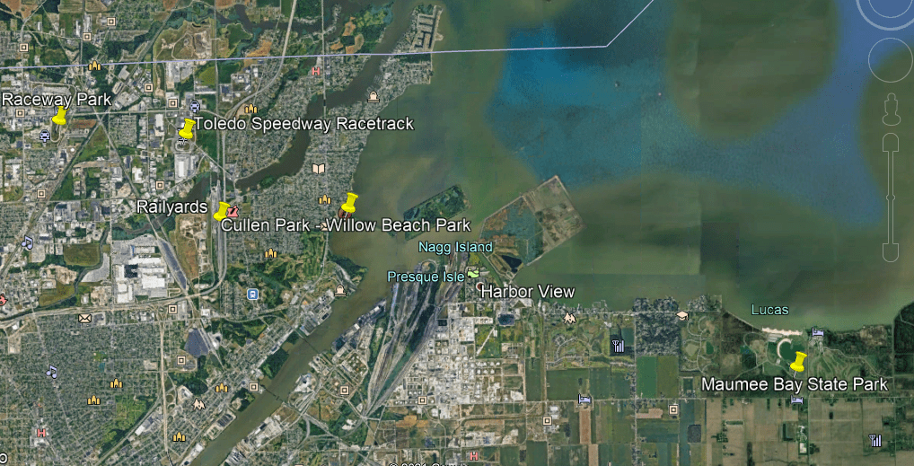
The Willow Beach Park, which opened in 1929, was a haven for food, games, gambling rides and entertainment at what was known as Point Place at the time, and permanently closed in 1947.

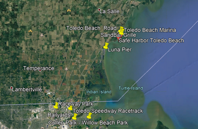
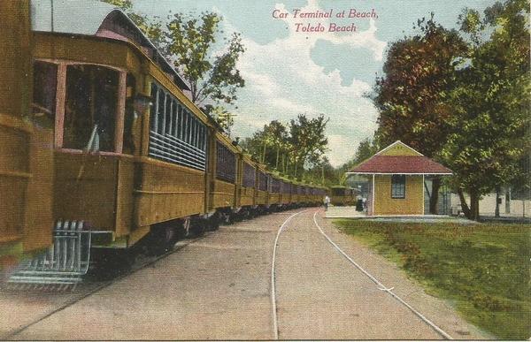
There was an historic trolley amusement park just a short ways up the coast of Lake Erie from Toledo in Ohio, called Toledo Beach.

It was located where the Toledo Beach Marina is today.

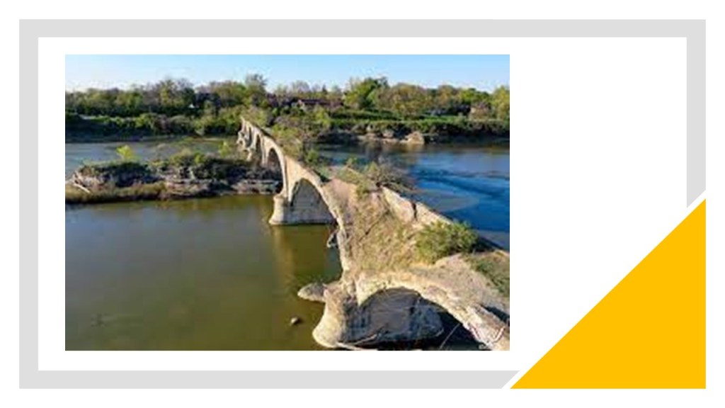
The viewer that commented about Toledo also wrote this: “I’ve also wondered what your thoughts might be on the Roche de Boeuf and abandoned Interurban Bridge on the Maumee river. This bridge was part of the lake shore line that went to Cleveland.”

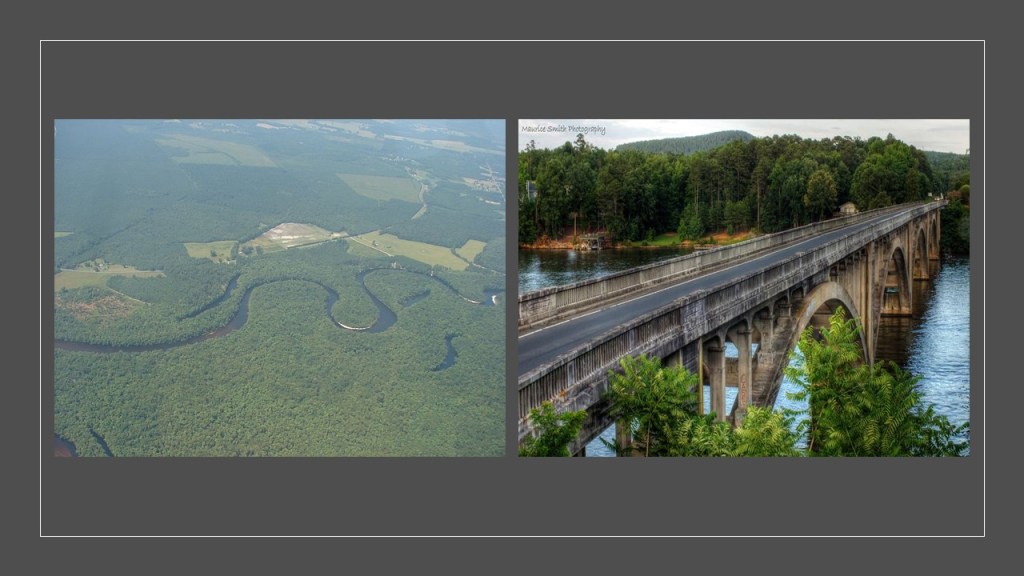
He was referring to the Interurban bridge of Waterville, Ohio,which is an historic, concrete, multi-arch bridge, that was said to have been built in 1908 to connect Lucas and Wood counties across the Maumee river.

We are told that at the time of its construction, and for some time thereafter, it was the world’s largest earth-filled, reinforced concrete bridge, and that the decision was made in its construction to rest one of its supports on the historic indian council rock known as Roche de Boeuf near the center of the Maumee river, but that unfortunately during its construction the rock was partially destroyed.

Interurbans were a type of electric railway with self-propelled rail-cars running between cities or towns in North America and Europe. They were prevalent in North America starting in 1900, and by 1915, interurban railways in the United States were operating along, 15,500-miles, or 24,900-kilometers of track.

It was seen, however, as far more convenient, and cost-efficient to carry cargo by way of truck and other automobiles.

By 1930, most of the interurbans were gone, with a few surviving into the 1950s.

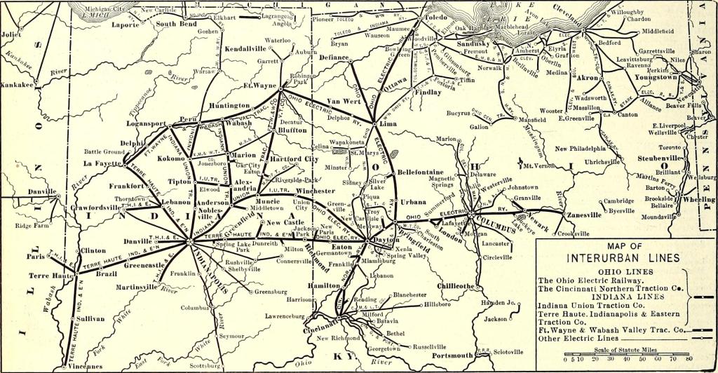
And by 1937, the Interurban bridge has sat unused to this day.

What are my thoughts?

For one, the Maumee River Interurban bridge looks way older than 113-years-old.

And why build a sophisticated, self-propelled electric street-car system, only to use it for 29-years and replace it trucks and cars?

Well, the most obvious answer is that the mass production of gasoline-powered private and public transportation provided another form of transportation for people and provided a highly lucrative means of generating wealth for the big corporations involved in the transportation industry.

Non-polluting and low-fare electric-streetcar-systems were simply no longer needed or wanted.

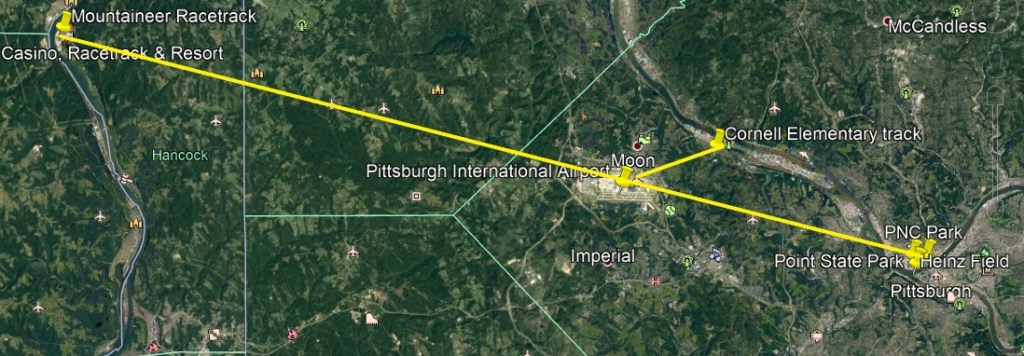
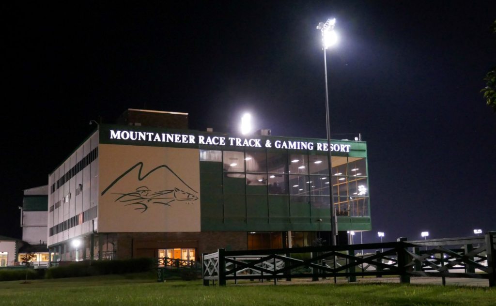
Another viewer commented about Pittsburgh, saying there is an alignment from the downtown professional football and baseball sports fields, through Pittsburgh International Airport, to the Mountaineer Racetrack & Casino, on the Ohio River across the state line in West Virginia.

What is now the Mountaineer Racetrack and Casino was originally called Waterford Park, and constructed in New Cumberland, West Virginia after delays since 1939, starting in July of 1948, and opening day was finally held on May 19th of 1951.

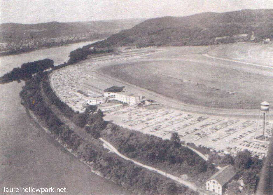
The thoroughbred horse-race track was purchased by a new owner in 1987, and renamed it Mountaineer Park and has gone through a series of new owners, and today as a gaming resort as well.

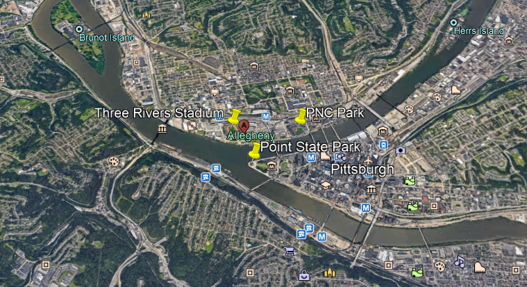
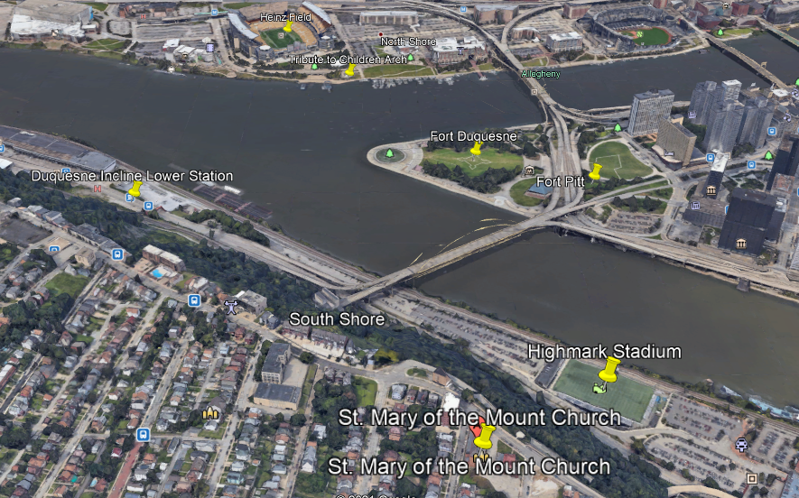
In downtown Pittsburgh, Heinz Field, the home of the NFL Steelers, and PNC Park, home of the MLB Pirates, are located right at the Forks of the Ohio, where the Ohio River forks into the Allegheny River flowing towards the North, and the Monongehela River flowing to the South.

These two major league sports’ stadiums are right across the mouth of the Allegheny River from Point State Park, the historic location of two star forts – Fort Pitt and Fort Duquesne right at the Forks of the Ohio.

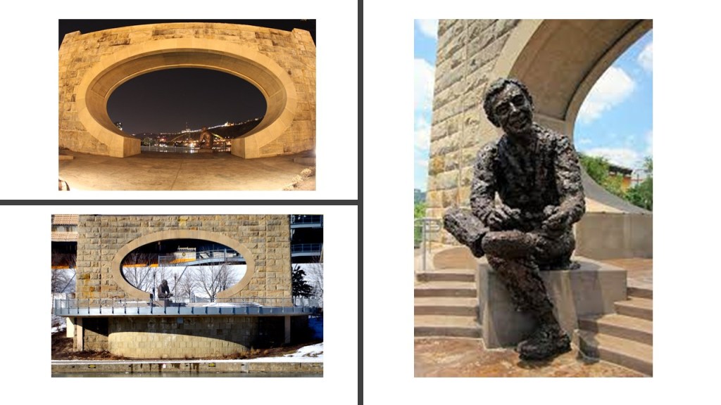
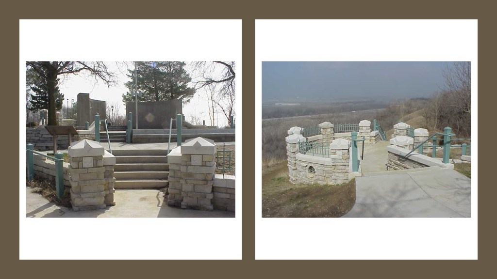
Another point of interest at this location that was brought to my attention by another commenter was the “Tribute to Children,” a statue of Fred Rogers of Mr. Rogers’ Neighborhood fame, that was unveiled in November of 2009 in front of an archway in Roberto Clemente Park on the shoreline directly in front of Heinz Field.

From the information she provided on the arch, when I looked at the points on Google Earth, I found an alignment from Heinz Field, through the “Tribute to Children” Arch, to at least Fort Duquesne, and I continued the alignment out across the Monongahela River, through a section of the river that would require a high amount of electricity generation…

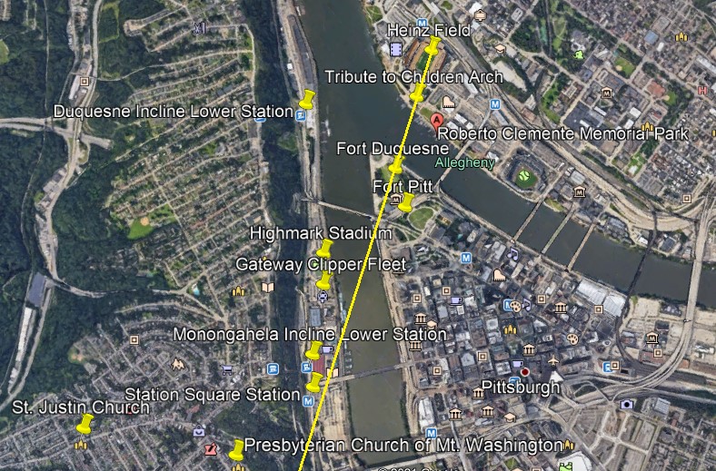
…to power Pittsburgh’s two remaining incline railways, out of what was originally seventeen in Pittsburgh, on Mount Washington, named the Duquesne and Monongahela Inclines…

…as well as the Station Square Station, a transit station on the Port Authority of Allegheny County’s Light Rail network, and the last transit station on the south side of the Monongahela River.

Station Square is an indoor and outdoor shopping and entertainment complex on lands formerly occupied by the historic Pittsburgh and Lake Erie Railroad Station, and across the Monongahela River from Pittsburgh’s Golden Triangle of downtown Pittsburgh.

Is it me seeing things, or is that a statue of R2D2 at the entrance to Station Square?

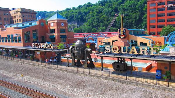
Its likeness to R2D2 stands out in my mind, along with the configuration of the blueprint for the lay-out of the Franco-British Exhibition and the White City Stadium that reminded me of R2D2 earlier in this video.

Well, a viewer cleared up the identity for me of what looks like a statue of R2D2.

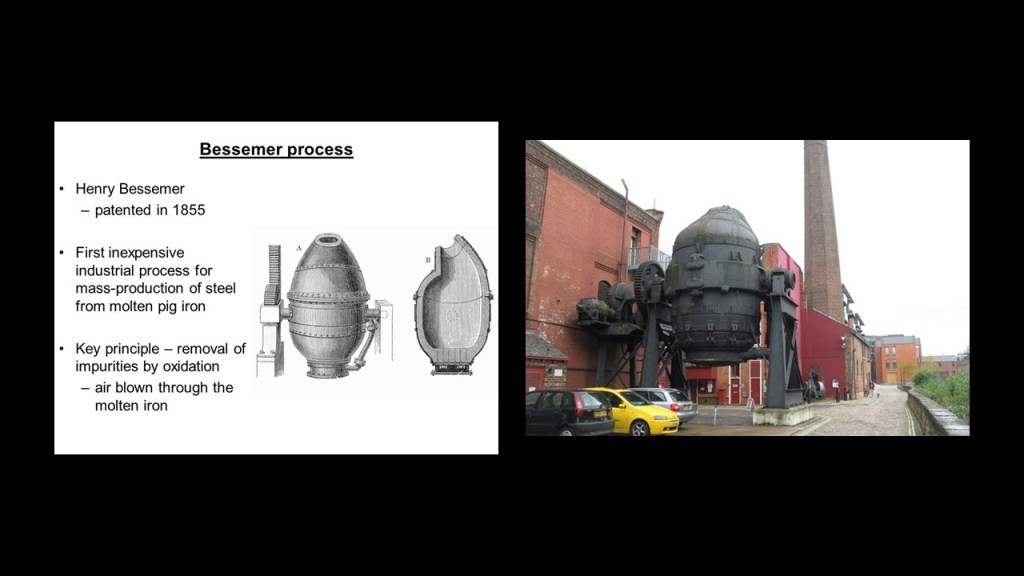
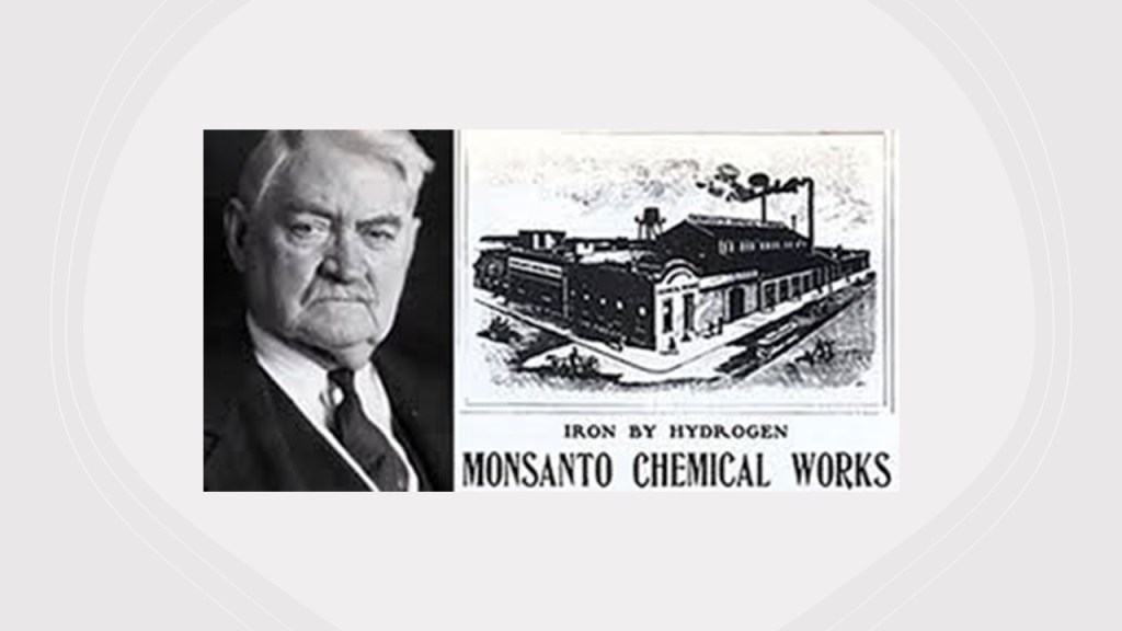
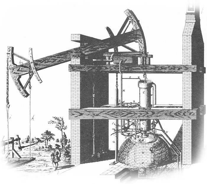
Patented in 1855, It is actually a “Bessemer Converter,” used in the “Bessemer Process,” the first inexpensive industrial process for the mass production of steel from molten pig iron before the development of the open hearth furnace.

Further up, the Presbyterian Church of Mt. Washington, or Grand View United Presbyterian Church, is located near the alignment with Heinz Field, the “Tribute to Children” Arch and Fort Duquesne.

…and the relatively flat, uniform surface of the top of Mt. Washington.

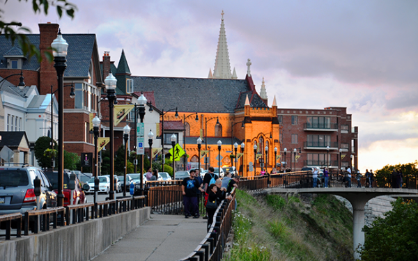
The St. Mary of the Mount Catholic Church on top of Mt. Washington is situated right next to the edge at the top, overlooking the places we have been looking at below…

…with a mud-flooded appearance signified by the slanted street in front of it, and some beautiful cathedral windows…

…which also resemble in appearance the patterns of some hydrogen wave functions. Could there be a connection somehow between cathedral windows and atomic wave functions?

In a different region of the country, another commenter mentioned that Turfway Park is slightly southeast of the Greater Cincinnati Airport in northern Kentucky, along the south-side of the Ohio River, Kentucky’s shared border with Ohio, and part of the Greater Cincinnati Metropolitan Area.

Turfway Park is an American horse-racing track that conducts live Thoroughbred horse racing in two meets a year – in December and between January to late-March, early-April – as well as offering year-round simulcast wagering from tracks around the country.

It first opened in 1959 as Latonia Race Course, and changed its name to Turfway in 1986.

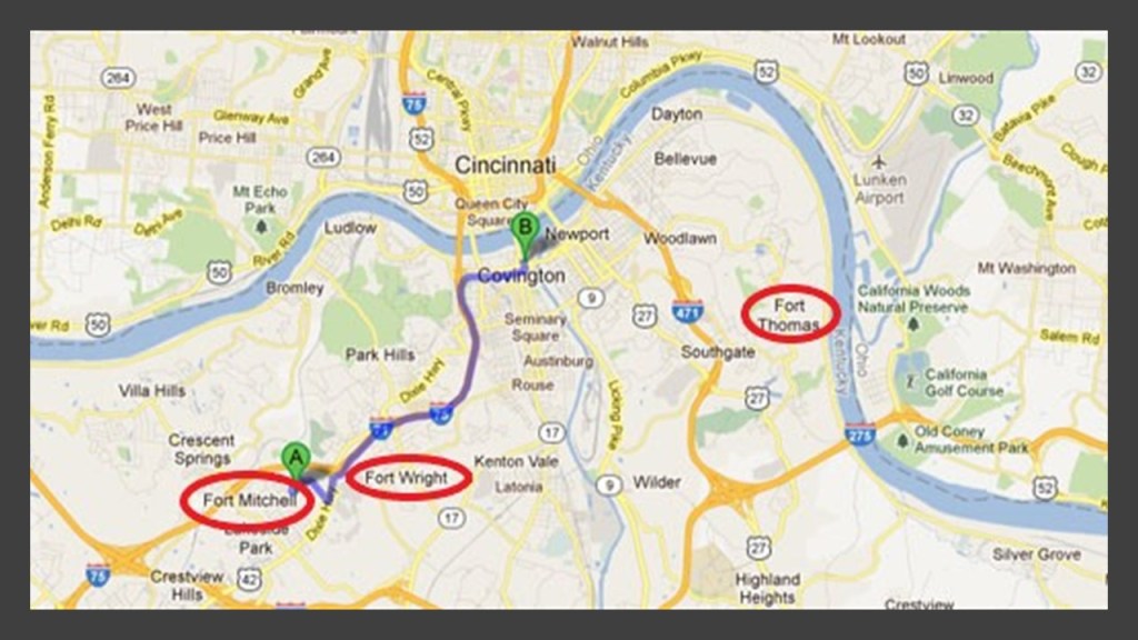
I noticed Fort Mitchell, Fort Wright, and Fort Thomas located between the Greater Cincinnati Airport on the Kentucky side of the Ohio River, and the Lunken Airport northeast of Fort Thomas on the Ohio side of the river.

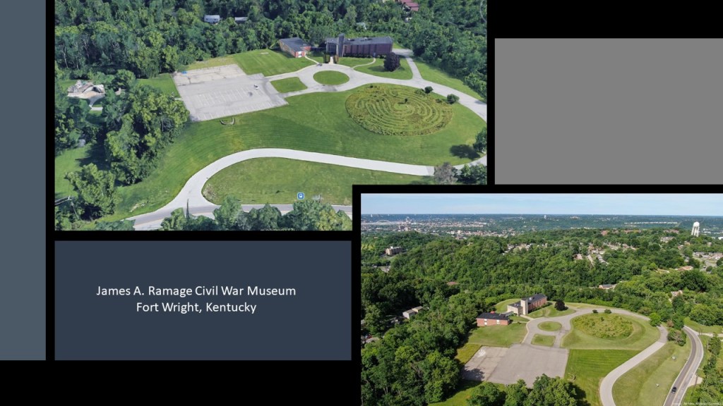
Fort Mitchell and Fort Wright were said to be two of seven Civil War fortifications built for the Defense of Cincinnati, and the U. S. Army post of Fort Thomas was said to have been built in 1890.

The Defense of Cincinnati was said to have occurred during what was called the Kentucky Campaign of the Civil War from September 1st through September 13th of 1862, when Cincinnati was threatened by Confederate forces, which at that time was the 6th-largest city in the United States.

Then when Confederate Brigadier General Henry Heth arrived with his troops from Lexington, Kentucky, reconnaissance scouts assessed the defenses, and the general determined that a major attack was pointless. After skirmishing a few days with Ohio infantry units near Fort Mitchell, the Confederate troops withdrew back to Lexington.

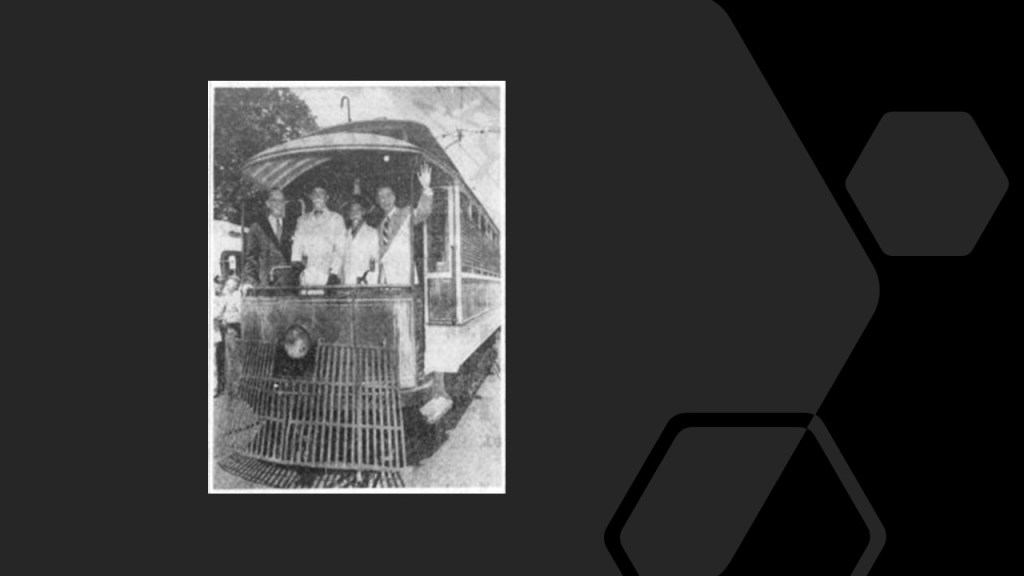
Fort Mitchell, Fort Wright and the whole south-side of the Ohio River was home to a large share of the 222-miles, or 357-kilometers, of streetcar tracks in the region, with the system tied to the Cincinnati Streetcar system via the Roebling, Central and L & N bridges crossing the Ohio River.

The last day of the original streetcar system in northern Kentucky was July 2nd of 1950, when the system was replaced by buses, with the promise of additional service and modern comforts.

Tower Park in Fort Roberts, which also has an athletic track and field on the grounds, is a short-distance southwest of Lunken Field, also known as the Cincinnati Municipal Airport.

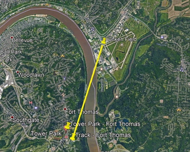
Just around the river-bend, west of Lunken Field, next to the river in downtown Cincinnati, are the city’s professional sports stadiums.

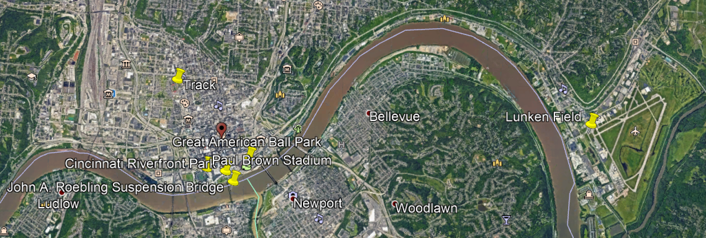
And interestingly, they are situated on the river exactly like they are in Pittsburgh.

The Paul Brown Stadium, home of the NFL Bengals, is on the left riverfront; the Great American Ball Park, home of the MLB Reds on the right riverfront.

There is a park directly in front of the Paul Brown Stadium, known as the Cincinnati Riverfront Park, like the Roberto Clemente Park in front of the Heinz Field Stadium; and a bridge located between both sporting venues.

Is the identical configuration only a coincidence?

What else is similar between Pittsburgh and Cincinnati?

There’s the geographic landmark and residential neighborhood of Mt. Adams, a flat-topped-looking earthwork that at one time had an incline Railway.

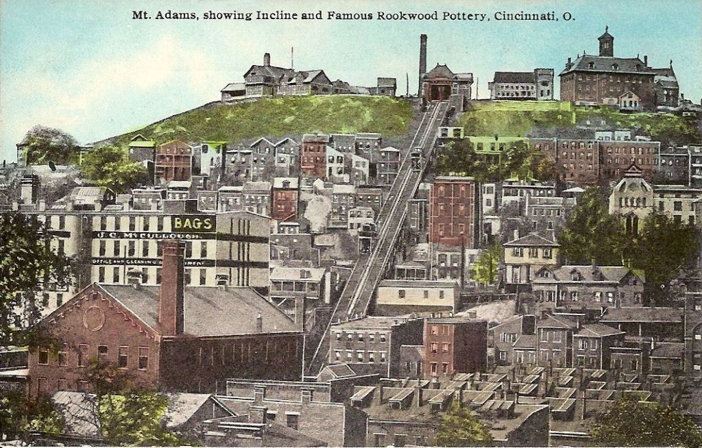
The Mount Adams Incline operated from 1872 until 1948. Long since demolished, it was the longest running incline of Cincinnati’s historic five incline railways.

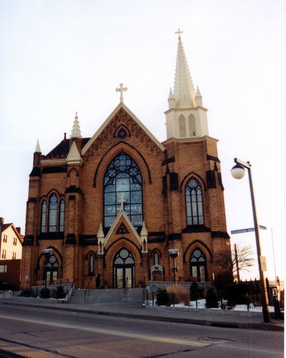
Mt. Adams’ landmarks include the Pilgrim Presbyterian Church, said to have been built in 1886…

…near the Ida Street Viaduct, said to have been constructed in 1931 – which would have been during the Great Depression…

…and the Immaculata church and Holy Cross Monastery, said to have been built in 1895 and 1901 respectively…

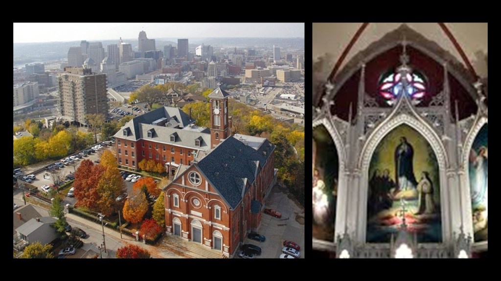
…close to the edge of Mt. Adams overlooking the river, like St. Mary of the Mount back in Pittsburgh.

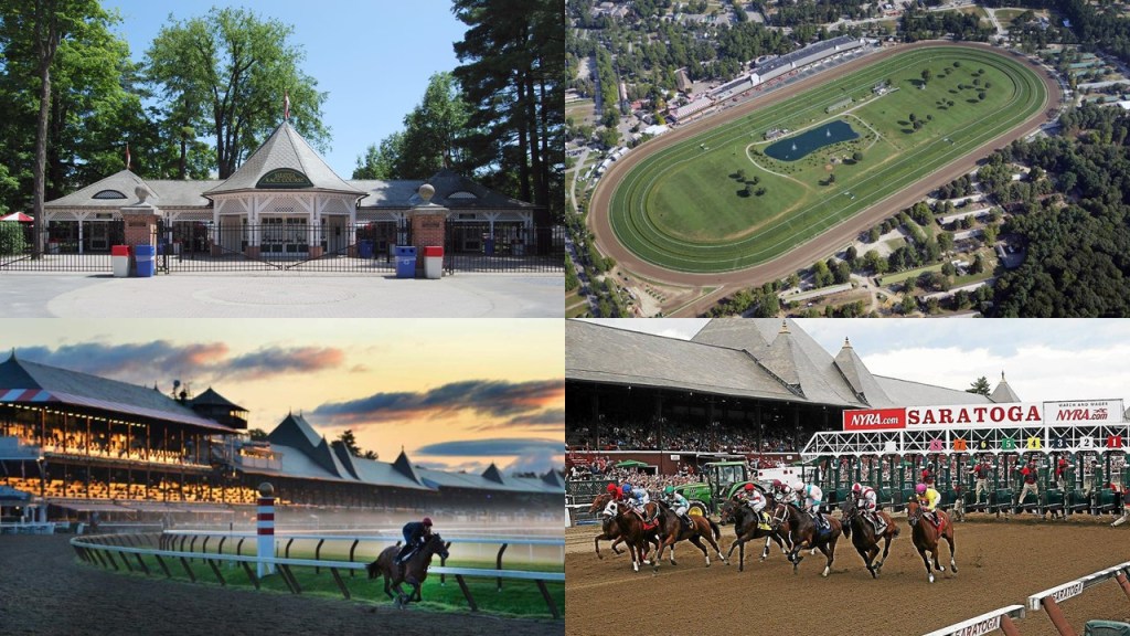
Another viewer commented: “There were two race tracks near where I live. One in Fenimore NY and another in Glens Falls NY. And there’s still one in operation in Saratoga NY that’s decked out with the usual old world ornamentations. Columns/pillars, brick walls, large iron gates, ornate cement facades. As for the lost two tracks, not much is known other than the one in Glens falls became a neighborhood and the shape of the track is still visible because they just paved over it and incorporated it into the modern road work infrastructure. What were these tracks originally… another mystery!”

Since the Glens Falls and Fenimore tracks no longer exist, I will focus on the Saratoga Race Course.

This is a snapshot showing the angular relationships between the Saratoga Race Course, and just a portion of the large number of airparks, airfields, and airstrips in this part of New York State.

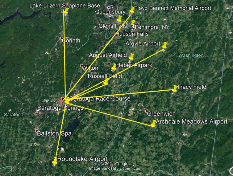
The Saratoga Race Course is a thoroughbred horse racing track in Saratoga Springs, New York. It is one of the oldest sporting venues in the United States, having opened on August 3rd of 1863 (which would have been in the middle of the American Civil War).

The Saratoga Race Course has been in use pretty much continuously since it first opened.

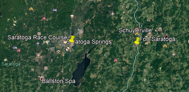
The name of Saratoga Springs reflects mineral springs that are in the area, making it a popular resort destination for over 200 years.

High Rock Spring in this location is believed to have medicinal properties.

The British were said to have built Fort Saratoga on the west bank of the Hudson River, somewhere south of Schuylerville, in 1691.

Saratoga Springs was established as a settlement in 1819, and as a village in 1826.

What eventually became known as the Adirondack Branch of the Delaware & Hudson Railroad, first arrived here in 1832.

This was the first station used in Saratoga Springs, from 1833 until it burned down in 1870.

Then, this was the main train station in Saratoga Springs, from 1871, until it burned down in 1899.

And this is the Saratoga Springs Railroad Station today.

And were there trolleys in the history of Saratoga Springs?

You bet there were!

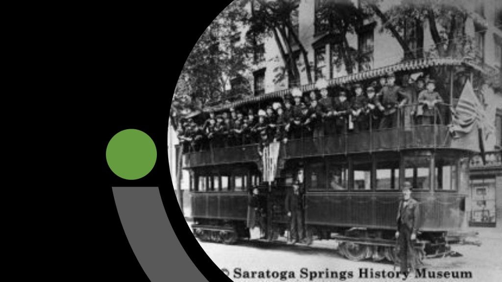
Trolley service ended here in 1938.

Today the historic trolley station building serves as the Saratoga Springs Heritage Area Visitors Center.

The last place I am going to look into in this post is Hot Springs in Arkansas.

I had several comments from two viewers to research.

First, CC mentioned the following about Hot Springs.

“The resetters burned the city in the early 1900s.”

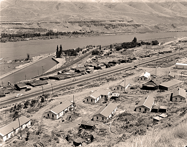
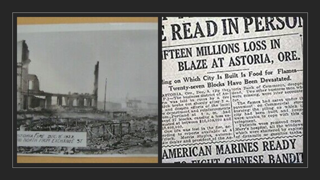
So I looked, and found out that a fire started on Church Street in Hot Springs on September 5th of 1913 near the Army and Navy Hospital and Bathhouse Row.

An estimated $10 million in damages from the fire occurred across 60 blocks and destroyed much of the southern part of the city.

CC also said that Hot Springs has a horse racing track, and a casino, which is located near the Memorial Field Airport.

The Oaklawn Racing Casino Resort is a thoroughbred horse-racing track that first opened in February of 1905.

It was ranked 5th in 2017 by the Horseplayers Association of North America, and includes the running of the Arkansas Derby, which has a $1 million purse.
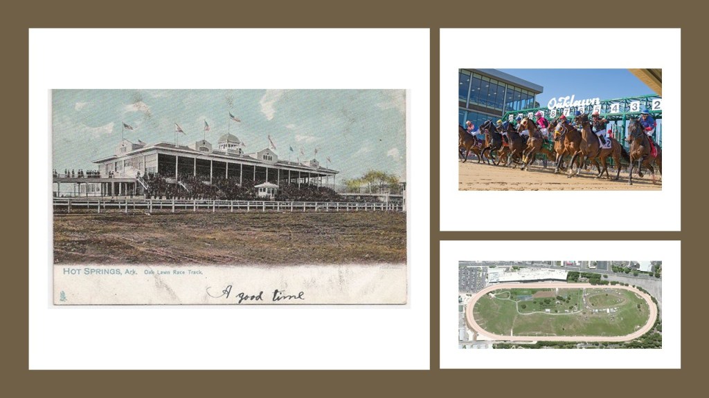
.

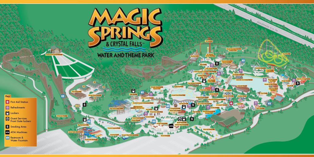
CC indicated there is an amusement park in Hot Springs called Magic Springs, which first opened in 1978, closed due to financial problems in 1995, and re-opened in 2007 as Magic Springs and Crystal Falls Water and Theme Park.

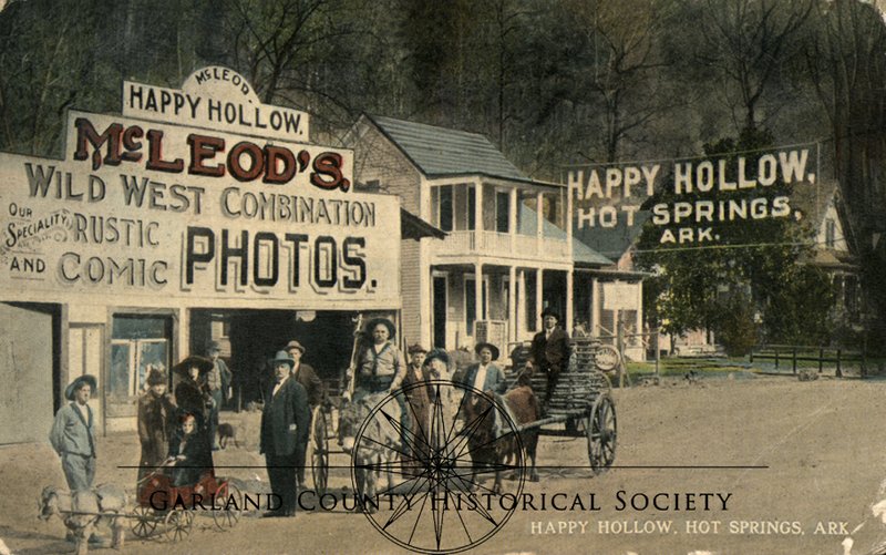
The only reference to an historical amusement park in Hot Springs that I could find was McLeod’s Amusement Park, more commonly known as Happy Hollow, one of Hot Springs most popular tourist attractions from the late 1800s to the 1940s.

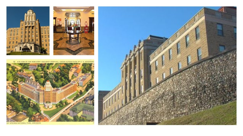
CC said there was a huge armory hospital in Hot Springs that was a massive star fort!

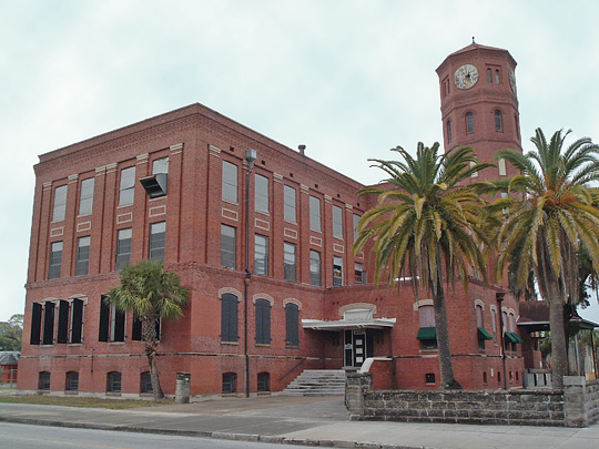
He was referring to what used to be the Army and Navy Hospital, which is now a state-run rehabilitation center.

The former Army and Navy Hospital, the first general hospital in the country that treated both Army and Navy patients starting in January of 1887, appears to be situated at the bottom of Hot Springs Mountain, just around the corner from Happy Hollow on the north-side of Hot Springs Mountain.

What we are told is that in the early 1930s (which would have been during the Great Depression), the original building was replaced with a brick-mortar and steel facility with 412-beds.

SD, who also lives in Hot Springs, commented about the old Army and Navy Hospital, and about Hot Springs Mountain as well, as, among other things, she said that it was the first federally-protected land in the United States.

Hot Springs Mountain was turned into a reservation by an Act of Congress on April 20th of 1832, and was the first time that land had been set aside by the federal government to preserve its use as an area for recreation, and the city of Hot Springs was incorporated on January 10th of 1851, and Hot Springs Mountain became a National Park in 1921.

SD said Hot Springs was also called Valley of the Vapors because when the hot water steam arose there were rainbows that were seen…

…and Hot Springs Mountain has 47 natural springs that have been capped off and piped into bathhouses, and that the bathhouses still stand, specifically the Fordyce Bathhouse with a museum is fascinating…

…but all of them are beautiful.

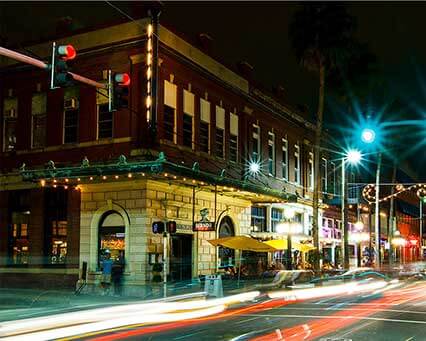
Bathhouse Row is maintained by the National Park Service, eight historic bathhouse buildings and gardens along Central Avenue.

SD mentioned that Hot Springs also had electric rail cars at some point in time.

I found out that the Hot Springs Street Railroad ran around Hot Springs to and from the Oaklawn Race Track.

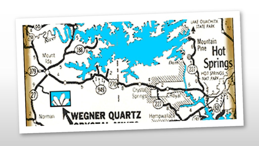
SD also said there was a large solid and pure quartz crystal vein, that Hot Springs sits within or just outside of, that runs approximately 200-miles, or 322-kilometers, that starts in Oklahoma, runs through the Ouachita Mountains, and ends close to the state capital of Little Rock.

There is more I can delve into in Hot Springs, but I am going to stop right here.

So, again, what are the odds of all of these similar relationships and connections happening randomly in diverse places across the world over long periods of time?

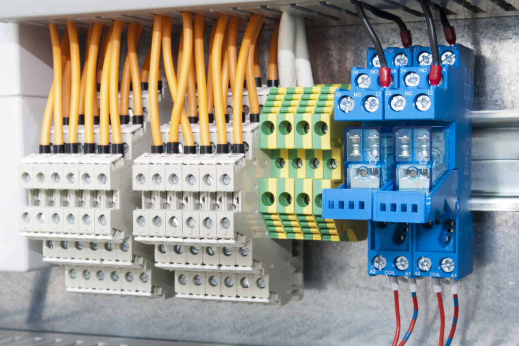
I think the truth of what we are actually seeing, the components of a very precise and integrated, world-wide, electromagnetic free-energy-generating-and-receiving geometric grid system, is actually hidden within our every day language – in circuits (race tracks), batteries (star forts), terminals and engines (all rail-lines) and the definition of spring.

The sport of racing uses the word “circuit” in the following ways:

  1. The course over which races are won.
  2. The number of times the racers go around the track.
  3. An established itinerary of racing events involving public performance.
  4. Circuit race – a mass-start road-cycle race that consists of several laps of a closed-circuit, where the length of the lap is slightly longer each time.

Electrical Circuit definitions Include:

  1. A closed path in which electrons from a voltage or current source flow.
  2. An electric circuit includes: devices that give energy to the charged particles the current is comprised of, such as batteries and generators; devices that use current, like lamps, electric motors, and computers; and the connecting wires or transmission lines.
  3. An electronic circuit is a complete course of conductors through which current can travel.  Circuits provide a path for current to flow. 

Wouldn’t it stand to reason that those behind the reset when setting up the New World would take advantage of the super science of the different types of circuits in the Earth’s grid system in order to harness their inherent power to enhance performance at sporting events, to make lots of money at highly-charged, prestigious gaming and betting venues, with the added excitement of large crowds spending large amounts of money on the factor of chance?

The word “battery” is typically associated with star forts, and I think that is telling us what their true function was.

And so many more star forts have been destroyed than are still intact.

A battery is a device that produces electricity that may have several primary or secondary cells arranged in parallel or series, as well as a battery source of energy which provides a push, or a voltage, of energy to get the current flowing in a circuit, which aligns with the examples of star forts occurring in pairs or clusters of three or more.

And the word terminal is associated with rail-lines, as in the example given back with the electric streetcar line that ended in Toledo Beach, defined as “The end of a railroad or other transport route, or a station at such a point” and “A point of connection for closing an electric circuit.”

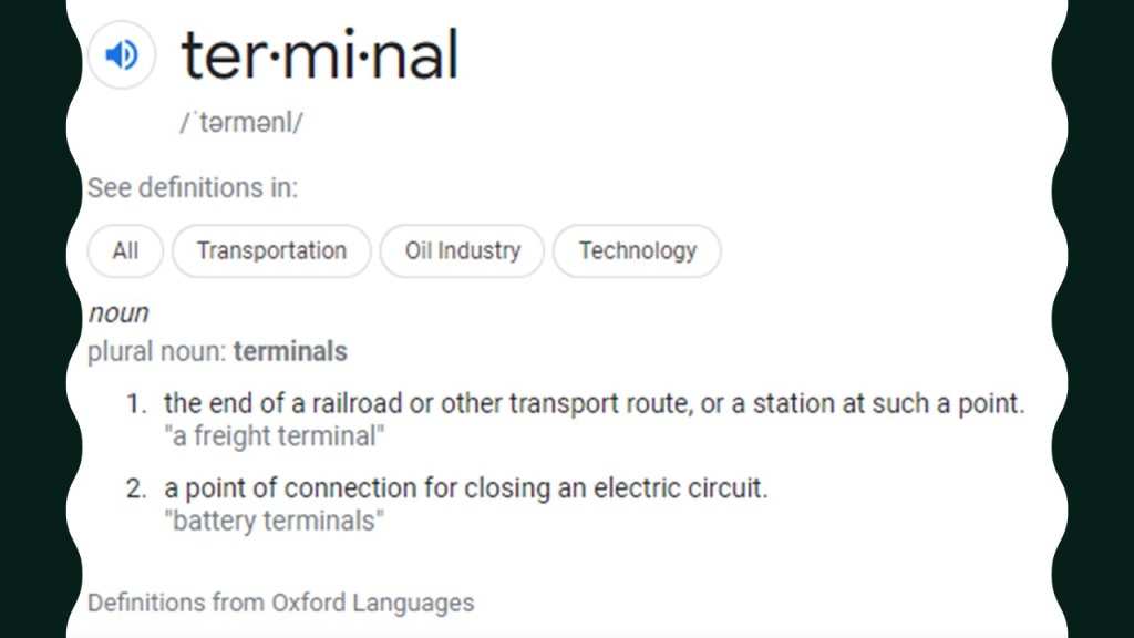
Trolley amusement parks were typically located at the end of streetcar lines.

Was there some kind of enhanced energy-generation going on with trolleys and amusement parks on the earth’s free-energy-generating system?

The other definition of a terminal is: “A point of connection for closing an electric circuit.”

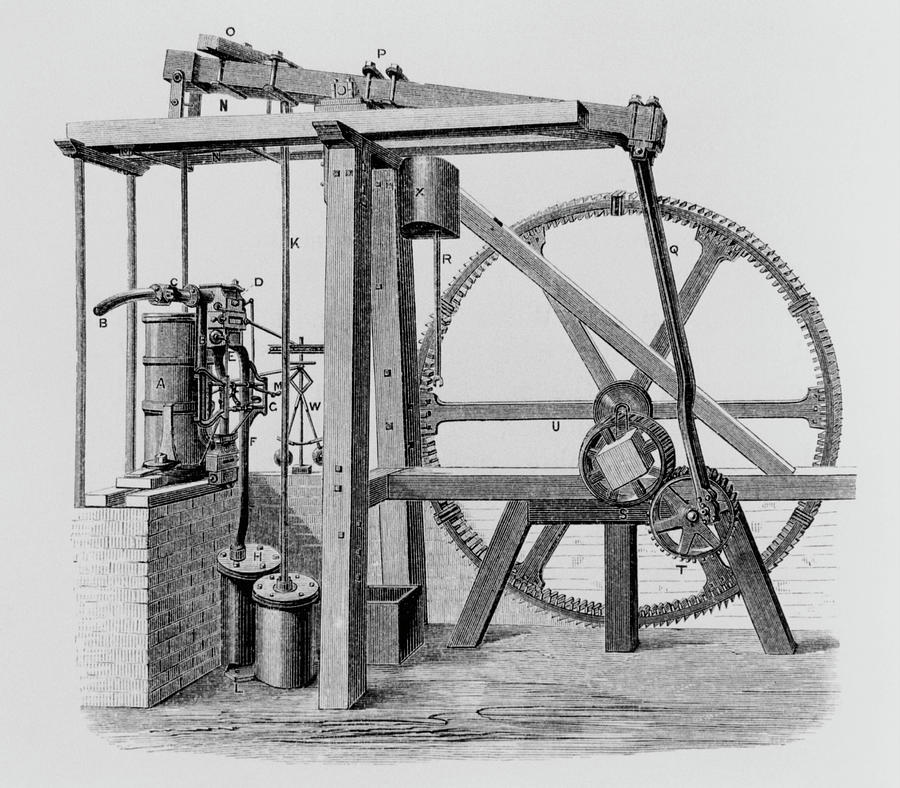
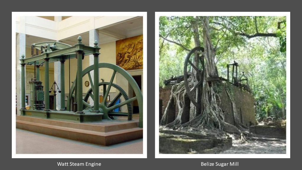
While Engines are also strongly associated with train locomotives, as seen in the second definition of engine.

The first definition show here is “a machine with moving parts that converts power into motion.”

Is that actually telling us the function locomotives performed on the Earth’s free-energy-generating grid system?

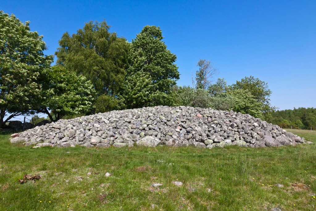
As seen in this post, there is also some kind of connection to different kinds of mineral springs with regards to all of this infrastructure.

Definitions of the word spring include:

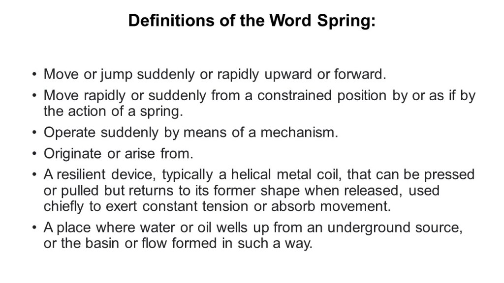
I don’t know exactly what the function of mineral springs would be on this free-energy-generating system, but it could very well be contained within one or all of the non-water definitions.

And what is the function of quartz crystals in electronics?

Though quartz crystals have several applications in the electronics industry, they are mostly used as resonators in electronic circuits.

If you apply an alternating voltage to a quartz crystal, it causes mechanical vibrations. The cut and the size of the crystal determine the resonant frequency of these vibrations or oscillations, and it generates a constant signal.

A Big Thank You to everyone who has taken the time to make suggestions of places to research – your input has helped me enormously in this process, and you have me looking at places that I would not otherwise think to look in making these connections to the bigger picture of what looks more and more like “Circuit Board Earth.”

Counting the Ways You Need to Know What You are Consuming!

The reason I am doing this post right at this moment is because viewer BR emailed me asking for help in putting together a video about Gossypol to get the word out about what is in our food supply chain.

BR and her family are farmers, and in the winter they subsistence hunt wild hogs only what they need for their meat supply.

She received word from local authorities about a hog-abatement program that was going to be implemented in the area where she lives in Central Texas involving Gossypol, a toxic compound in the cotton plant.

She sees this situation just as bad, if not worse, than the fluoride scam that has been perpetrated on the world’s population!

She told me the cotton industry is taking a poison chemical waste-product from cotton and telling us its good for us!

She said she’s not a researcher, but she went down the rabbit hole herself to get an answer for her simple question that the authorities she contacted in Texas about the hog abatement program where she lives were either unwilling or unable to answer – is there evidence of secondary transfer? –

She said even she was able to find out how bad this is for the masses, and shared her research findings with me.

The subject she raised with me immediately piqued my interest because not long ago when I was doing research on Louisiana Governor Huey P. Long for the National Statuary Hall in Washington, DC, I encountered this information about him:

Huey Long worked as a salesman before entering politics.

He met his future wife Rose at a baking contest he promoted to sell Cottolene Shortening, a brand of shortening made of beef suet and cottonseed oil that was produced in the U. S. from 1868 until the early 20th-century, the first mass-produced and mass-marketed alternative to lard, a natural cooking fat derived from rendered pig fat.

Crisco Shortening, a competitor of Cottolene, was originally made entirely of cottonseed oil.

Gotta wonder about the word “shortening.”

Shortening what?

Does shortening your food lengthen your life, as the Cottolene advertisement implied, or intended to shorten your life?

The given reason is that it was called that because it makes the resulting food crumbly, like in the process of making pastry dough, or to behave as if it has short fibers.

Besides encountering Cottolene shortening in my research about Huey Long, after I present BR’s findings about Cottonseed oil and Gossypol, I am going to share other research that I have encountered along the way regarding the subject of what is in what we consume on a daily basis.

The Commissioner of the Texas Department of Agriculture released a press release on June 1st of 2021 regarding a “New Product in Fight Against Feral Hogs.”

https://www.texasagriculture.gov/News-Events/News-Events-Details/Article/6601/TEXAS-AGRICULTURE-COMMISSIONER-SID-MILLER-ANNOUNCES-NEW-PRODUCT-IN-FIGHT-AGAINS

In it, HoGStop is described as a “new hog contraceptive bait entering the market that week with the goal of curbing the growth of the feral hog population in Texas over time,” and “an exciting new tool in the war against feral hogs.”

The Texas Department of Agriculture Commissioner’s Press Release went on to talk about the estimated $52 million in damages feral hogs cause in damages in Texas, and that the all-natural contraceptive bait HogStop targets the male hog’s ability to reproduce.

The Press Release goes on to say that HogStop does not have to be registered by the Texas Department of Agriculture because it is considered a 25 (b) pesticide by the EPA, meaning that it is considered to be a pesticide that causes little harm to humans.

So when I looked on the HogStop website under Frequently Asked Questions, under “What is HogStop, and how do I use it?,” the answer is that it is a mixture of ingredients commonly found in livestock feeds fed to feral hogs to reduce their numbers on your farm or ranch.

Nowhere on their website can I find a list of the actual ingredients.

Just that the ingredients are natural, and that this is a non-kill, low environmental impact solution.

But there is nothing telling us what the actual ingredients are.

Only that it says it is considered safe for human consumption.

Not only that, the website states if there is a health risk for humans harvesting the hogs, it is directed to contact with disease organisms carried by the hogs.

I searched for “Gossypol in HogStop” and found it mentioned in a discussion thread of the” Texas Hunting Forum” website.

https://texashuntingforum.com/forum/ubbthreads.php/topics/8287970/re-hogstop-approved

…which led me to find a PDF on the Hi-Pro Feeds website that listed the ingredients when I searched for “Cottonseed Oil in HogStop.”

Not only that, there is a pretty hefty caution statement on the PDF, including warnings like it may be harmful if swallowed; if it gets in your eyes, rinse thoroughly with clean water; and keep out of reach of children.

There is a link in the Texas Hunting Forum thread leading to a website explaining the it is the Gossypol in the cottonseed oil that causes male infertility.

This article references two Chinese studies that looked at the relationship between cotton and infertility.

More on the Chinese connection shortly.

https://www.fertileheart.com/cottonseed-and-fertility/#:~:text=Cottonseed%20contains%20toxins%20that%20harm%20male%20fertility,%20according,cells%20that%20are%20crucial%20for%20healthy%20sperm%20creation.

BR did a simple Google search of FDA cautions against deer corn versus cottonseed because she wanted to see which item received the most cautions.

Among other things, deer corn is used as a supplement in animal feed and as feed deer hunters use to attract them.

While corn is safer for people and animals than cottonseed, deer corn received over 7-million results that were cautions versus over 1-million for cottonseed.

BR mentioned the actual corn grain is safe, and that it’s the aflatoxin that causes the warning, where with cottonseed, the actual grain (seed) contains the poison. She indicated even with the approved allowable amount of aflatoxin, corn is still much safer to use as feed and won’t transfer up the food chain like cottonseed/gossypol does!

BR shared a report she found from Texas A&M University from 2017 showing that the contraceptive method they are using to get the “hogstop” into the wild pig population (1) is not supported by research as a feasible alternative in wild pig management; (2) says secondary transfer can potentially happen; (3) says pharmaceuticals and pesticides either require special and expensive treatments to remove or can not be removed at all; and (4) says, “A REAL THREAT TO HUMAN HEALTH. “
https://nri.tamu.edu/blog/2017/september/an-evaluation-of-contraceptive-viability-in-wild-pig-management/

BR found this statement about gossypol in the 1983 President’s Review and Annual Report of the Rockefeller Foundation concerned a grant awarded for a Fellowship through the Chinese Academy of Medical Sciences that established a molecular biology lab find a way to use gossypol to suppress sperm motility.

It also mentions a Rockefeller Fundation grant to the Catholic University of Chile that allowed its Endocrinology lab to continue research female reproductive physiology in order to determine how nomral physiological mechanisms may be used to facilitate “safe and effective” procedures for intervening in the reproductive process.

BR also researched information from an International Symposium in Heidelberg, Germany, that took place in September of 1984.

The World Health Organization (WHO) was mentioned as having organized research into using Gossypol as a contraceptive.

For one, it was suggested to feed cottonseed oil as a contraceptive!

BR also found this research on Gossypol which documented that: 1) cooking oil was changed in the Jiangsu Province in the 1930s from soyabean to cottonseed and a general period of infertility followed; 2) an increasing awareness of toxicological effects of gossypol caused urgent reassessment of its potential as an antifertility agent; 3) the Rockefeller Foundation supported limited clinical trials in China and small-scale clinical trials in Brazil and Austria; 4) the World Health Organization and Rockefeller Foundation supported animal studies to better define the mechanism of action of gossypol; and 5) the National Institutes of Health was testing analogues of gossypol for pharmaceutical efficacy in its contraceptive development branch.

So this has been known about gossypol and actively studied for almost a century now…

…which makes the FDA approval for GMO cotton as a “Solution to Human Hunger” all the more interesting.

According to this article on the Global Research website, the U. S. Food and Drug Administration approved a genetically-modified cotton for unregulated release as a potential solution to human hunger in October of 2019.

The article describes this as a radical decision to permit consumption as food by humans and animals of a GMO cottonseed developed at the Texas A & M AgriLife Research Center, and “opening grave new concerns about the safety of our food chain.”

https://www.globalresearch.ca/let-them-eat-cotton-genetically-modified-cotton-as-a-solution-to-human-hunger-approved-by-fda/5693478

This article with study results on “Gossypol Toxicity in Livestock” from the Oklahoma Cooperative Extension Service found that the toxic effects of gossypol are cumulative, and that the longer livestock – in this case cattle – are on a ration containing gossypol, the likelier they were to have problems.

The European Food Safety Authority published an article on December 4th of 2008 entitled “Gossypol as Undesirable Substance in Animal Feed – Scientific Opinion of the Panel on Contaminants in the Food Chain.”

BR’s notes from this article are showing the left-hand margin of this image.

Her review noted things like a lack of data; not used for feed of chickens or fish in the European Union; gossypol is transferred to edible tissues; and not enough testing done to see if gossypol is in food products from animals that ate the food that contained gossypol.

All to say more testing is needed!

https://www.efsa.europa.eu/en/efsajournal/pub/908

Gossypol poisoning is made worse by malnutrition, yet cottonseed is being touted as the food savior for the worlds poor.

Why?

Also, why these food brands and restaurant chains using cottonseed oil when there are plenty of other options for cooking food oil?

https://foodbabe.com/this-ingredient-isnt-food-but-most-americans-eat-it/

Now that I have presented BR’s research findings about Cottonseed oil and Gossypol, I am going to share research I have encountered along the way regarding the subject of what are consuming on a daily basis, starting with Norman Borlaug.

He is one of the two statues representing the State of Iowa in the National Statuary Hall in the United State Capitol building in Washington, D. C.

Norman Borlaug was an American Agriculturalist who led initiatives around the world that lead to significant increases in agricultural production, known as “The Green Revolution.”

He received his higher education at the University of Minnesota, where he received a Bachelor of Science Degree in Forestry in 1937, a Master of Science degree in 1940, and a Ph.D in plant pathology and genetics in 1942.

Borlaug was employed as a microbiologist by DuPont in Wilmington, Delaware, between 1942 and 1944, where it was planned he would lead research in agricultural bacteriocides, fungicides and preservatives.

With the entry of the U. S. into World War II after the attack on Pearl Harbor on December 7th of 1941, his lab instead was converted to conduct research for the U. S. Military, like the development of glue that resisted corrosion in the warm salt water of the Pacific; camouflage; canteen disinfectants; DDT to control Malaria; and insulation for small electronics.

The Mexican President Avila Camacho, elected in 1940, wanted to augment Mexico’s industrialization and economic growth, and the U. S. Vice-President Henry Wallace, who saw this as beneficial to the interests of the United States, persuaded the Rockefeller Foundation to work with the Mexican government in agricultural development.

They in turn contacted leading agronomists who proposed the Office of Special Studies within the Mexican Government to be directed by the Rockefeller Foundation, and staffed by Mexican and American scientists focusing on soil development; maize and wheat production and plant pathology.

Borlaug was tapped to be the head of the newly established Cooperative Wheat Research and Production Program in Mexico, a position which he took over as a geneticist and plant pathologist after he finished his wartime service with DuPont in 1944.

In 1964, he was made the Director of the International Wheat Improvement Program at El Batan on the outskirts of Mexico City, as part of the Consultative Group on International Agricultural Research’s International Maize and Wheat Improvement Center (or CIMMYT), the funding for which was provided by the Rockefeller and Ford Foundations, and the Mexican Government.

Interesting to note that Borlaug felt that pesticides, like DDT, had more benefits than drawbacks, and advocated for their continued use.

Borlaug retired as Director of the CIMMYT in 1979, though stayed on as a Senior Consultant and continued to be involved in plant research.

He started teaching and doing research at Texas A & M University in 1984, and was the holder of the Eugene Butler Endowed Chair in Agricultural Biotechnology, for which he advocated the use of as he had for the use of pesticides, in spite of heavy criticism.

Norman Borlaug died at the age of 95 in September of 2009 in Dallas.

There is a memorial to Norman Borlaug outside of the city of Obregon, at CIMMYT’s Experiment Station in Mexico’s Sonora State, where there are miles and miles of cultivated land, where tractors plow the land, airplanes spray pesticides on the crops; mechanical harvesters reap the wheat; trucks carry the crops to town from where they are shipped around the world.

Among other awards in recognition for his achievements, Borlaug received the Nobel Peace Prize in 1970; the Presidential Medal of Freedom in 1977; and the Congressional Gold Medal in 2006.

It is interesting to note that the old Des Moines Public Library Building has been the Norman E. Borlaug/World Food Prize Hall of Laureates for the World Food Prize since 1973, an international award recognizing the achievements of individuals who have advanced human development by improving the quality, quantity, or availability of food in the world.

The old Des Moines Public Library Building was said to have been constructed in 1903, was listed on the National Register of Historic Places in 1977.

The World Food Prize is awarded here in October of every year and the World Food Prize Foundation is endowed by the Rockefeller Foundation.

It is also interesting to note that in Norman Borlaug’s home state of Iowa, Power Pollen is located in Ankeny.

Power Pollen’s mission statement is to preserve and enhance crop productivity by enabling superior pollination systems.

Well, that sounds great, but when I was looking for information on Power Pollen, I encountered the information that in 2021, Power Pollen announced a commercial license agreement with Bayer Pharmaceuticals designed to help corn seed production.

And what’s wrong with that picture?

Monsanto was acquired by the German multinational Bayer Pharmaceutics and Life Sciences Company after gaining United States and EU regulatory approvals on June 7th of 2018 for $66-billion in cash, and Monsanto’s name is no longer used.

Then, there are soybeans.

The soybean, which is native to East Asia, has a number of uses.

Among other things, soybean meal is used in many packaged meals as a cheap protein source, like Textured Vegetable Protein, or TVP, as well as in many meat and dairy substitutes.

And soybean is the most important protein source in feed for farm animals, for which 70% of the soybeans grown in the United States are used for.

Also, most of the soybeans grown in the United States are GMO, and make up a significant portion of the GMOs grown in the United States; and on top of that are the only GMO beans that are commercially available in the United States.

So it sounds like once-again, in this case genetically-modified soybeans, are introduced and hidden in our food supply chain, coming to us as additives to food and in the meat of the farm animals we consume that are being fed a high-soybean diet.

When I was looking at the European settlement of the Mississippi River Valley, I encountered the Monsanto brothers Benjamin and Jacob. They were from a Sephardic Jewish slave-trading family originating in Spain, and ended up coming to live in Natchez, Mississippi, located on the Mississippi River, where Benjamin Monsanto, a slave-holder-and-seller, purchased the cotton-producing Glenfield Plantation in 1787.

A Natchez Monsanto descendent by the name of Olga Mendez Monsanto married John Francis Queeny, who founded the Monsanto Chemical Company in St. Louis in 1901 and named it after his wife’s family.

The first product the Monsanto Chemical Company manufactured was saccharine, which Queeny sold to the Meyer Brothers Drug Company in St. Louis.

Then, when I was doing research about Monroe in Louisiana, I found Joseph Biedenharn, a German-American businessman from Vicksburg, whose parents immigrated to the United States following the Revolutions of 1848.

Joseph was a candy-maker, the first bottler of coca-cola, and the first to develop an independent network of franchise bottlers to distribute the drink.

This was his original company building in Vicksburg.

Biedenharn moved his candy manufacturing and coca-cola bottling operations to Monroe, Louisiana, from Vicksburg, Mississippi in 1913.

This graphic explains what coca cola does to you within an hour of drinking a coke.

Within 10 minutes, 10 teaspoons of sugar enters your system – 100% of the daily recommended value. You don’t vomit due to the excessive amount of sugar because the phosphoric acid in coke eliminates the flavor.

In 20 minutes, your blood-sugar skyrockets, and your liver responds by converting large amounts of sugar into fat.

In less than 40 minutes, the caffeine is completely absorbed; your eyes dilate; your blood pressure goes up and your liver sends more sugar into your bloodstream.

Around 45 minutes, your body increases its production of dopamine, which stimulates the brain’s pleasure-feeling centers, in the same way that heroin does.

After an hour, you face a decrease in blood sugar.

Within an hour of drinking diet coke, which contains Monsanto’s artificial sweetener aspartame, this is what happens.

In 10 minutes, the phosphoric acid attacks the enamel in your teeth, and tricks your body into thinking it has just processed sugar.

In 20 minutes, it can trigger insulin like regular coke, sending your body into fat storage mode. It can produce greater risk for Diabetes Type 2, high blood pressure and heart disease, potentially doubling the risk of metabolic syndrome.

In 40 minutes, diet coke can cause addiction, with the combination of caffeine and aspartame, creating a short addictive high similar to cocaine.

And in an hour or more, can deplete nutrients, and make you hungry and thirsty for more.

It dehydrates rather than hydrates your body and has no nutritional value.

The Coca-Cola products you consume dissolve teeth…

…remove rust…

…and unclog drains.

Along with his son, Malcolm and other investors, Joseph Biedenharn bought a crop-dusting business in 1925, added eighteen planes to the fleet, and moved the company headquarters from Macon, Georgia, to Monroe.

Crop-dusting involves the spraying of crops with pesticides and fertilizers, like you know, other Monsanto products!

Also, it is interesting to note that Biedenharn’s crop-dusting business was the origin of Delta Airlines, which was incorporated in December of 1928, and Delta’s headquarters moved from Monroe to Atlanta in 1941.

I recently did research on the history of candy, and here are some of the things I found out.

Hard stick Candy as we know it has at least been around since 1837, when it at was at the Exhibition of the Massachusetts Charitable Mechanics Association (MCMA) that year in Boston, Massachusetts.

Stick candy is made by mixing things like granulated sugar and sometimes corn syrup with water and a small amount of Cream of Tartar, though white vinegar can be used in place of Cream of Tartar.

The chemical name for Cream of Tartar is potassium bitartrate, and in addition to its uses in cooking, when it is combined with other substances like lemon juice, vinegar, and hydrogen peroxide, it is used as a cleaning agent.

Today’s Cotton Candy was first created in 1897…

…by a dentist, named William Morrison, who developed the cotton candy machine…

…and a confectioner named John C. Wharton, and together they created a product they called “Fairy Floss” by heating sugar through a screen that made its debut at the 1904 World’s Fair in St. Louis…

…where it won an award for “Novelty of Invention.”

It received the name “cotton candy” from yet another dentist, Josef Lascaux, who marketed his version of the same treat starting in 1921, and named it after the cotton of his home state of Louisiana and sold it to his dental patients, and which apparently had saccharine in it, according to this reference to it that I found.

Around the same time that cotton candy was first made, the Tootsie Roll entered the scene as the first penny candy that was individually wrapped and sold, starting in 1896.

An Austrian immigrant by the name of Leo Hirshfield invented the candy, which we are told was named after his daughter Clara, who was nicknamed “Tootsie.”

Hirshfield’s first invention was Bromangelon Jelly Powder.

It was the first instant, flavored gelatin powder, and initially came in four flavors – lemon, orange, raspberry, and strawberry.

It was also the first commercially-successful gelatin dessert powder, and was eventually driven off the market by Jell-O.

Interesting to note is that there are two different possible meanings attributed to the name.

One was what the manufacturer, the Stern and Saalberg Company, said it was, which was “Angel’s Food.

And the other is what the break-down of the Greek etymology is said to mean, which is “a foul spirit,” with bromos meaning stench and “angellus,” a messenger, angel, or spirit.

Or the possibility that it has no meaning at all.

The ingredients of Tootsie Rolls, at least today, are as follows: sugar; corn syrup; palm oil; condensed skim milk; cocoa; whey; soy lecithin; and artificial and natural flavors.

The sugar and corn syrup alone have a bad effect on the body, spiking insulin and sending the body on a roller coaster ride.

But Tootsie Rolls represented a break-through in the candy industry, a chocolate-flavored caramel and taffy but not any one of the three; they didn’t stick together in the bulk containers at the store; didn’t melt and they stayed fresh.

From that modest start, Tootsie Roll Industries has brought us Charms Blow Pops; Mason Dots; Andes; Sugar Daddy; Charleston Chew; Dubble Bubble; Razzles; Caramel Apple Pops; Junior Mints; Cella’s Chocolate Covered Cherries; and Nik-L-Nip, and sold all over in places like: grocery stores; warehouse and membership stores like Sam’s Club and Costco; vending machines; dollar stores; drug stores and convenience stores.

Makes me wonder if we would even need dentists, and doctors for that matter, if we did not have all this junk food at our disposal!

All of the sugar and other additives that were introduced into our diets brings the prevalence of Type 2 Diabetes to mind, which is an impairment in the way the body regulates and uses sugar (or glucose) as a fuel, and affects a lot of people, who either have it, or are at risk to develop it as a health condition.

The following information on diabetes is from the cdc.gov website.

In 2020, diabetes was the 8th-leading cause of death in the United States.

Adults 50 or older on the average die almost 5-years earlier; develop disabilities 6 – 7 years earlier; and spend 1 -2 years in a disabled state than adults without diabetes.

In 2019, 37.3 million people, or 11.3% of the population in the United States, had diabetes.

Of that number, the 18-and-over population presented 37.1 million, or 14.7% of the adult population.

Their statistics show that the prevalence of total and diagnosed diabetes increased steadily between 2001 and 2004 and 2017 and 2020, and similar trends were seen across all categories examined.

I was looking for a graphic to show that this situation about our food is just the tip of the iceberg of the vast subject of what substances are being introduced into our bodies that have harmful effects without our informed consent.

Interestingly, I found this graphic put together by CIMMYT, the International Maize and Wheat Improvement Center in Mexico that was the result of the cooperative efforts of the Mexican government and the Rockefeller Foundation starting in the 1940s, and that Norman Borlaug was the Director of starting in the 1960s.

The graphic shows the current system in brown on the left; current events in the center; and the emerging system in green on the right hand side, with a diver swimming underneath the iceberg to come up in the emerging system.

In the segment of the iceberg that is underwater, there are three sections listed.

  1. Patterns – what has been happening over time?
  2. Structure – what policies, laws, and structures influence the patterns?
  3. Mental Models – what are the mindsets, values and assumptions?

CIMMYT has been at the heart of biotech research for development with stated aims of food security, innovative agricultural practices to boost crop production and prevent disease since the 1940s, and hosts the largest maize and wheat genebank in the world.

Again, it sounds positive, but what is really going on here?

The Georgia Guidestones sounded positive too!

They were unveiled on March 22nd of 1980 on a rural site in Elbert County Georgia.

Engraved on each face of the four large, upright stones, in eight different languages, was a message containing ten principles, or guidelines.

The very first guideline is “Maintain humanity under 500,000,000 in perpetual balance with nature.”

In 2021, the world population was estimated to be 7.8 billion people.

Going from 7.8 billion to 500-million people?

What is up with that?

The remaining guidelines on the guidestones sounded positive…but were they really?

Guide reproduction wisely – improving fitness and diversity.

Unite Humanity with a new living language.

Rule Passion – Faith – tradition and all things with tempered reason.

Protect people and nations with fair laws and just courts.

Let all nations rule internally resolving external disputes in a world court.

Avoid petty laws and useless officials.

Balance personal rights with social duties.

Prize truth-beauty-love seeking harmony with the infinite.

Be not a cancer on the Earth – leave room for nature – leave room for nature.

There were apparent focuses of population control, eugenics, and internationalism engraved on the guidestones.

Whoever was behind the Guidestones remains anonymous.

So what was their purpose, by whom and for whom, and what did the guidestones really represent?

I am happy to report that on July 7th of 2022, the Georgia Guidestones were completely demolished after one of them was destroyed by an explosion of unknown origins.

As I said at the beginning of this post, I am doing this post right now because viewer BR emailed me asking for help in putting together a video about Gossypol and cottonseed oil to get the word out about what is in our food supply chain, and the subject she raised immediately piqued my interest because it dovetailed with research I have already done as shared here.

“Food for Thought” is a phrase used to describe something that merits serious consideration.

So…think about it.

Interesting Comments & Suggestions I have Received from Viewers- Volume 1

I am highlighting places, concepts, and historical events that people have suggested that I research in a new multi-volume series that is a compilation of work I have previously done.  

My starting point is the recommendation of the Balmoral Cairns in Scotland.

The Balmoral Castle on the Balmoral Estate has been one of the residences of the British Royal Family since 1852, at which time the castle and estate was purchased from the Farquason family by Prince Albert, Queen Victoria’s husband.

There are eleven, what are called “stone cairns,” erected on the Balmoral Estate to commemorate members of the British Royal Family and events in their lives, the majority of which were said to have been erected by Queen Victoria.

At this point, it is really important to get the definition of “cairn” and “pyramid” before I look at some of the “Balmoral Cairns” in Scotland.

A cairn is defined as a “mound or heap of rough stones built as a memorial or landmark on a hilltop or skyline.”

The following examples are identified as cairns:

The definition of a pyramid according to the Merriam-Webster Dictionary (established in 1828) is:

  1. “an ancient massive structure found especially in Egypt having typically a square ground plan, outside walls in the form of four triangles that meet in a point at the top, and inner sepuchral chambers.
  2. “A structure or object of similar form”
  3. “A polyhedron having for its base a polygon, and for faces, triangles with a common vertex.

Now back to the “Balmoral Cairns.”

We are told that the largest of the “Balmoral Cairns,” shown here, was erected in memory of Queen Victoria’s husband, Prince Albert, after his death on December 14th of 1861.

It certainly looks like the definition of a pyramid!

Look at the all the lichen growing on Prince Albert’s Cairn!

Somewhere in the past I remember hearing that lichen grows very slowly, so I looked it up to be certain.

Other cairns on the Balmoral Estate include:

Princess Helena’s cairn, the fifth child of Victoria and Albert, said to have been erected to commemorate her marriage to the Marquis of Lorne in 1871…

…the cairn of Prince Leopold, the eighth child and youngest son of Victoria and Albert, erected in 1882 to commemorate his marriage, and who died in March of 1884, at the young age of 30 from hemophilia, an inherited bleeding disorder in which the blood does not clot properly.

The presence of the hemophilia gene in Queen Victoria was said to have been caused by a spontaneous mutation, as she is considered the source of the disease in modern cases of hemophilia among her descendents.

This is Prince Arthur’s cairn, the seventh-child of Victoria and Albert, said to have been erected to mark his marriage in 1870.

In addition to other cairns marking events in the lives of Queen Victoria’s family, we are told that a cairn was constructed in 2012 on the Balmoral Estate to mark the Diamond Jubilee of Queen Elizabeth II in 2012.

While these last four of the “Balmoral Cairns” seem to have more of the appearance of what are called cairns than what can also be called Prince Albert’s Pyramid, the question becomes this:

Were the “Balmoral Cairns” built when they were said to have been built by who was said to have built them?

Or were they built by an ancient, advanced civilization of Master Builders missing from our collective awareness for purposes unknown to us in the present-day?

I am seeing notation of obelisks as well on the map I just showed of the Balmoral Estates, and one of them is another monument to Queen Victoria’s husband, the Prince-Consort Albert, said to have been erected in 1862, and photographed by George Washington Wilson…

…a pioneering Scottish photographer, who got his start as a portrait miniaturist in 1849, and switched to portrait photography in 1852, and received the contract to photograph the Royal Family of Queen Victoria and Prince Albert.

What role do photographers and artists play in programming our perception away from what is actually in the environment into seeing only the preferred narrative?

From what I am seeing, photographers and artists play a substantial role in this process of reinventing history.

This is a photo of George Washington Wilson’s of Prince’s Street in Edinburgh, circa 1860, with the contrast of massive, stately columned architecture, cobbled streets and horse-and-buggies in the foreground, and Calton Hill in the background…

…with a view of what is called the Nelson Monument and the National Monument of Scotland.

The Nelson Monument was said to have been built on the highest point on Calton Hill between 1807 to 1816 to commemorate the British Vice-Admiral Horatio Nelson’s victory over the French and Spanish fleets at the Battle of Trafalgar in 1805.

The National Monument of Scotland is a national memorial to the Scottish soldiers and sailors who died fighting in the Napoleonic Wars, which took place between 1803 and 1815.

With a design by Charles Robert Cockerell and William Henry Playfair based on the Parthenon in Athens, construction was said to have started in 1826, and that it was left unfinished in 1829 due to lack of funds.

It is interesting to note that in this view of Calton Hill, you see the Nelson Monument perfectly-framed through the center of the front colonnade of the National Monument.

Another commenter from Scotland mentioned Glasgow in particular.

Glasgow called itself the second city of the British Empire, passing Edinburgh in population by 1821, and that in the 1830s it started to become a major industrial center.

The University of Glasgow, established in 1451, is one of Scotland’s four Ancient Universities, along with Edinburgh, Aberdeen, and St. Andrews.

Universities that receive the designation “Ancient Universities” in Great Britain were founded before the year 1600, and considered among the oldest existing universities in the world.

For some reason, I have consistently found that the word “Ancient” is used to describe places that are not associated with “the far distant past” that the word ancient is defined as.

The oldest, currently functional, universities in the world are in North Africa.

The Al-Karaouine University in Fez, Morocco, dates to 859 AD.

Interesting to note that the archway shown here at the University in Fez on the left frames the larger building in much the same way that the archway does here at the University of Oxford in England on the right.

The University of Oxford was established in 1096, and is the oldest of the Ancient Universities of Great Britain.

Also, the colonnaded courtyard at the University in Fez in Morocco on the left looks very similar in appearance to the courtyard in the Alhambra in Granada, Spain on the right, which is architecture that the Moors are actually given credit for.

Tunisia’s still-functioning University in Kairouan is said to date from between 800 AD and 909 AD.

Back to the University of Glasgow.

James Watt was a mathematical instrument-maker at the University of Glasgow before he became interested in the technology of steam engines.

His improvement of the steam engine invented by Thomas Newcomen in 1712…

…with his Watt steam engine in 1776 was said to have been crucial to the changes brought by the Industrial Revolution in Great Britain and the rest of the world.

You know, I can’t help but wonder about the origin of steam engine technology when I see examples of the big gear-wheel showing on the right, compared with the Watt Steam Engine on the left, at what is called a sugar mill in Belize with what appears to be an ancient tree firmly rooted inside the structure.

Adam Smith was a student at the University of Glasgow.

He was a key figure of the Scottish Enlightenment, a period during the late 18th- and early 19th-centuries during which time there was an outpouring of Scottish intellectual and scientific accomplishments.

Known as “The Father of Capitalism” and “The Father of Economics,” Adam Smith is best known for his famous work on modern economics, the title of which is commonly abbreviated to “The Wealth of Nations.”

“The Wealth of Nations” was first published in 1776, the same year that James Watt brought forward his improved steam engine and the American Colonies declared their independence, as well as the founding of the Bavarian Order of the Illuminati by Adam Weishaupt on May 1st of that year.

The next place I am going to look into from a comment is the isle of Frisland, also known as Frislant, the specific awareness of which is new to me.

The isle of Frisland appeared on virtually all maps of the North Atlantic between the 1560s through the 1660s.

Nonetheless, it has come down to our historical time period as a “phantom island,” meaning that it was removed from later maps as it was proven not to exist.

This is Gerardus Mercator’s depiction of Frisland that a appears on a map that was published in 1606 by Jocodus Hondius, a few years after his death in 1594, in the lower left corner between Iceland to the northeast, and Greenland to the northwest…

…which I found on the National Geographic website seriously doubting Frisland’s existence.

The Zeno map that the article is referring to was said to have been first published in a book 1558, after having been found in the family home, by a direct descendent of the Zeno Brothers, Nicolo and Antonio Zeno, Venetian noblemen famous during the Renaissance for exploring the Arctic in the 1390s with an explorer-prince named Zichmni, a Lord of the islands off the southern coast of Frisland.

We are told that the existence of the isle of Frisland as identified by the Zeno Brothers was given credibility by in manuscript maps in the 1560s by the Genoan Maggiolo family, and accepted by leading cartographers and publishers of the 1500s and 1600s, Mercator and Hondius, even though the charting of Frisland on the Zeno map was later deemed incorrect.

The isle of Frisland has been identifed with a lost ancient land named Hyberborea by the Greeks, considered to have been in the general vicinity of Greenland; identified as Atland by the Frisians, a Germanic ethnic group indigenous to coastal parts of the Netherlands and northwestern Germany; and, and again, identifed as “Frisland” by Mercator.

In Greek mythology, Hyperborea was a fabulous world of eternal spring located in the far north, beyond the home of the north wind. 

Hyperboreans were giants, with blessed and long lives untouched by war, hard work, old age and disease.

At any rate, there are some interesting similarities between the coastline of the now-called phantom isle of Frisland in Mercator’s depiction on the left, and this depiction I found of the island of Hyperborea on the right.

The Oera Linda Bok, or Book, is a manuscript that is written in Old Frisian, and said to provide historical, mythological, and religious themes of remote antiquity.

Like the doubt about the isle of Frisland itself, the Oera Linda Book is widely considered a hoax.

The manuscript first came into public awareness, we are told, in the 1860s.

The book is still occasionally brought up in esotericism and Atlantis literature.

I received a comment from someone who lives in St. Louis, where there are industries for beer, like the castle-looking Anheuser-Busch Brewery…

…the Aerospace industry, like Boeing…

…and starting in 1942, St. Louis was an integral part of the Manhattan Project, for which Mallinckrodt Chemical Works processed a majority of the uranium needed for the first atomic bomb in their plant north of downtown St. Louis…

…and which continued to process uranium until 1957.

When the chemical company ran out of space to store its nuclear waste on-site, nuclear waste was dumped in places like a site near the St. Louis airport…

…and the West Lake Landfill, a Superfund clean-up site.

This image has an empty alt attribute; its file name is 96cfb-west-lake-landfill.jpg

Needless to say, St. Louis has a nuclear waste problem.

There was an electric streetcar system in St. Louis that ran from the mid-1800s through the early 1960s, starting with horse-drawn streetcars in the late 1850s.

This is a map depicting the streetcar lines in St. Louis by 1884.

…with the first cable-driven streetcars in 1886, and the first electrified streetcars came to St. Louis in 1889.

The Forest Park Highlands Amusement Park opened as a beer garden in St. Louis in 1896.

…and was on a trolley line.

On July 19th of 1963, all of the Forest Park Highlands Amusement Park was destroyed by fire except for the swimming pool and the frame of the roller coaster.

With regards to streetcars, starting in the early 1930s through the 1960s, the St. Louis Public Service ended all streetcar service, as well as other regional streetcar operators.

The last day of St. Louis streetcar operation was May 21st of 1966.

Next, a commenter from Argentina suggested that I look into Cordoba.

Cordoba was said to have been founded on July 6th of 1573 by Jeronimo Luis de Cabrera, a Spanish conquistador who became a colonial governor over much of what is now northwestern Argentina.

The National University of Cordoba was said to have been founded by the Jesuits in 1613, and is the oldest University in Argentina, and the third oldest in South America.

The Jesuit Block in Cordoba was declared a UNESCO World Heritage Site in the year 2000, and consists of what are described as a block of buildings dating back to the 17th-century.

The complex was said to have started by the Jesuits in 1615 as a Jesuit Reduction, which we are told was a type of settlement for indigenous people in Argentina, Brazil, and Paraguay.

Named a “Reduction”? Which also means the act of making something smaller or less in size or amount?

Say what?!

The current Pope Francis is from Argentina, and spent two years in the 1990s in a small room number 5 in the Jesuit Block.

As Jorge Mario Bergoglio, he entered the Jesuit order in 1958, and is the first Jesuit pope.

It is interesting to note that the Jesuits were expelled from South America by the 1767 Decree of King Charles III of Spain, which was part of the “Suppression of the Society of Jesus,” in which the Jesuits were removed from most of the countries of western Europe and their colonies, we are told for political reasons.

The Suppression began in 1759, and ended in 1814 by Pope Pius VII, in which he restored the Jesuits to their previous provinces, and the Jesuits returned to the Americas in 1853.

Next, I am going to be looking at places in the Nashville area that were suggested by a commenter.

The Ryman Auditorium in downtown Nashville was the home of the Grand Ole Opry from 1943 to 1974.

Its construction was said to have been promoted by Thomas Ryman, a Tennessee business man who was a riverboat captain as well as the owner of a riverboat company…

…as an auditorium and tabernacle for Samuel Porter Jones, an influential revivalist of the day, after Ryman was converted to Christianity in 1885 after attending a tent-revival held by Jones.

Opening in 1892 as the Union Gospel Tabernacle, it was not only used as a house of worship, it was also rented out as a venue for different types of events, including, but not limited to concerts, speaking engagements, boxing matches.

There are two things I would like to point out about the physical appearance of the Ryman Auditorium.

The first is to show the similarity of architectural features of the Ryman Auditorium on the left and the Moscow State Historical Museum in Russia on the right.

In particular the occurrence in both buildings of triple windows (the yellow arrows); double-windows (the purple arrows); and the intricate patterning of sections of windows (the black arrows).

The other thing is the classic mud flood feature of the slanted pavement in front of the building, and the ground-level windows on the side of the building that are level with the not-ground-level windows of the front of the building.

Also known as the “Mother Church of Country Music”…

…the Ryman Auditorium became the home of the “Grand Ole Opry” show in 1943 until March 15th of 1974…

…at which time the “Grand Ole Opry” was moved to its current venue, the massive “Grand Ole Opry House.”

It is interesting to note that the Ryman Auditorium was almost demolished by the owners of the “Grand Ole Opry,” with the reason given that it was in poor condition.

Though it was not demolished because of the outcry against this, the Ryman Auditorium sat dormant until 1989, and has been utilized as an event venue since then.

The Tennessee State Capitol building was said to have been designed by architect William Strickland, one of the architects credited with establishing the Greek Revival movement in the United States.

…and built between 1845 and 1859.

It was added to the National Register of Historic Places in 1970, and named a National Historic Landmark in 1971.

It is interesting to note the entrance to an old tunnel was unearthed near the State Capitol building in 1951, under 6th Street.

Formerly known as the First Presbyterian Church, the Downtown Church in Nashville was also said to have been designed by William Strickland and completed in 1846.

The Downtown Presbyterian Church is considered the best-surviving ecclesiastical example of what is called Egyptian Revival architecture.

Egyptian Revival architecture too?

The Nashville Parthenon was also said to have been built for the 1897 Tennessee Centennial Exposition.

We are told that Nashville’s nickname of “Athens of the South” influenced the choice of an exact replica of the Parthenon in Athens, Greece, as the centerpiece of the Exposition.

The architect of Nashville’s Parthenon was said to be the former confederate soldier, William Crawford Smith.

It was said to have been originally built as a temporary structure out of plaster, wood, and brick, but it was left standing after the Exposition because of its popularity, and that it was rebuilt with concrete in the 1920s.

Now I am going to go quickly through some of the places people have commented about.

The Fox Theater in Downtown Oakland California, said to have been opened in 1928, and designed by the American architectural firm of Weeks and Day.

In Akron, Ohio, there is the Edison Dam…

…and the trails of the Gorge Metro Park in Akron.

The Buenos Aires Water Company Palace in Argentina was said to have been designed as a water pumping station in 1877 and completed in 1894…

…and the similar-looking St. Louis City Hall in Missouri, said to have been designed in 1898, modeled after the city hall in Paris, France, and completed in time for the St. Louis World’s Fair in 1904.

The Town Creek Indian Mound in North Carolina, attributed to the Pee Dee people of the South Appalachian Mississippian Culture…

…that thrived in that Pee Dee River region of North and South Carolina before Columbus…

…near the town of Mt. Gilead, North Carolina.

The Warbreck Water Tower in Blackpool, England, said to have been built in 1932 to serve the heavily residential areas of central Blackpool and high-rise homes…

…is located on Leys Road.

Another tower in Blackpool, the Blackpool Tower, was said to have been inspired by the Eiffel Tower in Paris, and that at the time it was opened to the public in 1894, it was the tallest, man-made structure in the British Empire.

In Cleveland, Ohio, the West Side Market, which is classified as a Neo-Classical/Byzantine building, the construction of which was said to have been completed in 1912…

…and Lakeview Cemetery in Cleveland, with its the dam…

…and the James A. Garfield Memorial, said to have been constructed in a combination of Byzantine, Gothic, and Romanesque Revival styles between 1885 and 1890 for the 20th-President of the United States who was assassinated in 1881 who had expressed a desire to be interred in the Lakeview Cemetery.

Castle Rushen, the construction of which was said to have started in the 10th-century, in Castletown on the Isle of Man, located in the Irish Sea between England and Ireland…

…and the Ostrozac Castle of Bosnia, a medieval castle called a fairy tale for every visitor.

I was asked to look into the Tuckahoe-Corbin City Fish and Wildlife Management Area, located in southern New Jersey…

…at a size of over 17,000 acres, or 6,880-hectares, of marshes, rivers, and Pine Barrens woodland located adjacent to the Great Egg Harbor.

The Beasley Point Generating Station, a coal-fired power-plant which operated from 1961 to 2019, was situated right at the edge of the Wildlife Management area, where several rivers flow into it from the Great Egg Harbor.

Somers Point, a city located on the other side of Great Egg Harbor from where the power plant was on Beasley Point, is the oldest settlement in Atlantic County, New Jersey, said to have been first settled in 1693 and incorporated as a borough in 1886.

The Atlantic City and Shore Railroad was a type of streetcar system in New Jersey called an interurban that served Somers Point and several other cities between Atlantic City and Ocean City in the years between 1907 and 1948.

Next, The North Point Water Tower in Milwaukee was said to have been built between 1873 and 1874 in the style of Victorian-Gothic as part of Milwaukee’s first public waterworks…

…and the Prospect Point Water Tower in Minneapolis, Minnesota, also known as the Witch’s Hat Tower, was said to have been built on Tower Hill Park in 1913, which was a hilltop park established in 1906.

A comment was made to look at the Flinders Street Station in Melbourne, opened in 1854, and the first railway station in Australia on the top left, compared for size and scope with the Marunouchi Station in Tokyo, opened in 1914.

.

These photographs came from a trek across Ebbetts Pass, in the Sierra Nevada range east of Sacramento in California were sent to me from a viewer.

I have talked about the Leeds Town Hall in Leeds, England, in past posts.

The Leeds Town Hall was one of the first examples I found in my research of the use of contests and competitions to explain how what we would consider relatively modern, monumental architecture came into being.

It was said to have been completed in 1858, and opened by Queen Victoria.

This gentleman, Cuthbert Brodrick, was given the credit for designing it, after winning a design competition for it, when he was 29-years-old, in 1852, and is considered his most famous architectural work.

A viewer from Leeds ordered the map of Leeds from 1847, and said it cuts of just where Leeds town hall should be…

…and also said that the town hall is a main feature of Headrow, so that for the map to be missing this section is noteworthy.

He also sent me pictures of the entrance of the Leeds Town Hall…
 

…and said that it is a popular venue for weddings and graduations…


He mentioned that it contains an organ that is considered the biggest musical instrument in the World, with 6,600 pipes weighing 70 tons and 50 feet high!

He also included a photo of the Temple Mill in the Leeds Temple Works Complex,said have been built between 1838 and 1840.

A former flax-spinning mill, when it was completed it was considered to be one of the largest factories in the world, with 7,000 steam-powered spindles.

Next, I was contacted by someone with these photos he had taken in West Dundas, Ontario.

Dundas is a community in Hamilton, Ontario, and was formerly a town in its own right.

It is at the bottom of the Niagara Escarpment and on the western edge of Lake Ontario.

Known originally as “Coote’s Paradise,” the community that had settled here became known as Dundas in 1814, which was incorporated in 1847.

Its construction said to have been authorized in 1823, the Desjardins Canal opened in 1837, and was said to have greatly contributed to the development of the region, until the canal fell into disuse…

…when the Great Western Railway put its line through Dundas in 1853.

Another viewer directed my attention to the following places in Tampa:

The congregation of the First Baptist Church of Tampa was said to have organized in 1859, and the church at its present-location built in 1923.

Old cigar factories in Tampa, including the Santaella…

…and the historic Pendes & Alvarez Cigar Factory.

And Ybor City, a historic neighborhood in Tampa said to have been founded in the 1880s by cigar manufacturers…

…known to have miles of tunnels running underneath it.

He also asked that I look into the catacombs of Paris, where millions of bones and skulls are neatly stacked underground in tunnels, and catacombs were said to have been created in an effort to eliminate the city’s overflowing cemeteries that was started in 1786.

The Paris Catacombs have been a concert venue since the 19th-century…

…and an Airbnb in the 21st-century.

Another viewer recommended I look into Lake McDonald…

This image has an empty alt attribute; its file name is Lake-McDonald-Montana.jpg

…in Montana’s Glacier National Park.

The Going-to-the-Sun Road provides access to many locations and activities within the park…

…including the Lake McDonald Lodge, considered one of the finest examples in the nation of the Swiss-Chalet-Style of architecture, and was said to have been built in 1913.

We are told the mountains of Glacier National Park started forming 170-million years ago, when glaciers forced ancient rocks eastward up and over much younger rock strata.

That’s a beautiful old stone bridge on the Going-to-the-Sun Road!

Next, one of my viewers provided me with a link to take a look at and see what I thought regarding a historical person.

The person was Jan Amos Komensky, also known as John Amos Comenius.

Have you ever heard of him?

I sure hadn’t!

Not being known to the general public is interesting to note, given that he has been credited with introducing and dominating the whole modern movement in the field of elementary and secondary education, first notated in the forward of this publication.

I didn’t have to look any further than the front page of the publication to have several things jump-out at me.

The publication was written by Otakar Odlozilik, PhD.

Dr. Odlozilik became an American citizen in 1955, and taught his specialized knowledge of influential Czechoslovak history in American universities.

He was .a Czechoslovak professor who specialized in things like Reformation currents of thought, the emigration of the Czech Brethren, and the influence of Bohemia, a historical region of Czechoslovakia today, but historically Bohemia referred to the entire Czech territory of Moravia and Silesia, called the “Lands of the Bohemian Crown,” historically ruled by the Bohemian Kings.

The publication is “In commemoration of the 350th anniversary of Comenius’ birthday.”

I have found that many World Fairs, Expositions and Exhibitions were held in commemoration of specific events in history, like the “World’s Columbian Exhibition,” also known as the Chicago World’s Fair, held in 1893 to celebrate the 400th-anniversary of Christopher Columbus’ arrival in the New World in 1492, and said to have been designed by many prominent architects of the day.

Christopher Columbus first set sail for the “New World” from Spain on August 3rd of 1492.

In the same year, on January 2nd of 1492, the Sultan of the Emirate of Granada, Muhammad XII surrendered to Queen Isabella I of Castile and King Ferdinand II of Aragon, signalling the end of Moorish rule in Spain in our historical narrative.

We are told that after the World’s Columbian Exposition ended, all of the structures built for the Exhibition were destroyed except for the Palace of Fine Arts, now Chicago’s Museum of Science and Industry.

Dr. Odlozilik’s publication about Comenius was published in Chicago by the Czechoslovak National Council of America in 1942 .

The Austro-Hungarian Empire was a constitutional monarchy and great power in central Europe between 1867 and 1918 that was dissolved after its defeat at the end of World War I.

Part of the Austro-Hungarian Empire until the end of World War I, Czechoslovakia was founded as a sovereign state on October 28th of 1918, and existed until it was dissolved into the separate countries of the Czech Republic and Slovakia on January 1st of 1993.

Its government was communist from 1948 to 1989.

The Czechslovak National Council of America was founded in Chicago in 1910 to support the Czech and Slovak cause in its fight against the Austro-Hungarian Empire.

According to Dr. Odlozilik, Comenius was born on March 28th of 1592, almost 100-years to the day that the Alhambra decree was issued on March 31, 1492, where we are told Spanish Jews were given the choice of converting to Catholicism, or leaving the Kingdoms of Castile and Aragon.

This decree may have originally applied to the Moors as well.

It is out there somewhere in the field of information that the next day, April 1st, became known as April Fools Day because while the Moors were told they had the same option, their ships and homes were burned, and many were killed.  While this may or may not be true, it would not surprise me at all if it was true.

Alhambra_Decree

I am going to end this video with the Lewis and Clark Expedition, as suggested in a comment by a viewer.

This is what we are told about the Lewis & Clark Expedition.

Also known as the Corps of Discovery, the Lewis & Clark Expedition started on August 31, 1803 and lasted until September 25, 1806, with a mission to explore and map the newly acquired western portion of the country after the Louisiana Purchase.

We are told the Louisiana Purchase was the acquisition of the Territory of Louisiana by the United States from France with the signing of the Louisiana Purchase Treaty on April 30th of 1803, which was officially announced on July 4th of 1803.

It was said to have doubled the size of the United States and paved the way for the nation’s westward expansion.

One of the negotiators with France for the terms of the Louisiana Purchase in 1803 on behalf of President Jefferson was the minor French nobleman Pierre Samuel Dupont de Nemours, who was living in the United States at the time.

His son Éleuthère Irénée du Pont, a chemist and industrialist, founded the E. I. du Pont de Nemours and Company to manufacture gunpowder and explosives in 1802, with the du Ponts becoming one of America’s richest families, with generations of influential businessmen, politicians and philanthropists.

Under the command of Captain Meriwether Lewis and his close friend Lieutenant William Clark, the expedition was comprised of a select group of United States Army and civilian volunteers.

They were commissioned by President Thomas Jefferson to find: 1) a practical route across the western half of the country; 2) to establish an American presence in this Territory before European powers tried to claim it; 3) to study plants, animal life, and geography; and 4) to establish trade with the local American Indian tribes.

This map is attributed to Captain Lewis and Lieutenant Clark from their expedition.

After Jefferson chose Meriwether Lewis as the expedition’s leader in 1803, he made sure Lewis was educated in medicinal cures by Dr. Benjamin Rush in Philadelphia…

…in navigational astronomy by American land surveyor Andrew Ellicott…

…and Jefferson gave Lewis full access to his extensive library on the subject of the North American continent at his home in Monticello in Charlottesville, Virginia, which Jefferson is credited with designing and building between 1768 and 1772.

In the summer of 1803, a keelboat said to have been built to Lewis’ specifications near Pittsburgh, Pennsylvania…

…and that Lewis and his crew travelled in it immediately after it was finished in August down the Ohio River to meet up with Clark at what is now Clarksville, Indiana in October of 1803 at the Falls of the Ohio, across the river from Louisville, Kentucky.

We are told that in 1803, Lewis and Clark met a well-known Frenchman at Cahokia by the name of Nicholas Jarrot, who agreed to let them camp on his land on the Wood River, at that time known as the Riviere du Bois.

Known today at the Cahokia Mounds State Historic Site, it is the site of a pre-Columbian Native American city that is considered the largest and most complex archeological site north of the great pre-Columbian cities of Mexico…

…and is located directly across the Mississippi River from St. Louis, Missouri.

The location of Camp Dubois at Wood River is almost directly north of Cahokia, both on the Illinois side of the Mississippi River.

While I am not seeing the remnants of a star fort in this Google Earth screenshot of the area surrounding Ft. Dubois in Wood River…

…I am seeing that it is situated beside a location where two railroad lines merge into one, as well as a landscape filled with huge lots and huge tanks…

…that are apparently connected to the oil refineries in Wood River.

Apparently, the city of Wood River was founded in 1907 with the establishment in the vicinity of a refinery for John D. Rockefeller’s Standard Oil Company.

Interesting that this would also be the historical location of the actual launch point for the Lewis and Clark Expedition.

The expedition members stayed through the winter at Camp Dubois in present-day Wood River, awaiting the transfer of the lands of the Louisiana Purchase to the United States, which did not occur until March 9th & 10th of 1804.

Jefferson’s instructions to the expedition, we are told, were stated thus:

While the US mint prepared special silver medals for the expedition called “Indian Peace Medals” with a portrait of Jefferson and inscribed with a message of friendship and peace distributed by the soldiers in it…

…they also had advanced weapons to display their military firepower, like the .46 caliber Girandoni air rifle, a repeating rifle with a 20-round tubular magazine that was invented in 1779 by the Italian Bartolomeo Girandoni.

They also carried flags, gift bundles, medicine, and other items that they would need for their journey.

The Corps of Discovery of approximately 45 members left Camp Dubois on May 14, 1804.

Under Clark’s command, they traveled up the Missouri River in their keelboat and two smaller vessels…

…to St. Charles, Missouri.

Founded in 1765, it is called the third oldest city west of the Mississippi River.

Lewis joined them six days later.

The expedition set out the next afternoon, on the 21st of May.

From St. Charles, the expedition followed the Missouri through what is now Kansas City, Missouri, where they camped at Kaw Point on June 26th of 1804, where the Kansas River runs into the Missouri River…The way these two rivers merge together into one at Kaw Point is another example of the many reasons I believe that so-called natural rivers are in actuality canal systems.

The Corps of Discovery famously landed next in the area surrounding the Missouri River of what is now Omaha, Nebraska, and Council Bluffs, Iowa.

Here in this landscape of tall prairie grass and river, we are told, the Lewis and Clark expedition traveled, camped, hunted, and fished, met with the Native people, and held council with the Indian chiefs of the area.

The Lewis and Clark Monument Park in Council Bluffs, Iowa, memorializes what was said to be a historic meeting between the expedition and the Otoe and Missouri Indians in 1804.

It is important to note the old stonework seen on the memorial grounds.

Council Bluffs was incorporated in 1853, receiving its name from this historic meeting.

There is a 150-foot, or 46-meter, tall moontower that was used for city-lighting in this historic picture of Council Bluffs.

We are told there were seven of what were called moontowers erected in Council Bluffs starting in 1887, and by 1908 they were all removed for a variety of given reasons – too expensive, safety, etc.

Council Bluffs was the historic starting point of the Mormon Trail, which was in use between 1846 and 1869.

Next they came to Omaha, said to have been founded in 1854 by speculators from Council Bluffs, and that a river-crossing called the Lone Tree Ferry gave the city its nickname “Gateway to the West.”

We are told that Omaha introduced this “New West” to the world when it hosted the 1898 Trans-Mississippi Exposition to showcase the development of the entire West, from the Mississippi River to the Pacific Coast.

And, as with what I have seen with regards to what was called the “temporary” nature of all of the massive and ornate architecture associated with Exhibitions, Expositions, and World Fairs, starting with the Crystal Palace Exposition of 1851 in London, Omaha is no exception to this story.

Just up the Missouri River from Omaha, in present-day Fort Calhoun, Nebraska, is the location of Fort Atkinson State Historical Park, said to have been the first fort established west of the Missouri River, in 1819, in what was called the “unorganized region of the Louisiana Purchase of the United States.”

In use for only 8-years, it was abandoned in 1827.

Back to the Corps of Discovery.

The only death to occur on the expedition was said to have taken place on August 20th, of 1804, when Sgt. Charles Floyd died, allegedly from acute appendicitis.

He had been among the first to sign up with the Corps of Discovery and was buried at a bluff by the river that was named after him in what is now Sioux City, Iowa.

We are told that his burial site was marked with a cedar post on which was inscribed his name and day of death, but that by 1857, the ground around the cedar post had eroded, and slid into the river, and concerned citizens were said to have rescued his skeleton.

This is the Floyd Monument today in Sioux City.

We are told the concrete-base of the monument was poured in 1900, at which time Floyd’s remains were reinterred almost on the hundredth-anniversary of his death, on August 20th of 1900, and that the obelisk was completed in 1901.

A minor historical character memorialized with an obelisk?

The expedition held talks with the Sioux Nation near the confluence of the Missouri and Bad Rivers in what is now Fort Pierre, South Dakota.

The meeting, which verged at one time on serious hostilities, took place in what is now Fischers Lilly Park in Fort Pierre…

…right where the Bad River enters the Missouri River in Central South Dakota.

Fort Pierre was the location of Fort Pierre Chouteau, one of the most important fur trade forts of the western frontier.

Fort Pierre Chouteau was said to have been built in 1832, after John Jacob Astor, head of the American Fur Company, decided to expand operations into the Upper Missouri River region in the 1820s.

The German-born John Jacob Astor was the first prominent member of the Astor family and the first multi-millionaire in the United States. He made his fortune after establishing a monopoly in the fur trade out West, and real estate investment in and around New York City.

From Fort Pierre, the expedition continued up the Missouri River between present-day South Dakota and North Dakota.

The Missouri River forms the eastern boundary of the Standing Rock Sioux Reservation, which straddles these two states.

Fort Yates is the tribal headquarters for the Standing Rock Sioux.

This is the memorial for Sacagawea, also known as Sakakawea, in Fort Yates.

More on Sacagawea in a bit.

The Standing Rock Reservation was the location of a major stand-off between the Sioux and the Dakota Access Pipeline Project in 2016 and 2017.

Standing Rock looks like a huge man-made mound or earthwork to me.

Interestingly, there is a Mound City in South Dakota a short-distance east of the reservation’s boundary on the Missouri River.

I am not finding a mention of the Lewis and Clark Expedition doing anything of note in what is present-day Bismarck, the State Capital of North Dakota, which the Missouri River passes through.

Bismarck was said to have been founded in 1872, and North Dakota’s capital city since 1889.

Apparently there was a fire in Bismarck in 1898 that devastated the city, especially the downtown area.

The city of Mandan, across the river from Bismarck, was founded in 1879, and named after the indigenous Mandan people of the region.

Crying Hill is a sacred Native American heritage site located in Mandan. It overlooks the Missouri River basin and is the highest place in the area.

Like Standing Rock, Crying Hill has the appearance of a large mound or earthwork of some kind.

The old Morton County Courthouse in Mandan was said to have been built in 1885, and gutted by fire in 1941.

The next place we find the Corps of Discovery landing was near present-day Washburn, North Dakota, where they built Fort Mandan to live in during the winter of 1804 – 1805.

The town of Washburn was founded in 1882 and named after entrepreneur, politician and soldier Cadwallader C. Washburn, who founded a mill that later became General Mills.

A former governor of Wisconsin, this is the Cadwallader C. Washburn Monument and grave site at Oak Grove Cemetery in La Crosse, Wisconsin.

So we find yet another obelisk…..

The McLean County Courthouse in Washburn on the left was said to have been built in 1907, and I can’t find a construction date given for the historic public school in Washburn on the right.

Lewis & Clark continued on up the Missouri River in the territory of the Mandan Nation, where, we are told, they managed not to fight each other.

Historically, the lands of the Mandan nation were primarily in North Dakota around the Upper Missouri River, and its tributaries, the Heart and the Knife River.

While at Fort Mandan, Lewis and Clark met the French-Canadian fur trapper Toussaint Charbonneau, and his 16-year-old, pregnant Shoshone wife, Sacagawea, who both joined the expedition, and served as translators for the expedition.

Sacagawea, another minor historical character memorialized with an obelisk, and later, starting in 2000, the Sacagawea dollar coin?

The Lewis and Clark Expedition met with the Salish in Ross’ Hole, September 4, 1805…

…near Sula on the Bitterroot River in the Bitterroot Valley of Montana, near what is now Idaho.

From there, they followed the Missouri River to its headwaters, and went over the Continental Divide at Lemhi Pass on the now Idaho-Montana border in the Beaverhead Mountains of the Bitterroot Range of the American Rockies, and from 1803 until the time of the Oregon Treaty, Lemhi Pass marked the western border of the United States.

The Corps of Discovery then descended from the mountains by way of the Clearwater River…

…the Snake River…

…and the Columbia River.

They would have passed right by the physical location of the Maryhill Stonehenge, on a bluff on the Washington-side of the Columbia River, though…

…this stonehenge was said to have been commissioned in the early 20th-century by the wealthy entrepreneur Sam Hill, and dedicated on July 4th, 1918, as a memorial to the people who died in World War I, so it wouldn’t have been there in the early 1800s.

In addition to having a solstice alignment…

…it also has a nice alignment going on with the Milky Way.

The Lewis and Clark Expedition was said to have camped for three nights on the Columbia River near Celilo, at the Rock Fort Campsite, described as a natural fortification, in late October of 1805.

The nearby city of The Dalles was said to be a major Native American trading center for at least 10,000 years, and that the general area is one of North America’s most significant archeological regions.

The rising water filling The Dalles Dam submerged the Celilo Falls, and the village of Celilo, in 1957…

…which was the economic and cultural hub of Native Americans in the region, and said to be the oldest continuously inhabited settlement in North America.

As a matter-of-fact, the historic Granada Theater in the nearby city of The Dalles…

…is on the Lewis and Clark Trail, and still in use as a theater today.

It was said to have been built in the Moorish Revival style, between 1929 and its opening in 1930, and is famous for having been the first theater west of the Mississippi to show a “talkie.”

The Corps of Discovery arrived at the Pacific Ocean around November 21st of 1805, near the location today of Astoria, Oregon (which was named after John Jacob Astor).

This is the John Jacob Astor Hotel in Astoria, said to have been constructed between 1922 and 1923, and opened in 1924, and is one of the tallest buildings on the Oregon Coast.

Interesting to note, the world’s first cable television system was set up in 1948 using an antenna on the roof of the Hotel Astoria.

Also, during the same time period the hotel was said to have been built, on December 8th of 1922, a fire destroyed almost all of downtown Astoria.

Back in the winter of 1805, the members of the expedition built Fort Clastrop for shelter and protection, and to officially establish the American presence there, with the American flag flying over the fort.

During the winter at Fort Clatsop, Lewis committed himself to writing. He filled many pages of his journals with valuable knowledge.

So when I looked up a graphic for Lewis about this writing, I came upon the title page to this publication on the journals of Lewis and Clark…

…as well as a dedication to President Theodore Roosevelt on the 100th-Anniversary of the departure of the Lewis and Clark Expedition.

Are we talking about faithful reproduction of actual journals, or historical fiction to back-fill the history in the new historical narrative that we have been taught?

Additionally, the title page for the Lewis and Clark expedition journals is similar in format and wording to the title page of the publication about Comenius that I shared in the last post, most notably being “Anniversary” publications.

More on other anniversary “occasions” coming up soon.

We are told Lewis was determined to remain at the fort until April 1, but was still anxious to move out at the earliest opportunity.

By March 22, the stormy weather had subsided and the following morning, on March 23, 1806, the journey home began.

The Corps of Discovery arrived back in St. Louis on September 23rd of 1806.

We are told  their visit to the Pacific Northwest, maps, and proclamations of sovereignty with medals and flags were legal steps needed to claim title to each indigenous nation’s lands under the Doctrine of Discovery, a concept of public international law expounded by the United States Supreme Court in a series of decisions in 1823.

Under it, title to lands lay with the government whose subjects travelled to and occupied a territory whose inhabitants were not subjects of a European Christian monarch. 

In other words, the Supreme Court ruled that the Native Americans didn’t own their land.

Chief Justice John Marshall explained and applied the way that colonial powers laid claim to lands belonging to foreign sovereign nations during the Age of Discovery, and Chief Justice Marshall noted, among other things, the 1455 papal bull Romanus Pontifex  and the 1493 Inter Cetera bull in the Court’s decisions to implement the Doctrine of Discovery.

Meriwether Lewis had returned from the Lewis & Clark Expedition in 1806; was made Governor of Louisiana Territory in 1807 by Thomas Jefferson; and had made arrangements to publish his Corps of Discovery Journals.

For a point of information, he was initiated into freemasonry between 1796 and 1797, from where he was born and raised in Ablemarle County, Virginia Colony, shortly after he joined the United States Army in 1795.

Being Governor of the Louisiana Territory didn’t work too well for Lewis for a variety of reasons, and on September 3rd of 1809, he set out for Washington, DC, to address financial issues that had arisen as a result of denied payments of drafts he had drawn against the War Department when he was governor…and he carried with him his journals for delivery to his publisher.

He decided to go overland to Washington instead of via ship by way of New Orleans, and stayed for the night at a place called Grinder’s Stand, an inn on the historic Natchez Trace, southwest of Nashville, Tennessee.

Gunshots were heard in the early morning hours, and he was said to have been found with multiple gunshot wounds to the head and gut.

His remains were interred here at Grinder’s Stand.

We are told that Thomas Jefferson and some historians generally accepted Lewis’ death as a suicide.

What did he know?

Who would have wanted him silenced?

What happened to his journals?

Did someone nicely get them along to his publisher for him as was?

So far I have found references to some of the wealthiest families in history in my research of the Louisiana Purchase and along the route of Lewis and Clark Expedition, and I wasn’t even trying – they were just there:

The du Ponts involvement in negotiating the terms of the Louisiana Purchase from France, which coincided with the very beginnings of their gunpowder, explosive, and chemical empire…

…the Rockefellers and the Standard Oil Refinery in Wood River at the location of Camp Dubois, the official starting point of the expedition…

John Jacob Astor and the American Fur Company’s fur-trading fort at Fort Pierre, a stopping point of the expedition in Sioux country in present-day South Dakota, and the beginning of the wealth and influence of the Astor family…

…and other beginnings of the corporatocracy in which we have been living under…

…like the namesake of Washburn, North Dakota, the location of the expedition’s Fort Mandan for their first winter, Cadwallader C. Washburn, being a founder of General Mills.

I think these are all clues found in the journey of the Lewis and Clark Expedition about how a small number of families took control of the resources and wealth of the Earth.

I found three of the thirteen names on this chart in the little bit of digging I have done here.

If the Lewis and Clark actually took place, what was its true purpose?

I am going to end this first volume of the “Interesting Comments & Suggestions I have Received from Viewers” here.