
I ended “How I Found the Silk Road, Part 3,” at Pik Pobedy in the Tian Shan Mountains on the Kyrgyzstan – China border.
I started the journey along this particular planetary alignment in North America in Montreal, Quebec, Canada in Part 1 – which gives you the background details of exactly how I came into this awareness of this particular planetary grid-line, as well as many others, and who I believe was responsible for building everything.
I will be ending this journey in Montreal as well, at the end of the video series. This is a long-distance alignment that encircles the earth.
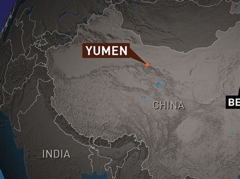
Picking up the journey in China, we are now in Yumen City in Gansu Province. It is located on the Silk Road, and is best known now for its oil production.
Starting in the 1930s, a modern highway was built over the old caravan route from Yumen to Urumqi, and continuing on to Kazakhstan. Then a railway line was built connecting Lanzhou (the Capital of Gansu Province) with Yumen and Urumqi. Then oil was discovered near Yumen City in 1939, which has since then developed a sizeable energy industry.
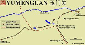
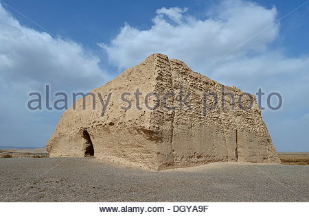
Located 250 miles to the west of Yumen City is Yumen Guan, or Jade Gate, on the Great Wall of China. It was the frontier pass in ancient times, the entrance to the old Silk Roads, and the one road connecting Central Asia and China.
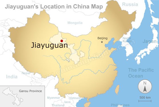
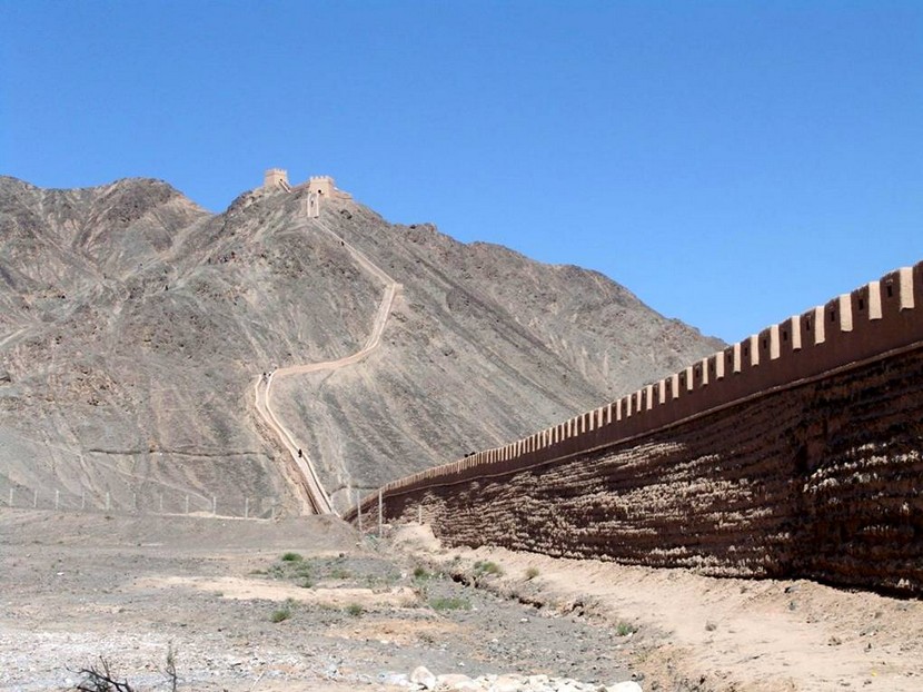
Next on the alignment is Jiayuquan, China. Jiayuquan, also in Gansu Province, is called the “Mouth of China” since it is located at the end of the Great Wall of China, and guarded the western boundary of China’s Ming Dynasty (1368 – 1644).
Jaiyu Pass is nearby, the largest and most intact pass…
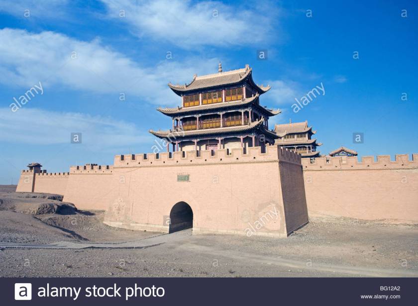
of the Great Wall of China.
Next we come to Yinchuan, China, the capital of the Ningxia-Hui Autonomous Region.


It is located on the Yellow River (or Huang He River), the Mother River of China. It is the second longest River in Asia, and the sixth longest river system in the world.
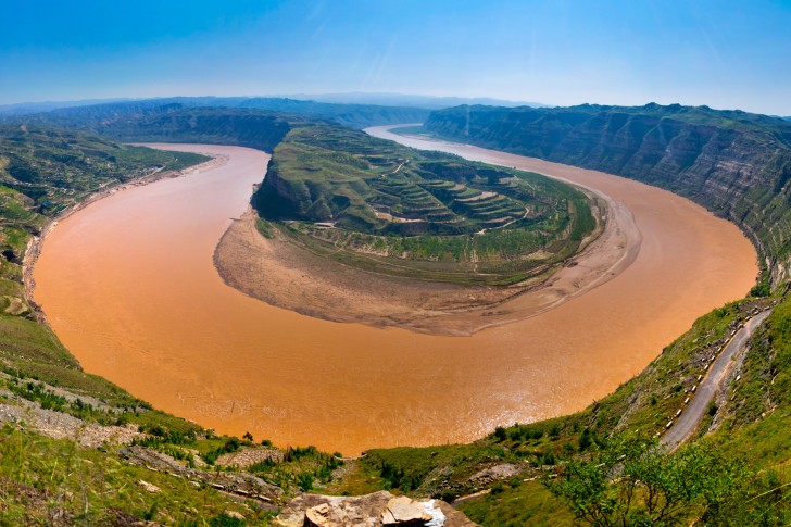
For comparison, here is Big Bend, Texas, on the left, and Horseshoe Bend, Arizona, on the right. I don’t believe the creation of these quite similar-looking river bends are a random act of nature, and these are not the only examples. Snaky, S-shaped rivers are a signature of the advanced Ancient Civilization, and will be its own subject in a future post.


Yinchuan is a center of the Muslin Hui minority people. Here is the Hui Mosque on the left, one of the approximately 500 mosques in Yinchuan, with a comparison picture on the right of the Taj Mahal in Agra, India, so you can see the similarity in architectural styles between the two, which are separated by a distance of 1,807 air miles (or 2,909 kms).


Next on the alignment is Taiyuen, China. It is the capital and largest city of the Shanxi Province. It is a main manufacturing base in China, and a transportation hub.

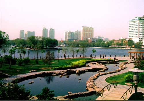
The meaning of Taiyuen is Great Plain, with its location where the Fen River leaves the mountains and enters a flat plain, going through the Shanxi Province, eventually connecting with the Yellow River (Huang He).


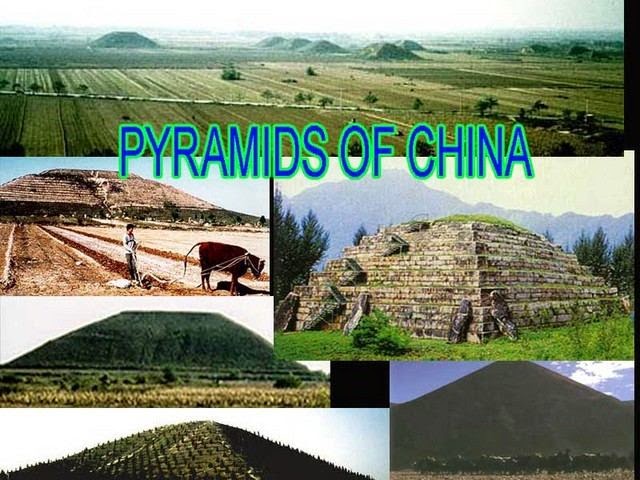
For information, southwest of Tiayuen and Shanxi Province, near Xi’an, the capital of Shaanxi Province, there are sixteen pyramids on the Guangzhong Plain, northwest of Xi’an.
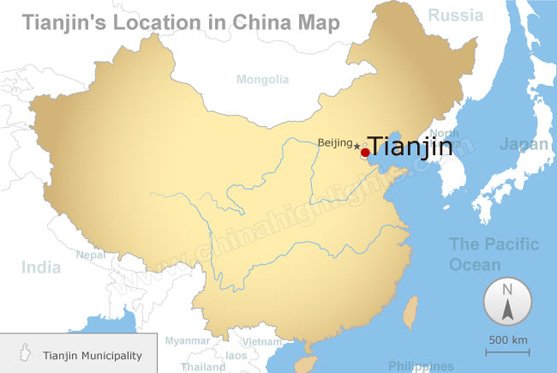
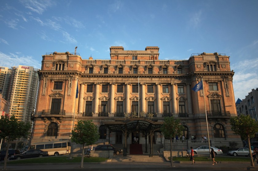
From Taiyuen, next we come to Tianjin, China, on the alignment. It is a coastal city with a population of over 15 million, and is one of four national central cities in the People’s Republic of China.
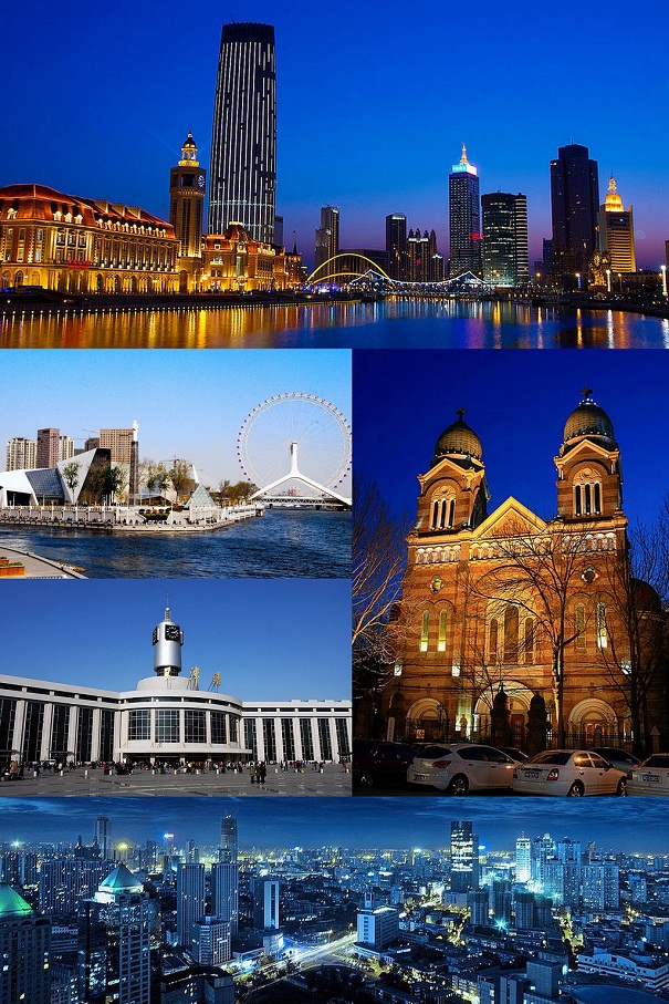
What really gets my attention in this photo of sights around Tianjin is the photo of the older building with two towers, center right. It looks like architecture I have seen in many other places around the world.
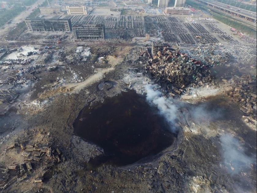
The other thing that really caught my attention about Tianjin is that there was a massive explosion there in 2015 – which I had heard about before I found it on the alignment. When I say massive, I mean it was apocalyptic, like a nuclear blast.
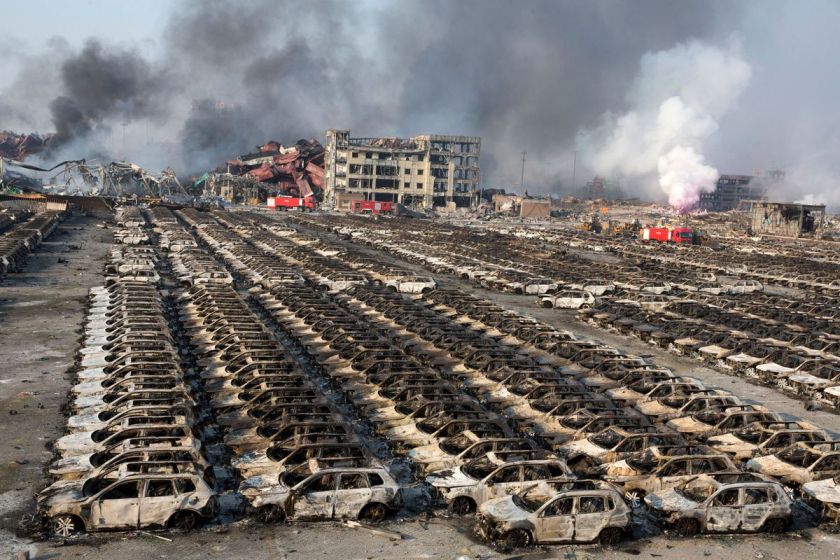
We are told the explosion took place at a warehouse at the port that contain hazardous and flammable materials chemicals, and the cause of the blast was unknown. Whatever caused the explosion, it left behind a gigantic crater….
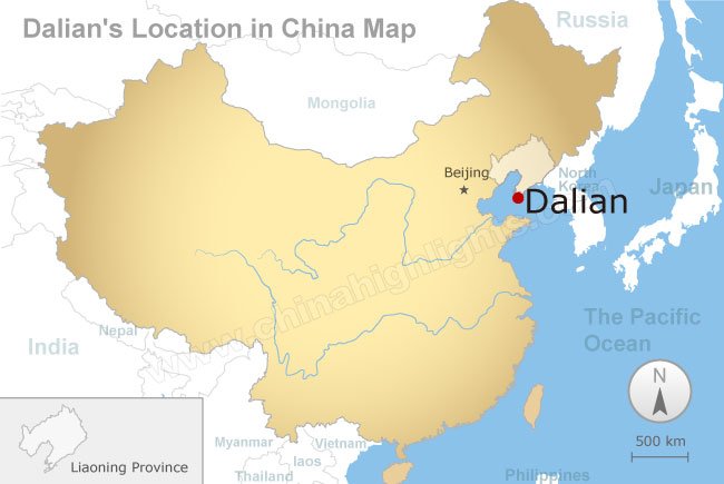
Next is Dalian, China, a major city and seaport in Liaoning Province. It is a financial, shipping and logistics center for Northeast Asia.
Okay guys, if you have been following me in this series, do the next photos look like what we would expect to see in China…or does it look like what we have seen in Europe and Central Asia along this alignment? If you are new to my work, and have any questions about why I am asking, please check out “How I Found the Silk Road – Parts 1 – 3.” This is Dalian, China, right before you leave the continent and head across the Yellow Sea to North Korea.
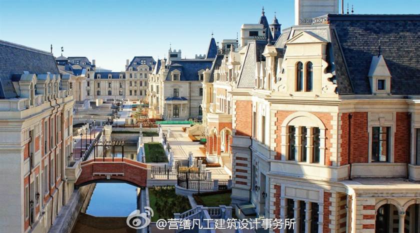
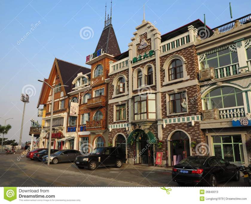
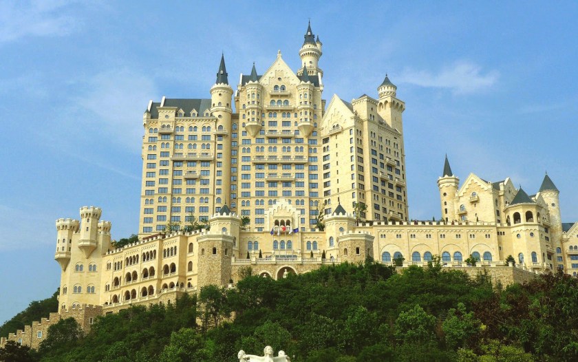
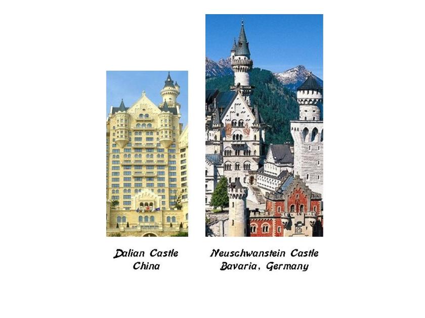
This is the Dalian Castle Hotel on the left, and Neuschwanstein Castle in Bavaria, Germany on the right. Now the Dalian Castle Hotel bills itself as “Bavarian-Styled,” but not specifically Neuschwanstein. I have highlighted specific design features that are identical in this comparison, between the northern east end of China, and just outside of Munich in Bavaria. Neuschwanstein was said to have been completed under Mad King Ludwig II in 1869. The information I can find on the Dalian Castle Hotel is that it is said to have opened in 2014. I am not convinced this is when it was built.
I will pick up the alignment in the next post at Pyongyang, North Korea.

This is amazing info and you have answered so many questions but I have many more…the puzzle is coming together for me!
Thank you!
I’m only up to this post and have been wondering about the Bible, almost afraid to ask the question!
LikeLike
Thank you, Joseph, for your feedback!
You know, all I know is there is a lot Humanity hasn’t been told about that has been deliberately removed from the collective awareness. I do believe there were Holy Books that the Bible we know today is based on. From what I understand, a lot of books of the Bible were revised or outright removed during the Council of Nicaea.
LikeLike
omg I am hooked! Thank you for all your detailed research.
I hunger for knowledge and your work is so satisfying ❤
LikeLike
omg I am hooked! Thank you for all your detailed research.
I hunger for knowledge and your work is so satisfying ❤
LikeLike