
In this eighth volume of what will end up being a long new series, I am highlighting places, concepts, and historical events that people have suggested, and includes photographs, videos and other information viewers have gathered along the way and sent to me in their explorations and research of places close to where they live.
This series is a compilation of work I have previously done, presented in a multi-volume format.
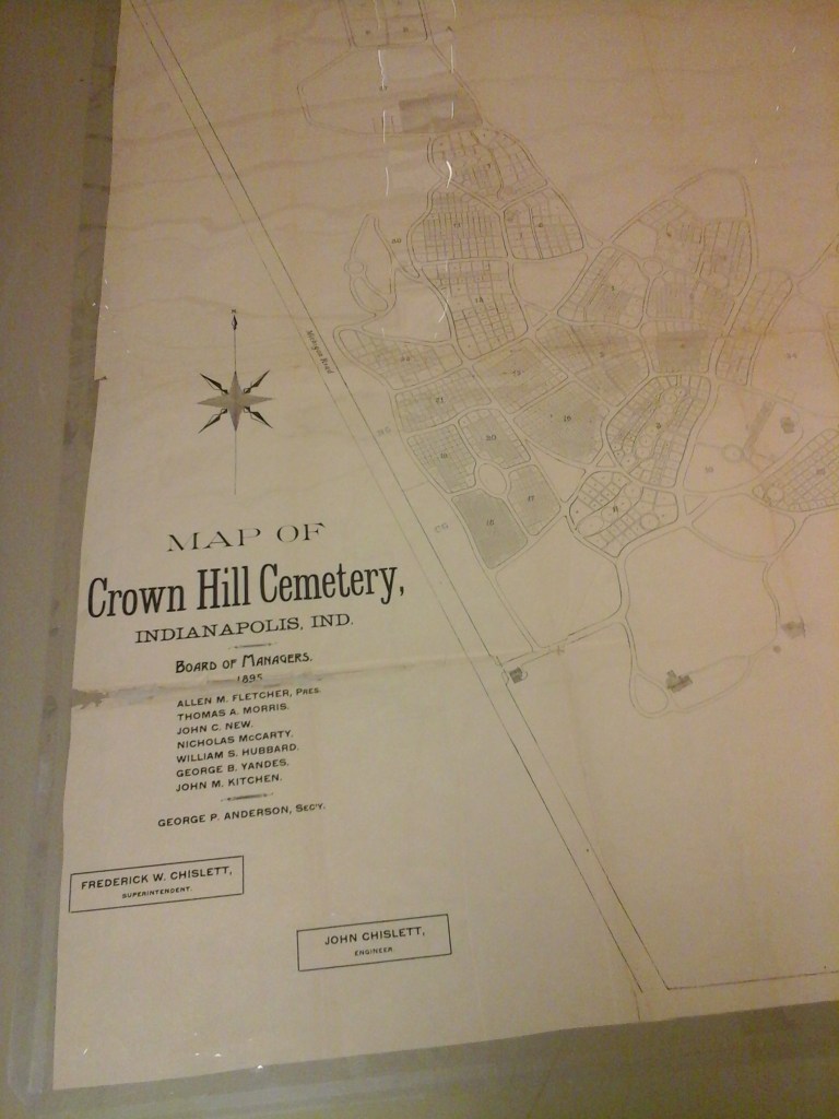
Several viewers from Indianapolis mentioned the Crown Hill Cemetery to me, located about 3-miles, or 5-kilometers, outside of the city.
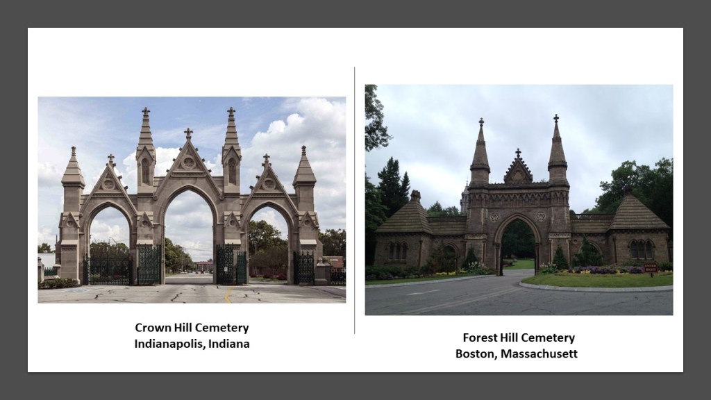
The main gate of the Crown Hill Cemetery is very similar to ones in Boston that I showed in the last video, like Forest Hill.
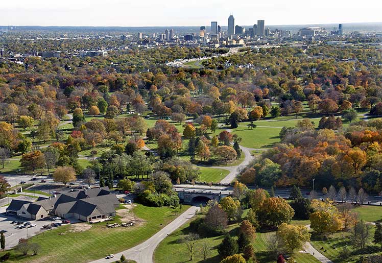
The Crown Hill Cemetery is the largest green-space within the Indianapolis Beltway, and the third-largest private cemetery in the United States.
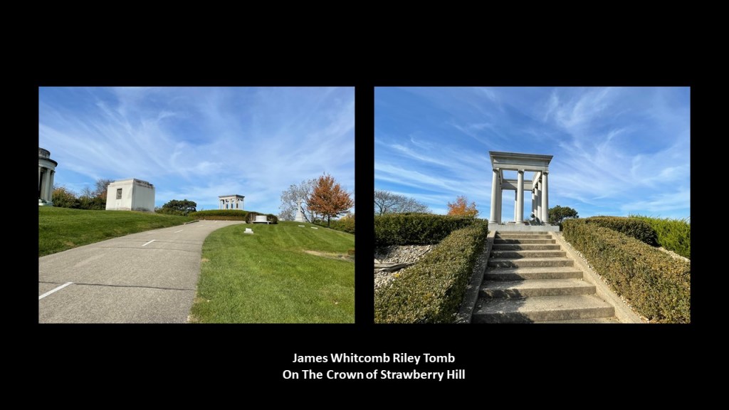
It was established in 1863 at Strawberry Hill, whose summit was renamed “the Crown,” with the grave of Indiana poet James Whitcomb Riley sitting right at the top of the crown.
I wonder why James Whitcomb Riley merited such a prestigious location for his final resting place for all eternity?
Let’s see what the plaque there about him tells us.
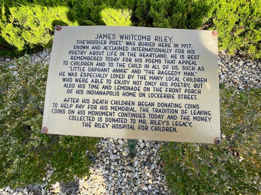
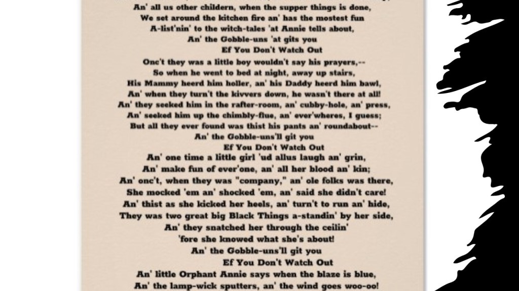
So, he is best remembered today, it says, for his poems that appeal to children and the child in all of us, such as “Little Orphant Annie,” which is not a misspelling, based on an orphan living in the Riley home in her childhood.

There are four stanzas in the poem, and in the first one, her character is introduced, and in each of the second and third stanzas, she tells young children about a bad child being snatched away by goblins as a result of misbehavior, with the underlying moral of the story in the fourth stanza, which was for kids to obey their parents or the same thing could happen to them.
Nothing weird about that right? Yeah, right!!
Oh yes, and this young girl in Riley’s poem was the very same one that the comic strip “Little Orphan Annie” was based on, which eventually led to radio, television, Broadway and Hollywood productions about her.

Riley’s memorial plaque also mentioned his poem “The Raggedy Man,” about a German tramp that Riley’s father employed in his youth…
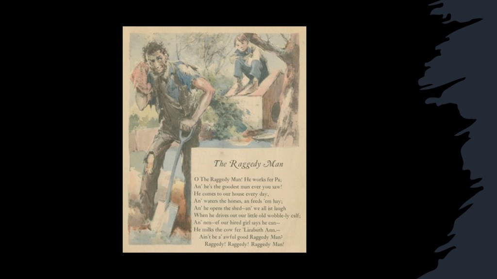
…and written, like “Little Orphant Annie,” in the Indiana dialect of the 19th-century.
Interesting that the “Raggedy Man” knew about giants and griffins and elves, though I have no idea what a “Squidgicum-Squee” would be!

Well, here’s one artist’s rendition of a rather terrifying-looking “Squidgicum-Squee!”

Was the Raggedy Man was the inspiration for Raggedy Ann?
Apparently the Raggedy Man and Little Orphant Annie both were, because the creator of Raggedy Ann, Johnny Gruelle, a family friend of Riley’s, was said to have combined the names of both characters into one when he applied for a registered trademark on the Raggedy Ann name in 1915.

Lastly, according to the plaque at his tomb, Riley was so beloved by the children of Indianapolis who used to come visit him on his front porch for lemonade, that they began donating coins to help pay for his memorial, and this tradition continues today…
…where the coins collected go to his legacy, the Riley Hospital for Children.

JG in Iowa mentioned visiting a lot of rural cemeteries with a friend last year, and among other things, found these tree-like head-stones in every graveyard.
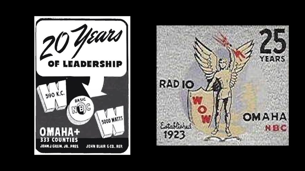
She looked them up, and found out they came from Woodmen of the World, a fraternal organization and life insurance company.
Here’s what we are told.
Joseph Cullen Root founded the Woodmen of the World in 1890, as a secret fraternal benefit organization with a purpose of making life insurance affordable for everyone…
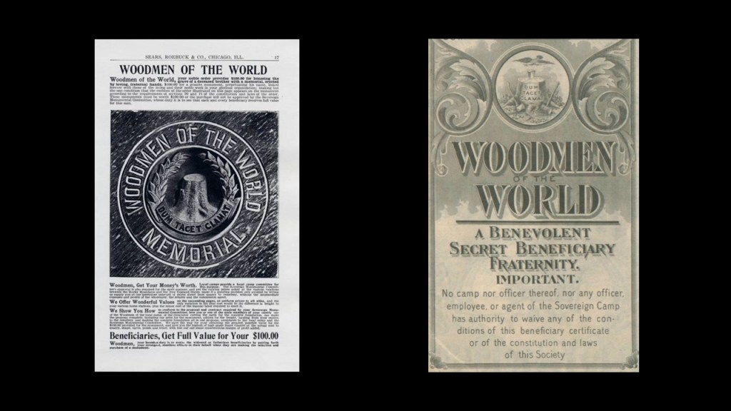
…and that from 1890 to 1900, every policy included a tombstone.
Alas, the cost of tombstones rose to the point that after 1900, members had to buy a rider on their insurance policy in order to receive a Woodmen tombstone.
By 1920, the costs of making these unique tombstones were so prohibitive, that they were discontinued in the 1920s.
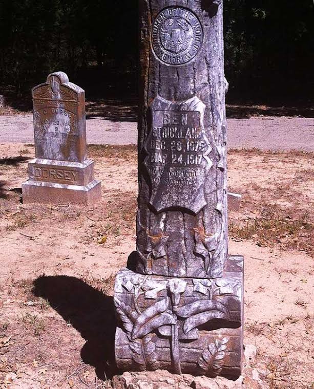
Frequently, the tombstone had the Woodmen of the World (or WOW) motto “Dum Tacet Clamet,” or “Though silent he speaks,” inscribed on a round medallion.
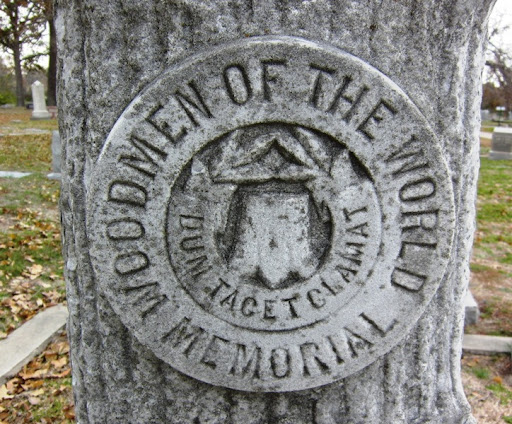
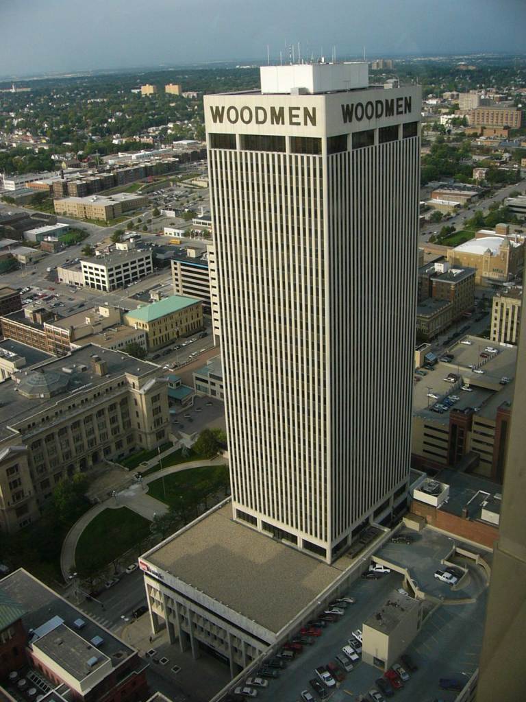
Woodmen of the World still exists today, and headquartered in Omaha, Nebraska.
This is what their original headquarters building looked like, which opened in 1912.
It was the tallest building between Chicago and the West Coast before it was demolished in 1977.
…and their headquarters building today, said to have been built in 1969.
They still operate their radio station, WOAW in Omaha, which started broadcasting in 1923…
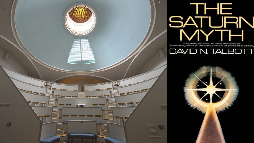
LBR said the image of the Ether Dome at Massachusetts General Hospital in Boston was reminiscent of the image used on the book cover of The Saturn Myth by David Talbott.
Now onto new subjects.
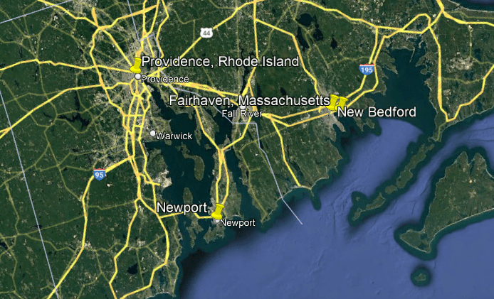
NA suggested that I come to Fall River, Massachusetts, and Newport Rhode Island.
First I will look at Fall River, and express huge thanks to RR and his son for the photos and the drone footage of Fall River.
RR sent me the following pictures.
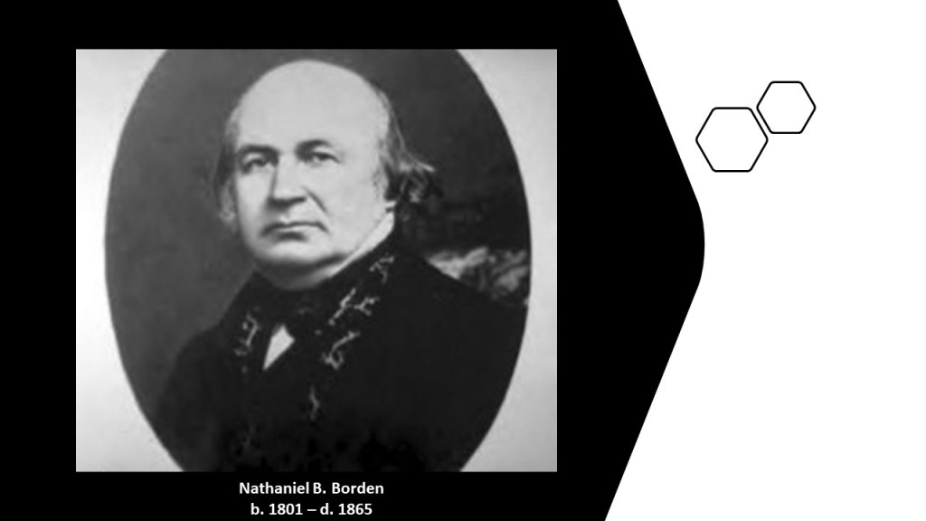
Firstly, this is the Academy Building, also known as the “Academy of Music Building” and the “Borden Block.”
RR said that 1875 was one of the coldest winters ever in Massachusetts, and questioned that it was even possible that they could have built this the way they said they did.
It was said to have been constructed in 1875 as a memorial to Nathaniel Briggs Borden by his family, and opened on January 6th of 1876 as the second-largest theater and concert hall in Massachusetts, as well as a venue for other large community events.
The building today is used for senior living apartments and retail space after being rescued from demolition plans in 1973.
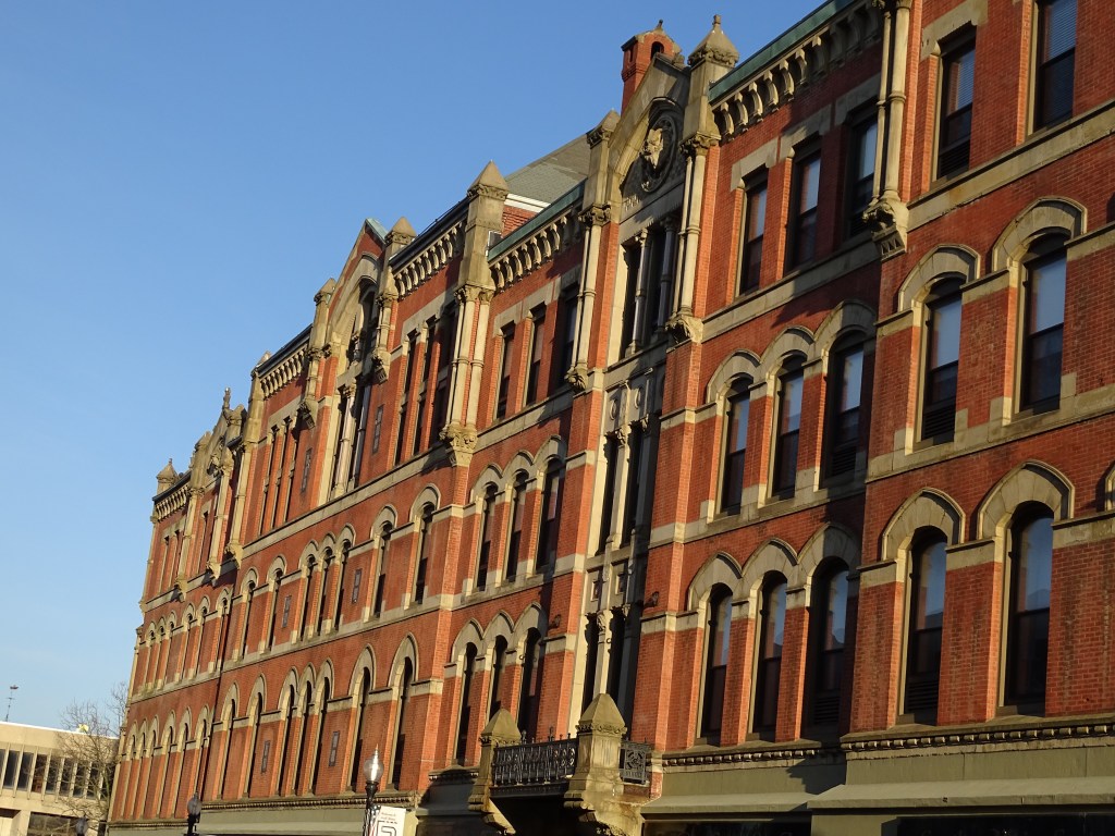
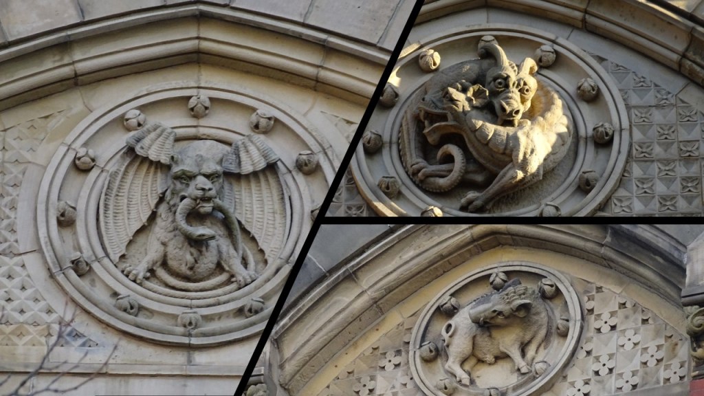
RR sent photos of some of the interesting-looking gargoyle shapes found on this building.
Nathaniel Borden, the man who the Academy building was said to have been in memory of, was a businessman and politician from Fall River, who was born in 1801 and died in 1865.
In business, he was involved in textile mills, banking, and railroads.
In politics, he was a State Senator, a Representative in the U. S. Congress, and was the third Mayor of Fall River.
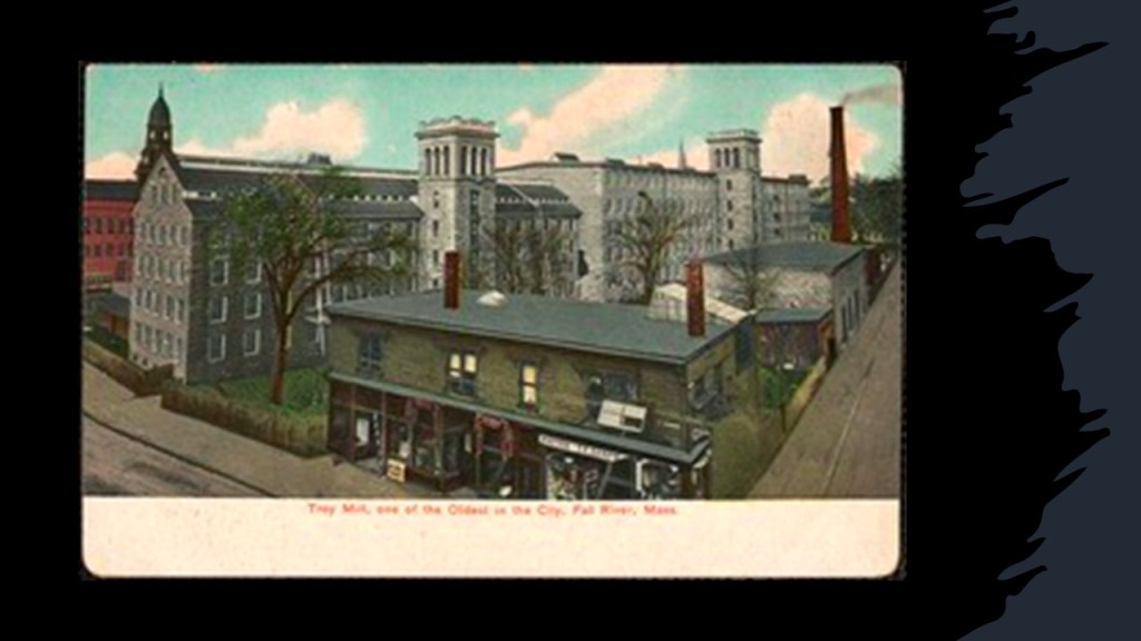
We are told that his father died when he was young, and his mother Amey was one of the first incorporators of the Troy Cotton and Woolen Manufactory, the second cotton mill that was established in Fall River in 1813 and built on her property. She died in 1817.
Then, at the age of 20, Nathaniel along with several others organized the Pocasset Manufacturing Company, a cotton textile mill.
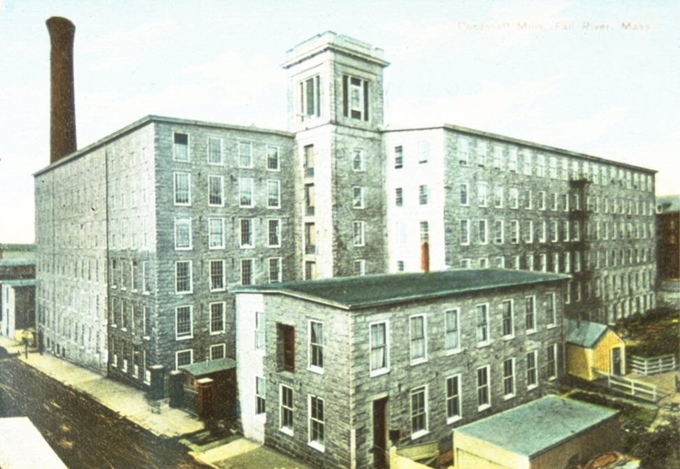
The Pocasset Manufacturing Company was the origin of the Great Fall River Fire of 1928, which destroyed the mills and a large portion of the city’s business district along with it, completely wiping out five city blocks but not killing anyone.
This is a 1910 illustration of a part of Main Street which was destroyed by the fire.
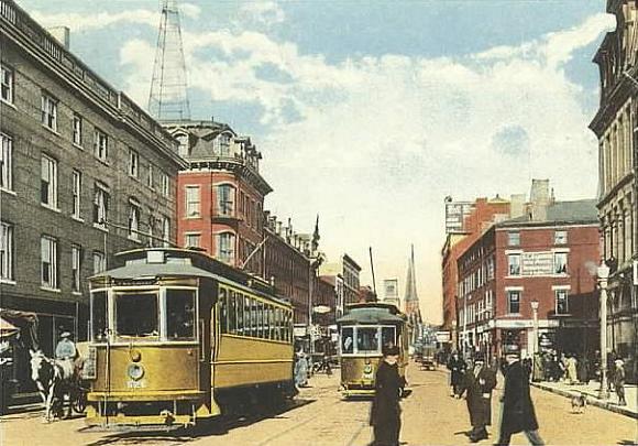
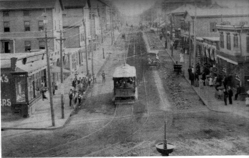
RR sent this historic photo of Fall River looking north on Main Street, with the electric streetcar running, and relatively few people milling about a big city block.
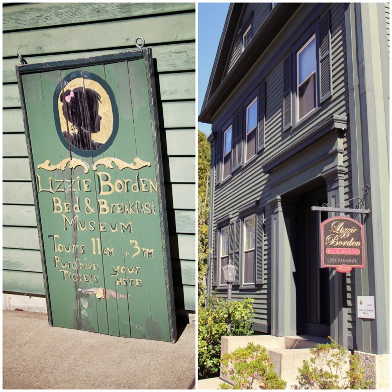
The most famous Borden of Fall River was the notorious Lizzie Borden, who even though she was acquitted of the axe murders of her father and stepmother in 1892, her story is still alive and well in American Pop Culture.

…and if you ever have plans to travel to Fall River, you can always stay at the Lizzie Borden Bed and Breakfast & Museum.
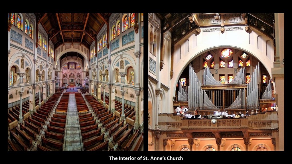
RR also sent several pictures of St. Anne’s Church in Fall River that was said to have been built in the 1890s
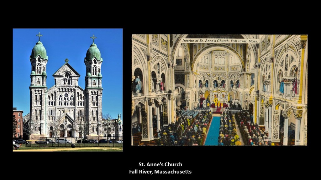
This photo of St. Anne’s church sent by RR shows a very nice alignment with the full moon and the top of the church, smack in the middle between the church spires.
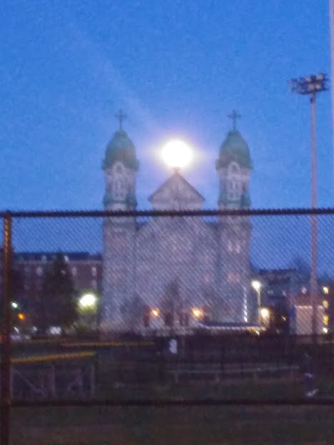
Reminds me of the perfect alignment of the sun with the top of the tower at Angkor Wat in Cambodia on the days of equinoxes and solstices every year.

He also sent photos of the building of St. Anne’s Church taken when it was said it was being built starting in the 1890s
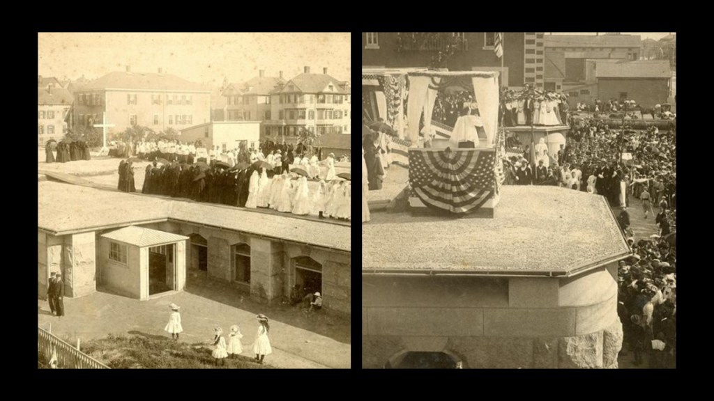
He said the church was built with local granite and blue marble from Vermont.
Two last things from RR.
He sent me drone footage taken by his son.
The first drone footage shows the Braga Bridge, that carries Interstate 95 across the Taunton River between the towns of Fall River and Somerset, and the USS Massachusetts beside it, which is a museum today.
This second one is drone video footage of old church towers on Rock Street in Fall River.
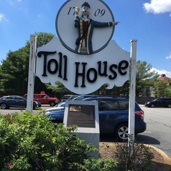
The next place I am going to look at is Whitman, Massachusetts, which was suggested by BA.
In the late 1930s, Whitman is the place where the chocolate chip cookie was first invented by Ruth Graves Wakefield at the Toll House Inn, which was a tourist lodge.
Whitman is located half-way between Boston and New Bedford, and travellers would be charged a toll when they historically stopped here to change horses and have a hot meal.
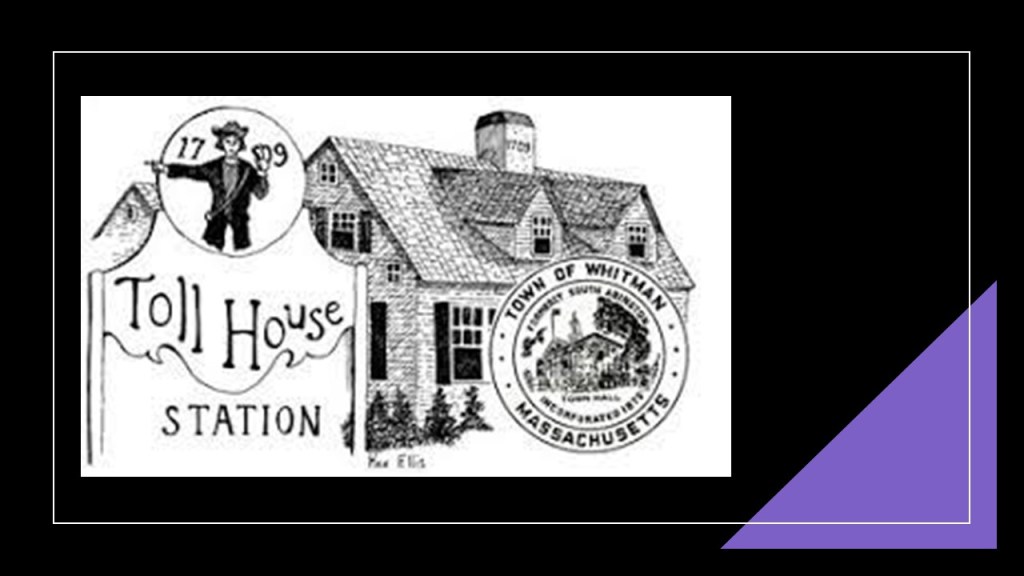
Ruth Graves Wakefield soon became famous for her lobster dinners and desserts at the Toll House Inn, which included the first chocolate chip cookies.
The Toll House Inn burned down in 1984, but its sign still stands today on Route 18.
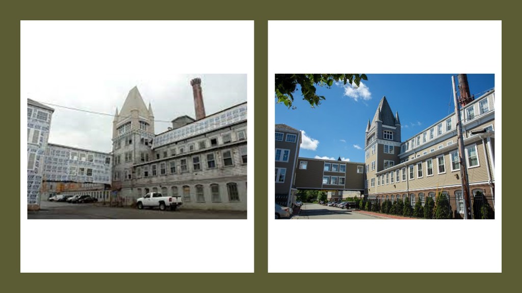
Whitman’s history is deeply-rooted in the shoe-making industry, with over 20 shoe and related-factories in-town.
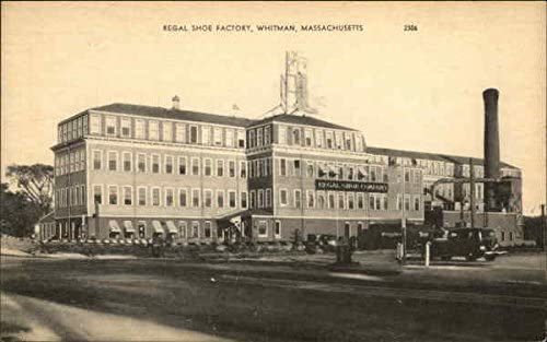
There are a few abandoned shoe factories left in Whitman, and some have been turned into condos, like the Bostonian Shoe Lofts.
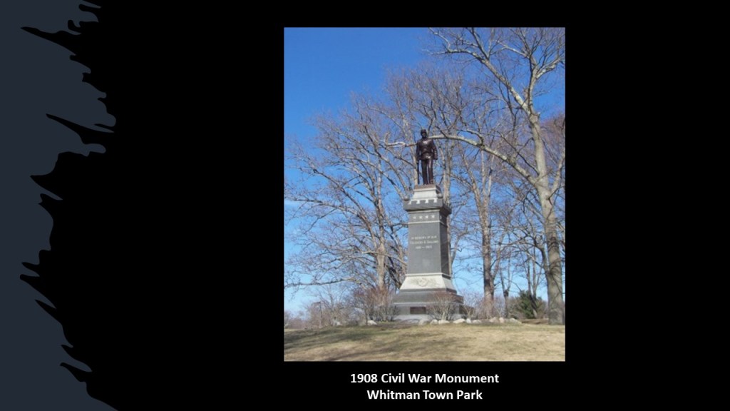
BA mentioned that there is a beautiful park here, the Whitman Town Park, that was credited to the Olmsted Brothers for its present design in 1900.
This park has mounds…
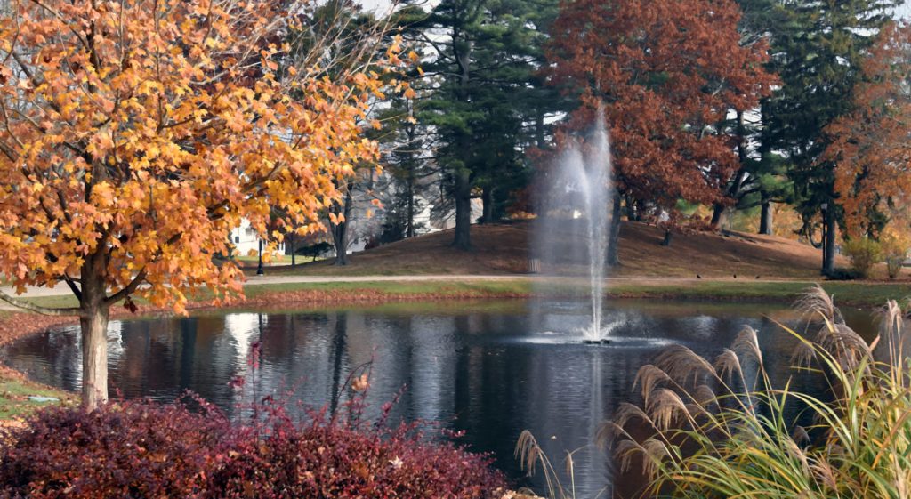
…and a Civil War monument was added to the park, we are told, in 1908.
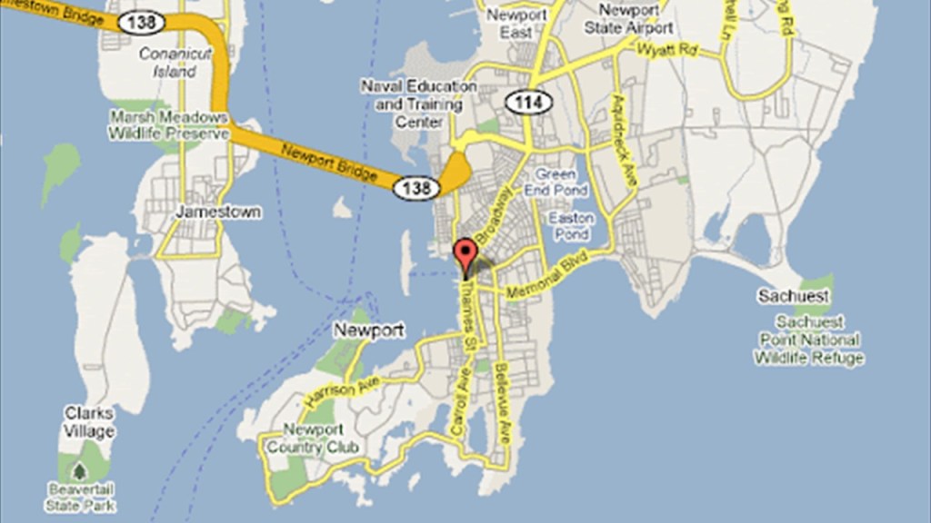
Now onto Newport, Rhode Island, and some other places in the smallest state in the United States.
Bellevue Avenue in Newport is known for its “Gilded Age Mansions.”
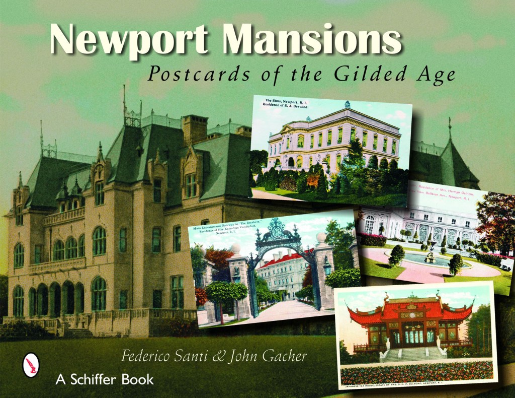
One definition that I found of “Gilded Age” is that it was a period of gross materialism and blatant political corruption in the United States from the 1870s to 1900.
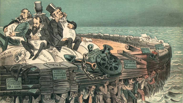
Another definition is that it was an era of rapid economic growth, especially in the northern and western United States.

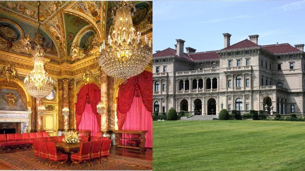
Perhaps the most famous of these “Gilded Age” mansions, said to have been built between 1893 and 1895 for Cornelius Vanderbilt II in Newport known as “The Breakers.”
It was said to have been patterned after a Renaissance Palace, and built with marble imported from Italy and Africa, as well as rare wood and mosaics from countries around the world.
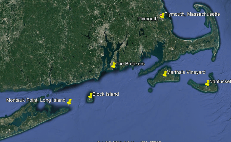
“The Breakers” Mansion, as well as the city of Newport itself, is centrally-located on the Atlantic coast, between the eastern tip of Long Island, which is Montauk Point; Martha’s Vineyard; and Nantucket Island; and Plymouth, the landing spot of the Pilgrim’s on Massachusetts’ Cape Cod.
I can already see I am going to have to come back here on another occasion and do a deep dive.
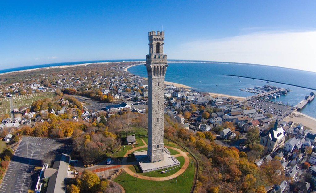
This is a good place to insert AF’s suggestion of looking into the Provincetown Monument.
Known as the Pilgrim Monument, it is located in Provincetown, Massachusetts, and was said to have been built between 1907 and 1910 to commemorate the first landfall of the pilgrims in 1620, and the signing of the Mayflower Compact, the first governing document of the Plymouth Colony, in November of 1620 when the “Mayflower” was anchored in Provincetown Harbor.
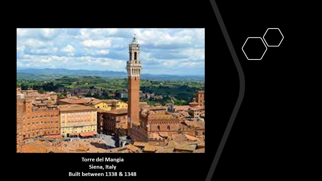
A contest was said to have been held to design the monument, and the winning entry was a design based upon the Torre del Mangia in Siena, Italy, which was said to have been built between 1338 and 1348.
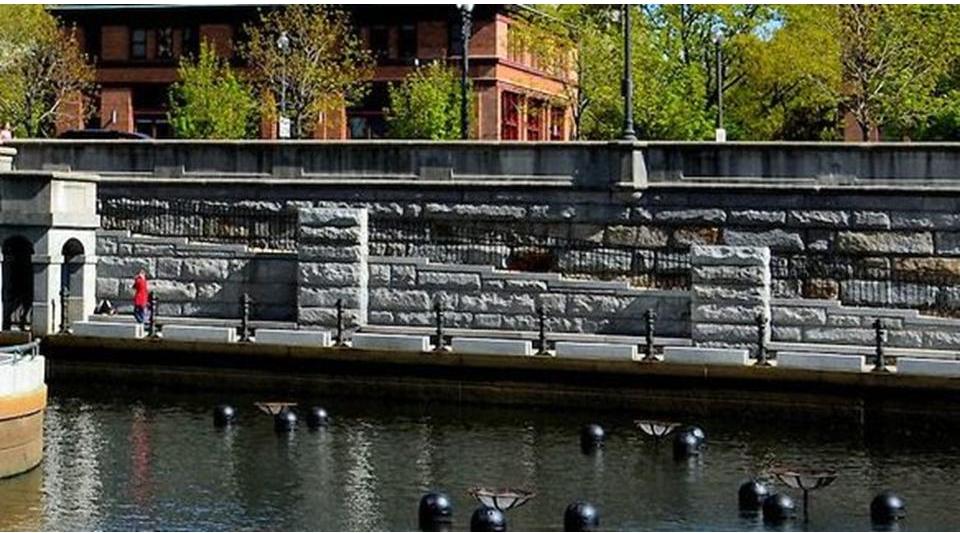
RS brought Woonsocket, Rhode Island to my attention, with the comment that Rhode Island has tons of massive polygonal masonry walls everywhere, and giant granite masonry on top of bigger and older giant block masonry.
RS lives near a bridge on South Main Street in Woonsocket, and said that it clearly wasn’t built recently, and even has a plaque stating it was “re-fixed” in the late 1800s.
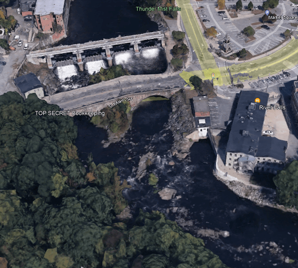
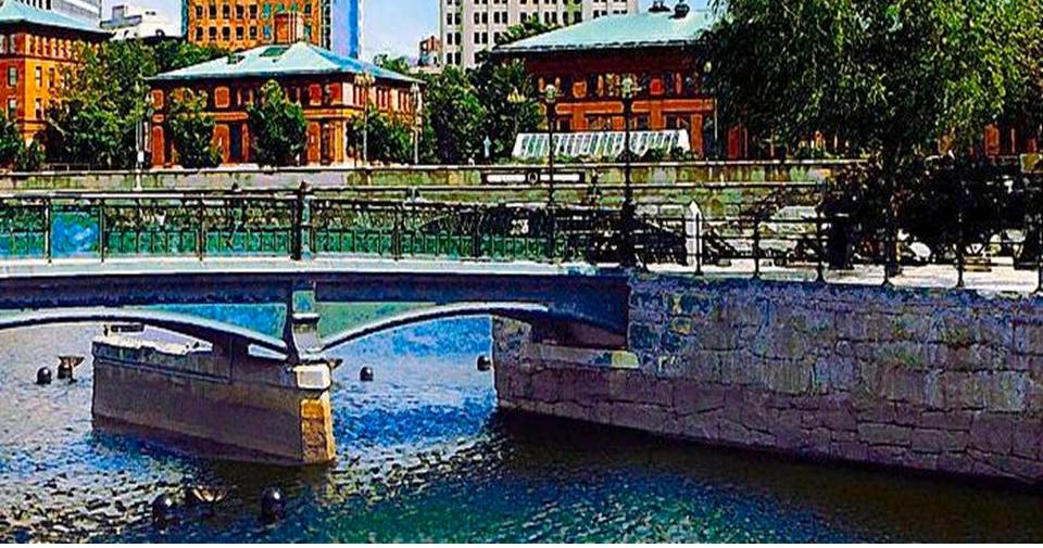
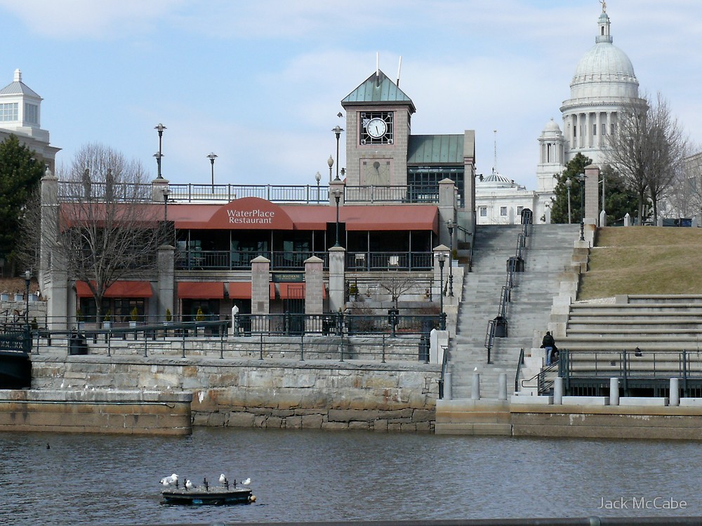
I found great examples of the megalithic polygonal masonry walls in Rhode Island several years ago when I was tracking an alignment from Washington, DC, through Providence, the state capital.
Here are several photos of the megalithic polygonal masonry seen at Providence’s Waterplace Park.
CR suggested that I look at Fairhaven, Massachusetts, where there’s a high school, library, and at least a couple church’s that are amazing, and that there’s a small one of these buildings in a cemetery in New Bedford near the high school over there.
Fairhaven and New Bedford are in the same general area that I have been talking about in this region of New England’s Atlantic coast, and are located right next to each other.
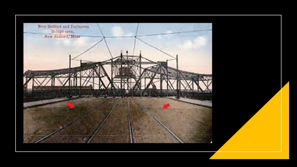
…and the two cities are connected by a swing-truss bridge, which swings open to allow fishing boats in and out of the inner harbor located here.
Here’s an old postcard showing the bridge “open”…and are those streetcar tracks on the bridge?
Sure looks like it to me!
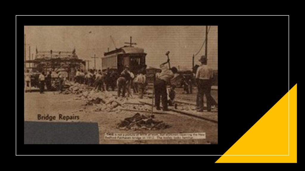
And this was the only old photo I could find about the bridge with a streetcar actually showing in it.
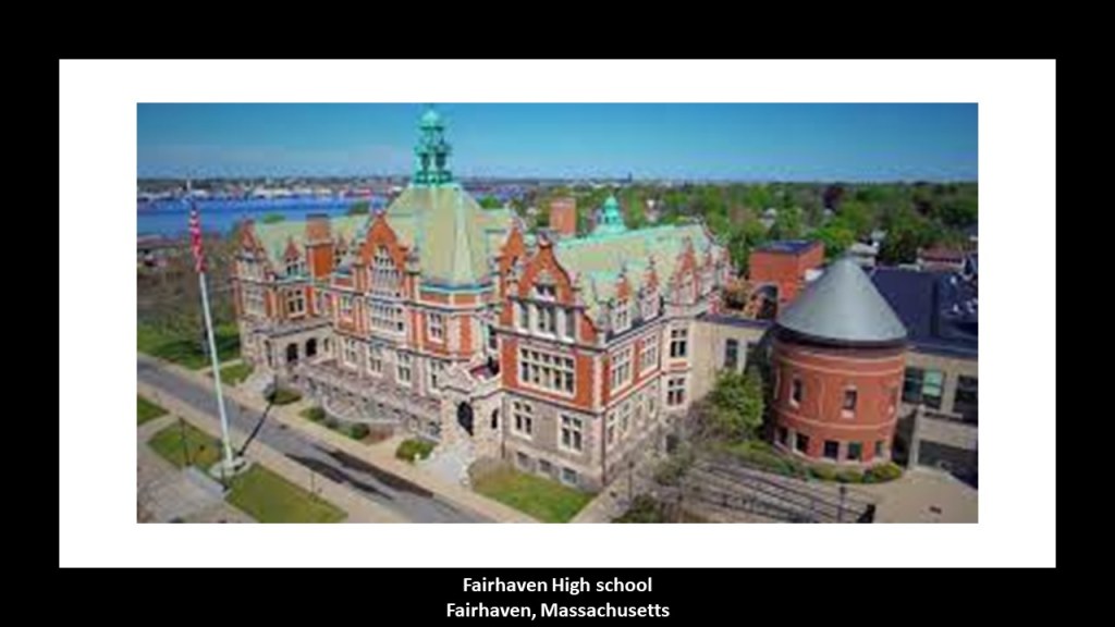
This is the Fairhaven High School, still in use today, which opened in 1905, and said to have been designed by architect Charles Brigham, and donated by Henry Huttleston Rogers, one of the key men in John D. Rockefeller’s Standard Oil Trust.
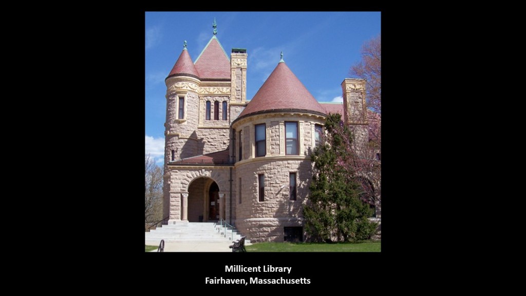
The Millicent Library in Fairhaven was said to have been designed by Charles Brigham and donated to the town by Henry Huttleston Rogers, in memory of his youngest daughter Millicent Rogers, who died of heart failure at the age of 17.
It was dedicated in 1893.
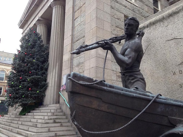
Both New Bedford and Fairhaven were deeply connected to New England’s whaling industry in the 19th-century, as whale oil was the primary source for lighting fuel for much of that time.
This is the “Whaleman” statue on the grounds of the New Bedford Free Public Library, gifted to the city in 1913 as a tribute to the whalers that made New Bedford famous.
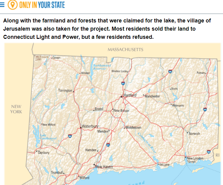
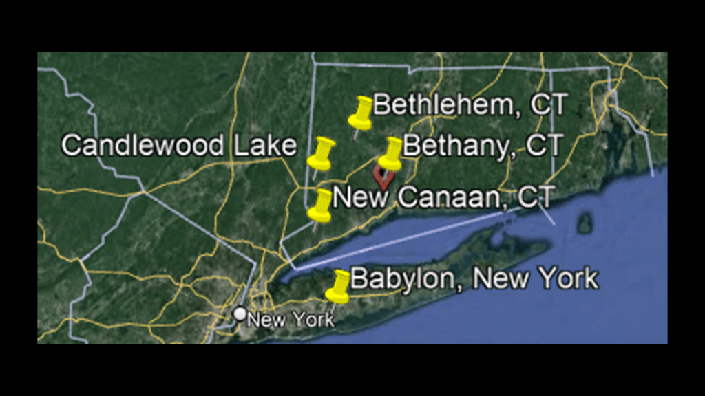
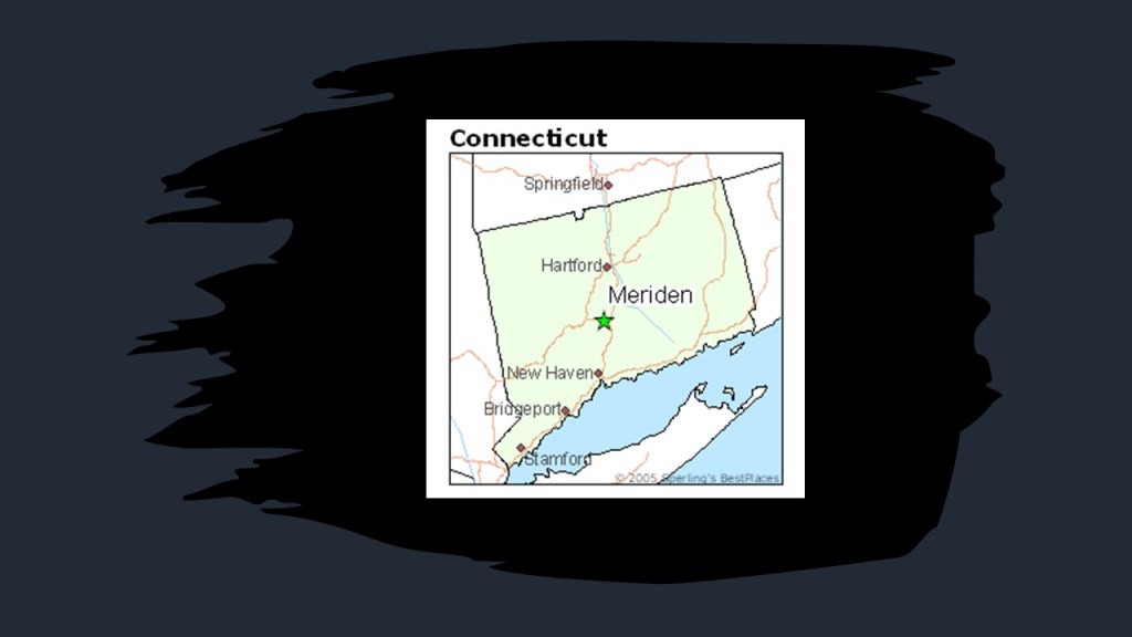
The next places I am going to look at are in Connecticut are Candlewood Lake and Meriden from information provided to me by KO
First, Candlewood Lake, which is a man-made lake that is the largest in Connecticut, and the largest lake within a 60-mile, or 97-km, radius of New York City.
Some of the most expensive real estate in Connecticut is found around its shores.
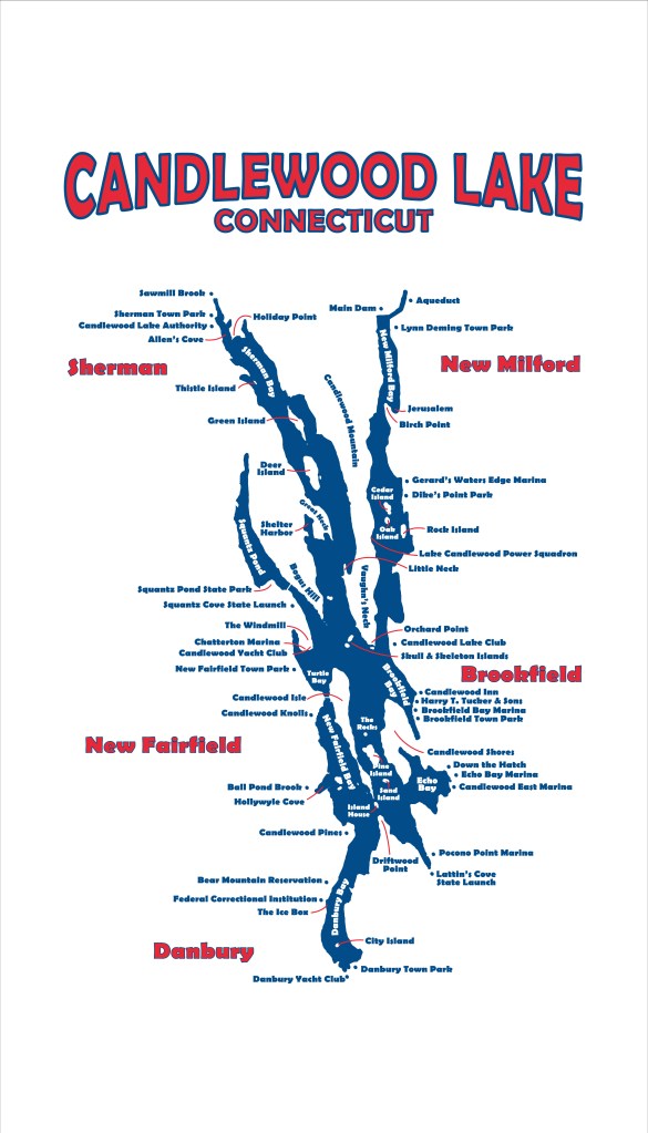
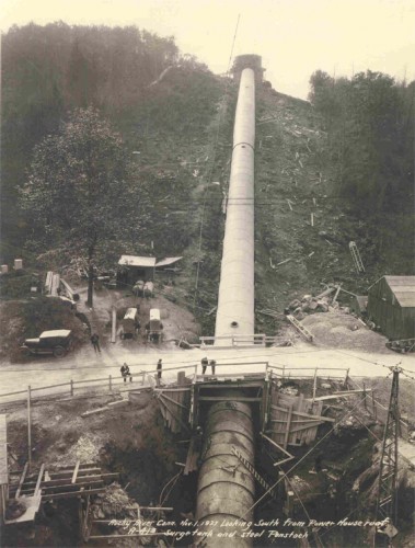
Candlewood Lake was formed when the Connecticut Light and Power Company’s Board of Directors approved a plan in 1926 to create the first large-scale operation of pumped storage facilities in the United States, and they created the lake by pumping it full of water from the Housatonic River.
He said there was a city named Jerusalem beneath the waters of the lake, and while there isn’t a lot of information regarding this lost town in Connecticut, there are references to it available to find.
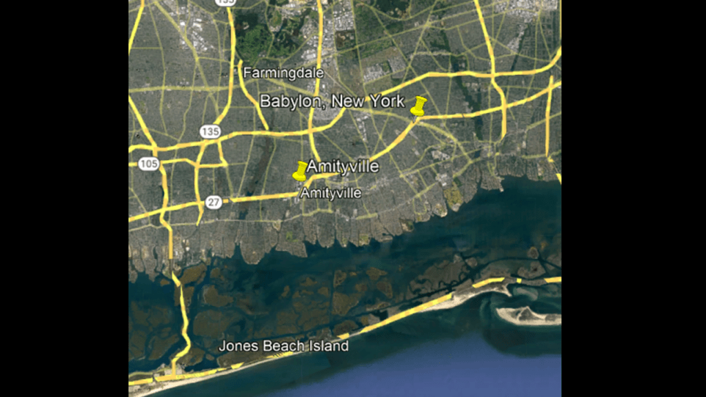
KO mentioned there is a Babylon, New York and New Canaan, Connecticut right close by, as well as a Bethlehem and Bethany.
Just an interesting aside for those of us who remember when the Amityville Horror came out in the late 1970s…
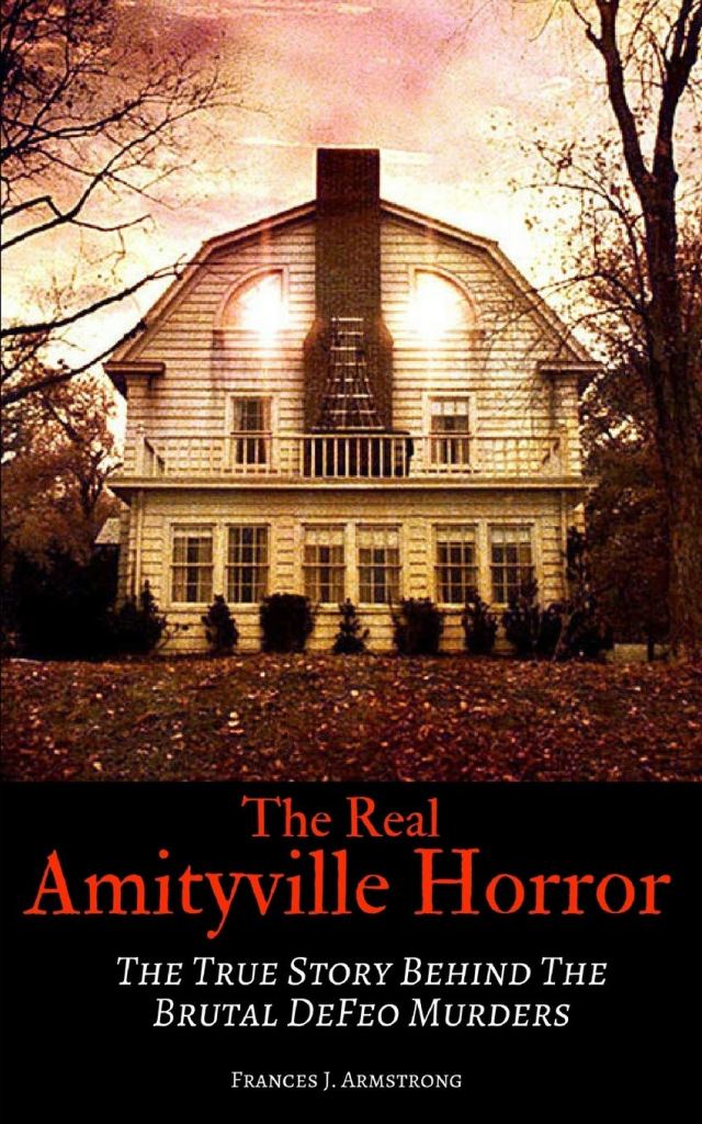
…I happened to notice Amityville is just down the road from Babylon on New York’s Long Island.
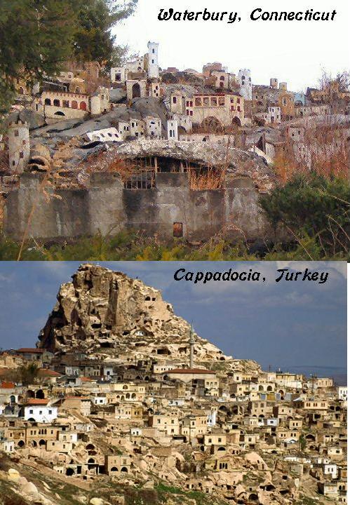
One more place of interest to note in Connecticut is Waterbury.
It was the location of Holy Land USA, a theme park said to have been inspired by passages from the Bible.
It was opened in 1955…
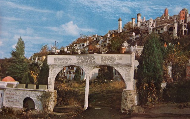
…and closed in 1985.
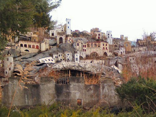
It reminds me a lot of Cappadocia in appearance, an ancient region in Central Anatolia of Turkey.
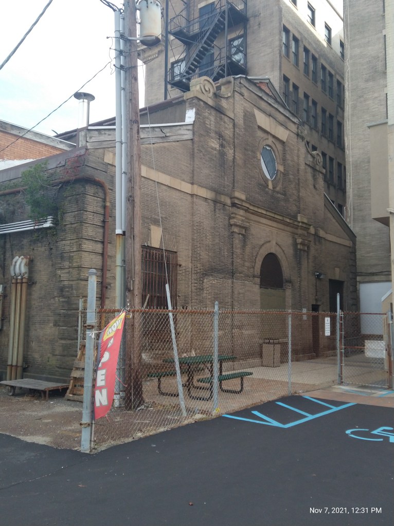
KO also sent me some photos from Meriden, Connecticut.
In this picture of what he called a florette, an elevation applique, there which looks like there have been modifications, with what appears to be another set of numbers beneath what is seen on the surface.
He said there is a deep scratch around where whoever scratched around the outside of the area and then used a chisel to somewhat sloppily prepare the surface for a new date and elevation, which was done with another tool, and engraved in a different style of text.
Meriden is located half-way between New Haven, Connecticut and Hartford, Connecticut.
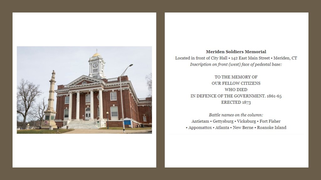
This is Meriden’s City Hall, said to have been built in 1907.
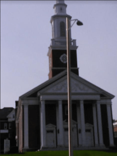
The Soldiers’ Monument in front of the City Hall was erected in 1873, we are told, to honor those from Meriden who died in the American Civil War.
The monument is described as an obelisk having a granite base and the statue of a soldier on top.
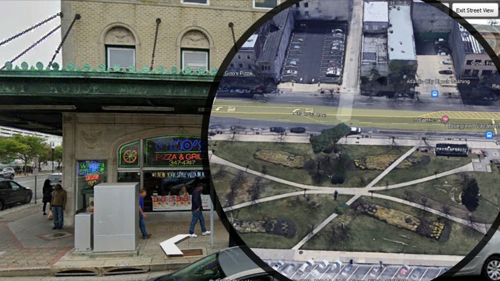
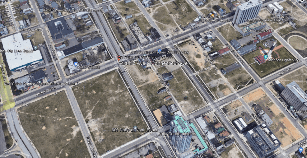
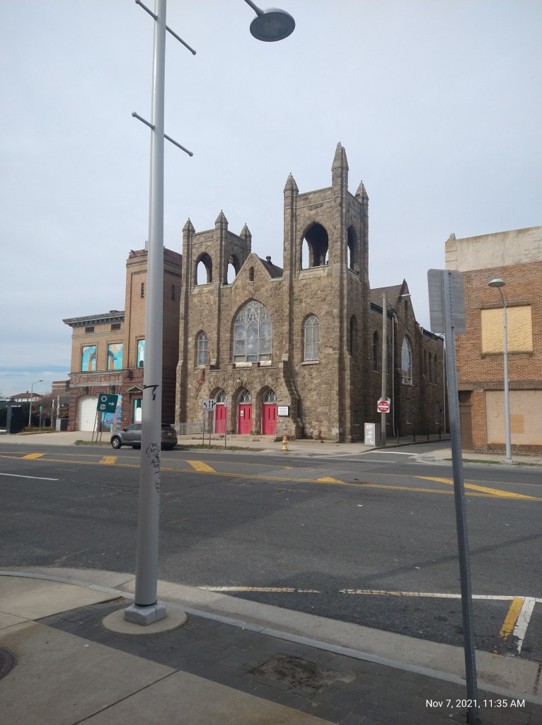
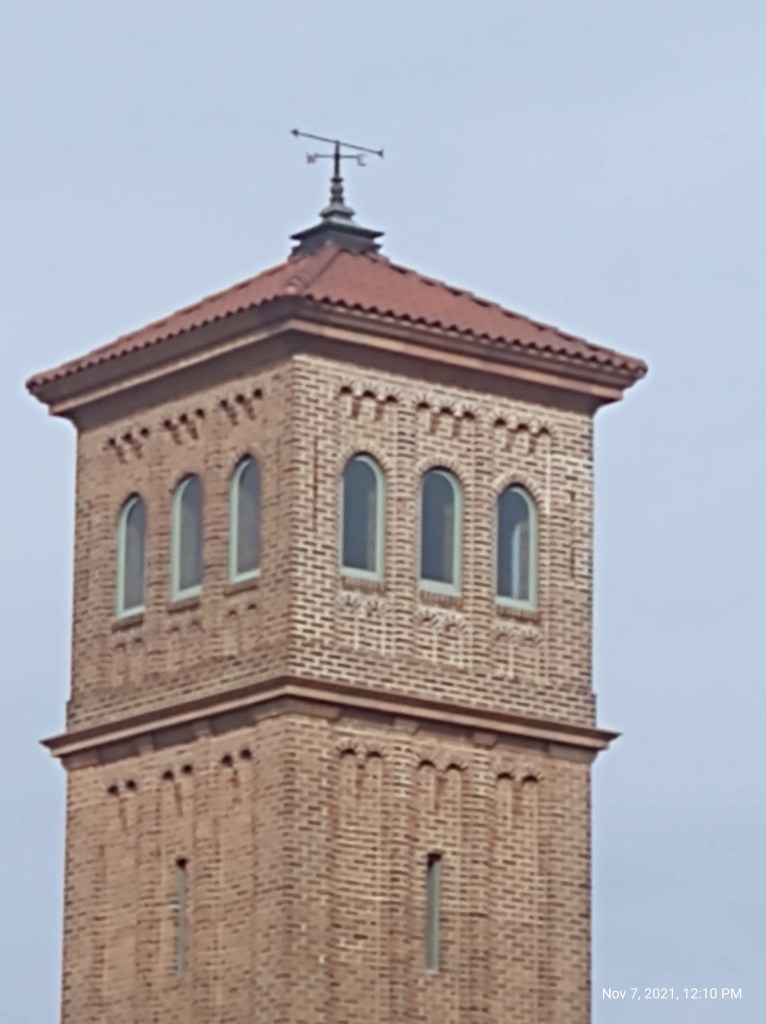
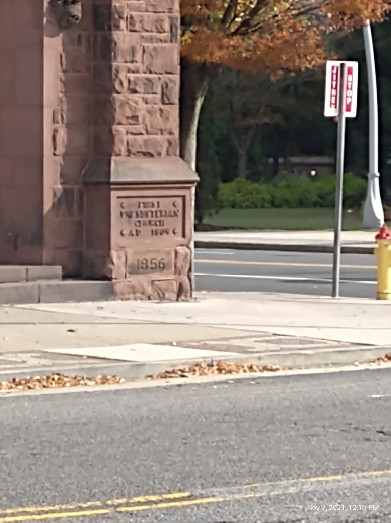
Next I am going to look at Atlantic City, New Jersey, based on EB’s suggestion and photos he sent me.
First is a photo he sent me of the old fruit and vegetable market…
…that he said is now the location of Gino’s Pizza and Grill on Atlantic and North Carolina Avenues.
He also sent me pictures of what he thinks are the oldest churches in his area in the block of Connecticut and Atlantic Avenues.
Interesting the number of empty lots showing here too.
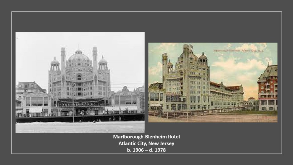
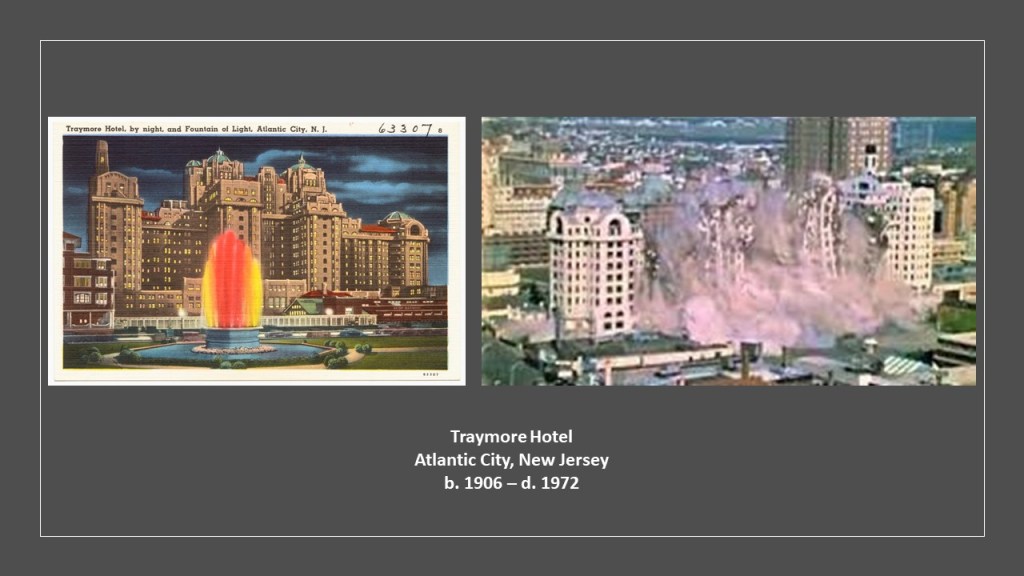
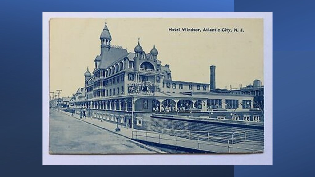
EB also sent me screenshots of old hotels in Atlantic City that were three- and four-blocks-long that were Moorish castles, like the Marlborough-Blenheim Hotel, which was said to have been built between 1902 and 1906, and demolished in October of 1978…
…the Traymore Hotel, said to have opened in its most recent form in 1906 and demolished in 1972…
…and the Windsor Hotel, about which I can’t find any information to speak of, but presumably long gone like the others.
The last image I am going to leave you with of Atlantic City is an old postcard showing the Atlantic City and Shore Railroad crossing a two-mile, or 3-kilometer, -long trestle bridge in Great Egg Harbor Bay, and was a type of streetcar system in New Jersey called an interurban that served Somers Point and several other cities between Atlantic City and Ocean City in the years between 1907 and 1948.

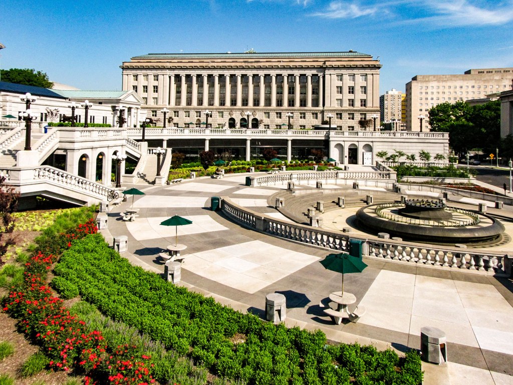
CZ sent me several Google Earth screenshots of Harrisburg, the State Capital of Pennsylvania.
Harrisburg is situated on the east bank of the Susquehanna River, only 107-miles, or 172-kilometers, west of Philadelphia.
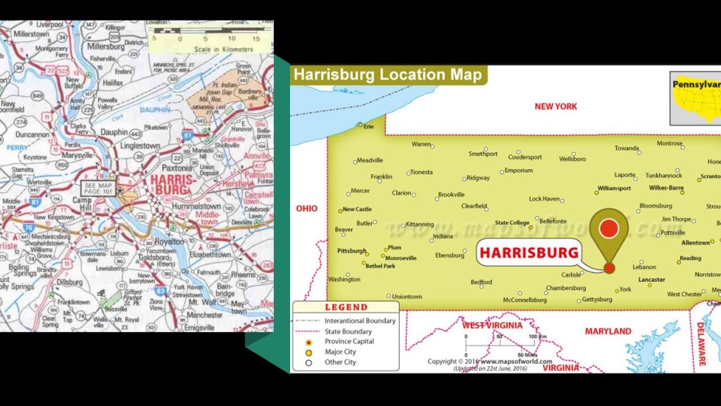
Like with any place, there is so much information to choose from as far as where to look in Harrisburg that I am going to focus solely on what CZ sent me about the Capitol District.
The land that became Harrisburg had been purchased by an English trader named John Harris Sr. in 1719; John Harris Jr. made plans to lay-out a town on his father’s land; and the land was surveyed by William Maclay, John Harris Sr’s son-in-law.
The city of Harrisburg became incorporated in 1791; named the Pennsylvania State Capital in October of 1812.
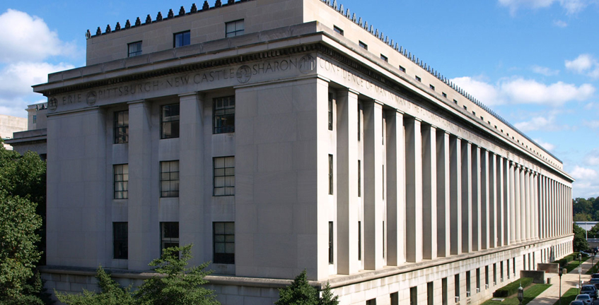
The current State Capitol Building was said to have been designed by architect Joel Miller Huston, and built between 1902 and 1906 in the Beaux-Arts style of architecture.
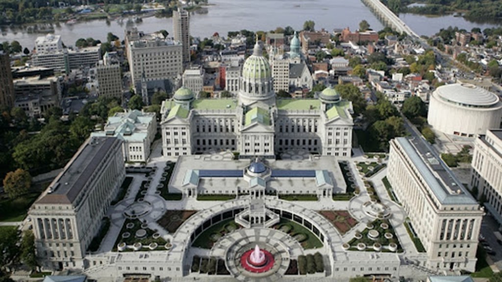
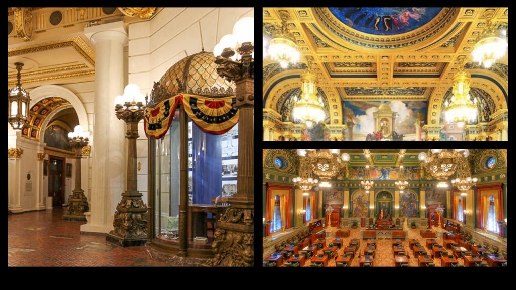
The interior of the Pennsylvania State Capitol is described as having decorative Renaissance themes throughout the building.
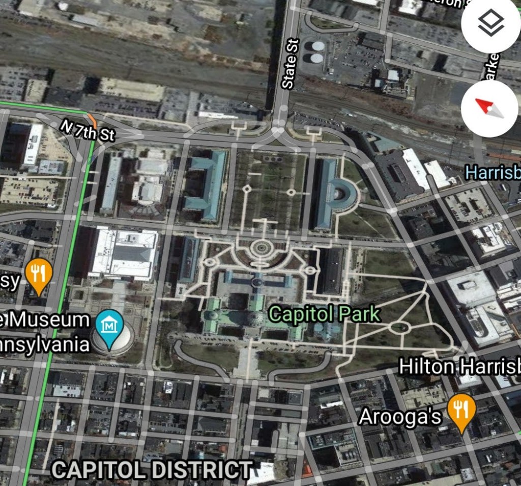
It is part of what is called the Pennsylvania State Capitol Complex.
On the East side of the Capitol building is what is referred to as the East Wing, described as a 1987 extension of the Capitol building.
Flanking the East Wing are the North and South Office buildings,
The North Office building was said to have been built in Indiana limestone starting in 1927…

…and the South Office building in Indiana limestone starting in 1919.

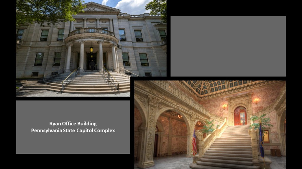
We are told the oldest building of the complex is the Ryan Office building, with a construction completion date of 1894.
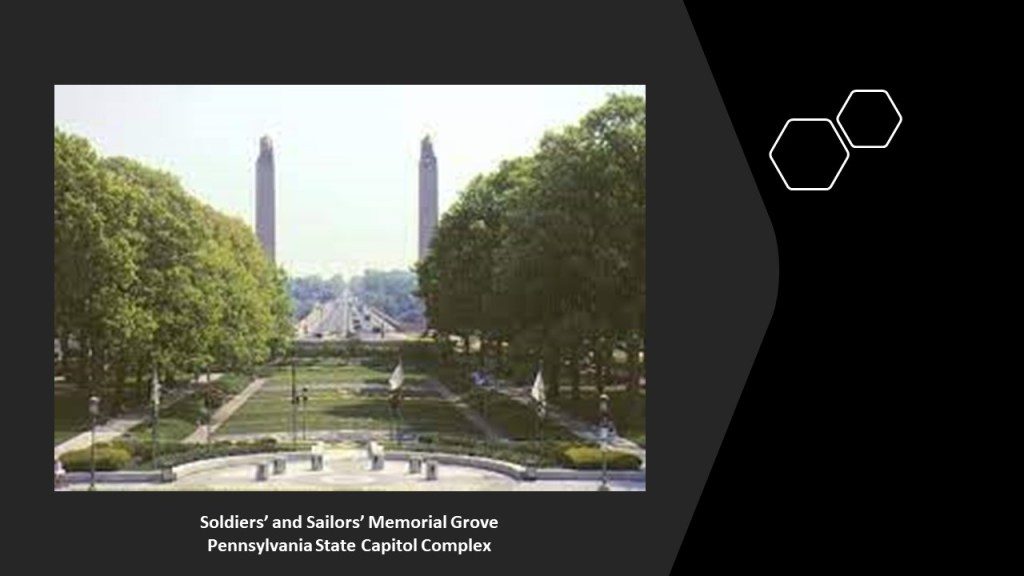
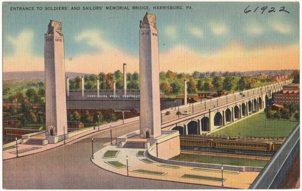
East of the North and South Office buildings, across Commonwealth Avenue, there are a pair of buildings situated across from each other at either end of the “Soldiers’ and Sailors’ Memorial Grove.”
I will be touching more on the Soldiers’ and Sailors’ Memorial Bridge that you can see the pylons of in the background momentarily.
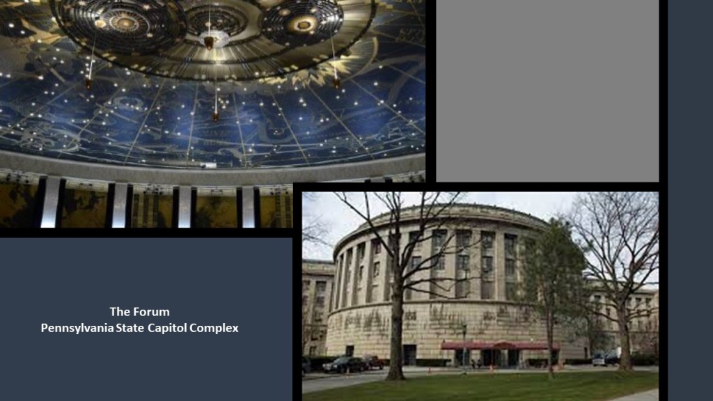
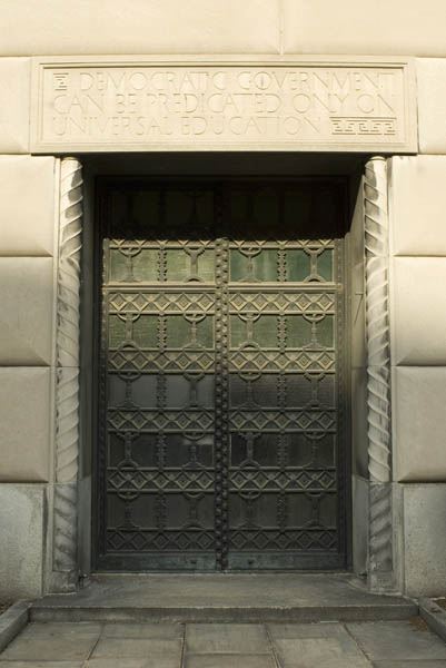
The Forum building is on the south-side of the Memorial Grove, was said to have been built out of grey limestone, and featuring 22 bronze doors, between 1929 and 1931 in the style of an open-air Greek amphitheater, complete with a star map of the night sky depicting the zodiac and other constellations with over 1,000 stars on the ceiling…
…and on the north-side of the Memorial Grove is the Pennsylvania Treasury Building, said to have been a project of the New Deal Era Public Works Administration during the Great Depression built between 1937 and 1940.
The eastern-most portion of the Pennsylvania State Capitol Complex is the “Soldiers’ and Sailors’ Memorial Bridge,”or the “State Street Bridge,” which connects the complex to neighborhoods across the railroad tracks that run east of North 7th Street.
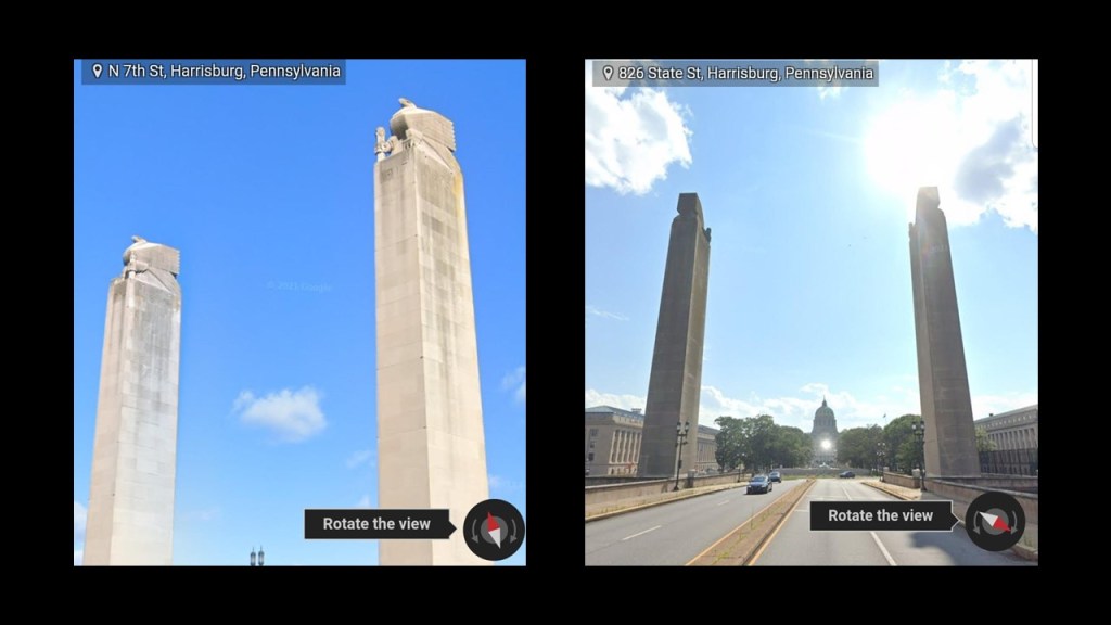
It is a 1,312-foot, or 400-meter, deck-arch bridge said to have been constructed between 1925 and 1930.
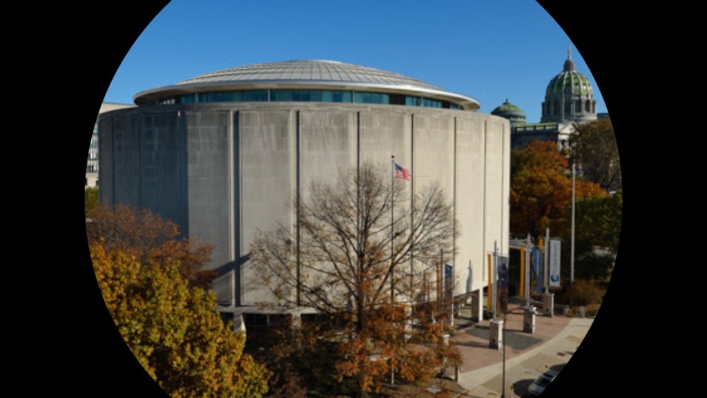
The State Museum of Pennyslvania is directly adjacent to the Pennsylvania State Capitol Complex…
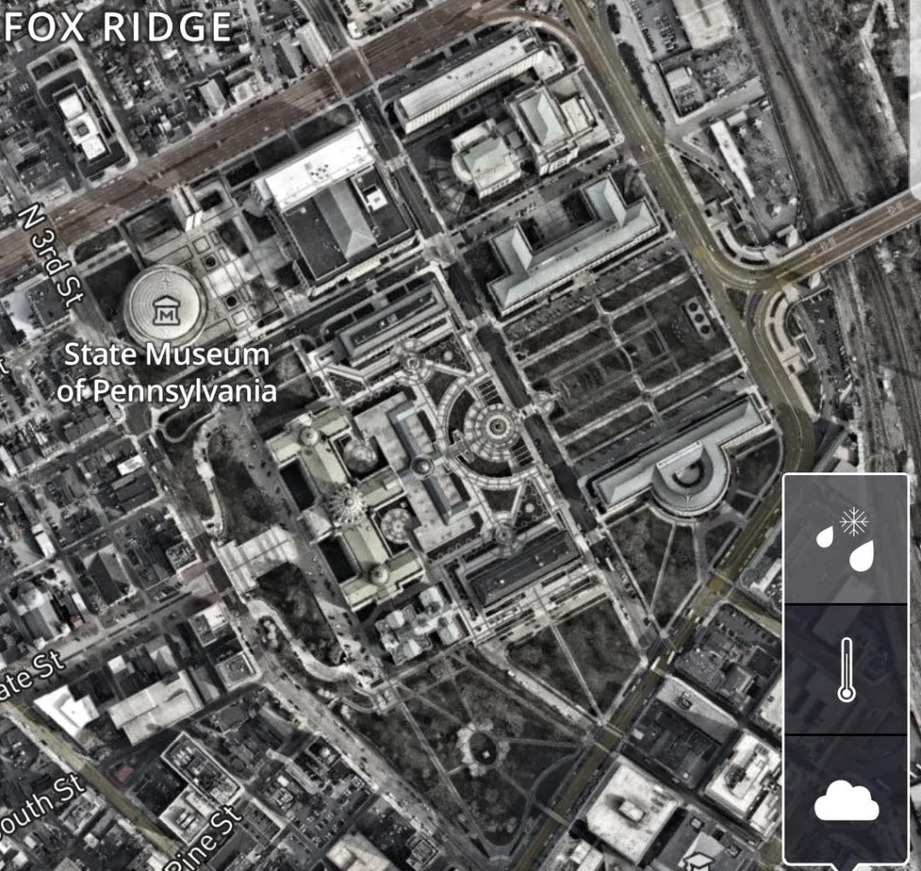
…run by the state through the Pennsylvania Historical and Museum Commission to “preserve and interpret the region’s history and culture,” and includes a multi-media planetarium, and four-floors of exhibits covering Pennsylvania history from prehistoric times through today.
There’s more here to find just in this part of downtown Harrisburg, but I am going to stop at one more location in Harrisburg a couple of blocks north before I head out to other points on this journey.
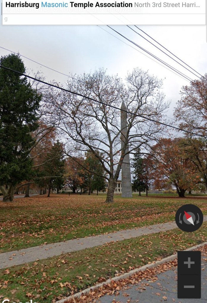
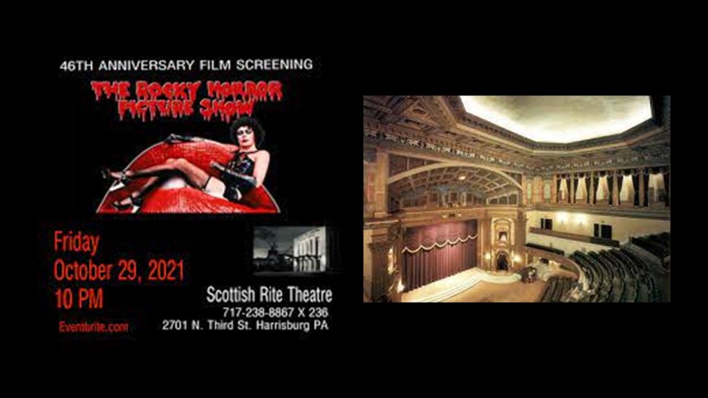
CZ sent me screenshots of the Scottish Rite Cathedral and Masonic Temple of Harrisburg…
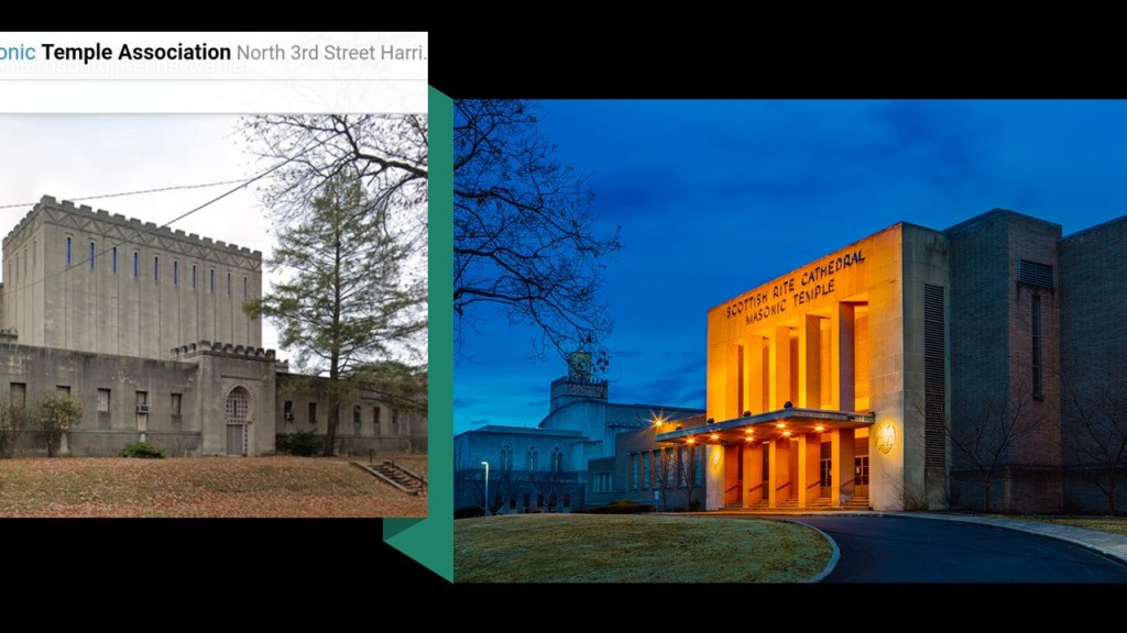
…with a tall obelisk on its grounds.
The 1,192-seat Theater and Ballroom at the Scottish Rite Cathedral is a popular community event venue.
And this seems to be the extent of what I am able to find out about it!
Next, on to a location shared by a viewer from South Carolina’s Lowcountry region.
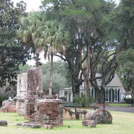
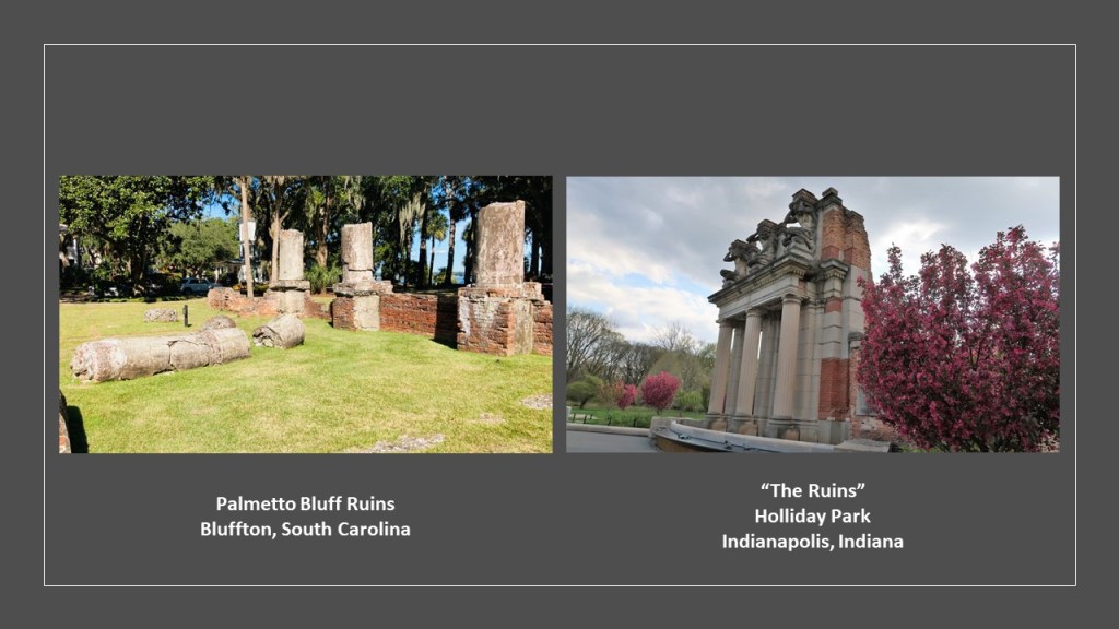
7S sent me photos and video clips of “The Ruins,” a site he visited in South Carolina at the Palmetto Bluff Resort.
“The Ruins” located here are said to be remnants of the “Wilson Mansion,” described as a former getaway for wealthy northerners at the end of the “Gilded Age.”
They are located on property previously owned by a New York financier by the name of Richard T. Wilson, Jr, who was said to have built a four-story mansion with 72-rooms here in 1902, as a “home away from home” until it burned down in 1926.
Wilson’s in-laws included members of the Vanderbilt, Whitney, and Astor families, who were among the prominent guests that were entertained at Palmetto Bluff.
Compare the appearance of “The Ruins” at Palmetto Bluff Resort in South Carolina on the left with “The Ruins” at Holliday Park in Indianapolis on the right.
The following video is a compilation of footage 7S sent me when he visited there.
When he is taking close-up shots of the columns laying around, we are seeing a type of building material historically used in the coastal southeast called “Tabby,” comprised of lime, water, sand, oyster shells, and ash.
Now onto the Chicago area.
LH sent me Google Earth screenshots of several places around Chicago.
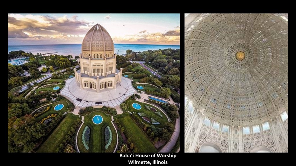
One was the Baha’i House of Worship in Wilmette, Illinois, located on the shore of Lake Michigan…
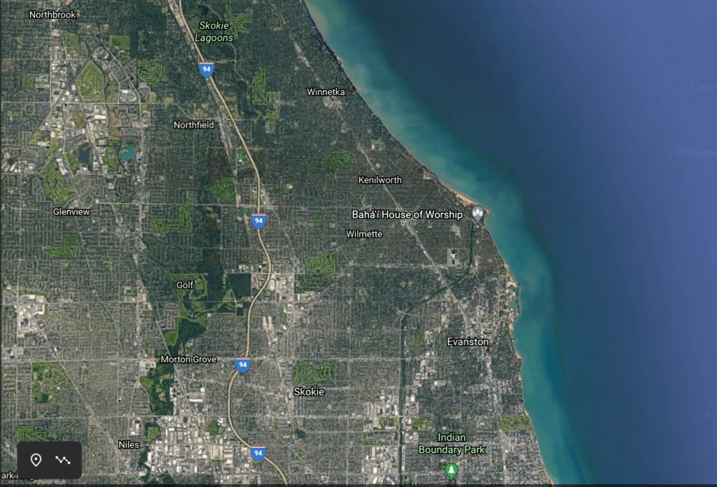
…and said to have been built between 1912 and 1953, and the second oldest Baha’i Temple ever constructed, and the oldest one still standing.
It was said to have been designed by French-Canadian architect Louis Bourgeois, who was said to have received feedback during a trip to Haifa in Israel in 1920 from the son of the founder of the Baha’i Faith.
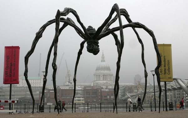
Interesting how close in sound the name of architect Louis Bourgeois is to Louise Bourgeois, which was the name of the designer of the “Maman” sculptures, giant spiders that are found all over the world as discussed in previous “Short & Sweets.”
A small group of Baha’i in downtown Chicago were said to have first discussed the idea of a Baha’i Temple in the area in 1903, which was during the time that world’s first Baha’i House of Worship was being built in what is now Ashgabat, Turkmenistan, between 1902 and 1908.
It was said to have been used as a House of Worship for only 20-years before it was turned over to Soviet authorities, and then destroyed after that in what we are told was one of the deadliest earthquake’s in modern history.
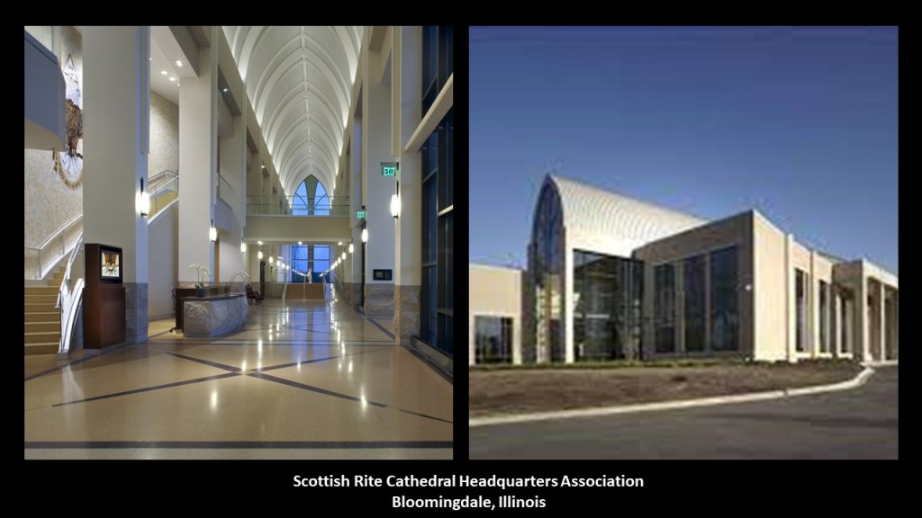
LH also sent me a Google Screenshot of the location of the Scottish Rite Valley Chicago in Bloomingdale, Illinois.
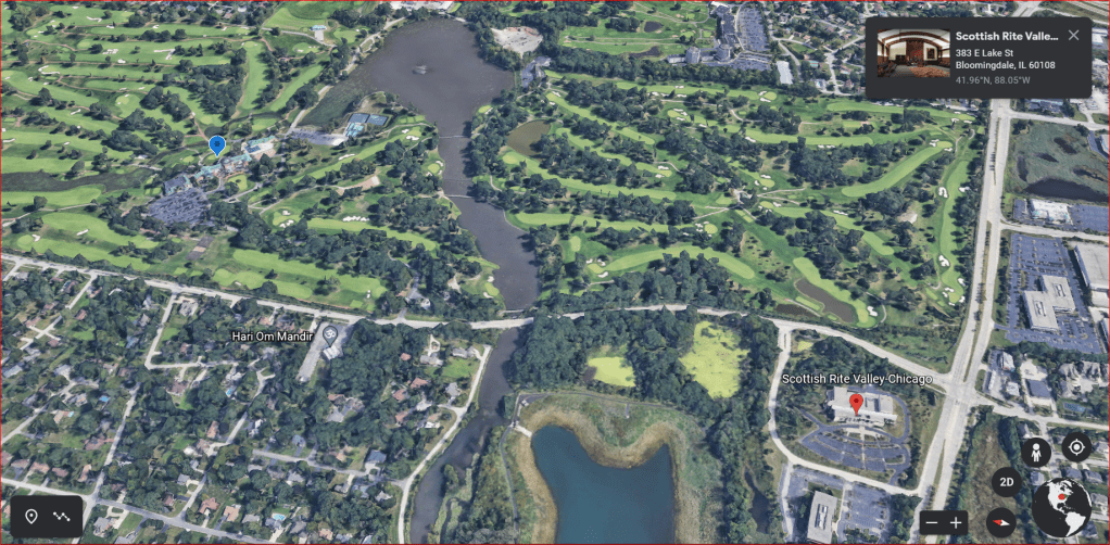
Here we find the Scottish Rite Cathedral Headquarters Association, “telling the story of Free Masons and the Scottish Rite origins in symbolic interior and exterior spaces.”
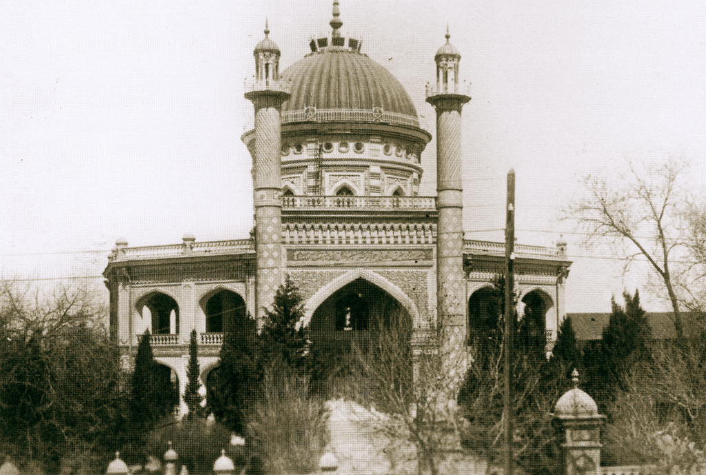
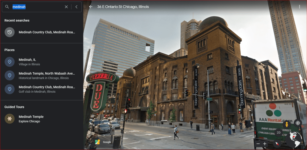
LH aslo sent me a screenshot of the Medinah Temple on the north-side of Chicago.
It was said to have been designed by the Shriners’ architects Huehl and Schmidt, and completed in 1912.
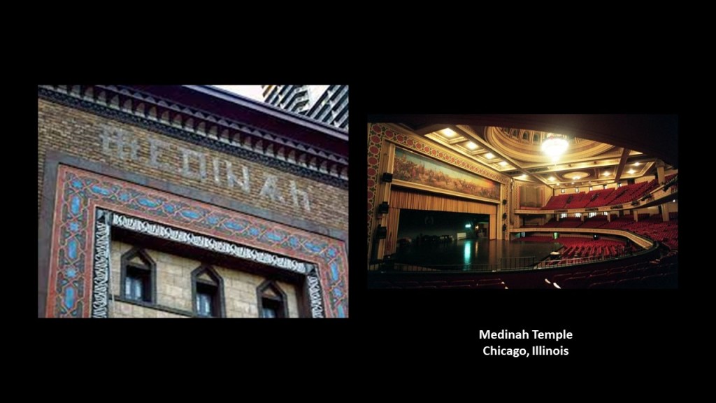
It is described as “…a colorful Islamic-looking building replete with pointed domes and an example of Moorish Revival architecture.”
Currently the building is not being used for anything, but it originally housed an ornate auditorium with a seating-capacity of 4,200 on three-levels, and several organs.
It was the annual location for the performance of the Shrine Circus in Chicago for many years…
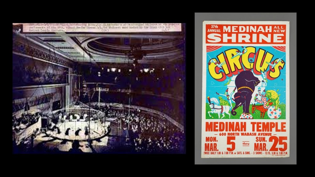
…and WGN-TV used the Medinah Temple for the live telecast of “The Bozo 25th Anniversary Special” on September 7th of 1986.
This just really reinforces the masonic connections between circuses and clowns that I am finding my research about the “Shapers of the New Narrative.”

I mean it’s not hard to find out things like comedian and clown Red Skelton was a Shriner when you look for it.

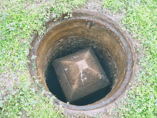
Next, MM sent me a link to an article about a mini-Washington Monument that is buried under a manhole near the 555-foot, or 169-meter, -high Washington Monument.

It is a Geodetic Control Point of a million control points used by the National Geodetic Survey (NGS) to synchronize all of the government’s maps.

Usually metal caps or rods driven down into the ground, the mini Washington Monument was said to have been placed in the 1880s as part of a trans-continental levelling program.
How and why did a 12-foot, or 3.5-meter, -high, underground obelisk become Geodetic Control Point in the first place?
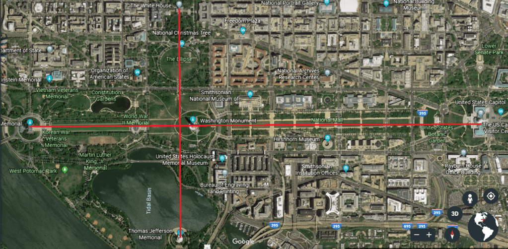
This is a screenshot from Google Earth showing the exact alignment of North-South relationships between the White House and the Jefferson Memorial, located on the southeast corner of the Tidal Basin, and the exact alignment between the Lincoln Memorial to the west, through the Washington Monument, and to Capitol building on the East side of the alignment.
Also, the subject of a trans-continental levelling program by the National Geodetic Survey starting in 1887 sounds very interesting to me, and smells like gravy.
What I get a sense of from this information are the following implications about what the actual purpose of the National Geodetic Survey and its trans-continental levelling program might have been:
- Were these original grid points of importance on the Earth’s original grid system
- Does this geodetic survey actually provide physical evidence for flat earth?
- Why did they call it a “levelling” program? Does this have something to do with re-setting the post-mud-flood world?
Some people don’t subscribe to idea that the mud event was actually a flood. I will make the point here to say that something definitely happened, and describe it as a mud event. It was a world-wide event that involved a whole lot of mud, however it happened.
Things like earthquakes at a high-enough magnitude will cause the surface of the Earth to liquefy.

Maybe it was an event, or series of events, that I believe were deliberately caused to create this incredible liquefaction event to take place for unimaginably great depths and distances.
But this event is typically referred to as the “mud flood,” which is how I first came to know about it and I still see evidence for a mud event everywhere I look in my research, no matter what actually caused the effects.

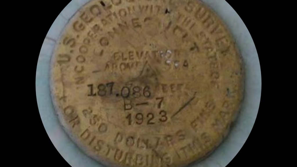
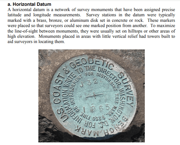
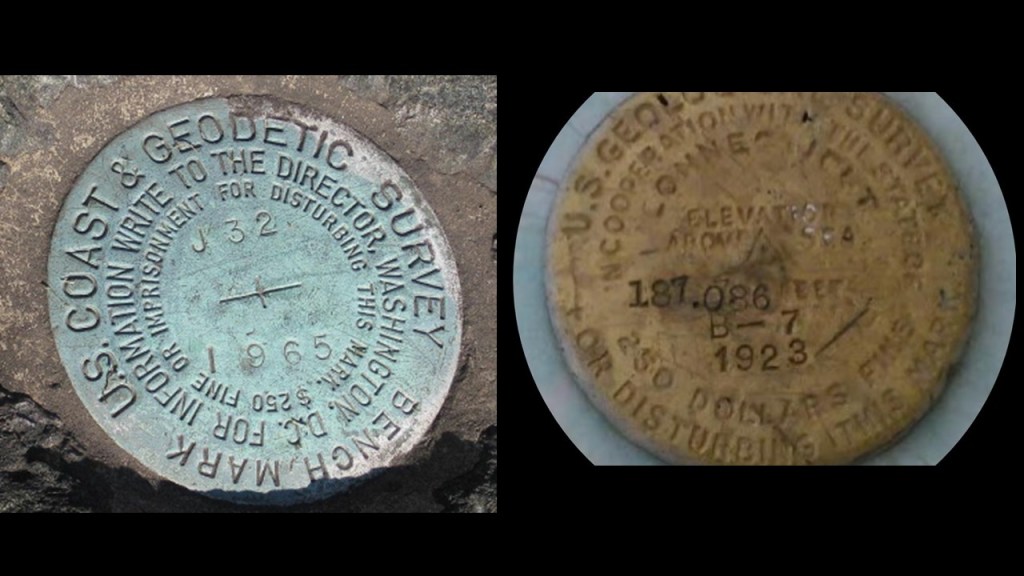
Interesting to note that the geodetic marker shown previously on the left reminds me of the marker I showed in my last Short & Sweet that was sent to me by KO, a viewer in Connecticut, shown on the right.
Interesting how they both show markings and years in a different font from the rest of the marker, with both making the point there is a $250 fine or imprisonment for disturbing the marker.
Hmmm. Strange.
Did someone tamper with these markers?
And if they did, who and why ?
And speaking of Washington Monuments, here are a couple more.
One is from a viewer sent me information about an obelisk next to Interstate 55 near Ridgeland, Mississippi.
She found a link from the Library of Congress explaining it’s purpose, but said some of us are only left with more questions than answers.
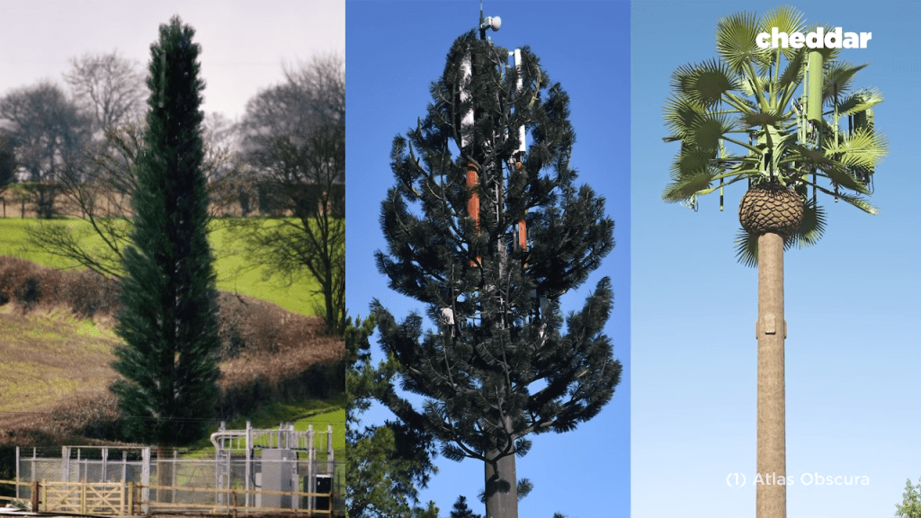
Called the Washington Monument Cell Phone Tower, What we are told is that this is a cellular-telephone tower whose obelisk design was felt to be more pleasing in design than the usual girders and antenna…
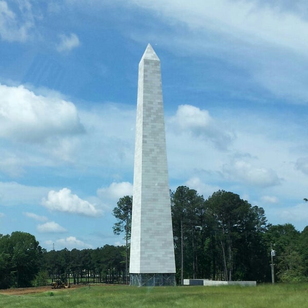
…in the same way that other communities hide cell phone towers in fake trees.
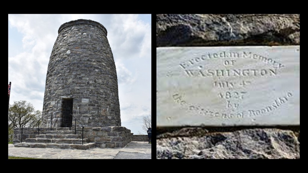
Another one is at Washington Monument State Park near Boonsboro, Maryland, on the Appalachian Trail.
I never went there, but I remember the signs for it because my parents used to go shopping for furniture when I was a child at a store in Middletown, Maryland, which is located near there.
It is a 40-foot, or 12-meter, -high stone tower, that was said to have been built to honor George Washington starting on July 4th of 1827, at which time the citizens of Boonsboro came together en masse, and by the end of the day, the tower was already 15-feet, or almost 5-meters, – high, on a base that was 54-feet, or 16-meters, in circumference.
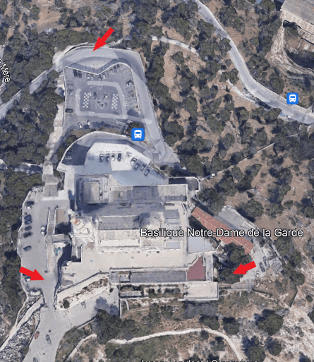
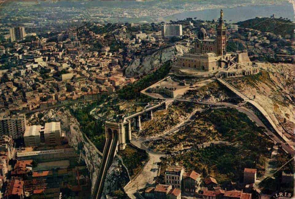
Lastly, KH brought to my attention an historical funicular, also known as an incline railway, in Marseille, France.
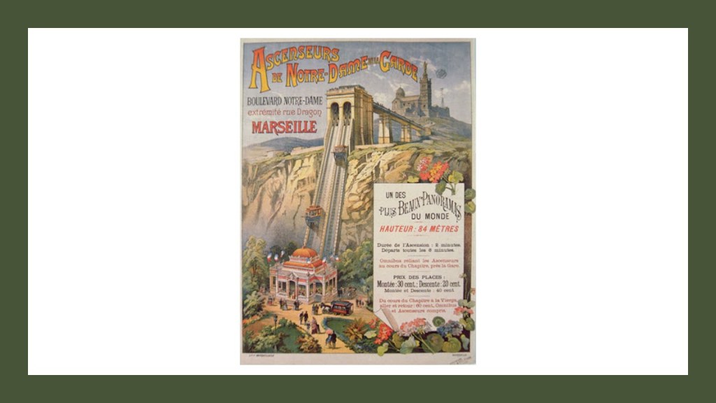
We are told that it was built in 1892 to reduce the effort of scaling the hill that Notre-Dame de la Garde Catholic Basilica was built on top of between 1852 and 1864.
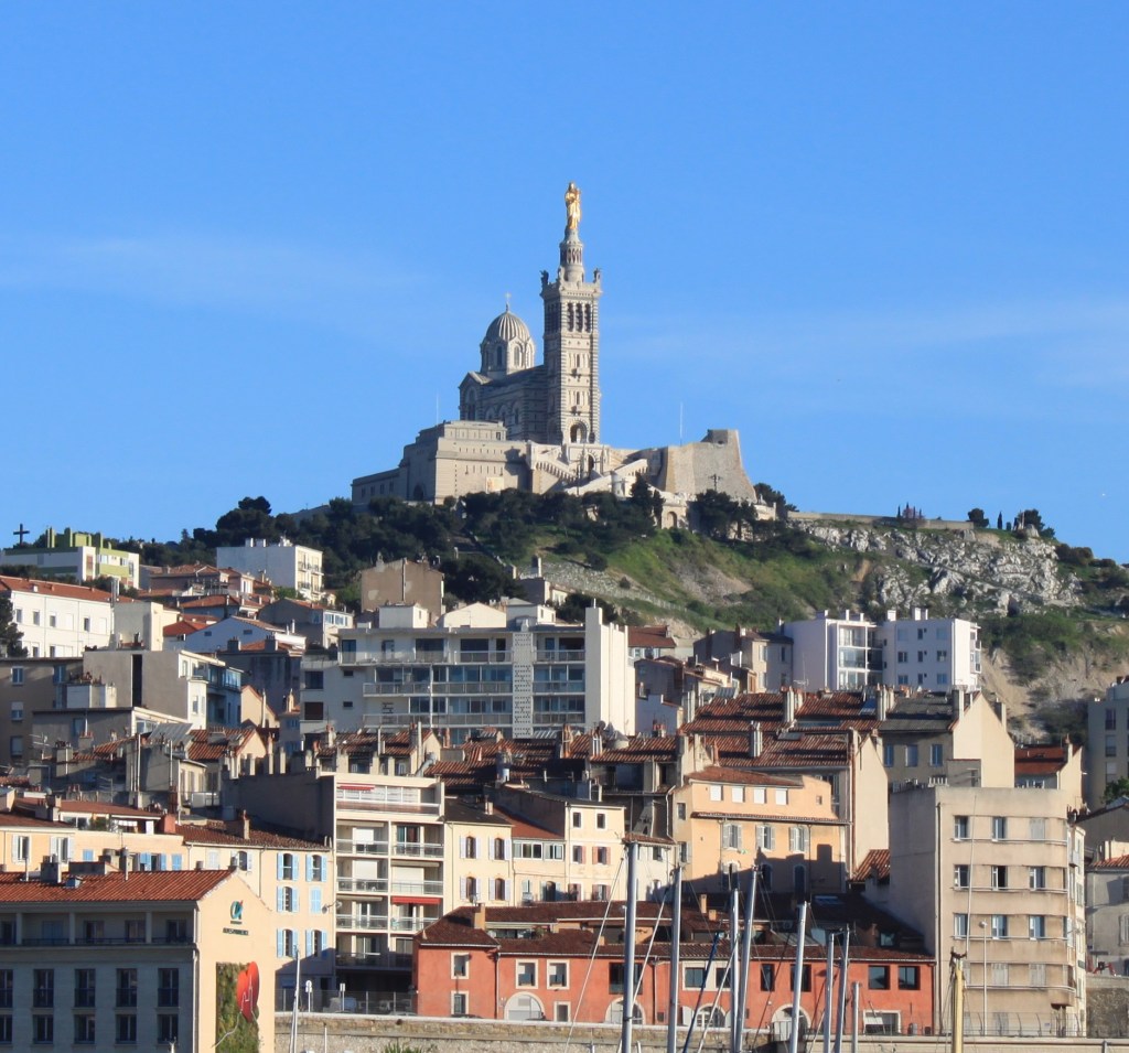
We are taught it was built over top of the foundations of an ancient fort on the highest natural point in Marseille…
…and that the funicular was demolished in 1974 after it was shut-down in 1969 because the advent of the automobile made it unprofitable.
JK sent me quite a few suggestions of places to look at in Joliet, Illinois
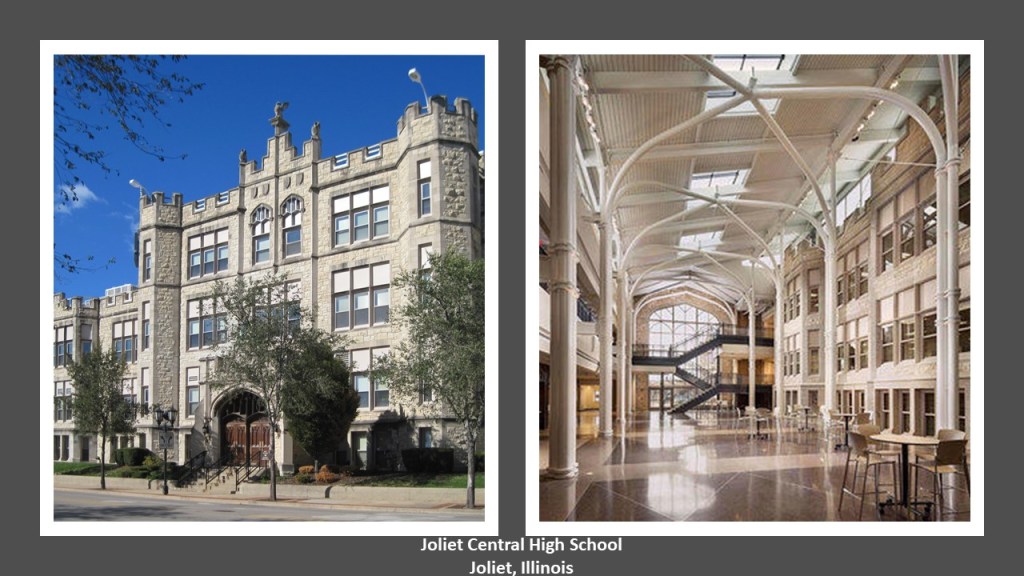
Places like the Joliet Central High School, said to have been designed by architect Frank Shaver Allen, complete with arches, castellated walls, and towers, and opened in 1901.
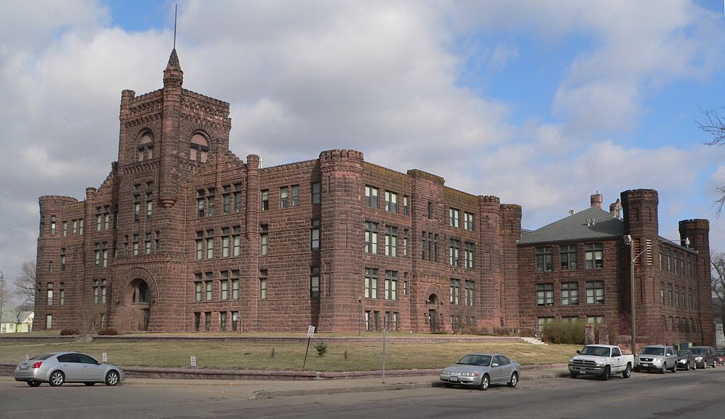
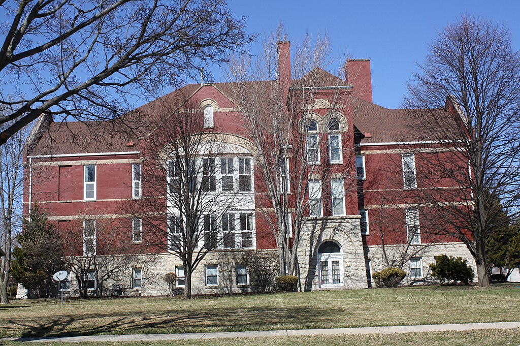
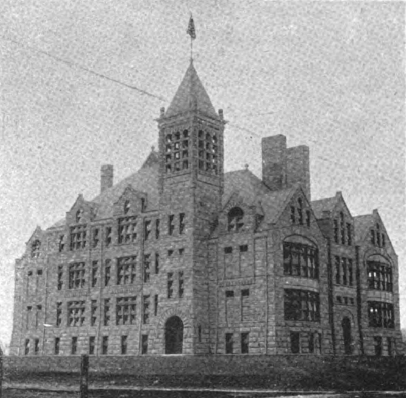
It is interesting to note that Frank Shaver Allen, a Joliet-based architect, was also credited with other secondary school buildings around the country, like:
The Sioux City Central High School in Iowa, said to have been built in 1892.
It was closed as a school in 1972 but the building still stands today and today is the “Castle on the Hill” apartment building.
The former Washington School in Appleton, Wisconsin, was said to have been built in 1895, and like the Sioux City Central HIgh School, also still stands an apartment building today.
At least these three are still standing.
But these high schools have all been demolished:
The East St. Louis High School, said to have been built in 1895…
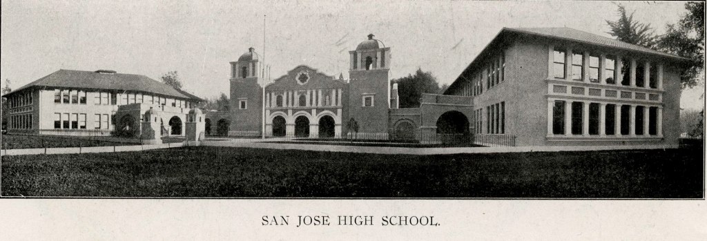
…and the San Jose High School, as well as several other high schools that Frank Shaver Allen was credited with being the architect for in Kenosha, Wisconsin; Trenton, New Jersey; and San Diego, California.
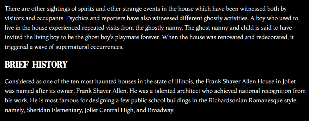
It is interesting to note that Frank Shaver Allen’s home in Joliet, that he was said to have built in 1887…
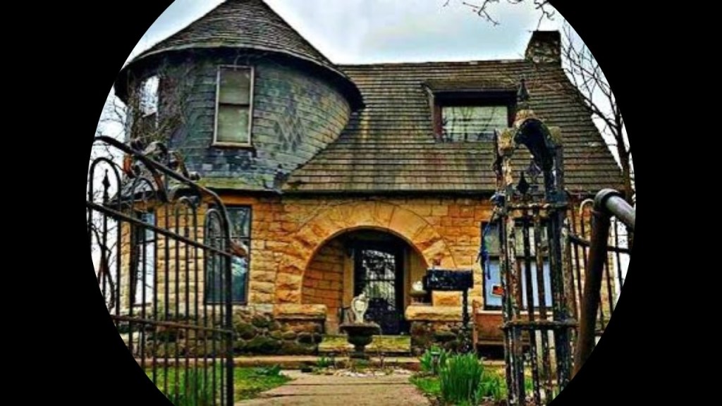
…is considered to be one of the most haunted in the State of Illinois.
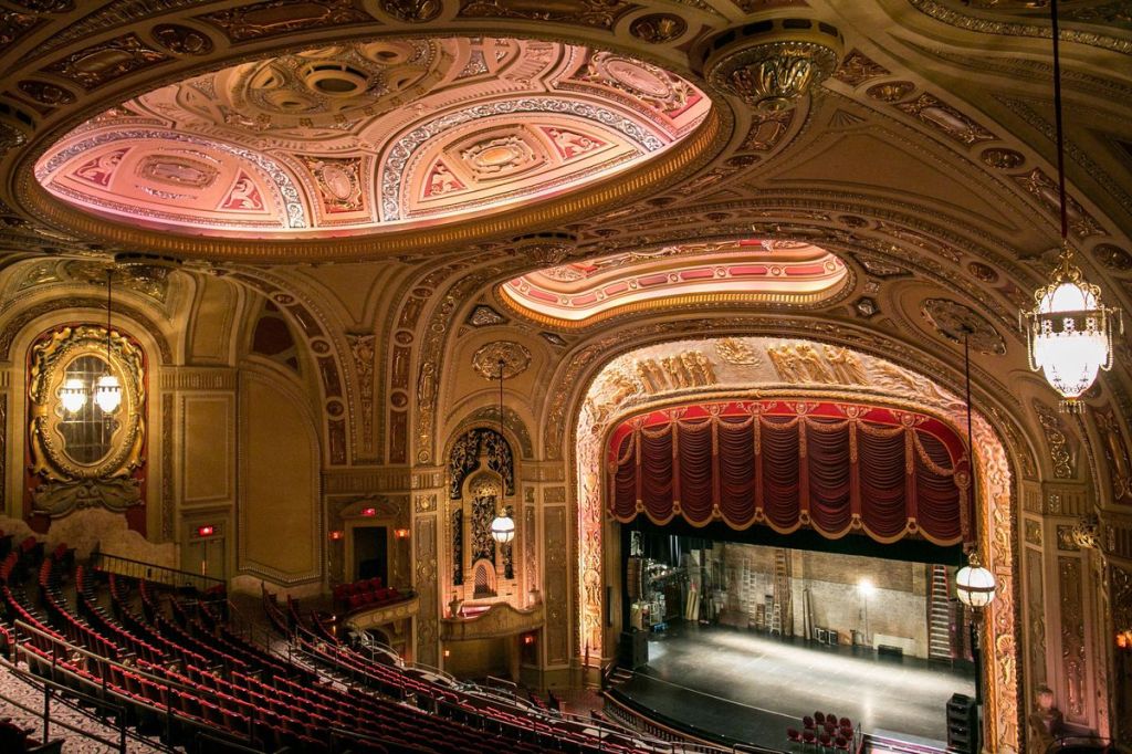
The Rialto Square Theater in Joliet opened in 1926 as a vaudeville movie palace.
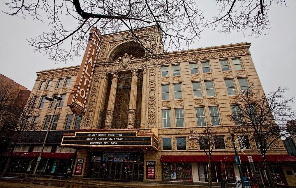
Considered one of the “150 great places in Illinois,” today the Rialto Square Theater is a venue for musicals, plays, concerts, stand-up comedy, and other community functions.
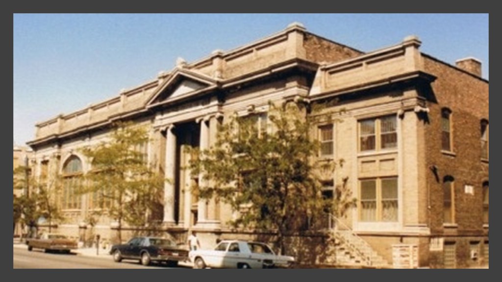
The Ottawa Street Methodist Church was said to have been built by architect George Julian Barnes in 1909 on a Joliet limestone foundation.
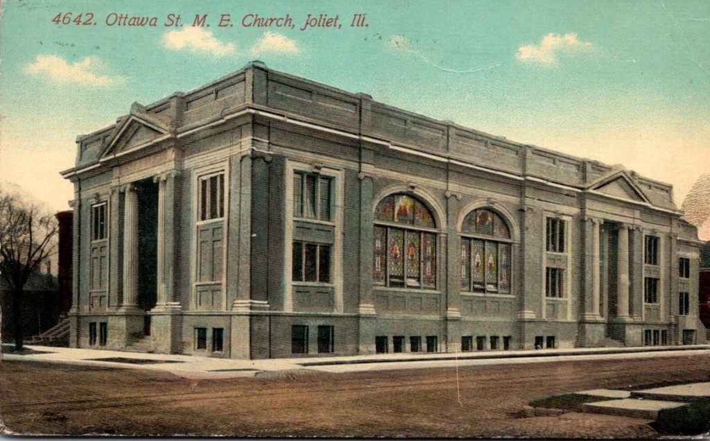
Today it serves as the location of the Joliet Area Historical Museum.
The Joliet Railroad Bridge is a vertical lift-bridge…
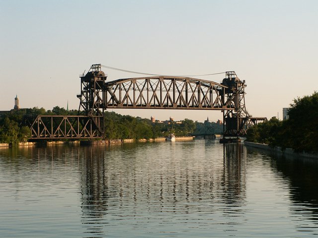
…said to have been built in 1932, which would have been in the middle of the Great Depression, which was considered to have started in August of 1929 and lasted until March 1933.

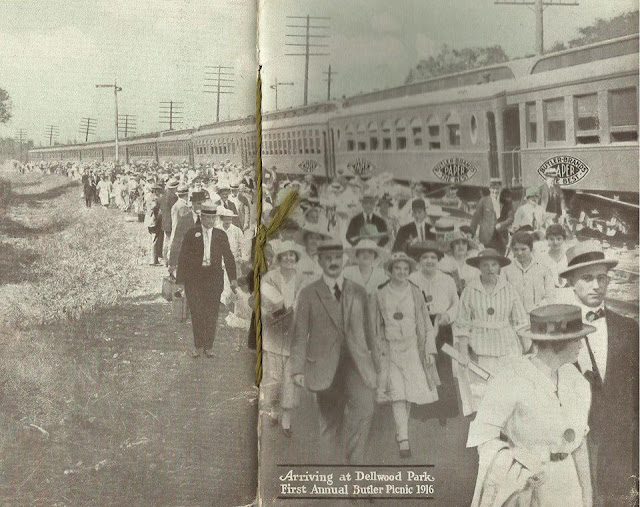
The Dellwood Park in Lockport, near Joliet, was said to have been built by the Chicago and Joliet Railway Company to help promote ridership.
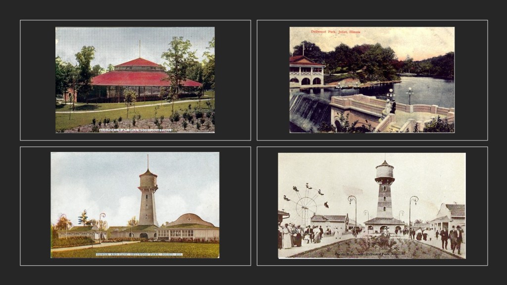
It opened on July 4th of 1905, and operated until 1938.
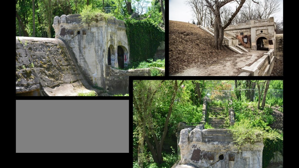
Today Dellwood Park is a 150-acre park with picnic shelters, playgrounds, athletic fields, skate-boarding and a disc-golf course…

…and there are a lot of interesting old stone ruins on the park grounds as well.
JK also directed my attention to the old Joliet Prison.
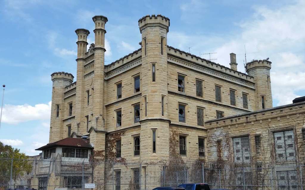
The prison was said to have been built by convict labor between 1858 and 1860, who quarried the limestone with which the prison was built.
During the American Civil War, which took place between 1861 and 1865, the Joliet prison housed prisoners-of-war, as well as criminals, and from the 1870s, we are told, the prison had contracts with local businesses.
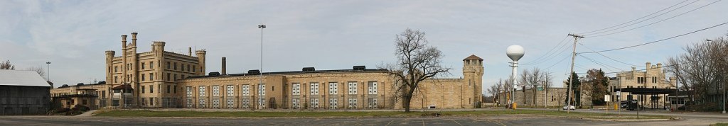
Joliet Prison closed as a prison in 2002, due to budget cuts and the “dangerous and obsolete nature of the buildings.”
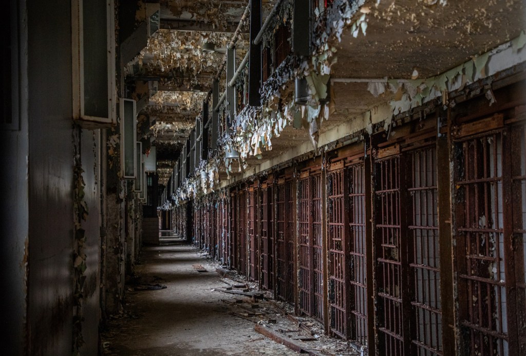
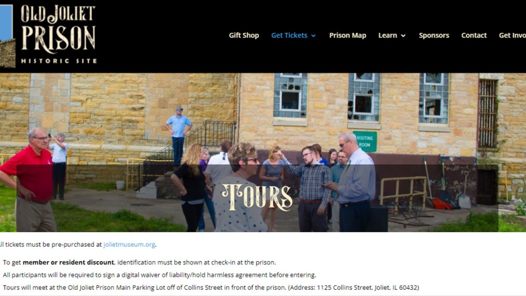
…though it is still open for tours to this day.
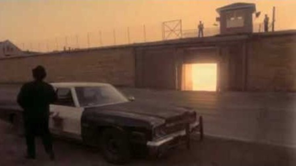
Joliet Prison was featured at the beginning of the 1980 Blues Brothers movie with Dan Ackroyd and John Belushi as Elwood and Jake Blues, where Jake was paroled from prison at the beginning of the movie.
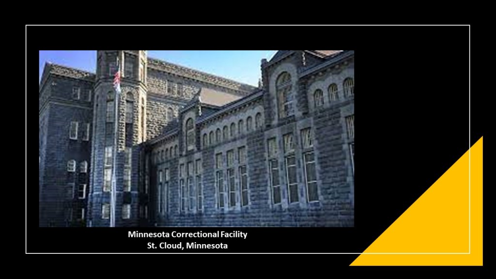
CH sent me a link about the Minnesota Correctional Facility in St. Cloud, Minnesota.
He said it looks like a repurposed castle to him, and a similar story is told about this prison also by inmates quarrying the stone to build the walls and parts of the facility.
It first opened in 1889.
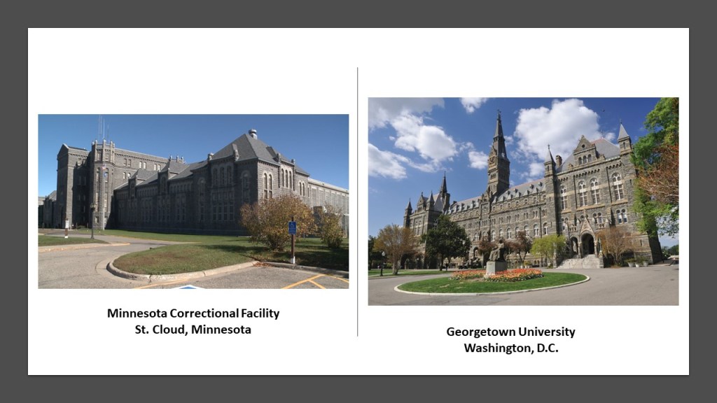
The greystone of the prison on the left at St. Cloud, Minnesota, immediately brought to mind the greystone of Georgetown University in Washington, DC, on the right.
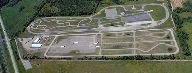
CH said it is located right next to railroad tracks, and directly across the tracks and the highway, the Minnesota Highway Safety and Research Center is located, which has numerous circuit shapes on the grounds.
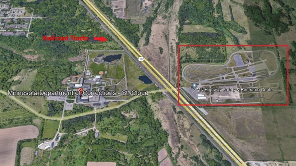
The Minnesota Highway Safety and Research Center provides the latest driver, safety, and traffic information, and is connected with St. Cloud State University as well.
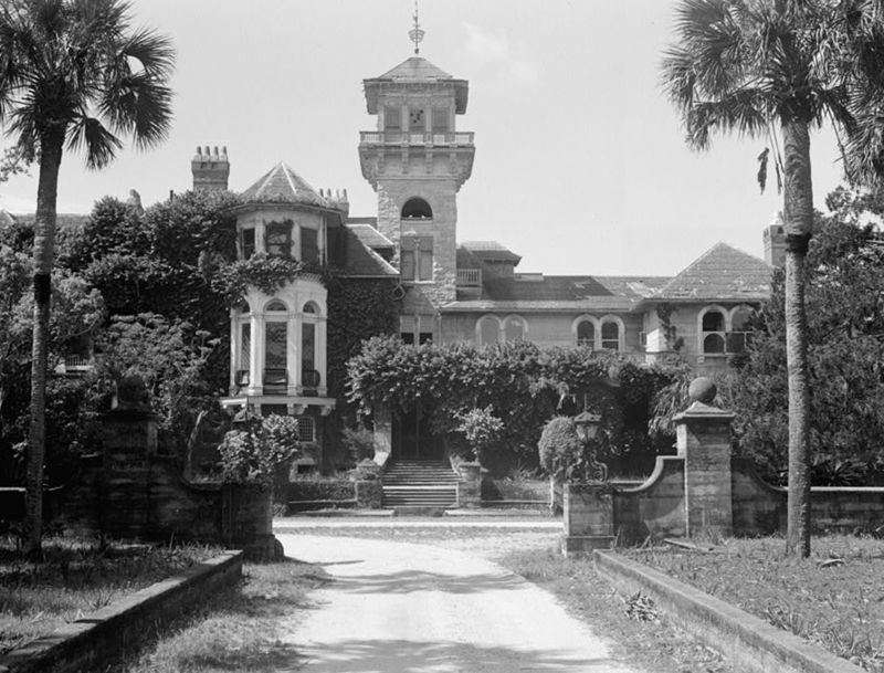
Next, EK sent me an article in the Explore Ga magazine with a photo of a ruined mansion on Cumberland Island.
Cumberland is the largest of Georgia’s Sea Islands on the Atlantic coast, and located just south Jekyll Island.
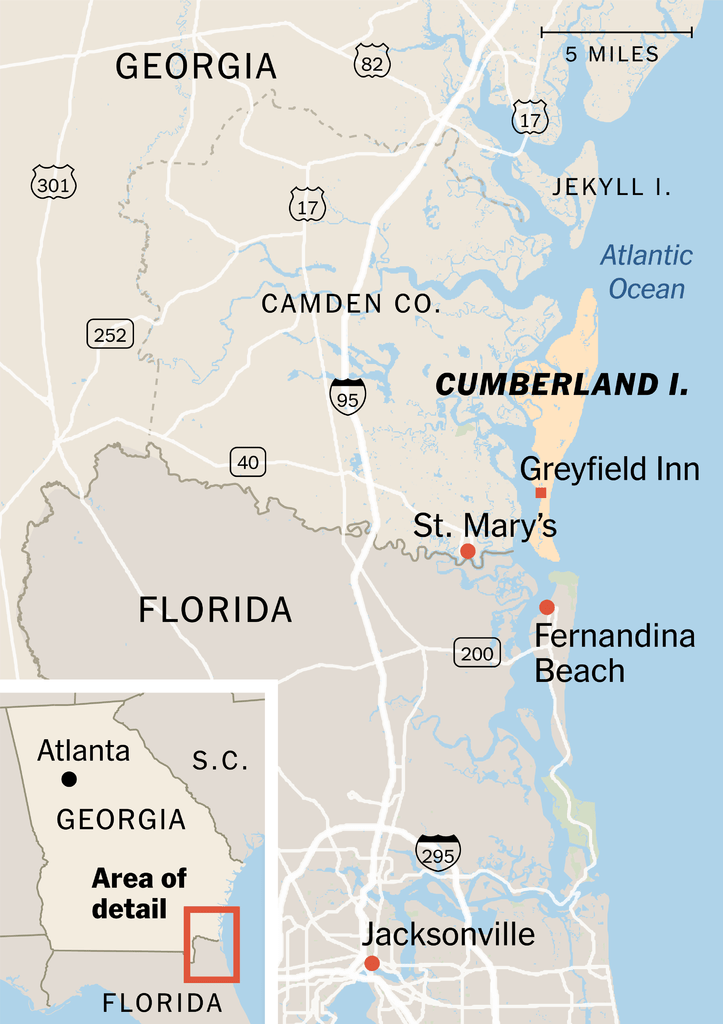
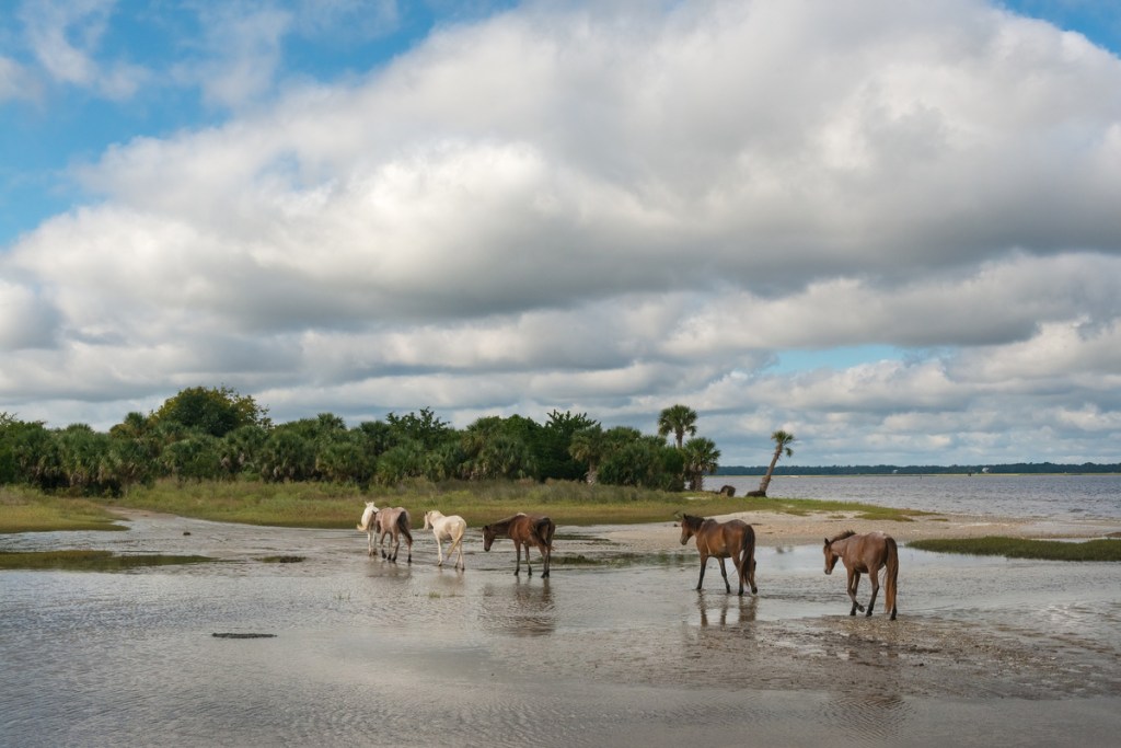
Cumberland Island today has mostly marsh, mudflats, tidal creeks, campgrounds, and wild horses.
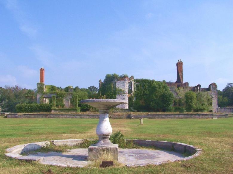
The story goes that the mansion on Cumberland Island was built in 1884 by Thomas Carnegie, Andrew Carnegie’s brother and business partner, as the Carnegie Family Retreat known as “Dungeness.”
What we are told is that a fire in 1959 reduced the mansion to ruins.
Jekyll Island, Cumberland Island’s neighbor to the North, has an interesting history of interest in it by the very wealthy.
Even now it is owned by the State of Georgia and run by a self-sustaining, self-governing body.
It became a retreat for the very wealthy in the late 1800s, and early 1900s…
…and was the place where the Federal Reserve System was created in 1910.

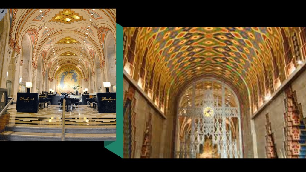
CR drew my attention to the Guardian Building and the Fisher Building, both of which are landmark skyscrapers in Detroit, Michigan.
The Guardian Building is in downtown Detroit’s Financial District.
It is a landmark skyscraper that was said to have been built between 1928 and 1929 as the Union Trust building, and today serves primarily as the office building for Michigan’s Wayne County.
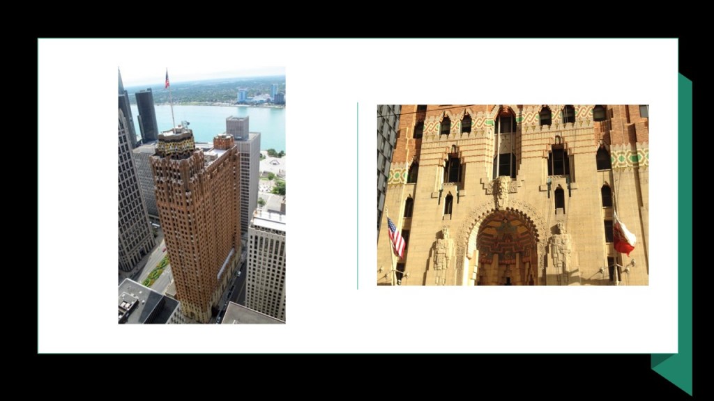
It was said to have been referred to as the “Cathedral of Finance” due to the building’s resemblance to a cathedral.
CR said the energy in the Guardian is incredible!
The Fisher Building is in what is called the New Center, a commercial and residential historic district in Detroit.
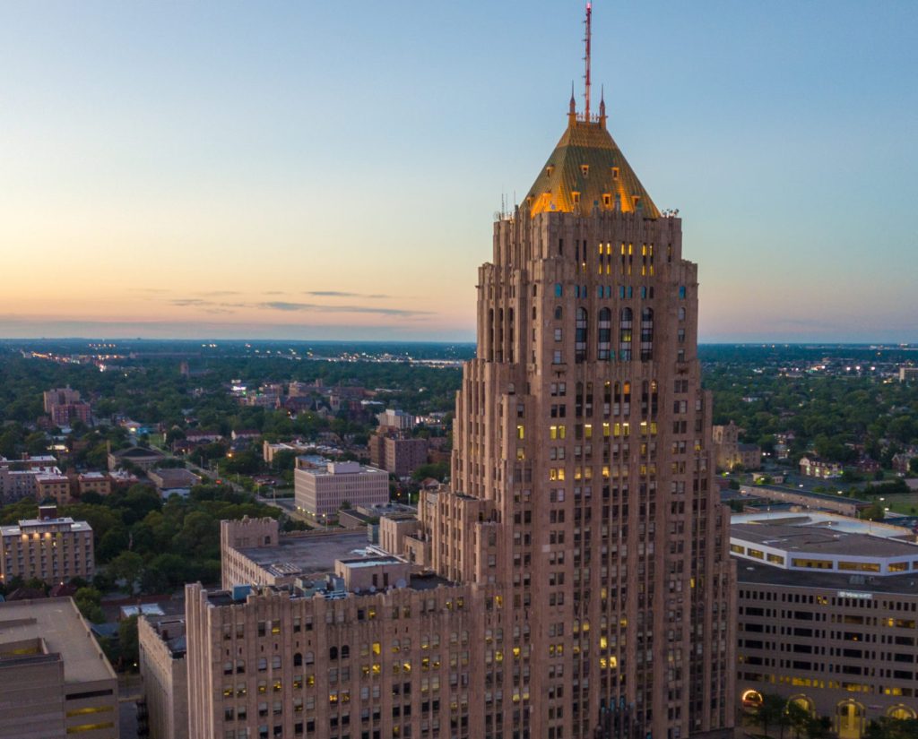
Said to have been completed in 1928 in the Art Deco Style as a major work of the German-born American architect Albert Kahn…
…and financed by Fisher family by the sale of Fisher Body to General Motors.

The Fisher Building houses the 2,089-seat Fisher Theater…
…the headquarters of the Detroit Public Schools, and the studios of radio stations WJR, WDVD, and WDRQ.

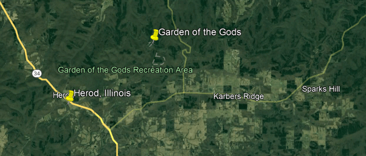
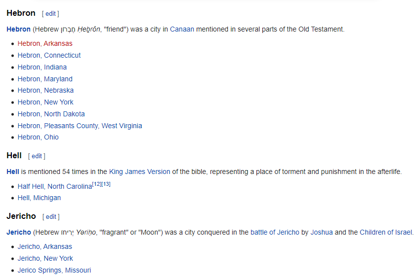
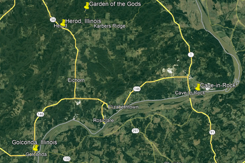
Two viewers recommended that I look into the Garden of the Gods located in the Shawnee National Forest in Southern Illinois.
I am going to start at the Shawnee National Forest because there are several places of interest there in addition to the Garden of the Gods, and then touch on a couple of other places in the surrounding area.
There is a lot to unpack here.
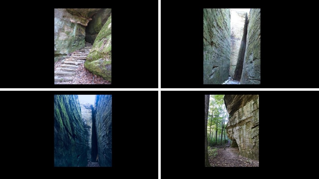
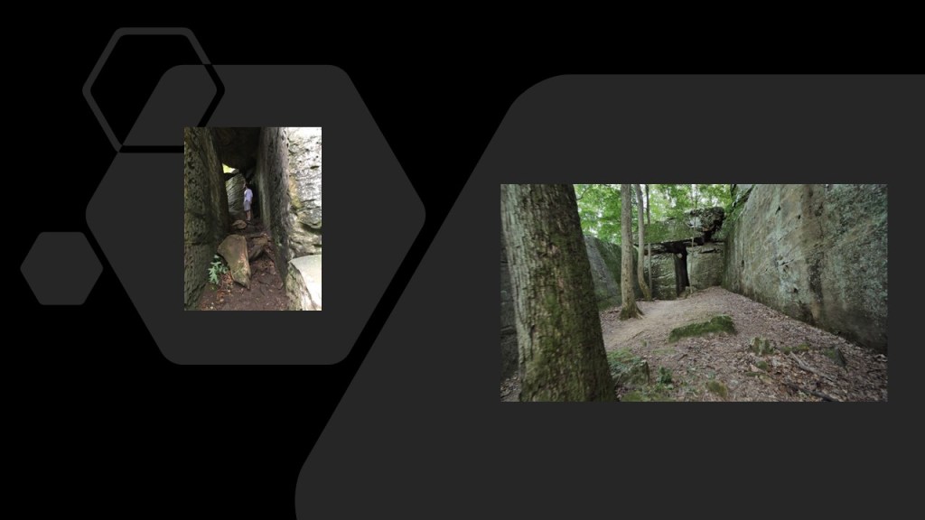
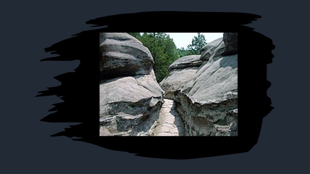
The Rim Rock Trail in the Shawnee National Forest is a 1.7-mile, or 3-kilometer, -long trail.
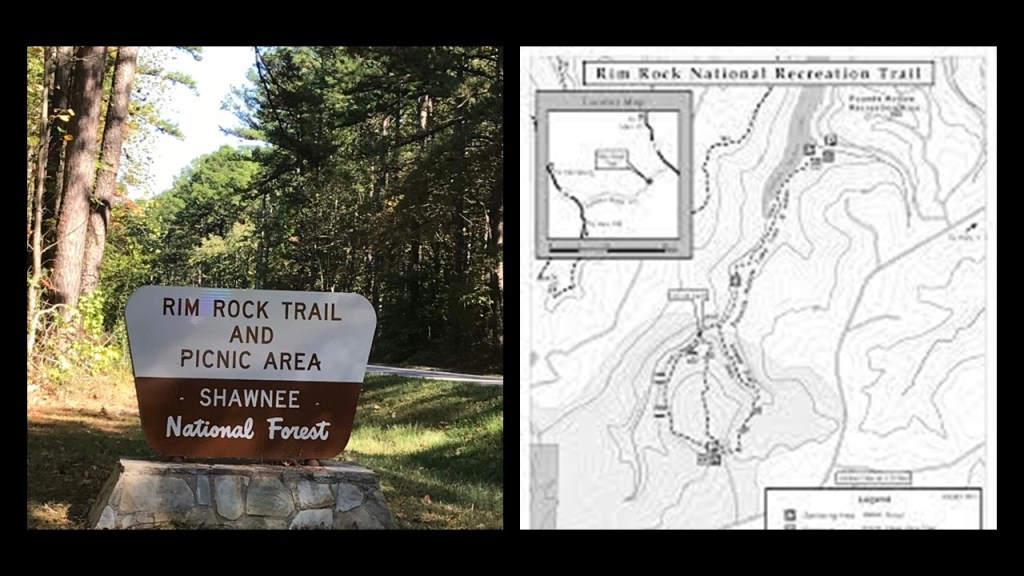
It is described as going around the rim of an escarpment before going down into a crevice in the rock cliff to the valley floor…
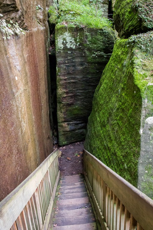
…and meandering through massive rock formations, which we are told are natural.
Does this place look natural to you, because it sure doesn’t to me!
More examples to come!
Jackson Falls are located in the heart of the Shawnee National Forest.

Jackson Falls are a popular rock-climbing and rappelling destination, with its bluffs and rock faces…
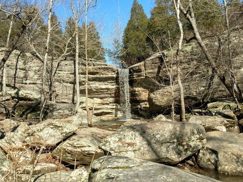
…and the popular 4-mile, or 6.5-kilometer, Jackson Falls loop trail.
The Garden of the Gods in the Shawnee National Forest is located right next to the town of Herod, Illinois.
I find it interesting that while there are a lot of biblical names in North America, I could not find a list of Herods in North America, including Herod, Illinois.
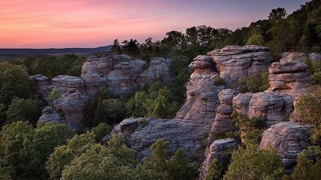
It is interesting to note we are told that the Garden of the Gods was never covered by glaciers because the advance of the ice sheets stopped just north of the Garden of the Gods.
Instead, the explanation given is that millions and millions of years ago, a thick layer of grey sandstone was laid down by geological conditions in Southern Illinois, and that this bed of grey sandstone was later uplifted and that the Garden of the Gods is part of an uplifted sandstone plateau…
…and that dramatic erosion patterns created what are called “hoodoos,” or tall, thin spires of rock, and other unusual formations from the sandstone, and have names like “Camel Rock,” “Anvil Rock,” and “Table Rock.”
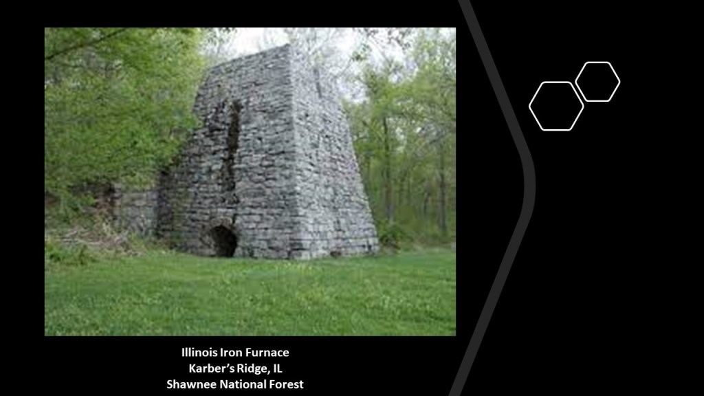
The Illinois Iron Furnace is located at Karbers Ridge near the Garden of the Gods in the Shawnee National Forest.
It was said to have been built some time between 1837 and 1839 by two businessmen, and used to smelt locally-mined iron ore.
The use of the iron furnace ended completely in 1883, which effectively ended the iron industry in Illinois.
The Cave-in-Rock State Park is in the neighborhood, at the edge of the Ohio River on the Illinois-side…
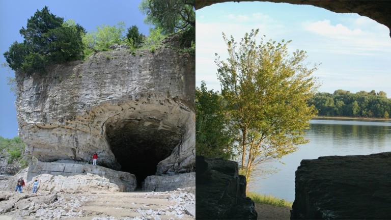
…and Golconda, Illinois, is just a little ways downriver on the Ohio River from the Cave-in-Rock.
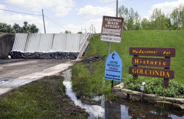
Golconda is interesting.
Said to be the first permanent settlement in Pope County, Illinois, in 1798, we are told it was named after the ancient city of Golkonda in India on January of 1817.
Okay, so how, according to the history we have been taught, would the settlers in 1817 have even known about the ancient city of Golkonda in India to begin with?
This would have been long before the development of mass communication and mass transportation!
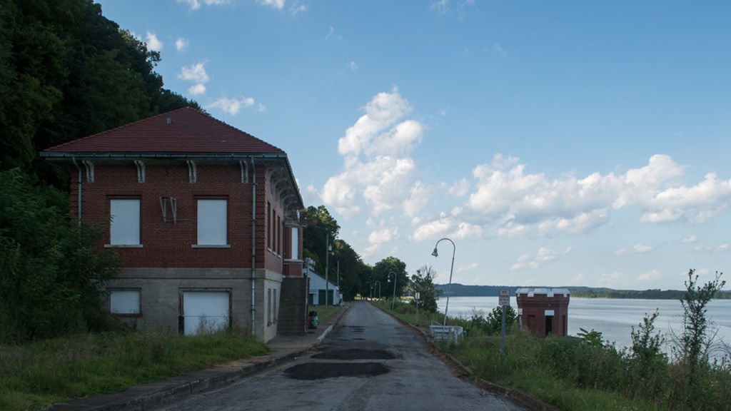
What really caught my attention in Golconda was the “Golconda Lock and Dam 51.”
Today the Golconda Lock and Dam Houses are four vacation rentals…
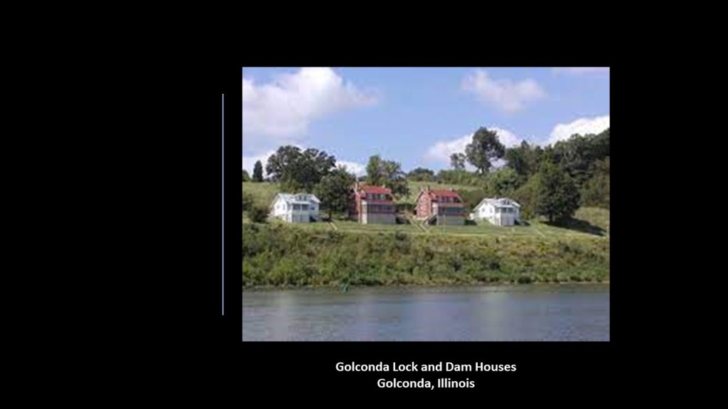
…that are adjacent to what was part of the “Golconda Lock and Dam 51.”
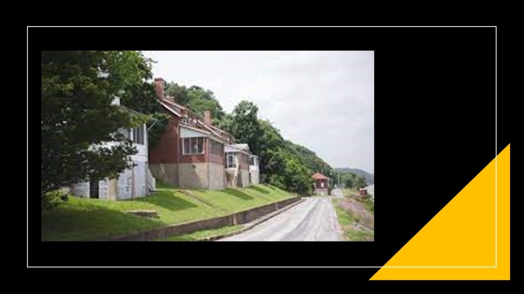
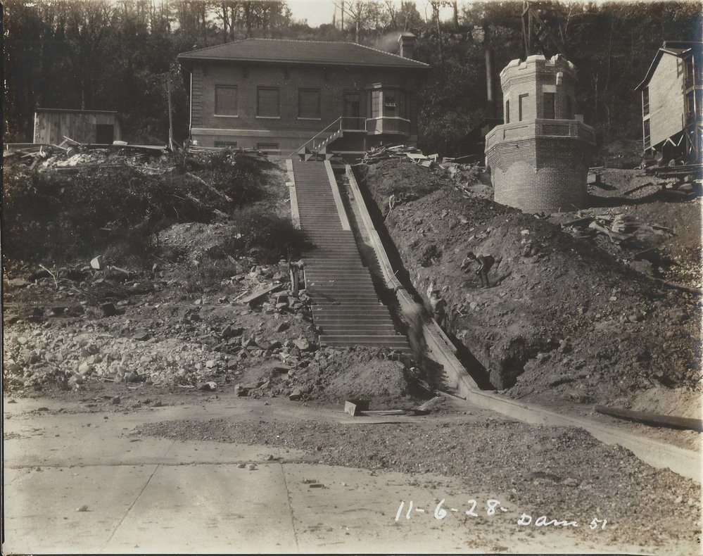
Historically, Golconda was the location of “Lock and Dam 51” on the Ohio River, said to have been constructed by the U. S. Army Corps of Engineers as a navigational aid on the Ohio River.
The Smithland Lock and Dam were put in operation in 1979, and the property transferred to the city when the dam was removed.
This is what’s left of it today.
I found this historic picture of the same place where it looks quite muddy to me!
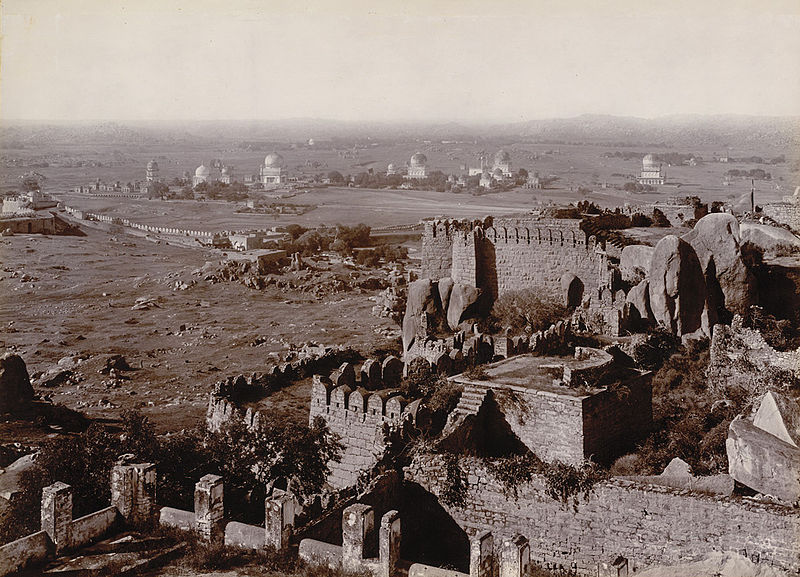
Here’s a circa 1902 or 1903 photo taken from the Golconda Fort in Hyderabad, India, which I found awhile back when I was tracking a long-distance alignment through India.
It looks muddy in this photo to me too!
Golconda in India flourished as a trade center of large diamonds, known as Golconda Diamonds.
It has produced some of the world’s most famous diamonds, including the Koh-i-Noor, one of the largest cut diamonds in the world. This is a glass replica of it…

…because the original is part of the British Crown Jewels…

…and the Hope Diamond, a famous, blue-diamond that is on exhibit at the Smithsonian in Washington, DC.

Karnak, Illinois, is on the other side of what is called an Oxbow on the Ohio River, and almost directly across from Golconda.
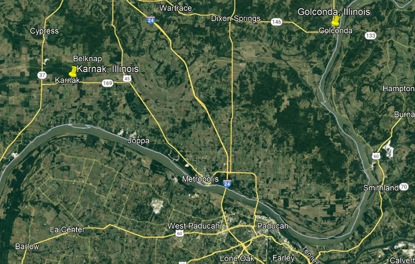
It is a small village that had a population of 499 people in the 2010 census.
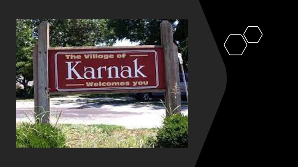
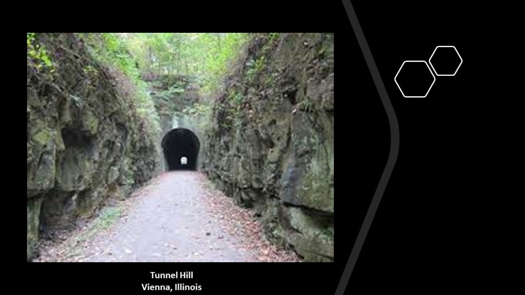
Well, there is nothing of interest to look at showing up for me in Karnak, but just 10-miles, or 15-kilometers north, just up the road from Karnak, is what is called Tunnel Hill in Vienna, Illinois.
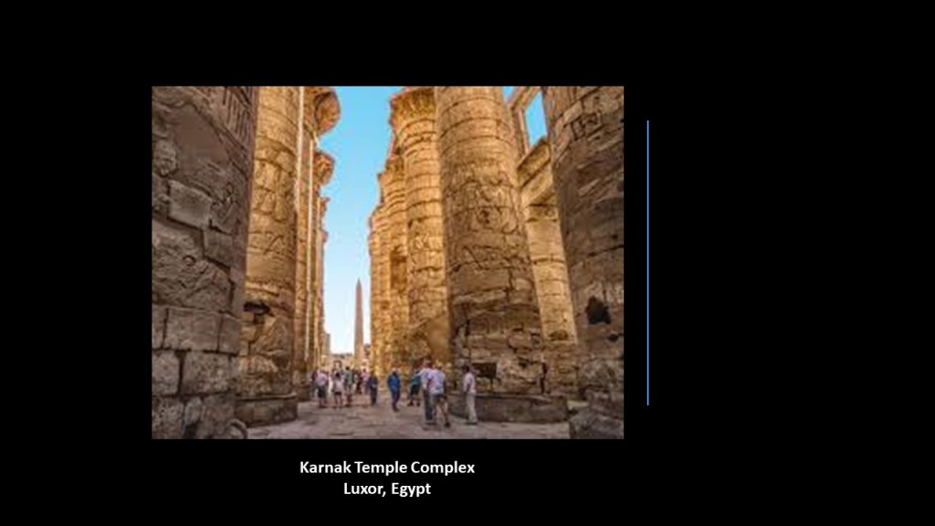
Another Karnak, the Karnak Temple complex near Luxor in Egypt, is known for its gargantuan size.
The village of Makanda, Illinois, is 26-miles, or 42-kilometers, northwest of Karnak, and 8-miles, or 12-kilometers, due south of the city of Carbondale, Illinois.
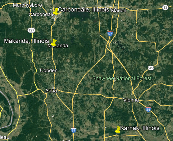
Makanda is the location of Giant City State Park, which experienced the longest period of totality during the 2017 total solar eclipse, at 2-minutes, and 40-seconds.

Just north of Makanda and Giant City, the city of Carbondale is located at the exact center of both of the 2017 total solar eclipse and 2024 total solar eclipse paths.

Carbondale was said to have developed starting in 1853 when three men purchased a parcel of land because of railroad construction there, and named for the large coal deposit in the area.
It was incorporated in 1856.
The first train came through Carbondale on July 4th of 1854, travelling north on the main line from Cairo, Illinois.
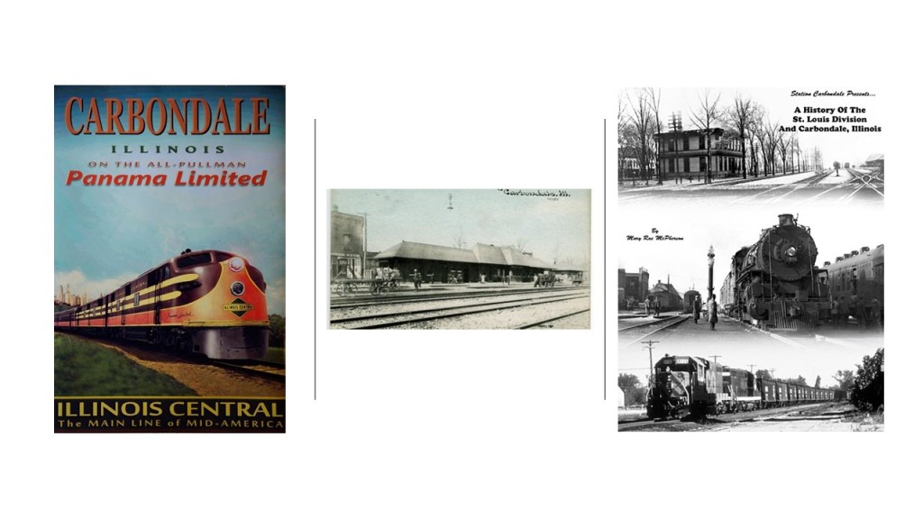
Southern Illinois University first opened in Carbondale in 1874, and is the flagship campus of the Southern Illinois University system.

By the way, southern Illinois is also known as “Little Egypt.”
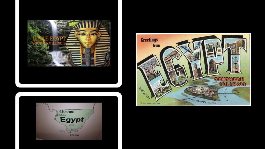
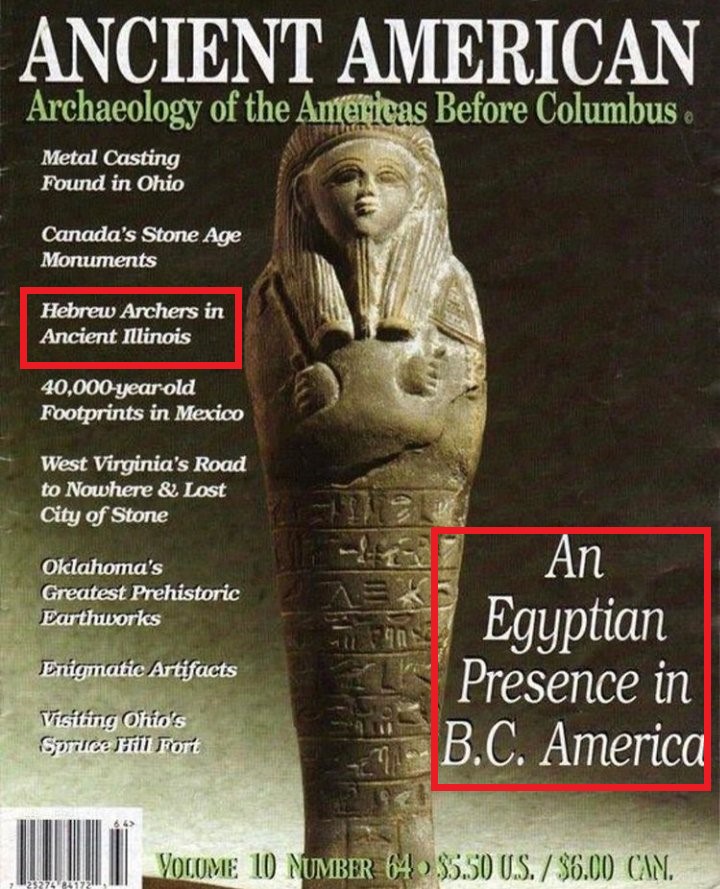
But, didn’t we just see Herod, Illinois, back at the Garden of the Gods, presumably named after the Judean King Herod in the Bible?
Well, according to the cover on this issue of “Ancient American,” there is evidence for Hebrew Archers in Ancient Illinois as well.
Things to think about!!!
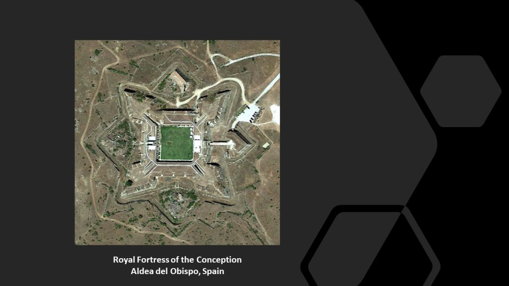
Next, KM in California sent me a real estate listing she found for a star fort named the “Royal Fortress of the Conception” in the town of Aldea del Obispo in the Province of Salamanca in Spain near Portugal that is up for sale for 15,000,000 Euros.
It was restored starting in 2006 and opened in 2012, as the “Hotel Royal Fortress of the Conception,” until it went up for sale on the real estate market.
EC lives in California, and she passed along several pieces of information to me.
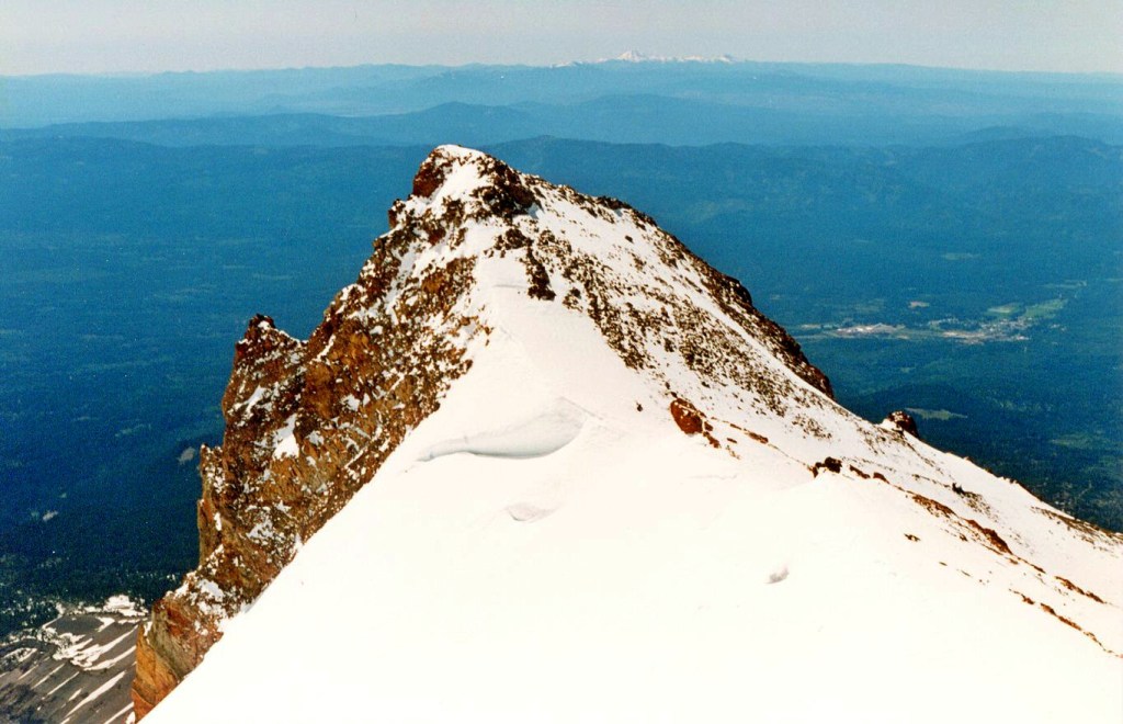
One was that she summited Mt. Shasta several years ago, and remembered that there was a massive boulder field on top.
She said the whole mountain is gravel and climbing it was like climbing a vertical beach.

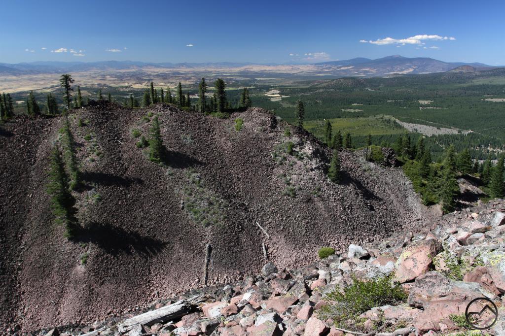
She said there is a formation up there called Thumb Rock.
It is described both as a peak or pillar on Mount Shasta.
EC shared a screen-shot with me of some mysterious straight lines to the southeast of Mt. Shasta.
She said it’s hard to find these in California because so much has been built over.
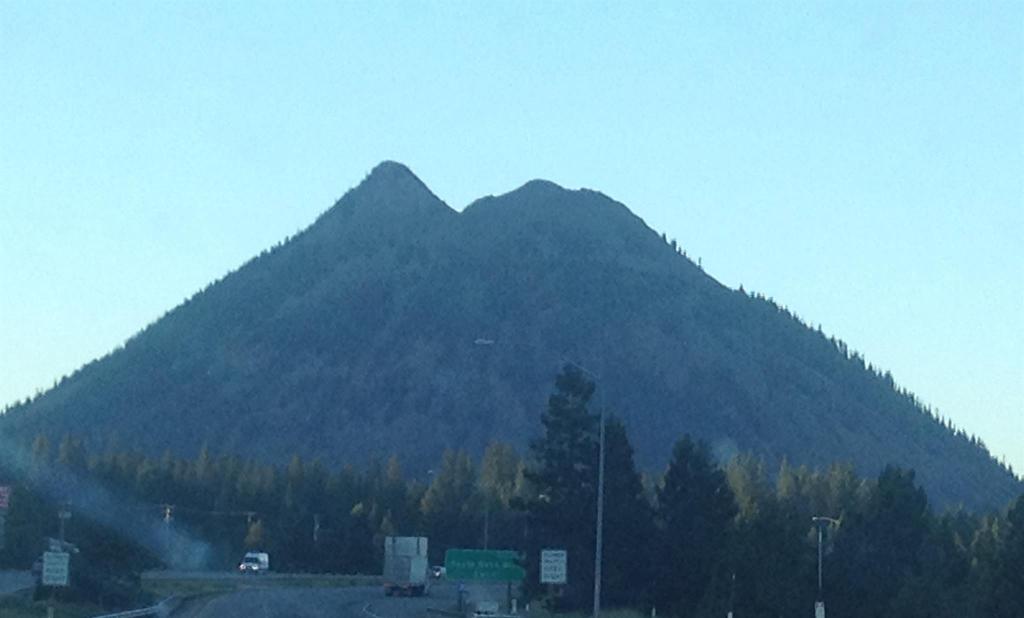
She mentioned Black Butte, describing it is a pile of rocks and boulders next to Mt. Shasta which she has also climbed.
She said Scott Valley is northwest of Mt. Shasta and features circle farms.
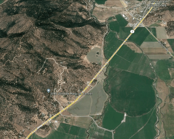
She directed my attention to the Sacred Heart Catholic Church in Fort Jones in the Scott Valley near Mount Shasta
Fort Jones had a population of 600 in the 2020 census.
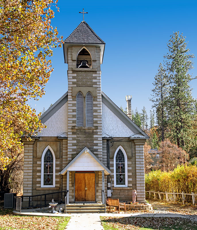
Fort Jones was said to have been named after a frontier outpost less than a mile south of town, but there doesn’t appear to be anything left to be able to identify whether or not it was a star fort at one time with any degree of certainty.
EC shared some interesting lay-outs of cities in California that appear to have circuit-board-looking components, like in Los Angeles, just north of the La Brea Tar Pits…
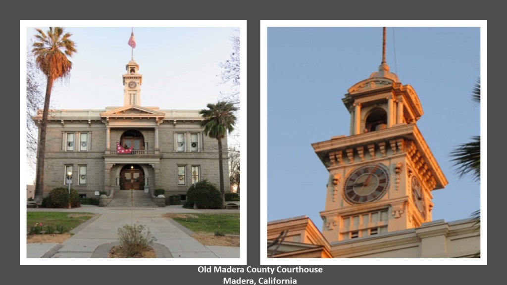
…and in Madera, CA.
She also shared photos of the old courthouse in Madera, which was said to have been built in 1900 out of granite quarried in Madera County, and the first significant public building constructed in Madera County.
The building’s original tower was said to have fallen in a 1906 fire, but it was rebuilt.
The county government moved out in 1953 when the building was deemed unsafe.
Today, it is a museum operating under the auspices of the Madera County Historical Society.
I am going to end “Places & Topics Suggested by Viewers – Volume 8” right here, and there is more coming your way!


Hi Ms Gibson 🙂
Greetings from wintery Edmonton – i would love to chat with you about old architecture here, caseons, ley lines, and merging timelines. A few mins via skype or FB messenger would be great – i think i can fill in a few pieces of the puzzle. We have several phenomena going on with the previous reset
i have a bunch of pics to share – many i’ve taken myself in the area. see attached for some
Jim
LikeLike
My email is michelle.gibson565@gmail.com
LikeLike