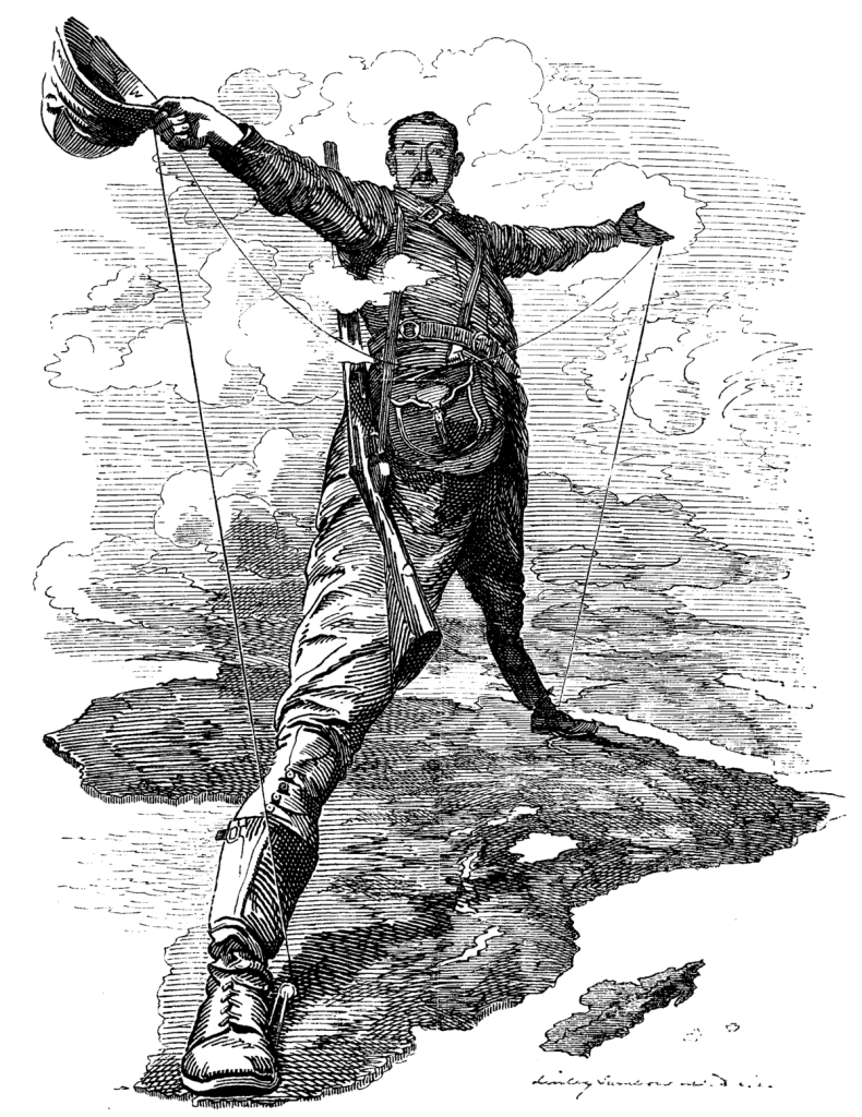
In this multi-volume series, I am following the trail of clues pointing to our hidden history provided by suggestions from viewers that is a compilation of work I have previously done.
I am starting the journey in this video in Sacramento, California.
The Joliet vertical-lift bridge I featured in the last video in this series…
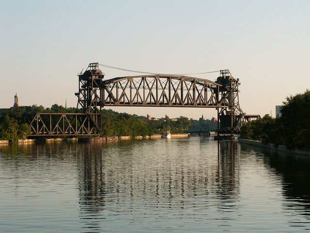
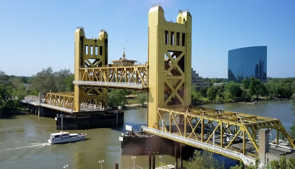
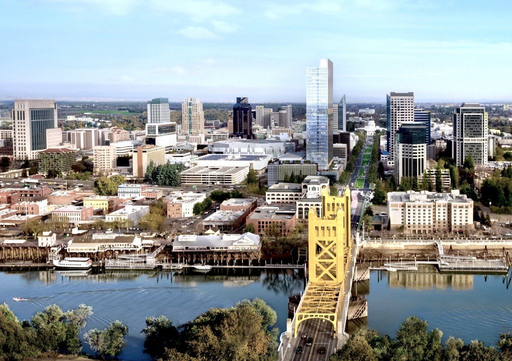
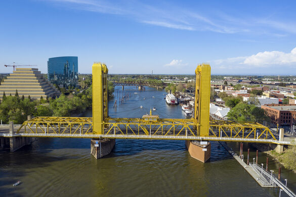
…looked very similar to the Tower Bridge in Sacramento, California.
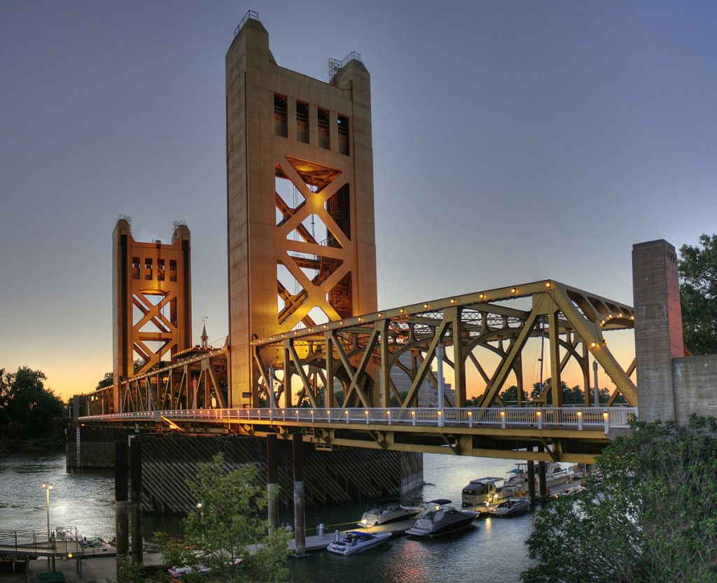
The Tower Bridge is also a vertical-lift bridge, and connects Sacramento and West Sacramento across the Sacramento River.
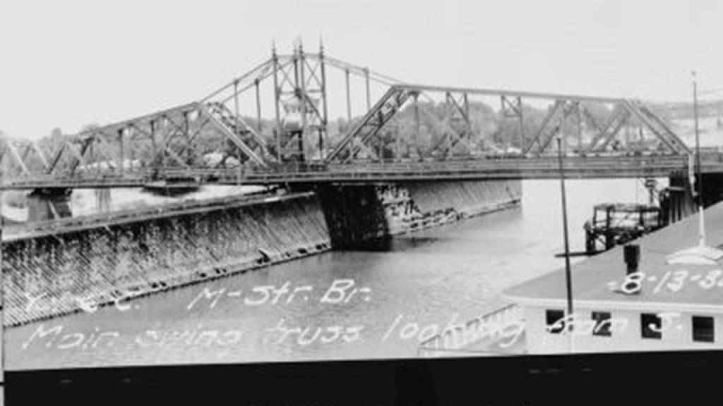
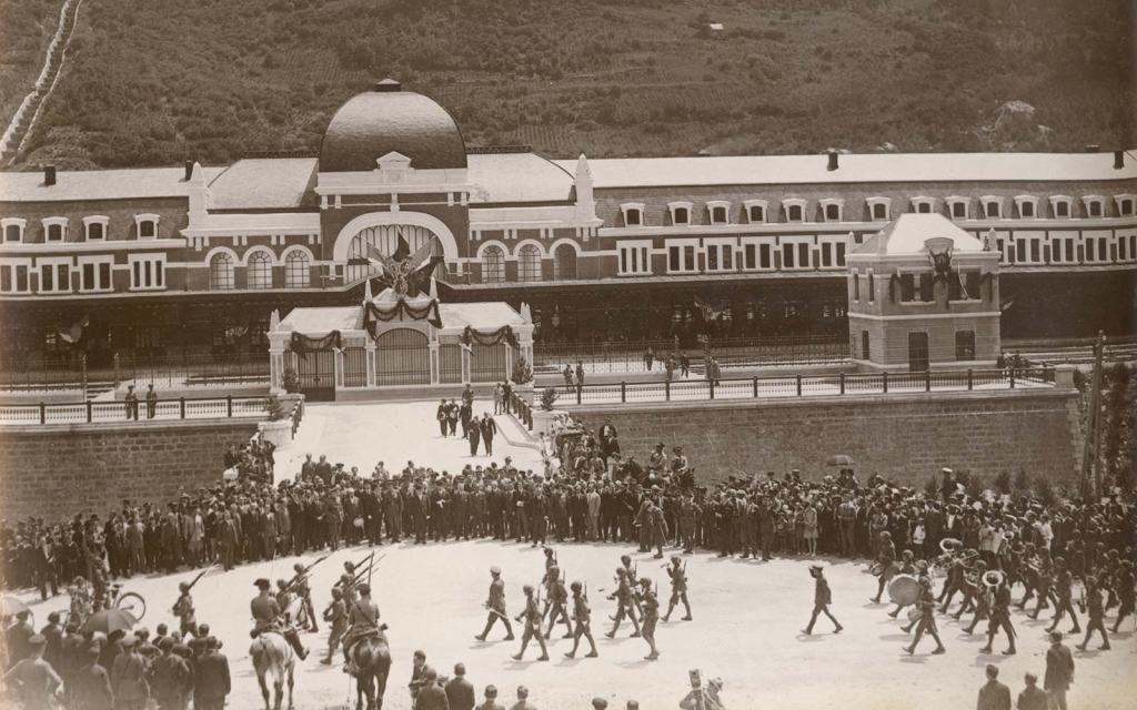
The construction of the Tower Bridge as a replacement bridge for the 1911 M Street bridge was said to have started in 1934 and first opened in 1935.
This would have been around the time of the Great Depression and the beginning of World War II.
The original 1911 bridge was described as a “swing-through truss railroad bridge” that was determined to be inadequate as the result of Sacramento’s population growth doubling between 1910 and 1935, and the city’s concern for needing a better crossing over the Sacramento River in case of war.
Alfred Eichler was credited as the architect of the Tower Bridge, and its architectural-style described as a rare use of “Streamline Moderne,” a style of “Art Deco” that emerged in the 1930s.
The two towers of the bridge alone are 160-feet, or 49-meters, -high.
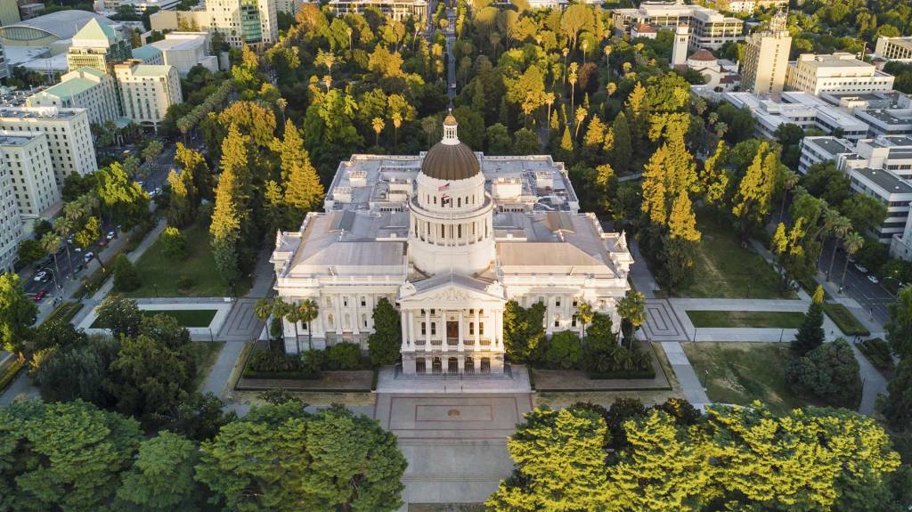
The Tower Bridge is part of State Route 275 which connects West Capitol Avenue and the Tower Bridge Gateway with the Capitol Mall in Sacramento.
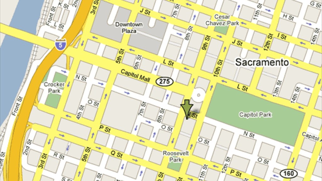
The Capital Mall in Sacramento is described as a major street and landscaped parkway.
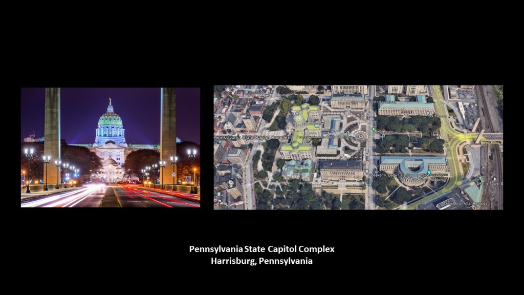
There is a similar linear and geometric relationship between the Tower Bridge, Capital Mall, and State Capital Building in Sacramento that we saw between the “Soldiers and Sailors Memorial Bridge,” also known as the “State Street Bridge;” the “Soldiers and Sailors Memorial Grove;” and the State Capitol Building in Harrisburg, Pennsylvania, also seen in the last video.
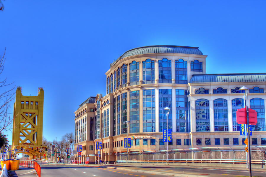
The former Drexel University Sacramento Center for Graduate Studies was in a building situated right next to the Tower Bridge at the address of 1 Capital Mall.
It opened in 2009, and started closing in 2015 to allow currently enrolled students to complete their studies.
It was then permanently closed.
The California State Capital at the other end of the Capital Mall from the Tower Bridge was said to have been designed in the Neoclassical-style by Reuben S. Clark, and constructed between 1861 and 1874.
Interesting to note that the American Civil War took place between 1861 and 1865 in our historical narrative.
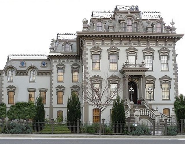
The Stanford Mansion is in the neighborhood of the Capital Mall, and serves as the official reception center for the California government.
It was said to have been built in 1856 as a residence for Leland Stanford, a former California governor, and founder of Stanford University in 1885.
It was donated to the Roman Catholic Diocese of Sacramento in 1900, who operated a children’s home there until 1978.
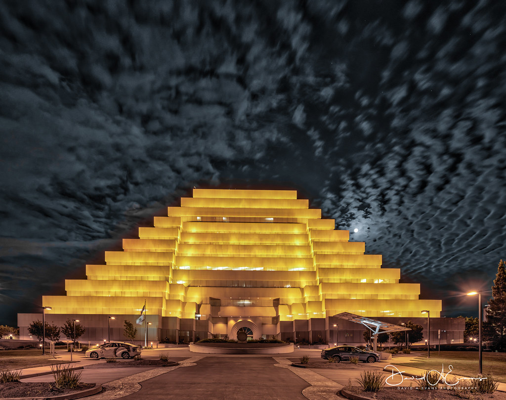
There is a California State Government building called “The Ziggurat” in West Sacramento right next to the Tower Bridge.
The Ziggurat was said to have been designed to resemble ancient Mesopotamian ziggurats and built by The Money Store in 1997.
Since 2001, it has been leased to the state as the headquarters of the California Department of General Services.
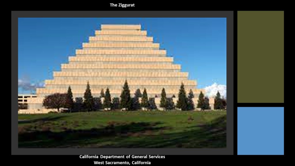
The Ziggurat is illuminated at night on special occasions.
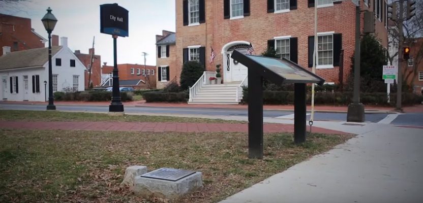
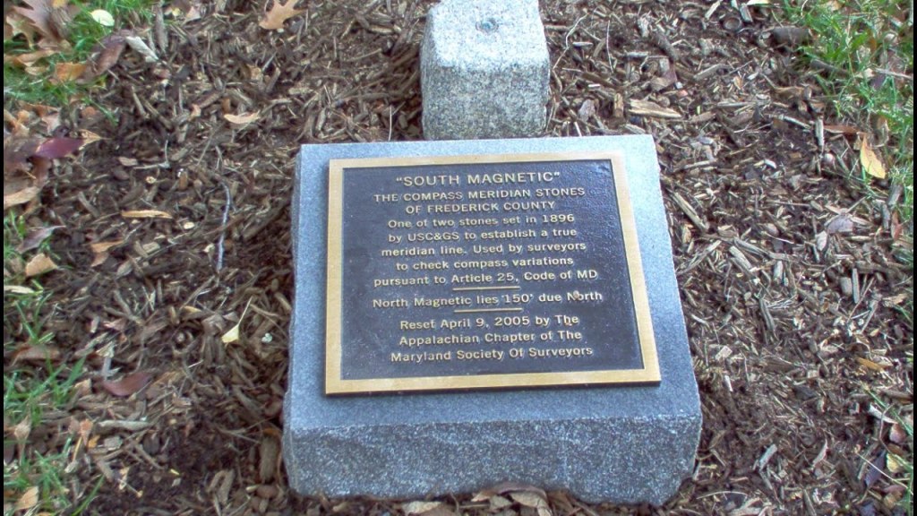
I touched upon the subject of the geodetic markers of the National Geodetic Survey used to synchronize all U. S. government maps in the last video, and I followed up on a comment for me to check out the Compass Meridian Stones in Frederick, Maryland.
They were established in Frederick, Maryland, in 1896 as the result of the work done by two surveyors, Lawrence Brengle and Thomas Woodrow, to accurately measure what was known as “Frederick Town” in 1820.
This helped others, we are told, to realize the importance firstly of precise and accurate surveying measurements, and secondly, of the establishment of primary reference monuments and survey calibration baselines.
The “Compass Meridian Stones” in Frederick are on opposite sides of the lawn of the old courthouse, which is now the City Hall, and established as a North-South baseline in Maryland that surveyors used to annually check for variations in their compasses here and were required to report them to the Clerk of the Court to register them.
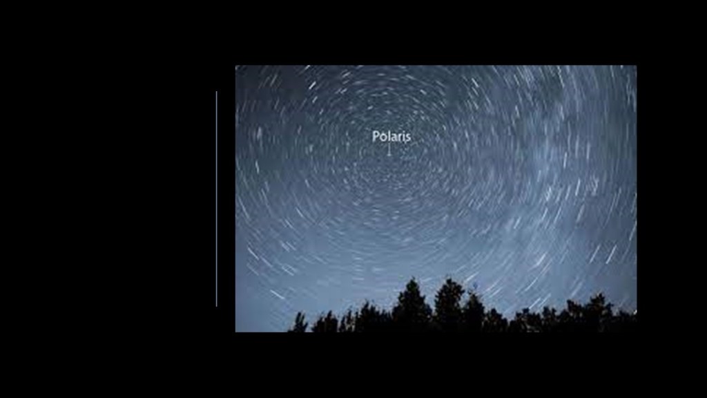
Polaris, commonly known as the “Pole Star” or the “North Star,” is visible from this location, and the two stones have been measured to align with the north.
Polaris is famous for appearing to stand-still in the night sky while the northern sky moves around it.
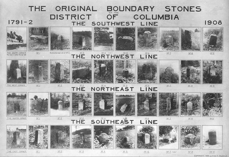
When I was doing research for the “Compass Meridian Stones” in Frederick, I came across information about the Boundary Stones of Washington, DC, the oldest national monuments in the United States.
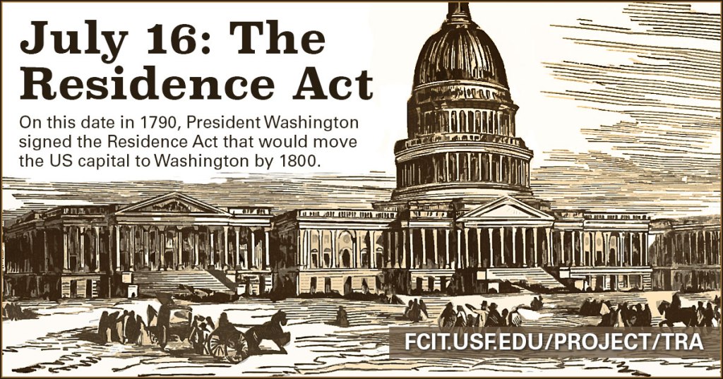
We are told the placement of these boundary stones took place after the Residence Act of 1790, a federal statute adopted during the second session of the first United States Congress, calling for the creation of a new capital city for the United States, and signed into law by President George Washington on July 16th of 1790.
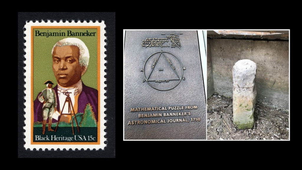
George Washington appointed Major Andrew Ellicott in 1791 to survey the new federal city, and Major Ellicott hired Benjamin Banneker, a surveyor and astronomer from Baltimore County, Maryland, to assist with the survey.
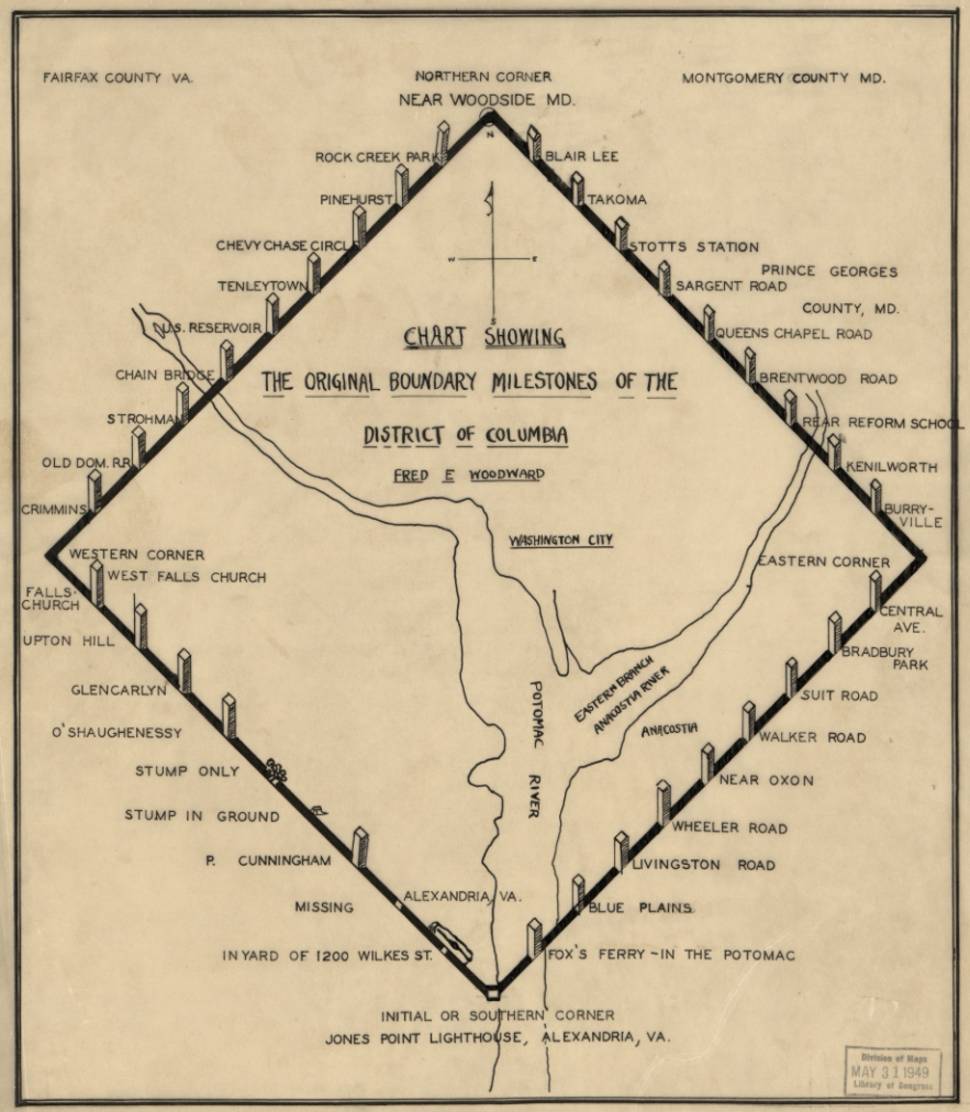
In order to accomplish this surveying task, we are told that land belonging originally to the states of Maryland and Virginia was divided up, and a diamond spanning 10-miles in each direction was marked at each mile by a similar stone marker
This is the Benjamin Banneker: SW-9 Boundary Stone on the boundary of Arlington County, Virginia, and the city of Falls Church, Virginia…
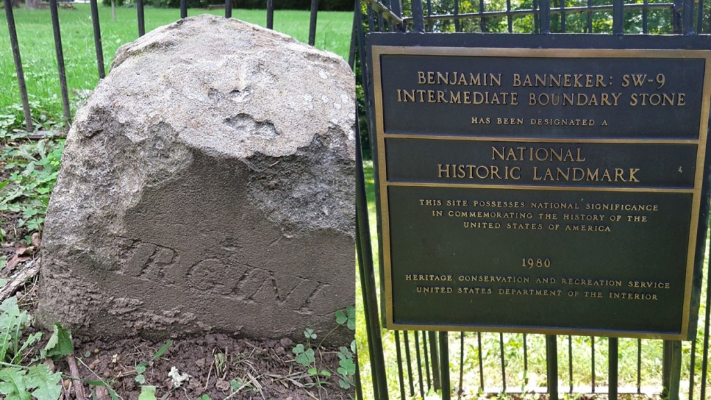
…and found on the grounds of the Benjamin Banneker Park in Arlington, Virginia.
Next, JS suggested that I look at Fulton, Missouri, saying that there is a Church from the 1600s there.
JS came upon it looking for information on the Kingdom of Calhoun.
What is interesting here is that when I typed “Fulton, Missouri Church” into the search box, “Fulton, Missouri Churchill” was a selection.
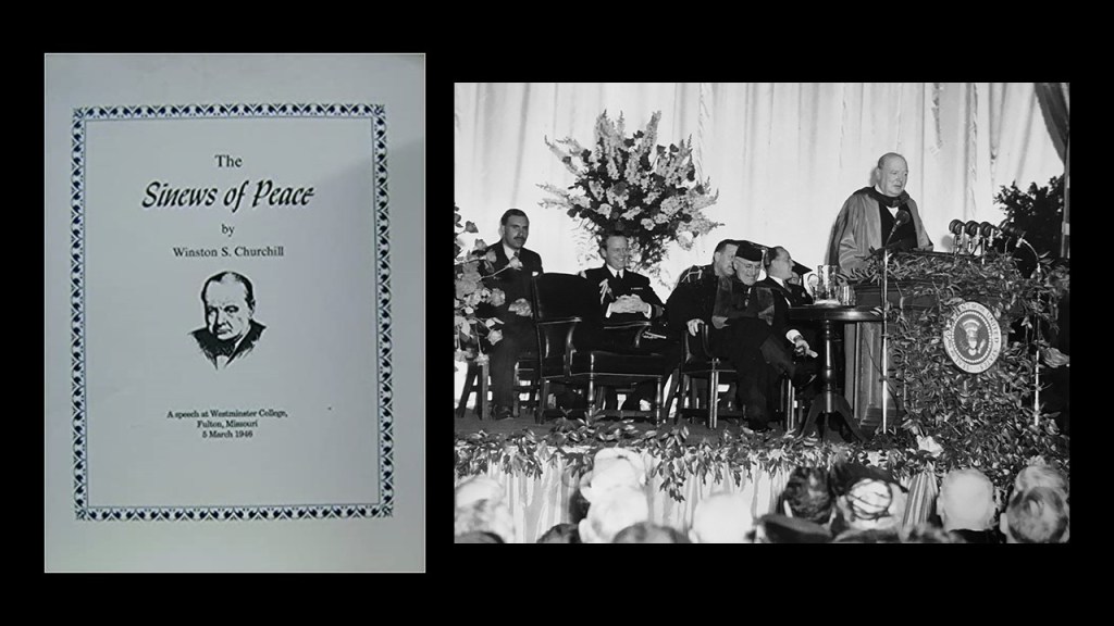
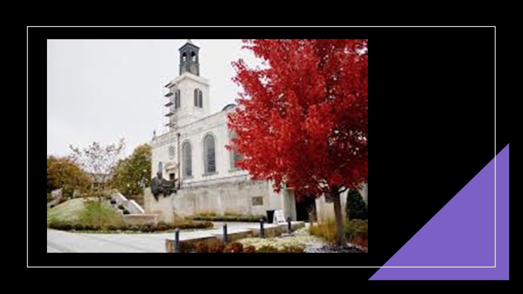
Come to find out, America’s National Churchill Museum is located on the grounds of the Westminster College Campus in Fulton, Mussouri, commemorating the life and times of Sir Winston Churchill.
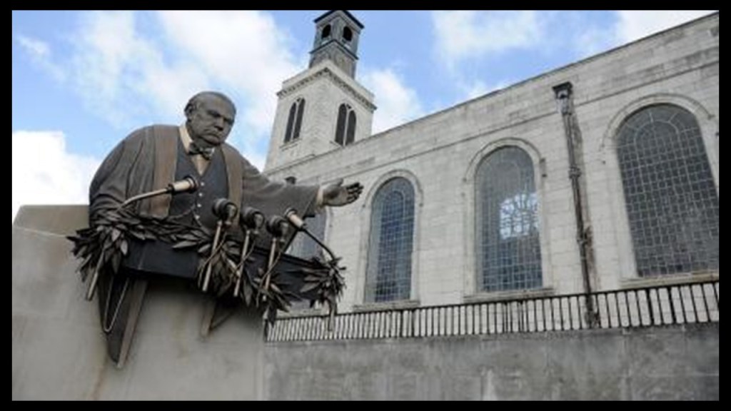
Westminster College is where Churchill delivered what is called the “Sinews of Peace,” also known as the “Iron Curtain” speech in 1946 in the historic gymnasium there, and the speech was said to herald the beginning of the Cold War.
America’s National Churchill Museum is housed in the Church of St. Mary, Aldermanbury, said to have been a church of Sir Christopher Wren’s that was built in the 1600s, and moved stone-by-stone to Fulton from the City of London starting in the mid-1960s.
The foundation stone was said to have been laid in 1966, and the last stone laid in 1967.
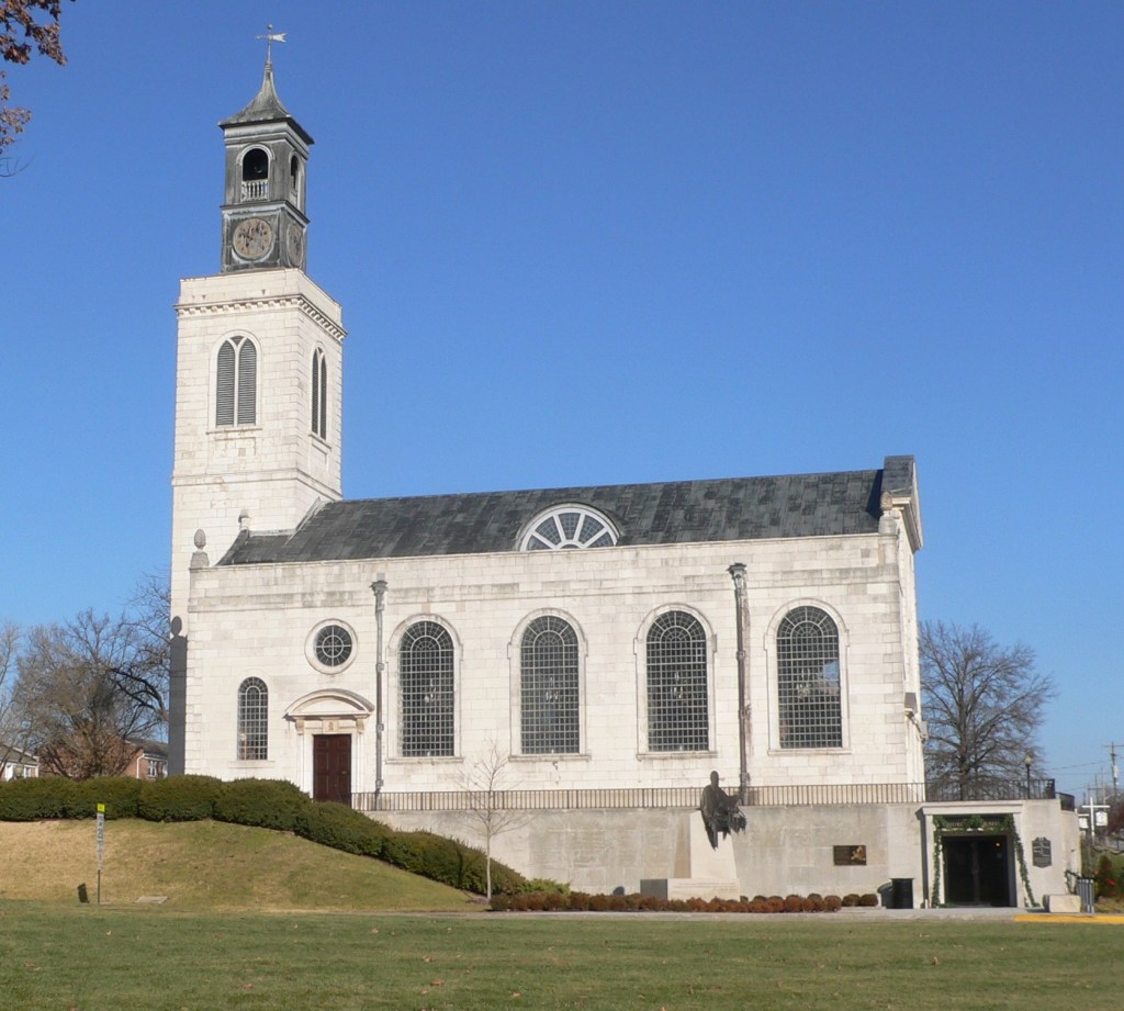
Then, after the transported building was reconstructed, it took another two years to recreate the interior of the church.
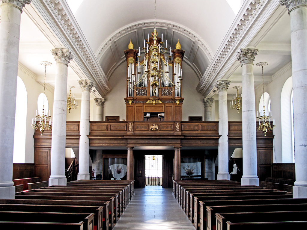
The Churchill Museum opened in 2009, and is located beneath the church.
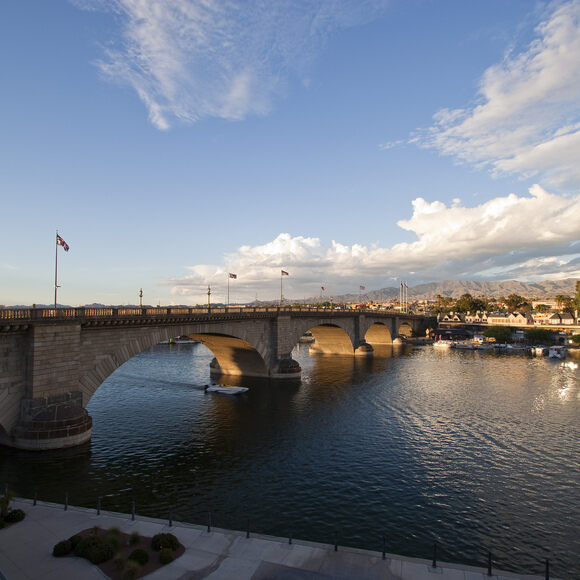
Doesn’t that sound a lot like the story told about the old London Bridge in Lake Havasu, Arizona?
The London Bridge was said to have been built in the 1830s, and purchased from the City of London in 1968 by Robert McCulloch, an American businessman from Missouri, for a planned community he established on the shore of Lake Havasu in 1964.
McCullough was said to have the exterior granite blocks cut and transported to the United States, and that the reconstruction of the bridge was complete in 1971.
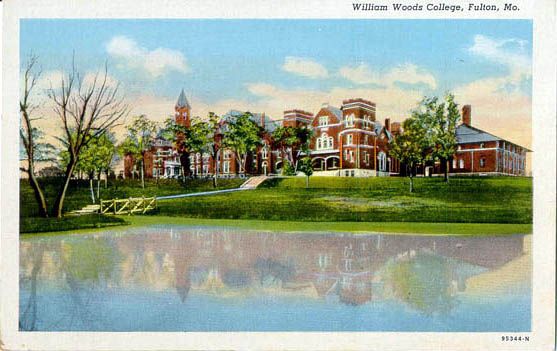
Back in Fulton, Missouri, there is another University, William Woods, established as a college in 1870…
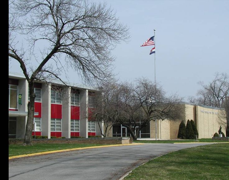
…the Missouri School for the Deaf, established there originally in 1851…
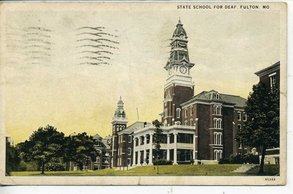
…and still located there today…
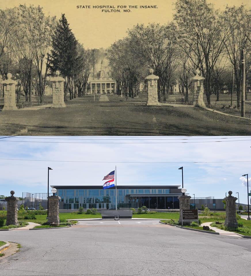
…the Fulton State Hospital, which was authorized in 1847 and opened in 1851, and is the oldest public mental health facility west of the Mississippi River…
…and the Fulton Reception and Diagnostic Center State Prison.
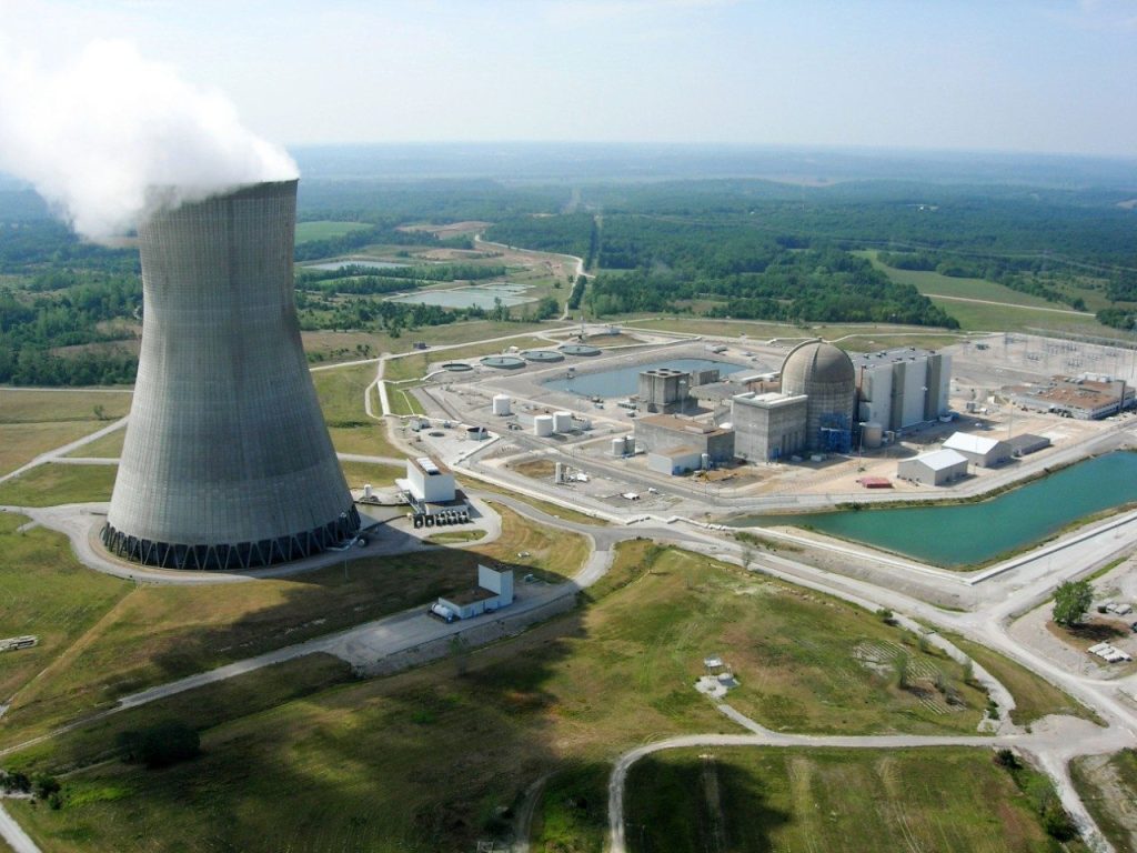
One last thing to mentioned about Fulton is that the state’s only nuclear power plant, the Callaway Plant, is 13-miles, or 21-kilometers, southeast of Fulton.
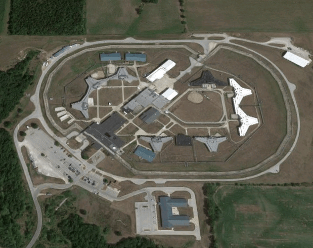
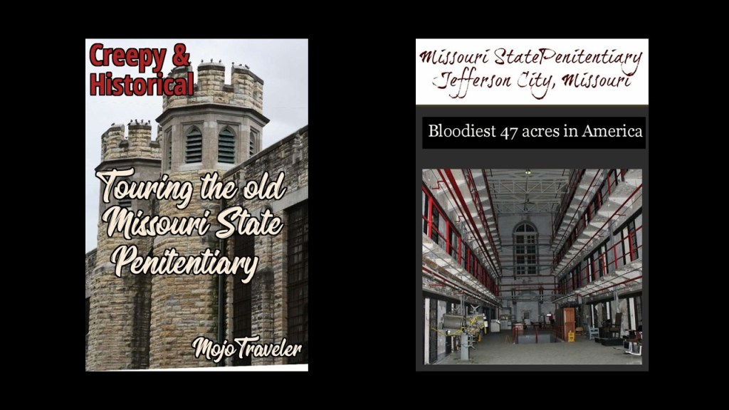
Looking into the Missouri State Prison in Jefferson City, near Fulton, was suggested to me by MU, who said that it was the oldest prison west of the Mississippi.
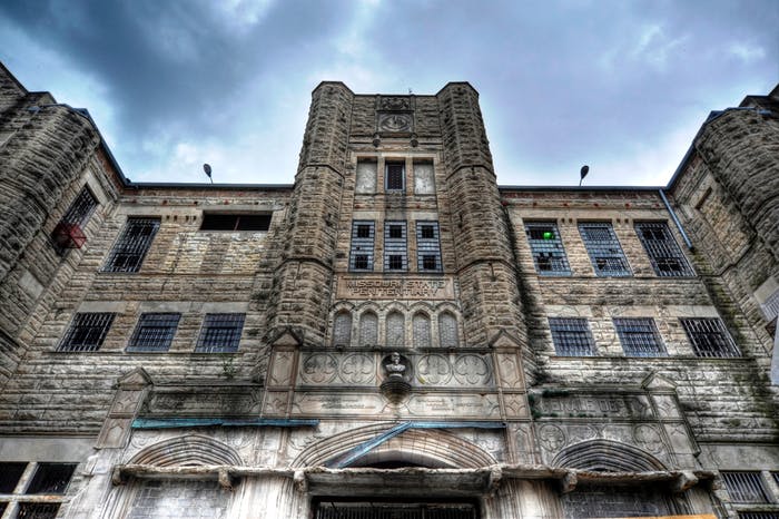
It operated from 1836 to 2004, and was the state’s primary maximum security prison.
Like the Joliet Prison in Illinois and the Minnesota Correctional Facility in St. Cloud mentioned in the last post, inmates were said to have been involved in the quarrying the stone on site and making the bricks used in building the Missouri prison in the 19th-century…
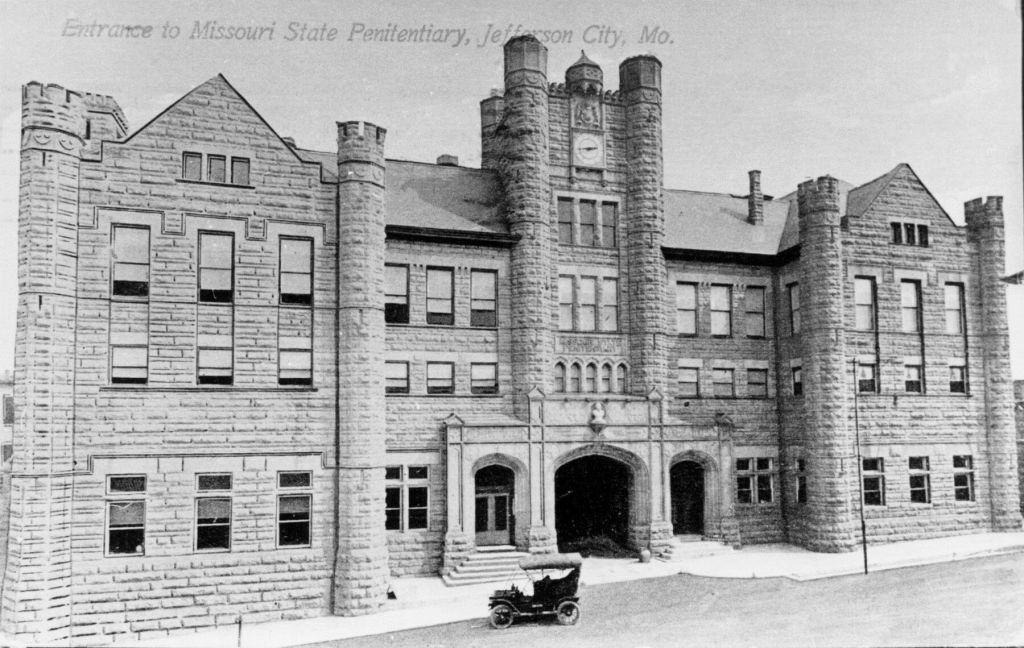
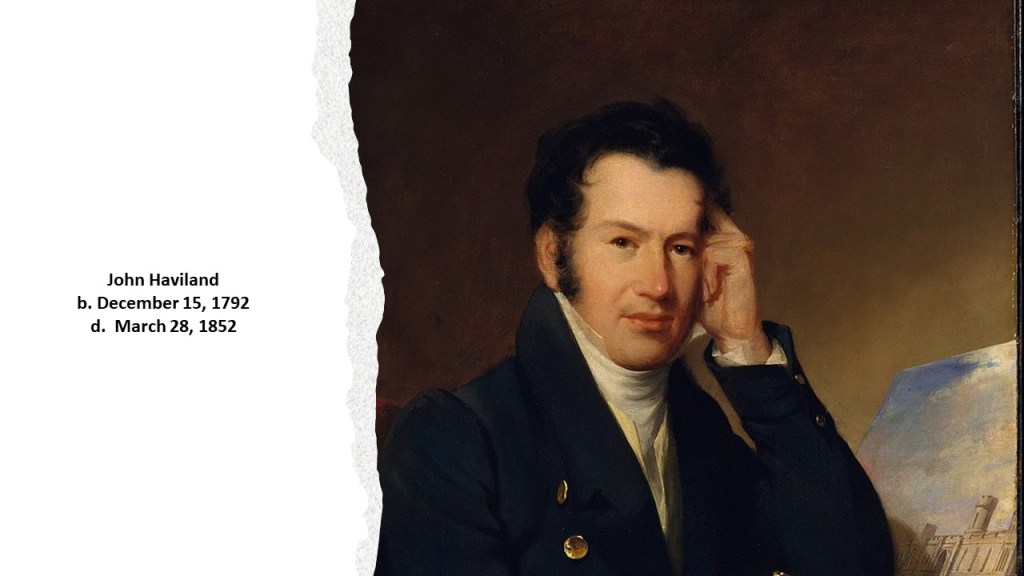
…and designed by English-born architect John Haviland, said to be a major figure in the design of Neoclassical architecture during the early- to mid-19th-century.
Today, the Missouri State Prison, like the decommissioned Joliet Prison in Illinois, is open for tourist business.
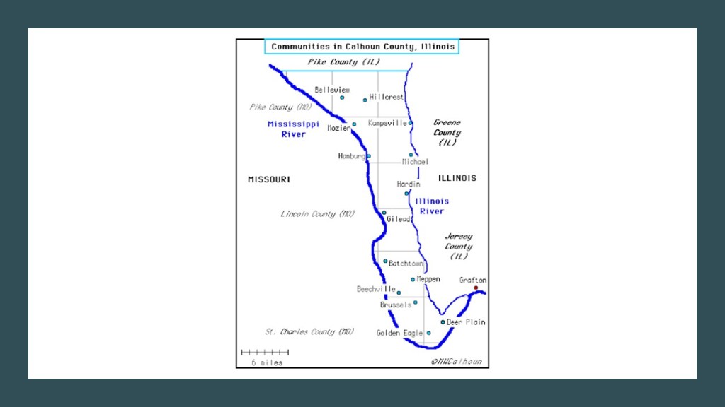
I was curious about the Kingdom of Calhoun mentioned by JS who came across Fulton, Missouri.
My search efforts for the term “Kingdom of Calhoun” are directing me to Calhoun County, Illinois.
Here are some things I was able to find.
Calhoun County is a long, skinny county that runs along the Mississippi River border of Illinois and Missouri, and named for John Calhoun, the 7th Vice-President of the United States between 1825 and 1832, during the administrations of Presidents John Quincy Adams and Andrew Jackson, and the Calhoun family that was prominent in the area at the time.
The area’s population began to expand in the 1840s, we are told, with the arrival of German immigrant farmers.
The population of Calhoun County in 2019 was listed as 4,739.
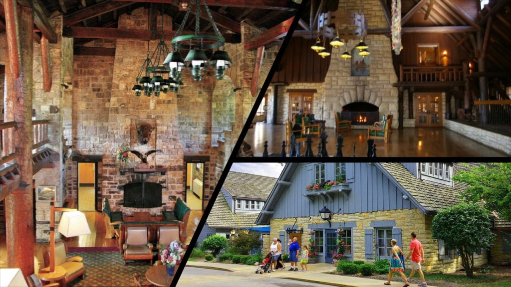
The Pere Marquette Lodge in Grafton, Illinois at the bottom tip of Calhoun County, but actually in Jersey County, was said to have been built in the 1930s as by the Civilian Conservation Corps as part of President Franklin Roosevelt’s New Deal.
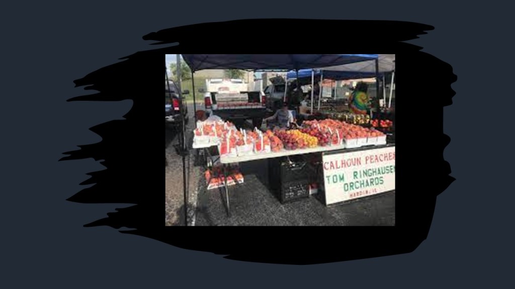
There are a number of family orchards in the southern tip of the county, like the Jacobs Orchard in Golden Eagle…

…and the Tom Ringhausen Orchard and Market in Hardin, Illinois.
The Joe Page Bridge in Hardin, Illnois, named after a local politician who lived between 1845 and 1938, is a vertical-lift bridge that links Greene and Calhoun Counties across the Illinois River.
It’s lift-span is just a little over 308-feet, or 94-meters, -long, making it the longest span of this type in the world.
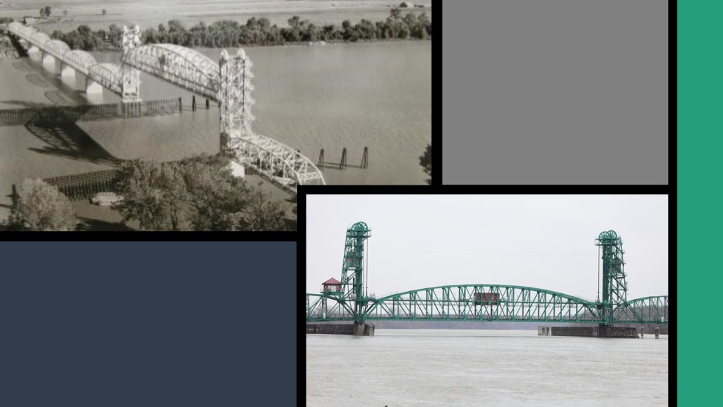
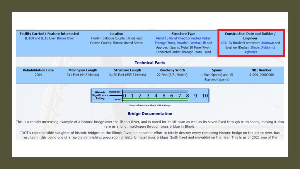
The bridge was said to have been built in 1931 by an “unknown” builder, though the State of Illinois Division of Highways is given credit for the engineering & design work.
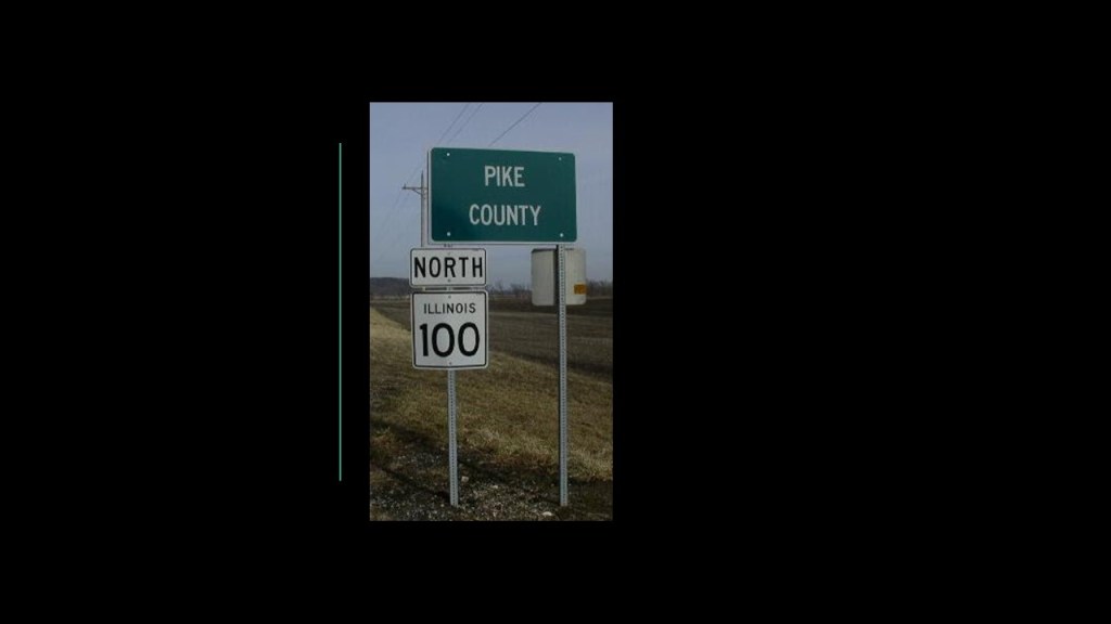
The Joe Page Bridge is the southernmost of three vertical-lift bridges on the Illinois River used by Illinois Route 100, which makes up much of the Illinois River Road, a U. S. National Scenic By-way.
The Florence Bridge, which connects the town of Florence, Illinois, to Scott County, Illnois.
The population of Florence was 71 at the time of the 2000 Census, and Scott County is the fourth least-populated county in the State of Illinois.
The Florence Bridge was said to have first opened in 1929…
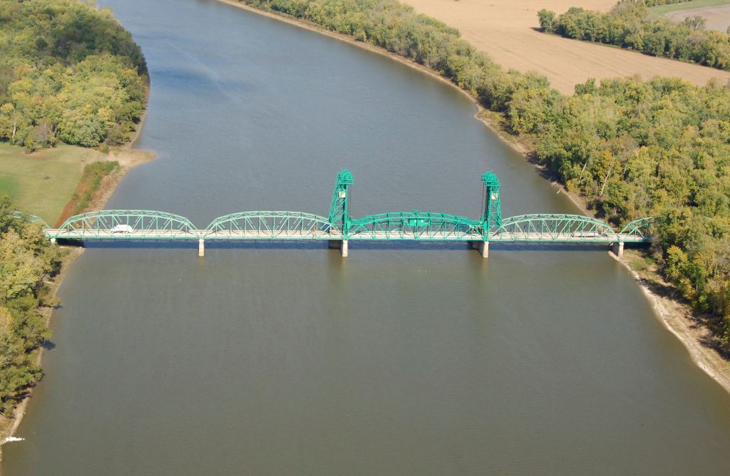
…and like the Joe Page Bridge is also listed as “Builder Unknown.”
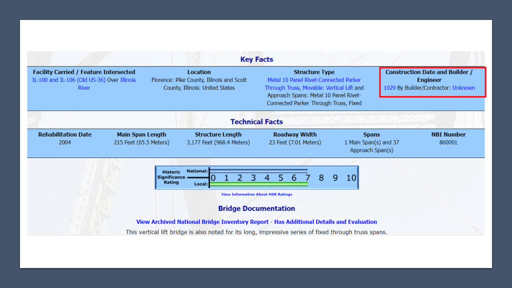
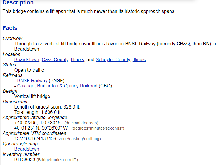
The northernmost of the three vertical-lift bridges crossing the Illinois River is the Beardstown Bridge, located at Beardstown, Illinois, between Schuyler County, Illinois, and Beardstown.
The current bridge was said to have been built in 1955, and rehabilitated in 1985.
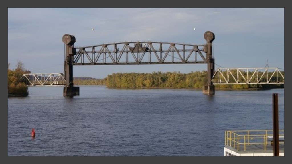
I can’t find out much information on the Beardstown Bridge either.
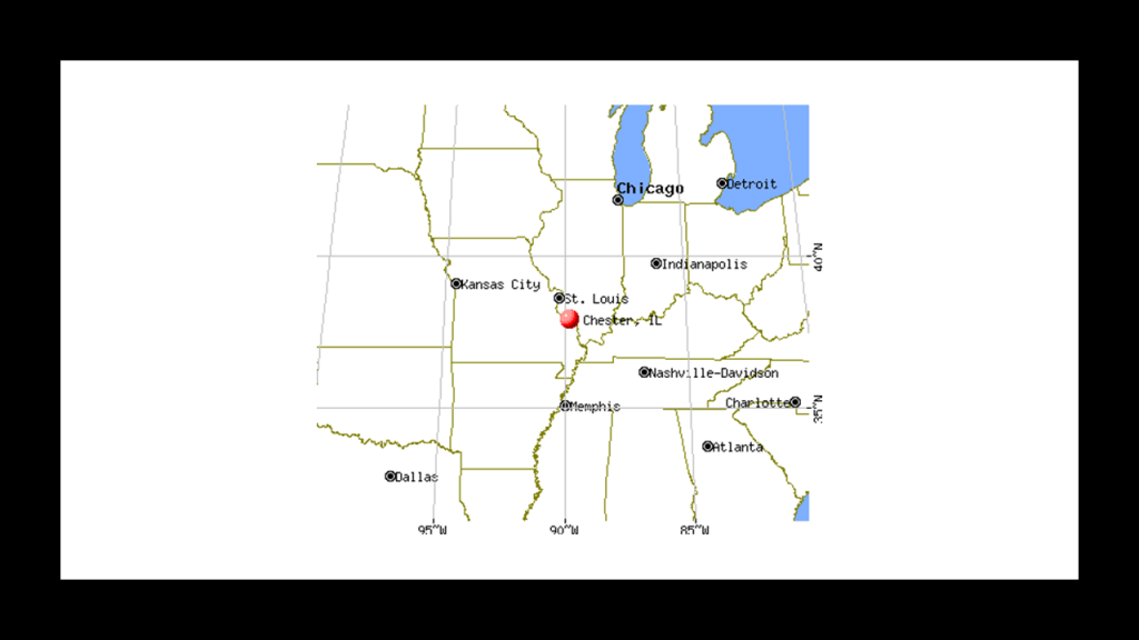
SC suggested I look into the history of Chester, Illinois, who said that it is an old city that sits on a bluff overlooking the Mississippi River and that the creator of Popeye the Sailor, Elzie Segar, was from Chester.
Well, Popeye is the first thing that pops out about Chester in a search.
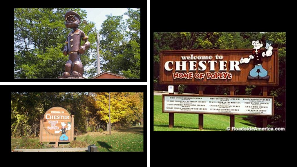
…as Chester promotes its status as “Home of Popeye.”
The population of Chester in the 2010 census was 8,856…
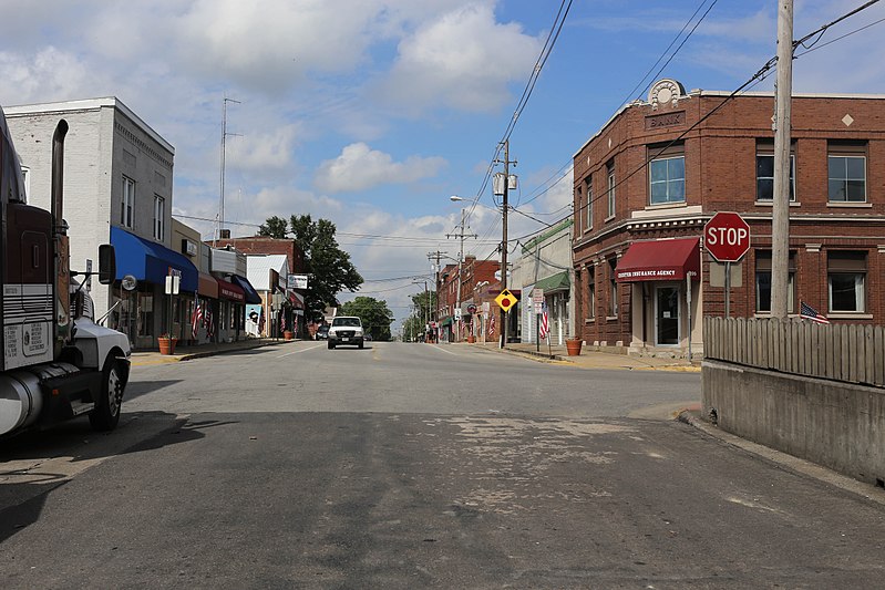
…and it is located 61-miles south of St. Louis, Missouri, on the Mississippi River.
I did a search for historical pictures of Chester, and here are some things that came up.
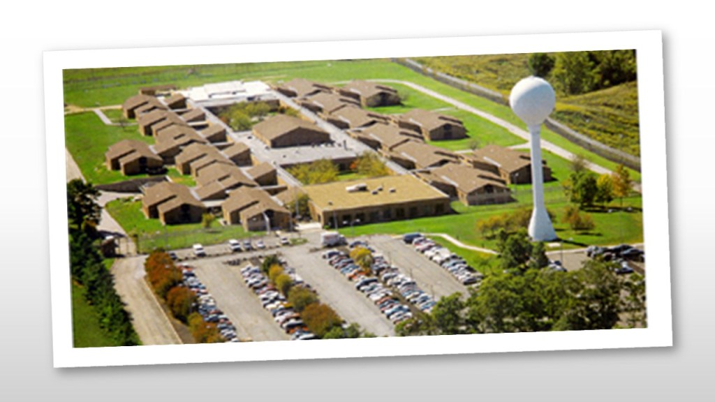
This an old postcard showing the Southern Illinois Penitentiary prison yards and Asylum for the Criminally Insane in Chester.
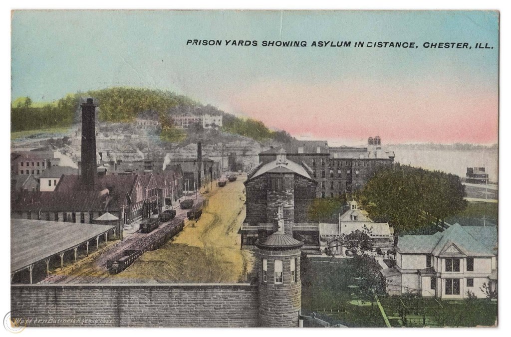
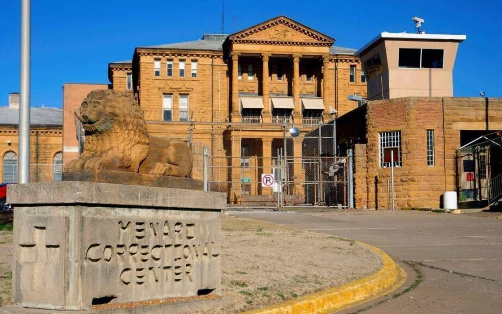
The Southern Illinois Penitentiary in Chester first opened in 1878…
…and since 1970 has been known as the Menard Correctional Center, and is the state’s largest prison.
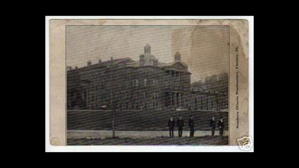
The Chester State Hospital for the Insane was said to have been built between 1889 and 1891.
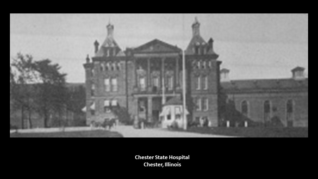
…and since 1975, still exists next to the Menard Correctional Center as the Chester Mental Health Center.
It is the only maximum security forensic mental health facility for those committed via a court order or believed to be an escape risk.
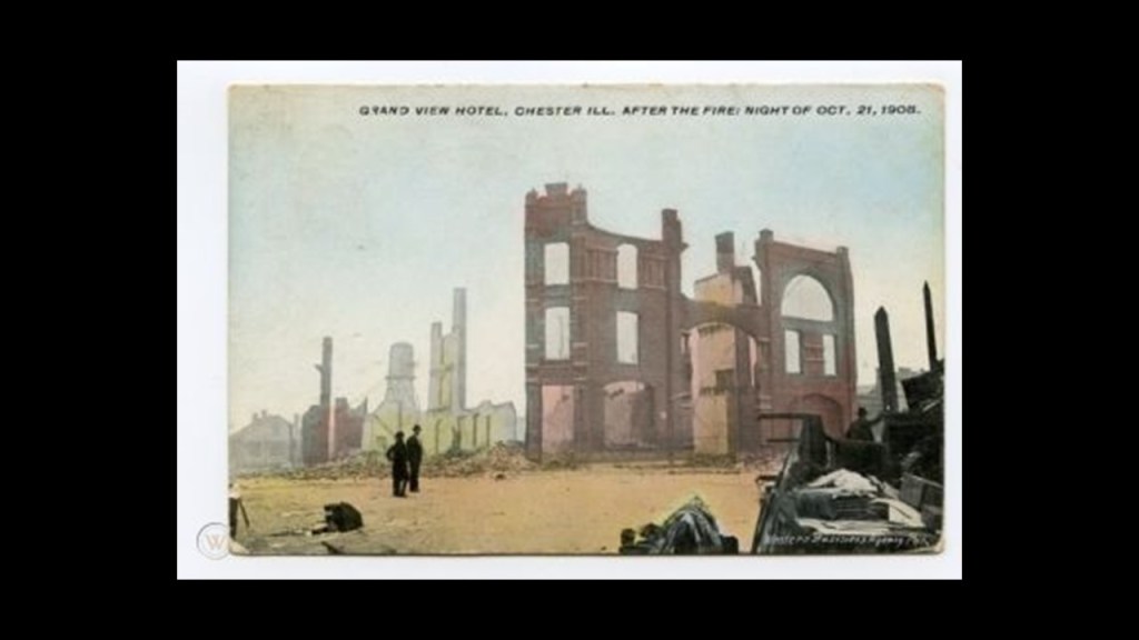
I found this postcard showing the Grand View Hotel in Chester after it was destroyed by fire in 1908.
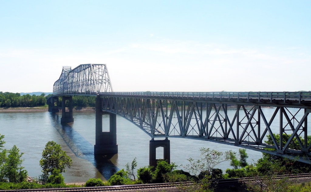
The Chester Bridge crossing the Mississippi River was said to have been constructed between 1939 and 1942, and that only two-years later, it was destroyed by a severe thunderstorm on July 29th of 1944.
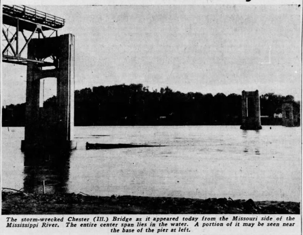
The bridge was subsequently reconstructed, and reopened on August 24th of 1946.
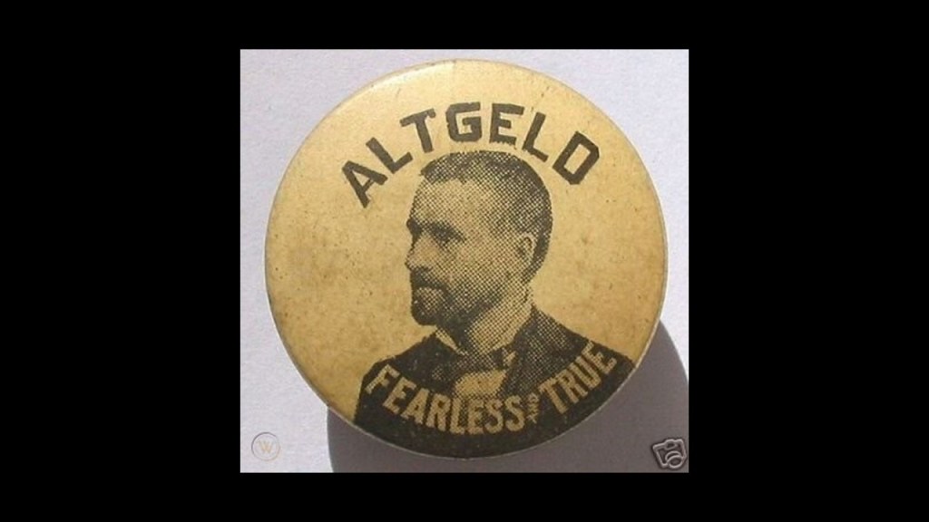
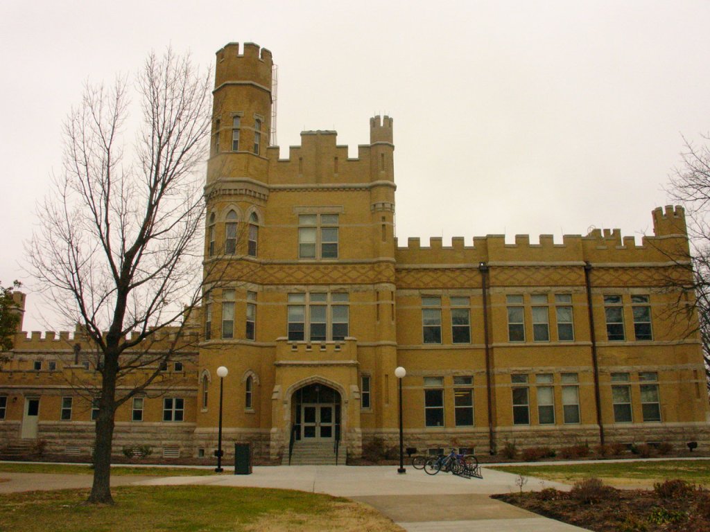
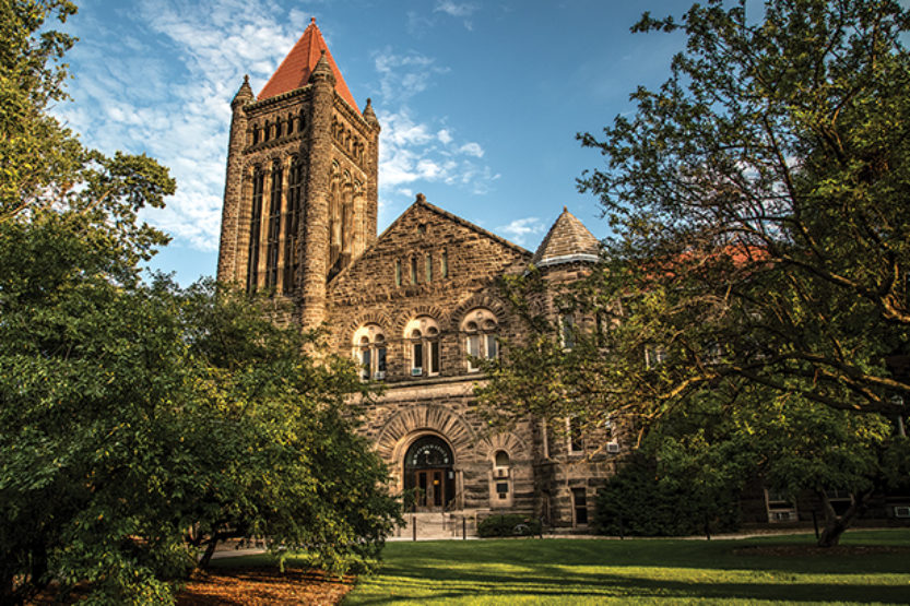
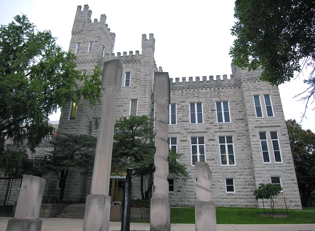
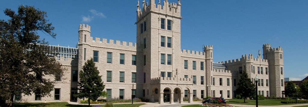
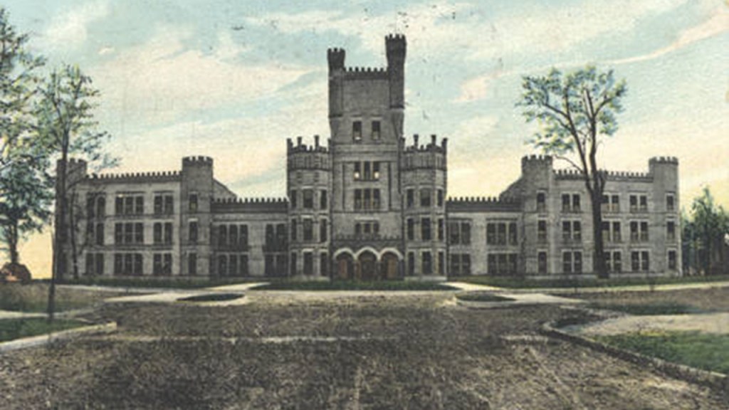
TB brought Altgeld’s Castles to my attention.
These are called Gothic Revival-style buildings at five universities in Illinois inspired by the Illinois Governer between 1893 and 1897, John Peter Altgeld.
The Altgeld Castles are as follows:
Altgeld Hall on the campus of Southern Illinois University Carbondale was said to have been built in 1896…
…Altgeld Hall at the University of Illinois at Urbana-Champaign, with a construction completion date of 1897…
…said to have been completed in 1898, what was known as “Altgeld’s Folly” is today the John W. Cook Hall…
…Altgeld Hall at Northern Illinois University, said to have been built between 1895 and 1899…
…and what is called “Old Main” at Eastern Illinois University, said to have been completed in 1899.
Next, I would like to share some information that I received from SD in northwest Missouri near Leavenworth, Kansas, who sent me these two photos of the Old Union Depot in Leavenworth.
She said the current building on the left, a community center today, appears to be an entire story shorter than the original train station, pictured on the right.
She said if you walk across the street and look on the other side of the black iron fence, you can see the first story below, but for whatever reason, the road was built up above the 1st story of the building.
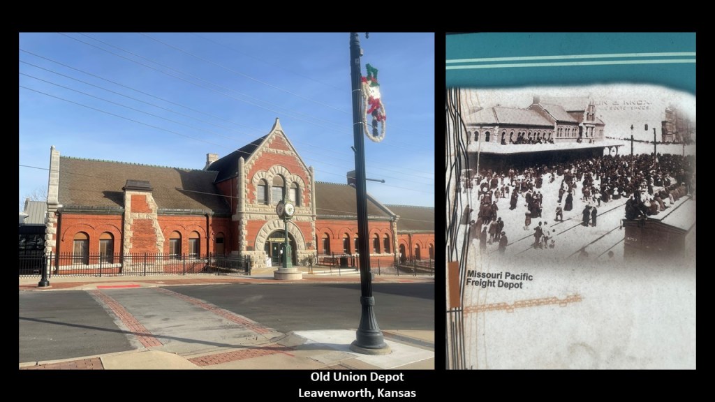
She indicated Leavenworth is a strange town and said that the prisons, like many of the 1800s prisons I have been reporting on based on commenters’ suggestions, begs to be explored.
The Federal prison, or United States Prison Penitentiary Leavenworth, was said to have opened in 1903, and was the first of three first-generation federal prisons.
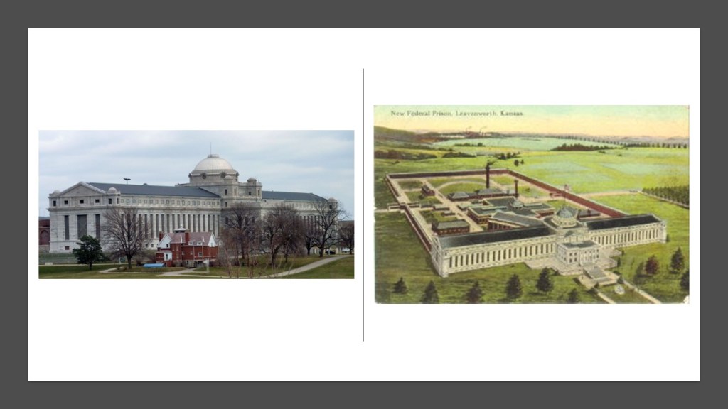
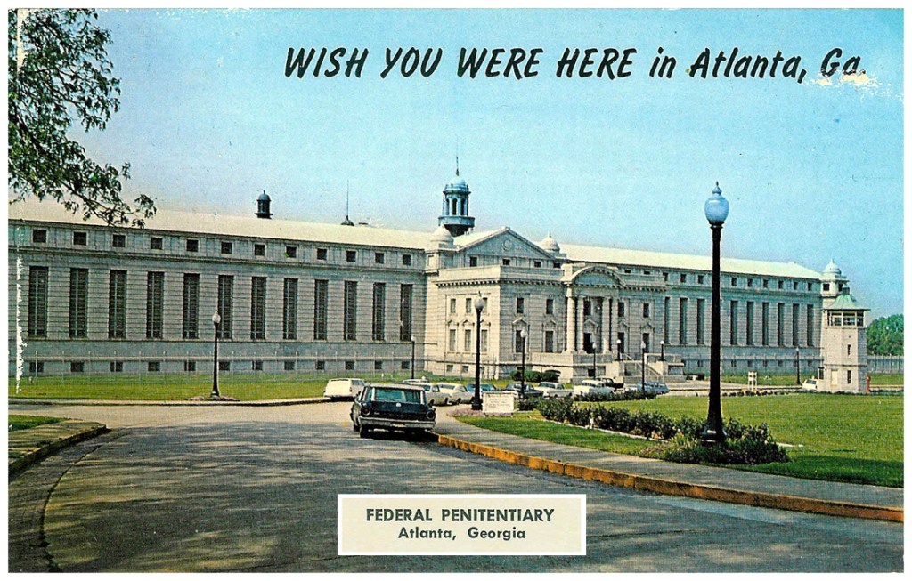
The other two federal prisons that ostarted operating as such around the same time as USP Leavenworth were in 1902 in Atlanta, Georgia…
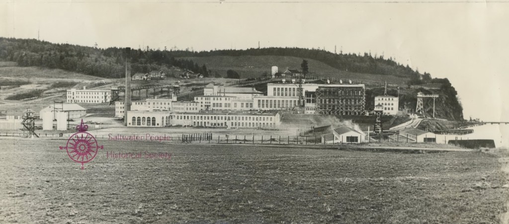
…and USP McNeil Island in the Puget Sound near Tacoma, Washington, which first opened as a prison in 1875, and then became a federal prison in 1904.
It closed-down as a state prison 2011.
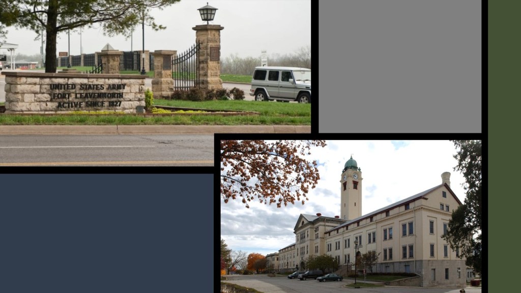
The United States Disciplinary Barracks, the Department of Defense’s only maximum security prison…
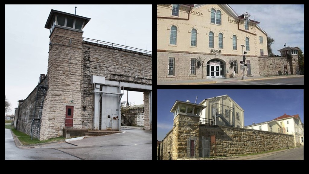
…is located at Fort Leavenworth, the oldest permanent settlement in Kansas, and the second-oldest U. S. Army post west of the Mississsippi, having been built, we are told, in 1827.
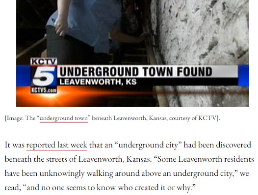
You can find information about the existence of an underground tunnel system in Leavenworth in an internet search…
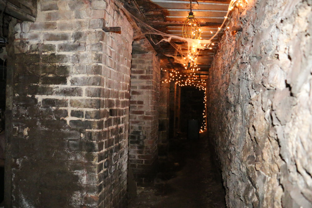
…as well as a mysterious underground city that was found beneath Leavenworth!
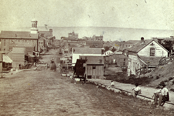
Leavenworth was founded in 1854, and became the first incorporated city in Kansas in 1855.
This historic photo of 5th Street in Leavenworth was presumably taken some time between 1854 and 1865, because I found it on the Kansas City Public Library page on the “Civil War on the Western Border.”
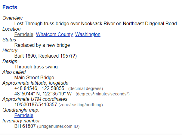
Next, PW sent me photos of the train bridge in Ferndale, Washington.
It is the BNSF Nooksack River Bridge. BNSF is the largest freight railroad network in North America, and Amtrak uses it as well.
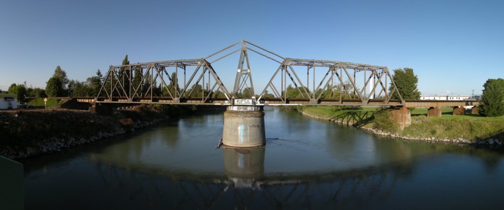
PW said that while the bridge used to rotate, it doesn’t anymore.
He pointed out the of small wheels poking up from behind the exposed outside edge of a gear, just above the top of the concrete base.
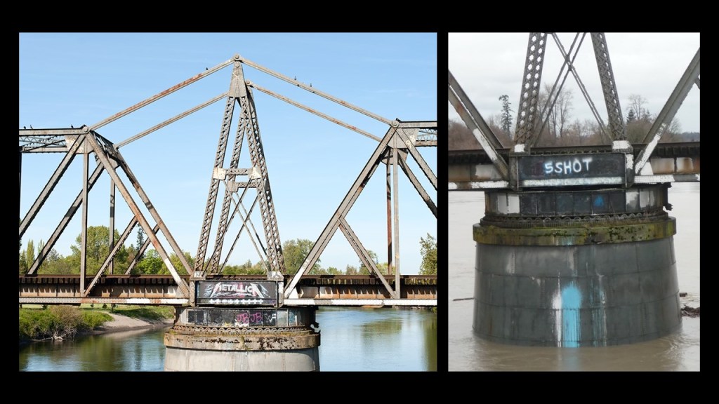
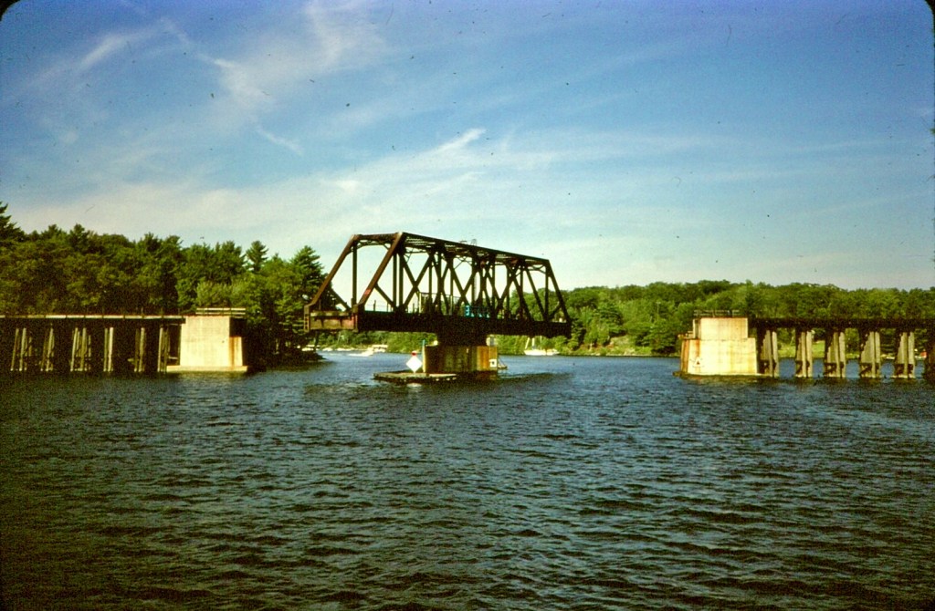
Swing bridges are movable bridges that have a vertical locating pin and support ring as its primary structural support, and can pivot horizontally, allowing water vessels to pass through.
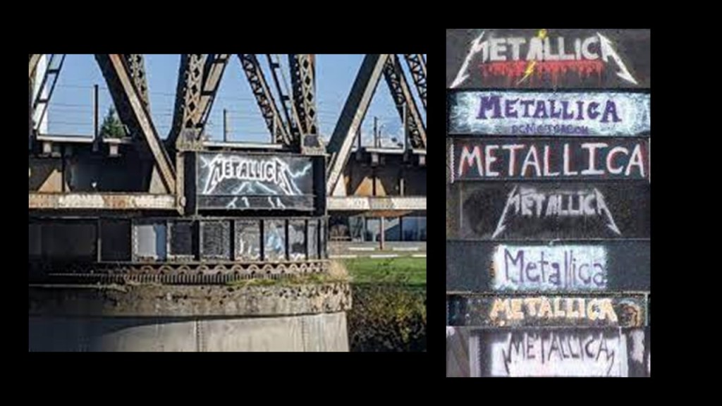
It has come to be known as the Ferndale Metallica Bridge because over the last thirty-years, someone has been painting Metallica logos on it.
PW said he’s looked around the bridge, and the year 1910 is stamped in the concrete underneath the bridge.
When I started looking for information on the construction date for the bridge, the only thing I could find referencing a construction date was that it was said to have first been built in 1890 and a replacement date of 1957, with a question mark.
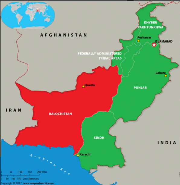
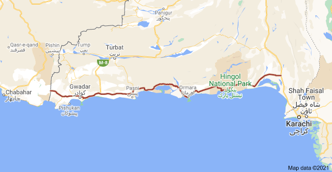
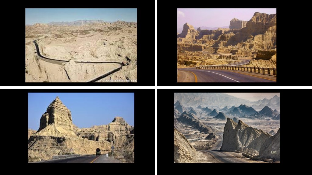
Next, LL suggested that I check out Makran Coastal Highway in Pakistan’s Balochistan Province.
Balochistan is the largest, but least populated of Pakistan’s four provinces.
The Makran Coastal Highway, National Highway 10, is 406-miles in length, or 653-kilometers, running Gwadar in Balochistan to Karachi in Sindh Province, and was completed in 2004.
Prior to that, it was an dirt road.
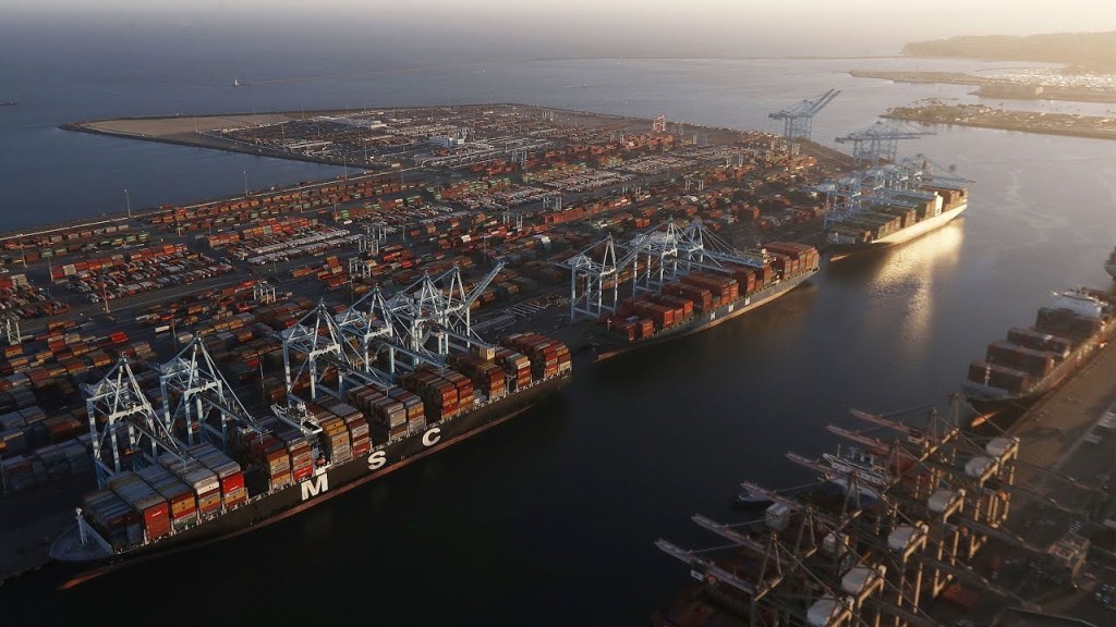
The development of the highway was considered critical for the development of a port at Gwadar, with which, among other things, to ship the oil and mineral resources of the Central Asian Republics after the break-up of the Soviet Union.
Here are some examples of sights you would see along a drive of the Makran Coastal Highway, to include the Great Sphinx; the Princess of Hope; and Buzi Pass.
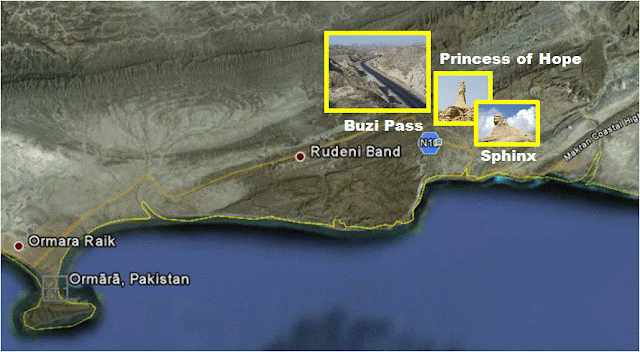
The Great Sphinx, also known as the Balochistan Sphinx, or the “Lion of Balochistan,” is described as a natural rock formation that looks like a sphinx.
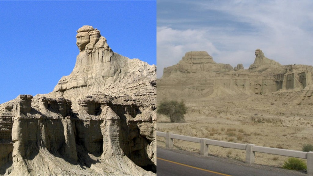
The Princess of Hope, also described as a natural rock formation, looks like a princess looking towards the horizon.
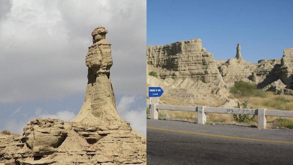
Both of these formations are visible from the highway’s Buzi Pass all in Pakistan’s largest national park, Hingol National Park.
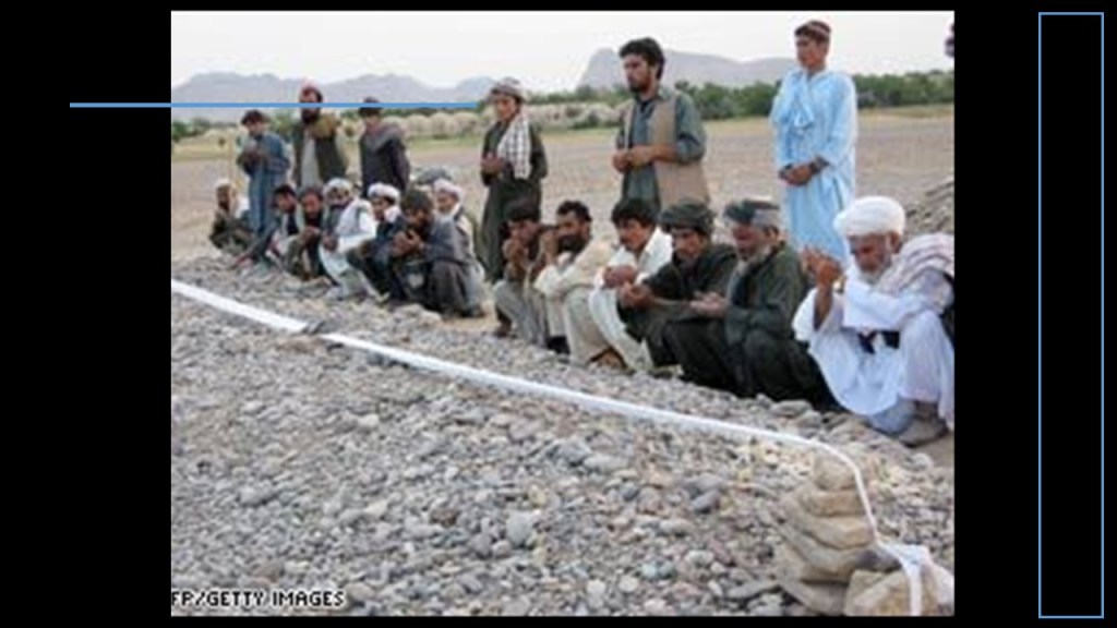
The Pashtun tribal peoples are the primary inhabitants of a region including North and South Waziristan, the Khyber-Pakhtunkwha and Balochistan Provinces of Pakistan, and the Pashtun are also found in Afghanistan, in a region regarded as Pashtunistan, split between two countries since the Durand Line border between the two countries was formed in 1893 after the second Anglo-Afghan War.
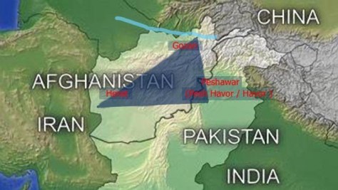
The name sake of the line, Sir Henry Mortimer Durand, was a British Diplomat and Civil Servant of the British Raj. We are told that together with the Afghan Emir, Abdur Rahman Khan, it was established to “fix the limit of their respective spheres of influence and improve diplomatic relations and trade.
Well, that certainly sounds good…but what was really going on here?
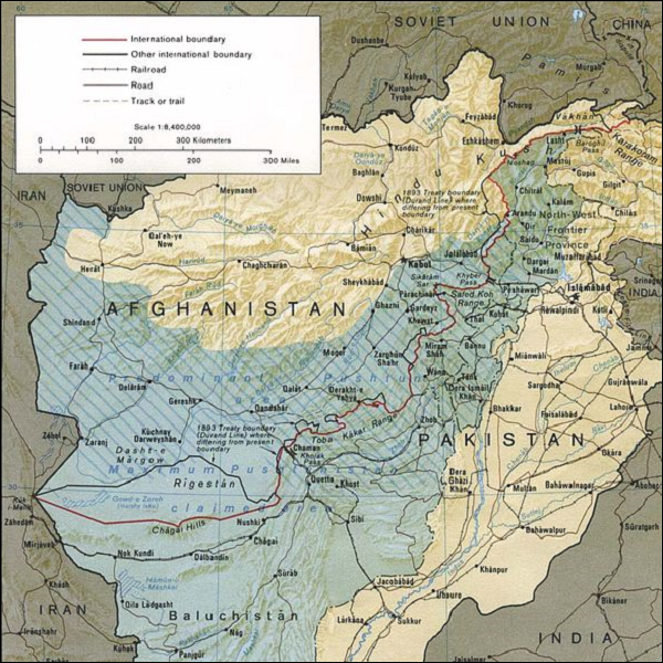
The Durand Line cuts through the Pashtunistan and Balochistan regions, politically dividing ethnic Pashtuns and Baloch, who live on both sides of the border.
But, really, why divide a people in this fashion?
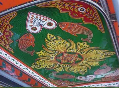
The Pashtun are a tribal nation of millions of Afghani and Pakistani Muslims who also have a strong oral tradition that they are descendants of lost ten Tribes of Israel, and they refer to themselves as Bani Israel.


Here is an example of a Pashtun textile piece showing the sacred geometric shape of a star tetrahedron in the center, also known as the Star of David…
…and two Afghani Pashtun lockets inscribed with the Star of David…
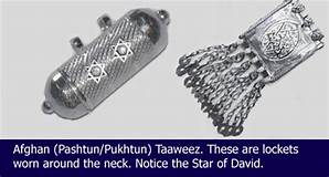
…and an ancient Afghan Torah in Hebrew.
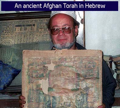
So, according to the history we have been taught, how can this be?
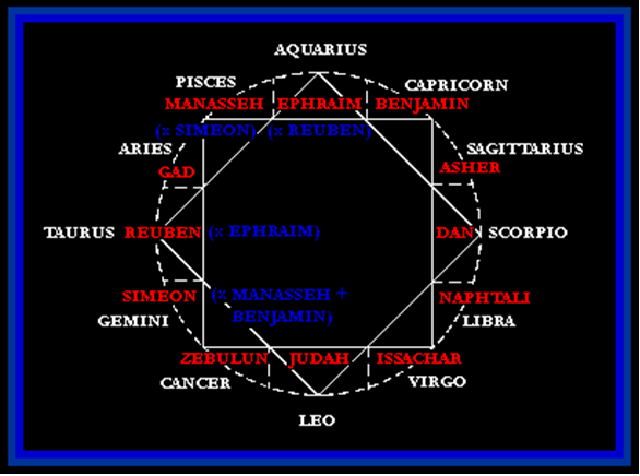
What if we are talking about a worldwide civilization arranged like what you see pictured here (and in which you see an eight-pointed star contained within this configuration)…
The Rothschilds purchased Jerusalem in 1829, and subsequently acquired considerable land in Palestine in the 1800s and early 1900s.
If all of this is very confusing based on what we have been taught, it was absolutely meant to confuse, confound, misdirect and misinform us so we would instead fight each other and never know our true history by the Controllers who created the New World Order for their benefit, and not ours.
They took what was originally true, and then fragmented it and repackaged it to fit their agenda of world domination and control of Humanity and the Earth’s resources.
The controllers didn’t rewrite history from scratch – they rewrote the historical narrative to fit their agenda.

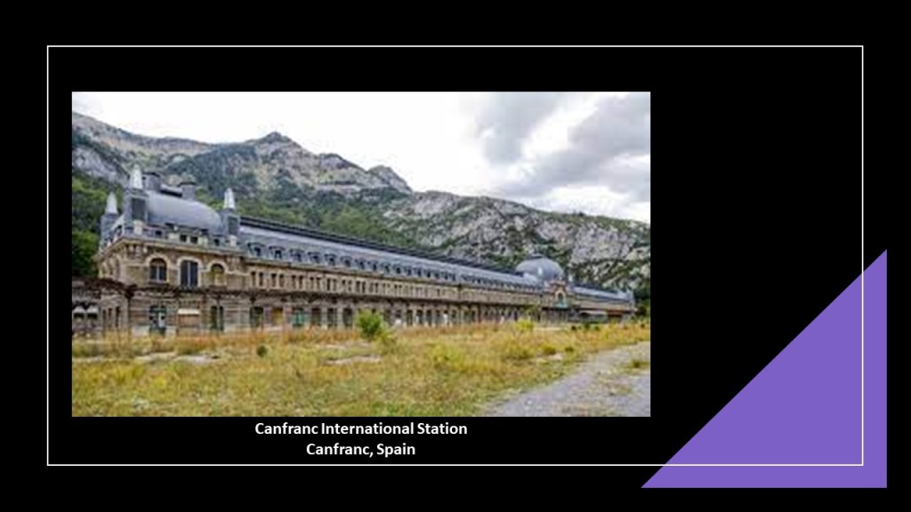
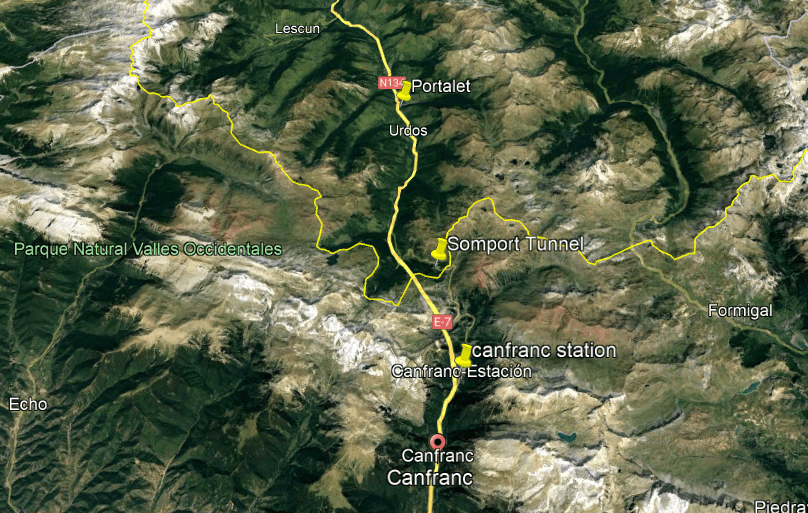
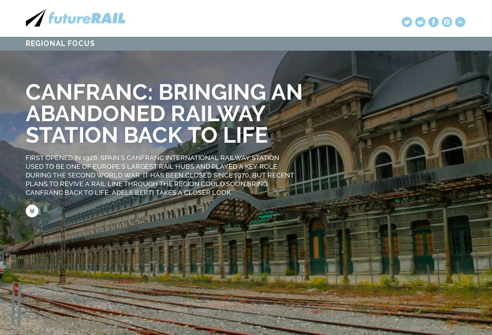
ML brought the Canfranc International Station, in the village of Canfranc in Spain in thePyrenees Mountains to my attention.
The Somport Railway Tunnel, said to have been constructed in 1915, carried the Pau-Canfranc Railway under the Pyreness into France between Canfranc on the Spanish-side and Cette-Eygun in French-side of the Pyrenees.
The tunnel was closed as a railway tunnel in 1970 after a freight-line accident damaged a key bridge in France, and re-opened in 2003 as the Somport Road Tunnel.
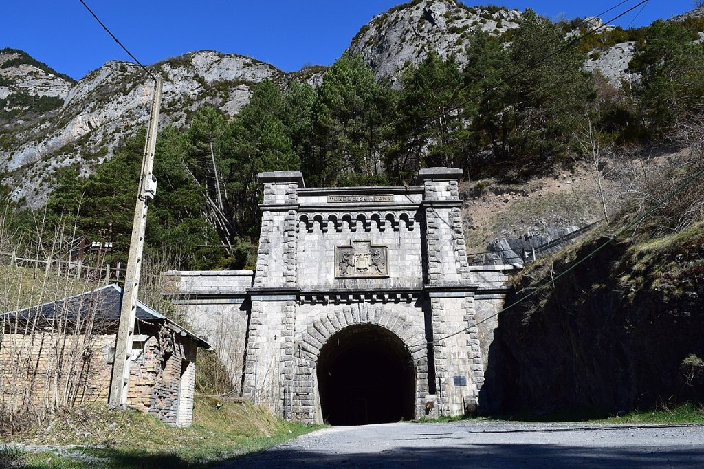
The railroad station on the French-side of the pass was closed in 1970 as a result of the same accident.
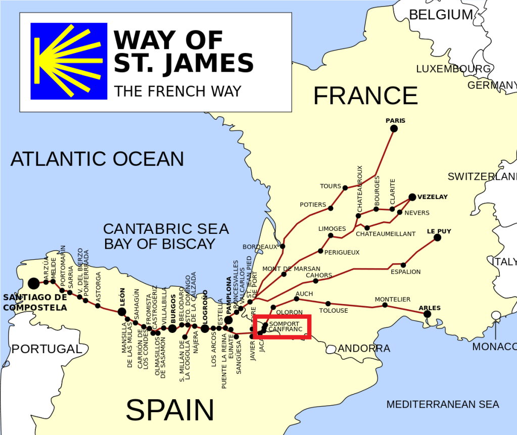
This location in the Pyrenees is a long-standing pass for pilgrim’s on the Way of Saint James, also known as “Camino de Santiago,” pilgrimage to the shrine of the apostle St. James in northwestern Spain.
The French-side of this mountain pass is also the location of the Portalet Fort.
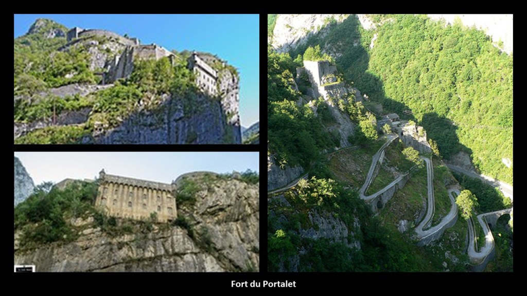
It was said to have been built between 1842 and 1870 on the orders of King Louis-Philippe I, the last Bourbon King of the Ancien Regime of France who ruled between 1830 and 1848, to guard this important border-crossing in the Pyrenees.
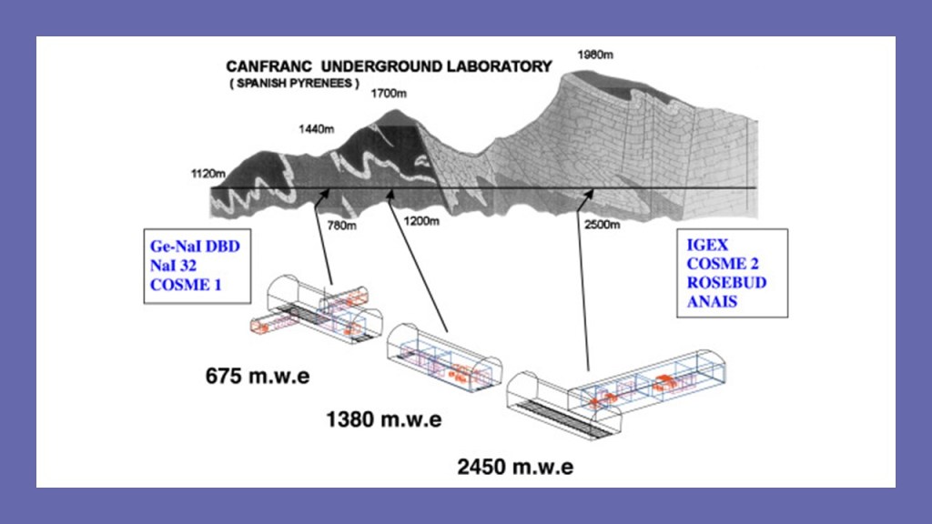
Interesting to note that when I was looking at Google Earth for the location of these places relative to each other, I found the Canfranc Underground Laboratory, where the rarely occurring phenomena of the interaction of neutrinos of cosmic origins, also known as dark matter, and atomic nuclei are studied.
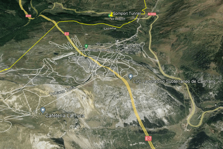
The astroparticle physics laboratory is located in a former railway tunnel of Somport under Monte Tobazo, and accessed through the former Canfranc International Station.
The Canfranc International Station back in Spain was said to have opened in 1928 to serve as a major hub for cross-border, having been constructed in the Beaux Arts Architectural Style.
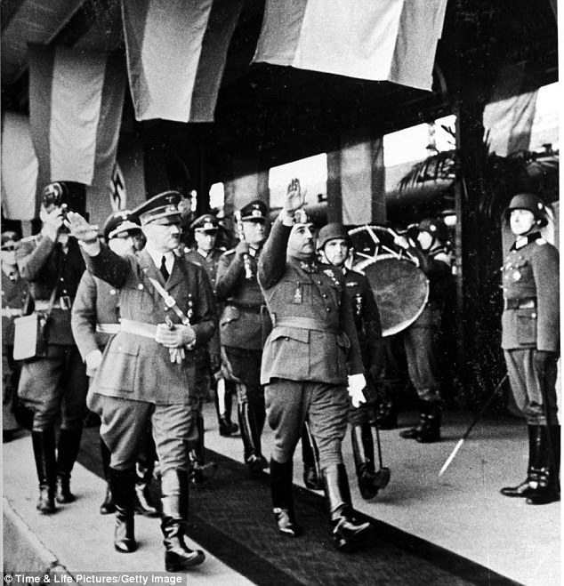
At the beginning of the second World War, Canfranc was a lifeline for Jewish refugees fleeing occupied Europe.
Then, in 1940, the infamous Spanish Dicator, Francisco Franco, gave Hitler a tour of the station, and realizing its logistical importance, subsequently took it over, and the Nazis used it, we are told, to transport gold that had been plundered across Europe, and after the war as a route to evade capture.
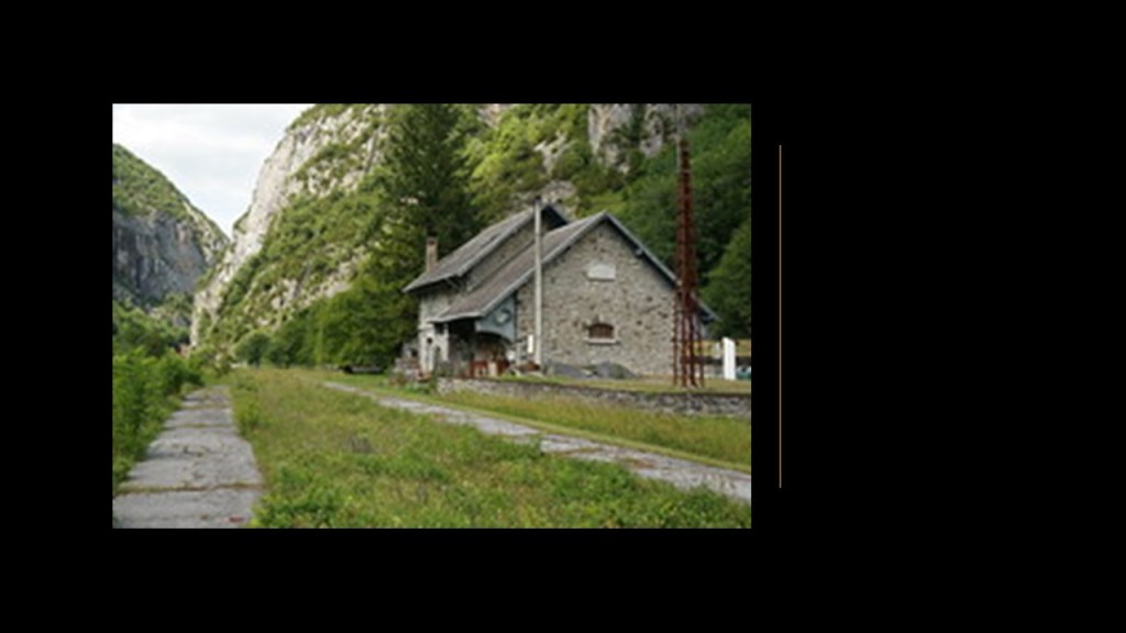
After the 1970 freight-line accident that stopped international traffic through thoe Somport tunnel, we are told the Canfranc Station remained open to serve some trains on the Spanish-side, though the massive building was neglected and fell into a derelict condition.
Around 1985 was when the underground laboratory was opened up beneath the station, and the European Union approved the funding necessary to renovate the derelict station building into a hotel.
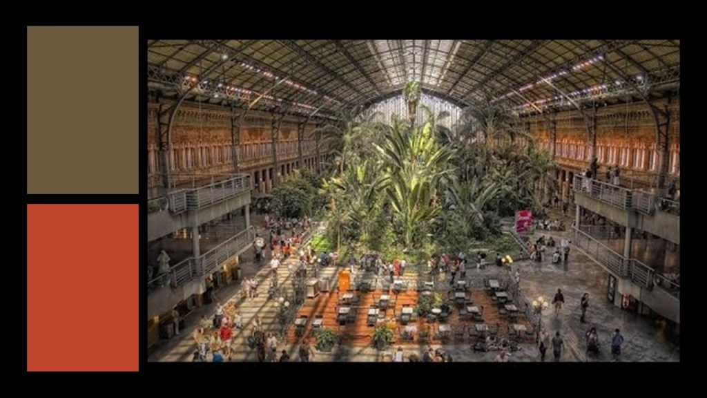
Along with the railway station in Canfranc, Spain, ML also brought the Atocha Station in Madrid to my attention, saying it looked similar to the Cincinnati Union Station.
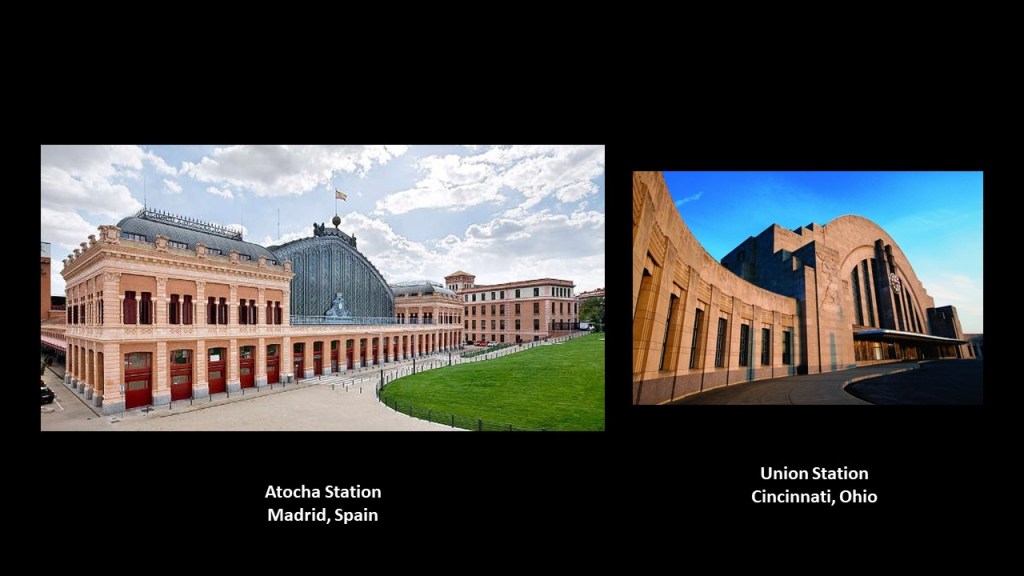
The Atocha Station, a railway complex that also includes a station for the Madrid underground rail system, is the largest railway station in Madrid.
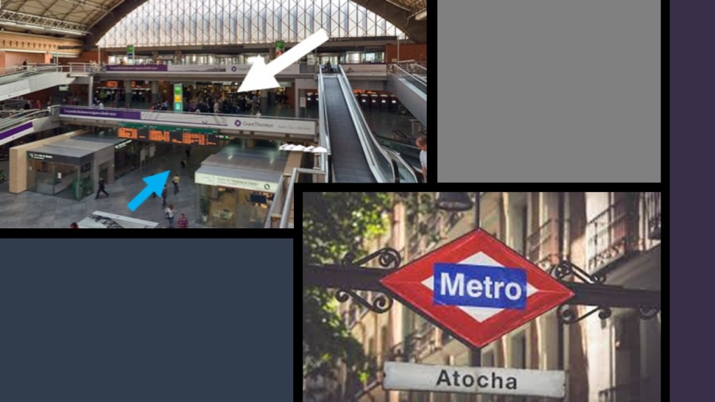
The current station was said to have been built in 1892 to replace the original 1851 station which was said to have been destroyed by fire.
Another viewer, LG, recommended looking at the area around Kamloops in British Columbia…
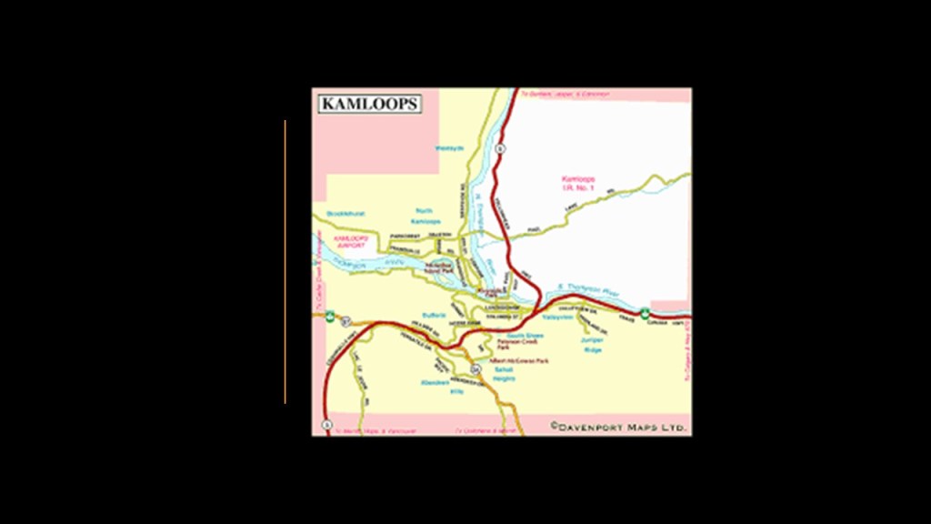
…particularly along the Thompson River, saying that the terrain is unique, with flat-topped plateaus all the same height like it was cut off at the top.
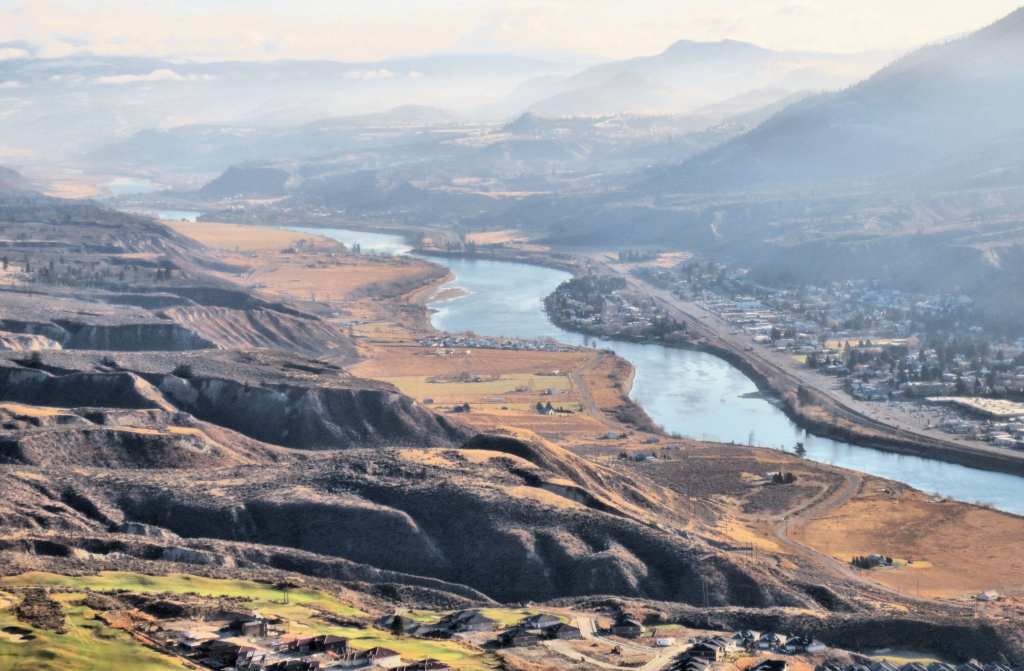
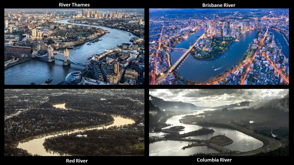
I find the snaky, s-shapes of the Thompson River to be of interest, because I consistently find the same shapes in rivers around the world, like the River Thames in London on the left; the Brisbane River in Brisbane, Australia, in the middle; and the Red River in Winnipeg, Manitoba…
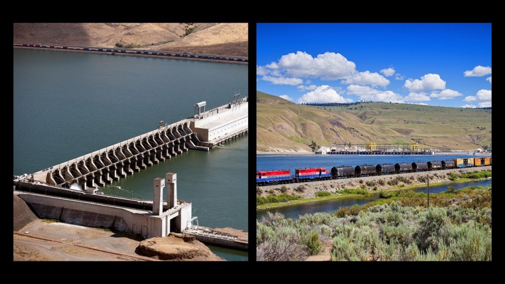
…as well as railroad tracks beside river, like these along the Columbia River in Washington and Oregon, which I found in conjunction with nearby hydroelectric dams…
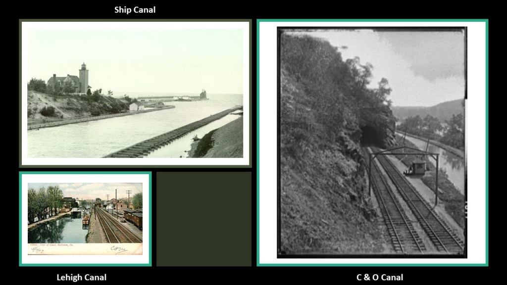
…and railroads next to canals, like the historic photo of the Ship Canal from Michigan’s Keweenaw Peninsula on the top left; the Lehigh Canal in Bethlehem, Pennsylvania, on the bottom left; and the C & O Canal at Point of Rocks, Maryland on the right.
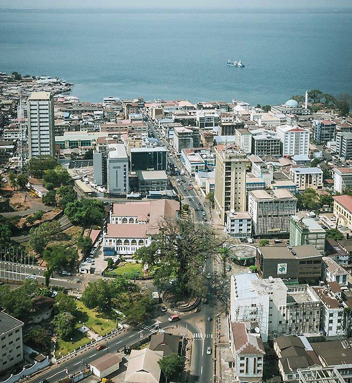
SMJ asked me to look at Sierra Leone, specifically Freetown…
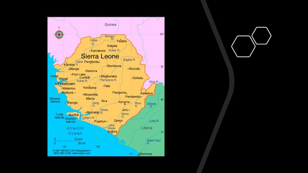
…and the “cotton tree,” saying that it s a significant energy charger along with the architecture of the structures around it.
So, I am going to start at Freetown’s Cotton Tree, and then take a look around the area.
The Cotton Tree, also known as a kapok tree, is the symbol of Freetown and Sierra Leone.
The story we are told is that Freetown was founded in 1792, after having been by a group of African-American slaves starting in 1787 who had gained their freedom by fighting for the British in during the American Revolutionary War who came to the area by way of Nova Scotia.
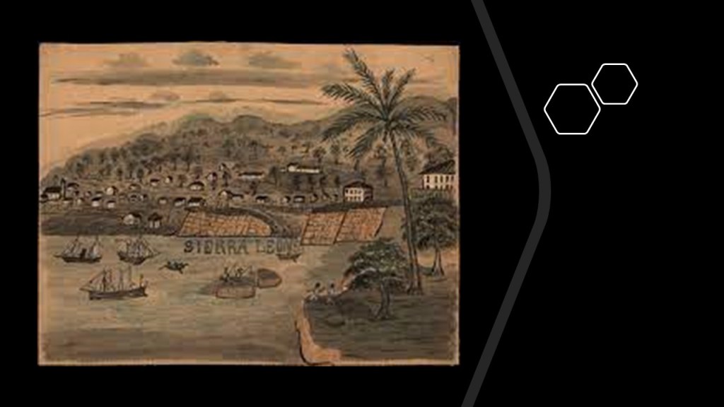
When these first settlers arrived from North America at what was later named “Freetown,” the legend is that they gathered around a giant tree above the bay and sang and gave thanks to God for delivering them to a free land.
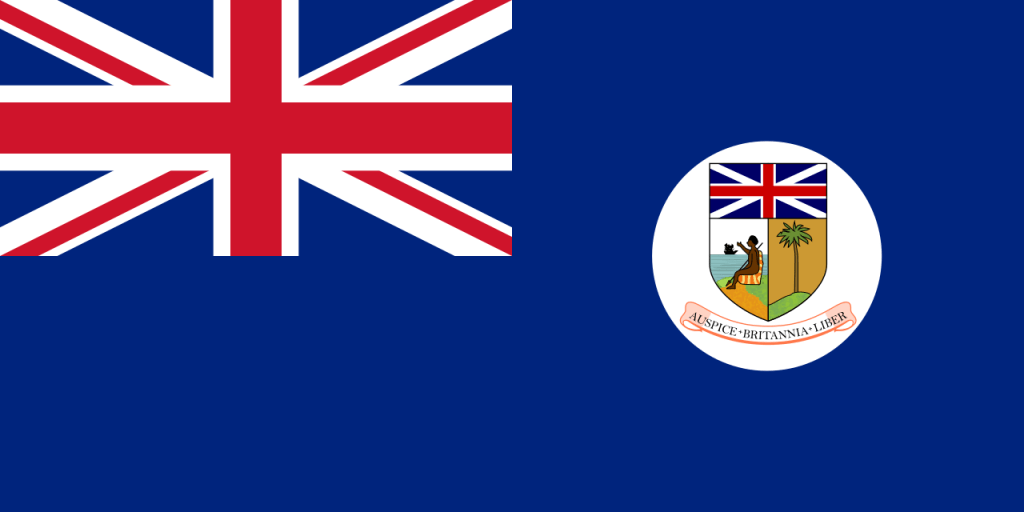
Much of the population of Freetown is considered to be what is called the “Sierra Leone Creole People,” or the descendents of freed African-American, Afro-Caribbean and African slaves in the western part of Sierra Leone between 1787 and 1885 in what became the “Colony and Protectorate of Sierra Leone” established by the British in 1808.
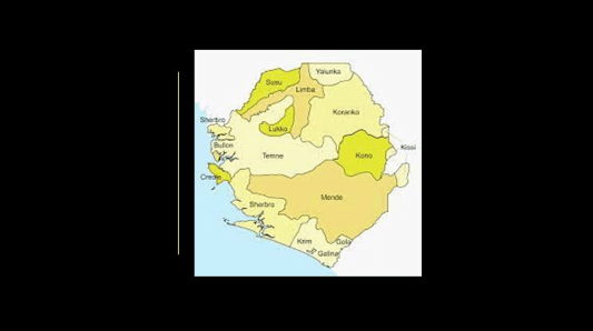
It is important to note the area was already inhabited by the indigenous Temne and Lukko people.
The Cotton Tree is still a place today where the people of Sierra Leone come to pray and make offerings to their ancestors for peace and prosperity.
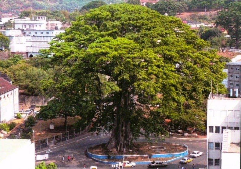
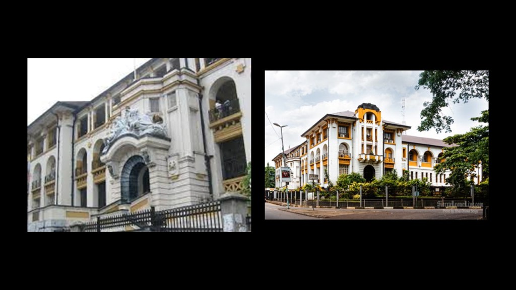
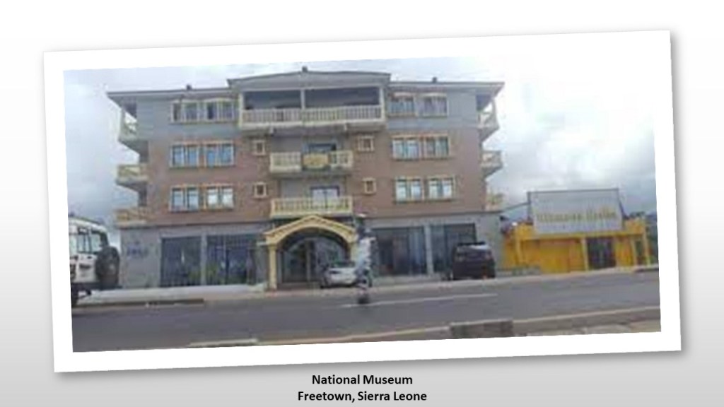
These buildings are in the immediate vicinity of the Cotton Tree, which is located in the middle of the Central Business District in downtown Freetown.
The “Law Court” building which has housed the Supreme Court of Sierra Leone since 1960, and the building of which was credited to the Portuguese, who started arriving in 1462 after the area was first mapped by Portuguese explorer Pedro de Sintra…
…and the National Museum in Freetown is near the Cotton Tree.
The museum officially opened in 1967, in what had previously been the building which housed the “Old Cotton Tree Telephone Exchange.”
Looking for information on this led me to finding this historic photo of the “Cotton Tree Station” in Freetown.
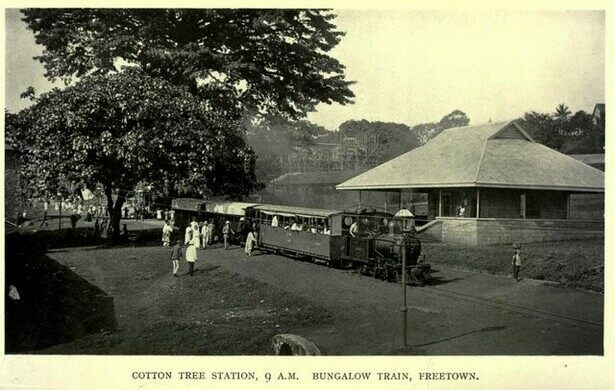
We are told the construction of the railway started in 1896, and the first line opened in 1897, and that a number of other lines were opened between 1898 and 1907.
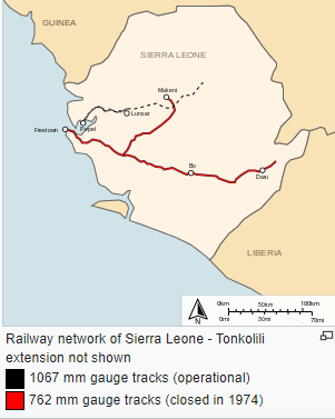
By 1974, however, the Sierra Leone Government Railway was completely closed.
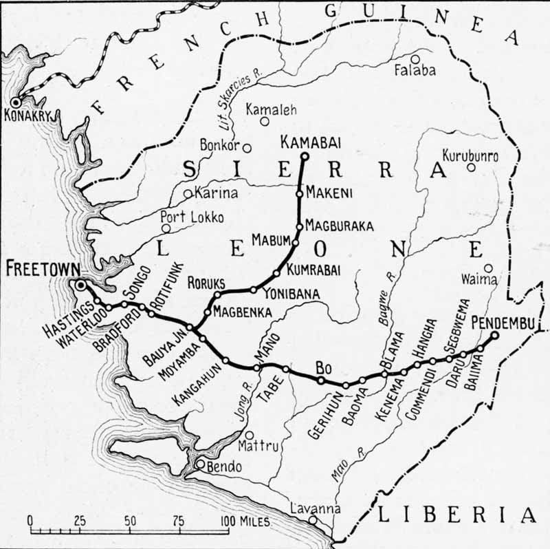
Today, there are 52-miles, or 84-kilometers, of privately-owned railway in Sierra Leone, between the Port of Pepel and the Marampa Iron Ore mine.
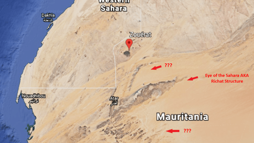
This brings to mind the iron ore trains of Mauretania, some of the longest, if not the longest, in world, at 1.6-miles, or 2.5-kilometers, long…
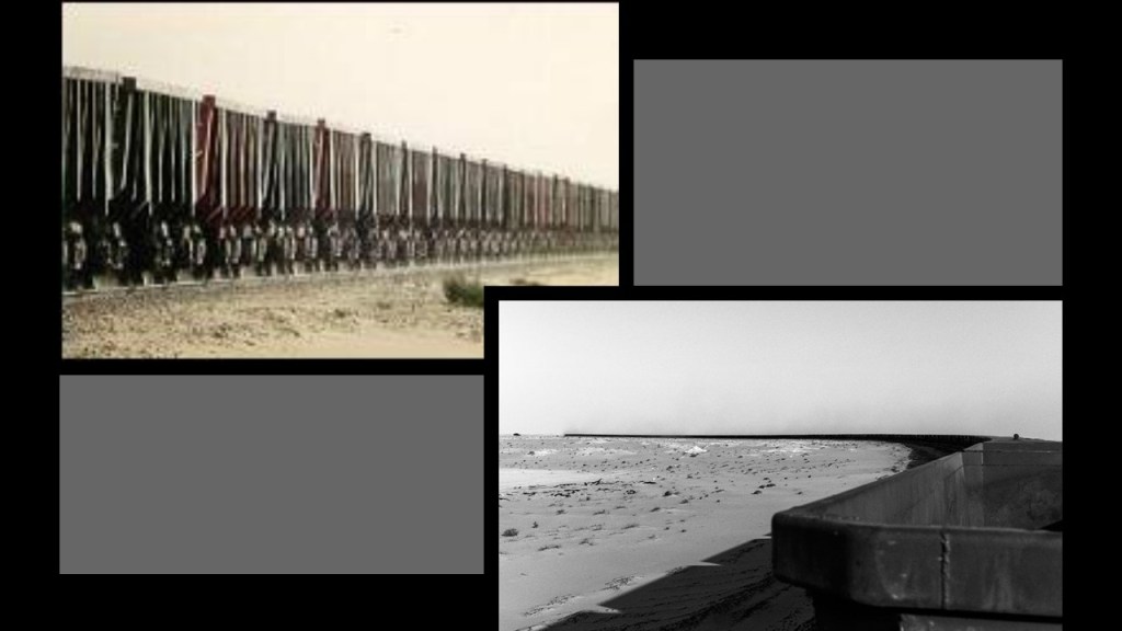
…hauling iron ore, people and goods, 405-miles, or 652-kilometers between the mining town of Zouerat on the west side of Kediet ej Jill, the highest peak in Mauretania, through the Sahara Desert, to the port city of Nouadhibou on Mauretania’s coast.
This Google Earth Screenshot also shows the proximity of the Eye of the Sahara, also known as the Richat Structure, and an interesting-looking flow of the Sahara Desert going downward to the coast that intrigued me since I first came across it while researching a long-distance alignment that crossed through Mauretania.
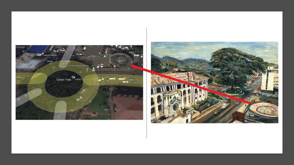
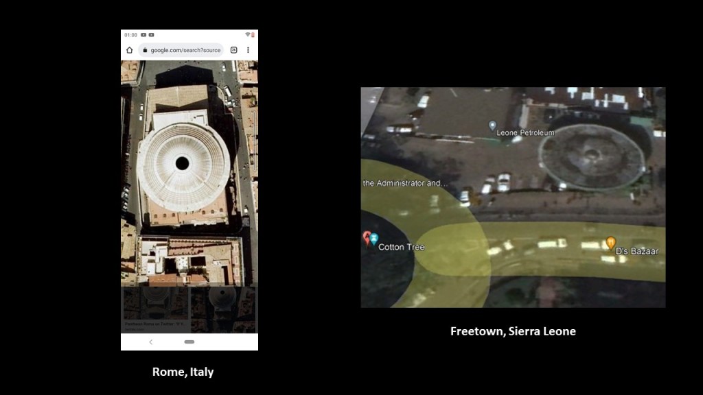
I noticed this saucer shape next to the Cotton Tree on Google Earth and then came across the painting by Richmond Garrick which includes it.
I am not finding what it is, but it looks very interesting to me.
As with everywhere else, there is a lot more to uncover here, including the forts of Sierra Leone, which included Fort Thornton in Freetown, said to have been built by British between 1792 and 1805 and named after banker Henry Thornton, who was the chairman at the time of the Sierra Leone Company…
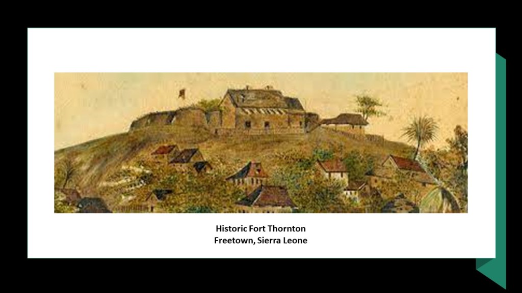
…and is the location of Sierra Leone’s most important state and government institutions, including the State House, which is the principal workplace and residence of the President of Sierra Leone.
I will leave Sierra Leone with this information that I have mentioned about Africa in other posts.
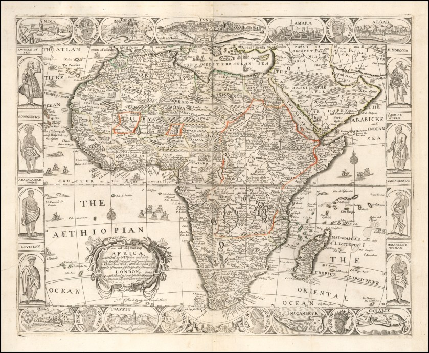
The Berlin Conference of 1884 – 1885, organized by the German Chancellor Otto von Bismarck, was said to have been convened to regulate European colonization and trade in Africa during the New Imperialism period, and coincided with Germany’s sudden appearance as a imperial power.
The outcome of the “General Act of the Berlin Conference” can be seen as the formalization of the “Scramble for Africa,” also known as the “Partition of Africa” or the “Conquest of Africa,” was the invasion, occupation, and division of African territory by European powers during the New Imperialism period between 1884 and 1914, the year in which World War I started.
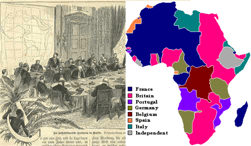
The period of history known as New Imperialism is characterized as a period of colonial expansion by European powers, the United States, and Japan during the late 1800s and early 1900s.
I am sure this was one of the motives.

There was a rich and proud heritage of its people throughout the African continent that has been removed from the collective awareness that was replaced with something quite different from what it originally was, as was the case worldwide as a result of the devastating effects of the policies and practices engaged in under New Imperialism and European Colonial expansion.
In Africa, along with everywhere else, the new narrative we have been given was and is based on lies.
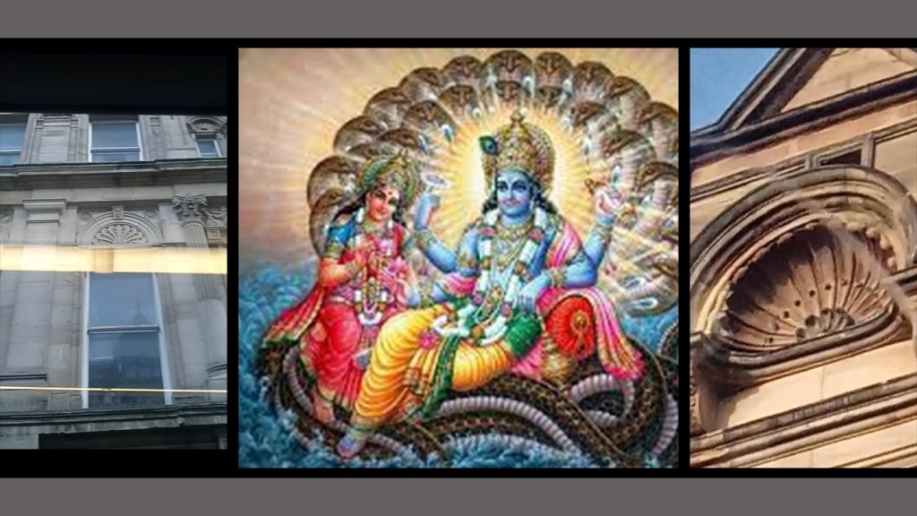
Next, JM from Newcastle sent me two different sets of photos.
One set was photos he took of the upper-level buildings in Newcastle.
He found a lot of interesting things at the top-levels of buildings that typically go unnoticed.
According to the date on the left, this ornate stone-building came into being some time around 1835.
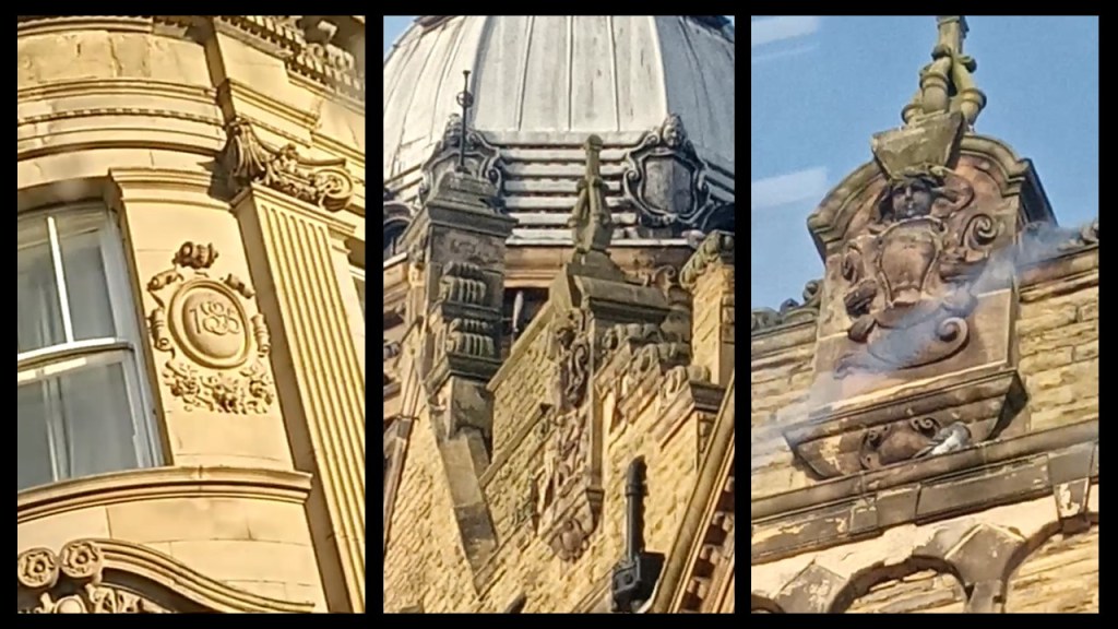
In two of these photos, he identified something he called an abstract version of the “Naga” demigod, making him wonder why there would be such a thing portrayed in his hometown of Newcastle.
JM also sent another set of photos with different styles of key-hole shapes.
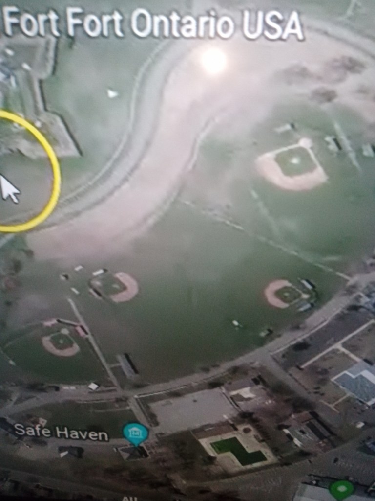
Like the star Fort Ontario in Oswego, New York…
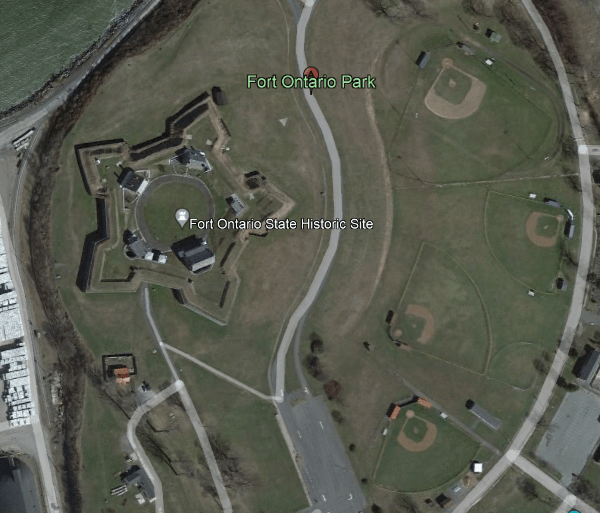
….with several KEYHOLE shaped Baseball fields close by…
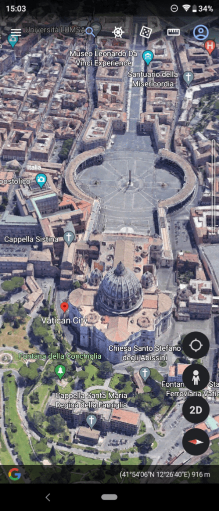
…The Vatican from above showing the KEYHOLE shape…
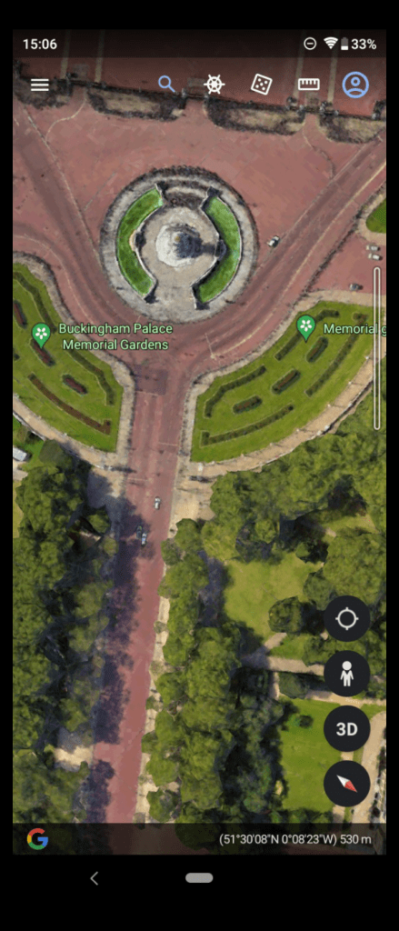
…a KEYHOLE shape at Buckingham palace…
…The Pantheon in Rome from above which has the KEYHOLE shape on top of the buildings roof, in the form of a “Circle shape” with 2 lines going out at an angle.
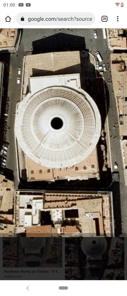
Hmmm…interesting.
From above, the dome of the Pantheon looks similar that saucer-shape back in Freetown next to the Cotton Tree.
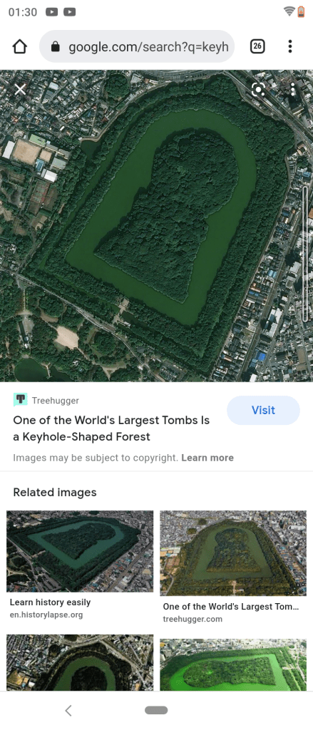
JM also sent this screenshot of the keyhole shapes known as Kofun, of what are described as megalithic tombs found mainly in Japan, but other parts of northeast Asia.
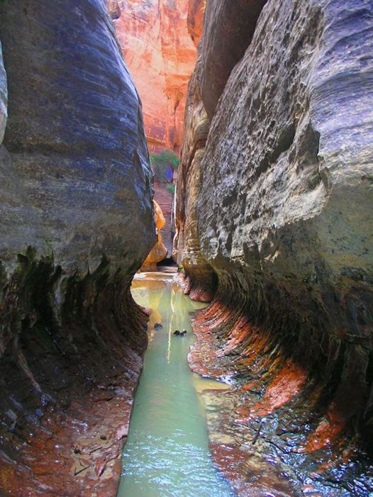
Shortly after JM sent me these keyhole shapes he had identified, I noticed a Keyhole Falls in Utah’s Zion National Park.
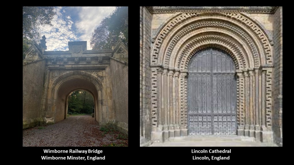
Next, HH sent me photos of this railroad structure on an unused railway road next to the River Stour in Wimborne Minster, Dorset, not far where he lives in England.
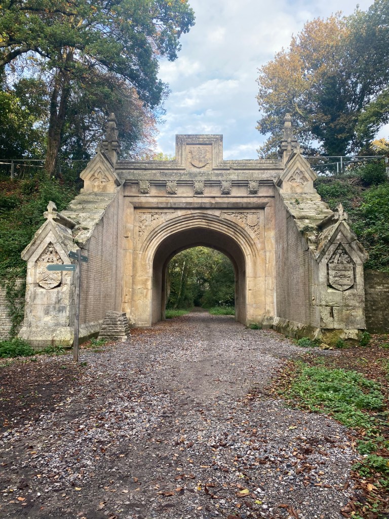
I am struck the bridge arches looking like a design that is typically found Cathedral doors all over the world, like the Lincoln Cathedral in England on the right…
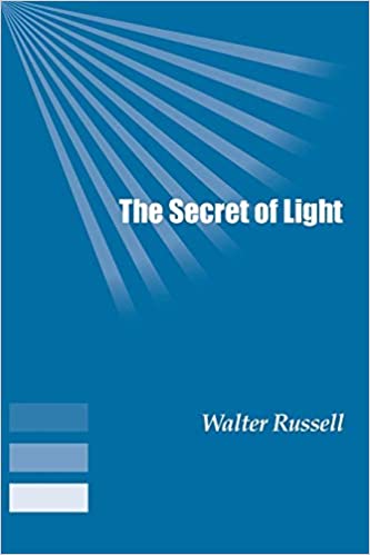
…and the similarity both have to Walter Russell’s diagram showing what looks like a relationship between cathedral doors and octaves, the intervals between one musical pitch and another with double its frequency.
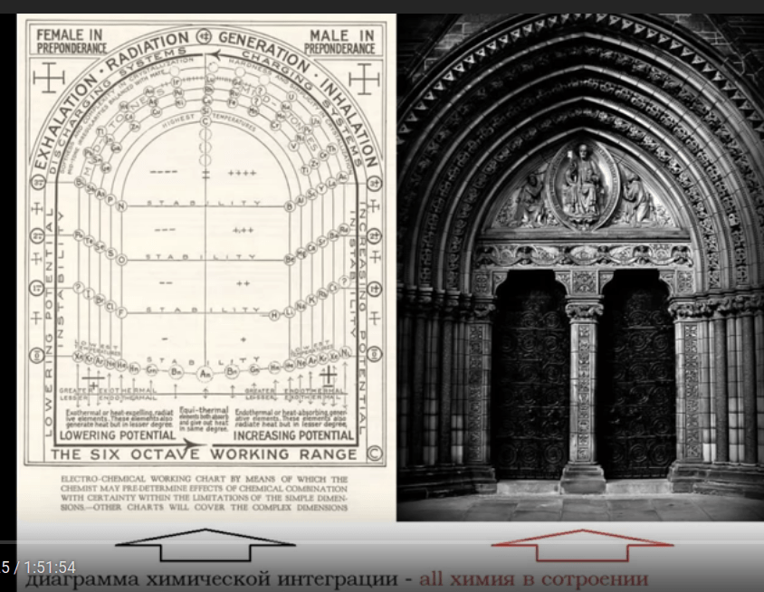
Walter Russell wrote numerous books outlining his vision about how the Universe works in the early to mid-20th-century, like “The Universal One” in 1926…
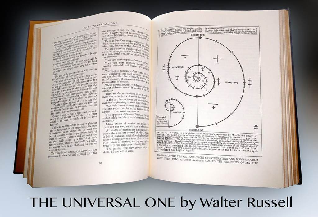
…and “The Secret of Light” in 1947.
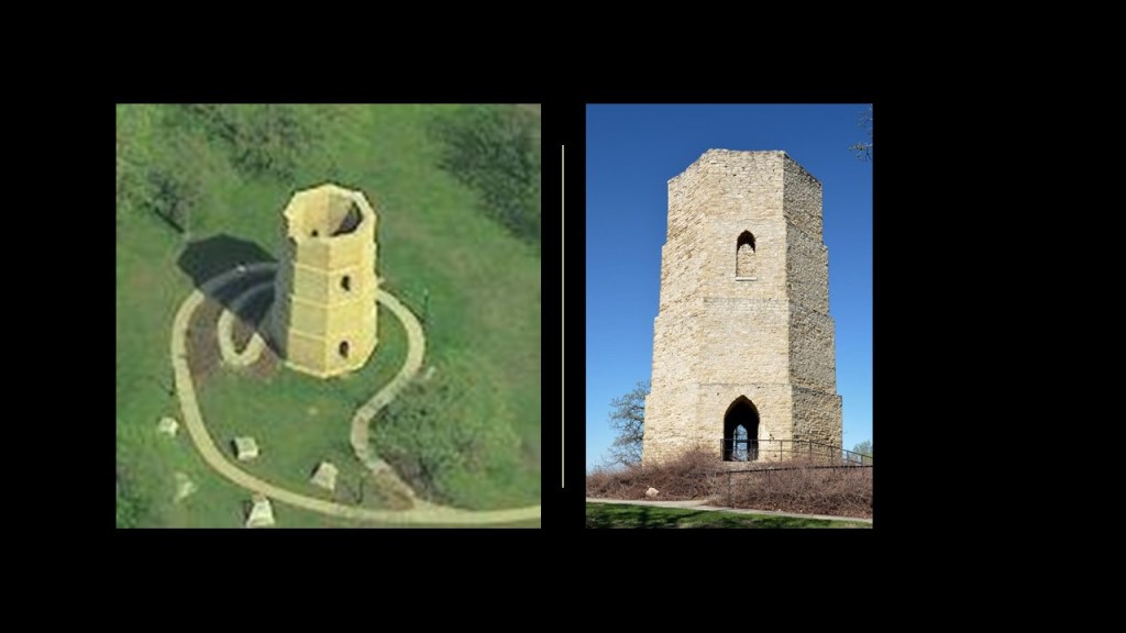
Lastly, BR sent me this information about the Beloit Tower in Wisconsin, saying that they tried to tear it down over one hundred years ago, saying it was outdated, but they had to stop because it was “too well constructed.”
So, they removed the metal tank said to date from 1914 and the stairs from the in 1929, only 15-years after it was allegedly built…
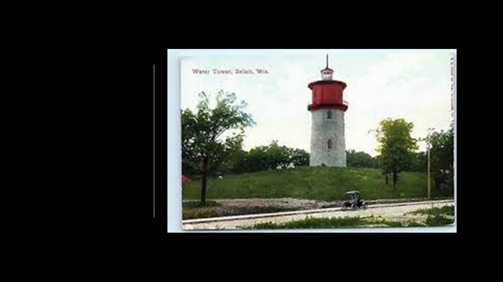
…but left the rest of the tower standing after determining its demolition was too expensive to continue.
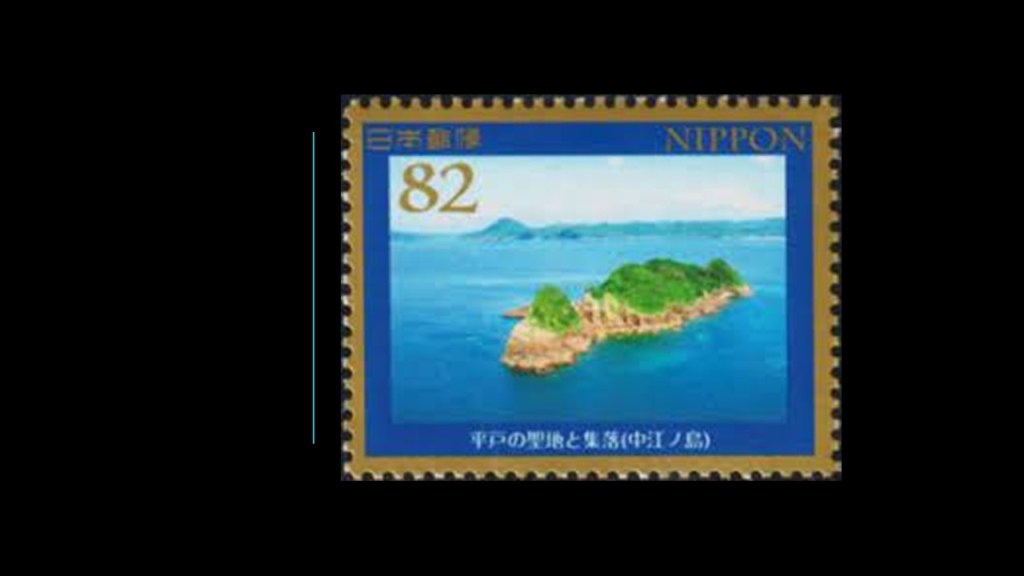
BJ brought Japan’s Hashima Island to my attention, saying that it was abandoned.
Hashima Island is located off the coast of Japan, about 9-miles, or 15-kilometers, from Nagasaki’s City Center…
…in-between Nakano Island…
…Takashima Island…
…and the Nomo Peninsula, the southern tip of the Nagasaki Peninsula, a large part of which contains the Nomo Hanto Prefectural Natural Park.
Interesting to note that the Nagasaki Dinosaur Msueum is right next to the Nomo Peninsula.
I am going to start my exploration with Hashima Island.
Hashima Island is nicknamed “Battleship Island.”
The island was known for its under sea coal mines, which were established around 1890, which operated during the rapid industrialization of Japan during what was known as the Meiji Restoration, which led to Japan’s rise as a military power, and the time period during which Japan adopted western ideas and production methods.
Between its opening in 1890 and abandonment in 1974 when the coal reserves were depleted, Mitsubishi developed a community in order to turn Hashima Island into a coal-producing powerhouse.
This included thousands of forced laborers in the early-20th-century primariy from Korea.
At the peak of its coal-mining production in 1959, there were over 5,200 people living on 16-acres, or 6.3-hectares, making it the most densely-populated place on the Earth at the time.
The only thing I can find out about Hashima’s neighboring island of Nakano is that it was a place in the 17th-century where hidden Christians were executed, and that no one is allowed to go to it today.
Takashima Island is an inhabited island, and is considered part of Nagasaki City.
Takashima Island was the location of the Hokkei Pit, the first coal mine in Japan to be mechanized by steam engines, and which operated between 1869 and 1876, and of which there are a few visible remains you can visit on the island.
Mitsubishi bought the coal mine on Takashima Island in 1881, which was the largest coal mine in Japan…
…and the mine was in operation until November of 1986.
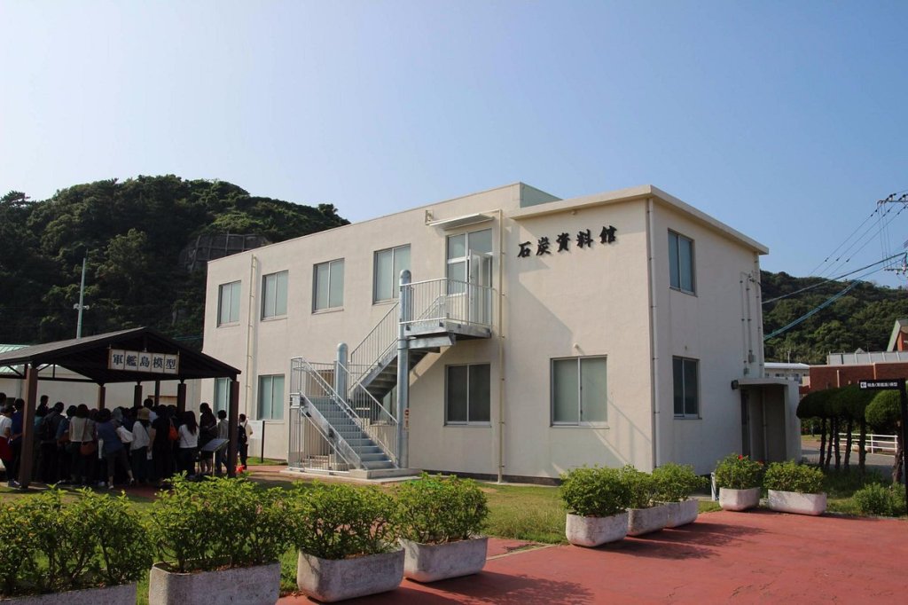
You can visit the Takashima Coal Museum on your trip to Takashima as well.
You can get to Takashima Island by ferry.
There is a lot to unpack with these Japanese island coal mines. A third one was Sakito Island.
The first thing I would like to mention was the arrival of Thomas Glover, a Scottish merchant, who arrived in Nagasaki in 1859 as an agent for Jardine Matheson, a British Multinational Conglomeratefounded in 1832 and based in Hong Kong, with the majority of its business interests in Asia.
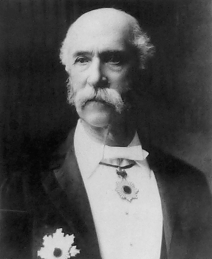
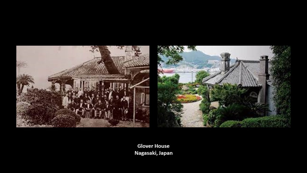
He established the Glover Trading Company in 1861 and was credited with building the Glover House overlooking Nagasaki Ironworks in 1863 as a based for his business operations in Japan.
Glover supplied machinery, equipment, ships, arms, and weapons to the Samurai of Choshu, Satsuma, and Tosu clans, who toppled the ruling Tokugawa Shogunate with the Fall of Edo on May 3rd of 1868, which marked the beginning of the Meiji Restoration, which restored imperial rule to Japan, and brought in a centralized form of government in order to strengthen their army to defend against foreign influence as we are told.
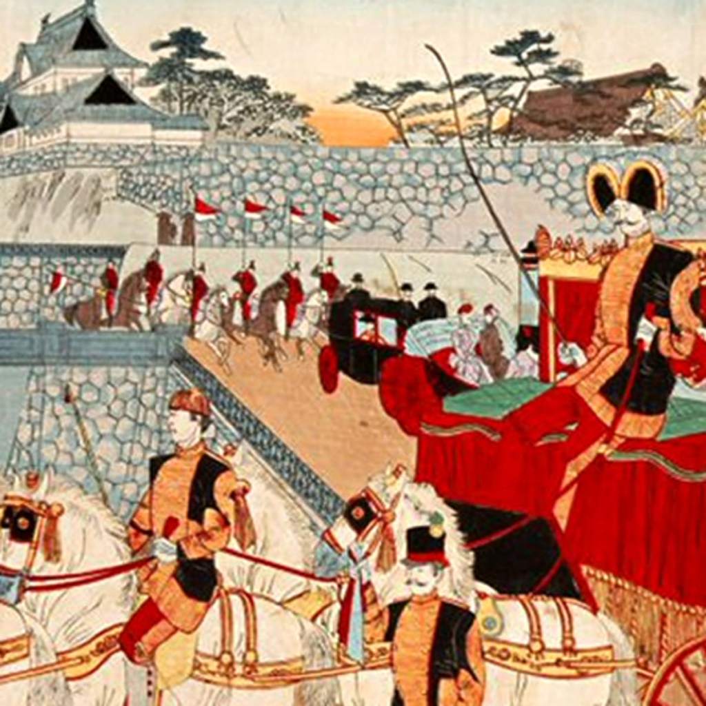
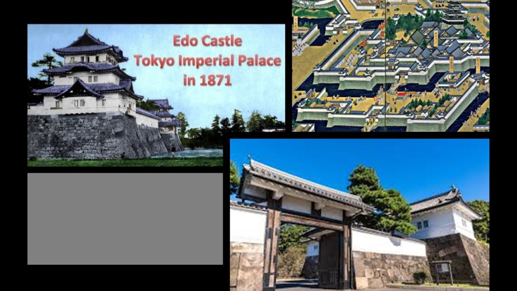
Edo Castle, the residence of the Tokugawa Shoguns, and a star fort, became the Imperial Residence in 1871.
It was during the Meiji era that Japan westernized and rapidly industrialized, leading to its rise as a military power by 1895.
Well, I don’t know about defense against foreign influence because it sure looks like there was foreign influence bringing all this about.
Back to Thomas Glover.
Glover played a major role in Japan’s rapidly emerging industrialization.
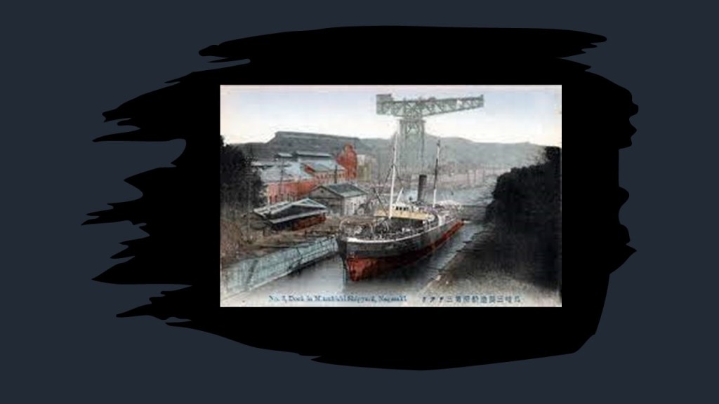
Among other things, he was involved in establishing businesses that would become part of Mitsubishi’s early growth and diversification, which included the development of the first coal mine on Takashima Island, as well as the Nagasaki Shipyard.
This print shows the Mitsubishi’s Nagasaki Shipyard circa 1910.
Also, when I was looking for information on the Takashima Coal Mine, I came across the article about the investment of British capital into the development of the Takashima Coal Mine, which played a crucial role in the rapid industrialization of Japan.
Not only that, there was the issue of forced labor to work the coal mines.
Imperial Japan formally annexed Korea into the Empire of Japan in 1910, and Korea was under Japanese rule between 1910 and 1945.
It is estimated that during the Japanese occupation of Korea, before and during World War II, there were as many as 7.8 million Koreans were conscripted as forced labor or soldiers during Japan’s imperial expansion.

There were also forced laborers coming into Japan from its occupation of China.
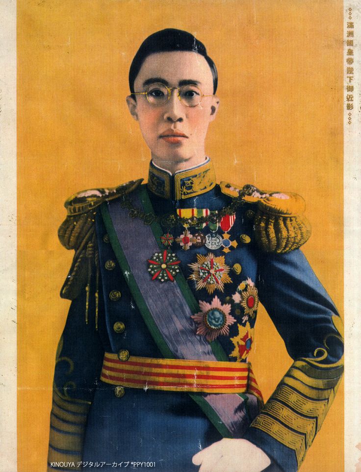
In 1933, the Japanese established the puppet state of Manchukuo in China.

The Last Emperor of China, Puyi, was first installed by the Japanese as the Chief Executive of Manchukuo, and he became its emperor in 1934, a position he held until the end of World War II.
Puyi’s life story is very sad, as is told in the 1987 movie “The Last Emperor” directed by Bernardo Bertolucci.
Much more to find down this rabbit hole in Japan, but now I am going to take a look at the Bohemian Switzerland National Park at the suggestion of RAB13.
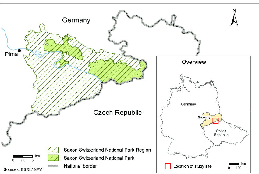
It is located in the northwestern part of the Czech Republic, and are part of what are called the Elbe Sandstone Mountains along the Elbe River on the country’s border with Germany.
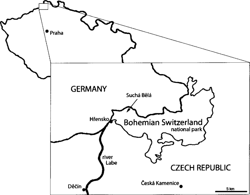
…and on the German side of the Elbe is the Saxon Switzerland National Park.
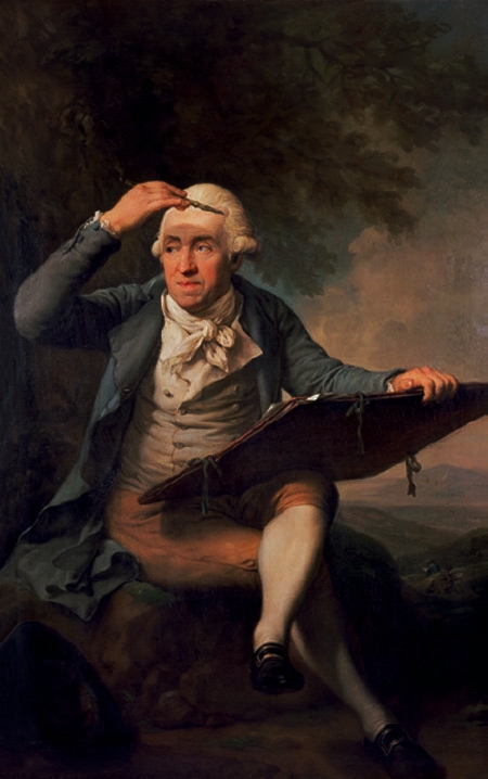
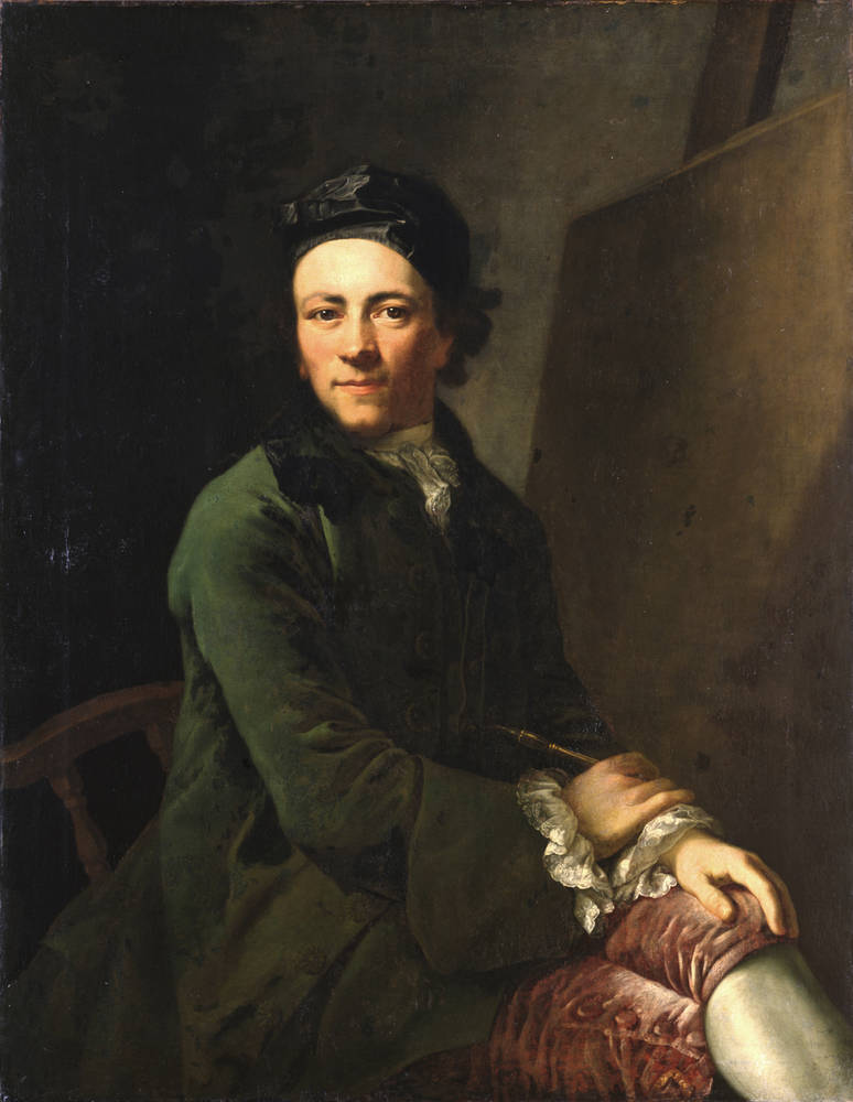
Including the name of Switzerland to this region came about in the 18th-century from Swiss artists Adrian Zingg…
…and Anton Graff, who were reminded of their homeland when they saw it.
The symbol of Bohemian Switzerland National Park is what is described as the largest natural arch in Europe.
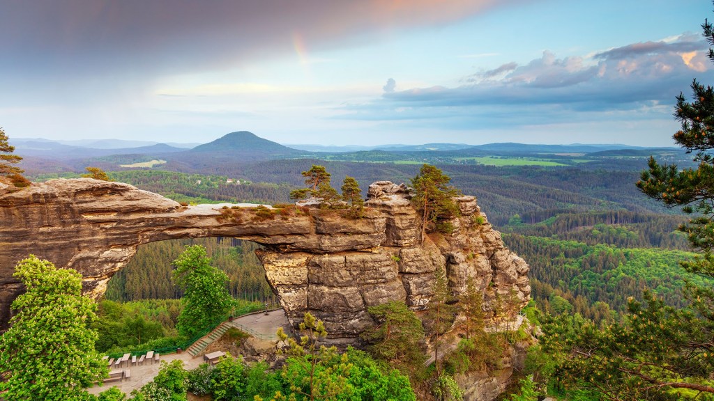
Right next to the largest natural arch in Europe is a hotel called the “Falcon’s Nest” in English, said to have been built in 1881 by Prince Edmund of Clary-Aldringen, of a princely Austro-Hungarian Family.
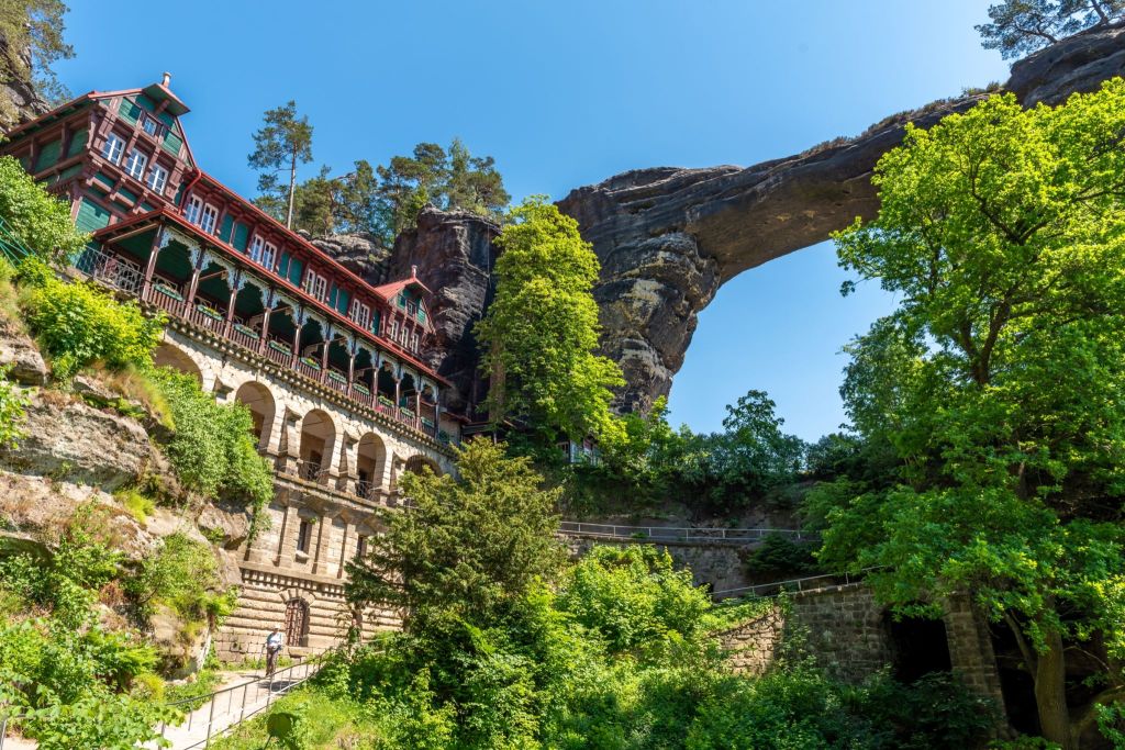
This part of the national park is privately-owned, with the arch being inaccessible since 1982 due to heavy erosion by visitors and the privatization of the hotel, which has limited visitation times for a fee.
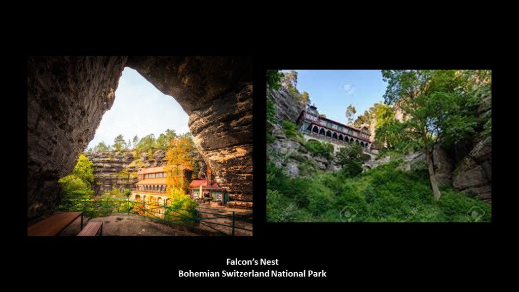
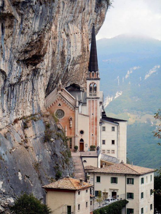
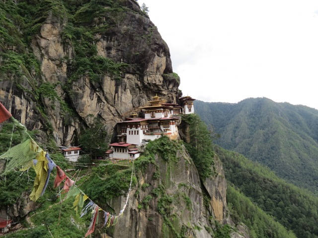
What the “Falcon’s Nest” in the Czech Republic brings to mind is the Madonna della Corona Church near Verona, Italy…
…and the Tiger’s Nest Monastery in the country of Bhutan in the eastern Himalayan Mountains.
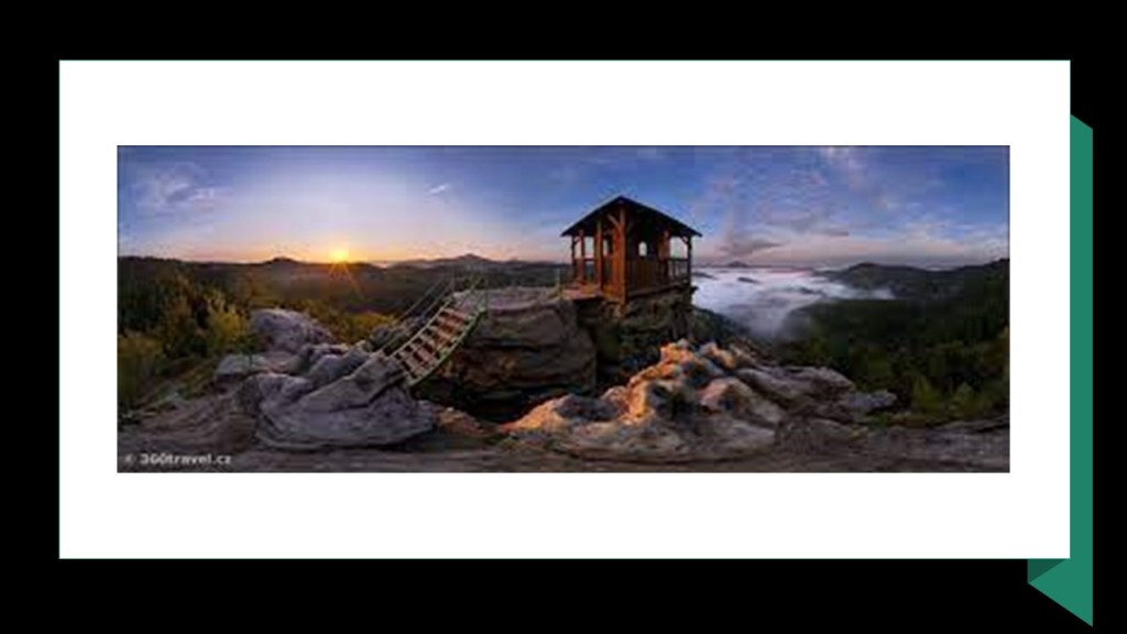
The Mariina Skala rock, described as a rocky hill, has one of the best views of the Bohemian Switzerland National Park.
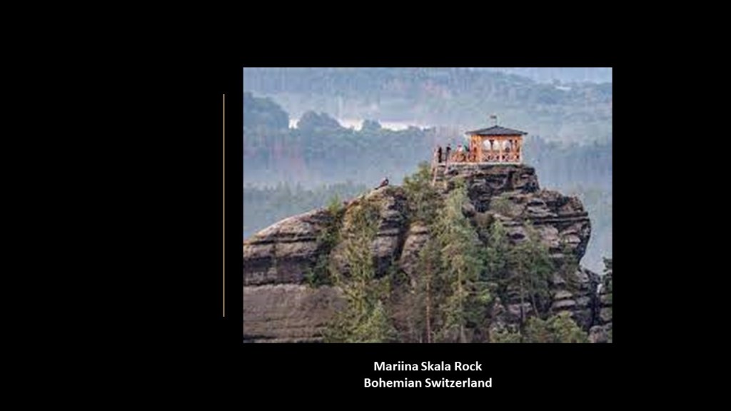
We are told that the original wooden hut on top of the rocky hill was built in 1856 as a refuge hut and was also used as a fire observation tower…until it was badly damaged by a fire in 2005 and was replaced sometime in 2006, where it escaped damage from another fire three-weeks after it was replaced.
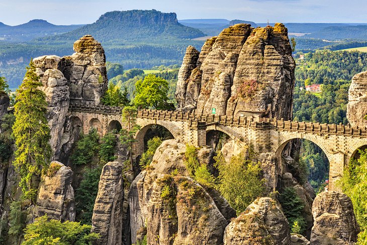
On the German-side of the Elbe, in the Saxon Switzerland National Park, you can visit the Bastei Bridge.
Built from Sandstone in-between a number of rock-formations, it is 1000-feet, or 305-meters, high.
The current bridge was said to have been built in 1851, to replace a wooden bridge that was built in 1824 to link several rocks for visitors.
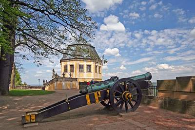
Just 6-miles or 10-kilometers from the Bastei Bridge is the Konigstein Castle, described as Germany’s largest fortification on top of a rock plateau.
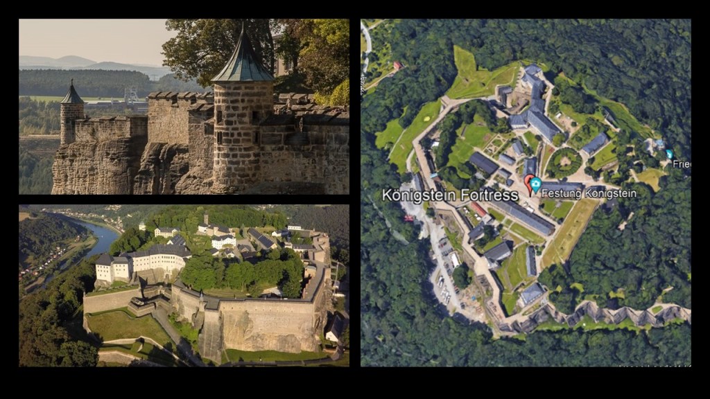
Castles and fortifications like these were built, we are told, to guard the trade routes.
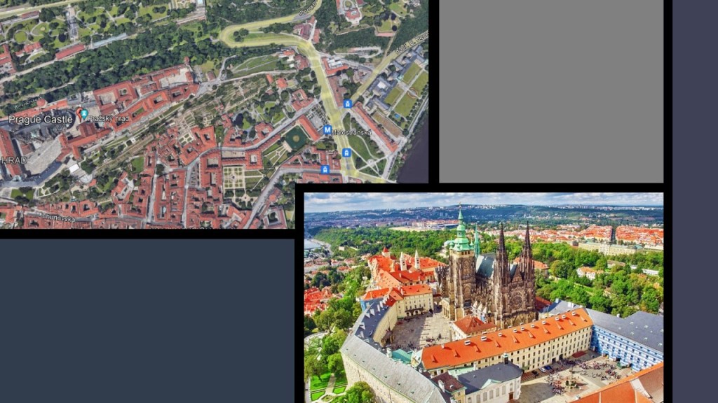
This is a good place to bring in JF’s recommendations of Prague Castle…
…and Vysehrad Fort, which is also in Prague.
He said they are both built on top of the rocky hills, just like others we have been seeing, and he really wonders how the did it. Me too!
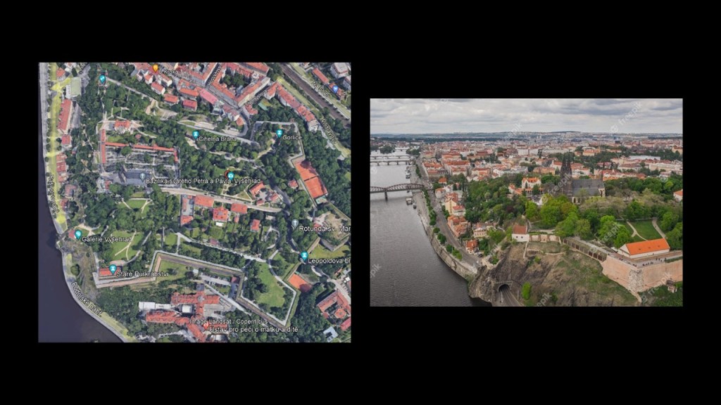
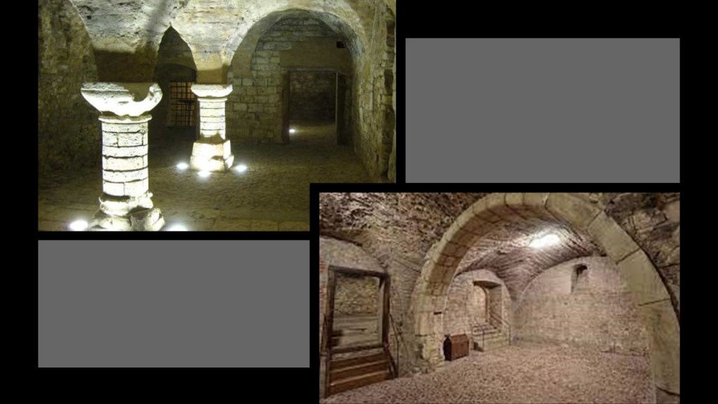
JF also said the underground of Prague is also very ancient, well built and simply amazing. Not a chance, it was built with a chisel and hammer.
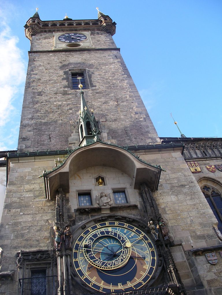
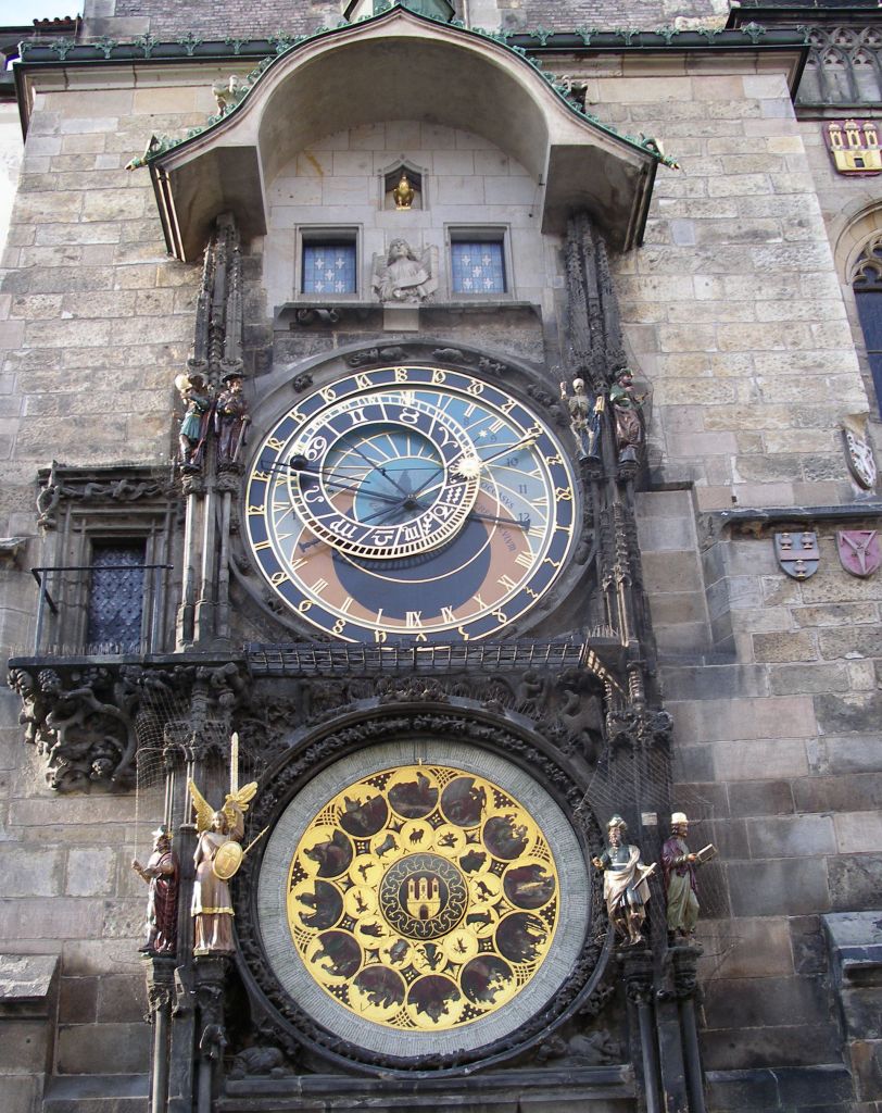
NP sent me photos of the Astronomical Clock on Prague’s Old Town Hall.
First installed in 1410, it is the oldest astronomical clock that is still in operation.
The Astronomical Dial of the clock represents the positions of the sun and moon in the sky, and displays various astronomical details, and a calendar dial with medallions representing the months.
The figure of a skeleton called “Death” strikes the time…
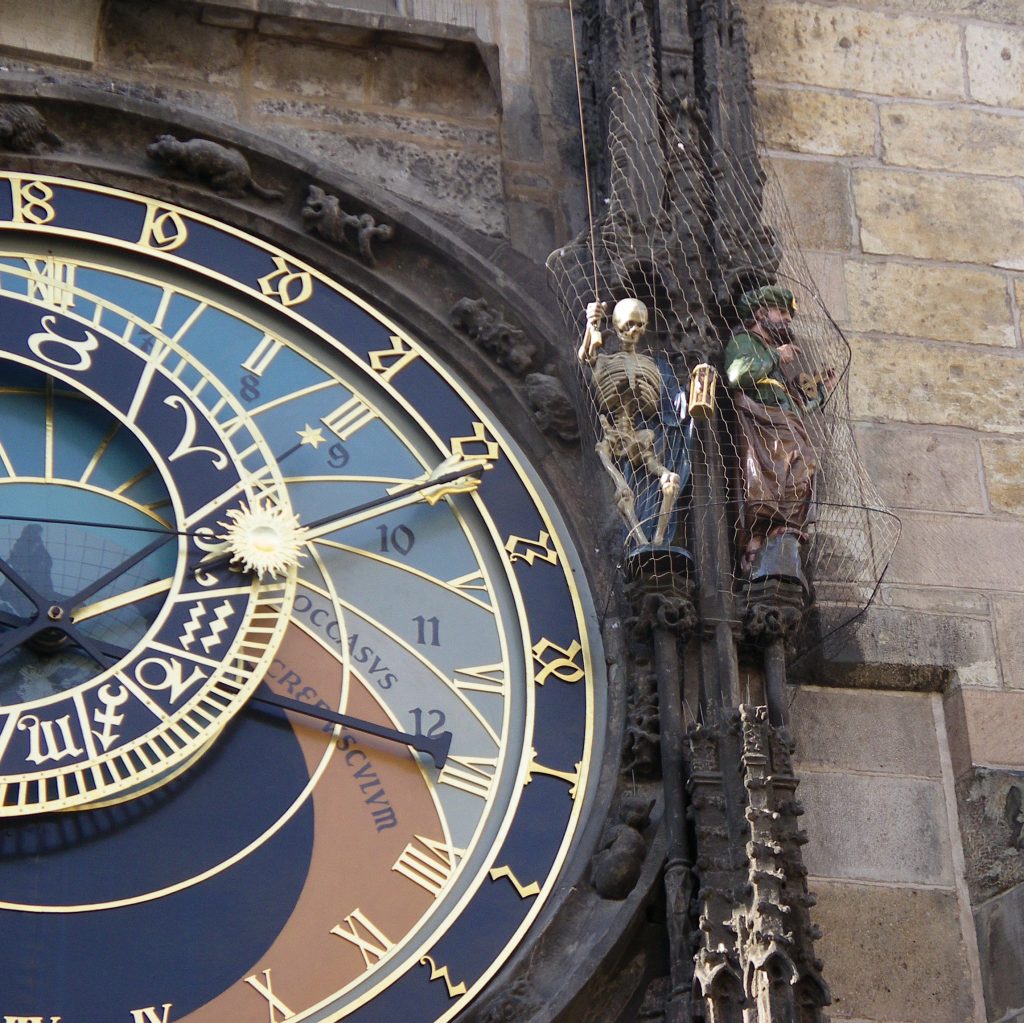
…and there is an hourly show called “Walk of the Apostles,” of moving apostle figures and other sculptures.
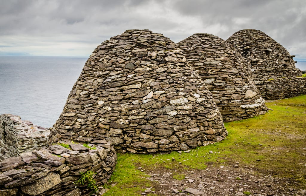
HM79 asked me to take a look at Skellig Michael.
Skellig Michael, named after St. Michael, is a remote, rugged island off the western coast of Ireland.
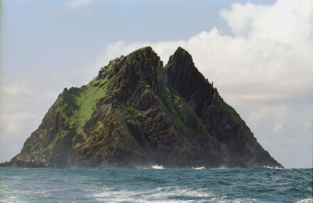
It is described as a twin-pinnacled crag, which is defined as a rocky hill or mountain, with a steep and inhospitable landscape of 54-acres, or 22-hectares of rock.
So, let’s do a tour of the island to see what is at this inhospitable place.
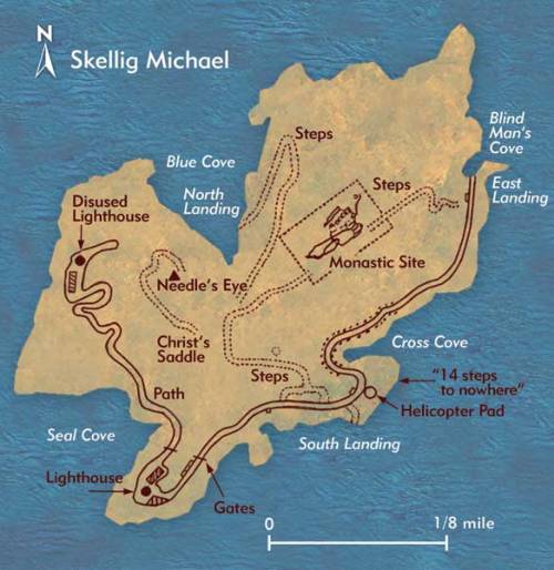
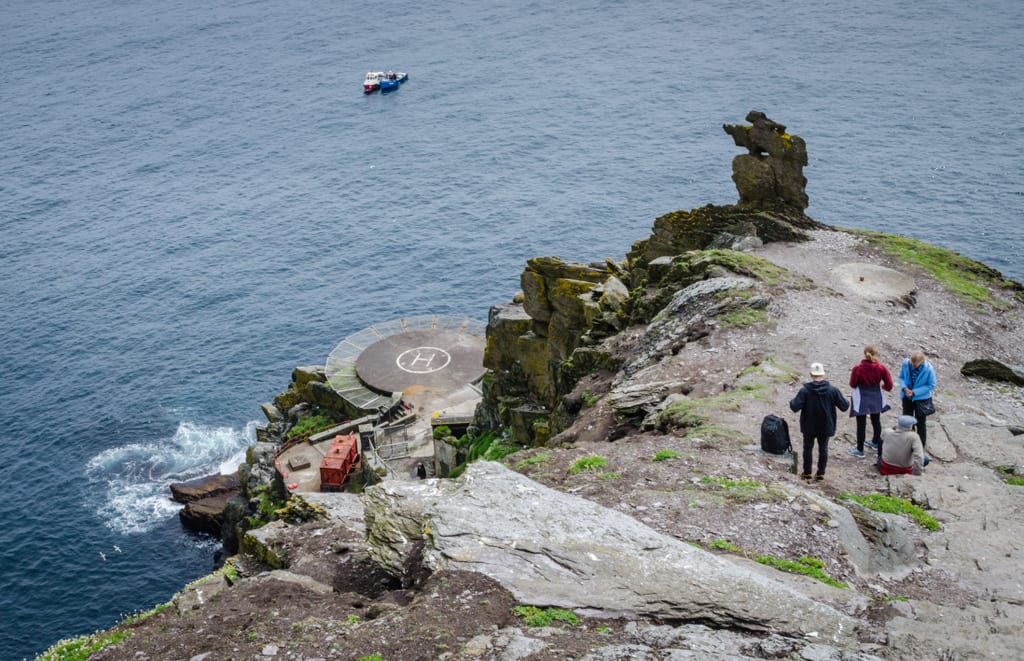
The main boat landing on Skellig Michael is the East Landing at Blind Man’s Cove.
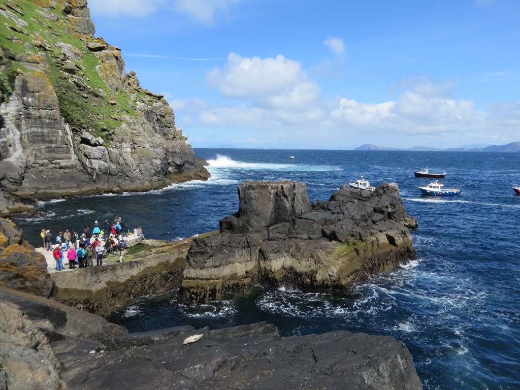
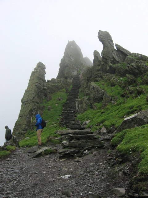
Once you’ve landed, there are 600 jagged rock steps leading up to the island’s monastery.
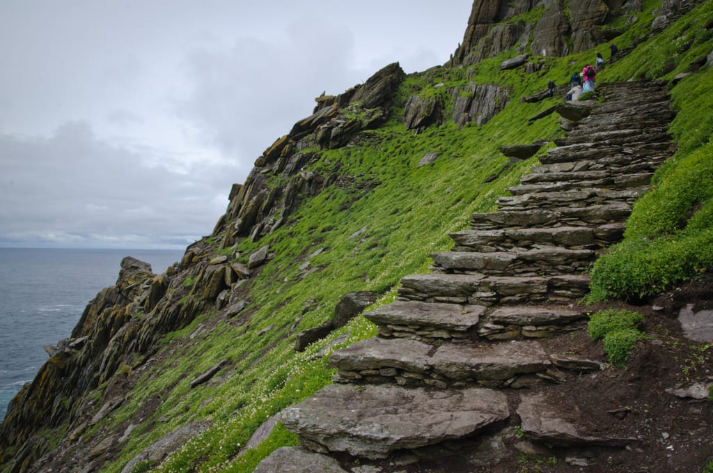
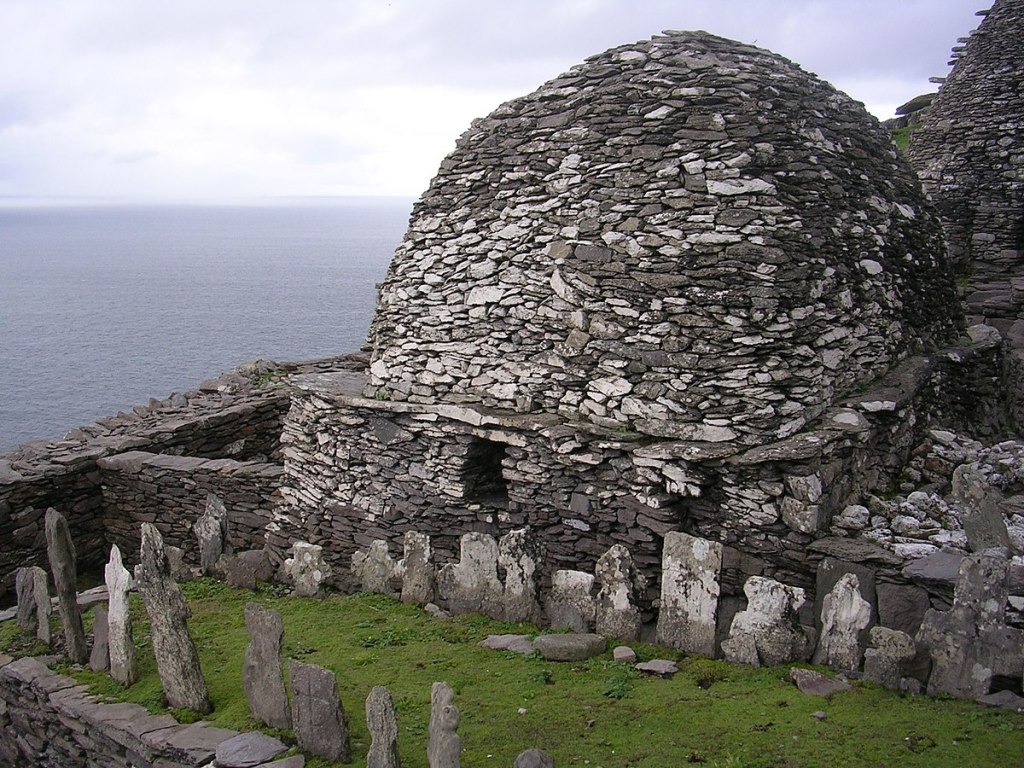
Once you reach the top, you come to a monastery built into a terraced-shelf, located 600-feet, or 180-meters, above sea-level.
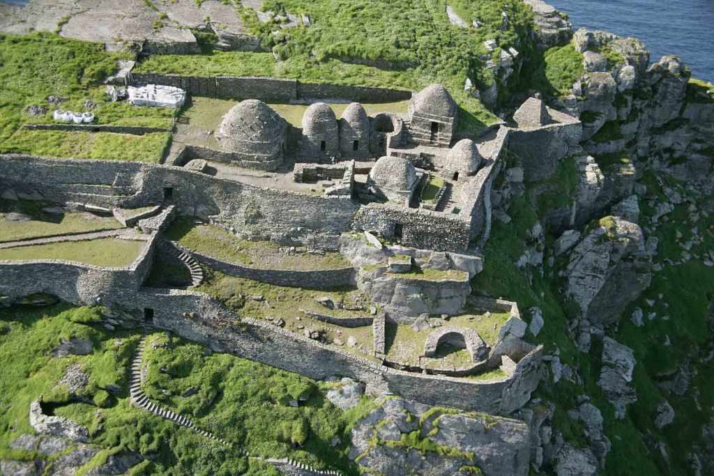
The monastery contains things like two oratories, which are small chapels for private worship and a cemetery…
…crosses…
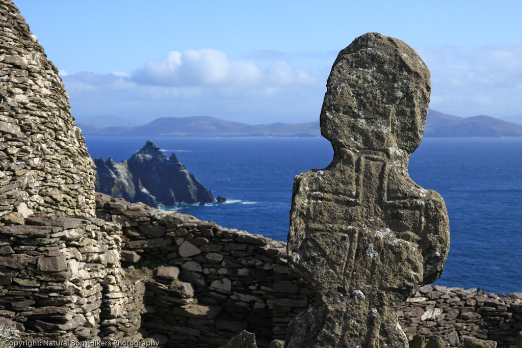
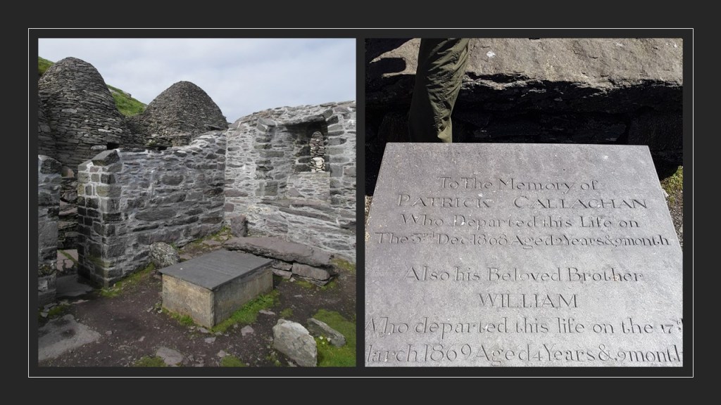
…six beehive huts…
…and what’s left of St. Michael’s Church, which is mostly collapsed with only its eastern window still standing.
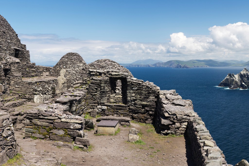
Interestingly, there is a modern gravestone at the center of what has been identified as St. Michael’s Church with a dates of 1868 and 1869 on it, and erected for two children of one of the lighthouse-keepers.
There are two lighthouses on Skellig Michael.
The one still in use today is called Skelligs Michael Low Light.
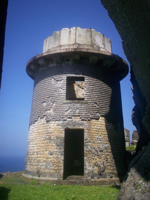
We are told it was built in 1826, along with…
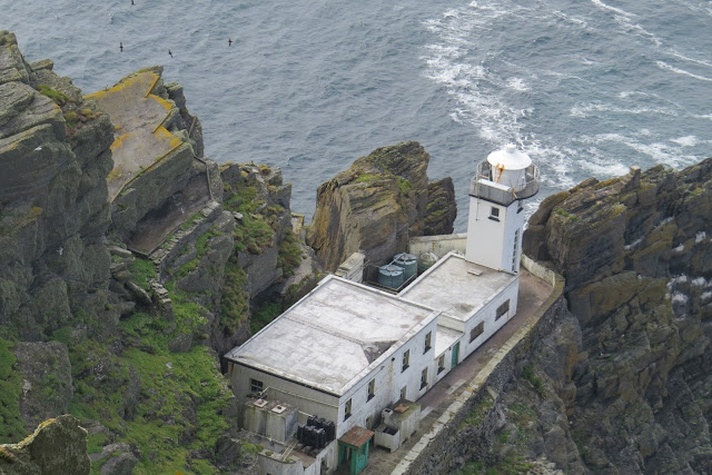
…the Upper Light, the use of which was discontinued in 1870 for the given reason of too much fog.
There is a helicopter landing pad on the island, these days for emergency-use only.
There was a hermitage on the opposite side of the island to the monastery, but access to it is restricted, and you need to make a prior arrangement to go there.
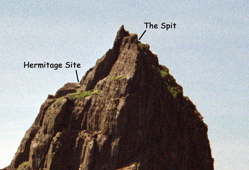
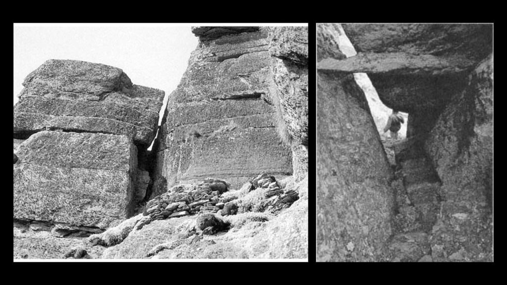
To get to the Hermitage, you go through Christ’s Saddle…
…and Needle’s Eye.
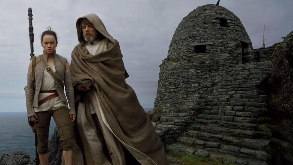
Skellig Michael was recently used for the filming locations of “Star Wars: The Force Awakens” in 2015…

…and “The Last Jedi” in 2017.
I am going to end “Places & Topics Suggested by Viewers – Volume 9” here on Skellig Michael.
More to come!