
In the last post, I tracked the alignment from Athens, Georgia, the home of the flagship campus of the University of Georgia, through Central, a small railroad town in South Carolina; to Greenville, the largest city in Greenville County, South Carolina, and its county seat.
Next on the alignment is Charlotte,the largest city in North Carolina, and the county seat of Mecklenberg County.
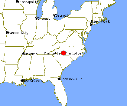
One of its nicknames is “The Queen City.”
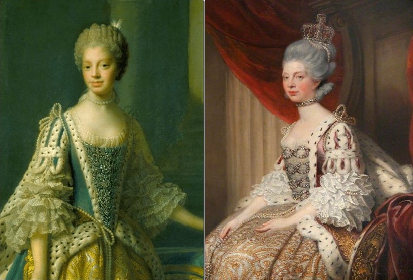
Charlotte was named for Princess Charlotte of Mecklenberg-Strelitz, a small north German duchy in the Holy Roman Empire, who had become Queen-Consort of Great Britain and Ireland upon her marriage to King George III in 1761. Both of these portraits of Queen Charlotte can be found on the internet…
…as can these of King George III, with a portrait like the one on the right being far more commonplace.
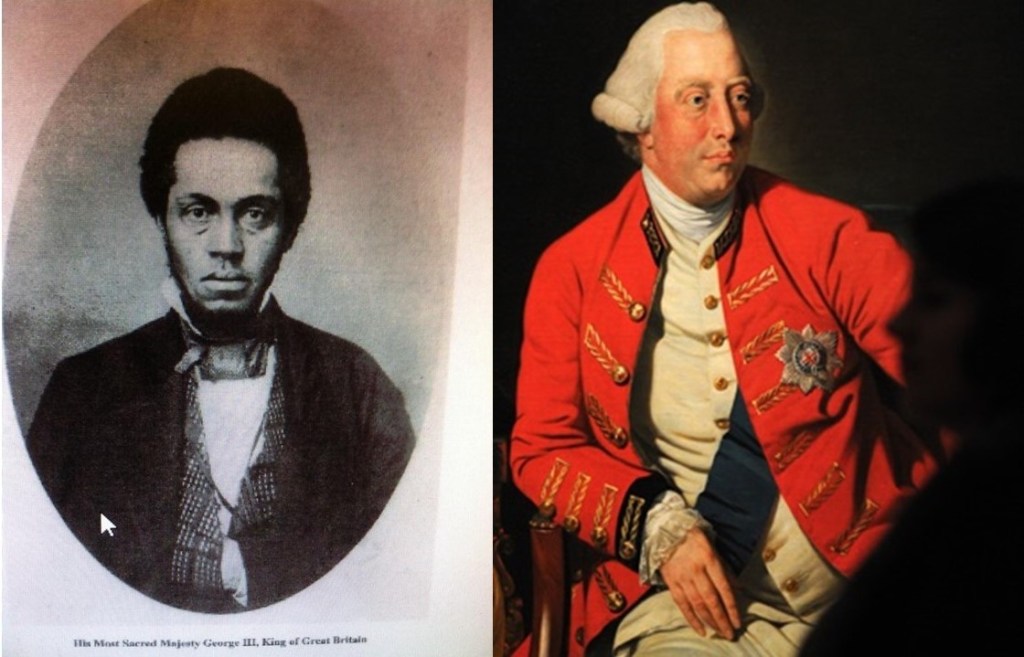
A historical white wash may be difficult to get one’s head around based on what we have been taught, but evidence is there when you start looking.
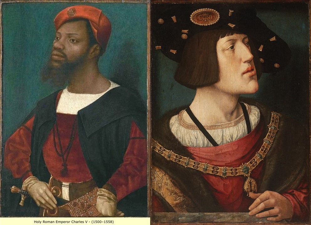
Holy Roman Emperor Charles V, who ruled from 1500 to 1558, is another example, with the similar of the facial structure between the two portraits, the tilt of the chins, and the similar clothing.
Why would one portrait become the face of the rulers, and the other fade to obscurity?
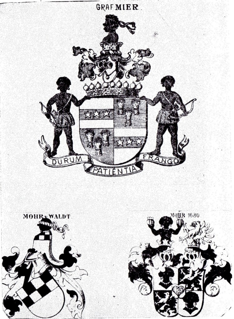
Here are some examples of German Coats-of-Arms, with the “Moor” sound in the name.
I personally believe there was a deliberately-caused cataclysm within the last couple of hundred years that resulted in a worldwide mud flood that wiped out an advanced global civilization…
…that was subsequently dug out by those involved, and what we have seen playing out in our world are the results of human and social engineering that have been used to divide Humanity by race and religion for the purposes of power and control.
I did not start out from a mud flood perspective, but in the process of what I am researching, I became connected with the mud flood community of researchers on YouTube.
Now back to Charlotte, North Carolina.
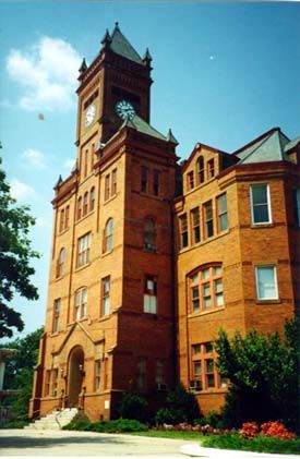
Biddleville, the primary historic center of Charlotte’s so-called African-American community, is west of uptown, and starts at the Johnson C. Smith University campus, extending to the airport. Biddleville was said to have been created in the 1870s for the professors at the Johnson C. Smith University.
This is Biddle Hall on the university campus…
…the Jane M. Smith Memorial Church…
…and the James B. Duke Memorial Library.
I say so-called African-Americans because the Moors were and are indigenous to North America. This was their land.
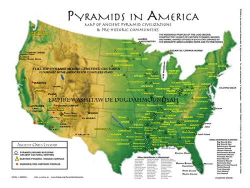
The Ancient Ones don’t refer to a people that existed a long time ago. It refers to an ancient people that are alive and living in the present day.
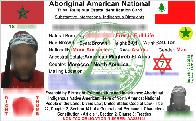
The only way that the controllers have had to control our lives is by deceiving Humanity into thinking they have the ability to do that, because they actually do not. Please note that this identification card says: “Natural Born Day” instead of birthday, then it says “Free in Full Life.” This is a significant point of information.
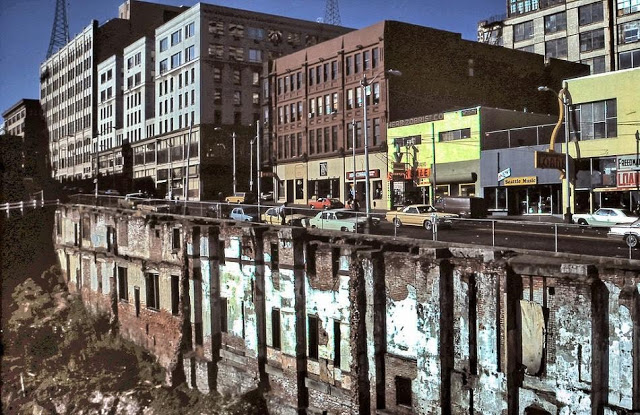
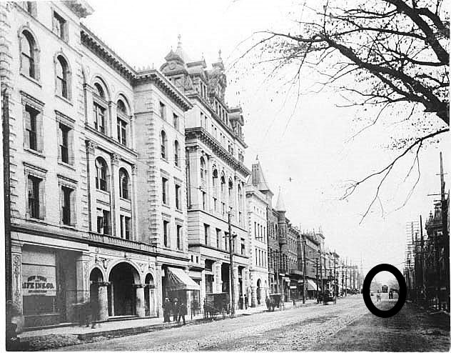
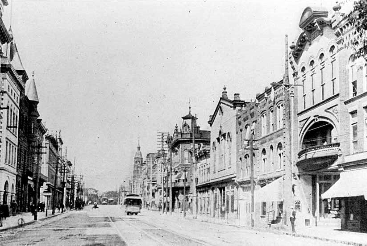
Here are some historic photos of Charlotte.
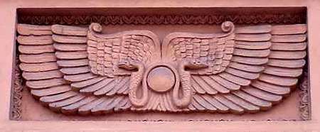
I don’t know what this building was, or if it is even still standing, but I noticed there was a symbol at the top of the building…
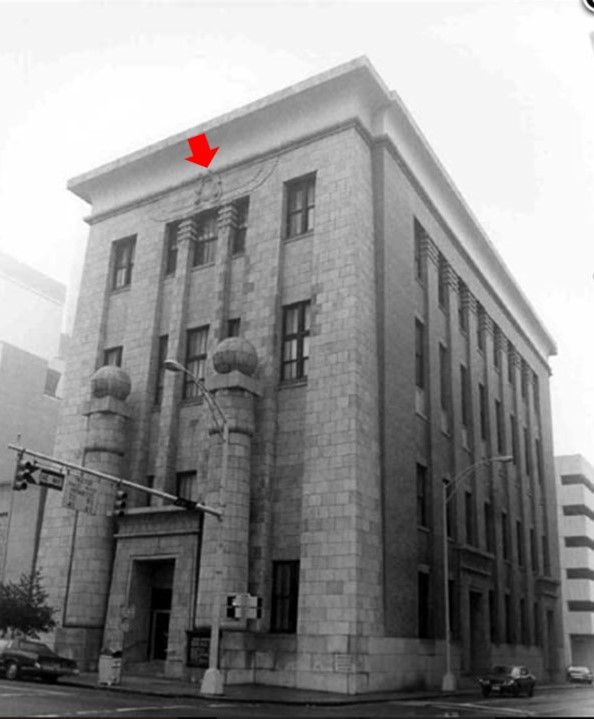
…and here is a close-up of the symbol. I wonder if this is a representation…
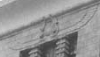
…of the ancient symbol of the Winged Sun, an ancient symbol associated with divinity, royalty, and power.
Here’s an historic photo of Charlotte, where you see horse-drawn carriages in the foreground, advanced masonry, and a streetcar way in the background.
Here’s a closer view of a street car in the Charlotte street-car system…
…and here’s another one in a residential neighborhood in Charlotte.
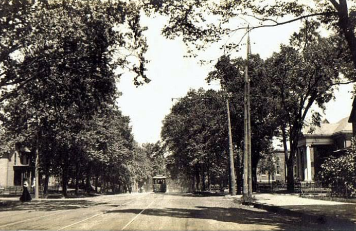
Looks like Charlotte had a well-developed public transportation system from early in its history.
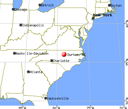
The next city on the alignment is Durham, the county seat of Durham County, North Carolina, and part of the Research Triangle Region, known for its technology companies and scholarly institutions.
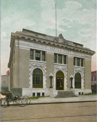
The Old Post Office and Federal Building in Durham was said to have been built in 1906. It was demolished in 1936.
Why build a building that looks like it is made to last forever be demolished in thirty years?
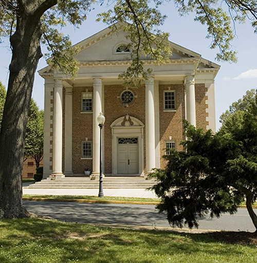
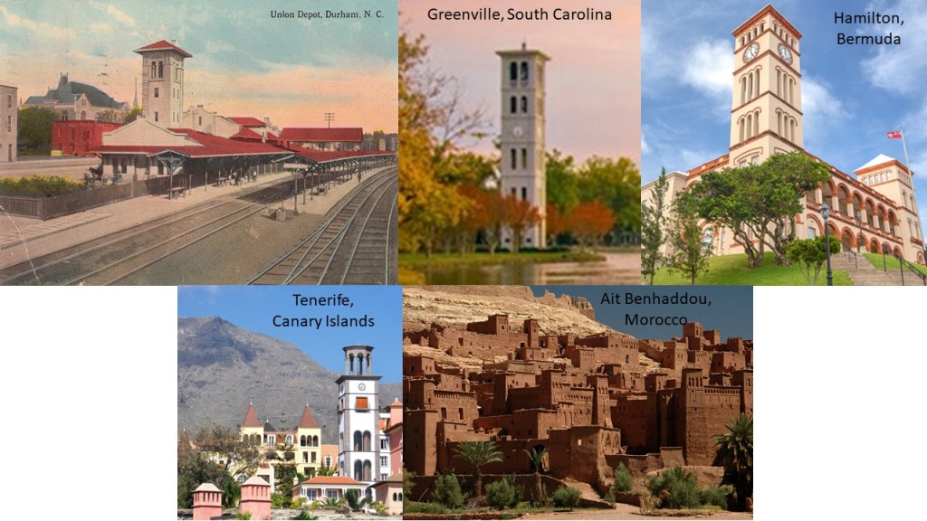
This was the Union Station in Durham circa 1910 on the top left; the Furman University Bell Tower in Greenville, South Carolina, in the middle; Sessions House, the Parliament Building in Hamilton, Bermuda, on the top right; a view of the architecture in Santa Cruz de Tenerife on the Island of Tenerife in the Canary Islands, on the bottom left; and the ancient Moroccan city of Ait Benhaddou on the bottom right.
This is the Duke University Chapel in Durham, at the center of the campus.
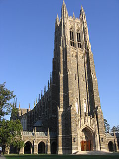
Here it is from the rear.
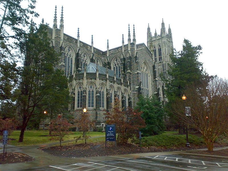
This European cathedral looking chapel was said to have been built completed in 1935, only 84 years ago. What do you think?
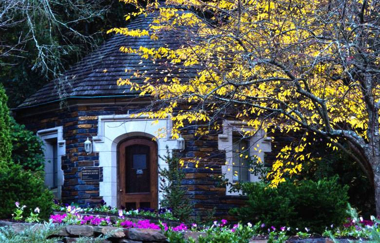
The Sarah P. Duke Memorial Gardens occupy 55-acres, or 22-hectares, of the grounds of Duke University.
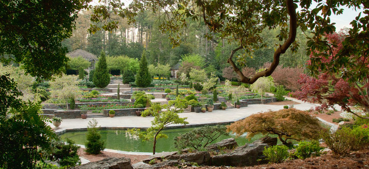
The gardens are named after the wife of Benjamin Duke, one of the University’s benefactors.
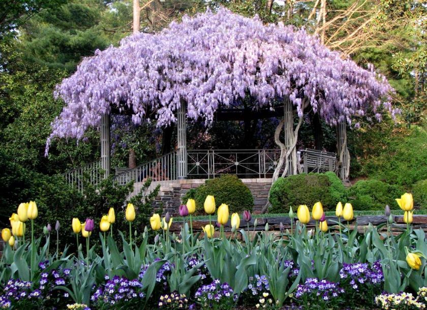
The gardens are said to have been developed throughout the 1930s.
Next on the alignment is Richmond, the capital of Virginia. It was incorporated in 1742, and has been an independent city since 1871, meaning it is not a part of any county.
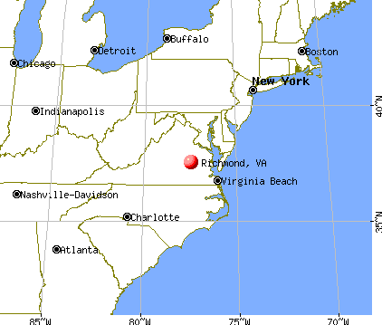
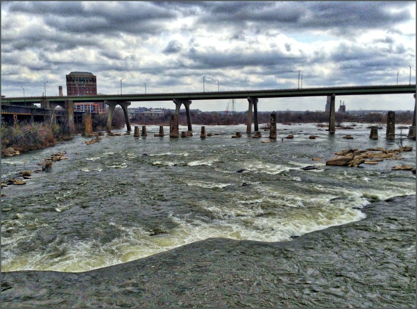
Richmond is on the fall line of the James River, where the are rapids down to its own tidal estuary…
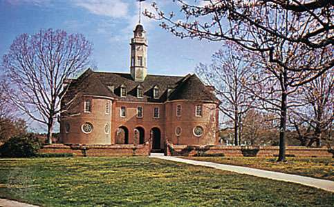
…and is 44-miles, or 71-kilometers, west of Williamsburg, the capital of the Colony and Commonwealth of Virginia from 1699 to 1780…
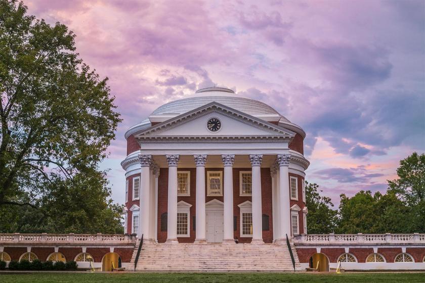
…66-miles, or 106-kilometers east of Charlottesville, the location of the University of Virginia…
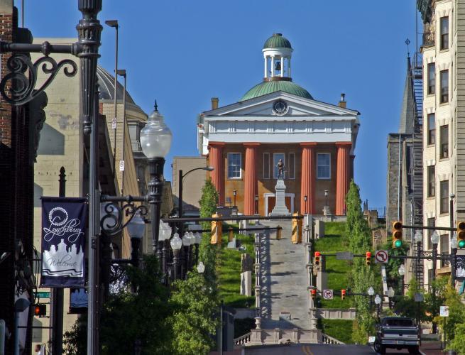
…100-miles, or 160-kilometers, east of Lynchburg, on the banks of the James River, and known as the “City of Seven Hills,” a nickname it shares with Rome in Italy…
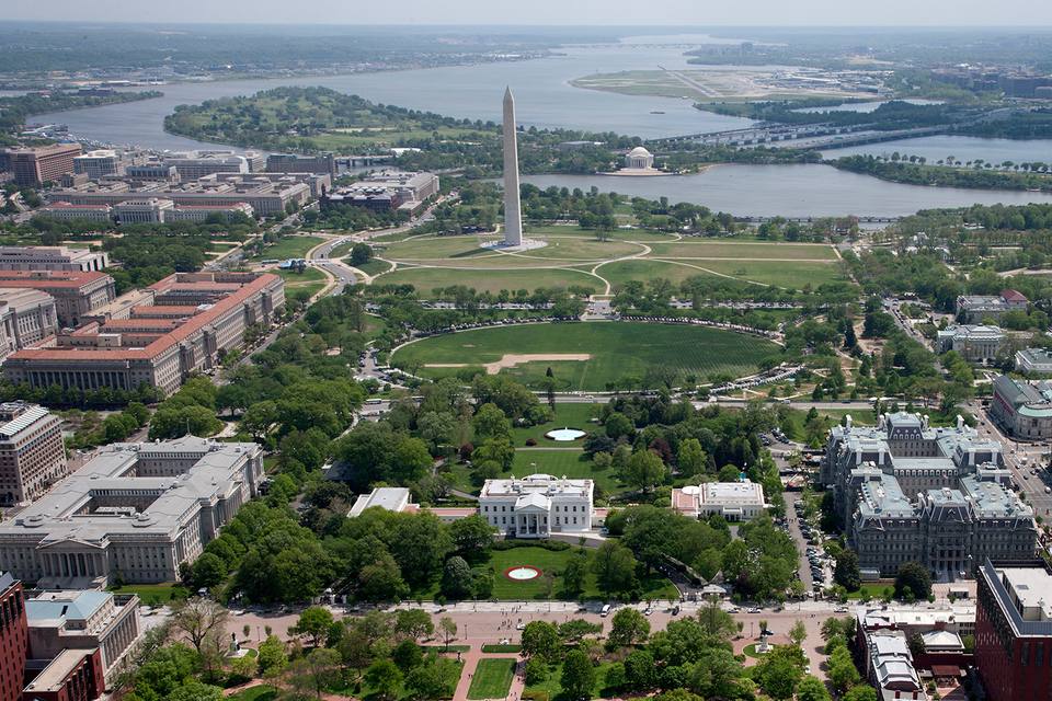
…and is 90-miles, or 140-kilometers, south of Washington, DC, where we started this journey, and are about to return.
The planter William Byrd II was said to have commissioned Major William Mayo, a British civil engineer, to lay-out the original town grid. Mayo is said to have named the town after the English town of Richmond, because the view of the James River (this was taken from Libby Hill Park in Richmond)…
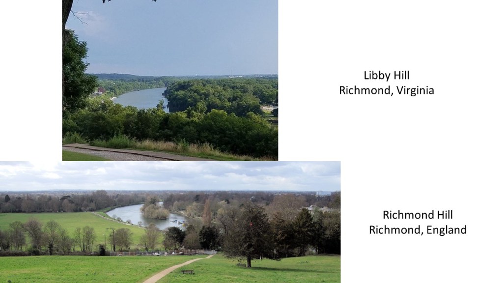
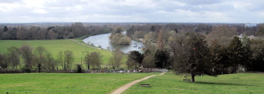
…was strikingly similar to the view of the River Thames from Richmond Hill in England.
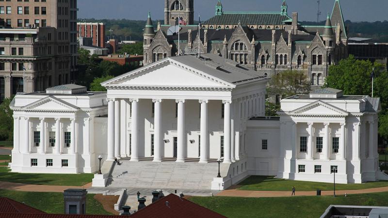
Richmond became the capital of Virginia in 1780, when it was moved from Williamsburg. This is the Virginia State Capitol Building.
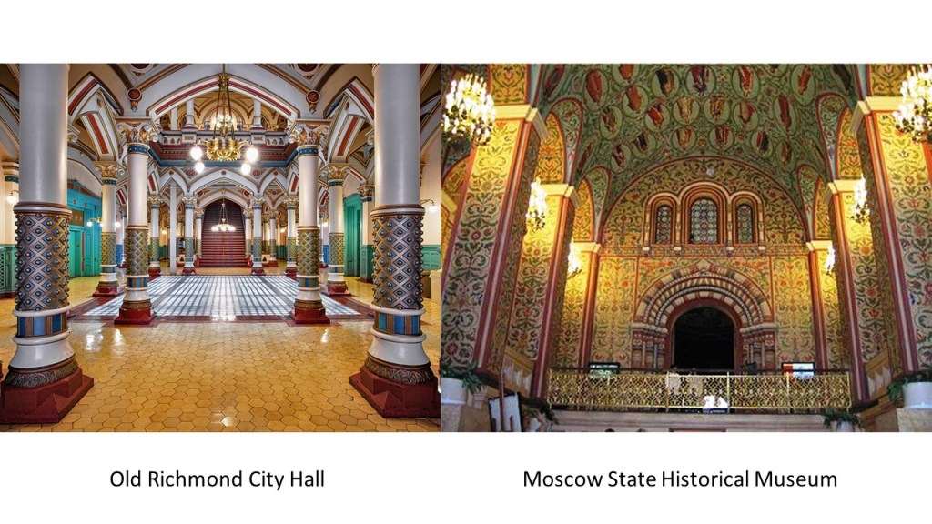
Directly to the north of the Virginia State Capitol building is the Old Richmond City Hall…
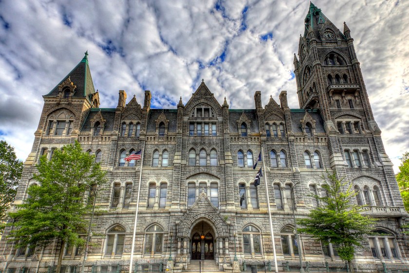
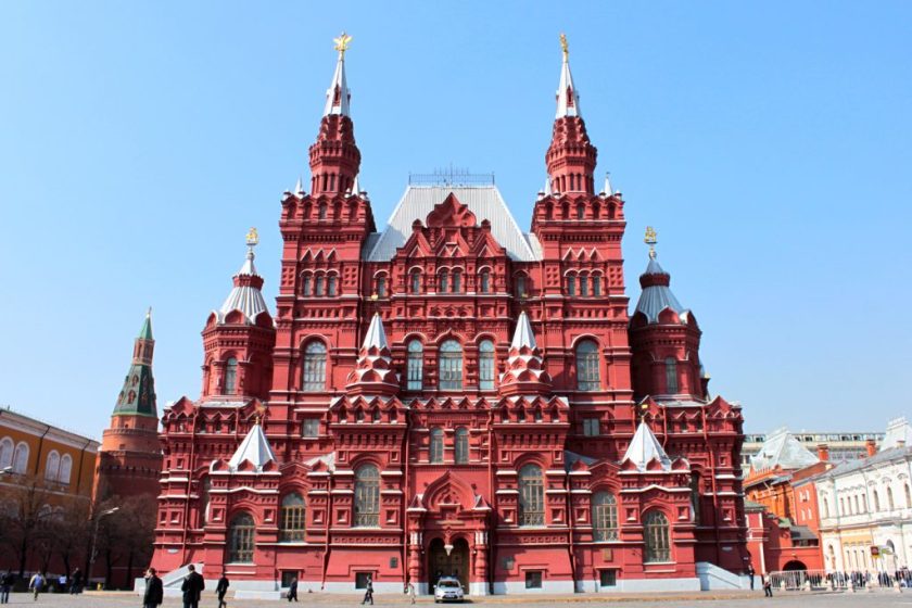
…and I am comparing it for similarity with the Moscow State Historical Museum in Russia.
This is inside the Old Richmond City Hall…
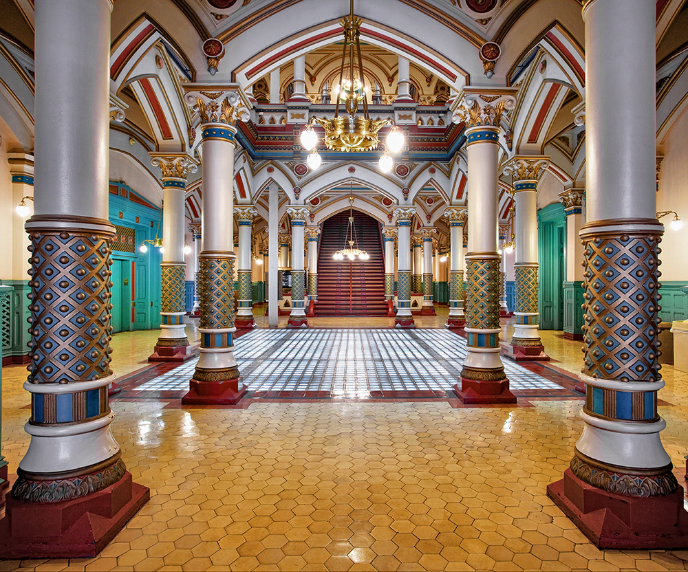
…and this is inside the Moscow State Historical Museum.
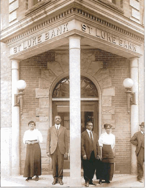
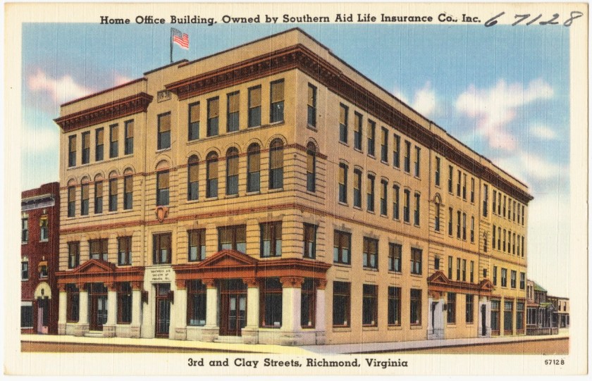
Jackson Ward, another historically called African-American district in Richmond, is located less than a mile from the Virginia State Capitol building.
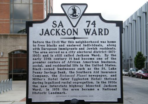
The sign references businesses there, such as the St. Luke Penny Savings Bank, which survived the Great Depression when many banks went under, which became Consolidated Bank and Trust, and is still here today.
The sign about Jackson Ward also references the Southern Aid Insurance Company, where it was founded in 1893.
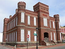
This is the Leigh Street Armory in Jackson Ward, which is now the Black History Museum & Cultural Center of Virginia.
Monroe Park is a 7.5-acre, or 3-hectare, park that is 1-mile, or 1.6-kilometers, northwest of the Virginia State Capitol building. It is pentagonal in shape, and considered to be Richmond’s oldest park.
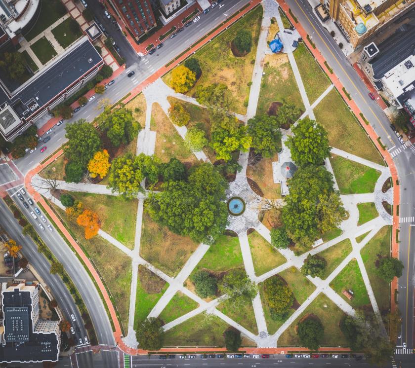
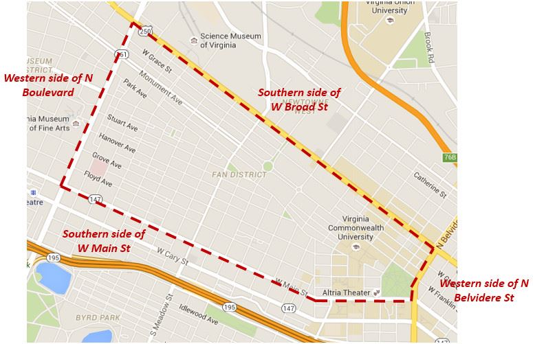
It is the eastern point of the Fan District, because of the fan shape of the array of the streets that extend west from Belvedere Street on the eastern edge of Monroe Park, westward to the Boulevard.
The Altria Theater is located at the southwest corner of Monroe Park.
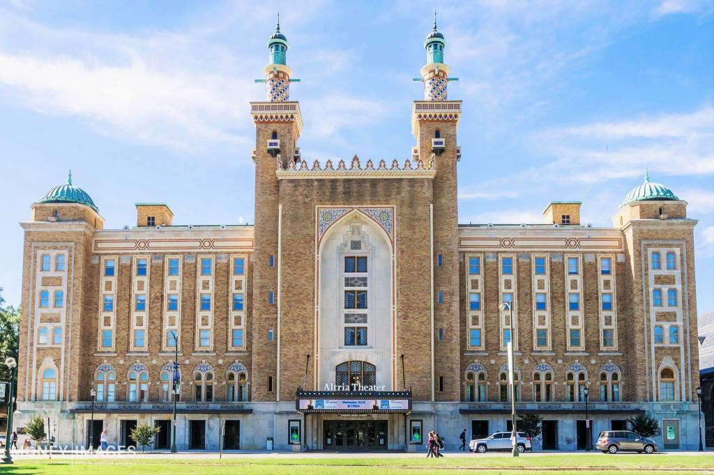
We are told that it was built between 1925 and 1927. This is the interior of the Altria Theater.
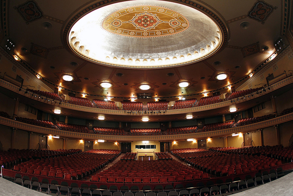
Formerly known as The Mosque, and the Landmark Theater, it was said to have been built for the Shriners of the Acca Temple Shrine.
Which Shriners, though? These…
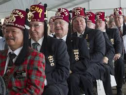
…or these?
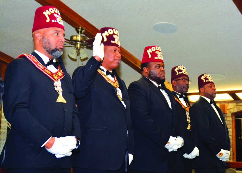
Because, you see, this is what all of this, every bit of what has taken place, is really all about.
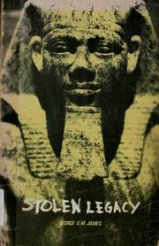
The Moors were and are the custodians of the Ancient Egyptian mysteries, according to George G. M. James in his book “Stolen Legacy.”
As we slide back into Washington, DC, and complete this circle alignment series…
I will leave you with a few more images.
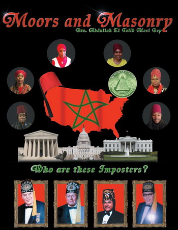
The first is about the Moors, and and their true connection to Masonry.
Next is a photo of the Supreme Court building in Washington, with construction said to have begun in 1932 and completed in 1935. It was built in the middle of the Great Depression? Seriously?
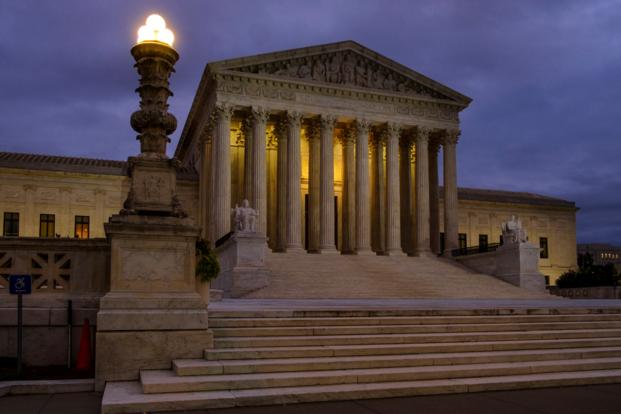
Not only that, there is a detail in this photo of the Supreme Court…
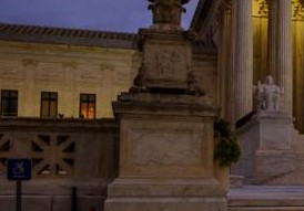
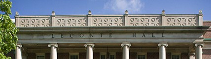
…that matches ones at Leconte Hall at the University of Georgia in Athens, Georgia…
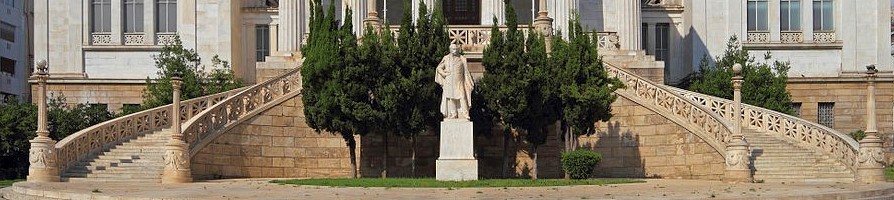
…and the National Library of Greece in Athens.
You see the same cross pattern on the Union Jack flag…

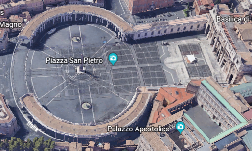
…and in the Piazza San Pietro in front of San Peter’s Basilica at the Vatican.
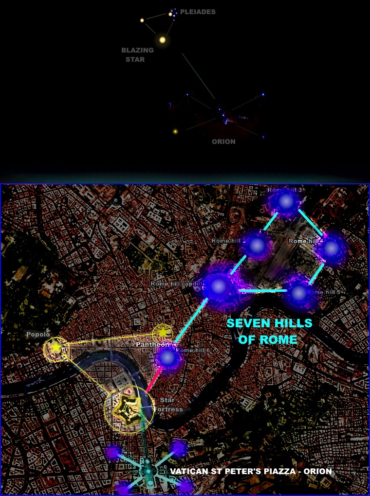
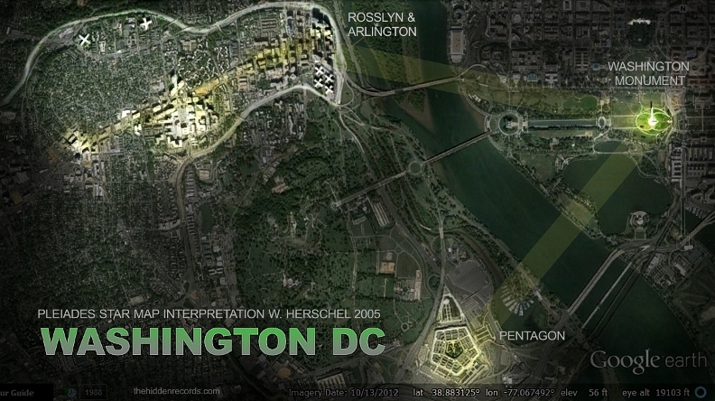
According to Wayne Herschel, it is representative of the Orion Constellation, as seen in his star map of Rome and the Vatican. The Orion Constellation is connected with Osiris, the primeval god of Egypt.
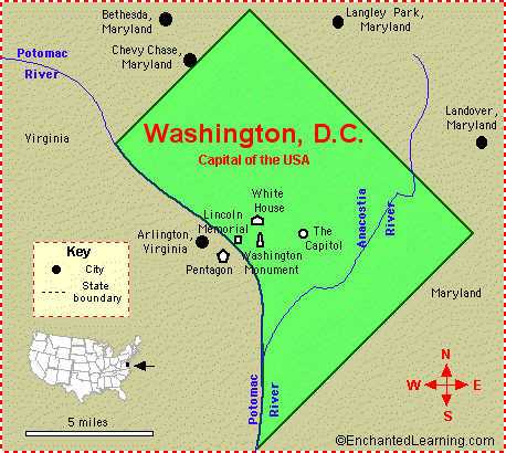
And here is Wayne’s star map of the Washington, DC area.
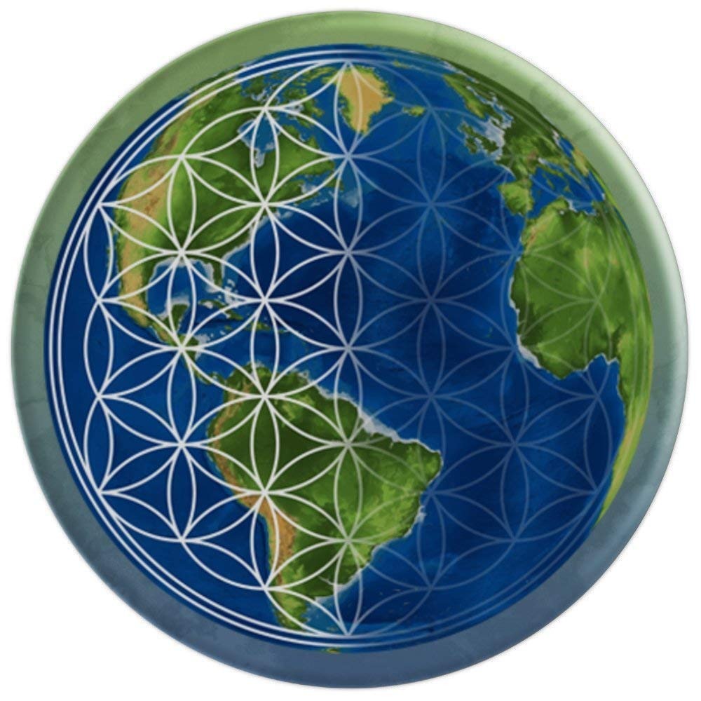
The ancient and advanced Moorish Civilization was global. I see a beautiful, harmonious and balanced civilization, geometrically aligned with itself, and in perfect alignment with the stars.
I believe when the Moorish Civilization was taken out, their advanced sacred geometry and planetary gridlines based on the Flower of Life, upon which all infrastructure was precisely located and in alignment, as well as being a free energy generation and distribution system, was reconfigured, and much was destroyed. What remained of the advanced technology of the grid system was then reversed, and used to control Humanity.
Having said this, people are waking up, and I believe we are on the verge of incredible changes which will impact Humanity for the better.
I look forward to sharing my next research project on archways with you, which will involve both man-made and what are called natural.
