Looking into Comments I have received – Part 4 Lewis & Clark, the Mandela Effect & a Few More Places

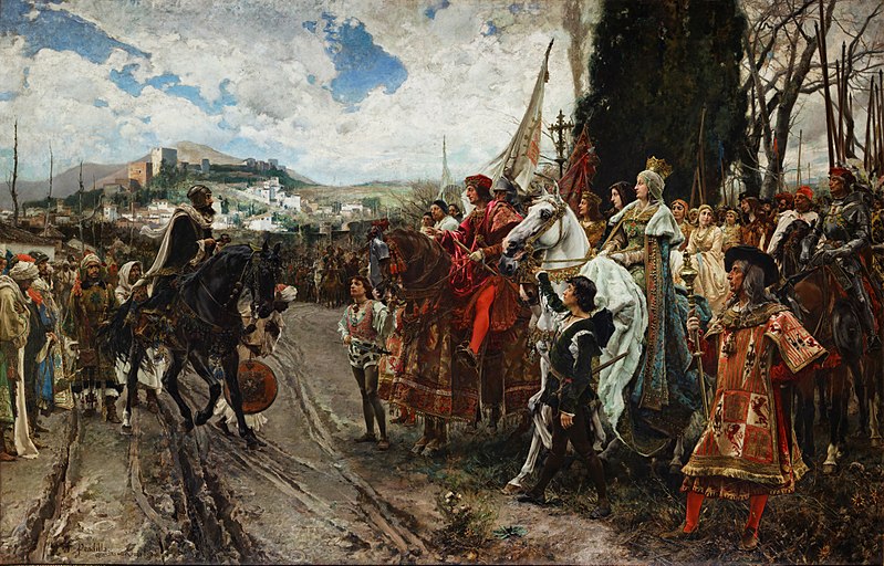
In this series, I have been highlighting places, historical events, and people that have been mentioned in the comments section of my blog and YouTube Channel.

The fourth and final part of this series is focusing on the suggested topics of the Lewis & Clark Expedition, the Mandela Effect, and I am adding a few more places at the end that photos have been sent in readers and viewers.

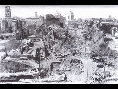
What I am finding in my research is pointing to the Victorian Era as the official start of the new historical reset timeline, what I also call the “New World Order” timeline, after enough infrastructure was dug out to re-start civilization following what I believe was a mud flood cataclysm that was deliberately caused by negative beings who sought absolute power and control over Humanity and the Earth.

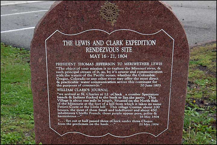
I am going to start this post with the Lewis and Clark Expedition, as suggested in a comment by a viewer.

This is what we are told about the Lewis & Clark Expedition.

Also known as the Corps of Discovery, the Lewis & Clark Expedition started on August 31, 1803 and lasted until September 25, 1806, with a mission to explore and map the newly acquired western portion of the country after the Louisiana Purchase.

We are told the Louisiana Purchase was the acquisition of the Territory of Louisiana by the United States from France with the signing of the Louisiana Purchase Treaty on April 30th of 1803, which was officially announced on July 4th of 1803.

It was said to have doubled the size of the United States and paved the way for the nation’s westward expansion.

One of the negotiators with France for the terms of the Louisiana Purchase in 1803 on behalf of President Jefferson was the minor French nobleman Pierre Samuel Dupont de Nemours, who was living in the United States at the time.

His son Éleuthère Irénée du Pont, a chemist and industrialist, founded the E. I. du Pont de Nemours and Company to manufacture gunpowder and explosives in 1802, with the du Ponts becoming one of America’s richest families, with generations of influential businessmen, politicians and philanthropists.

Under the command of Captain Meriwether Lewis and his close friend Lieutenant William Clark, the expedition was comprised of a select group of United States Army and civilian volunteers.

They were commissioned by President Thomas Jefferson to find: 1) a practical route across the western half of the country; 2) to establish an American presence in this Territory before European powers tried to claim it; 3) to study plants, animal life, and geography; and 4) to establish trade with the local American Indian tribes.

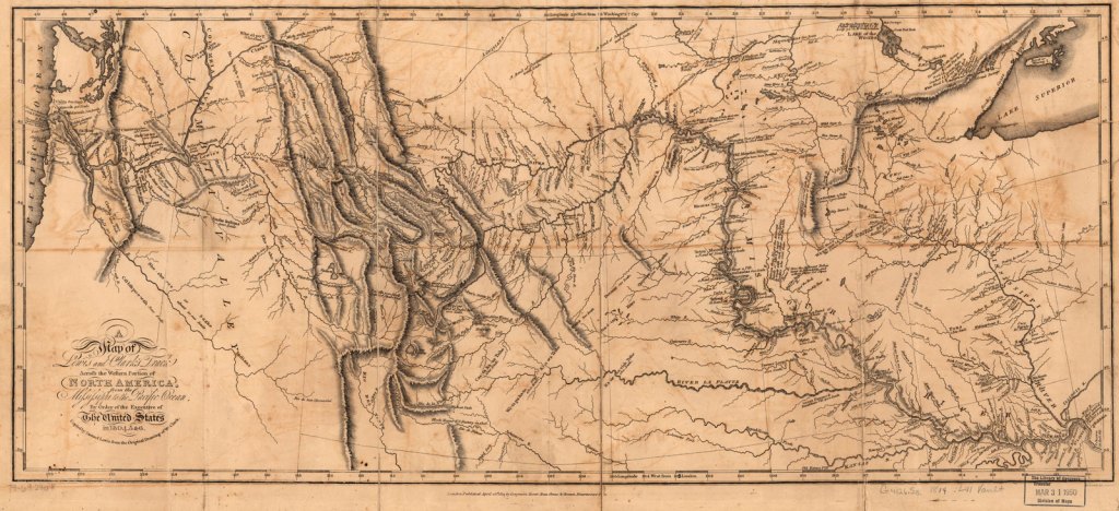
This map is attributed to Captain Lewis and Lieutenant Clark from their expedition.

After Jefferson chose Meriwether Lewis as the expedition’s leader in 1803, he made sure Lewis was educated in medicinal cures by Dr. Benjamin Rush in Philadelphia…

…in navigational astronomy by American land surveyor Andrew Ellicott…

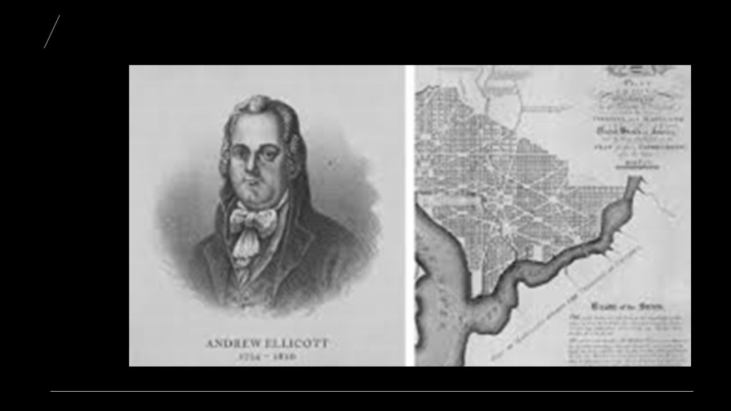
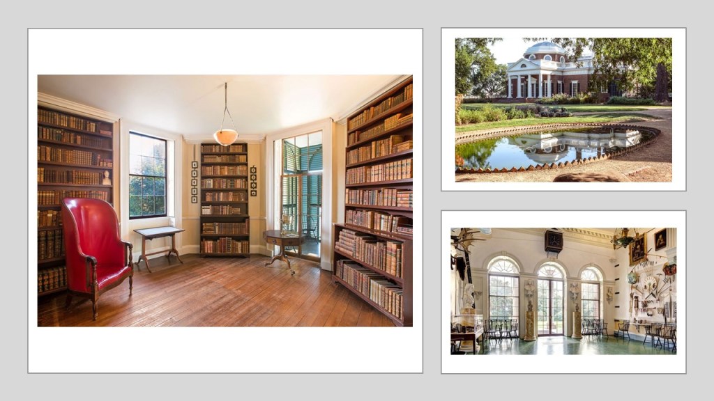
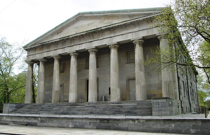
…and Jefferson gave Lewis full access to his extensive library on the subject of the North American continent at his home in Monticello in Charlottesville, Virginia, which Jefferson is credited with designing and building between 1768 and 1772.

In the summer of 1803, a keelboat said to have been built to Lewis’ specifications near Pittsburgh, Pennsylvania…

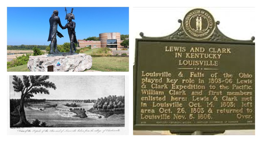
…and that Lewis and his crew travelled in it immediately after it was finished in August down the Ohio River to meet up with Clark at what is now Clarksville, Indiana in October of 1803 at the Falls of the Ohio, across the river from Louisville, Kentucky.

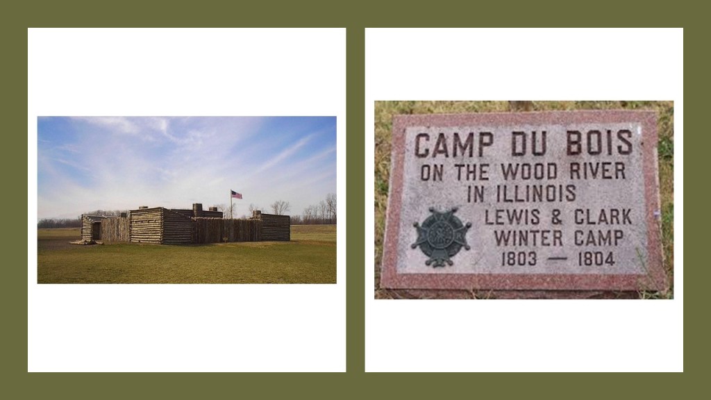
We are told that in 1803, Lewis and Clark met a well-known Frenchman at Cahokia by the name of Nicholas Jarrot, who agreed to let them camp on his land on the Wood River, at that time known as the Riviere du Bois.

Known today at the Cahokia Mounds State Historic Site, it is the site of a pre-Columbian Native American city that is considered the largest and most complex archeological site north of the great pre-Columbian cities of Mexico…

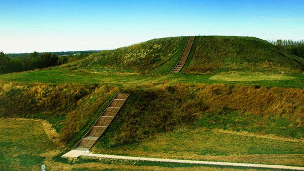
…and is located directly across the Mississippi River from St. Louis, Missouri.

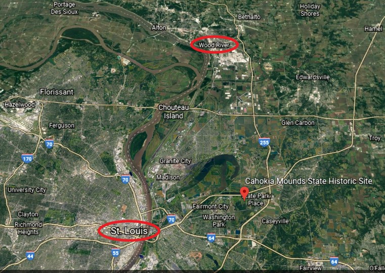
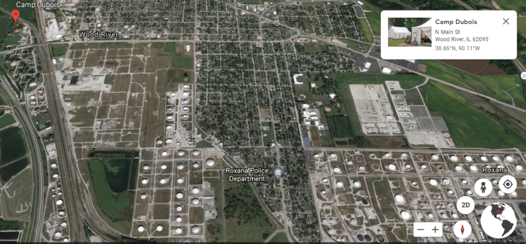
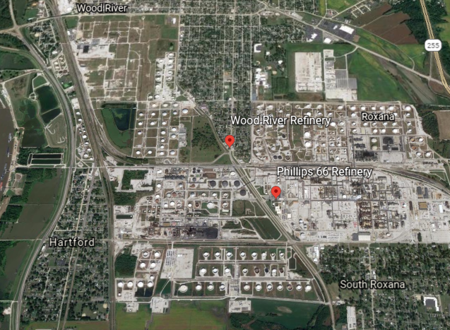
The location of Camp Dubois at Wood River is almost directly north of Cahokia, both on the Illinois side of the Mississippi River.

While I am not seeing the remnants of a star fort in this Google Earth screenshot of the area surrounding Ft. Dubois in Wood River…

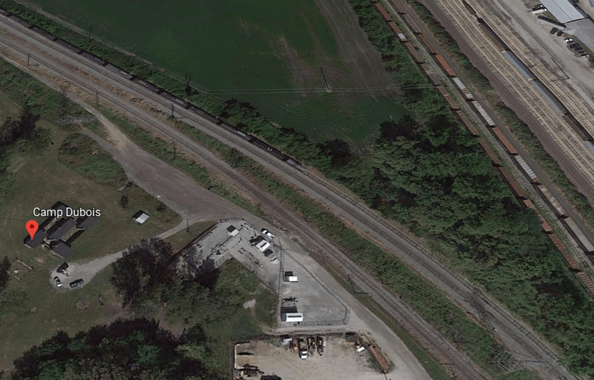
…I am seeing that it is situated beside a location where two railroad lines merge into one, as well as a landscape filled with huge lots and huge tanks…

…that are apparently connected to the oil refineries in Wood River.

Also, just south of Camp Dubois in Wood River is a city government office and complex for Veolia Water North America, which primarily operates in the bottled water delivery business.

This is the East Alton-Wood River High School, founded in 1956…

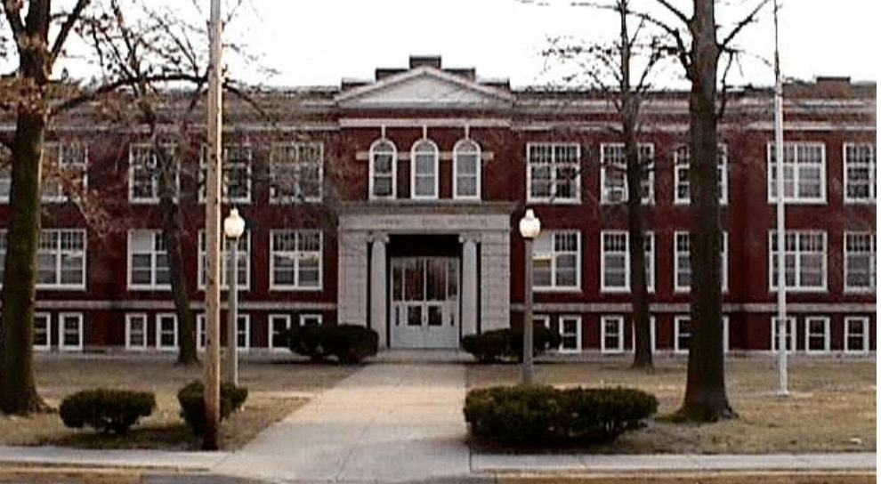
…known as the “Oilers.”

Apparently, the city of Wood River was founded in 1907 with the establishment in the vicinty of a refinery for John D. Rockefeller’s Standard Oil Company.

Interesting that this would also be the historical location of the actual launch point for the Lewis and Clark Expedition.

John D. Rockefeller, Sr, was the progenitor of the Rockefeller family and considered to be the wealthiest American of all time.

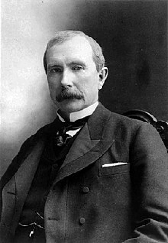
He founded the Standard Oil Company in 1870.

The expedition members stayed through the winter at Camp Dubois in present-day Wood River, awaiting the transfer of the lands of the Louisiana Purchase to the United States, which did not occur until March 9th & 10th of 1804.

Jefferson’s instructions to the expedition, we are told, were stated thus:

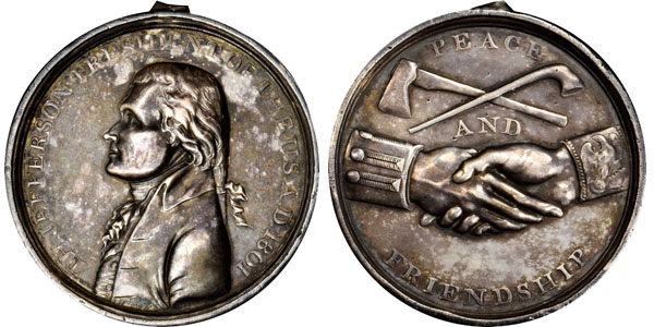
While the US mint prepared special silver medals for the expedition called “Indian Peace Medals” with a portrait of Jefferson and inscribed with a message of friendship and peace distributed by the soldiers in it…

…they also had advanced weapons to display their military firepower, like the .46 caliber Girandoni air rifle, a repeating rifle with a 20-round tubular magazine that was invented in 1779 by the Italian Bartolomeo Girandoni.

They also carried flags, gift bundles, medicine, and other items that they would need for their journey.

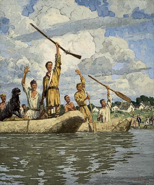
The Corps of Discovery of approximately 45 members left Camp Dubois on May 14, 1804.

Under Clark’s command, they traveled up the Missouri River in their keelboat and two pirogues…

…to St. Charles, Missouri.

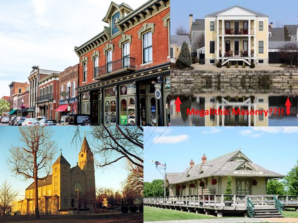
Founded in 1765, it is called the third oldest city west of the Mississippi River.

Lewis joined them six days later.

The expedition set out the next afternoon, on the 21st of May.

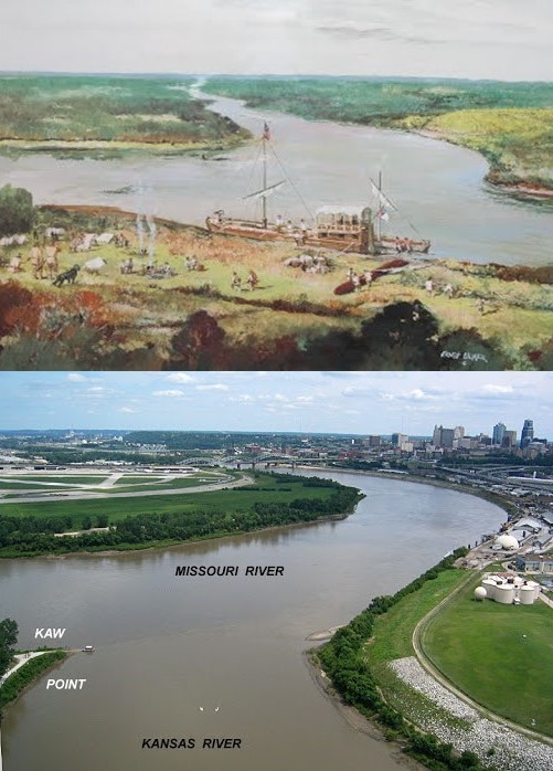
From St. Charles, the expedition followed the Missouri through what is now Kansas City, Missouri, where they camped at Kaw Point on June 26th of 1804, where the Kansas River runs into the Missouri River…The way these two rivers merge together into one at Kaw Point is another example of the many reasons I believe that so-called natural rivers are in actuality canal systems.

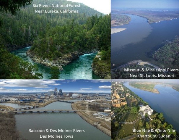
Here are some other examples of the similarity of river confluences like what is seen at Kaw Point:…On the top left is Six Rivers National Forest in Eureka, California, compared with the confluences of the Mississippi and Missouri Rivers near St. Louis on the top right; of the Raccoon and Des Moines Rivers near Des Moines, Iowa, on the bottom left; and of the Blue Nile and White Nile near Khartoum, in the African country of Sudan, on the bottom right.

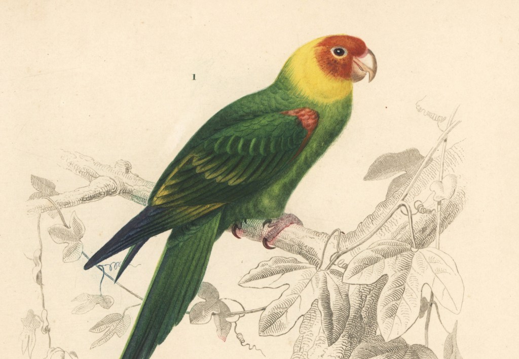
It was here that Clark reported encountering a great number of “parrot queets.”

The now-extinct Carolina parakeet inhabited much of what became the United States at that time.

The last-known Carolina parakeet died in captivity at the Cincinnati Zoo in 1918, and the species was declared extinct in 1939.

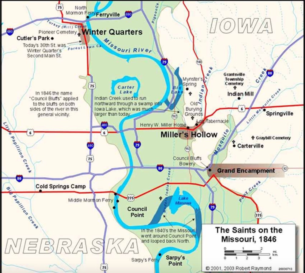
The Corps of Discovery famously landed next in the area surrounding the Missouri River of what is now Omaha, Nebraska, and Council Bluffs, Iowa.

Here in this landscape of tall prairie grass and river, we are told, the Lewis and Clark expedition traveled, camped, hunted, and fished, met with the Native people, and held council with the Indian chiefs of the area.

The Lewis and Clark Monument Park in Council Bluffs, Iowa, memorializes what was said to be a historic meeting between the expedition and the Otoe and Missouri Indians in 1804.

It is important to note the old stonework seen on the memorial grounds.

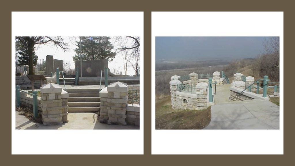
Council Bluffs was incorporated in 1853, receiving its name from this historic meeting.

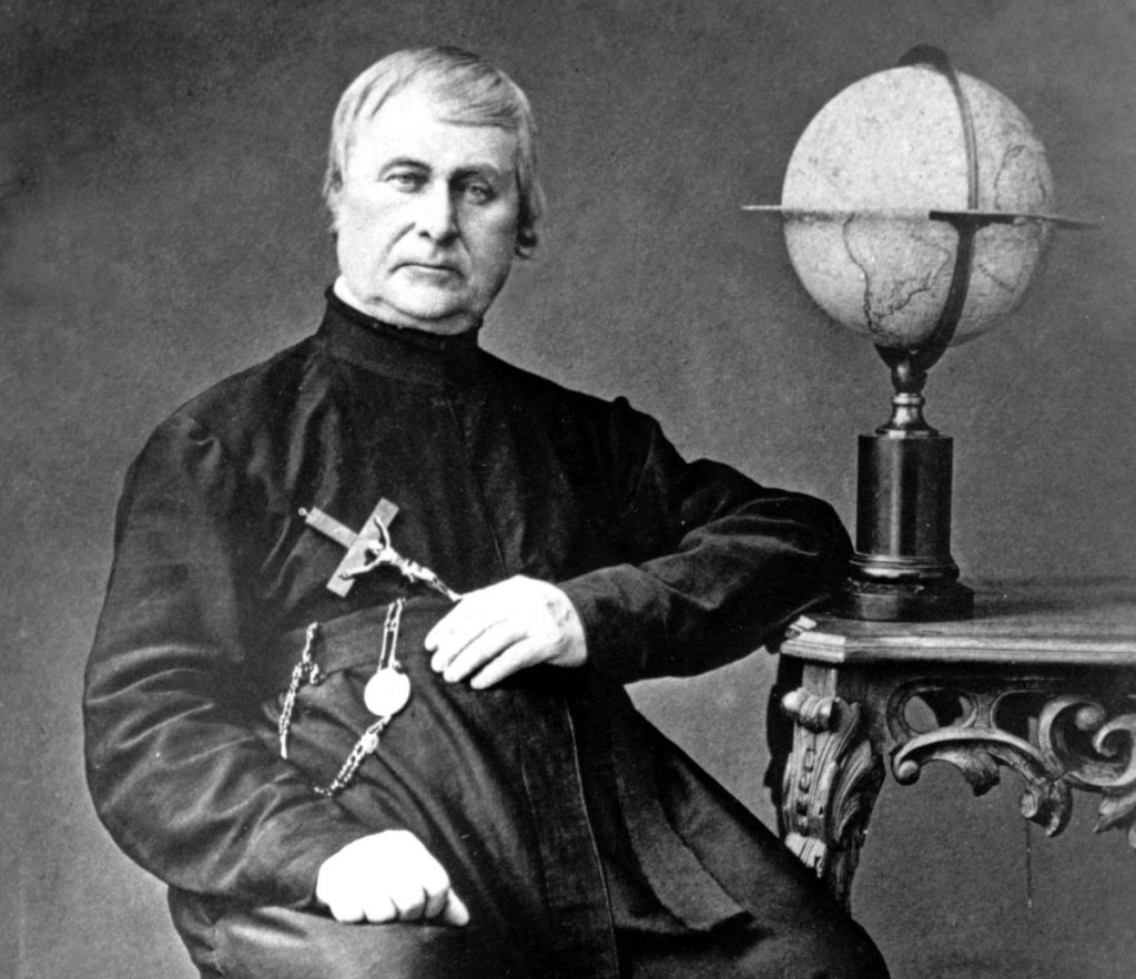
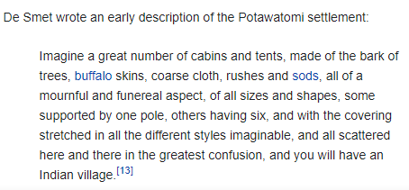
The Jesuit explorer and missionary Pierre-Jean deSmet set up a mission in the late 1830s in what became Council Bluffs for several tribes that had been forced onto reservations there in the 1830s.

This was what he wrote about one reservation/settlement there:

There is a 150-foot, or 46-meter, tall moontower that was used for city-lighting in this historic picture of Council Bluffs.

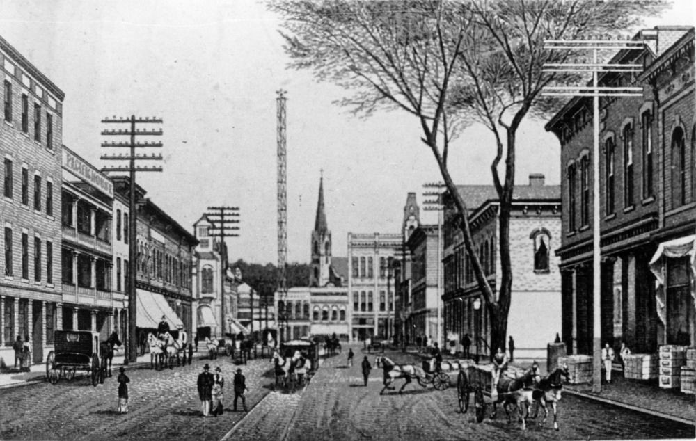
We are told there were seven of what were called moontowers erected in Council Bluffs starting in 1887, and by 1908 they were all removed for a variety of given reasons – too expensive, safety, etc.

Council Bluffs was the historic starting point of the Mormon Trail, which was in use between 1846 and 1869.

Omaha was said to have been founded in 1854 by speculators from Council Bluffs, and that a river-crossing called the Lone Tree Ferry gave the city its nickname “Gateway to the West.”

We are told that Omaha introduced this “New West” to the world when it hosted the 1898 Trans-Mississippi Exposition to showcase the development of the entire West, from the Mississippi River to the Pacific Coast.

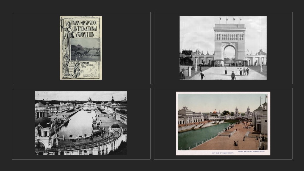
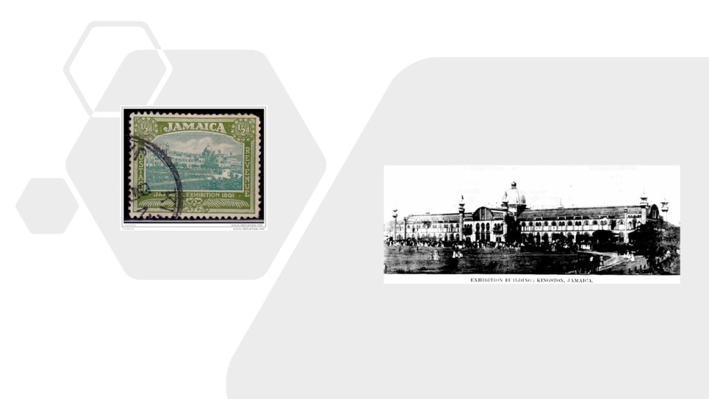
And, as with what I have seen with regards to what was called the “temporary” nature of all of the massive and ornate architecture associated with Exhibitions, Expositions, and World Fairs, starting with the Crystal Palace Exposition of 1851 in London, Omaha is no exception to this story.

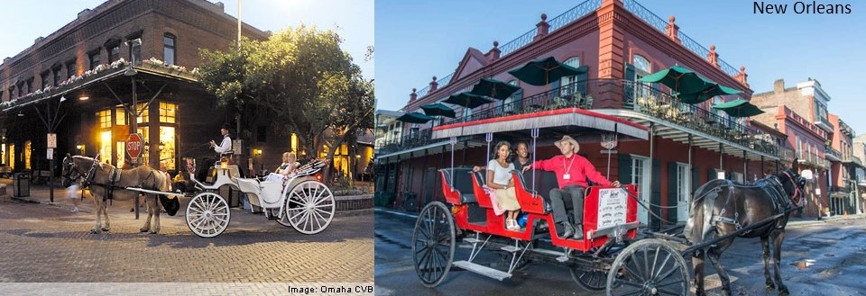
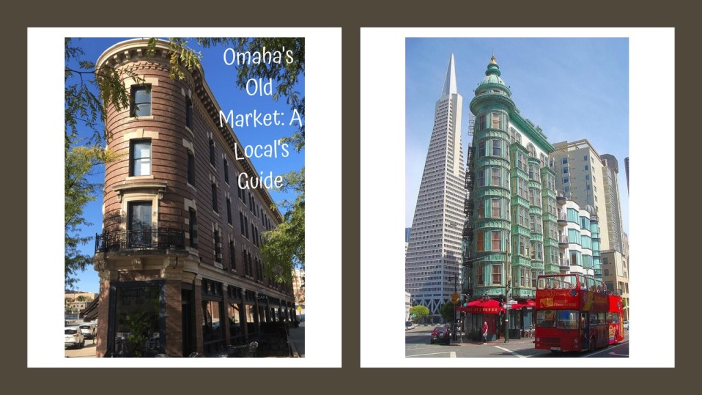
This is the Old Market in Omaha, located near the Lewis and Clark Landing Park.

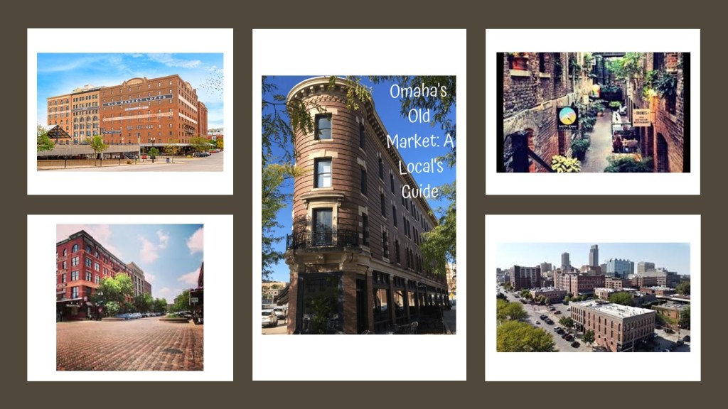
I can’t help but notice a similarity between the scenery in Omaha on the left, and New Orleans on the right, down to the similarity of the design and angles of the street-corner lay-out between the two buildings shown, much less the horse-and-buggies…

…as well as the similarity between this building in Omaha’s Old Market on the left, and the Columbus Tower, also known as the Sentinel Building, in San Francisco, California, on the right.

Just up the Missouri River from Omaha, in present-day Fort Calhoun, Nebraska, is the location of Fort Atkinson State Historical Park, said to have been the first fort established west of the Missouri River, in 1819, in what was called the “unorganized region of the Louisiana Purchase of the United States.”

In use for only 8-years, it was abandoned in 1827.

Back to the Corps of Discovery.

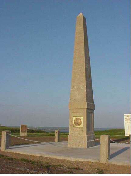
The only death to occur on the expedition was said to have taken place on August 20th, of 1804, when Sgt. Charles Floyd died, allegedly from acute appendicitis.

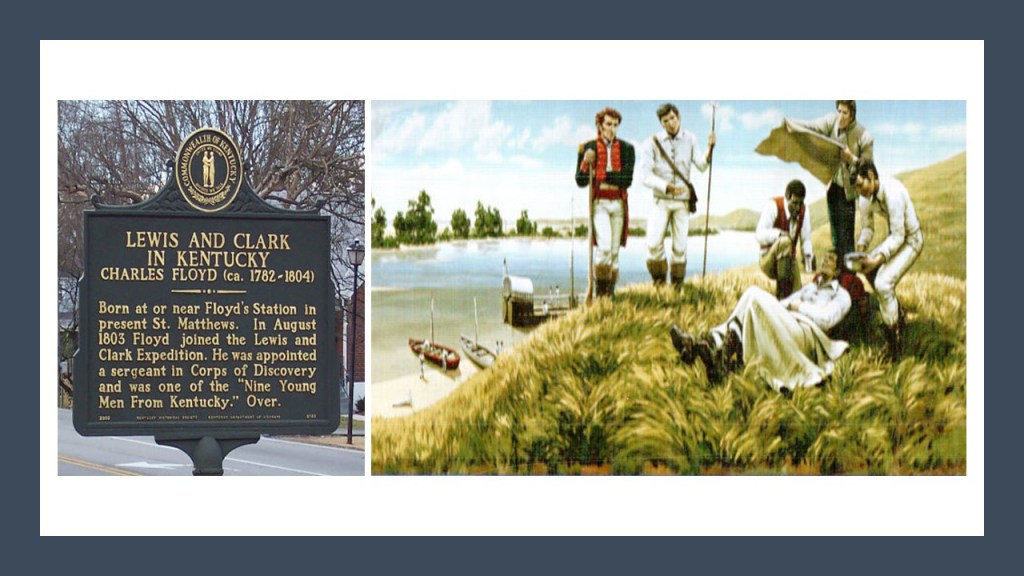
He had been among the first to sign up with the Corps of Discovery and was buried at a bluff by the river that was named after him in what is now Sioux City, Iowa.

We are told that his burial site was marked with a cedar post on which was inscribed his name and day of death, but that by 1857, the ground around the cedar post had eroded, and slid into the river, and concerned citizens were said to have rescued his skeleton.

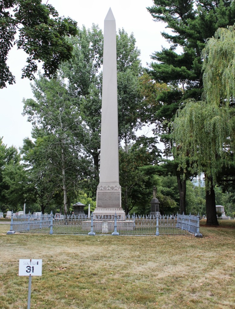
This is the Floyd Monument today in Sioux City.

We are told the concrete-base of the monument was poured in 1900, at which time Floyd’s remains were reinterred almost on the hundredth-anniversary of his death, on August 20th of 1900, and that the obelisk was completed in 1901.

A minor historical character memorialized with an obelisk?

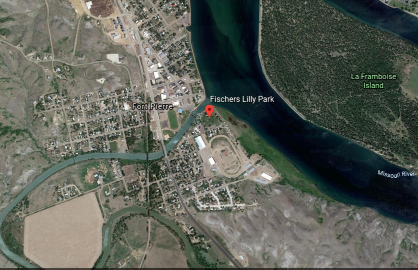
The expedition held talks with the Sioux Nation near the confluence of the Missouri and Bad Rivers in what is now Fort Pierre, South Dakota.

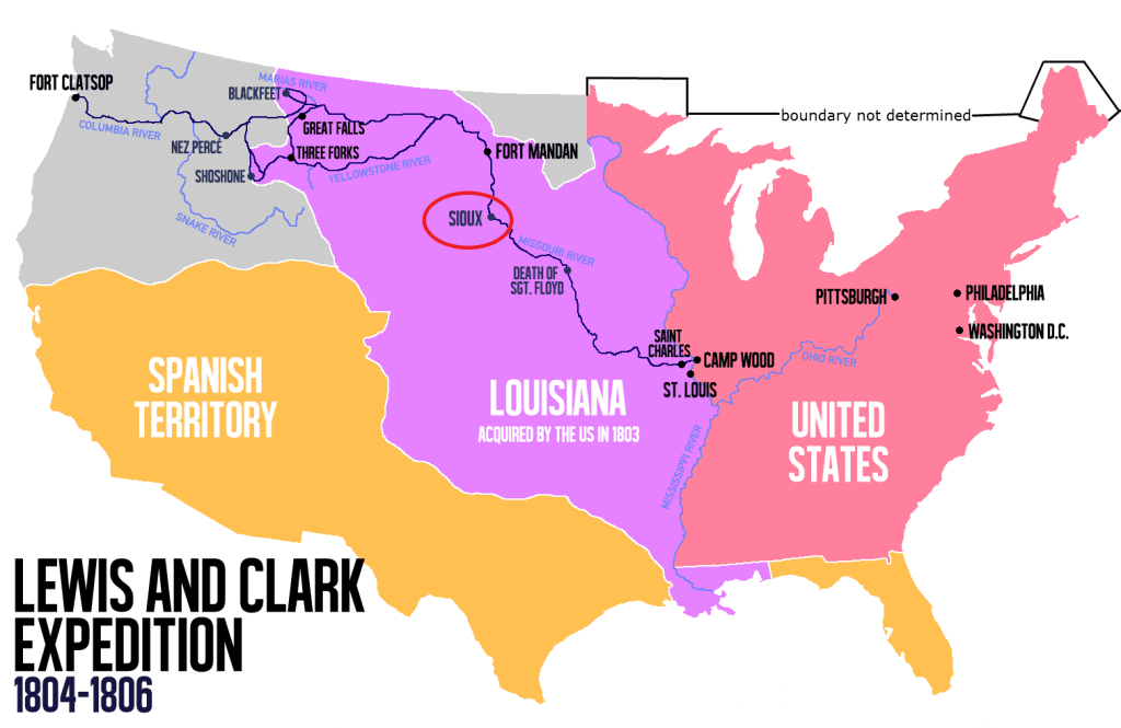
The meeting, which verged at one time on serious hostilities, took place in what is now Fischers Lilly Park in Fort Pierre…

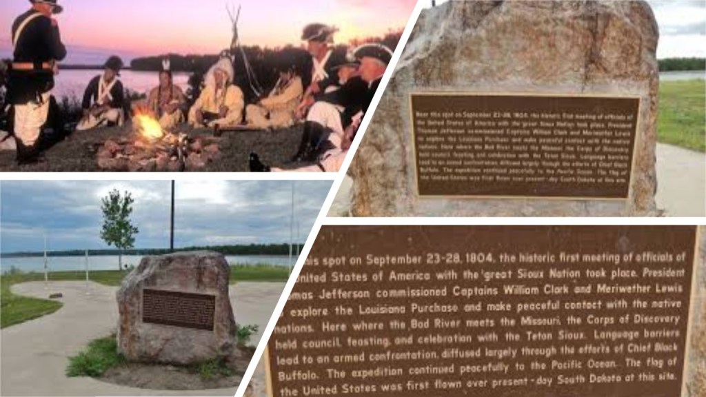
…right where the Bad River enters the Missouri River in Central South Dakota.

Fort Pierre was the location of Fort Pierre Chouteau, one of the most important fur trade forts of the western frontier.

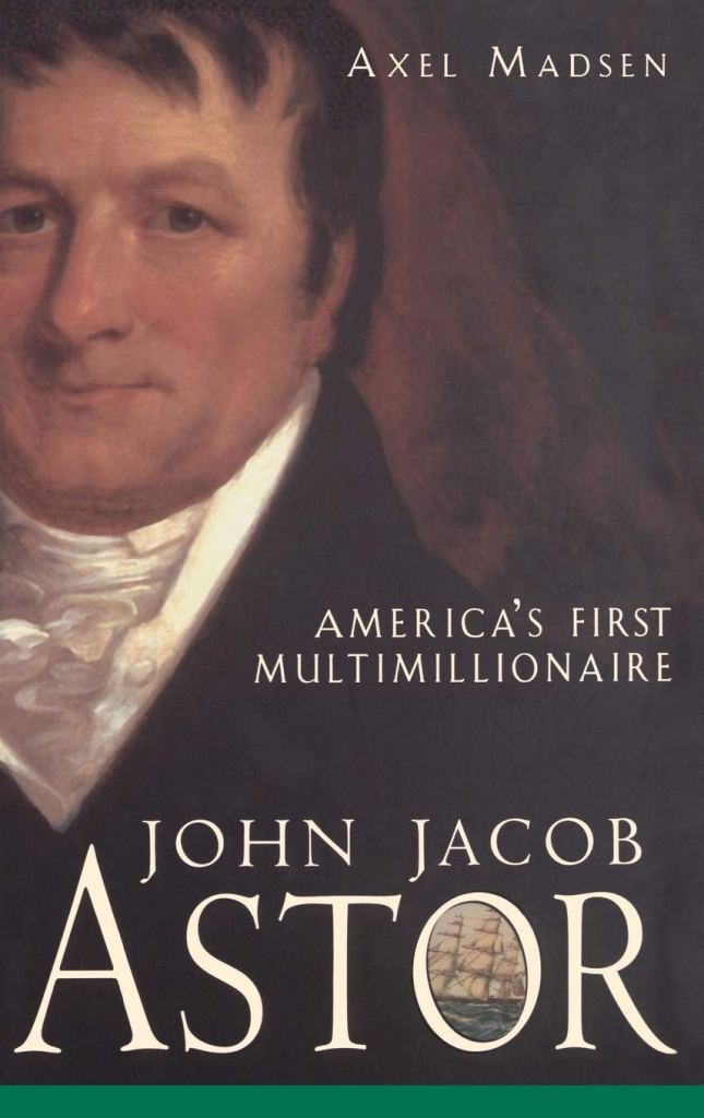
Fort Pierre Chouteau was said to have been built in 1832, after John Jacob Astor, head of the American Fur Company, decided to expand operations into the Upper Missouri River region in the 1820s.

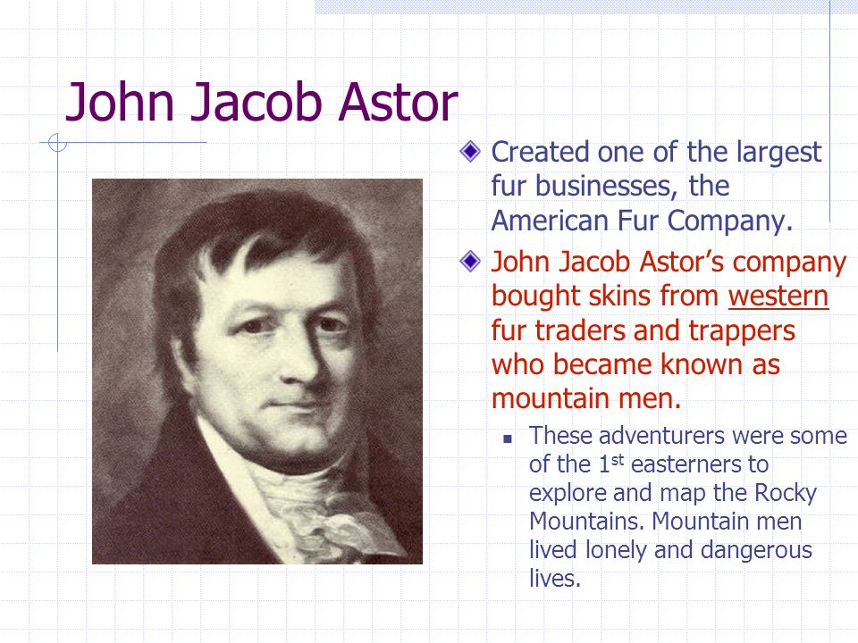
The German-born John Jacob Astor was the first prominent member of the Astor family and the first multi-millionaire in the United States. He made his fortune after establishing a monopoly in the fur trade out West, and real estate investment in and around New York City.

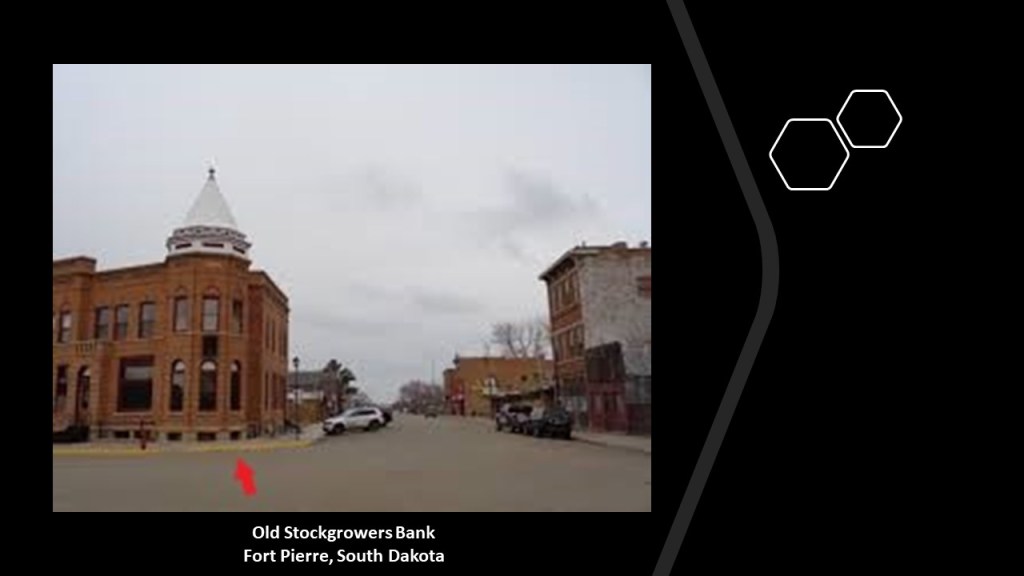
This is the Old Stockgrowers Bank, said to have been built in 1903, and one of the oldest buildings in Fort Pierre.

It has a mud-flooded appearance to me, with street-level windows and it looks top-heavy.

From Fort Pierre, the expedition continued up the Missouri River between present-day South Dakota and North Dakota.

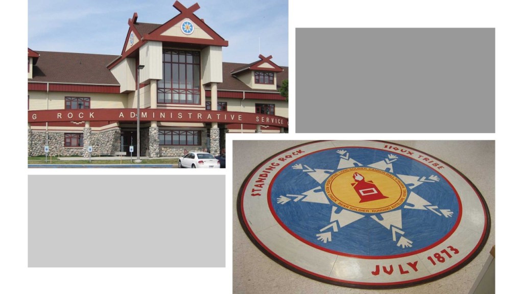
The Missouri River forms the eastern boundary of the Standing Rock Sioux Reservation, which straddles these two states.

Fort Yates is the tribal headquarters for the Standing Rock Sioux.

This is the memorial for Sacagawea, also known as Sakakawea, in Fort Yates.

More on Sacagawea in a bit.

The Standing Rock Reservation was the location of a major stand-off between the Sioux and the Dakota Access Pipeline Project in 2016 and 2017.

Standing Rock looks like a huge man-made mound or earthwork to me.

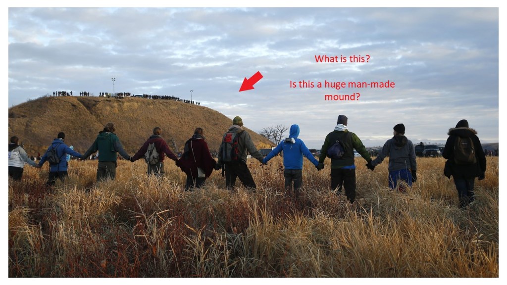
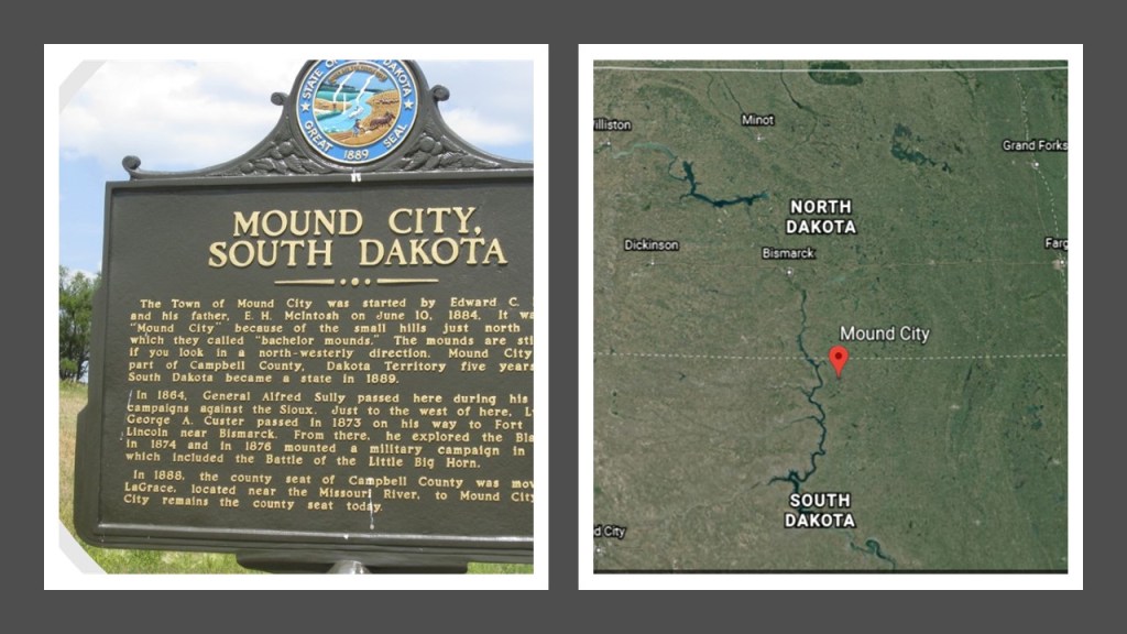
Interestingly, there is a Mound City in South Dakota a short-distance east of the reservation’s boundary on the Missouri River.

I am not finding a mention of the Lewis and Clark Expedition doing anything of note in what is present-day Bismarck, the State Capital of North Dakota, which the Missouri River passes through.

Bismarck was said to have been founded in 1872, and North Dakota’s capital city since 1889.

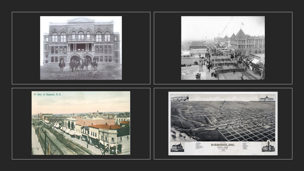
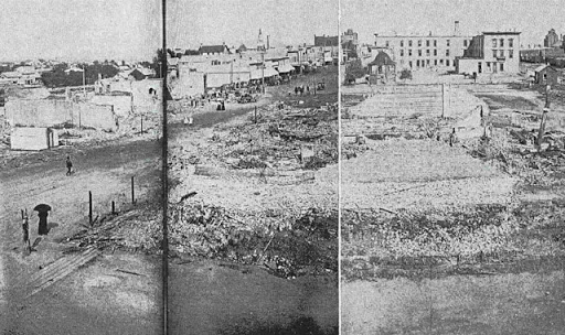
Apparently there was a fire in Bismarck in 1898 that devastated the city, especially the downtown area.

The city of Mandan, across the river from Bismarck, was founded in 1879, and named after the indigenous Mandan people of the region.

Crying Hill is a sacred Native American heritage site located in Mandan. It overlooks the Missouri River basin and is the highest place in the area.

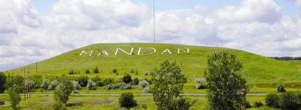
Like Standing Rock, Crying Hill has the appearance of a large mound or earthwork of some kind.

The old Morton County Courthouse in Mandan was said to have been built in 1885, and gutted by fire in 1941.

The next place we find the Corps of Discovery landing was near present-day Washburn, North Dakota, where they built Fort Mandan to live in during the winter of 1804 – 1805.

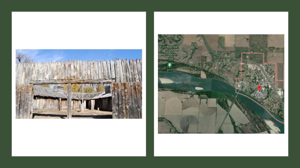
The town of Washburn was founded in 1882 and named after entrepreneur, politician and soldier Cadwallader C. Washburn, who founded a mill that later became General Mills.

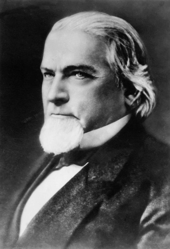
A former governor of Wisconsin, this is the Cadwallader C. Washburn Monument and grave site at Oak Grove Cemetery in La Crosse, Wisconsin.

So we find yet another obelisk…..

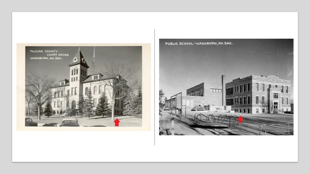
The McLean County Courthouse in Washburn on the left was said to have been built in 1907, and I can’t find a construction date given for the historic public school in Washburn on the right.

Lewis & Clark continued on up the Missouri River in the territory of the Mandan Nation, where, we are told, they managed not to fight each other.

Historically, the lands of the Mandan nation were primarily in North Dakota around the Upper Missouri River, and its tributaries, the Heart and the Knife River.

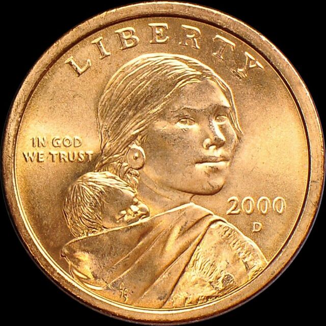
While at Fort Mandan, Lewis and Clark met the French-Canadian fur trapper Toussaint Charbonneau, and his 16-year-old, pregnant Shoshone wife, Sacagawea, who both joined the expedition, and served as translators for the expedition.

Sacagawea, another minor historical character memorialized with an obelisk, and later, starting in 2000, the Sacagawea dollar coin?

The Lewis and Clark Expedition met with the Salish in Ross’ Hole, September 4, 1805…

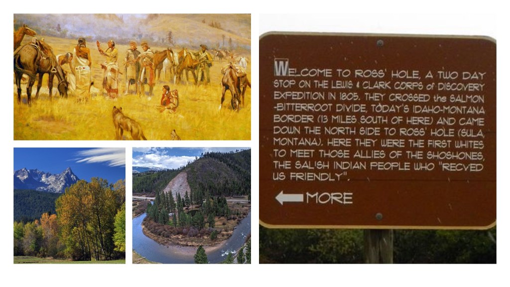
…near Sula on the Bitterroot River in the Bitterroot Velley of Montana, near what is now Idaho.

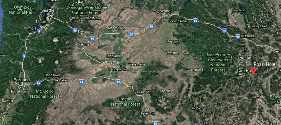
From there, they followed the Missouri River to its headwaters, and went over the Continental Divide at Lemhi Pass on the now Idaho-Montana border in the Beaverhead Mountains of the Bitterroot Range of the American Rockies, and from 1803 until the time of the Oregon Treaty, Lemhi Pass marked the western border of the United States.

The Corps of Discovery then descended from the mountains by way of the Clearwater River…

…the Snake River…

…and the Columbia River.

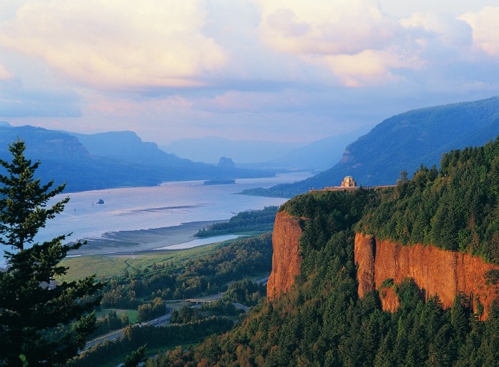
They would have passed right by the physical location of the Maryhill Stonehenge, on a bluff on the Washington-side of the Columbia River, though…

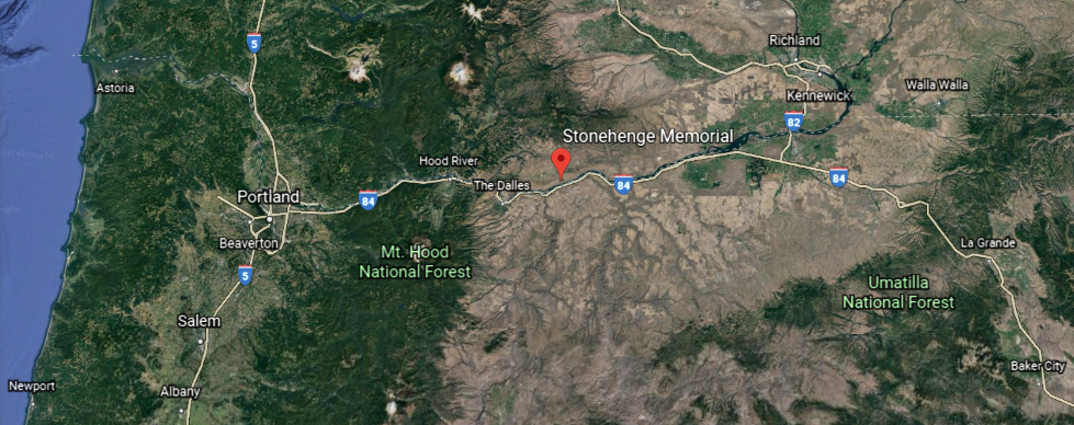
…this stonehenge was said to have been commissioned in the early 20th-century by the wealthy entrepreneur Sam Hill, and dedicated on July 4th, 1918, as a memorial to the people who died in World War I, so it wouldn’t have been there in the early 1800s.

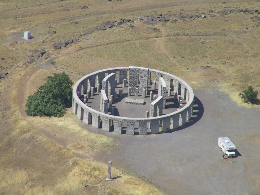
Or would it have already been there?

In addition to having a solstice alignment…

…it also has a nice alignment going on with the Milky Way.

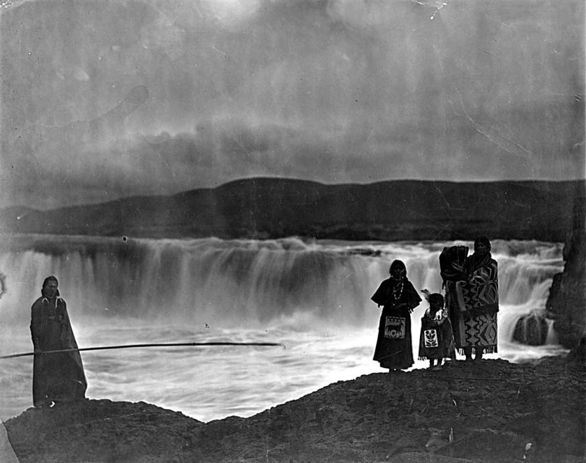
The Lewis and Clark Expedition was said to have camped for three nights on the Columbia River near Celilo, at the Rock Fort Campsite, described as a natural fortification, in late October of 1805.

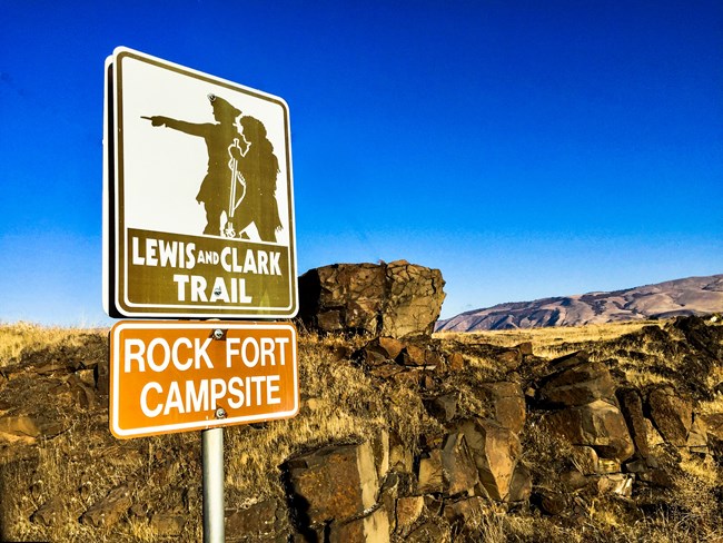
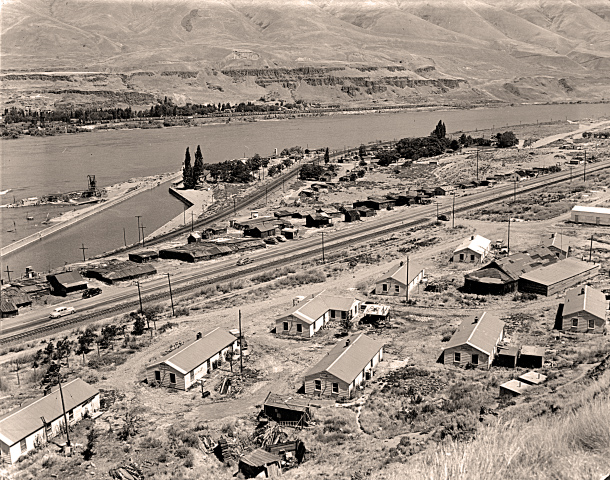
The nearby city of The Dalles was said to be a major Native American trading center for at least 10,000 years, and that the general area is one of North America’s most significant archeological regions.

The rising water filling The Dalles Dam submerged the Celilo Falls, and the village of Celilo, in 1957…

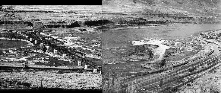
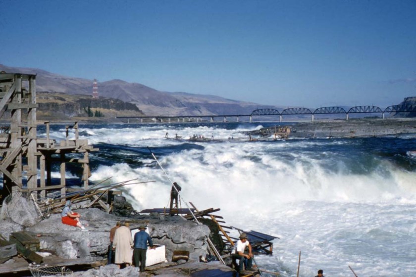
…which was the economic and cultural hub of Native Americans in the region, and said to be the oldest continuously inhabited settlement in North America.

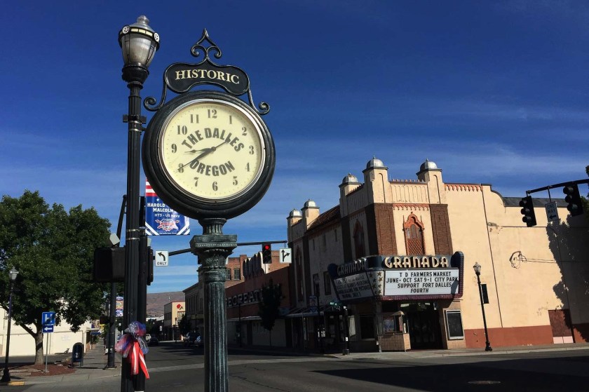
As a matter-of-fact, the historic Granada Theater in the nearby city of The Dalles…

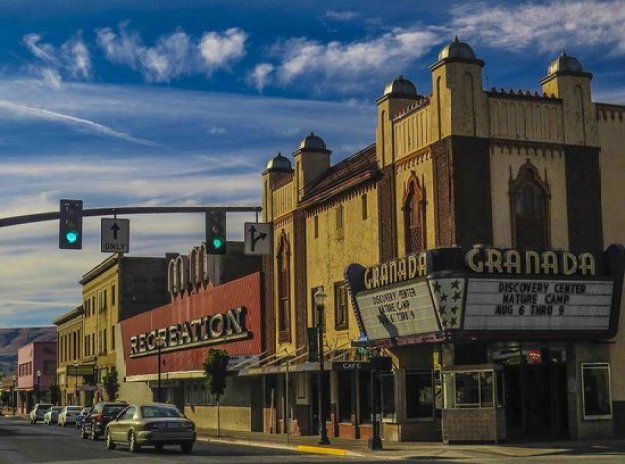
…is on the Lewis and Clark Trail, and still in use as a theater today.

It was said to have been built in the Moorish Revival style, between 1929 and its opening in 1930, and is famous for having been the first theater west of the Mississippi to show a “talkie.”

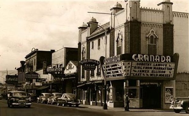
Was the Granada Theater built when it was said to have been built?

What if the Moorish architecture of the Granada Theater was already built, and not during the time frame, and originally for the use, we are told?

The Corps of Discovery arrived at the Pacific Ocean around November 21st of 1805, near the location today of Astoria, Oregon (which was named after John Jacob Astor).

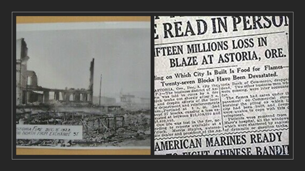
This is the John Jacob Astor Hotel in Astoria, said to have been constructed between 1922 and 1923, and opened in 1924, and is one of the tallest buildings on the Oregon Coast.

Interesting to note, the world’s first cable television system was set up in 1948 using an antenna on the roof of the Hotel Astoria.

Also, during the same time period the hotel was said to have been built, on December 8th of 1922, a fire destroyed almost all of downtown Astoria.

Back in the winter of 1805, the members of the expedition built Fort Clastrop for shelter and protection, and to officially establish the American presence there, with the American flag flying over the fort.

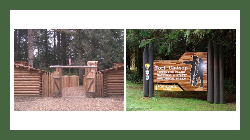
I looked on Google Earth to see if I could detect the remnants of a star fort on the grounds of the Fort Clatsop National Monument, which I did not – if remnants are there they are most likely covered by trees…

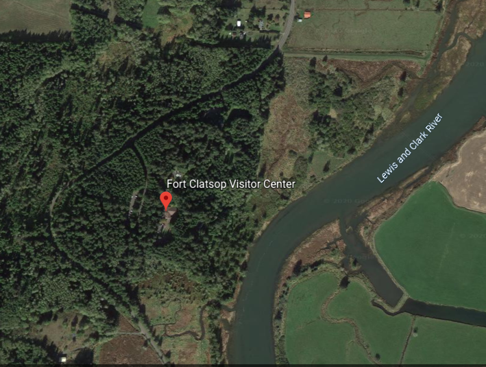
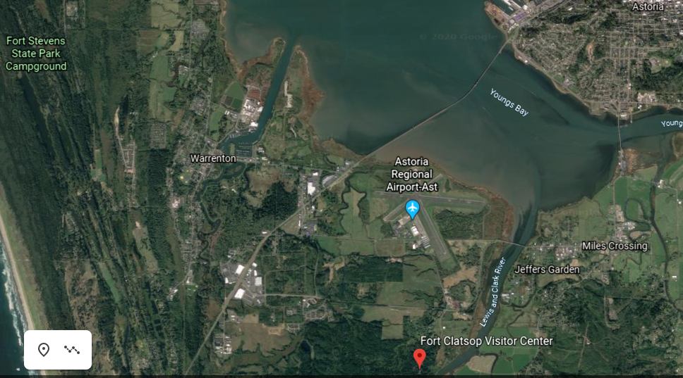
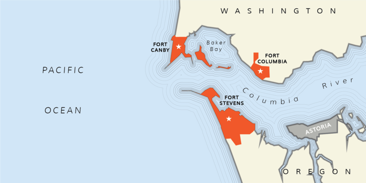
…but I happened to notice Fort Stevens State Park in close vicinity to Fort Clatsop.

I typically find star forts in my research in pairs and clusters.

Fort Stevens was said to have been constructed as an earthwork battery on the shore of the mouth of the Columbia River between 1863 and 1864 during the American Civil War…

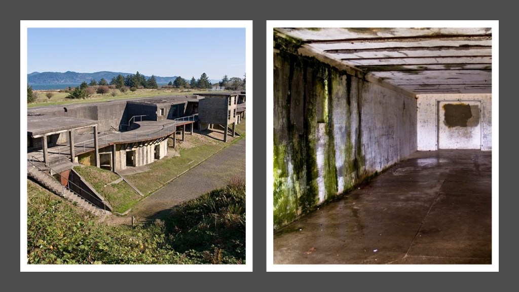
…and built along with Fort Cape Disappointment at the same time, later known as Fort Canby…

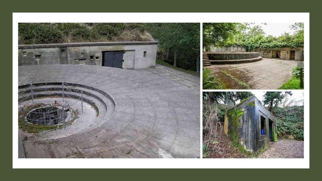
…and Fort Columbia, said to have been built between 1896 and 1904…

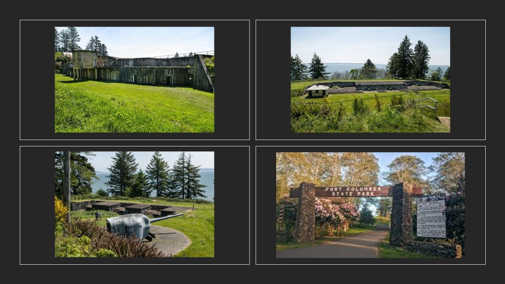
…as part of the “Three Fort Harbor Defense System” at the mouth of the Columbia River.

Back to the Lewis and Clark Expedition.

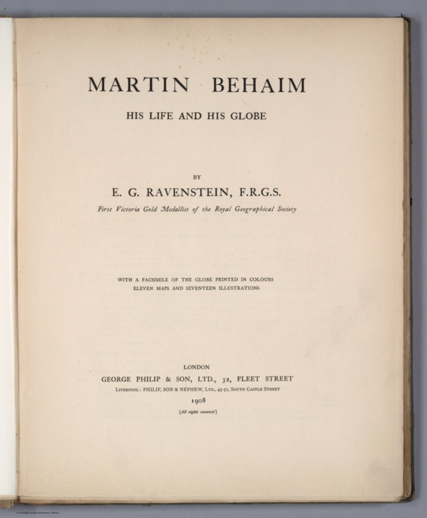
During the winter at Fort Clatsop, Lewis committed himself to writing. He filled many pages of his journals with valuable knowledge.

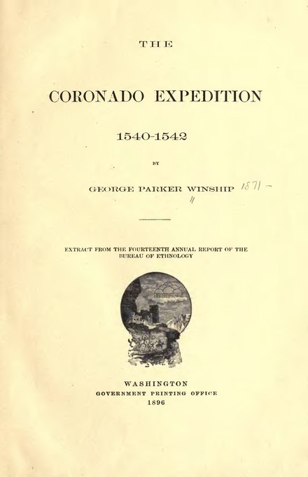
So when I looked up a graphic for Lewis about this writing, I came upon the title page to this publication on the journals of Lewis and Clark…

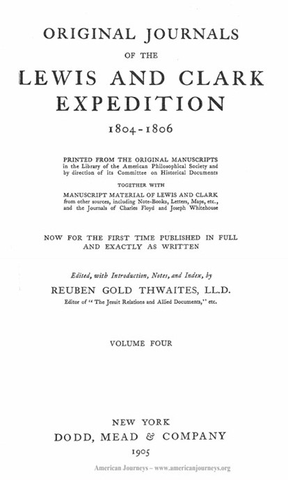
…as well as a dedication to President Theodore Roosevelt on the 100th-Anniversary of the departure of the Lewis and Clark Expedition.

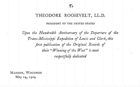
Are we talking about faithful reproduction of actual journals, or historical fiction to back-fill the history in the new historical narrative that we have been taught?

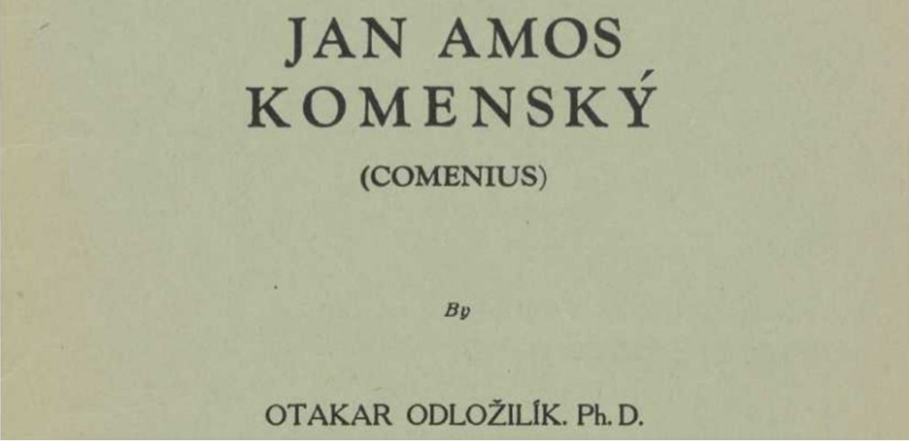
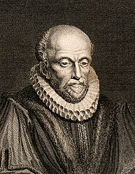
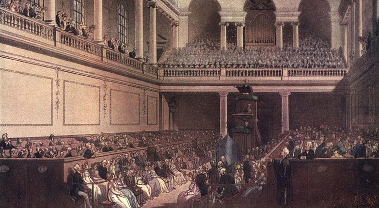
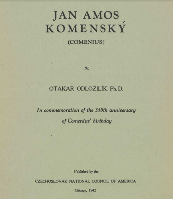
Additionally, the title page for the Lewis and Clark expedition journals is similar in format and wording to the title page of the publication about Comenius that I shared in the last post, most notably being “Anniversary” publications.

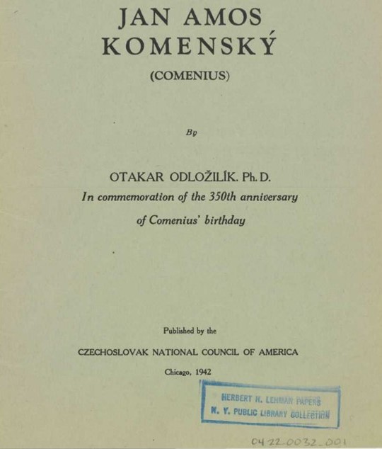
More on other anniversary “occasions” coming up soon.

We are told Lewis was determined to remain at the fort until April 1, but was still anxious to move out at the earliest opportunity.

By March 22, the stormy weather had subsided and the following morning, on March 23, 1806, the journey home began.

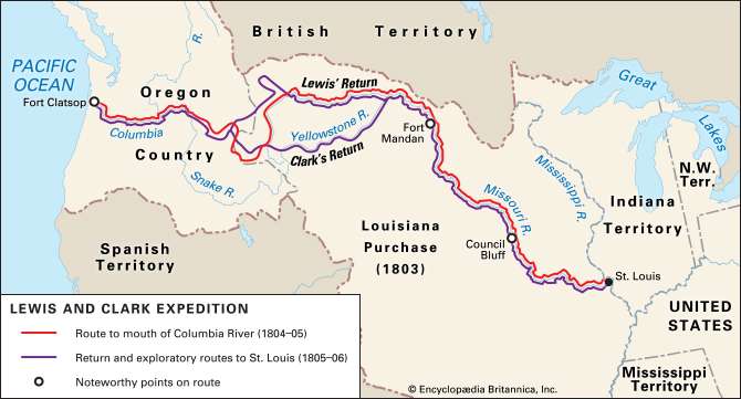
The Corps of Discovery arrived back in St. Louis on September 23rd of 1806.

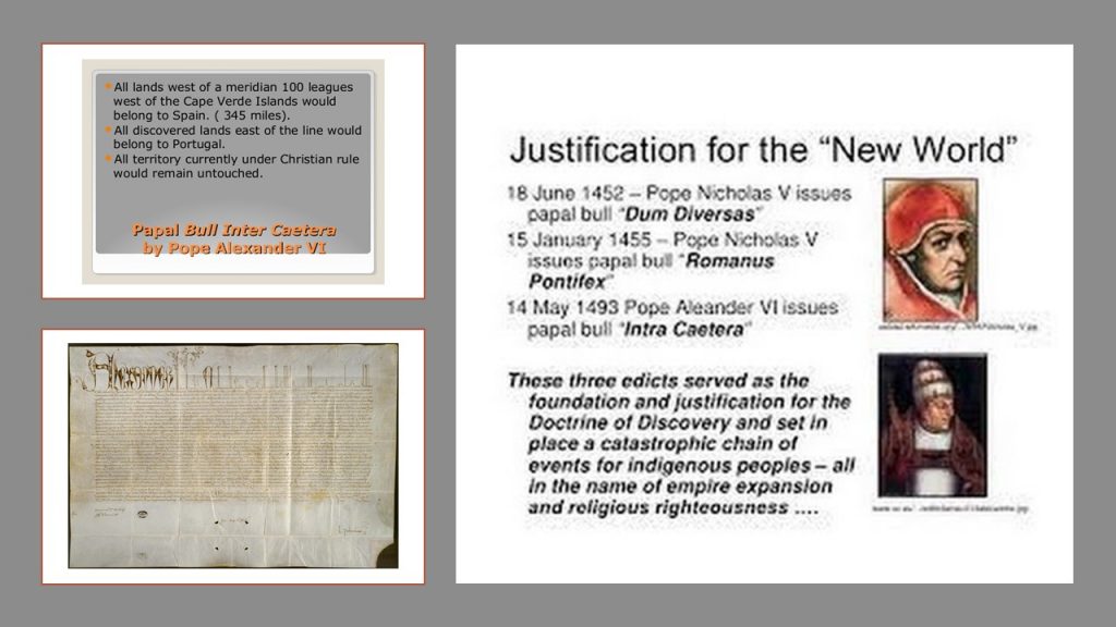
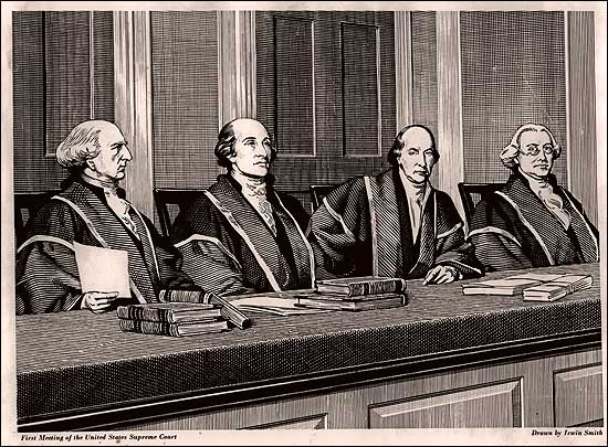
We are told  their visit to the Pacific Northwest, maps, and proclamations of sovereignty with medals and flags were legal steps needed to claim title to each indigenous nation’s lands under the Doctrine of Discovery, a concept of public international law expounded by the United States Supreme Court in a series of decisions in 1823.

Under it, title to lands lay with the government whose subjects travelled to and occupied a territory whose inhabitants were not subjects of a European Christian monarch. 

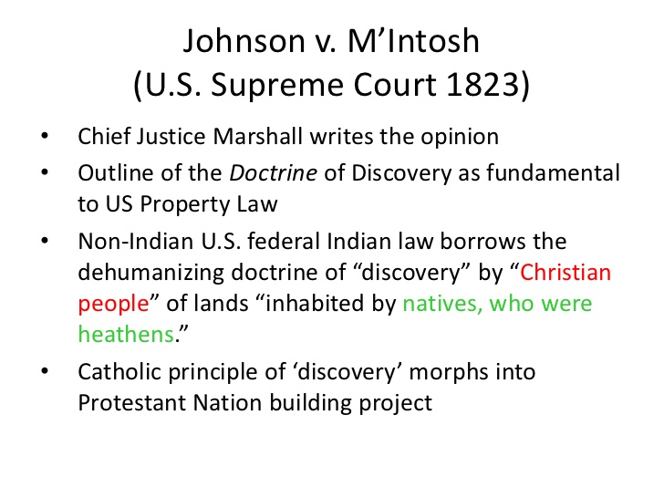
In other words, the Supreme Court ruled that the Native Americans didn’t own their land.

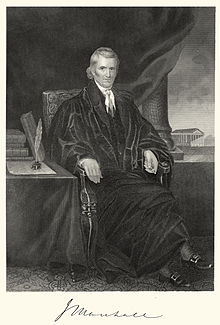
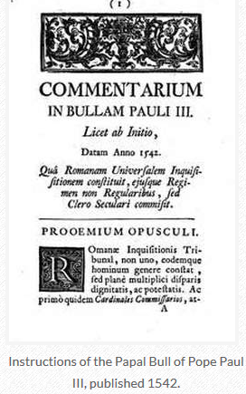
Chief Justice John Marshall explained and applied the way that colonial powers laid claim to lands belonging to foreign sovereign nations during the Age of Discovery, and Chief Justice Marshall noted, among other things, the 1455 papal bull Romanus Pontifex  and the 1493 Inter Cetera bull in the Court’s decisions to implement the Doctrine of Discovery.

Meriwether Lewis had returned from the Lewis & Clark Expedition in 1806; was made Governor of Louisiana Territory in 1807 by Thomas Jefferson; and had made arrangements to publish his Corps of Discovery Journals.

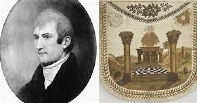
For a point of information, he was initiated into freemasonry between 1796 and 1797, from where he was born and raised in Ablemarle County, Virginia Colony, shortly after he joined the United States Army in 1795.

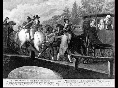
Being Governor of the Louisiana Territory didn’t work too well for Lewis for a variety of reasons, and on September 3rd of 1809, he set out for Washington, DC, to address financial issues that had arisen as a result of denied payments of drafts he had drawn against the War Department when he was governor…and he carried with him his journals for delivery to his publisher.

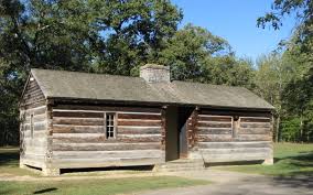
He decided to go overland to Washington instead of via ship by way of New Orleans, and stayed for the night at a place called Grinder’s Stand, an inn on the historic Natchez Trace, southwest of Nashville, Tennessee.

Gunshots were heard in the early morning hours, and he was said to have been found with multiple gunshot wounds to the head and gut.

His remains were interred here at Grinder’s Stand.

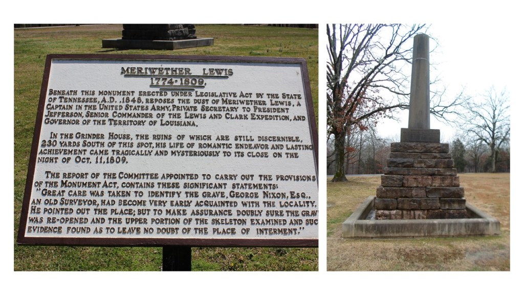
We are told that Thomas Jefferson and some historians generally accepted Lewis’ death as a suicide.

What did he know?

Who would have wanted him silenced?

What happened to his journals?

Did someone nicely get them along to his publisher for him as was?

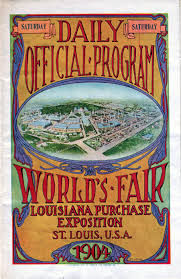
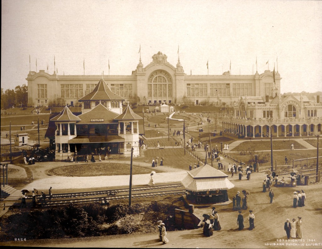
The Louisiana Purchase and Corps of Discovery were said to have been showcased in two consecutive Expositions.

The first, the 1904 Louisiana Purchase Exposition In St. Louis, was to have been held celebrate the Centennial of the 1803 Louisiana Purchase.

The grounds were said to have been designed by landscape architect George Kessler on present-day Forest Park and the Washington University campus.

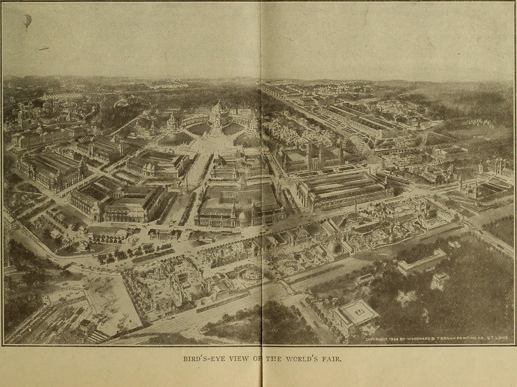
There were over 1,500 buildings, connected by some 75 miles (121 km) of roads and walkways.

The prominent St. Louis architect Isaac S. Taylor was said to have been selected as the Chairman of the Architectural Commission and Director of Works for the fair, supervising the overall design and construction. 

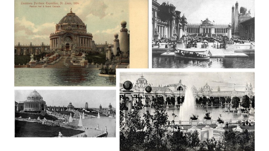
The Exposition’s Palace of Agriculture alone covered 20 acres, or 81,000 meters-squared.

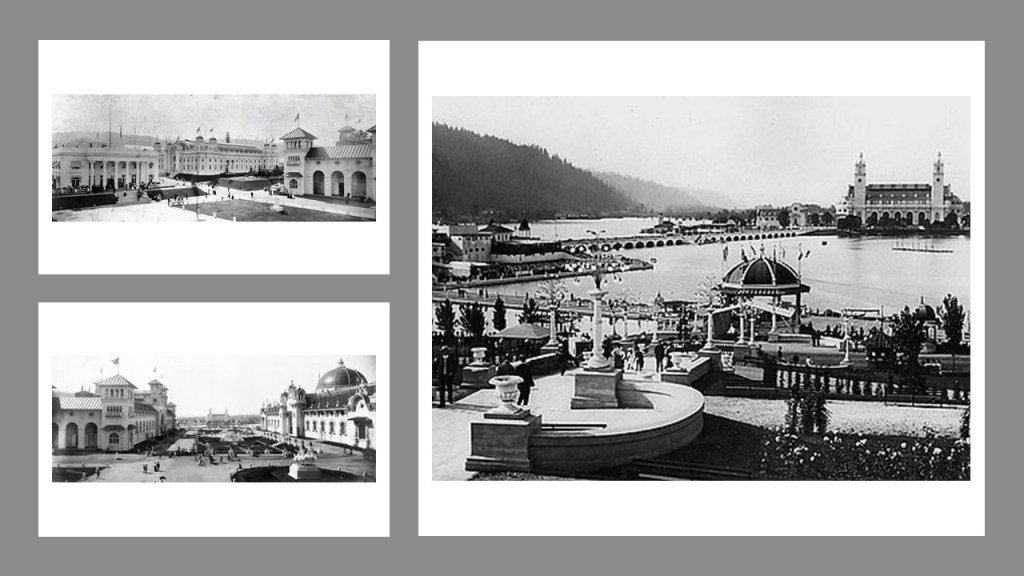
The 1905 Lewis & Clark Exposition was said to have been held in Portland to celebrate the centennial of the Lewis and Clark Expedition.

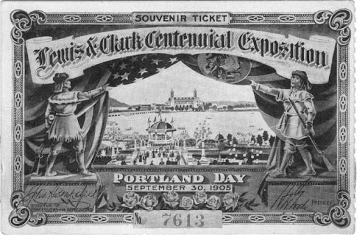
Numerous individuals were involved in the design and construction of the fairgrounds and buildings.

The Olmsted Brothers, John Charles and Frederick Law Jr, were given the credit for designing the grounds of the Exposition…

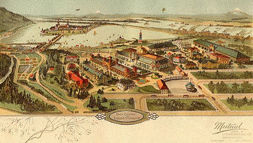
…and architect Ion Lewis was the supervising architect of a board of seven architects that designed the buildings, which were said to be constructed with temporary, plaster and wood, materials, and most of the buildings were torn down the following year.

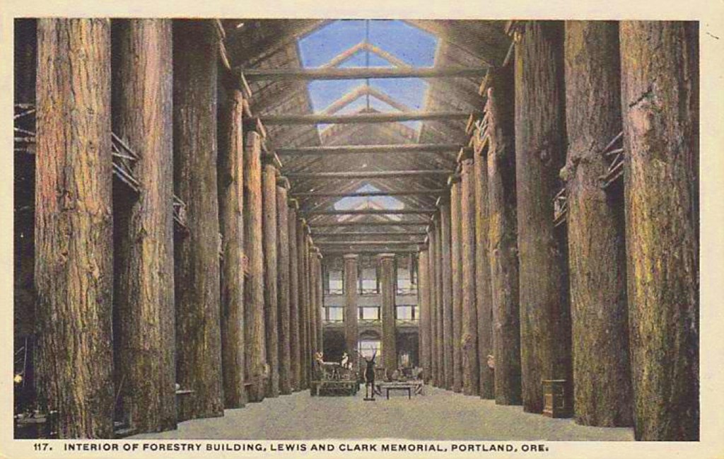
Called the world’s largest log cabin, the Forestry Building at the Exposition was said to have been built for the 1905 Exposition from massive, old-growth logs…

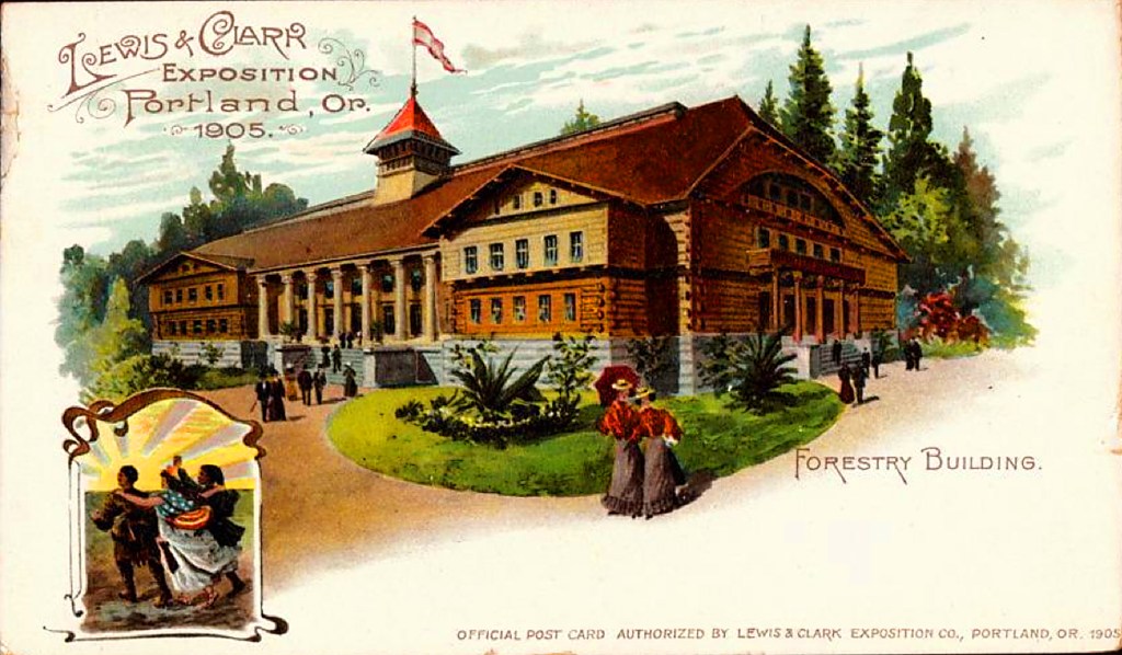
…that, as one of the last-surviving structures from the Exposition, burned down in 1964, we are told, from faulty electrical-wiring.

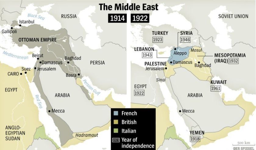
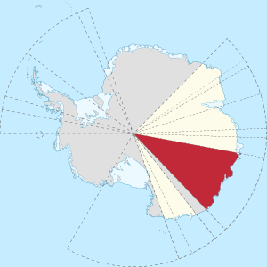
I can’t help but notice what appears to be a correlation between the map of the Washitaw Empire on the left, and the map of the Louisiana Purchase on the right.

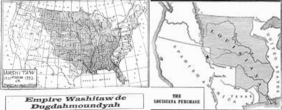
But…who are the Washitaw?

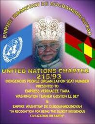
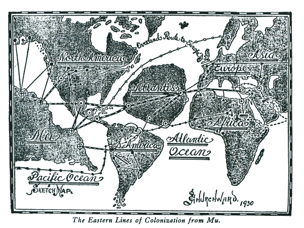
The Washitaw Mu’urs, also known as the Ancient Ones and the Mound-Builders, still exist to this day, and have been recognized by the UN as the oldest indigenous civilization on Earth, with roots going back to Ancient Mu, or Lemuria.

But for some reason the general public has never heard of them. 

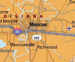
Washitaw Proper, the ancient Imperial seat, is in Northern Louisiana, in and around Monroe.

How come we’ve never heard anything about the Washitaw?  Quite simply, they don’t want us to know.

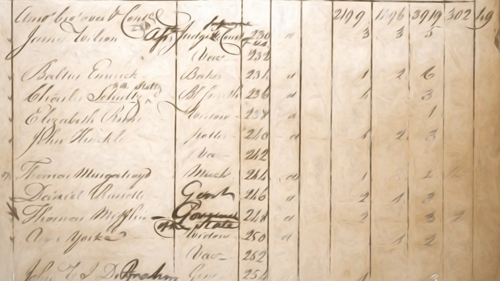
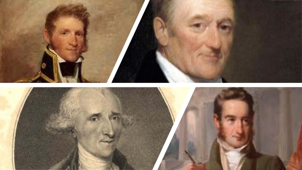
So far I have found references to some of the wealthiest families in history in my research of the Louisiana Purchase and along the route of Lewis and Clark Expedition, and I wasn’t even trying – they were just there:

The du Ponts involvement in negotiating the terms of the Louisiana Purchase from France, which coincided with the very beginnings of their gunpowder, explosive, and chemical empire…

…the Rockefellers and the Standard Oil Refinery in Wood River at the location of Camp Dubois, the official starting point of the expedition…

John Jacob Astor and the American Fur Company’s fur-trading fort at Fort Pierre, a stopping point of the expedition in Sioux country in present-day South Dakota, and the beginning of the wealth and influence of the Astor family…

…and other beginnings of the corporatocracy in which we have been living under…

…like the namesake of Washburn, North Dakota, the location of the expedition’s Fort Mandan for their first winter, Cadwallader C. Washburn, being a founder of General Mills.

I think these are all clues found in the journey of the Lewis and Clark Expedition about how a small number of families took control of the resources and wealth of the Earth.

I found three of the thirteen names on this chart in the little bit of digging I have done here.

If the Lewis and Clark actually took place, what was its true purpose?

I don’t think it was the story of the Great Wilderness Adventure that we have been taught, but actually a part of the process of the Great Cover-Up and Removal of an Ancient, Advanced Moorish Civilization from Collective Awareness, not only in North America, but all over the Earth.

The next topic I will be looking into from a commenter’s suggestion is what is called the “Mandela Effect.”

The Mandela Effect is typically defined as occurring when a large mass of people believe an event it occurred when it did not, with most sources of information referring to it as a “collective false memory.”

A few sources speculate that the Mandela effect originates from quantum physics, and relates to the idea that rather than one timeline of events, it is possible that alternate realities or universes are taking place and mixing with our timeline.

In theory, this would result in groups of people have the same memories because the timeline has been altered as we shift between these different realities.

This effect gets its name from many people having memories that Nelson Mandela died when he was in prison in the 1980s…

…even though he actually died in 2013, after having been released from prison in 1990 after serving 27 years, and was as President of South Africa from 1994-99.

Two things I was already personally aware of related to the Mandela Effect are remembering Bragg’s Apple Cider Vinegar, but that somewhere along the way the ‘s went away, and it became Bragg…

…with Bragg’s nowhere to be found except in one place on the label that was found by a researcher.

Also, I read several years ago that in the King James Version of the Bible it now says in Exodus 32: 15 – 16 that Moses came down from the mountain with two tables, not tablets.

Exodus 32: 15 – 16 King James Version

15 And Moses turned, and went down from the mount, and the two tables of the testimony were in his hand: the tables were written on both their sides; on the one side and on the other were they written.

16 And the tables were the work of God, and the writing was the writing of God, graven upon the tables.

I mean, for those of us who remember watching Charlton Heston portray Moses in the movie “The Ten Commandments,” no question he is holding tablets.

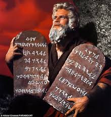
Other versions of the Bible still say “tablets,” so apparently it only “effected” the King James Version.

Other examples include:

…Mr. Moneybags, also known as Rich Uncle Pennybags, of Monopoly no longer having a monocle…

…was it always Jif Peanut Butter…

…or was it Jiffy at one time?

Did Curious George ever have a tail…or not?

…and which one was it: Looney Toons or Tunes?

These are just a few examples of details which are remembered differently by many.

So are we talking about a collective false memory…or the possibility of a phenomenon involving altered time as a result of shifting timelines?

At any rate, it is an interesting subject and I have just scratched the surface by way of an introduction!

I am going to end this post by sharing photos and information that were emailed to me bysome viewers.

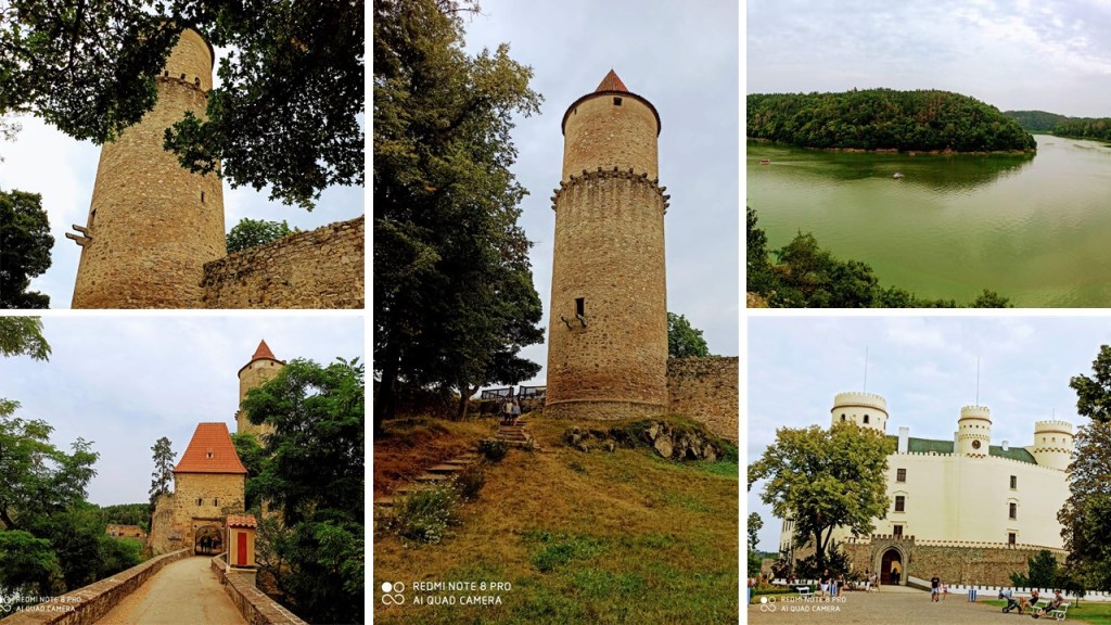
The following four sets of comparison photos are from a viewer in the Czech Republic, which is also called Czechia.

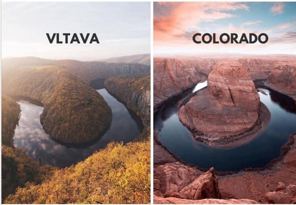
The first set is a comparison of a bend of the Vltava, the longest river in the Czech Republic, on the left, with the Horseshoe Bend of the Colorado River near Page, Arizona on the right.

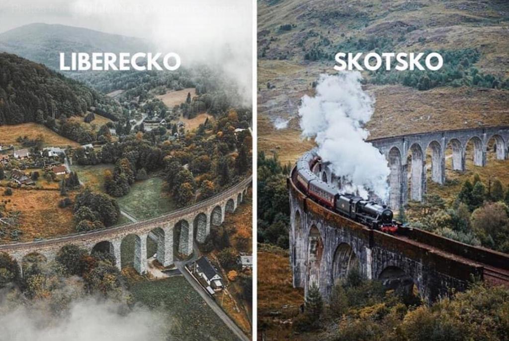
Next is showing a railroad bridge in Liberecko, a region in the northernmost part of the historical region of Bohemia in the Czech Republic, compared with a railroad bridge in Scotland on the right.

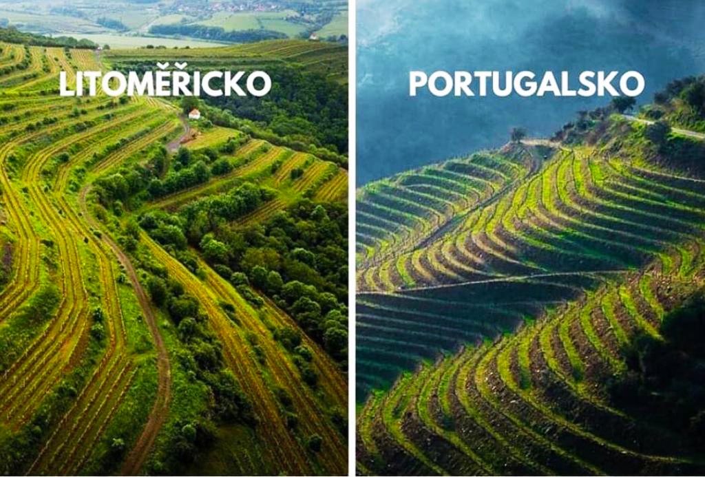
She also sent me a photo of terracing in Litomericko, also in historical Bohemia on the left, and terracing in Portugal on the right.

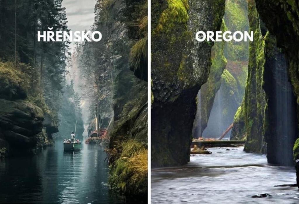
And lastly of this group, I want share the photo she sent comparing the view of a river in Hrensko, a village on the border with Germany at the confluence of the Kamenice and Elbe Rivers, and a portal to the Bohemian Switzerland National Park, compared with a view of a river in the State of Oregon.

A viewer in Mexico sent me photos of interest from several Mexican cities.

The first photos are from Merida, the capital city of the Yucatan State, and the largest city of the Yucatan Peninsula.

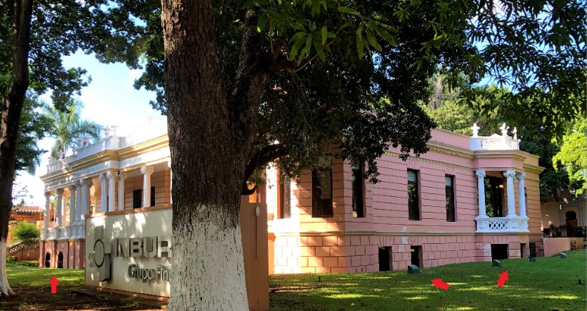
This first building in Merida shows evidence of mud flood, with both ground-level windows, and uneven ground surrounding the base of the building.

He also shared a photo of this building in Merida, which reminded me in appearance of the Iolani Palace, the home of the last reigning monarchs of Hawaii in Honolulu, with similar masonry and use of columns in the architectural design.

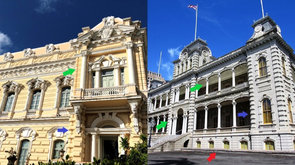
The Iolani Palace as well has ground-level windows.

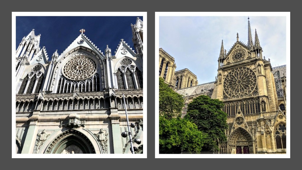
The next photo is a comparison of the Cathedral of Leon in Guanajuato State on the left, with construction said to have been started in 1764, and completed by the cathedral’s consecration in 1866,compared with the Cathedral of Notre Dame in Paris on the right, with a construction date started in 1163 and opening in 1345.

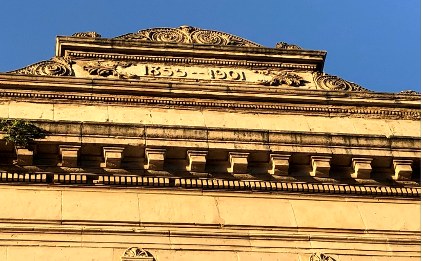
This building is in Monterrey, Mexico…

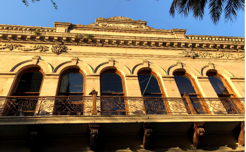
…and at the very top of it, the dates of 1855 – 1901 are inscribed.

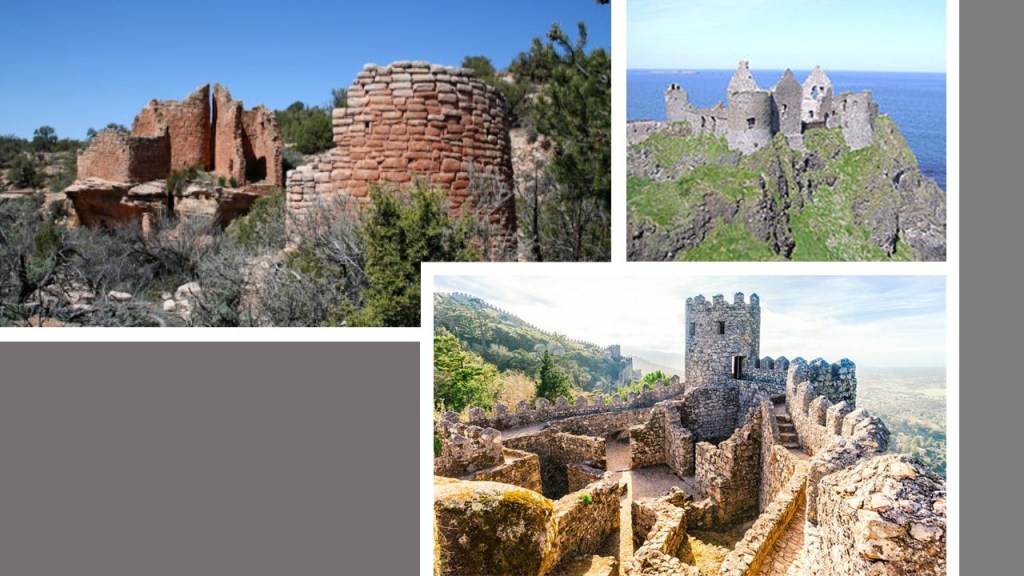
Another viewer sent me information about Cutthroat Castle, the northernmost unit of the Hovenweep National Monument in Colorado.

He commented that he was curious about this and how it may relate historically to other similar dwellings that look like castles. He said if someone had shown him a photo and said this was in the highlands of Scotland or even somewhere else, he might have initially believed them, granted the light earthy colored building rock material are different from the gray kind found in Europe and the British Isles, but there are some similarities in old castle styles.

So, for comparison of appearance, is Cutthroat Castle on the top left; Dunluce Castle in Antrim, Ireland, on the top right; and what is called the Castelo dos Mouros, or Castle of the Moors in Sintra, Portugal, on the bottom right.

The viewer found out that in 1854, W. D. Huntington submitted what may be the first published report on Hovenweep to the editor of the Deseret News in Salt Lake City, though he has not yet found the report.

It is interesting to note that the 1854 date of Huntington’s report is contemporaneous with the starting date of 1855 at the top of the building in Monterrey in the previous photo.

This leads me back to the question “What on Earth was going on in the 1800s?!” and in particular the mid-1800s were a hotbed of activity in our historical narrative.

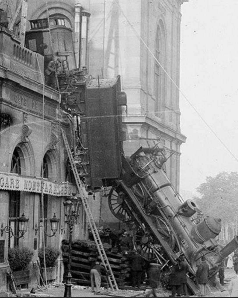
I will leave one more photo that a viewer sent to me here, with the question: How in the heck did that happen?

This is the end of the present series in which I have highlighted places, people, and topics that were mentioned in comments by readers and viewers of my blog and YouTube Channel.

I received many more than what I have shared, and will plan do this again in the future to incorporate more of them.

Thank you to all who take the time to make suggestions!

I thoroughly enjoy the journeys down the new roads you take me!

Interesting Comments I have received – Part 3 Connections Between Comenius & My Take on the Reset Timeline

In the third part of this four-part series, I am going to base my research on a publication regarding a historical person, for which one of my viewers provided me with a link to take a look at it and see what I thought.

The person was Jan Amos Komensky, also known as John Amos Comenius.

Have you ever heard of him?

I sure hadn’t!

Not being known to the general public is interesting to note, given that he has been credited with introducing and dominating the whole modern movement in the field of elementary and secondary education, first notated in the forward of this publication.

I didn’t have to look any further than the front page of the publication to have several things jump-out at me.

The publication was written by Otakar Odlozilik, PhD…

…a Czechoslovak professor who specialized in things like Reformation currents of thought, the emigration of the Czech Brethren, and the influence of Bohemia, a historical region of Czechoslovakia today, but historically Bohemia referred to the entire Czech territory of Moravia and Silesia, called the “Lands of the Bohemian Crown,” historically ruled by the Bohemian Kings.

At any rate, Dr. Odlozilik became an American citizen in 1955, and taught his specialized knowledge of influential Czechoslovak history in American universities.

The publication is “In commemoration of the 350th anniversary of Comenius’ birthday.”

I have found that many World Fairs, Expositions and Exhibitions were held in commemoration of specific events in history, like the “World’s Columbian Exhibition,” also known as the Chicago World’s Fair, held in 1893 to celebrate the 400th-anniversary of Christopher Columbus’ arrival in the New World in 1492, and said to have been designed by many prominent architects of the day.

Christopher Columbus first set sail for the “New World” from Spain on August 3rd of 1492.

In the same year, on January 2nd of 1492, the Sultan of the Emirate of Granada, Muhammad XII surrendered to Queen Isabella I of Castile and King Ferdinand II of Aragon, signalling the end of Moorish rule in Spain in our historical narrative.

We are told that after the World’s Columbian Exposition ended, all of the structures built for the Exhibition were destroyed except for the Palace of Fine Arts, now Chicago’s Museum of Science and Industry.

The Statue of the Republic in Jackson Park today is described as a gilded, and smaller, replica of the statue of the 1893 Exposition.

The original statue of the Exhibition was said to have been destroyed by fire, and the new statue sculpted by the same artist, and erected in 1918 to commemorate both the 25th-anniversary of the World’s Columbian Exposition and the centennial-anniversary of the statehood of Illinois.

Dr. Odlozilik’s publication about Comenius was published in Chicago by the Czechoslovak National Council of America in 1942 .

More on the year 1942 later.

The Austro-Hungarian Empire was a constitutional monarchy and great power in central Europe between 1867 and 1918 that was dissolved after its defeat at the end of World War I.

Part of the Austro-Hungarian Empire until the end of World War I, Czechoslovakia was founded as a sovereign state on October 28th of 1918, and existed until it was dissolved into the separate countries of the Czech Republic and Slovakia on January 1st of 1993.

It’s government was communist from 1948 to 1989.

The Czechslovak National Council of America was founded in Chicago in 1910 to support the Czech and Slovak cause in its fight against the Austro-Hungarian Empire.

Like the Austro-Hungarian Empire, the Ottoman Empire, primarily in a region known in the world today as Turkey…

…existed as a vast empire and center of interactions between east and west until the end of World War I, when it was defeated as an ally of Germany and occupied by Allied forces.

At that time, the Ottoman Empire was partitioned and lost its Middle East holdings, which were divided between the Allied Forces.

Notice a pattern here? War, then the “losing sides” get taken down, new forms of government installed, and the original history missing in action.

According to Dr. Odlozilik, Comenius was born on March 28th of 1592, almost 100-years to the day that the Alhambra decree was issued on March 31, 1492, where we are told Spanish Jews were given the choice of converting to Catholicism, or leaving the Kingdoms of Castile and Aragon.

This decree may have originally applied to the Moors as well.

It is out there somewhere in the field of information that the next day, April 1st, became known as April Fools Day because while the Moors were told they had the same option, their ships and homes were burned, and many were killed.  While this may or may not be true, it would not surprise me at all if it was true.

Alhambra_Decree

What are some of the things that have happened on the day of Comenius’ birth, March 28th, in history?

Well, to name a few, the short-lived Paris Commune was formally established on March 28th of 1871, a radical socialist, anti-religious and revolutionary government that ruled Paris until it was suppressed by the French army in May of 1871.

What happened in the Paris Commune was closely followed by London resident Karl Marx, who published a pamphlet in June of 1871, called “The Civil War in France,” about the significance of the struggle of the Communards in the Paris Commune.

On March 28th of 1939, Francisco Franco conquered Madrid after a three-year siege at the end of the Spanish Civil War, marking the beginning of his 36-year dictatorship, which ended in 1975.

The State Council of the People’s Republic of China dissolved Tibet on March 28th of 1959…

…and on March 28th of 1979, the coolant link at Three-Mile Island’s nuclear reactor, outside of Harrisburg, Pennsylvania, causing a partial melt-down, the nation’s worst commercial nuclear accident.

The same year of 1871 that Marx published “The Civil War in France” about the Paris Commune, was the year that the U. S. Congress passed the “District of Columbia Organic Act,” which repealed the charters of the cities of Washington and Georgetown, and established a new territorial government for the District of Columbia.

This created a single municipal government for the federal district, which was incorporated, defined as the process of “constituting a company, city, or other organization as a legal corporation.”

The year of 1871 was also the year that the Criminal Tribe Act was enacted in India, criminalizing entire communities by designating them as habitual criminals, and restrictions on their movements imposed, including men having to report to the police once per week. 

…affecting tribes like the Bhil Minas tribe, the ruling tribe of India’s Udaipur District before the Mewar Kingdom forced them to hide out in the surrounding hills, named as a criminal tribe by the British government in 1924 to keep them from regaining power.

To this day, the Bhil Minas tribe is a scheduled tribe.

A Scheduled Tribe is recognized by the Indian Constitution, has political representation, and yet legally totally or partially excluded from various types of services important for leading a healthy life, and altogether, the Scheduled Tribes of India make-up almost 10% of the population, and are considered India’s poorest people.

So, we have the Fall of Granada and Columbus’ discovery of the “New World” in 1492, and Comenius’ birth in 1592.

So let’s see what else happened in corresponding years in the centuries between 1492 and 1942, in roughly 50-year intervals, since there seems to be a relationship.

What else happened around 1492?

Well, The first grammar text for Castilian Spanish was published.

It was the first book dedicated to the Spanish language and its rules, and the first grammar of a modern European language to be published in print.

Martin Behaim of Bohemia was said to have constructed the first surviving globe of the Earth, called the “Erdapfel,” or “Earth Apple…”

…about whom the German-English geographer and cartographer, Ernst Georg Ravenstein wrote in 1908.

The Stiegl brewery was first recorded in Salzburg, one of the most common brands of beer in Austria…

……and Rodrigo Borgia, taking the name of Alexander VI, was elected as the 214th pope in the 1492 papal conclave…

…which was the first papal conclave held in the Sistine Chapel.

The following year, in 1493, Pope Alexander VI issued the “Inter Cetera” Bull.

This papal bull essentially authorized the grab of the lands of the ancient advanced civilization.

Among other things, the bull assigned to Castile “the exclusive right to acquire territory, to trade in, or even approach the lands laying west of the meridian situated one hundred leagues west of the Azores and Cape Verde Islands, except for any lands actually possessed by any other Christian prince beyond this meridian prior to Christmas of 1492.”

It is important to note that the 1452 “Dum Diversas” papal bull of Pope Nicholas V granted the Crown of Portugal full and free permission to invade, search out, capture and subjugate unbelievers and enemies of Christ wherever they may be…and to reduce their persons into perpetual slavery…

…and his 1455 “Romanus Pontifex” papal bull was a follow-up to the “Dum Diversas,” confirming the Crown of Portugal’s dominion over all lands discovered or conquered during the Age of Discovery, encouraging the seizure of the lands of the Saracens, pagans, and other enemies of Christ, and repeated the earlier bull’s permission for the enslavement of such peoples.

These three papal bulls were to become major documents in the development of subsequent legal doctrines regarding claims of empire in the “New World.” 

While it is important to mention that “saracen” was a term for Muslims widely used in Europe, it is also the name given to giant megalithic standing stones in Great Britain and other places called sarsen, shortened from saracen, stones.

Next I will look at some of the things that happened around 1540- 1542.

In 1540, Pope Paul III issued a papal bull forming the Jesuit Order, under the leadership of Ignatius Loyola, a Basque nobleman from the Pyrenees in Northern Spain.

Jesuits

The Jesuit Order included a special vow of obedience to the Pope in matters of mission direction and assignment.

In 1541, the Spanish conquistadors arrived in New Mexico under the leadership of Francisco Vasquez de Coronado, in an expedition starting in Mexico that was organized with the stated goal of finding the “Seven Golden Cities of Cibola.”

The Coronado expedition was said to have led to numerous battles with the indigenous people of New Mexico, including the Tiguex War in the winter of 1540 and 1541.

Devastating to the Tiwa Pueblos, the Tiguex War was said to be the first named war between Europeans and Native Americans in what became the United States, against numerous pueblos in what was known as Tiguex Province, north and south of present-day Bernalillo, New Mexico.

In 1541, the Spanish Conquistador Hernando de Soto reached the Mississippi River…

…the Parliament of Ireland declared Henry VIII and his heirs to be monarchs of Ireland by passing the Crown of Ireland Act, replacing the Lordship of Ireland with the Kingdom of Ireland…

…and Gerardus Mercator made his first globe in 1541.

In the year of 1542, Pope Paul III established the Holy Office, also known as the Congregation for the Doctrine of the Faith and the Inquisition…

…and St. Francis Xavier, a co-founder of the Jesuits, landed in Goa on the Indian subcontinent and part of the Portuguese Empire of the day…

…where some believe he requested the brutal Goa Inquisition, established, we are told, to enforce Catholic Orthodoxy in colonial-era Portuguese India.

In 1542, Portuguese explorer Juan Rodriguez Cabrillo landed in San Diego Bay…

…and became the first European to set foot in California.

Next, I am going to look at the historical time-period around 1590 to 1592.

In 1590, the Governor of one of England’s earliest attempt at colonization,the Colony of Roanoke in North Carolina, John White, returned from a supply trip to find the colony deserted, known to us as the “Lost Colony,” and its fate a mystery to this day.

It is interesting to note that John White was also an artist, who went on five voyages between 1584 and 1590, and said to have provided the first views of the New World to England through his numerous sketches.

Problem is…what if the Algonquin peoples didn’t actually look and live like that?

The Algonquin tribes and language groups are among the most populous and widespread in North America.

I found the Algonquin-speaking Navesink Lenni Lenape people in previous research who historically inhabited the Raritan Bayshore near Sandy Hook, and Mount Mitchill, in the scenic highlands in eastern New Jersey.

The memory of the Navesink people is retained in the name of the Navesink Twin Lights on the headlands of the Navesink Highlands, overlooking Sandy Hook Bay, the entrance to the New York Harbor and the Atlantic Ocean.

We are told that the Twin LIghts were built in 1862.

The American Civil War was said to have taken place between 1861 to 1865, so we are expected to believe this solid masonry structure was built during war-time.

In 1591, the Portuguese invaded the Kingdom of Jaffna in northern Sri Lanka, killed the King of Jaffna, and installed a client-monarch…

…with the conditions of freely allowing Catholic missionary activity; handing over the elephant export monopoly to the Portuguese; and increasing the tribute paid by the kingdom to the Portuguese.

The Battle of Tondibi took place in Mali in 1591, the decisive confrontation in Morocco’s 16th-century invasion of the Songhai Empire, leading to the downfall of the dominant force in Western Africa.

Apparently the Sultan of Morocco turned his attention to the gold mines of that region due to the expense of paying for the defenses to hold off the Portuguese.

The ruler of Mali from 1312 to 1337, Mansa Musa, was one of the richest men in World history, if not the richest. One of his titles was “Lord of the Mines of Wangara.”

During his reign, Mali might have been the largest producer in the world of gold.

Has the general population ever heard of him?

Does this immense wealth fit the historical narrative we have been given about this part of the world?

In the year of 1592, the Japanese were said to have started invading of Korea over a six-year period with the intent to conquer the Korean peninsula and China…

…that ultimately resulted in a Korean and Chinese victory and the expulsion of Japan from the Korean peninsula.

Between 1592 and 1593, there were plague epidemics around Valletta in Malta, where we are told a temporary isolation hospital was set-up on an island in the Marsamxett Harbor called the Isolotto, and to which 900 suspected and confirmed cases were sent, with the rest of the population being told to self-isolate…

…and in London, where 15,000 people were said to have died in the last major plague outbreak of the 16th-century, and almost 5,000 more in the surrounding parishes, for which John Stow was said to have copied and preserved records of the outbreak.

Next onto things that happened in our historical narrative between 1640 and 1642.

The year of 1640 marked the end of the Iberian Union, which had been the dynastic union of the Kingdom of Portugal and Spanish Crown that existed between 1580 and 1640 under the Spanish Habsburg Kings of Philip II, Philip III, and Philip IV.

This is a coin bearing an image of King Phillip II of Spain…

…a bust of King Phillip II by Pompeo Leoni…

…and a portrait that is typical of King Phillip II.

Also called the House of Austria, the House of Habsburg was one of the most distinguished and influential royal houses of Europe, and in addition to Portugal and Spain, produced the kings of Bohemia, Hungary, Croatia, Galatia, as well the Emperors of Austria, Austria-Hungary, and Mexico, and principalities in the Netherlands and Italy.

The throne of the Holy Roman Empire was continuously occupied by the Habsburgs from 1440 until their extinction in the male line in 1740.

Here are some pictures sent by a viewer of the Zvikov and Orlik Castles on the Vltava River in historic Bohemia in what is now the Czech Republic today.

The Holy Roman Empire was ultimately dissolved in 1806 with the abdication of the last Holy Roman Emperor, Francis II, of the House of Habsburg-Lorraine in favor of Napoleon as the Protector of the Confederation of the Rhine.

A historical white wash may be difficult to get one’s head around based on what we have been taught, but evidence is there when you start looking.

Here is the example of two existing portraits of the Holy Roman Emperor Charles V, who ruled from 1500 to 1558, with similar facial structure, hands, and clothing between the two portraits.

Why would one portrait become the face of the rulers, and the other fade to obscurity and hard to find?

Here are some examples of German Coats-of-Arms, with the “Moor” sound in the name.

During the time Comenius lived in London between 1641 and 1642, Comenius was said to have written the “Via Lucis” or “The Way of Light.

It was his proposal, to a group of scholars on its way to becoming the Royal Society of London in 1660, for an international academy in England with resident and corresponding members of scholars who share the same foundation of knowledge, the same mission, and the same language.

In 1641, the Irish Rebellion began, with Irish Catholic gentry attempting to seize control of the English administration in Ireland to force concessions for Catholics.

The Irish Catholic gentry failed, and the Irish rebellion was said to be the origin of the ethnic conflicts between Irish Catholics on one side, and English, and Scottish Protestants.

This crude drawing is typical of what is out there to depict what took place during the 1641 Irish rebellion.

The rebellion had followed the organized colonization of English and Scottish settlers known as the Plantation of Ulster.

In 1642, the English Civil Wars started, ultimately leading to the execution of King Charles I.

…and the rule of Oliver Cromwell for a period of time as “Lord Protector” and set the course for Great Britain becoming a constitutional monarchy.

Cromwell, described as a brutal military leader, had led the Parliament of England’s armies against King Charles I during the English Civil War.

Charles I was the son of King James I & VI of Scotland, for which both of these portraits exist…

…and the brother of Elizabeth of Bohemia.

In 1690, the Battle of the Boyne took place, between the forces of the former King James II, who had been deposed in the Glorious Revolution of 1688, and King William III, of Orange in the Dutch Republic and his wife, James II’s daughter, Queen Mary II, who had acceded to the Crowns of England and Scotland in 1689.

It was fought across the River Boyne close to the town of Drogheda in the Republic of Ireland…

…and resulted in a victory for King William, and after his defeat, James Stuart fled to France.

The supporters of James Stuart were known as Jacobites, those who supported the restoration of the House of Stuart, and were active from 1688 to around 1750.

The son of James II, James Francis Edward Stuart, is known to history as the “Old Pretender.”

He was first exiled to France, and then to Rome, where he died in 1766.

He would have been heir to the three thrones, but was forcibly prevented from claiming them when he tried to do so in the Jacobite Uprising of 1715.

George I, the first king of the German House of Hanover, became the British Monarch in 1714.

In 1691, the Massachusetts Bay Colony received a royal charter that formally established it as the Province of Massachusetts Bay, including the Maine and Plymouth Colonies…

…and Thomas Neale, an English project manager, entrepreneur and politician was granted an English patent for the American Postal Service, and became the first postmaster-general of the North American Colonies.

Here he is depicted on a cigar band.

1692 was the year of the Salem Witch Trials in Massachusetts…

…and the year an earthquake struck Port Royale in Jamaica, causing one of the busiest and wealthiest ports in the West Indies to sink below sea-level, and taking place only 42-years after the city was founded in 1650…

…and Kingston, Jamaica was founded shortly after the earthquake devastated Port Royale.

Next is the year of 1740.

This year was the start of the Great Frost of Ireland, an extremely cold weather event in the historical record in Ireland between 1740 and 1741.

Irish Historian David Dickson talks about this little-known event in his book “Arctic Ireland.”

The Irish population endured 21-months of bizarre weather without known precedent that defied conventional explanation. The cause is not known.

Shortly after I learned about the cold-weather event in Ireland, I was connected by someone to the mud flood community on YouTube.

I learned about the fantastic research that is being done by people looking at their own communities and other places, around the world, at strong evidence that there was a cataclysmic event involving a massive flood of mud, as recently as 200 – 300 years ago.

It is being called a reset event, and that photographic evidence exists that buildings, canals, rail-lines, tunnels, among other things, were purposefully dug out after the event to the point where they could be used.

I have speculated in past posts that the extreme cold weather event in Ireland event was related to the hijack of the original timeline and the mud flood.

What else happened in 1740 in the historical record?

The War of Austrian Succession started in December of that year, and lasted 8 years, which we are told was the last Great Power conflict with the Bourbon-Habsburg dynastic conflict at its heart, with the accession of Maria Theresa, the last of the Habsburg rulers, and marked the rise of Prussia as a major power, with Prussia gaining lands in the 1748 Treaty of Aix-la-Chapelle and Austria losing lands, among other terms and concessions among the signatories of the treaty.

In 1741, the Royal Order of Scotland was founded, which is an order within the structure of freemasonry whose members are invited to join based on advanced masonic criteria.

Is it just a coincidence that the logo of the Royal Order of Scotland on the left has a symbol that resembles the sun in the logo of the Jesuits, on the right?

Or a coincidence that both resemble one version of the black sun symbol?

The Black Sun was said to have first originated in Nazi Germany as a symbol for a mystic energy source, and also used in occult subcultures.

I first learned about the Black Sun several years ago in this book by author Peter Moon.

In April of 1742, Handel’s Messiah premiered in Dublin.

Handel’s Messiah premieres in Dublin right after the extremely cold, lethal weather event???!!!

So, who shows up during this same time period?

Well, in 1744 Mayer Rothschild was born in Frankfurt, Germany.  He established his banking business there in the 1760s, marking the start of the international banking family and the central bank system.

Then on February 6th, 1748, Bavarian Illuminati-founder Adam Weishaupt was born in Ingolstadt, Bavaria, Germany. He went to a Jesuit school at the age of 7, and was initiated into Freemasonry in 1777.

Next, in 1790, President George Washington gave the first State of the Union address in New York City…

…the Supreme Court of the United States convened for the first time…

…the first United States Census was authorized…

…and the United States patent system was established.

In 1791, the Bank of the United States in Philadelphia is incorporated by the federal government with a 20-year charter, a central bank concept championed by the first Treasury Secretary Alexander Hamilton…

…the French royal family is captured in the French Revolution as they tried to escape in disguise to Varennes…

…and the construction of the Brandenburg Gate in Berlin was said to have been completed.

In 1792, the Legislative Assembly in revolutionary France voted to dissolve the monarchy and establish the First Republic…

…King Louis XVI and Queen Marie Antoinette were arrested that year, which led to their trial, and subsequent execution in 1793…

…President George Washington signed into law the Postal Service Act, thereby creating the United States Post Office Department…

…and King Gustav III of Sweden was assassinated at a midnight masquerade at the Royal Opera when he was shot in the back by a Swedish military officer.

In 1840, on January 19th, the United States Exploring Expedition of Captain Charles Wilkes sights what becomes known as “Wilkes Land” in the southeastern quadrant of Antarctica, claiming it for the United States…

…and two-days later, on January 21st, French naval explorer Jules Dumont d’Urville, arrived in Antarctica, and claimed what he named “Adelie Land” after his wife for France.

One day later, on January 22nd of 1840, British colonists reached New Zealand and officially founded the settlement of Wellington.

A viewer from New Zealand sent me the following photographs from the 1906 – 1907 New Zealand International Exhibition.

In 1841, Fordham University was founded in The Bronx by the Jesuits…

…President John Tyler vetoed a bill which called for the re-establishment of the Second Bank of the United States, the second federally-authorized Hamiltonian national bank in its 20-year charter…

…fire was said to have destroyed 300 to 500 of the housing units in Mayaguez, Puerto Rico…

…and the Treaty of Nanking, or Nanjing was signed 1842 between the British Empire and China, after China’s defeat in the First Opium War.

The First Opium War was fought between Qing Dynasty of China and Britain between 1839 and 1842, a military engagement that started when the Chinese seized opium stocks at Canton in order to stop the opium trade, which was banned.

The British government insisted upon free trade and equality among nations and backed the merchants’ demands.

From 1757 to 1842, the Canton System served as a means for China to control trade with the west by focusing all trade in the southern port of Canton.

To counter this, the British East India Company began to grow opium in Bengal, in present-day Bangladesh, and allowed private British merchants to sell opium to Chinese smugglers for illegal sale in China.

As a result from these events in history, opium dens, establishments where opium was sold and smoked, became prevalent in many parts of the world throughout the 19th-century.

In 1890, the book “The Influence of Sea Power upon History 1660 – 1783 ” by Alfred Thayer Mahan, was published while he was President of the Naval War College in Newport, Rhode Island…

…which was considered by scholars to be the single most influential book in naval strategy, and its policies quickly adopted by most major navies, and ultimately led to the World War I naval arms race…

…and Sir Flinders Petrie, the grandson of Sir Matthew Flinders, and son of William Petrie, an electrical engineer who developed carbon arc lighting, excavated the first major site in Palestine, Tell-el-Hesi, during which he was said to have discovered how tells were formed.

A tell is described as artificial hill created by many generations of people, living and rebuilding on the same spot, using mud bricks which disintegate rapidly.

And in 1890, the first American football team was fielded by Ohio State University, with a photo of the team standing in front of an old stone archway.

In 1891, the Jamaica International Exhibition was held, and said to have been modelled after the London Great Exhibition of 1851.

The credit for the idea of the Exhibition was given to Augustus Constantine Sinclair who ran the Government Printing Office in Jamaica.

Also, in 1891, Liliuokalani was proclaimed Queen of Hawaii.

She was the last sovereign monarch of the Hawaiian kingdom, from January 29th, 1891, until the overthrow of the Hawaiian Kingdom on January 17th, 1893, by subjects of the Hawaiian kingdom, U. S. citizens, and foreign residents residing in Honolulu -the article I was reading didn’t say who specifically.

The Republic of Hawaii was established as an interim government between 1893 and 1898, when the Hawaiian Islands were annexed to the United States.

This is King Kalakaua, Liliuokalani’s brother, the last elected Monarch of the Kingdom of Hawaii. 

He had lost his absolute power in 1887 when he was pressured to sign a new constitution that provided for a constitutional government, leaving the monarchy as a figurehead.

In 1892, Ellis Island was first opened to new immigrants on January 1st.

From 1892 to 1924, approximately 12 million immigrants arriving at the Port of New York and New Jersey were processed there under federal law.

What were other firsts in the year 1892?

In January, James Naismith’s rules for basketball were published for the first time.

The first public basketball game was played in Springfield, Massachusetts, on March 11th, 1892…

…which brings to mind a comparison of the ball of the sport of “hoops,” compared with the hoop configuration of the Sacred Hoop Dance of Native Americans…

…of which the sacred hoops dance is also connected to depicting the Flower of Life, the creation pattern of the Universe…

…and in 1892, the world’s first finger-printing bureau opens in Buenos Aires, Argentina.

So, these 50-year periods-of-time starting from 1492 bring me back to the reason why I went down this path for this post.

It was the information that jumped out at me when I saw the front page of the publication about Comenius – a 350-year commemoration of the annniversary of his birth that was published in Chicago of 1942.

As a function of time, a period is defined as a round of time, or series of years by which time is measured.

In physics, a time period is the time taken for one complete cycle of vibration to pass a given point.

Indigenous calendrical systems like the Mayan calendar were involved with the harmonization and synchronization of human beings with natural cycles of time.

Mayan Calendar

Nines have significance in the development and in Mayan Calendar.

For example, in the Mayan calendrical system, there are nine cosmic levels, called underworlds, in the evolution of consciousness.

There are 450-years between 1492, the year of the Fall of Granada and Columbus’ first voyage, and 1942, midway through World War II, and the year of the Philadelphia Experiment, which I believe were the boundary years of a new 3D time-loop called Rome.

Philadephia Experiment 4

Also, the year 1942 is a numeric anagram to 1492.  

There are nine, 50-year-periods between 1492 and 1942 .

There are 450 years in between 1492 and 1942, and halfway, at 225 years is 1717.

I think we have been living under an occulted system of time.

I found these anomalies when I started looking at historical events from the year 1717.

On June 24th, 1717, the Premier Grand Lodge of England – the first Free-Mason Grand Lodge – was founded in London. 

And then on 7/17/1717, an interesting date from a numerological perspective, the premier of Georg Friedrich Handel’s “Water Music” took place for King George I on a barge on the Thames. 

Exactly two-hundred-years later, on on 7/17/1917, the reigning royal house of the United Kingdom and its Commonwealth, the House of Windsor was founded after the death of Queen Victoria, and also of German paternal descent.

House of Windsor

Almost halfway through World War II, on July 22nd, 1942, the strange Philadelphia experiment took place at the Philadelphia Naval Shipyard.

These next slides give an overview of the experiment.

Philadephia Experiment 6
Philadephia Experiment 1

Did the USS Eldridge just become invisible?  Or did it go somewhere else?  And if it went somewhere else, where might it have gone?

Philadephia Experiment 7

I think the negative beings responsible for what has taken place here had to come up with a way to create a cataclysm by creating a rip in the fabric of time-space, which allowed them to incarnate here in human physical form.

I think the 1740 – 1741 Great Frost of Ireland I mentioned previously was where this rip in the fabric of space-time occurred and that the Philadelphia Experiment was a causal factor of the rip.

A time-travelling naval vessel is already out there in the field of information.

There was a 1980 movie called “The Final Countdown” about the USS Nimitz going back in time to the day before the attack on Pearl Harbor on December 7th of 1941.

…and researchers like Dr. David Anderson who seriously explore time-travel at his Anderson Institute.

I believe what we have been taught is a conglomoration of what were originally real people and belief systems.

The new timeline was somehow inserted, and everything was grafted on to the existing infrastructure on the planet, and falsely attributed in the new historical narrative. 

As an example of a way this was achieved, here are portraits of different people having similar-looking facial features around the eyes, nose, and mouth.

On the top left is Thomas Gilbert, captain of the British East India Company’s East Indiaman vessel Charlotte for whom the Gilbert Islands were named; on the top right, Canadian entrepreneur and brewer John Molson; on the bottom left is Major-General Claude Martin, the wealthiest Frenchman in 18th-century India, and the founder of the La Martiniere schools; and on the bottom right, William Strickland, the architect credited with designing the Tennessee State Capitol building, with a construction date given between 1845 and 1859.

Were they related?

Did people look more alike back then?

Or were there facial templates used by artists to depict people like this?

The beings behind this went through all the trouble to do all of this because in a Free Will Zone like Earth, the Human Beings who live here have to give their consent to choose whether the follow the Light or the Dark.

It was rigged to benefit them and not for our best interest, in order to maintain power and control over Humanity.

The negative beings behind all of this wanted to set up a new god as lord of this world – Lucifer – and wanted a proxy vote for their hostile takeover.

They wanted to persuade enough of Humanity to voluntarily accept Lucifer over the Creator of the Universe.

The only way they can accomplish this acceptance, however, is by outright lies, deception and duplicity because if people knew the true agenda of these controllers, the majority of Humanity would never, ever accept this.

I believe that these beings with a negative agenda devised a complicated plan to knock Humanity off the positive Moorish Timeline of Higher Consciousness…

…in an interdimensional war in order to control Humanity, using Humans as their tools against the Creator and Creation. 

The controllers of this world had tricked us into worshipping them and have kept our consent for this system by lying to us about its existence. They are evil beings who have committed unspeakable crimes against Humanity and Creation.

I would like to give a shout-out to three very good field researchers on YouTube who are investigating their communities.

Berserker Bear is currently Bushwhacking Tartaria where he lives in Buffalo, New York and he does fantastic field research!

Paul Explores Malta on his YouTube channel, where, among other things, he explores the extensive tunnel systems under star forts there.

…and C Vasilis does excellent field research around where he lives in New York State.

I will be mirroring a video from each of these creators on my YouTube channel to share their work with you.

I really want to emphasize the point that this ancient civilization is in your backyard, your neighborhoods, your business districts, your parks, and the list goes on and on – there is no place in the world this prolific civilization was not.

Berserker Bear recently sent me a picture of a water tower in Buffalo just a few minutes from where he lives.

All you have to do is look, and there are answers impatiently waiting to be found in your own neighborhood.

You don’t have to go far to find the Old World anywhere in the world.

Remember the adage from the Bible “Seek and ye shall find!”

In the fourth, and last part of this series, I will be looking into topics of research suggested by commenters, including, but not limited to, the explorers Lewis and Clark and the Mandela Effect.