
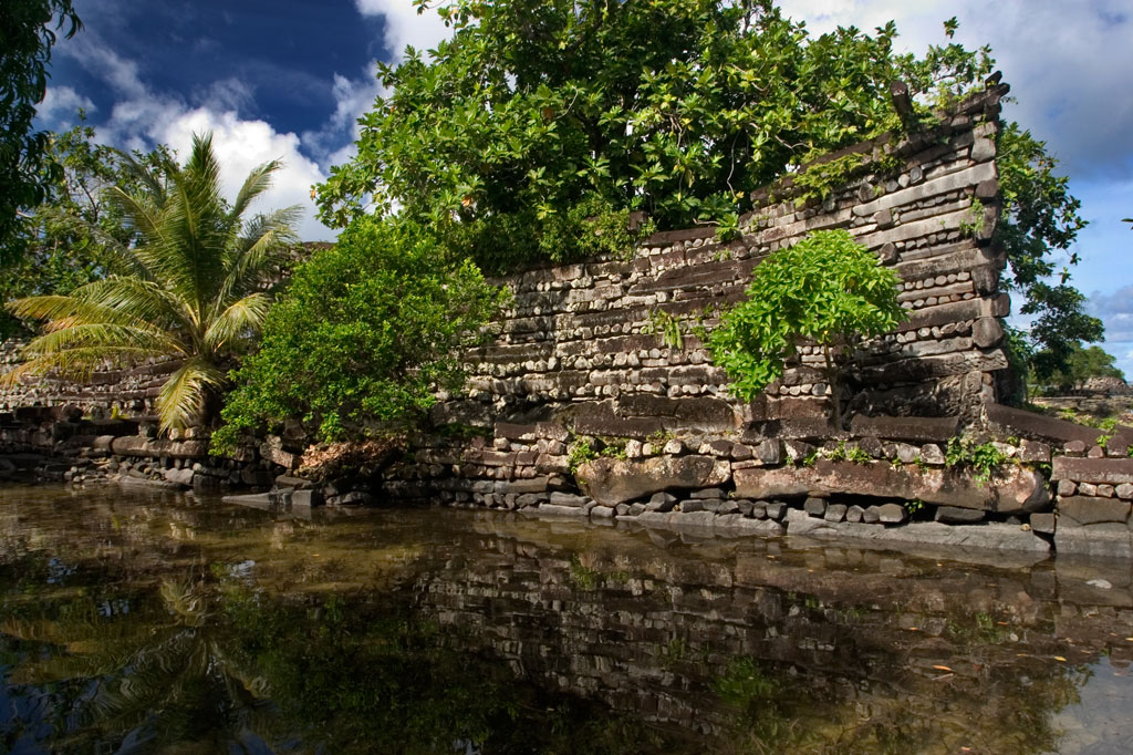
The last post ended at the spectacular stone ruins of Nan Madol and Kosrae, located respectively on the islands of Pohnpei and Kosrae, in the Caroline Islands of the Federated States of Micronesia.
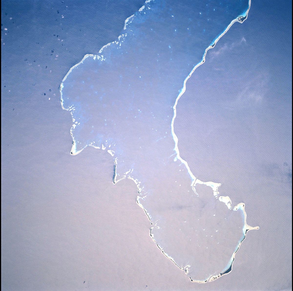
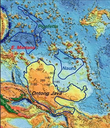
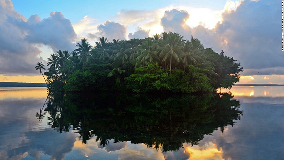
The starting place for this post is Ongtong Java Atoll, also known as Luangiua, and as Lord Howe Atoll. It is one of the world’s largest atolls, if not the largest, and the northernmost point of the Solomon Islands.
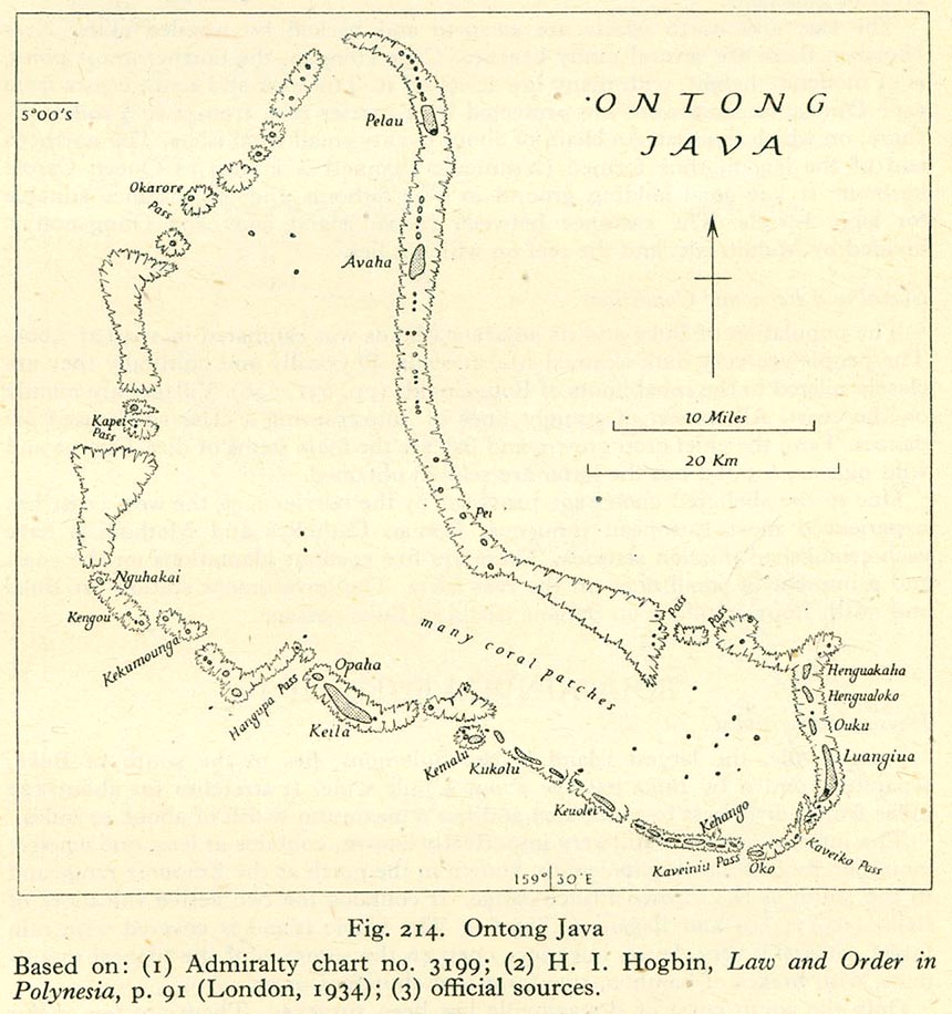
The roughly boot-shaped Ongtong Java Atoll is spread out over 122 small, low-lying coral islands…
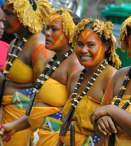
…and has a population of approximately 2,000 people that live primarily in the villages of Luangiua on the eastern end, and Pelau in the northeastern part, of the atoll. These islanders are considered Polynesian by academia as opposed to Melanesian, as they do most of the rest of the Solomon Islands. The Ongtong Java atoll is one of the areas in Melanesia which are called “Polynesian Outliers.”
It is considered one of the most vulnerable places in the Solomon Islands with regards to rising oceans.
The islands of the Ongtong Java Atoll are described as seamounts, punctuating the otherwise smooth surface of the Ongtang Java Plateau, which is described as a “flood basalt feature.”
This sounds like a cover-up code word to me, so I will dig deeper. This is the definition of a “flood basalt feature”: the result of a giant eruption, or series of eruptions, that covers large stretches of land or the ocean floor with lava.
Basalt itself is described as a common extrusive igneous rock formed from the rapid cooling of basaltic lava exposed, or very near the surface of the planet.
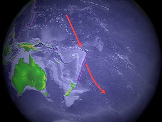
This is an aerial view of the Ongtang Java Plateau, with the atoll to the left of the red arrows. The shape of the plateau under the water sure looks geometrically angled to me.
In the last post, I pointed out that the Lincoln-log-style buildings found on the islands of Pohnpei and Kosrae are made from millions of tons of columns of prismatic basalt.
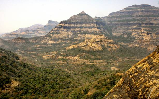
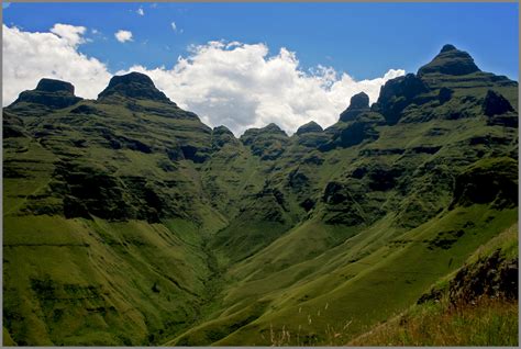
The Deccan Traps of India are called flood basalt features, with what is called the characteristic “stair-step” morphology of many associated landscapes…
…compared with the Drakensberg Mountains in South Africa. Same idea of “stair-step” morphology.
Here is what the Deccan Plateau looks like in the same region of India…
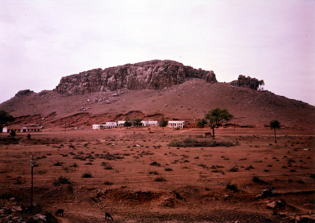
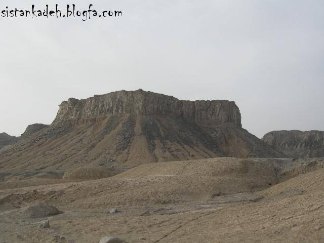
…which looks a lot like Mt. Khajeh, an island feature in Lake Hamoun in Iran, which is described as a flat-topped black basalt hill.
This is one of the many ways this is hidden from us, right in front of our eyes. Call it by another name, and don’t give out any information you don’t want anyone to know. And yes, I think this has been deliberately done to keep the ancient advanced civilization from our awareness.
Well, Michelle, you might ask, what if this is a reasonable geologic explanation for these features?
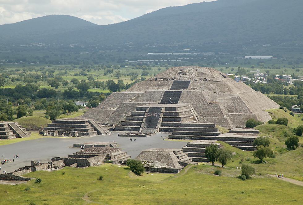
I might answer by saying, well, could be! But I have come across things like this in my research. This is Teotihuacan outside of Mexico City before excavations began in 1905…
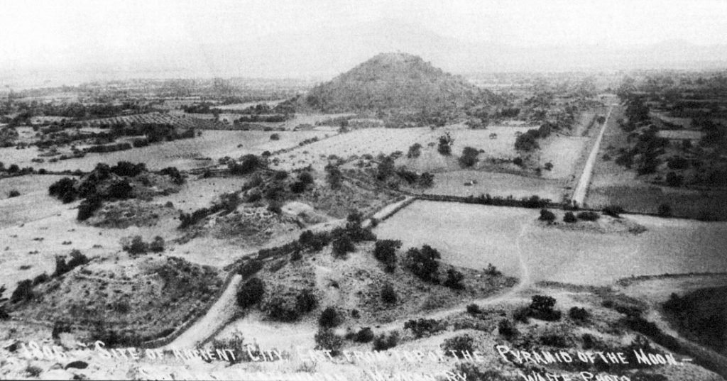
…and this is what Teotihuacan looks like today.
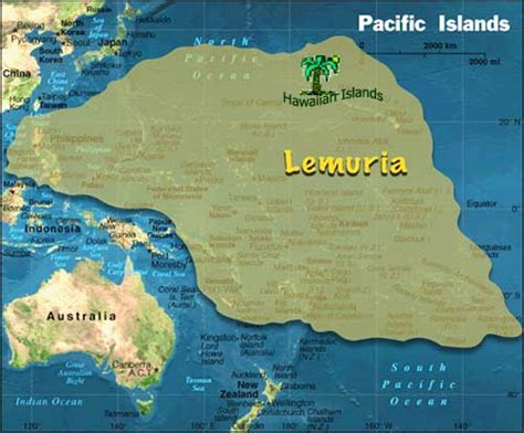
This whole region of the Pacific Ocean would have been the location of the continent of Mu, or Lemuria, which was destroyed by a cataclysm at some point in time. So the possibility, or probability, of still-existing and/or submerged Lemurian infrastructure is high.
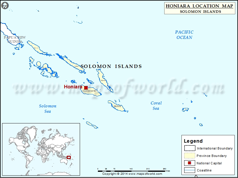
Moving on to the main part of the Solomon Islands, we come to the capital of these islands, Honiara, located on the northwest coast of the island of Guadalcanal.
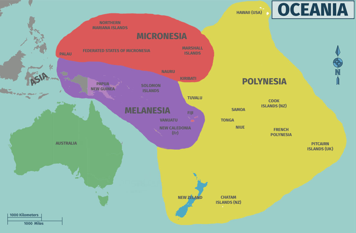
The Solomon Islands are part of the region of Oceania known as Melanesia, which is differentiated from the peoples and cultures of Polynesia and Micronesia in this historical narrative we have been given.
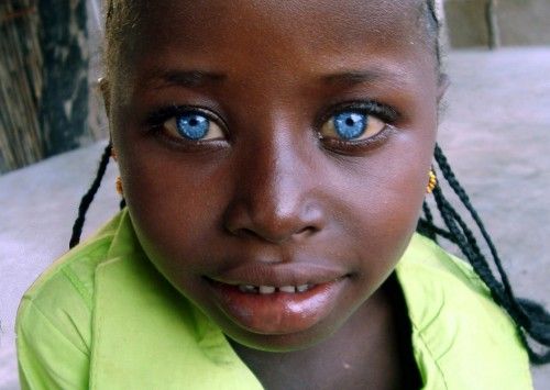
The Solomon Islanders are uniquely regarded for having a high occurrence of blonde hair…
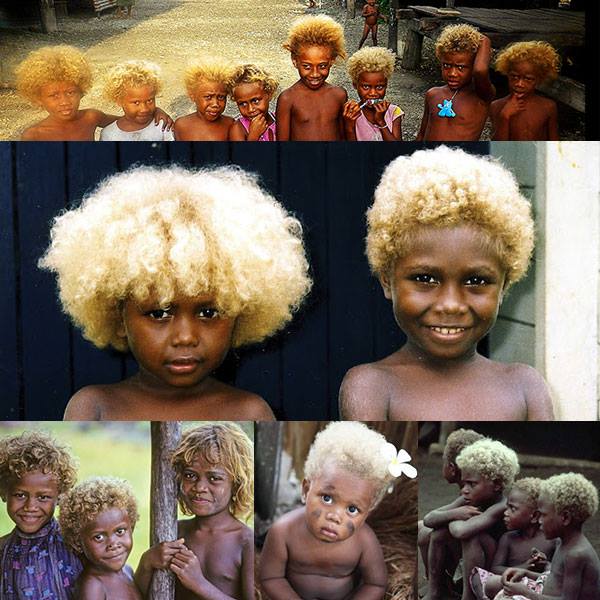
…and bright blue eyes, providing living proof that these are not
racially exclusive traits.
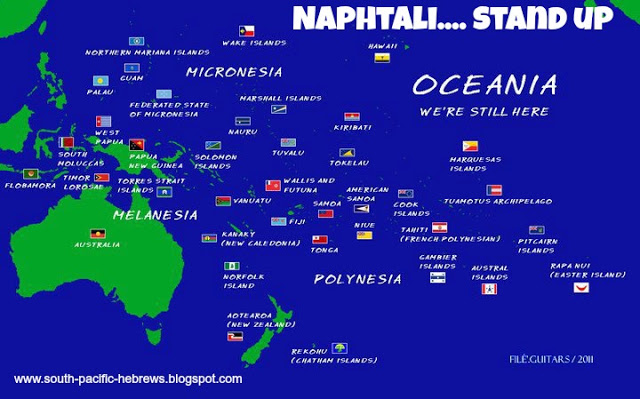
There is an identification of people from this whole region of Oceania with the Hebrew Tribe of Naphtali, one of the Lost Tribes of Israel.
And what about the name of “Solomon” for these islands. I firmly believe the memory of the people is retained in place names all over the world, and not a random or haphazard process of naming.
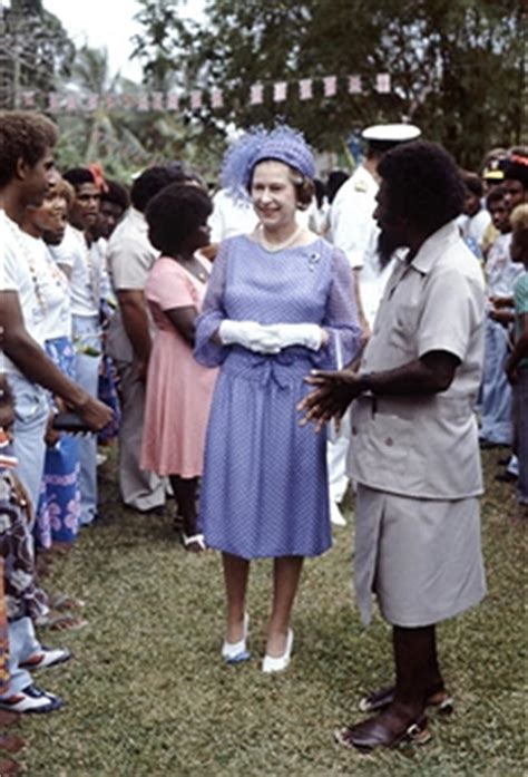
Other points of note before moving on. First, the form of government of the sovereign state Solomon Islands is a Constitutional Monarchy, with the
Queen of England as its Head of State, and Solomon Islanders as its chief elected officials and Members of Parliament.
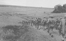
The other thing is that the World War II Battle of Guadalcanal was fought on this island, including the Battle of Henderson Field, which is just a short distance east of Honiara, in August of 1942.
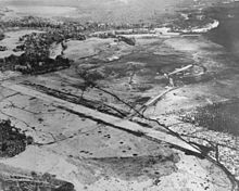
This was between the Japanese, and the U. S. Armed Forces. The result of all the battles was an Allied victory when the Japanese conceded defeat. Regardless, this is just another example of warfare taking place on planetary gridlines as I have been sharing throughout my posts. And when you do an internet search for “Guadalcanal”, this World War II military campaign dominates what comes up for information for the island.
Next on the alignment we come to one of the Solomon Islands known as Rennell Island, which is also considered a “Polynesian Outlier” in Melanesia.
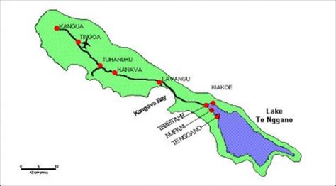
It is considered the second largest raised coral atoll in the world. The definition of a raised coral atoll is an atoll that has been lifted high enough above sea-level, which is attributed to tectonic forces, to protect it from storms and erosion.
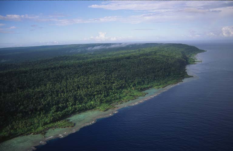
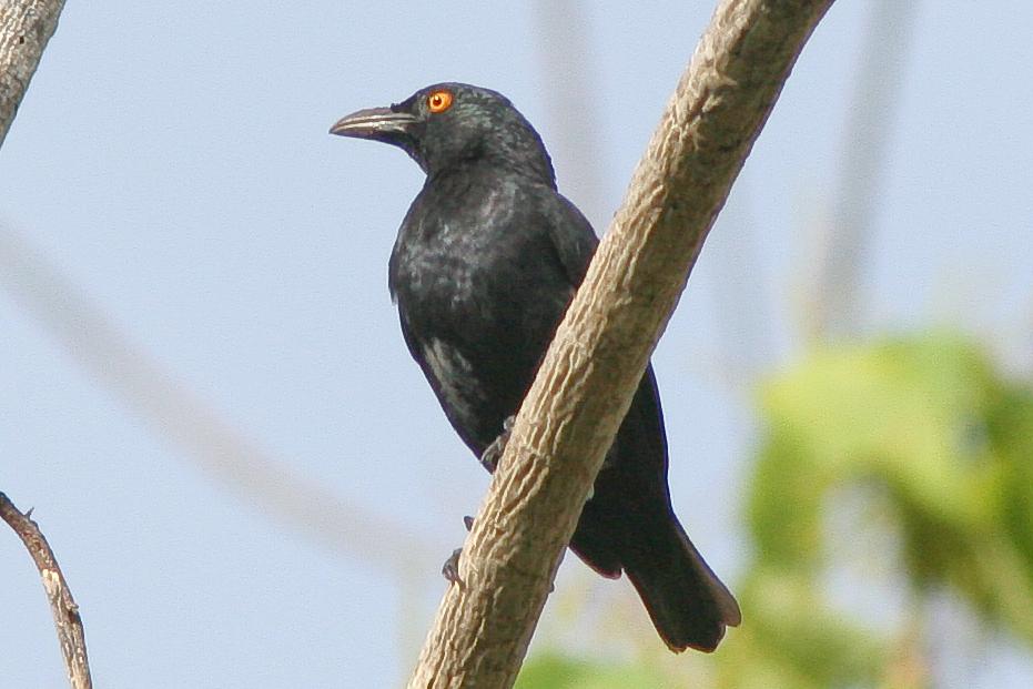
This protected ecosystem is believed to be what has allowed unusual biodiversity at places like Rennell Island, which is home some unique species, like the Rennell Starling…
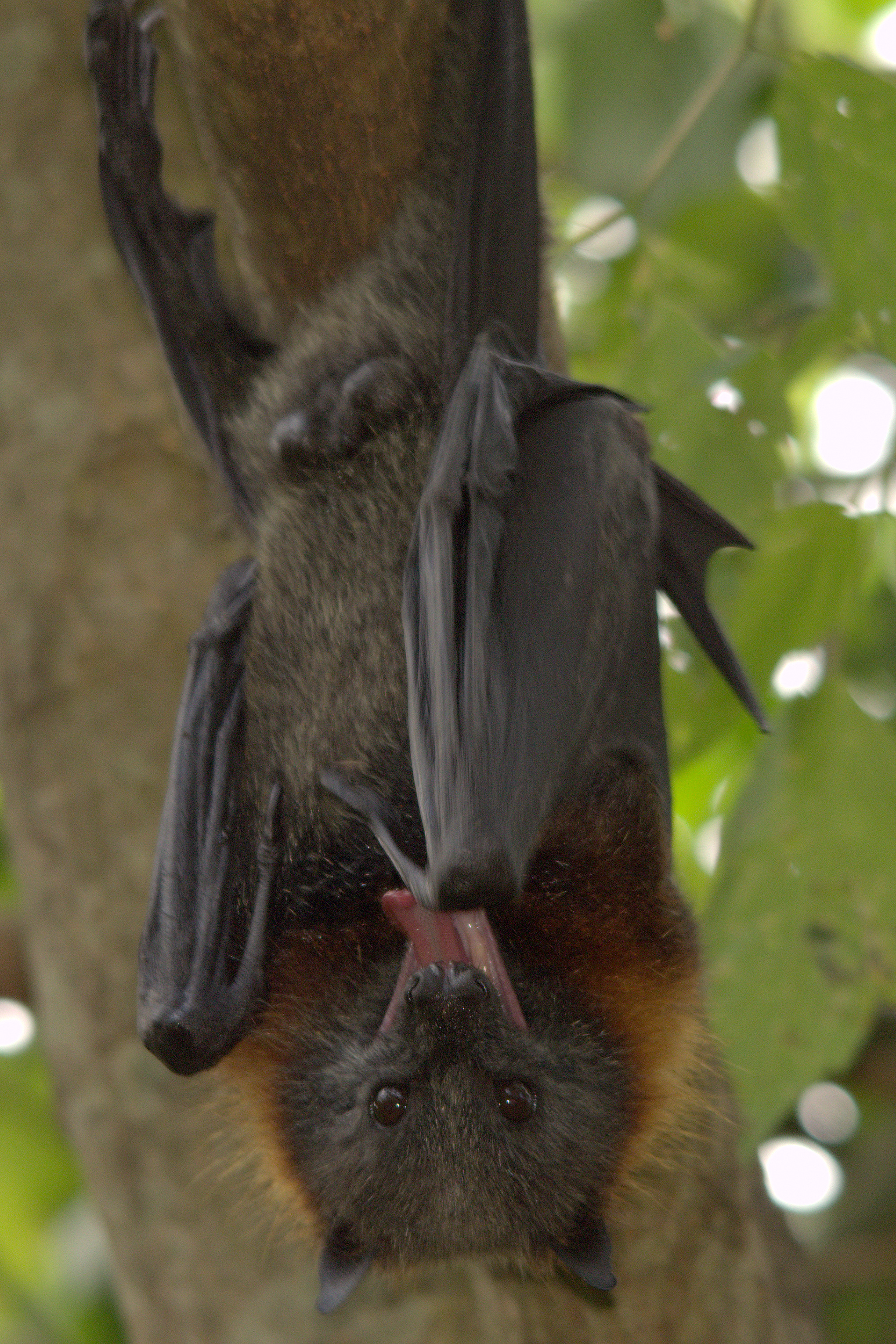
…and a bat species called the Rennell Flying Fox.
Lake Tegano covers almost the entire area of the island’s southern tail-end – literally, it looks like a fish-tail on the above map – and is a UNESCO World Heritage Site.
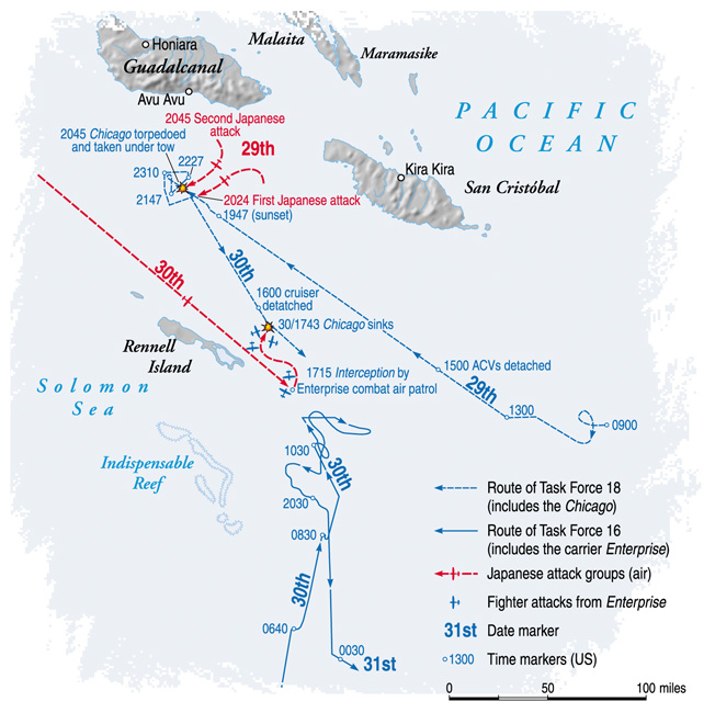
This was also the site of the last major naval battle of the Guadalcanal Campaign – known in history as the Battle of Rennell Island – and took place in January of 1943. In this battle, the Japanese Navy, in its efforts to evacuate Japanese forces from Guadalcanal, torpedoed the USS Chicago, one of the U. S. Navy’s heavy cruisers, and damaged the USS La Vallette, a naval destroyer ship. As result of this battle, the U. S. Navy pulled back from this area, and the Japanese finished their evacuation of Guadalcanal.
I am going to end this post here, and pick up the alignment in Brisbane, Australia in the next part of the series.
