
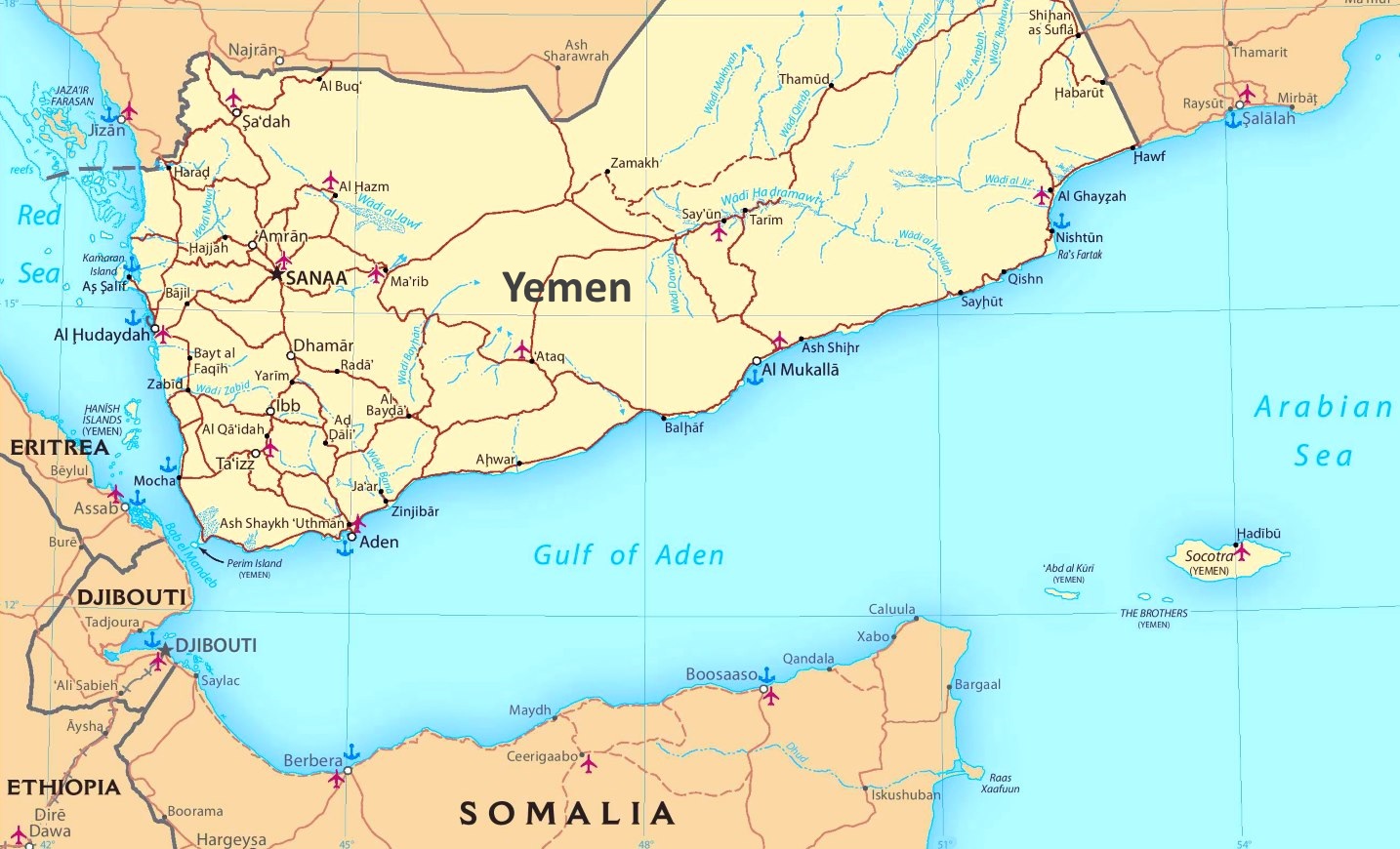
The Gulf of Aden, also known as the Gulf of Berbera (also the name of a port city in Somalia, and where my last post ended), is bounded on the North by Yemen, the Arabian Sea and Guardafui Channel in the east, and Somalia in the South.
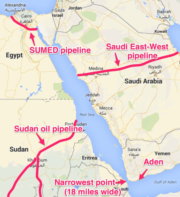
On one side, the Bab-el-Mandeb Strait, located between southwestern Yemen and and northeastern Djibouti, connects the Gulf of Aden to the Red Sea. This strait is of great strategic and economic importance. For one thing, millions of barrels of crude oil are shipped through it every day.
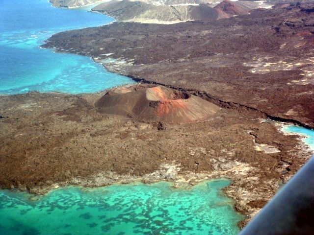
The country of Djibouti is located near a tectonic triple junction of three tectonic plates. There are also two rift zones in Djibouti. Volcanism is a recurring feature along planetary alignments.
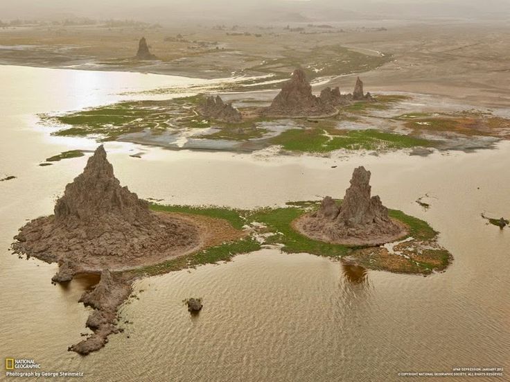
Lake Abbe is a Salt Lake on Djibouti’s border with Ethiopia. It is located at the confluence where the three tectonic plates are pulling away. I have also found many salt lakes on planetary alignments (see my post “Salt Lakes on the Grid”).
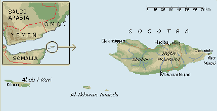
On the other side of the Gulf of Aden is the Guardafui Channel. It is between the Socotra Archipelago and Cape Guardafui, the tip of the Horn of Africa (which is another name for this region).
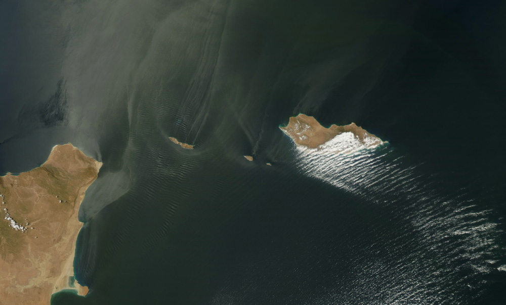
The Socotra Archipelago is officially part of Yemen, with Socotra being the largest island.
Have you ever heard of it before?
I first learned about Socotra several years ago when I watched a travel video about it that popped up as a Youtube recommendation for me. I looked more into it at the time. Otherwise I would never have heard of it before.
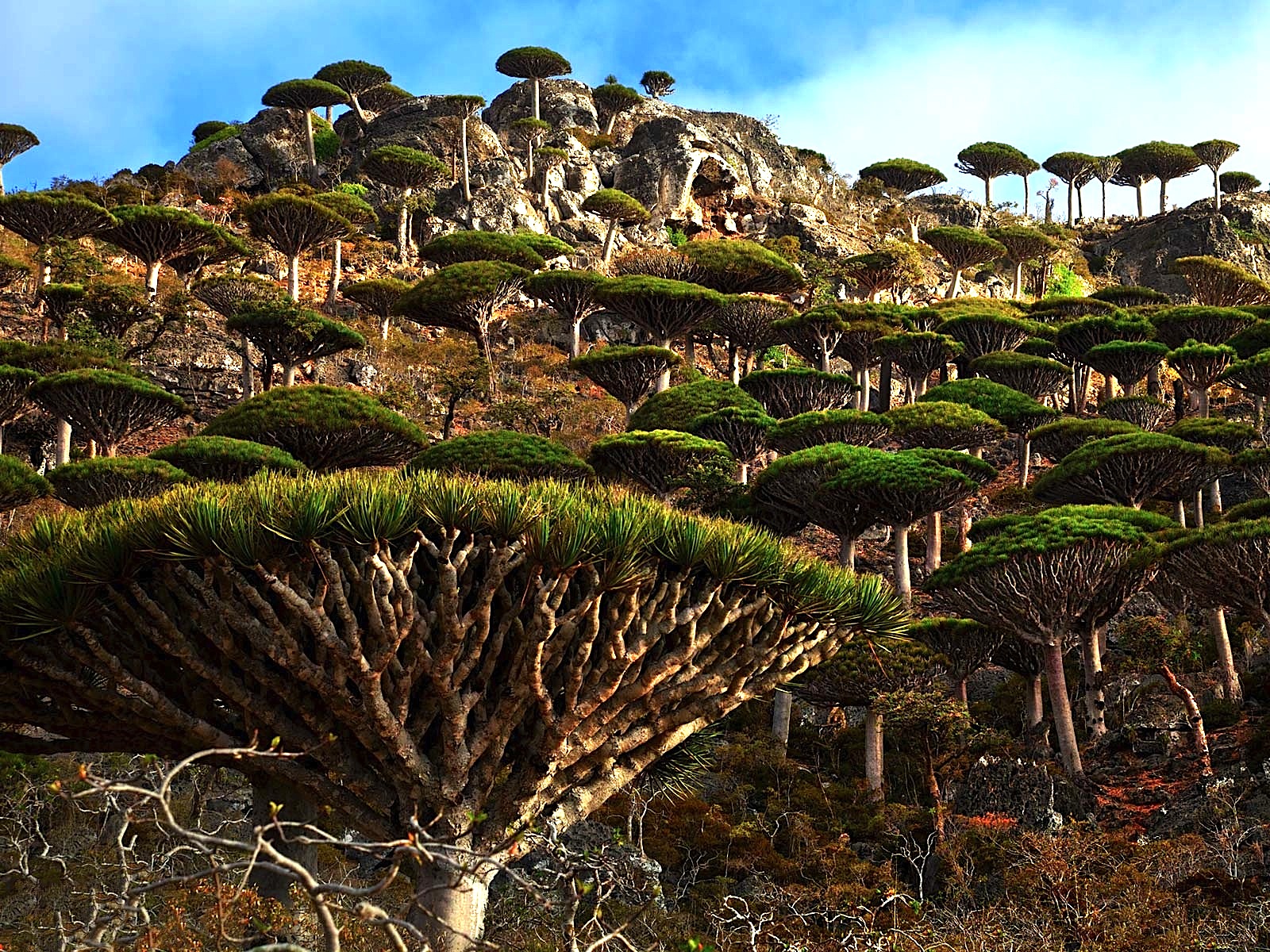
It is a UNESCO World Heritage Center, and is considered of universal importance because of its rich and distinct flora and fauna, most of which are found no where else. It has also been called the most alien place on earth.
There are more anomalous things about the Gulf of Aden, but I will just leave you with this picture, if you wish to research its validity for yourself. Just saying this is out there. Personally, it wouldn’t surprise me if this is truth. There is so much we haven’t been told about the world we live in, and that is actively kept from our awareness.
Next, we come to Mukalla, Yemen, a port city on the Gulf of Aden.
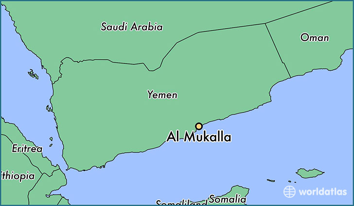
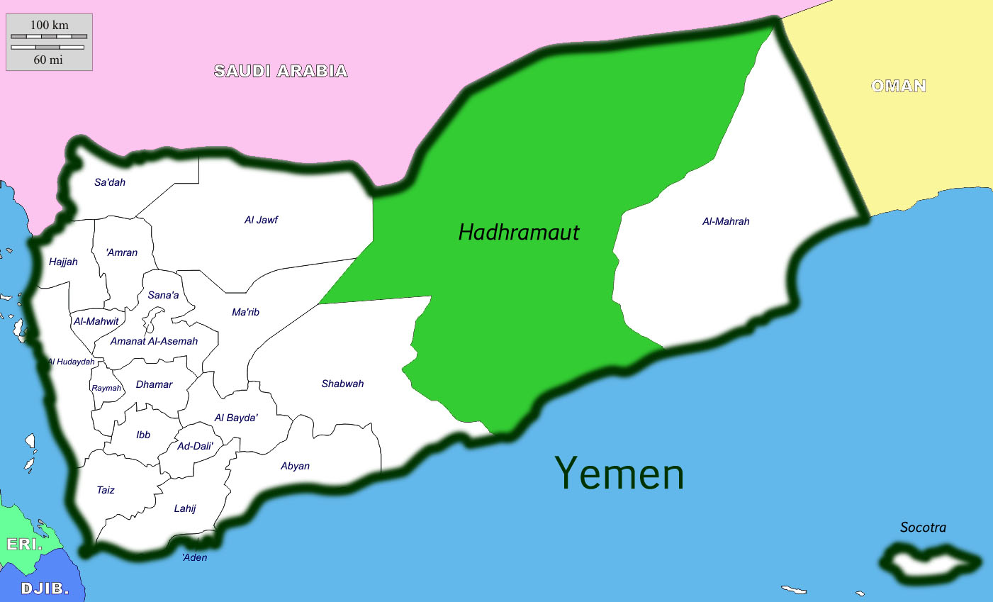
Mukalla is the capital of Yemen’s Hadhramaut Governate. It is close to an ancient location, called Hadhrami, that served as the principal trading post between Africa and India.
Hadhrami is also the name of the people that live in the Hadhramaut Governate, and are also in diaspora, living in scattered places around the world. The Hadhrami have in their culture a tradition of sea-faring and trading. At one time their presence and influence throughout in the Horn of Africa region was significant. Here is a historic photo of some Hadhrami men.

This is a view of Mukalla from the water. Take particular note of the big, block-shaped rocks in the foreground…

…compared with the big block-shaped rocks seen at Lake Chapala near Colima, Mexico.
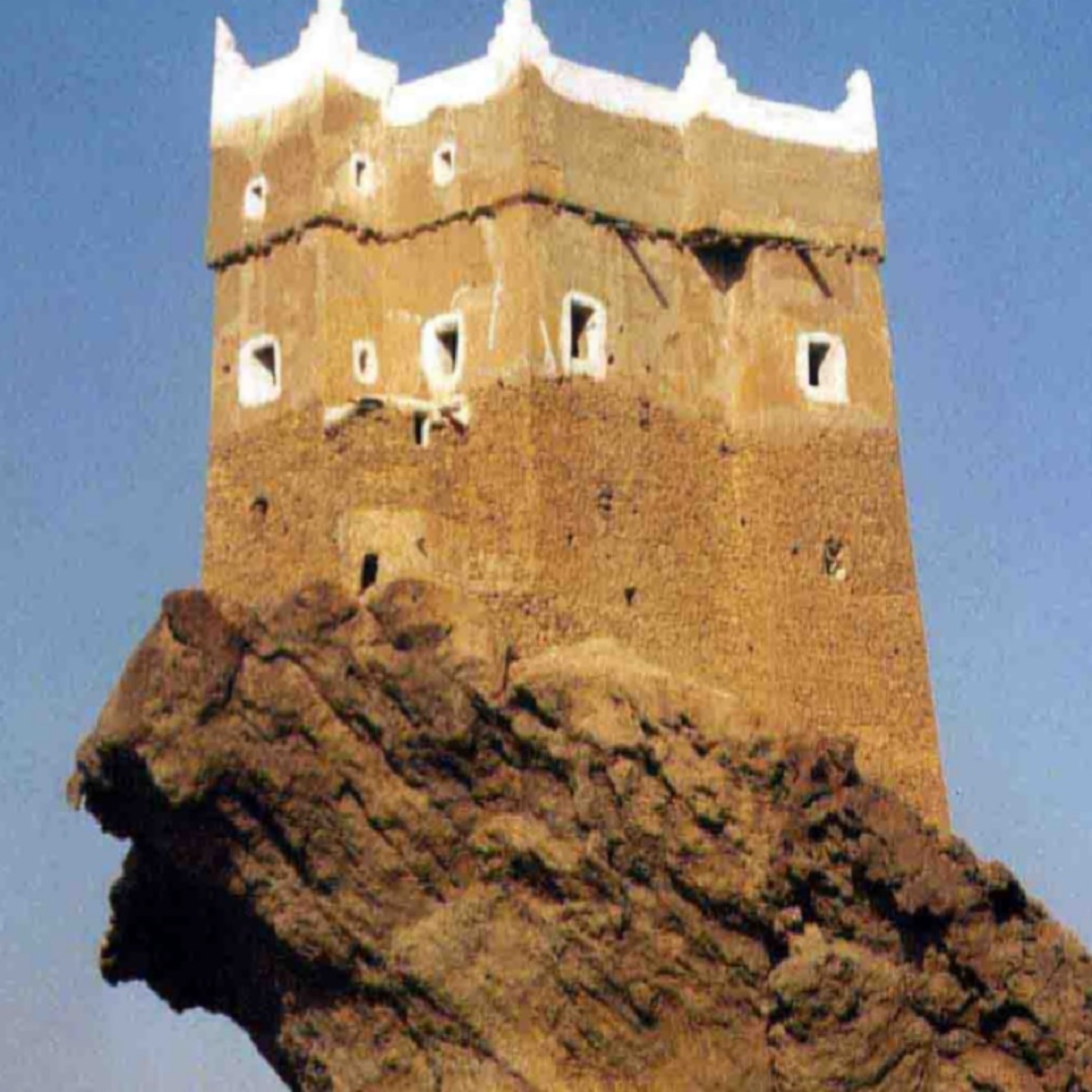
This is a photograph of the massive canyon at Wadi Leysar in the Hadhramaut Province of Yemen.

And this is Courthouse Butte in Sedona, Arizona. The best our historical narrative can come up with is that these are natural features. I definitely do not buy that explanation. I think “butte” and “canyon” are cover-up code-words for very ancient infrastructure.

Lastly before moving on, I will share this photo I found of what is called one of the oldest houses in Mukalla. Interesting place to build a house….
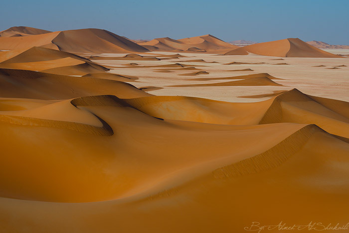
Next the alignment crosses the Rub Al Khali, otherwise known as the Empty Quarter. It is the largest desert in the world. It encompasses most of the southern third of the Arabian peninsula.
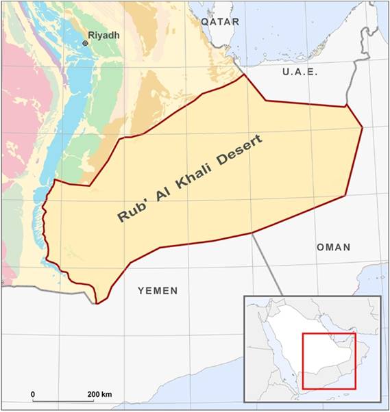
A recent Saudi Arabian Minister of Petroleum and Mineral Resources, Ali Al-Naimi, reported that the dunes don’t drift – that while sand blows off the surfaces, their essential shape remains intact.

Something tells me there is enduring infrastructure underneath all that sand….
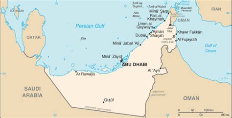
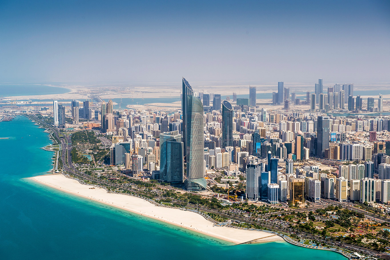
Next, we come to Abu Dhabi, one of the seven Emirates that comprise the United Arab Emirates (UAE). Its capital, Abu Dhabi, is also the capital of the UAE.
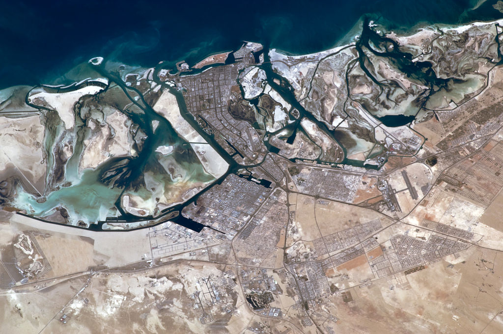
This is what it looks like from above. I find all the channels to be noteworthy, because the ancient advanced civilization was a canal-building civilization :
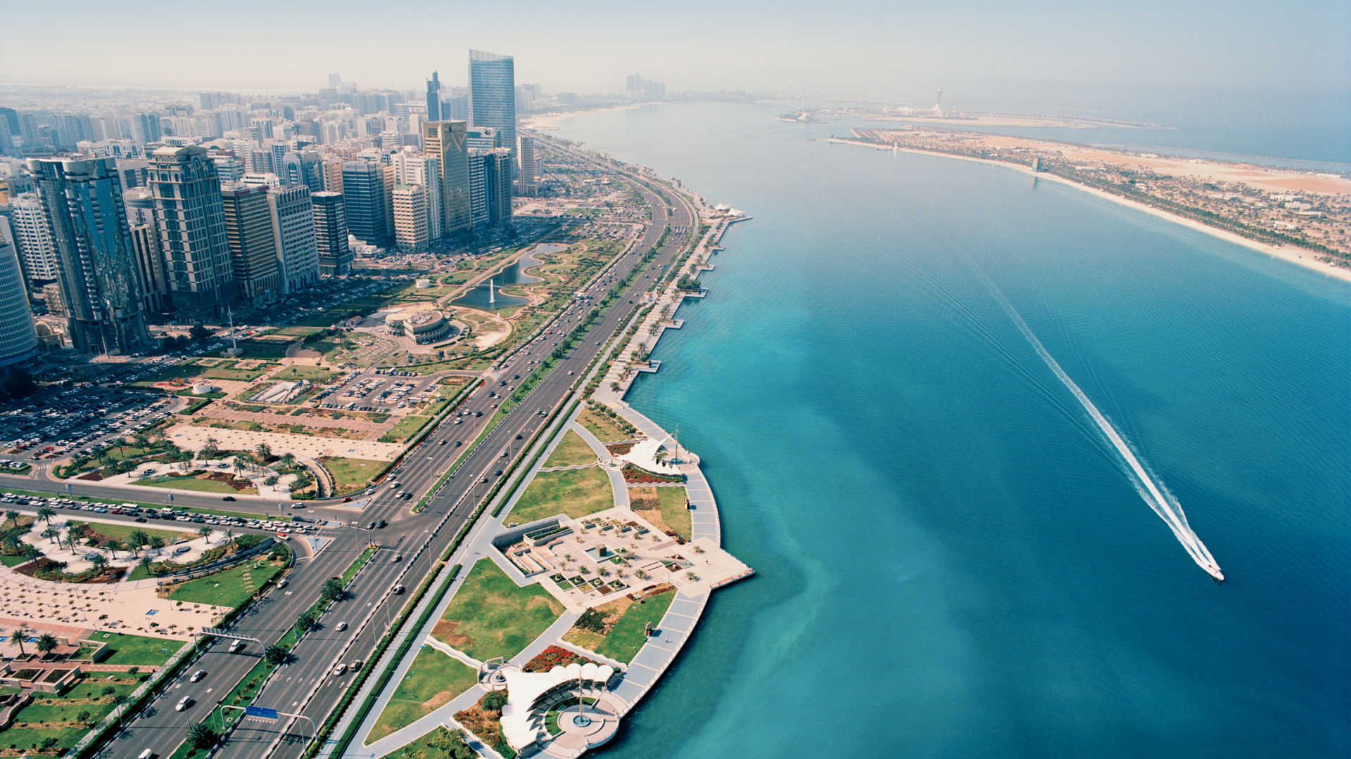
And here is a view of it from the water, with a nice rectangular beach-head…
…and a nicely-shaped harbor.
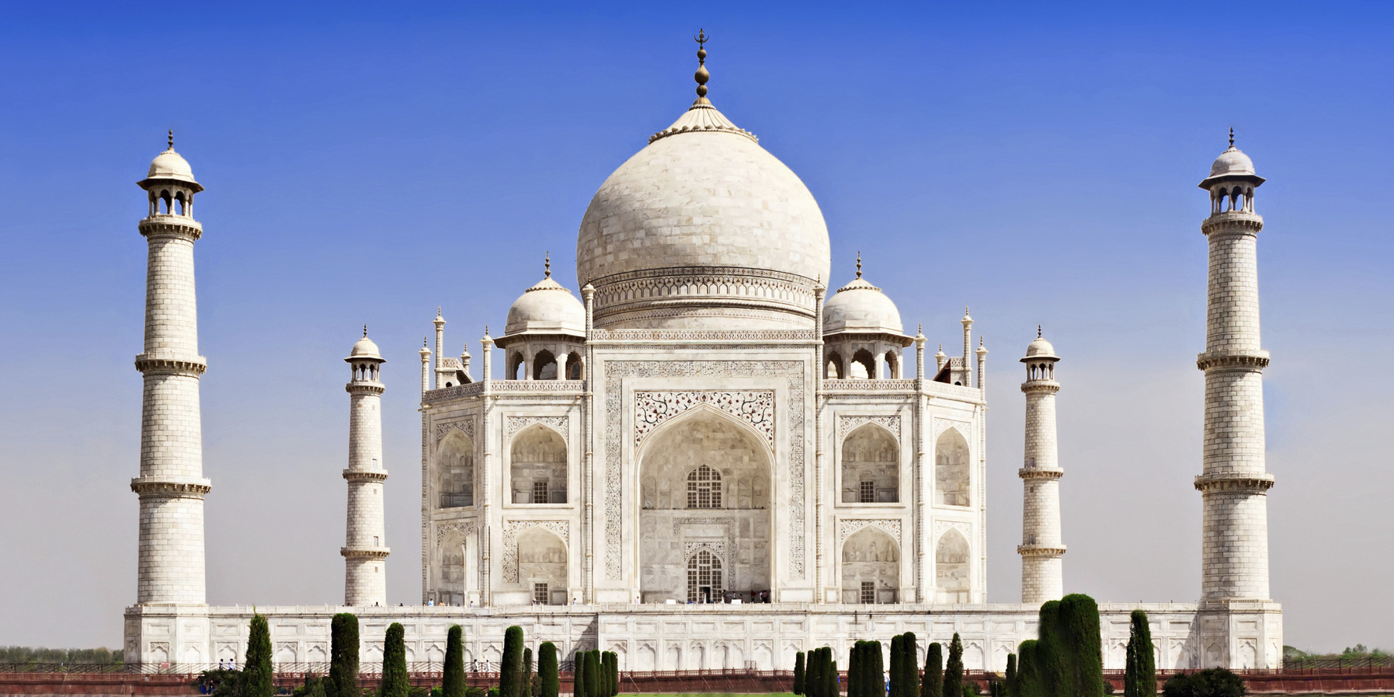
This is the Sheikh Zayed Grand Mosque in Abu Dhabi, and its elegant and sophisticated design features. The date for construction is given as 1996.
I am comparing it with the Taj Mahal in Agra, India because they have the same style of domes.
Yet the Taj Mahal was built in the mid-1600s as a mausoleum, according to the historical narrative we have been given.
The sophistication and striking similarities of these two monumental works of architecture raise some real questions in my mind about how they were built – both then and now.
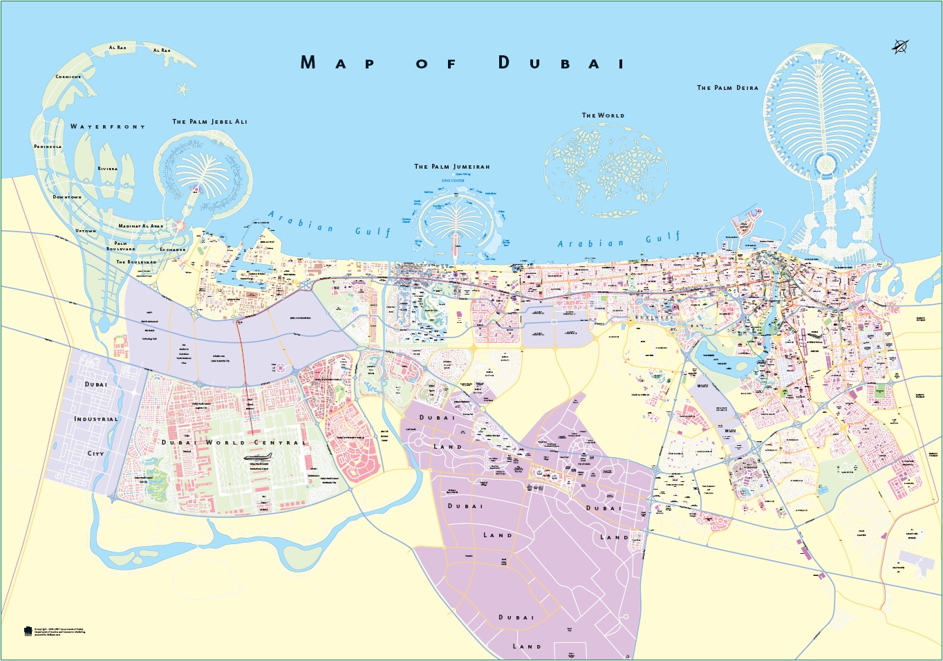
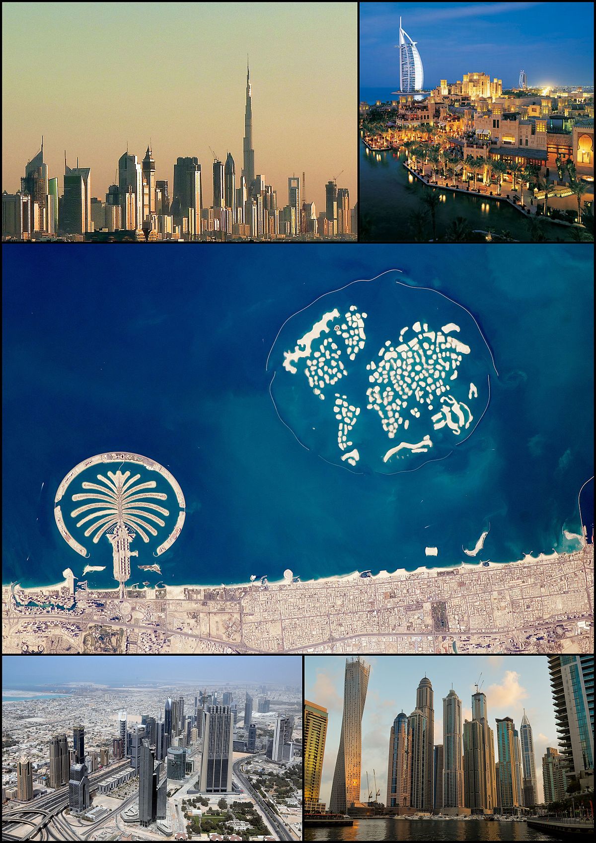
The next location the alignment crosses is Dubai, another Emirate, and the largest city of the United Arab Emirates. You can tell just by looking at a map of the city that this is a unique place in the world.
Dubai is one of the world’s “Global Cities,” which means it is a city which is a primary node in the global economic network, with a focus on financial power, and high technology infrastructure.
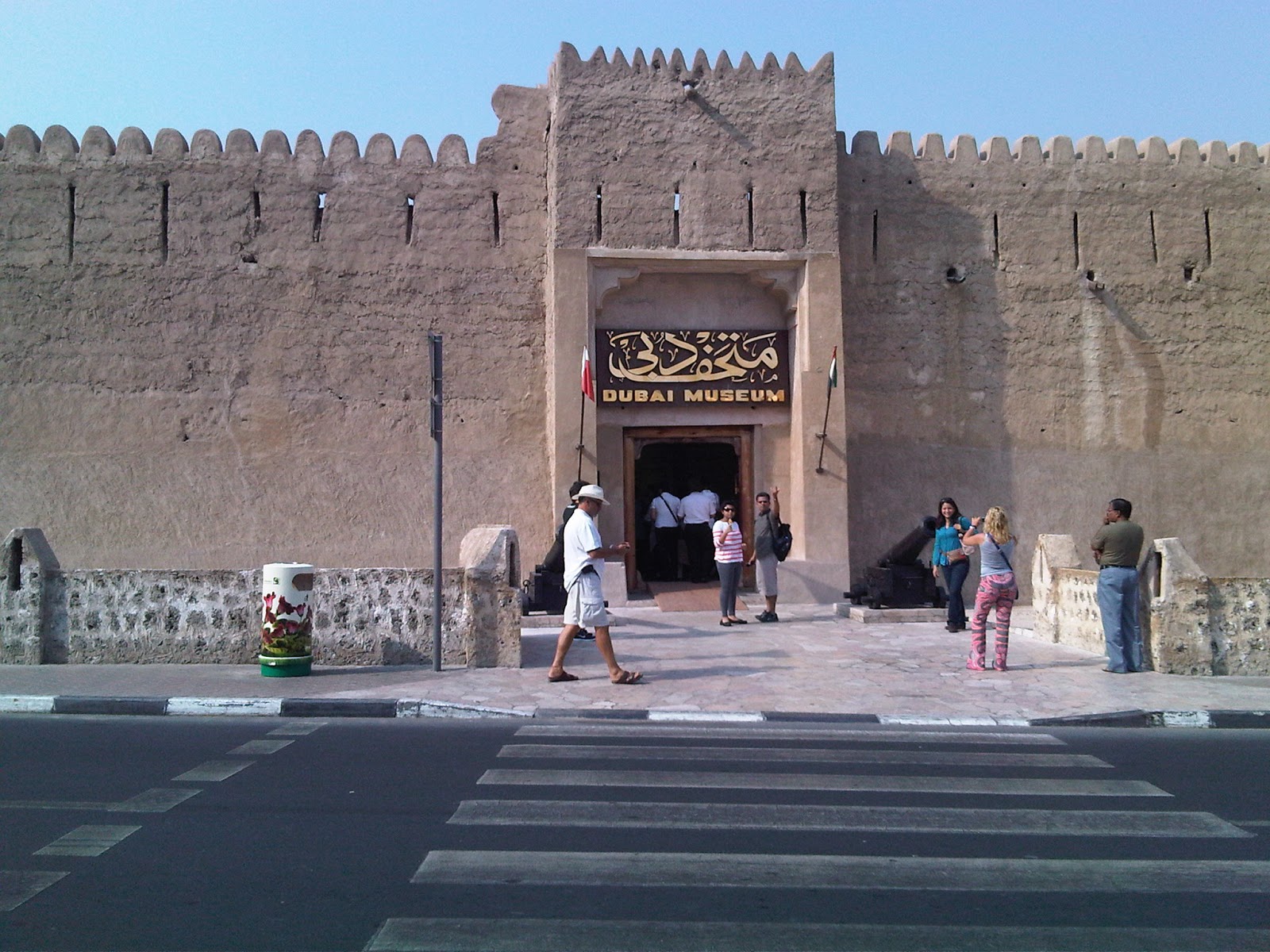
This is the Dubai Museum. It is said to be the oldest existing building in Dubai, and built in 1787.
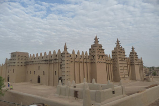
The architectural style is reminiscent of buildings I have seen in African countries. Shown here first is the Great Mosque of Djenne in Mali. Djenne is said to be the oldest known city in sub-Saharan Africa.
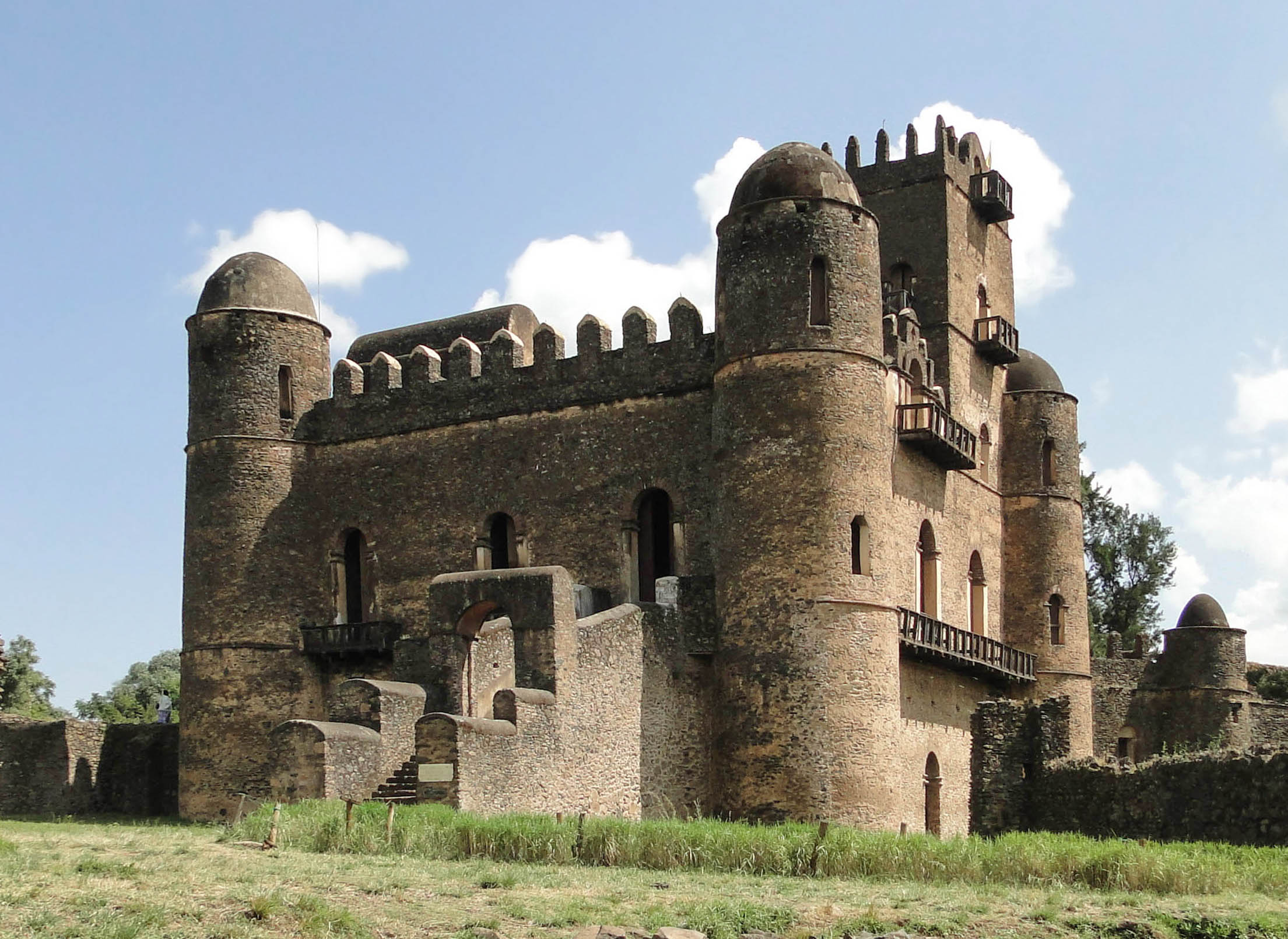
And this is the Fasilides Palace in Gondar, Ethiopia. It was built by the Solomonic Ethiopian Emperor Fasilides in the 1600s, and subsequently became the home of Ethiopia’s Emperors.
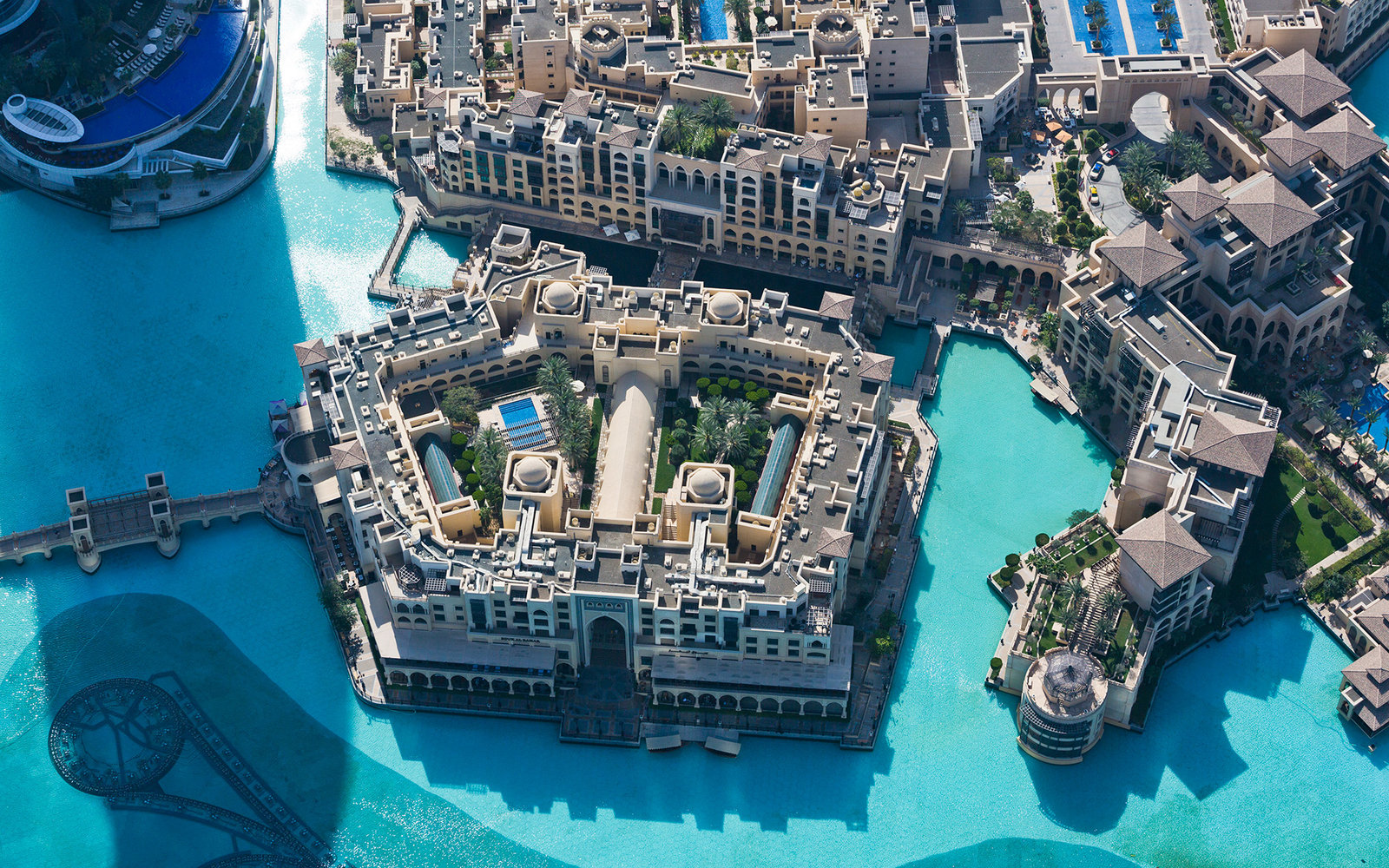
This is an aerial view of Dubai’s Old Town, the Bur Dubai.
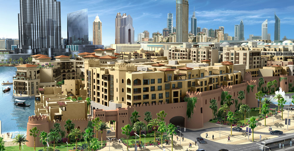
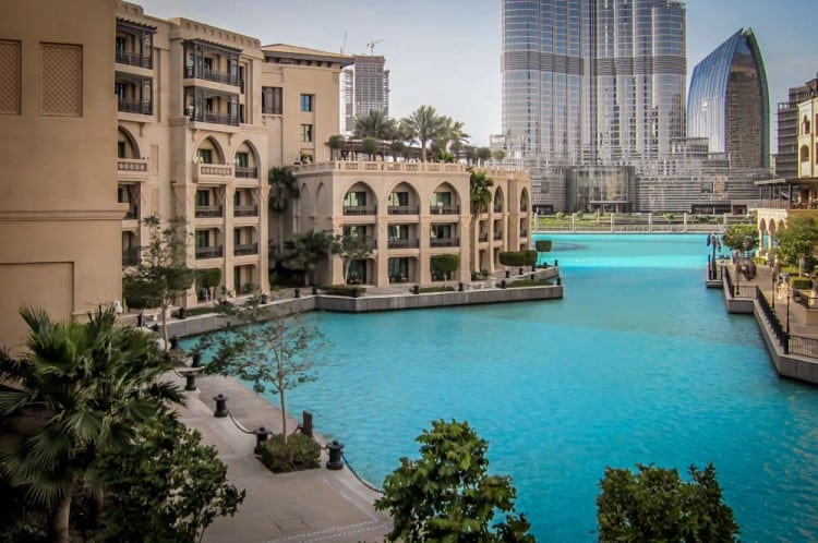
Here are more photos of the architecture and canal system of Old Town Dubai.
I will end this post here, and in the next post will pick up the alignment as it goes across the Strait of Hormuz into Iran.
