
In the last post, I took at close look at the ancient cities of Alicante and Elche on the Costa Blanca coast of Spain on the Mediterranean Sea; through ancient city of the Deys in Algiers and its famous Casbah; across the mountains of the Tell Atlas; the deserts of the Great Eastern Erg of Algeria; and on through to Djanet in Algeria.
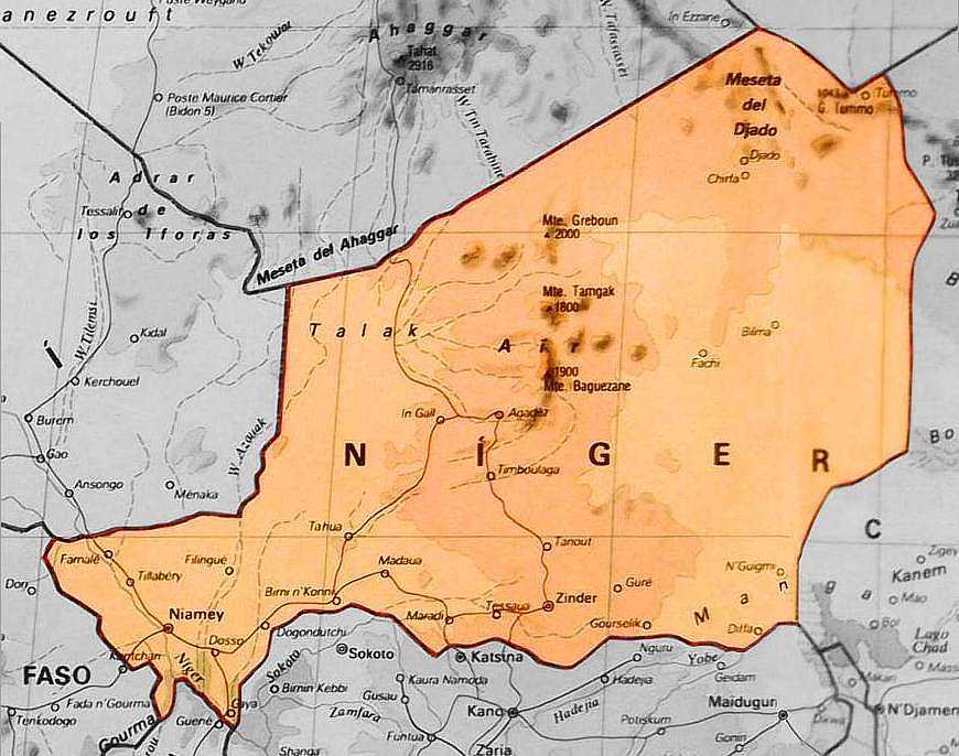
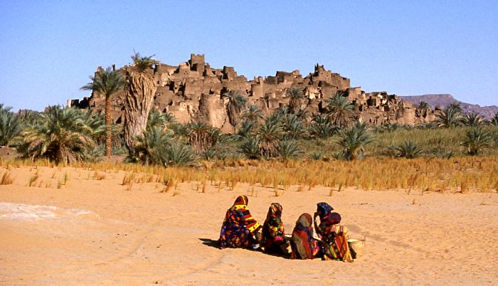
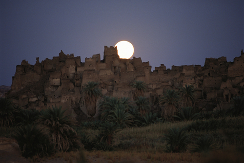
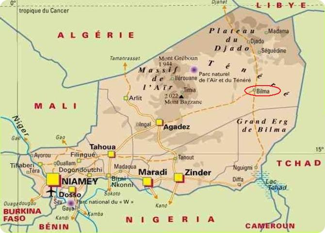
Now, I am looking at the ruined city of Djado, which lies on the southern end of the Djado Plateau in Niger.
In the present day it is largely uninhabited, with abandoned towns still visible.
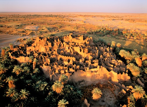
Historically it was the land of the Kanuri people, who are no longer living in Djado today.

The Kanuri people were described as a powerful African people that founded the pre-colonial Kanem-Borno Empire.
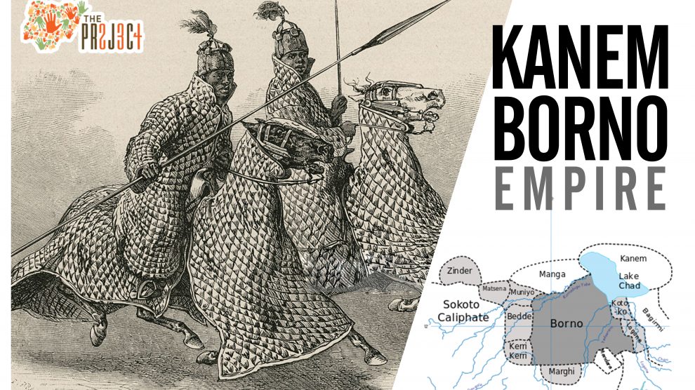
The Kanem Empire existed from 730 AD to 1380 AD…
…and then continued as the Bornu Empire until 1900.

This is Kanuri politician Sir Kashim Ibrahim arriving in London for a short tour in 1910. It sounds like he was a person of importance back in his day!
Now Toubou nomads are in Djabo to tend…
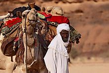
…the date palms of the region.
So, apparently the Bornu Empire lasted right up until the 20th-century. What happened to it?
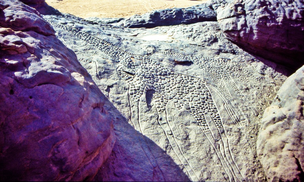
At one time, not only did the Sahara have a fertile, savannah-type ecosystem, supporting a wide-and-varied wildlife population, like these life-sized giraffes carved in rock in Djado…
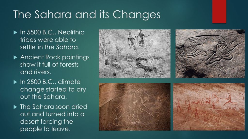
…the region now called the Sahara desert had great forests, including but not limited to, oak, elm, alder, juniper, and pine. As you can see in this picture, we are taught the desertification of this region started happening a long time ago. Maybe. Maybe not. There is so much that we have not been told about.
The silence about the history of this area in the present-day is deafening.
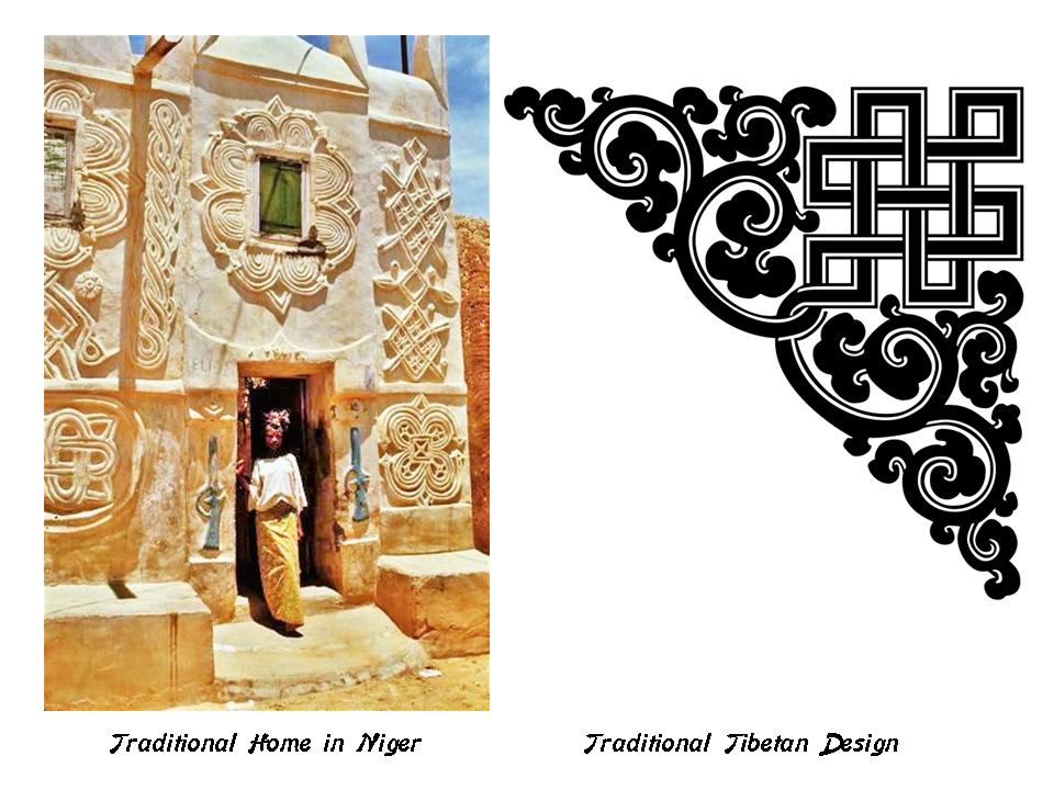
This is a traditional home in Niger on the left, and the designs on it reminds me of traditional Tibetan design elements on the right.
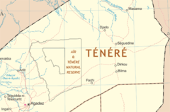
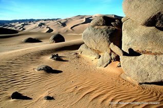
Next the alignment crosses near the Tenere Desert, which is the name for the eastern-half of the Air and Tenere National Nature Reserve.
There is no indication in on-line information that there are the remains of an ancient megalithic civilization here.
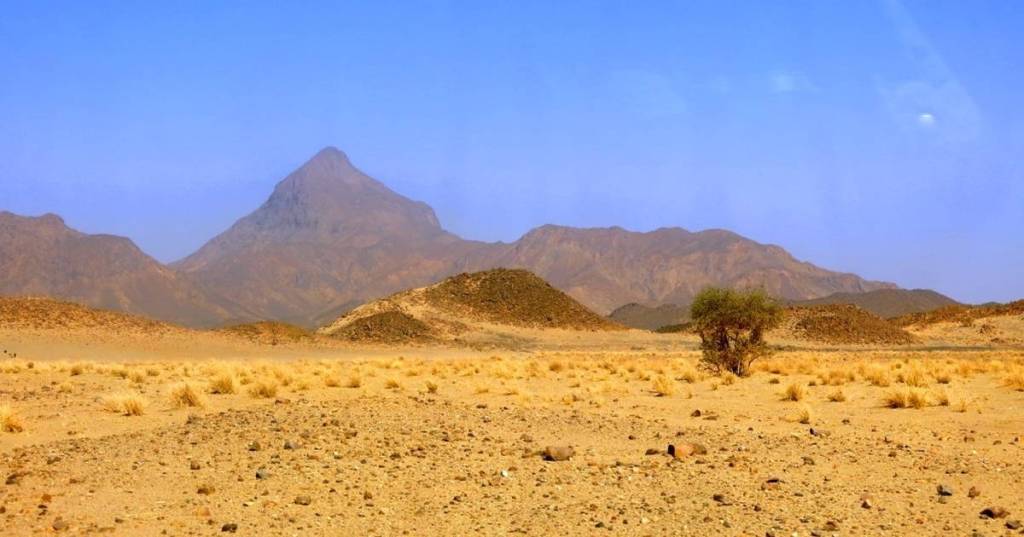
But it certainly looks like there was….
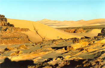
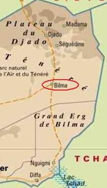
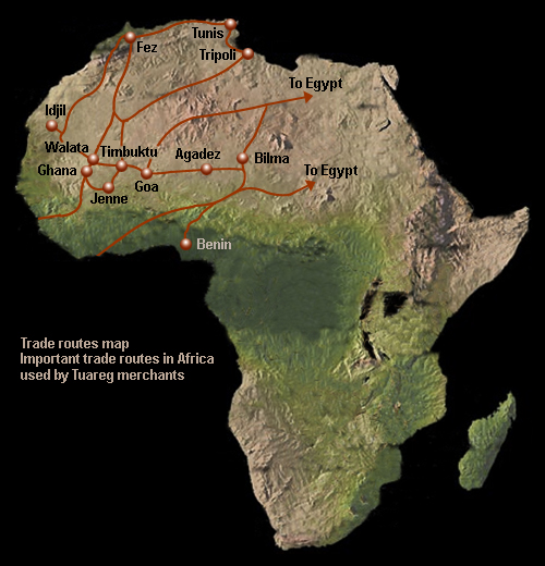
Next on the alignment is Bilma in Niger.
Bilma is an oasis town, and has long been a stop on the Trans-Saharan caravan routes.
It is protected from sand from the desert dunes by the Kaouar escarpment. Escarpment is another key code word that covers-up ancient infrastructure.
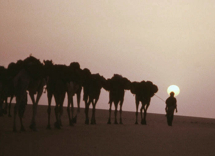
Bilma is the destination of one of the last of the ancient Saharan Caravan routes…
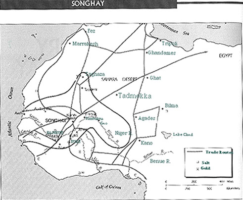
…where Tuaregs cross the Tenere Desert to…
…get salt produced here in salt pans, and barter millet for date fruit.
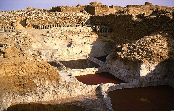
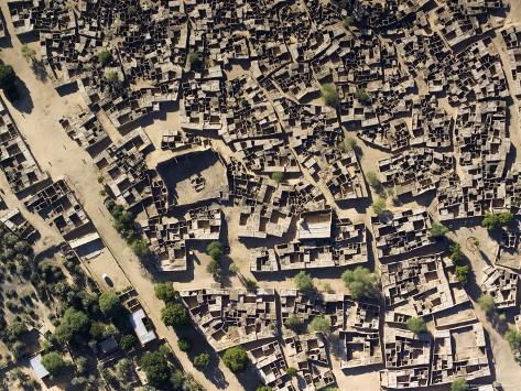
This is an aerial view of Bilma, where salt slabs are also used as a building construction material.
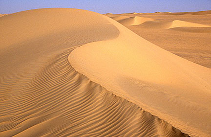
Next the alignment passes through the Great Erg of Bilma…
…another region of the Sahara described as a sand-dune sea.
Small scale trade through the Erg of Bilma continues from the Lake Chad region and the Termit Massif, a mountainous region in southeastern Niger.
So, what does the image in the foreground look like to you?
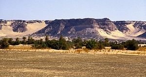
Next on the alignment is N’Guigmi, a city and commune of approximately 15,000, in the easternmost part of Niger, near Lake Chad.
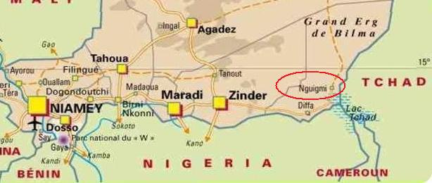
N’Guigmi is a center for the salt trade from Bilma, and the last stop on the road to Chad.
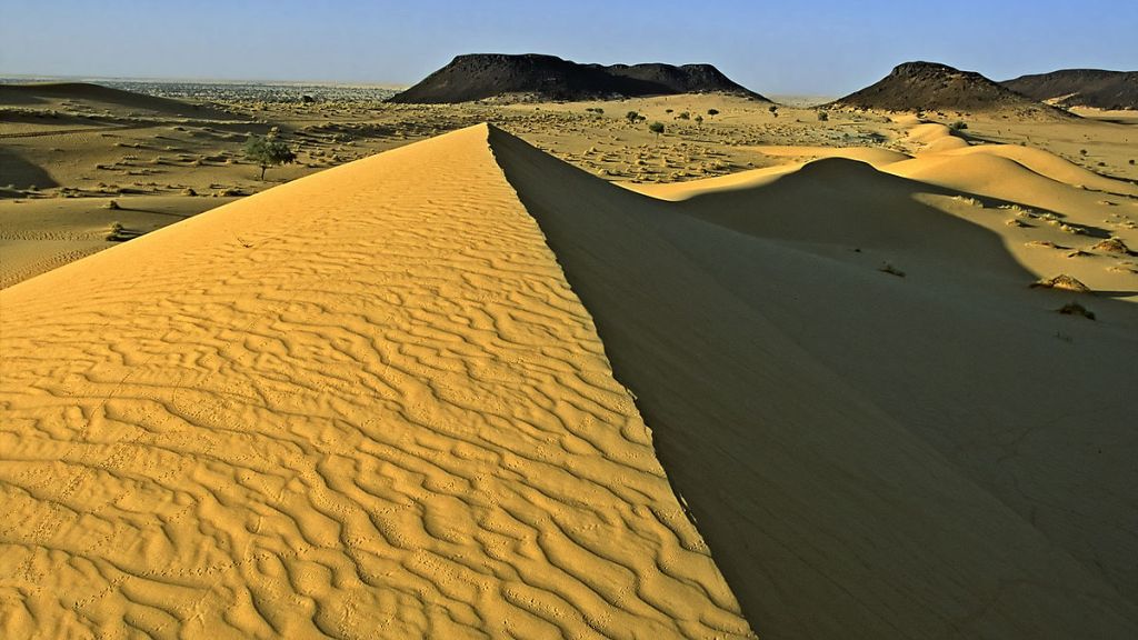
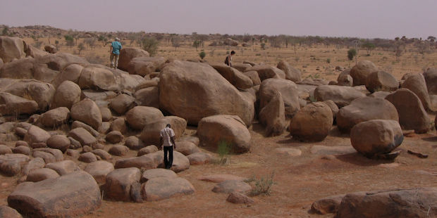
This rock field is in the vicinity of N’Guigmi in the Tenere Desert.
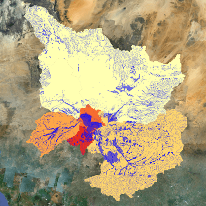
N’Guigmi is also home to a large settlement of Kanuri people, and lies as the mouth of the Dilia Bosso, an ancient river valley that runs from the Termit Massif to the shore of Lake Chad, as recently as the mid-20th-century. This is a depiction of the Lake Chad Basin.
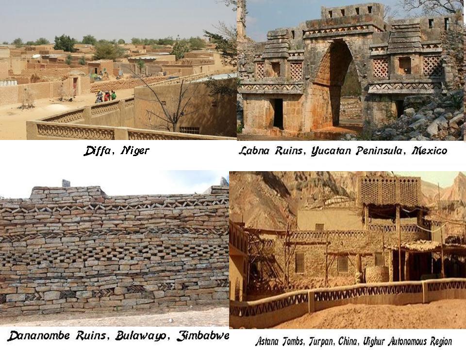
Next on the alignment is Diffa, in the extreme southeast of Niger on the border with Nigeria.
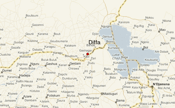
Diffa marks the end of the paved section of the National Route 1, the main east-west highway through Niger.
Diffa is compared on the top left with the Labna ruins in the Yucatan Peninsula in Mexico on the top right; the Dananombe Ruins in Bulaway, Zimbabwe; and lastly the Astana Tombs in Turban, in the Uighur Autonomous Region of China.
Next on the alignment is Abuja, the capital city, and located in the center of, Nigeria. It replaced Lagos as the capital of Nigeria in 1991.
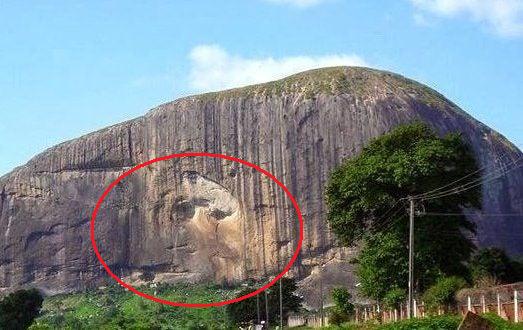
In this picture, Zuma Rock in Abuja, Nigeria, is on the top, and it is reminiscent of Cathedral Rock in Sedona, Arizona, on the bottom. I can show you many more examples. Hopefully this will suffice as one of many examples of the same look and coloration.
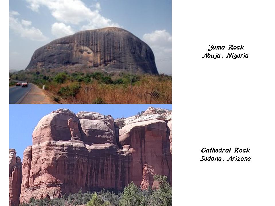
Zuma Rock is known for having the shape of a human face on it.
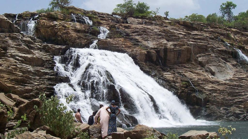
The Gurara Waterfalls, with a height of 98-feet, or 30- meters, are found on the Gurara River about an hour or so from Abuja in Niger State, the largest state of Nigeria. I find waterfalls all along the planetary alignments.
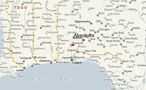
The ancient city of Abeokuta is just north of Lagos, close to the alignment…
…and is the location of Olumo Rock, one of the oldest and most popular tourist attractions in Nigeria.
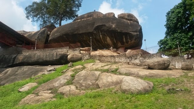
It has been used as a fortress historically by the Egba, Yoruba people of Ogun State, in which it is located.
As well as the patron spirit of Olumo Rock being venerated in the Yoruba spiritual tradition as an Orisha, which serves a guide for Creation and Humanity.
This is the Palace of Oba Sir Ladapo Ademola II, the Alake of Abeokuta, circa 1951, with its nice masonry and archways.
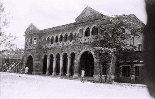
The Alake of Abeokuta is the traditional ruler of the Egba Clan of Yoruba.
This the current Alake of Abeokuta, Adedotun Aremu Gbadebo III, since 2005.

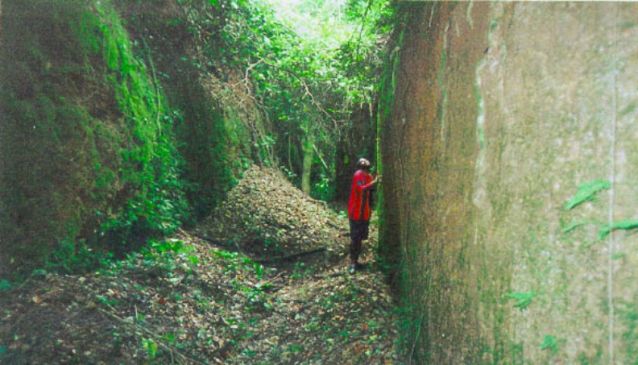
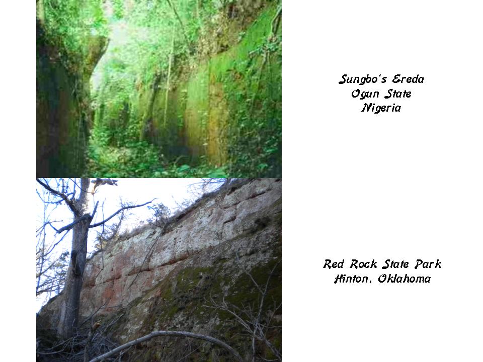
Sungbo’s Eredo is said to be a system of defensive walls and ditches southwest of the Yoruba town of Ijebu Ode in Ogun State. The total length of the fortification is 99-miles, or 160-kilometers, enclosing an area of 25-miles, or 40-kilometers.
It was said to have been built as a memorial for the childless widow, Bilikisu Sungbo, who has been connected by some to the legendary Queen of Sheba.
The appearance of Sungbo’s Eredo on the top, reminded me of Red Rock Canyon in Hinton, Oklahoma, near Oklahoma City on the bottom.
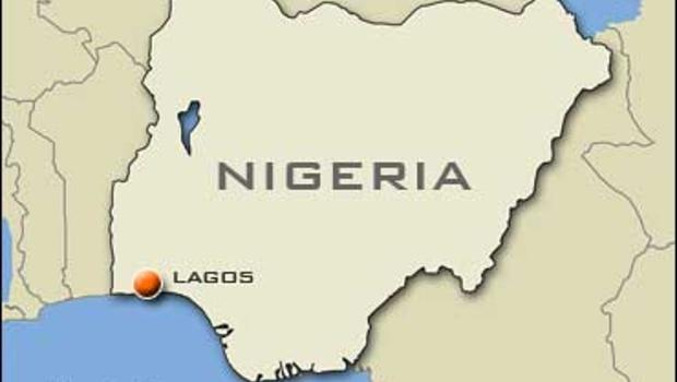
The next place on the alignment is Lagos, a major financial center of Africa, and has one of the busiest seaports in Africa.
There are two active ports in Lagos. The main Port of Lagos is in Apapa, and then the other is the Tin Can Port.
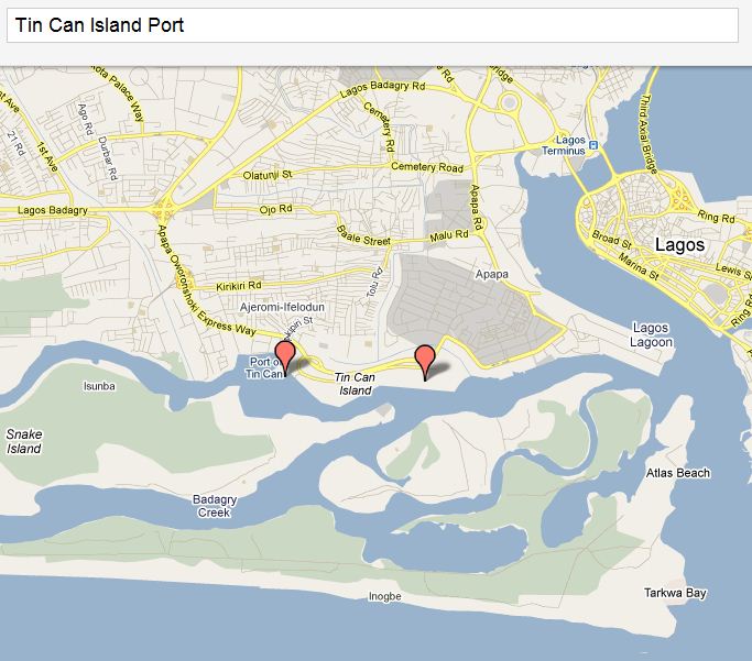
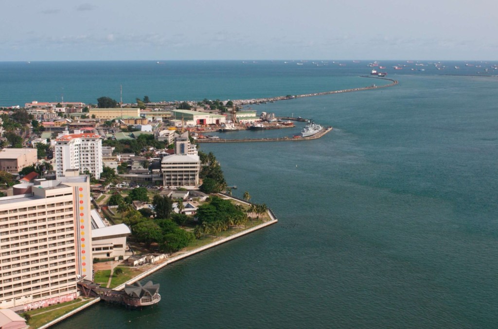
As you can see in this photo of Tin Can Island Port, you see that it is clearly artificially made…
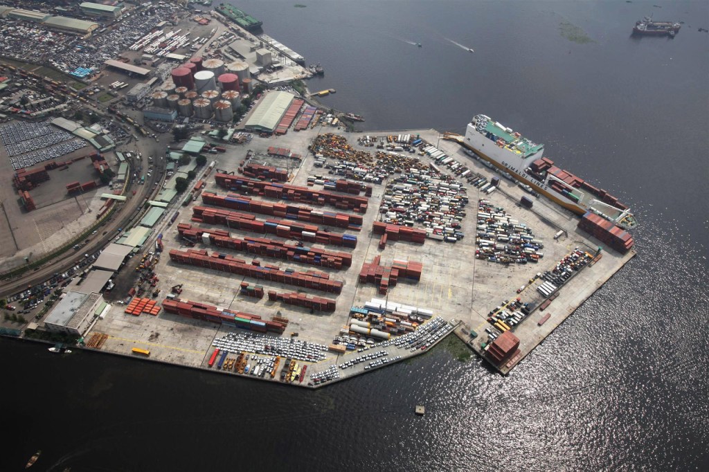
…just like Bergen Point on the north side of the Kill van Kull at Newark Bay at Bayonne, New Jersey…
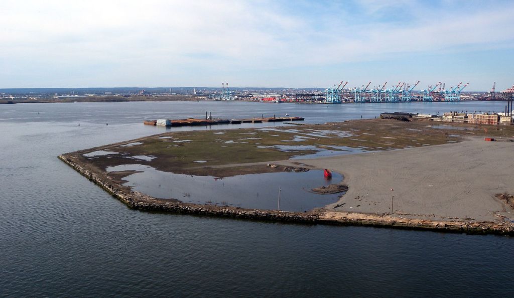
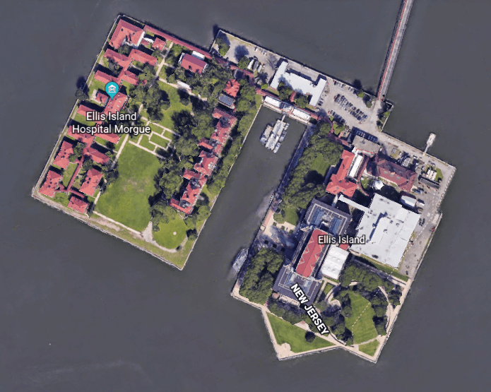
… and like Ellis Island in Upper New York Harbor.
You see the same kind of thing at the main port of Lagos at nearby Apapa.
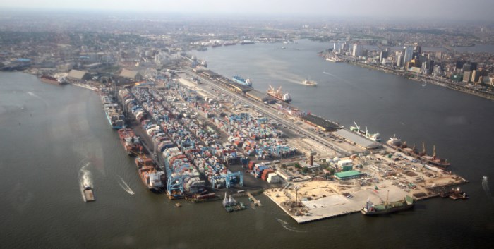
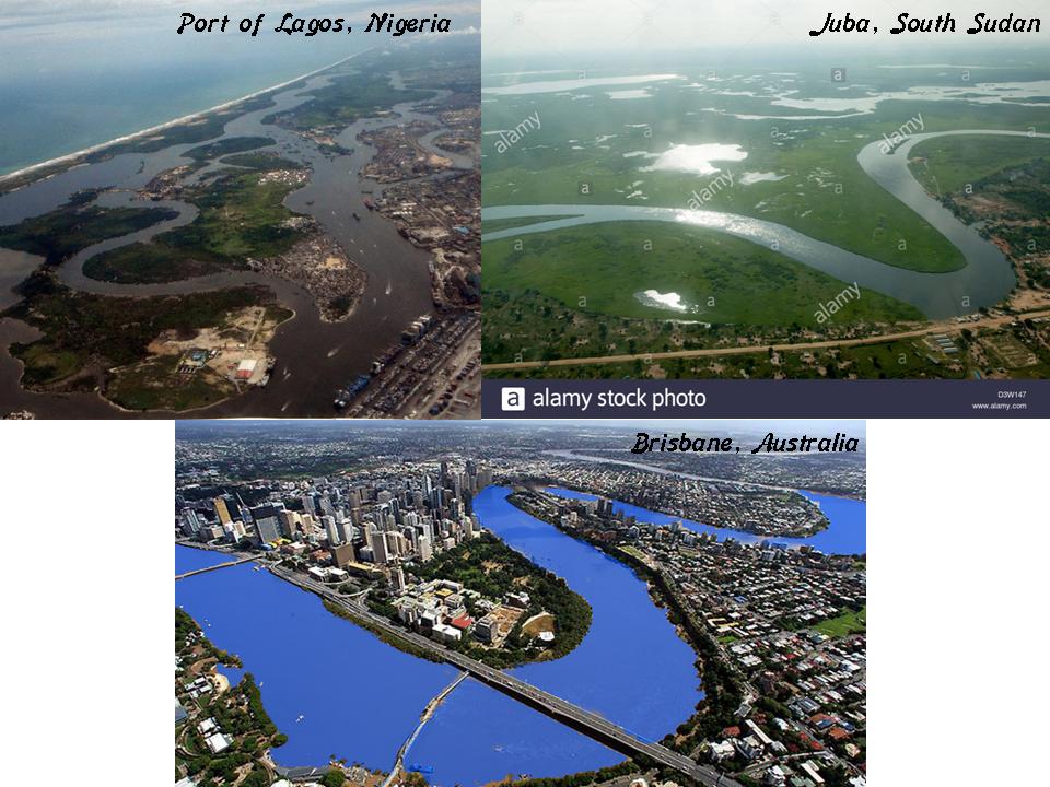
Also at Apapa on the top left, you find the same signature, snaky, s-shaped river bend that is found all over the world, like the Nile River at Juba in South Sudan on the top right, and the Brisbane River at the city of Brisbane in Australia on the bottom.
I am going to end this post here, and pick up the alignment next as it crosses over the Gulf of Guinea.
