
There are three-parts to this post on “How the New World was Created from the Old World”, which is taken from a three-part series I did back in the summer of 2020.
I am expanding it now to include historical information I have come across in my research since then.
Part One is about “Trading Companies, Wars, Partitions, Conferences & Treaties;”
Part Two is on “Language, Religion, New Nobility, Corporatization, Colonization & Place Name Changes;”
And Part Three on “Maps, Globes & the Centuries of Exploration.”
Trading Companies, Wars, Partitions, Conferences & Treaties
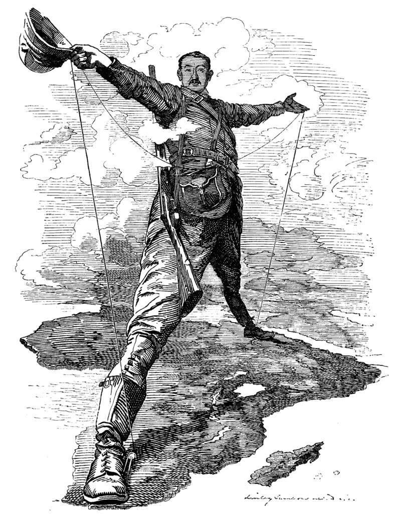
European colonialism intentionally created divides over almost the entire landmass of the earth, creating new countries from lands that were taken, as well as divisions and discords between peoples that originally existed in harmony worldwide.
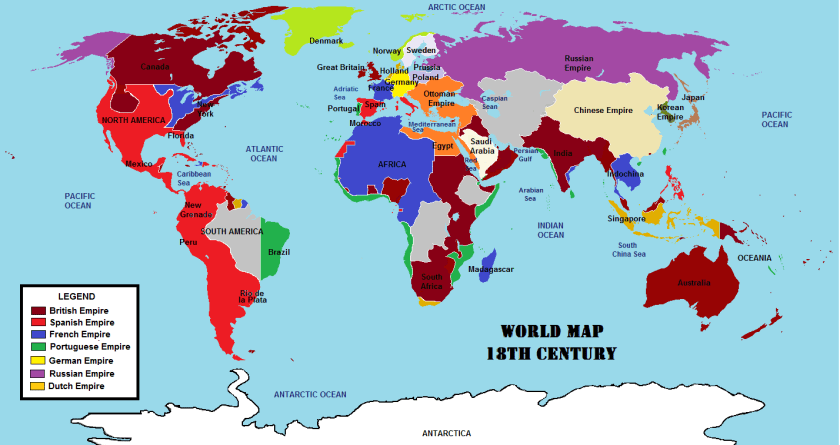
It also diagrams the means by which power and control were consolidated worldwide, mostly starting out as “trading” companies that ended up being very powerful in their respective regions, and after gaining complete control, transferring power and control of the regions to their respective European empires.
I will be providing numerous examples to illustrate how creating the New World from the Old World was accomplished.
Others means by which power and control were consolidated included partitions, wars, treaties, and conferences.
I will start with trading companies.
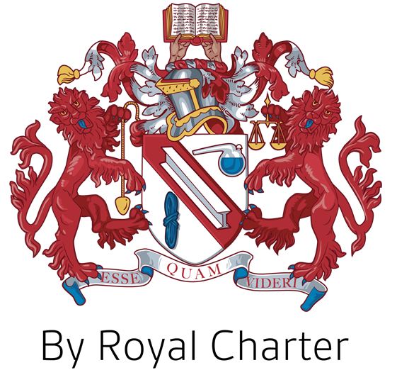
But before I begin talking about trading companies, it is important to discuss the meaning of “royal charters,””chartered companies,” and related-issues like “body corporate.”
This discussion will also come into play again in the subject of colonization, which I will also be touching on in part two of this post.
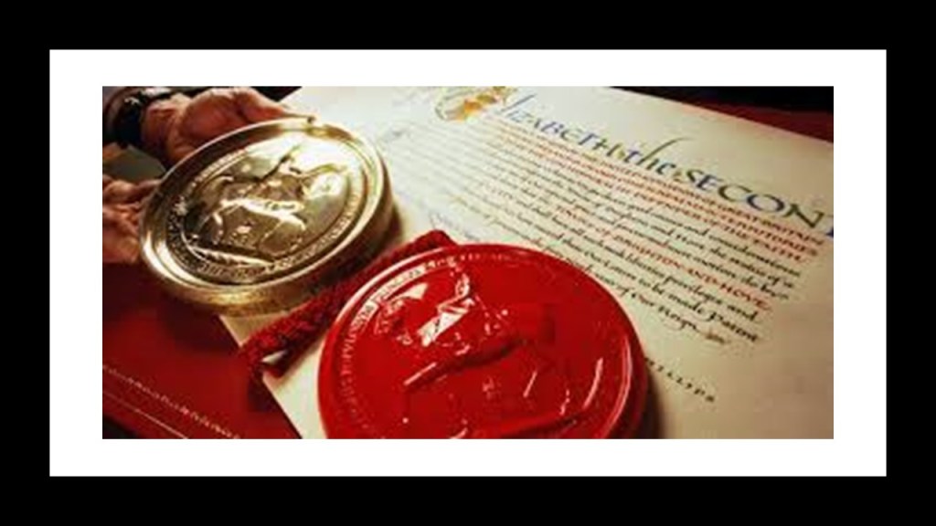
A royal charter is a formal grant issued by a monarch under “royal prerogative” as “letters patent.”
“Royal prerogative” is a body of customary authority, privilege and immunity recognized in common and civil law jurisdictions within a monarchy as belonging to the sovereign that becomes widely vested in government.
“Letters patent” are a type of legal instrument in the form of a published, written order issued by a monarch or other head-of-state, granting an office, right, monopoly, title or status to a person or corporation. Thus, they can be used for the creation of corporations or government offices, or for granting city status or a coat-of-arms.
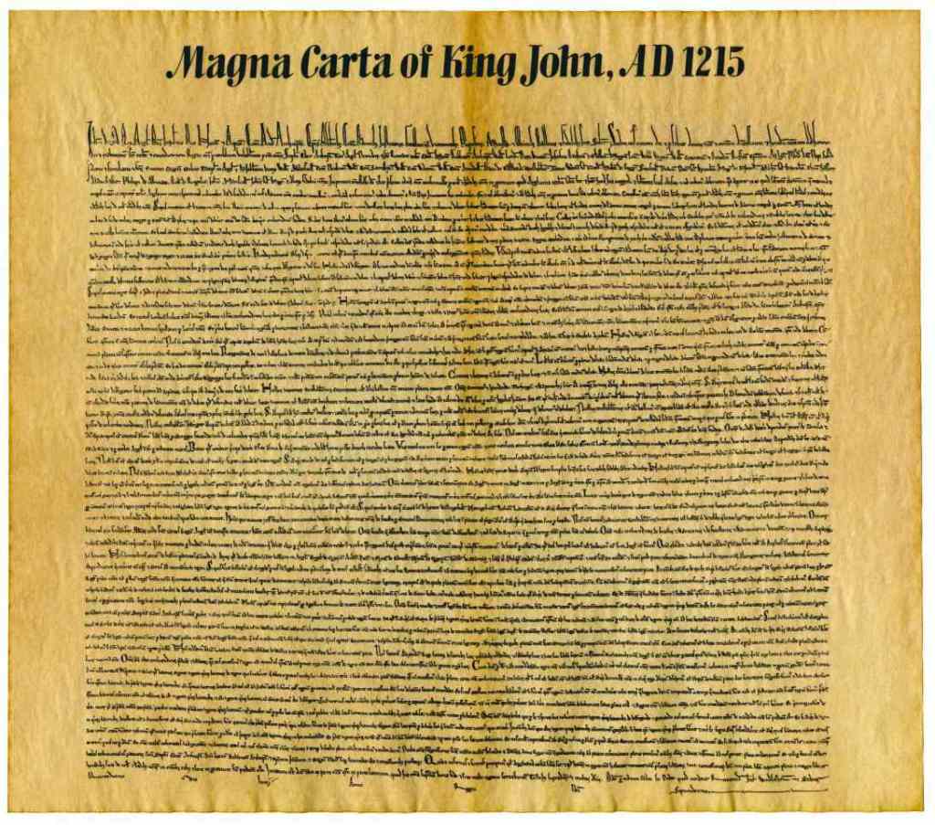
We are told Royal Charters historically were used to make public laws, like the Magna Carta of King John in 1215 AD.
Since the 1300s in our historical narrative, royal charters have been used to grant a right or power to an individual or “body corporate,”‘” the formal term for a corporation.
A “body corporate” functions as a “legal person” in law that can do the things a human person is usually able to do but are not literal people.

A “chartered company” is an association with investors and shareholders that is “incorporated,” or formed into a new corporation, and granted rights for the purposes of trade, exploration, or colonization.
Until the 19th-Century, royal charters were the only means that a company could become incorporated, other than by an Act of Parliament.

Arms are granted by the most senior heralds via the previously mentioned “Letters Patent.”
Heralds are appointed by the British Monarch and delegated to act on behalf of the Crown on all matters of heraldry, besides the granting of new Coats-of-Arms, including genealogical research and the granting of pedigrees.
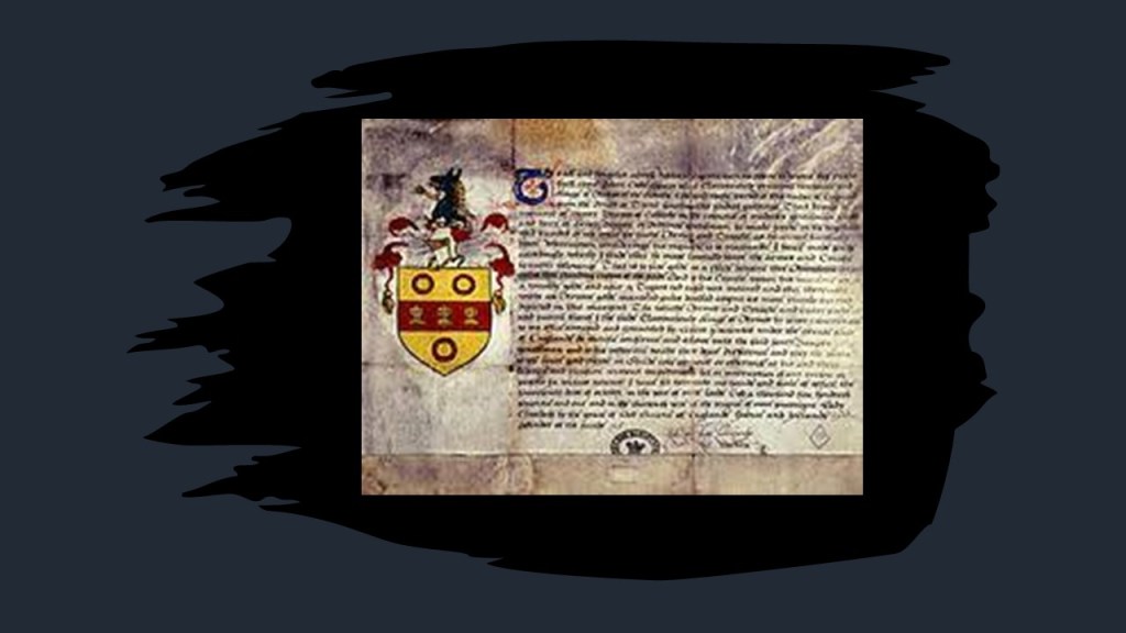
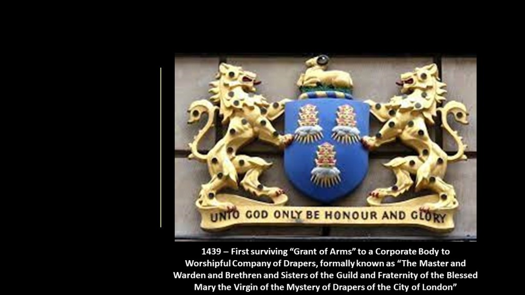
The use of Arms went from individuals to corporate bodies starting in 1438 with a Royal Charter of incorporation, and the earliest surviving grant of arms, for the “Worshipful Company of Drapers,” formally known as “The Master and Warden and Brethren and Sisters of the Guild and Fraternity of the Blessed Mary the Virgin of the Mystery of Drapers of the City of London,” and since then have been made continously including, but not limited to, companies & civic bodies.
When I think of the word “draper,” curtains come to mind, I guess because of the word “drapery,” which pertains to curtains.
Come to find out, the word “draper” is defined as a retailer or wholesaler of cloth that was mainly for clothing.
Hmmm.
Why all the fanfare and fancy titles for cloth merchants?
Was that the “Mystery of Drapers” referenced in the formal title of the company?
The College of Arms was said to have been first incorporated by a Royal Charter in March of 1484 under King Richard III, and then re-incorporated in 1555 under Queen Mary I of England.
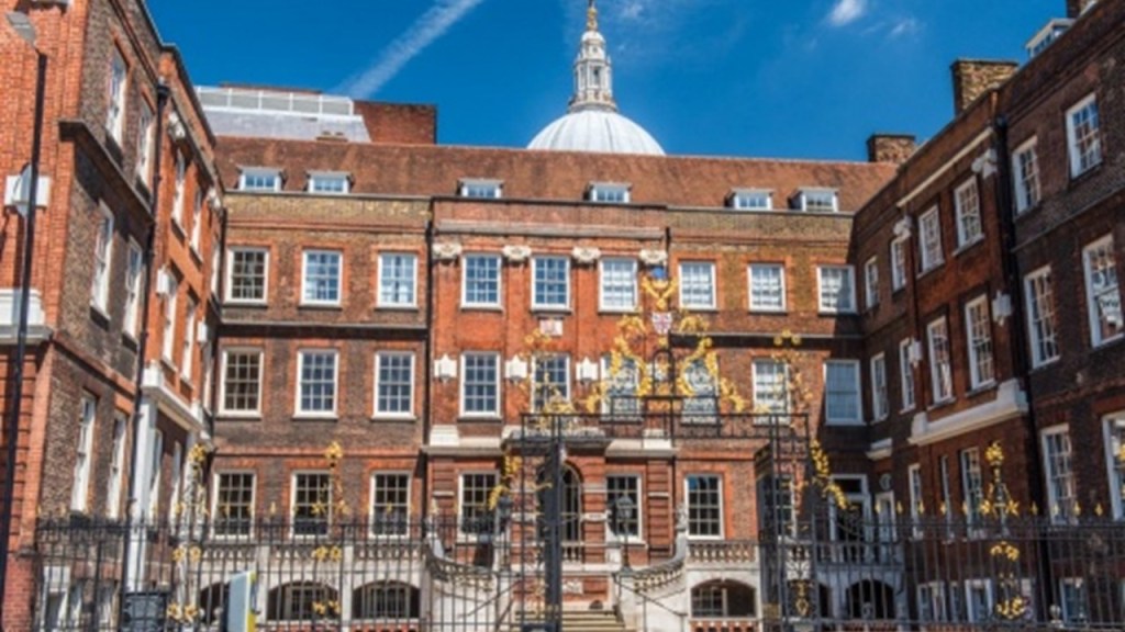
The College of Arms has been on Queen Victoria Street in the City of London in the shadow of St. Paul’s Cathedral since 1555.
This is the Coat-of-Arms for the College of Arms, with the motto “Diligent and Secret,” which interestingly the heraldry-wiki doesn’t know the meaning of.
Could it possibly mean exactly what it says – diligent and secret?
Like we don’t want you to know something, but we are sure working hard at what we are doing!
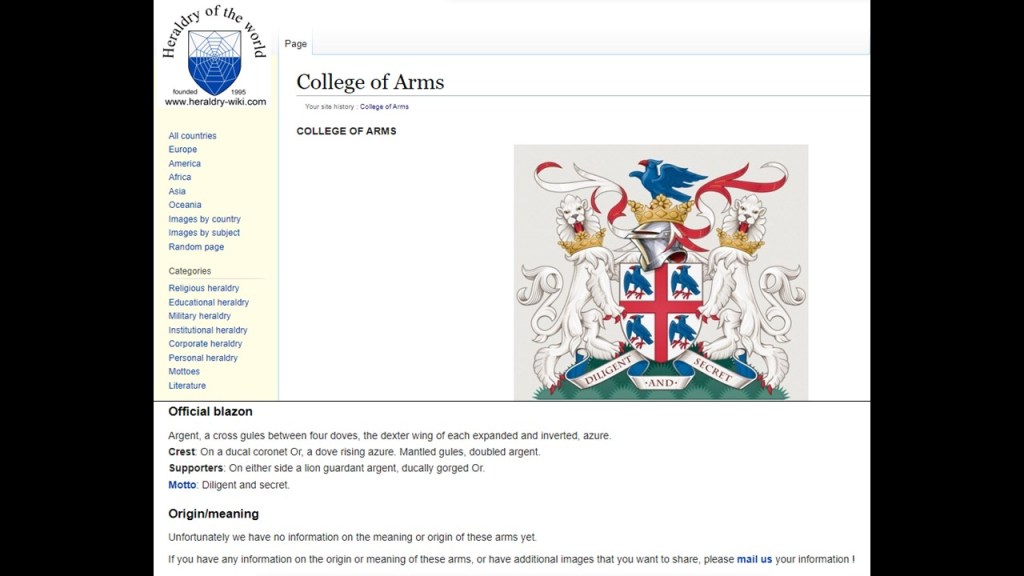
“The Laws of Heraldic Arms” governs the ‘bearing of arms,’which is the possession, use or display of arms, also called “Coats-of-Arms” and “armorial bearings.”
According to the “Law of Heraldic Arms,” “Coats-of-Arms” and other similar emblems may only be borne by 1) ancestral right, or descent from an ancestry through the male line; 2) or a grant made to the user under due authority, like the State or the Crown.
More to come on this in Part 2 of this post under the subject of “Colonization” with respect to “Ancestral Right.”
With regards to the “Law of Arms” as part of the general law, such armorial bearings are considered a form of property, and confer certain rights upon the grantee.
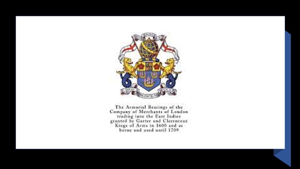
Now onto the subject of trading companies, starting with the British East India Company.
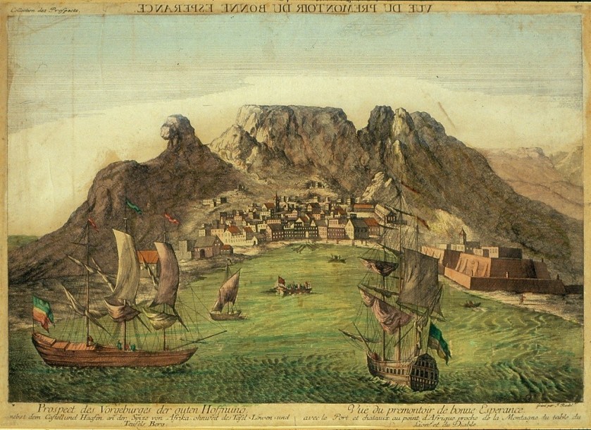
The British East India Company held a monopoly granted to it by Queen Elizabeth I of England in 1600 between South Africa’s Cape of Good Hope and Tierra del Fuego’s Cape Horn at the southern tip of South America, until 1834 when the monopoly was lost.
East Indiaman was the general name of any sailing ship operating under charter or license to any of the East India companies of the major European trading powers of the 17th- through 19th-centuries.
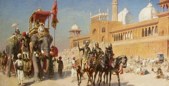
The British East India Company ruled over parts of the Indian Subcontinent between 1757 and 1858, commencing after the 1757 Battle of Plassey, called a decisive victory over the Nawab of Bengal, Mir Jafar, after which time the Nawab ceded revenues to the what was called the “Company.”
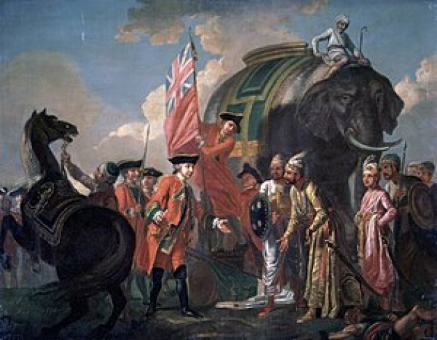
Mir Jafar was considered the first dependent Nawab of Bengal of the British East India Company, and this was considered to be the start of British Imperialism in India, and a key step in the eventual British domination of vast areas there.
The British East India Company arrived in what came to be known as Madras in 1600, making it their principal settlement, and we are told, constructed Fort St. George in 1644.
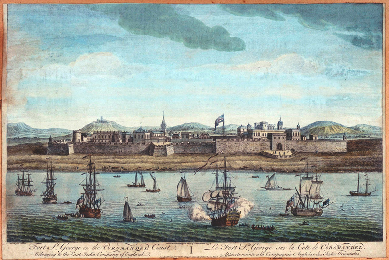
The British East India Company was said to have come here in order to have a port close to the Malaccan Straits, the main shipping channel between the Indian Ocean and Pacific Ocean, and to secure its trade lines and commercial interests in the spice trade.
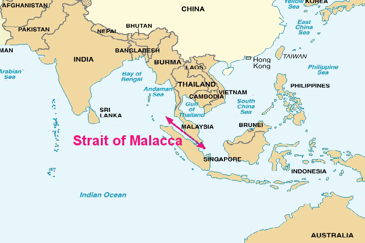
It is one of the most important shipping lanes in the world.
They succeeded in securing their goals, as the British East India Company obtained the Prince of Wales Island in the Malaccan Strait.
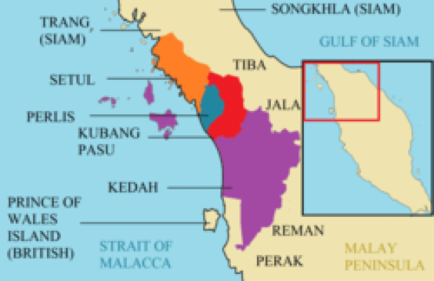
Prince of Wales Island is known today as Penang Island, the main constituent island of the Malaysian state of Penang.
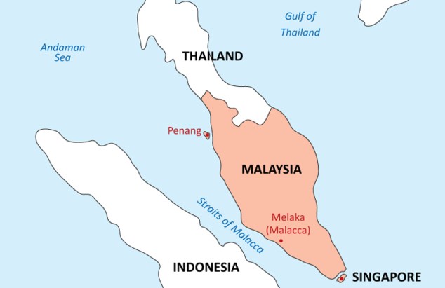
Apparently the British East India Company was able to successfully take what they named the Prince of Wales Island from the Kedah Sultanate in 1786, which became the capital of the Straits Settlements, a group of British territories in Southeast Asia established in 1826, including Melaka and Singapore.
The Kedah Sultanate was an historical Muslim dynasty located in the Malay Peninsula, said to have dated as an independent state from 1136 AD.
Its monarchy was abolished with the formation of the Malayan Union in 1909, but restored and added to the Federation of Malaya in 1963.
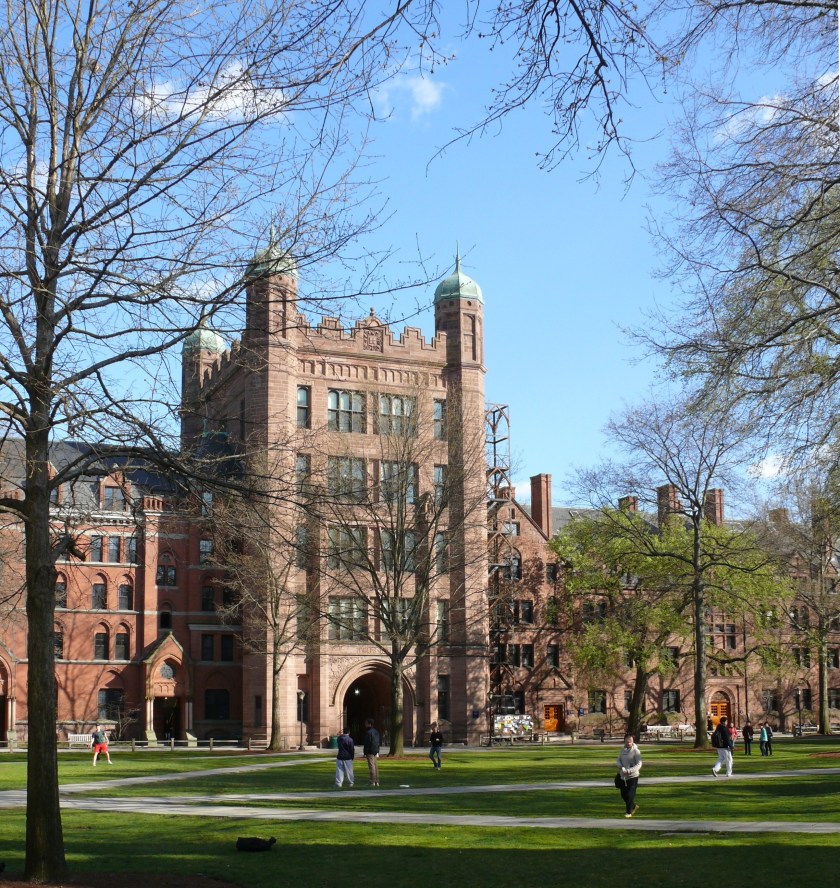
The Madras Presidency, or the Presidency of Fort St. George, was an administrative subdivision of British India, and established in 1652, and of which Elihu Yale became president in 1684.
Elihu Yale was a British merchant, trader, and a President of the British East India Company settlement at Fort St. George…
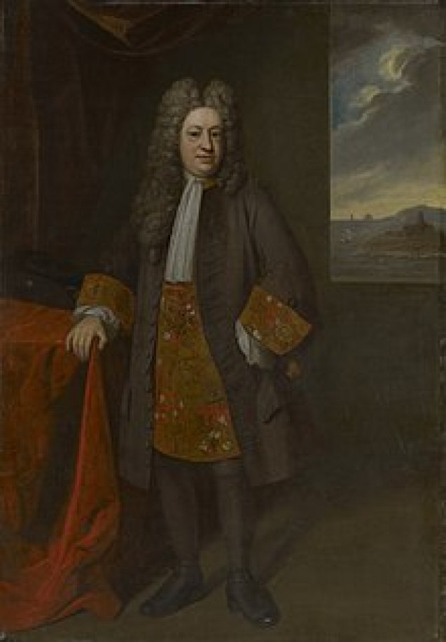
…who later became a benefactor of the Collegiate School in the Colony of Connecticut, which in 1718 was renamed Yale College in his honor.
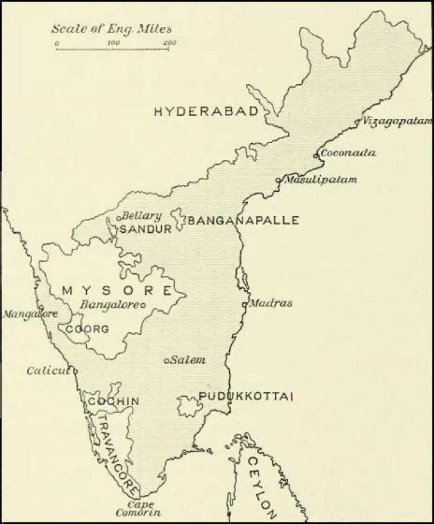
At its greatest extent, the Madras Presidency included most of southern India, including the whole of the states of Tamil Nadu and Andhra Pradesh; parts of Odisha, Kerala, and Karnataka; and the union territory of Lakshadweep, a group of islands off India’s southwestern coast.
The Madras Presidency ended with the advent of Indian independence on August 15th of 1947.
Bareilly, in northern India, was a center of the ultimately unsuccessful Indian Rebellion of 1857.
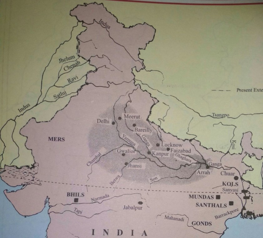
At this time a major uprising took place in northern India, which lasted between 1857 and 1859 against the rule of the British East India Company, which functioned as a sovereign power on behalf of the British Crown.
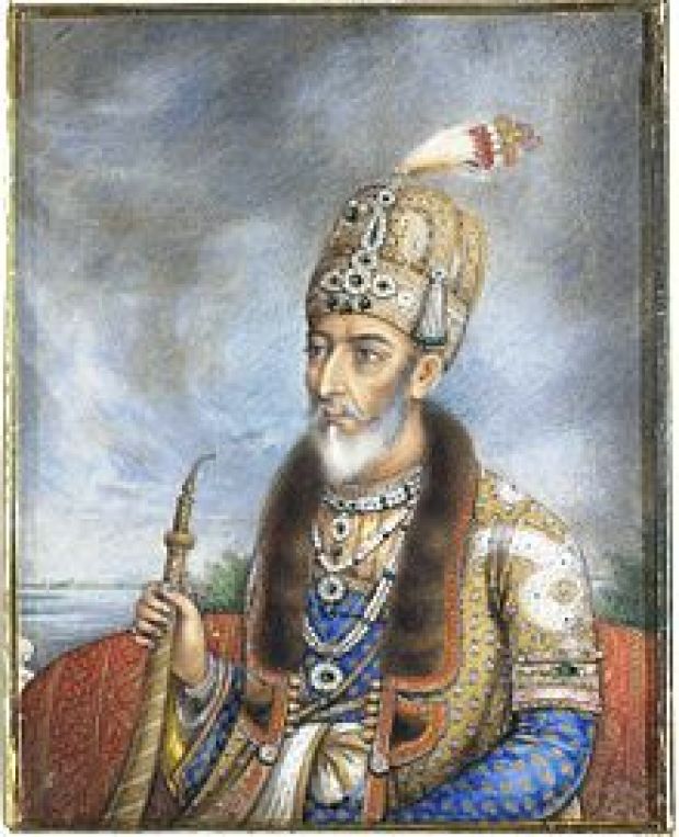
The last Mughal Emperor in India, Bahadur Shah Zafar, a devout Sufi, a mystic and practitioner of the inward dimension of Islam, was deposed by the British East India Company in 1858, and exiled to Rangoon in Burma.
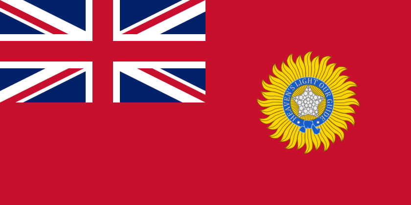
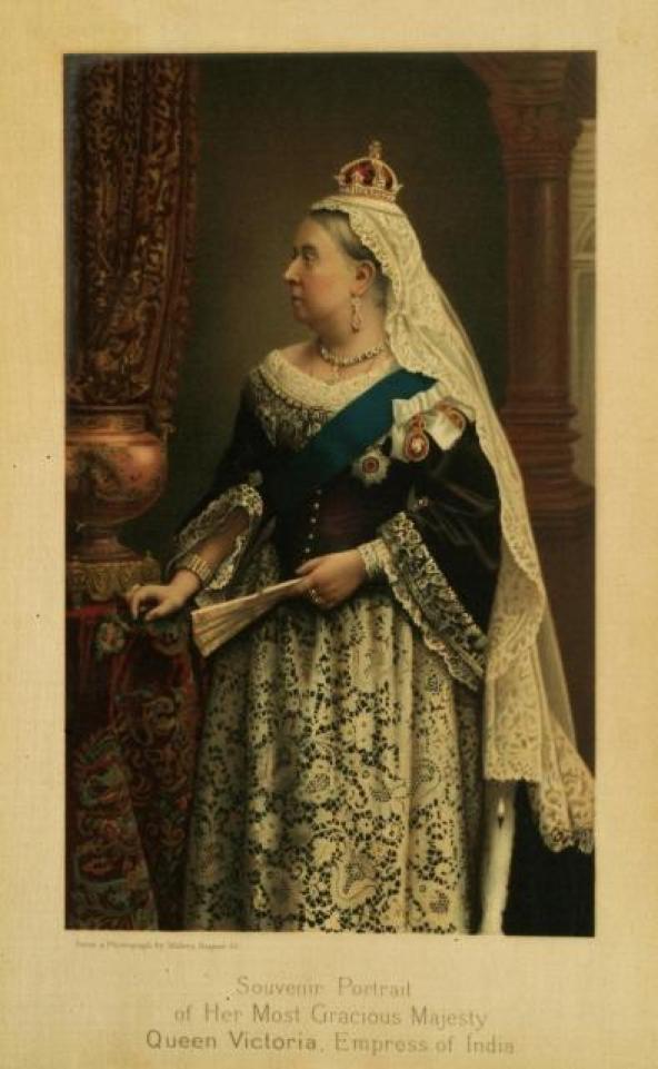
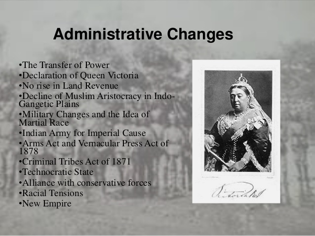
Through the Government of India Act of 1858, the British Crown assumed direct control of the British East India Company-held territories in India in the form of the new British Raj…

…and in 1876, Queen Victoria assumed the title of Empress of India.
King-Emperor and Queen-Empress were the titles used by the British monarchs in India between 1876 and 1948.
The tribe of Bhil Minas inhabits all three islands on Dhebar Lake near Udaipur in India.
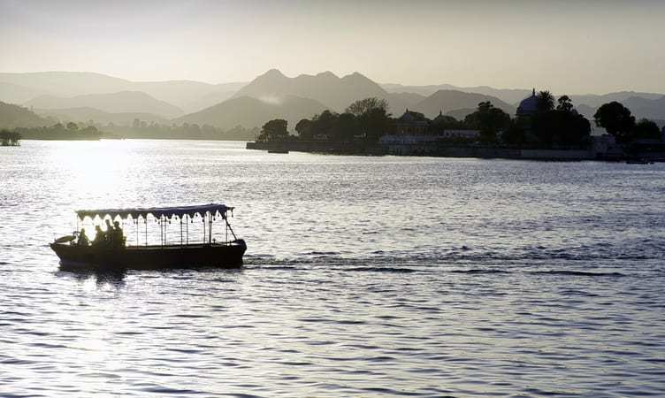
The Bhils, who speak a subgroup of the western zone of the Indo-Aryan languages, are one of the largest indigenous groups in India, as well as among the most economically deprived peoples of India.
This is interesting to note because they are among the oldest communities in India and were inhabitants of the ancient Indus River Valley civilization.

The Bhil Minas tribe was the ruling tribe before the Mewar Kingdom, forced them to hide out in the Aravalli Hills, and they were named a criminal tribe by the British government in 1924 to keep them from regaining power over the Rajputs.
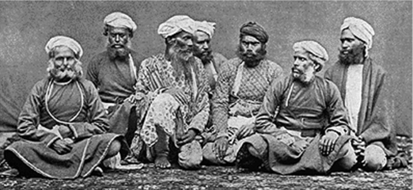
They were subsequently given protection as a Scheduled Tribe after the upliftment in 1949 of the Criminal Tribe Act, which had been enacted on October 12th of 1871.
The Criminal Tribes Act of 1871 criminalized entire communities by designating them as habitual criminals, and restrictions on their movements imposed, including men having to report to the police once per week.
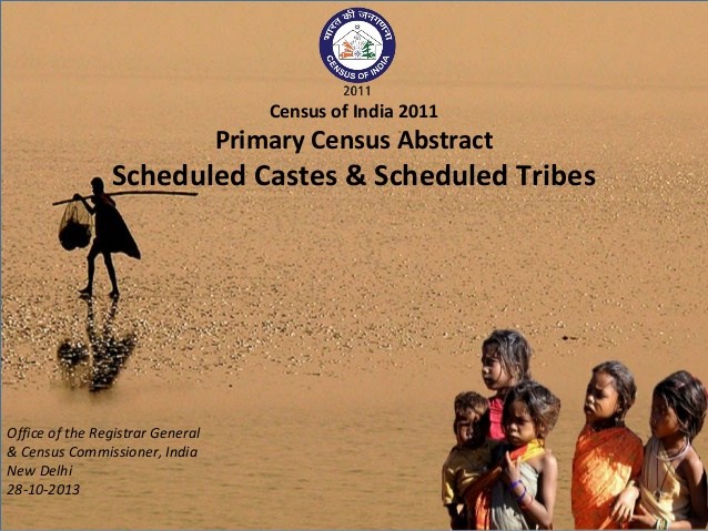
A Scheduled Tribe is recognized by the Indian Constitution, have political representation, and yet they are legally totally or partially excluded from various types of services important for leading a healthy life, and altogether, the Scheduled Tribes of India make-up almost 10% of the population, and are considered India’s poorest people.
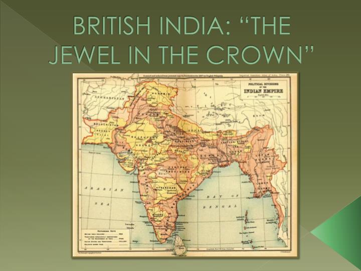
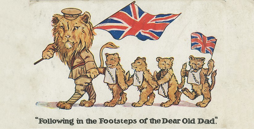
India was called the “Jewel in the Crown” of the British Empire. and its largest, and most important, overseas possession.
Much of the British Empire was built around India, in order to provide routes to, or protection for, India.
India was prosperous and rich, in spices, silk, indigo, gold, cotton, and other products and resources.
Trade with, and eventual political dominance of large parts of India, was what provided Britain with large parts of its wealth in the 1700s through 1900s.
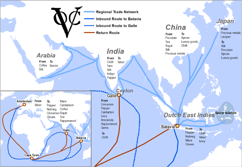
On March 20, 1602, Dutch East India Company was chartered to trade with India and Southeast Asian countries by the States General of the Netherlands, the Supreme Legislature of the Netherlands, granted it a 21-year monopoly for the Dutch spice trade.
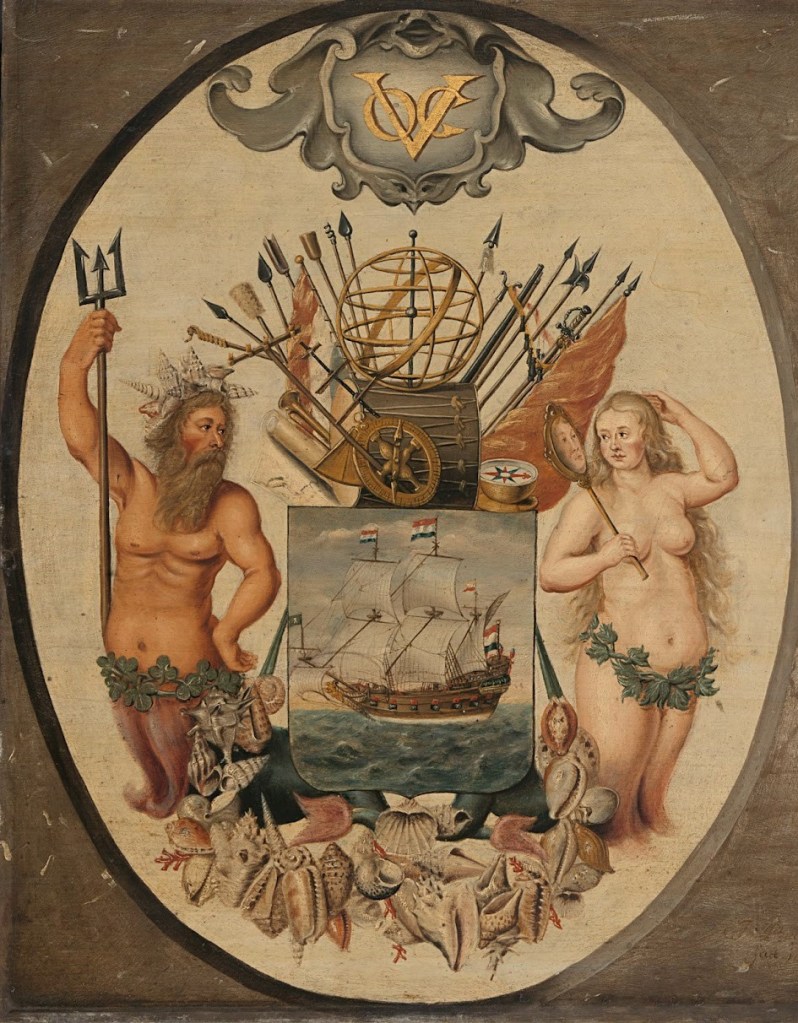
It was a megacorporation, which is defined as a massive conglomerate (usually private) holding near-monopolistic, if not monopolistic, control over multiple markets.
It was chartered to trade with Mughal India, and primarily Mughal Bengal, from where 50% of textiles and 80% of silks were imported.
It has often been labelled a trading or shipping company, but was in fact a proto-conglomerate, diversifying into multiple commercial and industrial activities, such as international trade, ship-building, production and trade of East Indian spices, Indonesian coffee, Formosan (Taiwan) sugar-cane, and South African wine.
The first formally listed public company by widely issuing shares of stock and bonds to the general public in the early 1600s, it was the world’s most valuable company of all-time, with a worth of $7.9-trillion.
It is considered by many to be to have been the forerunner of modern corporations.

Among other places, I found the Dutch East India Company in Cape Town, South Africa, establishing the first European settlement in South Africa there in 1652, called the VOC Cape Colony.
In 1814, it became the British Cape Colony, as it was ceded to the British Crown by the Netherlands after the British successfully invaded and took-over everything from the Dutch starting in 1806.
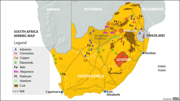
South Africa is the world’s leading producer of copper, platinum, uranium, and vanadium.
The British East India Company and the Dutch East India Company were the major players of a number of trading companies during that era.
Others included:
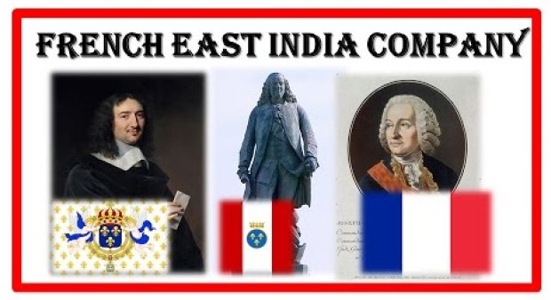
The French East India Company founded in 1661 to compete with first the British, and later the Dutch East India Companies, in the East Indies, the term given to the lands of South and Southeast Asia.
It was chartered by King Louis XIV for the purpose of trading in the Eastern Hemisphere, and was abolished in 1769 because it was said to have not been able to maintain itself financially.
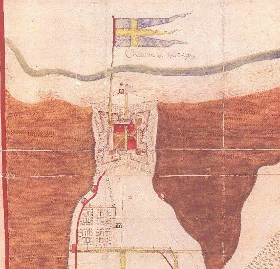
The Swedish South Company was founded in 1626 to support trade between Sweden and its colony New Sweden.
The company established a settlement at Fort Christina, named after Queen Christina of Sweden, and is present-day Wilmington, Delaware.
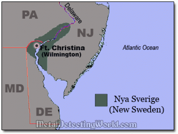
Said to have been built in 1638, the first Swedish settlement in North America, and the principal settlement of the New Sweden Colony.
The activities of the Swedish South Company were finally dissolved in 1680, after New Sweden was annexed by New Netherland in 1655.
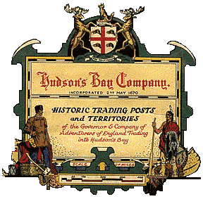
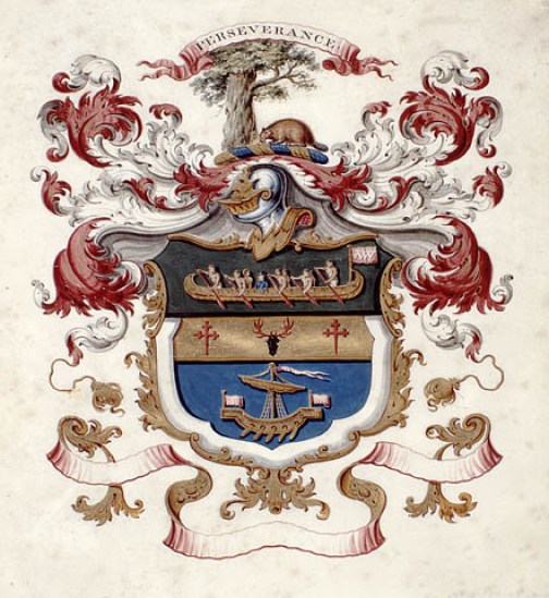
The Hudson Bay Company was granted a permanent charter by King Charles II of England on May 2nd, 1670, conferred two things on a group of French explorers: 1) A trading monopoly with London merchants over the lucrative North American fur trade; and 2) Gave them effective control over the vast region surrounding the Hudson Bay in Canada.
It is still in operation today as a Canadian retail business group operating department stores in several countries.
The British Northwest Company, a fur-trading business based out of Montreal in Quebec from 1779 to 1821, built their inland headquarters at Grand Portage in Minnesota in 1785, and was active there until 1802.
Grand Portage, along with Fort Niagara, Fort Detroit, and Michilimackinac in the Straits of Mackinac in Michigan, were the four main fur-trading centers of the British Empire in North America.
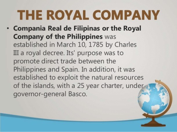
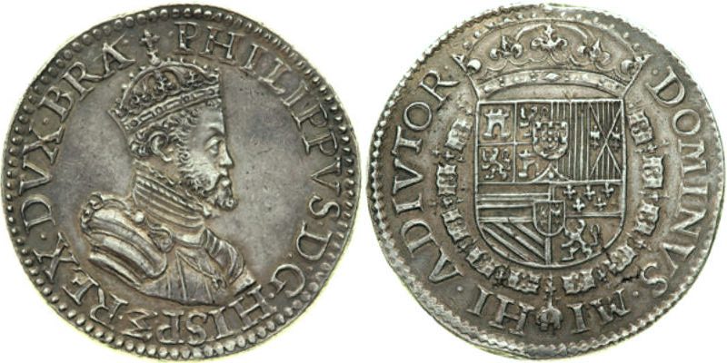
The Royal Company of the Philippines was established by the royal decree of King Charles III of Spain, and had a monopoly on the trading industry between Spain and the Philippines, and to exploit the natural resources of the islands.
It also opened a large access to goods from the Orient that were imported into the Philippines.
The next subject I would like to introduce is that of “Partition,” and what that actually looked like in real life.
Partition is defined as a change of political borders cutting through at least one territory considered a homeland by some community.
Here are some examples I encountered in my research.
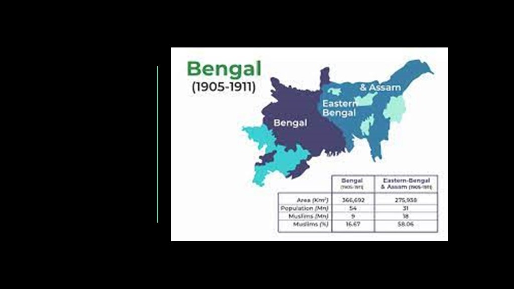
Another one of three presidencies of British India within the British Empire was the Bengal Presidency, which was formed following the dissolution of Mughal Bengal in 1757.
The Bengal Presidency was the economic, cultural, and educational hub of the British Raj, and its governor was concurrently the Viceroy of India for many years.
In 1905, Bengal Proper was partitioned, separating largely Muslim areas eastern areas from largely western Hindu areas.
In 1912, British India was reorganized and the Bengal Presidency was reunited with a single Bengali-speaking province.
Could this first partitioning of Bengal have been a human- and social-engineering project, and a practice run for the 1947 Boundary partition of India?
The 1947 Boundary Partition divided what was British India into two independent dominion states – the Union of India and the Dominion of Pakistan. Today they are called the Republic of India and the Islamic Republic of Pakistan.
It involved the division of two provinces – Punjab and Bengal – based on district-wise non-Muslim or Muslim majorities, and resulted in the dissolution of the British Raj.
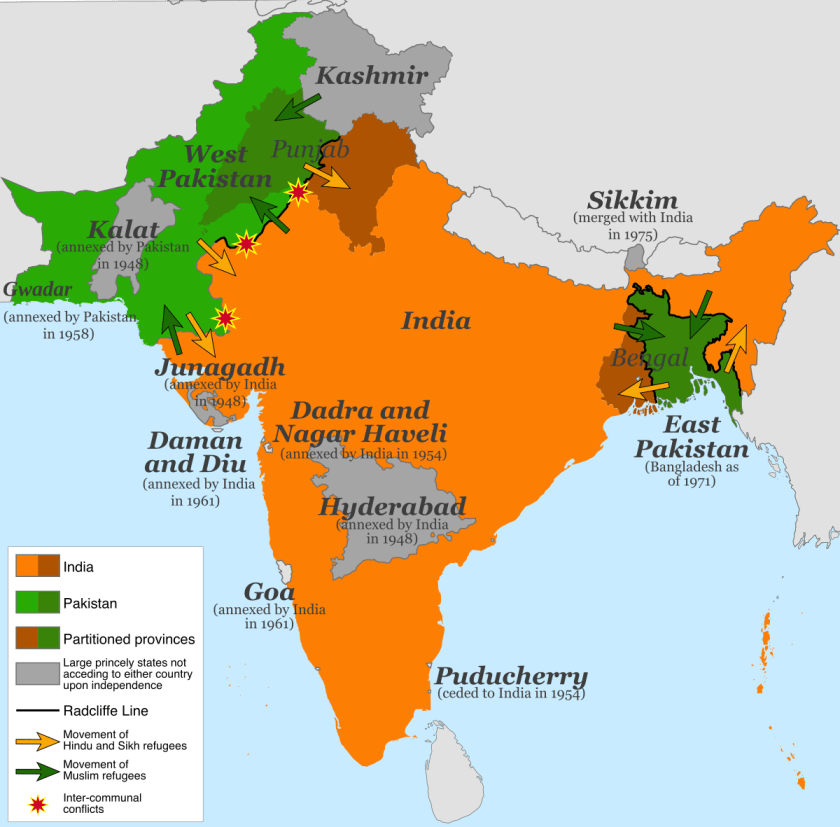
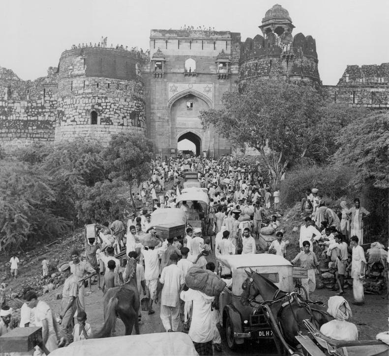
The Partition of India in 1947 divided British India into the Union of India and the Dominion of Pakistan along religious lines, displacing 10 – 12 million people and creating overwhelming refugee crises in the newly constituted dominions, as well as large-scale violence. This created the conditions for suspicion and hostility between these two countries into the present-day.
The Pashtuns are the primary inhabitants of a region in Pakistan and in Afghanistan, in a region regarded as Pashtunistan, split between two countries since the Durand Line border between the two countries was formed in 1893 after the second Anglo-Afghan War.
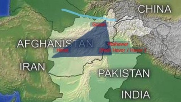
The name sake of the line, Sir Henry Mortimer Durand, was a British Diplomat and Civil Servant of the British Raj. We are told that together with the Afghan Emir, Abdur Rahman Khan, it was established to “fix the limit of their respective spheres of influence and improve diplomatic relations and trade.”
Well, that certainly sounds good…but what was really going on here?
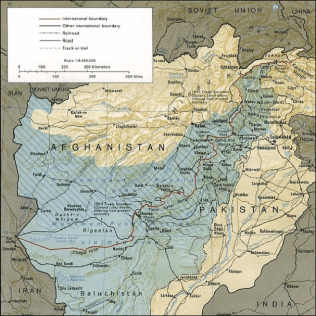
The Durand Line cuts through the Pashtunistan and Balochistan regions, politically dividing ethnic Pashtuns and Baloch, who live on both sides of the border.
What was the actual purpose of dividing a people in this fashion?
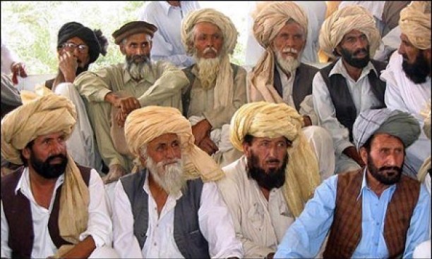
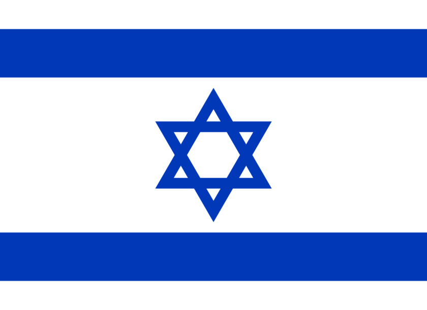
The Pashtun are a tribal nation of millions of Afghani and Pakistani Muslims who also have a strong oral tradition that they are descendants of lost ten Tribes of Israel, and they refer to themselves as Bani Israel.

Here is an example of a Pashtun textile piece showing the sacred geometric shape of a star tetrahedron in the center, also known as the Star of David…
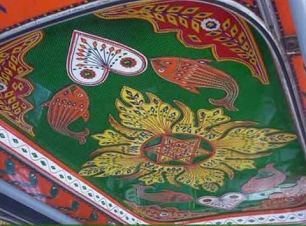
…and a recognizable symbol of what is called Judaism today, as seen on the flag of Israel.
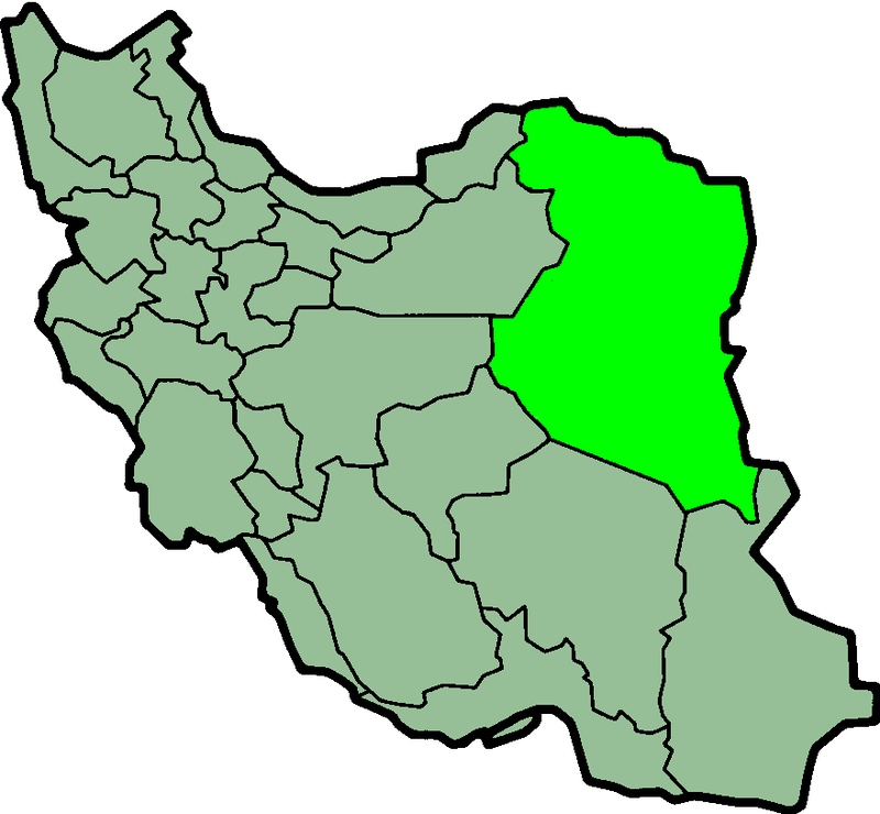
Khorasan was a province in northeastern Iran from 1906 to 2004, but historically referred to a much larger area comprising the east and northeast of the Persian Empire, including, besides northeastern Iran, parts of Afghanistan and much of Central Asia.
While Khorasan was said to mean “The Eastern Province,”it is also said to mean “The Land of the Sun.”
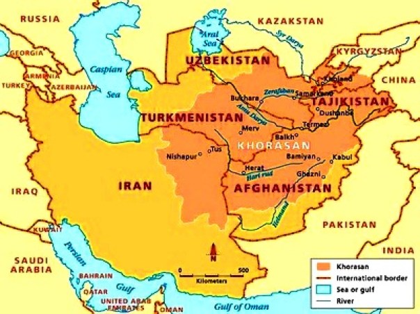
During the Qajar Dynasty and Empire, of what was then called the Sublime State of Persia between 1789 and 1925, Britain supported the Afghans to protect their East India Company.
Herat in Afghanistan was separated from Persia by British in the Anglo-Persian War of 1856 – 1857, and the Persians were unable to defeat the British to take back Herat.
Persia was compelled by the Treaty of Paris of 1857 not to challenge the British for Herat and other parts of what is today Afghanistan. Khorasan was divided into two parts in 1906, with the eastern part coming under British occupation, and the western section remained part of Persia, shown here.
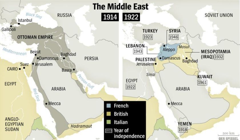
Another example was the Ottoman Empire, founded at the end of the 13th-century in northwestern Anatolia, and existing as a vast empire and center of interactions between east and west until the end of World War I, when it was defeated as an ally of Germany and occupied by Allied forces.
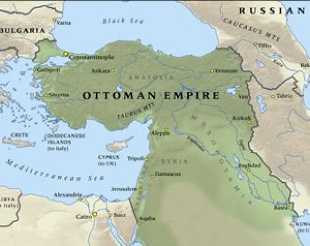
At this time, the Ottoman Empire was partitioned and lost its Middle East holdings, which were divided between the Allied Forces.
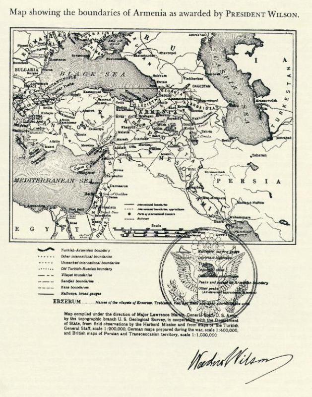
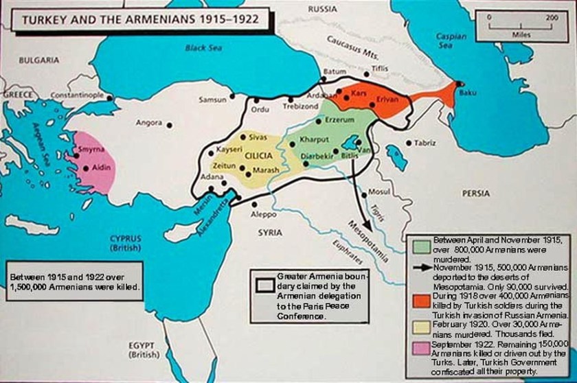
Then there is what happened to historical Armenia, much of which today is a part of Turkey.
There was a time when Armenia was considered the center of the world, as depicted in this map.
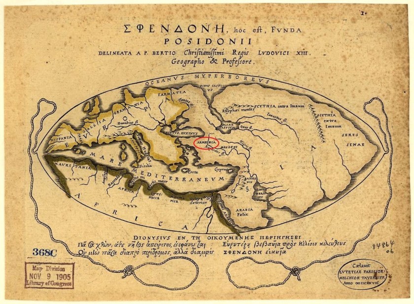
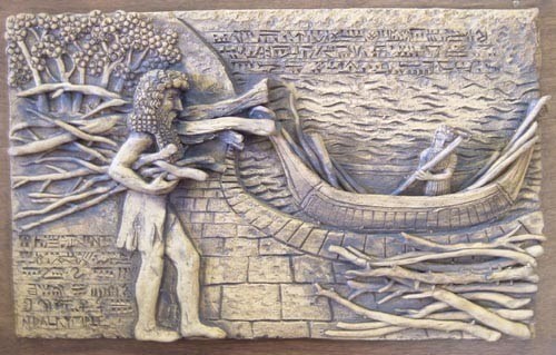
The Sumerians called Ararat “Arrata,” and they tell of this land of their ancestors in the Armenian Highlands in their epic poem of Gilgamesh.
At the end of World War I, when the victorious powers divided up the Ottoman Empire, the 1920 Treaty of Sevres promised to maintain the existence of the Armenian Republic and to attach the former territories of Ottoman Armenia to it.
Ottoman Armenia was referred to as Wilsonian Armenia because the new borders were to be drawn by U. S. President Woodrow Wilson.
The Treaty of Sevres never came into effect because it was rejected by the Turkish National Movement, which used the occasion to declare itself as the rightful government of Turkey.
Turkish Nationalist Forces invaded Armenia in 1920 from the east, ultimately forcing most of the Armenian military forces to disarm, cede back the former Ottoman lands granted to Armenia by the Treaty, and to give up “Wilsonian Armenia.”
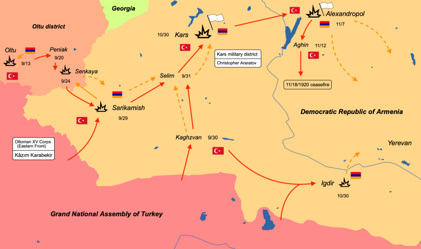
And during the same time frame, the Soviet Eleventh Army invaded Armenia, and ultimately took complete control of the rest of it in 1921.
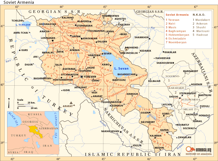
Thus, the Turkish War of Independence initiated under the leadership of Mustafa Kemal Ataturk against the occupying powers resulted in the abolition of the monarchy in 1922, and the establishment of the Republic of Turkey in 1923.
Ataturk was the first president of the new republic, moving the country’s seat of power from Istanbul to Ankara.

Obviously this region of historical Armenia was highly prized, and its people were persecuted and many were killed.
The next area I am going to look into specifically are wars themselves.

It is noteworthy there are so many military engagements historically that have taken place along these I have tracked, which include, but aren’t limited to, the Napoleonic Wars, World War I, World War II, Viet Nam, among others.
It makes me wonder what they were really all about with regards to the ancient advanced Moorish Civilization and the earth’s energy grid system.
I find it interesting that General Charles Cornwallis, famous for being defeated at, and surrendering after the Battle of Yorktown in 1781, ending the American Revolutionary War apparently was rewarded with knighthood in 1786, and in the same year became the Governor-General and Commander-in-Chief of the British Colony in India.
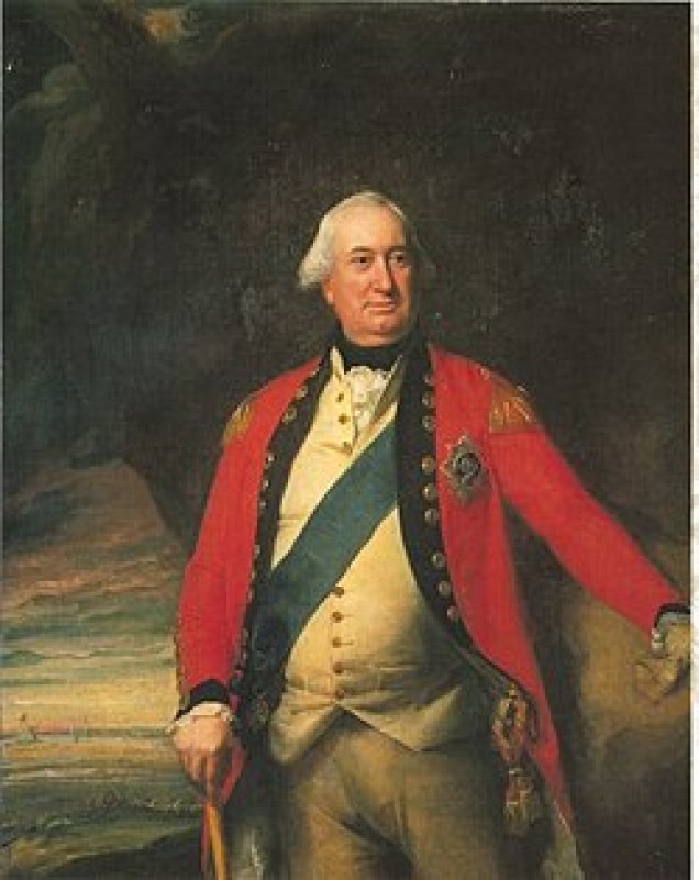
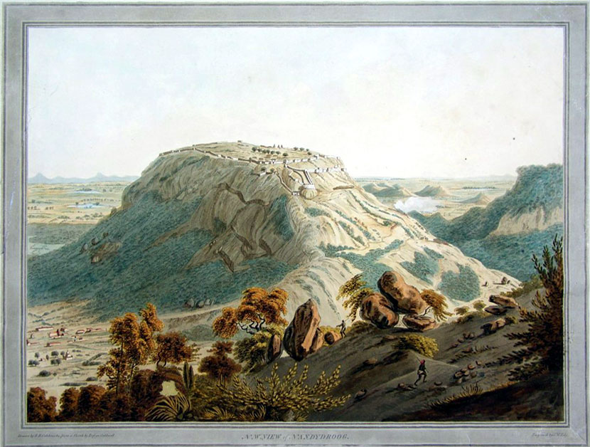
He commanded the army that successfully stormed Nandidurg in 1791, an ancient hilltop fortress in Karnataka State that was at one time believed to have been impregnable.
This was during a conflict in South India between the British East India Company and the Kingdom of Mysore.
Here are some examples I found from the time of the Napoleonic Wars and empire.
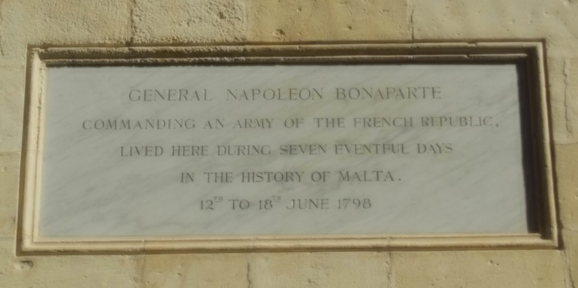
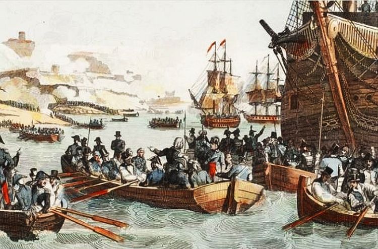
The French invasion of Malta in 1798, led by Napoleon himself, was part of the Mediterranean Campaign in the War of the Second Coalition of the French Revolutionary Wars.
The Order of the Knights Hospitallers, the rulers of Malta since 1530, surrendered to Napoleon when the French landed there.
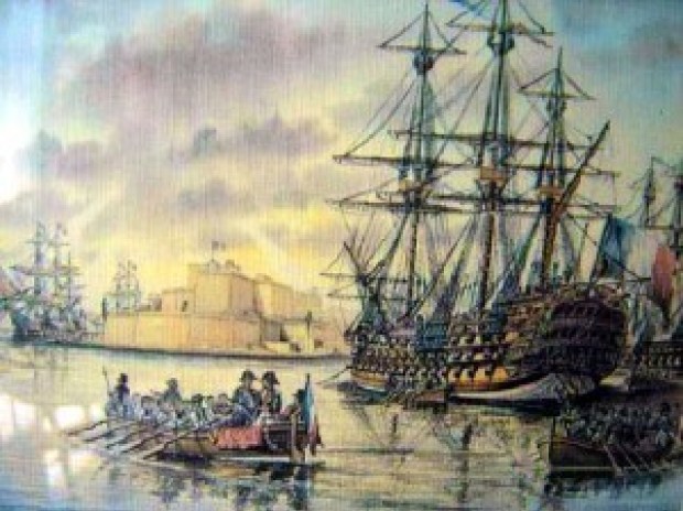
The island country of Malta is located in the Mediterranean Sea between Sicily and Tunisia.
We are told that during the short time Napoleon was in the capital city, Valletta, between June 12th and 18th of 1798, he reformed, among other things, national administration with the creation of a Government Commission and twelve municipalities; a public finance administration, and the organization of public education, providing for primary and secondary education.
All this before sailing for Egypt, and leaving a substantial garrison in Malta.
Huh?
All this in a week?
And why?
After the British Royal Navy destroyed the French Mediterranean fleet at the Battle of the Nile in Egypt on August 1st, 1798, the British were able to initiate a blockade of Malta, assisted by an uprising of the native Maltese against French rule. The blockade effectively ended the French Occupation of Malta in 1800, and replaced it with British Protectorate, returning control of the central Mediterranean to Great Britain.
In the 1814 Treaty of Paris, Malta officially became part of the British Empire and was used as a shipping way-station and fleet headquarters.
When the Suez Canal opened in 1869, Malta was considered an important stop on the way to India, a central trade route for the British, because it was half-way between the Strait of Gibraltar and Egypt.
Malta gained its independence from Britain in 1964.
We are told the Union of the Kingdom of Denmark-Norway, also known as the Oldenburg Monarchy, existed as a dual monarchy between 1537 and 1814, with Copenhagen as its capital.
The Oldenburg Monarchy had long-remained neutral in the Napoleonic Wars.
Britain was said to have feared that Napoleon would attempt to conquer the Danish-Norwegian naval fleet, and used that as a pretext to attack Copenhagen in what became known as the Siege of Copenhagen in August of 1807, and Britain seized the naval fleet in September of 1807.
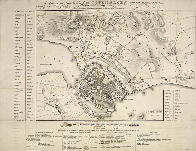
This also assured the use of the sea lanes in the North Sea and Baltic Sea for the British merchant fleet.
The “fleet robbery” drew Denmark-Norway into the war on the side of Napoleon.
Then in 1814, during the Napoleonic Wars, the Treaty of Kiel, between the United Kingdom and Sweden on the anti-French-side, and Norway and Denmark on the French-side, dissolved the Oldenburg Monarchy by transferring Norway to the King of Sweden.
The King of Denmark retained the Faroe Islands, Greenland, and Iceland.
The First Anglo-Afghan War was fought for three years between the British East India Company and the Emirate of Afghanistan starting in 1839, after the British had successfully captured Kabul, and they capitalized on a succession dispute between a current and former Emir there, at which time the British exiled the Emir at the time and installed the former Emir.
When the main British forces occupying Kabul retreated in January of 1842, they were almost completely annihilated by Afghani tribesmen. In retaliation, the British sent what was called an “Army of Retribution” to Kabul to avenge their defeat, and demolished parts of the city, recovered prisoners, and left Afghanistan, with the exiled Emir returning from India to Kabul.
Destruction that was done in retaliation for people who were defending their own land from invading foreigners who wanted to take it.
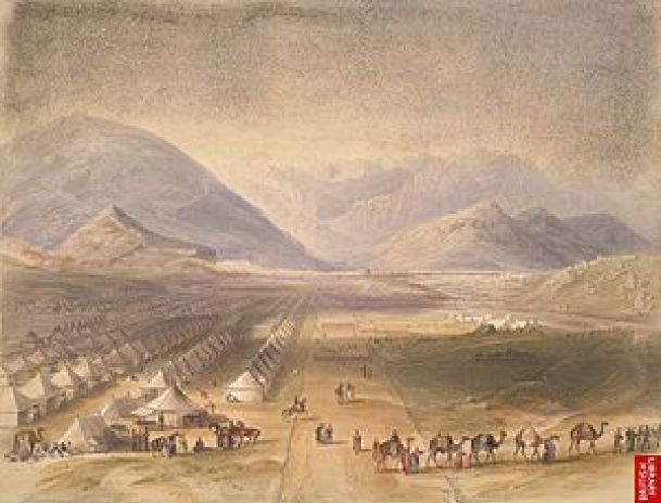
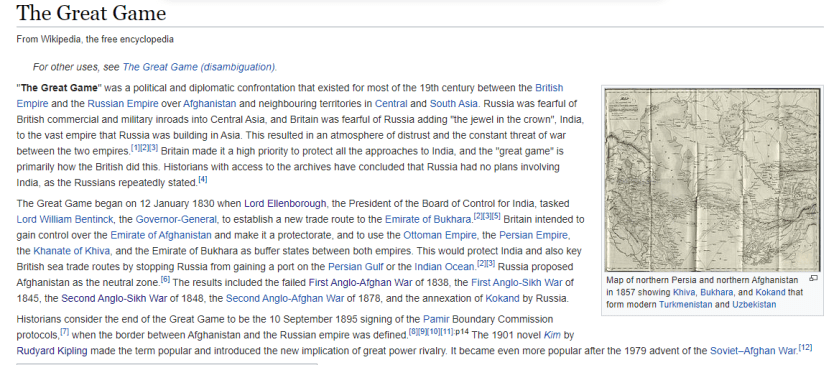
The First Anglo-Afghan War is called one of the first major conflicts of what was called “The Great Game,” the 19th-century competition for power and influence in central Asia between Britain and Russia.
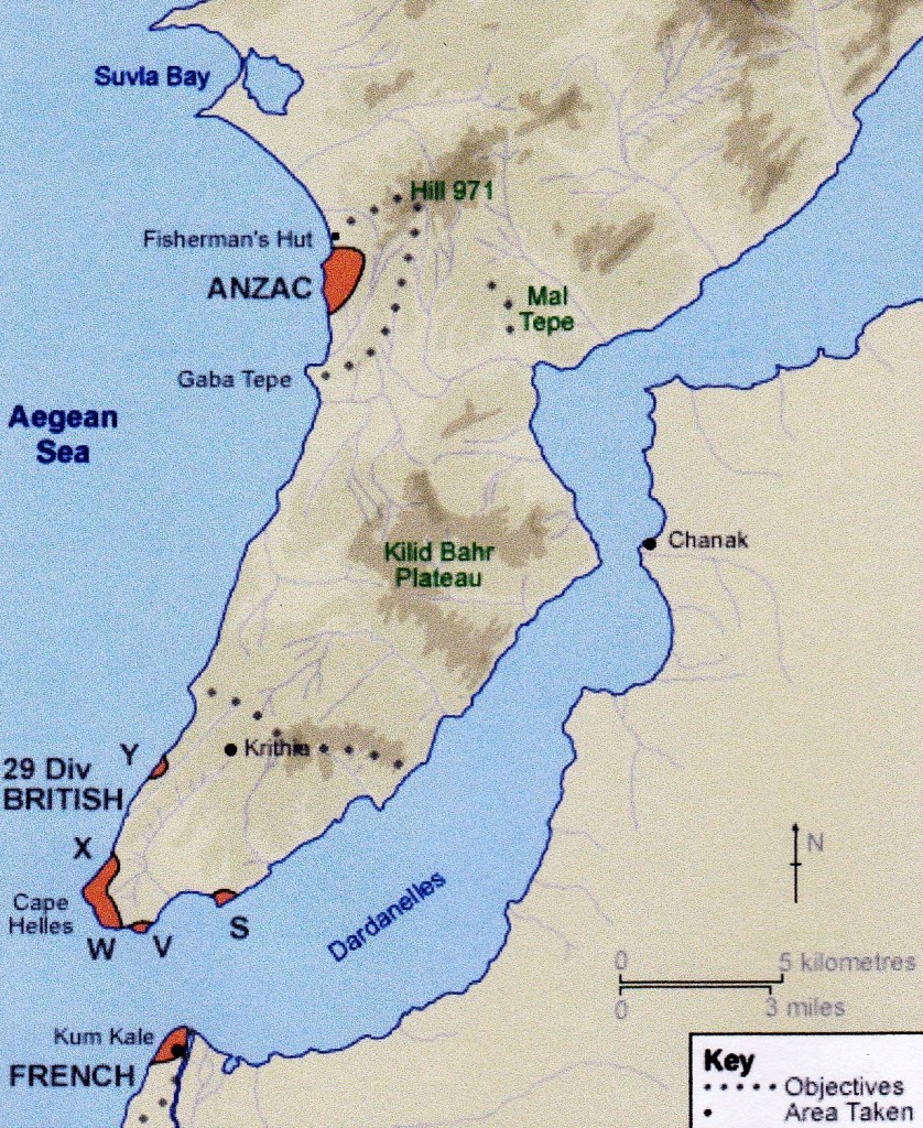
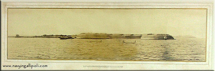
During World War I, the Strait of Dardenelles in Turkey was the location of the Gallipoli Campaign, one of the bloodiest battles of the war.
There were at least 24 forts in the Strait of Dardenelles, as they were numbered.
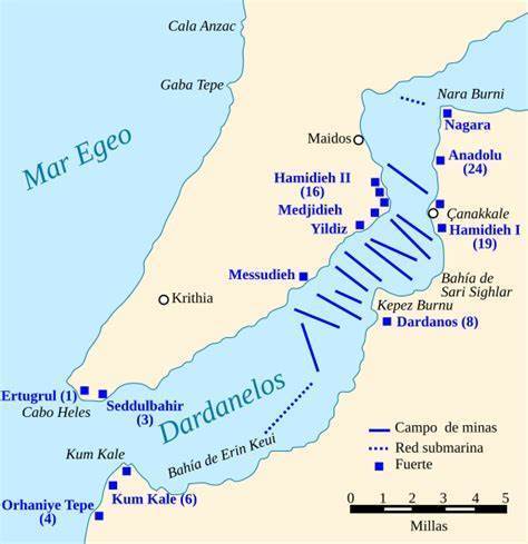
The Gallipoli Campaign took place between April 25, 1915, and January 9, 1916. A joint British and French operation was mounted to capture the Ottoman capital of Constantinople (known as Istanbul since 1923) and secure a sea route to Russia. The Ottomans were victorious at the end of this campaign.
There were direct attacks on the star forts in the Strait of Dardanelles – they were bombarded, and in many cases, completely destroyed.
These are examples of some of the things that took place during World War II.
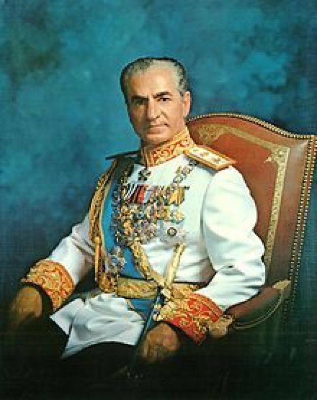
Reza Shah Pahlavi was deposed in September of 1941 as a result of the British and Soviet Invasion of Iran during World War II because he was seen as a German ally even though Iran had maintained neutrality in the conflict, which took place purportedly to secure Iran’s oil fields and the railroad used a supply route for war material for the Soviet Union along what was called the “Persian Corridor.”
The 865-mile, or 1,392-kilometer, Trans-Iranian Railroad was opened during the reign of Reza Shah Pahlavi in 1939.
He was replaced as Shah by his young son, Mohammed Reza Pahlavi, the last Shah of Iran, who was overthrown as Head-of-State on February 11th of 1979, after which time the country became the Islamic Republic of Iran.
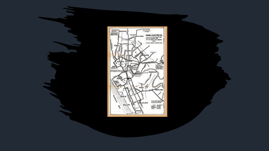
In 1945, in the last months of World War II, the Battle of Manila brought destruction and havoc to the city of Manila and its rail infrastructure.
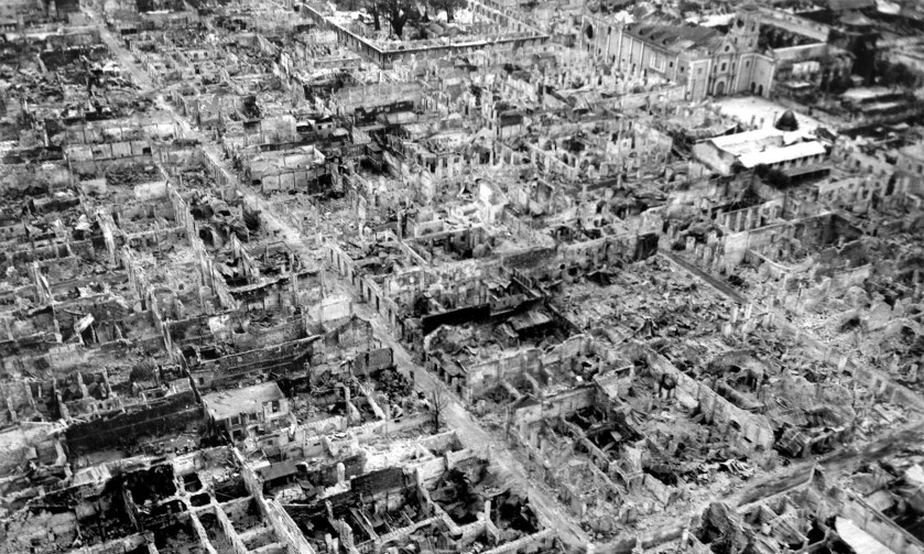
The Manila Tranvias fleet was damaged beyond repair, and abandoned immediately after the war.
The rails were pulled up from the city streets, and surviving streetcars were hauled away and scrapped.
This was the end of what had previously been considered one of the best street-rail networks in Asia.
In the years between the Gulf of Tonkin Incident, an alleged international confrontation that led to the United States engaging more directly in the Viet Nam War, in August of 1964 and its end in 1975…
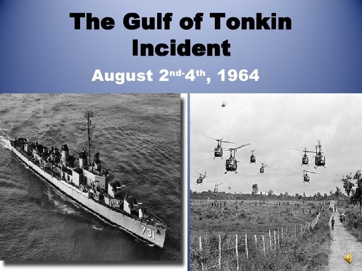
…the neighboring country in Southeast Asia of Laos had its own problems with the Viet Nam war spilling over, with Laos being bombed by American planes starting in 1964, in retaliation we are told, for the shooting down of an American plane by insurgents, and after which bombing runs over Laos intensified, with over 100,000 bombing runs on Laos’ eastern border with North Viet Nam.
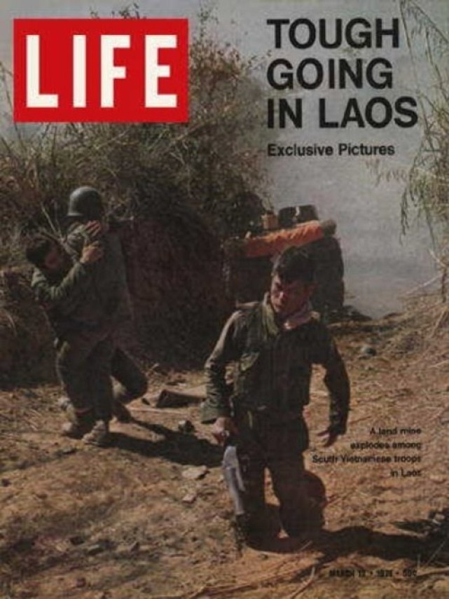
The Plain of Jars in Laos…
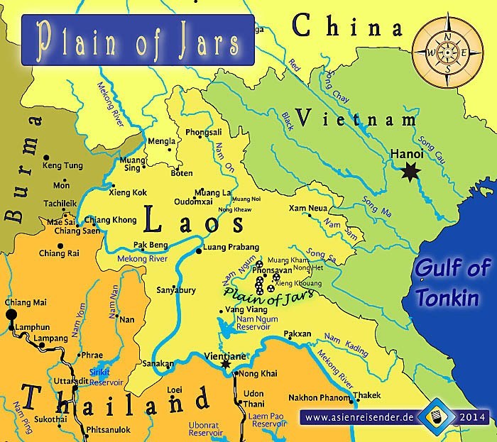
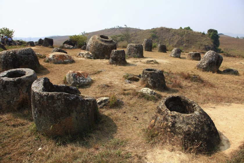
…was heavily bombed between 1964 and 1973 by the U. S. Air Force operating against the North Vietnamese and Pathet Lao communist forces, and it was said that the Air Force dropped more bombs on the Plain of Jars than it dropped during the entirety of World War II.
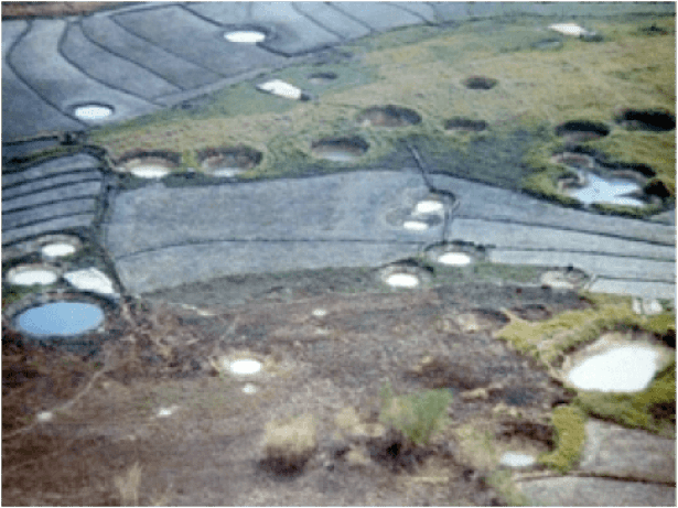
These were some unexploded bombs removed from the Plain of Jars from the secret war in Laos.
Per capita, Laos is the most bombed country in history!
Why?

The next area of research I would like to get into about how the New World was created from the Old World is the subject of Congresses and Conferences.
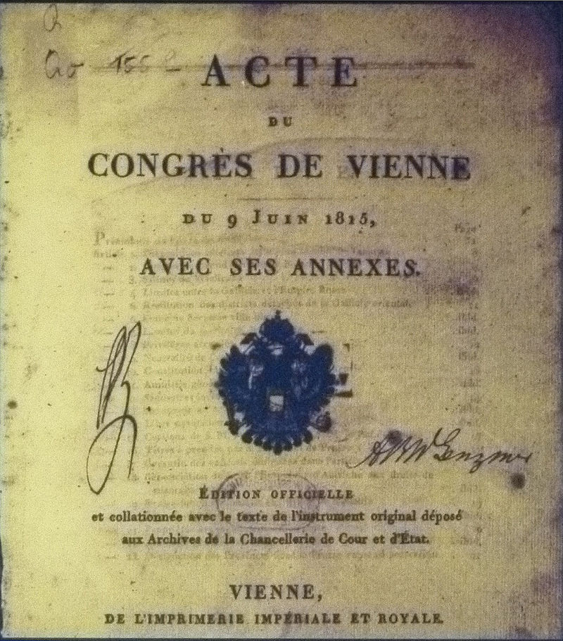
The Congress of Vienna was said to be one of the most important international conferences in European history.
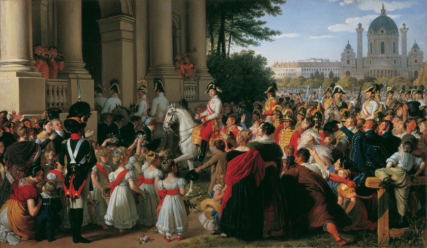
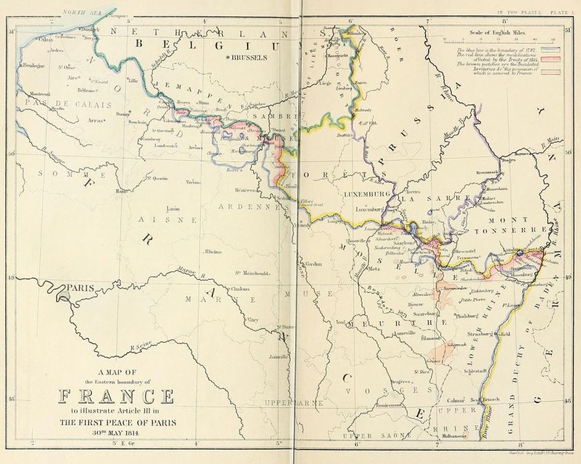
It was a meeting of ambassadors of European states held in Vienna in Austria between 1814 and 1815 in order to remake Europe after the downfall of Napoleon.
The stated goal was to resize the main powers so they could balance each other and in this way remain at peace, and not simply to restore old boundaries.
As a result of the Congress of Vienna, France lost all of its recent conquests, while Prussia, Austria, and Russia made major territorial gains.
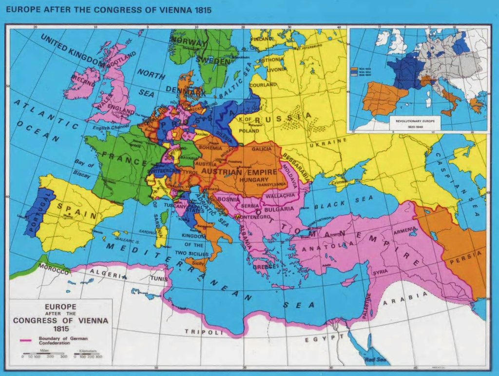
Most of the discussions took place in informal, face-to-face sessions among the ambassadors of Austria, Britain, France, Russia, and sometimes Prussia, with limited or no participation by other delegates.
As such, the Congress of Vienna never met in plenary session, which means a session in which all members of all parties are able to attend.
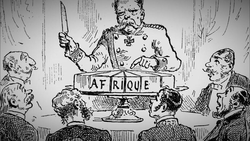
The Berlin Conference of 1884 – 1885 was organized by the German Chancellor Otto von Bismarck in order to regulate European colonization and trade in Africa during the New Imperialism period, and coincided with Germany’s sudden appearance as a imperial power.
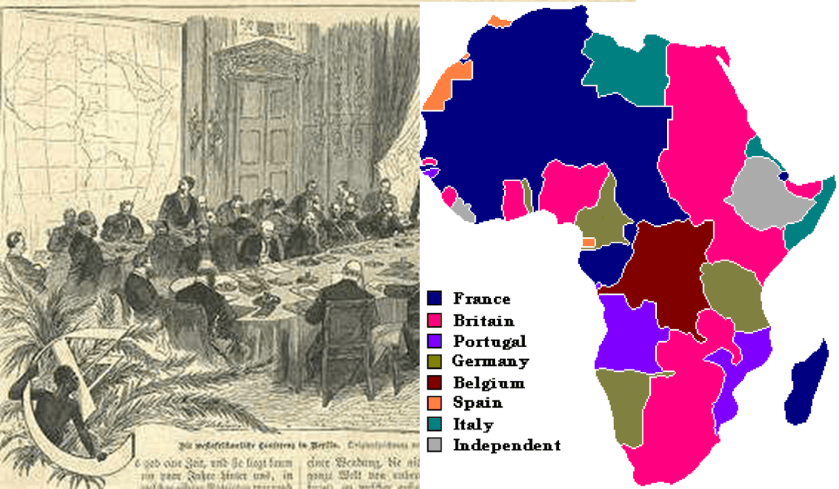
The outcome of the “General Act of the Berlin Conference” can be seen as the formalization of the “Scramble for Africa,” also known as the “Partition of Africa” or the “Conquest of Africa,” was the invasion, occupation, and division of African territory by European powers during the New Imperialism period between 1884 and 1914, the year in which World War I started.
The period of history known as New Imperialism is characterized as a period of colonial expansion by European powers, the United States, and Japan during the late 1800s and early 1900s.
Otto von Bismarck was the mastermind behind the unification of Germany in 1871, and served as its first chancellor until 1890.
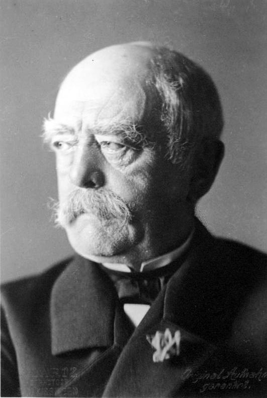
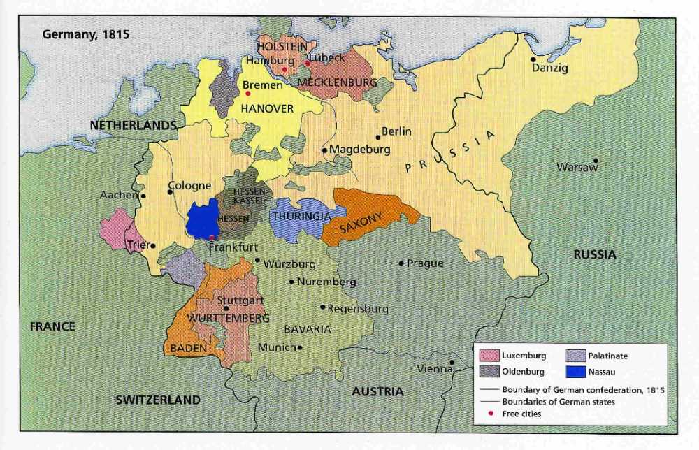
While on one hand, he was said to have skillfully used balance-of-power diplomacy to maintain Germany’s position for 20-years in a peaceful Europe, at the same time the way he unified Germany was by provoking three short, decisive wars with Denmark, Austria, and France, and by abolishing the supra-national German Confederation, an association of 39 German-speaking states in Central Europe that was created by the Congress of Vienna to replace the former Holy Roman Empire, and formed the German Empire, which excluded Austria.
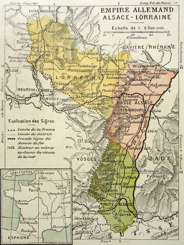
He also annexed Alsace-Lorraine on the border with Germany, which was part of France, as a result of the Franco-Prussian War of 1870 – 1871.
We are told that France’s determination to regain Alsace-Lorraine, and fear of another Franco-German war, as well as British apprehension about the balance-of-power, became factors in the causes of World War I.
The last subject of this post are how treaties were used to create the New World from the Old World.
The Treaty of Utrecht, or Peace of Utrecht, was a series of what is described as peace treaties signed between April of 1713 and February of 1715 in the Dutch city of Utrecht by the belligerents in the War of Spanish Succession.
The War of Spanish Succession came about, we are told, when the last Hapsburg King of Spain, Charles II, died childless in 1700, and he named his grand-nephew Philip of France as his successor in his last will, who became King Philip V of Spain in 1700.
Philip was also the grandson of King Louis XIV of France, and also in line for the French throne.
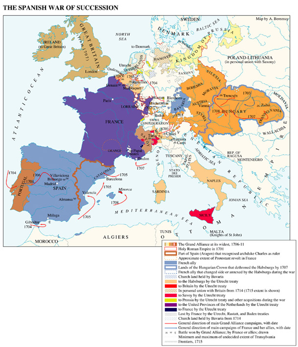
The other major powers in Europe were not willing to tolerate the potential union of these two powerful states.
The Utrecht treaties allowed Philip to take the Spanish throne in return for permanently renouncing his claim to the French throne, and paved the way for the European system based on balance-of-power.
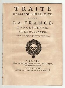
As an extra step, Great Britain, France, and the Dutch Republic sign the Triple Alliance as a way to maintain the Treaties of Utrecht on January 4th, 1717.
As a result of all of this treaty-making, the thrones of Spain and France were prevented from merging together, and the way was ultimately paved for the maritime, commercial, and financial supremacy of Great Britain.
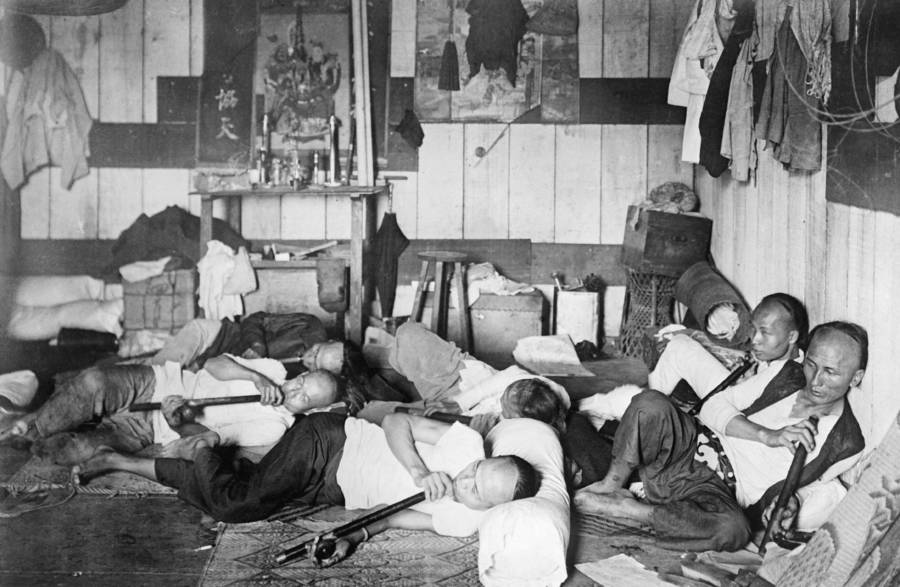
The Treaty of Nanking, or Nanjing, between the British Empire and China was signed after China’s defeat, after the First Opium War in 1842.
The First Opium War was fought between Qing Dynasty of China and Britain between 1839 and 1842, a military engagement that started when the Chinese seized opium stocks at Canton in order to stop the opium trade, which was banned.
The British government insisted upon free trade and equality among nations and backed the merchants’ demands.
From 1757 to 1842, the Canton System served as a means for China to control trade with the west by focusing all trade in the southern port of Canton.
To counter this, the British East India Company began to grow opium in Bengal, in present-day Bangladesh, and allowed private British merchants to sell opium to Chinese smugglers for illegal sale in China.
As a result from these events in history, opium dens, establishments where opium was sold and smoked, became prevalent in many parts of the world throughout the 19th-century.
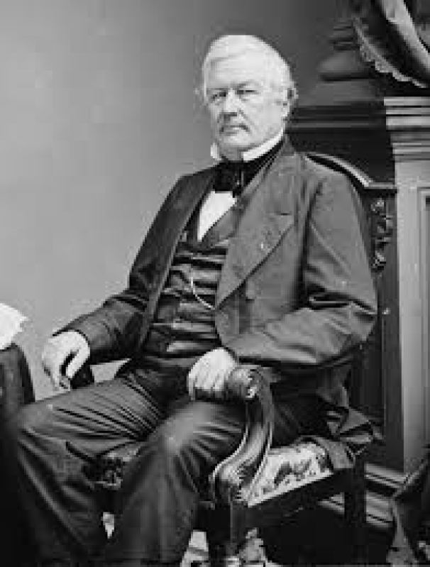
Millard Fillmore was the Vice-President to President Zachary Taylor, who was said to have died of problems from something he ate several days after attending a July 4th celebration in 1850. So he became President Millard Fillmore in 1850.
Commodore Matthew Perry played a leading role in the Opening of Japan, starting on July 8th, 1853, when he led four U. S. Navy ships ordered by President Fillmore to Tokyo Bay with the mission of forcing the opening of Japanese ports to American trade by any means necessary.
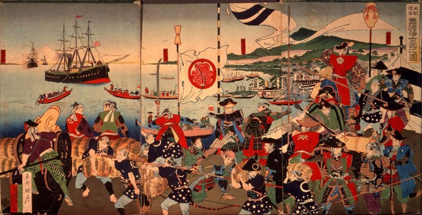
After threatening to burn Tokyo to the ground, he was allowed to land and deliver a letter with United States demands to the Tokugawa Shogun, Ieyoshi.

The Shogun Ieyoshi died a short time after Perry’s departure in July of 1853, leaving effective administration in the hands of the Council of Elders, though nominally to his sickly son, Iesada, who was the Tokugawa Shogun from 1853 to 1858.
The Tokugawa Shogunate is called the last feudal Japanese Military Government.
Perry returned again with eight naval vessels in February of 1854, and on March 31st of 1854, the Japanese Emperor Komei signed the “Japan and United States Treaty of Peace and Amity” at the Convention of Kanagawa under threat of force if the Japanese government did not open the ports of Shimoda and Hakodate to American vessels.
Language, Religion, New Nobility, Corporatization, Colonization
& Place Name Changes
Next, I am going to take a close look at how modern language, religion, creation of a new nobility, corporatization, colonization and place name changes were used to create the New World from the Old World, and obscure our true history.
I am going to start with the subject of the origins of modern English, Spanish and Italian.
This is what we are told about Modern English.
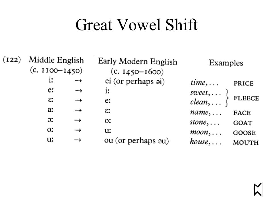
It is the form of the English spoken since the “Great Vowel Shift,”, a systematic change in the pronunciation of vowels for which the causes in England are unknown, which began in the mid-1400s and was completed by 1600.
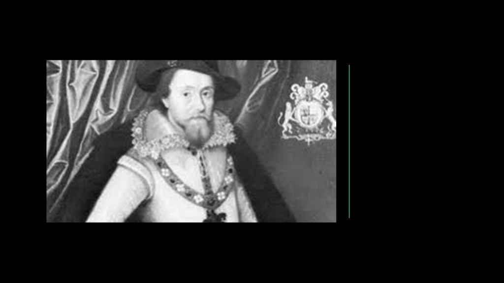
Writings from the early 1600s, like the King James Bible, originally commissioned in 1604 and first published in 1611 under the sponsorship of King James VI and I, the first King of the Union of the Scottish & English Crowns which took place in March of 1603…
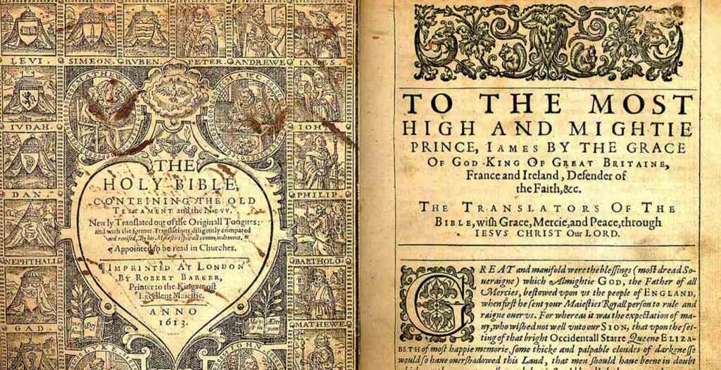
…and the works of William Shakespeare, with the publication of the First Folio in 1623, are considered to be early Modern English.
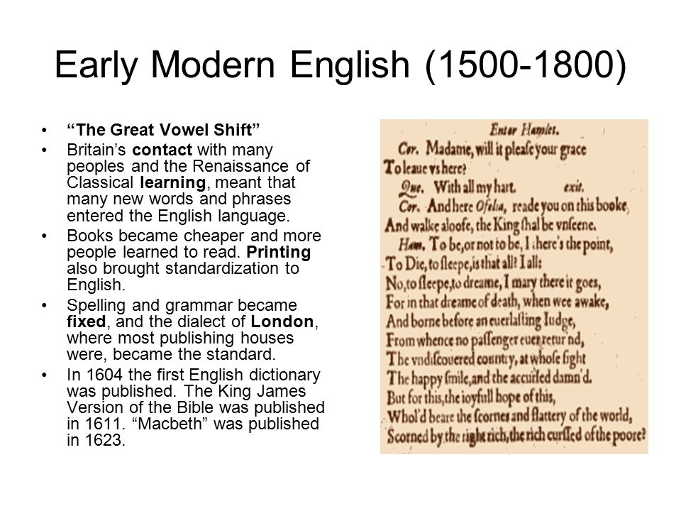
The works of Shakespeare single-handedly changed the English language of this time, with things like a huge vocabulary of 34,000 words and 2,000 new words!
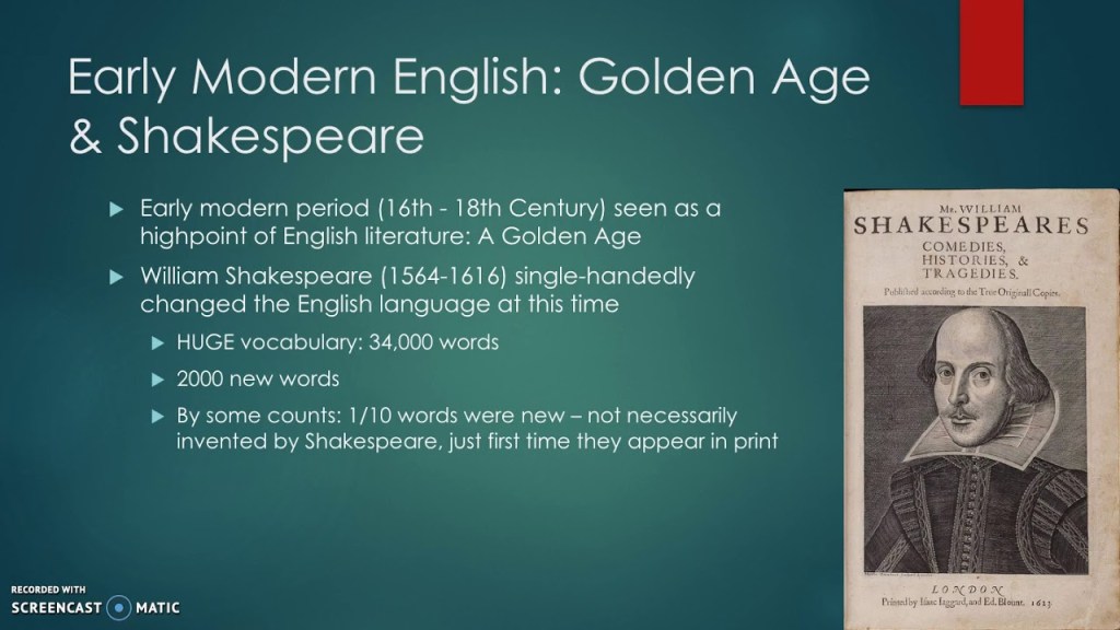
William Shakespeare is widely regarded as the greatest and most influential writer in the English language, and the world’s most distinguished playwright.
There are few records of Shakespeare’s life, leading to speculation about every aspect of his life, including what he really looked like, and whether or not he was the actual writer of the works attributed to him.

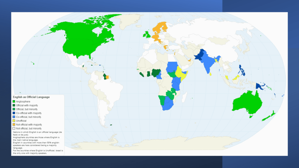
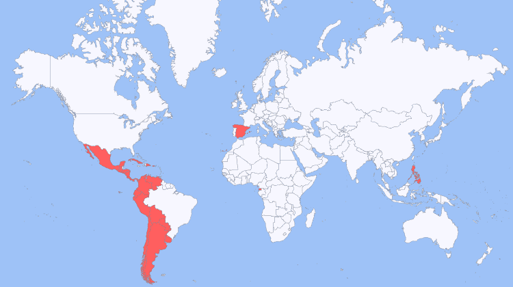
With the colonization of the British Empire, English was adopted as a primary or secondary language around the world.
Early Modern Spanish was the form of Spanish used between the end of the 15th -century and the end of the 17th-century, and was marked by changes in speech sounds and grammar that transformed Old Spanish into Modern Spanish.
Early modern Spanish also corresponds to the period of Spanish Colonization of the Americas, along with the West Indies and East Indies, that I will be delving into shortly.
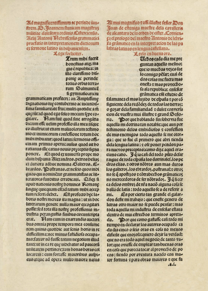
The first grammar text for Castilian Spanish was published in 1492 and dedicated to Queen Isabela I of Castile.
It was written by Antonio de Nebrija, a linguist and poet.
It was the first book dedicated to the Spanish language and its rules, and the first grammar of a modern European language to be published in print.
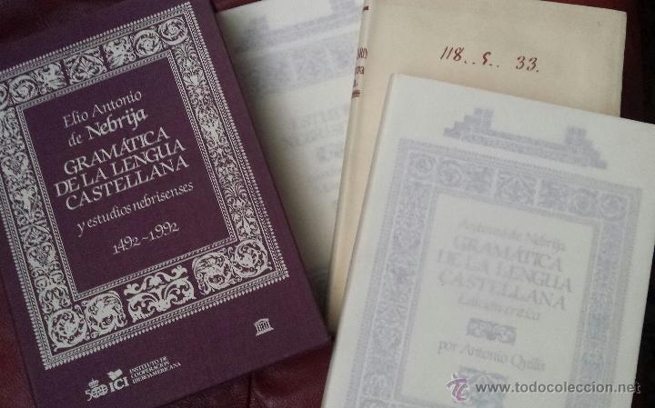
Antonio de Nebrija also published a Latin-Spanish Dictionary in 1492.
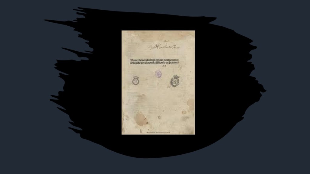
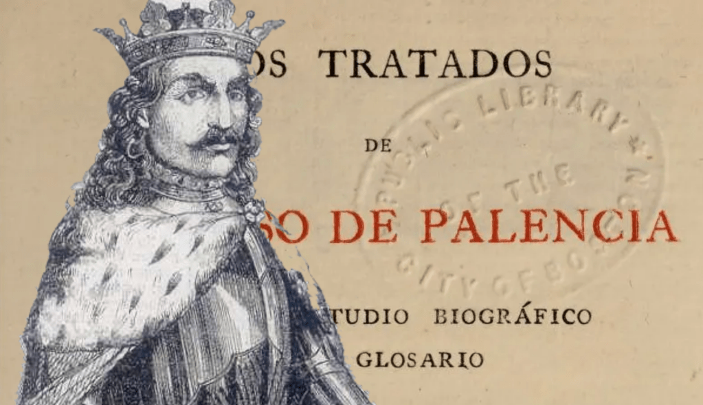
Alfonso de Palencia had published a Latin-Spanish dictionary two-years prior to Antonio de Nebrija, in 1490.
Alfonso de Palencia was a Castilian Royal Secretary who had played an active role in bringing Fernando II of Aragon to Castile and putting Isabela I of Castile on the throne.
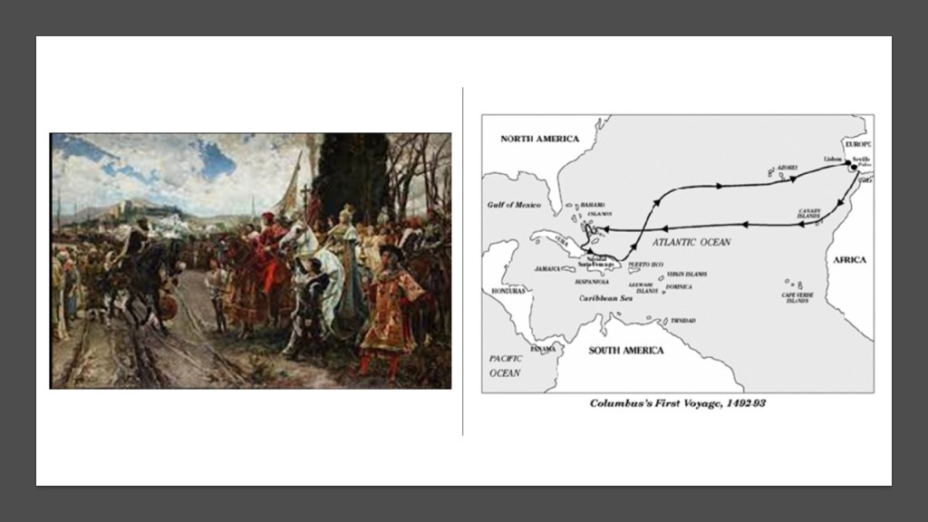
In our historical narrative, the year of 1492 was also the year of the Fall of Granada in Moorish Spain and the year of Columbus’ first voyage. More on this shortly.
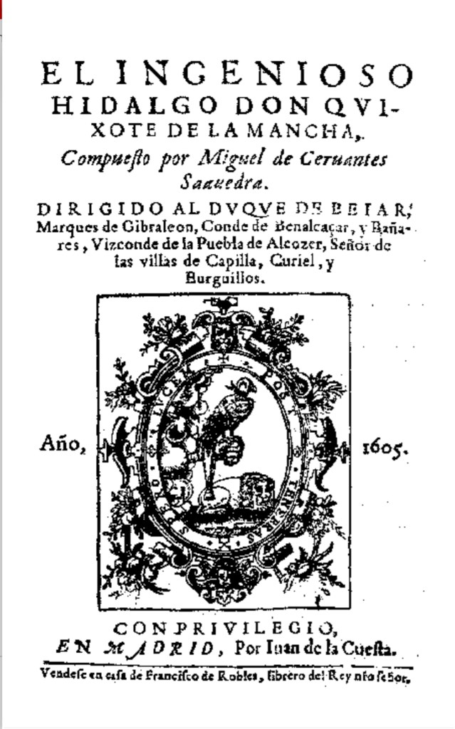
Miguel Cervantes was an Early Modern Spanish writer and widely regarded as the greatest writer in the Spanish language.
The novel Cervantes is best-known for was “Don Quixote,” considered the first modern novel and the first great novel of world literature, and originally published in two-parts – the first published in Spanish in 1605 and English in 1612; and the second in Spanish in 1615, and English in 1620.
According to Cervantes in the book’s Preface, the first chapters were originally part of “the Archives of LaMancha,” and Cervantes describes finding an Arabic manuscript written by Cide Hamete Benengeli, a Moorish historian, and brings him into the book as a narrator of the story, lending the impression that Don Quixote was a historically a real character, but the book has always been considered a work of fiction.
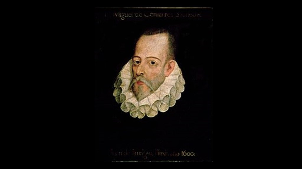
Despite the later fame of Miguel Cervantes, little is known about his life, including what he actually looked like, what his real name was, and what his background was.
This 1600 portrait of Miguel Cervantes by Juan de Juaregui is not only not authenticated, no authenticated portrait of Cervantes is known to exist.
With the colonization of the Spanish Empire, Spanish was also adopted as a primary or secondary language around the world.
Modern Italian, considered the closest of the Romance languages to Vulgar Latin, or the spoken form of Latin from the Late Roman Republic onwards in our historical narrative, was said to have developed in Tuscany in Central Italy, and was first formalized in the early 14th-century through the work of Florentine poet, writer and philosopher Dante Alighieri, considered the “Father of the Italian Language.”
The exact year of Dante’s birth was unknown, and much about his early life and education is not known.
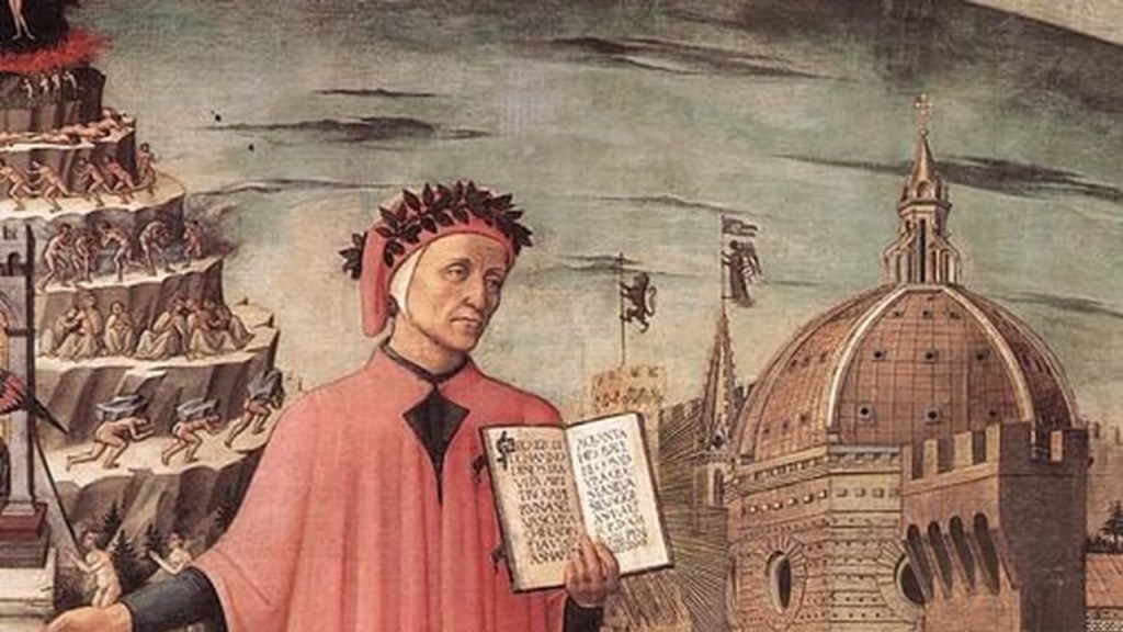
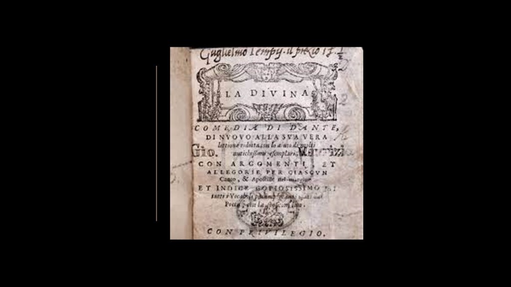
Dante Alighieri’s best-known work was the “Divine Comedy,” also considered the pre-eminent work in Italian literature and one of the greatest works of world literature.
The “Divine Comedy” was a narrative poem believed to have been composed by Dante between 1308 and 1321, completed shortly before his death in September of 1321.
The poem has three parts – Inferno, Purgatorio, and Paradiso – to which Dante journeys with a different guide for each, and the subject of the poem was the state of the soul after death, with Divine Justice being meted out as either due punishment or reward.
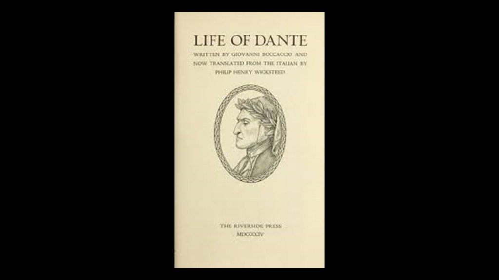
Dante’s first biography was written in 1348, 27-years after his death, by Giovanni Boccaccio, another Florentine whose writings established modern Italian.
Boccaccio would have been around 8-years-old at the time of Dante’s death, so he would have been a very young contemporary of Dante.
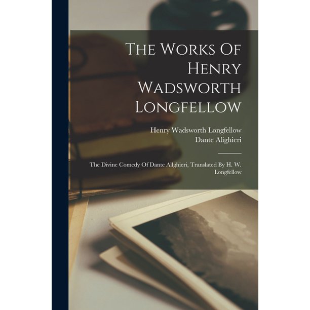
The 19th-century gave rise to a “Dante Revival,” and he was written about and translated by leading writers of the Victorian-era, like Scottish writer Thomas Carlyle in a lecture called “The Poet as Hero” and the poet Henry Wadsworth Longfellow was the first American to completely translate the “Divine Comedy” into English.
More to come later on this type of finding in Part 3 of this post regarding the “Centuries of Exploration.”
Next, I am going to show how the subjects of religion, the creation of a new nobility, corporatization & colonization are all related to each other in how the New World was Created from the Old World.
In 1302, just a few years before Dante was said to have started writing the “Divine Comedy” about the state of the soul after death in 1308, Pope Boniface VIII issued the Unam Sanctum Papal Bull.
This Pope declared in the Unam Sanctum Papal Bull, among other things, that the Pope has the ultimate authority over all people, and that it was necessary for every human being to belong to the Catholic Church for eternal salvation.

A papal bull is an official public decree, letters patent, or charter issued by the Pope of the Catholic Church and named after the leaden seal, or bulla, used to authenticate it.
They figure prominently in the effort to authenticate what has taken place on earth in the historical narrative we have been taught, and function like the Royal Prerogative mentioned at the beginning of Part One of this video.
We are told the first Pope was the Apostle Saint Peter.
The Roman Catholic Church has played a prominent role in the history and development of western civilization as we know it.
Hold on!
Is this a statue of a Saint Peter with a dark complexion at the Vatican, or what?
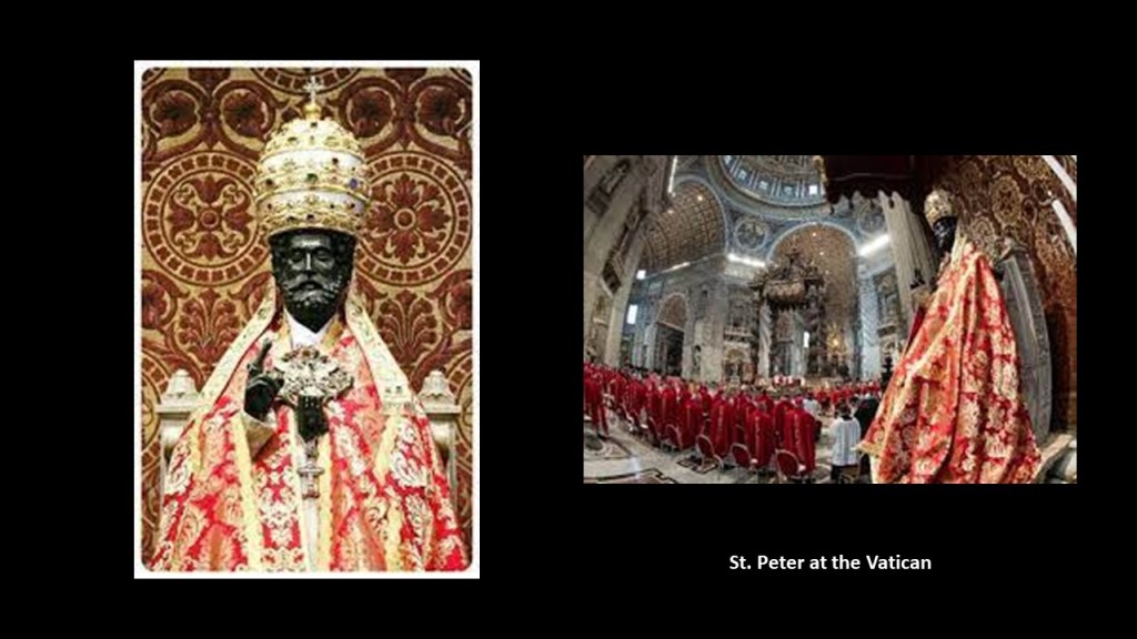
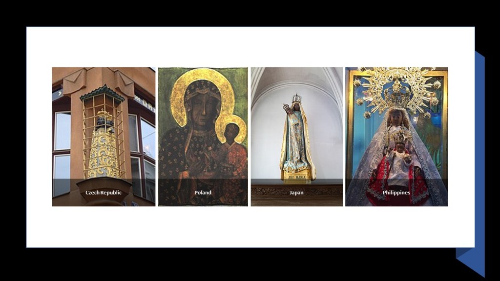
Not only that, it is important to note that there are “Black Madonna” atatues found all over the world!
The Catholic Church teaches us that it is the “one, holy, Catholic and Apostolic Church,” founded by Jesus Christ in his Great Commission to spread the Gospel to all the nations of the world, and that it practices the original Christian faith taught by the Apostles, preserving the faith infallibly through scripture and sacred tradition through the authentic interpretation of the Church.

All of this bears further examination, since this is what we are taught.
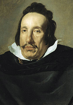
Lets look at what this looked like in our historical narrative, starting with Queen Isabella I of Castile and Leon, also referred to as “Isabel the Catholic.”
Queen Isabella was Queen of Castile starting from 1474, and through her husband Ferdinand, Queen-Consort of Aragon.
Thus they were considered to have reigned together over a dynastically-unified Spain, and together known as the “Catholic Monarchs of Spain.”
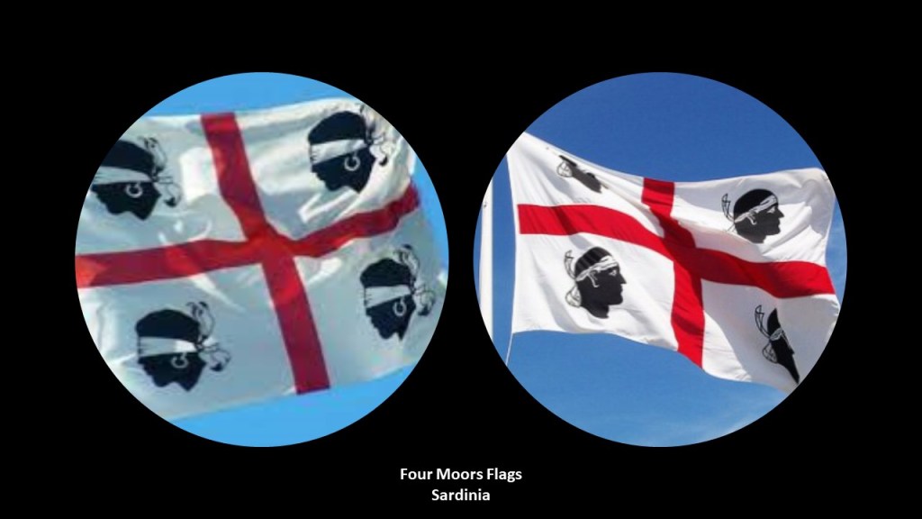
In the background of this portrait are the Coats-of-Arms for Sardinia and Aragon.
The red arrow is pointing to the “Four Moors Heads” of the Kingdom of Sardinia.
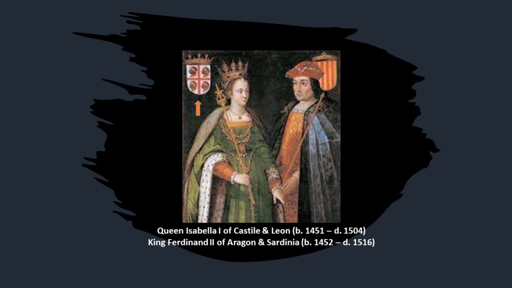
The flag of Sardinia is known as the “Four Moors Flag,” on one hand said to symbolize Sardinia and its people, and on the other hand, said to represent the four victories achieved by the Kingdom of Aragon against the invading Moors.
It is interesting to note that there was a design of the “Four Moors” flag that appeared in the early 19th-century, with the Moors blindfolded and facing in the opposite direction of the flag as it appears today.
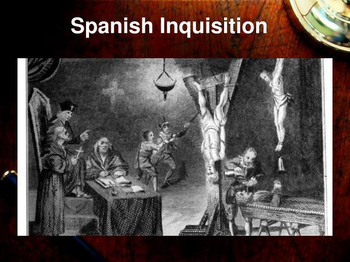
Queen Isabella and King Ferdinand established the Spanish Inquisition in 1478 to maintain Catholic orthodoxy.
The Spanish Inquisition operated not only in Spain, but in all Spanish colonies and territories, and was intended was to identify heretics among those who converted from Judaism and Islam to Catholicism.
The activity of the Spanish Inquisition intensifed after royal decrees issued in 1492 and 1502 forced Jews and Muslims to either convert to Catholicism or be expelled from Spain.
The Spanish Inquisition was particularly known in history for brutality, torture, and burning people at the stake for “heresy,” which is defined as an opinion or belief that is different from the orthodox doctrine of the Church.
So we are taught that all of this is normal and matter of fact in history in school, like there is nothing out of the ordinary or wrong about the Inquisition…which was, by its very nature, violating basic Human Rights and dignity, including torture and death in the name of Christianity just for having dissenting beliefs.
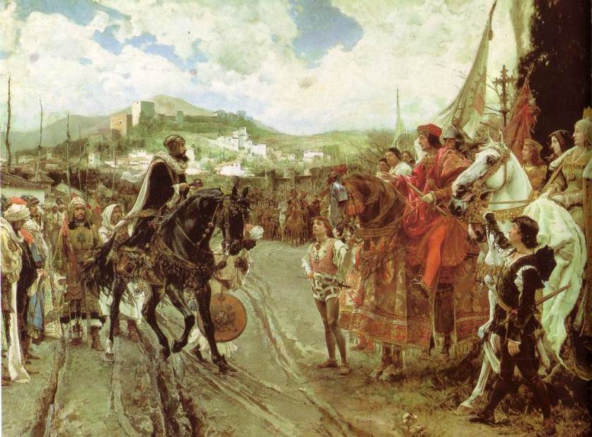
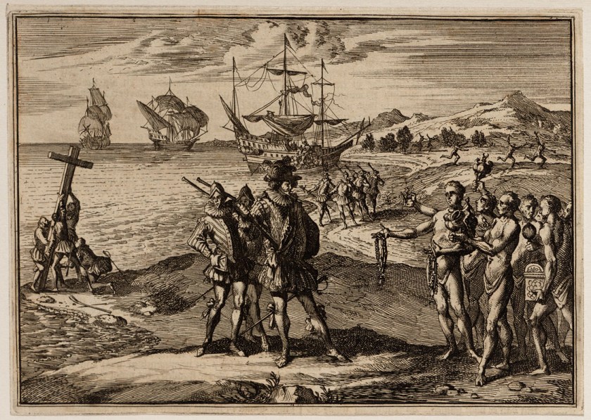
The city of Grenada fell on January 2nd, 1492, effectively ending Moorish rule in Spain when Muhammad XII surrendered the Emirate of Grenada to King Ferdinand and Isabella.
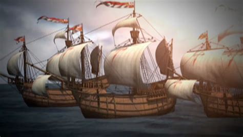
Then, 7-months later, Columbus left Spain on his first voyage on August 3rd, 1492, ostensibly to find a westward route to Asia.
Initially, Queen Isabella had granted extensive authority to Christopher Columbus, but then withdrew that authority, instead putting it in the hands of her personal Chaplain, Juan Rodriguez de Fonseca, in 1493.
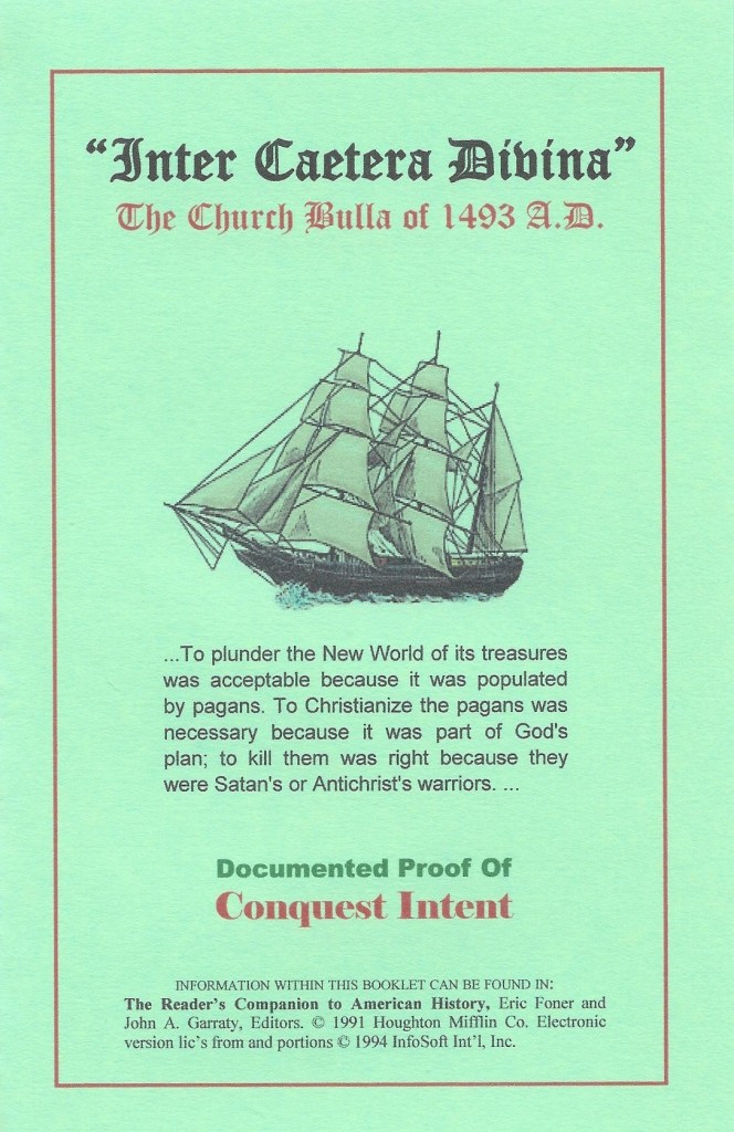
The year of 1493 was the year that the Borgia Pope Alexander VI authorized the land-grab of the Americas in the “Inter Cetera” papal bull.
This papal bull became a major document in the development of subsequent legal doctrines regarding claims of empire in the “New World” and assigned to Castile in Spain the exclusive right to acquire territory, to trade in, or even approach the lands laying west of the meridian situated one-hundred leagues west of the Azores and Cape Verde Islands, except for any lands actually possessed by any other Christian prince beyond this meridian prior to Christmas, 1492.
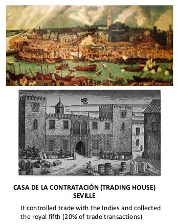
In terms of governance of the Spanish Empire, “the Indies” was the designation for all of its overseas territories, and the Trading House, also initially headed by Fonseca, was the agency which managed expeditions to the New World on behalf of the Spanish Crown from the 16th- to the 18th-century, and was organized by Queen Isabella in 1503.
The Trading House became an instrument of the Spanish Crown’s policy of centralization and imperial control.
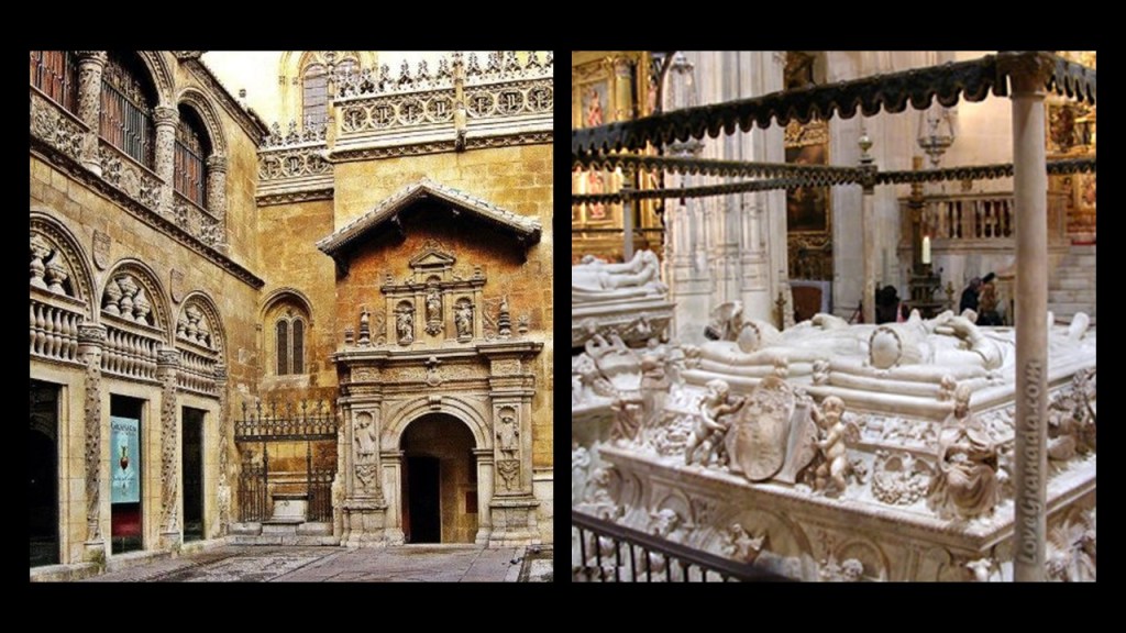
Queen Isabella died in November of 1504.
Her remains, along with those of Ferdinand who died in 1516, were interred in the Royal Chapel of Granada, the chapel was said to have been built between 1505 and 1507 in the Isabelline Gothic architectural-style, called the dominant architectural style during the reign of the Catholic Monarchs.
The Council of the Indies was created following the Spanish Conquest of the Aztec Empire in 1521, in the historical narrative we have been given.
The Spanish West Indies and East Indies were administered by the Council of the Indies, and the Crown of Spain held absolute power over the Indies.
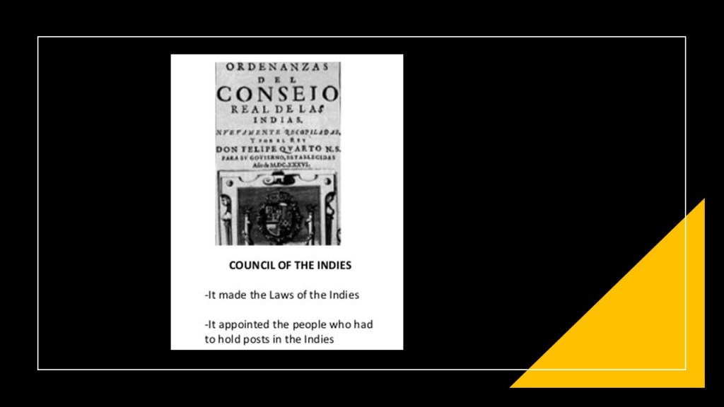
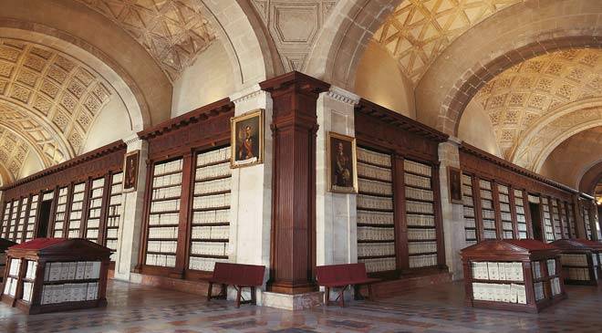
The Council of the Indies instituted the Archives of the Indies, which contains priceless documents that provide a key to the history of Spain’s relationships with its overseas colonies in the Americas.
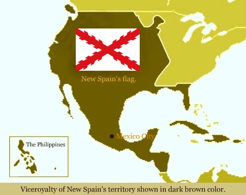
When the Viceroyalty of New Spain was established in 1535, of which Mexico City was the capital and the base for its expeditions for exploration and conquest, the islands of the Caribbean claimed by Spain came under its jurisdiction.
Also known as “New Spain,” it was considered a New World Kingdom ruled by the Crown of Castile, and not a colony.
The Spanish West Indies was the collective name for the islands in the Caribbean.
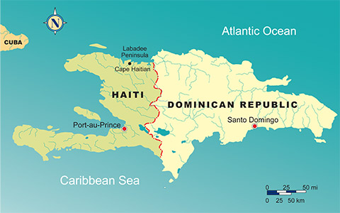
The islands claimed by Spain were Hispaniola, an island in the Greater Antilles which is divided into the countries of Haiti and the Dominican Republic; Cuba; Puerto Rico; St. Martin; the Virgin Islands; Anguilla; Montserrat; Guadalupe; the Lesser Antilles; Jamaica; the Cayman Islands; Margarita Island; Trinidad & Tobago; and the Bay Islands.
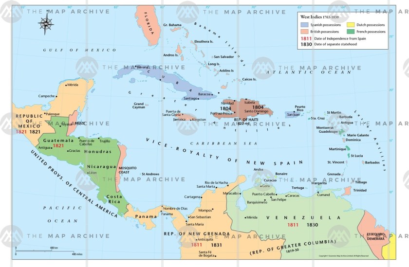
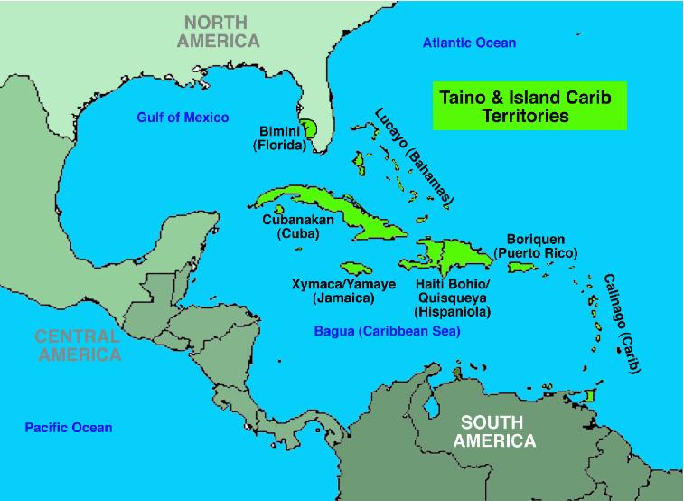
We are told that before Columbus arrived in his first voyage on what became known as Cuba on October 28th of 1492, and claimed its islands for the new Kingdom of Spain, the indigenous inhabitants were the Taino, the Guanahatabey, and the Ciboney people, who were all farmers and hunter-gatherers.
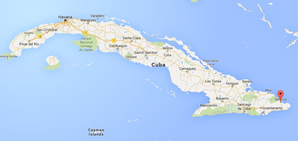
The first Spanish settlement and capital was Baracoa, still a municipality and city to this day in Guantanamo Province, near the eastern tip of Cuba.
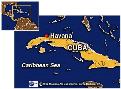
Cuba’s capital today, Havana, was said to have been founded in 1515 as San Cristobal de la Habana.
Due to Havana’s strategic location, it served as a springboard for the Spanish conquest of the Americas, and became a stopping-point, we are told, for the treasure-laden Spanish galleons on the crossings between the New World and the Old World…Treasure-laden…going from the Americas to Spain?
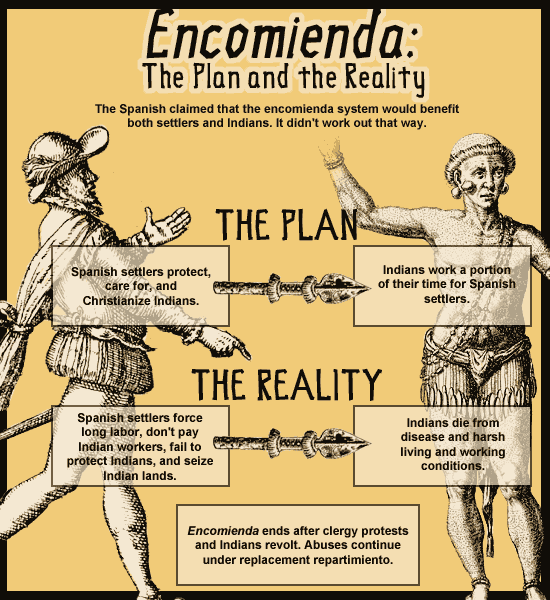
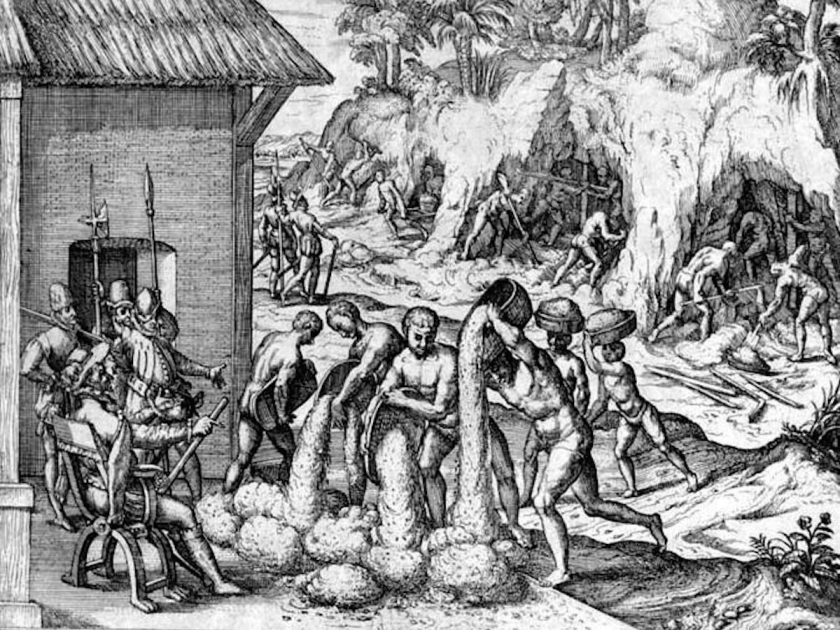
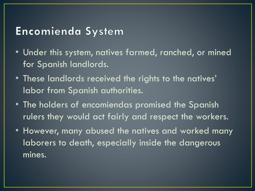
The indigenous peoples of Cuba were forced to work under the encomienda system, a Spanish labor system that rewarded conquerors with the labor of particular groups of subject people, and applied on a large-scale during the Spanish colonization of the Americas and Philippines and the harsh conditions of the repressive colonial subjugation, along with infectious diseases, virtually wiped-out the indigenous population of Cuba within a century.
Hispaniola was the second-largest island, and most populated, in the West Indies.
Today’s countries of Haiti and the Dominican Republic are co-located on the island.
The first permanent European settlements in the Americas were founded on Hispaniola in Christopher Columbus’ first three voyages.
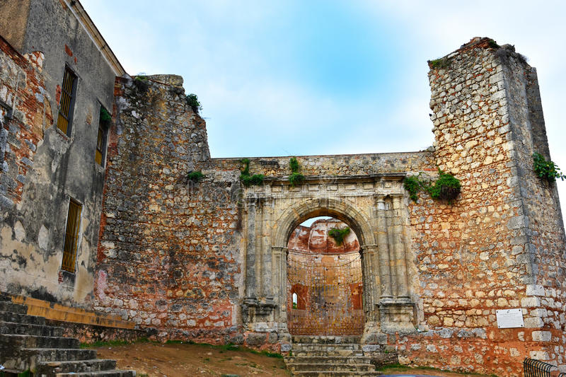
We are told that the city of Santo Domingo on Hispaniola is the oldest continously inhabited European settlement, and the first seat of Spanish Colonial Rule, in the New World.

The first monastery, the San Francisco Monastery, said to have been built at Santo Domingo between 1509 -1560 with the arrival of the Franciscan Fathers.
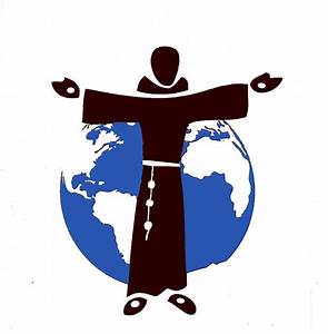
The Franciscans were members of related-religious orders said to have been founded by St. Francis of Assisi in 1209.
Three Franciscan missionaries accompanied Christopher Columbus in his second expedition in 1493, and were sent by a special commission of the Franciscan order in response from royal instructions from the Spanish Crown aimed at bringing the indigenous people of the Americas to Catholicism.
The Franciscans were at the vanguard of missionary activity in the New World, and in 1502, seventeen more Franciscans arrived.
Santo Domingo became the base of operations for countless missionary expeditions to the islands, as well as to the mainlands of North, Central and South America.
Like Cuba, the primary indigenous people on the island of Hispaniola were the Taino people.
When Columbus landed on the coast of present-day Haiti on December 6th of 1492, the Taino traded more gold with him than he had yet encountered, and learned from them much more could be found inland.
The Spanish practiced harsh enslavement practices against the Taino, for labor to search for gold, and later mining, and to grow food to feed the Spanish settlers, as well as redirecting existing food supplies to the Spanish.
We are told that precious metals played a large role in the history of the island after Columbus’ arrival.
Gold nuggets of major significance were found on the island, resulting in the quick development of two mines and the “Gold Rush” of 1500 to 1508.
By 1503, the Spanish Crown legalized the distribution of indigenous people to work the mines through the encomienda system.
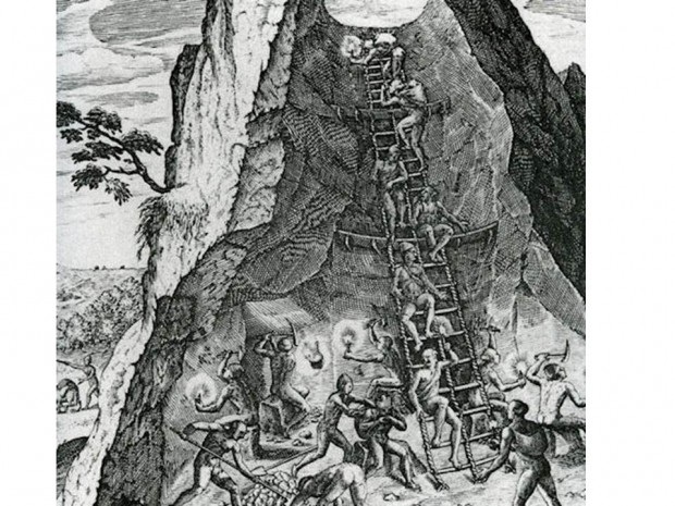
In 1504, what were called the Minas Viejas pit mines became royal mines for King Ferdinand, and almost 1,000 Taino were forced to work the mines.
We are told that as a result of the encomienda system and its harsh, repressive practices, the indigenous population of Hispaniola was reduced from 400,000 in 1508, to 26,334 by 1514.
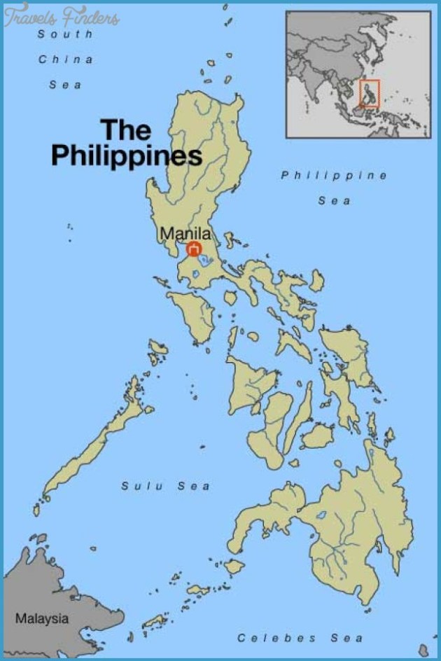
The Spanish East Indies, an overseas territories of the Spanish Empire in Asia and Oceania from 1565 to 1901, governed from Manila in the Spanish Philippines including, besides the Philippines, the Marianas Islands; the Caroline Islands; Palau; Guam; parts of Formosa (now Taiwan); and Sulawesi and the Moluccas in Indonesia.
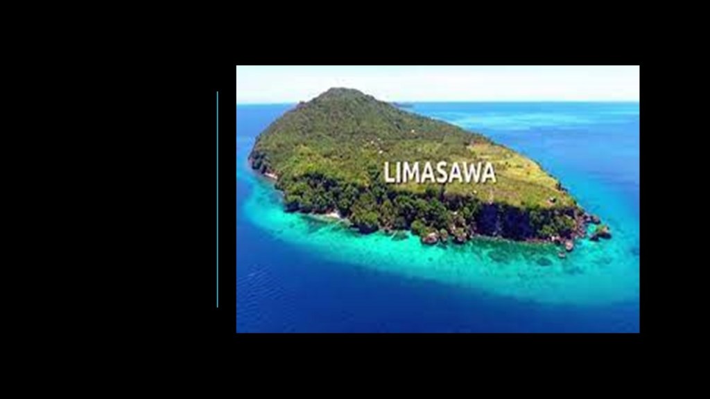
The earliest European expedition to the Philippines in our historical record was led by Portuguese explorer Ferdinand Magellan in the service of the King of Spain in 1521.
The next day, on March 13th, which was Easter Sunday of the year 1521, Magellan claimed possession of these lands for the King of Spain on what is believed to now be the island of Limasawa in southern Leyte.
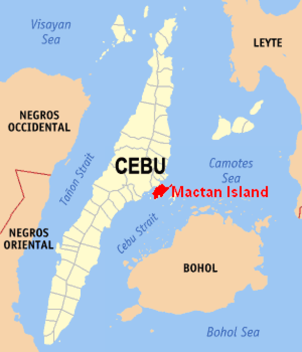
Magellan and fourteen of his men died shortly thereafter in the Battle of Mactan in Cebu.
After Magellan’s voyage, five expeditions were sent to the islands.
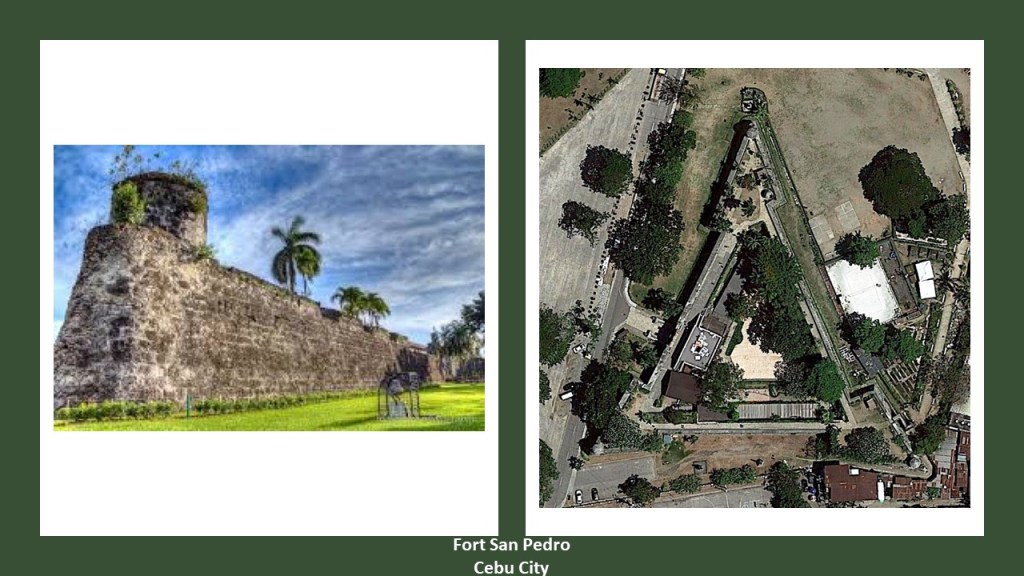
Cebu City is the oldest city in the Philippines, as it was said to have been the first Spanish settlement and first capital city.
It is important to note that there was a star fort located in Cebu, called the Fort San Pedro, said to have been built by the Spanish starting in 1565.
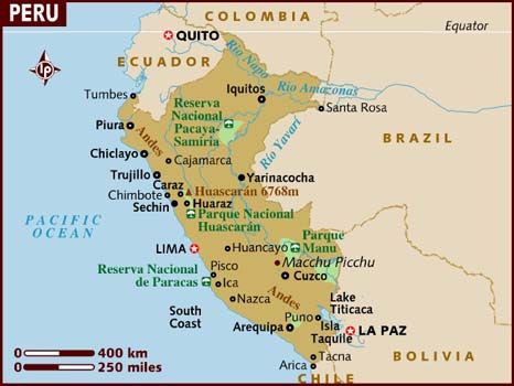
In 1532, the Spanish Conquest of Peru is said to have started with the Battle of Cajamarca, a city in Northern Peru.
I am really curious about how the Spanish Conquest of Peru was supposed to have happened.
Cajamarca sits at 8,900 feet in elevation, or 2,750 meters.

It is generally agreed that altitude sickness typically tends to start occurring at 8,000 feet. Characterized by headache, nausea, shortness of breath and vomiting.

I went to Cusco, Peru, in 2018, and was hit with altitude sickness on the second full-day I was there.
I was absolutely miserable and not really functional.
I had difficulty breathing, and was nauseous.
Money brought to spend on memories instead got spent on portable oxygen bottles and altitude sickness medicine.
I didn’t start feeling much better until we went down in altitude several days later.

Yet, somehow Pizarro and his 128 men marched to Cajamarca from the coast of modern-day Peru, in unfamiliar terrain at high altitudes, and managed to kill thousands of Incas and capture the Inca Emperor Atahualpa?
I am having a hard time buying what they are telling us!
In 1540, Pope Paul III had issued a papal bull forming the Jesuit Order, under the leadership of St. Ignatius of Loyola, Basque nobleman from the Pyrenees in Northern Spain.
The Jesuit Order included a special vow of obedience to the Pope in matters of mission direction and assignment.
The Jesuits worked mostly in educational, cultural & research pursuits…at least that is what we are told.
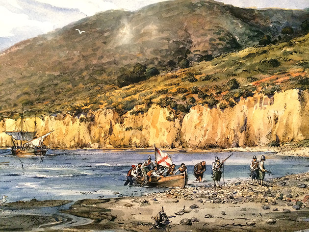
In 1542, explorer Juan Rodriguez Cabrillo landed in San Diego Bay on behalf of the Spanish Empire, and we are told became the first European to set foot in California, exploring the California coast starting 1542.
In 1543, Ruy Lopez de Villalobos named the islands of Leyte and Samar “Las Islas Filipinas,” after Phillip of Austria, heir-apparent to the throne of Spain, who became King Phillip II in 1556.
Manila is the capital of the Philippines, and the most densely populated city in the world within its boundaries.
Manila, alongside Mexico City and Madrid, is considered one of the world’s original global cities, due to Manila’s historic commercial networks connecting Asia with the Americas.
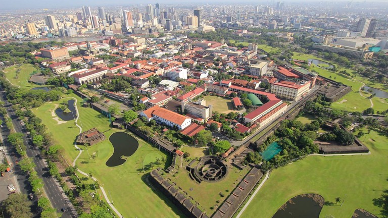
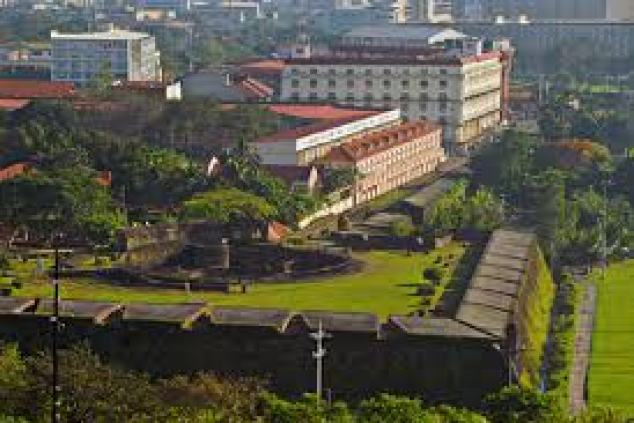
The historic walled city part of Manila is called the Intramuros, said to have been established by the Spaniards in the late 1500s.
Apparently the Intramuros is a star fort.
The first University in Manila, Universidad de San Ignacio, was said to have been established in the Intramuros by the Jesuits in 1590.
With regards to the efforts to establish one universal, hierarchical, organized religion, the main Catholic missionaries, besides the Franciscans, were the Jesuits, Benedictines, and Dominicans, and most likely involved in many activities of cultural obfuscation and obliteration, some known, and many more not known.
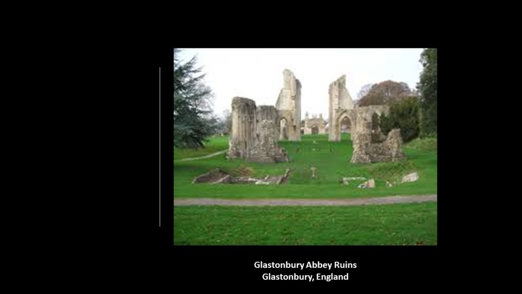
During the same time period that the Farnese Pope Paul III was establishing the Jesuits by Papal Bull in 1540 and sending them on their not-so-merry way, in “Merry Olde England” King Henry VIII disbanded the approximately 850 monasteries, convents and friaries in England during the “Dissolution of the Monasteries” between 1536 and 1541, at the end of which none were left.
Their income was taken and assets disposed of, and in many cases, like that of Glastonbury Abbey, the buildings on the property were left in ruins.
Monasteries were formerly the repositories of local genealogical records, and from then on, the College of Arms mentioned in Part One of this blog was responsible for the recording and maintenance of genealogical records.
With regards to evidence for the creation of a new nobility taking place during King Henry VIII’s reign, it was said that the College of Arms “…at no time since its establishment, was the college in higher estimation, nor in fuller employment, than in this reign.”
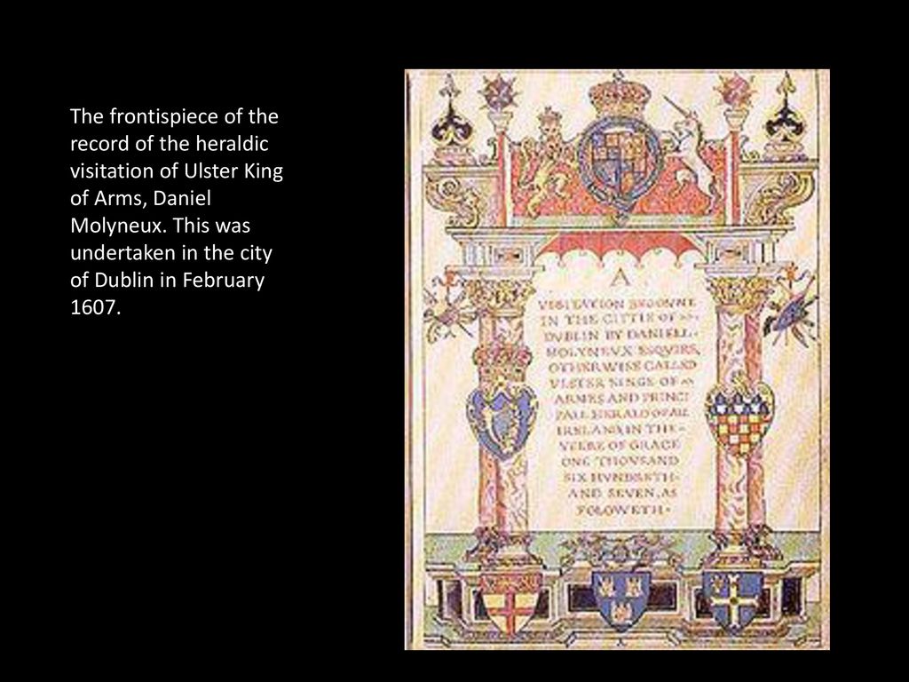
In 1530, King Henry VIII conferred the duty of “heraldic visitation” on the College, that of tours of inspection between 1530 and 1688 around England, Wales, and Ireland to register and regulate the Coats of Arms of Nobility, gentry and boroughs, and to record pedigrees.
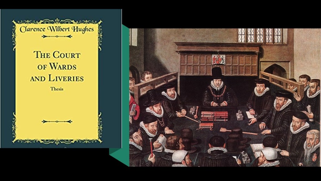
Also, the Court of Wards and Liveries was established starting in 1540 during the reign of King Henry VIII by two Acts of Parliament – the Court of Wards Act of 1540 and the Wards and Liveries Act of 1541.
It was established around the issues of practical matters relating to the Crown’s right of wardship and livery of young orphaned heirs where their father had been a Tenant-in-Chief of the Crown, including having rights over the deceased’s estate, including income and land, so this special court also administered a system of levying and collecting feudal dues.
Does this mean that there were so many orphaned heirs that they had to establish a special court to handle them?!
I find this information about the “Court of Wards and Liveries” very intriguing, with the Crown taking over the estates and rights of orphaned heirs and would love to know more about what was going on here that is not found in the historical record – who were they and how were they orphaned, and why would this be important?
With regards to religion, the Protestant Reformation, a major movement in 16th-century western Europe that challenged the Catholic Church and Papal Authority, had gotten underway for all intents and purposes in 1517 when Martin Luther published his “Ninety-Five Theses.”e
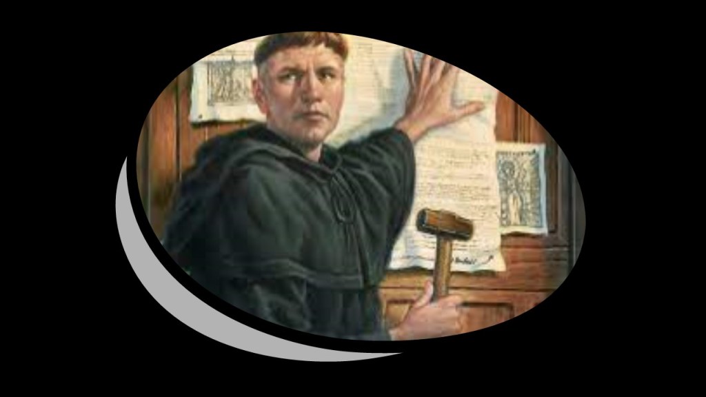
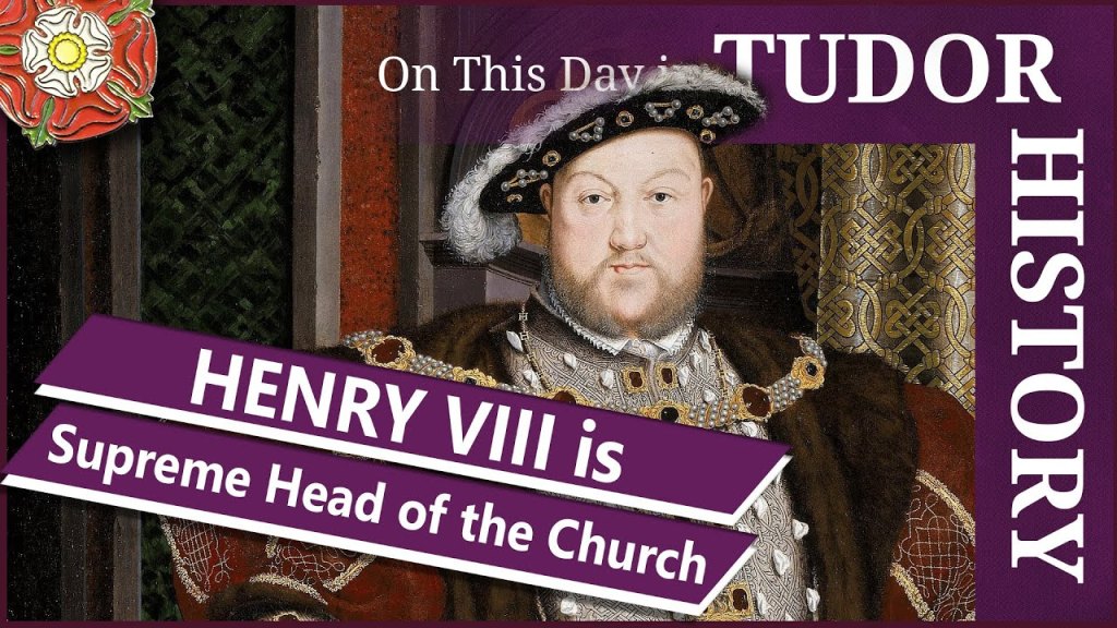
King Henry VIII, perhaps most famous in history for his six wives, started the English Reformation when he became the head of the Church of England on November 3rd of 1534, after Parliament passed “Acts of Supremacy,” establishing the English monarch as head of the Church of England.
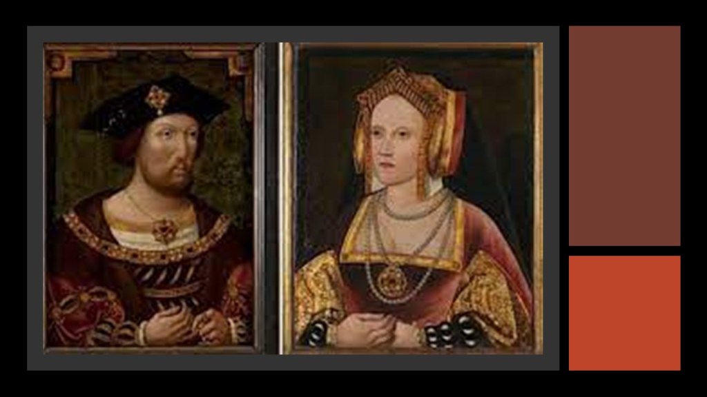
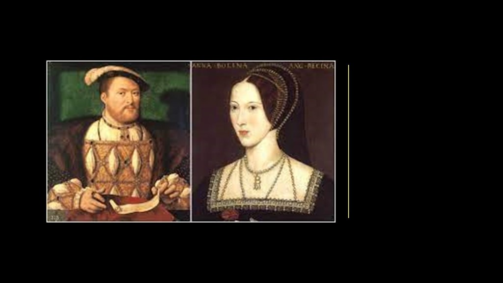
His schism with the Catholic Church started when the Pope refused Henry’s wish to get an annulment from his marriage to his first wife, Catherine of Aragon, the daughter of Ferdinand and Isabella, in order to marry his mistress, Anne Boleyn, which he was bound and determined to do.
So King Henry VIII assumed supremacy over religious matters over the Pope in 1533, and he was able to marry Anne Boleyn after English clergy judged his first marriage invalid.
The history of the Great Britain is filled with bloody conflicts between the Protestants and Catholics, starting with the Catholic Queen Mary, the daughter of Henry and Catherine, who was also known as “Bloody Mary,” for her persecution and killing of Protestants for heresy in a brief effort to restore Catholicism to England before her half-sister, Queen Elizabeth I, returned it to Protestantism and in turn persecuted Catholics who were viewed as “traitors.”

This is some historical background to illustrate what we are told was going on in England during the 1500s, and I will delve further into the roles played by religion, the creation of a new nobility, corporatization and colonization in the founding of English colonies in the New World according to what we are told.
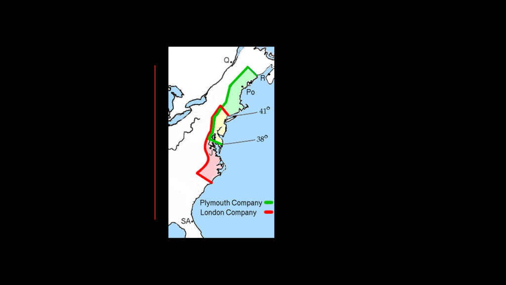
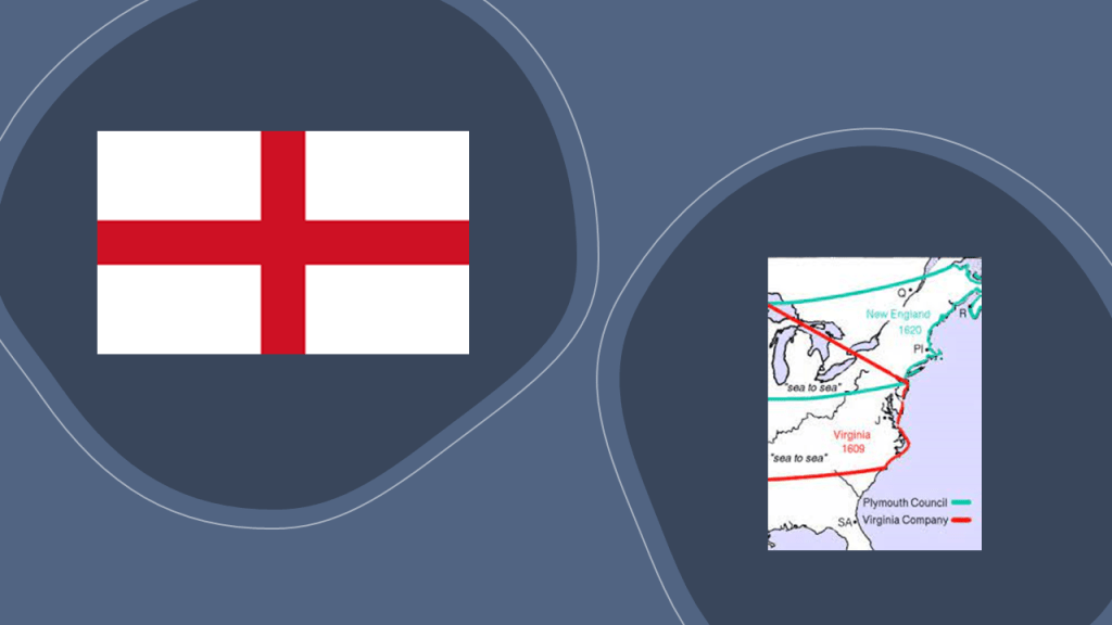
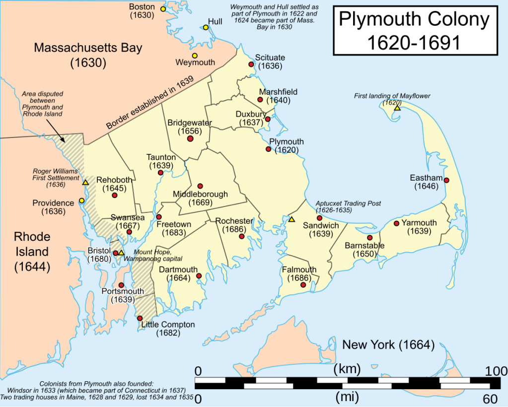
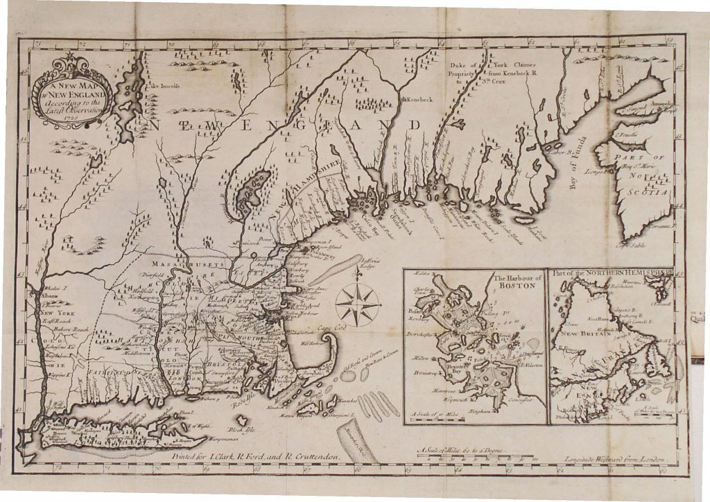
In 1606, King James I & VI issued Royal Charters for what became known as the Virginia Company and the Virginia Company of Plymouth, with the objective of raising funds from investors in order to colonize the eastern coast of America.
The Virginia Company was responsible for colonizing the east coast between the latitudes of 34-degrees N or 41-degrees N, and the Plymouth Company between the latitudes of 38-degrees N and 45-degrees N.
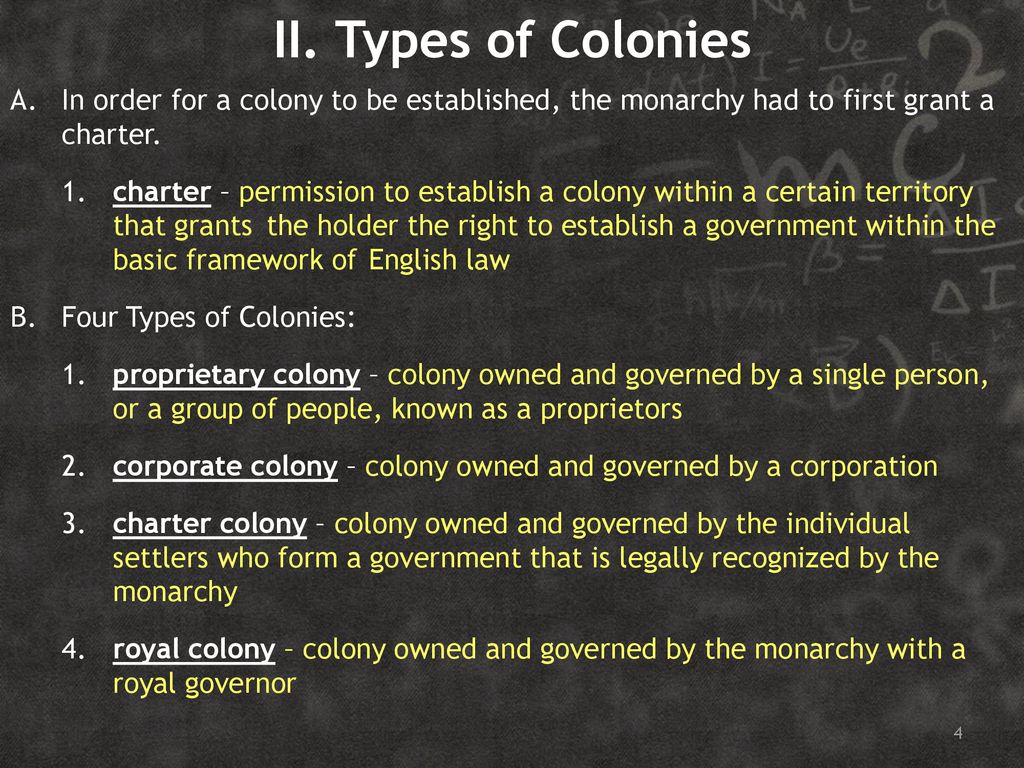
This graphic breaks-down the types of colonies after a royal charter has been granted.
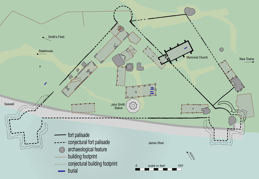
The Virginia Company established its first settlement of James Fort in Jamestown in May of 1607.
Jamestown was considered the first permanent English settlement in the Americas, and served as the capital of the Virginia Colony from 1616 until 1699, at which time it was abandoned when the capital was moved to nearby Williamsburg.
The Plymouth Company, officially known as the Virginia Company of Plymouth, established the Popham Colony near the mouth of the Kennebec River in present-day Phippsburg, Maine in 1607, a few months after the establishment of Jamestown.
The Popham Colony, however, was short-lived, only lasting 14-months before being abandoned due to multiple problems, from lack of funding, to lack of surviving colonists.
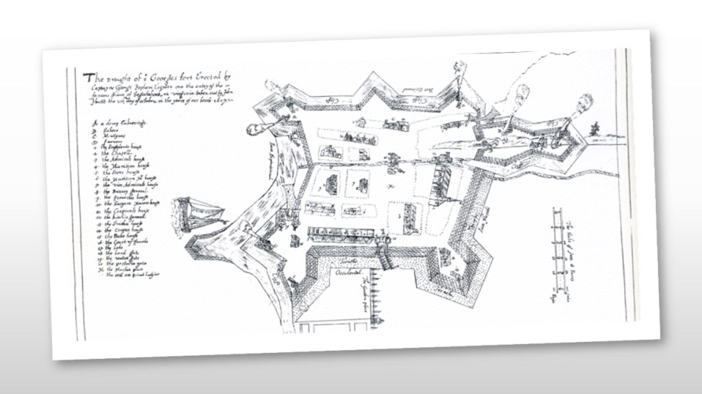
Fort St. George was said to have been built there during that time.
The Council for New England was established by a Royal Charter from King James I and VI as an English joint-stock company in order to to found colonial settlements between 1620 and 1635.
The Council for New England Charter provided for the establishment of colonies on land between 34-degrees N and 44-degrees N, becoming the Plymouth Colony, the Massachusetts Bay Colony, the Province of New Hampshire, the New Haven Colony, and the Province of Maine and to be managed by landed gentry.

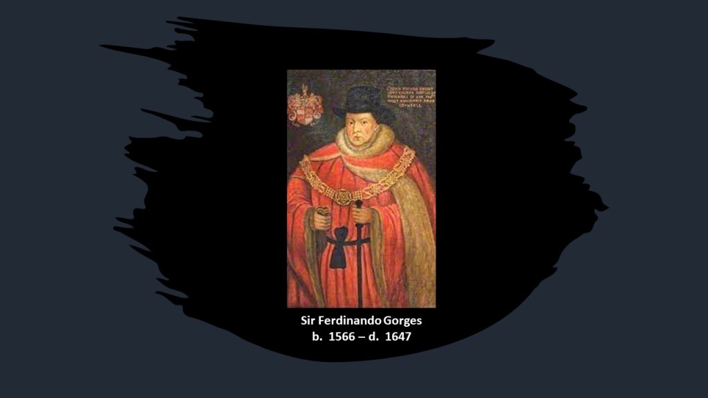
The Council for New England was largely the creation of Sir Ferdinando Gorges, a military commander and Governor of the Port of Plymouth in England who was called the “Father of English Colonization in North America,” and a member & beneficiary of the the Council.
Gorges first became involved in colonization efforts in 1607, when he became a shareholder in Plymouth Company, and helped to establish the short-lived Popham Colony.
He later received a land-patent in 1622 from the Council of New England for the Province of Maine, and was influential in the early settlement of Maine.
Another member and beneficiary of the Council of New England was William Alexander, the 1st Earl of Stirling.
The Earl of Stirling was a title in the Scottish Peerage that was created by King Charles I on June 14th of 1633 for William Alexander, 1st Viscount of Stirling.
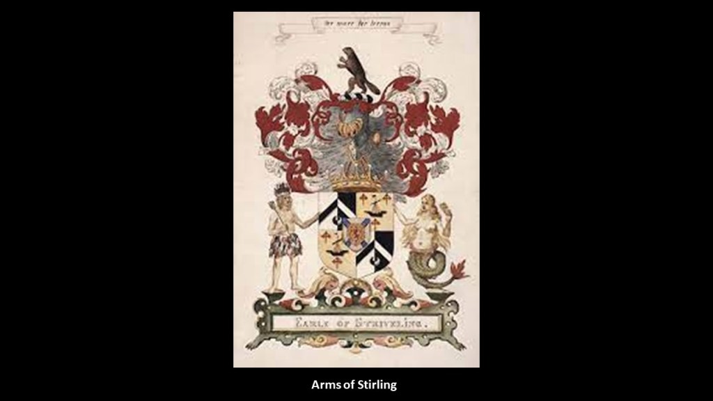
William Alexander had been granted a Royal Charter by King James I & VI in 1621, which appointed him Mayor of a large territory in Nova Scotia , which was enlarged into a lordship and barony of modern-day Nova Scotia, New Brunswick, and parts of the northern United States.
The Baronetage of Nova Scotia was formed in 1625 by King James as a means to settle the “plantation” of Nova Scotia by creating 100 baronets who in turn would support six colonists for two-years for a certain amount of money, and pay William Alexander a certain amount as the charter holder.
This region was contested with the French, and was returned to France by Treaty in 1632.
Though the region was lost to Great Britain for awhile, William Alexander’s settlement in Nova Scotia at Charles Fort, later Port Royal, provided the basis for Scottish claims to Nova Scotia.
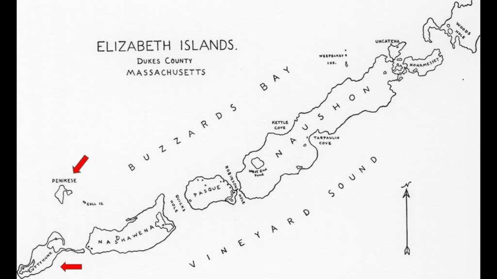
So for an example from New England of how this set-up with the Council for New England worked, the Elizabeth Islands, a small chain of islands off the southern coast of Cape Cod, were formally laid claim to and settled by colonizers in the name of the British Crown in 1641, and named for Queen Elizabeth I.
That same year, in 1641, Thomas Mayhew the Elder of Watertown, Massachusetts bought the Elizabeth Islands – along with Martha’s Vineyard and Nantucket – from the Earl of Stirling, William Alexander, and Sir Ferdinando Gorges.
All of the Elizabeth Islands today, with the exception of Cuttyhunk and Penikese, are privately-owned by the Forbes family, a wealthy American family of Scottish descent long prominent in Boston.
The Forbes family’s original fortune came largely from trading opium and tea between North America and China in the 19th-century.
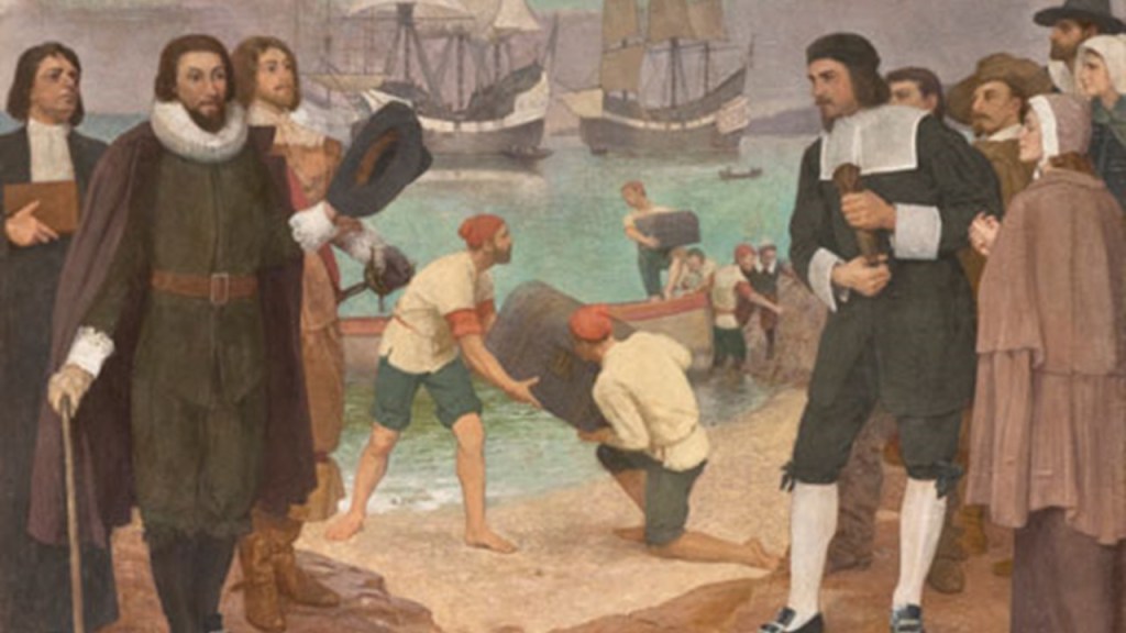
The first permanent colony in New England was Plymouth Colony, which at its height occupied most of the southeastern portion of Massachusetts.
The people known as Pilgrims and events surrounding the founding of the Plymouth Colony are celebrated every year as Thanksgiving in the United States.
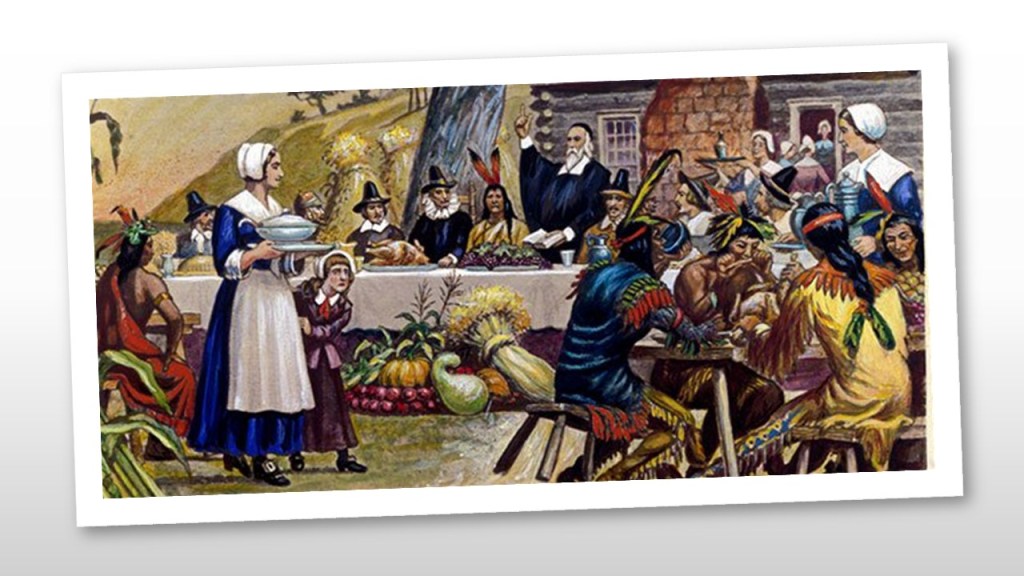
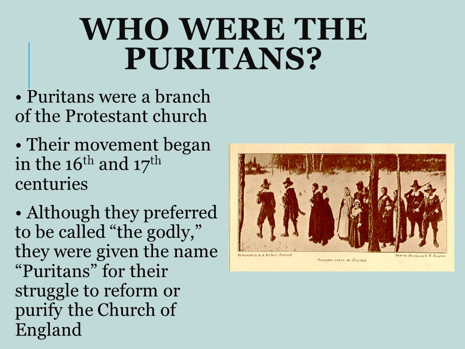
The story that we are told in our historical narrative is that the Pilgrims were Puritan Separatists who came to the New World so they could worship according to their own beliefs without persecution.
Puritans were English Protestants who wanted to “purify” the Church of England of remaining Roman Catholic practices, as it had not fully-reformed, and was not Protestant “enough.”
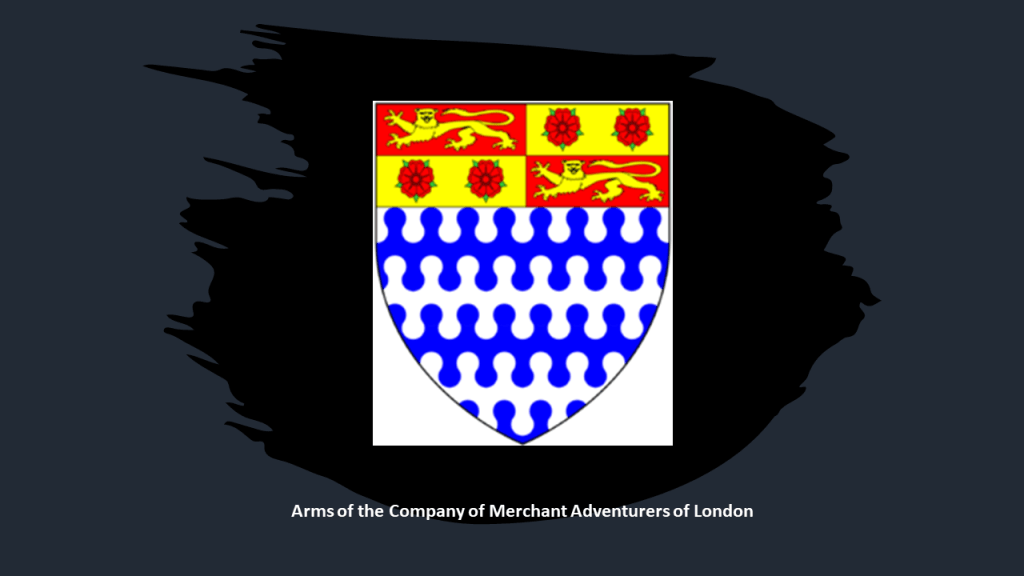
The Puritan Congregation that settled the Plymouth Colony had obtained a land patent from the Virginia Company of Plymouth in June of 1619, and they sought to finance their venture through a group of businessmen known as the Merchant Adventurers, who viewed the new colony as a way to make a profit.
Officially known as the Company of Merchant Adventurers of London, it had been founded in the City of London in the early 15th-century, and its main export was cloth, especially undyed broadcloth in exchange for a large range of foreign goods.
Funding obtained from the Merchant Adventurers paid for provisions and passage of members of the Congregation on the Mayflower living in England, and on the Speedwell for those living in the Netherlands, incurring a debt which needed to be repaid.
Important to note that the main source of income for the Plymouth Colony was the fur trade.
The Merchant Adventurers had also recruited a group of people known as “The Strangers” to assist the Pilgrim colonists, known as “Saints” as needed, like merchants, skilled labor, indentured servants, and several young orphans.
One of the “Strangers” was Myles Standish, the Military leader of the Plymouth Colony, and was officially designated as the captain of the colony’s militia in February of 1621, shortly after the Mayflower arrived in December of 1620.
Standish led several exploratory expeditions of Cape Cod, as well as military raids on “Indian Villages.”
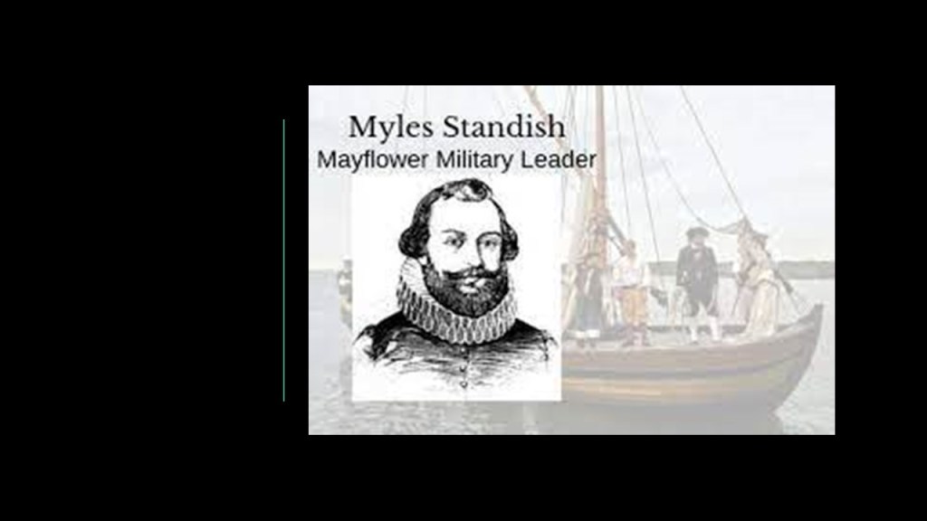
Standish was credited with the design of the defensive lay-out of the Pilgrims first settlement, known as the Plymouth Fort.
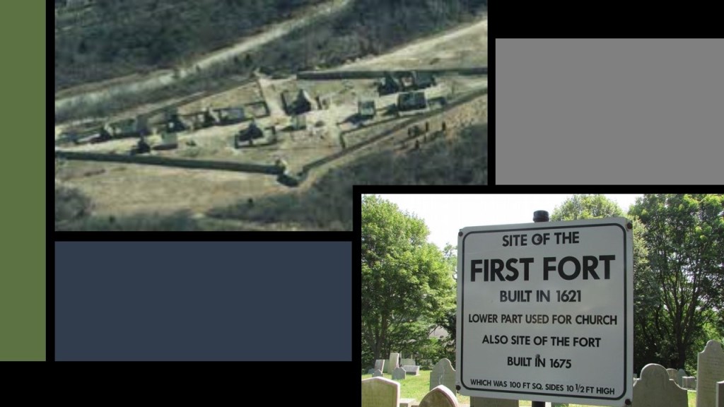
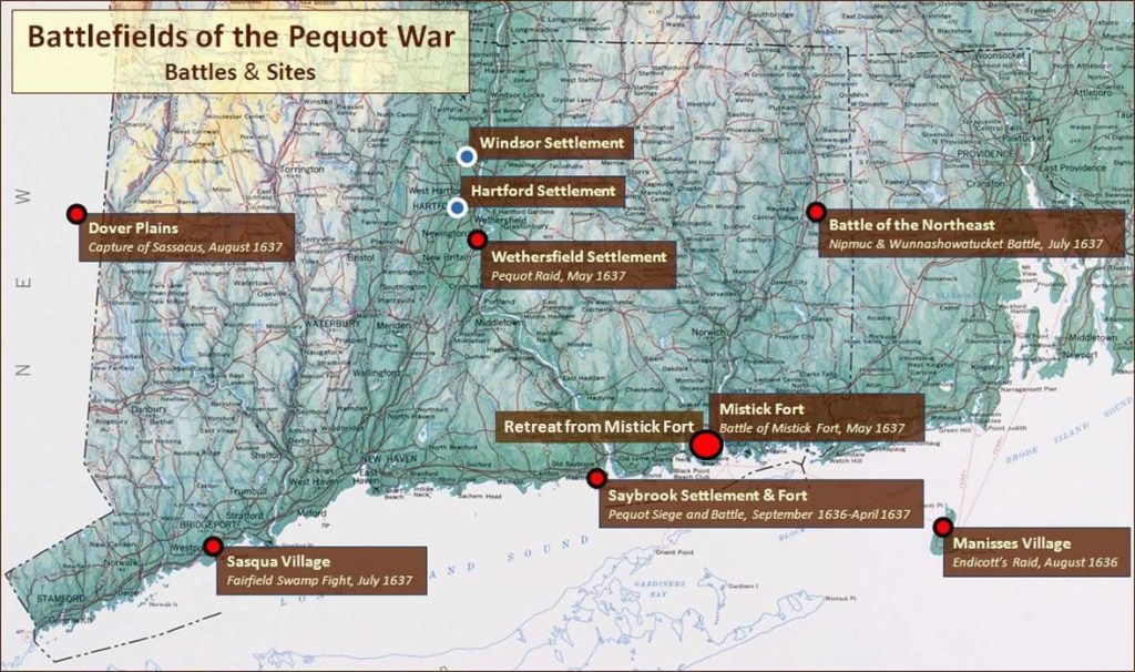
The Pequot War of 1637 was the first major war in New England, and originated in 1632 with a dispute between Dutch fur traders and Plymouth officials over control of the Connecticut River Valley, with representatives of the Dutch East India Company and the Plymouth Colony claiming they had deeds showing they had rightfully purchased the land from the indigenous Pequots.
This led to a rush of English settlers to the area to beat the Dutch to it, and this led to retaliation by the Pequots and the initiation of hostilities between 1636 and 1638, and eliminated the Pequots as a viable political entity.
The other major conflict between colonists and the indigenous people of the region, was King Philip’s War, the fighting during which took place between 1675 and 1676.
Metacomet, also known as King Philip, was the younger son of the Wampanoag sachem Massasoit.
Massasoit had maintained a long-standing alliance with the colonists.
After Metacomet became sachem in 1662 shortly after his father’s death, he forsook the alliance between the Wampanoags and the colonists that had been made by his father because of repeated violations by the colonists, and he led a coalition of tribes native to the region known as New England, including the Narragansetts, against the colonists starting in 1675.
By the end of the war, the Wampanoag and their Narragansett allies were almost completely destroyed, and King Philip was killed in August of 1676.
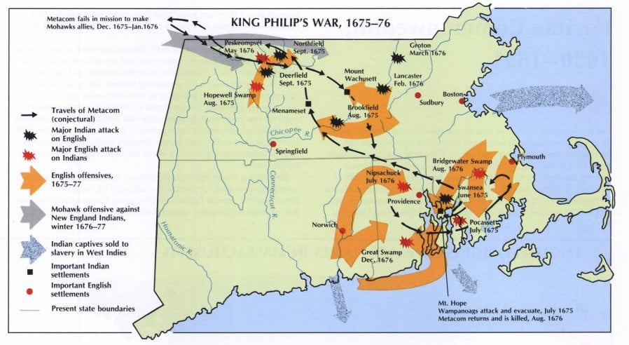
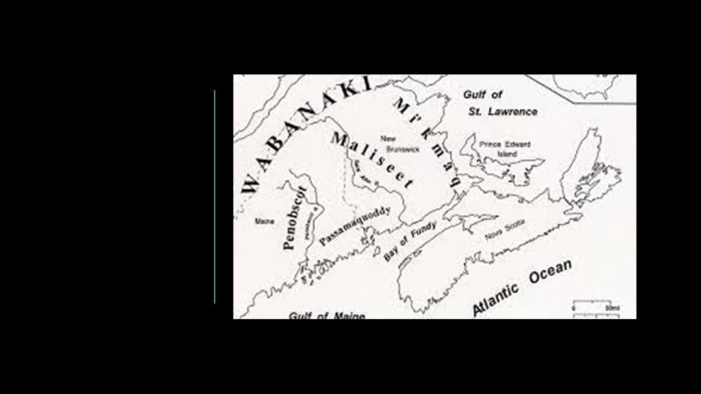
The King Philip’s War was said to have officially ended with the signing of the Treaty of Casco in 1678 in the most northern part of New England, between the Wabanaki Confederacy and the English Settlers.
There are no existing copies of the treaty or its proceedings, however, so historians use a summary of clergyman and historian Jeremiah Belknap in his 1784 “History of New Hampshire.”

The Wabanaki Confederacy consisted of the four principal Algonquin nations of the Mi’kmaq, Maliseet, Passamaquoddy, and Penobscot of present-day Nova Scotia, New Brunswick, Prince Edward Island, Quebec, and Newfoundland in Canada, and present-day Maine, Vermont and New Hampshire in the United States.
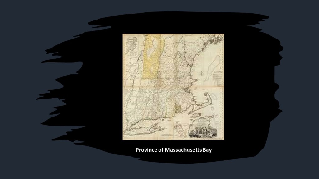
The Plymouth Colony was ultimately merged with the Massachusetts Bay Colony in 1691, and along with other territories, formed the Province of Massachusetts Bay.
Two noteworthy asides before I move on from the Plymouth Colony.
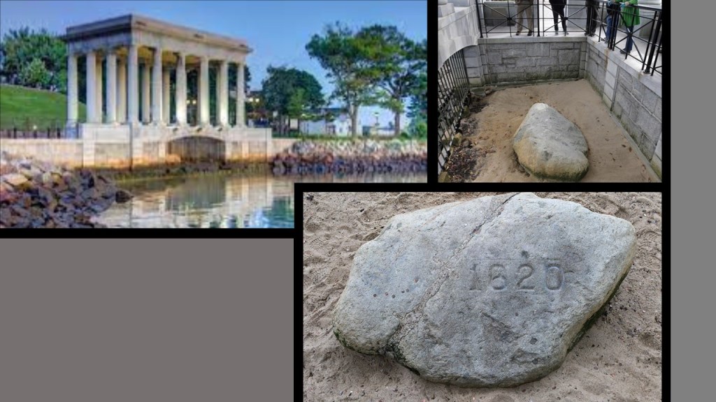
First, Plymouth Rock.
This is the Plymouth Rock Monument in Plymouth.
The current classical monument housing was said to have been designed in 1921 by the architectural firm of McKim, Mead & White.
There’s a whole long back-story to Plymouth Rock itself, including there was no record from the pilgrim fathers themselves about landing on a particular rock; attention was first brought to the rock that became Plymouth Rock in 1741 when plans were being made by the residents to build a wharf that would bury it, and an elderly man came forward and said that was the “one” based on what he had been told by his father who had been there when the Pilgrims landed; that the rock had been moved and split and all kinds of stuff; and that the current Plymouth Rock is estimated to weigh ten tons.
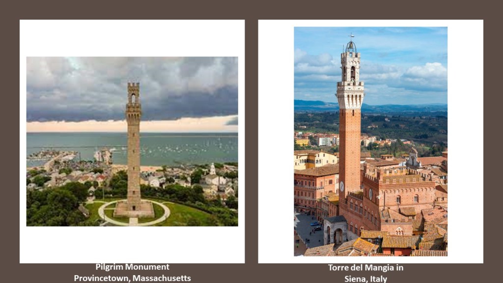
The other is the Pilgrim Monument in Provincetown, Massachusetts, on the northern end of Cape Cod.
It was said to have been built between 1907 and 1910 to commemorate the first landfall of the Pilgrims in 1620 and the signing of the Mayflower Compact in Provincetown Harbor.
It is a bell-tower, and the tallest, all-granite structure in the United States, and said to have been modelled after the Torre del Mangia in Siena, Italy, which is said to have been designed in 1309.
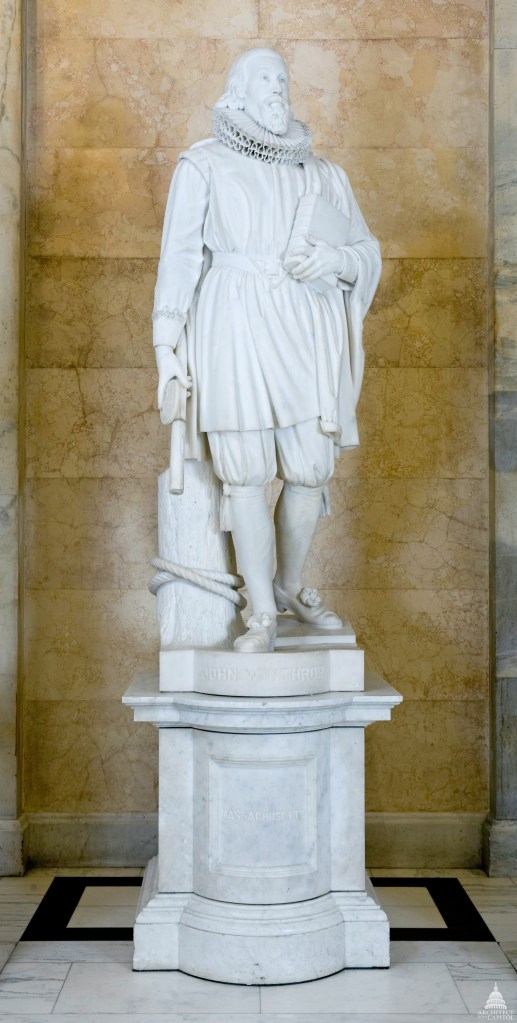
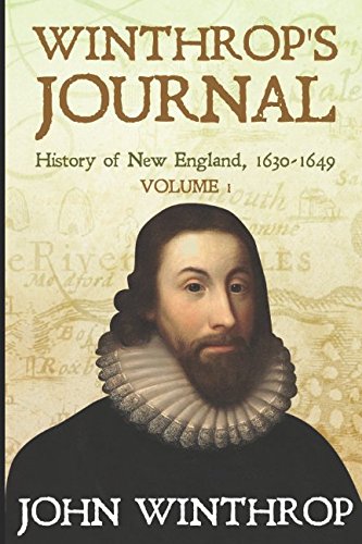
Another important figure during this time-period of the British colonization of North America was John Winthrop.
John Winthrop was a key figure in the founding of the Massachusetts Bay Colony, and I did extensive research about him when I found him representing the State of Massachusetts in the National Statuary Hall at the U. S. Capitol Building in Washington, DC.
John Winthrop was born in January of either 1587 or 1588 in Suffolk, England, to a prosperous, land-owning family.
The Winthrop family was granted Groton Manor after the Dissolution of the Monasteries, as the Lord of the Manor had previously been the Abbot of the Bury St. Edmunds Abbey, and John’s parents moved in when he was young.
In 1613, Winthrop’s father transferred the family holdings in Groton to him, and he became Lord of the Manor at Groton, the landholder of a rural estate, enjoying manorial rights.
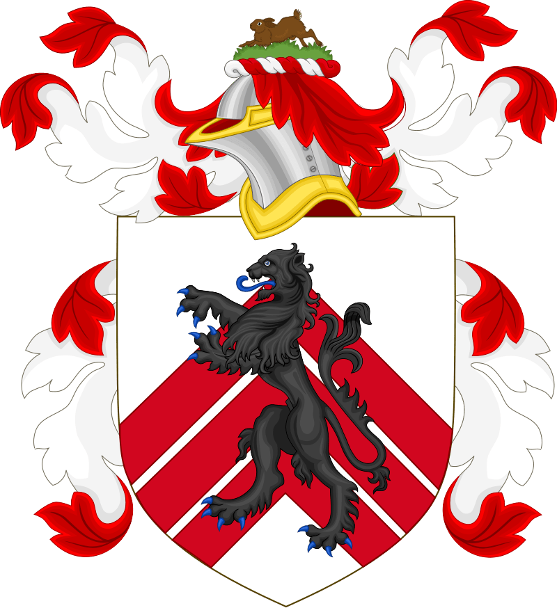
The Winthrop Coat of Arms was confirmed to John’s uncle by the College of Arms in 1592.
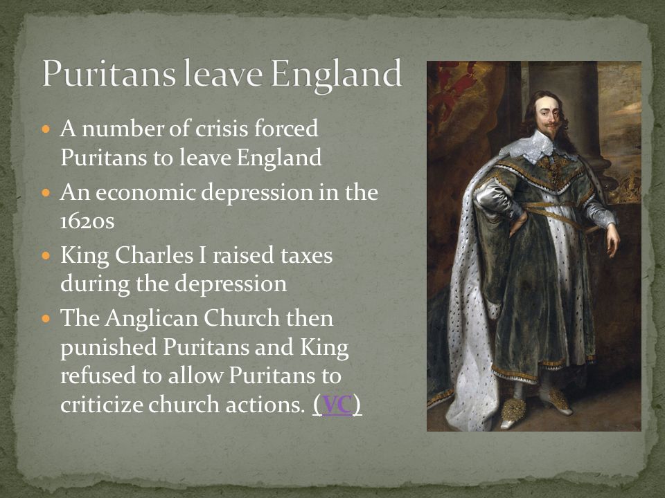
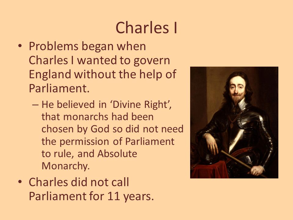
Our historical narrative tells us the religious atmosphere for Puritans to started to change in England in the mid-to-late 1620s, after King Charles I ascended to the throne in 1625, and had married a Roman Catholic.
The atmosphere of intolerance towards Puritans and this state-of-affairs led more Puritan leaders to consider emigration to the New World as means to escape persecution.
In 1629, a royal charter, which included the authority to make and use a seal, from King Charles I was received by Puritan investors known as the “Massachusetts Bay Company.”
The Royal Charter established the legal basis for the new Massachusetts Bay Colony for the governance of a land grant of territory between what became known as the Charles River in eastern Massachusetts and the Merrimack River, which starts in New Hampshire and flows southward into Massachusetts.
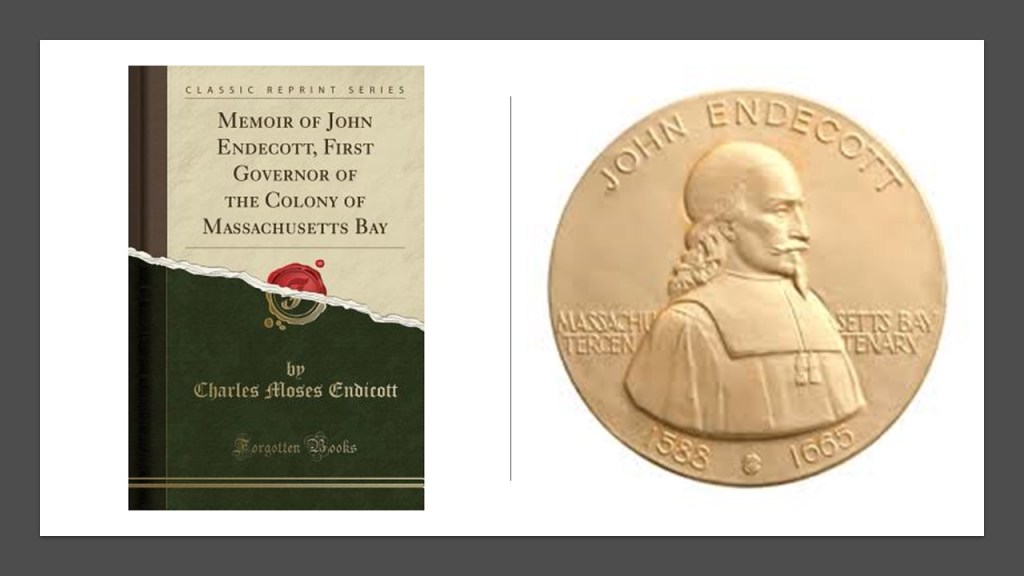
Puritan John Endecott led a small group of settlers to the area around this time to prepare the way for a larger migration, and he became the first Governor of the Massachusetts Bay Colony from 1629 to 1630, and served as governor several more times over the years, for a total of sixteen years all together.
The exact connection by which John Winthrop got involved with the Massachusetts Bay Company is not known, but he had connections with individuals associated with the company.
Also in 1629, King Charles I dissolved Parliament, beginning a historical period known as “11 years of rule” without Parliament.
This worried Massachusetts Bay Company principal investors, and John Winthrop as well.
The Governor of the Massachusetts Bay Company proposed the company reorganize and transport its charter and governance to the colony, and as the months went on, John Winthrop became more involved with the company, and a major supporter of emigration there.
John Winthrop was a signatory on the Cambridge Agreement, which was signed on August 29th of 1629 by company shareholders.
Under its terms, those who wanted to emigrate to the New World could purchase shares from those shareholders who didn’t want to leave home.
The Cambridge Agreement also set forth that the Massachusetts Bay Colony would be under local control, and not governed by a London-based corporate board.
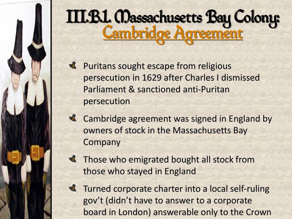
The company shareholders met in August of 1629 to enact the agreement.
At this time, John Winthrop was chosen as the new Governor of the Massachusetts Bay Company, and, along with other company officials, set about making all the necessary arrangements for the venture of settling in the New World.
John Winthrop was on one of four ships of the transport fleet that left the Isle of Wight on April 8th of 1630.
All together, there were eleven ships that carried roughly 700 emigrants to the new colony.
John Winthrop, with the charter for the Massachusetts Bay Colony in hand, and the new colonists arrived in Salem, Massachusetts, in June of 1630, and were welcomed by John Endecott.
We are told that in its early months, the new colony struggled, losing around 200 people to various diseases.
Winthrop worked alongside the laborers and servants in the work of the colony, setting an example for the other colonists to do all the work that needed to be done on the “plantation.”
Interesting to see the word “plantation” used so much even from the very beginnings of the New World.
In the history of colonialism, plantation was a form of colonization where settlers would establish a permanent or semi-permanent settlement in a new region.
Looks like the colonizers were literally “planting” themselves in a new place.
Not only were settlements and settlers being planted in a new region from somewhere else, this plantation system of the colonizers quickly laid the foundation for slavery on large farms owned by “planters” where cash crop goods were produced.
Winthrop spent a lot of time writing, including his “The History of New England: 1630 – 1649,” also known as “The Journal of John Winthrop,” which was apparently not published until 1790, and has been edited and published three times since then.
Winthrop’s Journal is considered to be the central source of information for the history of Massachusetts in the 1630s and 1640s.
For the Puritans leaving England for the New World because of religious intolerance, completely uprooting their lives and venturing into the unknown for religious freedom…they were remarkably intolerant of people with other religious beliefs, including those within their own community.
The Antinomian Controversy significantly divided the Massachusetts Bay Colony from October of 1636 to March of 1638.
It pitted most of the Colony’s ministers and magistrates against some of the adherents of the Free Grace theology of Puritan Minister John Cotton, and revolved around a theological debate concerning Cotton’s “Covenant of Grace,” which taught that following religious laws was not required for salvation, and the “Covenant of Works” of other Puritans, including John Winthrop, which taught that by doing good works and obeying the law, a person earns and merits salvation.
The outcome was that the leading advocates of Antinomianism, Anne Hutchinson and John Wheelwright were banished from the Massachusetts Bay Colony, and their supporters were disarmed, dismissed, disenfranchised, or banished in this New World.
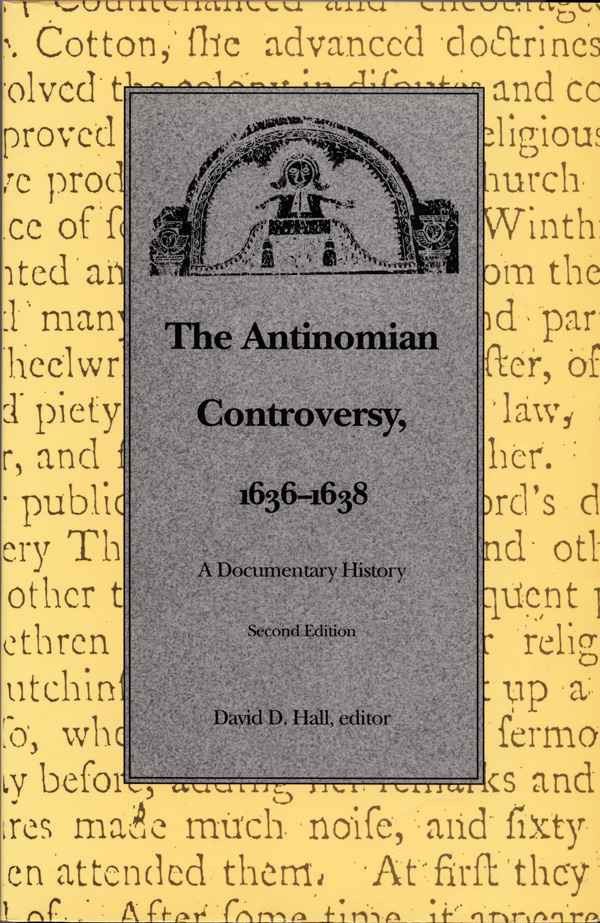
After her banishment, Anne Hutchison and her supporters established the settlement of Portsmouth in 1638 in what became known as Rhode Island, with encouragement from the Providence Plantations founder, fellow-banishee from the Massachusetts Bay Colony Roger Williams, in what became known as the Colony of Rhode Island and Plymouth Plantations.
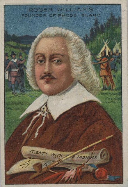
Williams also established the first Baptist church in America in Providence.
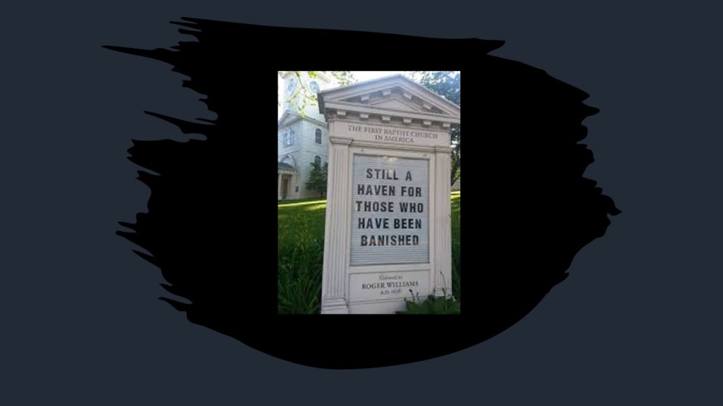
It is interesting to note that in-between the founding of the Plymouth Colony in 1620 and the Massachusetts Bay Colony in 1630, what was described as Sir Francis Bacon’s incomplete utopian novel of “New Atlantis” was first published 1626, after his death in April of that same year.
“New Atlantis” was tucked in the back of a much longer work attributed to him about natural history called “Sylva Sylvarum” that was recorded in the Stationers’ Register on July 4th of 1626.
The Stationers’ Register was established via Royal Charter in 1557 as a record book to regulate the professions of the publishing industry and an early form of copyright law. The company’s charter gave it the right to seize illicit editions and bar the publication of unlicensed books.
It is considered a crucial resource for the literature of the English literature of the 16th and 17th-centuries, containing “factual data” and “hard data” that is found nowhere else.
Hmmm.

At any rate, “New Atlantis” was said to portray a future vision of human discovery and knowledge, and the novel depicts an enlightened utopian land where qualities like generosity, high moral character, and honesty were commonly held by the inhabitants of a mythical island he called “Bensalem.”
There was a state-sponsored scientific institution on Bensalem called “Salomon’s House,” said to envision in the book the modern research university in applied and pure sciences.
I really think “New Atlantis” was actually describing an enlightened, advanced civilization, known also as Atlantis, that existed in our relatively recent past and not one in our future….
Another method by which the original civilization’s true history was obscured was by way of historical place name changes.
Here are several examples, of which there are many more, of this practice.
The following were all empires unified within the ancient advanced civilization, with its roots going back in the far distant past to the time of Mu, also known Lemuria.
Now I am going to skip around bring forward other examples showing how ancient countries were subjugated, and controlled, through the processes of western colonialism.
One such is example is the Kingdom of Kandy was said to have been founded in Ceylon in 1469.
Known as Ceylon since ancient times, it has been known as the island country of Sri Lanka since 1972.
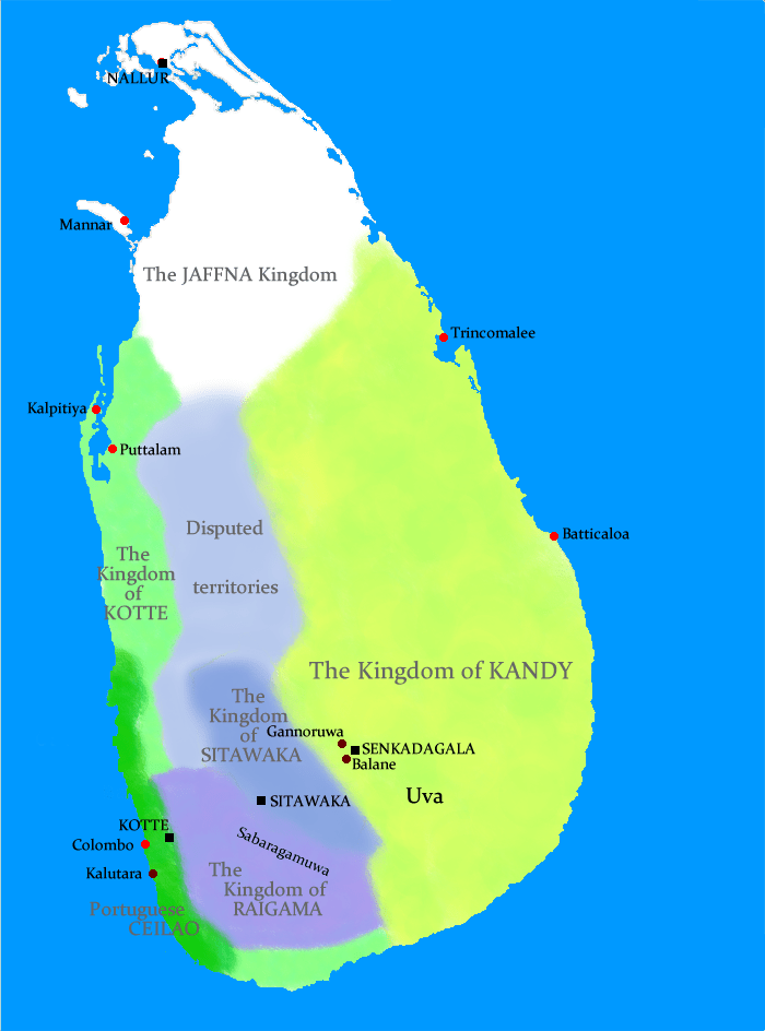
In 1592, Kandy became the capital city of the last remaining independent kingdom in Ceylon after the coast regions had been conquered by the Portuguese.
From that time, the Kingdom of Kandy kept the Portuguese and Dutch East India Company at bay, but succumbed finally to British colonial rule when the kingdom was absorbed into the British Empire as a protectorate via the Kandyan Convention of 1815, an agreement signed between the British and members of the King’s court which ceded the kingdom’s territory to British rule, and the last king was imprisoned.
At this time, Ceylon became British Protectorate until its independence in 1948.
Barbaria was the name given to a vast region stretching across Northern Africa, to the Canary Islands, also known as the Barbary Coast and the Maghreb.
The people who live in that part of northern Africa became known as Berbers instead of Barbars.
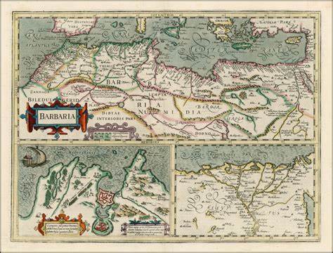
What was the historical Tartarian Empire included present-day Korea, Japan, Mongolia, Tibet, and other modern Central Asian countries…
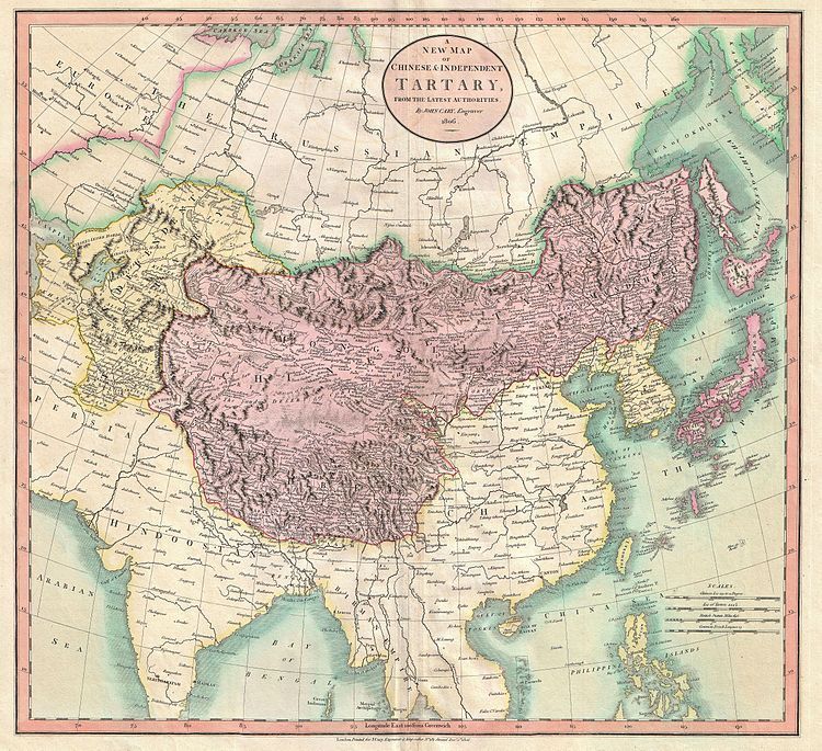
…and a large chunk of Tartaria became known as Manchuria in northeast Asia in the mid-1800s.
Persia historically was part of the vast Persian Empire, which in more ancient times, as we are told, included all of the following present-day countries: Afghanistan, Armenia, Azerbaijan, Bahrain, Egypt, Georgia, Iraq, Israel, Kazakhstan, Kuwait, Lebanon, Oman, Pakistan, Russia, Tajikistan, Turkmenistan, Turkey, and Uzbekistan.
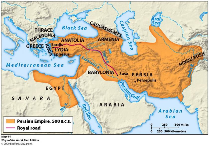
On the Nowruz, or New Year, of 1935, the Shah of Iran, Reza Shah Pahlavi asked foreign delegates to use the term Iran in formal correspondence.
This also changed the usage of the country’s national identity from Persian to Iranian.
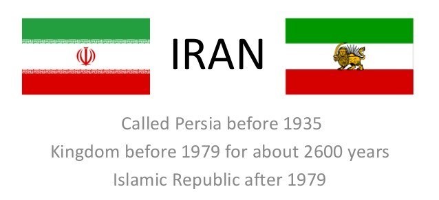
The Kingdom, or Realm, of the Morea was the official name of the Peloponnese Peninsula of southern Greece until the 19th-century.
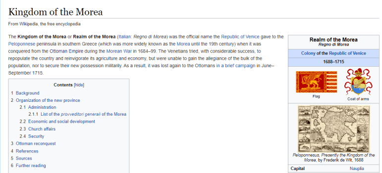
I just now realized that the image of the lion on the flag of the Kingdom of the Morea in southern Greece was very similar to the image of the lion on the flag of the Kingdom of Kandy in the same as the flag of the former Kingdom of Kandy in historical Ceylon.
The powers that used-to-be didn’t rewrite history completely from scratch – they rewrote the historical narrative to fit their agenda and we have been immersed in learning their version of history from cradle to grave.
More about how they accomplished this in the third-part of this post.
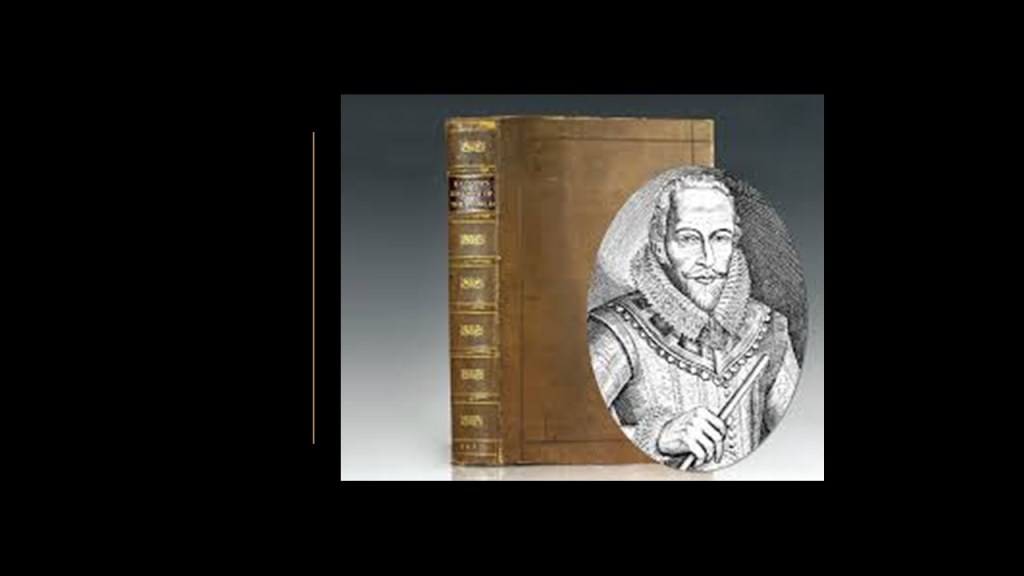
Maps, Globes & the Centuries of Exploration
In the third, and last, part of this series, I will be taking a close look at how maps, globes and the sea voyages of the “Age of Discovery” tie into the creation of the New World from the Old World.
The subject matter I am going to bring forward in this post is largely about, but not limited to, “The Age of Discovery,” described as the period of European history in which extensive overseas exploration occurred from the beginning of the 1400’s to the middle of the 1600’s.
Overseas exploration emerged as a powerful factor in European culture and was the beginning of globalization.
I will also be looking at the various scientific expeditions of the 1800s.

I think it is important to begin this part with some information about how concepts of space and time are viewed in the present-day versus how they were viewed in the past.
The study of geodesy is the science of accurately measuring and understanding the Earth’s shape, orientation in space, and gravitational field.
A geographic coordinate system enables every location on Earth to be specified by a set of numbers, letters and symbols.
The coordinates are chosen so that one of the numbers represents a vertical position, and the horizontal position, from the East-West lines of longitude.

We are told that in cartography, the science of map-making, a map projection is the way of flattening the globe’s surface into a plane in order to make it into a map, which requires a systematic transformation of the latitudes and longitudes of locations from the surface of the globe into locations on a plane.
This is a 1482 engraving by Johannes Schnitzer of the “Ecumene,” an ancient Greek word for the inhabited world, and used in cartography to describe a type of world map used in late antiquity and the Middle Ages.
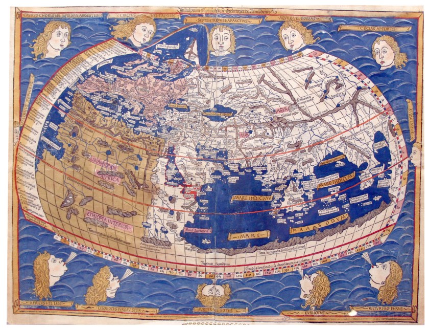
He was said to have constructed it from the coordinates in Claudius Ptolemy’s “Geography,” an atlas, and treatise of geography, from 150 AD said to compile the geographical knowledge of the 2nd-century Roman Empire, and a revision of the now-lost atlas of Marinus of Tyre, a Phoenician cartographer and mathematician who was said to have founded mathematical geography, and who introduced improvements to the construction of maps and developed a system of nautical charts.
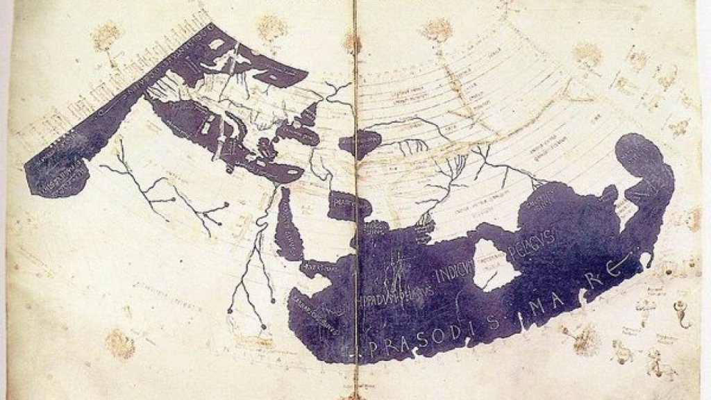
Longitude fixes the location of a place on Earth east or west of a North-South line of latitude called the Prime Meridian, given as an angular measurement that ranges from 0-degrees at the Prime Meridian to +180-degrees westward and -180-degrees eastward.
In 1851, Sir George Airy established the new prime meridian of the Earth, a geographical reference line at the Royal Observatory of Greenwich in London, and by 1884, over two-thirds of all ships and tonnage used it as the reference meridian on their charts and maps.
Previous to that, the great pyramid of Giza, located at the exact center of the Earth’s landmass, was the Prime Meridian.
Carl Munck deciphers a shared mathematical code in his book “The Code,” related to the Great Pyramid, in the dimensions of the architecture of sacred sites all over the Earth, one which encodes longitude & latitude of each that cross-reference other sites.

He shows that this pyramid code is clearly sophisticated and intentional, and perfectly aligned over long-distances.
In October of 1884, the United States hosted the International Meridian Conference in Washington, DC, attended by twenty-five countries, in order to determine the Prime Meridian for international use.
Twenty-two of the twenty-five countries in attendance voted to adopt the longitude of the Royal Observatory in Greenwich as the zero-reference line.
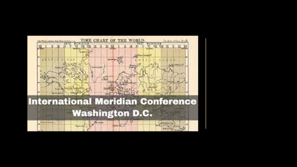
With regards to maps, it is important to note that in earlier maps, ley-lines were depicted.
The Catalan Atlas of the Majorcan Cartographic School is considered the most important map of the Medieval period in the Catalan language, dated to 1375.
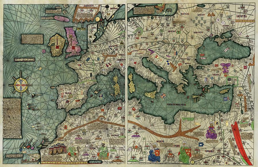
I encountered another old map depicting ley-lines when I was researching for information on Fernando de Noronha, an island group just off the coast of Brazil.
The Cantino Planisphere was said to have been completed by an anonymous Portuguese cartographer some time before 1502.
A planisphere is defined as a map formed by the projection of a sphere or part of a sphere on a plane.
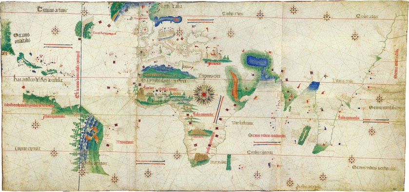
It would seem that the Earth’s grid-lines started to disappear from maps in the 1500s, as Gerardus Mercator, a Flemish geographer, cartographer and cosmographer…
…published a world map in 1569 that is considered to be the first where sailing courses on the sphere were mapped to the plane map, allowing for a “correction of the chart to be more useful for sailors.”
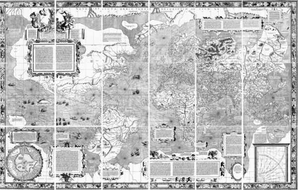
Here is a close-up section of the 1569 map showing the depiction of straight ley-lines in the seas, but not on land and sea as were present on the flat projections of the Cantino Planisphere and the Catalan Atlas.
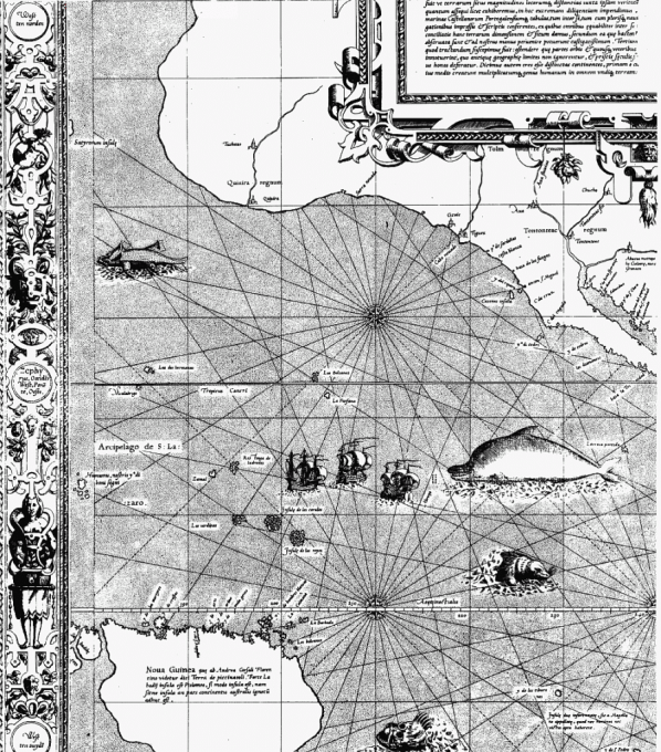
Not only that, Mercator was also a globe-maker, like this one from 1541.
Shortly thereafter, in May of 1543, Nicolaus Copernicus published “On the Revolutions of the Heavenly Spheres,” offering mathematical arguments for the heliocentric, or sun-centered universe, and denying the geocentric model of the Earth-centered universe of Ptolemy, which the heliocentric model superceded, meaning that while once widely-accepted, current science considered the geocentric model inadequate.
By the end of May of that same year, Copernicus was dead.
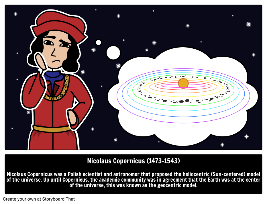
This is the cover of Mercator’s 1578 publication of “Tabulae Geographicae,” along with the globe, and Ptolemy said to depicted on the left, and Marinus of Tyre on the right.
Notice the difference between the lines on the globe at the top of the engraving, and the globe at the bottom, and while he is pointing down to the globe at the bottom…
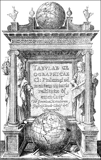
…and Ptolemy is holding up a geometric shape that looks like the lines on the globe at the top on the left, which looks remarkably like the shape the sacred hoops formed in the Native American Hoop Dance on the right.
The Erdapfel, which translates literally from the German as “Earth apple,” but means “potato” in German, was said to be a terrestrial globe produced by Martin Behaim, a German textile merchant and cartographer, between 1490 and 1492.
This engraving of him was said to have been done in 1886.
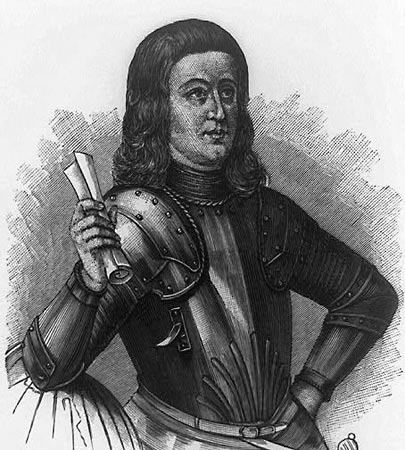
We are told the Erdapfel is the oldest surviving terrestrial globe.
It is a laminated linen ball, constructed in two-halves, reinforced with wood…
…and overlaid by a map painted by Georg Glockendon, pasted on a layer of parchment around the globe.
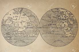
The German-English geographer and cartographer, Ernst Georg Ravenstein, who was born in Germany in 1834, but spent most of his adult life in England, wrote a book about Martin Behaim and his Erdapfel in 1908, and, as we shall see, Mr. Ravenstein’s name will come up again in more than one reference.
Only 13-years after Mercator was said to have published his world map in 1569, the linear Gregorian Calendar was introduced by Pope Gregory XIII in October of 1582, for the given reason of correcting the Julian calendar on stopping the drift of the calendar with respect to the equinoxes, and included the addition of leap years.
It took 300 years to implement the calendar in the west, and nowadays used in non-western countries for civil purposes.
The Mayan calendar was involved with the harmonization and synchronization of Human Beings and the development of Human Consciousness with natural cycles of time.
The Mayan calendar consisted of several cycles, or counts, of different lengths.
The 260-day count, or Tzolkin, was combined with a 365-day solar year known as the Haab’, to form a synchronized cycle lasting for 52 Haab’, called the Calendar Round, still in use today by many Mayan groups in the highlands of Guatemala.
The Tzolkin calendar combines twenty day-names and symbols, with thirteen day numbers, which represent different-sounding tones, to produce 260 unique days.
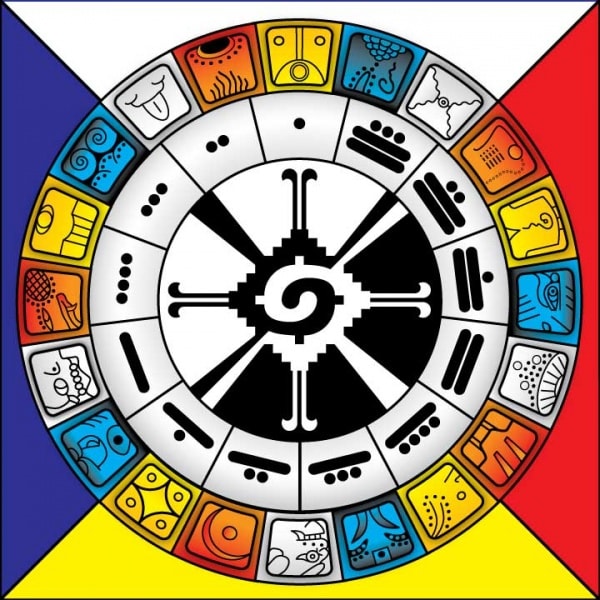
The Mayan Long Count calendar was used to track longer periods of time.
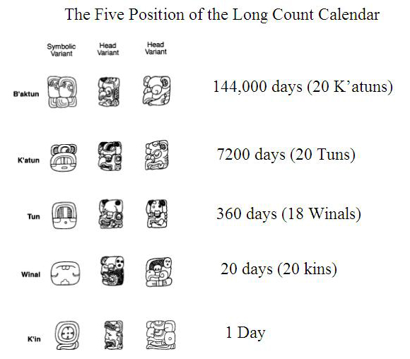
The ancient Egyptian calendar was a solar calendar with a 365-day-year, with three seasons of 120-days each, and 5-6 epagomenal days, also known as an intercalary month, transitional days that were treated as outside of the year proper to make the calendar follow the seasons or moon phases in common years and leap years.
Now on to the “Age of Discovery” in the “Centuries of Exploration.”
The primary initiator of the earliest time period of maritime exploration in our historical narrative, known as “The Age of Discovery, was Prince Henry the Navigator, who was said to have been born in 1394.
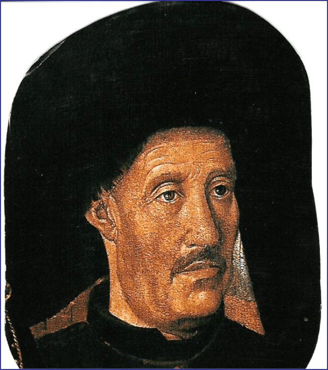
The fourth child of the Portuguese King John I, he was a central figure in the early days of the Portuguese Empire, and in the 15th-century European maritime discoveries and maritime expansion.
The Portuguese Empire was composed of the overseas colonies and territories government by Portugal, existing from 1415 with the capture of the port of Ceuta, on the Moroccan-side of the Strait of Gibraltar…
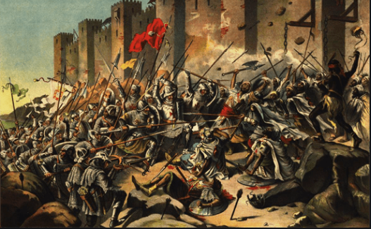
…to the handover of Portuguese Macau to China in 1999, the last remaining dependent state in China and the final vestige of European colonialism in the region, we are told, after 442-years of Portuguese rule.
Macau is designated as an autonomous region on the south coast of China, across the Pearl River Delta from Hong Kong…
…where there is Moorish-looking architecture in Macau on the left that looks like what is found in Madrid, Spain, on the right.
We are told Prince Henry the Navigator took the lead role in promoting and financing Portuguese maritime exploration until his death in 1460.
He was said to have been responsible for the early development of Portuguese exploration and maritime trade with other continents through the systematic exploration of western Africa, the islands of the Atlantic Ocean, and the search for new routes.
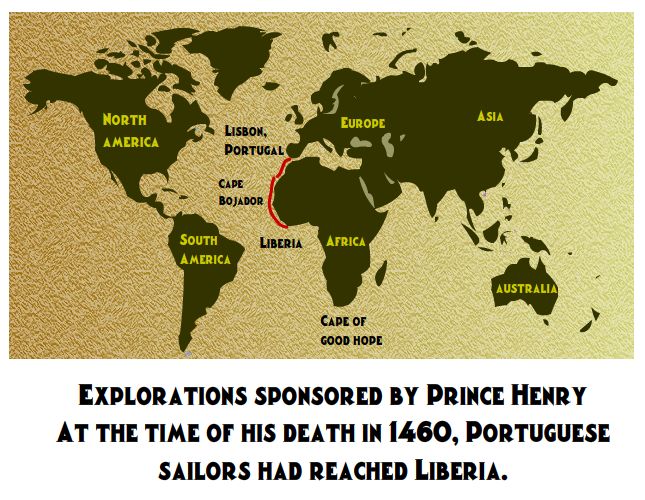
One more thing about Prince Henry.
Apparently no one used the nickname “the Navigator” during his lifetime, or in the following three centuries.
We are told the term was coined by two 19th-century German historians – Heinrich Schaefer and Gustave de Veer – and that the nickname was popularized by two British authors in the titles of their biographies of Prince Henry.
One was by Richard Henry Major in 1868…
…and the other was by Raymond Beazley in 1895.

Let’s see what else comes up like this.
The next Portuguese explorer to come on the scene was Bartolomeu Dias, a nobleman of the Portuguese royal household.
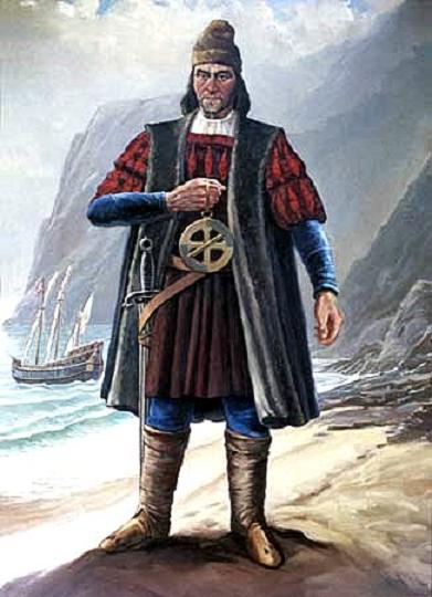
We are told he sailed around the southernmost tip of Africa, the Cape of Good Hope, in 1488, setting up the route from Europe to Asia later on.
He was also said to be the first European during the “Age of Discovery” to anchor at what is present-day South Africa.
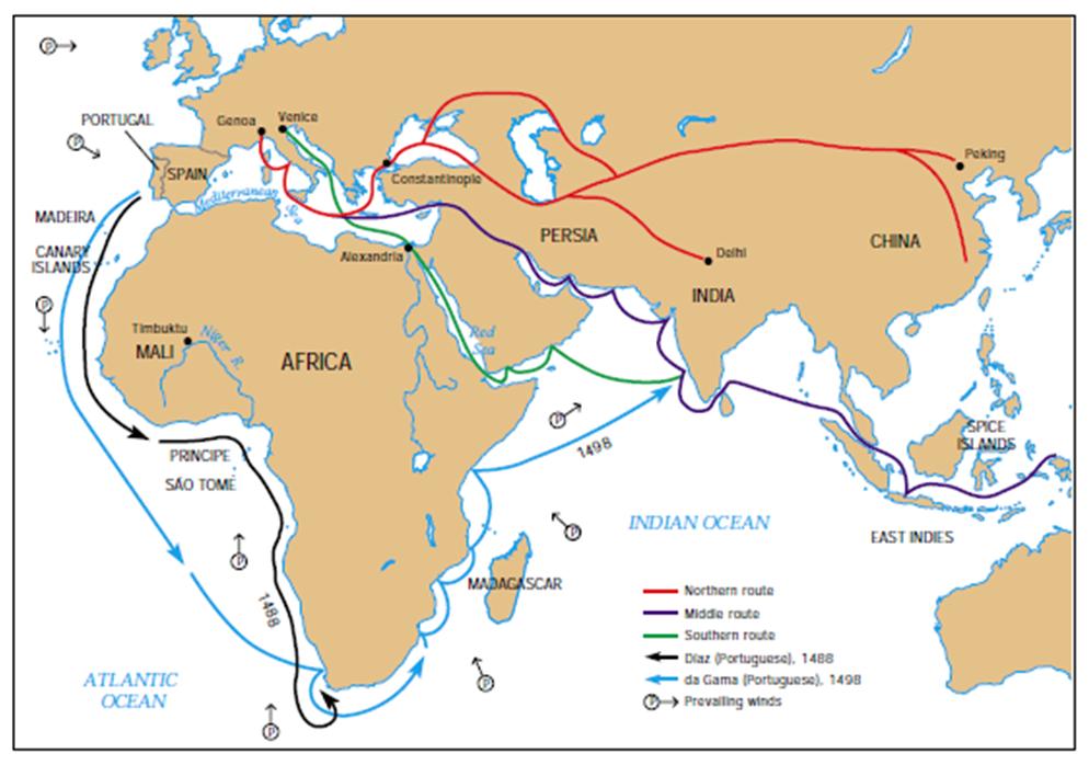
Not only did I find the German-English geographer and cartographer, Ernst Georg Ravenstein, come up in association with a biography of Bartolomeu Dias…

…Ravenstein also published “A Journal of the First Voyage of Vasco Da Gama” in 1898, the next Portuguese explorer of note, who made it to India in a journey between 1497 and 1499.
Ravenstein was said to have translated what was called the only known copy of a journal believed to have been written on-board ship during Vasco da Gama’s voyage to India.
We are told that Vasco da Gama’s first voyage to India was the first link to Europe and Asia by an ocean route.
He was said to have landed in Calicut on May 20th of 1498.
This is said to be a steel engraving from the 1850s of the meeting between the King of Calicut and Vasco da Gama, which apparently didn’t yield the favorable results the Portuguese explorer desired, as it failed to yield the commercial treaty with Calicut that was da Gama’s principal mission.
Regardless of the failure to secure a commercial treaty with the King of Calicut, Vasco da Gama’s voyage to and from India led to the yearly Portuguese India Armadas, fleets of ships organized by the King of Portugal dispatched on an annual basis from Portugal to India…
…and 6-years after da Gama’s initial arrival in 1498, the Portuguese State of India was founded.
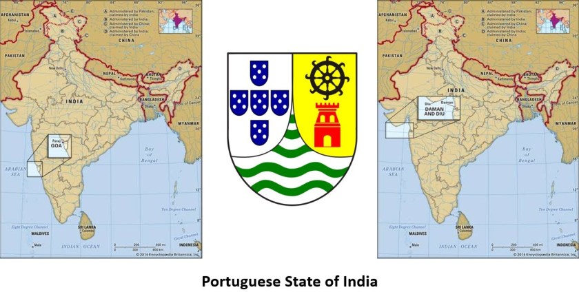
Portugal’s unopposed access to the Indian spice trade routes boosted the economy of its empire, and maintained a commercial monopoly on spice commodities for several decades.
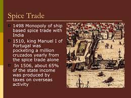
The Treaty of Tordesillas of 1494 divided the newly discovered lands outside Europe between the Portuguese Empire and the Spanish Empire (Crown of Castile), a long a meridian 370 leagues west of the Cape Verde Islands, off the West Coast of Africa.

Then, 35-years later, the Treaty of Zaragoza was signed, which specified the Antimeridian to the line of demarcation specified by the Treaty of Tordesillas, defining the areas of Spanish and Portuguese influence in Asia.
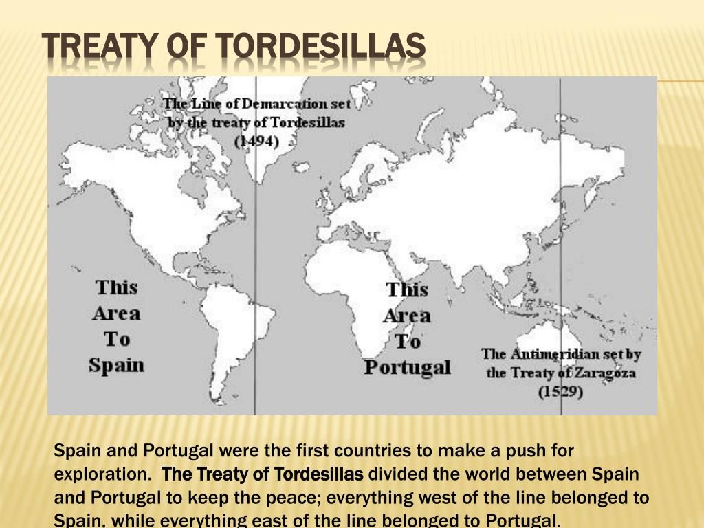
Pedro Alvares Cabral, a Portuguese nobleman, military commander, navigator and explorer, was a contemporary of Vasco da Gama.
He was said to have led a fleet of thirteen ships into western Atlantic Ocean, and made landfall in what we know as Brazil in 1500.
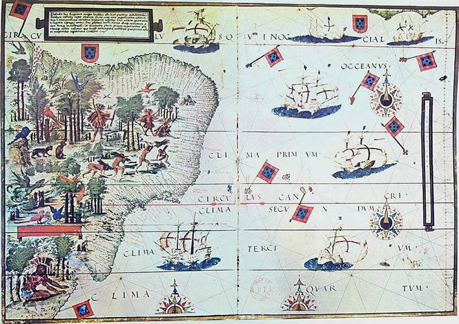
As the new land was in the Portuguese sphere according to the 1494 Treaty of Tordesillas, Cabral claimed it for the Portuguese Crown.
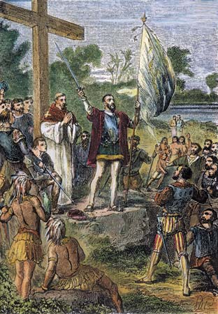
He explored the coast, and realized, we are told, that the large land-mass was most likely a continent, and dispatched a ship to notify the Portuguese King, Manuel I of the new territory.
The land Cabral had claimed for Portugal later became known as Brazil on the continent of South America.
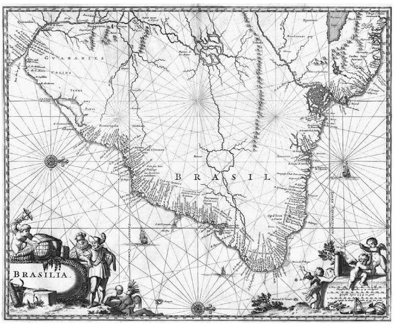
Interestingly, Cabral slipped into obscurity for 300 years, until the 1840s that is, when the Brazilian Emperor Dom Pedro II sponsored research and publications dealing with Cabral’s life and expedition through the Brazilian Historical and Geographic Institute, which was founded in 1838, and part of the emperor’s plan to foster and strengthen a sense of nationalism among Brazil’s diverse citizenry.
Ferdinand Magellen was a Portuguese explorer who organized the Spanish expedition, which started in 1519 and ended in 1522, to the Spanish East Indies, a fleet known as the “Armada de Molucca” to reach the Spice Islands, and said to have resulted in the first circumnavigation of the earth.
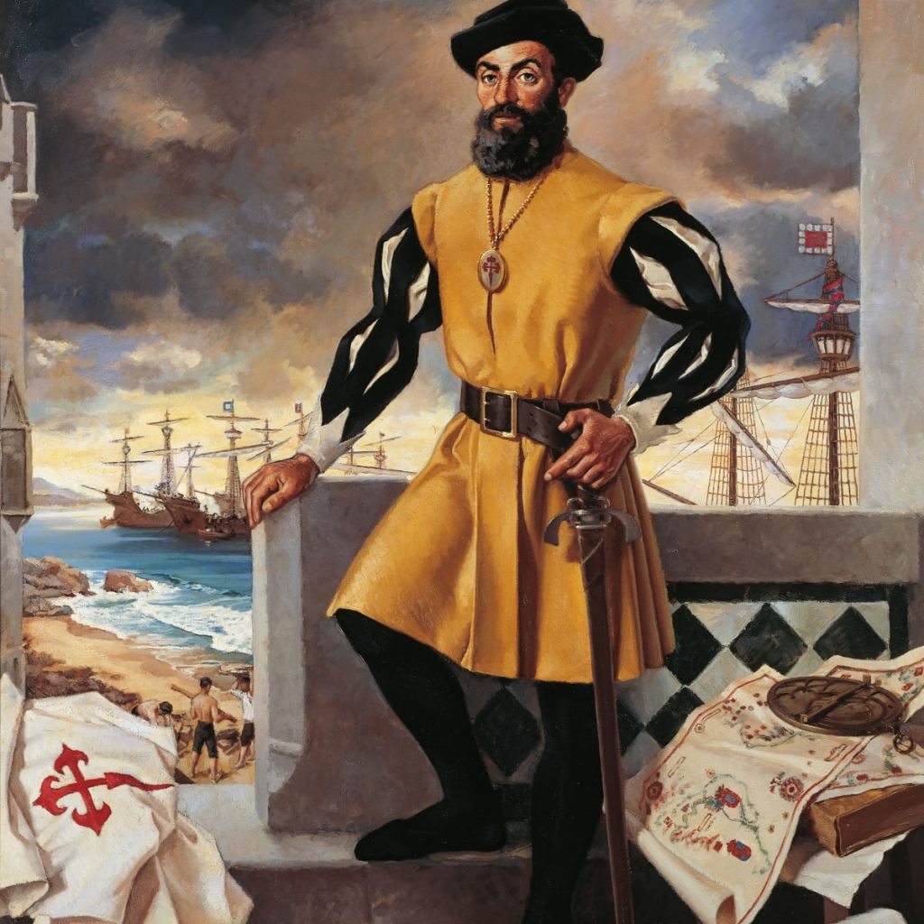
As mentioned previously,Magellan was killed in the Philippines in the Battle of Mactan on April 27th of 1521, and a Basque-Spanish explorer by the name of Juan Sebastian de Elcano was said to have completed the expedition after Magellan’s death, from the Moluccas and back to Spain.
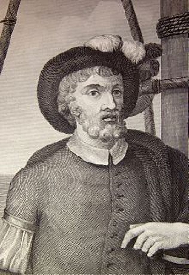
I found a biography about Magellan written by an Austrian novelist, playwright, journalist and biographer named Stefan Zweig, who was born in Vienna in 1881, and died, along with his wife, in Brazil in 1942, of barbituate overdoses, we are told.
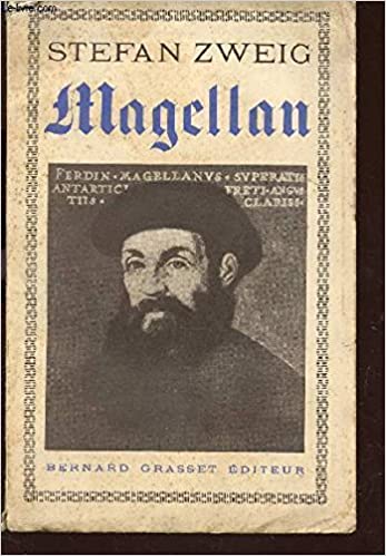
Other notable explorers from the first “Age of Discovery” include:
Giovanni da Verrazzano was said to be a Florentine explorer, in the service of the French King Francis I, and being the credited with first European to explore the Atlantic Coast of North America between Florida and New Brunswick between 1523 and 1524.
We are told that the book “Verrazano’s Voyage Along the Atlantic Coast of North America, 1524,” was reproduced from an original artifact that was written by Giovanni da Verrazzano himself.
It was published in 1916, with an introduction by Edward Hagaman Hall, a New York State historian who was born in 1858 and died in 1936.
Henry Hudson was said to have been an English navigator and explorer during the early 17th-century, best known for his explorations of parts of the northeastern United States and Canada.
Between 1607 and 1611, he was engaged by various trading companies to sail to the Far North to find another way to Asia, via either the Northeast Passage or Northwest Passage.
In 1609, Henry Hudson was chosen by Dutch East India Company merchants to find an easterly passage to Asia.
His attempts to go in an eastward direction were said to have been blocked by ice in northern Norway, so he decided to go west and find a northerly passage through North America.
His ship, the Half Moon, travelled down the coast from LaHave in Nova Scotia; to Cape Cod; to the Chesapeake Bay; to Delaware Bay; then New York Bay, and up the Hudson River that bears his name.
His voyage was said to have been used to establish Dutch claims to the region, and to the fur trade that prospered there when a trading post was established at Albany in 1614, and with New Amsterdam on Manhattan island becoming the capital of New Netherland in 1625.
Did Henry Hudson happen to have anything thing published about him in the late 19th-century, early 20th-century?
I found this 1909 publication about Henry Hudson by Thomas Allibone Janvier, described as an American story-writer and historian, who was born in 1849 and died in 1913.
The Lewis & Clark Expedition started on August 31, 1803 and lasted until September 23rd of 1806, with a mission to explore and map the newly acquired western portion of the country after the Louisiana Purchase.
We are told their visit to the Pacific Northwest, maps, and proclamations of sovereignty with medals and flags were legal steps needed to claim title to each indigenous nation’s lands under the Doctrine of Discovery, a concept of public international law expounded by the United States Supreme Court in a series of decisions in 1823.
Under it, title to lands lay with the government whose subjects travelled to and occupied a territory whose inhabitants were not subjects of a European Christian monarch.
In other words, the Supreme Court ruled that the Native Americans didn’t own their land.
Chief Justice John Marshall explained and applied the way that colonial powers laid claim to lands belonging to foreign sovereign nations during the Age of Discovery, and Chief Justice Marshall noted, among other things, the 1455 papal bull Romanus Pontifex and the 1493 Inter Cetera bull in the Court’s decisions to implement the Doctrine of Discovery.
Meriwether Lewis had returned from the Lewis & Clark Expedition in 1806; was made Governor of Louisiana Territory in 1807 by Thomas Jefferson; and had made arrangements to publish his Corps of Discovery Journals.
Lewis was initiated into freemasonry between 1796 and 1797, from where he was born and raised in the Virginia Colony, shortly after he joined the United States Army in 1795.
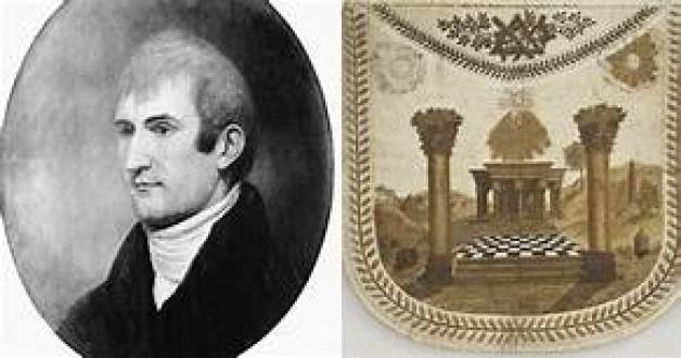
Being Governor of the Louisiana Territory didn’t work too well for Lewis for a variety of reasons, and on September 3rd of 1809, he set out for Washington, DC, to address financial issues that had arisen as a result of denied payments of drafts he had drawn against the War Department when he was governor…and he carried with him his journals for delivery to his publisher.
He decided to go overland to Washington instead of via ship by way of New Orleans, and stayed for the night at a place called Grinder’s Stand, an inn on the historic Natchez Trace, southwest of Nashville, Tennessee.
Gunshots were heard in the early morning hours, and he was said to have been found with multiple gunshot wounds to the head and gut.
His remains were interred here at Grinder’s Stand.
We are told that Thomas Jefferson and some historians generally accepted Lewis’ death as a suicide.
What did he know?
Who would have wanted him silenced?
What happened to his journals?
Did someone nicely get them along to his publisher for him as he had written them?

A new era of scientific maritime exploration also commenced in the 1800s.
in August of 1822, Jules Dumont d’Urville set out on an expedition to collect scientific and strategic information, and sailed to the Falkland Islands; the coasts of Peru and Chile in South America; New Guinea; New Zealand and Australia.
The expedition carried out research in the fields of botany and insects, bringing back thousands of specimens to the Natural History Museum in Paris.
Then, 1826, Dumont d’Urville departed for a three-year voyage to New Zealand; Fiji; the Loyalty Islands; New Guinea; the Solomon Islands, Caroline Islands, and the Moluccas in eastern Indonesia.
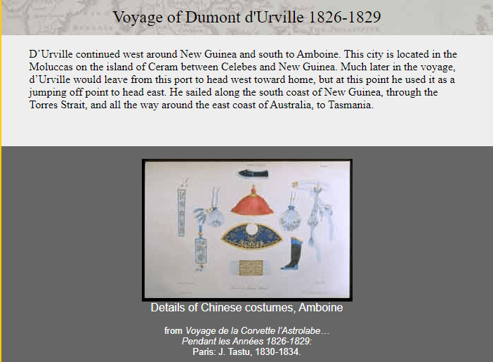
In 1837, Dumont d’Urville set out yet again for the South Orkney Islands in the Southern Ocean; the Marquesas Islands; Tasmania; along the coast of Antarctica, at which time he claimed land on January 21st of 1840 for France, considered it his most significant achievement. He named it Adelie Land after his wife Adele.
He then sailed onto New Zealand; the Torres Strait; Reunion Island; and St. Helena island, and returning to France later in 1840.
He was promoted to Rear Admiral upon his return, and he wrote a report of the expedition, which was published between 1841 and 1854 in 24 volumes.
An interesting side-note about Dumont d’Urville’s life was his death – he and his entire family were killed in the first ever rail disaster in France in May of 1842, called the Versailles Rail Accident, in which the train’s locomotive derailed, the wagons rolled, and the coal tender ended up at the front of the train and caught fire. This was said to be a painting of the incident.
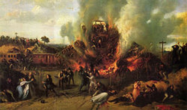
The U. S. Exploring Expedition was another exploring and surveying expedition of the Pacific Ocean and the surrounding lands, conducted by the United States between 1838 and 1842.
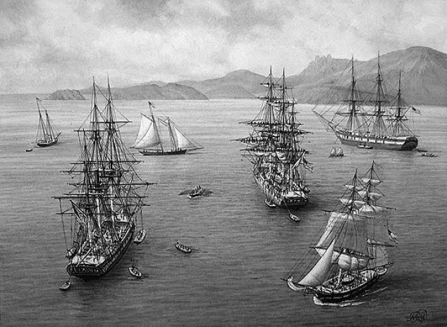
The expedition was described as of major importance to the growth of science in the United States, and that during the events of its occurrence, armed conflict between Pacific Islanders and the expedition was common, and dozens of natives were killed, as well as a few Americans.
It involved a squadron of four ships, with specialists on each including naturalists, botanists, a mineralogist, a taxidermist, and a philologist, which is someone who studies written and oral histories.
It is sometimes referred to as the “U. S. Ex. Ex.” or “Wilkes Expedition,” after the commanding officer, Navy Lt. Charles Wilkes.
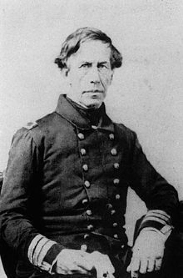
The ships of the Wilkes Expedition was said to have departed from Hampton Roads in Virginia for the first stop the Madeira Islands off the coast of Africa on August 18th, 1838.
The routes of the expedition went something like this.
They arrived at and “discovered” Antarctica on January 16th of 1840, just mere days before the completely different expedition of Dumont d’Urville’s claimed land on Antarctica on January 21st of 1840.
The ships travelled together, but did break-off into pairs on occasion to explore different places in the same general location.
Then there were the voyages of the HMS Beagle, originally a gun boat of the British Royal Navy, said to have set off from the Royal Dockland of Woolwich at the River Thames on May 11th of 1820.
The HMS Beagle’s first voyage was between 1826 and 1830, accompanying the larger ship, HMS Adventure, on a hydrologic survey of Patagonia and Tierra del Fuego.

The second voyage of the HMS Beagle, between 1831 and 1832, was joined by naturalist Charles Darwin, on a second trip to South America, and then around the world.
Charles Darwin kept a diary of his experiences, and rewrote this as a book titled “Journal and Remarks,” becoming published in 1839 as “The Voyage of the Beagle.”
It was in “The Voyage of the Beagle” that Darwin developed his theories of evolution through common descent and natural selection.
The third voyage of the HMS Beagle took place between 1837 and 1843, and was a third surveying voyage to Australia, stopping on the way at Tenerife in the Canary Islands; Salvador on the coast of Brazil in Bahia State; and Cape Town in South Africa.
In 1845, the HMS Beagle was refitted as a Coast Guard watch vessel in Essex, in the navigable waters beyond the Thames Estuary, moored in the middle of the River Roach, until oyster companies and traders petitioned to have it removed in 1851, citing the vessel was obstructing the river and its oyster beds.
The Navy List shows that on May 25th of 1851, the Beagle was renamed “Southend ‘W.V. No. 7′” at Paglesham, and sold in 1870 to be broken-up.
Quite an inglorious ending for such a celebrated ship!
This ends my formal presentation about how the New World was created from the Old World.
There are several ways that I have encountered the information I have presented in this post after 4 1/2-years of extensive research that I have expressed through blogging, and making videos of each blog post, since June of 2018.
For one, I have long interested in hidden history and megaliths, and my own original research started after I found a star tetrahedron by connecting cities in North America that lined-up in lines.
I believe this star tetrahedron is the terminus of the earth’s grid system, and that everything about the advanced ancient civilization was based on sacred geometry, including how all of the physical infrastructure on the earth was laid out.
Once I found the star tetrahedron, I extended the lines out and wrote down the cities that lined up in linear and circular fashion.
In doing the research on these cities and places in alignment with each other, I got an amazing tour of the world of places I had never heard of with remarkable similarities across countries.
Not only that, I started to discover what had taken place here, how it was done, and who was responsible.
I also started my in-depth research work with an awareness of the Moors and the Moorish Paradigm after becoming friends with a Moorish-American man in Oklahoma City in 2013.
This was when I started learning about the Moors. and where I started seeing the ancient civilization in the environment around me.

I have subsequently found through my research the existence of one unified civilization all over the Earth, from ancient times to modern.
There is no place on Earth that this ancient civilization was not.
IThe evidence is all around us, hidden in plain sight. Literally just outside our front doors, in our back yards, in our neighborhoods, especially in our parks, to name a few of many places.
I took these pictures of megalithic stone blocks around the block from where I lived in Oklahoma City.
Lying around everywhere with no special attention drawn to them – just there. Taunting us but not telling us.
And only when you start realizing they are there. Because until you notice them, they just blend in to the landscape.

Another way I encountered this information has been through in-depth timeline research focusing on the years between 1492 and 1942, with 1717 as the midpoint year, and have found much “new” going on in our historical narrative with regards to the “New World” with this focus, as detailed throughout this post.
I also have encountered a lot of hidden history in my research of the people representing states in the National Statuary Hall at the U. S. Capitol building, like John Winthrop mentioned in this post…

…and I have found it researching places viewers have suggested.
I think negative beings hijacked the timeline by deliberately causing a worldwide cataclysm, known popularly as the mud flood, and superimposing the “New World” timeline over the existing infrastructure of the Old World after digging out enough of it to restart civilization.
We are thoroughly schooled in the new narrative from the moment we are born from every aspect of our existence, so much so that we don’t even see the copious evidence of an ancient advanced worldwide civilization in the environment around us.
Based on what I have found in my research, I think that the players involved in taking down the Old World Order systematically laid the foundation for taking its land, its people, its people, and its wealth, and faked the historical narrative, not completely from scratch, but rewriting history to fit their agenda.
I suspect that at some point, not sure from what point forward, the history we learn is about their story, and what they have fabricated to cover up how things came into existence, i.e. all manner of infrastructure being attributed to “other” builders, and completely tampered with our perception of place, time and space in order to control, misdirect, and misinform us.
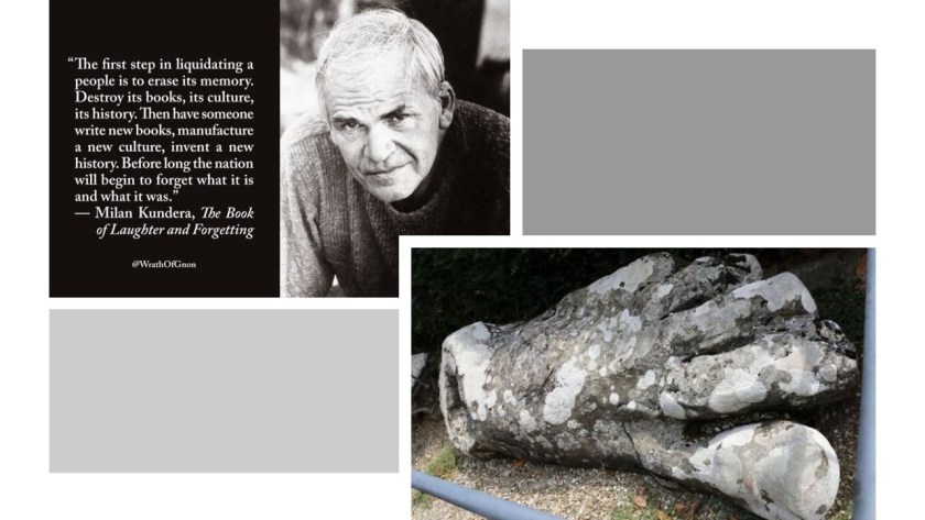
In conclusion, I am seeing that the Earth’s people and grid system was deliberately hijacked by dark beings with a negative agenda, who definitely don’t want us to wake up to our true history and who we really are, and that they have worked very hard to keep this from happening!

