Circle Alignments on the Planet Algiers – Part 18 Barcelona, Spain to Algiers, Algeria

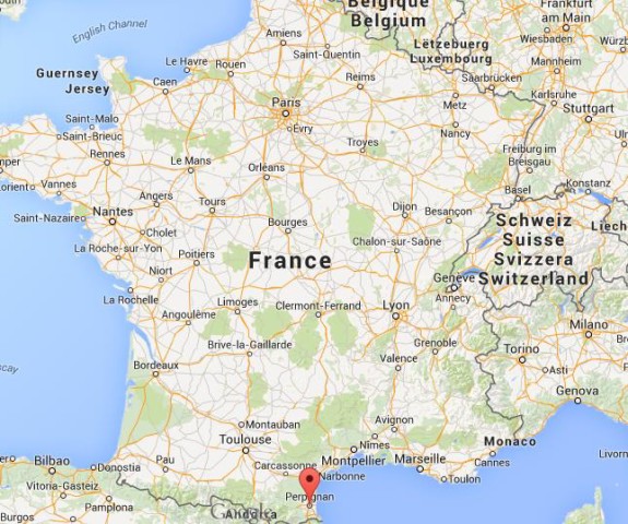
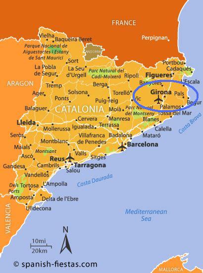
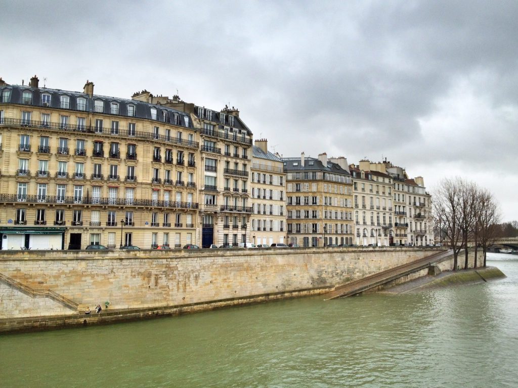
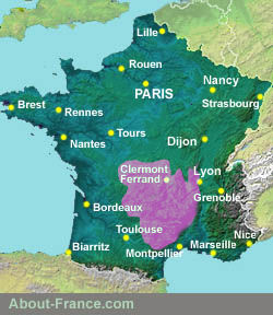
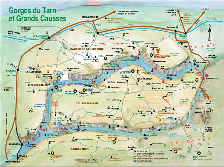
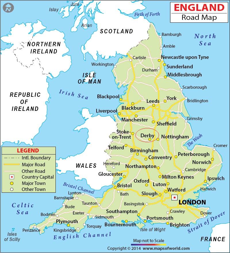
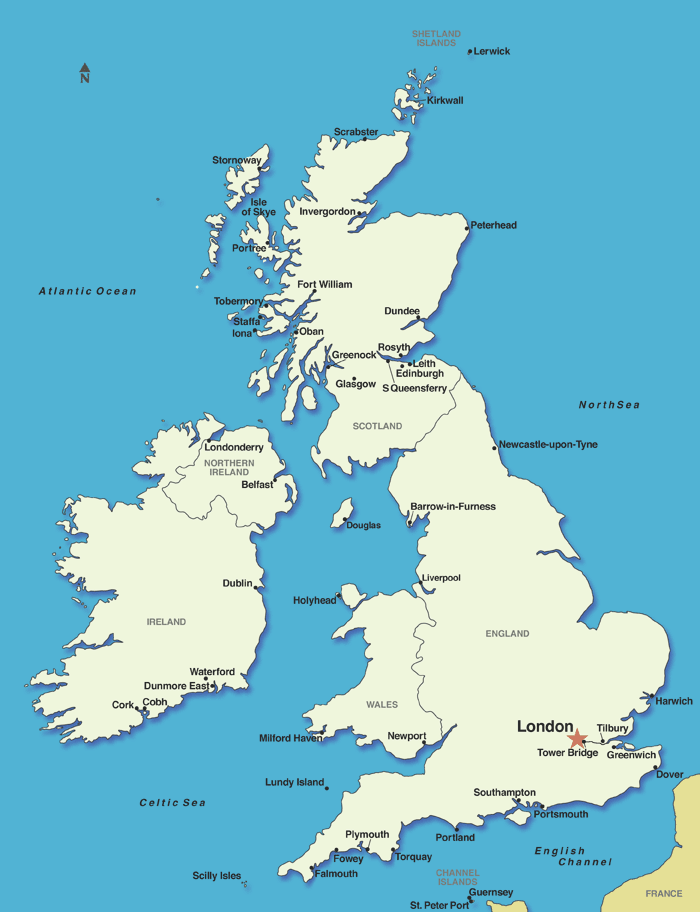
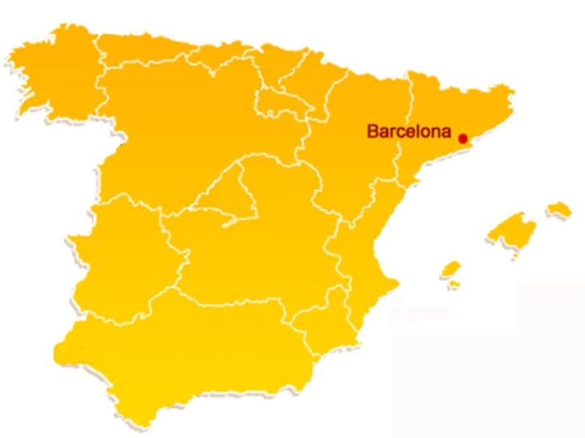
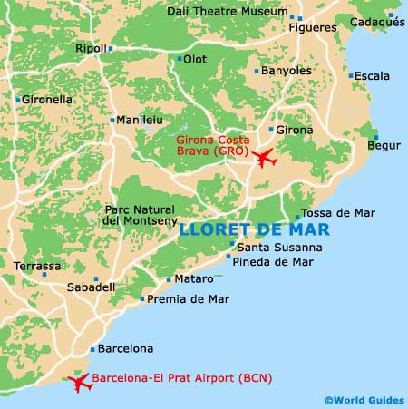
This is the last leg of the circle alignment that started in Algiers, Algeria. From there, so far we have travelled through Mali, Guinea, Brazil, Columbia, Panama, Nicaragua, Honduras, Belize, Mexico, the United States, Canada, Greenland, Iceland, Scotland, England, France, and now we are at Barcelona on Spain’s Costa Brava on the Mediterranean Sea, heading back to Algiers.

Barcelona is the capital of Catalonia, and the second largest city in Spain after Madrid.

I travelled to this part of the Spain on an American Express tour with a friend when I was in the U. S. Army, and stationed in Augsburg, Germany from 1983 to 1985.

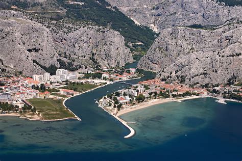
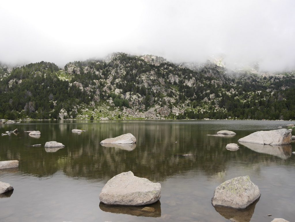
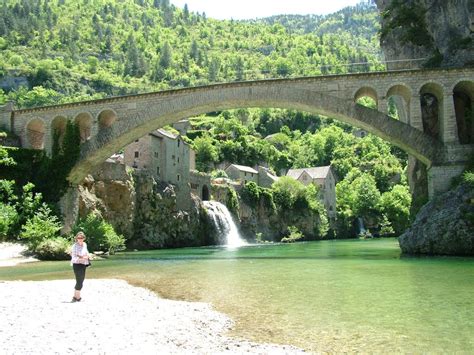
The tour was based out of Lloret-de-Mar, a resort town 40 miles, or 66 kilometers, northeast of Barcelona further up the Mediterranean coast on the alignment.

After we arrived at Lloret-de-Mar, there was enough daylight left to go do some exploring.

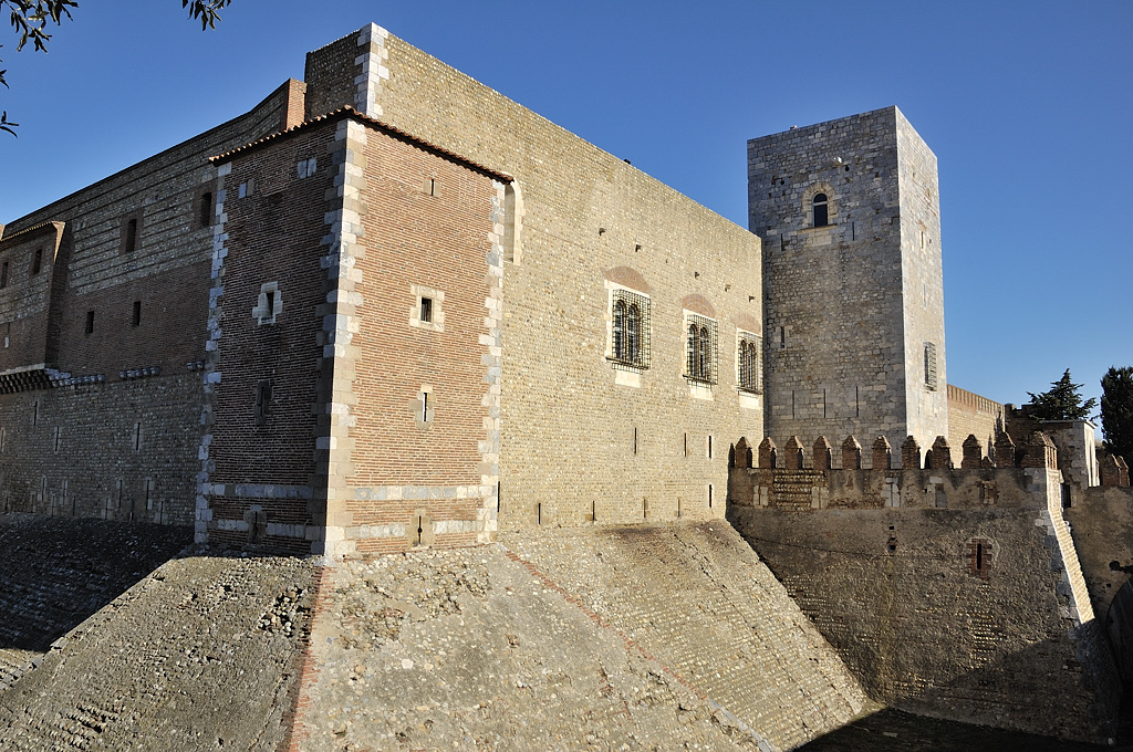
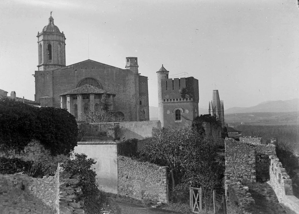
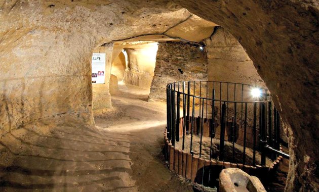
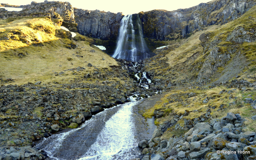
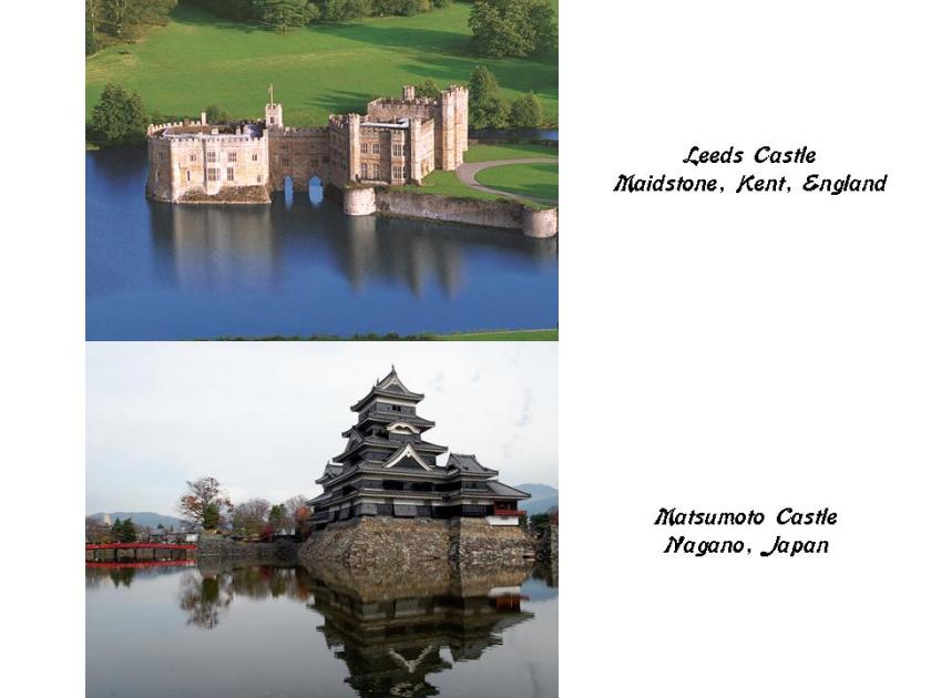
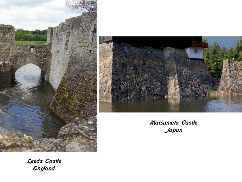
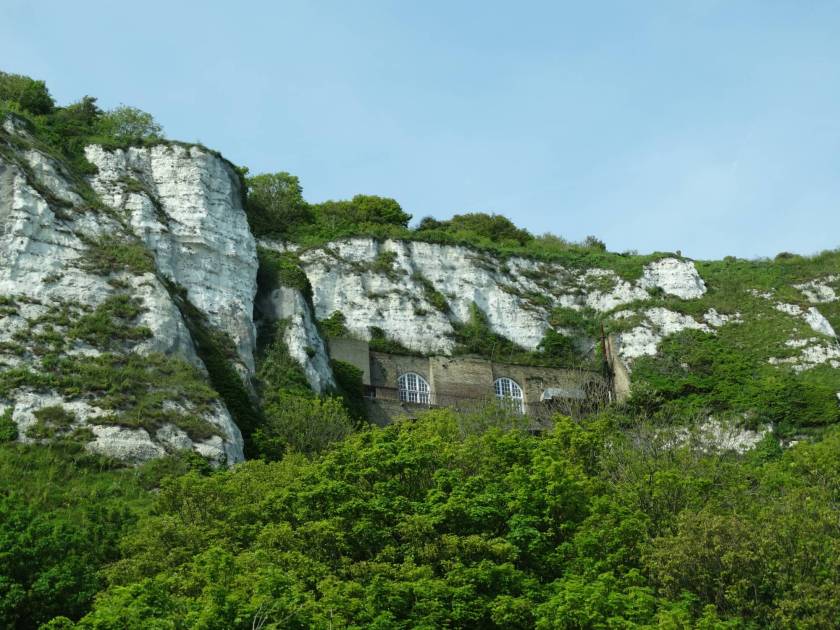
This is the first place we saw that got our interest. It is called Sant Joan’s Castle. It is said to date back to the 1100s, from the age of Lady Sicardis and her sons, who were the Lords of Lloret. Apparently she ordered the construction of the castle.

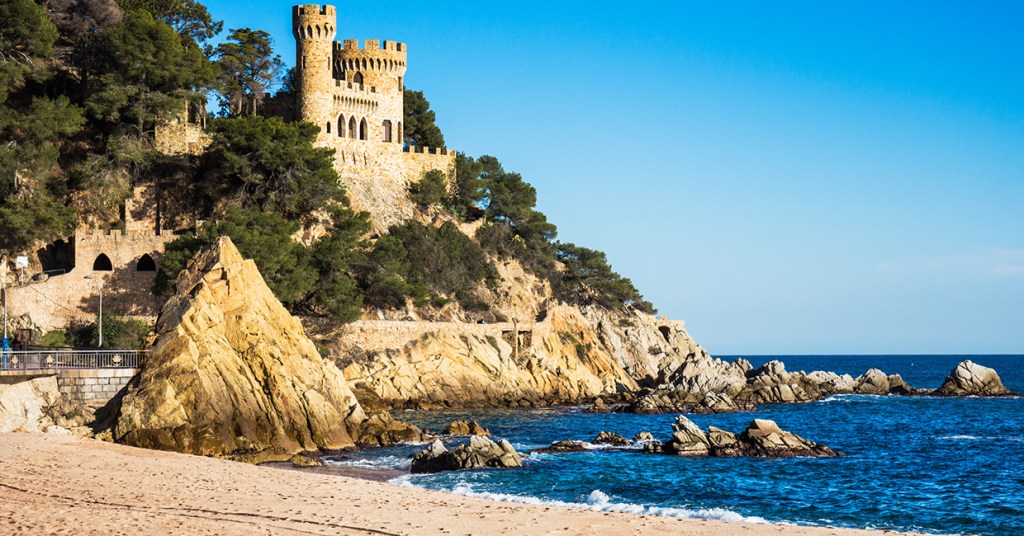
The British Navy is said to have bombarded the castle during the Battle of Trafalgar in 1805, and effectively destroyed the fortified site.

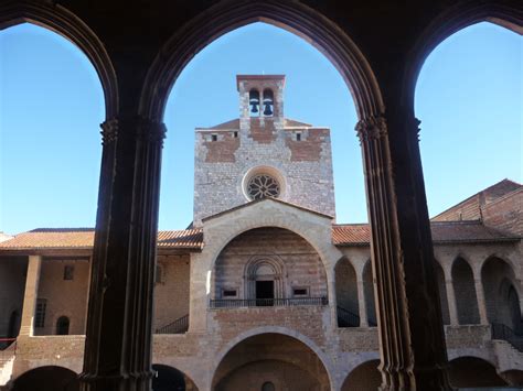
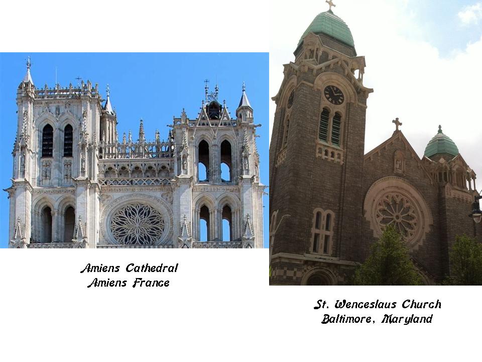
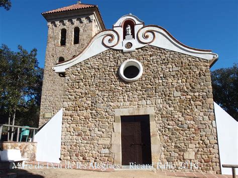
Lady Sicardis is also said to have donated the land for, and ordered the construction of, the Chapel of Les Alegries, where the roads to Tossa, Macanet, Santa Coloma, and Girona met. It was consecrated in 1079. I can’t find out any further biographical information about the Lady of Sicardis.

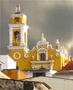
Interestingly, I found this church in Xalapa, Mexico, which looks quite similar in conceptual design.

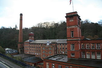
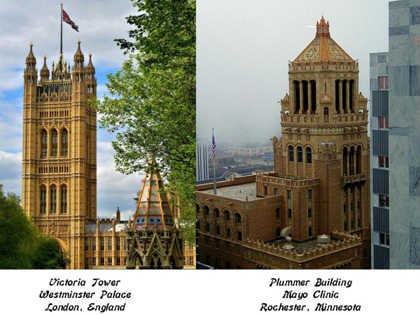
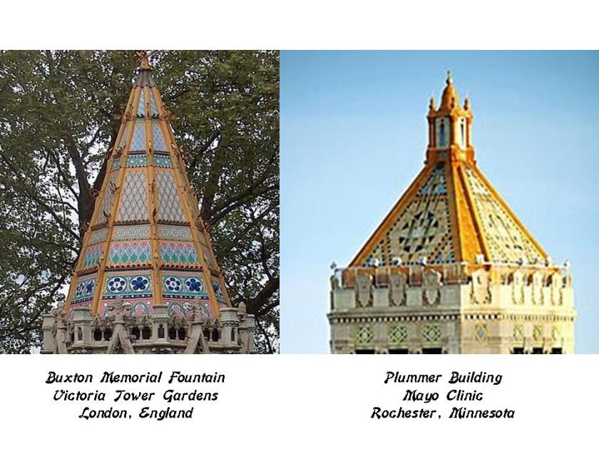
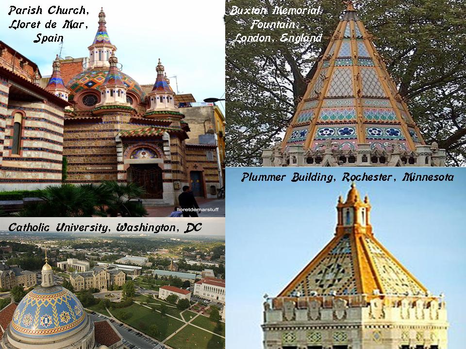
I also remembered seeing the colorful dome of this place on the top left in Lloret-de-Mar. Come to find out that it is the Parish Church of Lloret-de-Mar. For comparison of fine design and color, I have included the Buxton Memorial Fountain in London, England on the top right; the dome of the Basilica of the National Shrine of the Immaculate Conception at Catholic University in Washington, DC, on the bottom left; and the Plummer Building of the Mayo Clinic in Rochester, Minnesota, on the bottom right.

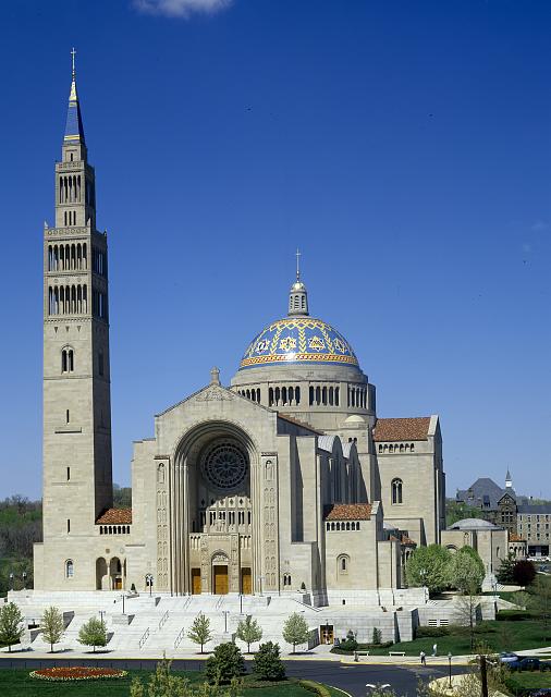
Here is a different view of the National Shrine at Catholic University. Goodness gracious – look at the size of that thing!

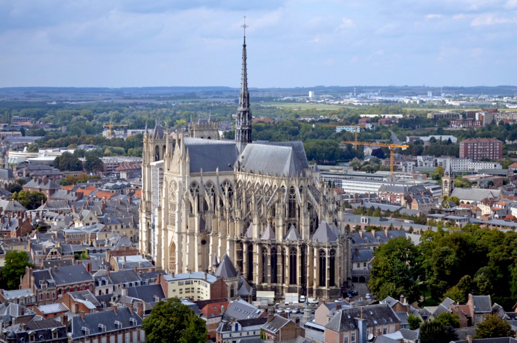
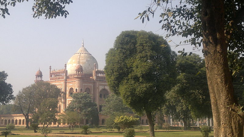
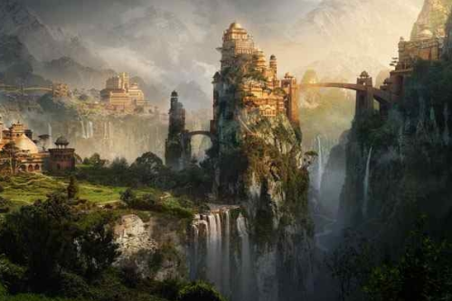
We travelled to Barcelona for a day of sight-seeing. What I remember most clearly from Barcelona is the Basilica of the Sagrada Familia. It is said to have been designed by local Catalan architect Antoni Gaudi, with construction beginning in 1882.

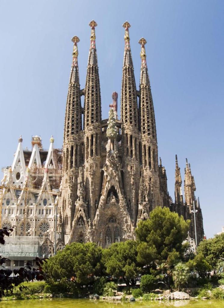
I have consistently found that huge, monumental works of architecture around the world have been assigned builders with dates and histories in relatively recent times. The problem is, what they are said to have accomplished doesn’t fit the historical narrative we have been given. Like how was that building constructed over 130 years ago when we can’t even build something like this today with modern equipment!

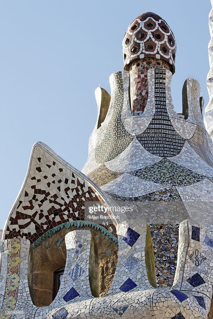
Here is another example attributed to Antoni Gaudi. This is called the Parc Guell in Barcelona, and is said to have been built between 1900 and 1914.

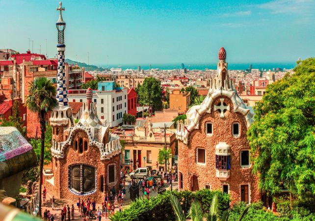
At the top of those two whimsical ginger-bread looking structures, you find what looks like a pine cone.

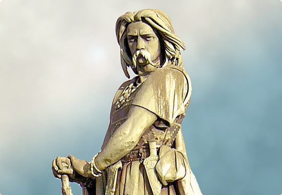
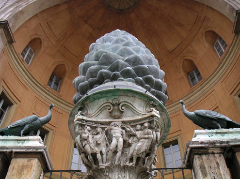
You will even find a statue celebrating the venerable pine cone in the Vatican.

While based on the same Fibonacci Golden Mean geometry in nature as compared to what the actual geometry is for the Golden Mean, what they are not telling us is that these are representations of the pineal gland, which looks like a pine cone, but is in reality a big secret being hidden in plain sight from Humanity.

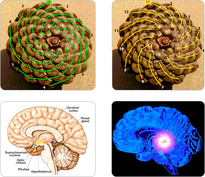
Also known as the Third Eye, when activated it opens the door to psychic abilities and is our connection to the Divine. Much has been done to keep peoples’ Third Eye from opening, including the use of fluoride in toothpaste and water which causes the calcification of the pineal gland.

The original civilization on earth was learning how to raise Kundalini energy from the base of the spine up to the pineal gland, and thus re-connect with the Divine, and they did this individually and as a collective around the world.

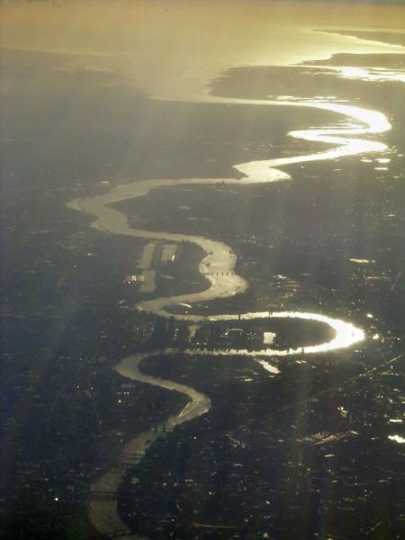
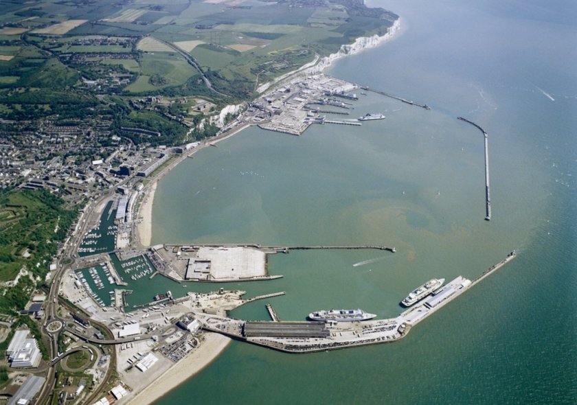
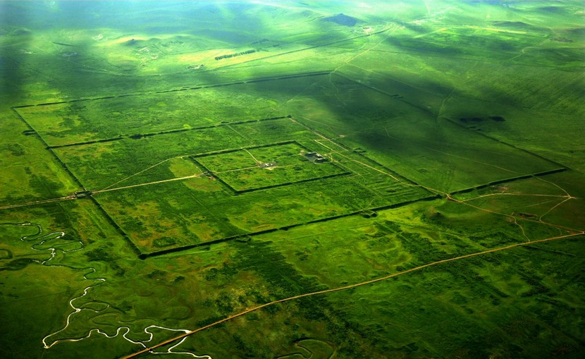
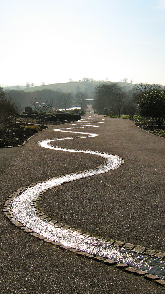
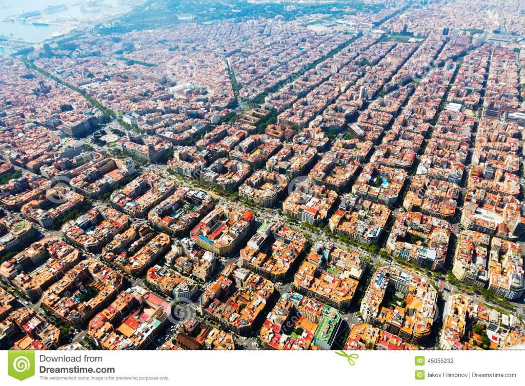
This is an aerial view of Barcelona. We are talking about some serious city-planning with all the geometries of the street lay-out that are on display here…

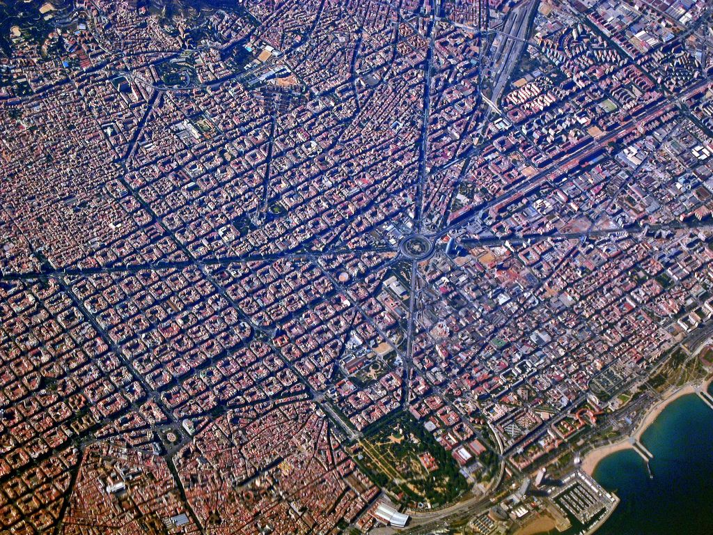
…and the blocks of buildings look like numbers, letters, or Mayan glyphs visually to me. Some sort of binary code maybe?

Did this happen randomly? I don’t think so!

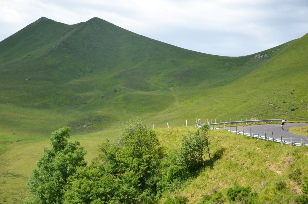
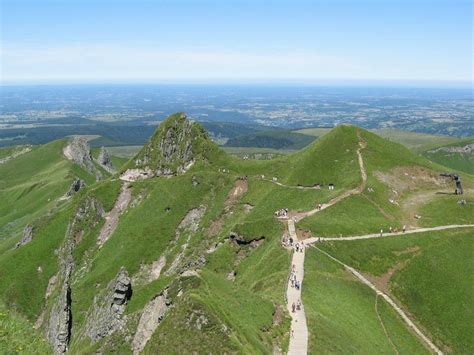
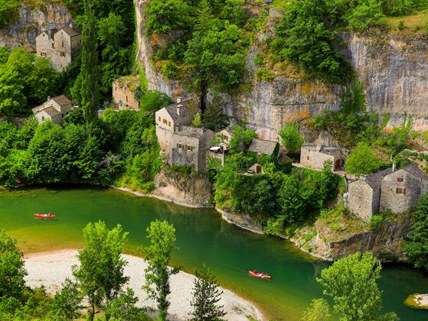
Another day trip to Barcelona that I went on my visit there was to Montserrat, described as a multi-peaked mountain range.

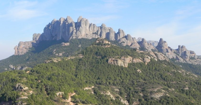
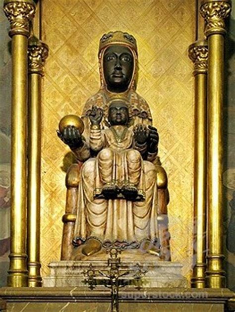
Nestled in one of these peaks is the Benedictine Monastery of Santa Maria de Monserrat.

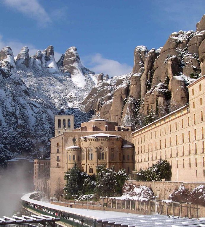
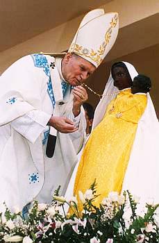
Montserrat houses one of Europe’s many Black Madonna and Child depictions. There are approximately 500 such depictions throughout Europe.

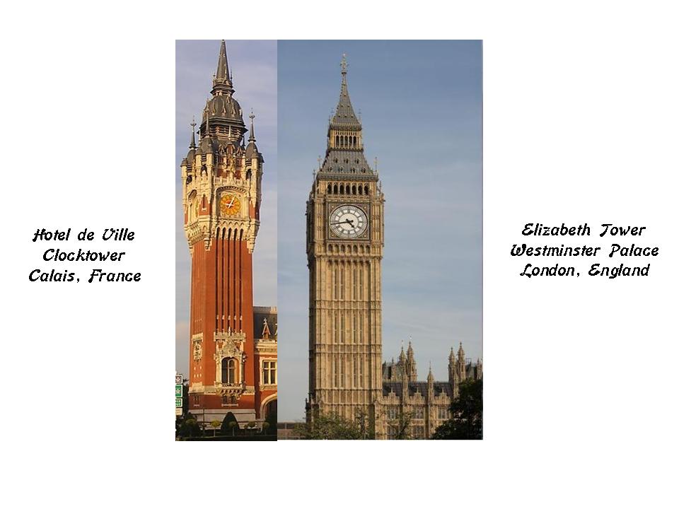
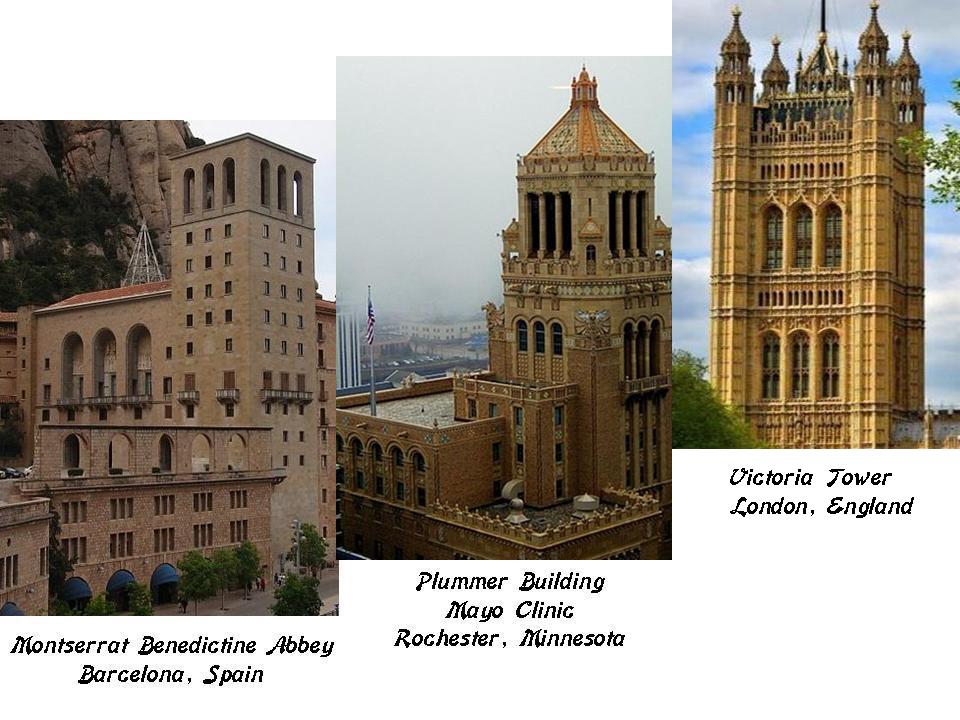
Here is a comparison of the similar features of this tower at Montserrat on the left, with those of the Plummer Building in Rochester, Minnesota, in the middle, and the Victoria Tower at Westminster Palace in London, England, on the right.

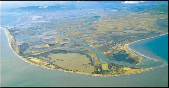
The delta of the River Ebro is 100 miles, or 150 kilometers, southwest of Barcelona, in Tortosa.

An Interesting sound connection can be made here between Ebro -Hiberia – Iberia – Hebrew.

I am going to tie all of this together at the end with what I believe to be true about the ancient advanced civilization based on all of my research findings.

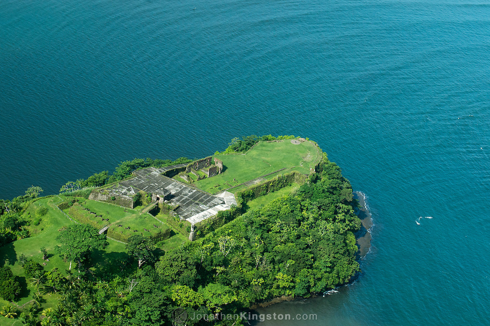
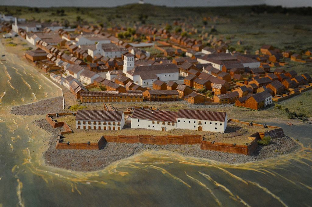
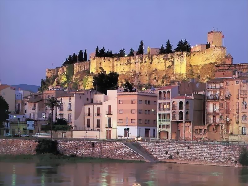
This is the city of Tortosa, dominated by the castle of Tortosa. It is acknowledged to have been built by the Moors, and was the site of a five-month siege during the Second Crusade in 1148, after which Tortosa was captured by the Crusaders.

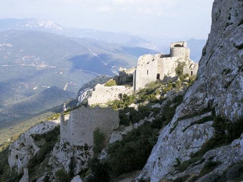
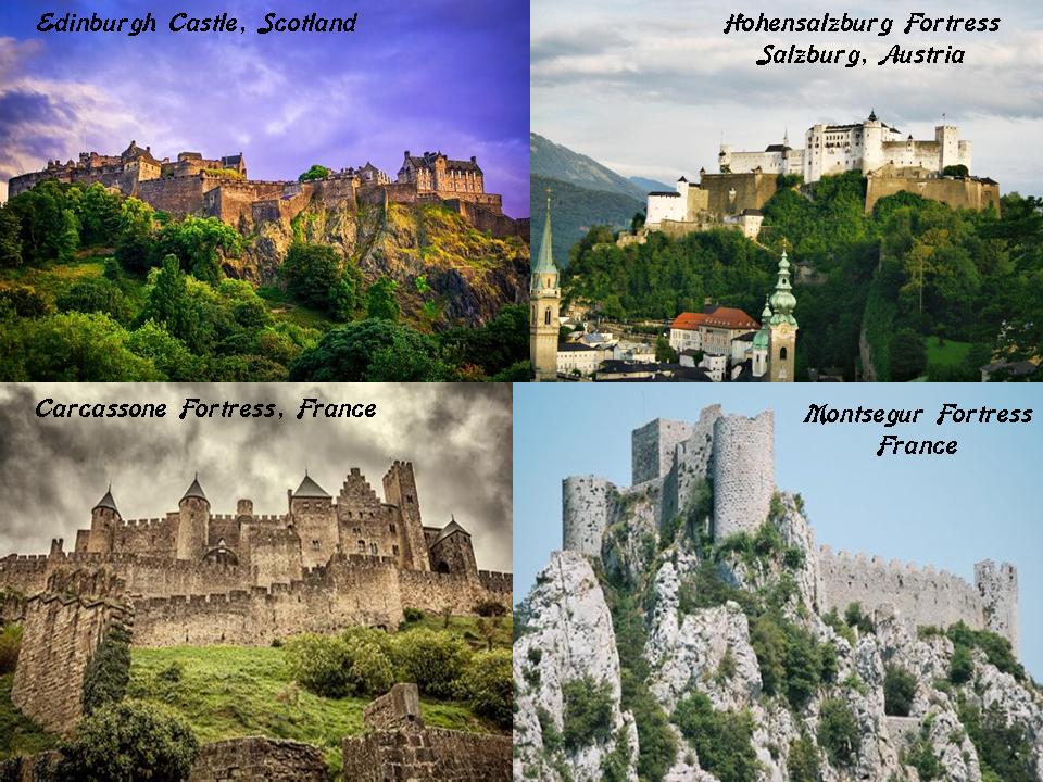
The appearance of the castle above the city immediately brought to mind Edinburgh Castle in Scotland on the top left; Hohensalzburg Fortress in Austria on the top right; Carcassone Fortress in southern France; and Montsegur Fortress in southern France.

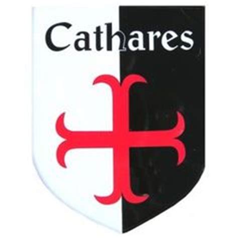
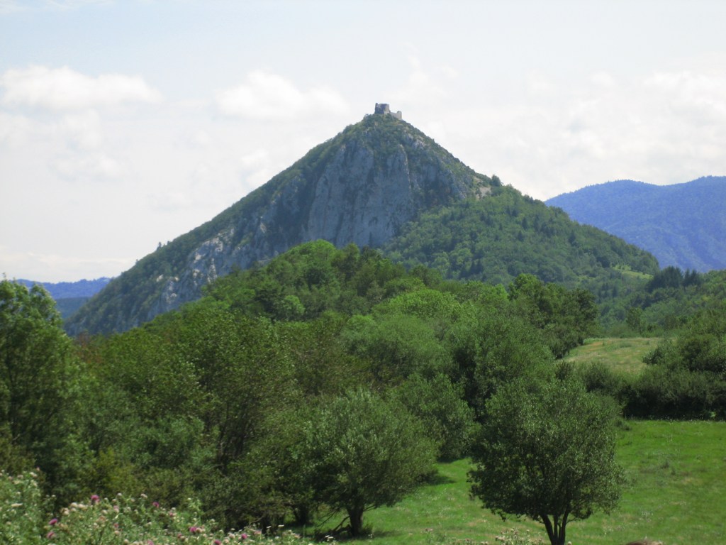
Montsegur was the site of a nine-month seige that is called the Last Stand of the Cathars. After they surrendered, over 200 Cathars, who refused to convert, were burned alive.

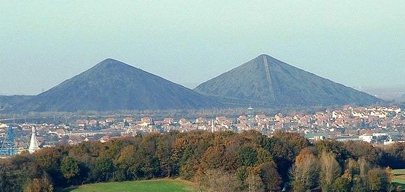
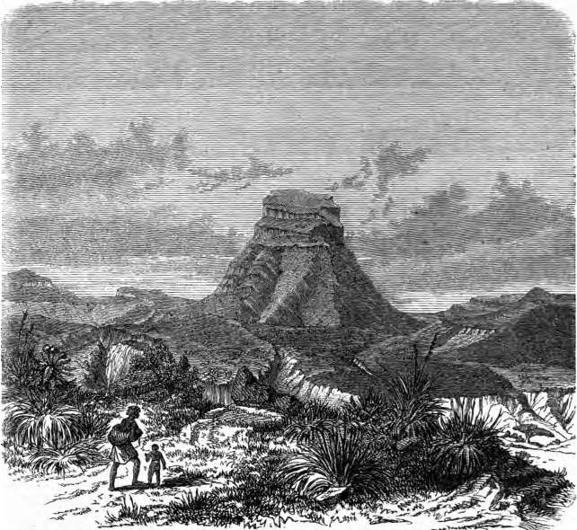
Montsegur sits on top of this pyramidal peak in southern France.

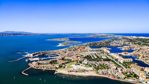
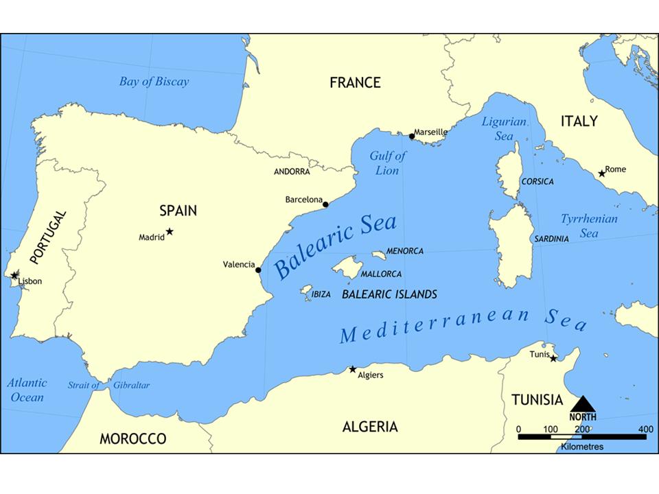
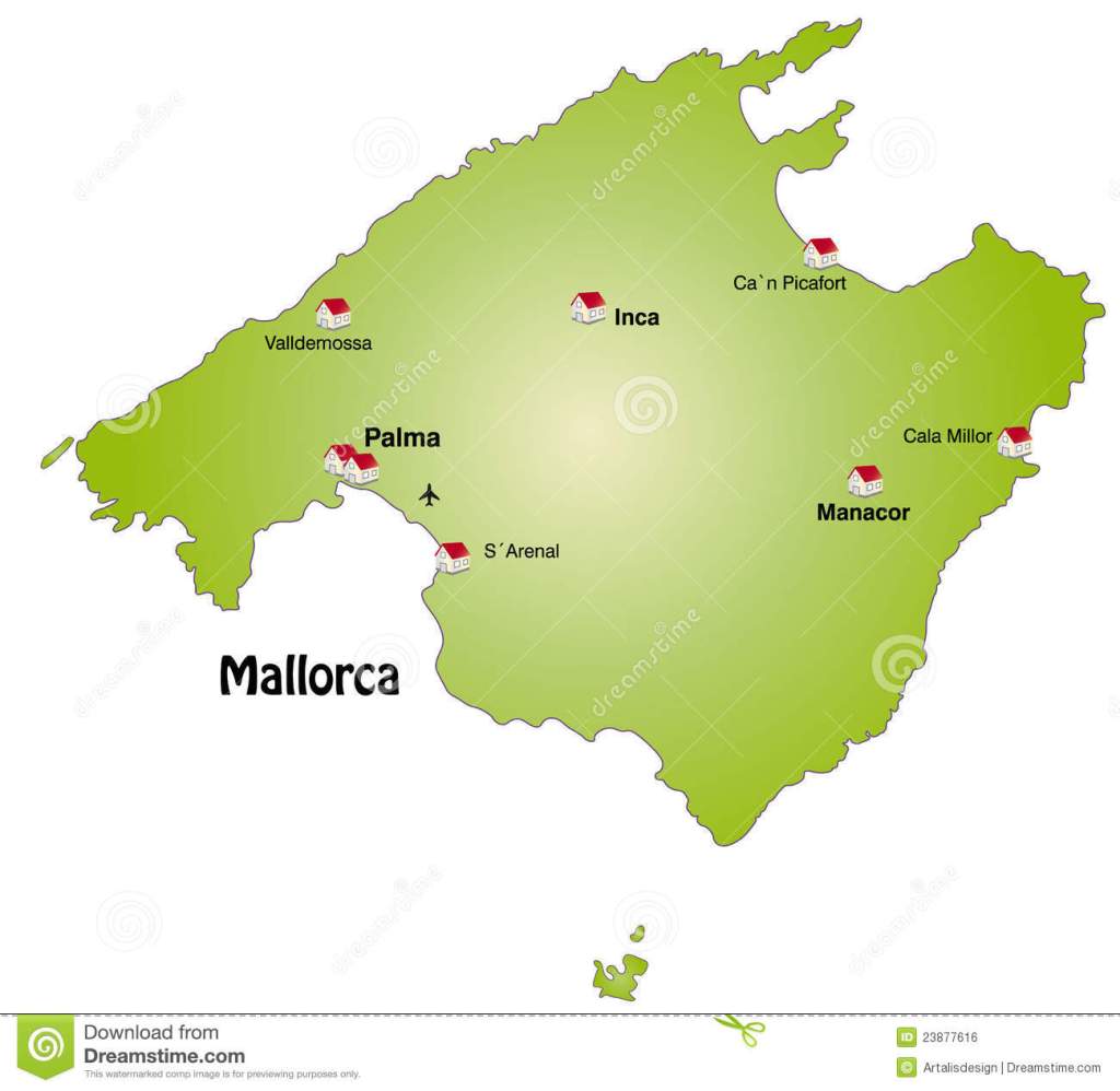
From Barcelona, the alignment enters the Balearic Sea of the Mediterranean Sea on its way to the island of Majorca, or Mallorca, the largest of the Balearic Islands.

This is Cap de Formentor, where the alignment enters the island of Majorca. I am quite sure that you are seeing an intentional solar alignment in this picture of it…

…just like what you see on Fernando de Noronha, an island off the coast of Brazil. These are two examples of a worldwide phenomena of solar and lunar alignments – either found in the landscape, or in mounds and megaliths.

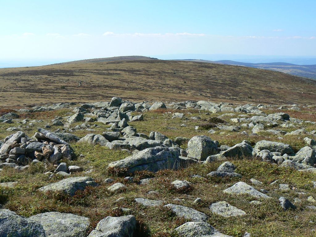
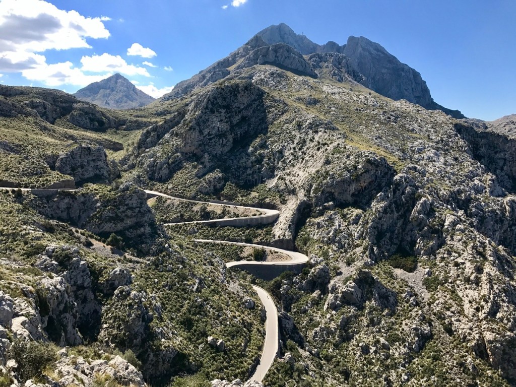
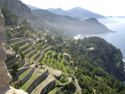
The alignment crosses over the Serra Tramuntana, described as a mountain range that runs southwest to northeast across northern Majorca, and also a National Park.

These stone terraces at the Serra Tramuntana…

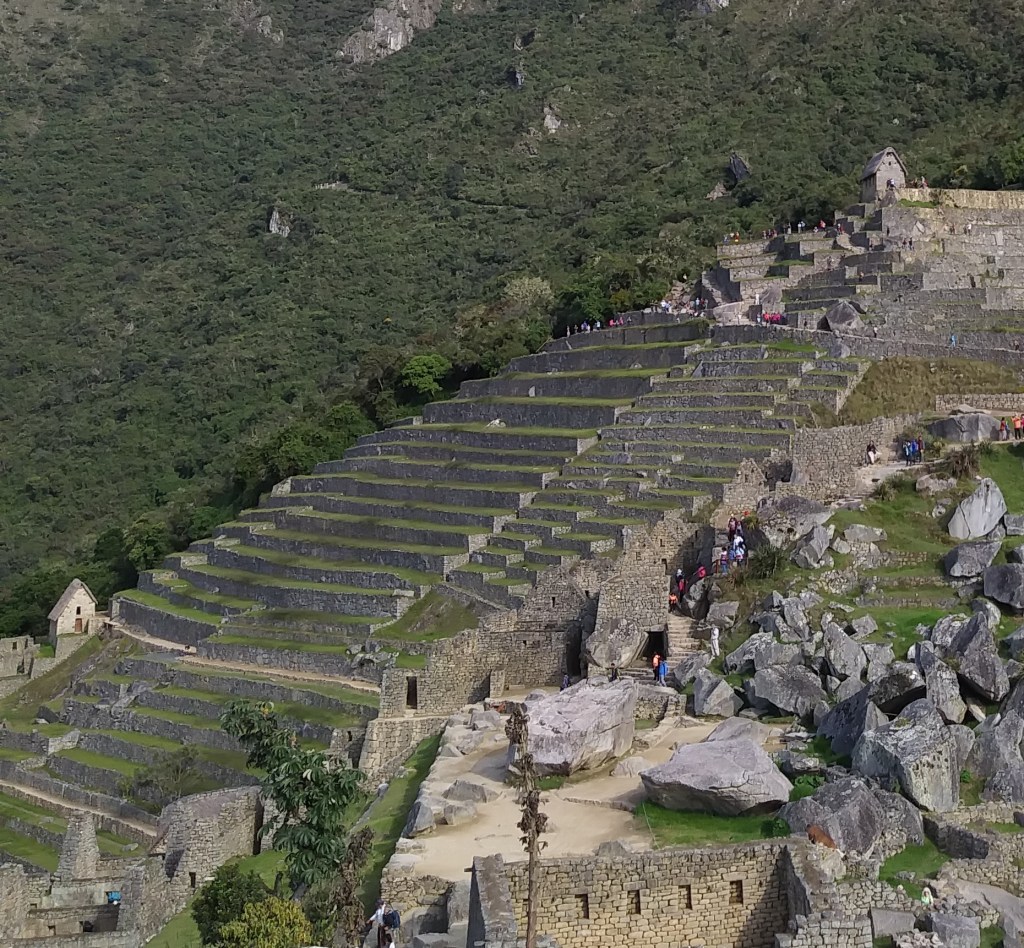
…are similar to what you find at Macchu Picchu in Peru…

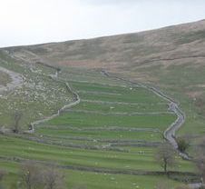
…and near Malham in the Yorkshire Dales National Park, seen earlier in northern England on this same alignment.

Speaking of Peru, where the Inca civilization flourished, there is actually a city named Inca on the alignment on Majorca.

The church in Inca called Santa Maria La Major…

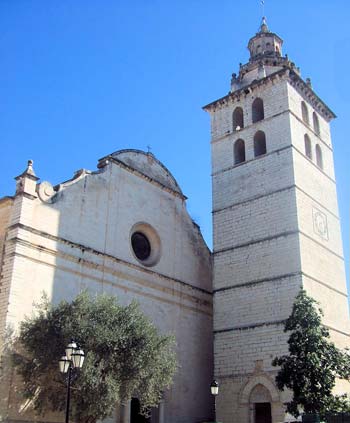
…which shares similar characteristics with the Chapel de les Alegries we saw back in Lloret-de-Mar.

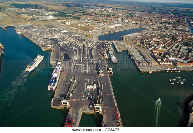
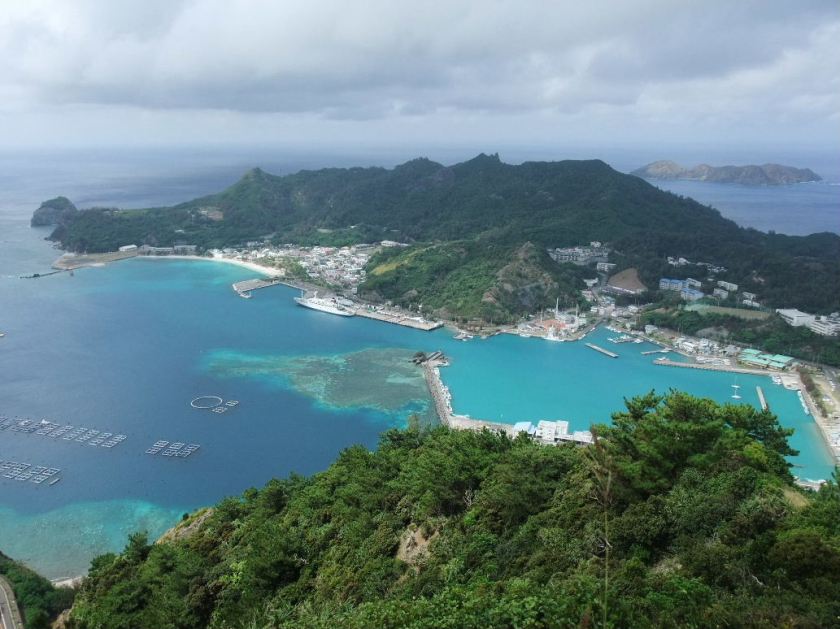
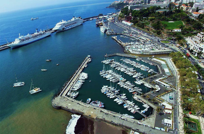
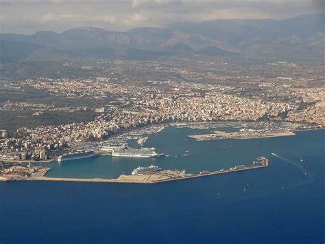
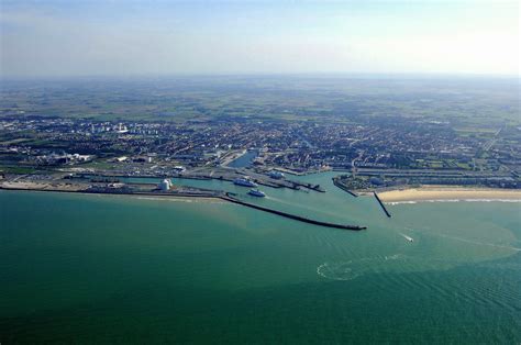
Next on the alignment, we come to Palma, the capital and largest city of the Balearic Islands…

…as well as being a major port.

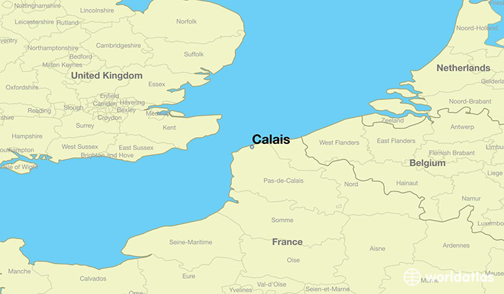
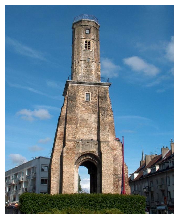
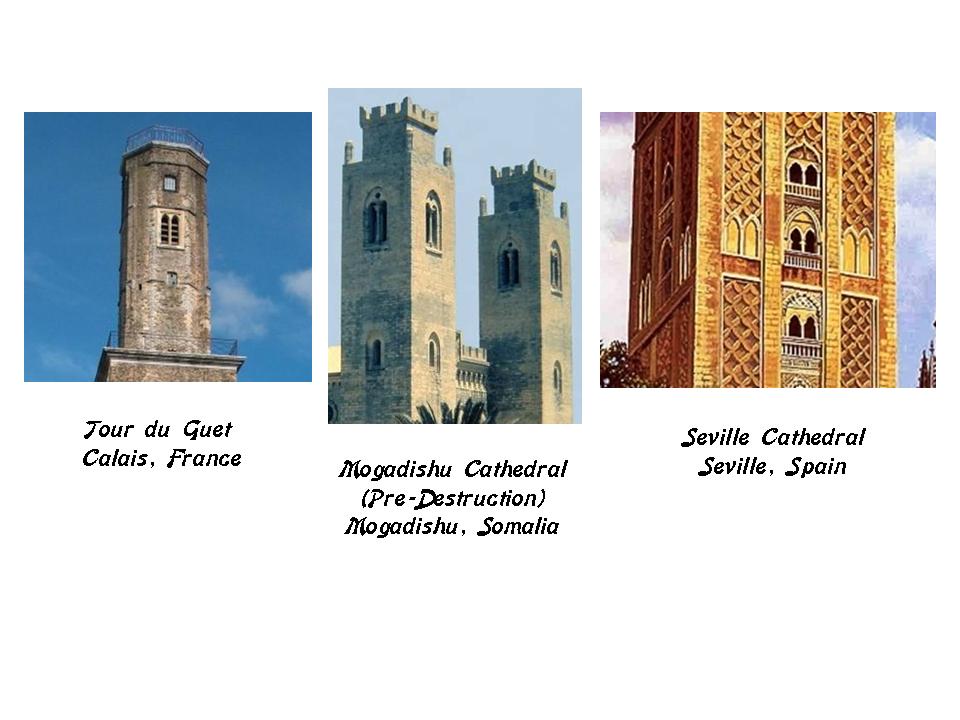
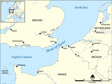
Compare it in appearance to the other side of the continent of Europe, in different countries in the English Channel at the Strait of Dover, with the harbor of Dover, England…

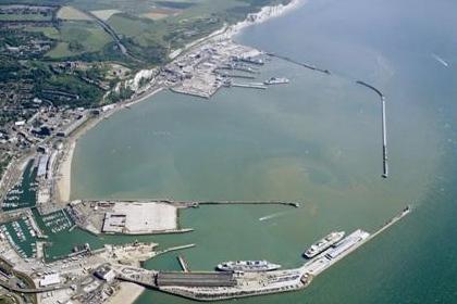
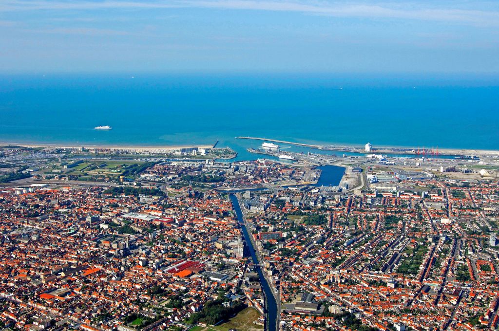
…and the harbor of Calais, France.

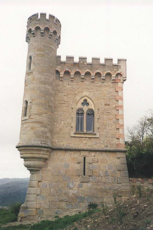
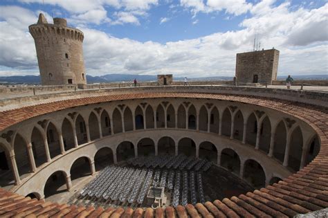
This is Bellver Castle in Palma. It was said to have been built in the 14th-century for King James II of Majorca…

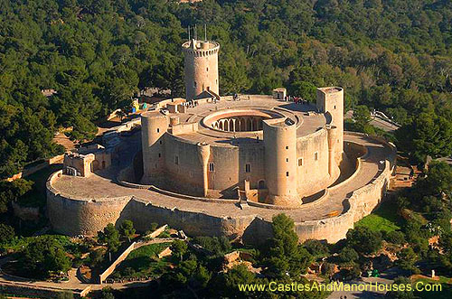
…and is one of the few round castles in Europe.

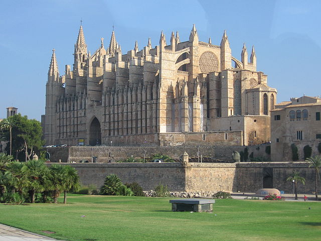
This interesting-looking building is the Cathedral of Santa Maria de Palma.

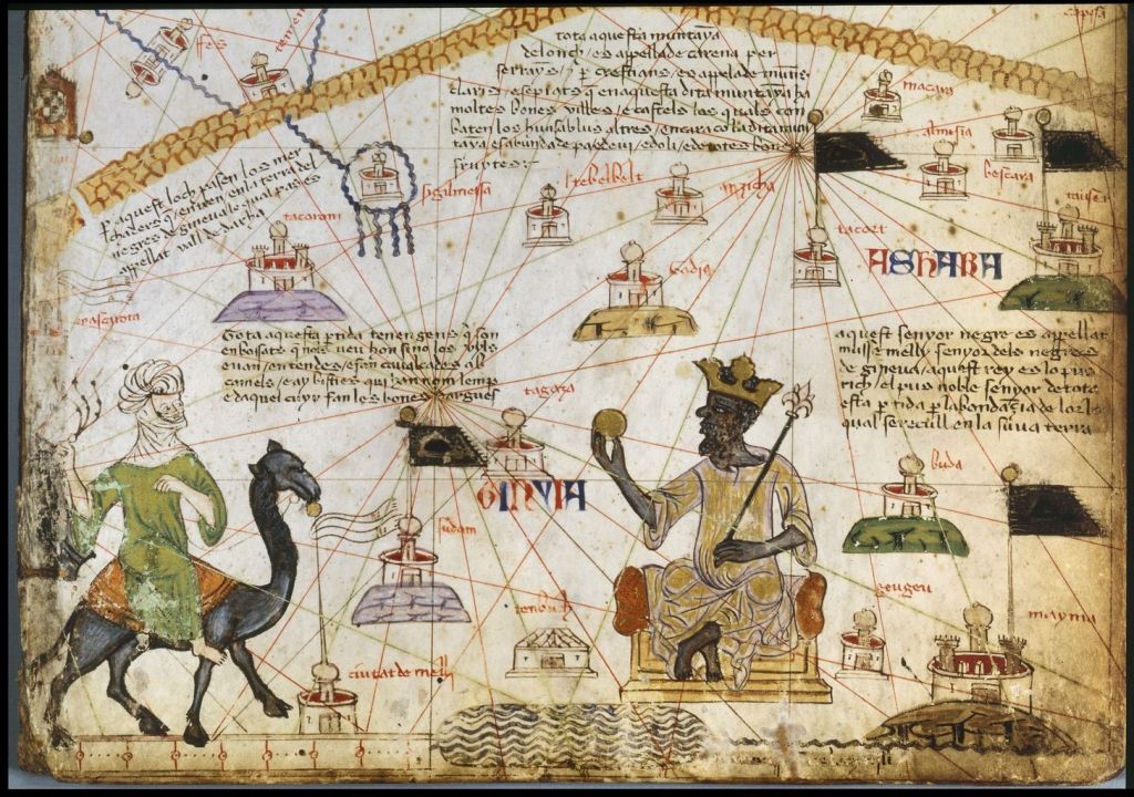
The Catalan Atlas was produced by the Master Map-maker Cresques Abraham, of the Majorcan Cartographic School, and is considered the most important map of the Medieval period in the Catalan language. It definitely looks like it is a map that shows specific planetary leylines!

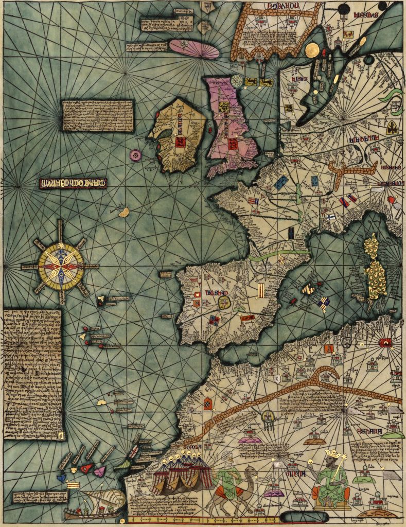
Among the many people routinely found in Majorcan maps are traders on the Trans-Saharan Routes, and Mansa Musa, the Emperor of Mali in the 1300s, and believed to have been the richest person in the history of the world, sitting on a gold mine. I talked about him in the second part of this Algiers’ series.

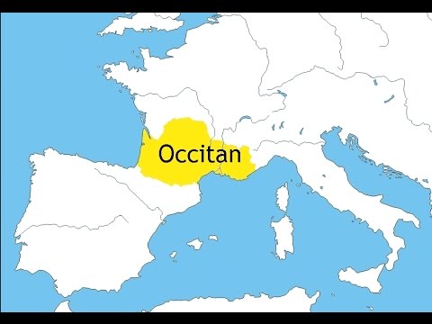
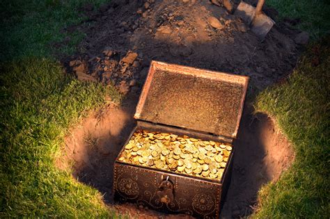
From the research I have done for these blog posts, I believe there is a valuable treasure of great significance to Humanity in the historic Catalonia, and the Languedoc in France, that has been deeply buried in order to hide it from view forever.

Come to think of it, why is the cathedral of Barcelona, the capital of Catalonia in Spain, called “Sagrada Familia”? The translation of this in English is “Holy Family.”

Leaving Majorca at Palma, we arrive at the place we started – Algiers, the capital of Algeria, and the Ancient City of the Deys.

The title of Dey is one of the five noble titles of the Moors:  El, Bey, Dey, Al, and Ali.  Ancient means something belonging to the very distant past.

As part of the conclusion of this particular series, I would like to tie the different elements of my research together in to a summary of how I see all of the pieces fitting together in a comprehensive way.

I have demonstrated through my work that the same infrastructure styles and characteristics are found in very different places around the world.

I believe that all were built by one and the same civilization, and not separate ones that weren’t in communication with each other as we have been taught.

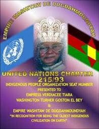
I believe the word Moor is directly derived from “Mu’ur,” which is how the Washitaw of North America refer to themselves.

The Washitaw Mu’urs are recognized as the “Oldest Indigenous Civilization on Earth” by the United Nations, and their history traces at least as far back as Mu, which is also known as Lemuria. Human history on earth is way more ancient than we can even begin to comprehend.

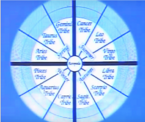
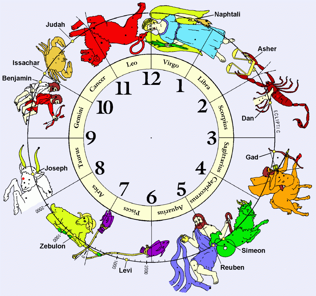
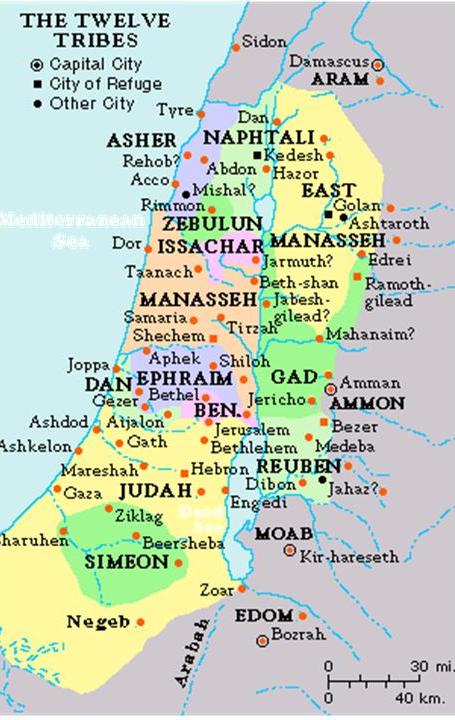
There are records and traditions of whole nations being divided into twelve tribes and twelve regions, each corresponding to one of the twelve signs of the zodiac and to one of the twelve months of the year.  All formed around a sacred center.

In my research as well, I have found people in different countries identifying themselves as one of the twelve tribes. The Pathans of Pakistan are one example, and the Kuki of India are another.

It stands to reason that these people would apply to the same concepts of Harmony, Balance, Beauty, Sacred Geometry, and aligning heaven and earth, to building their communities and themselves that they applied to building all of the infrastructure of the planet.

Were the Ancient Ones, the Mu’urs, divided into Twelve Tribe? Were they the Children of Israel?

I think the information that would answer this is part of the missing history.

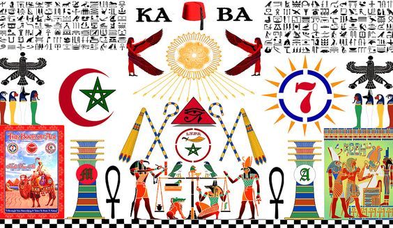
The Islam of the Ancient Ones is about the applied knowledge of Sacred Geometry and Universal and Natural Laws, which is what Moorish Science is about.

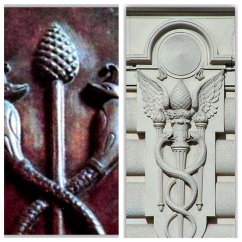
Moorish Masons are the keepers of the Kemetic, also known as the Egyptian, Mysteries.

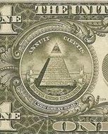
This is the Great Seal of the Moors. The Moors are Friends of Humanity, with five principles:  Love, Truth, Peace, Freedom, and Justice.   They are all about teachings to activate the  pineal gland and about the human potential to re-connect to our Divine Natures in this lifetime.

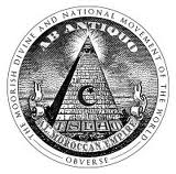
You can see that certain symbols were co-opted from the  original, and have come to have negative associations, like associating the pyramid with the eye on top of it with Big Brother, the New World Order, and the Illuminati. And it looks remarkably like what you find on the back of the one dollar bill.

It’s confusing because we have been taught that the Egyptians only built their pyramids in Egypt, when in actuality the same science of applied sacred geometry and natural laws was applied worldwide on a sophisticated planetary grid system…

…that the Tribes of Israel were only located in a certain geographic area in the middle east;

…and that Islam is an organized religion that has existed for a long time, as has Christianity and Judaism. I believe that organized religions were introduced as a control mechanism when Humanity’s positive timeline was hijacked.

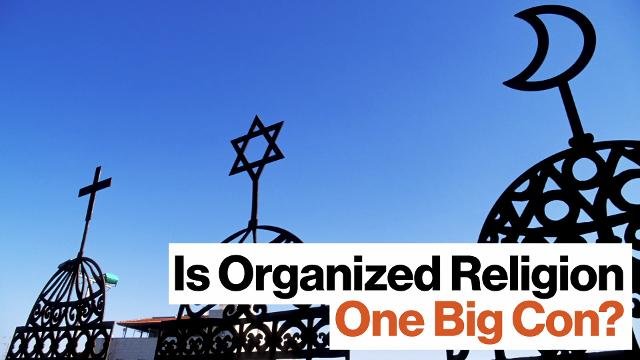
The parasitic hijackers, relatively recently in time, far more recently than what what one would think, stole the template and the legacy of the people of higher consciousness who created all of this, and proceeded to portray all of the pillars of this beautiful civilization as separate. All of this is part of a nefarious concerted effort by non-humans, to control Humanity for their own benefit, not ours.

I believe we are living in times of great change for the better, and that the Great Awakening is happening right now. Take what I have shared into consideration as new background information regarding what appears to have taken place without the knowledge or consent of Humanity.

In my next series, I will be featuring the Washington, DC, circle alignment.

Circle Alignments on the Planet Algiers – Part 17 Perpignan, France to Girona, Spain

In the last post, I followed the circle alignment through France, from Calais on the English Channel’s Strait of Dover, through Amiens, Paris, Clermont-Ferrand, the Massif Central, and the Cevennes National Park.

I am starting this post in Perpignan, the capital city of the Pyrenees-Orientale Department in southern France. It was the capital of the former Province of Roussillon…

… and was the continental capital of the Kingdom of Majorca in the 13th- and 14th-centuries. More on Majorca when we come to the Balearic Islands off the coast of Spain in the next post.

Perpignan is the last major town in the Languedoc before the Spanish border with the Autonomous Community of Spain Catalonia, and would have historically been considered northern Catalonia.

The Languedoc takes its name from the Langue d’Oc or Occitan, which is closely related to the language of Occitan. Langue d’Oc was at one time understood and celebrated throughout most of educated Europe (interesting), and Old Occitan was the vehicle for the lyric poetry of the Troubadours.

The Languedoc was also a home of the Cathars, a peaceful gnostic people. More on the Cathars to come later in this post.

The Cathars were competent stonemasons. The is the Cathar Castle of Peyrepertuse, between Perpignan and Carcassone.

It was associated with the Counts of Narbonne and Barcelona. Peyrepertuse is the biggest of the “Five Sons of Carcassone,” all situated atop rocky peaks, and is called the “Celestial Carcassone.”

Perpignan, pictured here, is located just a short distance off the coast of the Mediterranean Sea, on the Roussillon Plain Aquifer, a flood plain described as consisting of sedimentary layers, with several aquifers in different areas.

Compare the appearance of the Perpignan photo, with Omis Beach, on the Omis Riviera in Croatia, between Split and Markarska…and on a different planetary alignment.

This is the canal-looking River Tet, the longest river in the Pyrenees-Orientales at 72 miles (or 116 kilometers) going through Perpignan before it ends in the Mediterranean Sea…

…and its tributary, the equally canal-looking River Basse, also in Perpignan.

Why do they persist in calling them rivers when they are clearly not natural? Cover-up code-word!

This is the Palace of the Kings of Majorca in Perpignan.

I found this view of it, showing an angular base…

…compared with the similarly angled base of the stonework at Matsumoto Castle in Nagano, Japan…

…and this aerial photo showing the whole lay-out of the Palace of the Kings in Perpignan, where another star fort comes into view. I have found star forts all along these planetary alignments – some of them intact…

…but many of them in ruins, like the star fort at Chagres, near the city of Colon in Panama…

…or completely destroyed. There was one in Old Panama City shown in this diorama that is no longer there.

I am being strongly pulled to look at the small nearby country of Andorra, not directly on the alignment I am tracking, but nearby.

The historic Catalonia was partitioned, just like Europe was after major wars. Andorra is part of the historical Catalonia. It is a principality nestled between the regions of Catalonia in Spain, and in France, the regions of Languedoc-Roussillon, which is northern Catalonia…

… and Midi-Pyrenees in France. The flag of Midi-Pyrenees has a version of the Cathar cross on it….

The Principality of Andorra is co-ruled by two unelected Princes, constituting what is known as a diarchy – whoever is the Catholic Bishop of Urguell and whoever is the President of France. This unique form of government we are told has existed since 1278.

So the two institutions responsible for the genocide of the Cathars, the Roman Catholic Church and the French Ruler (first monarch, now president) have held a co-rulership in an unelected position for centuries over the very land of the Cathars, and the people who live there? What is up with that?

Well, after learning about this doing the research for this post, I looked up the Cathar Crusades, also known as the Albigensian Crusades. And sure enough, this ended almost 50 years before the establishment of the Roman Catholic and French Leader Co-Principality. The peaceful gnostic, and likely Moorish, Cathars were brutally massacred in the Albigensian Crusade that lasted from 1209 to 1229.

When I was a kid, and the only oral history on my Dad’s ancestors was that they were French Huguenots, the only information available up until the Internet Age is that they were reformed Calvinists who were for some obscure reason persecuted and massacred in France for 100 years. My understanding now in the Internet Age is that the Huguenots were Moors and Cathars.

The Dominican Order was founded during the Albigensian Crusade by Pope Honorious III via his papal bull called the Religiosam Vitam and gave universal recognition to the order. The Dominicans were said to have been founded to preach the gospel and oppose heresy.

There is a very strong tradition that this was the part of the world where Mary Magdalene was said to have gone after the crucifixion of Jesus, that Jesus and Mary were husband and wife, and had children. Is this the driving force behind the brutal animosity towards the people of this land, and the desire to control it in perpetuity?

And is this what we are really talking about?

I think there is a rather high likelihood that it is….

I looked at this map of Andorra, and several things popped out right away.

The first is the name of Caldea.

Come to find out that Caldea is the largest thermal center in Europe.

It is called a real paradise where thermal waters provide visitors with all of its properties.

I have found hot springs, and springs of all kinds along the planetary alignments, like this one in Iceland shown earlier on the alignment in this series. Iceland is also on a geothermal hot spot.

I am seeing a correlation to hot springs, volcanoes, and volcanism along the alignments that I attribute to a direct relationship between the planetary grid, and the earth’s tectonic plates.

I did not know what to expect to find in Caldea, but the name looks and sounds like Chaldea.

Chaldea was said to be an ancient semitic-speaking nation that was eventually absorbed into Babylonia. But I’ve read a lot, and think there is way more to the story of the Chaldeans.

The most tangible thing is the connection of the Chaldeans to astrology.

This is about as far I can go with the Chaldeans because of the suppressed history. I know there is much more to their story, but I just don’t know it well enough to share it due to the imperfections of memory!

Another place name that jumps right off the map of Andorra at me is El Tarter.

It is an extreme winter sport resort at its snow-park in the Pyrenees…

…with its steep and angled slopes!

it jumps out at me because of an advanced civilization known as Tartaria in Asia. To be clear, it looks to me like there were multiple empires within one Moorish Empire that was global, unified, but not separate from each other.

There is another place that I was drawn to look at called Cerdenya. It is in northern Catalonia in Spain on the border with Andorra and France.

It is described as a comarca.

A comarca is a traditional region or local administrative division found in Spain and Portugal. There are 42 comarcas in Catalonia. Counts were the most important rulers of comarcas.

Cerdenya is divided between the Catalan provinces of Lieida and Girona.

This is Malniu Lake in Cerdenya. It is described as of glacial origin, surrounded by pine trees and granite blocks.

These granite blocks sure look cut and shaped to me!

Girona, Spain is actually located on this circle alignment.

It has a strong connection to Mary Magdalene, as well as being a place of power. Grail Rituals were conducted here to open doors and portals. In Medieval times, Girona was the home of all of the Kabbalist scholars, mystics, and initiates.

This is a photo of what was the Torre Magdala in Girona, which was torn down some time after the end of World War I.

This is the Tour Magdala in Rennes-le-Chateau in France…

…and this is the sacred mountain of Canigou, the highest peak in the eastern Pyrenees Mountains of Southern France. It is a symbol for the Catalan people. Every year on the night of June 23rd, there is a ceremony called the Canigou Flame, where a fire is lit on the mountaintop. People spend the night there and take torches lit on that fire and in a spectacular torch relay, light bonfires all across Catalonia.

I read that there was a triangle was formed between Girona, Spain; Rennes-le-Chateau; and Canigou, with Canigou being the top point of the triangle.

There are deep mysteries in this part of the world. A lot of people are drawn here to visit and research them.

I am going to end this post here, and pick up the alignment in Barcelona, Spain.

Circle Alignments on the Planet Algiers – Part 16 Calais, France to the Cevennes National Park, France

The last post started in Derby, located in the center of England in the River Derwent Valley, the birthplace of the factory system and the core of the Industrial Revolution, and the circle alignment was tracked through London; Leeds Castle in Maidstone and Dover in Kent; to the English Channel.

Calais is a city and major ferry port in northern France, and situated on the Strait of Dover, the narrowest point in the English Channel across from Dover in England.

The old part of the town is called Calais-Nord, and is located on what is called an artificial island, on which this antique map shows that it was a star fort…

…surrounded by canals, like the Bergues Canal pictured here…

…and harbors.

In the center of Calais-Nord is La Place d’Armes, where the massive Tour du Guet is located.

The windows at the top of La Tour du Guet have a familiar look to me. So, for comparison, this is what the Mogadishu Cathedral in Somalia in the middle looked like before it was destroyed, with those double-windows, as well as this tower at the Seville Cathedral in Seville, Spain, which was the capital of Moorish Spain, on the right.

La Place D’Armes and La Tour du Guet are located behind L’Hotel de Ville, or the the Town Hall of Calais, with it’s distinctive architecture and peacock topiary gardens.

This is a comparison of the clock tower of L’Hotel de Ville in Calais on the left, with the Elizabeth Tower at the Westminster Palace. Big Ben is actually the name of one its bells, and not the clock tower itself.

This is the lighthouse of Old Calais on the left, compared with the Amedee Lighthouse in Noumea, New Caledonia, on the right.

I believe that the advanced ancient maritime civilization built all of the world’s lighthouses. While these two examples are not identical in design, they have similar design features.

Calais is located in France’s Pas-de-Calais Department. The Terrils pictured in the background are in Loos-en-Gohelle in the same region as Calais. They are called slag heaps, and said to have been formed from 130-years worth of coal-mining. These two happen to be on the UNESCO World Heritage Site list. I see unacknowledged pyramids in the landscape, not slag heaps.

Amiens is next on the alignment, a city and Commune in northern France, 75 miles, or 120 kilometers, north of Paris. It is the capital of the Somme Department of Hauts-de-France, or Upper France.

Amiens Cathedral is called the tallest of the large classic Gothic churches of the 13th-century, and the largest in France of its kind. It is a UNESCO World Heritage Site.

This is a comparison of the entrance of Amiens Cathedral on the left with the St. Wenceslaus Church in Baltimore.

I would like to take a moment and acknowledge the great work of Baltimore Fats on his YouTube Channel of the same name. I learned about St. Wenceslaus Church only last night in his video “Hopkinslaus,” which he and his friend Mary D stumbled across after they went to Johns Hopkins University to do field research on buildings there for mud flood evidence. They are digging deeply, and finding great information about Baltimore’s hidden history. In our own ways, we are uncovering a story that really wants to be told, one that should never have gone missing in the first place. Mary’s Facebook Page is Baltimore Mudflood History. I highly recommend that you check them out.

This is the Tour Perret in Amiens. Look at the size of that thing compared to the surrounding buildings. Apparently it is a residential skyscraper, that we are told was built between 1949 – 1954.

So only four years after the devastation of war and the end of World War II, after France having been occupied by Germany from 1940-1944, they were capable of building something like this? Really?

This is the Picardie Museum, the main museum in Amiens. It was said to have been built between 1855 – 1867.

This is the Natural History Museum in Merida, Mexico…

…and this is the Art History Museum in Vienna, Austria. All three of these museums have shared characteristics, in different times and places. How is this even possible according to the history we have been taught?

Next on the alignment, we come to Paris, the capital and most populous city of France. It has been a major European center of finance, commerce, fashion, science and the Arts for hundreds of years.

The Ile de la Cite is the center of Paris, and is called one of two remaining natural islands in the Seine River. That does not look like a natural island to me!

This is a diagram of the Place Dauphin, a public square on the western end of the Ile de la Cite. It is said to have been initiated in 1607 by King Henry IV in honor of his son, the Dauphin of France, and the future King Louis XIII. Dauphin means dolphin in French.

I wonder why the heir-apparent of the French throne was called dolphin….

The other remaining natural island is the Ile Saint-Louis. I am definitely calling that not natural! !  I mean, they are called artificial in Calais, but not in Paris.  What is up with that?

This is the Place de la Concorde in Paris, with its centerpiece obelisk, the Parisian Cleopatra’s needle. It was said to have marked the entrance of the Luxor Temple, and gifted to France by Muhammad Ali, the ruler of Egypt and Sudan, in 1828.

It was said to have been transported to the Place de la Concorde 1833, and placed near where spot where King Louis XVI and Marie Antoinette were guillotined in 1793. We are told on the pedestal are diagrams explaining the machinery used for its transportation. Keep in mind, we are told the obelisk weighs over 250 tons. There are two more said to have been re-located from Egypt – one in London, and one in New York.

I have serious doubts about their physical re-locations, and believe they were already there. The lost positive timeline of Humanity is being deliberately covered-up.

I am going to put an historic photo of Paris here, and make the following points:

Why aren’t there more people in the capital and largest city of France?

Look at the size of that architecture relative to the people that are in it!

Next on the alignment, we come to Clermont-Ferrand, a city in central France, and capital of the Auvergne Region. Clermont-Ferrand ranks as one of the oldest cities of France.

It is famous for a chain of extinct volcanoes that ring the city, including the highest, Puy de Dome, 13 kilometers, or 8 miles, from the center of the city. I have found evidence of volcanoes and volcanism all along these alignments, which approximate the earth’s tectonic plates.

I believe the Ancient Ones knew how to harness the energies of the earth, and use them for creative purposes. One of the many secrets of our past that we have lost.

The Cathedral of Clermont-Ferrand dominates the city.

When I saw the cathedral, its color reminded me of Edinburgh, Scotland. So I looked up pictures of Edinburgh, and found a structural similarity in this photo in Edinburgh.

Clermont-Ferrand was called the metropolis of the Arveni, of whom Vercingetorix, was a leader, and who we are taught was killed by the Romans during Julius Caesar’s Gallic Wars.

There is a statue of him on top of the columned structure in the foreground in the Place de Jaude in Clermont-Ferrand, depicted in this antique postcard.

This is the National Monument of Scotland in Edinburgh…

…which looks a lot like me to the Parthenon in Athens, Greece…

…and the Nashville Parthenon in Tennessee in the United States, which was said to have been built in two years for the Tennessee Centennial Exhibition in 1897. Not buying that one either.

This is a Roman coin depicting Vercingetorix after his defeat at the hands of the Romans.

But he is usually portrayed looking like this instead:

Clermont-Ferrand is said to have more than 1,400 caves in the surrounding area.

Just like Nottingham, England, earlier on this alignment, with its cave system. These don’t look natural either!

Next on the alignment is the Massif Central, shown in purple on this map.

The Massif Central is described as an elevated region in the middle of southern France, consisting of mountains and plateaus, covering about fifteen-percent of mainland France.

Subject to volcanism in the distant past…

…the Massif Central is separated from the Alps by the Rhone Furrow, with its hard limestone banks that look like masonry in this depiction here.

The alignment goes right across the Puy De Sancy, called the highest mountain in the Massif Central. It is called “Mount of the Cross” in the language of the region, Occitan, and said to be an ancient stratovolcano.

It reminded me in appearance of Arthur’s Seat, which is just outside of Edinburgh, Scotland. It is also said to be an ancient volcano.

Next, the alignment goes through Cevennes National Park in the Lozere State of the Languedoc Roussillon region of France.

It is called the land of shale and granite. I consistently find the ancient advanced civilization in National Parks, and parks of all kinds for that matter. Let’s see what we find in this part in southern France.

Reminds me of what it looks like on the Pigeon River where it forms the Canada – United States border between Ontario and Minnesota.

These are The Runes Waterfall on the southern slope of Mont Lozere.

This waterfall reminds me of the Baejarfoss, or Bridal Veil Falls, that are near Olafsvik, Iceland, on this same alignment.

Mont Lozere is called the highest peak in the Cevennes, a subrange of the Massif Central. Love this description of it: a large mountain dotted with granite blocks.

There are even standing stones on Mont Lozere in southern France…

…just like what is found on the British Isles. The Watchstone in the Orkney Islands off the northern coast of Scotland is pictured here.

This is St-Chely-du-Tarn, a village of stone in the center of the Gorges du Tarn just to the northwest of Cevennes National Park.

The stone village of Cantobre is situated in the Cevennes National Park.

I find it noteworthy that this vacation rental in Cantobre is called the Egyptian, even though the promotional information says that it is named after a local vulture. Hmmm. Maybe. Maybe not.

The people who lived here were mighty comfortable with stone….

I will end this post here, and pick up the alignment in Perpignan, France in the next post.

Circle Alignments on the Planet Algiers – Part 15 Derby, England to the English Channel

In the last post, I tracked the circle alignment originating in Algiers, Algeria, through the Yorkshire Dales National Park; Leeds, a large urban area in West Yorkshire; Sheffield, in South Yorkshire; and Nottingham, a city in the East Midlands of England.

I am starting this post in Derby – pronounced Dar-bee – also in the East Midlands, and situated on the River Derwent. While not directly on the alignment, it is close to it.

One of the reasons I want to include it here is that it is in the center of England.

The Derwent Valley Mills, a UNESCO World Heritage Site considered the birthplace of the factory system and the core of the Industrial Revolution, runs along the River Derwent…

…from the Masson Mill, a cotton-spinning mill at Matlock Bath…

…not far from Matlock Bath is Cromford Mill, the home of the world’s first water-powered cotton spinning mill – check out that nice waterfall and ancient masonry in the foreground…

…to Lombe’s Mill in the City Center of Derby, considered to be the world’s first fully-mechanized mill. A silk-throwing mill, it was said to have been built in 1717 on an isiand in the River Derwent…

…and looks similar to the Thwaite Mill further north on this alignment in Leeds, England, also said to be on an island. Are they on artificial islands, with all that masonry underneath the mills? More architecture on some artificial islands later in this post.

I am going to head back to Matlock Bath for just a moment as something interesting caught my eye, a place there called the Heights of Abraham on top of Masson Hill. It is said to be named that for a resemblance to…

…the Plains, or Heights, of Abraham in Quebec, where the Battle of Quebec, early in the American Revolutionary War, was fought between British and American forces in 1775. Interesting connection. Could be related to something completely different.

The Heights of Abraham in Matlock Bath are accessed by a steep hiking trail, or cable car, and has two caverns – the Great Masson Cavern pictured here, and the Great Rutland Cavern. They were both mined for lead ore and fluorspar up through the 1700s.

While there is much more to find just in Matlock Bath, I will stay on track and return to Derby.

The Railway Technical Center is in Derby, the technical headquarters of British Rail, and is considered the largest railway research complex in the world.

Derby is a center for advanced transport manufacturing, and is home to the world’s second largest manufacturer of engines for airplanes. Rolls-Royce is a global aerospace, defense, energy, and marine company, with its civil aerospace and nuclear divisions in Derby.

This is a map of Rolls-Royce facilities in Derby, and includes a Moor Lane. The memory of the people is retained in the name.

Bombardier Transportation in Derby, the rail equipment division of the Canadian company Bombadier, was for many years the United Kingdom’s only train manufacturer.


Talk about being in the center of things! Derby sure seems to be a major transportation center!

This is an aerial view of the Bolsovar Castle in Derbyshire…

It is said to have been built in the early 17th-century by the Cavendish family on the site of a medieval castle founded in the 12th-century by the Peverel family…

…compared with the San Lorenzo de El Escorial near Madrid in Spain.

Next on the alignment we come to London, the capital and largest city of England.

…situated on the snaky, S-shaped River Thames at the head of the 50-mile Thames Estuary leading to the North Sea.

…like the snaky, S-shaped Ouachita River in Monroe, Louisiana…

…and the snaky, S-shaped river at the historical location of Xanadu in Inner Mongolia.

St. Paul’s Cathedral dominates the London skyline.

St. Paul’s is an Anglican Cathedral, and the Mother Church of the Diocese of London, said to have been built by Sir Christopher Wren, starting after the Great Fire of London in 1666, and completed in 1697.

The size of the dome prompted me to look at the U.S. Capitol building, said to have been completed in 1800, in Washington, DC, for comparison.

This is Cleopatra’s Needle in London. It is one of three of the same name that we are told were transported from Egypt – the others are in Paris and New York City. It is said to weigh 240 tons, or 480,000 lbs. In metric terms that would be 218 metric tons, or 218,000, kilograms.

It was said to have been given to the government of the United Kingdom in 1819 by the ruler of Egypt and Sudan, Muhammad Ali, to commemorate the British victories in the Battle of the Nile (1798) and the Battle of Alexandria (1801). The gift was initially declined because expense of shipping it to England.

In 1877, one version of the story about how it got here says that Sir William James Erasmus Wilson …a distinguished anatomist, who paid 10,000 pounds for the shipping of it…

…a distinguished anatomist, who paid 10,000 pounds for the shipping of it…

…and I found another version of the story saying the British public raised 15,000 pounds to have it shipped in 1877.

At any rate, It was said to have been dug out of the sand where it had been buried for 2,000 years, and a shipping container was made for it specifically – a 92-foot (28-meter) long and 16-foot wide (4.9-meter) iron cylinder which was pulled by tugboat.

It eventually made its way to London where it was re-erected on the banks of the River Thames.

What is harder to believe – obelisks weighing over 200 tons could be shipped via ocean transport to other countries, or, that they were already there?

On the left is the Victoria Tower in the Westminster Palace complex in London, the building of which is said to have been completed in 1860, and on the right is the Plummer Building of the Mayo Clinic in Rochester, Minnesota, said to have opened in 1928.

In the Victoria Tower Gardens, we find the Buxton Memorial Fountain on the left, compared with the top of the Plummer Building.

Leaving London, and still on the circle alignment, we come to the city of Maidstone in Kent, the home of Leeds Castle, with a construction start date of 1119. It is described as being built on islands in a lake.

For a comparison study of similarities, here is an aerial of Matsumoto Castle in Nagano, Japan, found on a different planetary alignment, construction of which is said to date back to the early 1500s.

While obviously the design of Leeds Castle is European and Matsumoto Castle is Asian, I am struck by the similarity of the lay-out of the castles on artificial islands in a lake…

…and by the construction similarities in both places illustrated here.

So, these shared characteristics happened randomly in time and space across the world from each other…or an western and eastern version of the same civilization of Master Builders utilizing shared templates.

Next on the alignment we come to Dover, a town and major ferry port in Kent in the south east England, on the English Channel’s Strait of Dover, with Calais, France on the other side of the Strait of Dover.

Dover is famous for its chalk, streaked with black flint, cliffs…

When you look up close, there are some interesting finds, like what looks like masonry with all those linear shapes in this photo…

…and structures built into the cliffs like this one here.

The Port of Dover, in the Strait of Dover, is in the busiest shipping lanes in the world…

…with features similar to harbors around the world, like what you see on Male in the Maldives in the Indian Ocean…

..at Chichi-Jima in the Bonin Islands of Japan…

…and the harbor at Funchal on the island of Madeira in the north Atlantic Ocean, southwest of Portugal.

Next on the alignment, we cross the English Channel, a narrow arm of the Atlantic Ocean which separates England and France. It joins the North Sea at the Strait of Dover.

The world’s largest off-share wind farm is in the English Channel, off the coast of Kent, with 100 turbines covering an area of 13.5 square miles, or 35 square kilometers.

I have found so-called wind turbines all over these planetary alignments, and do not believe they are powered by wind. The ones I have personally observed in the States go at the same speed regardless of whether or not the wind is blowing. I believe they are harvesting ancient energy technology, unbeknownst to the general public.

The Channel Tunnel is close enough to be considered on the alignment.

The Channel Tunnel, nicknamed the Chunnel, is a rail tunnel linking Folkstone, near Dover, in Kent, with Coquelles, near Calais, in France. Construction was started in 1988…was the tunnel already there perhaps?

…and opened in 1994.

…and opened in 1994.

In summary, what I am seeing and saying is that there is a remarkable similarity of architecture and infrastructure world-wide in very different places, and we have been given no other explanation for how this came into existence other than what we are taught.

I see another explanation – an ancient, advanced Moorish (which also would have been Kemetic civilization) that was completely geometrically aligned on a Flower of LIfe Pattern with itself, the earth, and the stars, that has been removed from our awareness. Khem was an ancient name for Egypt, but not at all limited to what we know as Egypt or Egyptian.

I will end this post here, and pick up the alignment in Calais, France.

A Different Take on Samuel Taylor Coleridge’s “Kubla Khan”

Since I am still in England on the alignment, I am going to take a quick break from the Algiers’ circle alignment to examine “Kubla Khan” by the English poet Samuel Taylor Coleridge in detail. 

I was guided to look here when I realized it might contain information about what happened to the Advanced Ancient Civilization. 

This was after I realized a couple of months ago that the art and literature we are taught about in school provide the main vehicle for teaching us the history we believe to be true, which I believe is actually a false historical narrative presented as truth.

This is a typical portrait of Samuel Taylor Coleridge, the poet who wrote the poem “Kubla Khan.”

Said to have been born in 1775, and died in 1827, he was a founder of the Romantic Movement in England, which is said to have emphasized emotions and individualism; glorification of the past and nature; and preferring the medieval rather than the classical.

He wrote the poem in 1797, and published it in 1816.  He prefaced “Kubla Khan” when it was published by saying it was the result of an opium-influenced dream after he read a work describing Xanadu.

The poem is written as follows:

In Xanadu did Kubla Khan…

Historically Xanadu is an actual the place, the ruins of which are in what was called the Xilin Gol League in Inner Mongolia.

It was the Capital of Kubla Khan’s Yuan Dynasty in China from 1271 until he moved it to Dadu, or today’s Beijing.  It remained his summer palace.  This is an aerial view of where Xanadu was located in Inner Mongolia.

Note the geometric shapes in the landscape, and the snaky, S-shaped river–signatures of the advanced ancient civilization.

…A stately pleasure-dome decree.

By the way, there is a so-called granite dome named Stately Pleasure Dome in Yosemite National Park in California. 

Presumably its name came from this poem, and while I am not saying this is actually Xanadu, I do believe this is infrastructure of the advanced ancient civilization.

For rock-climbing enthusiasts, it is said to have over twenty multi-pitch slab climbs, or slabs that are at different angles, less steep than vertical, and ascended by one or more stops involving anchoring climbers. This is what one looks like.

Where Alph, the sacred river, ran through caverns measureless to man…

The River Alph may be an allusion to the Greek River Alpheus, which in Greek mythology was what the Greek God Alpheus became when he turned himself into a river going underground to chase a nymph who turned herself into a well. 

down to a sunless sea.

The theme of the “underground river” that was equated with the River Alpheus could be representing a subculture of western esotericism.

So twice five miles of fertile ground with walls and towers were girdled round…

So, wherever it was, it was a big, big place.

And there were gardens bright with sinuous rills

A sinuous rill is defined as a long-winding channel.

…where blossomed many an incense-bearing tree.

Incense is made from resin grains that burn and produce a fragrant odor. 

This is a picture of an Incense Cedar from Yosemite in California.

Frankincense is another well known incense-bearing tree found primarily on the Horn of Africa and the Arabian Peninsula.

And here were forests ancient as the hills, enfolding sunny spots of greenery.

But oh! That deep romantic chasm which slanted down the green hill athwart a cedarn cover!  A savage place! As holy and enchanted As e’er beneath a waning moon was haunted by woman wailing for her demon-lover!

And from this chasm, with ceaseless turmoil seething, As if this earth in fast thick pants were breathing.

A mighty fountain momently was forced:  Amid whose swift half-intermitted burst huge fragments vaulted like rebounding hail…

A huge sudden explosion, of water, and ice?

or chaffy grain beneath the thresher’s flail.

And he also likened it to how it looks like when a farmer threshes grain, separating the seeds from the plant.

And mid these dancing rocks at once and ever it flung up momently the sacred river.

Five miles meandering with a mazy motion through wood and dale the sacred river ran, then reached caverns measureless to man…

…And sank in tumult to a lifeless ocean; And mid this tumult Kubla heard from far Ancestral voices prophesying war!

There were many prophecies from ancient times that speak of Times of Trouble before the redemption of Humanity.

The shadow of the dome of pleasure floated midway on the waves, where was heard the mingled measure from the fountains and the caves.  It was a miracle of rare device, a sunny pleasure dome with caves of ice!

Caves of Ice!  What caused all that ice?

A damsel with a dulcimer in a vision once I saw:  It was an Abyssinian maid and on her dulcimer she played, singing of Mount Abora, could I revive within me her symphony and song, to such a deep delight ‘twould win me…

Abyssinia is the ancient name for the Ethiopian Empire in northeastern Africa, on what is called the Horn of Africa.

In an earlier version of the poem, called the Crewe Manuscript, Mount Abora was called Mount Amara.

In Ethiopia, Mount Amara is called Amba Geshen, and is in the Amhara Region of what was the Abyssinian Empire. It was the Mountain of Kings, where all royal princes except the direct heir of the Solomonic Kings were kept isolated from the outside world.

…that with music loud and long, I would build that building in air, that sunny dome! Those caves of ice!

Did the Ancient Ones use the power of sound to build? From my research over the years, I am sure that was one of the technologies they had at their disposal.

And all who heard should see them there, and all should cry, Beware!  Beware!  His flashing eyes, his floating hair!   Weave a circle round him thrice, and close your eyes with holy dread for he on honey-dew hath fed, And drunk the milk of paradise.

So, I found this particular image, which had the ending lines to the poem. Seems fitting for what I understand to be the Truth. Most of Humanity has no idea about Who They Really Are, as We have been made to forget!

Have Humans been unknowing pawns in an interdimensional war against the Creator and Creation? I think so.

So I didn’t take you through this because I believe this poem is the result of a drug-induced dream.  Whoever Mr. Coleridge was is giving us information about a very important civilization missing from our history books.

Why do I say whoever who he was?

For one thing, I found this man today when I did an internet search for Samuel Taylor Coleridge, as if to say, tell my story too.  Meet Samuel Coleridge-Taylor, an English composer and conductor.

He was a professional musician that received an appointment as a professor to teach at the Crystal Palace School of Music. He died young, however, at the age of 37.

I had mentioned the Crystal Palace in the Scotland segment of this series because I find it impossible to believe that this plate-glass and cast iron structure, said to be three times the size of St. Paul’s Cathedral in London, was built to house the Great Exhibition in London’s Hyde Park in 1851, and then was somehow moved to another location in London afterwards. I think was already built by the advanced ancient civilization. I mean, look at the size of that thing!

While he was said to be named for Samuel Taylor Coleridge, here is a comparison of Samuel Taylor Coleridge and Samuel Coleridge-Taylor. Even though living in different time periods, there is a similarity in facial features…

…which reminded me of the similarities between these two portraits of James Francis Edward Stuart.

In my post “An Explanation for What Happened to the Positive Timeline of Humanity and Associated Historical Events & Anomalies,” I shared an extreme cold weather event in the historical record in Ireland between 1740 – 1741. Irish Historian David Dickson talks about this little-known event in his book “Arctic Ireland.” I explored the idea that this event was related to the hijack of the original timeline, and that this was the point where the new timeline was pinned.

The Irish population endured 21-months of bizarre weather without known precedent that defied conventional explanation. The cause is not known.

Shortly after I learned about the cold-weather event in Ireland, I was connected to the mud flood community.

I learned about the fantastic research that is being done by people looking at their own communities and other places, around the world, at strong evidence that there was a cataclysmic event involving a massive flood of mud, as recently as 200 – 300 years ago.

It is being called a reset event, and that the infrastructure was dug out by those who somehow caused it afterwards.

Over the years as I have filled my head with information about megaliths, long before I became aware of what I am sharing, I learned about such places as the Sphinx in Egypt having been dug out…

…as well as the famous heads of Easter Island…

…that were found to have bodies too!

The explanation of a mud flood makes a lot of sense to me based on what I am finding and seeing.

A sudden cataclysmic event accounts for how a highly advanced worldwide civilization of giants…

…could be wiped out and erased from our collective memory.

This is an historic photo of St. Petersburg, Russia of vastly smaller, and hardly any, people relative to the size of the city in the background and the foot in the foreground.

I will end this post with a picture of the same place in St. Petersburg today.