
In the last post, I tracked this alignment, which started in San Francisco, California, from the Paracel islands in the South China Sea, between the Philippines and the Chinese Province of Hainan, through the Gulf of Tonkin, and into Viet Nam to Hanoi, the capital of Viet Nam.
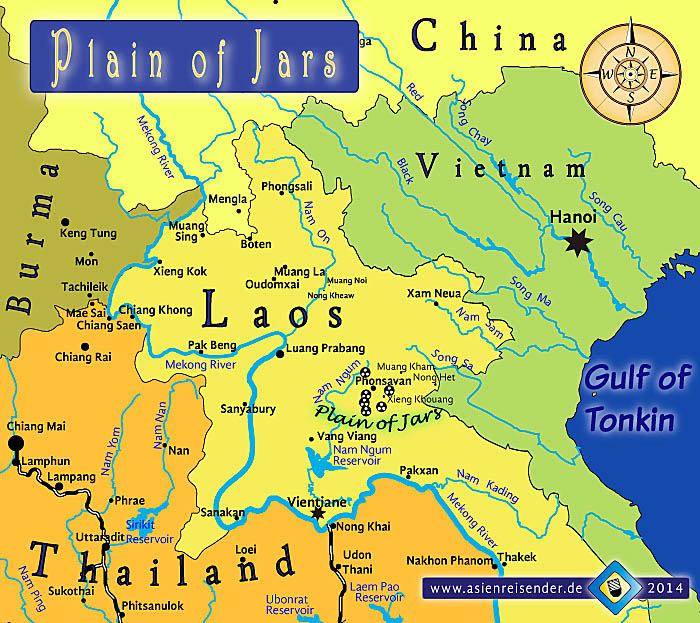
I am picking up the alignment in the land-locked country of Laos.
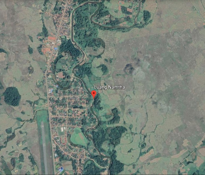
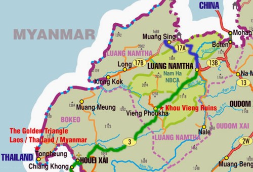
Luang Namtha is the name of a Province in northern Laos, and its capital city.

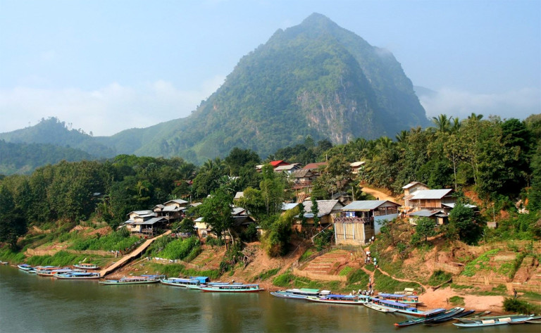
The city of Luang Namtha is located on the snaky, s-shaped Tha River.
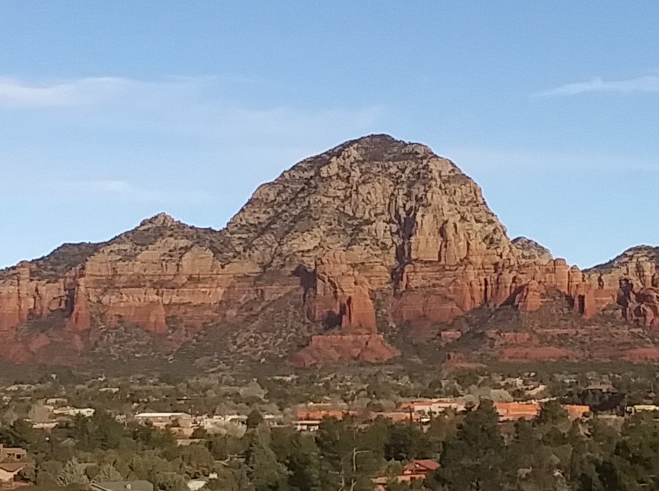
This is a site along the Tha River that reminds me in appearance of…
…Thunder Mountain in Sedona, Arizona.
There is a provincial museum in Luang Namtha City that is largely an anthropological museum…
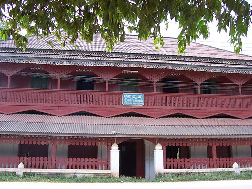
…containing numerous items relating to the local people like clothing, textiles, household items, Buddhist-related items, and bronze Khamu drums.
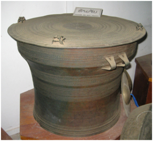
The majority of Khamu, or Khmu, now live in northern Laos, though the Khamu are indigenous to Southeast Asia, and are found in Myanmar (formerly Burma), Thailand, Viet Nam (where they are officially recognized), and in the Yunnan Province of China (where they are not officially recognized). Yet another Kham to connect to the Ancient Kemetic civilization of Egypt.
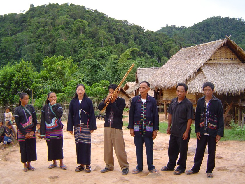

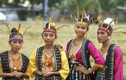
Other peoples of Laos include the Hmong, a sub-group of the Miao people…

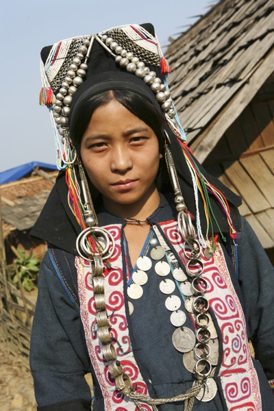
…the Akha people…
…and the Mien People.
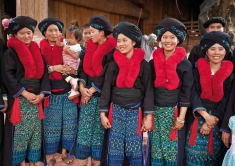
What I find interesting is that the woven textiles and traditional clothing of all of these ethnic groups is not significantly different from each other, nor is it significantly different from that of other places like the Helong weavers of West Timor in Indonesia…
…or the textiles and clothing of Peru.

This indicates to me a much closer relationship between these different groups of people than what we have been told.
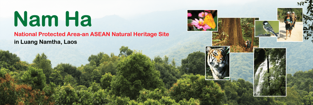
The Nam Ha National Protected Area in Luang Namtha Province is home to some of the Khmu, Hmong, and Akha peoples, among several other of the ethnic minorities in Laos, as well as diverse animal and plant species.
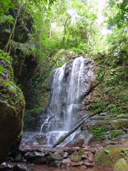
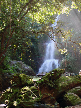
The Pha Yueng Waterfall is located in the Nam Ha Protected Area, on the road from Luang Namtha to Muang Sing.
Muang Sing is a small town and district in Luang Namtha Province, 37-miles, or 60-kilometers, northwest of the town of Luang Namtha, and in close proximity to the border between Laos, and Yunnan Province of China.
The principal Buddhist temple here is called the That Xieng Tung Stupa. A festival is held here every year on the full moon of the twelfth lunar month (in October or November).
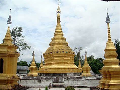
On the left side of the stupa there is a stairway leading to a sacred fountain and sacred stone, and on the right side is the old moat and wall of the stupa.
The Nam Keo Waterfall is slightly over 1-mile, or 2-kilometers from this stupa.
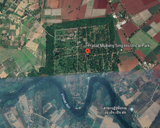
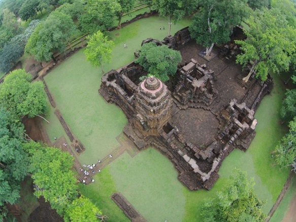
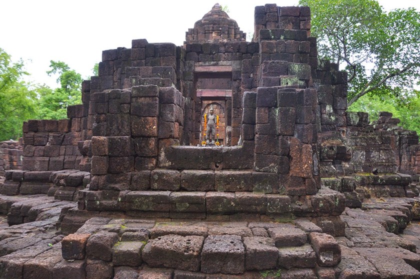
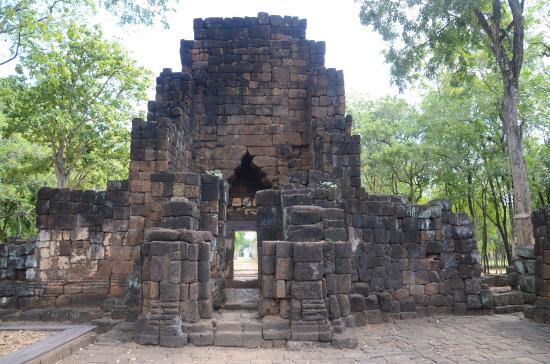
Muang Sing is also the name of an historical park in neighboring Thailand.
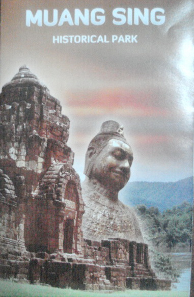
It protects the remains of two Khmer temples said to date from the 13th- and 14th-centuries in Thailand’s Kanchanaburi Province, on the snaky s-shaped Khwae Noi River.
Before I move along the alignment into Myanmar, there are several more things I would like to bring up in or about Laos.
One is the Patuxai, or the Arch of Triumph of Ventiane, built in the capital city of Laos, and which we are told was built in the 1960s as a monument dedicated to those who fought in the struggle for Laos’ independence from France.
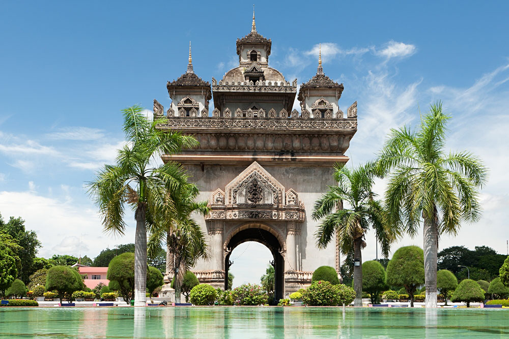
Among other problems with that dating of the construction of this arch is that during the 1960s, Laos had its own problems with the Viet Nam war spilling over into Laos, with Laos being bombed by American planes starting in 1964, in retaliation we are told, for the shooting down of an American plane by insurgents, and after which bombing runs over Laos intensified, with over 100,000 bombing runs on Laos’ eastern border with North Viet Nam.

Another place is Luang Prabang, which I found tracking a different alignment, and where there are beautiful waterfalls…
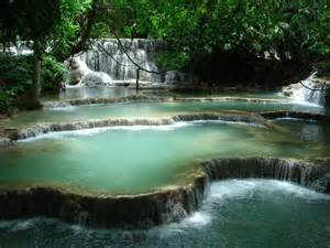
…that look similar to Havasupai Falls in Arizona’s Grand Canyon.

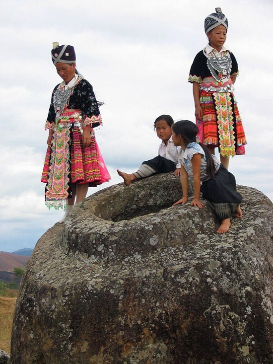
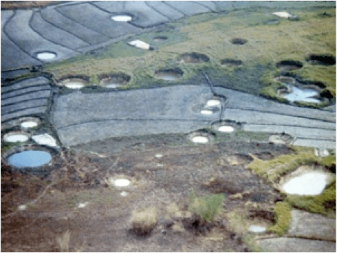
The last place I would like to bring to your attention in Laos is called the Plain of Jars.
As I recall, the first time I ever heard of the Plain of Jars was either watching an episode of “Unsolved Mysteries” or “Arthur C. Clark’s Mysterious World.” Whenever I first heard of it was a long time ago.
The Plain of Jars is a mystery, with thousands of what look like huge jars cut from stone filling the landscape.

Some of the stone jars are gigantic!
Between 1964 and 1973, the Plain of Jars was heavily bombed by the U. S. Air Force operating against the North Vietnamese and Pathet Lao communist forces, and it was said that the Air Force dropped more bombs on the Plain of Jars than it dropped during the entirety of World War II.
These were some unexploded bombs removed from the Plain of Jars from the secret war in Laos.

Why the incessant and excessive bombing of a megalithic archeological site?
Per capita, Laos is the most bombed country in history.
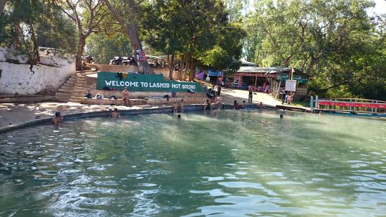
Leaving the country of Laos, I am tracking the alignment into the country of Myanmar, formerly known as Burma, through the city of Lashio, the largest town in northern Shan State.

The population of Shan State is mostly comprised of the Shan People, Chinese, and Burmans.
The Shan people live primarily here, but they are also found on other parts of Myanmar, China, Laos, Thailand, and India.

The majority of Shan are Theravada Buddhists or practice the animist Tai folk religion.
The Shan Hills are found in Myanmar’s Shan State.

There are hot springs in Lashio, of which I come across many tracking planetary alignments.
The Gokteik Viaduct was said to have been built in 1899 – 1900 by an American Company on behalf of British Authorities, and is between Lashio and Pyin Oo Lwin in the Mandalay Region of Myanmar, and which became a permanent military outpost for the British in 1897 and eventually the summer capital of British Burma, which existed from 1824 until 1948 when Burma chose to become a fully independent republic instead of a British Dominion.
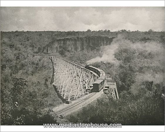
The Gokteik Viaduct goes across the Gokteik Gorge, which has at least one waterfall as seen here.
The appearance of the Gokteik Viaduct reminded me of this trestle of the Algoma Central Railway in Ontario. The Algoma Central Railway was said to have been chartered in 1899 and built between Sault Ste. Marie, Ontario and Hearst, Ontario by 1914.
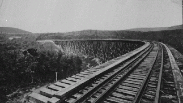
The Algoma Central Railway is known for its daily excursion to Agawa Canyon, 113-miles, or 182-kilometers, north of Sault Ste. Marie, Ontario, through a sparsely populated area with few roads.

There are waterfalls in the Agawa Canyon as well.
Here is a comparison of the Gokteik Viaduct at the Gokteik Gorge in Myanmar on the left, with the Algoma Central Railway Trestle at the Agawa Canyon on the right.
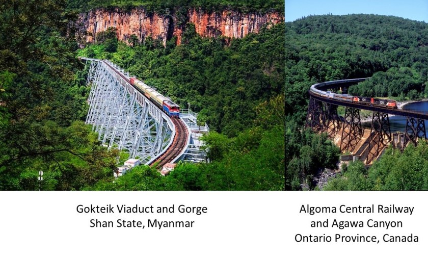
Is the history we have been taught about relatively low technology existing in the late 19th-, or 20th-century consistent with being able to pull off the construction of massive engineering projects like these?
How could they have possibly gotten all the equipment to these remote and difficult locations, much less build these sophisticated steel structures?
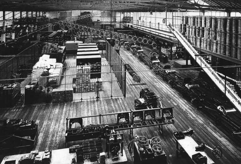
As an example of what we are taught, mass production of the Model T Ford didn’t even really start until the invention of the moving assembly line around 1913.
Let’s take a look at the British Colonial Summer capital of Pyin Oo Lwin.
This is the All Saints Anglican Church there.

Where have I seen that style of church architecture before, with the Moorish-looking tower next to the nave? All over the place!!!
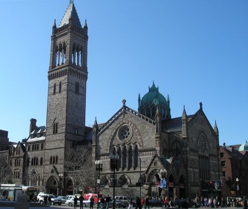
Like the New Old South Church in Boston, Massachusetts…
…this church in Flagstaff, Arizona…

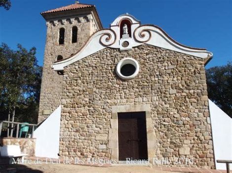
…and the Chapel de Les Alegries in Spain near Barcelona, to name just a few.
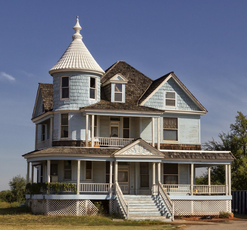
This is the Gandamar Myaing Hotel, said to have been an old British colonial mansion converted into a hotel.

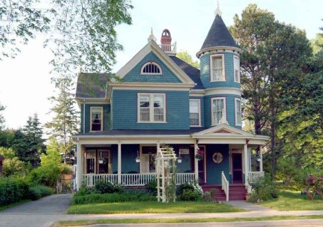
I have seen that style of architecture all over the place as well.
In Nova Scotia, a maritime province of eastern Canada…
…Spencer, Oklahoma just outside of Oklahoma City…
…and on the left, in Penns Grove, New Jersey; in the middle, in Jerome, Arizona; and on the right in Providence, Rhode Island.

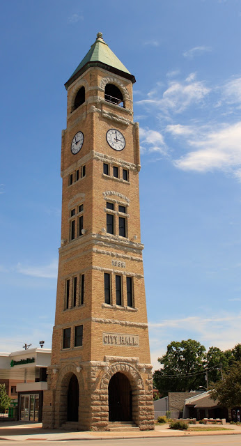
This is the Purcell Tower in downtown Pyin Oo Lwin, said to have been built in 1934 by the Gillette and Johnson Company to commemorate the Silver Jubilee of the reign of George V of Great Britain.
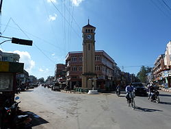
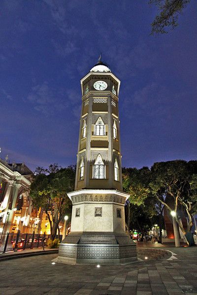
It also looks like a Moorish Clock Tower.
This is actually called the Moorish Clock Tower, and is located in Guayaquil, Ecuador…
…St. Mark’s Campanile in Venice, Italy, which is also a bell-tower…

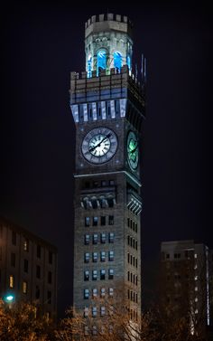
…and in the United States, there is the Emerson Bromo-Seltzer Clock Tower in Baltimore, Maryland…
…the Neenah clock tower in Wisconsin…
…and the Port Townsend, Washington clock tower, again to name just a few of many examples.

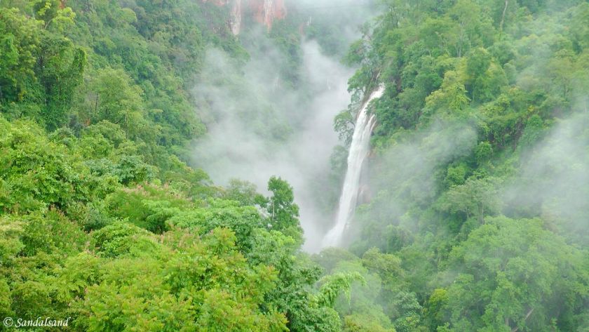
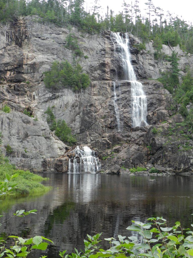
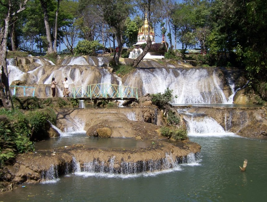
I will end my tour of Myanmar with a picture of waterfalls in Pyin Oo Lwin.
In my next post, I will be picking up the alignment in Dhaka, the capital and largest city of the country of Bangladesh, on our way into India.
