
In the last post, the circle alignment originating in Algiers, was tracked from Inukjuak on the Hudson Bay, over the Ungava Peninsula of Northern Quebec, across the Hudson Strait to Baffin Island in the Canadian Territory of Nunavut, and from there across the Davis Strait of the Labrador Sea into Greenland, on through to Tasiiluq in Greenland’s east coast.
In this post, I am picking up the alignment in Olafsvik, a township in western Iceland on the Snaefellsnes Peninsula, located northeast of the Snaefellsjokull National Park, the first national park established in Iceland…

…and named for its famous ice-covered stratovolcano and glacier, said to be one of seven great energy centers of the Earth…
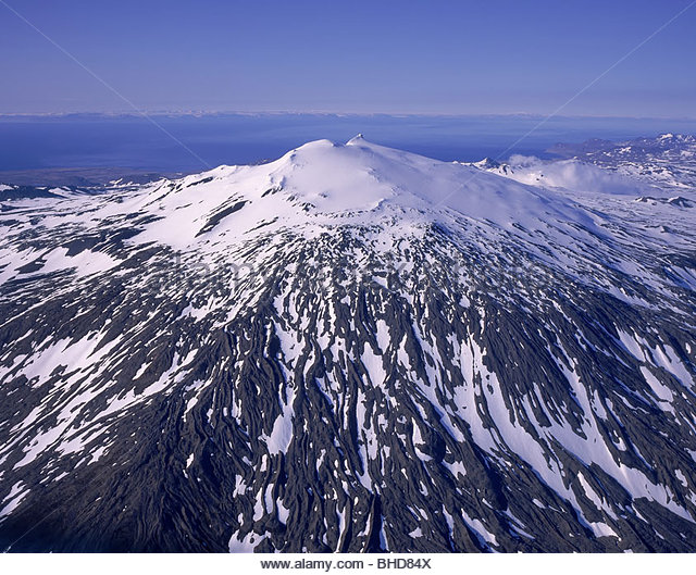
…and which was an entrance to Inner Earth in Jules Verne’s classic 1864 novel, “Journey to the Center of the Earth.” In the novel, the German adventurers came to the surface of the earth again at the Stromboli volcano of the north coast of Sicily. I wonder how Verne came up with that unusual story line!

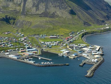
Back to Olafsvik, a small township with a population around 1,000 people, is described as a fishing village. It’s shaped harbor, on Iceland’s west coast in the North Atlantic Ocean, is exactly like shaped harbors found around the world…
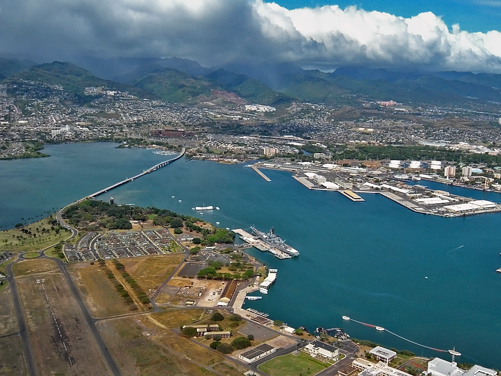
…like Pearl Harbor, on Oahu in the Hawaiian Islands in the Pacific Ocean…
…at Funchal, the largest city of the Portuguese Madeira Islands, located in the Atlantic Ocean southwest of Portugal, and west of Morocco…

…Port Louis in the island nation of Mauritius in the Indian Ocean…

…and the harbor at Chichi-Jima in Japan’s Bonin Islands in the Pacific Ocean south of Japan’s main islands.

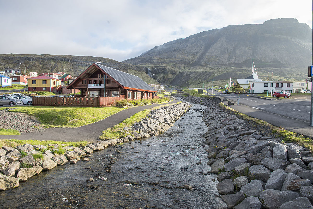
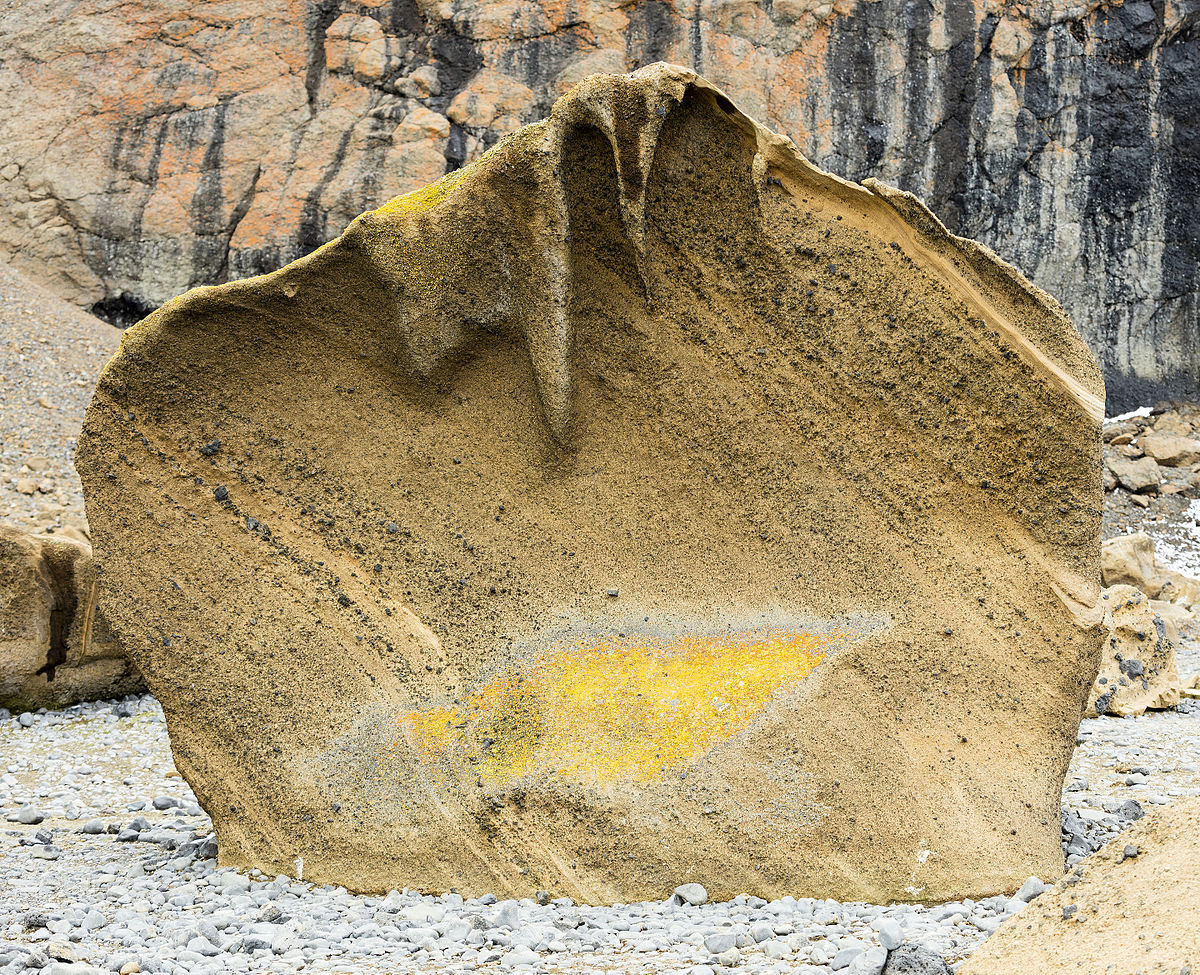
Interesting to note the presence of these massive stones on the Olafsvik waterfront…

…and what looks to be a canal, lined on either side with large stones. All of these stones shown have the angles and edges of having been worked and shaped in some fashion.
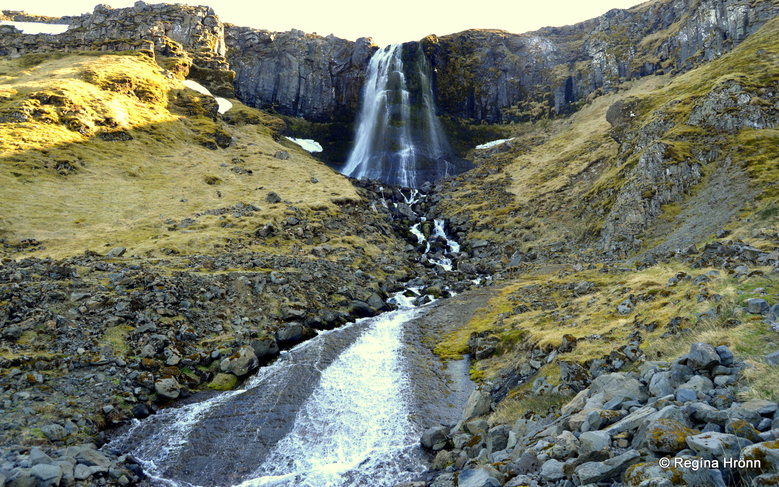
These are the Baejarfoss, or Bridal Veil, Falls, near Olafsvik…
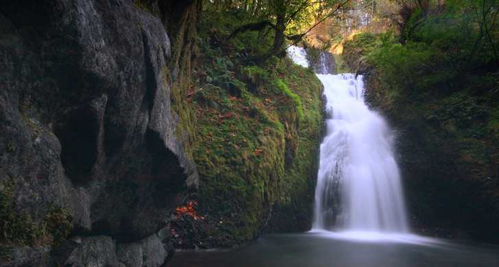
…compared with the Bridal Veil Falls in Provo Canyon in Utah…

…and Bridal Veil Falls in the Columbia River Gorge in Oregon, to show a few of many examples with the same name and a similar-looking appearance.
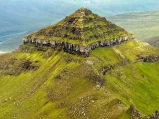
Before leaving the Snaefellsnes Peninsula, there are two places in Arnarstapi on the southern coast of the peninsula that I would like to show you.
The first is this pyramidal mountain in the background, with the large rock formations on the shore in the foreground…
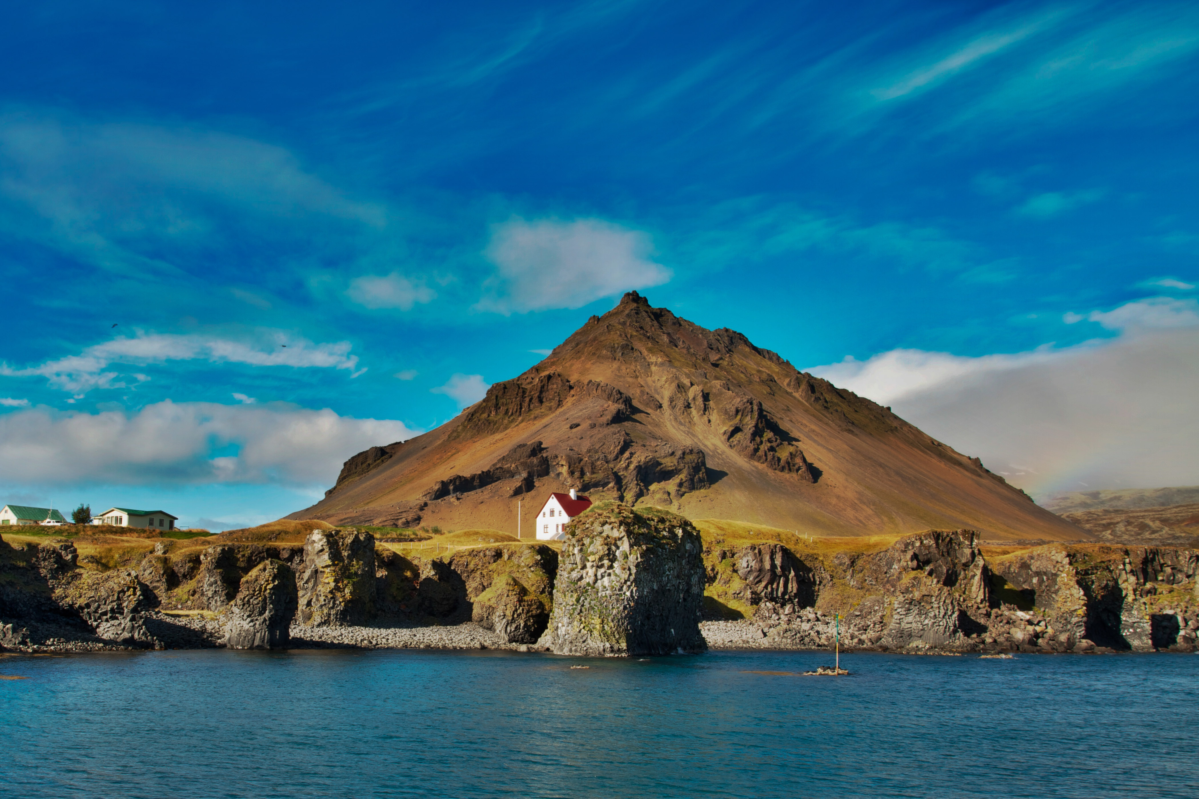
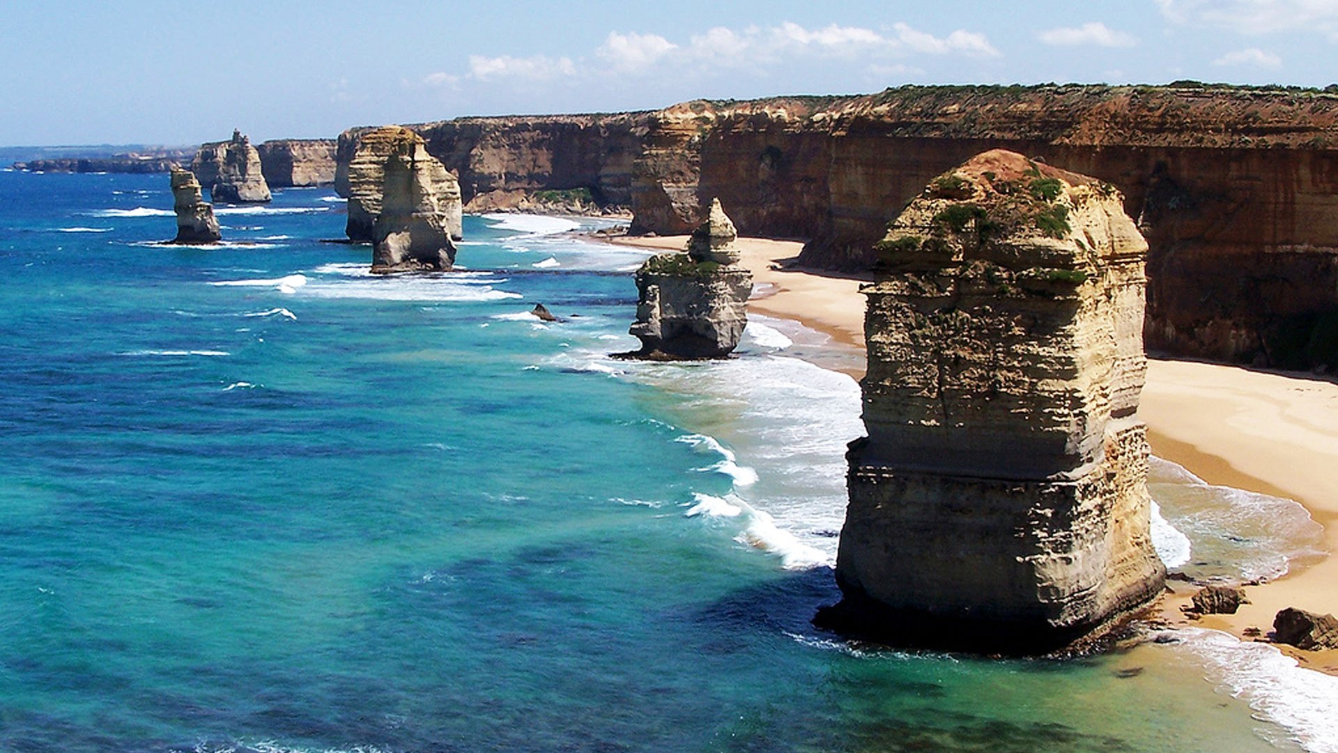
…which are similar in appearance to the Twelve Apostles, located off the shore of Port Campbell in the Victoria State of Australia.
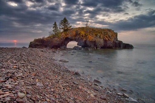
The other place in Arnarstapi is Gatklettur, or Arch Rock…
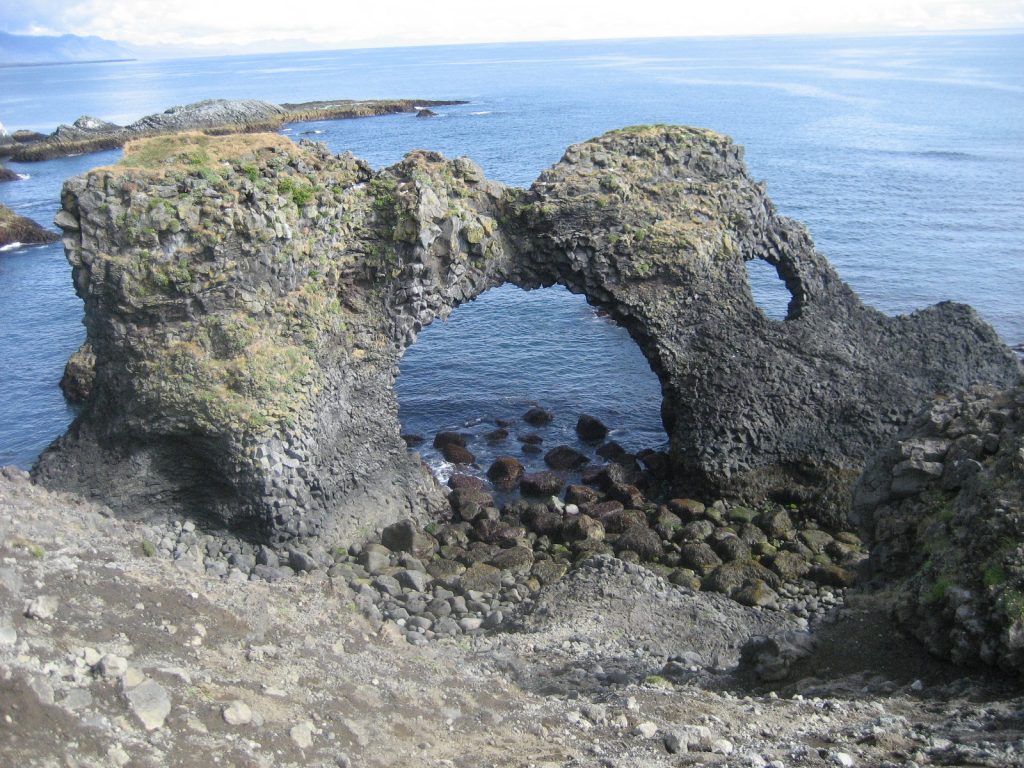
…which is similar to the Hollow Rock at Grand Portage Island off the coast of northern Minnesota in Lake Superior.
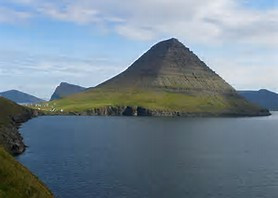
Next on the alignment, we come to a place called Kirkjufell Mountain in Grundarfjorour, Iceland.

Kirkjufell, or Church, Mountain is considered to be the most photographed mountain in Iceland…

…and was a filming location for the Game of Thrones in Seasons 6 & 7.

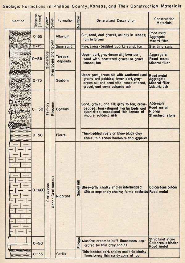
I found this diagram of the geologic strata of Mt. Kirkjufell. It is noteworthy to me that the pink layers of the Quarternary Warm Period Lave look just like brick and block masonry.

It reminded me of this Phillips County Kansas geologic survey that I found when I was first figuring things out by looking at rock formations state-by-state, where the Upper Cretaceous Period especially in this diagram looks like masonry.
Let me introduce you to the Monument Rocks, also called Chalk Pyramids, in Oakley, Kansas, if you didn’t know about them.

I have come to the conclusion that modern geologists are actually studying ancient masonry.
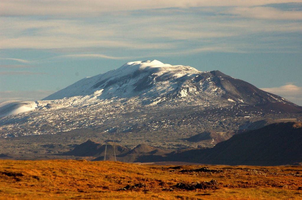
Next the alignment passes over the Hekla Volcano. Hekla sits on at least one other planetary alignment. It is also on the Merida Circle Alignment.

Hekla is what is called a stratovolcano, like Snaefellsjokull, and is one of the most active in Iceland. The definition of a stratovolcano is a conical volcano built up by many layers of hardened lava, tephra, pumice and ash.
This is an example if tephra, which is called a fragmental material produced by a volcanic eruption regardless of fragment size or composition. I wonder what that is telling, or not telling, us.
Hekla is a legendary gate of hell in medieval literature. I have found that these alignments approximate the edges of tectonic plates, as evidenced by volcanic and earthquake activity.
Over 20 eruptions have occurred since 840 AD. It was last active from February 26th to March 8th, 2000.

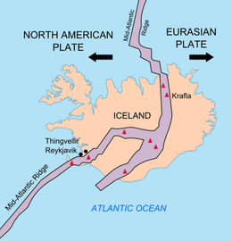
One more subject before I continue on the alignment. Iceland is well known hot-spot as it is on the boundary between the North American Plate and the Eurasian Plate…
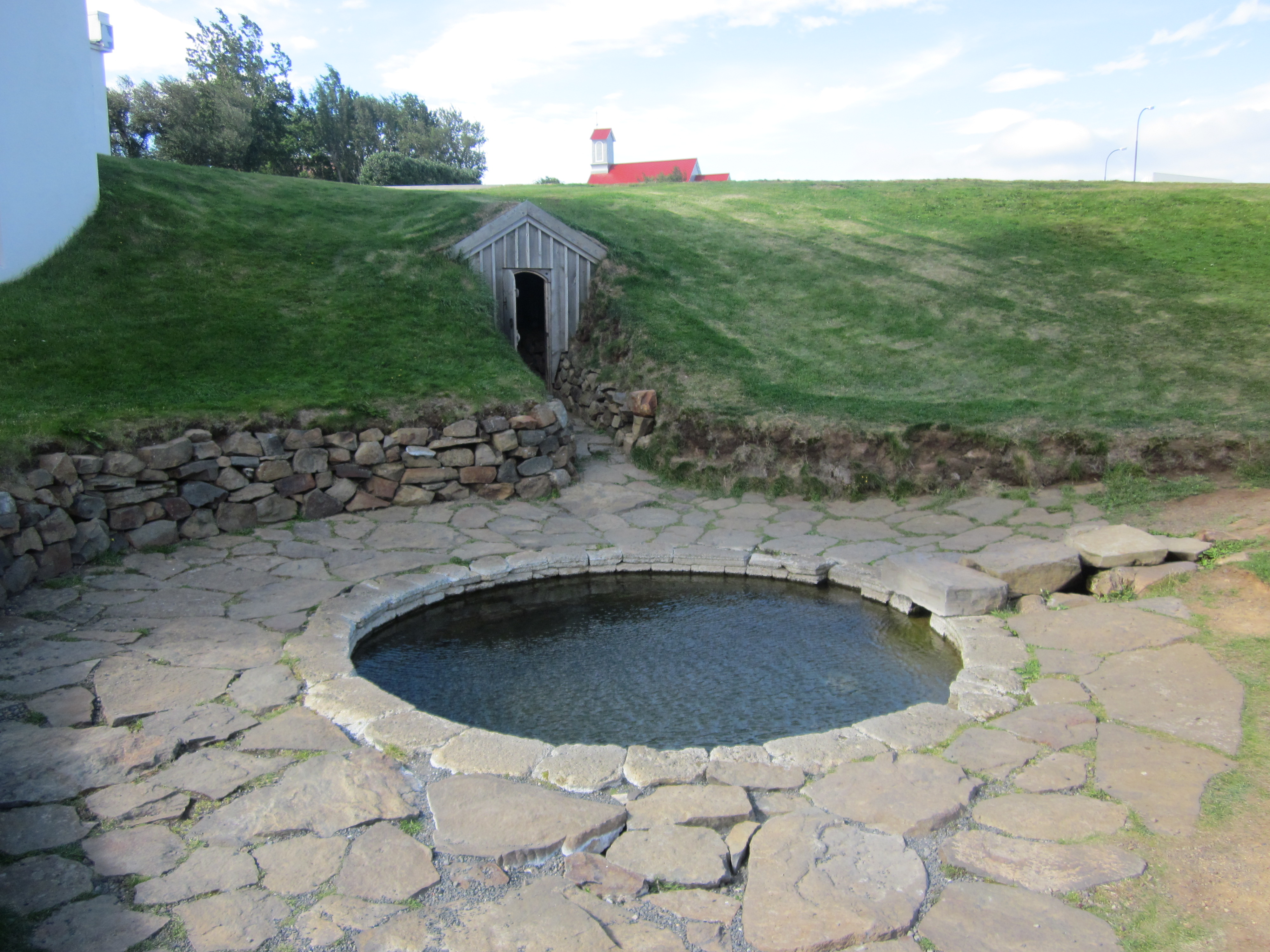
…and as such it is well-known for its hot springs.
Here is an example of an Icelandic Hot Spring that has several of the signature features of the Advanced Ancient Civilization all in one spot: 1) Hot Springs, and springs of all kinds, are found all over the planetary alignments; 2) stone-workmanship; 3) the perfect circle where the springs are located; and 4) earthworks.
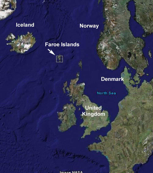
Leaving Iceland, the alignment crosses between the North Atlantic Ocean and the Norwegian Sea to the Faroe Islands. Like Greenland, these islands are an Autonomous Country of the Kingdom of Denmark, and home to approximately 50,000 people.
Like the Hekla volcano, the Faroe Islands are situated on more than one planetary alignment.
If you look up the history of these islands, it is quite vague, with references to St. Brendan, a seafaring monk in the 6th century who described and island of sheep and a paradise of birds.
All this for some sheep and some birds…

…and Faroe sounds phonetically like what word?
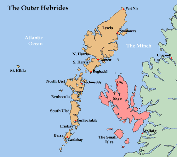
The alignment next comes to the Hebrides Islands of Scotland, which consist of the Outer Hebrides, depicted in orange on this map, and the Inner Hebrides, in pink.
The Callanish Standing Stones, on the west side of the Isle of Lewis in the Outer Hebrides, are ancient, and said to have been erected as far back as 3,400 years ago, in the Neolithic era between 4,000 and 2,500 years B.C.
The Callanish Stones have a circle of thirteen stones, with a monolith near the middle of the circle, oriented to the north and south…
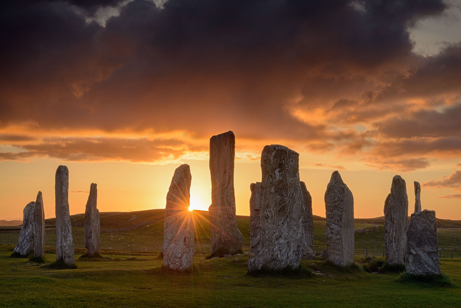
…and five rows of connecting stones connecting to the stone circle.

It is believed to have had an astronomical function associated with lunar cycles, as well as a sacred temple function.
The Isle of Skye is the largest and northernmost of the major islands in the Inner Hebrides, dominated from its center by the Cuillin Mountains.

This is Fingal’s Cave, on the Island of Staffa in the Inner Hebrides…

…which is known for its natural acoustics. It is formed by hexagonally jointed basalt columns.

As a matter of fact, the German composer Felix, Mendelssohn, is said to have visited in 1826, and afterwards composed his Opus Number 26, called ‘The Hebrides” also known as the “Fingal’s Cave Overture.”

The French author Jules Verne was also a visitor to Fingal’s Cave. Verne made an appearance at the beginning of this post, at the Icelandic volcano Snaefellsjokull, the entrance to Inner Earth in his classic novel “Journey to the Center of the Earth. Apparently he also mentions Fingal’s Cave in this novel…
…as well as in two other books: “The Mysterious Island…
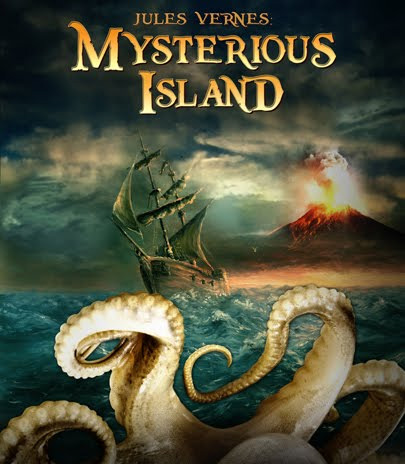
… and “The Green Ray.” I am still not sure what he was actually trying to tell us.

There is a lot more to explore here, but I will leave you with photos of these bridges. first on the Island of Skye in the Inner Hebrides…

…then the Burnside Bridge in Antietam, Maryland…
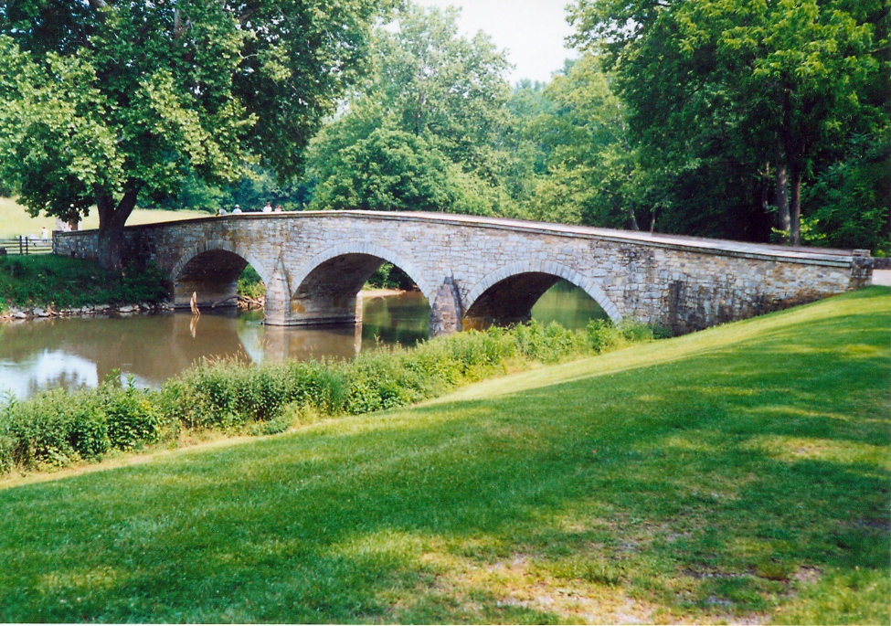
…and this old bridge in Ethiopia.

There is much more here…there is always more everywhere…but I will end this post here, and pick up the alignment in Wicka, Scotland in the next post.

Michelle
I am so very impressed with your well-researched and intuitive work. Well done.
I was born and raised in DC, went to school at the National Cathedral, then UVA, and though my father is a retired US Senator, I thought politics was for mad dogs only. And I was right.
It was shocking to find that you also shared my vision that the Erie and C&O canals were
evidence of, possibly, a prediluvian civilization, perhaps Atlantis, etc. John Dee and Sir Francis Bacon sure thought America would be the “New Atlantis.” Whoo-boy!
Ive walked and biked the C&O and both sides of the falls for decades and something always struck me as odd. All of Washington is odd. Too many neoclassical Egyptian iconography Freemasonic oddities too.
I am a 57-year-old writer, WW2 historian, and revisionist historian, and it would be an honor to speak with you, somehow I think we’d have much to talk about…star forts, alignments, and canals especially. I am now convinced the ancients used sound frequency and basic antigravity to build the megalithic constructions. Cymatic patterns in the lab sure do look like sacred geometry star forts. Hmm…
My wife and I visited Fort Washington and its a bloody star fort all right, and odd duck. Steep backside. One big bastion.
The Pentagon is said to have been built around one too, and of course its a nodal point!
I believe both south and North America has had civilizations going back millions of years.
77th Meridien Wash DC and the surrounding area is a hotspot for ancient civilization lore, and Im writing it into my historical novels.
Please contact me anytime, I live in DC currently.
jww427@gmail.com
John W. Warner IV
LikeLike