Who is Represented in the National Statuary Hall – Part 2 California, Colorado, Connecticut & Delaware

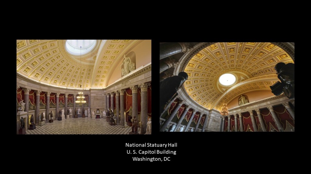
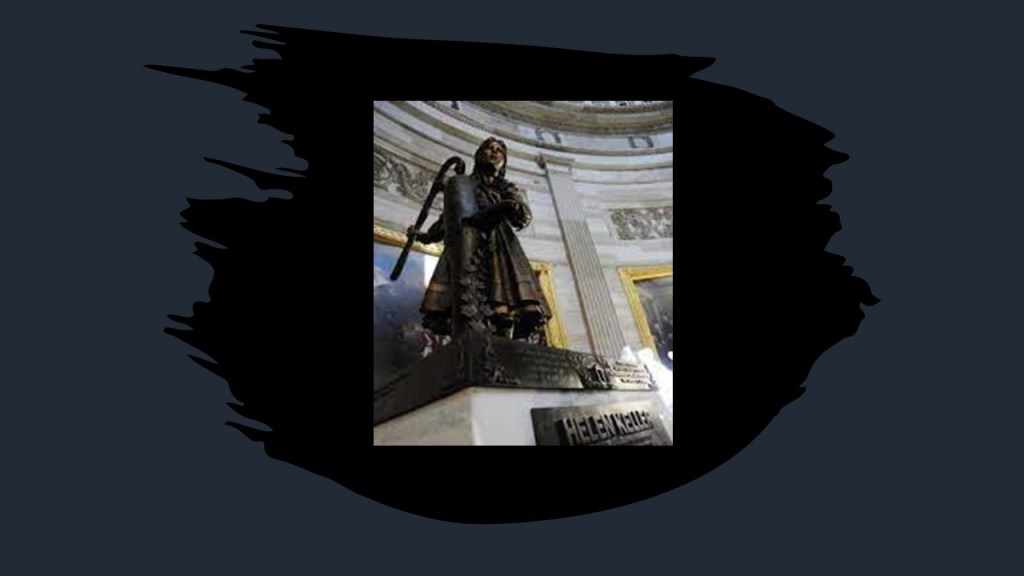
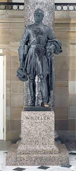
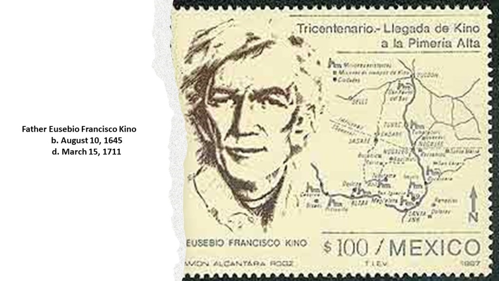
So far in the National Statuary Hall, from Alabama, Alaska, Arizona, and Arkansas, there have been two journalist/politicians (Bob Bartlett & Ernest Gruening); two military hero/politicians (Joseph Wheeler/Barry Goldwater); a Jesuit missionary (Father Eusebio Kino); one lawyer/politician (James Paul Clarke); one lawyer (Uriah M. Rose); and one disability rights advocate/socialist (Helen Keller).

Let’s see who comes up next!

Next in line is California.

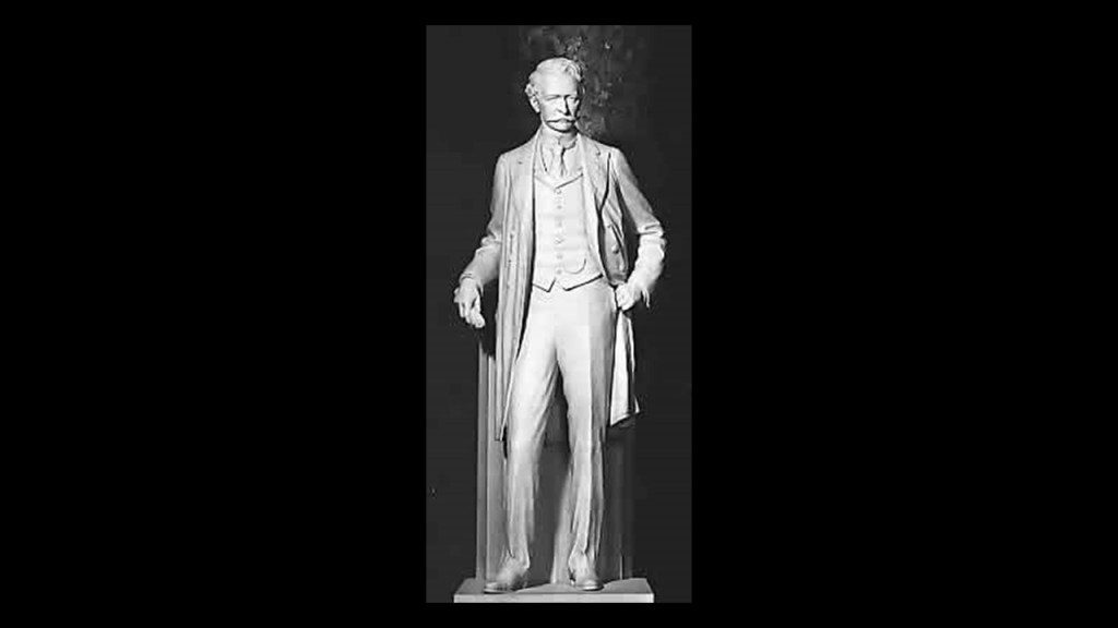
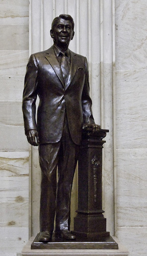
The State of California is represented by statues of Ronald Reagan and Father Junipero Serra.

Ronald Reagan was the Governor of California from 1967 to 1975, after a career as an actor and union leader, and served as the 40th-President of the United States from 1981 to 1989.

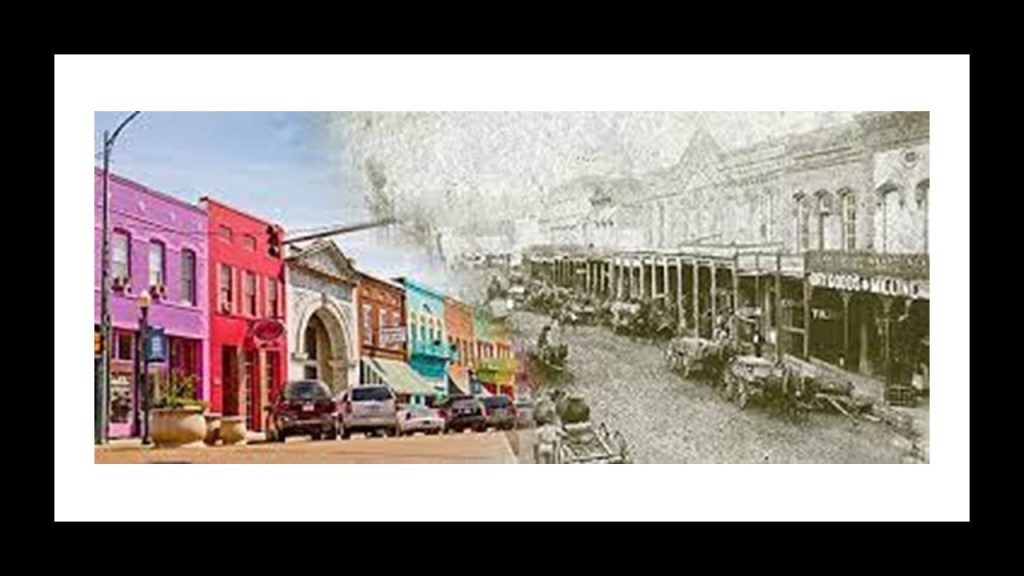
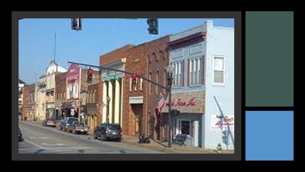
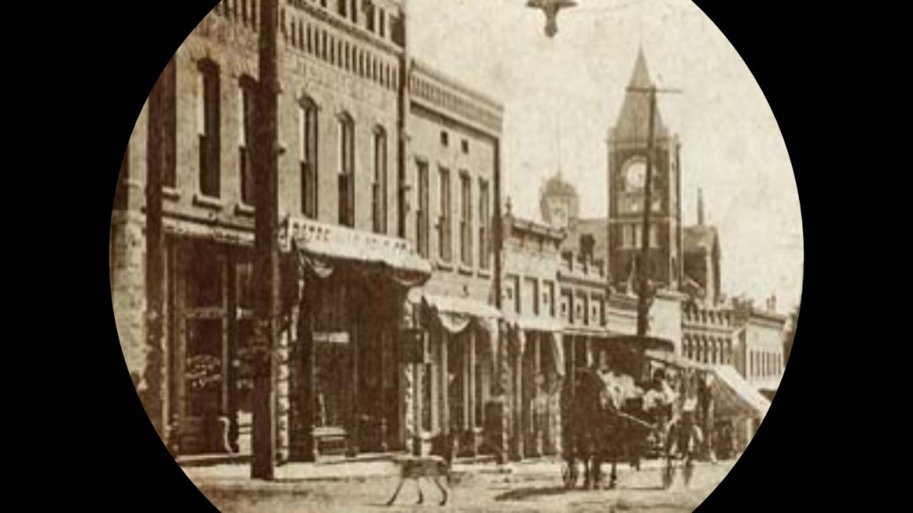
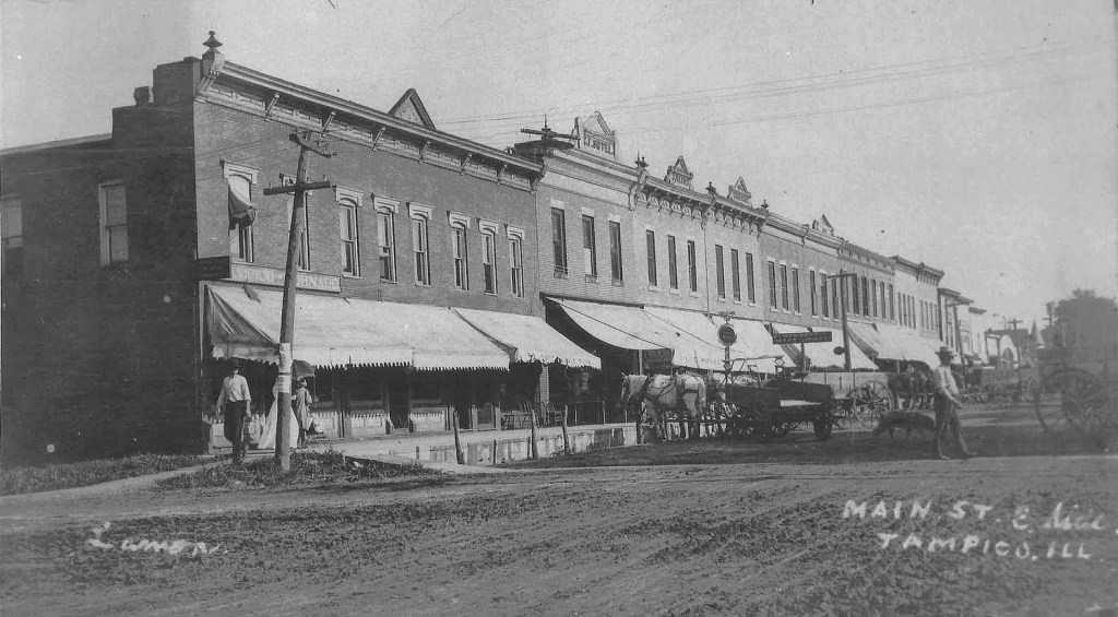
Ronald Reagan was born in 1911 to a low-income family in Tampico, Illinois.

This photo of Tampico’s Main Street was notated as having been taken in 1905.

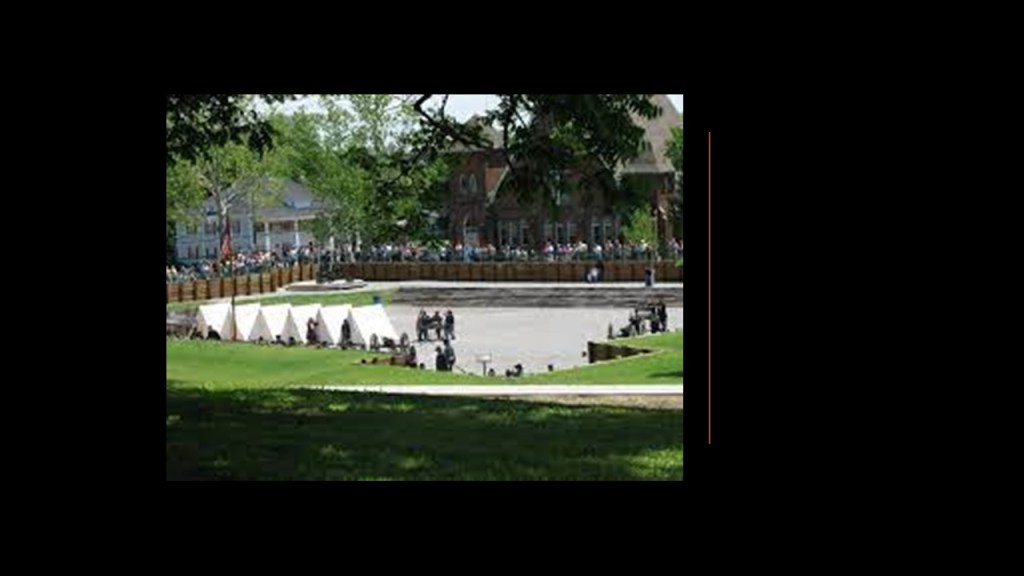
His first job was as a lifeguard at the Rock River in Lowell Park, where he was credited with saving 77 lives, in Dixon, Illinois…

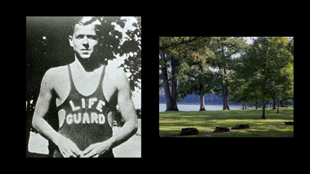
…when he was attending Dixon High School.

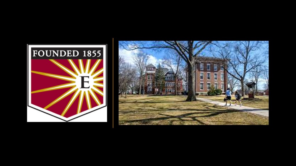
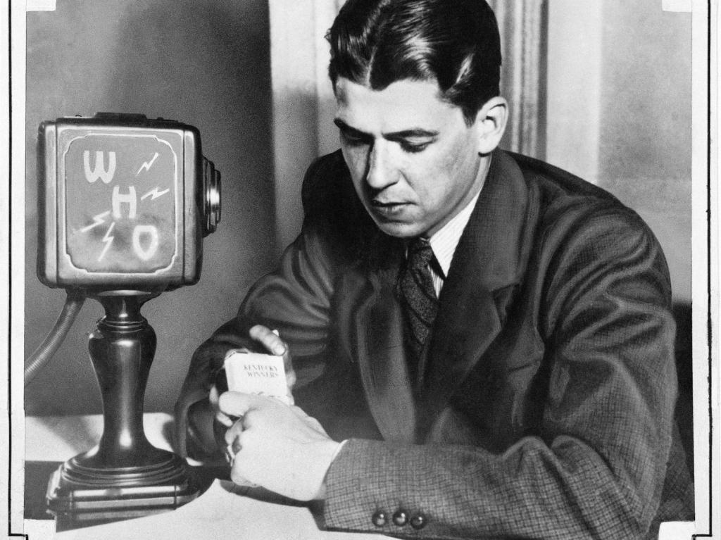
In 1932, after graduating from Eureka College in Illinois, Reagan began working as a radio sports’ commentator in Iowa.

He moved to WHO radio in Des Moines as an announcer for the Chicago Cubs baseball games, where he created play-by-play accounts of games from basic descriptions that were wired as the games were in progress.

Reagan travelled with the Chicago Cubs to California in 1937.

He took a screen-test, which led to a 7-year contract with Warner Brothers, and he started his acting career as a B-actor.

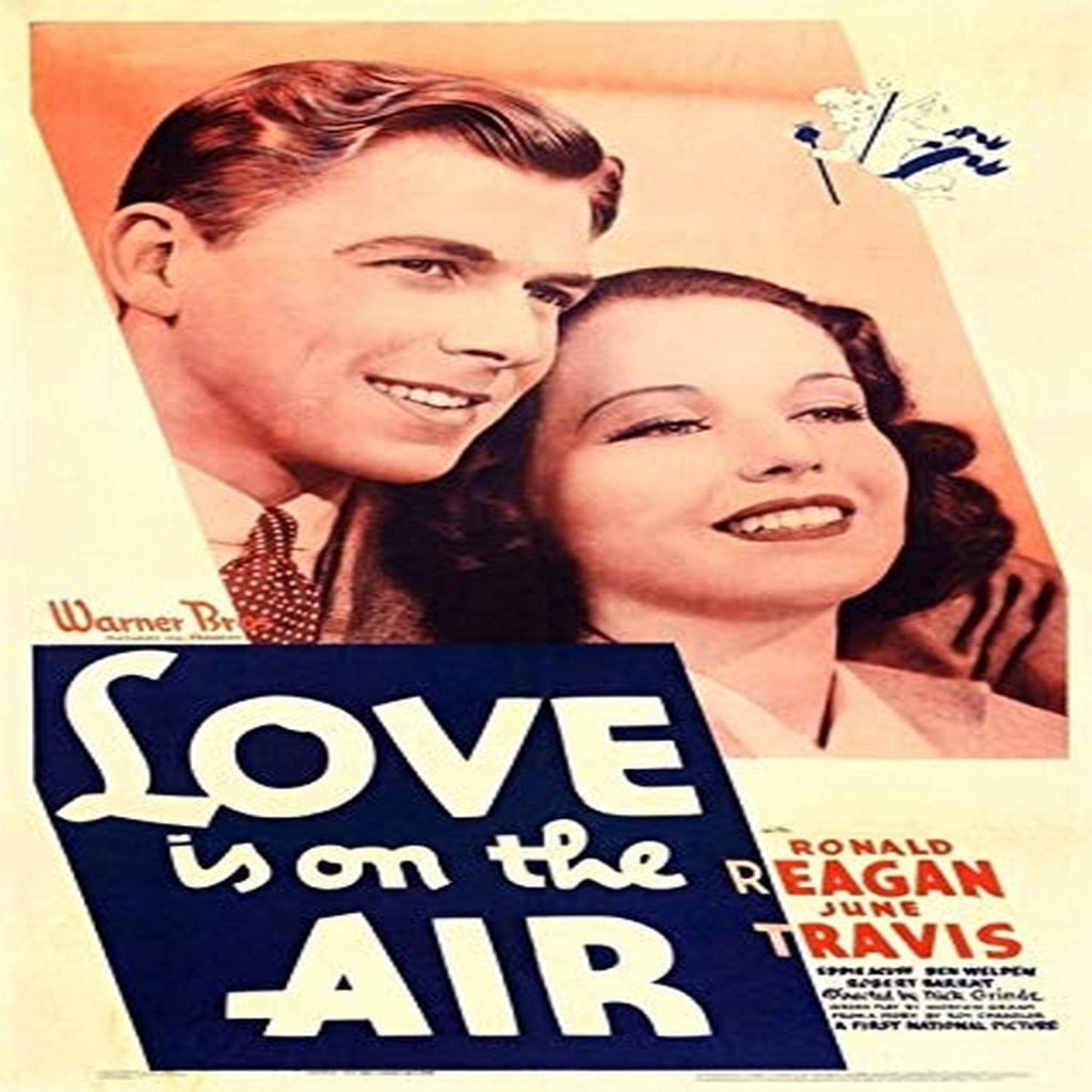
His first movie was a starring role in “Love is on the Air” in 1937, and by the end of 1939, he had appeared in 19 movies.

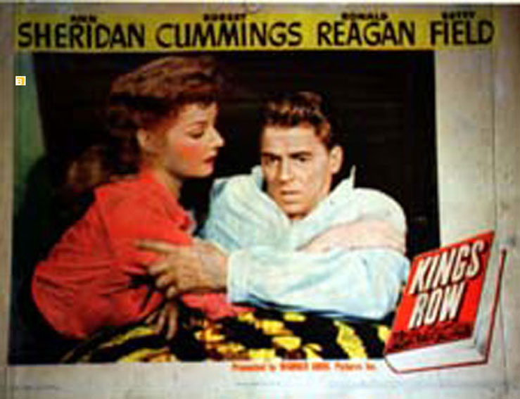
Reagan played a double-amputee in the 1942 movie “Kings Row,” which made him a star.

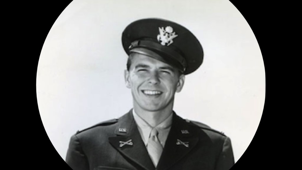
Also in 1942, he was ordered into Active-Duty military service in San Francisco, having enlisted in the Army Enlisted Reserve in 1937, and commissioned as a second-lieutenant, and he never became a big, first-rank film star, even though he played the lead in numerous movies after his military service.

Ronald Reagan was first elected to Board of Directors of the Screen Actors Guild Union as an alternate member in 1941.

In 1946, he became 3rd Vice-President, and when the Union president and six board members resigned in March of 1947 due to conflicts-of-interest, Reagan was elected President of the Union, and relected six times, starting in 1947 and the last time he was elected was in 1959.

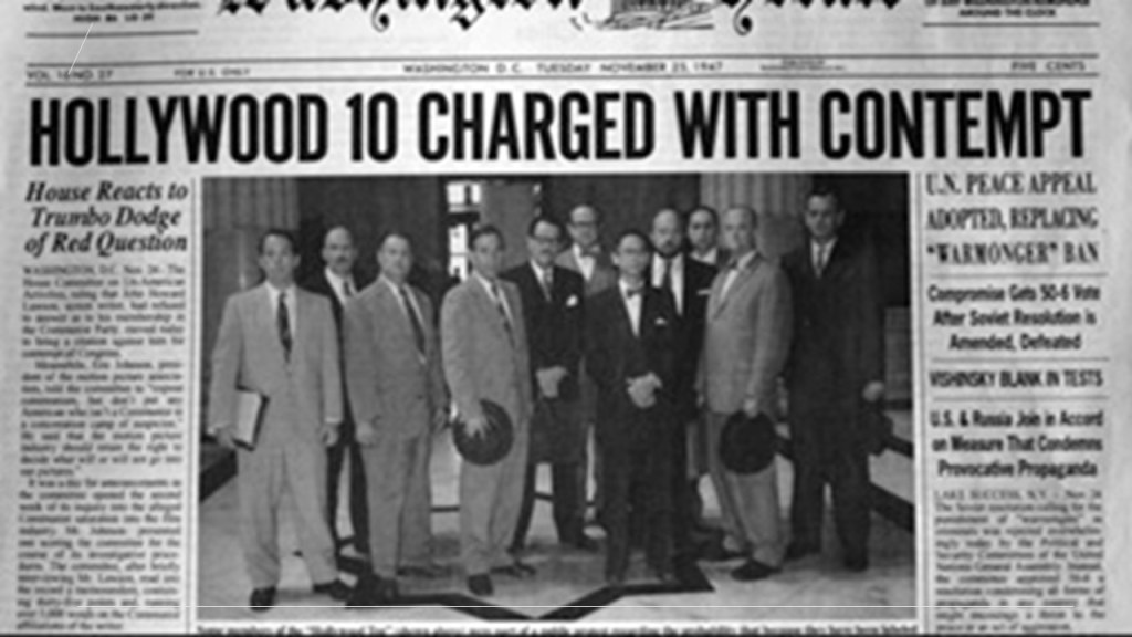
He was the Union President during the Hollywood Blacklist era during the early years of the Cold War, which was the practice of denying employment to entertainment industry professionals believed to be, or have been, Communist sympathizers.

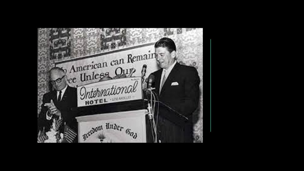
He testified in front of the House Un-American Committee hearing in 1947 that a small group within the Screen Actors Guild was using “communist-like tactics” to steer Union policy.

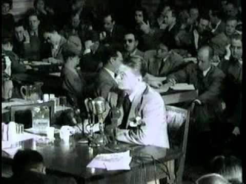
Ultimately as a result of this Congressional hearing, the “Hollywood Ten” were cited for contempt of Congress, and blacklisted for refusing to answer questions about alleged involvement with the Communist Party.

Ronald Reagan moved into television in 1953, as host of the “General Electric Theater” for ten seasons, until 1962…

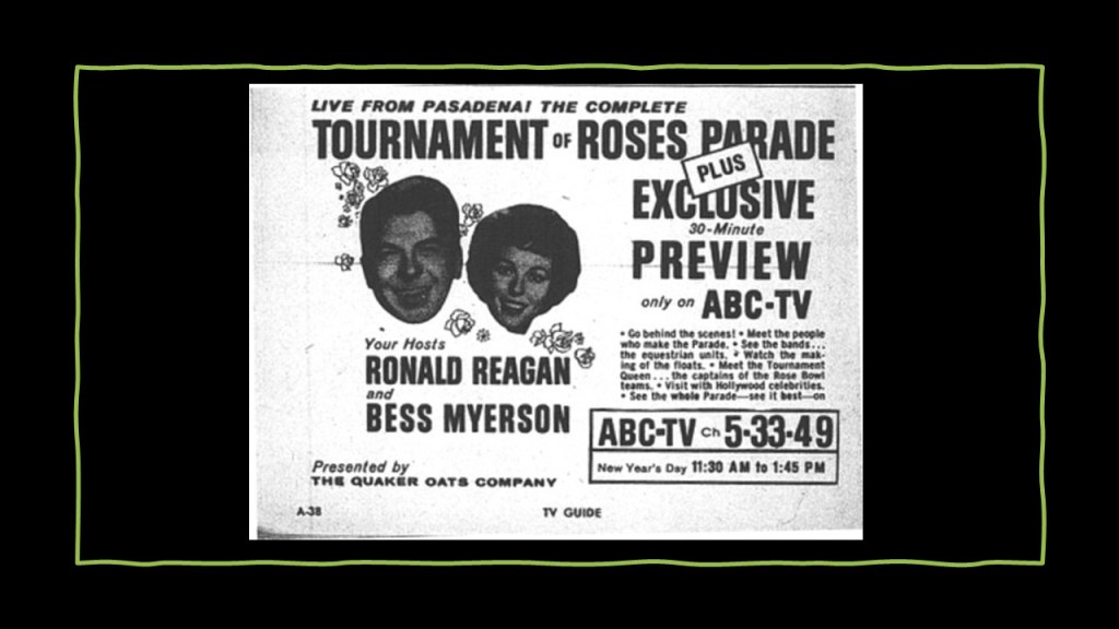
…and was a host and announcer of the “Tournament of Roses Parade” for ABC on January 1st of 1959.

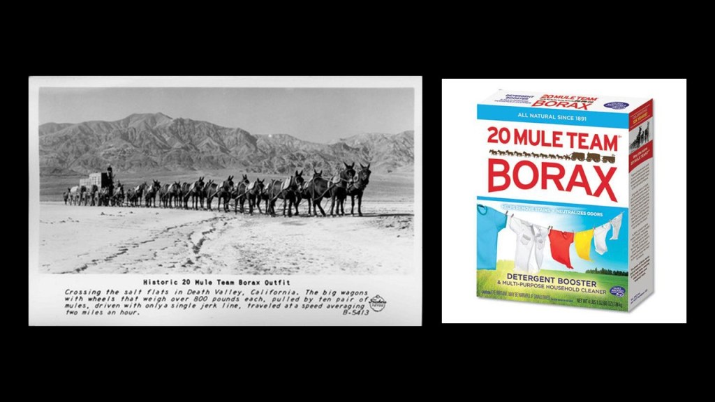
His last television stint was as a host and performer for “Death Valley Days,” described as featuring true accounts of the American Old West, particularly in Death Valley.

It was sponsored by the Pacific Coast Borax company.

Some interesting side-notes about the Pacific Coast Borax Company that I have encountered in previous research.

Furnace Creek in Death Valley, which holds the records of both the highest-recorded ground and air temperature ever recorded on Earth, was the center of operations starting in 1890 for the Pacific Coast Borax Company and its 20-mule teams hauling wagon trains of borax across the Mojave Desert.

The Inn at Death Valley, formerly known as The Furnace Creek Inn, was said to have been constructed by the Pacific Coast Borax Company and opened on February 1st of 1927, operatimg for decades by the Fred Harvey Company, known for its “Harvey Houses” and other hospitality industry businesses alongside railroads in the western United States.

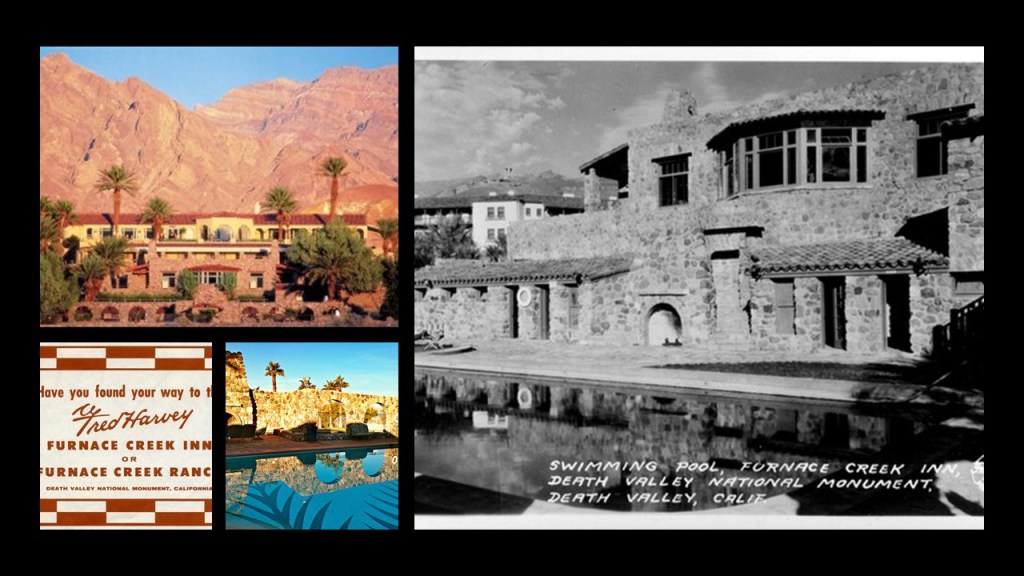
The reason given for this was the President of the Pacific Coast Borax Company, Richard C. Baker, wanted to open Death Valley to tourism, and at the same time, increase the revenue of the Tonopah and Tidewater Railroad that was said to have been built originally by Francis Marion Smith for the purpose of shipping borax.

Ronald Reagan’s first wife was actress Jane Wyman – they married in 1940 and their divorce was finalized in 1949.

He married actress Nancy Davis in 1952.

When he became President of the United States in 1981, he was the first divorced President.

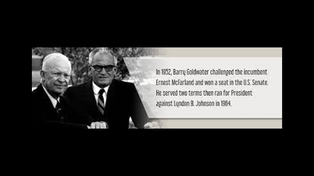
While Reagan was initially what was called a “Hollywood Democrat,” he moved to the right-wing in the 1950s, and became a Republican in 1962.

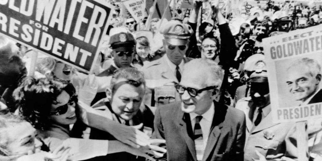
He emerged as a leading conservative spokesman in the Goldwater Presidential campaign of 1964, at which time he gained national attention in his speeches on behalf of Barry Goldwater.

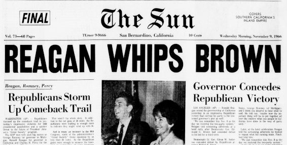
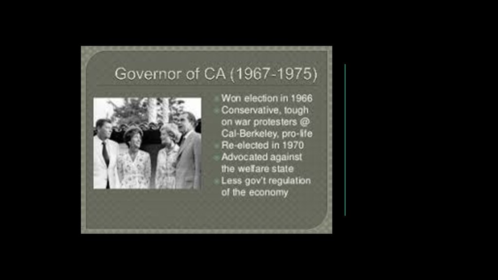
In late 1965, Ronald Reagan announced his campaign to run for Governor of California in 1966. and defeated two-term Democratic Governor Pat Brown.

Reagan was Governor of California for two-terms, from 1967 to 1975.

His terms as Governor shaped the public policies he would pursue as President, like speaking out against the welfare state and advocating the ideal of less government regulation of the economy.

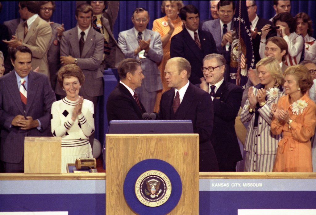
Ronald Reagan’s first presidential bid in 1976 Presidental campaign was unsuccessful, when he failed to secure the Republican Presidential nomination, which went to Gerald Ford, the incumbent who had become President when Richard M. Nixon resigned in 1974 following the Watergate Scandal.

Gerald Ford lost the 1976 election to the Democratic candidate Jimmy Carter.

He campaigned once again for the 1980 Presidential Election, where he faced Jimmy Carter against the backdrop of domestic concerns, and the on-going Iran-Hostage Crisis.

Reagan in his campaign stressed lowering taxes to stimulate the economy; less government interference in people’s lives; states’ rights; and a strong national defense.

Reagan and his running mate, George H. W. Bush, won a decisive victory of President Jimmy Carter.

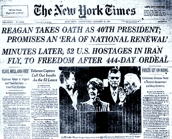
Interesting to note that the American hostages in Iran were released minutes after the inauguration of Ronald Reagan as the President of the United States on January 20th of 1981, after 444-days, of captivity…

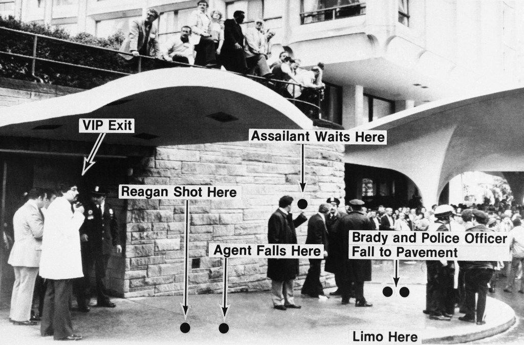
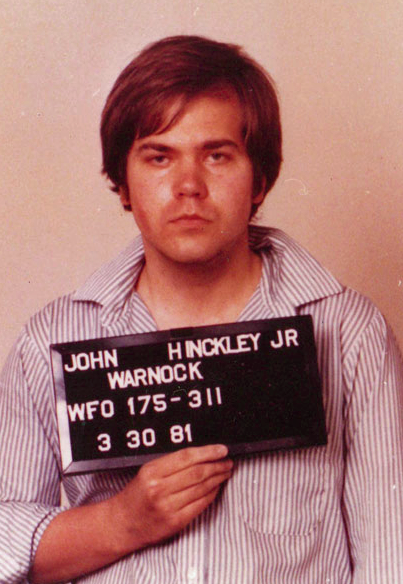
…and that Just a little over two months after his inauguration, on March 30th of 1981, there was an assassination attempt on President Ronald Reagan by what was described as a lone gunman, John Hinckley Jr.

Hinckley was said to be seeking fame in order to impress actress Jodie Foster, with whom he was obsessed.

During Reagan’s two presidencies, he pursued policies, coined “the Reagan Revolution,” that reflected his beliefs in individual freedom; expanded the economy and military; and brought an end to the Cold War.

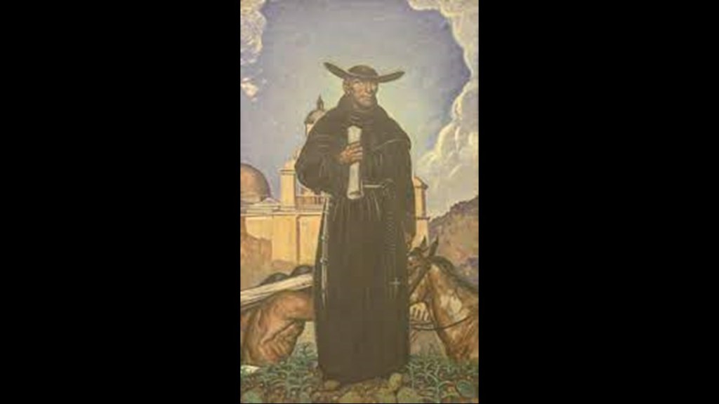
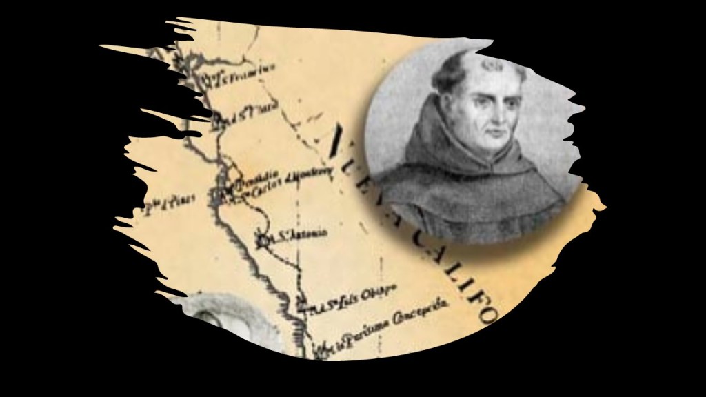
California’s other representative in the National Statuary Hall is Junipero Serra, a Franciscan missionary and Roman Catholic priest.

He was credited with establishing the Franciscan Missions in the Sierra Gorda in Mexico, said to have been built between 1750 and 1760 a UNESCO World Heritage Site…

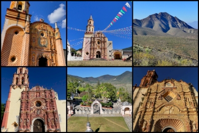
…as well as the first nine of twenty-one missions in California, from San Diego to San Francisco from 1770 to 1782.

Junipero Serra was beatified in 1988 by Pope John Paul II over the denunciations of Native American tribes that accused him of heading a brutal colonial subjugation.

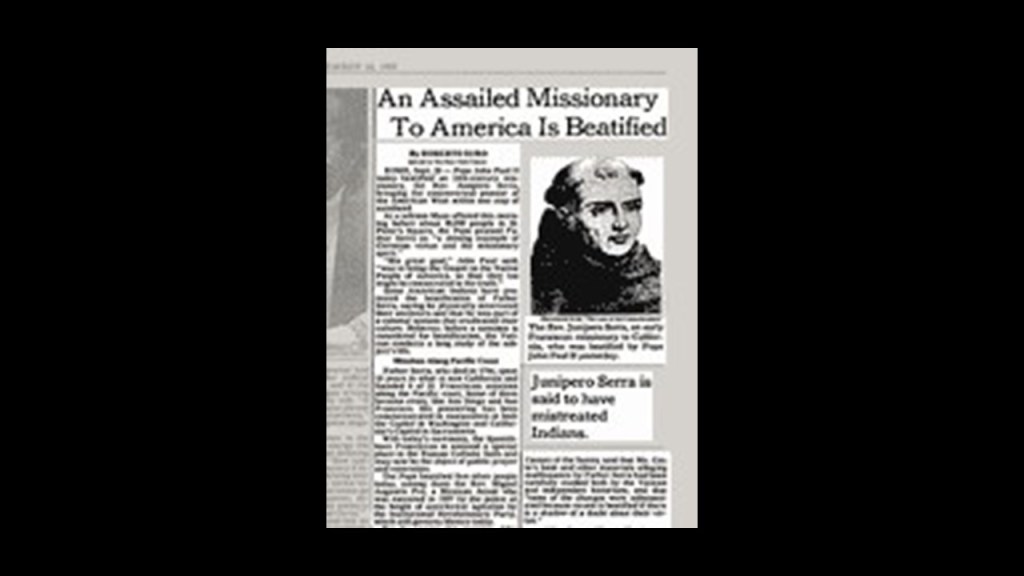
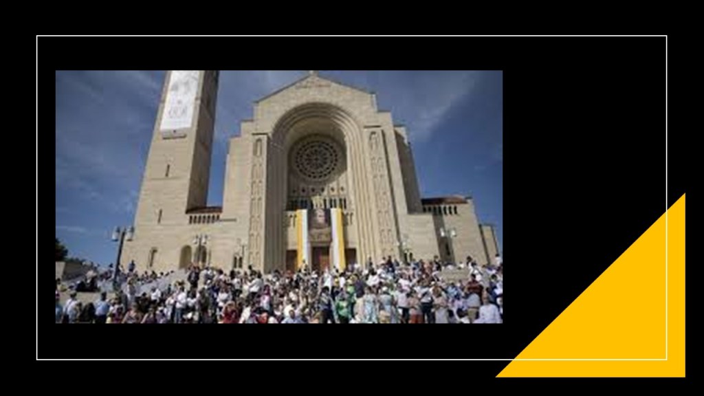
Then in 2015, Pope Francis canonized him, and he became Saint Junipero Serra, the first saint to be canonized on U. S. soil at the National Basilica in Washington, D. C.

Serra was nicknamed the “Apostle of California” for his missionary efforts, but before and after his canonization, his reputation and missionary work was condemned for reasons given like mandatory conversions of the native population to Catholicism and atrocities committed against them.

That’s what they say about him anyway!

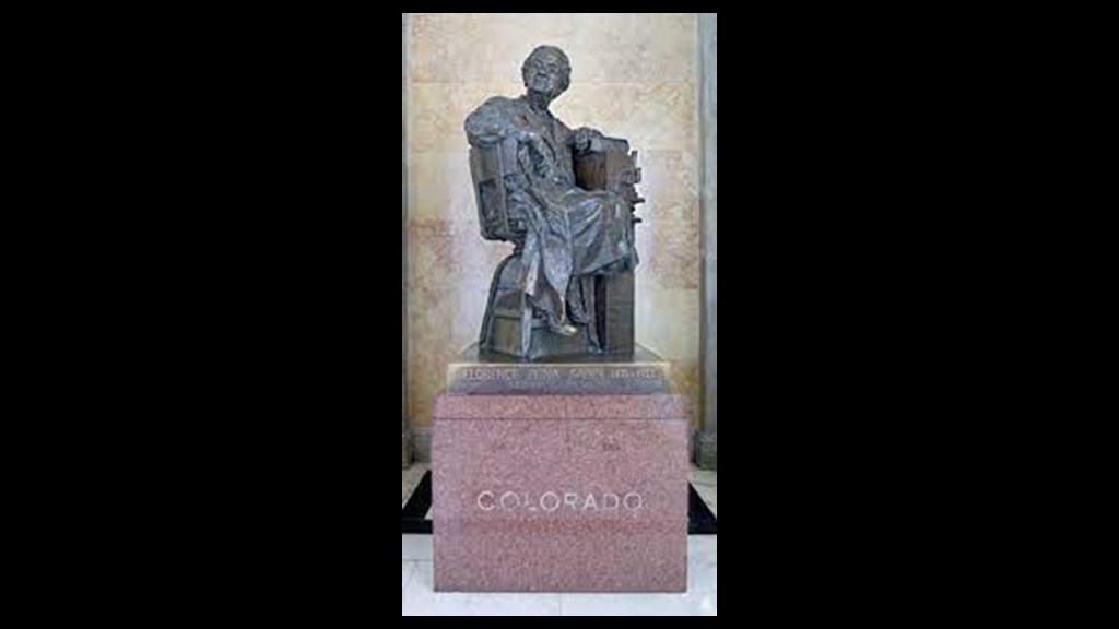
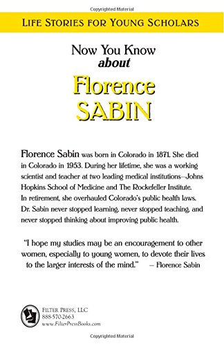
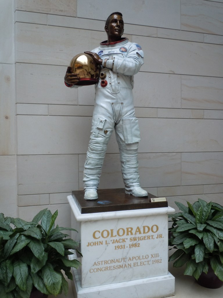
Next, the two statues representing the State of Colorado are those of Florence R. Sabin and Jack Swigert.

Florence R. Sabin was an American medical scientist.

As a pioneer for women in science, she was the first woman to become a professor at a medical college in the Department of Anatomy at the Johns Hopkins School of Medicine in 1902…

…the first woman elected to the National Academy of Sciences in 1925…

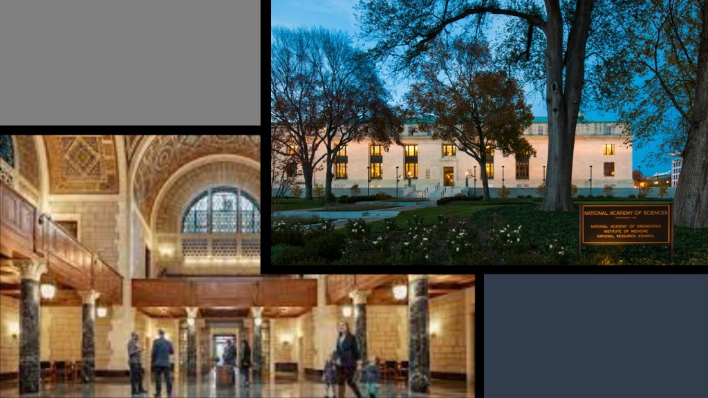
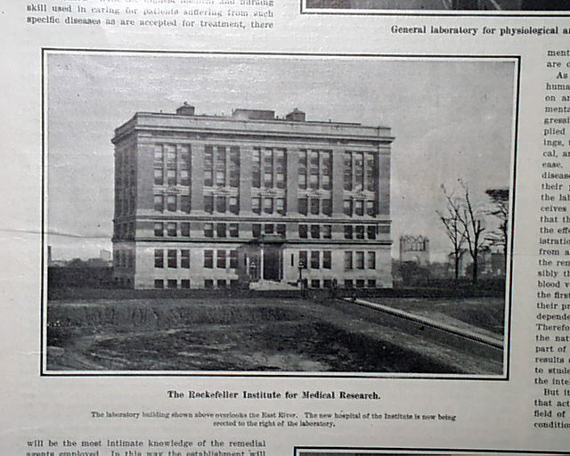
…and the first woman to head a department at the Rockefeller Institute for Medical Research in 1925, when she became head of the Department of Cellular Studies and where her research focused on the lymphatic system; blood vessels & cells; and tuberculosis.

The Rockefeller University was founded in 1901 by John D. Rockefeller, and was America’s first biomedical institute.

Florence R. Sabin was born in Central City, Colorado, in 1871, to a mining engineer father and schoolteacher mother.

Her mother died in 1878, and she and her sister went to live with their uncle in Chicago, before moving to live with their grandparents in Vermont.

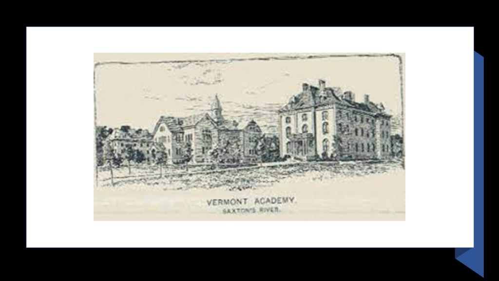
In 1885, she enrolled in the Vermont Academy at Saxton River, where she was able to develop her interest in science.

She attended Smith College in Massachusetts, and graduated in 1893 with her Bachelor’s degree.

In 1896, Sabin enrolled in the Johns Hopkins School of Medicine, which had opened in 1893, and she graduated in 1900.

Her two major projects were on producing a 3D model of a newborn’s brain stem, which became the focus of the 1901 textbook “An Atlas of the Medulla and Midbrain,” and the second was on the development of the lymphatic system in the embryo.

In her retirement, she became involved in Public Health in the State of Colorado at the invitation of the Governor at the time.

Among other things, as a result of her work, the “Sabin Health Laws” were passed, modernizing public health care in Colorado by providing more beds to treat Tuberculosis, which led to a reduction in the number of cases.

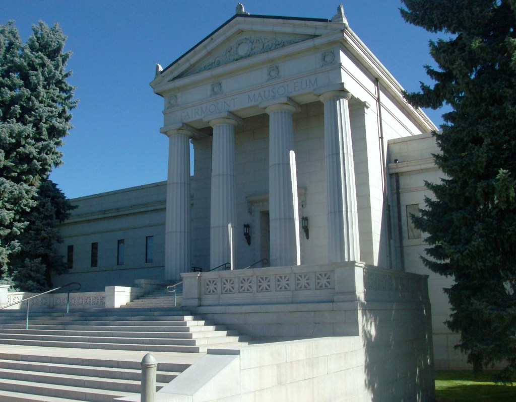
Florence R. Sabin died at the age of 81 in October of 1953, and her remains were interred in the Fairmount Mausoleum at the Fairmount Cemetery in Denver.

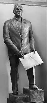
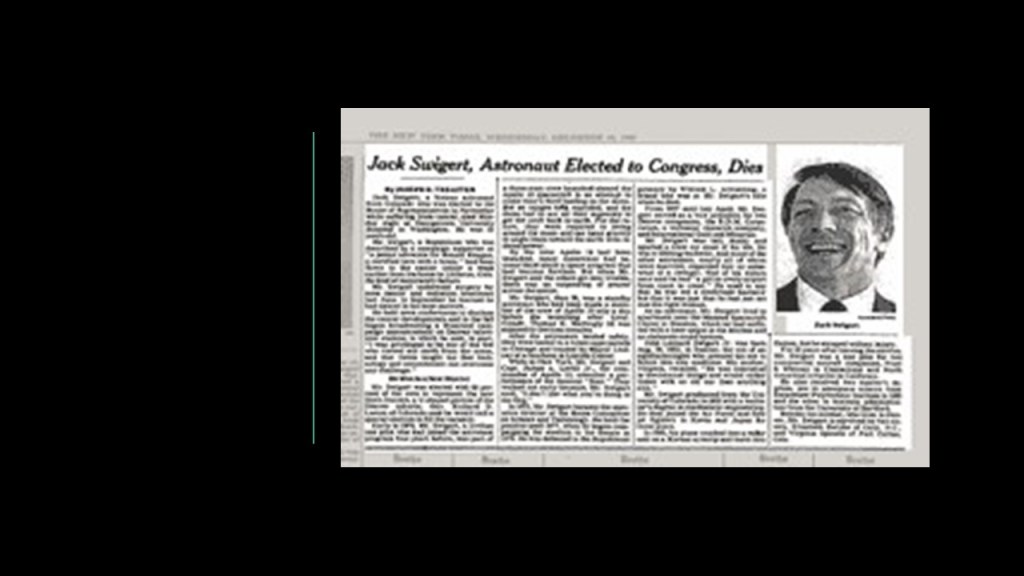
Jack Swigert is the other Coloradan represented in the National Statuary Hall, an American astronaut and Air Force pilot, who was elected to the U. S. House of Representatives for Colorado’s 6th District, but died in 1982 from complications of cancer before taking office.

Jack Swigert, Jr, was born in Denver in 1931. His father was an ophthalmologist.

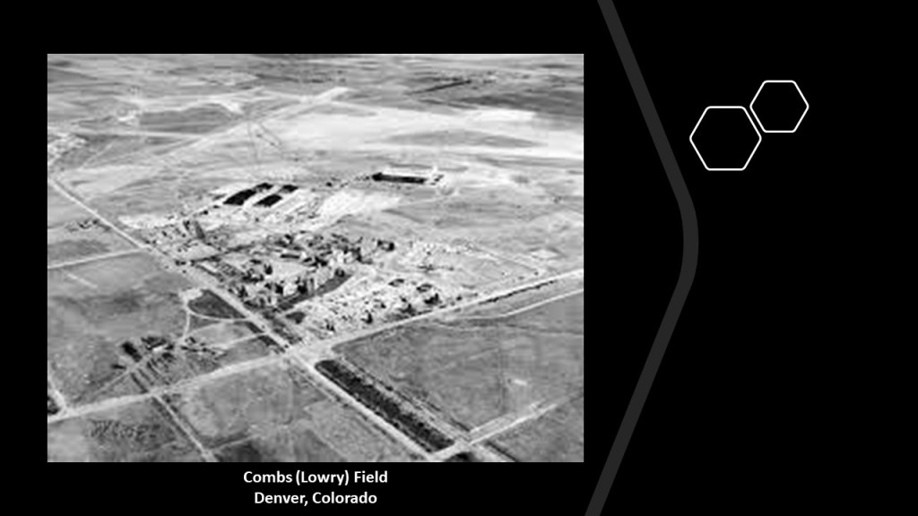
He grew up near the Colorado National Guard’s Combs (also known as Lowry) Field, and loved watching planes take-off and land, and decided that was what he wanted to be doing.

By the age of 16, he was a licensed private pilot.

Jack Swigert attended Regis Jesuit High School…

…and East High School in Denver, from which he graduated in 1949.

He received his Bachelor’s Degree in Mechanical Engineering from the University of Colorado in Boulder in 1953…

…a Master of Science in Aerospace Engineering from the Rensselaer Polytechnic Institute in Hartford, Connecticut, in 1965…

…and his Master of Business Administration from the University of Hartford in 1967.

Following Swigert’s graduation from the University of Colorado in Boulder, he joined the U. S. Air Force and graduated from the Pilot Training Program and Gunnery School at Nellis Air Force Base in Nevada.

He was subsequently assigned as a fighter pilot in Japan and Korea during the Korean War, and survived his plane crashing into a radar unit on a Korean airstrip in 1953.

After completing his tour of active duty in the Air Force, Swigert served as a fighter pilot in Massachusetts (1957 – 1960) and Connecticut Air National Guards (1960 – 1965).

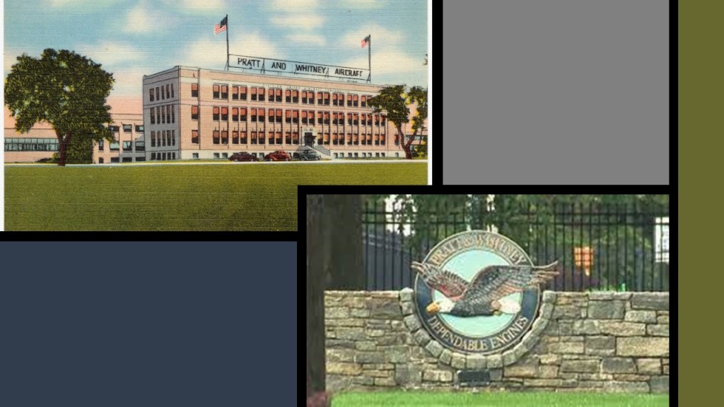
During this same time period, he was an engineering test pilot for aerospace manufacturer Pratt & Whitney, which is headquartered in East Hartford, Connecticut.

Then, in 1966, Swigert was accepted into NASA’s Astronaut Corps, and he became a specialist on the Apollo Command Module.

He was a member of Apollo 7’s astronaut support crew, the first crewed Apollo flight, from October 11 to 22 of 1968. He was the launch capsule communicator and worked on the Mission’s operational aspects.

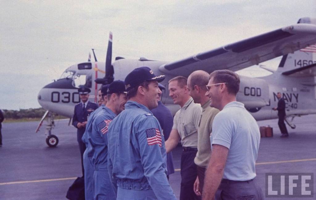
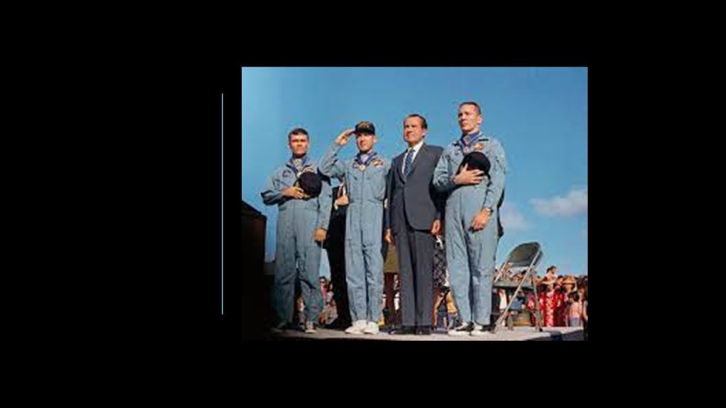
Then, when the Apollo 13 moon mission launched on April 11th of 1968, Swigert was one of the three astronauts on-board.

This is what we are told.

The mission was the third-crewed lunar landing attempt, but it had to be aborted after an oxygen tank ruptured in the space-craft’s service module.

The three astronauts on-board, Swigert, Jim Lovell and Fred Haise, travelled around the moon and returned safely to earth on April 17th.

They received the Presidential Medal of Freedom the next day.

NASA Director of Flight Crew Operations, Deke Slayton, recommended Jack Swigert to be one of the command module pilots for the Apollo-Soyuz joint-project with the Soviet Union.

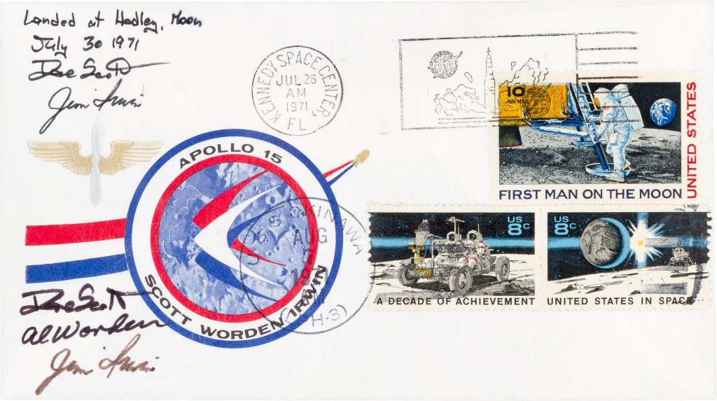
He was removed from the project, however, when it was discovered that Swigert was somehow involved with what was called the “Apollo 15 postal covers incident,” where unauthorized postal covers that had been taken into space for a West German stamp dealer by the Apollo 15 crew and autographed in exchange for payment.

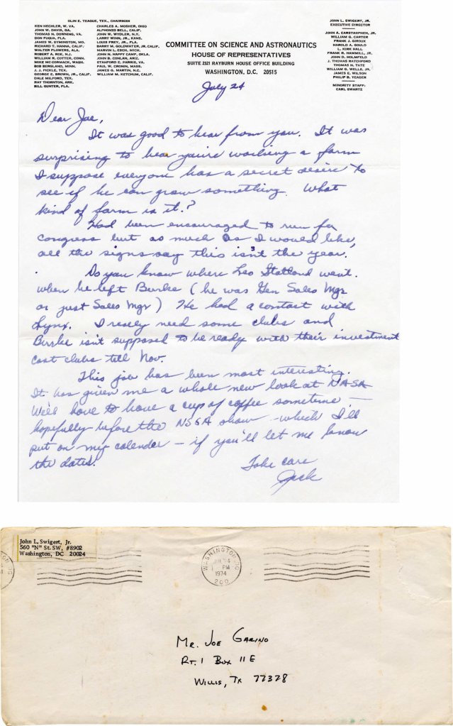
Shortly thereafter, Jack Swigert went to Washington, DC, to become the Executive Director of the Committee on Science and Astronautics for the U. S. House of Representatives.

Swigert left the Committee in 1977 to enter politics.

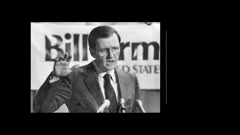
He unsuccessfully ran for the U. S. Senate in 1978, when he was defeated by the better-known Congressman Bill Armstrong.

Swigert ran for the U. S. House of Representatives in the newly-created 6th-District of Colorado in February of 1982.

Around the same time, he was diagnosed with a malignant tumor in his right nasal passage, which he disclosed to voters, and underwent radiation treatment from which he was expected to make a full-recovery.

In September of 1982, he was diagnosed with bone marrow cancer.

He won the election in November of 1982, and died of respiratory failure on December 27th of 1982, seven-days before the beginning of his Congressional term, at the age of 51.

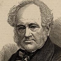
Roger Sherman and Jonathan Trumbull are the two representatives for the State of Connecticut in the National Statuary Hall.

Roger Sherman was an early American Statesman and lawyer from Connecticut who was one of the Founding Fathers.

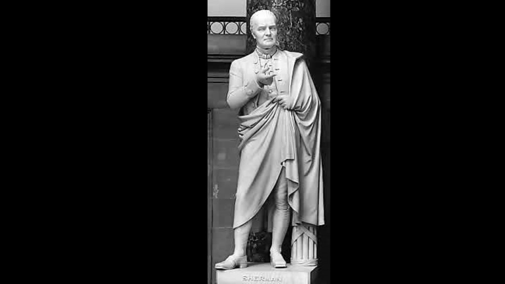
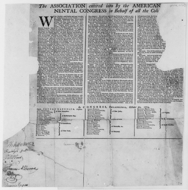
Sherman was the only person to sign all four of the great state papers of the United States – the Continental Association, an agreement adopted by the First Continental Congress on October 20th of 1774 in Philadelphia…

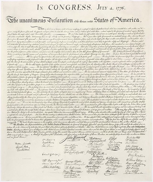
…the Declaration of Independence, on July 4th of 1776 at the Second Continental Congress in Philadelphia…

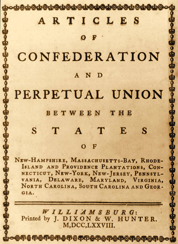
…the Articles of Confederation and Perpetual Union, an agreement signed by the thirteen original states as its first frame of government, also during the Second Continental Congress, on November 17th of 1777…

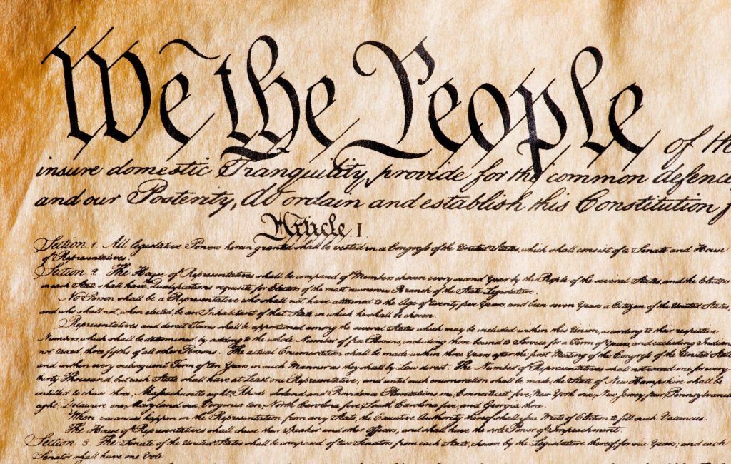
…and the Constitution on June 21st of 1788, the Supreme Law of the United States.


Sherman was born in Newton, Massachusetts, in April of 1721, where he received his early education in grammar school and his father’s library.

He spent time learning the shoemaker’s trade when he was young.

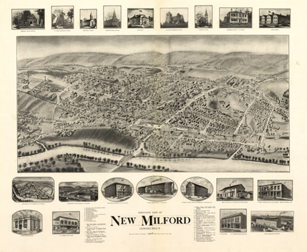
Then after his father’s death in 1743, Roger Sherman and his family moved to New Milford, Connecticut, where he and his brother opened the town’s first store.

He rapidly became one of the town’s leading citizens, becoming involved in civil and religious affairs.

Though Sherman had no formal training in the law, he was encouraged to read for the bar exam, and admitted to the bar in Litchfield, Connecticut, in 1754.

From 1755 to 1758 and 1760 to 1761, he was chosen to represent New Milford in the Connecticut House of Representatives.

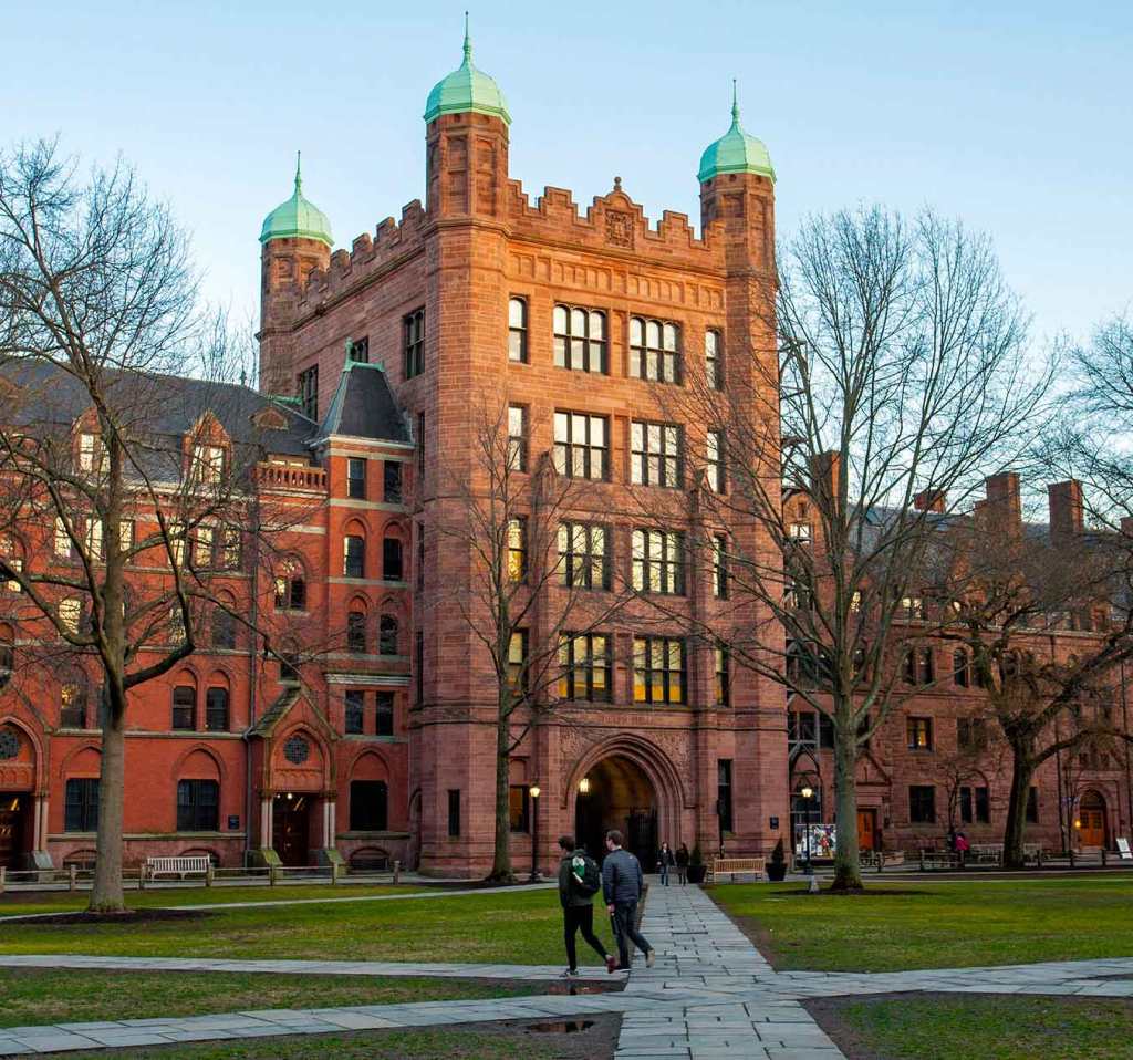
Sherman was appointed as the Treasurer of Yale College, and awarded an honorary Master of Arts degree.

Sherman was elected Mayor of New Haven in 1784, he was Mayor until his death in 1793.

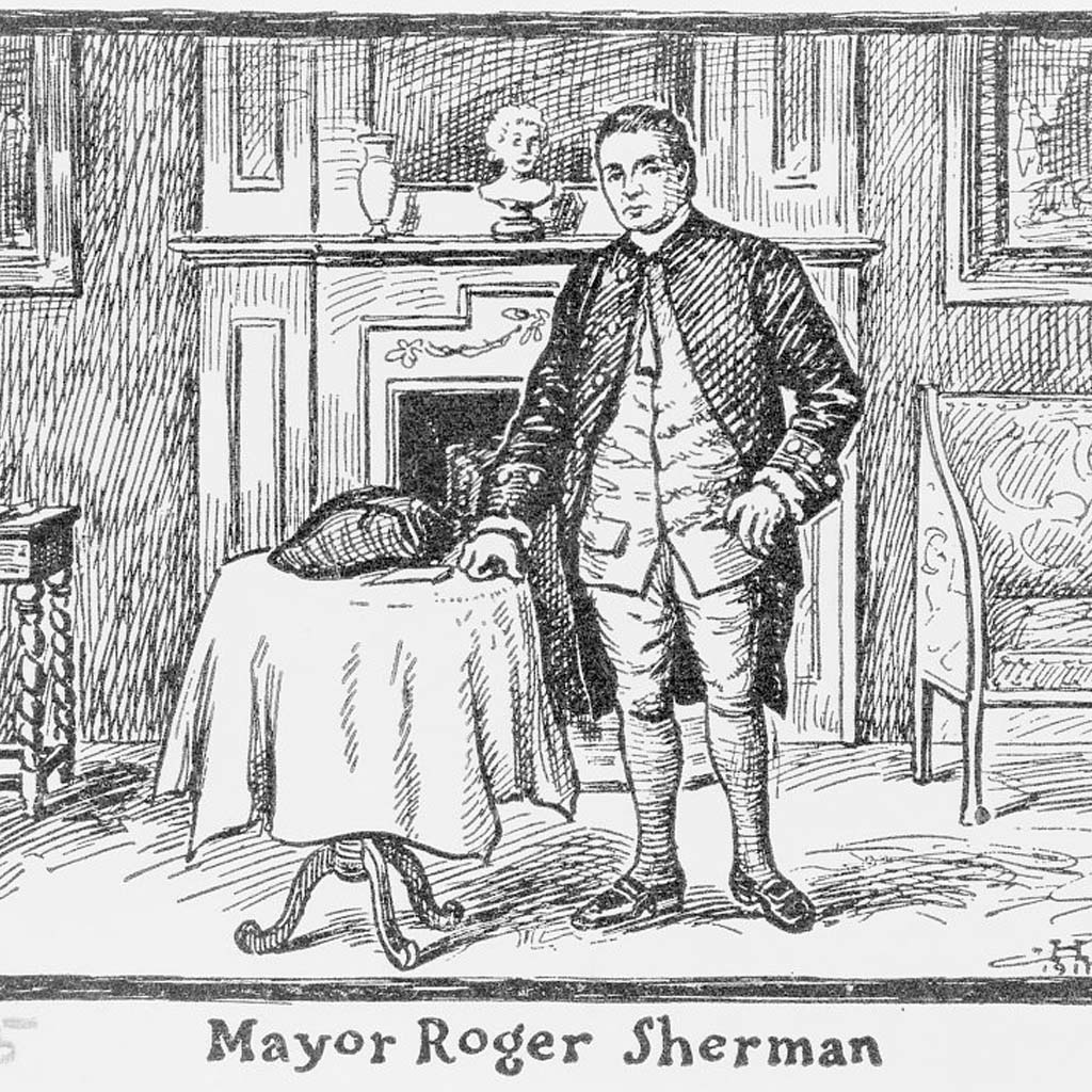
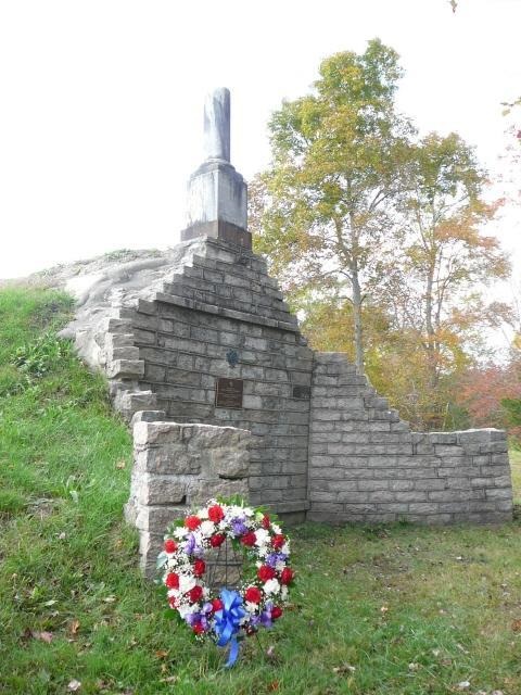
Sherman died in July of Typhoid fever 1793, and was first buried in the New Haven Green.

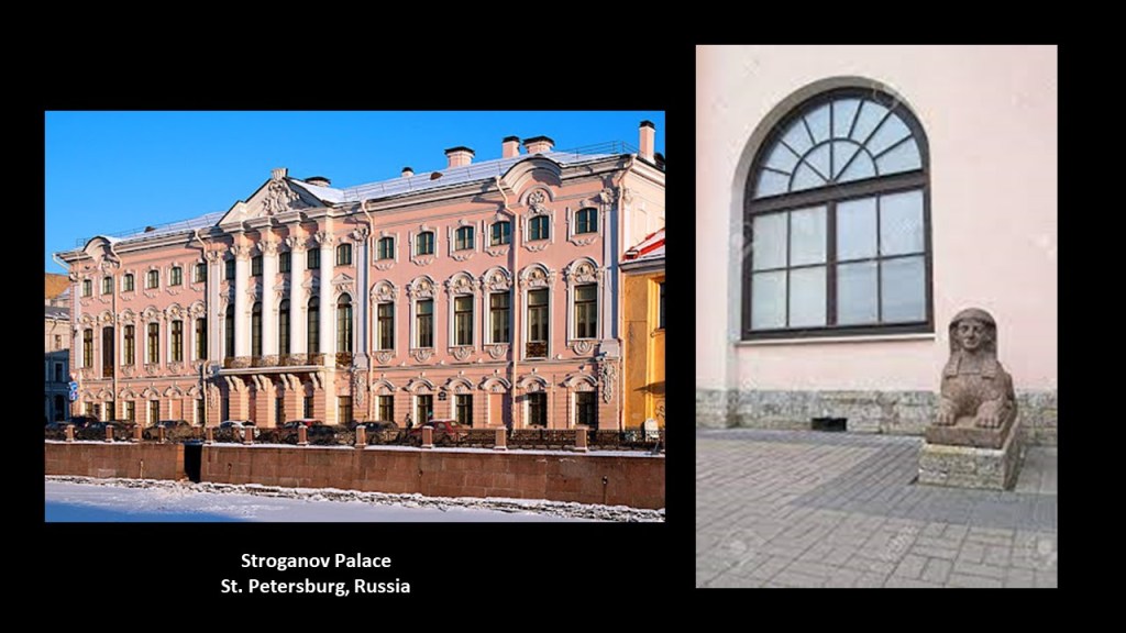
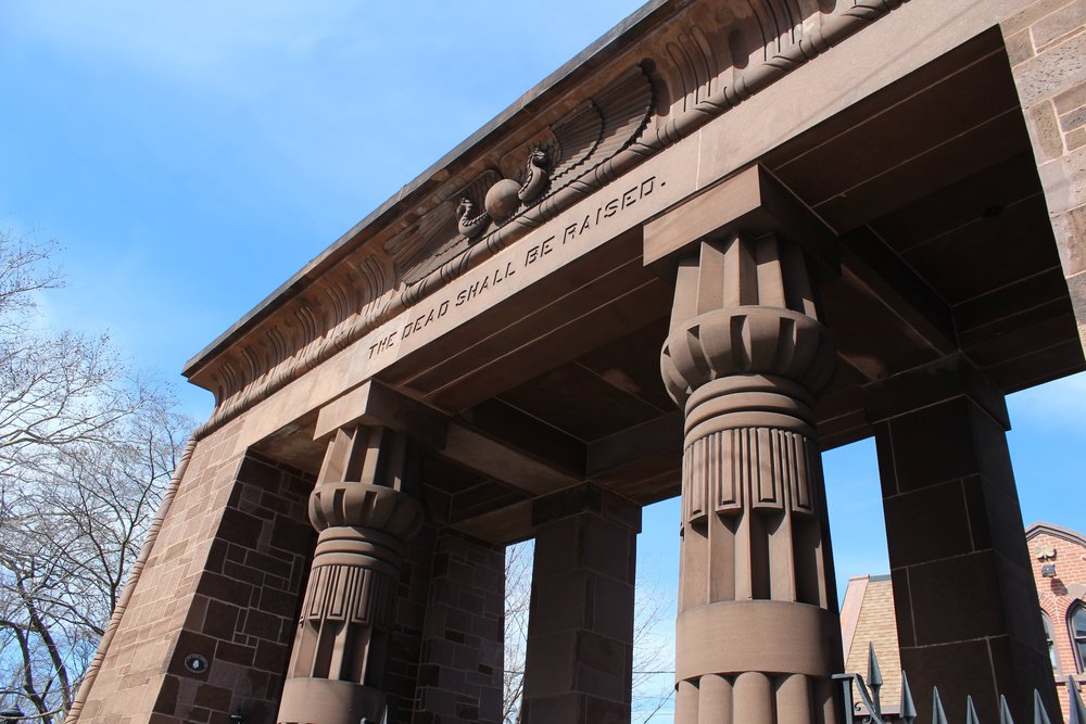
In 1821, Sherman’s remains were relocated to the Grove Street Cemetery.

Hmmm…the symbolism appears to be Egyptian in this photo of the entrance to the Grove Street Cemetery!

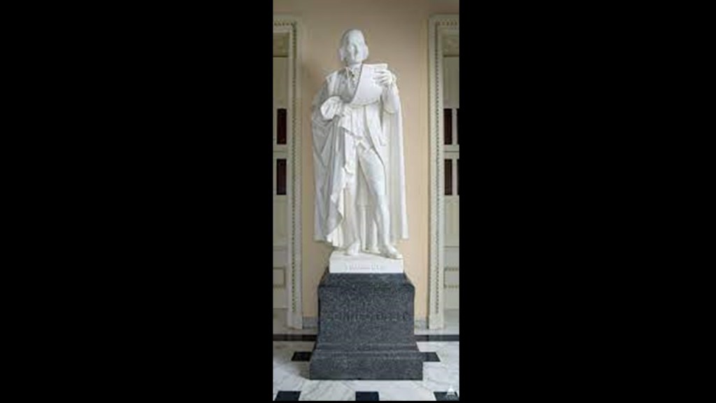
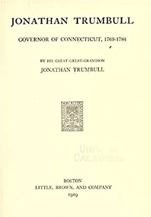
The other statue for Connecticut is that of Jonathan Trumbull, an American politician and statesman who served as Governor of Connecticut from October 10th of 1776 to May 13th of 1784, and was one of two governors to have served for a British Colony and an American State, the other being Nicholas Cooke of Rhode Island.

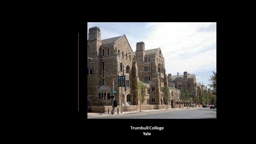
Trumbull College at Yale was named after him…

…as well as Trumbull, Connecticut…

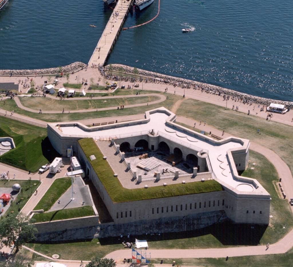
…and Fort Trumbull, near the mouth of the Thames River on Long Island Sound in New London, Connecticut, with the present fortification said to have been built between 1839 and 1852.

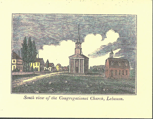
Jonathan Trumbull was born in Lebanon, Connecticut in 1710.

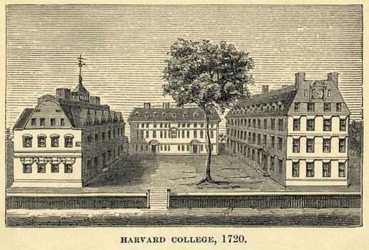
He graduated with his Bachelor of Arts degree from Harvard College in 1727.

He became a merchant with his father in 1731, and then from 1733 to 1740, he was a delegate to the Connecticut General Assembly, and Speaker of the House from 1739 to 1740.

He became the Governor of Connecticut in 1769 upon the death of Governor William Pitkin, for whom he was Deputy Governor from 1766 – 1769.

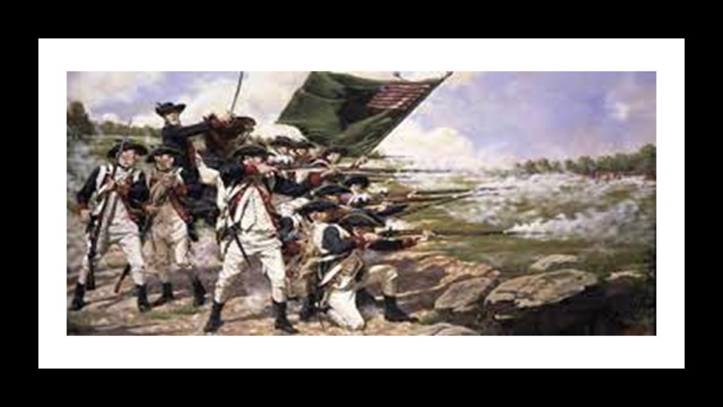
Trumbull was a friend and advisor of General George Washington during the Revolutionary War, and served as the Continental Army’s Paymaster General (Northern Department) in the spring of 1778.

In addition to continuing on as Governor of Connecticut until 1784, Trumbull was elected to the American Academy of Arts and Sciences in 1782…

…and elected as an honorary member of the Connecticut Society of the Cincinnati in 1784, a fraternal, hereditary society founded in 1783 to commemorate the American Revolutionary War.

He died in 1785 in Lebanon, Connecticut, and is buried in the old cemetery there.

The last state I am going to look at in this post is Delaware, represented by John M. Clayton and Caesar Rodney.

John M. Clayton was a lawyer and politician from Delaware.

A member of the Whig Party, he served in the Delaware General Assembly, and was a U. S. Senator from Delaware and U. S. Secretary of State.

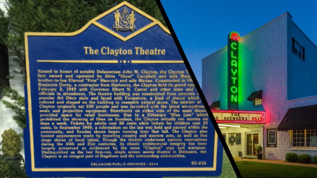
John M. Clayton was born in Dagsboro, Delaware in 1796, where the Clayton Theater that was named after him is located today, the last-remaining, first-run, single-theater in the State of Delaware.

Clayton studied in Berlin, Maryland…

…and Milford, Delaware, places his parents moved to when he was a young man.

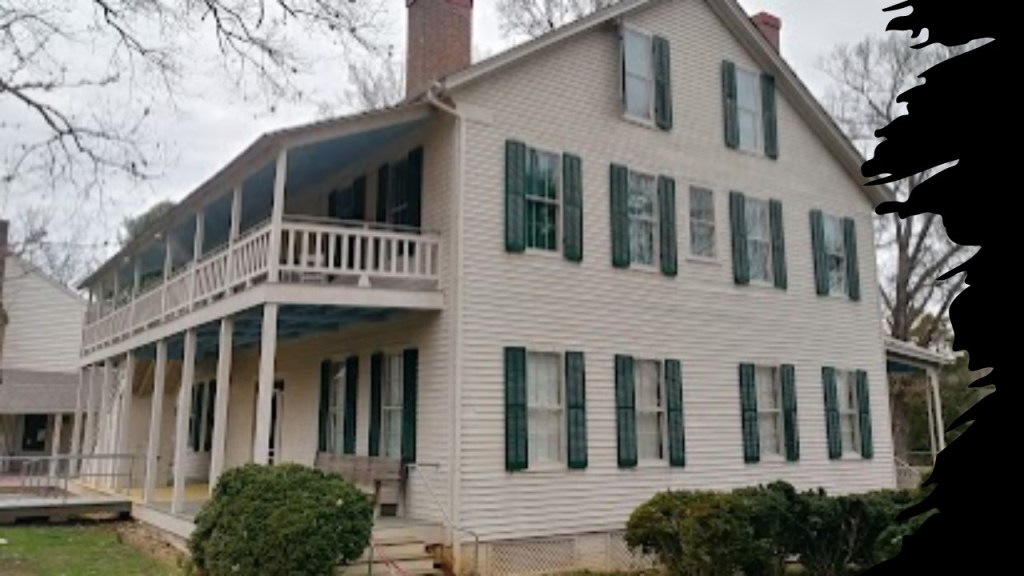
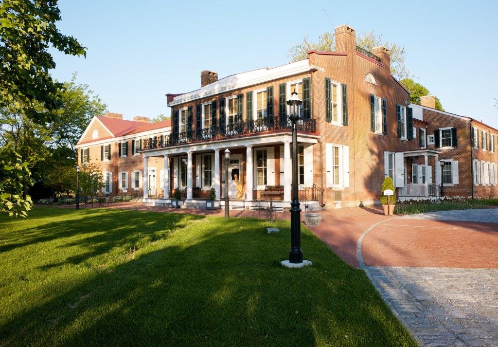
His boyhood home was what is known today as the Parson Thorne Mansion in Milford, which has on the National Register of Historic Places since 1971.

It was said to have been built between 1730 and 1735.

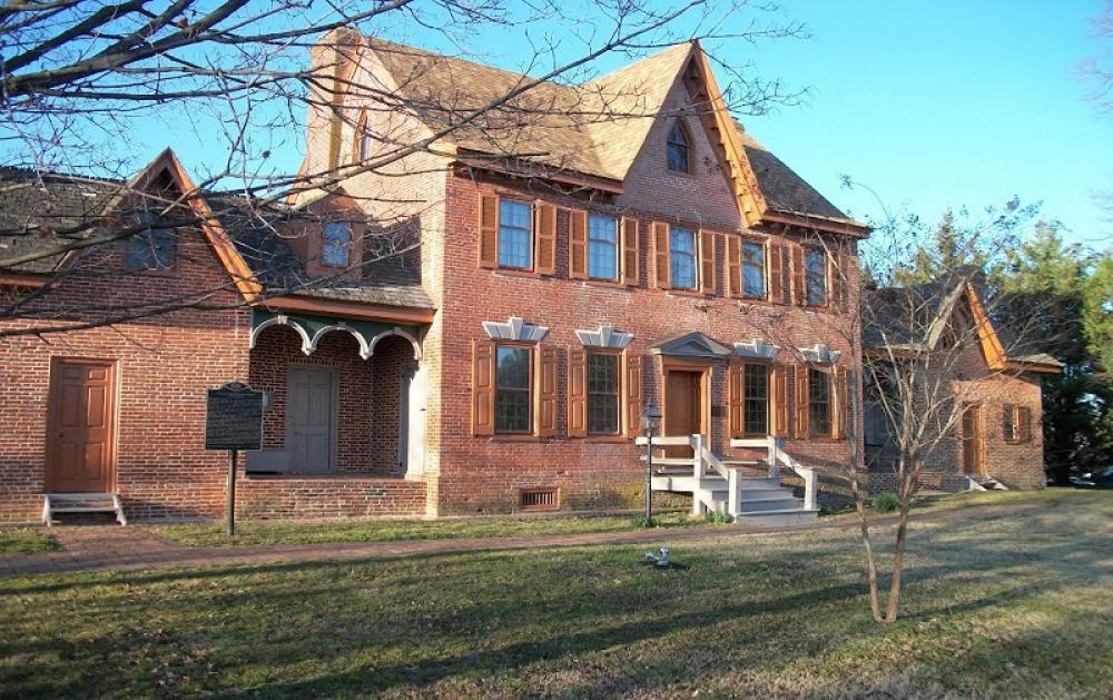
Clayton graduated from Yale in 1815, and studied law at the Litchfield Law School in Litchfield, Connecticut, the first independent law school established in America for reading law…

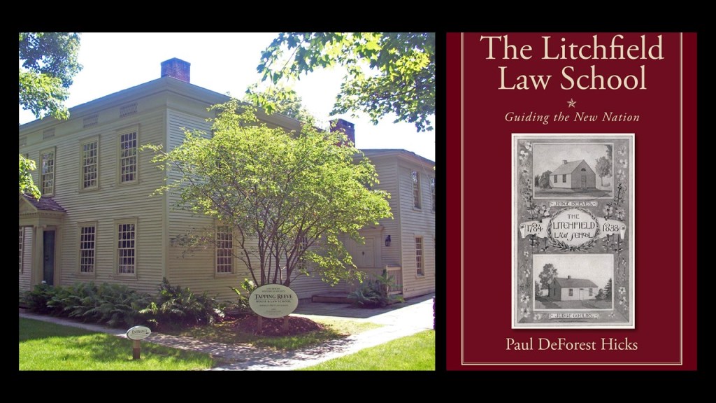
The Litchfield Law School was founded by lawyer, educator and judge Tapping Reeve, and it was a proprietary school that was unaffiliated with any college or university.

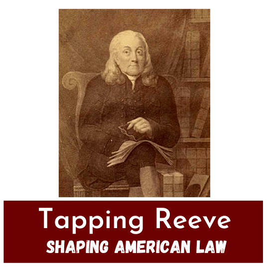
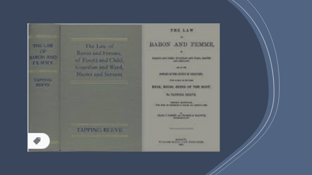
Tapping Reeve later became Chief Justice of the Connecticut Supreme Court in 1814, and his book “Law of Baron and Femme” published in 1816 became the premiere American treatise on family law for much of the 19th-century, with revisions and republication in 1846, 1867 and 1888.

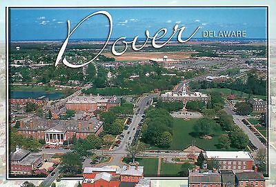
John M. Clayton started his own law practice in the state capital of Dover in 1819.

Clayton built a mansion on land he started cultivating in 1844 near New Castle, Delaware, and named it Buena Vista.

It became one of the most productive estates in this region.

It was also listed on the National Register of Historic Places in 1971.

Clayton first entered Delaware politics in 1824 when he was elected to the Delaware House of Representatives.

He was appointed Delaware Secretary of State from December of 1826 to October of 1828.

He was a conservative who became leader of the faction that lead to the development of the Delaware Whig Party, a party which promoted traditional conservatism in the U. S. in the middle of the 19th-century.

Clayton was first elected to the U. S. Senate in 1829, where he served until 1836.

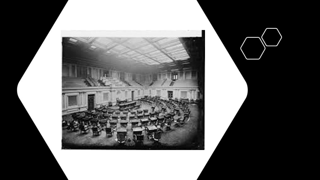
Clayton served as Chief Justice of the Delaware Supreme Court from January of 1837 to September of 1839, and served another term in the Senate from 1845 to 1849.

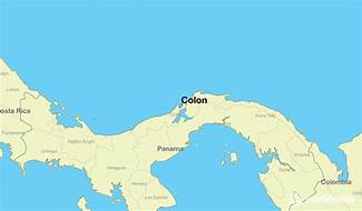
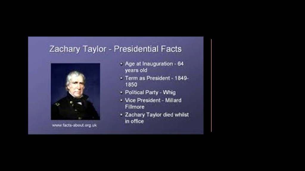
Then on March 8th of 1849, Clayton became the U. S. Secretary of State inthe administration of President Zachary Taylor, where his most notable accomplishment was the negotiation of the Clayton-Bulwer Treaty of 1850 with the British Minister Sir Henry Bulwer-Lytton, guaranteeing the neutrality and encouragement of lines of passage across the isthmus at Panama.

Clayton’s tenure as Secretary of State was short because President Zachary Taylor died a short time into his administration.

Zachary Taylor was elected president in 1849, and he died in July of 1850, allegedly after consuming copious amounts of raw fruit and iced milk at a July 4th fundraising event at the Washington Monument, became severely ill with a digestive ailment, and died several days later.

Clayton was elected to the U. S. Senate one-more time in 1853 and served until his death in 1856.

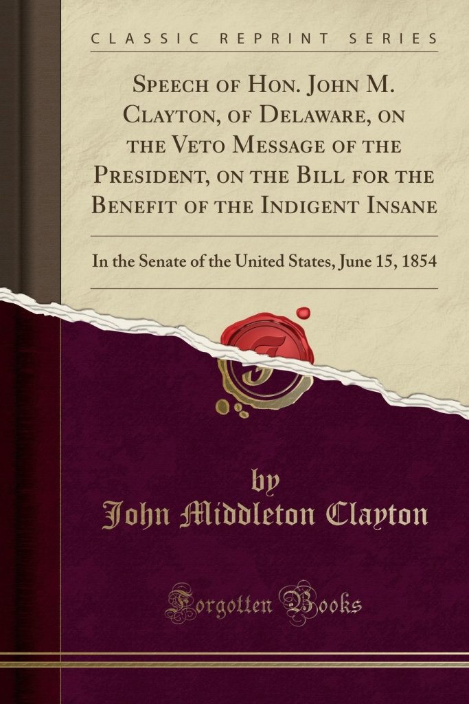
In one of his notable speeches during this time, delivered on June 15th of 1854, he spoke against President Franklin Pierce’s veto of the Bill for the Benefit of the Indigent Insane, which would have ceded public lands for the benefit of the “insane, blind, deaf, and dumb” with proceeds going to the states to build and maintain asylums.

The bill remained vetoed by the president, which established a precedent for federal non-participation in welfare that lasted over 70-years.

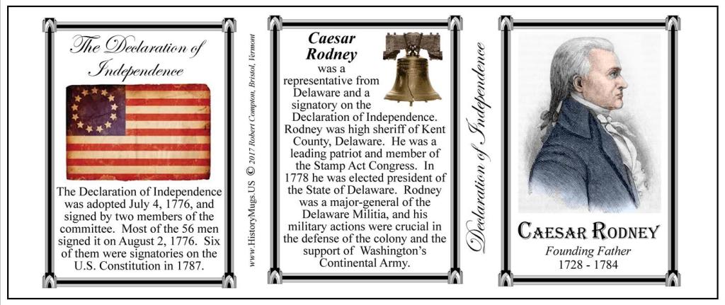
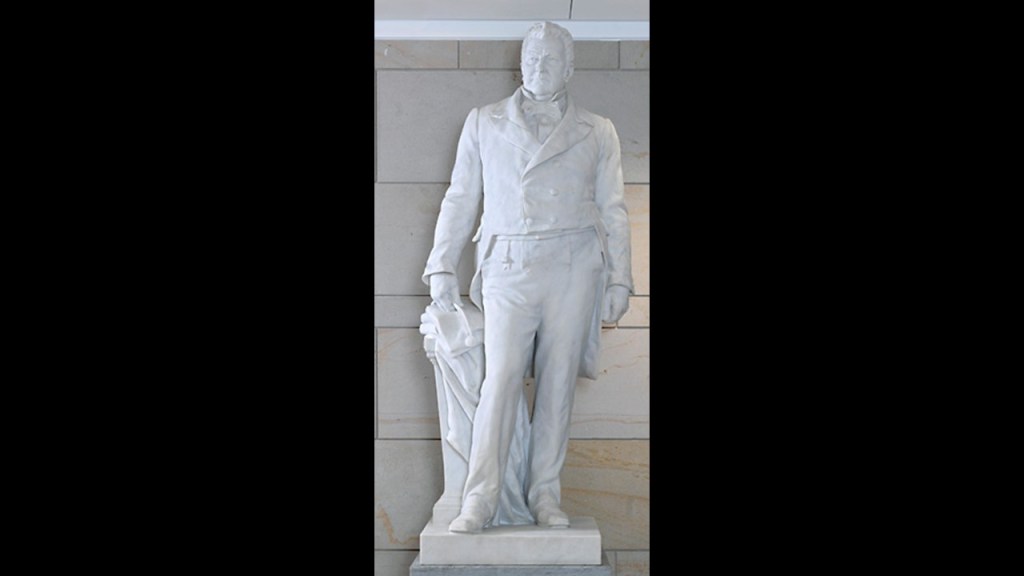
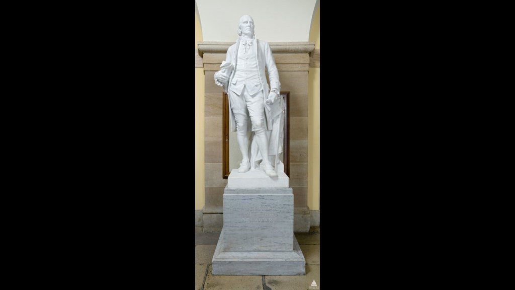
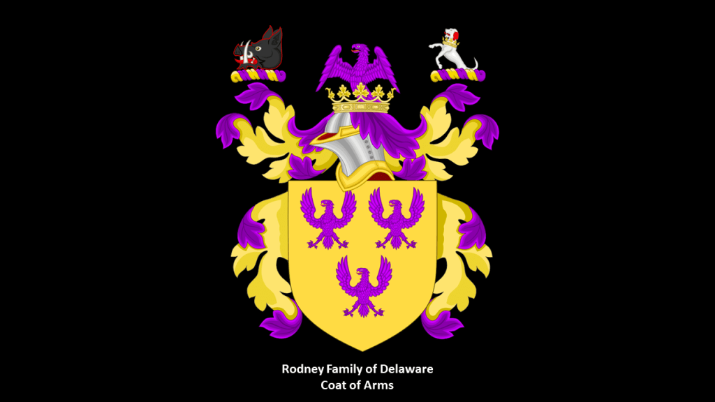
Caesar Rodney is represented by Delaware’s other statue.

He was an American Founding Father, lawyer and politician, and like Connecticut’s Roger Sherman, was a signer of the 1774 Continental Association and the 1776 Declaration of Independence, and the President of Delaware from 1778 to 1781 during the American Revolution.

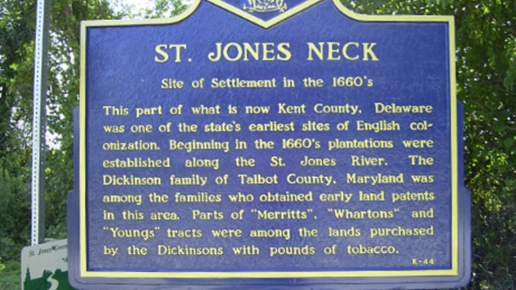
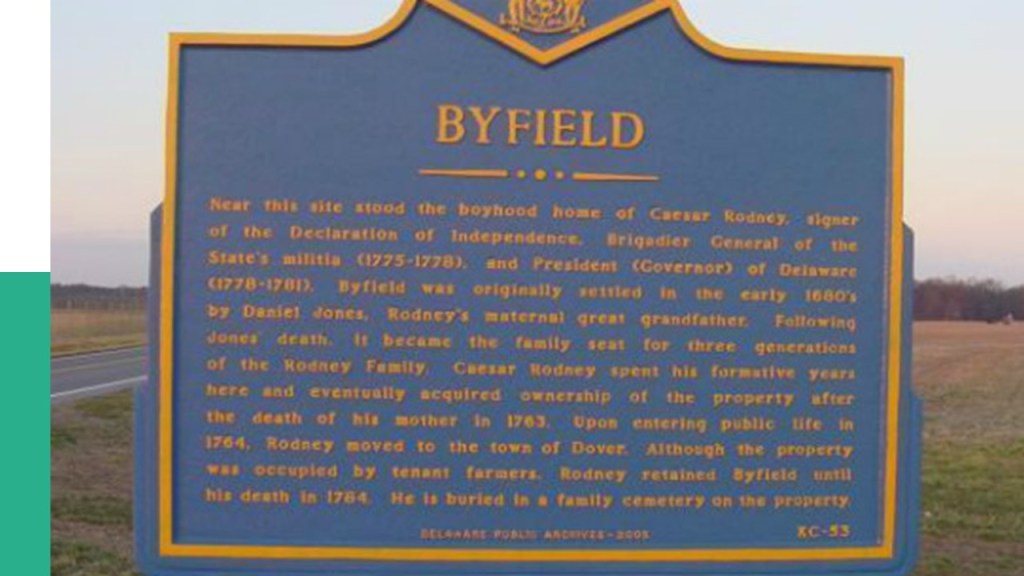
Rodney was born in 1728 in St. Jones Neck in Dover Hundred, Kent County, Delaware.

Caesar Rodney was the grandson of William Rodney, who had emigrated to the American Colonies in 1681 to 1682, along with William Penn, who founded the Pennsylvania Colony.

The Rodneys were considered prosperous members of the local gentry.

Byfield, the 849-acre farm that Caesar Rodney was born on, earned sufficient income from the sale of wheat and barley to the Philadelphia and West Indies markets to provide cash and available time that allowed the family members to participate in the social and political life of Kent County.

For schooling, Rodney attended the Latin School and the College of Philadelphia (now known as the University of Philadelphia) until his father’s death in 1746.

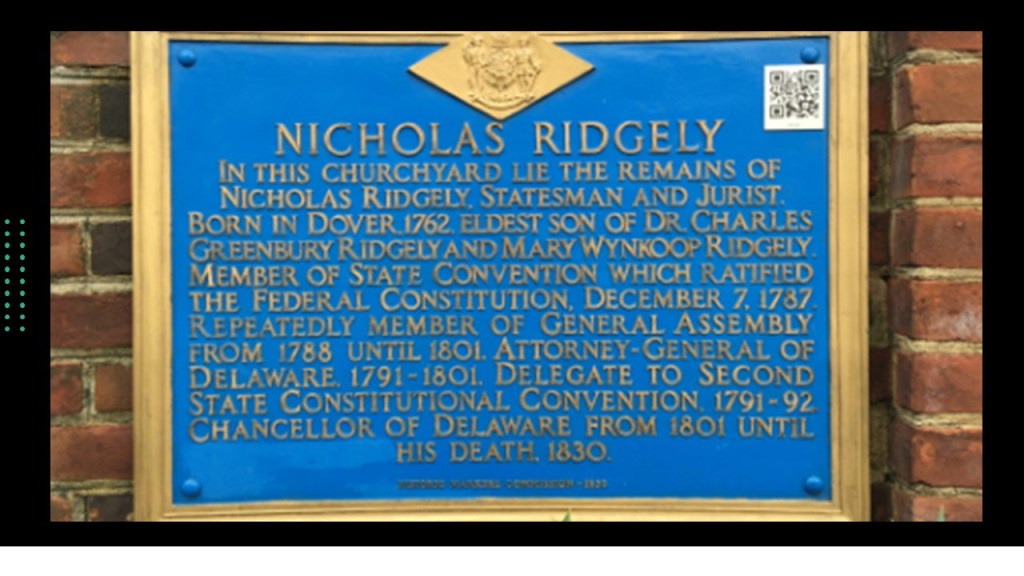
Upon his father’s death, Rodney’s guardianship was entrusted to Delaware Supreme Court Justice Nicholas Ridgely by the Delaware Orphan’s Court.

When Caesar Rodney was 27, he was elected to Sheriff of Kent County and served in that position for three-years, and subsequently served in a series of positions including Register of Wills; Recorder of Deeds; Clerk of the Orphan’s Court; Justice of the Peace and judge in the lower courts.

Rodney was a delegate to the Continental Congress between 1774 and 1776, and a leader in the Delaware Committee of Correspondence, and was present when the Delaware Assembly voted to sever all ties with the British Parliament and King.

As mentioned previously, he was a signer of both the Continental Association and Declaration of Independence.

He became the “President of Delaware” in March of 1778 and served in that position until November of 1781 during the American Revolutionary War.

In the later years of his life, Caesar Rodney was afflicted with facial cancer, for which experienced expensive and painful medical treatments that did not work, and was the cause of his death in 1784.

I am going to end this part of the series on the National Statuary Hall, and in the next part will be looking at the statues representing the states of Florida, Georgia, Hawaii, and Idaho.

Who is Represented in the National Statuary Hall at the U. S. Capitol? – Part 1 Alabama, Alaska, Arizona & Arkansas

There is a chamber called the National Statuary Hall in the U. S. Capitol building in Washington, DC, that houses sculptures of prominent Americans, two for each state.

My attention was drawn to it because I encountered to historical figures in my research who are represented in the statuary hall – Father Eusebio Kino, a Jesuit Missionary and Cattle rancher, for Arizona, and Mother Joseph Pariseau, a Catholic sister and self-taught architect, for Washington State, and these two made me go hmmm, and I wondered who else was chosen to be represented there and what could possibly be going on here.

These two people represent the State of Alabama – Helen Keller and Joseph Wheeler.

Helen Keller lost her sight and hearing after becoming ill at the age of 19-months.

Helen Keller was born in West Tuscumbia, Alabama, in 1880 at a home still standing today called “Ivy Green.”

Tuscumbia is the county seat of Colbert County.

Tuscumbia was the traditional territory of the Chickasaw people, one of the Five Civilized Tribes of the southeastern United States that were relocated by the U. S. Government to the Oklahoma Territory during the 1830s.

Until the age of 7, Helen communicated by home signs until she met her teacher and life-long companion Ann Sullivan, who taught her how to speak, read, and write.

Helen Keller graduated from Harvard’s Ratcliffe College, and went on to become an author, disability rights advocate political activist, author and lecturer.

And did you know…Helen Keller was a socialist, and described as radical?

I sure didn’t!

Joseph Wheeler was a military commander and politician from Alabama.

He was a Confederate Cavalry general during the Civil War, and a General in the U. S. Army in the Spanish-American and Philippine-American War.

He served as a Congressman for Alabama in the U. S. House of Representatives between the end of the American Civil War (1865) and the beginning of the Spanish-American War (1898).

Joseph Wheeler attended West Point starting in 1854, and was commissioned as an officer in 1859.

He joined the Confederate Army in March of 1861 in Georgia, and first assigned to Fort Barrancas in Pensacola, Florida.

Then in September of 1861, he took command of the 19th Alabama Infantry Regiment in Huntsville, Alabama, and was promoted to Colonel.

As a Civil War commander, Wheeler was involved in historical events like the following.

On April 6th – 7th of 1862, the 19th Alabama Infantry fought in the Battle of Shiloh in southwestern Tennessee.

It was one of the bloodiest battles of the Civil War, and resulted in a Union victory.

The 19th Alabama Infantry Regiment was also involved in the Siege of Corinth in Mississippi that same April and May.

After the Civil War, Wheeler got married, and became an attorney and planter in at his home, called Pond Spring, in an area called Wheeler, Alabama, today.

He was first elected in 1880 as a Democrat from Alabama to the U. S. House of Representatives, and was re-elected 7 times.

During the time he was in office, he was said to strive to heal the breach between the North and the South.

This was Wheeler’s residence when he lived in Washington, DC, at 1730 New Hampshire Avenue NW, a condominium today.

Wheeler volunteered for the Spanish-American War in 1898 at the age of 61 and was appointed as “Major General of the Volunteers” by President William McKinley.

He led the 1st Division through the Siege of Santiago, the last major operation of the Spanish-American War.

This war led to the U. S. becoming dominant in the Caribbean, and to the U. S. acquiring Spain’s Pacific possessions – the Philippines; Palau; the Marianas; the Carolines; the Marshall Islands; parts of Taiwan; parts of Sulawesi and the Moluccas in Indonesia.

The acquisition of the Philippines at the end of the Spanish-American War with the Treaty of Paris led directly to the Philippine-American War between February 4th of 1899 to July 2nd of 1902. Rather than granting the newly declared Philippine Republic the independence it sought, the United States subdued any Filipinos who resisted.

Particularly known for its brutality, at the end of the war, the Philippines became an occupied Territory of the United States and not an independent nation.

Wheeler was re-commissioned as a Brigadier General in the Army during this time, and finally retired in 1900.

Wheeler died after a long illness in 1906, and is one of the few Confederate officers to be buried in Arlington Cemetery.

Bob Bartlett and Ernest Gruening represent the State of Alaska.

Bob Bartlett was a Democratic politician, and a key fighter for Alaska Statehood.

Born in Seattle in 1904, he was raised in Washington State.

He graduated from the University of Alaska Fairbanks in 1925, and lived in Alaska for the rest of his life.

He was a reporter for the Fairbanks newspaper for many years, and entered the political arena when he became secretary for a year to Anthony Dimond, the Alaska Territory delegate to the U. S. House of Representatives in Washington, DC.

In January of 1939, President Franklin Roosevelt appointed Bartlett as Secretary of the Alaska Territory, a position which he served in until 1944.

Bartlett was elected to Congress in 1945 after Dimond’s retirement, and was re-elected six more times.

He introduced the Alaska Statehood Act to the House that was signed by President Dwight D. Eisenhower in July of 1958, with Alaska becoming the 49th State on January 3rd of 1959.

At that time, Bartlett became the senior Senator from Alaska, and served in that capacity until his death in 1968.

Ernest Gruening was also a journalist and politician.

Gruening was born in New York City in 1887 to German-immigrant parents.

Deciding it was more exciting than medicine, he became a journalist after graduating from Harvard Medical School, and worked for various newspapers in Boston and New York.

From 1920 to 1923, he was the editor of “The Nation,” a politically progressive magazine that is the oldest continuously published magazine in the United States.

Gruening switched careers from journalism to politics in 1933, when he was appointed as a delegate to the 7th International Conference of American States, an international organization for cooperation on trade.

Then, Gruening was Director of the Division of Territories and Island Possessions of the Department of the Interior between 1934 and 1939, which was established by President Franklin D. Roosevelt in 1934.

The Division of Territories and Island Possessions served as a mediator between the territories and Federal government by performing administrative activities for the territorial government and taking on colonization projects that furthered the interests of the U. S. in those areas.

In 1936, the Division was assigned responsibilities for territorial responsibilities in Alaska, including the Alaska Railroad project, the Alaska Road Commission, and jurisdiction over the Hawaiian Islands and the U. S. Virgin Islands.

During the time that Gruening was the Director of this Division, he was Administrator of the Puerto Rico Reconstruction Administration from 1935 to 1937…

…and a member of the Alaska Highway Commission from 1938 to 1942.

Gruening was appointed Governor of the Territory of Alaska in 1939, and served in that position for 13 1/2-years.

Along with Bob Bartlett, Ernest Gruening served as one of Alaska’s inaugural state senators, from January 3rd of 1959, until January 3rd of 1969.

Gruening died in 1974.

The State of Arizona is represented by statues of Father Eusebio Kino and Sen. Barry Goldwater in the Statuary Hall.

We are told that Father Kino was a Jesuit, missionary, geographer, explorer, cartographer, and astronomer, who was born in northern Italy, and spent the last 24-years of his life in modern-day Sonora in Mexico and southern Arizona in the United States…

…in what was then part of the Viceroyalty of New Spain known as the Pimeria Alta, or “Upper Pima Land.”

From the moment he arrived in Pimeria Alta, he started to lead expeditions across northern Mexico, California and Arizona, following ancient trade routes, establishing missions and making maps of the region along the way.

We are told that Father Kino was important to the economic growth of the area, teaching the natives of the area to farm and raise cattle, sheep, and goats, and this his initial mission herd of 20 imported cattle grew to 70,000.

The Kino Heritage Society in Tucson is currently working on the process of getting him canonized as a saint.

Tributes to Father Kino include, besides various towns, streets, schools, monuments and geographic features being named after him:

A statue in the U. S. Capitol Building’s Statuary Hall Collection…

…the Wesley Bolin Memorial Plaza across from the Arizona State Capital building in Phoenix…

…which has a time capsule in the base placed there in 1967, and to be opened in the year 2235…

…and in 1963, Father Kino was inducted into the Hall of Great Westerners at the National Cowboy & Western Heritage Museum in Oklahoma City.

Also, interesting to note I know of at least one language, German, where the word “kino” means “movie theater.”

Barry Goldwater was born in Phoenix in what was then the Arizona Territory in 1909, the son of Baron Goldwater and Hattie Josephine “Jojo” Williams.

His paternal grandfather, Michel Goldwasser, was a Polish-Jew who emigrated to London following the Revolutions of 1848, a series of political upheavals throughout Europe that year.

The Revolutions had the aim of removing the old monarchical structures and creating independent nation-states, and was the most widespread revolutionary wave in Europe’s history, with 50 countries being affected.

His paternal grandfather changed his named to Michael Goldwater in London and married Sarah Nathan, a member of the Great Synagogue of London, a center of Ashkenazi Jewish life in the city.

The Great Synagogue of London was destroyed during the Blitz in World War II.

Barry Goldwater’s grandparents emigrated from London to America, first arriving in San Francisco, and then settling in Phoenix, where his grandfather Michael founded Goldwater’s Department Store, an upscale department store which was taken over and expanded by his sons Henry, Morris, and Baron, Barry’s father.

Barry Goldwater’s mother, “Jojo” Williams came from an established New England Family that included theologian Roger Williams of Rhode Island. Interestingly, Roger Williams is represented as one of the two statues for Rhode Island in the National Statuary Hall. More on him later.

Barry was raised in his mother’s Episcopalian faith.

Barry didn’t do well his freshman year in high school, so his parents sent him to the Staunton Military Academy in Virginia, where he excelled, and graduated from in 1928.

He subsequently enrolled in the University of Arizona, and dropped out after one year.

When his father Baron died in 1930, Barry entered the family department store business.

Then, when the United States entered World War II, Barry Goldwater was commissioned as a reserve officer in the United States Air Force, and trained as a pilot.

He served as a pilot with the Ferry Command, a newly formed unit that flew aircraft and supplies to war zones around the world.

Following World War II, Goldwater remained in the Army Air Reserve at the rank of Colonel, and founded the Arizona Air National Guard.

He was also a leading proponent of the creation of the United States Air Force Academy, which was established in Colorado Springs in 1954.

Barry Goldwater entered Phoenix politics in 1949, when he was elected to the City Council, and in 1952, running as a Republican, narrowly won a seat in the United States Senate for the first time in an upset victory against veteran Democrat and Senate Majority Leader Ernest McFarland.

In the 1964 Presidential election, Barry Goldwater unsuccessfully ran on the Republican ticket against incumbent Democratic President, Lyndon B. Johnson, who had become President upon John F. Kennedy’s assassination as his Vice-President in November of 1963.

Barry Goldwater served in the U. S. Senate from January 3rd of 1969 through January 3rd of 1987, at which time he retired, after serving as Chair of the Senate’s Intelligence and Armed Services Committees.

He died in 1998, and was perhaps best-known as being a shaper and designer of the American Conservative Movement, from the late 1950s to 1964.

The statue of Barry Goldwater as a representative of the State of Arizona in the National Statuary Hall was unveiled in 2015.

The State of Arkansas has been represented for some time by James Paul Clarke and Uriah M. Rose, though in 2019, the Arkansas State Assembly and Governor decided to replace these two men with statues of Johnny Cash and Daisy Gatson Bates at some point in time.

James Paul Clarke was a United States Senator and the 18th-Governor of Arkansas.

Clarke was born in Yazoo City, Mississippi, in 1854, and raised by his mother after his father died when he was 7.

He attended public and private schools, and graduated from the University of Virginia in 1878 with a law degree.

He practiced law in Helena, Arkansas, the location of Fort Curtis, which was said to have been built in 1862 during the American Civil War as a command post for the Union Army since it was centrally-located on the Mississippi River, and there was a civil war battle here in 1863.

Clarke served as a member of the Arkansas House of Representatives from 1886 to 1888; a member of the Arkansas Senate from 1888 to 1892; Arkansas Attorney General from 1892 to 1894; and Governor of Arkansas from 1895 to 1897.

After leaving state office, he moved to Little Rock, and practiced law.

He was elected to the U. S. Senate in 1903, and served there until he died in 1916.

The given reason given for replacing his statue were racist beliefs he held.

Uriah Milton Rose was the other statue representating Arkansas.

Rose was considered the “most scholarly lawyer in America,” and “one of the leading legal lights of the nation.”

Rose was born on a farm in Kentucky in 1834.

His father was a doctor, and Rose was tutored up until the time his father died, at which time the children were thrown off the estate because of the debts of the father, and Rose ended up working as a field hand.

His fortune changed when he met a lawyer while he was working on the farm, Rutherford Harrison Roundtree, who subsequently hired him as a deputy county clerk, and gave him a home in Lebanon, Kentucky.

Rose entered Transylvania University in Lexington, Kentucky, to advance his legal education, and graduated in six-months in 1853.

He married Margaret Gibbs shortly thereafter, and moved with his new wife and brother-in-law, William Gibbs, to Batesville, Arkansas, where he set up his first law practice with his brother-in-law.

In 1860, Rose was appointed Chancellor of Pulaski County, a county judge with statewide jurisdiction since it was the only one in the State at the time, a position which he held until Union Forces captured the state capital, Little Rock, on September 1st of 1863.

LIttle Rock is the county seat of Pulaski County.

He refused to swear allegience to the Federal government, as he supported the Confederacy, and subsequently moved to Washington, Arkansas, with the pro-Confederate Arkansas government following the fall of Little Rock.

Washington was an important stop on the Southwest Trail, the primary passageway for American settlers for heading to Texas.

With the end of the Confederacy at the end of the American Civil War in 1865, Rose and family moved to Little Rock, where he set up a law partnership.

He was the founding delegate from Arkansas when the American Bar Association was established in Saratoga Springs, New York, in 1878, of which he was twice president, from 1891 to 1892 and 1901 to 1902.

He never entered politics.

His statue has been in the National Statuary Hall representing Arkansas since 1917, and the given reasons for wanting to replace his statue is his lack of name recognition today, and that his time has faded.

At some point in time, the statues of James Paul Clarke and Uriah M. Rose will be replaced by statues of music icon Johnny Cash and civil rights activist Daisy Gatson Bates.

I am going to end this post here in Arkansas, and turn the National Statuary Hall into a series since I have a long ways to go yet.

Parallels Between North & South, Wars and Electromagnetism

I am going to give you examples of parallels I have found in my research in this video between civil wars in the world between the North and the South, and concepts of electromagnetism, and how I think these parallels relate to what has actually taken place here.

To start with, I have many questions about what was really going on during the American Civil War, and have come to the conclusion that while something was going on during that period of time, it was not what we have been told.

Historically described as a civil war between the northern and Pacific states, known as the “Union,” or “North,” and the southern states, known as the “Confederacy,” or South, over the status of slavery and its expansion into newly acquired land after the Mexican-American War.

I did an in-depth study of Sanitary Fairs awhile back, which were world’s-fair-style fundraisers held during the course of the American Civil War with a stated purpose of raising money for the United States Sanitary Commission and its mission of supporting the sick and wounded soldiers of the Union Army.

Sanitary Fairs typically held large-scale exhibitions, and the 1863 Northwestern Soldiers Fair in Chicago, for example, featured a “Curiosity Shop” of war souvenirs, with weapons and other artifacts said to have been designed to contrast the barbaric southern enemy with the civilized North.

These were the Civil War battles said to have taken place during the same period of time as the Northwestern Soldiers Fair:

Another example was the Great Central Fair in Philadelphia in 1864.

Said to have raised more than $1,000,000 for the United States Sanitary Commission in its 3-week run from June 7th to June 28th of 1864, in its final form, the fair was said to have around 100 departments, including Arms and Trophies; children’s clothing; homemade fancy articles; Fine Arts; brewers; wax fruit; trimmings and lingerie; umbrellas and canes; curiosities and relics; a steam glass blower; an Art Gallery; and a horticulture exhibit.

And these were the Civil War Battles said to have taken place during the same period of time as the Great Central Fair.

Does it even make sense to hold big, festive events like these in the middle of a war?

Did the U. S. Sanitary Commission and its volunteers really have the wherewithal to both construct the buildings for and pull off these extraordinarily lavish and festive undertakings against the backdrop of national war and suffering?

Or was it a private front comprised of the very same people who organized it and were prominent members of the private membership clubs of the day, like the Union League and the Century Association, to set up the new historical narrative for the reset to explain, among other things, how infrastructure came into, and left, existence.

Now, I am going to bring forward several examples of the same North-South dichomoty being used in the 20th-century to create division, discord, violence, and war being used in the 20th-century.

Ireland was partitioned on May 3rd of 1921, when the government of the United Kingdom of Great Britain and Ireland divided Ireland into two home rule territories – Northern Ireland and Southern Ireland – with the stated goal of remaining within the United Kingdom and eventually reunifying.

This image has an empty alt attribute; its file name is d4b0b-partition-of-ireland.jpeg

Northern Ireland remained part of the United Kingdom, but after the Anglo-Irish Treaty of December of 1921, Southern Ireland dropped out of the United Kingdom and became the Irish Free State.

The partition of Ireland took place during the Irish War of Independence, a guerilla conflict between the Irish Republican Army and British Army forces.

Between 1920 and 1922, during which time the Partition occurred, there was violence in Northern Ireland in defense or opposition to the new settlement, and its capital Belfast saw savage and unprecedented violent riots between Protestant and Catholic civilians, a form of violence in which the violent parties feel solidarity for their respective groups and victims of violence are chosen based on their group membership.

All of this led directly to the”Troubles” a period of unrest and violence that escalated across Northern Ireland between the Irish Catholic Nationalists and Irish Protestant Unionists between 1969 and 1998.

Next is the example of North and South Korea.

After the August 15th surrender of Japan in 1945, the Korean peninsula was divided at the 38th-parallel into two zones of occupation, with the Soviets administering the northern half, and Americans the southern half.

In 1948, as a result of Cold War tensions, the occupation zones became two sovereign states – socialist North Korea and capitalist South Korea.

The governments of the two new Korean states both claimed to be the only legitimate Korean government, and neither accepted the border as permanent.

The Korean War started in 1950, when North Korea invaded South Korea on June 25th following clashes along the border and insurrections in the South.

North Korea was supported by China and the Soviet Union, and South Korea by the United Nations, principally from the United States.

This image has an empty alt attribute; its file name is 65c6f-korean-war.jpg

The Korean War was one of the most destructive conflicts of modern times, with around 3,000,000 deaths due to the war, and proportionally, a larger civilian death toll than either World War II or the Viet Nam War; caused the destruction of nearly all of Korea’s major cities; and there were thousands of massacres on both sides.

This image has an empty alt attribute; its file name is ad041-korean-war-destruction.jpg

Same idea with the example of North and South Viet Nam.

The Geneva Conference was convened in 1954 in Geneva, Switzerland, to settle unresolved issues from the Korean War and the First Indochina War in Viet Nam, and attended by representatives from the United States, France, the United Kingdom, the Soviet Union, and the People’s Republic of China, as well as from Korea and Viet Nam.

While no declarations or proposals were adopted with regards to Korean situation, the Geneva Accords that dealt with the dismantling of French Indochina in Southeast Asia would have major ramifications.

This image has an empty alt attribute; its file name is e5244-1954-geneva-conference-1.jpg

The Geneva Accords established North and South Vietnam with the 17th parallel as the dividing line, with North Viet Nam being Communist and South Viet Nam being Capitalist.

This image has an empty alt attribute; its file name is 4d01a-1954-geneva-accords.jpg

The agreement also stipulates that elections are to be held within two years to unify Vietnam under a single democratic government.

These elections never happen.

The non-Communist puppet government set up by the French in South Viet Nam refused to sign.

The United States also refused to sign on, with the belief that national elections would result in an overwhelming victory for the communist Ho Chi Minh who had so decisively defeated the French colonialists.

Within a year, the United States helped establish a new, anti-Communist government in South Viet Nam, and began giving it financial and military assistance.

A mass migration took place after Viet Nam was divided.

Estimates of upwards of 3 million people left communist North Viet Nam for South Vietnam, going into refugee status in their own country, and many were assisted by the United States Navy during Operation Passage to Freedom.

An estimated 52,000 people moved from South to North Viet Nam, mostly Viet Minh members and their families.

This image has an empty alt attribute; its file name is d1a4e-passage-to-freedom.jpg

In Viet Nam by the time of John F. Kennedy’s death in November of 1963, there were 16,000 American military personnel, and the Gulf of Tonkin incident took place in 1964, an international confrontation after which the United States engaged more directly in the Viet Nam War.

The first Gulf of Tonkin incident took place on August 2nd of 1964 between ships of North Viet Nam and the United States.

The description of what took place is as follows:

Three North Vietnamese torpedo boats approached the naval destroyer U. S. S. Maddox and attacked it with torpedos and machine gun fire.

Damages said to have come about as a result of the ensuing battle were: one U. S. aircraft; all three North Vietnamese torpedo boats and 4 North Vietnamese deaths; and one bullet hole on the naval destroyer, and no American deaths.

This image has an empty alt attribute; its file name is 68b98-gulf-of-tonkin-warfare.jpg

There was initially allegedly a second incident on August 4th of 1964, this second occurrence has long been said not to have taken place.

And then there are the people who believe the first Gulf of Tonkin incident never happened either.

Whether or not the Gulf of Tonkin incidents actually happened, they were used as an excuse for the Gulf of Tonkin Resolution passed by Congress on August 7th of 1964, giving President Lyndon B. Johnson authority to help any Southeast Asian country whose government was considered to be in jeopardy of Communist aggression, and was considered the legal justification for the beginning of open warfare with North Viet Nam and the deployment of American troops to Southeast Asia, of which, with the institution of the draft, there were over 500,000 troops sent by 1966.

This image has an empty alt attribute; its file name is 77863-gulf-of-tonkin-resolution.jpg

The Viet Nam War ended with the Fall of Saigon on April 30th of 1975, when the capital of South Viet Nam was captured by North Vietnamese troops…

…and the beginning of the re-unification of Viet Nam into the Socialist Republic of Viet Nam.

Here are more examples I have found of this practice of dividing a country into north and south, which then created the conditions for instability and civil war.

One example is the country of Sudan.

When Sudan was granted independence from its British colonizers in 1956, it was immediately divided into north and south, with each region characterized by different belief systems and loyalties, and Sudan promptly descended into violent civil war that lasted for decades.

The history of Sudan goes back to the Pharaonic period of ancient Egypt, with the Kingdom of Kerma in ancient Nubia (dated from 2500 to 1500 BC)…

This image has an empty alt attribute; its file name is 2abb0-kingdom-of-kerma.jpg

…the Egyptian New Kingdom dated between 1500 BC and 1070 BC…

…and the Kingdom of Kush, dated from 785 BC to 350 AD, with its royal capital at Meroe, located on the Nile River where it flows through northeast Sudan in northeastern Africa.

This image has an empty alt attribute; its file name is f3341-meroe-sudan-1.jpeg

The same exact process happened in Sudan’s neighboring country of Chad.

There have been roughly three Civil Wars in Chad since independence from France in 1960. 

The first one started in 1965 and lasted until 1979, and was waged by rebel factions against the authoritarian and corrupt regime of Chadian President Francois Tombalbaye.

Chad Civil War

At the time of Chad’s independence from France in 1960, roughly half of the population was Muslim and lived in the north and eastern parts of the country, and the other half was Christian and animist and lived in the southern part of the country.

Apparently, President Tombalbaye was from the southern part of the country, granting favors to his political supporters in the South while at the same time marginalizing the rest of the country.

He also filled prisons with thousands of people he believed were his opponents, whether they really were or not.

Tension and discontent grew, and several opposition groups started to organize a resistance movement.

Initially, Tombalbaye’s military crushed civilian demonstrations in 1962, and he relied heavily on French support to maintain power.

The Chadian Civil War officially started with the Mangalme, or Mubi, Uprising in September and October of 1965, involving a series of riots that started after a tax increase on personal income, which was tripled in certain areas.

Local citizens accused the government of corruption and tax collection abuses.

The military was sent in and crushed the riots, killing approximately 500 people.

Thus began the 14-year-long first Chadian Civil War.

Tombalbaye was eventually killed in coup in 1975, and was replaced by the former commander of the national army, Felix Malloum.

Malloum was a southerner with strong kinship ties to the North, who thought he could reconcile Chad’s divisions.

In the summer of 1977, rebels under the command of Goukouni Oueddei and supported by Libya, launched an offensive from the northern part of the country, and was the first time modern Soviet military equipment came into the Civil War, forcing Malloum to ask for help from France.

After the 1977 Khartoum Peace agreement, two Chadian northern military leaders, Hissene Habre and Goukouni Oueddei, came together in order to oust the southern government of Felix Malloum on March 23rd of 1979.

Then, Goukouni Oueddei seized power later that year, and became President of the Transitional Government of National Unity, composed of northerners supported by different factions that were close to Habre.

This state-of-affairs triggered the Second Chadian Civil War between 1979 and 1986.

Chad in the modern-day is one of the poorest countries in the world, with most of its inhabitants living in poverty as subsistence herders and farmers.

Oh, it is also interesting to note that Chad has sizeable reserves of crude oil, which is the country’s primary source of export earnings.

On May 22nd of 1990, leaders of the Yemen Arab Republic (North) and People’s Democratic Republic (South) of Yemen announce unification as the Republic of Yemen.

The history behind this, which is important to understanding what has taken place in Yemen since then, is that following the collapse of the Ottoman Empire in 1918, at the end of World War I, when the former Ottoman Empire was divided between the countries on the “winning” side of the war…

…northern Yemen became an independent state known as the Kingdom of Yemen.

Then on September 27th of 1962, revolutionaries deposed the newly-installed, last King of Yemen, Muhammad al-Badr, and formed the Yemen Arab Republic, which was said to have been inspired by the Arab Nationalist Ideology of Nasser’s Egyptian United Arab Republic…

…and this action started the North Yemen Civil War from 1962 to 1970 between supporters of the Kingdom, which included Saudi Arabia and Jordan, and supporters of the Yemen Arab Republic, which included Egypt.

By the end of the North Yemen Civil War, the supporters of the Kingdom were defeated, and the Yemen Arab Republic was recognized by Saudi Arabia in 1970.

The People’s Democratic Republic of Yemen was known as the Aden Protectorate in 1918, which it had been known as since 1874 with the creation of the British Colony of Aden and the Aden Protectorate, which consisted of 2/3rds of present-day Yemen.

The Aden Protectorate existed until 1963, when it was merged with the new Federation of South Arabia.

By 1967, the Federation of South Arabia had merged with the Protectorate of South Arabia, and later changed its named to the People’s Republic of Southern Yemen, becoming a Marxist-Leninist state in 1969, the only Communist state to be established in the Arab World.

With the 1990 reunification of Yemen into the Republic of Yemen, the new government was comprised of officials from both sides, with a de facto form of collaborative governance, until the country into Civil War in 1994.

It is interesting to note that the terms North and South are also applied to the poles of magnets.

A magnet is any object that produces its own magnetic field that interacts with other magnetic fields.

The magnetic field is represented by what are called field lines that start at a magnet’s north pole and end at the south pole.

As shown in the top diagram, if you put the north pole of one magnet against the south pole of another, the field lines go straight from the north pole of the first magnet to the south pole of the other, creating an attractive force between the two magnets.

If you have two magnets next to each other, and either their north poles or south poles are facing each as shown in the bottom diagram, the field lines move away from each other, creating a repelling force between the two magnets.

Electricity runs within us, where our cells are specialized to conduct electrical currents, which is required for the nervous system to send signals throughout the body and to the brain, making it possible for us to move, think, and feel.

…and we each generate our own magnetic fields as does the Earth, as well as the other life on Earth.

There is so much more to us than our physical forms.

Electromagnetism is an integral part of existence on Earth and throughout the Universe, which is the physical interaction that occurs between electrically-charged particles, the force of which is carried by electromagnetic fields composed of electrical fields and magnetic fields.

I bring this subject of magnetism and electromagnetism into the picture because of how they appear to have been deliberately applied negatively by the controllers to create the conditions necessary for war, destruction and suffering in this realm, by dividing people of the same countries into north and south, and then by instilling different belief systems in each pole of this magnet, which created an “attraction,” or perhaps “action” is a better word, to facilitate the destruction of each other.

This process of deliberately creating divisions and then causing wars certainly has not been used for the betterment of Humanity, and seems more like a form of the many ways the Controllers have been harvesting our energy for their agendas.

They even have told us the names of their agendas.

You know, like Agenda 21.

They are required to tell us what they are doing, only they make it sound positive.

Agenda 21 is the action plan of the United Nations with regard to sustainable development.

Sounds good, right?

It is really about depopulation of 90% of the world’s people, though fact-checkers will tell you that this is a wild conspiracy theory.

Same thing with the Georgia Guidestones. They made the verbiage sound positive…but it really isn’t…it really isn’t!

Welcome to the Great Awakening!

The Modern Mining of Earth

Earth is definitely being mined on a massive scale.

I will give you examples of mining activities I have come across in my research, primarily in tracking places in alignment with each other.

The following examples are representative of what is out there to find with regards to what these mining operations look like, and the resulting devastation and degradation that comes along with it.

I am going to start with examples of phosphate mining.

Phosphates are derived from phosphorus, and phosphates are used in the production of phosphate fertilizer; calcium phosphate nutritional supplements for animals; and used to make chemicals for use in industry.

This image has an empty alt attribute; its file name is uses-of-phosphates-1.jpg

Also, it is important to note that white phosphorus is used in making bombs and other incendiary munitions.

I found this example in Kiribati, an island nation in the central Pacific Ocean.

Kiribati was rich in phosphates historically, but commercially viable phosphate deposits have long-been depleted through mining.

This was an historical picture of what the island of Banaba, the furthest west island in Kiribati, looked like before, and after, it was mined for phosphates.

This image has an empty alt attribute; its file name is Banaba-before-and-after.jpg

For 80-years, what became known as the British Phosphate Commission in 1919 – from the Pacific Phosphate Company which started phosphate mining there in 1900 – exploded ,bulldozed, and crunched Banaba for its phosphate, which was then exported to Australia to feed Australia’s crops and livestock.

The British Mining Commission also managed the extraction of phosphate from Nauru and Christmas Island.

Nauru was part of German New Guinea, which was part of the German Colonial empire, and existed from 1884 to 1919.

The Germans purchased the Marshall Islands from Spain in 1885, and the Caroline Islands, Palau, and the Marianas Islands from the Spanish in 1899.

In 1888, the Germans annexed the island of Nauru to the Marshall Islands protectorate.

Following Germany’s defeat in World War I, Germany was first to give up all of its territorial assets around the world, including the island of Nauru, which then went under a joint-trusteeship of the United Kingdom, Australia, and New Zealand.

In 1919, the three trustees signed the Nauru island agreement, which entitled them to the phosphate of Nauru through the British Phosphate Commission.

Today, Nauru is the third smallest country in the world after Vatican City and Monaco.

Interestingly, at one time the island Republic of Nauru had was the second-richest nation in the world by GDP per capita from the mining of its phosphate reserves.

The island’s phosphate reserves were exhausted in the 1990s, and it has become a tax haven and money-laundering center to earn income.

The British Phosphate Commission also operated on Christmas Island.

Christmas Island is located southwest of Singapore and northwest of Australia in the Indian Ocean.

According to our historical narrative, it received its name from Captain of the “Royal Mary”, William Mynors of the British East India Company, because he sailed past it on December 25th of 1643.

Phosphate was discovered on Christmas Island by Scottish naturalist Sir John Murray.

Murray had a strong interest in coral reefs and sought the assistance of the British admiralty to get specimens.

He received specimens from Christmas Island in 1887 that contained calcium phosphate, and he urged the British government to annex what was described as an uninhabited island, which it formally annexed in 1900, and the island was administered from Singapore.

In February of 1891, Murray and George Clunies-Ross, who established a settlement on the island, were granted a 99-year-lease by the British government to exploit the mineral and timber resources, which they then transferred to their Christmas Island Phosphate Company.

Indentured labor to mine the phosphate was brought in from Singapore, Malaya, and China.

Japan occupied the island during World War II.

Christmas Island became an Australian-territory in 1958.

Next, I am going to look at phosphate mining in the Western Sahara.

Western Sahara is a disputed territory, and classified as a non-self-governing territory by the United Nations.

It is claimed by, and de facto administered by Morocco, in on-going dispute with the native inhabitants, the Sahrawis, who want self-governance.

Vast phosphate deposits are mined at Bu Craa, southeast of Laayoune, the capital of Western Sahara, where abundant, pure phosphate deposits lie near the surface.

For over 40-years, a Moroccan state-owned company has exported phosphate from the Western Sahara region.

It produces about 2.5 million tons of phosphates each year.

Aided by the longest conveyor belt in the world, which travels 61-miles, or 98-kilometers, phosphates are shipped from Bu Craa to Laayoune…

…where massive ships transport it around the world.

Now, I will cover different kinds of mining operations I have encountered in my research.

In South American, I encountered the Orinoco Mining Arc in Venezuela.

The Orinoco Mining Arc and other areas in Venezuela have the 2nd-highest gold reserves in the world, and 32 certified gold fields.

Interesting to note the state of affairs in Venezuela today from having been the wealthiest country in South America not that long ago.

In Colombia, there is a considerable amount of gold-mining in and around Zaragoza..

For one, the El Limon Mine near Zaragoza is a high-grade gold mine and mill…

…but the area surrounding Zaragoza has four other gold mines, three of which are active.

The El Silencio mine was in production for over 150-years, and is no longer being mined.

Also, Colombia has the largest coal-resource-base in South America, and is a major coal player globally.

With reserve estimates ranging between twelve- and 60-billion tons, Colombia exports more than 90% of its production annually, making it the world’s 5th-largest coal exporter.

Colon in Panama, a city and seaport located beside the Caribbean Sea, near the Atlantic entrance to the Panama Canal, has mining operations nearby.

Here are two examples of mining operations in this part of Panama.

The Cerro Petaquilla Mill in Colon is a surface-mining operation, with copper as its primary commodity, and gold, molybdenum and silver as secondary outputs.

The Molejon Gold Project was west of Colon, and located close to the Caribbean coast.

It was said to have produced 100,000 ounces of high-grade gold annually from 2010 until its closure in 2015.

When the mining company that developed the project completely abandoned it in 2015, it left behind workers with unpaid wages and environmental issues unfixed.

Now on to mining examples in other parts of the world.

First stop, Sweden.

There are two iron ore mines in Lapland, in northern Sweden.

One is Kiruna, the largest and most modern underground iron ore mine in the world.

It first opened in 1898.

Iron ore is also mined at Gallivare in northern Sweden.

The Iron Ore Line, a 247-mile, or 398-kilometer, long railway connects Kiruna and Gallivare to Narvik.

The Iron Ore Line opened in 1888.

The iron ore of the Kiruna and Gallivare mines was an important factor in the European theater of World War II, with both sides seeking to have control of northern Sweden’s mining district.

I found the Grib Diamond Mine in Archangelsk Oblast, one of the largest diamond mines in Russia and in the world, but this map marks other diamond deposits in eastern Russia as well.

The Grib Dimond Mine has estimated reserves of 98.5 million carats of diamonds, and annual production capacity of 3.62 million carats.

This map shows the locations of Soviet forced labor camps of the Gulag.

Most of them served mining, timber and construction works.

The Gulag was a system of forced labor camps established during Stalin’s dicatorship from the 1920s until the mid-1950s.

An estimated 15 – to 18-million people passed through these brutal hard-labor camps, with an estimated 1.5-million deaths as a result of the camps.

The majority of Gulag prisoners were innocent people locked up for a broad variety of political reasons, held alongside criminal prisoners.

The Yamal Peninsula has been in the news in recent years because of the appearance of huge sinkholes, starting with one that appeared in 2014.  By 2015, five more had developed.

Learning about the appearance of sink holes here is where I first heard about this place.

Makes me wonder if the ground underneath it has been mined?

Norilsk is the world’s northernmost city with a population of more than 100,000, with permanent inhabitants at 175,000, and the second-largest city inside the Arctic Circle.

The official founding date of Norilsk is 1935, and then it was expanded as a settlement for the Norilsk mining-metallurgic complex, and then subsequently became the center of the Norillag system of Gulag forced-labor camps, which existed from June of 1935 to August of 1956.

On May 29th of 2020, the largest oil spill in modern Russian history took place in Norilsk, when about 22,000 tons, or 21,000-cubic-meters, of diesel fuel spilled out of a storage tank. The spill was blamed on permafrost, and contaminated 135-square-miles, or 35-square-kilometers, for which the company paid a $2-billion fine.

Also, the smelting of the nickel ore is directly responsible for severe pollution, typically coming in the form of acid rain or smog, and some estimate the 1% of the world’s sulphur dioxide emission comes from Norilsk’s nickel mines.

I found the Kupol gold and silver mine on the Chukchi Peninsula, the easternmost peninsula of Asia.

The mine is situated over the Kayemraveem ore belt, which contains both high-quality gold and silver.

The mineral deposits are estimated to hold 4.4 million ounces of gold and 54.2 million ounces of silver, on top of 1.72 million inferred ounces of gold, and 22.2 million inferred ounces of silver.

Moving along to North America, Nome on the western coast of Alaska was incorporated in April of 1901, and at one time was the most populous city in Alaska.

The story goes that gold was discovered on Anvil Creek there in 1898 by “three lucky Swedes.”

News of the discovery was said to have reached the outside world that winter, and that by 1899, Nome had a population of 10,000 people and the same year, the area was first organized as the “Nome Mining District.”

Also in 1899, gold was found in the beach sands for dozens of miles along the coast at Nome, spurring the stampede to new heights.

Charles D. Lane, a millionaire mine owner, was recognized as a founder of Nome.

He was born in Palmyra, Missouri, in 1840, and moved to California with his father in 1852.

He got involved in the mining industry, developing successful mines in Idaho, California, and Arizona, before hearing of the first gold strike in Nome in 1898.

Gold mining has been a major source of employment and revenue for Nome on through to the present day.

Gold was discovered in Anchorage, Alaska, in the 1880s, and was said to have turned the region into a mining area overnight.

Over the following years, several mines were established in the area producing hundreds of thousands of ounces of gold, with Anchorage becoming an active gold mining center.

Juneau, the capital city of Alaska, is located in the Gastineau Channel…

…and the Alaskan Panhandle, the southeastern portion of Alaska, bordered to the east by the northern part of British Columbia.

Juneau is unique as a state capital for not having roads connecting it to the rest of the state. All transportation-related activities are by air and sea only.

Vehicles are transported to Juneau by barge or the Alaska Marine Highway Ferry System, which serves communities in Southeast Alaska with no road access, and also transport people and freight.

The city is said to be named after a gold prospector from Quebec named Joe Juneau.

What we are told is that after the California Gold Rush, miners migrated up the Pacific coast in search of other gold deposits.

In 1880, mining engineer George Pilz from Sitka, which was formerly under Russian rule, offered a reward to any local native Alaskan who could lead him to gold-bearing ore.

Pilz received information that prompted him to direct prospectors Joe Juneau and Richard Harris to the Gastineau Channel to Snow Slide Gulch at the head of Gold Creek, where they found nuggets as big as “peas and beans.”

Shortly thereafter a mining camp sprang up, and shortly after that, so many people came looking for gold, that the camp became a village.

This is said to be a photo of Juneau in 1887.

Major mining operations in the Juneau Mining District prior to World War II included the Treadwill Mine, owned and operated by a man named John Treadwell, southeast of Juneau on Douglas Island.

In its time, it was the largest hard-rock gold mine in the world, employing 2,000 people, and producing over 3-million Troy ounces of gold between 1881 and 1922.

The Klondike Gold Rush was a migration by an estimated 100,000 prospectors to the Klondike region of northern Yukon between 1896 and 1899.

Same kind of story as the other places I have mentioned – as soon as word about the discovery of gold in the Klondike reached Seattle and San Francisco, it triggered a stampede of prospectors, immortalized in photos like this of the long-line waiting to cross the Chilkoot Pass, a high-mountain pass between the Boundary Ranges of the Coast Mountains between Alaska and British Columbia.

The Minto Mine is an open-pit copper and gold mine located 149-miles, or 240-kilometers, north of Whitehorse, beginning production in 2007…

…and there are numerous mining claims in the Yukon Territory as well.

The Peace River Region of which Dawson Creek is a part has an extensive coal-mining industry, centered in the municipality of Tumbler Ridge.

There are at least five major mining projects here, with the Murray River Mine developed starting in 2017 as an underground metallurgical coal mine.

Edmonton, the capital city of the Province of Alberta, is North America’s northernmost metropolitan area, with a population over 1-million.

Known as the “Gateway to the North,” Edmonton is the staging area for large-scale oil sands projects in northern Alberta…

…and large-scale diamond-mining operations in the Northwest Territories.

The Athabasca Basin in Saskatchewan is best known for its substantial uranium deposits.

Manitoba is also home to several active mines.

The area has high-grade zinc and copper deposits in what is called a VMS, or “Volcanogenic Massive Sulphide” deposit.

Manitoba also produces 100% of Canada’s cesium, lithium, and tantalum, minerals used in such things as electronics, specialized batteries, and jet engine components.

Sudbury, officially Greater Sudbury, is the largest city in Northern Ontario.

Nickel, and copper ore was discovered in Sudbury in 1883, the same year as its founding, during the construction of the transcontinental railway.

The Jesuits also arrived here in 1883, and established the Sainte-Ann-des-Pins Mission.

The Murray Mine, where there was a high concentration of nickel-copper ore, was said to have been the first mine established, also in 1883, with its discovery credited to a blacksmith in the railway construction gang.

It was mined during different periods of time between 1883 and 1971.

In its history, Sudbury has been a major world leader in nickel mining.

Mining and mining-related industries dominated the economy here for much of the 20th-century, and has expanded to emerge as the major retail, economic, health, and educational center for northeastern Ontario.

I have also looked into mining in the state of Vermont

For one, gold prospecting has been happening in Vermont since the “Vermont Gold Rush” of the 19th-century.

A San Francisco 49er-miner named Matthew Kennedy discovered gold at Buffalo Creek in Plymouth, Vermont, and by 1855, a gold rush was underway in Plymouth and nearby Bridgewater, both of which are close to Rutland, of the Rutland and Burlington Railroad.

We are told the exact same thing happened in Vermont that we are told about the other gold rushes: one person found gold, then another, and soon people were swarming to the brooks and rivers of Vermont with dreams of getting rich.

Apparently each year, more gold is revealed from erosion all over the state, with the most well-known site still being Buffalo Creek near Plymouth, where the whole thing was said to have started.

Also in Vermont, starting in the early 19th-century, high-quality marble deposits were found in Rutland, and in the 1830s, a large-deposit of nearly solid marble was found in West Rutland.

We are told that by the 1840s, small firms had begun excavations, but that marble quarries proved profitable only after the arrival of the railroad in 1851.

Marble is a type of limestone used as a stone building material since antiquity, like in the Pantheon in Rome pictured here.

The Pantheon was said to have been built as a Roman Temple between 113 AD and 125 AD.

Why is it that marble quarries look like the huge stone blocks were pre-cut, like a long time ago?

This is what the Vermont Danby Quarry looks like:

Other examples are the marble quarries of Carrara in Italy…

…at this marble quarry in Afyon, Turkey…

…and this one in Victoria Brazil.

Could so-called marble quarries actually be ancient marble infrastructure?

Next, I am going to take a look at mining in the Wadi Fira region of the African country of Chad, which has large deposits of gold-bearing quartz, as well as deposits of natron, uranium, silver and diamonds.

The thing is, most of the mining in Chad is small-scale due to the lack of foreign investment because of political and cultural instability.

In Sudan, located east of Chad, there are more than 40,000 gold-mining sites, and about 60 gold-processing companies operating in Sudan.

It looks like Sudan’s resources have been developed in a way that Chad’s has not, in spite of both countries having the same issue of political and cultural instability since independence from Britain in 1956.

I also looked for mining on the Maldives, an island republic in the Indian Ocean, southwest of the Indian subcontinent.

Now at first glance, you wouldn’t associate mining with a place that looks like this.

This is the capital of the island nation of the Maldives, Male, on Male Atoll.

But I did find mining activity ~ coral mining!

Coral mining can take place anywhere coral is available in a convenient location, usually occurring at low tide, and is done by either using dynamite…or iron bars to manually to retrieve the coral by breaking-up the larger corals into smaller pieces that can easily be carried to shore.

However it is extracted, the results are loss of biodiversity, and erosion and land retreat.

In my last “Short and Sweet” I looked at the undersea coal mines of Takashima Island and Hashima Island in Nagasaki Prefecture at the southernmost tip of Japan.

These coal mines were critical in Japan’s rapid industrialization and rise as a military power during the period in Japan’s history known as the Meiji Restoration between 1868 and 1889.

I found a history of foreign involvement, particularly in the form of Thomas Glover, a Scottish merchant and agent for the British Multinational Conglomerate Jardine Matheson, who arrived in Nagasaki in 1859, who, among other things, was instrumental in developing the coal industry of these islands.

…and foreign investment and forced labor when I was researching these Japanese coal mines.

There is considerable mining activity of all kinds in Australia as well.

I am going to provide just a few of many examples.

Kakadu National Park in Australia’s Northern Territory, covers an area that is 7,646 square miles (or 19,804 kilometers).  Besides its incredible biodiversity, land-forms, and river systems, one of the most productive uranium mines in the world is surrounded by the park, shown in the map as the Ranger Mineral Lease.

Darwin, Ausralia Arnhem Land Map

Aboriginal people have occupied this land continuously for 40,000 years, and approximately half of the land of Kakadu is aboriginal.

Kakadu - Aboriginal Land
Kakadu - Aboriginal Art

Cairns was the largest city serving a number of historic gold fields in North Queensland.

As a matter of fact, there are a LOT of historic and currently operating gold fields throughout the whole Australia.

And that’s just gold mining!

The Ajana District in Western Australia used to have 48 operating lead and copper mines.

.

Sir Augustus Charles Gregory was an English-born explorer and surveyor of Australia.

He discovered the location of the lead outcroppings of what became the first mine there, the Geraldine Mine, in 1848.

The Geraldine mine was in operation by 1849.

This is what we are told.

The ruins here were of what was called the “Lynton Convict Hiring Depot,” which provided the convict labor used to work the Geraldine mine.

The buildings here were said to include a store, bakery, depot, well, lock-up, hospital, lime kiln and administration block that were said to have begun in 1853, and that no sooner were they finished in 1856 than the depot closed because of the harsh living conditions and transportation problems.

This was a cobblestone floor found at the Geraldine mine, said to have been where the convict miners broke up the ore, to pick out the highest-grade galena, which is the primary ore of lead, and contains silver as well.

I don’t know, what do you think? Did Charles D. Lane in Alaska; Augustus Gregory in Australia; and Thomas Glover in Japan belong to the same club?

While mining has long-existed, I don’t think the Earth was mined to the extent that it has been in the last one- to two-hundred years as seen in the examples I have shared in this video.

I think the mining we see in our modern history was directly-connected to the activities of the historical reset happening in the 1800s, and that the Earth’s new Controllers knew exactly where to go to mine the resources and restart the original infrastructure, like railways, needed to create and run their New World, and they got incredibly wealthy and powerful in the process.

The destruction and devastation resulting from these mining operations take place on many levels – from physically destroying and polluting the environment; to destroying lives from the historical forced labor used to work the mines; to the economic and social impact on remote communities that depend on mining for jobs and then get left with no mine and an environmental degradation.

In the end, only a few receive the benefits, and then those few go looking for more.

I don’t think it is just about money for them, but it definitely plays a part.

I also think modern mining and the extraction of other resources is ultimately about power and domination by the few over the many.

They don’t care about us and they don’t care about life.

They have just cared about their New World Agenda and themselves.

Let’s hope their time is ending!

Moorish Architecture from Around the World

In this post, I am going to review Moorish architecture that is found around the world, of both examples that are still standing and in us today, and examples that are no longer in existence.

Most of the information presented in this post comes research that I have already done.

I am going to start at the Alhambra in Granada, Spain, considered to be one of the finest examples of Moorish architecture in Europe.

The Alhambra in Granada, Spain, is a palace and fortress complex, the construction of which was said to have begun in 1238 by Muhammad I Ibn al-Ahmar, the first Nasrid emir, and the last Muslim dynasty in Spain, ending with the Fall of Granada under the last Nasrid emir, Muhammad XII, surrendering all lands to Queen Isabella I of Castile and King Ferdinand of Aragon.

In our historical narrative, the Moors ruled Spain from 711 AD to 1492 AD, and is the only time period that the Moors were acknowledged to have an historical presence.

The Alhambra’s name is derived from Arabic words meaning the “Red One” or the “Red Fortress,” in reference to the reddish hue of its walls.

The Comares Palace is the most important palace of the Alhambra, and was the residence of the ruler.

These two photos show the decor of what is called the “Gilded Room” in the Comares Palace…

…and here is a comparison of examples of the same design pattern found in Alhambra Art on the left; a carved wooden relief in the Coricancha in Cusco, Peru, in the middle; and in the central window in the front of the Central Synagogue of New York  on the right.

This is the Court of the Lions, the main courtyard of the Alhambra’s Palace of the Lions, with a 1910 photo and what it looks like today.

It certainly appears that there used to be a dome here that is no more.

Okay, so with Spain’s acknowledged Moorish past, let’s take a look at other places around the world with similar architecture.

Delhi, India, also has a “Red Fort.”

It served as the main residence of the Mughal Emperors.

It’s construction was said to have been commissioned by the Mughal Emperor Shah Jahan in 1638, and its design was credited to architect Ustad Ahmad Lahori…

…the architect who also got the credit for the Taj Mahal, which has a nice alignment every full moon, also said to have been commissioned by Shah Jahan.

I am struck by the similar appearance of the Taj Mahal in Agra, India, and the Hui Mosque, in Yinchuan, China.

We are told the Scots Baronial and Moorish Revival styles had been introduced on the Crimean Peninsula in the Black Sea region in the 1820s by British architect Edward Blore.

Blore was also said to not have any formal training in architecture – his training was in “Antiquarian Draftsmanship.” 

Blore was credited with the design of the Vorontsov Palace in Alupka, Crimea, said to have been built between 1828 and 1846.

Here is a comparison of more architecture on the grounds of the Vorontsov Palace in the Crimea on the left, and the Jama Masyid Mosque in Delhi, India, on the right, also said to have been built by the Mughal Emperor Shah Jahan between 1650 and 1656.

This is photo of the historical Alhambra Theater in El Paso, with its ornate and intricately-designed  facade…

El_Paso,_Texas - Alhambra_Palace_Theater,_

…just like what we see at the Alhambra in Spain.

Alhambra, Grenada Spain

This is the inside of the Mabel Tainter Memorial Theater in Menomonie, Wisconsin, said to have been built in 1889 by Andrew and Bertha Tainter as a memorial for their daughter Mabel who passed away from a ruptured appendix in 1886.

It has the same kind of intricate design patterns.

 The historic Granada Theater in downtown The Dalles, Oregon, is still in use as a theater today.

It was said to have been built in the Moorish Revival style, between 1929 and its opening in 1930, and is famous for having been the first theater west of the Mississippi to show a “talkie.”

This is the Alhambra Theater in Bradford, England, said to have been built starting in 1913 and opening in 1914 .

The architects credited with it, Chadwick and Watson, were said to have described it as “English Renaissance of the Georgian period.”

Speaking of the Georgian period, architect John Nash was given credit for the design of the Royal Pavilion at Brighton Beach.

It was said to have been commissioned by the Prince Regent George as a seaside resort, with construction starting in 1787 and completed in 1823.

The style is described as “Indo-Saracenic.”

Saracen is an older term in England referring to Arabs or Muslims…as well as megalithic stones. These are Saracen, or Sarsen, stones.

This is the Fox Theater in Atlanta.

It was said to have been built originally to become a large Shrine Temple, but the 2.75 million dollar project exceeded their budget…

…so the project was said to have been leased to movie mogul William Fox. The Fox Theater opened in 1929, two months after the stock market crash and the beginning of the Great Depression. The Theater closed 125-weeks after it opened. New owners acquired it, Paramount Pictures and Georgia-based Lucas & Jenkins, after the mortgage was foreclosed in 1932.

The Altria Theater is located at the southwest corner of Monroe Park in Richmond, Virginia.

We are told that it was built between 1925 and 1927.

Formerly known as The Mosque, and the Landmark Theater, it was said to have been built for the Shriners of the Acca Temple Shrine.

The Elsinore Theater first opened in Salem, Oregon in 1926, with the owner George Guthrie enlisted, we are told, the architectural firm of Lawrence and Holford to design the building in the Tudor Gothic style meant to resemble the city of Elsinore from Shakespeare’s play “Hamlet.”

Said to have originally been designed for live performances and silent films, in 1929, the owner leased the theater to Fox West Coast Theaters, and then a year later to Warner Brothers Theaters, which ran it as a movie theater until 1951.

It began a general decline starting in the 1950s into a second-run movie theater, and was set to be demolished in 1980, but was saved by a grass-roots effort, and, over time, massive restoration was undertaken to restore the Elsinore to its former grandeur.

The Missouri Theater building in St. Joseph were said to have been designed by the Boller Brothers of Kansas City, Missouri, in the Atmospheric style, using a combination of Art Deco and Moorish detailing, and completed in 1927.

The Boller Brothers, Carl Heinrich and Robert Otto, were credited with the design of almost 100 classic theaters in the midwestern United States in the first-half of the 20th-century.

This next building is in Tulsa, Oklahoma.

Originally called the Mincks-Adams Building, it still stands today as the “Adams Apartments.”

It was said to have been built between 1927 and 1928 as a hotel intended to attract businessmen for the burdgeoning Oklahoma Oil Industry.

The old Akdar Temple Movie Theater in Tulsa was said to have been built around 1922 and demolished in 1971.

Here is an old postcard depicting The Baum Building in Oklahoma City.  It was razed in 1973, supposedly as part of an Urban Renewal project.

OKC - Baum Building

In its day, the Baum Building was compared to the Doge’s Palace in Venice, shown here.

Venice - Doge's Palace

Here are two Moorish-looking old hotels that used to be in Atlantic City – the Marlborough-Blenheim Hotel, which was said to have been built between 1902 and 1906, and demolished in October of 1978…

…and the Windsor Hotel, about which I can’t find any information to speak of, but presumably long gone like the others.

The Hotel Galvez, a luxury hotel and spa, remains standing as the only historic beachfront hotel on the Gulf Coast of Texas, said to have been built starting in 1910 by the architectural firm of Mauran and Russell in Mission/Spanish Revival Style, and first opened for business in 1911.

Like, for example, Galveston’s historic Beach Hotel, said to have been built in 1882 by Nicholas J. Clayton, a prominent Victorian-era architect in Galveston.

The historic Beach Hotel didn’t even make it to the 1900 hurricane, as it was destroyed by a mysterious fire in 1898.

The Ashbel Smith Building in Galveston, also known as “Old Red,” was also said to have been credited to architect Nicholas J. Clayton, and was built in 1891.

It was the first University of Texas Medical System building.

The West Baden Springs Hotel in French Lick, Indiana, at one time called the “Eighth Wonder of the World,” has a dome and atrium that spans 200-feet, or 61-meters…

…and was said to have been built in 1901 in the Moorish architectural style, and until 1955, had the largest free-standing dome in the World.

West Baden Springs at one time had these beautiful Moorish kiosks over mineral springs there.

This postcard circa 1910 shows the Moorish-looking band stand at Druid Hill Park in Baltimore, with its unique arches and columns, which was demolished in the 1950s…

…and this is the Latrobe Pavillion in Druid Hill Park still-standing today on the left, with its arches, double-columns, and braces, just like what you see at the Alhambra in Spain on the right.

This structure is located at the southeast corner of Druid Lake in Baltimore, and is called the Moorish Tower, but said to have been designed and built by George Frederick in 1870.

The tower itself is 30-feet high, and said to have 18-inch wide marble walls. The entrance was sealed at some point in the 1900s, so entry is no longer possible.

The Moorish Kiosk in Mexico City has an interesting story.

The person who gets the credit for its existence was a Mexican engineer named Jose Ramon Ibarrola.  

He was said to have designed it to represent Mexico in the New Orleans International Expo in 1884 -1885. 

We are told it was transported there, as well as to the St. Louis Missouri Fair in 1904, and then subsequently came back to Mexico. 

How is my question?!

This is an illustration of the buildings with Moorish design features that were said to have been built specifically for the 1908 Franco-British Exhibition in London’s White City.

The chief architect for the 1908 Franco-British Exhibition was said to be John Belcher, who was President of the Royal Institute of Architects from 1904 to 1906.

In addition to the twenty palaces and eight exhibition halls that were said to have been built expressly for the 1908 Exhibition, there were a number of amusement attractions featured, including the Moorish-looking Flip-Flap in the Elite Gardens.

Altogether, there were six major world exhibitions at White City, from 1908 to 1914.

After the last exhibition, London’s once-grand White City was said to have fallen into disuse and disrepair, and demolished in 1937 to make way for a housing estate.

The Antwerp Zoo in Belgium is one of the oldest in the world. as it was established on July 21st of 1842.

The following are some of the architectural features of the Antwerp Zoo:

The Egyptian Temple, said to date from 1856, which houses the giraffes…

…and the Moor Temple, said to date from 1885, which houses okapis, known as forest giraffes and the world’s first zoo with okapis starting in 1918.

Next are some places in Dubbo in the Australian State of New South Wales.

This is the Old Dubbo Post Office on the left, said to have been built in 1887, compared with the Moorish Clocktower, in Guayaquil, Ecuador, said to have been built starting in 1930…

…and the Band Rotunda in Dubbo on the left is compared with what is called the Moorish Kiosk in Hermosillo, Mexico, on the right.

The massive Flinders Street Station in Melbourne, Australia, on the left shares a Moorish-looking appearance with the massive Marunouchi Station in Tokyo on the right.

This image is of a 1922 post card featuring Tokyo’s Nihonbashi, or Japan Bridge, in the foreground, with more gigantic onion-domed, Moorish-looking buildings in the background.

This bridge survived the Great Kanto Earthquake of 1923, but didn’t survive urban development when it was buried underneath a massive expressway that was built in the 1960s.

You see the same kind of thing going on with the architecture in this historic photo of Seoul, taken in 1919.  Notice in addition to the huge, heavy masonry pictured throughout Seoul, in the center of the photo you see onion domes here as well.

Here is a close-up of that center building.  It is the Bank of Korea, circa 1920.  Check out how huge that building is, relative to the size of the people in the street!

Seoul, South Korea - Bank of Korea, circa 1920

The Korean War started in 1950, when North Korea invaded South Korea on June 25th following clashes along the border and insurrections in the South.

North Korea was supported by China and the Soviet Union, and South Korea by the United Nations, principally from the United States.

The Korean War was one of the most destructive conflicts of modern times, with around 3,000,000 deaths due to the war, and proportionally, a larger civilian death toll than either World War II or the Viet Nam War; caused the destruction of nearly all of Korea’s major cities; and there were thousands of massacres on both sides.

In Hanoi in Viet Nam, the Grand Palais was said to have been built specifically for the Hanoi Exposition in 1902, andwas completely destroyed by American airstrikes at the end of World War II because when the Japanese took over Viet Nam in 1940, we are told, they based their military and supplies in the palace.

The Victoria Tower in the Westminster Palace complex in London, which houses Parliament, is on the left, the building of which is said to have been completed in 1860, and on the right is the Plummer Building of the Mayo Clinic in Rochester, Minnesota, said to have opened in 1928.

This is the Giralda Bell Tower, said to have been completed in 1198 in Seville, one of the capitals of Moorish Spain.

The Giralda Bell Tower is co-located with the Cathedral of Seville.

Seville was a capital of Moorish Spain.

The Giralda is also the name of a landmark tower in Kansas City, Missouri.

We are told that after urban developer J. C. Nichols visited Seville, Spain, in the 1920s, he was inspired to build a half-scale replica in Country Club Plaza.

The Giralda Tower in Kansas City was officially christened by the Mayor of Seville in 1967, the same year Kansas City and Seville became sister cities.

The Longwood Mansion, also known as “Nutt’s Folly,” in Natchez, Mississippi, is the largest octagonal house in the United States at 30,000-square-feet, or almost 2,800-square-meters, and has six floors.

This is what we are told about it.

It was built by local cotton-planter Haller Nutt, who was said to have wanted something unusual for his family home and was intrigued by octagonal homes.

He decided to build it in 1860 to replace his first home and started construction shortly after.

Estimates of as many as one million bricks were made for this house.

Then the Civil War started and construction was halted after only the first floor was completed.

The family moved in with the intention that they would return to complete the house after the war was over.

Work halted in 1861 with only nine rooms on the basement floor completed.

Then Haller died at the age of only 48 from pneumonia.

His wife was Julia was left to raise their eleven children in poverty in the lower level of the home.

After the last child who lived here passed away, the home was sold to Kelly MacAdams in 1968 for $200,000.

She repaired the home for two years, leaving the upper levels unfinished to show what war can do.

She gave the home to a local association, the Pilgrimage Garden Club, with the agreement that the home would never be finished.

The colonnaded onion dome of Longwood Mansion…

…reminds me of the one at the Colt Armory in Hartford, Connecticut…

…and the one at the Pena National Palace in Sintra, Portugal.

Next are examples of Moorish architecture in Florida, of which there are countless examples to choose from.

Henry B. Plant was said to have laid the first railroad tracks in the Tampa area in the 1880s, which was said to have brought in the cigar and phosphate industries.

What became the University of Tampa in 1933 was said to have been built between 1888 and 1891 as the Tampa Bay Hotel to serve as a Victorian-era winter resort for the railroady built by Henry Plant.

Today Plant Hall houses the Henry B. Plant Museum, as well as the main administrative and academic building for the University.

This building is what was the Alcazar Hotel, and is now the St. Augustine City Hall and Lightner Museum, and is called Moorish Revival architecture.

It is important to note that Alcazar was the name given to a type of Moorish castle or palace built in Spain and Portugal during Moorish rule there.

The Villa Zorayda in St. Augustine was said to have been built in 1883 by the eccentric millionaire Frederick W. Smith…

…and was said to be inspired by the 12th-century Moorish Alhambra Palace in Granada, Spain, and also called Moorish Revival architecture.

The Castle Warden Hotel in St. Augustine was said to have been built in 1887…

…as a winter home for William H. Warden of Philadelphia, Pennsylvania, a partner with Henry Flagler and John D. Rockefeller in the Standard Oil Company; President of the St. Augustine Gas and Electric Light Company; and the Finanical Director of the St. Augustine Improvement Company.

It has served as Ripley’s Believe It or Not Museum since 1950.

William Deering’s son James, connected with the Deering-McCormick International Harvester fortune, was said to have built the Villa Vizcaya between 1914 and 1922 on Biscayne Bay in the Coconut Grove neighborhood of Miami, Florida.

Now here’s the thing.  The Moors do not even get credit for their own architecture because they weren’t supposed to be there. 

They were removed from our collective memory. 

They get credit for 700 years in Spain in the historical narrative we have been given, and that is it, and their amazing accomplishments are falsely attributed all over the world.

There is a story given to explain the existence for every building and other infrastructure, and what hasn’t been put to use, or left abandoned, has been demolished in the name of progress and urban renewal, or destroyed in so-called modern warfare.

I have given examples specifically of what is considered to be Moorish architecture because it can be connected to Moorish Spain, but the Moors were the builders of other classical architecture as well…

…where you see examples of both classical and Moorish architecture existing together in places like Bishkek, the capital of the of Kyrgyzstan in Central Asia.

I am reminded of the last scene from the original “Planet of the Apes” movie, when Charlton Heston realized for the first time in the movie where he actually was the whole time, only in the sense that we do not know where we really are because it has been deliberately removed from our awareness.

We are living and working in, and on top of, the infrastructure of an advanced, ancient civilization, without even knowing it.

The wisdom keepers of this ancient civilization that was not only the Washitaw Empire in North America, but around the world…

…like Tartaria in Asia…

…Barbaria in North Africa…

…and the Mughal Empire in India, just to name a few.

Wealthy empires within the ancient Moorish civilization, dating back to the time of ancient Mu.

Not at odds with each other, but co-creating a beautiful civilization that provided free energy with the highly integrated infrastructure energy-grid.

According to George G. M. James in his book “Stolen Legacy,” the Moors are the custodians of the Ancient Egyptian mysteries.

In St. Petersburg Russia, there are two ancient sphinxes at a quay in front of the Academy of Arts, said to have been brought to Russia from Egypt at the height of Egyptomania in 1832…

…two more on the Egyptian bridge crossing the Fontanka River…

…and two sphinxes in the back courtyard of the Stroganov Palace, all in St. Petersburg.

And when I see the colorful, ornate onion domes of the Russian Orthodox Church of the Savior on Blood in St. Petersburg, I am reminded of the turbans of antique Moors’ head jewelry I have seen.

This is the Great Seal of the Moors on the left.

Sure looks familiar, doesn’t it?

The beauty, harmony, and balance of the global Moorish Civilization, from Antiquity, was replaced by a parasitic system, deliberately engineered to cause human suffering and environmental degradation for the purposes of power and control.

I believe the cause of the wiping of this civilization from the face of the earth was a deliberately caused liquefaction event that covered the earth in mud.

Like I said in my last “Short & Sweet #17,” this is all very confusing based on what we have been taught because it was meant to confuse and manipulate us so we would instead fight each other based on things like race and relgion and never know our true history by the Controllers who created the New World Order for their benefit, and not ours.

I think all the pieces of the original civilization that have been separated out as different from each other were once one in the same.

The controllers didn’t rewrite history from scratch – they rewrote the historical narrative to fit their agenda.

But now we are living in the long-prophesied time of the Great Awakening that the Controllers have literally done everything in their power to prevent because it is what they have feared, and of reclaiming the higher timeline for a positive future for Humanity.