
I am seeing the consistent presence of dunes, deserts, swamps, marshes, bogs, and places where it appears land masses sheared-off and submerged under the bodies of water we see today from my research tracking leylines all over the Earth, looking from place-to-place at cities in alignment over long-distances; and from geographically-focused research, like looking at what is found along the shorelines of each of the Great Lakes.
My primary focus will be on dune systems I have encountered over the years, but I will be talking about other things as well as I go through my findings in this post.
My working hypothesis is that the circuit board of the Earth’s original free-energy grid system was deliberately blown out by one or more forms of directed frequency or energy, subsequently destroying the surface of the Earth, and which prior to this event looked quite different than what we see in the world today.

I am going to begin with my research findings in the Great Lakes region of North America, with examples primarily of dune systems from Lake Superior, Lake Michigan and Lake Huron, but I will also be showing some of the lighthouses, rail infrastructure, and waterfalls in the vicinity of these places.
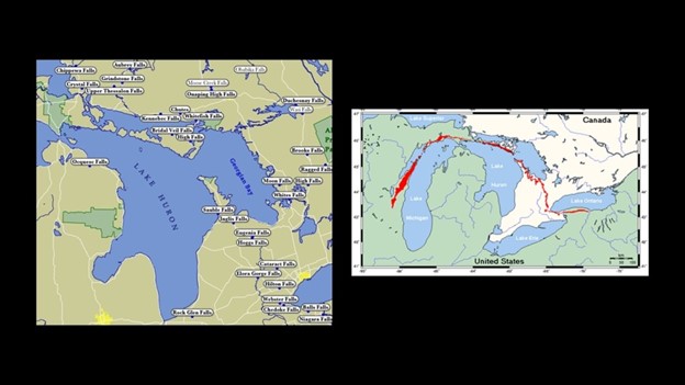
It is important to note that all of the Great Lakes are quite shallow, in particular along their shorelines, but with some shallower than others throughout the lake-bodies and surrounding areas, with the orange, yellow, and green colors in these bathymetry graphics showing a range in depth from 0 to 100-meters, or 328-feet.
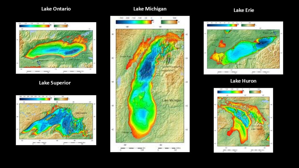
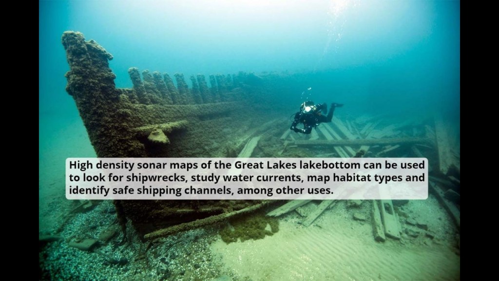
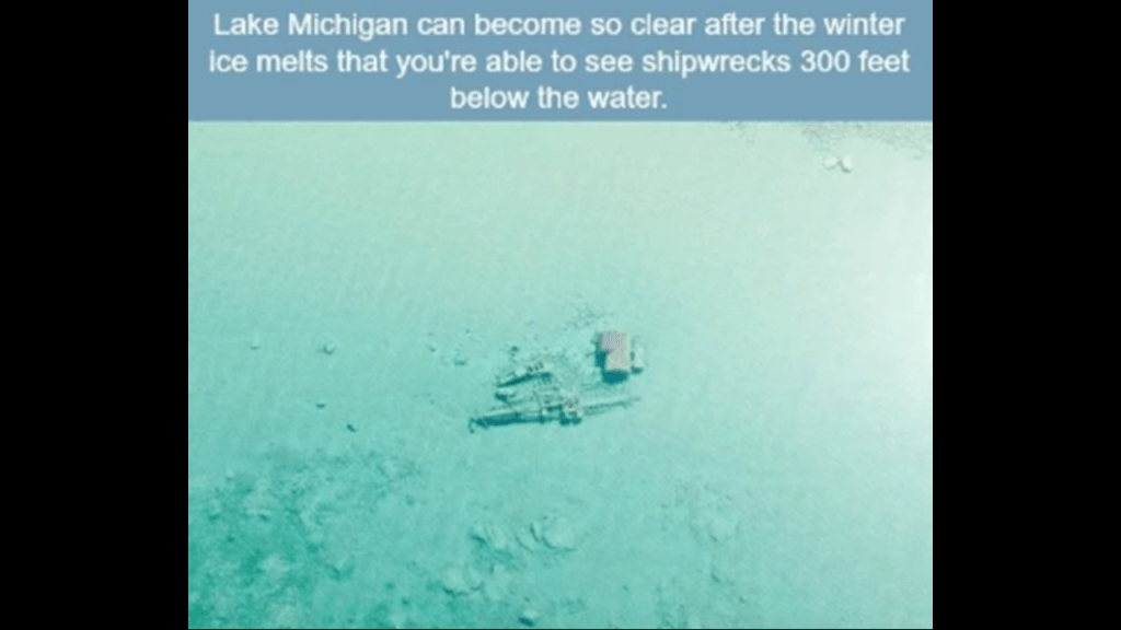
The Great Lakes Region is notorious for its shipwrecks, with an estimated somewhere between 6,000 to 10,000 ships and somewhere around 30,000 lives lost.
The reasons given for the high number of shipwrecks are severe weather, heavy cargo and navigational challenges, but it’s clear to me that the shallow depths of all the lakes are highly problematic in this regard and the question becomes why are they so shallow?
I truly believe the Great Lakes were formed relatively recently, from the destruction of the original free energy grid, the infrastructure of which included, among other things, lighthouses, railways, canals and waterfalls, and do not believe what our narrative tells us about how and when everything came into existence.
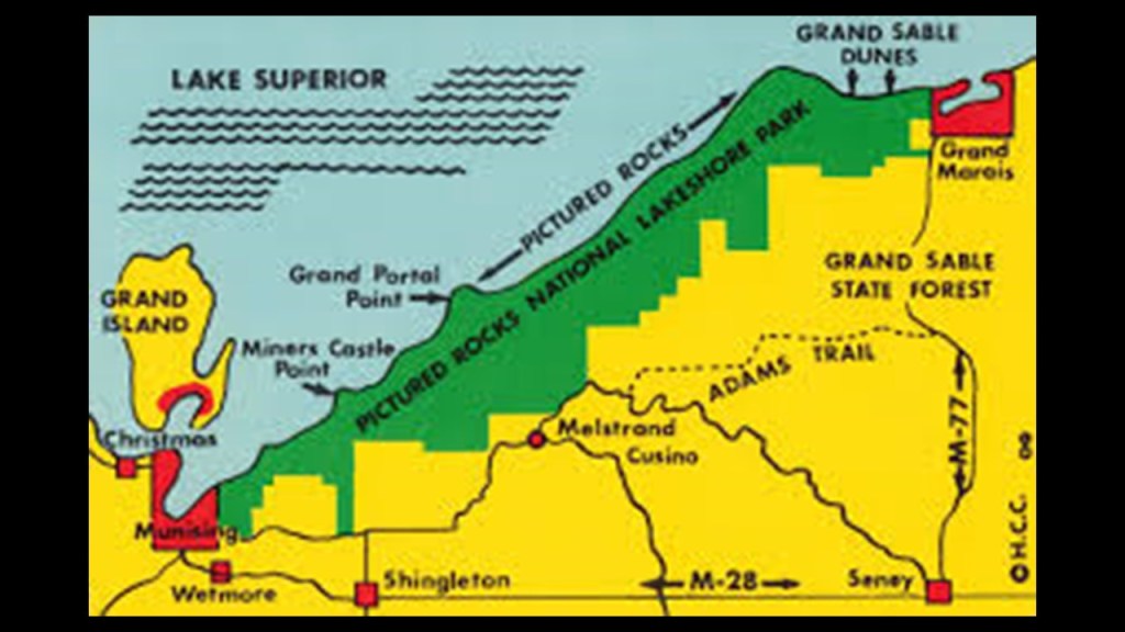
Here are some examples of what I am talking about first from Lake Superior.
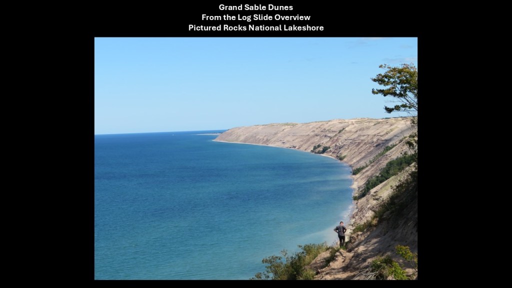
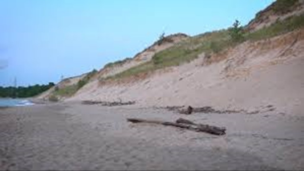
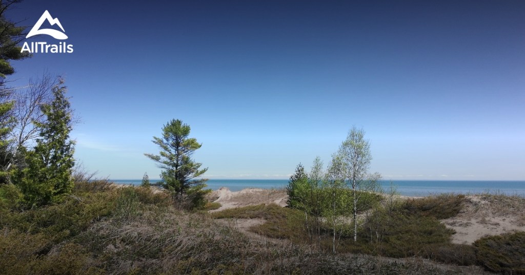
The Grand Sable Dunes on Lake Superior run along the northeast end of the Pictured Rocks Lakeshore for 6-miles, or 10-kilometers.
This is the view of them from what is called the “Log Slide Overview,” where in the 19th-century, loggers used them to slide logs from the top of the dunes to the shoreline so they could be transported out.
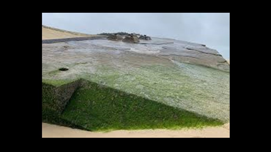
It is my opinion we are looking at ruined land and that there is infrastructure beneath the dunes, and I will be providing examples of why I believe this throughout this video.
Other places located at this end of the Pictured Rocks National Lakeshore include Sable Falls, which flow 75-feet, or 23-meters, over sandstone formations directly into Lake Superior.
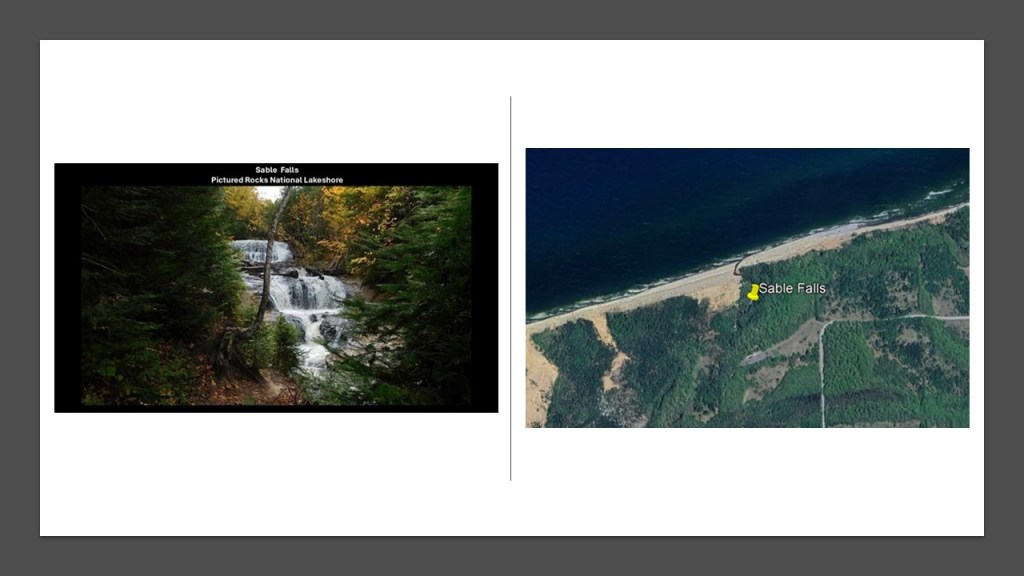
It is my belief that waterfalls were an integral part of the original free-energy grid as well, and believe that the destruction of the grid in this region created the Great Lakes by the outflow of tremendous amounts of water from the waterfalls which was connected to the original grid’s hydroelectric system, which also involved the canal, railroad, and lighthouse infrastructure.
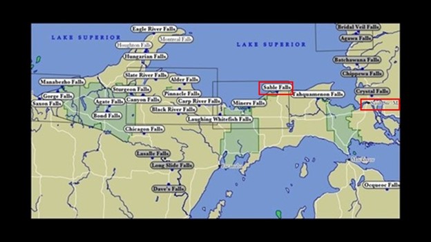
I have looked at this subject in-depth most recently throughout my series on North America’s Great Lakes, where I have looked at places all along the shores of Lake Superior, Lake Michigan, Lake Huron, Lake Ontario, and Lake Erie, where I have paid particular attention to lighthouses; railroad and streetcar history; waterfalls; dunes, wetlands, and bluffs, among many other things.
Here’s another example on Lake Huron.
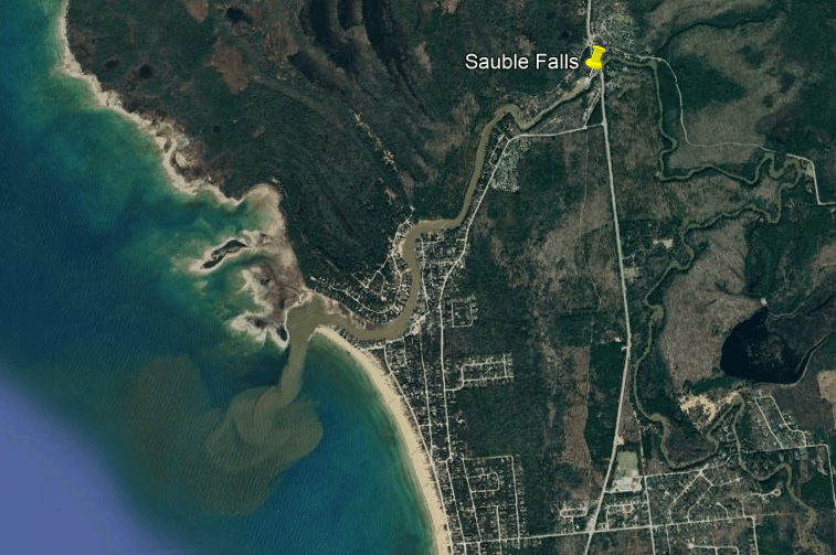
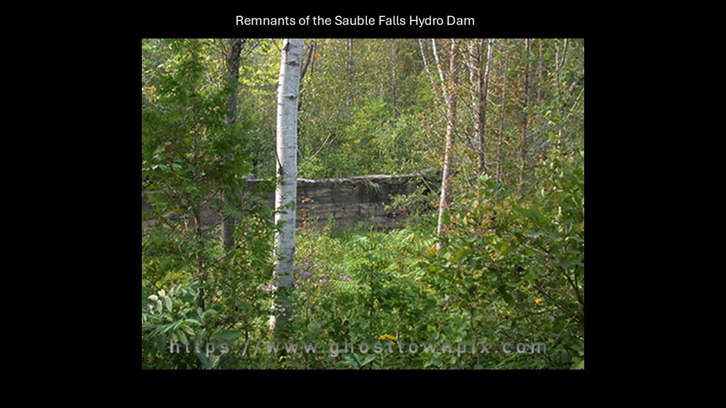
The Sauble Falls are located in the Sauble Falls Provincial Park in the town of South Bruce Peninsula, located 22-miles, or 36-kilometers west of Owen Sound.
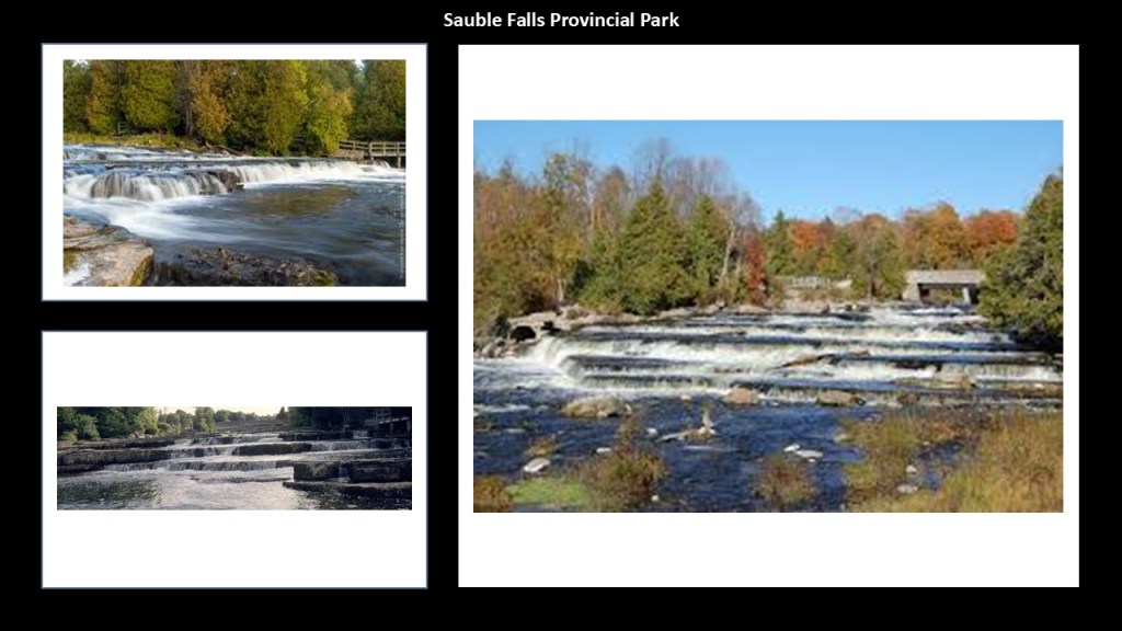
The Sauble Falls are in the lower drainage basin of the Sauble River, which flows directly into Lake Huron.
We are told that the former town of Sauble Falls was founded in 1864 to support the logging industry, and that a sawmill was built at the falls.
Then we are told between 1905 and 1907, the Sauble Falls Light and Power Company built a hydroelectric station and dam, which became part of Ontario Hydro in 1929.
We are told that around the same time, in the late 1920s, the lumber supply was depleted.
Over time, the townsite was gradually dismantled and that in 1957, the Province of Ontario took ownership of the area, and opened the Sauble Falls Provincial Park.
Back on Lake Superior, the Au Sable Point Lighthouse is also located in the area of the Grand Sable Dunes and Sable Falls, and it is nicknamed the “Beacon of the Shipwreck Coast,” so named for all the shipwrecks that have taken place here.
The lighthouse at this location was said to have been built between 1873 and 1874, and is in perfect alignment with the Milky Way.
Like everything else we have been told to explain what is in existence in our world, I don’t believe lighthouses were built to guide ships by whom they were said to have built them when they were said to have been built.
What I am seeing is that they ended up next to the edge of water when the land around them sank, and were repurposed into navigational aids in the New World to guide ships through the now broken landmasses in the surrounding waters.
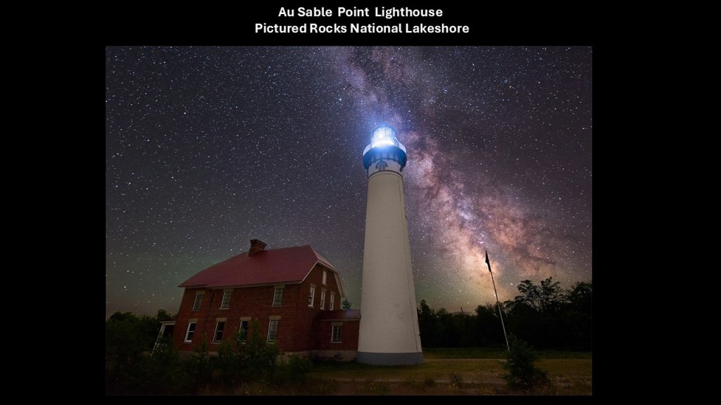
I have come to believe “lighthouses” were literally “houses for light” for the purpose of precisely distributing light energy generated by this gigantic integrated system that existed all over the Earth that was in perfect alignment with everything on Earth and in heaven.
I am not drawing these conclusions from a few examples, but from many that I have found in years of doing research, including a lot of work tracking cities and places in alignment all over the Earth.
The city of Munising in Michigan is best known as the western gateway to “Pictured Rocks National Lakeshore.”
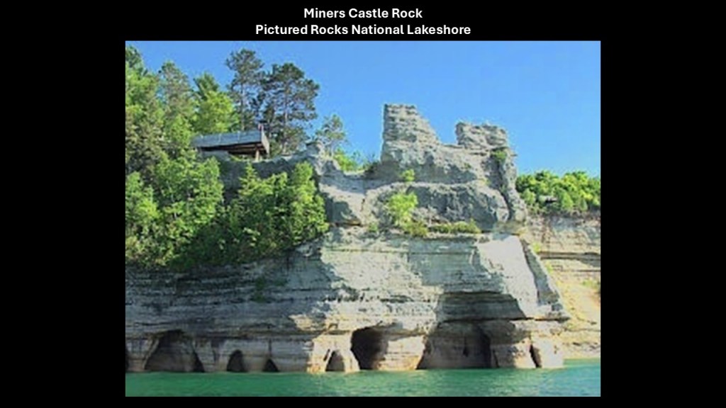
The “Pictured Rocks” are described as dramatic, multicolored cliffs with unusual sandstone formations.
Formations with names like “Miners Castle Rock…”
…and the Grand Portal Rock as seen in this lithograph from 1851…
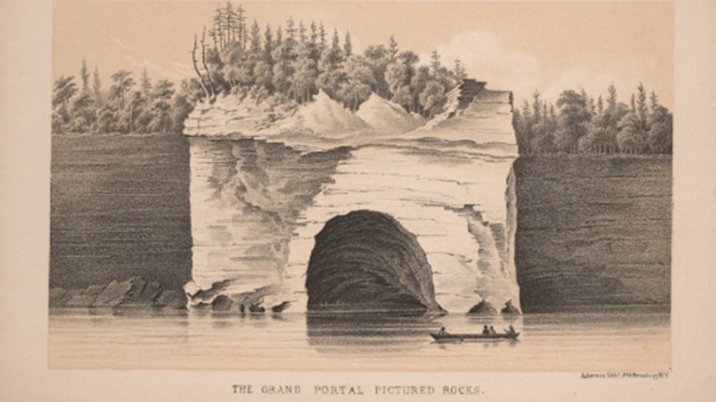
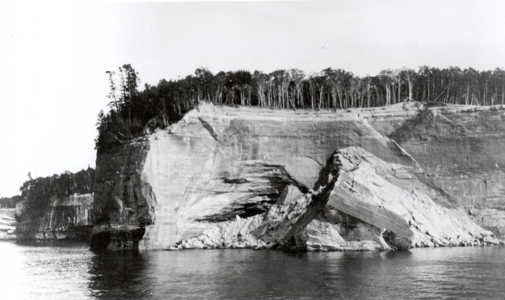
…which mysteriously collapsed in the early 1900s, from the believed cause of erosion but no one really knows what might have caused it.
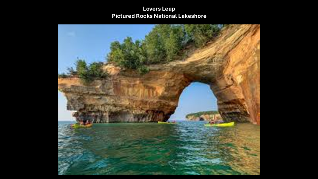
There are all manner of what are called natural archways all along the lakeshore, like the one called “Lovers Leap.”
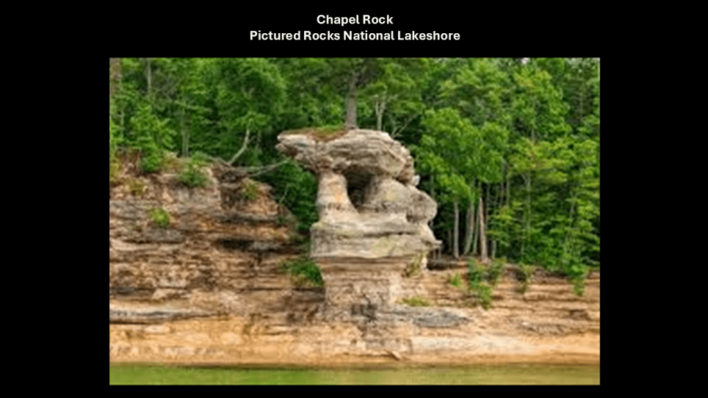
Another unusual formation was named “Chapel Rock.”
It’s not hard to see ruined and melted infrastructure in these rock formations that we are taught result solely from the forces of nature.
Also important to reiterate here that the “Pictured Rocks National Lakeshore” is located geographically right next to the Au Sable Point Lighthouse, the Sable Falls and the Grand Sable Dunes.
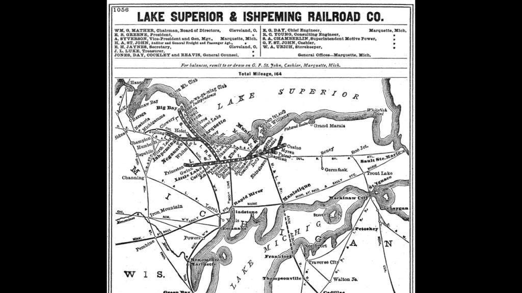
I’d also like to mention the Lake Superior and Ishpeming (LS & I) Railroad that still operates in the area.
It was organized in 1893 as a subsidiary of Cleveland-Cliffs Iron Company, which mined iron ore, and based out of nearby Marquette, Michigan.
The LS & I Railroad merged in 1923 with the Munising, Marquette and Southeastern (MM & SE) Railway, a short-line running 40-miles, or 64-kilometers, east to Munising, which ran through thickly-forested pulpwood on Michigan’s Upper Peninsula, which was used for timber operations by Cleveland-Cliffs, an iron ore and timber-extraction conglomerate.
Michigan Highway 28 traverses nearly all of the Upper Peninsula from east-to-west, from Wakefield to Sault Ste. Marie, and along with US-2, form the primary highways linking the Upper Peninsula from end-to-end, and providing major access for traffic from Michigan and Canada along the southern shore of Lake Superior.
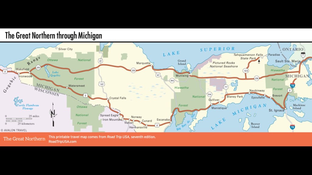
The “Seney Stretch” of Michigan State Highway 28 between Seney and Shingleton, a “straight-as-an-arrow” highway, goes across the “Great Manistique Swamp.”
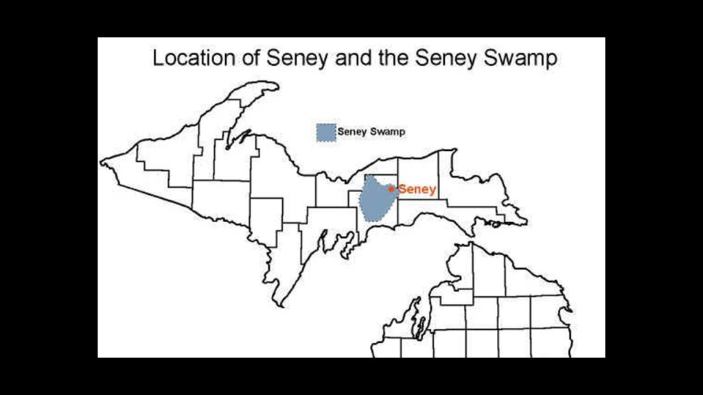
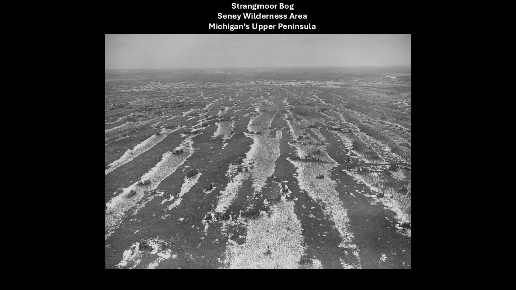
The “Great Manistique Swamp” which is part of the Seney National Wildlife Refuge, which includes the Seney Wilderness Area and the “Strangmoor Bog National Natural Landmark.”
The “Strangmoor Bog” is classifed as a “sub-arctic patterned bog ecosystem,” and the best surviving example of one in the 48 contiguous states, and has things like parallel strips of dune and wetland.
We are told the road across the swamp was built parallel to the previously-mentioned “Duluth, South Shore and Atlantic Railway.”
The “Duluth, South Shore and Atlantic Railway” in-turn became what was called the “Soo Line.”
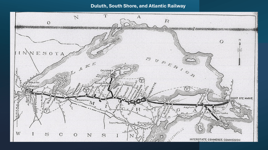
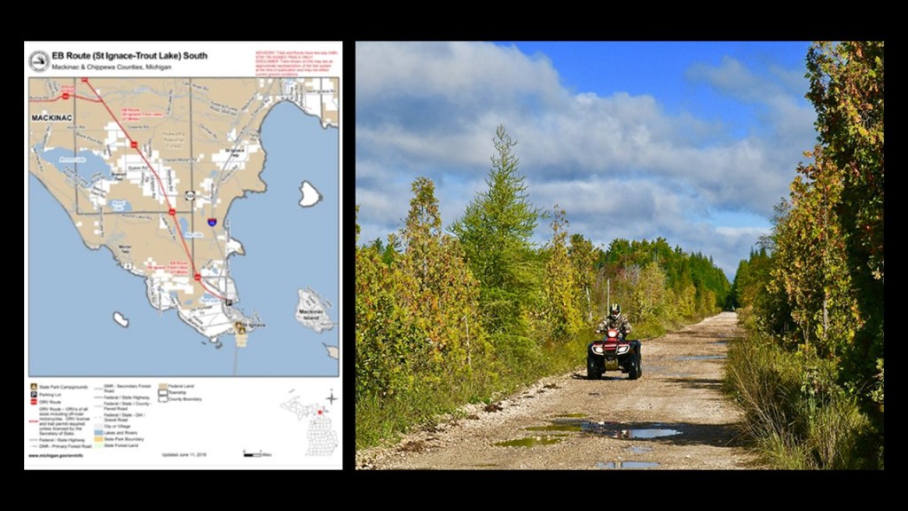
Parts of the “Duluth, South Shore, and Atlantic Railway” were converted to rail-trails, like the St. Ignace – Trout Lake Trail, which is 26-miles, or 42-kilometers, of multi-use recreational trail in its former railbed.
I think the Controllers’ removed the rail-lines that were originally part of the energy grid when they were no longer needed for mining, logging and/or their agenda, and they only kept what was needed for freight, with keeping some for public transportation where it was critical infrastructure and scaled passenger service way-back from what it once was.
They were instead turned into interstates, highways, roadways, and recreational rail-trails. used for harvesting our energy for the benefit of a few from what was the original free-energy grid system for the benefit of all.

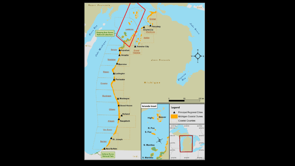
Next, there are many examples from Lake Michigan that I am going to share in this post.
Lake Michigan has many sandy beaches and dune-systems, and is frequently referred to as the “Third Coast” of the United States after the Atlantic coast and the Pacific coast.
Called “singing sands,” the sand is often soft and white, or off-white, and squeaks when walked upon, believed to be caused by the high quartz content of the sand.
It’s important to note that the sand dunes located on the eastern shore of Lake Michigan are considered the largest freshwater dune system in the world.
Large dune formations can be seen in many state parks, national forests and national parks along the Michigan, Indiana and Wisconsin shoreline.
The average depth of Lake Michigan is 85-meters, or 279-feet.
There are approximately 88 lighthouses along the shore of Lake Michigan, which has more lighthouses than any of the Great Lakes.
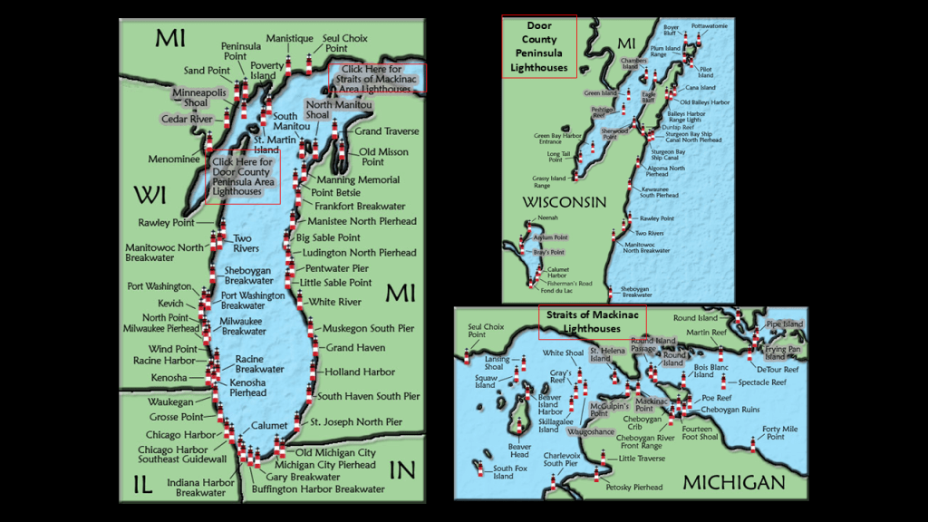
There are approximately 78 lighthouses around Lake Superior, with 42 of them being in Michigan.
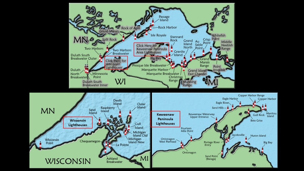
One of Michigan’s nicknames is “The Lighthouse State,” as it has more lighthouses than any other state.
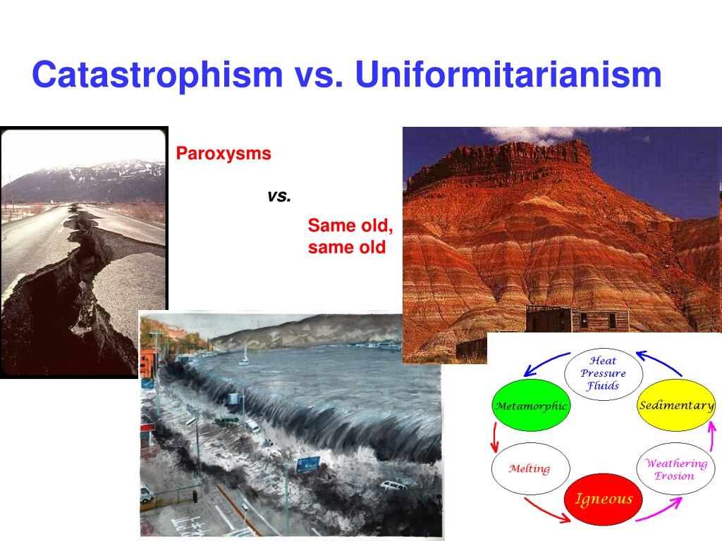
Our historical narrative tells us that geological processes over long periods of time are responsible for what we see in the world today.
Like I’ve been saying, I believe all along the Earth’s coastlines there are ruined land and submerged landmasses from this recent cataclysmic event which destroyed the Earth’s original energy grid, along with creating land features like dunes, beaches, wetlands, and deserts.

This belief is at odds with the official explanation, which is that of a worldwide Great sea level rise as a result of melting glaciers from the last Ice Age and the expansion of seawater as it warms, and both are due to global warming.
The basis of the belief in Ice Ages in our modern scientific paradigm come from Sir Charles Lyell, who published “The Principles of Geology” in three volumes between 1830 and 1833.
In these books, Lyell presented the idea that the Earth was shaped by the same natural processes that are still operating today at similar intensities, and as such a proponent of “Uniformitarianism,” a gradualistic view of natural laws and processes occurring at the same rate now as they have always done.
As a result of Lyell’s work, the glacial theory gained acceptance between 1839 and 1846, and we are told during that time, scientists started to recognize the existence of ice ages, and do to this day.
Sir Charles Lyell’s books on “Uniformitarianism” and “Ice Ages” in geology became the only accepted model taught by Academia.

The issue is in contrast to the view of Catastrophism, the belief that changes in the Earth’s crust have resulted primarily from sudden violent and unusual events.
The Academic world supports Uniformitarianism without question as the only explanation for what we see in today’s world.
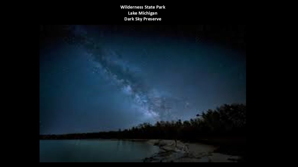
So I am going to start looking at the dunes of Lake Michigan at the Wilderness State Park in northern Michigan located at the western entrance to the Straits of Mackinac at the tip of Michigan’s Lower Peninsula.
The Wilderness State Park is described as a diverse forested, dune, and wetlands with swale complexes, with swale as a landform being defined as a sunken or marshy place.
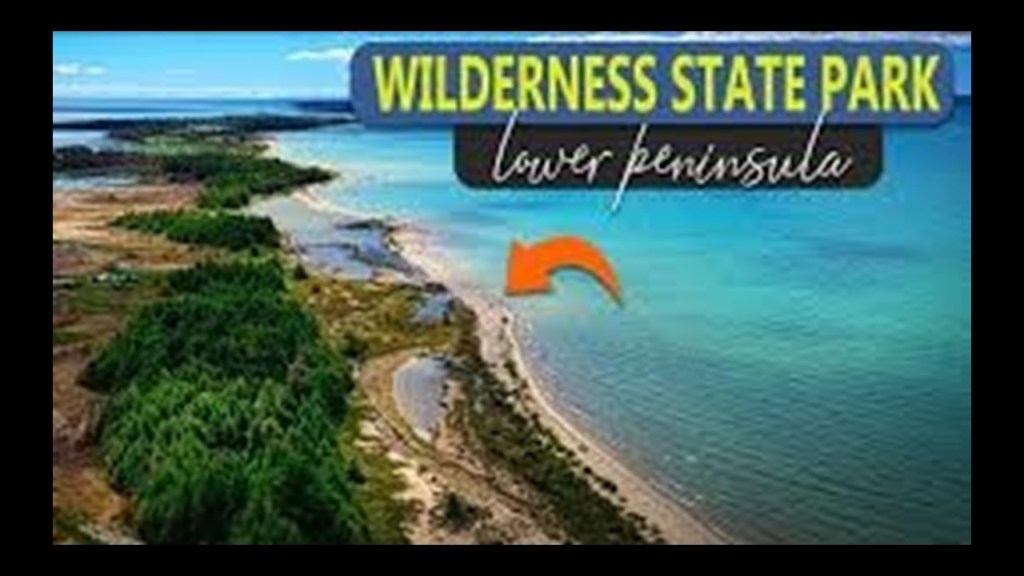
The Wilderness State Park has also been designated as a “Dark Sky Preserve” since 2012, where light is restricted for astronomical observation and enjoyment, as seen here with a magnificent view of the Milky Way in the night sky.
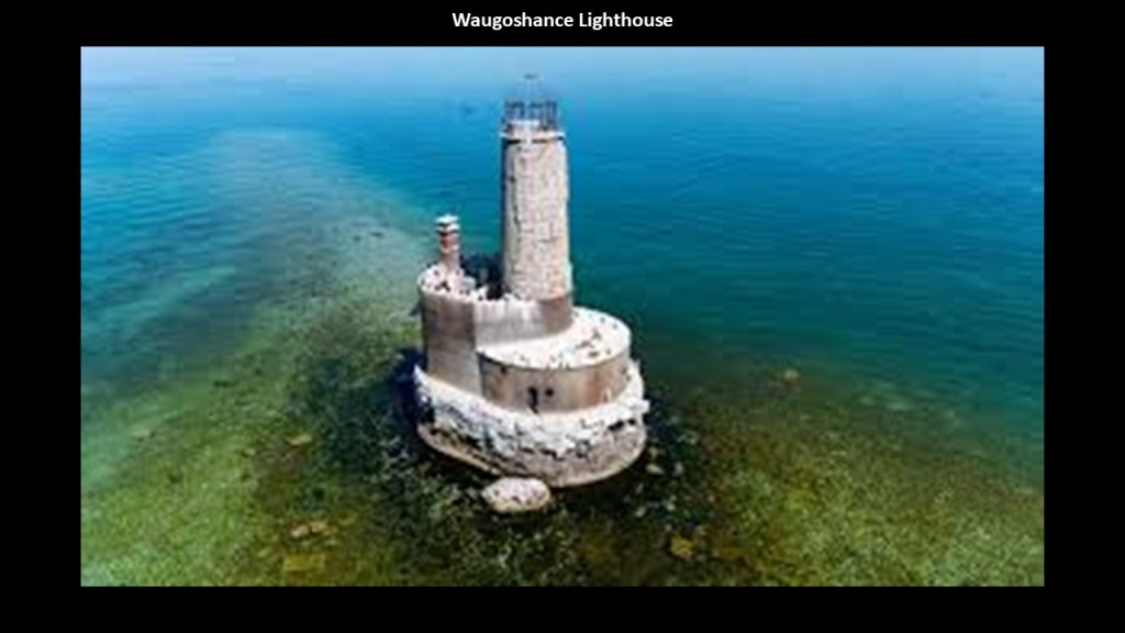
The Waugoshance Lighthouse is in the Wilderness State Park, and called one of the most hazardous areas near the Straits of Mackinac.
The Waugoshance Lighhouse was said to have been built here in 1851, and is described as a ruined lighthouse in a shoal area that is 15-miles, or 24-kilometers, due west of Mackinaw City on the northern tip of Michigan’s Lower Peninsula, also known as “The Mitten.”
We are told that due to erosion and deterioration, that lighthouse is critically-endangered, and likely to fall into Lake Michigan in the near future.
Besides the ruined Waugoshance lighthouse, there are three other lighthouses near the western end of the Wilderness State Park – the Grays Reef Light Station; the White Shoal Light; and the Aux Galets Lighthouse.
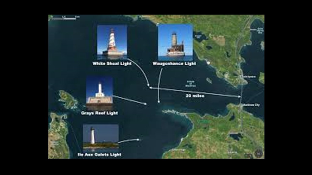
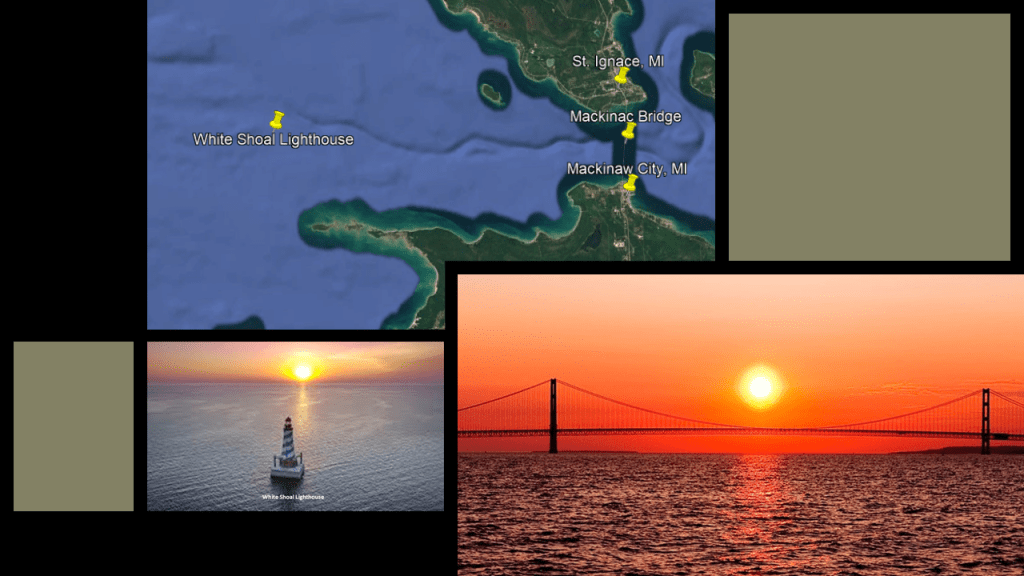
The White Shoal Lighthouse is located 20-miles, or 32-kilometers, west of the Mackinac Bridge.
The construction of the current lighthouse here was said to have started in 1908, and first lit in 1910.
Here is the White Shoal Lighthouse with a solar alignment and the Mackinac Bridge with a solar alignment centered perfectly between the bridge’s two towers.
I believe solar alignments like these, which I find with lighthouses and other infrastructure all over the Earth, was intentional, with geometrica and precise placement in exact relationship to each other on the surface of the Earth and mirroring what was going on in the heavens.
Interestingly in this example, the placement of the lighthouse looks slightly offset with the alignment of the sunset behind it.
When you look at the relationship between the White Shoal Lighthouse and the Mackinac Bridge on Google Earth, it appears as though the slightly offset positioning of the lighthouse is oriented to the middle of the Mackinac Bridge.
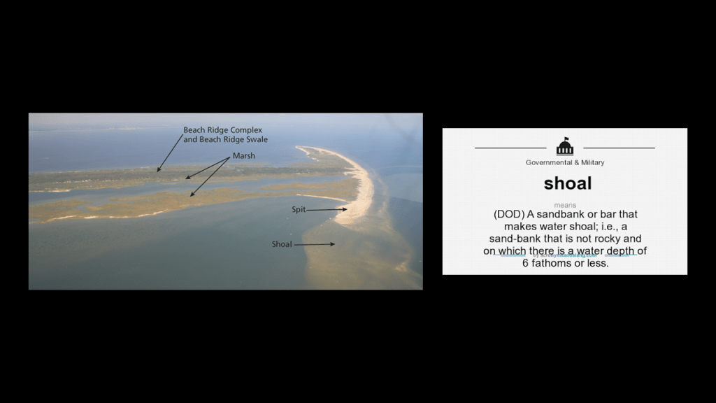
And with regards to the name for the “White Shoal” Lighthouse, a shoal is defined as a place where a body of water is shallow, and where a ridge, bank or bar is close to the surface of the water, and poses a danger to navigation.
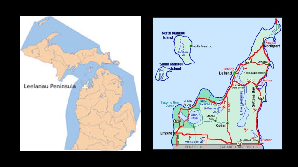
The next place I want to look at on Lake Michigan is the Leelanau Peninsula, also known as the “Little Finger,” and located in-between Lake Michigan and the Grand Traverse Bay on the mitten-shaped Lower Peninsula.
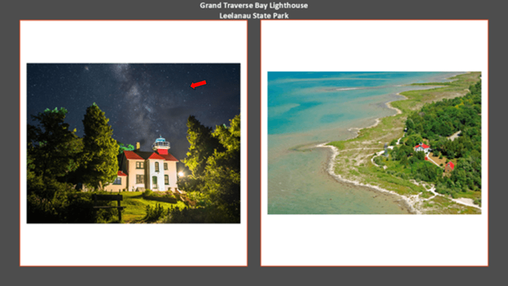
The Grand Traverse Lighthouse is located at the tip of the Leelanau Peninsula, where the Manitou Passage separates Lake Michigan and Grand Traverse Bay.
The current lighthouse was said to have been built in 1858, and is located today in Leelanau State Park.
This photo shows it in alignment with the Milky Way.
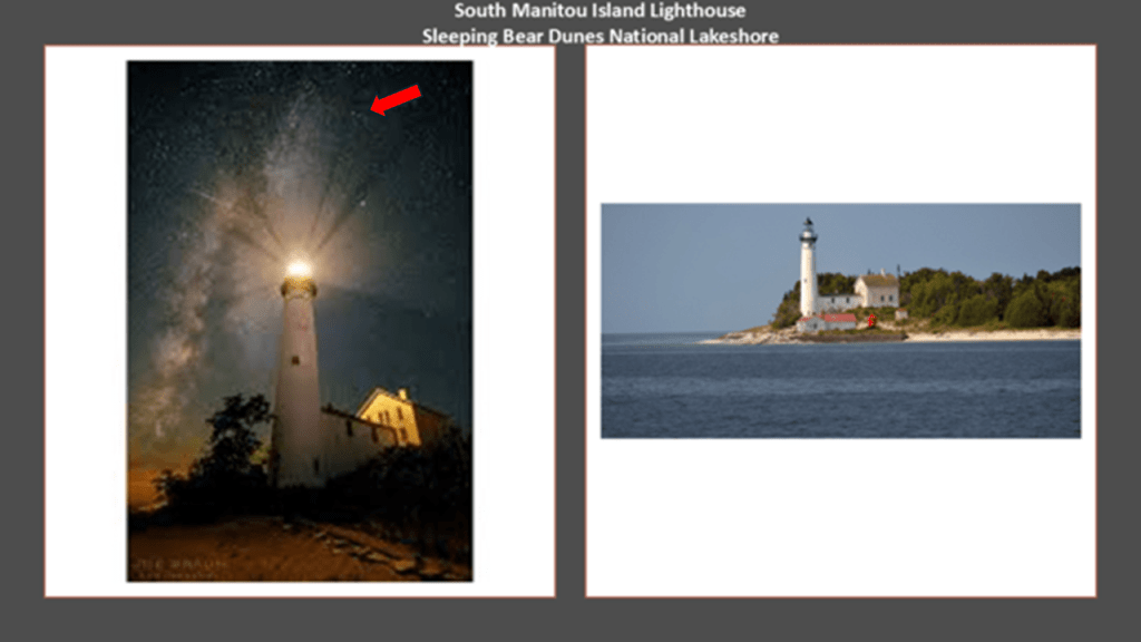
There is also a lighthouse on South Manitou Island, with the current one said to have been built in 1872, and decommissioned in 1958.
It is a museum these days.
This lighthouse also has an alignment with the Milky Way.
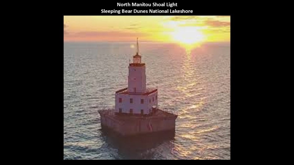
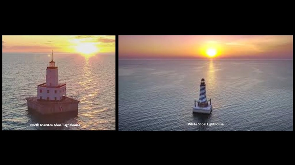
The North Manitou Shoal Light is located southeast of North Manitou Island, and it was said to have been constructed in 1935 to mark a dangerous shoal, and it is still in operation today.
Here’s a side-by-side comparison of the North Manitou Shoal Lighthouse and the White Shoal Lighthouse a little ways further north of here in Lake Michigan, showing an identical directional orientation and alignment with the setting sun.
The Sleeping Bear Dunes National Lakeshore is located on the western-side of the Leelanau Peninsula, and is also notable for its shipwrecks, so much so the bottomlands have been designated the “Manitou Passage Underwater Preserve.”
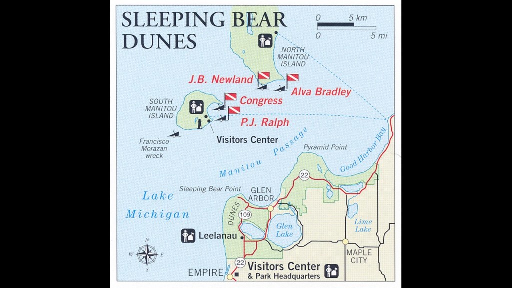
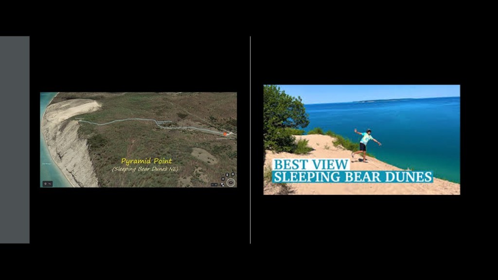
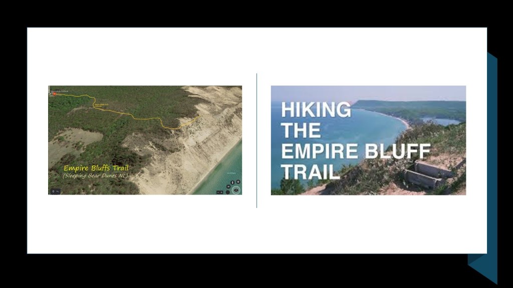
There are such places to visit and hike in the Sleeping Bear Dunes National Lakeshore as Pyramid Point, known for its stunning views of Lake Michigan and the Manitou Islands and its sheer bluffs…
…the Empire Bluff Trail…
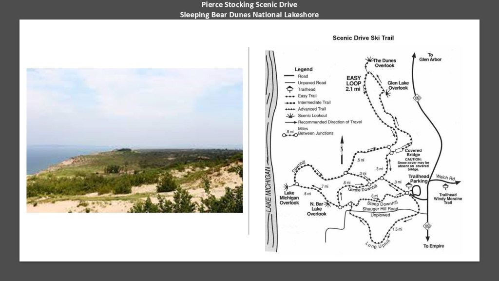
…and the Pierce Stocking Scenic Drive, a 7.4-mile, or 11.9-kilometer, drive through forest and dune areas and great views of Lake Michigan.
It was said to have been built in the 1960s and finished in 1967 by a lumberman named Pierce Stocking who wanted to share the beauty of the area with others.
When the word “sheer” is used to refer to a bluff or cliff, it means a high area of land with a very steep side.

One of the meanings of the word “shear” spelled with an “a” is to break off, or be cut off, sharply.

A “bluff” is a synonym of the word “cliff.”
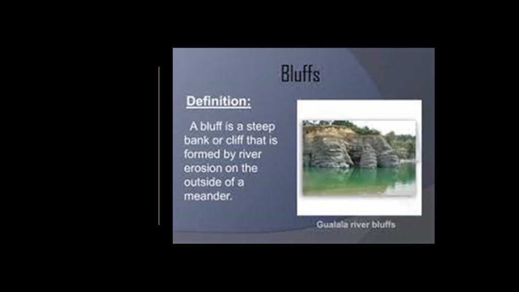
Another meaning of the word “bluff” is a deception, or an attempt to deceive.

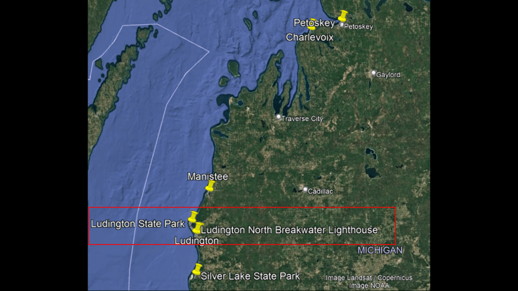
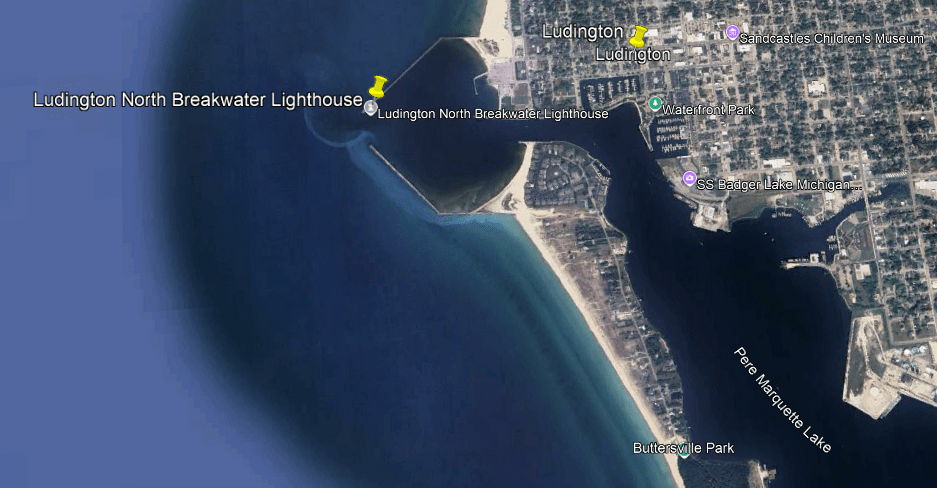
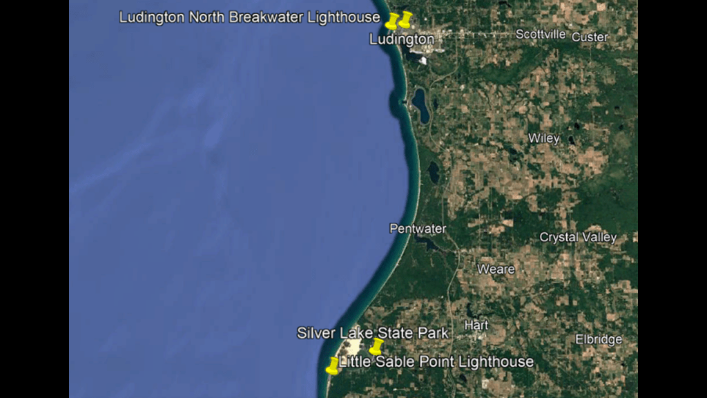
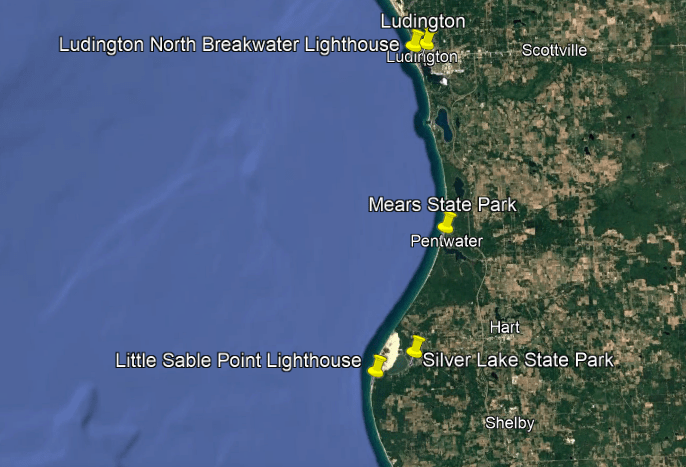
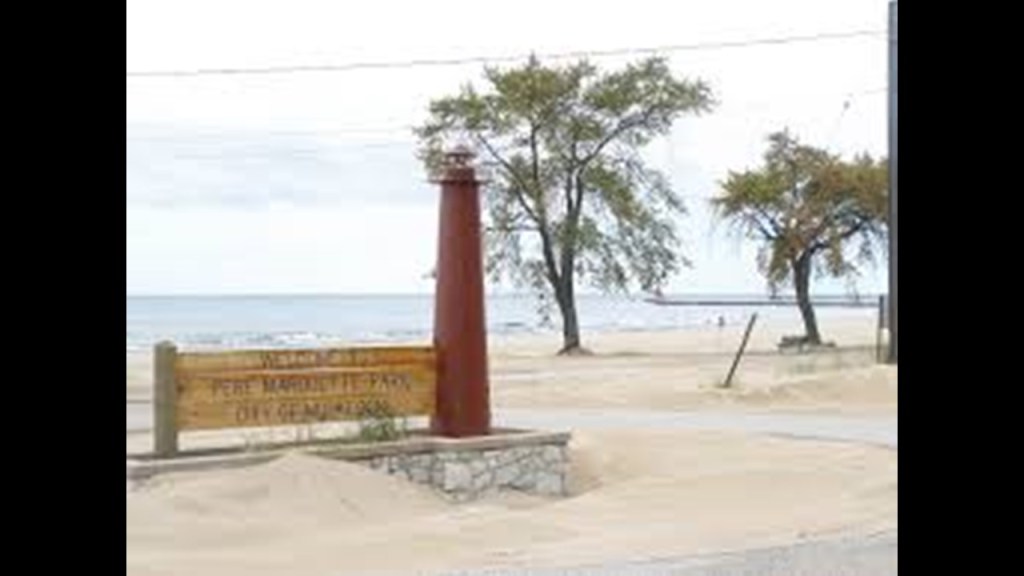
Now I am going to head on down the eastern coast of Lake Michigan to the Ludington area, which was originally named Pere Marquette.
We are told that the Jesuit explorer Father Jacques Marquette died near Ludington in 1675, and that in 1955, a memorial and 40-foot, or 12-meter, cross were built to mark the location.

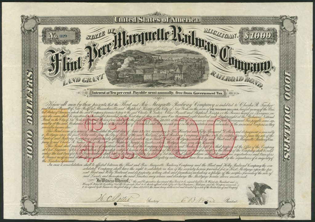
We are told the Flint and Pere Marquette Railroad was chartered in January of 1857 to construct an east-west railway line from Flint in Michigan to Ludington, called Pere Marquette at the time, with the railroad completed to that location in 1874.
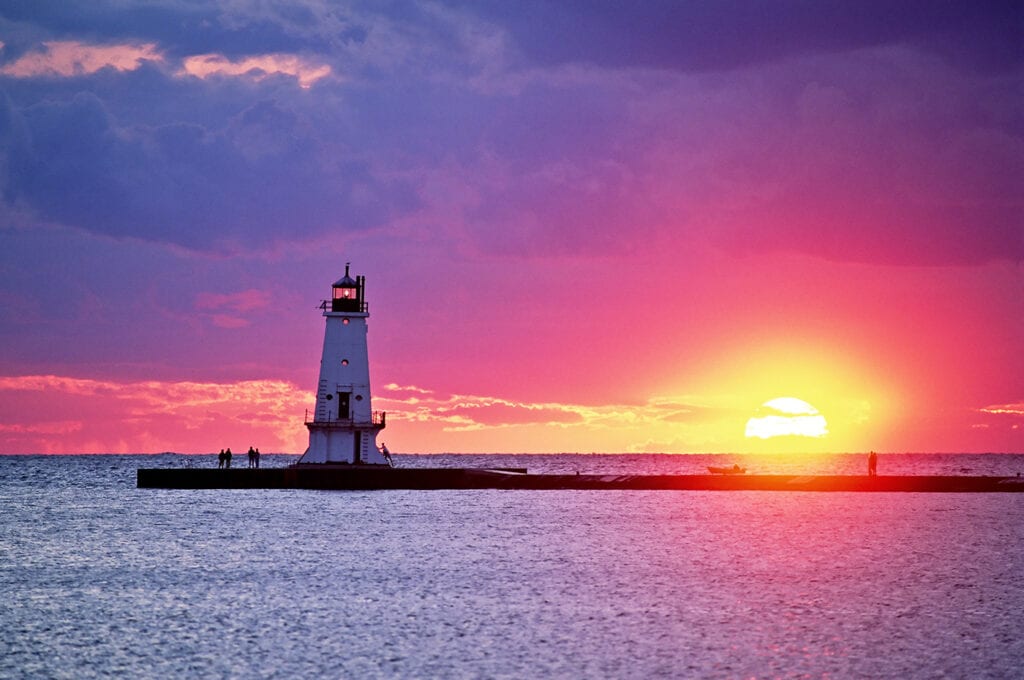
The Ludington Lighthouse is located at the end of the North Breakwater where the Pere Marquette River meets Lake Michigan in the Pere Marquette Harbor.
It was said to have been established in 1871 originally, and the structure there today was said to have been built in 1924.
Here is the Ludington Lighthouse in alignment with the setting sun.
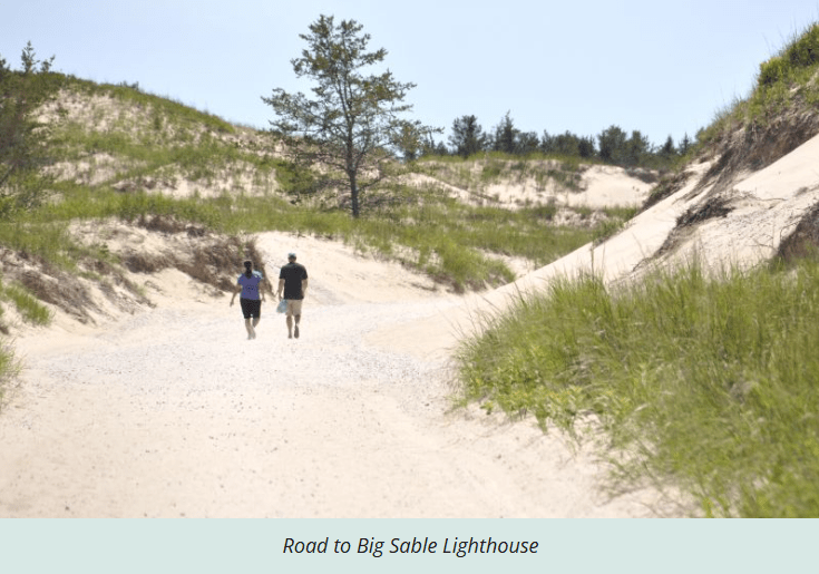
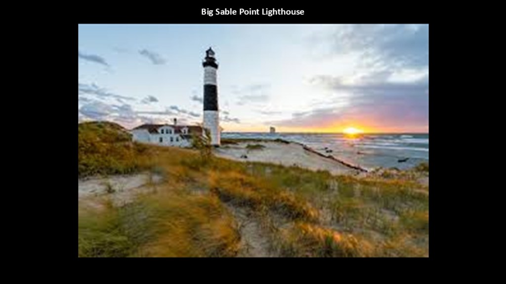
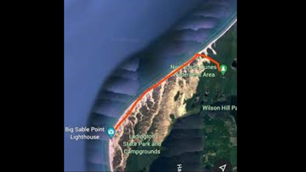
The Big Sable Point Lighthouse is located on the other side of Ludington State Park from the Ludington Lighthouse, in the vicinity of the Nordhouse Dunes Wilderness Area.
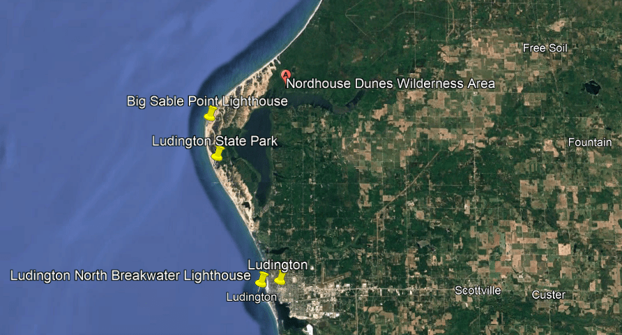
The Big Sable Point Lighthouse was said to have been built in 1867, and is just a short-distance north of the Ludington State Park entrance.
We are told that construction materials were brought in by ship since there wasn’t a road to it until 1933, and even today the road to get there is sandy and you have to walk because motor vehicles are prohibited.
Also, this was the last Great Lakes lighthouse to get electricity and plumbing, which came in the late 1940s.
Here it is at sunset as well.
The Ludington State Park, of which the Big Sable Point Lighthouse is a part, is altogether 4,800-acres, or 1,900-hectares in size, with many different kinds of ecosystems, which include sand dunes, wetlands, marshlands and forests.
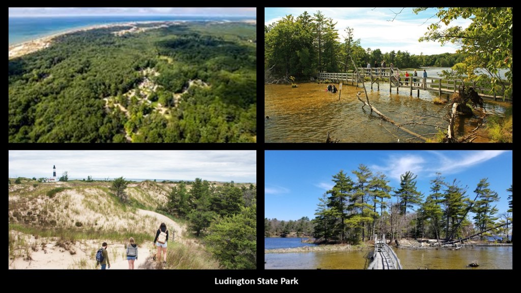
The Nordhouse Dunes Wilderness Area which is directly adjacent to the Ludington State Park is part of the Manistee National Forest lands, and managed by the U. S. Forest Service.
The federal government declared the Nordhouse Dunes area of the Manistee National Forest a wilderness in the Michigan Wilderness Act of 1987.
On 3,450-acres, or 1,396-hectares of land, it is the world’s most extensive set of freshwater dunes.
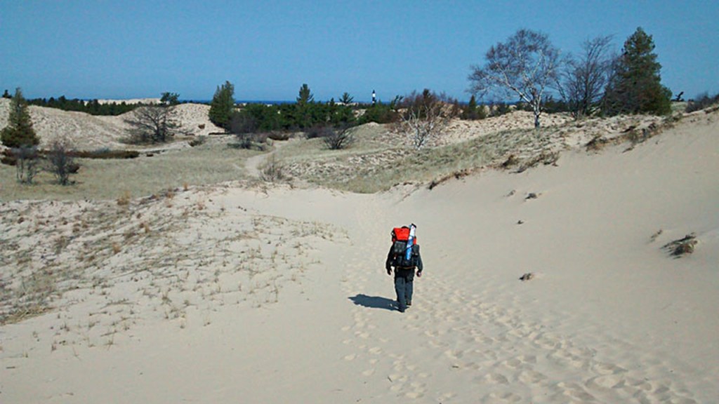
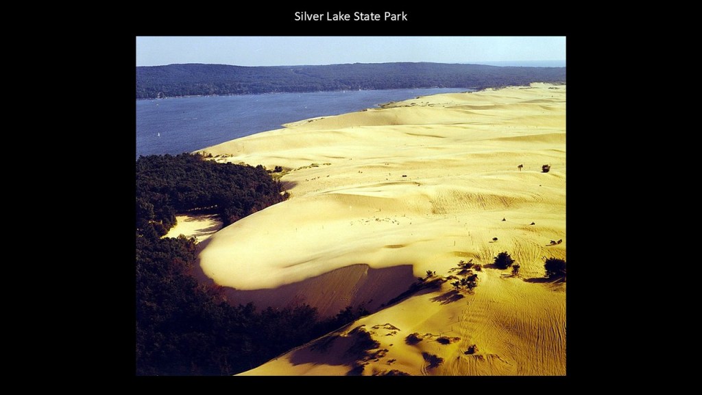
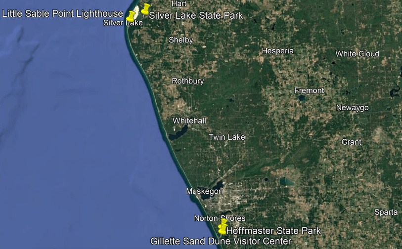
Continuing on down the coast a little ways, the next area I am going to look at includes the Silver Lake State Park and the Little Sable Point Lighthouse.
First, Silver Lake State Park.
The Silver Lake State Park is 4-miles, or 6.4-kilometers, west of Mears in Oceana County, and on its almost 3,000-acres, or 1,200-hectares, of land, has along with mature forest land, has over 2,000-acres, or 810-hectares of sand dunes.
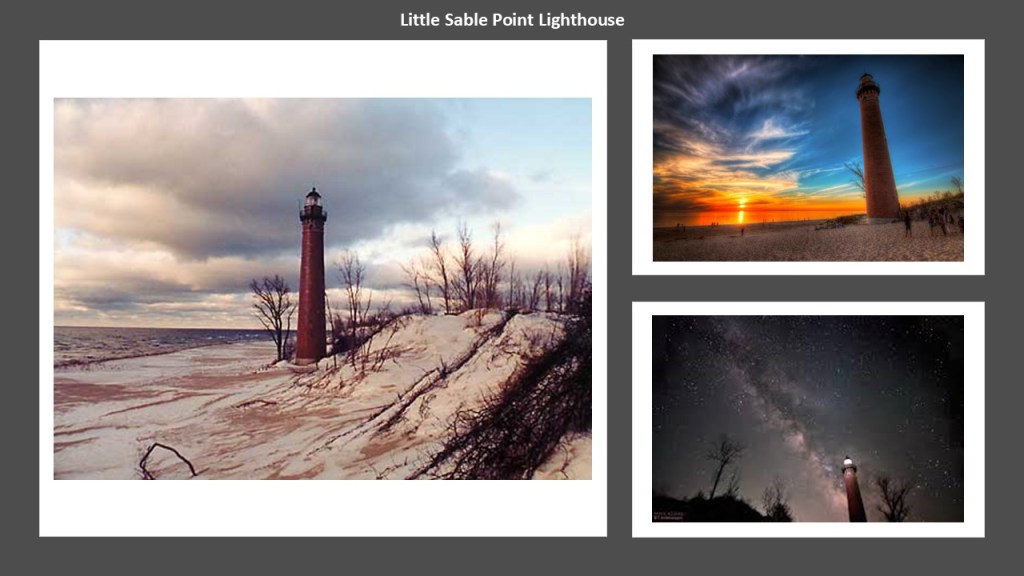
The Little Sable Point Lighthouse is located just south of Silver Lake State Park.
It was said to have been designed by Col. Orlando Poe, and finally constructed in 1874, after funding was approved by Congress in 1871.
Apparently construction was delayed because there weren’t any roads here either according to the official narrative.
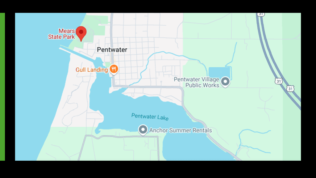
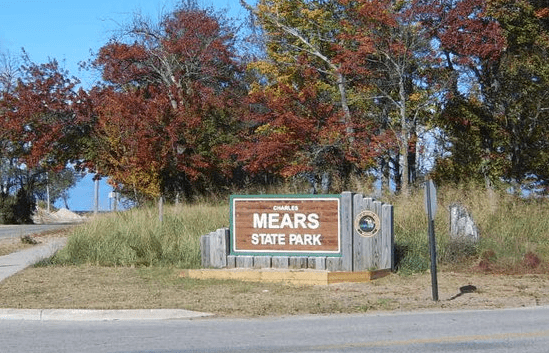
Mears State Park is located north of Silver Lake at Pentwater, which is roughly half-way between the Ludington area and the Silver Lake area.
Mears State Park is comprised of 50-acres, or 20-hectares, of land on the north side of the Channel that connects Pentwater Lake to Lake Michigan.
The land on which Mears State Park is located was described as “strictly lake sand,” which was quickly eroded when the vegetation that held it in place was disturbed when the land was graded.
We are told this problem was solved with five-tons of marsh hay that were laid on top of it.
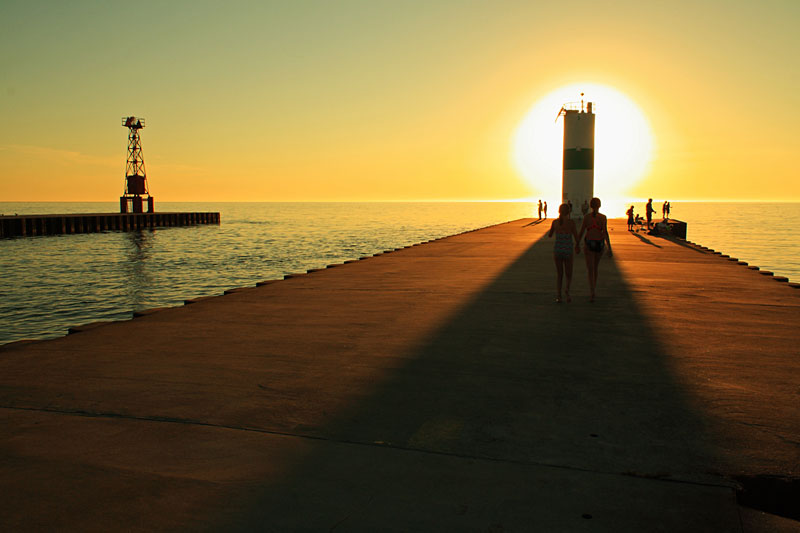
Mears State Park is known for its stunning sunsets, like this one behind the Pentwater North Pierhead Light.
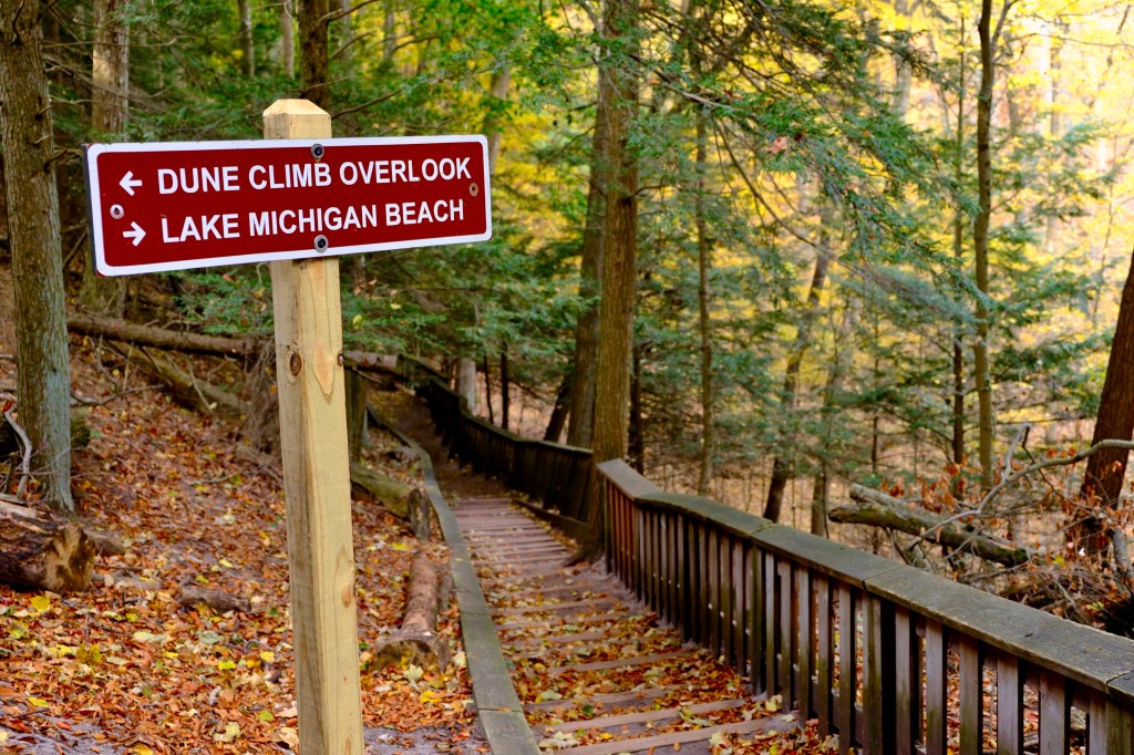
Next, I am going to head down the coast to the Muskegon area, where we also find Hoffmaster State Park and the Gillette Sand Dune Visitor Center and sand dune ecosystem.
We are told that the earliest Europeans who visited the area were French explorers like the Jesuit Father Marquette and French soldiers under the explorer LaSalle in the late 1670s.
As a matter of fact, Pere Marquette Park is a beach-area that is located just to the south of the south breakwater and pier.
The Pere Marquette quartz-sand beach is bordered by large sand-dunes.

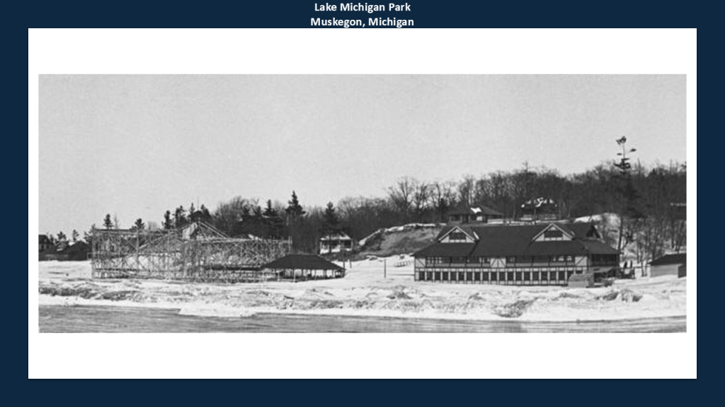
When I was looking for information about Pere Marquette Park, I came across the information that Lake Michigan Park occupied the north end of today’s Pere Marquette Park.
Lake Michigan Park was a trolley park on the beach that had a large roller coaster, dance hall, and pavilions where rail service was said to have been developed in the late 19th- and early-20th-centuries to encourage local and regional demand.
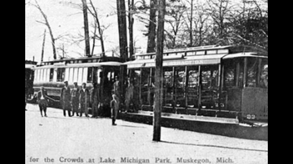
We are told the trolley park’s closure was linked to the decline of the trolley service, and the amusement park on the beach was torn down in 1930, and at some point became Pere Marquette Park.
The P. J. Hoffmaster State Park is located south of Norton Shores and the Muskegon County Airport, and just to the west of Highway 31.
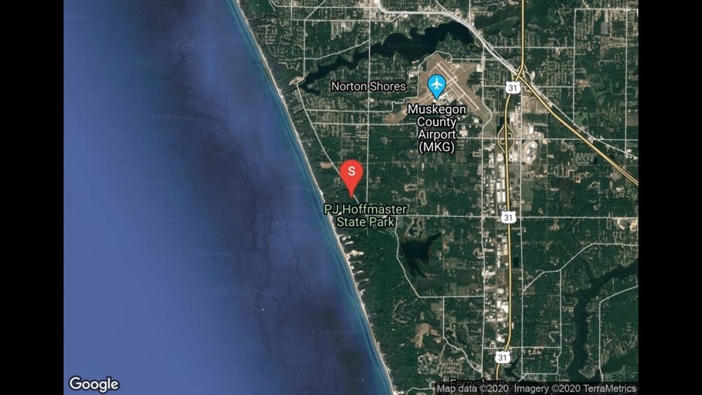
It was established in 1963, and named after Percy James Hoffmaster, who was considered the founder of the Michigan State Parks system, and is a public recreation area with hiking trails, camping areas, and a beach.
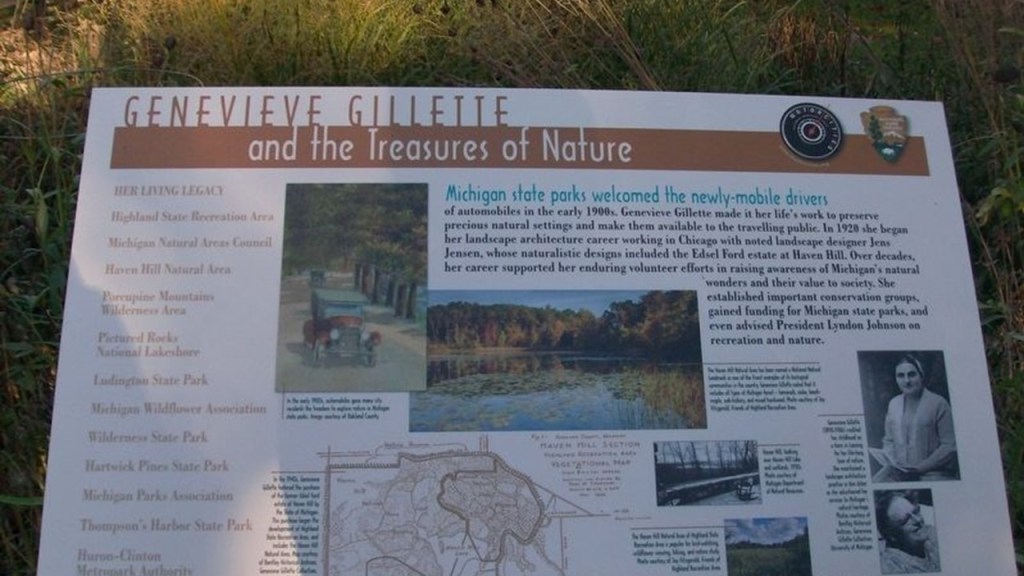
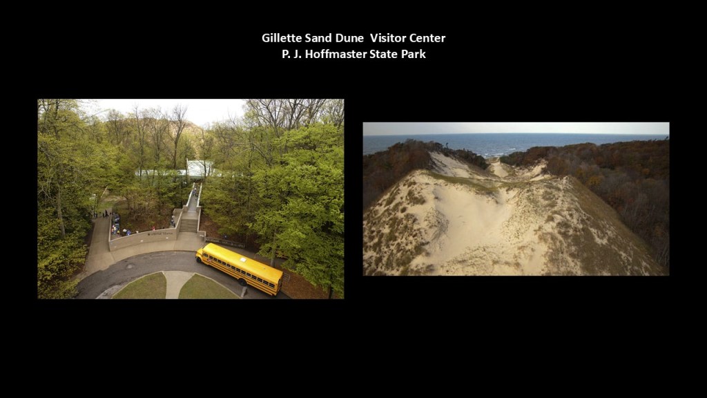
The Gillette Sand Dune Visitor Center was named after Genevieve Gillette, a conservationist who scouted for new state park locations for P. J. Hoffmaster.
The Gillette Sand Dune Visitor Center is described as being nestled among one of the nation’s most impressive dune systems, and is itself perched on top of a large wooded dune.
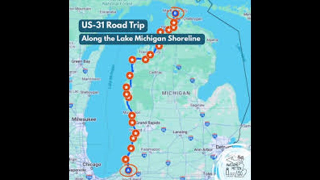
US Highway Route 31 runs along the western portion of the Lower Peninsula of Michigan from Bertrand Township in Berrien County at the state line with Indiana to its terminus on I-75 south of Mackinaw City.
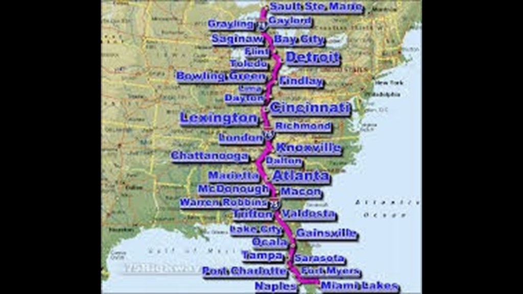
US Highway Route 31 is a major North-South Highway that runs from Spanish Fort in Alabama at the Junction of US-90 & US-98.

The northern terminus of Interstate 75 is Sault Ste. Marie in Michigan, which also goes all the way to Miami, Florida, at its southern terminus.
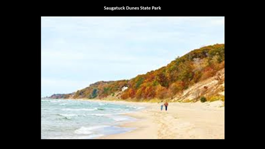
Next, the Saugatuck Dunes state park is located between Holland and Saugatuck.
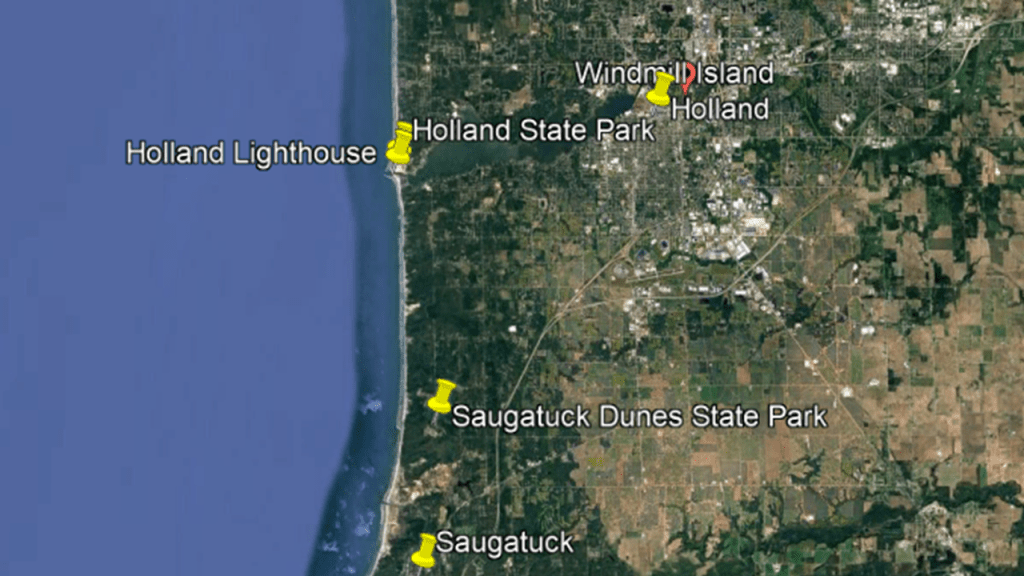
The Saugatuck Dunes State Park is a largely undeveloped, 1,000-acre, or 400-hectare, public recreation area with a beach, and 14-miles of hiking trails and 200-foot, or 61-meter, -high sand dunes covered with trees and grass.
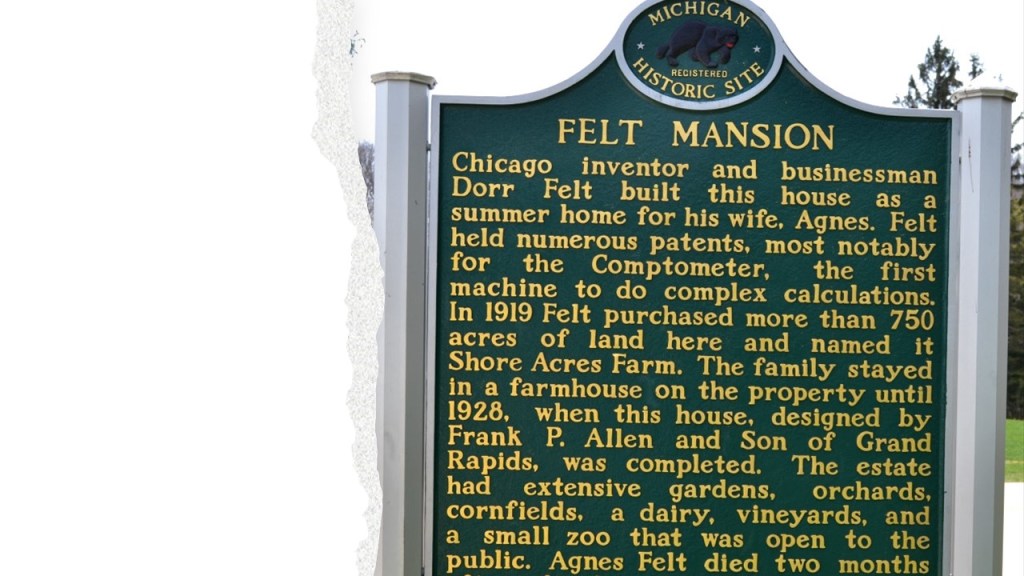
It is interesting to note that the estate of Dorr E. Felt is just to the north of the Saugatuck Dunes State Park.
Dorr E. Felt was known to history as the inventor of the Comptometer, an adding machine and calculator used by businesses.
Apparently, his invention made him a very wealthy man.

So much so, he could afford to build between 1925 and 1928, a 12,000-square-foot, or 1,115-square-meter, mansion, carriage house, farm house, and petting zoo, to be a summer home called “Shore Acres Farm” for he and his wife and children,
Sadly his wife Agnes passed away a couple of months after the family moved into the home, and he only outlived her by a couple of years, and the Felt family finally sold the property in 1949.
The property has also been used as a Catholic Seminary, and also as a prison by the State of Michigan.
The State of Michigan owned the grounds until the early 1990s, at which time it sold the property to the Laketown Township for $1, with the stipulation the Mansion would be used by the public, and not by private enterprise, and among other things, it is a popular wedding venue.

And interesting to note that it is also known for being haunted.

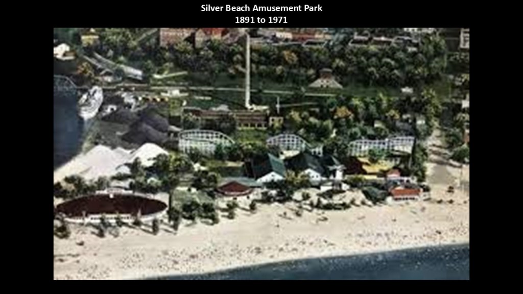
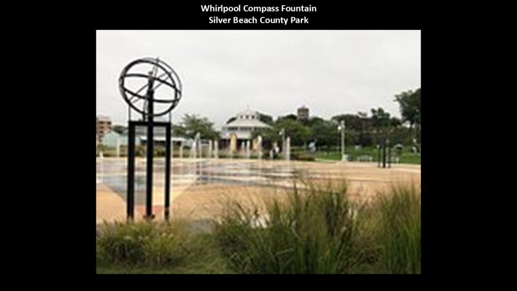
Further south in St. Joseph, Michigan, the Silver Beach County Park is located next to the channel known as the St. Joseph River.
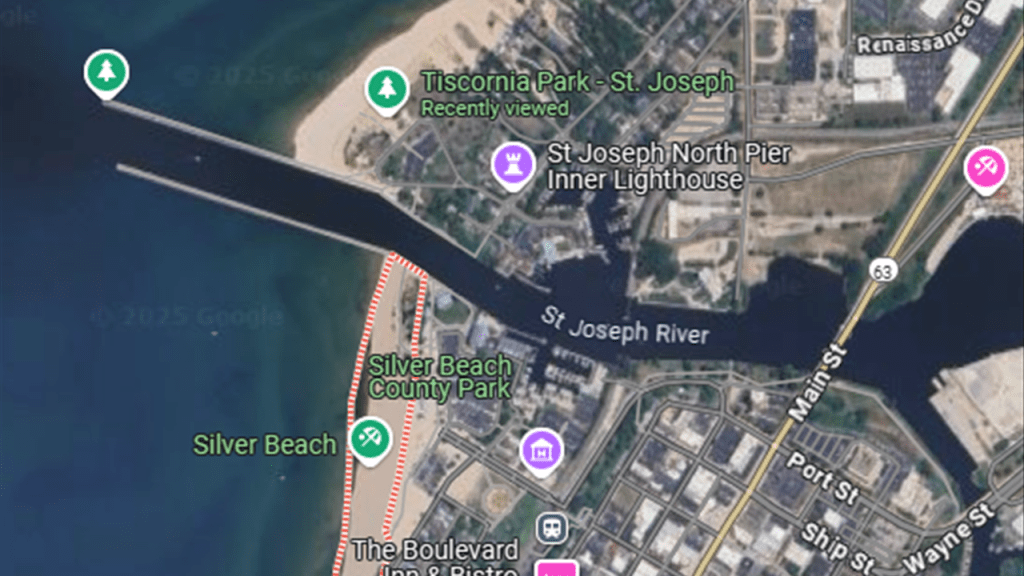
At one time, Silver Beach was a trolley park and developed as a vacation resort, which first opened in 1891.
This amusement park on the beach had a roller coaster, roller skating rink, pipe organ, boxing ring, dance hall and carousel.
The carousel was restored to its former glory and can be found in the building to the right-side of this photo of the park facing Lake Michigan.
There is a fountain on the left called the Whirlpool Compass Fountain.
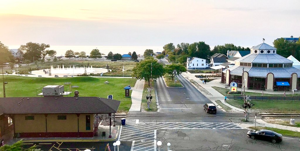
The Whirlpool Compass Fountain is described as a large splash pad with water jets that can be enjoyed in the spring and summer months.
I have no doubt there is more to this story as well.
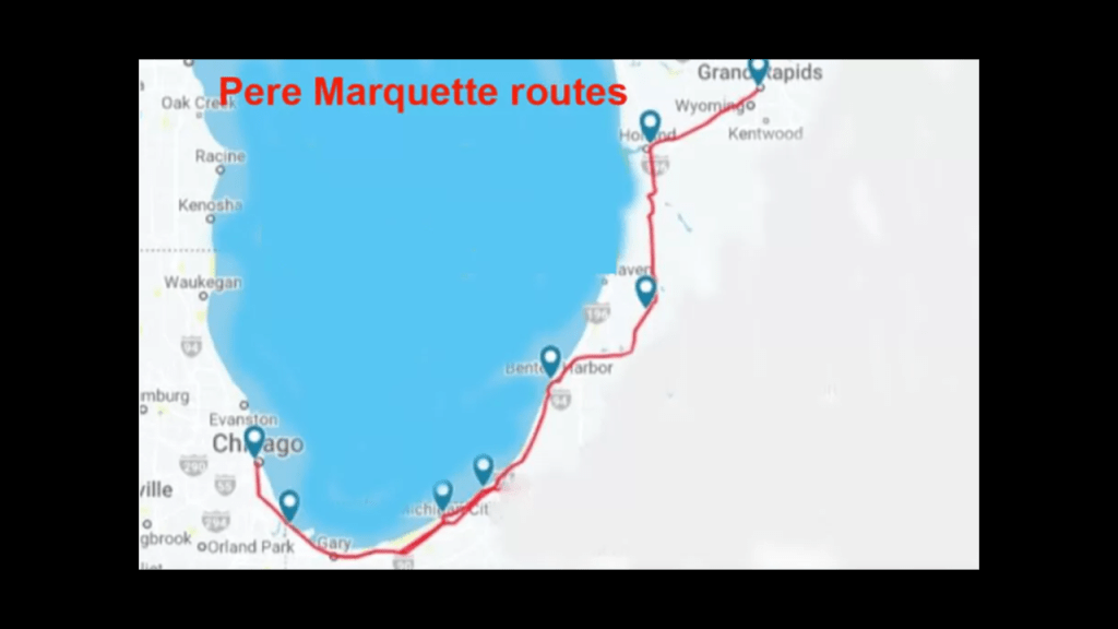
We are told that in January of 1870, the Chicago and Michigan Lake Shore Railroad extended a rail-line from New Buffalo to St. Joseph, connecting it to Grand Rapids, Muskegon, Detroit, and Chicago.
It was reorganized as the Chicago and West Michigan Railway and then incorporated into the Pere Marquette Railroad.
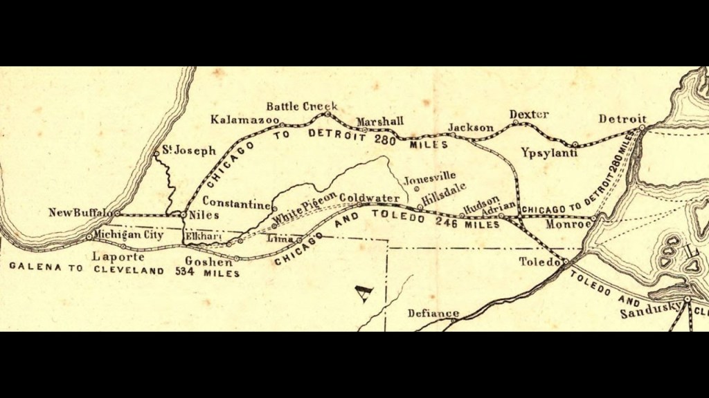
Today it is part of the CSX Grand Rapids Subdivision which runs from Chicago to Grand Rapids, which includes Amtrak’s “Pere Marquette” passenger rail service once per day between the two cities, mostly along the southern shore of Lake Michigan.
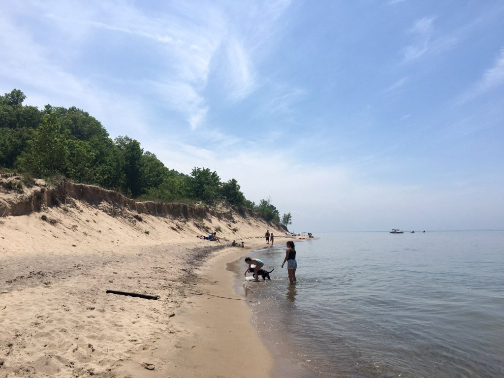
Next, Grand Mere State Park is located between St. Joseph and Bridgman.
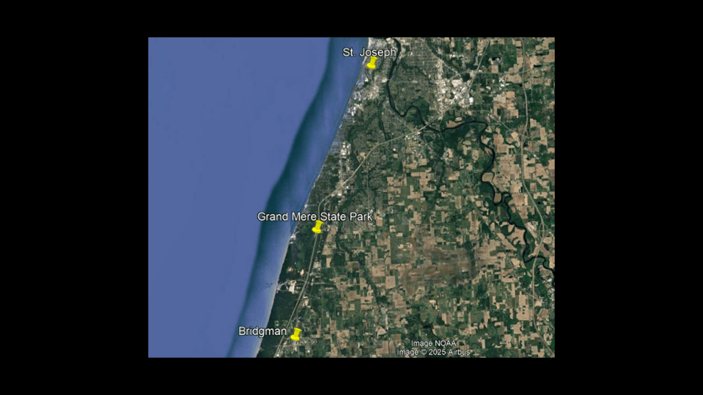
Grand Mere State Park is described as having “magnificent sand dunes and deep blow-outs,” and has several lakes and wetlands as well.
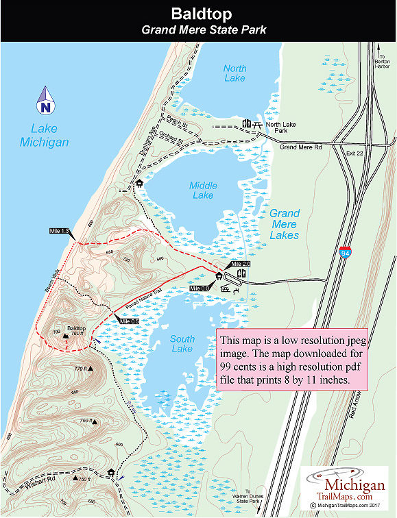
The park has almost two-miles, or 3.2-kilometers, of sandy beach that you have to climb over steep sand dunes on foot to get to because off-road vehicles have been banned.
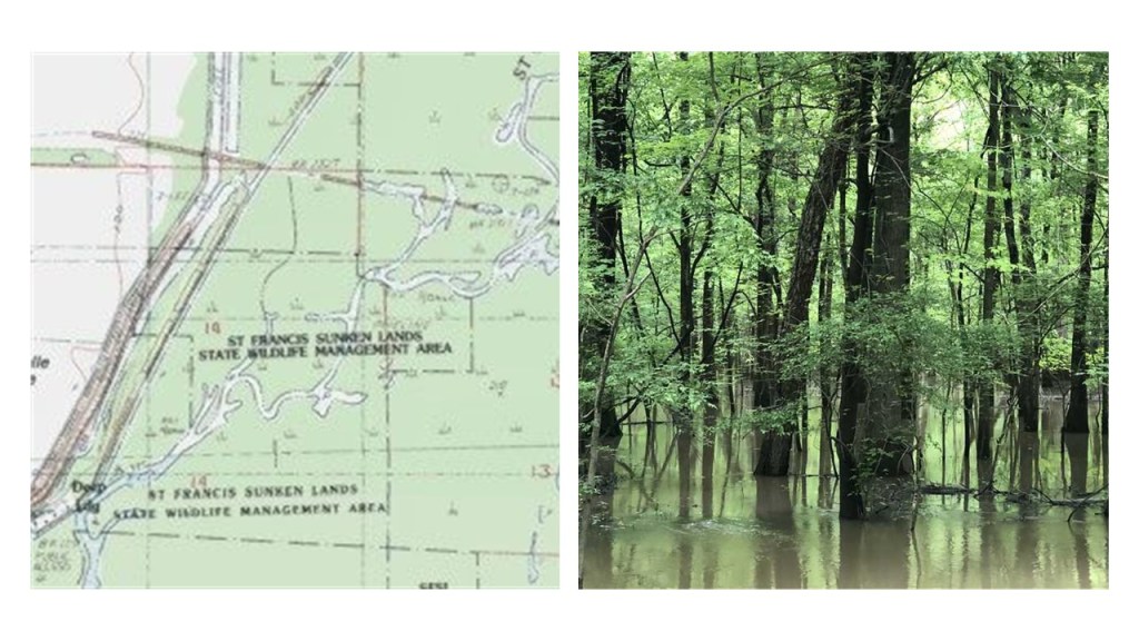
Speaking of blow-outs, this is a good place to mention the New Madrid Earthquakes.
In our historical narrative, the series of earthquakes in the New Madrid region in the winter of 1811 – 1812 dramatically affected the landscape, causing bank failures along the Mississippi River; destroyed entire communities; caused landslides along the Chickasaw Bluffs in Tennessee and Kentucky; large tracts of land subsided on the Mississippi flood plain; and liquified subsurface sediment spread over a large area at great distances and was described as widespread and severe.
Sand blows, described as large sandy deposits resulting from an eruption of water and sand to the ground surface, formed over an area of 4,015-square-miles, or 10,400-square-kilometers.

So there are hints of something of a cataclysmic nature taking place found in our historical narrative, with the New Madrid Earthquakes having been estimated as the largest earthquakes ever recorded in the United States, that the USGS estimated were between 7 and 8 on the Richter Scale.

Descriptions of what happened during the first one included rolling ground; uprooted trees; huge chasms opening up and swallowing whatever was above; the Mississippi River flowing backwards; and general pandemonium from frightened people.

The St. Francis Sunken Lands Wildlife Management Area in northeastern Arkansas today was said to have sunk during the New Madrid earthquakes, turning once fertile and abundant landscape into a swamp.
These descriptions are actually a snapshot of what I believe took place across the entire surface of the Earth through the deliberate destruction of the original energy grid.
Then there are odd stories like these that go along with this historical event as well, like this one.
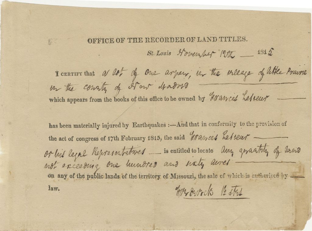
We are told after all of this devastation in the New Madrid Region, it took three-years to get federal action on disaster relief for the region with the onset of the War of 1812, with Congress finally approving $50,000 for the New Madrid Relief Act on February 17th of 1815, making it the nation’s first disaster relief of its kind.
The Act provided that anyone who lost land due to the earthquake was eligible to receive between 160 and 640 “like acres” of land elsewhere in Missouri.
But what we are told ended up happening was land agents arriving in the area to buy up the acreage and conned many New Madrid residents, offering them pennies on the dollar, and speculators subsequently claimed the new lands, and that of the 516 certificates issued by Congress, only 20 went to New Madrid residents, with most being held by people in St. Louis.
In the years following, the fertile flood-plain land was developed for growing cotton.

Today, New Madrid is the second-leading producer of cotton in the State of Missouri, and the percentage of organic farming in New Madrid County indicates none.

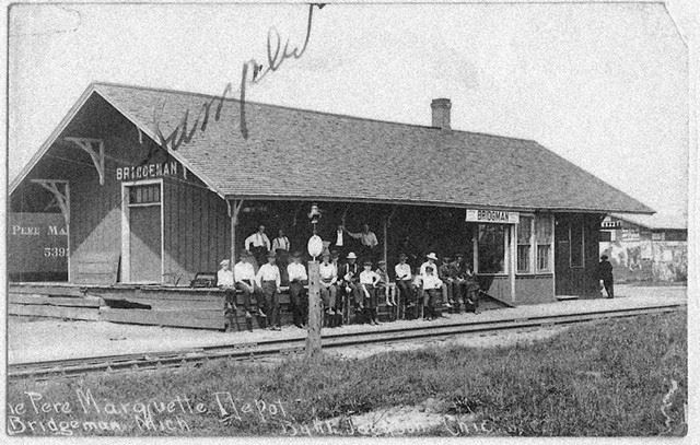
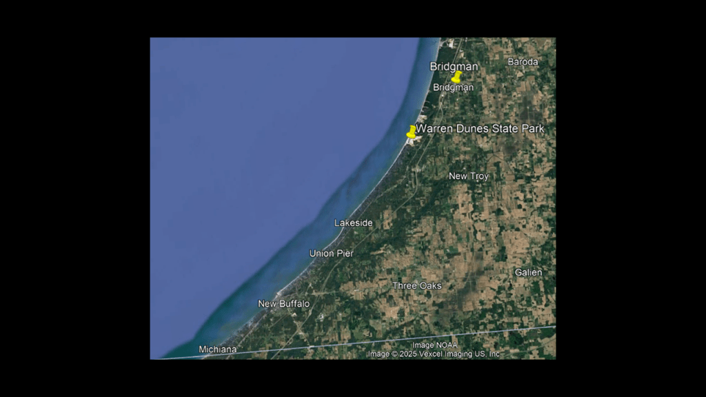
The next place we come to on Lake Michigan is the city of Bridgeman, which we are told was founded by lumbermen in 1856.
Then it was platted by George Bridgeman in 1870, and centered on a railroad station that opened that year.
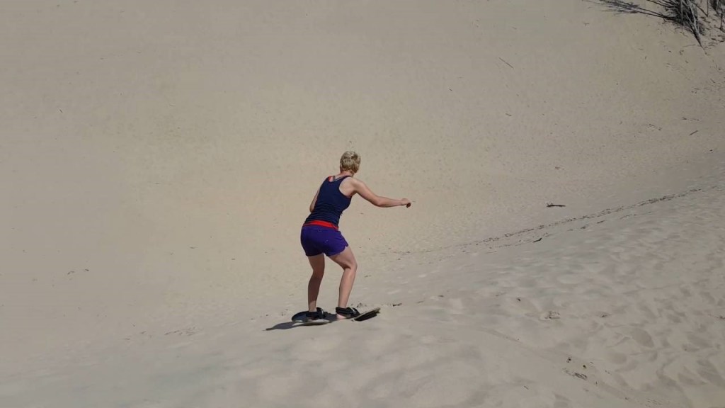
The Warren Dunes State Park is in the southwest corner of the Lower Peninsula in Berrien County heading towards the state line with Indiana, just to the south of Bridgeman.
We are told the Warren Dunes State Park’s large sand dunes and lake shore beaches make it one of the most popular state parks of Michigan.
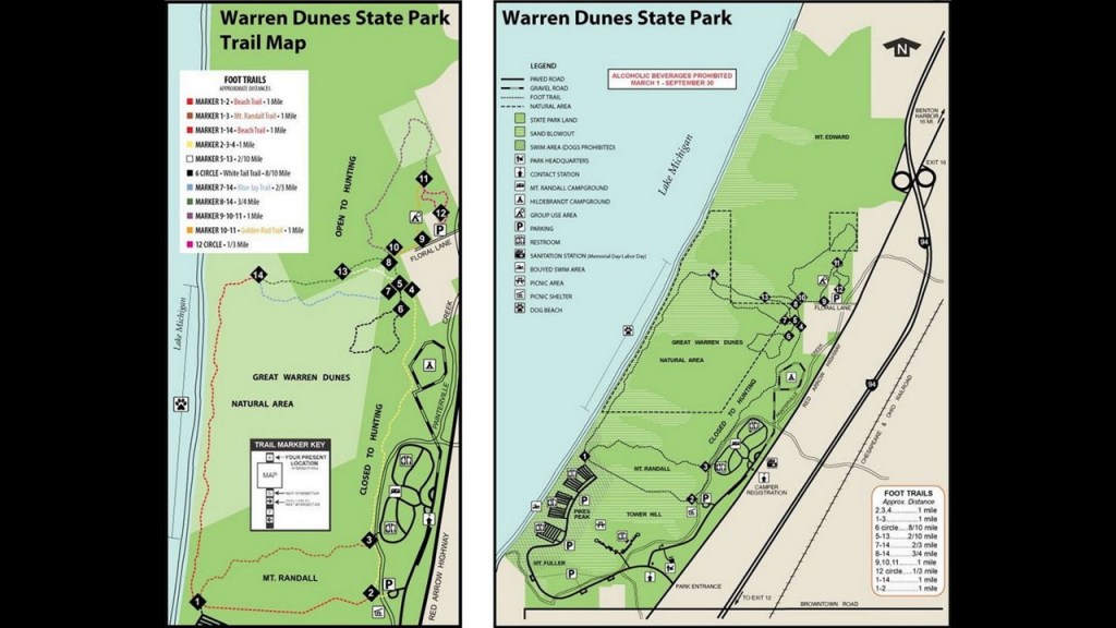
The Tower Hill Dune is one of the many large dunes found at the park, which is the highest point in the park standing at about 240-feet, or 73-meters, -high.
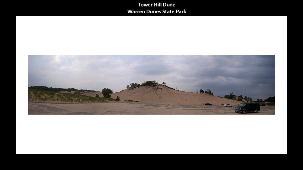
This park is a popular place for sandboarding because of easy access to the dunes.
Now I am going to cross the Indiana state line and next take a look at Michigan City; the Indiana Dunes; and Gary.
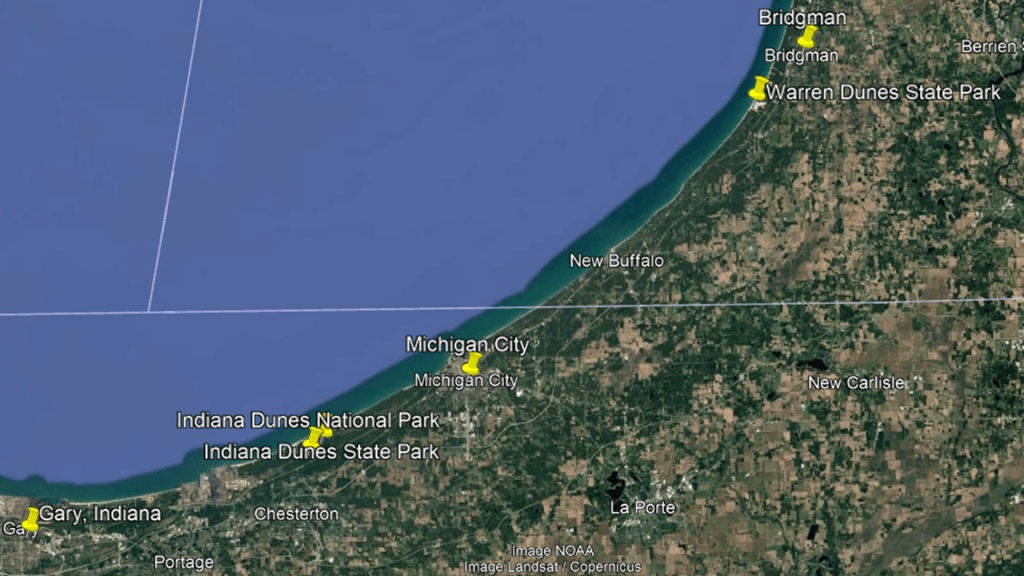
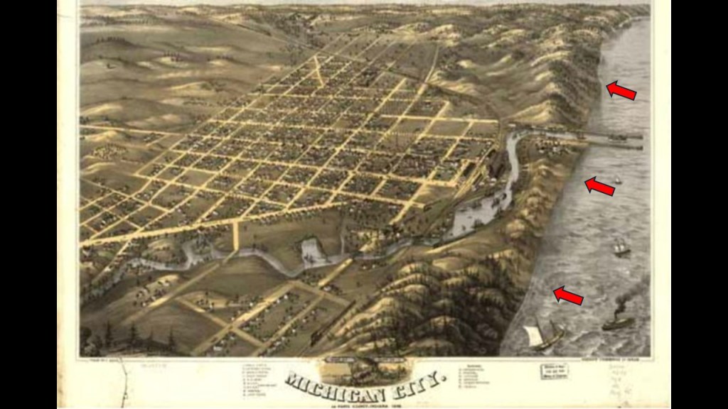
Michigan City is on the eastern side of the Indiana Dunes on the southern shore of Lake Michigan.
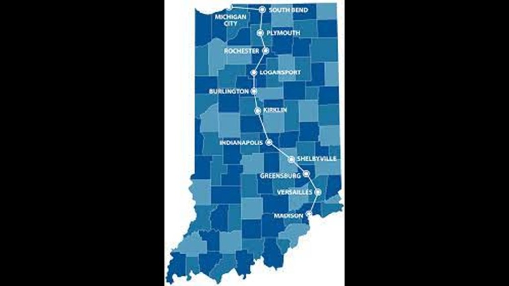
It is the northern terminus of what was originally the Michigan Road.
The Michigan Road was Indiana’s first “super-highway,” and said to have been constructed in the 1830s and 1840s between Madison, Indiana, and Michigan City, Indiana, by way of Indianapolis.
We are told the original Michigan Road pre-dated the “Plank Road Boom” by about 10 years or so.
In our historical narrative, the “Plank Road Boom” lasted in the United States from 1844 to the mid-1850s, with more than 10,000-miles, or 16,000-kilometers, of plank roads built across the country.
Newspapers and Magazines of the time, including the New York Tribune and Scientific American, extolled plank roads as being easy to construct and a way to transform the rural transit trade of the country.
As we see in these photos, plank roads are crossing over landscapes covered in sand and dunes.
Were the so-called “plank roads” actually re-purposed railroad tracks that were dug out of the sand?
What are we really looking at here?
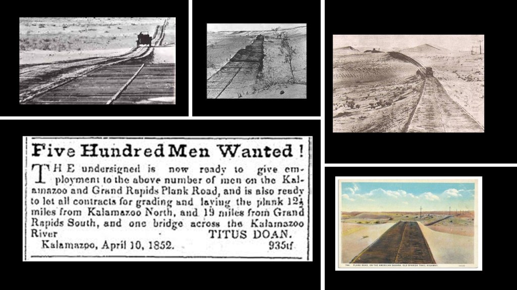
I could find references to the original Michigan Road being unpaved, and hard to build because of “swampy land” in places.
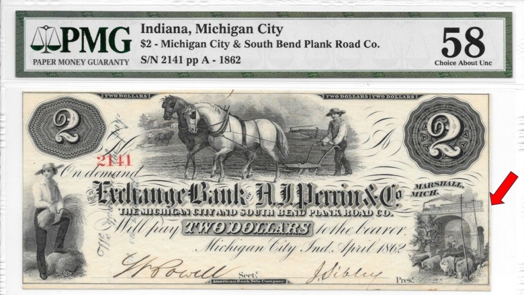
I found this paper note guaranty from 1862, which would have been during the American Civil War, for a “plank road” here.
Interesting to see the masonry archway with the herded livestock underneath it in the lower-right-hand corner of the note.
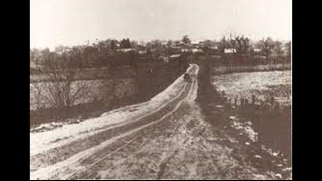
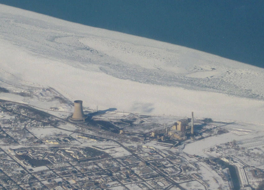
The Michigan City Power Plant is west of the city’s downtown on the lake-shore next to the dunes, and is a coal-burning plant.
We are told that the origins of Michigan City go back to 1830, when real estate speculator Isaac Elston purchased land for the city, paying $200 for 160-acres, or 65-hectares, of land, and that by the time the city was incorporated in 1836, it had 1,500 residents; a post office; a newspaper; a church; a commercial district and ten hotels, having grown to a size of 15-square-miles, or 39-kilometers-squared in six-years.
I can’t help but notice the dunes along Michigan City’s lakeshore.
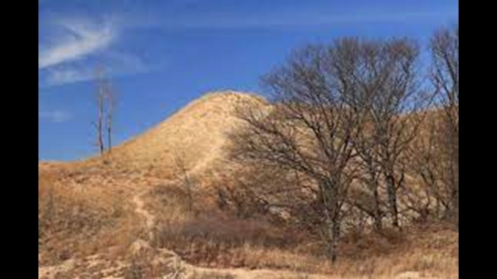
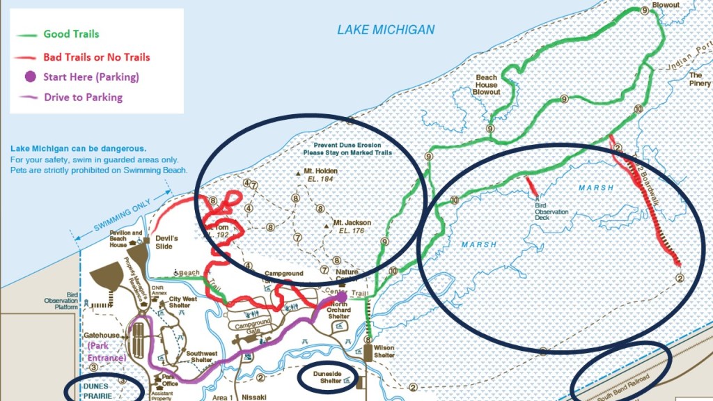
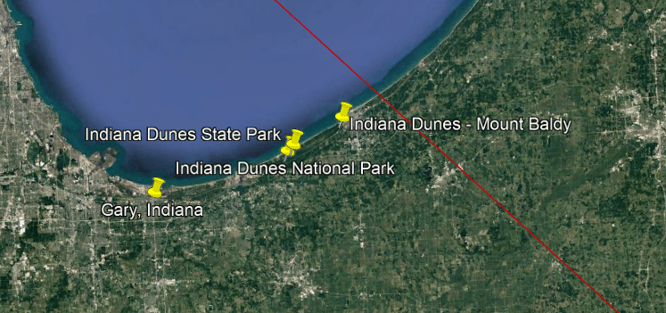
The next place we come to after Michigan City are the Indiana Dunes.
Designated as the nation’s newest National Park in February of 2019, the Indiana Dunes National Park runs 20-miles, or 32-kilometers, along the southern shore of Lake Michigan.
It had been designated as a National Lakeshore by Congress in 1966.
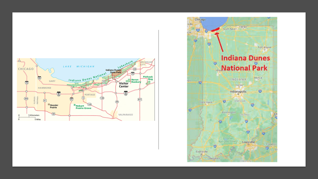
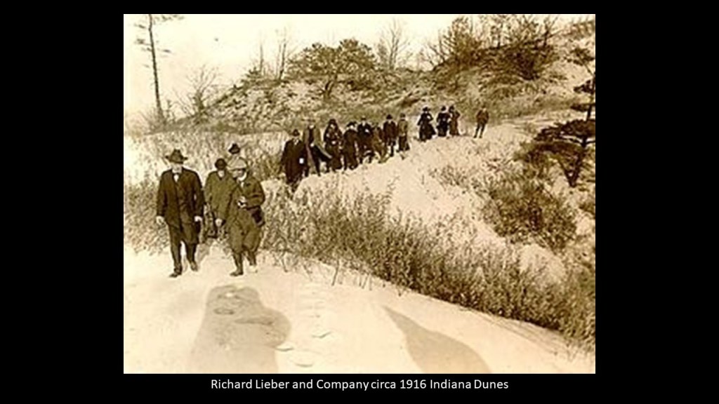
The Indiana Dunes State Park is within the boundaries of the National Park, and was first established in 1925 by Richard Lieber, a German-American businessman/conservationist who was the founder of the Indiana State Park System.
There have been five groups of mounds documented in the Indiana Dunes area.
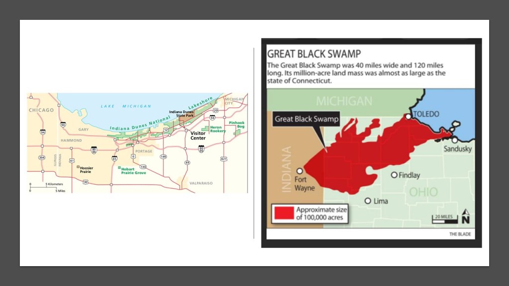
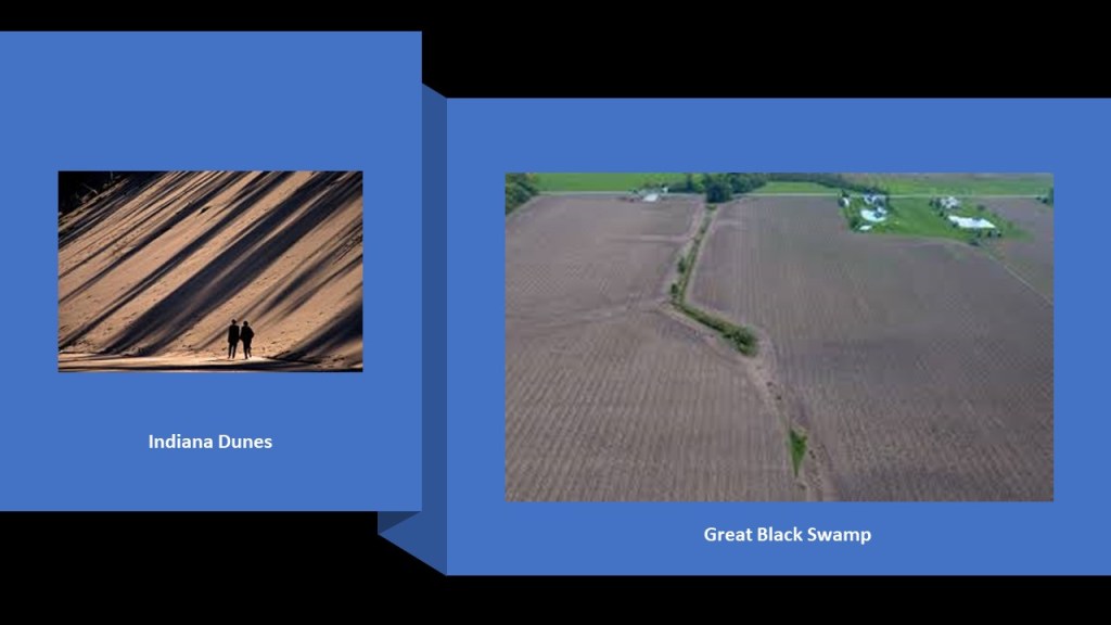
The Indiana Dunes are to the northwest between Fort Wayne and Lake Michigan, and the Great Black Swamp is to the northeast between Fort Wayne and Lake Erie.
I absolutely believe there is much infrastructure to be unccovered from the original civilization underneath all that sand and all that land!
When I was looking into the “North Bend Rail Trail” in West Virginia between Cairo and Ellenboro, I found out that it was part of the “American Discovery Trail” that runs from coast-to-coast through 15-states and the District of Columbia, and is the only non-motorized trail that crosses the country.
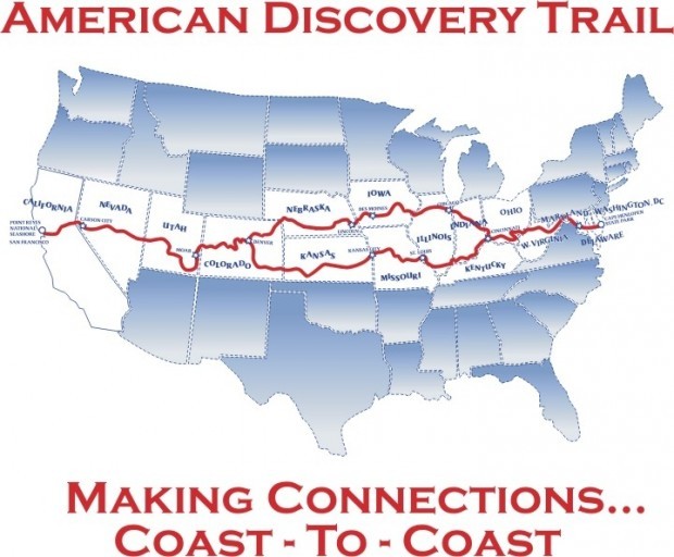
Interestingly, the “American Discovery Trail” includes the Indiana Dunes Discovery Trail, which is called one of the most biodiverse areas in the United States, and includes sand dunes and wetlands, including bogs, existing right next to each other in the same location, and both are beside railroad tracks, circled on the bottom right.
The South Shore Line runs in this part of Indiana starting in South Bend, and goes between Michigan City just to the east of the Indiana Dunes, to Gary, Indiana, located just to the west of the Indiana Dunes, on its way to Chicago, Illinois.

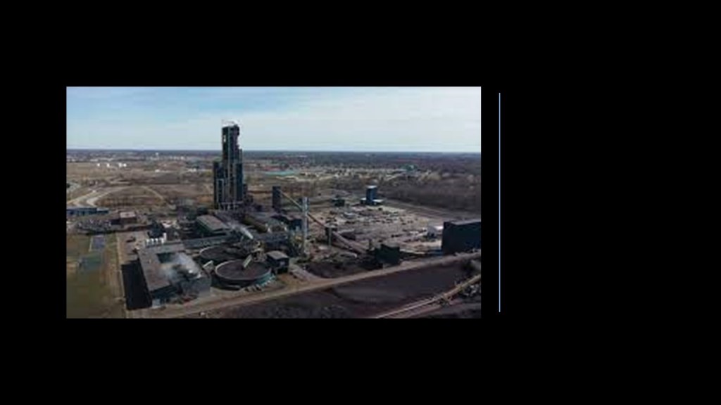
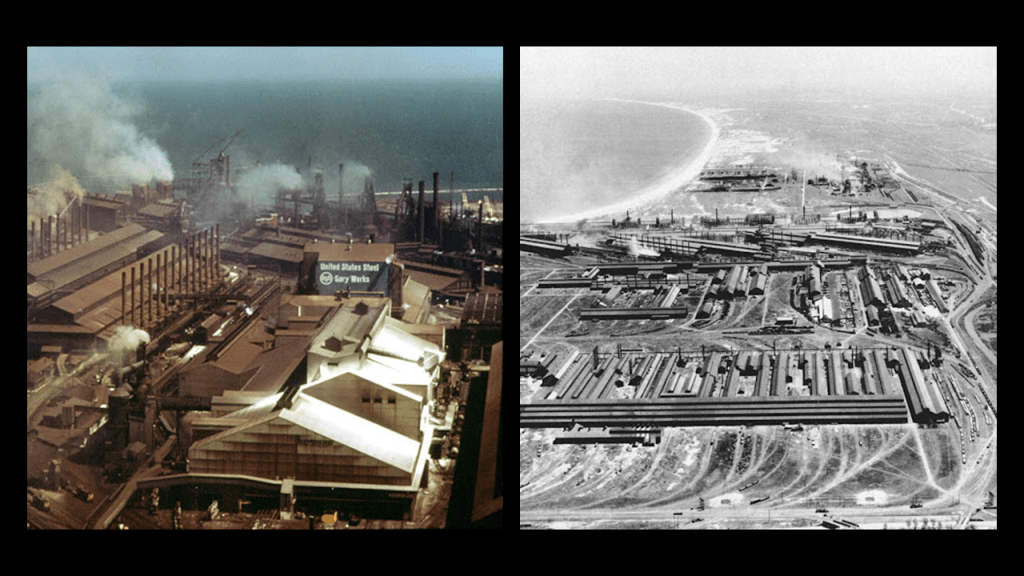
The Cleveland-Cliffs Steel Plant is located on the west side of the Indiana Dunes National Park.
Operated by Cleveland-Cliffs Inc, it is the world’s largest producer of flat-rolled steel.
The next place we come to is the location of Gary, Indiana, which is geographically very close to the Indiana Dunes.
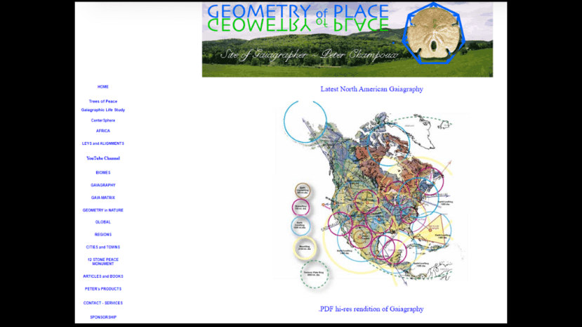
I first looked into the Indiana Dunes and Gary when I was doing the research for “Trekking the Serpent Ley,” going place-to-place on a long-distance ley-line from the Bermuda Triangle to Lake Itasca in Minnesota that was identified by gaiagrapher Peter Champoux.
Peter’s work can be found on his website geometryofplace.com.
This is what we are told about Gary, Indiana.
Gary was named after Elbert Henry Gary, a founder of U. S. Steel in 1901, along with J. P. Morgan, Andrew Carnegie, and Charles M. Schwab, and he was the second President of U. S. Steel, from 1903 to 1911.

In June of 1906, the location of what became the city of Gary, about 26-miles, or 42-kilometers, east of Chicago, Illinois, was a wasteland of drifting sand and patches of scrub oak.
No one lived there, and there was no agricultural value to the land.
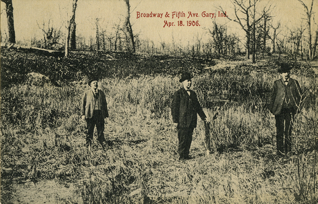
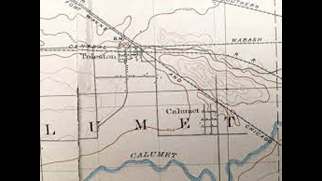
Three or four railroads passed through the area and the Grand Calumet River wound its way around sand dunes to get to Lake Michigan.
It was in June of 1906 that the first shovelful of sand was turned for the creation of the new steel town of Gary.
Laborers were housed in tents and shacks, and were digging trenches as very little work was being done above-ground.

And that by 1908, the city of Gary had taken on its shape and form!
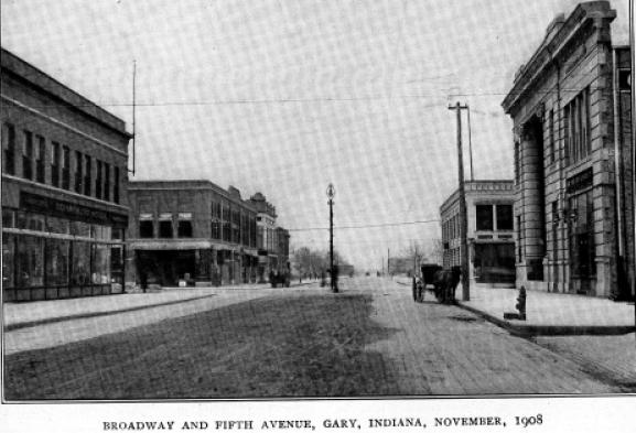
Gary was heralded as a “Magic City,” having been transformed from sand dunes in record time!
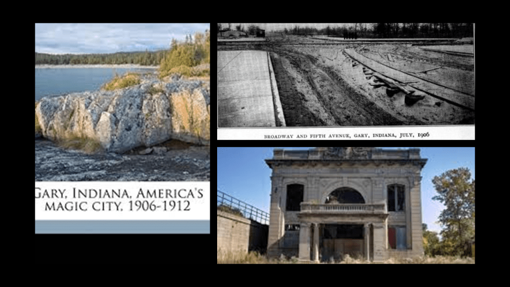
Gary was established to be the “company town” for U. S. Steel, and became home to the largest steel mill complex in the world, with its operation starting in June of 1908, only two-years after the first shovelful of sand was turned at this location.
Do I believe the official story?
Absolutely not!
I think Gary is a great example of the infrastructure buried beneath the sand dunes here and around the world that hasn’t seen the light-of-day for a very long time!
The next place going around Lake Michigan that we come to is Chicago.
I just want to mention something here about the World’s Fair in Chicago known as the World’s Columbian Exposition in 1893, said to have been held in 1893 to celebrate the 400th-anniversary of Christopher Columbus’ arrival in the New World in 1492.
We are told the Fair also served to show the world that Chicago had risen from the ashes of the Great Chicago Fire of 1871, only 22-years earlier.

This was the map of the South Park Commission Site for the World’s Columbian Exposition of Jackson Park, Washington Park, and the Midway Plaisance.
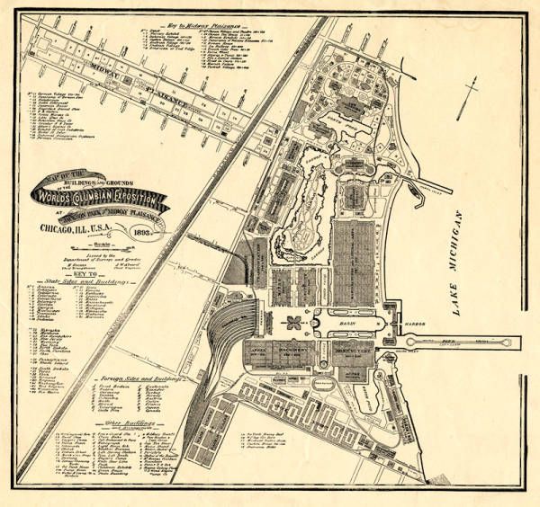
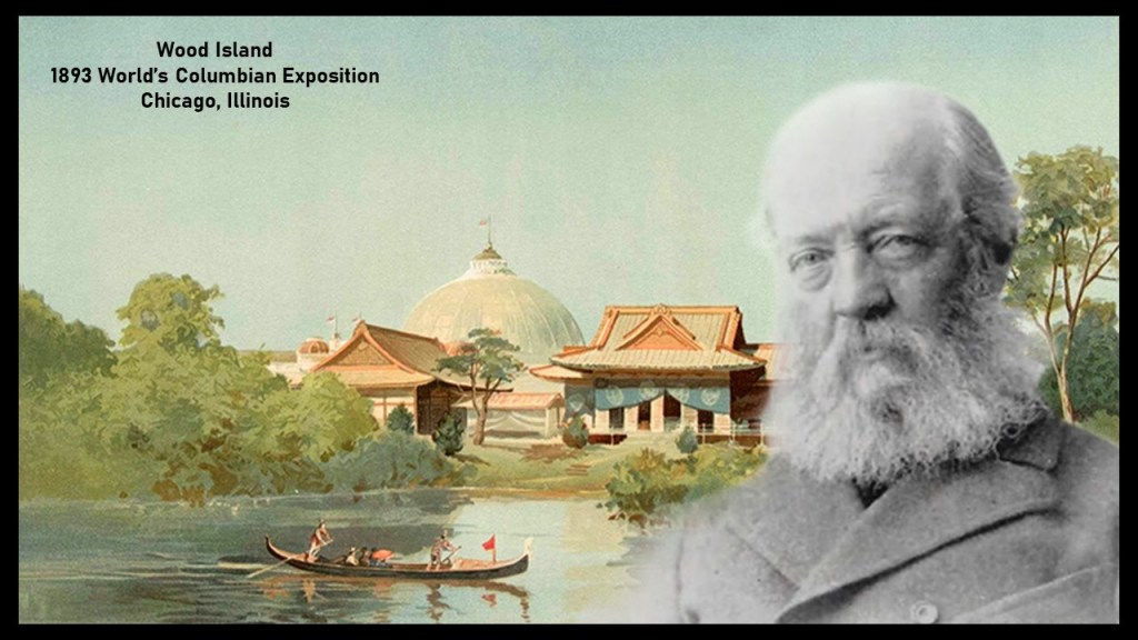
As the person responsible for planning the basic land- and water-shape of the exposition grounds, we are told that the famed landscape architect Frederick Law Olmsted concluded the marshy areas of Jackson Park could be converted into waterways, and that workers dredged sand out of the marshes to make lagoons of different shapes and sizes.
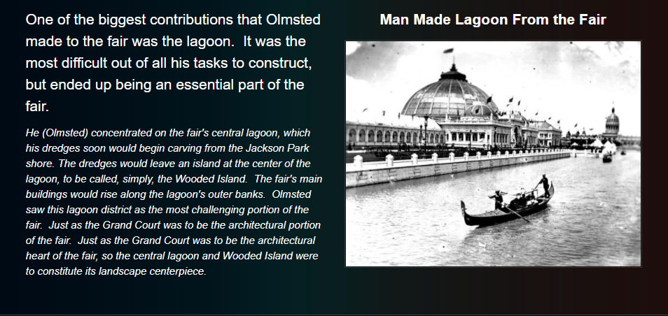
We are told the area known as Wood Island was described as a sandy area along Chicago’s lakeshore that looked like a deserted marsh before construction began, but that Olmsted saw the area’s potential, and that he included lagoons in his design since this area had not been developed yet.
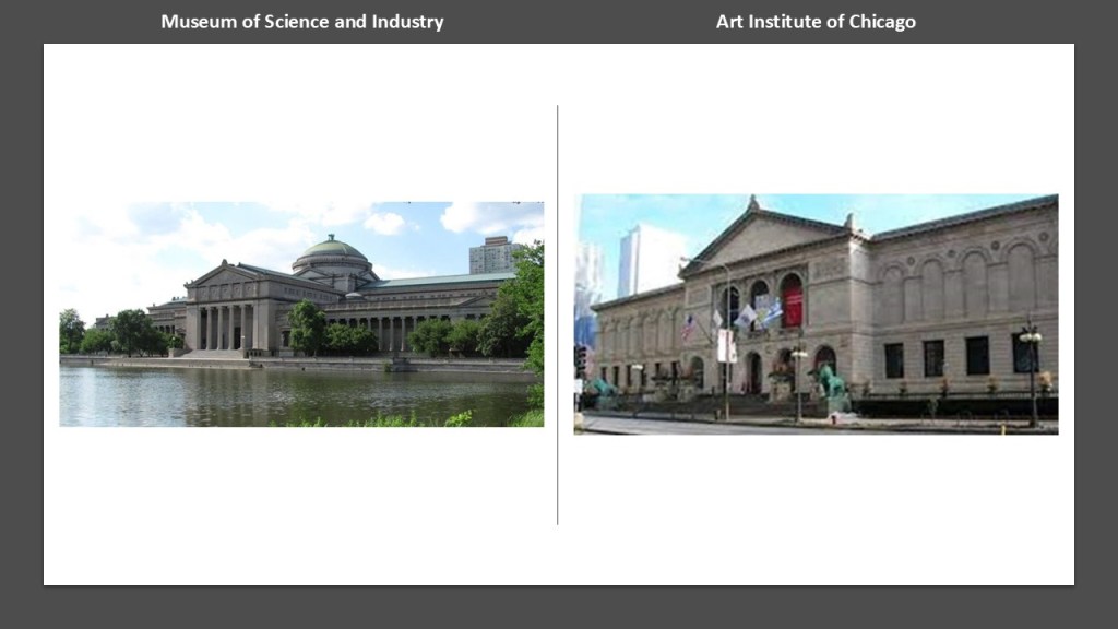
According to our historical narrative, Olmsted’s Jackson Park was left as a legacy for Chicagoans to enjoy, which has one of the only two buildings left standing after the end of the 1893 Columbian Exposition – the building which today houses the Museum of Science and Industry.
The other is the Art Institute of Chicago in Grant Park.
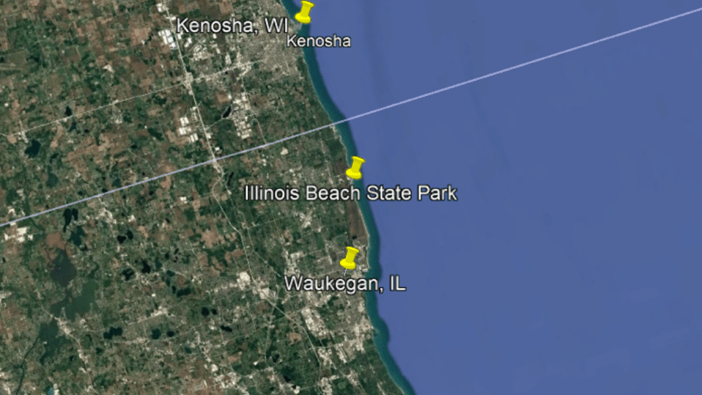
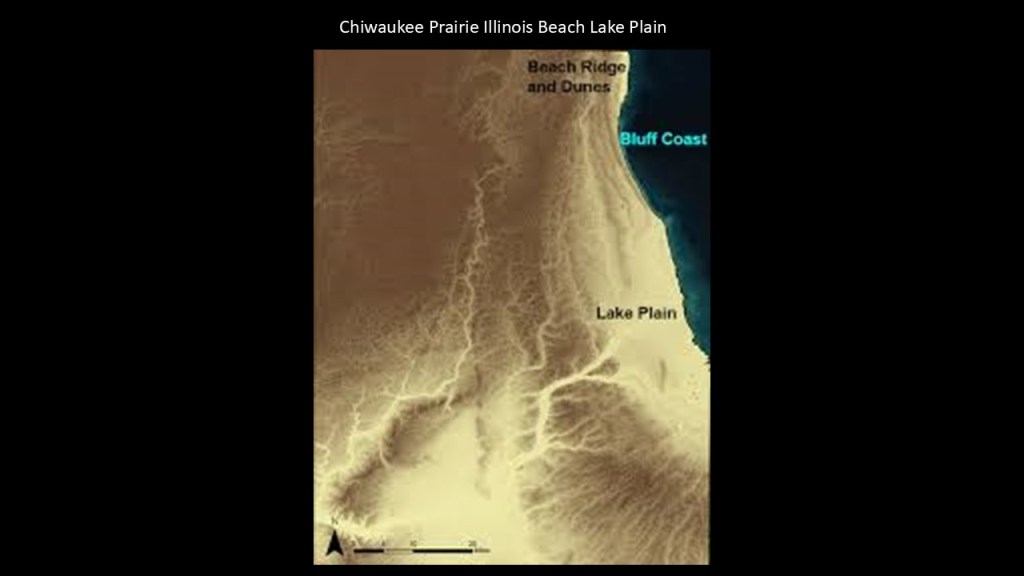
Now I am going to go up the western coast of Lake Michigan from Chicago to Illinois Beach State Park, which is located on Lake Michigan in-between Waukegan in Illinois and Kenosha in Wisconsin.
The Illinois Beach State Park forms most of the Chiwaukee Prairie Illinois Beach Lake Plain, an internationally-recognized wetland of importance under the Ramsar Convention.
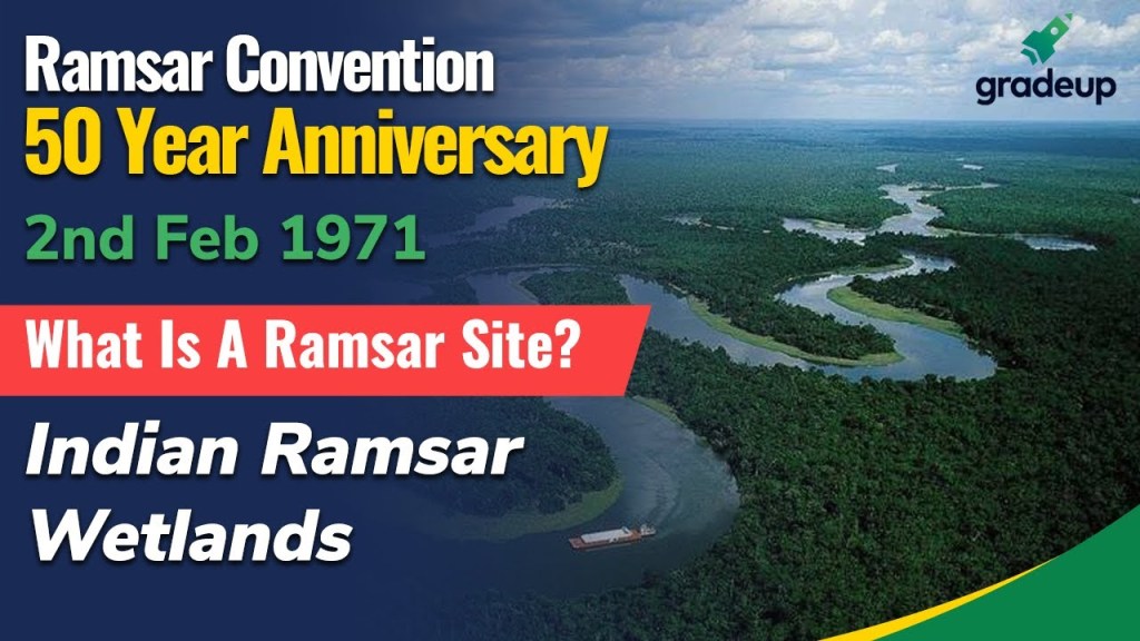
I first became aware of the Ramsar Convention when I was tracking a long-distance alignment through the Strait of Hormuz between the Gulf of Oman and the Persian Gulf.
The Ramsar Convention is an international treaty that was first signed in February of 1971 in Ramsar, Iran, and is reviewed every three-years by the contracting international parties.
It designated sites, known as “Ramsar Sites,” to be considered of international importance when it comes to the conservation and sustainable use of wetlands.
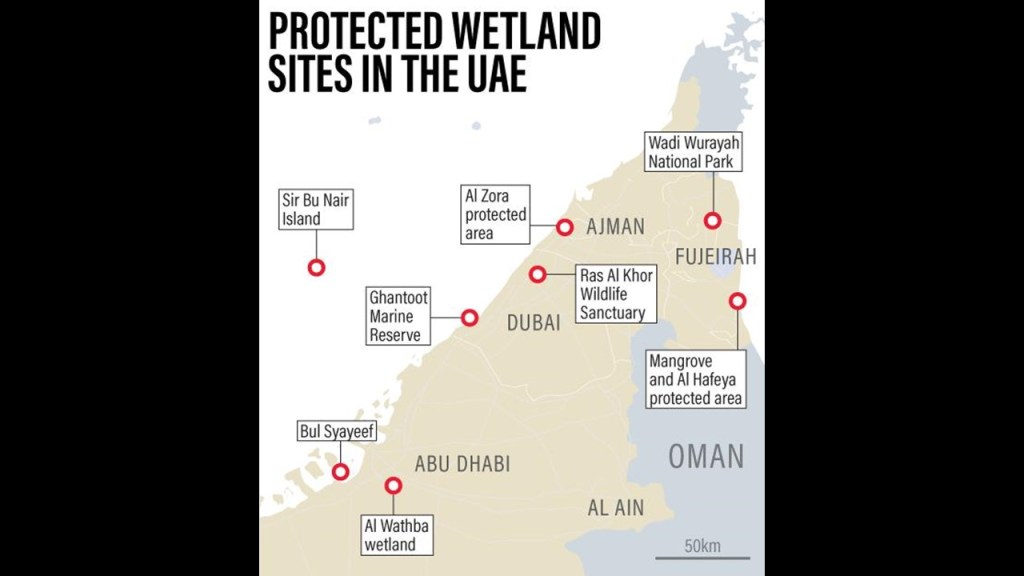
As one example, the United Arab Emirates as a whole has eight Ramsar wetlands sites.
The Ramsar Convention defines wetlands as “areas of marsh, fen, peat, or water, whether natural or artificial, permanent or temporary, with water that is static or flowing, fresh, brackish or salt, including areas of marine water, the depth of which at low tide does not exceed 20-feet, or 6-meters.
The Chiwaukee Prairie to the north of Illinois Beach at the state line with Wisconsin includes grassy wetlands, wooded areas, and the Kenosha Sand Dunes, one of the few remaining dune systems in southeastern Wisconsin.
You can also find megalithic stone blocks lining the beach at the Kenosha Sand Dunes location.
The Kenosha Lighthouses are also visible from the Kenosha Sand Dunes.
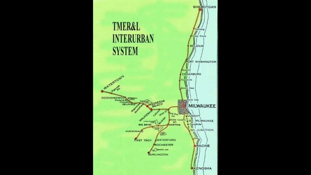
The 200-mile, or 322-kilometer, -long Milwaukee Electric Railway and Light Company (TMER&L) was an electric railway and interurban system that connected the cities of southeastern Wisconsin along the southwestern shore of Lake Michigan from the late 1800s to the mid-1900s.
Why go through the time, energy and effort to construct a sophisticated interurban electric streetcar system, for example, only to use it for such a short period of time?
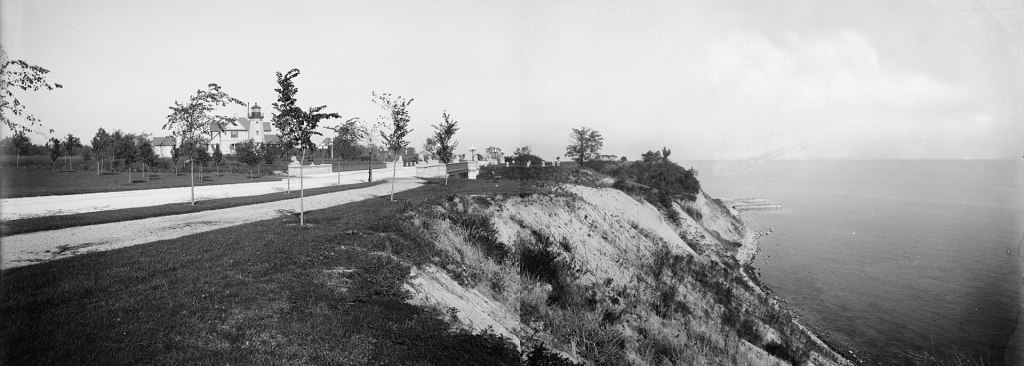
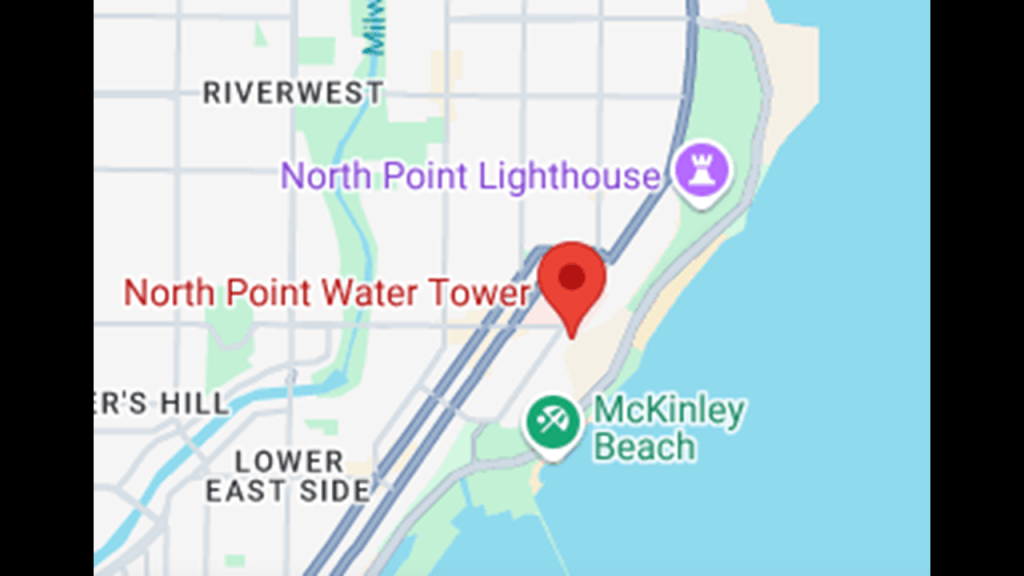
Further up in Milwaukee, the North Point Lighthouse was said to have been built in 1888 to mark the entrance to the Milwaukee River.
We are told the first lighthouse was built on this sandy bluff in 1855, but that in the late 1880s, it was jeopardized by the erosion of the bluff and plans were made to replace it.
So by 1888, this lighthouse was built 100-feet, or 30-meters, in from the edge of the bluff.
This photo of the North Point lighthouse next to the bluff was dated 1890.
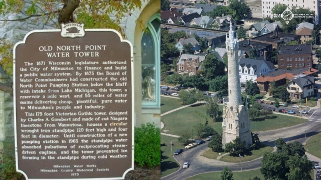
It is interesting to note that the North Point Water Tower is in the vicinity of the North Point Lighthouse.
The massive North Point Water Tower was said to have been constructed between 1873 and 1874 as part of Milwaukee’s first public waterworks in the Victorian Gothic-style.
We are told that the elaborate limestone masonry of the water tower was built to house the wrought-iron standpipe and to keep it from freezing.
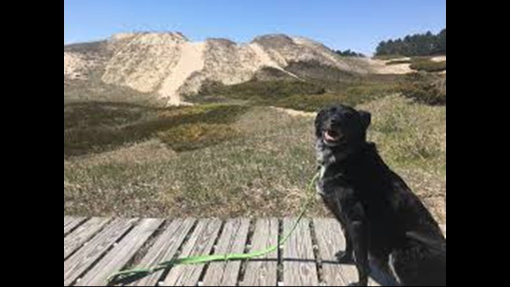
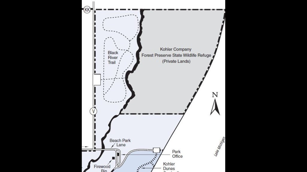
Further on up the western shore of Lake Michigan from Milwaukee, we come to the Kohler-Andrae State Park.
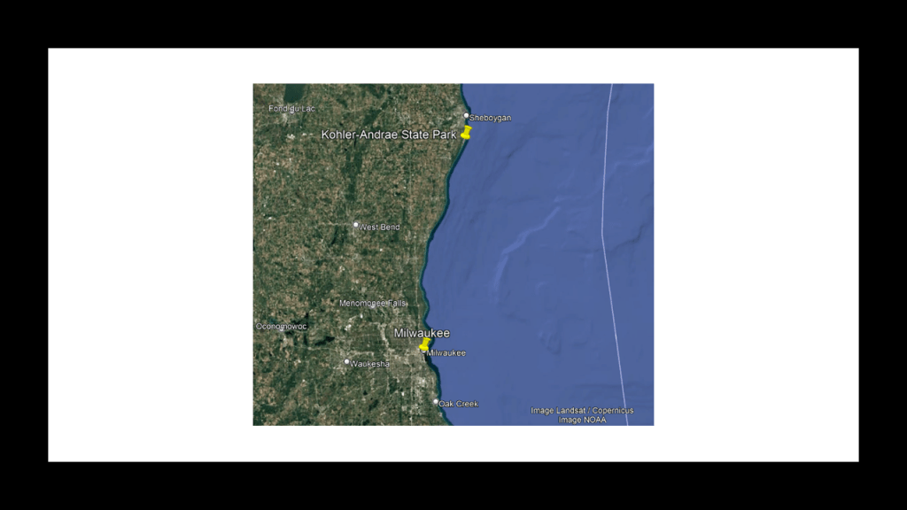
Kohler-Andrae State Park are two adjacent Wisconsin State Parks, the Terry Andrae State Park, which was established in 1927; and the John Michael Kohler State Park, which was established in 1966.
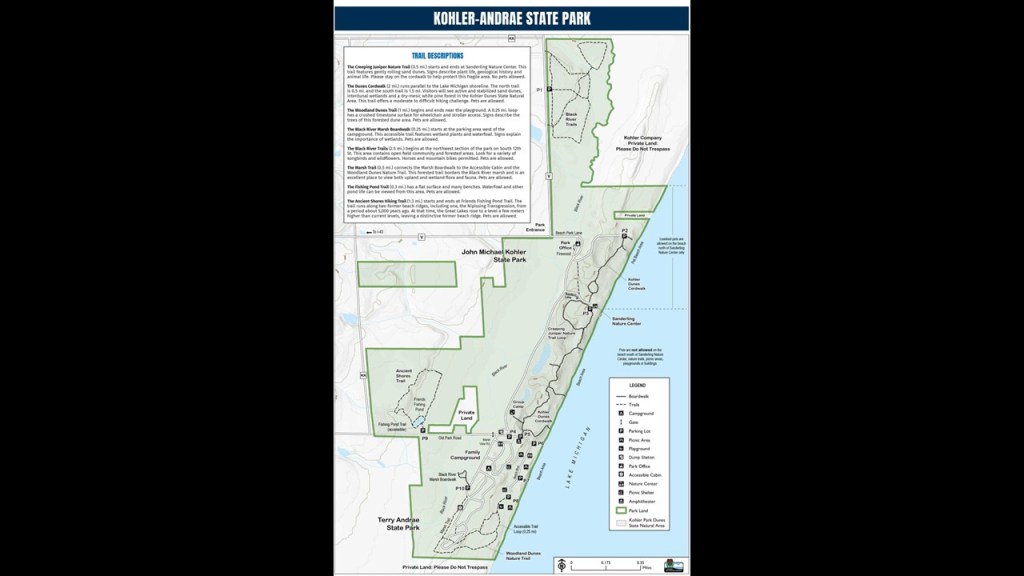
The parks contain over 2-miles, or 3-kilometers, of sand dunes along Lake Michigan’s shoreline, with woods and wetlands away from the water.
The Black River flows through the parks.
The next place is the Point Beach State Forest is just to the north of Manitowoc.
It is located along 6-miles or 9.7-kilometers, of the Lake Michigan shore, and has a beach and camping areas.
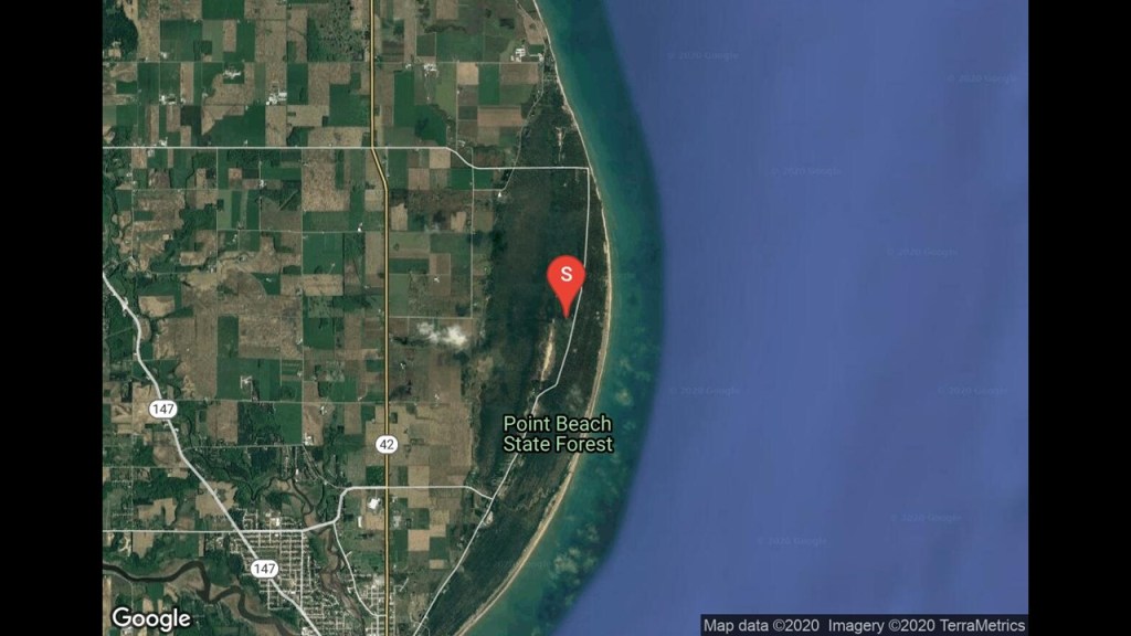
The state forest grounds contain the National Natural Landmark called the “Point Beach Ridges,” a series of alternating dune ridges and swales.
Just to share an example of another National Natural Landmark that comes to mind with you is what are called “Monument Rocks,” also known as the “Chalk Pyramids,” in Kansas.

The amazing thing for a so-called National Natural Landmark are the solar and lunar alignments found at “Monument Rocks.”

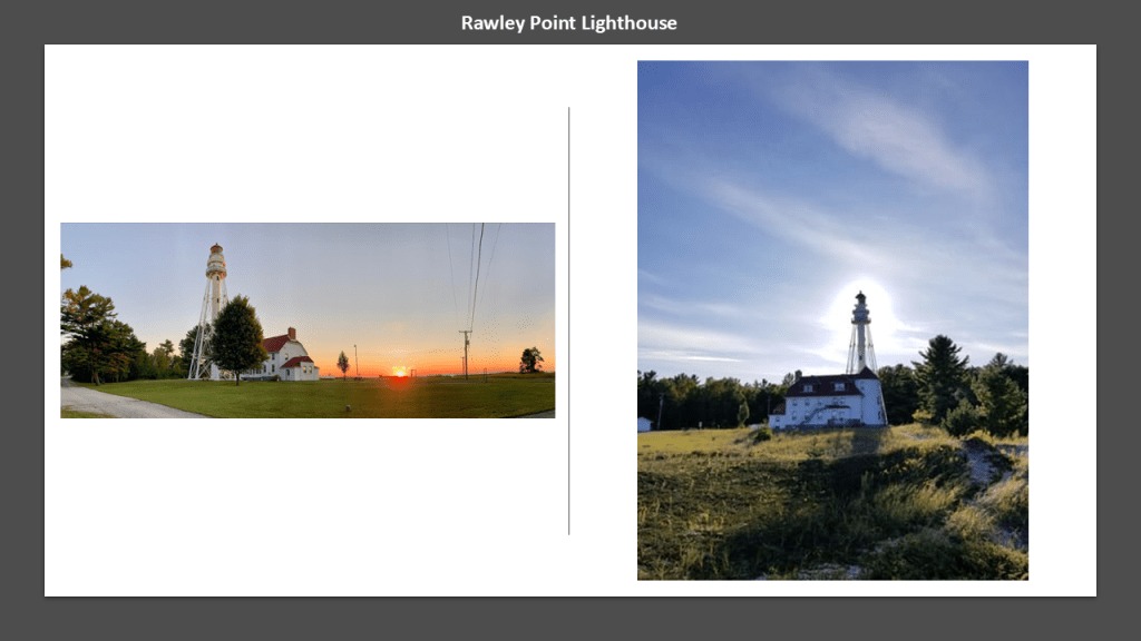
The Point Beach State Forest grounds also contain the Rawley Point Lighthouse, said to have been constructed there in 1873, and is the tallest lighthouse on the Wisconsin shore of Lake Michigan.
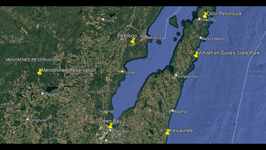
Next, we are heading into the landform known as the “Door Peninsula.”
The Door Peninsula separates Lake Michigan from the southern part of the Green Bay.
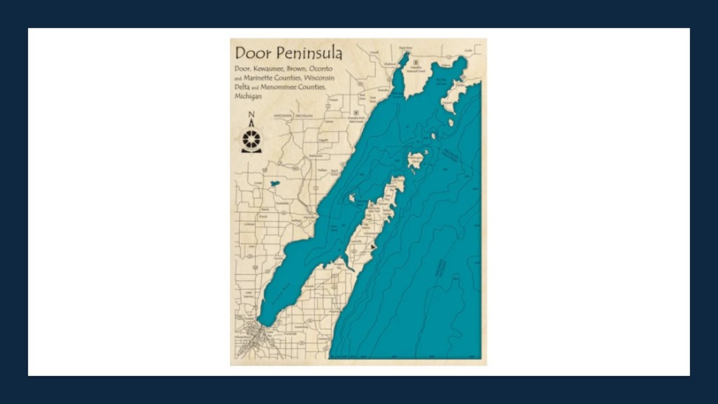
The Door Peninsula in Wisconsin is on the western-side of the Niagara Escarpment.
The Niagara Escarpment runs predominantly east-to-west, from New York, through Ontario, Michigan, Illinois, and Wisconsin, with a nice, half-circle shape, attached to a straight-line, when drawn on a map.
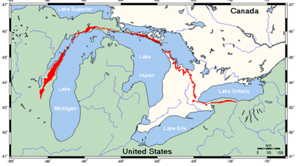
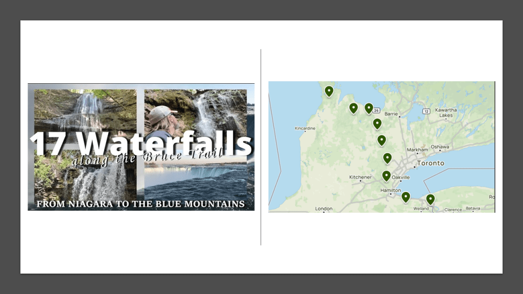
It’s important to note that when I saw this map of the region’s waterfalls, it struck me how many there are on the Ontario side of Lake Huron and the Georgian Bay, including a series of waterfalls running along the Niagara Escarpment from Niagara Falls.
In the course of doing the research for the series on the Great Lakes, I came to understand deeply that the Georgian Bay of Lake Huron is formed by the Niagara Escarpment.
Come to find out, the whole Niagara Escarpment is loaded with waterfalls, with at least seventeen waterfalls on the Bruce Trail alone.
The Bruce Trail is a hiking trail that runs along the Niagara Escarpment for 250-miles, or 400-kilometers, from the Niagara River to Tobermary, a small community at the northern tip of the Bruce Peninsula.
It is the oldest and longest marked hiking trail in Canada.
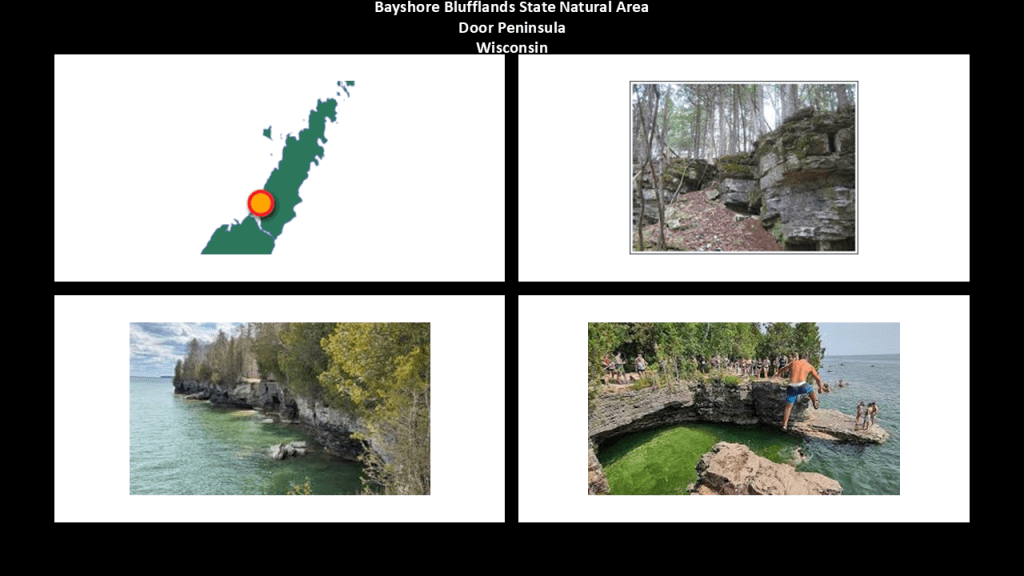
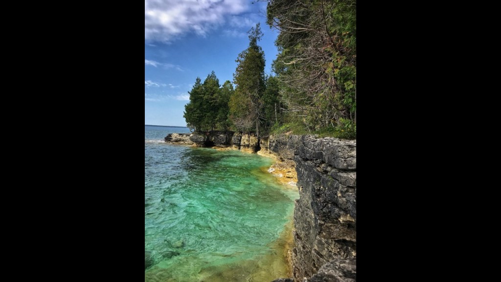
Back in Wisconsin, limestone outcroppings are visible on both sides of the Door Peninsula, but are larger and more prominent on the Green Bay-side, as seen at the Bayshore Blufflands State Natural Area, which contains more than 7-miles, or 11-kilometers, of the Niagara Escarpment.
Progressions of dunes are seen on much of the rest of the shoreline, as seen at the Whitefish Dunes State Park.
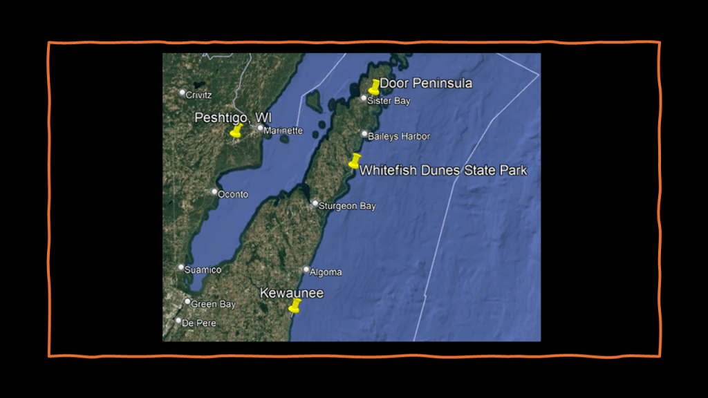
Whitefish Dunes State Park and Natural Area preserves the largest and most significant dune landscape in Wisconsin, and offers trails and picnic areas for visitors.
It is also heavily forested, with such trees as birch, fir, cedar, yew, maple, aspen, hemlock and beech.
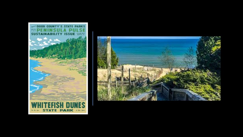
Whitefish Dunes State Park also has a stone-masonry-looking shoreline.
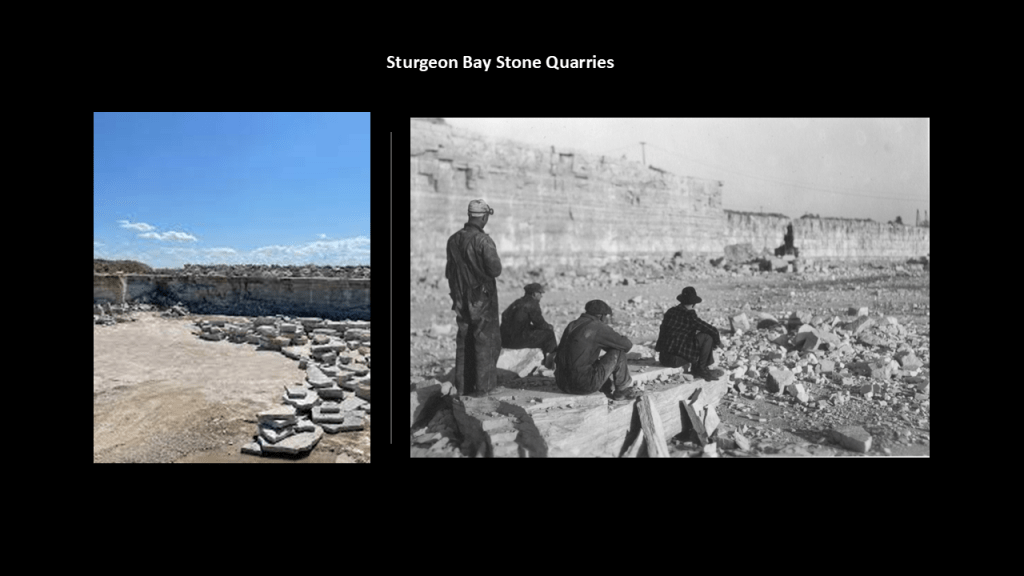
Sturgeon Bay is the largest city of the Door Peninsula and a popular tourist destination.
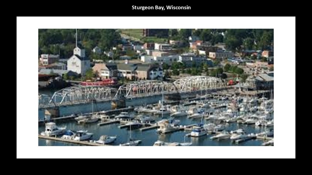
In 1874, Sturgeon Bay was incorporated as a village, and as a city in 1883.
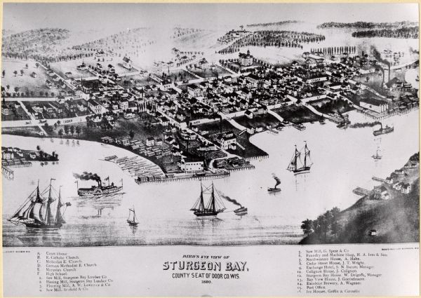
In the 19th-century, Sturgeon Bay became a center of stone quarrying, with five quarries shipping limestone throughout the region.
I strongly suspect that the stone quarries, here and elsewhere in the world, were harvesting megalithic stone blocks from existing infrastructure.
Next, the city of Green Bay is at the southern end of the Green Bay, which is an arm of Lake Michigan and the largest bay on Lake Michigan, and is located right next to the Door Peninsula.
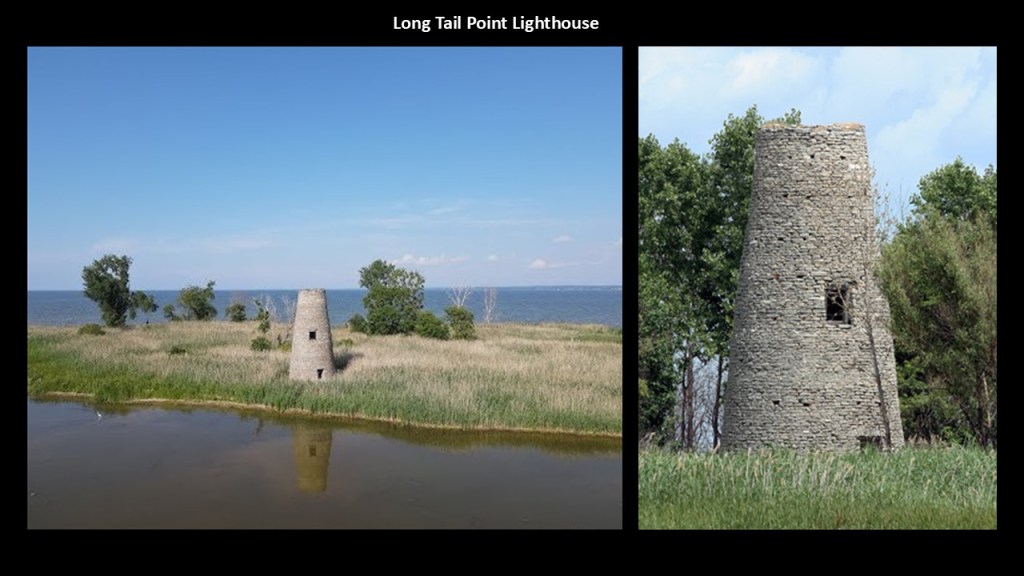
There’s a lot here, but I am just going to share about the remants of what is called the first Long Tail Lighthouse.
It was said to have been built in 1848, and was in use for only ten years, from 1849 to 1859.
It sits long-abandoned on Long Tail Point, a sandbar next to the channel near the city of Green Bay.
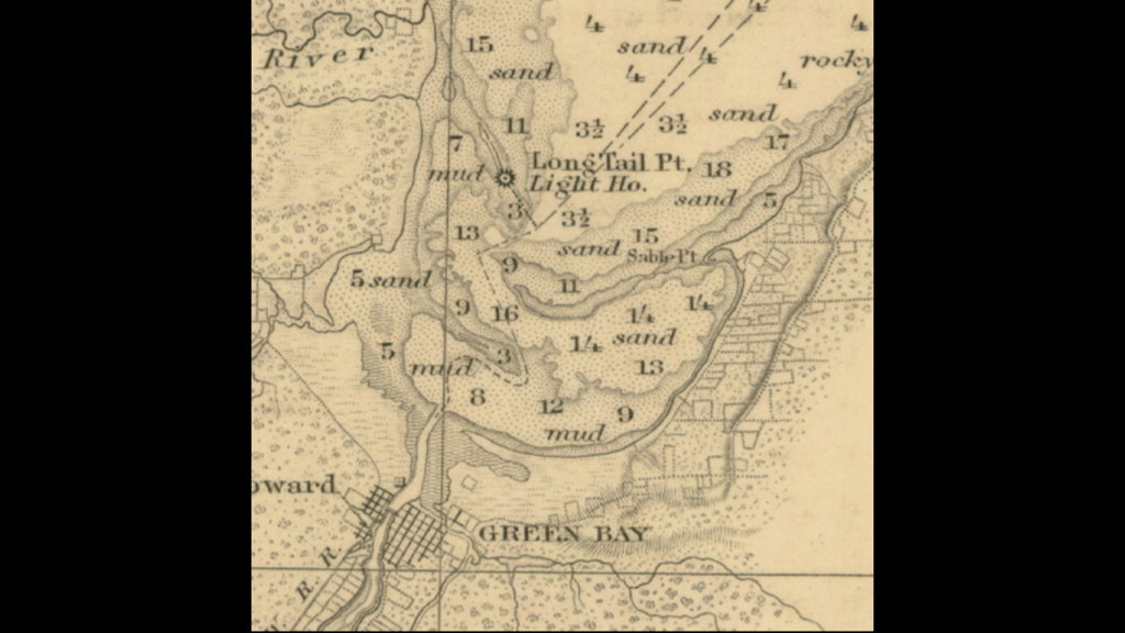
This 1867 survey map of the harbor around Green Bay shows the sand bars and mud there.
Now, I am going to head over to Lake Huron and take a look at a few places there, starting with some of the things found on the lakeshore at a municipality there called Lambton Shores, in particular Ipperwash Beach and Pinery Provincial Park.
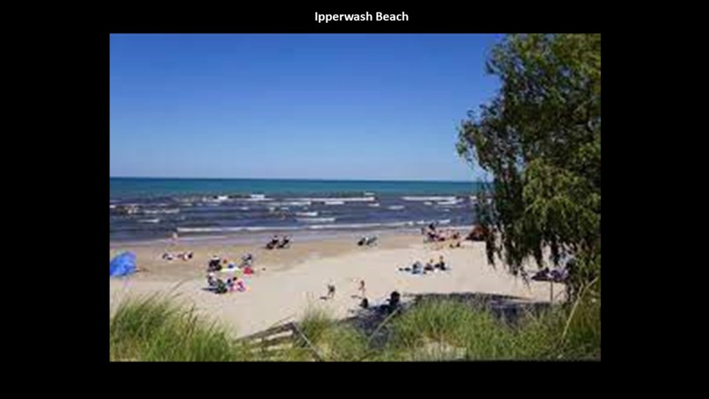
Ipperwash Beach there is situated between what is called “The Point” and Pinery Provincial Park.
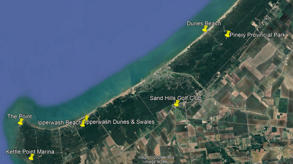
Ipperwash Beach is one of the longest freshwater beaches in Ontario.
Beach access here is limited to public access areas.
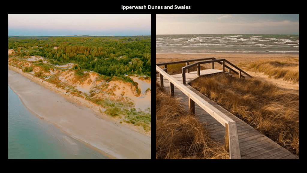
The Ipperwash Dunes & Swales is described as a Carolinian forest of sand ridges and wet swales that cover over 500-acres, or 202-hectares, that can be visited by way of a 3-mile, or 5-kilometer, boardwalk trail.
A Carolinian Forest features deciduous trees like beech, black walnut, hickory, maple and oak.
And, as I mentioned earlier, swales are landforms that are defined as a sunken or marshy place.
The Sand Hills Golf Club and Resort is sandwiched in-between Ipperwash Beach, Ipperwash Dunes and Swales, and Pinery Provincial Park.
I also consistently find golf courses along leylines and shorelines, and believe them to have been earthworks that provided “links,” which is another name for golf course, between all the components of the original energy grid that we know nothing about.

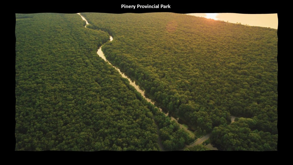
We are told the Pinery Provincial Park was created to help preserve an oak savannah and dune ecosystem, and that the initial package for the land was purchased from the Canada Company in 1857.
The Canada Company was created in August of 1826, under the Canada Company Act of 1825 of the British Parliament, to aid in the colonization of a large part of Upper Canada.
We are told that the Canada Company was successful in populating an area called the Huron Tract, which was called the “most single important attempt at settlement in Canadian history,” and which resulted in the Anishinabek people being dispossessed of their ancestral lands.
The Huron Tract happens to be the land that we are looking at here.
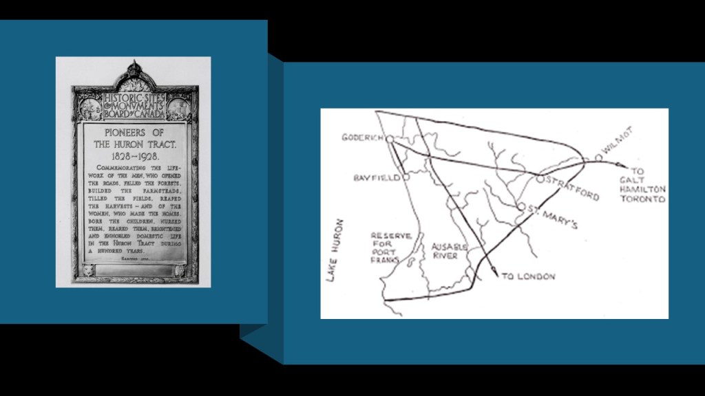
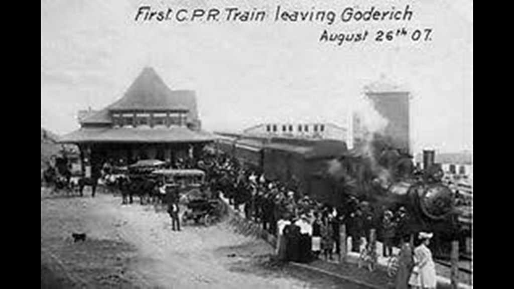
The Huron Tract included the town of Goderich, which is noteworthy for a number of things, including its railroad history.
The Menesetung Bridge in historic Goderich is a pedestrian bridge today, but was historically a railroad bridge.
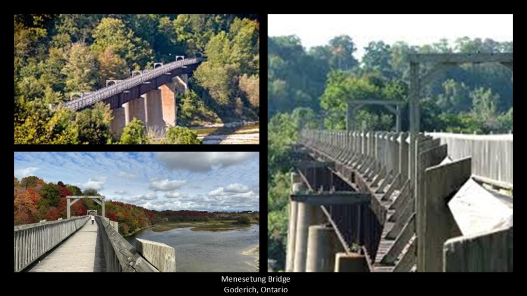
It crosses the Maitland River near its entrance to Lake Huron, and was said to have been constructed between 1906 and 1907.
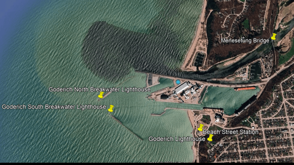
The Beach Street Train Station in Goderich was said to have been built on the beach at the same time as the Menesetung Bridge in 1907 at the terminus of the Guelph and Goderich Railroad, and served as a railway hub for passenger service until 1956 and freight until 1988, after which time it fell into disrepair.
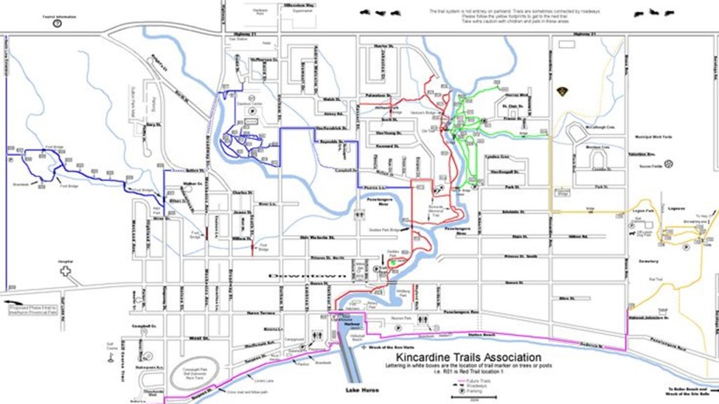
In Kincardine, just up the shore of Lake Huron from Goderich, Station Beach is directly across the Kincardine Marina from the Lighthouse and the mouth of the Penetangore River.
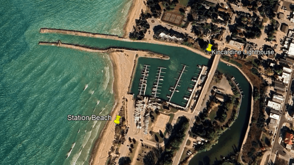
So I looked to see if there was a railroad connection to “Station Beach,” and found that yes in fact there was one.
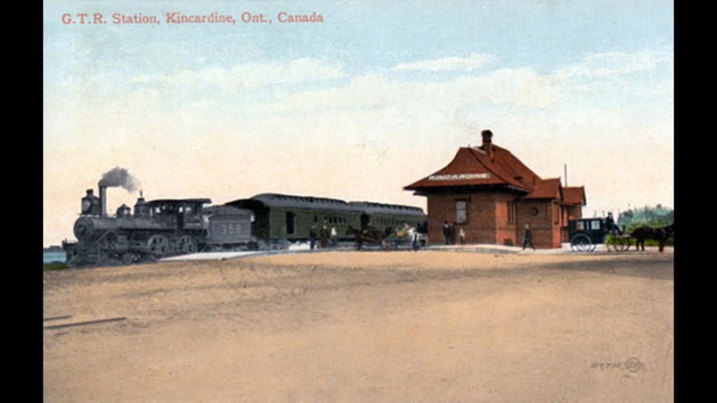
Station Beach was at one time the location of the Kincardine Railway Station.
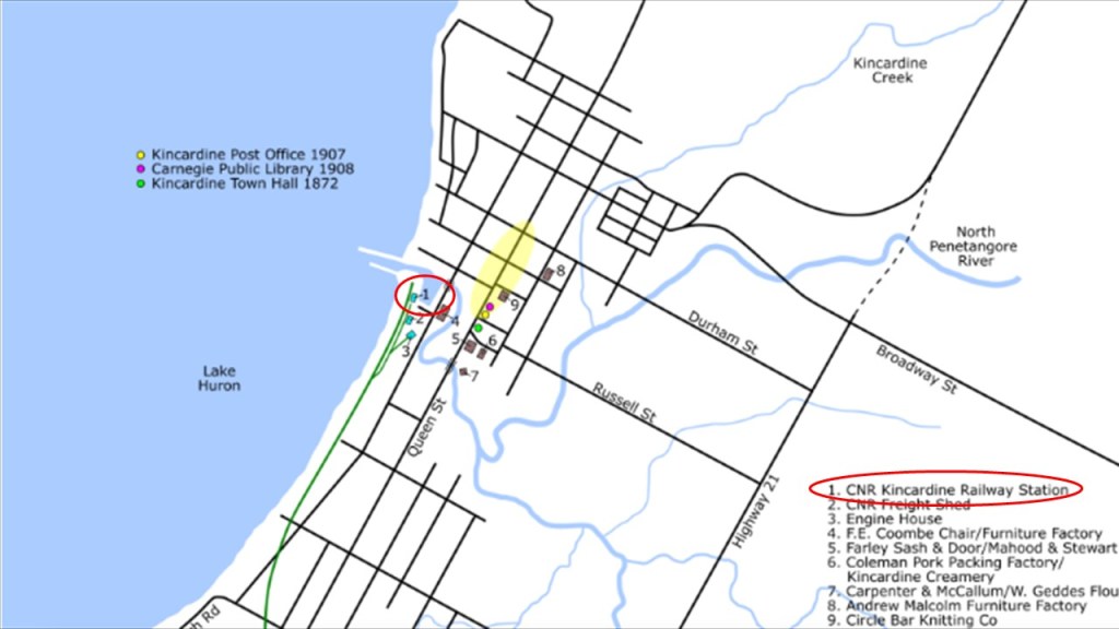
We are told that the train station was constructed with the opening of the Grand Trunk Railway line in 1872.
Trains stopped operating in Kincardine in 1983, and the tracks were removed.
The Kincardine Trails Association manages trails in the surrounding area, including the former railroad lines.
Now I am going to look at other places with a history of dunes, deserts, lighthouses, and railroads, which I have found along leylines I have tracked long-distances.
There are a number of places that I would like like to share from when I was looking at what is found on the leyline between the Quetzelcoatl Pyramid in Teotichuacan in Mexico and the Great Pyramid of Giza in Egypt.
In Part 2 of this series, the leyline from Teotihuacan enters the United States at Panama City Beach in western Florida at the Sunnyside Beach and Tennis Resort, and the eastern tip Lake Powell is directly on the leyline.
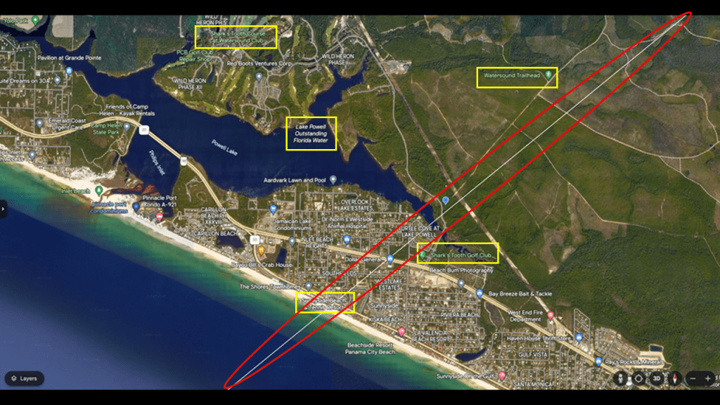
Lake Powell is the largest coastal dune lake in North America, and is designated as one of the Outstanding Florida Waters because of its pristine condition and ecological rarity, as these freshwater coastal dune lakes are found only in western Florida, South Carolina, Oregon, Madagascar, New Zealand, and Australia.
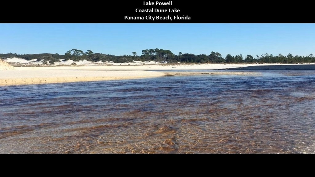
Lake Powell’s water is brackish, as there is a continuous mixing of freshwater from upland freshwater systems and saltwater from a meandering outlet to the sea.
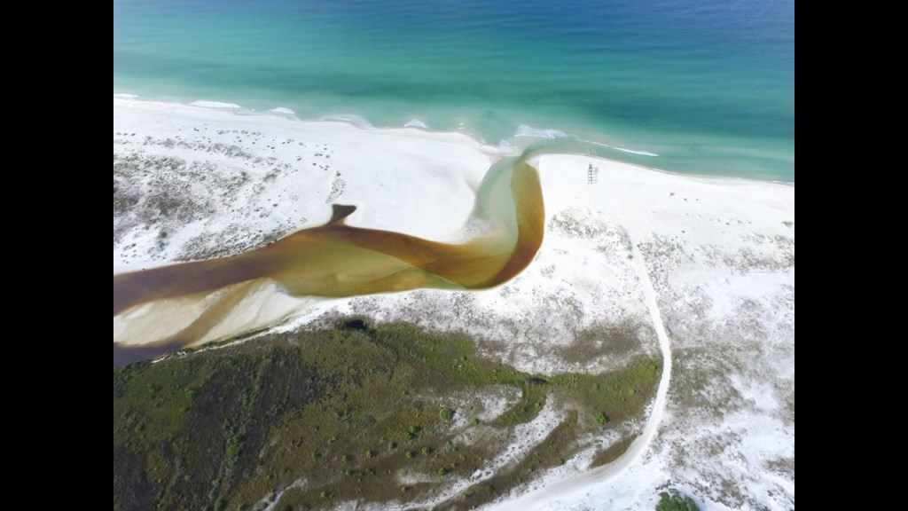
Now I am going to head-over to where this leyline leaves the United States at Carova Beach, at the Virginia -North Carolina State Line, which is a small unincorporated community in North Carolina.
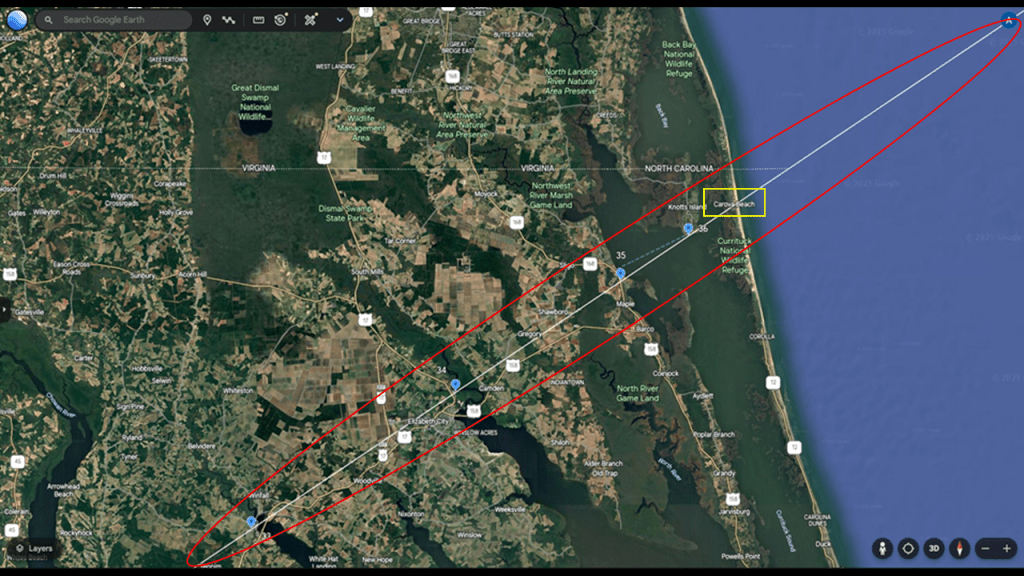
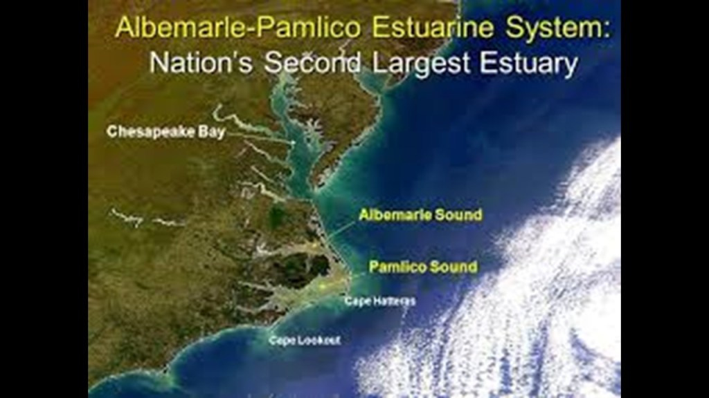
Carova Beach is part of the Albemarle-Pamlico Estuarine System.
The combined estuary has over 3,000-square-miles, or 7,800-kilometers-squared, of open water, making it the second-largest estuary in the United States, after the Chesapeake Bay just to the north of it.
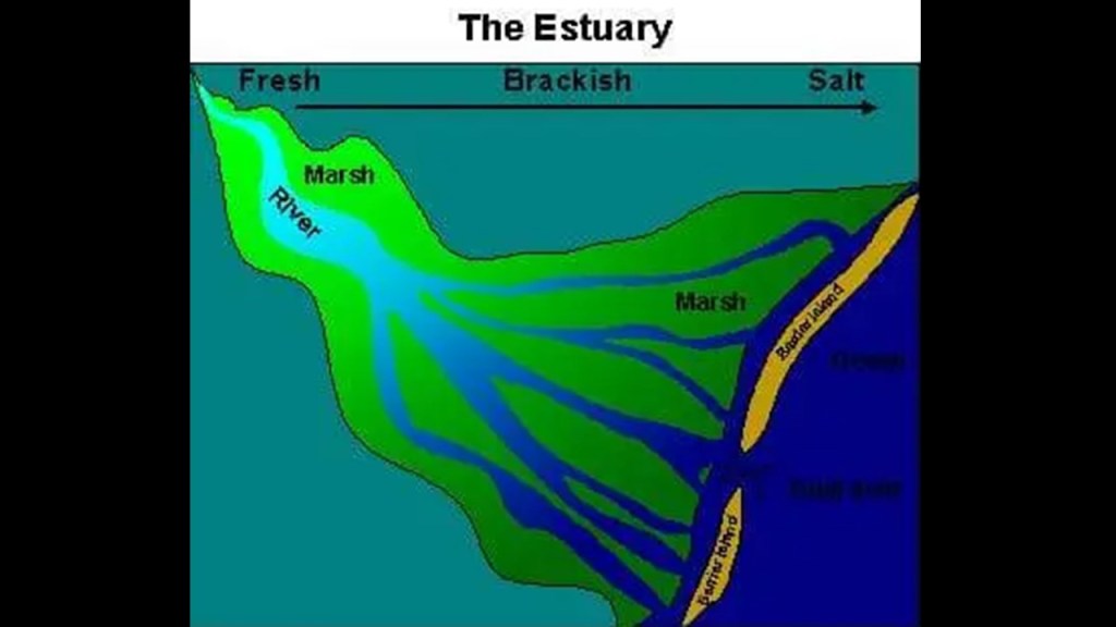
An “estuary” is defined as a partially-enclosed, coastal body of brackish water, which is water that is salty, dirty & unpleasant, with one or more rivers flowing into it, and a connection to the open sea.
It is also my opinion that what we are told were “natural” rivers were once actually man-made canal systems.
Carova Beach is the northernmost community in the northern Outer Banks of North Carolina.
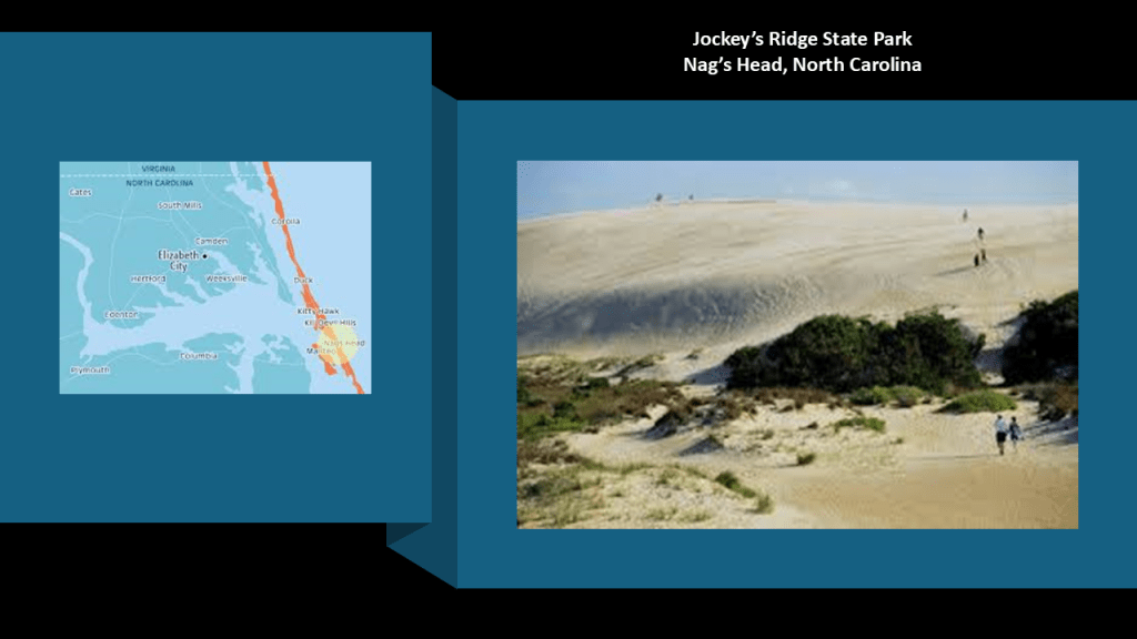
There are sand dunes found in the Outer Banks, like those at Jockey’s Ridge State Park at Nag’s Head.
Jockey’s Ridge is called the tallest active sand dune system in the eastern United States, and is just a short distance south of where this pyramid alignment leaves the United States at Carova Beach.
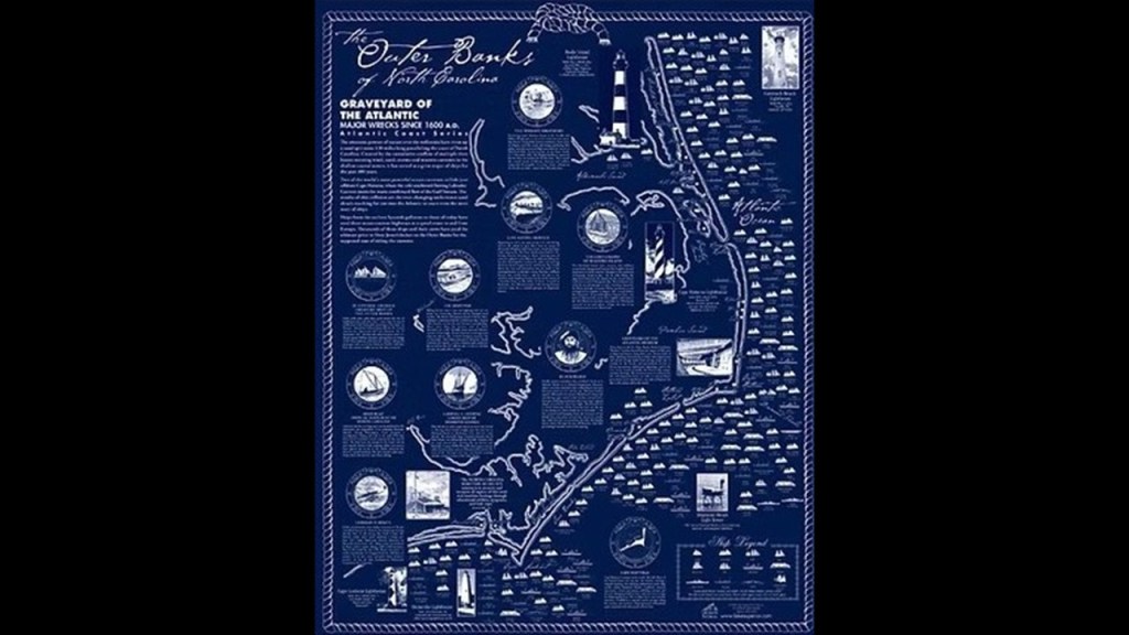
The Outer Banks are described as a row of low, sandy barrier islands, where we find more historic forts said to have been built by the Confederacy at the beginning of the Civil War in 1861.
The Outer Banks also has five historic lighthouses along the coast line of the barrier islands of the Outer Banks.
Barrier Islands are classified as shoals that are called a natural submerged ridge or bank covered by sand or some other material that rises from the bed of a body of water close to the surface that poses a danger to navigation, as the Albermarle-Pamlico Sound and its ocean inlets are noted for wide-expanses of shallow water.
As a matter of fact, exactly like what is found in the Great Lakes region, the treacherous and shallow waters of the Outer Banks have given it the nickname of “Graveyard of the Atlantic” because of the numerous shipwrecks that have occurred here.
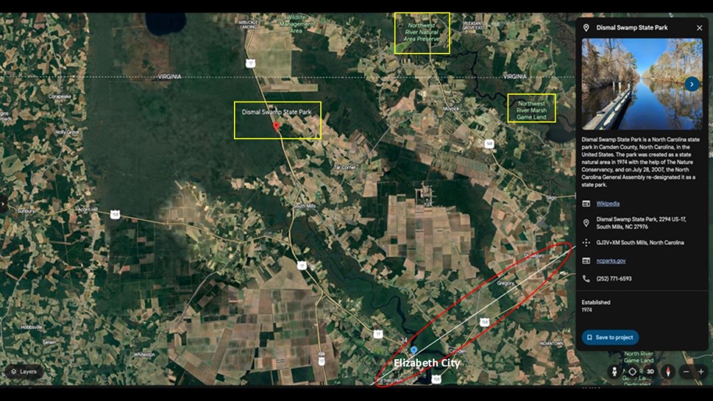
Like Carova Beach, the Dismal Swamp State Park is also located at the border with North Carolina and Virginia, and part of the larger Great Dismal Swamp of the coastal plain region between Norfolk in southeastern Virginia and Elizabeth City in northeastern North Carolina.
The adjoining Northwest River Natural Area Preserve is in Virginia, and the Northwest River Marsh and Gameland in North Carolina.
This is a map of historical railroad trackage in Virginia and North Carolina circa 1882, which includes the area in southeastern Virginia and Elizabeth City in northeastern North Carolina where the Great Dismal Swamp is located.
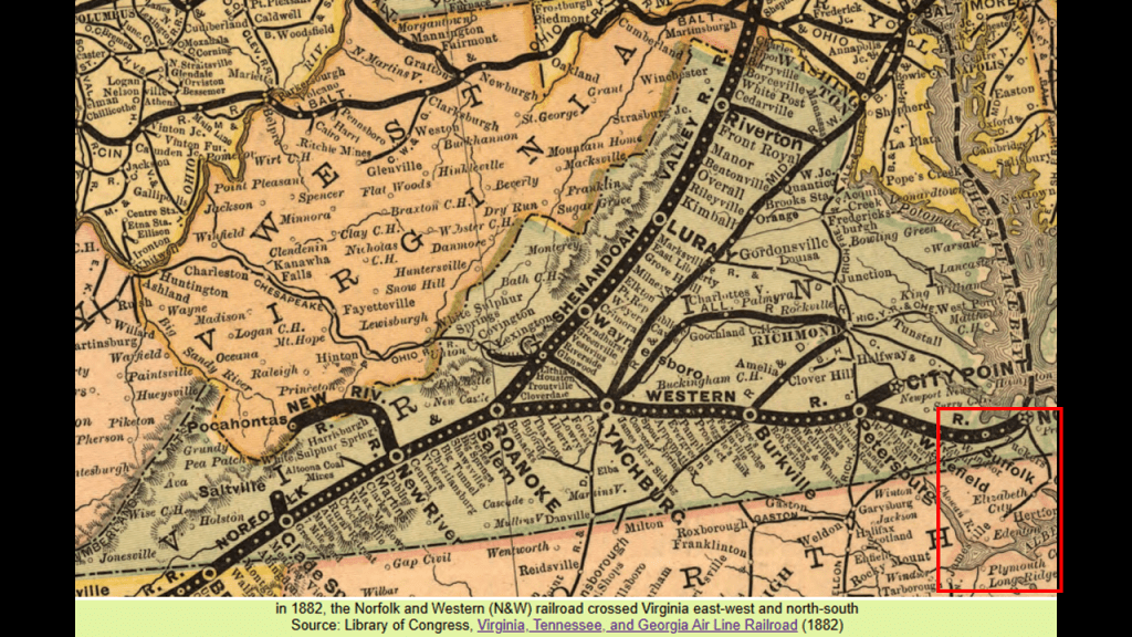
And again, they really want us to believe that they built the railroad through all the swampy wetlands.
What became the “Norfolk Southern” railroad started out as the Elizabeth City and Norfolk Railroad Company in 1870, and by 1883 it was operating as the Norfolk Southern Railroad through there until 1974.
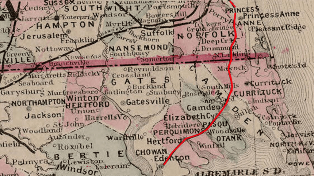
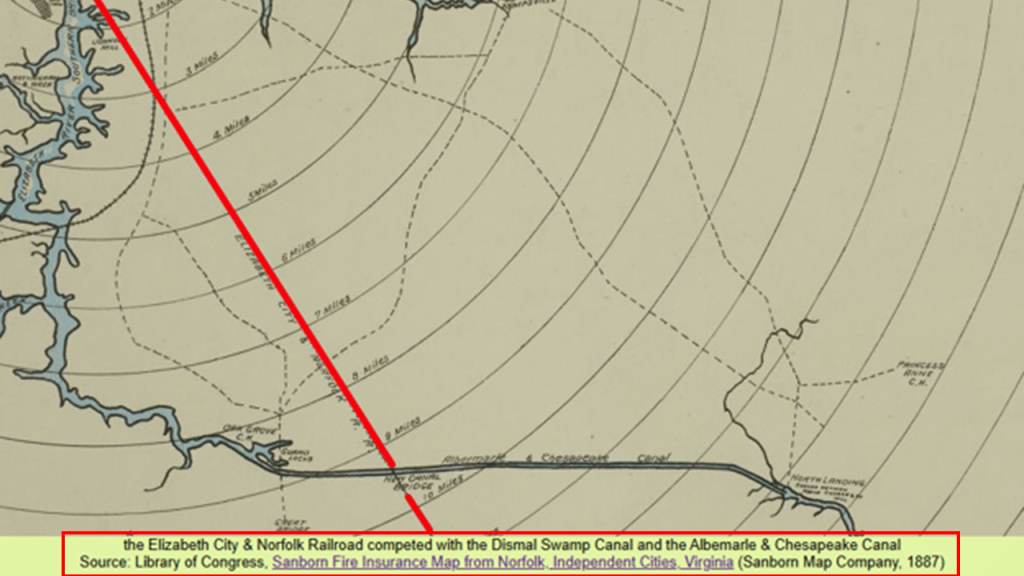
This railroad paralleled the Dismal Swamp Canal and was said to have competed with both canals for freight and passengers.
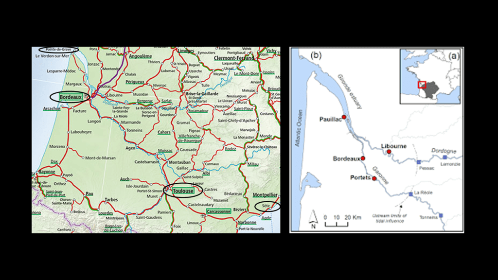
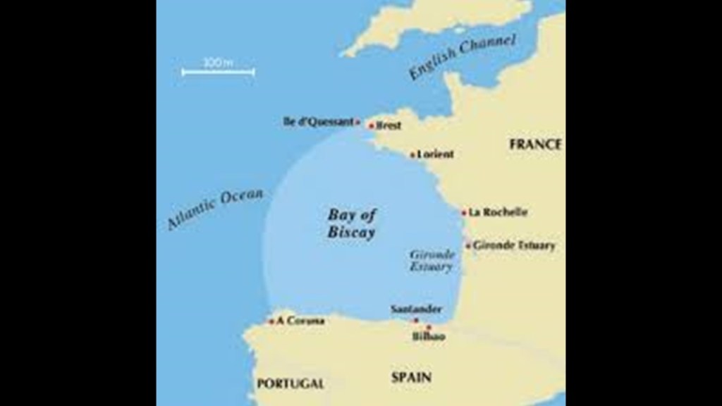
Next, I would like to take a close look at the places and areas where the leyline enters western France from the Quetzelcoatl Pyramid in Teotihuacan in Mexico on its way to the Pyramid of Giza in Egypt, where the leyline goes in-between the Medoc Regional Natural Park in the yellow box on the top; and Arcachon and Arcachon Bay in the yellow box on the bottom.
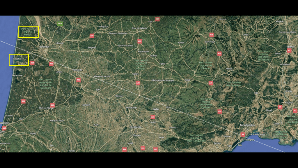
First, the top yellow box on the left-side of the screenshot is highlighting the “Medoc Regional Natural Park” in the Gironde Department of the Nouvelle Aquitaine region, and described as “dunes, marshes, ponds, lakes, lagoons, and forests.”
It is bordered to the East by the Gironde Estuary and to the west by the Bay of Biscay, a gulf of the northeast Atlantic Ocean.
The Medoc Regional Natural Park extends from the gates of the Bordeaux Metropole…
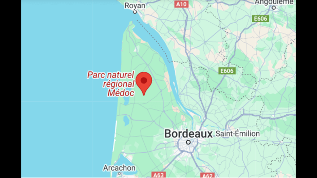
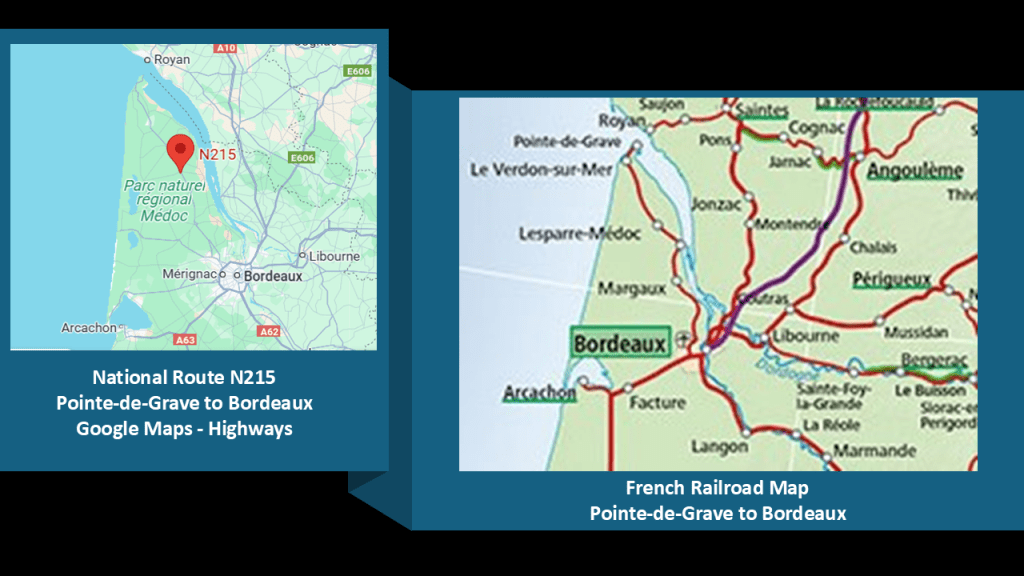
…to the Pointe-de-Grave, the northernmost tip of the Medoc Peninsula, which has historic lighthouses, star forts, and a railroad line along the eastern edge to Bordeaux.
There are historic lighthouses still standing around the edges of the peninsula, which are called “Phares” in French.
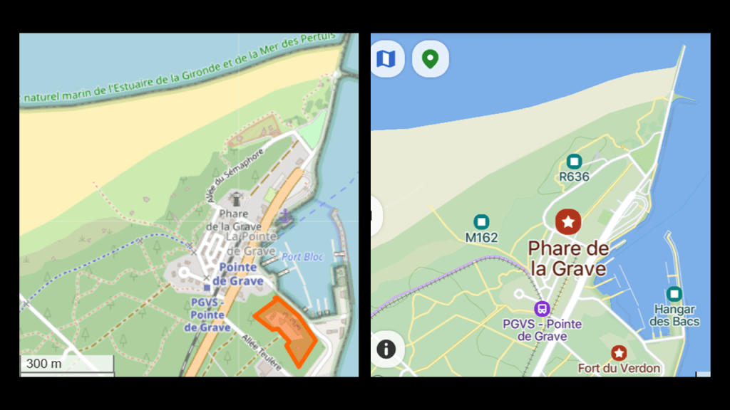
The Grave Lighthouse is located directly on the Pointe de Grave, and is a museum today.
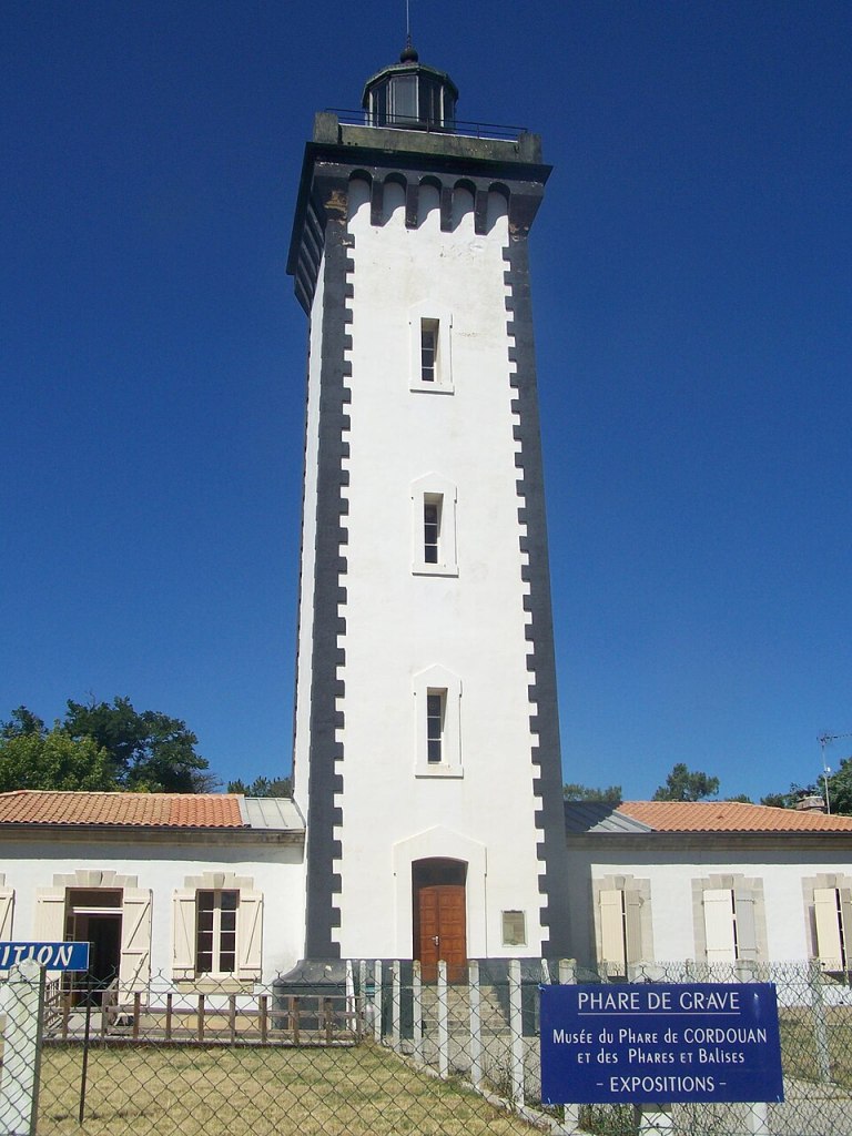
The Grave Lighthouse on the Pointe-de-Grave is located close to the Pointe-de-Grave Train station and Fort du Verdon.
The French National Route 215 on the left closely approximates the route of the railroad line between La Pointe de Grave and Bordeaux across the Medoc Peninsula between those two places.
On the Atlantic-side of the Medoc Regional Natural Park, there are five lighthouses still in operation.
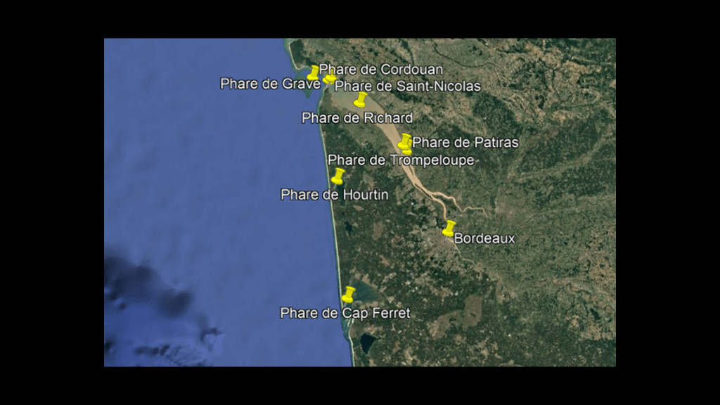
The Cordouan Lighthouse is located 4-miles, or 7-kilometers, out into the open sea, located at the mouth of the Gironde Estuary, and was said to have been built between 1594 and 1611.
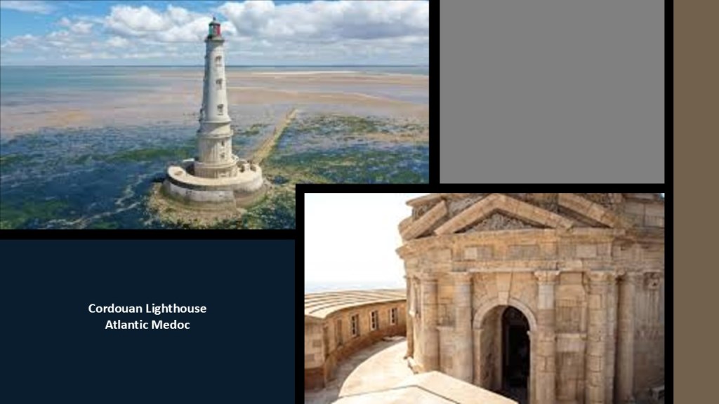
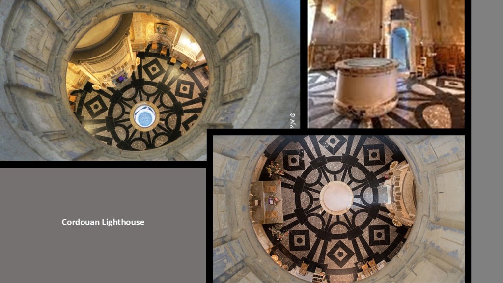
This is what it looks like inside the Cordouan Lighthouse.
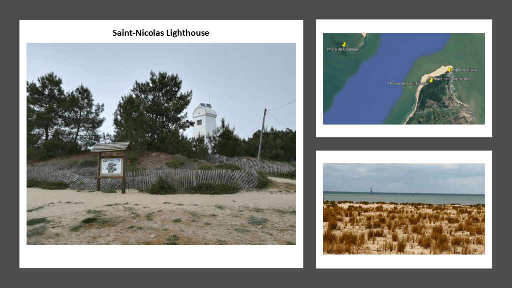
The Saint-Nicolas Lighthouse is located on the Dune of LaClair on the Pointe-de-Grave and forms an alignment with the Cordouan Lighthouse and Grave Lighthouse.
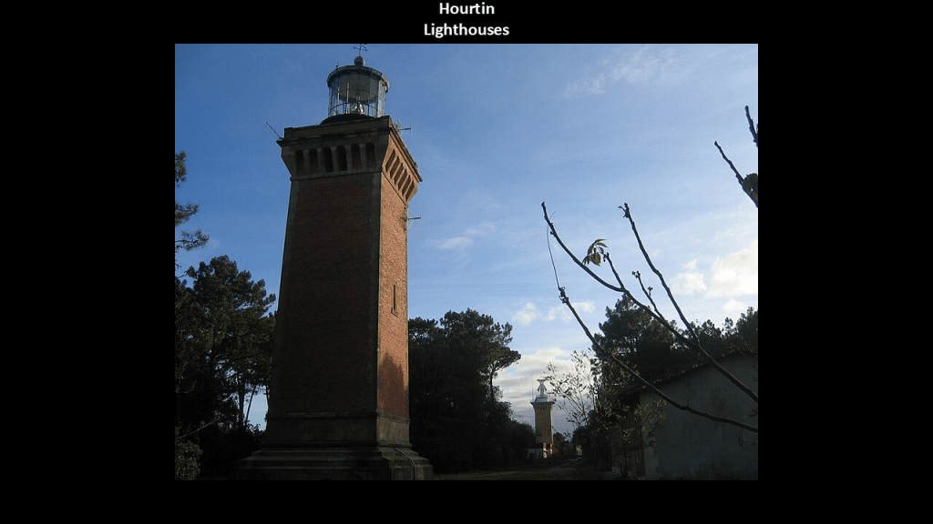
The Hourtin Dunes and Marshes National Nature Reserve – a system of dunes, marshes and large lakes – is on the coastal strip in the western part of the Medoc Regional Natural Park.
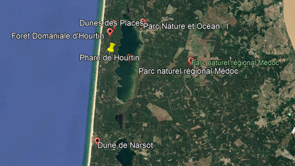
There are two lighthouses at the Hourtin Dunes location, situated 650-feet, or 200-meters, apart from each other on a north-south axis, and said to have been built in 1860 on the coastal dunes of Hourtin.
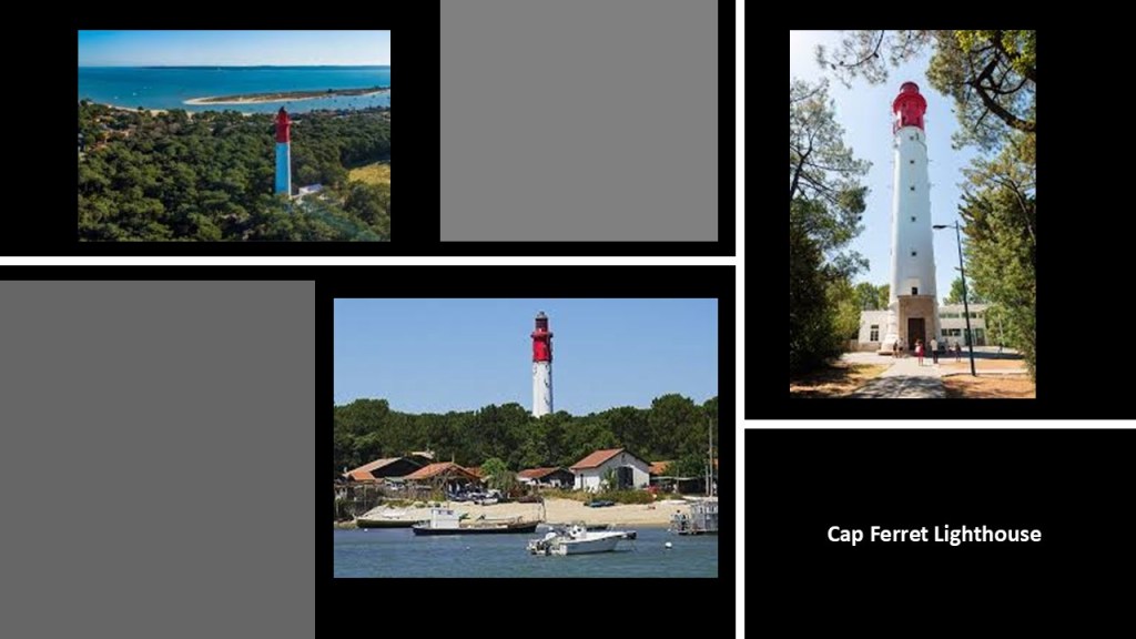
Lastly at this location on the Medoc Peninsula is the Cap Ferret Lighthouse.
The original lighthouse here at the entrance to Arcachon Bay was said to have been built between 1839 and 1840; destroyed by the Germans in 1944; and rebuilt in 1947 to look the same as the first one.
This is part of the same rail infrastructure that connects the Pointe-de-Grave with Bordeaux along the western edge of the Gironde Estuary.
When I was looking around for more information on this region off the coast of western France, I stumbled upon a whole lot of star forts and batteries, and another lighthouse, in the Pertuis d’Antioche straits on and around the Ile d’Aix and the Ile d’Oleron.
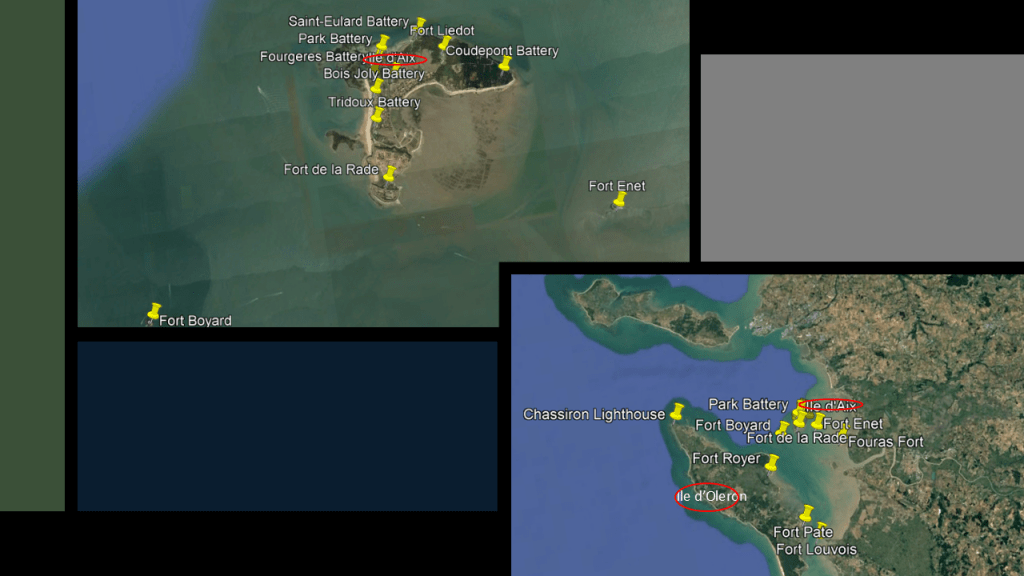
Over the course of years of doing research along the Earth’s leylines, I have found other island locations loaded with star forts and batteries, which we have always been told were military fortifications in our narrative.
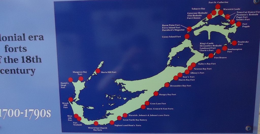
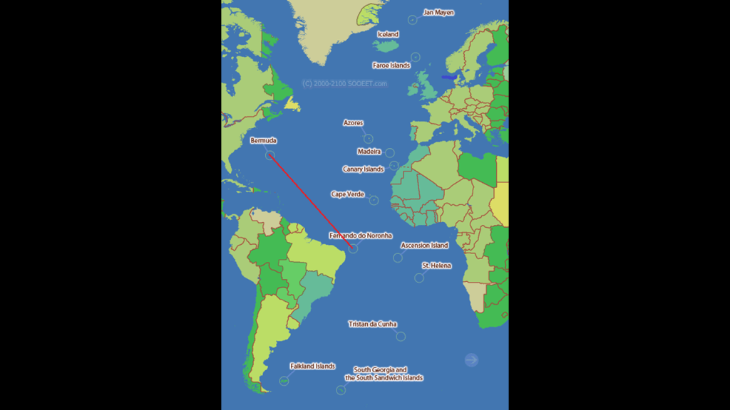
This includes places like the small island of Bermuda in the North Atlantic Ocean…
…and the Fernando de Noronha islands, off the coast of Brazil near the city of Natal.
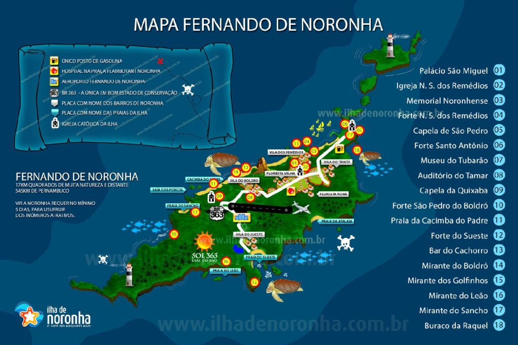
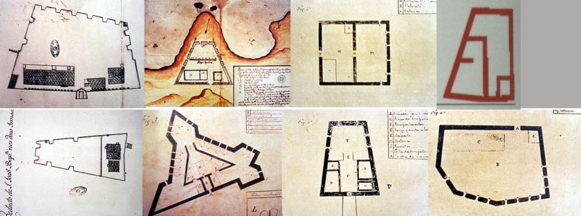
Here are historic drawings of eight of the ten I found out about on Fernando da Noronha within an archipelago whose area totals 10-square miles, 26-kilometers squared.
Both Bermuda and Fernando da Noronha are in the Atlantic Ocean, separated by 3,277-miles, or 5,274-kilometers.
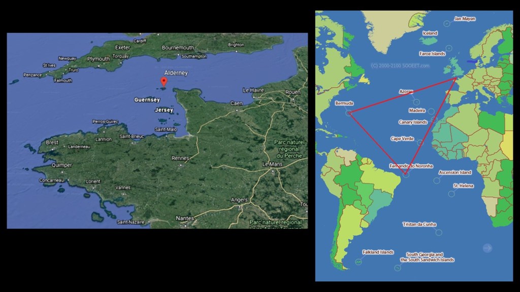
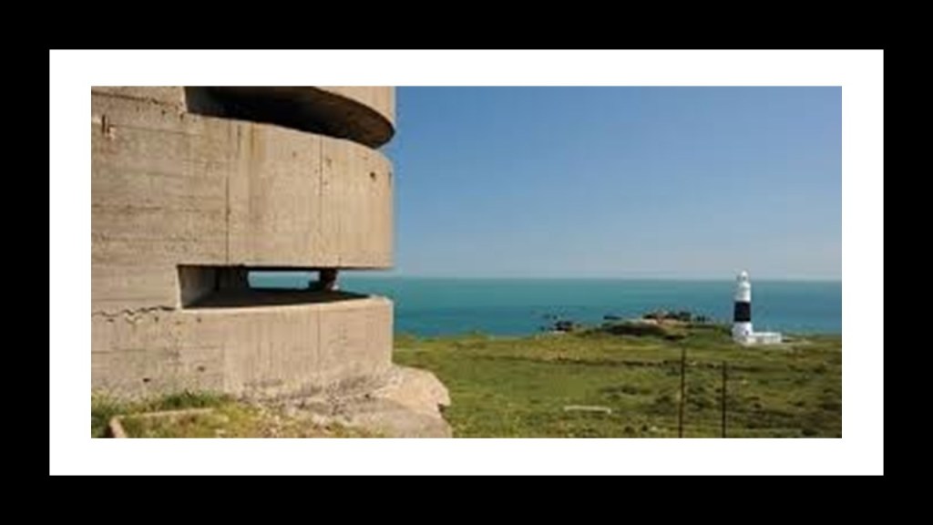
Alderney in the Channel Islands of the English Channel between southern England and northern France is also loaded with star forts.
Alderney Island is only 3-miles, or 5-kilometers, -long, and 1 1/2-miles, or 2.4-kilometers, -wide.

Alderney is the northernmost of the inhabited Channel Islands.
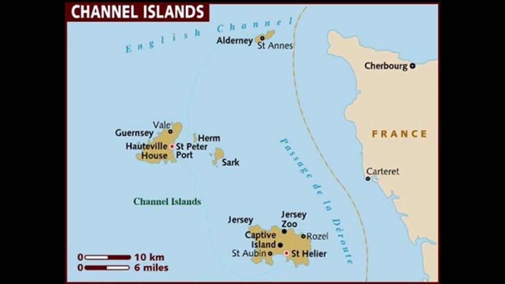
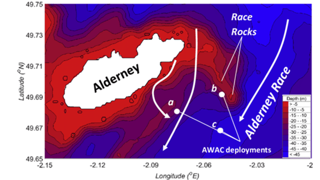
Alderney is the closest of the Channel Islands to both England and France, and is separated from the Cap de la Hague in France’s Normandy region by the Alderney Race, described as a dangerous passage because of the strong currents that run through it.
From this particular map, it certainly looks like there is more of Alderney Island below the water than above it.
I used this Google Earth screenshot to orient myself to Alderney’s location with respect to England and France in order to match up Alderney’s location with this map, and to show what appears to be a triangulated relationship between these three places with a high-concentration of star forts for their small sizes.
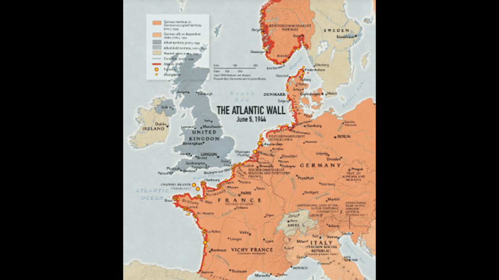
Alderney became one of the most heavily fortified sections of Hitler’s Atlantic Wall, which we are told was one of the largest building works of the 20th-century, fortifications built between 1942 and 1944, and envisioned to make an Allied invasion of the Western European mainland from the sea impossible.
I suspect that this was actually a cover story for pre-existing infrastructure, and ithe Nazis were extremely interested in the Channel Islands throughout the course of World War II.
The Atlantic Wall was said to have been an extensive system of coastal defenses built by Nazi Germany along the coast of continental Europe and Scandinavia.
Just like France, the Channel Islands were occupied by the German Armed Forces long-term during the war, in this case from June 30th of 1940 to May 9th of 1945, and were the only part of the British Isles occupied by Germany.

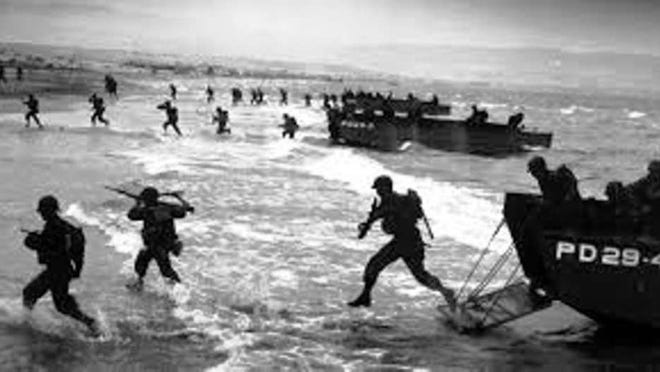
It is interesting to note that for all the time, effort and energy the Germans were said to have put into the Atlantic Wall to make an Allied invasion of the Western European mainland from the sea impossible, we are also told that when the Allied forces landed on the beaches of Normandy on June 6th of 1944, known to us in history as D-Day, most of the coastal defenses there were stormed within hours.
Something is not adding up here.
All of these massive building projects attributed to making an Allied invasion from the sea impossible amounted to absolutely nothing?
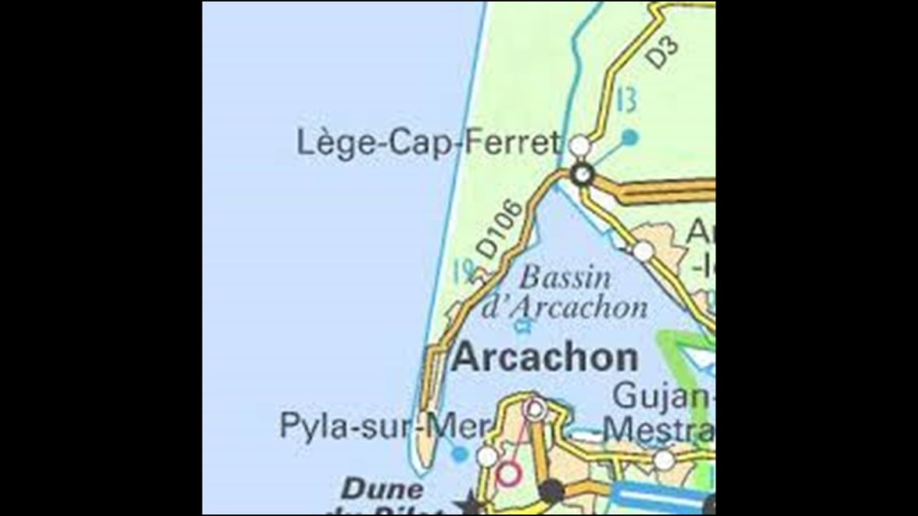
The next place I am going to look at in western France is the area around Arcachon Bay and Arcachon.
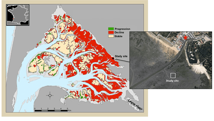
The general shape of Arcachon Bay is described as that of an equilateral triangle pointing north, and the southwest corner of which is open to the sea, between Cap Ferret and the town of Arcachon.
Arcachon Bay is also described as an estuary, where saltwater and freshwater mix, and in which we are told that tidal currents result in features like sand bars, sand flats and a channel system.
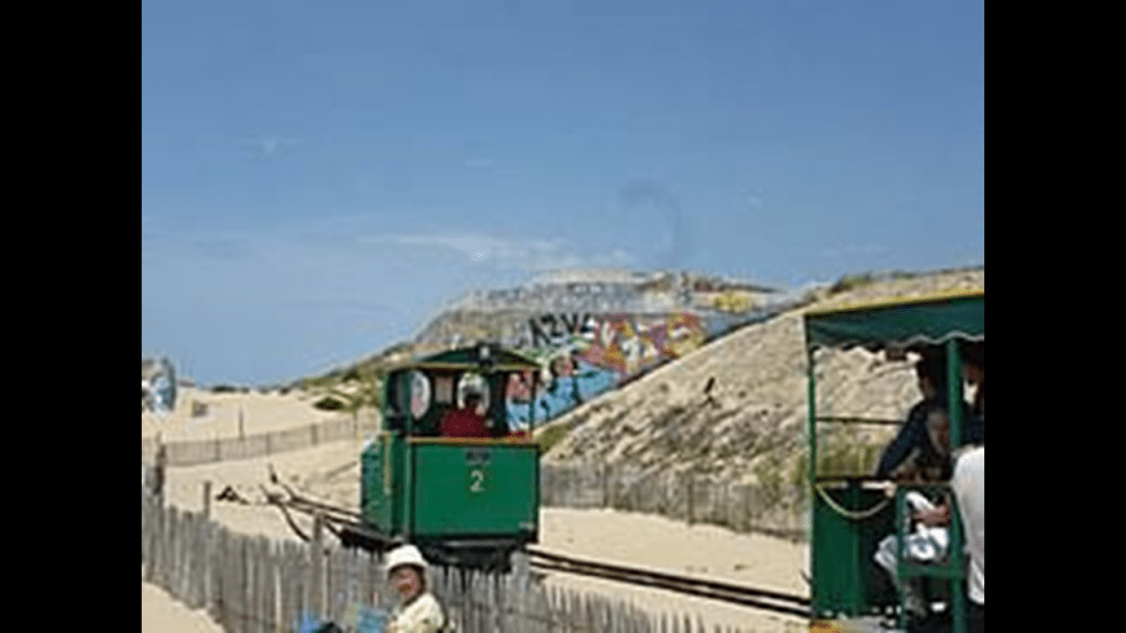
The Cap Ferret has a narrow-gauge tramway that links the shores of the Arcachon Bay with the beaches on the Atlantic Coast that runs from April to September.
The line first operated in 1879 and was pulled by a horse.
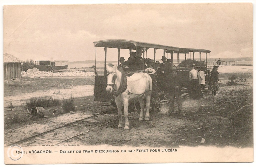
Locomotives took over in 1925 and it operated until 1935, and then service was started again in its current form in 1952.
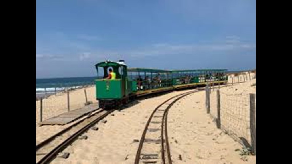
What we are told were remnants of the Atlantic Wall are visible at the beach terminus of the tramway.
The Dune of Pilat is located at the southern entrance of Arcachon Bay.
Like the dunes in the Outer Banks at Jockey’s Ridge, the tallest active sand dune system in the eastern United States and just a short distance south of where the leyline exits the United States, the Dune of Pilat is the tallest dune in Europe, and located just a short distance south of where this leyline enters Europe across the Atlantic Ocean.
Prior to being called the Dune of Pilat in the 1930s, the area was called “Les Sabloneys,” or “the New Sands.”
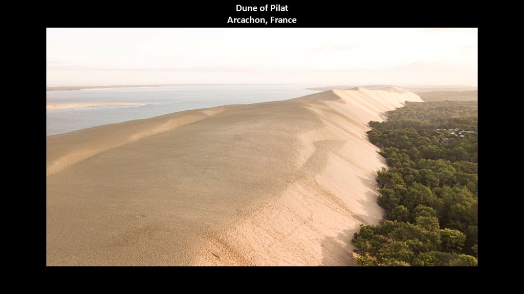
We are told the Dune of Pilat has moved landward, and has pushed back forest to cover houses, roads, and more portions of the Atlantic Wall.
Next, I am going to turn my attention to the Bay of Biscay, a gulf in the Northeast Atlantic that lies along the coast of Western France and the northern coast of Spain.
Just for point of information, Basque districts lie along the Bay, including Bilbao, the capital of the Basque Country in Spain, and Biscay was the name for Basque up until the early 19th century.
Parts of the Continental Shelf extend far into the Bay of Biscay.
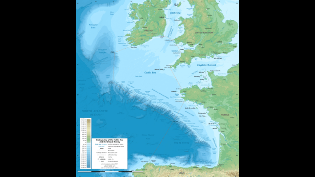
What are called “Continental Shelves” are found all along the Earth’s coastlines, and as I mentioned previously, I believe they are actually submerged landmasses and ruined land from this recent cataclysmic event which destroyed the Earth’s original energy grid, along with land features like estuaries. wetlands, deserts and dunes.
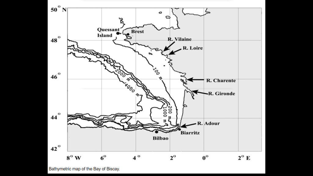
Here is a more detailed look at the bathymetry of the Bay of Biscay.
Bathymetry is the study of the underwater depth of the “floors” of oceans, lakes, and rivers.
So in this example, the shelf running along the European continent at this location is only 100-meters, or 328-feet, in depth, at its shallowest, which extends out quite a distance from the coast of France and well into the entrance of the English Channel.
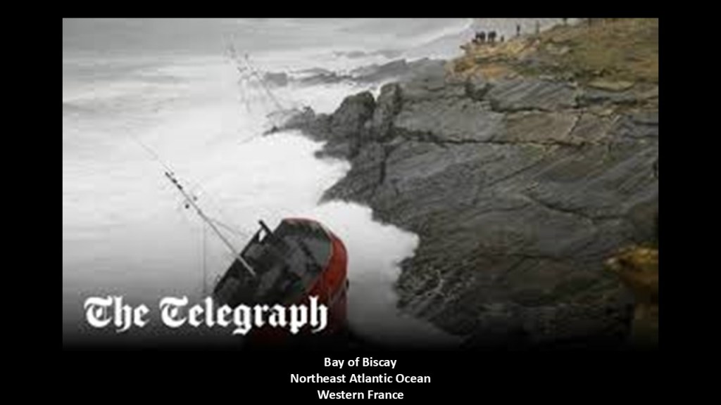
Abnormally high waves and rough seas occur here, and the Bay of Biscay is known for having heavy storms, especially in the winter months.
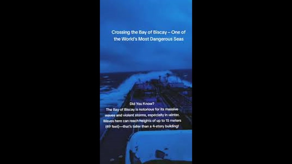
The Bay of Biscay is notable for having a long history of shipwrecks, and is counted among the most dangerous waters on Earth..
Now I am going to head down to the coast of southern France, where the leyline leaves France and enters the Gulf of Lion in the Mediterranean Sea.
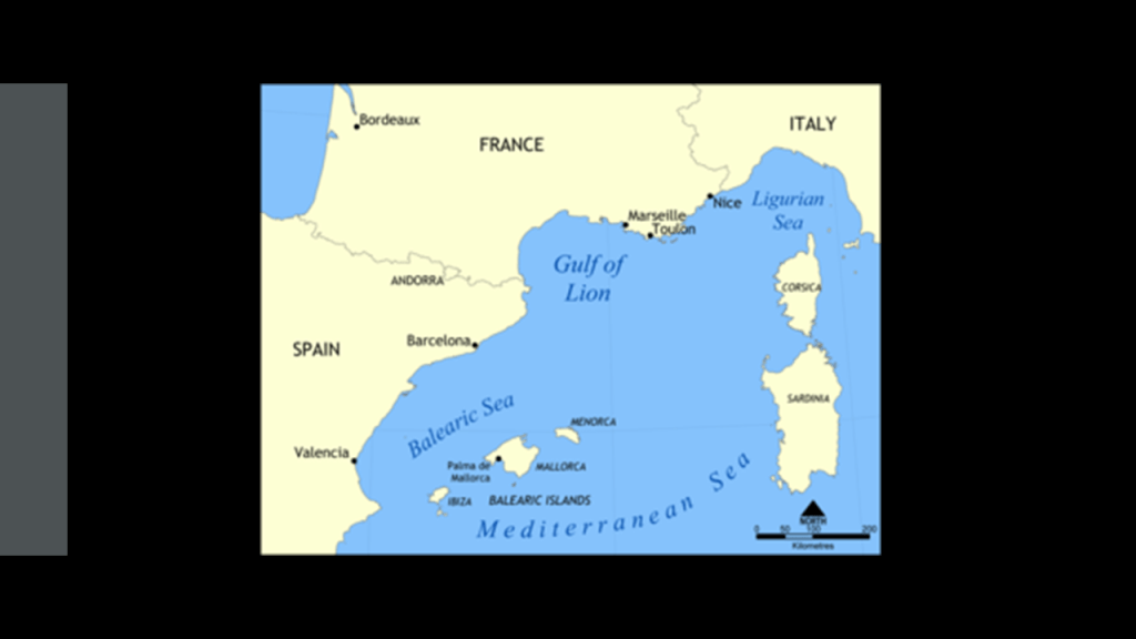
Like the Bay of Biscay off the coast of western France, the Continental Shelf extends far into the Gulf of Lion, with the depths close to the shoreline being quite shallow, where as we have already seen much of which is composed of ponds, lakes, lagoons, and salt marshes, and the offshore underwater canyons slope rapidly to great depths to the floor of the Mediterranean Sea.
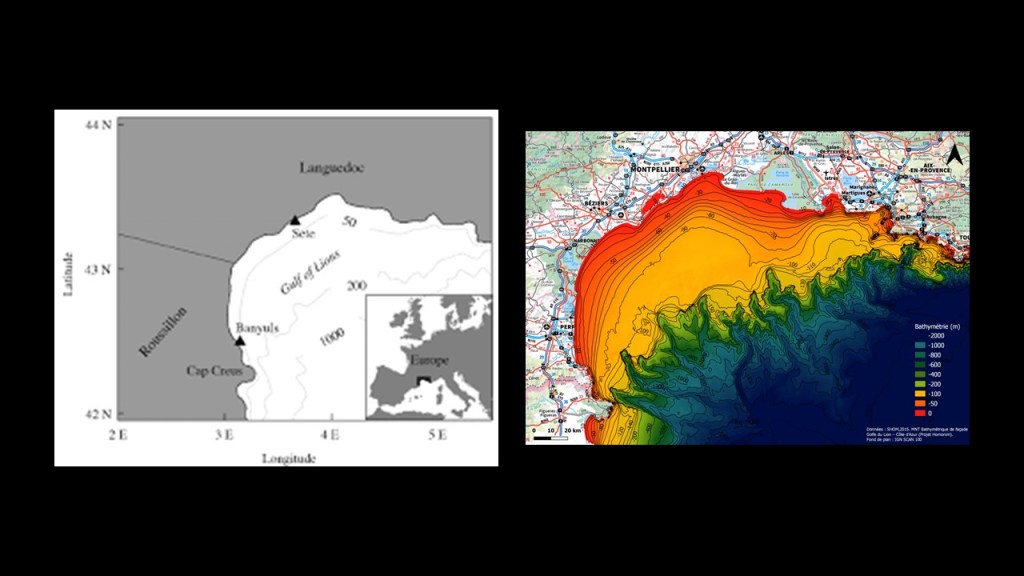
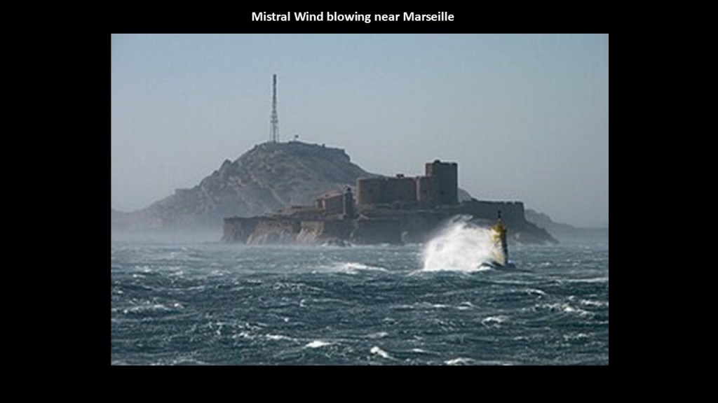
Also like the Bay of Biscay and the Great Lakes, the Gulf of Lion is known for its extreme weather, with sudden violent cold and blustery winds known as the Mistral and the Tramontane that threaten boats and ships, as seen here off the coast near the port city of Marseille.
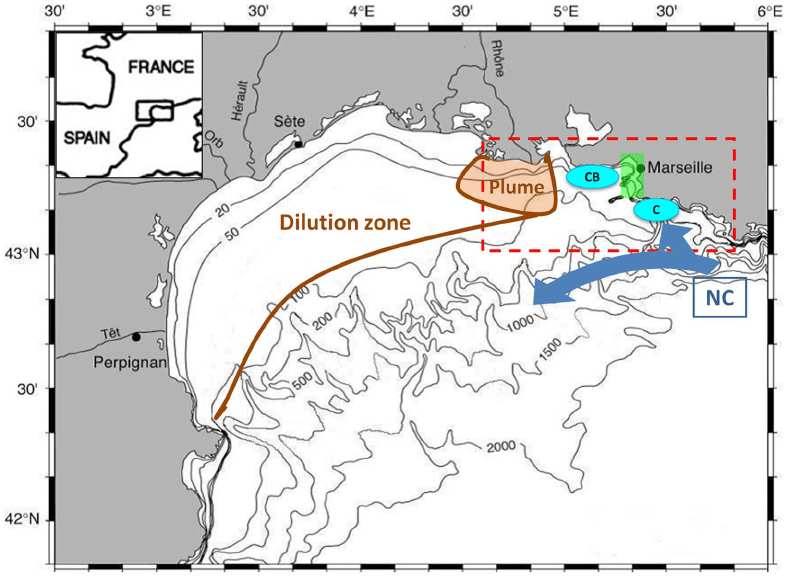
Marseille is located on the edge of the Gulf of Lion, where it meets the Mediterranean Sea, and is a major port city.
We’ve already seen that the continental shelf extends for a long distance into the Gulf of Lion before coming to the offshore underwater canyons that slope rapidly to great depths to the floor of the Mediterranean Sea.
The Cliffs of Marseille primarily refer to the steep limestone cliffs of Calanques National Park that plunge into the Mediterranean Sea, bearing in mind that most of the coastline of the Gulf of Lion is composed of ponds, lakes, lagoons, and salt marshes.
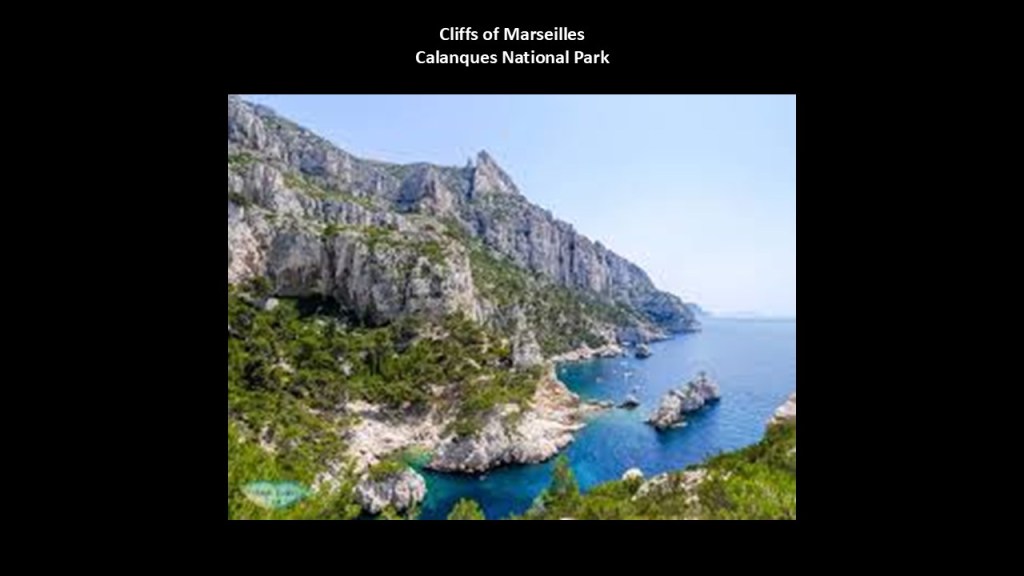
This same manifestation of cliffs next to the sea or ocean is found worldwide, looking like land violently broke off from the landmass.
Here are just a few of countless examples.
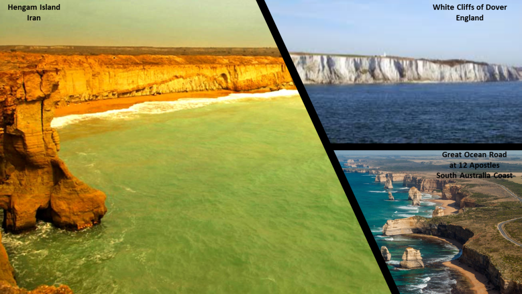
The sheer cliffs along the coastline of Hengam Island in the Persian Gulf’s Strait of Hormuz on the top left, compared for similarity of appearance with the sheer white cliffs of Dover on the coast of southern England on the top right, and the cliffs along the southern coast of Australia in Victoria State where the Great Ocean Road runs for a long distance next to a sheer cliff, and showing the location of the 12 Apostles, the name given to what are called “limestone stacks” in the water off Port Campbell.
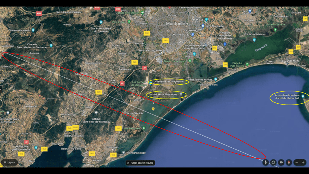
There are a few other places that I would like to highlight in the location of where the Teotihuacan to Giza leyline exits continental Europe in Southern France: the Maguelone Cathedral; Villeneuve-les-Maguelone; and where the site of the Ancient fou de la Digue d’arret du Chenal Sud got my attention.
First up, the Maguelone Cathedral.
It was said to have been sold as national property during the French Revolution and designated as a historic monument in 1840…
I find it highly noteworthy that the massive Maguelone Cathedral, said to have been constructed in the 11th-century…
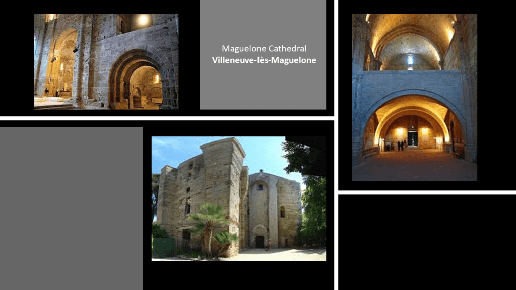
…is located on this tiny strip of land, called an isthmus, in the middle of what is called “Etang de L’Arnel,” or “Pond of the Arnel,” which is separated by the Mediterranean Sea’s Gulf of Lion by a narrow strip land consisting of several beaches.
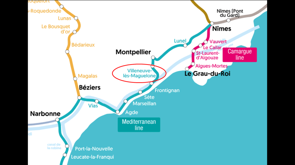
The tiny strip of land upon which the Maguelone Cathedral sits in the middle of a narrow “pond” is opposite from the present-day town of Villeneuve-lès-Maguelone, which translates in English to the “new city” pertaining to Maguelone.
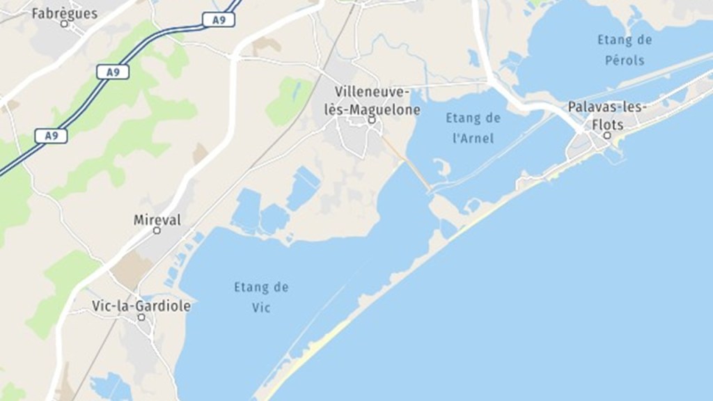
La Porte de Maguelone, or the Maguelone Gate, sits by itself on the end of the isthmus where the Maguelone Cathedral is located.
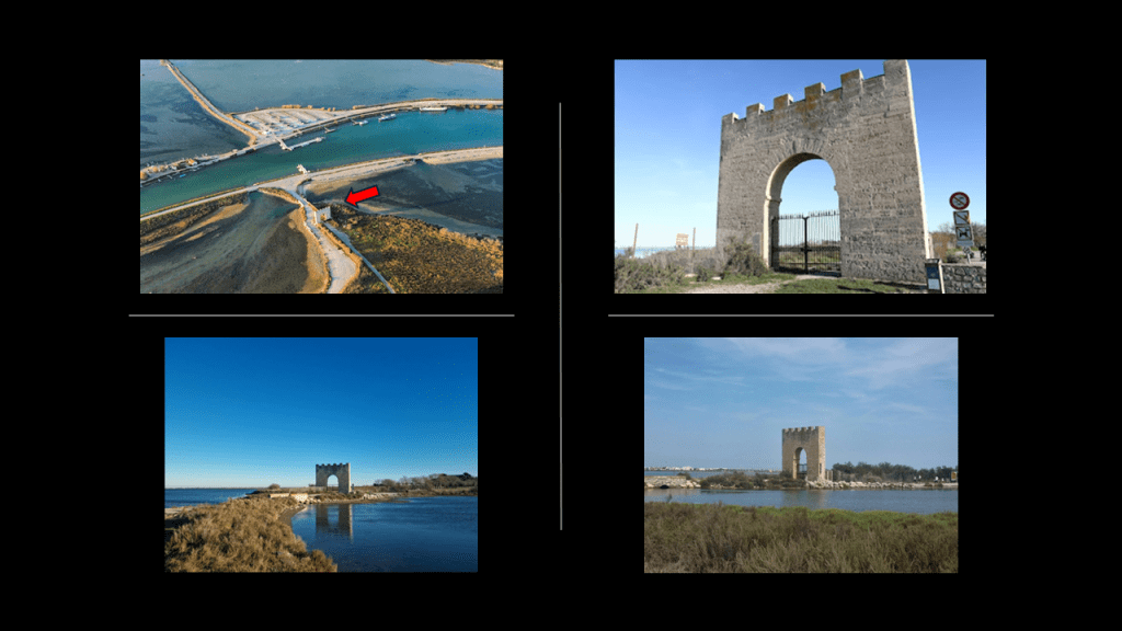
This is what I found when I was looking for more information on the lonely Maguelone Gate.
The Rhone-to-Sete Canal pointed out by the red arrows, separates the “Pond of the Moors” and “the Pond of the Arnel” above the canal, and the “Pierre Blanche Pond” and the “Pond of the Prevost” below it.
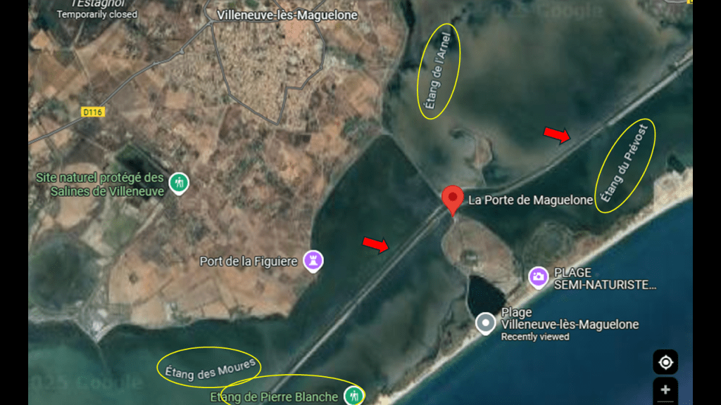
We are told that construction of the Rhone-to-Sete Canal started in the 17th-century and was finally completed in 1808.
This is a very watery location for such a huge undertaking as building a sophisticated engineering project like a canal, especially starting in the 17th-century.
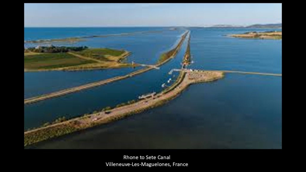
It runs for 61-miles, or 98-kilometers through wetlands.
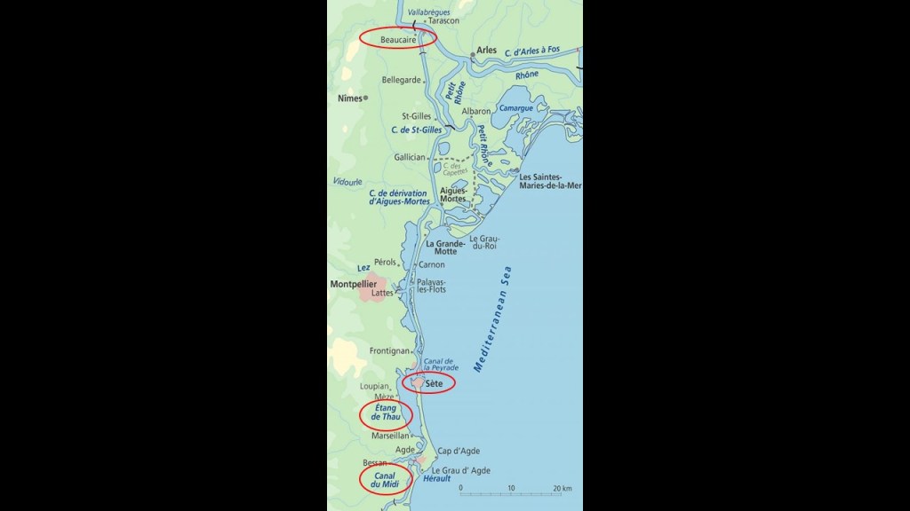
There is a rail service at the nearby Villeneuve-lès-Maguelone, which runs along the Mediterranean coastline and connects to other rail-lines in southern France.
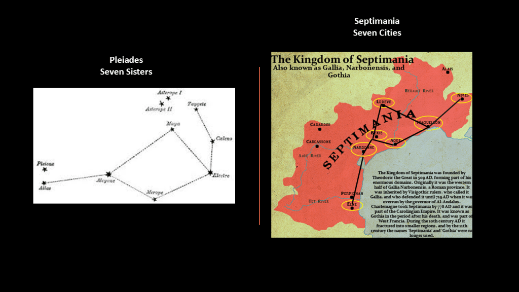
The original city of Maguelone at this location was one of seven cities, along with Elne, Agde, Narbonne, Lodeve, Beziers and Nimes, in a region known historically as “Septimania.”
One of the names for the star cluster of the Pleiades is the “Seven Sisters.”
I found a depiction of the Pleiades and compared it with a map of these seven cities in southern France to see if a case could be made that they constitute a star map, and I think there can be.
As I have been sharing with the examples of lighthouses, there is a signficant amount of evidence that the original advanced civilization built everything on the Earth as a mirror of the Heavens, from ancient to modern times.
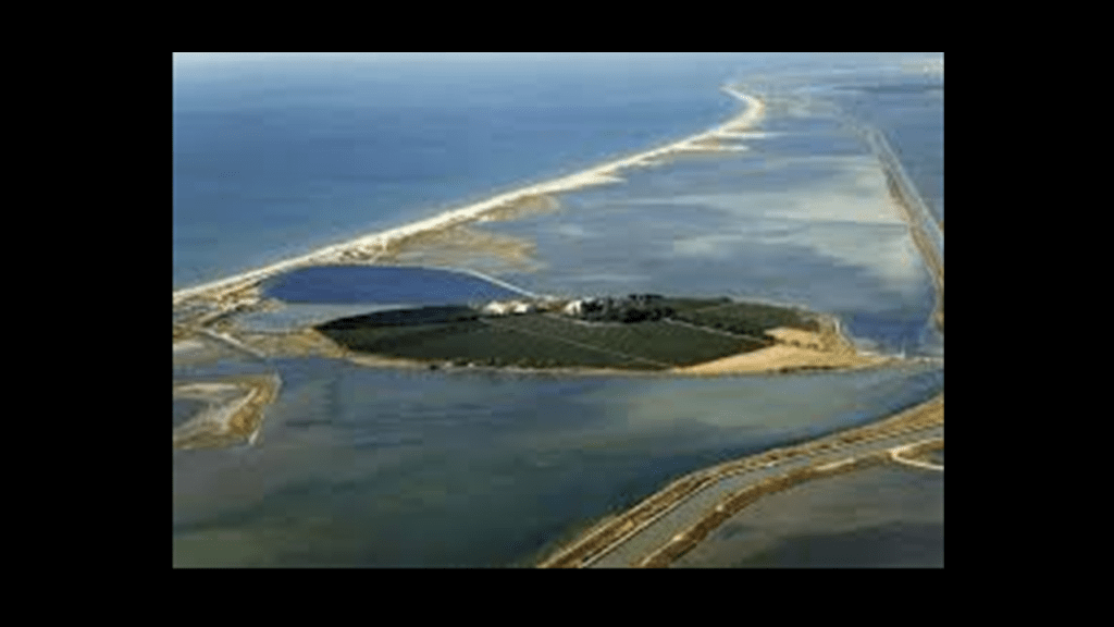
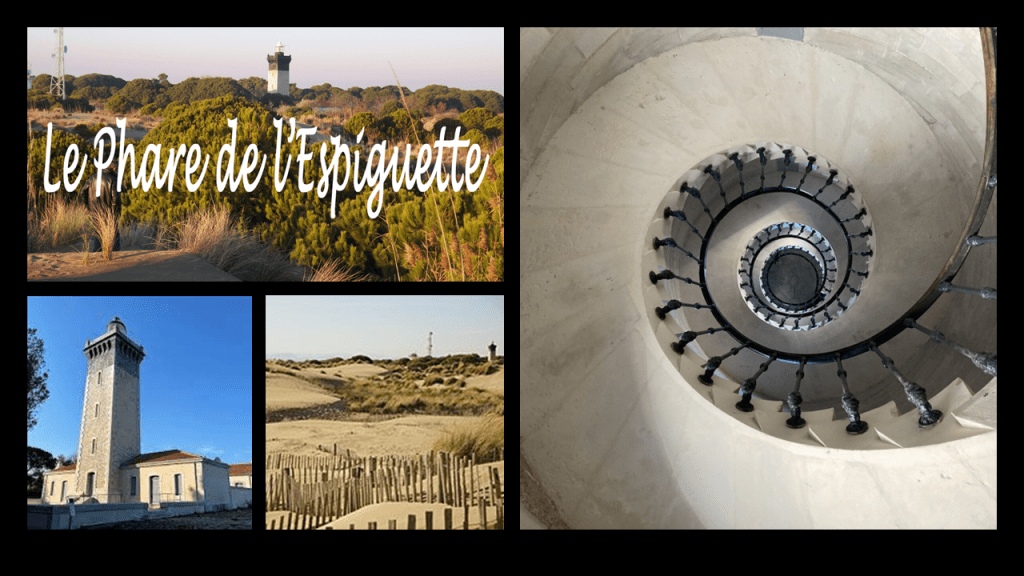
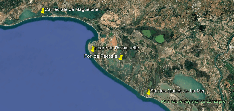
Next in this area around Maguelone on the coast of southern France, I would like to highlight the “Ancient fou de la Digue d’arret du Chenal Sud,” “Le Phare de L’Espiguette,” and Fort de Peccais.
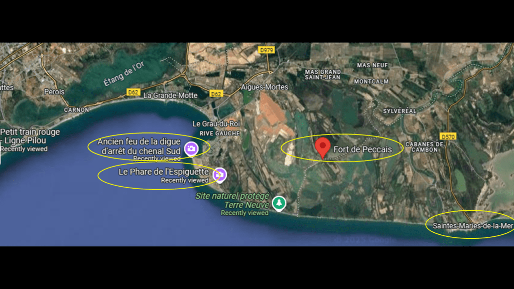
I found out that the “Ancient fou de la Digue d’arret du Chenal Sud” was the location of a former lighthouse that was said to have been constructed in the 19th-century.
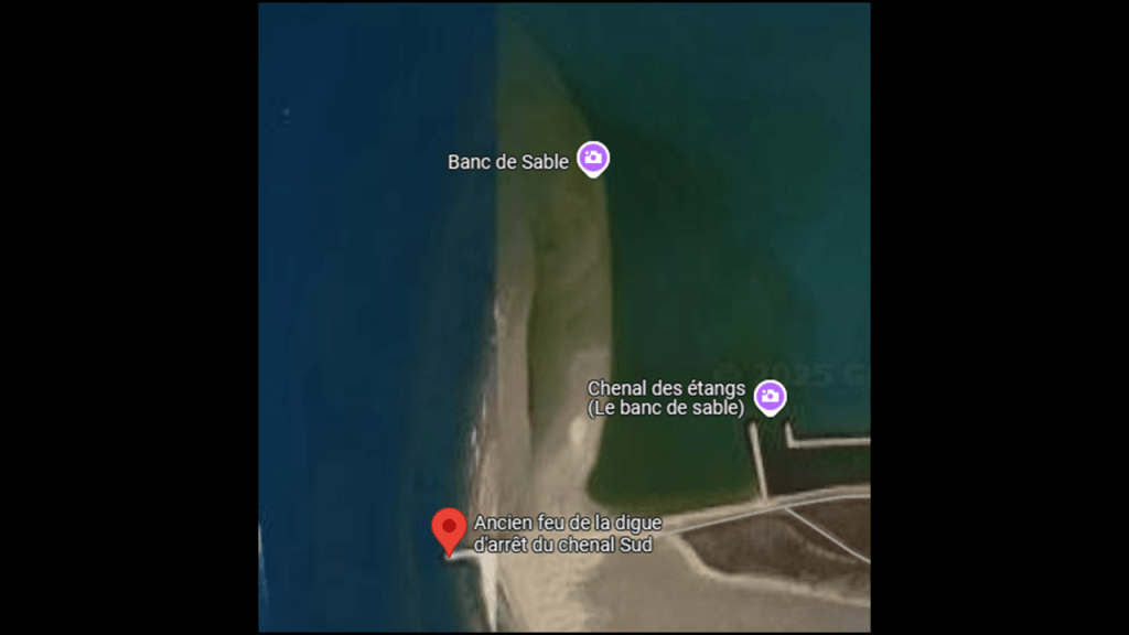
Right next to where the former lighthouse was located is a current lighthouse, the “Phare de L’Espiguette,” situated amidst the dunes of the “Pointe de Espiguette,” which is a vast dune system on the coast that is 11-miles, or 18-kilometers-long.
It was said to have been built in 1869.
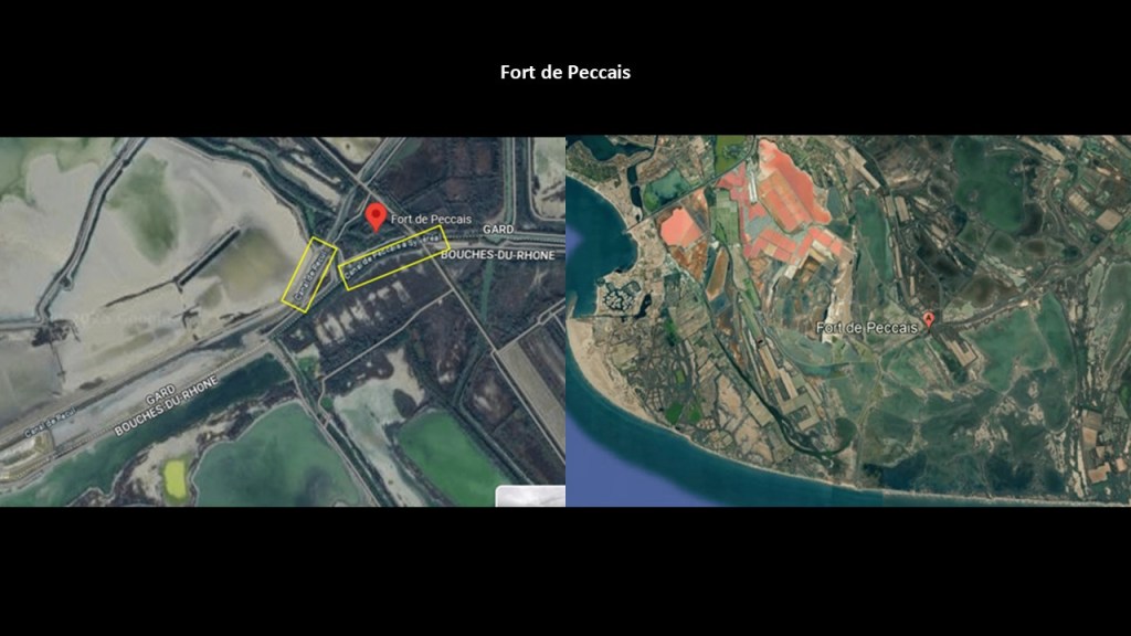
Both of these lighthouse locations are close to Fort de Peccais.
The location of Fort de Peccais is hard to get to where it is on a bad road in the salt marshes, which we are told it was built to guard the salt flats in the 14th-century because it was a source of taxation for the king.
It is located in a bend of the watercourse going around it.
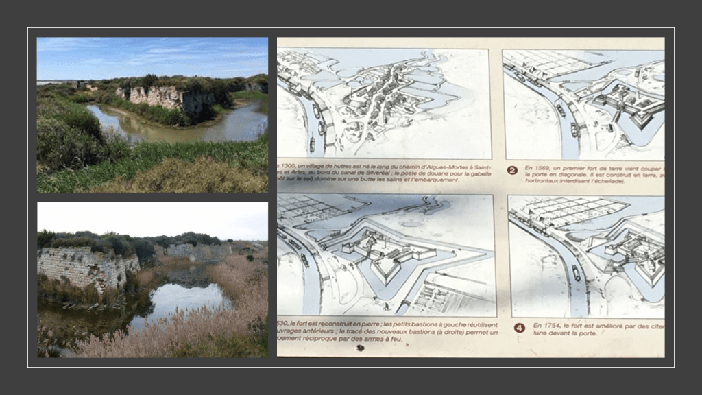
It also has canals on both sides of it and wetlands all around it.
There are a couple of more things I’d like to mention while I’m here that are noteworthy.
One is the nearby coastal region of the Camargue.
It is in the two arms of the Rhone River Delta, and is a wetland area of salt marshes and lagoons cut off from the sea by sandbars, like we have already seen in this post along coastal areas.
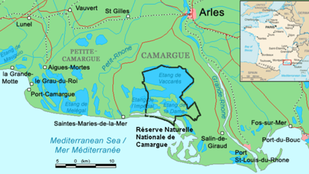
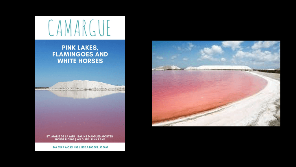
The Camargue region is known for its pink salt lakes, flamingos, and horses.
The city of Saintes-Maries-de-la-Mer is the capital of the Carmargue.
The name of Saintes-Maries-de-la-Mer refers to Mary Magdalene, Mary Salome, and Mary of Clopas.
These three women were closely linked to Jesus, and at the time of his crucifixion, the first witnesses to the empty tomb and the resurrection of Jesus.
Subsequently, they escaped persecution in Judaea by travelling across the sea in a boat, and living out the rest of their lives in the Camargue.
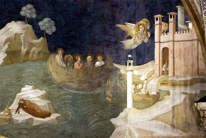
The Roma people of southern France, also known as gypsies, venerate Saint Sara-la-Kali, or “Sara the Black” in the Romani language, a black madonna whose statue is in the Church of Saintes-Maries-de-la-Mer, and is famous throughout the world as the patron saint of gypsies.
While Christian theologians tend to identify her as an Egyptian handmaiden to Mary Magdalene, her actual identity remains a mystery.
But these are some of the intriguing connections that showed up on a long-distance pyramid alignment between Egypt and Mexico.
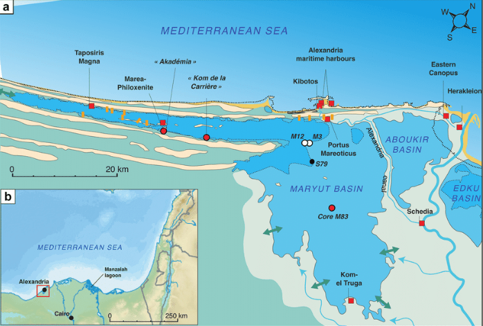
Next, I am going to pick up this pyramid leyline where it enters Egypt across a coastal strip just a short distance west of the Western Harbor of Alexandria.
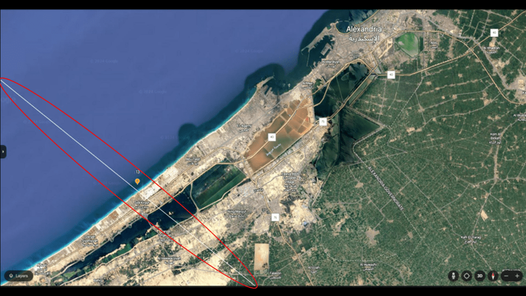
This leyline enters Egypt right in-between the historic location of two lighthouses.
The Pharos of Abusir is located to the west of where the alignment enters Egypt, marked by the red dot, and the historic location of the Pharos of Alexandria was located to the east of it, in the city’s Eastern Harbor, which is adjacent to the Western Harbor.
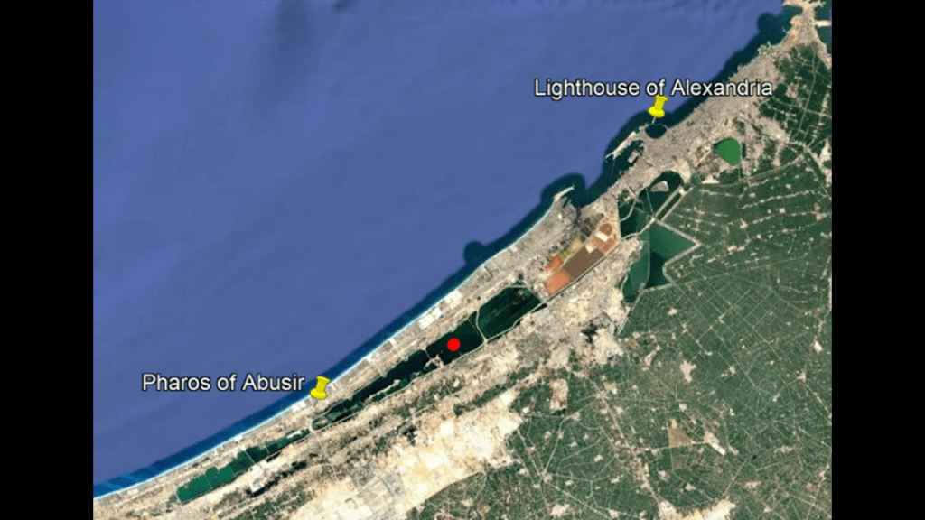
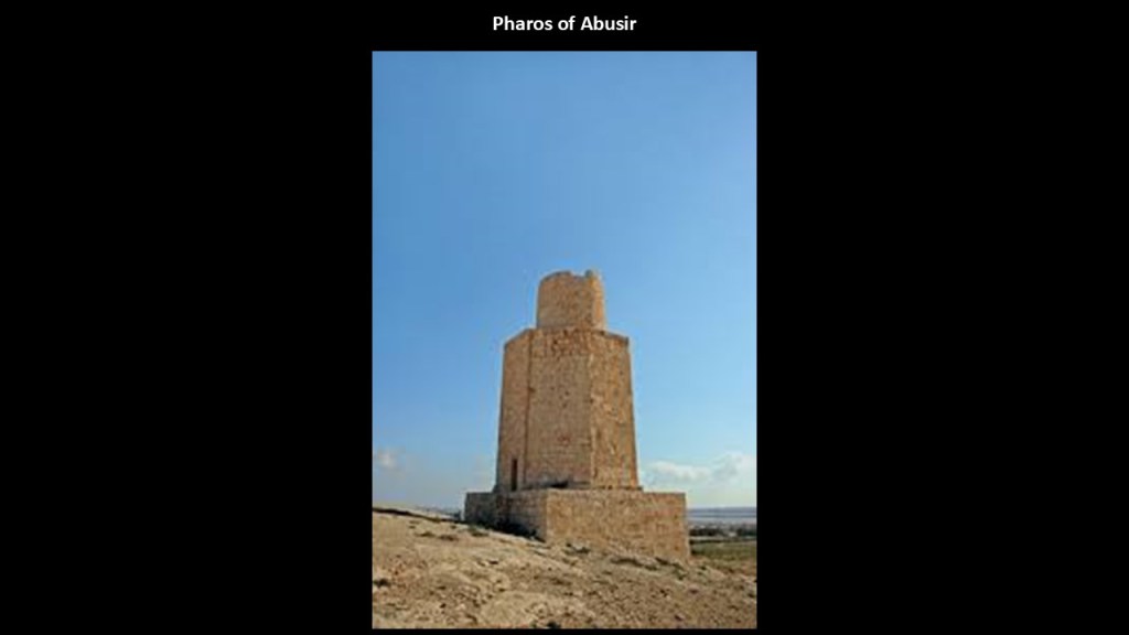
The Pharos of Abusir is located at the ruins of an ancient temple on the shore of Lake Mariout, and what we are told about it is that it was an ancient replica of the famed Pharos of Alexandria.
Lake Mariout, also known as “Lake Mareotis,” on the western edge of the Nile Delta, is described as a “brackish” lake, meaning that it has more salinity than freshwater, but not as much as seawater.
We are told that at the beginning of the 20th-century, the lake covered 77-square-miles, or 200-kilometers-squared, and had a navigable canal, and that at the beginning of the 21st-century, the lake covered 19-square-miles, or 50-kilometers-squared.
The famed Pharos of Alexandria on the other side of the leyline was one of the Seven Wonders of the Ancient World.
Widely considered to have been the world’s first lighthouse in our historical narrative, it was said to have been built in 270 BC during the reign of Ptolemy II.
At 330-feet, or 100-meters, in overall height, it was one of the tallest manmade structures in the world.
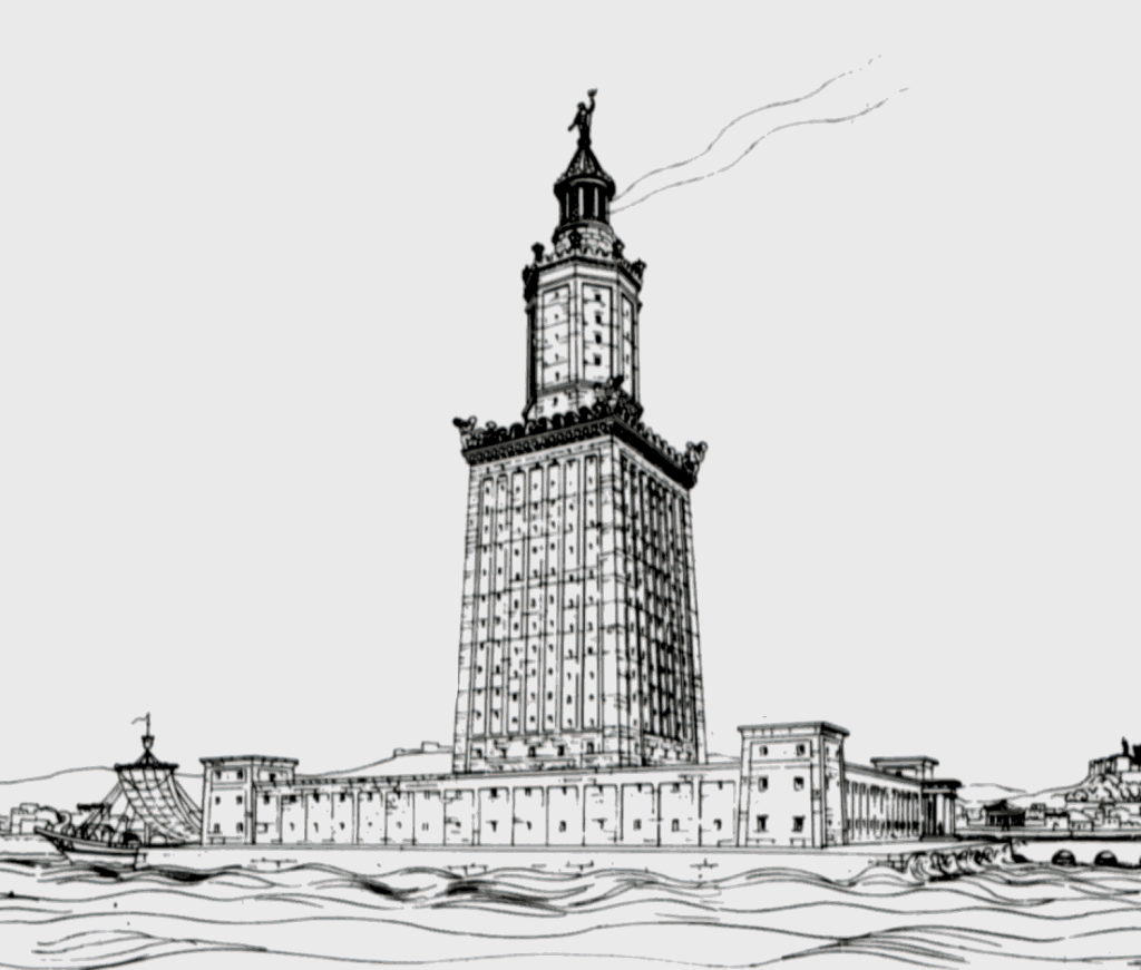
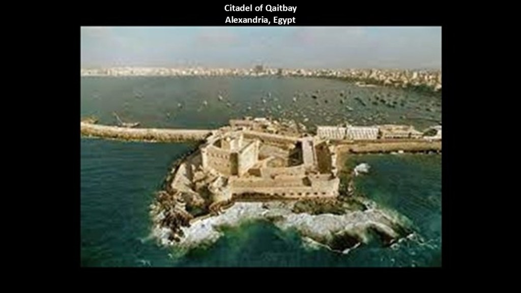
What we are told is that the Pharos of Alexandria was destroyed by an earthquake in 1323 AD, and that in 1994, a team of French archeologists diving in the waters of Alexandria’s Eastern Harbor discovered the remains of the lighthouse on the sea-floor.
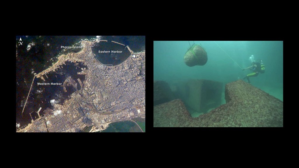
It was located right next to the Citadel of Qaitbay in Alexandria’s Eastern Harbor.
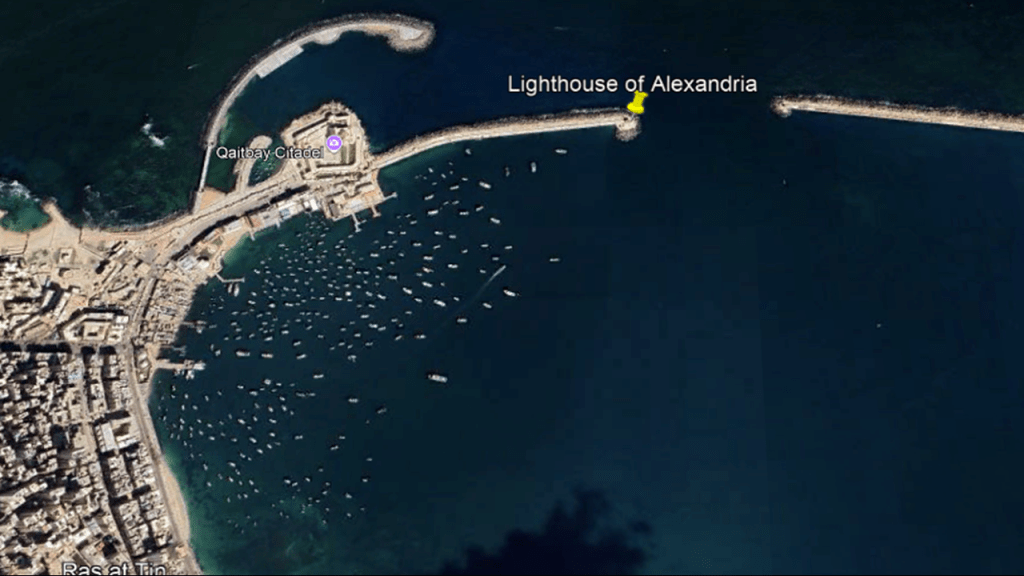
We are told the adjacent Citadel of Qaitbay was built on top of a rocky outcrop surrounded by water by the Sultan Al-Ashraf Sayf al-Din Qa’it Bay, and that remaining stones of the Pharos of Alexandria were used in the building of the citadel from 1477 to 1479.
The Egyptian National Railways has been in operation since 1854, and has rail infrastructure along the Mediterranean Coast and along the Nile River, among other places.
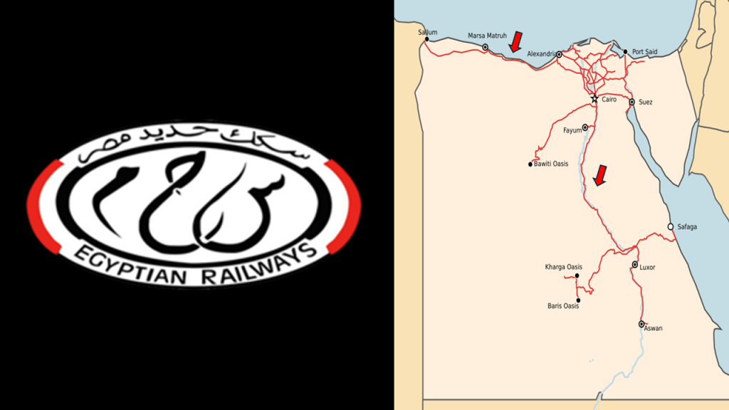
Alexandria still has an operational streetcar service.
It began operation in 1863 under horse-drawn power, and was electrified by 1902.

I think pyramids played an important role in this worldwide grid system that provided free energy for the benefit of all life everywhere through the pre-existing infrastructure.
Carl Munck deciphered a shared mathematical code in his book “The Code,” related to the Great Pyramid, in the dimensions of the architecture of sacred sites all over the Earth, one which encodes longitude & latitude of each that cross-reference other sites.
He turned his findings in “The Code” into a video series which can be found on YouTube.

He shows that this pyramid code is clearly sophisticated and intentional, and perfectly aligned over long-distances.

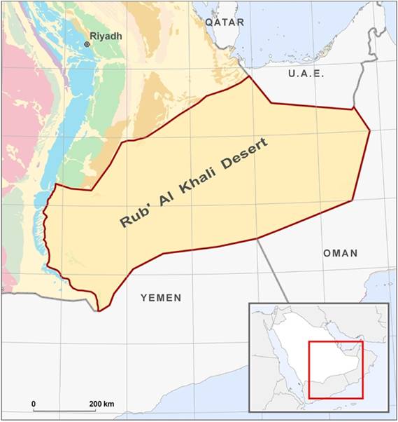
Now I am going to head over to another place on the Earth to look at what is found in the deserts of the Rub’ Al Khali, otherwise known as the Empty Quarter, in Saudi Arabia and the United Arab Emirates, also known as the UAE.
I looked through this area when I was tracking a long-distance circular leyline of cities and places in alignment beginning and ending on Amsterdam Island, a tiny island in the South Indian Ocean.
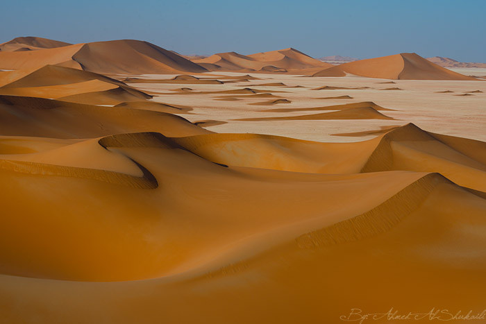
The Rub’ Al Khali is the largest desert in the world.
It encompasses most of the southern third of the Arabian peninsula, and is primarily in Saudi Arabia.
I found reference to a Saudi Arabian Minister of Petroleum and Mineral Resources, Ali Al-Naimi, reporting that the dunes don’t drift – that while sand blows off the surfaces, their essential shape remains intact.

I would not be surprised at all to learn that there is enduring infrastructure underneath all that sand, here and everywhere else these dune systems exist!
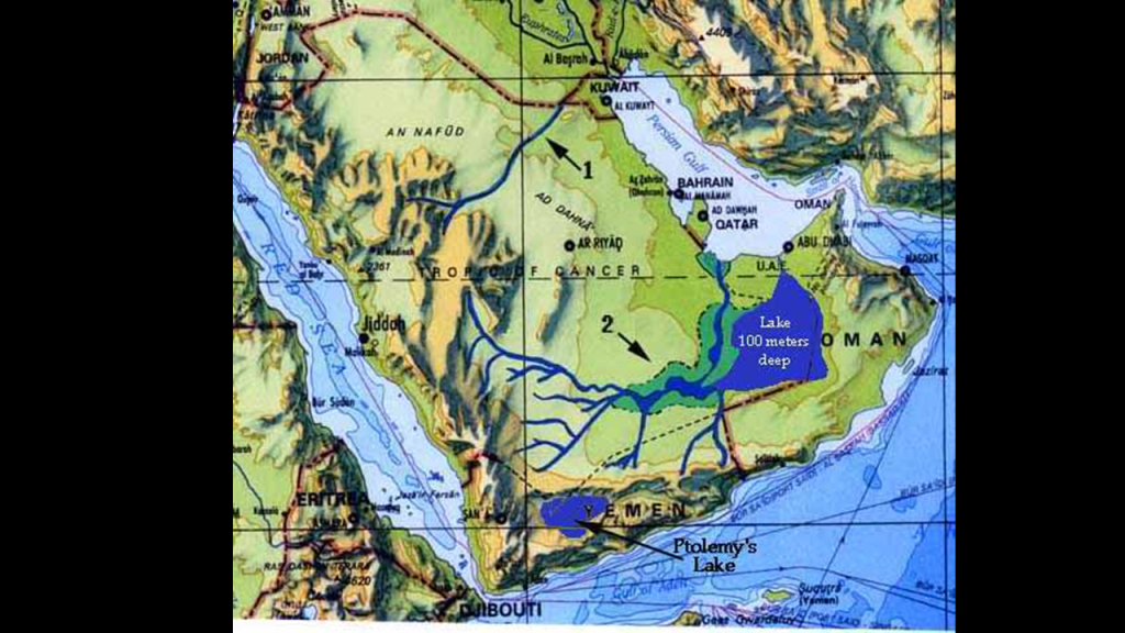
The Rub’ Al Khali Desert has been determined to have had what would have been the third-largest lake in the world and one of the longest rivers in the world, whose flow would have rivalled the Nile River in Egypt or the Amazon River in South America.
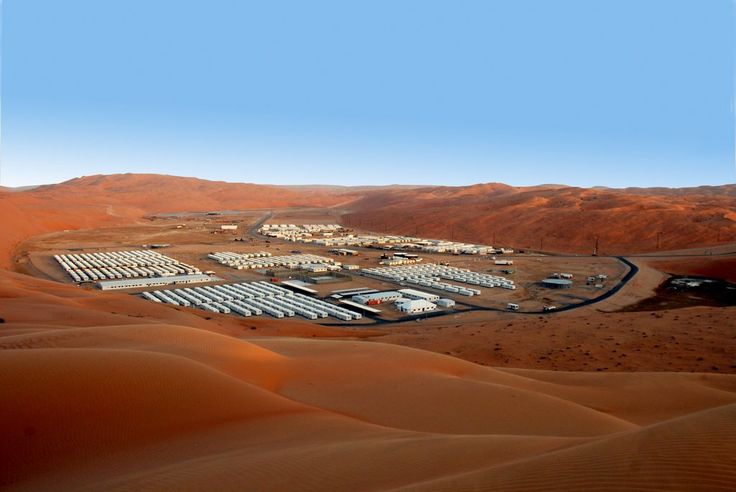
The Shaybah Oil Field in Saudi Arabia was discovered in 1968, 25-miles, or 40-kilometers, from the northern edge of the Empty Quarter, and produces significant amounts of both oil and natural gas.
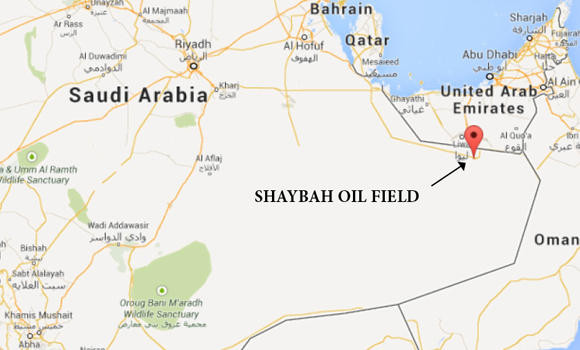
The Shaybah Oil Field is considered to be one of the most prominent landmarks in the Rub’ Al Khali, and is surrounded by a series of giant, semicircular sand dunes, some of which are 984-feet, or 300-meters, high.
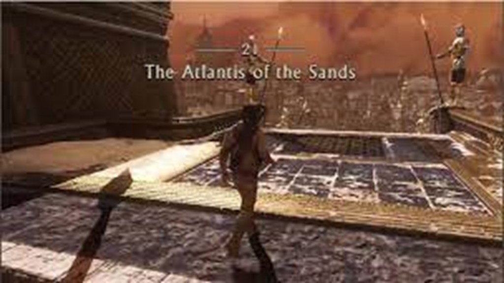
The incense trade made its way through this region, and it has been suggested that the lost city of “Iram of the Pillars” depended on such trade.

The location of “Iram of the Pillars” has been searched for over the years and no place has ever been conclusively identified as such.
It intriguingly has the nickname of “Atlantis of the Sands.”
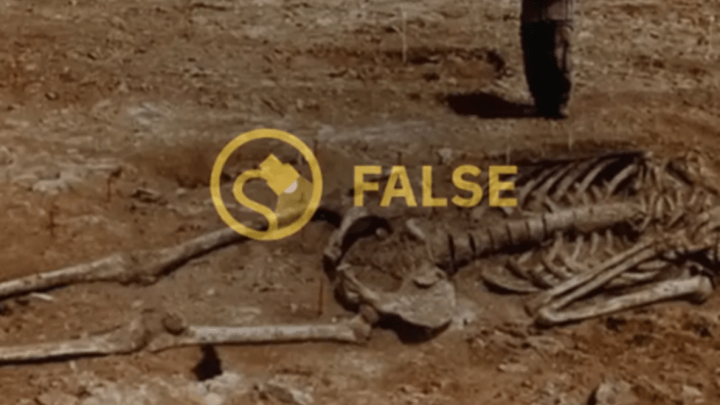
Also, in the process of oil and gas exploration in the Empty Quarter, giant skeletons apparently have turned up from time to time, though you find things like this fact-checked and flagged as hoaxes.
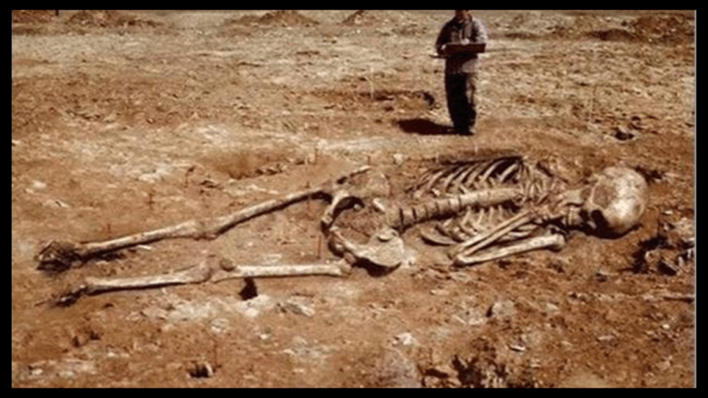
Like for some reason they really don’t want us to know about the existence of giants on the Earth.
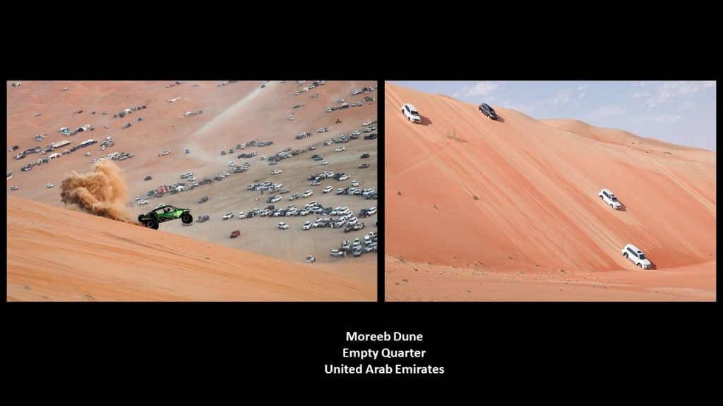
The Moreeb Dune is in the Rub’ Al Khali.
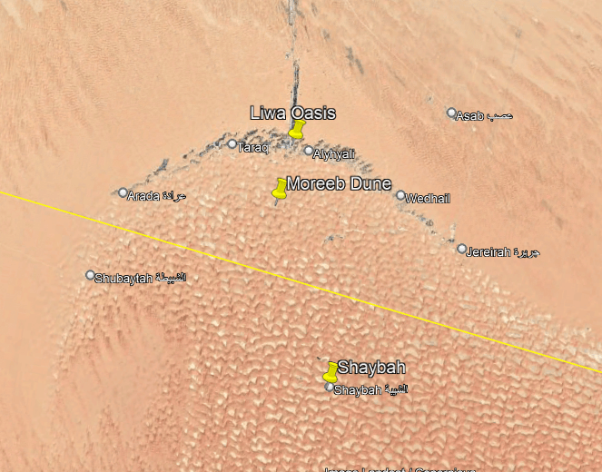
The Moreeb Dune is the tallest dune in the UAE and one of the highest sand hills in the world at 984-feet, or 300-meters, high, with a 50-degree angle from the ground to the top.
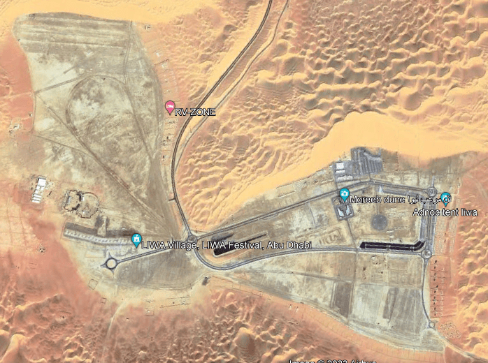
Among other things, it is popular place for organized car-racing, and other vehicular activities.
Must have a pretty hard surface underneath all of the sand!
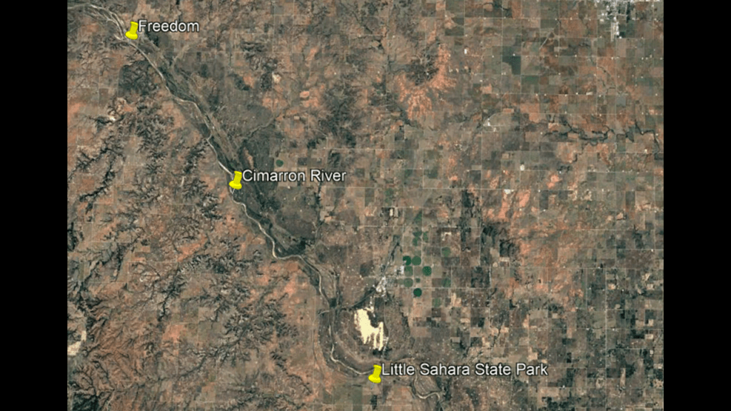
They do the same thing on the dunes at the Little Sahara State Park, near Waynoka, Oklahoma.
There are over 1,600-acres, or 648-hectares, of sand dunes here that range in height from 25 – to 75-feet, or 8- to 23-meters.
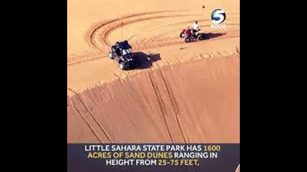
Oklahoma’s Little Sahara State Park is southeast of Freedom, Oklahoma, and both of these locations are on the Cimarron River.
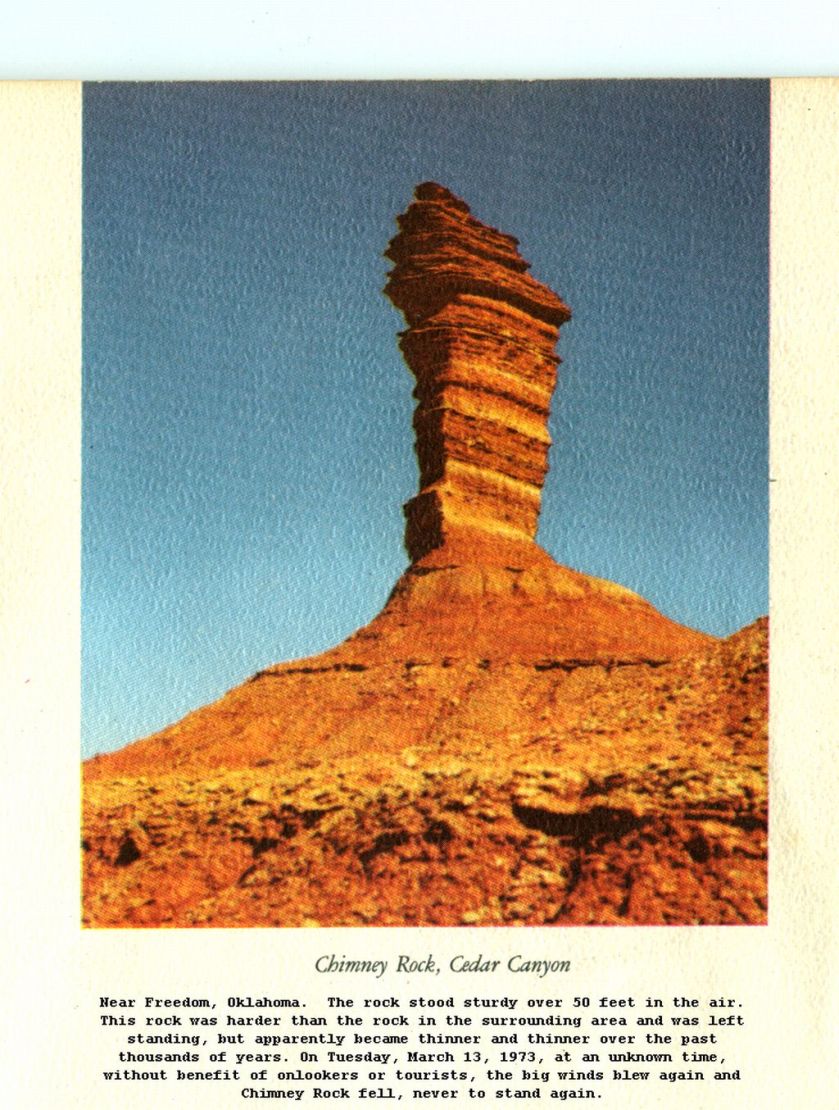
This is an old photo of what once was Chimney Rock in Freedom, Oklahoma.
It’s fate reminded me of the Grand Portal on the Pictured Rocks National Lakeshore that was speculated to have collapsed from erosion, but nobody really knew what caused it.
Same idea with Chimney Rock.
What they want us to believe, as captioned below the photo, was that this 50-f00t, or 15-meter, -high, sturdy rock was worn away so much over thousands of years, that one day in 1973, big winds caused it to fall without anyone seeing it happen.
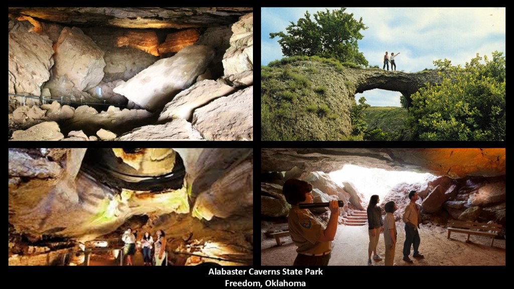
Freedom is also the location of Alabaster Caverns State Park.
Alabaster Caverns features the world’s largest gypsum cave open to the public, and contains rare alabaster formations.
I do believe we are looking at destroyed infrastructure at these locations, no longer recognizable as such from what these places once were, and it is my opinion these were the results of the deliberate destruction of the original energy grid.
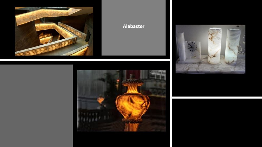
Alabaster was used by ancient builders for things like interior decoration and natural lighting.
It is a soft stone that transmits light, and was cut, carved, and polished to achieve translucent, glowing effects.
Today, the City of Freedom in Woods County is the smallest certified city in Oklahoma, with a population of 174 people in the 2020 Census.
In our historical narrative, it got its start in the late 1800s following the Cherokee Strip Land Run, when farmers and ranchers began a small settlement in the area.
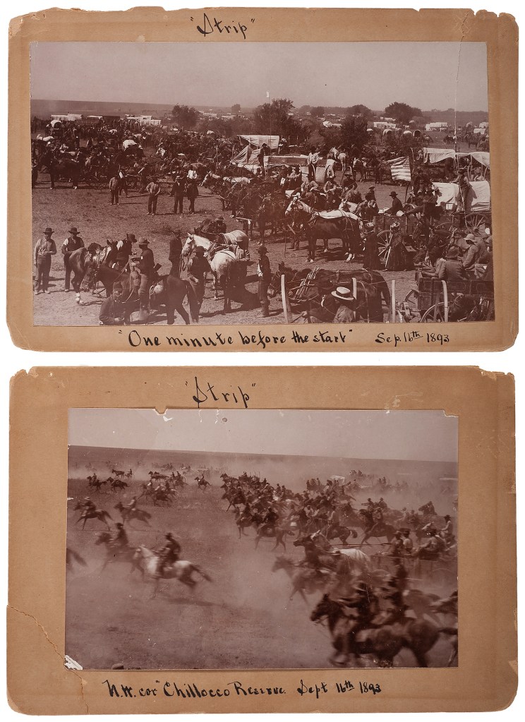
The Cherokee Strip land run began at noon on September 16th of 1893, with approximately 100,000 people running to stake claim on the free 6-million acres of land and 40,000 homesteads that had been opened up for settlement.
The Oklahoma counties of Woods, Kay, Grant, Woodward, Garfield, Noble, and Pawnee were established following the Cherokee Strip Land Run.
This is the historic Woods County Courthouse in Alva, Oklahoma.
It was said to have been constructed in 1904 and was condemned and demolished between 1954 and 1956 to make room for the current Woods County courthouse.
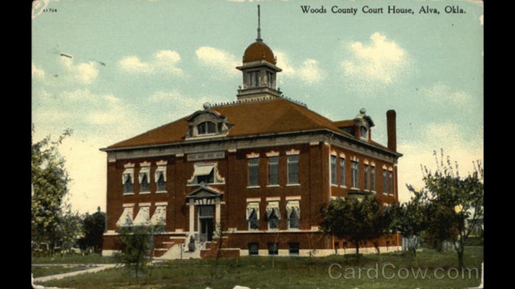
Four primary railroads traversed Woods County, Oklahoma, most of which were eventually consolidated into the Burlington Northern Santa Fe (BNSF) rail network: The Southern Kansas Railway; the Choctaw Northern Railroad; the Arkansas Valley and Western; and the Buffalo and Northwestern Railroad.
The livestock and livestock products produced by Woods County farmers had a market value of $2.5-million in 1945.
By 2000, only BNSF provided rail service.

There’s one other noteworthy place in Woods County that I would like to mention.
The Cargill Solar Salt Processing Plant west of Freedom on the Cimarron River flats, known as the Big Salt Plain.
The process does not involve mining salt from underground shafts, but one in which salty brine is pumped from underground deposits directly into shallow evaporative ponds.
Approximately 100,000- to 200,000-pounds, or 45,360- to 90,719-kilograms, of salt are harvested here annually for agricultural use (like cattle licks), water softeners and petroleum drilling.
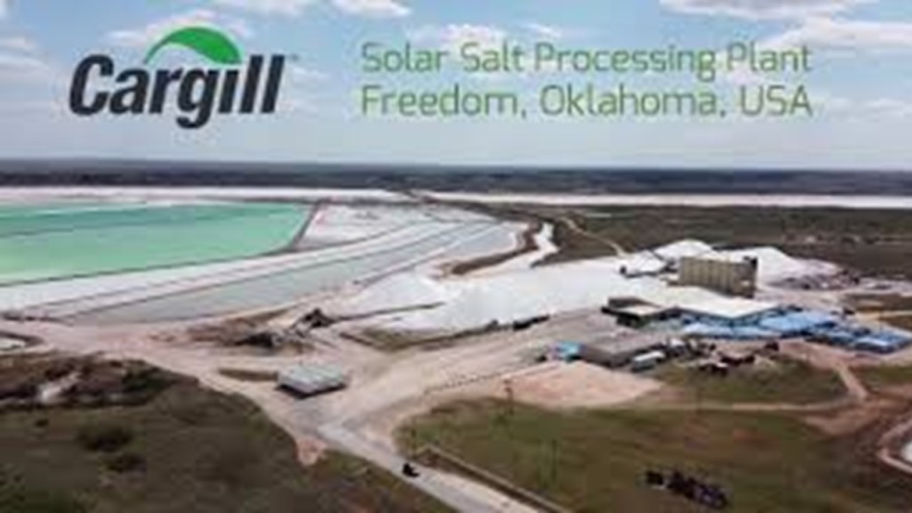
Oklahoma was where I first awakened to all of the things I am sharing with you now, about a worldwide, advanced civilization that has been erased from our memory, and from the start of my waking up to it, I was aware of a connection to energy.
After I became aware of the existence of the North American Star Tetrahedron, and as I started to become aware of the symmetrical, geometrically-shaped features of the landscape when I was living in Central Oklahoma, I started to see how the layout of the grid and ancient infrastructure were being utilized by the energy industry unbeknownst to the general population.
I started to see how the layout of the grid and ancient infrastructure were being utilized by the energy industry unbeknownst to the general population.
For example, we are told that these are wind turbines.
Pictured in this photo, west of Oklahoma City in Okarche, there is a massive wind-farm spread across the landscape.
However, these turbines not just placed anywhere – they are placed in a relatively linear fashion within a defined space, so their placement appears to be intentional, and not random.
Also, all of the wind turbines that are running go at the same speed, regardless of whether the wind is blowing.
I really question whether they are actually being powered by wind, and think they are being powered by some other technology.
Wind turbine farms have popped up in different places in Western Oklahoma, and the Texas Panhandle.
From what I could see in Oklahoma, wind turbines are typically associated with cities with an energy industry connection, like Woodward, OK, and Enid, OK, where I would see a line of them.
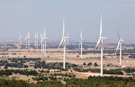
I came to realize that the wind turbine line-up in Okarche approximates with the lines in the North American Star Tetrahedron, and Oklahoma is located where two major lines cross.
The Anadarko Basin underlies western Oklahoma, the Texas Panhandle, southwestern Kansas and southeastern Colorado.
Like the previously-seen Shaybah Oil Field in Saudi Arabia, the Anadarko Basin produces large amounts of natural gas and oil.
Another place of interest is Cushing, Oklahoma, which is located between Stillwater, OK, and Tulsa, OK, and called the “Pipeline Crossroads of the World.”
It is one of the largest physical crude oil storage facilities in the world, and functions as the central intersection for domestic and international oil pipelines.
I came to realize while living in Oklahoma that tank farms are typically situated on top of what appears to be earthworks.
Here are two examples, but very typical of the types of things I started to notice as I was becoming more aware.
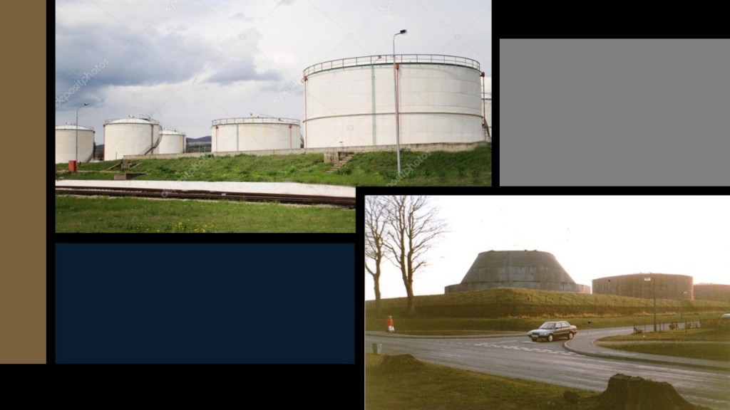
When I lived in Oklahoma, I had the occasion to drive along Highway 412 from Woodward to Enid, all of which are just south of Alabaster Caverns in Freedom and the Little Sahara State Park in Waynoka.
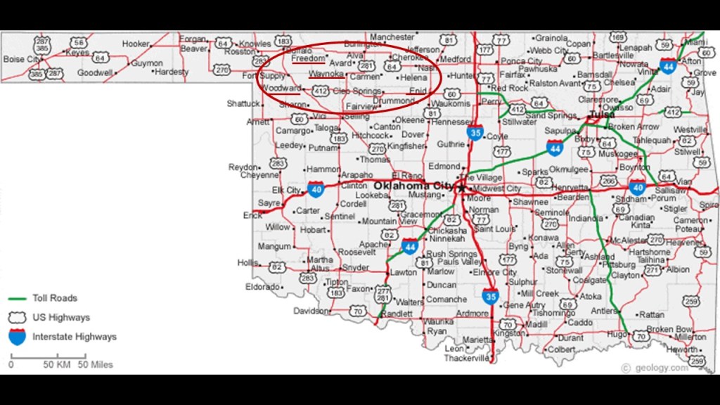
All along the way, I saw features in the landscape that looked like these, at Gloss Mountains State Park near Enid:
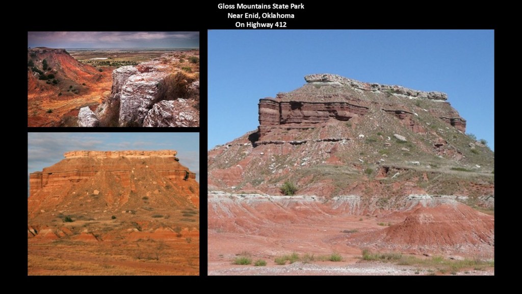
At many places in this drive, I saw what looked like fracking wells in the distance next to these features, similar to the one pictured here.
I believe terms like “fossil fuel” and “natural gas” are misnomers, and that our modern energy industry is actually based on ancient energy technologies.
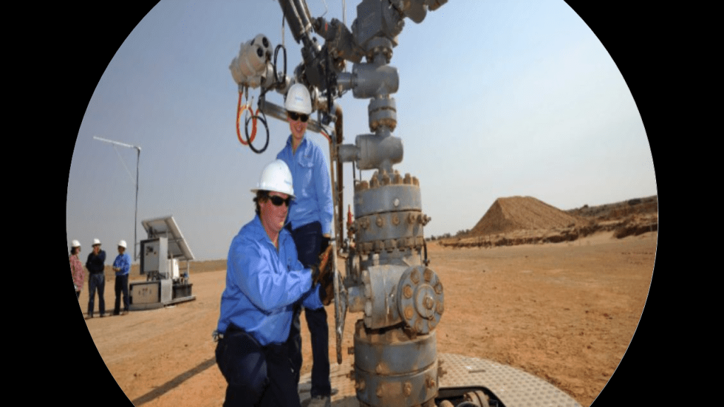
I have also seen countless examples of utility poles in sand dunes and on earthworks.
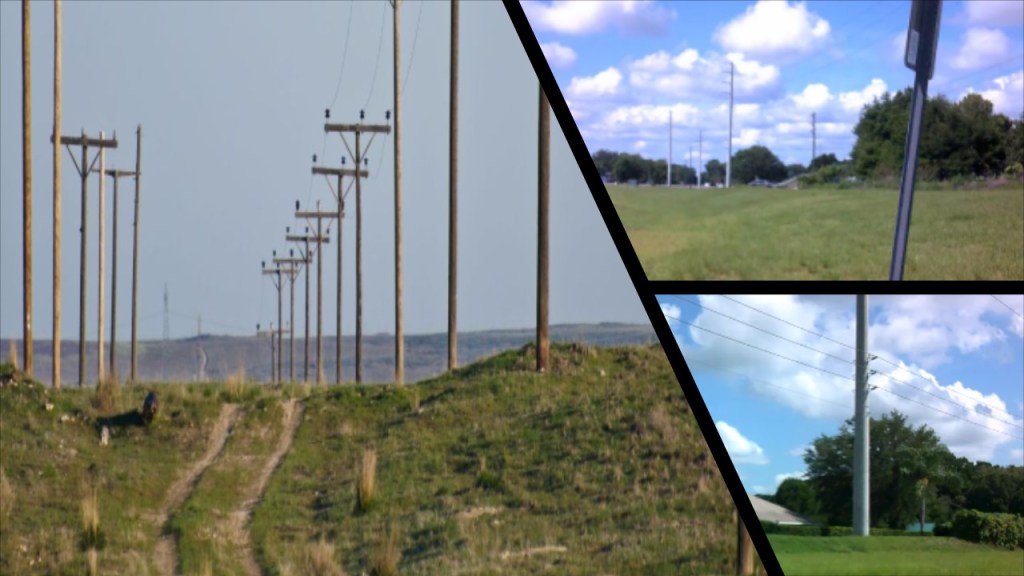
There are many more examples of dune systems on the surface of the Earth, but what I have covered in this post illustrates why I believe that the Earth’s original energy grid system was based on geometrically precise and exact leyline alignments that mirrored the Heavens, and that a deliberately-caused cataclysm destroyed it around key infrastructure of the energy grid, including railways, canals, star forts, and lighthouses.
I believe the malevolent, parasitic beings behind the cataclysm were shovel-ready to dig enough of the original infrastructure out of the ruined Earth so they could be used and civilization restarted as the New World Order, which I think started in earnest in the mid-to-late 1700s and early 1800s.
I think that when the energy grid was destroyed, the land was destroyed, and created all the land features we see in the world today that have been covered-up by calling everything the result of natural and geological forces, and suppressing any history or explanations that would contradict the official narrative.
There are some good examples in Texas that come to mind about how the original ancient infrastructure has been covered up by calling it natural.
There is a rock formation in the Palo Duro Canyon in West Texas known as the Lighthouse on the left, and it has a twin in Big Bend National Park in South Texas, pictured on the right.
When I first saw these two many years ago, early on in my research journey some time around 2018, the Pharos of Alexandria immediately came to mind.
These two ancient stone structures look like melted lighthouses on the left, and here is how they compare in appearance to what the Pharos of Alexandria was believed to have looked like on the right.
I am going to end this post here.
In conclusion, it is my opinion that the original energy grid system of a worldwide advanced civilization was deliberately-destroyed, which caused the cataclysmic destruction of the entire surface of the Earth, and that the original energy-grid-system was repurposed by the Earth’s Controllers in the last couple of hundred years into an energy-harvesting system known as the Matrix.

I also believe that the energy sources that power our world are the components of the original energy grid, from oil and gas, to elements that are mined, like coal and iron ore, that was very much a part of what the self-styled elite families became enormously wealthy and powerful from, and who also formed our perceptions of the world we live in today.


That is until they lost control of the narrative with the Internet and Humanity started waking up from its long, manipulated slumber.
No matter how hard they try to get it back, they are more exposed than they have ever been at any time in our modern history.


would you please share your source for statement ‘they must tell us what they are going to do or did…’
LikeLike