
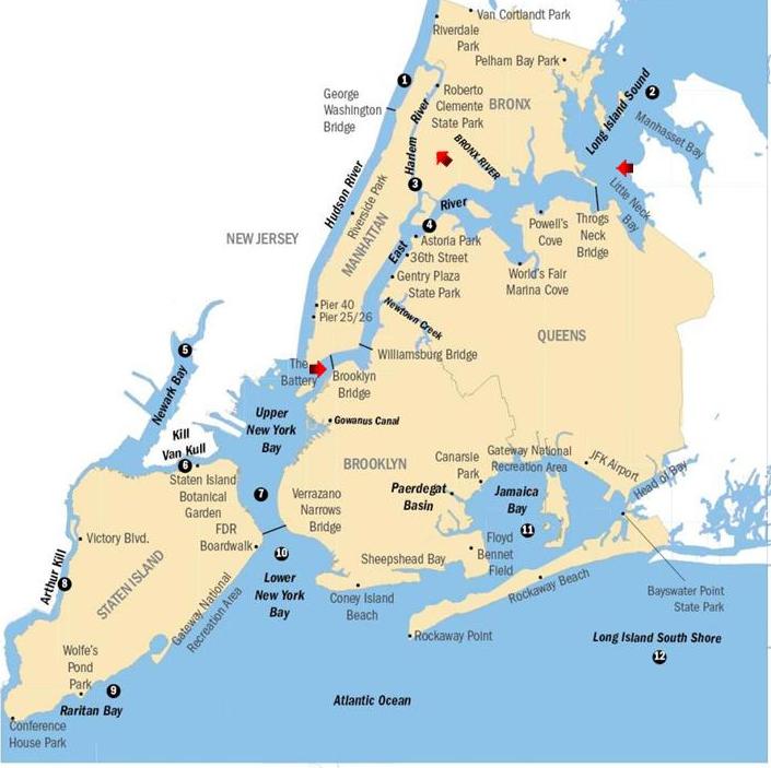
To this point, I have tracked the circle alignment from Washington, DC; through Baltimore, Maryland; Wilmington, Delaware;Philadelphia, Pennsylvania; Morrisville, Pennsylvania; Trenton, New Jersey; Sayreville, New Jersey; and the Lower New York Bay.
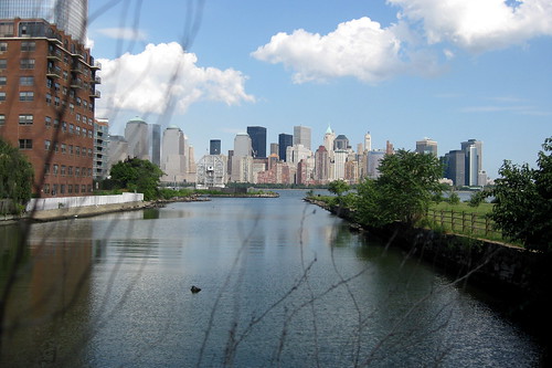
In this post, I am going to only focus on the Upper New York Bay.
Upper New York Bay, also called the New York Harbor, is the traditional heart of the Port of New York and New Jersey.

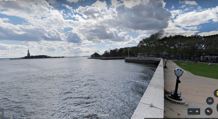
It is said to be fed by the waters of the Hudson River, coming into the bay between Liberty State Park in New Jersey, and Lower Manhattan.
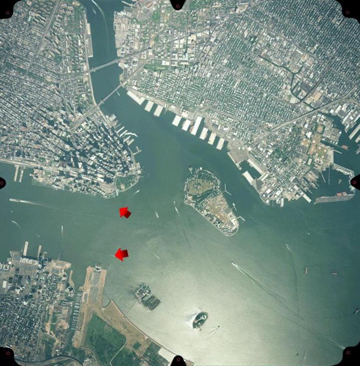
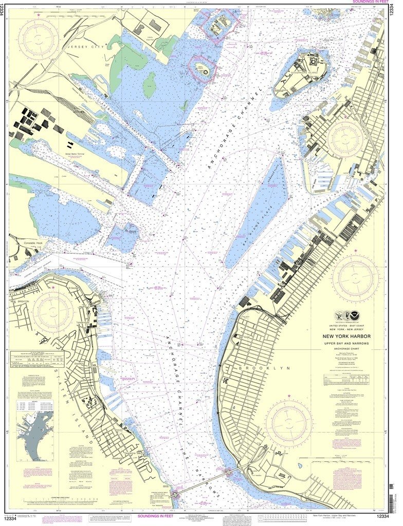
Upper New York Bay provides passage for the Hudson River via the Anchorage Channel, which is fifty-feet deep, or 15 meters, through the mid-point of the harbor. It is one of the most heavily-used water transportation arteries in the world.
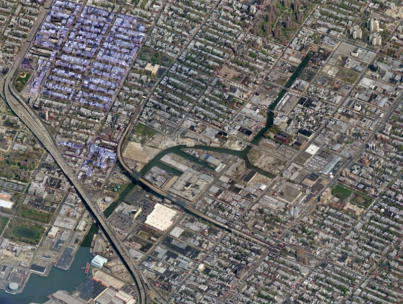
The Gowanus Canal in Brooklyn is connected to the Gowanus Bay of Upper New York Bay. Brooklyn occupies the westernmost part of Long Island. At one time a vital transportation hub, it is now a superfund site due to extensive pollution, with clean-up efforts starting in 2013.
The Upper New York Bay is connected to the Lower New York Bay by the Narrows, described as the tidal strait separating the Boroughs of Staten Island and Brooklyn, and forms the principal channel by which the Hudson River empties into the Atlantic Ocean.

Upper New York Bay is connected to Long Island Sound via the East River. The East River separates Manhattan Island from Brooklyn and Queens, and connects with the Hudson River via the Harlem River at the northern end of Manhattan Island.
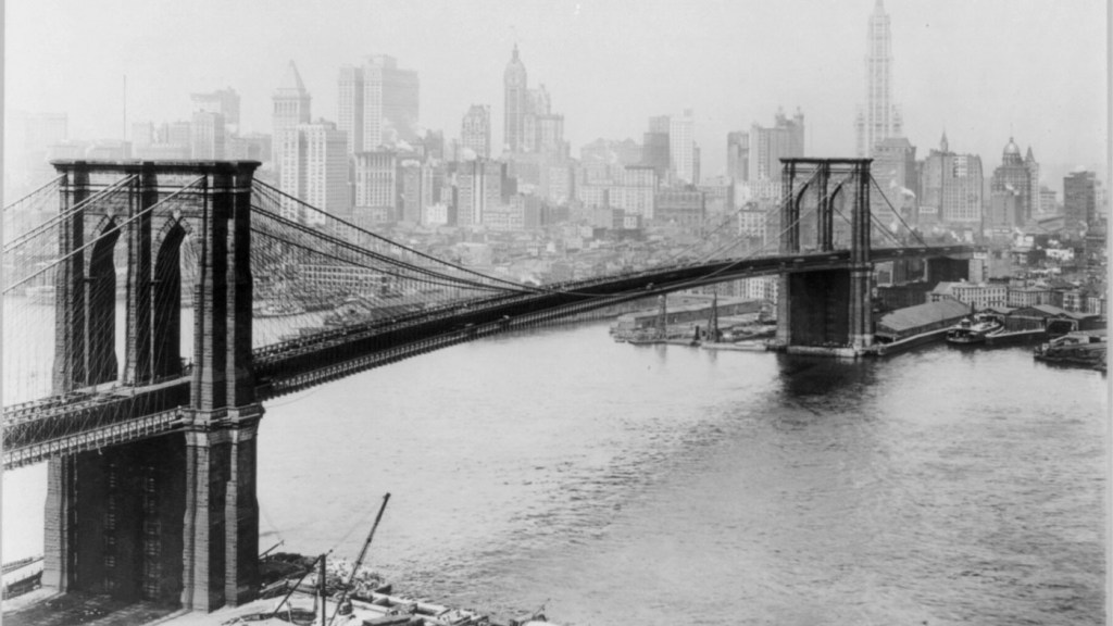
The East River is known as the “River of Mighty Bridges,” the best known being the Brooklyn Bridge, a suspension bridge opened in 1883…
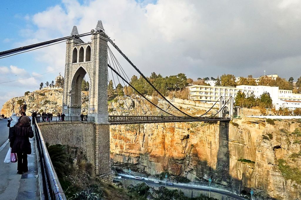
…and for comparison is the Sidi M’Cid Bridge, a suspension bridge in Constantine, Algeria said to have opened in 1912. Constantine is referred to as “The City of Bridges.”
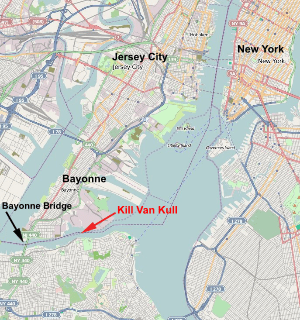
Upper New York Bay is connected to the Newark Bay by the Kill Van Kull, what is called a tidal strait between Staten Island, New York, and Bayonne, New Jersey.
The Robbins Reef Lighthouse, no longer in use, stands at the eastern end of the Kill Van Kull. The current lighthouse building was said to have been built in 1883, replacing an octagonal granite tower that was said to have been built in 1839.

At one time, Robbins Reef was said to have one of the largest oyster beds in the world until they were completely contaminated by the end of the 19th-century.
Robbins Reef is located off of Constable Hook in Bayonne, New Jersey. This is the Bayonne Country Club on Constable Hook, complete with its own lighthouse.
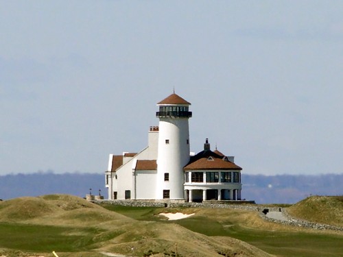
I firmly believe golf courses cover-up mound sites.
Bergen Point marks the western end of the Kill Van Kull. This geometrically-shaped point-of-land at one time was at one time the location of a Texaco plant…
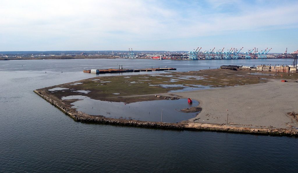
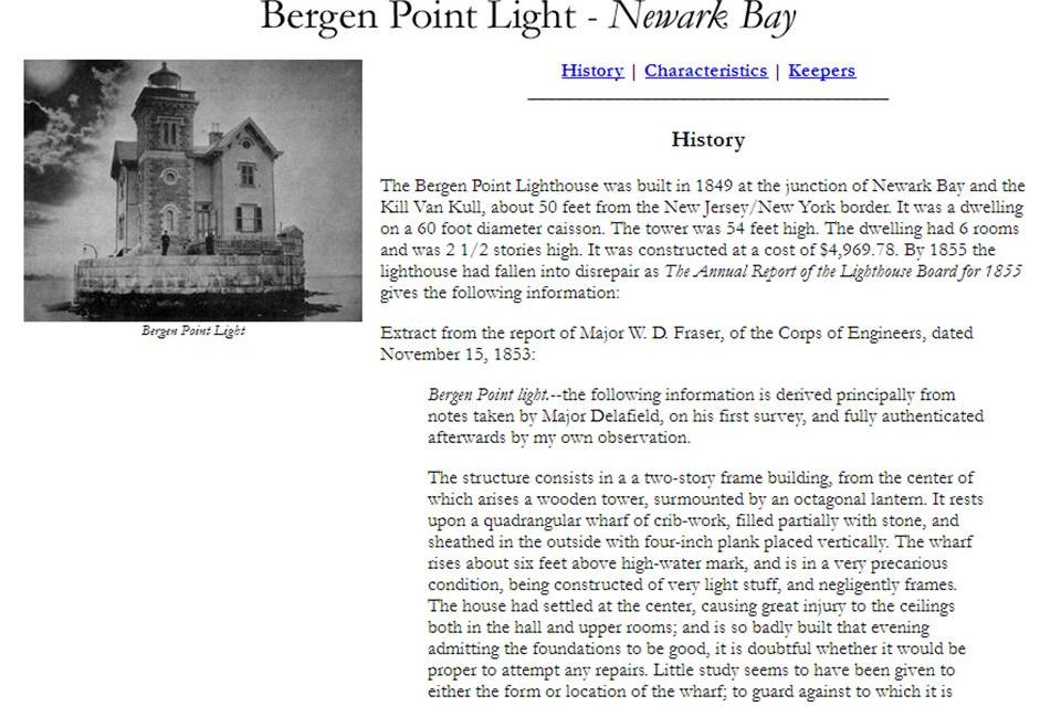
…and Bergen Point Lighthouse was nearby in Newark Bay, until we are told it was torn down around 1950.
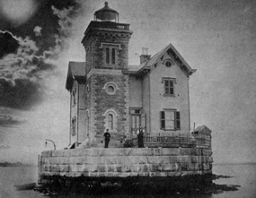
There are some real inconsistencies in information I read here on the Bergen Point Lighthouse. It was said to have been built in 1849, and already have fallen into disrepair by 1855. As early as 1853, only four years after the given construction date, Major Fraser of the Corps of Engineers, was describing its state as already precarious.
The Bergen Point Lighthouse, with its beautiful masonry, does not look badly built in this picture!
Here is another date inconsistency associated with Bergen Point, concerning the nearby Point Johnston Coal Docks as well.
They were said to have been built in 1864 by the Central Railroad of New Jersey.
What is wrong with that date?
It means that a big infrastructure project like this would have been undertaken during the American Civil War, and an especially intense year at that.
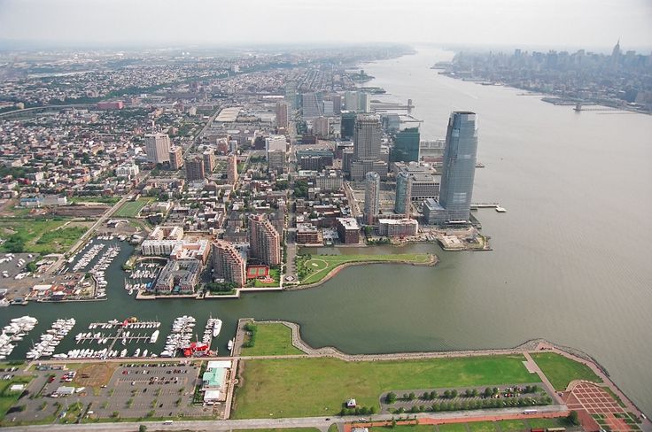
Liberty State Park opened in the Bicentennial Year of 1976, and is located at the mouth of the Hudson River on the New Jersey-side in Jersey City.
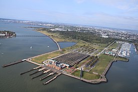
It is situated opposite of both Liberty Island, where the Statue of Liberty is located, and Ellis Island, the gateway for immigration between 1892 and 1954. More on these two islands shortly.
The northeastern side of Liberty State Park is bordered by both the Little Basin…
…and the Big Basin of the Morris Canal.
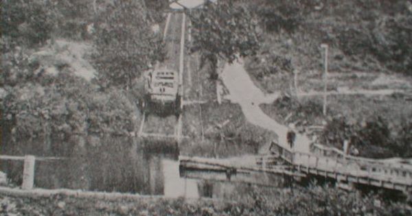
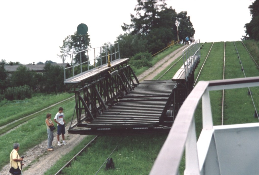
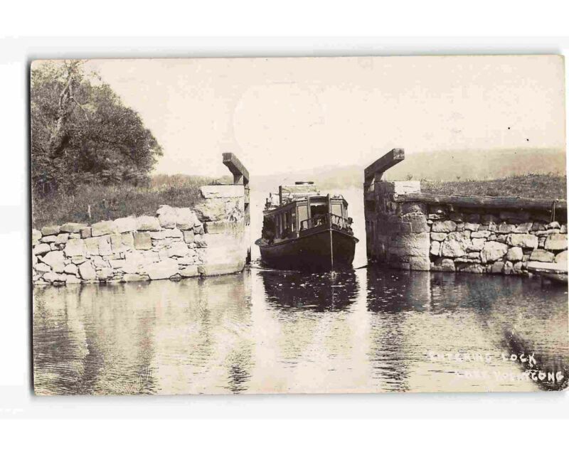
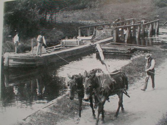
The Morris Canal, 107-miles, or 172-kilometers, long, said to have been completed in 1832 to carry coal across northern New Jersey between the Delaware River and the Hudson River. It was closed in 1924. It was hailed as an ingenious, technological marvel for its use of water-driven, inclined planes.
…with water from the canal coming from Lake Hopatcong, which was dammed in the building of the canal, filling the surrounding landscape with water.
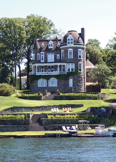
This was a home at Lake Hopatcong, said to have been built in 1895 with imported stones.
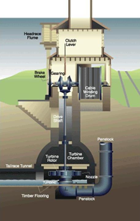
The builders of the Morris Canal used a sophisticated power house technology, pictured here, to power the water turbine that was set in motion to raise or lower cradled boats on the inclined planes by means of a cable.
You mean to tell me all of this extremely sophisticated and advanced canal-engineering technology was being implemented prior to the beginning of the Industrial Age, according to the history we are taught.
Seriously?
And, by the way, mules were still needed to be used to pull the canal boats in places on the Morris Canal in spite of all that technology?
Food for thought about the difference between what we are told, and what does not hold up under scrutiny.
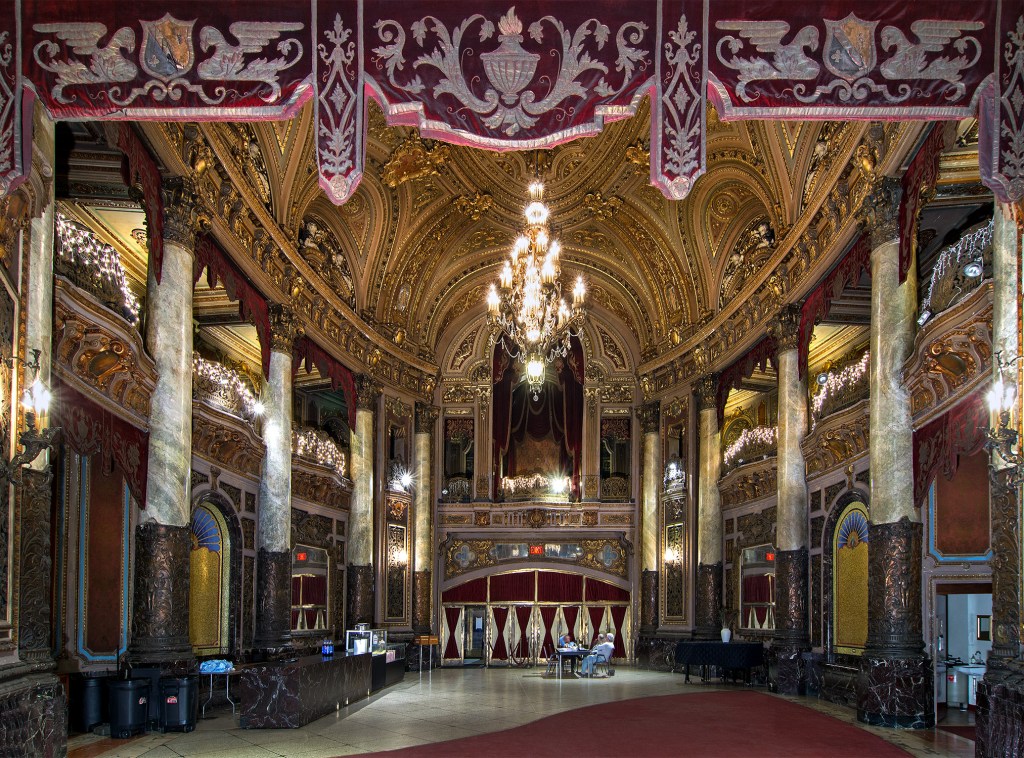
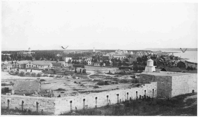
One building I want to show you back in Jersey City is the Landmark Loew’s Jersey Theater, said to have opened in 1929. It is lavish on the outside…
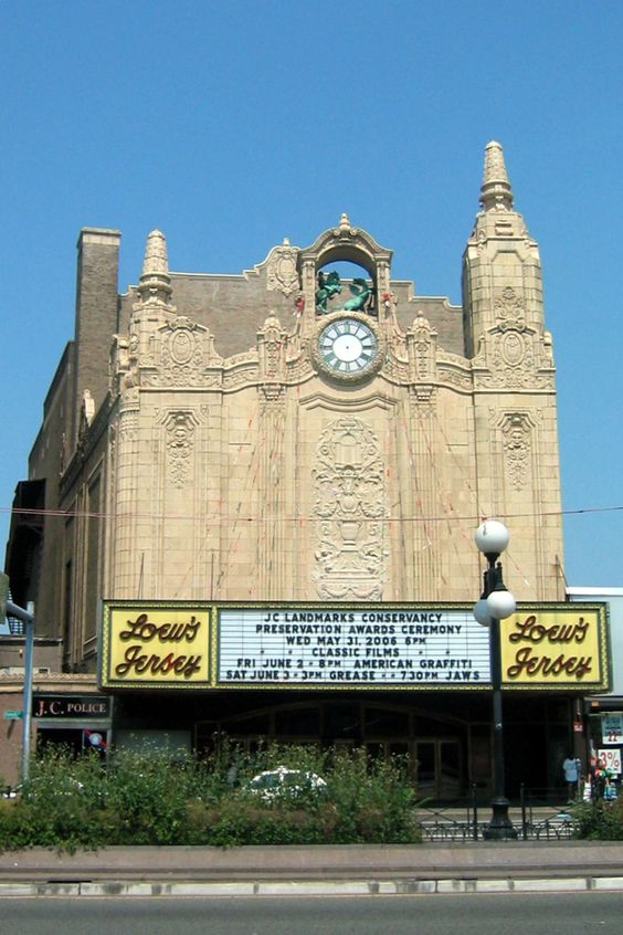
…and lavish on the inside.
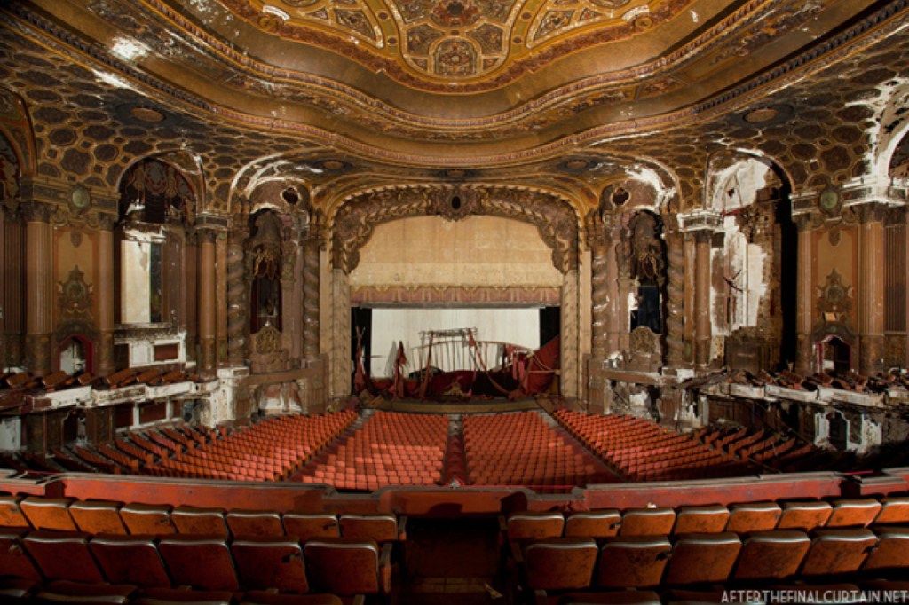
Preservationists succeeded in saving the building from demolition after it closed in 1986. It is used for special events, and is the primary venue of the annual Golden Door Film Festival since 2011.
One more thing before I leave Liberty State Park and Jersey City. This building is the Central Railroad of New Jersey Terminal. It was the waterfront passenger terminal in Jersey City.
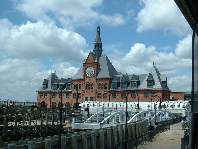
An estimated 10.5 million immigrants processed through here to get to Ellis Island.
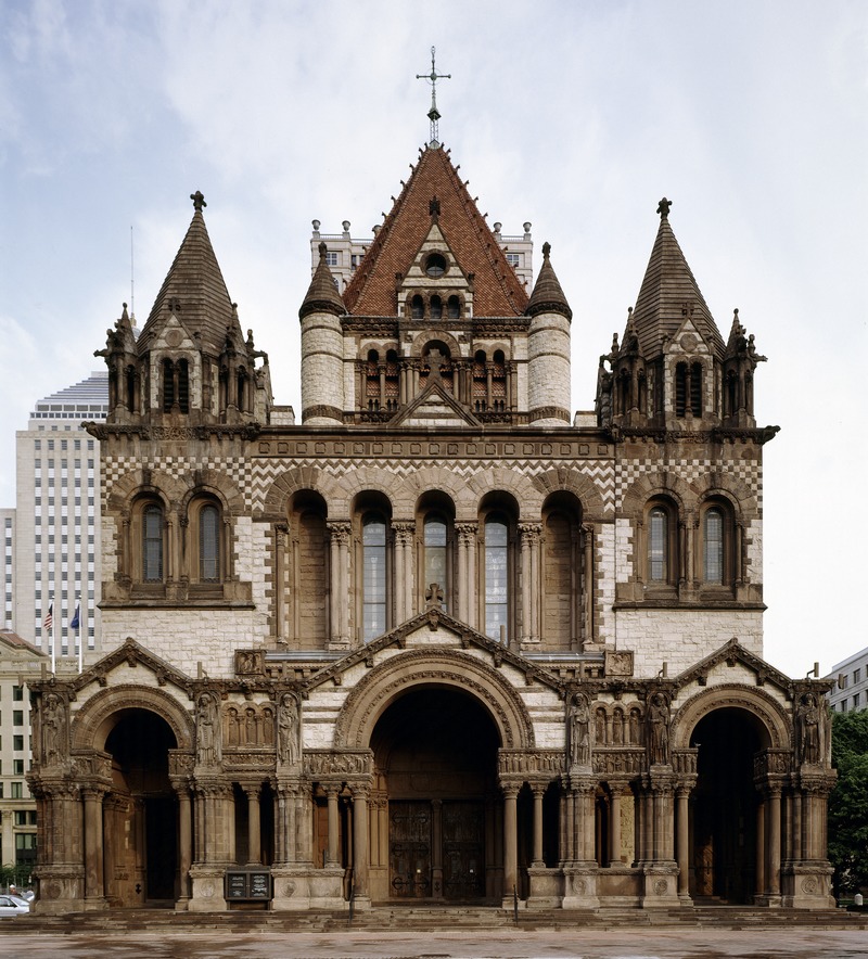
The architectural style of the Terminal building is called Richardsonian Romanesque, after architect Henry Hobson Richardson, who first used elements of this style in the Buffalo State Asylum for the Insane in Buffalo, New York, which he is said to have designed in 1870. It is now known as the Richardson Olmstead Complex.
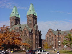
Richardsonian Romanesque is described as a free revival style, incorporating 11th and 12th century southern French, Spanish, Italian Romanesque characteristics.
He had a relatively short career, having died at age 47, and didn’t even complete his architecture school training in Paris because he lost family backing because of the American Civil War.
Among other places, Richardson is also given the credit for designing Trinity Church in Boston.
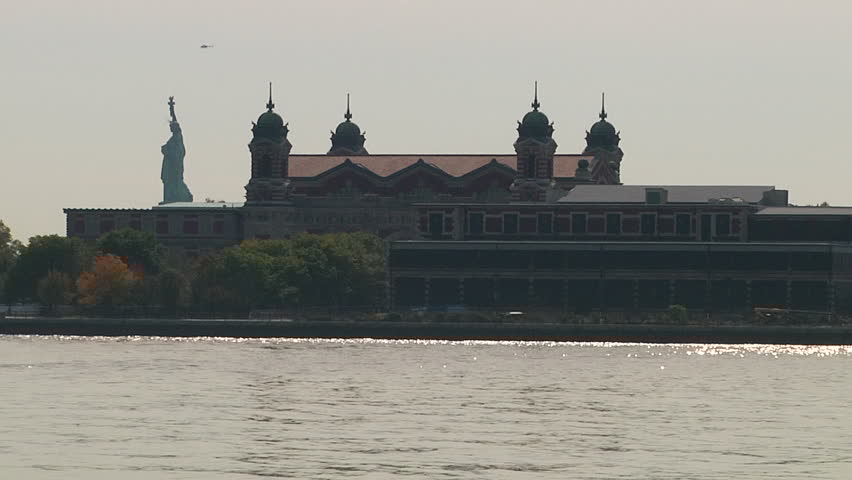
Like I mentioned previously, Liberty State Park in New Jersey is close to Liberty Island and Ellis Island in the Upper New York Bay.
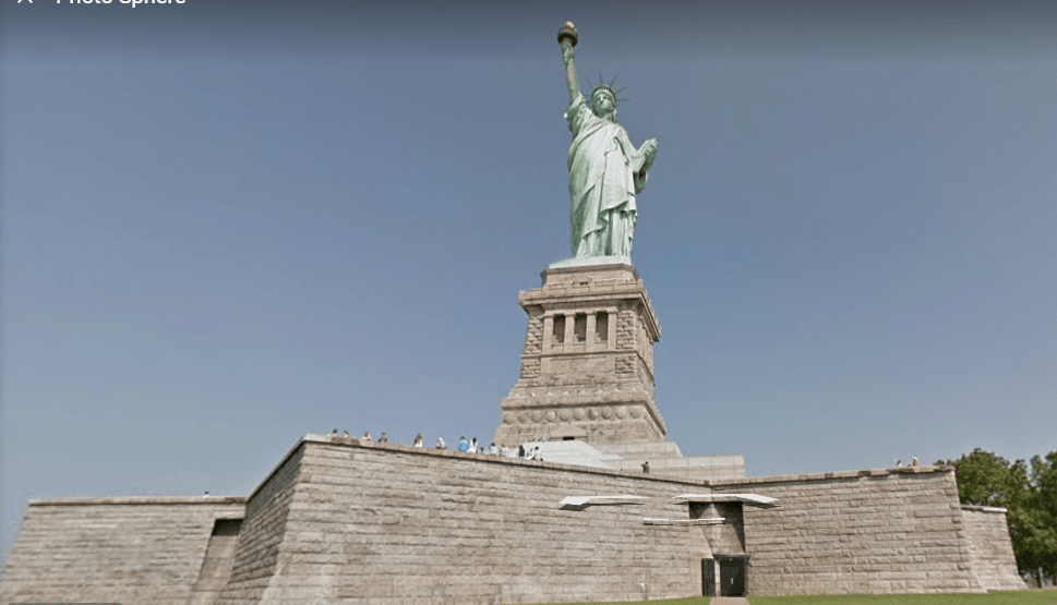
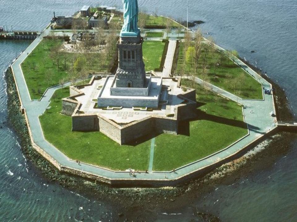
Liberty Island is described as an exclave of the New York City Borough of Manhattan, as it is in New Jersey waters. It was known as Bedloe’s Island until it was renamed Liberty Island by an Act of Congress in 1956.

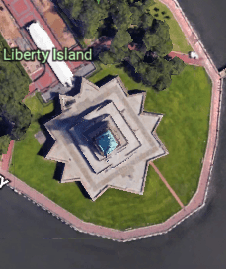
Fort Wood, the eleven-pointed star fort the Statue of Liberty sits on top of, was said to have been built between 1806 and 1811…
…and the pedestal in 1886 to receive the Statue of Liberty as a gift from France commemorating the American Centennial of 1876.
And no where is it mentioned that Liberty Island is an artificial island…
…and it is even more obvious that Ellis Island located right next to it is an artificial island, with its geometric shapes.
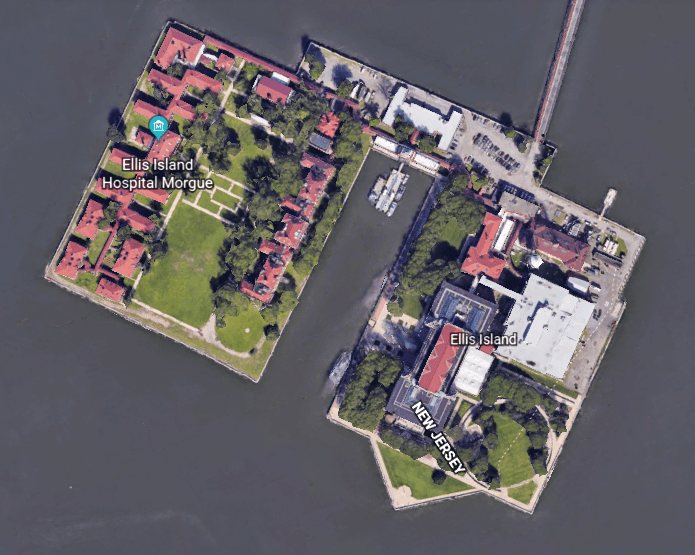
…even though it is not called one either. It is said to have been largely created through land reclamation though. Hmmm.
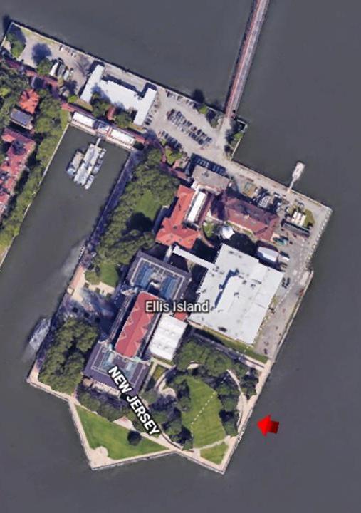
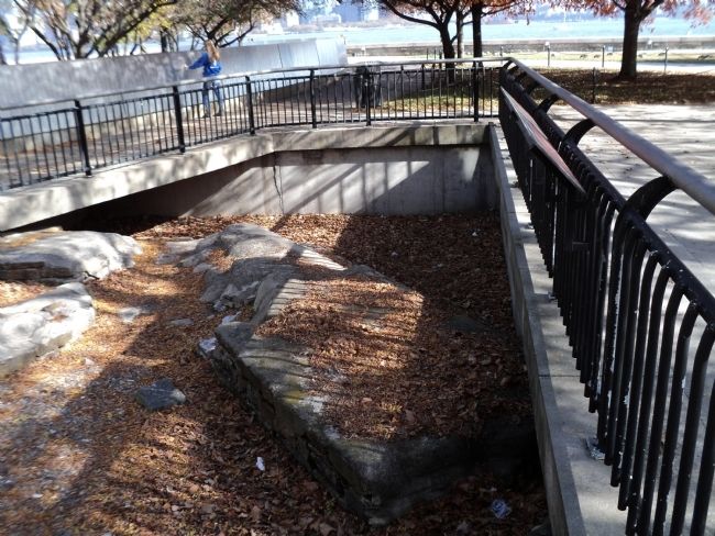
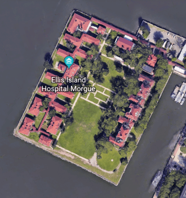
This is an aerial of the north side of Ellis Island from Google Earth showing a circular feature on the grounds…
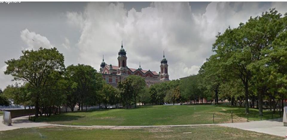
…and this is the street view of that same feature from Google Earth, with a mound-like appearance inside the circle.
Prior to when the current facilities are said to have been, Ellis Island was the location of Fort Gibson, one of forty forts said to have been built as part of the the New York Harbor System between 1794 – 1812. This marker commemorates Fort Gibson…
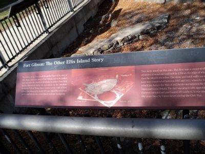
…on what became known as Ellis Island.
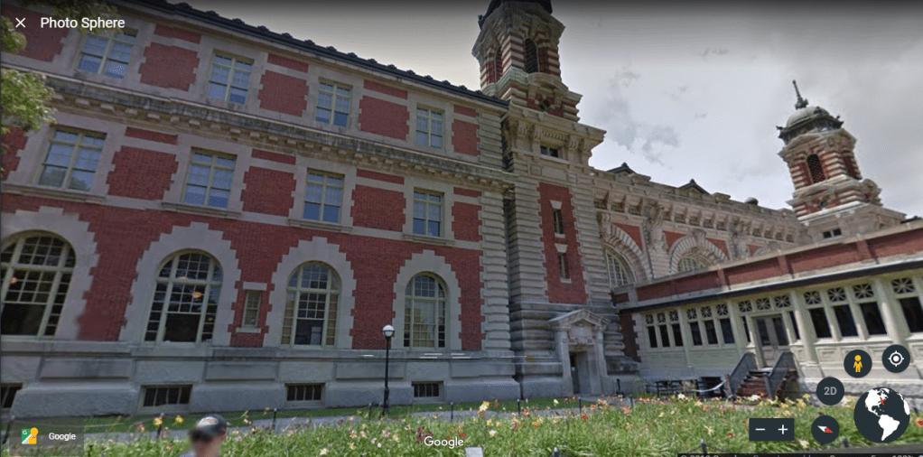
Co-Architects William Alciphron Boring and Edward Lippencott Tilton are given the credit for the architecture seen here today dating from the late 1800s to 1900, and which is currently the museum for Ellis Island.
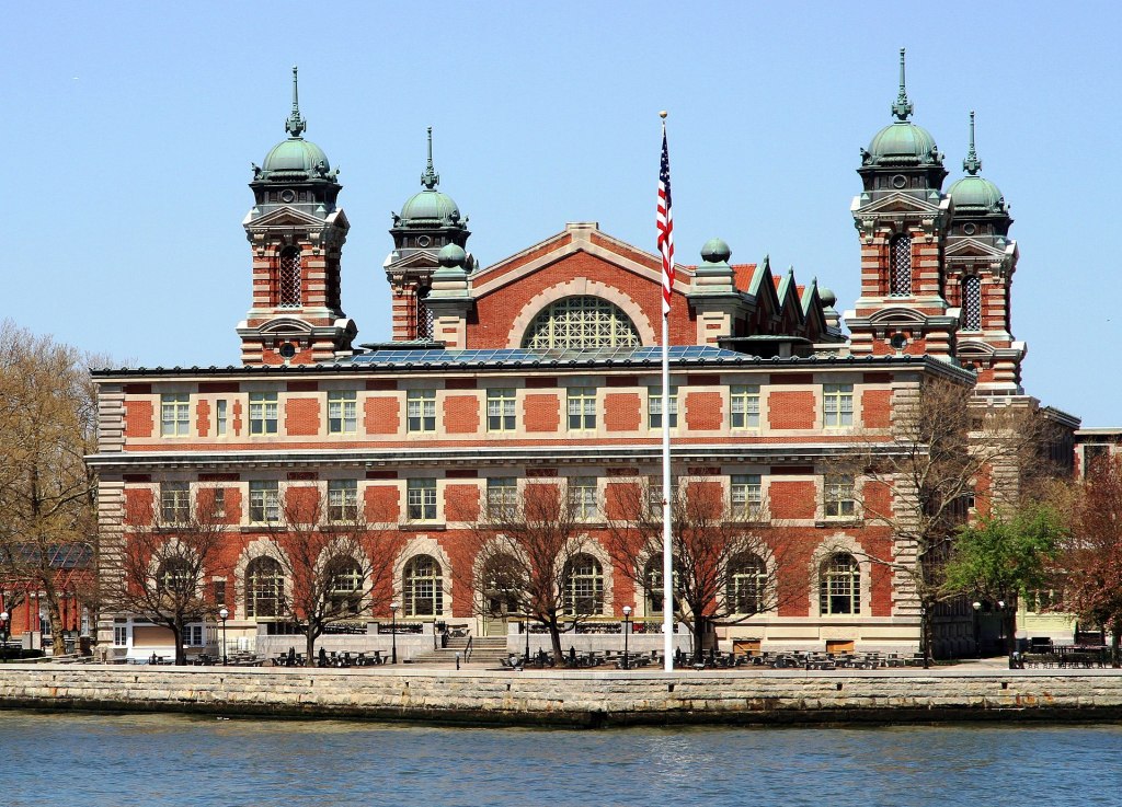
It is said to be what is called Renaissance Revival architecture.
Ellis Island has been owned by the United States government since 1808, and has been operated by the National Park Service since 1965.
The south-side of the island, which houses the Ellis Island Immigrant Hospital, has been closed to the public since 1954.
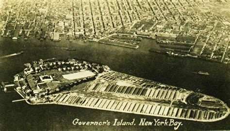
Governors Island is also in the the Upper New York Bay, and situated at the confluence of the East River and the Hudson River.
It is 800 yards, or 732 meters, from the southern tip of Manhattan Island, and separated from Brooklyn by the Buttermilk Channel by approximately 400 yards or 366 meters.
The first thing that caught my eye when I was looking at Governors Island on Google Earth was Fort Jay, named after Supreme Court Chief Justice & Founding Father John Jay, and part of the Governors Island National Monument…
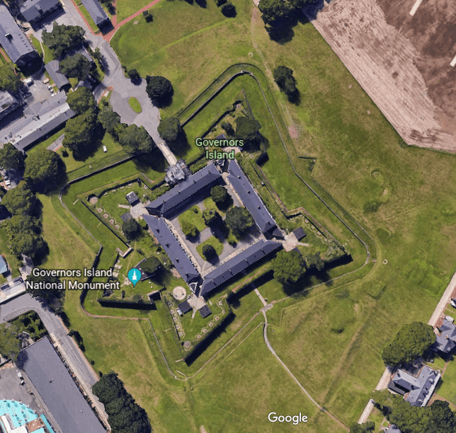
…said to have been built in 1794 to defend Upper New York Bay, and an active installation until 1997.
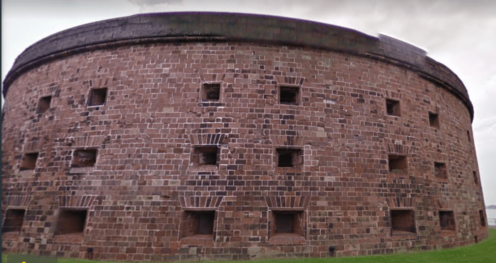
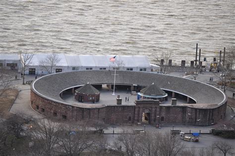
Another feature of the Governors Island National Monument is Castle Williams, part of the New York Harbor System defenses. It is called a circular structure of red sandstone, having been built between 1807 and 1811 under the direction of Lt. Colonel Jonathan Williams of the U. S. Army Corps of Engineers.
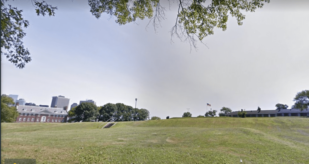
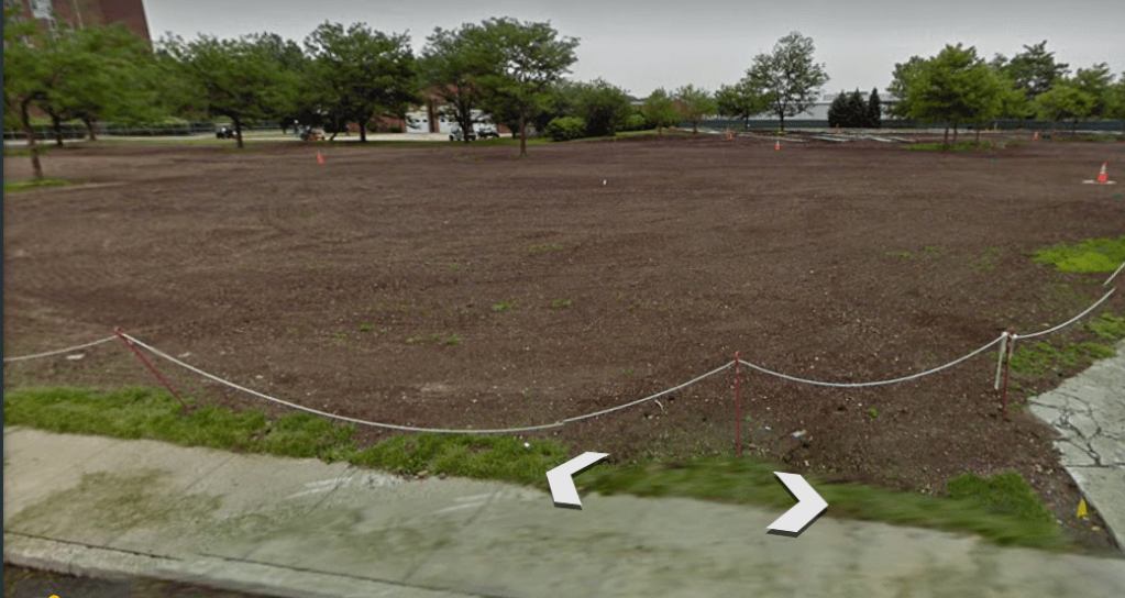
A few other places of interest on Governors Island that I found on Google Earth include “The Hills…”
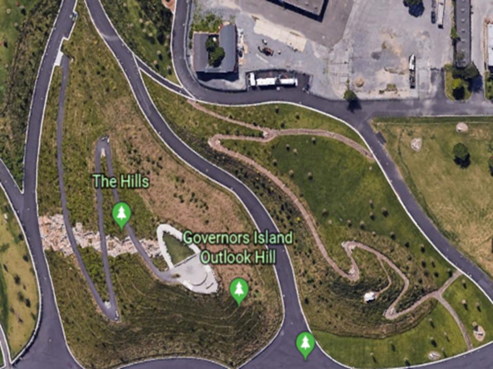
…which, according to this streetview of The Hills at the same location on Google Earth, are no longer there….
This brings me to Battery Park, at the southern tip of Manhattan, the historical location of another star fort, Fort Amsterdam, said to have been surrendered by the Dutch to the British in 1664…

…and Castle Clinton, a circular fort said to have been built of red sandstone between 1808 and 1811, and the first immigration center of the United States before Ellis Island, between 1855 and 1890.
Castle Clinton was also known as the “West Battery,” a complement to Castle Williams as the “East Battery” on Governors Island. More on the use of the word battery shortly.
So far, since I have been looking at the Lower and Upper New York Bays, I can make a case for finding seven star forts. I am not including Fort Gibson on Ellis Island because if there was a star fort there, it is long gone or covered over:
–Fort Hancock on Sandy Hook at the Atlantic Ocean entrance to the Lower New York Bay was a star fort at one time
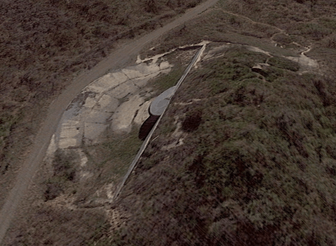
–Fort Tilden on the Rockaway Peninsula in the Lower New York Bay, north of Fort Hancock and Sandy Hook. It is hard to tell what is here because of the tree cover, but you can make some points out here in this photo
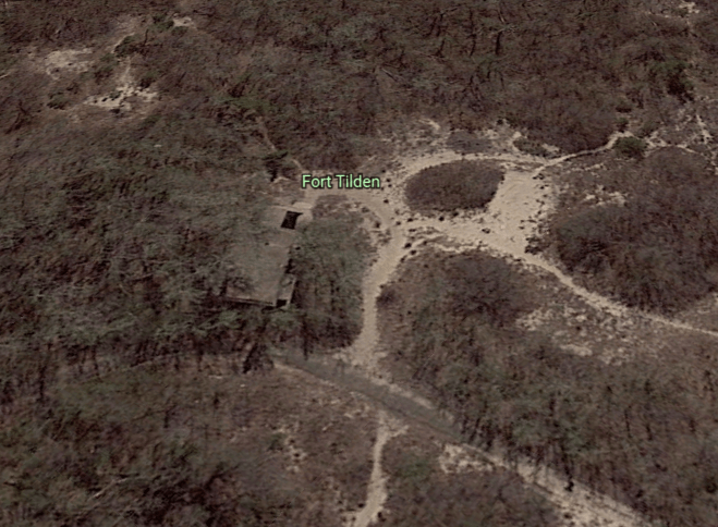
Here is another location on the Fort Tilden site…
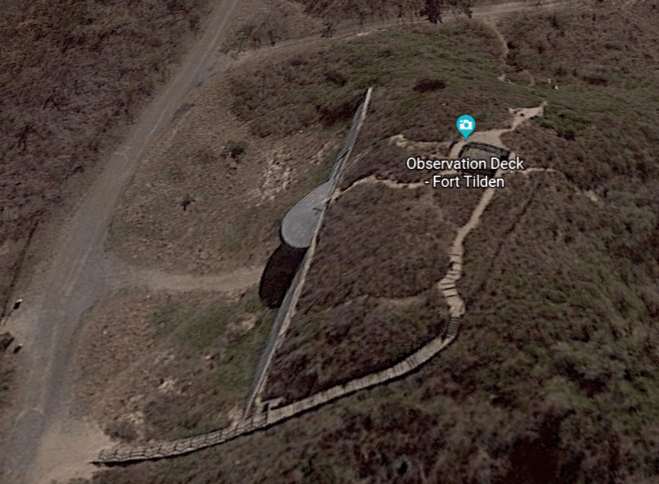
…and a similar feature beside it further up the embankment.
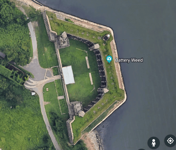
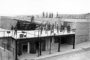
–Fort Wadsworth, also known as Battery Weed, located next to the Staten Island side of the Verrazzano-Narrows Bridge, located at The Narrows between the Lower and Upper New York Bays
–Fort Hamilton at the base of the Brooklyn-side of the Verrazzano-Narrows Bridge, where you can see a geometric earthwork point in this photo
–Fort Wood in the Upper New York Bay underneath the Statue of Liberty
–Fort Jay on Governors Island at the convergence of the Hudson and East Rivers
–Fort Amsterdam on what is now called Battery Park.
What are the meanings of “battery?”
One is “a device that produces electricity; may have several primary or secondary cells arranged in parallel or series.”
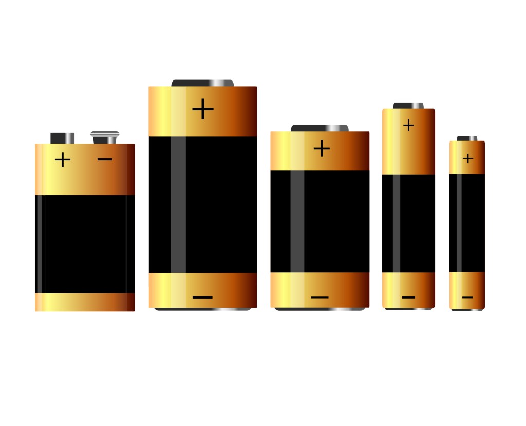
Another is “the heavy fire of artillery to saturate an area rather than hit a specific target.”
Or ” An assault in which the assailant makes physical contact.”

The answer to the mystery of star forts, which are found all around the planet, lies in what I believe is the first answer – that some how these star forts functioned as batteries, for the purpose of producing electricity or some form of energy for the planetary grid system, but they were re-purposed in many cases, but not all, to the second definition in another time-line to have a military function.
I will have more to say to tie all of this information together in the next post, when I pick up the alignment going up the Hudson River.
