
This is the last part of a three-part series on the islands of the English Channel.
In the first-part of the series, I took a close look at the features and history of Alderney Island in the Channel Islands, which are British Crown Dependencies.
In the second-part of the series, I looked at the same on the other main Channel Islands of Jersey, Guernsey, Herm, and Sark.
In this part of the series, I am visiting the Isle of Portland, the Isle of Wight, and the French Iles Chausey in the English Channel, all of which are considered separate from the Channel Islands I just mentioned.
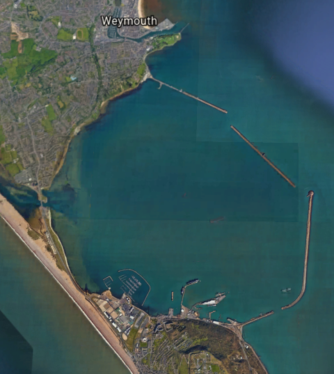
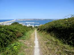
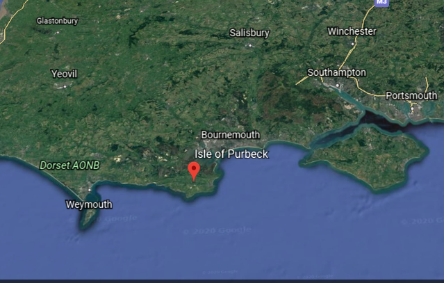
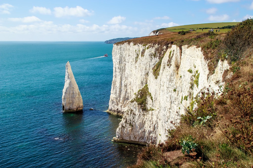
The Isle of Portland is what is called a tied-island in the English Channel, forming the southernmost point in England’s Dorset County.
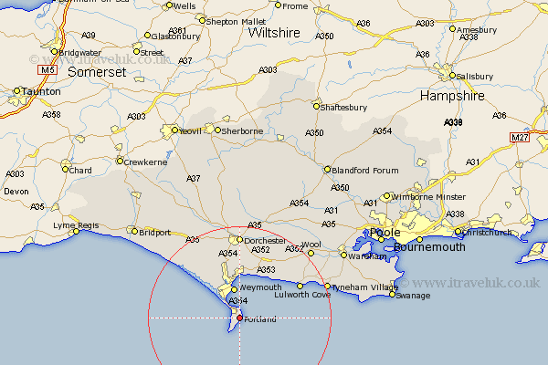
It is 5-miles, or 8-kilometers, south of the resort town of Weymouth.
A barrier beach called Chesil Beach connects it to the mainland of England.
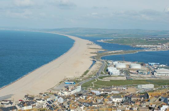
I found a similar-looking place when I was researching an circle alignment that begins, and ends, in Merida, Mexico, that goes through Wrangel Island that is located in the Arctic Sea between the Siberian Sea and the Chukchi Sea off the coast of northern Russia.
It is called Cape Blossom on Wrangel Island.
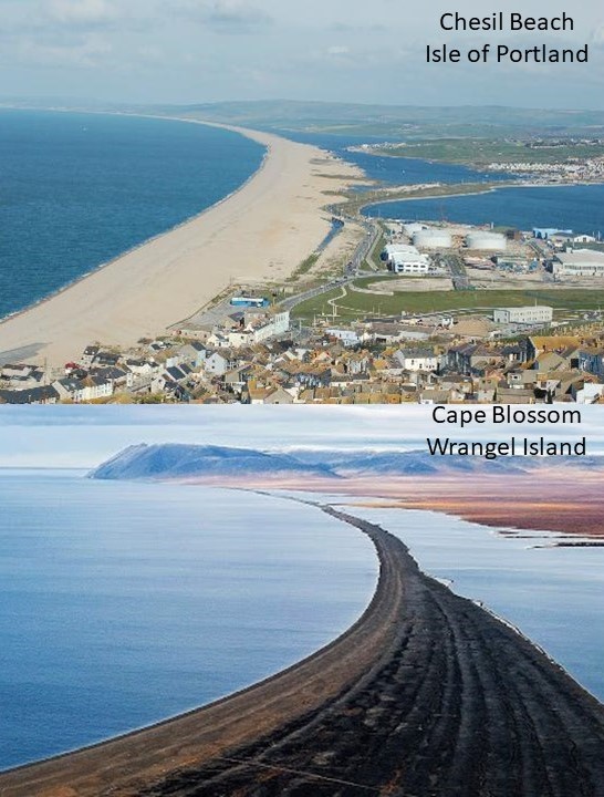
They tell us this is natural, but I really wonder about that!
There are similar, shaped-shorelines all over the Earth!
Portland Harbor, located between the Isle of Portland and Weymouth, is considered one of the largest man-made harbors in the world.
We are told that the Admiralty constructed the harbor, as a facility for the Royal Navy, starting in 1849 and completing it in 1872.

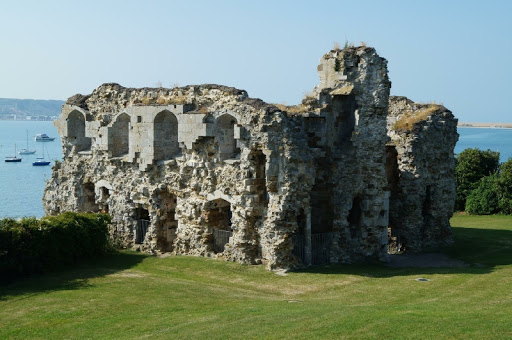
We are told that prior to the construction of the Harbor, in the 16th-century, King Henry VIII built Portland Castle on the Isle of Portland between 1539 and 1541…
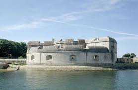
…and Sandsfoot Castle in Weymouth to defend the original harbor here against French and Spanish invaders, and which had been used as an anchorage for ships for centuries.
We are told construction of the breakwaters of Portland Harbor started in 1849, with Prince Albert, husband of Queen Victoria, laying the foundation stone on June 25th of that year, and were completed in 1872.
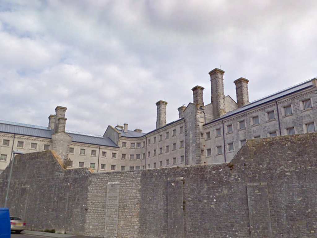
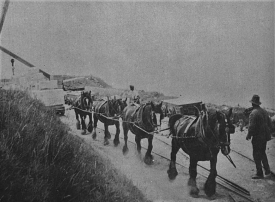
Still functioning today as a prison, HM Prison Portland was said to have been established in 1848 to provide convict labor to quarry the stone needed to construct the breakwaters and harbor defenses.
We are told that the tremendous amount of stone needed for all of this construction was quarried by convicts starting in 1849 in the Admiralty Quarry…
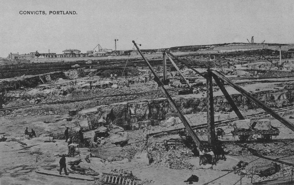
…and that railways were built to accommodate the stone-quarrying process.
We are told the Admiralty Incline Railway was built in 1848 and 1849 in order to transport stone from the quarries to the harbor for the construction activity, but when the Admiralty Quarries completely closed in 1936, the incline railway’s tracks were removed, and the incline railway was turned into a road leading into the naval dockyard, known today as Incline Road.
Before the Admiralty Incline Railway’s removal, it would have looked like the currently-operating Lookout Mountain Incline Railway in Chattanooga, Tennessee.
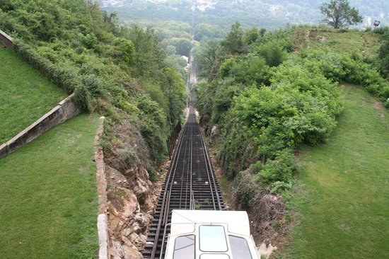
Also known as a funicular railway, it is a transportation system that uses cable-driven cars to connect points along a steep incline, using two counterbalanced cars connected to opposite ends of the same cable.
As a matter of fact, the small isle of Portland has quite a history with its railways…all of which no longer exist.
The Merchant’s Railway, known at the time as the Portland Railway, was said to be the earliest railway in Dorset, opening in 1826 as a horse-drawn first tramway, then incline railway, in order to transport heavy, quarried stone from the northern region of Tophill to Castletown on Portland Harbor, which is the location of Henry VIII’s Portland Castle.
In 1860, we are told, the horses were replaced with cables.
The rails of the Merchant’s Railway were finally removed for scrap in 1956, after the railway had fallen into disuse in 1939 with the increasing use of modern transport methods.
The Portland Branch Railway consisted of two railways, operated by different companies although working as a continuous line.

The Weymouth and Portland Railway was said to have been constructed between 1862 and 1864, and opening in 1865, connecting Weymouth and Easton on Portland.
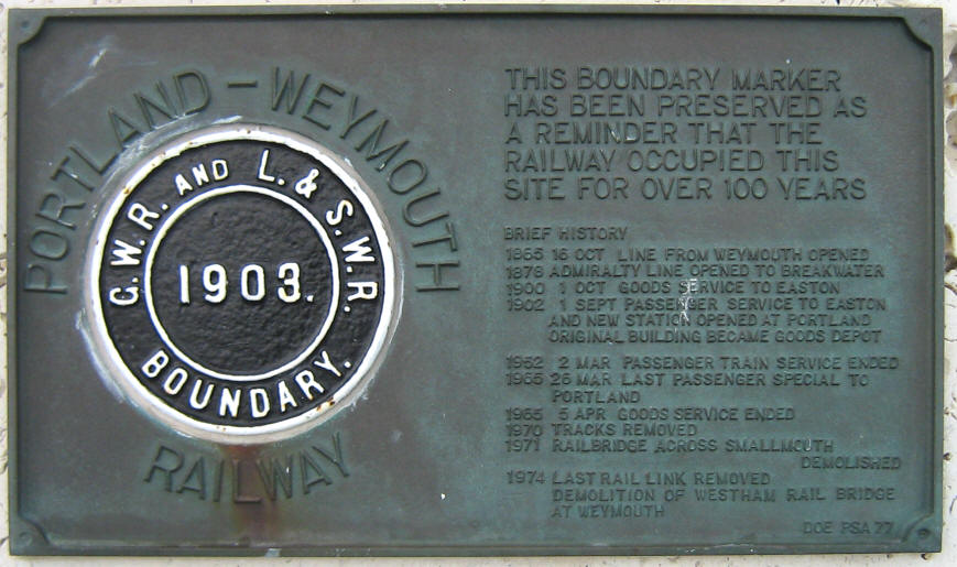
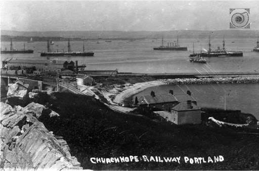
We are told the construction of the Easton and Church Hope Railway started in 1888, and opened to passenger traffic in September of 1902.
The Isle of Portland is a really good example of what I believe happened as I have put forth in past posts: the ancient, advanced Moorish civilization engineered all of the Earth’s rail infrastructure; it was wiped out by a deliberately-caused cataclysm involving a flood of mud; the negative beings responsible for creating the cataclysm managed to dig out enough infrastructure to re-start civilization, officially kicked-off at London’s Crystal Palace Exhibition in 1851 and presided over by Queen Victoria; horses and mules were used to pull trains and streetcars until a replacement technology was available to power them; and most public, passenger-rail, street-car systems, at one time were worldwide, were retired and removed themselves after the development of gasoline-powered private and mass transit vehicles, which subsequently generated massive wealth concentrated in the hands of a very few.
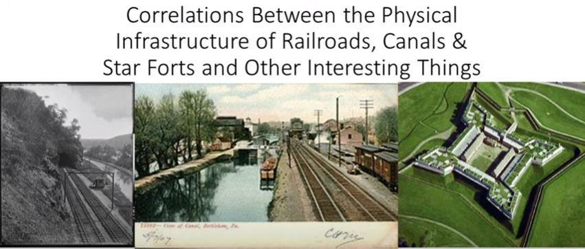
I have done a considerable amount of research on correlations between the physical infrastructure of railroads, canals & star forts found all over the world.
You can find more detailed information about this subject in one place is my blog post of the same name.
At the end of this blog post, I talk about this photo, which had the caption of “Electric trains operating in the Gare d’Orsay, circa 1900.”
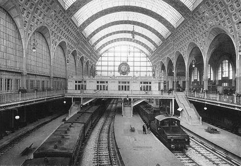
The Gare d’Orsay railroad terminal was said to have opened in Paris in 1900.
This led me to look up the definition of terminal, for which there are two nouns:
- The end of a railroad or other transportation route, or a station at such a point
- A point of connection for closing an electric circuit
I have come the conclusion through my research that the Master Builders of the Ancient & Advanced Civilization built the physical infrastructure of the planetary grid system, including all transportation systems, which generated and used the free energy that powered this civilization worldwide.
I am talking about a sophisticated electrical circuitry system, of which star forts were a big part of as well.
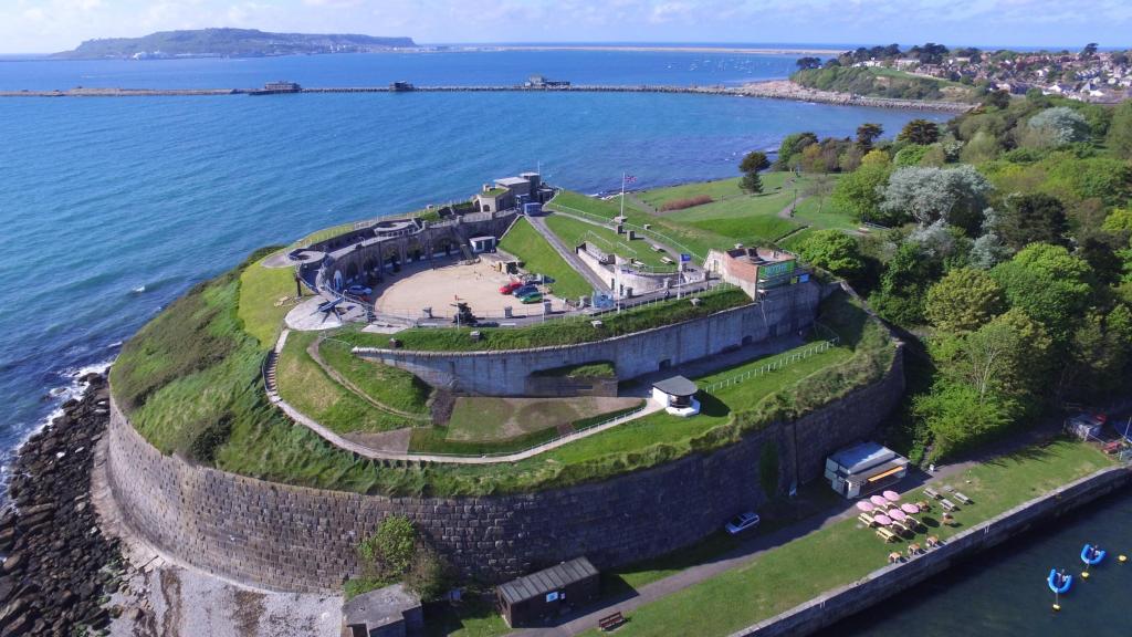
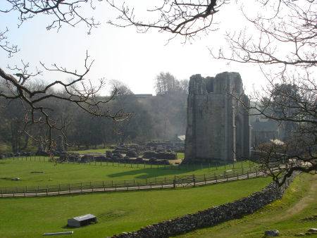
Along those lines, there are a number star forts on the Isle of Portland as well, like Verne Citadel, located on the highest point in Portland, was said to have been built as Portland’s main defensive fortification between 1857 and 1861.

In 1949, the citadel was turned into a prison, and continues to be used in that capacity today.
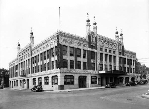
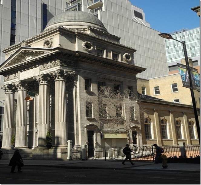
With examples like “HM Prison The Verne,” I have come to believe that the infrastructure of the original advanced civilization which was engineered to benefit life was reverse-engineered into human control structures, including, but not limited to, schools like El Paso High School in Texas…

…theaters, like the old Akdar Movie Theater in Tulsa, Oklahoma, said to have been built around 1922 and demolished in the 1970s…
…and banks, like the Old Bank of Toronto.
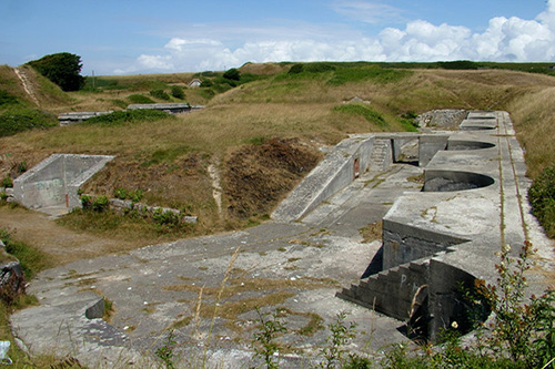
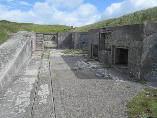
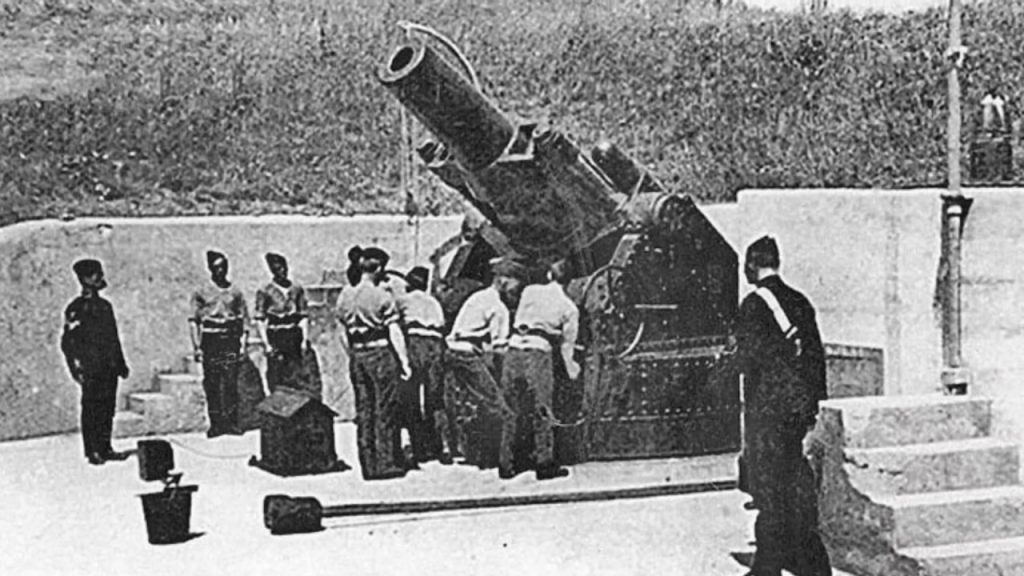
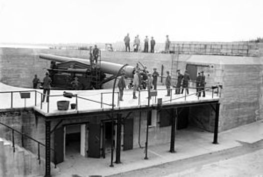
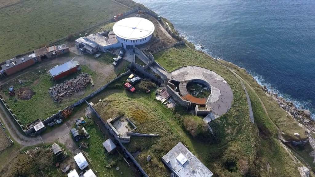
Located close to Verne Citadel, the Verne High Angle Battery was said to have been built in 1892 to protect Portland Harbor, and a scheduled monument, which is a nationally important archeological site or historic building given protection against unauthorized change, and is protected under the Ancient Monuments and Archeological Areas Act of 1979.
A so-called Victorian era construction protected under an act pertaining to ancient monuments and archeological sites?
My understanding is that the word ancient pertains to the very distant past and not something that would have been built less than 200 years ago.
The tracks seen at the battery were said to have been installed to move missiles.
This battery has become a tourist attraction.
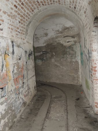
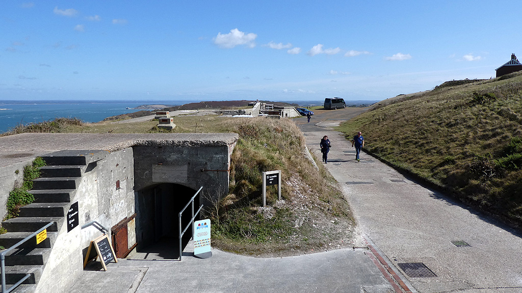
Interestingly, there is a tunnel system at the Verne High Angle Battery that also has tracks for rails.
It was said to have been decommissioned as an artillery battery in 1906, only 14-years after it was constructed, due to the advent of smaller craft like torpedo boats.
Apparently, the “high angle” at which the guns were placed were only effective with larger naval ships.
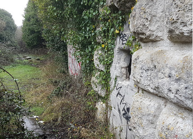
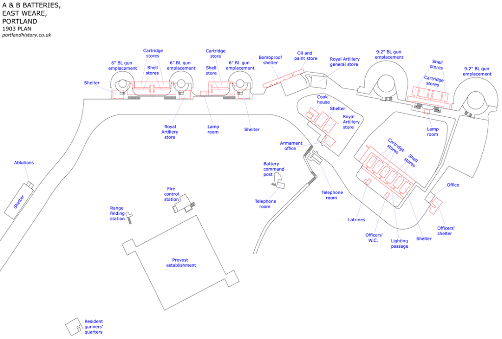
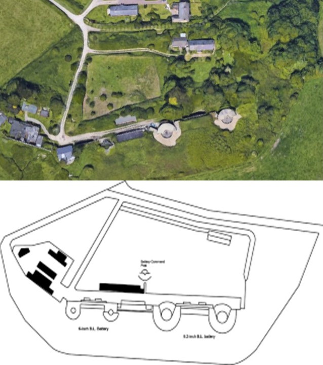
The East Weare Batteries are called five former gun batteries said to have been constructed starting in 1864, designated by letters A – E, and, we are told, built to protect Portland Harbor.
Yet E Battery became a scheduled monument in 1973…
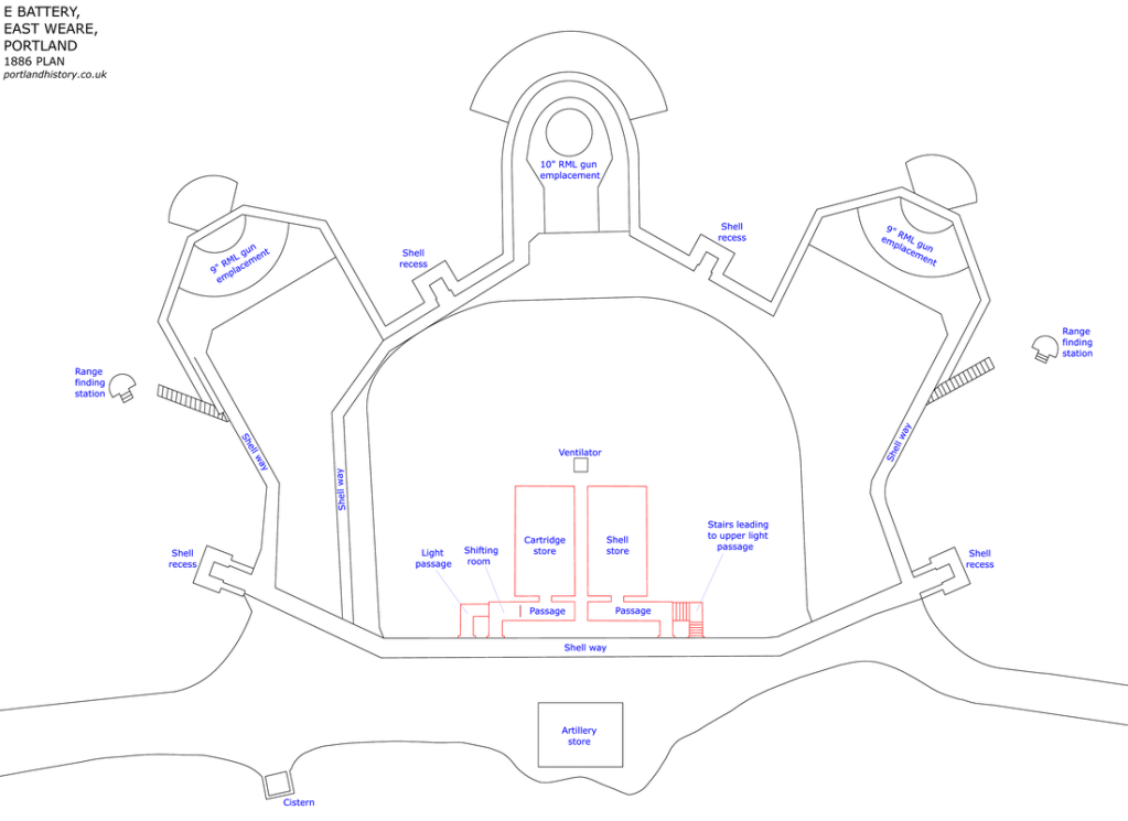
…and like the Verne High Angle Battery, is protected under the Ancient Monuments and Archeological Areas Act of 1979.
The East Weare batteries of A & B are referred to by locals and urban explorers as the “Forbidden City.”
Then there is Battery C…
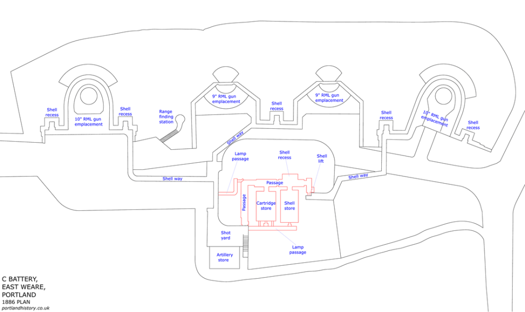
…and Battery D.
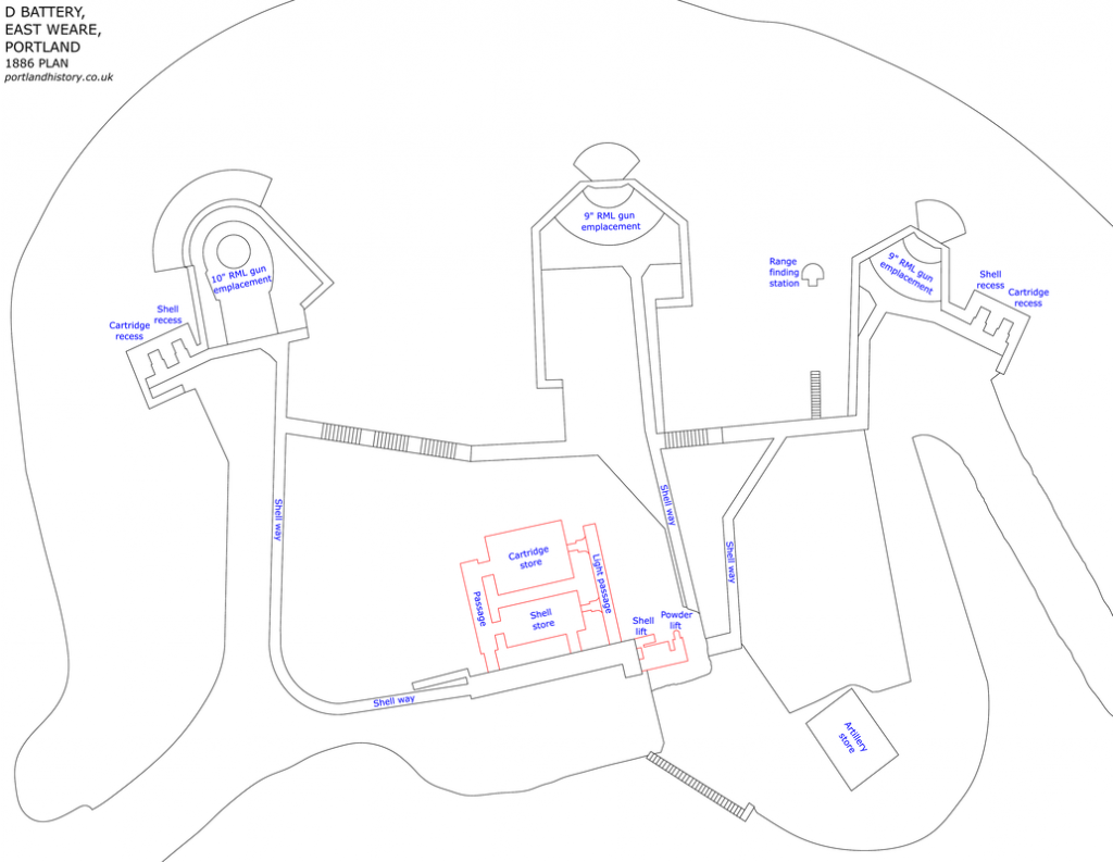
There is officially no public access to any of the East Weare batteries.
What is the definition of the word “battery”?
One definition is a device that produces electricity that may have several primary or secondary cells arranged in parallel or series, as well as a battery source of energy which provides a push, or a voltage, of energy to get the current flowing in a circuit…

…and that this is the reason there are so many batteries and star forts that are paired together, or even the reason clusters of them are found in the same location.
The second meaning of the word battery is the heavy fire of artillery to saturate an area rather than hit a specific target.
All of these so-called artillery batteries originally functioned as circuitry and batteries for the purpose of producing electricity and/or some form of free energy to power the planetary grid system and the original ancient, advanced civilization.
There is a third definition of battery, which is an assault in which the assailant makes physical contact.

Does the third definition apply here?
I think so, in the sense that a major assault has been committed against the Human Race by all that has taken place here without our knowledge and consent, and removing all of this critical information from our awareness about the True History of Humanity, and so, so much more.
Other so-called military forts on the Isle of Portland include:
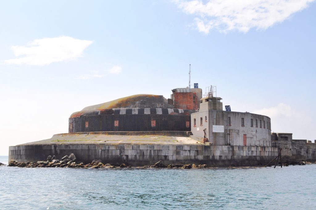
The Inner Pierhead Fort, located on the end of the inner breakwater next to the former dockyard of the naval base that was here, and said to have been built between 1859 and 1862…
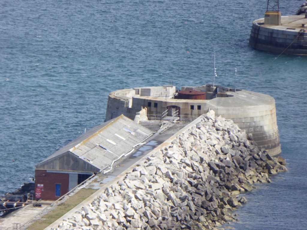
…the Portland Breakwater Fort, said to have been built between 1868 and 1875, on the outer breakwater…
…Nothe Fort in Weymouth, said to have been built as a coastal defense between 1860 and 1872…
…Upton Battery on the outskirts of Weymouth and northeast of Portland Harbor, described as a coastal artillery battery said to have been built between 1901 and 1903, and decommissioned in 1956…
…and Blacknor Fort, located on the western end of Portland overlooking Lyme Bay, and said to have been built between 1900 and 1902, and also decommissioned in 1956.
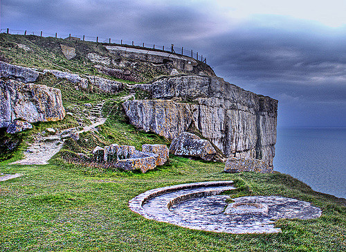
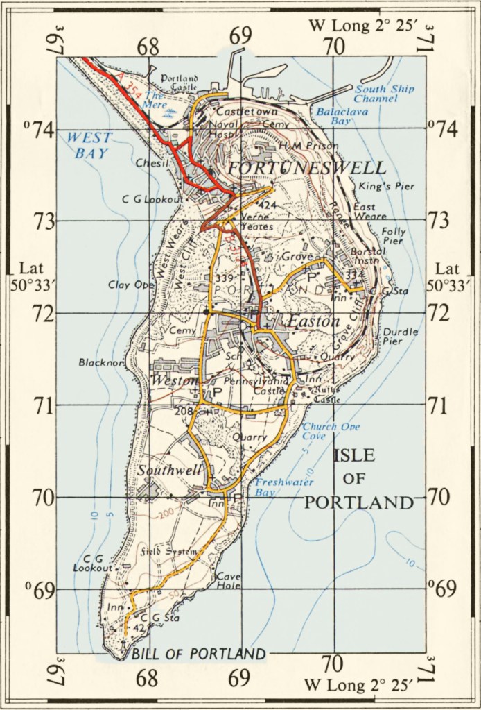
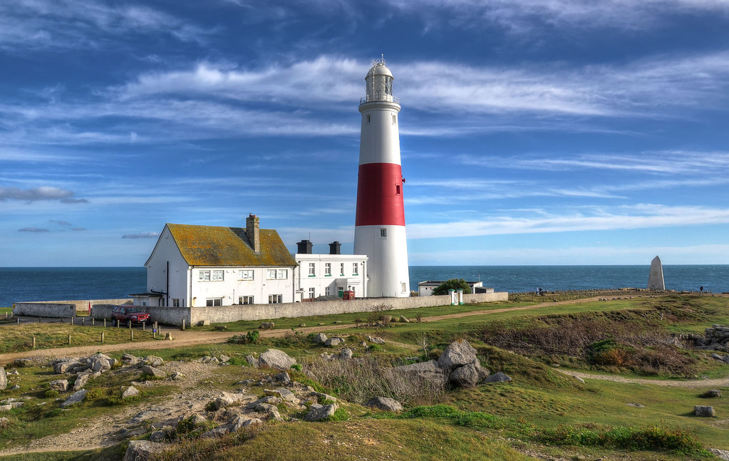
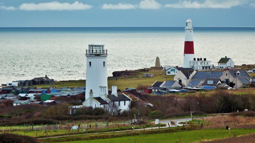
The last place on the Isle of Portland that I would like to visit is called the Portland Bill.
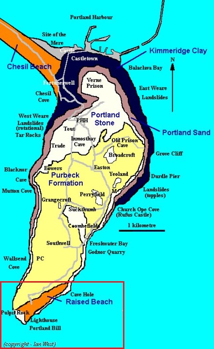
The Portland Bill is the southernmost point of England’s Dorset County, and is a narrow promontory at the southern end of the Isle of Portland.

Features of the Portland Bill include:
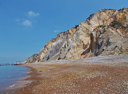
Pulpit Rock, so-named for the appearance of a bible leaning on a pulpit, which to me looks like very ancient masonry, especially with the rectangular- shape and straight-edges of the “bible” among other things I see here.

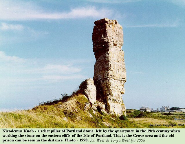
We are told that as a “quarrying relic,” Pulpit Rock is similar to Nicodemus Knob, a pillar within the former Admiralty Quarries, mentioned earlier as the quarry we are told that 6 million tons of stone were removed between 1849 and 1872 to build the breakwaters and harbor defenses for Portland Harbor.
The 22-foot, or 7-meter, high Trinity Hill Obelisk was said to have been constructed in 1844 as a daymark, a daytime navigational marker to warn ships off the coast of Portland Bill.
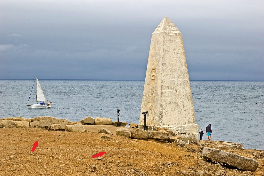
Note the presence of old masonry blocks beside the obelisk.
We are not taught about the advanced, ancient civilization, so we don’t see these stones as anything other than natural when in actuality they have been worked and shaped.
The Portland Bill Lighthouse is located right next to the Trinity House Obelisk.
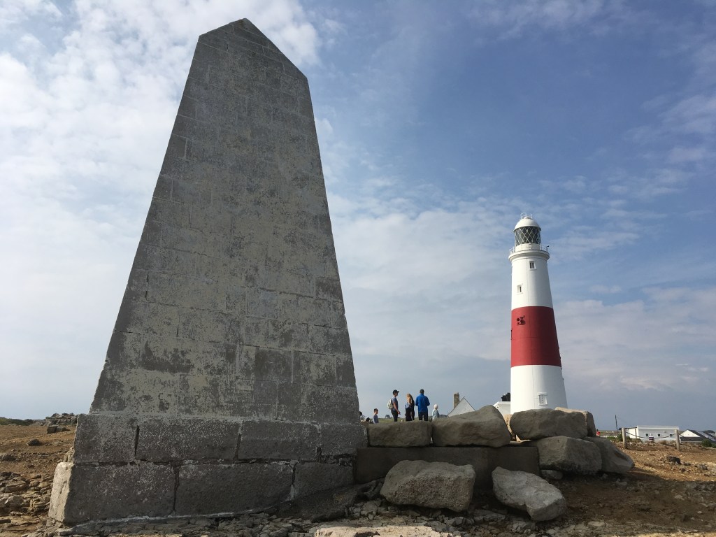
The Portland Bill Lighthouse was said to have been built between 1903 and 1905…
…to replace two earlier lighthouses on Portland Bill – the Old Higher Lighthouse…
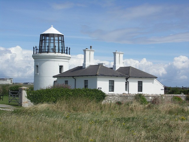
…and the Old Lower Lighthouse, both said to have been originally built in 1716, re-built in 1869…
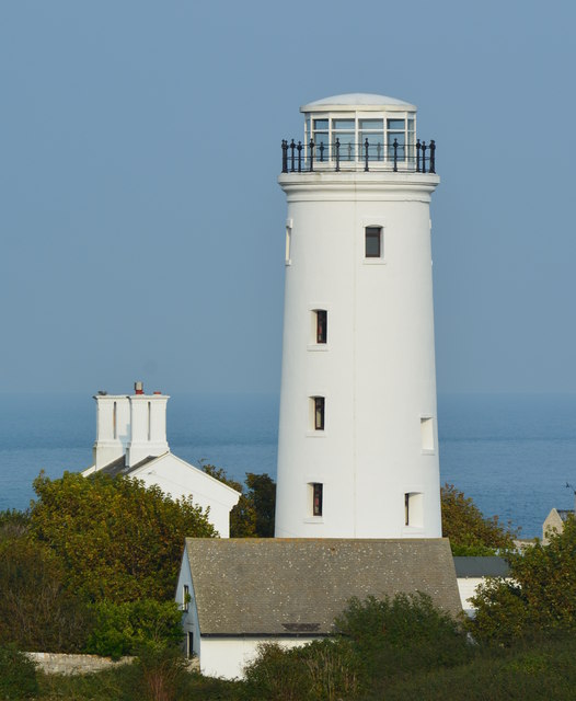
…and decommissioned after the Portland Bill Lighthouse became operational after it was completed in 1905.
Like always, there is much more to find on the Isle of Portland, but next I am going to visit the Isle of Wight.
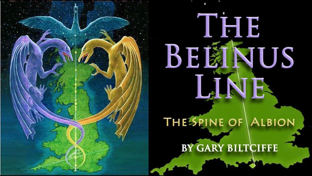
I first learned about the Isle of Wight several years ago, before I started doing my own research, in a book I read in 2013 by Gary Biltcliffe called the “The Belinus Line – The Spine of Albion.”
He and his partner Carolyn uncovered a North-South line that connected seats of power, running from the Isle of Wight at the bottom of England to Faraid Head at the tip of Scotland.
Over the whole length of the Belinus Line, which is also in alignment with the Cygnus constellation, they dowsed the Belinus (male) and Elen (female) dragon lines of energy that criss-crossed 33 nodal points along the way, the same number as that of the number of vertebrae in the human spine.
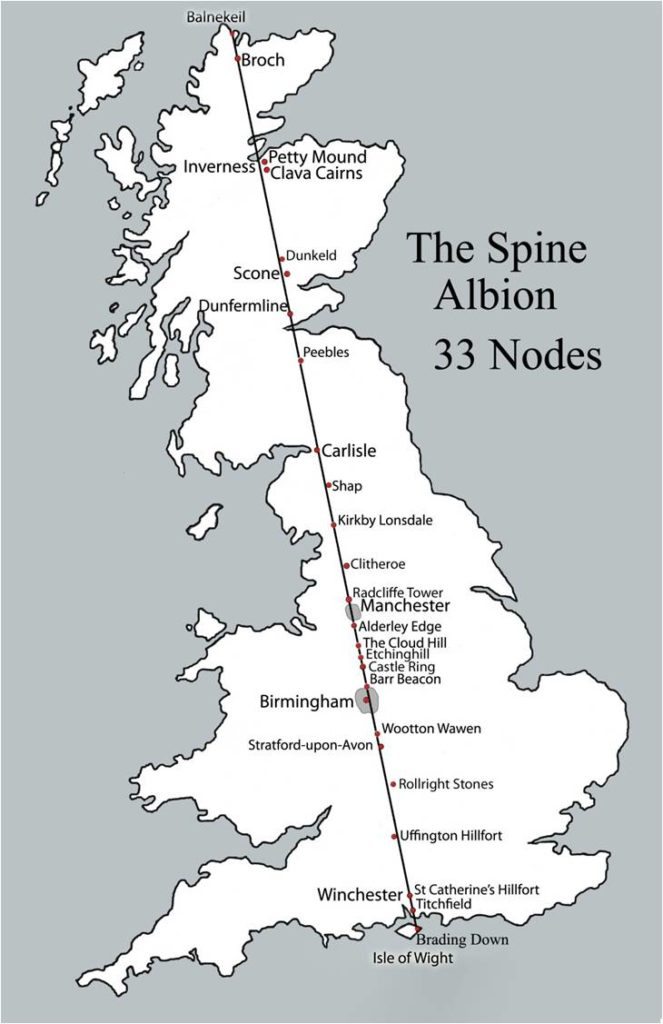
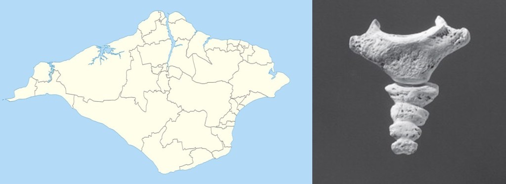
And…as Gary pointed out in the book…the Isle of Wight roughly has a the shape of the spine’s coccyx bone.
The book contained a picture of Shap Abbey in Shap, England, which immediately brought back a memory of seeing the same place when I drove past it on a trip to England in 2010.
I subsequently realized that I had travelled up the Spine of Albion synchronistically on my trip, visiting places on the alignment and dragon lines mentioned in the book, unbeknownst to myself.
One of the many reasons I feel deeply connected to all of the information I am researching and sharing.
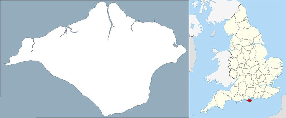
The Isle of Wight is the largest island in England, and its own ceremonial county.
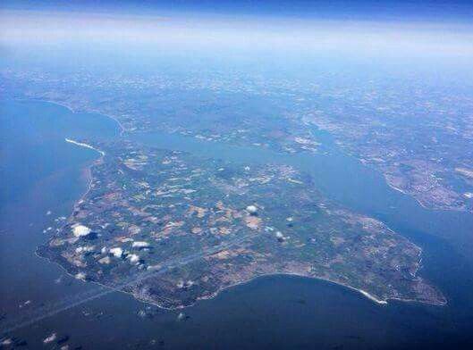
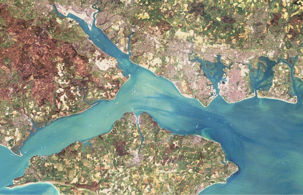
It is separated from the English mainland by a 20-mile, or 32-kilometer, long strait known as the Solent.
The Hurst Spit projects into the Solent Narrows, and is the location of…
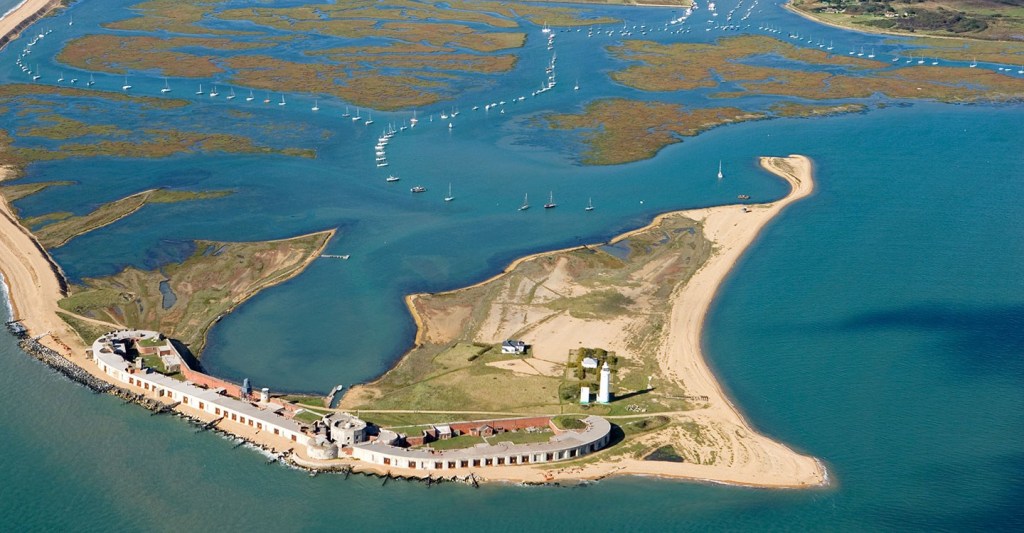
…the Hurst Castle.
Like Portland Castle, the Hurst Castle was said to have been built by King Henry VIII in the 16th-century, during the years between 1541 and 1544.
It was said to have been part of a coastal protection program against invasion from France, Spain, and the Holy Roman Empire.
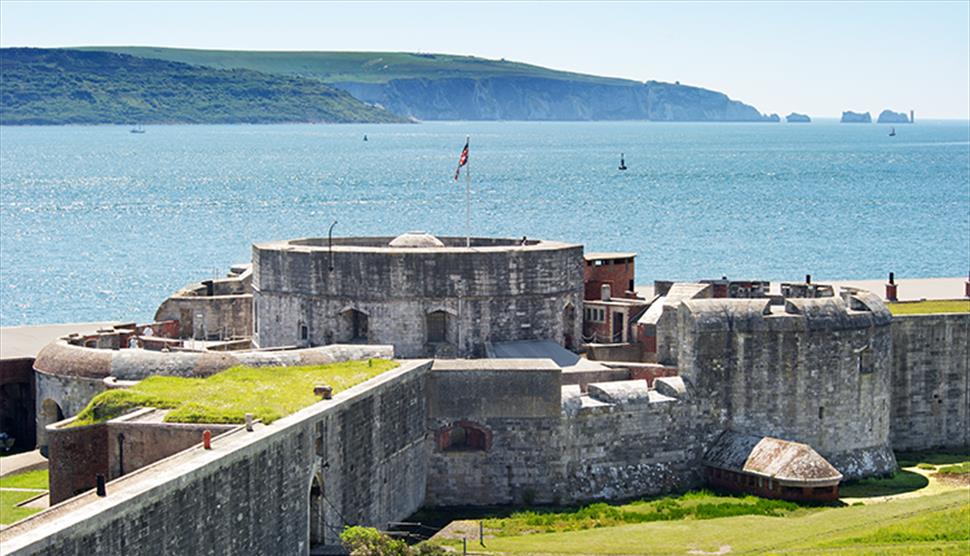
We are told that the Palmerston Forts on the Isle of Wight were a group of forts and associated structures that were built during the Victorian Era in response to a perceived threat of French invasion.

They are called the Palmerston Forts due to their association with Lord Palmerston, the Prime Minister during that time who was said to have promoted the idea.

There were approximately 20 of these Palmerston structures along the west and east coast of the Isle of Wight.
I am going to just look into a few of them.
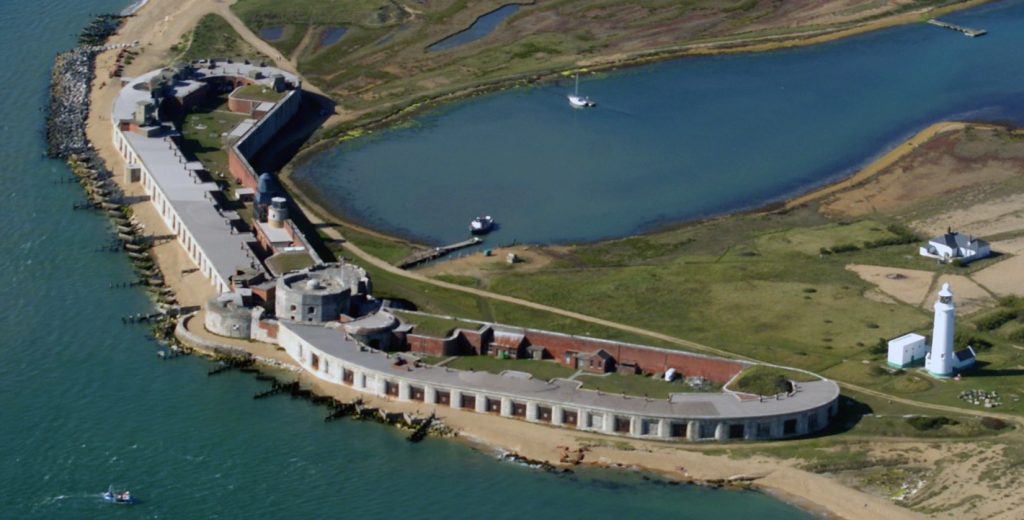
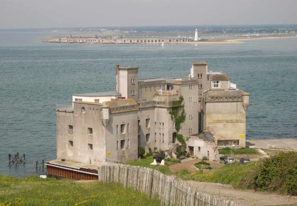
Fort Victoria was said to have been built in the 1850s to guard the Solent.

It is located on the Isle of Wight in a position opposite from Hurst Castle on the mainland’s Hurst Spit…
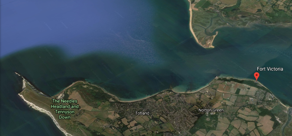
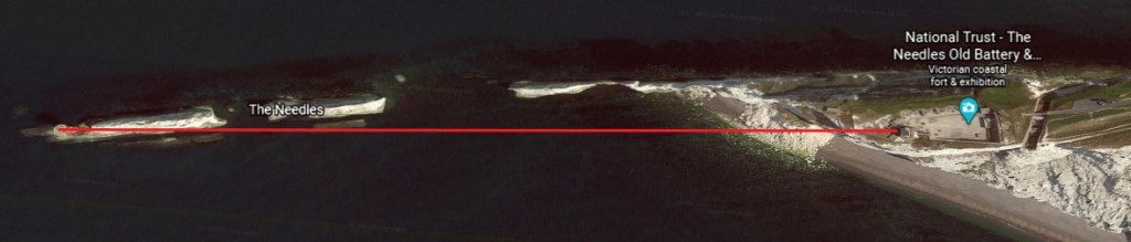
…and overlooks the whole of the Needles Passage, the most westerly point of the Isle of Wight.
More on The Needles shortly.
We are told that Fort Victoria’s military use came to an end in 1962, after having been a landing and storage point during both World Wars, and that the rear barracks blocks were demolished in 1969 to provide material for things like sea defenses.
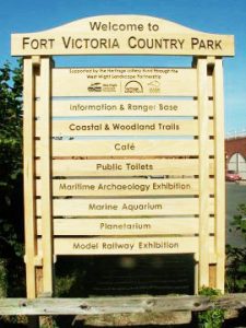
Today, the fort is part of Fort Victoria Country Park.
Fort Albert was said to have been constructed between 1853 and 1856 to defend Needles Passage from the possibility of French attack coming from Emperor Napoleon III.
Fort Albert was said to have been rendered obsolete only two years later, in 1858, with the development of armored ships.
Today it is a privately-owned luxury apartment complex.
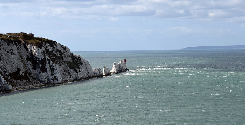
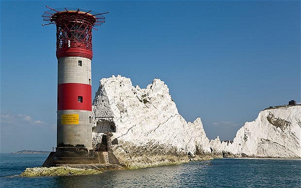
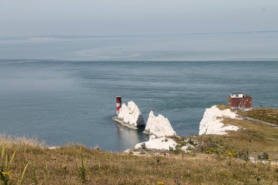
The Needles are described as a row of three chalk stacks off the Isle of Wight’s western extremity…
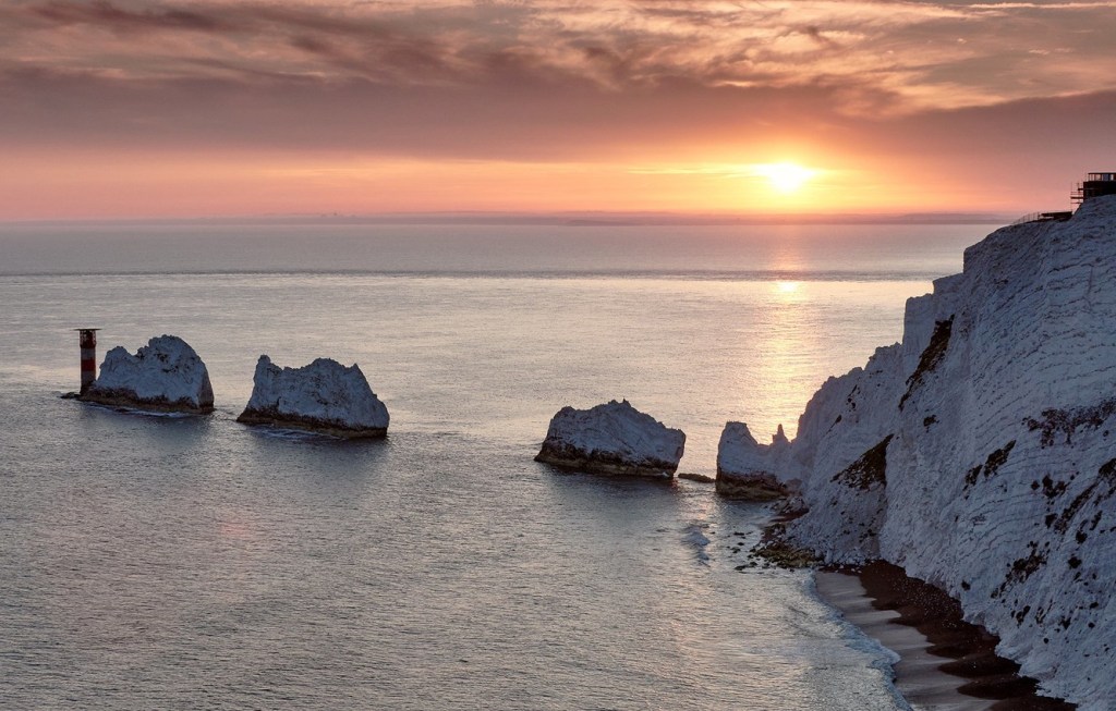
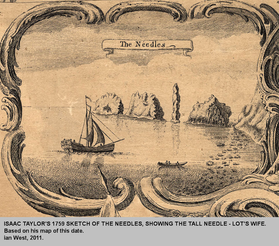
…and so-named because of the former Needle-like pillar called “Lot’s Wife,” which was said to have collapsed in a storm in 1764.
This is an illustration of the Needles which includes “Lot’s Wife” circa 1759.
The Needles Lighthouse, standing 109-feet, or 33-meters, tall on the outermost of the Chalk Pillars, was said to have been built out of granite blocks in 1859 for Trinity House, the official authority for lighthouses England, Wales, the Channel Islands, and Gibraltar.
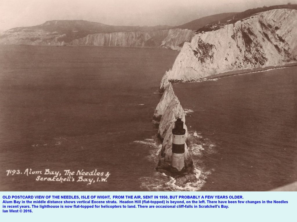
I find it interesting that the description in this photo says that the lighthouse “is now flat-topped for helicopters to land.”
It’s an active lighthouse, and apparently needed under-pinning work in 2010 to keep it from falling into the sea.
What is described as the world’s first long-distance radio signal was sent by Marconi from Alum Bay beside the Needles in the year 1897.
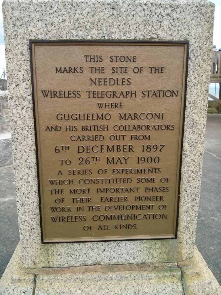
I wonder what it was about this location that influenced his decision to do his work on wireless communication here.
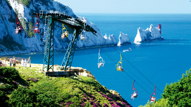
There is also a popular attraction called the Needles Chairlift, running from the top of the Alum Cliffs to the beach of Alum Bay below, with a great view of the Needles in the distance.
I just found one answer to my question about what influenced Marconi’s decision to do his wireless communication work here – Alum Bay sand includes extremely pure white silica, an important component for enhancing radio frequency transmission.
There are two so-called Palmerston Forts at the Needles.
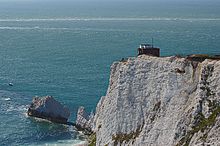
The Old Needles Battery is situated on a chalk cliff located right above the chalk pillars.
It was said to have been built between 1861 and 1863 as a coastal defense against French Invasion.
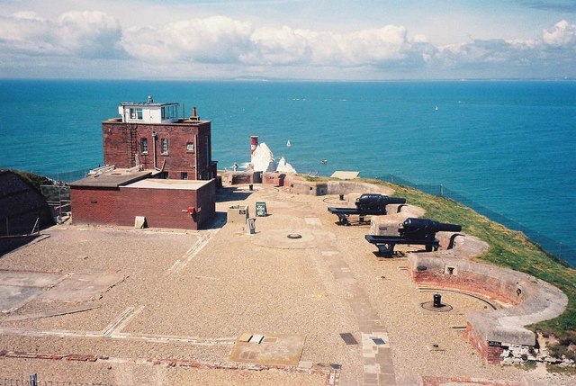
The Old Needles Battery has a tunnel leading to…
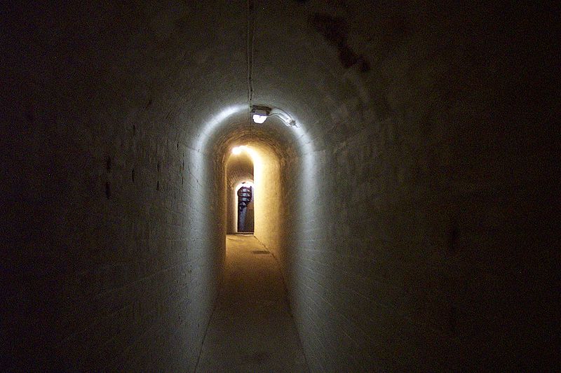
…its searchlight emplacement…
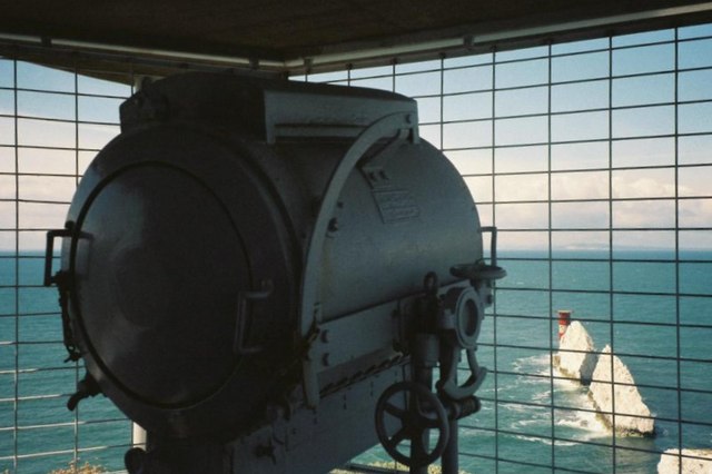
…in linear alignment with the Needles Lighthouse.
I would love to know exactly how they functioned together in the Earth’s original grid system!
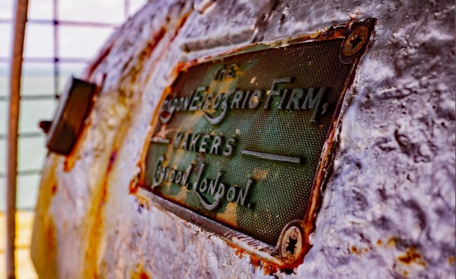
All the Earth’s new controllers needed to do was stick a plaque on what looks to be an old searchlight naming contemporary builders, and what I believe to have been a common practice on infrastructure all over the Earth to hide Earth’s True History.
The Needles New Battery was said to have been completed in 1895, higher up on the same cliff, and said to have been constructed because of concerns about subsidence problems with the old battery and concussion from firing the batteries guns causing the cliffs to crumble.
I would like to briefly mention an isle I was not previously aware of until I started researching the Isle of Wight for this blog post.
The Isle of Purbeck is located between the Isle of Portland and the Isle of Wight.
Though named an isle, it is called a peninsula as it is bordered by water on three sides.
The Isle of Purbeck has significant deposits of what is known as Purbeck Ball Clay.
Ball clay has extensive industrial uses, from tableware, to wall-and-floor tiles, to spark plugs, to hoses, to pharmaceuticals, to kilns.

Large-scale commercial extractions of the ball clay was said to have begun in the middle of the 18th-century, with large quantities ordered in 1771 by Josiah Wedgwood, the English potter and founder of the Wedgwood pottery company who became the world’s first tycoon…

…leading to the construction, we are told, of Dorset’s first railroad in 1806, known as the Middlebere Plateway, and described as a horse-drawn tramway.
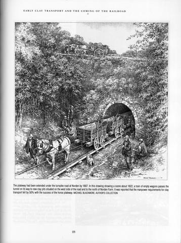
This is where the Middlebere Plateway was once-upon-a-time, where it cut across Hartland Moor.
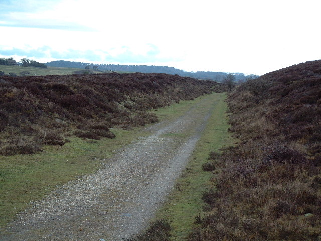
As I find in many places, the memory of the original Moorish people is retained here in the name of the place.
The etiology of the word Moor goes back to Ancient Mu. Mu’ur = Moor, and the ancient, advanced Moorish civilization was world-wide and comprised of many Empires within One Civilization – Tartaria, Barbaria, Washitaw, Mughal, to name a few.
The cliffs on the Isle of Purbeck are considered among the most spectacular in England…
…and its landforms include the Durdle Door, which interestingly aligns with the solstice.

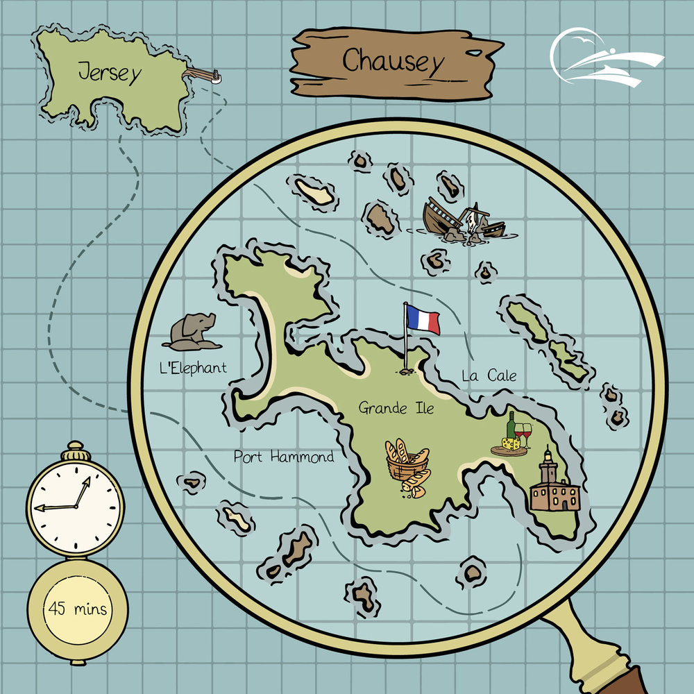
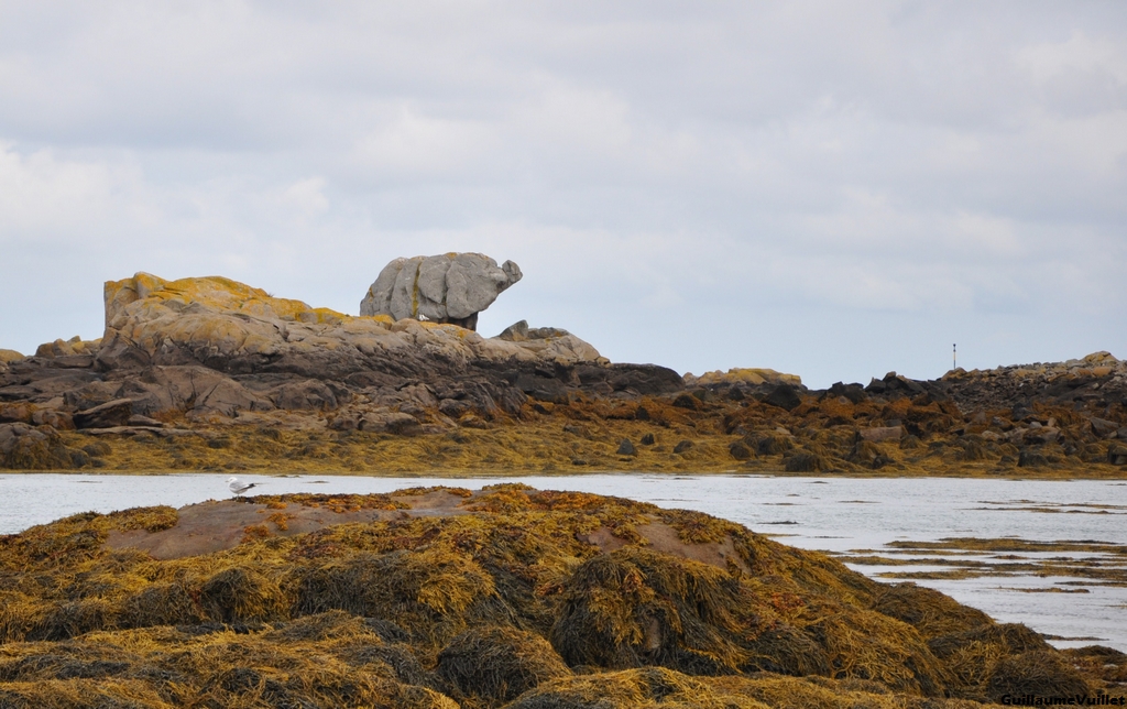
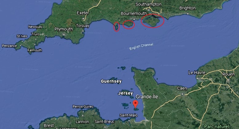
The last place I am going to look at are the French Iles Chausey, the largest island group in Europe.
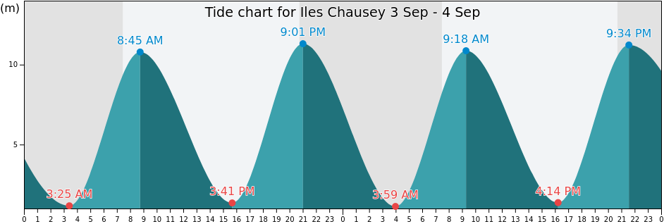
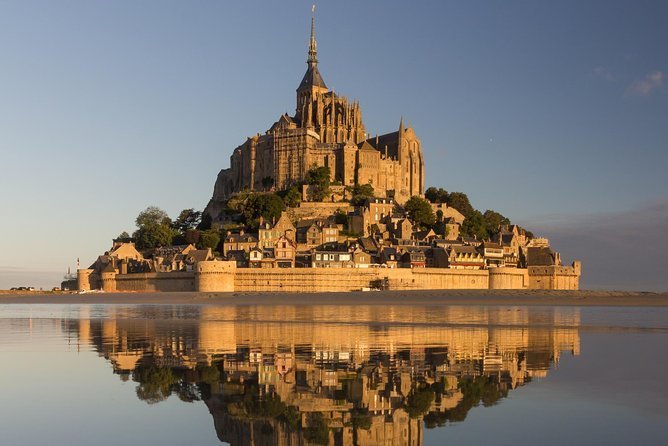
The Iles Chausey are located in the Bay of Mont Michel, and like with many places I have looked at in this series, experiences a high-range between high-tide and low-tide every day…
…with Mont St. Michel being a tidal island, which I have found throughout the Channel Island.

The Iles Chausey are known for rocky protuberances that resemble something, like Elephant Rock…
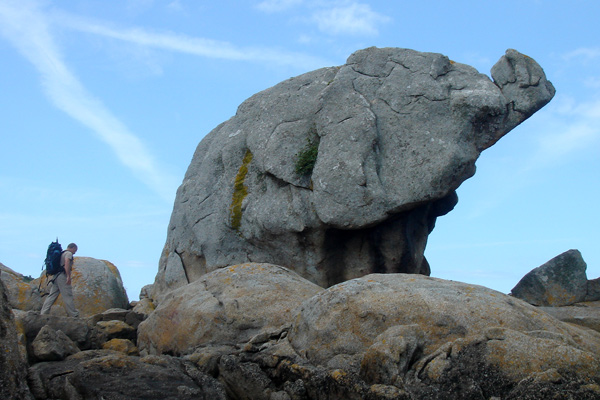
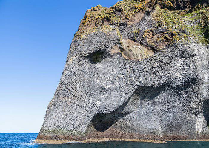
In case you might think this resemblance is a work of nature…
…Check out this Elephant Rock on one of Iceland’s small islands.

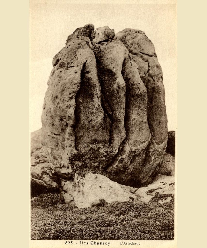
Other named rocky protuberances in the Iles Chausey include “The Monks”…

…and “The Artichoke.”
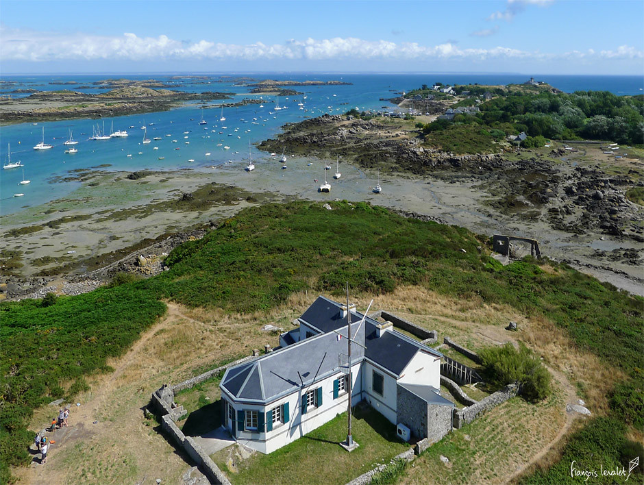
Grande Ile is the largest of the Iles Chausey, at about 1-mile, or 1.5-kilometers, long, and less than a half-mile, or .5-kilometers wide, and the only inhabited island…
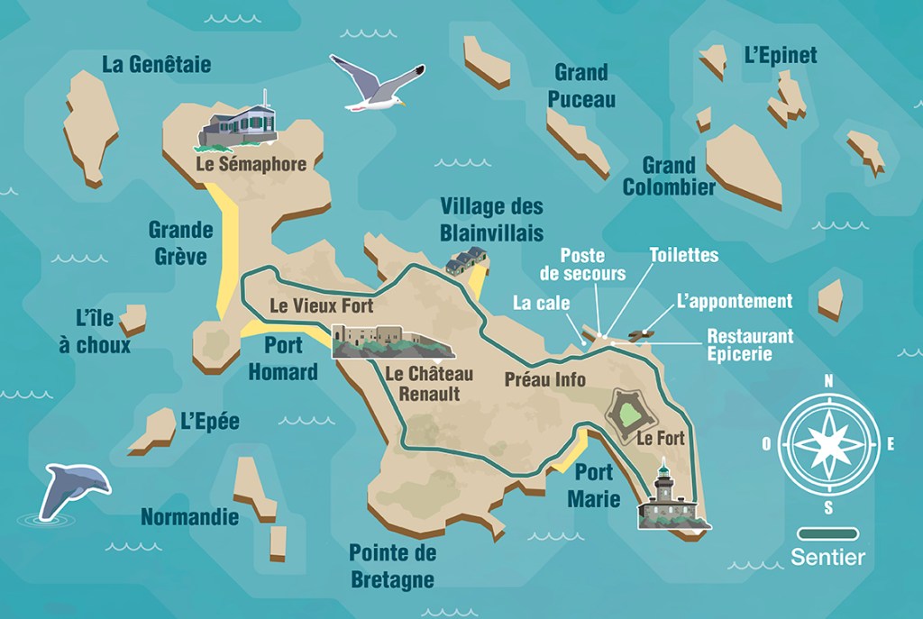
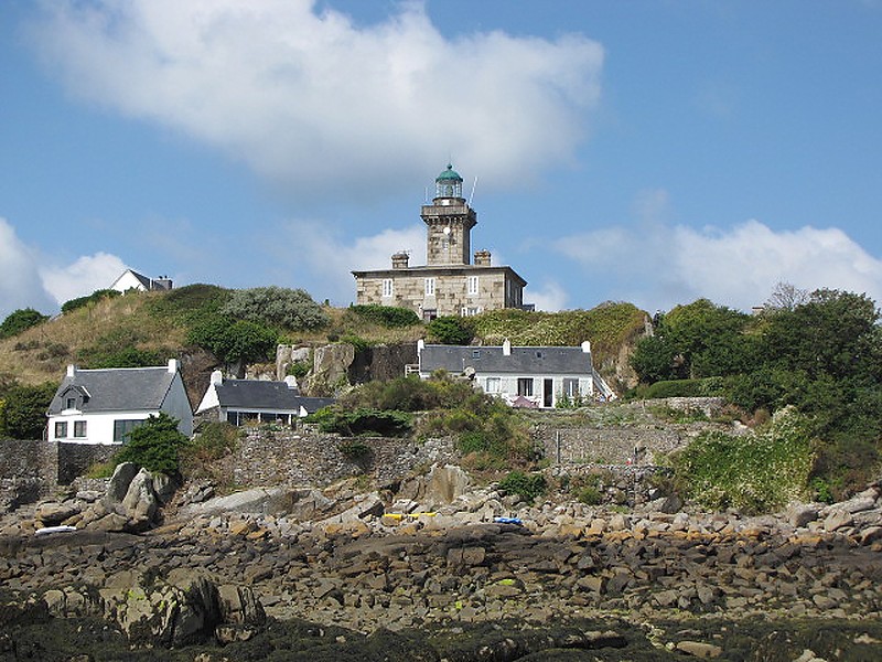
…where we find the Grand Ile lighthouse, said to have been built in 1847…
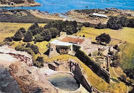
…with the nearby Forteresse des Matignon, said to have been constructed in 1559 as a quadrangular fort, with cellars, bakery, and a cattle shed.
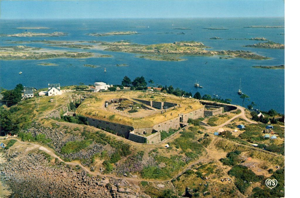
Another fort is Le Chateau Renault, the present fort of which was said to have been constructed in 1859 on the order of French Emperor Napoleon III, and completed in 1866.
It became known as the Chateau Renault after the automobile engineer Louis Renault purchased it 1922 and restored it by 1924.
La Semaphore of Grand Ile is a lighthouse on the highest point of Grand Ile, and said to have been built in 1867 and closed down in 1939.
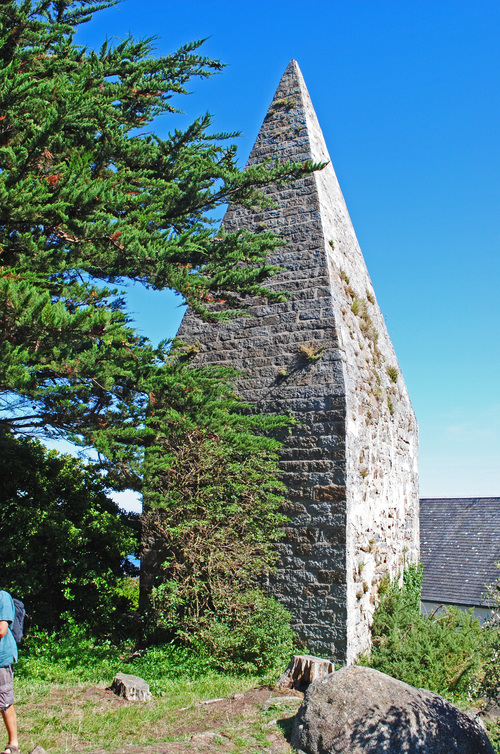
This is called La Pyramide on Grand Ile…
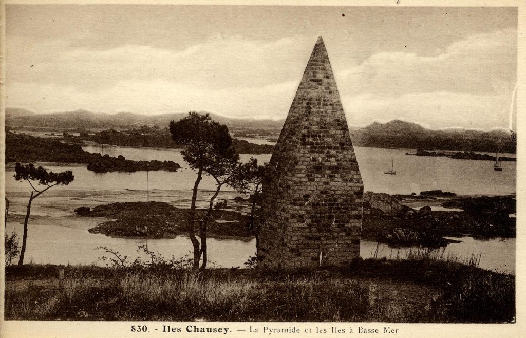
…and it still stands today.
I am going to end this series here.
It is clear to me that the islands of the English Channel were a very powerful and significant place on the Earth’s grid system with all of the physical infrastructure found on these small islands.
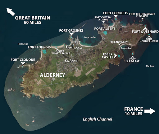
I was drawn into looking at this part of the world because I saw a picture of the small Alderney Island in the Channel Islands having a large number of star forts.
And when I look around this region, I find all of the components of the original ancient advanced civilization, as well as the means by which its existence was covered up by the construction of a new false historical narrative and in many cases the active deconstruction of the original infrastructure.
In my next post, I am going to be researching interesting places around the world that people have left me comments about with which to tie into the bigger picture about what I am talking about with regards to the Ancient, Advanced Moorish Civilization, the original timeline of Humanity’s very positive evolutionary course before our timeline was hijacked by beings with a negative agenda for Humanity.

Very comprehensive and interesting, as usual. I have never been to the Channel Islands but one of my relations used to live on Guernsey, he was my great uncle or something. Don’t know any more details. I will share this piece. Thank you.
LikeLike
Hello Michelle, Thank you.
3 items for comment:
1. The photo of Upton Battery shows so many pockmarks in the ground, a barrage on the right hand side of the picture and a few on the left. They certainly don’t look natural and I wonder what caused them.
2. I grew up in Portland, Oregon, and the similarity of what happened on the Isle of Portland and what is happening now in the city of Portland is a bit eerie.
3. You are SO good at word associations (Moor/moor/Mu, battery, terminal, etc.) deepening understanding, I wonder about “Star Forts.” Clearly they are laid out in star shapes, but do you think there are connections to actual stars, too?
LikeLike