Who is Represented in the National Statuary Hall – Part 3 Florida, Georgia, Hawaii & Idaho

So far in the National Statuary Hall, from Alabama, Alaska, Arizona, and Arkansas, there have been two journalist/politicians (Bob Bartlett & Ernest Gruening); two military hero/politicians (Joseph Wheeler/Barry Goldwater); a Jesuit missionary (Father Eusebio Kino); one lawyer/politician (James Paul Clarke); one lawyer (Uriah M. Rose); and one disability rights advocate/socialist (Helen Keller).

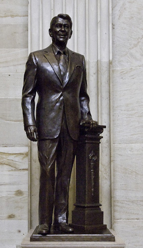
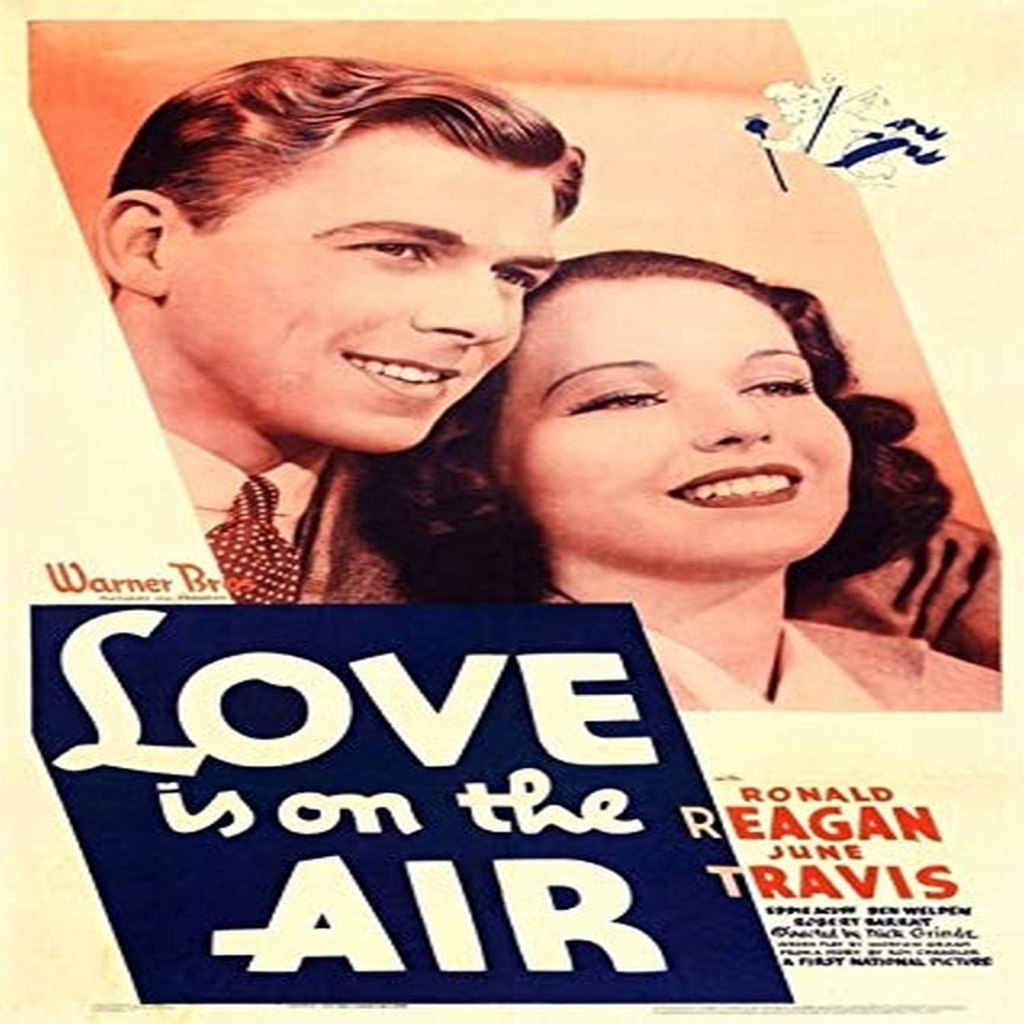
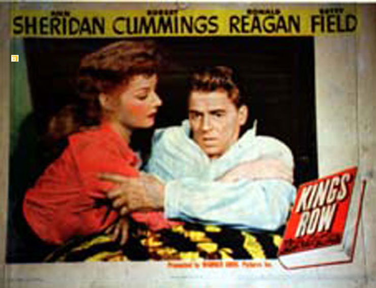
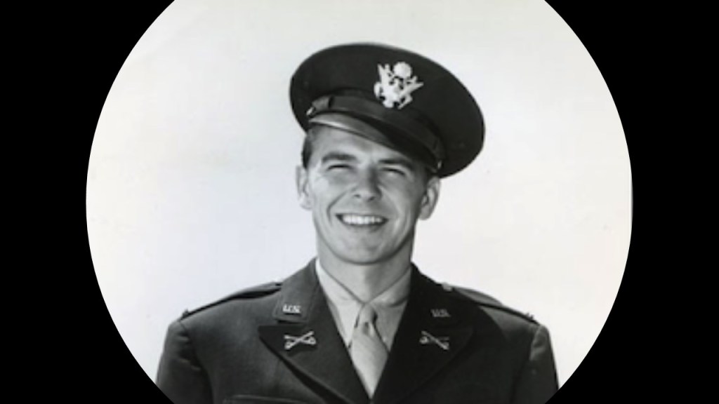
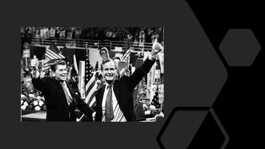
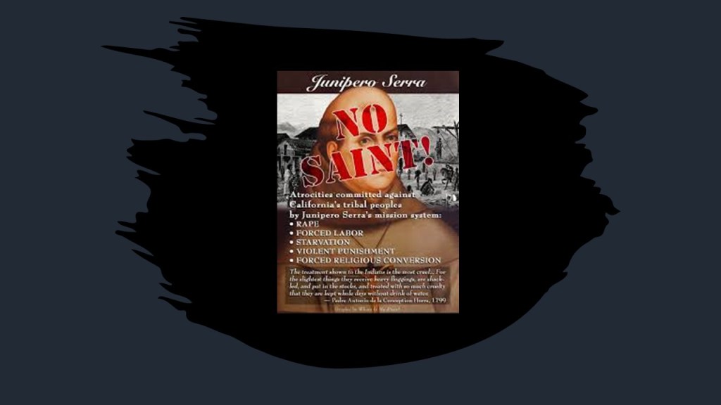
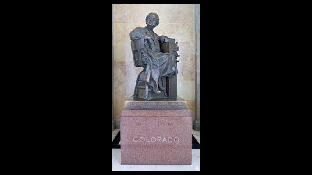
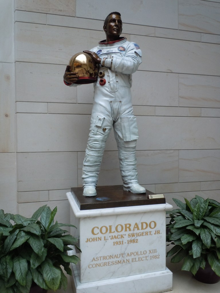
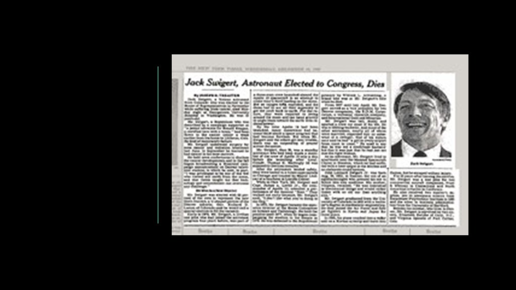
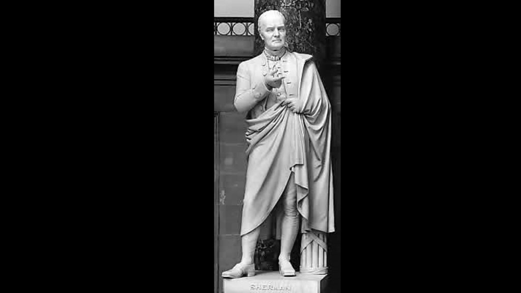
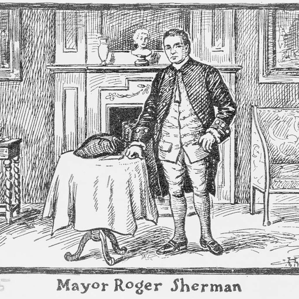
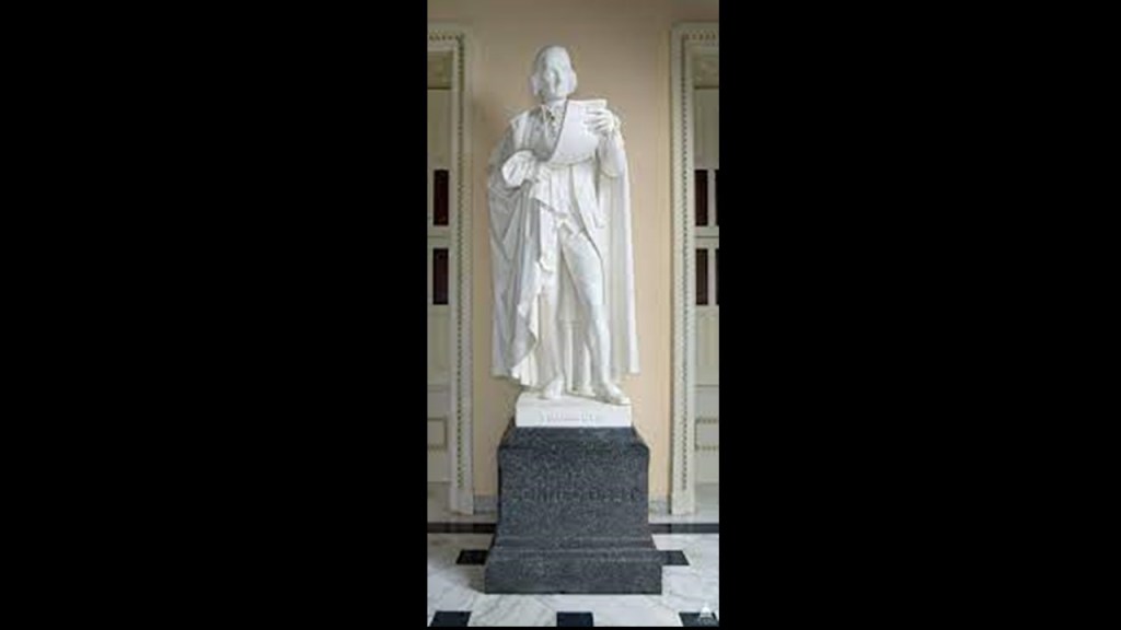
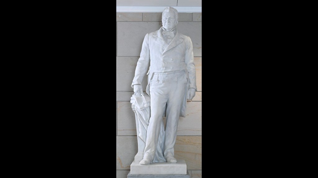
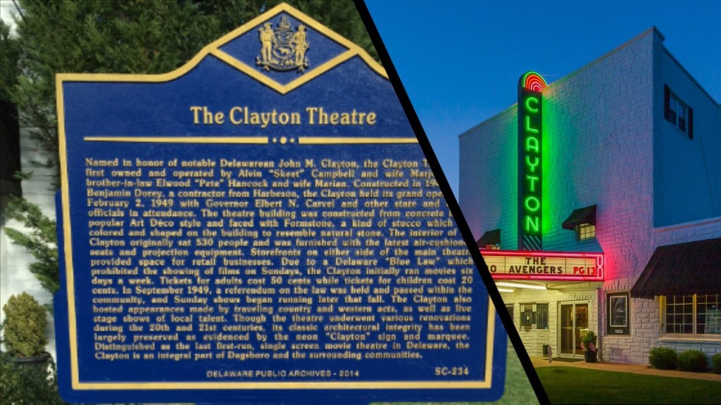
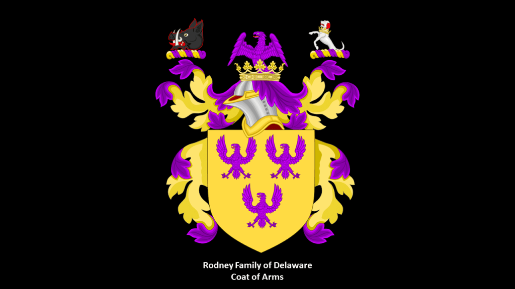
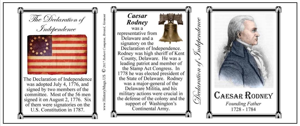
From California, Colorado, Connecticult and Arkansas, there was an actor/politician (Ronald Reagan); astronaut/politician (Jack Swigert); two Founding Father/Lawyer/politicians – Robert Sherman and Caesor Rodney; a merchant/politician – Jonathan Trumbull; a lawyer/politician (John M Clayton); a Woman Scientist/Public Health Doctor (Florence R. Sabin); and a Franciscan Missionary (St. Junipero Serra).

So far the count of politicians in the National Statuary Hall is at ten out of 16 statues, so over half of them, with four of those being lawyers as well.

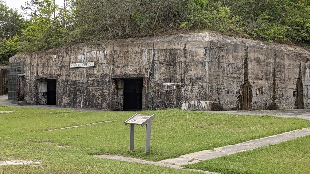
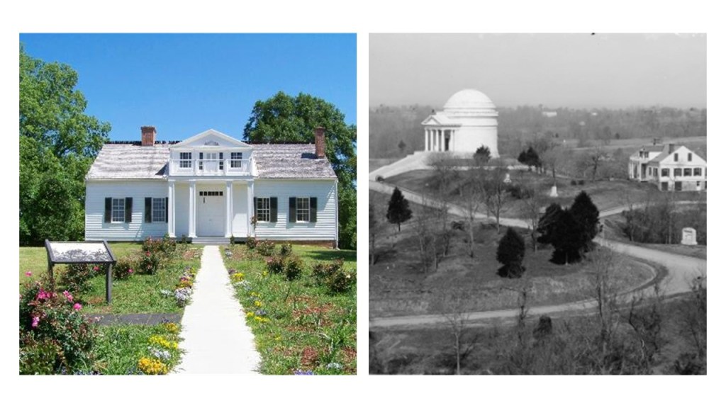
The State of Florida is the next in line. The two people who represent Florida are John B. Gorrie and Edmund Kirby Smith.

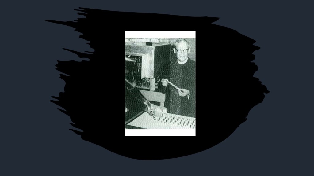
John B. Gorrie was a physician and scientist, credited with the invention of mechanical refrigeration.

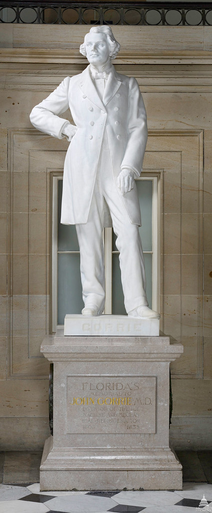
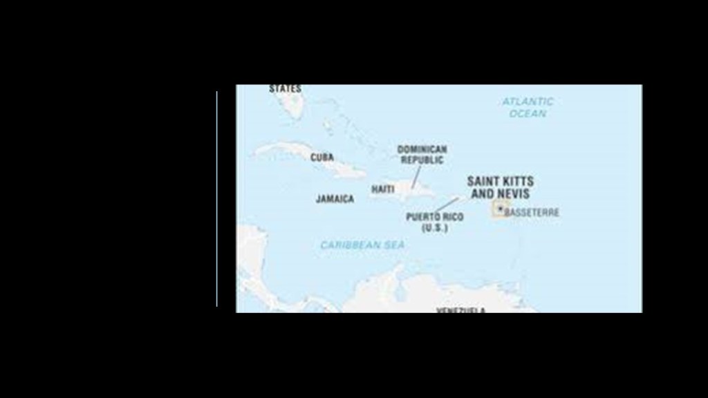
John B. Gorrie was born to Scottish parents in October of 1803 in St. Kitts and Nevis, which were among the first islands in the Caribbean to be colonized by Europeans.

St. Kitts and Nevis is the smallest sovereign state and federation in the western hemisphere, in area and population, in the British Commonwealth, with the Queen as its head-of-state.

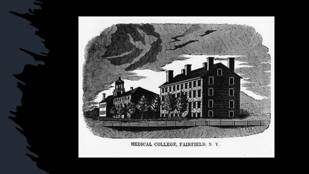
Gorrie spent his childhood in South Carolina, and received his higher education at the College of Physicians and Surgeons of the Western District of New York, also known as the Fairfield Academy.

The Trustees of the Fairfield Academy had petitioned the Trinity Episcopal Church in Fairfield in 1812 for a funding grant with which to establish a college of liberal culture under Episcopalian auspices, but the petition was denied.

According to what we are told, the Trinity Episcopal Church in Fairfield was built in 1808.

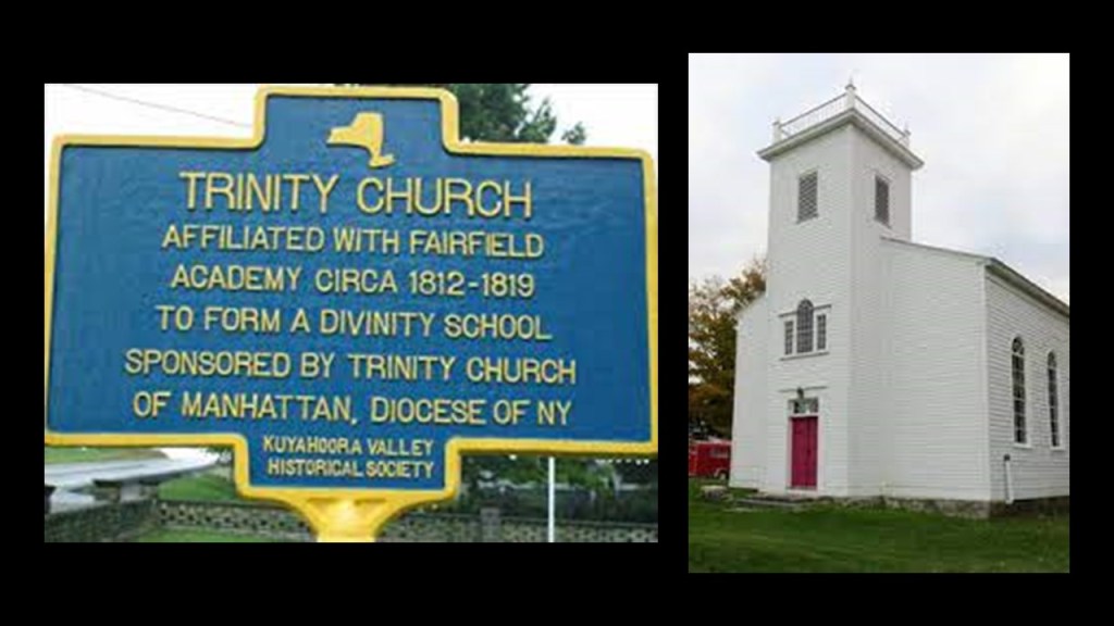
The following year, a different petition to the Corporation of Trinity Church granted the funding for the theological seminary at the Fairfield Academy, until the Theological School was transferred to Geneva, New York, in 1821, at what later became the Hobart and William Smith Colleges.

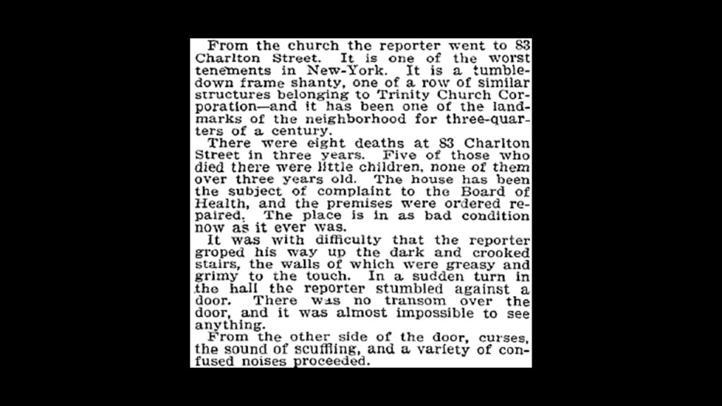
It is interesting to note that Trinity Church is even today one of the largest landowners in New York City, now under the name of Trinity Real Estate.

In 1894, the Trinity Corporation was exposed by a New York Times reporter to have substandard living conditions on their Charlton Street properties.

Back to John B. Gorrie.

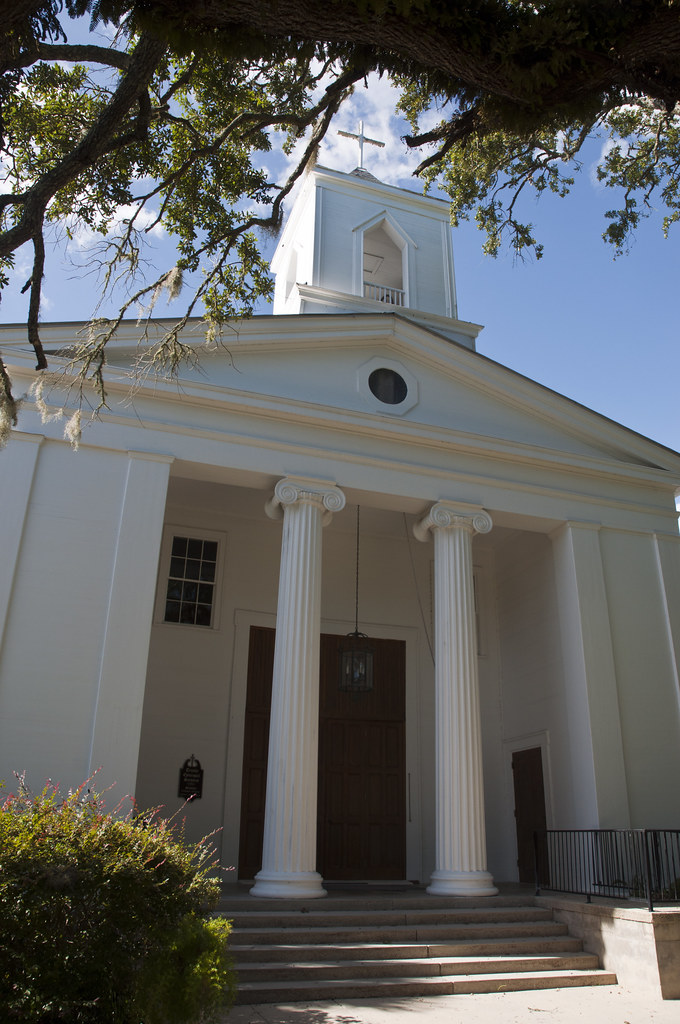
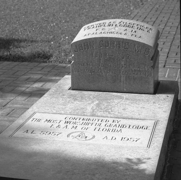
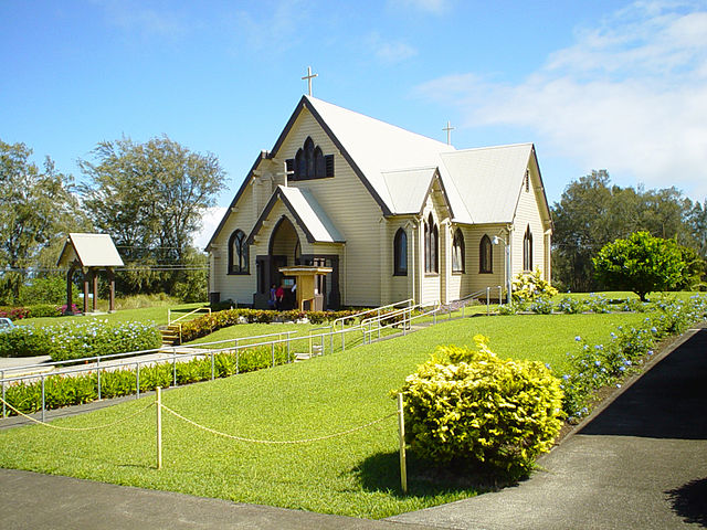
He moved to Apalachicola, Florida in 1833, where he was a resident physician at two hospitals, and served as a council member; postmaster; President of the Bank of Pensacola’s Apalachicola branch; secretary of his Masonic Lodge; and was a founding vestryman of Trinity Episcopal Church, that is still in use today, located at the corner of ‘D’ And 6th Street in Gorrie Square.

Dr. Gorrie’s medical research involved Yellow Fever, for which the prevalent hypothesis at the time was that mal-aria – or ‘bad air’ – caused diseases.

Hurged the draining of swamps and cooling of a sickrooms based on this theory, and to this end he experimented with making artificial ice.

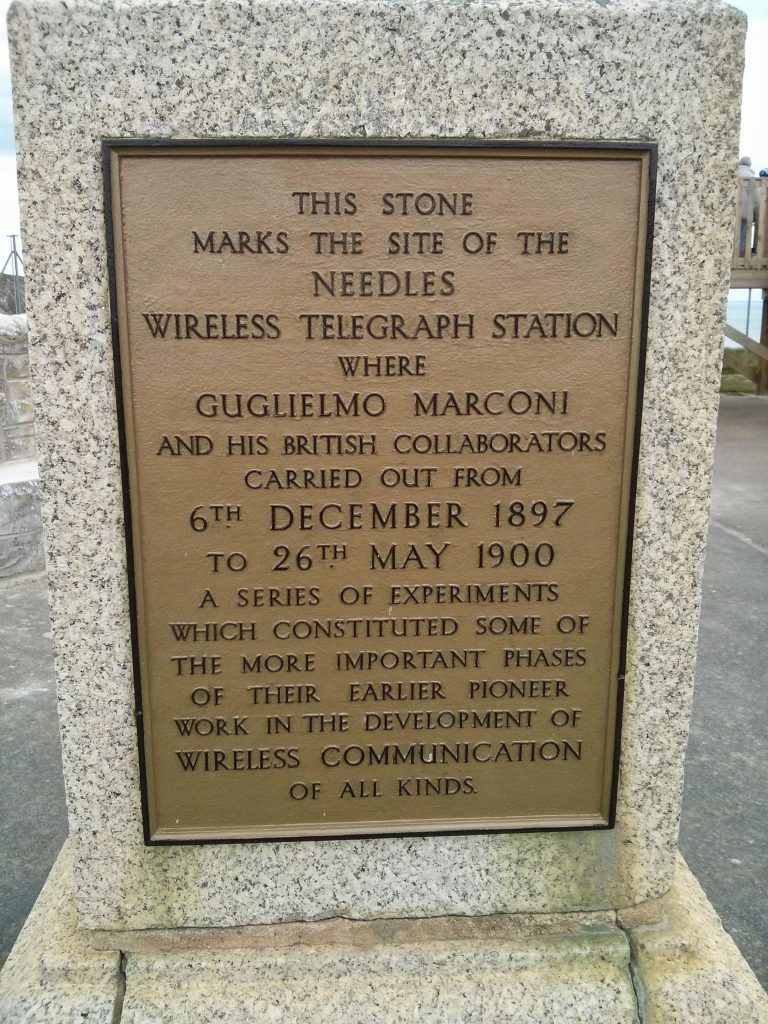
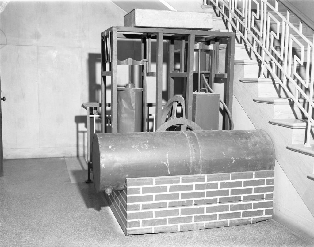
Gorrie first mechanically produced ice in 1844, and by 1850, he was able to mechnically produce ice the size of bricks.

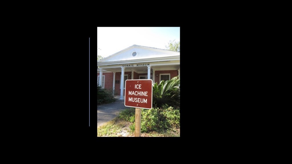
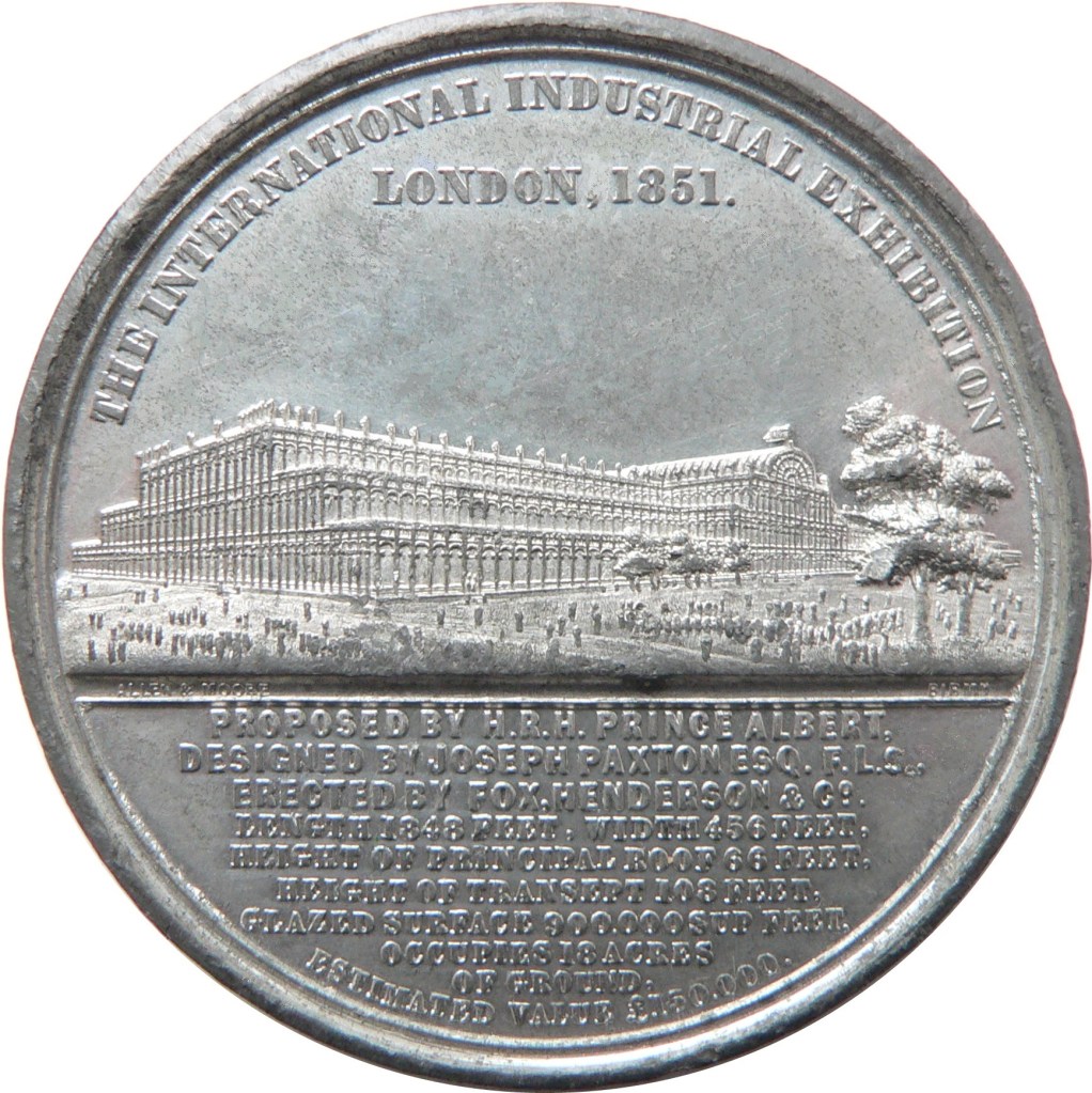
He was granted the patent on May 6th of 1851 for a “machine to make ice.”

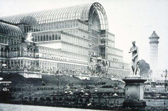
Just as a point of reference, the 1851 Crystal Palace Exhibition in London started on May 1st of 1851 and went until October 15th of 1851.

John B. Gorrie died, however, in 1855, not long after his invention was patented.

He was unable to raise the money needed to manufacture his machine and everything in his life went south for him, including his health.

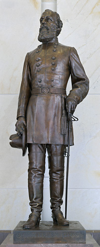
The other statue for the State of Florida is represented by Edmund Kirby Smith.

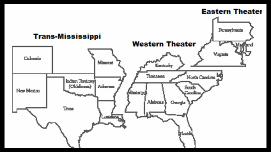
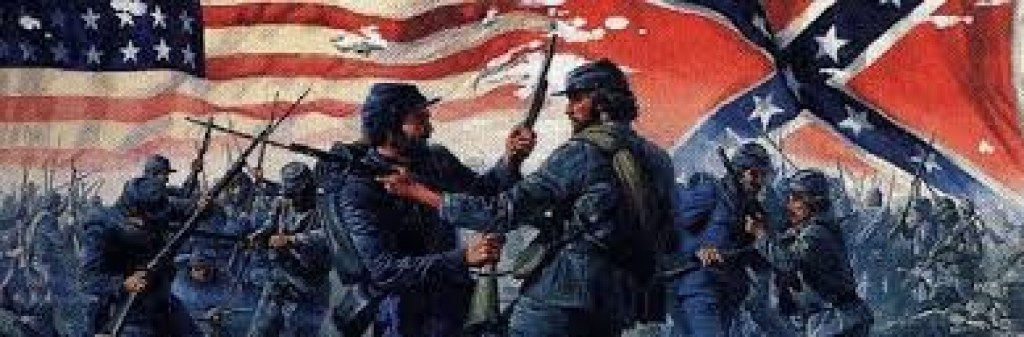
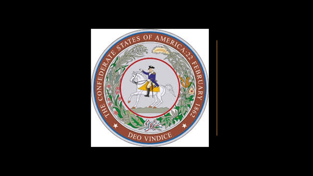
Edmund Kirby Smith was a senior officer of the Confederate States Army who commanded its Trans-Mississippi Department between 1863 and 1865.

The Trans-Mississippi Department of the Confederate States Army was comprised of Arkansas, Texas, Missouri, western Louisiania, Arizona Territory and Indian Territory.

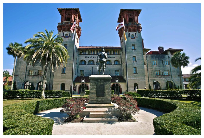
Edmund Kirby Smith was born in St. Augustine, Florida, in 1834, the youngest child of attorney Joseph Lee and his wife Francis.

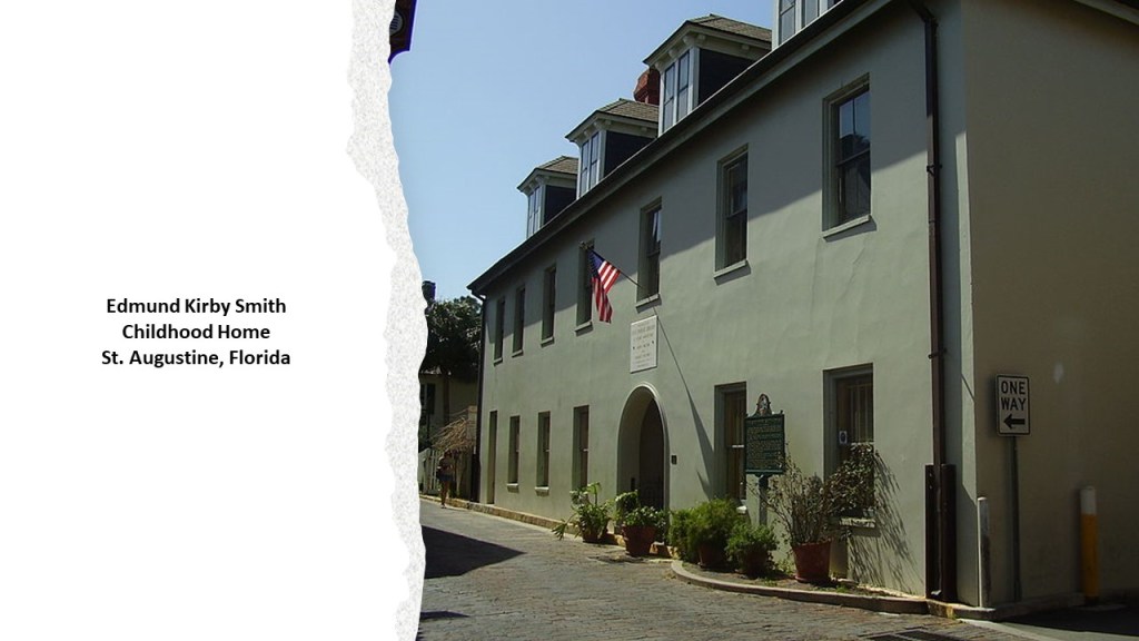
Both of his parents were natives of Litchfield, Connecticut before moving to St. Augustine in 1821, where his father was appointed as a Superior Court Judge in the new Florida Territory, of which St. Augustine was the capital between 1822 and 1824.

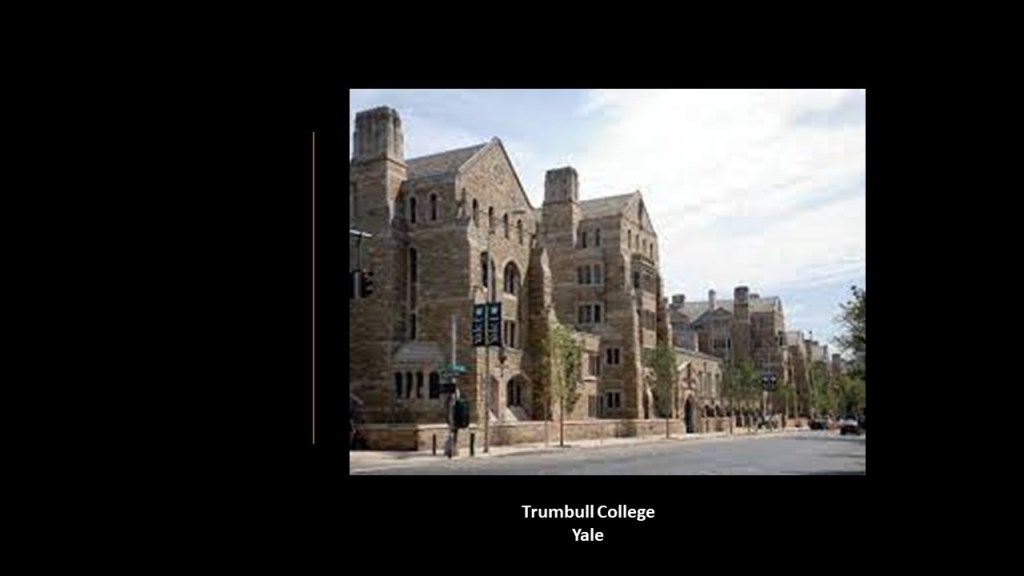
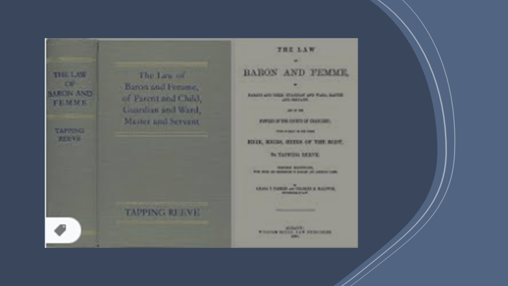
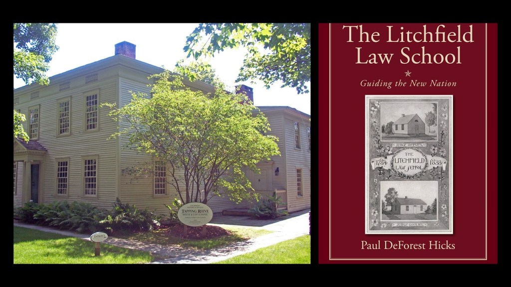
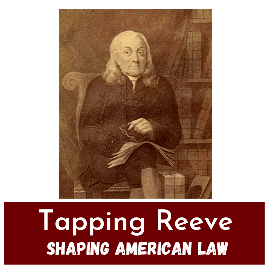
As mentioned in Part 2 of this series, Litchfield was the location of the Litchfield Law School, the first independent law school established in America for reading law,  founded by lawyer, educator and judge Tapping Reeve in the 1770s, and it was a proprietary school that was unaffiliated with any college or university.

I looked up meanings for the unusual name of “Tapping Reeve,” and here is what I found as some possibilities:

Tapping – To exploit or draw a supply from a resource.

Reeve – Administrator, attendant; curator; agent; director; foreman; and the list goes on.

Something to think about.

Edmund Kirby Smith entered West Point in 1841 and graduated in 1845, and by August of 1846 was serving in the 7th U. S. Infantry as a Second Lieutenant.

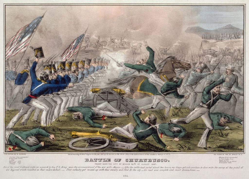
He served in several battles of the Mexican-American War, which took place between 1846 and 1848 after the United States annexed Texas in 1845, and had obtained the rank of captain by the end of it.

After the Mexican-American War and before the American Civil War, Smith taught mathematics at West Point between 1849 and 1852, as well as pursuing his scientific interest in botany, and was credited with collecting and describing species of plants native to Florida and Tennessee.

Then, he returned to leading troops in 1859 in the Southwest.

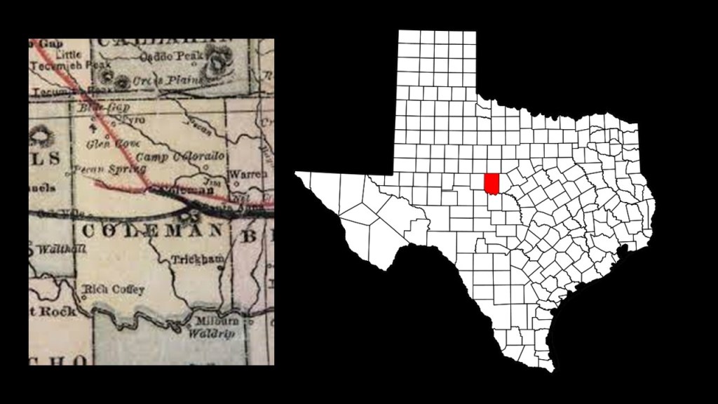
Smith was promoted to Major in January of 1861 when Texas seceded from the Union, and he refused to surrender his command at Camp Colorado in what is now Coleman to the Texas State Troops.

Within just a few months, Smith had resigned his commission in the United States Army to join the Confederacy.

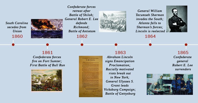
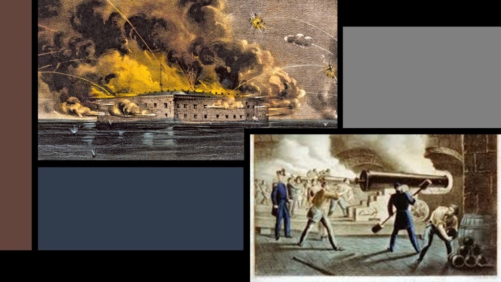
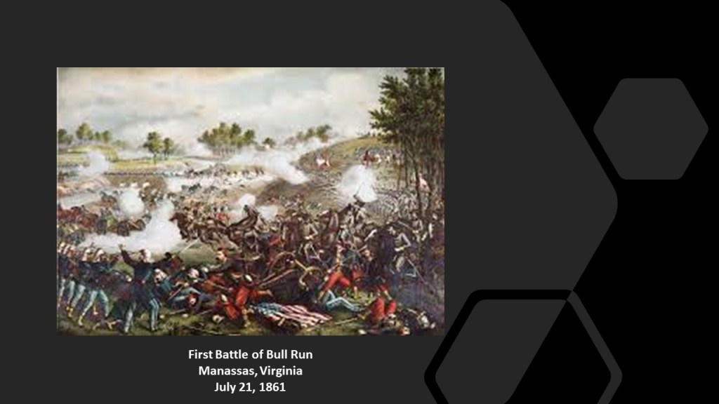
He had been promoted to the rank of Brigadier-General in June of 1861, and given a command of a brigade in the Army of the Shenandoah, which he led in the First Battle of Bull Run on July 21st of 1861, the first major battle of the civil war, in which he was severely wounded.

Smith recovered from his injuries, and returned to duty in October of 1861 as a Major-General and division commander of the Army of Northern Virginia for awhile, the primary military force of the Confederate States in the Eastern Theater of the Civil War.

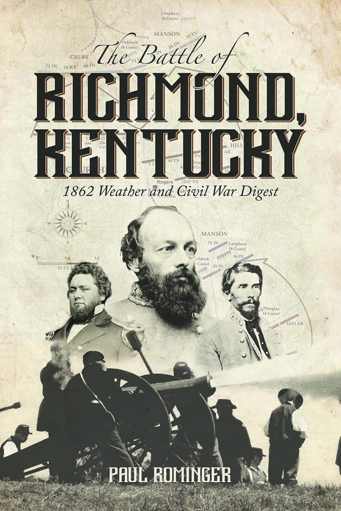
Then in February of 1862, he was sent west to command the eastern division of the Army of Mississippi, cooperating with General Braxton Bragg in what was called the “Invasion of Kentucky,” during which time he was victorious in the Battle of Richmond in Kentucky, called one of the most complete confederate victories in the war, and the first major battle in the Kentucky Campaign.

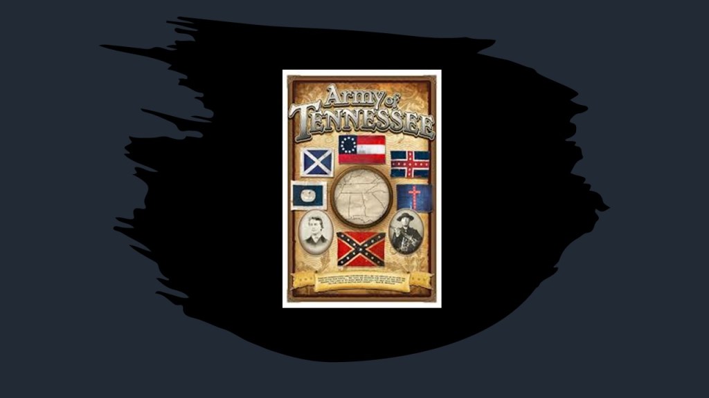
By October of 1862, Smith was promoted to Lieutenant-General, commanding the 3rd Corps, Army of Tennessee.

Then in January of 1863, Edmund Kirby Smith was transferred to command the Trans-Mississippi Department, and for the rest of the Civil War he remained west of the Mississippi River.

His Trans-Mississippi Department never had more than 30,000 men stationed over a large area and he wasn’t able to concentrate his forces enough to challenge the Union Army or Navy.

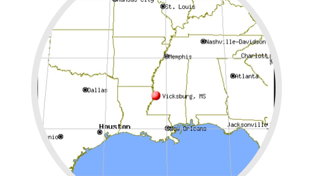
After the Union forces captured Vicksburg, Mississippi…

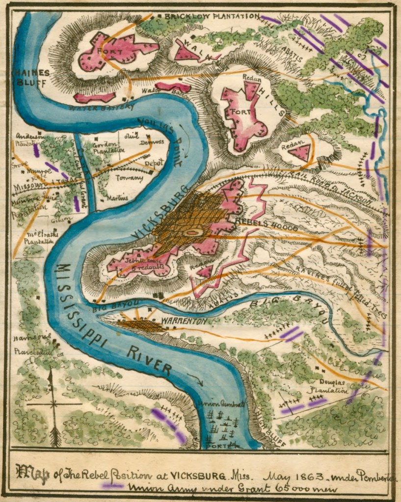
…and Port Hudson in Louisiana…

…Edmund Kirby Smith’s forces were cut off from the Confederate Capital of Richmond, Virginia.

As a result of being cut-off from Richmond, Smith commanded and administered a nearly independent area of the Confederacy, and the whole region became known as “Kirby Smithdom.”

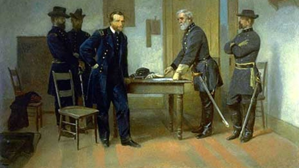
Ultimately, the Confederate General Edmund Kirby Smith surrendered the Trans-Mississippi Department on May 26th of 1865 on board the U. S. S. Fort Jackson on Galveston Bay in Texas to the Union Major General Edward Canby, approximately eight-weeks after General Robert E. Lee’s surrender to General Ulysses S. Grant in Virginia.

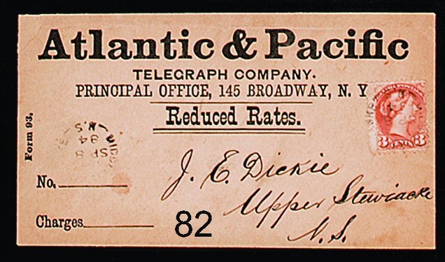
Edmund Kirby Smith was active in the telegraph business as the President of the Atlantic and Pacific Telegraph Company…

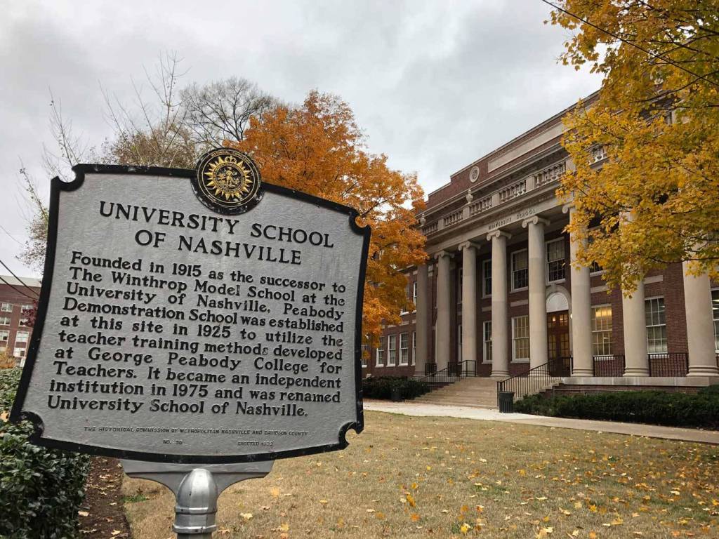
…served as the Chancellor of the University of Nashville from 1870 and 1875…

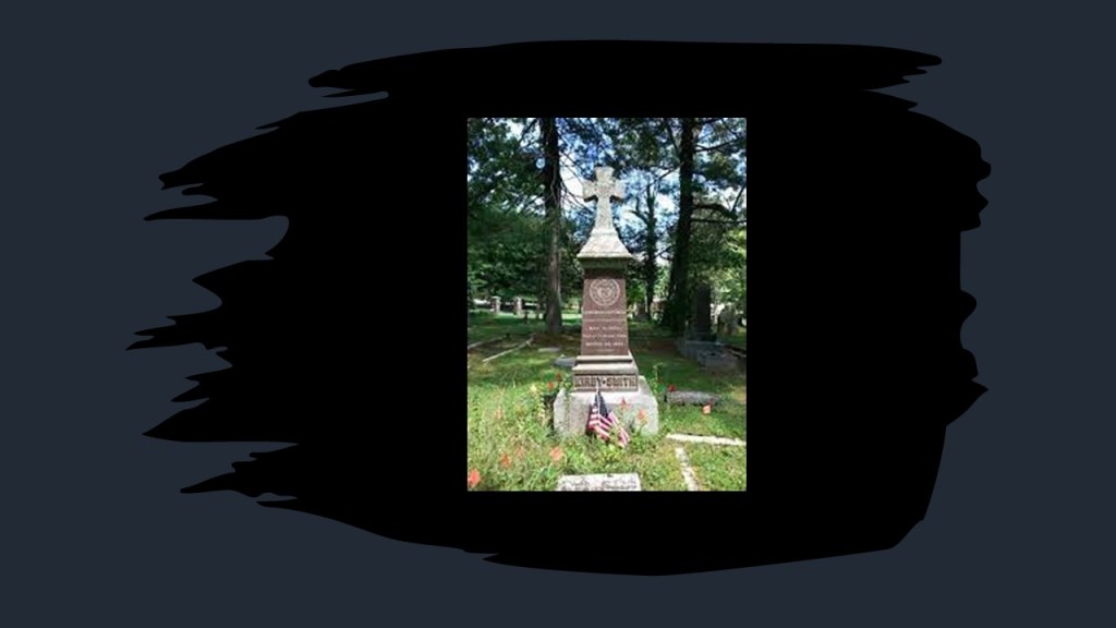
…and taught mathematics and botany at the University of the South in Sewanee, Tennessee…

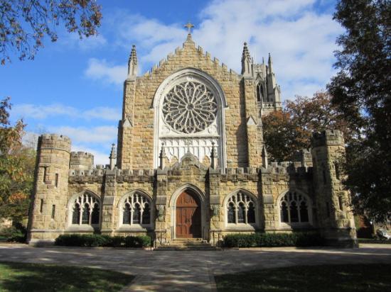
…in whose cemetery he was buried after his death from pneumonia in 1893.

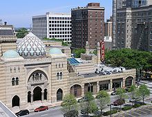
The statue representatives for the State of Georgia are Crawford Long and Alexander H. Stephens.

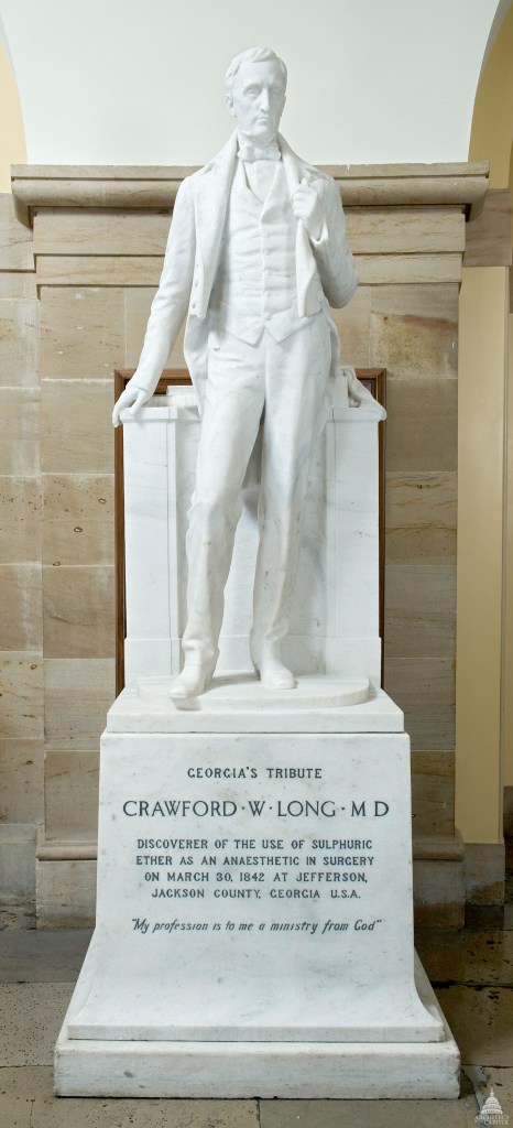
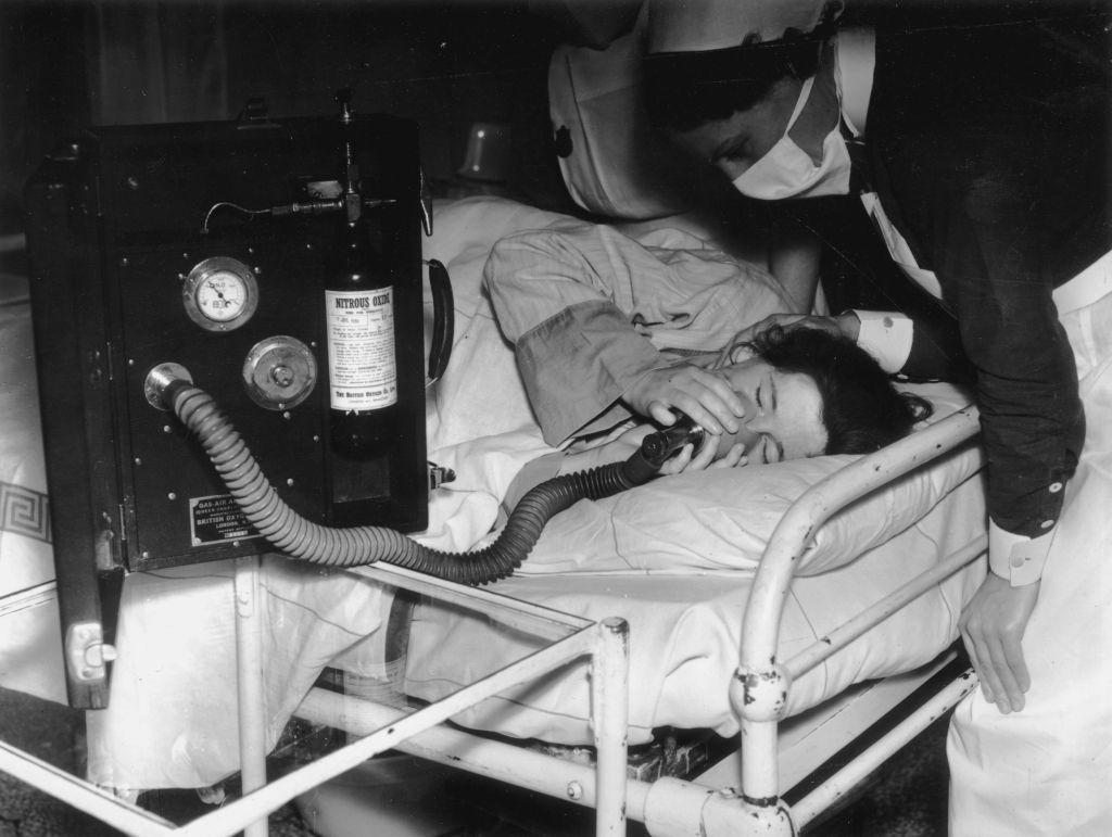
Crawford Long was a surgeon and pharmacist, best known for his use of inhaled sulphuric ether as an anesthetic.

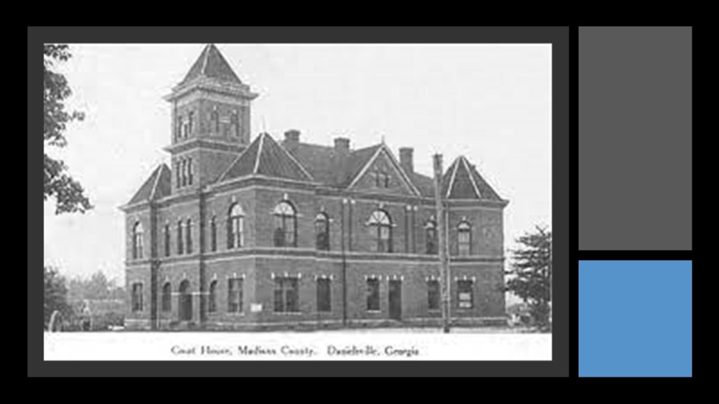
Crawford Long was born in Danielsville, Georgia, on November 1st of 1815.

His father was a state senator, merchant and planter.

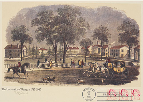
Danielsville is 16-miles, or 23-kilometers, north of Athens, Georgia.

He started attending the University of Georgia in Athens after he graduated from the local academy at the age of 14.

His friend and roommate at the University of Georgia was Alexander H. Stephens, the other statue representing Georgia.

More on him shortly.

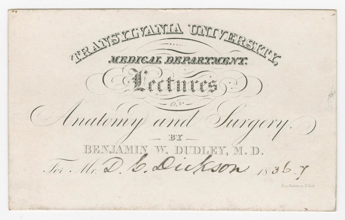
Crawford Long received his Master of Arts degree, and first went on to study medicine at Transylvania University in Lexington, Kentucky, where he studied under the revered surgeon Benjamin Dudley, and Long was said to have first noticed the effects of operating without anesthesia.

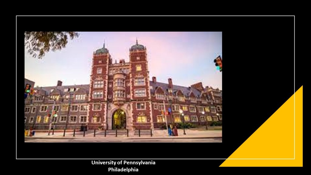
Crawford Long went on to complete his studies at the University of Pennsylvania in Philadelphia, and received his M.D. in 1839.

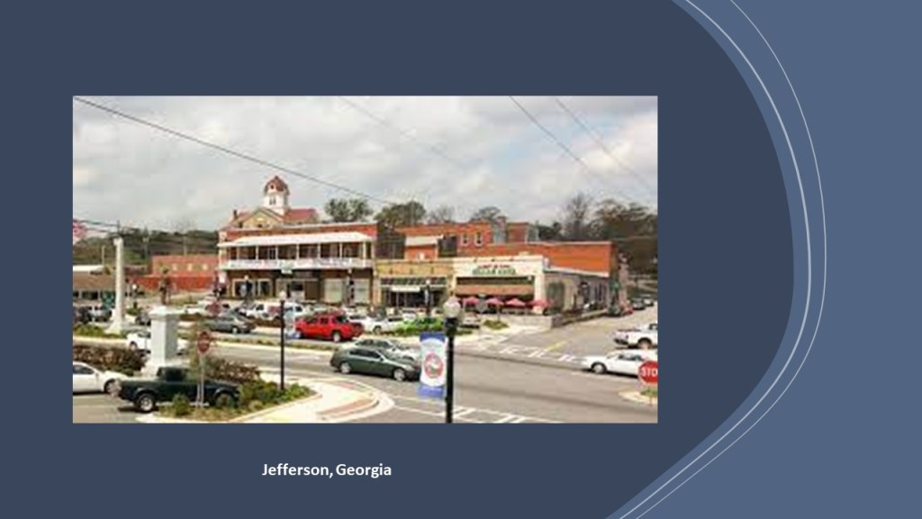
Crawford Long returned to Georgia after an 18-month internship in New York, and took over a rural practice in Jefferson, Georgia, in 1841.

Crawford Long was credited with using ether for the first time as an anesthetic on March 30th of 1842 to remove a tumor from the neck of a patient, even though the first public demonstration of using either didn’t take place until four-years later by William Morton, to a medical audience at Massachusetts General Hospital in Boston.

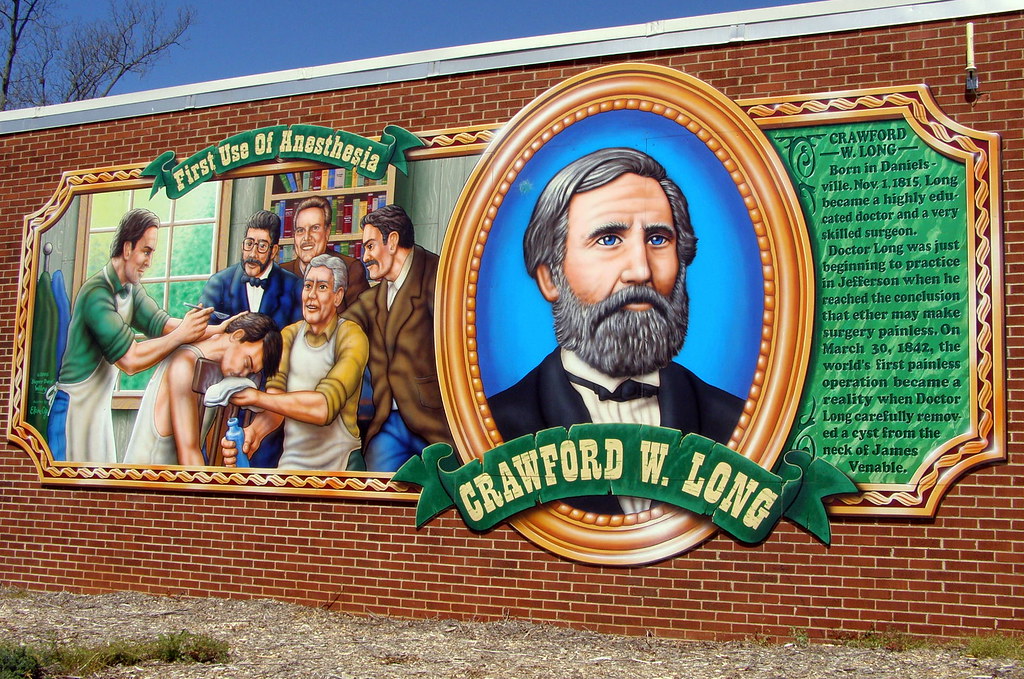
Long was also credited with being the first to use ether as an anesthetic during childbirth, when he had his wife inhale ether when she was giving birth, and this practice was dominant in the field for many, many years afterwards.

Though others published their results before he did, Crawford Long was declared the official discoverer of anesthesia by the National Eclectic Medical Association in 1879…

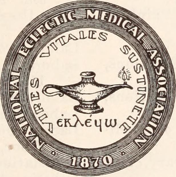
…and led to “Doctors Day” being celebrated on March 30th every year to commemorate his first use of anesthesia on March 30th of 1842.

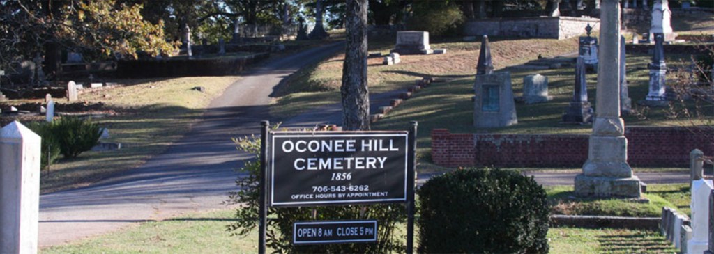
Crawford Long and his wife are buried next to each other at the Oconee Hill Cemetery in Athens, Georgia.

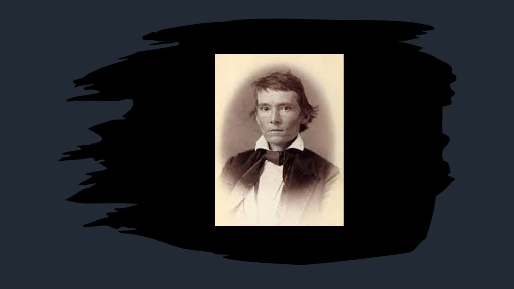
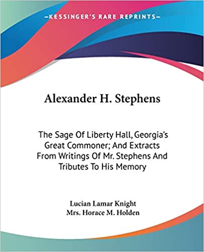
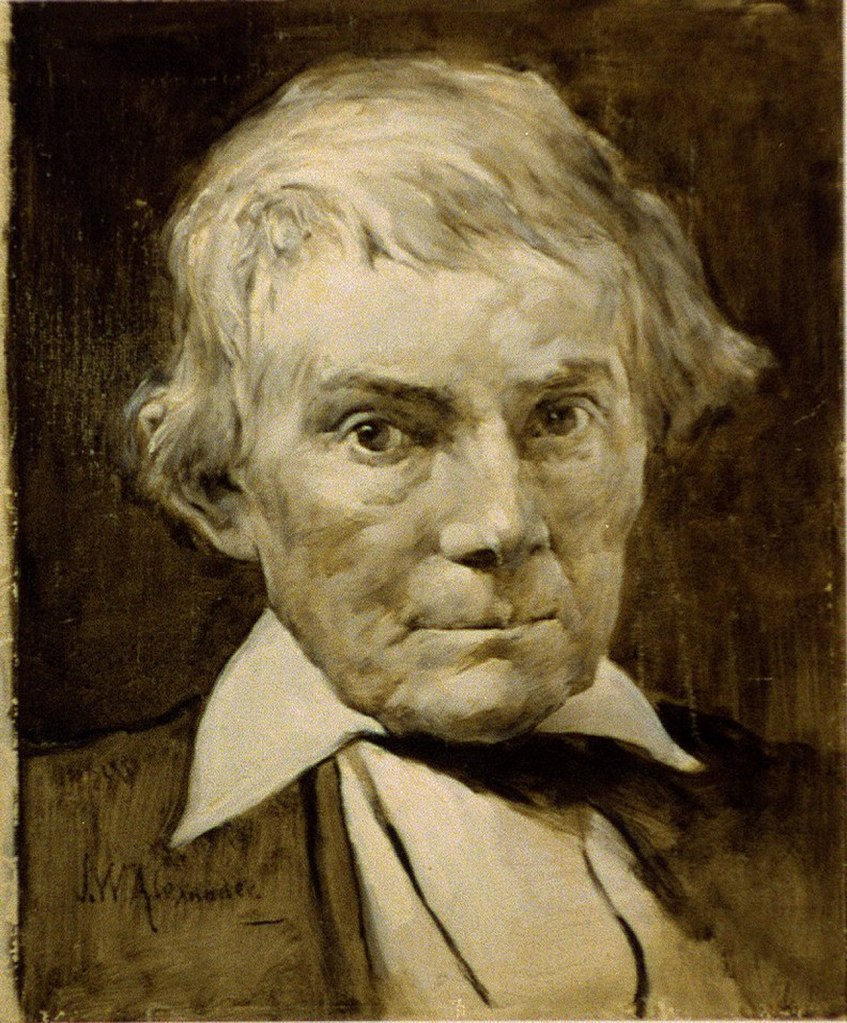
The other statue represented by Georgia is one of Alexander Hamilton Stephens, an American politician who served as a member of the U. S. House of Representatives from Georgia between October of 1843 to March of 1859 and December of 1873 to November of 1882; was Vice-President of the Confederate States from 1861 to 1865; and the 50th Governor of Georgia from November of 1882 to March of 1883.

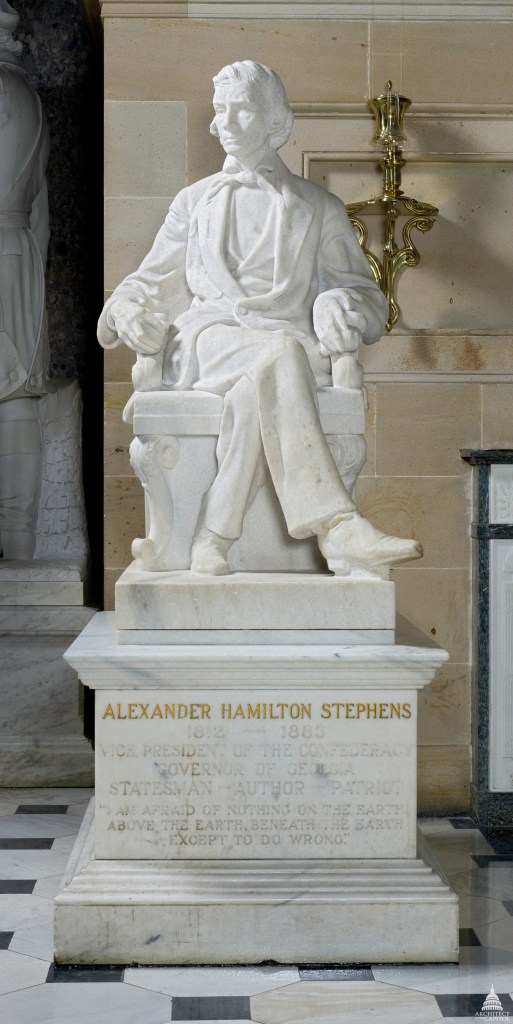
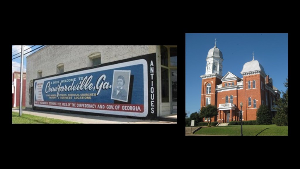
Alexander H. Stephens was born in February of 1812 in Talioferro County, near Crawfordsville, Georgia, the county seat.

Alexander H. Stephens was born on February 11th of 1812. His mother, Margaret Grier, died that same year.

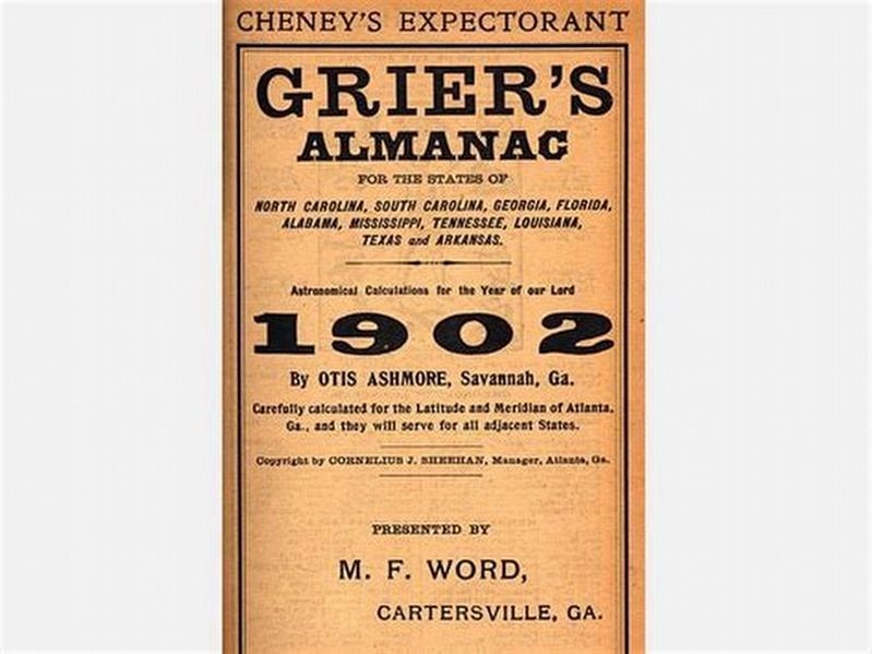
His mother’s brother Robert Grier was the founder of Grier’s Almanac, one of Georgia’s longest-running publications, having been published continuously since 1807.

His father Alexander remarried in 1814, and both his father and his stepmother died from pneumonia in 1826, when Alexander was 14-years-old.

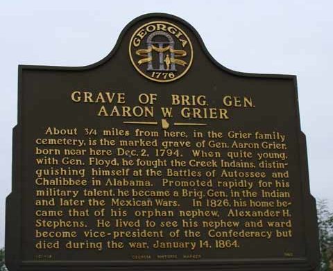
Though he grew up poor and in difficult circumstances, he went to live with another of his mother’s brothers, Revolutionary War General Aaron Grier, near Raytown in Talioferro County. His Uncle Aaron had inherited one of the best libraries in that part of the country from his father.

Stephens continued his education through several benefactors, and attended college in Athens, where I mentioned previously his roommate was Crawford Long.

He was a member of the Phi Kappa Literary Society and he graduated at the top of his class in 1832.

Stephens began legal studies and was admitted to the Georgia bar in 1834, and began his career as a successful lawyer in Crawfordsville with a career in law that spanned 32-years.

On top of that, he entered politics in 1836 when he was elected to the Georgia House of Representatives, where he served until 1841, and then he was elected to the Georgia Senate in 1842.

Then, Stephens served in the U. S. House of Representatives from October of 1843 to March of 1859.

He quickly rose to prominence as one of the leading southern Whigs in the House.

In 1861, Stephens was elected as a delegate to the Georgia Secession Convention to decide Georgia’s response to the election of Abraham Lincoln.

He came to be known as the “Sage of Liberty Hall” for his call for the South to remain loyal to the Union.

He voted again secession at the convention, but asserted the right to secede if the federal government continued to allow the northern states to nullify the “Fugitive Slave Law” with “Personal Liberty Laws.”

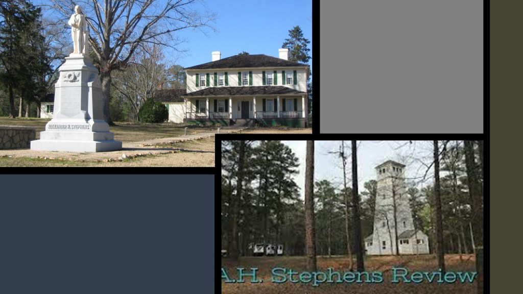
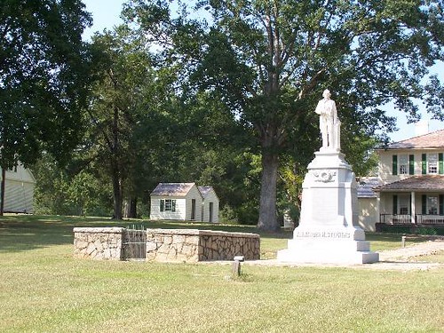
Liberty Hall was Alexander Stephens’ home in Crawfordville, and today is a museum, and part of A. H. Stephens Historic Park.

Stephens was elected to the Confederate Congress in November of 1861, and was chosen as Vice-President of the Provisional Government.

Stephens was outspoken in his support of institutionalized slavery.

He remained in this position through the end of the Civil War.

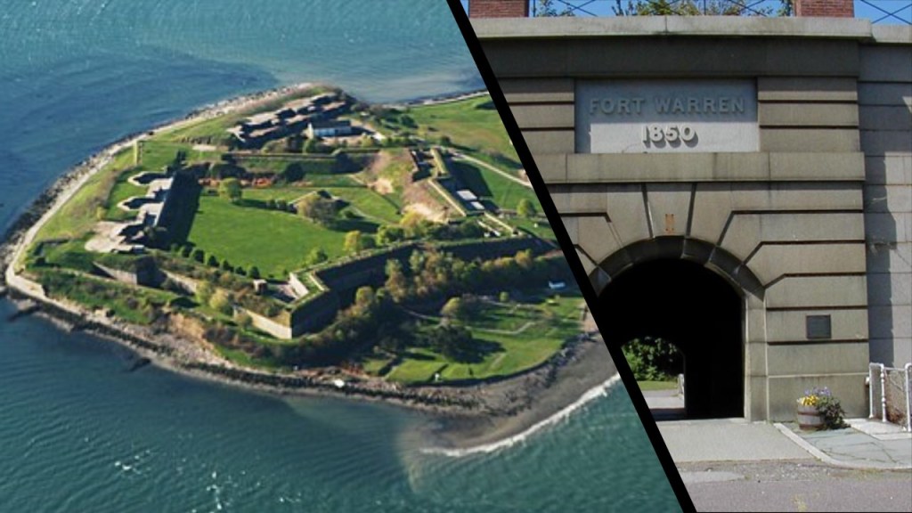
Stephens was arrested for treason against the United States at his home in Crawfordville on May 11th of 1865, and spent 5 months at Fort Warren on George’s Island at the entrance to Boston Harbor.

In 1866 Stephens was elected to the United States Senate by the first legislature that opened under the new Georgia Constitution, but was not allowed to take his seat because of restrictions against on former Confederates.

Then in 1873, he was elected to the U. S. House of Representatives as a Democrat, and was re-elected four more times – in 1874, 1876, 1878 and 1880.

He became Governor of Georgia on November 4th of 1882, but died a short time later, on March 4th of 1883.

He is buried next to his statue in front of his home in A. H. Stephens Historic Park.

Alexander H. Stephens never married, and has no known descendents.

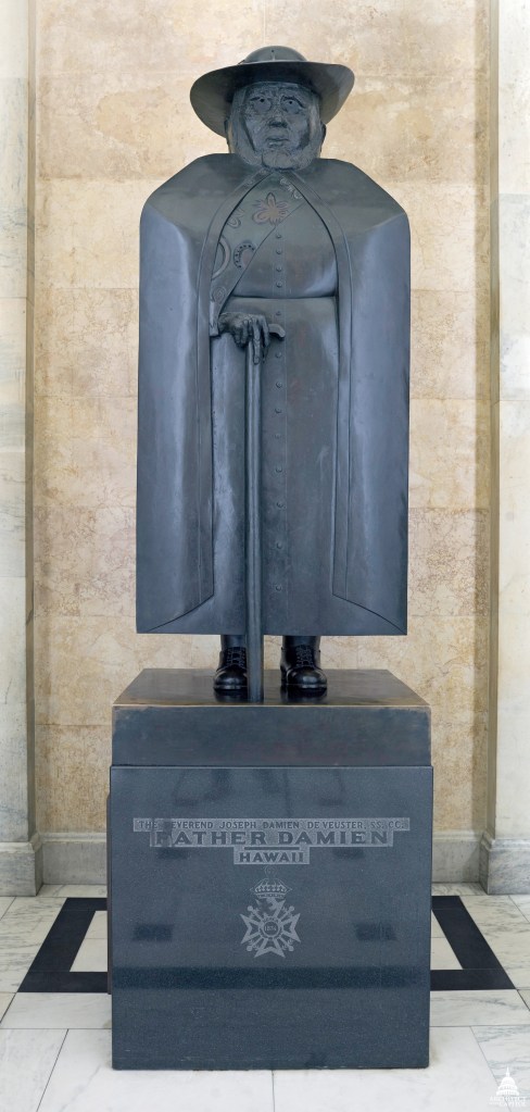
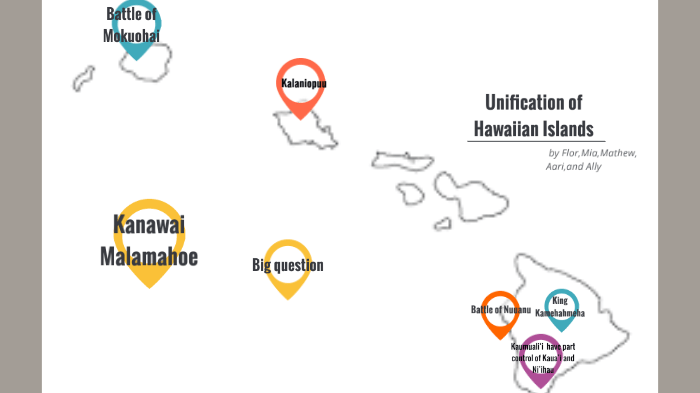
Next we come to Hawaii, which is represented by Father Damien and King Kamehameha I in the National Statuary Hall.

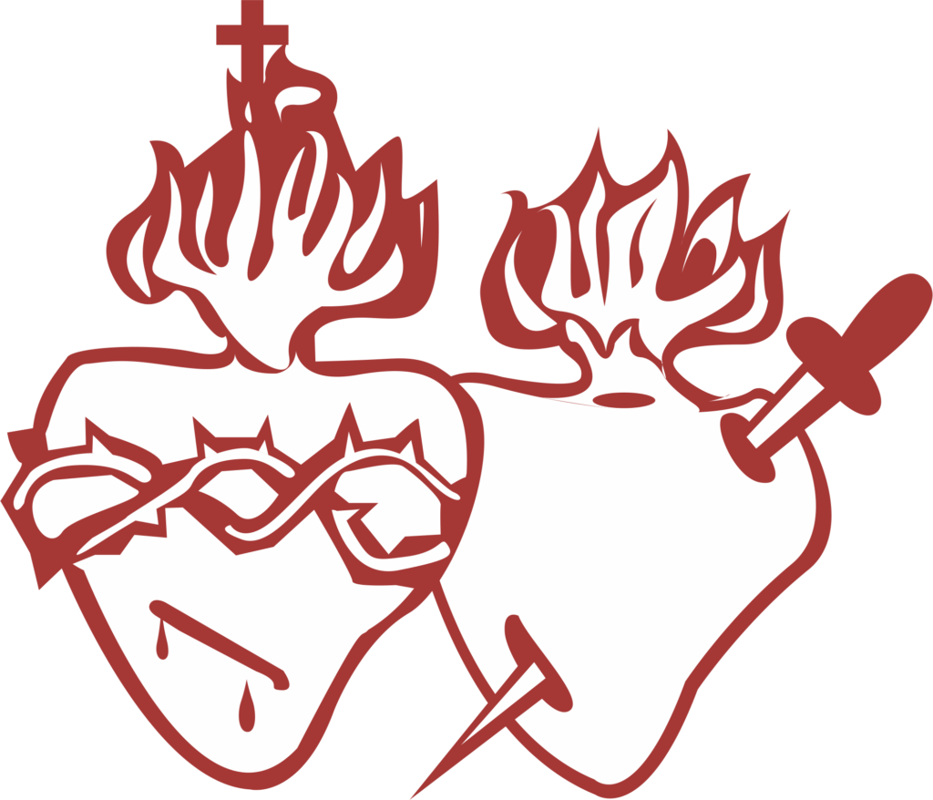
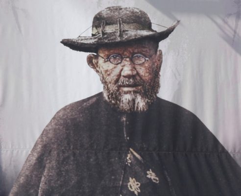
Father Damien, or Saint Damien of Molokai, was a Roman Catholic priest from Belgium and a member of the Congregation of Sacred Hearts of Jesus and Mary, a missionary religious institute.

The Congregation of the Sacred Hearts of Jesus and Mary came about from the religious upheaval caused by the French Revolution.

Its original members founded new schools for poor children, seminaries to help grow their priesthood and parish missions throughout Europe, and in 1825, the Holy See entrusted the evangelization of the Hawaiian Islands to the Congregation of the Sacred Hearts of Jesus and Mary.

Father Damien was recognized for his ministry from 1873 until his death in 1889 for people with leprosy in the Kingdom of Hawaii who lived in government-mandated quarantine in a settlement on Molokai.

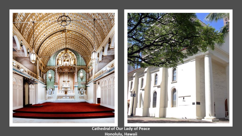
Damien de Veuster arrived in Honolulu from Belgium on March 19th of 1864, and was ordained there as a priest on May 21st of 1864 at what is now the Cathedral of Our Lady of Peace, the Mother Church of the Diocese of Honolulu.

Father Damien was first assigned to the Catholic Mission in North Kohala on the island of Hawaii.

The Kingdom of Hawaii was struggling with a public health crisis and labor shortage.

Many of his native Hawaiian parishioners had infectious diseases like leprosy, smallpox, cholera, influenza, syphilis, and whooping cough, brought to the Hawaiian Islands by foreigners, and from which thousands died.

In 1865, out of fear of the contagious disease of Leprosy, King Kamehameha V and the Hawaiian Legislature passed the “Act to Prevent the Spread of Leprosy.”

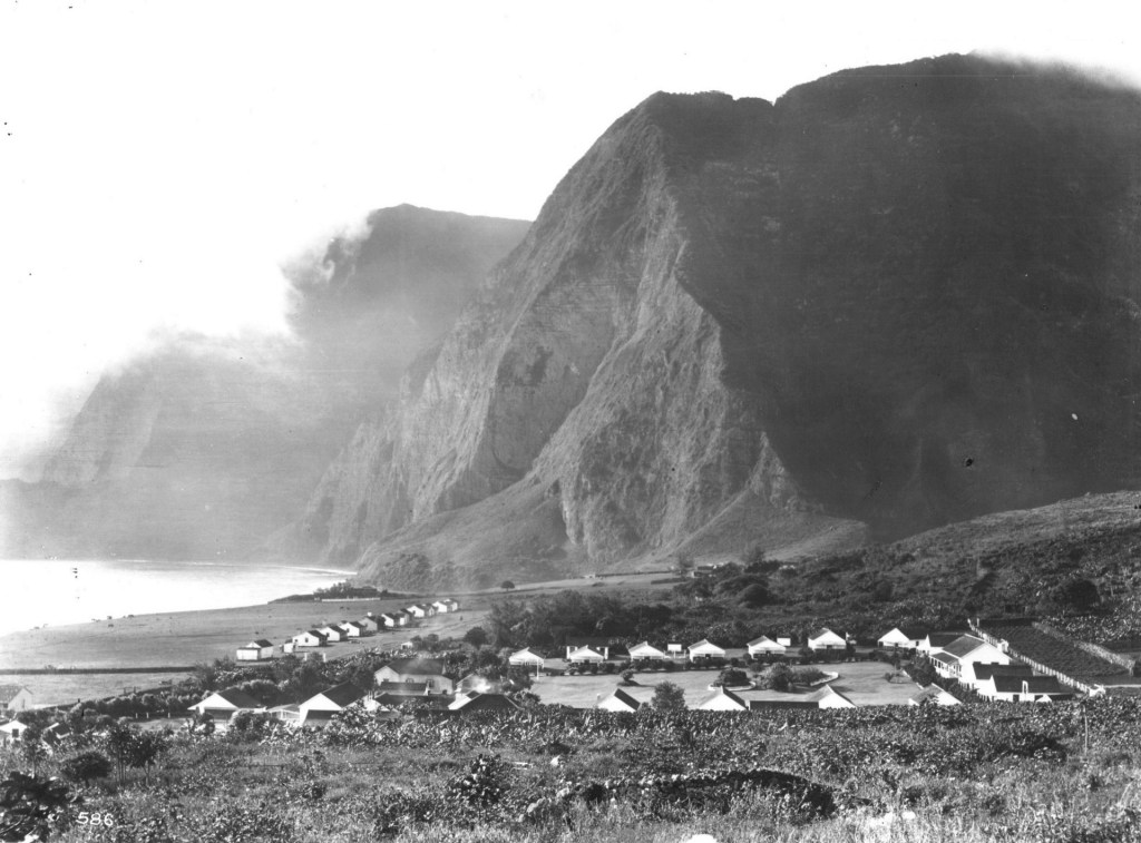
This Act quarantined the lepers of Hawaii, and the most serious cases were emoved to the settlement colony of Kalawao, and later a second one named Kalaupapa, on the island of Molokai.

From 1866 to 1969, approximately 8,000 Hawaiians were sent to these two settlements for medical quarantine.

The Kingdom of Hawaii did not provide enough resources, having planned for the people who lived there to take care of themselves and grow their own food, but this was not practical and did not work out well.

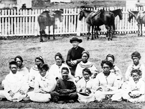
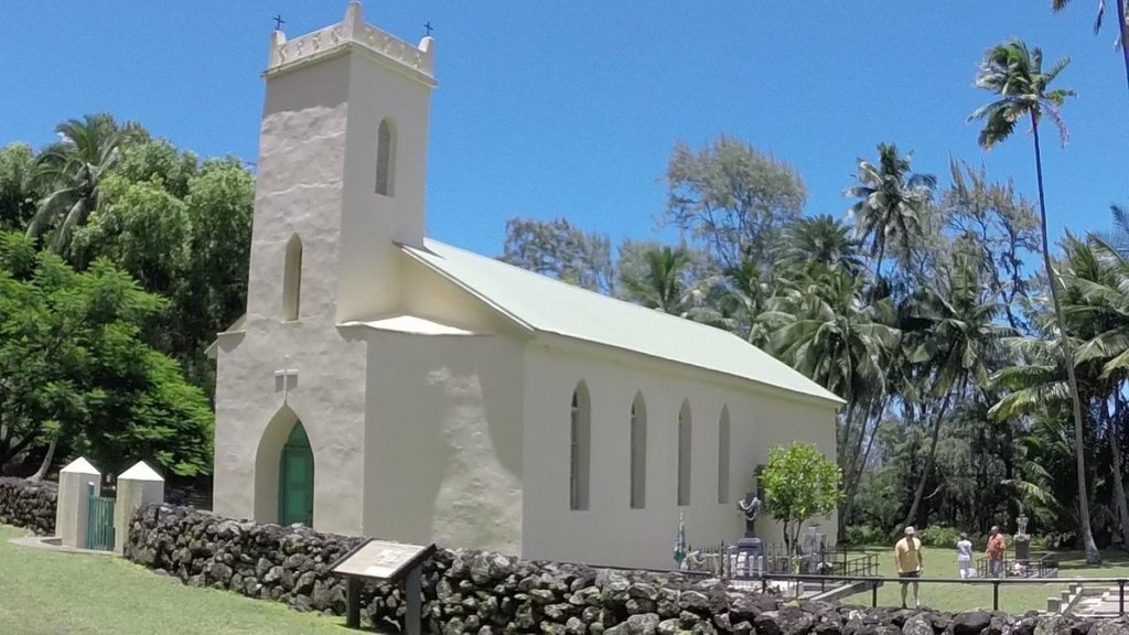
The Bishop of the Honolulu Diocese believed the lepers needed a Catholic priest to assist them, and the first volunteer to arrive at the isolated settlement of Kalaupapa was Father Damien.

We are told he worked with them to build a church and establish the Parish of St. Philomena.

Father Damien cared for the lepers and helped to establish leaders in the community to improve the quality-of-life there.

He was also said to have taught, painted houses, and organized farms, the construction of chapels, roads, hospitals and churches, as well as serving as their priest.

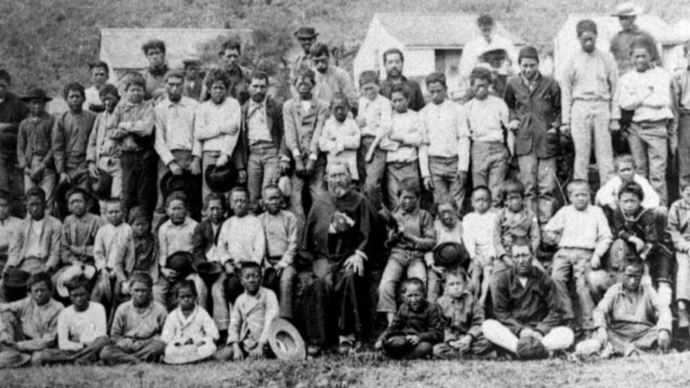
Father Damien worked for 11-years at the leper settlement on Molokai.

In 1884, he realized that he himself had contracted leprosy when he felt nothing when he put his foot into scalding hot water.

With his remaining time, he tried to advance as many projects as possible, including the completion of several building projects and improved orphanages.

Four volunteers arrived on Molokai to help him: Louis Lambert Conrardy, a Belgian priest; an American Civil War veteran, Joseph Dutton; James Sinnett, an nurse from Chicago; and Mother Marianne Cope, formerly the head of the Franciscan-run St. Joseph’s Hospital in New York City.

By March 23rd of 1889, he was bedridden, and he died from leprosy on April 15th of 1889.

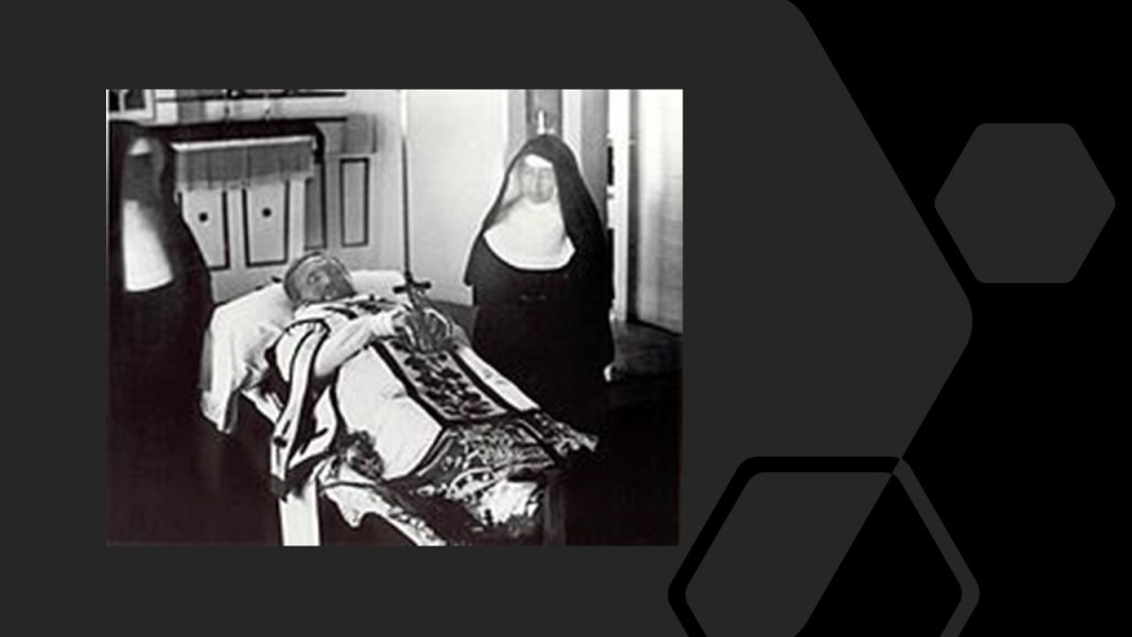
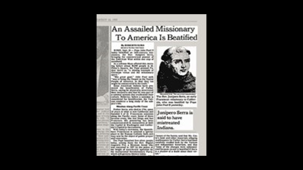
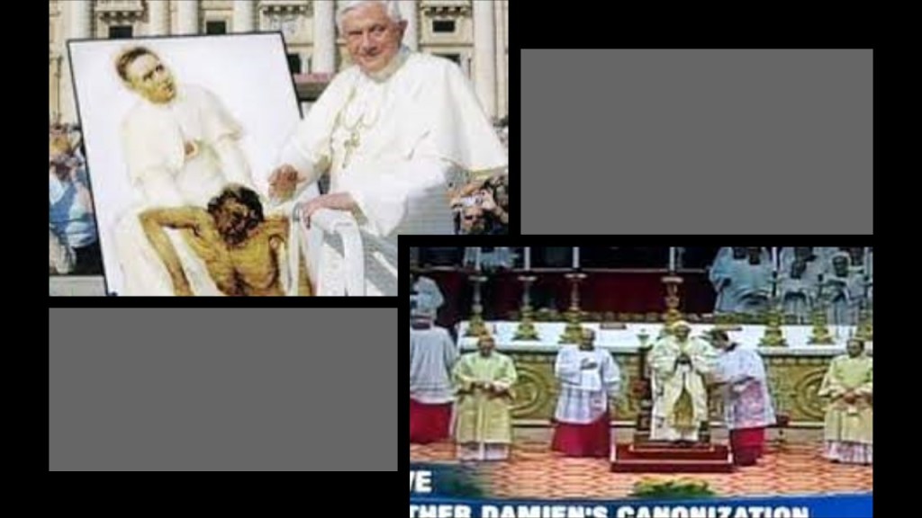
Initially buried at the leper settlement where he had lived, his remains were returned to Belgium in 1936, though later the remains of his right hand were returned to Molokai for re-interment when he was beatified by Pope John Paul II in 1995.

He was canonized as a saint in October of 2009 by Pope Benedict XVI.

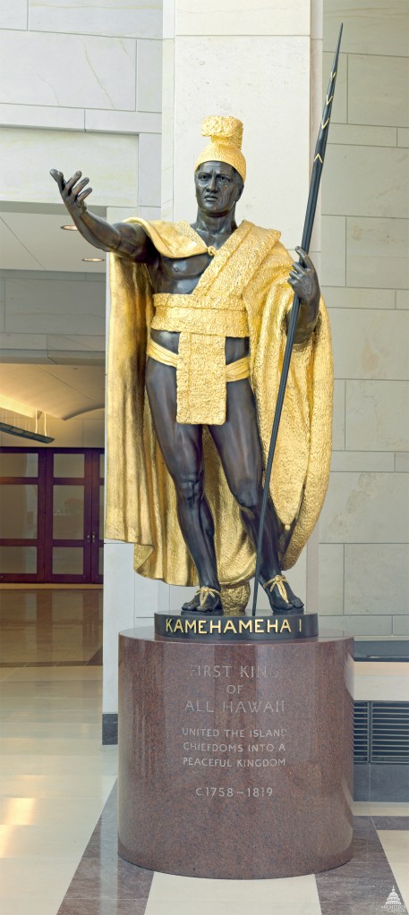
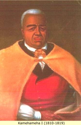
The other statue for Hawaii is represented by King Kamehameha I.

King Kamehameha I , also known as the Great, was the founder and first ruler of the Kingdom of Hawaii, which originated in 1795, but became official when the whole Hawaiian Archipelago became unified in 1810.

Kamehameha was believed to have been born in the Kohala District of the island of Hawaii in November of 1758, at which time a bright star was said to have appeared just before he was born, which would have coincided with the return of Halley’s Comet in 1758.

He was the son of a high chief and daughter of King Alapa’i, who died in 1754.

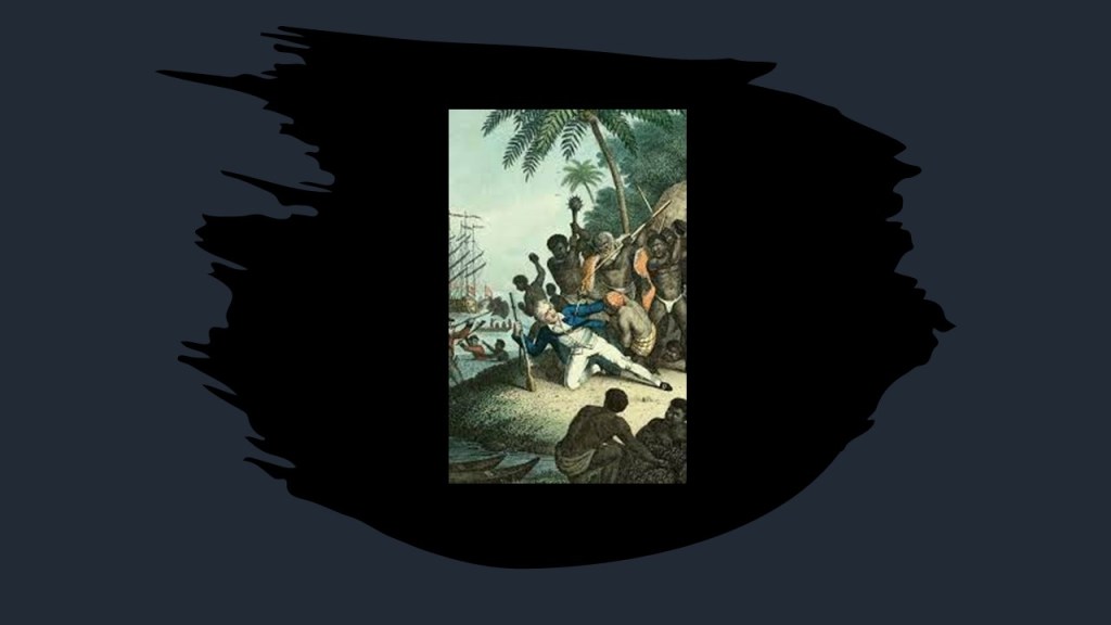
King Kalani’opu’u was king when the expedition of British explorer Captain James Cook arrived in November of 1778, and went aboard his ship.

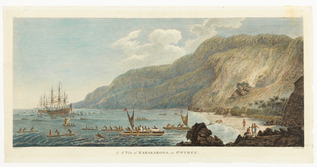
He went aboard Cook’s ship again in January of 1779, when the ship anchored in Kealakekua Bay, and gifts were exchanged.

Then in February of 1779, Cook’s ships returned to repair storm damage.

On this visit, Captain Cook tried to take the king hostage after the theft of a longboat, which lead directly to Captain Cook’s death when he was killed by the King’s attendants.

There’s differing reports about what happened after the death of King Kalani’opu’u in April of 1782.

One version of what happened is that the island of Hawaii was divided between his son Kiwalao, and his nephew, Kamehameha.

Things were peaceful we are told, until July of 1782, when a dispute between their chiefs broke out, which lead to war.

Kiwalao was slain at the Battle of Mokuohai, Kamehameha’s first major victory and solidified his leadership over much of the island.

Then Kamehamema embarked on a series of conquests that brought all the islands except for Kauai and Nihau under his control, which were eventually ceded to him through peaceful negotiations in 1810.

As King, Kamehameha set up governors to administer each island, and as a shrewd businessman, amassed a fortune for his kingdom through a government monopoly on the sandalwood trade and the imposition of port duties on visiting ships.

He was described as an open-minded sovereign who maintained his kingdom’s independence through the period of European discovery and exploration of the islands.

He died in May of 1819, his final resting place unknown as his trusted friends hid his body according to the ancient practice of “hiding the body in secret” to preserve his ‘mana’ or power.

Kamehameha

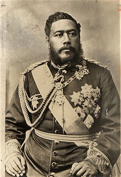
This was King Kalakaua.

When King Kamehameha V died in December of 1872, he had not named a successor the last elected Monarch of the Kingdom of Hawaii. 

Kalakaua ultimately became king through an election process by the legislative assembly in February of 1874.

He lost his absolute power in 1887 when he was forced by Hawaiian elites to accept a constitution that provided for a constitutional government.

He died in January of 1891.

King Kalakaua

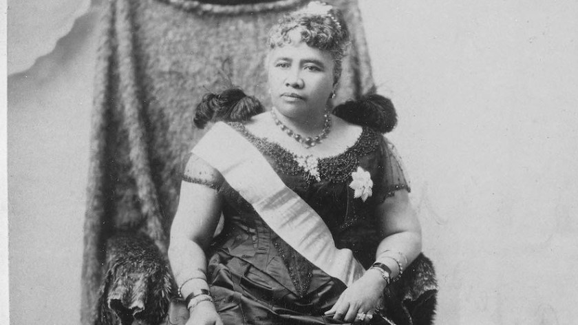
Liliuokalani was proclaimed Queen of Hawaii after the death of her brother, King Kalakaua, in 1891.

She was the last sovereign monarch of the Hawaiian kingdom, from January 29th, 1891, until the overthrow of the Hawaiian Kingdom on January 17th, 1893, by subjects of the Hawaiian kingdom, U. S. citizens, and foreign residents residing in Honolulu 

Queen Lili'uokalani

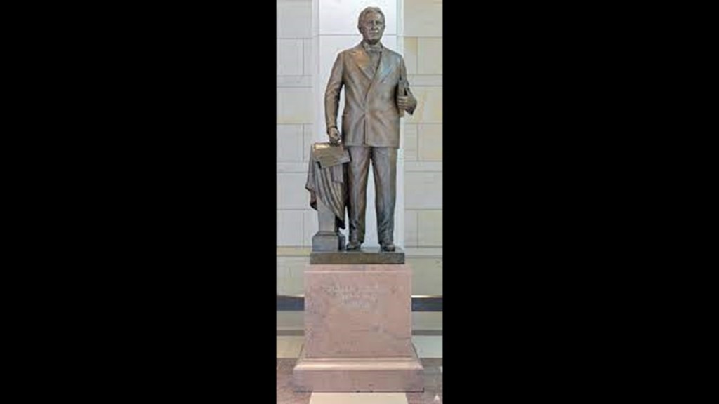
The last state I am going to be looking at in this part 3 of this series is Idaho, which is represented in the National Statuary Hall by William Borah and George L. Shoup.

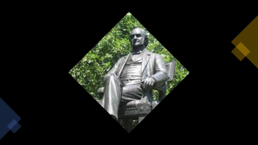
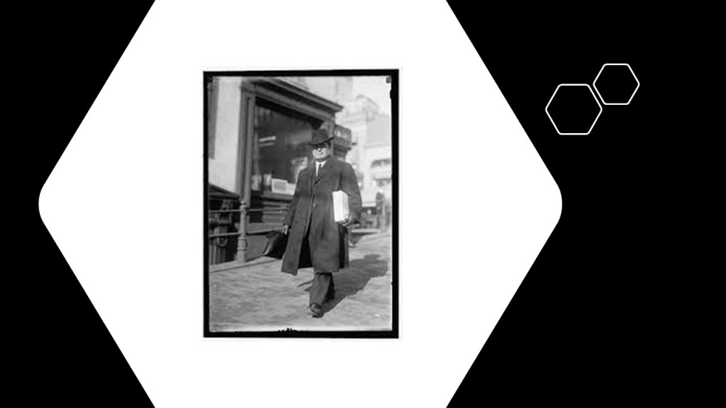
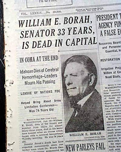
William E. Borah was an outspoken Republican Senator, and considered to be one of the best-known figures in the history of Idaho.

He served in the U. S. Senate from 1907 until his death in 1940.

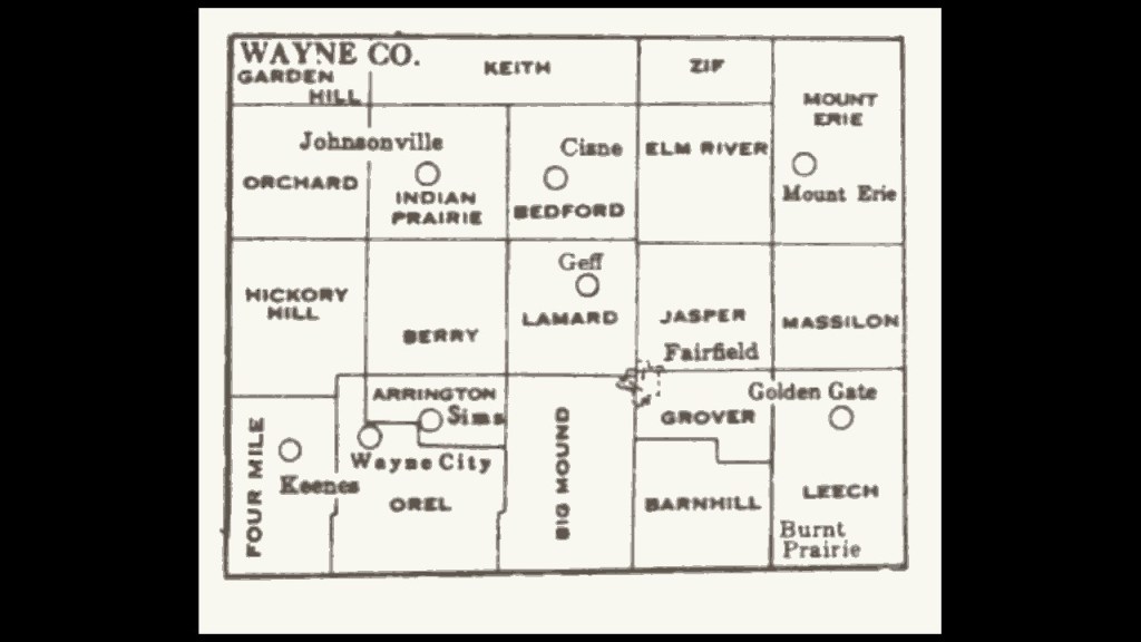
William Edgar Borah was born to parents who were farmers in June of 1865 in Jasper Township, Illinois, near Fairfield in Wayne County.

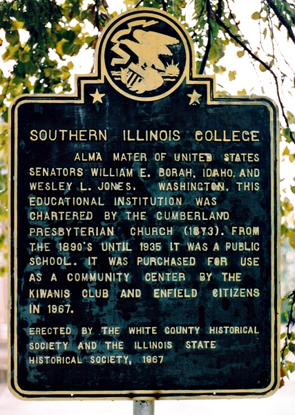
He received his initial education at Tom’s Prairie School near Fairfield, and then in 1881, his father sent him to Southern Illinois Academy, a Cumberland Presbyterian academy, to train for the ministry, but Borah was expelled in 1882.

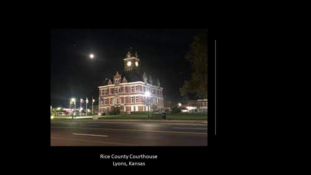
Borah decided he wanted to be a lawyer, so his father sent him in 1883 to Lyons, Kansas, to live with his sister Sue, and her husband, Ansel M. Lasley, an attorney.

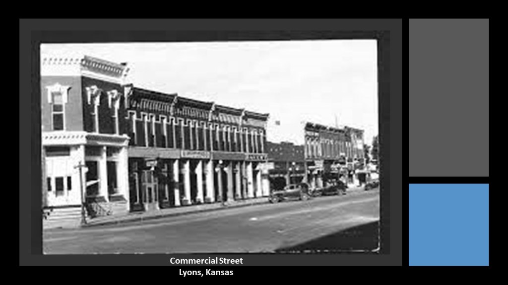
In 1885, he enrolled in the University of Kansas in Lawrence but contracted tuberculosis in 1887 and had to withdraw from his studies there.

He returned to Lyons, where his sister helped him recover his health, and he read law under his brother-in-law’s supervision, and passed the bar in 1887.

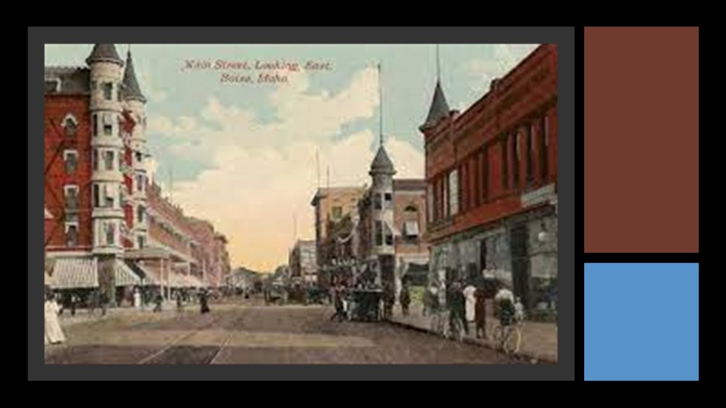
Though he was appointed as City Attorney of Lyons by the Mayor, Borah decided he wanted bigger and better things, and in 1890, he boarded the Union Pacific Railroad in Omaha, Nebraska, and headed west, and landed in Boise, Idaho.

Idaho had been admitted to the Union earlier in 1890,and the state capital, Boise, was considered a “boom town.”

Borah prospered in Idaho as an attorney in law and politics, serving as the chair of the Republican State Central Committee in 1892.

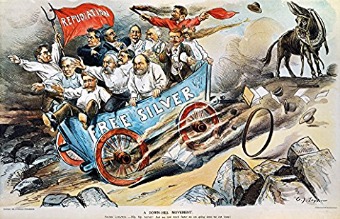
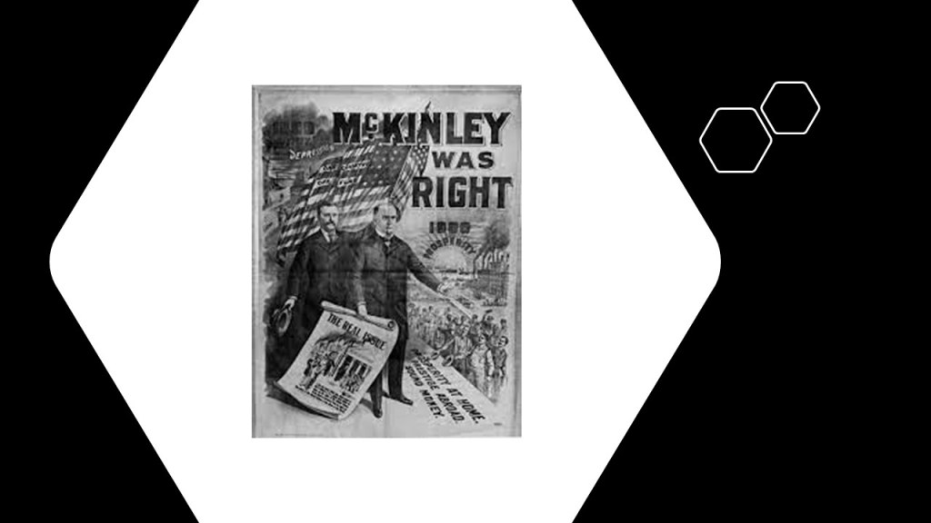
Borah joined many in Idaho in 1896 in breaking from the Republican Party to support the Democrat William Jennings Bryan in support of his platform of “Free Silver,” a major economic policy issue in the 19th-century, an expansionary monetary policy that featured unlimited coinage of silver as money on-demand, as opposed to the more carefully fixed money supply inherent in the gold standard.

The Republican-candidate, former Ohio Governor William McKinley, won the presidential election, and kept the gold standard in place.

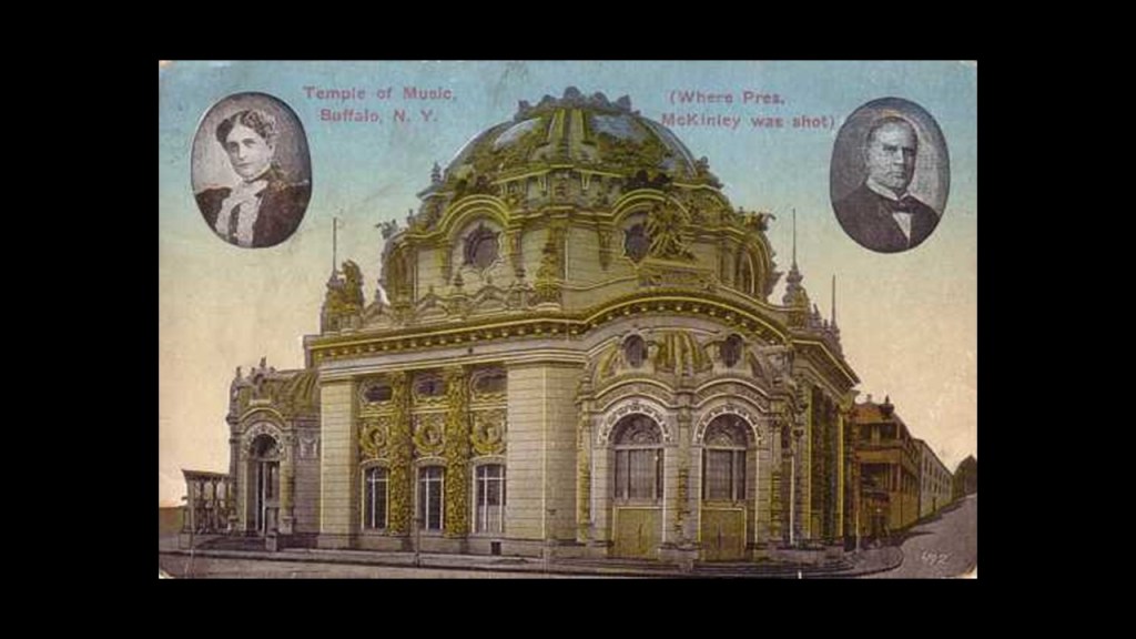
As a point of historical information, President McKinley was shot twice in the abdomen by a gunman at the Temple of Music on the grounds of the Pan-American Exposition in Buffalo, New York on September 13th of 1901, and died as a result of his wounds on September 14th of 1901, at the beginning of his second term as president.

Back to William Borah.

Borah supported the Spanish-American War in 1898, and remained loyal to the Silver Republicans.

Then in 1900, he decided that the issue of silver versus gold standard was no longer important in the light of increased gold production and national prosperity, and subsequently made a return to the Republican Party.

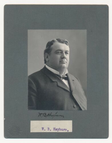
Borah was prominent as an attorney in southern Idaho, and he sought election to the U. S. Senate in 1902, but was defeated by Weldon B. Heyburn, a mining lawyer from northern Idaho, in his first Senate run.

Borah set his sights on replacing the Senate seat of Fred Dubois in 1907, and, long story short, was successful in doing so.

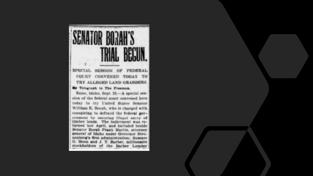
Right before Borah entered the Senate in December of 1907, he was involved in two trials in Idaho – one in which he was counsel for the prosecution and the other in which he was a defendent.

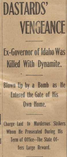
In the case of the former, he had a role as counsel in the prosecution of Big Bill Haywood, who was tried for conspiracy in the murder of former Idaho Governor Frank Steunenberg, who was assassinated on December 30th of 1905 by a bomb placed at the gate of his home.

Though Haywood’s defense attorney Clarence Darrow, best known for his defense of high school teacher John Scopes in the 1925 “Scopes Monkey Trial” for teaching evolution in a state-funded school in Tennessee, won an acquital for his client, the trial made William Borah a national figure.

While defendents in the Haywood case awaited trial, Borah was indicted in federal court for land fraud, having to do with acquisitions by the Barber Lumber Company, of which Borah was counsel, of title to timber land claims. Individuals had purchased the claims, and sold them to the lumber company, after having sworn they were for they are own.

The indictment of Borah was perceived to be political by Idaho Republicans who had lost state party leadership because of the new Senator.

Borah was tried in September of 1907, and he was acquitted because the prosecuting U. S. Attorney was unable to tie Borah to any offense.

When William Borah arrived for the Senate’s regular session in December of 1907, he was already known for the trials in Idaho, and for wearing a ten-gallon hat.

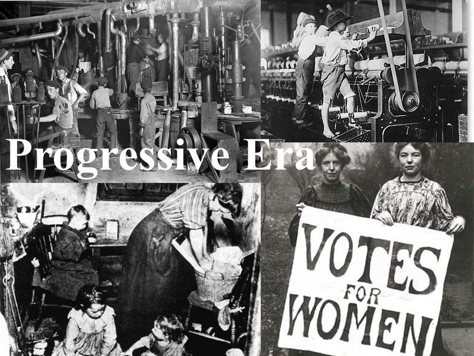
Borah immediately staked out progressive positions, and was one of a growing number of progressive Republicans in the Senate, even though he often opposed liberal legislation.

The Progressive Era was what was called a period of widespread social activism and political reform in the United States that spanned the time-period from the 1890s to World War I, which started at the end of July in 1914.

The stated main objectives of the movement were to address problems caused by industrialization, urbanization, immigration and political corruption.

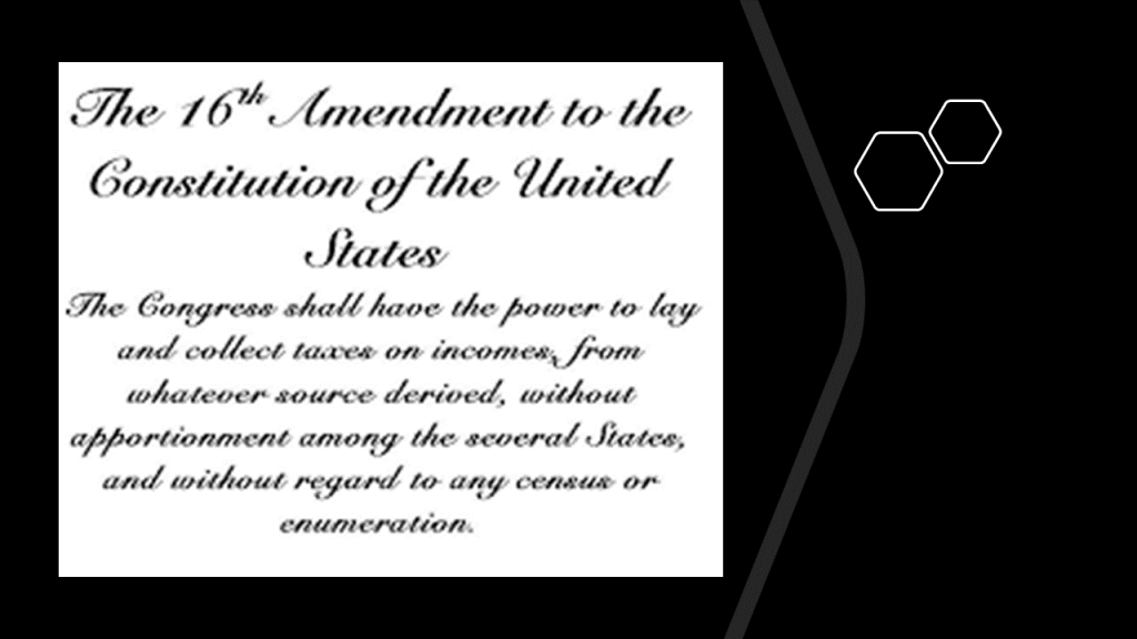
Borah had a hand in his first term in what became the 16th Amendment to the U. S. Constitution, which allowed Congress to levy an income tax without apportioning it among the States on the basis of population, which was passed by Congress in 1909.

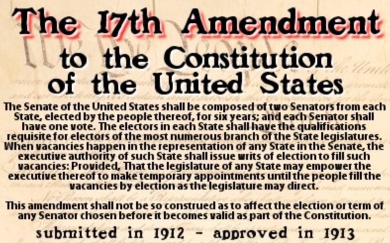
Borah also had a hand in the 17th Amendment, which was ratified in 1913.

The 17th Amendment established the direct election of Senators in each State instead of election by the State Legislatures.

Borah’s popularity in Idaho won him re-election to a second term in the Senate in 1913, during the administration of President Woodrow Wilson.

He was given a seat on the Senate’s Foreign Relations Committee, a seat which he held for the next 25 years.

He became one of America’s leading figures on International Affairs.

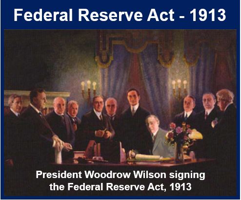
Borah voted against the Federal Reserve Act of 1913, which passed Congress on December 23rd, 1913, and was signed into law by President Woodrow Wilson. 

It created and established the Federal Reserve System, and created the authority to issue Federal Reserve Notes (commonly known as the US dollar) as legal tender.

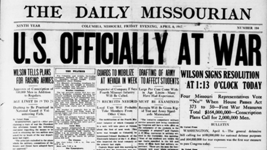
After World War I began in 1914, Borah believed that the United States should keep completely out of it, supporting American neutrality.

In early 1917, when Germany resumed unlimited submarine warfare, Borah remained hopeful the U. S. could stay out of World War I, though he supported Woodrow Wilson on legislation to arm merchant ships, and voted in favor when the President requested a declaration of war in April of 1917, in order for the U. S. to defend its own rights.

William Borah again won re-election in November of 1918.

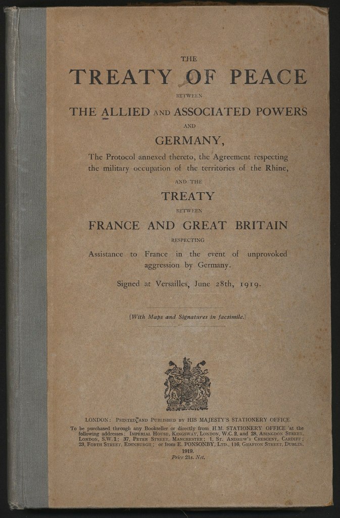
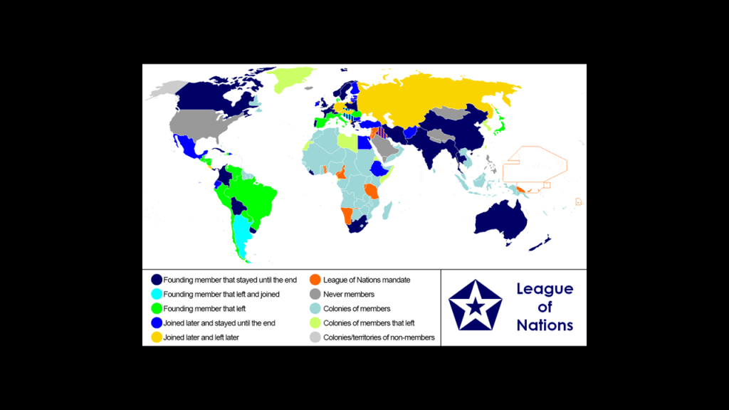
Borah fought against the 1919 Treaty of Versailles which ended the state of war between Germany and the Allied Powers, and the Senate did not ratify it.

As a result of the Senate not ratifying the treaty, the U. S. never became an official member of the League of Nations, which was established in January of 1920, and was the first worldwide, intergovernmental organization with a stated mission of maintaining world peace.

Borah often fought with the Republican Presidents in office between 1921 and 1933, including Warren Harding, who was in office between 1921 and his death on August 2nd of 1923, and Calvin Coolidge who became President upon Warren Harding’s death.

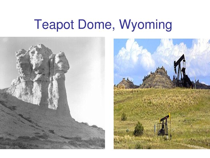
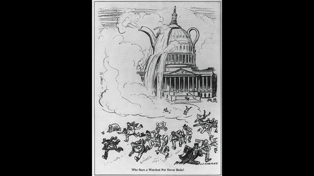
The Teapot Dome Scandal broke in 1924, in which Coolidge himself was not involved but some of his cabinet members were implicated.

The Teapot Dome Scandal was a bribery scandal that took place during the Harding Administration between 1921 and 1923, in which the Secretary of the Interior, Albert Bacon Fall, had leased Navy Petroleum Reserves at Teapot Dome in Wyoming, and two other locations in California, to private oil companies at low rates without competitive bidding.

In order for Calvin Coolidge to get Borah’s support in the crisis, Borah wanted the Attorney General Harry Daugherty fired, which Coolidge resisted, but Daugherty ended up resigning under pressure.

Borah became the senior member of the Senate Foreign Relations Committee in 1924, and he became the committee’s chair, greatly increasing his influence.

He was involved in the efforts through the 1920s to outlaw war.

Chicago attorney Salmon Levinson formulated a plan to outlaw war called the “Kellogg-Briand Act,” or the “General Treaty of the Renunciation of War as an Instrument of National Policy, and worked to get Borah on board as its spokesman, which turned out to be an on-and-off kind of support.

In the end, Borah supported it and after it was negotiated and signed by other countries on August 27th of 1928, secured the ratification of the treaty in the Senate…

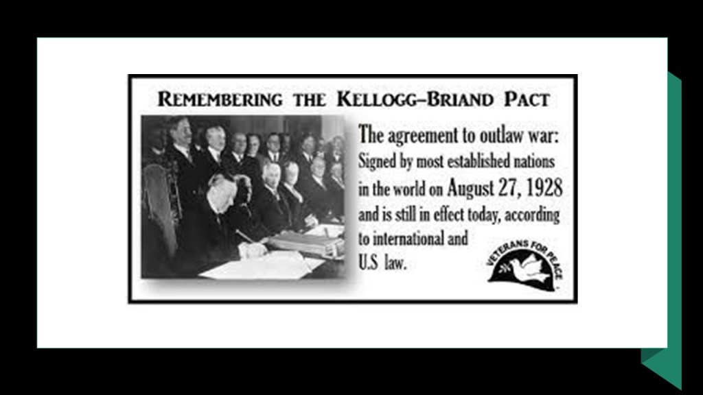
…though the pact didn’t actually stop war, as World War II began eleven-years almost to the day it was signed, on September 1st of 1939.

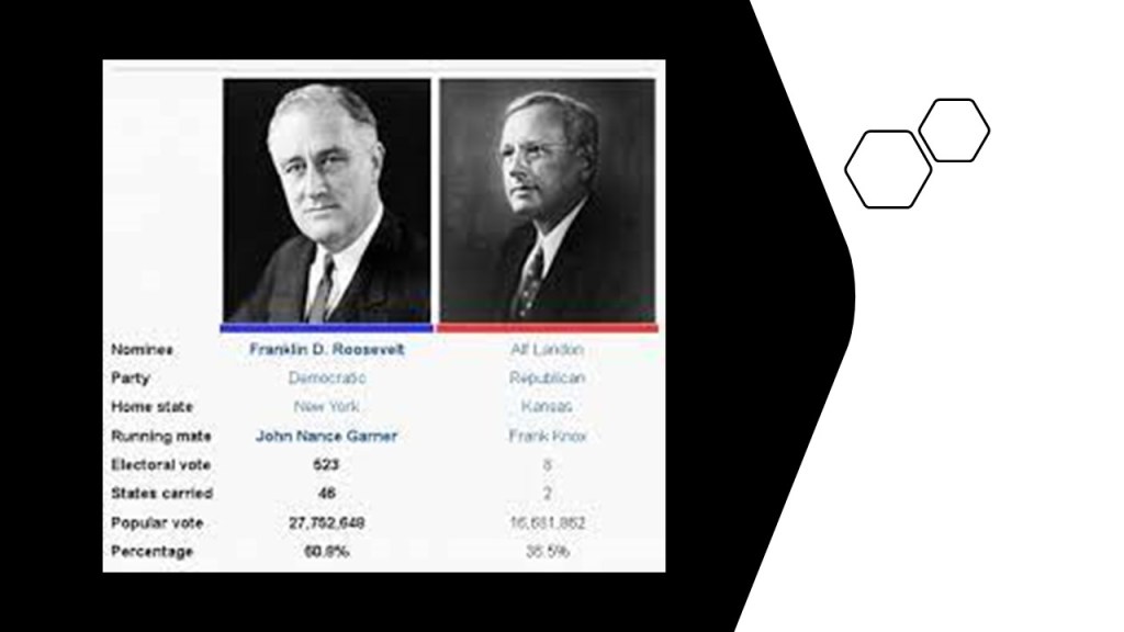
Borah ran for the Republican nomination in 1936, however, his candidacy was opposed by Republican Conservative leadership, and the nomination went to Alf Landon from Kansas.

He won his sixth-term in the Senate that year instead.

In the years leading up to World War II, Borah sought to settle the troubled international situation through personal diplomacy, seeking to visit Germany and talk to Hitler himself, but he never made the trip realizing that making the trip would compromise him in foreign policy debates.

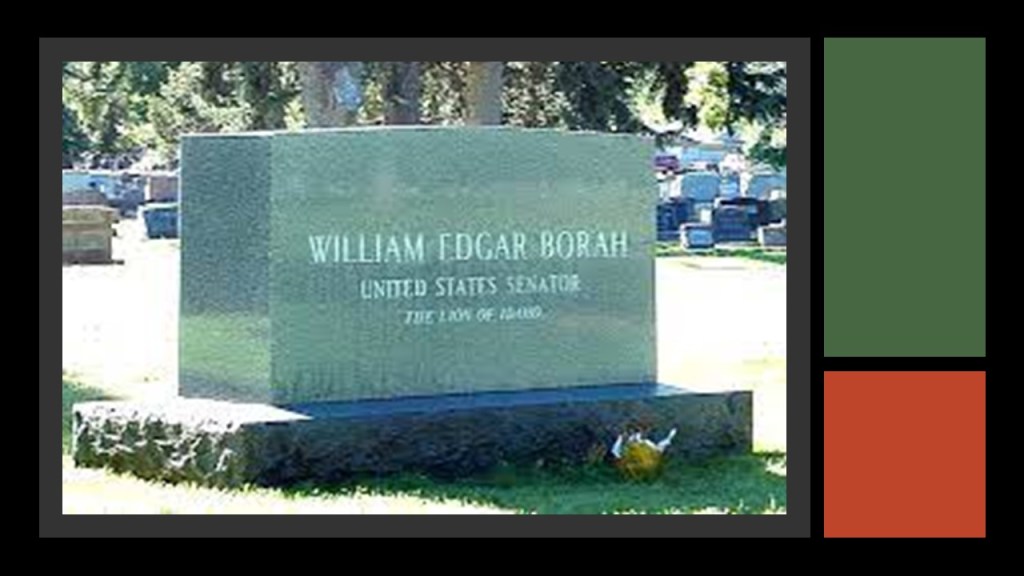
He died from a cerebral hemorrhage on January 19th of 1940.

He had a state funeral in the U. S. Capitol and then went to the Idaho State Capitol in Boise for a second funeral, where an estimated 23,000 people, half the state’s population at the time, passed by his body.

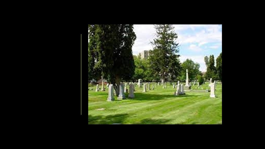
He was buried in the Morris Hill Cemetery in Boise.

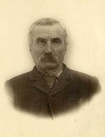
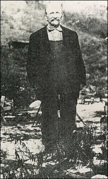
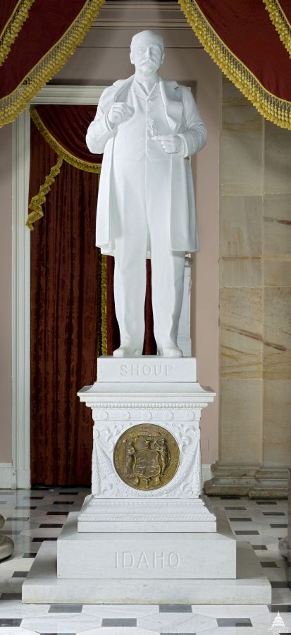
George L. Shoup, the other statue representing Idaho, was the first governor of Idaho, the State, and the last governor of Idaho, the Territory.

After serving as Governor of Idaho after statehood 1890 for several months, he became one of Idaho’s first United States Senators.

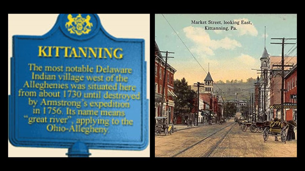
George Laird Shoup was born in June of 1836 in Kittanning, Pennsylvania, northeast of Pittsburgh.

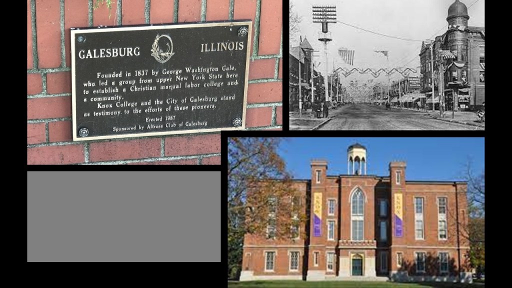
In 1852, he moved to Galesburg, Illinois, and farmed with his father.

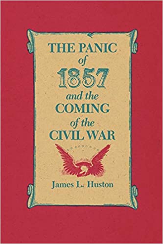
Shoup moved to the Colorado Territory in 1859 to engage in mining and merchandising first near Pike’s Peak, and later in Denver, after he was financially devastated in the Panic of 1857, which was said to have been caused by the declining international economy and overexpansion of the domestic economy.

During the Civil War, Shoup enlisted with independent scouts working in the New Mexico Territory, Colorado Territory and Texas.

He was commissioned as a 2nd Lieutenant when the Third Colorado Cavalry was formed in 1861 and left as a colonel in 1864.

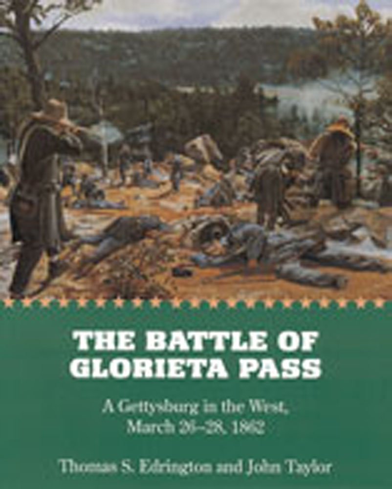
He took part in the Battle of Apache Canyon in the New Mexico Territory…

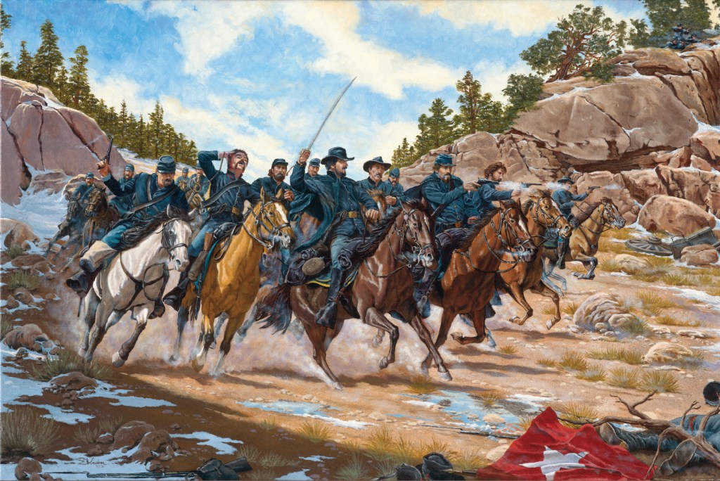
…which was part of the Battle of Glorieta Pass from March 26th to March 28th of 1862, the decisive battle of the New Mexico Campaign during the American Civil War in which the Confederate forces failed to break the Union possession of the West along the base of the Rocky Mountains.

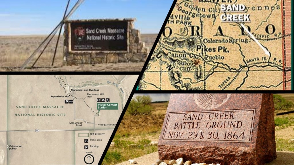
Shoup was also noted to have taken part in the Sand Creek Massacre during the Colorado War, a massacre of Cheyenne and Arapaho people by the U. S. Army in the American Indian Wars.

It occurred in November of 1864 when a 675-man force of the 3rd Colorado Cavalry attacked and destroyed their village in the southeastern Colorado Territory, in which an estimated 69 to over 600 Native American people were killed or mutilated.

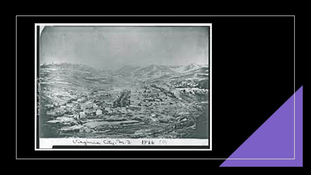
After the war, he moved to Virginia City in the Montana Territory…

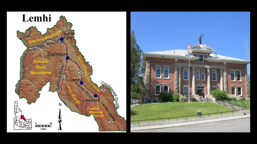
…and then settled across the Continental Divide in Salmon, a town in the Idaho Territory he helped found.

After the end of the Civil War, Shoup moved to Virginia City in the Montana Territory.

Shoup owned general merchandise stores in both locations.

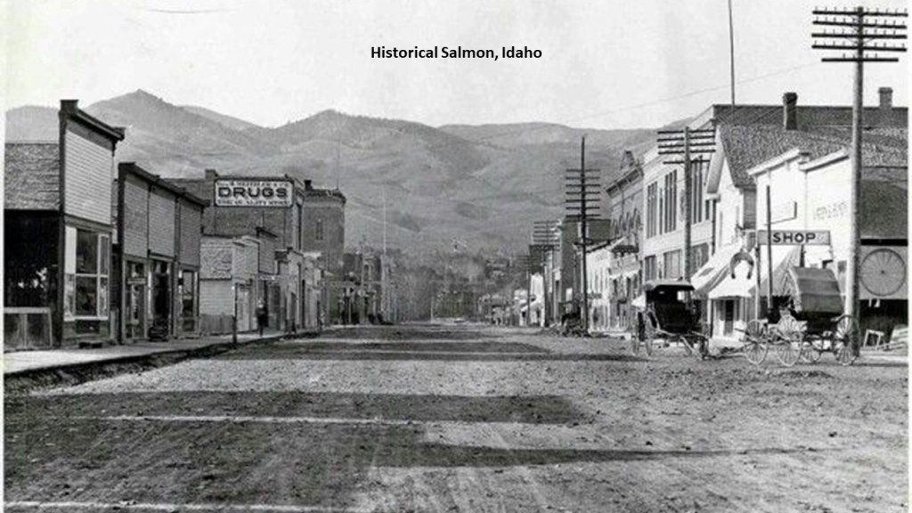
Shoup was appointed Commissioner of Idaho’s Lemhi County, of which Salmon was the county seat…

…and in 1874, he was elected to the Territorial Legislature.

He served on the Republican National Committee for Idaho from 1880 to 1904.

And in 1889, President Benjamin Harrison appointed Shoup Governor of the Idaho Territory, a position he held until July of 1890, when Idaho became a State and the Territory ceased to exist.

He was elected the States first Governor in October of that year, a position in which he served only a few weeks, as he was elected to the United States Senate in November, and in which he served for over ten years, until March of 1901.

During his time in the U. S. Senate, he was interested in pensions, education and military affairs, and was Chairman of the Committee on Territories.

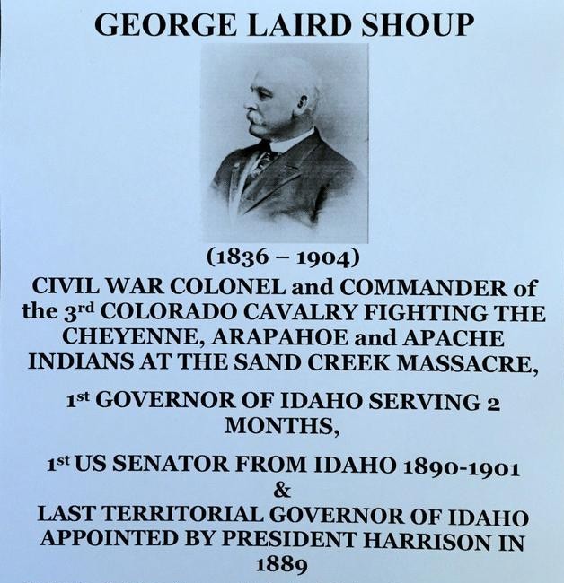
George L. Shoup died in December of 1904, and was given a state funeral in Idaho, and was buried in Boise’s Pioneer Cemetery, the oldest cemetery in continual use in the city since the area was settled in 1863.

I am going to end this part of the series on the National Statuary Hall here, and in the next part of this series I will be looking at the states of Illinois, Indiana, Iowa, Kansas and Kentucky.

Who is Represented in the National Statuary Hall – Part 2 California, Colorado, Connecticut & Delaware

So far in the National Statuary Hall, from Alabama, Alaska, Arizona, and Arkansas, there have been two journalist/politicians (Bob Bartlett & Ernest Gruening); two military hero/politicians (Joseph Wheeler/Barry Goldwater); a Jesuit missionary (Father Eusebio Kino); one lawyer/politician (James Paul Clarke); one lawyer (Uriah M. Rose); and one disability rights advocate/socialist (Helen Keller).

Let’s see who comes up next!

Next in line is California.

The State of California is represented by statues of Ronald Reagan and Father Junipero Serra.

Ronald Reagan was the Governor of California from 1967 to 1975, after a career as an actor and union leader, and served as the 40th-President of the United States from 1981 to 1989.

Ronald Reagan was born in 1911 to a low-income family in Tampico, Illinois.

This photo of Tampico’s Main Street was notated as having been taken in 1905.

His first job was as a lifeguard at the Rock River in Lowell Park, where he was credited with saving 77 lives, in Dixon, Illinois…

…when he was attending Dixon High School.

In 1932, after graduating from Eureka College in Illinois, Reagan began working as a radio sports’ commentator in Iowa.

He moved to WHO radio in Des Moines as an announcer for the Chicago Cubs baseball games, where he created play-by-play accounts of games from basic descriptions that were wired as the games were in progress.

Reagan travelled with the Chicago Cubs to California in 1937.

He took a screen-test, which led to a 7-year contract with Warner Brothers, and he started his acting career as a B-actor.

His first movie was a starring role in “Love is on the Air” in 1937, and by the end of 1939, he had appeared in 19 movies.

Reagan played a double-amputee in the 1942 movie “Kings Row,” which made him a star.

Also in 1942, he was ordered into Active-Duty military service in San Francisco, having enlisted in the Army Enlisted Reserve in 1937, and commissioned as a second-lieutenant, and he never became a big, first-rank film star, even though he played the lead in numerous movies after his military service.

Ronald Reagan was first elected to Board of Directors of the Screen Actors Guild Union as an alternate member in 1941.

In 1946, he became 3rd Vice-President, and when the Union president and six board members resigned in March of 1947 due to conflicts-of-interest, Reagan was elected President of the Union, and relected six times, starting in 1947 and the last time he was elected was in 1959.

He was the Union President during the Hollywood Blacklist era during the early years of the Cold War, which was the practice of denying employment to entertainment industry professionals believed to be, or have been, Communist sympathizers.

He testified in front of the House Un-American Committee hearing in 1947 that a small group within the Screen Actors Guild was using “communist-like tactics” to steer Union policy.

Ultimately as a result of this Congressional hearing, the “Hollywood Ten” were cited for contempt of Congress, and blacklisted for refusing to answer questions about alleged involvement with the Communist Party.

Ronald Reagan moved into television in 1953, as host of the “General Electric Theater” for ten seasons, until 1962…

…and was a host and announcer of the “Tournament of Roses Parade” for ABC on January 1st of 1959.

His last television stint was as a host and performer for “Death Valley Days,” described as featuring true accounts of the American Old West, particularly in Death Valley.

It was sponsored by the Pacific Coast Borax company.

Some interesting side-notes about the Pacific Coast Borax Company that I have encountered in previous research.

Furnace Creek in Death Valley, which holds the records of both the highest-recorded ground and air temperature ever recorded on Earth, was the center of operations starting in 1890 for the Pacific Coast Borax Company and its 20-mule teams hauling wagon trains of borax across the Mojave Desert.

The Inn at Death Valley, formerly known as The Furnace Creek Inn, was said to have been constructed by the Pacific Coast Borax Company and opened on February 1st of 1927, operatimg for decades by the Fred Harvey Company, known for its “Harvey Houses” and other hospitality industry businesses alongside railroads in the western United States.

The reason given for this was the President of the Pacific Coast Borax Company, Richard C. Baker, wanted to open Death Valley to tourism, and at the same time, increase the revenue of the Tonopah and Tidewater Railroad that was said to have been built originally by Francis Marion Smith for the purpose of shipping borax.

Ronald Reagan’s first wife was actress Jane Wyman – they married in 1940 and their divorce was finalized in 1949.

He married actress Nancy Davis in 1952.

When he became President of the United States in 1981, he was the first divorced President.

While Reagan was initially what was called a “Hollywood Democrat,” he moved to the right-wing in the 1950s, and became a Republican in 1962.

He emerged as a leading conservative spokesman in the Goldwater Presidential campaign of 1964, at which time he gained national attention in his speeches on behalf of Barry Goldwater.

In late 1965, Ronald Reagan announced his campaign to run for Governor of California in 1966. and defeated two-term Democratic Governor Pat Brown.

Reagan was Governor of California for two-terms, from 1967 to 1975.

His terms as Governor shaped the public policies he would pursue as President, like speaking out against the welfare state and advocating the ideal of less government regulation of the economy.

Ronald Reagan’s first presidential bid in 1976 Presidental campaign was unsuccessful, when he failed to secure the Republican Presidential nomination, which went to Gerald Ford, the incumbent who had become President when Richard M. Nixon resigned in 1974 following the Watergate Scandal.

Gerald Ford lost the 1976 election to the Democratic candidate Jimmy Carter.

He campaigned once again for the 1980 Presidential Election, where he faced Jimmy Carter against the backdrop of domestic concerns, and the on-going Iran-Hostage Crisis.

Reagan in his campaign stressed lowering taxes to stimulate the economy; less government interference in people’s lives; states’ rights; and a strong national defense.

Reagan and his running mate, George H. W. Bush, won a decisive victory of President Jimmy Carter.

Interesting to note that the American hostages in Iran were released minutes after the inauguration of Ronald Reagan as the President of the United States on January 20th of 1981, after 444-days, of captivity…

…and that Just a little over two months after his inauguration, on March 30th of 1981, there was an assassination attempt on President Ronald Reagan by what was described as a lone gunman, John Hinckley Jr.

Hinckley was said to be seeking fame in order to impress actress Jodie Foster, with whom he was obsessed.

During Reagan’s two presidencies, he pursued policies, coined “the Reagan Revolution,” that reflected his beliefs in individual freedom; expanded the economy and military; and brought an end to the Cold War.

California’s other representative in the National Statuary Hall is Junipero Serra, a Franciscan missionary and Roman Catholic priest.

He was credited with establishing the Franciscan Missions in the Sierra Gorda in Mexico, said to have been built between 1750 and 1760 a UNESCO World Heritage Site…

…as well as the first nine of twenty-one missions in California, from San Diego to San Francisco from 1770 to 1782.

Junipero Serra was beatified in 1988 by Pope John Paul II over the denunciations of Native American tribes that accused him of heading a brutal colonial subjugation.

Then in 2015, Pope Francis canonized him, and he became Saint Junipero Serra, the first saint to be canonized on U. S. soil at the National Basilica in Washington, D. C.

Serra was nicknamed the “Apostle of California” for his missionary efforts, but before and after his canonization, his reputation and missionary work was condemned for reasons given like mandatory conversions of the native population to Catholicism and atrocities committed against them.

That’s what they say about him anyway!

Next, the two statues representing the State of Colorado are those of Florence R. Sabin and Jack Swigert.

Florence R. Sabin was an American medical scientist.

As a pioneer for women in science, she was the first woman to become a professor at a medical college in the Department of Anatomy at the Johns Hopkins School of Medicine in 1902…

…the first woman elected to the National Academy of Sciences in 1925…

…and the first woman to head a department at the Rockefeller Institute for Medical Research in 1925, when she became head of the Department of Cellular Studies and where her research focused on the lymphatic system; blood vessels & cells; and tuberculosis.

The Rockefeller University was founded in 1901 by John D. Rockefeller, and was America’s first biomedical institute.

Florence R. Sabin was born in Central City, Colorado, in 1871, to a mining engineer father and schoolteacher mother.

Her mother died in 1878, and she and her sister went to live with their uncle in Chicago, before moving to live with their grandparents in Vermont.

In 1885, she enrolled in the Vermont Academy at Saxton River, where she was able to develop her interest in science.

She attended Smith College in Massachusetts, and graduated in 1893 with her Bachelor’s degree.

In 1896, Sabin enrolled in the Johns Hopkins School of Medicine, which had opened in 1893, and she graduated in 1900.

Her two major projects were on producing a 3D model of a newborn’s brain stem, which became the focus of the 1901 textbook “An Atlas of the Medulla and Midbrain,” and the second was on the development of the lymphatic system in the embryo.

In her retirement, she became involved in Public Health in the State of Colorado at the invitation of the Governor at the time.

Among other things, as a result of her work, the “Sabin Health Laws” were passed, modernizing public health care in Colorado by providing more beds to treat Tuberculosis, which led to a reduction in the number of cases.

Florence R. Sabin died at the age of 81 in October of 1953, and her remains were interred in the Fairmount Mausoleum at the Fairmount Cemetery in Denver.

Jack Swigert is the other Coloradan represented in the National Statuary Hall, an American astronaut and Air Force pilot, who was elected to the U. S. House of Representatives for Colorado’s 6th District, but died in 1982 from complications of cancer before taking office.

Jack Swigert, Jr, was born in Denver in 1931. His father was an ophthalmologist.

He grew up near the Colorado National Guard’s Combs (also known as Lowry) Field, and loved watching planes take-off and land, and decided that was what he wanted to be doing.

By the age of 16, he was a licensed private pilot.

Jack Swigert attended Regis Jesuit High School…

…and East High School in Denver, from which he graduated in 1949.

He received his Bachelor’s Degree in Mechanical Engineering from the University of Colorado in Boulder in 1953…

…a Master of Science in Aerospace Engineering from the Rensselaer Polytechnic Institute in Hartford, Connecticut, in 1965…

…and his Master of Business Administration from the University of Hartford in 1967.

Following Swigert’s graduation from the University of Colorado in Boulder, he joined the U. S. Air Force and graduated from the Pilot Training Program and Gunnery School at Nellis Air Force Base in Nevada.

He was subsequently assigned as a fighter pilot in Japan and Korea during the Korean War, and survived his plane crashing into a radar unit on a Korean airstrip in 1953.

After completing his tour of active duty in the Air Force, Swigert served as a fighter pilot in Massachusetts (1957 – 1960) and Connecticut Air National Guards (1960 – 1965).

During this same time period, he was an engineering test pilot for aerospace manufacturer Pratt & Whitney, which is headquartered in East Hartford, Connecticut.

Then, in 1966, Swigert was accepted into NASA’s Astronaut Corps, and he became a specialist on the Apollo Command Module.

He was a member of Apollo 7’s astronaut support crew, the first crewed Apollo flight, from October 11 to 22 of 1968. He was the launch capsule communicator and worked on the Mission’s operational aspects.

Then, when the Apollo 13 moon mission launched on April 11th of 1968, Swigert was one of the three astronauts on-board.

This is what we are told.

The mission was the third-crewed lunar landing attempt, but it had to be aborted after an oxygen tank ruptured in the space-craft’s service module.

The three astronauts on-board, Swigert, Jim Lovell and Fred Haise, travelled around the moon and returned safely to earth on April 17th.

They received the Presidential Medal of Freedom the next day.

NASA Director of Flight Crew Operations, Deke Slayton, recommended Jack Swigert to be one of the command module pilots for the Apollo-Soyuz joint-project with the Soviet Union.

He was removed from the project, however, when it was discovered that Swigert was somehow involved with what was called the “Apollo 15 postal covers incident,” where unauthorized postal covers that had been taken into space for a West German stamp dealer by the Apollo 15 crew and autographed in exchange for payment.

Shortly thereafter, Jack Swigert went to Washington, DC, to become the Executive Director of the Committee on Science and Astronautics for the U. S. House of Representatives.

Swigert left the Committee in 1977 to enter politics.

He unsuccessfully ran for the U. S. Senate in 1978, when he was defeated by the better-known Congressman Bill Armstrong.

Swigert ran for the U. S. House of Representatives in the newly-created 6th-District of Colorado in February of 1982.

Around the same time, he was diagnosed with a malignant tumor in his right nasal passage, which he disclosed to voters, and underwent radiation treatment from which he was expected to make a full-recovery.

In September of 1982, he was diagnosed with bone marrow cancer.

He won the election in November of 1982, and died of respiratory failure on December 27th of 1982, seven-days before the beginning of his Congressional term, at the age of 51.

Roger Sherman and Jonathan Trumbull are the two representatives for the State of Connecticut in the National Statuary Hall.

Roger Sherman was an early American Statesman and lawyer from Connecticut who was one of the Founding Fathers.

Sherman was the only person to sign all four of the great state papers of the United States – the Continental Association, an agreement adopted by the First Continental Congress on October 20th of 1774 in Philadelphia…

…the Declaration of Independence, on July 4th of 1776 at the Second Continental Congress in Philadelphia…

…the Articles of Confederation and Perpetual Union, an agreement signed by the thirteen original states as its first frame of government, also during the Second Continental Congress, on November 17th of 1777…

…and the Constitution on June 21st of 1788, the Supreme Law of the United States.


Sherman was born in Newton, Massachusetts, in April of 1721, where he received his early education in grammar school and his father’s library.

He spent time learning the shoemaker’s trade when he was young.

Then after his father’s death in 1743, Roger Sherman and his family moved to New Milford, Connecticut, where he and his brother opened the town’s first store.

He rapidly became one of the town’s leading citizens, becoming involved in civil and religious affairs.

Though Sherman had no formal training in the law, he was encouraged to read for the bar exam, and admitted to the bar in Litchfield, Connecticut, in 1754.

From 1755 to 1758 and 1760 to 1761, he was chosen to represent New Milford in the Connecticut House of Representatives.

Sherman was appointed as the Treasurer of Yale College, and awarded an honorary Master of Arts degree.

Sherman was elected Mayor of New Haven in 1784, he was Mayor until his death in 1793.

Sherman died in July of Typhoid fever 1793, and was first buried in the New Haven Green.

In 1821, Sherman’s remains were relocated to the Grove Street Cemetery.

Hmmm…the symbolism appears to be Egyptian in this photo of the entrance to the Grove Street Cemetery!

The other statue for Connecticut is that of Jonathan Trumbull, an American politician and statesman who served as Governor of Connecticut from October 10th of 1776 to May 13th of 1784, and was one of two governors to have served for a British Colony and an American State, the other being Nicholas Cooke of Rhode Island.

Trumbull College at Yale was named after him…

…as well as Trumbull, Connecticut…

…and Fort Trumbull, near the mouth of the Thames River on Long Island Sound in New London, Connecticut, with the present fortification said to have been built between 1839 and 1852.

Jonathan Trumbull was born in Lebanon, Connecticut in 1710.

He graduated with his Bachelor of Arts degree from Harvard College in 1727.

He became a merchant with his father in 1731, and then from 1733 to 1740, he was a delegate to the Connecticut General Assembly, and Speaker of the House from 1739 to 1740.

He became the Governor of Connecticut in 1769 upon the death of Governor William Pitkin, for whom he was Deputy Governor from 1766 – 1769.

Trumbull was a friend and advisor of General George Washington during the Revolutionary War, and served as the Continental Army’s Paymaster General (Northern Department) in the spring of 1778.

In addition to continuing on as Governor of Connecticut until 1784, Trumbull was elected to the American Academy of Arts and Sciences in 1782…

…and elected as an honorary member of the Connecticut Society of the Cincinnati in 1784, a fraternal, hereditary society founded in 1783 to commemorate the American Revolutionary War.

He died in 1785 in Lebanon, Connecticut, and is buried in the old cemetery there.

The last state I am going to look at in this post is Delaware, represented by John M. Clayton and Caesar Rodney.

John M. Clayton was a lawyer and politician from Delaware.

A member of the Whig Party, he served in the Delaware General Assembly, and was a U. S. Senator from Delaware and U. S. Secretary of State.

John M. Clayton was born in Dagsboro, Delaware in 1796, where the Clayton Theater that was named after him is located today, the last-remaining, first-run, single-theater in the State of Delaware.

Clayton studied in Berlin, Maryland…

…and Milford, Delaware, places his parents moved to when he was a young man.

His boyhood home was what is known today as the Parson Thorne Mansion in Milford, which has on the National Register of Historic Places since 1971.

It was said to have been built between 1730 and 1735.

Clayton graduated from Yale in 1815, and studied law at the Litchfield Law School in Litchfield, Connecticut, the first independent law school established in America for reading law…

The Litchfield Law School was founded by lawyer, educator and judge Tapping Reeve, and it was a proprietary school that was unaffiliated with any college or university.

Tapping Reeve later became Chief Justice of the Connecticut Supreme Court in 1814, and his book “Law of Baron and Femme” published in 1816 became the premiere American treatise on family law for much of the 19th-century, with revisions and republication in 1846, 1867 and 1888.

John M. Clayton started his own law practice in the state capital of Dover in 1819.

Clayton built a mansion on land he started cultivating in 1844 near New Castle, Delaware, and named it Buena Vista.

It became one of the most productive estates in this region.

It was also listed on the National Register of Historic Places in 1971.

Clayton first entered Delaware politics in 1824 when he was elected to the Delaware House of Representatives.

He was appointed Delaware Secretary of State from December of 1826 to October of 1828.

He was a conservative who became leader of the faction that lead to the development of the Delaware Whig Party, a party which promoted traditional conservatism in the U. S. in the middle of the 19th-century.

Clayton was first elected to the U. S. Senate in 1829, where he served until 1836.

Clayton served as Chief Justice of the Delaware Supreme Court from January of 1837 to September of 1839, and served another term in the Senate from 1845 to 1849.

Then on March 8th of 1849, Clayton became the U. S. Secretary of State inthe administration of President Zachary Taylor, where his most notable accomplishment was the negotiation of the Clayton-Bulwer Treaty of 1850 with the British Minister Sir Henry Bulwer-Lytton, guaranteeing the neutrality and encouragement of lines of passage across the isthmus at Panama.

Clayton’s tenure as Secretary of State was short because President Zachary Taylor died a short time into his administration.

Zachary Taylor was elected president in 1849, and he died in July of 1850, allegedly after consuming copious amounts of raw fruit and iced milk at a July 4th fundraising event at the Washington Monument, became severely ill with a digestive ailment, and died several days later.

Clayton was elected to the U. S. Senate one-more time in 1853 and served until his death in 1856.

In one of his notable speeches during this time, delivered on June 15th of 1854, he spoke against President Franklin Pierce’s veto of the Bill for the Benefit of the Indigent Insane, which would have ceded public lands for the benefit of the “insane, blind, deaf, and dumb” with proceeds going to the states to build and maintain asylums.

The bill remained vetoed by the president, which established a precedent for federal non-participation in welfare that lasted over 70-years.

Caesar Rodney is represented by Delaware’s other statue.

He was an American Founding Father, lawyer and politician, and like Connecticut’s Roger Sherman, was a signer of the 1774 Continental Association and the 1776 Declaration of Independence, and the President of Delaware from 1778 to 1781 during the American Revolution.

Rodney was born in 1728 in St. Jones Neck in Dover Hundred, Kent County, Delaware.

Caesar Rodney was the grandson of William Rodney, who had emigrated to the American Colonies in 1681 to 1682, along with William Penn, who founded the Pennsylvania Colony.

The Rodneys were considered prosperous members of the local gentry.

Byfield, the 849-acre farm that Caesar Rodney was born on, earned sufficient income from the sale of wheat and barley to the Philadelphia and West Indies markets to provide cash and available time that allowed the family members to participate in the social and political life of Kent County.

For schooling, Rodney attended the Latin School and the College of Philadelphia (now known as the University of Philadelphia) until his father’s death in 1746.

Upon his father’s death, Rodney’s guardianship was entrusted to Delaware Supreme Court Justice Nicholas Ridgely by the Delaware Orphan’s Court.

When Caesar Rodney was 27, he was elected to Sheriff of Kent County and served in that position for three-years, and subsequently served in a series of positions including Register of Wills; Recorder of Deeds; Clerk of the Orphan’s Court; Justice of the Peace and judge in the lower courts.

Rodney was a delegate to the Continental Congress between 1774 and 1776, and a leader in the Delaware Committee of Correspondence, and was present when the Delaware Assembly voted to sever all ties with the British Parliament and King.

As mentioned previously, he was a signer of both the Continental Association and Declaration of Independence.

He became the “President of Delaware” in March of 1778 and served in that position until November of 1781 during the American Revolutionary War.

In the later years of his life, Caesar Rodney was afflicted with facial cancer, for which experienced expensive and painful medical treatments that did not work, and was the cause of his death in 1784.

I am going to end this part of the series on the National Statuary Hall, and in the next part will be looking at the statues representing the states of Florida, Georgia, Hawaii, and Idaho.

Parallels Between North & South, Wars and Electromagnetism

I am going to give you examples of parallels I have found in my research in this video between civil wars in the world between the North and the South, and concepts of electromagnetism, and how I think these parallels relate to what has actually taken place here.

To start with, I have many questions about what was really going on during the American Civil War, and have come to the conclusion that while something was going on during that period of time, it was not what we have been told.

Historically described as a civil war between the northern and Pacific states, known as the “Union,” or “North,” and the southern states, known as the “Confederacy,” or South, over the status of slavery and its expansion into newly acquired land after the Mexican-American War.

I did an in-depth study of Sanitary Fairs awhile back, which were world’s-fair-style fundraisers held during the course of the American Civil War with a stated purpose of raising money for the United States Sanitary Commission and its mission of supporting the sick and wounded soldiers of the Union Army.

Sanitary Fairs typically held large-scale exhibitions, and the 1863 Northwestern Soldiers Fair in Chicago, for example, featured a “Curiosity Shop” of war souvenirs, with weapons and other artifacts said to have been designed to contrast the barbaric southern enemy with the civilized North.

These were the Civil War battles said to have taken place during the same period of time as the Northwestern Soldiers Fair:

Another example was the Great Central Fair in Philadelphia in 1864.

Said to have raised more than $1,000,000 for the United States Sanitary Commission in its 3-week run from June 7th to June 28th of 1864, in its final form, the fair was said to have around 100 departments, including Arms and Trophies; children’s clothing; homemade fancy articles; Fine Arts; brewers; wax fruit; trimmings and lingerie; umbrellas and canes; curiosities and relics; a steam glass blower; an Art Gallery; and a horticulture exhibit.

And these were the Civil War Battles said to have taken place during the same period of time as the Great Central Fair.

Does it even make sense to hold big, festive events like these in the middle of a war?

Did the U. S. Sanitary Commission and its volunteers really have the wherewithal to both construct the buildings for and pull off these extraordinarily lavish and festive undertakings against the backdrop of national war and suffering?

Or was it a private front comprised of the very same people who organized it and were prominent members of the private membership clubs of the day, like the Union League and the Century Association, to set up the new historical narrative for the reset to explain, among other things, how infrastructure came into, and left, existence.

Now, I am going to bring forward several examples of the same North-South dichomoty being used in the 20th-century to create division, discord, violence, and war being used in the 20th-century.

Ireland was partitioned on May 3rd of 1921, when the government of the United Kingdom of Great Britain and Ireland divided Ireland into two home rule territories – Northern Ireland and Southern Ireland – with the stated goal of remaining within the United Kingdom and eventually reunifying.

This image has an empty alt attribute; its file name is d4b0b-partition-of-ireland.jpeg

Northern Ireland remained part of the United Kingdom, but after the Anglo-Irish Treaty of December of 1921, Southern Ireland dropped out of the United Kingdom and became the Irish Free State.

The partition of Ireland took place during the Irish War of Independence, a guerilla conflict between the Irish Republican Army and British Army forces.

Between 1920 and 1922, during which time the Partition occurred, there was violence in Northern Ireland in defense or opposition to the new settlement, and its capital Belfast saw savage and unprecedented violent riots between Protestant and Catholic civilians, a form of violence in which the violent parties feel solidarity for their respective groups and victims of violence are chosen based on their group membership.

All of this led directly to the”Troubles” a period of unrest and violence that escalated across Northern Ireland between the Irish Catholic Nationalists and Irish Protestant Unionists between 1969 and 1998.

Next is the example of North and South Korea.

After the August 15th surrender of Japan in 1945, the Korean peninsula was divided at the 38th-parallel into two zones of occupation, with the Soviets administering the northern half, and Americans the southern half.

In 1948, as a result of Cold War tensions, the occupation zones became two sovereign states – socialist North Korea and capitalist South Korea.

The governments of the two new Korean states both claimed to be the only legitimate Korean government, and neither accepted the border as permanent.

The Korean War started in 1950, when North Korea invaded South Korea on June 25th following clashes along the border and insurrections in the South.

North Korea was supported by China and the Soviet Union, and South Korea by the United Nations, principally from the United States.

This image has an empty alt attribute; its file name is 65c6f-korean-war.jpg

The Korean War was one of the most destructive conflicts of modern times, with around 3,000,000 deaths due to the war, and proportionally, a larger civilian death toll than either World War II or the Viet Nam War; caused the destruction of nearly all of Korea’s major cities; and there were thousands of massacres on both sides.

This image has an empty alt attribute; its file name is ad041-korean-war-destruction.jpg

Same idea with the example of North and South Viet Nam.

The Geneva Conference was convened in 1954 in Geneva, Switzerland, to settle unresolved issues from the Korean War and the First Indochina War in Viet Nam, and attended by representatives from the United States, France, the United Kingdom, the Soviet Union, and the People’s Republic of China, as well as from Korea and Viet Nam.

While no declarations or proposals were adopted with regards to Korean situation, the Geneva Accords that dealt with the dismantling of French Indochina in Southeast Asia would have major ramifications.

This image has an empty alt attribute; its file name is e5244-1954-geneva-conference-1.jpg

The Geneva Accords established North and South Vietnam with the 17th parallel as the dividing line, with North Viet Nam being Communist and South Viet Nam being Capitalist.

This image has an empty alt attribute; its file name is 4d01a-1954-geneva-accords.jpg

The agreement also stipulates that elections are to be held within two years to unify Vietnam under a single democratic government.

These elections never happen.

The non-Communist puppet government set up by the French in South Viet Nam refused to sign.

The United States also refused to sign on, with the belief that national elections would result in an overwhelming victory for the communist Ho Chi Minh who had so decisively defeated the French colonialists.

Within a year, the United States helped establish a new, anti-Communist government in South Viet Nam, and began giving it financial and military assistance.

A mass migration took place after Viet Nam was divided.

Estimates of upwards of 3 million people left communist North Viet Nam for South Vietnam, going into refugee status in their own country, and many were assisted by the United States Navy during Operation Passage to Freedom.

An estimated 52,000 people moved from South to North Viet Nam, mostly Viet Minh members and their families.

This image has an empty alt attribute; its file name is d1a4e-passage-to-freedom.jpg

In Viet Nam by the time of John F. Kennedy’s death in November of 1963, there were 16,000 American military personnel, and the Gulf of Tonkin incident took place in 1964, an international confrontation after which the United States engaged more directly in the Viet Nam War.

The first Gulf of Tonkin incident took place on August 2nd of 1964 between ships of North Viet Nam and the United States.

The description of what took place is as follows:

Three North Vietnamese torpedo boats approached the naval destroyer U. S. S. Maddox and attacked it with torpedos and machine gun fire.

Damages said to have come about as a result of the ensuing battle were: one U. S. aircraft; all three North Vietnamese torpedo boats and 4 North Vietnamese deaths; and one bullet hole on the naval destroyer, and no American deaths.

This image has an empty alt attribute; its file name is 68b98-gulf-of-tonkin-warfare.jpg

There was initially allegedly a second incident on August 4th of 1964, this second occurrence has long been said not to have taken place.

And then there are the people who believe the first Gulf of Tonkin incident never happened either.

Whether or not the Gulf of Tonkin incidents actually happened, they were used as an excuse for the Gulf of Tonkin Resolution passed by Congress on August 7th of 1964, giving President Lyndon B. Johnson authority to help any Southeast Asian country whose government was considered to be in jeopardy of Communist aggression, and was considered the legal justification for the beginning of open warfare with North Viet Nam and the deployment of American troops to Southeast Asia, of which, with the institution of the draft, there were over 500,000 troops sent by 1966.

This image has an empty alt attribute; its file name is 77863-gulf-of-tonkin-resolution.jpg

The Viet Nam War ended with the Fall of Saigon on April 30th of 1975, when the capital of South Viet Nam was captured by North Vietnamese troops…

…and the beginning of the re-unification of Viet Nam into the Socialist Republic of Viet Nam.

Here are more examples I have found of this practice of dividing a country into north and south, which then created the conditions for instability and civil war.

One example is the country of Sudan.

When Sudan was granted independence from its British colonizers in 1956, it was immediately divided into north and south, with each region characterized by different belief systems and loyalties, and Sudan promptly descended into violent civil war that lasted for decades.

The history of Sudan goes back to the Pharaonic period of ancient Egypt, with the Kingdom of Kerma in ancient Nubia (dated from 2500 to 1500 BC)…

This image has an empty alt attribute; its file name is 2abb0-kingdom-of-kerma.jpg

…the Egyptian New Kingdom dated between 1500 BC and 1070 BC…

…and the Kingdom of Kush, dated from 785 BC to 350 AD, with its royal capital at Meroe, located on the Nile River where it flows through northeast Sudan in northeastern Africa.

This image has an empty alt attribute; its file name is f3341-meroe-sudan-1.jpeg

The same exact process happened in Sudan’s neighboring country of Chad.

There have been roughly three Civil Wars in Chad since independence from France in 1960. 

The first one started in 1965 and lasted until 1979, and was waged by rebel factions against the authoritarian and corrupt regime of Chadian President Francois Tombalbaye.

Chad Civil War

At the time of Chad’s independence from France in 1960, roughly half of the population was Muslim and lived in the north and eastern parts of the country, and the other half was Christian and animist and lived in the southern part of the country.

Apparently, President Tombalbaye was from the southern part of the country, granting favors to his political supporters in the South while at the same time marginalizing the rest of the country.

He also filled prisons with thousands of people he believed were his opponents, whether they really were or not.

Tension and discontent grew, and several opposition groups started to organize a resistance movement.

Initially, Tombalbaye’s military crushed civilian demonstrations in 1962, and he relied heavily on French support to maintain power.

The Chadian Civil War officially started with the Mangalme, or Mubi, Uprising in September and October of 1965, involving a series of riots that started after a tax increase on personal income, which was tripled in certain areas.

Local citizens accused the government of corruption and tax collection abuses.

The military was sent in and crushed the riots, killing approximately 500 people.

Thus began the 14-year-long first Chadian Civil War.

Tombalbaye was eventually killed in coup in 1975, and was replaced by the former commander of the national army, Felix Malloum.

Malloum was a southerner with strong kinship ties to the North, who thought he could reconcile Chad’s divisions.

In the summer of 1977, rebels under the command of Goukouni Oueddei and supported by Libya, launched an offensive from the northern part of the country, and was the first time modern Soviet military equipment came into the Civil War, forcing Malloum to ask for help from France.

After the 1977 Khartoum Peace agreement, two Chadian northern military leaders, Hissene Habre and Goukouni Oueddei, came together in order to oust the southern government of Felix Malloum on March 23rd of 1979.

Then, Goukouni Oueddei seized power later that year, and became President of the Transitional Government of National Unity, composed of northerners supported by different factions that were close to Habre.

This state-of-affairs triggered the Second Chadian Civil War between 1979 and 1986.

Chad in the modern-day is one of the poorest countries in the world, with most of its inhabitants living in poverty as subsistence herders and farmers.

Oh, it is also interesting to note that Chad has sizeable reserves of crude oil, which is the country’s primary source of export earnings.

On May 22nd of 1990, leaders of the Yemen Arab Republic (North) and People’s Democratic Republic (South) of Yemen announce unification as the Republic of Yemen.

The history behind this, which is important to understanding what has taken place in Yemen since then, is that following the collapse of the Ottoman Empire in 1918, at the end of World War I, when the former Ottoman Empire was divided between the countries on the “winning” side of the war…

…northern Yemen became an independent state known as the Kingdom of Yemen.

Then on September 27th of 1962, revolutionaries deposed the newly-installed, last King of Yemen, Muhammad al-Badr, and formed the Yemen Arab Republic, which was said to have been inspired by the Arab Nationalist Ideology of Nasser’s Egyptian United Arab Republic…

…and this action started the North Yemen Civil War from 1962 to 1970 between supporters of the Kingdom, which included Saudi Arabia and Jordan, and supporters of the Yemen Arab Republic, which included Egypt.

By the end of the North Yemen Civil War, the supporters of the Kingdom were defeated, and the Yemen Arab Republic was recognized by Saudi Arabia in 1970.

The People’s Democratic Republic of Yemen was known as the Aden Protectorate in 1918, which it had been known as since 1874 with the creation of the British Colony of Aden and the Aden Protectorate, which consisted of 2/3rds of present-day Yemen.

The Aden Protectorate existed until 1963, when it was merged with the new Federation of South Arabia.

By 1967, the Federation of South Arabia had merged with the Protectorate of South Arabia, and later changed its named to the People’s Republic of Southern Yemen, becoming a Marxist-Leninist state in 1969, the only Communist state to be established in the Arab World.

With the 1990 reunification of Yemen into the Republic of Yemen, the new government was comprised of officials from both sides, with a de facto form of collaborative governance, until the country into Civil War in 1994.

It is interesting to note that the terms North and South are also applied to the poles of magnets.

A magnet is any object that produces its own magnetic field that interacts with other magnetic fields.

The magnetic field is represented by what are called field lines that start at a magnet’s north pole and end at the south pole.

As shown in the top diagram, if you put the north pole of one magnet against the south pole of another, the field lines go straight from the north pole of the first magnet to the south pole of the other, creating an attractive force between the two magnets.

If you have two magnets next to each other, and either their north poles or south poles are facing each as shown in the bottom diagram, the field lines move away from each other, creating a repelling force between the two magnets.

Electricity runs within us, where our cells are specialized to conduct electrical currents, which is required for the nervous system to send signals throughout the body and to the brain, making it possible for us to move, think, and feel.

…and we each generate our own magnetic fields as does the Earth, as well as the other life on Earth.

There is so much more to us than our physical forms.

Electromagnetism is an integral part of existence on Earth and throughout the Universe, which is the physical interaction that occurs between electrically-charged particles, the force of which is carried by electromagnetic fields composed of electrical fields and magnetic fields.

I bring this subject of magnetism and electromagnetism into the picture because of how they appear to have been deliberately applied negatively by the controllers to create the conditions necessary for war, destruction and suffering in this realm, by dividing people of the same countries into north and south, and then by instilling different belief systems in each pole of this magnet, which created an “attraction,” or perhaps “action” is a better word, to facilitate the destruction of each other.

This process of deliberately creating divisions and then causing wars certainly has not been used for the betterment of Humanity, and seems more like a form of the many ways the Controllers have been harvesting our energy for their agendas.

They even have told us the names of their agendas.

You know, like Agenda 21.

They are required to tell us what they are doing, only they make it sound positive.

Agenda 21 is the action plan of the United Nations with regard to sustainable development.

Sounds good, right?

It is really about depopulation of 90% of the world’s people, though fact-checkers will tell you that this is a wild conspiracy theory.

Same thing with the Georgia Guidestones. They made the verbiage sound positive…but it really isn’t…it really isn’t!

Welcome to the Great Awakening!

The Modern Mining of Earth

Earth is definitely being mined on a massive scale.

I will give you examples of mining activities I have come across in my research, primarily in tracking places in alignment with each other.

The following examples are representative of what is out there to find with regards to what these mining operations look like, and the resulting devastation and degradation that comes along with it.

I am going to start with examples of phosphate mining.

Phosphates are derived from phosphorus, and phosphates are used in the production of phosphate fertilizer; calcium phosphate nutritional supplements for animals; and used to make chemicals for use in industry.

This image has an empty alt attribute; its file name is uses-of-phosphates-1.jpg

Also, it is important to note that white phosphorus is used in making bombs and other incendiary munitions.

I found this example in Kiribati, an island nation in the central Pacific Ocean.

Kiribati was rich in phosphates historically, but commercially viable phosphate deposits have long-been depleted through mining.

This was an historical picture of what the island of Banaba, the furthest west island in Kiribati, looked like before, and after, it was mined for phosphates.

This image has an empty alt attribute; its file name is Banaba-before-and-after.jpg

For 80-years, what became known as the British Phosphate Commission in 1919 – from the Pacific Phosphate Company which started phosphate mining there in 1900 – exploded ,bulldozed, and crunched Banaba for its phosphate, which was then exported to Australia to feed Australia’s crops and livestock.

The British Mining Commission also managed the extraction of phosphate from Nauru and Christmas Island.

Nauru was part of German New Guinea, which was part of the German Colonial empire, and existed from 1884 to 1919.

The Germans purchased the Marshall Islands from Spain in 1885, and the Caroline Islands, Palau, and the Marianas Islands from the Spanish in 1899.

In 1888, the Germans annexed the island of Nauru to the Marshall Islands protectorate.

Following Germany’s defeat in World War I, Germany was first to give up all of its territorial assets around the world, including the island of Nauru, which then went under a joint-trusteeship of the United Kingdom, Australia, and New Zealand.

In 1919, the three trustees signed the Nauru island agreement, which entitled them to the phosphate of Nauru through the British Phosphate Commission.

Today, Nauru is the third smallest country in the world after Vatican City and Monaco.

Interestingly, at one time the island Republic of Nauru had was the second-richest nation in the world by GDP per capita from the mining of its phosphate reserves.

The island’s phosphate reserves were exhausted in the 1990s, and it has become a tax haven and money-laundering center to earn income.

The British Phosphate Commission also operated on Christmas Island.

Christmas Island is located southwest of Singapore and northwest of Australia in the Indian Ocean.

According to our historical narrative, it received its name from Captain of the “Royal Mary”, William Mynors of the British East India Company, because he sailed past it on December 25th of 1643.

Phosphate was discovered on Christmas Island by Scottish naturalist Sir John Murray.

Murray had a strong interest in coral reefs and sought the assistance of the British admiralty to get specimens.

He received specimens from Christmas Island in 1887 that contained calcium phosphate, and he urged the British government to annex what was described as an uninhabited island, which it formally annexed in 1900, and the island was administered from Singapore.

In February of 1891, Murray and George Clunies-Ross, who established a settlement on the island, were granted a 99-year-lease by the British government to exploit the mineral and timber resources, which they then transferred to their Christmas Island Phosphate Company.

Indentured labor to mine the phosphate was brought in from Singapore, Malaya, and China.

Japan occupied the island during World War II.

Christmas Island became an Australian-territory in 1958.

Next, I am going to look at phosphate mining in the Western Sahara.

Western Sahara is a disputed territory, and classified as a non-self-governing territory by the United Nations.

It is claimed by, and de facto administered by Morocco, in on-going dispute with the native inhabitants, the Sahrawis, who want self-governance.

Vast phosphate deposits are mined at Bu Craa, southeast of Laayoune, the capital of Western Sahara, where abundant, pure phosphate deposits lie near the surface.

For over 40-years, a Moroccan state-owned company has exported phosphate from the Western Sahara region.

It produces about 2.5 million tons of phosphates each year.

Aided by the longest conveyor belt in the world, which travels 61-miles, or 98-kilometers, phosphates are shipped from Bu Craa to Laayoune…

…where massive ships transport it around the world.

Now, I will cover different kinds of mining operations I have encountered in my research.

In South American, I encountered the Orinoco Mining Arc in Venezuela.

The Orinoco Mining Arc and other areas in Venezuela have the 2nd-highest gold reserves in the world, and 32 certified gold fields.

Interesting to note the state of affairs in Venezuela today from having been the wealthiest country in South America not that long ago.

In Colombia, there is a considerable amount of gold-mining in and around Zaragoza..

For one, the El Limon Mine near Zaragoza is a high-grade gold mine and mill…

…but the area surrounding Zaragoza has four other gold mines, three of which are active.

The El Silencio mine was in production for over 150-years, and is no longer being mined.

Also, Colombia has the largest coal-resource-base in South America, and is a major coal player globally.

With reserve estimates ranging between twelve- and 60-billion tons, Colombia exports more than 90% of its production annually, making it the world’s 5th-largest coal exporter.

Colon in Panama, a city and seaport located beside the Caribbean Sea, near the Atlantic entrance to the Panama Canal, has mining operations nearby.

Here are two examples of mining operations in this part of Panama.

The Cerro Petaquilla Mill in Colon is a surface-mining operation, with copper as its primary commodity, and gold, molybdenum and silver as secondary outputs.

The Molejon Gold Project was west of Colon, and located close to the Caribbean coast.

It was said to have produced 100,000 ounces of high-grade gold annually from 2010 until its closure in 2015.

When the mining company that developed the project completely abandoned it in 2015, it left behind workers with unpaid wages and environmental issues unfixed.

Now on to mining examples in other parts of the world.

First stop, Sweden.

There are two iron ore mines in Lapland, in northern Sweden.

One is Kiruna, the largest and most modern underground iron ore mine in the world.

It first opened in 1898.

Iron ore is also mined at Gallivare in northern Sweden.

The Iron Ore Line, a 247-mile, or 398-kilometer, long railway connects Kiruna and Gallivare to Narvik.

The Iron Ore Line opened in 1888.

The iron ore of the Kiruna and Gallivare mines was an important factor in the European theater of World War II, with both sides seeking to have control of northern Sweden’s mining district.

I found the Grib Diamond Mine in Archangelsk Oblast, one of the largest diamond mines in Russia and in the world, but this map marks other diamond deposits in eastern Russia as well.

The Grib Dimond Mine has estimated reserves of 98.5 million carats of diamonds, and annual production capacity of 3.62 million carats.

This map shows the locations of Soviet forced labor camps of the Gulag.

Most of them served mining, timber and construction works.

The Gulag was a system of forced labor camps established during Stalin’s dicatorship from the 1920s until the mid-1950s.

An estimated 15 – to 18-million people passed through these brutal hard-labor camps, with an estimated 1.5-million deaths as a result of the camps.

The majority of Gulag prisoners were innocent people locked up for a broad variety of political reasons, held alongside criminal prisoners.

The Yamal Peninsula has been in the news in recent years because of the appearance of huge sinkholes, starting with one that appeared in 2014.  By 2015, five more had developed.

Learning about the appearance of sink holes here is where I first heard about this place.

Makes me wonder if the ground underneath it has been mined?

Norilsk is the world’s northernmost city with a population of more than 100,000, with permanent inhabitants at 175,000, and the second-largest city inside the Arctic Circle.

The official founding date of Norilsk is 1935, and then it was expanded as a settlement for the Norilsk mining-metallurgic complex, and then subsequently became the center of the Norillag system of Gulag forced-labor camps, which existed from June of 1935 to August of 1956.

On May 29th of 2020, the largest oil spill in modern Russian history took place in Norilsk, when about 22,000 tons, or 21,000-cubic-meters, of diesel fuel spilled out of a storage tank. The spill was blamed on permafrost, and contaminated 135-square-miles, or 35-square-kilometers, for which the company paid a $2-billion fine.

Also, the smelting of the nickel ore is directly responsible for severe pollution, typically coming in the form of acid rain or smog, and some estimate the 1% of the world’s sulphur dioxide emission comes from Norilsk’s nickel mines.

I found the Kupol gold and silver mine on the Chukchi Peninsula, the easternmost peninsula of Asia.

The mine is situated over the Kayemraveem ore belt, which contains both high-quality gold and silver.

The mineral deposits are estimated to hold 4.4 million ounces of gold and 54.2 million ounces of silver, on top of 1.72 million inferred ounces of gold, and 22.2 million inferred ounces of silver.

Moving along to North America, Nome on the western coast of Alaska was incorporated in April of 1901, and at one time was the most populous city in Alaska.

The story goes that gold was discovered on Anvil Creek there in 1898 by “three lucky Swedes.”

News of the discovery was said to have reached the outside world that winter, and that by 1899, Nome had a population of 10,000 people and the same year, the area was first organized as the “Nome Mining District.”

Also in 1899, gold was found in the beach sands for dozens of miles along the coast at Nome, spurring the stampede to new heights.

Charles D. Lane, a millionaire mine owner, was recognized as a founder of Nome.

He was born in Palmyra, Missouri, in 1840, and moved to California with his father in 1852.

He got involved in the mining industry, developing successful mines in Idaho, California, and Arizona, before hearing of the first gold strike in Nome in 1898.

Gold mining has been a major source of employment and revenue for Nome on through to the present day.

Gold was discovered in Anchorage, Alaska, in the 1880s, and was said to have turned the region into a mining area overnight.

Over the following years, several mines were established in the area producing hundreds of thousands of ounces of gold, with Anchorage becoming an active gold mining center.

Juneau, the capital city of Alaska, is located in the Gastineau Channel…

…and the Alaskan Panhandle, the southeastern portion of Alaska, bordered to the east by the northern part of British Columbia.

Juneau is unique as a state capital for not having roads connecting it to the rest of the state. All transportation-related activities are by air and sea only.

Vehicles are transported to Juneau by barge or the Alaska Marine Highway Ferry System, which serves communities in Southeast Alaska with no road access, and also transport people and freight.

The city is said to be named after a gold prospector from Quebec named Joe Juneau.

What we are told is that after the California Gold Rush, miners migrated up the Pacific coast in search of other gold deposits.

In 1880, mining engineer George Pilz from Sitka, which was formerly under Russian rule, offered a reward to any local native Alaskan who could lead him to gold-bearing ore.

Pilz received information that prompted him to direct prospectors Joe Juneau and Richard Harris to the Gastineau Channel to Snow Slide Gulch at the head of Gold Creek, where they found nuggets as big as “peas and beans.”

Shortly thereafter a mining camp sprang up, and shortly after that, so many people came looking for gold, that the camp became a village.

This is said to be a photo of Juneau in 1887.

Major mining operations in the Juneau Mining District prior to World War II included the Treadwill Mine, owned and operated by a man named John Treadwell, southeast of Juneau on Douglas Island.

In its time, it was the largest hard-rock gold mine in the world, employing 2,000 people, and producing over 3-million Troy ounces of gold between 1881 and 1922.

The Klondike Gold Rush was a migration by an estimated 100,000 prospectors to the Klondike region of northern Yukon between 1896 and 1899.

Same kind of story as the other places I have mentioned – as soon as word about the discovery of gold in the Klondike reached Seattle and San Francisco, it triggered a stampede of prospectors, immortalized in photos like this of the long-line waiting to cross the Chilkoot Pass, a high-mountain pass between the Boundary Ranges of the Coast Mountains between Alaska and British Columbia.

The Minto Mine is an open-pit copper and gold mine located 149-miles, or 240-kilometers, north of Whitehorse, beginning production in 2007…

…and there are numerous mining claims in the Yukon Territory as well.

The Peace River Region of which Dawson Creek is a part has an extensive coal-mining industry, centered in the municipality of Tumbler Ridge.

There are at least five major mining projects here, with the Murray River Mine developed starting in 2017 as an underground metallurgical coal mine.

Edmonton, the capital city of the Province of Alberta, is North America’s northernmost metropolitan area, with a population over 1-million.

Known as the “Gateway to the North,” Edmonton is the staging area for large-scale oil sands projects in northern Alberta…

…and large-scale diamond-mining operations in the Northwest Territories.

The Athabasca Basin in Saskatchewan is best known for its substantial uranium deposits.

Manitoba is also home to several active mines.

The area has high-grade zinc and copper deposits in what is called a VMS, or “Volcanogenic Massive Sulphide” deposit.

Manitoba also produces 100% of Canada’s cesium, lithium, and tantalum, minerals used in such things as electronics, specialized batteries, and jet engine components.

Sudbury, officially Greater Sudbury, is the largest city in Northern Ontario.

Nickel, and copper ore was discovered in Sudbury in 1883, the same year as its founding, during the construction of the transcontinental railway.

The Jesuits also arrived here in 1883, and established the Sainte-Ann-des-Pins Mission.

The Murray Mine, where there was a high concentration of nickel-copper ore, was said to have been the first mine established, also in 1883, with its discovery credited to a blacksmith in the railway construction gang.

It was mined during different periods of time between 1883 and 1971.

In its history, Sudbury has been a major world leader in nickel mining.

Mining and mining-related industries dominated the economy here for much of the 20th-century, and has expanded to emerge as the major retail, economic, health, and educational center for northeastern Ontario.

I have also looked into mining in the state of Vermont

For one, gold prospecting has been happening in Vermont since the “Vermont Gold Rush” of the 19th-century.

A San Francisco 49er-miner named Matthew Kennedy discovered gold at Buffalo Creek in Plymouth, Vermont, and by 1855, a gold rush was underway in Plymouth and nearby Bridgewater, both of which are close to Rutland, of the Rutland and Burlington Railroad.

We are told the exact same thing happened in Vermont that we are told about the other gold rushes: one person found gold, then another, and soon people were swarming to the brooks and rivers of Vermont with dreams of getting rich.

Apparently each year, more gold is revealed from erosion all over the state, with the most well-known site still being Buffalo Creek near Plymouth, where the whole thing was said to have started.

Also in Vermont, starting in the early 19th-century, high-quality marble deposits were found in Rutland, and in the 1830s, a large-deposit of nearly solid marble was found in West Rutland.

We are told that by the 1840s, small firms had begun excavations, but that marble quarries proved profitable only after the arrival of the railroad in 1851.

Marble is a type of limestone used as a stone building material since antiquity, like in the Pantheon in Rome pictured here.

The Pantheon was said to have been built as a Roman Temple between 113 AD and 125 AD.

Why is it that marble quarries look like the huge stone blocks were pre-cut, like a long time ago?

This is what the Vermont Danby Quarry looks like:

Other examples are the marble quarries of Carrara in Italy…

…at this marble quarry in Afyon, Turkey…

…and this one in Victoria Brazil.

Could so-called marble quarries actually be ancient marble infrastructure?

Next, I am going to take a look at mining in the Wadi Fira region of the African country of Chad, which has large deposits of gold-bearing quartz, as well as deposits of natron, uranium, silver and diamonds.

The thing is, most of the mining in Chad is small-scale due to the lack of foreign investment because of political and cultural instability.

In Sudan, located east of Chad, there are more than 40,000 gold-mining sites, and about 60 gold-processing companies operating in Sudan.

It looks like Sudan’s resources have been developed in a way that Chad’s has not, in spite of both countries having the same issue of political and cultural instability since independence from Britain in 1956.

I also looked for mining on the Maldives, an island republic in the Indian Ocean, southwest of the Indian subcontinent.

Now at first glance, you wouldn’t associate mining with a place that looks like this.

This is the capital of the island nation of the Maldives, Male, on Male Atoll.

But I did find mining activity ~ coral mining!

Coral mining can take place anywhere coral is available in a convenient location, usually occurring at low tide, and is done by either using dynamite…or iron bars to manually to retrieve the coral by breaking-up the larger corals into smaller pieces that can easily be carried to shore.

However it is extracted, the results are loss of biodiversity, and erosion and land retreat.

In my last “Short and Sweet” I looked at the undersea coal mines of Takashima Island and Hashima Island in Nagasaki Prefecture at the southernmost tip of Japan.

These coal mines were critical in Japan’s rapid industrialization and rise as a military power during the period in Japan’s history known as the Meiji Restoration between 1868 and 1889.

I found a history of foreign involvement, particularly in the form of Thomas Glover, a Scottish merchant and agent for the British Multinational Conglomerate Jardine Matheson, who arrived in Nagasaki in 1859, who, among other things, was instrumental in developing the coal industry of these islands.

…and foreign investment and forced labor when I was researching these Japanese coal mines.

There is considerable mining activity of all kinds in Australia as well.

I am going to provide just a few of many examples.

Kakadu National Park in Australia’s Northern Territory, covers an area that is 7,646 square miles (or 19,804 kilometers).  Besides its incredible biodiversity, land-forms, and river systems, one of the most productive uranium mines in the world is surrounded by the park, shown in the map as the Ranger Mineral Lease.

Darwin, Ausralia Arnhem Land Map

Aboriginal people have occupied this land continuously for 40,000 years, and approximately half of the land of Kakadu is aboriginal.

Kakadu - Aboriginal Land
Kakadu - Aboriginal Art

Cairns was the largest city serving a number of historic gold fields in North Queensland.

As a matter of fact, there are a LOT of historic and currently operating gold fields throughout the whole Australia.

And that’s just gold mining!

The Ajana District in Western Australia used to have 48 operating lead and copper mines.

.

Sir Augustus Charles Gregory was an English-born explorer and surveyor of Australia.

He discovered the location of the lead outcroppings of what became the first mine there, the Geraldine Mine, in 1848.

The Geraldine mine was in operation by 1849.

This is what we are told.

The ruins here were of what was called the “Lynton Convict Hiring Depot,” which provided the convict labor used to work the Geraldine mine.

The buildings here were said to include a store, bakery, depot, well, lock-up, hospital, lime kiln and administration block that were said to have begun in 1853, and that no sooner were they finished in 1856 than the depot closed because of the harsh living conditions and transportation problems.

This was a cobblestone floor found at the Geraldine mine, said to have been where the convict miners broke up the ore, to pick out the highest-grade galena, which is the primary ore of lead, and contains silver as well.

I don’t know, what do you think? Did Charles D. Lane in Alaska; Augustus Gregory in Australia; and Thomas Glover in Japan belong to the same club?

While mining has long-existed, I don’t think the Earth was mined to the extent that it has been in the last one- to two-hundred years as seen in the examples I have shared in this video.

I think the mining we see in our modern history was directly-connected to the activities of the historical reset happening in the 1800s, and that the Earth’s new Controllers knew exactly where to go to mine the resources and restart the original infrastructure, like railways, needed to create and run their New World, and they got incredibly wealthy and powerful in the process.

The destruction and devastation resulting from these mining operations take place on many levels – from physically destroying and polluting the environment; to destroying lives from the historical forced labor used to work the mines; to the economic and social impact on remote communities that depend on mining for jobs and then get left with no mine and an environmental degradation.

In the end, only a few receive the benefits, and then those few go looking for more.

I don’t think it is just about money for them, but it definitely plays a part.

I also think modern mining and the extraction of other resources is ultimately about power and domination by the few over the many.

They don’t care about us and they don’t care about life.

They have just cared about their New World Agenda and themselves.

Let’s hope their time is ending!

Moorish Architecture from Around the World

In this post, I am going to review Moorish architecture that is found around the world, of both examples that are still standing and in us today, and examples that are no longer in existence.

Most of the information presented in this post comes research that I have already done.

I am going to start at the Alhambra in Granada, Spain, considered to be one of the finest examples of Moorish architecture in Europe.

The Alhambra in Granada, Spain, is a palace and fortress complex, the construction of which was said to have begun in 1238 by Muhammad I Ibn al-Ahmar, the first Nasrid emir, and the last Muslim dynasty in Spain, ending with the Fall of Granada under the last Nasrid emir, Muhammad XII, surrendering all lands to Queen Isabella I of Castile and King Ferdinand of Aragon.

In our historical narrative, the Moors ruled Spain from 711 AD to 1492 AD, and is the only time period that the Moors were acknowledged to have an historical presence.

The Alhambra’s name is derived from Arabic words meaning the “Red One” or the “Red Fortress,” in reference to the reddish hue of its walls.

The Comares Palace is the most important palace of the Alhambra, and was the residence of the ruler.

These two photos show the decor of what is called the “Gilded Room” in the Comares Palace…

…and here is a comparison of examples of the same design pattern found in Alhambra Art on the left; a carved wooden relief in the Coricancha in Cusco, Peru, in the middle; and in the central window in the front of the Central Synagogue of New York  on the right.

This is the Court of the Lions, the main courtyard of the Alhambra’s Palace of the Lions, with a 1910 photo and what it looks like today.

It certainly appears that there used to be a dome here that is no more.

Okay, so with Spain’s acknowledged Moorish past, let’s take a look at other places around the world with similar architecture.

Delhi, India, also has a “Red Fort.”

It served as the main residence of the Mughal Emperors.

It’s construction was said to have been commissioned by the Mughal Emperor Shah Jahan in 1638, and its design was credited to architect Ustad Ahmad Lahori…

…the architect who also got the credit for the Taj Mahal, which has a nice alignment every full moon, also said to have been commissioned by Shah Jahan.

I am struck by the similar appearance of the Taj Mahal in Agra, India, and the Hui Mosque, in Yinchuan, China.

We are told the Scots Baronial and Moorish Revival styles had been introduced on the Crimean Peninsula in the Black Sea region in the 1820s by British architect Edward Blore.

Blore was also said to not have any formal training in architecture – his training was in “Antiquarian Draftsmanship.” 

Blore was credited with the design of the Vorontsov Palace in Alupka, Crimea, said to have been built between 1828 and 1846.

Here is a comparison of more architecture on the grounds of the Vorontsov Palace in the Crimea on the left, and the Jama Masyid Mosque in Delhi, India, on the right, also said to have been built by the Mughal Emperor Shah Jahan between 1650 and 1656.

This is photo of the historical Alhambra Theater in El Paso, with its ornate and intricately-designed  facade…

El_Paso,_Texas - Alhambra_Palace_Theater,_

…just like what we see at the Alhambra in Spain.

Alhambra, Grenada Spain

This is the inside of the Mabel Tainter Memorial Theater in Menomonie, Wisconsin, said to have been built in 1889 by Andrew and Bertha Tainter as a memorial for their daughter Mabel who passed away from a ruptured appendix in 1886.

It has the same kind of intricate design patterns.

 The historic Granada Theater in downtown The Dalles, Oregon, is still in use as a theater today.

It was said to have been built in the Moorish Revival style, between 1929 and its opening in 1930, and is famous for having been the first theater west of the Mississippi to show a “talkie.”

This is the Alhambra Theater in Bradford, England, said to have been built starting in 1913 and opening in 1914 .

The architects credited with it, Chadwick and Watson, were said to have described it as “English Renaissance of the Georgian period.”

Speaking of the Georgian period, architect John Nash was given credit for the design of the Royal Pavilion at Brighton Beach.

It was said to have been commissioned by the Prince Regent George as a seaside resort, with construction starting in 1787 and completed in 1823.

The style is described as “Indo-Saracenic.”

Saracen is an older term in England referring to Arabs or Muslims…as well as megalithic stones. These are Saracen, or Sarsen, stones.

This is the Fox Theater in Atlanta.

It was said to have been built originally to become a large Shrine Temple, but the 2.75 million dollar project exceeded their budget…

…so the project was said to have been leased to movie mogul William Fox. The Fox Theater opened in 1929, two months after the stock market crash and the beginning of the Great Depression. The Theater closed 125-weeks after it opened. New owners acquired it, Paramount Pictures and Georgia-based Lucas & Jenkins, after the mortgage was foreclosed in 1932.

The Altria Theater is located at the southwest corner of Monroe Park in Richmond, Virginia.

We are told that it was built between 1925 and 1927.

Formerly known as The Mosque, and the Landmark Theater, it was said to have been built for the Shriners of the Acca Temple Shrine.

The Elsinore Theater first opened in Salem, Oregon in 1926, with the owner George Guthrie enlisted, we are told, the architectural firm of Lawrence and Holford to design the building in the Tudor Gothic style meant to resemble the city of Elsinore from Shakespeare’s play “Hamlet.”

Said to have originally been designed for live performances and silent films, in 1929, the owner leased the theater to Fox West Coast Theaters, and then a year later to Warner Brothers Theaters, which ran it as a movie theater until 1951.

It began a general decline starting in the 1950s into a second-run movie theater, and was set to be demolished in 1980, but was saved by a grass-roots effort, and, over time, massive restoration was undertaken to restore the Elsinore to its former grandeur.

The Missouri Theater building in St. Joseph were said to have been designed by the Boller Brothers of Kansas City, Missouri, in the Atmospheric style, using a combination of Art Deco and Moorish detailing, and completed in 1927.

The Boller Brothers, Carl Heinrich and Robert Otto, were credited with the design of almost 100 classic theaters in the midwestern United States in the first-half of the 20th-century.

This next building is in Tulsa, Oklahoma.

Originally called the Mincks-Adams Building, it still stands today as the “Adams Apartments.”

It was said to have been built between 1927 and 1928 as a hotel intended to attract businessmen for the burdgeoning Oklahoma Oil Industry.

The old Akdar Temple Movie Theater in Tulsa was said to have been built around 1922 and demolished in 1971.

Here is an old postcard depicting The Baum Building in Oklahoma City.  It was razed in 1973, supposedly as part of an Urban Renewal project.

OKC - Baum Building

In its day, the Baum Building was compared to the Doge’s Palace in Venice, shown here.

Venice - Doge's Palace

Here are two Moorish-looking old hotels that used to be in Atlantic City – the Marlborough-Blenheim Hotel, which was said to have been built between 1902 and 1906, and demolished in October of 1978…

…and the Windsor Hotel, about which I can’t find any information to speak of, but presumably long gone like the others.

The Hotel Galvez, a luxury hotel and spa, remains standing as the only historic beachfront hotel on the Gulf Coast of Texas, said to have been built starting in 1910 by the architectural firm of Mauran and Russell in Mission/Spanish Revival Style, and first opened for business in 1911.

Like, for example, Galveston’s historic Beach Hotel, said to have been built in 1882 by Nicholas J. Clayton, a prominent Victorian-era architect in Galveston.

The historic Beach Hotel didn’t even make it to the 1900 hurricane, as it was destroyed by a mysterious fire in 1898.

The Ashbel Smith Building in Galveston, also known as “Old Red,” was also said to have been credited to architect Nicholas J. Clayton, and was built in 1891.

It was the first University of Texas Medical System building.

The West Baden Springs Hotel in French Lick, Indiana, at one time called the “Eighth Wonder of the World,” has a dome and atrium that spans 200-feet, or 61-meters…

…and was said to have been built in 1901 in the Moorish architectural style, and until 1955, had the largest free-standing dome in the World.

West Baden Springs at one time had these beautiful Moorish kiosks over mineral springs there.

This postcard circa 1910 shows the Moorish-looking band stand at Druid Hill Park in Baltimore, with its unique arches and columns, which was demolished in the 1950s…

…and this is the Latrobe Pavillion in Druid Hill Park still-standing today on the left, with its arches, double-columns, and braces, just like what you see at the Alhambra in Spain on the right.

This structure is located at the southeast corner of Druid Lake in Baltimore, and is called the Moorish Tower, but said to have been designed and built by George Frederick in 1870.

The tower itself is 30-feet high, and said to have 18-inch wide marble walls. The entrance was sealed at some point in the 1900s, so entry is no longer possible.

The Moorish Kiosk in Mexico City has an interesting story.

The person who gets the credit for its existence was a Mexican engineer named Jose Ramon Ibarrola.  

He was said to have designed it to represent Mexico in the New Orleans International Expo in 1884 -1885. 

We are told it was transported there, as well as to the St. Louis Missouri Fair in 1904, and then subsequently came back to Mexico. 

How is my question?!

This is an illustration of the buildings with Moorish design features that were said to have been built specifically for the 1908 Franco-British Exhibition in London’s White City.

The chief architect for the 1908 Franco-British Exhibition was said to be John Belcher, who was President of the Royal Institute of Architects from 1904 to 1906.

In addition to the twenty palaces and eight exhibition halls that were said to have been built expressly for the 1908 Exhibition, there were a number of amusement attractions featured, including the Moorish-looking Flip-Flap in the Elite Gardens.

Altogether, there were six major world exhibitions at White City, from 1908 to 1914.

After the last exhibition, London’s once-grand White City was said to have fallen into disuse and disrepair, and demolished in 1937 to make way for a housing estate.

The Antwerp Zoo in Belgium is one of the oldest in the world. as it was established on July 21st of 1842.

The following are some of the architectural features of the Antwerp Zoo:

The Egyptian Temple, said to date from 1856, which houses the giraffes…

…and the Moor Temple, said to date from 1885, which houses okapis, known as forest giraffes and the world’s first zoo with okapis starting in 1918.

Next are some places in Dubbo in the Australian State of New South Wales.

This is the Old Dubbo Post Office on the left, said to have been built in 1887, compared with the Moorish Clocktower, in Guayaquil, Ecuador, said to have been built starting in 1930…

…and the Band Rotunda in Dubbo on the left is compared with what is called the Moorish Kiosk in Hermosillo, Mexico, on the right.

The massive Flinders Street Station in Melbourne, Australia, on the left shares a Moorish-looking appearance with the massive Marunouchi Station in Tokyo on the right.

This image is of a 1922 post card featuring Tokyo’s Nihonbashi, or Japan Bridge, in the foreground, with more gigantic onion-domed, Moorish-looking buildings in the background.

This bridge survived the Great Kanto Earthquake of 1923, but didn’t survive urban development when it was buried underneath a massive expressway that was built in the 1960s.

You see the same kind of thing going on with the architecture in this historic photo of Seoul, taken in 1919.  Notice in addition to the huge, heavy masonry pictured throughout Seoul, in the center of the photo you see onion domes here as well.

Here is a close-up of that center building.  It is the Bank of Korea, circa 1920.  Check out how huge that building is, relative to the size of the people in the street!

Seoul, South Korea - Bank of Korea, circa 1920

The Korean War started in 1950, when North Korea invaded South Korea on June 25th following clashes along the border and insurrections in the South.

North Korea was supported by China and the Soviet Union, and South Korea by the United Nations, principally from the United States.

The Korean War was one of the most destructive conflicts of modern times, with around 3,000,000 deaths due to the war, and proportionally, a larger civilian death toll than either World War II or the Viet Nam War; caused the destruction of nearly all of Korea’s major cities; and there were thousands of massacres on both sides.

In Hanoi in Viet Nam, the Grand Palais was said to have been built specifically for the Hanoi Exposition in 1902, andwas completely destroyed by American airstrikes at the end of World War II because when the Japanese took over Viet Nam in 1940, we are told, they based their military and supplies in the palace.

The Victoria Tower in the Westminster Palace complex in London, which houses Parliament, is on the left, the building of which is said to have been completed in 1860, and on the right is the Plummer Building of the Mayo Clinic in Rochester, Minnesota, said to have opened in 1928.

This is the Giralda Bell Tower, said to have been completed in 1198 in Seville, one of the capitals of Moorish Spain.

The Giralda Bell Tower is co-located with the Cathedral of Seville.

Seville was a capital of Moorish Spain.

The Giralda is also the name of a landmark tower in Kansas City, Missouri.

We are told that after urban developer J. C. Nichols visited Seville, Spain, in the 1920s, he was inspired to build a half-scale replica in Country Club Plaza.

The Giralda Tower in Kansas City was officially christened by the Mayor of Seville in 1967, the same year Kansas City and Seville became sister cities.

The Longwood Mansion, also known as “Nutt’s Folly,” in Natchez, Mississippi, is the largest octagonal house in the United States at 30,000-square-feet, or almost 2,800-square-meters, and has six floors.

This is what we are told about it.

It was built by local cotton-planter Haller Nutt, who was said to have wanted something unusual for his family home and was intrigued by octagonal homes.

He decided to build it in 1860 to replace his first home and started construction shortly after.

Estimates of as many as one million bricks were made for this house.

Then the Civil War started and construction was halted after only the first floor was completed.

The family moved in with the intention that they would return to complete the house after the war was over.

Work halted in 1861 with only nine rooms on the basement floor completed.

Then Haller died at the age of only 48 from pneumonia.

His wife was Julia was left to raise their eleven children in poverty in the lower level of the home.

After the last child who lived here passed away, the home was sold to Kelly MacAdams in 1968 for $200,000.

She repaired the home for two years, leaving the upper levels unfinished to show what war can do.

She gave the home to a local association, the Pilgrimage Garden Club, with the agreement that the home would never be finished.

The colonnaded onion dome of Longwood Mansion…

…reminds me of the one at the Colt Armory in Hartford, Connecticut…

…and the one at the Pena National Palace in Sintra, Portugal.

Next are examples of Moorish architecture in Florida, of which there are countless examples to choose from.

Henry B. Plant was said to have laid the first railroad tracks in the Tampa area in the 1880s, which was said to have brought in the cigar and phosphate industries.

What became the University of Tampa in 1933 was said to have been built between 1888 and 1891 as the Tampa Bay Hotel to serve as a Victorian-era winter resort for the railroady built by Henry Plant.

Today Plant Hall houses the Henry B. Plant Museum, as well as the main administrative and academic building for the University.

This building is what was the Alcazar Hotel, and is now the St. Augustine City Hall and Lightner Museum, and is called Moorish Revival architecture.

It is important to note that Alcazar was the name given to a type of Moorish castle or palace built in Spain and Portugal during Moorish rule there.

The Villa Zorayda in St. Augustine was said to have been built in 1883 by the eccentric millionaire Frederick W. Smith…

…and was said to be inspired by the 12th-century Moorish Alhambra Palace in Granada, Spain, and also called Moorish Revival architecture.

The Castle Warden Hotel in St. Augustine was said to have been built in 1887…

…as a winter home for William H. Warden of Philadelphia, Pennsylvania, a partner with Henry Flagler and John D. Rockefeller in the Standard Oil Company; President of the St. Augustine Gas and Electric Light Company; and the Finanical Director of the St. Augustine Improvement Company.

It has served as Ripley’s Believe It or Not Museum since 1950.

William Deering’s son James, connected with the Deering-McCormick International Harvester fortune, was said to have built the Villa Vizcaya between 1914 and 1922 on Biscayne Bay in the Coconut Grove neighborhood of Miami, Florida.

Now here’s the thing.  The Moors do not even get credit for their own architecture because they weren’t supposed to be there. 

They were removed from our collective memory. 

They get credit for 700 years in Spain in the historical narrative we have been given, and that is it, and their amazing accomplishments are falsely attributed all over the world.

There is a story given to explain the existence for every building and other infrastructure, and what hasn’t been put to use, or left abandoned, has been demolished in the name of progress and urban renewal, or destroyed in so-called modern warfare.

I have given examples specifically of what is considered to be Moorish architecture because it can be connected to Moorish Spain, but the Moors were the builders of other classical architecture as well…

…where you see examples of both classical and Moorish architecture existing together in places like Bishkek, the capital of the of Kyrgyzstan in Central Asia.

I am reminded of the last scene from the original “Planet of the Apes” movie, when Charlton Heston realized for the first time in the movie where he actually was the whole time, only in the sense that we do not know where we really are because it has been deliberately removed from our awareness.

We are living and working in, and on top of, the infrastructure of an advanced, ancient civilization, without even knowing it.

The wisdom keepers of this ancient civilization that was not only the Washitaw Empire in North America, but around the world…

…like Tartaria in Asia…

…Barbaria in North Africa…

…and the Mughal Empire in India, just to name a few.

Wealthy empires within the ancient Moorish civilization, dating back to the time of ancient Mu.

Not at odds with each other, but co-creating a beautiful civilization that provided free energy with the highly integrated infrastructure energy-grid.

According to George G. M. James in his book “Stolen Legacy,” the Moors are the custodians of the Ancient Egyptian mysteries.

In St. Petersburg Russia, there are two ancient sphinxes at a quay in front of the Academy of Arts, said to have been brought to Russia from Egypt at the height of Egyptomania in 1832…

…two more on the Egyptian bridge crossing the Fontanka River…

…and two sphinxes in the back courtyard of the Stroganov Palace, all in St. Petersburg.

And when I see the colorful, ornate onion domes of the Russian Orthodox Church of the Savior on Blood in St. Petersburg, I am reminded of the turbans of antique Moors’ head jewelry I have seen.

This is the Great Seal of the Moors on the left.

Sure looks familiar, doesn’t it?

The beauty, harmony, and balance of the global Moorish Civilization, from Antiquity, was replaced by a parasitic system, deliberately engineered to cause human suffering and environmental degradation for the purposes of power and control.

I believe the cause of the wiping of this civilization from the face of the earth was a deliberately caused liquefaction event that covered the earth in mud.

Like I said in my last “Short & Sweet #17,” this is all very confusing based on what we have been taught because it was meant to confuse and manipulate us so we would instead fight each other based on things like race and relgion and never know our true history by the Controllers who created the New World Order for their benefit, and not ours.

I think all the pieces of the original civilization that have been separated out as different from each other were once one in the same.

The controllers didn’t rewrite history from scratch – they rewrote the historical narrative to fit their agenda.

But now we are living in the long-prophesied time of the Great Awakening that the Controllers have literally done everything in their power to prevent because it is what they have feared, and of reclaiming the higher timeline for a positive future for Humanity.

Evidence for Plane vs. Planet and Other Findings of Interest

I am going to share the evidence that I have found in my research ways of the ways that our perception of plane vs. planet has been manipulated, and other findings of interest, in this post.

One viewer suggested I do this for a “Short & Sweet,” and another wanted to know my views specifically about this subject.

I have already done most of the research that follows, and does not take me long to put together when that is the case, so I can get it out more quickly compared to brand new research, which takes a lot more time to produce.

A lot of what I have discovered about this subject was primarily in my research of cities and places in long-distance alignments, based on and emanating from my finding of the North American Star Tetrahedron in 2016, which is where my original research on this subject began almost six years ago.

My own journey into researching the whole of this started with the data points I have on spreadsheets in the form of cities and places in alignment with each other, and for which I have come to believe Earth’s original ancient civilization was laid out according to Sacred Geometry, also aligning Heaven and Earth.

It is helpful to define some terms used to described how the Earth has been measured and mapped in the present-day, and in the past.

The study of geodesy is defined as the science of accurately measuring and understanding the Earth’s shape, orientation in space, and gravitational field.

A  geodetic system is a coordinate system, and a set of reference points, used for locating places on the Earth.

A geographic coordinate system enables every location on Earth to be specified by a set of numbers, letters and symbols.

The coordinates are such that one of the numbers represents a vertical position, which would derive from the North-South lines of latitude, and the horizontal position, from the East-West lines of longitude.

Longitude fixes the location of a place on Earth east or west of a North-South zero-line of longitude called the Prime Meridian, given as an angular measurement that ranges from 0-degrees at the Prime Meridian to +180-degrees westward and -180-degrees eastward.

Sir George Biddell Airy, an English mathematician and astronomer, was the seventh Astronomer Royal from 1835 to 1881.

He established the new prime meridian of the Earth in 1851, a geographical reference line, at the Royal Observatory of Greenwich in London, and by 1884, over two-thirds of all ships and tonnage used it as the reference meridian on their charts and maps.

In October of 1884, the United States hosted the International Meridian Conference, attended by twenty-five countries, in order to determine the Prime Meridian for international use after worldwide pressure had been applied to establish a prime meridian for worldwide navigation purposes and to unify local times for railway time-tables, with Sir George Airy’s Greenwich Meridian already being the favored one for use.

Twenty-two of the twenty-five countries in attendance voted to adopt the longitude of the Royal Observatory in Greenwich as the zero-reference line.

Interesting to note, the International Meridian Conference was held right before the German chancellor Otto von Bismarck-organized Berlin Conference, which was convened in November of 1884 and lasted until February of 1885, during which almost all of Africa was carved up between the European powers.

The Prime Meridian of the Earth previous to the Royal Observatory of Greenwich was the great pyramid of Giza, located at the exact center of the Earth’s landmass.

Carl Munck deciphers a shared mathematical code in his book “The Code,” related to the Great Pyramid, in the dimensions of the architecture of sacred sites all over the Earth, one which encodes longitude & latitude of each that cross-reference other sites. 

He shows that this pyramid code is clearly sophisticated and intentional, and perfectly aligned over long-distances.

I just recently learned about the National Geodetic Survey (NGS) and its Transcontinental Levelling program that started in 1887, in the research for my last “Short & Sweet” post.

The National Geodetic Survey was the first civilian scientific agency, established in 1807 by President Thomas Jefferson as the “Survey of the Coast,” with a stated mission to survey the U. S. Coastline and create a survey network, establish coastal water depths, and nautical charts to help increase maritime safety.

This was a sketch of the New York Harbor showing the first field work of the “Survey of the Coast” in 1816 and 1817.

Today the survey network first established in the early 19th-century is called the National Spatial Reference System (NSRS) for surveying and engineering projects requiring precise spatial information and has been administered by the National Oceanic and Atmospheric Administration of the U. S. Department of Commerce since 1970.

 The National Geodetic Survey started a trans-continental levelling program in 1887, with levelling defined as “…a high order of accuracy usually extended over large areas to furnish accurate vertical control…for all surveying and mapping operations.”

They utilized “horizontal datum,” benchmarks made typical of brass, bronze, or an aluminum disk set in concrete or rock assigned precise latitude and longitude measurements within the survey network.

I know there is a lot more to unpack here, but I find this very interesting in light of what horizontal and vertical mean and the implications in relationship to the shape of the Earth’s surface.

Daylight Savings Time apparently was first proposed by George Hudson, an astronomer and entomologist (studier of insects) from New Zealand.

In 1895 he presented a paper to the Wellington Philosophical Society proposing a 2-hour daylight-saving shift because he wanted more daylight hours in the summer to pursue his collecting of insects.

The other person who was credited with independently coming up with the Daylight Savings Time concept was English builder and outdoorsman William Willett, who apparently wanted things like more daylight in which to play golf, proposed the idea to Parliament in 1908, though the bill failed to pass after multiple attempts until 1916.

Also of interest to note, the Global Positioning System (GPS) was developed by the United States Department of Defense and launched for military use in 1973 and became fully operational in 1995.

Civilian use was allowed starting in the 1980s.

It was based on ground-based radio-navigation systems that were developed in the early 1940s, like LORAN and Decca Navigator.

For point of information, this is the image found on the NASA Space Place – Science for Kids – about “How does GPS work?” and typical of the visual imagery that is available to us on this subject.

Now onto the subject of early maps and globes.

in earlier maps, ley-lines were depicted on land and sea, a like on the Catalan Atlas of the Majorcan Cartographic School, considered the most important map of the Medieval period in the Catalan language, dated to 1375.

Here’s a map of Africa’s Gold Coast showing ley-lines as well…

…and another early map was the Cantino Planisphere, said to have been completed by an anonymous Portuguese cartographer some time before 1502.

A planisphere is defined as a map formed by the projection of a sphere or part of a sphere on a plane.

What we are told is that in cartography, the science of map-making, a map projection is the way of flattening the globe’s surface into a plane in order to make it into a map, which requires a systematic transformation of the latitudes and longitudes of locations from the surface of the globe into locations on a plane.

It would seem that the Earth’s ley-lines started to disappear from maps in the 1500s, when Gerardus Mercator, a Flemish geographer, cartographer and cosmographer, published a world map in 1569 that is considered to be the first where sailing courses on the sphere were mapped to the plane map, allowing for a “correction of the chart to be more useful for sailors.”

His 1569 map showed the depiction of straight ley-lines in the seas, but not on land and sea as were present on the flat projections of the Cantino Planisphere and the Catalan Atlas.

Here is a close-up section of the 1569 map showing the depiction of straight ley-lines in the seas but not on land and sea as were present on the flat projections of the Cantino Planisphere, the Catalan Atlas, and the African Gold Coast map.

Not only that, Mercator was also a globe-maker, like this one from 1541.

Ptolemy’s “Geography” was an atlas and treatise of geography from 150 AD said to compile the geographical knowledge of the 2nd-century Roman Empire, and a revision of the now-lost atlas of Marinus of Tyre, a Phoenician cartographer and mathematician who was said to have founded mathematical geography, and who introduced improvements to the construction of maps and developed a system of nautical charts.

This is the cover of Mercator’s 1578 publication of “Tabulae Geographicae,” along with the globe, and Ptolemy said to depicted on the left, and Marinus of Tyre on the right.

Notice the difference between the lines on the globe at the top of the engraving, and the globe at the bottom, and while Ptolemy is pointing down to the globe at the bottom…

…he is holding up a geometric shape in his right hand that looks like the lines on the globe at the top on the left, which looks remarkably like the shape the sacred hoops formed in the Native American Hoop Dance on the right.

We are told the first globe in existence was called the Erdapfel, which translates from the German as “potato,” a terrestrial globe said to have been produced by Martin Behaim, a German textile merchant and cartographer, between 1490 and 1492.

This engraving of him was said to have been done in 1886.

It was a laminated linen ball, constructed in two-halves, reinforced with wood…

…and overlaid by a map painted by Georg Glockendon, pasted on a layer of parchment around the globe.

The German-English geographer and cartographer, Ernst Georg Ravenstein, who was born in Germany in 1834 but spent most of his adult life in England, wrote a book about Martin Behaim and his Erdapfel in 1908.

Only 13-years after Mercator was said to have published his world map in 1569, the Gregorian Calendar was introduced by Pope Gregory XIII in October of 1582, for the given reason of correcting the Julian calendar on stopping the drift of the calendar with respect to the equinoxes, and included the addition of leap years. 

It took 300 years to implement the calendar in the west, and nowadays used in non-western countries for civil purposes.

The Mayan calendar was involved with the harmonization and synchronization of Human Beings and the development of Human Consciousness with natural cycles of time.

The Mayan calendar consisted of several cycles, or counts, of different lengths.

The 260-day count, or Tzolkin, was combined with a 365-day solar year known as the Haab’, to form a synchronized cycle lasting for 52 Haab’, called the Calendar Round, still in use today by many Mayan groups in the highlands of Guatemala.

Mayan Calendar

The Tzolkin calendar combines twenty day-names and symbols, with thirteen day numbers, which represent different-sounding tones, to produce 260 unique days.

The Mayan Long Count calendar was used to track longer periods of time.

The ancient Egyptian calendar was a solar calendar with a 365-day-year, with three seasons of 120-days each, and 5-6 epagomenal days, also known as an intercalary month, transitional days that were treated as outside of the year proper to make the calendar follow the seasons or moon phases in common years and leap years.

Chronology is the next subject I would like to address.

Chronology is defined as: 1) the arrangement of events or dates in the order of their occurrence; 2) a document displaying an arrangement of events in order of their occurrence; 3) the study of historical records to establish the dates of past events.

In 1583, just one year after the introduction of the Gregorian calendar, Joseph Justus Scaliger published the “Opus de Emendatione Temporum” or “Work on the Amendment of Time.”

Scaliger was said to revolutionize perceived ideas of ancient chronology to show that ancient history was not confined to that of the Greeks and Romans, but also comprises that of the Persians, the Babylonians, the Egyptians, and the Jews.

In this work, we are told Scaliger investigated ancient systems of determining epochs, calendars and computations of time.

We are told the publication of his “Work on the Amendment of Time” placed him at the head of all the living representatives of ancient learning.

Scaliger synchronized all of ancient history in his two major works, De Emendatione Temporum (1583) and Thesaurus Temporum (1606). Much of modern historical datings and chronology of the ancient world ultimately derived from these two works.

Interestingly, when I was looking for information on Scaliger’s Thesaurus Temporum, I found the “Excerpta Latini Barbari,” a Latin translation of a 5th- or early 6th-century Greek chronicle composed in Alexandria, Egypt.

The “Excerpta Latini Barbari,” was said to be a variation of the Alexandrian World Chronicle, an anonymous Greek Chronicle compiled in Alexandria, said to have covered recorded history from Creation until the year 392 AD. 

We are told “Excerpta Latini Barbari,” translates to “Excerpts in Bad Latin.”

Scaliger was said to have taken the first scholarly interest in the “Excerpta Latini Barbari,” and first named the chronicle “Barbarus Scaligeri.”

The chronicle contains two main sections: (a) the history of the world from the creation to Cleopatra and (b) a list of kings or rulers from Assyria to the consuls of Rome, including the Ptolemaic dynasty, a list entitled “high priests and kings of the Jews” and an entry for Macedonian kings. 

Here is the problem I have with this translation of “Excerpta Latini Barbari.”

Barbaria, or Barbary, was the name given to a vast region stretching from the Nile River Delta, across Northern Africa, which would have included Alexandria, Egypt, and the location of ancient Carthage in present-day Tunis, Tunisia, to the Canary Islands.

The coast of North Africa is still called the Barbary Coast to this day.

What if “Excerpta Latini Barbari” translates to something along the lines of Excerpts from Barbarian Latin?”

Yet we are taught that “barbarian” means a person from an alien land, culture, or group believed to be inferior, uncivilized, or violent.

I believe that Barbaria was one of the many empires of the original Moorish civilization, with its origins in ancient Mu, also known as Lemuria, as was Tartaria, or Tartary, in Asia, the name of much of which was changed to Manchuria in the mid-1850s.

In a similar fashion to “barbarian,” the word “tartarus” or “tartary” has come down to us meaning a deep abyss in hades that is used as a dungeon of torment and suffering for the wicked.

Anatoly Fomenko is a Russian mathematician who has proposed a new chronology, along with Russian mathematician Gleb Novosky and Bulgarian mathematician Yordan Tabov, in which they argue that events of antiquity generally attributed to the civilizations of the Roman Empire, Ancient Greece and Ancient Egypt, actually occurred during the Middle Ages, more than a thousand years later.

The concept is most fully explained in “History: Fiction or Science?” originally published in Russian.

The theory further proposes that world history prior to 1600 AD has been widely falsified to suit the interests of a number of different conspirators including the Vatican, the Holy Roman Empire, and the Russian House of Romanov.

Academic interest in the theory stems mainly from its popularity which has compelled historians and other scientists to argue against its methods and proposed world history.

Some of the central concepts of new chronology asserted by Fomenko and colleagues are:

Up to the 17th-century, historians and translators often “assigned” different dates and locations to different accounts of the same historical events, creating multiple “phantom copies” of these events.

This chronology was largely manufactured by Joseph Justus Scaliger in Opus Novum de emendatione temporum (1583) and Thesaurum temporum (1606), and represents a vast array of dates produced without any justification whatsoever, containing the repeating sequences of dates with shifts equal to multiples of the major cabbalistic numbers 333 and 360.

Fomenko’s methods included the statistical correlation of texts, dynasties, and astronomical evidence.

The Jesuit Dionysius Petavius completed this chronology in De Doctrina Temporum, 1627 (v.1) and 1632 (v.2).

Also known as Denis Petau, I can’t find any information about the contents of his chronology in an internet search.

I can only find copies of it on-line, not a summary of what is in it.

There are many, many reasons I am skeptical of the truthfulness of the historical narrative we have been taught.

And how did the new historical narrative get inside our heads, anyway?

The following screenshots are from a page entitled “The Origin of Compulsory Education” on Foster Gamble’s Thrive website. As I recall, it was from his movie “Thrive” that I first learned that the Rockefellers were the originators of the American Educational System.

When John D. Rockefeller established the General Education Board, it says the interest was in organizing children, and creating reliable, predictable, and obedient citizens, and not in producing critical thinkers.

Massachussetts passed the First Mandatory Attendance Law in 1852, which lines up with what I believe was the official kick-off of the new historical timeline, which I believe was the 1851 Crystal Palace Exhibition in London.

What I have shared in this post reflects what I have found so far in the course of several years of research that provides evidence supporting that we live on a plane versus planet, and many other ways in which our perception of place, time, and space has been manipulated.

I am very happy to share my findings and evidence with you for what sure appears to have happened here with regards to shifting our whole perception of everything about the world we live in.

My primary motivation and passion in doing this work is to bring back awareness of the Earth’s lost advanced worldwide civilization (the Old World Order) and to bring forth awareness that the New World Order is a real thing, how it came to be that way, and how we got to the point where we are today facing down the very grave threat to our existence that has been carefully and methodically planned for quite some time.

What is our future?

Sure looks uncertain right now, but I am putting my energy into the Great Awakening and into the belief that good triumphes over evil, and that they will not get away with what they have done to Humanity, the Creator, the Earth, and the Universe.

Shapers of the New Narrative – Part 2 Bread and Circuses

This is the second part of what is now going to be a 3-part series because there is alway more to find out about how we came to the place where we are now in time related to how the new narrative was shaped.

I have chosen the title for this part of the series based on the remarks attributed in our historical narrative to the first-century Roman poet Juvenal, who said in one of his poems a phrase that is commonly interpreted as: “Two things only the people anxiously desire: bread and circuses.”

The phrase “bread and circuses” has come down to us as meaning the cultural and political practice of providing “superficial appeasement” to people in the form of cheap food and entertainment to keep them happy, and diverting their emotional energy into the absurd and the trivial and the spectacle in order to keep them distracted for the purpose of maintaining power and control over the masses.

I will be demonstrating the relevance of this control mechanism being practiced on us in more modern times through looking into the origins of things like penny candy; dime museums; circuses; some notable events in the founding of the movie industry; and those death-defying stunt performers, and will be looking at these in the context of the United States.

Here are some of the things that I found out about the history of penny candy.

As with everything else, there is much, much more to find out about this subject, so that if I followed every lead, I would never get finished!

Hard stick Candy as we know it has at least been around since 1837, when it at was at the Exhibition of the Massachusetts Charitable Mechanics Association (MCMA) that year in Boston, Massachusetts.

Is it just a coincidence that the MCMA logo is pretty much identical to the “Arm and Hammer” logo?

At any rate, stick candy became a popular type of hard candy for both children and adults in the United States by the 1860s, and their nostalgia effect is memorialized in this 1909 poem, “The Land of Candy” attributed to Kentucky poet Madison Julius Cawein.

The first place they came to me, why.
Was a wood that reached the sky;
Forest of stick candy. My!
How the little boy made it fly!
Why, the tree trunks were as great,
Big around as our gate
Are the sycamores; the whole
Striped like a barber’s pole.

This brings to mind the game, “Candyland,” which I distinctly remember playing as a child.

This classic board game was first published in December of 1949 by the Milton Bradley Company, and was suitable for young children because there was no reading or strategy involved, and only minimal counting skills.

All you have to do to play the game is follow the directions.

To this day, this popular board game still sells an estimated 1-million copies per year.

Stick candy is made by mixing things like granulated sugar and sometimes corn syrup with water and a small amount of Cream of Tartar,though white vinegar can be used in place of Cream of Tartar.

The chemical name for Cream of Tartar is potassium bitartrate, and in addition to its uses in cooking, when it is combined with other substances like lemon juice, vinegar, and hydrogen peroxide, it is used as a cleaning agent.

A recipe for candy canes, typically a type of peppermint-flavored stick candy, was published in 1844, and the first ones made in 1847.

In 1874, “The Nursery,” a 19th-century magazine “for the Youngest Readers,” made note of candy canes in connection with Christmas…

…and in 1882, an edition of a similar kind of magazine entitled “Babyland,” called “the Babies Own Magazine,” mentioned candy canes being hung on Christmas trees.

In 1957, Father Gregory Keller, a priest of the Diocese of Little Rock in Arkansas, patented his “Keller Machine,” which automated the process of bending candy cane sticks.

Father Keller was the brother-in-law of Robert McCormack, who began making candy canes for local children in 1919 in his Famous Candy Company, and became one of the world’s leading candy cane producers, and the company he started became known as “Bobs Candies.”

Today’s Cotton Candy was first created in 1897…

…by a dentist, named William Morrison, who developed the cotton candy machine…

…and a confectioner named John C. Wharton, and together they created a product they called “Fairy Floss” by heating sugar through a screen that made its debut at the 1904 World’s Fair in St. Louis…

…where it won an award for “Novelty of Invention.”

It received the name “cotton candy” from yet another dentist, Josef Lascaux, who marketed his version of the same treat starting in 1921, and named it after the cotton of his home state of Louisiana and sold it to his dental patients, and which apparently had saccharine in it, according to this reference to it that I found.

Here are some interesting points of information related to the artificial sweetener saccharin that I came across in past reserach.

Saccharin was the first product produced by the Monsanto Chemical Company, starting in 1901.

Monsanto was acquired by the German multinational Bayer Pharmaceutics and Life Sciences Company after gaining United States and EU regulatory approvals on June 7th of 2018 for $66-billion in cash, and Monsanto’s name is no longer used.

Around the same time that cotton candy was first made, the Tootsie Roll entered the scene as the first penny candy that was individually wrapped and sold, starting in 1896.

An Austrian immigrant by the name of Leo Hirshfield invented the candy, which we are told was named after his daughter Clara, who was nicknamed “Tootsie.”

Hirshfield’s first invention was Bromangelon Jelly Powder.

It was the first instant, flavored gelatin powder, and initially came in four flavors – lemon, orange, raspberry, and strawberry.

It was also the first commercially-successful gelatin dessert powder, and was eventually driven off the market by Jell-O.

The invention of Bromangelon Jelly Powder set the stage for both Tootsie Rolls and Jell-O.

Interesting to note is that there are two different possible meanings attributed to the name.

One was what the manufacturer, the Stern and Saalberg Company, said it was, which was “Angel’s Food.

And the other is what the break-down of the Greek etymology is said to mean, which is “a foul spirit,” with bromos meaning stench and “angellus,” a messenger, angel, or spirit.

Or the possibility that it has no meaning at all.

The ingredients of Tootsie Rolls, at least today, are as follows: sugar; corn syrup; palm oil; condensed skim milk; cocoa; whey; soy lecithin; and artificial and natural flavors.

The sugar and corn syrup alone have a bad effect on the body, spiking insulin and sending the body on a roller coaster ride.

All of the sugar and other additives there were introduced into our diets from all of this candy brings the prevalence of Type 2 Diabetes to mind, which is an impairment in the way the body regulates and uses sugar (or glucose) as a fuel, and affects a lot of people, who either have it, or are at risk to develop it as a health condition.

Tootsie Rolls represented a break-through in the candy industry, a chocolate-flavored caramel and taffy but not any one of the three; they didn’t stick together in the bulk containers at the store; didn’t melt and they stayed fresh.

From that modest start, Tootsie Roll Industries has brought us Charms Blow Pops; Mason Dots; Andes; Sugar Daddy; Charleston Chew; Dubble Bubble; Razzles; Caramel Apple Pops; Junior Mints; Cella’s Chocolate Covered Cherries; and Nik-L-Nip, and sold all over in places like: grocery stores; warehouse and membership stores like Sam’s Club and Costco; vending machines; dollar stores; drug stores and convenience stores.

Makes me wonder if we would even need dentists, and doctors for that matter, if we did not have all this junk food at our disposal!

Next I will be looking into historical Dime Museums.

Dime museums were most popular in the United States at the end of the 19th-century and beginning of the 20th-century as institutions which provided cheap entertainment for working-class people, and reached their peak in popularity in the time-period between 1890 and 1920, declining in popularity with the rise of Vaudeville and the film industry.

Phineas T. Barnum purchased Scudder’s Dime Museum in 1841, and turned it into Barnum’s American Museum.

Known more commonly as P. T. Barnum, he was a showman, businessman, and politician.

From its opening at a location in what is now the Financial District of Manhattan in 1841, Barnum’s American Museum was known for its strange attractions and performances.

The attractions were a combination of zoo, museum, lecture hall, wax museum, theater, and freak show.

Apparently it became a central location in the development of American popular culture.

Barnum’s American Museum was filled with things like dioramas; scientific instruments; modern appliances; a flea circus; the “feejee” mermaid; Siamese twins, and other human curiosities…

…which included Charles Sherwood Stratton, better known as “General Tom Thumb,” who was 2-feet, 11-inches, or 89-cm-tall at his full-grown height as an adult.

Stratton was taken under Barnum’s wing as a child, and he started performing for him as an entertainer starting at the age of 5, and this continued throughout his life.

His considerable talent as a performer changed the public perception of “human curiosities” that were part of the freak shows of the era, into something more positive that was previously deemed dishonorable.

On July 13th of 1865, the building which housed Barnum’s American Museum caught fire and burned to the ground.

Apparently there were not any human deaths, but a number of the live animal exhibits, including two whales imported from the coast of Labrador, were burned alive.

This was the second of five major fires connected to P. T. Barnum.

The first major fire associated with P. T. Barnum was the mansion he was said to have had built as his residence in Bridgeport, Connecticut, in 1848, and named “Iranistan.”

It was said to have been set on fire by workmen in 1857 when Barnum had been away for several months.

We are told Barnum had hired architect Leopold Eidlitz to design Iranistan as his own version of the Royal Pavilion in Brighton, said to have been constructed in England between 1787 and 1815.

The architecture of these places looks distinctly like Moorish architecture, though instead of the Brighton Pavilion being called Moorish, it is called Indo-Saracenic Revival-style instead.

The third fire involved the second Barnum’s American Museum that he started after the first one burned down, this time in 1868, at which time a faulty chimney flue was said to have burned down this building as well.

The fourth fire associated with P. T. Barnum was what was called the “Hippotheatron” in New York, which was said to have taken place in 1872 shortly after Barnum purchased it for winter quarters for his travelling show; and a combined circus building and a smaller version, including a menagerie, of his American Museum.

And the last fire that was associated P. T. Barnum took place in 1887 at his winter quarters in Bridgeport, Connecticut, which caused the mass destruction of property and of many animals.

And was P. T. Barnum a Freemason?

I could find no reference to Barnum himself being a Freemason.

I did find two interesting freemasonic connections to him though.

One was a reference to his magnificent “Iranistan” residence and the masonic presence in Bridgeport, Connecticut, in an article in an 1851 issue of “The Freemason’s Monthly Magazine…”

…and the other was General Tom Thumb.

Charles Sherwood Stratton became a Master Mason in the same lodge in Bridgeport mentioned in the referenced 1851 Freemasonry Magazine article, St. John’s Lodge No. 3, and he received the Commandery degrees of Masonic Knight Templar in the Hamilton Commandery No. 5 in Bridgeport in 1863.

He was buried with masonic honors in Bridgeport’s Mountain Grove Cemetery when he died of a stroke at the age of 45 in 1883.

Other famous dime museums included:

Kimball’s Boston Museum opened in 1841, the same year P. T. Barnum opened his first one in New York.

Moses Kimball was known as the “Barnum of Boston,” and had exactly the same kind of exhibits as his contemporary in the Dime Museum business…

…including the “Feejee Mermaid” – it was owned by Kimball who in turn leased it to Barnum.

By the way, the original “Feejee Mermaid” is still on display to this day at Harvard’s Peabody Museum of Archeology and Ethnology.

Hagar & Campbell’s Dime Museum opened in Philadelphia in September of 1883, and billed itself as an “…exhibition intended expressly to please the ladies and Children…”

…and had such attractions as the Living Skeleton; Barnum’s original Aztecs; the “Che-mah Chinese Dwarf;” and the “White Moor.

Peale’s Museum in Baltimore, which was first opened by Charles Willson Peale in 1814…

…exhibited the skeleton of a mastodon, along with other natural history exhibits…

…and the artwork of the Peale family of painters.

And apparently Charles Willson Peale was a freemason.

Dime Museums were not only established in large cities, but were even found in smaller communities, like Harper’s Ferry in West Virginia…

…and Harper’s Ferry has a wax museum that opened in 1963 to tell the story of John Brown and his infamous 1859 raid on the federal armory in Harper’s Ferry.

Oh yeah, I almost forgot to include the most famous example in recent history of this venue of all -Ripley’s Believe It or Not!

This is the Ripley’s Believe It or Not! Museum that is located in Niagara Falls in Ontario, Canada.

This is the only one I am personally familiar with, as a I well remember the “Ripley’s Believe It or Not” strip in the Sunday comics section of the Washington Post from my childhood, and is in print today, holding the title of the “World’s Longest Running Syndicated Cartoon, which runs in newspapers around the world in many different languages.

Robert Ripley was an American cartoonist, entrepreneur and amateur anthropologist who created the world-famous newspaper series; television show and radio show which featured odd facts from around the world, starting in the 1920s until his death in 1949.

My great uncle and great aunt went to the Believe It or Not! Redwood tree house on the left for their honeymoon back in the early 1940s, when they were both in the Navy during World War II, which is how I knew to look for it.

My grandfather’s brother, my great-Uncle Carl, spent the entirety of the War in the Pacific during World War II as a bombadier in the belly of a navy plane…and survived.

He died in his early 90s in 2008, and my Aunt Margie followed him in 2018.

They were the main reason my husband and I moved to Alaska.

They were both hardy souls who lived in Delta Junction, Alaska from 1964 until their deaths.

I was quite close to them.

And no, I am not the girl on the left. My aunt Margie was a schoolteacher who spent extra time with her students, especially those who really needed it.

And yes, my aunt and uncle could run circles around my husband and I when we moved there in 1994, when I was 30 going on 31.

I can’t find any reference to Robert Ripley being a freemason, but it is interesting to note that his final resting place is the Oddfellows Lawn Cemetery in Santa Rosa, California, and I do believe at this point that the Oddfellows and Freemasons had similar agendas.

Now on to the American Circus.

The Golden Age of the American Circus began in 1870, and ended around 1950.

For almost a century, the circus was the most popular entertainment in America.

At its peak, the day the circus came to town was a reason to close schools and businesses and watch the circus performers parade down main street.

There were acts like trapeze artists, and tight-rope walkers…

…equestrians and lion-tamers….

…and elephant tricks and clowns.

The modern American circus as we know it really got underway in 1869, when Dan Castello took his circus – including two elephants and two camels – from Omaha, Nebraska, to California on the new transcontinental railroad just weeks after its completion.

P. T. Barnum entered the circus business in 1871, when he staged a 100-wagon “Grand Traveling Museum, Menagerie, Caravan, and Circus,” and the following year, his travelling circus started to travel by railroad, and was when it was billed as “The Greatest Show on Earth.”

In 1880, once rivals P. T. Barnum and James A. Bailey joined forces to become the Barnum and Bailey Circus.

Barnum and Bailey’s Circus grew to accommodate three-rings; two stages; an outer track for horse races; and seating capacity for 10,000 people.

In 1897, the Barnum and Bailey Circus, by now a gigantic three-ring circus, travelled by ship to Europe for a 5-year tour, around the same time that the United States was becoming an industrial powerhouse and exporter of mass culture.

We are told that in Germany, the Kaiser’s army followed the circus to learn its efficient methods for moving thousands of people, animals, and supplies.

The Ringling Brothers and Barnum and Bailey Circuses merged in 1919, and operated until 2017, and return in 2023 is in the works.

Next, I would like to focus on Marcus Loew since he was involved in everything, from Penny Arcades; to Nickelodeons and Vaudeville; to trolley parks; to theater chains; and to a major Hollywood movie studio.

Marcus Loew was an American business magnate who was born in 1870 and died in 1927.

He was a pioneer of the motion picture industry, founding Loew’s Theaters in 1904, the oldest theater chain operating in the United States until it merged with AMC Theaters in 2006, and he was the founder Metro-Goldwyn-Mayer Studios in 1924.

A poor young man made good, he was born into a poor Jewish family in New York City.

His parents were immigrants from Austria and Germany. He had to work from a young age and had little formal education.

We are told he was able to save enough money from menial jobs to buy into the penny arcade business as his first business investment.

Interesting side-note that the birth of the viable interactive entertainment industry in 1972 resulted from a coin-operated entertainment business with well-developed manufacturing and distribution channels around the world, and computer technology that had become cheap enough to incorporate into mass market entertainment products.

Magnavox released the world’s first home video game console, the Magnovox Odyssey, in 1972…

…and while there were other less well-known video arcade games released around 1972, the first block-buster video arcade game was “Space Invaders” in 1978, responsible for starting what is called the “Golden Age of Video Arcade Games.”

Thus, there was a direct connection through time between the early penny arcade games and today’s video arcade games.

Not long after buying into the penny arcade business, Loew purchased a nickelodeon in partnership with Adolph Zukor.

A Nickelodeon was a type of indoor exhibition space dedicated to showing projected motion pictures.

Many Nickelodeon’s were set-up in converted storefronts, and charged a nickel for admission.

They flourished between 1905 and 1915, and featured short films and illustrated songs.

Loew’s first nickelodeon partner, Adolph Zukor, was one of the founders of Paramount Pictures, which was formed in 1912.

Marcus Loew formed the People’s Vaudeville Company in 1904, which showcased one-reel films and live variety shows.

Vaudeville was a type of entertainment popular chiefly in the United States early in the 20th-century, featuring a mix of specialty acts such as burlesque comedy, song, and dance.

Burlesque is a style in literature and drama that mocks or imitates a subject by representing it in an ironic or ludicrous way.

In 1910, Marcus Loew expanded to become Loew’s Consolidated Enterprises with Adolph Zukor, Joseph Schenk, and Nicholas Schenk.

In addition to theaters, Marcus Loew and the Schenk brothers expanded the Fort George Amusement Park in Upper Manhattan.

Fort George was located at the end of the Third Avenue Trolley Line, and was said to have been developed as a trolley park around 1894.

Joseph and Nicholas Schenk were said to have been Russian immigrants who opened a beer hall at Fort George Amusement Park in 1905, and they formed a partnership with Marcus Loew to expand rides and vaudeville shows there. The red arrows are pointing to the masonry banks of the Harlem River.

This trolley park suffered extensive damage from a fire in 1913, reportedly from arson. It was not rebuilt, and in 1914, many of the remaining amusements were destroyed, with a few concessionaires still able to hold onto their stands for awhile longer.

By 1913, Marcus Loew operated a large number of theaters in diverse places. Not only in New York, but New Jersey, Washington, D. C., Boston, and Philadelphia.

I first came across Marcus Loew in Jersey City, New Jersey, in the form of the Landmark Loew’s Jersey Theater, said to have opened in 1929. A fully-preserved theater, it is as lavish on the outside…

…as it is on the inside.

Preservationists succeeded in saving the building from demolition after it closed in 1986.

It is used for special events, and is the primary venue of the annual Golden Door Film Festival since 2011.

Here’s the thing.

Most of the historic Loew’s theaters did not survive very long.

Like Loew’s Theater on the far eastern end of Canal Street in Manhattan, said to date from 1927…

…had the fate of abandonment. 

It was only in operation as one of Loew’s Theaters until the 1960s. 

It became an “indie” film theater until it closed for good by 1980 and was abandoned. An “indie” is a feature film or short film produced outside of a major film studio.

Metro-Goldwyn-Mayer, also known as MGM, was founded in 1924, when Marcus Loew gained control of Metro Pictures, Goldwyn Pictures, and Louis B. Mayer Pictures.

It was the dominant motion picture studio in Hollywood from the end of the silent film era in the late 1920s to the 1950s, and was one of the first studios to experiment filming in technicolor.

Besides having big name stars of the day for more sophisticated feature films, like Greta Garbo, Joan Crawford, Spencer Tracy, and Clark Gable, MGM Studios also released the shorts and features produced by the Hal Roach Company, like Laurel and Hardy…

…and Our Gang, a series of short films following a group of poor neighborhood children and their adventures.

I remember watching re-runs of “Our Gang” and “Little Rascals” a lot as a kid in the 1960s and 1970s when I stayed home from church on Sundays, when it was the only thing to watch on television besides televangelists.

So instead of movie studios using the powerful medium of film for the upliftment and improvement of Humanity, generations of adults and children had their brains filled with things like slapstick and burlesque-style comedy.

My last area of focus for this post is the subject of daredevil stuntmen.

Sam Patch was the first American daredevil.

Nicknamed among other things the “Jersey Jumper,” he got his start in the jumping business in New Jersey, where he jumped from such places as bridges, factory walls, and ships’ masts.

Then, on October 17th of 1829, he successfully jumped from a raised platform into the Niagara River near the base of the Niagara Falls.

Buoyed by his success, his next stunt was to jump into the Genesee River at High Falls in Rochester, New York, on November 6th of 1829, and this jump was successful as well.

Unfortunately for Sam, his luck ran out, and he did not survive his second jump into the Genessee River at High Falls, and was killed by his famed leaping act.

Harry Houdini was the most famous death-defying daredevil of his era.

A Hungarian-born immigrant by the name of Eric Weisz, Harry Houdini who was a magician particularly well-known for his escape acts.

His career started in Dime Museums in the 1890s, where he performed your typical magician- and card-tricks, something which he was good at but not great.

So he began experimenting with escape acts.

He became known as Handcuff Harry Houdini for his expertise in escaping from handcuffs…lots of handcuffs…and he was soon booked on the Orpheum Vaudeville circuit.

Within months of this happening, he was performing at the top Vaudeville houses in the country.

In 1900, he went to Europe for a tour, and stayed in London for six-months performing his act at the Alhambra Theater after he was said to successfully escape from Scotland Yard’s handcuffs in a demonstration with them.

The Alhambra Theater opened in London in 1854…

…and was demolished in 1936.

Houdini’s reputation and fame continued to grow, as he toured Europe and the United States, as in particular, he challenged local police to restrain him with handcuffs and shackles, and lock him in their jails.

He eventually graduated, if you will, to escaping from strait-jackets while hanging upside-down from a great height in sight of street audiences…

…to escaping from locked, water-filled milk cans.

In the end, it wasn’t Harry Houdini’s proclivity for escaping from the most restrictive circumstances that could be devised for him that killed him.

What we are told is that his legendary life was cut short by peritonitis secondary to a ruptured appendix, when he was punched in the gut by an inquisitive student.

There are many more examples.

Our history is packed with dozens of death-defying daredevils, out-doing themselves with ever more outlandish stunts, and keeping the eyes on the ground glued upwards.

Distraction, distraction, distraction?!

I am going to end “Shapers of the New Narrative – Part 2 Bread and Circuses” here, and in the next part of this series will be taking a look into “Shapers of the New Narrative – Part 3 Early Radio and Television Shows.”

Before I do that, however, I will be working on the research for “Short & Sweet #13,” and in addition to places in New England, that include, but are not limited to, Fall River in Massachusetts; Newport in Rhode Island; Candlewood Lake and Meriden in Connecticut; and Atlantic City in New Jersey (and many thanks to everyone who has sent photos of several of these places for me), I am going to do some follow-up on cemeteries based on comments and information I received from you all.

Who was George Peabody, the “Father of Modern Philanthropy?”

Just who was George Peabody, the “Father of Modern Philanthropy?”

George Peabody came to my attention in the interview “Secrets of the Wormholt – the Wormhole in West London.”

James Connolly mentioned philanthropist George Peabody early in our interview, and Peabody Estates very close to where he grew up in the Wormholt Estate at 37 Steventon Road in the Wormholt, a neighborhood in the Shepherd’s Bush District of West London.

What he said about the Peabody Estates piqued my curiosity, so I decided to do a deep dive and find out more about exactly who George Peabody was.

It is interesting to note that the Cleverly Estate, a Peabody Housing Trust Estate in Shepherd’s Bush that was said to have been completed in 1928, with the most elaborate features of any of their other pre-war estates and the first Peabody estate built with a bathroom in every flat…

…suffered a direct hit by a V Rocket during World War II, less than 20-years later, in 1945, killing thirty residents.

Widely regarded as the “Father of Modern Philanthropy,” George Peabody was said to have been born into a poor family in Massachusetts.

There were other major historical figures who became wealthy said to have been born into poverty or difficult circumstances.

Ones off the top of my head include:

John Molson, who was born in England in 1763.

He was said to have been orphaned at the age of 8, when first his father died, then his mother two years later. He lived with various guardians until he left England for Montreal, Quebec in 1782 at the age of 18.

This is a 1761 map of the “Isle of Montreal.”

After his arrival in Montreal, he moved in with a brewer, Thomas Loyd, and shortly thereafter became a partner of the brewery. At the age of 21, he took over the brewery completely.

He became a brewer and entrepreneur in colonial Quebec and Lower Canada.

In addition to being given the credit for financing the first public railway in Canada, the Champlain & St. Lawrence Railway, chartered in 1832 and built in 1835…

…he founded Molson Brewery in 1786 in Montreal…

…financed the first steamship built in North America in 1809, “The Accommodation…”

…and was President of the Bank of Montreal.

He was also appointed the Provincial Grand Master of the District Freemasonic Lodge of Montreal by the Duke of Sussex in 1826, a position he held for five years before resigning in 1831.

Another poor boy made good story that comes to mind is another Canadian, distiller Joseph E. Seagram.

Born in 1841 in what is now Cambridge, Ontario, his parents died when he was a child and he and his brothers were said to have been raised by clergy.

He received education at a business college and eventually learned about the distilling process at Waterloo Distillery, and ultimately bought out other owners to become the full owner, and renamed it Seagram’s. His 1907 Creation of “VO Whiskey” became the largest-selling Canadian whiskey in the world.

Seagram, like Molson, was also a freemason, and at one time Senior Warden of the Grand River Lodge, Number 151, in what is now Kitchener, Ontario, which was previously known as Berlin.

Jack Daniel, same idea.

Jasper Newton “Jack” Daniel was born sometime in the mid-1800s. The birth date of 1850 was on his tombstone, however, his birthdate was said to be listed as September 5th, 1846 in Tennessee state records from the time.

He was the youngest of ten children, and his mother died shortly after he was born.

When his father died in the Civil War, he ran away from home because he didn’t get along with his stepmother.

He was taken in by the local lay-preacher and distiller, Dan Call, and began to learn the distilling trade.

He was said to have received an inheritance from his father estate’s after a long dispute with his siblings was resolved, and he founded a legally-registered distilling business with Call in 1875.

Shortly afterwards, Call was said to have quit for “religious reasons.”

Jack Daniel purchased the hollow and land the distillery was located on in Lynchburg, Tennessee, after taking over the distillery in 1884.

Jack Daniel’s is a brand of Tennessee Whiskey, and the top-selling American whiskey in the world.

I couldn’t find anything about Jack Daniel being a Freemason, but I did find some interesting connections Freemasons and his whiskey.

One was a limited edition commemorative bottle of “Jack Daniel’s Single Barrel Whiskey,” bottled exclusively for American Freemasons…

…and the other thing I found was a rare “Jack Daniel Whiskey Freemasonic Masonic Watch,” complete with skull and bones in between the compass and the square underneath the cover of it, that the information is no longer available for on the website where one was auctioned off.

This biographical information about these four men, including George Peabody, would be otherwise unremarkable, but isn’t it curious they all share a similar theme in childhood and how they all came into fame and fortune.

And, in addition to the connections I have found to freemasonry with Molson, Seagram, and Daniel, can I find one for George Peabody?

Well, first I found this one referring to the British Freemasonic Banker, George Peabody, on page 175, and there is a lot more on this page and others that I am going to delve into in the course of this post…

…of the book “The Secret Founding of America, the Real Story of Freemasons, Puritans & the Battle for the New World,” by Nicholas Hagger.

Peabody and J. S. Morgan Sr. became business partners in 1854, and after Peabody retired in 1864, their joint-business became known as J. S. Morgan and Company in 1864, which later became known as J. P. Morgan.

…and there are the other names I am finding on this same page in the book that are ringing bells from my past research, which I will tying in as I go.

All of this information bears a much closer look!

However, before I go any further down this Freemasonic rabbit hole, about which this book is a treasure trove of information, I am going to continue researching what we are told about George Peabody’s life, and then return to this subject because there is quite a bit that can be tied together using “The Secret Founding of America” as a guide about what has actually taken place here as opposed to what we have been told.

I didn’t know about this book’s existence until I did an internet search for “Was George Peabody a freemason?”

Here is another connection of George Peabody, where he is striking the Freemasonic “hidden hand” pose in this portrait, signifying “Master of the Second Veil.”

This is what we are told about his life.

George Peabody was born on February 18th of 1795 in South Danvers, Massachusetts, near Salem, as one of seven or eight children in a poor family, as the number of siblings varied from reference to reference.

South Danvers was re-named Peabody in his honor in 1868…

…and it became a major center of New England’s leather industry until the loss of its tanneries in the second-half of the 20th-century.

Only attending school for a few years, George left school at the age of 11 to work in his brother’s shop in Newburyport, Massachusetts, to help support his mother and siblings when his father died, and the poverty of his early years was said to have influenced his philanthropy in later years.

The George Peabody House Museum in Peabody, Massachusetts, is touted as his birthplace.

When his brother’s Newburyport, Massachusetts, dry goods business burned down, Peabody went to Georgetown in Washington, DC, in 1811, to work in a wholesale dry goods’ warehouse.

The owner of the warehouse, Elisha Riggs. hired George Peabody as his office boy, and by 1814, Riggs provided the financing for the wholesale dry goods firm of Riggs, Peabody & Company, specializing in importing dry goods from Great Britain.

When Riggs retired in 1829, the firm became Peabody, Riggs & Company, as George became the Senior Partner.

Elisha Riggs also financed the founding of Riggs National Bank, which was organized by his son George Washington Riggs.

This building on Pennsylvania Avneue in Washington, DC, said to have been completed in 1902, served as the headquarters for Riggs National Bank until 2005, when Riggs was dissolved, and acquired by PNC Financial Services.

The reason for the change in ownership of the bank was the investigation of Riggs Bank for several money-laundering scandals, including “unknowingly” allowing the hijackers involved in 9/11 to transfer money “due to lax controls” at the bank…

…allowing the former Chilean dictator Augusto Pinochet to hide his fortune after his accounts were frozen.


It is interesting to note that as a “National Bank,” Riggs was authorized to print currency at one time in its history.

It is also interesting to note that one of the many definitions of “to rig” is to “manage or conduct something fraudulently to produce the result or situation that is advantageous to a particular person or party.”

Coincidence that a bank named after the last name of “Riggs” was implicated in money-laundering for other parties?

Are they telling us without telling us they are telling us?

Lots of rabbit holes on this trail, once I started looking for information on this particular bank!

At any rate, as a result of his partnership with George Peabody went to live Baltimore in 1816, where he established his office and residence in the Henry Fite House, which was famous for where the Second Continental Congress met from December 20th of 1776 to February 22nd of 1777, becoming the nation’s seat of government for a brief period of time during the Revolutionary War.

The Henry Fite House burned to the ground in the Great Baltimore Fire of 1904.

The 1904 fire started at the John E. Hurst building near where the Henry Fite House was located in Baltimore…

…and after burning for two days, left approximately 2,500 buildings either completely destroyed or severely damaged, and $100 million in property loss.

This is a good place to mention that there have been lots and lots of “Great Fires of ______” in our historical narrative, wreaking great destruction in cities the world over. Here is only a partial list from the mid-19th-century, as the list of fires truly goes on and on:

The Baltimore Civic Center was built where the Fite House and Hurst building once stood, which officially opened in October of 1962…

…and which has been known as the Royal Farms Arena since 2014, and is used primarily for sporting events and concerts.

Back to George Peabody.

During the years he lived in Baltimore, he established his career as a businessman and financier.

Here are some of the things I am finding about his business career.

He first travelled to England in 1827 to purchase wares, and negotiate the sale of American cotton in Lancashire.

This is interesting because by 1825, cotton was Britain’s biggest import, primarily from American cotton fields, and Lancashire was dominant force in the British economy with its cotton industry, where the raw cotton was turned into thread and fabrics in a factory-based production line with the advent of the Industrial Revolution in this industry, and marked the birth of the British-working class.

George Peabody opened an office in Liverpool, with British business playing a more and more important role in his business affairs.

The bankers who helped establish him in Liverpool included the son of the Irish-born banker in America, Alexander Brown, Sir William Brown, 1st Baronet of Richmond Hill, who managed his father’s Liverpool office.

Alexander Brown, an Irish linen merchant who immigrated to America, established the first investment banking firm in the United States in 1800.

He was joined in business by his sons William, George, John, and James, and the firm became “Alex. Brown & Sons” in 1810.

So his son William established the Liverpool office of the family business; George and John founded “Brown Bros. & Company” in Philadelphia, Pennsylvania; and James opened a branch in New York City and Boston.

This is what we are told about Brown Brothers & Company, that during the first 100-years of its existence, it helped make paper money standard currency in the United States; underwrote the first railroad and trans-Atlantic steamship companies; and essentially created the first foreign exchange system between the American dollar and the British pound.

In 1931, the Brown Brothers merged with the Harriman Brothers & Company, a private bank started with railway money, in 1931 to become known as the “Brown Brothers Harriman & Company,” one of the oldest and largest private investment banks in the United States.

Founding partners of the “Brown Brothers Harriman & Company” included W. Averill Harriman, the son of railroad baron E. H. Harriman, and Secretary of Commerce under President Harry S. Truman…

…and Prescott Bush, American banker and politican, and the father of President George H. W. Bush.

Alexander’s son George stayed in Baltimore and took a leading role in the founding of the Baltimore & Ohio Railroad in 1827, and became the head of the business branch upon Alexander’s death in 1834.

The “Alex. Brown & Sons” company proclaimed itself “America’s Foremost International banking enterprise in the 19th-century.”

This bank building for “Alex. Brown & Sons” was said to have been built in in 1901, and survived the 1904 Great Fire of Baltimore, having the least amount of damage of any building within the “Burnt District.”

Since then, the building has served as a “Capitol One” Branch, and in 2019 became the “Alex Brown Restaurant,” only to be permanently closed in 2020 because of the pandemic.

The company “Alex. Brown & Sons” was purchased by the Bankers Trust in 1997, absorbed into Deutsche Bank in 1999, and Alex Brown Wealth Management was sold to Raymond James in 2016.

This man was Alex. Brown’s Chairman in 1998…

“Alex. Brown & Sons” sure sounds like the American-Irish version of the Rothschild International Banking family dynasty, started by Mayer Amschel Rothschild in Frankurt in the 1760s, who established an international banking family through his five sons:

His oldest son, also Amschel Mayer Rothschild, succeeded his father as the head of the Frankfurt bank.

Nathan Mayer Rothschild settled in Manchester, England in 1798, and established a business in textile trading and finance, and made a fortune in a banking enterprise he began in London in 1805 that dealt in foreign bills and government securities.

Nathan had become a freemason in London of the “Emulation Lodge, No. 12, of the Premier Grand Lodge of England” in October of 1802.

By the time of his death in 1836, Nathan Mayer Rothschild had secured the position of the Rothschilds as the preeminent investment bankers in Britain and Europe, and his own personal net worth was over 60% of the British national income.

Mayer Amschel’s son Salomon Mayer von Rothschild went to Austria, and established the “S M von Rothschild” banking enterprise in Vienna in 1820, and was raised to the Austrian nobility as a baron in 1822, with the offer extended to all of his brothers, and which Nathan turned down.

Among other major funding projects in Austria, his banking enterprise financed the Nordbahn Rail Transport Network, Austria’s first steam railway.

Mayer Amschel’s son Carl Mayer von Rothschild went to live in the “Kingdom of Sicilies,” located in Southern Italy between 1816 and 1860, in 1821.

He set up C M de Rothschild & Figli, which became the dominant financial house in Naples and operated as a satellite office to the main Rothschild bank in Frankfurt.

Clients of the Naples Rothschild bank included the Vatican, the Dukes of Parma and the Dukes of Tuscany.

James Mayer de Rothschild was the founder of the French branch of the Rothschild family, moving to Paris in 1812 to coordinate the purchase of specie (money in the form of coins rather than notes) and bullion (gold and silver in bulk before coining, valued in weight) for his brother Nathan back in London, and in 1817, opened the De Rothschilds Freres (The Rothschild Brothers) bank in Paris, and by 1823, was firmly established as the banker to the French government.

Just looking at parallels in the historical record between the Irish-American Brown business history, the German-Jewish Rothschild business history, and the born-into-poverty George Peabody’s business history, all which included links to textile merchants, banking and railroads.

With all of his great connections, George Peabody branched out.

He took up residence in London permanently in 1837, and went from being a wholesale dry-goods and cotton merchant, to a merchant-banker offering securities in American railroad and canal enterprises to British and European investors.

He started a banking business trading on his own account a year after he moved to London, and by 1851, he established the banking firm of “George Peabody & Company” to meet the increasing demand for securities issued by American railroads, and his company specialized in financing governments and large companies.

Apparently railroad and canal developers in the early 19th-century in the United States needed investment capital, and turned to European money markets for the funding to complete their projects.

George Peabody’s bank quickly rose to become the premier American banking house in London, and this is a statue of him that is located near the Royal Exchange in London.

The same year that George Peabody formally established his banking company, 1851, was the same year that the Great Exhibition of All Nations took place, better known as the Crystal Palace Exhibition, and was something he was really keen about!

The purpose of the first Great Exhibition in 1851 was said to be making clear to the world Britain’s role as industrial leader, while at the same time it provided a platform on which other countries from around the world could display their achievements.

The reference to the Crystal Palace Exhibition was the allegedly temporary structure in which it was held…

…which had a high-level railway station…

…and an underground station.

The ornate pillars of the Crystal Palace Underground Station reminded me of ones, in the middle, of the Old Portuguese Fort on Hormuz Island in the Strait of Hormuz, located between the United Arab Emirates and southern Iran, and part of the Iran’s Hormozgan Province, and the underground pillars of the Upper Roxborough Reservoir in Philadelphia, Pennsylvania, on the right.

This is important information because of what I think was really going on here.

I think that Exhibitions, Expositions, and World Fairs, starting with the Crystal Palace Exhibition in 1851, were actually showcasing the technology and architectural wonders of the original advanced Human civilization before the wonders were hidden away or forever destroyed, and that “building” going on in large part was actually digging-out the original infrastructure from the mud flows of a deliberately-caused cataclysm that covered the Earth in mud.

I believe the 1851 Crystal Palace Exhibition was the official kick-off of the New World Order timeline, and the history we learn about regarding the Victorian-era in the 19th-century and very early 20th-century, was actually telling us about when the largest-part of the new historical reset narrative was being put into place

We are told that it took only 9-months to develop the first Great Exhibition in London, from plans and organization to the Grand Opening with Queen Victoria.

It was organized by Sir Henry Cole, British civil servant and inventor, and Prince Albert, the husband of Queen Victoria.

The Crystal Palace was said to have been designed by Sir Joseph Paxton, a gardener and greenhouse builder, and built in Hyde Park to house the Exhibition.

Sir Joseph Paxton was also said to have been commissioned by Nathan Mayer Rothschild’s son, Baron Mayer de Rothschild, in 1850 to design the Mentmore Towers in Buckinghamshire, said to be one of the greatest country houses constructed during the Victorian era, and built between 1852 and 1854.

The Crystal Palace was described as a massive glass house that was 1,848-feet, or 563-meters, long, by 454-feet, or 138-meters, wide, and constructed from cast-iron frame components and glass. There were statues on the inside, and trees – said to demonstrate man’s triumph over nature.

Between May 1st and October 15th of 1851, six-million people were said to visit the Exhibition, including famous people of the time like Charles Darwin, Samuel Colt, Charlotte Bronte, Charles Dickens, and Alfred Lord Tennyson.

The proceeds generated by the Great Exhibition of 1851 were then said to be used to found the Victoria and Albert Museum in 1852 on the left, which happens to look very similar to the Natural History Museum in Milan, Italy, which was said to have been founded in 1838, on the right.

Proceeds from the Great Exhibition were also said to have been used to found the Science Museum in London in 1857…

…and the Natural History Museum in London in 1881.

What was the fate of the Crystal Palace itself?

We are told the Crystal Palace was moved and re-erected in 1854 to Sydenham Hill in South London.

How did they manage to move a massive building of plate-glass and cast-iron, said to be three times larger than St. Paul’s Cathedral in London?

It was later destroyed by fire in 1936.

Where does George Peabody come into the story of the Crystal Palace Exhibition?

George Peabody, who was passionate about the Exhibition, made an offer of a loan of $3,000, about $15,000 in today’s value, to the American Ambassador to the Court of St. James, the royal court for the sovereign of Great Britain, Abbott Lawrence, that made it possible for the American Pavilion to be suitably prepared and decorated for the Exhibition since the United States Congress did not provide funds for it.

Peabody’s funding made possible the displays of the following American inventions: Robert Newell’s unpickable Parautoptic Lock…

…Samuel Colt’s revolvers, like this rare, cased, special-engraved, Colt “Baby Dragoon,” made for the 1851 Crystal Palace Exhibition…

…the statue of the American neoclassical sculptor Hiram Powers called “The Greek Slave”…

…which was placed in a central location at the Crystal Palace Exhibition…

…and about which Elizabeth Barrett Browning had already written a sonnet.

Cyrus McCormick’s reaper was also exhibited at the American Pavilion in the 1851 Exhibition…

…as well as Richard Hoe’s rotary printing press.

This was the menu for a banquet, concert, and ball that George Peabody hosted after the start of the Crystal Palace Exhibition, on July 4th of 1851, in honor of the visiting Ambassador Lawrence and his wife.

This elegant affair also signified George Peabody’s social emergence, and was attended by members of the British aristocracy, including the 82-year-old Duke of Wellington, the hero of the Battle of Waterloo, the battle in 1815 that marked the end of the Napoleonic Wars.

I don’t know if Charles Dickens based his famous miserly character, Ebenezer Scrooge, on George Peabody, but Dickens and Peabody were contemporaries of each other, but Peabody was known to be very thrifty…and miserly with his employees and relatives…and Dickens’ novella “A Christmas Carol,” featuring Scrooge, first came out in 1843, which would have been five-years after George Peabody moved to London.

And, like Scrooge, George Peabody never married.

Just pure speculation on my part, but it was very interesting to discover in my research his personal thriftiness with money, even though he soon became famous for his philanthropic giving to charitable causes.

We are told that George Peabody’s interests began to turn to philanthropy in the early 1850s.

In the United States, George Peabody’s philanthropy was largely centered around education, and in Great Britain, his philanthropy took the form of providing housing for the poor.

We are told he donated $50,000 for the construction of a library sometime in the early 1850s in his birthplace, South Danvers, Massachusetts, and the location of the current library building, called the Peabody Institute, was said to have been built in 1891, after the first building for it, constructed between 1868 and 1869 was destroyed by fire in 1890.

In 1857, he established the Peabody Institute in Baltimore with a bequest of at least $800,000, and it is the oldest conservatory in the United States.

By the time it was completed and opened in 1866, one year after the official end of American Civil War, it was dedicated by George Peabody himself,and included a music academy, library and art gallery.

The Peabody Institute is located directly across from the Washington Monument in Baltimore…

…the first major monument said to have been erected, between 1815 and 1829, to honor George Washington.

In Great Britain in April of 1862, George Peabody established the “Peabody Donation Fund,” which is known as the “Peabody Trust” today, with the stated goal of “providing housing of a decent quality for “the artisans and labouring poor of London.”

The first Peabody dwellings in London were “Spitalfields,” a district in London’s East End located on Commercial Street on the top left, which looks like what are known as “Flatiron” buildings, across the pond, examples of which are in San Francisco on the top right; New York City on the bottom left; and Seattle, Washington, on the bottom right.

There were a number of strict rules for the new tenants to follow, but it immediately had more applicants than rooms available.

An interesting side-note about Spitalfields district in London that it was the location of the several of the notorious “Jack-the-Ripper” murders, which took place during the Victorian-era, in 1888.

The historical serial killer “Jack-the-Ripper” was never apprehended.

The Peabody Trust today has around 55,000 properties across London and the South East.

For his generosity and philanthropic work, George Peabody was awarded the Congressional Gold medal in the United States…

…and was a receipient of the “Freedom of the City of London,” or a “Freeman,” one word.

Sounds like “Free Man,” two words.

Why would there be a special designation of someone becoming a “Freeman,”if we are all born free?

We are told that medieval term “freeman” meant someone who was not the property of a feudal lord, but enjoyed privileges, such as the right to earn money and own land.

So, seriously, what is up with that?

Why do you have to have a special honor bestowed upon you to become a “free man?”

I don’t know the answer to this question, but I am just asking about the meaning behind what it sounds like.

Not only that, George Peabody was given a funeral and temporary grave in Westminster Abbey when he died in 1869, until his remains could be transported to his birthplace in Massachusetts.

Now I am going to go back and dissect information that I stumbled across about George Peabody being a Freemason in “The Secret Founding of America” book by Nicholas Hagger, and tie in some if it in with other research I have done.

This type of information is very hard to find, but it dovetails with other information I have been finding about this period in history.

There is a lot more information contained in the pages of this book, but I am going to concentrate primarily on some things I have uncovered in my research that are 1) either hard to find in writing; or 2) hard to substantiate when found in writing.

This paragraph called “Rothschilds Plan an American Central Bank” from page 73 of “The Secret Founding of America” talks about Mayer Amschel Rothschld funding Adam Weishaupt’s Order of the Illuminati in the 1770s; his five sons controlling banks in the major cities of Europe; the Rothschilds’ wanting to start a central bank in America; and several of the Rothschilds being behind the funding of both North and South “in the planned division.”

In the “planned” division?

We have already seen Mayer Amschel Rothschild and his five sons establish their International banking family dynasty throughout major cities of Europe.

And this is the saying that has been attributed to more than one prominent member of the Rothschild family, starting with the first London family banker, Nathan Mayer Rothschild.

Adam Weishaupt established the Bavarian Order of the Illuminati on May 1st of 1776.

Born in Ingolstadt, Germany, He was educated by Jesuits starting at the age of 7, and was initiated into Freemasonry in Munich in 1777.

He died in Gotha in Germany, under the protection of Duke Ernest II, of Saxe-Gotha-Altenburg in 1830.

The lineage of the Duchy of Saxe-Gotha-Altenburg eventually became the House of Saxe-Coburg & Gotha, to which first-cousins Queen Victoria & Prince-Consort Albert both belonged, which became known to us as the House of Windsor in 1917.

On page 174, we find the name of “Giuseppe Mazzini,” taking over the Illuminati in 1834.

Apparently Giuseppe Mazzini, an Italian politician, journalist, and activist, had links with Henry John Temple, 3rd Viscount Palmerston, who served as Great Britain’s Prime Minister between 1855 and 1865, which was both the year of his death, and the year the American Civil War came down an end.

According to this book, Giuseppe Mazzini, who had founded a political movement for Italian youth (under age 40) in 1831, sent his right-hand man, Adriano Lemmi, and Louis Kossuth, head of the radical-democratic wing of the Hungarian-nationalists during the Uprisings of 1848, to the United States to organize “Young America” Lodges based on the same ideas.

The Revolutions of 1848 were a series of political upheavals throughout Europe that year.

The Revolutions had the aim of removing the old monarchical structures and creating independent nation-states, and was the most widespread revolutionary wave in Europe’s history, with 50 countries being affected.

So, the goal was to remove the original ruling families, and ultimately replace them with a new form of government, which was ultimately controllable.

When I looked for information on the topic of Mazzini, Lemmo and Kossuth, this is what I found.

We will see some of these same names, and others, at the February 21st of 1854 meeting coming up in just a moment on page 175.

Before we get to the names at the February 21st, 1854, meeting on the same page, we also find references to U. S. Attorney General Caleb Cushing; British Freemasonic banker George Peabody; and J. S. Morgan, on page 175.

This passage says that he was affiliated with the Northern Jurisdiction of Freemasonry, and became the architect of the Civil War.

The architect of the Civil War?

More from “The Secret Founding of America” in just a moment.

I have not heard of Caleb Cushing before this, so let me see what else I can find about him in a search.

Caleb Cushing was an American Democratic politician who served as a Congressman from Massachusetts and Attorney General during the administration of the 14th-President of the United States, Franklin Pierce.

Here are a couple of other things about Caleb Cushing that I find interesting.

Caleb Cushing’s hometown in Massachusetts, from when his family moved there when he was ten, which would have been 1810, was Newburyport, which was the same town where George Peabody worked in his brother’s shop until Peabody moved to Baltimore in 1811.

No indication they knew each other, but an interesting connection nonetheless.

But an even more interesting find about Caleb Cushing was his connection to China.

Caleb Cushing was appointed by President John Tyler, the 10th-President of the United States, as Ambassador to China in 1843, a position which he held until March 4th of 1845.

The Cushing Mission to China arriving in Macau consisted of four American Warships, which were loaded with gifts, and devices like telescopes and revolvers, in the hopes of impressing the Royal Chinese Court.

When the Chinese were not inclined to receive Cushing as an envoy, Cushing threatening with the U. S. Warships in his entourage, to go directly to the Chinese Emperor.

This tactic resulted in the Chinese Emperor negotiating with Cushing, and the Treaty of Wanghia, also known as the Treaty of Peace, Amity, and Commerce between the United States and the Chinese Empire in 1844.

This sounds like exactly the same tactic that was used on the Japanese by the U. S. Navy’s Commodore Peary – warships visiting Tokyo and threats – resulting in the Treaty of Kanagawa, also known as a “Treaty of Peace and Amity” in 1854.

Within six years of the signing of the Treaty of Wanghia, China was enmeshed in the Taiping Rebellion, a civil war between 1850 and 1864.

It was a civil war between the established Qing Dynasty, the last imperial dynasty of China, and Taiping Heavenly Kingdom, an unrecognized oppositional state in China supporting the overthrow of the Qing Dynasty.

Though, we are told, the Qing Dynasty ultimately defeated the opposing forces with the eventual help of British and French forces, the Taiping Rebellion left the economic heartland of China in the central and lower Yangzi River basins in ruins, and millions of people lost their lives as a result of it, as well as that in western eyes, China was marked as poor and backwards.

Okay, so that’s little bit more about Caleb Cushing.

Been talking about George Peabody this whole time, so what about Junius Spencer Morgan, the man the books says George Peabody hired in 1854 to handle the funds Cushing had transferred from Peabody’s bank to the United States for the Southern insurrections who were calling for the dissolution of the Union.

Junius Spencer Morgan was the founder of the company that would become J. S. Morgan & Company in 1864, that was the successor company to George Peabody & Company, of which he became the Junior Partner in October of 1854.

In 1854, Morgan was put in charge of the firm’s iron portfolio, which included the marketing of railroad bonds in London and New York.

By the time J. S. Morgan died in 1890, the Morgan banks were the dominant forces in government and railroad finance, and his son John Pierpont Morgan had taken the helm of the company, becoming known as. J. P. Morgan & Company in 1895.

J. P. Morgan, an American financier and banker who dominated corporate finance on Wall Street throughout this period of time, also known as the “Gilded Age,” between the years of 1870 and 1900.

He was a driving force behind the wave of industrial consolidation in the United States in the late 18th- and early 19th-centuries…

…including the creation of U. S. Steel in 1901 by merging three companies into one, and creating the world’s first billion-dollar corporation!

So, anyway, what about the others who were at that February 21st of 1854 meeting at the house of George Sanders, American Consul, and the person who was said to have handled the Peabody funds in London, according to the “Secret Founding of America” book.

These two different sources information name many of the same names at being at this meeting.

The over-lapping names between the two lists are: Sanders, Mazzini, Kossuth, Ruge, Herzen, and the future American President James Buchanan, the 15th-President, who served in the years immediately preceding the Civil War.

George Sanders was appointed as the Consul in London during the administration of President Franklin Pierce.

He was involved in the “Young America” movement, which had become a faction in the Democratic Party in the 1850s.

Sanders was believed to have been involved in the plot to assassinate Abraham Lincoln, though he escaped being taken into custody after it took place.

Arnold Ruge was a member of the “Young Hegelians” and expressed his belief that history is a progressive advance towards the realization of freedom, and that freedom is expressed in the State, the creation of a rational general will, which is the will of the people as a whole.

A believer in a unified Germany, and also involved in the Revolutions of 1848, Ruge organized the extreme left in the Frankfurt Parliament.

He was forced to take refuge in London in 1849, where he met up with Giuseppe Mazzini, and formed the “European Democratic Party.”

He was considered a leader in religious and political liberalism in his time.

As mentioned in this paragraph from “The Secret Founding of America,” Ruge was co-editor of a revolutionary magazine for “Young Germany” with Karl Marx, who also happened to be living in London during this same time-frame, where he had moved in 1850, and was to have his home base in London for the rest of his life.

As a matter of fact, another German-born revolutionary socialist, Friederich Engles, and Russian revolutionary socialist, Vladimir Lenin, along with Karl Marx, all lived in London at some point in time!

The name Herzen at the February 1854 meeting was Alexander Herzen, a Russian writer and thinker known as the “Father of Russian Socialism” and one of the main fathers of “Agrarian Populism.”

Herzen was born out of wedlock to a rich Russian landowner in April of 1812, right before Napoleon’s invasion of Russia.

He left Russia for good in 1847, landing first in Paris, where he supported the Revolutions of 1848, but was disillusioned with the failure of associated European Socialist movements.

He had assets from his inheritance that were frozen after the emigrated from Russia, but because of a business relationship of his family with Baron James de Rothschild in Paris, who negotiated the release of Herzen’s assets which were nominally transferred to Rothschild.

He ended up in London in 1852, where he started his own printing company, the “Free Russian Press” in 1853, with a view to becoming the “uncensored voice of free Russia.”

The “Free Russian Press” was launched on shortly before the beginning of the Crimean War, which started in October of 1853, and ended in February of 1856, and which the Russian Empire lost to an alliance comprised of France, the Ottoman Empire, the United Kingdom, and Sardinia.

This is a painting depicting the “Charge of the Light Brigade at the Battle of Balaklava,” which took place during the Crimean War in the Ukraine on October 25th of 1854, which resulted in a failed attack by a British Light Cavalry unit led by Lord Cardigan against Russian forces.

Alfred Lord Tennyson, the Poet Laureate during much of Queen Victoria’s long reign, made the battle famous in his poem “The Charge of the Light Brigade,” which was published only six-weeks after the event, in which he emphasized the valor of the brave cavalry carrying out its orders, regardless of well-prepared artillery units and high casualties until it was forced to retreat.

The Russian Empire lost the Crimean War in the end, resulting in a weaker Imperial Army, a drained treasury, and its influence undermined in Europe.

The future U. S. President James Buchanan was named as President Franklin Pierce’s Ambassador, or Minister to the United Kingdom, a position he held from August 23rd of 1853 to March 15th of 1856.

So he would have also been in London at the time of the aforementioned meeting on February 21st of 1854.

James Buchanan was nominated to be the Democratic Party’s Presidential nominee in 1856, and said to have benefited from being out of the country when he was living in London and not associated with slavery issues, and won the 1856 election with his running mate John C. Breckinridge.

As President, he was said to have intervened in the Supreme Court’s Dred Scott case to gather majority support for a pro-slavery decision, in which a majority of the Supreme Court ruled in March of 1857 that the United States Constitution was not meant to include citizenship for people of what was called African-descent (who were in actuality the indigenous Moorish people of North America), so that the rights and privileges of the Constitution could not be conferred on them…

…and Buchanan attempted to engineer Kansas entering the Union as a slave state, by sending a message to Congress urging the acceptance of Kansas as a slave state, which it rejected and set the admission for Kansas as a free state in June of 1861.

This was several years after the Kansas-Nebraska Act became law on May 30th of 1854, creating the two new Territories and allowing for popular sovereignty.

It also produced a violent uprising known as “Bleeding Kansas” when pro-slavery and anti-slavery activists flooded into the new territories seeking to sway the vote.

Ultimately the cause of eleven states to secede from the Union in 1860 was in support of states’ rights in the context of slavery to support the South’s agricultural economy, and the federal government not overturning abolitionist policies in the North and in new territories

As a matter of fact, James Buchanan went down in history as the worst President of the United States.

I wonder if he took a hit to his reputation for the team?

More on this possibility from “The Secret Founding of America” book in just a moment.

The last named person at the meeting in London that I haven’t touched upon being in London yet was Louis Kossuth, the Hungarian Revolutionary.

Louis Kossuth, a member of the Hungarian lower nobility through his family origins, was a leader of the 1848 Revolution in Europe, and he inspired the people in speeches to rise up against the Austrian Empire, which was created by proclamation in 1804 out of the realms of the Habsburg Empire, and included Hungary.

The Hungarian Declaration of Independence declared the Independence of Hungary from the Habsburg Monarchy during the Hungarian Revolution of 1848, issued by Louis Kossuth from the Protestant Great Church of Debrecen, said to have been built between 1805 and 1824, and which passed the National Assembly on April 13th of 1849.

Subsequently, Kossuth was the first, and only, Governor-President of the short-lived Hungarian State in 1849 from April 14th to August 11th.

In the meantime, an alliance was formed in May between the Austrian Empire and the Russian Empire, and by August of 1849, the Hungarian Army had been defeated, and the new State of Hungary ended.

Louis Kossuth left Hungary, and as things went, ended up in Great Britain, touring and speaking for a couple of weeks, in 1851, and then left for a trip to the United States, and in the 1851 – 1852 time-frame toured the country, during which time he gave a speech to a meeting of the joint-houses of the U. S. Congress, where a bust of him in the U. S. Capitol building can be found today.

He applied for admission to the Freemasonic Grand Lodge #133 of Cincinnati…

…which was the same Cincinnati lodge used by Kossuth and Lemmi as headquarters for their “Young America” lodges mentioned previously in the book, which also referenced the steps taken to “begin the process of bringing about a civil war by forming revolutionary groups throughout the United States to intensify the debate on slavery.”

Kossuth returned to London from America in July of 1852, where he lived for the next eight-years.

So, based on a review of what is in the written historical narrative about the men listed that were said to have been at the February 21st of 1854 meeting in London were actually living in London at the time of the meeting, and most of the men at the meeting were known revolutionaries.

What else did “The Secret Founding of America” have to say?

I was really interested in this section because I have come across Albert Pike on several occasions in my research.

According to the earlier paragraph shown, Caleb Cushing had ties to the Northern Jurisdiction of Freemasonry and became the architect of the Civil War…

…and in the next paragraph, it says that Caleb Cushing tapped Albert Pike to take the steps necessary to become the Sovereign Grand Commander of the Supreme Council of the Southern Jurisdiction of Scottish rite Freemasonry.

It is not hard to find Albert Pike’s connection to Freemasonry in the historical record.

Not hard at all.

What is hard to find is Albert Pike’s and Freemasonry’s connection to historical events, and that is why I was so glad to find this, because there are other very interesting pieces of information that I have come across that point to a deep involvement in major events of the 20th-century that are hard to substantiate.

I will explain what I mean by this shortly.

A couple more things before I leave this informative book.

One was the mention Caleb Cushing’s role in encouraging the previously mentioned 1854 Kansas-Nebraska Act.

According to this paragraph, Caleb Cushing used former Master Mason John Brown to cause the Civil War.

And indeed John Brown was very involved in what happened in “Bleeding Kansas.”

John Brown was best known for the Harper’s Ferry raid on October 16th of 1859 in West Virginia.

There was a federal arsenal located there, and while the plan was to raid the arsenal and instigate a major slave rebellion in the South, he had no rations or escape route.

In 36-hours, troops under the command of then Lt. Col. Robert E. Lee had arrested him and his cohorts, who had withdrawn to the engine house after they had been surrounded by local citizens and militia.

So while his plan was doomed from the start, it did serve to deepen the divide between the North and South.

John Brown was hung on December 2nd of 1859, less than two months after the onset of the Harper’s Ferry Raid.

Did John Brown take one for the team, too?

Or did he not see that one coming?

Another involves several of Albert Pike’s roles during the Civil War.

One is that when he became the most powerful Mason in the World when he became the Sovereign Grand Commander of the Southern Jurisdiction; he secretly organized the rebellion in the Southern States using this jurisdiction as a cover; and that most of the leadership of the Confederacy, both political and military, were Freemasons under Pike’s secret command.

One of the first times in my research that I came across Albert Pike’s name in connection with the Civil War was finding out that he was a senior officer in the Confederate Army who commanded the District of Indian Territory, what later became known as Oklahoma, in the Trans-Mississippi Theater of the American Civil War.

The Trans-Mississippi Theater of the Civil War covered everything west of the Mississippi River as pictured here.

We are told that over 200,000 men were engaged in the Trans-Mississippi Theater of War, and there were all together 7 battles in Arkansas, New Mexico, Missouri and Louisiana between 1862 and 1864.

This region was also the heart of the ancient Washitaw Empire, with Monroe, Louisiana being the Imperial Seat, in what was known as “Washitaw Proper.”

I think what was really going on here was very different from what we are told, and it has everything to do with what actually happened to the advanced, ancient Empire that was originally here.

And the word theater, defined as a collaborative form of performing art that uses live performers, usually actors or actresses, to present the experience of a real or imagined event before a live audience in a specific place, like a stage, is an intriguing word choice for an area or place in which important military events occur or are progressing.

A theater can include the entirety of the air space, land and sea area that is or that may potentially become involved in war operations.  

For the purposes of this blog post, I am going to end with the subject of what kinds of things happened in the year of 1871, a very eventful year it would seem.

First, I encountered in my research the short-lived Paris Commune, established on March 28th of 1871, which was a radical socialist, anti-religious and revolutionary government that ruled Paris until it was suppressed by the French army in May of 1871.

What happened in the Paris Commune was closely followed by London resident Karl Marx, who published a pamphlet in June of 1871, called “The Civil War in France,” about the significance of the struggle of the Communards in the Paris Commune.

What we know of as Commune-ism is also known as Marx-ism, and still very much with us today.

Why is that?

The second subject are these graphics I have encountered displaying alleged quotes of Albert Pike’s about World Wars I, II, and III.

The following three quotes that appear to be the military blueprint for three world wars were said to have been contained a letter written Albert Pike to Giuseppe Mazzini in 1871.

I have encountered the quotes and the information about them being from Pike’s letter to Mazzini before, but this is the first time I have encountered a real-life Mazzini, and others, with which to connect the information.

For the First World War, he was talking about the Illuminati overthrowing the Czars and making Russia a fortress of atheistic communism in the same year Karl Marx first wrote about Communism with regards to the Paris Commune. 

Coincidence?

For the Second World, he talked about taking advantage of the differences between Fascists and Zionists; destroying Nazism; Zionism creating Israel, and Communism being strong enough to control Christendom.

And for the Third World War, the Illuminati taking advantage of the differences between Zionist and Islamic leaders so they mutually destroy each other.

Any of this sound familiar to what we know in the present-day?

It does to me.

Could all of these conflicts, at least since the American Civil War, and maybe even the Crimean War and other wars of the 19th-century, been planned, even scripted out, for the Controller’s desired outcome, which was world control and domination?

Also, 1871 was the year the U. S. Congress passed the “District of Columbia Organic Act,” which repealed the charters of the cities of Washington and Georgetown, and established a new territorial government for the District of Columbia.

This created a single municipal government for the federal district, which was incorporated, defined as the process of “constituting a company, city, or other organization as a legal corporation.”

Thus the 1871 U. S. Corporation was born, which opened the door for ownership by foreign interests.

I really did not think this was going to be a long post when I first started doing the research on the life and works of George Peabody.

The lines of research kept growing because of all of the interconnected threads of the 19th-century that he was connected to in one way or another.

Since I am not doing this research for a Master’s or Doctoral thesis, I am not going to even try to get to the bottom of all these rabbit holes I found here, and those waiting to be found.

I am passionate about trying to find out how we got to the craziness of the world we live in today from what was originally a very advanced, integrated, and harmonious world civilization…when it was the Old World Order and not the New World Order.

Hopefully I have been able to shine some light on this vast subject of what might have taken place here that is available to find in a search, that in some way, shape, and form provides a plausible explanation for how we might have gotten to this point.

Did you know…

…that the famous American author, Jack London, was also a Socialist?

And that he published a book in 1908 called “The Iron Heel,” about the rise of an oligarchic tyranny in the United States.

An oligarchy is a form of power structure in which power rests with a small number of people.

The story-line emphasized future changes in society and politics, and not technological changes. It is called a dystopian novel, meaning characterized by mass poverty, public mistrust and suspicion, a police state or oppression.

They have actually been telling us in a disguised way all along because they are required to tell us what they are doing in order to gain our consent because of our Free Will…

…so they have to managed to convince us that handing over our freedom is our own idea.

See how that works?!!

They have been working on getting us to this place for a very long time, but they have lost control of the narrative, no matter how hard they try to get it back!

Sanitary Fairs and Other Anomalies of the Civil War

Caroline from California sent me information about what were called “Sanitary Fairs,” a subject I had not heard of before.

She said they were held by northerners during the American Civil War as a fundraiser for the many needs of Union Soldiers, including health.

She found out about them not to long ago when poking around old medical journals on google books, and came across this phenomenon called “Sanitary Fairs.”

She said the “Sanitary Fairs” had everything, including majestic “temporary” buildings said to have been built for the fairs, to be torn down after, and while not as elaborate as the big expositions such as in Chicago, they were still something in and of themselves.

She mentioned that there was an agency, called the the United States Sanitary Commission, formed to raise money, and that these fairs were fundraising events held to support this agency.

The United States Sanitary Commission will be my starting point for this post.

I will delve into the little-known history of Sanitary Fairs, and many thanks to Caroline for bringing this to my attention.

After which, I will bring forward other anomalies of the Civil War that I have encountered in my own research.

The United States Sanitary Commission, a private relief agency with the mission of supporting the sick and wounded soldiers of the Union Army, was created by federal legislation on June 18th of 1861.

We are told the United States Sanitary Commission was modelled after the British Sanitary Commission, which had been set-up for the Crimean War between 1853 and 1856, during which time Florence Nightingale and a team of 38 volunteer nurses came to the Crimea in 1854 to care for British soldiers who were wounded and dying in horribly unsanitary conditions.

Florence Nightingale came to be widely revered as the founder of modern nursing.

It is also interesting to note the she came from a wealthy family connected to elite circles.

The planner of the United States Sanitary Commission, and its only president from 1861 to 1878, was Henry Whitney Bellows, an American Unitarian Clergyman.

He was the Pastor of the First Congregational Unitarian Church of New York City at the time of the American Civil War, also known as the All Souls Unitarian Church.

This building for Henry Whitney Bellows’ congregation, also known as the “Church of the Holy Zebra,” was said to have been built between 1853 and 1855, and in use only until 1929, at which time they moved uptown,

This church building was destroyed by fire on August 23rd of 1931.

Here is a description of the organs that were once housed in this beautiful building destroyed by fire.

I have come to understand such architecture and instruments as powerful frequency resonators and generators that were once part of a much larger integrated system within the original civilization for the healing and enhancement of All Life.

In addition to planning and organizing the United States Sanitary Commission, Henry Whitney Bellows was an organizer of the Union League Club of New York, along with Frederick Law Olmsted, George Templeton Strong, and Wolcott Gibbs.

It was a private social club for wealthy men that opened in New York City in 1863 for pro-Union men could come together “to cultivate a profound national devotion” and “strengthen a love and respect for the Union.”

It became the most exclusive mens’ club in Manhattan, and perhaps in the nation.

This location for the Union League Club was said to have been built on the northeast corner of 5th Avenue and 39th Street between 1879 and 1881.

This Union League Clubhouse closed its doors permanently on January 24th of 1931, after a new clubhouse was built on Park Avenue and 37th Street starting in 1929.

A little over a year later, on January 26th of 1932, a fire was said to have started in the basement, and engulfed the whole building in a short-period of time.

Henry Whitney Bellows was also involved in the organizing of the Century Association in New York City, founded in 1847 and incorporated in 1857.

The Century Association was a private social, arts and dining club, and named after the first 100 people proposed as members.

The Century Association Building at 42 E. 15th Street was in-use by the association starting in 1857, and which served as one of the headquarters of the United States Sanitary Commission.

Members of the Century Association have included artists and writers like: poet and journalist William Cullen Bryant; landscape painter Frederick Edwin Church; landscape painter Winslow Homer; and best-known for stained-glass-work, Louis Comfort Tiffany.

Architect members have included: landscape-architects Calvert Vaux and Frederick Law Olmsted; Beaux-Arts architects Carrere and Hastings, as well as York and Sawyer; and architects McKim, Meade and White, who were said to have defined the ideals of the American Renaissance in end-of-the-century New York.

Other members were said to have included: Eight U. S. Presidents; ten U. S. Supreme Court Justices; forty-three Members of the Presidential Cabinet; twenty-nine Nobel Prize Laureates; members of the Rockefeller, Vanderbilt, Roosevelt, and Astor families; as well as financier J. P. Morgan and morse code inventor Samuel P. Morse.

Ever hear the George Carlin quote “It’s one big club, and you ain’t in it?” and wonder where that idea might have come from?

The first executive secretary of the United States Sanitary Commission was Frederick Law Olmsted.

Among other things, during the antebellum time-period, Olmsted was commissioned by the New York Daily Times to start on an extensive research journey in the American South and Texas between 1852 and 1857.

The dispatches he sent to the Times were collected into three books, and considered vivid, first-person accounts of the antebellum South: “A Journey in the Seaboard Slave States,” first published in 1856…

…”A Journey through Texas,” published in 1857…

…and “A Journey in the Back Country in the Winter of 1853 – 1854,” published in 1860.

All three of these books were published in one book, called “Journeys and Explorations in the Cotton Kingdom,” in 1861 during the first six months of the American Civil War at the suggestion of his publisher in England.

All of these books by Frederick Law Olmsted, a journalist before he became a landscape architect with Calvert Vaux, starting with what we are told was Central Park, raised red flags for me as I have come to believe from my research that publications like these are indicative of some kind of setting the stage in seeding the new historical narrative into our consciousness by those responsible for the hijack of the original positive civilization that built all of Earth’s infrastructure, and, as we will see, ultimately what this post is all about.

I have the same question about another founder of the United States Sanitary Commission, and the Union League Club of New York, and that was George Templeton Strong, a New York lawyer and diarist.

His 2,250-page diary was said to have been found in the 1930s, and containing his striking personal account of life in the 19th-century, between 1835 and 1875, including the events of the American Civil War between 1861 and 1865.

The central office of the federally-authorized private relief agency of the United States Sanitary Commission was set-up inside the federal U. S. Treasury Building in June of 1861…

…and by October of 1861, was receiving detailed reports, along with the U. S. War Department, from Sanitary inspectors about the conditions from around 400 regimental camp inspections.

The need for more frequent decision-making resulted in a standing committee of the United States Sanitary Commission that was formed in New York, with its main members throughout the Civil War consisting of: Henry Whitney Bellows; George Templeton Strong; and surgeons Dr. William H. Van Buren, Dr. Cornelius R. Agnew, and Dr. Wolcott Gibbs, who, as mentioned previously, was a founder of the Union League Club, along with Henry Whitney Bellows, George Templeton Strong, and Frederick Law Olmsted.

The United States Sanitary Commission operated 30 soldiers’ homes, lodges and rest houses for Union soldiers that were travelling or wounded, most of which closed right after the war, as well as setting -up and staffing hospitals during the war.

Caroline in California provided me with the following links.

The first is what looks to be the mudflooded building of Camp Nelson, one of the Sanitary Commission’s Soldiers’ camps, from the National Park Service website, with the dirt-covered road in the foreground, and workcrew in the back-ground.

This image has an empty alt attribute; its file name is us-sanitary-commission-soldiers-home.jpg

She also provided this image she found at Camp Nelson of what appears to be an intentionally-made rock structure.

We are told the federal government in 1887 constructed the “Pension Building,” now the National Building Museum, in Washington, DC, to process and administer all of the pension requests from veterans.

Dorothea Dix was the Union Army’s Superintendent of Army Nurses and as such worked in conjunction with the United States Sanitary Commission’s mission.

In her work as an advocate for the indigent mentally ill, Dorothea Dix was credited with creating the first generation of mental asylums through lobbying state legislatures and the U. S. Congress.

With regards to the occurrence of Sanitary Fairs themselves, they were said to have started out as local fund-raising events to benefit the United States Sanitary Commission, and grew more and more elaborate.

The fairs were expositions and bazaars organized and run by civilians to raise funds for the United States Sanitary Commission for food, clothing, bandages, and other supplies for both military hospitals and soldiers in the field.

The first Sanitary Fair was the two-day “Mammoth Fair,” which took place in Lowell, Massachusetts in February of 1863, and the largest of the Sanitary Fairs, the Northwestern Soldiers’ Fair, was held in Chicago from October 27th of 1863 to November 7th of 1863, and raising close to $100,000 for the cause.

I couldn’t find any illustrations or photos of it, but I did find this reference in the “New York Times” to the Northwestern Soldiers’ Fair opening parade on October 27th of 1863.

It was said to be a three-mile, or 5-kilometer-, long parade of militiamen, bands, political leaders, representatives of local organizations, and a contingent of farmers with carts full of crops.

Sanitary Fairs typically held large-scale exhibitions, and the 1863 Northwestern Soldiers Fair in Chicago featured a “Curiosity Shop” of war souvenirs, with weapons and other artifacts said to have been designed to contrast the barbaric southern enemy with the civilized North.

These were the Civil War Battles said to have taken place during the same period of time as the Northwestern Soldiers Fair:

The Great Central Fair in June of 1864 took place in the entirety of Philadelphia’s Logan Square.

The structures for the Great Central Fair were said to have been built in in 40-working days by volunteer craftsmen…all 6 of them?…in this could-be-staged photograph…

…because when it was completed, the 200,000-square-foot, or 18,581-square-meter complex looked like this, featuring Union Avenue, a 540-foot-, or 165-meter-, long Central Hall…

…over flag-festooned, soaring gothic arches.

Come to think of it, both of these photographs look staged, with the few people shown in both photos facing the photographer.

And are the dimensions of the interior the same?

And even if they are photos of the same structure, with the one photo on the right looking wider and higher to me than the photo on the left, could the photo on the left be a “de-construction” photo instead of a “construction” photo as it was said to be?

This was an illustration of what the whole Great Central Fair complex looked like, with the long Union Avenue hall flanked on both sides by rotundas and interconnected exhibit corridors.

Said to have raised more than $1,000,000 for the United States Sanitary Commission in its 3-week run from June 7th to June 28th of 1864, in its final form, the fair was said to have around 100 departments, including Arms and Trophies; children’s clothing; homemade fancy articles; Fine Arts; brewers; wax fruit; trimmings and lingerie; umbrellas and canes; curiosities and relics; a steam glass blower; an Art Gallery; and a horticulture exhibit.

These were the Civil War Battles said to have taken place during the same period of time as the Great Central Fair:

Other notable Sanitary Fairs included:

The first Metropolitan Fair, planned for March but ended up being held in New York between April 4th and April 23rd of 1864, also raising over $1,000,000 for the cause, and the largest Sanitary Fair ever.

Metropolitan Fair-goers could purchase souvenirs like “The Book of Bubbles…”

…a book of nonsense verses with illustrations authored by members of the United States Sanitary Commission.

This photo of one of the exhibit halls at the Metropolitan Fair has the same staged look as ones from the Great Central Fair in Philadelphia seen previously in this post, with everyone in the room turned towards the camera in various poses.

There was even a moving civil war battlefield diorama exhibit at the Metropolitan Fair to tell people about the Civil War!

Don’t know for sure, but it looks like it was accompanied by band music!

It is important to note that prior to the organizing of the 1864 Metropolitan Fair in New York City, Henry Whitney Bellows wrote a paper called “Rough Notes” in November of 1863 on the main principles that needed to be applied to hold a Sanitary Fair in New York, and his suggestions were accepted in a meeting of approximately 50 – 60 ladies at a meeting at the Union League Club House later that month, on November 21st of 1863, who then proceed to commence work on the Metropolitan Fair project.

We are told this United States Sanitary Commission print called “Our Heroines” paid homage to the women who nursed the sick and wounded soldiers, and who organized and staffed the Sanitary Fairs.

These were the Civil War Battles said to have taken place during the same period of time as the Metropolitan Fair:

Among other Sanitary Fairs, the Great Western Sanitary Fair was held in Cincinnati at the Opera House, opening on December 21st of 1863 and running through January 4th of 1864…

…and the one battle during the time the fair was happening (though plenty of battles on either side of the dates of the fair)…

…the Brooklyn and Long Island Fair held, starting on February 22nd of 1864 and lasting for two weeks, where women volunteers sold thousands of dollars worth of books, flowers and fancy goods in the Brooklyn Academy of Music…

…and the battles that took place during that time period…

…and the Grand Mississippi Valley Sanitary Fair was held in St. Louis, Missouri, from May 17th to June 18th of 1864, raising $550,000 to assist Union troops…

…and the battles that took place during the period of time the St. Louis Sanitary Fair was going on:

From October 27th to November 7th of 1865, there was a second Sanitary Fair held in Chicago, this one called the Great Northwestern Sanitary Fair.

It was the last Sanitary Fair of the War, and was said to have raised $270,000 for sick and wounded soldiers.

Speakers at this last Sanitary Fair included Generals Ulysses S. Grant, William T. Sherman, and Joseph Hooker.

Exhibits at the fair were said to include: the bell from Jefferson Davis’ plantation (he was the President of the Confederacy); the clothing both men were wearing at the 1858 Abraham Lincoln – Stephen Douglas debates about slavery and the extension of slavery into new territories; and General Grant’s horse was raffled off as a fundraiser.

This Great Northwestern Fair in Chicago took place after the assassination of President Abraham Lincoln, which happened on April 15th of 1865.

This medallion commemorating Lincoln and the Great Northwestern Sanitary Fair was minted for the 1865 fair.

By the time of the Great Northwestern Sanitary Fair in late 1865, the American Civil War had already officially ended on April 9th of 1865 with the meeting of of the Union General Ulysses S. Grant and the Confederate General Robert E. Lee at the Appomattox Courthouse in Virginia, which took place a week before President Lincoln’s assassination.

So, did the U. S. Sanitary Commission and its volunteers really have the wherewithal to both construct the buildings for and pull off these extraordinarily lavish and festive undertakings against the backdrop of national war and suffering?

Or was it a private front comprised of the very same people who organized and were prominent members of the private membership clubs of the day, like the previously mentioned Union League and the Century Association, to set up the new historical narrative for the reset to explain, among other things, how infrastructure came into, and left, existence.

The template for the Sanitary Fairs was the same as that for the World Fairs, Expositions and Exhibitions – infrastructure said to have been built specifically for these events out of “temporary” materials, and then, for the most part, demolished at some point afterwards, like the Trans-Mississippi International Exposition, held in 1898 in Omaha, Nebraska, from June to November of that year, one of countless examples of this story.

This question about the United States Sanitary Commission and the Sanitary Fairs leads to the larger question of what was really going on during the American Civil War, historically described as a civil war between the northern and Pacific states, known as the “Union,” or “North,” and the southern states, known as the “Confederacy,” or South, over the status of slavery and its expansion into newly acquired land after the Mexican-American War.

Before I go further with the American Civil War, I would like to bring forward three examples of a 20th-century pattern used to create division, discord, violence and war using the same North-South dichotomy, which is a division or contrast between two things that are represented as being opposed or entirely different.

Ireland was partitioned on May 3rd of 1921, when the government of the United Kingdom of Great Britain and Ireland divided Ireland into two home rule territories – Northern Ireland and Southern Ireland – with the stated goal of remaining within the United Kingdom and eventually reunifying.

This image has an empty alt attribute; its file name is d4b0b-partition-of-ireland.jpeg

Northern Ireland remained part of the United Kingdom, but after the Anglo-Irish Treaty of December of 1921, Southern Ireland dropped out of the United Kingdom and became the Irish Free State.

The partition of Ireland took place during the Irish War of Independence, a guerilla conflict between the Irish Republican Army and British Army forces.

Between 1920 and 1922, during which time the Partition occurred, there was violence in Northern Ireland in defense or opposition to the new settlement, and its capital Belfast saw savage and unprecedented violent riots between Protestant and Catholic civilians, a form of violence in which the violent parties feel solidarity for their respective groups and victims of violence are chosen based on their group membership.

All of this led directly to the”Troubles” a period of unrest and violence that escalated across Northern Ireland between the Irish Catholic Nationalists and Irish Protestant Unionists between 1969 and 1998.

Next, the example of North and South Korea.

After the August 15th surrender of Japan in 1945, the Korean peninsula was divided at the 38th-parallel into two zones of occupation, with the Soviets administering the northern half, and Americans the southern half.

In 1948, as a result of Cold War tensions, the occupation zones became two sovereign states – socialist North Korea and capitalist South Korea.

The governments of the two new Korean states both claimed to be the only legitimate Korean government, and neither accepted the border as permanent.

The Korean War started in 1950, when North Korea invaded South Korea on June 25th following clashes along the border and insurrections in the South.

North Korea was supported by China and the Soviet Union, and South Korea by the United Nations, principally from the United States.

This image has an empty alt attribute; its file name is 65c6f-korean-war.jpg

The Korean War was one of the most destructive conflicts of modern times, with around 3,000,000 deaths due to the war, and proportionally, a larger civilian death toll than either World War II or the Viet Nam War; caused the destruction of nearly all of Korea’s major cities; and there were thousands of massacres on both sides.

This image has an empty alt attribute; its file name is ad041-korean-war-destruction.jpg

Lastly, the example of North and South Viet Nam.

The Geneva Conference was convened in 1954 in Geneva, Switzerland, to settle unresolved issues from the Korean War and the First Indochina War in Viet Nam, and attended by representatives from the United States, France, the United Kingdom, the Soviet Union, and the People’s Republic of China, as well as from Korea and Viet Nam.

While no declarations or proposals were adopted with regards to Korean situation, the Geneva Accords that dealt with the dismantling of French Indochina in Southeast Asia would have major ramifications.

This image has an empty alt attribute; its file name is e5244-1954-geneva-conference-1.jpg

The Geneva Accords established North and South Vietnam with the 17th parallel as the dividing line, with North Viet Nam being Communist and South Viet Nam being Capitalist.

This image has an empty alt attribute; its file name is 4d01a-1954-geneva-accords.jpg

The agreement also stipulates that elections are to be held within two years to unify Vietnam under a single democratic government.

These elections never happen.

The non-Communist puppet government set up by the French in South Viet Nam refused to sign.

The United States also refused to sign on, with the belief that national elections would result in an overwhelming victory for the communist Ho Chi Minh who had so decisively defeated the French colonialists.

Within a year, the United States helped establish a new, anti-Communist government in South Viet Nam, and began giving it financial and military assistance.

A mass migration took place after Viet Nam was divided.

Estimates of upwards of 3 million people left communist North Viet Nam for South Vietnam, going into refugee status in their own country, and many were assisted by the United States Navy during Operation Passage to Freedom.

This image has an empty alt attribute; its file name is d1a4e-passage-to-freedom.jpg

An estimated 52,000 people moved from South to North Viet Nam, mostly Viet Minh members and their families.

In Viet Nam by the time of John F. Kennedy’s death in November of 1963, there were 16,000 American military personnel, and the Gulf of Tonkin incident took place in 1964, an international confrontation after which the United States engaged more directly in the Viet Nam War.

The first Gulf of Tonkin incident took place on August 2nd of 1964 between ships of North Viet Nam and the United States.

The description of what took place is as follows:

Three North Vietnamese torpedo boats approached the naval destroyer U. S. S. Maddox and attacked it with torpedos and machine gun fire.

Damages said to have come about as a result of the ensuing battle were: one U. S. aircraft; all three North Vietnamese torpedo boats and 4 North Vietnamese deaths; and one bullet hole on the naval destroyer, and no American deaths.

This image has an empty alt attribute; its file name is 68b98-gulf-of-tonkin-warfare.jpg

There was initially allegedly a second incident on August 4th of 1964, this second occurrence has long been said not to have taken place.

And then there are the people who believe the first Gulf of Tonkin incident never happened either.

Whether or not the Gulf of Tonkin incidents actually happened, they were used as an excuse for the Gulf of Tonkin Resolution passed by Congress on August 7th of 1964, giving President Lyndon B. Johnson authority to help any Southeast Asian country whose government was considered to be in jeopardy of Communist aggression, and was considered the legal justification for the beginning of open warfare with North Viet Nam and the deployment of American troops to Southeast Asia, of which, with the institution of the draft, there were over 500,000 troops sent by 1966.

This image has an empty alt attribute; its file name is 77863-gulf-of-tonkin-resolution.jpg

The Viet Nam War ended with the Fall of Saigon on April 30th of 1975, when the capital of South Viet Nam was captured by North Vietnamese troops…

…and the beginning of the re-unification of Viet Nam into the Socialist Republic of Viet Nam.

It is interesting to note that the terms North and South are also applied to the poles of magnets.

A magnet is any object that produces its own magnetic field that interacts with other magnetic fields.

The magnetic field is represented by what are called field lines that start at a magnet’s north pole and end at the south pole.

As shown in the top diagram, if you put the north pole of one magnet against the south pole of another, the field lines go straight from the north pole of the first magnet to the south pole of the other, creating an attractive force between the two magnets.

If you have two magnets next to each other, and either their north poles or south poles are facing each as shown in the bottom diagram, the field lines move away from each other, creating a repelling force between the two magnets.

Electricity runs within us, where our cells are specialized to conduct electrical currents, which is required for the nervous system to send signals throughout the body and to the brain, making it possible for us to move, think, and feel.

…and we each generate our own magnetic fields as does the Earth, as well as the other life on Earth.

There is so much more to us than our physical forms.

Electromagnetism is an integral part of existence on Earth and throughout the Universe, which is the physical interaction that occurs between electrically-charged particles, the force of which is carried by electromagnetic fields composed of electrical fields and magnetic fields.

I bring this subject of magnetism and electromagnetism up because of how they appear to have been applied negatively by the controllers to create the conditions necessary for war, destruction and suffering in this realm, by dividing countries into north and south, and then by instilling different belief systems in each pole of this magnet, which created an “attraction,” or perhaps “action” is a better word, to facilitate destruction on each other.

There are more examples of this practice of dividing a country into north and south than the ones I gave, especially in Africa.

One example is the country of Sudan.

When Sudan was granted independence from its British colonizers in 1956, it was immediately divided into north and south, with each region characterized by different belief systems and loyalties, and Sudan promptly descended into violent civil war that lasted for decades.

The history of Sudan goes back to the Pharaonic period of ancient Egypt, with the Kingdom of Kerma in ancient Nubia (dated from 2500 to 1500 BC)…

This image has an empty alt attribute; its file name is 2abb0-kingdom-of-kerma.jpg

…the Egyptian New Kingdom dated between 1500 BC and 1070 BC…

…and the Kingdom of Kush, dated from 785 BC to 350 AD, with its royal capital at Meroe, located on the Nile River where it flows through northeast Sudan in northeastern Africa.

This image has an empty alt attribute; its file name is f3341-meroe-sudan-1.jpeg

Now back to the American Civil War.

I am going to use the remainder of this post to present information I have found in the course of my research in what we are told in our historical narrative, and my questions about them, that I am calling “Anomalies of the Civil War.”

During the entire course of the American Civil War, between 1861 and 1865, there were an estimated 10,500 battles, engagements, and other military actions fought in 23 states, with over 650,000 casualties.

We are told there were three theaters of war during those years: Eastern, Western, and Trans-Mississippi.

I have often thought that theater, defined as a collaborative form of performing art that uses live performers, usually actors or actresses, to present the experience of a real or imagined event before a live audience in a specific place, like a stage, is a thought-provoking word choice for an area or place in which important military events occur or are progressing.

The official beginning of the American Civil War was said to be the Battle of Fort Sumter between April 12th and 13th of 1861, in South Carolina’s Charleston Harbor, with victory going to the Confederate forces under the command of General P. G. T. Beauregard.

These are Currier and Ives prints depicting the bombardment of Fort Sumter.

Nathaniel Currier got his start in the lithography business in 1835, and he was joined by bookkeeper and marketer James Ives in 1850, and the firm became known as Currier and Ives in 1857.

Over the years, they produced about 7,500 images depicting illustrations of current events…

…including other civil war illustrations, like the Burning of Richmond in 1865.

Is it possible these lithographic prints were used to imprint vivid visual historical images in peoples’ minds?

This is Fort Sumter today.

It is described as a sea fort that was said to have been built starting in 1829 as one of a series of fortifications on the southern coast of the United States to protect American harbors from foreign invaders, and said to have never been fully completed.

To build up the artificial island the fort is situated on, we are told that 70,000 tons of granite were transported to South Carolina from New England.

70,000 tons of granite? Which is 63,500 metric tons?

How did they manage to accomplish transporting that weight of stone according to the history we have been taught?

Oh…okay…apparently on schooners.

That makes perfect sense, right?!

When I pulled up a map looking for Fort Sumter, I found this one showing at least 9 references to forts, batteries, castles in Charleston Harbor.

The “Star of the West” Battery is at the head of the Main Channel leading into Charleston Harbor.

Apparently the battery received its name from a civilian steamship that was built in 1852 for Cornelius Vanderbilt.

The “Star of the West” was used in an effort to re-supply Union troops at Fort Sumter on January 9th of 1861, several weeks after South Carolina had become the first state to secede from the Union on December 20th of 1860, and was fired upon by an artillery battery situated on Morris Island.

The “Star of the West” steamship ended up having a storied career during the Civil War, and ended up at the bottom of the Tallahatchie Channel near Yazoo City in Mississippi, where she was deliberately scuttled and sunk by Confederate forces before the Battle of Fort Pemberton, an earthen fort said to have been built hurriedly by Confederate forces, which resulted in a victory for them which took place on April 12th of 1863, two years exactly after the Battle of Fort Sumter.

The Cummings Point Battery was located on a promontory of Morris Island, and was directly across the harbor from Fort Sumter.

The battery on Cummings Point was said to be an earthwork in a belt of waterfront fortifications, and to have originally been built in February of 1780, during the American Revolutionary War, under the direction of Colonel William Moultrie when it became clear that the British were going to attack Charleston from the south and west.

By the time of the American Civil War, it had been faced with bars of railroad iron placed side-by-side, and became known to history as the “ironclad battery.”

A story about the ironclad battery at Cummings Point appeared in Harper’s Weekly Magazine, on March 2nd of 1861, along with the 21st Chapter of Charles Dickens novel “Great Expectations,” which was first released in a serial format in his weekly periodical “All the Year Round,” starting December 1st of 1860, and apparently it appeared in other magazines as well.

Interesting.

I believe most famous novelists including, but not limited to, Charles Dickens, Victor Hugo, Mark Twain, Jack London, and John Steinbeck, were all involved in delivering the brand-new historical narrative right into our collective minds.

When looking for information on the Cummings Point battery, I found the historical Fort Wagner on Morris Island, which would have been located between the “Star of the West” battery to the south and the Cummings Point battery to the north of it.

The Battle of Fort Wagner took place on July 18th of 1863, where the 54th Massachusetts, known to history as the first African-American regiment in the Union Army, unsuccessfully assaulted Fort Wagner as depicted in the 1989 movie “Glory.”

Nothing remains of the physical infrastructure of Fort Wagner today…

…as apparently it was somehow lost to the sea in the late-1800s.

On the same side of the Charleston Harbor as Fort Wagner, and the two batteries I just mentioned, Fort Johnson was located further up towards the city of Charleston, on the coast of James Island, where the first shot of the Civil War was said to have been fired at Fort Sumter by Confederate soldiers…

…of which its only remains today are only two cisterns…

…and the old magazine, said to have been built in 1765, buried by Confederate soldiers during the Civil War, and uncovered in 1931.

Fort Sumter was located in Charleston Harbor almost directly in-between where Fort Johnson was located on James Island, and Fort Moultrie, which is still standing on Sullivan Island on the other side of the Harbor from Fort Sumter.

The first fort built on this location, Fort Sullivan, was said to have been built from Palmetto logs, giving the inspiration for the flag of South Carolina and its nickname “The Palmetto State,” and said to have been still incomplete when it was attacked by the British during the American Revolutionary War in 1776, and named after the commander, Colonel William Moultrie.

This is the fort standing on Sullivan Island today.

What is called the Moultrie flag on the left was flown during the defense of Fort Sullivan in 1776.

The Palmetto was added in 1861, and it was adopted as the state flag.

Another battle commander’s flag with the crescent symbol in the upper-left-hand corner was the flag of Confederate Army Major General Earl van Dorn, the great-nephew of Andrew Jackson, who led the Confederate forces at the Battle of Pea Ridge in Arkansas in March of 1862.

This was the battle flag of General Van Dorn.

Why are there crescent images on these battle flags?

The star and crescent symbolism has been identified with Islam, and what we are told is that this happened primarily with the emergence of the Ottoman Turks, and for one example of several national flags, are depicted on the modern Turkish flag.

I also read where the Egyptian hieroglyphs of a star and the crescent moon denote the Venus Cycle from morning star to evening star.

The Floating Battery was said to be located at the northern tip of Sullivan Island, above the location of Fort Moultrie.

We are told it was an ironclad vessel constructed by the Confederacy early in 1861 before the start of the war, and as a strategic naval platform, it was utilized in the April 12th and 13th bombardment of Fort Sumter.

The last three things I am going to look at on the map of the Charleston Harbor Defenses are the Mt. Pleasant Batteries; the Castle Pinckney; and the tip of Charleston known as “the Battery.

Along the coast of Mt. Pleasant which includes Hog Island, there were three Confederate batteries said to have been constructed over the course of the war to defend Charleston Harbor.

Battery Gary was said to be the first one constructed, and utilized in the bombardment of Fort Sumter in April of 1861.

Interesting side-note…Charleston’s professional soccer team is called the “Charleston Battery” and their stadium is located at Patriots Point in Mt. Pleasant.

…and where the Patriots Point Naval and Maritime Museum, also known as the U. S. S. Yorktown, is permanently moored.

Next up for scrutiny is Castle Pinckney.

Castle Pinckney is located on what is called Shute’s Folly in Charleston Harbor between Patriot’s Point and “The Battery” of Charleston.

We are told that Castle Pinckney was a small masonry fortification built by the United States government in 1810, and was used as an artillery position during the Civil War, garrisoned by the Charleston Zouave Cadets, a light infantry regiment of the French Army, after the attack on Fort Sumter.

Zouave units were said to have been used on both sides of the conflict.

Castle Pinckney was declared a National Monument in 1924, and then in 1951, Congress passed a bill to abolish its status as a National Monument.

Since then, primarily under state ownership, it has undergone some limited restoration efforts, but is in the process of being reclaimed by nature.

Lastly, I am going to take a look at “The Battery,” described as a defensive seawall and promenade in Charleston, and said to have been named for a civil war coastal defense battery at the site.

The Battery is famous for its antebellum homes…

…and its great view of Fort Sumter!

Interestingly, this is called the “Crisp Map of Charleston” from 1711, named after its English publisher Edward Crisp based on a 1704 survey he did, showing Charleston as a walled, bastioned star city.

I found one reference that called this map a “flawed, 19th-century fake.”

Well, that may be, but this is said to be the 1721 Herbert Map, showing the same idea.

And if anyone lives in or near Charleston, or is planning a visit there, please consider going on an Old Walled City Tour of Charleston.

I would love to know what you find out about it!

Now I am going to take a look at the Civil War Defenses of Washington, D.C.

According to what we are told, Washington was protected from Confederate invasion by a large group of Union Army fortifications, consisting of 68 major enclosed fortifications, as well as 93 batteries for artillery and 7 blockhouses; most never came under enemy fire; and the Confederacy never captured anything in Washington.

The sites of some of these forts are located in a collection of National Park Service properties that is identified as Fort Circle Park, where there is a 7-mile, or 11-kilometer, hiker-biker trail around the remnants of what are called Civil War-era forts…

…with end-points at Fort Stanton, which was described at one time as a massive earthwork.

Fort Ricketts was near Fort Stanton…

…and the other end-point of the Fort Circle Trail is where Fort Mahan was located.

This is an historic photo of Benning, the residential neighborhood in Washington where Fort Mahan Park is located now. Note the massive size and style of the architecture.

There were four other historic forts on the Fort Circle Park Trail, and there is only signage to mark their one-time existence:

Fort Dupont, which was turned into a recreational park area by the Civilian Conservation Corps between 1933 and 1942…

Fort Chaplin, where you now find the Fort Chaplin Park Townhomes…

…and the former location of Fort Davis is also on the Fort Circle Parks Trail, also the name of a residential neighborhood in southeast Washington.

This is Fort Reno, where it sits on top of an earthwork, AKA mound. It is located on the highest point in Washington, and said to be the site of the only Civil War battle fought in Washington, the Battle of Fort Stevens, which took place on July 11th and 12th of 1864, and was said to be watched by President Lincoln.

It was said to have been built in the winter of 1861, after the defeat of the Union Army at the Battle of Manassas.

Does this look like a structure that was hastily built, in the middle of winter?

What is very interesting to me is that if you look at Fort Reno on Google Earth, you can see where the top layer of the Earthwork Fort Reno is built upon is being peeled off, and dumped to the side.

I think there is some kind of ancient energy technology is being harvested here, and I have seen this practice in other places as well with earthworks.

Now I am going to take a look at a line of fort pairs and clusters along the Gulf of Mexico coastline running from southern Louisiana below New Orleans to Pensacola, Florida, called part of the U. S. Seacoast Defense System.

Fort Jackson and Fort St. Philip were situated across from each other on the Mississippi River, and both located 40-miles, or 64-kilometers, upriver from the mouth of the river

Fort Jackson was an historic masonry fort said to have been constructed as a coastal defense of New Orleans between 1822 and 1832.

It is marked “Battery Millar” on some maps.

Fort Jackson was attacked and damaged by Union mortar and gunboats during the American Civil War from April 18th to April 24th of 1862.

Today, Fort Jackson is a National Historic Landmark and museum.

Fort St. Philip was said to have been constructed in the 18th-century when the Spanish governed Louisiana, and is a privately-owned National Historic Landmark in a bad state of deterioration.

It was also said to have been attacked by Union forces at the same time as Fort Jackson, in April of 1862, during the Civil War.

Next, still in Louisiana, we find Fort Macomb and Fort Pike across from each other and situated between Lake Borgne and Lake Pontchartrain, northeast of New Orleans.

Fort Macomb, formerly known as Fort Wood, is situated on what is called the Chef Menteur Pass, a water route which connects the Gulf of Mexico to Lake Pontchartrain.

These waterways really start to clearly look man-made when you see what appears to be a straight canal running from Fort Macomb to the adjacent community of Venetian Isles.

More on this subject in a moment.

Fort Macomb was said to have been built around 1820, seven years after the British invasion of New Orleans towards the end of the War of 1812.

It was said to have been occupied at different times by both Confederate troops and Union troops during the Civil War, and then decommissioned in 1871.

An effort was made by the State of Louisiana to open it to the public in the late 20th-century, but its deteriorated condition was deemed too hazardous for tourism.

Fort Pike is a short-distance northeast of Fort Macomb, and was said to have been built in 1819, after the War of 1812 like Fort Macomb, to provide a defense against invasion of the United States, and to guard the Rigolets Pass between Lake Borgne and Lake Pontchartrain.

The Rigolets Pass, from the French word “rigole” meaning “trench” or “gutter,” is bounded by bridges on either end – the US Route 90 bridge adjacent to Fort Pike, and the CSX Railroad bridge on the other end, and about which the CSX Railroad tracks are right next to Fort Macomb.

I bring this point forward because I believe the star forts and railroads were connected to each other as integral parts of the circuitry for the Earth’s original worldwide grid system.

In the case of star forts, what I believe originally functioned as actual batteries, defined as a combination of two or more cells electrically connected to work together to produce electric energy, were repurposed as military fortifications, and as such, they became military targets for destruction in the various wars and conflicts of our modern history.

Though railroads were too important to developing economiesin most cases to destroy the infrastructure for, they didn’t go completely unscathed during wartime either.

But that’s not what we are told, now is it!!!

So, like Fort Macomb, Fort Pike was said to have been occupied at different times by both Confederate troops and Union troops during the Civil War, and Fort Pike was decommissioned in 1890.

If you look at the location of Fort Pike on Google Earth, you see clearly man-made channels all around it…and this brings me to the subject of canals.

Fort Pike is located quite close to Eden Isle, which is on Lake Pontchartrain, just south of Slidell.

I encountered Eden Isle in past research on an alignment, and the point that I want to make now is that the original civilization was also a canal-building civilization, and there similar-looking canal systems all over the earth.

In this part of the world alone, including Eden Isles…

…there are the canals in Venice, Florida…

…Las Olas Isles on Florida’s Atlantic Coast in Fort Lauderdale…

…Port Isabel on the Texas Gulf Coast…

…and all the way over in Australia in the South Pacific near Brisbane in eastern Australia is the Gold Coast ~ same thing!

I know this is off-topic, but I couldn’t help myself with finding man-made channels around Fort Pike, and its proximity to the canals of Eden Isle.

Now back to the Gulf Coast “forts,” and the next pairs of the Forts Massachusetts and Maurepas along the State of Mississippi Gulf Coast region.

Fort Massachusetts is on West Ship Island near Gulfport, Mississippi.

The City of Gulfport was founded by William H. Hardy, and incorporated in 1898. He was the President of the Gulf & Ship Island Railroad that connected inland lumber mills to the coast.

Another railroad connection to the location of a star fort.

Let’s see if I can find more as we go along the coast.

Ship Island refers to a barrier island off the Gulf Coast of Mississippi, part of the Gulf Islands National Seashore.

It was split into West Ship Island and East Ship Island by Hurricane Camille in 1969.

We are told the construction of Fort Massachusetts was said to have started in June of 1859, with the U. S. Army Corps of Engineers supervising around 100 men, primarily civilians who were stonecutters, stonemasons, carpenters and blacksmiths, but that it was never completely finished.

It was involved in different capacities by both sides during the Civil War.

Then, only one-year after the end of the Civil war, it was for all intents and purposes not in use as a military installation as of 1866.

I found a close match in my previous research for Fort Massachusetts in the form of Fort Quesnard on Alderney Island in the Channel Islands.

Fort Quesnard was said to have been built and completed in 1855 as a defense against an attack from France.

Next in this line of star fort pairs is Fort Maurepas is across the Gulf in Old Biloxi, and was located at present-day Ocean Springs, approximately 2-miles, or 3.2-kilometers, east of Biloxi.

It was said to have been developed by the French in 1699, and we are told it burned down around 1722.

This is Fort Maurepas City Park and Nature Preserve today, which has a pavilion, large green space, playground equipment, and a splash pad.

The next pair of forts we come moving from west to east along the Gulf of Mexico coast, are Fort Gaines and Fort Morgan in the State of Alabama.

Huge thanks to sisters Rebecca and Jane P. in Texas for bringing these two forts to my attention.

I was not aware of them before last week, and their sending me photographs they had taken at the two forts provided another link in the chain.

I knew about the forts in Louisiana, Mississippi, and west Florida in this stretch of coast-line, but not these two particular Alabama forts.

Both Fort Gaines and Fort Morgan were said to play significant roles in the Civil War Battle of Mobile Bay, where the Union naval fleet under the command of Rear Admiral David Farragut victoriously attacked a smaller confederate fleet, as well as the three forts that guarded Mobile Bay, with the other one being Fort Powell, the remains of which are now under water.

Fort Gaines is located on the eastern end of Alabama’s Dauphin Island, and was said to have been built in 1821.

Fort Gaines is considered to be one of the nation’s best-preserved Civil-War-era masonry forts.

Here are some of the photos of Fort Gaines from Rebecca and Jane, showing its impressive brickwork, with low to the water slot windows…

…impressive archways…

…and spiral staircase.

Fort Morgan is located across from Fort Gaines on Mobile Point on what is called the Fort Morgan Peninsula.

It was said to have been built between 1819 and 1833, and addition to its use during the Civil War, it saw intermittent use during the Spanish-American War, World Wars I and II.

It was turned over to the State of Alabama as an historic site in 1946.

Here are some of Rebecca and Jane’s photos of Fort Morgan:

Next are the numerous star forts in Pensacola in western Florida.

I had already learned about several of the star forts of Pensacola from previous research.

Our historical narrative says that the Siege of Pensacola was fought in 1781, and was the culmination of Spain’s conquest of British West Florida during the Gulf Coast campaign.

Here is one of the clusters of star forts I found when I first looked into Pensacola.

Fort Pickens is on the western end of the Santa Rosa Island…

…where it sits on one side of the channel entering Pensacola Bay from the Gulf of Mexico.

Fort Barrancas is directly across from Fort Pickens on the other side of this channel, and located physically within the Pensacola Naval Air Station…

…and what is called the Advanced Redoubt of Fort Barrancas as well.

This is how the relationship between these three star forts looks from above.

Then when I started looking into the same area as part of the research for this post, and the historical Fort McRee showed up on Google Earth on the eastern end of Perdido Key, and was situated directly across from Fort Pickens on Santa Rosa Island, and was not far from Fort Barrancas either.

Fort McRee was said to have been constructed between 1834 and 1839 in a strange boomerang shape because of its position on the end of this narrow barrier island.

All three of these forts saw action during the Civil War.

While we are told Fort Pickens and Fort Barrancas remained preserved due to their continued use and later as historic sites, Fort McRee was left to the elements because it was not as accessible, and very little of Fort McRee remains to be seen today.

Other forts that I know of in Pensacola included:

Fort George, of which this is what is left:

…and there is nothing left of what was the Fort of Pensacola, also known as the Presidio Santa Maria de Galvez.

This was its previous location…

…which I found through the coordinates of the former fort on this map.

I find it interesting to note the head of the CSX Railyards was just one-block due south of where the Fort of Pensacola was located.

But the finding of star forts is not limited to coastal areas, as I consistently find them along the rivers of the world.

Let’s look at Vicksburg n Mississippi as an example of a star fort location and the site of a major Civil War battle in our historical narrative.

Vicksburg is located roughly half-way between Memphis and New Orleans at the confluence of the Mississippi and Yazoo Rivers.

We are told French colonists were the first Europeans to settle the area, which was part of the historical territory of the Natchez people, and that it was the French who built Fort St. Pierre in 1719…

…on the high-bluffs at Redwood on the Yazoo River.

Perhaps Vicksburg is best-known for the Vicksburg Campaign and Siege during the American Civil War, which took place between 1862 and 1863, and at the end of which the Union forces under General Ulysses S. Grant captured the Confederate stronghold of the port of Vicksburg and divided the Confederacy.

This image has an empty alt attribute; its file name is 9f04c-vicksburg-civil-war-map.jpg

Along with the Battle of Gettysburg in July of 1863, it was considered a turning-point in the American Civil War.

We are told that after the Vicksburg National Military Park was established in 1899, the nation’s leading architects and sculptors were commissioned to honor the soldiers and sailors from their respective states that fought in the Vicksburg campaign, leading it to be called the “Art Park of the World” with more than 1,400 monuments found throughout the park.

Like the Mississippi Memorial…

This image has an empty alt attribute; its file name is mississippi-memorial.jpg

…the Michigan Memorial…

This image has an empty alt attribute; its file name is 7f2d8-michigan-memorial-1.jpg

…and the Illinois State Memorial.

This image has an empty alt attribute; its file name is illinois-state-memorial-pantheon.jpg

The Shirley House is said to be the only-surviving wartime structure inside the Vicksburg National Military Park.

This image has an empty alt attribute; its file name is e6202-shirley-house-today.jpg

This is a wartime picture of the Shirley House circa 1863, with what is described as the camp of the 45th Illinois Infantry behind it.

But there are things going on in this photo that don’t make sense to me.

Why all the digging and entrances?

This image has an empty alt attribute; its file name is a0d40-shirley-house-1.jpg

Apparently during the Siege of Vicksburg, the people of the city dug caves into the sides of hills to get out of harm’s way from the hail of iron that was coming their way from Union forces.

This image has an empty alt attribute; its file name is cave.jpg

A possible explanation…but is it plausible?

This photo was notated as Union soldiers on the lawn of the Warren County Courthouse after the siege.

It was said to have been constructed between 1858 and 1860.

Interesting to note the contrast between the size of the soldiers and that of the courthouse.

This image has an empty alt attribute; its file name is 4a184-union-soldiers-on-the-lawn-of-the-warren-county-courthouse-after-the-siege.jpg

Considered to be Vicksburg’s most historic structure, a museum is operated within the old courthouse today.

This image has an empty alt attribute; its file name is a26d0-old-warren-county-courthouse-1.jpg

The mud-flooded-looking Washington Hotel in Vicksburg was said to have been used as a military hospital during the Civil War.

This image has an empty alt attribute; its file name is 2f2ed-1876-china-street-washington-hotel.jpg

There was a castle in Vicksburg which was said to have been built in the 1850s, including a moat, but it was destroyed by the Union Army and the site turned into an artillery battery.

This image has an empty alt attribute; its file name is afcba-vicksburg-castle.jpg

The last subject I am going to look at with regards to Civil War Anomalies is that of the role of two secret societies during this time.

First, the Knights of Pythias.

I first encountered the Knights of Pythias at the Pythian Castle of Springfield, Missouri, when I was tracking a circle alignment that begins and ends in Algiers, Algeria.

This image has an empty alt attribute; its file name is 39be6-springfield-circle-alignment.jpg

What jumped out at me on learning about the Knights of Pythias is that it was a secret society founded in Washington, D.C in February of 1864, and the Civil War didn’t end until 1865.

It was the first fraternal order to receive a charter by an Act of Congress.

For what purpose would Congress charter a fraternal secret society in wartime?

I will just leave this National Fire Protection Association Hazard Diamond signage here for comparison on the left, as I thought of it when I saw the Knights of Pythias logo on the right. Coincidence…or is there some kind of connection?

I don’t discount any possibility with the amount of secret society symbolism that goes on without our awareness.

I will start at the Pythian Home of Missouri where I first encountered the Knights of Pythias in Springfield, Missouri, then give other examples Pythian orphanages.

This image has an empty alt attribute; its file name is 3f4ed-pythian-castle.jpg

We are told that this Pythian Home was constructed by the order in 1913 as a home for needy members of their order, and their widows and orphans.

The original main floor features things like a grand foyer…

This image has an empty alt attribute; its file name is 90551-pythian-castle-foyer.jpg

…ballroom…

This image has an empty alt attribute; its file name is 365ac-pythian-castle-ballroom.jpg

…and sitting parlors.

This image has an empty alt attribute; its file name is 4c9b9-pythian-castle-sitting-room.jpg

In addition to this home, the Knights of Pythias built orphanages in places like Clayton, North Carolina, near Raleigh.

This image has an empty alt attribute; its file name is da51a-kop-clayton-nc.jpg

The construction of this orphanage was said to have started in 1910, and it is reported as no longer standing.

The Pythian Home in Weatherford, Texas, opened in 1909 for widows and orphans in Knights of Pythias members.

It is in operation as a children’s home to this day.

The Pythian Home in Springfield, Ohio, was said to be the first constructed by the order in 1894.

Same idea with the Odd Fellows.

The American lodges formed a governing system separate from the English Order in 1842, and assumed the name Independent Order of Odd Fellows in 1843.

The Independent Order of the Odd Fellows became the first fraternity in the United States to include both men and women in 1851, with its establishment of the “Beautiful Rebekah Degree.”

The command of the Odd Fellows is to “visit the sick, relieve the distressed, bury the dead and educate the orphan.”

Here are some examples of Odd Fellows Institutions along these lines:

The Odd Fellows Home in Liberty, Missouri, was said to have been built in the late 19th-century, and had an orphanage, school, nursing home, and cemetery, and is in ruins today…

…and like the Pythians, the Odd Fellows also built a Home for Orphans, Indigent, and Aged in Springfield, Ohio, said to have been built in 1898…

…and the Oklahoma Odd Fellows Home at Checotah for Widows and Orphans, said to have been built starting in 1902.

What’s up with the castle-looking appearance of these charitable institutions?

It would be interesting to know what was really going on here with all this focus on helping the sick, distressed, aged, dead and orphans in combination with the elaborate architecture.

The information I received from Caroline in California opened up a new area of research for me that dove-tailed well with other research I have already done seen throughout this post, and was able to pull examples of it together in one-place to share the anomalies that I have serious questions about.

What might have actually been taking place here?

Could the cover of warfare have been used to destroy the infrastructure of the original civilization and create the new narrative?

I could go on with anomalies I have found in my research connected with the Civil War, but I am going to end this post here because they are more of the same idea, and I have provided numerous examples to show why I have many questions about the truth of the historical narrative that we have been taught from cradle-to-grave to accept as absolute fact.

Circuit Board Earth

I think we are being told in our everyday language what the function was of specific infrastructure on the Earth, which was arranged as a circuit board for the once, free-energy-generating electromagnetic grid system of the Ancient Advanced Civilization all over the surface of the Earth, and which I believe existed up until recent times.

We are still using much of the enduring and sophisticated infrastructure of this advanced civilization in the present-day.

What is a circuit board?

A circuit board is a physical piece of technology that allows for the assembly of electrical circuits or data circuits on a horizontal layer of material.

I think the existence of the original civilization was destroyed by a deliberately-caused cataclysm within the last couple of hundred years, and most of this incredible infrastructure it constructed has been deliberately destroyed ever since then, into the present-day.

Here are a few of many examples of demolished monumental architecture in New York City alone:

The Gillender Building, said to have been completed in 1897, and destroyed in 1910, only thirteen-years later…

…a version of Madison Square Garden without a completion date that was demolished in 1926…

…the historic Hotel Astor in our historical narrative stood for only 63-years, between 1904 and 1967, before it was demolished and replaced by a high-rise…

All three of these buildings in Manhattan were demolished, with the Singer Building, the headquarters of the Singer Manufacturing Company, said to have been completed in 1908, and demolished in 1968, along with the City Investing Tower the same year, and the Hudson Terminal Rail Station demolished at some point after closing in 1971.

…as well as the Brooklyn Savings Bank, said to have been completed in 1894, and demolished in 1964.

By the way, what do banks deal in?

Currency.

What is currency defined as?

A system of money in general use in a particular country.

What is a river current?

A river current is defined as the water moving in a river.

What is a river bank?

It is defined as the land at either edge of a river.

What is a river defined as?

A large natural stream of water flowing in a channel to the sea, a lake…or another such stream.

What is an electric current defined as?

A stream of charged particles, such as electrons or ions, moving through an electrical conductor or space.

What does electrical “charge” mean?

It is the physical property of matter that causes it to experience a force, strength or energy as an attribute of physical action or movement, when placed in an electromagnetic field.

The word force also has meanings in English of coercion or compulsion, or making someone do something against their will.

In our everyday language, the definition of “charge” applies to a price for goods or services…

…and making a charge on a credit card allow us to have the charges for goods and services billed in the next credit card statement to the cardholder, giving the cardholder the option of making a full payment with no interest, or carrying a finance charge determined by interest rate established by the credit card company to borrow the money, sometimes fixed, and sometimes variable, with the penalty of being denied future credit based on one’s credit score and history.

Why all of these connections between terms used in the financial industry and terms used in electrical engineering?

Is there some kind of energy-harvesting going on between us and the financial system we have been operating under for the last 100- to 200-years?

And are rivers actually natural?

I think they are man-made, considering that I consistently find the exact same snaky-S shaped of rivers all over the world, including but not limited to these rivers in Australia, Manitoba, Honduras, Louisiana, and Nova Scotia…

…and I find the same similarity going on with river confluences.

So to begin with making the connection of the physical infrastructure of the original civilization to a circuit board, I am going to start with identifying the infrastructure found worldwide known as star forts as batteries.

 I can make a case that there were four pairs of star forts, with each pair situated along various points of the Lower and Upper New York Bays, even though the physical structure of what was called Fort Gibson on Ellis Island is long buried and gone.

There was Fort Hancock on Sandy Hook at the Atlantic Ocean entrance to the Lower New York Bay was a star fort at one time…

…and Fort Tilden on the Rockaway Peninsula in the Lower New York Bay, north of Fort Hancock and Sandy Hook.

Fort Wadsworth, also known as Battery Weed, located next to the Staten Island side of the Verrazzano-Narrows Bridge…

…located at The Narrows between the Lower and Upper New York Bays…

…and Fort Hamilton is at the base of the Brooklyn-side of the Verrazzano-Narrows Bridge.

Fort Wood in the Upper New York Bay is underneath the Statue of Liberty…

…across from Ellis Island…

…upon which there used to be what was called Fort Gibson.

Fort Jay is on Governors Island at the convergence of the Hudson and East Rivers…

…across from Fort Amsterdam, which was located on…

…on what is now called The Battery.

One definition of a battery is a device that produces electricity that may have several primary or secondary cells arranged in parallel or series, as well as a battery source of energy which provides a push, or a voltage, of energy to get the current flowing in a circuit. 

The answer to the mystery of star forts lies in this definition – that these star forts, and other infrastructure I have shared with you that don’t feature the classic look of a star fort, functioned as circuitry and batteries for the purpose of producing electricity on the planetary grid system for the advanced civilization.

I consistently find star forts all over the Earth that are paired together in the same location, or found in clusters of more than two.

Lighthouses played some kind of function in concert with star forts.

For all we know, star forts have a connection to star energy and lighthouses are actual “Houses of Light,” because there is way more going on with the function of lighthouses than “a tower or other structure containing a beacon light to warn or guide ships at sea.”

Were they in actuality drawing down the cosmic energy to “charge” the star-fort batteries?

Here are examples of New York Bay Lighthouses.

The Sandy Hook Lighthouse, is located at the northern end of Sandy Hook at Fort Hancock, said to be the oldest working lighthouse in the United States, as we are told it was built in 1764.

Other Lighthouses of New York Bay include:

The Old Orchard Lighthouse is said to have been built in 1883, and is three-miles south of the center of Staten Island…

…the West Bank Lighthouse, which serves as the front-range light for the Ambrose Channel, which is used in navigation to indicate safe passage, or position fixing. It was said to have been built in 1901…

…the Staten Island Lighthouse is on Richmond Hill is the rear-range light for the Ambrose Channel, a 90-ft-high, or 27-meter, tower said to have been built in 1912, and is 141-feet, or 43-meters, above sea-level…

…the Coney Island Lighthouse on the western end of Coney Island, in Seagate, and situated east of the Ambrose Channel of New York Harbor. It was said to have been built in 1890…

…the Fort Wadsworth Lighthouse, said to have been built on top of Battery Weed in 1903…

…and the Statue of Liberty on top of Fort Wood even served as an operational lighthouse starting on November 22nd of 1886, a month after it was officially opened, until March 1st of 1902, when we are told it was discontinued as a navigational aid.

I found the same kind of star fort/lighthouse patterns occurring on the other side of the continent in San Francisco Bay.

There is a star fort and lighthouse on the south-end of the Golden Gate Bridge…

…with the Battery Boutelle nearby on the Presidio Grounds beside the bridge.

On the other side of the Golden Gate Bridge, we find Battery Spencer on the other side of the bay right next to the bridge…

…and underneath the base of the Golden Gate Bridge, is the Lime Point Lighthouse, said to have been built in 1883 and automated since 1961.

Alcatraz Island, 1.25-miles, or 2.01-kilometers off-shore from San Francisco in San Francisco Bay. It is best known as an infamous federal penintentiary for troublesome prisoners.

There is a lighthouse on Alcatraz Island.

To put the lighthouse into the context of the historical narrative we have been given, the island of Alcatraz was said to have been given by the Mexican Governor Pio Pico to Julian Workman in 1846 to build a lighthouse on it.

Workman was a member of the Workman and Temple families prominent in the history of the Los Angeles area.

Another thing to point out is the location of this lighthouse and Alcatraz with respect to the Golden Gate bridge, and the two lighthouses on either end of the bridge.

There appears to be a triangulated relationship between the lighthouse on Alcatraz Island, the Fort Point Light on the Presidio side of the Golden Gate Bridge, and the Lime Point Light on the other side of the bridge.

More on this in a moment.

There is a whole series of lighthouses running throughout the San Francisco Bay.

I also consistently find lighthouses with astronomical alignments, like these examples:

On the Isle of Alderney, one of the Channel Islands off the coast of France, there’s a triangulated relationship between the Alderney Lighthouse, Fort Quesnard, and the ruins of Fort Les Hommeaux Florains.

There is also a triangulated relationship between the islands of Bermuda and Fernando de Noronha in the Atlantic Ocean, and the Channel Islands in the English Channel, three places with a high-concentration of star forts for their small sizes.

There are other places/regions with a high-concentration of them, like they are some kind of energy nodal points on the Earth’s grid system.

I just want to demonstrate that there are clear relationships existing between all of this infrastructure.

The Isle of Wight, just off the coast of southern England in the English channel, has a number of star forts and lighthouses.

One of them, the Needles Lighthouse, stands 109-feet, or 33-meters, tall on the outermost of the Chalk Pillars, was said to have been built out of granite blocks in 1859 for Trinity House, the official authority for lighthouses England, Wales, the Channel Islands, and Gibraltar.

I find it interesting that the description in this photo says that the lighthouse “is now flat-topped for helicopters to land.”

It’s an active lighthouse, and apparently needed under-pinning work in 2010 to keep it from falling into the sea.

What is described as the world’s first long-distance radio signal was sent by Marconi from Alum Bay beside the Needles in the year 1897.

I wonder what it was about this location that influenced his decision to do his work on wireless communication here.

I am sure one of the things is that the sand of the bay here includes extremely pure white silica, an important component for enhancing radio frequency transmission.

The Old Needles Battery is situated on a chalk cliff located right above the chalk pillars.

It was said to have been built between 1861 and 1863 as a coastal defense against French Invasion.

The Old Needles Battery has a tunnel leading to…

…its searchlight emplacement…

…in linear alignment with the Needles Lighthouse.

The Needles New Battery was said to have been completed in 1895, higher up on the same cliff, and said to have been constructed because of concerns about subsidence problems with the old battery and concussion from firing the batteries guns causing the cliffs to crumble.

The next components of Circuit Board Earth that I am going to look at are…well…circuits.

In one of the series that I did on researching places viewers made in comments, I discovered airports having racing tracks in angular relationships short distances away.

I first noticed this when I was doing research on the Shepherd’s Bush District of West London based on a commenter’s suggestion.

In the process of doing that, I realized I had seen the same angular relationship between London’s Heathrow Airport, and Shepherd’s Bush on the top left, where there had been a huge track at one time in White City, that had been used for Greyhound racing; and in my own research of the Tampa, Florida, neighborhood of Sulphur Springs last summer, when I had noticed that the Tampa International Airport, and the Sulphur Springs neighborhood in Tampa, Florida, where there was a greyhound racing track, had the same angular relationship.

After I made that initial connection, commenters left other examples of the same kind of relationship between airports and racing tracks, past and present, including, but not limited to, places like Montreal, Quebec, Canada, on the top right; Philadelphia, Pennsylvania on the middle left; Toronto, Ontario, Canada, in the middle ; Los Angeles, California on the middle right; and Sydney, Australia, on the bottom.

In addition to airports and racetracks, I am also finding things like railroad yards, professional sports complexes, star forts and even amusement parks with the similar characteristics and relationships to each other that I am finding in different cities around the world.

In these Google Earth screenshots, all the lines drawn go through or to professional sports complexes, and railyards in Toronto, Philadelphia, and Baltimore.

I have long-wondered about a connection between athletic fields to the Earth’s grid system since finding ball-fields sandwiched between a star fort in called Fort Negley and the railroad yards in Nashville…

…and the connection of railroads to star forts when I found the former location of the Fort of Pensacola on the bottom right..

…and this map shows its previous location with railyards just below the former location of the Fort of Pensacola, the lay-out of which immediately reminded me of circuit board diagrams.

More upcoming on rail-lines of all kinds.

I think ellipses being used as racing-tracks were once omponents of the circuitry of the Earth’s electro-magnetic grid system.

The sport of racing uses the word “circuit” in the following ways:

The course over which races are won…

…the number of times the racers go around the track…

…an established itinerary of racing events involving public performance…

…and in bicyle racing, a circuit race is a mass-start road-cycle race that consists of several laps of a closed-circuit, where the length of the lap is slightly longer each time.

Electrical Circuit definitions Include:

A closed path in which electrons from a voltage or current source flow, and includes devices that give energy to the charged particles the current is comprised of, such as batteries and generators…

…devices that use current, like lamps, electric motors, and computers…

…and the connecting wires or transmission lines.

An electronic circuit is a complete course of conductors through which current can travel, and provide a path for current to flow. 

The Indianapolis Motor Speedway is the largest sports’ venue in the world, and said to have been constructed in 1909.

Check this out: Vatican City, the Wimbledon Campus, the Roman Colosseum, the Rose Bowl, Yankee Stadium, and the Kentucky Derby all fit inside the automobile racing CIRCUIT.

Wouldn’t it stand to reason that those behind the reset when setting up the New World would take advantage of the super science of the different types of circuits in the Earth’s grid system in order to harness their inherent power to enhance performance at sporting events, to make lots of money at highly-charged, prestigious gaming and betting venues?

In regards to similar configurations found in different cities, in Cincinnati, Ohio, the city’s professional sports stadiums are downtown next to the Ohio River, and interestingly, they are situated on the river exactly like they are in Pittsburgh, Pennsylvania.

The Paul Brown Stadium, home of the NFL Bengals, is on the left riverfront; the Great American Ball Park, home of the MLB Reds on the right riverfront.

There is a park directly in front of the Paul Brown Stadium, known as the Cincinnati Riverfront Park, just like in Pittsburgh, where the Roberto Clemente Park in front of the Heinz Field Stadium of the Pittsburgh Steelers, which is located next to the PNC Park home of the Pittsburgh Pirates; and a bridge located between both sporting venues.

Is the identical configuration only a coincidence, or part of a much larger configuration?

What else is similar between Pittsburgh and Cincinnati?

There’s the geographic landmark and residential neighborhood of Mt. Adams, a flat-topped-looking earthwork that at one time had an incline Railway…

…just like Pittsburgh, which has two remaining incline railways, out of what was originally seventeen in Pittsburgh, on the flat-topped Mount Washington, named the Duquesne and Monongahela Inclines.

The Mount Adams Incline operated from 1872 until 1948. Long since demolished, it was the longest running incline of Cincinnati’s historic five incline railways.

…and the Immaculata church and Holy Cross Monastery, said to have been built in 1895 and 1901 respectively…

…are close to the edge of Mt. Adams overlooking the river, like St. Mary of the Mount on top of Mount Washington back in Pittsburgh.

For examples of similarities in other places, this is a Google Earth screenshot showing the angular relationships between the Saratoga Race Course, and just a portion of the large number of airparks, airfields, and airstrips in this part of New York State.

The Saratoga Race Course is a thoroughbred horse racing track in Saratoga Springs, New York. It is one of the oldest sporting venues in the United States, having opened on August 3rd of 1863 (which would have been in the middle of the American Civil War).

The Saratoga Race Course has been in use pretty much continuously since it first opened.

The name of Saratoga Springs reflects mineral springs that are in the area, and the High Rock Spring in this location is believed to have medicinal properties, making it a popular resort destination for over 200 years.

Saratoga Springs has a history of railroad service…and trolley cars until 1938.

I have also looked into West Baden Springs in French Lick, Indiana.

The hotel for the resort was said to have been built in 1901 in the Moorish architectural style, and from 1902 to 1913, was said to have the largest dome in the World.

It had a trolley system…

…and the largest bicycle track in the country, a covered double decker.

The double-decker bicycle track, however, was said to have been nearly demolished by a windstorm that blew through the area on July 25th of 1925…

…and when the owner received an insurance check for $100,000, he tore the rest of the structure down, and it was gone by the fall of 1925.

Similar relationships exist in Hot Springs, Arkansas, where the Oaklawn Racing Casino Resort, a thoroughbred horse-racing track that first opened in February of 1905, is near, and in an angular relationship to, the Memorial Field Airport.

Oaklawn was ranked 5th in 2017 by the Horseplayers Association of North America.

 Hot Springs also had electric rail cars at some point in time…

…and the Hot Springs Street Railroad ran around Hot Springs to and from the Oaklawn Race Track.

So there definitely seems to be some kind of connection to different kinds of mineral springs with regards to all of this infrastructure.

Definitions of the word spring include:

I don’t know exactly what the function of mineral springs would be on the circuit board for this free-energy-generating system, but it could very well be contained within one or all of the non-water definitions.

When I was doing research on the “Correlations between the Physical Infrastructure of Railroads, Canals & Star Forts and Other Interesting Things” almost two years ago…

…I ended with this photo, which had the caption of “Electric trains operating in the Gare d’Orsay, circa 1900.”

“Electric” trains. Hmmm.

The Gare d’Orsay railroad “terminal” was said to have opened in Paris in 1900.

This finding led me to look up the definition of the word terminal for the first time.

There are two definitions of terminal.

One is: “The end of a railroad or other transport route, or a station at such a point.”

The other is: “A point of connection for closing an electric circuit.”

There’s that electrical engineering terminology again.

And old railroad stations around the world are architectural creations of great beauty and grandeur.

These magnificent old creations are still in use:

This is the Cincinnati Union Terminal, which has the largest half dome in the western hemisphere…

…the Antwerp Central Railway Station in Belgium, which first opened in 1905…

…the Madrid Station in Spain…

…and what used to be called the Victoria Terminus Station, and is now called the Chhatrapati Shivaji Terminus in Mumbai, India.

These magnificent train terminals are long gone:

Pennsylvania Station in Manhattan, said to have been built between 1905 and 1910…and demolished in 1963.

The Atlanta Terminal Station in Atlanta, Georgia, which opened in 1905, and was demolished in 1972…

…and the Birmingham Terminal Station in Birmingham, Alabama, said to have been completed in 1909, and demolished in 1969.

The Baltimore and Potomac Railroad Station on Pennsylvania Avenue in Washington, DC, was said to have been built in 1873 and demolished in 1907.

It was the location of President James Garfield’s assassination in 1881.

Here is a list of demolished railway stations in the United States alone:

Then there is the subject of electric streetcar systems, also known as “trams” and “trolleys”….and which look the same all over the world…

…and showed up historically in the most unlikely places, like Manaus, in the heart of the Amazon Rainforest in Brazil.

No road connection to Manaus existed until 1973, with the completion of the BR-319, connecting Manaus to Porto Velho, Brazil. It is 540 miles long, or 870 kilometers, going through the rainforest, and is impassable when it rains. It is known as Brazil’s worst highway.

There is no such tram system operating in Manaus today.

The history we have been taught does not provide a reasonable explanation for what was really going on here. This is a photo of undeveloped Amazon rainforest near Manaus. How are they supposed to have built all of this in the mid-to-late 1800’s under these conditions?

The same streetcar systems were found from Edinburgh Scotland, which as Edinburgh Corporation Tramways were said to have operated between 1871 and 1956…

…to Hong Kong, where they began operating in 1904…

…to Alexandria in Egypt, where streetcars began operating in 1863…

…to Hobart in Tasmania, where streetcars were in operation from 1893 to 1960.

Then there is the noteworthy subject of trolley parks.

Palisades Park in Fort Lee, New Jersey,was the first trolley park I ever stumbled across when I was doing research here in May of 2019 following cities and places in a circular alignment from Washington, DC…

…and where I first learned that trolley parks were said to have started out in the United States in the 19th-century as picnic and recreation areas at the ends of street-car lines, and that by the 1920s, these trolley/amusement parks started to suffer a steep decline for a variety of reasons, including destruction by fire more often than not.

Palisades Park was in operation from 1898 until its closure in 1971, at which time it was demolished, and four luxury, high-rise apartments were built in its place.

 Electric Park in Kansas City, Missouri, was said to have provided the inspiration for a young Walt Disney for his theme parks.

Electric Park was said to have been built in 1907 and was closed in 1925…

…at which time most of it burned to the ground.

Trolley Parks in the United States were not an isolated occurrence.

While some of the original trolley parks remain in operation…

…that list is short compared to the ones that are no longer in existence.

Since Trolley amusement parks were typically located at the end of streetcar lines, I think they provided some kind of enhanced energy-generation going in the earth’s free-energy-generating system, and provided the local communities of the original advanced civilization with an opportunity to have fun at the same time.

Then, there were Interurbans, a type of electric railway with self-propelled rail-cars running between cities or towns in North America and Europe.

They were prevalent in North America starting in 1900, and by 1915, interurban railways in the United States were operating along, 15,500-miles, or 24,900-kilometers of track.

By 1930, however, most of the interurbans were gone, with a few surviving into the 1950s.

Why build a sophisticated electric street-car systems, only to use them for a short-period of time, and replace them with cars and trucks?

Well, the most obvious answer is that the mass production of gasoline-powered private and public transportation provided another form of transportation for people and provided a highly lucrative means of generating wealth for the big corporations involved in the transportation industry.

Non-polluting and low-fare electric-streetcar-systems were simply no longer needed or wanted.

I mentioned the history of incline railways in Pittsburgh and Cincinnati previously, and like all the other rail infrastructure, they have had a tendency to be made to go away.

Also, known as funiculars, incline railways are a transportation system that uses cable-driven cars to connect points along a steep incline, using two counterbalanced cars connected to opposite ends of the same cable.

Besides the two in Pittsburgh, operational funiculars today include:

The Look-out Mountain Incline Railway in Chattanooga Tennessee, said to have been constructed in 1895…

…the Budapest Castle Hill Funicular in Hungary, said to have opened in 1870…

…and the East Hill Cliff Railway in Hastings, England, said to have opened in 1902.

But in many places, I am sure, like Incline Road on the Isle of Portland in southern England, the memory of an incline railway was retained in the name of what is today a road.

Then there is the underground rail infrastructure, which is also the same all over the world.

The London Underground is said to be the oldest underground railway system in the world.

We are told the idea of an underground railroad linking the City of London with the urban center came up in the 1830’s, and in 1854, the Metropolitan Underground Railway was granted permission to build it.

Underground operations were said to have started in January of 1863 between Paddington and Farringdon, using gas-lit wooden carriages hauled by steam locomotives.

Does that sound plausible? And gas-lit carriages underground? What about ventilation? Would this need have been accounted for in the mid-1800’s according to the history we have been taught?

As time went on, the Lots Road Power Station was said to have been built between 1902 and 1904 to power the newly created Great Northern, Piccadilly, and Brompton Lines.

It was claimed to be the largest power station ever built, and eventually powered most of the railways and tramways in the Underground Group.

So we aren’t even out of the horse-and-buggy era when it was said to have been opened in 1904, with the mass production of automobiles not starting until 1908 with the Model T Ford, and yet we have the technology to build sophisticated electrical machinery generation like this?

This is a map of the London Underground presented by Harry Beck, an engineering draftsman, in 1931.

His design is based on the principle of electrical circuit diagrams.

Power circuits transfer and control large amounts of electricity.

Could the builders of the London Underground have possibly created gigantic power circuitry, starting in a haphazard way in 1854 onward, with the creation of the Metropolitan Underground Railway?

Not only that, the different-colored lines or routes found in the underground systems of the world – red, blue, green, yellow, orange, etc – also denote different meanings in electrical circuitry, which each color has a different function.

Do these electric transportation systems and networks somehow function as electrical circuits in their own right in the original physical lay-out of the earth’s grid system, and do not just pertain to the sophisticated electrical circuitry it takes to run them efficiently, day-in and day-out.

There are numerous abandoned underground tunnels and stations, not only in London, but in major cities around the world.

Of countless examples, this is one of London’s many abandoned subway tunnels…

…and this one is in Budapest, Hungary…

…and this one in Glasgow, Scotland.

We are told that Glasgow in Scotland has the third-oldest underground rail system in the world, opening on December 14th, 1896.

The fifteen stations of the subway are distributed over a 10-kilometer, or 6-mile, circuit of the West End and City Center of Glasgow, with eight stations to the north of the River Clyde, and seven to the south. There are two lines: an outer circle running clockwise, and an inner circle running counter-clockwise.

This graphic came up when I searched for “particle accelerator diagram,” showing counter-rotating beams in a circular accelerator, in comparison with the Glasgow subway’s outer and inner circle running in opposite directions from each other.

I definitely think there is more going on with these underground rail systems than anything we have ever been told about them.

The last type of electrical circuit infrastructure I am going to talk about in this post is the function of Cathedrals as “diodes.”

A diode is a semi-conductor device with two terminals that conducts current in primarily one direction.

An electrode is an electrical conductor used to make contact with a non-metallic part of a circuit.

The cathode of the electrode is where a conventional current departs a polarized electrical device and the anode electrode is where a conventional current enters the polarized electrical device.

Electrical polarity refers to the two types of poles – positive and negative, representing the electric potentials at the ends of a circuit.

Conventional current describes the direction in which positive charges move, from the positive pole to the negative pole.

Electrons flow from negative to positive.

In a direct current (DC) circuit, current flows in one direction only.

In an alternating current (AC) circuit, the two poles alternate between negative and positive, and the current reverses periodically.

The Greek words “kathados” or “kata” mean “descent” or “down.”

“Hedral” refers to a 3D geometric solid.

Cathedrals function as acoustic/frequency/energy resonators.

Resonators are used to either generate waves of specific frequencies or to select specific frequencies from a signal.

Let’s look at several aspects of the function of cathedrals as frequency-generators and transmitters.

When I was reading an article about “Elliptical Polarization,” I encountered the diagram on the left showing the efficiency in decibels of the axial ratio of two antenna, and the shapes formed in the graph immediately brought this common shape of windows in cathedrals on the right.

Were these windows actually functioning as antennae?

Then there is this Walter Russell diagram on the left and cathedral door n the right showing what looks to be a relationship between cathedral doors and octaves, which are the intervals between one musical pitch and another with double its frequency.

This image has an empty alt attribute; its file name is Octave-Chart-Church-Door.png

This shape of doors is found at cathedrals and churches said to have been built all over the world in different centuries, with the Noumea Cathedral in New Caledonia in the South Pacific said to have been built between 1887 and 1897; the  St. Nicholas of Myra Russian Orthodox Church in Manhattan, New York, said to have been built in 1883; the Church of St. George in Norwich, England, said to have been built in the 1100s; and the Turku Cathedral in Turku, Finland, said to have been consecrated in 1300.

Not only that, Cathedral Rose windows look like the cymatic patterns of musical notes.

With the massive organ pipes surrounding the cathedral rose window, it appears as though this was a musical system designed to generate waves of specific frequencies, like Solfeggio frequencies, through this type of window.

Solfeggio frequencies make-up the ancient six-tone scale used in sacred music, like, for example, Gregorian chants and Tibetan singing bowls.

Each solfeggio tone is a frequency that can be used to balance one’s energy and keep one’s body, mind, and spirit in harmony.

This is the St. Mary of the Mount Church on the edge of Mount Washington in Pittsburgh, Pennsylvania.

The windows at the front of the church here also resemble in appearance the patterns of some hydrogen wave functions.

Could this type of window be connected to atomic wave functions?

Then, there is the pipe organ found in cathedrals, a musical instrument that produces sound by driving pressurized air through organ pipes selected from a keyboard.

In biology, what is called an organ is a collection of tissues that structurally form a functional unit specialized to perform a particular function, from the Latin “organum,” meaning an instrument or tool.

Human man people anatomy internal organs system banner poster scheme. Medicine education concept. Vector flat cartoon isolated graphic design

A pipe organ has one or more keyboards played by the hands…

…and a pedal keyboard played by the feet, like this 30-note keyboard…

…and each keyboard contains its own division, or group of stops.

I have to wonder if pipe organs produced specific frequencies at specific times for specific reasons that had to do with the enhancement of the greater collective.

Cathedrals also have bells, like these at the National Cathedral in Washington, DC, the purpose of which, we are told, was to signify the time for worshippers to gather for a church service.

I have an interest in bell-towers, also known as carillons, and believe they were an integral part of an interconnected, functional system of a civilization that knew exactly how to utilize frequency and vibration in fundamental and harmonious ways.

There are a number of them in Florida.

This is the Bok Tower in the Bok Gardens at Lake Wales.

It is located on what is called Iron Mountain, one of the highest points on the Florida Peninsula.

The Bok Tower is also known as the “Singing” Tower.

It was said to have been commissioned by Dutch immigrant and “Ladies Home Journal” magazine editor at one time, Edward Bok, and said to have been built between 1927 and 1929, when it was dedicated by President Calvin Coolidge.

Edward Bok died in 1930, the year after the completion of the bell-tower that carries his name.

The Citrus Tower in Clermont, Florida, near Orlando, was said to have opened in 1956, and was a big, pre-Disney World, tourist attraction in its hey-day.

…and is also a bell-tower like the Bok Tower.

These two bell-towers line-up with each other in Central Florida. I will have to do some more research on this subject in the future and see what more I can find out about alignments of these bell-towers with each other.

What was the purpose of these massive bell-towers reaching up to the clouds for the original civilization?

Were these tall generators of healing and harmonious frequencies for the benefit and balance of all of Creation?

Other infrastructure like old railroad terminals have the same characteristics as cathedrals.

This is the old Union Station in Louisville, Kentucky, that looks like a cathedral complete with a rose window.

And how many small towns have this story?

Information about this church was forwarded to me from Francois in Quebec, about the big church in his small town.

The town of Ste. Thecle in Central Quebec has a massive and ornate church built between 1903 and 1905 under the direction of the Catholic priest Maxime Masson, who was called the main architect of the religious buildings in what has always been a small community.

The 2011 population of Ste. Thecle was listed as just under 2,500 people.

The destruction of the Earth for profit, as well as destruction for its own sake, and the eradication of Humanity through genocide has been going on hand-in-hand for quite some time now.

Humankind has been given plenty of distractions and things to argue about to keep us focused on them instead of a real problem – malevolent beings that found a way to incarnate in human form, and take over all the wealth and power of the Earth for themselves, and seek to do away with Humanity as we know it and replace us with man-machine interface vessels.

The majority of Humanity doesn’t realize this is the direction we have been led in by these malevolent forces who have absolutely no regard for Human life except for how we can benefit them.

Trans-Humanism is a very real goal of theirs.

First they devised a way to hijack the positive timeline of Humanity, after which time they have been scheming to hijack our souls.

While we have been asleep, pure evil has been having its way with us.

If they couldn’t control us, they didn’t want us to be.

Welcome to the Great Awakening!