Circle Alignments on the Planet Washington, DC – Part 20 Colima, Mexico to Aguascalientes, Mexico

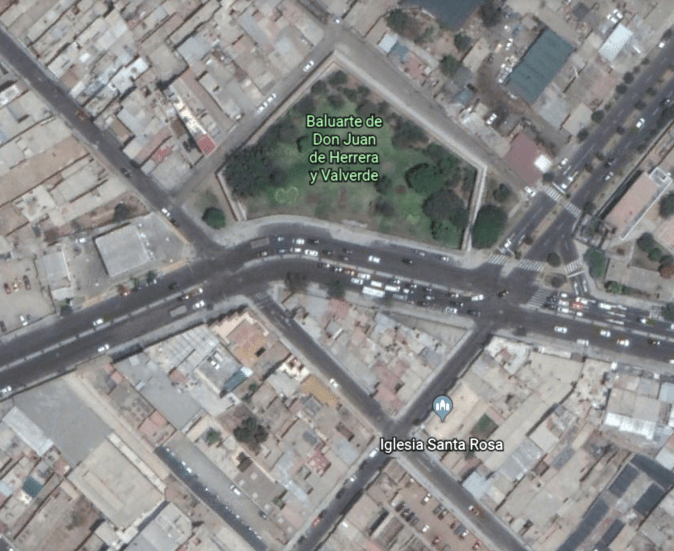
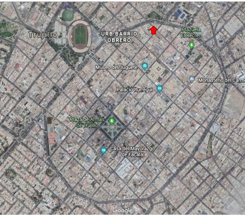
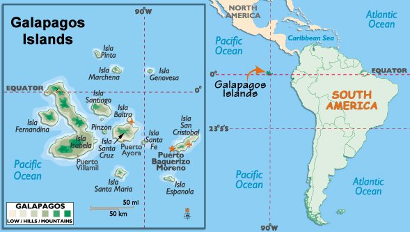
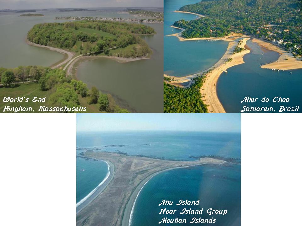
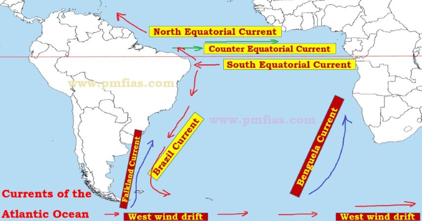
In the last post, I tracked the alignment from Trujillo, in northwestern Peru on the coast, and looked at many different aspects of the history of the region that link it to distant times and places; and into the Pacific Ocean where it comes through the Galapagos Islands.

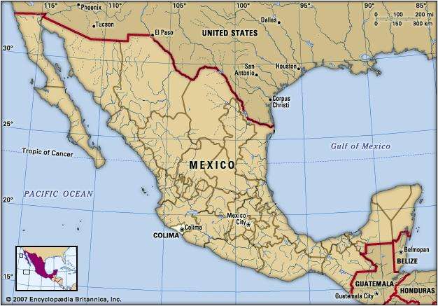
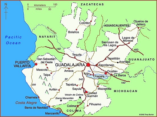
I am picking up the alignment where it enters Mexico at Colima, the capital city of the Mexican State of Colima.

It is the fourth smallest Mexican state, and though it has the smallest population, it has one of the highest standards of living and lowest unemployment rates in Mexico.

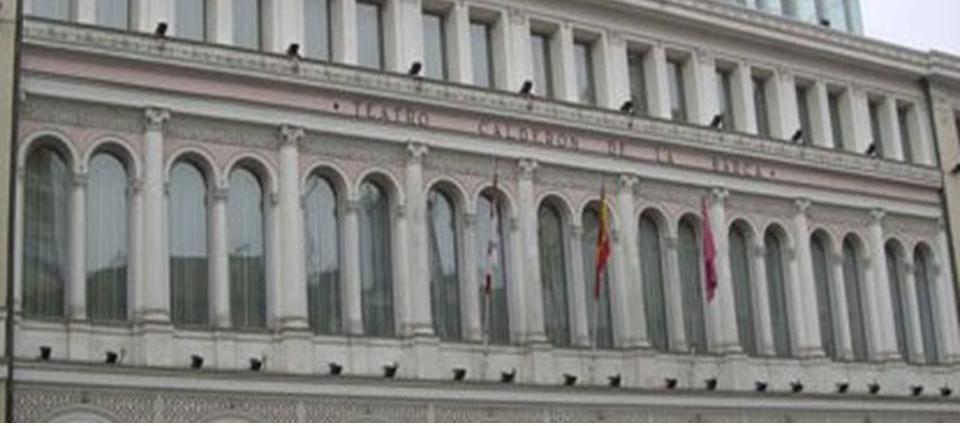
This building has very distinctive arches  in the Colima Centro.

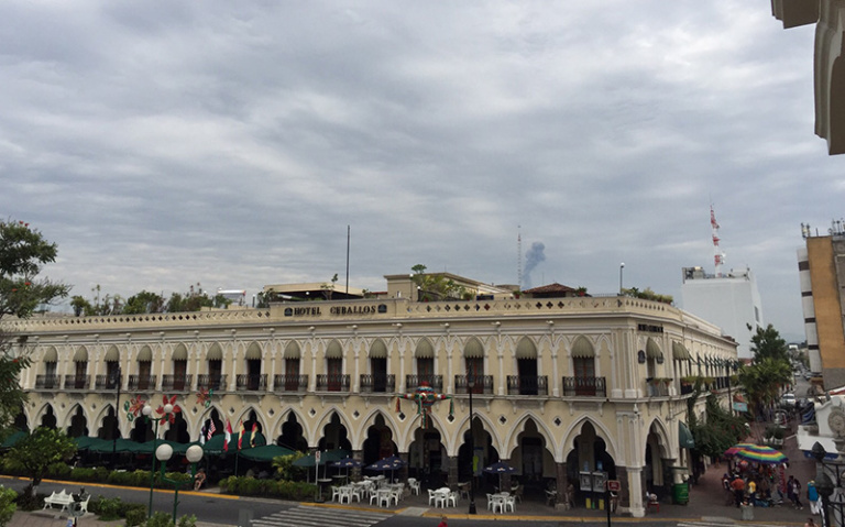
The arches are an example of a five-lobed Moorish Arch.

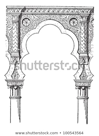
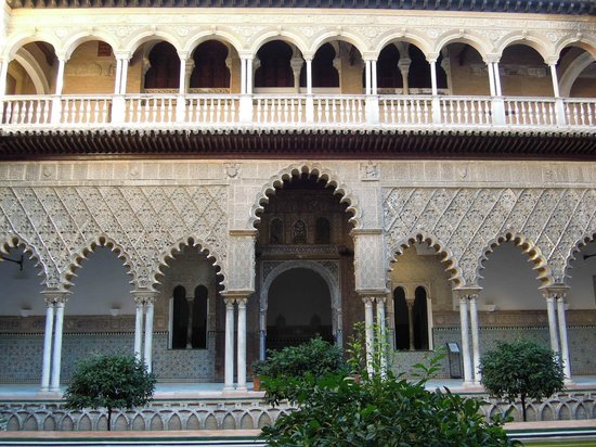
Here is a comparison with another type of Moorish Arch in Alcazar, Seville, Spain.

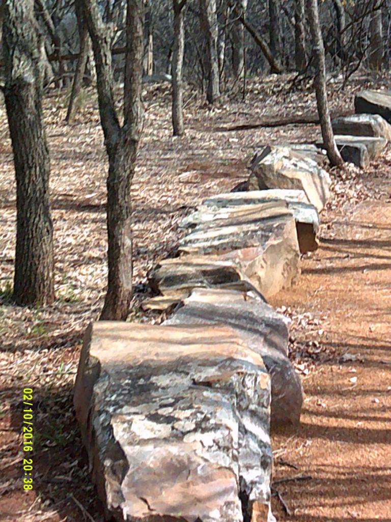
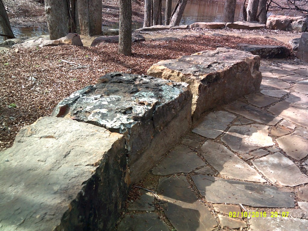
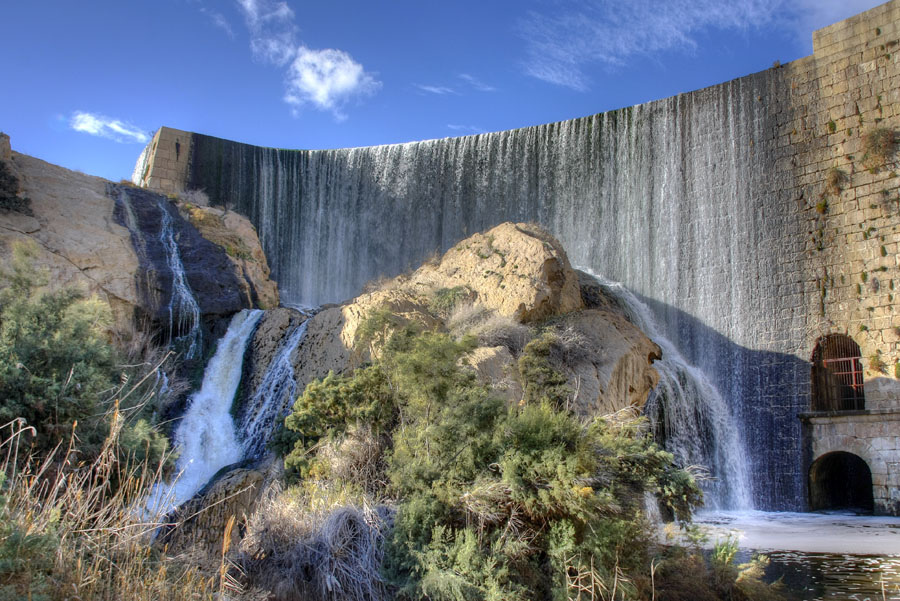
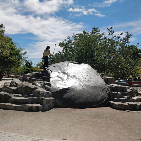
This is an historic photo of what is described a 6-foot, or 2-meter, high volcanic monolith in Piedra Lisa, or Smooth Stone, Park in Colima.

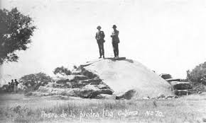
The legend is that if you climb to the top, you will fall in love with Colima forever.

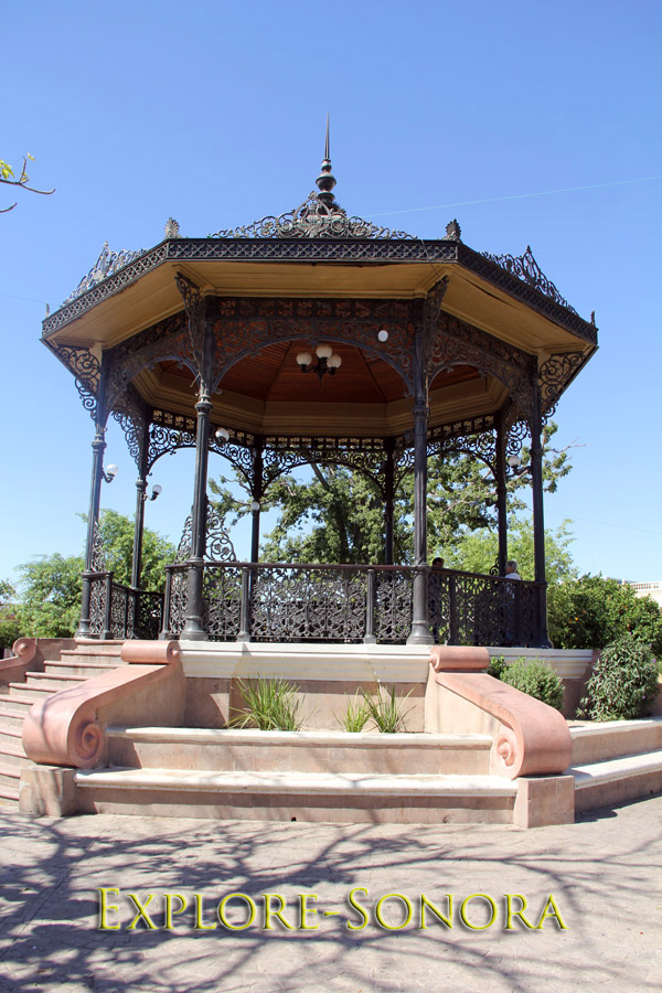
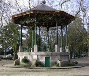
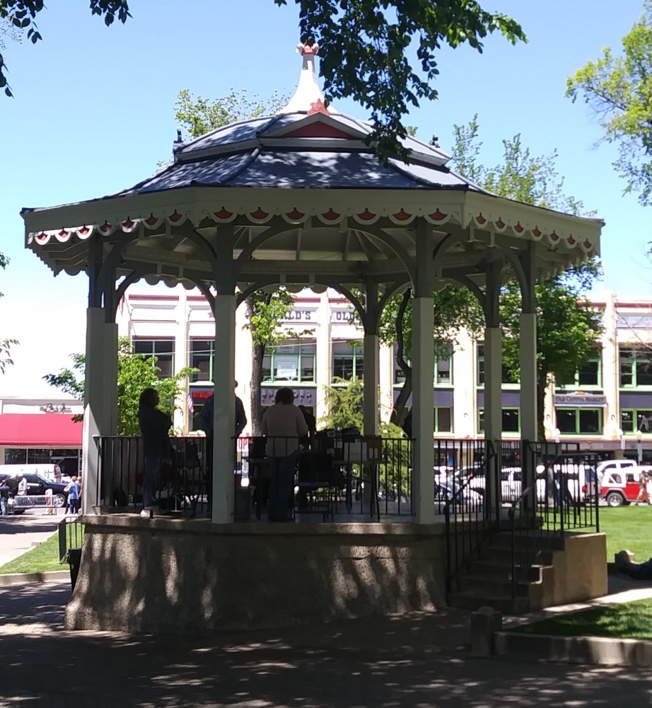
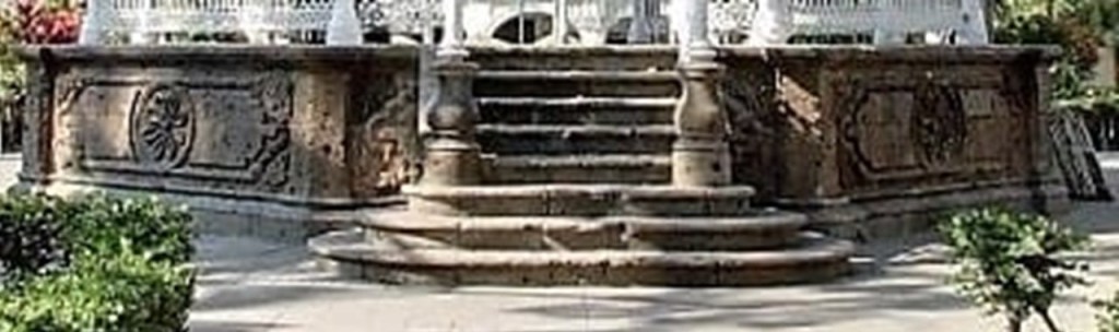
This bandstand is in the Jardin Libertad in Colima.

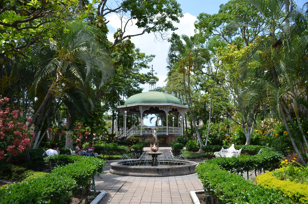
It is said to have been imported from Belgium in 1891.

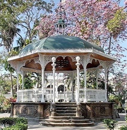
Hmmmm. Check out that stone base!

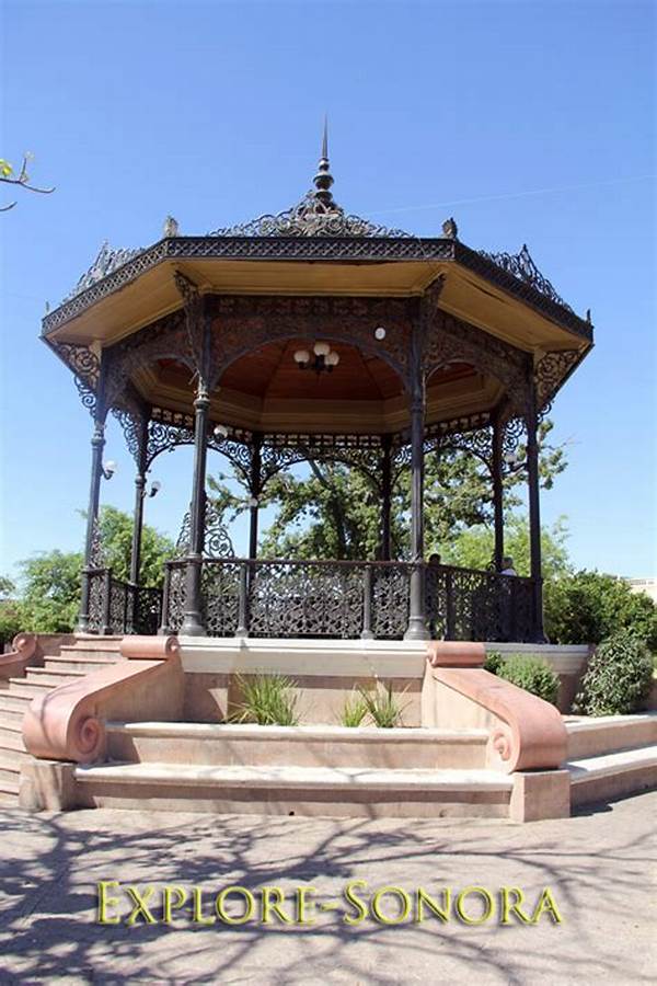
Compare it with the Moorish Kiosk in Hermosillo, Mexico, only this one is said to have been brought over from Florence, Italy in the early 1900s.

European countries get the credit, with no explanation as to the logistics of how these could have been moved from Europe to the western coast of Mexico in both cases. The Panama Canal we are told wasn’t opened until 1914. The only logical explanation is that these were built by the people who lived here.

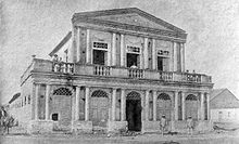
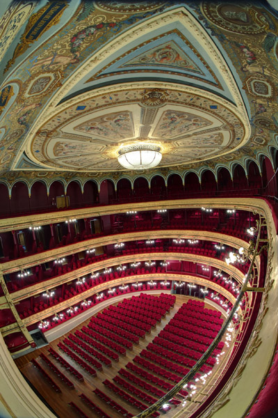
This is the Teatro Hidalgo in Colima on the left, with its construction said to have been started in 1871, compared with the Theatro Ribeira dos Icos in Ico, Brazil, said to have been built in the mid-1800s, on the right, seen earlier on this alignment.

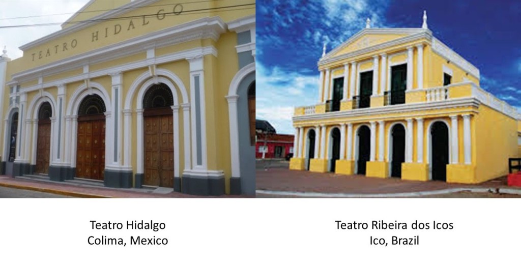
Quite similar in style and appearance for two places that are 4,800 miles, or 7,650 kilometers, apart, before modern communication and transportation.

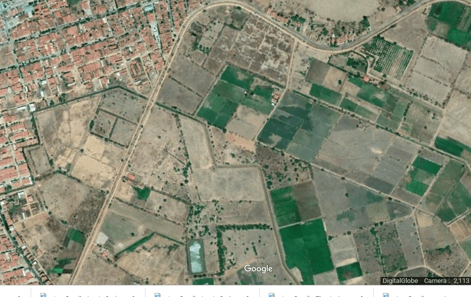
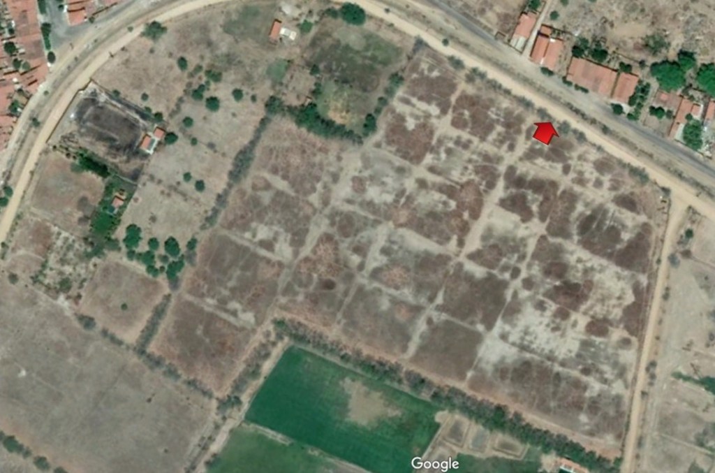
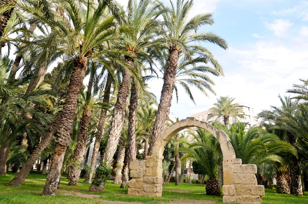
The archeological site of El Chanal is 2.5 miles, or 4 kilometers, north of Colima.

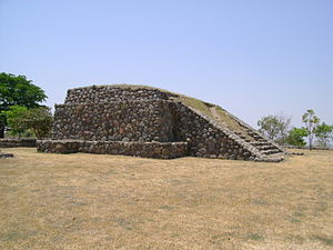
El Chanal has six plazas, or important ceremonial centers.

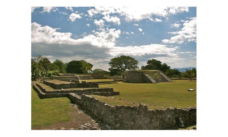
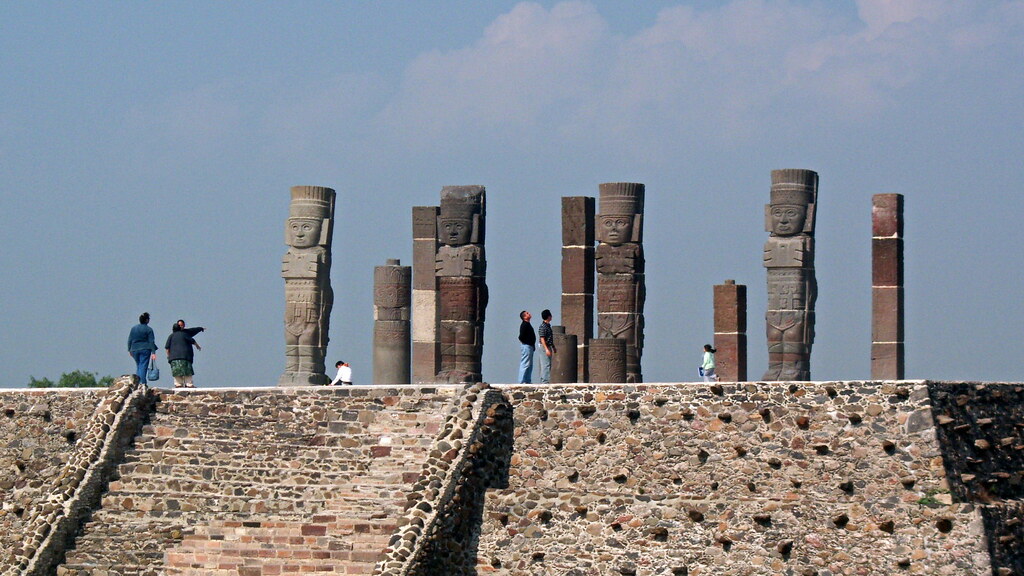
It is important to note that western archeologists say they are unable to identify who lived here because they find evidence of the influence of several different cultures here, like Aztec, and like Tula, a Toltec site. This is the Temple of the Atlantes in Tula.

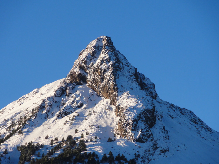
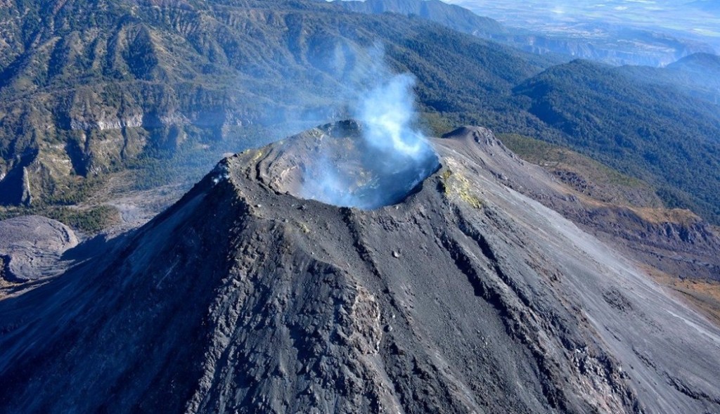
Leaving the Colima area, the alignment goes through the Nevado de Colima National Park.

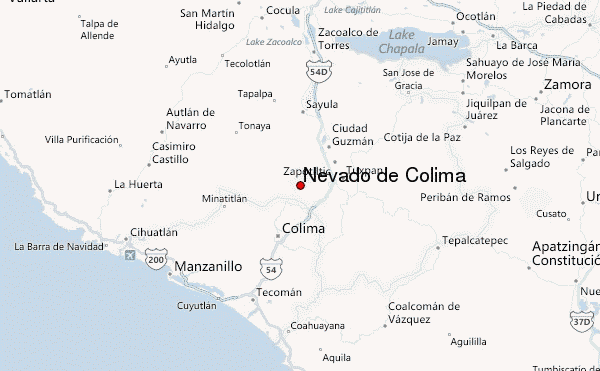
The Nevado de Colima National Park has two volcanos – what is called the extinct volcano Nevado de Colima…

…and one of the most active volcanoes in Mexico, the Volcan de Fuego de Colima.

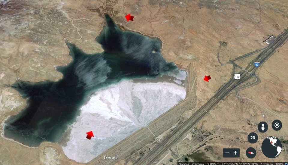
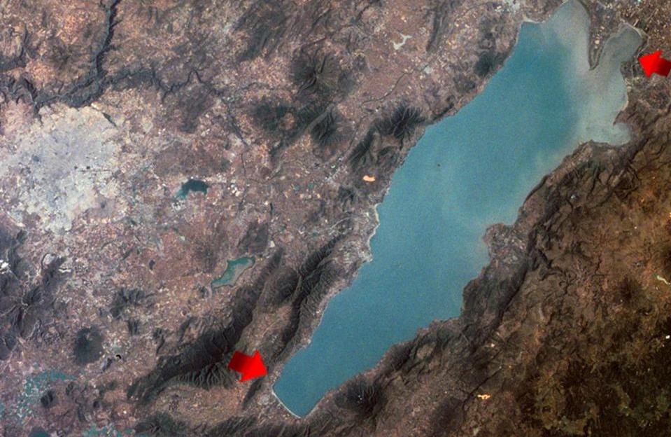
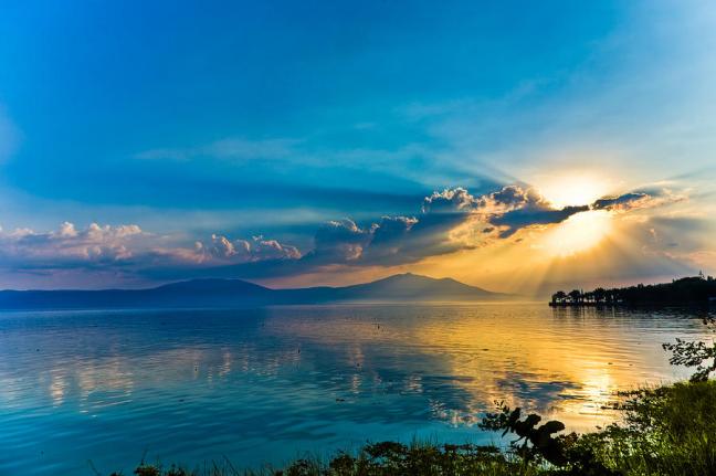
Lake Chapala is on the alignment, Mexico’s largest freshwater lake.

It is shared between Jalisco and Michoacan State, with its squared off ends…

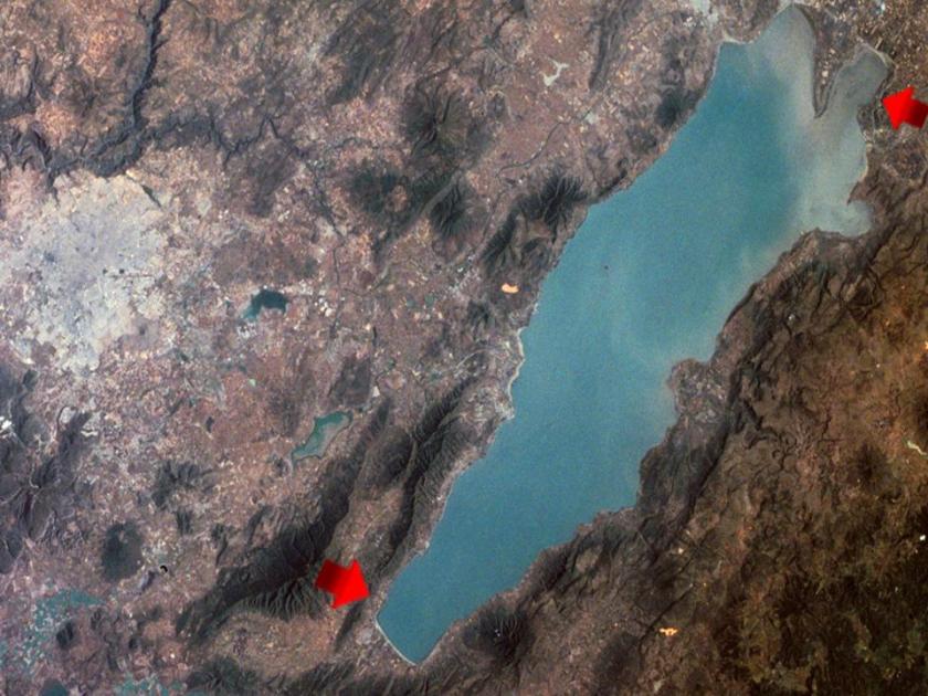
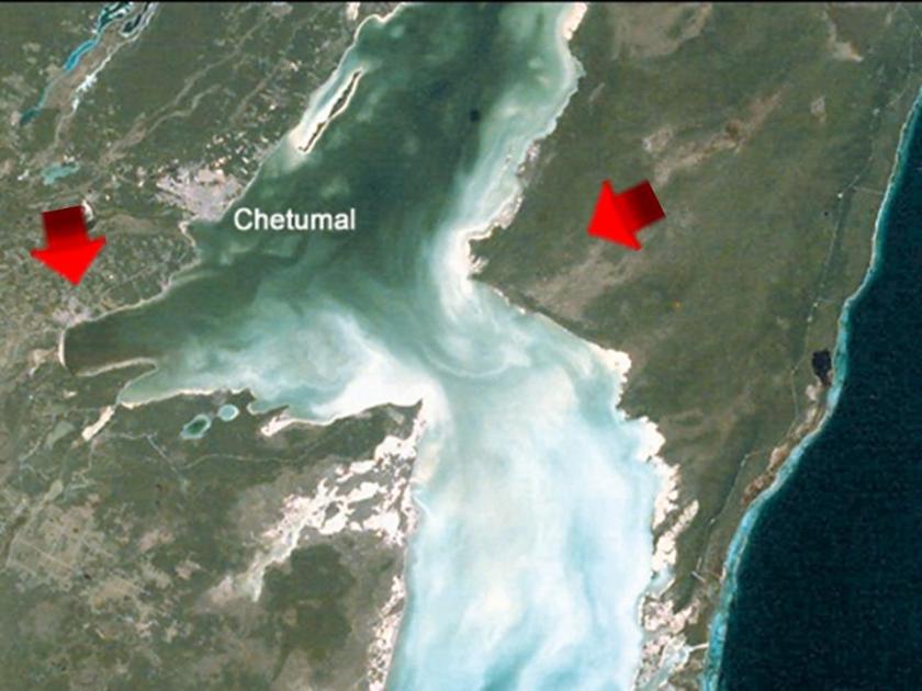
…compared with Chetumal Bay, located off the Caribbean Sea on Mexico’s eastern coast, with a similar squaring going on.

Next we come to Guadalajara, the capital and largest city of Mexico’s Jalisco State, and the second largest city in Mexico.

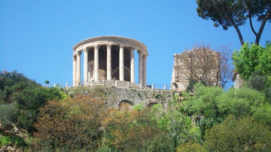
This is called the Rotunda of Illustrious Jaliscoans in the Centro Historico of Guadalajara…

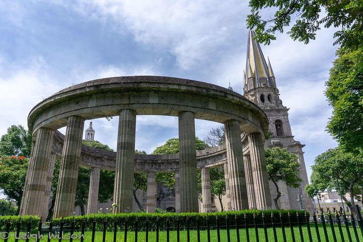
…compared with the Tempio della Sibilla in Tivoli, considered one of the oldest sites in Italy.

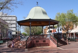
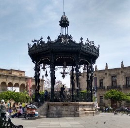
There is also an ornate bandstand in the Plaza de Armas in the Centro Historico of Guadalajara. This one is said to have been made in France and given to Mexico on the 100th Anniversary of Mexico’s Independence in 1910.

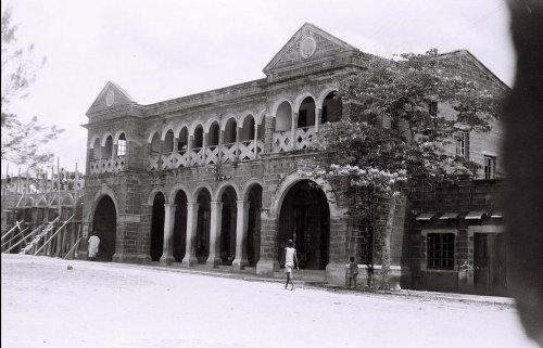
This is the Hospicio Cabanas, one of the oldest and largest hospitals in the Americas, with its chapel in the background. We are told the architect who designed it was engaged in 1796, and it was completed around 1829.

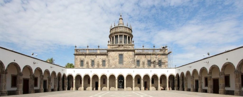
We are told the complex was founded in 1791 by the Bishop of Guadalajara to be a combination workhouse, hospital, almshouse, and orphanage.

This is what it looks like on the inside of the hospital’s chapel.

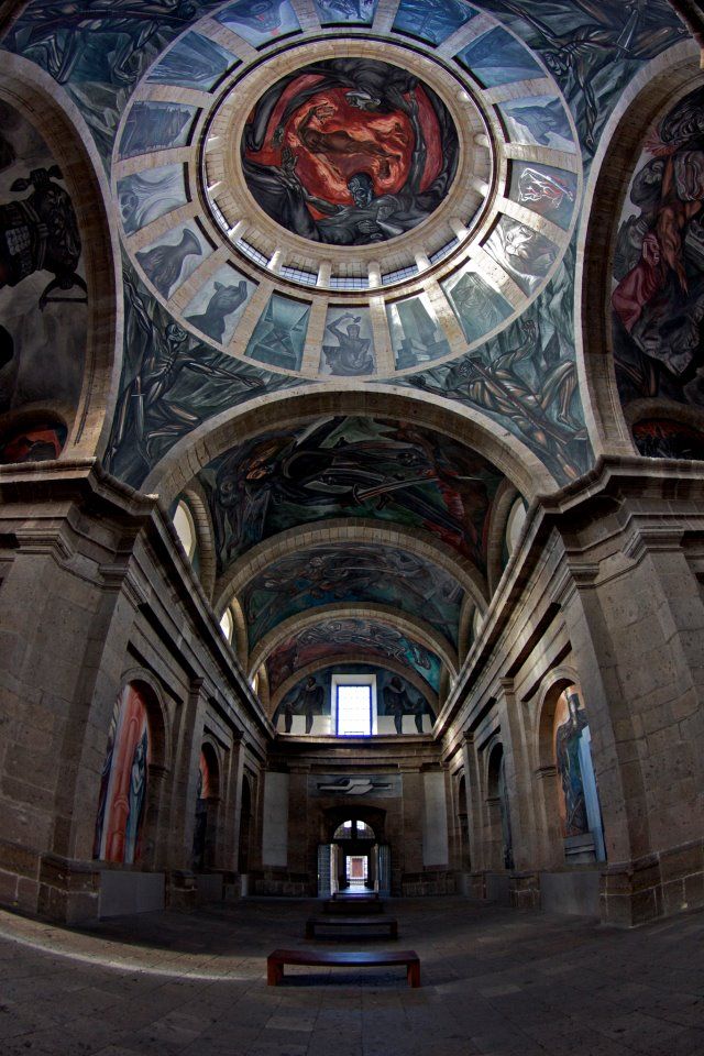
Pretty fancy for a building designed to house and serve poor people.

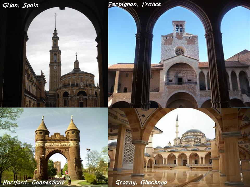
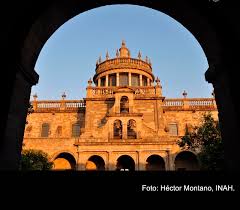
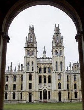
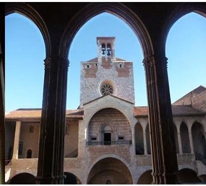
And here is the other side of the hospital’s chapel perfectly and proportionally framed through an archway…

…just like what you see in Oxford, England…

…at the Debre Libanos Monastery in Ethiopia…

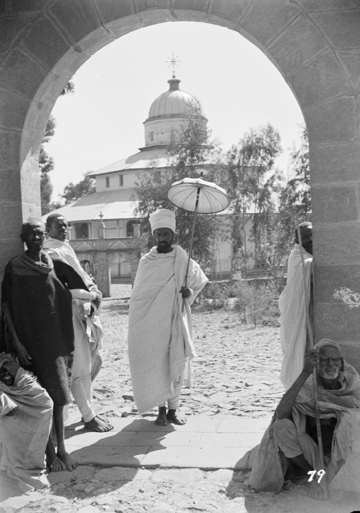
..at the Sardar Market in Jodhpur, India…

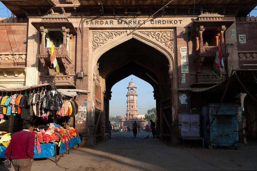
…and the Palace of the Kings of Majorca in Perpignan, France.

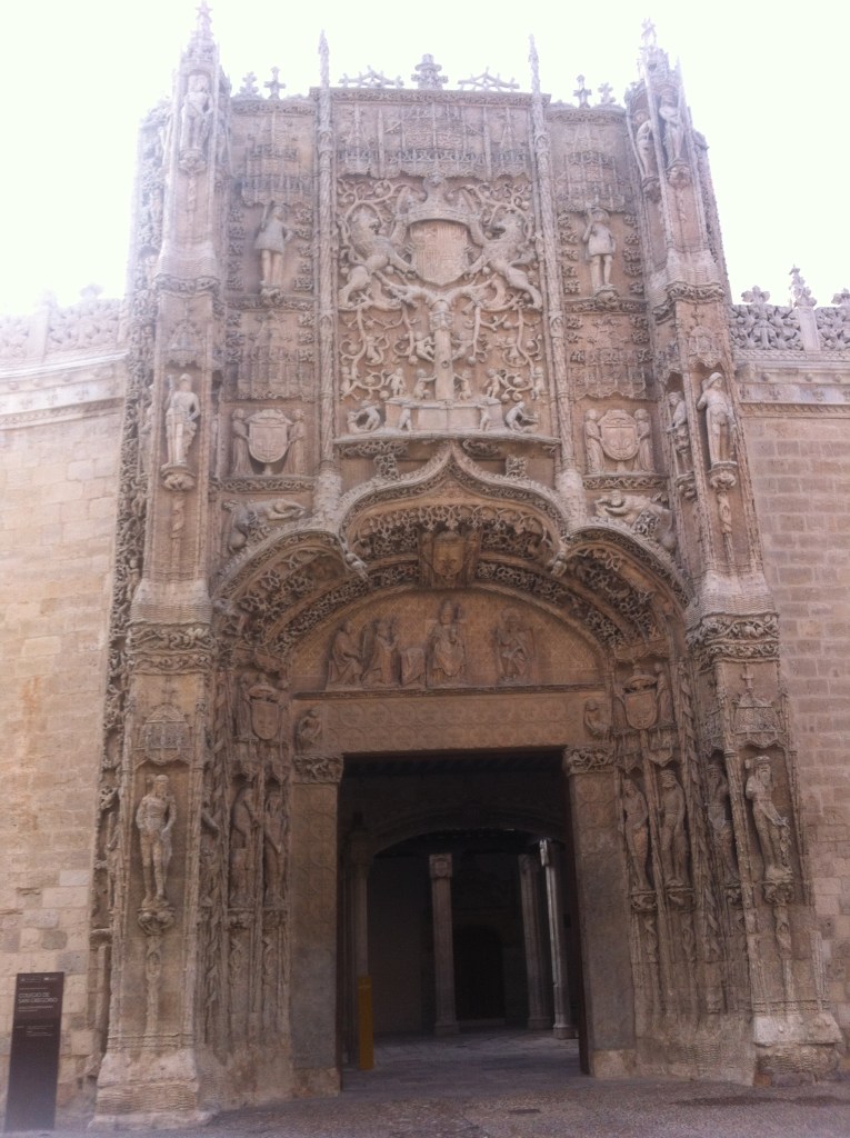
This is the old University of Guadalajara, the Santo Tomas de Aquino College, and the current “Octavio Paz” Hispanic Library, another example of classical Greco-Roman architecture in Guadalajara.

It was said to have been founded by the Jesuits in 1591, and then became the University of Guadalajara in 1792.

Next on the alignment is Aguascalientes, the capital of the Free and Sovereign State of Aguascalientes.

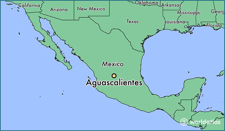
It is named for the abundance of hot springs in the area.

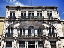
This is the Aguascalientes Museum, said to have been built in 1903.

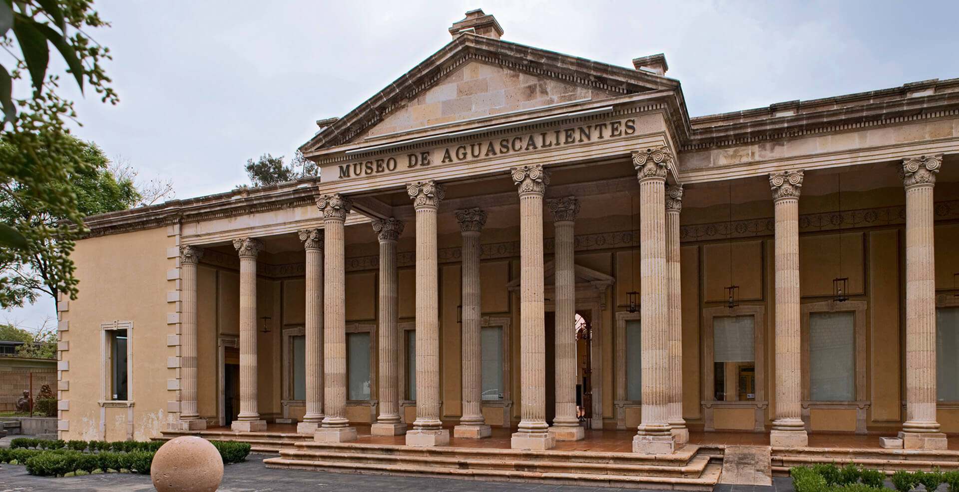
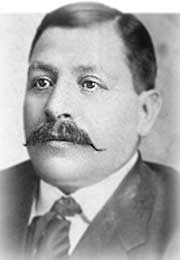
Again, there is so much architecture everywhere, around the world, that looks like what are taught is classical from ancient times, yet no one questions anything because we assume it was built when we are taught, and by the person said to have built it. In this, Refugio Reyes Rivas, a self-taught architect with no formal training.

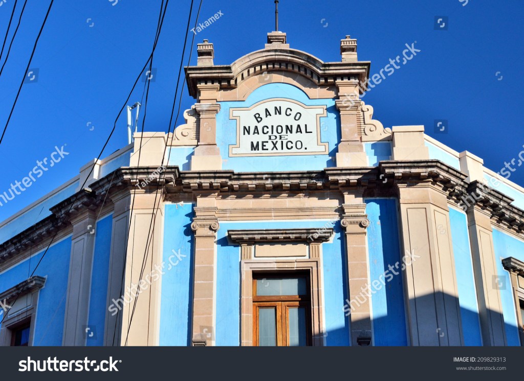
He is also given credit for the Bank of Mexico…

…the Hotel Paris…

…the Hotel Francia…

…and the Church of the Purismima – all in Aguascalientes.

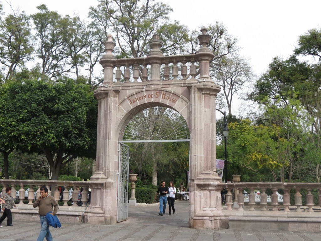
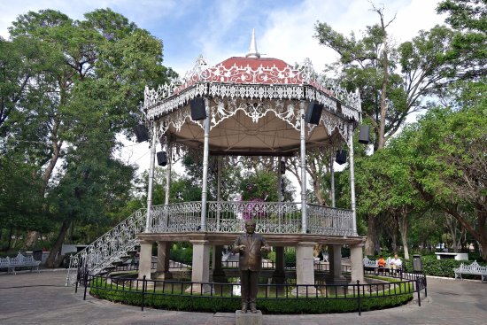
The San Marco Garden is in the center of Aguascalientes. This is one of the four massive gateways into the park, which was said to have been created in 1842.

There is another ornate, wrought-iron bandstand, or gazebo, in the garden like the ones seen earlier in this post.

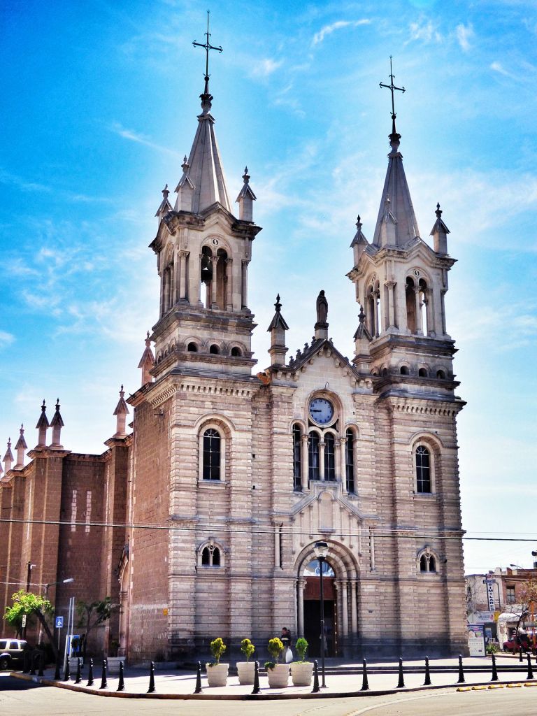
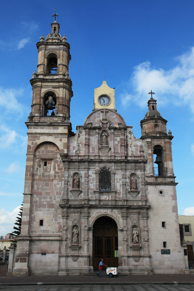
There is also a church at the western end of the Garden, the Templo de San Marcos, said to have been completed in 1765 ~ a huge building of heavy masonry.

I am going to end this post here, and pick up the alignment in Victoria, Mexico, in the next post.

Circle Alignments on the Planet Washington, DC – Part 19 Trujillo, Peru to the Galapagos Islands

In the last post, I tracked the alignment from Cachimbo, and the Serra do Cachimbo in Brazil’s Para State; through Porto Velho, the capital of the Brazilian State of Rondonia, on the Madeira River in the Upper Amazon Basin; across the Serra do Divisor National Park in Brazil’s Acre State, on the border with Peru; through to Pucallpa, the capital of the Colonel Portillo Province of Peru.

I am picking up this circle alignment starting, and ending, in Washington, DC, at Trujillo, a coastal city in northwestern Peru, and the capital of the Department de La Libertad.

This is an historic map of Trujillo, Peru from 1786, with its fifteen-pointed city wall.

For comparison, this is Lucca, Italy in the present-day, known for its well-preserved, and what are called Renaissance, walls.

Lucca is also described as a star city by modern researchers of star forts.

This is a view of Trujillo from Google Earth, with an oval shape in the center that looks like the historic map of Trujillo.

There is one intact point of the original fifteen remaining…

…that I found when I looked at a close up of the oval in the city’s center.

Here is a street view of the wall of the intact point. Note the size of it compared to the people next to it…

…and here it is from another side. It has definitely seen better days, but at least it is still standing!

About 9 miles, or 14 kilometers, northwest of Trujillo, is the fishing village of Huanchaco, known for its reed boats, called “Caballitos de Tortora,” said to have been first made by the Moche people 2,500 years ago.

Still in Peru, Lake Titicaca is known as well for not only its reed boats of similar design…

…but also for its communities of people living on reed islands…

…where even more elaborate boats are made from reeds.

Reed boats of similar design are also found in Africa, from Egypt in ancient times…

…to the Blue Nile in Ethiopia in the present day…

…as well as Lake Chad in the country of Chad.

At one time the small fishing village of Huanchaco of the reed boats was the port city for Chan Chan, believed to be the largest city of the pre-Columbian era in South America. It was the capital of the Chimu Kingdom from 900 to 1470 AD, when it was defeated by the Inca Empire.

Then the Spanish came 50-years later and defeated the Inca, at which time the riches and artifacts of Chan Chan were looted and shipped to Spain.

In the last thirty years, Chan Chan has become one of the most restored sites in South America.

The Palacio Tschudi is the most restored.

Chan Chan is considered to be the largest mud-brick (also known as adobe) city in the world.

It is interesting to note there are many other places with similar mud-brick architecture, like Djenne in Mali.

Djenne’s masons use a technique called Djennefere using cylindrical, instead of rectangular, bricks as building materials.

Timbuktu, also in Mali, is known for its mud-brick architecture.

In the region of what was ancient Nubia, there is a mud-brick temple complex in Kerma, Sudan, called Deffufa, that is believed to be an estimated 9,500-years-old.

The Bam Citadel near Kerman, Iran, is considered to be the world’s largest mud-brick building.

This is the mud-brick Itchan Kala, the inner walled town of Khiva in Uzbekhistan…

…and lastly, these are the mud-brick Tombs of Astana in Turpan, China, in the Uighur Autonomous Region.

Now back to Peru.

The Moche Culture is said to have flourished in Peru somewhere between 100 AD and 900 AD, with its capital near present day Moche in Trujillo.

The Moche are particularly noted for their ceramics…

For comparison, this ceramic artifact, called a stone effigy pipe, was found at Spiro Mounds in Eastern Oklahoma.

The Moche are also known for their gold-work…

…their monumental constructions, like the Huaca del Sol, a massive mud-brick pyramid, in the Moche Valley of the northern coast of Peru…

…and the Huaca de Moches, located or 2.5-miles, or 4-kilometers, outside of the modern city of Trujillo.

The Moche are also known for their canal irrigation systems.

Before I leave Peru, I would like to back-track to a place that is not directly on the alignment, but is situated north of it between Pucallpa and Trujillo. That place would be Cajamarca.

The Spanish Conquest of Peru is said to have started in 1532 with the Battle of Cajamarca.

We are told that Pedro Arias D’Avila established a base of conquest in Panama City for Peru in 1519, on the Pacific side of the Isthmus of Panama. The coast of Spain is on the Atlantic Ocean and Mediterranean Sea.

It is quite a distance from Panama City to Cajamarca, by land or sea. It sits at 8,900 feet in elevation, or 2,750 meters.

That’s way up there, about 1.7 miles, or 2.75 kilometers, in elevation!

It is generally agreed that altitude sickness typically tends to start occurring at 8,000 feet. Characterized by headache, nausea, shortness of breath and vomiting.

I went to Cusco, Peru last year, and was hit with altitude sickness on the second full day I was there. I was absolutely miserable and not really functional. I had difficulty breathing, and was nauseous. Money brought to spend on memories instead got spent on portable oxygen bottles and altitude sickness medicine. I didn’t start feeling much better until we went down in altitude several days later.

Yet, somehow Pizarro and his 128 men marched to Cajamarca from Piure, on the coast of modern-day Peru, in unfamiliar terrain at high altitudes, managed to kill thousands of Incas and capture the Inca Emperor Atahualpa? I am having a hard time buying what they are selling….

The circle alignment leaves Peru from the Trujillo area, and crosses into the Pacific Ocean.

The next land it comes to is comprised of the Galapagos Islands, a province of Ecuador that is described as a volcanic archipelago in the Pacific Ocean.

It is considered one of the world’s foremost destinations for wildlife viewing.

Pay attention to the different species, and not the rocks…

…same thing with the rare bird shown here that is called blue-footed booby. Rocks are just rocks, right? No big deal.

These land features are found on Bartelome Island, a small island at the center of the archipelago.

I have seen the same land features in other places.

First, the double-shoreline is seen at World’s End near Hingham, Massachusetts on the top left; on the top right is found at the Alter do Chao in Santarem, Brazil; and on the bottom is a land feature found on Attu Island, the farthest west of the Aleutian Islands.

Second, this land feature in the same location from another on Bartolome Island in the Galapagos Islands…

…looks like this one off the coast of Yalta on the Crimean Peninsula in the Black Sea…

…this one in the Revillagigedo Islands between Hawaii and Mexico in the Pacific Ocean…

…and this one at Cape Litke on the eastern coast of Wrangel Island, in the East Siberian Sea off the northern coast of Russia.

I am going to end this post here, and pick up the alignment in the next post in Colima, Mexico.

Circle Alignments on the Planet Washington, DC – Part 17 Ico, Brazil to Palmas, Brazil

In the last post, I tracked the alignment from the Gulf of Guinea, exploring different locations and significant points in the Gulf, across the Equatorial Counter Current and just into the South Equatorial Current of the South Atlantic Ocean, across Fernando de Noronha just off the coast of Brazil, and entering South America at the Brazilian city of Natal.

I am picking up the alignment in this post in Ico, a town located in the central part of the Ceara State of Brazil.

It is situated on the Rio Salgado, on a flat plain, not far from its confluence with the Rio Jaguaribe.

S-shaped, snaky rivers are a signature of the Advanced Ancient Civilization worldwide. For comparison of similarity of appearance, the Rio Salgado in Brazil is on the left, and the River Thames in England on the right.

There are some interesting geometries going on in the landscape of Ico, with places with a lot of squares, rectangles, curves and angles showing up with nothing much going on in them.

This is a close-up of the top middle section shown previously. It looks like a section of earth that has a grid pattern, and to me it has a much older look, like not something done recently. I took a street-view shot of where the red arrow is pointing…

…and this is what it looks like.

We don’t think of infrastructure from an advanced civilization because it is not supposed to exist, so how could it possibly be? If there was, we would know about it, wouldn’t we?

For another example, I had noticed an earthwork embankment on I-40 near the Geronimo Travel Center in northern Arizona as I travelled east. So I stopped on the way back to see what I could see. This was as close as I could get to it.

In my research, I have learned what to look for as signatures of the Advanced Ancient Civilization, and just like snaky, S-shaped rivers, geometric earthworks are key. There also appears to be a salt lake here, which has an energy generative function on the grid, as well as the geometric shapes on the lake shore.

The geometric shapes of the lake in Arizona look like those of Lake Chapala in Mexico near Guadalajara.

I am sure there is no coincidence that there is a power plant directly across from this location in Arizona. One example of many of how ancient energy technology is harvested by the modern energy industry without public awareness.

These are geometric shapes that appeared where the Amazon Rainforest was after deforestation.

This is the Igreja Senhor do Bonfim in Ico, Brazil…

…compared with this building in Xalapa in Mexico…

…and the Chapel de Les Alegries in Lloret de Mar, on the Mediterranean coast near Barcelona, Spain.

I find the recurring spiral patterns displayed on these three buildings in different countries to be of interest. Why were they incorporated in the architecture of the buildings?

Spirals can represent the expansion of consciousness, pathways between the worlds, and sound and frequency.

This is the Igreja Matriz da Expectacao in Ico…

…and the beautiful geometry in the plaza in front of it.

Compare the geometric design in the square with the look of the University of Birmingham in England.

This is a view of the front of the Igreja de Sao Jose from the front from the square in front of the Igreja Matriz da Expectacao that was just shown.

This is what the very large Igreja de Sao Jose looks like from above on Google Earth…

…and what the positioning of the two plazas looks like from above. There’s an interesting city lay-out going on here, with the Igreja de Sao Jose literally built in the middle of the street, perpendicular to the buildings beside it.

This is an historic photo of the Theater Ribeira dos Icos, circa 1900.

This is the same theater today.

Compare the design features of this theater in Brazil with the Temple of Portunus in Rome, noting in particular the use of columns, and the gabled roofing. This classical style of architecture is found worldwide. Was it built in emulation of? Or was the theater built by exactly the same civilization that built the Roman Temple? My belief is that it was the latter, the advanced ancient civilization that is missing from our collective memory.

The next city I am going to look at on the alignment is Crato, in the southern part of the Ceara State of Brazil.

Crato sits on the northeastern edge of the Chapada, or Plateau, do Araripe, on what is called the Crato Formation.

The Crato Formation is particularly known for its limestones containing fossils of plants, vertebrates, and invertebrates.

This is a cement quarry in the Crato Formation region at Caldas.

Here are some photos taken of places at the Chapada do Araripe in Brazil…

…compared with Sedona, Arizona…

…Red Rock Canyon in Hinton, Oklahoma, outside of Oklahoma City…

…and Petra in Jordan.

The Araripa Geopark has one of the most important fossil deposits in Brazil. Declared a UNESCO Global Geopark in 2006, it has nine geological sites in six municipalities of the state of Ceara, including Crato.

Here are some sights in the Araripa Geopark:

The alignment goes directly across the Floresta Nacional Do Araripe-Apodi, a National Forest with its status designated in 1946.

The alignment crosses through Taquarussu, a village in the Tocantins famous for its many waterfalls, natural environment, and as an ecotourism destination, right before you get to Palmas.

Palmas is the capital city and geographic center of the State of Tocantins and the geodesic center of Central Brazil.

It is bordered on the east by the Serra do Lejeado, where we find this in the Parque Estadual do Lajeado, or Lajeado State Park…

…compared to Pilot Mountain in North Carolina.

Palmas is bordered on the west by the Tocantins River, the central river in Brazil, running from south to north for 1,522 miles, or 2,450 kilometers.

The Parque Nacional do Araguaia, on the Araguaia River, is just a short distance southwest of the city of Palmas, largely on Bananal Island, believed to be the largest inland river island in the world.

I am going to end this post here, and pick up the alignment in the next post in Cachimbo, Brazil.

Circle Alignments on the Planet Washington, DC – Part 16 Gulf of Guinea to Natal, Brazil

In the last post, I tracked the circle alignment emanating from Washington, DC, through the Sahara Desert, starting at the ruins of Djado at the southern end of the Djado Plateau in Niger; across the Tenere Desert, the eastern-half of the Air and Tenere National Nature Reserve in Niger; through Bilma, still a modern-day stop in Niger for salt on the Trans-Saharan Caravan route of the Tuareg; across the Great Erg, or Sand Sea, of Bilma; through the towns of N’Guigmi and Diffa in Niger; and into Nigeria the cities through the cities of Abuja, Abeokuta, and ending at Lagos, a major port city of Africa on the coast of Nigeria.

I am picking up the alignment where it enters the Gulf of Guinea, the most northeastern part of the tropical Atlantic Ocean between Cape Lopez in Gabon, north and west to Cape Palmas in Liberia.

The intersection of the Equator and Prime Meridian is in the Gulf of Guinea, otherwise known as 0-degrees longitude and 0-degrees latitude. Eyeballing on this map, after leaving the mainland at Lagos, Nigeria, the circle alignment tracks over this location on its way to Brazil across the Atlantic Ocean.

The alignment enters the Gulf of Guinea through what is called the Bight of Benin, which extends eastward for 400 miles, or 640 kilometers, from Cape St. Paul, to the Nun Outlet of the Niger River.

The Bight of Benin and the Republic of Benin were named after the…

…Kingdom of Benin, which was a pre-colonial Kingdom in southern Nigeria. It was old and highly developed.

The Edo people were the original people of the Kingdom of Benin, which was founded in 1300.

It was one of the major powers in West Africa until the late 19th-century, when it was annexed by the British Empire in 1897.

Compare the headgear of the Edo man, with a traditional Mongolian hat. My take on this similarity is that there was a unified worldwide spiritual practice involving the re-connection of each human individual with Source through the crown chakra.

The Republic of Benin was previously the Kingdom of Dahomey, which existed from about 1600, until it was annexed by the French Colonial Empire in 1894.

This is in Ouidah, or Ajuda in Portuguese, on the coast of what was Dahomey. It was said to have been built by the Portuguese in the 1720s.

Infrastructure like this is falsely attributed all over the world, instead of giving credit to the actual builders. Like, you know, the indigenous people who lived there instead of the colonizers.

The Niger River, the principal river of West Africa, is that main river that empties into the Gulf of Guinea.

The Niger River Delta, extending over 27,000 square miles, or 70,000 kilometers squared, separates the Bight of Benin…

…from the Bight of Biafra, which in the present day is known as the Bight of Bonny. It runs from the Niger Delta to Cape Lopez in Gabon.

Biafra became a part of Nigeria after the Nigerian Civil War of 1967 to 1970.

What is now called the Bight of Bonny hosts the Cameroon Line of Volcanoes, which includes the island Republic of Sao Tome and Principe, a former Portuguese colony.

The capital and largest city is Sao Tome, where Sao Sebastiao Fort is located.

Here is a shot from Google Earth confirming that Sao Sebastiao Fort is in fact a star fort. It was said to have been built by the Portuguese in 1566.

Here are some other things to see on these islands, like what looks like ancient stonework…

…and incredible rock formations, like the Pico Cao Grande, or Great Dog Peak.

Also in the Cameroon Line of Volcanoes, and administered by the country of Equatorial Guinea, are the islands of Bioko…

…Corisco…

…Elobey Grand and Elobey Chico…

…and Annobon.

Leaving the Gulf of Guinea, the alignment crosses over the Equatorial Counter Current and and just into the South Equatorial Current of the South Atlantic Ocean..


The alignment crosses over Fernando de Noronha, the name of the main island and its archipelago. It is a UNESCO World Heritage Site and on at least one other alignment that I know of. The main island has an area of 7.1 square miles, or 18.4 kilometers-squared, and the archipelago’s total area is 10 square miles, or 26 kilometers-squared.

So what I just found out that is really interesting about this place is that in its relatively small area, there were ten, possibly star, forts here.

The largest and best-preserved is the Forteleza Nossa Senhora dos Remedios.

The Forte de Sao Jose do Morro was only fort built on a secondary island.  It still has imposing ruins.

Forte de Santo Antonio construction was an irregular, four-side polygon.

You can see the Morro do Pico framed nicely through this archway at the Forte de Santo Antonio.

The Forte de Sant’ana was situated over the old harbor in the  Vila dos Remedios.

Ruins of the Forte de Nossa Senhora da Conceicao are visible in the vegetation.

The Forte de Santa Cruz do Pico was a small redoubt.

This is an old map of the Forte de Sao Pedro do Boldro.

People come to the Fort Boldro look-out for sunsets. There is a good view from here of the Two Brothers Rock, which appears to be alignment with the sun.

Then there was the Forte de Sao Bautista dos dois Irmaios…

…the Forte de San Juaquim do Sueste…

…and lastly the Forte do Bom Jesus do Leao.

This circle alignment enters the South American continent at Natal, the capital and largest city of the Brazilian State of Rio Grande do Norte, and said to have been founded on December 25th, 1599.

The Portuguese are said to have built the Forte Dos Reis Magos, or the Fort of the Three Wise Men, as the first milestone of the city of Natal

Here is a view of the Forte dos Reis Magos from the ground, with its exquisitely engineered stone entranceway between the channel on the right, and the Potengi, or Potenji, River on the left.

Star forts like all of these shown here present a mystery because the same design and construction style is found around the world. This is Fort Chambly in Quebec…

…the Fagaras Citadel outside of Bucharest, Romania…

…and the Kronborg Castle in Helsingor, Denmark.

How did all of these places end up with the same design features?

So with the example of the Forte dos Reis Magos in Natal, said to have been built in the 1598, it would have been during times we are told there was low technology, no mass communication or easy transportation.

This was a Caravel ship in which the Portuguese would have sailed during that time period.

And is this what we are talking about for ground transportation?

I mean, what else are we taught that was available to them? I can’t think of anything except for maybe a horse-drawn wagon or carriage.

There is nothing in the historical record that we are taught that comes even close to explaining how this advanced masonry, of similar design, came into being around the world.

What if these so-called forts served a very different purpose for the Advanced Ancient Civilization, like as energy generators, and not only re-purposed for military use by the colonizers, but actually sought out by them for capture?

The Palmanova star fort in Italy is on the left, compared with CERN on the right, for comparison of their similar look.

The Natal Dunes State Park is the second largest urban park in Brazil, and is located in the heart of Natal.

The Ponta Negra Beach is included in the Natal Dunes Park…

This is the Morro de Careca, a landmark icon of Natal, which translates from Portuguese as “Bald Man’s Hill.”

I can’t help but wonder about the origin of the word “Morro”….

On a different note, another unique place of interest near Natal in the Rio Grande do Norte is the Cashew of Pirangi, the world’s largest cashew tree, having the size of 70 normally-sized cashew trees.

I have heard other researchers talk about the role of the planetary grid-lines, or the earth’s leylines, in enhancing agricultural output. In the case of the Cashew of Pirangi, literal food for thought :).

I will be picking up the alignment in the next post in Ico, Brazil.

Circle Alignments on the Planet Washington, DC – Part 15 Djado, Niger to Lagos, Nigeria

In the last post, I took at close look at the ancient cities of Alicante and Elche on the Costa Blanca coast of Spain on the Mediterranean Sea; through ancient city of the Deys in Algiers and its famous Casbah; across the mountains of the Tell Atlas; the deserts of the Great Eastern Erg of Algeria; and on through to Djanet in Algeria.

Now, I am looking at the ruined city of Djado, which lies on the southern end of the Djado Plateau in Niger.

In the present day it is largely uninhabited, with abandoned towns still visible.

Historically it was the land of the Kanuri people, who are no longer living in Djado today.

The Kanuri people were described as a powerful African people that founded the pre-colonial Kanem-Borno Empire.

The Kanem Empire existed from 730 AD to 1380 AD…

…and then continued as the Bornu Empire until 1900.

This is Kanuri politician Sir Kashim Ibrahim arriving in London for a short tour in 1910. It sounds like he was a person of importance back in his day!

Now Toubou nomads are in Djabo to tend…

…the date palms of the region.

So, apparently the Bornu Empire lasted right up until the 20th-century. What happened to it?

At one time, not only did the Sahara have a fertile, savannah-type ecosystem, supporting a wide-and-varied wildlife population, like these life-sized giraffes carved in rock in Djado…

…the region now called the Sahara desert had great forests, including but not limited to, oak, elm, alder, juniper, and pine. As you can see in this picture, we are taught the desertification of this region started happening a long time ago. Maybe. Maybe not. There is so much that we have not been told about.

The silence about the history of this area in the present-day is deafening.

This is a traditional home in Niger on the left, and the designs on it reminds me of traditional Tibetan design elements on the right.

Next the alignment crosses near the Tenere Desert, which is the name for the eastern-half of the Air and Tenere National Nature Reserve.

There is no indication in on-line information that there are the remains of an ancient megalithic civilization here.

But it certainly looks like there was….

Next on the alignment is Bilma in Niger.

Bilma is an oasis town, and has long been a stop on the Trans-Saharan caravan routes. 

It is protected from sand from the desert dunes by the Kaouar escarpment.  Escarpment is another key code word that covers-up ancient infrastructure.

Bilma is the destination of one of the last of the ancient Saharan Caravan routes…

…where Tuaregs cross the Tenere Desert to…

…get salt produced here in salt pans, and barter millet for date fruit.

This is an aerial view of Bilma, where salt slabs are also used as a building construction material.

Next the alignment passes through the Great Erg of Bilma…

…another region of the Sahara described as a sand-dune sea.

Small scale trade through the Erg of Bilma continues from the Lake Chad region and the Termit Massif, a mountainous region in southeastern Niger.

So, what does the image in the foreground look like to you?

Next on the alignment is N’Guigmi, a city and commune of approximately 15,000, in the easternmost part of Niger, near Lake Chad.

N’Guigmi is a center for the salt trade from Bilma, and the last stop on the road to Chad.

This rock field is in the vicinity of N’Guigmi in the Tenere Desert.

N’Guigmi is also home to a large settlement of Kanuri people, and lies as the mouth of the Dilia Bosso, an ancient river valley that runs from the Termit Massif to the shore of Lake Chad, as recently as the mid-20th-century. This is a depiction of the Lake Chad Basin.

Next on the alignment is Diffa, in the extreme southeast of Niger on the border with Nigeria.

Diffa marks the end of the paved section of the National Route 1, the main east-west highway through Niger.

Diffa is compared on the top left with the Labna ruins in the Yucatan Peninsula in Mexico on the top right; the Dananombe Ruins in Bulaway, Zimbabwe; and lastly the Astana Tombs in Turban, in the Uighur Autonomous Region of China.

Next on the alignment is Abuja, the capital city, and located in the center of, Nigeria. It replaced Lagos as the capital of Nigeria in 1991.

In this picture, Zuma Rock in Abuja, Nigeria, is on the top, and it is reminiscent of Cathedral Rock in Sedona, Arizona, on the bottom. I can show you many more examples. Hopefully this will suffice as one of many examples of the same look and coloration.

Zuma Rock is known for having the shape of a human face on it.

The Gurara Waterfalls, with a height of 98-feet, or 30- meters, are found on the Gurara River about an hour or so from Abuja in Niger State, the largest state of Nigeria. I find waterfalls all along the planetary alignments.

The ancient city of Abeokuta is just north of Lagos, close to the alignment…

…and is the location of Olumo Rock, one of the oldest and most popular tourist attractions in Nigeria.

It has been used as a fortress historically by the Egba, Yoruba people of Ogun State, in which it is located.

As well as the patron spirit of Olumo Rock being venerated in the Yoruba spiritual tradition as an Orisha, which serves a guide for Creation and Humanity.

This is the Palace of Oba Sir Ladapo Ademola II, the Alake of Abeokuta, circa 1951, with its nice masonry and archways.

The Alake of Abeokuta is the traditional ruler of the Egba Clan of Yoruba.

This the current Alake of Abeokuta, Adedotun Aremu Gbadebo III, since 2005.

Sungbo’s Eredo is said to be a system of defensive walls and ditches southwest of the Yoruba town of Ijebu Ode in Ogun State. The total length of the fortification is 99-miles, or 160-kilometers, enclosing an area of 25-miles, or 40-kilometers.

It was said to have been built as a memorial for the childless widow, Bilikisu Sungbo, who has been connected by some to the legendary Queen of Sheba.

The appearance of Sungbo’s Eredo on the top, reminded me of Red Rock Canyon in Hinton, Oklahoma, near Oklahoma City on the bottom.

The next place on the alignment is Lagos, a major financial center of Africa, and has one of the busiest seaports in Africa.

There are two active ports in Lagos. The main Port of Lagos is in Apapa, and then the other is the Tin Can Port.

As you can see in this photo of Tin Can Island Port, you see that it is clearly artificially made…

…just like Bergen Point on the north side of the Kill van Kull at Newark Bay at Bayonne, New Jersey…

… and like Ellis Island in Upper New York Harbor.

You see the same kind of thing at the main port of Lagos at nearby Apapa.

Also at Apapa on the top left, you find the same signature, snaky, s-shaped river bend that is found all over the world, like the Nile River at Juba in South Sudan on the top right, and the Brisbane River at the city of Brisbane in Australia on the bottom.

I am going to end this post here, and pick up the alignment next as it crosses over the Gulf of Guinea.

Circle Alignments on the Planet Washington, DC – Part 14 Alicante, Spain to Djanet, Algeria

In the last post, I tracked the alignment from Madrid, the capital of Spain and its largest city, through the historic region of New Castile, to the city of Albacete, the capital of the Province of Albacete.

Next on the alignment is Alicante, an historic Mediterranean port city and the capital of the province of Alicante, on Spain’s Costa Blanca.

The Castle of Santa Barbara is a major attraction in Alicante. Its origin is said to date back to the 9th-century, at the time of Muslim control of the Iberian Peninsula from 711 to 1296, the year when the castle was said to be captured by the forces of King James II of Aragon.

Looks like it could possibly be a type of star fort.

This is a detail of the Castle of Santa Barbara on the left, compared with a detail of Fort Chambly near Montreal on the top right, and the Yenikale Fortress at the city of Kerch on the Crimean Peninsula on the bottom right.

The Castle of Santa Barbara is at the top of Mount Benacantil, said to be derived from the name of Banu-IQatil, given to it by the Arab Medieval geographer, Al-Idrisi, who lived from 1100 to 1165 AD.

This is the port of Alicante on the top left, compared for similarity in appearance with the port of Olafsvik, Iceland on the top right; the port at Chichi-Jima in the Bonin Islands of Japan on the bottom left; and the port at Funchal on the island of Madeira on the bottom right.

I always look at parks because the ancient civilization is preserved intact in parks of all kinds around the world. Otherwise, in unprotected places, the ancient civilization is destroyed, neglected, or incorporated into existing infrastructure.

This is El Palmeral Park in Alicante, with arrows pointing to ancient stone masonry. Stones with edges and angles that looked carved and shaped in appearance.

For another example, these stones are in Martin Nature Park in Oklahoma City, Oklahoma.

These are not isolated examples by any stretch of the imagination.

Once you tune into seeing them in your environment, you will notice them everywhere. It doesn’t matter where on the planet you live. We don’t see them because they aren’t supposed to be there based on what we have been taught about our history. This picture was taken in Greenland.

The Metropolitan area of Alicante includes Elche, a town located in the comarca of Baie Vinalopo.

The River Vinalopo, said to be more accurately called a creek or stream, divides Elche into two parts. It looks like a canal to me, and not like a natural land feature.

This is the Pantano de Elche, which is 3 miles, or 5 kilometers, north of Elche. The area is described as a wonderful nature reserve and swampland.

The wall was said to have been built in the 17th-century, and was the first arch-type dam wall to be built in Europe since Roman times.

The Palmeral of Elche is a UNESCO World Heritage site.

The Palmeral, or Palm Grove of Elche, is a generic name to designate a system of date palm orchards here.

Said to have originally been planted by the Carthaginians, this sprawling palm grove is one of the largest in the world.

Elche is perhaps best known outside of Spain for the Lady of Elche, a limestone bust that was discovered in 1897 at L’Alcudia, just a short distance outside of Elche.

A shout-out here to Baltimore Fats for his discovery of a similar-looking bust on the B & O Railroad Building in Baltimore, Maryland. Baltimore is also found on this same alignment.

Baltimore Fats is researching these connections on his YouTube Channel of the same name. Interesting stuff!

In modern popular culture, why does Princess Leia from the Star Wars series, sport the same unusual hairdo as Major Iceborg from the movie “The Fifth Element?”

Where did the idea for this hairstyle come from?

It also resembles a traditional hairstyle for Hopi women.

I don’t know the answers. Just asking questions.

There are mysteries here that do not add up for me when it comes to understanding exactly what has taken place on earth. I believe Humanity was experiencing a timeline of higher consciousness timeline that somehow was removed from the collective awareness, and replaced with a degraded and lower timeline of Human misery and suffering. The world was very different from what we see playing out today.

Following the alignment from the Spanish coast from the Alicante area across the Mediterranean Sea towards Algeria, we come to Tabarca Island.

It is the smallest permanently inhabited islet in Spain.

It certainly looks like an artificial island, and maybe even a star fort as well.

The alignment tracks across the Mediterranean Sea from Alicante in Spain, to Algiers in Algeria.

The Mediterranean Sea is connected to the Atlantic Ocean, surrounded by the Mediterranean Basin, and almost completely enclosed by land.

Algiers is the capital, and largest city of the Northern African country of Algeria, and is situated on the west side of a bay of the Mediterranean Sea.

The old part of Algiers is located on a steep hill, topped by a citadel called the Casbah, and is known as the Ancient City of the Deys. 

The 5 noble titles of the Moors are:  El, Bey, Dey, Al, and Ali.  Ancient means something belonging to the very distant past. 

Yet we are told that the title of Dey in Algiers (as well as the Deys of Tunis and Tripoli) was given to these rules under the Ottoman Empire, Starting in 1671.   

Yet the Casbah is known as the Ancient City of the Deys?

Here is a street lay-out found in the Casbah of Algiers on the left compared with the same construct in Cusco, Peru, on the right.

This photo was taken of a building at the Casbah in Algeria.

Here is a closer look at the windows of this building in the Casbah of Algiers compared with a detail of windows in Venice, Italy.

This photo of the grounds of the Botanical Gardens of Hamma in Algiers on the top reminded me of the National Mall in Washington, D. C. on the bottom.

From Algiers, the alignment crosses over the Tell Atlas, the coastal ranges of the Atlas Mountains running for 1,000 miles, or 1,600 kilometers, from eastern Morocco, through Algeria, to Tunisia.

The Atlas Mountains is the location on earth where, according to Greek mythology, the Titan Atlas was condemned to support the heavens. This was his special punishment for his participation in a 10-year Battle of the Titans, in which there was a series of battles involving the younger generation of Titans against the older Gods of Mount Olympus, and the younger Titans lost. The other Titans were put in a place called Tartarus, described by Homer as a deep and sunless place.

The alignment crosses over the Great Eastern Erg, or the Great Eastern Sand Sea, a field of sand dunes stretching from northeast Algeria to the western part of Tunisia.

The Great Eastern Erg used to be associated with the Wadi Igharghar, mostly dry and buried river, with a sizeable network of tributaries, which would flow north into the Erg from the Ahaggar Mountains pictured here if the river-beds were filled with water.

To the north of the Erg, the Aures Mountains provide abundant water run-off, feeding the artesian aquifer of the Jerid of southwestern Tunisia, which of Tunisia’s most important date producing regions.

An artesian aquifer is a confined aquifer containing groundwater under positive pressure. It is trapped water that is surrounded by impermeable layers of rock and clay.

The alignment goes through Illizi, a town in southeastern Algeria, and one of the gateways to Tassili n’Ajjer National Park, which is known for its ancient rock art…

…and unusual rock-formations.

Next on the alignment is Djanet, capital of the Djanet District of the Illizi Province.†

The Gorges of Essendilene are 60-miles, or 97-kilometers, north of Djanet.

This area is famed for its clear water and plant life.

Djanet is inhabited by the Kel Ajjer Tuareg people of eastern Algeria and western Libya.

The Tuaregs are an ancient people of North Africa.

I will end this post here, and pick up the alignment in Djado, Niger, in the next post.

Circle Alignments on the Planet Washington, DC – Part 13 Madrid, Spain to Albacete, Spain

In the last post, I tracked the circle alignment from Lugo, Spain, in Galicia in northwestern Spain, looking at places in this region including the Galician Ancares Mountains, and the Picos de Europa National Park in the Cantabrian Mountains; through Vallodolid, in Castile and Leon, and northwestern Spain’s largest city; and ending in Segovia and the nearby mountains of the Sierra de Guadarrama.

I am picking up the alignment in Madrid, the capital, and largest municipality, of Spain. It is located in the center of Spain, as well as the center of the Autonomous Community of Madrid.

Majrit was the name given to the city in Andalusi Arabic during the Al-Andalusia period. Al Andalus was the name given to most of the Iberian Peninsula between 711 AD and 1492 AD, the only time-period the Moors are given credit for ruling in Spain, and Europe for that matter.

Al Andalus was also known as Muslim Spain, Muslim Iberia, and Islamic Iberia.

I will insert here that I firmly believe the Islam of the Moors was about applied Sacred Geometry, Universal Laws, Beauty, Harmony, and Balance. All of the Moorish Science symbolism was taken over by other groups claiming to be them, falsely claiming their works, or piggy-backing on their legacy. We are not talking about the same thing with the radical Islam we are seeing in the world today. This is a really important distinction to make.

The Moors are Friends of Humanity, with five principles:  Love, Truth, Peace, Freedom, and Justice.   They are all about teaching to activate the  pineal gland and about the human potential to re-connect to our Divine Natures in this lifetime. This is the Great Seal of the Moors.

The True History of Humanity has really been messed with, to put it mildly. My work is about providing compelling evidence for why I believe this.

This is a depiction of Spain, with Madrid in its center, in the Catalan Atlas of the Majorcan Cartographic School. The Catalan Atlas is considered the most important map of the Medieval period in the Catalan language, dated to 1375. It is attributed to Master Mapmaker Cresques Abraham.

The Catalan Atlas all together has six vellum leaves, each being 26 inches, or 65 centimeters, by 20 inches, or 50 centimeters in size. Each leaf includes the mapping of the geometric lines and shapes that you see depicted here.

It also shows land features that no longer exist, like the two depicted on the left side of this map off the western coast of the Iberian Peninsula.

I have placed a modern map of Spain on the left, with the city of Gijon circled, because the circle with sixteen sections depicted in the Catalan Atlas on the right appears to center on the city of Gijon in Asturias. It indicates a past importance to Gijon that is no longer recognized. I, for one, have never heard of Gijon before.

Here are a few examples of the architectural harmony found around the world, where arches perfectly proportionally frame larger buildings: on the top left is the Laboral University of Gijon; the Palace of the Kings of Majorca is on the top right; the Memorial Arch in Hartford, Connecticut on the bottom left; and the mosque in Grozny, Chechnya on the bottom right.

And here is a comparison for the similarity of appearance of the Port of Gijon, Spain, with the Port of Dover in Dover, England.

If, as we are taught, the cultures of these two different countries developed independently of each other, why does the design of the respective ports look so similar? Again, these are just two examples of many ports and harbors that share these characteristics found around the world.

The building on the top is in Gijon, Spain, and on the bottom is in Lunenbourg, Nova Scotia. Not identical, but both buildings have a similar look to them.

Back to Madrid, and the circle alignment emanating from Washington, DC.

Madrid is situated on the River Manzanares, a river in central Spain which flows from the Sierra de Guadarrama to the Jarama River, a tributary to the Tagus River. Please note the masonry banks of what is being called a natural river, and not a canal.

The longest street in Madrid is the Calle de Alcala, which is 7-miles, or 10.5-kilometers, long.

It was the old road which led to Alcala de Henares, 22-miles, or 35-kilometers northeast of Madrid. The historic center of Alcala de Henares is a UNESCO World Heritage Site.

Compare the gazebo in Alcala de Henares above with what is called the Moorish Kiosk in Hermosillo, Mexico.

This is the Puerta de Alcala in Madrid, said to have been built in 1778 as the first modern post-Roman triumphal arch built in Europe, commissioned by King Charles III in 1774. Given the low technology that was said to have existed at that time, pre-industrial revolution, how did they build this?

An inscription with a year, or a plaque, is easier to add to architecture, than building monumental architecture of heavy masonry.

This building is also on the Calle de Alcala. I mean, look at the size of it! How are people our size building like this?

This is another building on the Calle de Alcala, compared with one in Times Square in New York City. How did they get the same street lay-out, and basic building design across continents and cultures?

A few words about the Parque de Templo de Debod in Madrid.

What this is described as is an ancient Egyptian Temple of Debod that was dismantled at Abu Simbel due to the construction of the Aswan High Dam, and donated to Spain as a gift for helping to save it. It was consequently said to be rebuilt in the Parque del Oeste in Madrid, Spain between 1970 and 1972.

I am just wondering how a megalithic temple complex like this could have been transported. Those stones would be heavy. Arrows are pointing to what appears to be single-block stones. Those especially would be really heavy, like weighing tons!

I also find it noteworthy that this said re-building of an Egyptian megalithic structure would have taken place at the tail-end of Franco’s rule in Spain, which ended in 1975.

This is the Royal Palace of Madrid on the top, with its construction said to have finished in 1764, and on the bottom is Buckingham Palace, home of the Royal family in London, and said to have been constructed in its present form for the accession of Queen Victoria in 1837.

Filippo Juvarra, an Italian architect, was said to be the supervising architect on the design of the Royal Palace of Madrid. His background was said to be originally in stage-set design, primarily in Rome.

Edward Blore was said to have been one of the designers of Buckingham Palace. It is interesting to note that he was said not to have formal training in architecture, but was instead called an antiquarian draftsman.

He was also given the credit for the design of Vorontsov Place in Alupka, on the Crimean Peninsula, way far away from England on the Black Sea in southern Russia.

Pretty good for no formal architecture training, huh!

Buen Retiro Park is one of the largest parks in Madrid, having belonged to the Spanish Monarchy until the late 19th-century, at which time it became a public park.

This is the monument for Alfonso XII on the top, the King of Spain from 1874 to 1885. It was said to have opened in 1922. The picture on that bottom is in the Nemours Gardens of the Nemours Estate in Wilmington, Delaware, of the industrialist Alfred I duPont. The Nemours Estate was said to have been created by him in the Louis XVI-Rococo style of French architecture in 1909 – 1910 as a gift for his second wife, Alicia.

In this next picture on the top is the Crystal Palace of Madrid at the Buen Retiro Park, and on the bottom, the People’s Palace of Glasgow, Scotland, is pictured.

Madrid lies within the historic region of New Castile, which the alignment tracks on its way through Spain. This is a map of New Castile circa 1785.

New Castile roughly corresponds to the Moorish Taifa of Toledo, called a Berber Taifa, which was defined as an independent Muslim-ruled principality that was ended by Christians in 1085, and renamed the Kingdom of Toledo after its defeat.

Next on the alignment is Albacete, a city and municipality in the Autonomous Community of Castilla-LaMancha, and capital of the Province of Albacete.

Its Andalusian Arabic name was Al-Basit, translating to “the plain.”

This is said to be a Bronze Age archeological site near Albacete called the Acequion. The Bronze Age in Europe equates in our historical record to 3,200 to 600 BC.

There is lovely and sophisticated architecture in Albacete, pictured on the top, that is similar to what you see in Madrid. on the bottom.

Then there is architecture, and scenery, in Albacete that can only be described as…well…rocky.

I am going to end this post here, and pick up the alignment in the next post in Alicante, Spain.

Circle Alignments on the Planet Washington, DC – Part 12 Lugo, Spain to Segovia, Spain

In the last post, I tracked the circle alignment from the coast of Nova Scotia, past the St. Pierre and Miquelon Islands, the last vestige of New France off the coast of the Canadian Province of Newfoundland & Labrador, across the Atlantic to where the alignment entered Spain in Galicia at the city of A Coruna.

I am picking up the alignment at Lugo, a city in northwestern Spain that is still in Galicia, and the capital the of Province of Lugo. It has a population of approximately 100,000 people.

Lugo is the only city in the world that is said to be surrounded by largely intact, 3rd-century Roman walls. They are 33- to 49-feet, or 10- to 15-meters. high.

Just to be clear, I don’t believe the Romans built these walls. They have just been given for the work of another highly advanced and unified global civilization.

So, for example we have the same basic twin tower design of the Cathedral of Santa Maria seen above and behind the wall of Lugo on the left, in the Celtic province of Galicia, in a country that the Moors are given credit for having ruled for 700 years, ending in 1492; compared in the middle with the twin towers of Einsiedeln Abbey, a major resting place on the Way of St. James in Switzerland for centuries in a country the Spanish weren’t said to be in; and on the right with the twin towers of the oldest operating Mormon Temple in the United States, said to have been built in 1888, located in Manti, Utah in a state that was said to have been built up by Brigham Young and his Mormon settlers.

Einsiedeln Abbey, 20 miles southeast of Zurich, is also known for its Black Madonna, to which for more than ten centuries pilgrims from all over the world have travelled here to pay homage.

The Mino, or Minho, River, is the longest river in Galicia, at 40-miles, or 64-kilometers, long. The river forms the border between Galicia and Portugal.

Its source is the Pedregal de Irimia, and looks like this.

And these wind turbines at the Pedregal de Irimia are another example of finding these along the planetary alignments, causing me to seriously question the idea that turbines like these are wind-powered, and instead are powered by some ancient energy source related to the planetary grid system.

Lugo is along the path of the Camino Primitiva, or the Primitive Way, of the Camino de Santiago. It is thought of as the “Original Way,” because it was the path of the first reported pilgrim, Alfonso II of Asturias in 814 A.D. What is called the Roman Bridge over the Mino River in Lugo is part of the Camino Primitivo.

Asturias the province next to Galicia, in northwest Spain, along the Bay of Biscay. Biscay is an old reference to Basques.

Here are some masonry features of what looks like a narrow canal at the Parque de Mino in Lugo in the foreground, and the smooth shape of what looks like a mound in the background…

…and also at the Parque de Mino is this canal, not only with masonry banks, but also an engineered waterfall that looks like…

…what you see at the Derwent River in the Derwent River Valley in Derbyshire in England, which is called the birthplace of the Industrial Revolution.

Why does the same hydrology built into these so-called rivers exist in what we are taught are two entirely different countries?

Here is a gazebo at the Parque Rosalia de Castro in Lugo…

…compared with this gazebo in Prescott, Arizona, on the county courthouse grounds…

…this gazebo in the city of Dubbo in New South Wales, Australia….

…and what is called the Moorish Kiosk in Hermosillo, Mexico.

The Ancares Mountains of Galicia are shared between the Provinces of Lugo and Leon, on the western side of the Cantabrian Mountain range, which stretches over 180 miles, or 300 kilometers, across northern Spain, from the western limit of the Pyrenees to, along the coast of the Cantabrian Sea, which constitutes the southern part of the Bay of Biscay.

Interesting to note the straight-edges and angles seen on this rocky slope in the Ancares.

Due to the inaccessibility of the scarce and disbursed population centers of the Galician Ancares, the most traditional features of Galician mountain culture are preserved here, with inhabitants living in direct contact with nature, farming, and gardening. This is a traditional dwelling in the Ancares. Nice view of the Milky Way there too. Hmmm. Might be an ancient connection to all of the pilgrimage routes here….

Here is a waterfall found in the Galician Ancares, and as I have indicated in previous posts, I find waterfalls all along these planetary alignments.

The Picos de Europa National Park is in the Cantabrian Mountains, and also within the boundaries of Castile and Leon, which is the province to where we are headed on the alignment. It was created in 1918 as one of the first national parks in Spain. This is the Naranjo de Bulnes Peak in the Cantabrian Mountains on the top, compared with what you see at the Greenland National Park in northern Greenland on the bottom.

On the left is the Cares Gorge Garganta in the Picos de Europa National Park, known as the “Divine Gorge,” and considered one of the world’s best walk, treks, hikes, and climbs. On the right is the similar-looking Partnachklamm Gorge in the Bavarian Alps of southern Germany, near Garmisch-Partenkirchen.

Both places have hiking trails that appear to be carved right out of the rock. This is another view of the Cares Gorge in Spain.

Next on the alignment is the city of Vallodolid, the de facto capital of the autonomous community of Castile and Leon. It is northwestern Spain’s largest city.

This is the Calderon Theater in Vallodolid, home of the Vallodolid International Film Festival, and named after Pedro Calderon de la Barca, said to be a highly-regarded playwright, poet, and writer of the Spanish Golden Age. He lived between 1600 and 1681. Note the size of the building compared to the people in the street…

…and the detail of the columns and columned arches on the second floor.

This is the interior of the Calderon Theater.

The theater building was said to have been constructed in 1864, on the site of the palace of the Duke of Osuna, a Spanish noble title first awarded by King Phillip II in 1562.

This is the National Museum of Sculpture in Vallodolid. The museum was said to be founded in 1842, in what was the Colegio de San Gregorio, said to have been built in 1487.

This is a courtyard on the grounds of the museum, with its interesting spiral columns and ornate arched windows…

They reminded me of spiralled columns of St. Peter’s Basilica in Rome, called the Baldachin, which is a bronze canopy directly under the dome of the Basilica, and over the high altar, marking the tomb of St. Peter underneath.

One of the exhibits in the National Museum of Sculpture in Vallodolid is an altar-piece depicting the Life of the Virgin, carved out of walnut wood, dating from 1515 to 1520, and originally in the Convent of San Francisco in Vallodolid.

Campo Grande is a large, triangular public park at the heart of Vallodolid. Its origin as a park is said to date back to 1787.

Interesting to note what looks like ancient stones in the wall around the lake in the park with this water fountain.

Here is another water-fountain at the lake, and one of the peacocks that the park is known for having on the grounds.

This is an aerial view of the Plaza Major in Vallodolid, with a view of the ornate City Hall in the background.

This is an historic picture of the same Plaza Major, with its huge buildings compared to the size of the people in the streets, and not a lot of people here at the time the picture was taken.

Next on the alignment is Segovia.

The most famous symbol of Segovia is an elevated aqueduct that goes through the center of town…

…and is depicted on the city’s Coat-of-Arms.

Here is an 1824 drawing of the Segovia Aqueduct by Edward Hawke Locker. Again, note the size of the infrastructure contrasted with the size of the people depicted here, and the rudimentary transportation of the horse-and-buggy.

For comparison of style, this is the Xalpa Aqueduct in Tepotzotlan, Mexico. Quite similar in construction style, but as far as I know, the Romans were not in Mexico.

The Segovia Cathedral is said to have been one of the last Gothic Cathedrals said to have been built in Europe, with construction said to have begun in 1525.

The Alcazar of Segovia is the model for Disney’s Cinderella’s Castle, and rises out of a rocky crag…

…which is the same thing said about Edinburgh Castle in Scotland – that it is situated on top of a crag-and-tail formation.

The Alcazar Castle is located above the confluence of two rivers near the Sierra de Guadarrama, between Segovia and Madrid, and the eastern range of the Central System of Spain.

Here is a picture of the Sierra de Guadarrama, with what looks like a balanced rock in the foreground…

…compared with a picture taken of the Granite Dells in Prescott, Arizona, that also has a balanced rock in it. In the world of geology, that would be called a “glacial erratic.” I am not buying what they are selling.

Balanced Rocks are found everywhere.

What is called a “glacial erratic,” the product of retreating glacial ice sheets from the Ice Age, like Tripod Rock at the Pyramid Mountain in Kinnelon, New Jersey…

…is called a dolmen everywhere else, like Brownshill Dolmen in Ireland.

I am going to end this post here, and pick up the alignment in Madrid, Spain in the next post.

Circle Alignment on the Planet Washington, DC – Part 11 Taylor Head, Nova Scotia to A Coruna, Spain

In the last post, I tracked the circle alignment from where it enters Nova Scotia at Cape Sable, and places around the southernmost tip of the Nova Scotia peninsula; up the South Shore through the Port Joli area; Lunenbourg and Mahone Bay, including Oak Island; and places around the Halifax Metropolitan area.

I am picking the alignment in Taylor Head Provincial Park, located southwest of Sheet Harbor, Nova Scotia.

It is touted as one of the most beautiful beaches in Nova Scotia, with beautiful white sand beaches, and walking trails.

When I saw the huge, megalithic-looking stones at Taylor Head pictured on the top, they reminded me of the Hadjar el Gouble, or Stone of the South, at Baalbek in Lebanon, one of the largest, if not the largest, acknowledged stone blocks in the world, on the bottom.

Here are some other photos of what is found at Taylor Head Provincial Park. Nothing to see here, right?

When I saw this particular photo that was taken at Taylor Head on the top left, I was reminded of this photo I took at Lake Arcadia in Edmond, Oklahoma, on the top right; and of what the Gulf of Bothnia looks like between Sweden and Finland here at Pori, Finland on the bottom.

I am going to go ahead an exit Nova Scotia, and follow the alignment where it crosses near the Islands of St. Pierre and Miquelon, off the coast of the Canadian Province of Newfoundland and Labrador.

Interestingly, these two islands are a self-governing territory of France. They are designated together officially as the Overseas Collectivity of St. Pierre and Miquelon.

This is the Coat-of-Arms of St. Pierre and Miquelon. Interesting to note the presence of the Basque flag on the top left, as well as other interesting symbology going on here. The crown definitely looks like it has a nautical theme with what appears to be the frontal view of a ship in-between the sails.

But what looks like the frontal view of a ship on the left, also looks like what is called a Globus Cruciger. Also known as the orb and the cross, it has long been a symbol of Christian authority, and used on coins, iconography, and with a scepter as royal regalia. This is the Danish Globus Cruciger, part of the Danish Crown Regalia, on the right.

This is a 1570 depiction by the Italian painter Titian of Jesus Christ as “Salvator Mundi,” or “Saviour of the World,” a subject in iconography which portrayed Christ with his right hand raised in blessing and his left holding the Globus Cruciger, symbolizing the Earth.

The original meaning of all of this has been quite obscured, and I am just relaying what we are told to explain it.

I think there is much more to the original function of the Globus Cruciger than what I have shared here. Like, that of being a power object in its own right.

On the top left is a land feature off the coast of St. Pierre and Miquelon, compared with a similar one found in the Magdalen Islands further up in the Gulf of St. Lawrence, and part of the Province of Quebec, and on the bottom is at Durholaey, the southernmost point in Iceland.


This is an aerial view of the one municipality of Miquelon and Langlade, connected by the Isthmus of Langlade.

This is a close-up of the Isthmus of Langlade on the top left, compared with similar-looking places on Attu, the far western island of the Aleutian chain; Alter do Chao near Santarem in Brazil; and World’s End near Hingham, Massachusetts.

These are the so-called the dunes of Langlade…

…which look like mounds to me, with their smooth and shaped forms.

It is interesting that these two obscure islands are the only remaining part of New France that remains under French control.

The nearby Magdalen Islands, while not under France, are part of Quebec, originally part of New France.

Basque Country in the Pyrenees is split between Spain and France, and includes the small Pyrenees country of Andorra, which is ruled to this day by an unelected Co-Principality between the Catholic Church, in the person of the Bishop of Urguell, and the French President, whoever that may be.

What is it about the Basques?

I personally believe it has something to do with the name of “Magdalen,” the Moors, and the Merovingian bloodlines, the Merovingians being the ruling monarchy of France before being deposed by the Carolingian Dynasty in 751 A.D.

I include the Catalonians of southern Spain and France in this category as well. This was also Cathar country.

This may not resonate with you, but for some reason French rulers and the Catholic Church have been hell-bent on controlling these people and their land, and whatever they represent, for centuries. Besides my opinion, there are persisting oral legends, books that I have read, and symbology that point in this direction. I didn’t have a real opinion about it, however, until I started to do the research for my blog posts.

For example, here is the previously shown Merovingian textile on the top, compared with the symbols in the Cajun flag, seen in the previous post, on the bottom….

From this part of North America, the alignment crosses the Atlantic Ocean, and enters Spain in the city of A Coruna, also known as La Coruna, a city and municipality of Galicia, Spain. It is also the provincial capital of the province of the same name.

Galicia is an autonomous community of Spain, and an historic nationality under Spanish Law as well. Galician is an official language of the region, along with Spanish. The names shown here are given in both Galician and Spanish.

It is considered the seventh Celtic nation, and the least well-known of the group. The other six include Ireland, Wales, Scotland, Cornwall, the Isle of Man, and Brittany in France.

It has its own traditions, including bagpipes and drums…

…and clothing.


The Tower of Hercules is called an ancient Roman lighthouse, on what was once called Faro Island, that is 1.5-miles, or 2.4-kilometers, from the center of A Coruna. It is 180-feet, or 55-meters, tall. It is called the oldest Roman lighthouse in use today.

Until the 20th-century, it was called the “Farum Brigantium.”

The word “Farum” is derived from the Greek word “pharos” for the lighthouse of Alexandria, Egypt, one of the Seven Wonders of the Ancient World. This is a 1909 drawing by archeologist Hermann Thiersch.

It was said to be 330-feet, or 100-meters, in overall height.

The Ciudad Vieja, or Old Town, is the oldest part of A Coruna.

This is Castillo de San Anton, said to have been built as a defensive structure between the 15th- and 16-the centuries.

This star fort was built on a small island in the Bay of La Coruna.

The Plaza de Maria Pita is the main plaza of A Coruna, and is the location of the Palacio Municpal, the Town hall and Council building, which is described as truly monumental in its scale and incredibly ornate detailing.

A Coruna is a gateway city for the Camino Ingles, one of a network of pilgrimage routes for the Camino de Santiago, or the way of St. James…

…all leading to where his remains said to be buried at the Cathedral of Santiago de Compostela in Galicia.

Of course, there is the possibility of these pilgrimage routes existing long before St. James, but confirmation of this is very difficult to come by in the written historical narrative. But in the past I have read about ancient pilgrimage routes connected, among other things, to the stars….

I am going to end this post here, and pick up the alignment in Lugo, Spain, in the next post.

Circle Alignments on the Planet Washington, DC – Part 10 Cape Sable Island, Nova Scotia to Halifax, Nova Scotia

In the last post, I took a close look at the Boston area, as well as at Hingham and Scituate, Massachusetts, before exiting the United States at a place called Egypt Beach, near Scituate.

The circle alignment enters Nova Scotia at Cape Sable Island, locally referred to as Cape Island, and is the southernmost point of the Nova Scotia Peninsula.

Historically, the Argyle District in Nova Scotia was referred to as Cape Sable, and encompassed a much larger area than Cape Sable Island.

i

The Argyle District included Chebogue, now considered a small fishing and agricultural village.

We are told that Chebogue’s known European history began with the establishment of a permanent Acadian settlement in 1614. In 1758, the entire settlement was destroyed and the Acadian inhabitants deported.

This is a good place to insert a quick re-cap of the history of Nova Scotia that we are taught.

Prior to European settlement, the Mi’kmaq people lived here, a First Nations people primarily indigenous to Nova Scotia, New Brunswick, Prince Edward Island, Newfoundland, and Quebec’s Gaspe Peninsula.

The Mi’kmaq language is an Eastern Algonquin language, and was at one time written in Hieroglyphs. Mi’kmaq hieroglyphic writing is pictured here.

This is the flag of the Mi’kmaq Grand Council, the senior level of government for the Mi’kmaq Nation, and based in Canada.

In 1534, Jacques Cartier started the colonization by France, in the form of the creation of New France, in North America.

New France was ceded to Great Britain and Spain in 1763, under the terms of the Treaty of Paris, which concluded the Franco-British conflicts of the Seven-Years War in North America, also known as the French and Indian Wars.

Acadia was a colony of New France, governed separately from the other Canadian colony of New France, Quebec. As a result, the Acadians and Quebecois have their own distinct French dialect, culture, and history.

According to the history we are taught, French settlers started coming to this region called Acadia in the 17th- and 18th-centuries, primarily from Ile-de-France (Paris-area), Normandy, Brittany, Poitou, and Aquitaine.

So what happened to the Acadians was this: Even though the Acadians by-and-large were neutral about the allegiance during the French and Indian War, British Colonial Officers decided they were a threat to their effort to defeat the French, and Acadians were forcibly removed from their lands during what is called the Great Expulsion between 1755 – 1764.

Approximately 11,500 were deported to various American colonies. This includes Louisiana, where they developed what became known as the Cajun culture.

This is the Cajun flag.

So this is a little bit of written historical background as to the peoples that were living in Nova Scotia.

As far as who we are really talking about, you have to search for evidence beyond what is in writing, like what the existence of the Mi’kmaq hieroglyphs means, and what the symbols in the flags of the Mi’kmaq people and Cajun people might mean in order to find clues to their true identity.

We will also be looking at what is found in the environment here, as well as place names.

For example, with more examples to come, are the Magdalen Islands, part of the Province of Quebec, which are located in the Gulf of the St. Lawrence, situated just north of, and between the coasts of Prince Edward Island and Nova Scotia.

What are we being told that we are not being told in the name of the Magdalen Islands?

It is like the proverbial riddle, wrapped in a mystery, inside an enigma.

This is the Borgot Lighthouse at Etang-du-Nord. There are six working lighthouses in the Magdalen Islands.

But, I digress.

Back to the vicinity of Chebogue, which is north of Cape Sable Island in Yarmouth County, on the Atlantic coast.

This is an aerial view taken near the Chebogue Yacht Club on the top, compared with a similar-looking S-shape in the Ouachita River in Monroe, Louisiana – two examples of many, of the same shapes recurring in the world’s river systems.

Here is another picture taken near the Chebogue Yacht club of a stone wall built with mighty big stones.

While I am relatively close to the entrance of it in Chebogue, I would like to mention the Bay of Fundy, between New Brunswick and Nova Scotia’s North Shore.

It is noteworthy because of its high tidal range. The tides in the Bay of Fundy are semidiurnal, meaning there are two high tides and two low tides each day. The height that the water rises and falls each day is approximately equal.

The result is that the Bay empties out, and re-fills every day, and it looks rather bizarre between the low-tides and high-tides.

Back to Cape Sable Island, which has the tallest lighthouse in Nova Scotia at 101-feet, or 31-meters.

Cape Sable Island is connected to the mainland by the Cape Sable Causeway, otherwise known as the Barrington Causeway.

Here is a ground-view of the same causeway, showing various kinds of stone engineering.

The Argyll District of Nova Scotia, which I mentioned at the beginning of this post, and which used to be referred to as Cape Sable, also includes Cape Negro and Cape Negro Island, in the Barrington Municipal District, and also located on this circle alignment

This is a view Cape Negro Island, with all of its stony-ness.

Why this name?

Just because?

Or is the memory of the people who originally inhabited this land retained in the name….

Just like Cape Sable. One of the definitions for sable is “…the color black, being one of the heraldic colors.”

But then sable can also be claimed to mean a small, furry animal valued for its fur. One of the ways they hide things from us is subtleties in language.

The Thomas H. Raddall Provincial Park is next on the alignment, in the vicinity of Port Joli area, which is a small village approximately 120 miles, or 193 kilometers, southwest of Halifax.

This is a comparison on the left of a land-feature found at this Provincial park, and on the right is a similar land-feature that I highlighted in the last post at World’s End in Hingham, Massachusetts.

Here are some other sights at the Thomas H. Raddall Provincial Park…

…where there clearly are cut-, and shaped-stones, here, as well as what looks like precision-cut grooves in the circled stone.

The Kejimkujik National Park Seaside Adjunct is also in the same general Port Joli-area. I consistently find ancient infrastructure in parks of all kinds.

Here is a comparison of a beach-head at the seaside of Kejimkujik National Park Seaside on t