Cities in Linear Alignment in the U. S. – Part 3 Clovis, New Mexico to Kansas City, Kansas

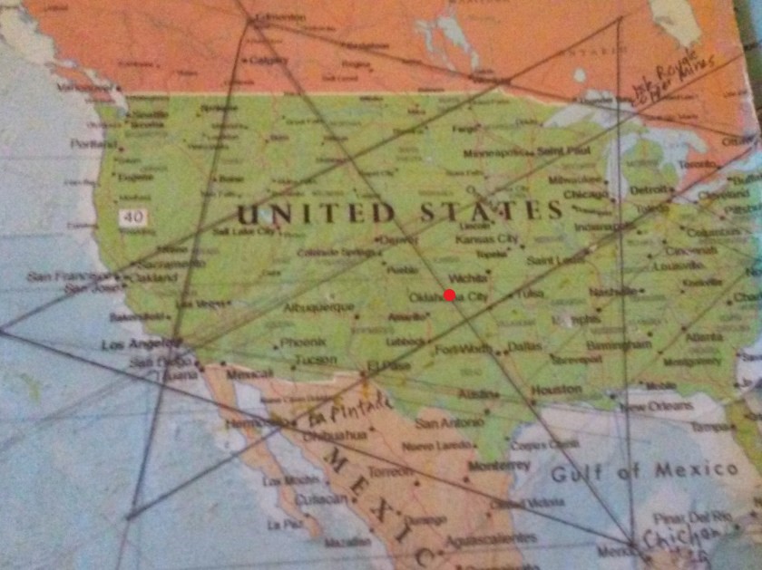
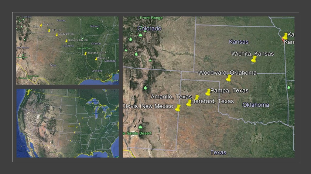
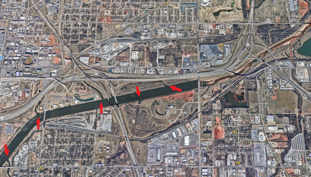
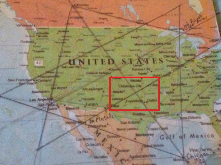
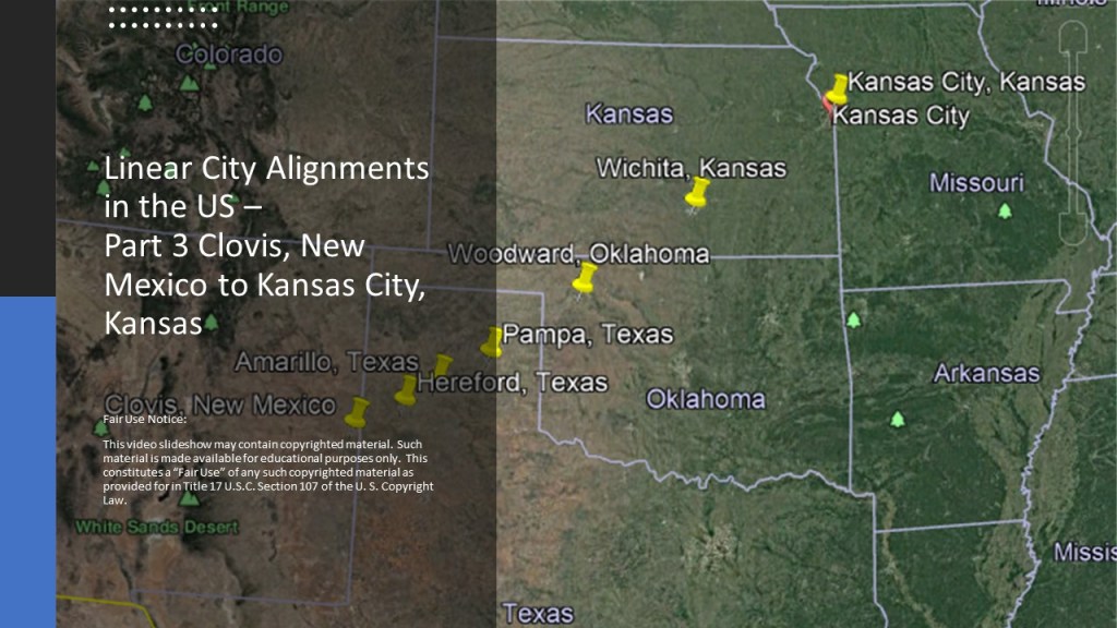
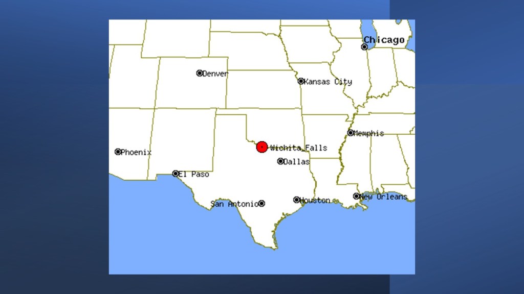
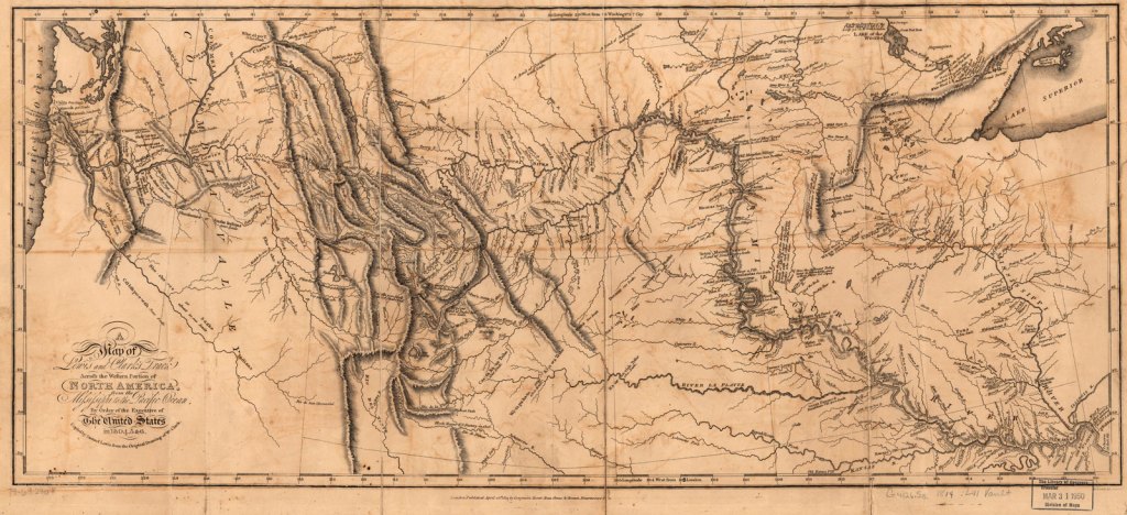
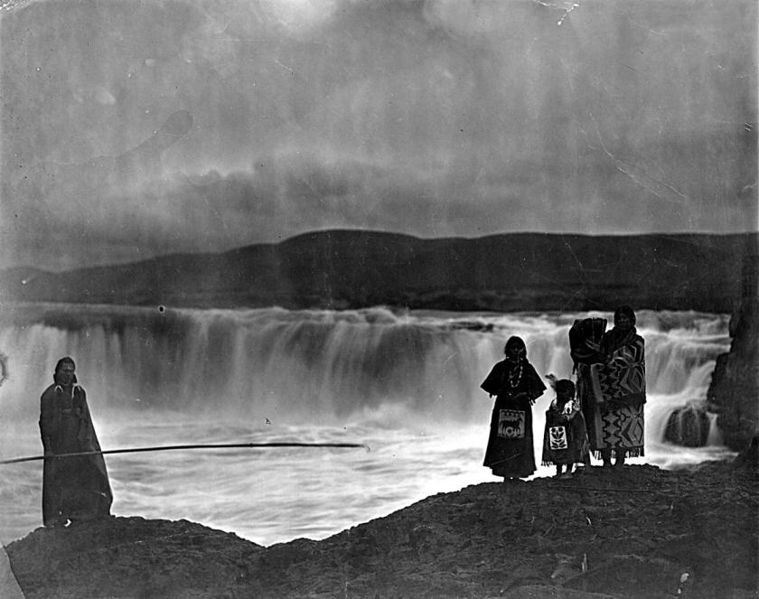
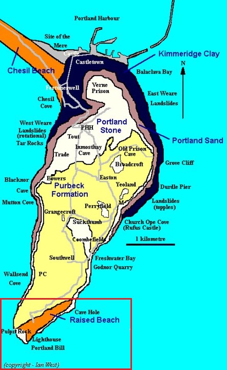
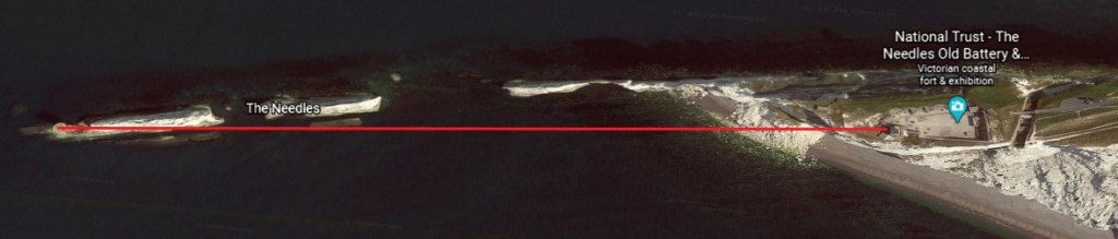
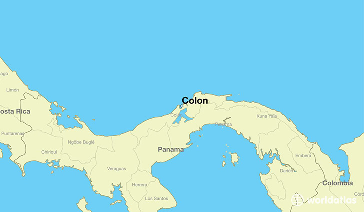
This is the third-part of a four-part series on cities that I found in linear alignment in the United States.

When I was living in Oklahoma City several years ago, during the time I was waking up to all of this, I identified several linear alignments while looking at a map on the internet of the region.

I am showcasing these linear alignments in this series.

For the purpose of this series, each part of this series will be a snapshot of whatever longer alignment this represents, and complete in itself.

Also, let’s see how many county seats we encounter on this alignment.

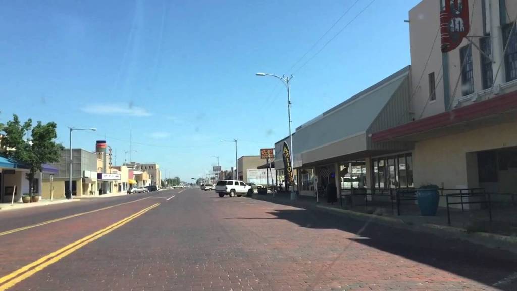
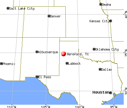
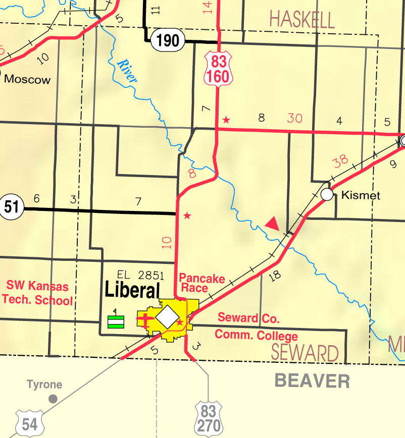
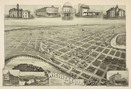
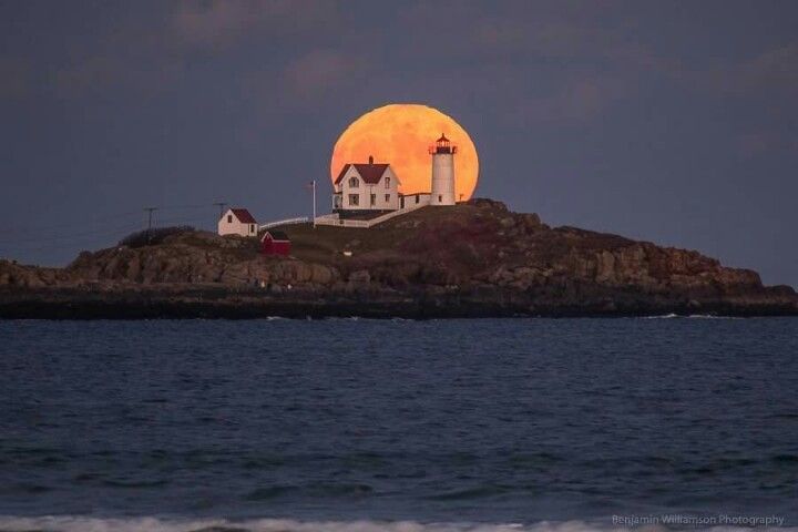
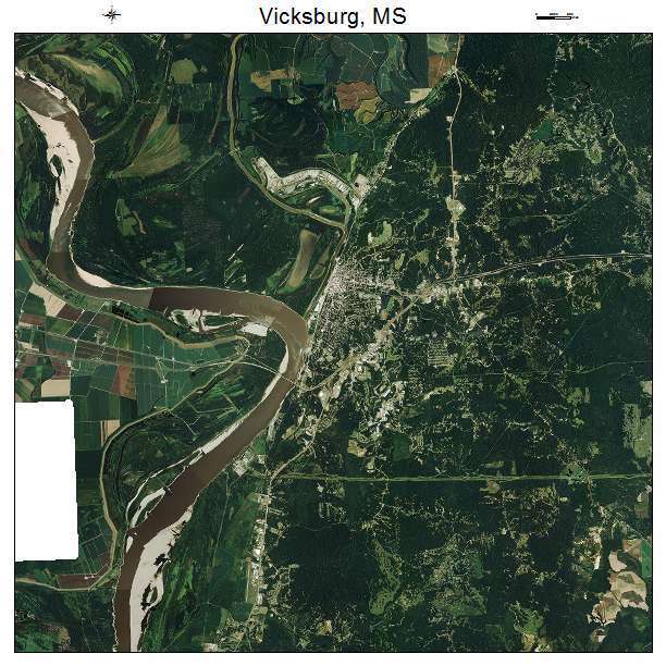
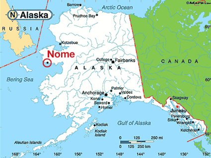
Clovis is the County seat of Curry county in eastern New Mexico.

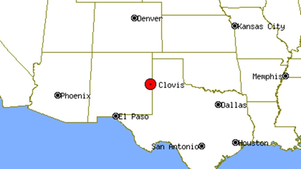
I lived in Clovis for 5 years, between 1989 and 1994, moving there literally right after I got married – I graduated from college on June 3rd, 1989, got married on June 10th, and left Maryland for New Mexico on June 11th.

My in-laws lived in Hereford, Texas (which is also on this alignment) and, since my husband was a military retiree, we ended up in Clovis because of Cannon Air Force Base.

This is interesting to me because I am looking at Clovis with very different eyes now than I did when I lived there 30 years ago.

I didn’t really like living there.

It was flat, stark and boring to me.

It was really hard to make new friends.

People were friendly, but it was hard to get into social circles there.

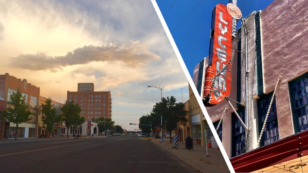
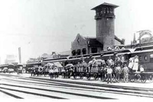
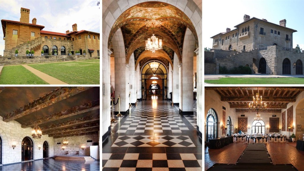
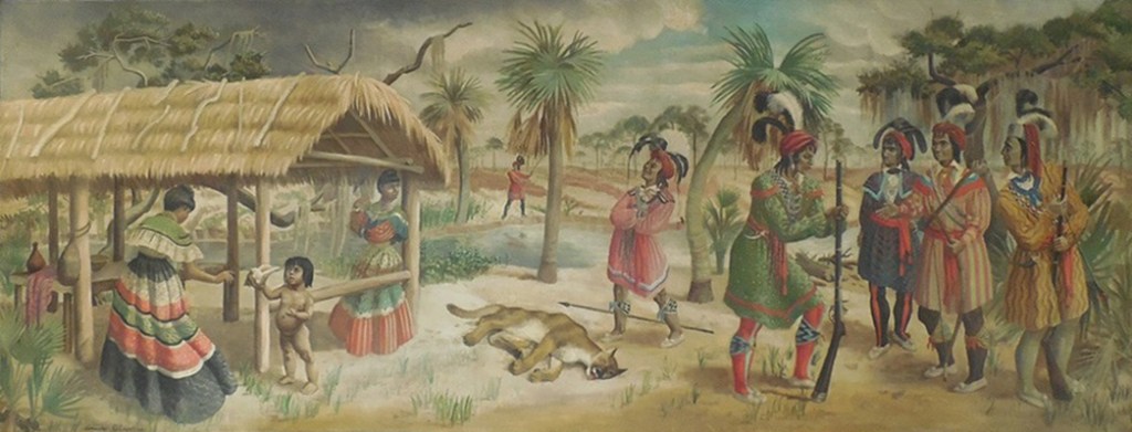
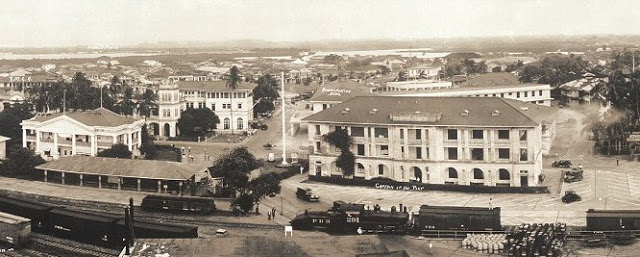
So now, like everywhere else I look, when I see historic photos of the grand architecture that was there, like the Quivera New Santa Fe Hotel Clovis, one of the Harvey House hotels, a chain that was founded by Fred Harvey in 1876 to cater to the growing number of train passengers…

…I see the architecture of the original advanced civilization of North America, instead of the depressing impression I have in my memory of the flat, dusty landscape and the run-down-looking buildings that I remember from when I lived there.

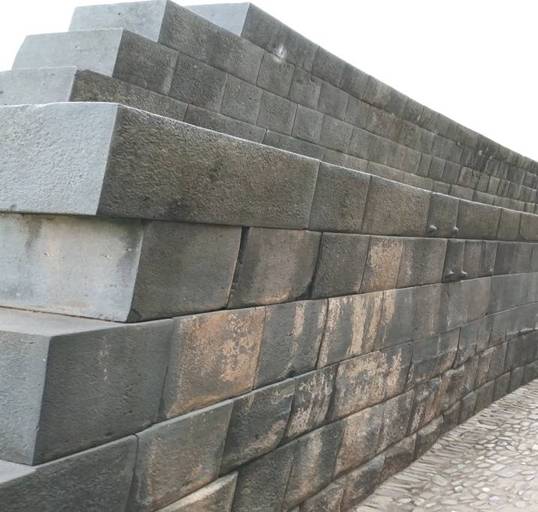
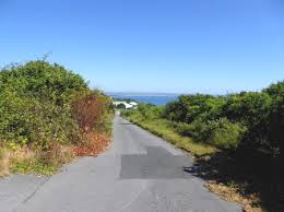
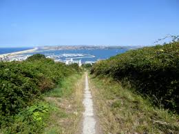
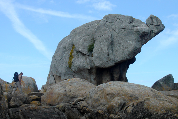
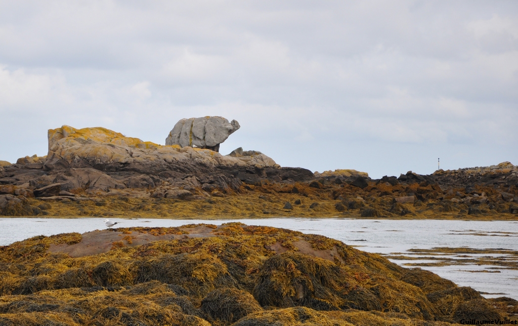
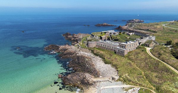
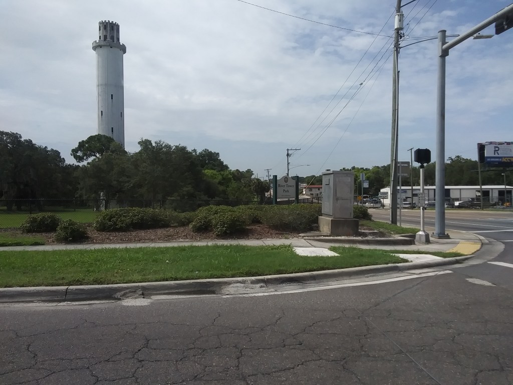
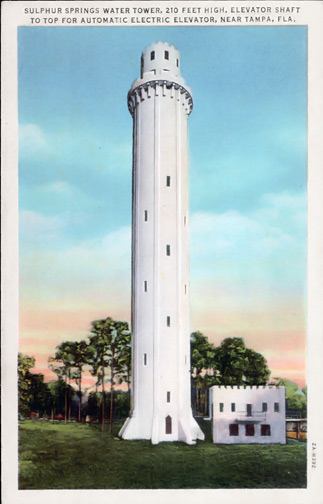
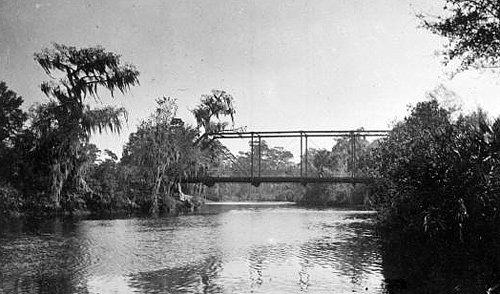
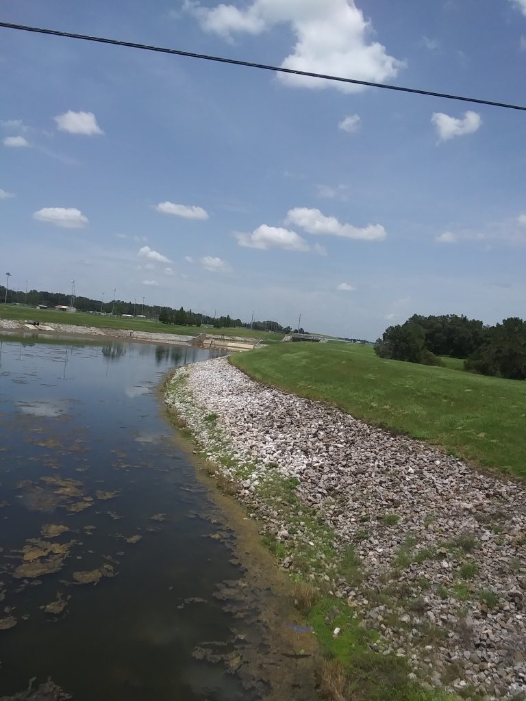
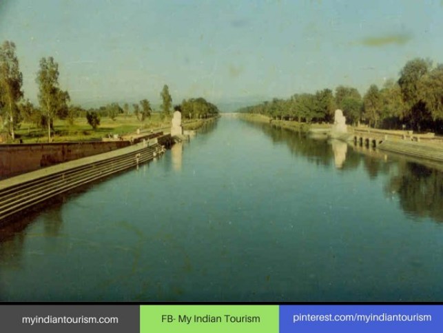
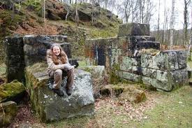
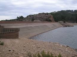
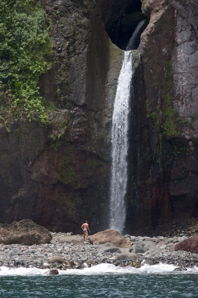
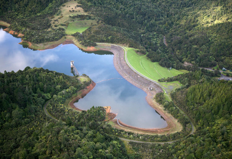
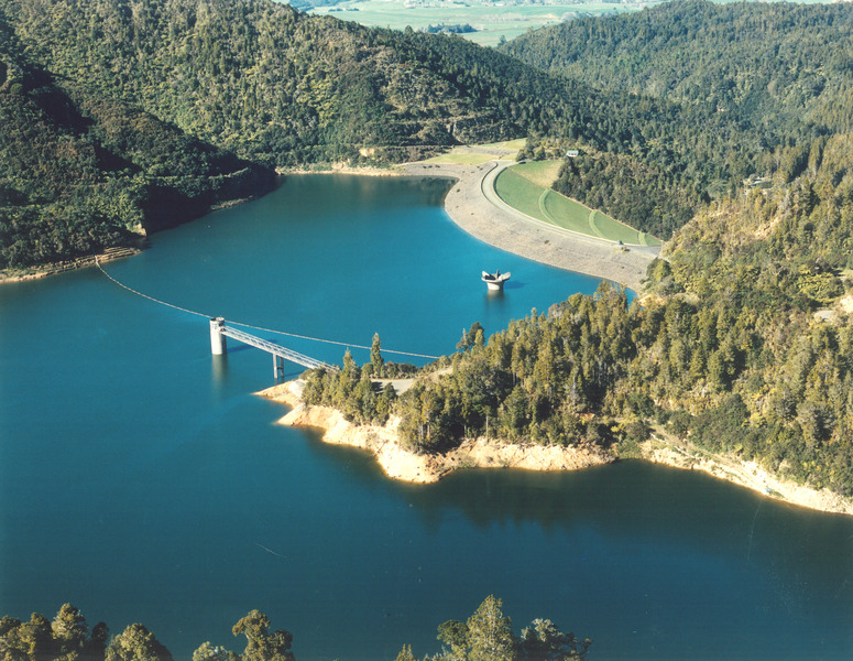
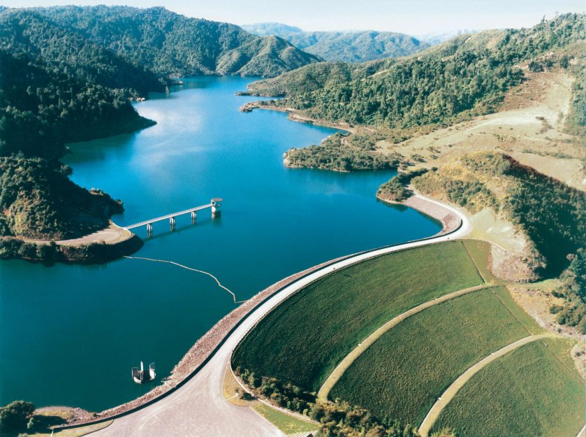
Oasis State Park is located south of Cannon Air Force Base, and southwest of the City of Clovis.

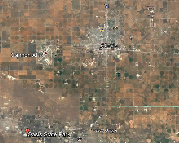
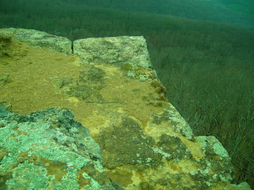
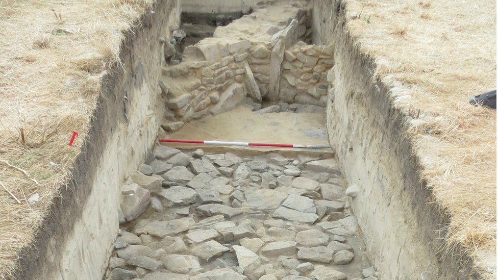
While it is described as a true oasis set among cottonwood trees and shifting sand dunes, what gets my attention are the cut-and-shaped megalithic stone blocks around the edge of the water.

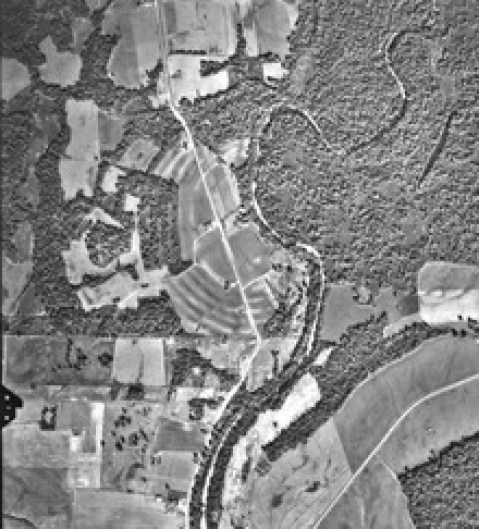
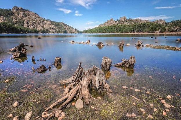
Blackwater Draw is located between Clovis and Portales on Highway 467, one-mile north of Oasis State Park.

It is described as an intermittant stream channel…

…and an important archeological site that was first recognized in 1929 by a local man named Ridgely Whiteman, with Blackwater Locality No. 1 being the type-site of the Clovis Culture.

The Clovis Culture is called a prehistoric Paleoamerican culture of the first cultures that inhabited the Americas, dating back 13,000 to 11,000 years BP, or Before Present…

…and characterized by the manufacture of bone-and-ivory Clovis Points, which were characteristically-fluted projectile points.

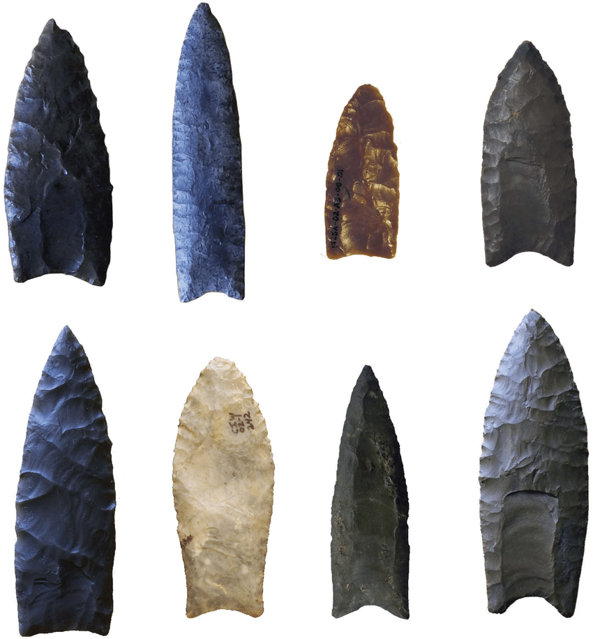
We are told the Blackwater Draw location was a place where generations of the continent’s earliest inhabitants camped and hunted for mammoth, camel, horse, bison, saber-toothed cat, Sloths and dire wolf.

There are also what are called sand dunes, or sand hills around Oasis State Park and Blackwater Draw.

I have long suspected there is enduring infrastructure underneath places in the world with sand dunes, like these in Saudi Arabia’s Empty Quarter, which I found out about by tracking an alignment.

While we are here, let’s see what else is in Portales before going back to Clovis.

Portales is located 17-miles, or 27-kilometers from Clovis.

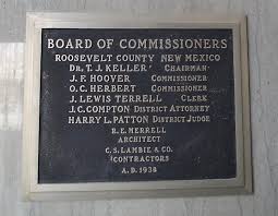
Portales is the county seat of Roosevelt County.

This is the Roosevelt County Courthouse and Jail, said to have been built by the Works Progress Administration, and completed in 1938….

…and said to have been designed by Clovis architect Robert E. Merrell and built in Art Deco Style 1938…

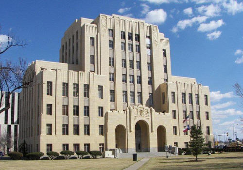
Robert E. Merrell was also given the credit for the Curry County Courthouse in Clovis, said to have been built in 1936…

…over the site of the preceding Curry County Courthouse, said to have been built in 1910 by the J. Sterling Marsh Manufacturing Company.

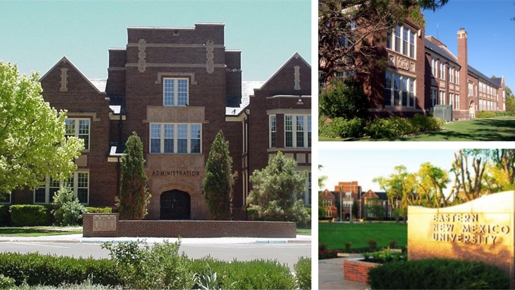
The main campus of Eastern New Mexico University (ENMU) is located in Portales, with construction said to have started in 1931 and completed in 1934.

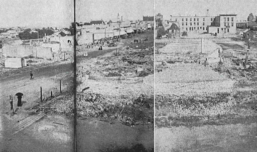
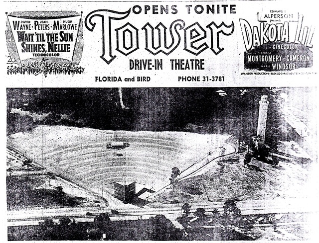
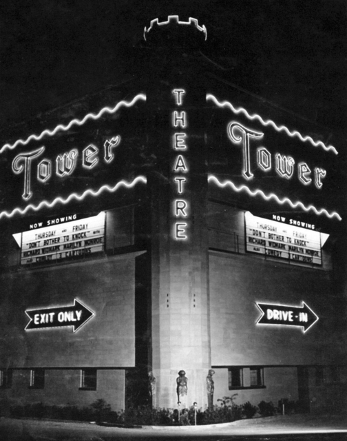
Apparently, on March 11th of 1978, downtown Portales was said to have caught on fire from an electrical short at the sweet potato warehouse, the sparks from which blew into the original Tower Theater’s air conditioning ducts, and by the time the fire was put out, six buildings were destroyed or damaged, and caused $2-million to $3-million in damage.

Nothing suspicious about the explanation for that start of that fire, right?!

Now, back to Clovis.

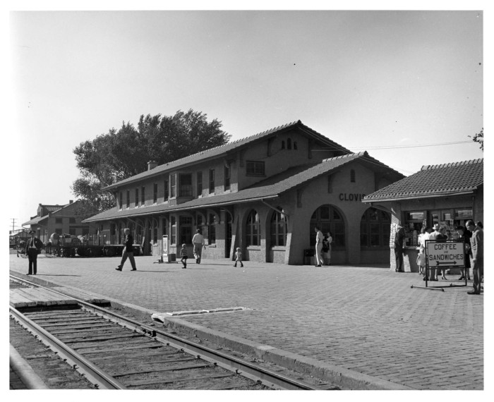
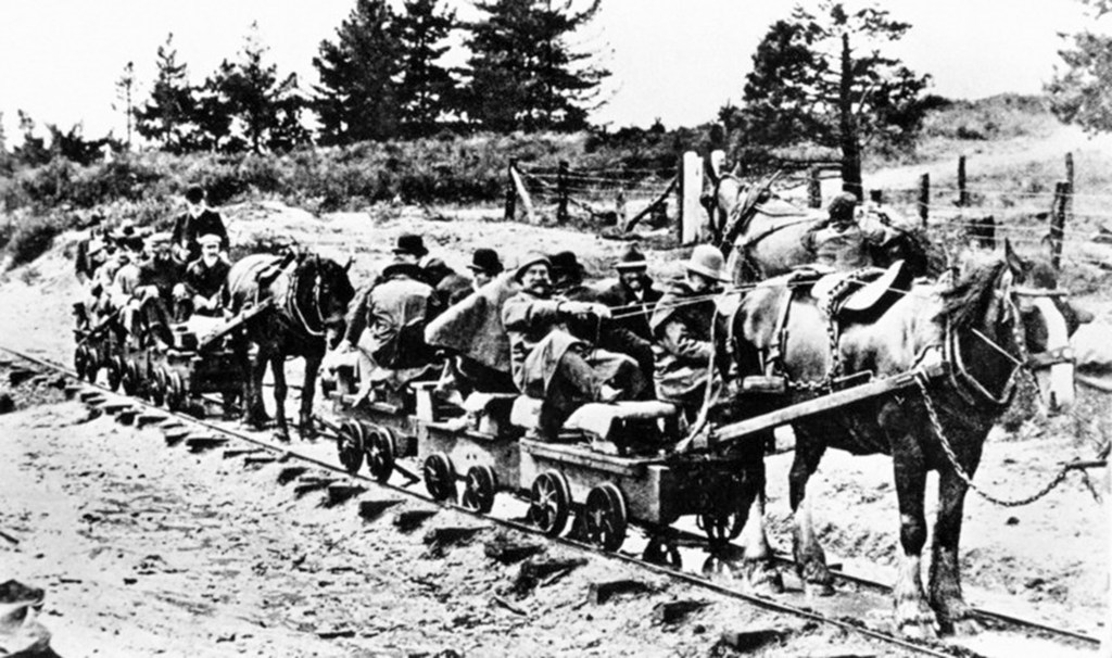
The history of Clovis began 1906, we are told, when the Atchison, Topeka, and Santa Fe Railroad was being constructed through the area, and the railway engineers were ordered to select a town site.

The story is the city was named by the station master’s daughter, who was studying at the time about Clovis, the King of the Franks, and believed to be the founder of the French Merovingian Dynasty in the 5th-century AD.

The City of Clovis was incorporated in 1909.

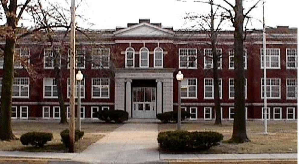
The Marshall Junior High School building is still in use today, and was said to have been constructed in 1936 as part of Franklin Roosevelt’s New Deal Public Works Administration.

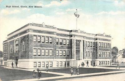
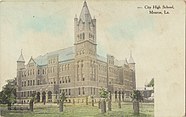
This is an historic post card of the old Clovis High School building, for which I can’t find any information about.

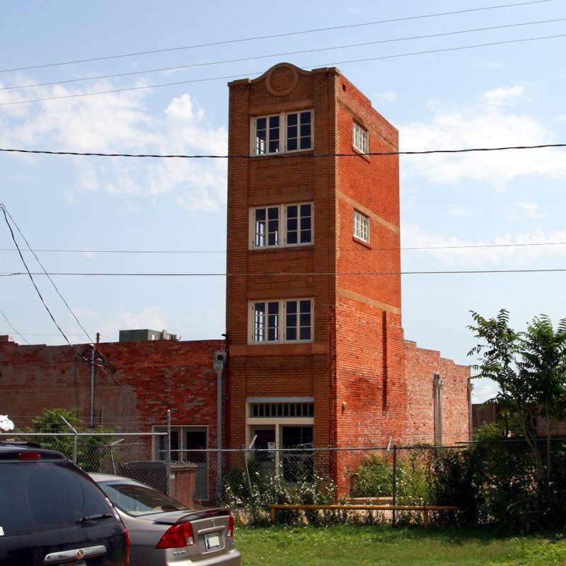
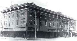
Robert E. Merrell, the local courthouse architect, was also given credit for designing the Hotel Clovis, an art-deco building said to have opened in 1931.

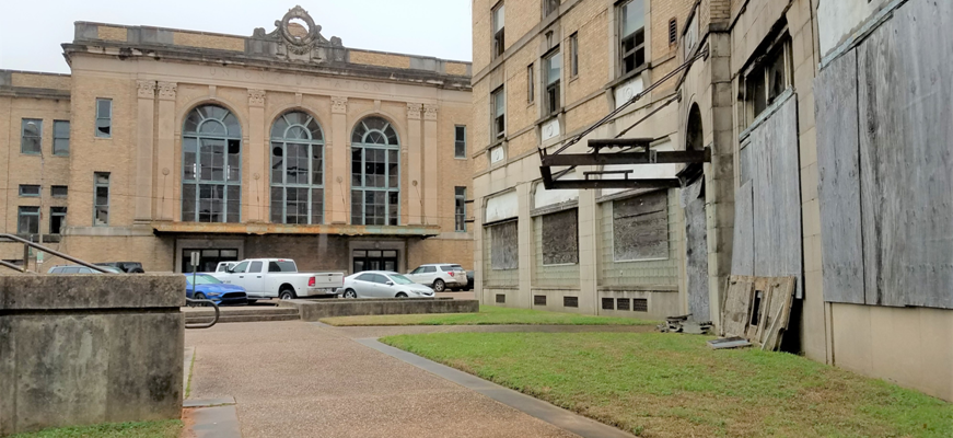
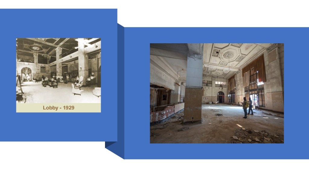
The hotel has been closed since 1983, and renovation plans to turn the building into apartments and commercial space has not come to fruition.

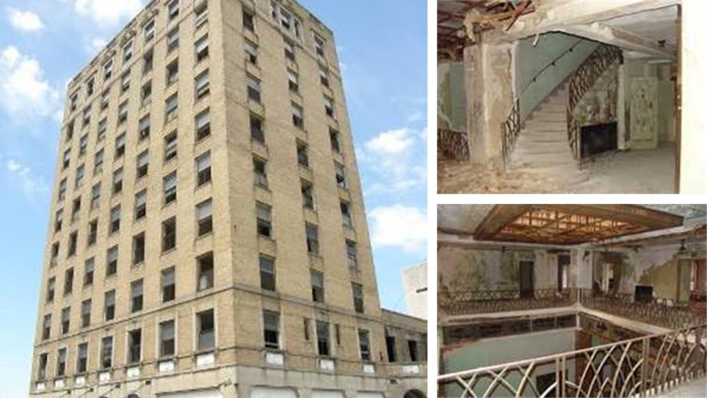
The story and appearance of the Hotel Clovis on the left is a lot like that of the Hotel McCartney on the right in Texarkana, which was said to have been built in 1929, and abandoned in the mid-1970s.

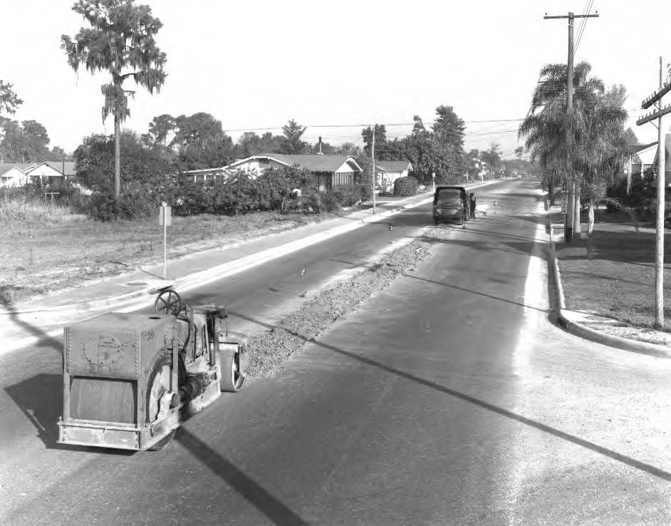
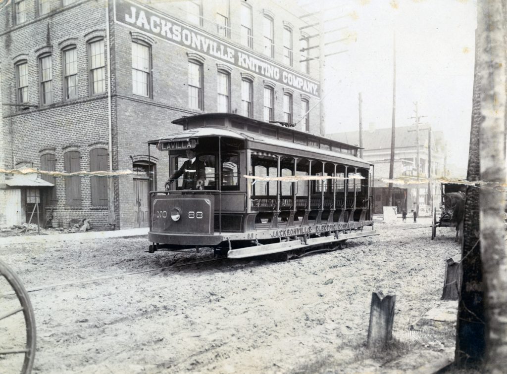
The main street of Clovis is paved with bricks.

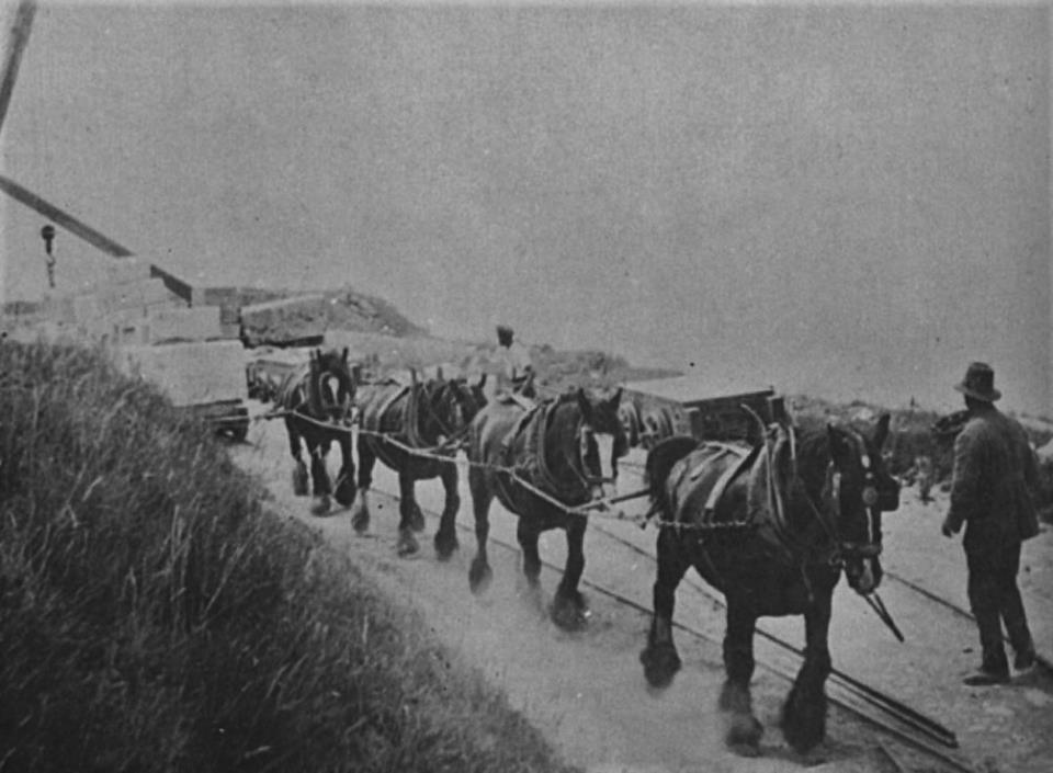
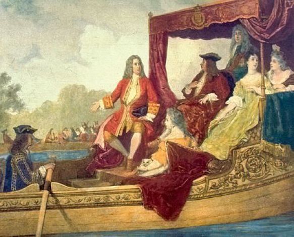
We are told the first patent for paving brick roads was obtained in 1889 by Mr. Mordecai Levi, from Charleston, West Virginia…

…after which time we are told 1,000s of brick-making companies sprang up in the late 1800s and early 1900s to meet the demands of the millions of bricks needed to pave 1,000s of miles of streets throughout the United States.

I did some research about the U. S. Patent Office on the subject of prism pavement lights awhile back.

Information about things being patented that were actually already there led me into wondering if, for example, the historical U. S. Patent Office played the same role as the Smithsonian Institution in covering up True History.

This is the old U. S. Patent Office, said to have been built between 1836 and 1867, with this image of it said to be circa 1846.

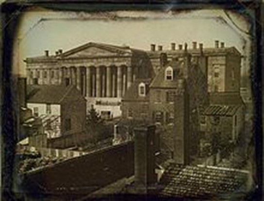
Today the Old Patent building houses two Smithsonian Institution Museums:  the National Portrait Gallery and the Smithsonian American Art Museum.

We are told that the original designer of the building in the Greek Revival Design, Robert Mills, was removed for incompetence in 1851, and that the building was eventually completed under the direction of the Dean of American Architecture during that time, Thomas U. Walter, in 1867.…and the year the American Civil War ended. 

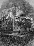
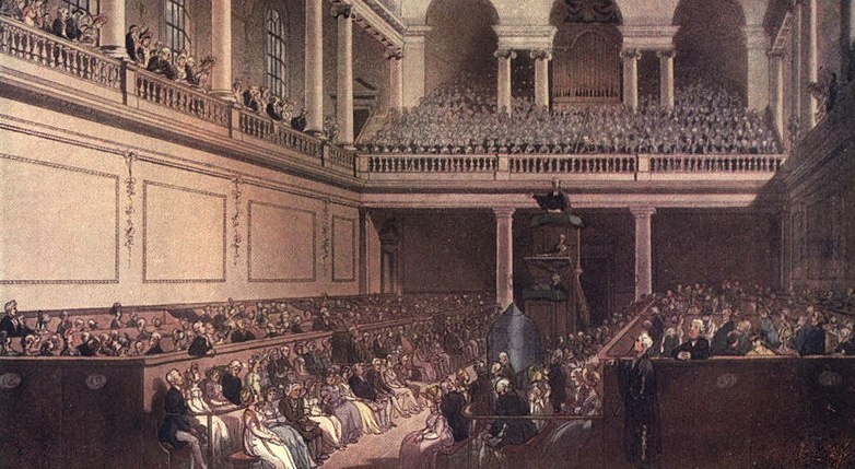
Then in 1877, a fire in the buildings west wing destroyed some 87,000 patent models and 600,000 copy drawings.

This is said to be a picture of one of the Old Patent Office’s model rooms between 1861 – 1865 (all of the years of the Civil War)…
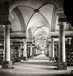
Food for thought.

Hillcrest Park in Clovis is a 140-acre complex that has…

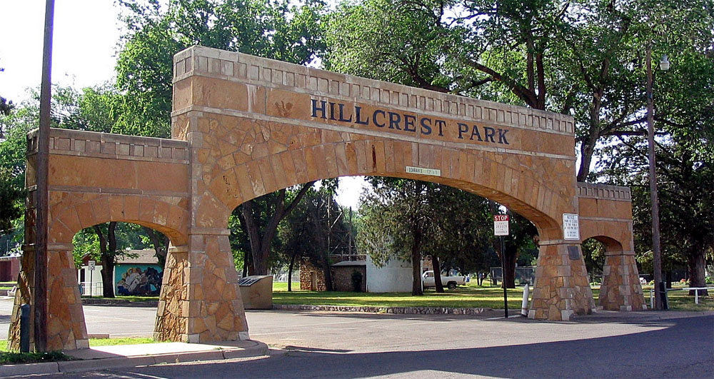
…a sunken garden used for things like weddings…

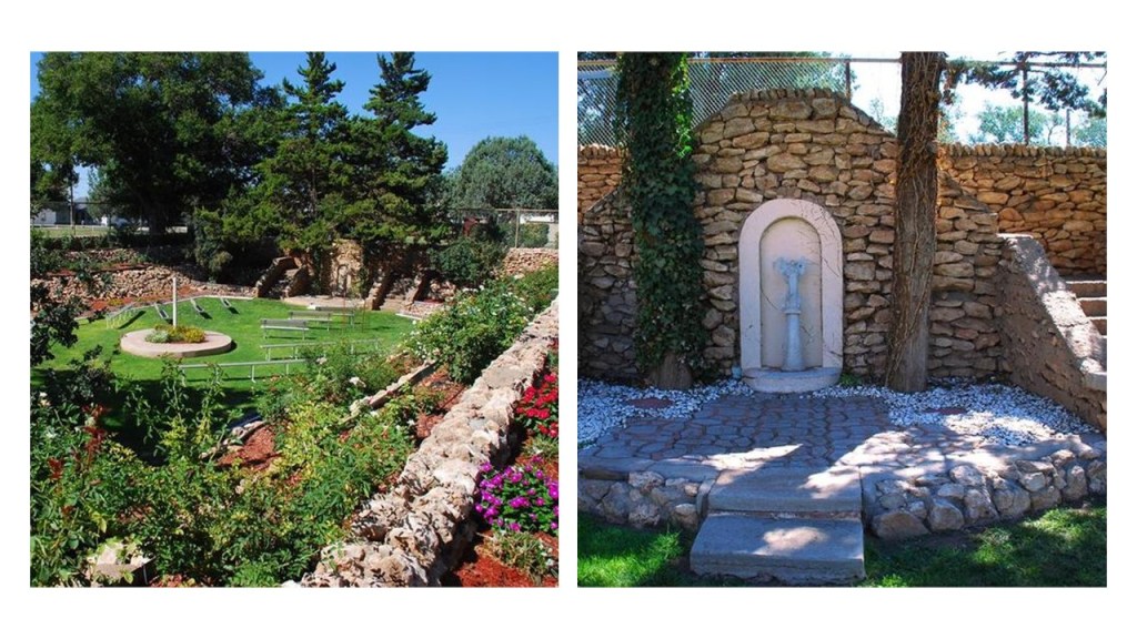
…and has a zoo that is the second-largest in New Mexico.

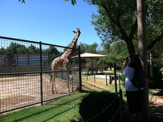
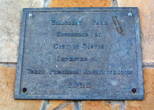
We are told the stone features of Hillcrest Park were the result of a Works Project Administration effort in 1935.

One more thing to share before I leave Clovis.

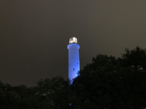
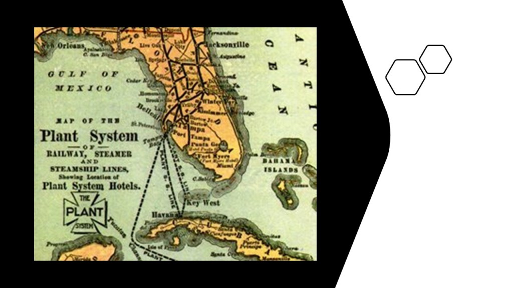
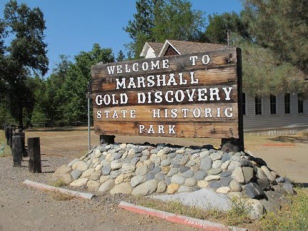
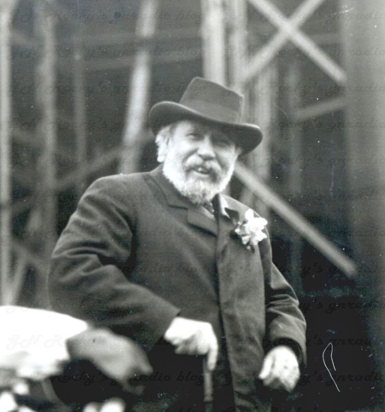
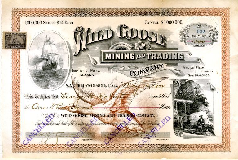
Clovis was planned to be the centerpoint of a national Super-Grid and become a renewable energy hub.

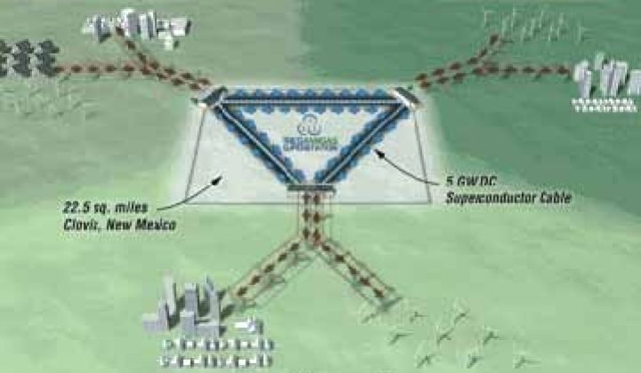
The project, called Tres Amigas, was planned to link three discrete North American electrical grids, the western, eastern, and Texas Interconnections, on state-owned land slightly north of Clovis.

Clovis was the planned location for it because it is where all three grid systems meet.

To my knowledge this project has never came into being.

The next city on the alignment is Hereford, the county seat of Deaf Smith county in Texas.

Hereford was founded in 1899, we are told, after the Pecos and Northern Texas Railroad was incorporated in 1898 to construct the railway between Amarillo, Texas, to Farwell, Texas, at the Texas – New Mexico state lines.

Residents named the town “Hereford” in honor of the local Hereford cattle ranchers, which originate from Herefordshire in England.

Hereford is known as the “Beef Capital of the World” because of the large number of cattle fed in feedlots in the area.

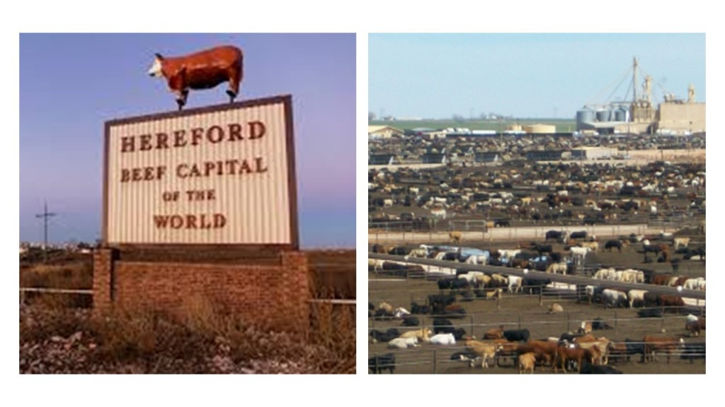
It sure smells like it. The memory of that pervasive manure smell is permanent!

This is the Deaf Smith County Courthouse, said to have been built in 1910 by Chamberlin & Company in Classical Revival Style, and the second marble courthouse built in the United States.

Notice there are red brick streets in Hereford as well in the photo on the right.

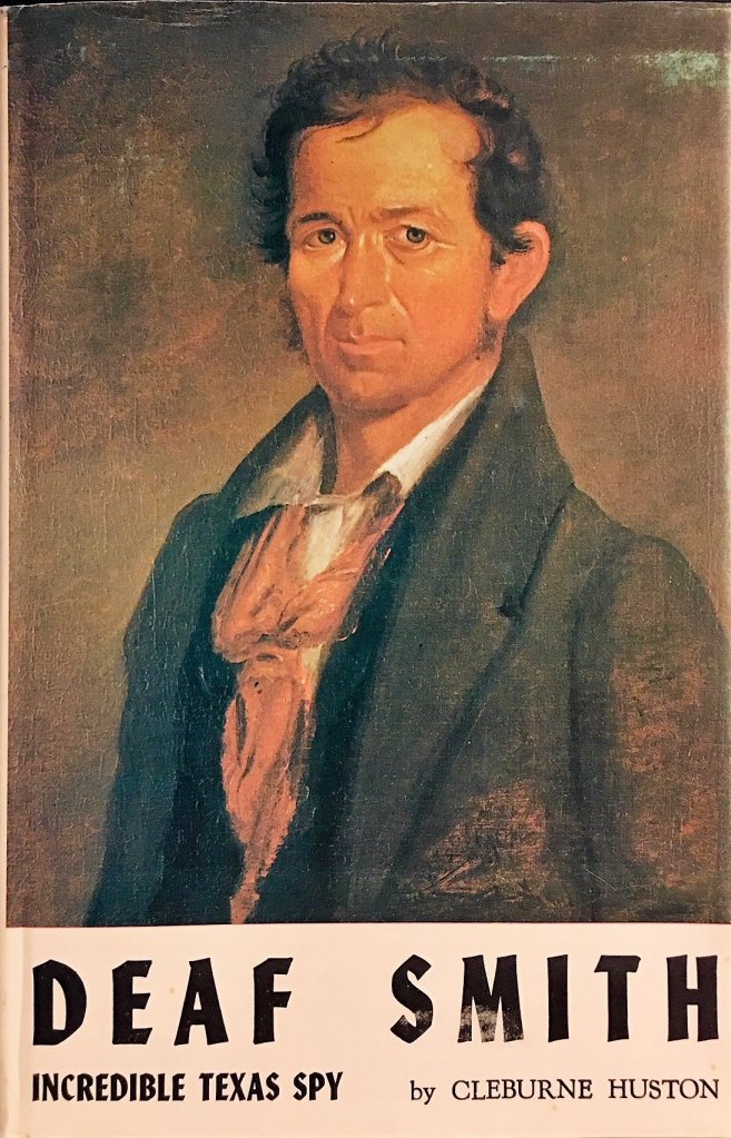
The county was named for Erastus “Deaf” Smith, a partially-deaf frontiersman who played a part in the Texas Revolution of 1835 – 1836.

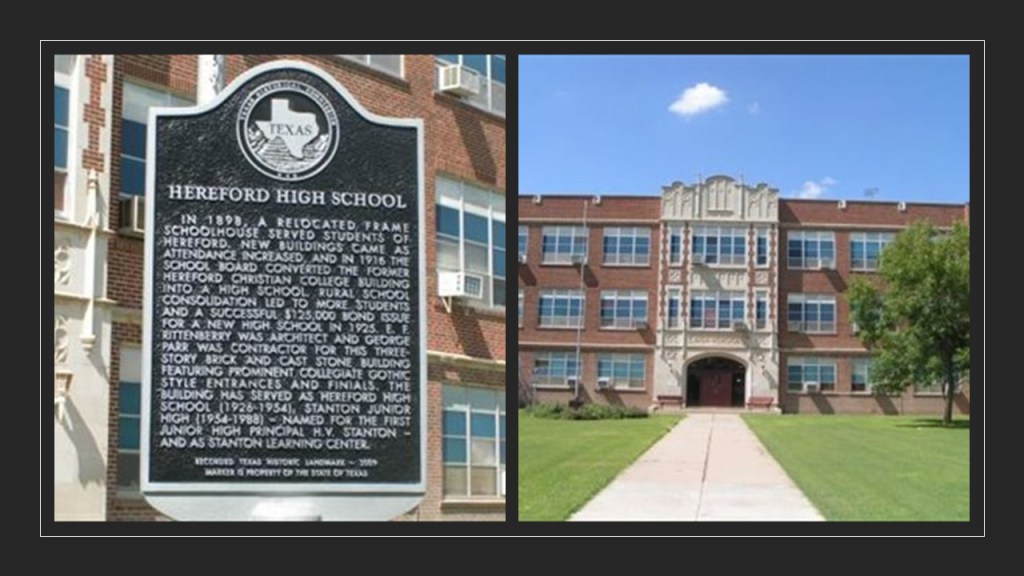
This building served as the Hereford High School from 1926 to the new one was built in in 1954, and is still in use today as the Stanton Learning Center.

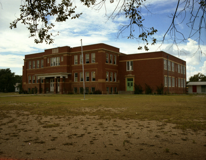
…and this is a photo of Hereford’s Old Central School, which was said to have been built in 1910.

This was a picture of St. Anthony’s Catholic Church in Hereford in 1927…

…and St. Anthony’s since 1951.

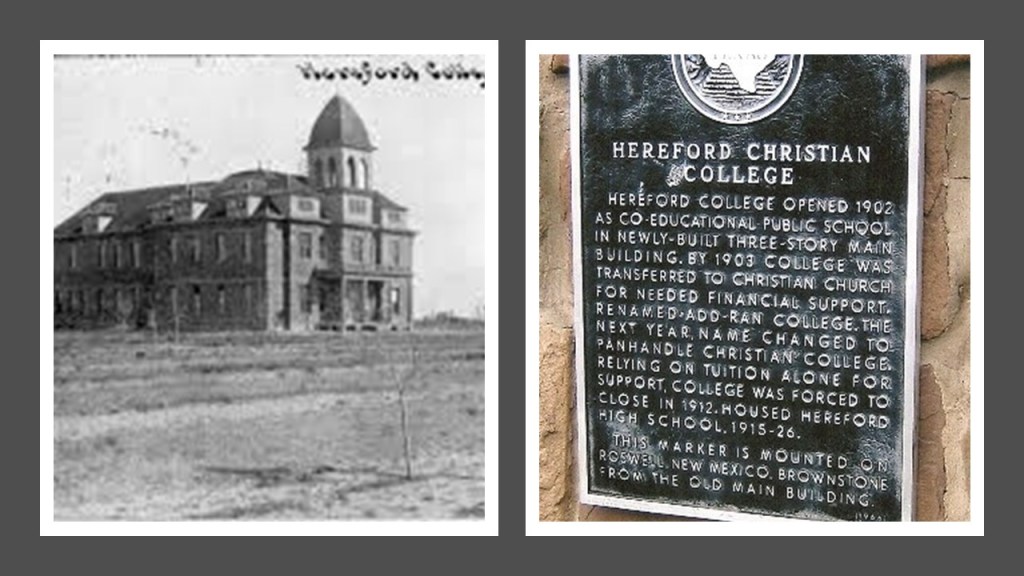
How about this photo of Hereford Christian College sometime between the time it opened in 1902 and closed as a college in 1912.

Before I leave Hereford for the next place on the alignment, I want to share where my in-laws were laid to rest in Hereford – father-in-law, mother-in-law, aunt-in-law, and some others.

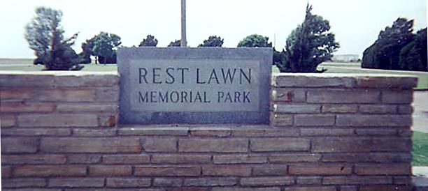
Whether or not I liked living in this part of the world, I do have family memories and connections here.

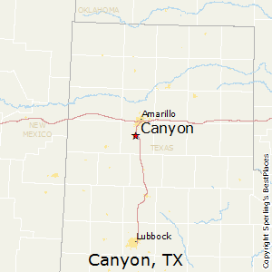
The next place I want to make a stop at on the way to Amarillo is Canyon, the county seat of Randall County.

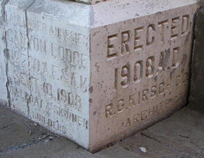
This the Old Randall County Courthouse in Canyon…

…was said to have been built in the Texas Renaissance Style between 1908 and 1909.

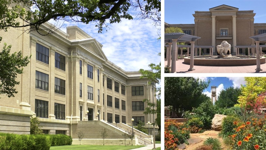
Canyon is the location of West Texas A & M University, established in 1910…

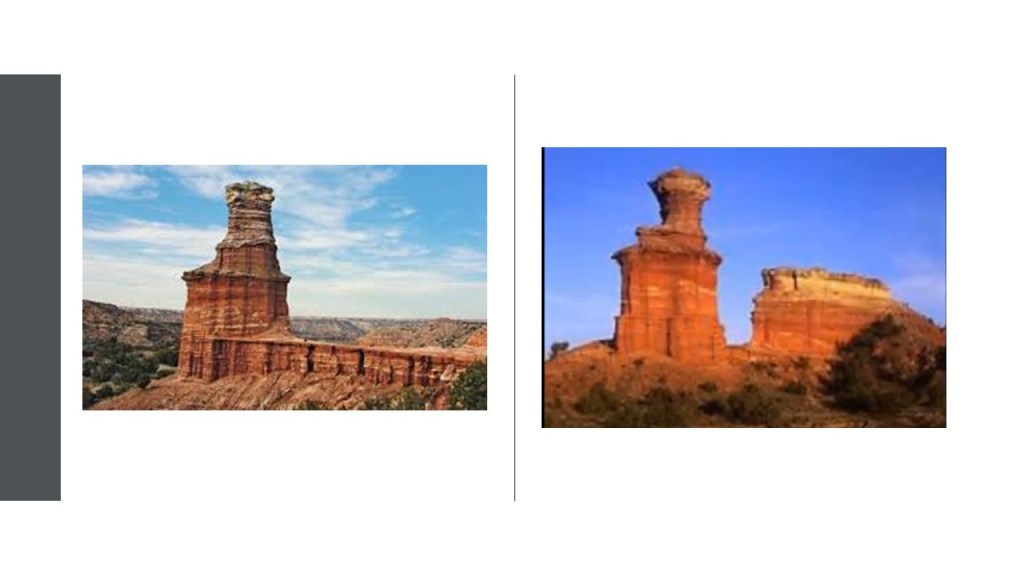
…and Palo Duro Canyon, the second largest canyon in the United States.

Here you can see the TEXAS Musical in the summer with the history of Texas we have been taught…

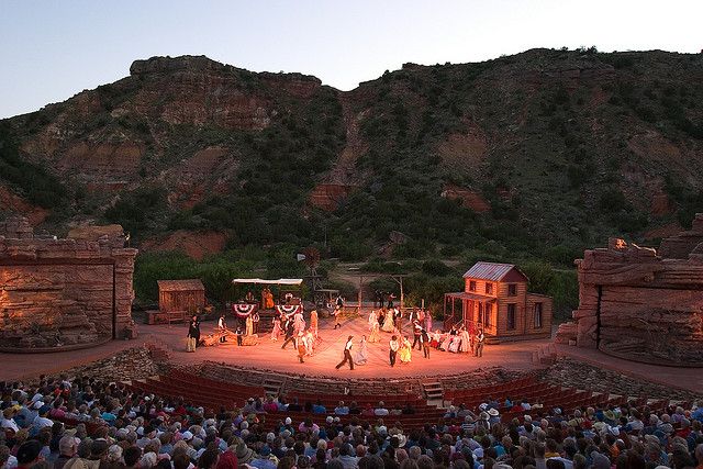
…in the park’s outdoor amphitheater.

I noticed the stonemasonry all around the amphitheater stage.

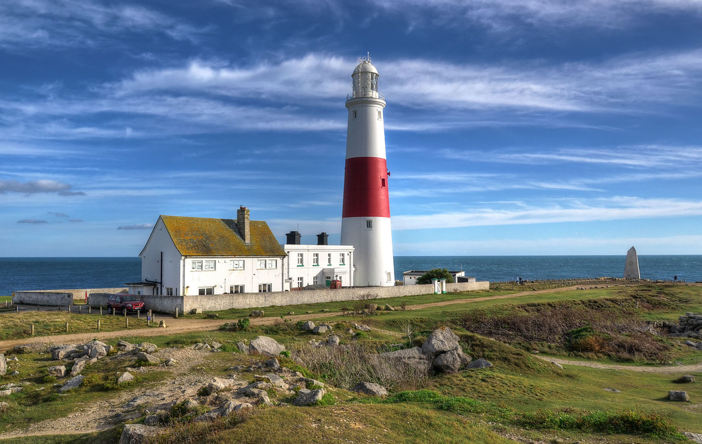
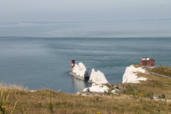
The feature in the canyon known as the Lighthouse, on the left, has a twin in Big Bend National Park in south Texas, on the right.

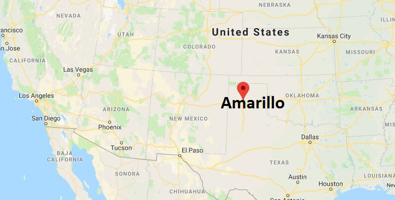
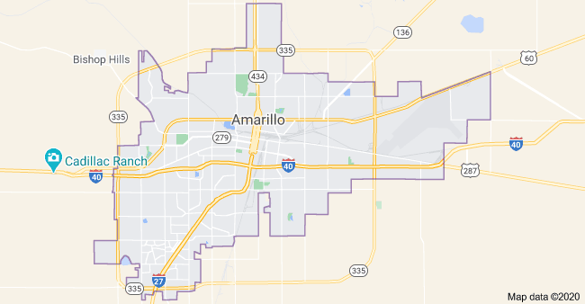
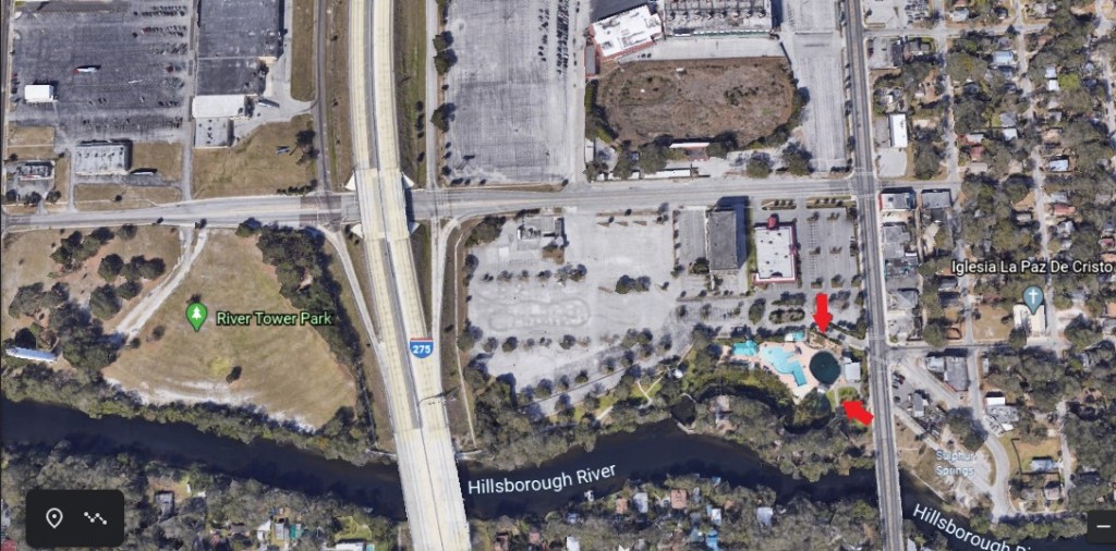
The next place on the alignment is Amarillo, the largest city in the Texas Panhandle, and the seat of Potter County.

There are two places that immediately come to mind when I think of Amarillo.

One is the Cadillac Ranch, located just west of Amarillo on I-40.

The Cadillac Ranch is described as a public art installation and sculpture by an art group known as Ant Farm.

It was installed in the landscape in 1974.

There are ten cadillacs, spanning the generations of the evolution of the car model’s tail-fin between the years 1949 and 1963.

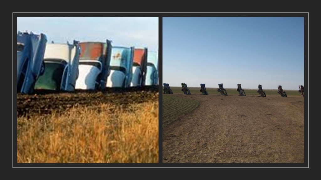
Over the years, the appearance of the Cadillacs has changed dramatically!

The other place that I immediately associate with Amarillo is the massive signage next to I-40 advertising the Big Texan Steak Ranch.

I don’t remember ever eating there, but I sure remember the sign…

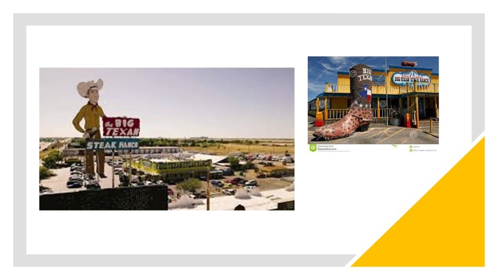
…and they advertise a free 72 oz steak dinner…

…for anyone who can consume it completely in one-hour.

If you can’t complete the contest, you owe the Big Texan 72-bucks for your 72-oz steak dinner.

There are large ranches in the Amarillo area.

The oldest, and still-functioning today, is the JA Ranch.

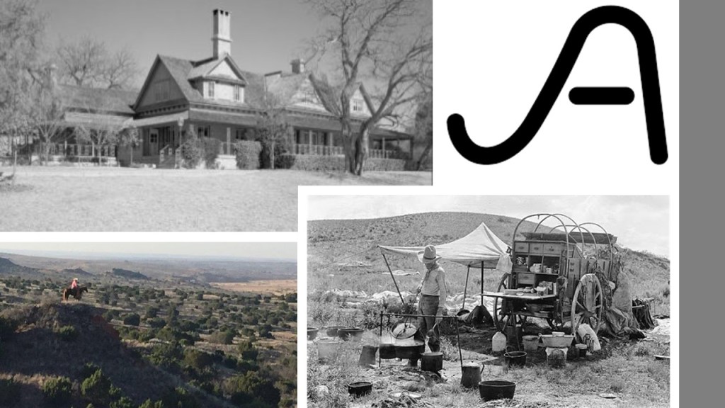
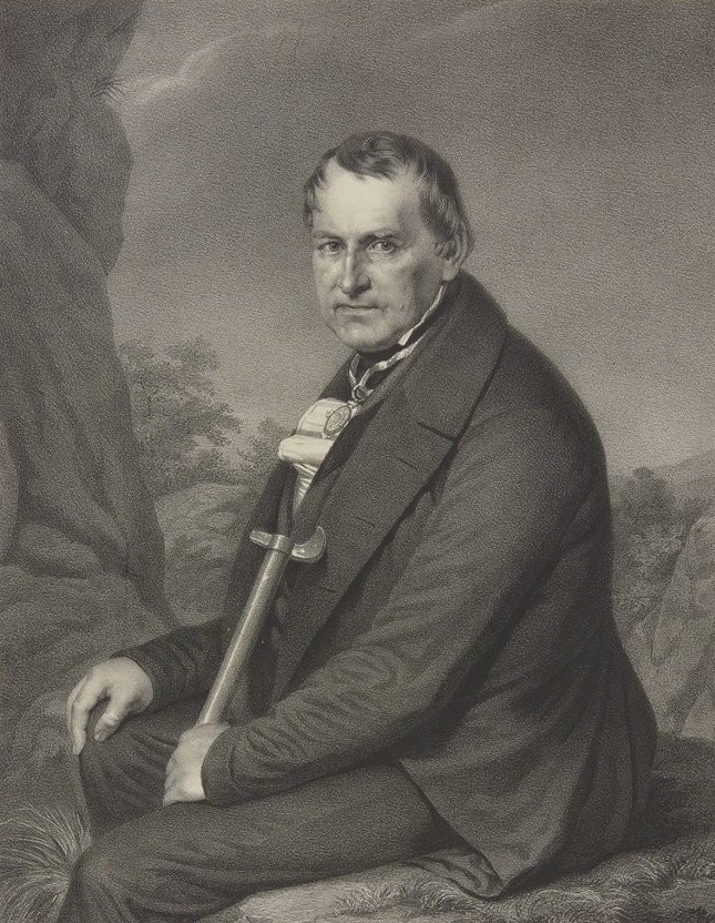
It was founded in Palo Duro Canyon on the outskirts of Amarillo in 1877 by Charles Goodnight, sometimes called the “Father of the Texas Panhandle,” and John Adair, an Irish businessman.

The Fort Worth and Denver City Railroad provided the needed freight service to contribute to Amarillo’s growth as a cattle-marketing center in the 19th-century.

The railroad was chartered by the Texas Legislature in 1873, and operated from 1881 to 1982.

The location for Amarillo was established in 1887, when we are told that the location was chosen for being on a well-watered section of Fort Worth and Denver City Railroad, which had begun building across the Texas Panhandle.

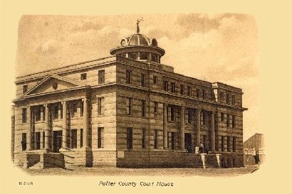
Originally named Oneida, the city that later became known as Amarillo was immediately chosen as the seat of Potter County in 1887.

This drawing on the left was of the 1896 Potter County Courthouse.

The building, located at 5th Avenue and Bowie, had the tower and third-floor removed.

It was used by the Texas DMV for awhile, and it looks like the building is still standing according to Google Earth, pictured on the right.

This postcard depicts the 1906 Potter County Courthouse.

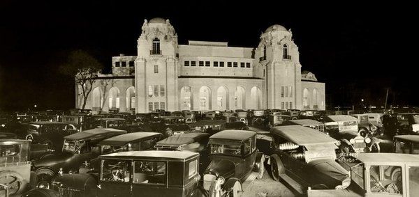
The 1932 Potter County Courthouse was said to have been designed by an Amarillo architectural firm in Art Deco style, and built between 1930 and 1932 with a crew of more than 500 local laborers.

Then, after only 54-years of use, the 1932 Potter County Courthouse was replaced yet again in by the current courthouse which was said to have been built between 1984 and 1986.

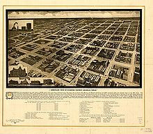
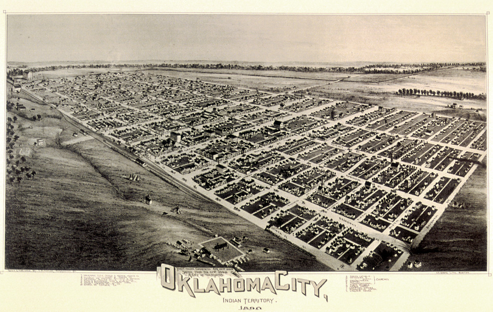
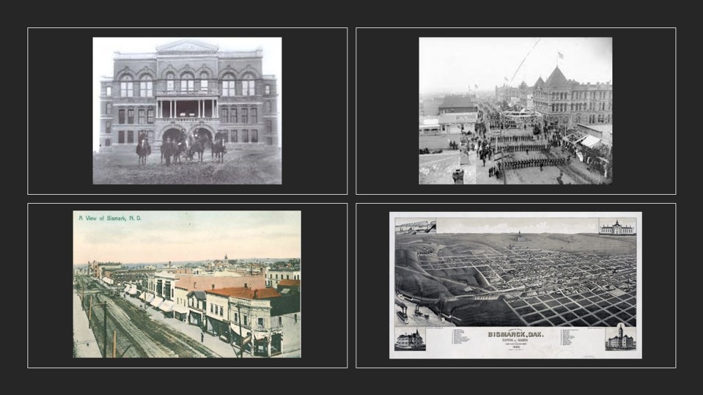
By the late 1890s, Amarillo was one of the busiest cattle-shipping points in the world, and its population was growing significantly.

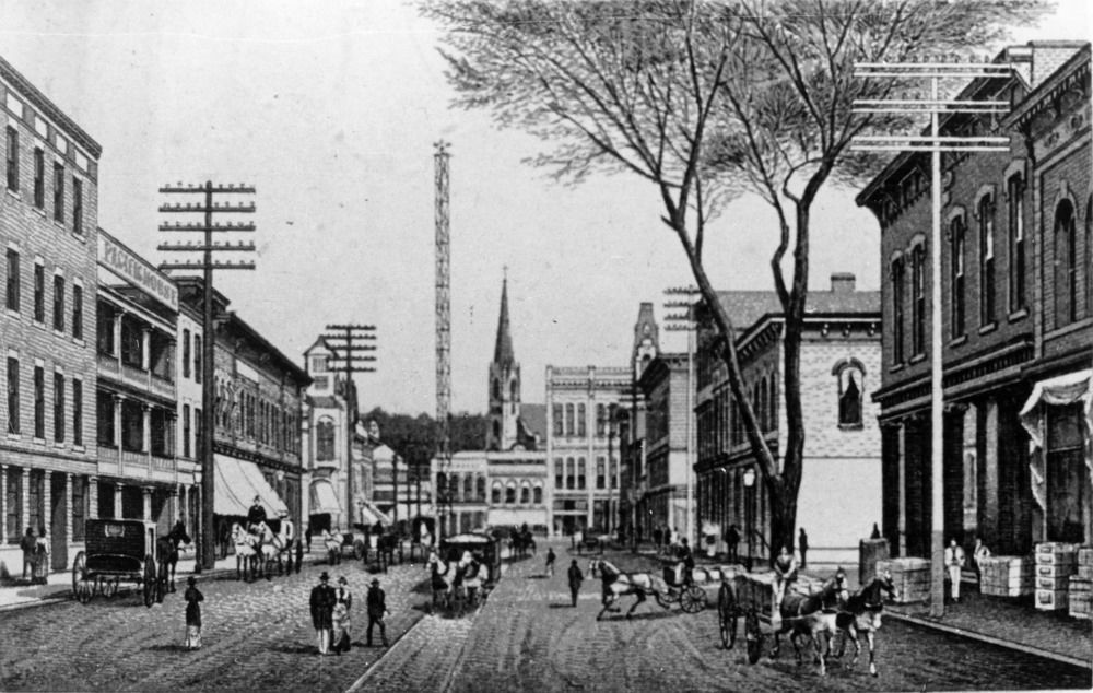
This illustration was said to depict Amarillo’s downtown business district in 1912.

This photo was of Amarillo’s Grand Opera House in 1910.

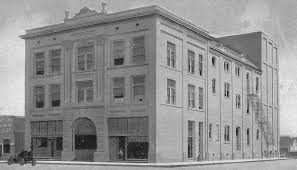
We are told it was destroyed by fire in 1919.

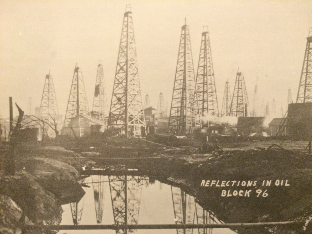
The natural gas and oil industries started to come to Amarillo when natural gas was discovered here in 1918.

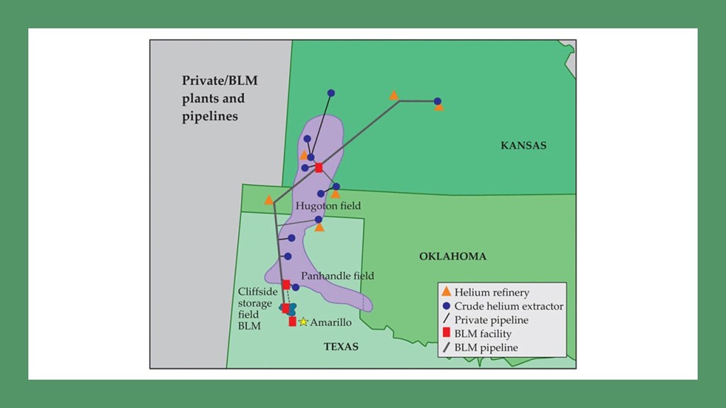
The U. S. government purchased the Cliffside Gas Field, which had a high helium content, in 1927, and was the sole producer of commercial helium for a number of years.

The U. S. National Helium Reserve is stored in the Cliffside Gas Field’s Bush Dome Reservoir.

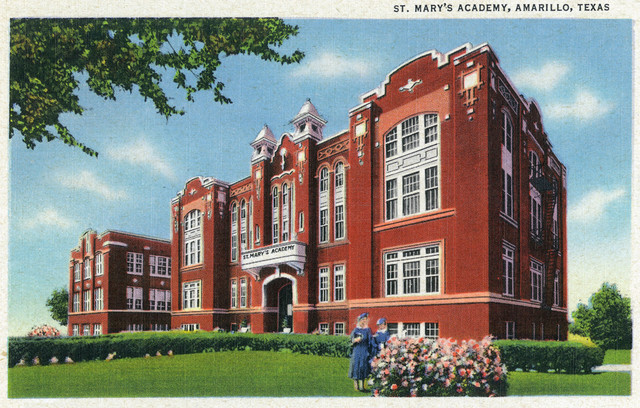
The oldest private school in Amarillo is St. Mary’s Cathedral School.

The current building originaly looked like this, and became the location in 1913 of what was then called the St. Mary’s Academy.

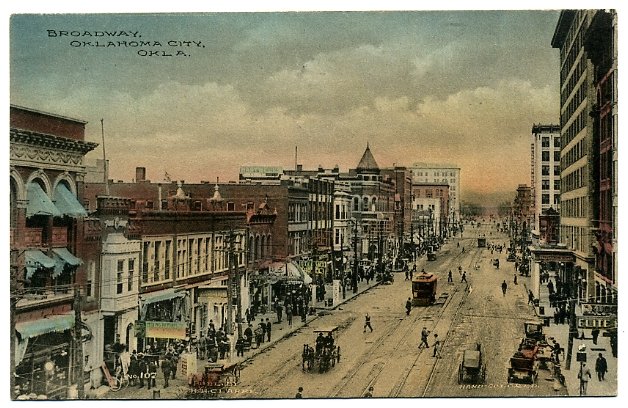
Polk Street is the downtown historic district of Amarillo.

The former Herring Hotel is on Polk Street.

It was said to have been one of three oil-boom-era hotels built in the 1920s.

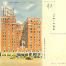
Though it is the only one of those three hotels that is still standing, it was abandoned in the 1970s.

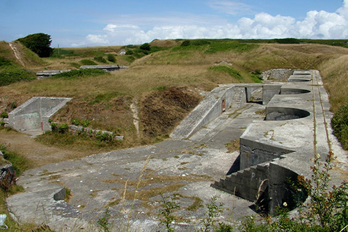
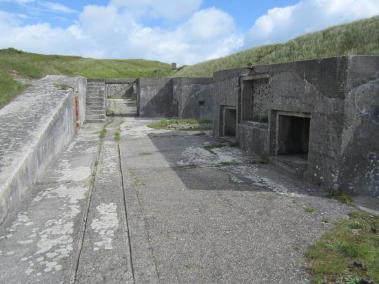
Moving northeast out of Amarillo along the alignment, just 17-miles, or 27-kilometers away, we find Pantex, the primary nuclear weapons assembly and disassembly facility of the United States.

It is a major national security site, and its grounds and air-space are strictly controlled.

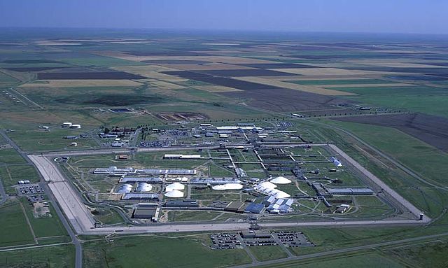
The country’s largest, federally-owned wind farm is at the Pantex plant…

…and the construction of which was part of an effort to reduce carbon emissions by federal agencies.

It is significant to note that there are so-called wind turbines all across the landscape of the Texas Panhandle along I-40.

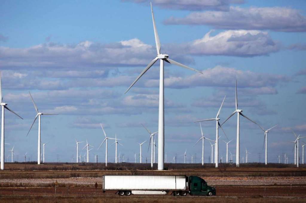
I have serious doubts as to these turbines being powered by wind, and suspect some other kind of energy technology powering them.

I have watched them and the turbines seem to turn at the same speed regardless of whether or not the wind is blowing.

Just my opinion, but I wonder about what is really going on here.

As well, I have encountered their presence on alignments I have tracked all over the Earth.

The next city on this alignment is Pampa, the seat of Gray County in Texas.

Pampa was founded in 1888 on the Santa Fe Railroad line…

…and we are told that in 1892, received its current name for the location’s resemblance of the surrounding prairie lands to the Pampas in Argentina.

We are told the Texas Panhandle Oil Boom spread to Pampa, and that the city showcased its newfound wealth with elaborate downtown construction with Beaux Arts architecture.

Still functioning as the city’s main fire station, the Central Fire Station was said to have been built in 1919.

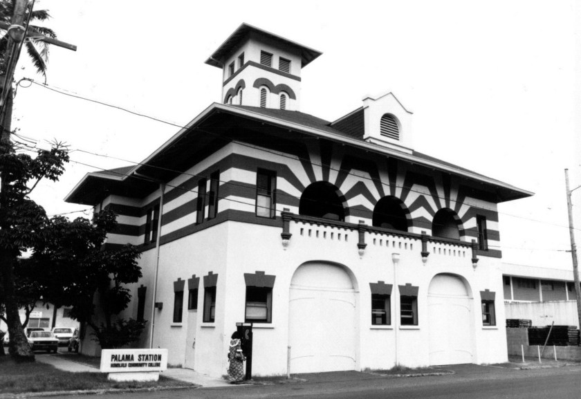
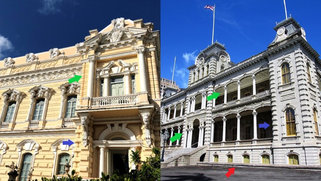
What is interesting to me is that I have found basically the same architectural idea in the design of fire houses in very different places around the world, like Honolulu’s Palama Fire Station on the Hawaiian Island of Oahu…

…the fire station in the small down of Jerome, in Arizona’s Verde Valley near Cottonwood and Sedona…

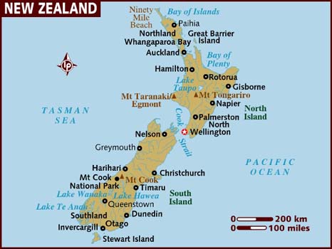
…this one in the country of New Zealand, in the South Pacific Ocean…

…and this one in the city of Birmingham in England.

The Pampa City Hall was said to have been constructed in 1930 at the center of the “Million Dollar Row.”

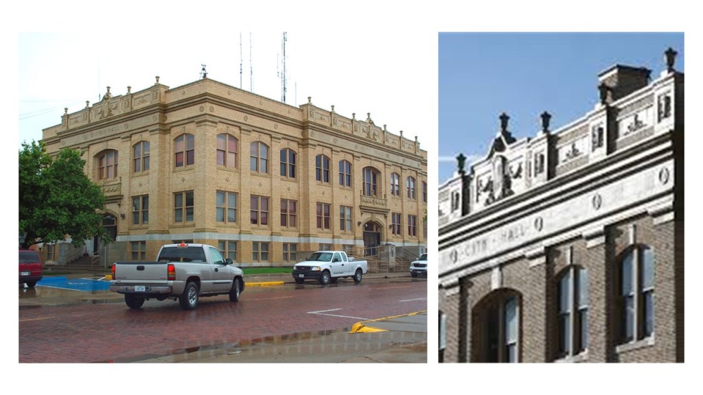
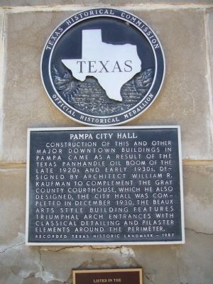
The Gray County Courthouse, also on the Pampa’s “Million Dollar Row,” was said to have been completed in 1929, and designed by Amarillo architect W. R. Kaufman.

It’s telling that they painted the year on the building.  Frequently, they at least engrave it when they are falsely taking credit for building the architecture.

Downtown Pampa has red brick streets as well.

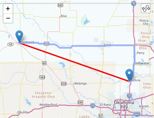
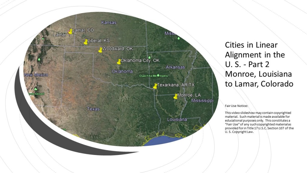
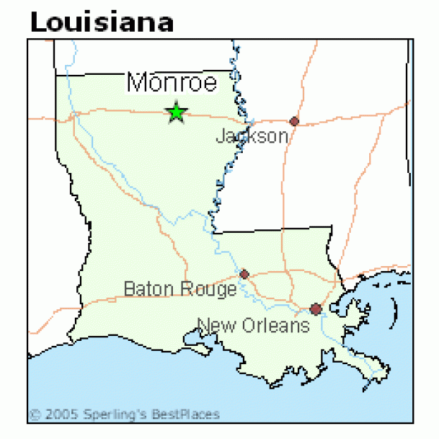
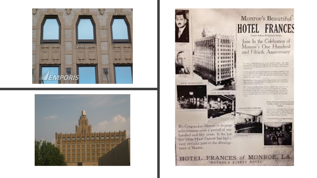
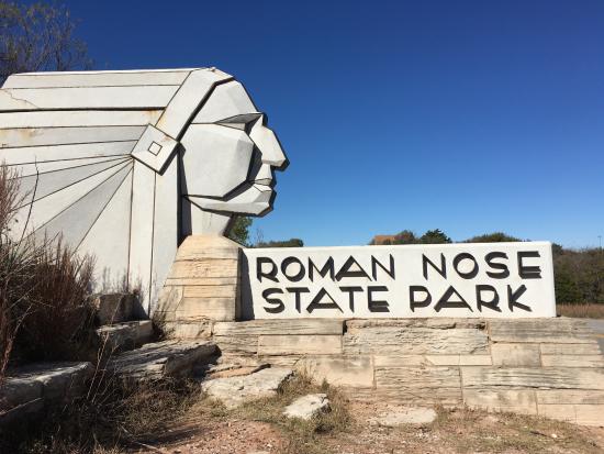
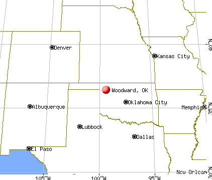
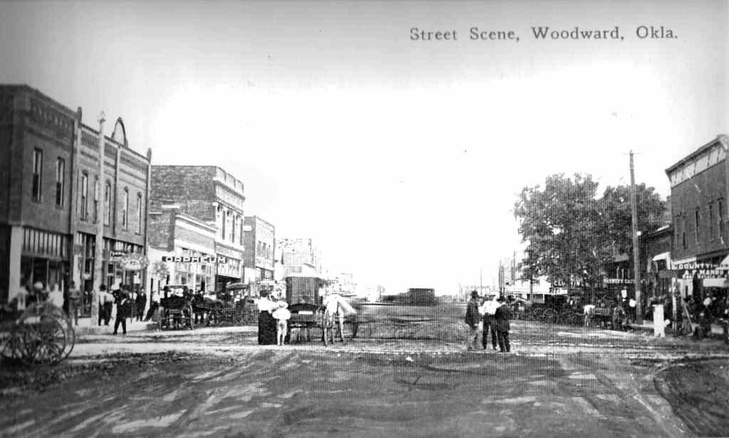
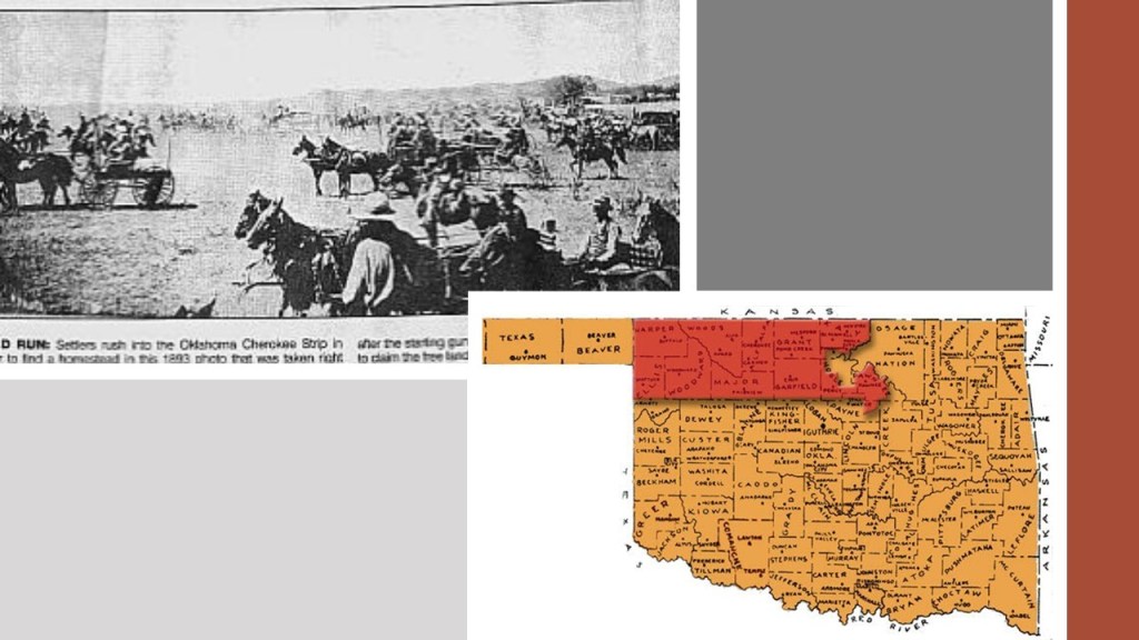
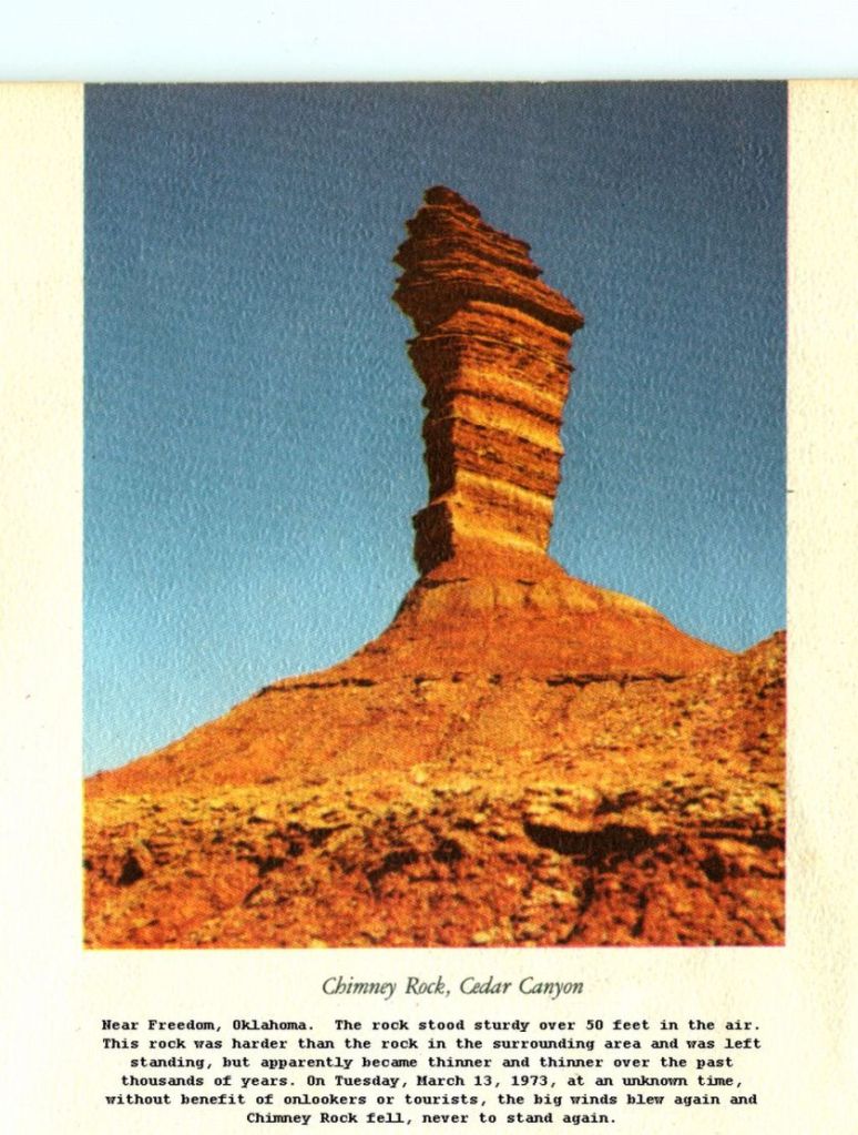
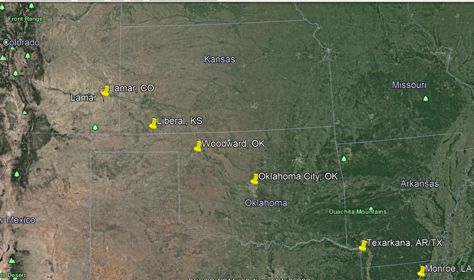
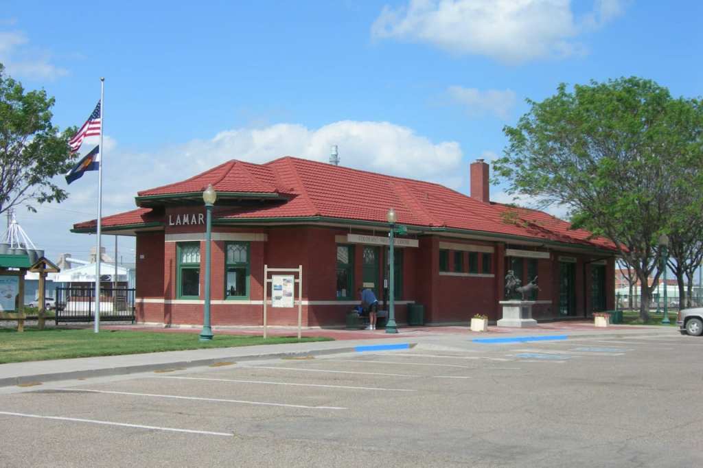
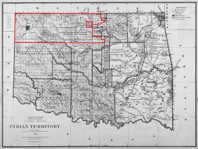
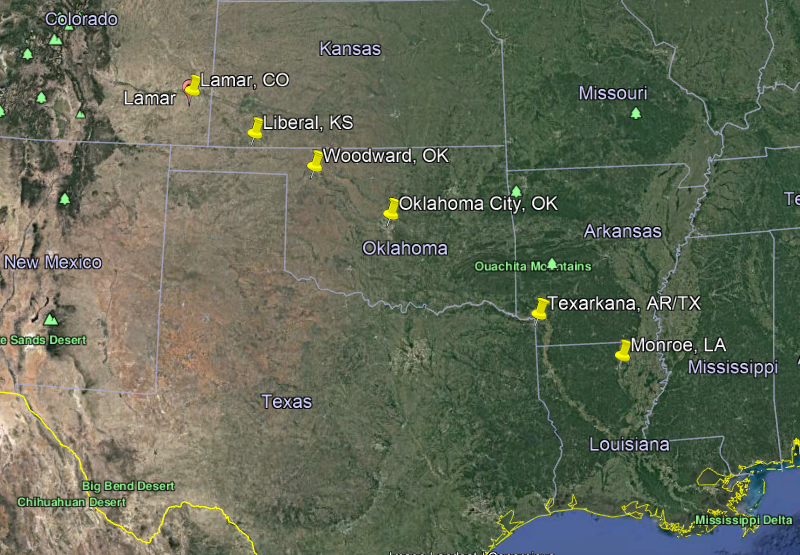
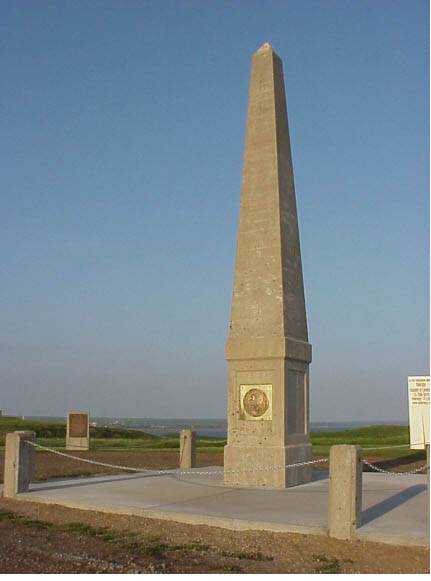
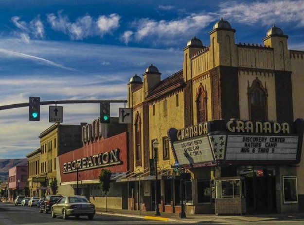
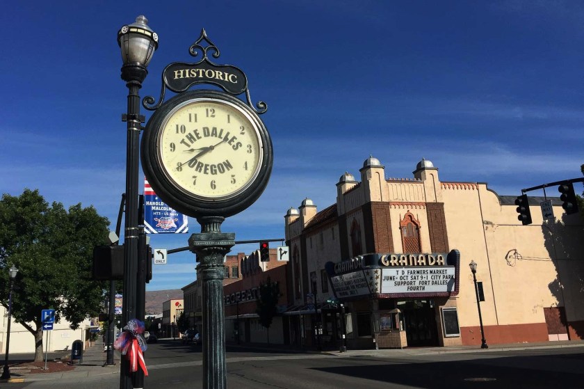
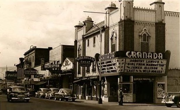
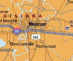
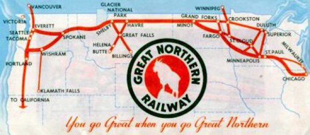
The next place we come to on this alignment is Woodward, the seat of Woodward County in Oklahoma.

Woodward was on the last linear alignment, from Monroe, Louisiana, to Lamar, Colorado…

Woodward was on the Great Western Cattle Trail, and the town was established in 1887 after the railroad was constructed there, we are told, to ship cattle to eastern markets.

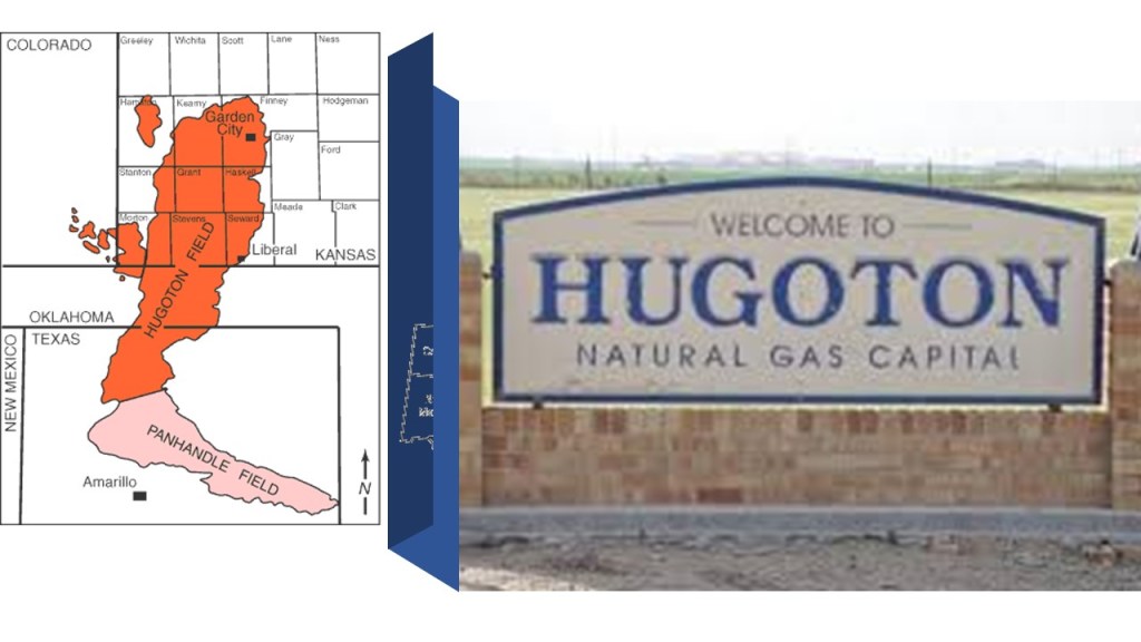
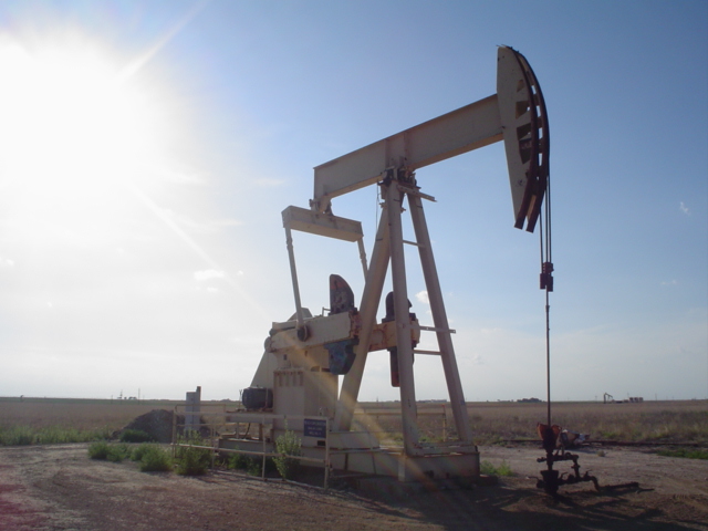
Woodward lies in an oil and natural-gas area on the shelf of Oklahoma’s Anadarko Basin, the largest producer of natural-gas in the United States…

…and within which the huge Panhandle-Hugoton gas field is contained, one of the world’s largest known natural gas fields in Kansas, Oklahoma and Texas.

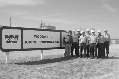
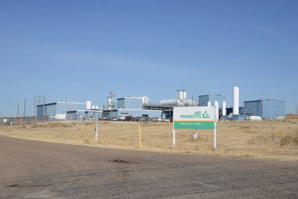
One of the largest deposits of iodine in the world underlies many portions of Woodward County, and is the only commercial source of iodine in the United States.

Woodward is a commercial hub in northwestern Oklahoma.

Agriculture, oil and gas, and manufacturing all contribute to Woodward’s economy.

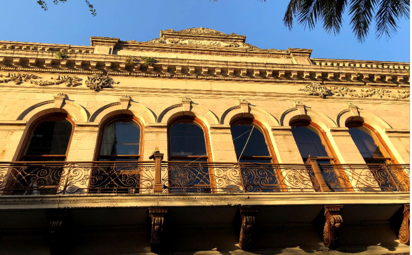
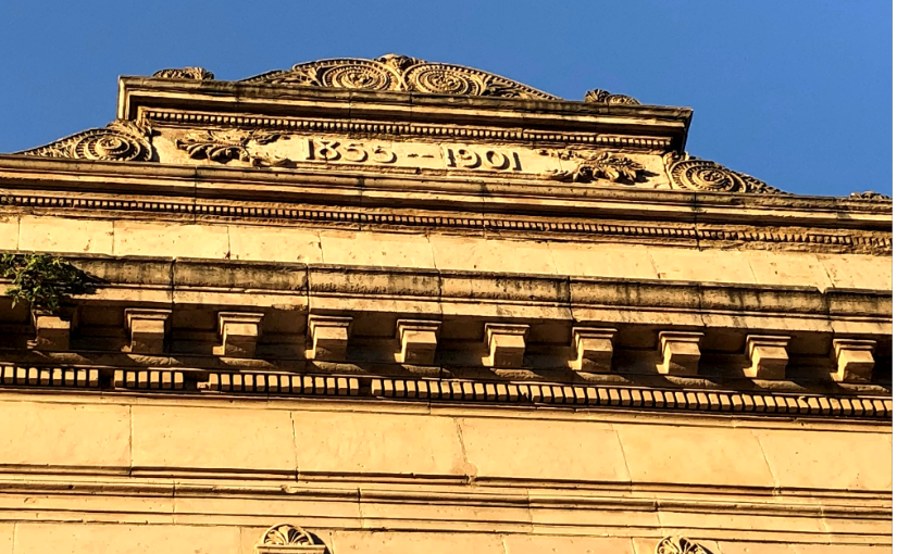
The original Woodward County Courthouse was said to have been designed by architect J. W. McNeal and J. R. Cottingham and built in 1901 by J. C. Blair Construction Company…

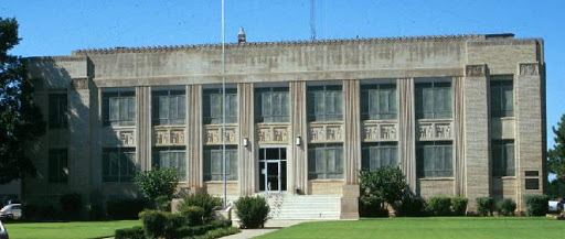
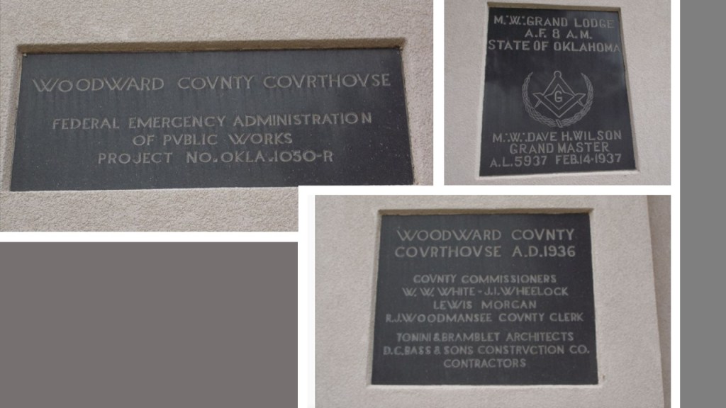
…only to be replaced in 1937 by a new courthouse, said to have been designed by architects Tonini and Bramblett, and constructed by Bass and Sons Construction Company, as part of a New Deal Public Works Administration Project.

There are three black granite cornerstones at the southeast corner of the building, with information supporting those claims, as well as freemasonic involvement.

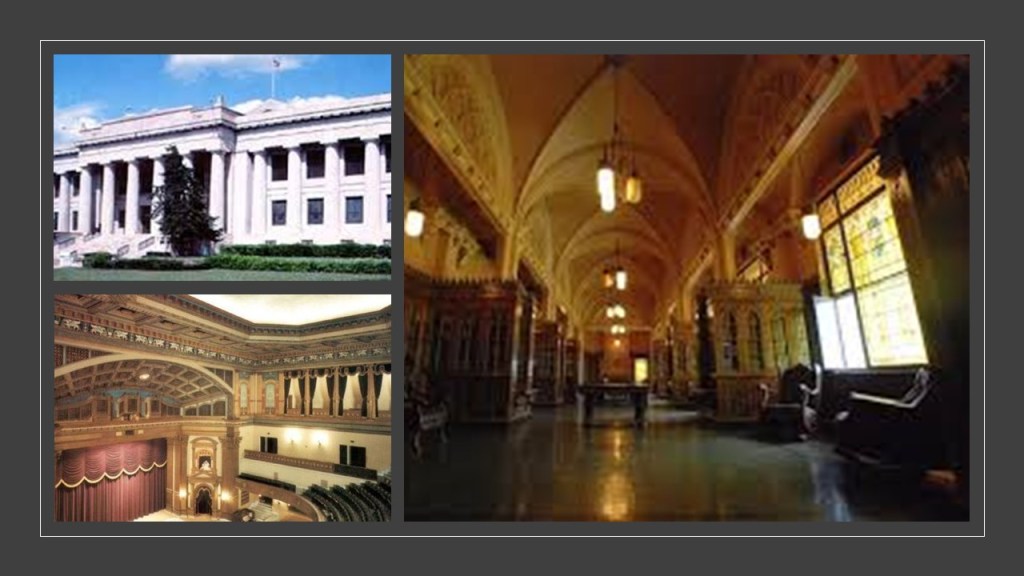
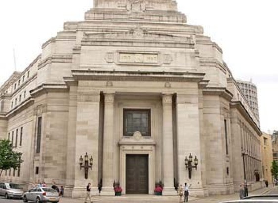
It is important to note that the Scottish Rite Temple in Guthrie is one of the largest in the world, said to have been built in 1919 in Classical Revival style, and recognized as the center of state-level Masonic activities and functions since 1923.

What might some of those activities and functions have been, I wonder, and how might it relate to the cover-up of the original, ancient, advanced Moorish civilization?

Just for point-of-reference, Guthrie is located 116-miles, or 187-kilometers, southeast of Woodward.

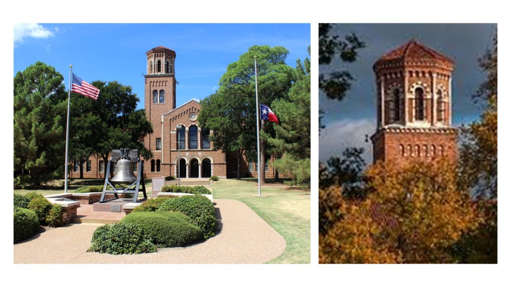
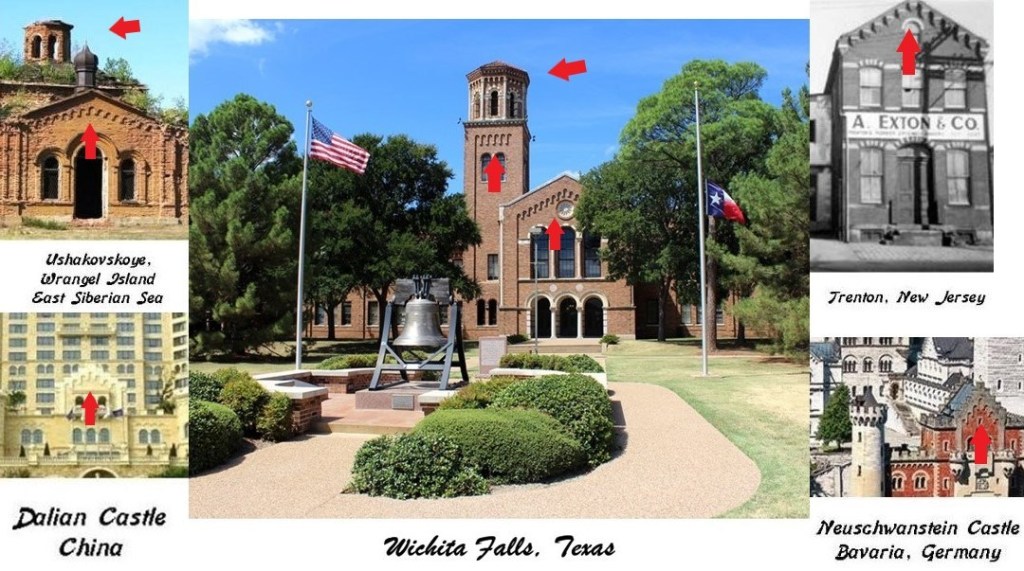
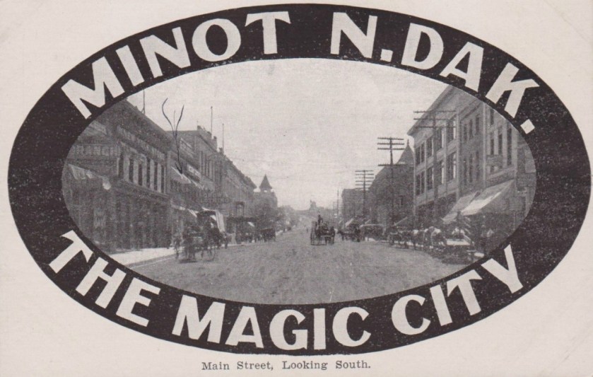
The next city I am going to look at on this alignment is Wichita, the largest city in Kansas, and the county seat of Sedgwick County.

We are told the city of Wichita started out life as a trading post on the Chisholm Trail in the 1860s, which was established to drive cattle from ranches in Texas to Kansas railheads…

…and was incorporated as a city in 1870.

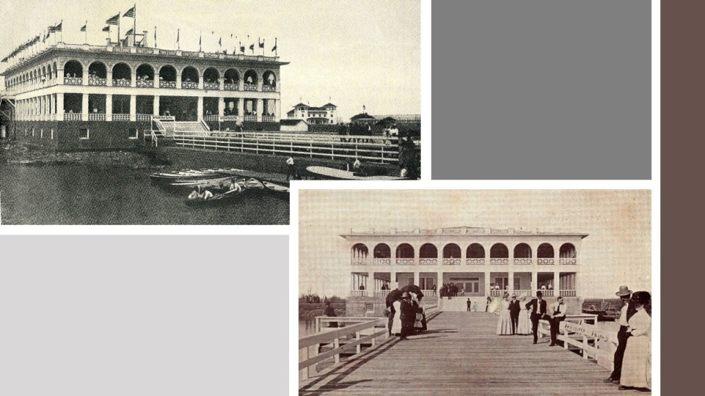
The Old Cowtown Museum is located next to the Arkansas River in central Wichita.

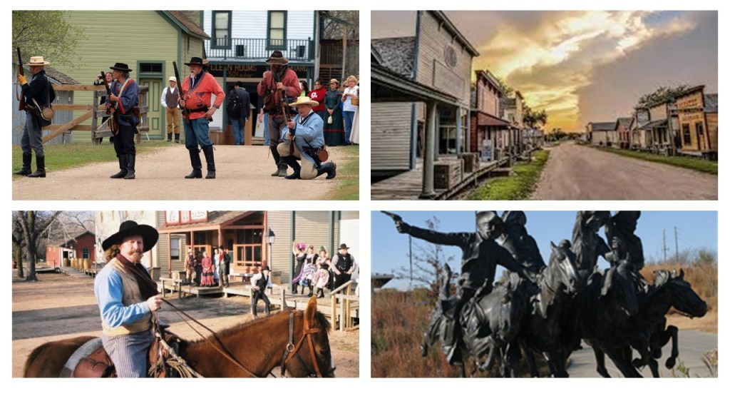
Established in 1952, it is one of the oldest open-air history museums in the central United States, with 54 historic and re-created buildings on 23-acres of land on the original Chisholm Trail.

I am going to call this the John Wayne version of history, the false historical narrative that we have been indoctrinated in from cradle-to-grave.

Among many other examples from Hollywood the entertainment industry, famous western movie actors John Wayne and Roy Rogers were Shriners.

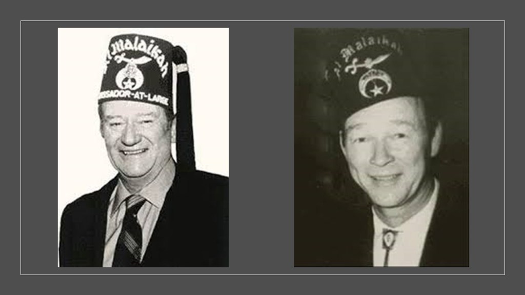
For that matter, so were Franklin Delano Roosevelt and Harry S. Truman, as well as other U. S. Presidents.

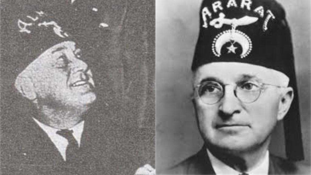
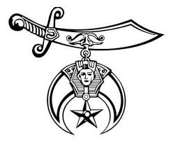
Shriners are comprised of 32nd- and 33rd-degree freemasons, the highest degrees of western freemasonry, also known as the Ancient Arabic Order of the Nobles of the Mystic Shrine.

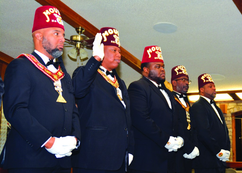
These are Prince Hall Shriners of the Ancient Egyptian Arabic Order of the Nobles of the Mystic Shrine.

Ancient Moorish Masonry has 360-degrees of initiation…327 more than freemasonry.

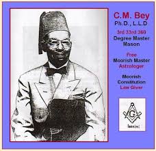
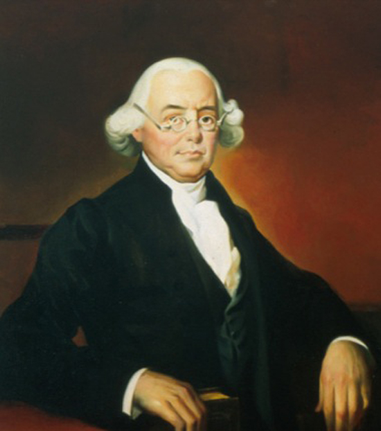
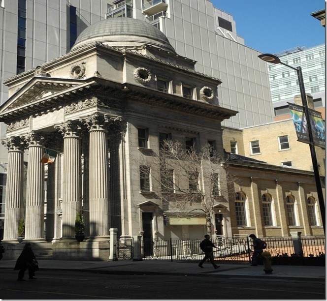
Fort Independence in Boston Harbor was the location where Prince Hall, and fourteen other Moorish men were initiated into the British Army Lodge 441 of the Irish Registry, after having been declined admittance into the Boston St. John’s Lodge.

He was the founder of Prince Hall Freemasonry on September 29th of 1784, and the African Grand Lodge of North America.

Until Prince Hall found a way in, Moorish Americans were denied admittance into Freemasonry.

Moorish Masonry is based on Moorish Science, which also includes the study of natural and spiritual laws, natal and judicial astrology, and zodiac masonry.

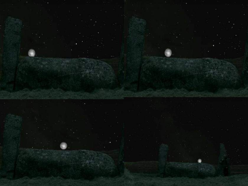
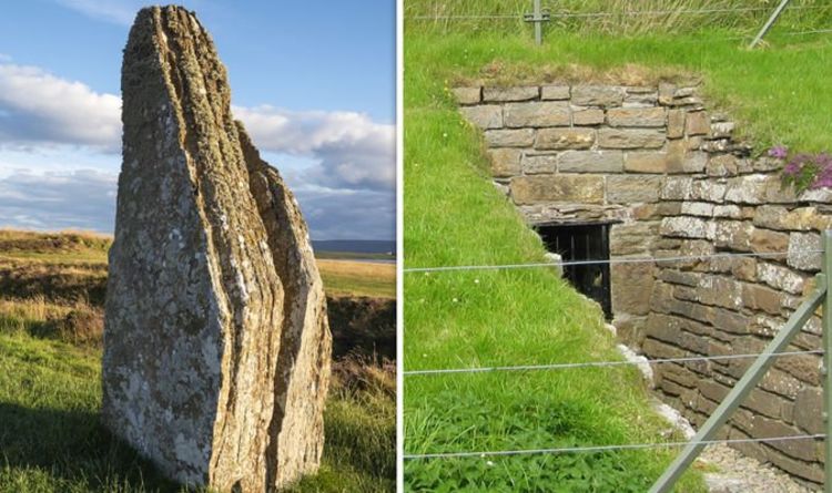
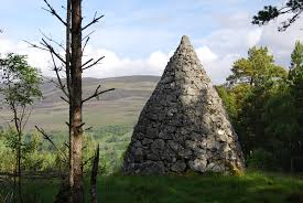
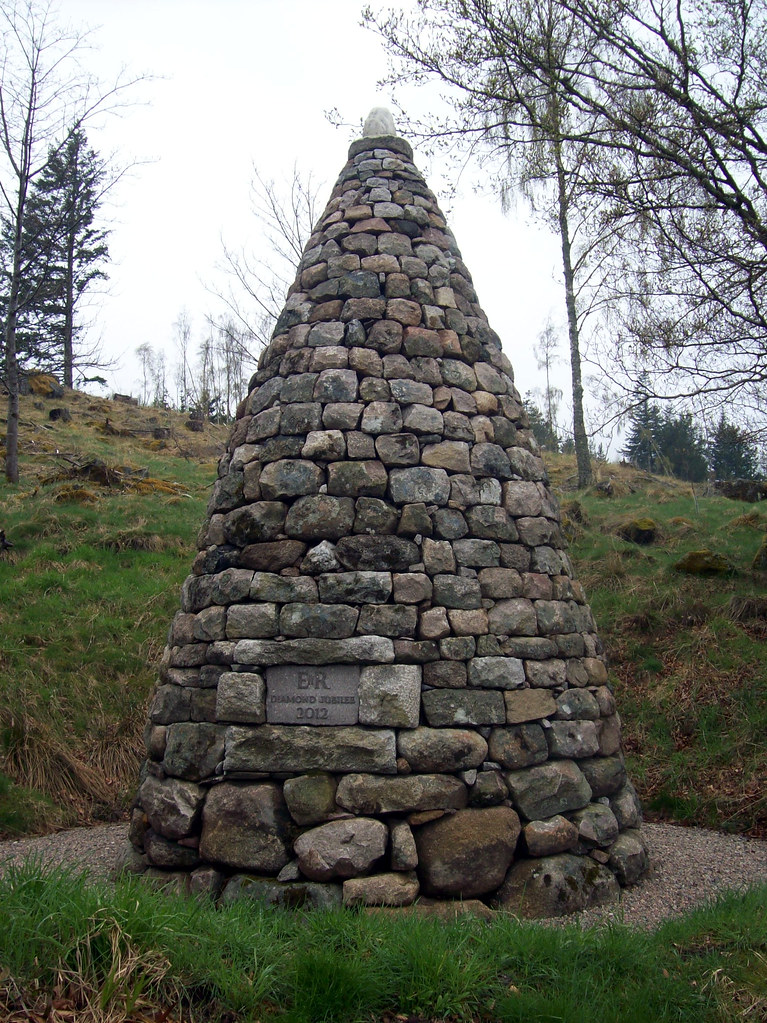
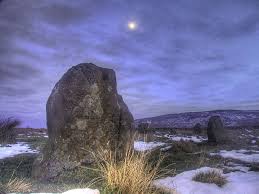
This is where the perfect alignments of infrastructure on earth with the sky comes from – the consummate alignment of earth with heaven that is seen around the world – like the lunar roll along the top of this recumbant stone in Crowthie Muir in Scotland.

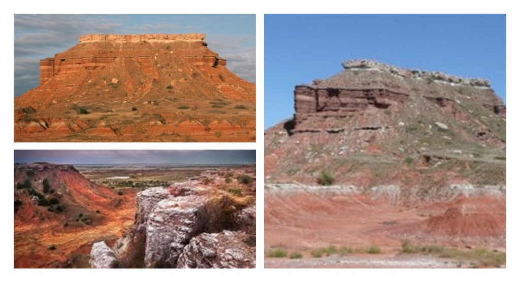
Monument Rocks, also referred to as the Chalk Pyramids, are located northwest of Wichita in Gove County, towards the western part of the state…

…and are designated a National Natural Landmark.

The interesting thing here are the solar and lunar alignments found here.

Mushroom Rock at Mushroom Rock State Park, northwest of Wichita…

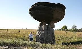
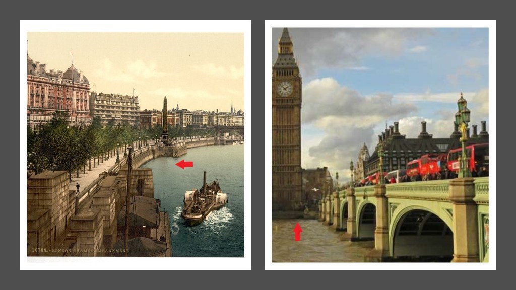
…looks a lot like the rock formations on the Moors of Great Britain, like this one in the North York Moors National Park in northern England.

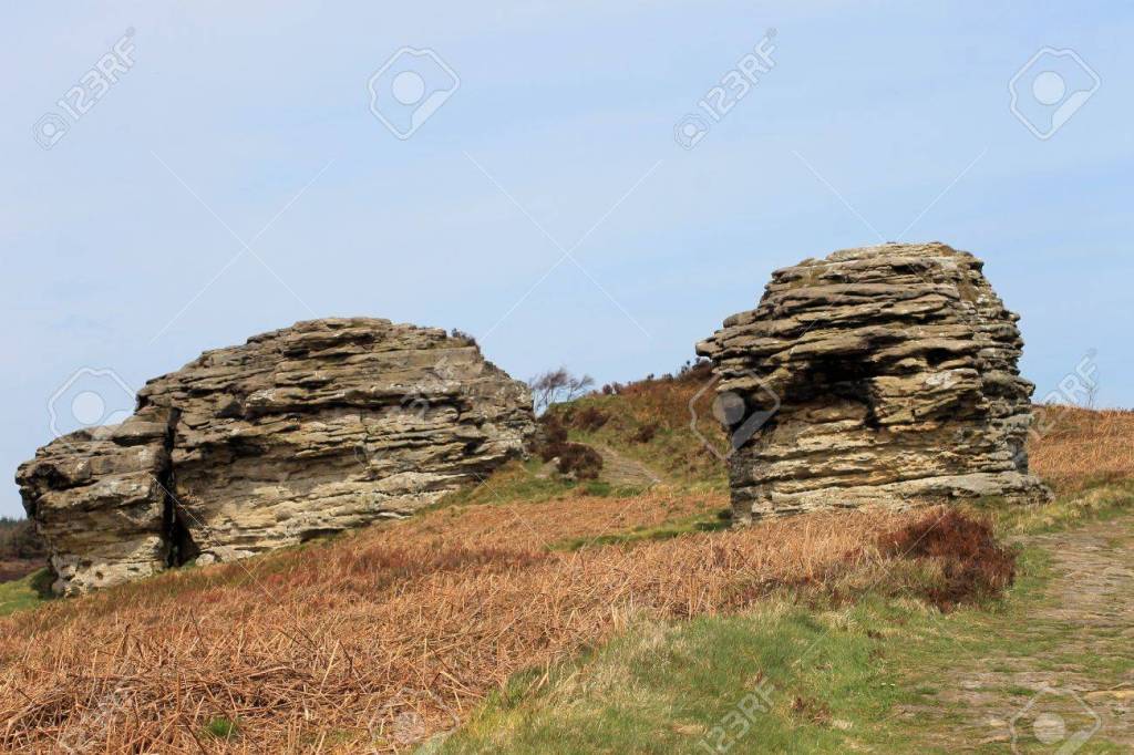
Same thing with Rock City at Minneapolis, Kansas, slightly northwest of Wichita…

…which also looks like rock formations that you find at North York Moors Park in England.

Was the memory of the Moors in Britain retained in the name of what is otherwise defined as “a tract of open, peaty, wasteland, often overgrown with heath, common in high latitudes and altitudes where drainage is poor.”

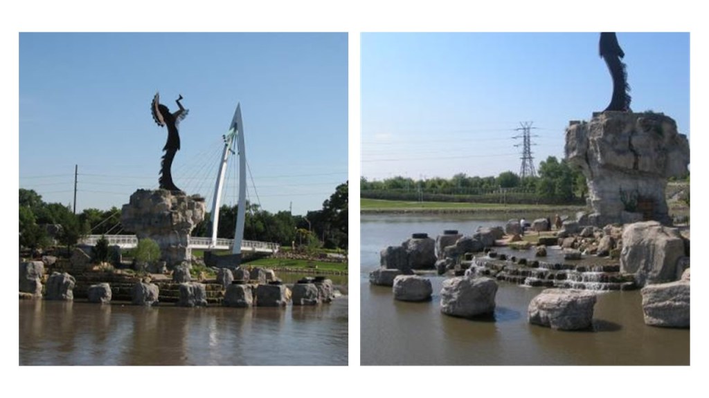
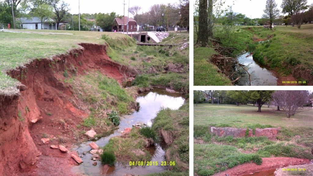
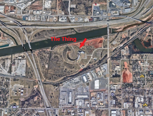
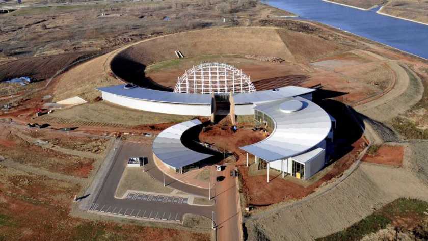
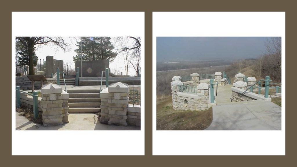
So to get back to the cover-up of the Earth’s True History by the John Wayne version of history, I am going to take a look at the “Keeper of the Plains,” a 44-foot, or 13 1/2 meter, high statue…

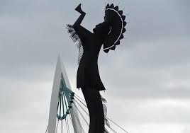
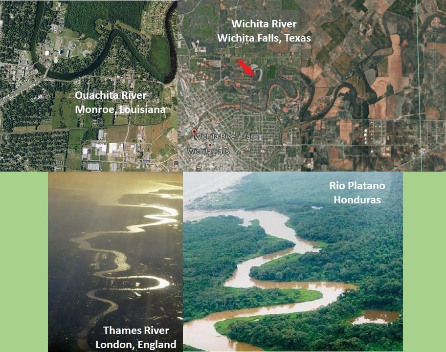
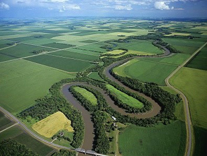
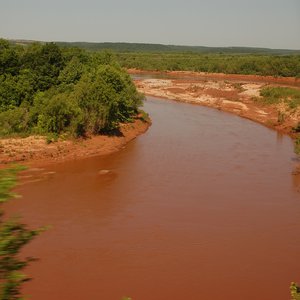
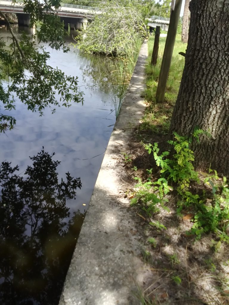
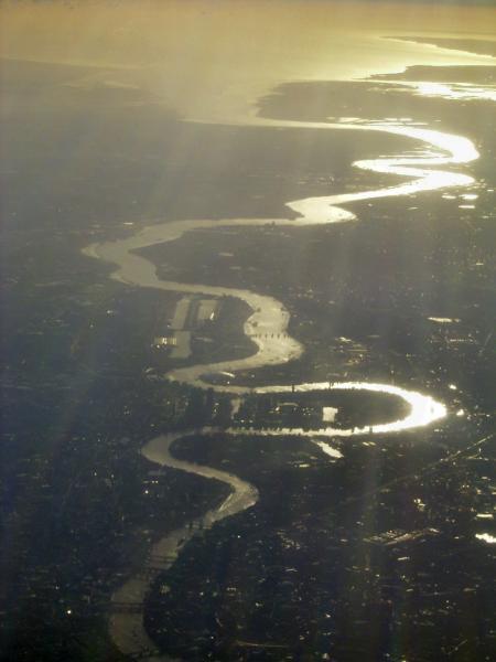
…situated where the Big and Little Arkansas Rivers join together in downtown Wichita, where we see more of the snaky, s-shaped river bends I talked about in the last part of this series, which I believe is signature infrastructure of the ancient advanced Moorish civilization.

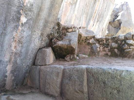
It strikes me that the statue is erected on top of what looks like ancient megalithic masonry to me!

This is a riverwalk along the Arkansas River in downtown Wichita, with megalithic masonry that people walk on by every day without even noticing it for what it is.

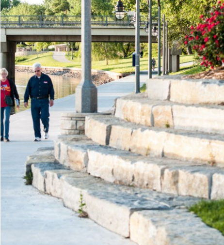
I know I didn’t notice it until I tuned it to it, and that was just 5-years ago in my early 50s.

Then I started seeing it everywhere!

I still do!

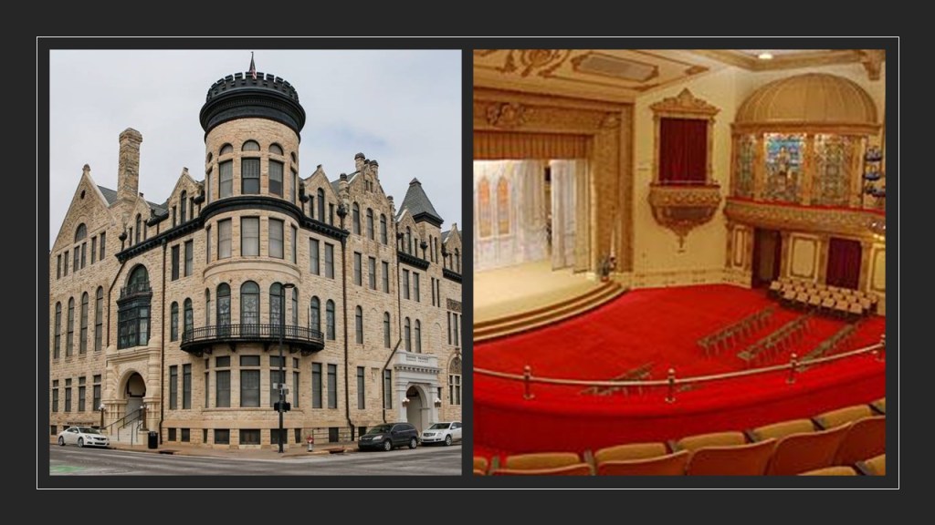
The Scottish Rite Temple in Wichita was said to have been originally constructed in the Romanesque architectural style for the YMCA in 1887 – 1888, and that it was sold to Scottish Rite Freemasons in 1889.

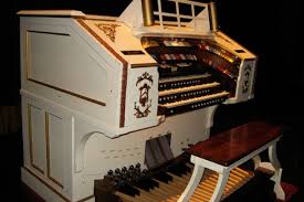
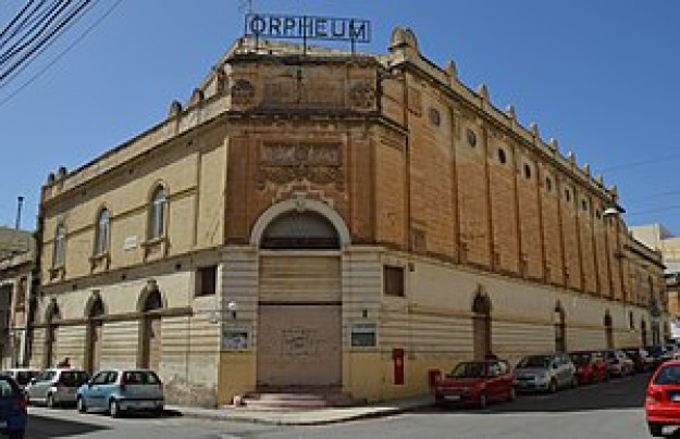
Wichita’s Orpheum Theater, which is still in use today, opened on September 4th of 1922, and was part of the Vaudevillian “Orpheum Circuit,” with well-known vaudeville stars performing there, like Harry Houdini, Eddie Cantor and Fannie Brice.

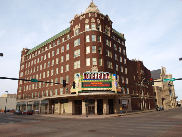
A Kilgen Theater Pipe Organ used to be there.

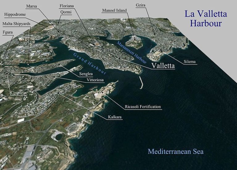
There are Orpheum Theaters still in existence all across the United States, and I even found one on the island Republic of Malta in the town of Gzira near the capital of Valletta.

Orpheus was a musician and poet in Ancient Greek legend, said to have had the ability to charm all living things, and even stones, with his music.

What, exactly, caused us to go to sleep, and forget who we are, and what we were? How has the false information we have been taught all our lives been reinforced?

Why would this be important to whoever was responsible for removing the ancient advanced civilization from our collective awareness to begin with?

We are told that the Wichita lived here historically.

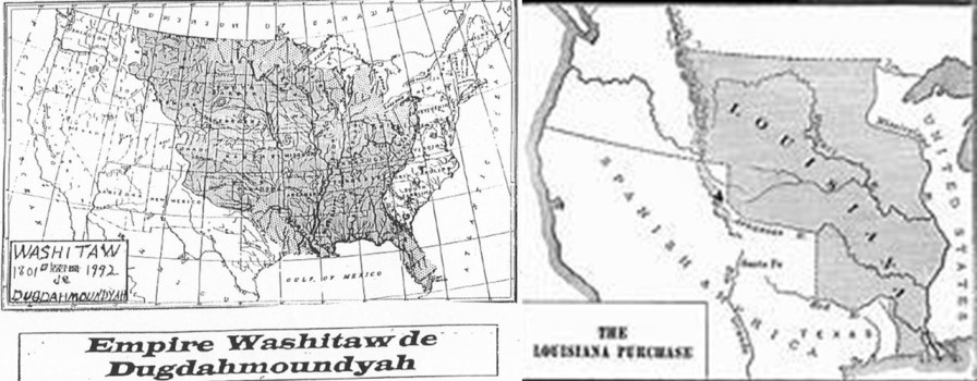
Was the memory of Ancient Washitaw Mu’urs in North America retained in the naming of this place as Wichita, like that of the Moors in Great Britain?

I believe so.

The last place I am going to look at on this alignment is Kansas City, the third-largest city in Kansas and otherwise known as KCK.

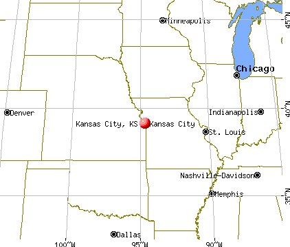
It is the seat of Wyandotte County.

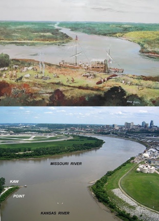
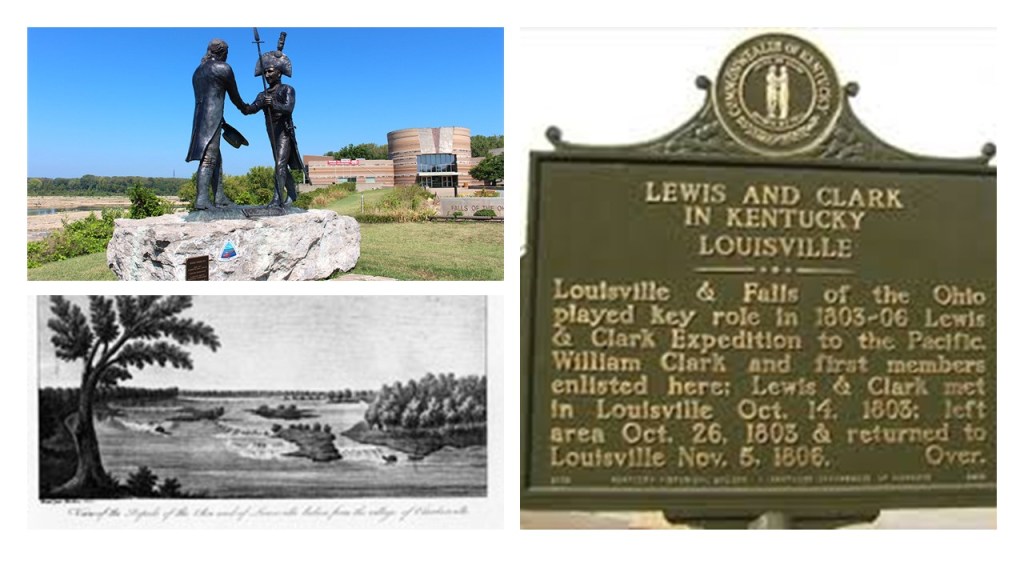
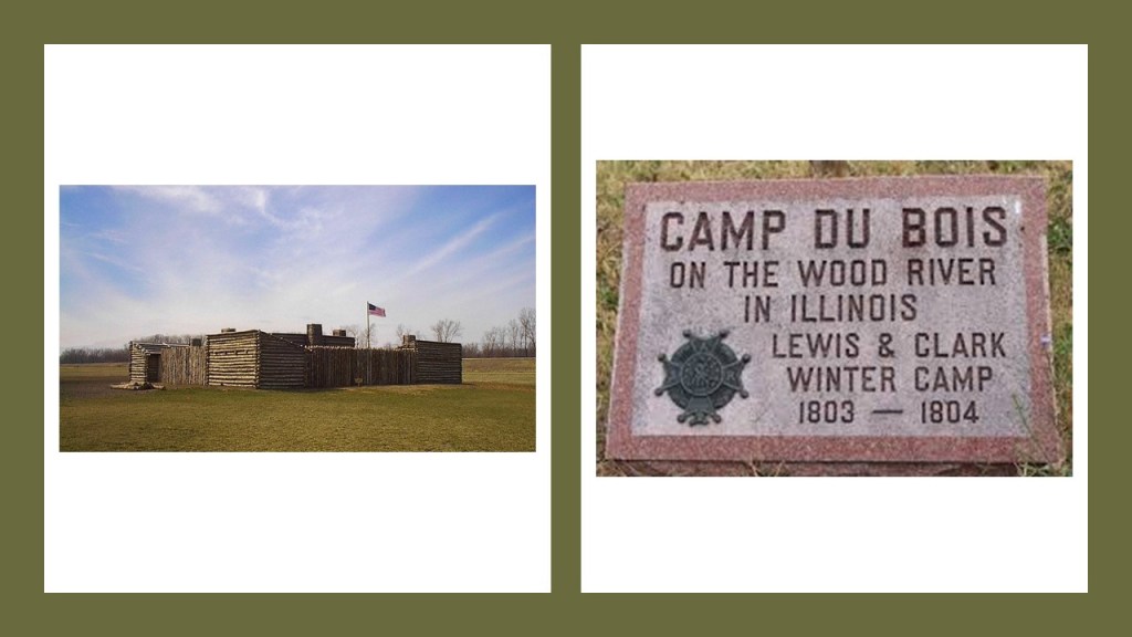
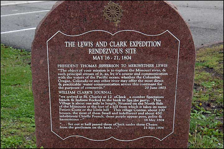
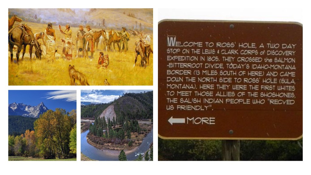
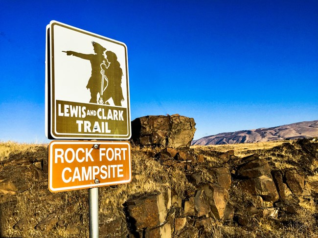
Kansas City in Kansas is situated at Kaw Point, a junction of the Missouri and Kansas Rivers, and a place where Lewis and Clark stopped and camped in 1804.

It was here that Clark reported encountering a great number of “parrot queets.”

The now-extinct Carolina parakeet inhabited much of what became the United States at that time.

The last-known Carolina parakeet died in captivity at the Cincinnati Zoo in 1918, and the species was declared extinct in 1939.

KCK was first incorporated in 1872, and then again 1886 when the “New” KCK was formed through the consolidation of five municipalities.

KCK was said to have seen explosive growth as a streetcar suburb of Kansas, Missouri, located right across the Missouri River, and the largest city in Missouri.

Kansas City, Missouri, we are told once had one of the most extensive streetcar systems in North America.

We are told that horse-powered streetcars were introduced in 1870, and that some early routes were powered by underground cables, like those of San Francisco.

By 1908, all of Kansas City’s streetcar lines except for one was powered by electricity.

The last of its 25 streetcar routes was shut-down in 1957, to be replaced by buses.

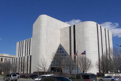
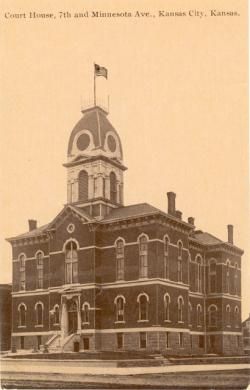
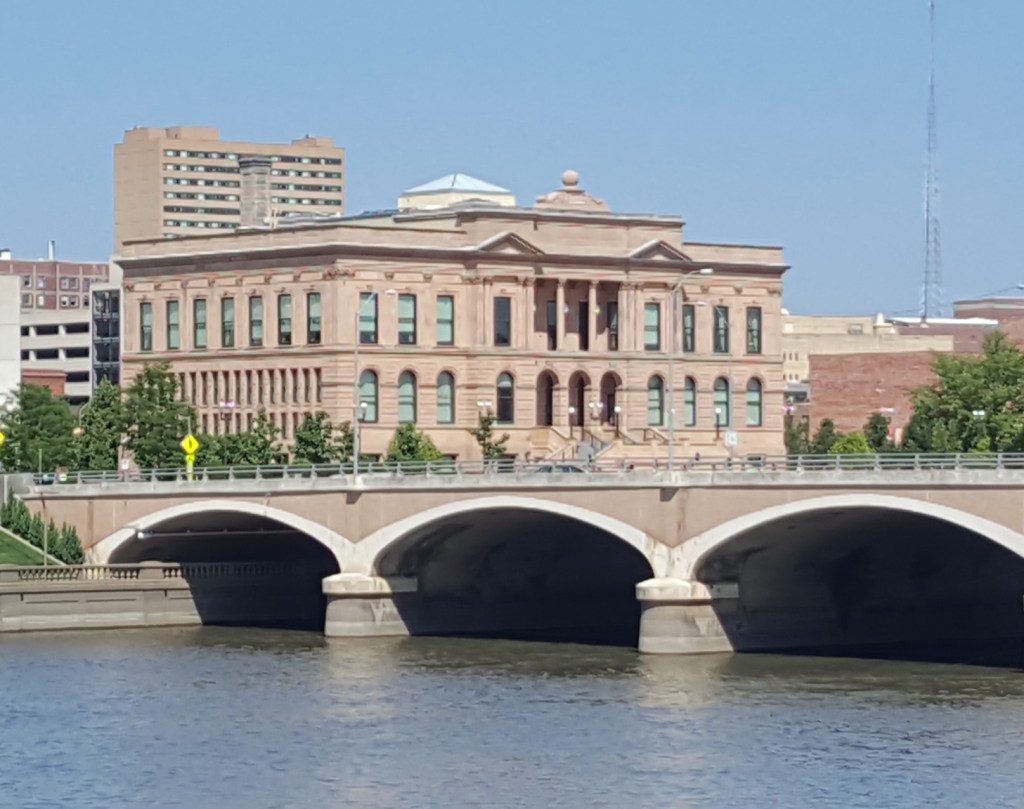
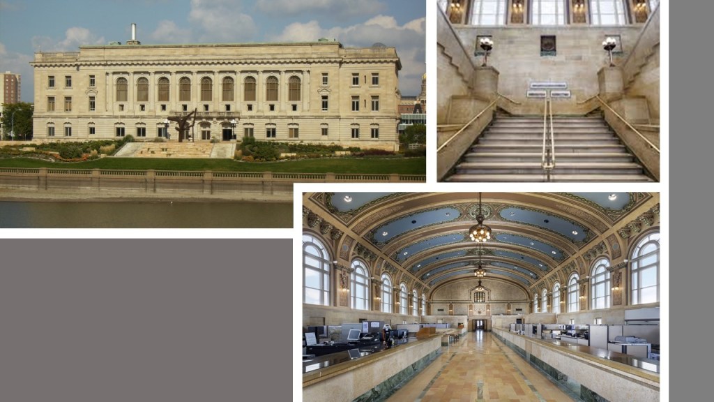
The current Wyandotte County Courthouse in KCK was said to have been built in Neoclassical style between 1925 and 1927 by the Kansas City architectural firm of Wight and Wight…

…to replace the county courthouse that was said to have been built in 1882.

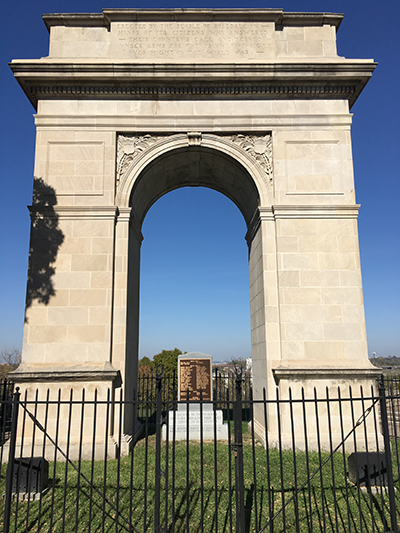
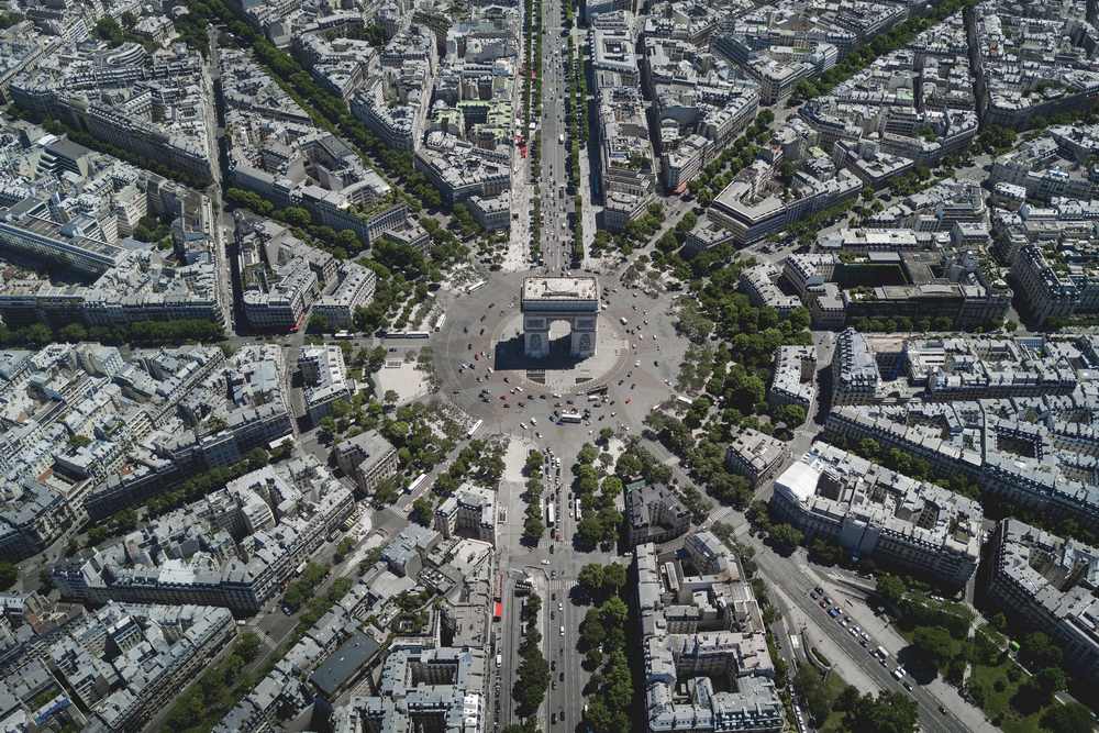
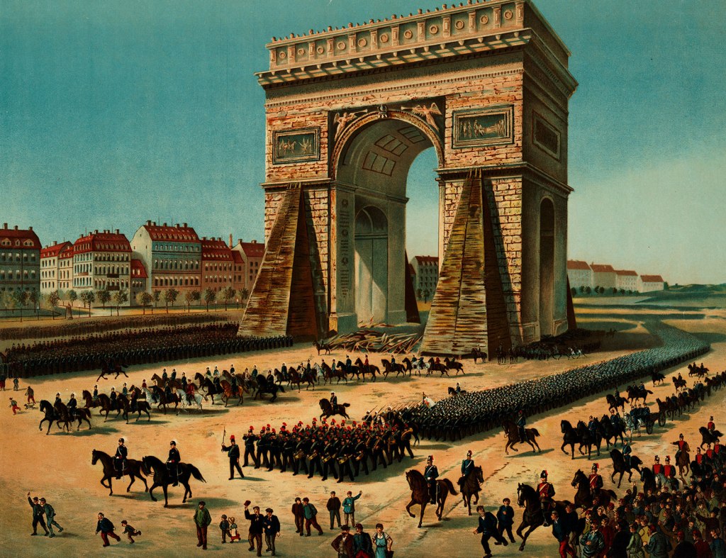
We are told the Rosedale Arch, dedicated in 1924, and said to have been inspired by the Arc de Triomphe in Paris, was erected as a memorial to honor the men of the Rosedale neighborhood of Kansas City who had served in World War I.

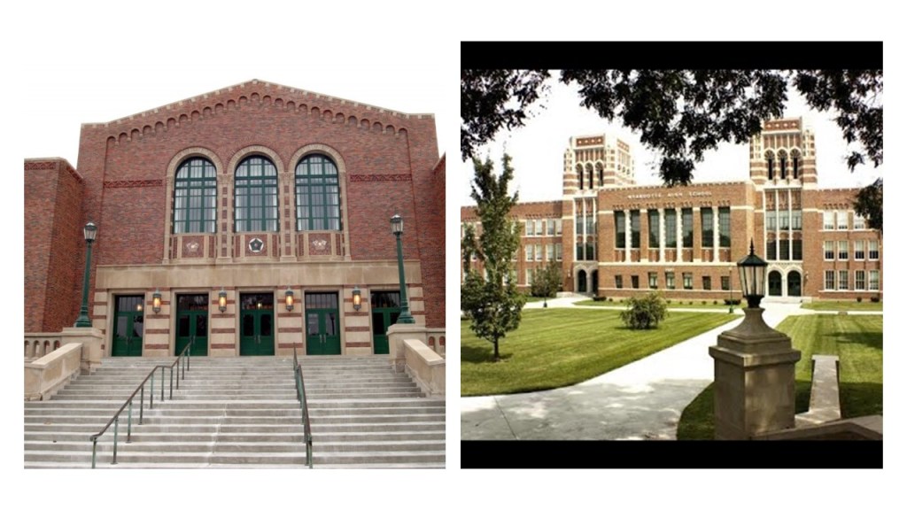
The Wyandotte High School, still in use today, was said to have been built in the 1936 – 1937 time-frame by the New Deal Works Progress Administration and the KCK Board of Education.

Across the river-system, Kansas City, Missouri, was incorporated as a town on June 1st of 1850, and as a city on March 28th of 1853.

The territory around the confluence of the Missouri and Kansas Rivers was deemed by the founders as a “good place to build settlements.”

Noteworthy architecture on the Missouri of Kansas City side includes:

The Liberty Memorial, the National World War I Memorial and Museum, said to have been built in 1926, after a group of 40 prominent Kansas businessmen decided to form an association to create a memorial to those who had served in the war.

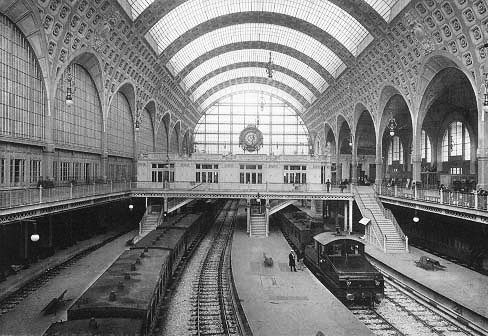
Construction on the Union Station in Kansas City Missouri was said to have started in the early 1900s, and that it opened in 1914, operating as a train station until 1985.

Today it features exhibits, movies, restaurants, and a science center.

Like the current Wyandotte County Courthouse, the Nelson-Atkins Museum of Art was said to have been designed by the architectural firm of Wight and Wight, with groundbreaking for the building occurring in July of 1930, and the museum opening to the public in December of 1933.

The United States Courthouse and post office, still standing today, that was said to have been built in the late 1930s as one of the last of Franklin Roosevelt’s New Deal programs.

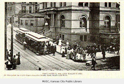
The new courthouse replaced the Old Post Office and Customhouse, on the top left, that once stood at 8th and Grand Boulevard on the bottom right in Kansas City, Missouri.

I am going to end this part of the series here.

Every city that I have looked at on this alignment is a county seat, with the exception of Kansas City, Missouri.

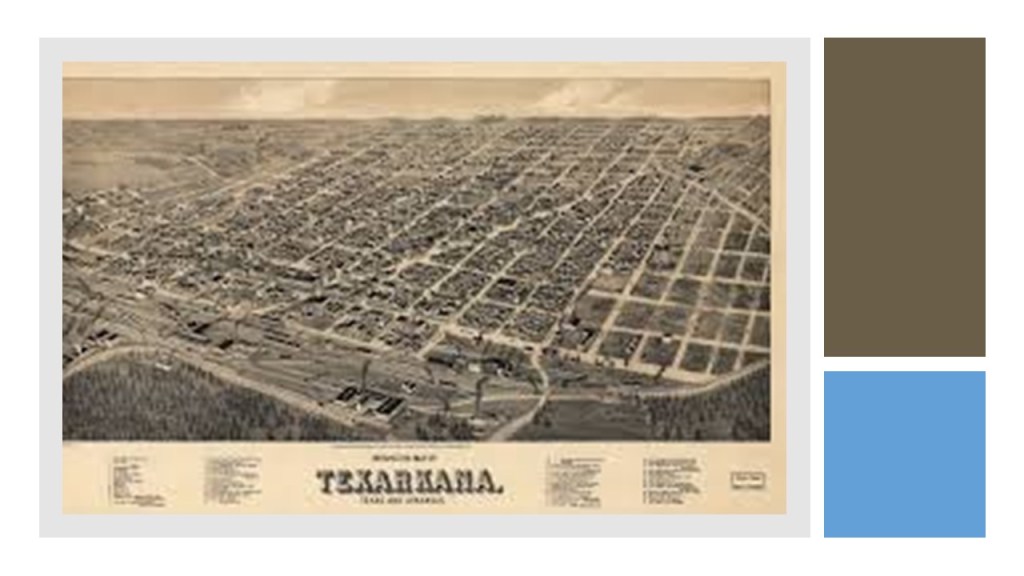
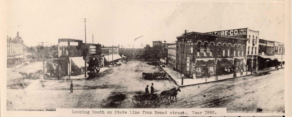
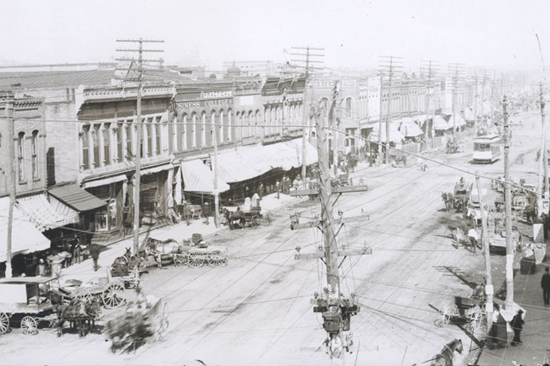
And in all three parts of this series, there were only two places of all the cities in linear alignment that I have looked at that were not county seats – Ponca City, Oklahoma and Texarkana, Texas, though Texarkana, Arkansas was, and those two cities share a huge federal building which straddles the state line that runs between the two cities.

Is the finding the result of coincidence…or the result of intentional planning of the original civilization?

I land hard on the side this was all the result of intentional and precise planning, and not the random, haphazard process our historical narrative would lead us to believe.

In the next and last part of the series, I am going to switch-over to looking at alinear alignment of major cities between San Antonio, Texas and Buffalo, New York.

Cities in Linear Alignment in the U. S. – Part 2 Monroe, Louisiana to Lamar, Colorado

This is the second-part of a four-part series on cities that I found in linear alignment in the United States.

I am showcasing linear alignments I identified while looking at a map on the internet of the region where I was living in Oklahoma City several years ago during the time I was waking up to all of this.

I am sure there are more cities…and alignments…. that could be added, but each part of this series will be a snapshot of whatever longer alignment this represents, and complete in itself for the purpose of this series.

My starting point is Monroe, the parish seat of Louisiana’s Ouachita (pronounced Washitaw) Parish.

Monroe and West Monroe, which together are called the Twin Cities of northeast Louisiana, are situated on either side of the snaky, S-shaped Ouachita River, on the top left, which looks like the snaky, s-shapes of the Wichita River in Wichita Falls, Texas, on the top right; the Thames River in London on the bottom left; and the Rio Platano in Honduras on the bottom right.

These are just a few examples of the countless rivers and creeks all over the world that have the same S-shaped river bends.

I do not believe this is a random or natural occurrence.

I believe these S-shaped waterways are signatures of the ancient civilization, and artificially-made canal systems.

We are taught these are natural so we don’t see and understand the truth.

Here are the earthwork-banks of the Ouachita River in downtown Monroe next to the city’s Riverwalk…

…and the masonry banks of the River Thames in downtown London.

Fort Miro was located on the site of present-day Monroe, described as a late-18th-century Spanish outpost that served the Ouachita River valley, said to have been named after Esteban Miro, the governor of the Spanish provinces of Louisiana and Florida from 1785 to 1791.

The settlement became known as Monroe in 1819, we are told, with the arrival of the steam-powered paddle-wheeler “James Monroe,” named for the 5th President of the United States.

Apparently, the arrival of the paddle-wheeler had such a profound effect on the settlers that the name of the settlement was changed to Monroe.

Now a retirement community, the Frances Tower in downtown Monroe, the city’s tallest building at a height of 179-feet, or 55-meters, was said to have been built between 1931 and 1932 (which would have been during the Great Depression) because the city needed more hotel rooms, and the owner wanted to compete wth the top meeting location of the time in Monroe…

…The Virginia, which was said to have been built in 1925, and had three ballrooms.

The hotel was closed in the 1960s, and it became a state office building.

The building was restored in 2016, and became the Vantage State Building.

Joseph Biedenharn was a German-American businessman who was born in Vicksburg, Mississippi, to parents who had immigrated to the United States following the Revolutions of 1848, a series of revolts against European monarchies that affected over 50 countries, including Germany, and one of the factors of a huge wave of immigration to America that took place during the mid-1800s.

The German immigrants were said to typically have come to America with money and greater ability to be mobile than immigrants from other countries.

Joseph was a candy-maker, the first bottler of coca-cola, and the first to develop an independent network of franchise bottlers to distribute the drink.

He moved his manufacturing and bottling operations to Monroe, Louisiana, from Vicksburg, Mississippi in 1913.

Along with his son, Malcolm and other investors, Joseph bought a crop-dusting business in 1925, along with his son and other investors, and added eighteen planes to the fleet, moving the company headquarters from Macon, Georgia, to Monroe.

This was the origin of Delta Airlines, which was incorporated in December of 1928.

Delta’s headquarters moved from Monroe to Atlanta in 1941.

The First Baptist Church in downtown Monroe was said to have been built in Neo-Palladian style, with an octagonal dome, columns, and pediments, which is the triangular upper-part of a building in classical style, typically surmounting columns.

The church congregation was founded in 1854, and the present church was said to have been built in 1911.

Palladian architecture was a European architecture was said to have been derived from Venetian architect Andrea Palladio, who lived between 1508 and 1580, whose work was based on the formal classical temple architecture of the ancient Greeks and Romans.

In downtown Monroe?

Similarly, St. Matthew’s Catholic Church was founded in 1851, and this building was said to have been built starting in 1897 with a large frontal tower that also echoes European architecture.

The old Monroe City High School was said to have been built between 1900 and 1901 as the first school in the Monroe City school system…

…and was located where the Anna Grey Noe Park is today, named after a former first lady of Louisiana.

Why destroy beautiful architecture like this in the heart of downtown Monroe, only to create a building-less public park?

Here is a comparison of the old Monroe City High School on the left, and Parliament Hill pre-1916 in Ottawa, the national capital of Canada on the right.

This was the original Ouachita National Bank, which opened in Monroe in 1906.

Before closing in 1933, the Ouachita National Bank printed six different types of national currency, and moved twice, during that 27-year-period.

It is important to note that Monroe was the ancient Imperial Seat of the Washitaw Empire, in an area known as Washitaw Proper.

This is a picture of the relatively recently deceased Empress of the Washitaw, Verdiacee Washitaw Turner Goston El Bey, who passed away in 2014.

Empress Verdiacee passed away in 2014, and her granddaughter Wendy Farica Washitaw succeeded her as the Washitaw Empress.

You are not going to find the memory of the Washitaw anywhere in our history books, but they are found everywhere in place-names – Wichita, Ouachita, Hatchita, Washa, Wabash, Washoe, Waxhaw, to name a few off the top of my head.

In 1993 Empress Verdiacee published the book “The Return of the Ancient Ones,”on the true history of the Washitaw Empire.

The Washitaw Mu’urs were formally recognized by the United Nations in 1993 as the “Oldest Indigenous Civilization on Earth.”

The Watson Brake Mounds are in the vicinity, and are located south of Monroe in Richwood, Louisiana.

Watson Brake is an archeological site in Ouachita Parish, Louisiana, dated to 5,400 years ago, and is the oldest earthwork mound complex in North America, acknowledged to be older than the Egyptian Pyramids and Stonehenge in England. It is located on private land, so is not available for public viewing.

Stonehenge, which has an earthwork very similar to Watson Brake around its perimeter, according to what we are told, dates from starting at 3,100 BC, about 5,100 years ago.

Thirty-eight miles northeast of Monroe, near the town of Epps, Louisiana, is Poverty Point.

It is said to have become known as Poverty Point because the farming was terrible here.

Its name was actually Awulmeka, and was an ancient sacred city of the Washitaw Mu’urs.

The story that we are told about all the mound sites is that indians wearing loincloths were responsible for building the perfectly geometrically- and astronomically-aligned mounds and earthworks, one basketful of dirt at a time. This is not the truth, and does not hold up with any scrutiny whatsoever.

These are the kinds of artifacts on display at Poverty Point as being representative of what was found here. While perhaps they were found here, I don’t think these were representative of the highly advanced and sophisticated ancient civilization that lived here.

The artifacts on display at Spiro Mounds in Oklahoma, like this one here, would be more representative of what was found at Poverty Point.

According to George G. M. James, in his book “Stolen Legacy,” the Moors were the custodians of the Ancient Egyptian mysteries…

…and in the present-day, Muurish-American Master Adepts and Teachers are wisdom-keepers of ancient sacred Kemetic Mysteries and Knowledge about all Creation.

They are living practitioners of Egyptian Yoga…

…and Medju Neter, or Meroitic, the language of the Egyptian Hieroglyphs..

The Meroitic language and script are named after Meroe, the royal capital of the Kingdom of Kush, and located on the Nile River where it flows through in northeast Sudan in northeastern Africa.

We are told that Fort Miro was the original name of the settlement that became Monroe.

Is it just a coincidence that these two place-names, one in Sudan and one in Louisiana, sound phonetically identical, or is there something else going on here that we are not being told about?

The next stop on this linear alignment is the Texarkana Metropolitan Area, a region anchored by the Twin cities of Texarkana, Texas and Texarkana, Arkansas, and which also shares a state line with Louisiana.

The story goes that the Cairo and Fulton Railroad, reached present-day Texarkana from St. Louis in the early 1870s, and that the Texas and Pacific Railroad had reached across Texas to the Arkansas state line, where it had been decided the border was the logical place for the different railways to connect.

On December 8, 1873, the Texas and Pacific sold the first town lots for the future city. The first to buy was J. W. Davis, who purchased the land where the Hotel McCartney, said to have been built in 1929, now stands, opposite Union Station.

The Hotel McCartney has been abandoned since the mid-1970s.

Why build a massive building like this, to use it for only 50-years?

Similar idea with the Union Station across the street from it.

It is described as a grand Renaissance station built in 1928 across the Arkansas – Texas state line and placed on the U. S. National Register of Historic Places in 1978.

Amtrak still uses a small portion of the station for its Texas Eagle Line, but otherwise the station has been abandoned.

State Line Avenue follows the Texas-Arkansas state line throughout much of Texarkana.

Thousands of locals actually live in one state and work in the other.

In the distance in the center of this post card is the Texarkana U. S. Post Office and Courthouse.

The Texarkana twin cities are home to the only federal building in the U. S. that straddles a state line and houses federal courts in two jurisdictions.

The two sides of Texarkana share a federal building, courthouse, jail, post office, labor office, chamber of commerce, water utility, and several other offices, however two mayors and two sets of city officials.

The Hotel Grim on the Texas side of the city was said to have been completed in 1925, and in its hey-day was known as the “Crown Jewel” of Texarkana.

While like the Hotel McCartney, the Hotel Grim was closed and also abandoned in the 1970s…

…it is in the process of being restored and redeveloped as commercial space and residential apartments.

So we have an official founding date of Texarkana by the railroad in 1873, and here is an historic map of the city circa 1888.

Here is an 1892 photo of Texarkana showing big masonry buildings, not many people in it, what appear to be dirt-covered streets, and mule-drawn transportation…

…and that in 1902 the first electric street-cars appeared in Texarkana, after having had a mule-drawn streetcar system having been established there in the 1880s…

…only to have the electric street-car system there discontinued in 1934 after only 32-years.

I have circled where the Red River of the South passes through the Texarkana region on its way into Louisiana.

I have also circled the names of the Wichita River in Texas, the Washita River in Oklahoma, and the Ouachita River in Arkansas and Louisiana that are all tributaries of the Red River of the South.

Here is an aerial photo of some of the snaky, s-shapes of the Red River of the South…

…and of the some of the same of the Red River of the North at Grand Forks in North Dakota.

With a straight-line distance roughly of 135-miles northeast of the Texarkana Metropolitan area, just slightly west of the state capital in Little Rock, in Roland, Arkansas, there is a special site known as Pinnacle Mountain that hasn’t been brought forward into public awareness, and represents how sacred ancient sites are deliberately covered-up.

This is a picture of Pinnacle Mountain, which is only viewable like this from the Education Pond at Pinnacle Mountain State Park.

I had first heard of Pinnacle Mountain when I learned about a conference that was held there in 2012.

I didn’t think much of the name Pinnacle Mountain until several years later, in 2015, when finding this image on-line.  This was the beginning of my “looking” and then “finding” out more and more.  It really got my attention!!!    

So I had to go there! It was about a 3 – 4 hour drive from where I was living at the time, and I went twice with friends.

There are two more what appear to be pyramids next to Pinnacle Mountain, and this view is only obtainable from the Visitor Center Observation Deck on a relatively clear day, which I was lucky enough to photograph.

Otherwise, access to all other views is completely cut off by private property and fences, and these are certainly not advertised as pyramids.

Here is a comparison of what is seen from the Pinnacle Mountain Visitor Center Observation deck on the left, and the pyramids on the Giza Plateau in Egypt on the right, in which they all seem to be facing in the same direction.

Here is another connection between America and Egypt.

 I have drawn a red line on this world map to demonstrate that there is a straight, west-to-east, linear relationship between the location of the Mississippi River Delta in Louisiana, and that of the Nile River Delta in Egypt.

Also, this is an aerial view of the Mississippi Delta, which is on the southeastern coast of Louisiana, on the top, showing what appear to be man-made channels, compared with the same type of straight, man-made looking channel is also found in the Nile Delta.

The alignment next crosses over the Ouachita Mountains of eastern Oklahoma and western Arkansas between Texarkana and Oklahoma City.

This is Cameron’s Bluff at Mount Magazine, the highest elevation in Arkansas, in the Ouachita Mountains of western Arkansas and eastern Oklahoma.

I visited Mount Magazine several times, and this is where I started waking up to seeing what was really in the environment around me.

As soon as I took to the turn-off for the road that skirts the bluff, I started seeing a wall.

It is such an ancient wall that there is some element of doubt. 

But there are some places you can really tell it is a built structure. 

The next place in this alignment is Oklahoma City, Oklahoma, the state capital and county seat of Oklahoma County. 

It is a major economic and transportation hub with its central location in the country, and on the nation’s interstate highways, sitting at the convergence of I-35 and I-40 and I-44. 

This is also where I was living when I started to put together what I am sharing with you, where I started to see what was really in the environment around me, and where I first learned about the advanced Ancient Moorish Civilization that has been removed from our awareness.

Oklahoma City was said to have “sprang” into existence on April 22nd of 1889, the day that approximately 50,000 participants of the land run that day claimed their land in the first land run in what was known as the Unassigned Lands.

This lithograph dated from 1890 was said to have been prepared 10-months after the 1889 land run…

…and this postcard of Broadway in Oklahoma City is circa 1910, twenty-years later, with the same big, elegant masonry buildings, dirt-covering the street, mule-drawn buggies, and electric streetcar system that we saw back in Texarkana.

The electric streetcar system in Oklahoma City was ended in 1947.

I am going to focus on unknown canal systems in Oklahoma, because this is where I have studied it the most.

Canal systems were very important to the Ancient Civilization as a transportation system, in addition to a land-based road system, because it was in fact a Maritime Civilization. 

They were as comfortable on the waters as on land.

There is an acknowledged canal in Oklahoma City.

This is the Bricktown Canal, a mile-long canal that links downtown, Bricktown, a lively entertainment district, and the Oklahoma River.

Now to some unrecognized canal systems.

I took these three photos all at the same location at 36th Avenue & Shartel Avenue in Northwest Oklahoma City.

The first photo on the left is very reminiscent of what the river beds look like in Oklahoma –  ugly red clay gashes.   In the top right photo, there is a root system that appears to be growing out over air, and on the bottom right, what remains of masonry is still in place. 

This is as good a place as any to assert my belief that the cement industry is built upon pulverizing ancient masonry.  It’s not supposed to be there in our historical narrative, so we don’t even conceive of it, so certain industries can do whatever they want because it doesn’t exist. 

The Dolese Brothers Company of Oklahoma is a major company providing aggregates, concrete, and products used for building. 

They are not the only example, but the first that I became aware of.

And where exactly do they get their stone material from?

I don’t know if all of the waterways called rivers in Oklahoma look like red clay cuts in the land, but so many of them do!

This is a photo I took of a roundabout, with ancient masonry blocks in the foreground; the road sign saying Cement Plant Road in the middle of the picture; and in the distance in the right of the photo, the Cement Plant in Clarkdale, Arizona, is visible.

014

There’s plenty of ancient masonry everywhere in this area, so they will never, ever run out of raw material. 

The advanced Ancient Civilization was so massive that there is an inexhaustible supply of unrecognized masonry for the cement industry all over the world!

This is a picture I took of the Oklahoma River in Oklahoma City, where it flows, very straight…

Oklahoma River

…until it abruptly ends at Martin Luther King Jr. Boulevard, at which point there is only a red clay bed from there on out.

I have marked with arrows the places along the Oklahoma River where there appear to be canal entrances.

At the corner of I-40 and Martin Luther King Jr. Boulevard, right where the river stops flowing, is what I call the “The Thing.”

I noticed it at some point after driving past it a bazillion times, and I remember thinking “What the heck is that thing?”

So, I tried to find out more information. 

I drove the short way up to the entrance. 

Right next to the entrance, there was a billboard that said something to the effect of “Your American Indian Cultural Center and Museum.” 

The entrance, however, had several no unauthorized entry signs.

Well, apparently this project has been in the works for many years, and now they are saying will be completed in several years, but that looks like a very, very sophisticated and very geometric earthwork to me. 

And you can’t get close to it unless you are on an Oklahoma River Cruise ship or are a rowing crew member. 

I drove around the block, and it is all locked up with businesses and an industrial park. 

Here is an old postcard on the left depicting The Baum Building in Oklahoma City.  It was razed in 1973, supposedly as part of an Urban Renewal project. In its day, the Baum Building was compared to the Doge’s Palace in Venice, shown here on the right.

This is Capitol Hill High School in South Oklahoma City…

OKC - Capitol Hill High School

…and the Central High School in Oklahoma City. 

OKC - Central High School

Pretty fancy places to have been built for high school kids!

This is the old Criterion Theater in Oklahoma City, with its ornate styling, which was demolished in 1973 to make way for a shopping mall that was never built.

Criterion Theatre, Oklahoma City, OK.

Moving along the alignment north-westward from Oklahoma City, in Okarche, there is a massive wind-farm spread across the landscape. 

Oklahoma windfarm

These turbines, however, are not just placed anywhere – they are placed in a relatively linear fashion within a defined space. 

So their placement appears to be intentional, and not random. 

Also, all of the wind turbines that are running go at the same speed, regardless of whether the wind is blowing. 

I really question whether they are actually being powered by wind, or by some other technology. 

Wind turbine farms have popped up in different places in Western Oklahoma, and the Texas Panhandle. 

I came to realize that the wind turbine line-up in Okarche approximates with the lines in the star tetrahedron, and as you can see, Oklahoma and Texas are located where two major lines cross.

Roman Nose State Park is located in Watonga, Oklahoma, northwest of Okarche and southeast of Woodward, named for a Cheyenne Warrior known as Roman Nose. 

For part of the year they have a teepee set up on the grounds, and we are told that this location was the winter camping grounds for his Cheyenne tribe.

It was one of the many Depression-era Civilian Conservation Corps, or CCC, projects in Oklahoma… when you go to the part of the park that has springs, this is what you find…This is where you enter the area. 

dscn0263

Then, as you walk along the path that takes you by the water, you find that the embankment looks like this.

dscn0266
dscn0267
dscn0265

The further down the path you go, the more intact you find the stonework:

dscn0285

Until you finally come to this exquisitely peaceful spring:

dscn0290

The stonework pictured is clearly of the same design, and built out in a purposeful way. 

The CCC operated from 1933 to 1942 in the U.S. for unemployed, unmarried men to help them weather the Great Depression.  Originally for young men ages 18–25, it was eventually expanded to ages 17–28.  Does it make sense that they could have done the original stone work? 

Okarche and Roman Nose in Watonga are on the way to Woodward, Oklahoma.

At some point in 2016, I noticed that Woodward, OK, fell on this alignment:  Houston, Dallas, Woodward, Denver, and Edmonton, Alberta.

This observation got me wondering about what was in Woodward.  It is off the beaten track as far as the National Highway System goes.

Woodward, OK

The town was on the Great Western Cattle Trail, and we are told that Woodward was established in 1887 after a railroad was constructed to that point for shipping cattle to markets.

It was one of the most important depots in the 19th-century for shipping cattle East.

Like Ponca City in my last post, Woodward was in the Cherokee Strip region that was opened up by the United States government for settlement during the Land Run of 1893.

Woodward lies in an oil and natural-gas area on the shelf of Oklahoma’s Anadarko Basin.

In 1956, natural gas was discovered in Woodward County.

Thereafter, Woodward enjoyed significant growth due to the opening and location of oil field service and drilling companies in Woodward.

When I drove to Woodward, I stopped by Boiling Springs State Park, located east of Woodward, between Woodward and Mooreland.

This is just one section of a fairly large area containing masonry at Boiling Springs. 

Boiling Springs State Park near Woodward, OK

The masonry here is very similar to the masonry at the Roman Nose State Park. 

I took these pictures of large, white, pink, and gray cut-stone blocks on the state park grounds when I visited there.

Then, after a trip I took to Cusco in Peru in 2018, I trotted out the photos of Boiling Springs State Park, and saw white, pink, and gray granite stone material there, similar to what I saw in Peru.

Like at Qenko, just outside of Cusco…

Qenko, Peru

…and at the Coricancha in Cusco. 

Coricancha, Cusco, Peru

After I left Boiling Springs, I came to Mooreland, and saw a facility that looked something like this:

Natural Gas Plant

Turns out Mooreland is a hub of the energy industry, including natural gas resources, and connecting energy resources to end-use markets.

I continued driving east on Highway 412 towards Enid, Oklahoma. 

It goes all the way across the top of Oklahoma, and then on into Arkansas.  Lots of ancient infrastructure all through there.

All along the way, I saw features in the landscape that looked like these at Gloss Mountains State Park near Enid, a city which is 84-miles, or 135-kilometers, east of Woodward.

At many places along the way in this drive, I saw what looked like fracking wells in the distance next to these features.

Natural Gas Well South Africa

For many reasons, I have come to firmly believe that there is a direct connection between the modern energy industry, ancient energy technology, and the Earth’s grid system.

Other places you can visit in this part of northern Oklahoma between Woodward and Enid include the Little Sahara State Park in Waynoka…

…and the Alabaster Caverns State Park in Freedom, Oklahoma, in Woodward County.

This is a view inside one of the largest gypsum caves in the world here.

The Alabaster Caverns Bridge apparently collapsed in 1992…

…and when I was doing research on Chimney Rocks, I found out that we are told the one that used to be in Freedom was worn away so much over thousands of years, that one day in 1973, big winds caused it to fall without anyone seeing it happen.

Nothing strange about that statement, right?   Hmmmm.

The next stopping place on this linear alignment is Liberal, the county seat of Seward County in Kansas.

It was incorporated in 1888, we are told, after the railroad came by this small settlement in Kansas near the Oklahoma state line where S. S. Rogers had built the first house in 1872, and where he built general store and post office in 1885.

From the arrival of the railroad, so the story goes, the town’s growth began.

The plot on the townsite of Liberal opened on April 13th of 1888.

The sale of lots in the next twenty-four hours, we are told, totalled $180,000, and within a week, there were 83 constructed wooden houses, and within a year there was a boom, at which time Liberal was incorporated as a city.

This is a picture of Kansas Avenue in Liberal taken sometime in the years between 1928 ad 1938.

In 1920, natural gas was discovered west of Liberal in what became the huge Panhandle-Hugoton gas field, which contains one of the world’s largest known natural gas fields…

…oil was discovered southwest of town in 1951…

…and in 1963, National Helium opened there, the largest helium plant in the world.

The last place on this alignment that I am going to be taking a look at is Lamar, the county seat of Prowers County in Colorado.

Lamar was founded in 1886, and Prowers County was established in 1889.

The Atchison, Topeka, and Santa Railroad railroad was said to have arrived through this part of Colorado in 1873, and the first station was established in 1886. The existing station was built in 1907, and in addition to being an Amtrak stop, houses the local Chamber of Commerce and a Colorado Visitors’ Center.

We are told the railroad allowed Lamar to become an important farming and ranching community.

This is the first county courthouse building in Lamar, with a construction date of 1890, said to have been designed by Bulger & Rapp, an architectural firm that worked together in Colorado for five years before dissolving in 1892.

The present Prowers County Courthouse was said to have been built in 1928 in Classical Revival style by Colorado architect Robert K. Fuller and A.E.Danielson & Sons.

It is easier to carve words into stone than build out of stone.

The Carnegie Library in Lamar was said to have been completed in 1908…and demolished in 1975.

The Carnegie Corporation of New York was said to have provided 27 grants between 1899 and 1917 to build 35 public libraries in Colorado.

As of 2010, 30 of these buildings were still standing, and 18 still operate as libraries.

This is Pike’s Tower in Lamar.

It is 40-feet, or 12-meters, tall, and was designed to commemorate Zebulon Pike’s 1806 expedition across Colorado, during which time they allegedly stayed at Willow Creek, near Lamar, where Pike’s Tower is located.

It was said to have been developed in 1933 as the first project in Colorado of the Works Progress Admininstration, or WPA, another of FDR’s New Deal agencies like the CCC, which I believe served multiple purposes:  1) To create Depression-era jobs; 2) To build park infrastructure; and 3) to cover-up ancient sites/infrastructure. 

I am going to end this post here, and in the next part will be looking at a linear alignment that begins in Clovis, New Mexico, and ends in Kansas City, Kansas.

Cities in Linear Alignment in the U. S. – Part 1 Wichita Falls, Texas to Des Moines, Iowa

This is the first-part of a new four-part series on cities that I found in linear alignment in the United States.

Each part of this series is the complete linear alignment that I am showcasing. I am sure there are more cities…and alignments…. that could be added, but these are based on short alignments I identifed while looking at a map on the internet of the region where I was living in Oklahoma City several years ago.

I found these alignments not long after I found the North American Star Tetrahedron in 2016, when I noticed major cities lining up in lines, and all of my research is based on this original finding.

I believe this is the terminus, or key, of the Earth’s grid system.

Once I found the star tetrahedron, I extended the lines out.   I used a magnifying glass and wrote down the cities that lined up in linear and circular fashion. 

And I got an amazing tour of the world of places I had never heard of with remarkable similarities across countries.  

I have found so much informationjust by literally connecting dots on maps.

The starting point of this part of the series is Wichita Falls, the largest city and county seat of Wichita County in Texas.

It is situated on the Wichita River.

As a matter of fact, we are told is that the Wichita Falls area was settled by Choctaw Native Americans in the 1830s after they were relocated to Indian Territory from their lands in Mississippi as a result of the Treaty of Dancing Rabbit Creek.

This was the first removal treaty carried out after the Indian Removal Act, which was signed into law by President Andrew Jackson on May 28th of 1830, after it was passed by both Houses of Congress, just prior to that.

The new law authorized the President to negotiate with the southern Native American tribes for their removal to federal territory west of the Mississippi River in exchange for settlement of their ancestral lands.

This is a fancy way of saying that the Indian Removal Act was put in place to give to the southern states the land that belonged to the Native Americans. 

The Indian Removal Act was passed only seven years after the United States Supreme Court ruled in 1823, based largely on the Doctrine of Discovery, and under which title to lands lay with the government whose subjects travelled to and occupied a territory whose inhabitants were not subjects of a European Christian monarch. 

In other words, the Supreme Court ruled that Native Americans didn’t own their land.

The Treaty of Dancing Rabbit Creek, signed in September of 1830 and effective at the end of February of 1831, was one of the largest land transfers ever signed between the United States Government and Native Americans in time of peace.

According to what we are told, the Choctaw ceded their remaining traditional homeland to the United States.

Article 14 of the treaty allowed for some Choctaw to remain in the State of Mississippi, if they wanted to become citizens.

The treaty ceded about 11 million acres (45,000 km2) of the Choctaw Nation in what is now Mississippi in exchange for about 15 million acres (61,000 km2) in the Indian Territory, now primarily the state of Oklahoma.

The Choctaw were the first of what were called the “Five Civilized Tribes” to be removed from the southeastern United States, as the federal and state governments desired Native American lands to accommodate a growing agrarian American society.

In 1831, tens of thousands of Choctaw walked the 500-mile, or 800-kilometer, journey to Indian Territory and many died. Like the Creek, Cherokee, Chickasaw, and Seminole who followed them, the Choctaw attempted to resurrect their traditional lifestyle and government in their new homeland.

Then, starting in the 1850s, settlers arrived in the area to form cattle ranches, like the Waggoner Ranch, started by Dan Waggoner sometime around 1852 with 15,000 acres for longhorn cattle, and which today is the United States’ largest cattle ranch behind a single fence.

It stretches from west of Wichita Falls in Wichita County, also covering parts of Archer, Baylor, Foard, Knox, and Wilbarger counties.

The official naming of the city as Wichita Falls occurred on September 27th of 1876, and on the same day, we are told, a sale of town lots occurred at what is now the corner of Seventh and Ohio Streets, a location that is considered the birthplace of the city.

Then six-years later, in 1882, the Fort Worth and Denver City Railway arrived.

The railway’s train depot was located on the northwest corner of Seventh Street.

Said to have been built in 1909, the Kemp and Kell Depot Route Building was called an example of the Renaissance Revival style of architecture.

Industrialists Joseph Kemp and Frank Kell came to prominence as a result of their railroad involvement, and the depot route building housed offices for their expanding interests as well as serving as both a passenger and freight depot.

In the short time period of eight-years from the arrival of the railroad, this is a map showing how much Wichita Falls had grown by 1890.

 The Depot Square Historic District from where the city started is designated as a Texas Historic Landmark.

Buildings in the Depot Square Historic District include the following:

The Newby-McMahon Building…

…said to have been completed in 1919 as the result of a fraudulent investment scheme by a con man, became a source of embarrassment to the city, and was featured in “Ripley’s Believe it or Not” in the 1920s as the “World’s Littlest Skyscraper,” and the name stuck.

The City National Bank Building was located at Ohio Avenue and Seventh Street, which is where I noted earlier that a sale of town lots was held on the day the city was named in 1876, and which was notoriously robbed in 1896.

The Union Passenger Station on the northwest corner of Eighth and Ohio Streets in the Depot Square Historic District was said to have been built in 1910…

…and abandoned and demolished shortly after the last passenger train came through Wichita Falls in 1967.

The former location of the Union Passenger Station is the current Farmers Market.

At the peak of the railroad passenger era during the Burkburnett oil boom of 1918, more than thirty trains boarded and de-boarded daily.

We are told that a flood in 1886 destroyed the original Wichita Falls for which the city was named, and that 100-years later, the city built a 54-foot, or 16-meter, high multi-cascade artificial waterfall to replace the original 5-foot, or 1.5-meter, high waterfall at a bend in the Wichita River where Lucy Park is today.

The falls are visible from I-44.

Lake Wichita is described as a manmade reservoir that was said to have been completed through the efforts of Joseph Kemp, who when unable to finance the construction of it as a bond issue, we are told, found a business partner in Galveston to privately finance the construction of the dam and reservoir with the establishment of the Lake Wichita Irrigation and Water company.

It was completed in 1901 at a cost of $175,000, and nicknamed “The Gem of North Texas.

Lake Wichita had a recreational area that included a three-story colonnaded pavilion, and we are told that by 1909, Lake Wichita was connected by an electric trolley line to the city of Wichita Falls.

The Lakeside Hotel at Lake Wichita was said to have burned down in 1918…

…and the colonnaded pavilion was razed to the ground in 1955, we are told, after visitors were said to have lost interest over time in Lake Wichita as a resort.

The Memorial Auditorium in Wichita Falls, located on 7th Street, just west of Wichita Falls downtown district, was said to have been built in 1927 in the hopes of attracting conventions and major entertainers.

We are told that it was modelled after the Fair Park Music Hall in Dallas, which was said to have opened in 1925 with Spanish Baroque and Moorish architectural influences.

Midwestern State University has its original campus in Wichita Falls.

It was founded in 1922 as Wichita Falls Junior College, and renamed Hardin Junior College in 1937 in honor of Mr. and Mrs. John G. Hardin, local business people who had donated $400,000 to the college.

They got wealthy after oil was discovered on their land in nearby Burkburnett, Texas, which had an oil boom starting in 1918.

This is the Hardin Administrative Building on campus, said to have been completed around 1937, with a bell-tower shown on the right.

Here is a comparison of the front of the Hardin Administrative Building in Wichita Falls, Texas, on the left with the front of the Natural History Museum in Milan Italy on the right.

The Hardin Administration Building pictured here in the middle also shares design features with buildings in diverse places, like on Wrangel Island in the East Siberian Sea on the top left; Trenton, New Jersey on the top right; the Dalian Castle in Dalian, China, on the bottom left; and Neuschwanstein Castle in Bavaria Germany on the bottom right.

One last thing I would like to mention before I move on from Wichita Falls.

I think it is interesting to note it is the home of the United States Air Force’s largest technical training wing and the Euro-NATO Joint-Force Jet Pilot Training Program at Sheppard Air Force Base, and the world’s only multinationally staffed and managed flying training program chartered to produce combat pilots for both USAF and NATO.

The next place I am going to be taking a look at in this particular linear alignment is Ponca City, the largest city in Kay County in north-central Oklahoma close to the state’s border with Kansas.

Ponca City was established in 1893 after the Cherokee Outlet was opened for European-American settlement during the Cherokee Strip land run, which was the largest land run in United States history.

The Cherokee Outlet was part of the lands the Cherokee Nation had acquired after resettlement to lands in present-day Oklahoma…

… as part of the 1835 Treaty of New Echota.

The Treaty of New Echota was signed on December 29th of 1835 by officials of the United States government, and a minority Cherokee political faction known as the Treaty Party.

Although the Treaty of New Echota was not approved by the Cherokee National Council, or signed by the Principal Chief, John Ross, it established the terms under which the entire Cherokee Nation ceded its territory in the southeast…

…and agreed to move west to the Indian Territory.

The Treaty of New Echota became the legal basis for the forcible removal of the Cherokees, which became known as the “Trail of Tears.”

The Cherokees ended up selling their land of the Cherokee Outlet at a price ranging from $1.40 to $2.50 per acre to the United States government following a Proclamation by President Benjamin Harris which forbade all grazing leases in the Cherokee Outlet after October 2nd of 1890, thereby effectively eliminating tribal profits from cattle leases.

There was an agreement included in this land sale that individual Cherokees could still establish claims in the Cherokee Outlet.

The Cherokee Strip land run began at noon on September 16th of 1893, with approximately 100,000 people hoping to stake claim in the free 6-million acres of land and 40,000 homesteads that had been opened up.

The counties of Kay, Grant, Woods, Woodward, Garfield, Noble, and Pawnee were established following the run. These seven counties were initially designated by the letters K thru Q respectively, and Kay County is the only one of the seven to have kept its original “name” as Oklahoma moved from a territory to a state.

This is the present Kay County Courthouse in Newkirk, Oklahoma, said to have been built in 1926 to replace the original 1894 wooden courthouse which was said to have burned down.

Here is an historic 1910 photo of a building in Newkirk on Main Street which housed the National Bank…as well as a drug store.

Back to Ponca City, the largest city in Kay County and named after the Ponca tribe.

The city was created as “New Ponca” in 1893 after the Cherokee Strip land run, said to have been selected for its location near the Arkansas River, a nearby freshwater spring, and access to the railroad.

Ponca City was named after the Ponca Tribe of Oklahoma.

Approximately 700 members of the Ponca Tribe of Nebraska had been made to forcibly relocate to a reservation in this part of northern Oklahoma from their traditional lands in Nebraska between 1877 and 1880, and of that number, 158 died in Oklahoma within a two-year-period.

The credit for the founding of the city goes to Burton S. Barnes, a furniture-manufacturer who sold his plant in Michigan to seek his fortune in the land being opened in the Cherokee Strip.

We are told that he organized the Ponca Townsite Company, through which he sold town-lots that he had surveyed for $2 each, then the new owners of the lots was determined by a drawing, after which Burton Barnes was elected the first mayor of Ponca City.

This signage of him and the city’s history is located in front of the City Hall and Civic Center of Ponca City.

Called one of the most beautiful city halls in the United States, it was said to have been designed by Solomon Andrew Layton and built as an auditorium in 1916 (which would have been during World War I), and then the east and west wings added in 1922.

Solomon Andrew Layton, we are told, was one of the main architects of the Oklahoma State Capitol Building, with construction dates given between 1914 and 1917 (which also would have been during World War I).

Ponca City’s economy and history has been predominantly influenced by the petroleum industry.

E. W. Marland was a lawyer and oil-man who moved to Ponca City in 1908 from Pennsylvania…

…at which time he founded the “101 Ranch Oil Company” when he entered into a leasing arrangement with the Miller Brothers 101 Ranch in Ponca City.

The Miller Brothers 101 Ranch was a 100,000 acre, or 45,000 hectare, cattle ranch founded in 1893 by Colonel George Washington Miller, a Confederate Army veteran.

In addition to being a focal point of the oil rush in northeastern Oklahoma, it was the birthplace of the Miller Brothers 101 Ranch Wild West Show…

…which went national in 1907 at the Ter-Centennial Jamestown Exposition at Hampton Roads in Norfolk, Virginia, which commemorated the 300th-anniversary of the founding of the Jamestown Colony, the first permanent English settlement in what became the United States.

Then in 1917, E. W. Marland founded the Marland Oil Company, which by 1920 controlled 10% of the world’s oil reserves.

The Ponca Nation played a major part in the development of the Marland Oil Company, leasing resource-containing portions of the tribe’s allotted land to the Miller Brothers 101 Ranch and E.W. Marland for oil exploration and development.

Marland Oil Company merged with Continental Oil, also known as Conoco, in 1929, after a successful take-over bid by J. P. Morgan, Jr.

The company maintained its headquarters in Ponca City until 1949, when it moved to Houston, Texas.

Conoco was owned by the DuPont Corporation between 1981 and 1998, and in 2002, Conoco merged with Phillips Petroleum, which had its roots in Bartlesville, Oklahoma, near Ponca City in northern Oklahoma, to become ConocoPhillips.

The wealth of the company of E. W. Marland, who went on to serve Oklahoma as a United States Congressman, and Governor, was said to have built Ponca City from the ground-up, which has a high concentration of buildings described as Spanish Colonial Revival architecture, like the Poncan Theater, said to have been designed by the Boller Brothers of Kansas City, and opened on September 20th of 1927…

…and the Marland Mansion, also known as the “Palace on the Prairie,” said to have been designed by Tulsa architect John Duncan Forsyth in the Mediterranean Revival style and built between 1925 and 1928.

Another noteworthy place is the Wentz Camp and Pool, which was donated to Ponca City by oil-man Lew Wentz, who was one of the ten wealthiest men in the United States when he died in 1949.

He was said to have spent hundreds of thousands of dollars constructing the camp, cabins and pool in Romanesque Revival style for the use of the people of Ponca City.

The next place I am going to look at in this linear alignment is Emporia, KS.

Emporia is the county seat of Lyon County…

…and is located roughly half-way between Topeka and Wichita in the Flint Hills of Kansas.

The Flint Hills are described as a region in eastern Kansas and northcentral Oklahoma named for the abundant residual flint eroded from bedrock that lies near or at the surface…

…and it also has the densest coverage of intact tallgrass prairie in North America.

What I find interesting about the landscape of the Flint Hills is the striking similarity to what is found in the landscape of Neolithic Britain, the beginning of which is dated back to 4,000 BC.

And not only is the landscape between the Flint Hills and Neolithic Britain similar.

On the left is Teter Rock, said to be a monument erected for James Teter the landowner located near the former Teterville and Teter Oil Fields in southeast Kansas, and on the right are four examples of the more than 270 such structures that have been located and documented here, mostly on private property, and of which the Flint Hills region is considered to have the largest concentration of this type of construction in the world.

For comparison is this standing stone and the underground passageway to Maes Howe in the Orkney Islands off the northern coast of Scotland.

The entrance is aligned to the setting sun of the winter solstice, the darkest point of winter.

This is Grime’s Graves in Norfolk in England, a neolithic site that is the only flint mine that is open to the public, where visitors over ten years of age can enter the mine to see the jet-black flint.

We are told it was a large neolithic mining complex dating back to 2,600 BC.

Are the Flint Hills in Kansas an important, yet unacknowledged, neolithic landscape?

Back to Emporia.

Emporia was founded in 1857, and, we are told, took its name from ancient Carthage.

An “emporia” was a place where the traders of one nation had reserved to their business interests within the territory of another nation, and in ancient Greek, it referred to the Phoenician city-states and trade outposts of North Africa, including Carthage and Lepcis Magna, as well as others in Spain, Britain, and Arabia.

By December of 1860, the Missouri-Kansas-Texas Railroad had reached Emporia, setting the stage for it to become a major railroad hub.

Emporia State University was established here in 1863, two years after Kansas became a state in 1861 (and both of these years were during the American Civil War, which took place between 1861 and 1865).

Emporia was chosen as the county seat of Lyon County in 1860, and this courthouse was said to have been built between 1901 and 1903…for a community at that time which was said to have a population of approximately 8,200 people.

Ground-level windows are noted here as possible mud flood evidence.

By the early years of the 20th-century, Emporia had become an important railroad center, as not only the junction of the Missouri-Kansas-Texas Railroad, but also as the main-line of the Atchison, Topeka & Santa Fe Railroad.

By 1910, Emporia was said to have the following:

Waterworks; electricity for lighting and power; police and fire departments; well-paved streets; a public library; woolen and flour mills; foundries; machine shops; carriage and wagon works; an ice plant; broom factories; a planing mill; a creamery; brick-and-tile works; a corrugated culvert factory; and marble works. All, we are told, with a population of approximately 9,058.

The Emporia Public Library has been in operation since 1869, and is the oldest in the State of Kansas to remain in operation.

This photograph of Commercial Street is said to date between 1910 and 1919.

The historic Granada Theater in Emporia is located on Commercial Street, and like the Poncan Theater in Ponca City, was said to have been designed in the Spanish Colonial Revival Style by the Boller Brothers of Kansas City.

It opened in 1929.

It was closed in 1982 due to damage and neglect, but local preservationists saved it from demolition in 1994, and it was reopened for public use.

I am going to look at Atchison next on the alignment, the county seat of Atchison County in Kansas.

The year of its founding was 1854, and named after the United States Senator from Missouri, David Rice Atchison, who had interested some of his friends in forming a city when Kansas was opened for settlement.

This portrait of Senator Atchison was credited to the Civil-War-era photographer Matthew Brady in 1849.

Atchison was the original eastern terminus of the Atchison, Topeka and Santa Fe Railway.

The railroad was chartered in February of 1859 to serve the cities of Atchison and Topeka in Kansas, and Santa Fe, New Mexico.

Despite being chartered to serve the city, the railroad was said to have chosen to bypass Santa Fe, because of the engineering challenges of the mountainous terrain, and eventually a branch line from Lamy, New Mexico brought the Santa Fe railroad to its namesake city.

The railroad was the subject of a popular song written by Harry Warren and Johnny Mercer for the 1946 film “The Harvey Girls.”

The Soldiers’ Orphans Home was said to have been founded in Atchison in sometime around 1887 for the nurture, education and maintenance of indigent children of soldiers and sailors who served in the Union during the Civil War, and eventually changed to the State Orphans Home, which was in operation until 1962.

The construction of the current Atchison Post Office was said to have been authorized by the United State Congress in 1890, with construction of the Romanesque-style limestone building starting in 1892.

The Atchison County Courthouse was said to have been built between 1896 and 1897 to replace the first courthouse which had been built in 1859.

Then there is St. Benedict’s Abbey in Atchison, which was established in 1857 in order to provide education for the sons of German settlers in the Kansas Territory.

The German Benedictines were quite active in establishing institutions in America during the 1840s and 1850s, said to have been pursuing their religious calling in peace, as well as providing guidance to the German immigrants to America during that period.

When I saw the view of Atchison, Kansas in the top left photo, I was immediately reminded of the view of the city of Santa Cruz de Tenerife on the island of Tenerife in the Canary islands, which are located off the coast of Morocco, on the bottom left. Then on the right is a picture of the ancient city of Ouarzazate, Morocco, which I had encountered in my research, and its appearance reminded me of Santa Cruz de Tenerife and Atchison, especially with regards to the orientation of the buildings, and the placement of the windows.

The last place I am going to take a look at on this linear alignment is Des Moines, the state capital and largest city of Iowa.

It was incorporated in 1851 as Fort Des Moines, with the Army said to have built the fort in 1843.

The stated reason for having a fort in Des Moines was to control the Sauk, an Algonquin language-speaking people of the Green Bay, Wisconsin area and the Meskwaki. closely related to the Sauk, known as the Fox, and also Algonquin language speakers. Their homelands were in the Great Lakes region. Both the Sauk and Meskwaki had been relocated from their homelands to eastern Iowa.

The Fort was located where the Raccoon River and Des Moines River meet…

…which has the same appearance as where the Mississippi River and Missouri river meet near St. Louis in Missouri…

…and where the Blue Nile and White Nile meet at Khartoum in the Sudan.

Even though there was a flood here in May of 1851, destroying crops, houses, and fences when the Des Moines and Racoon Rivers rose to an unprecedented height…

…it was incorporated on September 22nd of 1851 as Fort des Moines, and the name was shortened to Des Moines in 1857.

This is an 1875 map showing a well-developed city of Des Moines in less than 25-years.

This “Land Ownership” map indicated the original land owner plot number and many times their names.

So, for example, this is an historic photo of the Des Moines Post Office, circa 1850…

…then this building was constructed in 1871 to house the court house and post office, and it was demolished in 1968…

…and then the U. S. Central Post Office in Des Moines was said to have been built between 1909 and 1910, which was the first structure the federal government provided as part of the “City Beautiful Project”…

…a turn-of-the-20th century project the city of Des Moines undertook to construct large Beaux Arts public buildings and fountains along the Des Moines River.

Other architecture attributed to this time included:

The old Des Moines Public Library Building, said to have been constructed in 1903, was listed on the National Register of Historic Places in 1977.

Since 1973, it has been the Norman E. Borlaug/World Food Prize Hall of Laureates for the World Food Prize, an international award recognizing the achievements of individuals who have advanced human development by improving the quality, quantity, or availability of food in the world.

Like the Central Post Office, the Des Moines City Hall was also said to have been built between 1909 and 1910.

These three buildings are part of the Civic Center Historic District that is located at the confluence of the Des Moines and Raccoon Rivers.

The Iowa State Capitol Building is located near the Civic Center Historic District in Des Moines…

…and was said to have been completed in 1886, and only one of two state capitol buildings in the country with five domes…

…the other one being in Providence, Rhode Island.

I am going to go ahead and end this post here, and in the next part of the series, I will be looking at a linear alignment of cities between Monroe, Louisiana, and Lamar, Colorado.

Looking into Comments I have received – Part 4 Lewis & Clark, the Mandela Effect & a Few More Places

In this series, I have been highlighting places, historical events, and people that have been mentioned in the comments section of my blog and YouTube Channel.

The fourth and final part of this series is focusing on the suggested topics of the Lewis & Clark Expedition, the Mandela Effect, and I am adding a few more places at the end that photos have been sent in readers and viewers.

What I am finding in my research is pointing to the Victorian Era as the official start of the new historical reset timeline, what I also call the “New World Order” timeline, after enough infrastructure was dug out to re-start civilization following what I believe was a mud flood cataclysm that was deliberately caused by negative beings who sought absolute power and control over Humanity and the Earth.

I am going to start this post with the Lewis and Clark Expedition, as suggested in a comment by a viewer.

This is what we are told about the Lewis & Clark Expedition.

Also known as the Corps of Discovery, the Lewis & Clark Expedition started on August 31, 1803 and lasted until September 25, 1806, with a mission to explore and map the newly acquired western portion of the country after the Louisiana Purchase.

We are told the Louisiana Purchase was the acquisition of the Territory of Louisiana by the United States from France with the signing of the Louisiana Purchase Treaty on April 30th of 1803, which was officially announced on July 4th of 1803.

It was said to have doubled the size of the United States and paved the way for the nation’s westward expansion.

One of the negotiators with France for the terms of the Louisiana Purchase in 1803 on behalf of President Jefferson was the minor French nobleman Pierre Samuel Dupont de Nemours, who was living in the United States at the time.

His son Éleuthère Irénée du Pont, a chemist and industrialist, founded the E. I. du Pont de Nemours and Company to manufacture gunpowder and explosives in 1802, with the du Ponts becoming one of America’s richest families, with generations of influential businessmen, politicians and philanthropists.

Under the command of Captain Meriwether Lewis and his close friend Lieutenant William Clark, the expedition was comprised of a select group of United States Army and civilian volunteers.

They were commissioned by President Thomas Jefferson to find: 1) a practical route across the western half of the country; 2) to establish an American presence in this Territory before European powers tried to claim it; 3) to study plants, animal life, and geography; and 4) to establish trade with the local American Indian tribes.

This map is attributed to Captain Lewis and Lieutenant Clark from their expedition.

After Jefferson chose Meriwether Lewis as the expedition’s leader in 1803, he made sure Lewis was educated in medicinal cures by Dr. Benjamin Rush in Philadelphia…

…in navigational astronomy by American land surveyor Andrew Ellicott…

…and Jefferson gave Lewis full access to his extensive library on the subject of the North American continent at his home in Monticello in Charlottesville, Virginia, which Jefferson is credited with designing and building between 1768 and 1772.

In the summer of 1803, a keelboat said to have been built to Lewis’ specifications near Pittsburgh, Pennsylvania…

…and that Lewis and his crew travelled in it immediately after it was finished in August down the Ohio River to meet up with Clark at what is now Clarksville, Indiana in October of 1803 at the Falls of the Ohio, across the river from Louisville, Kentucky.

We are told that in 1803, Lewis and Clark met a well-known Frenchman at Cahokia by the name of Nicholas Jarrot, who agreed to let them camp on his land on the Wood River, at that time known as the Riviere du Bois.

Known today at the Cahokia Mounds State Historic Site, it is the site of a pre-Columbian Native American city that is considered the largest and most complex archeological site north of the great pre-Columbian cities of Mexico…

…and is located directly across the Mississippi River from St. Louis, Missouri.

The location of Camp Dubois at Wood River is almost directly north of Cahokia, both on the Illinois side of the Mississippi River.

While I am not seeing the remnants of a star fort in this Google Earth screenshot of the area surrounding Ft. Dubois in Wood River…

…I am seeing that it is situated beside a location where two railroad lines merge into one, as well as a landscape filled with huge lots and huge tanks…

…that are apparently connected to the oil refineries in Wood River.

Also, just south of Camp Dubois in Wood River is a city government office and complex for Veolia Water North America, which primarily operates in the bottled water delivery business.

This is the East Alton-Wood River High School, founded in 1956…

…known as the “Oilers.”

Apparently, the city of Wood River was founded in 1907 with the establishment in the vicinty of a refinery for John D. Rockefeller’s Standard Oil Company.

Interesting that this would also be the historical location of the actual launch point for the Lewis and Clark Expedition.

John D. Rockefeller, Sr, was the progenitor of the Rockefeller family and considered to be the wealthiest American of all time.

He founded the Standard Oil Company in 1870.

The expedition members stayed through the winter at Camp Dubois in present-day Wood River, awaiting the transfer of the lands of the Louisiana Purchase to the United States, which did not occur until March 9th & 10th of 1804.

Jefferson’s instructions to the expedition, we are told, were stated thus:

While the US mint prepared special silver medals for the expedition called “Indian Peace Medals” with a portrait of Jefferson and inscribed with a message of friendship and peace distributed by the soldiers in it…

…they also had advanced weapons to display their military firepower, like the .46 caliber Girandoni air rifle, a repeating rifle with a 20-round tubular magazine that was invented in 1779 by the Italian Bartolomeo Girandoni.

They also carried flags, gift bundles, medicine, and other items that they would need for their journey.

The Corps of Discovery of approximately 45 members left Camp Dubois on May 14, 1804.

Under Clark’s command, they traveled up the Missouri River in their keelboat and two pirogues…

…to St. Charles, Missouri.

Founded in 1765, it is called the third oldest city west of the Mississippi River.

Lewis joined them six days later.

The expedition set out the next afternoon, on the 21st of May.

From St. Charles, the expedition followed the Missouri through what is now Kansas City, Missouri, where they camped at Kaw Point on June 26th of 1804, where the Kansas River runs into the Missouri River…The way these two rivers merge together into one at Kaw Point is another example of the many reasons I believe that so-called natural rivers are in actuality canal systems.

Here are some other examples of the similarity of river confluences like what is seen at Kaw Point:…On the top left is Six Rivers National Forest in Eureka, California, compared with the confluences of the Mississippi and Missouri Rivers near St. Louis on the top right; of the Raccoon and Des Moines Rivers near Des Moines, Iowa, on the bottom left; and of the Blue Nile and White Nile near Khartoum, in the African country of Sudan, on the bottom right.

It was here that Clark reported encountering a great number of “parrot queets.”

The now-extinct Carolina parakeet inhabited much of what became the United States at that time.

The last-known Carolina parakeet died in captivity at the Cincinnati Zoo in 1918, and the species was declared extinct in 1939.

The Corps of Discovery famously landed next in the area surrounding the Missouri River of what is now Omaha, Nebraska, and Council Bluffs, Iowa.

Here in this landscape of tall prairie grass and river, we are told, the Lewis and Clark expedition traveled, camped, hunted, and fished, met with the Native people, and held council with the Indian chiefs of the area.

The Lewis and Clark Monument Park in Council Bluffs, Iowa, memorializes what was said to be a historic meeting between the expedition and the Otoe and Missouri Indians in 1804.

It is important to note the old stonework seen on the memorial grounds.

Council Bluffs was incorporated in 1853, receiving its name from this historic meeting.

The Jesuit explorer and missionary Pierre-Jean deSmet set up a mission in the late 1830s in what became Council Bluffs for several tribes that had been forced onto reservations there in the 1830s.

This was what he wrote about one reservation/settlement there:

There is a 150-foot, or 46-meter, tall moontower that was used for city-lighting in this historic picture of Council Bluffs.

We are told there were seven of what were called moontowers erected in Council Bluffs starting in 1887, and by 1908 they were all removed for a variety of given reasons – too expensive, safety, etc.

Council Bluffs was the historic starting point of the Mormon Trail, which was in use between 1846 and 1869.

Omaha was said to have been founded in 1854 by speculators from Council Bluffs, and that a river-crossing called the Lone Tree Ferry gave the city its nickname “Gateway to the West.”

We are told that Omaha introduced this “New West” to the world when it hosted the 1898 Trans-Mississippi Exposition to showcase the development of the entire West, from the Mississippi River to the Pacific Coast.

And, as with what I have seen with regards to what was called the “temporary” nature of all of the massive and ornate architecture associated with Exhibitions, Expositions, and World Fairs, starting with the Crystal Palace Exposition of 1851 in London, Omaha is no exception to this story.

This is the Old Market in Omaha, located near the Lewis and Clark Landing Park.

I can’t help but notice a similarity between the scenery in Omaha on the left, and New Orleans on the right, down to the similarity of the design and angles of the street-corner lay-out between the two buildings shown, much less the horse-and-buggies…

…as well as the similarity between this building in Omaha’s Old Market on the left, and the Columbus Tower, also known as the Sentinel Building, in San Francisco, California, on the right.

Just up the Missouri River from Omaha, in present-day Fort Calhoun, Nebraska, is the location of Fort Atkinson State Historical Park, said to have been the first fort established west of the Missouri River, in 1819, in what was called the “unorganized region of the Louisiana Purchase of the United States.”

In use for only 8-years, it was abandoned in 1827.

Back to the Corps of Discovery.

The only death to occur on the expedition was said to have taken place on August 20th, of 1804, when Sgt. Charles Floyd died, allegedly from acute appendicitis.

He had been among the first to sign up with the Corps of Discovery and was buried at a bluff by the river that was named after him in what is now Sioux City, Iowa.

We are told that his burial site was marked with a cedar post on which was inscribed his name and day of death, but that by 1857, the ground around the cedar post had eroded, and slid into the river, and concerned citizens were said to have rescued his skeleton.

This is the Floyd Monument today in Sioux City.

We are told the concrete-base of the monument was poured in 1900, at which time Floyd’s remains were reinterred almost on the hundredth-anniversary of his death, on August 20th of 1900, and that the obelisk was completed in 1901.

A minor historical character memorialized with an obelisk?

The expedition held talks with the Sioux Nation near the confluence of the Missouri and Bad Rivers in what is now Fort Pierre, South Dakota.

The meeting, which verged at one time on serious hostilities, took place in what is now Fischers Lilly Park in Fort Pierre…

…right where the Bad River enters the Missouri River in Central South Dakota.

Fort Pierre was the location of Fort Pierre Chouteau, one of the most important fur trade forts of the western frontier.

Fort Pierre Chouteau was said to have been built in 1832, after John Jacob Astor, head of the American Fur Company, decided to expand operations into the Upper Missouri River region in the 1820s.

The German-born John Jacob Astor was the first prominent member of the Astor family and the first multi-millionaire in the United States. He made his fortune after establishing a monopoly in the fur trade out West, and real estate investment in and around New York City.

This is the Old Stockgrowers Bank, said to have been built in 1903, and one of the oldest buildings in Fort Pierre.

It has a mud-flooded appearance to me, with street-level windows and it looks top-heavy.

From Fort Pierre, the expedition continued up the Missouri River between present-day South Dakota and North Dakota.

The Missouri River forms the eastern boundary of the Standing Rock Sioux Reservation, which straddles these two states.

Fort Yates is the tribal headquarters for the Standing Rock Sioux.

This is the memorial for Sacagawea, also known as Sakakawea, in Fort Yates.

More on Sacagawea in a bit.

The Standing Rock Reservation was the location of a major stand-off between the Sioux and the Dakota Access Pipeline Project in 2016 and 2017.

Standing Rock looks like a huge man-made mound or earthwork to me.

Interestingly, there is a Mound City in South Dakota a short-distance east of the reservation’s boundary on the Missouri River.

I am not finding a mention of the Lewis and Clark Expedition doing anything of note in what is present-day Bismarck, the State Capital of North Dakota, which the Missouri River passes through.

Bismarck was said to have been founded in 1872, and North Dakota’s capital city since 1889.

Apparently there was a fire in Bismarck in 1898 that devastated the city, especially the downtown area.

The city of Mandan, across the river from Bismarck, was founded in 1879, and named after the indigenous Mandan people of the region.

Crying Hill is a sacred Native American heritage site located in Mandan. It overlooks the Missouri River basin and is the highest place in the area.

Like Standing Rock, Crying Hill has the appearance of a large mound or earthwork of some kind.

The old Morton County Courthouse in Mandan was said to have been built in 1885, and gutted by fire in 1941.

The next place we find the Corps of Discovery landing was near present-day Washburn, North Dakota, where they built Fort Mandan to live in during the winter of 1804 – 1805.

The town of Washburn was founded in 1882 and named after entrepreneur, politician and soldier Cadwallader C. Washburn, who founded a mill that later became General Mills.

A former governor of Wisconsin, this is the Cadwallader C. Washburn Monument and grave site at Oak Grove Cemetery in La Crosse, Wisconsin.

So we find yet another obelisk…..

The McLean County Courthouse in Washburn on the left was said to have been built in 1907, and I can’t find a construction date given for the historic public school in Washburn on the right.

Lewis & Clark continued on up the Missouri River in the territory of the Mandan Nation, where, we are told, they managed not to fight each other.

Historically, the lands of the Mandan nation were primarily in North Dakota around the Upper Missouri River, and its tributaries, the Heart and the Knife River.

While at Fort Mandan, Lewis and Clark met the French-Canadian fur trapper Toussaint Charbonneau, and his 16-year-old, pregnant Shoshone wife, Sacagawea, who both joined the expedition, and served as translators for the expedition.

Sacagawea, another minor historical character memorialized with an obelisk, and later, starting in 2000, the Sacagawea dollar coin?

The Lewis and Clark Expedition met with the Salish in Ross’ Hole, September 4, 1805…

…near Sula on the Bitterroot River in the Bitterroot Velley of Montana, near what is now Idaho.

From there, they followed the Missouri River to its headwaters, and went over the Continental Divide at Lemhi Pass on the now Idaho-Montana border in the Beaverhead Mountains of the Bitterroot Range of the American Rockies, and from 1803 until the time of the Oregon Treaty, Lemhi Pass marked the western border of the United States.

The Corps of Discovery then descended from the mountains by way of the Clearwater River…

…the Snake River…

…and the Columbia River.

They would have passed right by the physical location of the Maryhill Stonehenge, on a bluff on the Washington-side of the Columbia River, though…

…this stonehenge was said to have been commissioned in the early 20th-century by the wealthy entrepreneur Sam Hill, and dedicated on July 4th, 1918, as a memorial to the people who died in World War I, so it wouldn’t have been there in the early 1800s.

Or would it have already been there?

In addition to having a solstice alignment…

…it also has a nice alignment going on with the Milky Way.

The Lewis and Clark Expedition was said to have camped for three nights on the Columbia River near Celilo, at the Rock Fort Campsite, described as a natural fortification, in late October of 1805.

The nearby city of The Dalles was said to be a major Native American trading center for at least 10,000 years, and that the general area is one of North America’s most significant archeological regions.

The rising water filling The Dalles Dam submerged the Celilo Falls, and the village of Celilo, in 1957…

…which was the economic and cultural hub of Native Americans in the region, and said to be the oldest continuously inhabited settlement in North America.

As a matter-of-fact, the historic Granada Theater in the nearby city of The Dalles…

…is on the Lewis and Clark Trail, and still in use as a theater today.

It was said to have been built in the Moorish Revival style, between 1929 and its opening in 1930, and is famous for having been the first theater west of the Mississippi to show a “talkie.”

Was the Granada Theater built when it was said to have been built?

What if the Moorish architecture of the Granada Theater was already built, and not during the time frame, and originally for the use, we are told?

The Corps of Discovery arrived at the Pacific Ocean around November 21st of 1805, near the location today of Astoria, Oregon (which was named after John Jacob Astor).

This is the John Jacob Astor Hotel in Astoria, said to have been constructed between 1922 and 1923, and opened in 1924, and is one of the tallest buildings on the Oregon Coast.

Interesting to note, the world’s first cable television system was set up in 1948 using an antenna on the roof of the Hotel Astoria.

Also, during the same time period the hotel was said to have been built, on December 8th of 1922, a fire destroyed almost all of downtown Astoria.

Back in the winter of 1805, the members of the expedition built Fort Clastrop for shelter and protection, and to officially establish the American presence there, with the American flag flying over the fort.

I looked on Google Earth to see if I could detect the remnants of a star fort on the grounds of the Fort Clatsop National Monument, which I did not – if remnants are there they are most likely covered by trees…

…but I happened to notice Fort Stevens State Park in close vicinity to Fort Clatsop.

I typically find star forts in my research in pairs and clusters.

Fort Stevens was said to have been constructed as an earthwork battery on the shore of the mouth of the Columbia River between 1863 and 1864 during the American Civil War…

…and built along with Fort Cape Disappointment at the same time, later known as Fort Canby…

…and Fort Columbia, said to have been built between 1896 and 1904…

…as part of the “Three Fort Harbor Defense System” at the mouth of the Columbia River.

Back to the Lewis and Clark Expedition.

During the winter at Fort Clatsop, Lewis committed himself to writing. He filled many pages of his journals with valuable knowledge.

So when I looked up a graphic for Lewis about this writing, I came upon the title page to this publication on the journals of Lewis and Clark…

…as well as a dedication to President Theodore Roosevelt on the 100th-Anniversary of the departure of the Lewis and Clark Expedition.

Are we talking about faithful reproduction of actual journals, or historical fiction to back-fill the history in the new historical narrative that we have been taught?

Additionally, the title page for the Lewis and Clark expedition journals is similar in format and wording to the title page of the publication about Comenius that I shared in the last post, most notably being “Anniversary” publications.

More on other anniversary “occasions” coming up soon.

We are told Lewis was determined to remain at the fort until April 1, but was still anxious to move out at the earliest opportunity.

By March 22, the stormy weather had subsided and the following morning, on March 23, 1806, the journey home began.

The Corps of Discovery arrived back in St. Louis on September 23rd of 1806.

We are told  their visit to the Pacific Northwest, maps, and proclamations of sovereignty with medals and flags were legal steps needed to claim title to each indigenous nation’s lands under the Doctrine of Discovery, a concept of public international law expounded by the United States Supreme Court in a series of decisions in 1823.

Under it, title to lands lay with the government whose subjects travelled to and occupied a territory whose inhabitants were not subjects of a European Christian monarch. 

In other words, the Supreme Court ruled that the Native Americans didn’t own their land.

Chief Justice John Marshall explained and applied the way that colonial powers laid claim to lands belonging to foreign sovereign nations during the Age of Discovery, and Chief Justice Marshall noted, among other things, the 1455 papal bull Romanus Pontifex  and the 1493 Inter Cetera bull in the Court’s decisions to implement the Doctrine of Discovery.

Meriwether Lewis had returned from the Lewis & Clark Expedition in 1806; was made Governor of Louisiana Territory in 1807 by Thomas Jefferson; and had made arrangements to publish his Corps of Discovery Journals.

For a point of information, he was initiated into freemasonry between 1796 and 1797, from where he was born and raised in Ablemarle County, Virginia Colony, shortly after he joined the United States Army in 1795.

Being Governor of the Louisiana Territory didn’t work too well for Lewis for a variety of reasons, and on September 3rd of 1809, he set out for Washington, DC, to address financial issues that had arisen as a result of denied payments of drafts he had drawn against the War Department when he was governor…and he carried with him his journals for delivery to his publisher.

He decided to go overland to Washington instead of via ship by way of New Orleans, and stayed for the night at a place called Grinder’s Stand, an inn on the historic Natchez Trace, southwest of Nashville, Tennessee.

Gunshots were heard in the early morning hours, and he was said to have been found with multiple gunshot wounds to the head and gut.

His remains were interred here at Grinder’s Stand.

We are told that Thomas Jefferson and some historians generally accepted Lewis’ death as a suicide.

What did he know?

Who would have wanted him silenced?

What happened to his journals?

Did someone nicely get them along to his publisher for him as was?

The Louisiana Purchase and Corps of Discovery were said to have been showcased in two consecutive Expositions.

The first, the 1904 Louisiana Purchase Exposition In St. Louis, was to have been held celebrate the Centennial of the 1803 Louisiana Purchase.

The grounds were said to have been designed by landscape architect George Kessler on present-day Forest Park and the Washington University campus.

There were over 1,500 buildings, connected by some 75 miles (121 km) of roads and walkways.

The prominent St. Louis architect Isaac S. Taylor was said to have been selected as the Chairman of the Architectural Commission and Director of Works for the fair, supervising the overall design and construction. 

The Exposition’s Palace of Agriculture alone covered 20 acres, or 81,000 meters-squared.

The 1905 Lewis & Clark Exposition was said to have been held in Portland to celebrate the centennial of the Lewis and Clark Expedition.

Numerous individuals were involved in the design and construction of the fairgrounds and buildings.

The Olmsted Brothers, John Charles and Frederick Law Jr, were given the credit for designing the grounds of the Exposition…

…and architect Ion Lewis was the supervising architect of a board of seven architects that designed the buildings, which were said to be constructed with temporary, plaster and wood, materials, and most of the buildings were torn down the following year.

Called the world’s largest log cabin, the Forestry Building at the Exposition was said to have been built for the 1905 Exposition from massive, old-growth logs…

…that, as one of the last-surviving structures from the Exposition, burned down in 1964, we are told, from faulty electrical-wiring.

I can’t help but notice what appears to be a correlation between the map of the Washitaw Empire on the left, and the map of the Louisiana Purchase on the right.

But…who are the Washitaw?

The Washitaw Mu’urs, also known as the Ancient Ones and the Mound-Builders, still exist to this day, and have been recognized by the UN as the oldest indigenous civilization on Earth, with roots going back to Ancient Mu, or Lemuria.

But for some reason the general public has never heard of them. 

Washitaw Proper, the ancient Imperial seat, is in Northern Louisiana, in and around Monroe.

How come we’ve never heard anything about the Washitaw?  Quite simply, they don’t want us to know.

So far I have found references to some of the wealthiest families in history in my research of the Louisiana Purchase and along the route of Lewis and Clark Expedition, and I wasn’t even trying – they were just there:

The du Ponts involvement in negotiating the terms of the Louisiana Purchase from France, which coincided with the very beginnings of their gunpowder, explosive, and chemical empire…

…the Rockefellers and the Standard Oil Refinery in Wood River at the location of Camp Dubois, the official starting point of the expedition…

John Jacob Astor and the American Fur Company’s fur-trading fort at Fort Pierre, a stopping point of the expedition in Sioux country in present-day South Dakota, and the beginning of the wealth and influence of the Astor family…

…and other beginnings of the corporatocracy in which we have been living under…

…like the namesake of Washburn, North Dakota, the location of the expedition’s Fort Mandan for their first winter, Cadwallader C. Washburn, being a founder of General Mills.

I think these are all clues found in the journey of the Lewis and Clark Expedition about how a small number of families took control of the resources and wealth of the Earth.

I found three of the thirteen names on this chart in the little bit of digging I have done here.

If the Lewis and Clark actually took place, what was its true purpose?

I don’t think it was the story of the Great Wilderness Adventure that we have been taught, but actually a part of the process of the Great Cover-Up and Removal of an Ancient, Advanced Moorish Civilization from Collective Awareness, not only in North America, but all over the Earth.

The next topic I will be looking into from a commenter’s suggestion is what is called the “Mandela Effect.”

The Mandela Effect is typically defined as occurring when a large mass of people believe an event it occurred when it did not, with most sources of information referring to it as a “collective false memory.”

A few sources speculate that the Mandela effect originates from quantum physics, and relates to the idea that rather than one timeline of events, it is possible that alternate realities or universes are taking place and mixing with our timeline.

In theory, this would result in groups of people have the same memories because the timeline has been altered as we shift between these different realities.

This effect gets its name from many people having memories that Nelson Mandela died when he was in prison in the 1980s…

…even though he actually died in 2013, after having been released from prison in 1990 after serving 27 years, and was as President of South Africa from 1994-99.

Two things I was already personally aware of related to the Mandela Effect are remembering Bragg’s Apple Cider Vinegar, but that somewhere along the way the ‘s went away, and it became Bragg…

…with Bragg’s nowhere to be found except in one place on the label that was found by a researcher.

Also, I read several years ago that in the King James Version of the Bible it now says in Exodus 32: 15 – 16 that Moses came down from the mountain with two tables, not tablets.

Exodus 32: 15 – 16 King James Version

15 And Moses turned, and went down from the mount, and the two tables of the testimony were in his hand: the tables were written on both their sides; on the one side and on the other were they written.

16 And the tables were the work of God, and the writing was the writing of God, graven upon the tables.

I mean, for those of us who remember watching Charlton Heston portray Moses in the movie “The Ten Commandments,” no question he is holding tablets.

Other versions of the Bible still say “tablets,” so apparently it only “effected” the King James Version.

Other examples include:

…Mr. Moneybags, also known as Rich Uncle Pennybags, of Monopoly no longer having a monocle…

…was it always Jif Peanut Butter…

…or was it Jiffy at one time?

Did Curious George ever have a tail…or not?

…and which one was it: Looney Toons or Tunes?

These are just a few examples of details which are remembered differently by many.

So are we talking about a collective false memory…or the possibility of a phenomenon involving altered time as a result of shifting timelines?

At any rate, it is an interesting subject and I have just scratched the surface by way of an introduction!

I am going to end this post by sharing photos and information that were emailed to me bysome viewers.

The following four sets of comparison photos are from a viewer in the Czech Republic, which is also called Czechia.

The first set is a comparison of a bend of the Vltava, the longest river in the Czech Republic, on the left, with the Horseshoe Bend of the Colorado River near Page, Arizona on the right.

Next is showing a railroad bridge in Liberecko, a region in the northernmost part of the historical region of Bohemia in the Czech Republic, compared with a railroad bridge in Scotland on the right.

She also sent me a photo of terracing in Litomericko, also in historical Bohemia on the left, and terracing in Portugal on the right.

And lastly of this group, I want share the photo she sent comparing the view of a river in Hrensko, a village on the border with Germany at the confluence of the Kamenice and Elbe Rivers, and a portal to the Bohemian Switzerland National Park, compared with a view of a river in the State of Oregon.

A viewer in Mexico sent me photos of interest from several Mexican cities.

The first photos are from Merida, the capital city of the Yucatan State, and the largest city of the Yucatan Peninsula.

This first building in Merida shows evidence of mud flood, with both ground-level windows, and uneven ground surrounding the base of the building.

He also shared a photo of this building in Merida, which reminded me in appearance of the Iolani Palace, the home of the last reigning monarchs of Hawaii in Honolulu, with similar masonry and use of columns in the architectural design.

The Iolani Palace as well has ground-level windows.

The next photo is a comparison of the Cathedral of Leon in Guanajuato State on the left, with construction said to have been started in 1764, and completed by the cathedral’s consecration in 1866,compared with the Cathedral of Notre Dame in Paris on the right, with a construction date started in 1163 and opening in 1345.

This building is in Monterrey, Mexico…

…and at the very top of it, the dates of 1855 – 1901 are inscribed.

Another viewer sent me information about Cutthroat Castle, the northernmost unit of the Hovenweep National Monument in Colorado.

He commented that he was curious about this and how it may relate historically to other similar dwellings that look like castles. He said if someone had shown him a photo and said this was in the highlands of Scotland or even somewhere else, he might have initially believed them, granted the light earthy colored building rock material are different from the gray kind found in Europe and the British Isles, but there are some similarities in old castle styles.

So, for comparison of appearance, is Cutthroat Castle on the top left; Dunluce Castle in Antrim, Ireland, on the top right; and what is called the Castelo dos Mouros, or Castle of the Moors in Sintra, Portugal, on the bottom right.

The viewer found out that in 1854, W. D. Huntington submitted what may be the first published report on Hovenweep to the editor of the Deseret News in Salt Lake City, though he has not yet found the report.

It is interesting to note that the 1854 date of Huntington’s report is contemporaneous with the starting date of 1855 at the top of the building in Monterrey in the previous photo.

This leads me back to the question “What on Earth was going on in the 1800s?!” and in particular the mid-1800s were a hotbed of activity in our historical narrative.

I will leave one more photo that a viewer sent to me here, with the question: How in the heck did that happen?

This is the end of the present series in which I have highlighted places, people, and topics that were mentioned in comments by readers and viewers of my blog and YouTube Channel.

I received many more than what I have shared, and will plan do this again in the future to incorporate more of them.

Thank you to all who take the time to make suggestions!

I thoroughly enjoy the journeys down the new roads you take me!

Interesting Comments I have received – Part 1 Places

In this new series, I am going to highlight some of the places, concepts, and historical events that people have mentioned in the comments section of my blog and YouTube Channel.

The first part of the series is focused on physical locations that have been suggested by readers and viewers.

More and more what I am finding in my research is pointing to the Victorian Era as the start of the new historical reset timeline, following what I believe was a mud flood cataclysm that was deliberately caused by negative beings who sought absolute power and control over Humanity and the Earth.

After the mud flood, they dug enough infrastructure out of the mud with which to restart civilization, according to a plan these beings already had in mind.

I have already spoken of my belief in past posts that the Great Exhibition of the Works of Industry of All Nations was the official kick-off of the New World Order timeline…

…and held in the Crystal Palace in London, between May 1st and October 15th of 1851.

We are told that it took only 9-months to develop the Great Exhibition, from plans and organization, including the construction of the Crystal Palace itself to house the Exhibition.

Opened by Queen Victoria, the Great Exhibition of 1851 in the Crystal Palace has been characterized as a celebration of modern industrial technology and design.

It is important to note that Queen Victoria’s reign began on June 20th of 1837, and her reign has been described as a period of cultural, industrial, political, scientific, and military change within the United Kingdom, marked by a great expansion of the British Empire…

…lasting for almost 64-years,until her death on January 22nd of 1901.

So I chose the recommendation of the Balmoral Cairns in Scotland as my starting point for this post.

The Balmoral Castle on the Balmoral Estate has been one of the residences of the British Royal Family since 1852, at which time the castle and estate was purchased from the Farquason family by Prince Albert, Queen Victoria’s husband.

There are eleven, what are called “stone cairns,” erected on the Balmoral Estate to commemorate members of the British Royal Family and events in their lives, the majority of which were said to have been erected by Queen Victoria.

At this point, it is really important to get the definition of “cairn” and “pyramid” before I look at some of the “Balmoral Cairns” in Scotland.

A cairn is defined as a “mound or heap of rough stones built as a memorial or landmark on a hilltop or skyline.”

The following examples are identified as cairns:

The definition of a pyramid according to the Merriam-Webster Dictionary (established in 1828) is:

  1. “an ancient massive structure found especially in Egypt having typically a square ground plan, outside walls in the form of four triangles that meet in a point at the top, and inner sepuchral chambers.
  2. “A structure or object of similar form”
  3. “A polyhedron having for its base a polygon, and for faces, triangles with a common vertex.

This is a photo of the Great Pyramid of Giza in Egypt.

Now back to the “Balmoral Cairns.”

We are told that the largest of the “Balmoral Cairns,” shown here, was erected in memory of Queen Victoria’s husband, Prince Albert, after his death on December 14th of 1861.

It certainly looks like the definition of a pyramid!

Look at the all the lichen growing on Prince Albert’s Cairn!

Somewhere in the past I remember hearing that lichen grows very slowly, so I looked it up to be certain.

Other cairns on the Balmoral Estate include:

Princess Helena’s cairn, the fifth child of Victoria and Albert, said to have been erected to commemorate her marriage to the Marquis of Lorne in 1871…

…the cairn of Prince Leopold, the eighth child and youngest son of Victoria and Albert, erected in 1882 to commemorate his marriage.

Born in April of 1853, Prince Leopold was a hemophiliac who died in March of 1884, at the young age of 30.

While considered relatively rare in the general population, hemophilia is an inherited bleeding disorder in which the blood does not clot properly, and is prevalent in Europe’s royal families, thereby gaining the nickname “the royal disease,” with the hemophilia gene said to have passed from Queen Victoria to the ruling families of Russia, Spain, and Germany.

The presence of the hemophilia gene in Queen Victoria was said to have been caused by a spontaneous mutation, as she is considered the source of the disease in modern cases of hemophilia among her descendents.

This is Prince Arthur’s cairn, the seventh-child of Victoria and Albert, said to have been erected to mark his marriage in 1870.

In addition to other cairns marking events in the lives of Queen Victoria’s family, we are told that a cairn was constructed in 2012 on the Balmoral Estate to mark the Diamond Jubilee of Queen Elizabeth II in 2012.

While these last four of the “Balmoral Cairns” seem to have more of the appearance of what are called cairns than what can also be called Prince Albert’s Pyramid, the question becomes this:

Were the “Balmoral Cairns” built when they were said to have been built by who was said to have built them?

Or were they built by an ancient, advanced civilization of Master Builders missing from our collective awareness for purposes unknown to us in the present-day?

I am seeing notation of obelisks as well on the map I just showed of the Balmoral Estates, and one of them is another monument to Queen Victoria’s husband, the Prince-Consort Albert, said to have been erected in 1862, and photographed by George Washington Wilson…

2160360

…a pioneering Scottish photographer, who got his start as a portrait miniaturist in 1849, and switched to portrait photography in 1852, and received the contract to photograph the Royal Family of Queen Victoria and Prince Albert.

What role do photographers and artists play in programming our perception away from what is actually in the environment into seeing only the preferred narrative?

From what I am seeing, photographers and artists play a substantial role in this process of reinventing history.

This is a photo of George Washington Wilson’s of Prince’s Street in Edinburgh, circa 1860, with the contrast of massive, stately columned architecture, cobbled streets and horse-and-buggies in the foreground, and Calton Hill in the background…

…with a view of what is called the Nelson Monument and the National Monument of Scotland.

The Nelson Monument was said to have been built on the highest point on Calton Hill between 1807 to 1816 to commemorate the British Vice-Admiral Horatio Nelson’s victory over the French and Spanish fleets at the Battle of Trafalgar in 1805.

The National Monument of Scotland is a national memorial to the Scottish soldiers and sailors who died fighting in the Napoleonic Wars, which took place between 1803 and 1815.

With a design by Charles Robert Cockerell and William Henry Playfair based on the Parthenon in Athens, construction was said to have started in 1826, and that it was left unfinished in 1829 due to lack of funds.

It is interesting to note that in this view of Calton Hill, you see the Nelson Monument perfectly-framed through the center of the front colonnade of the National Monument.

Another commenter from Scotland mentioned Glasgow in particular.

Glasgow called itself the second city of the British Empire, passing Edinburgh in population by 1821, and that in the 1830s it started to become a major industrial center.

The University of Glasgow, established in 1451, is one of Scotland’s four Ancient Universities, along with Edinburgh, Aberdeen, and St. Andrews.

Universities that receive the designation “Ancient Universities” in Great Britain were founded before the year 1600, and considered among the oldest existing universities in the world.

For some reason, I have consistently found that the word “Ancient” is used to describe places that are not associated with “the far distant past” that the word ancient is defined as.

The oldest, currently functional, universities in the world are in North Africa.

The Al-Karaouine University in Fez, Morocco, dates to 859 AD.

Interesting to note that the archway shown here at the University in Fez on the left frames the larger building in much the same way that the archway does here at the University of Oxford in England on the right.

The University of Oxford was established in 1096, and is the oldest of the Ancient Universities of Great Britain.

Also, the colonnaded courtyard at the University in Fez in Morocco on the left looks very similar in appearance to the courtyard in the Alhambra in Granada, Spain on the right, which is architecture that the Moors are actually given credit for.

Tunisia’s still-functioning University in Kairouan is said to date from between 800 AD and 909 AD.

Back to the University of Glasgow.

James Watt was a mathematical instrument-maker at the University of Glasgow before he became interested in the technology of steam engines.

His improvement of the steam engine invented by Thomas Newcomen in 1712…

…with his Watt steam engine in 1776 was said to have been crucial to the changes brought by the Industrial Revolution in Great Britain and the rest of the world.

You know, I can’t help but wonder about the origin of steam engine technology when I see examples of the big gear-wheel showing on the right, compared with the Watt Steam Engine on the left, at what is called a sugar mill in Belize with what appears to be an ancient tree firmly rooted inside the structure.

Adam Smith was a student at the University of Glasgow.

He was a key figure of the Scottish Enlightenment, a period during the late 18th- and early 19th-centuries during which time there was an outpouring of Scottish intellectual and scientific accomplishments.

Known as “The Father of Capitalism” and “The Father of Economics,” Adam Smith is best known for his famous work on modern economics, the title of which is commonly abbreviated to “The Wealth of Nations.”

“The Wealth of Nations” was first published in 1776, the same year that James Watt brought forward his improved steam engine and the American Colonies declared their independence.

There was even a student who studied Scottish Enlightenment thinkers at the Universities of Glasgow, Edinburgh, and Aberdeen without graduating from college in Scotland, who was a signatory of the American Declaration of Independence, and a major force in drafting the United States Constitution.

His name was James Wilson, a Scotsman who moved to Philadelphia in 1765 when it was still British America.

Upon his arrival in Philadelphia, he petitioned for, and received, his Master of Arts degree where he was tutoring, then teaching, at the Academy and College of Philadelphia, and later received the honorary doctor of law degree of LL.D from the same institution.

He was elected to the Continental College, and was a delegate to the 1787 Philadelphia Convention.

There, he served as one of five-members of the “Committee of Detail,” which produced the first draft of the U. S. Constitution.

In 1789, he became one of the first Justices of the U. S. Supreme Court, and in August of 1798, became the first Supreme Court Justice to die after suffering a stroke.

Two more things about Glasgow before I move on.

The development of places in Glasgow like George Square, named after King George III, was said to have started in the 1820s…

…and we are told that by the 1880s, fine classical buildings, described as statements of power, wealth and confidence, started appearing along fine new streets.

Also, in the same time period in contrast with the proud classical buildings that started to appear in Glasgow, there was a population explosion from natural increase, migration, and boundary extensions as surrounding “burghs” were annexed to Glasgow.

This led to a problem with urban squalor in Glasgow, and public health crises with epidemics of cholera, typhus, and typhoid.

This picture was taken by Thomas Annan in Glasgow’s Saltmarket in 1868.

The last thing I want to bring your attention to that I found in Glasgow is Teacher’s Scotch Whiskey.

William Teacher established his whiskey product in 1830, and by the 1850s, began to open public houses known as “dram shops,” in which customers could drink whiskey.

The main attraction of the “dram shops” was their reputation for providing customers with high quality whiskey.

Jack Daniel’s is a brand of Tennessee Whiskey, and the top-selling American whiskey in the world.

Jack Daniel was said to have been born either in 1849 or 1850, and in the course of the events of his life, he opened his whiskey distillery in Lynchburg, Tennessee, in 1884.

Alcohol is classified as a Central Nervous System depressant, meaning that it slows down brain function and neural activity.

Alcohol proof is the measure of the content of ethanol in an alcoholic beverage.

We’re talking 70-proof and over for the different products made by the Jack Daniel’s Distillery.

There are many other examples of the heavy promotion of drinking alcohol and the use of other addictive substances, like smoking opium in opium dens, that were taking place during this same time period.

I have definitely come to believe that the focus was primarily on the intentional creation and promotion of addictions to keep Humanity stuck in a lower, diminished-level of consciousness, and one way of keeping people from waking up to what has actually taken place here.

An addiction is a compulsive, chronic, physiological or psychological need for a habit-forming substance, behavior, or activity having harmful effects.

The next place I am going to look into from a comment is the isle of Frisland, also known as Frislant, the specific awareness of which is new to me.

The isle of Frisland appeared on virtually all maps of the North Atlantic between the 1560s through the 1660s.

Nonetheless, it has come down to our historical time period as a “phantom island,” meaning that it was removed from later maps as it was proven not to exist.

This is Gerardus Mercator’s depiction of Frisland that a appears on a map that was published in 1606 by Jocodus Hondius, a few years after his death in 1594, in the lower left corner between Iceland to the northeast, and Greenland to the northwest…

…which I found on the National Geographic website seriously doubting Frisland’s existence.

The Zeno map that the article is referring to was said to have been first published in a book 1558, after having been found in the family home, by a direct descendent of the Zeno Brothers, Nicolo and Antonio Zeno, Venetian noblemen famous during the Renaissance for exploring the Arctic in the 1390s with an explorer-prince named Zichmni, a Lord of the islands off the southern coast of Frisland.

We are told that the existence of the isle of Frisland as identified by the Zeno Brothers was given credibility by in manuscript maps in the 1560s by the Genoan Maggiolo family, and accepted by leading cartographers and publishers of the 1500s and 1600s, Mercator and Hondius, even though the charting of Frisland on the Zeno map was later deemed incorrect.

I have my suspicions from my research about the role of cartographers, like Gerardus Mercator, in altering our perception of how we view the world in which we live as contrasted with how the Ancients viewed the world.

This is the Catalan Atlas, which is said to date from 1375, and considered the height of Medieval map work and the most important map of the medieval period in the Catalan language.

Each section of the atlas includes the mapping of the geometric lines and shapes that you see depicted here.

It would seem that the Earth’s grid-lines started to disappear from maps in the 1500s, as Gerardus Mercator, a Flemish geographer, cartographer and cosmographer…

…published a world map in 1569 that is considered to be the first where sailing courses on the sphere were mapped to the plane map, allowing for a “correction of the chart to be more useful for sailors.”

Here is a close-up section of the 1569 map showing the depiction of straight ley-lines in the seas…

…but not on land and sea as were present on the flat projections of the Catalan Atlas.

Not only that, Mercator was also a globe-maker, like this one from 1541.

So Mercator was said to have made a revolutionary flat projection map that corrected the chart for sailors…and the earth as a globe as well?

I have to ask the question – is this information telling us something about what was actually going on here?

While the focus of my research is not about proving or disproving flat earth versus planet, nor am I directed by it, I do find this information about older maps on flat planes with ley-lines to be extremely interesting and noteworthy.

Back to the isle of Frisland.

The isle of Frisland has been identifed with a lost ancient land named Hyberborea by the Greeks, considered to have been in the general vicinity of Greenland; identified as Atland by the Frisians, a Germanic ethnic group indigenous to coastal parts of the Netherlands and northwestern Germany; and, and again, identifed as “Frisland” by Mercator.

In Greek mythology, Hyperborea was a fabulous world of eternal spring located in the far north, beyond the home of the north wind. 

Hyperboreans were giants, with blessed and long lives untouched by war, hard work, old age and disease.

At any rate, there are some interesting similarities between the coastline of the now-called phantom isle of Frisland in Mercator’s depiction on the left, and this depiction I found of the island of Hyperborea on the right.

The Oera Linda Bok, or Book, is a manuscript that is written in Old Frisian, and said to provide historical, mythological, and religious themes of remote antiquity.

Like the doubt about the isle of Frisland itself, the Oera Linda Book is widely considered a hoax.

The manuscript first came into public awareness, we are told, in the 1860s.

The book is still occasionally brought up in esotericism and Atlantis literature.

I received a comment from someone who lives in St. Louis, where there are industries for beer, like the castle-looking Anheuser-Busch Brewery…

…the Aerospace industry, like Boeing…

…and starting in 1942, St. Louis was an integral part of the Manhattan Project, for which Mallinckrodt Chemical Works processed a majority of the uranium needed for the first atomic bomb in their plant north of downtown St. Louis…

…and which continued to process uranium until 1957.

When the chemical company ran out of space to store its nuclear waste on-site, nuclear waste was dumped in places like a site near the St. Louis airport…

…and the West Lake Landfill, a Superfund clean-up site.

Needless to say, St. Louis has a nuclear waste problem.

There was an electric streetcar system in St. Louis that ran from the mid-1800s through the early 1960s, starting with horse-drawn streetcars in the late 1850s.

This is a map depicting the streetcar lines in St. Louis by 1884.

…with the first cable-driven streetcars in 1886, and the first electrified streetcars came to St. Louis in 1889.

The Forest Park Highlands Amusement Park opened as a beer garden in St. Louis in 1896.

…and was on a trolley line.

On July 19th of 1963, all of the Forest Park Highlands Amusement Park was destroyed by fire except for the swimming pool and the frame of the roller coaster.

With regards to streetcars, starting in the early 1930s through the 1960s, the St. Louis Public Service ended all streetcar service, as well as other regional streetcar operators.

The last day of St. Louis streetcar operation was May 21st of 1966.

I will end this post with the Gateway Arch & National Park in St. Louis, the world’s tallest arch at 630-feet, or 192-meters, high, which from one direction very neatly frames…

…the Old St. Louis Courthouse, said to have been built as a Federal-style courthouse, with its construction starting in 1816 and ending in 1864 (which would have been during the American Civil War).

The Old Courthouse is part of the Gateway Arch National Park today.

This is a view of the rotunda inside the courthouse.

From the other direction, the Gateway Arch frames…

…its underground Visitors’ Center…

…which houses offices, mechanical rooms, and waiting areas for the Arch Trams…

…and the Museum of Westward Expansion.

I remember learning about “Manifest Destiny” in secondary school history (I don’t remember if it was Junior High or High School).

Manifest Destiny was a widely held, what is described as “imperialist cultural belief” in the U. S. in the 19th-century that American settlers were destined to expand across North America.

What we are not taught about was the highly advanced, ancient civilization that had already existed in North America.

We are told the Gateway Arch was constructed between 1963 and 1965, at a cost of $13 million at the time, which equalled the value of $80.6 million in 2018, after a history of fundraising difficulties, delays, and lawsuits.

I wonder about the truth about a lot of things that we are told in this historical narrative.

In my next post, I will continue to look into places that have been suggested by commenters.

I already have a long list of places to look into, so if you have places you want to suggest to me, it may have to go on a waiting list for a future post. It just depends. My project to-do list is growing :).

The Channel Islands & the Other Islands of the English Channel – Part 3 The Isles of Portland and Wight & the Iles Chausey

This is the last part of a three-part series on the islands of the English Channel.

In the first-part of the series, I took a close look at the features and history of Alderney Island in the Channel Islands, which are British Crown Dependencies.

In the second-part of the series, I looked at the same on the other main Channel Islands of Jersey, Guernsey, Herm, and Sark.

In this part of the series, I am visiting the Isle of Portland, the Isle of Wight, and the French Iles Chausey in the English Channel, all of which are considered separate from the Channel Islands I just mentioned.

The Isle of Portland is what is called a tied-island in the English Channel, forming the southernmost point in England’s Dorset County.

It is 5-miles, or 8-kilometers, south of the resort town of Weymouth.

A barrier beach called Chesil Beach connects it to the mainland of England.

I found a similar-looking place when I was researching an circle alignment that begins, and ends, in Merida, Mexico, that goes through Wrangel Island that is located in the Arctic Sea between the Siberian Sea and the Chukchi Sea off the coast of northern Russia.

It is called Cape Blossom on Wrangel Island.

They tell us this is natural, but I really wonder about that!

There are similar, shaped-shorelines all over the Earth!

Portland Harbor, located between the Isle of Portland and Weymouth, is considered one of the largest man-made harbors in the world.

We are told that the Admiralty constructed the harbor, as a facility for the Royal Navy, starting in 1849 and completing it in 1872.

We are told that prior to the construction of the Harbor, in the 16th-century, King Henry VIII built Portland Castle on the Isle of Portland between 1539 and 1541…

…and Sandsfoot Castle in Weymouth to defend the original harbor here against French and Spanish invaders, and which had been used as an anchorage for ships for centuries.

We are told construction of the breakwaters of Portland Harbor started in 1849, with Prince Albert, husband of Queen Victoria, laying the foundation stone on June 25th of that year, and were completed in 1872.

Still functioning today as a prison, HM Prison Portland was said to have been established in 1848 to provide convict labor to quarry the stone needed to construct the breakwaters and harbor defenses.

We are told that the tremendous amount of stone needed for all of this construction was quarried by convicts starting in 1849 in the Admiralty Quarry…

…and that railways were built to accommodate the stone-quarrying process.

We are told the Admiralty Incline Railway was built in 1848 and 1849 in order to transport stone from the quarries to the harbor for the construction activity, but when the Admiralty Quarries completely closed in 1936, the incline railway’s tracks were removed, and the incline railway was turned into a road leading into the naval dockyard, known today as Incline Road.

Before the Admiralty Incline Railway’s removal, it would have looked like the currently-operating Lookout Mountain Incline Railway in Chattanooga, Tennessee.

Also known as a funicular railway, it is a transportation system that uses cable-driven cars to connect points along a steep incline, using two counterbalanced cars connected to opposite ends of the same cable.

As a matter of fact, the small isle of Portland has quite a history with its railways…all of which no longer exist.

The Merchant’s Railway, known at the time as the Portland Railway, was said to be the earliest railway in Dorset, opening in 1826 as a horse-drawn first tramway, then incline railway, in order to transport heavy, quarried stone from the northern region of Tophill to Castletown on Portland Harbor, which is the location of Henry VIII’s Portland Castle.

In 1860, we are told, the horses were replaced with cables.

The rails of the Merchant’s Railway were finally removed for scrap in 1956, after the railway had fallen into disuse in 1939 with the increasing use of modern transport methods.

The Portland Branch Railway consisted of two railways, operated by different companies although working as a continuous line.

The Weymouth and Portland Railway was said to have been constructed between 1862 and 1864, and opening in 1865, connecting Weymouth and Easton on Portland.

We are told the construction of the Easton and Church Hope Railway started in 1888, and opened to passenger traffic in September of 1902.

The Isle of Portland is a really good example of what I believe happened as I have put forth in past posts: the ancient, advanced Moorish civilization engineered all of the Earth’s rail infrastructure; it was wiped out by a deliberately-caused cataclysm involving a flood of mud; the negative beings responsible for creating the cataclysm managed to dig out enough infrastructure to re-start civilization, officially kicked-off at London’s Crystal Palace Exhibition in 1851 and presided over by Queen Victoria; horses and mules were used to pull trains and streetcars until a replacement technology was available to power them; and most public, passenger-rail, street-car systems, at one time were worldwide, were retired and removed themselves after the development of gasoline-powered private and mass transit vehicles, which subsequently generated massive wealth concentrated in the hands of a very few.

I have done a considerable amount of research on correlations between the physical infrastructure of railroads, canals & star forts found all over the world.

You can find more detailed information about this subject in one place is my blog post of the same name.

At the end of this blog post, I talk about this photo, which had the caption of “Electric trains operating in the Gare d’Orsay, circa 1900.”

The Gare d’Orsay railroad terminal was said to have opened in Paris in 1900.

This led me to look up the definition of terminal, for which there are two nouns:

  1. The end of a railroad or other transportation route, or a station at such a point
  2. A point of connection for closing an electric circuit

I have come the conclusion through my research that the Master Builders of the Ancient & Advanced Civilization built the physical infrastructure of the planetary grid system, including all transportation systems, which generated and used the free energy that powered this civilization worldwide.

I am talking about a sophisticated electrical circuitry system, of which star forts were a big part of as well.

Along those lines, there are a number star forts on the Isle of Portland as well, like Verne Citadel, located on the highest point in Portland, was said to have been built as Portland’s main defensive fortification between 1857 and 1861.

In 1949, the citadel was turned into a prison, and continues to be used in that capacity today.

With examples like “HM Prison The Verne,” I have come to believe that the infrastructure of the original advanced civilization which was engineered to benefit life was reverse-engineered into human control structures, including, but not limited to, schools like El Paso High School in Texas…

…theaters, like the old Akdar Movie Theater in Tulsa, Oklahoma, said to have been built around 1922 and demolished in the 1970s…

…and banks, like the Old Bank of Toronto.

Located close to Verne Citadel, the Verne High Angle Battery was said to have been built in 1892 to protect Portland Harbor, and a scheduled monument, which is a nationally important archeological site or historic building given protection against unauthorized change, and is protected under the Ancient Monuments and Archeological Areas Act of 1979.

A so-called Victorian era construction protected under an act pertaining to ancient monuments and archeological sites?

My understanding is that the word ancient pertains to the very distant past and not something that would have been built less than 200 years ago.

The tracks seen at the battery were said to have been installed to move missiles.

This battery has become a tourist attraction.

Interestingly, there is a tunnel system at the Verne High Angle Battery that also has tracks for rails.

It was said to have been decommissioned as an artillery battery in 1906, only 14-years after it was constructed, due to the advent of smaller craft like torpedo boats.

Apparently, the “high angle” at which the guns were placed were only effective with larger naval ships.

The East Weare Batteries are called five former gun batteries said to have been constructed starting in 1864, designated by letters A – E, and, we are told, built to protect Portland Harbor.

Yet E Battery became a scheduled monument in 1973…

…and like the Verne High Angle Battery, is protected under the Ancient Monuments and Archeological Areas Act of 1979.

The East Weare batteries of A & B are referred to by locals and urban explorers as the “Forbidden City.”

Then there is Battery C…

…and Battery D.

There is officially no public access to any of the East Weare batteries.

What is the definition of the word “battery”?

One definition is a device that produces electricity that may have several primary or secondary cells arranged in parallel or series, as well as a battery source of energy which provides a push, or a voltage, of energy to get the current flowing in a circuit…

…and that this is the reason there are so many batteries and star forts that are paired together, or even the reason clusters of them are found in the same location.

The second meaning of the word battery is the heavy fire of artillery to saturate an area rather than hit a specific target.

All of these so-called artillery batteries originally functioned as circuitry and batteries for the purpose of producing electricity and/or some form of free energy to power the planetary grid system and the original ancient, advanced civilization.

There is a third definition of battery, which is an assault in which the assailant makes physical contact.

Does the third definition apply here?

I think so, in the sense that a major assault has been committed against the Human Race by all that has taken place here without our knowledge and consent, and removing all of this critical information from our awareness about the True History of Humanity, and so, so much more.

Other so-called military forts on the Isle of Portland include:

The Inner Pierhead Fort, located on the end of the inner breakwater next to the former dockyard of the naval base that was here, and said to have been built between 1859 and 1862…

…the Portland Breakwater Fort, said to have been built between 1868 and 1875, on the outer breakwater…

…Nothe Fort in Weymouth, said to have been built as a coastal defense between 1860 and 1872…

…Upton Battery on the outskirts of Weymouth and northeast of Portland Harbor, described as a coastal artillery battery said to have been built between 1901 and 1903, and decommissioned in 1956…

…and Blacknor Fort, located on the western end of Portland overlooking Lyme Bay, and said to have been built between 1900 and 1902, and also decommissioned in 1956.

The last place on the Isle of Portland that I would like to visit is called the Portland Bill.

The Portland Bill is the southernmost point of England’s Dorset County, and is a narrow promontory at the southern end of the Isle of Portland.

Features of the Portland Bill include:

Pulpit Rock, so-named for the appearance of a bible leaning on a pulpit, which to me looks like very ancient masonry, especially with the rectangular- shape and straight-edges of the “bible” among other things I see here.

We are told that as a “quarrying relic,” Pulpit Rock is similar to Nicodemus Knob, a pillar within the former Admiralty Quarries, mentioned earlier as the quarry we are told that 6 million tons of stone were removed between 1849 and 1872 to build the breakwaters and harbor defenses for Portland Harbor.

The 22-foot, or 7-meter, high Trinity Hill Obelisk was said to have been constructed in 1844 as a daymark, a daytime navigational marker to warn ships off the coast of Portland Bill.

Note the presence of old masonry blocks beside the obelisk.

We are not taught about the advanced, ancient civilization, so we don’t see these stones as anything other than natural when in actuality they have been worked and shaped.

The Portland Bill Lighthouse is located right next to the Trinity House Obelisk.

The Portland Bill Lighthouse was said to have been built between 1903 and 1905…

…to replace two earlier lighthouses on Portland Bill – the Old Higher Lighthouse…

…and the Old Lower Lighthouse, both said to have been originally built in 1716, re-built in 1869…

…and decommissioned after the Portland Bill Lighthouse became operational after it was completed in 1905.

Like always, there is much more to find on the Isle of Portland, but next I am going to visit the Isle of Wight.

I first learned about the Isle of Wight several years ago, before I started doing my own research, in a book I read in 2013 by Gary Biltcliffe called the “The Belinus Line – The Spine of Albion.” 

He and his partner Carolyn uncovered a North-South line that connected seats of power, running from the Isle of Wight at the bottom of England to Faraid Head at the tip of Scotland.

Over the whole length of the Belinus Line, which is also in alignment with the Cygnus constellation, they dowsed the Belinus (male) and Elen (female) dragon lines of energy that criss-crossed 33 nodal points along the way, the same number as that of the number of vertebrae in the human spine.

And…as Gary pointed out in the book…the Isle of Wight roughly has a the shape of the spine’s coccyx bone.

The book contained a picture of Shap Abbey in Shap, England, which immediately brought back a memory of seeing the same place when I drove past it on a trip to England in 2010.

I subsequently realized that I had travelled up the Spine of Albion synchronistically on my trip, visiting places on the alignment and dragon lines mentioned in the book, unbeknownst to myself.

One of the many reasons I feel deeply connected to all of the information I am researching and sharing.

The Isle of Wight is the largest island in England, and its own ceremonial county.

It is separated from the English mainland by a 20-mile, or 32-kilometer, long strait known as the Solent.

The Hurst Spit projects into the Solent Narrows, and is the location of…

…the Hurst Castle.

Like Portland Castle, the Hurst Castle was said to have been built by King Henry VIII in the 16th-century, during the years between 1541 and 1544.

It was said to have been part of a coastal protection program against invasion from France, Spain, and the Holy Roman Empire.

We are told that the Palmerston Forts on the Isle of Wight were a group of forts and associated structures that were built during the Victorian Era in response to a perceived threat of French invasion.

They are called the Palmerston Forts due to their association with Lord Palmerston, the Prime Minister during that time who was said to have promoted the idea.

There were approximately 20 of these Palmerston structures along the west and east coast of the Isle of Wight.

I am going to just look into a few of them.

Fort Victoria was said to have been built in the 1850s to guard the Solent.

It is located on the Isle of Wight in a position opposite from Hurst Castle on the mainland’s Hurst Spit…

…and overlooks the whole of the Needles Passage, the most westerly point of the Isle of Wight.

More on The Needles shortly.

We are told that Fort Victoria’s military use came to an end in 1962, after having been a landing and storage point during both World Wars, and that the rear barracks blocks were demolished in 1969 to provide material for things like sea defenses.

Today, the fort is part of Fort Victoria Country Park.

Fort Albert was said to have been constructed between 1853 and 1856 to defend Needles Passage from the possibility of French attack coming from Emperor Napoleon III.

Fort Albert was said to have been rendered obsolete only two years later, in 1858, with the development of armored ships.

Today it is a privately-owned luxury apartment complex.

The Needles are described as a row of three chalk stacks off the Isle of Wight’s western extremity…

…and so-named because of the former Needle-like pillar called “Lot’s Wife,” which was said to have collapsed in a storm in 1764.

This is an illustration of the Needles which includes “Lot’s Wife” circa 1759.

The Needles Lighthouse, standing 109-feet, or 33-meters, tall on the outermost of the Chalk Pillars, was said to have been built out of granite blocks in 1859 for Trinity House, the official authority for lighthouses England, Wales, the Channel Islands, and Gibraltar.

I find it interesting that the description in this photo says that the lighthouse “is now flat-topped for helicopters to land.”

It’s an active lighthouse, and apparently needed under-pinning work in 2010 to keep it from falling into the sea.

What is described as the world’s first long-distance radio signal was sent by Marconi from Alum Bay beside the Needles in the year 1897.

I wonder what it was about this location that influenced his decision to do his work on wireless communication here.

There is also a popular attraction called the Needles Chairlift, running from the top of the Alum Cliffs to the beach of Alum Bay below, with a great view of the Needles in the distance.

I just found one answer to my question about what influenced Marconi’s decision to do his wireless communication work here – Alum Bay sand includes extremely pure white silica, an important component for enhancing radio frequency transmission.

There are two so-called Palmerston Forts at the Needles.

The Old Needles Battery is situated on a chalk cliff located right above the chalk pillars.

It was said to have been built between 1861 and 1863 as a coastal defense against French Invasion.

The Old Needles Battery has a tunnel leading to…

…its searchlight emplacement…

…in linear alignment with the Needles Lighthouse.

I would love to know exactly how they functioned together in the Earth’s original grid system!

All the Earth’s new controllers needed to do was stick a plaque on what looks to be an old searchlight naming contemporary builders, and what I believe to have been a common practice on infrastructure all over the Earth to hide Earth’s True History.

The Needles New Battery was said to have been completed in 1895, higher up on the same cliff, and said to have been constructed because of concerns about subsidence problems with the old battery and concussion from firing the batteries guns causing the cliffs to crumble.

I would like to briefly mention an isle I was not previously aware of until I started researching the Isle of Wight for this blog post.

The Isle of Purbeck is located between the Isle of Portland and the Isle of Wight.

Though named an isle, it is called a peninsula as it is bordered by water on three sides.

The Isle of Purbeck has significant deposits of what is known as Purbeck Ball Clay.

Ball clay has extensive industrial uses, from tableware, to wall-and-floor tiles, to spark plugs, to hoses, to pharmaceuticals, to kilns.

Large-scale commercial extractions of the ball clay was said to have begun in the middle of the 18th-century, with large quantities ordered in 1771 by Josiah Wedgwood, the English potter and founder of the Wedgwood pottery company who became the world’s first tycoon…

…leading to the construction, we are told, of Dorset’s first railroad in 1806, known as the Middlebere Plateway, and described as a horse-drawn tramway.

This is where the Middlebere Plateway was once-upon-a-time, where it cut across Hartland Moor.

As I find in many places, the memory of the original Moorish people is retained here in the name of the place.

The etiology of the word Moor goes back to Ancient Mu. Mu’ur = Moor, and the ancient, advanced Moorish civilization was world-wide and comprised of many Empires within One Civilization – Tartaria, Barbaria, Washitaw, Mughal, to name a few.

The cliffs on the Isle of Purbeck are considered among the most spectacular in England…

…and its landforms include the Durdle Door, which interestingly aligns with the solstice.

The last place I am going to look at are the French Iles Chausey, the largest island group in Europe.

The Iles Chausey are located in the Bay of Mont Michel, and like with many places I have looked at in this series, experiences a high-range between high-tide and low-tide every day…

…with Mont St. Michel being a tidal island, which I have found throughout the Channel Island.

The Iles Chausey are known for rocky protuberances that resemble something, like Elephant Rock…

In case you might think this resemblance is a work of nature…

…Check out this Elephant Rock on one of Iceland’s small islands.

Other named rocky protuberances in the Iles Chausey include “The Monks”…

…and “The Artichoke.”

Grande Ile is the largest of the Iles Chausey, at about 1-mile, or 1.5-kilometers, long, and less than a half-mile, or .5-kilometers wide, and the only inhabited island…

…where we find the Grand Ile lighthouse, said to have been built in 1847…

…with the nearby Forteresse des Matignon, said to have been constructed in 1559 as a quadrangular fort, with cellars, bakery, and a cattle shed.

Another fort is Le Chateau Renault, the present fort of which was said to have been constructed in 1859 on the order of French Emperor Napoleon III, and completed in 1866.

It became known as the Chateau Renault after the automobile engineer Louis Renault purchased it 1922 and restored it by 1924.

La Semaphore of Grand Ile is a lighthouse on the highest point of Grand Ile, and said to have been built in 1867 and closed down in 1939.

This is called La Pyramide on Grand Ile…

…and it still stands today.

I am going to end this series here.

It is clear to me that the islands of the English Channel were a very powerful and significant place on the Earth’s grid system with all of the physical infrastructure found on these small islands.

I was drawn into looking at this part of the world because I saw a picture of the small Alderney Island in the Channel Islands having a large number of star forts.

And when I look around this region, I find all of the components of the original ancient advanced civilization, as well as the means by which its existence was covered up by the construction of a new false historical narrative and in many cases the active deconstruction of the original infrastructure.

In my next post, I am going to be researching interesting places around the world that people have left me comments about with which to tie into the bigger picture about what I am talking about with regards to the Ancient, Advanced Moorish Civilization, the original timeline of Humanity’s very positive evolutionary course before our timeline was hijacked by beings with a negative agenda for Humanity.

The Channel Islands & the Other Islands of the English Channel – Part 1 Alderney

This is the first-part of a three-part series on the Channel Islands of the English Channel between southern England and northern France.

I have been intrigued by the Channel Islands since I saw this map of Alderney Island and all of the “forts” on this little island, which is 3-miles, or 5-kilometers, long, and 1 1/2-miles, or 2.4-kilometers, long.

This is what we are told about Alderney.

It is the northernmost of the inhabited Channel Islands.

Alderney is part of the Crown Dependency of the Bailiwick of Guernsey, along with the Channel Islands of Guernsey and Sark.

A bailiwick is the area of a jurisdiction of a Bailiff, the chief justice of the bailiwick.

Alderney is the closest of the Channel Islands to both England and France, and is separated from the Cap de la Hague in France’s Normandy region by the Alderney Race, described as a dangerous passage because of the strong currents that run through it.

From this particular map, it certainly looks like there is more of Alderney Island below the water than above it.

Before I start looking at what’s found on Alderney, I want to share a comparison for similarity of appearance of what Alderney in the English Channel looks like from above on the left, with Shemya in the Bering Sea, one of the Near Islands, along with Attu and Agattu, the westernmost of the Aleutian Islands, which I found on a circle alignment I was tracking which originated and ended in Merida, Mexico.

I am going to start on Alderney at Fort Grosnez, located on the north, central shore of the island.

Fort Grosnez was said to be the first Victorian fort completed on Alderney…

…constructed by 1853 to defend the harbor breakwater works, with 28 guns in 7 batteries.

We are told that it was the French Coup d’état in 1851 followed by the crowning of Prince Louis-Napoleon Bonaparte, the nephew of Emperor Napoleon I, as Emperor Napoleon III in 1852, and subsequently the establishment of the Second French Empire, that prompted the start of the defensive works.

It was during the time of the Second French Empire, we are told, that the grand railway network came together in France, centering on Paris, and the time when Paris was rebuilt with broad boulevards, striking public buildings, and very attractive residential districts for upscale Parisians.

Georges-Eugene Haussmann was the Prefect of the Seine, and was credited with the renovation of Paris by a vast public works program between 1853 and 1870, commissioned by Napoleon III.

This photo is labelled as “the Destruction of Paris during the implementation of the Haussmann plan” so this was said to be Paris before the public works plan…looks pretty rough!

…and Paris after the Haussmann Plan.

The Second French Empire ended with the defeat of Napoleon III military forces in 1870 to the Germans in the Franco-Prussian War.

This is said to be an illustration of Prussian troops marching past the Arc de Triomphe in Paris during the Franco-Prussian War.

It was said that the German Chancellor Otto von Bismarck manipulated the situation by dispatching the Ems Telegram on July 14th of 1870, inciting the Second French Empire to declare war on the Kingdom of Prussia on July 19th of 1870.

I thought it was important to include this information about the Second French Empire as what appears to be a connection to the mud flood reset, and how it was covered up in our historical narrative to explain the existence of the old world architecture of heavy masonry.

Now back to Alderney Island.

Going east along the north coast of Alderney, we come to Braye Harbor, the main harbor on the north side of the island.

The massive masonry breakwater of Braye Harbor was said to have been built between 1847 and 1864 to protect the Royal Navy ships in the harbor in the 19th-century.

Just east of, and overlooking, Braye Harbor is Fort Albert, said to have been built between 1856 and 1859, and named Fort Albert after Prince Albert’s death in 1861.

It was said to have been intended to be the strongest coastal defense work, and to have acted as the main citadel if the island was ever overrun by enemy forces.

East of Fort Albert, we come to Fort Chateau a l’Etoc, described as the Victorian fort on the most northerly point on Alderney.

It was said to have been completed by 1855 for the protection of the eastern arm of a breakwater that was never built, and designed for 23 guns with accommodation for 128 men.

Now it is privately-owned, and used to host part of the Arts Festival on Alderney.

Next, we come to Fort Corblets…

…now described as a highly-rated Victorian fortress that has self-catering accommodations on-site, where people cook their own meals.

The Alderney Lighthouse, also known as the Mannez and the Quesnard Lighthouse, is adjacent to Fort Corblets.

The Alderney Lighthouse was said to have been built out of granite in 1912 to protect shipping from the dangerous waters of the Alderney Race and the many rocks surrounding Alderney.

Here is a picture of the sun coming up behind the Alderney Lighthouse, in direct alignment with it.

This a good place to mention that I have found such alignments with lighthouses in other locations.

While I do believe that lighthouses served to guide ships through maritime passages for the original advanced civilization, I also think they were serving multiple purposes on the Earth’s grid system, including, but not limited to, astronomical alignments.

Unlike Fort Corblets, which was converted into a vacation accommodation, Fort Les Hommeaux Florains, the next place we come to on the coast, is in ruins.

It was said to have been completed in 1859, and designed for 67 officers and men, and seven guns.

We are told it was the first fort to be abandoned because of its difficult location.

Fort Quesnard is next on the coastline on the left, and when I saw it, I was immediately reminded of Fort Massachusetts, located on Ship Island in Mississippi, part of the Gulf Island National Seashore of the Gulf of Mexico.

Fort Quesnard was said to have been built and completed in 1855 as a defense against an attack from France, and Fort Massachusetts constructed between 1859 and 1866, following the War of 1812, as a coastal defense for New Orleans and the Gulf Coast.

Fort Houmet Herbe is next on the coast, and is located on a tidal island that is accessible by a causeway at low-tide.

Even though are no steps at the entrance to get into this fortification, we are told at one time was said to have five guns on four towers.

Here’s a view with Fort Houmet Herbe in the foreground in a geometric, triangulated relationship with Fort Quesnard, the ruins of Fort Les Hommeaux Florains, and the Alderney Lighthouse.

Now we come to what is called The Nunnery, located on Longis Bay on the southeast part of Alderney Island.

The Nunnery is said to be the best-preserved small Roman fort in Britain, said to be the first evidence of military construction on Alderney.

We are told that it was originally built in the 4th-century AD to defend Longis Bay and the nearby Roman settlement, now an archeological site on what is called Longis Common.

Archeologists explain the deep ground covering the ancient stonework by saying that sand could have buried the island’s first main settlement after its occupants’ moved to the main settlement of St. Anne, and sand blew in and buried everything under 3 to 4-feet, or 1 to 1.22-meters of sand.

Hmmm. I wonder if there is another explanation…? Like evidence of some kind of mud flood event?

Fort Ile de Raz is on an island in Longis Bay, across from the Nunnery on the shore of the bay…

…which is accessible by a causeway at low-tide.

We are told 10 men manned 64 guns at this fort starting in 1859.

Essex Castle was said to have originally been constructed by King Henry VIII between 1549 and 1554.

Said to have been unfinished because the work on the construction of it was stopped by Queen Mary, and turned into a private residence for awhile, it was said to have been partially demolished in the 1840s, and turned into a Victorian fortification.

So here is where I find something interesting.

If there was so much concern about fortifying this tiny little island, then why aren’t there any fortifications to be found on the south-western end of the island, between Essex Castle and Fort Clonque?

The island’s main settlement, St. Anne, is completely exposed on this side. All that any prospective invaders needed to do would be to land here.

Fort Clonque also was said to have been completed in 1855…

…and is also at the end of a causeway that floods at high tide, like Fort Ile de Raz and Fort Houmet Herbe.

So what is it with all of these tidal islands?

A tidal island’s existence depends on tidal action.

It is connected to the mainland by a causeway that is exposed at low-tide, and submerged a high-tide.

Famous examples of tidal islands include St. Michael’s Mount in Mount’s Bay in Cornwall, England…

…and Mont St. Michel, a tidal island and mainland commune in France’s Normandy region.

Both St. Michael’s Mount and Mont St. Michel are named for the Archangel Michael.

I would love to know what the true significance was of these tidal islands. There are many more examples than the ones I have shared here.

One last thing about Fort Clonque I would like to mention before I move onto Fort Tourgis is that like Fort Corblets, today Fort Clonque is a self-serving accommodation for up to 13 people.

Now we come to Fort Tourgis, also said to have been completed in 1855 to accommodate 346 men and 33 guns in 5 batteries.

The Cambridge Battery and Battery 3, part of the northern defenses of Fort Tourgis, was opened to the public in recent years, and were adapted for use by the German Forces during World War II.

During that time, Alderney became one of the most heavily fortified sections of Hitler’s Atlantic Wall, one of the largest building works of the 20th-century, fortifications built between 1942 and 1944, envisioned to make an Allied invasion of the Western European mainland from the sea impossible.

The Atlantic Wall was said to have been an extensive system of coastal defenses built along the coast of continental Europe and Scandinavia.

The Channel Islands were occupied by the German Armed Forces during the war, from June 30th of 1940 to May 9th of 1945, and were the only part of the British Isles occupied by Germany.

Alderney was the only Channel Island to be evacuated during World War II, with all of the islanders forced to evacuate in June of 1940.

With Alderney emptied of inhabitants, the Germans proceeded to build four work camps.

The Germans surrendered Alderney on May 16th of 1945, eight days after the Allies accepted the unconditional surrender of the Armed Forces of Nazi Germany, and seven days after the liberation of the Channel Islands of Guernsey and Jersey.

The people of Alderney were able to return to the island in December of 1945 after the extensive clean-up needed after the German Occupation and all that entailed.

Even with clean-up, Alderney was said to have been found in rough shape, with houses derelict, forts damaged, and wooden structures that had been burned as fuel.

Fort Platte Saline is shown on the Alderney star fort map between Fort Tourgis and Fort Doyle, but it doesn’t appear to be there physically any more, with its memory retained in the name of this beach.

This is a close-up on Google Earth of the lone structure on the Platte Saline beach, and it could have been the star fort at one time, but it looks like it has been re-purposed into something like a storage or parking area.

Fort Doyle is the last fort on my star fort tour of Alderney, near my starting point of Fort Grosnez.

As is the case with Fort Platte Saline, I can’t find much information about Fort Doyle either, but at least it is still standing.

Alderney is not the only small island I have encountered with a high concentration of star forts.

Fernando de Noronha,  the name of the main island and its archipelago, is off the coast of Brazil near the city of Natal.

The main island has an area of 7.1 square miles, or 18.4 kilometers-squared, and the archipelago’s total area is 10 square miles, or 26 kilometers-squared.

So what I found out that is really interesting about Fernando de Noronha is that in its relatively small area, there were at least eight star forts here at one time.

Bermuda is another island that comes to mind that was chock-full of star forts.

This is a 1624 map of Bermuda, attributed to Captain John Smith of Jamestown, Virginia-fame.

I found that both Fernando de Noronha and Bermuda figure prominently on earth’s grid lines.

I used this Google Earth screenshot to orient myself to Alderney’s location with respect to England and France…

…in order to match up Alderney’s location with this map, and to show what appears to be a triangulated relationship between these three places with a high-concentration of star forts for their small sizes.

There are other places/regions with a high-concentration of them, like they are some kind of energy nodal points on the Earth’s grid system.

And interestingly, places like Valletta in Malta, where there is a high concentration of star forts, were heavily bombed during World War II…

…and it was the same scenario with the attacks on star forts in the Strait of Dardenelles in Turkey during the Gallipoli campaign of World War I.

Were these wars a cover for the intentional destruction of the infrastructure of the original ancient, advanced Moorish civilization?

And why is an area of military operations in war-time called a “theater?”

Are they telling us something without telling us they are telling us?

One more thing I would like to bring up about Alderney is that it is home to the only working railway in the Channel Islands.

Working railway?

On a 3-square-mile, or 8-kilometer-squared, island?

The railway was said to have been built by the British Government in the 1840s, and first opened in 1847.

Its original purpose, we are told, was to carry stone from Mannez Quarry, at the eastern end of the island, to build the breakwater in Braye Harbor and the Victorian-era forts.

It runs for two-miles, or 3.2-kilometers, following a coastal route from Mannez Quarry to Braye Harbor…

…manned by volunteers for operation on summer week-ends and bank holidays.

There were three Royal visits to Alderney by Queen Victoria and Prince Albert in August of 1854…

…and the Royal couple was said to have ridden on an Alderney Railway car under a striped silk canopy, pulled by two black horses to the quarry before returning.

Three-years earlier, in May of 1851, Queen Victoria opened the The Great Exhibition of the Works of Industry of All Nations, held in the Crystal Palace in London.

I believe this was the official kick-off of the New World Order timeline, and that this one, and subsequent Exhibitions, Expositions, and World Fairs were showcasing the technology and architectural wonders of the original civilization before being hidden away or forever destroyed.

All of this so-called Victorian construction of massive fortifications on Alderney is attributed to this time-frame starting in the 1840s on through the 1850s.

I definitely think all of this is connected to the reset timeline and new historical narrative.

Another point I would like to make is that through the course of my research, I have definitely found an integrated connection between all rail infrastructure, canals, and star forts that I believe were built by the ancient advanced civilization, and were an integral part of the Earth’s grid system, and not built by who we are told when we are told.

I am going to end this post here, and in the second part of this series, I am going to take a look at the other Channel Islands of Jersey, Guernsey, Sark, and Herm.

The Sulphur Springs Water Tower in Tampa & the Surrounding Area

In this post, I am going to be sharing how I came into awareness of what is called the Sulphur Springs Water Tower, and what I found when I recently visited it and what is in its vicinity in Tampa, Florida.

Four years ago, in June of 2016, was the last time I had been in Florida – to take my mom to a family reunion – prior to my latest trip there in July of 2020 to place my mom in an assisted living facility in her hometown in Central Florida.

Tampa International Airport is the closest airport to her hometown in Pasco County, Florida, the neighboring county to Tampa’s Hillsborough County.

I had just started to really wake up to the ancient advanced civilization hidden in the landscape all around us in 2016.

So in 2016, when I spotted this landmark heading north on I-275, right next to the highway, shortly after leaving the Tampa International Airport, it really stuck in my memory as something noteworthy.

I didn’t know the name of it until an acquaintance urged me to check out places to explore on my trip to Florida, from which I just returned.

At that time, I looked up “Tampa Lighthouse” because that is what it looked like to me, and I found out that the towering landmark I remembered was called the “Sulphur Springs Water Tower.”

I also saw historic pictures like this one, describing Sulphur Springs as “Florida’s Coney Island.”

At this point, my curiosity was further piqued because now there was a tie-in into my research on the relationships between early amusement parks and trolleys, most of which are long-gone, either destroyed by things like fire…or demolished for so-called modern urban development.

I made sure that I left time at the end of my trip to spend time spend looking around there, which I was able to do on the day before I left Florida, which was on Wednesday, July 29th.

I had already looked at the area on Google Earth in order to get an idea about where to look and what to look into because I am not familiar with the area.

I reserved a room on Busch Boulevard near Busch Gardens for the last night of my trip, in the middle of the part of Tampa I wanted to explore.

My starting point for this exploration is the Sulphur Springs Water Tower, which is located at the corner of East Bird Street and North Florida Avenue, also known as Business Highway 41.

It is 214-feet, or 65-meters, tall, and its foundation is said to be 45-feet, or 14-meters, deep.

It is located in what is called “River Tower Park,” adjacent to the Hillsborough River in the Sulphur Springs District.

Here is a historic depiction of the Water Tower and its grounds…

…and this is what the grounds look like today.

With the exception of some stately old oaks…

…the location felt neglected, and while I was there, I had the “River Tower Park” all to myself.

An architect by the name of Bob Lafferty was said to have designed the water tower…

…and a cement contractor named Grover Poole was said to have built the water tower in 1927 for developer and realtor Josiah Richardson.

It was said to have been built to ensure an adequate water pressure to supply the building which housed the Sulphur Springs Hotel and Apartments on the second floor, and Mave’s Arcade on the first-floor…

…called the first shopping mall in Florida.

We are told Josiah Richardson mortgaged all of his assets in Sulphur Springs to finance the Water Tower, which was said to have cost him $180,000 to guarantee the water supply to his properties.

When it was operational, it was said to have stored 136,000 gallons of water pumped from an artesian well, with the water tank occupying the upper quarter of the tower, while 7-floors occupy its lower three-quarters, and somewhere in there was said to have an electric elevator as well going up to the top.

Alas, Josiah Richardson lost his Sulphur Springs properties in 1933, when the Tampa Electric Company dam collapsed, and flooding ripped through downtown Tampa.

From its construction in 1927 until 1971, the Water Tower provided artesian well-water to both businesses and residences in the immediate vicinity, at which time the City of Tampa was said to have forced the end of its water-piping operations.

Water flows from an artesian well under natural pressure without pumping, providing an endless water supply.

City water utilities charge for water use.

It is interesting to note that the Tower Drive-in Theater opened on property next to the Water Tower in 1951.

The drive-in theater was levelled in 1985 in order to make-way for an apartment complex that was never built.

The grounds of River Tower Park has survived interest in developing it into high-end apartments in the 1980s, as well a large-chain drugstore that wanted to develop it in 2002.

In 2005, the City of Tampa installed lights for night-time illumination of the water tower.

I have received comments from viewers mentioning other similar towers.

One is the Alhambra Tower in Coral Gables, Florida, near Miami.

It was said to have been built in 1924, and was part of the city of Coral Gables domestic water supply system until 1931 when it was disconnected from the system and abandoned after the water company started buying water from the City of Miami.

It was saved from demolition and purchased by the city of Coral Gables for what was described as a token sum in 1958, and said to have been restored in 1993 from old photographs.

Firstly, does it make any sense to built something massive and solid like this, and use it for only 7 years?

Was the Alhambra Water Tower also built over an artesian well, like the Sulphur Springs Water Tower in Tampa?

Were endless natural sources of water being shut-down in favor of metered water and control of this essential for life resource?

There were other artesian wells in Coral Gables, as evidenced by the Venetian Pool, said to have been completed in Coral Gables in 1924

It is in a shallow quarry which brings in fresh water from artesian wells.

Secondly, I wonder how these water towers and lighthouses are connected, since that’s what they look like.

Lighthouses figure prominently on the Earth’s alignments I have been tracking, along with star forts and rail transportation infrastructure.

The Alhambra Water Tower is not far from the Miami Biltmore Hotel…

…said to have been built in 1926 through land developer George Merrick, who is given the historical credit for developing Coral Gables during the Florida Land Boom of the 1920s, and Biltmore Hotel magnate John McEntee Bowman…

…and said to have been inspired by the Giralda, the bell-tower of the cathedral of Seville which has an acknowledged Moorish history.

The Bok Tower in the gardens at Lake Wales came up in comments from several people.

It is located on what is called Iron Mountain, called one of the highest points on the Florida Peninsula.

The Bok Tower is also a bell-tower like the Giralda Tower in Spain, and is also known as the “Singing” Tower.

It was said to have been commissioned by Dutch immigrant and “Ladies Home Journal” magazine editor at one time, Edward Bok, and said to have been built between 1927 and 1929, when it was dedicated by President Calvin Coolidge.

Edward Bok died in 1930, the year after the completion of his bell-tower.

The Citrus Tower in Clermont, Florida, near Orlando, was said to have opened in 1956, and was a big, pre-Disney World, tourist attraction in its hey-day.

It is another massive Florida tower with an electric elevator, like the Sulphur Springs Water Tower…

…and is also a bell-tower like the Bok Tower.

What was the purpose of these massive bell-towers reaching up to the clouds for the original civilization?

Were they musical generators of healing and harmonious frequencies for the benefit and balance of all of Creation?

Just a few more examples of water towers mentioned in viewers’ comments before I move on to looking at the Tampa neighborhood of Sulphur Springs itself.

The Grand Avenue Water Tower is said to be the oldest of the three water towers in St. Louis that are still standing today.

Said to have been built by architect George Barnett in 1871, it is the tallest, free-standing, Corinthian column in the world.

Taller than Pompey’s Pillar, a free-standing Corinthian column in Alexandria, Egypt, said to have been erected between 298 and 302 AD…

…and the Column of the Goths in Istanbul, Turkey, said to have been erected sometime between 200 and 400 AD.

The last water tower I am going to look at is the Riverside Water Tower in Chicago, now an art gallery and museum.

Like the Grand Avenue Water Tower in St. Louis, the Riverview Water Tower was said to have been built in 1871, only by this one was said to have been designed by architect William LeBaron Jenney…

…and like the Sulphur Springs Water Tower, it was said to have had a free-standing elevator shaft erected inside the tower.

So what’s the real story here with all of these towers?

We are clearly seeing massive, advanced infrastructure with these examples that do not fit the stories we are told about them.

Back to Tampa.

We are told the history of modern Tampa begins with the founding of Fort Brooke at the mouth of the Hillsborough River, in what would today be downtown Tampa.

The town of Tampa was first incorporated in 1855, which lines up with what I believe was the official beginning of the new historical reset timeline in 1851.

Henry B. Plant was said to have laid the first railroad tracks in the area in the 1880s, which was said to have brought in the cigar and phosphate industries.

The Henry B. Plant Museum is housed in what was once the 1891 Tampa Bay Hotel, described as a Victorian railroad resort.

It is in the south-wing of Plant Hall on the campus of the University of Tampa.

Sulphur Springs is located six-miles north of downtown Tampa.

It’s southern boundary is the Hillsborough River; the northern boundary is Busch Boulevard; Florida Avenue, Nebraska Avenue, and the CSX Railroad line forms boundaries on the west and the east.

We are told that Native Americans drank from the springs the area is named for, who benefited from the medicinal benefits of the natural mineral water.

I noticed the Far North street names in the Sunshine State when I was driving around Sulphur Springs, like Alaska, Juneau, Sitka, Nome, Skagway, Yukon, Klondyke, Eskimo, and Seward, the name of the U.S. Secretary of State who signed the treaty for the purchase of Alaska from the Russians in 1867.

This seems odd to me. Like removing to a faraway place the actual identity of the people who lived here.

I have gotten a screenshot of Google Earth of where I primarily looked around in Sulphur Springs.

This is what I found at this first location marked by an “x.”

I looked around this side of the Hillsborough river, and found this tablet referencing this spot at the former location of the Van Dyke Bridge.

The Van Dyke Bridge connected Sulphur Springs with the Old Seminole Heights neighborhood of Tampa, the largest of three distinct city neighborhoods within the Seminole Heights District.

It existed there until 1961, and I can’t find information to explain what happened to it.

We are told Van Dyke Place was named for the man who owned a service station there in the 1920s.

But who were the Seminole?  What about them?

Why would this piece of land in Sulphur Springs be forever named for some guy who was a service station owner who was only there temporarily?

That’s like the magnificent mound-building civilization of North America being named the Hopewell Culture, also in 1891, after a family who owned the land that the Hopewell Mound Group earthworks were located on in Ross County, Ohio, and not having any connection made in the name with the indigneous people of this continent.

The Seminole of what is now Florida were considered one of the “Five Civilized Tribes,” indigenous peoples of the Americas who lived in the Southeastern United States, and described as part of the mound-building Mississippian Culture, along with the Cherokee, Choctaw, Chickasaw and Creek.

The Seminole Wars were on-going between 1816 and 1858.

By 1842, most Seminoles had been removed to what was called the Indian Territory of Oklahoma, which was also by-and-large the fate of the other four civilized tribes…

…and six Seminole reservations were established in Florida for the those remaining.

The Seminole never signed a Peace Treaty with the United States Government.

The Seminole, like the other indigenous people of North America, are typically portrayed primarily as hunter-gatherers, with huts being constructed from readily available materials.

There are acknowledged mound sites in Florida…

…so they were certainly part of the ancient mound-building civilization.

What else did the Seminole build?

Well, right next to the tablet memorializing the Van Dyke Bridge, I found these cut-and-shaped stones lying around in the overgrowth beside the Hillsborough River.

I noted the masonry banks of the river at this location, and will show other examples at different places.

There is also a clear view of the Sulphur Springs Water Tower from Van Dyke Place.

In my driving around, I found the location of the Sulphur Springs Pool and Park.

This is the outside of the present-day pool facility…

It was located next to the Sulphur Springs Park, which has an old-world looking, domed-columned-arched pavilion, to which all access is blocked.

There is a nice view of the water tower from the park’s parking lot…

…and a view of more masonry banks further on down the Hillsborough River, a little ways from Van Dyke Place.

I became even more intrigued about this place the night I first found out the name of the water tower a couple of weeks ago, and the park’s history as the “Coney Island of Florida.”

Here is a historic depiction of the circular pool at Sulphur Springs with the waterfall…

…which looks like it still has a presence on the grounds of the Sulphur Springs pool in the present-day, according to Google Earth.

The historical Toboggan Water Slide of Sulphur Springs, however, is no where to be found.

…which looked to me like what was usually called the “Shooting the Chutes” ride at various Trolley-Park-Amusement-Parks across the United States, like the one at the Hudson River Valley’s Electric Park on Kinderhook Lake…

…and the one at the Wonderland Amusement Park in Indianapolis, Indiana.

Trolley parks were said to have started in the United States in the 19th-century as picnic and recreation areas at the ends of street car lines, and were precursors to amusement parks. By 1919, there were estimated to be between 1,500 and 2,000 such parks. For example, Luna Park at Coney Island in Brooklyn was a trolley park.

So, I was not at all surprised when I found out that Sulphur Springs was the end of a trolley line at one time.

Tampa was said by to have a steam-powered trolley system by 1885 carrying passengers between Tampa and Ybor City, and that in 1893, the Tampa Street Railway and Power Company converted its trolley system to electric-power from steam.

Sulphur Springs became the northernmost terminus of what was known as the Tampa Streetcar line, which TECO (Tampa Electric Company) took control of in 1899.

By the late 1930s, trolleys were in use in many cities, and by the end of World War II in 1945, Tampa and St. Petersburg were the only Florida cities with trolleys.

Then on August 4th of 1946, the last Tampa electric trolley was retired. The overhead wires were eventually taken down, and the rails paved over.

Today, TECO operates a 2.7-mile trolley line in downtown Tampa between the city’s Channel District and Ybor City…

…the only remnant of what was once an extensive trolley system here.

Other Florida cities had electric trolley systems at one time, like Miami between 1909 and 1940…

…and in more recent years, had the trolley return for public transportation in the form of a bus service.

Early photos of trolley cars show them being drawn by mules, like this one in Boston, Massachusetts.

Then, here is an historic photo of an electric trolley in Jacksonville, Florida, running on tracks in a dirt-covered street, side-by-side with a mule-drawn buggy.

Same idea in Athens, Georgia.

How do we reconcile having the technology to build an electric trolley system and at the same time be dependent on mules for propulsion?

And why did the trolleys and the trolley parks go away?

I mean, it sure seems like the electric trolleys were made to get up and running until cars and buses could replace the electric trolley systems as the primary mode of transportation, and then they were mostly gotten rid of as quickly as possible.

Was this in order to make an exorbitant amount of money from the oil and gasoline needed to run cars and buses, instead of the electricity-efficient and extensive trolley car systems which were in place everywhere around the world?

And what happened to all the trolley parks?

With the example of Sulphur Springs, outside of the one circular pool and waterfall in the current Sulphur Springs pool set-up, there is nothing left to show there was once anything like an amusement park venue and trolley line once here.

This is said to be a 1922 fire insurance map of Sulphur Springs Park.

I don’t know about the one in Sulphur Springs, but many historical trolley parks were destroyed by fire a long time ago, like the Exposition Park that was destroyed by fire in 1908 at Conneaut Lake in Pennsylvania, as one of countless examples.

I tend to think there was a major connection between the advanced, ancient Moorish civilization which built all of this rail and amusement park infrastructure as part of the Earth’s grid system that the Earth’s new controllers mostly deliberately destroyed.

This is an historic photo of Luna Park in Sydney, Australia, circa 1935…

…and Luna Park in Sydney today, with a completely different face at the entrance.

This brings me to the Busch Gardens in Tampa, located just slightly to the northwest of Sulphur Springs.

The “Busch Gardens” name was first used in reference to gardens developed near Pasadena between by Adolphus Busch, the co-founder of Anheuser-Busch with his father-in-law Eberhard Anheuser…

…where we find interesting-looking mounds, also known as earthworks.

They were said to have been open to the public between 1906 and 1937.

The Busch Gardens amusement parks were developed initially as marketing vehicles for Anheuser-Busch, and Busch Gardens in Tampa opened on March 31st of 1959 as a hospitality-facility for an Anheuser-Busch brewery which provided visitors with the opportunity to taste beer.

It is known for the African theme of the park.

There was no charge for admission at that time.

We are told there initially was a bird-garden and an escalator called “Stairway to the Stars,” which took visitors to the roof of the brewery where the tour began.

Rides and attractions were added, developing into a full-theme park while still promoting Anheuser-Busch beer.

I really see this development of associating beer with amusement parks as a “bread and circuses” approach by those behind the concept of the New World Order to facilitate lowering our level of consciousness by introducting the consumption of beer, and facilitating its association with fun and rides.

And I absolutely believe that the locations of amusement parks were important places on the Earth’s grid system, as electricity-generators, -receivers, or both, with the amount of electricity needed to operate all of the rides and everything associated with them.

Just a few things to mention about Busch Gardens as it relates to my recent trip.

I took note from outside the park of the Moorish architecture of what is called the “Moroccan Palace Theater,” an entertainment venue, next to the wall separating the park from Busch Boulevard.

And here are some pictures of what it looks inside the park.

On Google Earth, I checked out the part of the park I was curious from what was showing above the wall, but I couldn’t tell exactly what it was.

Like the roof of what I think was this structure…

…and when I was looking around this part of the park on Google Earth, I came across this view of what looks like an old wall, with arches and triple windows…

…which appears to be part of the Cheetah Hunt coaster.

I travelled east along Busch Boulevard where it goes through unincorporated city of Temple Terrace, as I was heading towards a place where I could get a view of the canal I spotted on the east-side of Tampa on Google Earth.

It is known as the C-135, or Tampa By-Pass Canal, a 14-mile, or 23-kilometer, waterway that connects the Lower Hillsborough Wilderness Preserve with McKay Bay, said to have been built in the 1960s and 1970s as a flood control project.

It also functions as a source of drinking water for Tampa.

One of the reasons I made it a point to see this canal is because of the Arizona Canal, which I took note passing by it on I-17 going through Phoenix because it has an amusement park called “Castles and Coasters” right next to it…

…which has Moorish-looking attractions at the park.

Another similarity in the landscape between what is found in Tampa and Phoenix is this comparison between the Hillsborough River in Tampa and the Salt River in Arizona, which actually goes through Phoenix but is mostly dried up where it runs through the city.

I believe these so-called natural rivers are man-made waterways, and there are countless examples on the Earth of the same snaky, s-shaped riverbends, like the Ouachita River where it flows through Monroe in Louisiana…

…the Mississippi River, as seen here in Vicksburg, Mississippi…

…the Nile River in Sudan in Africa…

…and the Thames River as it flows through London as seen here.

Here’s an s-shaped bend of the Hillsborough River where it goes through the Lowry Park Zoo, which is in Old Seminole Heights near Sulphur Springs, with its masonry banks…

…and here are views of the Hillsborough River on Sligh Avenue near the Lowry Park Zoo entrance, like the masonry banks I showed earlier in Sulphur Springs.

On my way back through Temple Terrace on Busch Boulevard after visiting the C-135 Canal, I stopped at Florida College to take pictures because of the Moorish architecture I saw there on my way to the canal.

As I went around this building called “College Hall,” I started noticing classic mud flood evidence of ground-level windows and underground levels.

I saw the same idea at the Stulgis-Akin Hall on Campus…

…with uneven masonry along the base of the building, going across it from right…

…to left.

Here is Jennifer Hall on campus…

…and remember the triple windows I showed you at the Cheetah Hunt coaster ride in Busch Gardens?

Triple and double windows are signatures of Moorish architecture.

Who do I think really built everything?

Master Moorish Masons of the Ancient Ones.

I believe the Moorish Legacy was stolen…

…when the Earth’s positive timeline was hijacked by what I believe was a deliberately caused cataclysm, creating a flood of mud which wiped out the original civilization.

…and that the new historical reset timeline officially started in 1851.

We have been indoctrinated in a false historical narrative from cradle-to-grave ever since then.

The first Freemasonic Grand Lodge – the Premier Grand Lodge of England – was founded in London, on June 24th, 1717…

…the exact mid-year point between 1492 and 1942, which I believe are the most significant years of the new New World Order timeline that was created from the original Old World Order.

Was freemasonry so named because all of the Old World infrastructure was “free for the taking?”

Freemasons weren’t the only players involved in deconstructing the Old World and creating the New, but they have been significantly involved in what has taken place.

Fittingly for my brief stay in Tampa, I noticed there was a Masonic & Fraternal Supply store right across the street from my motel on Busch Boulevard.

While I could go on and on, I will go ahead and end here.

In my next post, I will be looking at the islands of the English Channel, which was going to be my next post last time until this one from my trip came up.

What on Earth was going on in the 1800s?!

In my post “An Explanation for What Happened to the Positive Timeline of Humanity and Associated Historical Events & Anomalies,” and “My Take on the Mud Flood & Historical Reset Timeline,” I shared things like an extremely cold weather event in the historical record in Ireland between 1740 – 1741, as well as my thoughts about how an artificial time-loop could have been created between 1492 – 1942, with 1717 as the mid-point year between the two.

I decided to pull together in this video what I have found that was taking place during the 1800s in the course of my research, starting at the tail-end of the 1700s and through to the early 1900s, as there are overlapping events happening on either side of the 19th-century.

I am providing the following recap for those who may be new to my work – this information will be familiar to those who have been following my work.

First, on the extreme cold weather in Ireland, Irish Historian David Dickson talks about this little-known event in his book “Arctic Ireland.”

I have explored the idea that this event was related to the hijack of the original timeline.

The Irish population endured 21-months of bizarre weather without known precedent that defied conventional explanation. The cause is not known.

Shortly after I learned about the cold-weather event in Ireland, I was connected by someone to the mud flood community.

I learned about the fantastic research that is being done by people looking at their own communities and other places, around the world, at strong evidence that there was a cataclysmic event involving a massive flood of mud, within the last couple of hundred years.

It is being called a reset event, and photographic evidence exists that buildings, canals, rail-lines, tunnels, among other things, were purposefully dug out after the event to the point where they could be used.

Over the years, I have filled my head with information about megaliths. Long before I became aware of the information I am sharing, I learned about such places as the Sphinx in Egypt having been dug out…

…as well as the famous heads of Easter Island…

…that were found to have bodies too!

The explanation of a mud flood makes a lot of sense to me based on what I am finding and seeing.

A sudden cataclysmic liquefaction event creating a flood of mud accounts for how a highly advanced worldwide civilization of giants…

…could have been wiped from the face of the Earth and erased from our collective memory.

I have speculated that the Philadelphia Experiment, which took place halfway through World War II, on July 22nd of 1942, actually transported the USS Eldridge back to the time of the Great Frost of Ireland in 1740 and 1741 , creating a rip in the fabric of space-time and was a causal factor for the liquefaction event creating the mud flood.

These slides give an overview of the Philadelphia Experiment.

Philadephia Experiment 6
Philadephia Experiment 1
Philadephia Experiment 7

If this was actually the case, it would have taken the beings involved in the cataclysm a little over 100-years to dig enough of the original infrastructure out of the mud flow to re-start civilization and create the new, false historical narrative superimposed onto this infrastructure.

There is plenty of underground infrastructure around the world where people could have lived until the Earth’s surface became habitable once-again.

There are 450 years in between 1492 and 1942, and the midpoint, at 225-years, is 1717.

Next, I will provide the findings of my research of the historical record around the year of 1717.

Based on what I found when I started looking at historical events from around 1717 to 1942, I believe the extremely cold weather event in Ireland was deliberately caused, and is connected to the Mud Flood and the historical reset.

King George I of the German House of Hanover became King of Great Britain and Ireland in 1714.

This marked the end of the rule of the House of Stuart, which originated in Scotland.

On January 4th, 1717, Great Britain, France, and the Dutch Republic signed the Triple Alliance in an attempt to maintain the Treaty of Utrecht, which was signed in April of 1713, in which in order to become King  of Spain, Philip had to  renounce his concurrent claim to the French throne.

This prevented the thrones of Spain and France from merging together, and ultimately paved the way for the maritime, commercial, and financial supremacy of Great Britain.

In February of 1717, James Francis Edward Stuart of the House of Stuart, called the Pretender, who at one time was claimant to the throne, left where he was living in France, after the Triple Alliance was signed in January, to seek exile with Pope Clement XI in Rome. He died in Rome in 1766.

This is believed to be a portrait of James Francis Edward Stuart that was painted when he lived in France on the left, and the typical portrait of him on the right.

On June 24th, 1717, the Premier Grand Lodge of England – the first Free-Mason Grand Lodge – was founded in London. 

I find it highly significant that this event shows up at the exact mid-point year between 1492 and 1942.

And then on 7/17/1717, an interesting date from a numerological perspective, the premiere of George Frideric Handel’s “Water Music” took place for King George I on a barge on the Thames. 

In 1727, George Frideric Handel became a British citizen.

Then I was guided through a psychic friend who came to visit me to look at Ireland in 1742 in my research.

She had received an image from my guides to communicate to me of Ireland before 1742 as cold and frozen, and 1742 and after as green and sunny.

So I plugged the year “1742” for an internet search, and only two things came up.

The first was that Dublin, Ireland, was the location for the premiere of George Frideric Handel’s Messiah on April 13th, 1742.

And the other thing that came up was the extraordinary cold weather event in Ireland between 1740 – 1741.

Handel’s Messiah premieres in Dublin right after the extremely cold, lethal weather event???!!!

So, who else shows up during this same time period?

Mayer Amschel Rothschild was born in Frankfurt, Germany, in 1744.  He established his banking business there in the 1760s, which became the start of an international banking family.

His third-born son, Nathan Mayer Rothschild, was sent to England from Frankfurt in 1798, and after becoming a citizen, established a bank in the City of London in 1804.

Then on February 6th, 1748, Bavarian Illuminati-founder Adam Weishaupt was born in Ingolstadt, Bavaria, Germany. He went to a Jesuit school at the age of 7, and was initiated into Freemasonry in 1777.

The parasitic and multi-dimensionally aware beings behind all of this want us to believe that suffering, sickness, misery, destruction, death was and is our normal state of being, and not question what we have been taught about who we are.

They are the only ones who benefit because they energetically feed on Humanity’s negative emotional states, at the same time they have sucked up all the wealth of the Earth for themselves.

Additionally, they have manipulated Human beings to become the perpetrators of negativity and depravity against fellow Human beings.

What I am going to share in this video is the information that I have found in the course of my research which supports this notion of a historical reset occurring in the mid-1800s, and that all of the history we have been taught has been grafted onto the original infrastructure and falsely attributed.

I have come to believe that the Great Exhibition of the Works of All Nations of 1851 in London, also known as the Crystal Palace Exhibition in reference to where it was held, was the official kick-off for the New World Order timeline…

…and that, in the hundred or so years following, Exhibitions, Expositions, and World Fairs were showcasing the technology and architectural wonders of the original civilization before being hidden away or forever destroyed.

This was a scene at the New York World Fair of 1939 to 1940, almost 100 years later, where we still see incredibly big, what appear to be luminescent structures in the background, and in the foreground, statues much bigger than the size of the people standing near them.

While I will be mentioning several European countries in the historical narrative I reference in this post, please note in particular the German and British thread running through what I am about to share because it believe it to be of significance in terms of the physical origins of what has taken place here, keeping in mind all that we have seen thus for with the accession of the German House of Hanover to the British throne in 1714, and the births of Mayer Amschel Rothschild and Adam Weishaupt in the 1740s, shortly after the occurrence of the Great Frost of Ireland.

I am going to start with the historical happenings I found during the years 1797 to 1820.

The Ionian Islands, also known as the Heptanese, is a group of seven main islands in the Ionian Sea off the western coast of Greece.

The Treaty of Campoformio was signed by Napoleon Bonaparte and Count Philipp von Cobenzi, as representatives of the French Republic and the Austrian Monarchy respectively, in 1797…

…disbanding and partitioning the Most Serene Republic of Venice, La Serenissima, by the French and the Austrians, of which the Ionian Islands were said to have been a part of since 1500 AD…

…and the Ionian Islands were awarded to France.

At that time, the Ionian Islands became the short-lived French Department of Ithaque, as it fell to the Russians in 1798, and was officially ended in 1802.

Between the years of 1800 and 1807, the Ionian Islands were known as the Septinsular Republic under Russian and Ottoman rule after the Russian/Ottoman fleet defeated Napoleon Bonaparte.

Then in 1807, Napoleon signed two agreements in the town of Tilsit in what was Prussia in East Germany, one between Emperor Alexander I of Russia, and the second treaty was signed with Prussia, and the Ionian Islands were returned to France, becoming a French Protectorate.

Then, in 1809, the British blockaded the Ionian Islands as part of the war against Napoleon, and, in September of that year, hoisted the British flag on the island of Zakynthos, with Kefalonia and Ithaca soon surrendering. The British installed provisional governments here.

The Treaty of Paris of 1815 recognized the United States of the Ionian Islands, and established them as a British Protectorate.

Then, Napoleon led the French invasion of Malta in 1798, which was part of the Mediterranean Campaign in the War of the Second Coalition of the French Revolutionary Wars.

The Order of the Knights Hospitallers, the rulers of Malta since 1530, surrendered to Napoleon when the French landed there.

We are told that during the short time Napoleon was in Valletta, the capital city of Malta, between June 12th and 18th of 1798, he did such things as reforming, among other things, national administration with the creation of a Government Commission and twelve municipalities; creating a public finance administration, and the organization of public education, and providing for primary and secondary education, all before sailing for Egypt, and leaving a substantial garrison in Malta.

What?

All this in a week? Why?

After the British Royal Navy destroyed the French Mediterranean fleet at the Battle of the Nile in Egypt on August 1st, 1798, the British were able to initiate a blockade of Malta, assisted by an uprising of the native Maltese against French rule. The blockade effectively ended the French Occupation of Malta in 1800, and replaced it with British Protectorate, returning control of the central Mediterranean to Great Britain.

In the 1814 Treaty of Paris, Malta officially became part of the British Empire and was used as a shipping way-station and fleet headquarters.

Napoleon was still very much in the picture, proclaiming himself Emperor of France in 1804.

Apparently he was very interested in the part of Calabria, the region in the toe of the boot of Italy, that is across from Messina in Sicily in the Strait of Messina…

…as he made his older brother, Joseph-Napoleon, the King of Naples and Sicily between 1806 and 1808, who we are told, implemented administrative reforms in 1806 that abolished the ruling system that was in place there, and the Lordship of Fiumara disappeared.

Then further north, we are told the Union of the Kingdom of Denmark-Norway, also known as the Oldenburg Monarchy, existed as a dual monarchy between 1537 and 1814, with Copenhagen as its capital.

The Oldenburg Monarchy had long-remained neutral in the Napoleonic Wars.

Britain was said to have feared that Napoleon would attempt to conquer the Danish-Norwegian naval fleet, and used that as a pretext to attack Copenhagen in what became known as the Siege of Copenhagen in August of 1807, and Britain seized the naval fleet in September of 1807.

This also assured the use of the sea lanes in the North Sea and Baltic Sea for the British merchant fleet.

The “fleet robbery” drew Denmark-Norway into the war on the side of Napoleon.

Then in 1814, during the Napoleonic Wars, the Treaty of Kiel, between the United Kingdom and Sweden on the anti-French-side, and Norway and Denmark on the French-side, dissolved the Oldenburg Monarchy by transferring Norway to the King of Sweden.

The King of Denmark retained the Faroe Islands, Greenland, and Iceland.

Alexander von Humboldt was a German from the historically prominent state of Prussia.

A geographer, naturalist and explorer, he travelled extensively in the Americas between 1799 and 1804, said to have explored them from a modern, scientific point-of-view, including the Canary Islands, Venezuela, Cuba, the Andes Mountains, Mexico, and the United States.

He is known for a multi-volume work entitled “Kosmos,” in which he was said to have sought to unify diverse branches of scientific knowledge and culture.

It was published in five volumes between 1845 and 1862.

The German geologist and paleontologist Leopold von Buch visited the Canary Islands in 1815, where he primarily studied the production and activities of volcanoes.

He studied with Alexander von Humboldt at the Freiburg School of Mining, and is considered a founder of modern geology.

The Barbary Wars were a series of conflicts culminating in two main wars fought between the United States, Sweden, and the Barbary States of the Ottoman Empire in the late 18th- and early 19th-century.

We are told that Barbary pirates demanded tribute from American vessels in the Mediterranean Sea, and in 1801, President Thomas Jefferson refused to pay, sending a U. S. Naval fleet to the Mediterranean in May of that year, and the First Barbary War lasted until 1805.

We are told the naval fleet commenced bombarding various fortified “pirate” cities in present-day Libya, Tunisia, and Algeria, over the next three years until concessions of fair passage were extracted from their rulers, which were most likely the Deys of Tripoli, Tunis, and Algiers, in the First Barbary War.

The second Barbary War took place in 1815 between the United States and the Barbary States, and we are told, brought to an end the American practice of paying tribute to the “pirate” states and marked the beginning of the end of piracy in that region.

The Congress of Vienna was said to be one of the most important international conferences in European history.

It was a meeting of ambassadors of European states held in Vienna in Austria between 1814 and 1815 in order to remake Europe after the downfall of Napoleon.

The stated goal was to re-size the main powers so they could balance each other and in this way remain at peace, and not simply to restore old boundaries.

As a result of the Congress of Vienna, France lost all of its recent conquests, while Prussia, Austria, and Russia made major territorial gains.

Most of the discussions took place in informal, face-to-face sessions among the ambassadors of Austria, Britain, France, Russia, and sometimes Prussia, with limited or no participation by other delegates.

As such, the so-called Congress of Vienna never met in plenary session, which means a session in which all members of all parties are able to attend.

In 1815, the Kingdom of Kandy, the last remaining independent kingdom in Ceylon, known today as Sri Lanka, succumbed to British colonial rule when the kingdom was absorbed into the British Empire as a protectorate via the Kandyan Convention of 1815, an agreement signed between the British and members of the King’s court which ceded the kingdom’s territory to British rule, and its last king was imprisoned.

Ceylon was a British Protectorate until its independence in 1948.

Next are some of the happenings in our current historical narrative that I found from 1821 to 1850.

The Rothschilds purchased Jerusalem in 1829, and subsequently acquired considerable land in Palestine in the 1800s and early 1900s.

Between 1822 and 1843, several countries were involved in major expeditions to the southern oceans to collect scientific and strategic information, like Jules Dumont d’Urville for France…

…who claimed land on January 21st of 1840 on Antarctica for France, considered his most significant achievement.

He was promoted to Rear Admiral upon his return, and he wrote a report of the expedition entitled “Voyage au Pole Sud et dans L’Oceanie sur les Corvettes Astrolabe et la Zelee 1837 – 1840,” which was published between 1841 and 1854 in 24 volumes.

The U. S. Exploring Expedition was another exploring and surveying expedition of the Pacific Ocean and the surrounding lands, conducted by the United States between 1838 and 1842.

The expedition was described as of major importance to the growth of science in the United States, and that during the events of its occurrence, armed conflict between Pacific Islanders and the expedition was common, and dozens of natives were killed, as well as a few Americans.

It involved a squadron of four ships, with specialists on each including naturalists, botanists, a mineralogist, a taxidermist, and a philologist, which is someone who studies written and oral histories.

It is sometimes referred to as the “U. S. Ex. Ex.” or “Wilkes Expedition,” after the commanding officer, Navy Lt. Charles Wilkes.

The routes of the Wilkes Expedition went something like this – all over the place.

…and which, just five days prior to Dumont d’Urville of France, “discovered” Antarctica on January 16th of 1840.

Then there were the three voyages of the HMS Beagle starting in 1826 with the surveying of the southern tip of South America…

…to the second voyage of the HMS Beagle, between 1831 and 1832, which was joined by naturalist Charles Darwin, on another trip to South America, and then around the world.

Charles Darwin kept a diary of his experiences, and rewrote this as a book titled “Journal and Remarks,” becoming published in 1839 as “The Voyage of the Beagle.”

It was in “The Voyage of the Beagle” that Darwin developed his theories of evolution through common descent and natural selection.

The third voyage of the HMS Beagle took place between 1837 and 1843, and was a surveying voyage to Australia.

In 1845, the HMS Beagle was refitted as a Coast Guard watch vessel in Essex, in the navigable waters beyond the Thames Estuary, until it was removed in 1851.

The First Anglo-Afghan War was fought for three years between the British East India Company and the Emirate of Afghanistan starting in 1839, after the British had successfully captured Kabul, and they capitalized on a succession dispute between a current and former Emir there, at which time the British exiled the Emir at the time, Dost Mohammed, and installed the former Emir, Shah Shujah.

When the main British forces occupying Kabul retreated in January of 1842, they were almost completely annihilated by Afghani tribesmen. In retaliation, the British sent what was called an “Army of Retribution” to Kabul to avenge their defeat, and demolished parts of the city, recovered prisoners, and left Afghanistan, with the exiled Emir Dost Mohammed returning from India to Kabul.

Destruction that was done in retaliation for people who were defending their own land from invading foreigners who wanted to take it.

The First Anglo-Afghan War is called one of the first major conflicts of what was called “The Great Game,” the 19th-century competition for power and influence in central Asia between Britain and Russia.

The Treaty of Nanking, or Nanjing, between the British Empire and China, was signed after China’s defeat after the First Opium War in 1842.

The First Opium War was fought between Qing Dynasty of China and Britain between 1839 and 1842, a military engagement that started when the Chinese seized opium stocks at Canton in order to stop the opium trade, which was banned.

The British government insisted upon free trade and equality among nations and backed the merchants’ demands.

From 1757 to 1842, the Canton System served as a means for China to control trade with the west by focusing all trade in the southern port of Canton.

To counter this, the British East India Company began to grow opium in Bengal, in present-day Bangladesh, and allowed private British merchants to sell opium to Chinese smugglers for illegal sale in China.

As a result of these events in history, opium dens, establishments where opium was sold and smoked, became prevalent in many parts of the world throughout the 19th-century.

In 1839, John D. Rockefeller, Sr. was born in the United States, the progenitor of the wealthy Rockefeller family and considered to be the wealthiest American of all time.

The Cruquius, now a museum, was an old steam-pumping station in The Netherlands, named after one of its promoters, Nicolaus Samuel Cruquius.

It was one of three steam-driven pump stations built around the Harlemermeer, described as a “polder,” or low-lying piece of land reclaimed from water, located near Amsterdam.

This is said to be a map of the Haarlemmermeer before reclamation.

The lakes of the Haarlemmermeer were said to have been formed into one by successive floods, in which villages disappeared in the process, and said to have become a threat to Amsterdam.

Long story short, King William I of the Netherlands appointed a commission of inquiry, and the commission’s plan to build the three steam-driven pump stations around the Haarlemmermeer were approved, with construction commencing in 1840.

This is the first 20-years of the timeline we are given for the construction of the steam-driven-pumping system of the Haarlemmermeer, and the dates line-up around this mid-century historical narrative reset.

The Cruquius is described as the largest Watt-design reciprocal stroke steam-engine ever built.

We are told pumping began in 1848 and the lake was dry by July 1st of 1852.

In the historical narrative we are given, Auckland was first settled by Europeans in the form of the British in 1840.

With the signing of the Treaty of Waitangi in 1840 between representatives of the British Crown and 500 Maori Chieftains, we are told, Britain gained sovereignty over what became known as New Zealand.

We are also told that starting in 1848, and for the next fifteen years, there was a chronic water shortage, with Auckland’s wells affected by severe pollution.

The Chapada Diamantina National Park is located in the center of Brazil’s Bahia State, and considered one of the ten best national parks in the world.

We are told this region was deserted until the discovery of gold and diamonds here in 1844, which then was said to have triggered a rush of gold and diamond seekers wanting to make their fortunes.

California’s mother-lode country, an historic region in northern part California, is on the western slope of the Sierra Nevadas.

It was famed for mineral deposits and gold mines said to have attracted waves of immigrants starting in 1849, known to history as 49ers.

We are told that California’s gold rush was sparked by James Marshall’s discovery in 1848 of placer gold at Sutter’s Mill near Coloma.

We are also told San Francisco grew from a small settlement of about 200 residents to a boom town of about 36,000 by 1852, the year this map was said to have been made.

This was said to be an early daguerrotype, an early form of photography, of Portsmouth Square in San Francisco from 1851, some time before June of 1851.

The city of Colon in Panama is a sea port on the Caribbean Sea…

…and was said to have been founded in 1850 as the Atlantic Terminal of the Panama Railroad, which was said to have been under rush construction to meet the demand for a fast way to get to California for the Gold Rush.

This is a historical photo of the massive and ornate office buildings of the Panama Railroad Atlantic Terminal.

Lumber Baron William Carson was said to have arrived in San Francisco in 1849, from New Brunswick in Canada, with a group of other woodsmen.

In 1850, he and Jerry Whitmore were said to have felled a tree, the first for commercial purposes on Humboldt Bay in present-day Eureka, California, and was soon in the business of shipping Redwood timber to San Francisco.

We are told that Swedish industrialism started in 1849 in Sundsvall in Sweden when the Tunadal Sawmill brought in a steam-engine-driven saw.

Sundsvall is still a center of the Swedish forestry industry.

In the 1840s, Brazil’s Emperor Pedro II was said to have issued an imperial decree ordering the construction of a settlement to be formed at Petropolis with the arrival of German immigrants…

…as well as for the construction of his summer palace there, with the cornerstone said to have been laid in 1845, and that it was built by 1847.

Ottawa, the capital city of Canada, is on the south bank of the Ottawa River on Ontario’s border with Quebec, with Gatineau on the other side of the river in Quebec.

We are told that it was founded as Bytown in 1826, which was marked by a sod-turning, and a letter from Governor-General Dalhousie which authorized Lt. Col. John By to divide up the town into lots.

We are told Bytown came about as a direct result of the construction of the Rideau Canal, which was said to have been built by Lt. Col. By, and opened in 1832…

…and Bytown was said to have grown because of the Ottawa River timber trade.

Bytown was incorporated as a town on January 1st of 1850, and this was superseded by the incorporation of the city of Ottawa on January 1st of 1855.

This is a depiction of Lower Town in Ottawa in 1855, said to be the oldest part of the city.

In the Sudbury region of Ontario, we are told a large tract of land, including what is now Sudbury, was signed over to the British Crown in 1850, by the local chiefs, as part of the Robinson-Huron Treaty.

In return, the Crown pledged to pay an annuity to these First Nations people, originally set at $1.60 per treaty member, and it was last increased to $4 in 1874, where it is fixed to this day.

Reservations were also established as result of this Treaty.

Here is a example of the ancient, indigenous inhabitants having their land taken from them, and getting very little in return, in what is clearly a rigged exchange!

Next are things that took place in our historical narrative between 1851 to 1870.

The Girgam is the royal history of the the line of kings of the the Kanem-Bornu Empire in what is now Chad and Nigeria.

In 1851, a copy of the Girgam was given by a local associated with the Seyfawa Dynasty of the Kanem-Bornu Empire to Heinrich Barth, an Arabic-speaking German explorer of Africa, and he published a translation of it in 1852.

He travelled extensively throughout Africa between 1850 and 1855, establishing friendships with rulers and scholars, and carefully documenting the details of the cultures he visited.

In 1852, George Schneider founded the Bavarian Brewery in St. Louis, but financial problems forced him to sell the brewery to various owners during the late 1850s, one of which Eberhard Anheuser, a prosperous German-American soap and candle-maker, and the brewery’s name became E. Anheuser & Company in 1860.

A wholesaler who had immigrated from Germany to St. Louis in 1857, Adolphus Busch, became Eberhard Anheuser’s son-in-law in 1861 and later president of the company.

Commodore Matthew Perry played a leading role in the Opening of Japan, starting on July 8th, 1853, when he led four U. S. Navy ships ordered by President Millard Fillmore to Tokyo Bay with the mission of forcing the opening of Japanese ports to American trade by any means necessary.

After threatening to burn Tokyo to the ground, he was allowed to land and deliver a letter with United States demands to the Tokugawa Shogun, Ieyoshi.

The Shogun Ieyoshi died a short time after Perry’s departure in July of 1853, leaving effective administration in the hands of the Council of Elders, though nominally to his sickly son, Iesada, who was the Tokugawa Shogun from 1853 to 1858.

The Tokugawa Shogunate was called the last feudal Japanese Military Government.

Perry returned again with eight naval vessels in February of 1854, and on March 31st of 1854, the Japanese Emperor Komei signed the “Japan and United States Treaty of Peace and Amity” at the Convention of Kanagawa under threat of force…

… if the Japanese government did not open the ports of Shimoda…

…and Hakodate to American vessels.

Samuel Kier established America’s first oil refinery for making lamp oil in Pittsburgh in 1854.

The petroleum industry in the United States began in earnest in 1859 when Edwin Drake found oil on a piece of leased-land near Titusville, Pennsylvania, in what is now called Oil Creek State Park.

For this reason, Titusville is called the Birthplace of the Oil Industry, and for a number of years this part of Pennsylvania was the leading oil-producing region in the world.

Our history tells us that on New Year’s Eve of 1857, Queen Victoria was presented with the responsibility of choosing the location for the permanent capital of Canada, with Ottawa being described as a small, frontier town.

The Parliament buildings were said to have been constructed between 1859 and 1866, in an architectural style called Gothic Revival.

This a view of Parliament Hill from the Rideau Canal.

In the same year that Queen Victoria chose the location of Ottawa as Canada’s capital, Persia was compelled by the Treaty of Paris of 1857 not to challenge the British for Herat and other parts of what is today Afghanistan.

Britain supported the Afghans to protect their East India Company.

Herat in Afghanistan was separated from Persia by British in the Anglo-Persian War of 1856 – 1857, and the Persians were unable to defeat the British to take back Herat.

Also in that same time period, between 1857 and 1859, a major uprising took place in northern India against the rule of the British East India Company, which functioned as a sovereign power on behalf of the British Crown.

The British East India Company had ruled over parts of the Indian Subcontinent between 1757 and 1858, commencing after the 1757 Battle of Plassey, called a decisive victory over the Nawab of Bengal, Mir Jafar, after which time the Nawab started ceding revenues to the what was called the “Company.”

One of the earliest railways said to have been constructed in India was the Solani Aqueduct Railway in 1851, which we are told was built for…

…the purposes of tranporting construction materials for the Solani River Aqueduct.

Proby Cautley, an English engineer and paleontologist, and an officer in the British East India Company, was given the historical credit not only for the building of the Solani Aqueduct…

…as well as the 350-mile, or 563-kilometer Ganges Canal between 1843 and 1854,which the aqueduct crosses, said to have had the greatest discharge of any irrigation canal in the world at the time of its construction, and described as an engineering marvel.

The last Mughal Emperor in India, Bahadur Shah Zafar, was deposed by the British East India Company in 1858, and exiled.

Through the Government of India Act of 1858, the British Crown assumed direct control of the British East India Company-held territories in India in the form of the new British Raj.

I have also found that winners of architecture contests, like Cuthbert Broderick for one of many examples, a 29-year-old architect who was said to have won a design contest in 1852 for the…

…Leeds Town Hall, said to have been opened by Queen Victoria in 1858.

The Bey of Tunis from 1855 to 1859, Muhammad, was forced by the British and French to sign the 1857 Fundamental Pact, which increased freedoms for non-Tunisians.

Then, we are told, in 1861, Tunisia enacted the first constitution in what was called the Arab world, but a move toward a modernizing republic was said to have been hampered by a poor economy and political unrest.

Regardless of the new Constitution, when the Tunisian government couldn’t manage the loans made by foreigners to the government, it declared bankruptcy in 1869.

When the Suez Canal opened in 1869, Malta was considered an important stop on the way to India, a central trade route for the British, because it was half-way between the Strait of Gibraltar and Egypt.

Malta didn’t gain its independence from Britain until 1964.

John D. Rockefeller, along with Henry Flagler, an American Industrialist and major developer in the state of Florida, founded the Standard Oil Company in 1870…

…becoming an American oil producing, transporting, refining, marketing company…and monopoly, which exists when a specific person or enterprise is the only supplier of a particular commodity.

This is what I found happening between the years of 1871 to 1890.

This statement of Albert Pike, a prominent American Freemason of the 19th-century, was attributed to him in 1871.

And, by the way, how did he know about a first and second World War?

Britain and France cooperated between 1871 and 1878 to prevent Italy from acquiring Tunisia as a colony having investment, and subsequently Britain supported the French interest in Tunisia in exchange for dominion over Cyprus.

Otto von Bismarck was the mastermind behind the unification of Germany in 1871, and served as its first chancellor until 1890.

While on one hand, Bismarck was said to have skillfully used balance-of-power diplomacy to maintain Germany’s position for 20-years in a peaceful Europe, at the same time the way he unified Germany was by provoking three short, decisive wars with Denmark, Austria, and France, and by abolishing the supra-national German Confederation, an association of 39 German-speaking states in Central Europe that was created by the Congress of Vienna to replace the former Holy Roman Empire, and formed the German Empire, which excluded Austria, which was a major beef of the Austrian Adolf Hitler.

Bismarck also annexed Alsace-Lorraine on the border with Germany, which was part of France, as a result of the Franco-Prussian War of 1870 – 1871.

We are told that France’s determination to regain Alsace-Lorraine, and fear of another Franco-German war, as well as British apprehension about the balance-of-power, became factors in the causes of World War I.

So by not including the Austria in the German Confederation, and annexing France’s Alsace-Lorraine, Otto von Bismarck set the stage for World War I and World War II.

The Criminal Tribes Act was enacted by the British in India on October 12th of 1871, and wasn’t ended until 1949.

The Criminal Tribes Act of 1871 criminalized entire communities by designating them as habitual criminals, and restrictions on their movements were imposed, including men having to report to the police once per week.

In 1876, Queen Victoria assumed the title of Empress of India.

King-Emperor and Queen-Empress were the titles used by the British monarchs in India between 1876 and 1948.

During the 1870s, Adolphus Busch was said to have toured Europe to study changes in brewing methods at the time.

In particular he was interested in the pilsner beer of the town of Budweis, located in what is now the Czech Republic, and in 1876, he introduced Budweiser…

…and 1876 was the same year he introduced refrigerated railroad cars to transport beer.

By 1877, the company owned a fleet of 40 refrigerated railroad cars.

Expanding the company’s distribution range led to increased demand for their products, and the company expanded its facilities in St. Louis during the 1870s.

Busch implemented pasteurization in 1878 as a way to keep beer fresh for a longer period of time.

He established the St. Louis Refrigerator Car Company in 1878, and by 1888, the company owned 850 cars.

In addition to refrigeration and pasteurization, Busch adopted vertical integration as a business practice, in which he bought all the components of his business, from bottling factories to ice-manufacturing plants to buying the rights from Rudolf Diesel to manufacture all diesel engines in America.

He also founded the Manufacturers Railway Company in 1887.

In 1881, using the pretext of a Tunisian invasion into Algeria, the French invaded Tunisia with an army of 36,000, which quickly advanced to, and occupied, its capital Tunis, which was also the historic location of ancient Carthage.

Then, the French forced the new Bey of Tunis, Muhammad III as-Sadiq, to make terms in the form of the 1881 Treaty of Bardo, which gave France control of Tunisian governance and making it a de facto French Protectorate.

The French progressively assumed more of the important administrative positions, and by 1884 they supervised all Tunisian government bureaus dealing with finance, post, education, telegraph, public works, and agriculture.

Thomson-Houston Electric was formed in 1882, when Charles Coffin led a group of Lynn, Massachusetts investors bought out Elihu Thomson’s and Edwin Houston’s American Electric Company from their New Britain, Connecticut investors in 1882.

The Thomson-Houston Electric Company moved their operations to a building on Western Street in Lynn, Massachusetts.

We are told that in 1888, Thomson-Houston Electric implemented the electrification of streetcars in Lynn…

…which was part of the Lynn and Boston Street Railway, in service since 1854, when it had been powered by mules.

In 1882, Billings, Montana was founded as a railroad town.

It was nicknamed the “Magic City” for its rapid growth in a short period of time.

We are told the city of Billings went from three buildings to over 2,000 within months of its founding!

Billings was named after the Northern Pacific Railway president Frederick H. Billings, and we are told the railroad formed the city as a western railhead for its further westward expansion.

In October of 1884, the United States hosted the International Meridian Conference, attended by twenty-five countries, in order to determine the Prime Meridian for international use.

Twenty-two of the twenty-five countries in attendance voted to adopt the longitude of the Royal Observatory in Greenwich as the zero-reference line.

The International Meridian Conference was held right before the Otto von Bismarck-organized Berlin Conference, which was convened in November of 1884 and lasted until February of 1885…

…during which time the entire continent of Africa was carved up between the European powers.

In 1886, Minot was founded in North Dakota during the construction of James J. Hill’s Great Northern Railway.

James J. Hill was said to be a Canadian-American railroad executive who came from an impoverished childhood…

…to eventually become the founder and driving force of the Great Northern Railway Company.

Like Billings, Minot was also known as the “Magic City” for what was called its remarkable growth over a short period of time.

The DeBeers Group, an international corporation that specializes in all aspects of the diamond industry, was founded in 1888 by British businessman, Cecil Rhodes, who received funding from the Rothschilds for his diamond business expansion in South Africa.

Things I found in my research between 1891 and 1917 included:

The Lumiere Brothers premiered ten short films in Paris on December 28th, 1895, considered the breakthrough of projected cinematography, meaning pertaining to the art or technique of motion picture photography.

Shortly thereafter, film production companies and studios were established all over the world.

After Spain’s defeat in the Spanish-American War in 1898, the islands of Palau were sold to Imperial Germany in 1899 under the terms of the German-Spanish Treaty.

The other islands purchased by Germany as a result of this treaty were the Caroline Islands and the Mariana Islands.

They were all part of German New Guinea, which was part of the German Colonial empire that existed from 1884 to 1919.

German New Guinea ceased to exist after World War I and the Treaty of Versailles.

Gold rushes were still happening during this time period as well.

The Klondike Gold Rush, a migration by an estimated 100,000 prospectors to the Klondike region of northern Yukon between 1896 and 1899.

As soon as word about the discovery of gold in the Klondike reached Seattle and San Francisco, it triggered a stampede of prospectors, immortalized in photos like this of the long-line waiting to cross the Chilkoot Pass, a high-mountain pass between the Boundary Ranges of the Coast Mountains between Alaska and British Columbia.

Then, there was the gold found in Nome, Alaska.

The most populous city in Alaska at one time, Nome was incorporated in April of 1901…

…shortly after gold was discovered on Anvil Creek there in 1898 by “three lucky Swedes.”

News of the discovery was said to have reached the outside world that winter, and that by 1899, had a population of 10,000 people.

The area was first organized as the “Nome Mining District.”

Also in 1899, gold was found in the beach sands for dozens of miles along the coast at Nome, spurring the stampede to new heights.

In 1899, Charles D. Lane founded the Wild Goose Mining and Trading Company…

…for which he was said to have built the Wild Goose Railroad, which ran from Nome to Dexter Discovery, and by 1908 to the village of Shelton.

Charles D. Lane, a millionaire mine owner, was recognized as a founder of Nome.

He was born in Palmyra, Missouri, in 1840, and moved to California with his father in 1852.

He had gotten involved in the mining industry, developing successful mines in Idaho, California, and Arizona, before hearing of the first gold strike in Nome in 1898.

In the area of mass transportation during the early 1900s, Henry Ford and the the Ford Motor Company would lead the world in the expansion and refinement of the assembly line concept between 1904 and 1914, leading to the mass production of automobiles…

..and, during the same time-period, in 1911, the United States Supreme Court ruled that Standard Oil was an illegal monopoly, ending its history as one of the world’s first and largest multinational corporations.

Rockefeller’s wealth had soared as kerosene and gasoline grew in importance.

At his peak, Rockefeller controlled 90% of all oil.

There is mounting evidence that there had already been a worldwide free energy system in existence from the original civilization, including electric streetcar systems all over the Earth, like this one in the middle of the Amazon Rainforest in Manaus, Brazil, once upon a time…

…systems which even included residential routes, as seen in this historic photograph in a Charlotte, North Carolina neighborhood…

…and that whole electric streetcar systems were retired as soon as they could be replaced by cars and buses, like, for example, the “Lightning Route” in Montgomery, Alabama, said to have been in operation for only 50-years, between 1886 and 1936.

In 1917, the Balfour Declaration was issued by the British government, during the first World War, announcing the support for the establishment of a national home for the Jewish people, written by the Foreign Secretary Arthur Balfour to Lord Rothschild, a leader of the British Jewish community.

The powers that were didn’t rewrite history from scratch – they rewrote the historical narrative to fit their agenda.

And starting from the new official historical reset year of 1851, we have been required to learn their version of history via compulsory education from a very young age.

This information is from Foster Gamble’s “Thrive” website.

We don’t see the copious evidence for the original ancient, advanced civilization in the environment around us because it is not supposed to be there.

While there is always more to add about what was going on in the 1800s, I have put together this timeline from research that I pulled together from other blog posts that I have done in order to share with you what I have found all together in one place.

In my next post, I will be looking at the islands of the English Channel.

The Advanced Engineering of Reservoirs & Hydro-Electric Projects – Part 2 Europe, Africa, Asia, and the South Pacific

In Part 1 of this two-part series, I looked at reservoirs and hydroelectric projects in Canada and the United States, among other things, to bring forward their characteristics of advanced engineering which does not fit our historical narrative, like those projects of Hydro-Quebec in northern Quebec; the Churchill Falls Generating Station in the Province of Labrador; in Sault-Ste-Marie, also known as “The Soo,” divided between Ontario and Michigan; the Columbia Basin Project in Washington State; hydroelectric dam systems along the Columbia River between Washington and Oregon; reservoirs in Portland; the Hoover Dam between Nevada and Arizona; the Scituate Reservoir in Rhode Island; the Jacqueline Kennedy Onassis Reservoir in Central Park, which is connected to the Old Croton Aqueduct; the Upper Roxborough Aqueduct outside of Philadelpha; and the Lake Roland Dam and Reservoir in Baltimore County, north of Baltimore City.

I have one more place to share in the United States before I jump over, as promised, to the reservoir and dam systems in Europe, where I will start in Great Britain.

Someone left a comment about Ohio dams.

So I looked in Ohio and this is just a little of what I found:

One example is the Hoover Dam in Westerville, Ohio, near Columbus.

The construction dates we are given are between 1953 and 1955, and that it was named for two brothers, Charles P. Hoover and Clarence P. Hoover, to honor their careers with the City of Columbus Waterworks.

Then I stumbled across the Ohio River Mainstem Navigation System, a system of locks and dams which begins at the confluence of the Allegheny and Monongahela Rivers at The Point in Pittsburgh, Pennsylvania, and ends at the conflucence of the Ohio and Mississippi River near Cairo, Illinois.

The entire Ohio River Navigation System is operated by the U. S. Army Corps of Engineers.

What we are told was that in the early days of steamboat navigation on the Ohio River, the major physical hurdle that delayed travel were the Falls of the Ohio near Louisville, Ohio…

…and that this made steamboat travel very challenging when the water was low.

Thus, it was determined that a canal and lock system was needed to circumvent the Falls of the Ohio.

The construction of the first one, the Louisville & Portland Canal, was said to have started in 1825 and completed in 1830.

We are seriously told the privately-financed canal was constructed by hand-tools, with the help of animal-drawn scrappers and carts.

Next came the Davis Island Lock and Dam site in Avalon, Pennsylvania, said to have been designed by William Emery Merrill, an American soldier and military engineer who graduated first in his class at West Point in 1859, as well as the US Army Corp of Engineers.

Said to have been the first dam constructed on the Ohio River, it officially opened on October 7th of 1885…and was dismantled in 1922…

…when it was said to have been replaced by the Emsworth Locks less than a mile downstream from the original site.

I am very curious about finding the presence of railroad tracks at these hydroelectric and reservoir sites I have been looking at.

I really believe they were built by the original advanced Moorish Civilization that has been removed from our awareness, and that “building” the railroad, and the other infrastructure here that I am researching, actually involved digging them out from the mud flood, making them viable once again and figuring out how to re-start their use.

Let’s see what we find elsewhere. On to Great Britain!

I am going to start with the three Derwent River Dams and Reservoirs, located in the Peak District National Park in the north of England between Sheffield and Manchester…

…with the source of the River Derwent being “Howden Moor.”

As in the case of many places in different parts of the world, the memory of the people is retained in the name, and is a subtle way of hiding the Truth in plain sight.

The Howden Reservoir and Dam is the first of three that are consecutively located on the River Derwent…

…below which the water from the Howden Dam flows…

…immediately into the Derwent Reservoir.

The Derwent Dam and Reservoir is the middle of the three reservoirs in the Upper Derwent Valley in this part of England’s northeast Derbyshire.

This another perspective of the size and masonry of the dam from its base.

Both the Derwent and Howden Dams and Reservoirs were said to have been built between 1902 and 1914, and filled with water between 1914 – 1916.

We are told the Bamford and Howden Railway was constructed between 1901 and 1903, from the village of Bamford to the south of the reservoir to Howden, to carry the many tons of stone required for the construction of the two dams.

We are told these are the remains of the old railway at Derwent Reservoir…

…and that the Bole Hill Quarry in Grindleford supplied well over a million tons of stone needed for the construction of the two dams, and was closed in September of 1914, with the end of the railway following soon afterwards.

Both the Howden and Derwent Reservoirs were used by the pilots of the RAF 617 Squadron for practicing low-level flights needed for Operation Chastise (commonly known as the “Dam-Busters” raids) during World War II.

We are told they were used for flight practice due to their similarity to German Dams.

The narrow twists and turns of the upper Derwent were said to have been like those of the Ruhr River, a tributary of the Rhine, and that even the dams were very similar in their design and shape to those of the Mohne, Eder and Sorpe.

So for one example of the German dams, this is the dam and reservoir today of Mohne, near Dortmund, Germany…

…said to have been built between 1908 and 1913, it was breached by a “bouncing bomb”…

…in a bombing raid on the night of May 16th and 17th in 1943…

…and repaired quickly, we are told, via the Organization Todt…

…a civil and military engineering organization in Nazi Germany between 1933 and 1945, that administered the forced labor supply from concentration camps for construction projects, like the repair patch of the Mohne Dam said to be pictured here.

Is what we are seeing of the breach, and subsequent repair, of the Mohne Dam historically true?

I certainly can’t say for sure one way or the other, but the history of photo manipulation goes back to the beginning of photography in the historical narrative we have been given.

I am just saying that manipulated photos during World War II, in this example, is not outside the realm of possibility. At this point in my research, absolutely nothing would surprise me!

In its role of rebuilding the Mohne Dam, Organization Todt was said to have utilized the labor of 7,000 men taken from the construction of the Atlantic Wall…

…one of the largest building works of the 20th-century, fortifications built between 1942 and 1944, envisioned to make an Allied invasion of the Western European mainland from the Sea impossible.

“Todt” means “dead” in German.

Back to England.

Ladybower is the lowest of the three consecutive dams and reservoirs in the Upper Derwent Valley.

It was said to have been built between 1935 and 1943 by the Derwent Water Board as a supplement to the other two reservoirs in supplying the needs of the East Midlands.

Said to be made out of clay-cored earth embankment, and not solid masonry like the other two I have mentioned in the Upper Derwent Valley, notable features include two totally enclosed bellmouth overflows, locally named the “plug-holes,” which are made of stone.

The Reservoir was said to have been formally opened on September 25th of 1945 by King George VI and his wife, Queen Elizabeth.

The Hodron Edge Stone Circle is located above the east arm of the Ladybower Reservoir.

For the next place in England to check out, I was drawn first to what appears to be an interconnected cluster of reservoirs and suggested water transfer locations, some of them from Wales to England.

I want to see what the mechanism for that would be.

I am starting with the Farmoor Reservoir in Oxfordshire, primarily because of the “moor” sound in the name.

It was said to have been built in two stages, with the first stage having been completed in 1967, and the second in 1976.

It is near the city of Oxford on the left bank of the River Thames, and is used for fishing, dinghy sailing, and windsurfing, as well as bird-watching and walking.

This is called an an old Control Building of Farmoor Reservoir, in the northern third of it, where fishing is not allowed.

A wall divides the reservoir into the northern third, and southern two-thirds.

The Craig Goch Dam is located in the Elan Valley in Wales.

Also called the Top Dam, it is a masonry dam said to have been built between 1897 and 1904…

…and is the upper-most of the Elan Valley Reservoirs in Wales.

These reservoirs were said to have been built by the Birmingham Corporation Water Department to provide clean water for Birmingham in England’s West Midlands.

Water from the reservoirs is carried by gravity to the Frankley Reservoir in Birmingham…

…construction of which was said to have been authorized by the Birmingham Corporation Water Act of 1892, and built in 1904…

…via the Elan Aqueduct…

…construction of which was said to have started in 1896 by the Birmingham Corporation Water Department, and first opened in 1906.

From what I am seeing, there have been proposals floated to transfer water from the Craig Goch Reservoir to the River Thames amidst concerns of potential water shortages.

One of the places suggested as a water-transfer point is Culham, which is adjacent to the Farmoor Reservoir in Oxfordshire, and the location of a lock on the River Thames, cut to the north of the mainstream.

It was said to have been built by the Thames River Commission in 1809.

Something tells me there is a lot more to find in Culham, but I better not dig any more, or I will never leave and get seriously-off topic.

This a map of dams with reservoirs on rivers in Europe.

There are so many to choose from that to keep this as simple as possible, I am going to look at the three places on the map with the fewest number of dots – Poland, Sicily, and Corsica.

The largest dam in Poland is the Solina Dam, in southeastern Poland…

…near the country’s borders with Slovakia to the southeast, and Ukraine to the southwest.

We are told the first plans for a dam in the region came in 1921, but that plans were put on hold with the start of World War II.

After the war, work on a smaller dam in the region began in 1953, and the Solina Dam was said to have been constructed between 1960 and 1969, and its construction was said to have created the artificial lake, which became the reservoir.

I find the large, slightly-rounded, pyramidal shape next to the Solina Dam to be noteworthy.

In case you are wondering about that, an example of a type of pyramid with a modified, somewhat rounded-shape from the typical description of a pyramid of four triangles which meet at the top…

…is the Pyramid of Sneferu, also known as the Bent Pyramid, in the Al Giza desert, located approximately 25-miles, or 40-kilometers, south of Giza.

Well, come to find out the four or five points on Poland on the map of Europe I showed previously of places with reservoirs and dams is misleading…

… because this is the list of reservoirs and dams that comes up for Poland:

So, just a quick peak at another dam and reservoir in Poland.

This the Pilchowice Dam and Reservoir on Poland’s Bobr River.

I could find surprisingly little information about the construction of the Pilchowice Dam in an internet search, but I did find these dates attributed to when it was said to have been constructed, between 1904 and 1912…

…and its spillway on the top left looks similar to the spillway of the Robert Bourassa Dam in Quebec on the bottom right.

I am finding the same situation in Sicily that I found in Poland with regards to the number of dots showing dams and reservoirs there, in this case one dot, as I am finding more than that.

Examples include the Diga Rosamarina, a dam across the San Leonardo River, near Palermo, said to have been built in 1993.

It is located in Caccamo, a town and commune located on the Tyrrhenian Sea coast of Sicily in the metropolitan city of Palermo.

Apparently a medieval stone bridge which linked Caccamo with Palermo was submerged by Lake Rosamarina.

Here is a comparison photo between the Diga Rosamarina in Sicily on the left, and the Hoover Dam in the United States on the right, said to have been built during the Great Depression, between 1931 and 1935.

This is the Diga Ancipa, also in Sicily.

It is located near Mount Etna in the Messina Province.

This is all Wikipedia has to say about Lago dell’Ancipa, the lake that forms the Diga Ancipa’s reservoir.

…and the only reason I found the dam in the first place was because I found a reference to it in Wikimedia.

Let’s see what Corsica has to offer, an island in the Mediterranean Sea and one of France’s 18 regions.

Well, there are a lot more dams in Corsica as well than one dot would indicate.

Here is a list of dams in South Corsica…

…and the list of dams in North Corsica.

Here are some examples of what we find in South Corsica:

The Tolla Dam in the Prunelli Gorge was said to have been built between 1958 and 1960.

It is a concrete, curved gravity, and hydroelectric dam.

It impounds the Prunelli River.

There is also the L’Ospedale Dam, which supplies drinking water to the very southern part of Corsica.

Here is L’Ospedale Lake, with its submerged tree stumps…

…all part of L’Ospedale Massif…

…where we find waterfalls…

…that looks like what we see on the Hawaiian Island of Molokai…

…the island of Agattu, one of the westernmost islands in the Aleutians…

…and the Mandhab Kunda waterfall, one of the highest in Bangladesh.

There is also at least one balanced rock found at the L’Ospedale Massif, examples of which are found all over the Earth.

One more dam in southern Corsica to share is the Barrage du Rizzanese…

This is the flag of Corsica, portraying a Moor’s head.

Why exactly a Moor’s head?

Same idea with the flag of Sardinia, a region of Italy located directly south of Corsica in the Mediterranean Sea, only it has not one, but four Moors on it.

One more place I would like to take a look at before leaving Europe is the Cruquius, which someone left me a comment about regarding my last post.

The comment read “It pumped out water for the Dutch ‘Drymaking.’ I tell my Dutch fiance that it is the mudflood museum.”

That was enough for me to want to take a look into it :).

The Cruquius, which is now a museum, was an old steam-pumping station in The Netherlands, named after one of its promoters, Nicolaus Samuel Cruquius, said to have been born in 1678, who was a Dutch land surveyor, hydraulic engineer, cartographer, and astronomer, and considered one of the founders of meteorology. He died in 1754.

One of the things Nicolaus Cruquius is known for is this diagram attributed to him showing the distance of the planets to the Earth in 1732, also showing a complete lunar eclipse and a partial solar eclipse in that year.

Almost 100-years after the death of Cruquius, there were three steam-driven pump stations, one of which was named after him, built around the Harlemermeer, described as a “polder,” or low-lying piece of land reclaimed from water, located near Amsterdam.

This is said to be a map of the Haarlemmermeer before reclamation.

The lakes of the Haarlemmermeer were said to have been formed into one by successive floods, in which villages disappeared in the process, and said to have become a threat to Amsterdam.

Long story short, King William I of the Netherlands appointed a commission of inquiry, and the commission’s plan to build the three steam-driven pump stations around the Haarlemmermeer were approved, with construction commencing in 1840.

This is the first 20-years of the timeline we are given for the construction of the steam-driven-pumping system of the Haarlemmermeer, and the dates line-up around the date of 1851, the year of the Crystal Palace Exhibition, which I believe was the kick-off of a new historical timeline following digging out enough infrastructure from a deliberately-caused mud liquefaction cataclysm to re-start civilization.

The Cruquius is described as the largest Watt-design reciprocal stroke steam-engine ever built.

We are told pumping began in 1848 and the lake was dry by July 1st of 1852.

This is a topographical map of the reclaimed land of the Haarlemmermeer in 2015.

Next, on to dams and reservoirs on the continent of Africa.

The Aswan High Dam is built across the Nile River in Egypt, and is considered the world’s largest embankment dam, built between 1960 and 1970.

The building of it was seen as pivotal to Egypt’s planned industrialization after the Egyptian Revolution of 1952, also known as the Coup d’Etat, at which time King Farouk I of Egypt and Sudan…

…was overthrown by the Free Officers Movement, led by Gamal Abdel Nasser and Mohamed Naguib.

King Farouk was forced to abdicate in 1952 in favor of his infant son, Fuad II, and his son was deposed in 1953, at which time Mohamed Naguib became the first president of Egypt…

…who was only president for a year because he was forced from power by Gamal Abdel Nasser, who became the second president of Egypt in 1954.

The British were credited in history with building the Aswan Low Dam across the Nile between 1898 and 1902.

Then after the 1952 Egyptian Revolution, we are told, the priority became storing the Nile waters in Egypt for political reasons, and after a lot of diplomatic backs-and-forths between interested nations, the construction of the Aswan High Dam was said to have begun in 1960 and on July 21st of 1970 it was completed.

In 1976, the reservoir was said to have reached capacity.

Many archeological sites were submerged, while others were relocated.

One of the more interesting relocations from the Aswan High Dam flood zone that I have encountered is in Madrid in Spain.

What is described as is an ancient Egyptian temple, the Temple of Debod was dismantled at Abu Simbel due to the construction of the Aswan High Dam, and donated to Spain as a gift for helping to save it. It was consequently said to be rebuilt in the Parque del Oeste in Madrid, Spain between 1970 and 1972.

I am just wondering how a megalithic temple complex like this could have been transported. Those stones would be heavy. Arrows are pointing to what appears to be single-block stones.

I also find it noteworthy that this said re-building of an Egyptian megalithic structure would have taken place at the tail-end of Franco’s rule in Spain, which ended in 1975.

The Cahora Bassa Dam in Mozambique…

…is one of the three major dams on the Zambezi River system.

The Cahora Bassa Dam was said to have been built between 1969 and 1974, and is the largest hydroelectric power plant in Southern Africa, and the most efficient power-generating station in Mozambique.

It is jointly owned by Mozambique and Portugal, and from 1975 to 2007, 82% of the dam and lake was owned by the Portuguese, and then in 2007, Portugal sold its share down to 15%.

Mozambique was a Portuguese colony, we are told, between 1498 and 1975.

The other two major dams on the Zambezi River are the Kariba Dam, a double-curvature, concrete arch dam…

…in the Kariba Gorge of the Zambezi River basin between Zambia and Zimbabwe…

…said to have been built between 1955 and 1959, and which supplies electricity to parts of Zimbabwe, and the part of northern Zambia known as the “Copper Belt”…

…and the third major dam in the Zambezi River system is the Itezhi-Tezhi Dam and Reservoir, said to have been built between 1974 and 1977…

…on the Kafue River in west-central Zambia at the Itezhi-Tezhi Gap.

In Asia, I am just going to look at the Three Gorges Dam is over the Yangtze River at Sandouping in China’s Hubei Province.

Said to have been built between 1994 and 2003, it is considered to be the world’s largest power station in terms of installed capacity since 2012.

The total electric-generating capacity of the dam is 22,500 MW.

As I near the end of this post, I just want to close by taking a peak at some of the dams in Australia and New Zealand in the South Pacific.

There are countless dams in Australia.

Just in the Australian State of New South Wales alone, there are 2,250 dams, weirs, catchments, and barrages, and of those 135 are considered major dams.

So I am going to show you a few of the dams and reservoirs in the Snowy Mountains…

…like the Lake Eucumbene Dam…

…described as a major, gated, earthfill embankment dam, with an overflow ski-jump and bucket spillway, with two vertical-lift-gates.

Its construction was said to have started in May of 1956 and completed in May of 1958, two-years to the month later.

Its main purpose was for the generation of hydro-power, and one of the 16 major dams that comprise the Snowy Mountains Scheme, constructed between 1949 and 1974 and run by Snowy Hydro, we are told.

The largest reservoir and storage lake in the Snowy Mountains Scheme is Lake Eucumbene.

The Tooma Dam is to the west of Lake Eucumbene, and it is described as a major ungated concrete embankment dam, opened in 1961, with the main purpose of power generation, across the Tooma River, and also in the Snowy Mountains in New South Wales.

This is the spillway of the Tooma Dam.

The Tantangara Dam and Reservoir is directly to the North of Lake Eucumbene.

It is a major ungated, concrete gravity dam with a concrete chute spillway, and also part of the Snowy Mountains Scheme.

Much of the impounded headwaters of the Tantangara Reservoir are diverted to Lake Eucumbene.

There is more to share here, but this is more than enough to give you an idea of what Australia’s hydro-electric prowess looks like.

One more stop. New Zealand.

New Zealand is an island country in the southwestern Pacific Ocean, consisting of two main, large islands – North Island and South Island – and around 600 smaller islands, covering an area of 103,483-square-miles, or 268,021 kilometers-square.

I am going to be looking at dam systems around Auckland on the North Island, New Zealand’s largest city.

But first, I am going to look a little bit into the history of the Auckland region because of 1) the dates in question; and 2) the conditions that were described as being here in the historical narrative we are given, because both speak to the historical reset and the possibility of a mud flood.

In the historical narrative we are given, Auckland was first settled by Europeans in the form of the British in 1840.

With the signing of the Treaty of Waitangi in 1840 between representatives of the British Crown and 500 Maori Chieftains, we are told, Britain gained sovereignty over what became known as New Zealand.

We are also told that between the years 1848 to 1863, there was a chronic water shortage, with Auckland’s wells affected by severe pollution, to which the city council responded by digging more wells.

Then, in 1865, we are told, water was piped in from springs and ponds on the Auckland Domain Volcano, which is Auckland’s oldest park in the central suburb of Grafton.

In 1871, Auckland was promoted from Borough to city, and Seecombe’s Well provided the new city with a steady supply of water from an aquifer below Mount Eden.

Fast forward to 1946, when we are told the work commenced on the first of the Hunua Reservoirs, Cossey’s Dam and Reservoir, said to have been completed in 1955.

This is the bellmouth spillway of Cossey’s Dam, leading to a spillway tunnel discharging to a lined channel downstream of the dam.

The Cossey Dam and Reservoir was said to have provided Auckland, for the first time in years, and adequate water supply.

But, Auckland was continuing to grow!

It was decided to maximize the capacity of the Cossey Reservoir by expanding the water supply options, so in 1956 the Wairoa Tunnel from the Hunua to the Otau Valley was completed, and the Wairoa Dam was completed in 1975.

The Mangatani Dam in the Hunuas was said to have been commissioned in 1965, and is the largest of Auckland’s upland catchments.

It was said to have been constructed between 1972 and 1977.

There’s a lot more to see in New Zealand’s Auckland region, but I am going to go ahead and stop here.

Do I think all of these dams, reservoirs, and hydrological projects were actually constructed when we are told they were?

No.

Do I think they could have been brought back into functional use when are told they were?

Yes.

This is a photo I came across labelled: “City Councillors visit the Waitekere Dam in 1907.”

Was the technology that could only provide tiny, mule-drawn rail cars for the city councillors in 1907 capable of constructing the Waitakere Dam west of Auckland by 1910?

As with the rest of the world’s massive engineering projects, including canals, rail-systems of all kinds, etc, I believe these major hydrological projects were an integrated part of the infrastructure of the original ancient advanced Moorish civilization, and were used in harmony and balance with the environment for the needs of the civilization.

In my next post, I am going to be pulling all of my research together to show what we are told was happening in the world throughout the 1800s, with an emphasis on all the things that were happening in the mid-1800s.