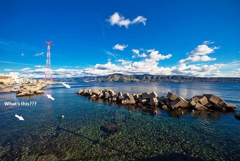
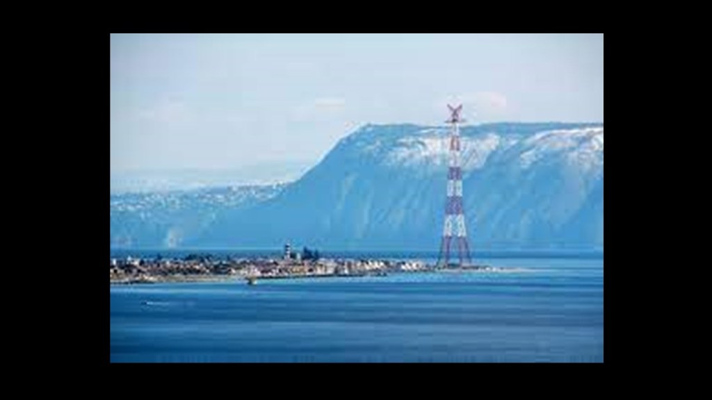
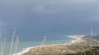
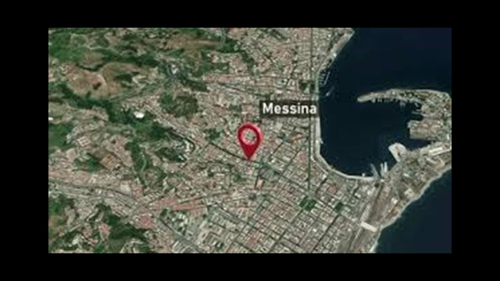
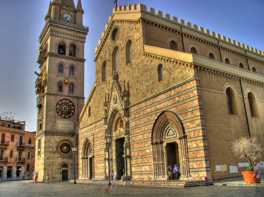
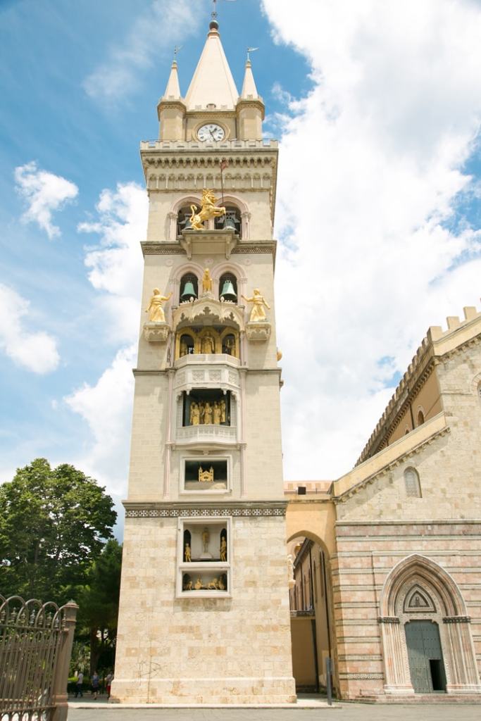
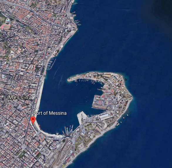
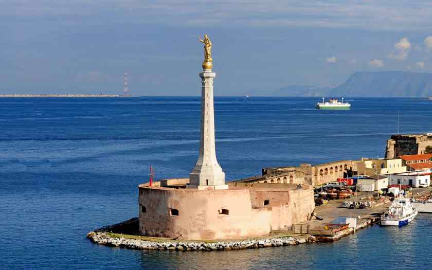
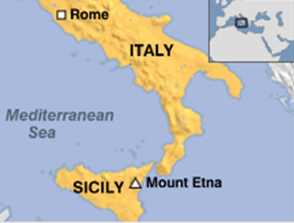
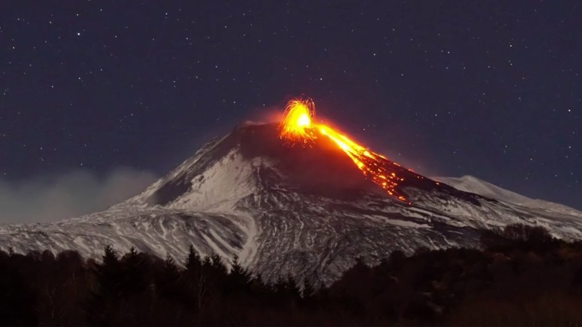
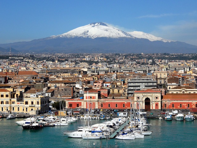
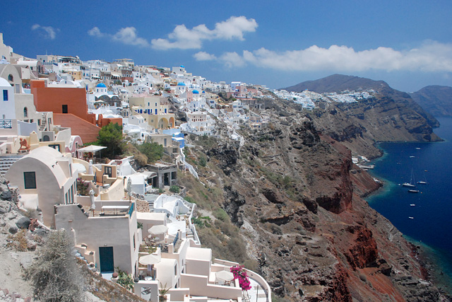
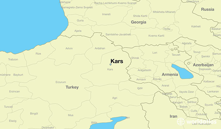
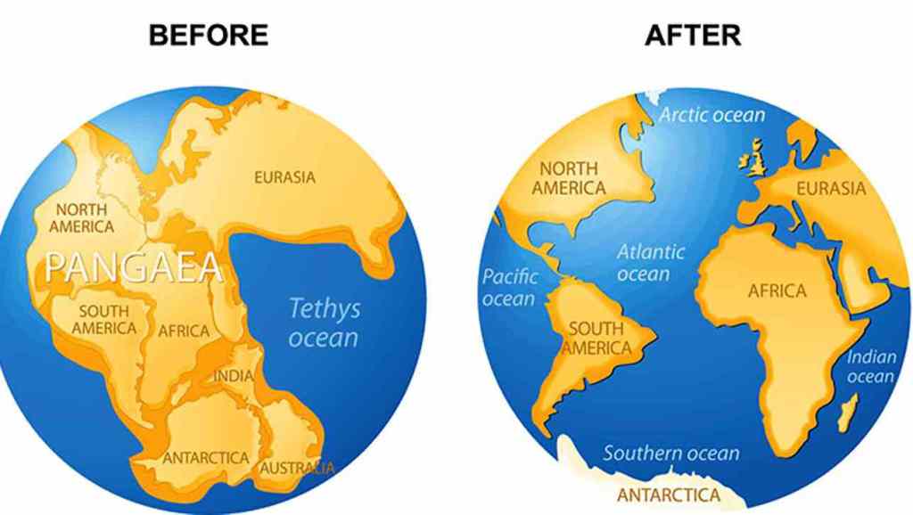
In the last post, I took a close look at the Strait of Messina, particularly the narrowest point between the eastern tip of Sicily, and the western tip of Calabria in Italy; the city of Messina, a major port andthe third-largest city in Sicily; then across to Mount Etna, one of the most active volcanos in the world; and ended at Catania, a city on the Sicilian coast that lies at the foot of Mount Etna.
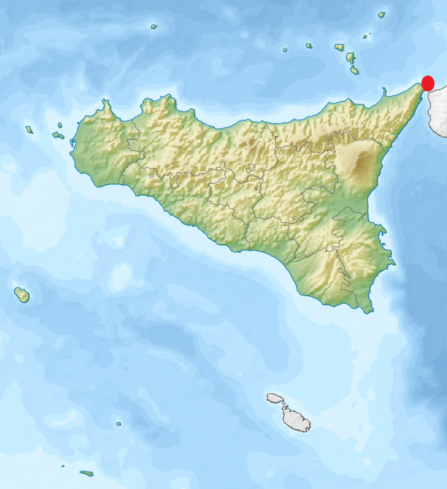
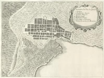
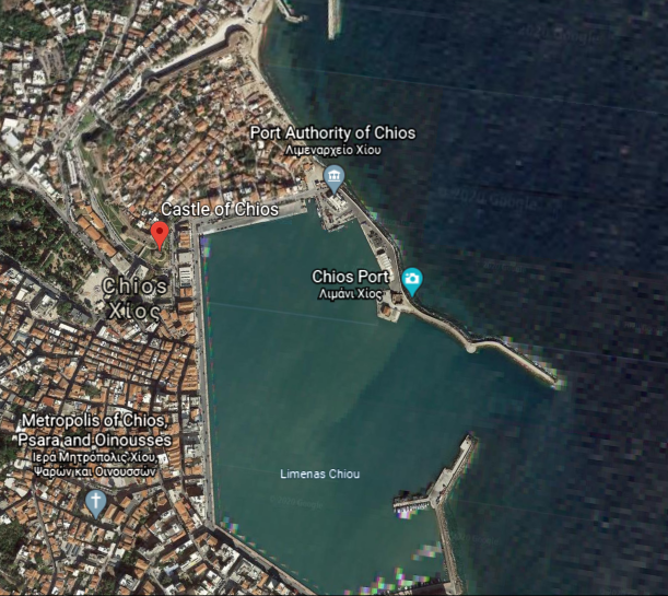
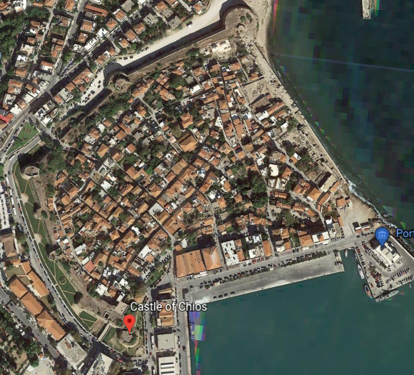
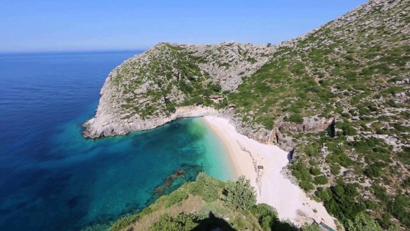
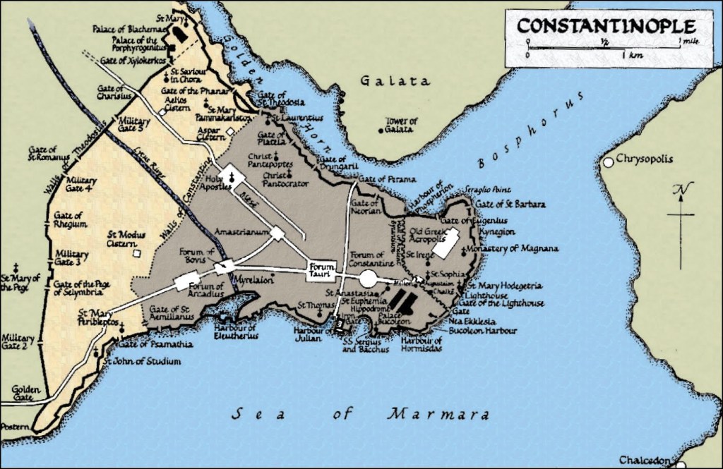
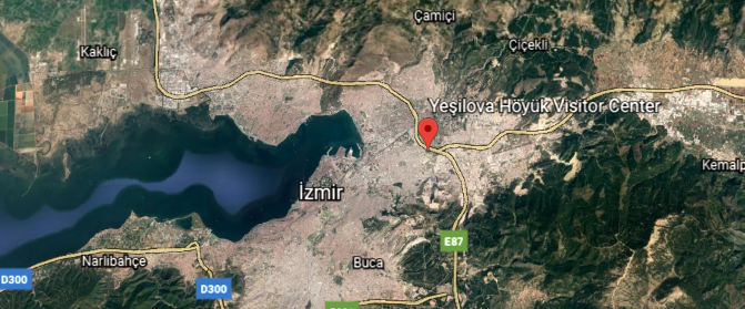
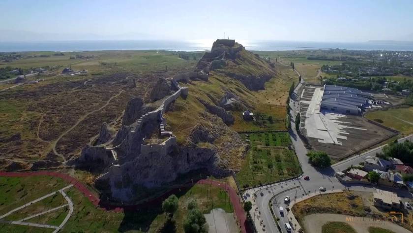
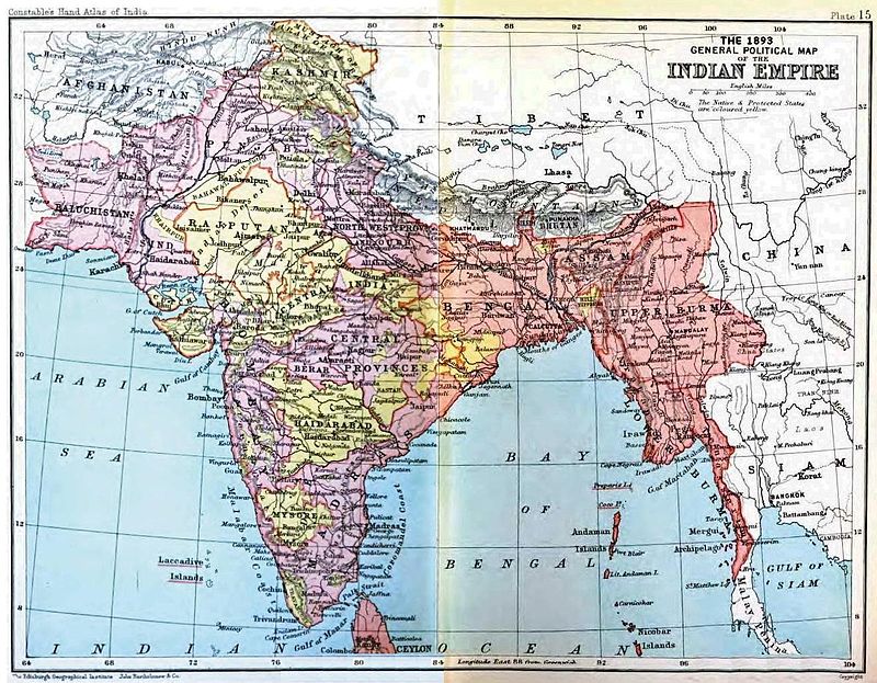
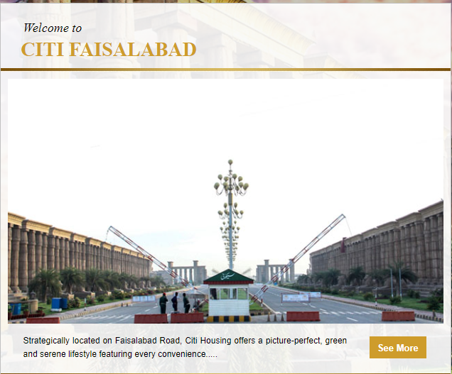
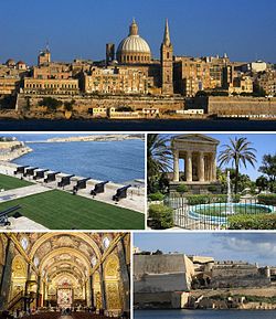
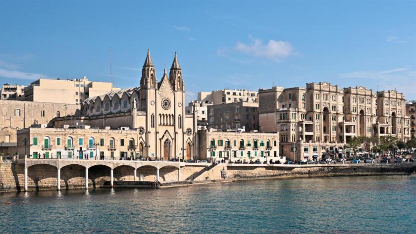
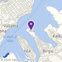
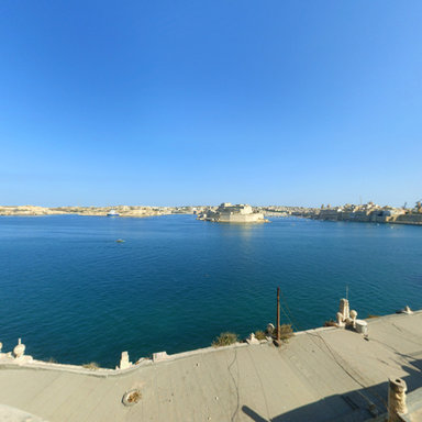
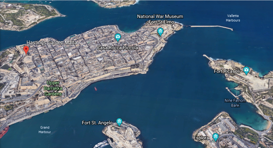
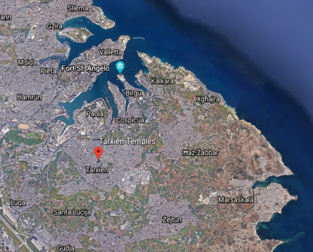
From Sicily, the alignment I am tracking crosses over the island Republic of Malta, in the vicinity of its capital, Valletta…
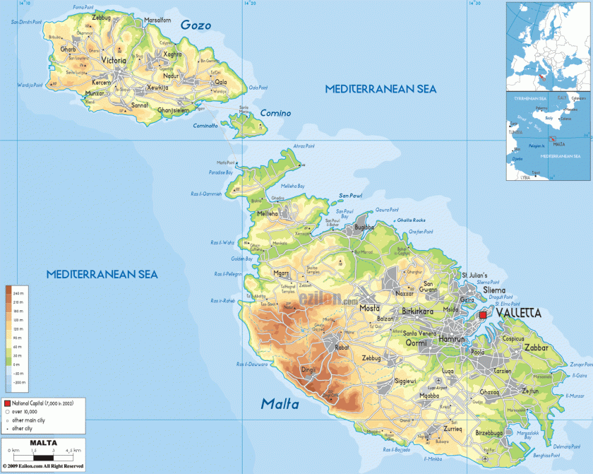
…and located in the Southeastern Region of the main island…
… one of the five regions of Malta…
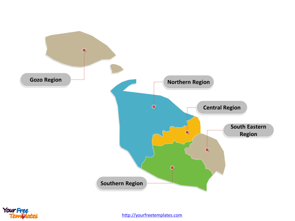
…between the Marsamxett Harbort and the Grand Harbor.
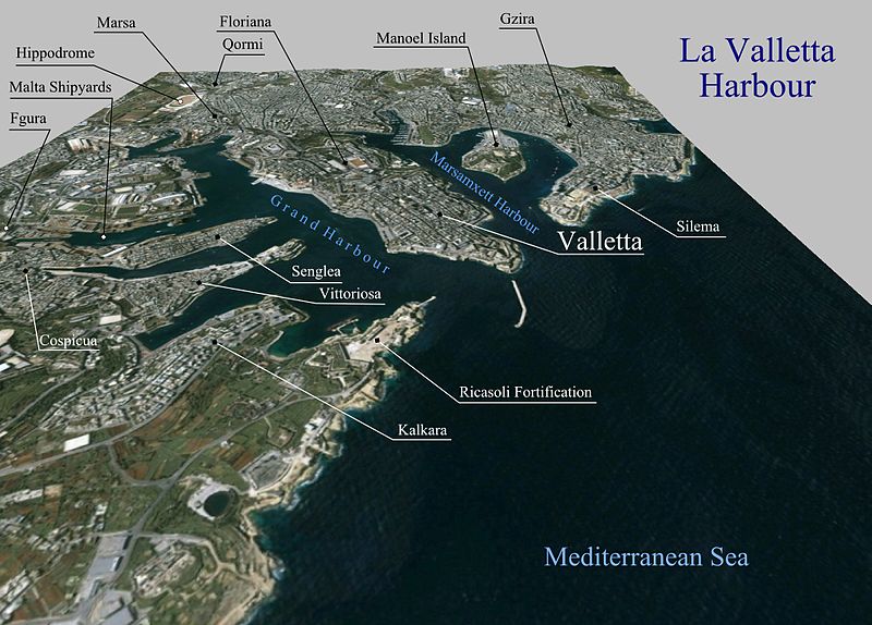
Marsamxett Harbor is described as a natural harbor generally more dedicated to leisure use than the Grand Harbor…
…and is bounded to the north by Dragut Point and Tigne Point…
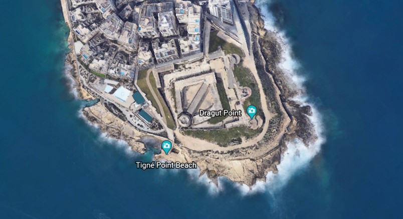
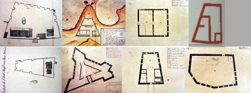
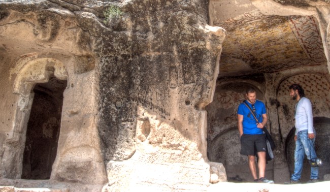
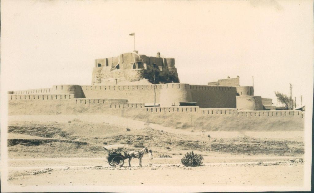
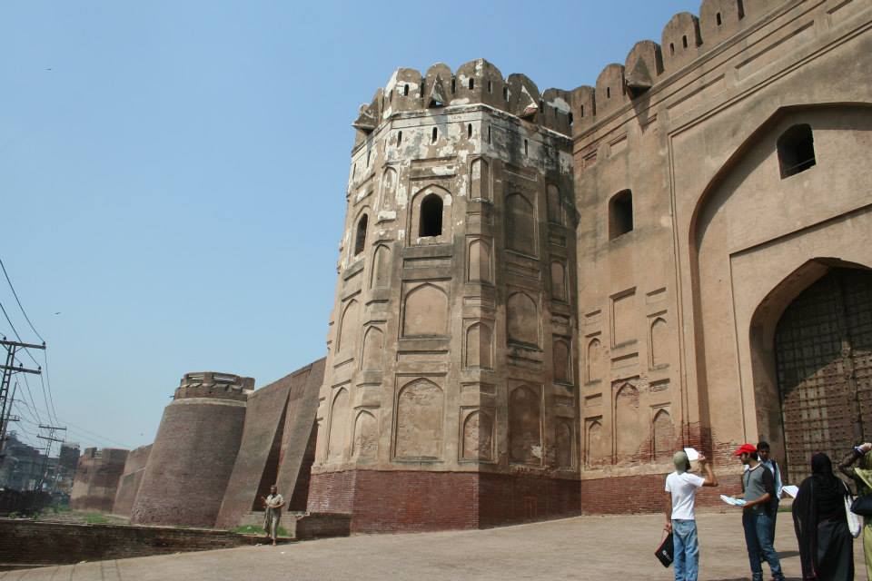
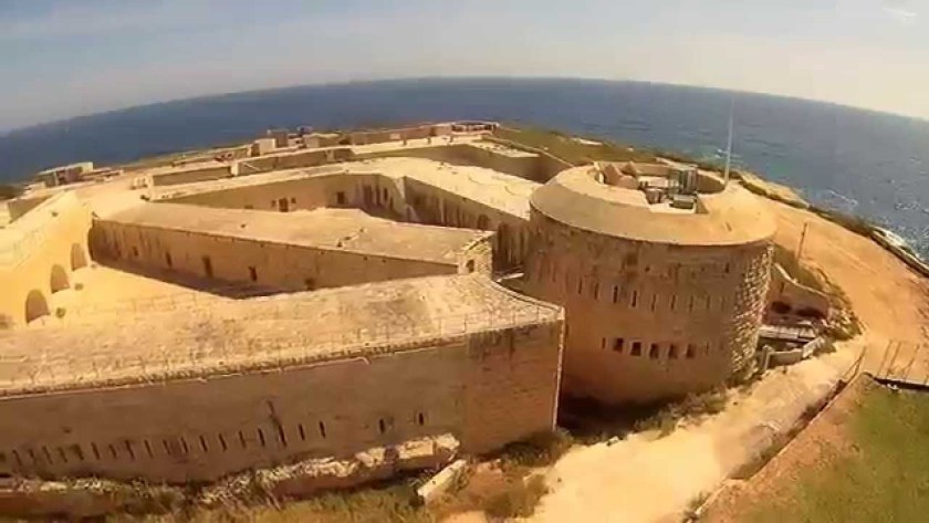
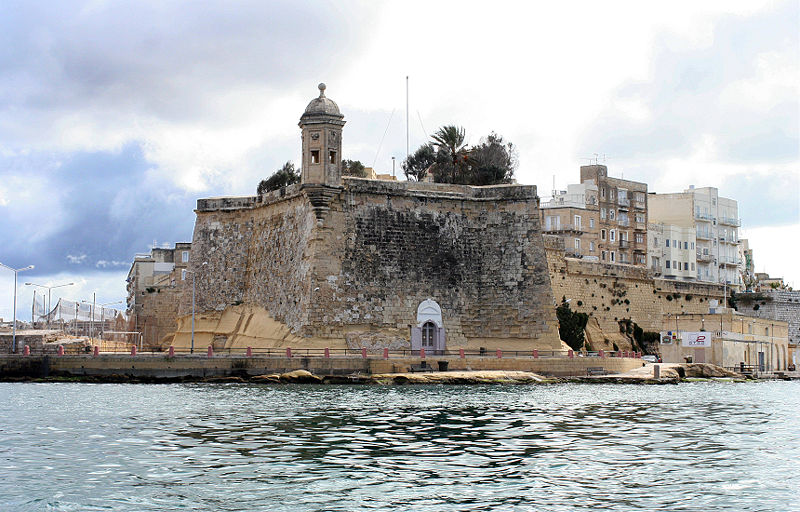
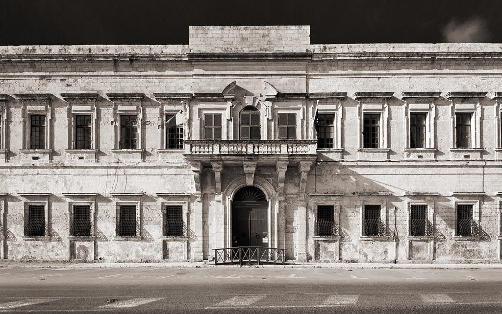
…where we find Fort Tigne…
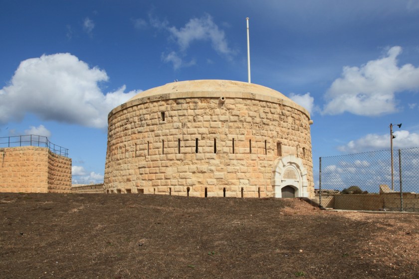
…said to have been built by the Order of the Knights Hospitallers of St. John between 1793 and 1795 and claimed to be one of the oldest polygonal forts in the world.
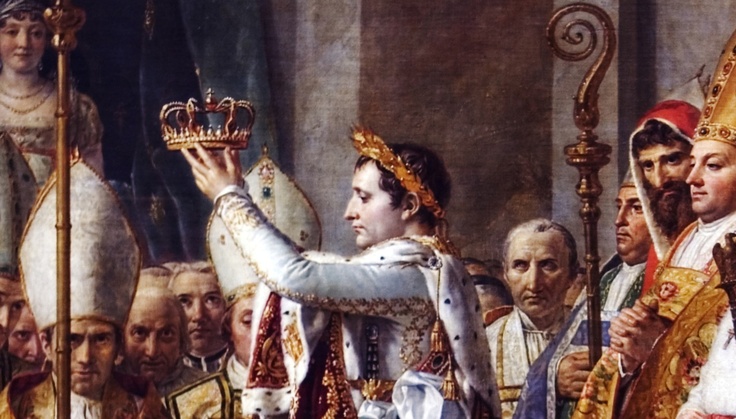
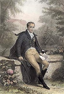
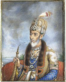
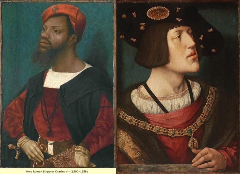
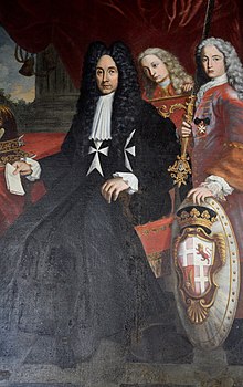
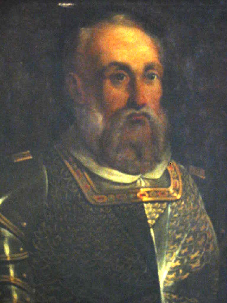
We are told the Order of the Knights Hospitallers of St. John ruled Malta from the time when the Emperor Charles V (who was also King Charles II of Sicily) gave the islands of Malta and Gozo to the Order in 1530, as well as Tripoli in Libya, until the time the Order surrendered to Napoleon when the French landed in Malta in 1798.
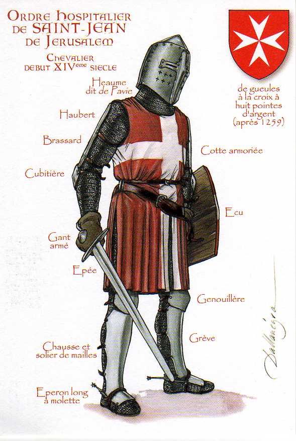
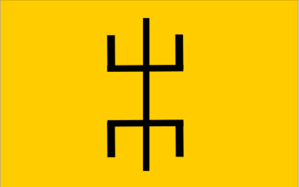
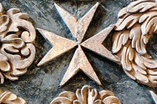
Known usually by the shorter Order of St. John, the Maltese Cross was said to have been officially adopted by the Order in 1126.
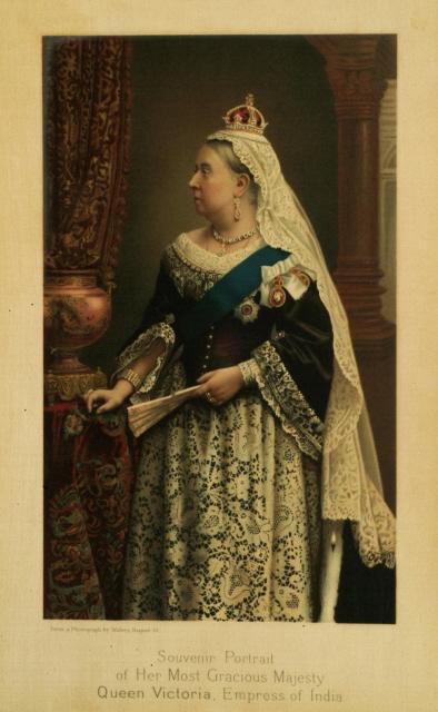
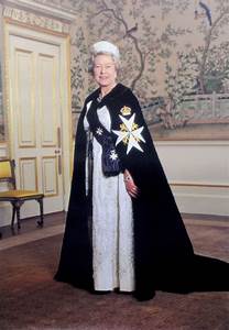
And today’s Order of St. John was chartered by Queen Victoria in 1888 as a British Royal Order of Chivalry.
Interesting to note that I have found two different portraits of Charles V, Emperor of the Holy Roman Empire between 1500 and 1558, each having similar facial structure and tilts of the chin, and wearing similar clothing.
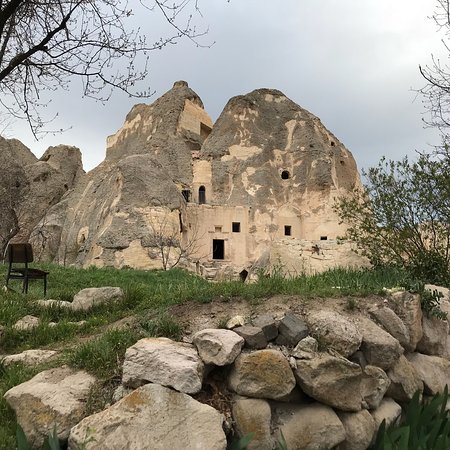
Manoel Island is a small island in Marsamxett Harbor, situated close to Tigne Point…
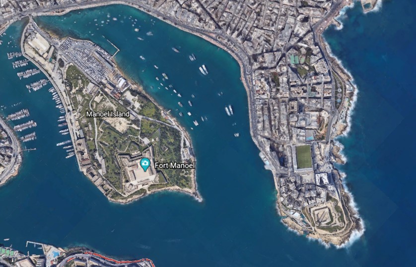
…and the location of Fort Manoel…
…said to have been built in the 1720s by the Portuguese 66th-Grand Master of the Knights of Malta, Antonio Manoel de Vilhena.
We are told the British military took over the fort in 1800, and renamed it HMS Phoenicia, who used it until 1964…relatively recently.
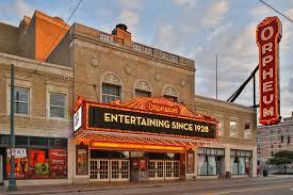
Manoel Island is connected to the town of Gzira, in Malta’s Central Region, by a bridge…
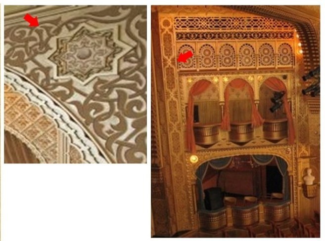
…where we find an Orpheum Theater, said to have been built in 1932.
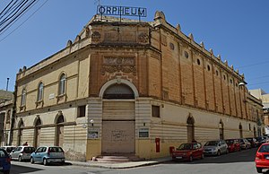
There are two points I would like to make about this finding.
This is the first point.
Orpheus was a musician and poet in Ancient Greek legend, said to have had the ability to charm all living things, and even stones, with his music.
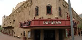
In the course of my research, I found numerous early theaters called “Orpheums,” like the one in Gzira in Malta, including the Orpheum Theater in Los Angeles, California…

…the Orpheum Theater in Boston, Massachusetts…
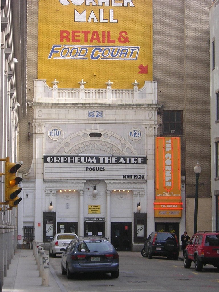
…in Memphis, Tennessee…
…and in Phoenix, Arizona.
What, exactly, caused us to go to sleep, and forget who we are, and what we were? How has the false information we have been taught in school been reinforced?
Why would this be important to whoever was responsible for removing the ancient advanced civilization from our collective awareness to begin with?
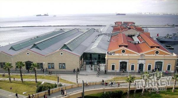
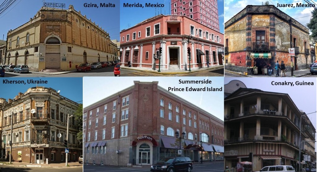
The second point that I would like to make about the Orpheum Theater in Gzira is its street-corner style of architecture…that I have found worldwide, like in Merida, Mexico in the top middle; Juarez, Mexico, on the top right; and on the bottom left, in Kherson, Ukraine; bottom middle, Summerside in Prince Edward Island; and on the bottom right, in Conakry, the capital of the African country of Guinea.
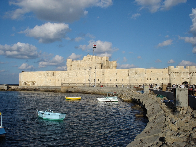
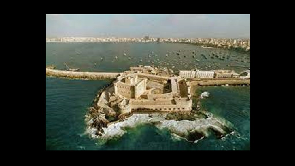
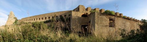
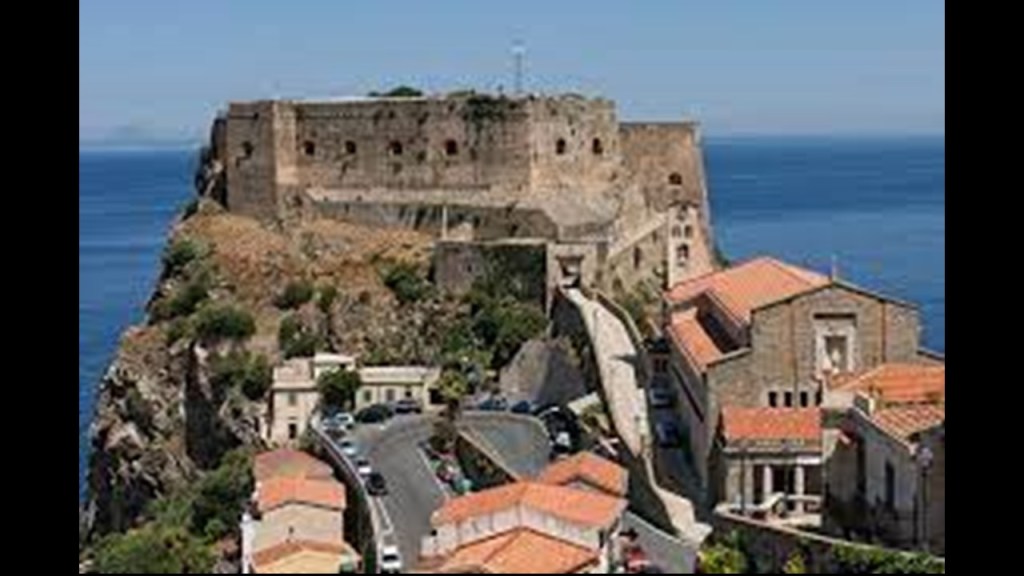
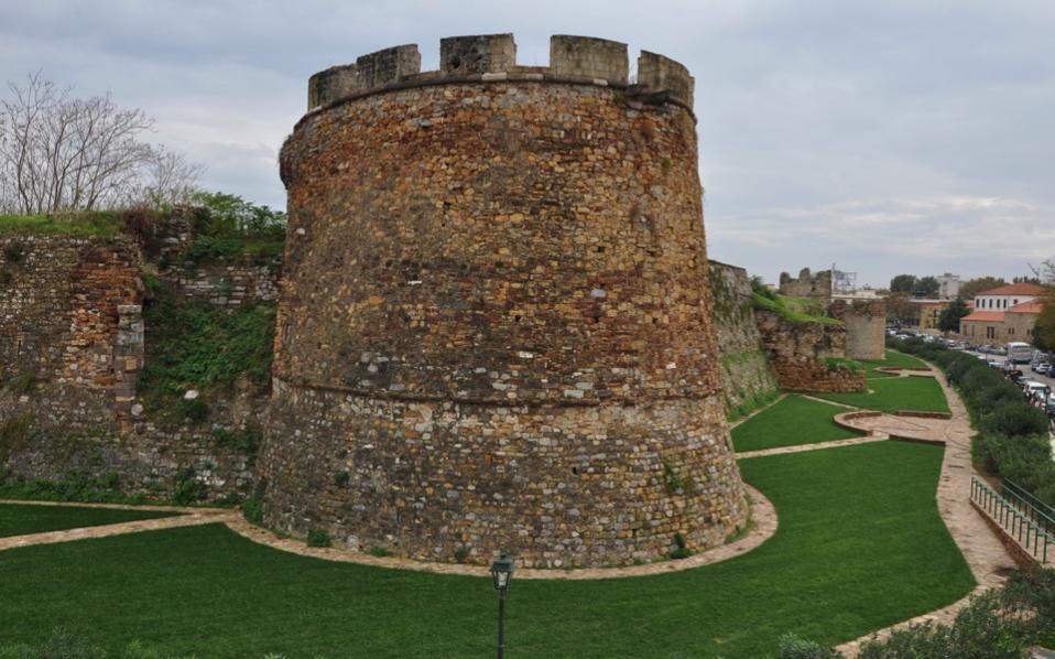
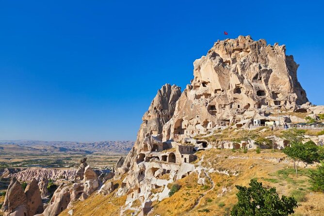
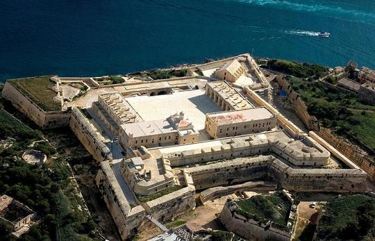
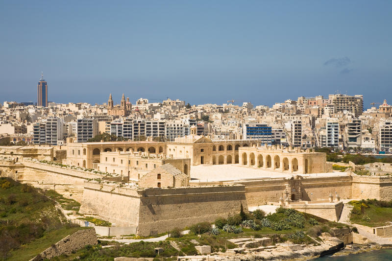
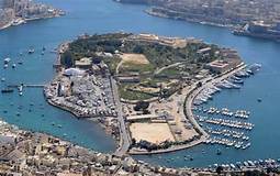
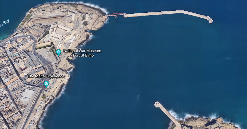
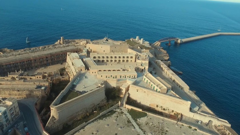
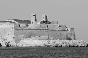
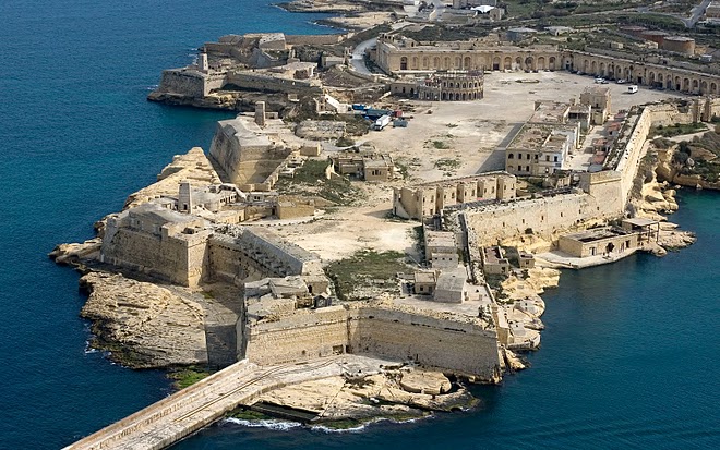
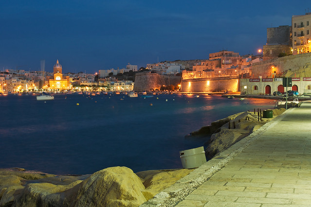
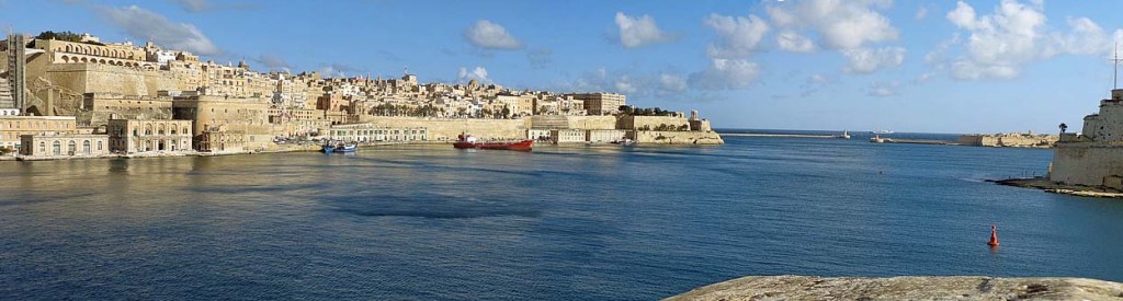
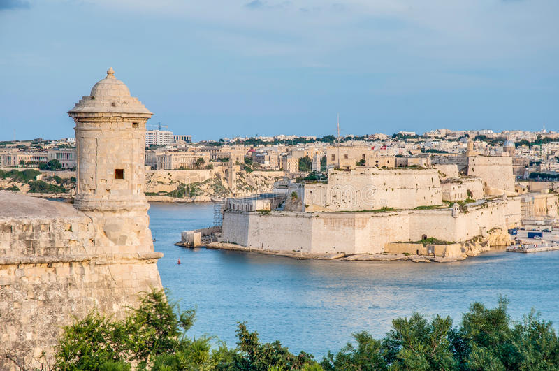
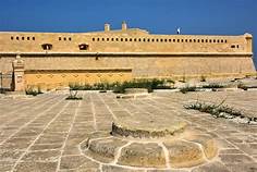
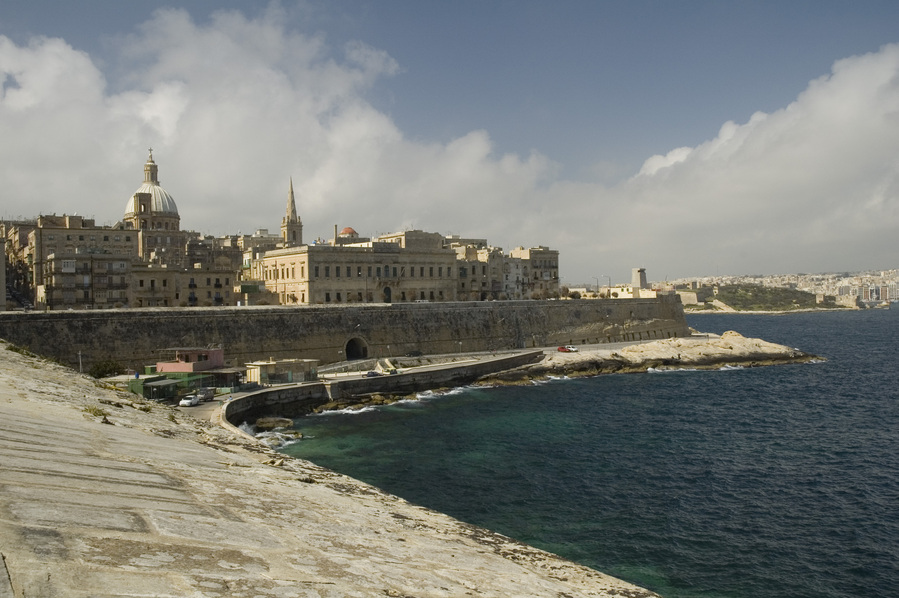
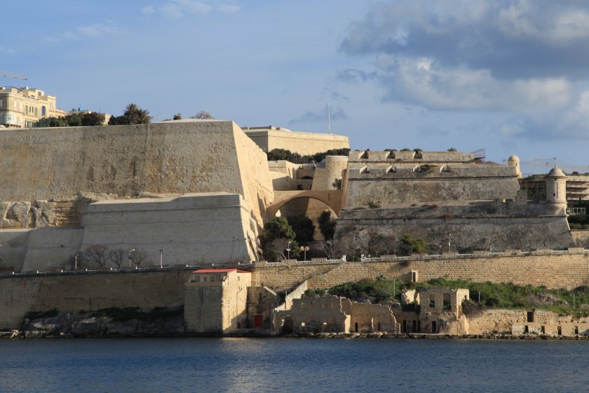
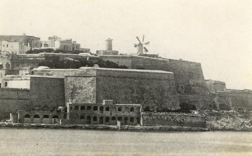
Fort St. Elmo stands on the seaward shore of the peninsula that divides Marsamxett Harbor from the Grand Harbor…
…and said to have been built in its present form as a star fort in the 1550s.
It was the target of aerial bombardment on the first day Malta became involved in the conflict of World War II.
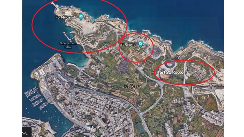
Fort St. Elmo is situated in the middle at the entrance to the two main harbors, between Fort Tigne at the entrance to the Marsamxett Harbor, and Fort Ricasoli at the entrance of the Grand Harbor.
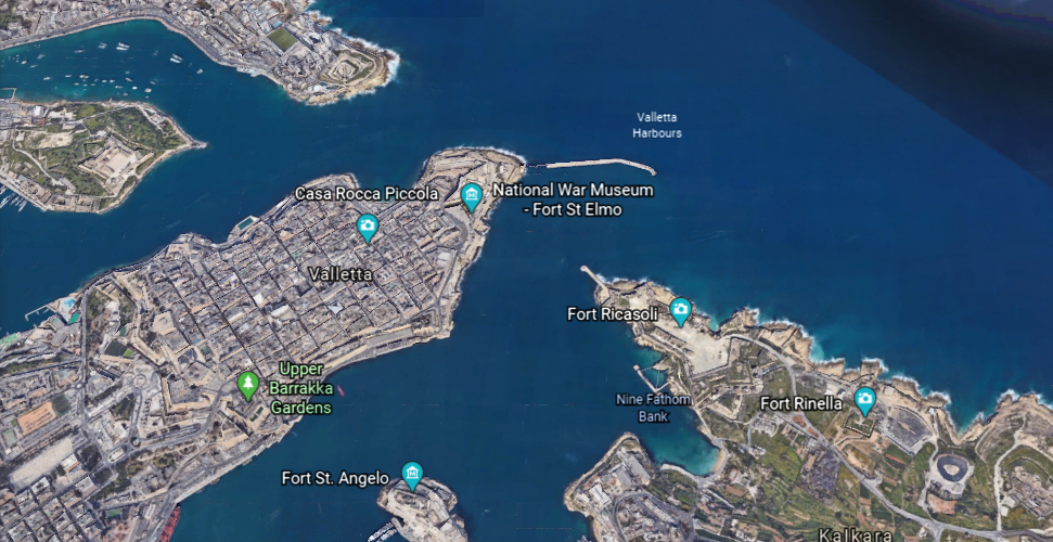
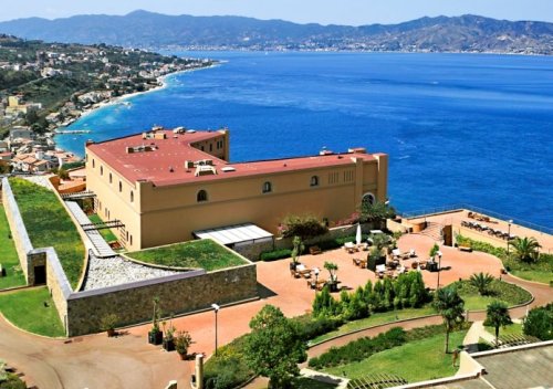
Fort Ricasoli was said to have been built by the Order of St. John between 1670 and 1698.
Fort Ricasoli was said to have seen use during the French invasion of Malta, led by Napoleon himself, in 1798, which was part of the Mediterranean Campaign in the War of the Second Coalition of the French Revolutionary Wars.
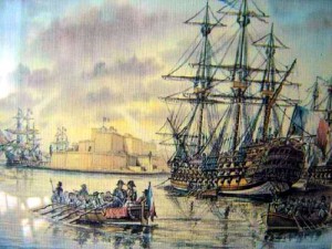
After the British Royal Navy destroyed the French Mediterranean fleet at the Battle of the Nile on August 1st, 1798, the British were able to initiate a blockade of Malta, assisted by an uprising of the native Maltese against French rule. The blockade effectively ended the French Occupation of Malta in 1800, and replaced it with British Protectorate, returning control of the central Mediterranean to Great Britain.
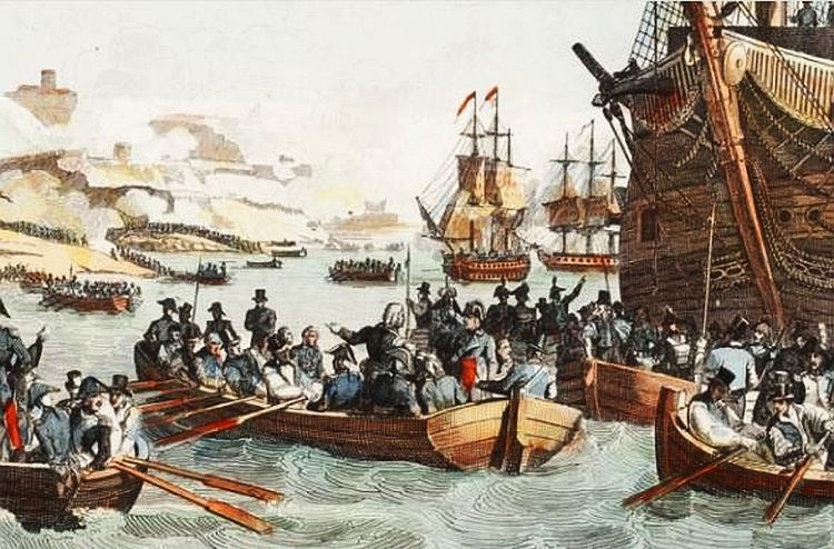
Malta held the status of British Protectorate for 164-years, until it gained its independence from Britain in 1964.
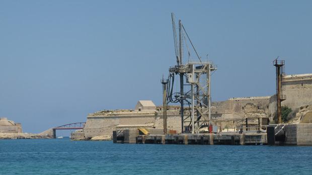
Though Fort Ricasoli, like Fort St. Elmo, was bombarded during World War II and parts of it destroyed, today the fort remains largely intact.
It is used as a filming location…and tank-cleaning facility for the Malta Drydocks, treating liquid waste from ships arriving in the Grand Harbor, removing oil and other chemicals prior to releasing the waste into the sea.
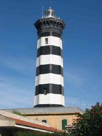
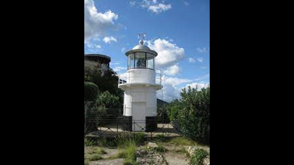
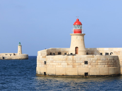
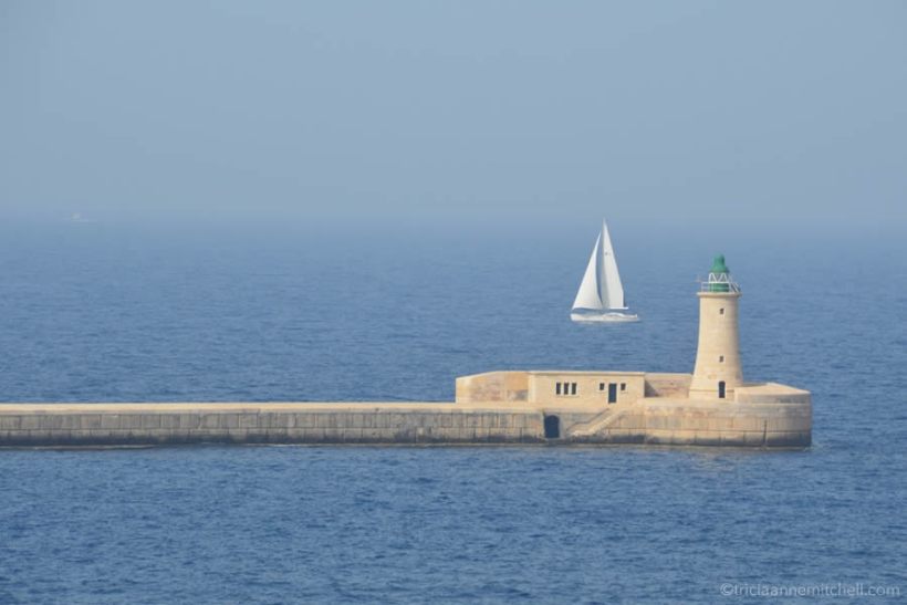
These are the pair of lighthouses, one at Fort St. Elmo and the other at Fort Ricasoli, located on man-made breakwaters at the entrance to the Grand Harbor.
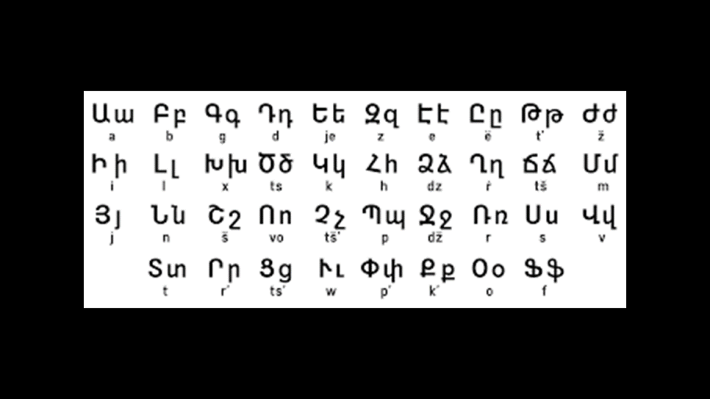
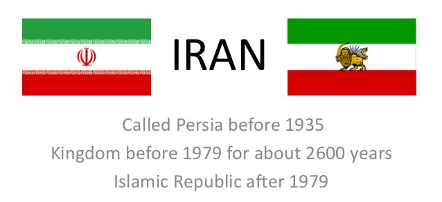
The Maltese language is spoken in the islands, in addition to English and Italian.
Maltese is related to Arabic, but written in the Latin alphabet.
The Maltese word for a lighthouse is “fanal.”
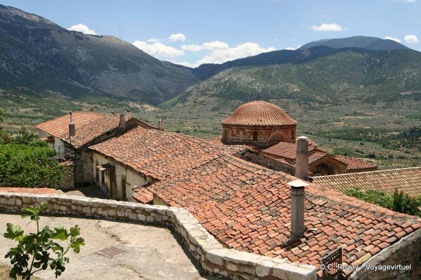
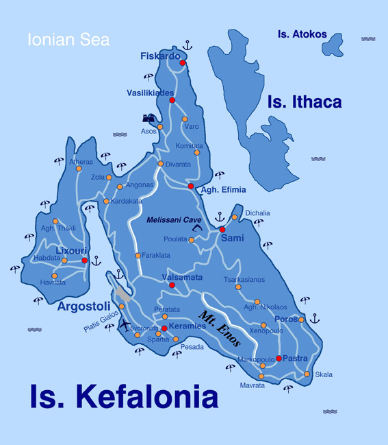
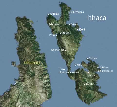
Back on Kefalonia in the Ionian Islands of western Greece, I found a lighthouse at a place called “Fanari Point.”
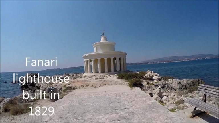
I looked up the Arabic word for lighthouse, and apparently it is al-Manarah, similar in sound to Fanari, as well as the same word for minaret in Arabic.
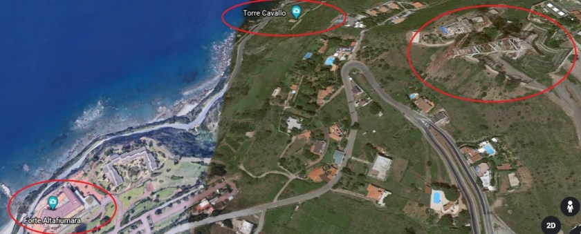
There are two more forts along the shore of the Mediterranean Sea next to Fort Ricasoli.
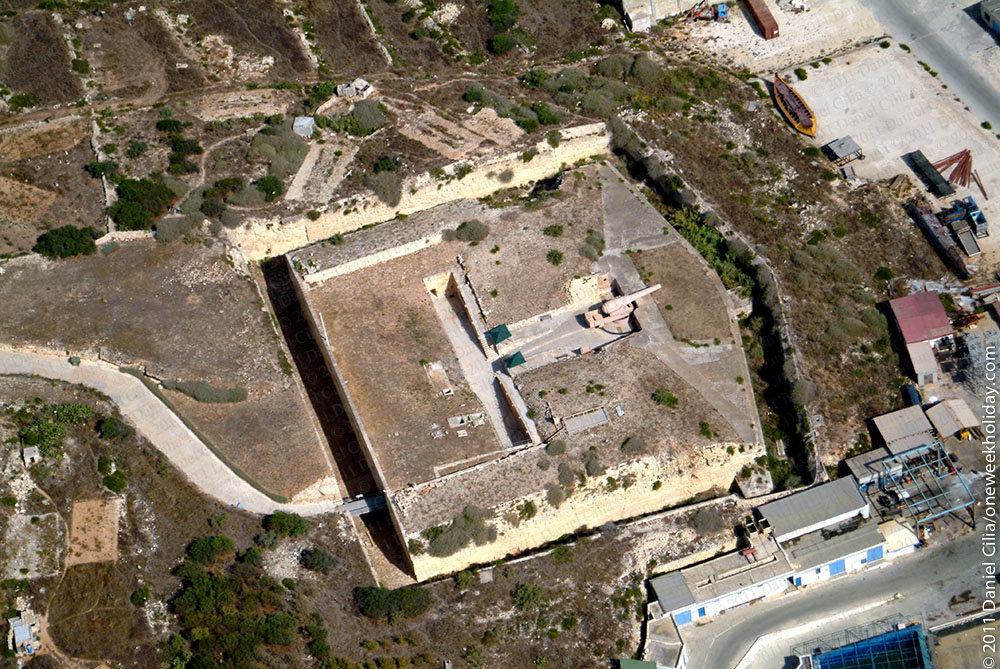
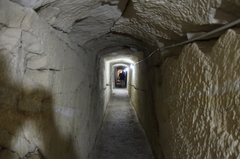
The first is Fort Rinella, described as a Victorian battery.
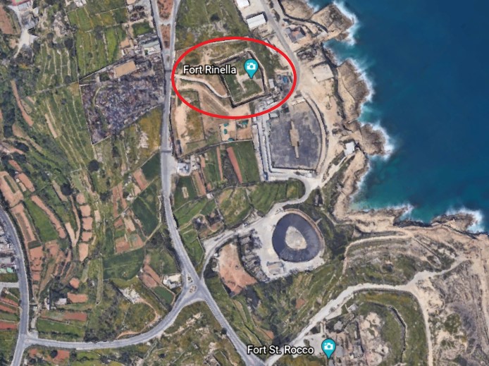
It was said to have been built by the British between 1878 and 1886.
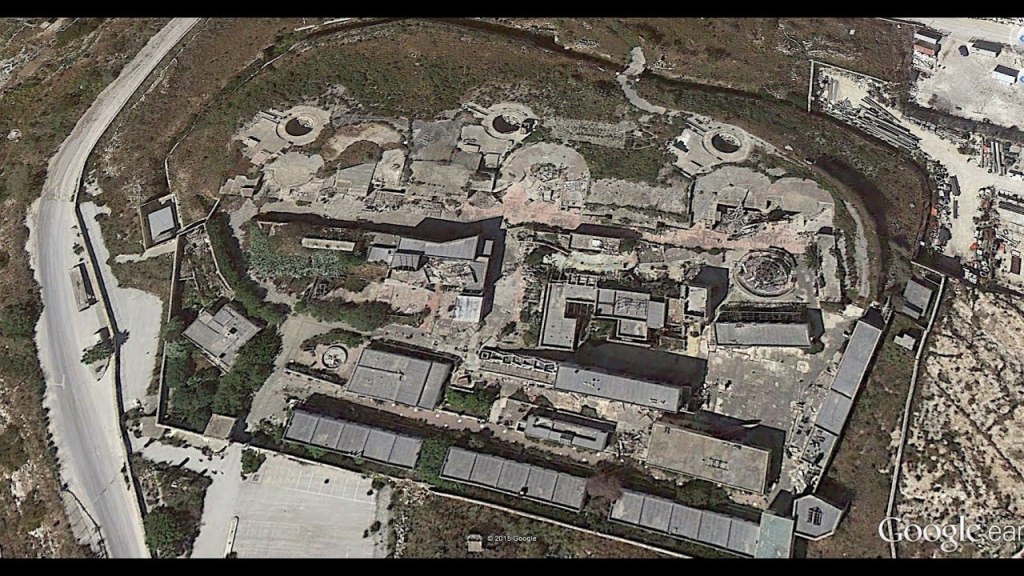
Fort St. Rocco is found just a short distance down the Mediterranean coast from Fort Rinella.
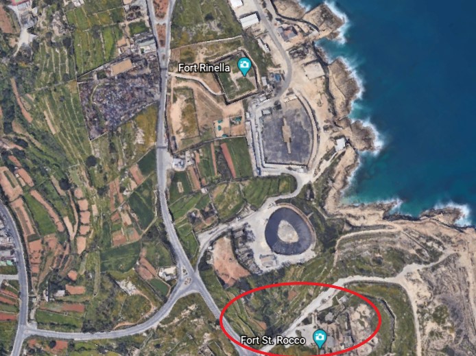
It is described as a polygonal fort, and as part of a complex of shore batteries built by the British to defend the coast east of the mouth of Grand Harbor between the 1870s and 1900.
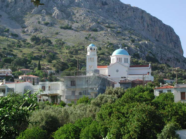
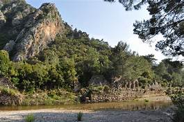
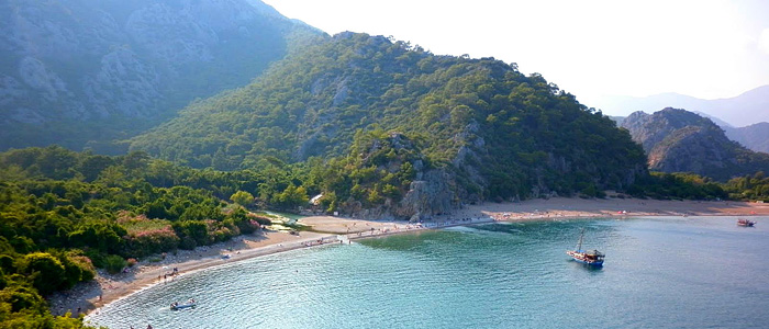
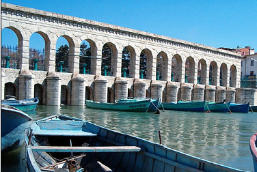
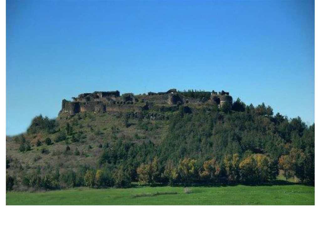
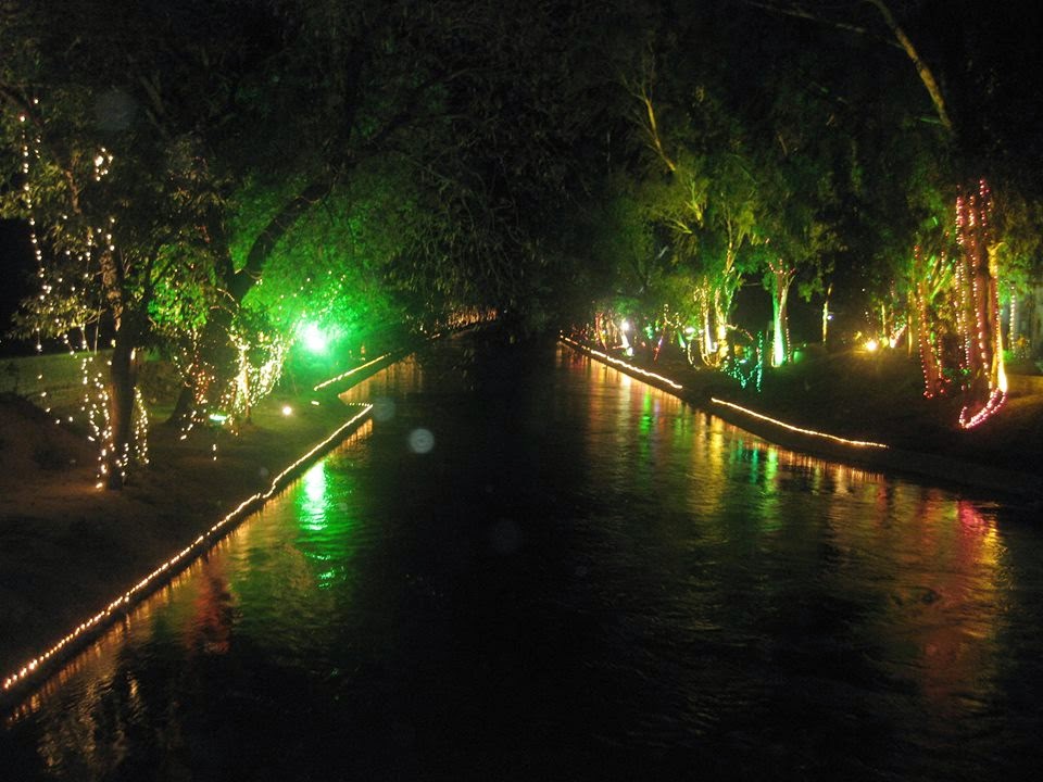
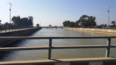
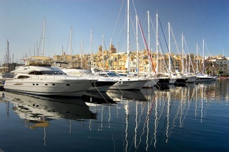
These three forts are part of Kalkara…
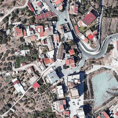
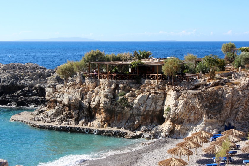
…described as a village on Kalkara Creek, which is shown in this photo…
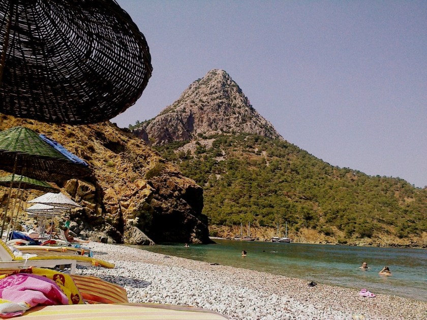
Here’s another view of Kalkara.
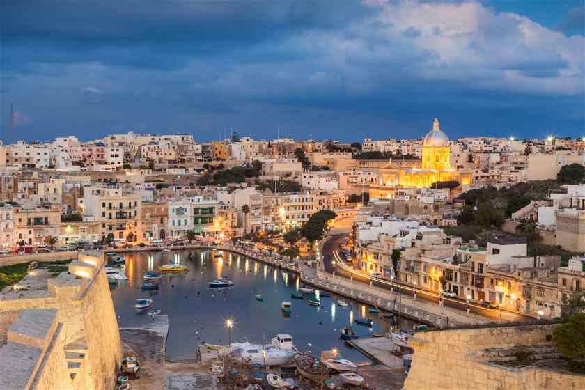
We are told that the name Kalkara derives from the Latin word for lime, “Calce,” and that the village developed as a small fishing community around the sheltered inlet of Kalkara Creek.
Some historians believe, we are told, this was one of the first places in Malta to be inhabited by people who came from the nearby island of Sicily.
I can make, at the very least, a circumstantial case here.
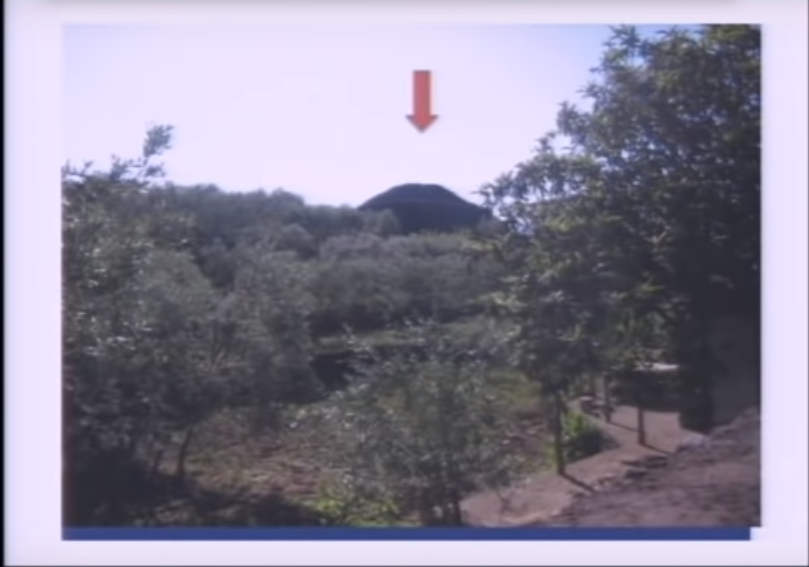
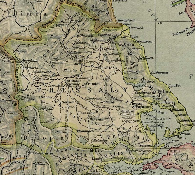
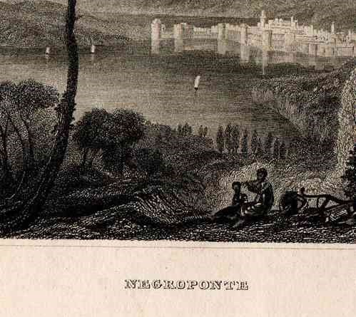
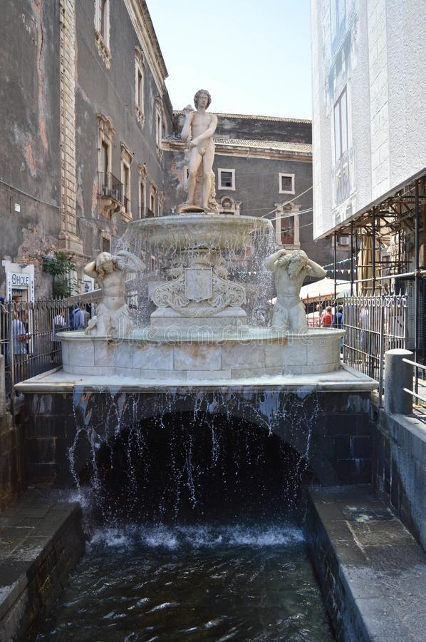
I did not include it in the last post, but I read information saying that Catania in Sicily…

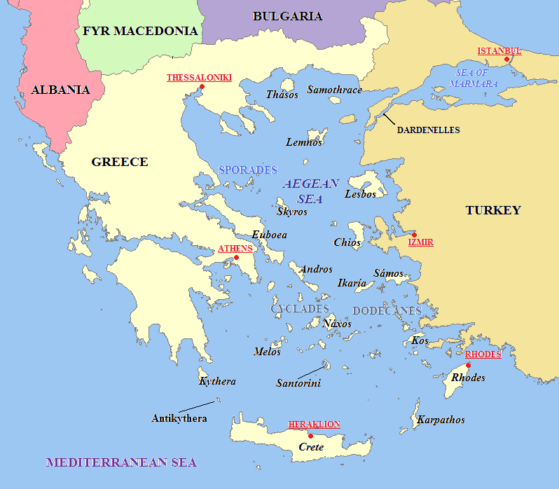
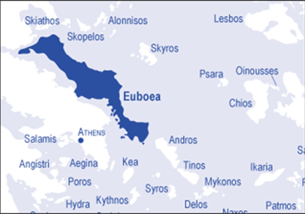
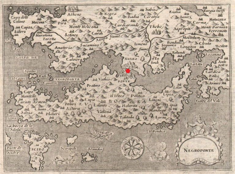
…was a colony of Chalchis, and could also be spelled as Kalkis, an ancient city on the Greek Island of Euboea in the Aegean Sea.
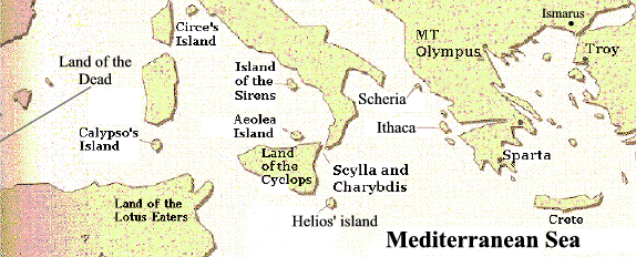
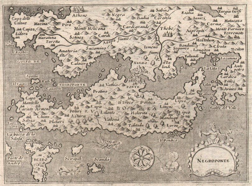
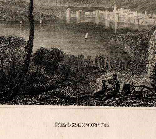
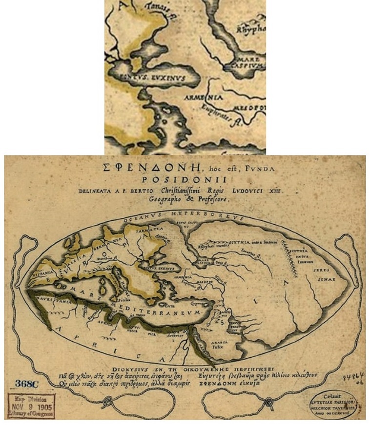
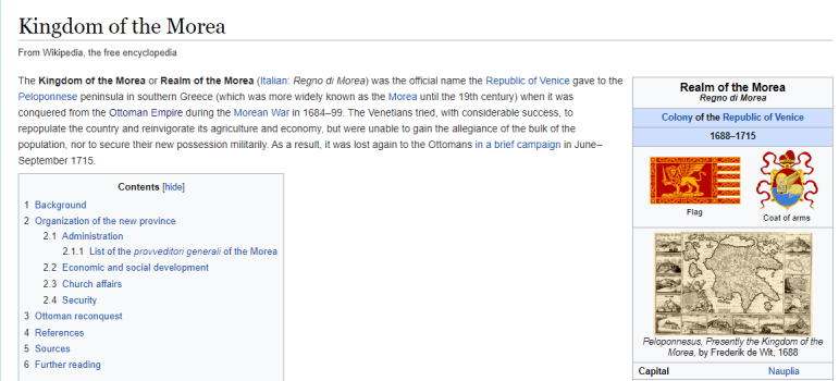
At one time, the island of Euboea was known by another name…Negroponte, and I marked the location of Chalchis on what we are told was a 1620 map.
…and part of what was known as the Kingdom, or Realm, of the Morea, which was the official name of the Peloponnese Peninsula of southern Greece…until the 19th-century.
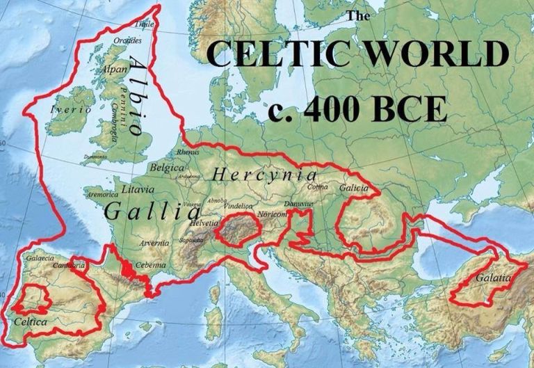
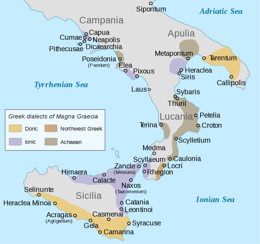
Not only that, we are told the Romans referred to the coastal areas of southern Italy and Sicily as Magna Graecia, or “Great Greece” because these regions were extensively populated by what were called Greek settlers, starting in the 8th-century BC…
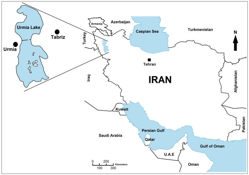
…and Malta lies between Sicily and the country of Tunisia in North Africa.
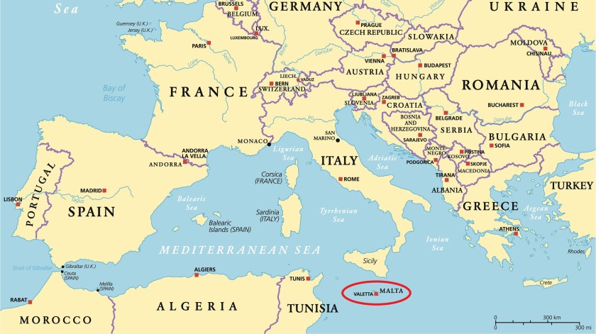
All of these places are relatively close to each other.
How big of a stretch is to see all of these places connected to the same ancient advanced civilization, other than we haven’t been taught about it?
Places and names have been changed and obscured instead of being taught about it. Why?
Let’s see what other secrets Malta has to reveal!
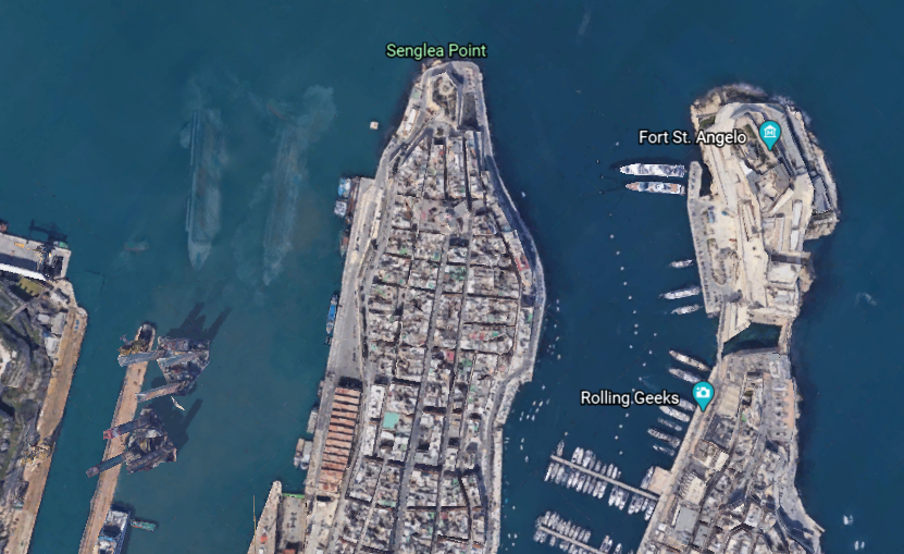
Moving from a short distance west from Kalkara, we come to Birgu, also known as the “Victorious City”…
…and described as the oldest of an area in Malta referred to as “The Three Cities” – three fortified cities in very close proximity to each other, which also includes Senglea and Cospicua.
The city occupies a promonory of land in the Grand Harbor, with Fort Saint Angelo at the head…
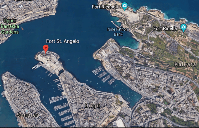
…and the city of Cospicua at the base.
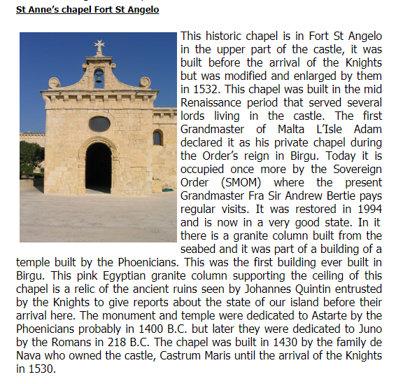
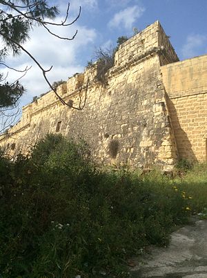
Fort San Angelo served as the base of the Order of St. John, and we are told the de facto capital of Malta between 1530 and 1571…
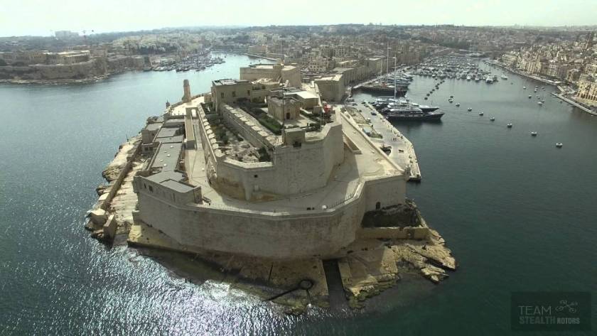
…and the British garrisoned the fort between 1800 and 1979.
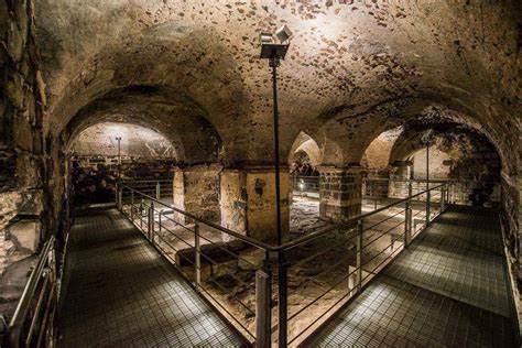
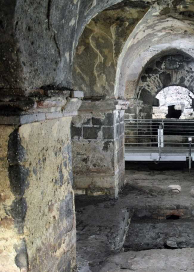
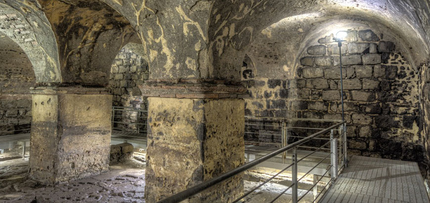
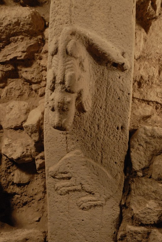
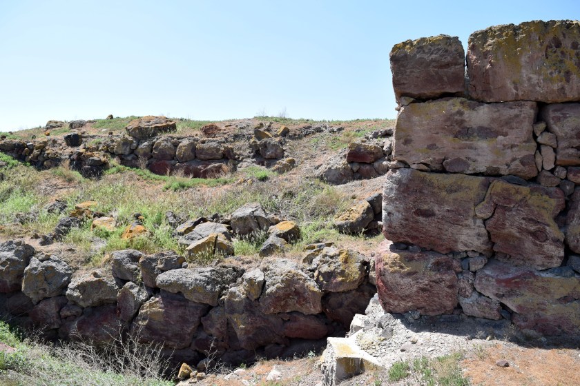
We are told the date of its original construction is unknown, but has large ashlar blocks, the finest stonemasonry unit…
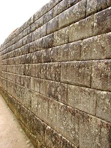
…and an Egyptian pink granite column at the top of the fort inside a chapel.
Fort San Salvatore is also in Birgu…

…said to have been built in 1724 on one of the bastions of the Cottonera Lines.
It was said to have been used as a Prisoner-of-War Camp during the Greek War of Independence between 1821 and 1830, as well as during World War I; and during World War II, as a kerosene depot and internment camp, which were used to imprison large groups of people, without charges, or the intent to file charges.
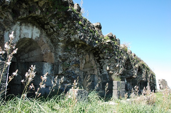
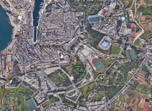
The Cottonera Lines were said to be a line of what are called fortifications in Conspicua and Birgu that were constructed in the 17th- and 18th-centuries to form the outer defenses of the Three Cities…
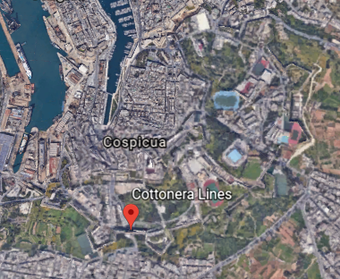
…and built around an earlier line of fortifications known as the Santa Margherita Lines.

Before leaving Birgu for the neighboring city of Senglea, I would like to point a place that caught my attention on Google Earth.
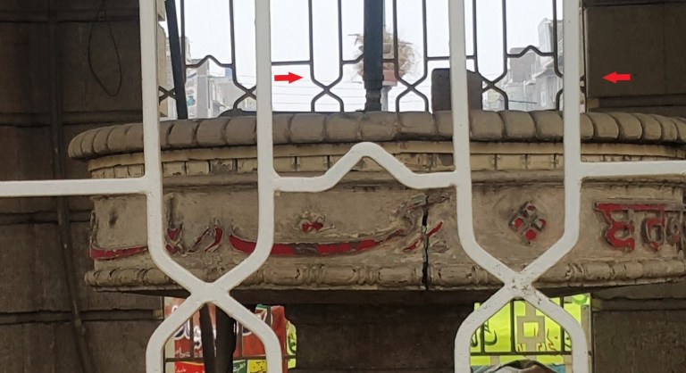
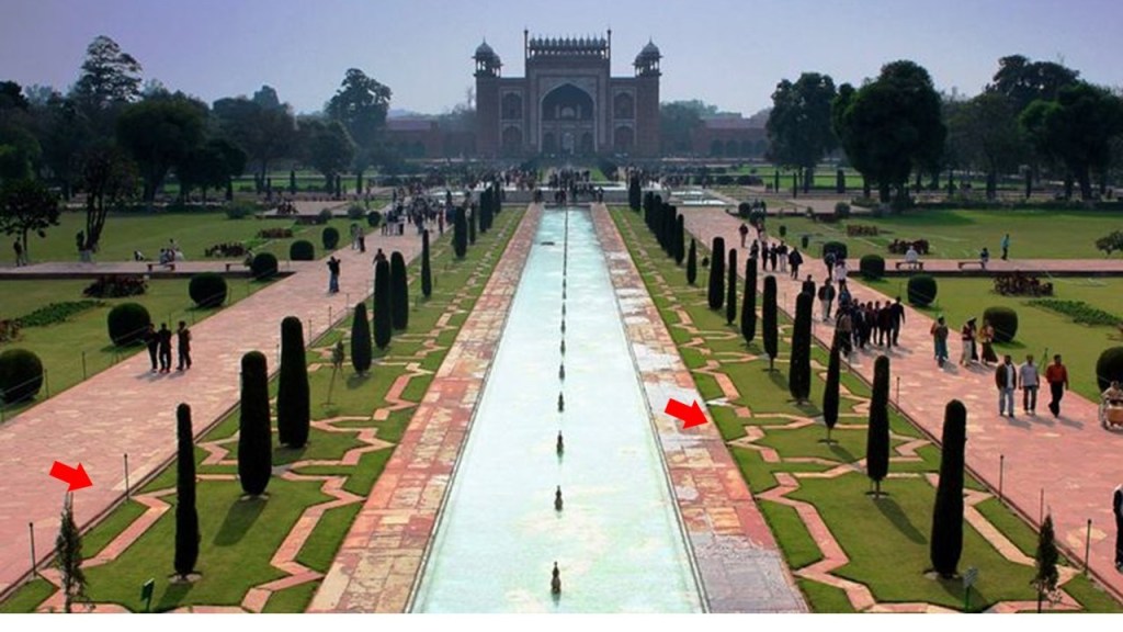
I noticed the Inquisitor’s Palace, and as it turns out, this was the seat of the Inquisition in Malta between 1574 and 1798, which was the first year Napoleon’s forces occupied Malta. It has been the National Museum of Ethnography since 1966, with permanent displays on Malta’s religious traditions as consolidated by the Inquisition.
The arrows are pointing to the building’s windows that are not level with the steep street beside it, which is a classic indicator for mud flood evidence.
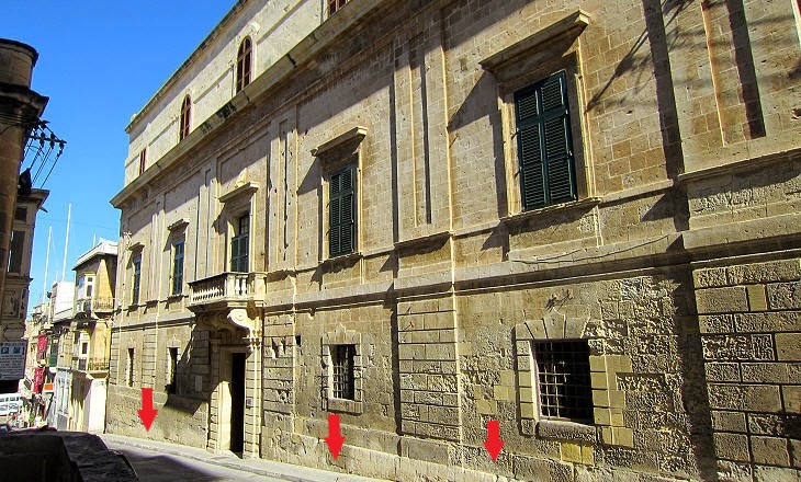
The Inquisitor’s Palace was said to have been originally constructed as a courthouse in the 1530s.
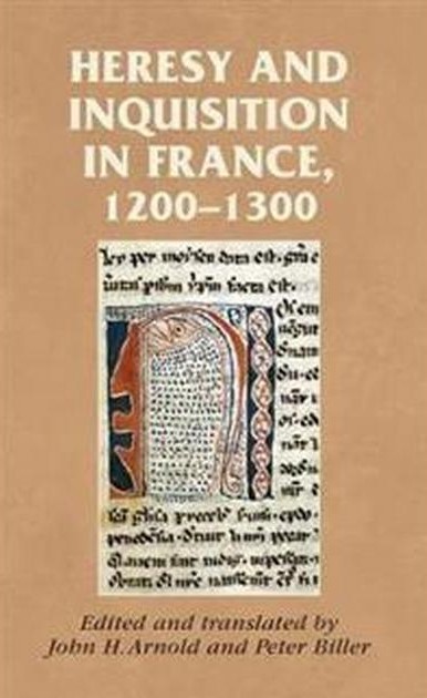
The Inquisition was a group of institutions within the Catholic Church with a stated aim of combating heresy, defined as the formal denial of the orthodox beliefs of the church, which is defined as the adherence to correct or accepted creeds in religion.

It started with the French Inquisition in the 1200s in France, which over a period of about 20-years saw the Cathar Crusade and the genocide of the gnostic Cathars, which had been labelled as an heretical sect.
The Inquisitor’s Palace became the headquarters of the Inquisition in Malta in 1574, serving as tribunal and prison, as well as the palace of the Inquisitor.
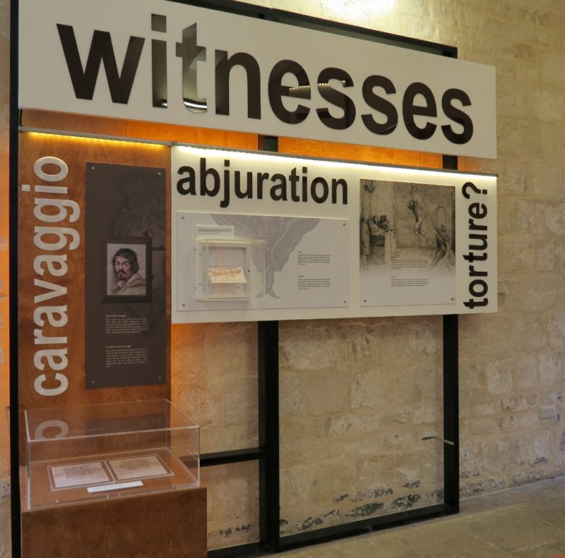
So we are taught that all of this is normal and matter of fact in history in school, like there is nothing out of the ordinary or wrong about the Inquisition…which was, by its very nature, violating basic Human Rights and dignity, including torture in the name of Christianity just for having dissenting views?
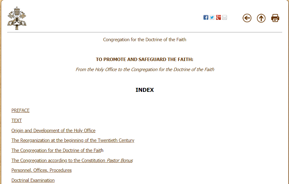
And the Office of the Inquisition it is still in existence to this day?
Only it is now called the “Congregation for the Doctrine of the Faith.”
The city of Senglea is a fortified city as well, we are told, and is also known as the “Civitas Invicta” or “Unconquered City.”
We are told there weren’t any buildings here until 1311, at which time St. Julian’s Church, or Chapel, was built, said to have been the first building constructed on what later became Senglea.
Then in 1552, we are told, the foundation stone was laid for Fort St. Michael, and its construction was said to have been completed in 1553.
Then construction of the walled town of what at the time was known as St. Julian’s Island in the decade following the completion of Fort St. Michael, subsequently became known as Senglea…
…in honor of the Grand Master Claude de la Sengle, of the Order of Malta, for giving St. Julian’s Island its city status.
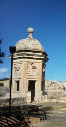
The Gardjola Gardens are located within the bastions of Fort St. Michael, also credited to Claude de la Sengle…
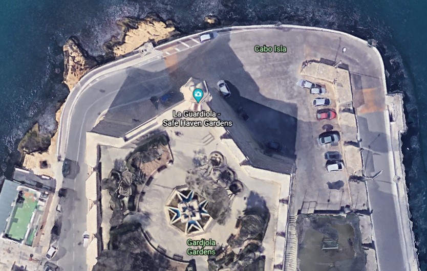
…and named for what is called the “Guard Tower” – “Il-Gardjola” – which has various symbols sculpted on it, such as an eye, ear, and crane bird, said to represent guardianship and observance protecting Maltese shores.
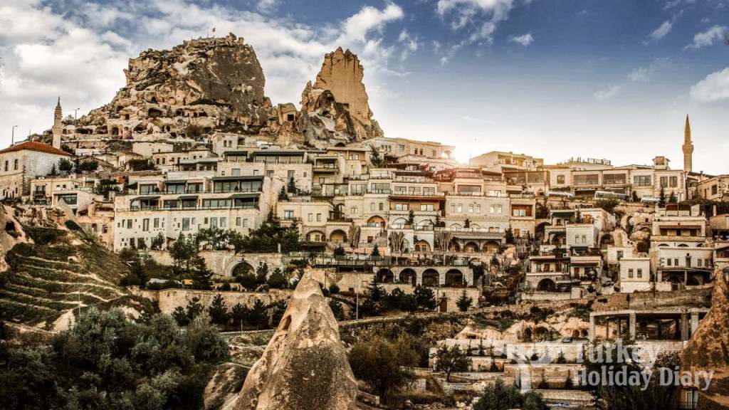
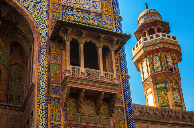
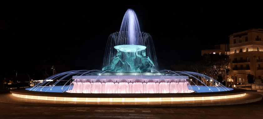
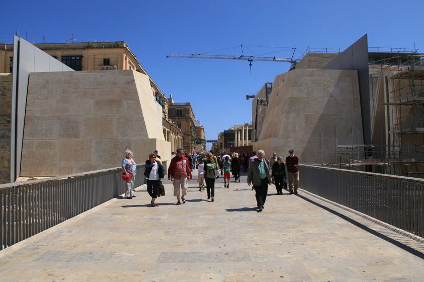
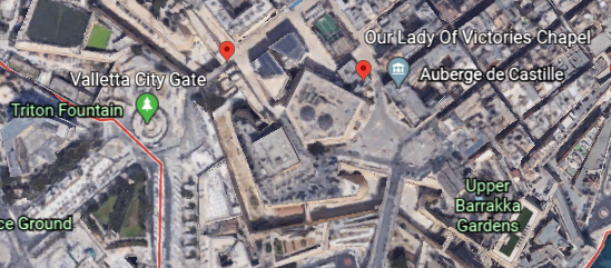
Now I am going to start a walking tour around the walls of Valletta…
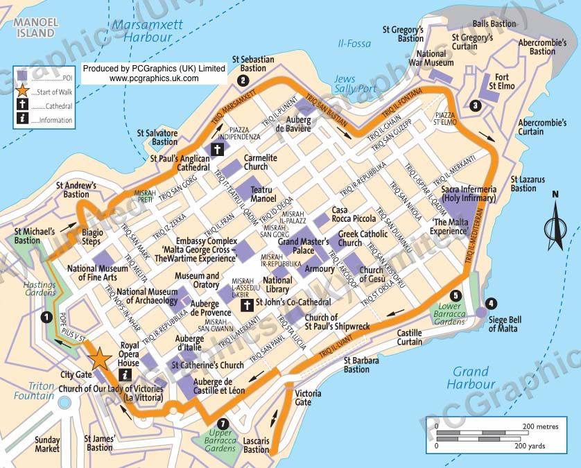
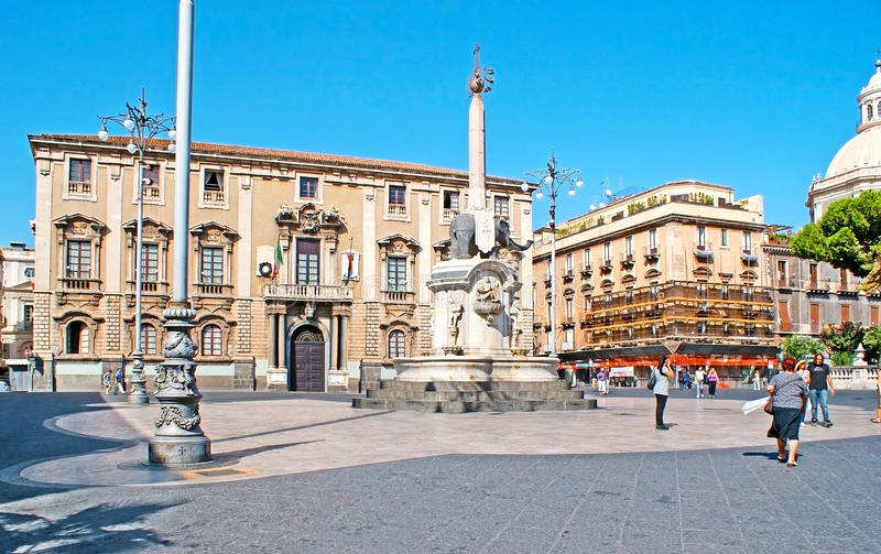
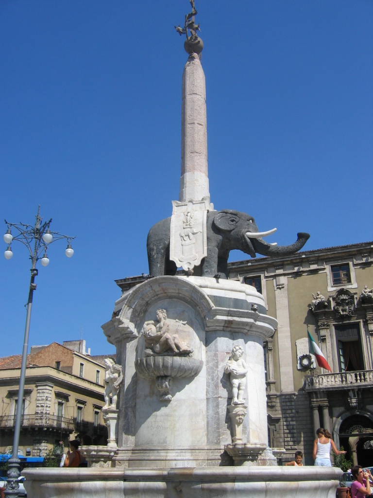
…starting at the Triton Fountain, just outside the main City Gate of Valletta.
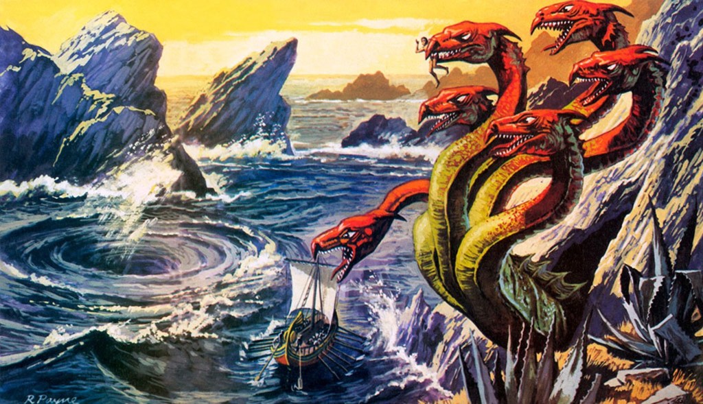
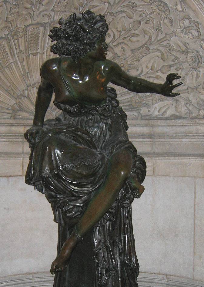
What exactly is a Triton?
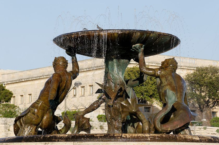
For one, in mythology, Triton was the son of Poseidon, the god of the sea, and Amphitrite, a sea goddess and Queen of the Sea.

Triton’s lower-half was that of a fish, and his top-half was that of a human.

We are told that at some time during the Greek and Roman eras, triton became a generic term for a mer-person in art and literature.
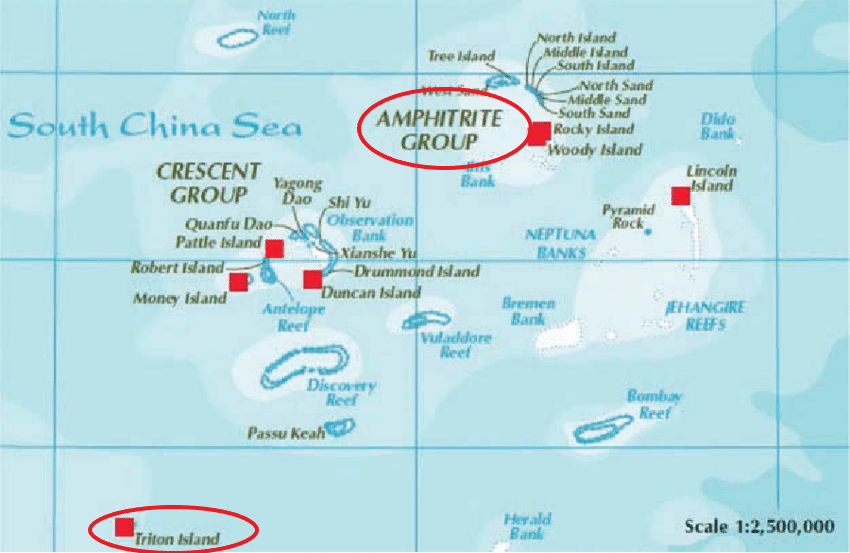
So some connections of interest to me from what I have found in my own research are, first, that in the Paracel Islands in the South China Sea, between the Philippines and south China’s Island of Hainan, we find an Amphitrite Group and a Triton Island…
…and that Poseidon’s Golden Palace was said to have been at Aegae, on the large Greek island of Euboea in the Aegean Sea, mentioned previously in this post in relationship to the city of Kalkala on the other side of the Grand Harbor from Valletta.
Aegae was said to be located on the west coast of Euboea, north of Chalcis, and said to have been located near the modern town of Politika Kafkala…
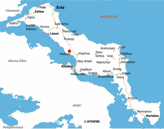
…under the sea.
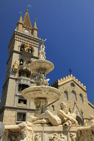
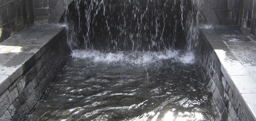
And there were sculptures of tritons, or mer-people, in the Amenano Fountain back in Catania in Sicily from the last post.
What is the meaning of the tritons?
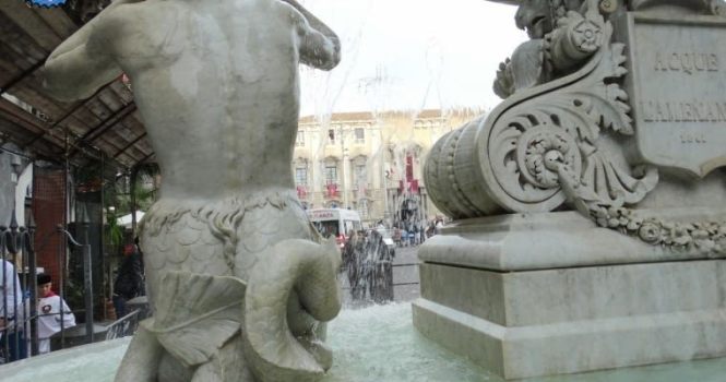
Could they really have existed at one time?
How are they connected to these places?
Perhaps they still exist today as mer-people, who remain mostly hidden away, and were not mythical as we are taught to believe.
The Triton Fountain is located in front of the main city gate of Valletta.
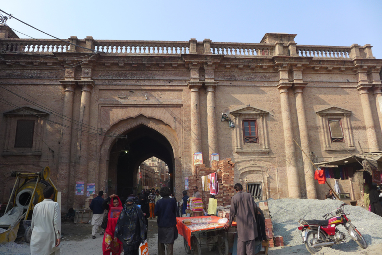
This was the main city gate of Valletta, called the King’s Gate, circa 1871.
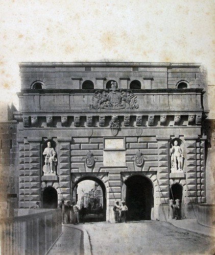
It was said to have been designed by Lt. Colonel Francis Ringler Thomson, about whom I can find no biographical information, in 1853…and this gate was demolished in 1964.
This is what we find at the main city gate today.
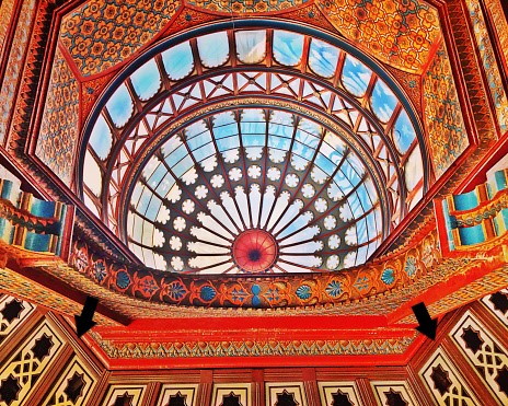
Directly upon entering Valletta, immediately to the right is what remains of the city’s Royal Opera House, though the site was developed into an open air theater which opened in August of 2013.
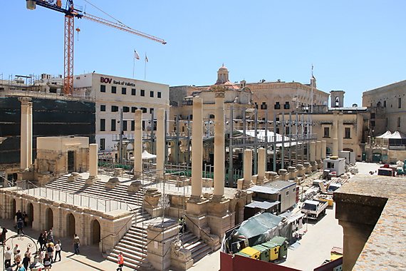
The Royal Opera Theater was said to have been designed by the English architect Edward Middleton Barry in 1866…
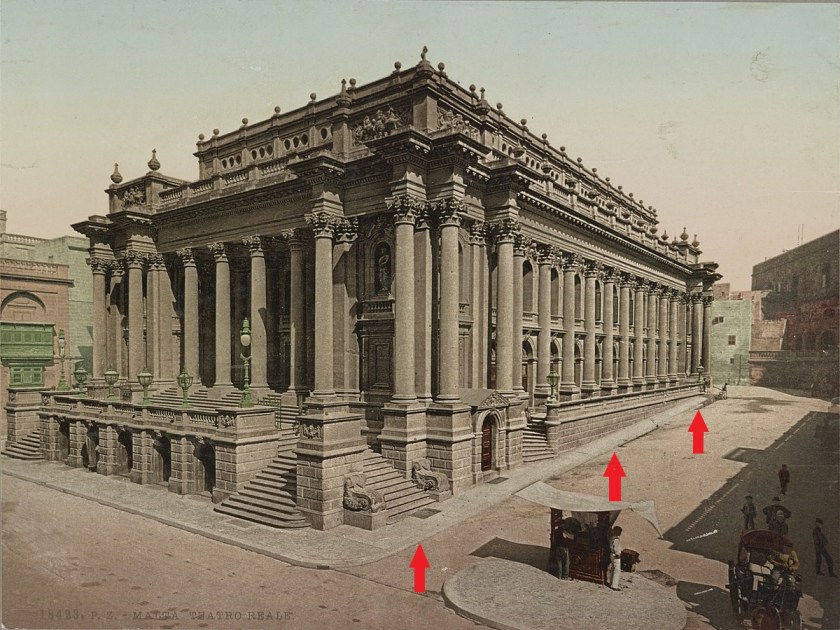
…and with windows and columns that are not level with the sloping street beside it, like what we saw back at the Inquisitor’s Palace.
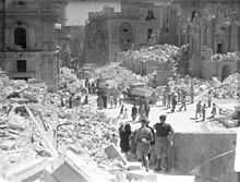
Then, only 76-years later, it took a direct hit in April of 1942 from German Air Force bombers, and was almost completely destroyed.
Making a right turn after entering the city through the gate, onto Pope Pius V Street, we come to the Church of Our Lady of Victories, or La Vittoria…
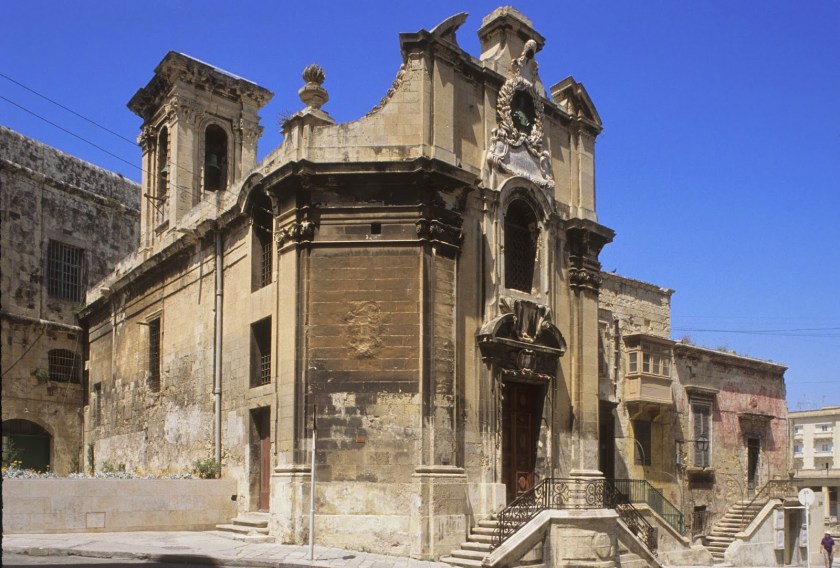
…said to have had its foundation stone laid in 1566, and built to commemorate the Victory of the Knights of the Order of St. John and the Maltese over Ottoman invaders in 1565.
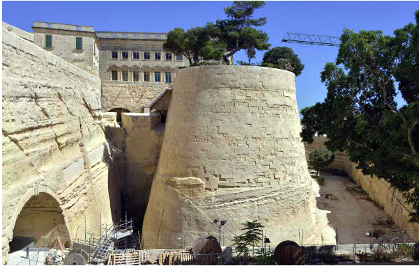
Directly across from La Vittoria Church is the St. James Bastion, where the two places dove-tail with each other in shape.
It was said to be one of the first bulwarks to be completed after the initiation of the construction of the fortified city in 1566.
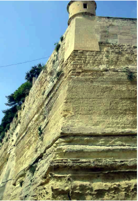
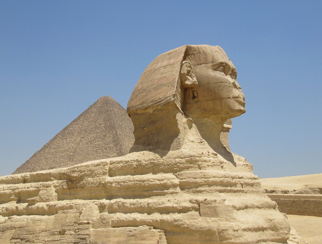
The St. James Bastion forms one of the four important and massive bulwarks, and was carved largely out of bedrock.
The Sphinx on the Giza Plateau of Egypt was also carved from bedrock.
The bastion is said to contain to low “batteries” in its flanks, each protected by a massive rounded orillion.
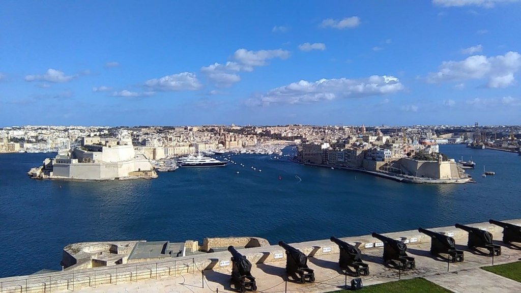
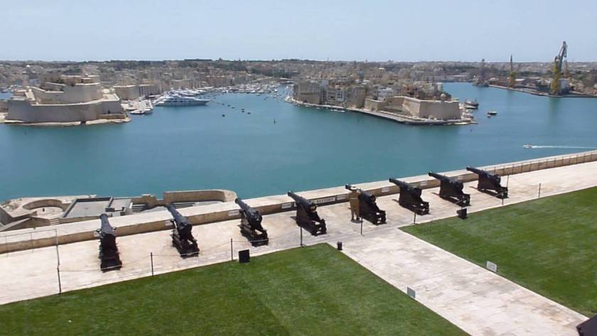
The next place we come to continuing around to the right from the main city gate are the Upper Barrakka Gardens.
Check out the height and depth of the stone work seen here!
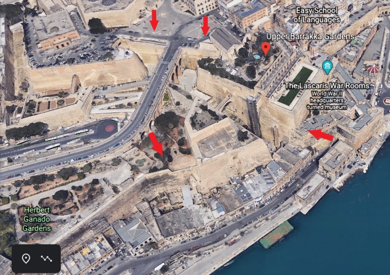
The Upper Barrakka Gardens are located on the upper tier of the St. Peter and Paul Bastion, and are a public garden…
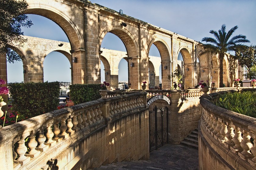
…offering a panoramic view of the Grand Harbor.
It is the highest point of the city walls.
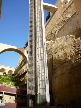
The gardens are linked to the Valletta Ditch and the nearby Lascaris Wharf by the Barrakka Lift, which was said to have first been constructed in 1905, closed in 1973, and dismantled in 1983…
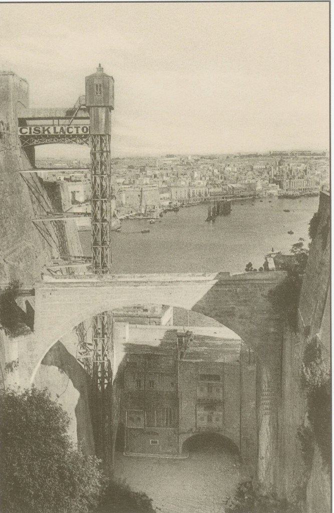
…then a new lift was inaugurated in 2012.
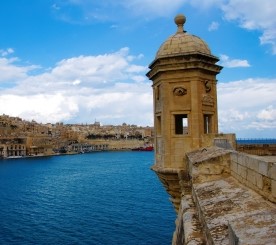
This is the Fort Lacaris Battery, said to have been built by the British in 1854, and connected to the Peter & Paul Bastion that the Upper Barrakka Gardens are located at the top of…
…and this is a view of the Lacaris Bastion Gardjola, or Guard Tower, like what we saw earlier at Fort St. Michael in Senglea.
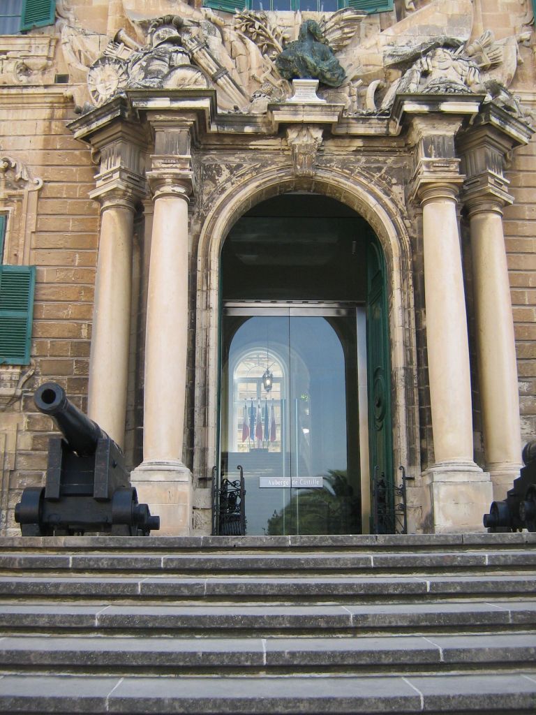
Before I move further along the city’s wall, I would like to show you the Auberge de Castille, which is directly across from the Upper Barrakka Gardens.
It was said to have been built in the 1740s on the highest point in Valletta…
…and has been the Office of the Prime Minister of Malta since 1972.
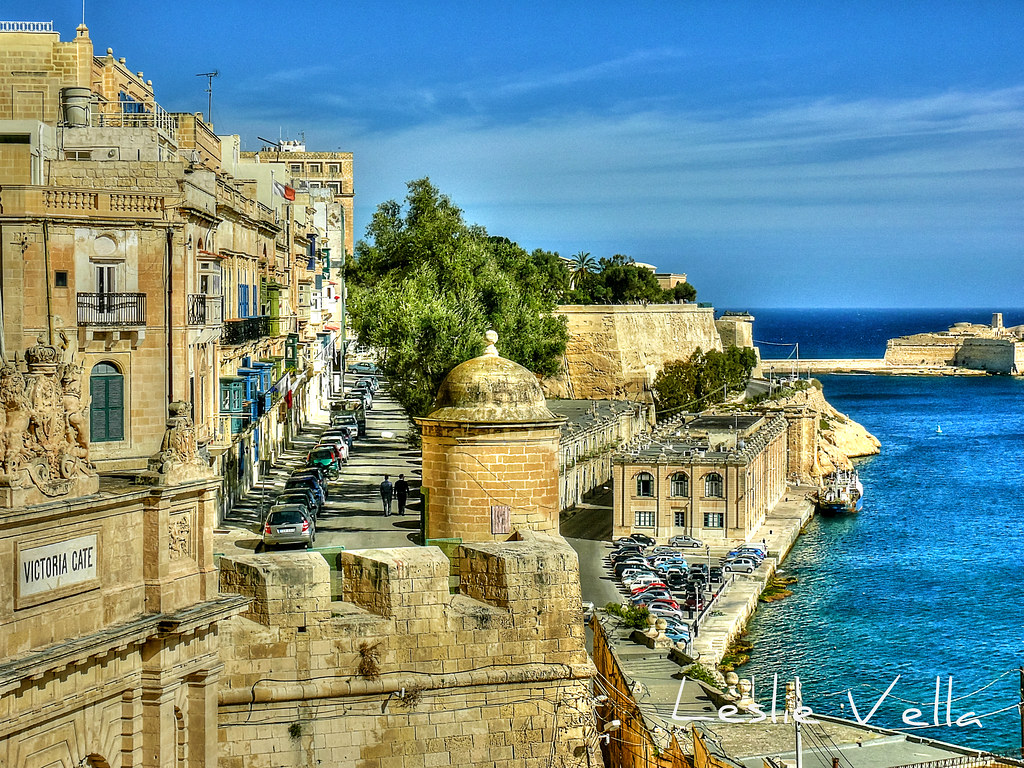
Getting back to the city’s wall, the Victoria Gate, the main entrance to the city from the Grand Harbor area, is situated next to the Lacaris Bastion.
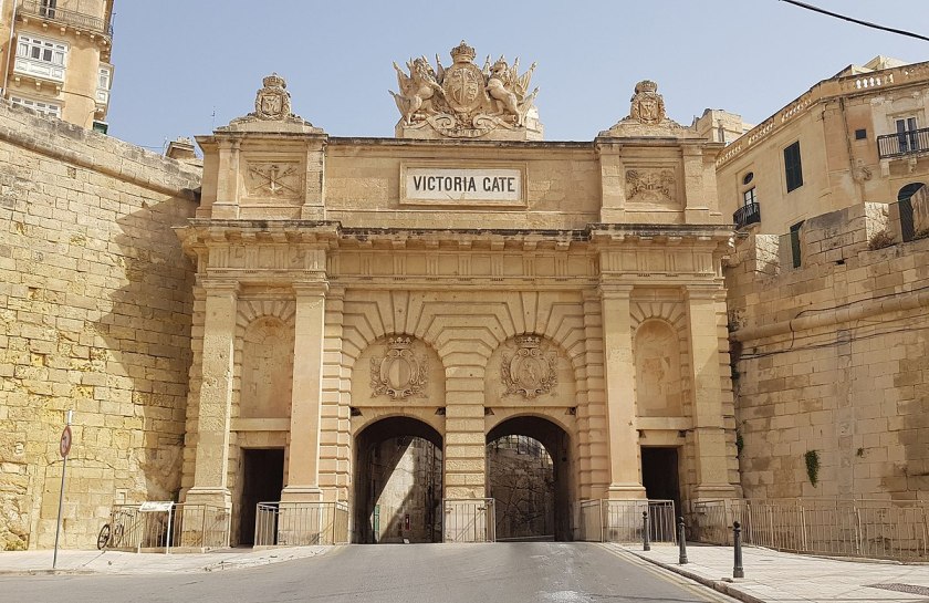
It was said to have been built by the British in 1885, and named after Queen Victoria.
It is the only surviving gate within the fortifications of Malta, as all of the other gates, like the main city gate as I mentioned previously, were demolished between the 18th- and 19th-centuries.
The St. Barbara Bastion comes next, and is situated in the historic center of Valletta…
…and boasts of magnificent views of the Grand Harbor and the Three Cities.
Noteworthy churches near the St. Barbara Bastion are the Church of St. Paul’s Shipwreck, said to have been completed in 1582, is directly across the street from it and said to be one of the oldest churches in Valletta.
St. Paul the Apostle is considered to be the spiritual father of the Maltese, and his shipwreck is described in the New Testament, in the Book of Acts Chapter 28, verse 1, where St. Luke wrote: “Once safely on shore, we found out the island was called Melita (Malta).”
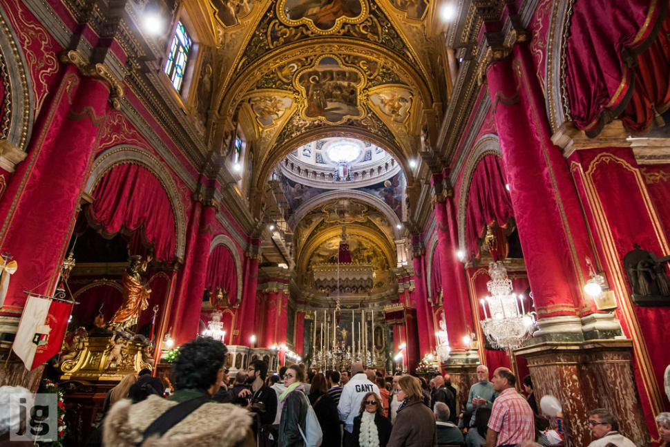
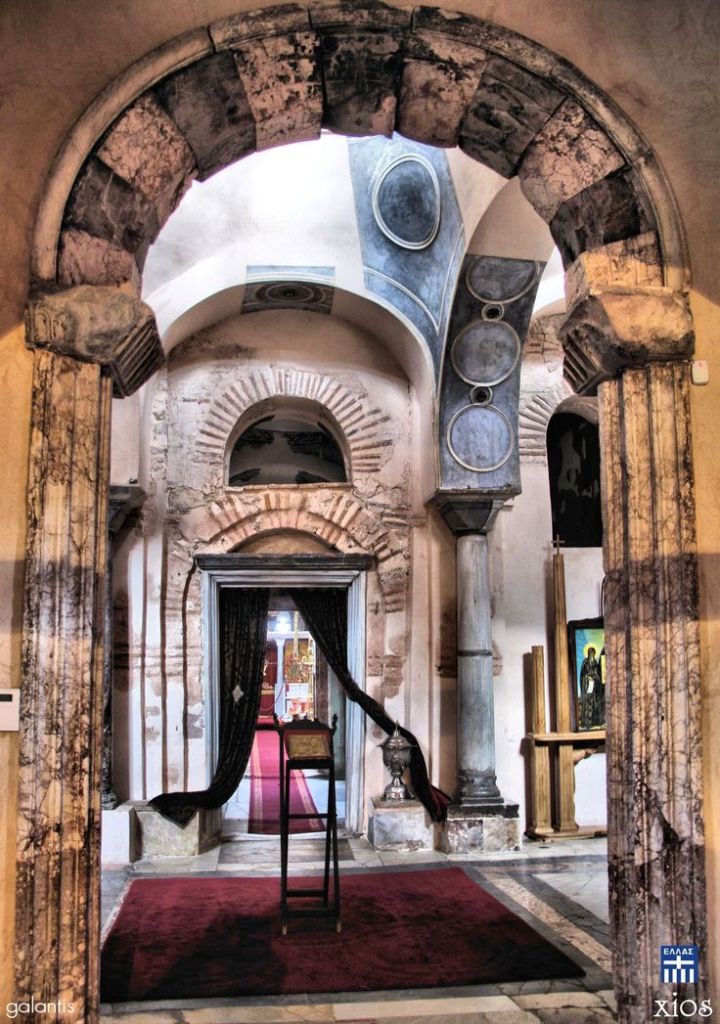
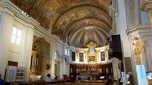
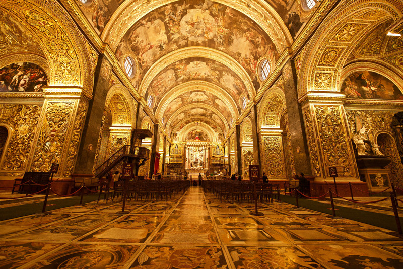
Across the street on the other side of the Church of St. Paul’s Shipwreck, we find St. John’s Co-Cathedral.
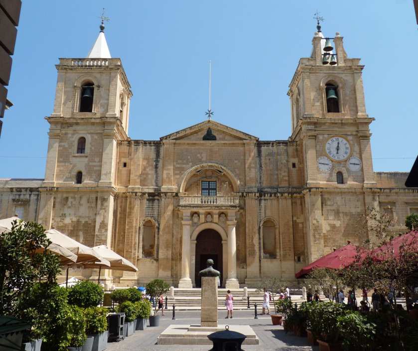
It was said to have been commissioned by the then Grand Master of the Order of St. John, Jean de la Cassiere; built by the Order between 1572 and 1577; and dedicated to St. John the Baptist.
The interior of the church is considered to be one of the finest examples of high Baroque architecture in Europe.
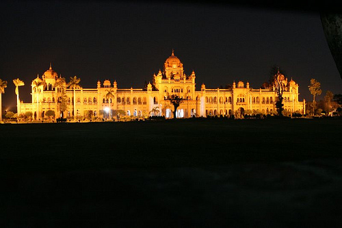
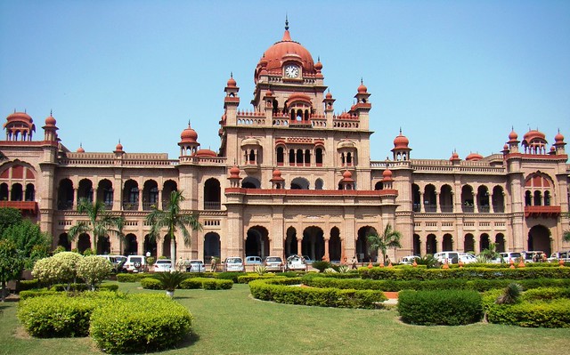
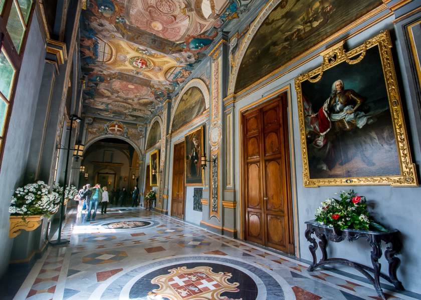
The Grand Master’s Palace in Valletta is located close to the St. John Co-Cathedral…
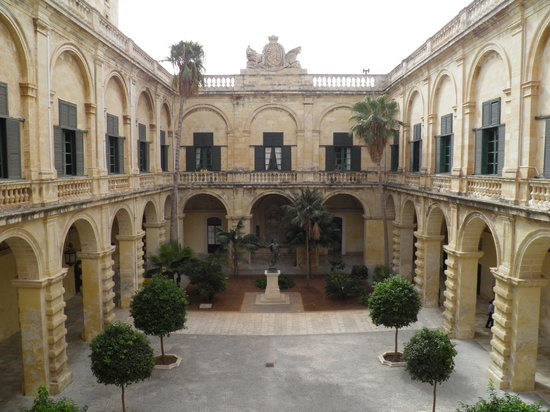
…and was said to have been built the 16th- and 18th-centuries for the Grand Master of the Order of St. John, who was the ruler of Malta. It currently houses the offices of the President of Malta.
Going back to the city wall, the next place I am going to take a look at are the Lower Barrakka Gardens, which is twinned with the Upper Barrakka Gardens…
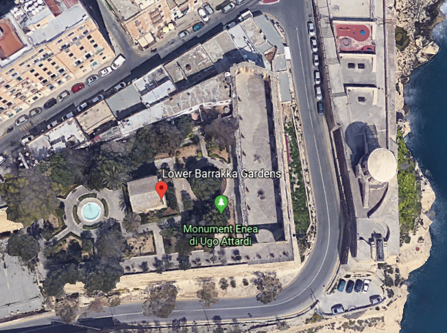
…offering a view of the Grand Harbor and its breakwater.
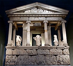
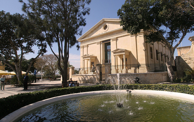
There is what is described as a neoclassical temple in the Lower Barrakka Gardens, said to have been constructed in 1810…
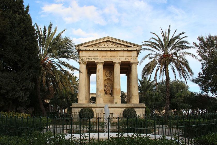
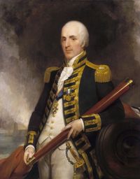
….as a monument to Sir Alexander Ball, a British admiral who was the first Civil Commissioner of Malta.
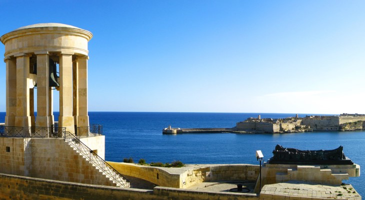
Located adjacent to the Lower Barrakka Gardens is the Siege Bell of Malta on the St. Christopher Bastion.
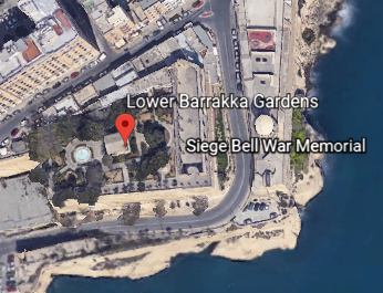
This is a view of the Siege Bell War Memorial from the Lower Barrakka Gardens.
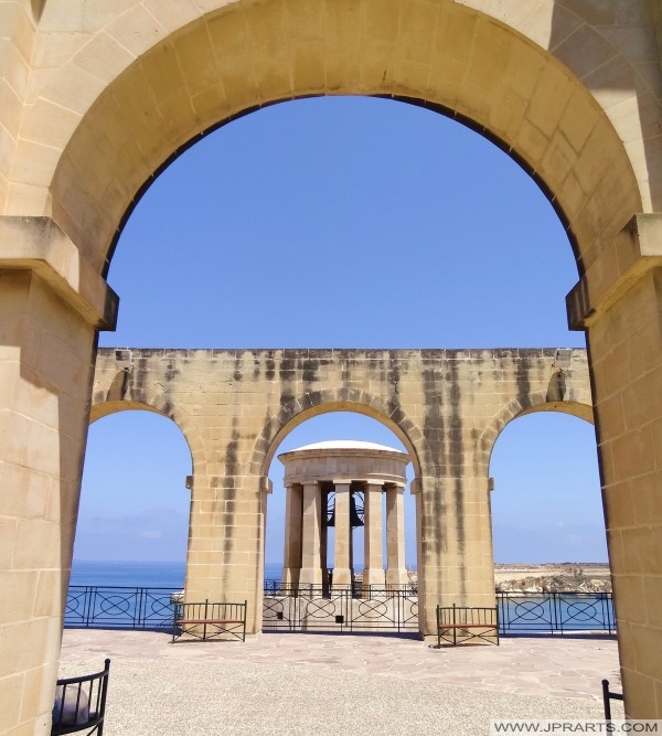
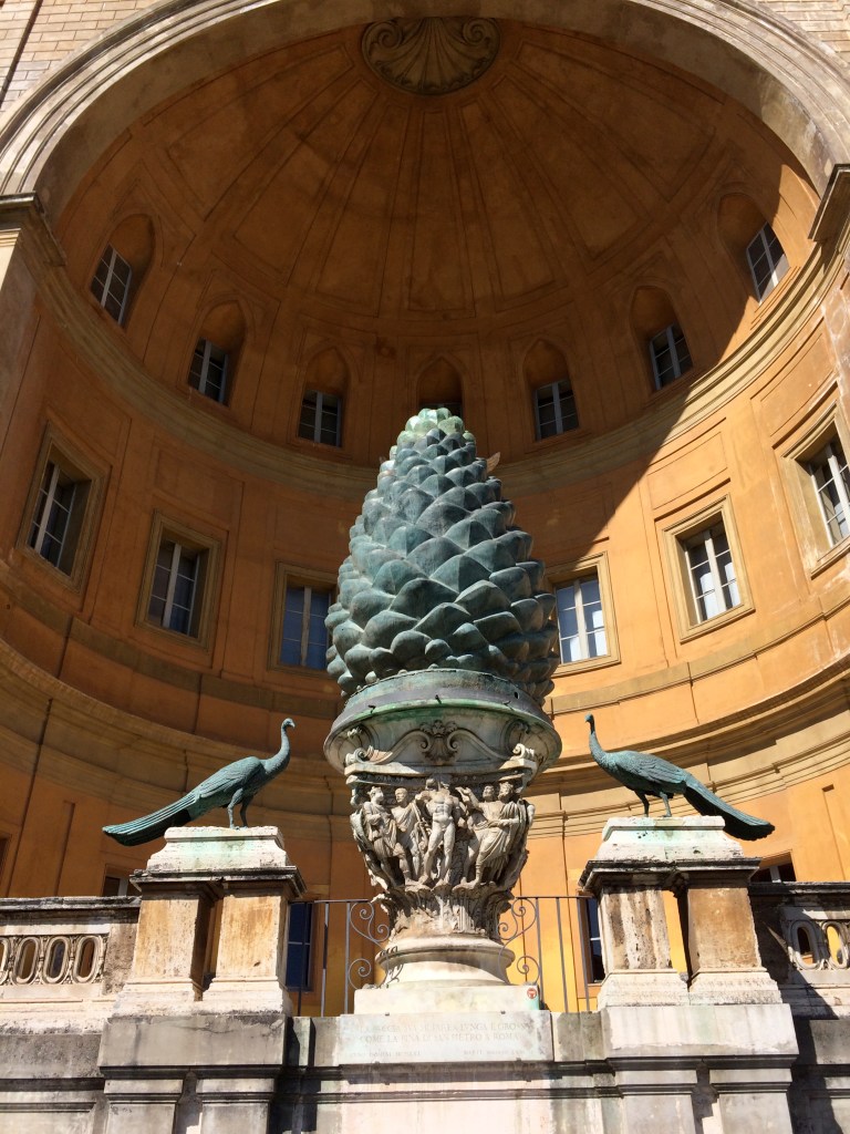
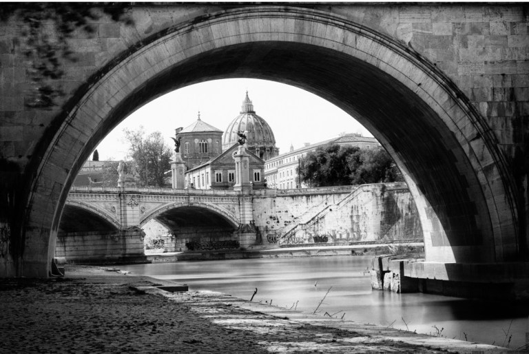
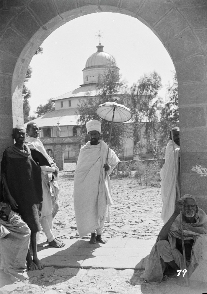
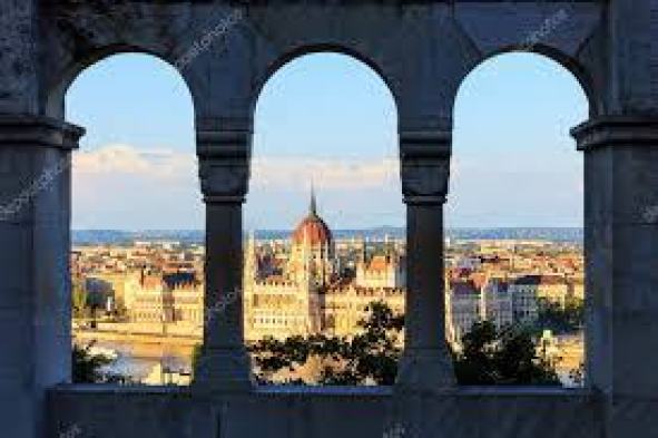
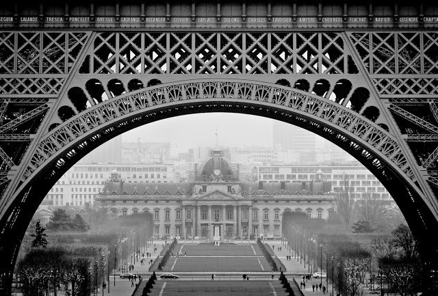
This view catches my attention because I find buildings framed perfectly by arches around the world, like this view of St. Peter’s Basilica at the Vatican…
…of the Debre Libanos Monastery in Ethiopia…
…of the Hungarian Parliament from the Fisherman’s Bastion in Budapest, Hungary…
…of the Ecole Militaire through the arches of the Eiffel Tower in Paris, France…
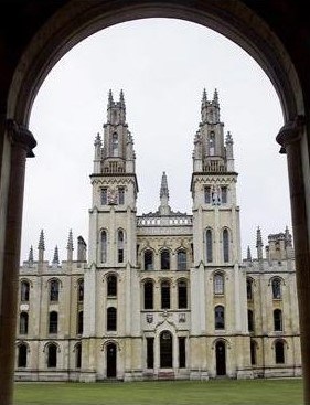
…and at the University of Oxford in Oxford, England.
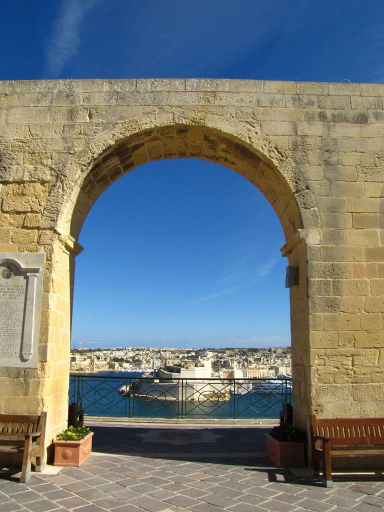
The Siege Bell War Memorial was said to have been erected in 1992 to honor the 7,000 people who lost their lives in the World War II Siege of Malta between 1940 and 1943.
Between the Siege Bell War Memorial on St. Christopher’s Bastion and St. Lazarus Bastion, we find the Sacra Infermeria.
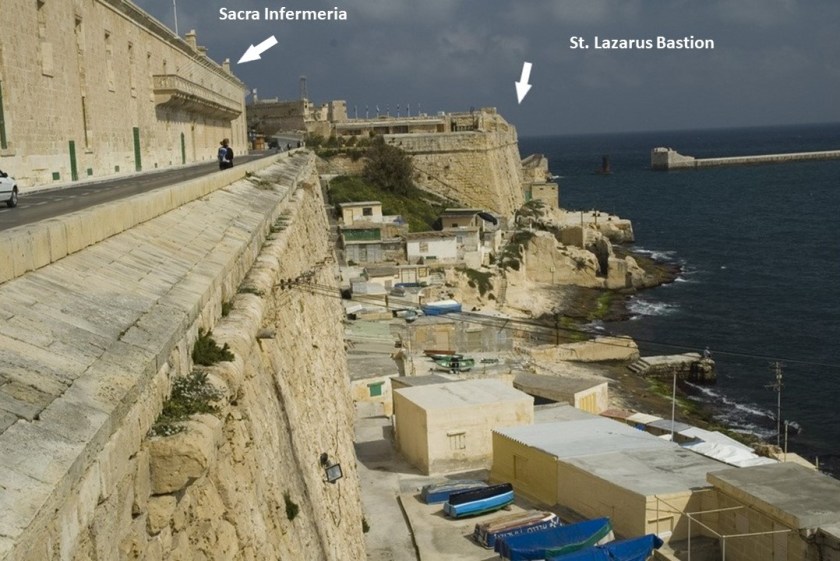
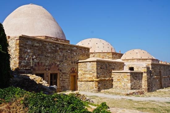
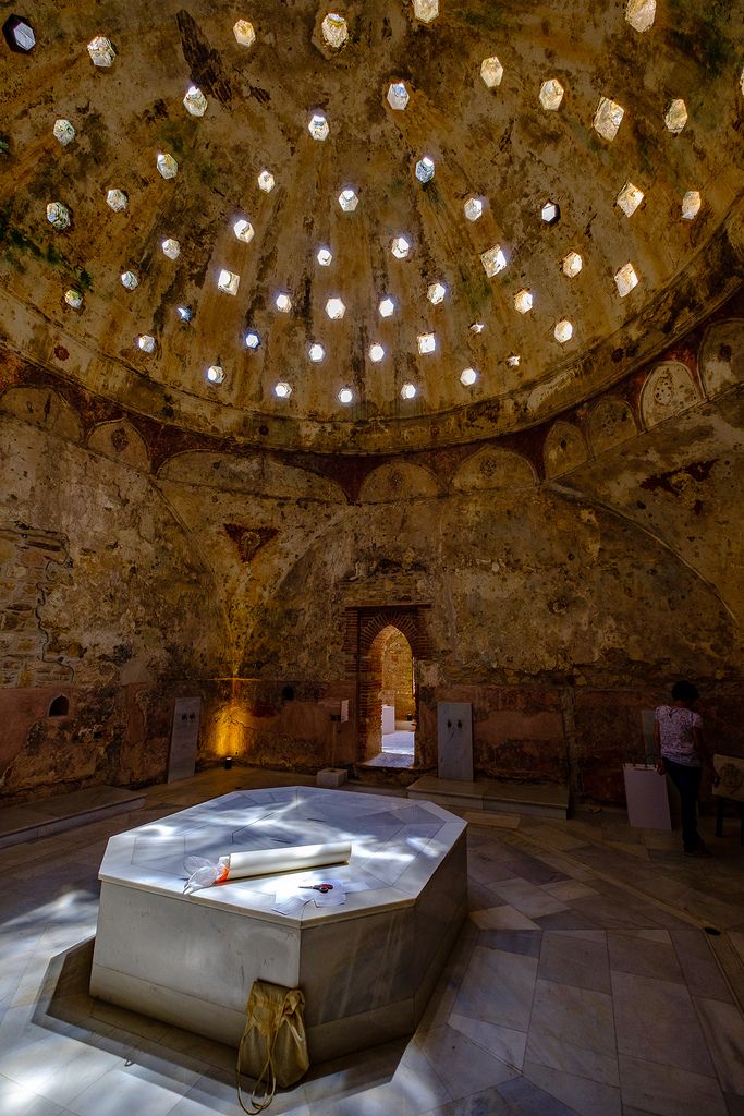
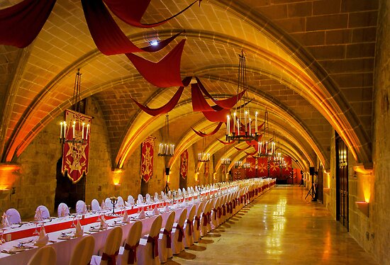
The Sacra Infermeria, or Holy Infirmary, was said to have been built as a hospital by the Order of St. John, and one of the leading hospitals in Europe until the 18th-century.
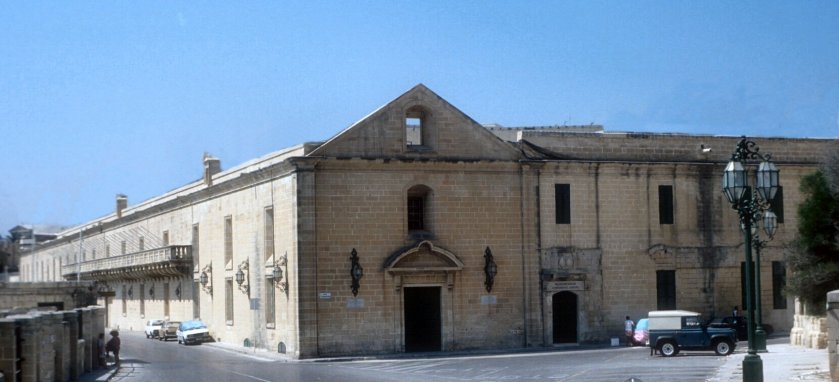
Today is the Mediterranean Conference Center, and used for banquets, exhibitions, international conventions, and theatrical shows.
Next along the wall, we come to the St. John, also known as Abercrombie’s, Bastion, the entrance to Fort St. Elmo discussed earlier in this post…
…then we come to Ball’s Bastion in the upper part of Fort St. Elmo…
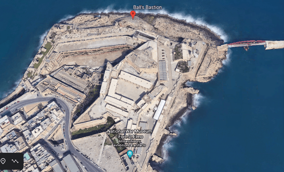
…and it is next to St. Gregory’s Bastion.
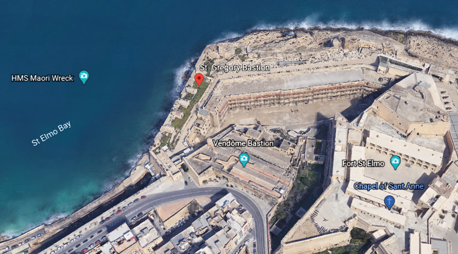
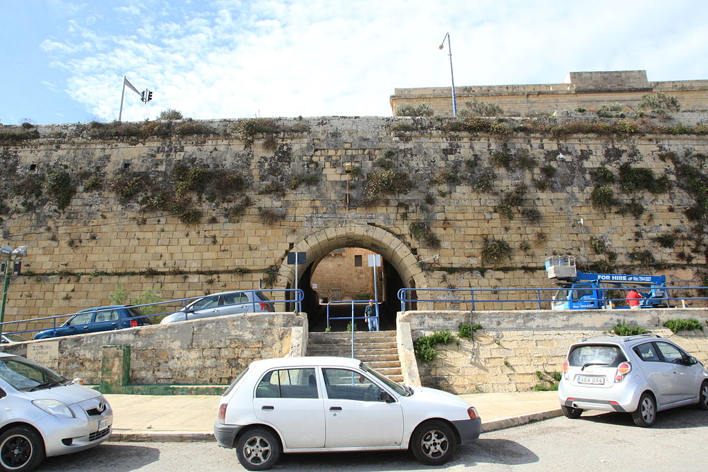
St. Gregory’s Bastion is in close proximity to the Jews’ Sally Port.
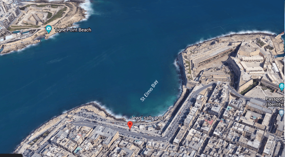
We are told the history of the Jews in Malta can be traced back to 62 AD. The Jews’ Sally Port is a gate where free Jews were said to have entered the city.
Next we come to the St. Sebastian Bastion…
…which is in close proximity to the Auberg de Baviere.
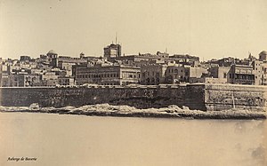
The Auberge de Bauviere was said to have been built as the Palazzo Carneiro in 1696, and was the residence of the Grand Master Marc’Antonio Zondadari in the early 18th-century.
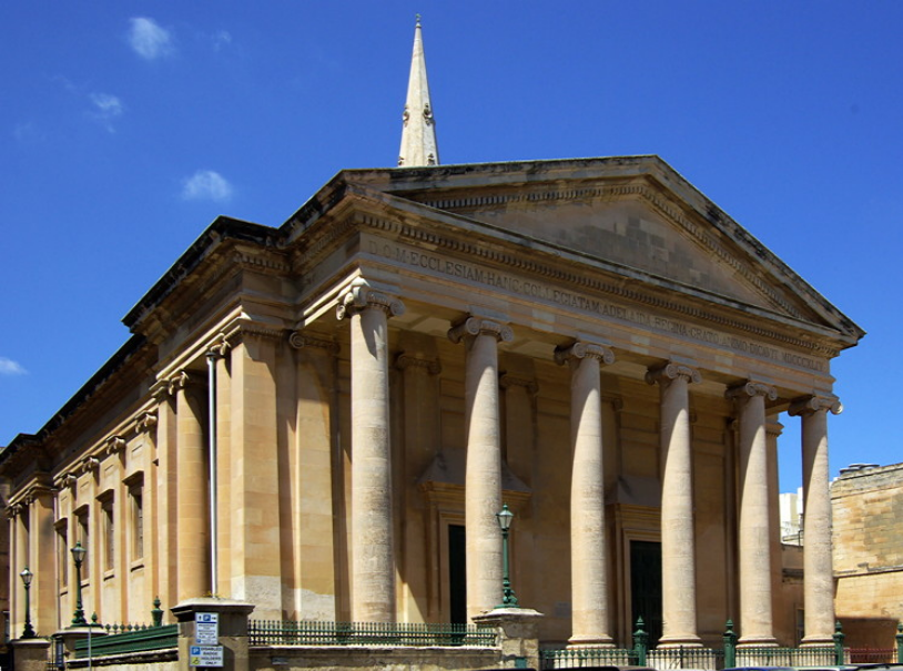
Next we come to the St. Salvatore Bastion and the nearby St. Paul’s Anglican Cathedral, also known as St. Paul’s Pro-Cathedral, one of three cathedrals of the Anglican Diocese of Gibraltar in Europe, and said to have been built between 1839 and 1844.
Moving along, we come to St. Andrew’s Bastion…
…a popular wedding venue in today’s day and age.

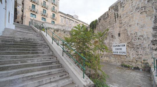
The Biaggio Steps are directly across from St. Andrew’s Bastion, and which are described as run-down.
Next we come to St. Michael’s Bastion…
…where apparently there used to be several windmills overlooking Marsamxett Harbor, but the only reminder of this is a nearby street named “Windmill Street.”
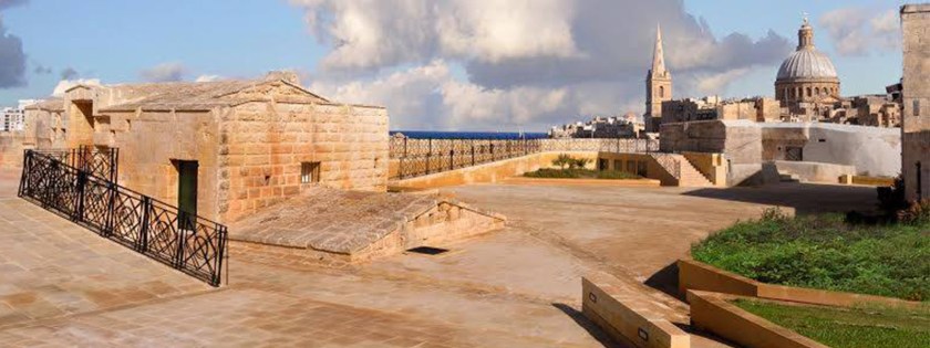
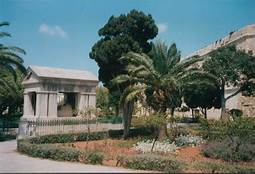
The place I would like to look at around the city walls of Valletta, before returning to the main city gate, are the Hastings Gardens.
The Hasting Gardens are a public garden on top of St. John’s Bastion and St. Michael’s Bastion, located to the immediate west of the west of the city gate.
Three more things to look at before departing the relatively small islands of the Republic of Malta in the the Mediterranean Sea, before heading out from here.
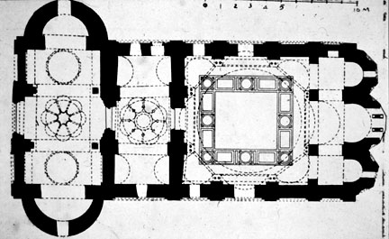
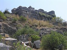
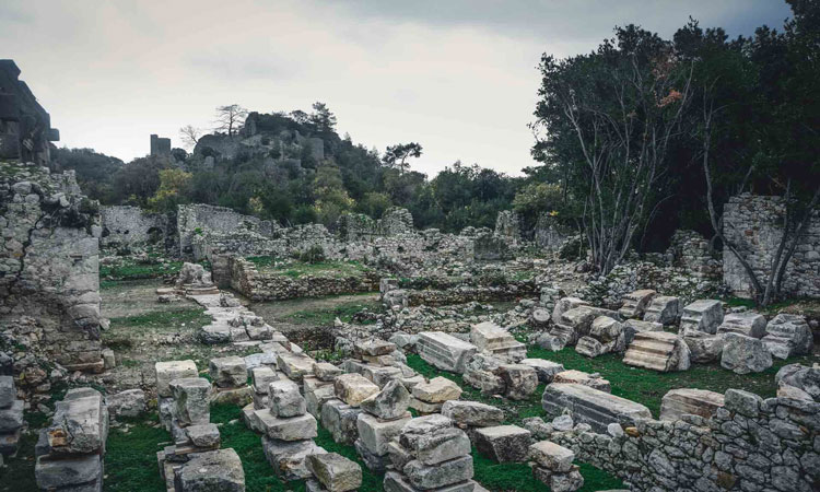
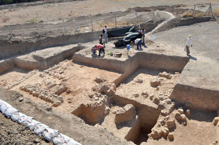
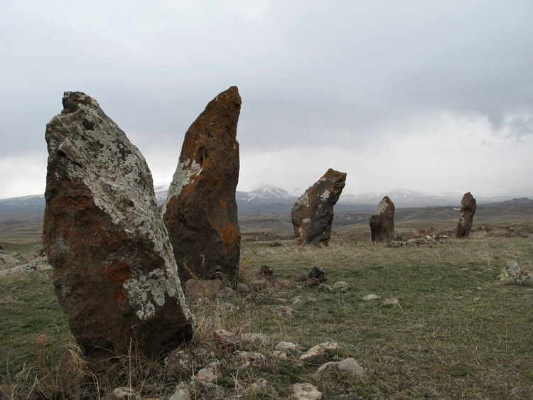
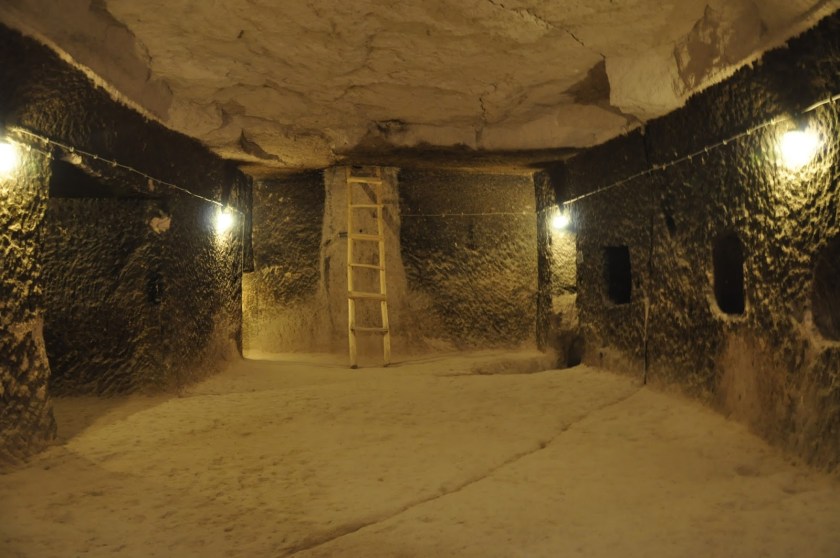
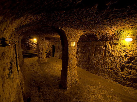
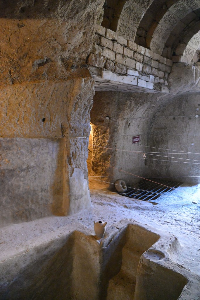
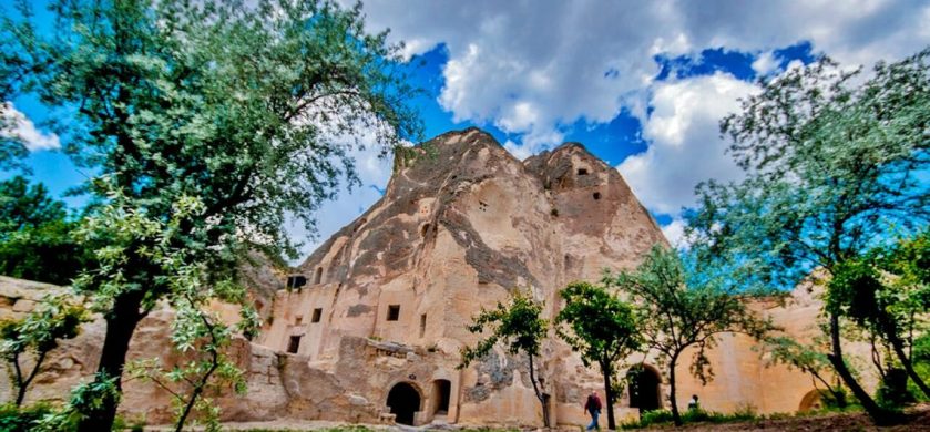
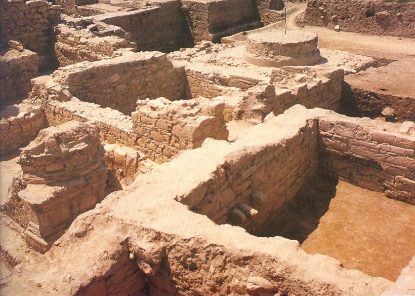
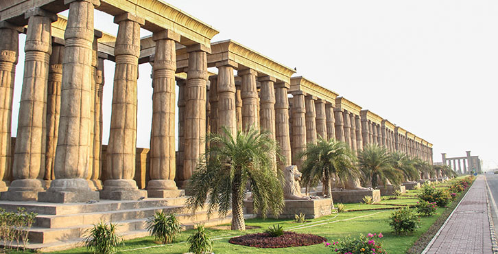
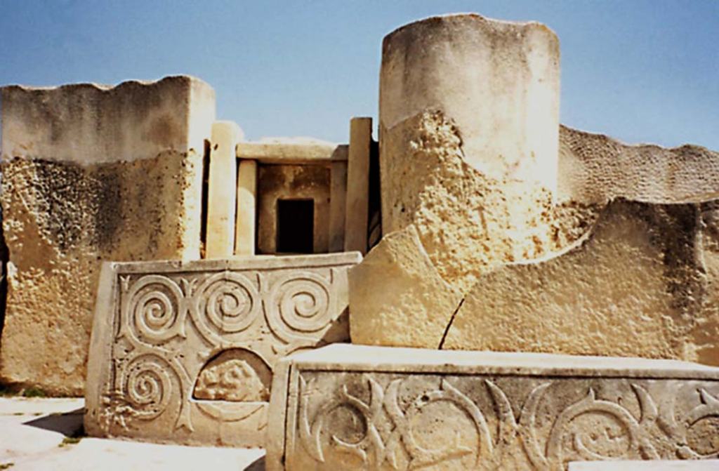
The first is bringing the megalithic Tarxien temples to your attention, located a short distance south of Valletta.
There is a significant megalithic presence in Malta. The Tarxien Temples are just one example of many in Malta.
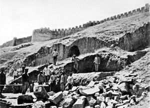
The temples’ large stone blocks were discovered in 1914 by a farmer ploughing a field, and excavation was begun immediately by the director of the National Museum after the report of the finding was made.
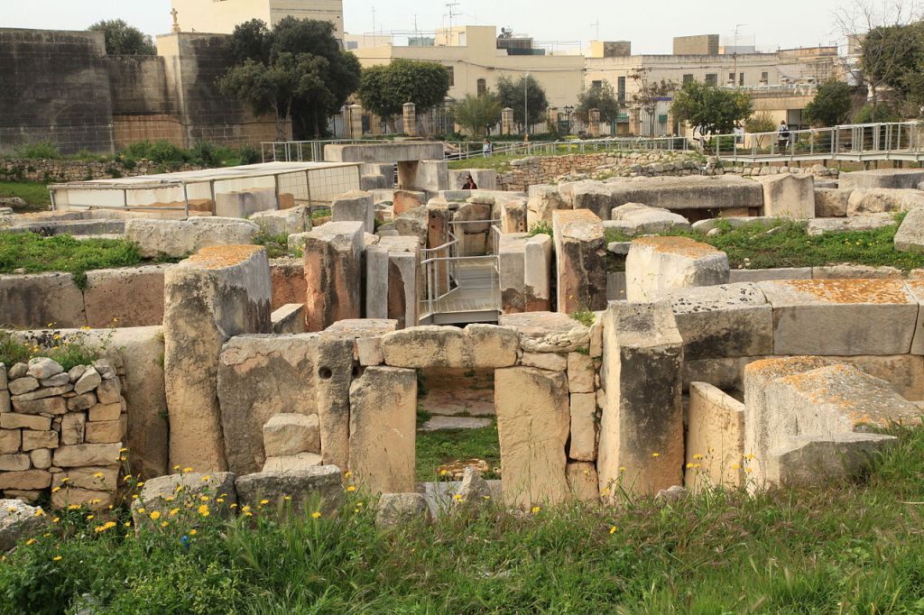
So apparently the temple complex was completely buried underground. We have come to see places being completely buried as a natural occurrence over the passage of time, but was this really the case?
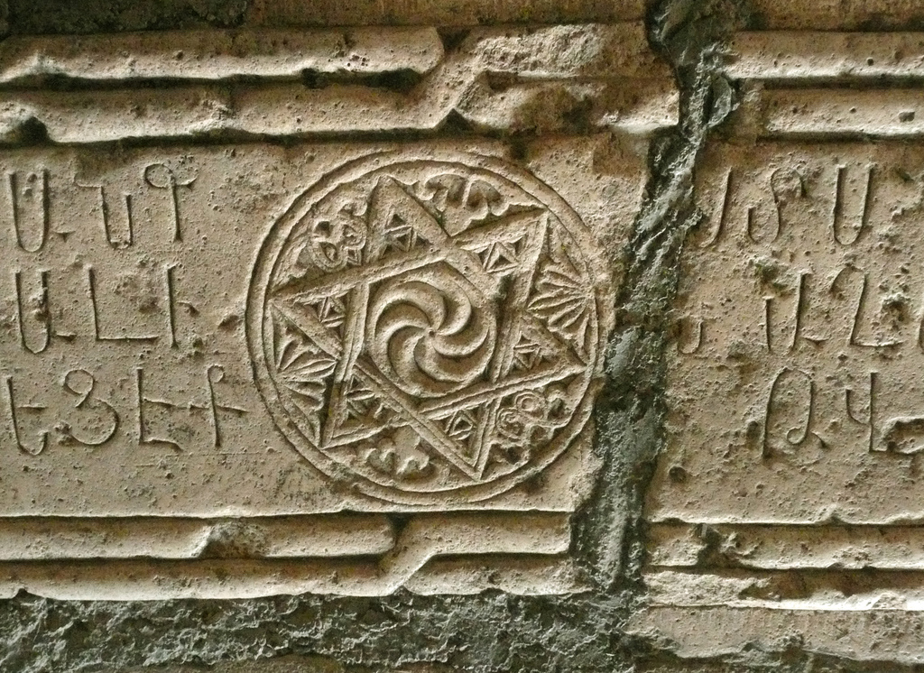
The Tarxien temple complex has rich and intricate stonework decorated with spiral designs and other patterns, and was dated to 3,150 BC.
The second is speculation about the Knights’ Templar themselves.
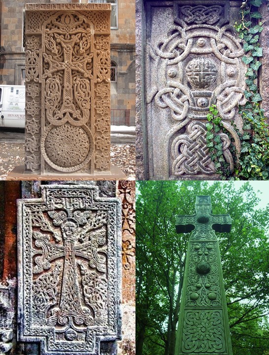
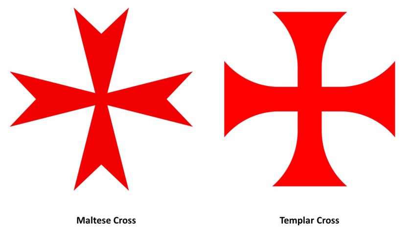
Given that Valletta appears to be a veritable Disney World of stone masonry, and that the Maltese Cross and the Templar Cross are virtually identical, I am thinking that Malta was at the very least a major Templar Center, if not the main headquarters of the Templars.
I do seriously question what we are told about who the original Templars were, also known as the Order of the Temple of Solomon.
We are told it was Catholic military order recognized in 1139 AD by Pope Innocent II’s papal bull Omne Datum Optimum.
I personally think there is a lot of information missing from the historical record about who the Templars really were, and about what their actual historical association with the Temple of Solomon was.
Were they actually Moorish Master Masons?
Whatever the Truth was about the original Templars, information is simply not available in the written historical record to make a connection directly to the Moors, and a connection in turn with the Temple of Solomon and the Lost Tribes of Israel.
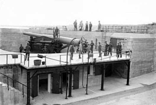
Lastly, I have stated in previous posts my belief that I think places on the Earth, like Valletta in this example, with numerous star forts concentrated in close proximity, were significant power centers for the energy system of the planetary grid, and that star forts represented the definition of battery meaning “a device that produces electricity that may have several primary or secondary cells arranged in parallel or series, as well as a battery source of energy which provides a push, or a voltage, of energy to get the current flowing in a circuit…”

…and were not originally military in nature as we are led to believe in our current historical narrative, like the Lacaris Battery we saw earlier in this post.

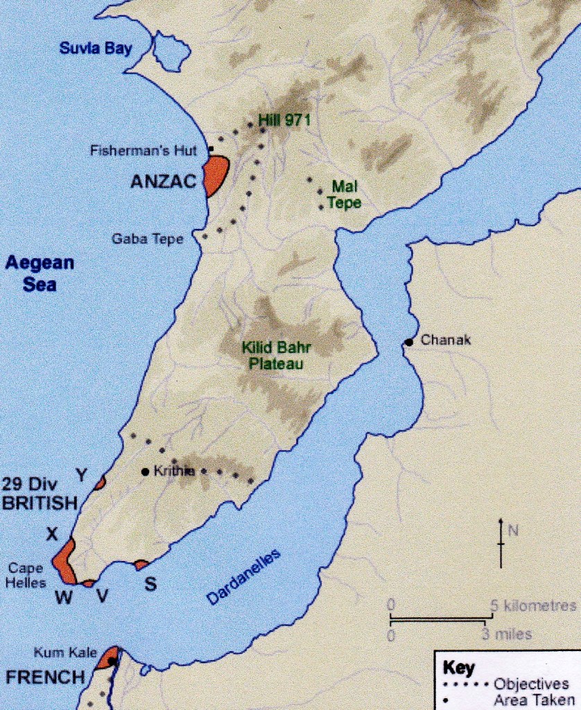
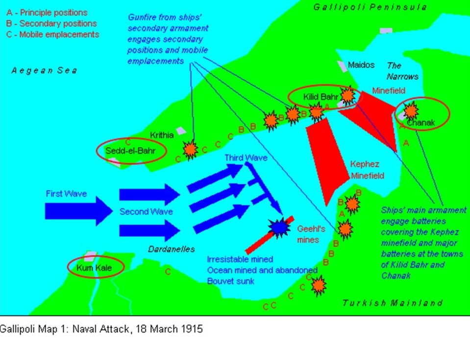
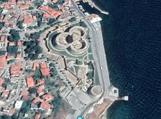
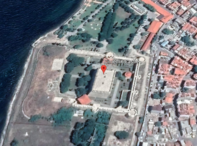
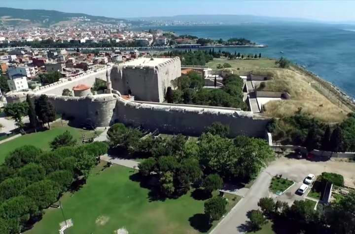
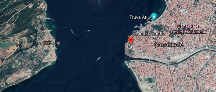
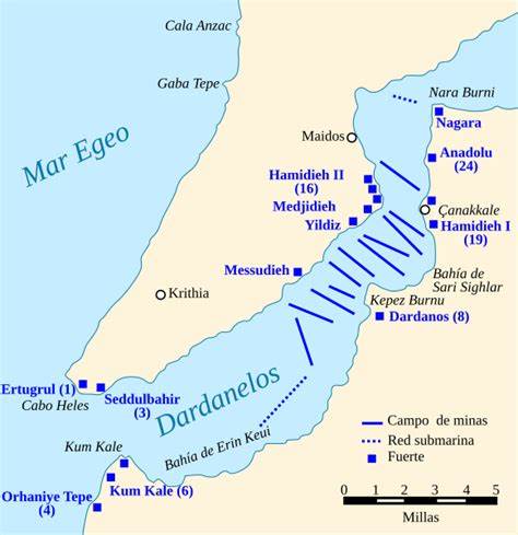
Like the many star forts I found that were bombarded in World War I’s Gallipoli Campaign in the Strait of Dardenelles in Turkey when I was looking at the Aegean Sea, the star-city of Valletta, and its surrounding star forts and star cities, appear to have been deliberately targeted for bombardment during the Siege of Malta between 1940 and 1942 in what was called the “Mediterranean ‘Theater’ of World War II.”
I wonder why the word theater, defined as a building or area used for dramatic performances, also used as a term to describe an area in which important military events are occurring.
In the next post, I am going to be crossing from Valletta in Malta over to Sousse, a city located on Tunisia’s Mediterranean coast in North Africa.