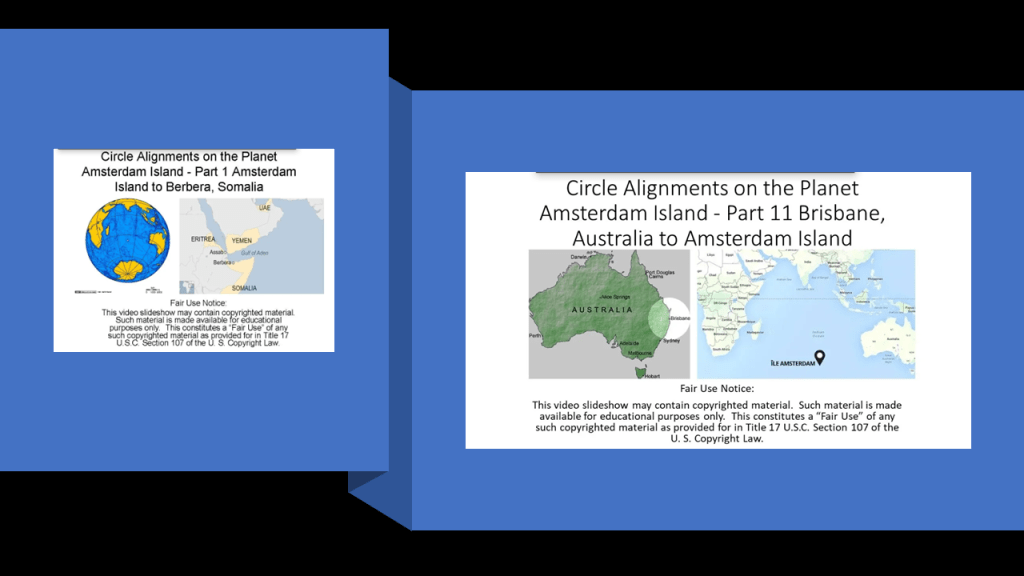
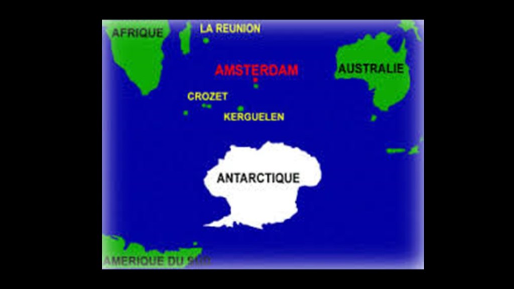
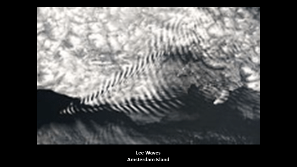
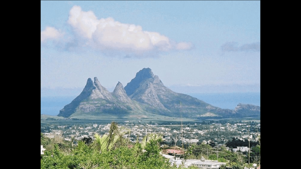
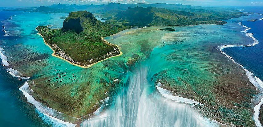
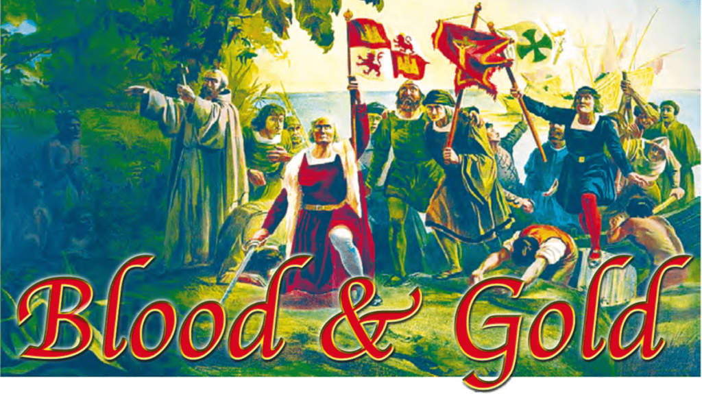
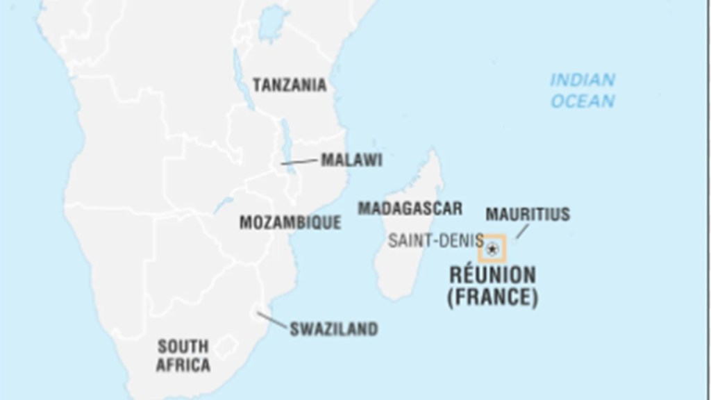
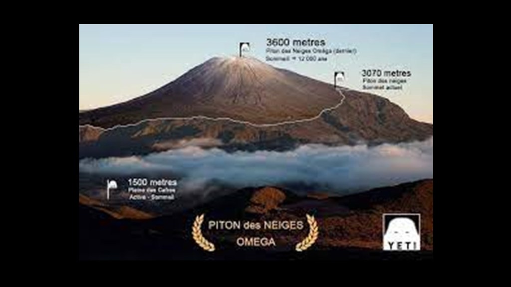
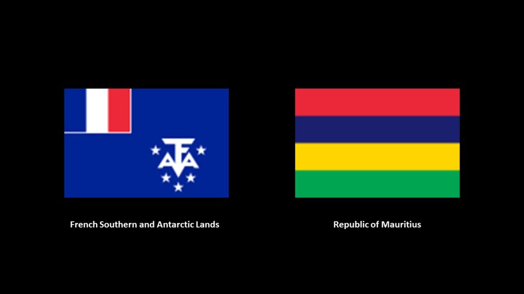
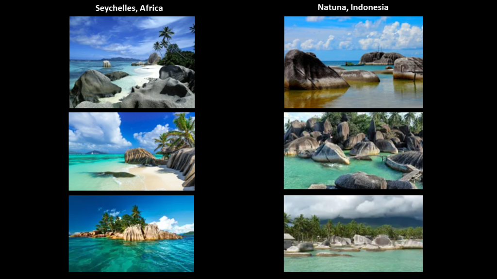
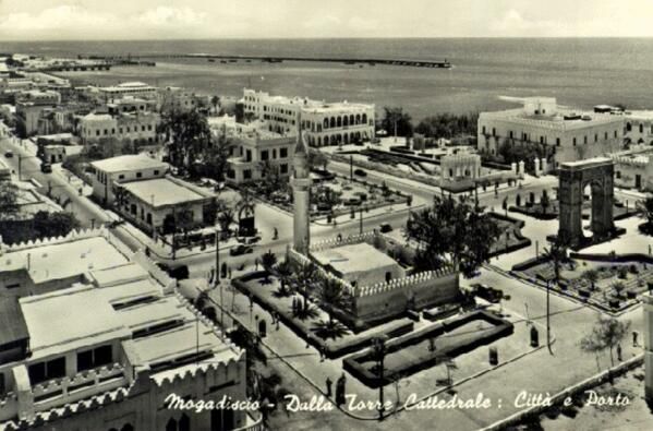
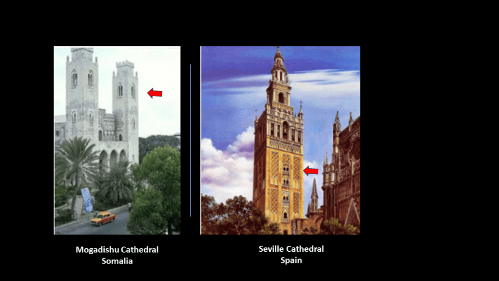
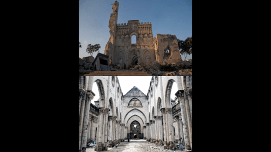
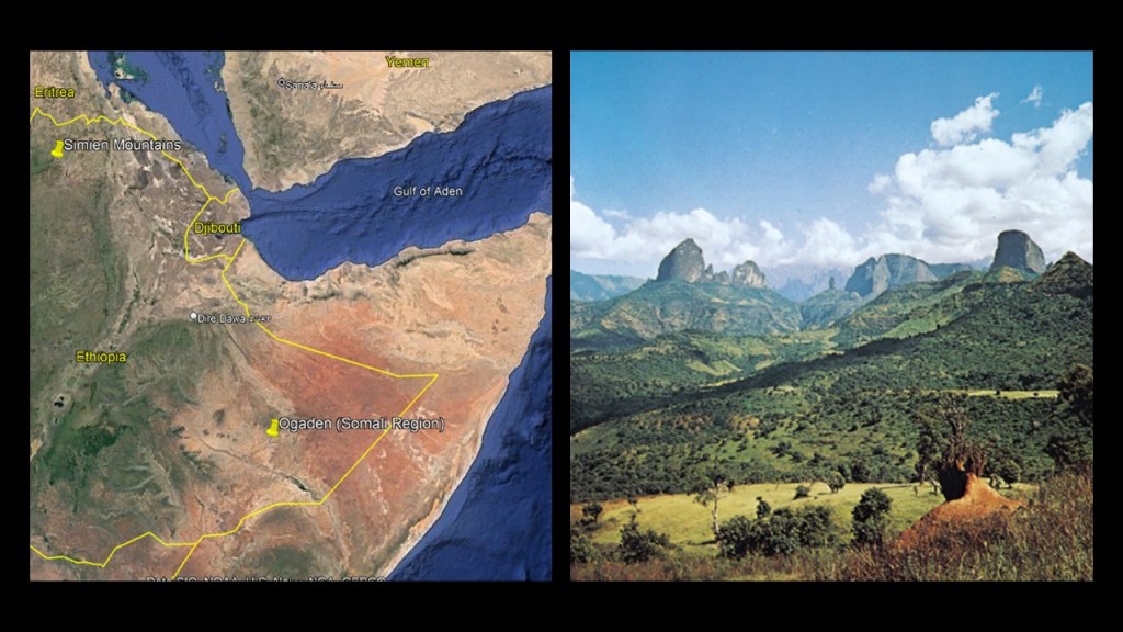
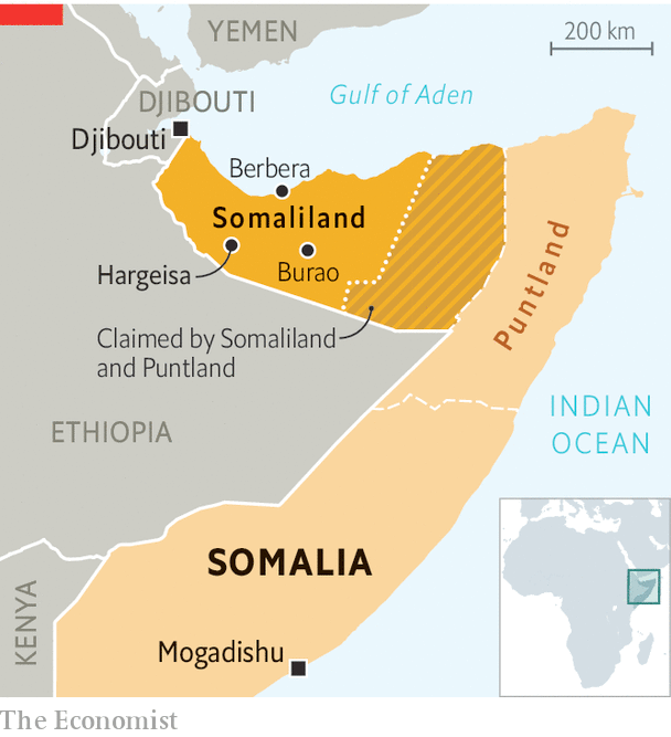
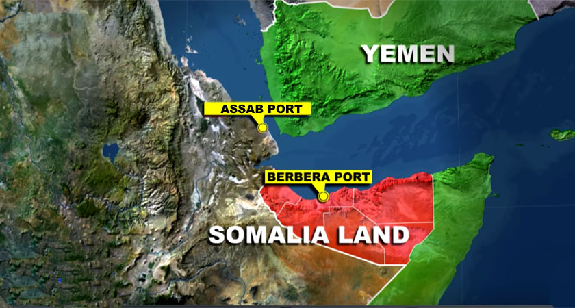
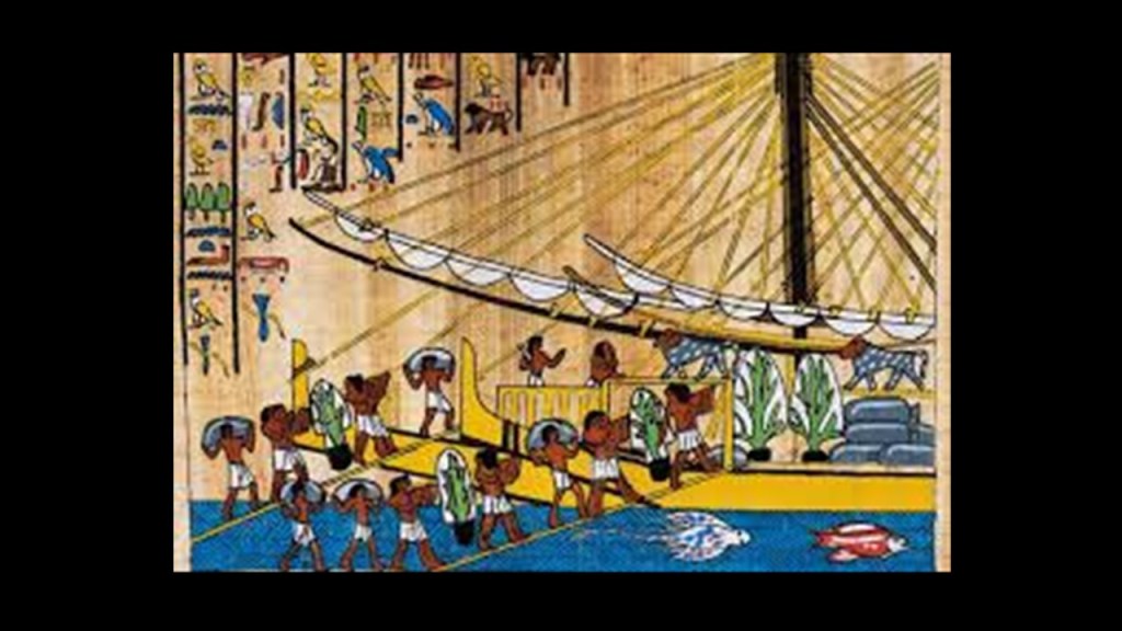
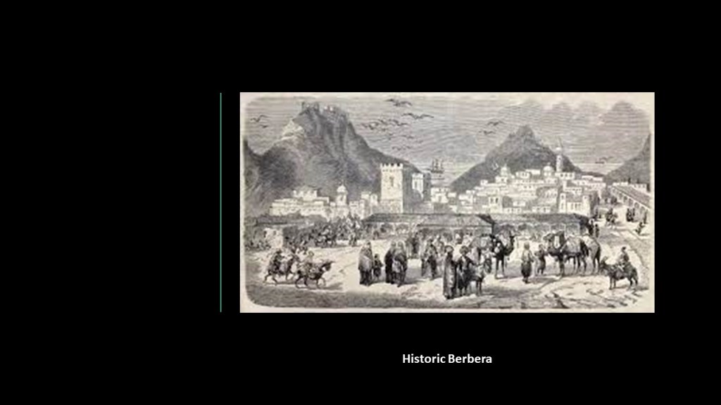
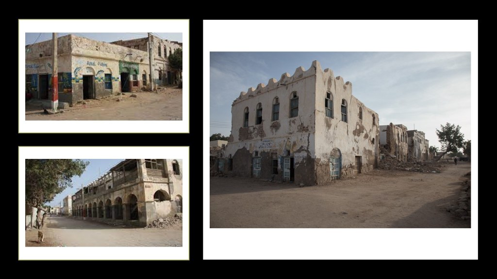
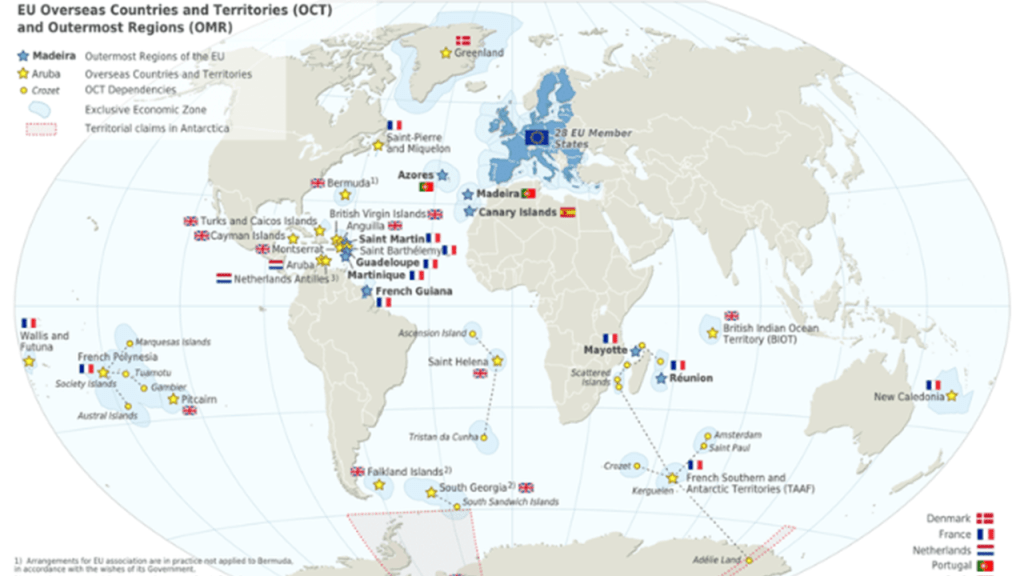
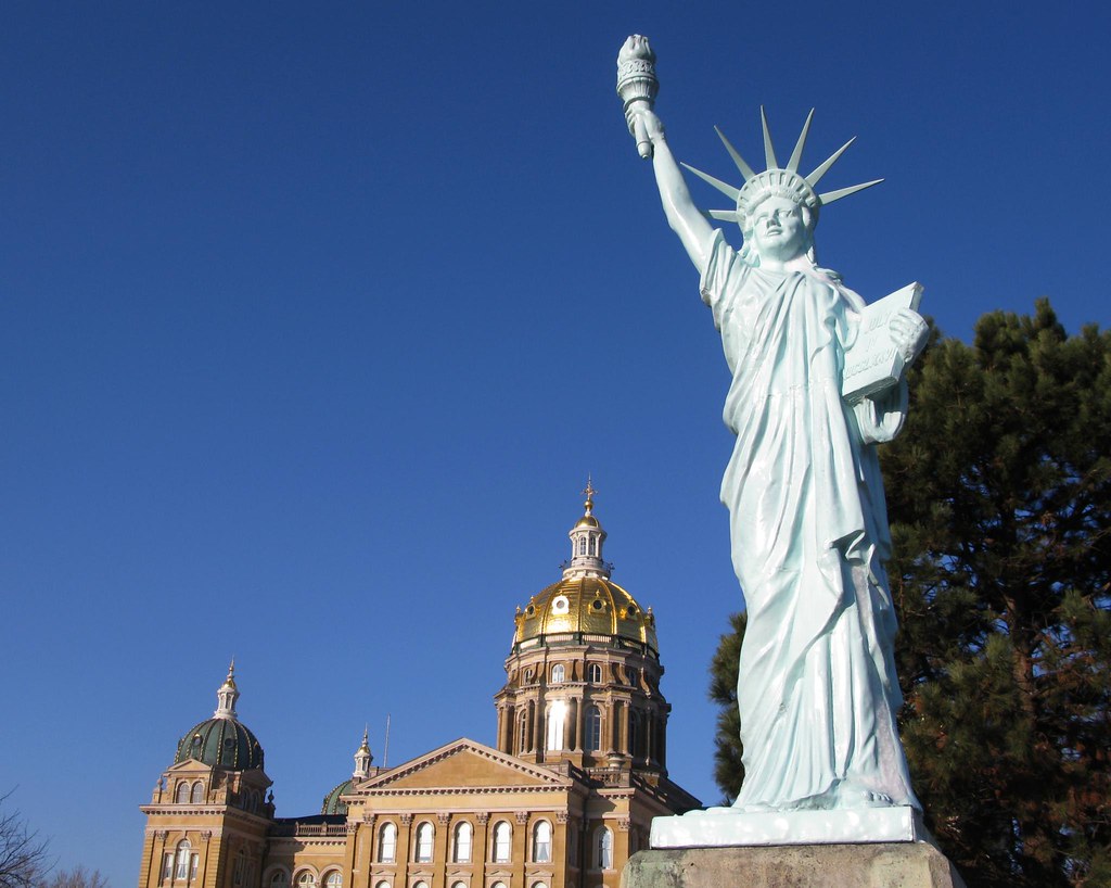
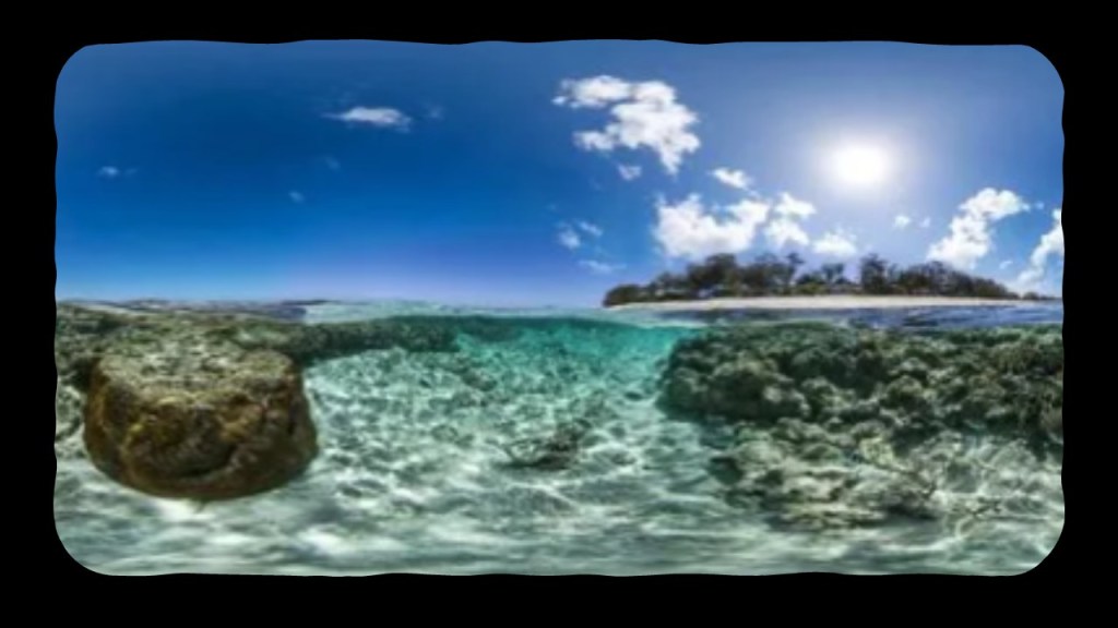
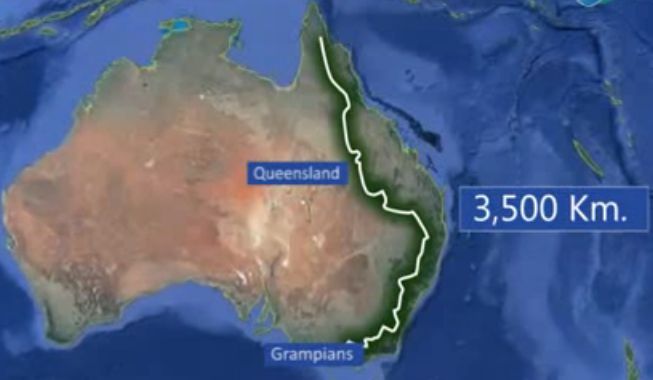
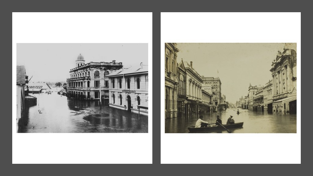
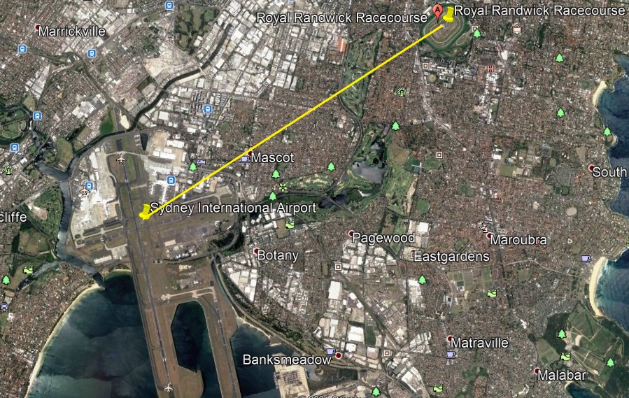
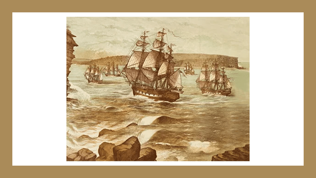
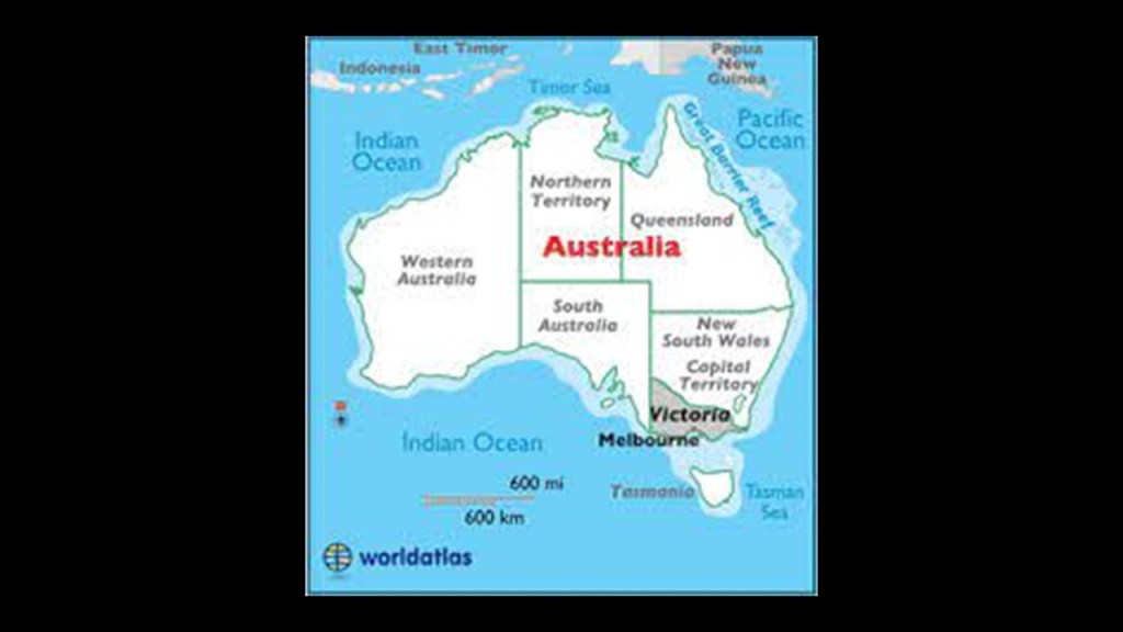
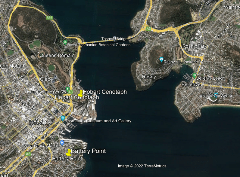
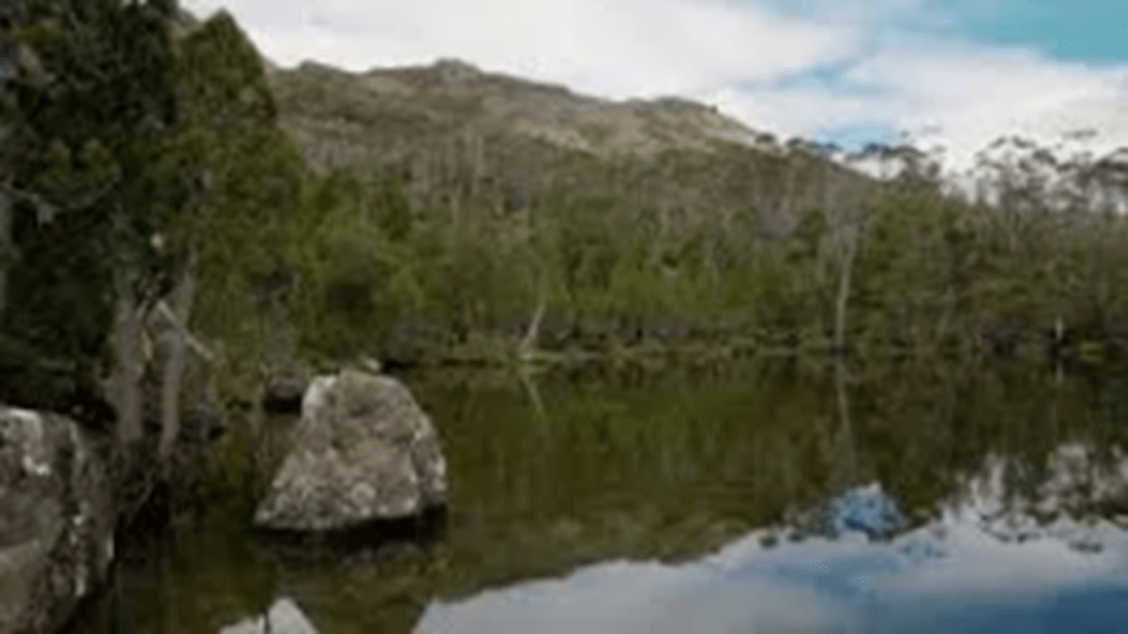
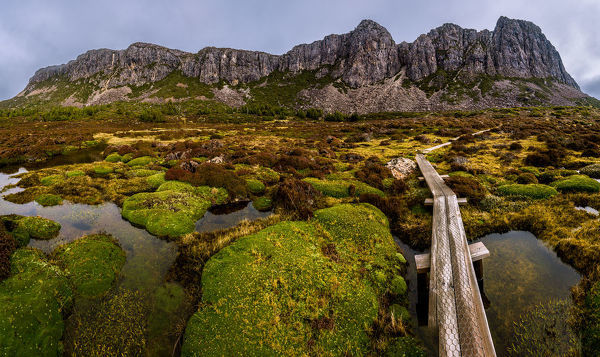
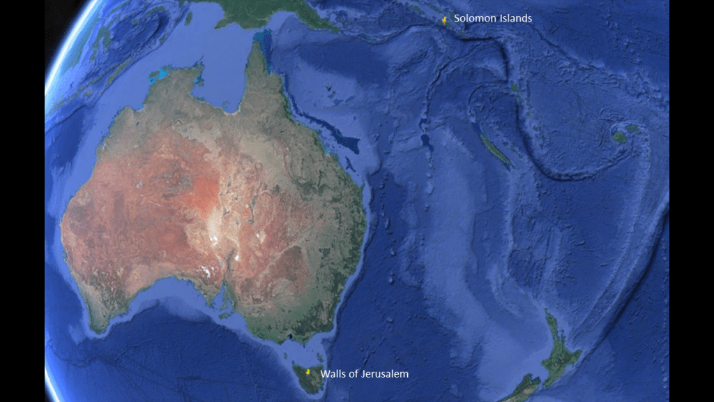
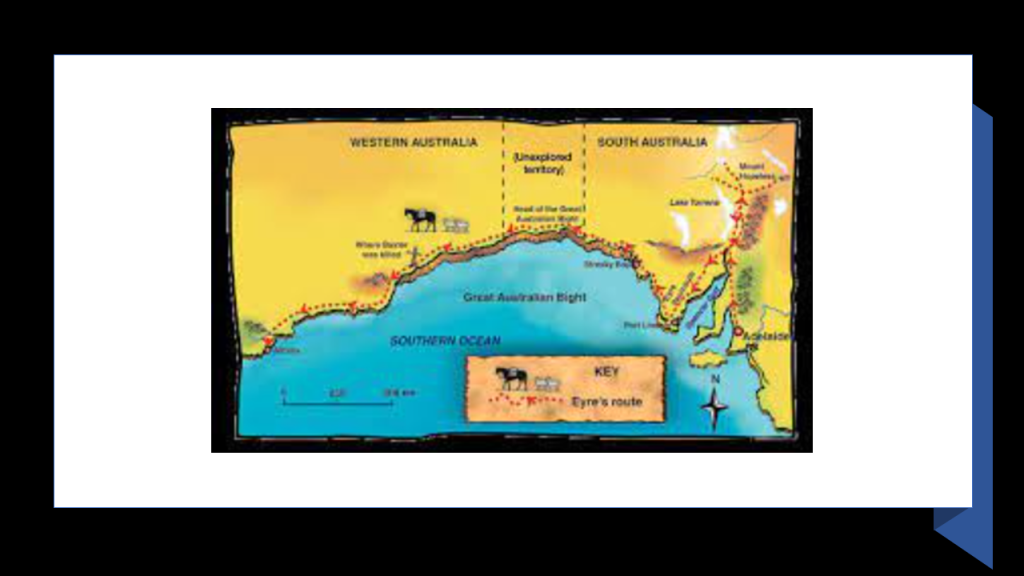
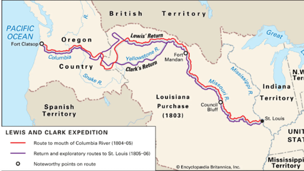
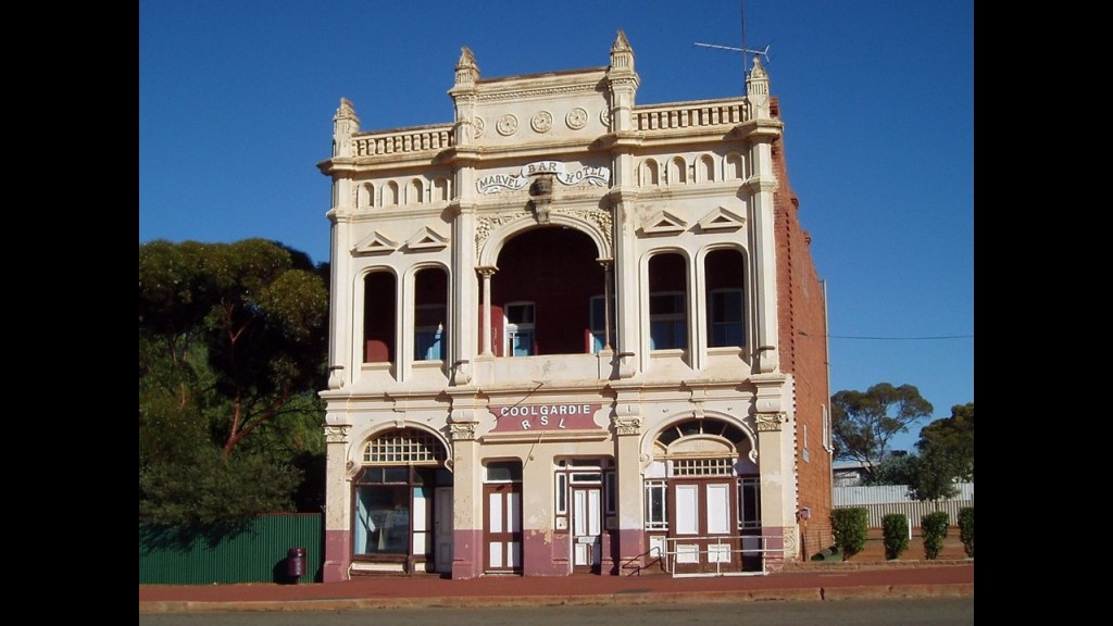
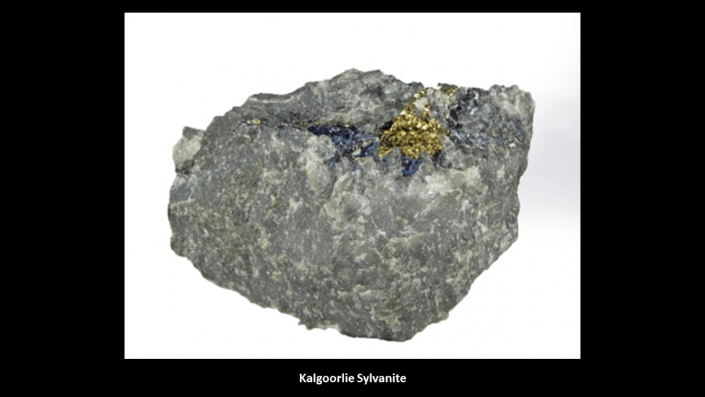
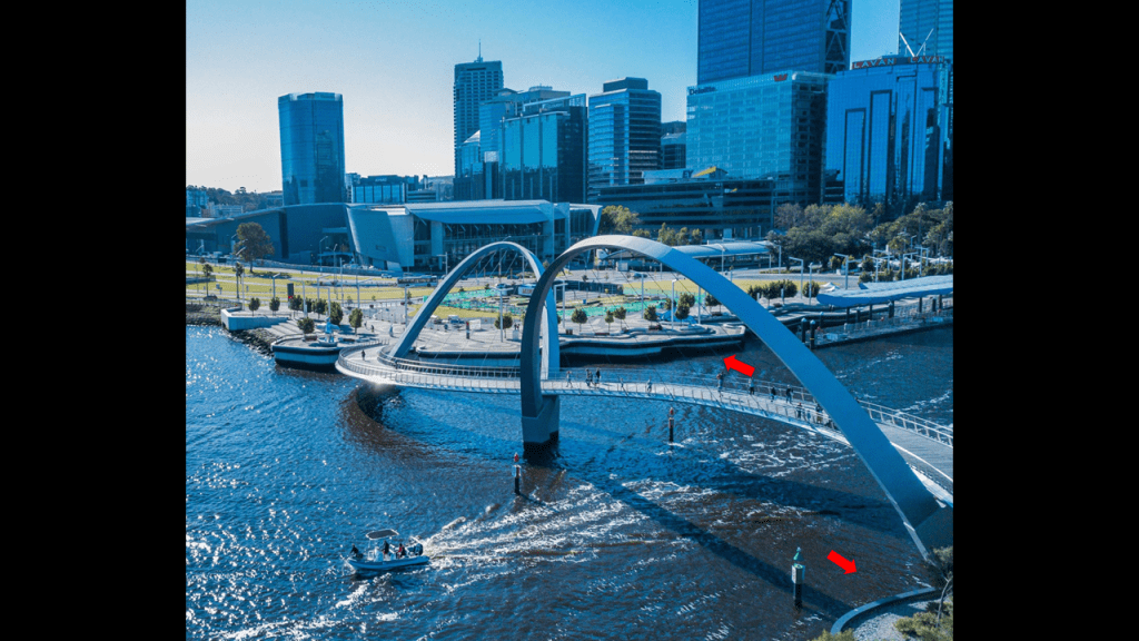
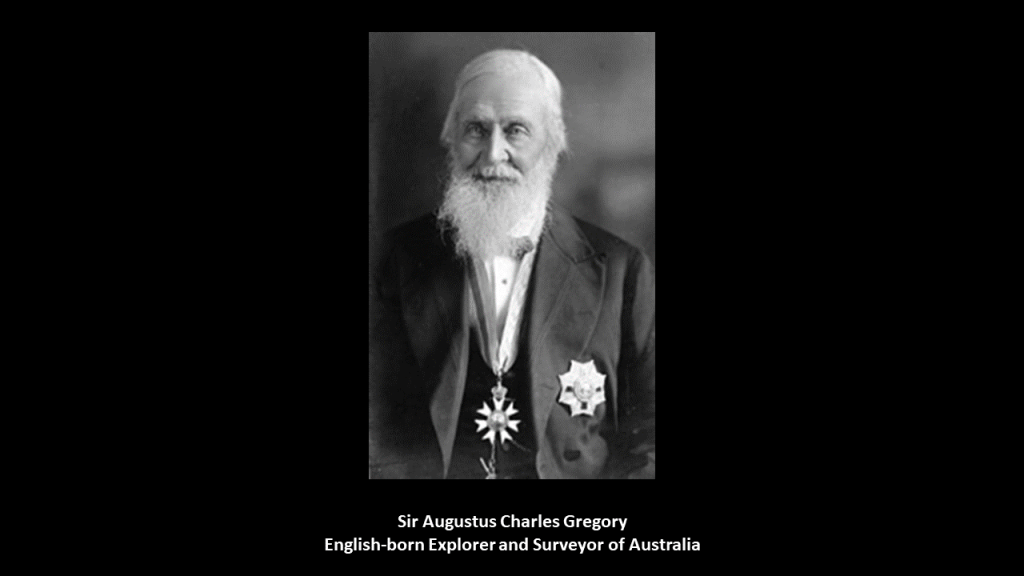
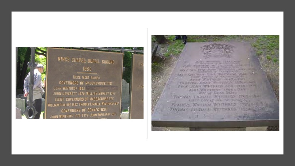
In the first-part of this series called “Circle Alignment on the Earth Amsterdam Island” that I am updating from a series I originally did between November of 2018 and January of 2019,” I tracked this circle alignment from Amsterdam Island, one of the French Subantarctic Islands in the South Indian Ocean to Berbera in Somaliland, an historic city that has served as a major commercial center and port since antiquity, and has a glorious past in terms of importance to the region but which is looking quite rough these days!
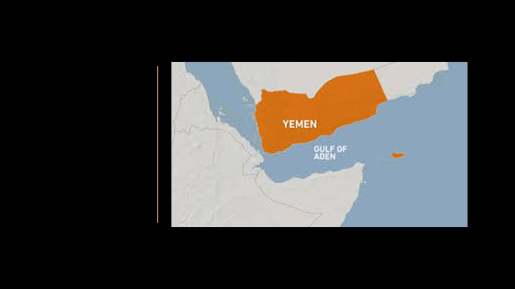
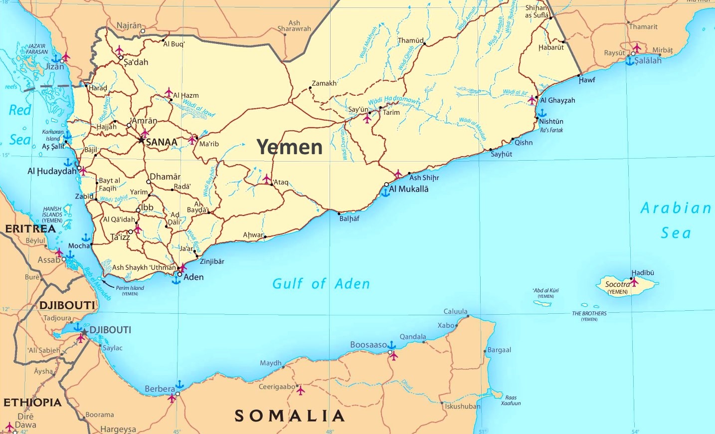
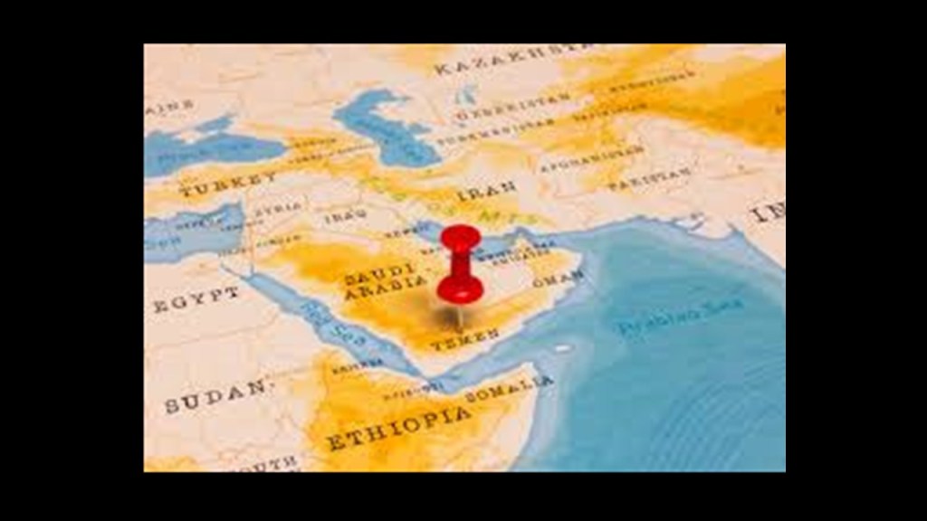
I am picking up the alignment in the Gulf of Aden on the way into Yemen in the second-part of this series.
This series was one of my earliest efforts in tracking cities and places in alignment over a very long distance, and consistently seeing the same characteristics and hand of design across oceans and continents.
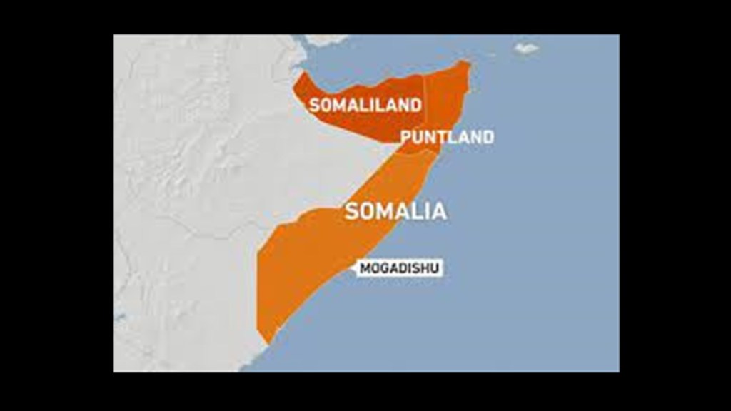
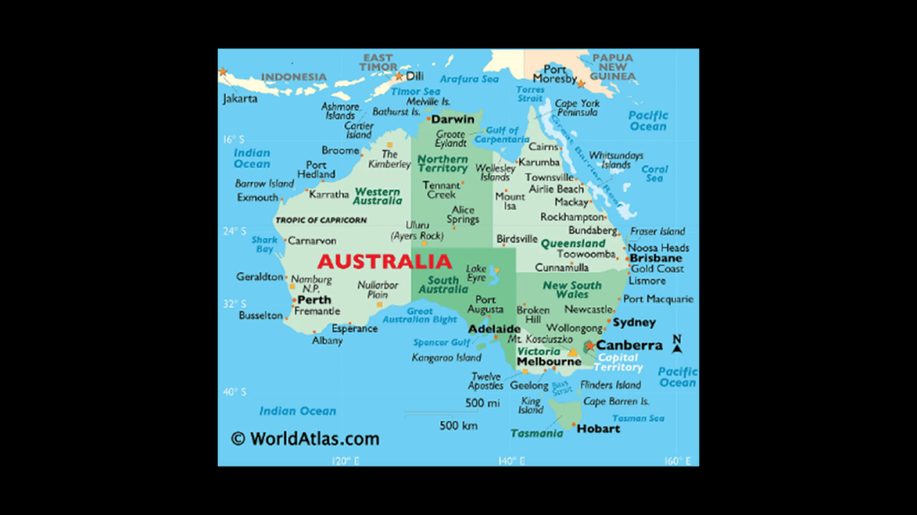
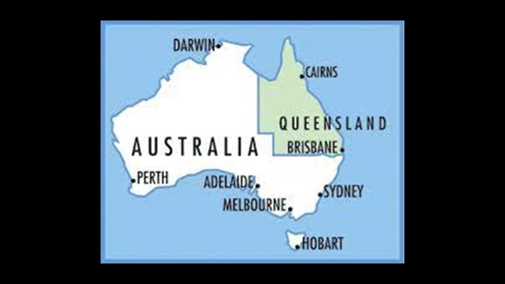
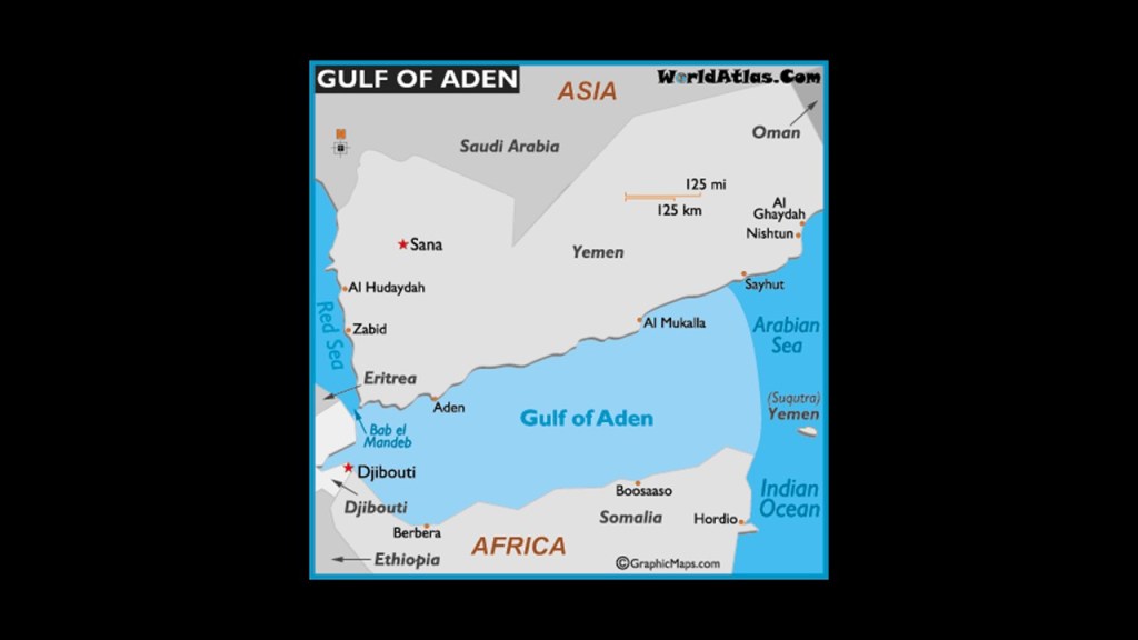
The Gulf of Aden, also known as the Gulf of Berbera, is bounded on the North by Yemen, the Arabian Sea and Guardafui Channel in the east, and the Horn of Africa, a peninsula comprised of Somalia, Somaliand, Ethiopia, and Djibouti to the south and west.
For starters, I am going to take a deeper look at some of these places around the Gulf of Aden.
Then I will continue tracking the alignment from where it enters Yemen in Mukhalla, after it crosses the Gulf of Aden from Berbera, Somaliland.
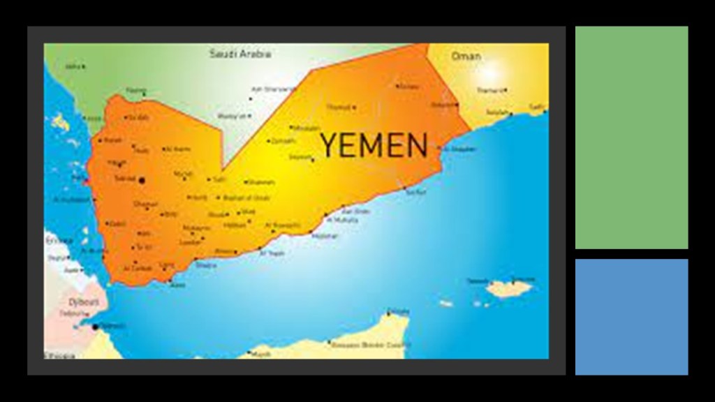
First, Yemen.
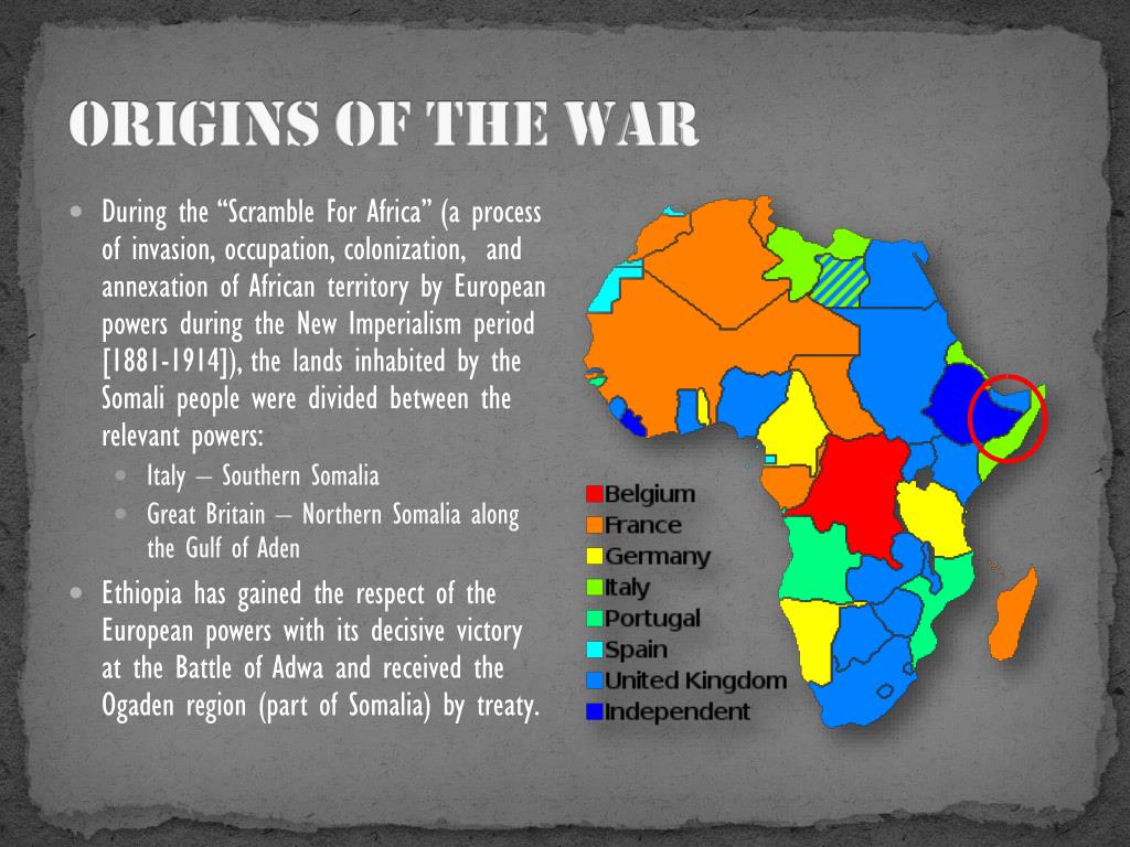
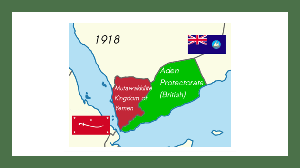
Following the collapse of the Ottoman Empire in 1918, at the end of World War I, when the former Ottoman Empire was divided between the countries on the “winning” side of the war…
…northern Yemen became an independent state known as the Kingdom of Yemen.

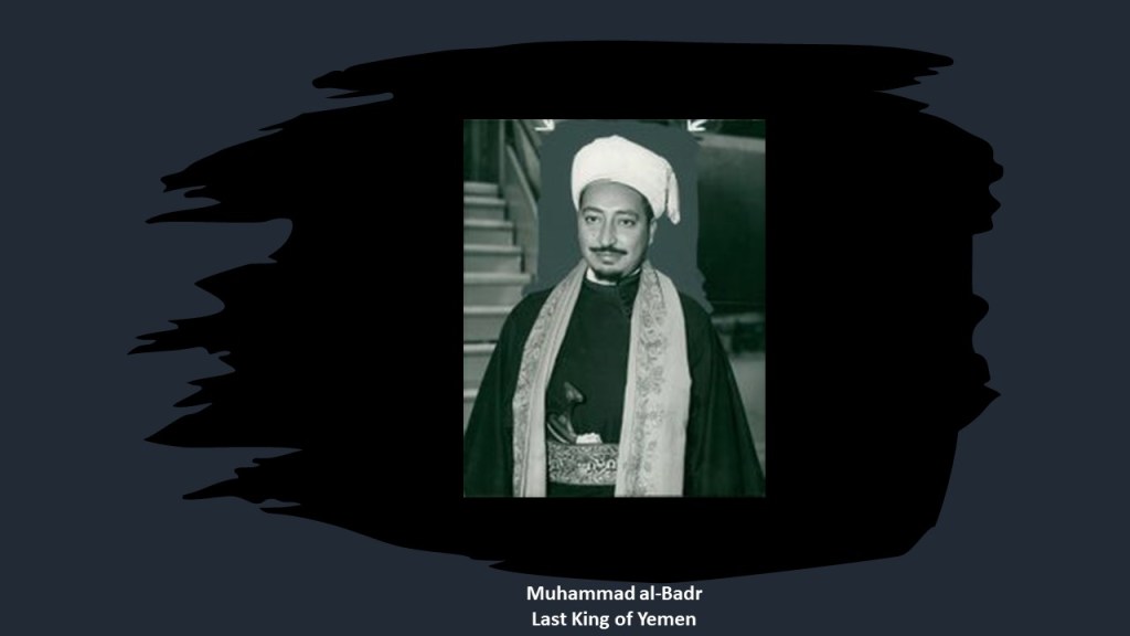
Then on September 27th of 1962, revolutionaries deposed the newly-installed, last King of Yemen, Muhammad al-Badr, and formed the Yemen Arab Republic, which was said to have been inspired by the Arab Nationalist Ideology of Nasser’s Egyptian United Arab Republic.
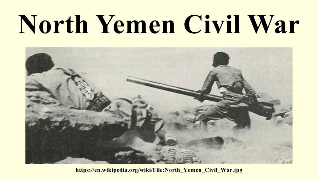
This action started the North Yemen Civil War from 1962 to 1970 between supporters of the Kingdom, which included Saudi Arabia and Jordan, and supporters of the Yemen Arab Republic, which included Egypt.
By the end of the North Yemen Civil War, the supporters of the Kingdom were defeated, and the Yemen Arab Republic was recognized by Saudi Arabia in 1970.
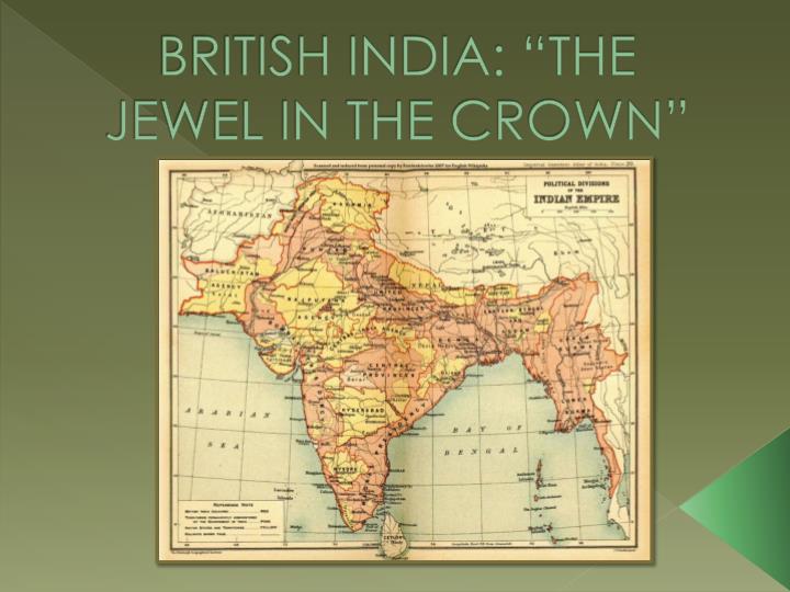
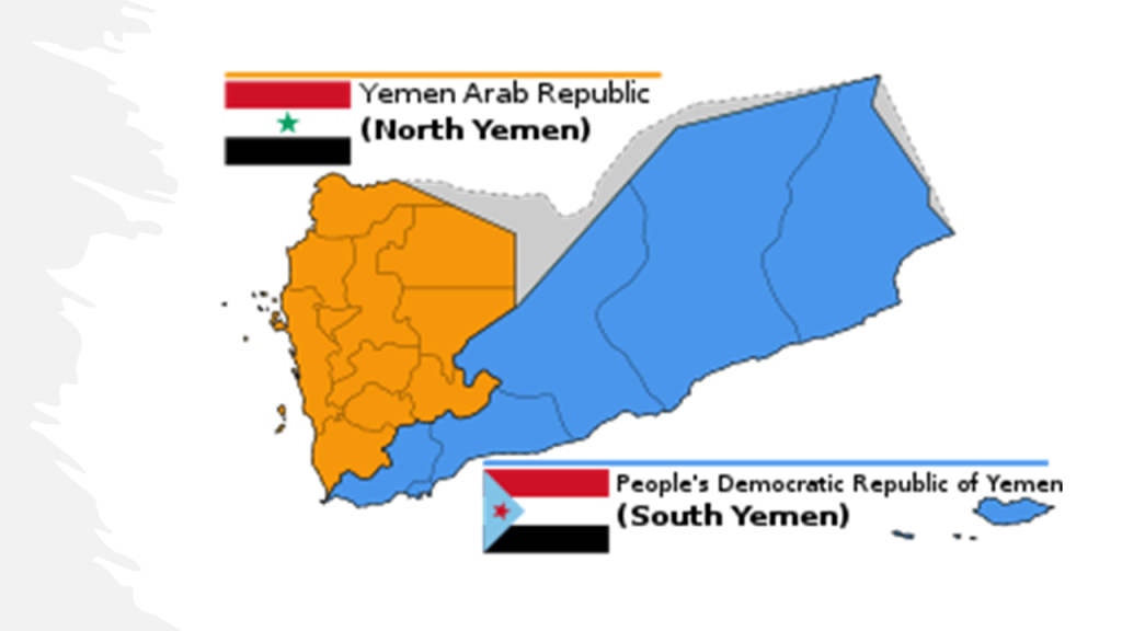
The People’s Democratic Republic of Yemen in the South was known as the Aden Protectorate in 1918, which it had been known as since 1874 with the creation of the British Colony of Aden and the Aden Protectorate, which consisted of 2/3rds of present-day Yemen.
The Aden Protectorate existed until 1963, when it was merged with the new Federation of South Arabia.
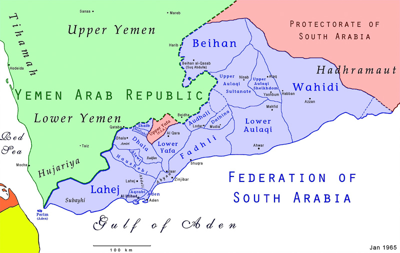
By 1967, the Federation of South Arabia had merged with the Protectorate of South Arabia, and later changed its named to the People’s Republic of Southern Yemen, becoming a Marxist-Leninist state in 1969, the only Communist state to be established in the Arab World.
This is the same thing we saw happening in Somalia and Ethiopia in the first part of this series, with the division of countries and people; civil war; territorial war; and some form of Marxist government implemented.
On March 22nd of 1990, the leaders of the Yemen Arab Republic (North) and People’s Democratic Republic (South) of Yemen announced unification as the Republic of Yemen.
With the 1990 reunification of Yemen into the Republic of Yemen, the new government was comprised of officials from both sides, with a de facto form of collaborative governance, until the country went into Civil War in 1994.
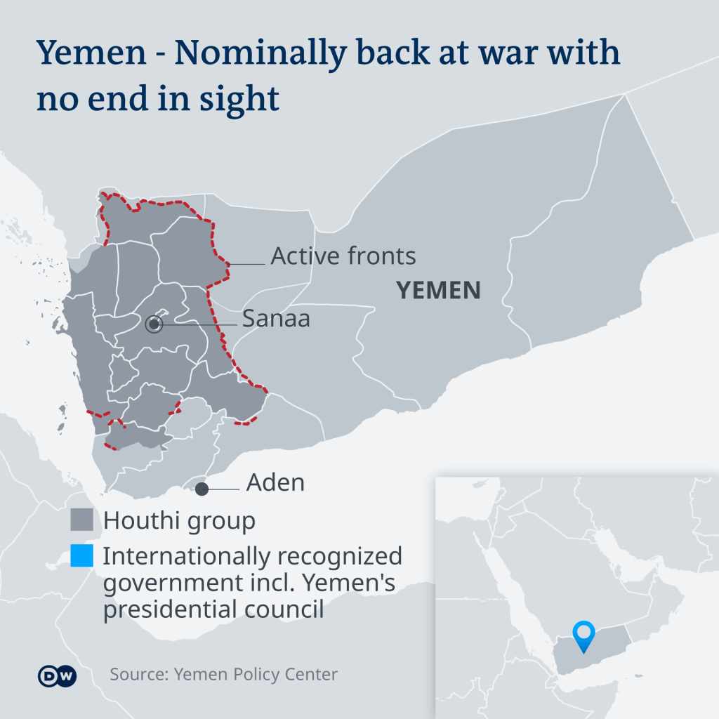
The current Yemeni Civil War started in 2014, with multiple entities vying for governance, including the Presidential Leadership Council; the Islamist Houthi Movement’s Supreme Political Council; and the Southern Movement’s Southern Transitional Council.
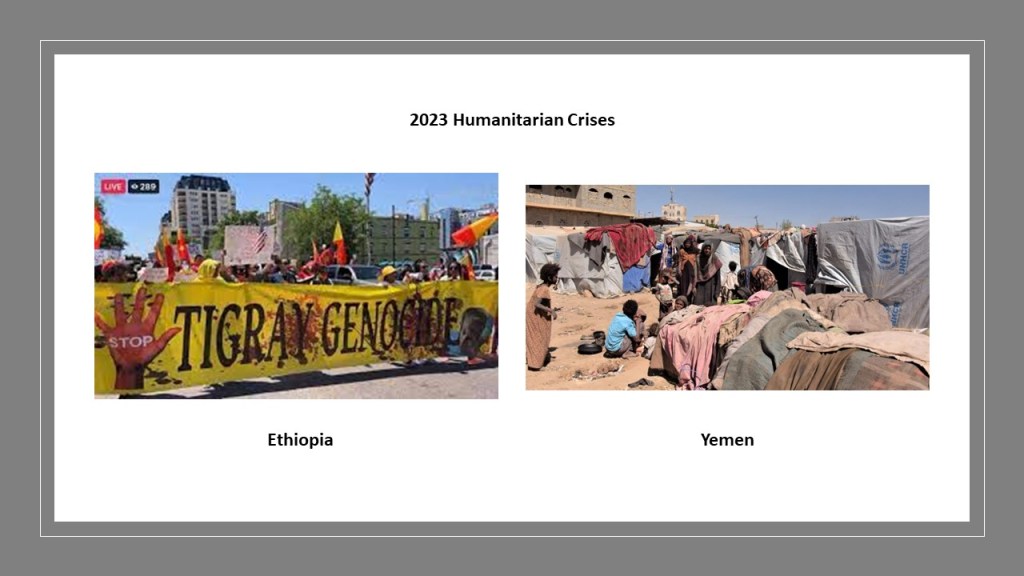
Today Yemen is one of the least developed countries in the world, and in 2019, the UN reported that Yemen had the highest number of people in need of Humanitarian Aid.
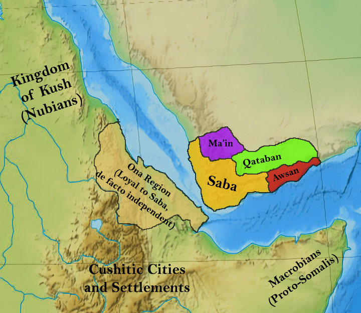
Yemen is another one of those places in this region with a missing glorious ancient past.
The historical Yemen occupied more land than what it does currently, and stretched into what is now southwestern Saudi Arabia and southern Oman today.
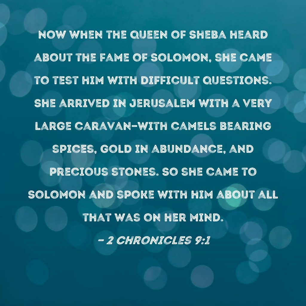
The Kingdom of Saba was believed to have been the biblical Sheba, and the oldest and most important of the historic South Arabian kingdoms.
This was the historical land of the biblical Queen of Sheba, who brought a caravan of gifts to King Solomon.
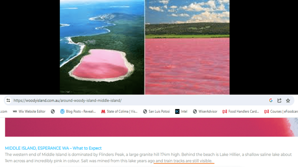
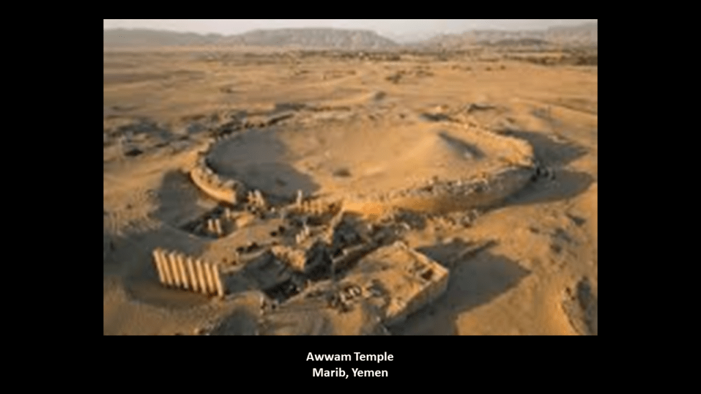
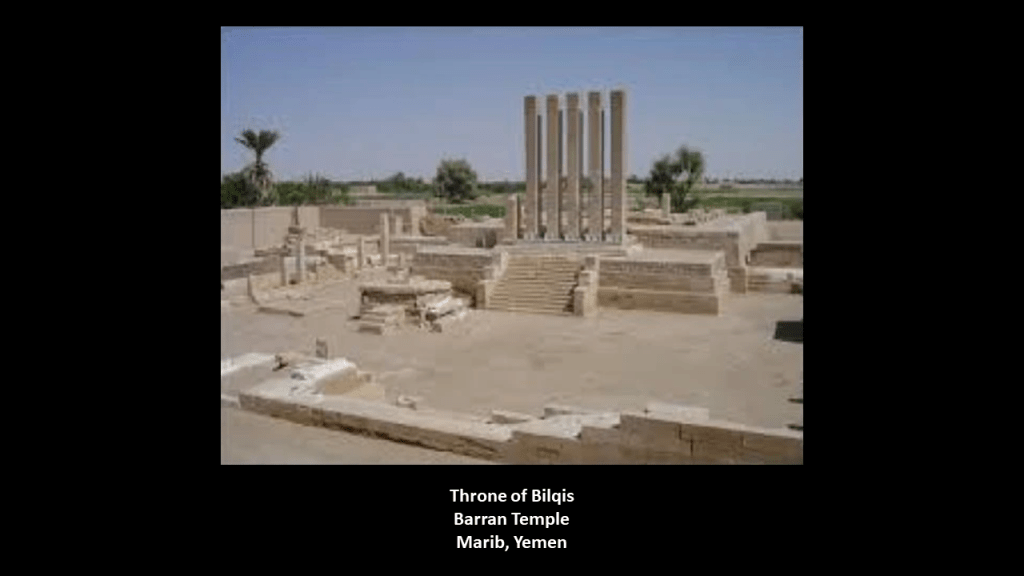
This was the Awwam Temple in Marib, Yemen, the ancient capital of the Kingdom of Saba.
The Awwam Temple is also known as the Mahram Bilquis, or the Sanctuary of the Queen of Sheba.
Arash Bilqis, or the Throne of Bilqis, at the Barran Temple, also in ancient Marib, has monolithic stone pillars (meaning single block of stone) more than 26-feet, or 8-meters, high, featuring writing and advanced masonry.
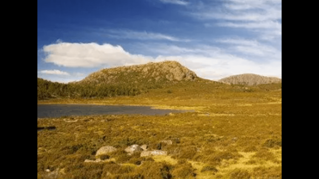
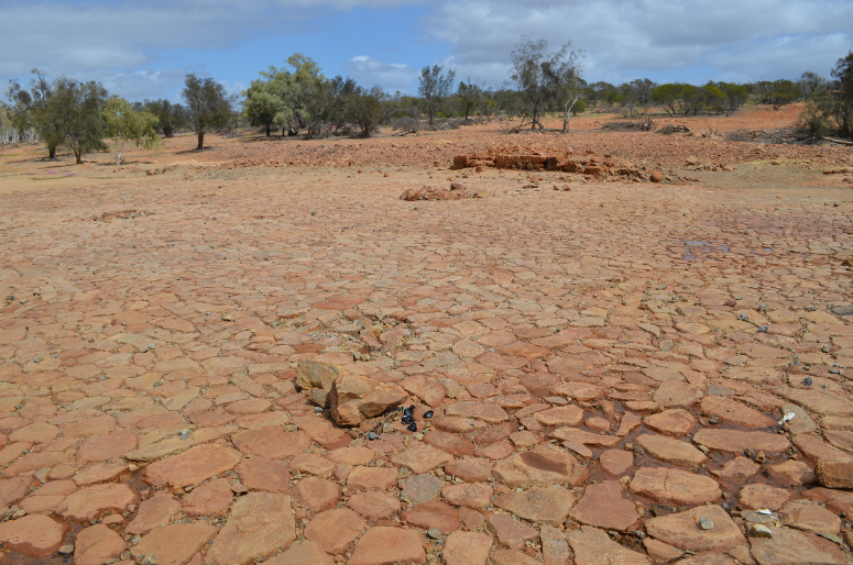
It is interesting to note the desertification through this region, something we will be seeing a lot of as we go through this part of the world.
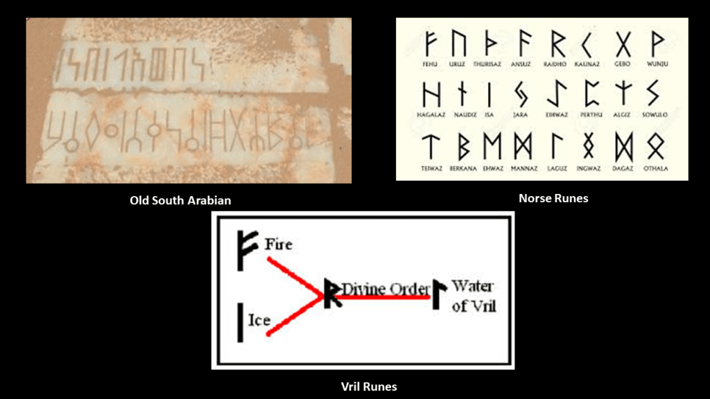
It is interesting to note that the old South Arabian inscriptions seen here on the top left, have a Norse rune look to them on the top right.
What if these runes were actually the runes of Vril, or “Life Force,” that was connected to the Ancient Humans and their mastery of how to harness natural energy to create amazing things.
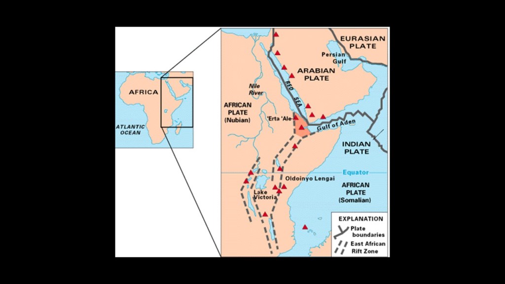
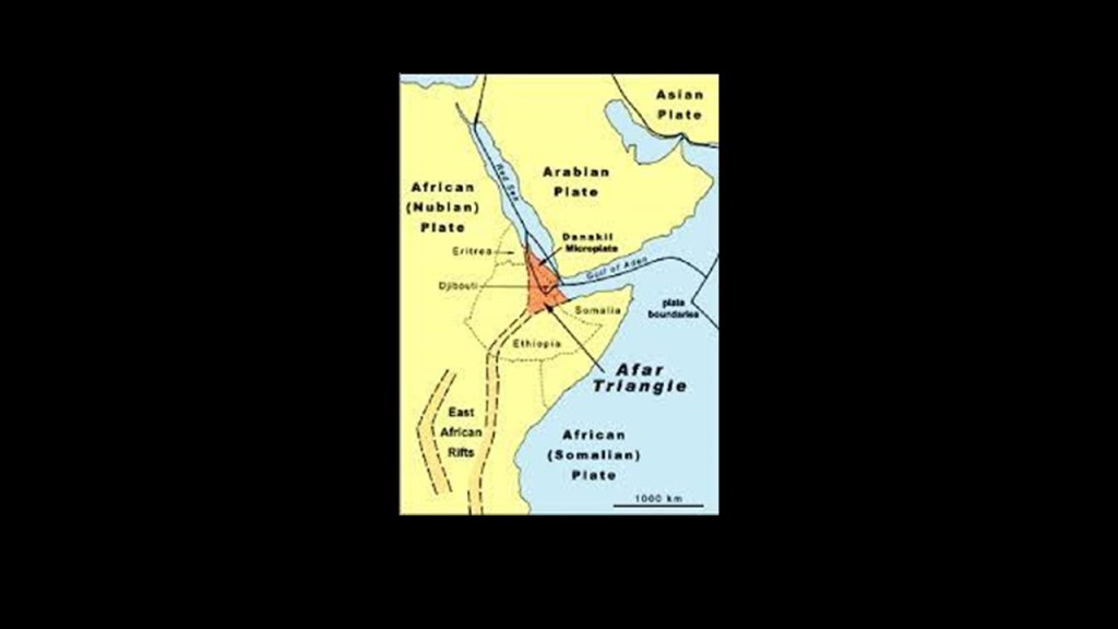
This whole region is part of the East African Rift, where the African Plate is splitting into two plates – the Somali Plate and the Nubian Plate.
The red triangles are showing the location of historically active volcanoes.
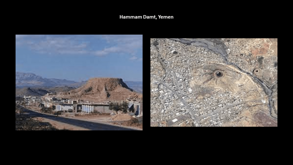
What’s interesting to me about this fact is the example of the tree-trunk looking appearance of some of the volcanoes in Yemen, like the one in the middle of the town of Hammam Damt, and speculation that what were once giant trees became volcanoes.
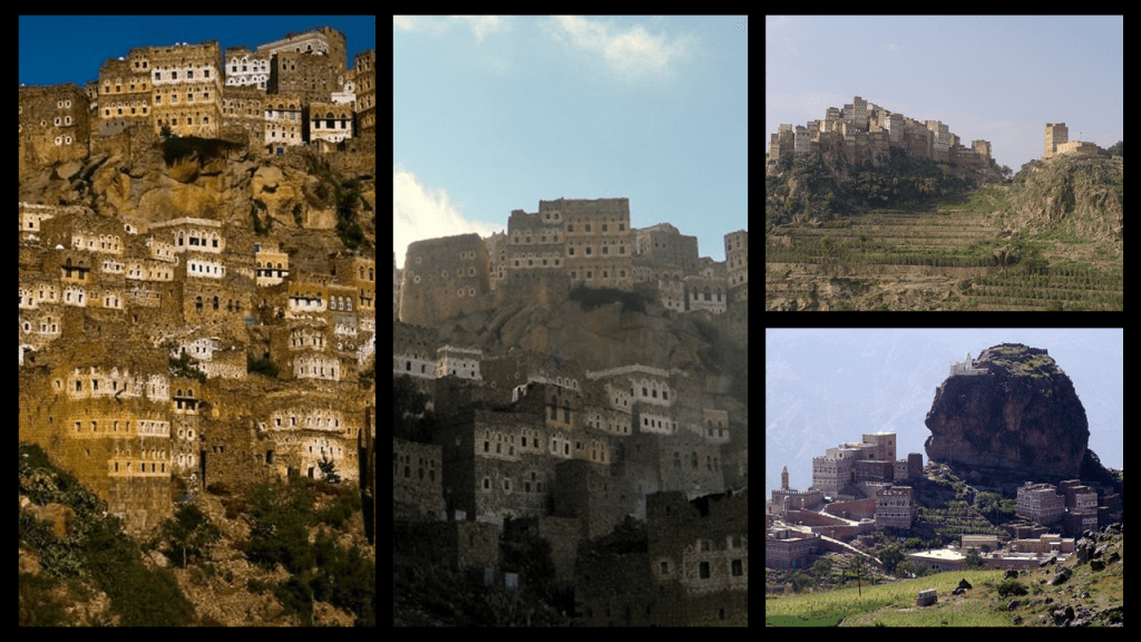
Another thing found all over Yemen is quaint and unique architecture built on high.
Yemen has many examples of this.
Why build like this?
What are we actually looking at?
Was there a relationship between the ancients and giant tree stumps that were used in building their communities?
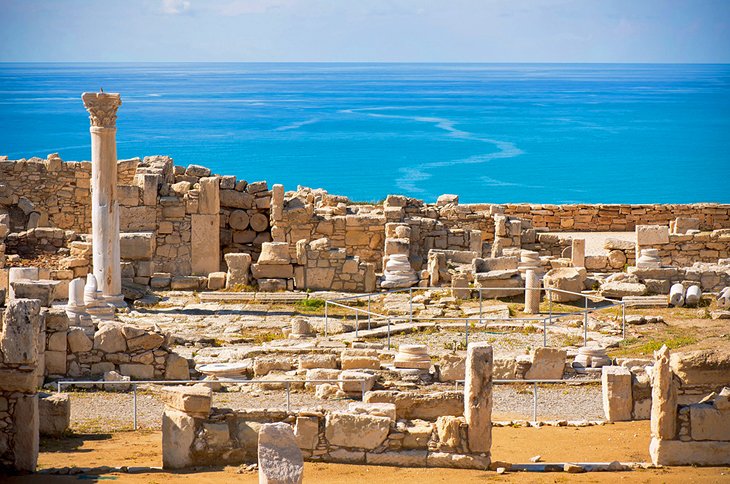
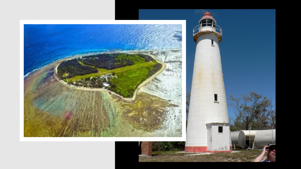
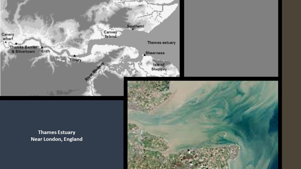
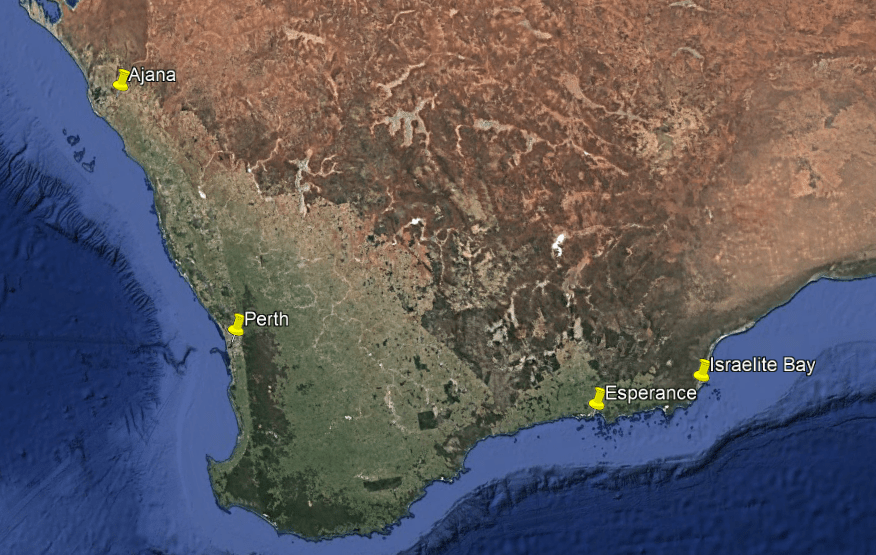
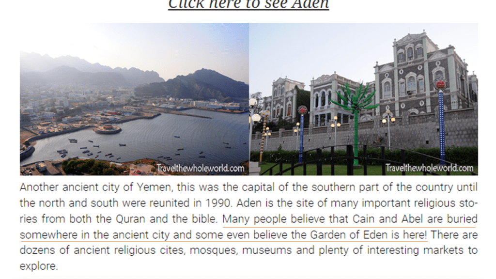
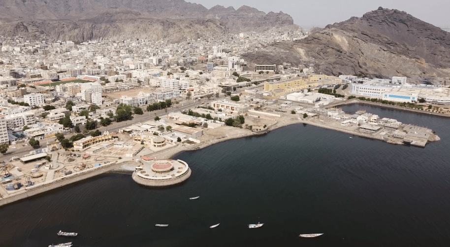
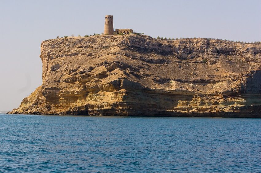
The port city of Aden in Yemen is located on the Gulf of Aden near the eastern approach to the Red Sea, almost directly across from Berbera in Somaliland.
Aden is one of the largest cities in Yemen, with a population of over 1,000,000 people.
It is a crucial maritime hub that connects Africa, Asia, and the Middle East.
There is a legend in Yemen that Aden is as old as human history itself, and that Cain and Abel are buried somewhere in the city.
More on the possible Aden – Eden connection in a bit.
A couple of things to point out about Aden.
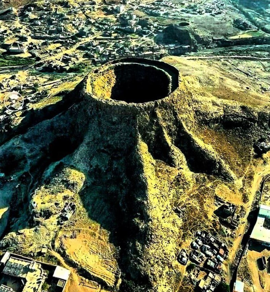
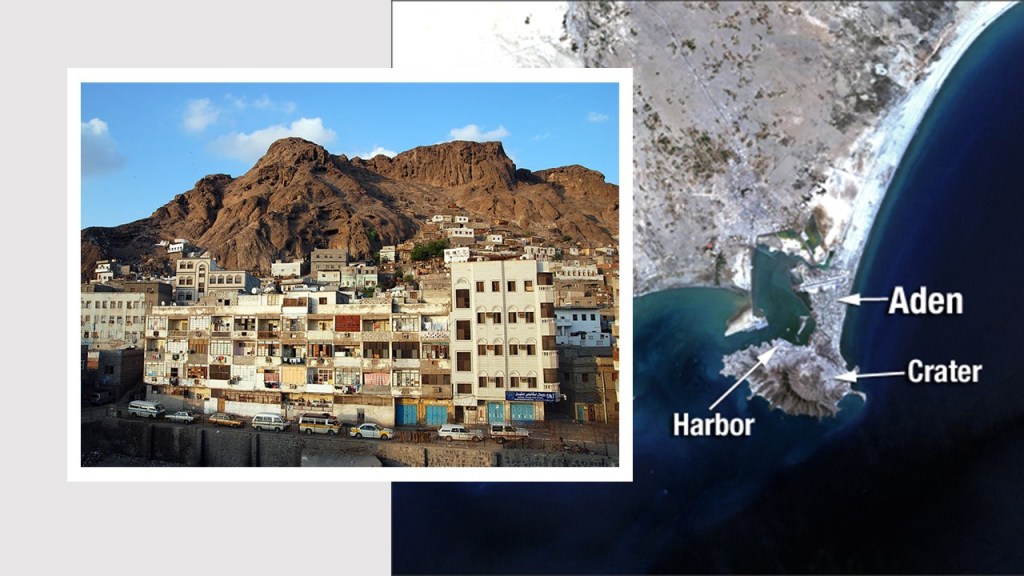
One is the Crater District.
It’s official name in Arabic is “Seera,” and it is situated in the crater of an ancient volcano which forms the Shamsan Mountains.
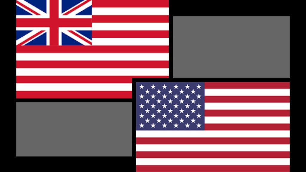
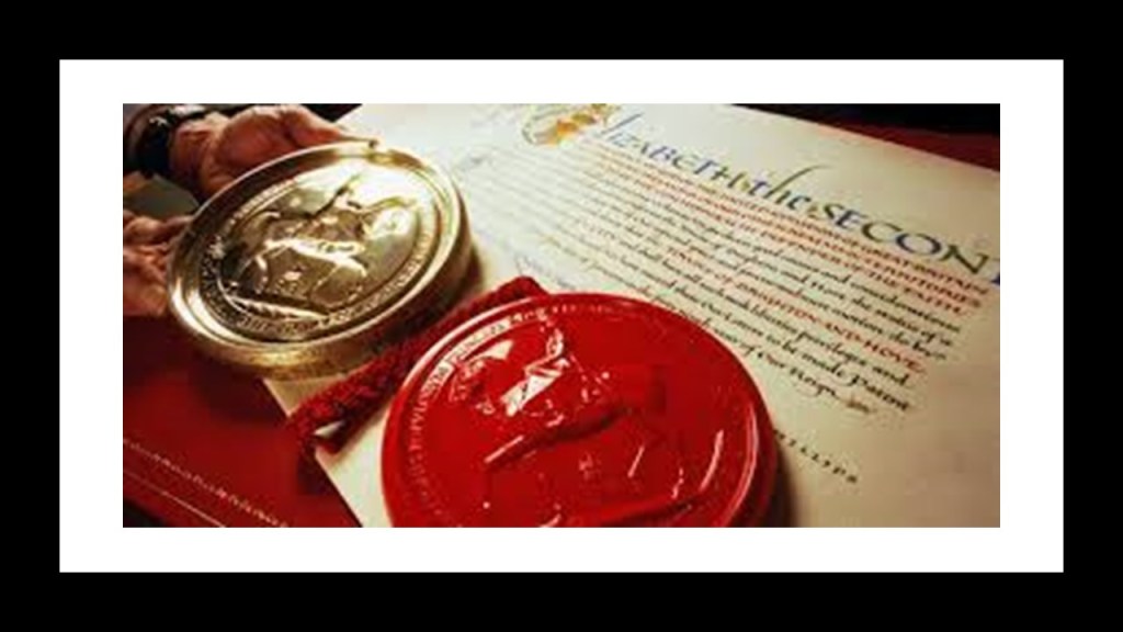
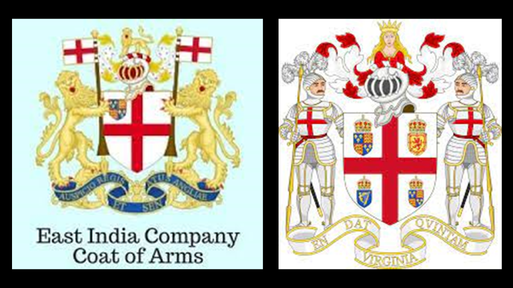
Aden was first visited by the British East India Company ship “The Ascension” in 1609, before it sailed to Mocha, another port in Yemen on the Red Sea known for things like its coffee trade.
Starting with Napoleon’s invasion of Egypt in 1796, the British Government and East India Company were interested in this area for naval fleets and other bases.
In 1839, the East India Company landed royal marines here to “secure the territory,” and stop attacks by pirates against British shipping to India, but what they actually meant by “securing,” was capturing for British interests.
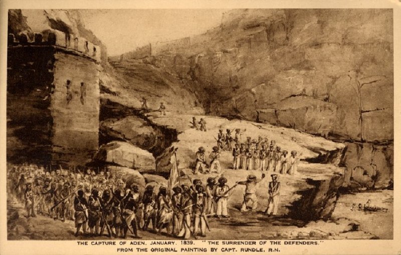
By 1850, Aden was declared a “free trade” port by the East India Company, with liquor, salt, arms and opium trades, and all the coffee trade it had won from Mocha.
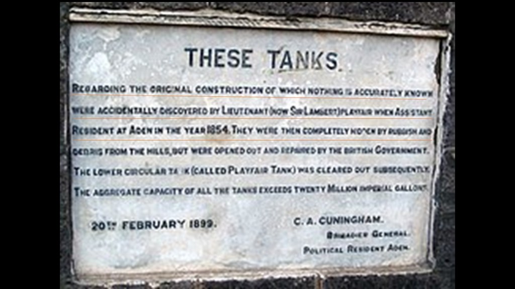
The other thing I would like to mention in Aden are the “Cisterns of Tawila.”
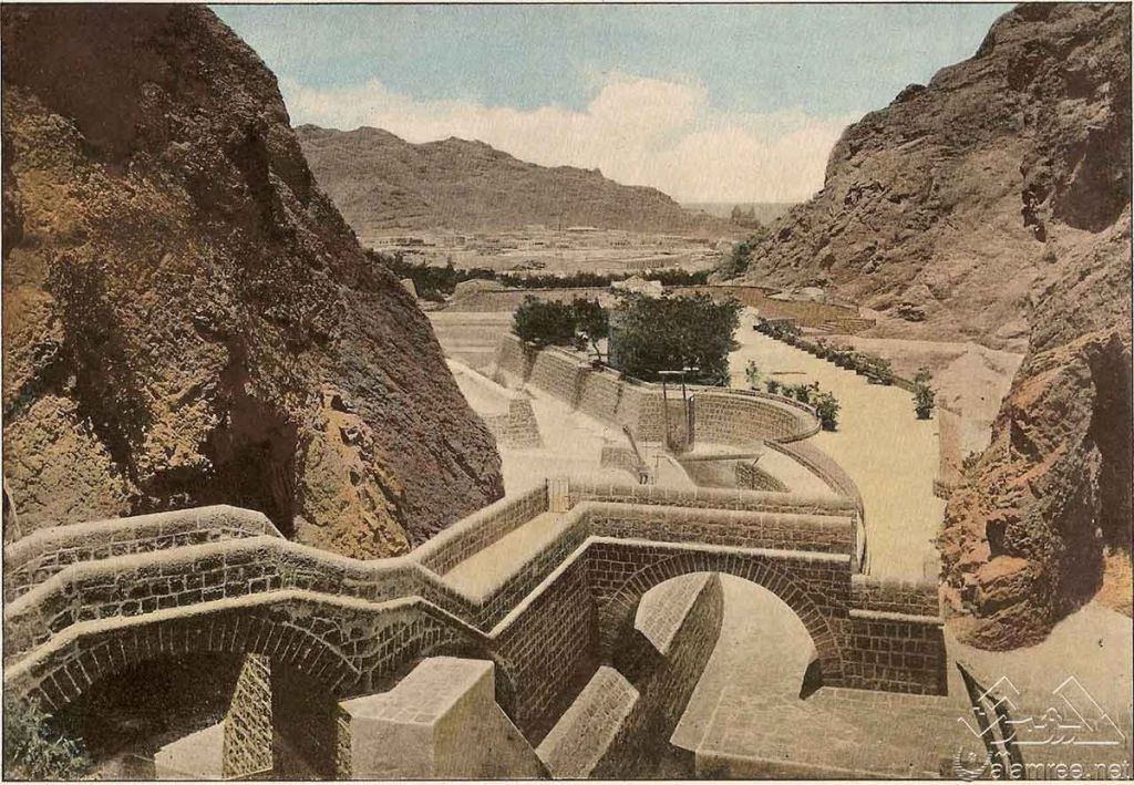
It is surmised that the “Cisterns of Tawila” were designed to collect rainwater for the city’s drinking water that flowed down from the Shamsan Massif.
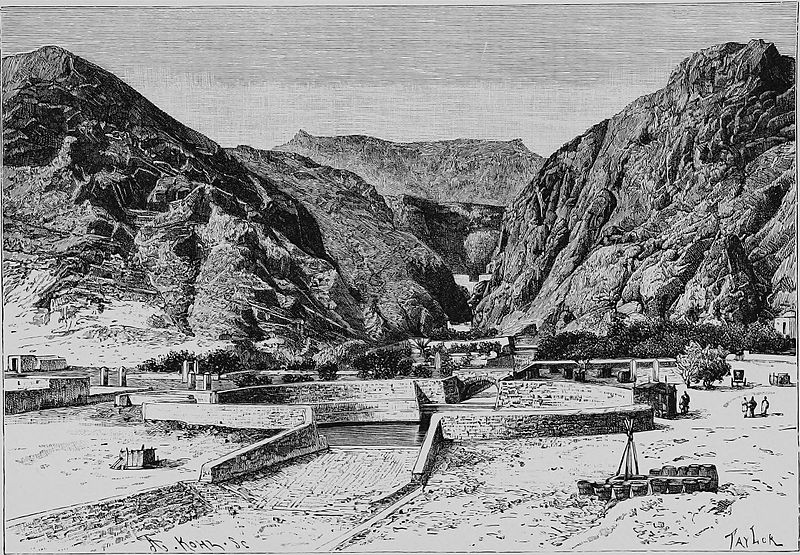
Interesting there is signage at the Cisterns saying that nothing was known about the original construction after they were “accidently” discovered by a British Officer in 1854.
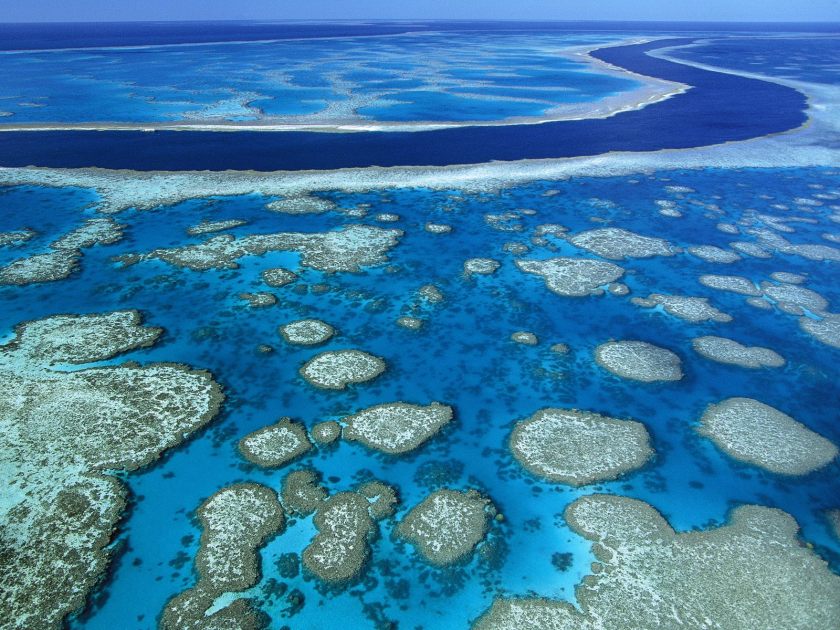
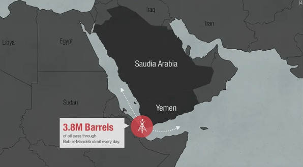
Next, we come to the Bab-el-Mandeb Strait, located between southwestern Yemen near Aden, and northeastern Djibouti, and connects the Gulf of Aden to the Red Sea.
This strait is of great strategic and economic importance.
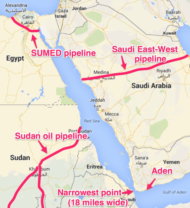
For one thing, millions of barrels of crude oil are shipped through it every day.
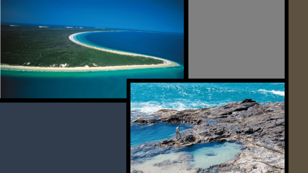
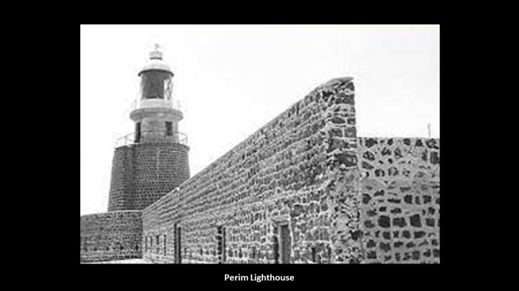
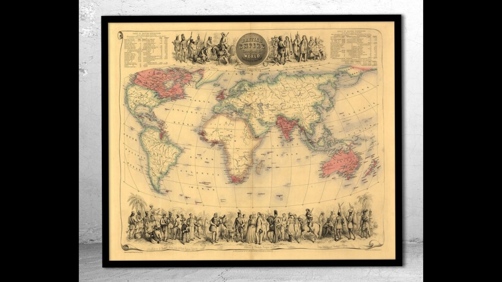
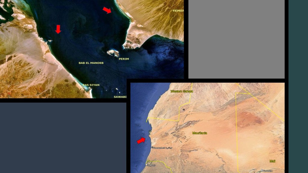
As I was looking for images of the Bab-el-Mandeb Strait, I noticed this Google Earth Image on the right showing Perim Island, and the old map on the left showing it as a British possession at one time.
It was part of the British Aden Protectorate between 1857 and 1967,and is considered part of Yemen.
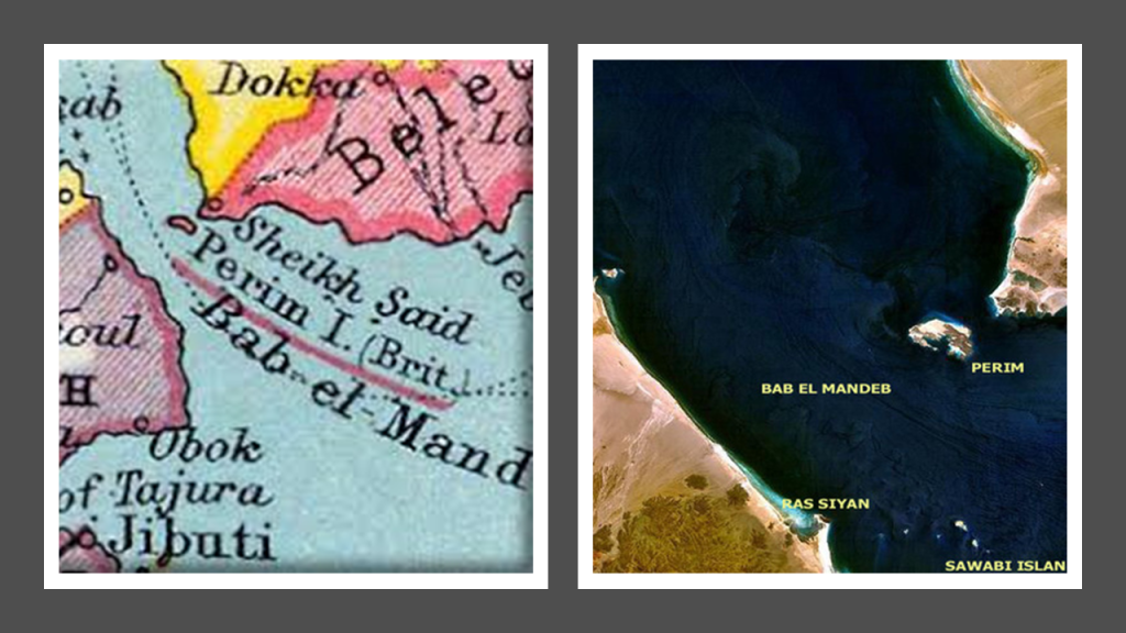
Perim is described as a volcanic island, and was said to have been called the “Island of Diodorus” in ancient times.
Diodorus was a historian was said to have lived in the 1st-century BC,best-known for writing the “Bibliotheca Historica,” about the history and culture of Egypt, Mesopotamia, India, Scythia, Arabia, North Africa, Greece and Europe.

The image of Diodorus on the top right we are told is from a 19th-century fresco…
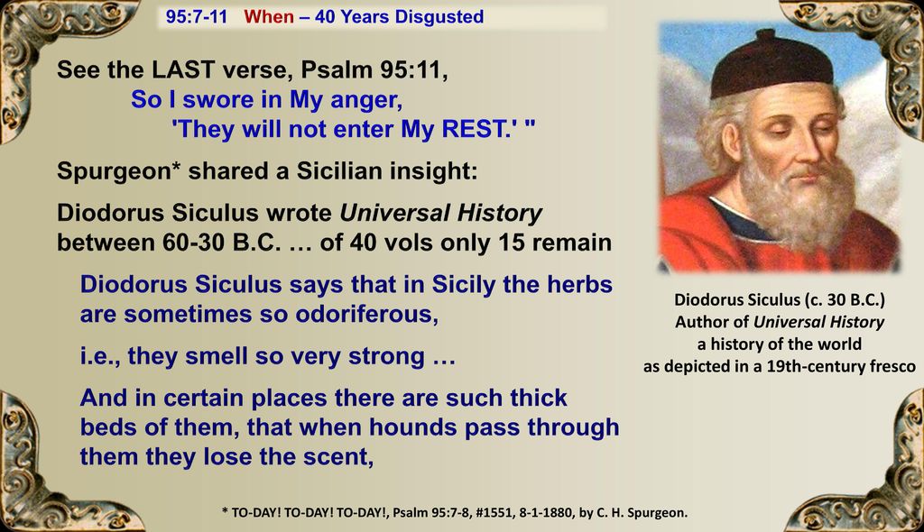
…and this work of Diodorus we are told was translated into English between 1933 and 1954 by an American named Charles Henry Oldfather, a Professor of Greek and Ancient History at the University of Nebraska-Lincoln.
Perim was occupied by the British starting in 1856 under the direction of the Prime Minister, Lord Palmerston, with the purpose of countering French ambitions in Egypt and the Red Sea with the Suez Canal project sponsored by the French.
The island had already been taken possession of the by the British East India Company in 1799, and the British claimed credit for building a lighthouse in 1861 due to the treacherous waters around the island.
Interesting to note that during the same time-period, the 1850s, the so-called Palmerston Forts on the Isle of Wight, and other places in and around the English Channel, were said to have been built during the Victorian Era in response to a perceived threat of French invasion.

They are called the Palmerston Forts due to their association with the same Lord Palmerston who authorized the occupation of Perim for the same reason of the perception of a threat from the French by the British.

It certainly appears like the conflicts and wars between nations of the modern-era provided the cover story needed to explain the existence of the infrastructure of the original civilization, like light houses and star forts, which were found all over the world and functioned as part of the Earth’s original free-energy grid-system, and they were repurposed as necessary navigational aids and military fortifications in the reset narrative.
The volcanic Sawabi Islands are southwest of Perim Island in the Bab-el-Mandeb Strait, and they are part of the country of Djibouti.
They are known as a popular diving site.
I want to bring your attention again to the desertification of this region.
Here is a Google Earth screenshot of the Sahara Desert today from the western coast of North Africa, across to the eastern coast.
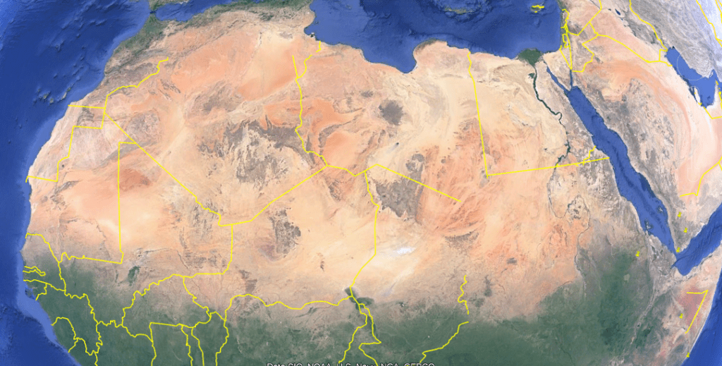
When I saw the downward flow of the Sahara Desert on either side of the Bab-el-Mandeb Strait at the entrance to the Red Sea off the coast of East Africa on the top left, it immediately brought to mind the downward flow of the desert off the coast of West Africa in Mauretania and Western Sahara on the bottom right.
What we are told is that the Sahara was green until about 5,000-years ago, when it started turning into inhospitable desert after the end of glaciation 10,000-years ago created a climate change that affected the ability of yearly monsoon rains to reach this part of the continent.
But I think that is just another cover story to hide a deliberately-caused cataclysmic event that happened much more recently in time that resulted in world-wide devastation and destruction along the Earth’s grid-lines, causing landscapes to simultaneously turn into deserts, swamps, or to submerge completely.
And where have we heard “climate change” before?
Let’s see what else we find looking around the Gulf of Aden.
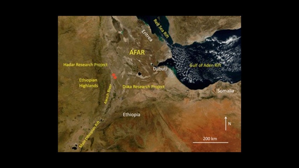
The Republic of Djibouti situated in the horn of Africa, and located between Somalia, Ethiopia and Eritrea.
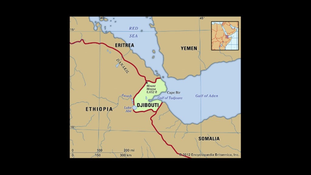
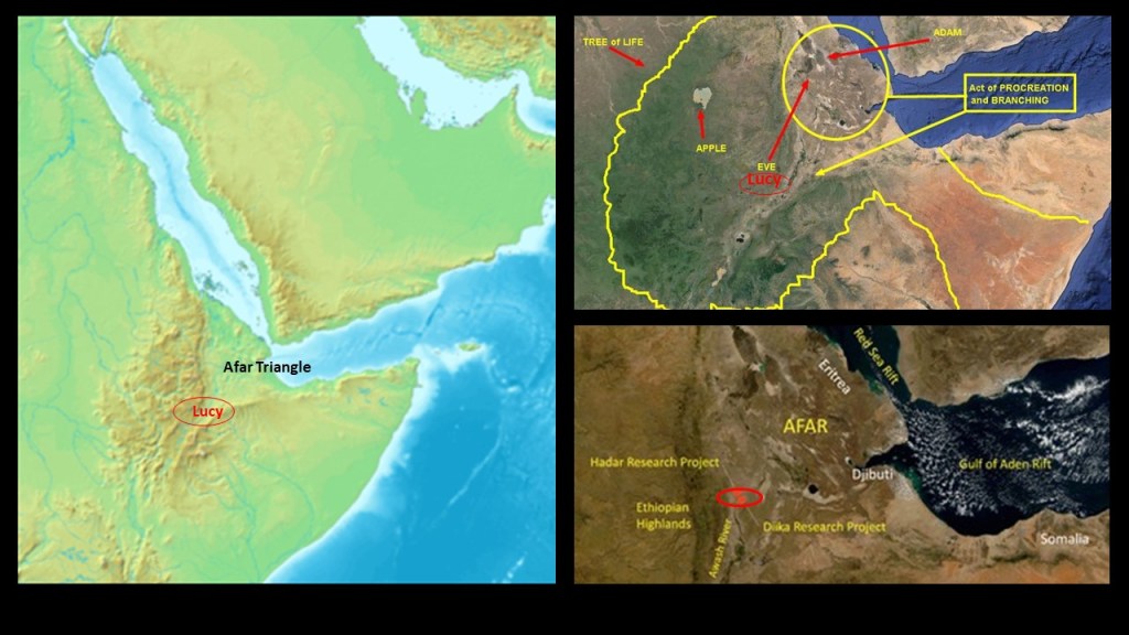
Djibouti is the primary location of the Afar Triple Junction, or Afar Triangle, a tectonic triple junction of three tectonic plates – the Nubian, Somalian, and Arabian – at the northern end of the Great Rift Valley and Djibouti is the southernmost country on the Arabian Plate.
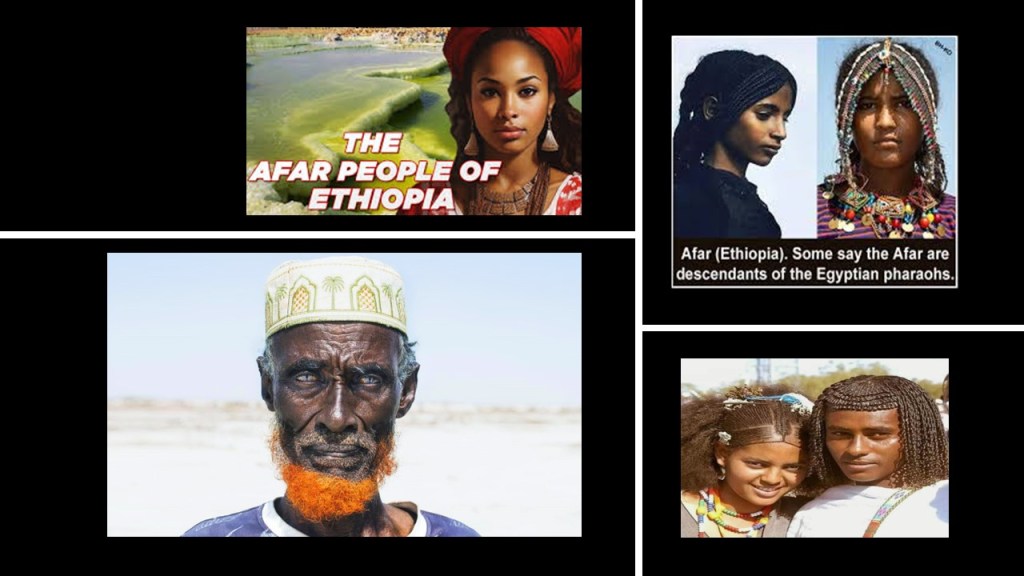
The Afar Triangle is thought to be the cradle of the evolution of Humans, and here is where the possible Aden – Eden connection comes back in to this region.
The Afar people live in the Afar Triangle region today and traditionally are described is Cushitic nomadic livestock herders.
But were they always nomadic livestock herders?
Or did the Afar people have a much more glorious past than present?
The ancient Kingdom of Kush, also known as Nubia, was at one time a powerful civilization in this part of Africa.
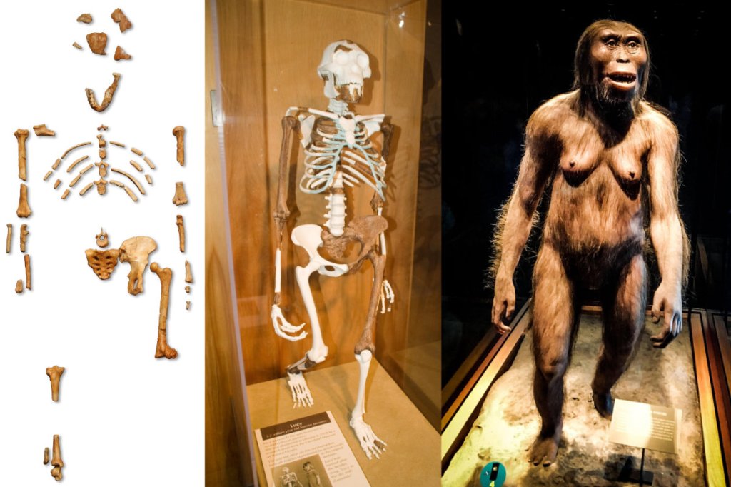
I remembered from something I read a long time ago that the Great Rift Valley in this part of the world was where the remains of “Lucy” were discovered in 1974, and as it turns out, they were discovered at Hadar, which is in Ethiopia in the Awash River Valley on the edge of the Afar Triangle.
“Lucy” was classifed as the 3.2-million-year-old skeletal remains of a female “Australopithecus,” or the earliest known hominids considered to be a close relative of modern humans, and postulated by some to be the “missing link” between apes and humans.
When I typed “Aden Eden” into the search bar, this is one of the images that came up.
It is titled “Garden of Eden (Aden) on Google Earth by Bradly Couch on Pinterest.”
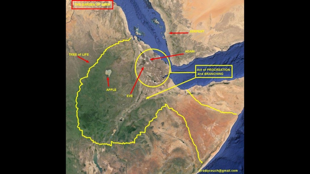
As the Book of Genesis relates our creation story, Eve was our earliest female ancestor, created by God from Adam’s rib, and they were the first man and woman.
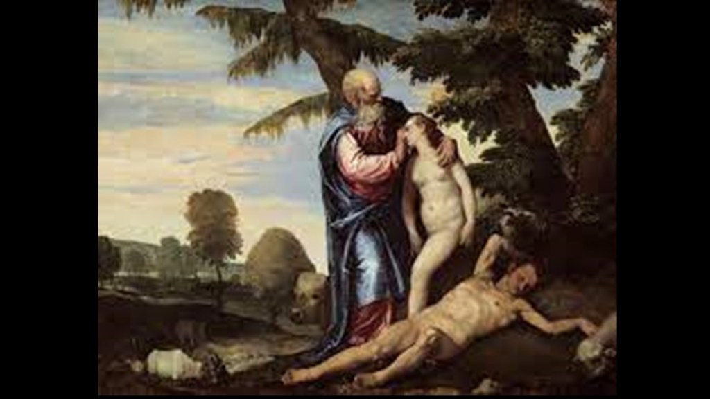
So what’s interesting to me is that the Hadar Site is where one of Bradly’s arrows is pointing with the caption: “Act of procreation and branching,” and what I am wondering about this is whether or not we have been given a replacement story about our origins linking us to evolution from apes instead of our creation coming directly from God.
And that this replacement story occurred in a region connected with the name “Aden,” which is one letter different from the name “Eden.”
I don’t know.
I just wanted to point out these intriguing connections I found in this location.
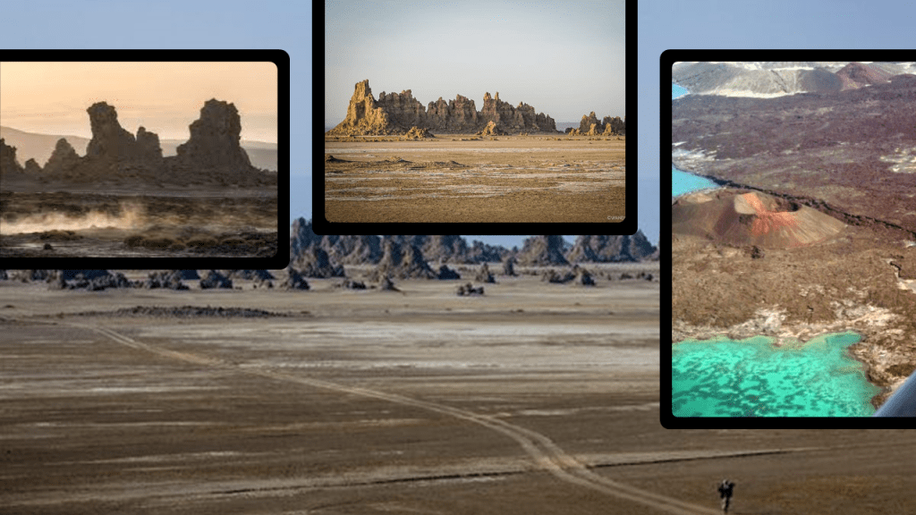
I want to mention Lake Abbe, described as a salt lake on Djibouti’s border with Ethiopia in the Afar Triangle, where the three tectonic plates are pulling away.
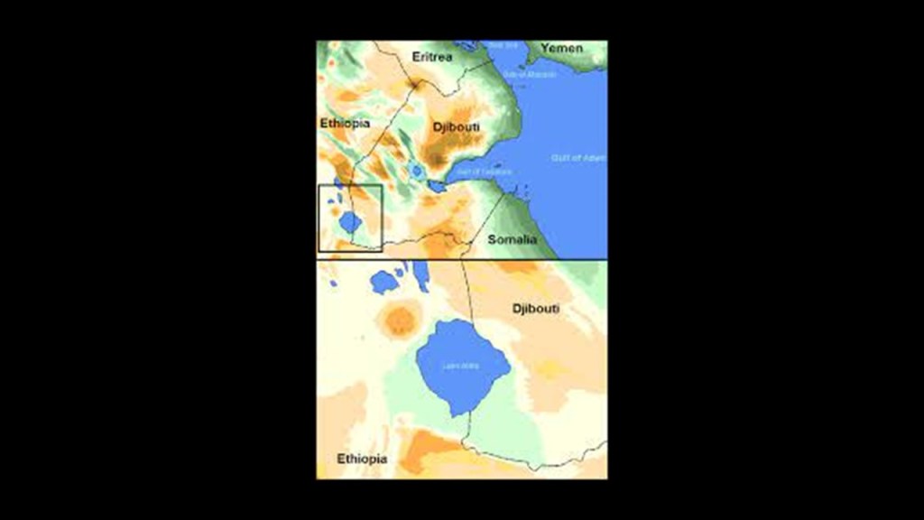
Lake Abbe is a truly surreal-looking place, and is considered one of the most inaccessible areas on Earth.
I am just left wondering what we are really looking at here like we are told – the result of natural geologic processes…or a sudden cataclysmic event wreaking havoc on the Earth!
Ethiopia’s Awash River runs from near Addis Ababa, the capital of Ethiopia, to Lake Abbe.
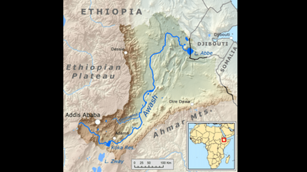
And is the Awash River actually a canal?
We are taught to believe that rivers are of natural origin, and that any infrastructure related to canals or hydrology were of modern origin.
There’s also a railway history along the Awash River, more infrastructure that is attributed to having been built in our more recent modern history.
Yet, I find railroads all over the world co-located with rivers/canals/gorges, and connected with hydroelectric facilities.
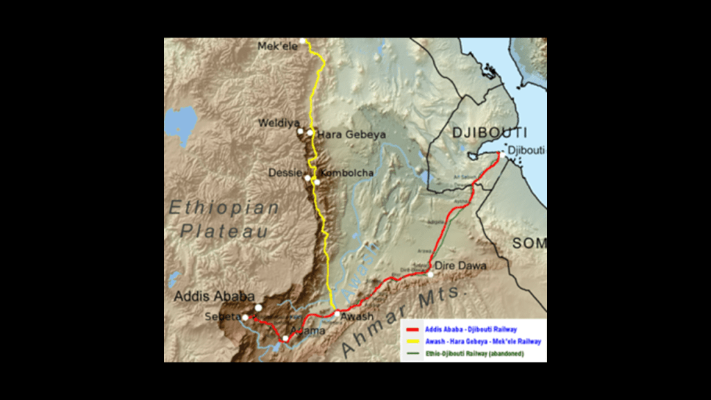
Finding the same thing here.
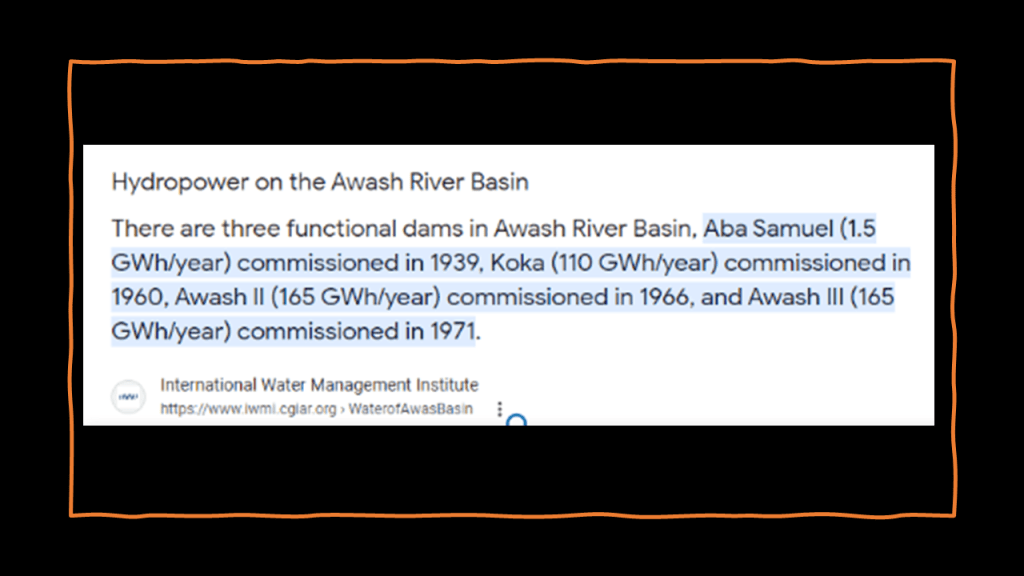
Railway along the Awash River, which has a gorge and three functional dams.
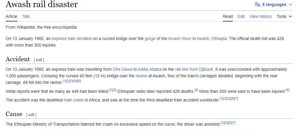
One of the worst railroad accidents in history took place in 1985, when an express train derailed on a curved bridge over the gorge of the Awash River in Awash, Ethiopia, killing 428, and injuring 500.
I am having a hard time finding information about the crash, but this was what we are told about it.
I go into depth about this finding railroads in very different places that are co-located with rivers/canals/gorges, and connected with hydro in my post “Of Railroads and Waterfalls and Other Physical Infrastructure of the Earth’s Grid System.”
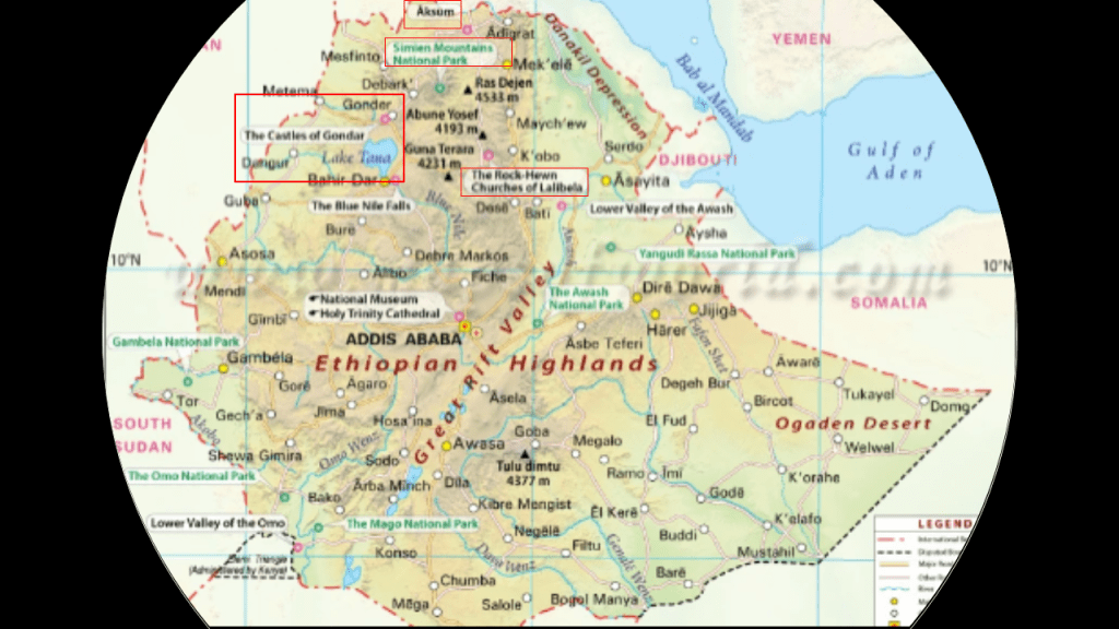
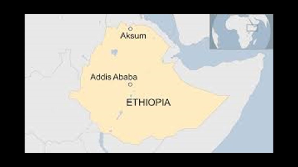
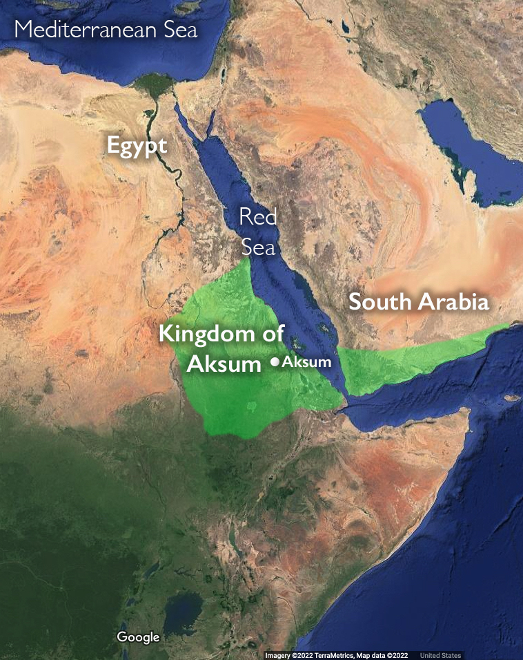
In this same region In Ethiopia, north of Addis Ababa , we find Lalibela, Lake Tana, Gondar, the Simien Mountains and Aksum.
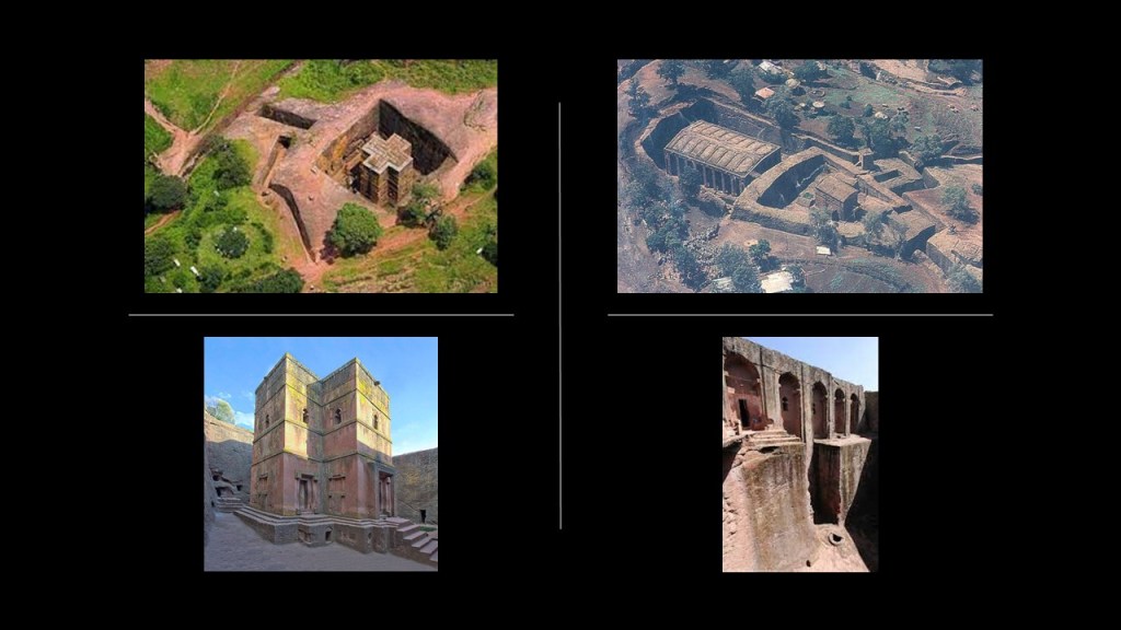
Lalibela is the second holiest of Ethiopia’s cities, after Aksum.
It is famous for its complex of all together eleven monolithic churches, meaning cut out of one rock.
It has been a UNESCO World Heritage Site since 1978.
The population of Lalibela is almost completely Ethiopian Orthodox Christian.
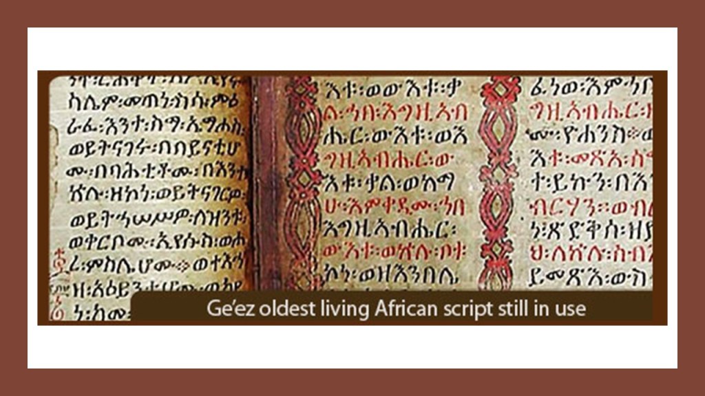
The ancient Ethiopian language of Ge’ez is the oldest African script still in use to this day, and is the liturgical language of the Ethiopian Orthodox Tewahedo Church and the Jewish Community in Ethiopia.
The Ethiopian Orthodox Tewahedo Church dates back to the acceptance of Christianity by the Kingdom of Axum in 330 AD.
The Jewish community in Ethiopia is dated back to at least 15-centuries.
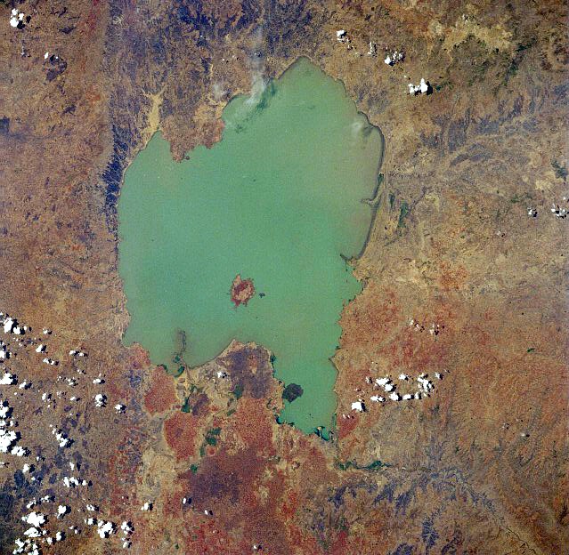
Lake Tana is the source of the Blue Nile, and the largest lake in Ethiopia, and is a sacred lake.
It has been a registered UNESCO Biosphere Reserve Site since 2015, along with its seven ancient monasteries, like the main monastery of Narga Selassie on Lake Tana’s Dek Island.
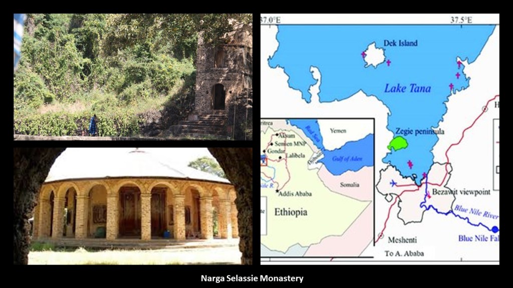
Among other things, the heart-shaped Lake Tana has living traditions about being a place where Joseph, Mary, and Jesus stayed on their way back to Israel after fleeing Herod, and also as a place where the Ark of the Covenant was kept for 800 years before going to Axum, where it is said to currently be located.
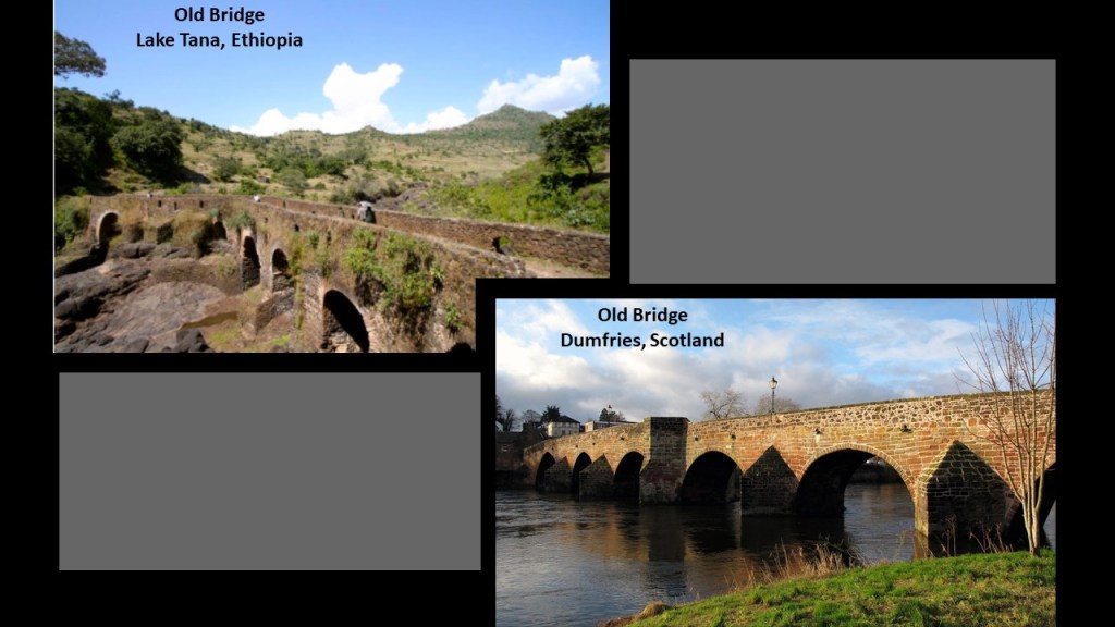
This photo is a comparison for similarity of appearance of an old bridge near Lake Tana on the top left, with the River Nith Old Bridge, one of the oldest standing bridges in Scotland, in Dumfries, on the bottom right.
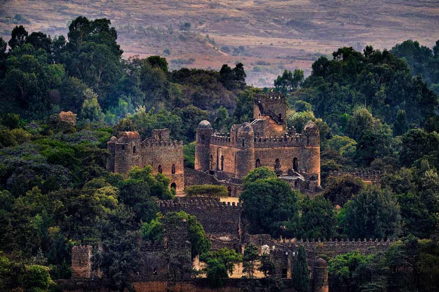
Next, Gondar.
Gondar was the royal city of Ethiopia.
Today it is a UNESCO World Heritage Site.
It was the capital of the historic Ethiopian Empire and we are told the Imperial Seat from the 1200s to the 1900s.
The Fasil Ghebbi, nicknamed the “Camelot of Ethiopia,” was the home of Ethiopia’s Emperors in our historical narrative from the 17th-century to the 20th-century.
The Solomonic dynasty, also known as the House of Solomon, was the former ruling dynasty of the Ethiopian Empire.
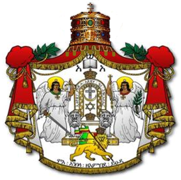
Its members were lineal descendants of King Solomon and the Queen of Sheba through their son Menelik I, the first Emperor of Ethiopia.
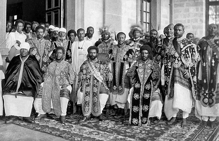
Haile Selassie was the last Emperor of Ethiopia from 1930 to 1974.
The full title traditionally of the Emperors of Ethiopia was: “Elect of God, Conquering Lion of the Tribe of Judah and King of Kings of Ethiopia.”

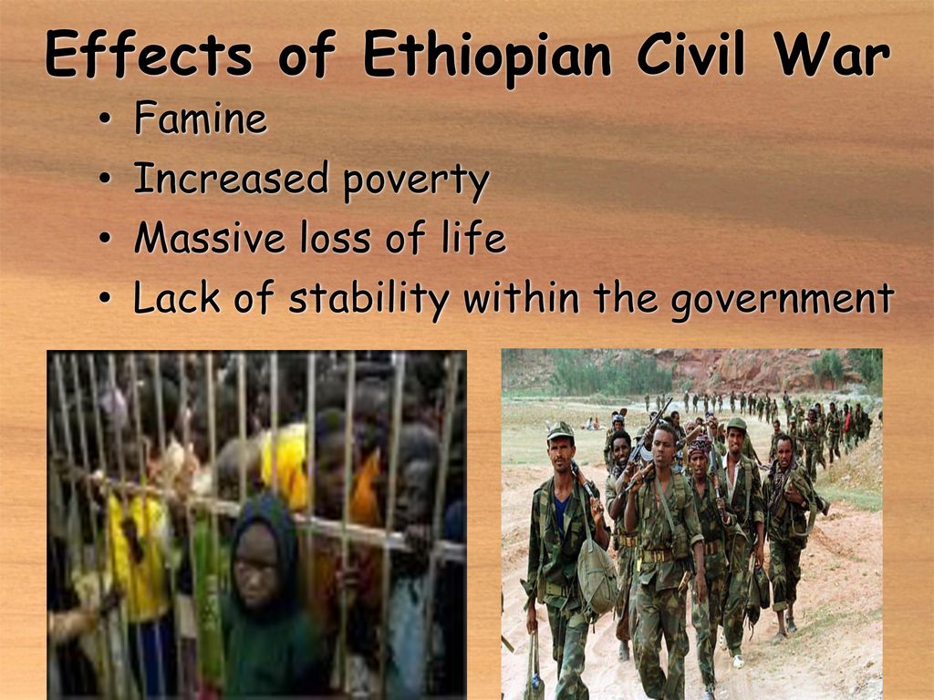
The overthrow of the Ethiopian Emperor Haile Selassie took place on September 12th of 1974, in a coup initiated by a Marxist-Leninist factions in the military, and marked the beginning of a 17-year-long Ethiopian Civil War, which formally ended in 1991.
The war left at least 1.4 million dead.
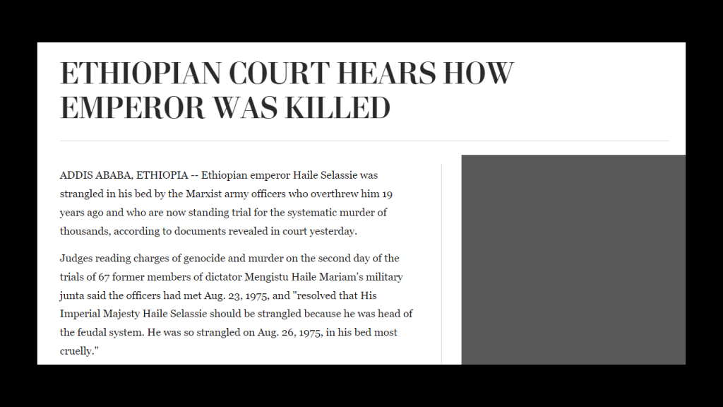
The last Ethiopian Emperor was apparently murdered in August of 1975 by the same Marxist Army officers who had overthrown him the year before.
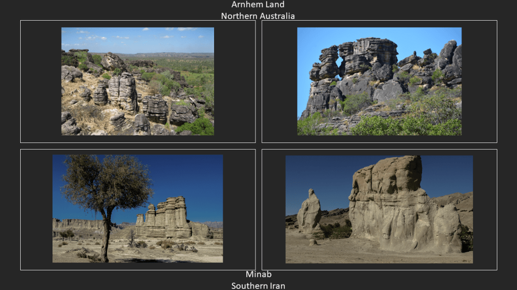
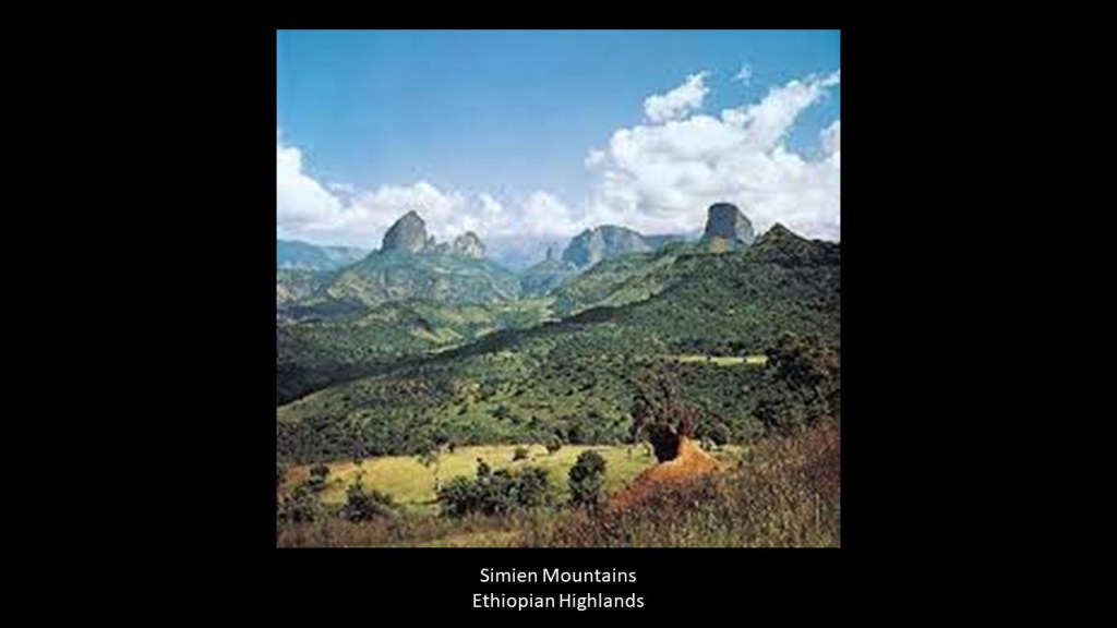
The Simien Mountains, also a UNESCO World Heritage Site, since 1978, are located between the royal city of Gondar and Aksum.
Designated as a National Park in 1966, it is Ethiopia’s largest national park.
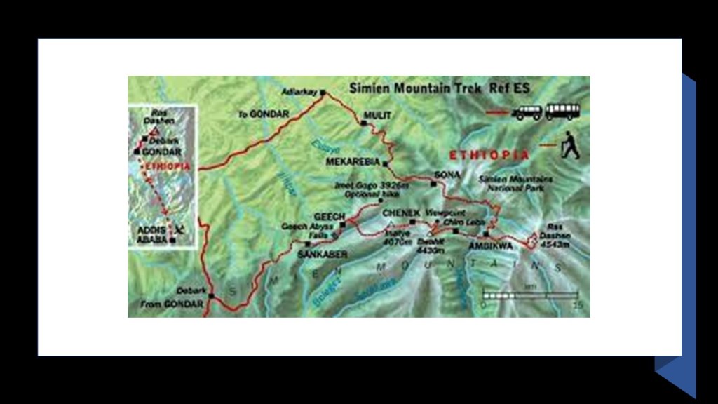
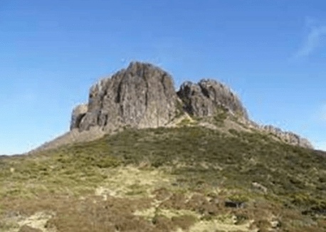
The Simien Mountains are described as plateaus separated by valleys and rising to pinnacles.
Said to be of volcanic origin and formed from basaltic lava outpourings between 40- to 25-million years ago, prior to the creation of the Great Rift Valley.
Again, just wondering what we are really looking at here.
They look like more candidates for giant tree stumps!
Next, we come to Aksum, the holiest city in Ethiopia, and a UNESCO World Heritage Site since 1980.
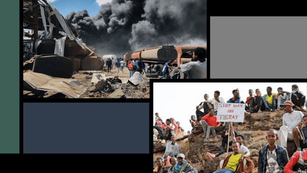
It is in the Tigray National Regional State.
Between 2020 and 2022, the Tigray War took place between the Ethiopian Federal Government and the Tigray People’s Liberation Front, during the course of which infrastructure was destroyed, and many war crimes were commited, including mass extrajudicial killings of civilians took place throughout the region, including Aksum.
The conflict in Tigray led to major humanitarian crises, widespread famine, and severe economic damage to the tune of an estimated $20-billion.
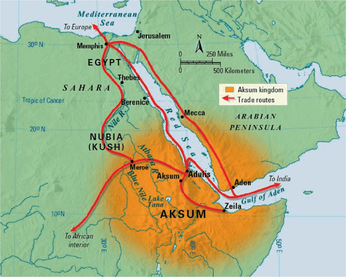
Aksum was the capital of the historic Kingdom of Aksum, a naval and trading power that ruled the whole region as well as parts of what is now Saudi Arabia, and Yemen
There are a couple of noteworthy things to mentioned about the ancient city of Aksum.
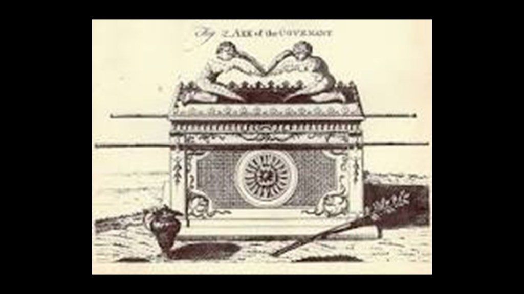
The first is that it is believed to be the home of the Ark of the Covenant at the Saint Mary of Zion Church, and that the Tablets of Stone upon which the Ten Commandments were inscribed lay inside the Ark.
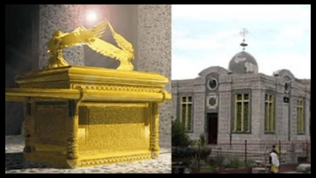
The Ark is closely guarded by one custodian known as the “Keeper of the Ark,” who is the only person allowed to enter the resting chamber of the Ark.
The keeper is appointed for life and can’t leave the sacred grounds until death.
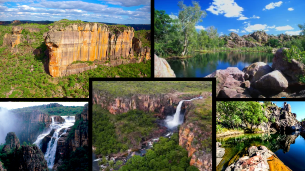
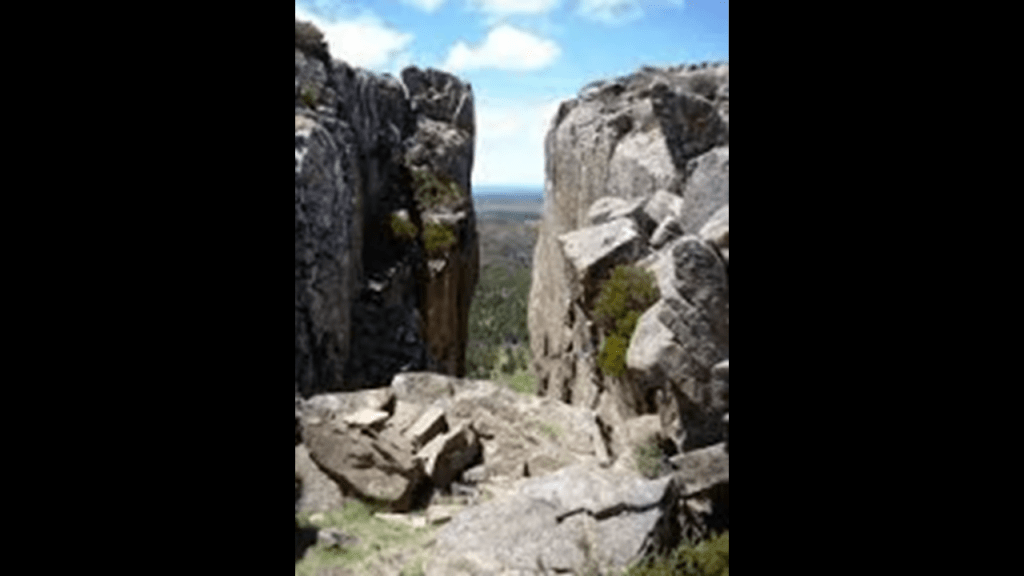
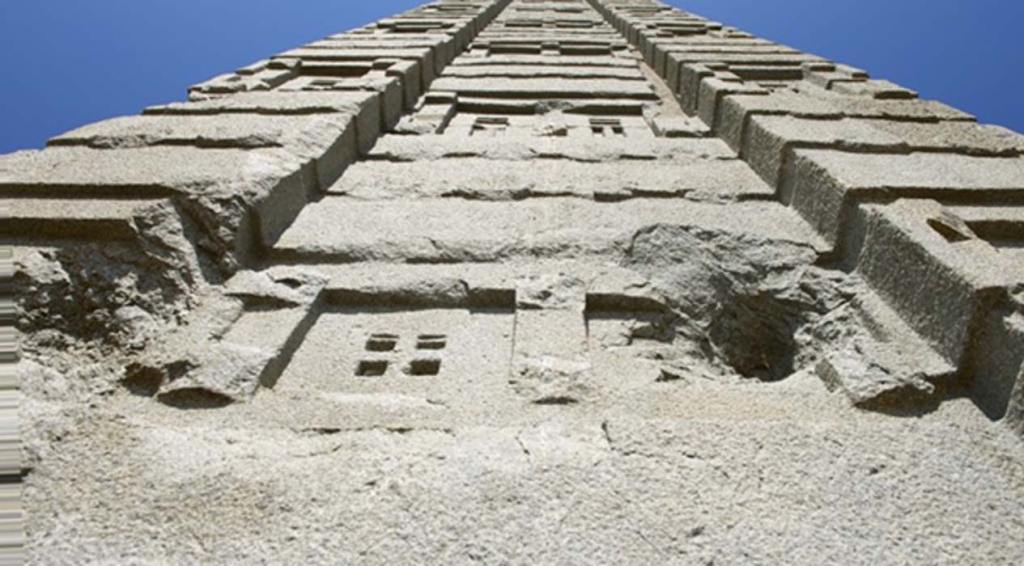
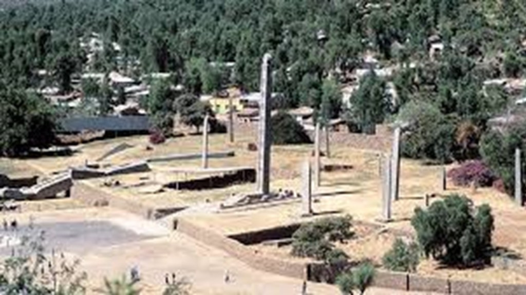
The next thing that I want to point out is the Northern Stelae Field, or Park, in Aksum.
There are 120 stelae here, each made from a single piece of granite, and standing as high as 82-feet, or 25-meters.
Each stela looks like a building, with intricately carved windows, marked stories, and false doors at the bottom.
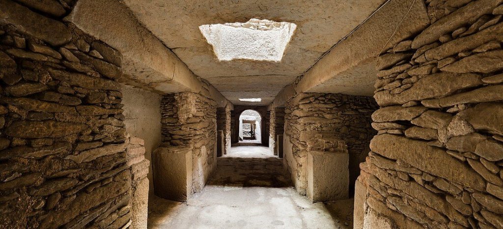
These stelae are attributed to having been made as funeral monuments for Aksum’s ancient rulers…
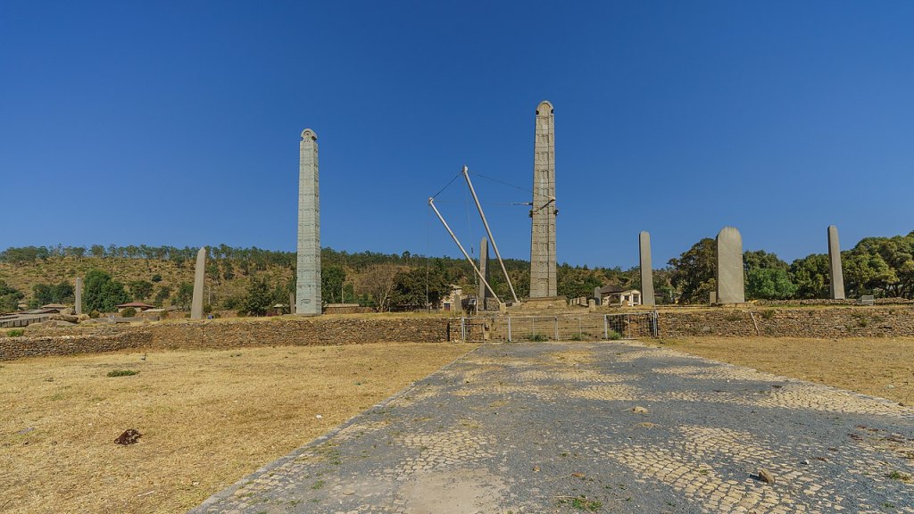
…who were believed to have been buried in tombs beneath the Stelae.
The Great Stela was 108-feet, or 33-meters, -tall, and weighed 573 tons, or 520 metric tons.
This was an explanation I found for what happened to the Great Stela, pictured here.
It was likely the largest monolith humans ever attempted to erect, and that it probably fell down when the attempt was made to erect it.
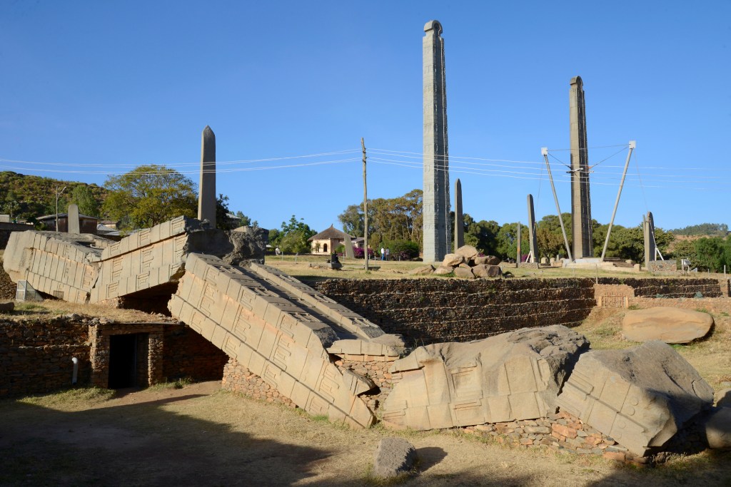
There’s more than one fallen stela here.
This one that was 29-feet, 9-meters, tall.
What are we actually seeing here with multi-ton monolithic, intricately-carved stelae made from single pieces of granite, with some having fallen, and even broken into pieces, and an partially-above-ground and mostly underground building beneath them?
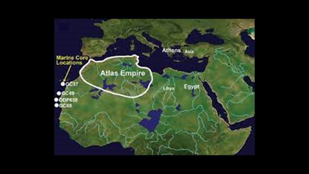
This is a good place to mention that Aksum was one of the twelve primary nodal points of the Earth’s Grid system.
A nodal point is a place where numerous leylines connect.
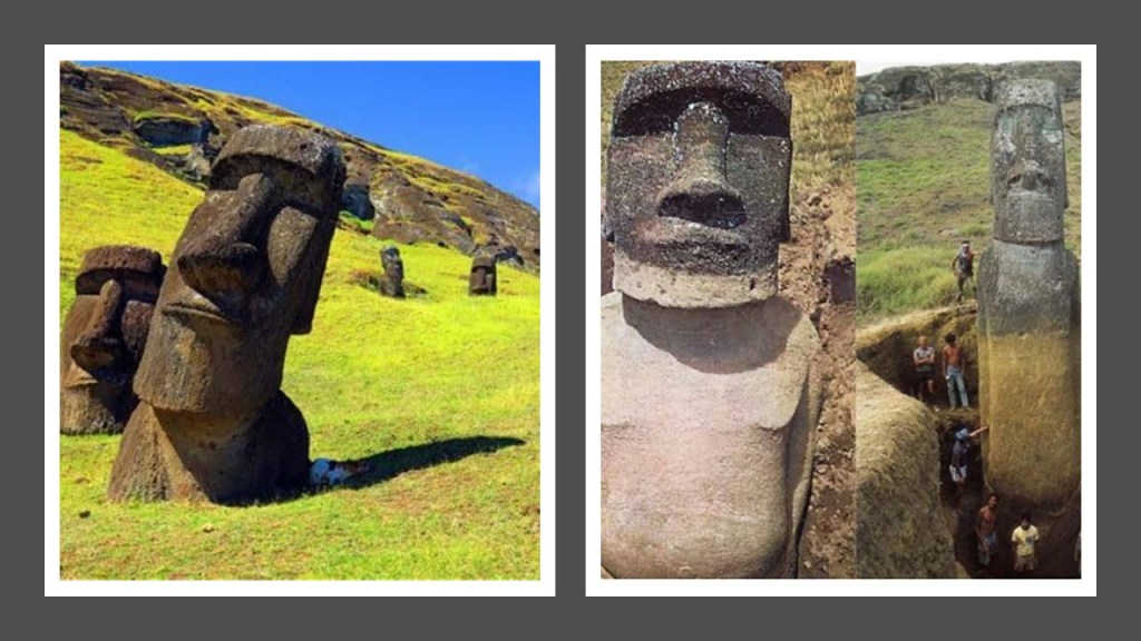
Other nodal points include Rapa Nui, best known as Easter Island, where the famous heads were discovered to have bodies…
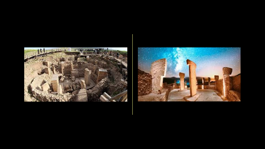
And Gobekli Tepe in Turkey, said to have the world’s oldest stone megaliths dating back to at least 9500 BC, and the excavation of which started in 1995.
It was first noted in a survey in 1963, and the site was said to have been intentionally backfilled with earth when it was mysteriously abandoned in 8000 BC.
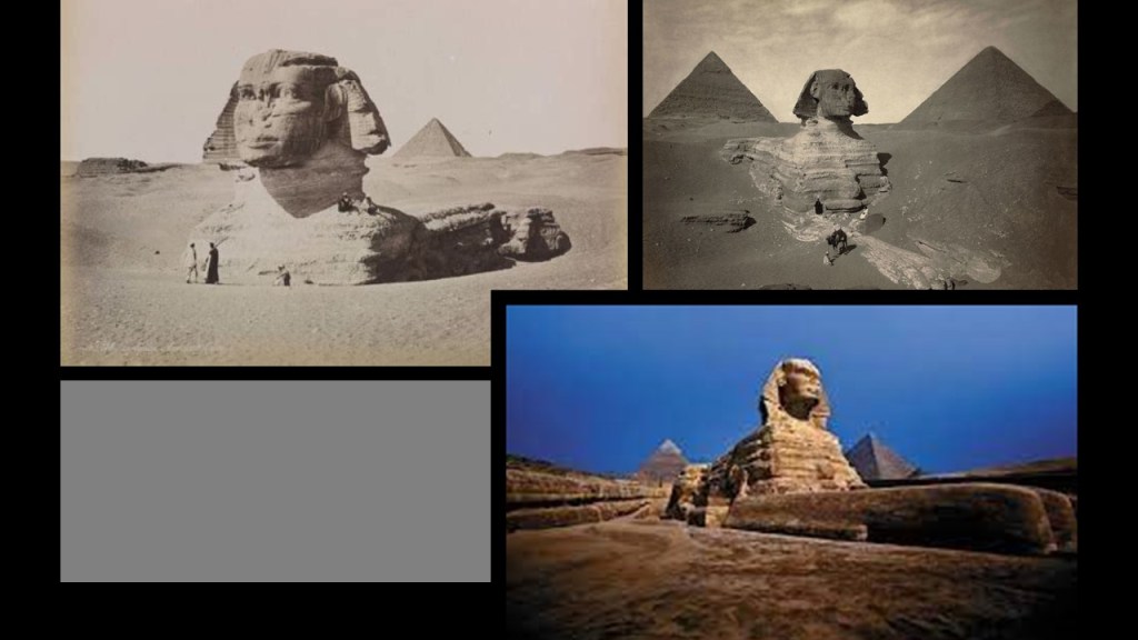
Another example of being covered by earth was the Sphinx on the Giza Plateau in Egypt, just to the northwest of today’s Ethiopia.
It was covered up to its shoulders, as seen in this famous painting of Napoleon Bonaparte before the Sphinx.
The rise of Napoleon starting in 1796, and the Napoleonic Wars between 1799 and 1815, seem to mark a major beginning in the new, reset timeline.
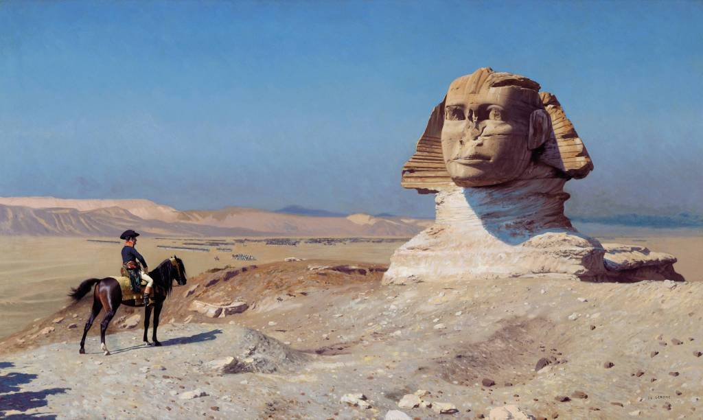
So even the Sphinx needed to be dug out from the sand that surrounded it.
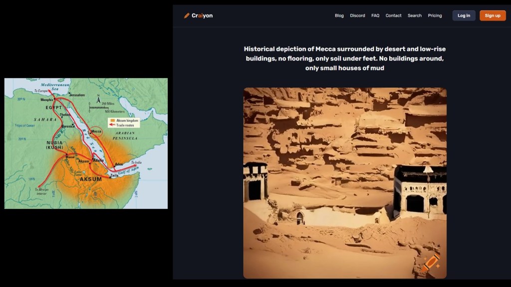
And according this map of the historical Kingdom of Aksum, Mecca on the Red Sea in today’s Saudi Arabia was once part of it.
And historical photos of Mecca show the same situation of being surrounded by desert, “low-rise” buildings, no floors, just soil underneath everything.
I believe there was deliberately-caused, sudden cataclysmic event of directed energy that went through the Earth’s entire grid system, causing the entire surface of the Earth to undulate and rip, creating deserts, swamps, and causing land-masses to shear off and submerge based on what I am finding and seeing., and accounts for how a highly advanced worldwide civilization of giants could be wiped from the face of the Earth and erased from our collective memory.
Historical photos that are available to find on the internet provide evidence that buildings, canals, and rail-lines, among other things, had to be dug out so they could be used once again…
…so the Controllers could usher in their New World Order on the ruins of the Old World, one based on power over Humanity and the Earth’s resources, and they imposed their control matrix over the world through the Earth’s grid system that they had removed from collective awareness.

Before I move back to the Gulf of Aden and tracking the Amsterdam Island Circle Alignment, I just want to say there is clearly something of great historical importance to this region that has been lost to us and it has been destroyed in every way possible, with great suffering and misery happening to this day.
Knowledge of great value has been taken from Humanity that is exemplified through this region, with it’s biblical and historical importance.
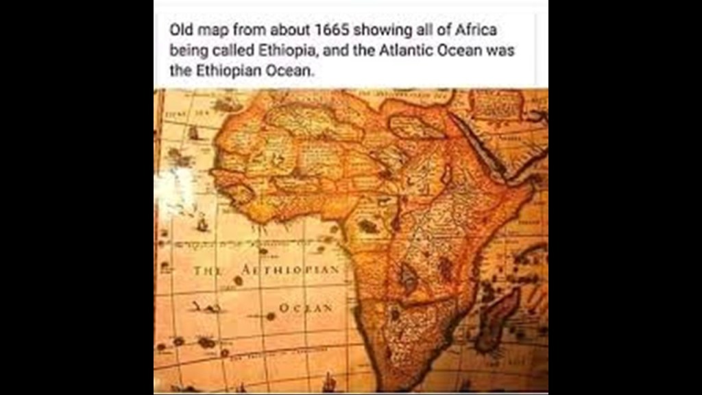
Even old maps of Africa tell a different story than what we have been told!
What’s going on here?!
So, now back to the Gulf of Aden.
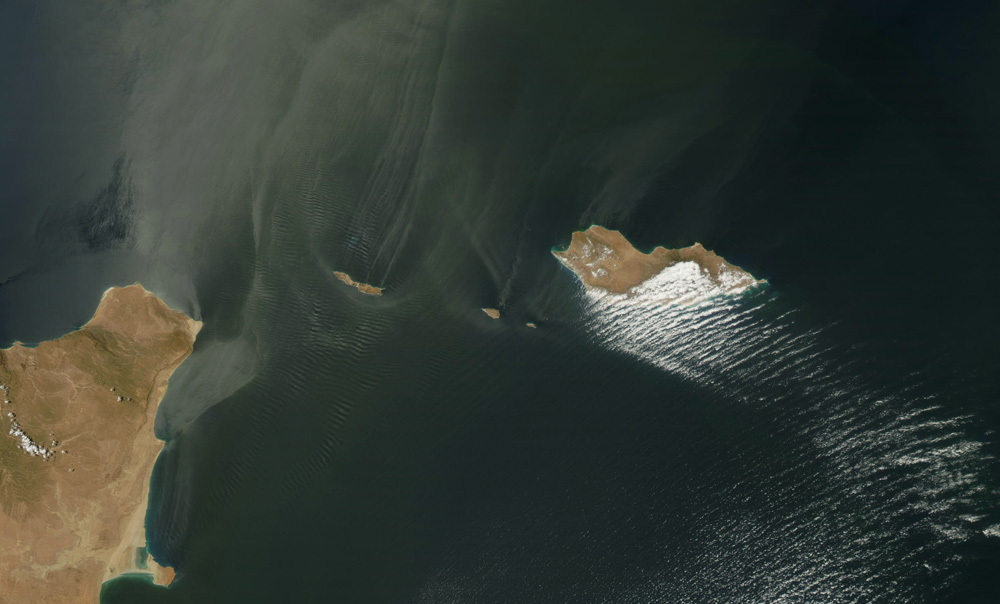
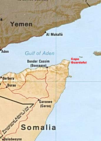
On the other side of the Gulf of Aden from where we have been looking in South Arabia and east Africa is the Guardafui Channel.
It is between the Socotra Archipelago and Cape Guardafui.
It connects the Gulf of Aden with the Indian Ocean.
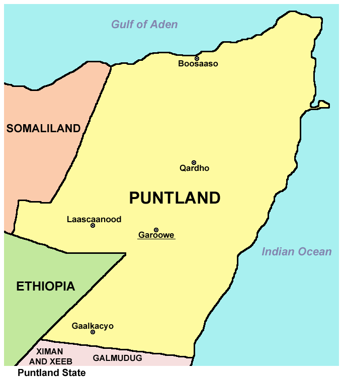
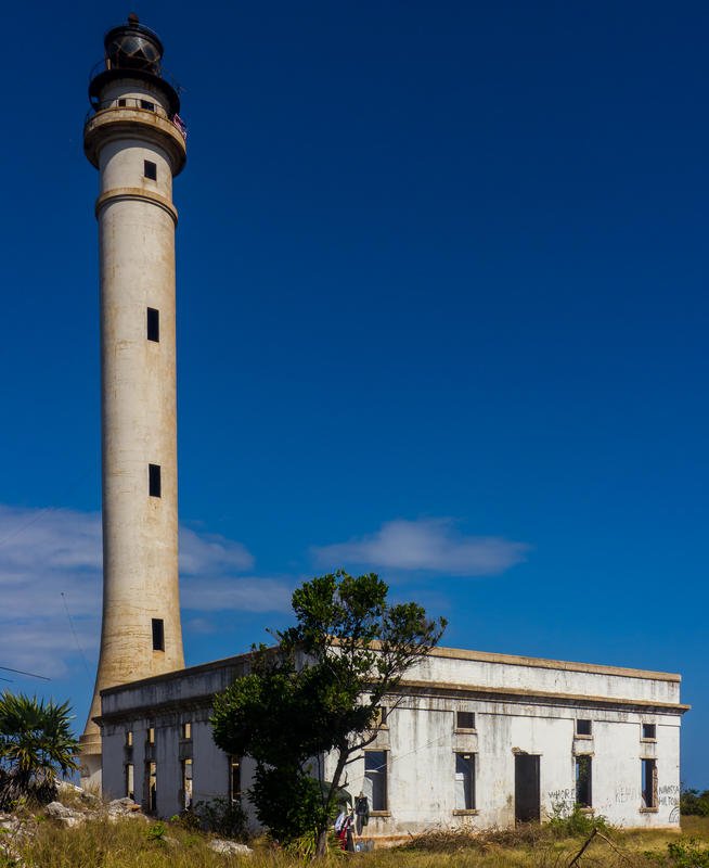
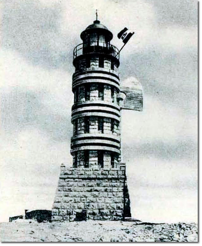
It was named for Cape Guardafui, also known as Ras Asir, which is a headland in the Guardafui Administrative Province of Puntland in Somalia.
The Cape Guardafui lighthouse was said to have been inaugurated in 1930 by Italian Fascist authorities when it was part of Italian Somaliland.
By 1930, the authorities were part of Fascist Italy, which existed under Mussolini’s totalitarian rule as Prime Minister and Dictator between 1922 and 1943.
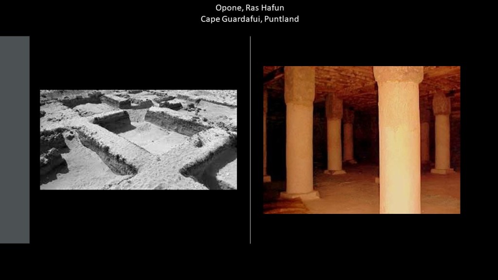
Ras Hafun juts out into the Guardafui Channel, and is considered the easternmost point in Africa.
Ras Hafun has numerous ruins and structures, and it was believed to be the location of Opone, an old trading emporium serving seemingly the whole world – Africa, Asia, Greece, Rome, and Indonesia, among other places.
It was also known as the center of the world’s spice trade.
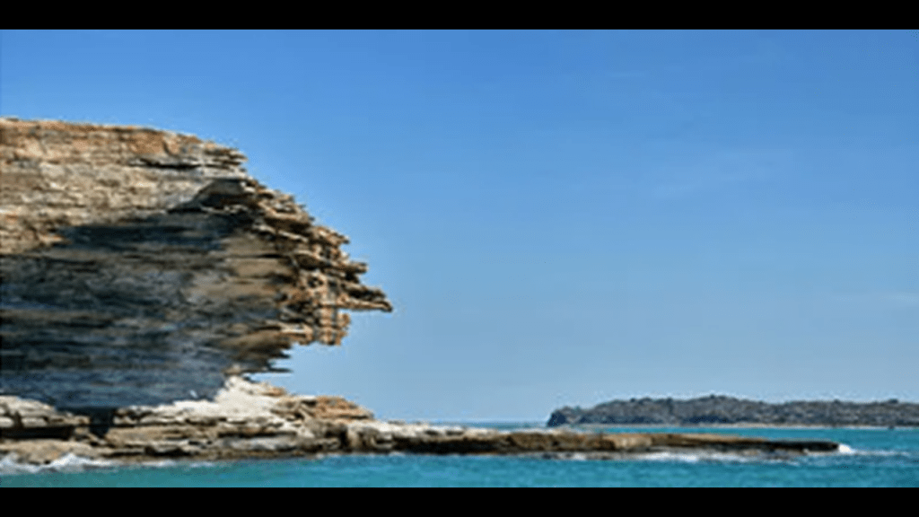
Ras Filuk, also known as “Cape Elephant,” is a headland next to the Guardafui Channel.
It has steep cliff walls that jut into the Gulf of Aden.
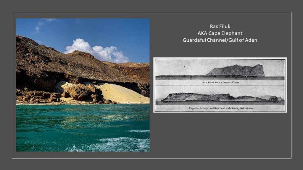
Ras Filuk is near Alula, the capital of the Bari Region of Puntland.
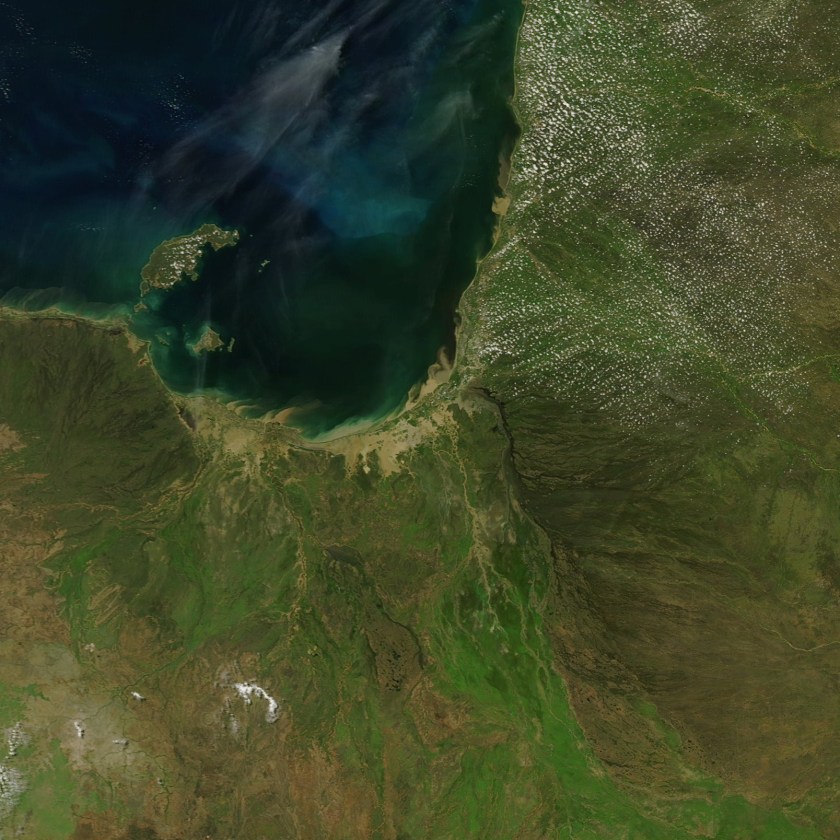
Alula is situated next a shallow lagoon lined by mangroves, a type of tree that grows in brackish water.
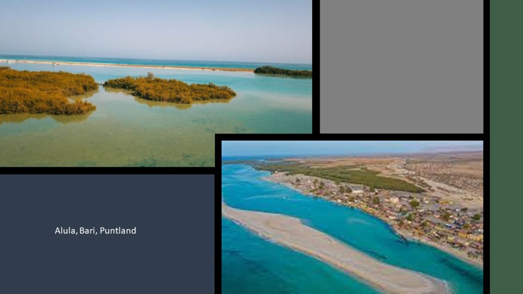
Here is a picture of mangroves covering the coast of this area by Alula on Google Earth.

Mangrove swamps are coastal wetlands characterized by these salt loving trees and shrubs that are typically found in estuaries, where salt water meets freshwater.
So Estuaries have water that is salty, dirty & unpleasant, and there are one or more rivers flowing into it, and a connection to the open sea.

I have been speculating for awhile now from my research that the Earth’s estuaries are actually ruined and sunken land that once had the infrastructure of civilization in it.
One example of this research is found in this blog post.
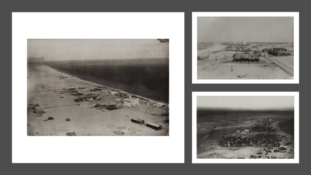
These are photos from the 1920s of Alula with the same sand-covered appearance as the other places we have been looking it.
But was it always like this?
Our historical narrative sure wants us to believe it was!
Just as an interesting side-note, this region even today produces 1.5-million kilograms per year of different types of frankincense, an aromatic resin used in incense, perfumes, and essential oils, obtained from Boswellia trees.
Medicinal properties of frankincense include anti-inflammatory and anti-tumor properties.
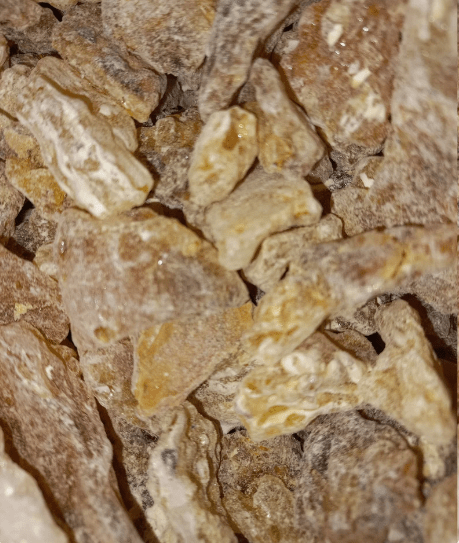
Cape Guardafui was known as “Aromata,” or the cape of spice, due to the abundance of spices it produced, including frankincense, cinnamon, and indian spices.

A word about the spice trade.
Since ancient times, the spice trade has been worth great amounts of money.
The growing of the rarest spices was exactly in this region where we have been looking in southern Arabia and Africa.
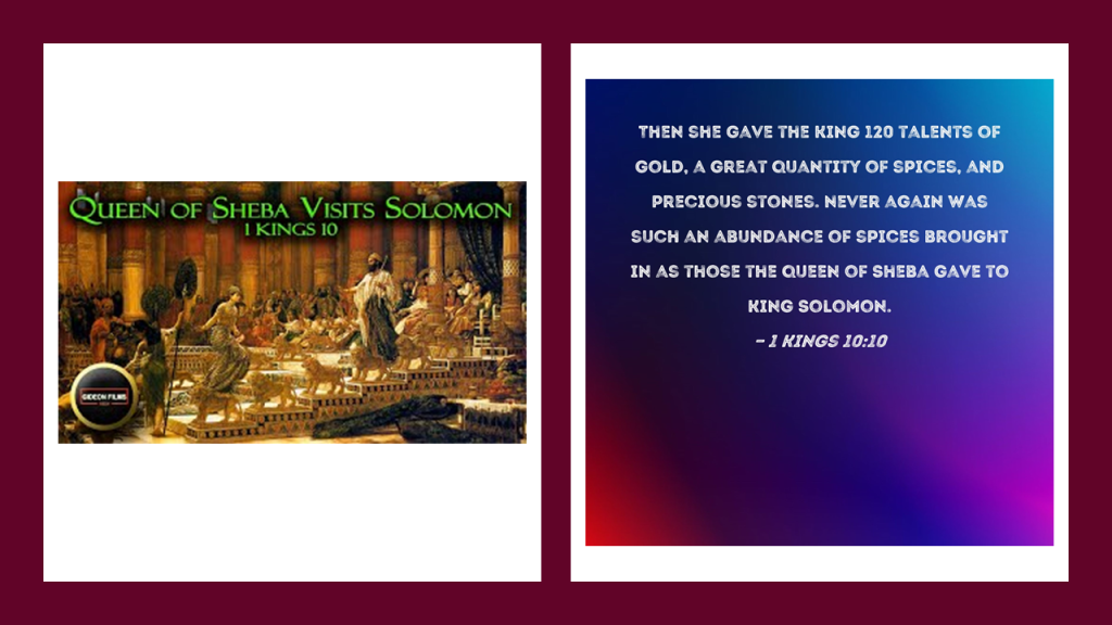
In First Kings, Chapter 10, verse 10, we find the Queen of Sheba giving King Solomon gold talents and an abundance of spices.
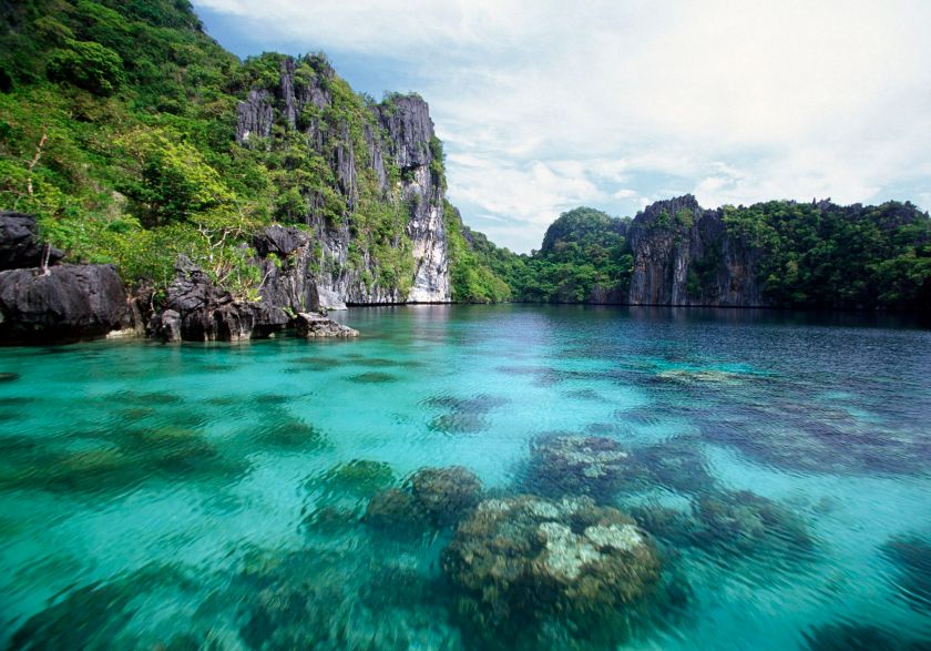
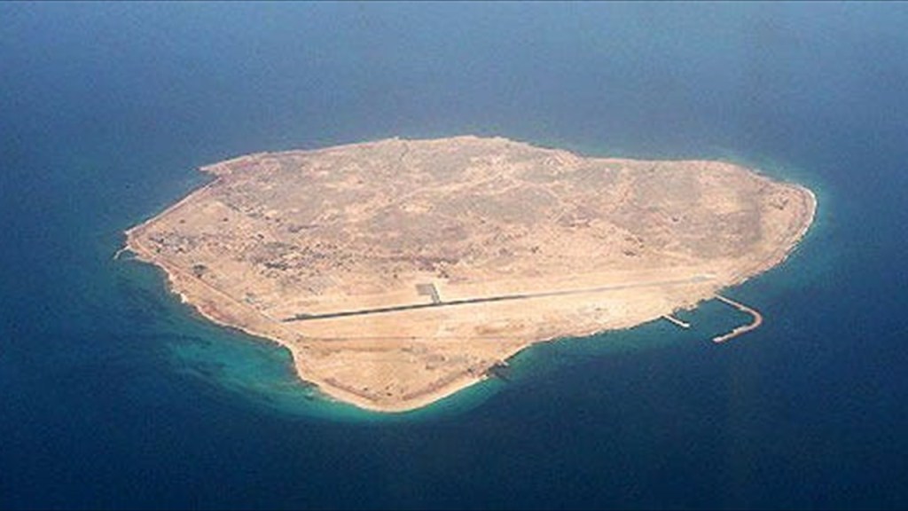
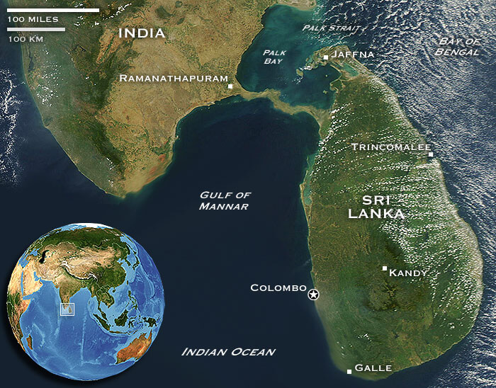
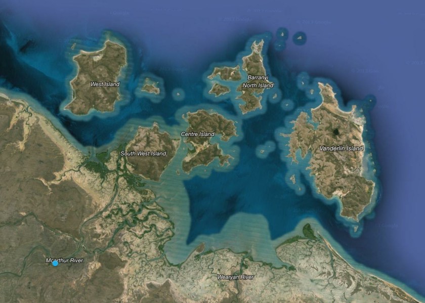
On the other side of the Guardafui Channel, we find the Socotra Archipelago, which is officially part of Yemen, with Socotra being the largest island.
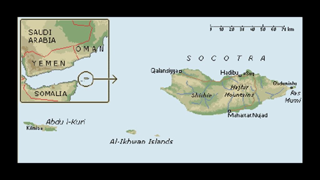
I first learned about Socotra several years ago when I watched a travel video about it that popped up as a YouTube recommendation for me. I looked more into it at the time. Otherwise I would never have heard of it before.
A UNESCO World Heritage Site since 2008, it is considered of universal importance because of its rich and distinct flora and fauna, most of which are found nowhere else. It has also been called the most alien place on earth.
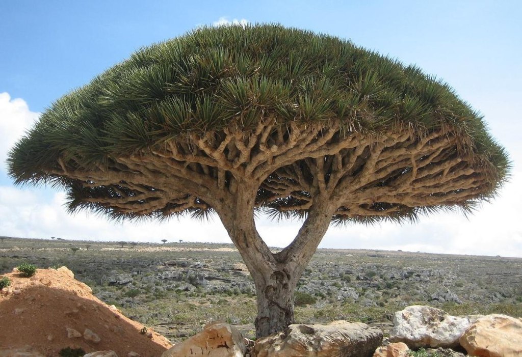
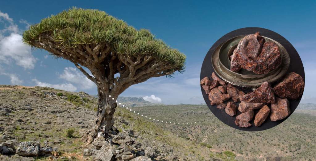
These are the Dragon’s Blood Trees of Socotra, the only place in the world they are found.
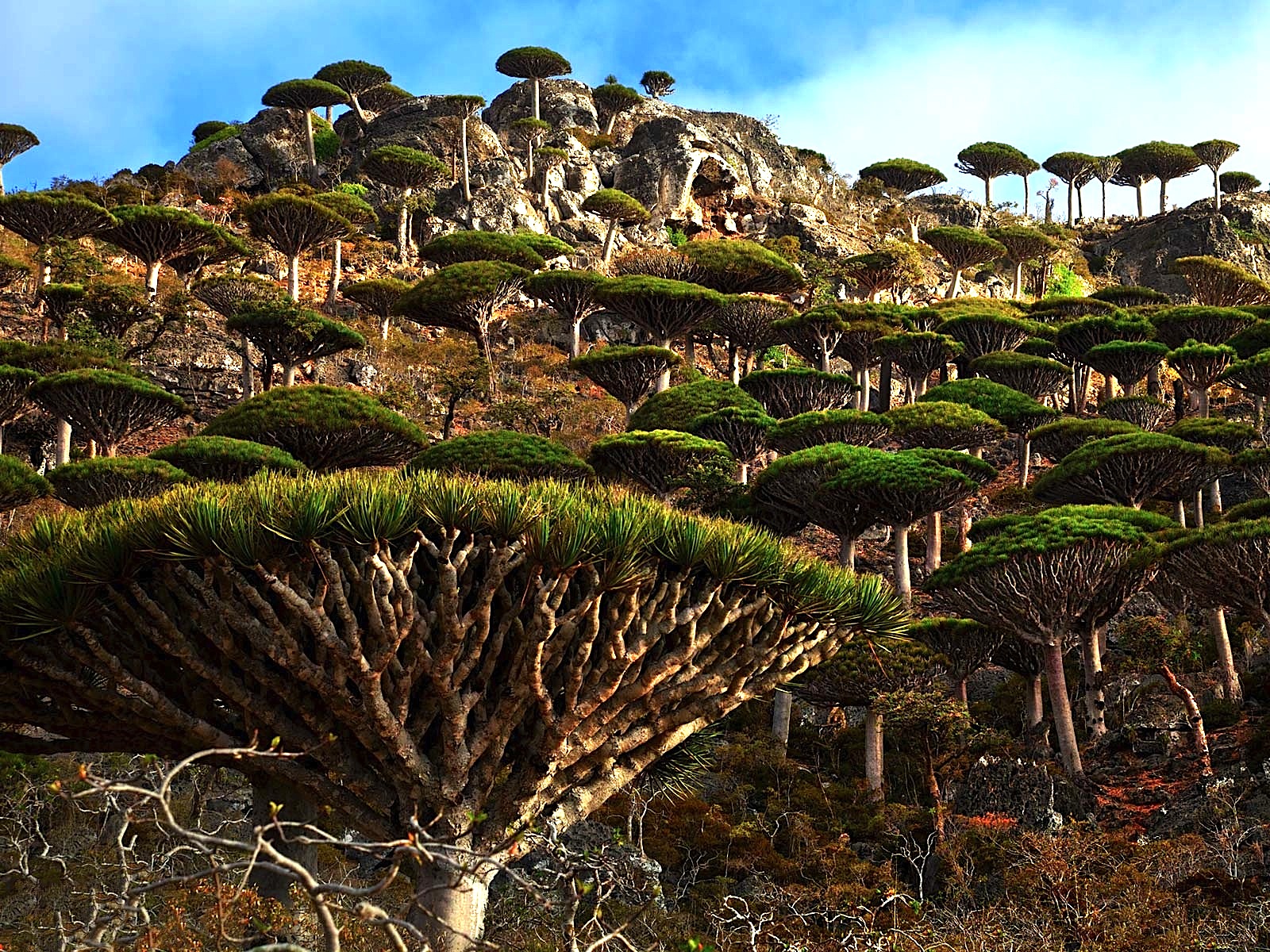
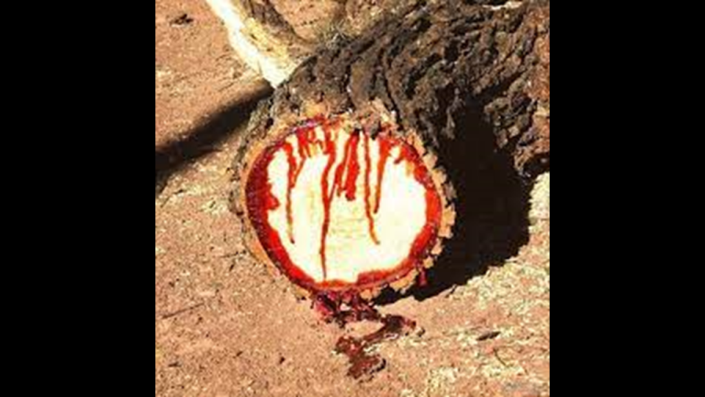
It has a dark-red resin, giving this evergreen type of tree its name.
Considered a vulnerable species, they can grow to 30-feet, or 9-meters, in height, and live for 600-years.
Dragon’s blood resin is used for things like dyes, incense, and medicine.
It’s medicinal properties include wound healing and digestion, among many others.
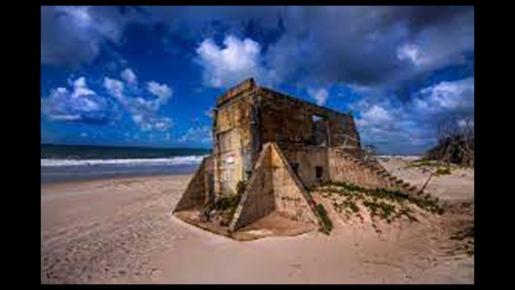
There are more anomalous things find in the Guardafui Channel islands, and about the Gulf of Aden, but I think I will move along, and leave you with this picture and caption concerning the Gulf of Aden if you wish to research its validity for yourself.
Just saying this is out there.
Personally, it wouldn’t surprise me if this is truth.
As we are seeing, there is so much we haven’t been told about the world we live in, and that is actively kept from our awareness on an on-going basis.
Now back to the Amsterdam Island alignment after this long tangent looking at an overlooked part of the world, yet with tremendous historical importance which has been forgotten and debased in modern times.
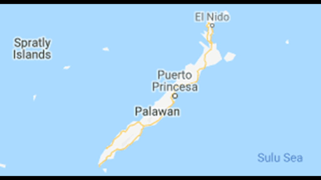
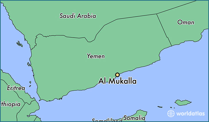
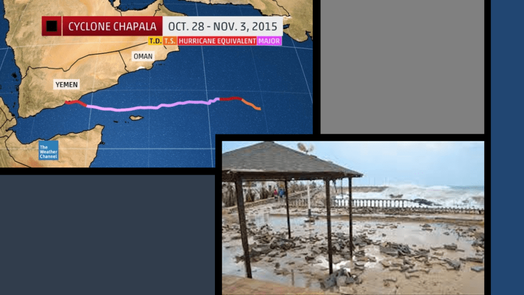
Leaving Berbera in Somaliland on the alignment, we come to Mukalla, port city on the Gulf of Aden in Yemen.
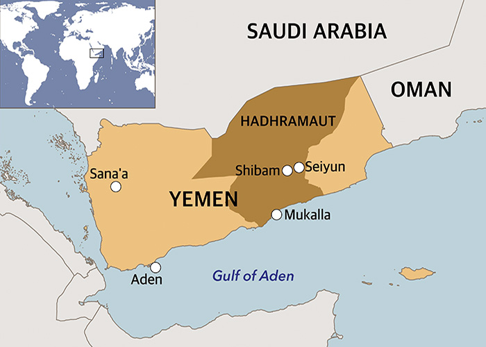
Also called Al-Mukalla and Mukalia, it is the capital of Yemen’s Hadhramaut Governate.
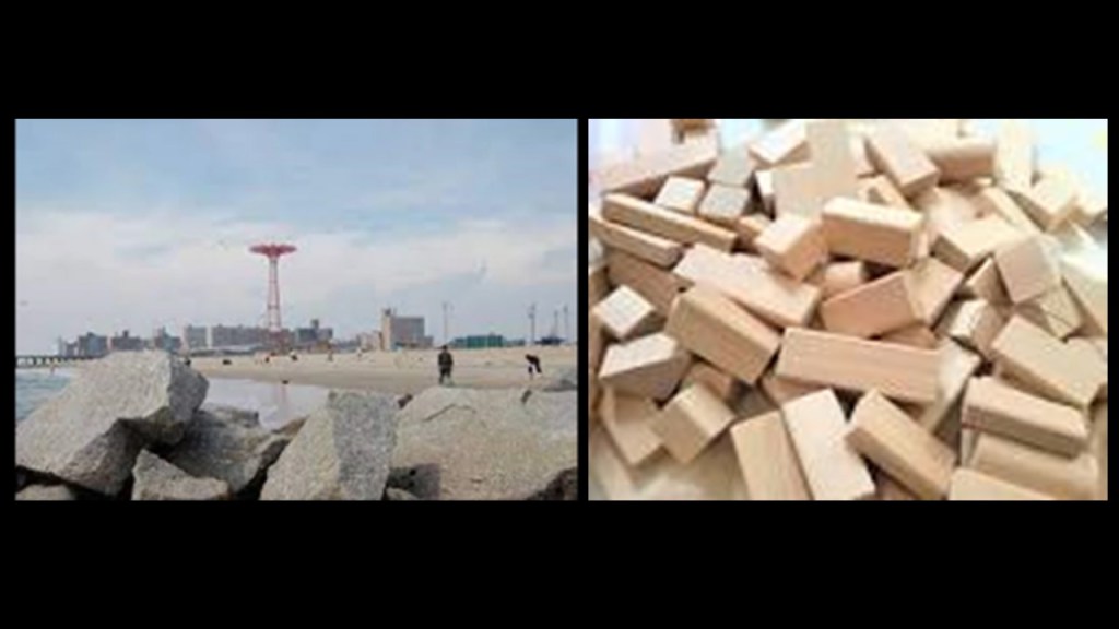
This is a view of the Mukalla waterfront, with block-shaped rocks in the foreground compared with the block-shaped rocks seen at Lake Chapala near Colima, Mexico, a place I found tracking a different alignment.
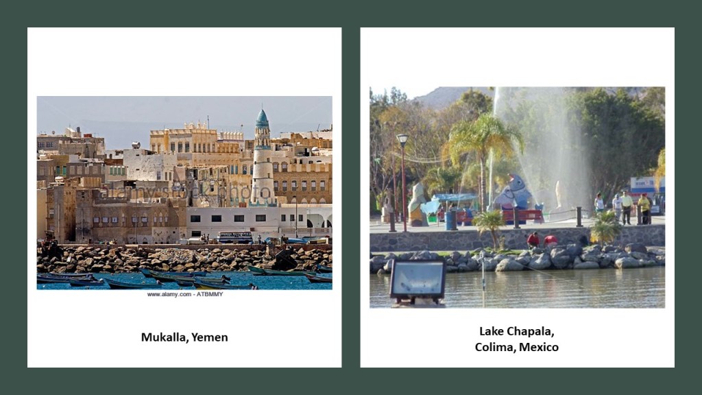
Interesting to find out that a cyclone named “Chapala” destroyed Mukalla’s waterfront in 2015.
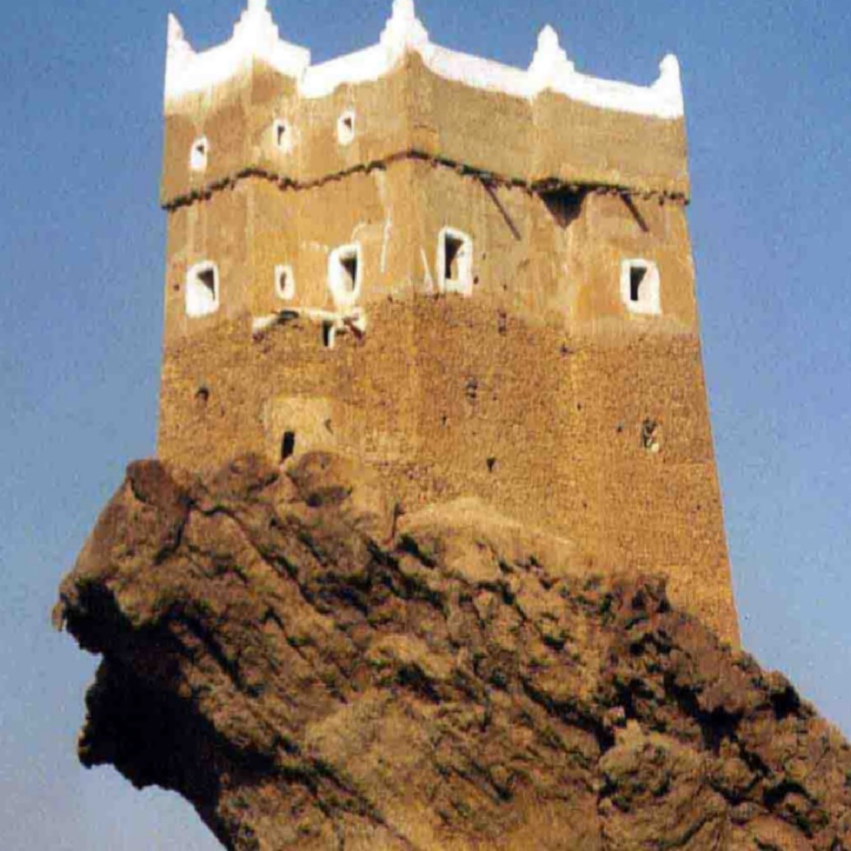
I found this photo of what is called one of the oldest houses in Mukalla.
Quite an interesting place to build a house.
Mukalla was connected to the historical port of Qana, which was the main Hadhrami trading post between India and Africa.
Incense fields were to the north of here in an area, which were also harvested for trade.
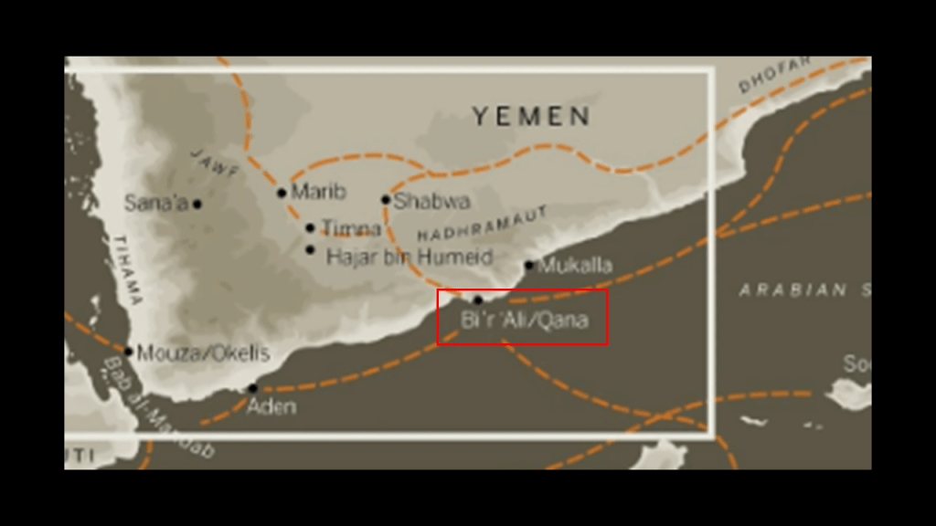
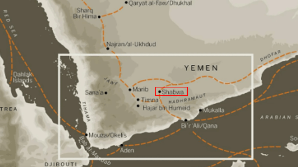
The historic capital of Hadhramaut was Shabwa along the Nabataean “Incense Trade Route,” an ancient network of major land and sea trading routes linking the world with eastern and southern sources of incense, spices and other luxury Goods.
The Hadhrami people had in their culture a tradition of sea-faring and trading.
The Nabataeans were an ancient people who inhabited the Arabian Peninsula, who were characterized as being nomadic Bedouins who moved from place to place but also were skilled in trade as well.
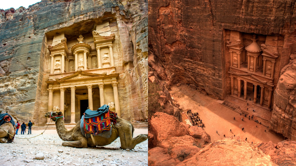
Interestingly, rock-cut Petra in today’s Jordan was the capital of their nomadic kingdom, and was said to be a regional trading hub for them.
Shibam is located slightly northeast from Mukalla, and is also on the alignment.
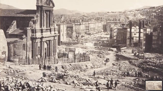
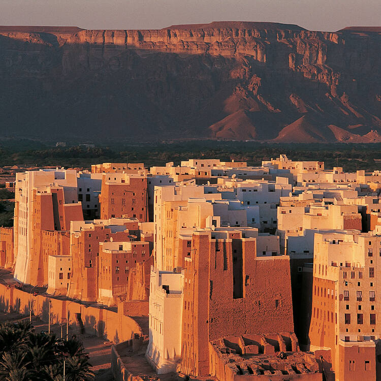
The Old Walled City of Shibam, a UNESCO World Heritage Site, on the cliff-edge of Wadi Hadhramaut near Mukalla built from mud bricks has been described as the “‘Chicago’ or ‘Manhattan’ of the Desert.”
It is said to be the oldest city in the world using vertical construction techniques, and, like Shabwa, was also a stop on the ancient incense trading route.
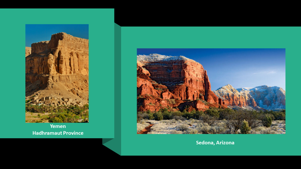
This is a photograph of the massive canyon at Wadi Leysar also in the Hadhramaut Province of Yemen, on the left, and it reminded me in appearance of Courthouse Butte in Sedona, Arizona, on the right.
Hadharem, or Hadhrami. is the name of the historic people of the Hadhramaut region.
They are also in diaspora, living in scattered places around the world.
At one time their presence and influence throughout in the Horn of Africa region was significant.
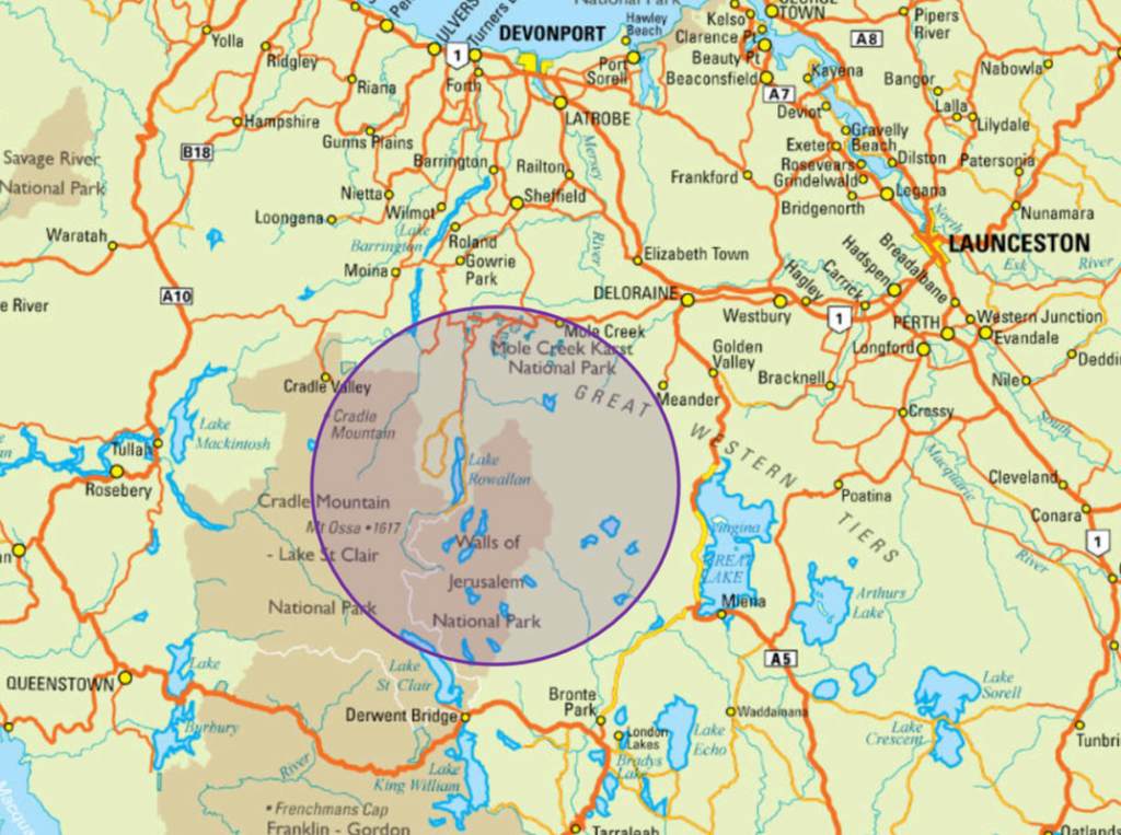
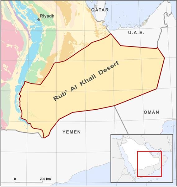
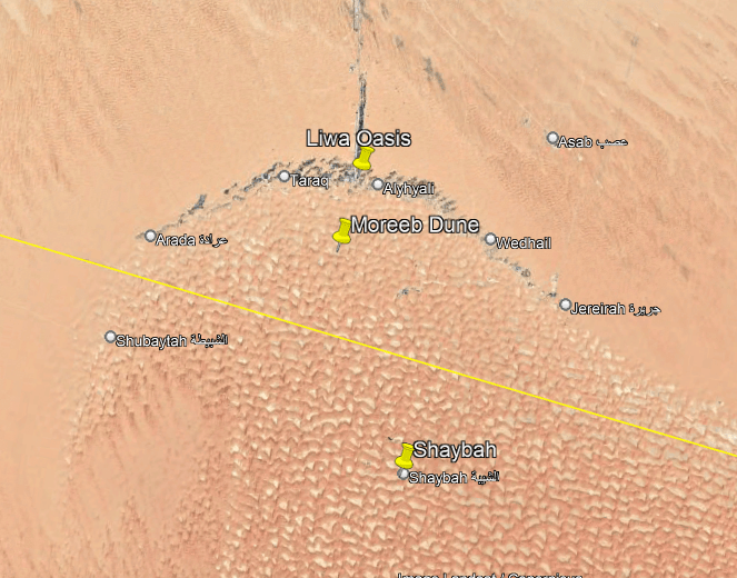
Next the alignment crosses the Rub Al Khali, otherwise known as the Empty Quarter.
It is the largest desert in the world.
It encompasses most of the southern third of the Arabian peninsula.
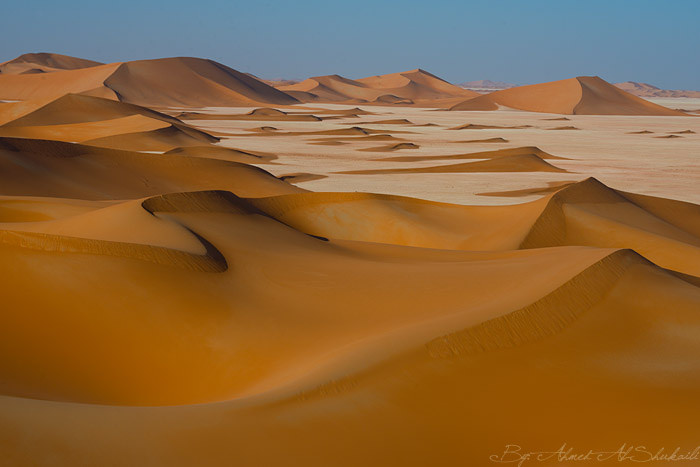
A recent Saudi Arabian Minister of Petroleum and Mineral Resources, Ali Al-Naimi, reported that the dunes don’t drift – that while sand blows off the surfaces, their essential shape remains intact.

I would not be surprised at all to learn that there is enduring infrastructure underneath all that sand!
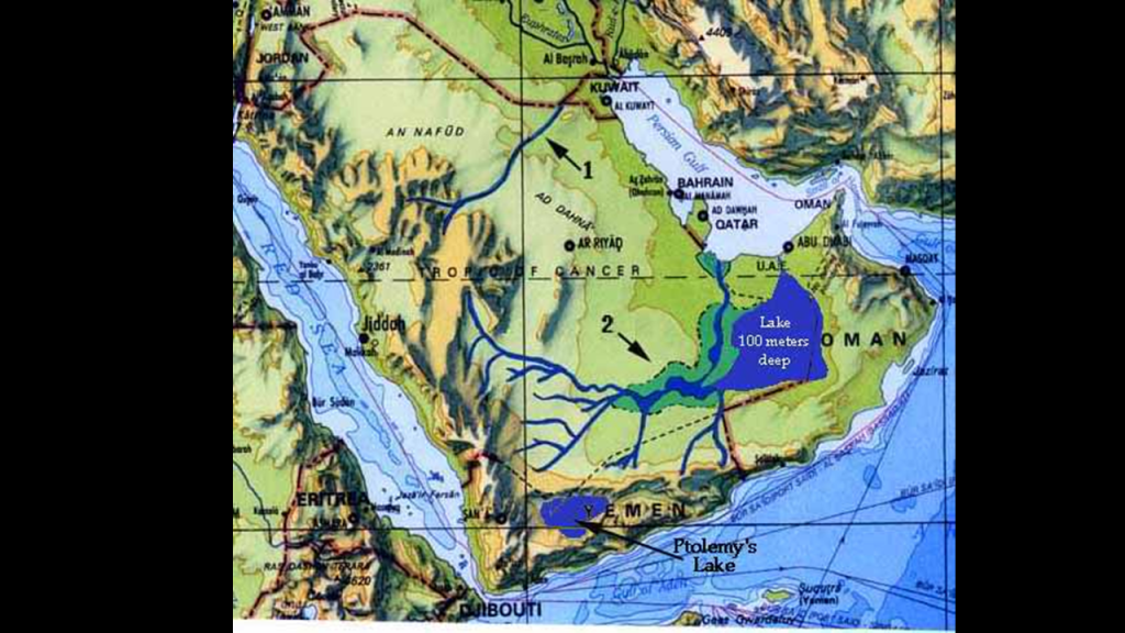
The Empty Quarter has been determined to have what would have been the third-largest lake in the world and one of the longest rivers in the world, whose flow would have rivalled the Nile River in Egypt or the Amazon River in South America.
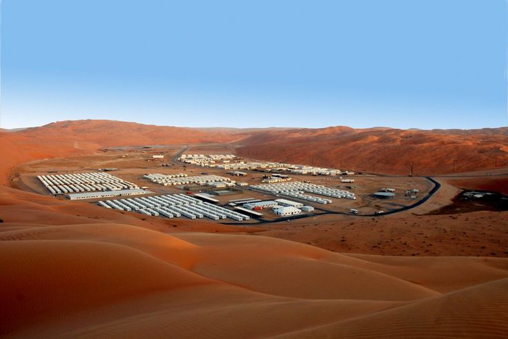
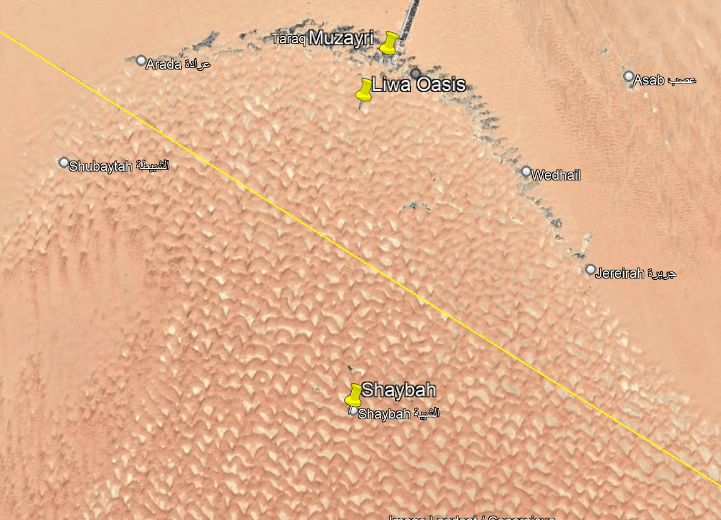
The Shaybah Oil field was discovered in 1968, 25-miles, or 40-kilometers, from the northern edge of the Empty Quarter.
As of May of 2014, it was projected to be able to pump 750,000 barrels/day for the next 70-years.
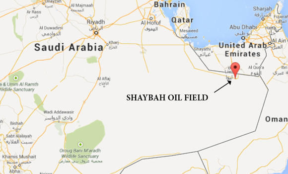
The Shaybah Oil Field is considered to be one of the most prominent landmarks in the Empty Quarter, and is surrounded by a series of giant, semicircular sand dunes, some of which are 984-feet, or 300-meters, high.
The Incense Trade made its way through this region, and it has been suggested that the lost city of “Iram of the Pillars” depended on such trade.
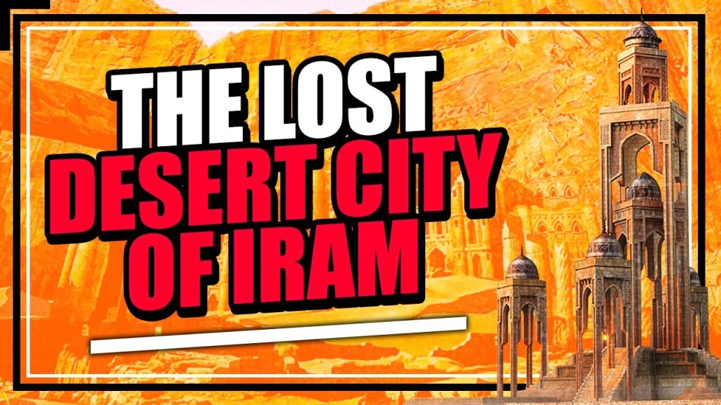
Its location has been searched for over the years and no place has never been conclusively identified as such.
It intriguingly has the nickname of “Atlantis of the Sands.”
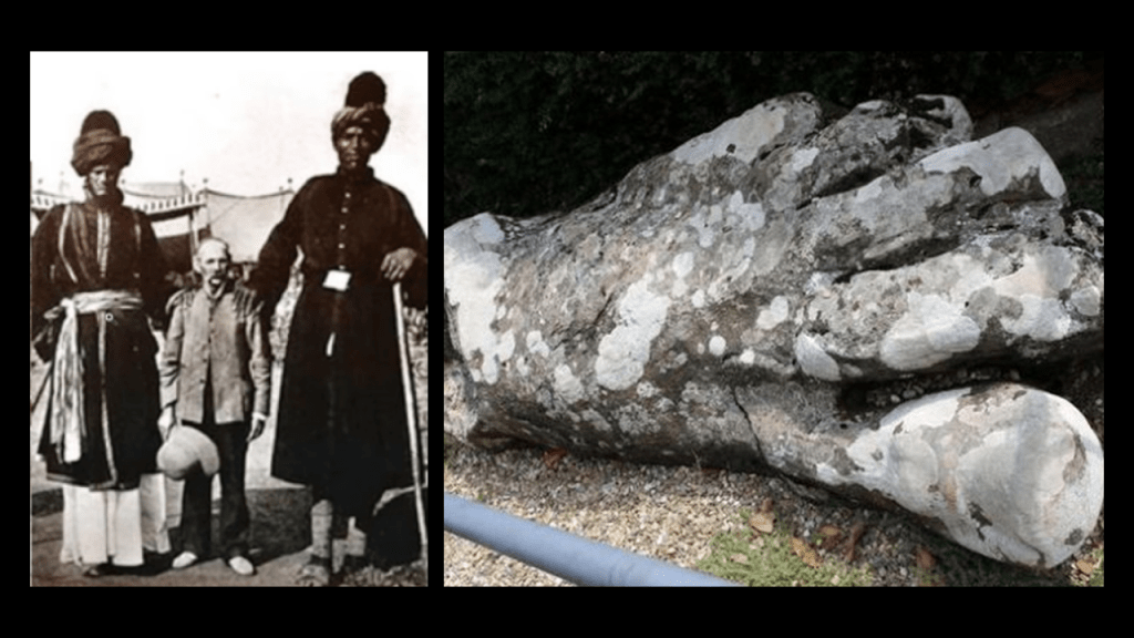
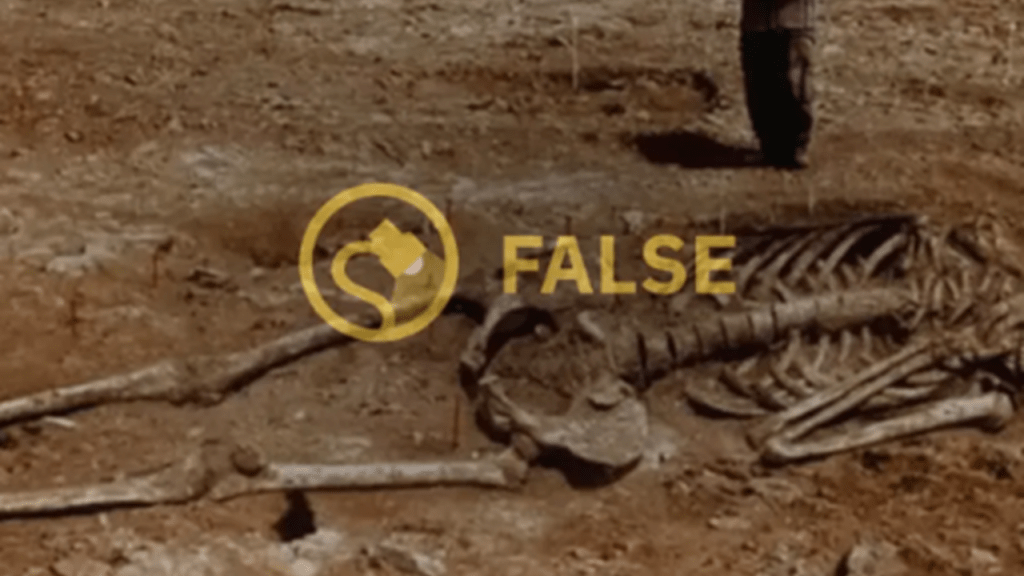
Also, in the process of oil and gas exploration in the Empty Quarter, giant skeletons apparently have turned up from time to time, though you find things like this fact-checked and flagged as hoaxes.
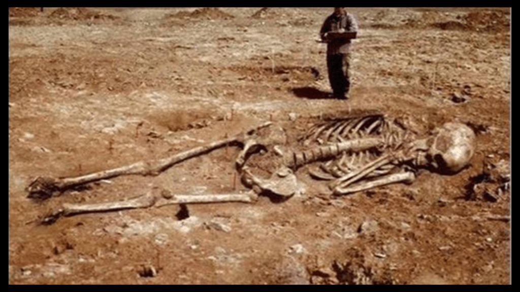
Like for some reason they really don’t want us to know giants existed upon the Earth once upon a time.
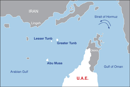
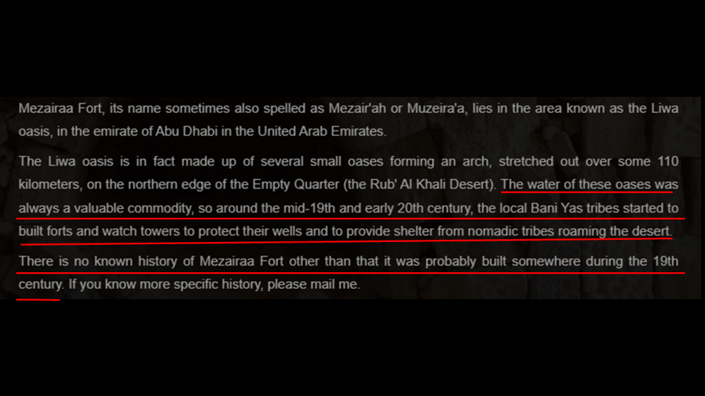
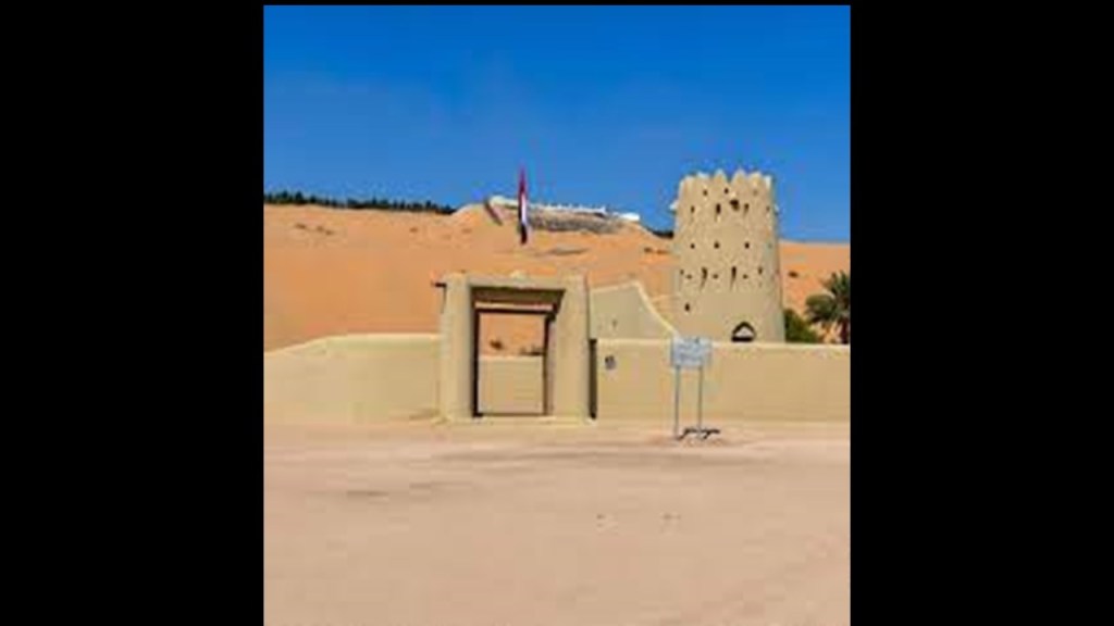
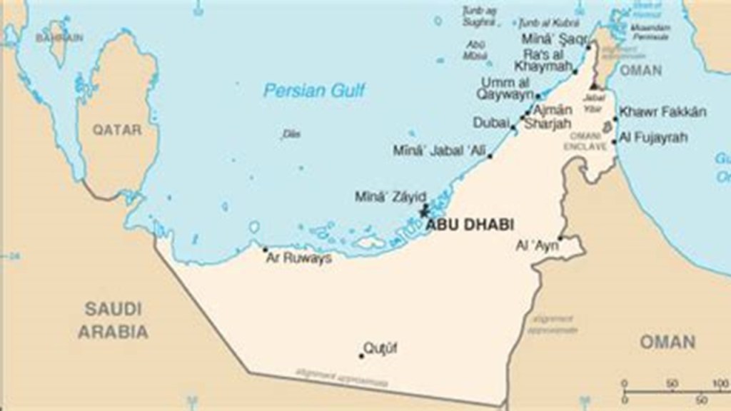
The Liwa Oasis is found in the Abu Dhabi Emirate, one of the seven Emirates that comprise the United Arab Emirates (UAE).
The Liwa Oasis is not far from the Shaybat Oil Field.
As a matter of fact It stretches along the northern edge of the Empty Quarter for 62-miles, or 100-kilometers, along an in arch curved to the north, and consists of approximately 50 villages, with Muzayri being the geographic and economic center of the Oasis.
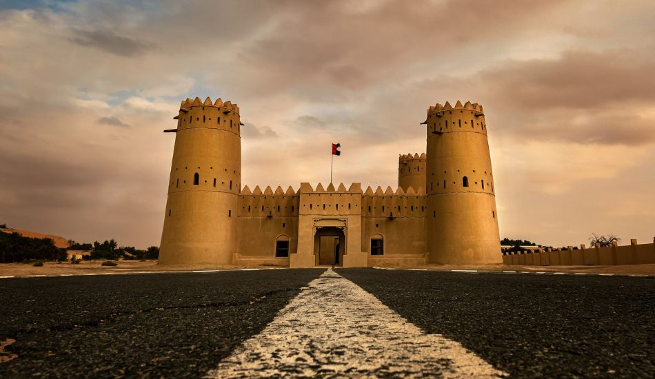
The history of the Mezairaa Fort in Muzayri is not known.
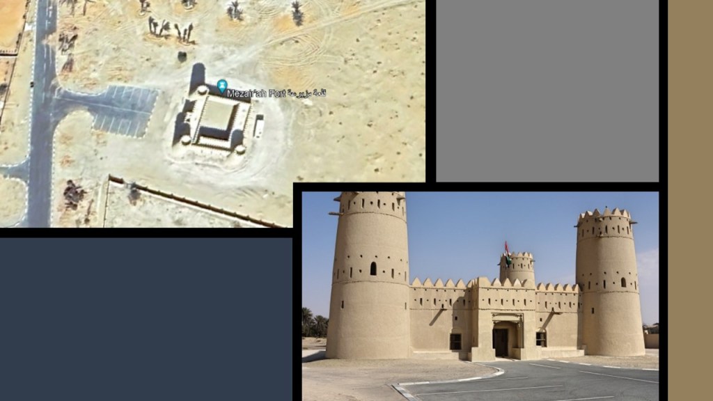
It has been speculated that it was built in the 19th-century by the local tribes to protect their wells and to provide protection for nomads who roamed the desert through here.
The same story is given for the altogether nine historical forts in the Liwa Oasis.
The other six restored forts here include:
Dhafeer Fort…
…Qutuf Fort…
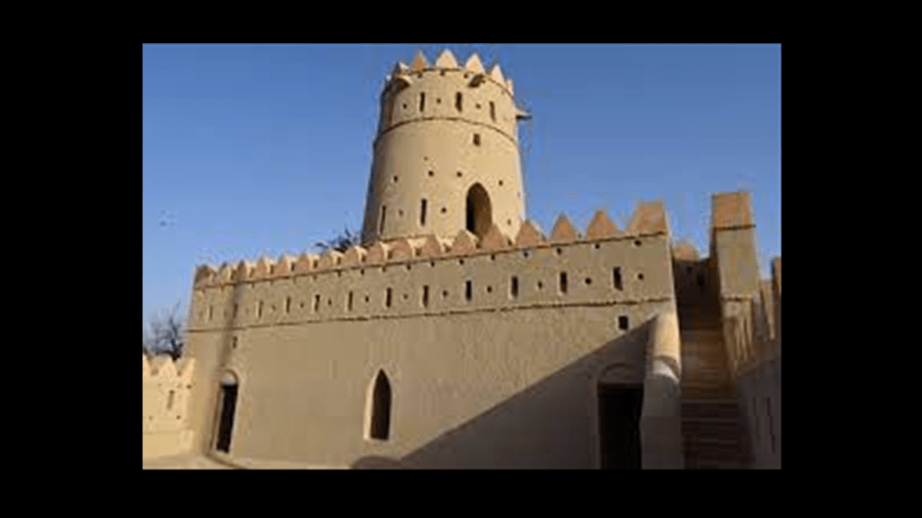
…Maria Al Gharbiyah Fort…
…Muqib tower…
…Attab Fort…
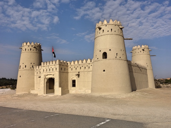
…and the Al-Jabbana Fort.
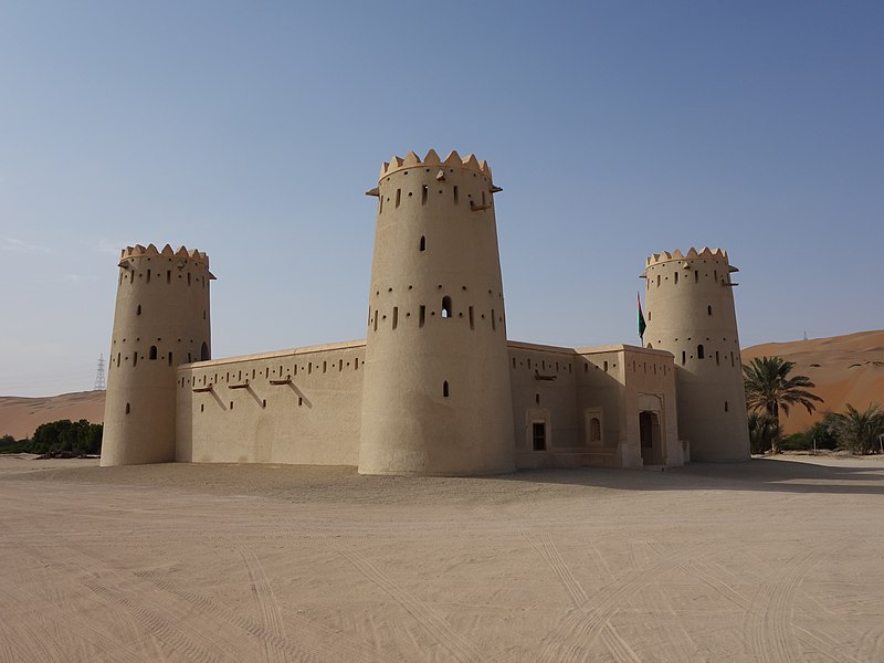
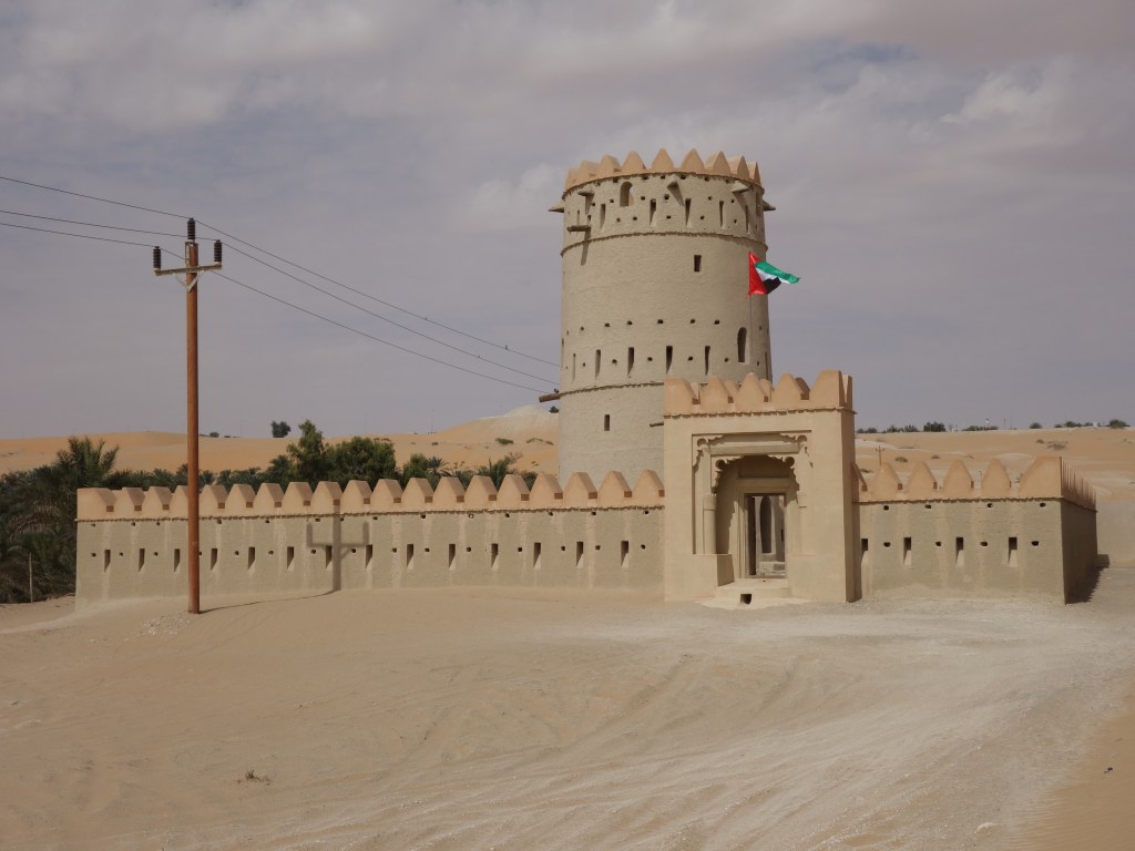
The two forts considered ruins in the Liwa Oasis are the:
Al Hayla Tower…
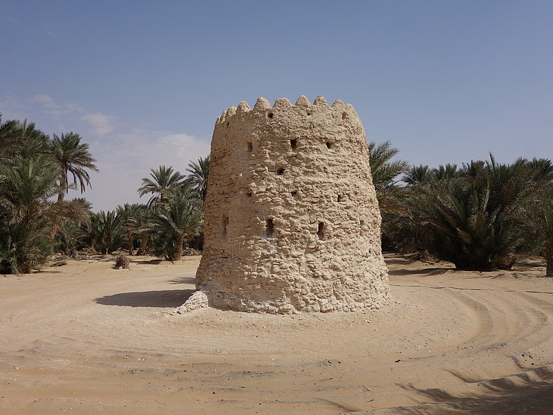
…and the Umm Hosn fort.
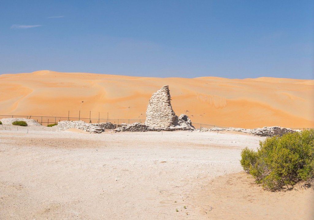
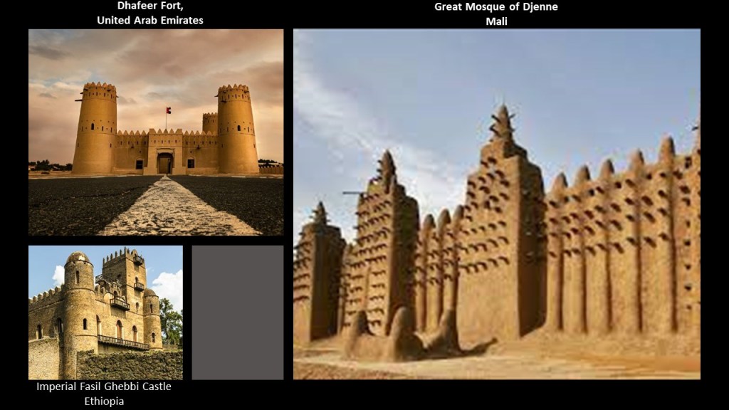
What’s absolutely uncanny is the similarity between the mud-brick architecture of the Liwa Oasis in Abu Dhabi like the Dhafeer Fort on the top left and on the right, the mud-brick architecture of places like the Great Mosque of Djenne in the west African country of Mali clear on the other side of Africa from here, both of which have features that resemble the imperial castle of Fasil Ghebbi in Gondar, Ethiopia, on the bottom left.
We’ll be seeing more examples of this finding as we continue travelling along this alignment.
Before we move on here, just wanted to share with you some tourist attractions here.
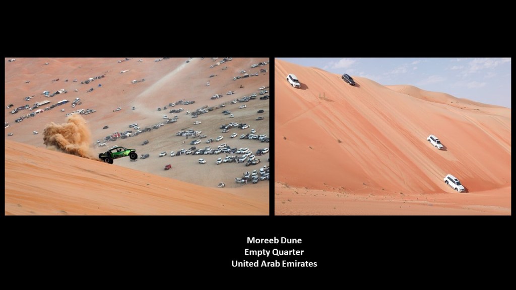
If you ever travel to the Liwa Oasis, one of the fun things you can do is take a trip to the Moreeb Dune in the Empty Quarter.
It is the tallest dune in the UAE and one of the highest sand hills in the world at 984-feet, or 300-meters, high, with a 50-degree angle from the ground to the top.
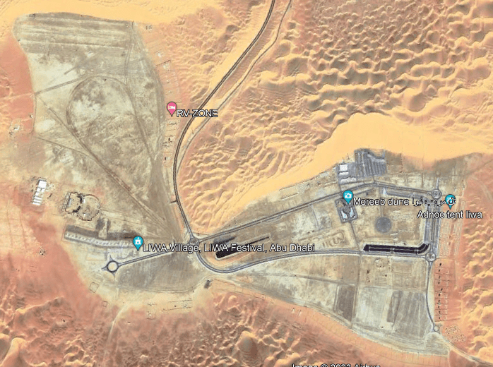
Among other things, it is popular for organized car-racing, and other vehicular activities.
Must have a pretty hard surface underneath all of the sand!
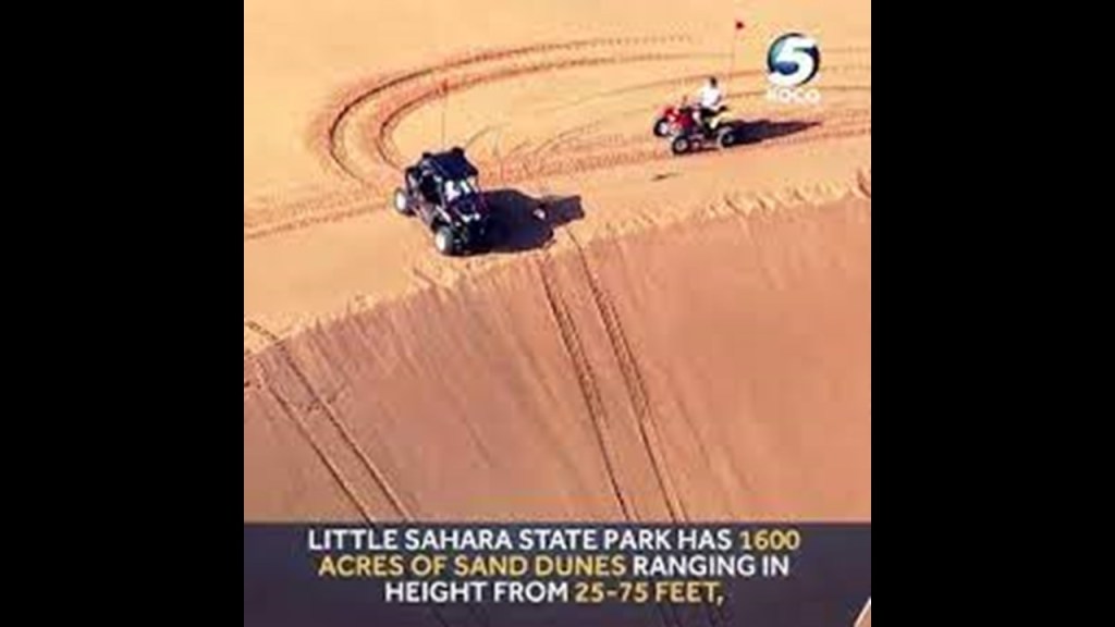
They do the same thing on the dunes at the Little Sahara State Park, near Waynoka, Oklahoma.
Oklahoma was where I first awakened to all of the things I am sharing with you now, about a worldwide, advanced civilization that has been erased from our memory.
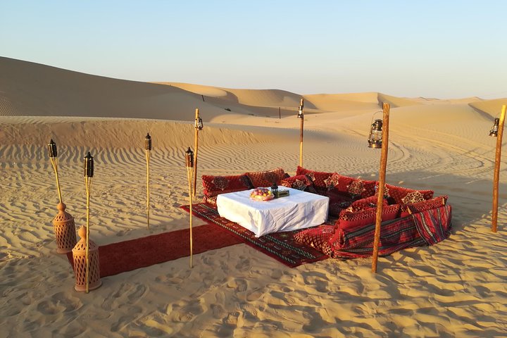
Back in the United Arab Emirates near the Liwa Oasis, you can even mark a romantic dinner surrounded by sand and dunes off your bucket list when you come on your dream vacation to the Empty Quarter.
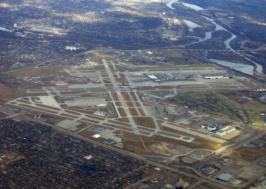
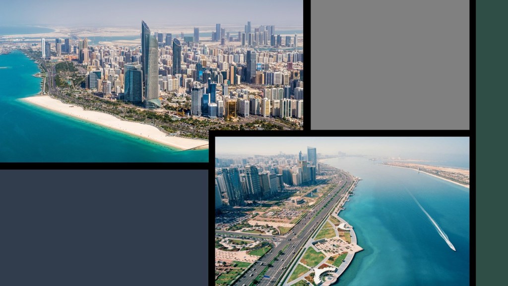
Next on the alignment, we come to the city of Abu Dhabi, the capital of the UAE.
It is located on an island in the Persian Gulf.
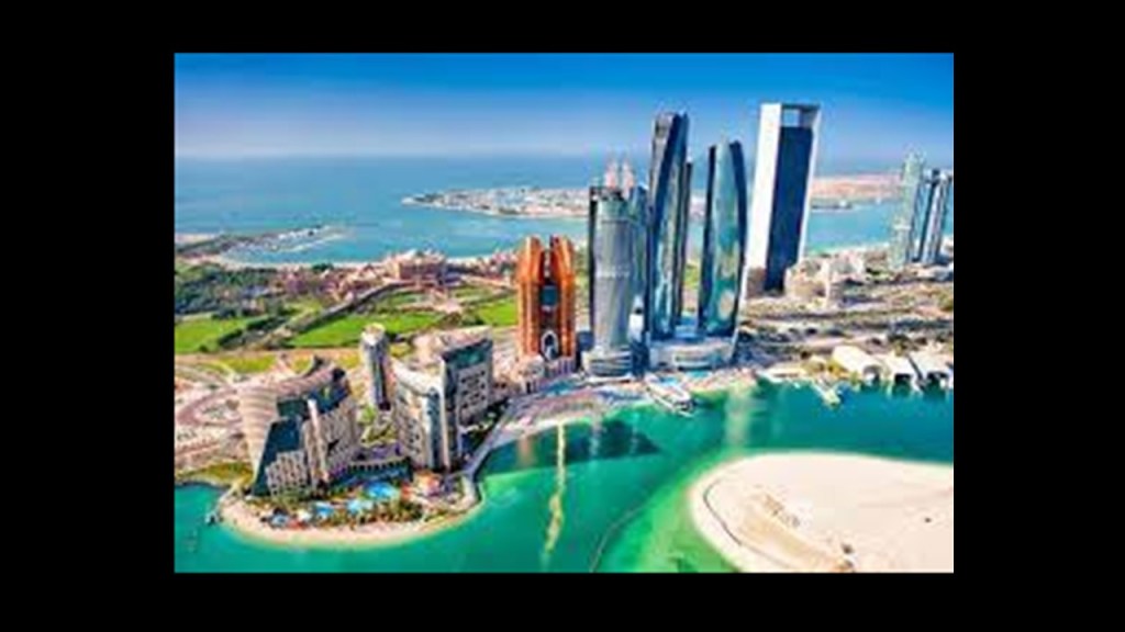
Here’s an aerial view of Abu Dhabi, with lots of channels and canals showing up.
I find this to be noteworthy, because the ancient advanced civilization was a canal-building civilization, and like the mud-brick architecture mentioned previously, we will continue to find the presence of canals along this alignment.
And here is a view of it from the water, with a nice rectangular beach-head on the top left, and a nicely-shaped manmade water front on the bottom right.
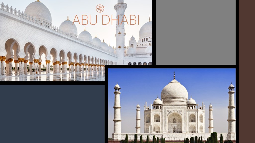
This is the Sheikh Zayed Grand Mosque in Abu Dhabi, and its elegant and sophisticated design features on the top left.
The date for construction is given as 1996.
I am comparing it with the Taj Mahal in Agra, India, on the bottom right because they have similar design features, especially the shape of the domes.
Yet the Taj Mahal was built in the mid-1600s as a mausoleum, according to the historical narrative we have been given.
In both places, the architecture is simply-breathtaking!
The sophistication and striking similarities of these two monumental works of architecture raise some real questions in my mind about how they were built – both then and now.
The next location we come to on the alignment is Dubai, another Emirate, and the largest city of the United Arab Emirates.
You can tell just by looking at a map of the city that this is a unique place in the world.
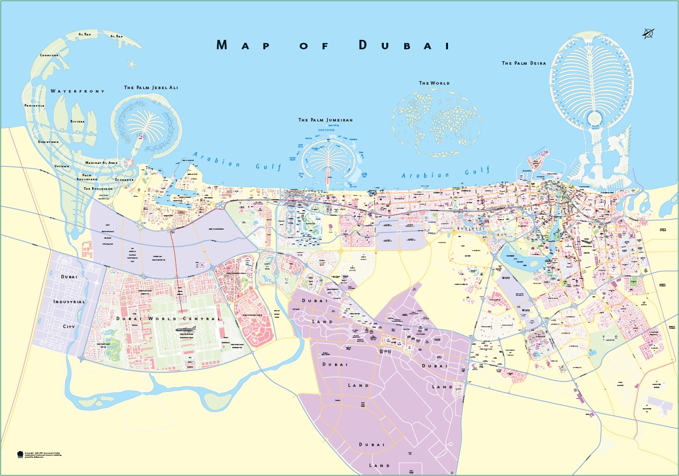
Dubai is one of the world’s “Global Cities,” which means it is a city which is a primary node in the global economic network, with a focus on financial power, and high technology infrastructure.
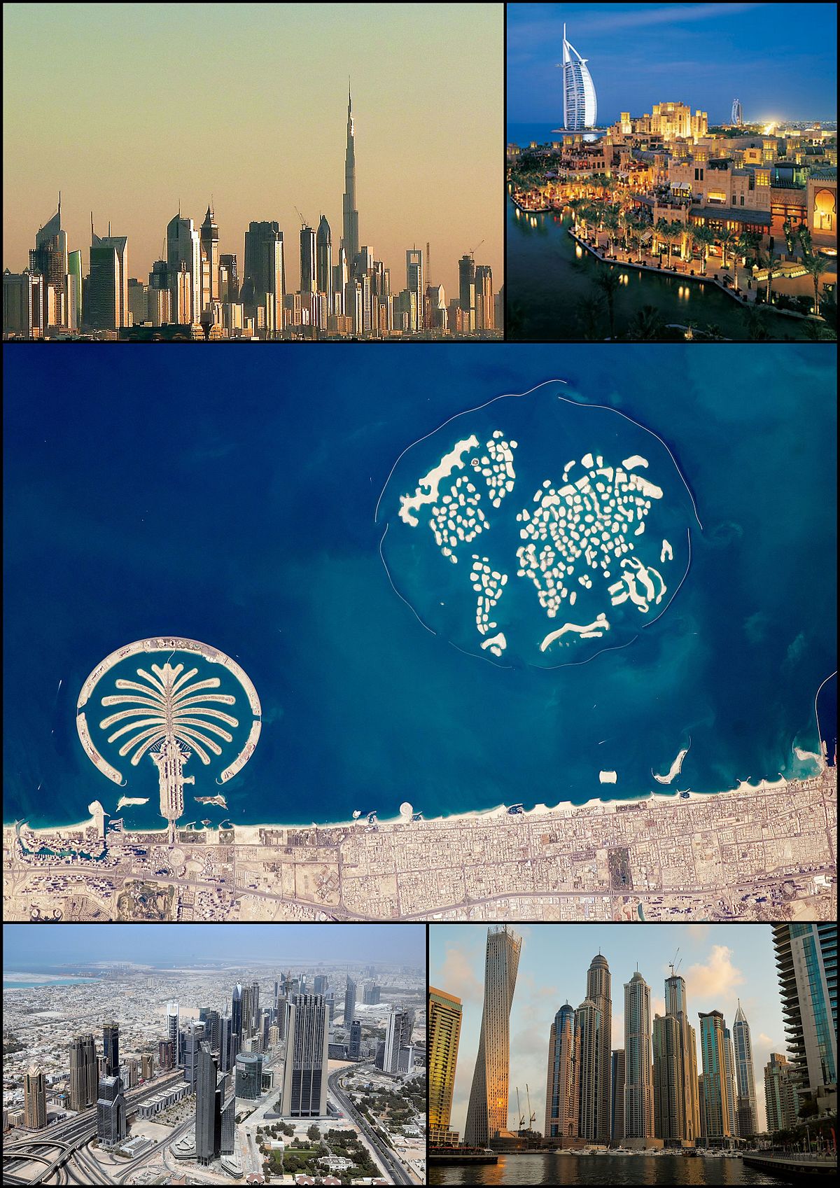
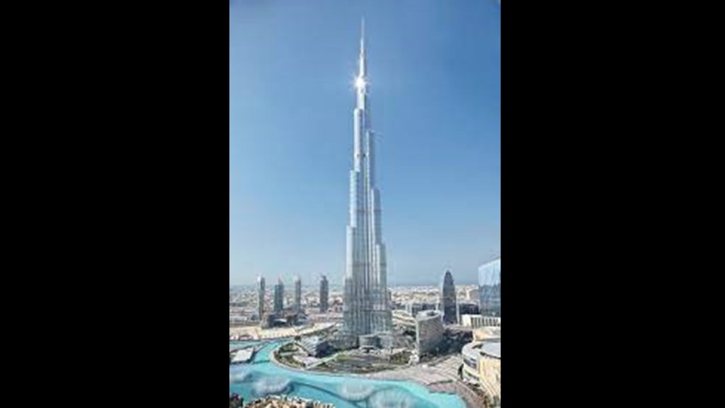
The Burj Khalifa Tower,the world’s tallest building, is in Dubai.
The building is 2,722-feet, or 830-meters, tall in height.
Construction dates are listed between 2004 and 2009, with it opening to use in 2010.
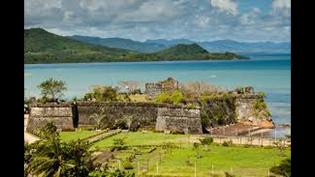
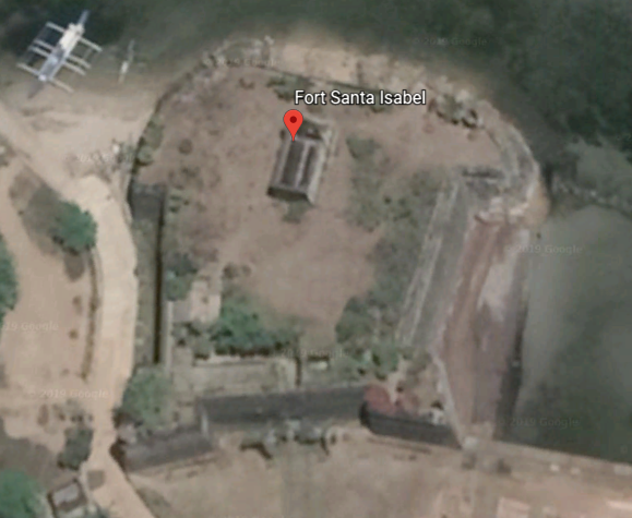
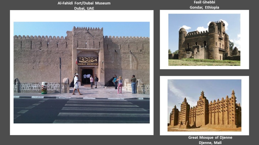
The oldest existing building in Dubai is the Al-Fahidi Fort, and was said to have been built in 1787 to protect the locals and the pearl-fishing economy from neighboring tribes.

Today the old fort houses the Dubai Museum, pictured on the left.
The Al-Fahidi Fort has the same architectural features shown previously in this post as the Fasil Ghebbi in Gondar, Ethiopia, the home of Ethiopia’s Emperors, on the top right, and the Great Mosque of Djenne in Mali in west Africa on the bottom right.
Djenne is said to be the oldest known city in sub-Saharan Africa.
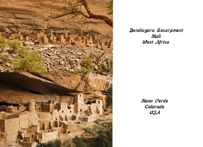
Djenne in Mali is located close to the Bandiagara Escarpment, where the Dogon people live.
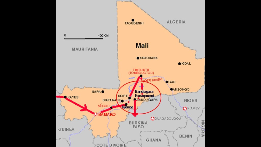
This is the Bandiagara Escarpment on the top, looking remarkably like Mesa Verde in the U. S. State of Colorado, on the bottom.
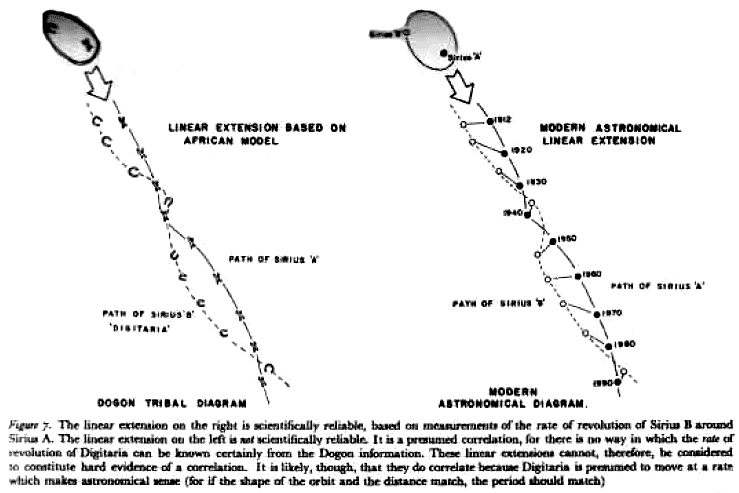
The Dogon have a very sophisticated spiritual, astronomical and calendrical system, as well as extensive anatomical and physiological knowledge. They also have a systematic pharmacopeia, which means directions for compound medications.
Perhaps they are best known for the accurate knowledge they possess about the Sirius star system.
Yet we know the Dogon to have an agricultural society?
One last thing I want to show you in Dubai before I end this post.
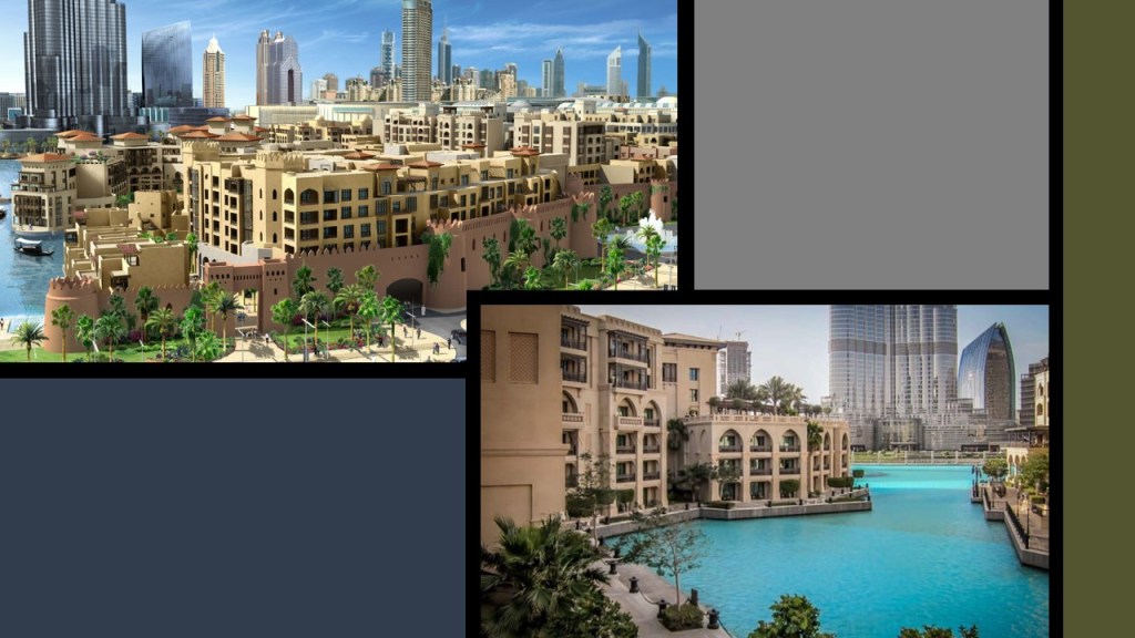
This is an aerial view of what is considered Dubai’s Old Town, the Bur Dubai.
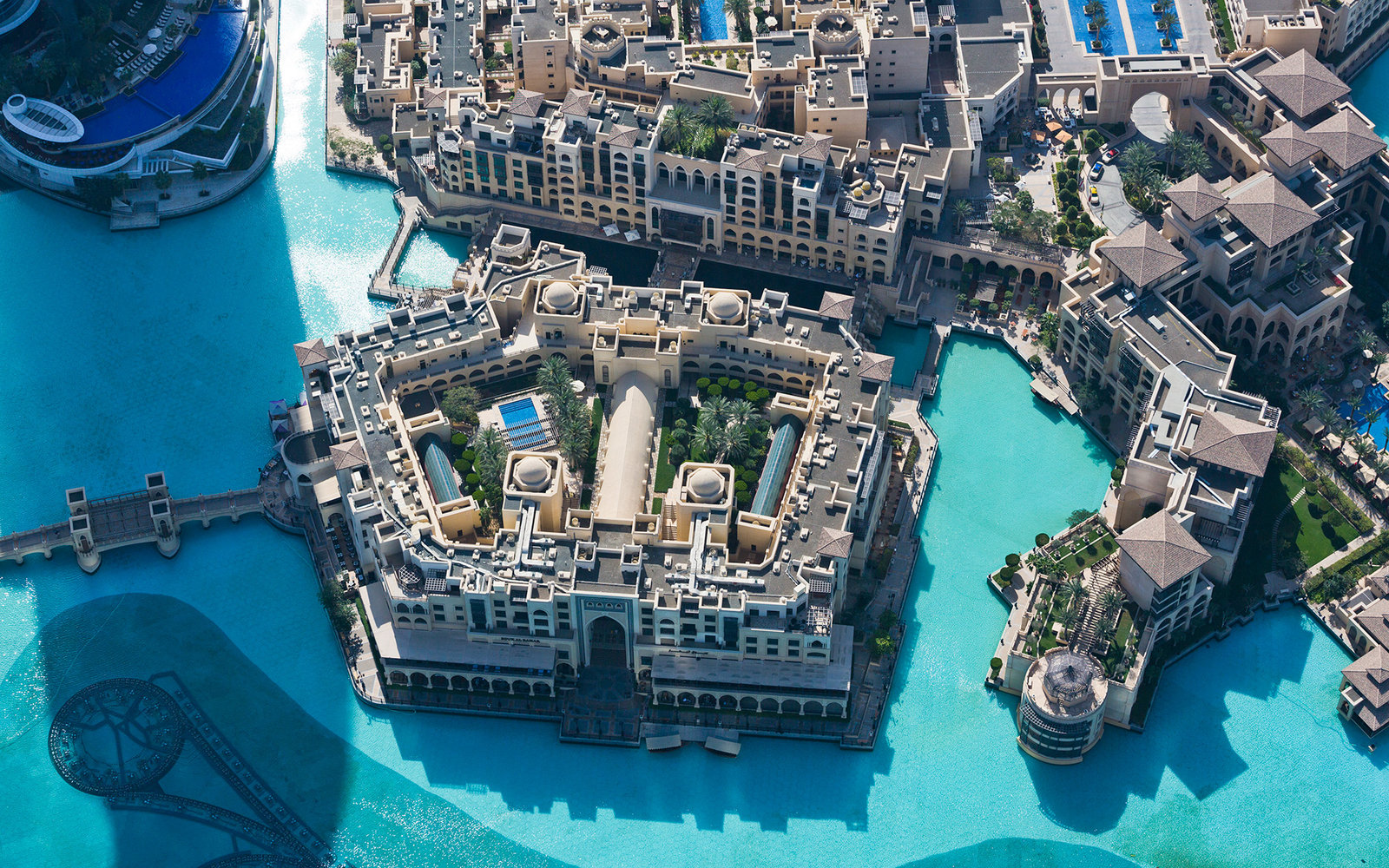
Here are more photos of the architecture and canal system of Old Town Dubai.
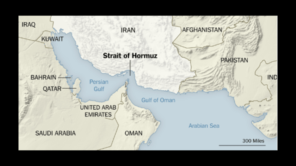
Like with everywhere else, there is much more to find here in these places I’ve been looking at, but I will end this post here, and in the next post will pick up the alignment as it goes across the Strait of Hormuz into Iran.