I have looked into many different aspects of the history of the State of California over the six-years I have been bloggiing and making videos.
I have been extensively researching what has been hidden right in front of our eyes since June of 2018.
California offers countless excellent examples of what the official narrative tells us to explain our history and the infrastructure in our world, and also how it doesn’t hold up under scrutiny.
For this post, I decided to go back through my research and compile these examples in “California Resettin'” for your consideration on how and why this took place.
The first place I am going to look at is Ebbetts Pass in California, and then I am going to take a look around the Sierra Nevada Mountains in general.
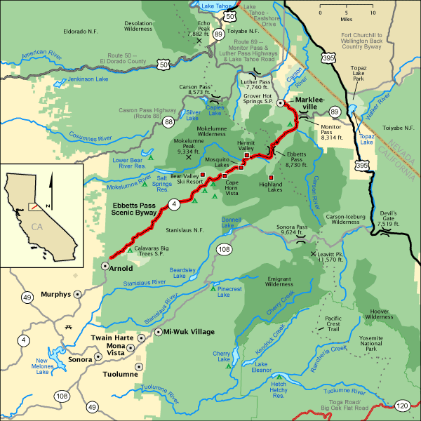
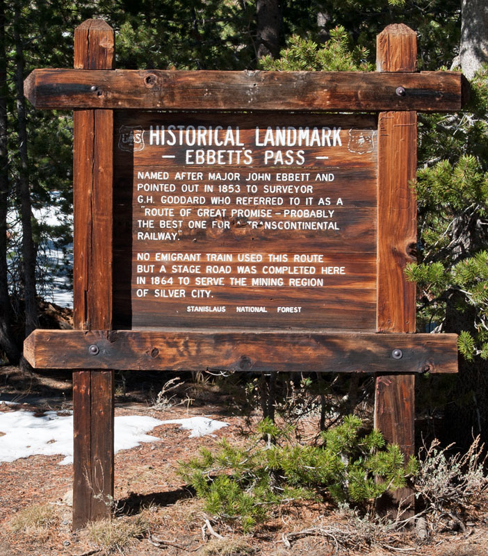
First, Ebbetts Pass is a high mountain pass through the Sierra Nevada Range in Alpine County, California, and is registered as a California Historical Landmark.
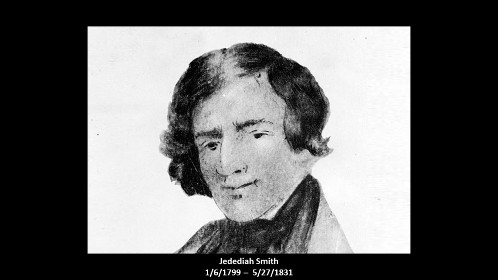
Early explorer Jedediah Smith was reputed to have used this particular mountain pass when crossing the Sierra Nevadas on one of his exploratory journeys in 1827.
The pass got its name, however, from John Ebbetts, and he comes down to us in our historical narrative as a fur-trader-turned-guide for California Gold Rush “Forty-Niners.”
What we are told about him was that he led a string of pack mules through this high-mountain pass in April of 1851, and that he was said to believe that the pass he had used would be suitable for transcontinental railroad.
Ebbetts Pass today is one of the least travelled passes in the Sierra Nevadas.
It has very steep sections with hairpin corners and the eastern slope is particularly difficult with many blind hairpin corners, and is usually closed during the winter months between November and sometimes as late as May.
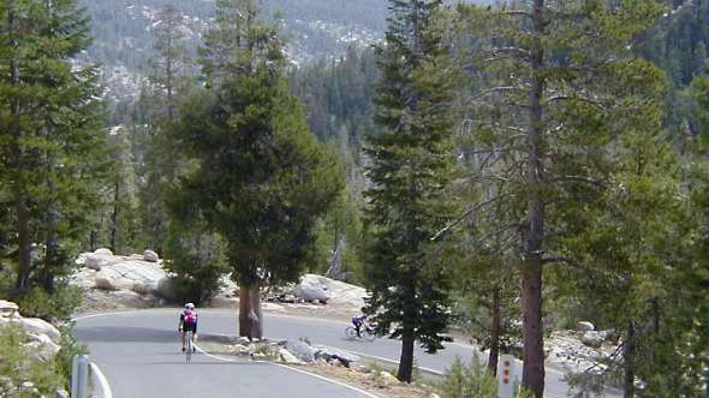
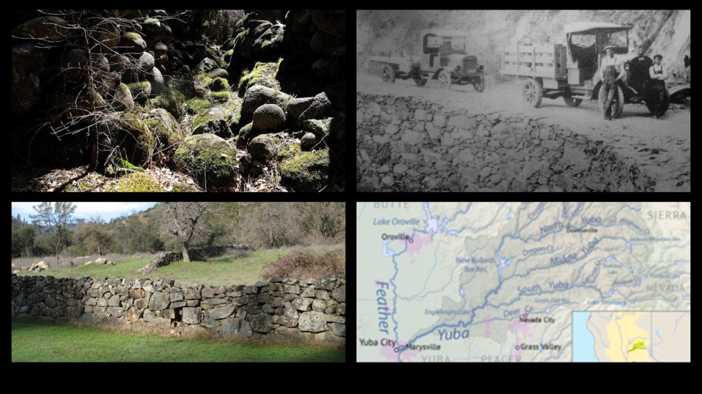
Here are some views of Ebbetts Pass.
This view shows what appears to silt that covers the landscape here.
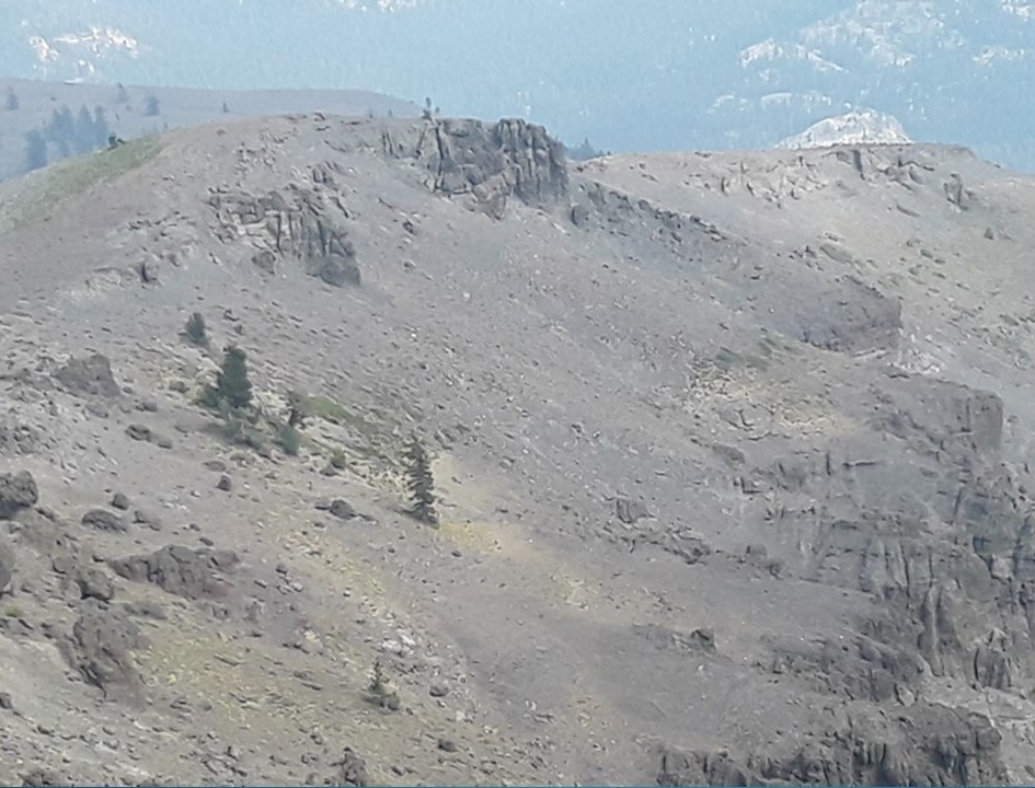
And in this view of Ebbetts Pass, there are stone outcroppings with straight edges and lines.
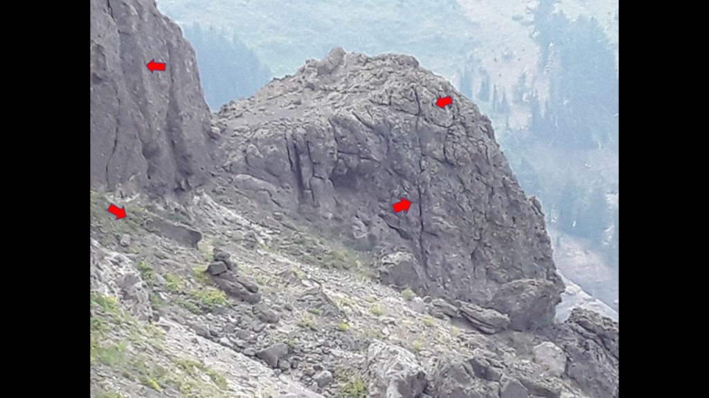
Also, there are very intriguing-looking piles of rocks that look like they have been pressed into rock clusters somehow.
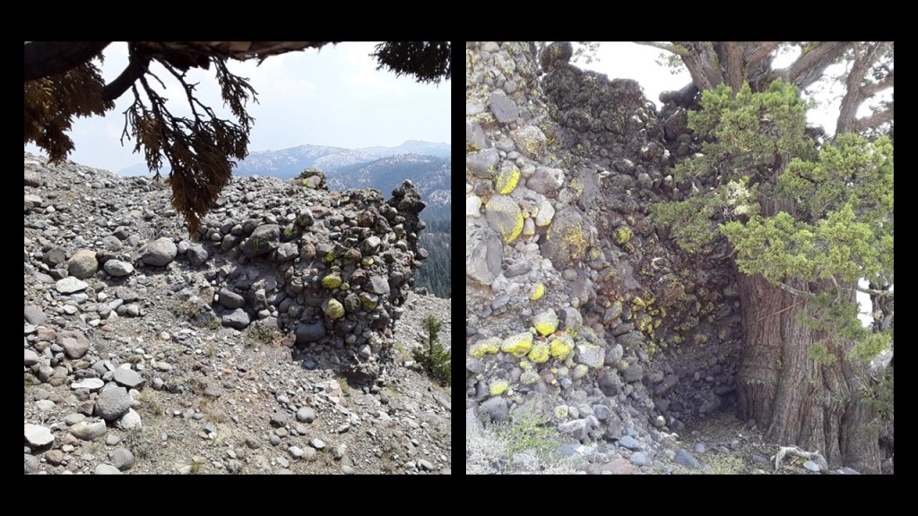
Within the Sierra Nevada Mountains, stone walls are found everywhere, like these examples in California’s Yuba River Country, which extends from the High Country of Sierra and Nevada County to the Feather River between Maryville and Yuba City.
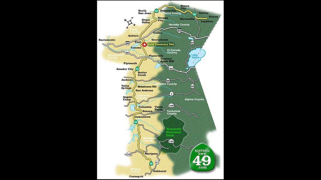
California’s historic mother-lode country, or gold rush belt was a region in northern California, on the western slope of the Sierra Nevadas.
Also known as the Golden Chain, it is approximately 150-miles, or 240-kilometers, long, and a few-miles-wide, and traversed by historic Highway 49.
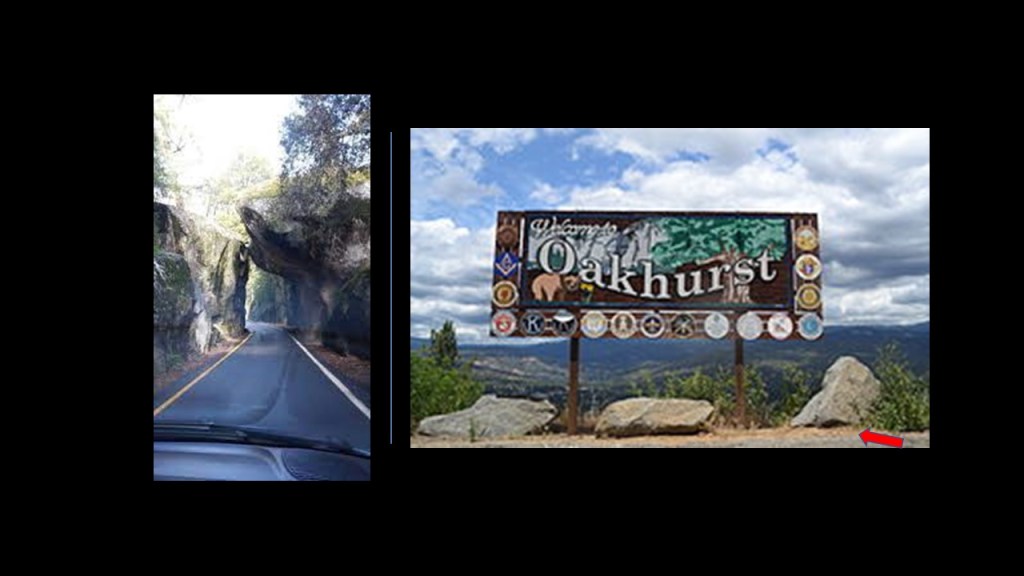
Here are some sites I found in a search along historic Highway 49, like Oakhurst, a community that is 14-miles, or 23-kilometers, south of the entrance to Yosemite National Park…
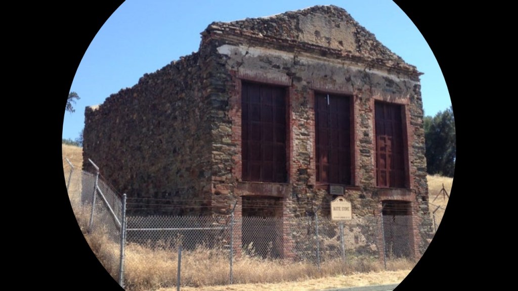
…and the old Butte Store in Amador County, said to have been built in 1857 by an Italian stonemason to serve settlers and miners as a general store and post office, and a reminder of Butte City, a once-vibrant mining community that was settled at the height of the Gold Rush era, and abandoned in the early 1900s as the mines closed and settlers relocated.
It looks suspiciously like a partially-buried structure to me!
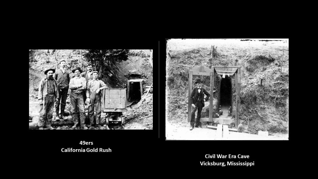
The Gold Rush Country was famed for mineral deposits and gold mines said to have attracted waves of immigrants starting in 1849, known to history as 49ers, pictured on the left.
Interesting to note the similarity between the gold mine entrance in California land the example of a cave that was dug into the side of a hill during the Siege of Vicksburg on the right, where people could get out of harm’s way from the hail of iron that was coming their way from Union forces.
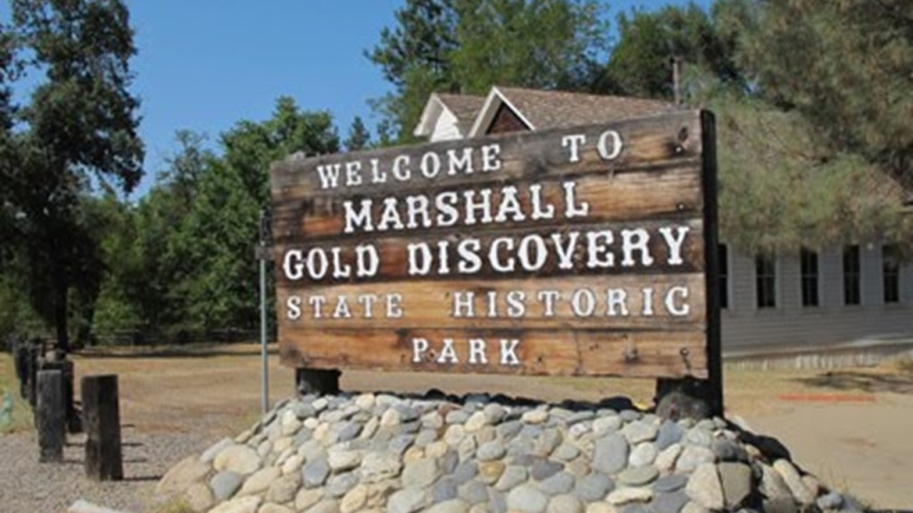
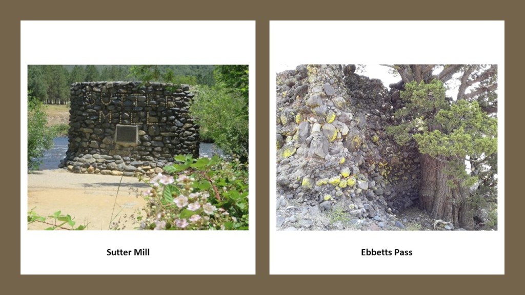
We are told that California’s gold rush was sparked by James Marshall’s discovery in 1848 of placer gold at Sutter’s Mill near Coloma.
We are told in our historical narrative that by 1850, California was admitted to the Union as a State.because of the massive influx of people brought in by what is known as the California Gold Rush,a fter the news of the gold brought in hundreds of thousands of people from all over the United States and abroad, and after which the sudden introduction of gold reinvigorated the American economy.
A rock wall sign at Sutter Mill on the left looks very similar to the smaller-sized stones that were pushed up next to some trees in Ebbetts Pass on the right.
Also, interesting to note that I found this book about California’s masonic roots in the Gold Rush country when I was doing a search of images.

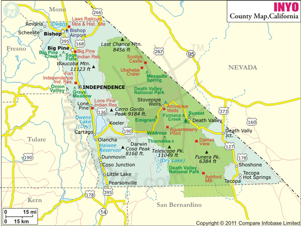
Mono and Inyo Counties, which are right next to each other, and located east of the Sierra Nevada Range, between Yosemite National Park and Nevada.
First, I will look at Mono County.
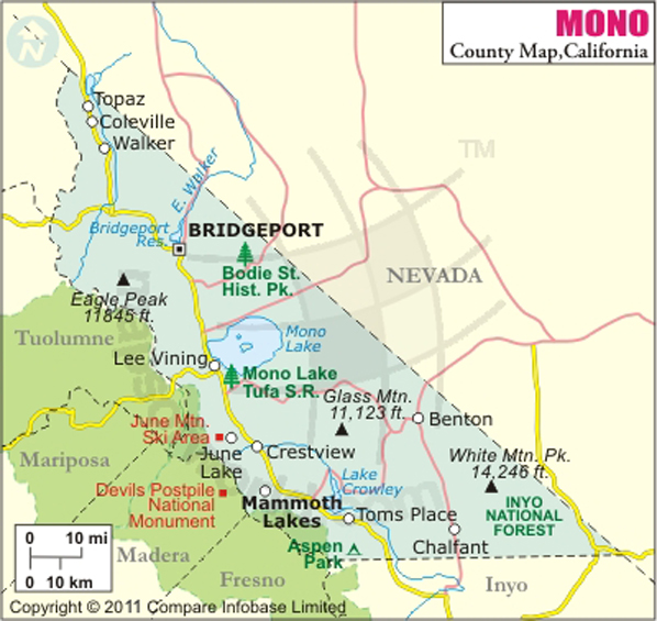
Mono County’s only incorporated town is Mammoth Lakes.
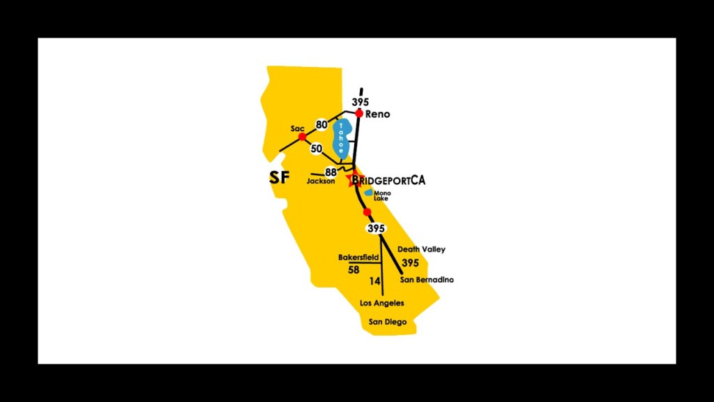
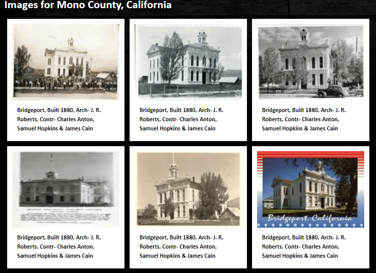
While Bridgeport is the Mono County seat, in 2010, its population was 575, and has the status of Census-Designated Place, or CDP, meaning it is a place that has a concentration of population defined by the United States Census Bureau for statistical purposes only.
The Mono County Courthouse in Bridgeport is on the National Register of Historic Places, and was said to have been built in the Italianate-style in 1880…
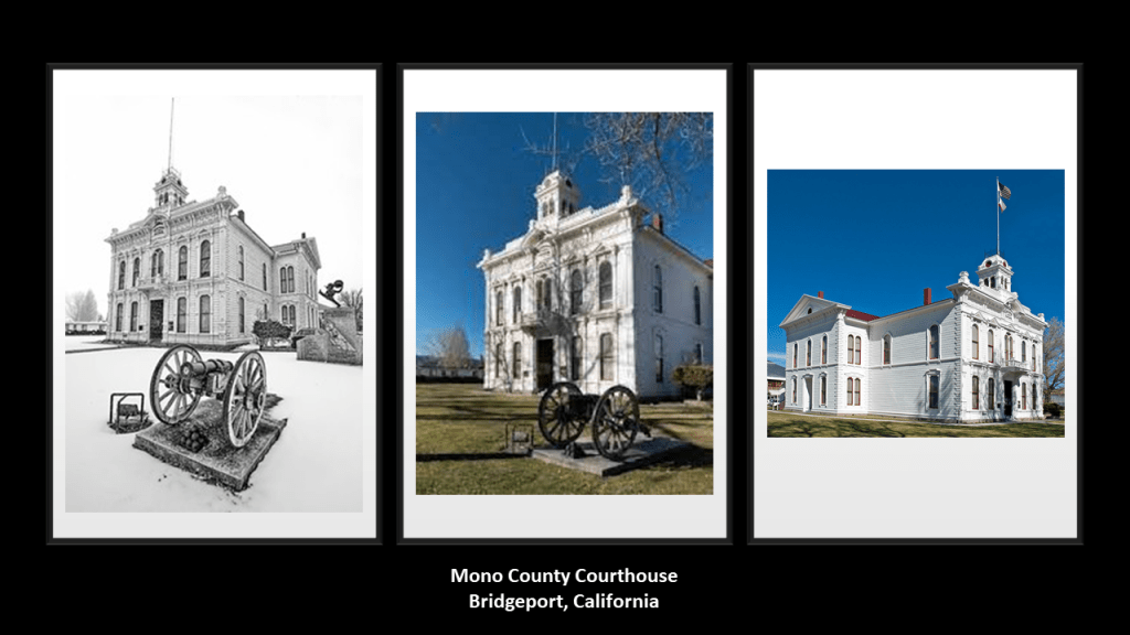
…and designed by architect J. R. Roberts, about whom I can’t seem to find any biographical information in a search, except for his name as the architect of this courthouse.
Mono Lake is located about half-way between Bridgeport and Mammoth Lakes in Mono County.
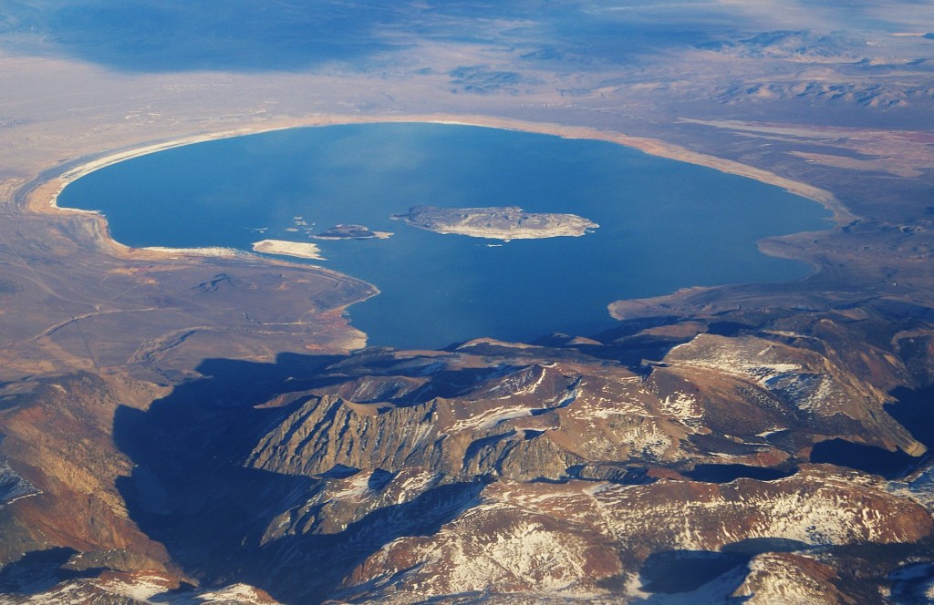
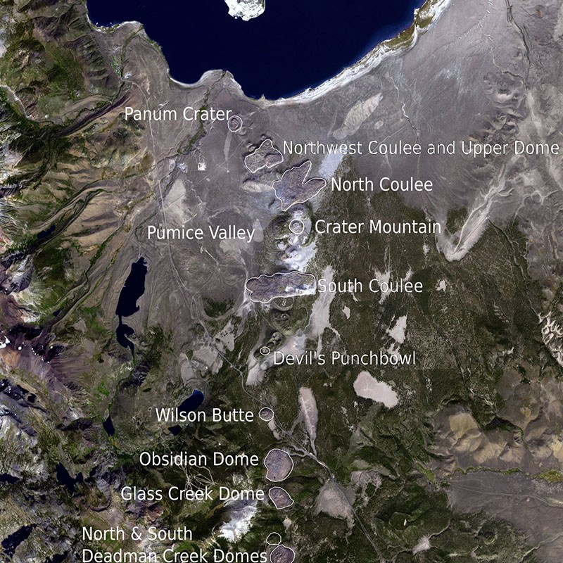
It is a saline soda lake and is in a geologically-active area at the north end of the Mono-Inyo Craters volcanic chain.
Mono Lake has many towers of limestone, called Tufa, which rise above, and around, the surface of Mono Lake.
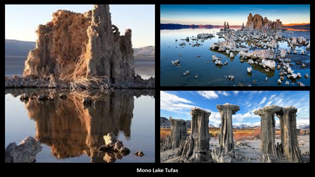
Limestone has been a common building material throughout the ages.
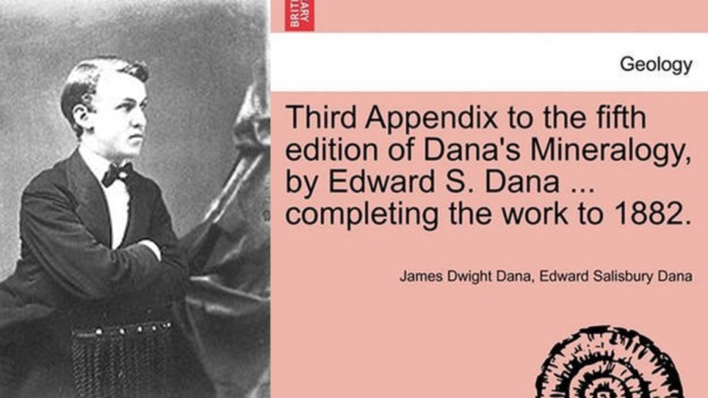
The different types of Mono Lake tufa were categorized in the 1880s by mineralogist Edward S. Dana…
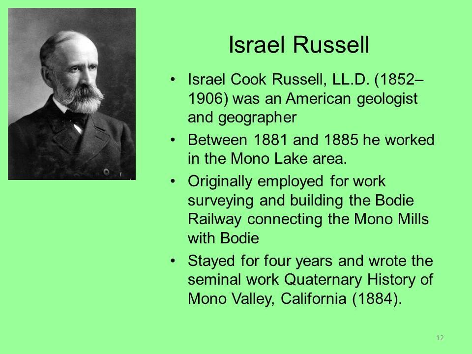
…and geologist Israel C. Russell.
Were they narrative shapers, I wonder?
Inyo County is located right below Mono County.
Mt. Whitney is the highest mountain in the contiguous United States, with an elevation of 14,505-feet or 4,421-meters, and is on the boundary between Inyo and Tulare Counties.
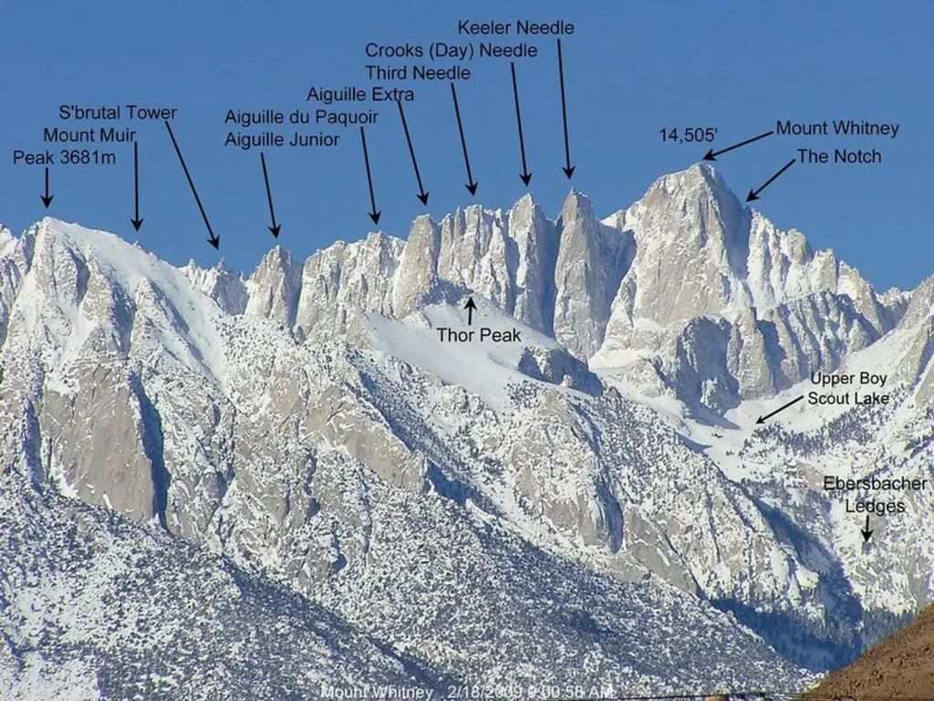
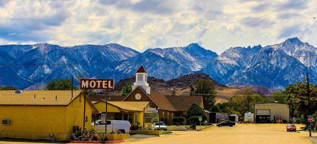
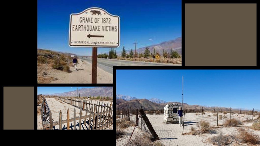
Lone Pine is one of the towns in Inyo County’s Owens Valley.
Here are a few tidbits about Lone Pine.
A settlement started after a log cabin was built there during the winter of 1861 and 1862, and a post office opened there in 1870.
In March of 1872, a violent earthquake, said to have been one of the largest ever recorded…
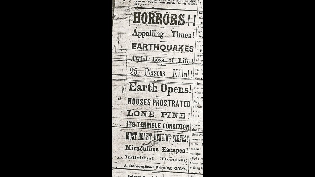
… destroyed most of the town.
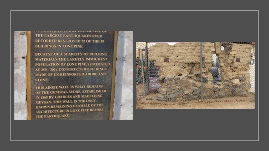
The earthquake killed somewhere around 25 – 27 people (the number keeps varying from reference to reference), who were said to have been buried in a mass grave north of town at the location of the site of the main earthquake fault.
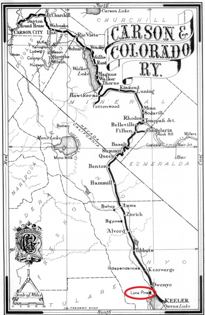
But one of the worst recorded earthquakes in history didn’t keep the Carson and Colorado railroad from coming through here in 1883…
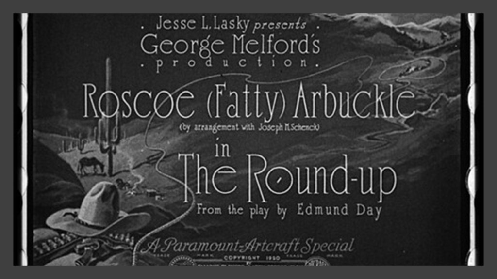
…or from Lone Pine becoming a frequently used setting for the Western movie genre, starting with the making of the silent film “The Round-up” here in 1920, and subsequently becoming the filming location of hundreds of movies, TV shows, and commercials.
One more thing about Lone Pine before I move on.
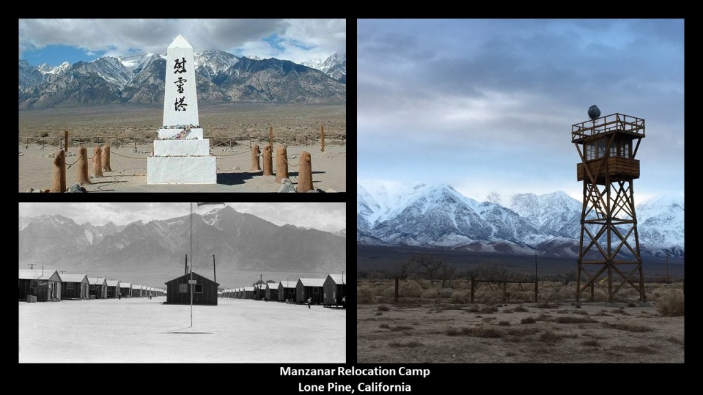
There was one of ten Japanese internment camps during World War II, called Manzanar, located 7-miles, or 11-kilometers, set-up north of Lone Pine, after President Franklin Roosevelt signed an Executive Order requiring people of Japanese ancestry living along the Pacific Coast to be placed in what were called “relocation” camps.
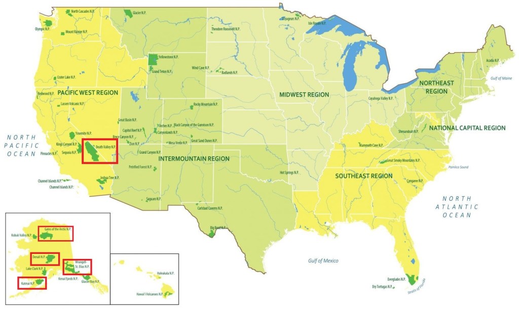
The last thing I want to mention about Inyo County and the eastern Sierra Nevadas is that contains the California-side of Death Valley National Park, which straddles the border of California and Nevada.
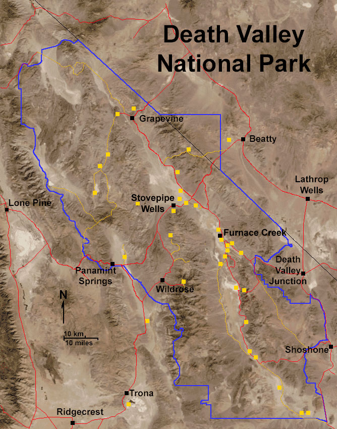
It is the largest national park in the contiguous United States, with four larger national parks being in Alaska.
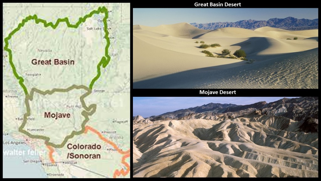
Death Valley National Park is in the zone between the Great Basin Desert and the Mojave Desert…
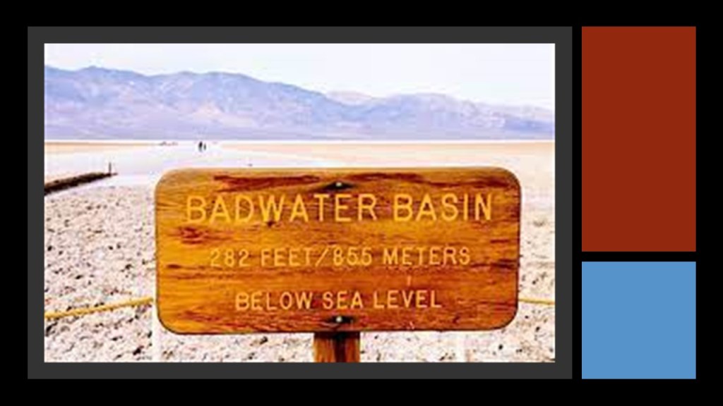
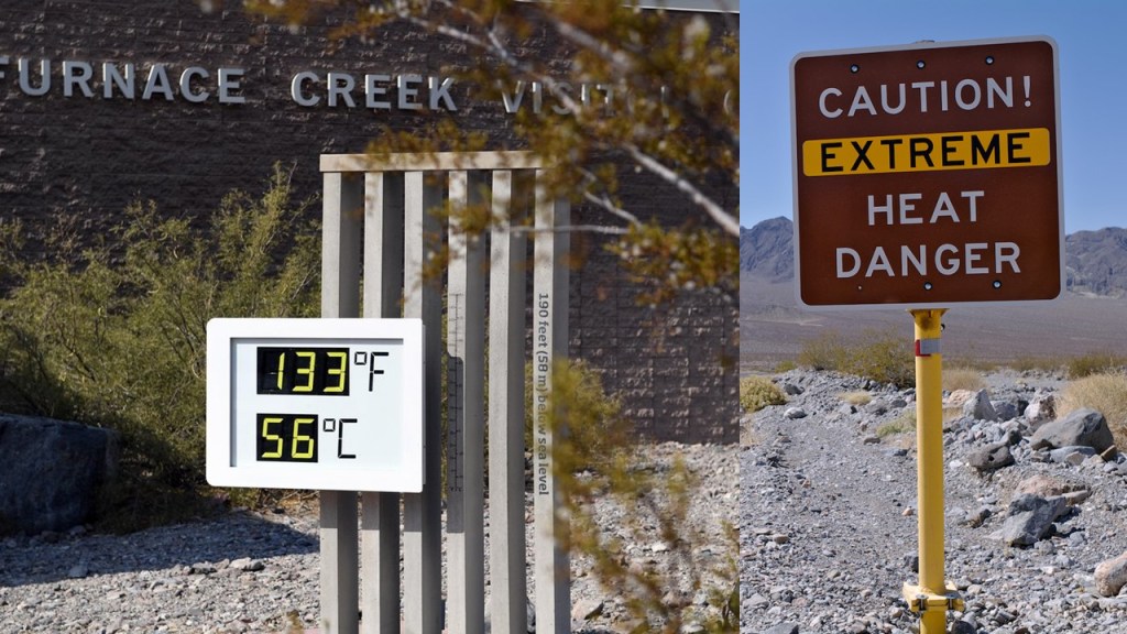
…and has both the second-lowest point in the Western Hemisphere at Badwater Basin, and is the hottest place on Earth, and the driest place in North America.
Furnace Creek in Death Valley holds the record of having the highest-recorded air temperature of 134-degrees-Fahrenheit, or 56.7-degrees-Celsius, on July 10th of 1913, and the highest-recorded ground temperature of 201-degrees-Fahrenheit, or 93.9-degrees Celsius on July 15th of 1972.
Furnace Creek is also the location of the headquarters of Death Valley National Park.
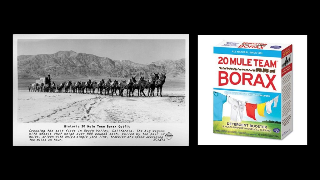
Furnace Creek was also the center of operations starting in 1890 for the Pacific Coast Borax Company and its 20-mule teams hauling wagon trains of borax across the Mojave Desert.
Furnace Creek, the hottest place on Earth, even has a luxury resort.
Today known as The Inn at Death Valley, it was formerly known as The Furnace Creek Inn, and said to have been constructed by the Pacific Coast Borax Company and opened on February 1st of 1927, and operated for decades by the Fred Harvey Company, known for its “Harvey Houses” and other hospitality industry businesses alongside railroads in the western United States.
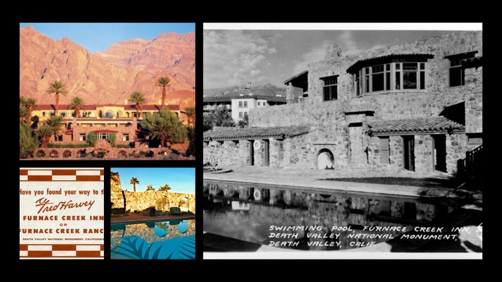
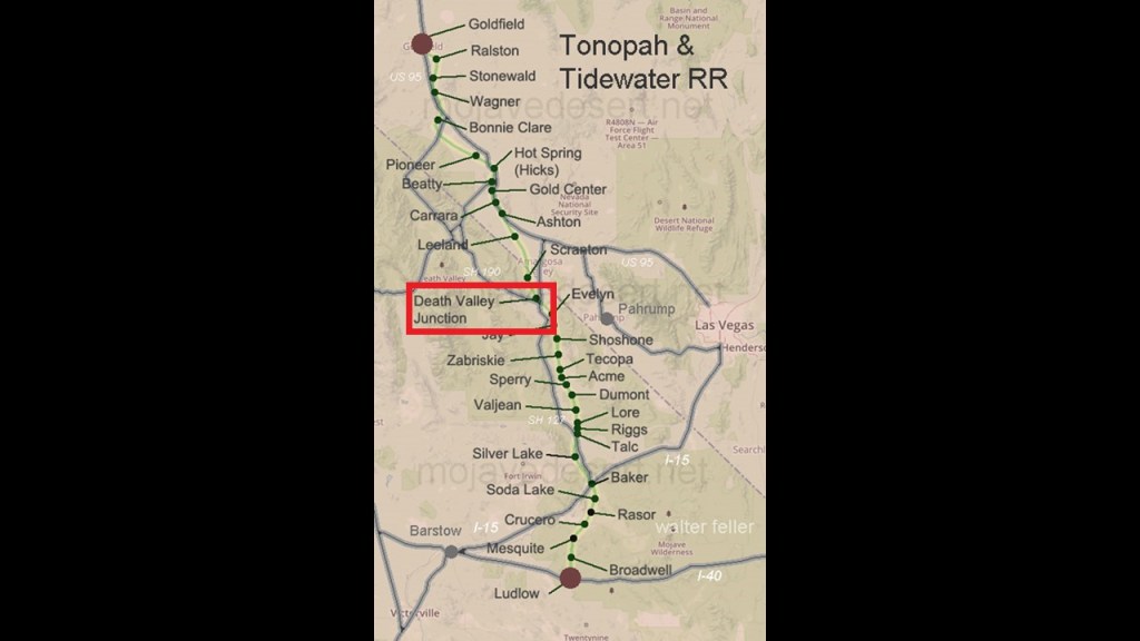
The reason given for this was the President of the Pacific Coast Borax Company, Richard C. Baker, wanted to open Death Valley to tourism, and at the same time, increase the revenue of the Tonopah and Tidewater Railroad that was said to have been built originally by Francis Marion Smith for the purpose of shipping borax.
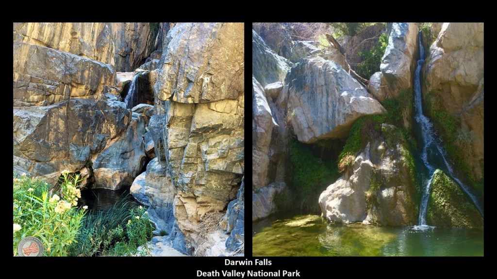
There’s so much more here to look for, but there is one more place here that I would like to take a look at: Darwin Falls.
Apparently even the driest place in the North America has waterfalls, located on the west side of Death Valley National Park near Panamint Springs, where there are upper and lower waterfalls.
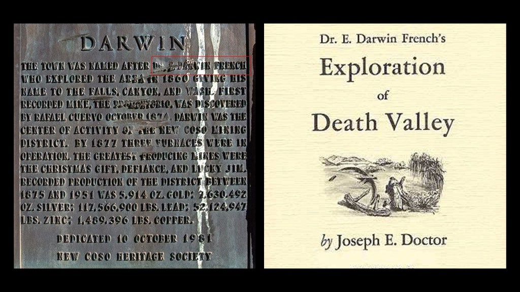
Darwin Falls, and several other Darwins in the area, was named for a physician named Dr. Erasmus Darwin French, who lived between 1822 and 1902, and was called “an American man of adventure” born in New York State, and not named after Charles Darwin, the famed English naturalist.
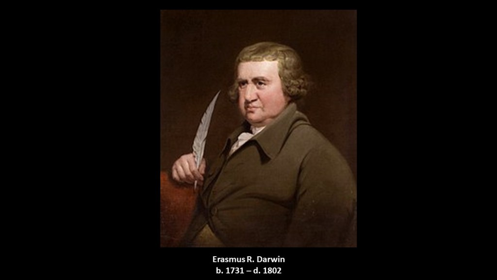
Though it is interesting to note that Charles Darwin’s grandfather was named Erasmus Darwin, who lived between 1731 and 1802.
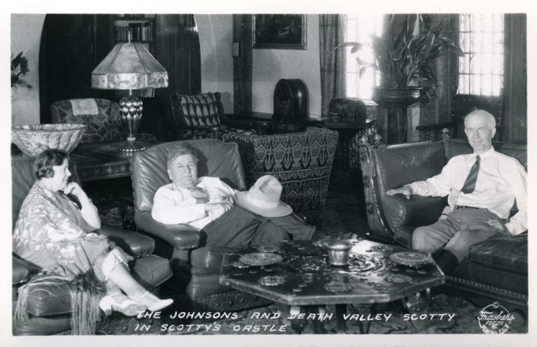
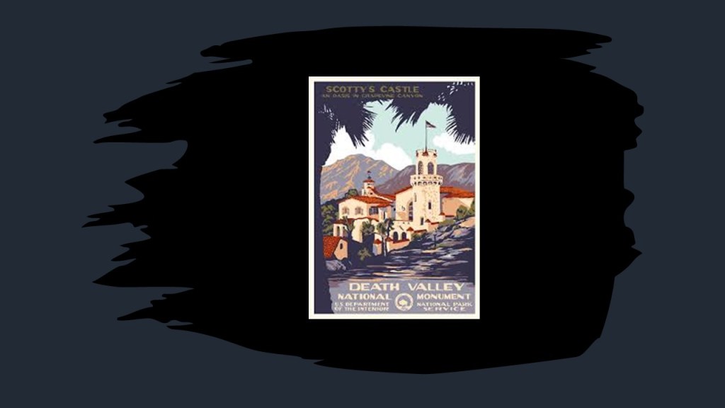
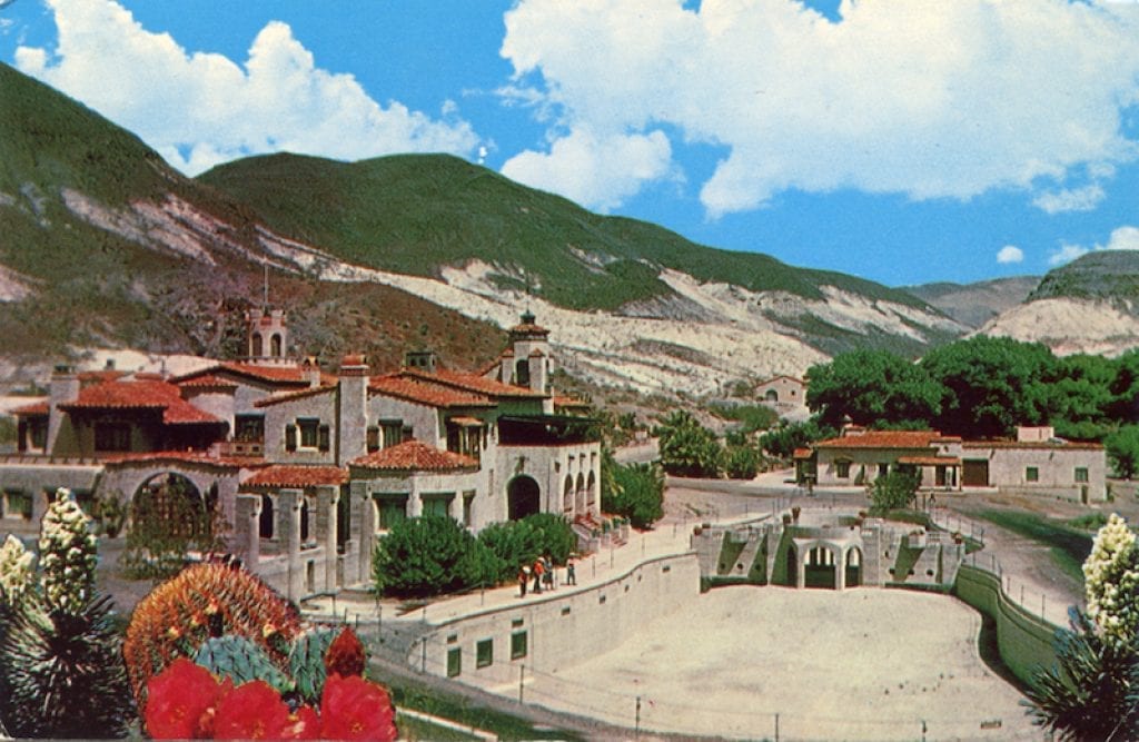
The last place I want to look at in Death Valley is Scotty’s Castle, described as a two-story Mission Revival and Spanish Colonial-style Revival villa in northern Death Valley in the Grapevine Mountains.
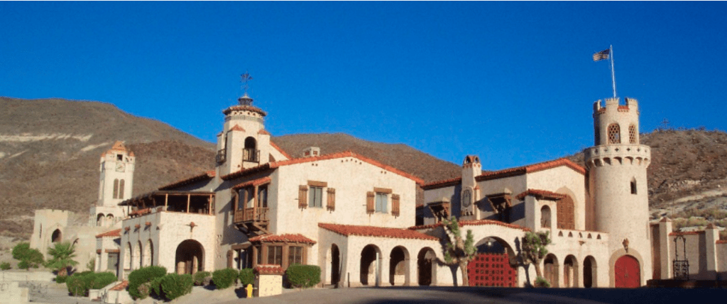
Named for gold prospector Walter E. Scott, the story goes that Scott convinced a Chicago millionaire by the name of Albert Mussey Johnson to invest in Scott’s gold mine in Death Valley.
When the gold mine turned out to be fraudulent, instead of staying angry at Scott, Johnson continued a friendship with him, and Johnson and his wife ended up buying around 1,500-acres in Grapevine Canyon, and proceeded with the construction of a ranch there starting in 1927.
Long story short, for a variety of reasons, including the stock market crash of 1929, the ranch was never completed, and the National Park Service bought the property from Johnson’s Gospel Foundation, and turned it into a tourist attraction.
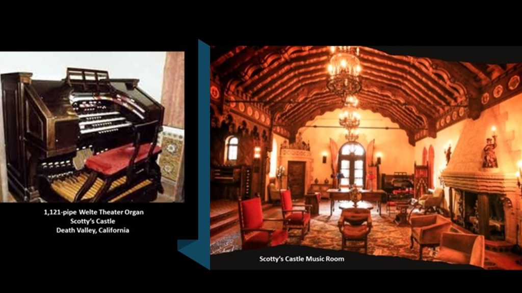
Scotty’s Castle includes such amenities as a 1,121-pipe Welte Theater Organ, which was the type of organ used in movie theaters to accompany the earlier silent films…
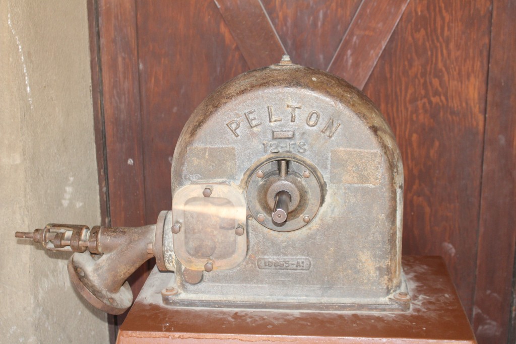
…and one-quarter-mile, or .4-kilometers, of tunnels underneath the building, where there is a Grapevine Canyon springwater-powered Pelton-wheel for electricity-generation…
…and an array of Edison’s nickel alkaline batteries for electricity storage…
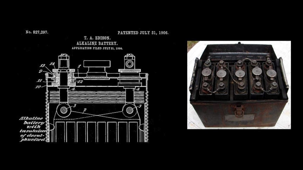
…and the tunnels were also where the imported Spanish tiles were stored…
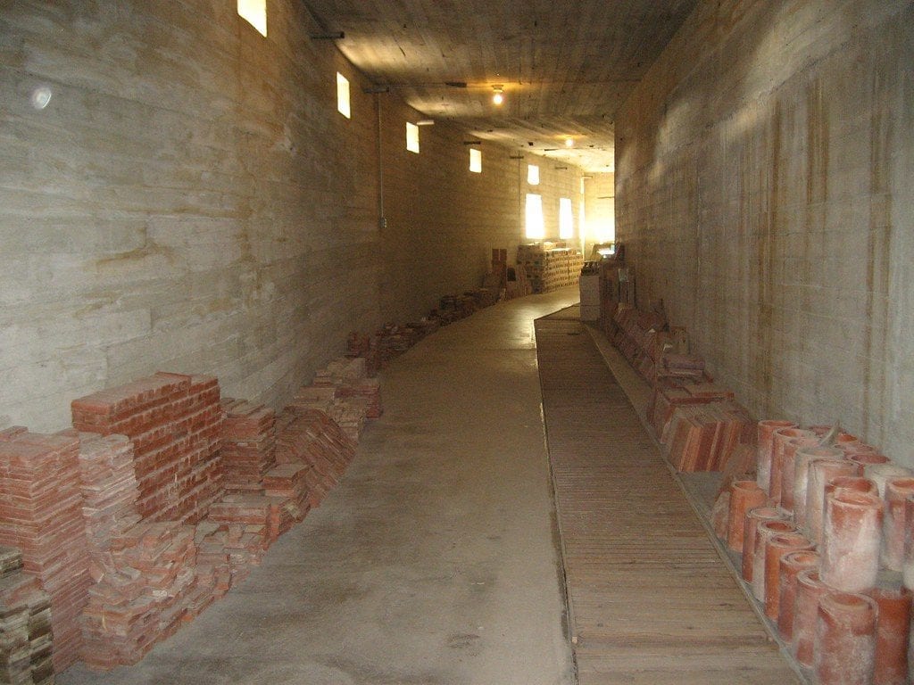
…for the pool that wasn’t finished when we are told the construction of the villa stopped in 1929.
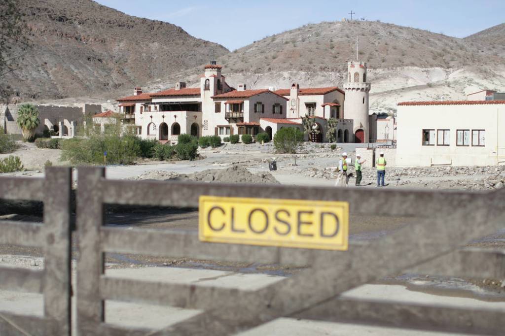
Scotty’s Castle has been closed to the public since 2015 after it sustained severe flood damage.
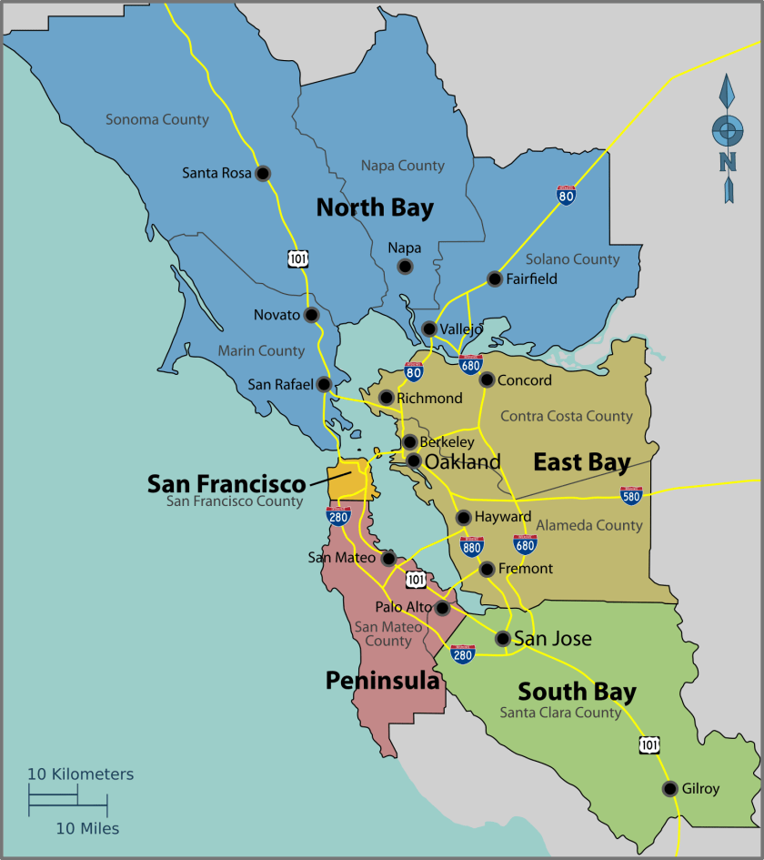
Next, I am going to take a look at the history of San Francisco and the surrounding area.
San Francisco became the cultural, commercial, and financial center of northern California.
It covers an area of about 50 square-miles, or 121 kilometers-squared, at the north-end of the San Francisco Peninsula in the San Francisco Bay area.
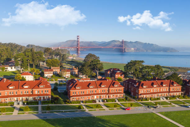
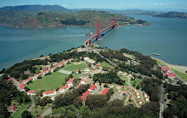
San Francisco was said to have been founded by Spanish colonists in 1776, who built a fortification called “El Presidio Real of San Francisco,” or “The Royal Fortress of Saint Francis of Assisi,” at what is now simply called the Presidio, a park and former U. S. military installation until 1994, which is when it was transferred to the National Park Service.
In early May of 1851, three-years after the start of the California Gold Rush and four-years before it ended in 1855, there was a two-day fire in San Francisco that was said to have destroyed as much as three-quarters of San Francisco.
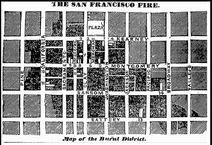
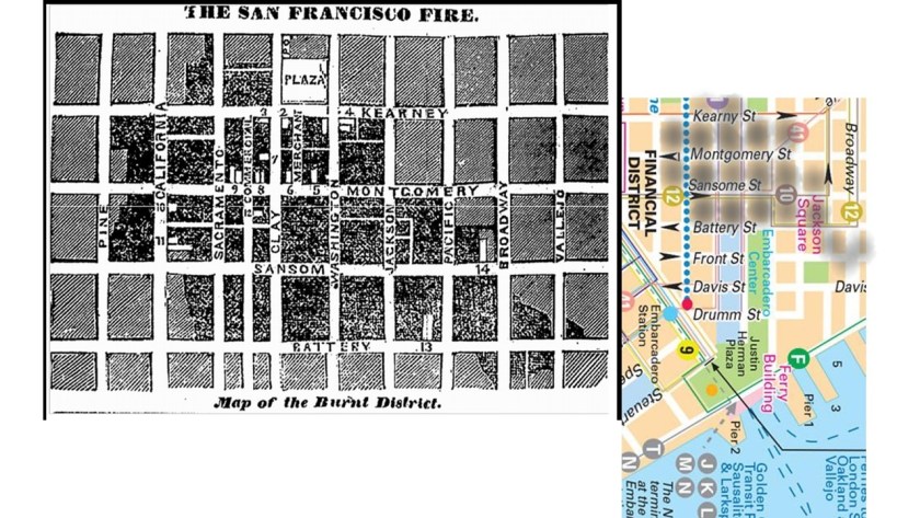
Here is the map of the Burnt District of the 1851 San Francisco Fire and a map of its exact location in the city today, compared with where the location of the city’s financial district.
This is the historical narrative surrounding the fire.
It was said to have occurred during the height of the California Gold Rush between December of 1849 and June of 1851.
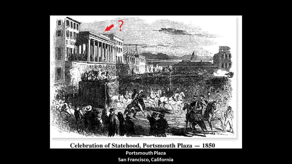
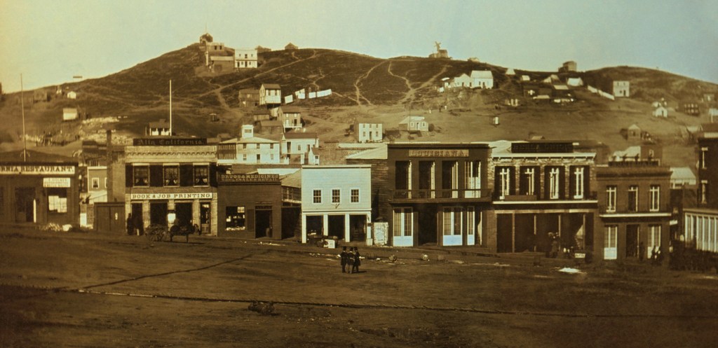
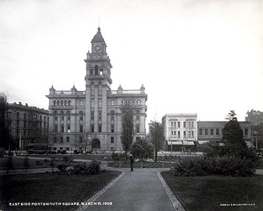
This was said to be an early daguerrotype, an early form of photography, of Portsmouth Square in San Francisco from 1851, some time before June of 1851.
Besides the fact that it looks like a mud flood scene, the fire was said to have started in Portsmouth Square in a paint and upholstery store on the night of May 3rd, 1851.
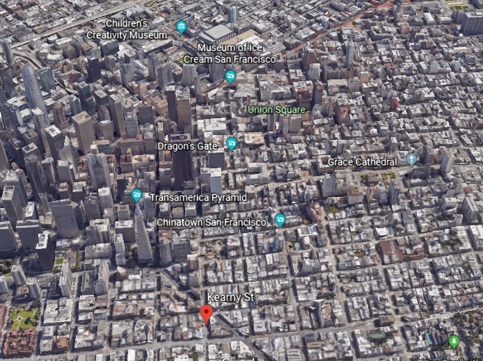
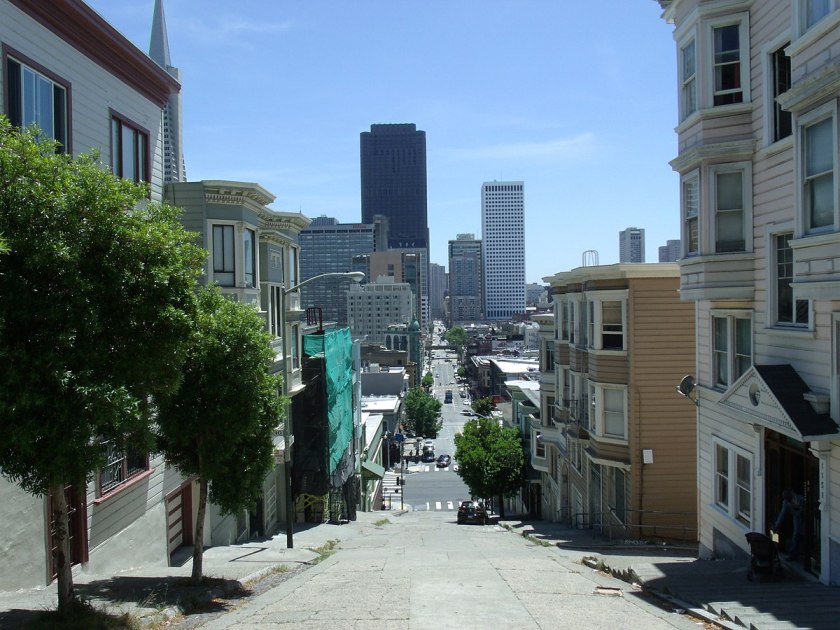
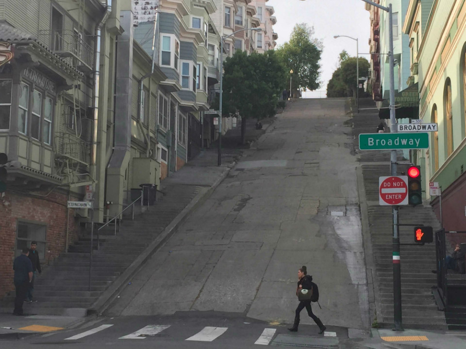
High winds were said to carry the fire down Kearny Street, which runs north from Market Street to the Embarcadero, and on its south end separates the Financial District from Union Square and China Town.
Here are views up-and-down Kearny Street, and its perfectly smooth, and angled, steep slope with steps on both sides of it.
This is the Columbus Tower, also known as the Sentinel Building, on Kearny Street, with its copper and white-tile exterior. Construction of it was said to have been begun before the 1906 fire, which it purportedly survived.
It is now primarily occupied by Francis Ford Coppola’s production studio.
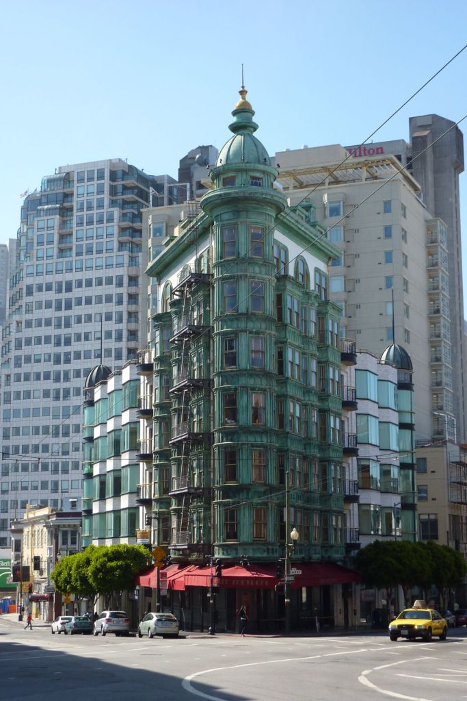
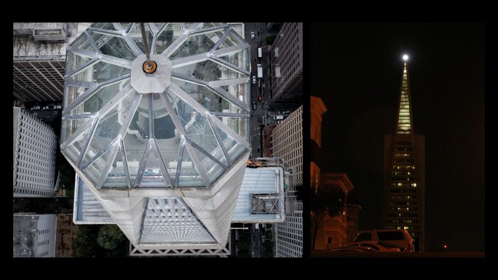
From Kearny Street, the fire was said to shift south into the downtown area. Well, the Columbus Tower is very close to the Transamerica Pyramid…
…and the place where the Transamerica Pyramid is located interestingly in what appears to be in the center of what was called the Burnt District.
Construction of the Transamerica Pyramid was said to have started in December of 1969, and completed in 1972.
Special things about the Transamerica Pyramid include a 32-pane, cathedral-style glass top, which contains a 6,000-watt beacon light.
Adolph Sutro was a German-American engineer, politician and philanthropist who was the Mayor of San Francisco from 1895 to 1897.
He emigrated from Prussia in 1850, and moved to San Francisco in 1851, and left for Virginia City in Nevada in 1860.
He made a fortune in connection with the Comstock Lode in Virginia City, the first major discovery of silver ore in the United States.
He returned to San Francisco around 1879.
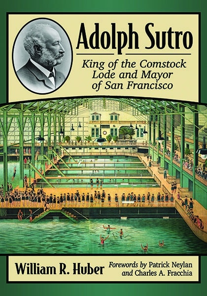
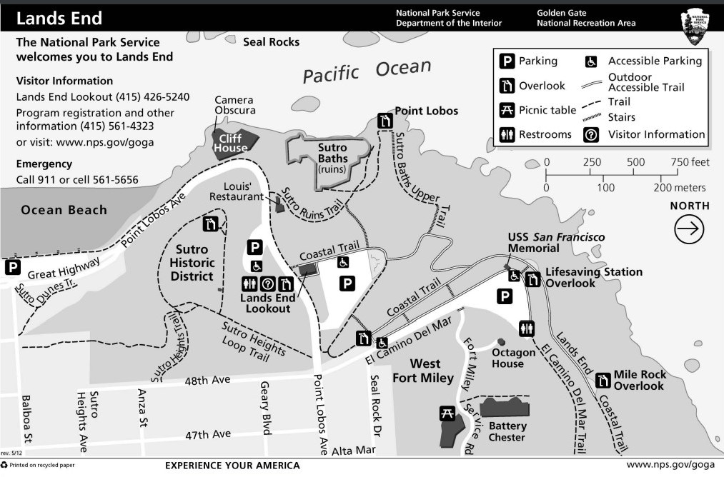
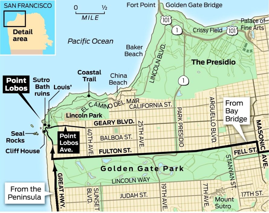
He increased his wealth by large real estate investments in San Francisco, including places like Land’s End, in the Golden Gate Recreational Area today.
This is what we are told in our historical narrative.
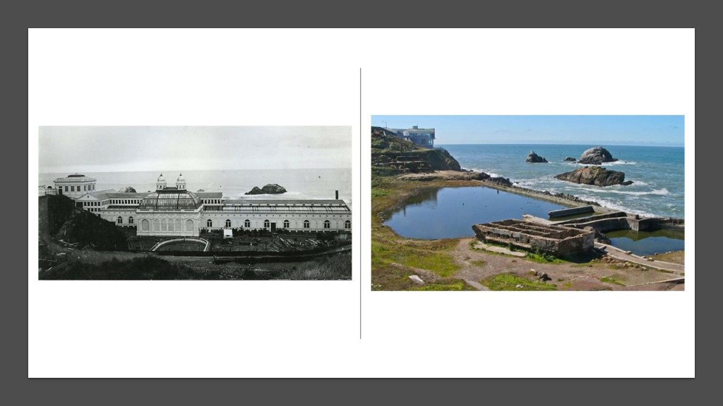
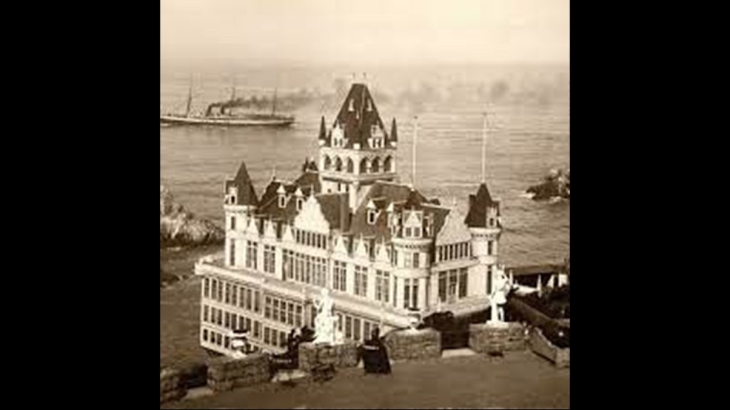
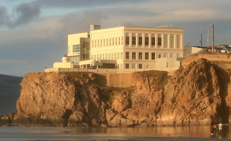
Adolph Sutro opened his private estate to the public, building the Sutro Baths in Lands End between 1894 and 1896, pictured on the left.
All that remains today of the Sutro Baths is seen on the right.
In 1897, Sutro was said to have built the second Cliff House in existence at this location in Lands End near the Sutro Baths, after the first one burned down in 1894, and the second-one burned to the ground in 1907.
The Cliff House was said to have been rebuilt for the third time, and completed in 1909.
The building still stands today, but the Cliff House was closed at the end of 2020.
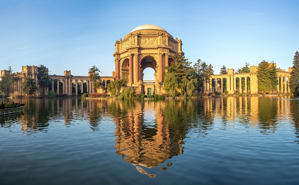
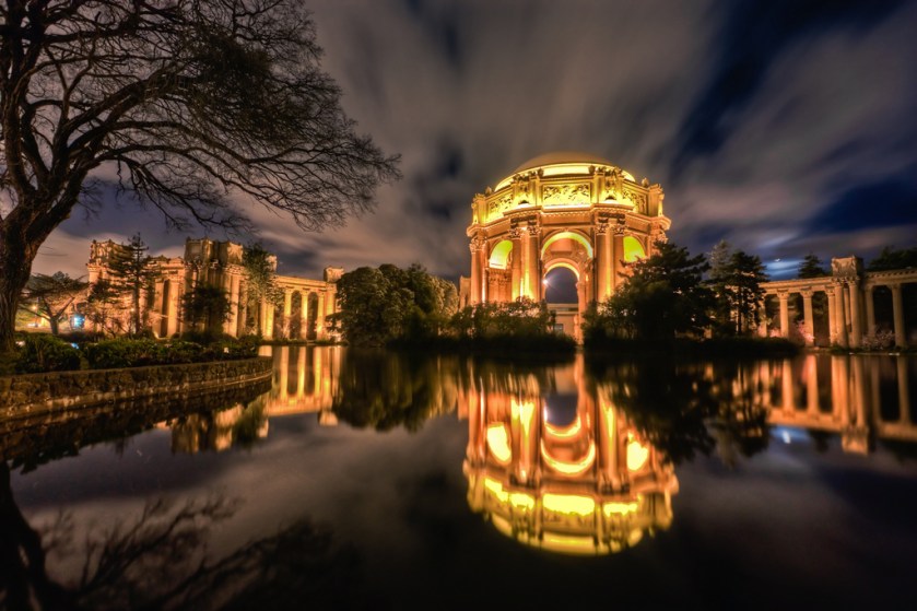
This location at San Francisco’s Land’s End is very close to the Presidio, the Golden Gate Bridge, and the Palace of Fine Arts.
The Presidio, a park and outdoor recreation hub today, was formerly a U. S. Army post…
…and the Palace of Fine Arts was said to be the only remaining building from the 1915 Panama-Pacific Exhibition, with nine other palaces said to have been built for the Exhibition having been demolished long ago.
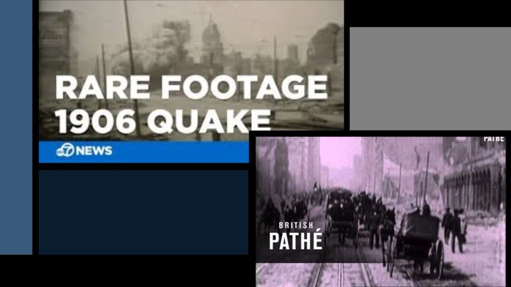
More on the 1915 Panama-Pacific Exhibition in a moment, but first a look at the 1906 Earthquake and Great Fire of San Francisco
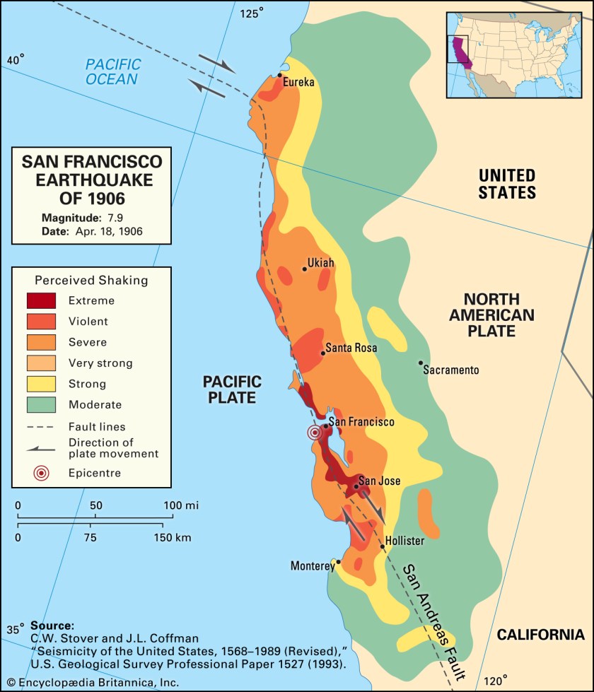
The 1906 Earthquake and Great Fire of San Francisco contains all of the elements of the modus operandi of the reset of the original advanced civilization to a new false historical narrative.
This is what we are told about this famous historical event.
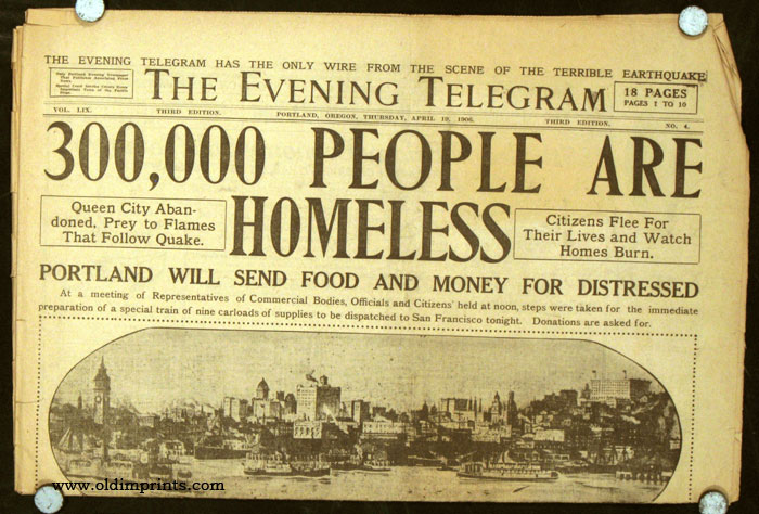
A very large earthquake struck the coast of northern California early in the morning of Wednesday, April 18th, 1906.
High intensity shaking was felt from Eureka, California, which is the principal city of what is called the Redwood Empire region of California, and the largest coastal city between San Francisco and Portland, Oregon.
The California Parks’ Headquarters for the North Coast Redwoods District is in Eureka.
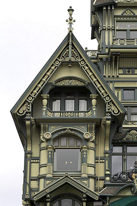
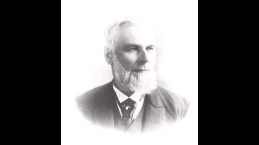
The Carson Mansion is a nationally-recognized landmark in Eureka.
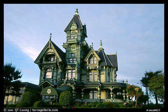
It was said to have been built, starting in 1884, and completed in 1886, for lumber baron William Carson.
It has been a private club since 1950 and is not open to the general public.
William Carson was said to have arrived in San Francisco in 1849, from New Brunswick in Canada, with a group of other woodsmen, and they first started cutting down trees in 1850.
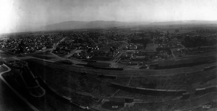
The high-intensity shaking of the 1906 Earthquake was said to have been felt to the Salinas Valley, an agricultural region south of the San Franscisco Bay area, and one of the most productive agricultural regions in California.
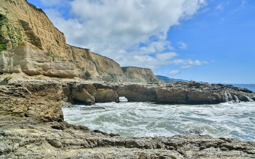
The epicenter of the earthquake was believed to be in Olema, in the Point Reyes area.
This is Arch Rock at Sculptured Beach on Point Reyes.
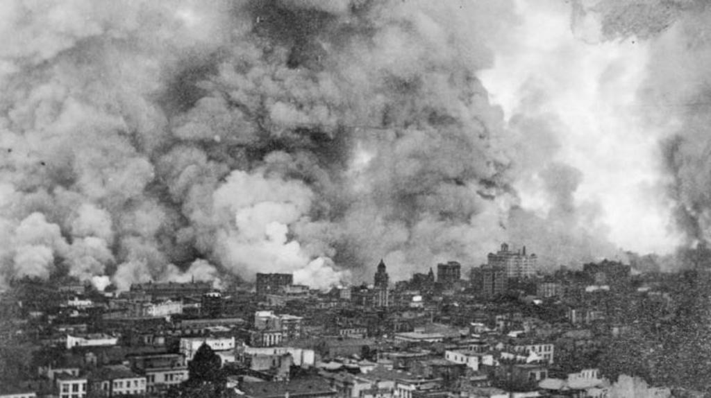
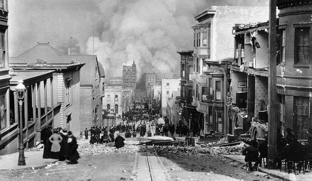
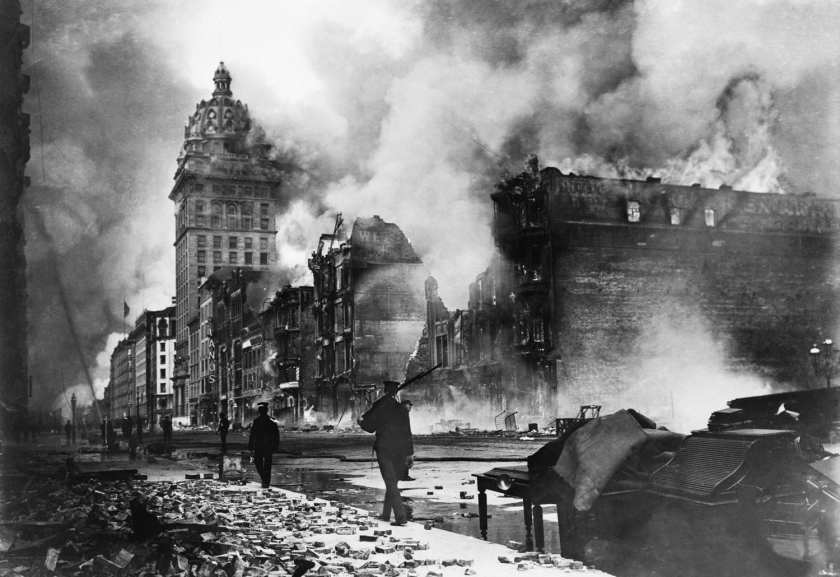
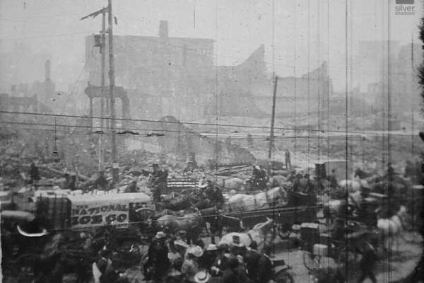
We are told after the earthquake, fires soon broke out in San Francisco, and lasted for several days, and as a result, up to 3,000 people died, and over 80-percent of San Francisco was destroyed.
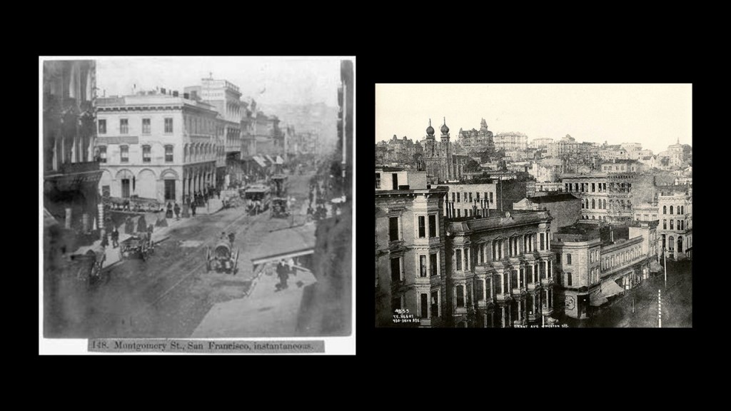
Here are some photos of San Francisco prior to the 1906 earthquake and fire…
…and photos taken at the time everything was happening. I find it interesting to note the photos showing well-dressed people that seem to be calmly hanging out in the midst of all of the destruction. I wonder what that was all about…
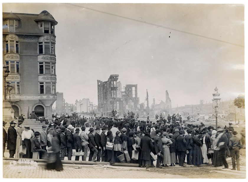
We are told that up to 300,000 people were left homeless out of a population of 410,000.
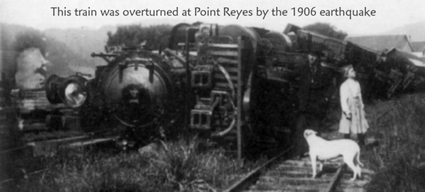
Half of those evacuated were said to have fled across the San Francisco Bay to Oakland and Berkeley, apparently with the help of the Southern Pacific Railroad running 1,400 trains, starting 45-minutes after the earthquake occurred, in the midst of chaos and destruction for the next five days…
…notwithstanding this train said to have been overturned at Point Reyes by the earthquake, with the surreal-looking young girl and dog standing beside it.
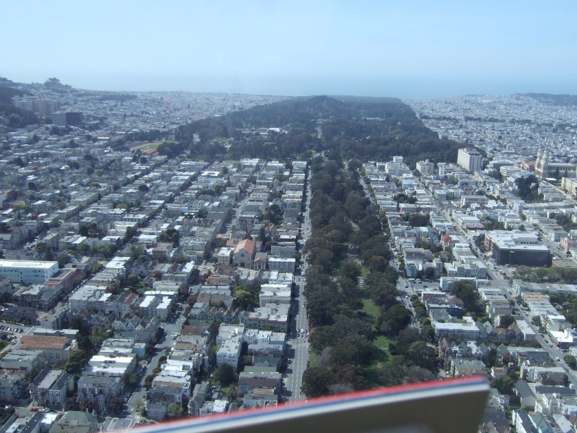
For those remaining in San Francisco, makeshift tents were said to cover places like Golden Gate Park…
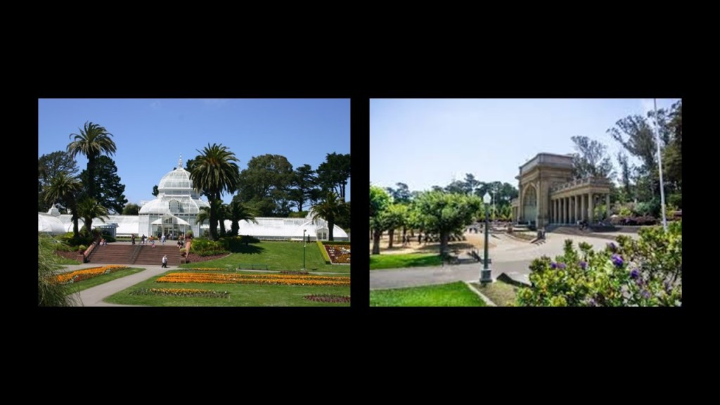
…the Panhandle…
…and the Presidio.
As mentioned previously, the Palace of Fine Arts in San Francisco is located near the Presidio.
It was said to have been built for the Panama-Pacific Exposition of 1915, an exposition which celebrated the city and its rise from the ashes. and one of its few surviving structures.
Interesting to note such a massive engineering feat and event like this taking place during World War I, which took place between 1914 and 1918 in our historical narrative.
The San Francisco earthquake and fire was said to be the first disaster of its magnitude to be documented by photography and motion picture footage.
We are told ninety-percent of the total destruction of San Francisco was caused by out-of control fires.
One of the largest fires, called the “Ham and Eggs” fire, was said to have been caused by a woman making breakfast for her family.

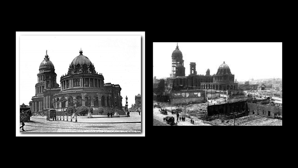
This fire was said to have caused the destruction of the San Francisco City Hall…
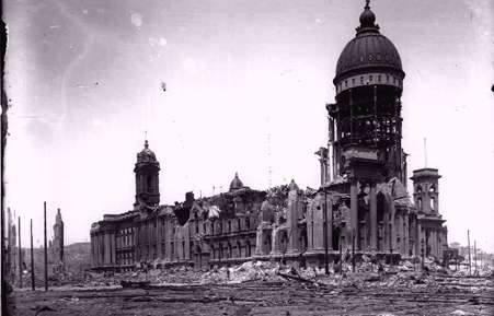
…as well as the Hall of Records. This is what it looked like before…and after.
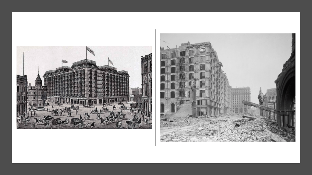
The “Ham and Eggs” Fire was also said to have destroyed the Palace Hotel.
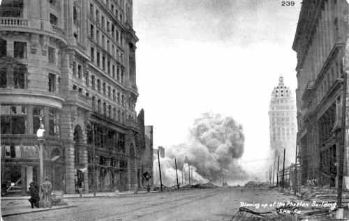
Another cause of the destructive fires was attributed to firefighters who were untrained in the use of dynamite.
We are told they were trying to dynamite strategic buildings to create a firebreak, but instead caught on fire from the dynamite itself.
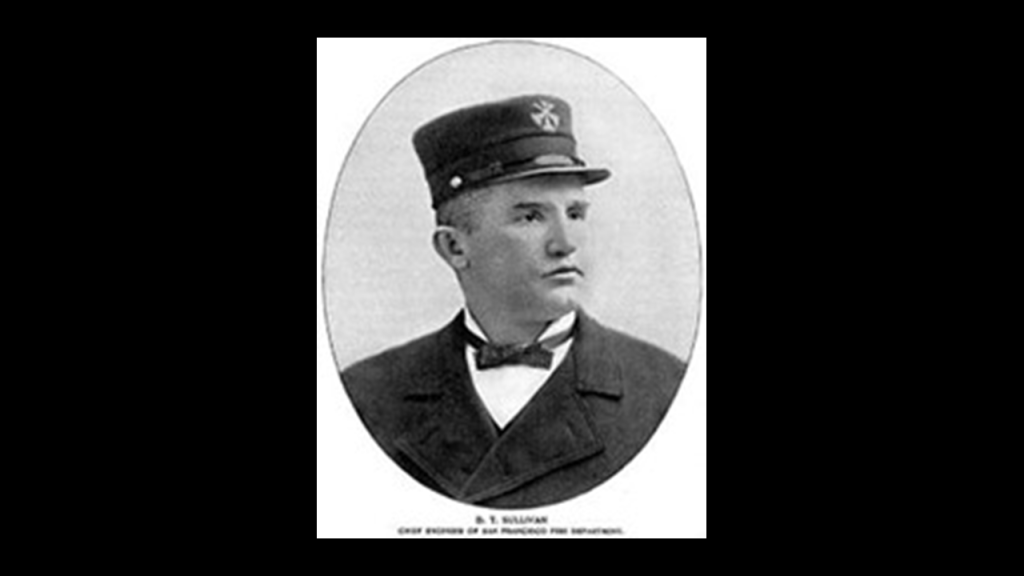
San Francisco’s Fire Chief, Dennis T. Sullivan, was said to have died early on from injuries sustained during the earthquake.
Plans to rebuild San Francisco were said to have been started right away, but we are told funds were not available for at least a week because all of the major banks were where the fire was, and they had to wait for the fire-proof vaults to cool down enough to access the money in them.
The only money available was from the Bank of Italy, which was founded in San Francisco in October of 1904.
This was the only bank which had evacuated its fund…prior to the earthquake and fire.
Did they know something?
By the way, in 1929, the Bank of Italy became the Bank of America.

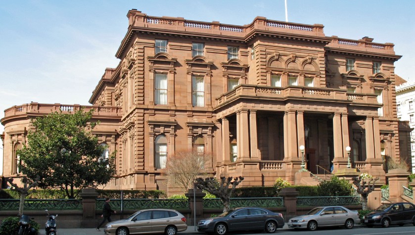
We are told the power of the earthquake destroyed almost all of the mansions on Nob Hill, except for the James C. Flood mansion.
Nob Hill has historically served as a center of San Francisco’s upper class, and is one of San Francisco’s original seven hills.
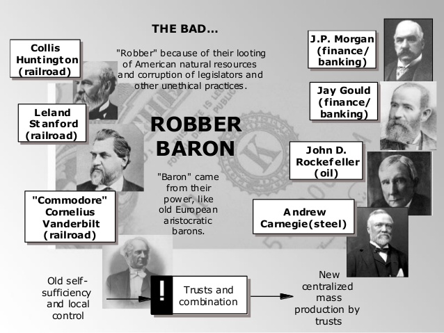
Prior to the 1850’s, it was called California Hill, but was re-named Nob Hill after the Central Pacific Railroad’s Big Four, known as the Nabobs, or Nobs, said to be an Anglo-Indian term for ostentatiously wealthy men. Their mansions in these pictures were said to have been destroyed by the earthquake.
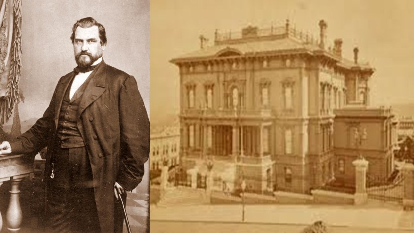
They were Leland Stanford, President of the Central Pacific Railroad…
…Collis P. Huntington, the Vice-President of the Central Pacific Railroad…
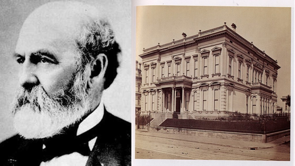
…Mark Hopkins, Treasurer of the Central Pacific Railroad…
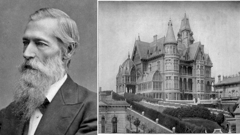
…and Charles Crocker, Construction Supervisor of the Central Pacific Railroad, and President of Charles Crocker & Company.
These four men used their immense wealth and power to dominate politics and commerce in San Francisco and California.
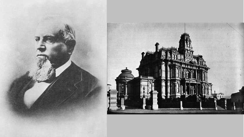
Where did all their wealth come from?
Well, we are told it came first from selling supplies for the California Gold Rush of 1849 to 1855,
Then they were said to have funded the construction of the Transcontinental railroad.
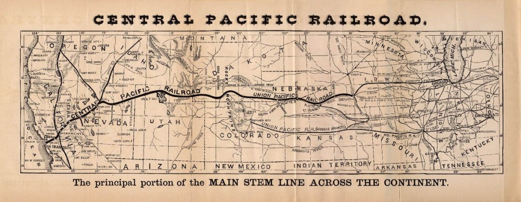
When they became Directors of the Central Pacific Railroad, they became immensely wealthy and the most powerful men in California.
You can also find them referred to as Robber Barons, along with other prominent individuals of this era.
Robber Baron is defined as a person who has become rich through ruthless and unscrupulous business practices, originally with reference to prominent U. S. businessmen in the 19th-century.
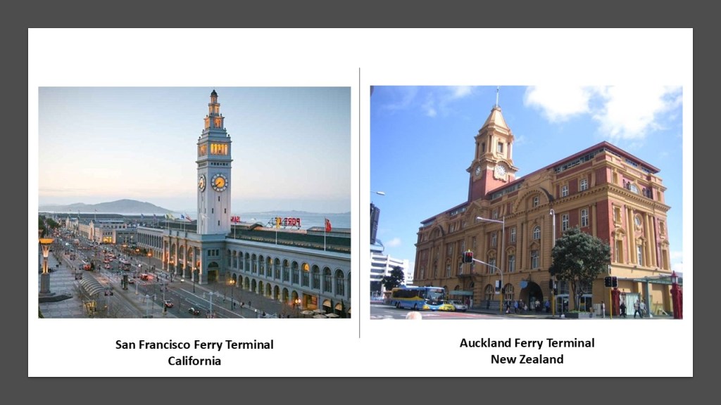
The ferry terminal is located on San Francisco’s Embarcadero.
The Embarcadero is the eastern waterfront and roadway of the Port of San Francisco, and built on reclaimed land along a 3-mile, or almost 5-kilometer, -long engineered seawall.
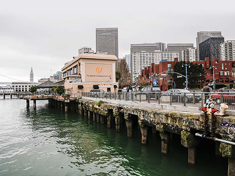
The San Franciso Ferry Terminal was said to have been designed in 1892, and opened in 1898.
For comparison on the right is the Auckland Ferry Terminal, also said to have been completed on reclaimed land, in Auckland, New Zealand, in 1912.
Here is an historic photo of the First Kearny Street Hall of Justice, a jail that was called a book and intake facility, and said to have been built in 1912; rehabilitated by FDR’s New Deal’s Works Project Administration in the 1930s; and then demolished in 1968.
It was mighty grand building for a temporary jail that only existed for 56-years.
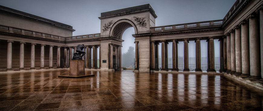
The Legion of Honor Museum, at one time known as the California Palace of the Legion of Honor, is in San Francisco’s Lincoln Park.
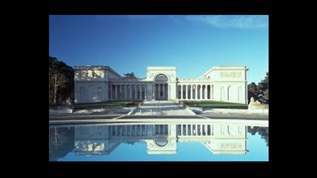
It was said to have been donated as a gift to the City of San Francisco in 1924 by Alma de Bretteville Spreckels.
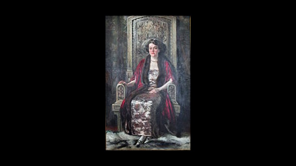
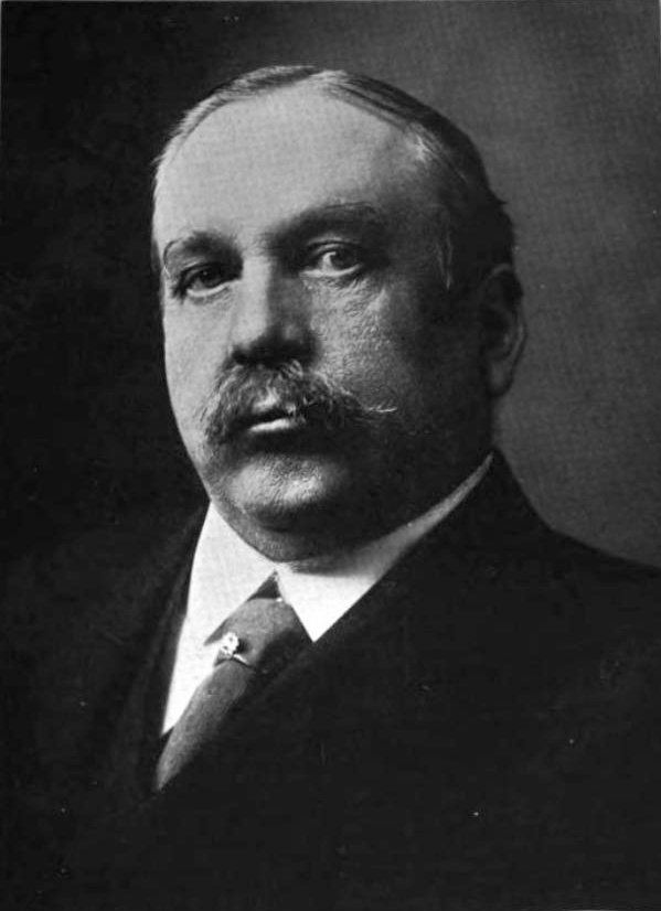
She was the wife of sugar magnate and thoroughbred horse owner and breeder Adolph Spreckels.
The Legion of Honor Museum was said to be a full-scale replica of the French Pavilion at the San Francisco Panama-Pacific Exposition of 1915, and based on the Legion of Honor Museum in Paris.
Dedicated as a Memorial to California soldiers killed in World War I, the Legion of Honor Museum in San Francisco opened on Armistice Day, November 11th, in 1924.
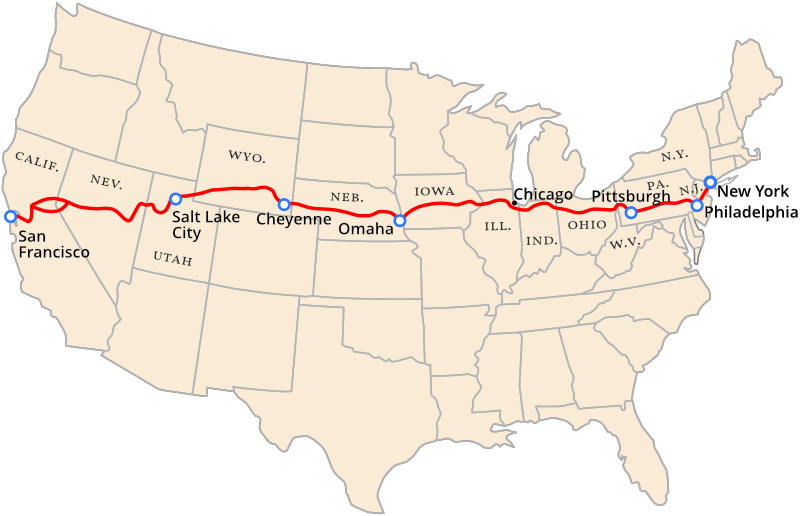
The Legion of Honor Museum is also the western terminus of the Lincoln Highway, of which Times Square in New York City is the eastern terminus.
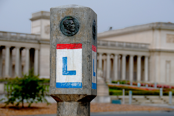
The Lincoln Highway was one of the earliest transcontinental routes for automobiles in the United States, said to have been conceived of by Indiana entrepreneur Carl G. Fisher in 1912, and formally dedicated on October 31st in 1913.
Other grand architecture in San Francisco includes:
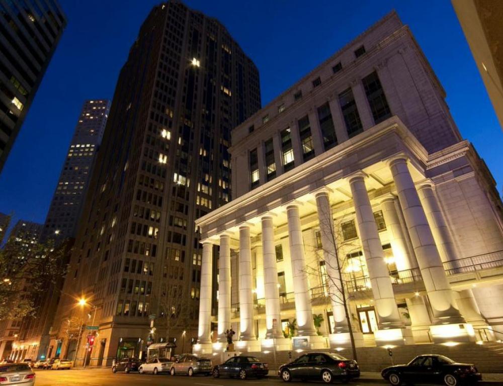
The Bently Reserve Building, formerly the Federal Reserve Bank of San Francisco.
It was said to have first opened in 1924.
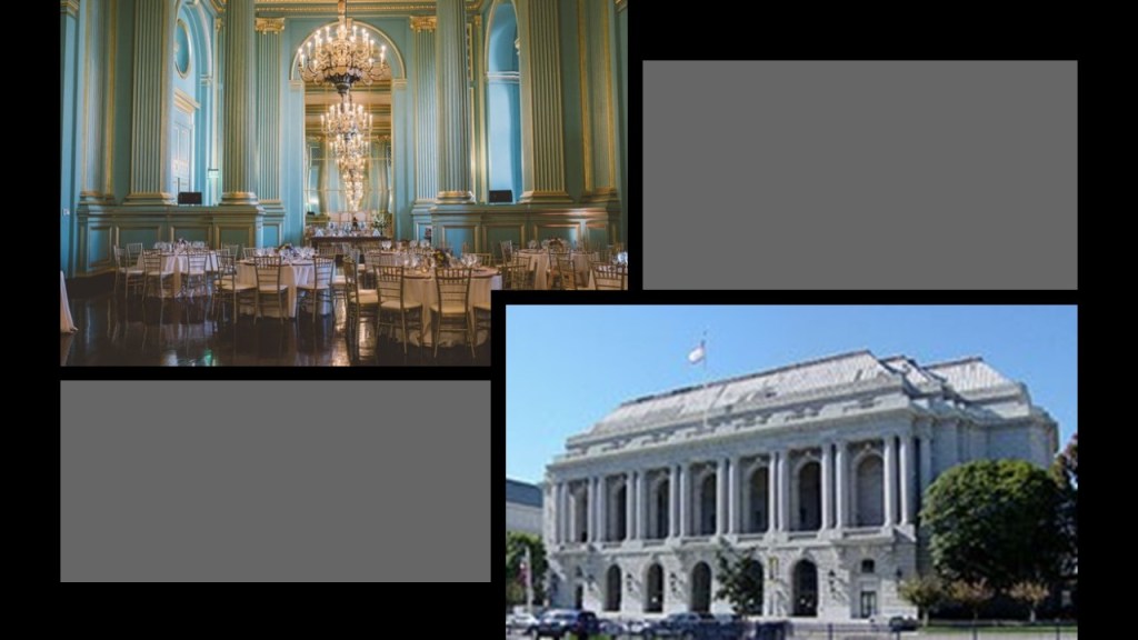
The War Memorial & Performing Arts Center, said to be one of the last Beaux-Arts structures erected in the United States, and built between 1928 and 1932, which would have been during the Great Depression.+
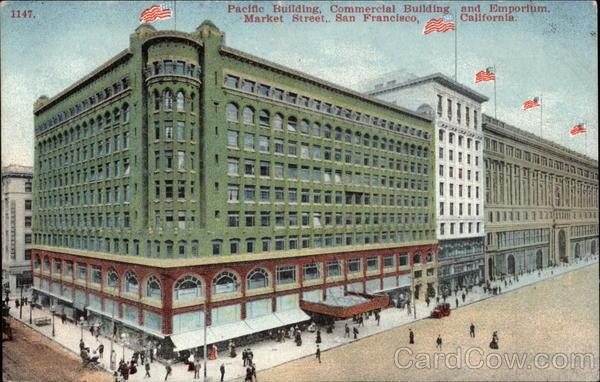
Also what was the San Francisco Emporium, and which was called, at the time it opened in 1896, the grandest mercantile in the world.
Its original structure survived the 1906 earthquake and fire, but not urban developers after it closed in 1995.
Since that time, most of the building was demolished with the exception of the dome and facade to be used in a new building.
Now I am going to look at Marin County, which is across the Golden Gate Strait from San Francisco.
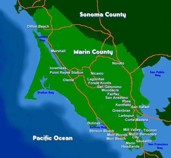
I’ll start at San Anselmo, and then take a look around other places in Marin County.
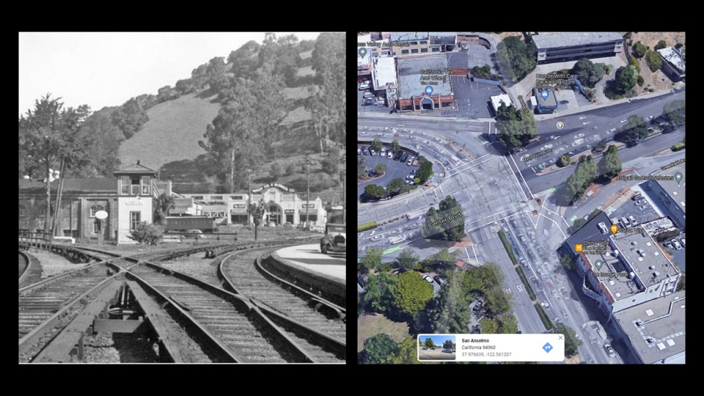
In 1874, the North Pacific Coast Railroad added a spur line from San Anselmo to San Rafael, and a year later the railroad completed a line that ran between Sausalito and Tomales, and north to Cazadero by way of San Anselmo, which was known on railroad maps as Junction until 1883.
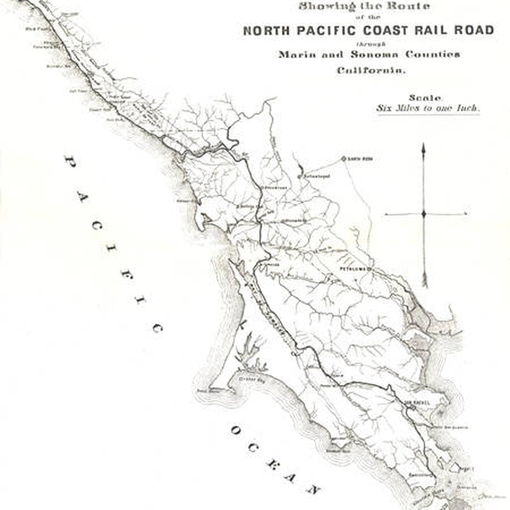
In 1907, the Northwestern Pacific Railroad took over the regional rail-lines, and there was electrified interurban between cities, including San Anselmo, and which was abandoned after the opening of the Golden Gate Bridge in 1937.
In San Anselmo, the tracks were replaced with roads, creating what has been described as one of the most haphazard intersections to drive in California.
All of the original Northern Pacific Coast (NPC) Railroad trackage has been abandoned.
This is the Montgomery Memorial Chapel on the campus of what was the San Francisco Theological Seminary, and what today is the University of Redlands-Marin Campus.
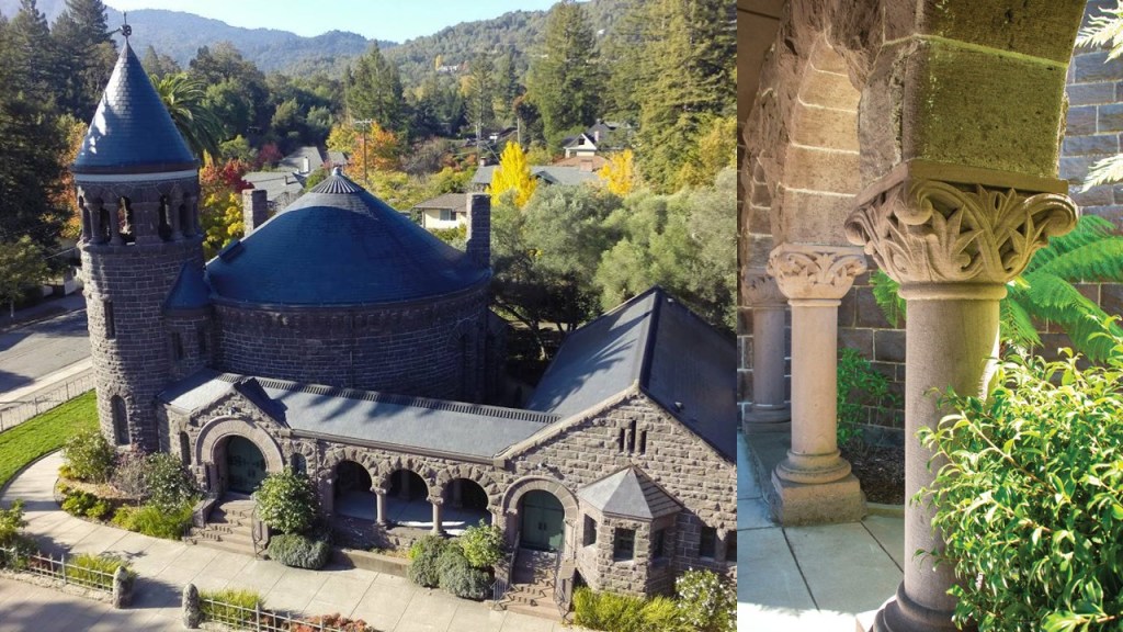
Montgomery Hall and Scott Hall were said to have been completed in 1892 for the seminary, and are called West Coast examples of the Richardsonian Romanesque architectural-style.
The Marin Civic Center is located in San Rafael.
Frank Lloyd Wright was credited with the design of the main building, but that he died before construction started in 1960, and the construction of it was completed by 1962 under the guidance of his protege, Aaron Green.
Within the Civic Center complex, a Hall of Justice, Veterans’ Memorial Auditorium, and Exhibit Hall were added in the following years, with all completed by 1976.
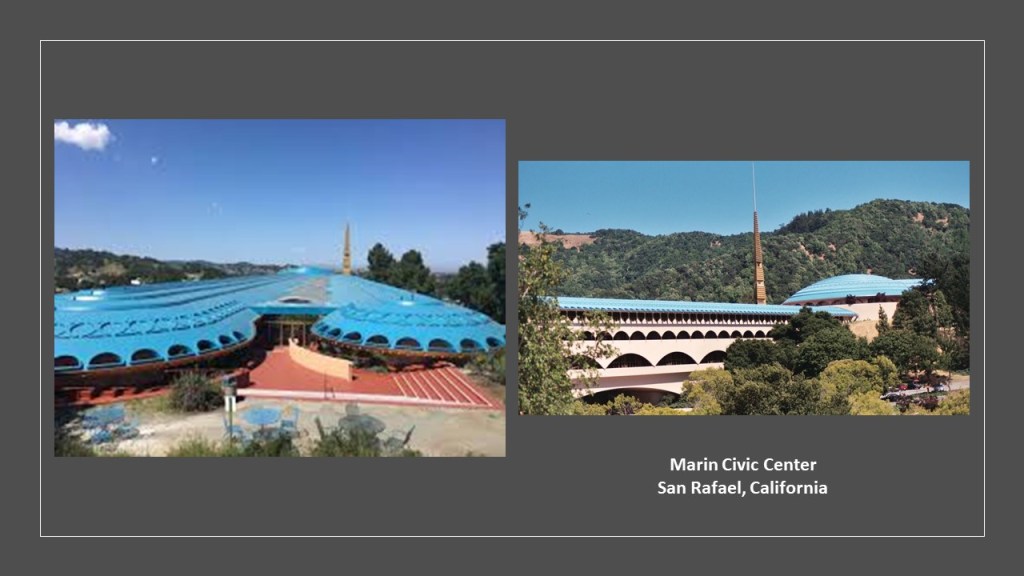
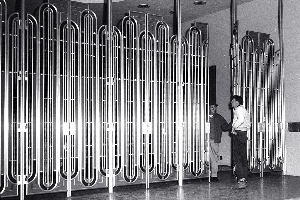
The front entrance to the Civic Center is controlled by a vertical-gate of gold-anodized metal.
Mount Tamalpais is the highest peak in the Marin Hills in Marin County.
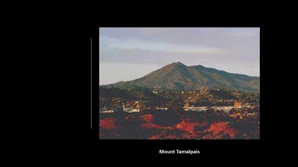
It is next to the Golden Gate National Recreation area.
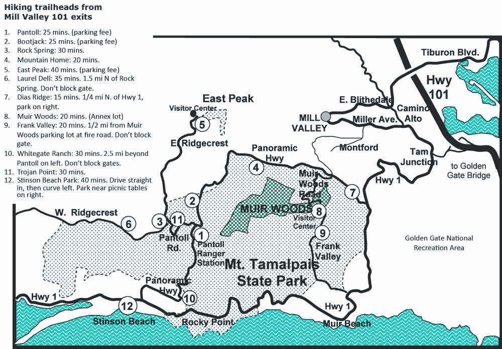
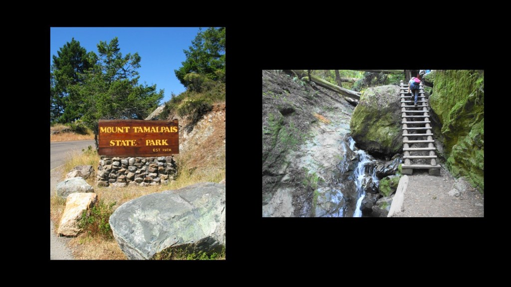
Most of the Mountain is in protected lands, including the Mount Tamalpais State Park…
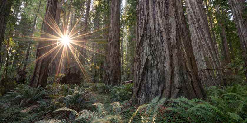
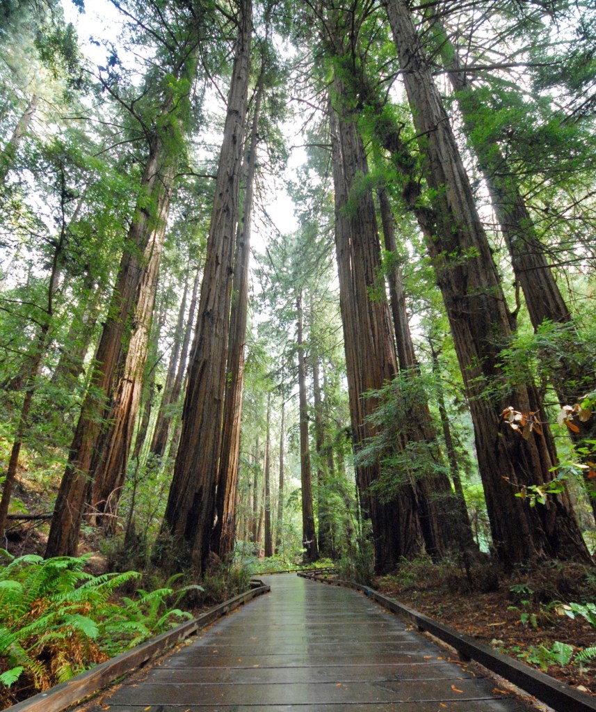
…and the Muir Woods National Monument, known for its towering old-growth Redwood Trees.
Contained within the Muir Woods National Monument is the location of a place called Cathedral Grove…
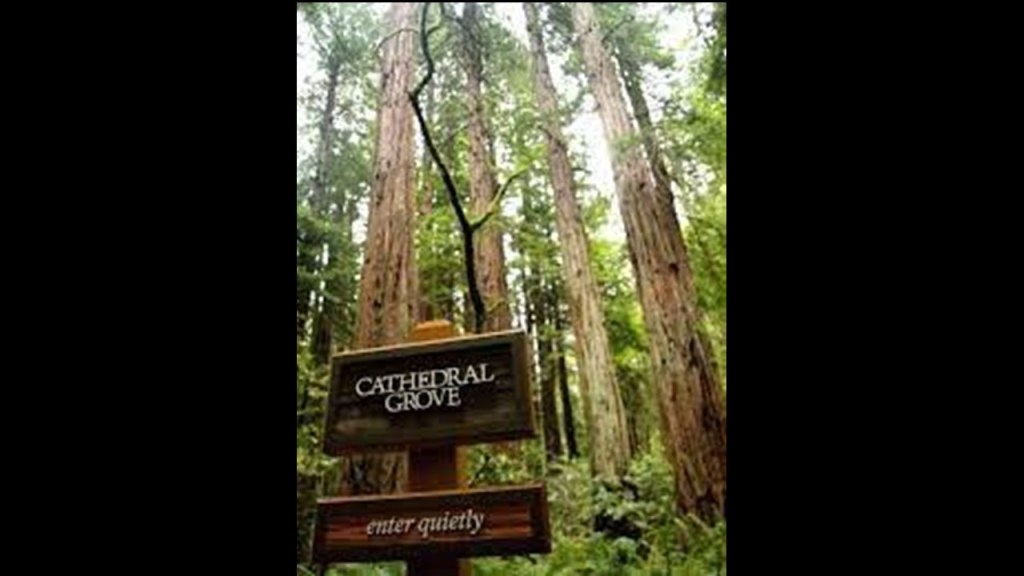
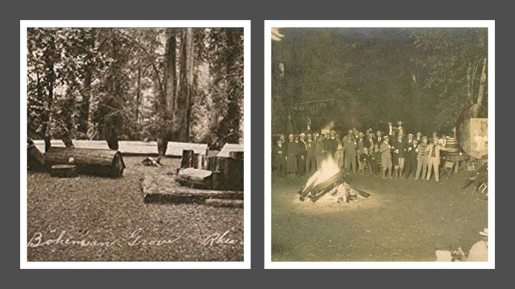
…as well as the notorious Bohemian Grove.
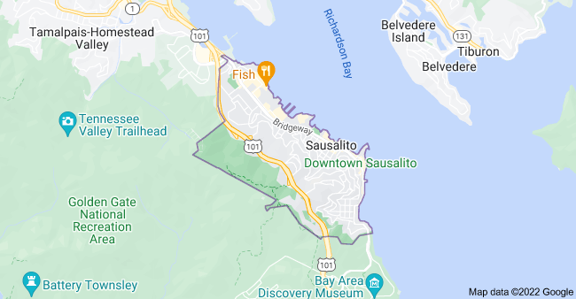
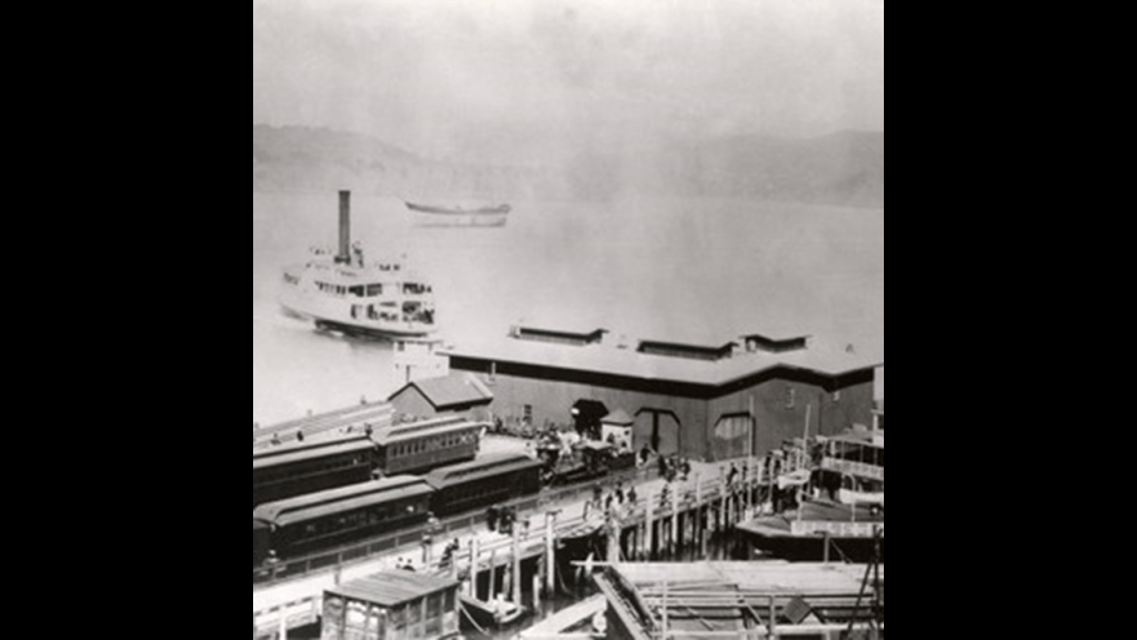
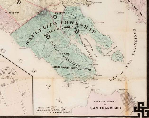
The last place I am going to look at in Marin County is Sausalito, which is adjacent to the Golden Gate National Recreation Area and Mount Tamalpais.
Before the Golden Gate Bridge opened to traffic in 1937, Sausalito was a terminus for rail and ferry transportation.
The development of Sausalito was promoted by William Richardson, an English mariner who arrived in the area in 1822.

Richardson petitioned the Mexican governor at the time for a rancho in the area, which was granted with clear title in 1838.
Richardson got himself into financial trouble, and ended up signing the title of his land over to an attorney as trustee, in the 1850s, and Richardson was dead by 1856, from the given reason of mercury poison prescribed by his physician for rheumatism.
The attorney ultimately maintained control of the Rancho Sausalito, and sold the land in the 1860s to a consortium of San Francisco businessmen, who partnered to form the Sausalito Land & Ferry Company.
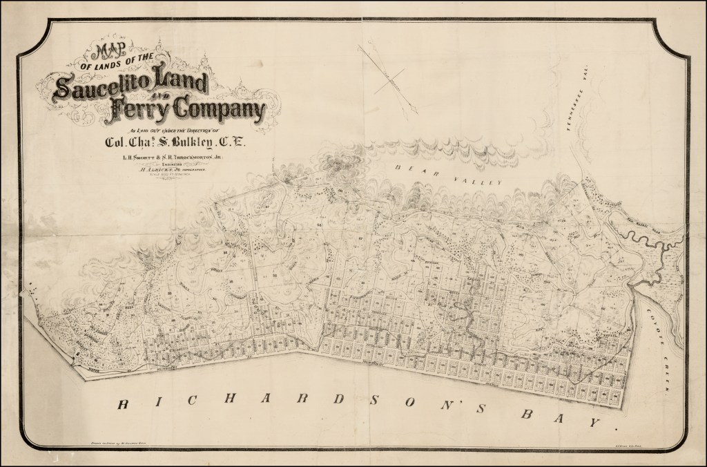
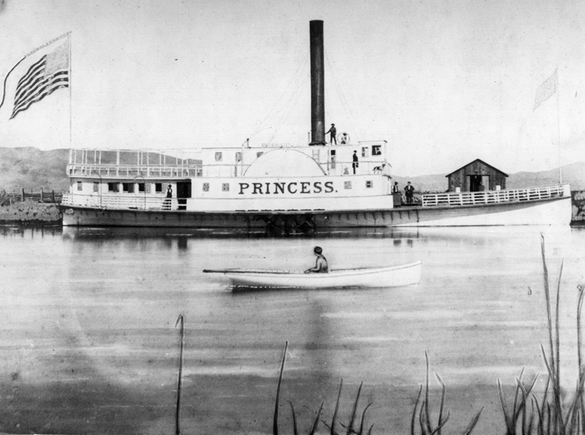
In 1868, the Sausalito Land and Ferry Company began running ferry service to San Francisco, with Sausalito serving as the southern terminus and ferry connection to San Francisco for the North Pacific Coast Railroad.
The original ferry service operated from 1868 until 1941.
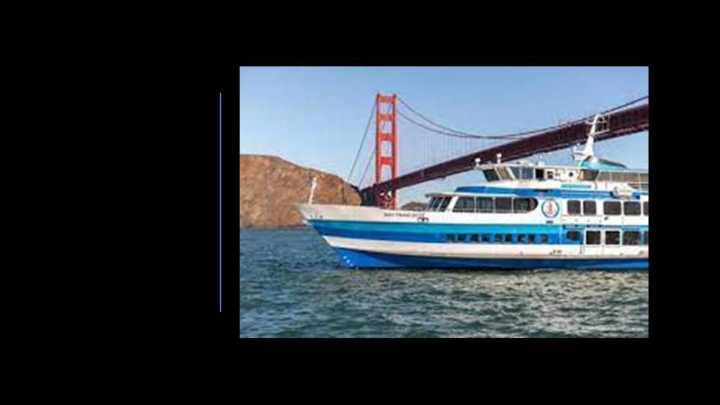
Commuter ferry service was started up by Golden Gate ferries in 1970, along with the start of bus services to the ferry terminal.
Other noteworthy places in California include:
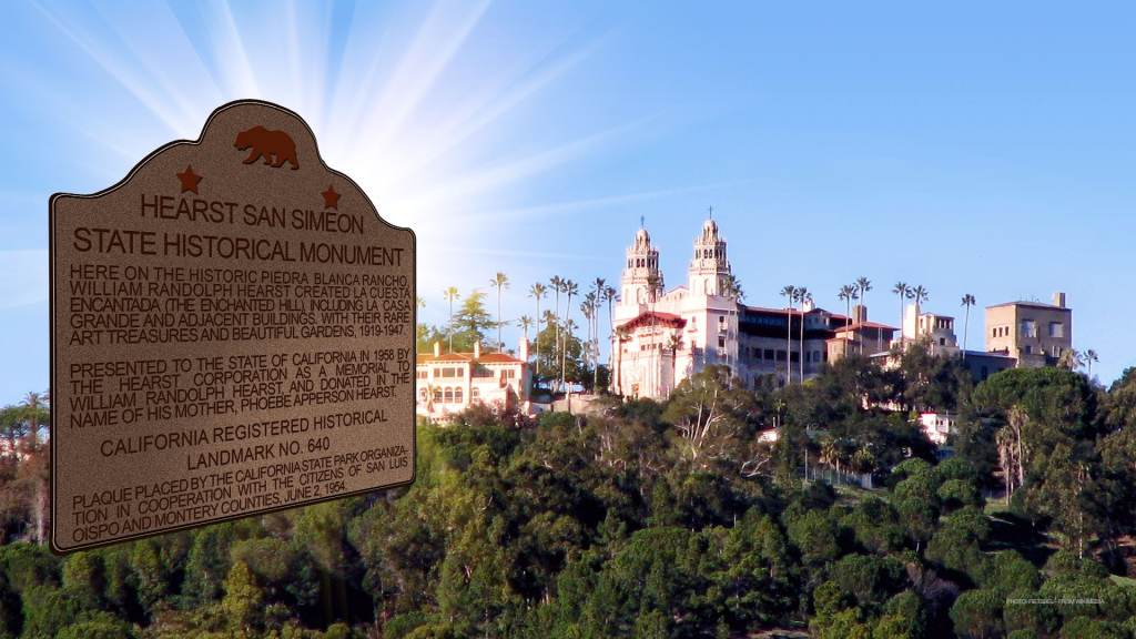
The Hearst Castle on California’s central coast.
George Hearst purchased the land in San Simeon, California, in 1865.
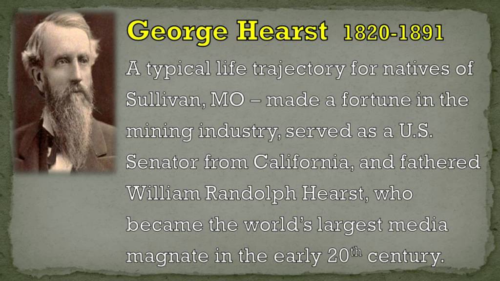
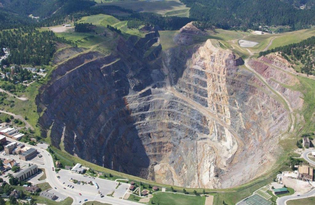
George was an American businessman and politician, who founded and developed mining operations, like the Homestake Mine in the 1870s, in the Black Hills in Lead, South Dakota, which was the largest and deepest gold mine in North America until it closed in 2002.
Here’s the story we are told behind the Hearst Castle.
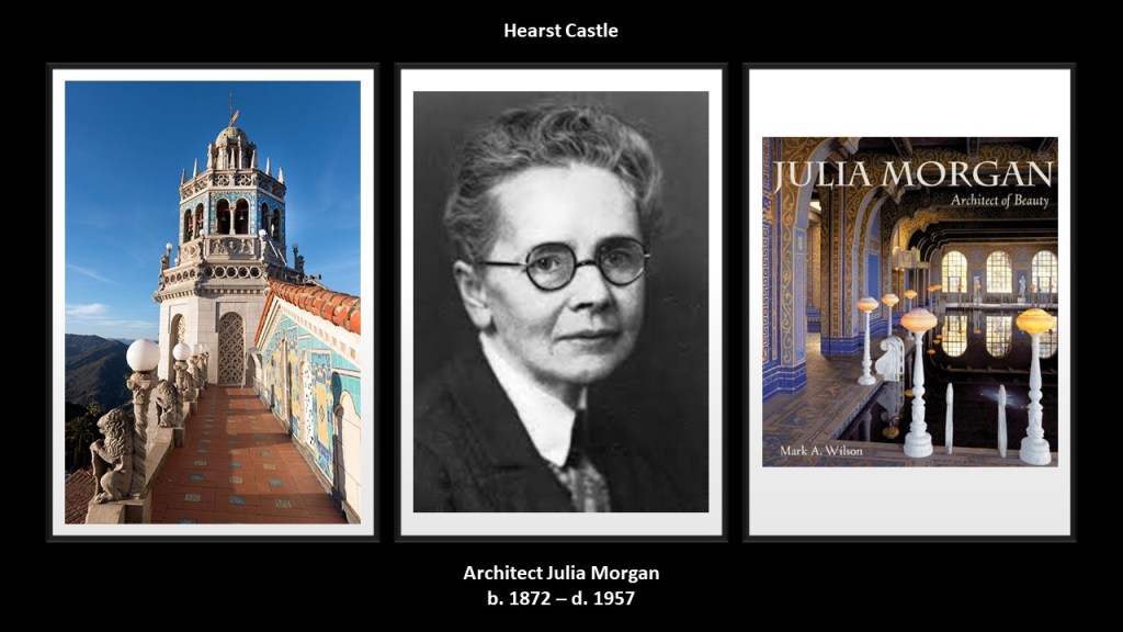
George’s son, the publishing tycoon William Randolph Hearst , and his architect, Julia Morgan, conceived what became the Hearst Castle, which was said to have been built starting in 1919, when William Randolph inherited somewhere around $10-million after the death of his mother, Phoebe.
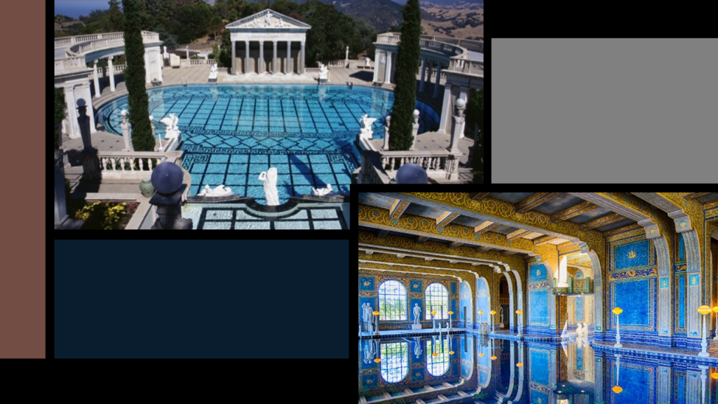
We are told that the Hearst Castle was under almost continual construction from 1920 and 1939, and during that time there was apparently enough of it constructed for William Randolph Hearst to lavishly entertain the entertainment and political luminaries of the time with many different forms of entertainment, sports, views, and what was called “the most sumptuous swimming pool on Earth.
The Hearst Castle has both an outdoor swimming poo and an indoor swimming pool.
The construction of it ended for all intents and purposes in 1947.
William Randolph Hearst died in 1951, and Julia Morgan in 1957, and in that year, the Hearst family gave the castle and much of its contents to the State of California, and it has since operated as the Hearst San Simeon State Historical Monument.
The next place I am going to take a look at is Sacramento.
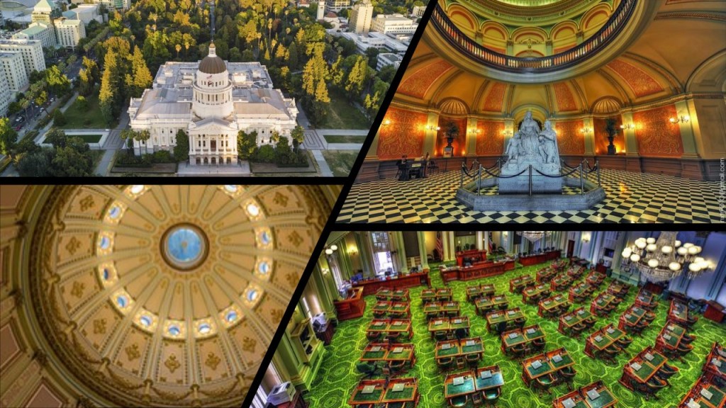
It was incorporated in 1850, making it the oldest incorporated city in California, and became the State’s capital in 1854
The California State Capital building was said to have been designed in the Neoclassical-style by Reuben S. Clark, and constructed between 1861 and 1874, coinciding with the start of the American Civil War in 1861.
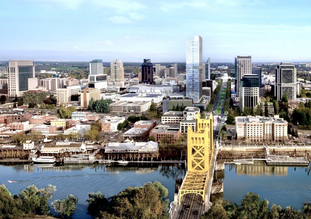
The Tower Bridge is also a vertical-lift bridge, and connects Sacramento and West Sacramento across the Sacramento River.
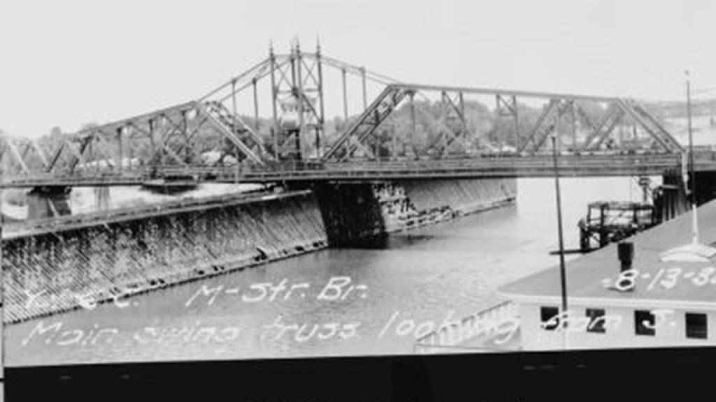
We are told the construction of the Tower Bridge as a replacement bridge for the 1911 M Street bridge was said to have started in 1934 and first opened in 1935.
This would have been around the time of the Great Depression and the beginning of World War II.
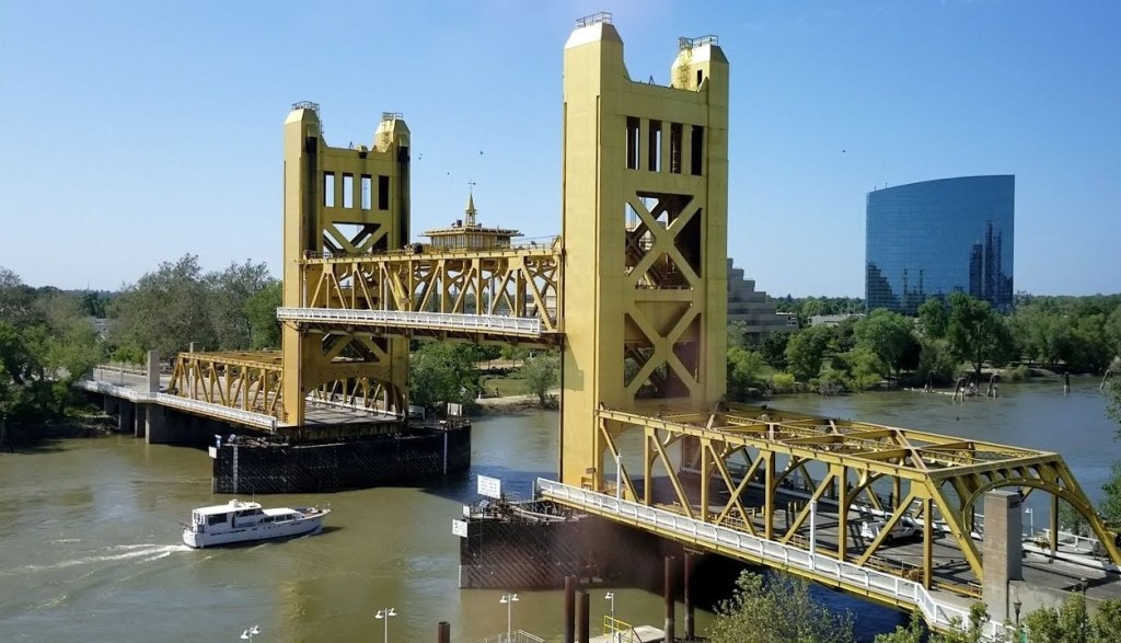
The original 1911 bridge was described as a “swing-through truss railroad bridge” that was determined to be inadequate as the result of Sacramento’s population growth doubling between 1910 and 1935, and the city’s concern for needing a better crossing over the Sacramento River in case of war.
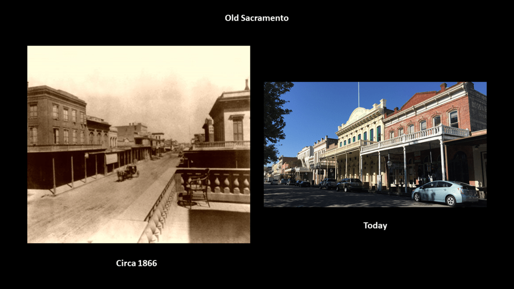
It is located in “Old Sacramento,” the riverfront historic district, with Gold Rush-era buildings attributed to Victorian-era gold miners.
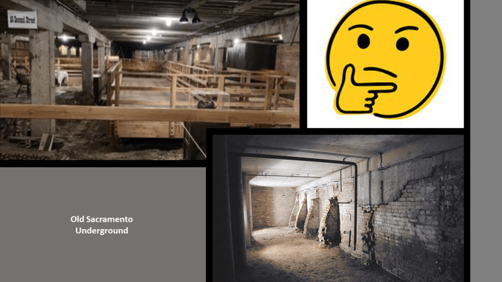
You can go on an “Underground Sacramento” Tour any day of the week, where you will learn how Sacramento lifted itself up out of floodwaters in the 1860s and 1870s by the “jacking” up of buildings to avoid further flooding.
The Tower Bridge is part of State Route 275 which connects West Capitol Avenue and the Tower Bridge Gateway with the Capitol Mall in Sacramento.
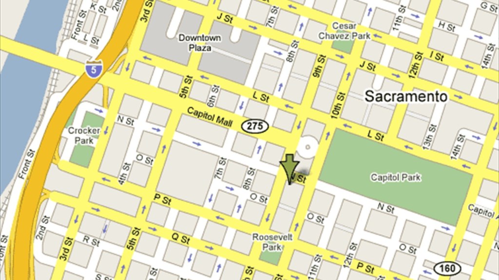
The Capitol Mall in Sacramento is described as a major street and landscaped parkway.
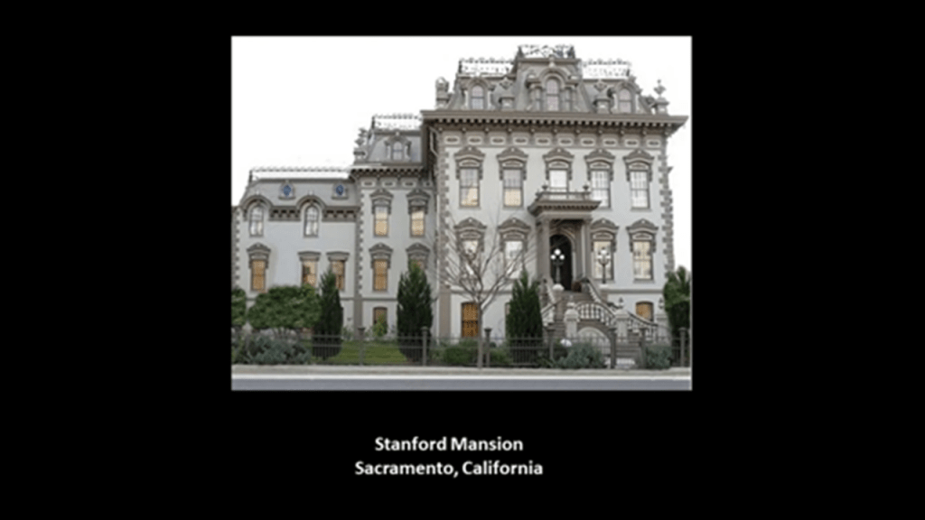
The Stanford Mansion is in the neighborhood of the Capital Mall, a couple of blocks south of the State Capitol Building and serves as the official reception center for the California government.
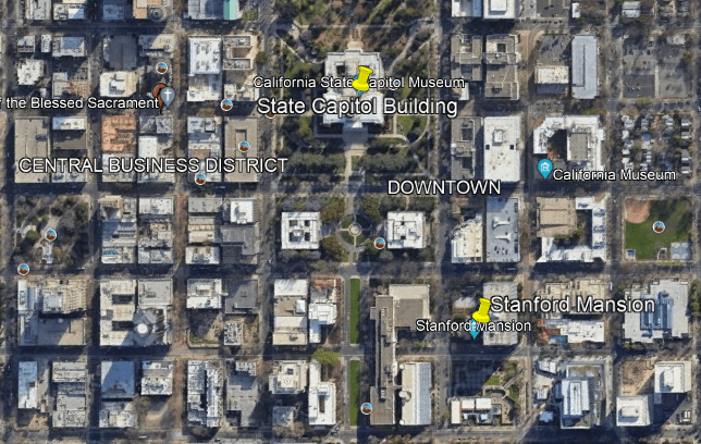
It was said to have been built in 1856 as a residence for Leland Stanford, the previously mentioned Railroad Baron who was a former California Governor, and founder of Stanford University in 1885.
It was donated to the Roman Catholic Diocese of Sacramento in 1900, who operated a children’s home there until 1978.
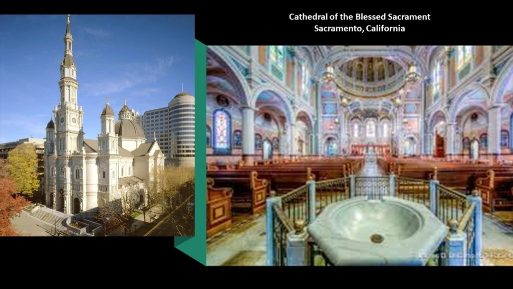
The Cathedral of the Blessed Sacrament, the seat of the Roman Catholic Diocese of Sacramento, and is one of the largest cathedrals west of the Mississippi River.
It was said to have been built between 1887 and 1889 in the Italian Renaissance architectural-style on the outside, and the Victorian architectural-style on the inside.
The cathedral’s designer was said to be Patrick Manogue, a former gold-miner who came to Sacramento through the California Gold Rush, who became a Catholic priest in 1861 after studying in Paris, and then the Bishop of Sacramento in 1886.
He was said to have based the design of his cathedral on a church he was inspired by in Paris, and that it was built on land donated by the State’s first elected governor, Peter Burnett.
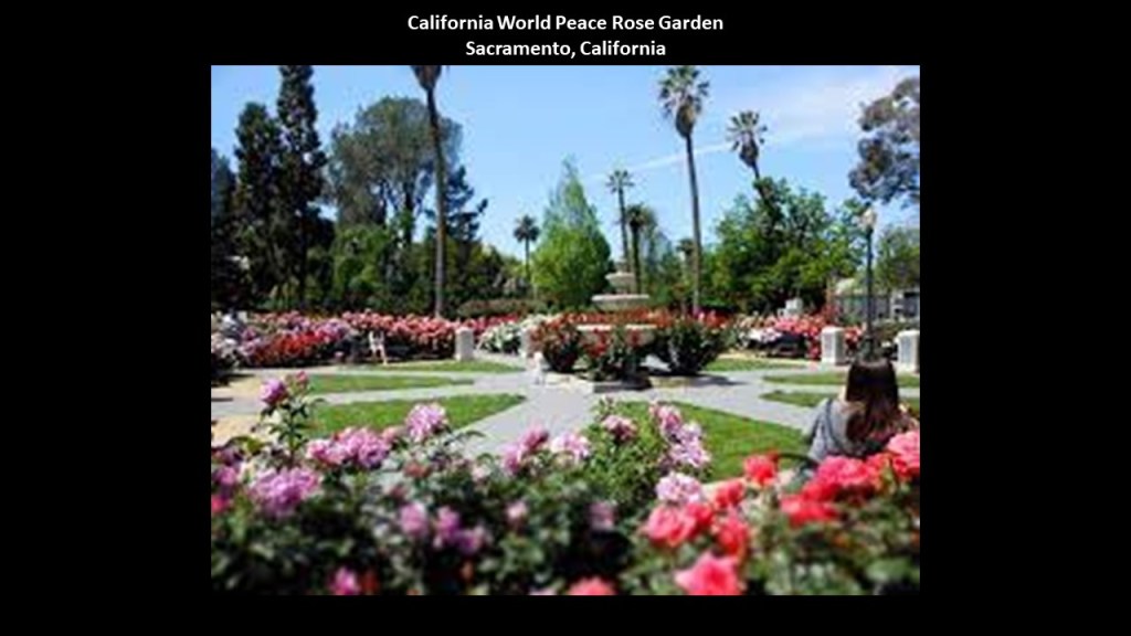
The Capitol Park in Sacramento covers 40-acres, or 16-hectares, and I will cover a few examples of what is found on the grounds.
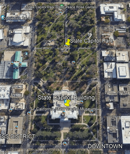
The California State World Peace Rose Garden occupies roughly 5-acres, or 2-hectares of the area it covers, featuring 650 roses with different colors and fragrances.
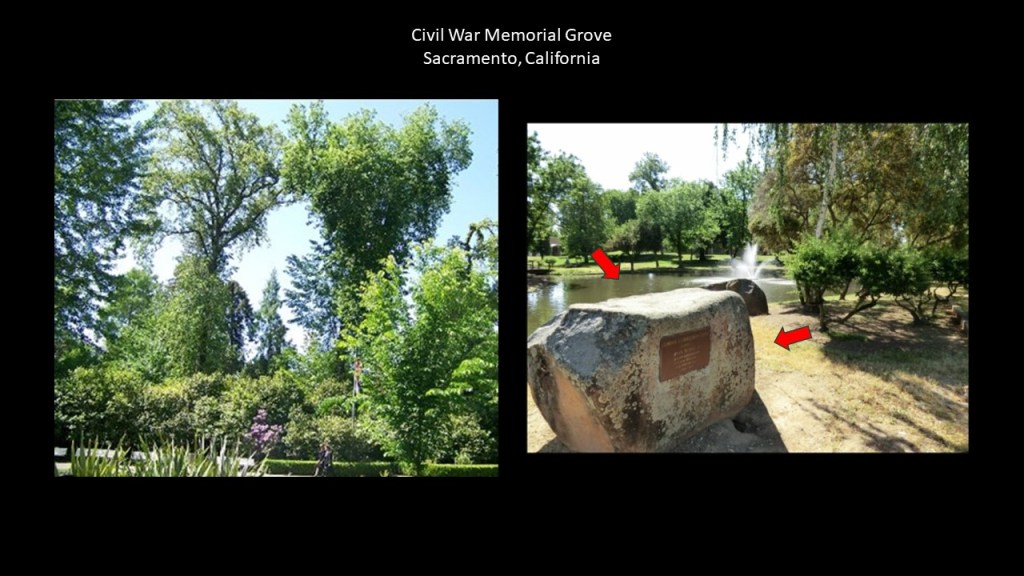
The Civil War Memorial Grove on the Capitol State Park Grounds was said to have been planted in 1897 with saplings from famous Civil War battlefields, like Manassas, Virginia; Harper’s Ferry, West Virginia; and Vicksburg, Mississippi.
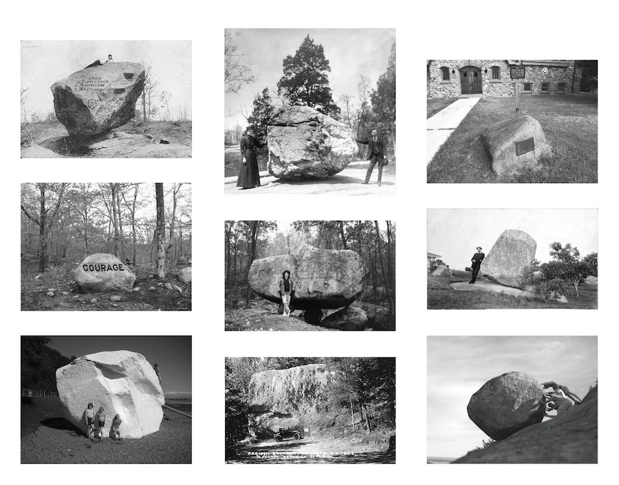
You know, it’s interesting, that we don’t even notice the straight-edges of megalithic stone blocks all around us that get used, like in this case, as a place to put signage.
Instead, a label like “boulder” is put on huge cut-and-shaped stones like this and which covers it up nicely as not being something out-of-the-ordinary that we should be paying attention to.
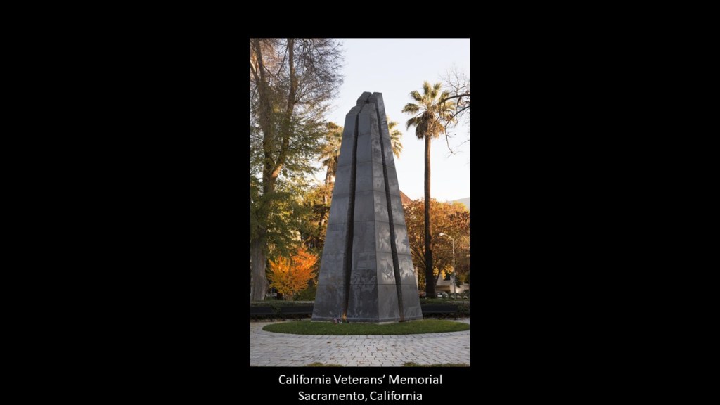
And the California Veterans’ Memorial on the Capitol State Park grounds is a 30-foot, or 9-meter tall, black-granite obelisk that was dedicated in 1998 to California’s veterans who had served in the Armed Forces since statehood in 1850.
These are just a few of the memorials and monuments to be found on the grounds of the park.
Next, in southern California, the Village of Borrego Springs is completely surrounded by the Anza-Borrego Desert State Park.
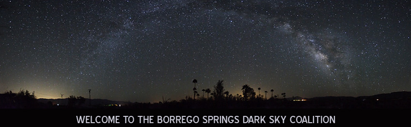
As an International Dark Sky Community, Borrego Springs has no stop lights, and limited lighting at night.
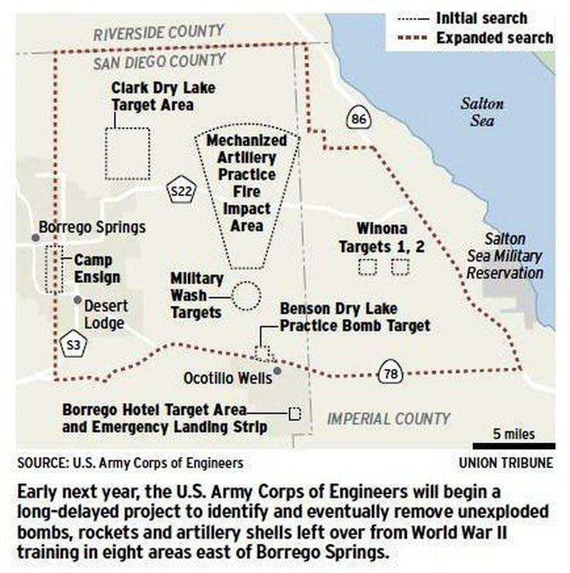
During World War II, the U. S. Navy & Army had a joint-training center east of Borrego Springs, called the “Borrego Valley Maneuver Area,” where there were bombing stations, training stations, and rocket targets on what is described as barren desert, barren mountains and badlands.
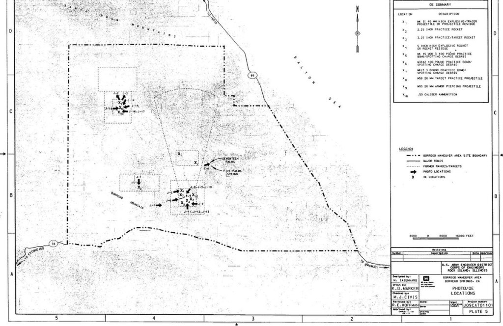
This article came out in the San Diego Union Tribune in December of 2009, reporting on a project of the U. S. Army Corps of Engineers that would have taken place starting in 2010, to look for and remove unexploded bombs and artillery shells in hundreds of square miles of desert.
Also, according this map, the bombing practice area was located between the village of Borrego Springs and the Salton Sea and its Military Reservation.
The Naval Auxiliary Air Station Salton Sea was commissioned in 1942 and decommissioned in 1946, and little remains of it.
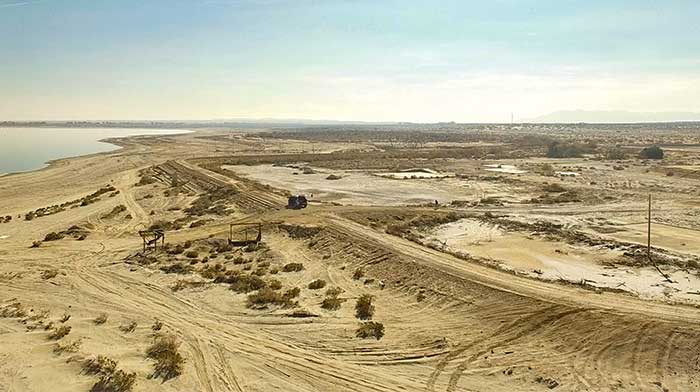
The Salton Sea, called California’s largest lake, was a vacation spot in the 1950s & 1960s, with people coming here for swimming, sunbathing, waterskiing and fishing at a place known as “the fishing capital of the world.”
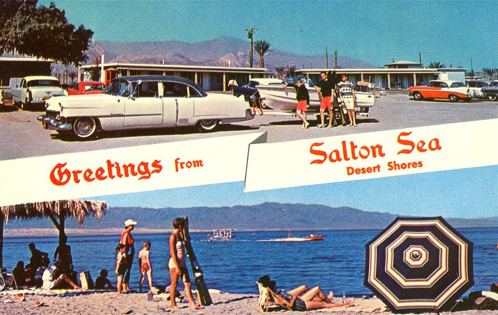
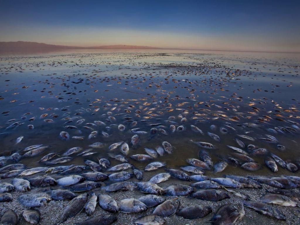
The Salton Sea went from being a lush vacation resort to an environmental disaster starting in the 1970s, when things started to go wrong, like floods that destroyed homes and businesses along the shore; uncirculating water turning saltier than the ocean; and algae blooms killing off the fish.
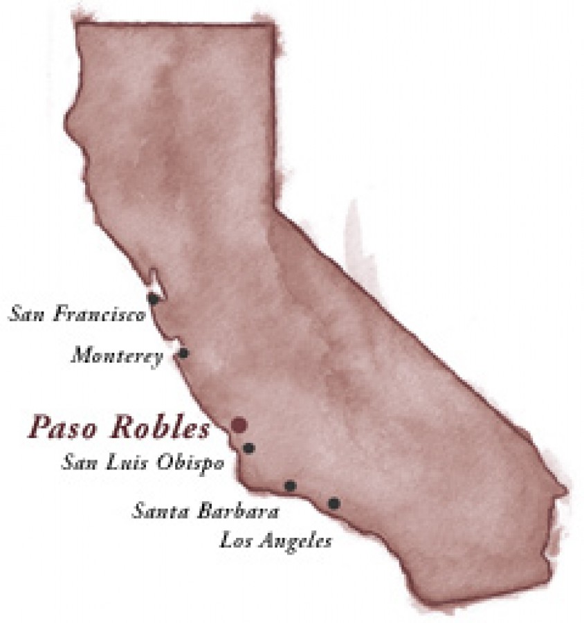
The next place I am going to feature here is Paso Robles.
Paso Robles was historically known for its healing hot springs.
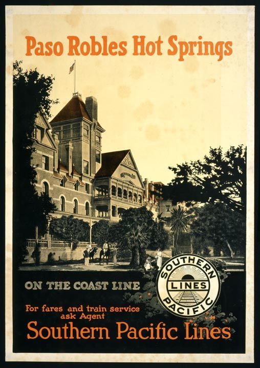
There was once a massive bath house downtown where a city parking lot is today.
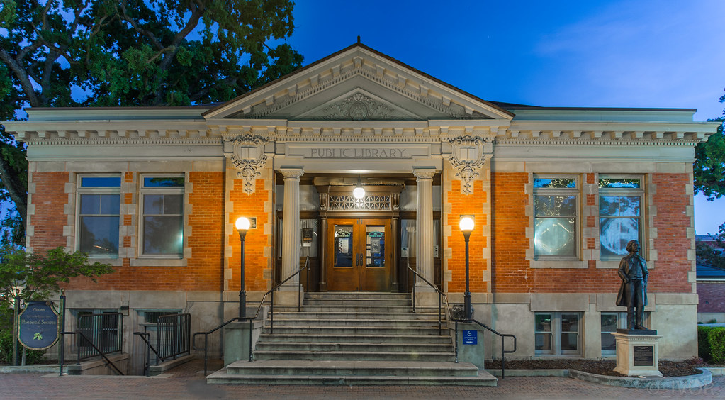
It would have been right next to where the Carnegie Library building is today, which is right across Spring Street from the Paso Robles Inn today.
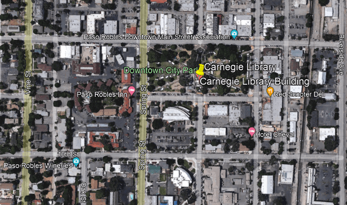
The Carnegie Library in Paso Robles was said to have been built between 1907 and 1908 from a $10,000 grant from the Carnegie Foundation.
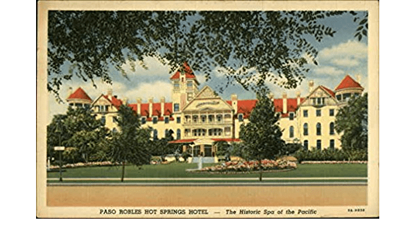
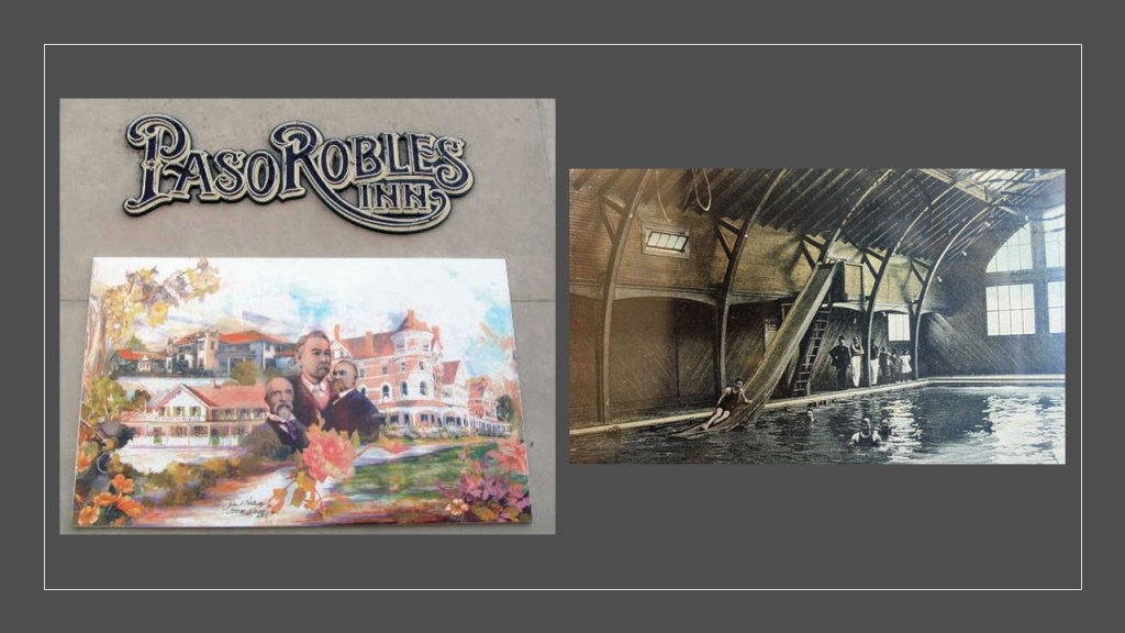
The original Paso Robles Inn featured a 7-acre garden; 9-hole golf course; library; beauty salon; barbershop; several billiard and lounging rooms; along with its famous spa, which attracted the luminaries of the day.
But, alas, tragedy struck this grand hotel in December of 1940.
A spectacular fire completely destroyed the “fire-proof” El Paso de Robles Hotel, though miraculously the guests staying the night escaped unharmed, with the exception of the night clerk, who suffered a fatal heart attack after sounding the alarm!
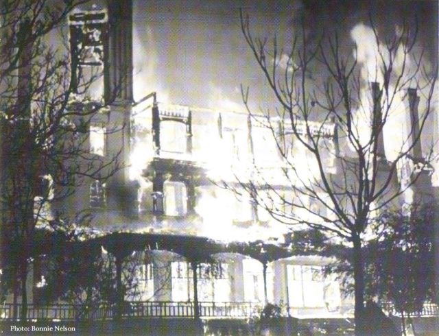
This has been the Paso Robles Inn since 1942…
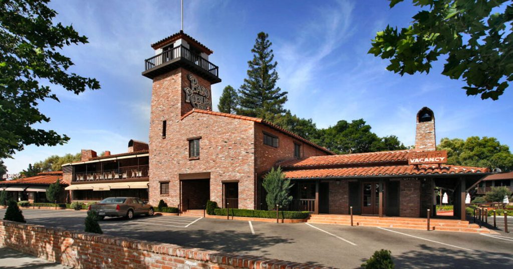
…which is also advertised as a haunted venue.

The Paso Robles Springs and mud baths were known at one time to be among the most healing on earth, from things like psoriasis and arthritis among other ailments.
This is a photo of the municipal mud bath in 1905…
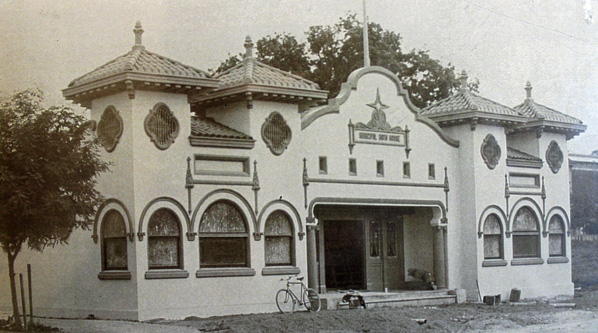
…and the candy store that is at the same location today, with no mud baths to be found!

The 2003 San Simeon earthquake cracked open the hot springs underneath the parking lot next to the City Hall and library , and they started flowing again.

Then the cover-up began all over again!

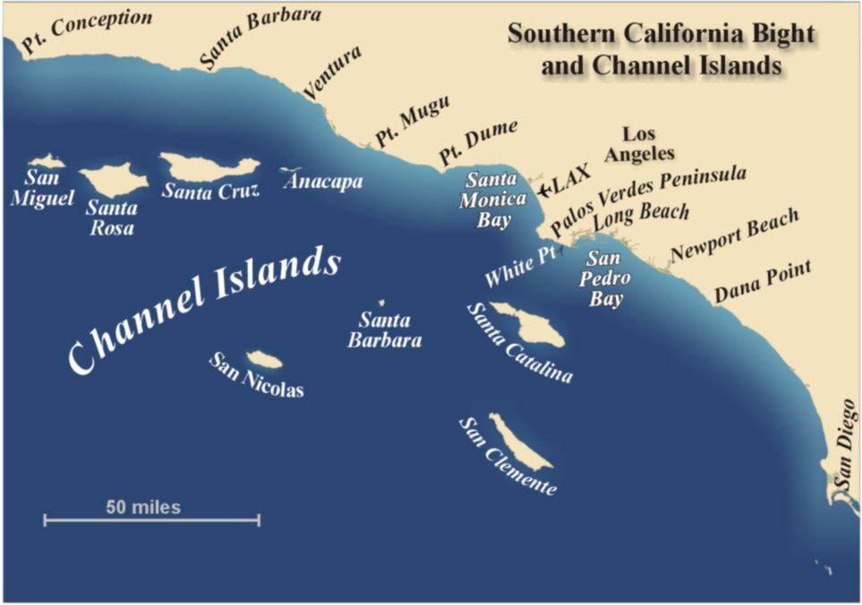
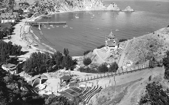
The South Channel Island group located off the California coast is comprised of the islands of Santa Barbara, San Nicolas, San Clemente, and Santa Catalina.
Santa Catalina Island is the only one of the eight Channel Islands with a large, permanent settlement.
Let’s take a look at Santa Catalina Island and see what comes up.
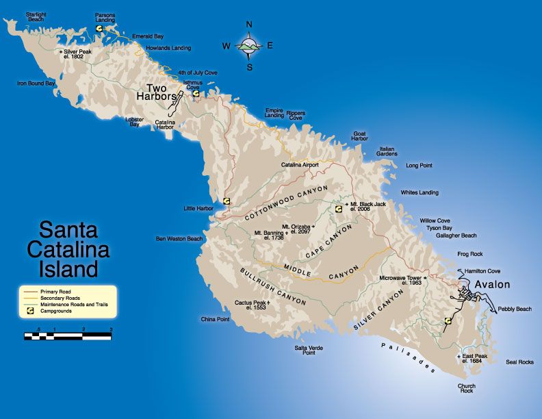
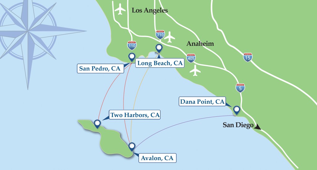
Part of Los Angeles County, Santa Catalina Island is located 29-miles, or 47-kilometers, south-southwest of Long Beach, and west of San Diego.
Santa Catalina Island is known as a playground for the rich and famous.
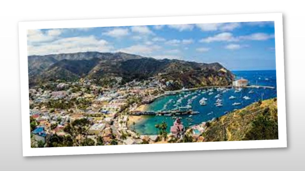
This is what we are told about Avalon, the only incorporated city on Santa Catalina Island.
George Shatto, a real estate developer from Grand Rapids, Michigan, was the first owner of the island to try to develop Avalon into a resort destination.
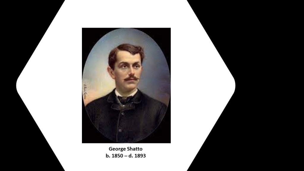
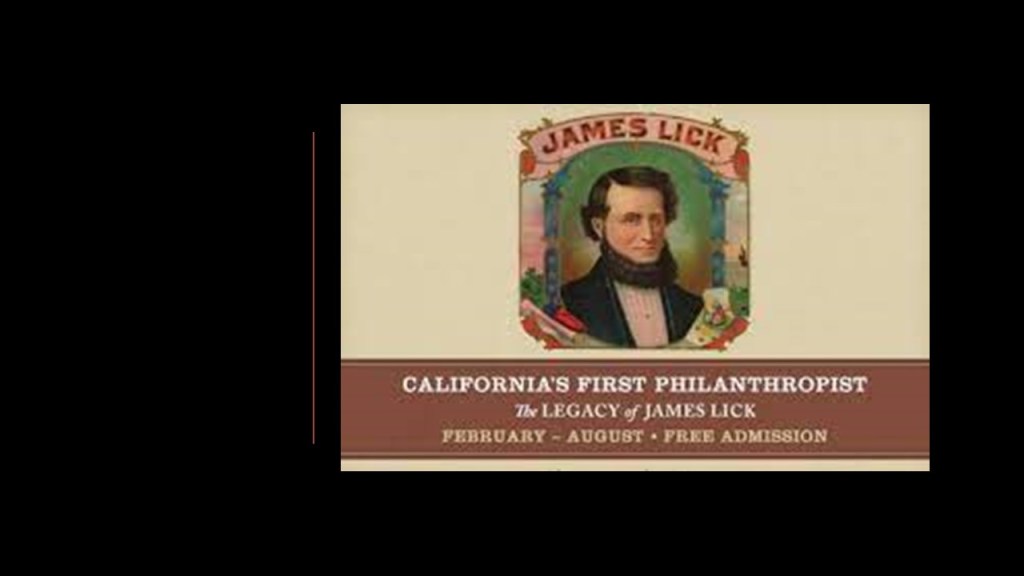
He purchased the island in 1887 for $200,000 from the Lick Estate of James Lick, a real estate investor based in San Francisco who arrived in California in January of 1848.
At the time of Lick’s death in 1876, he was the wealthiest man in California, and his real estate holdings, besides all of Santa Catalina Island, included a considerable part of Santa Clara County, San Francisco, Lake Tahoe, and a large ranch in Los Angeles.
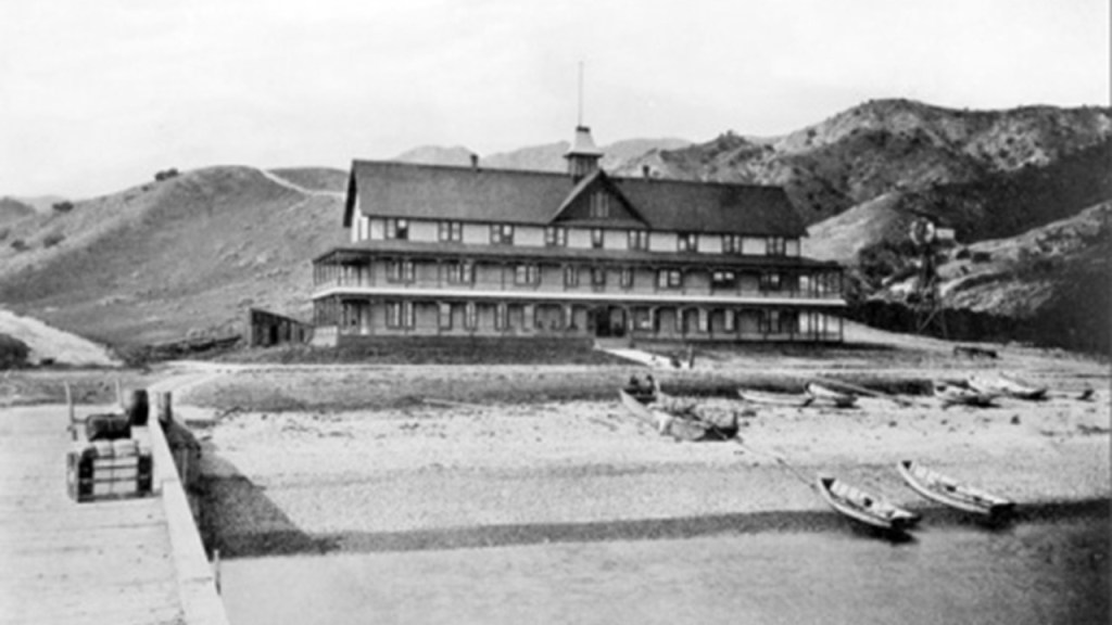
Shatto was credited with creating the settlement that became known as Avalon, and building the first hotel there, the Hotel Metropole, between 1887 and 1888, and that the island first opened for tourists in 1888.
By 1891, Shatto was having financial problems and defaulted on his loan payment for the island, and Santa Catalina Island was returned to the James Lick Trust.
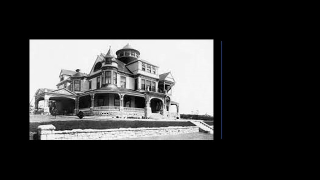
In 1892, Shatto was said to have built the Shatto Mansion in Queen Anne-style architecture in Los Angeles.
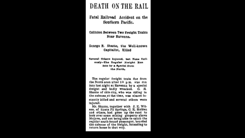
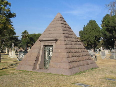
George Shatto was the only person killed in a train crash near Ravenna, California, in 1893…
…and he was interred in a pyramid-shaped mausoleum at the Angelus Rosedale Cemetery in Los Angeles.
In 1891, the Banning Brothers purchased Santa Catalina Island from the James Lick Estate.
They were the sons of Phineas Banning, a wealthy California entrepreneur known as the “Father of the Port of Los Angeles.”
The Banning Brothers were said to have fulfilled the dream of George Shatto of making Avalon a resort community with the construction of numerous tourist facilities.
However, in 1915, a fire was said to have burned half of Avalon’s buildings, including six hotels and several clubs.
Subsequently, the Banning Brothers were forced to sell the island in shares starting in 1919.
Chewing gum magnate William Wrigley, Jr, was one of the main investors who purchased Santa Catalina Island’s shares from the Bannings.
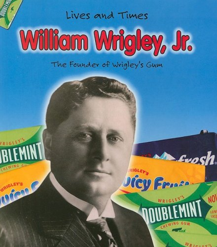
Wrigley bought out most of the other shareholders to become the controlling shareholder in the “Santa Catalina Island Company.”
Wrigley then invested millions into building needed infrastructure for attractions to the island.
This included the Catalina Casino, which was said to have been built starting in 1928, and first opened in 1929.
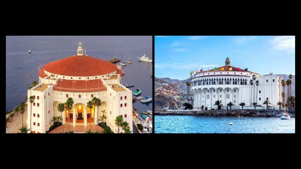
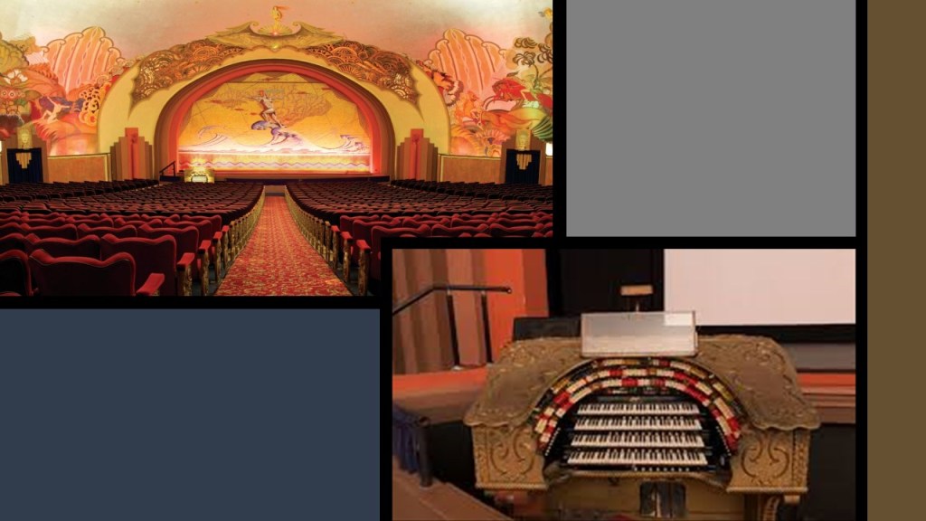
The Catalina Casino houses things like a movie theater and a ballroom.
The movie theater still has its original pipe organ intact.
The acoustics are so good in the Catalina Casino’s movie theater that someone speaking on the stage can be heard without using a microphone and be heard clearly by everyone in the 1,154-seat capacity auditorium.
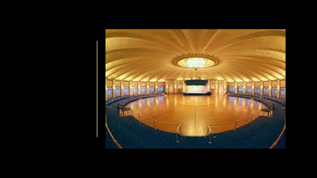
The Catalina Casino’s ballroom is the world’s largest circular ballroom, with a 180-foot, or 55-meter, dance floor that can accommodate 3,000 dancers.
Demolished under Wrigley’s ownership of the island in 1931, the Avalon Amphitheater was said to have been a large outdoor entertainment venue that was built in 1904 by the Banning Brothers.
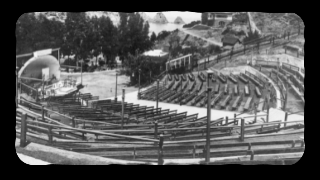
The Santa Catalina Incline Railway climbed above the Avalon Amphitheater starting in 1905 as a tourist attraction, until its closure after a fire in that devastated Avalon in 1918.
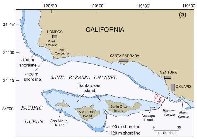
The four North Channel Islands of San Miguel, Santa Rosa, Santa Cruz and Anacapa were said to have been a landmass at one time called Santarosae.
Santarosae is called “California’s Atlantis” by some.
What we are told is that they are the remnants of an ancient landmass off the coast of present-day southern California prior to the end of the last ice age, and that Santarosae lost 70% of its landmass because the sea rose from melting glaciers, leaving a huge submerged landscape that is currently being explored by scientists.
I don’t believe, however, in the explanation taught exclusively by modern science that melting glaciers from the last Ice Age submerged this landmass and others around the world.
There have been two schools of thought with opposing views on what has caused changes to the surface of the Earth in its history.
Academia officially supports “Uniformitarianism,” also known as “Gradualism,” or the belief that changes occur slowly and over geologic time.
The other school of thought is “Catastrophism,” and that changes have occurred suddenly and catastrophically, which is where I land, and which I believe happened relatively recently, and that there is a major cover-up of this event.
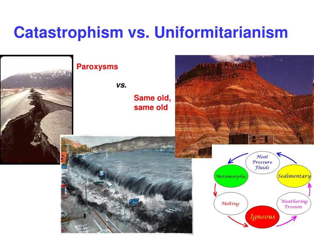
With regards to the subjects of Uniformitarianism and Ice Ages, Sir Charles Lyell, s Scottish geologist, was said to have demonstrated the power of known natural causes in explaining Earth’s history.

In his books, “The Principles of Geology,” published in three volumes between 1830 and 1833, he presented the idea that the Earth was shaped by the same natural processes that are still operating today at similar intensities, and as such a proponent of “Uniformitarianism,” a gradualistic view of natural laws and processes occurring at the same rate now as they have always done.
As a result of Lyell’s work, the glacial theory gained acceptance between 1839 and 1846, and we are told during that time, scientists started to recognize the existence of ice ages, and do to this day.

And in so doing, provides the perfect cover for things like megaliths and megalithic stone structures in North America from the original advanced civilization, by calling them “glacial erratics” from the last Ice Age.
So with regards to the subject at hand and the sudden and catastrophic change proposed by “Catastrophism” school of thought, California’s Channel Islands are located within the Southern California Bight.
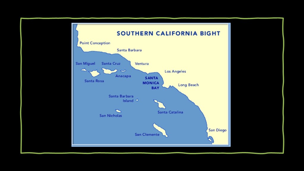
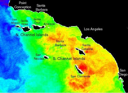
The bight is described as a significant curvature and indentation along the coast between Point Conception to just below San Diego, at Punta Colonet in Baja California, and that the waters offshore have complex current circulation patterns, with cold, southward flowing waters seen displayed in blue in this satellite image of Sea Surface Temperature, and northward flowing warm waters in yellow and orange.
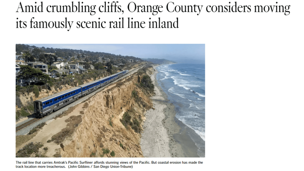
There is still an active Amtrak passenger railroad line, called the “Pacific Surfliner,” running along the coastline of the Southern California Bight for 351-miles, or 565-kilometers, from San Diego to San Luis Obispo…
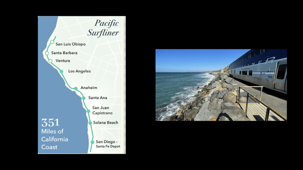
This railroad line is endangered by crumbling cliffs from coastal erosion, and we are told is under consideration for being moved in-land.
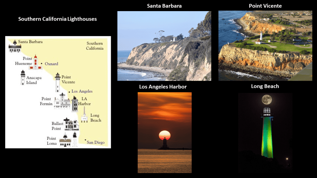
There are also lighthouses found along the coast of Southern California, like the Santa Barbara lighthouse in the top middle; the Point Vicente Lighthouse on the top right, both high atop cliffs next to the shore line; the Los Angeles Harbor Lighthouse on the bottom middle, as seen with a perfect solar alignment; and the Long Beach lighthouse with a lunar alignment on the bottom right.
I think the rail-lines and lighthouses like these along the Southern California Bight were part of a worldwide energy grid system in perfect-resonance and I believe that a forced resonance went throughout the grid system and caused the system to go haywire, and the surrounding land sank, or turned into swamps, bogs, barrens, or deserts and dunes.
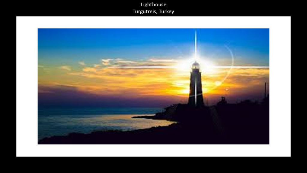
Lighthouses in particular were repurposed for guiding ships through the newly-formed rocky shoals and dangerous waters they were now right beside.
I do not believe the original purpose of lighthouses was for guiding ships, but functioned more as light energy distribution systems for the energy grid.
I have compiled numerous examples of places around the world with similar characteristics of what appears to be eroding, sunken, and/or destroyed land, particularly along continental coastlines with both railroads and lighthouses, past and present, but other places as well, in “On the Trail of Giants in Appalachia and Beyond – Theme 4 The Cataclysm,” and most recently in “History Reads Like a Book on the Earth’s Grid System – Part 2 The North Atlantic Ocean & the New England Seamounts to the Maldives in the Indian Ocean.”
Queen Calafia was the legendary Amazon Queen of the island of California, and for whom California and Baja California was named.
So what we are told about California being an island is that it was one of the most famous map-making errors in history, with the error being reproduced on countless maps during the 17th- and 18th-centuries, despite contradictory evidence from various explorers.
The legend associated with the Island of California was that it was an earthly paradise, like Atlantis or the Garden of Eden.
In 1510, we are told the first known mention of the Island of California was in the fictional novel “The Adventures of Esplandian,” a novel by Castilian author Garci Rodriguez de Montalvo describing a fictional island named California that was inhabited by only black women, and ruled by Queen Calafia.
Here is a passage from the book:
“Know that on the right-hand of the Indies, there is an island called California very close to the side of the Terrestrial Paradise, and it is peopled by black women, without any man among them, for they live in the manner of Amazons.”
So where did that idea come from?

Queen Calafia’s life and place in history is described as entirely fictional, though she is depicted as the spirit of California, and symbolizes an untamed and bountiful land prior to European settlement.
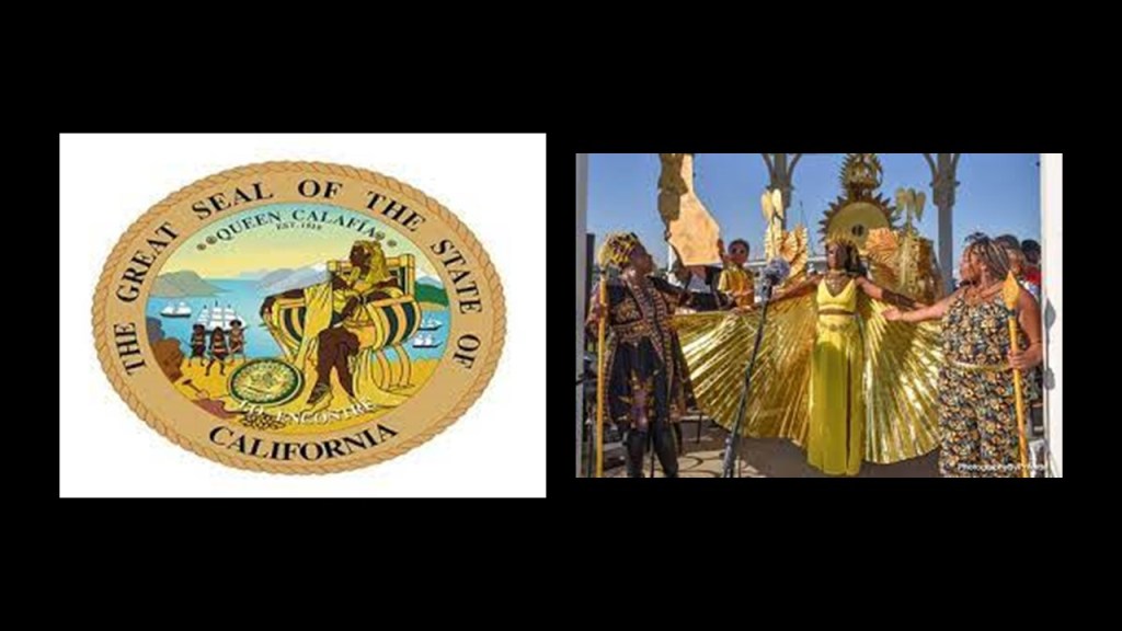
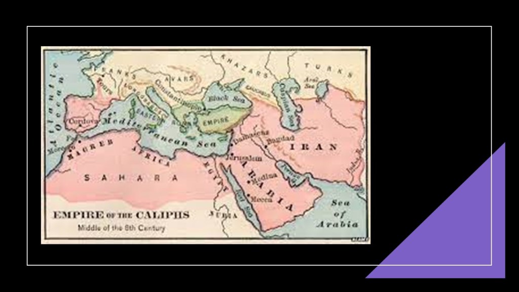
Queen Calafia’s name was said to have been likely formed from the Arabic word “Khalifa,” or “Caliph” in English, for the religious state leader of a “Caliphate,” a Muslim political-religious state.
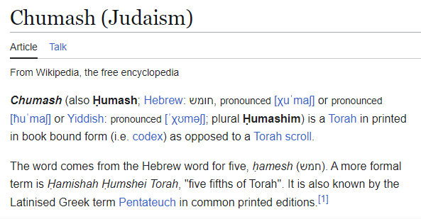
And to throw something else into the mix, the Chumash, the name of the original inhabitants of the North Channel Islands, is also a Hebrew word meaning a Torah in printed or book bound form.
So here we have a reference to a Muslim political-religious state, ruled by a black Amazon Queen, that is found in the same location as the actual word in Hebrew for the Torah that was the same as the indigenous tribe of Central Southern and Coastal Regions of California.
Maybe it’s just a coincidence, but perhaps not.
If it is not a coincidence, then what might this signify?
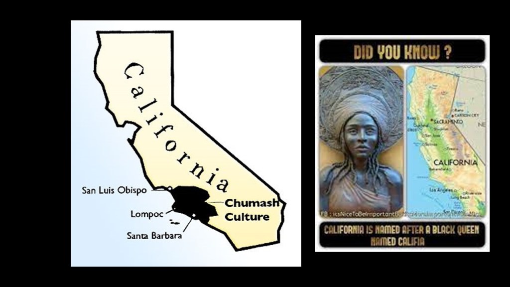
My money is on they were all one and the same in the original Moorish civilization, and that those behind the New World Order separated everything out in order to create discord, division, and disharmony, and that all of the Moorish symbolism was taken over, their works and legacy falsely claimed, and/or given a darker meaning by association with certain things that were not the original meaning.

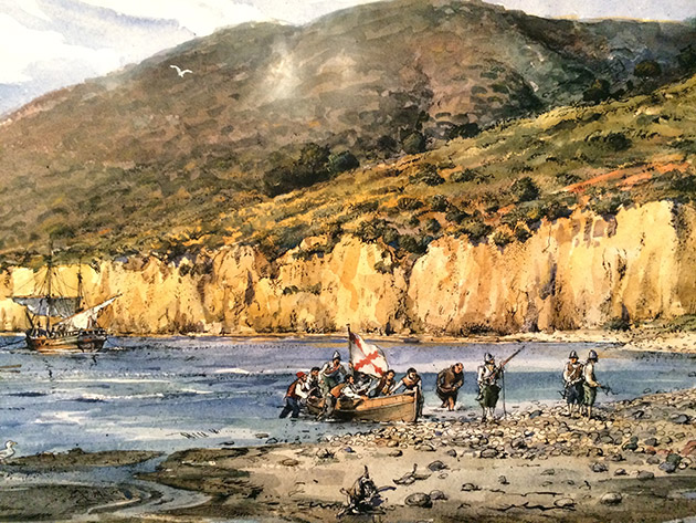
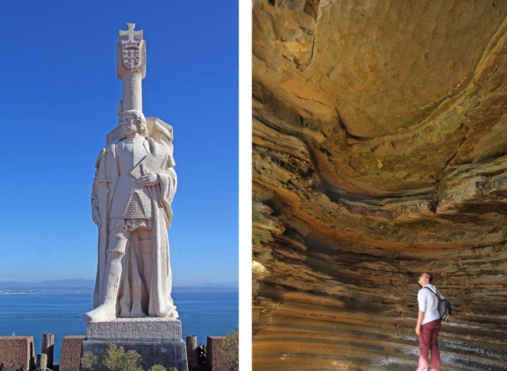
What our historical narrative tells us about California is that In 1542, explorer Juan Rodriguez Cabrillo landed in San Diego Bay on behalf of the Spanish Empire.
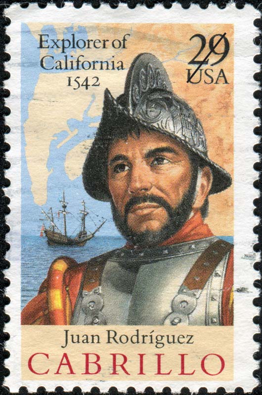
We are told that Cabrillo became the first European to set foot in California when he explored the California coast upon landing there.
According to the historical narrative, Cabrillo died on Santa Catalina Island in January of 1543 from an injury to his leg that became infected and gangrenous.
Among other things bearing his name, there is a Cabrillo National Monument in San Diego commemorating his landing in San Diego Bay.
To put Cabrillo’s exploration of California into historical perspective in our timeline, in 1540, two years before Cabrillo explored California, Pope Paul III issued a papal bull forming the Jesuit Order, under the leadership of Ignatius Loyola, a Basque nobleman from the Pyrenees in Northern Spain.
The Jesuit Order included a special vow of obedience to the Pope in matters of mission direction and assignment.

The same year Cabrillo landed in San Diego Bay, in 1542, Pope Paul III established the Holy Office, also known as the Inquisition and the Congregation for the Doctrine of the Faith.

Also in 1542, St. Francis Xavier, a co-founder of the Jesuits, landed in Goa on the Indian subcontinent, where some believe he requested the brutal Goa Inquisition, established, we are told, to enforce Catholic Orthodoxy in colonial-era Portuguese India.

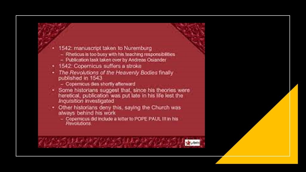
The following year, in May of 1543, Nicolaus Copernicus published “On the Revolutions of the Heavenly Spheres,” offering mathematical arguments for the heliocentric, or sun-centered universe, and denying the geocentric model of the Earth-centered universe of Ptolemy, which the heliocentric model superseded, meaning that while once widely-accepted, current science considered the geocentric model inadequate.
In other words we went from Ptolemy’s earth-centered Universe to a spinning ball orbiting the sun-centered Universe in 1543.
By the end of May of that same year, Copernicus was dead.
Thus, in the same manner that we just saw with Sir Charles Lyell’s books on “Uniformitarianism” in geology becoming the accepted model for modern geology, the heliocentric Copernican theory replaced the previously accepted geocentric model of Ptolemy as the only one taught by Academia.
California had its own “Missionary Saint” in the form of St. Junipero Serra, who was credited with establishing the first Franciscan missions in Mexico and California between 1750 and 1782.
Posthumous honors for him include Sainthood in 2015 and he represents the State of California in the National Statuary Hall at the U. S. Congress, along with Ronald Reagan.
Serra was nicknamed the “Apostle of California” for his missionary efforts, but before and after his canonization, his reputation and missionary work was condemned for reasons given like mandatory conversions of the native population to Catholicism and atrocities committed against them.

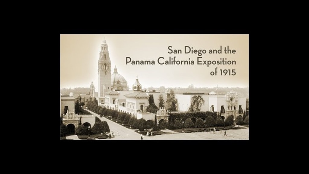
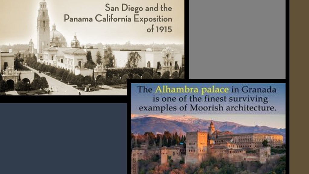
The 1915 – 1917 Panama-California Exposition in San Diego was said to have been held to celebrate the opening of the Panama Canal and touting San Diego as the first Port of Call for ships travelling north after passing westward through the canal.
The Exposition’s buildings and infrastructure, including the Cabrillo Bridge, some said to be meant to be permanent and others temporary, were said to have been constructed specifically for the Exposition in San Diego’s Balboa Park between 1911 and its opening in 1915.
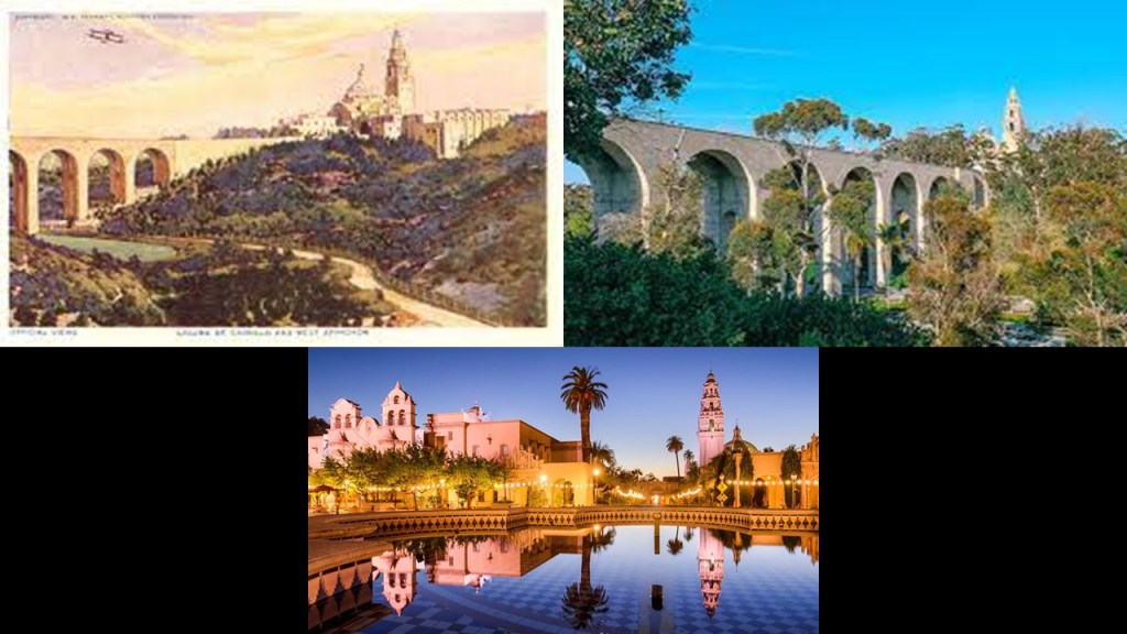
But wait – doesn’t that look like the same kind of architecture in San Diego that you find in Moorish Spain?
Everything that has happened to the Moors and their advanced worldwide civilization is completely relevant today.
What happened to them has been happening to ALL of us.
It’s coming from exactly the same playbook.
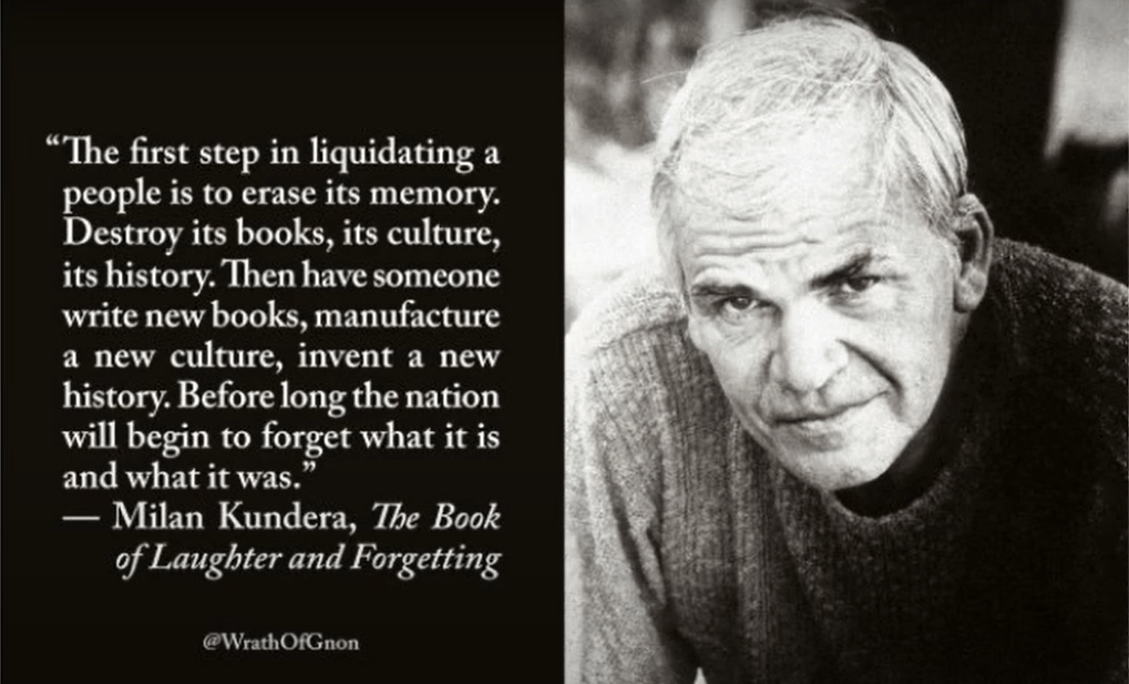
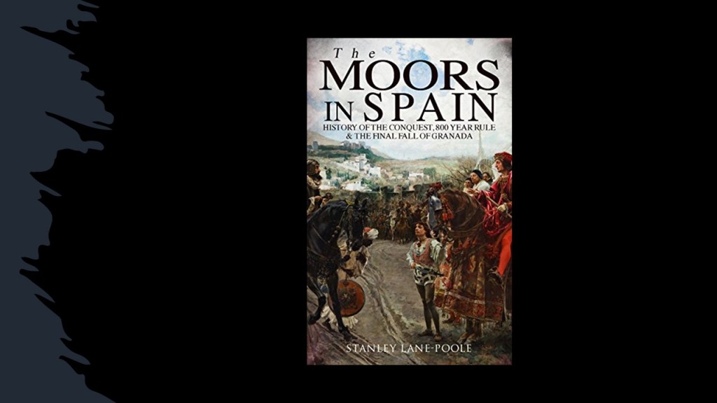
The Moors have been almost completely removed from the history of civilizaiton, with the exception of roughly 800-years in Spain…
…and we are not taught anything about an ancient global unified Moorish civilization dating back to ancient Mu, or Lemuria that continued on through Atlantis, up until relatively recently in time, much more recently than one would think.

The architecture and infrastructure of this ancient Civilization is still all over the world, and still in use today though much has already been destroyed.
Since this advanced civilization is not in our historical narrative, we don’t even think to question what we are told about it being built by someone else, as we see in this example, as well as all the examples in California given throughout this post.
The thing is…this ancient civilization, and civilization as we know it, is still under attack and being destroyed every single day.
Its earthworks are being destroyed every day in road and housing construction…
…it has been being destroyed in big city riots…

…it is being destroyed by public policies that destroy lives and property…

…in public policies that encourage lawlessness…
… it has been destroyed by world wars and civil wars…
…demolished for reasons given like urban renewal, deterioration, and safety…
…and by weather events for decades described “natural disasters” caused by things like “Climate Change” but is actually deliberately caused by the weaponization of weather.
This has all been part of a plan, and is not happening by chance, though that is what we have been taught to believe!
What might that plan be?
Is the intention of the Plan displayed for all to see on the back of the one-dollar Federal Reserve Note, the currency of the United States.

There are two sides of the Great Seal of the United States.
On one side is the national Coat-of-Arms of the United States, and among other symbolism, prominently depicts an eagle, and the motto “E Pluribus Unum,” or “Out of Many, One.”

On the other side, an unfinished pyramid with an eye above it is depicted, as well as two more mottos.
The motto above the pyramid with the eye says “Annuit Coeptis,” which is taken to mean: “Providence – or God – favors our Undertakings”
The motto below is “Novus Ordo Seclorum,” which is commonly translated as “New Order of the Ages.”
The Roman numerals at the bottom of the pyramid, MDCCLXXVI, is the year 1776.

We are told the Irish-born patriot Charles Thomson of Philadelphia finalized the design of the Great Seal of the United States, and it was he who added “Annuit Coeptis” and “Novus Ordo Seclorum.”
It is interesting to note that the final Great Seal of Thomson is an exact replica in design of the Great Seal of the Moors, with the differences being in the meanings of the inscriptions on each one.
The single eye at the top of the pyramid in the Great Seal of the Moors represents re-connecting with our Higher Selves and Divine Natures…
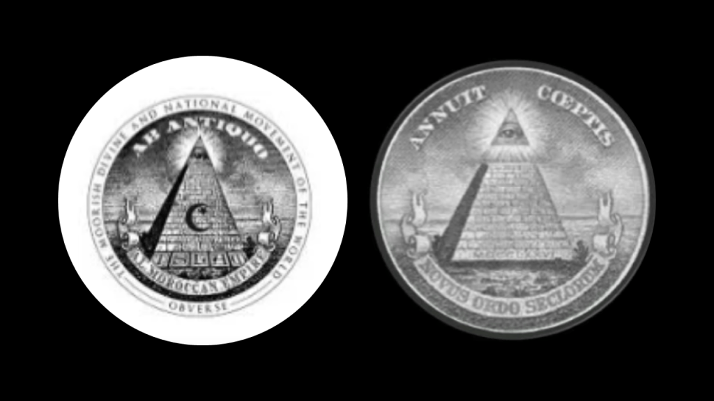
…and not the all-seeing eye of the Bavarian Order of the Illuminati and Big Brother that it has come to be associated with.

As you can see, symbols were co-opted from the original meanings, and the meaning of the symbols inverted and applied in a different context.
The Moors are Friends of Humanity, with Five Principles of Love, Truth, Peace, Freedom, and Justice.

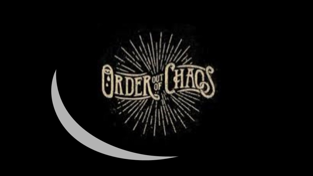
Another important “Ordo” is found in the Masonic Motto of the 33rd-Degree – “Ordo Ab Chao” and “Deus Meumque Jus.”
It is found on the grand decorations of the Order of the Sovereign Grand Inspectors General of the Scottish Rite, one of the highest honors and roles which can be bestowed upon a Freemason.
It translates to “Order out of Chaos” and “God and My Right.”
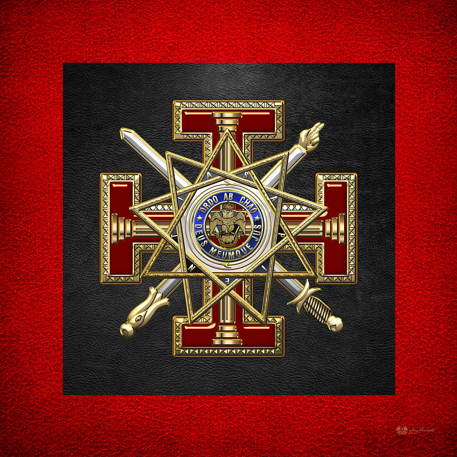
And who exactly is their god?

Was the meaning of “Order out of Chaos” simply about restoring order between divisions between the Northern and Southern Jurisdiction of the Scottish Rite that took place in the early 1800s in North America, as some have speculated?
Was it meant to draw forth order from the chaos of their own individual lives and minds?
Was it a description of a yin and yang process of change in how the Universe organizes itself, with order and chaos giving birth to one another, as others have speculated?
Or, was it an actual blueprint for sorcery and the plan for how the New World Order was going to take over the world?

…through the systematic application of the Hegelian Dialectic of Problem – Reaction – Solution.

Here is a list I found of of Hegelian Dialectic methods of manipulation, which includes chaos sorcery.

Georg Wilhelm Friedrich Hegel was an influential German philosopher who lived between 1770 and 1831.

From the Controllers’ perspective, we are not supposed to know anything true or real, and instead demonize those who question the official narrative, like this example of what they have to say about Flat Earth.
It sure looks like to me that a rich, vibrant & unacknowledged history of Humanity has been plundered and destroyed, only to be replaced with fabricated history and science, violence, death and destruction.
Knowledge of the Earth’s original ancient and advanced civilization was deliberately removed from our collective awareness by malevolent Beings who definitely do not have humanity’s best interest at heart.
The truth became shattered and fragmented, and we have been kept in the dark and fed garbage.
While I absolutely believe that Humanity has a much better future in-store for us than what was planned for us, this is what we have been dealing with here.

I have given much thought to how what happened to the Ancient Civilization is completely relevant in the present-day.
Just as Christianity was weaponized against the ancient civilization, the radicalization of Islam was part of the destabilization of Western Civilization, with order to have been restored by the New World Order.
Or so they planned.
There has been massive corruption surrounding complicity with the globalist agenda in all areas of our lives.
But we are living in a time where their activities are being more and more exposed in the alternative media and the Internet.
The Controllers do death and deception well, and will say and do anything that serves their purposes, but it is getting harder and harder for them to keep their activities hidden because their high crimes within government and high crimes against Humanity are being exposed, and they are afraid of an Awakened Humanity that can now see them.
I believe they will finally be held accountable for their heinous crimes…and soon.
Please do not be discouraged by what you see going on in today’s world.
It’s all they have left.
Per their original plan, we were never ever supposed to see it coming.
Please stay strong and remember that we are awakened, we are everywhere, and our numbers are growing!