Looking Deep into the Heart of Kansas, the Geographic Center of the Continental United States

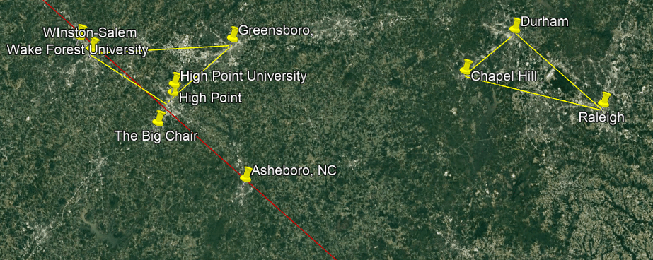
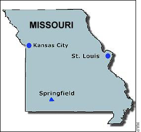
I am going to be bringing forward a variety of research I have done in the past in this post related to Kansas, the geographic center of the continental United States, to shine a light on what has been hidden from us about the original civilization from ancient times, as well as what our modern historical narrative tells through the lens of the history of Kansas about the people and events responsible for bringing us the world we lived in today.

The more research I do, the more connections I find that show this ancient civilization was advanced, interconnected and worldwide, and when I go back and look at research I have done in the past, I can see these connections even more clearly than before.

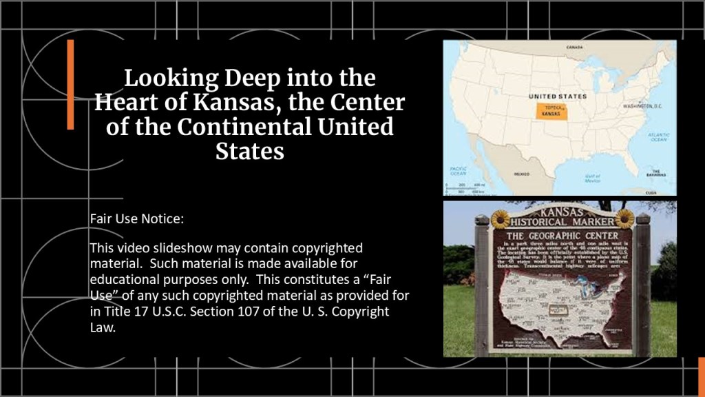
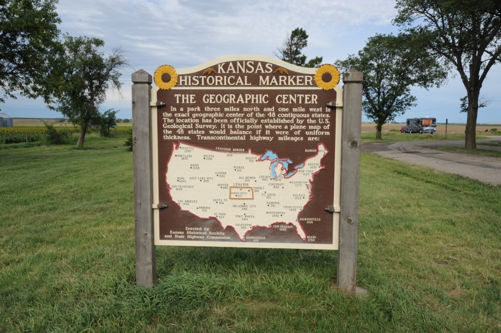
The geographic center of the continental United States is found in Lebanon, Kansas, and what we are told about it is that it was established by the U. S. Geological Survey as early as 1918 as “the point where a plane map of the 48 states would balance if it were of uniform thickness.”

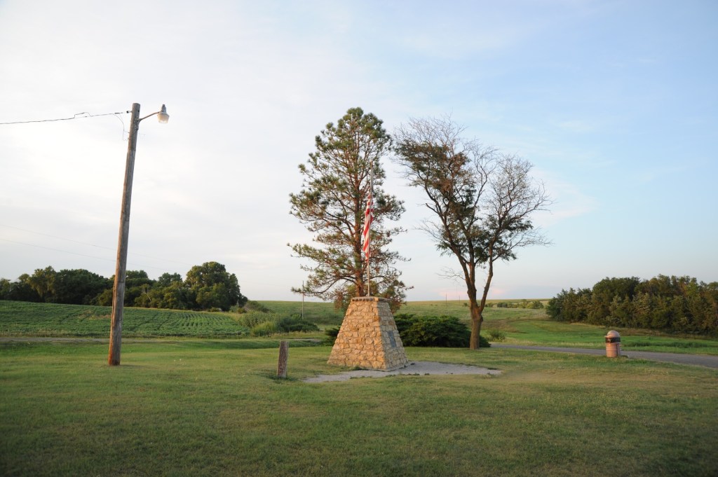
In June of 1941, an official monument was dedicated in Lebanon to recognize it as such. 

This center point of the continental United States is my starting point for a deep dive into Kansas, from its ancient past on through to what we are told about its history in more recent times.

First, Kansas in the ancient past, starting with the Flint Hills.

The Flint Hills are described as a region in eastern Kansas and northcentral Oklahoma named for the abundant residual flint eroded from bedrock that lies near or at the surface, and also has the densest coverage of intact tallgrass prairie in North America.

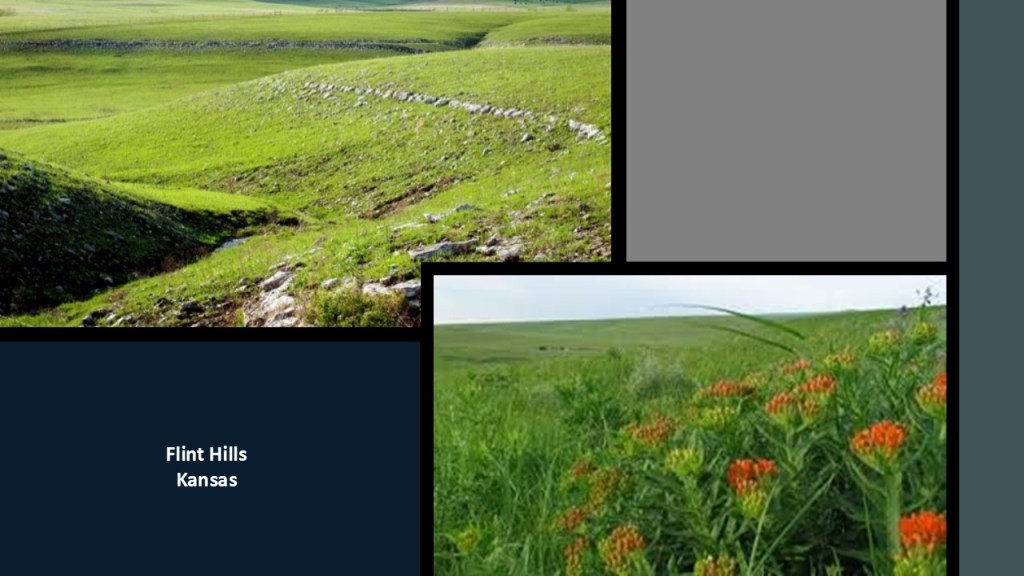
What I find extremely interesting about the landscape of the Flint Hills is the striking similarity to what is found in the landscape of Neolithic Britain, the beginning of which is dated back to 4,000 BC.

And not only is the landscape between the Flint Hills and Neolithic Britain similar.

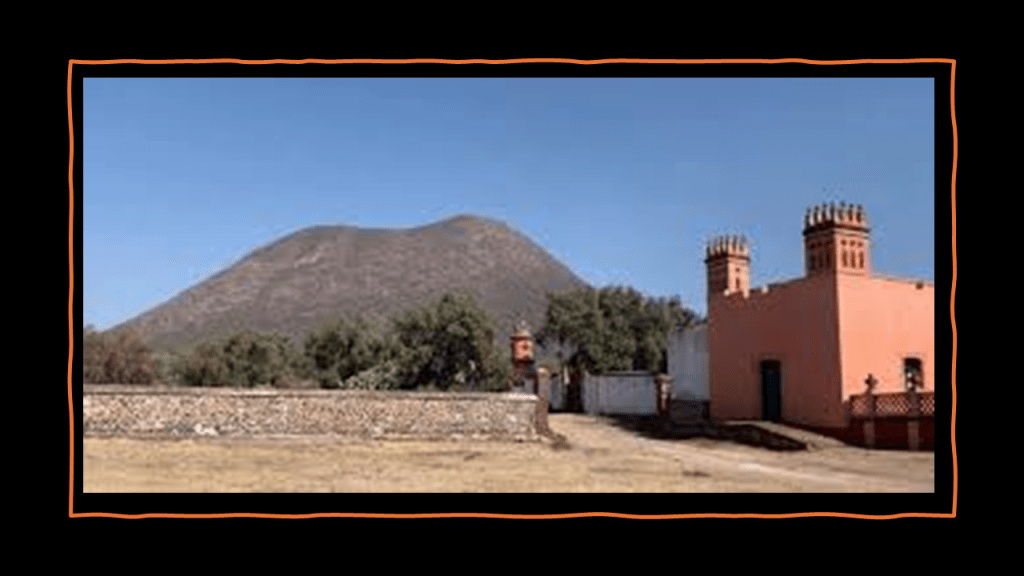
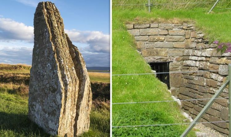
On the left is a photo of Teter Rock, said to be a monument erected for James Teter the landowner located near the former Teterville and Teter Oil Fields in southeast Kansas, and on the right are four examples of the more than 270 such structures that have been located and documented here, mostly on private property, and of which the Flint Hills region is considered to have the largest concentration of this type of construction in the world.

For comparison is this standing stone and the underground passageway to Maes Howe in the Orkney Islands off the northern coast of Scotland.

The entrance is aligned to the setting sun of the winter solstice, the darkest point of winter.

This is Grime’s Graves in Norfolk in England, a neolithic site that is the only flint mine that is open to the public, where visitors over ten years of age can enter the mine to see the jet-black flint.

We are told it was a large neolithic mining complex dating back to 2,600 BC.

Are the Flint Hills in Kansas an important, yet completely unacknowledged, neolithic landscape?

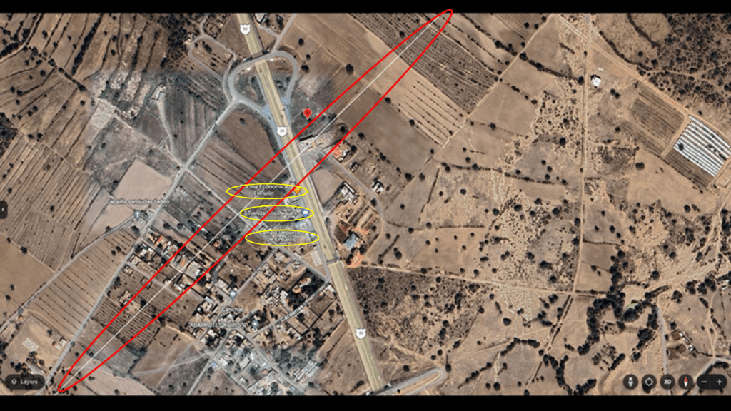
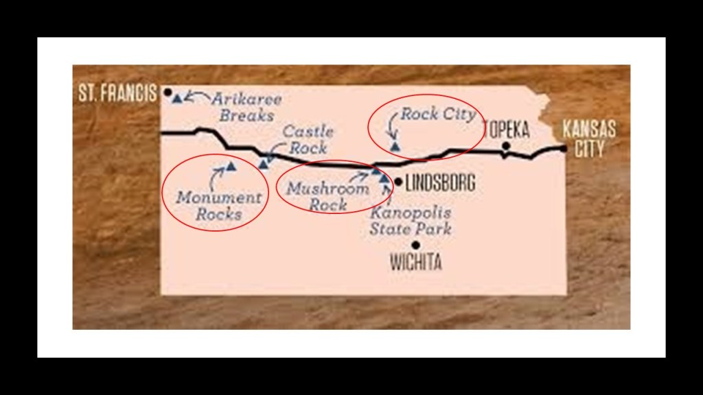
I’ve picked a few places to look at on Interstate 70 starting just to the west of the Flint Hills region between Wichita and Topeka.

Let’s take a quick look at Rock City, Mushroom Rock, and Monument Rocks.

The formations found at Rock City in  Minneapolis, Kansas look similar to those found at the North York Moors Park in England.

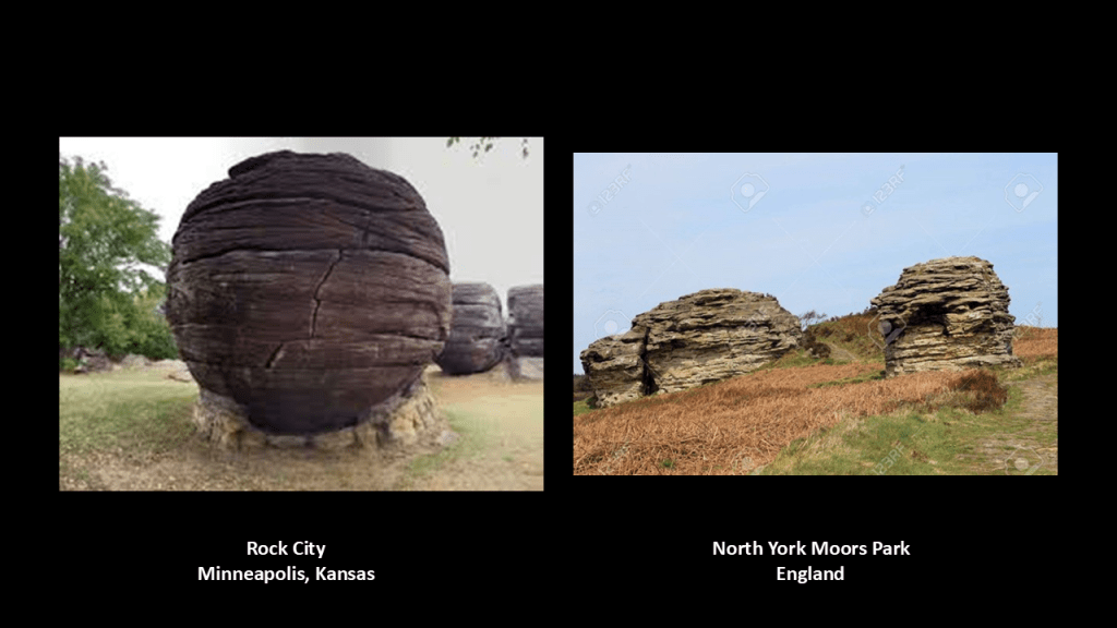
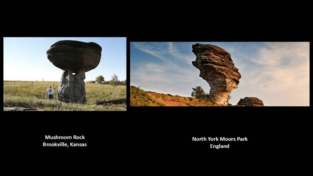
Same thing can be said for what is found at Mushroom Rock at Mushroom Rock State Park in Brookville, Kansas, and again at the North York Moors Park in England.

Monument Rocks, also referred to as the Chalk Pyramids, are designated a “National Natural Landmark.”

The amazing thing for a National Natural Landmark are the solar and lunar alignments found here.

Next, a look at Kansas closer in time to the present-day, starting with the Lewis and Clark Expedition.

Kansas City in Kansas is situated at Kaw Point, a junction of the Missouri and Kansas Rivers, and one of the places where Lewis and Clark stopped and camped in 1804 in their 1804 to 1806 Corps of Discovery Expedition in their exploration of the lands of the 1803 Louisiana Purchase.

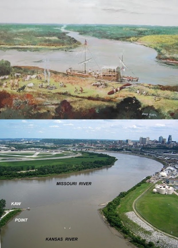
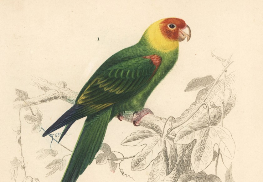
It was here that Clark reported encountering a great number of “parrot queets.”

The now-extinct Carolina parakeet inhabited much of what became the United States at that time.

The last-known Carolina parakeet died in captivity at the Cincinnati Zoo in 1918, and the species was declared extinct in 1939.

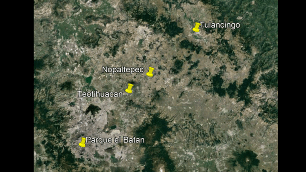
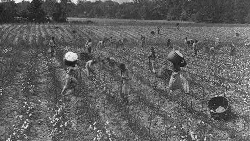
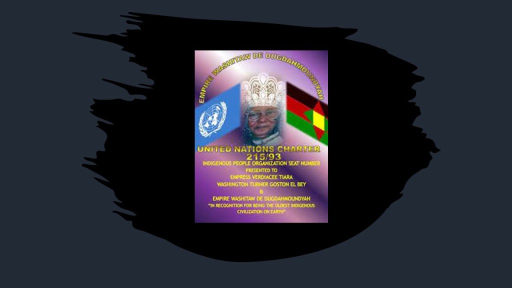
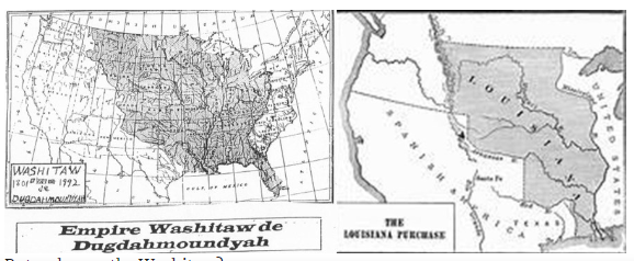
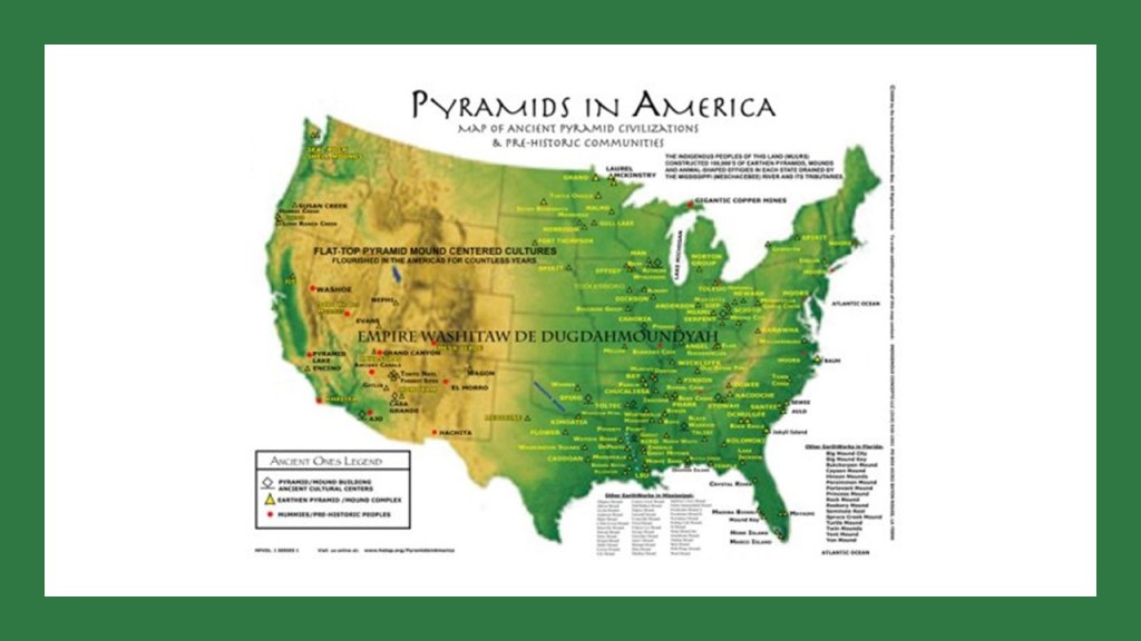
This region in the central part of what was to become the United States was the heart of the ancient Washitaw Empire.

Monroe in Louisiana was the Imperial Seat, and the ancient Washitaw Mu’urs are matriarchal and matrilineal with an Empress to this day.

How come we’ve never heard anything about them? 

Quite simply, they don’t want us to know.

I can’t help but notice that the map of the ancient Washitaw Empire of North America that has been removed from our collective awarenessroughly corresponds to the map of the Louisiana Purchase.

Kansas was also at the heart of what we know of as the beginning of the American Civil War.

it is important to note that in our historical narrative, the tensions between free states and slave states is what directly led to the American Civil War.

What we are told is that that Kansas-Nebraska Act became law on May 30th of 1854, creating the two new Territories and allowing for popular sovereignty to determine whether or not they were free states or slave states.

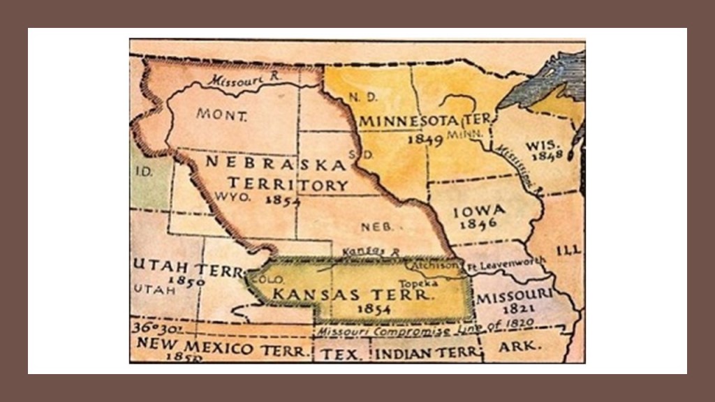
For several years, Kansas had two governments, in two different cities – Lecompton and Lawrence – with two constitutions, one of which was pro-slavery, and the other anti-slavery, and each one claiming to be the legitimate government of the Kansas Territory.

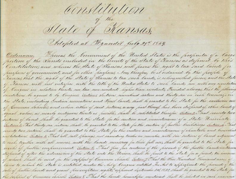
By the time of the Wyandotte Constitutional Convention held between July 5th and July 29th of 1859, there were three other constitutions for Kansas citizens to vote on – the Topeka Constitution, the Leavenworth Constitution, and the Lecompton Constitution, which was drafted by pro-slavery advocates.

Initially, the Lecompton Constitution won the popular vote, but there was a climate of intimidation and violence around the voting, and it was overruled.

The Wyandotte Constitution, which admitted Kansas to the Union as a Free State, won the second round of popular voting, and was the Constitution which was approved for the admission of the State of Kansas in the U. S. Congress, which took place on January 29th of 1861.

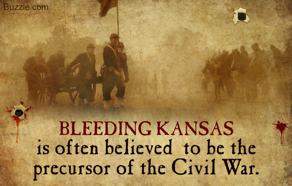
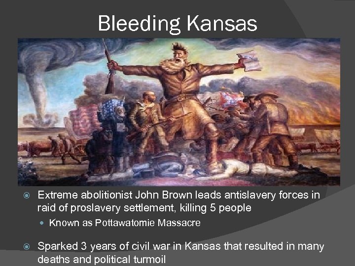
It also produced a violent uprising known as “Bleeding Kansas” when pro-slavery and anti-slavery activists flooded into the new territories seeking to sway the vote.

Here were some of the key players in the events that led up to the Civil War.

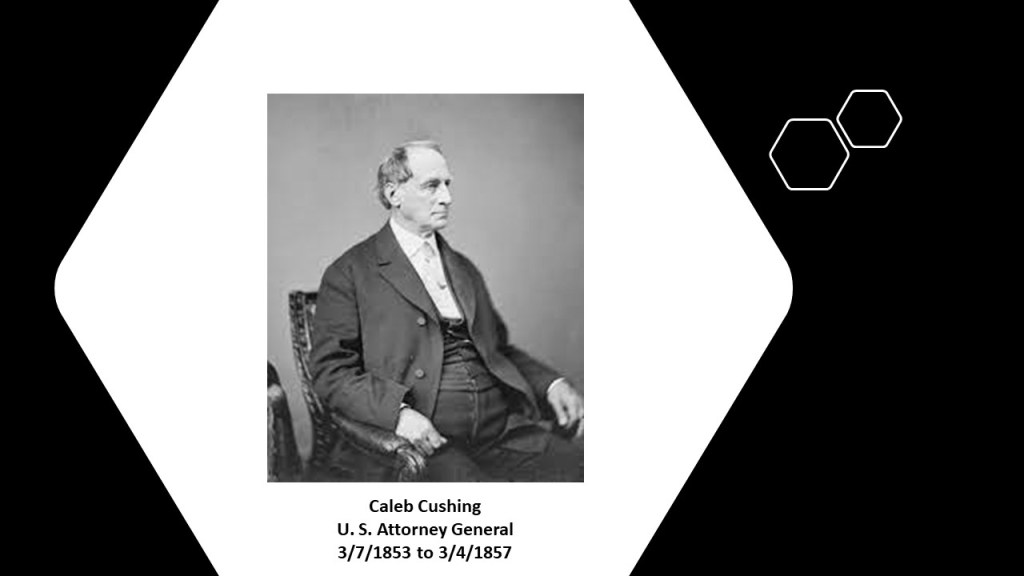
Caleb Cushing was an American Democratic politician who served as a Congressman from Massachusetts and Attorney General during the administration of the 14th-President of the United States, Franklin Pierce.

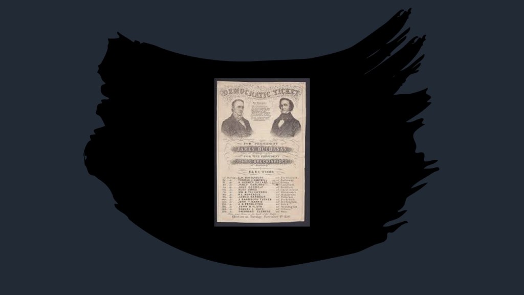
The future U. S. President James Buchanan was named as President Franklin Pierce’s Ambassador, or Minister to the United Kingdom, a position he held from August 23rd of 1853 to March 15th of 1856.

.James Buchanan was nominated to be the Democratic Party’s Presidential nominee in 1856, and said to have benefited from being out of the country when he was living in London and not associated with slavery issues, and won the 1856 election with his running mate John C. Breckinridge.

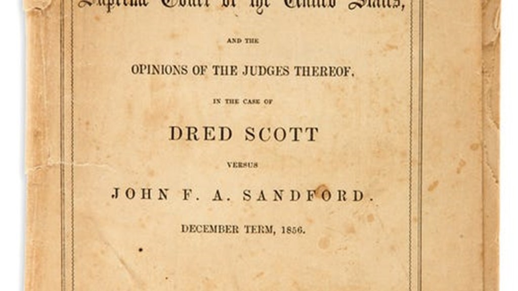
As President, he was said to have intervened in the Supreme Court’s Dred Scott case to gather majority support for a pro-slavery decision, in which a majority of the Supreme Court ruled in March of 1857 that the United States Constitution was not meant to include citizenship for people of so-called African-descent,so that the rights and privileges of the Constitution could not be conferred on them.

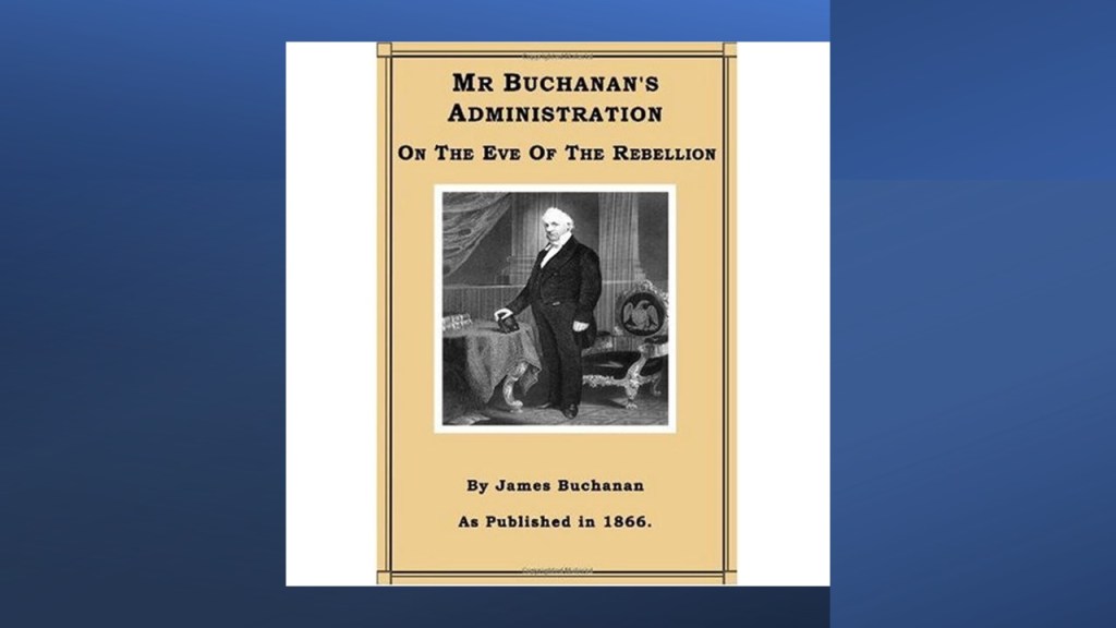
President Buchanan attempted to engineer Kansas entering the Union as a slave state, by sending a message to Congress urging the acceptance of Kansas as a slave state, which it rejected and set the admission for Kansas as a free state in June of 1861.

Ultimately in our historical narrative, the cause of eleven states to secede from the Union in 1860 was in support of states’ rights in the context of slavery to support the South’s agricultural economy, and the federal government not overturning abolitionist policies in the North and in new territories.

According to Nicholas Hagger in “The Secret Founding of America” book…

…the Attorney General Caleb Cushing used former Master Mason John Brown to cause the Civil War.

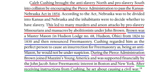
And indeed John Brown was very involved in what happened in “Bleeding Kansas.”

John Brown was best known in history for the Harper’s Ferry raid on October 16th of 1859 in West Virginia.

There was a federal arsenal located there, and while the plan was to raid the arsenal and instigate a major slave rebellion in the South, he had no rations or escape route.

In 36-hours, troops under the command of then Lt. Col. Robert E. Lee had arrested him and his cohorts, who had withdrawn to the engine house after they had been surrounded by local citizens and militia.

So while John Brown’s plan was doomed from the start, it did serve to deepen the divide between the North and South.

John Brown was hung on December 2nd of 1859, less than two months after the onset of the Harper’s Ferry Raid.

Did John Brown take one for the team?

Or did he not see that one coming?

Or was it something else entirely, because who knows if any of this ever even happened and it’s all just freemasonic theater.

Speaking of theaters, the Trans-Mississippi Theater of the Civil War covered everything west of the Mississippi River as pictured here.

We are told that there were all together 7 battles in Arkansas, New Mexico, Missouri and Louisiana between 1862 and 1864 in the Trans-Mississippi Theater of War.

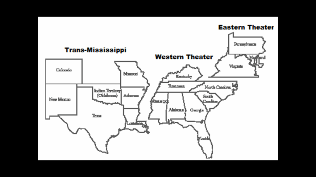
As a matter of fact, the Trans-Mississippi Department was a geographical subdivision of the Confederate Army.

When Union forces under General Ulysses S. Grant captured the Confederate stronghold of the port of Vicksburg on July 4th of 1863 and divided the Confederacy, Confederate General Edmund Kirby Smith’s forces were cut off from the Confederate Capital of Richmond, Virginia.

At the time, Edmund Kirby Smith was the Commander of the Trans-Mississippi Department, and for the rest of the Civil War, he remained west of the Mississippi River.

As a result of being cut-off from Richmond, Kirby Smith had free reign in a nearly independent area of the Confederacy, and the whole region became known as “Kirby Smithdom” and nobody really knows what was going on there during that time.

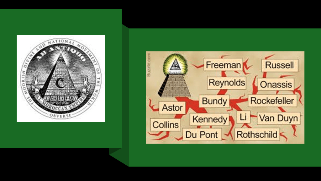
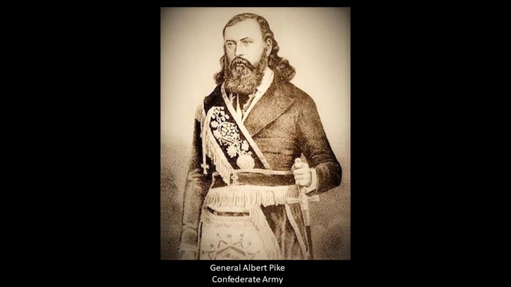
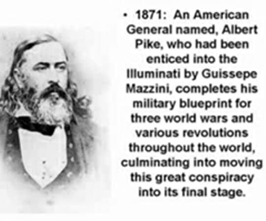
I first learned about the Trans-Mississippi Department when I was doing some research around Albert Pike, an influential 33rd-degree Freemason who was a senior officer of the Confederate Army who commanded the District of Indian Territory otherwise known as Oklahoma.

I think what was really going on here in the center of the country during the historical event known as the American Civil War was very different from what we are told was going on, and it has everything to do with the reset of our history after a deliberately-caused cataclysmic event destroyed the surface of the Earth in order to bring in the New World Order.

Albert Pike in his day was the most powerful Freemason in the world when he became the Sovereign Grand Commander of the Southern Jurisdiction in 1858, a position he held until his death in 1891.

Along with holding the position of Sovereign Grand Commander of the Southern Jurisdiction, he held the position of Grand Master of the Central Directory in Washington, DC, and Sovereign Pontiff of Universal Freemasonry.

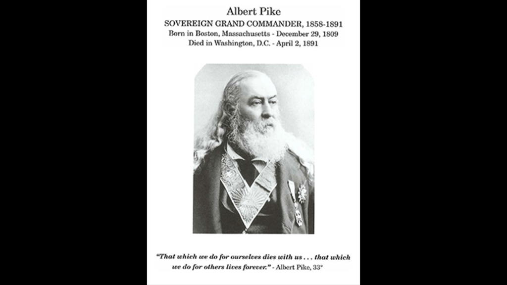
And Albert Pike, the most powerful Freemason in the world for 33-years, and Giuseppe Mazzini, the leader of the Bavarian Order of the Illuminati after the death of its founder Adam Weishaupt in 1830, were co-conspirators in plotting the direction they wanted the New World to go in, and were in correspondence with each other.

The following cities in Kansas were founded in the years prior to the start of the Civil War.

Atchison was founded in 1854, the same year the Kansas-Nebraska Act became law.

It is the county seat of Atchison County.

It was named after the United States Senator from Missouri, David Rice Atchison, who had interested some of his friends in forming a city when Kansas was opened for settlement.

This portrait of Senator Atchison was credited to the Civil-War-era photographer Matthew Brady in 1849.

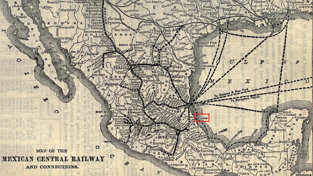
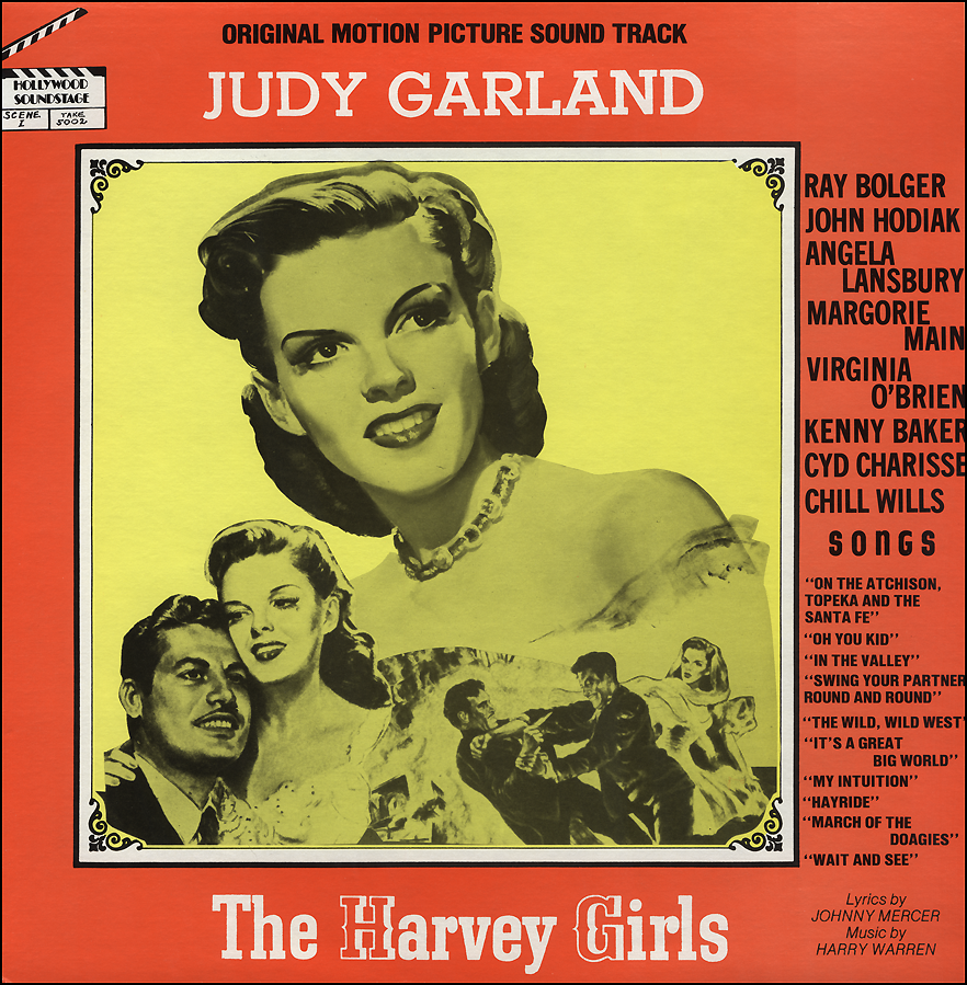
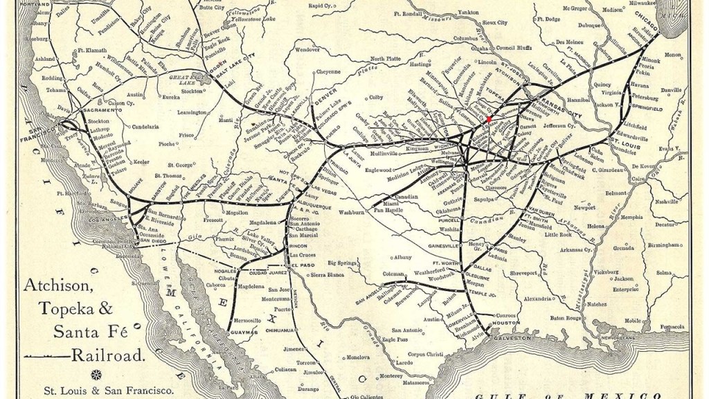
Atchison was the original eastern terminus of the Atchison, Topeka and Santa Fe Railway.

The railroad was chartered in February of 1859 to serve the cities of Atchison and Topeka in Kansas, and Santa Fe, New Mexico.

Despite being chartered to serve the city, the railroad was said to have chosen to bypass Santa Fe, because of the engineering challenges of the mountainous terrain, and eventually a branch line from Lamy, New Mexico brought the Santa Fe railroad to its namesake city.

The railroad was the subject of a popular song written by Harry Warren and Johnny Mercer for the 1946 film “The Harvey Girls.”

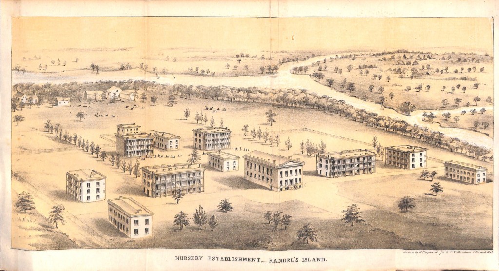
The Soldiers’ Orphans Home was said to have been founded in Atchison sometime around 1887 for the nurture, education and maintenance of indigent children of soldiers and sailors who served in the Union during the Civil War, and eventually changed to the State Orphans Home, which was in operation until 1962.

The construction of the current Atchison Post Office was said to have been authorized by the United State Congress in 1890, with construction of the Romanesque-style limestone building starting in 1892.

The Atchison County Courthouse was said to have been built between 1896 and 1897 to replace the first courthouse which had been built in 1859.

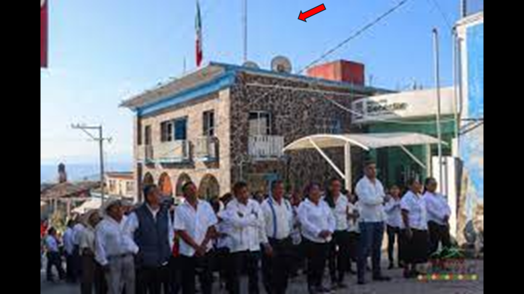
I will be noting with red arrows ground-level windows as possible mud flood evidence, like there’s more building going on down below the ground-level.

Then there is St. Benedict’s Abbey in Atchison, which was established in 1857 in order to provide education for the sons of German settlers in the Kansas Territory.

The German Benedictines were quite active in establishing institutions in America during the 1840s and 1850s, said to have been pursuing their religious calling in peace, as well as providing guidance to the German immigrants to America during that period.

When I saw the view of Atchison, Kansas in the top left photo, I was immediately reminded of the view of the city of Santa Cruz de Tenerife on the island of Tenerife in the Canary islands, which are located off the coast of Morocco, on the bottom left.

Then on the right is a picture of the city of Ouarzazate, Morocco, which I had encountered in my research, and its appearance also reminded me of Santa Cruz de Tenerife and Atchison, especially with regards to the orientation of the buildings, and the placement of the windows.

Next, the city of Emporia was founded in 1857, and is the county seat of Lyon County.

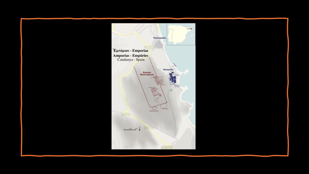
We are told its name was taken from ancient Carthage.

An “emporia” was a place where the traders of one nation had reserved to their business interests within the territory of another nation, and in ancient Greek, it referred to the Phoenician city-states and trade outposts of North Africa, including Carthage and Lepcis Magna, as well as others in Spain, Britain, and Arabia.

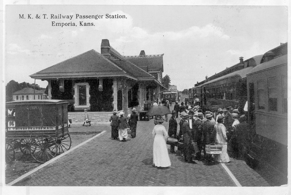
By December of 1860, the Missouri-Kansas-Texas Railroad had reached Emporia, setting the stage for it to become a major railroad hub.

Emporia State University was established here in 1863, two years after Kansas became a state in 1861 (and both of these years were during the American Civil War, which took place between 1861 and 1865).

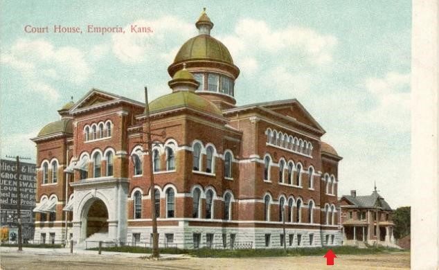
Emporia was chosen as the county seat of Lyon County in 1860, and this courthouse was said to have been built between 1901 and 1903…for a community at that time which was said to have a population of approximately 8,200 people.

By the early years of the 20th-century, Emporia had become an important railroad center, as not only the junction of the Missouri-Kansas-Texas Railroad, but also as the main-line of the Atchison, Topeka & Santa Fe Railroad.

By 1910, less than 60-years after its founding, Emporia was said to have the following:

Waterworks; electricity for lighting and power; police and fire departments; well-paved streets; a public library; woolen and flour mills; foundries; machine shops; carriage and wagon works; an ice plant; broom factories; a planing mill; a creamery; brick-and-tile works; a corrugated culvert factory; and marble works. All, we are told, with a population of a little over 9,000 people

The Emporia Public Library has been in operation since 1869, and is the oldest in the State of Kansas to remain in operation.

This photograph of Commercial Street is said to date between 1910 and 1919.

The historic Granada Theater in Emporia is located on Commercial Street, and was said to have been designed in the Spanish Colonial Revival Style by the Boller Brothers of Kansas City.

It opened in 1929.

It was closed in 1982 due to damage and neglect, but local preservationists saved it from demolition in 1994, and it was reopened for public use.

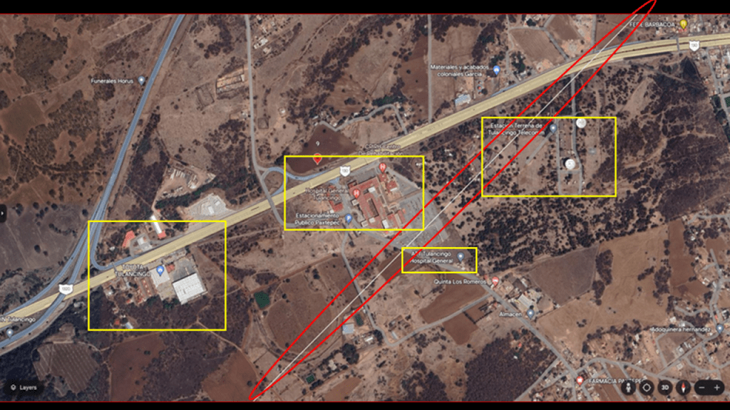
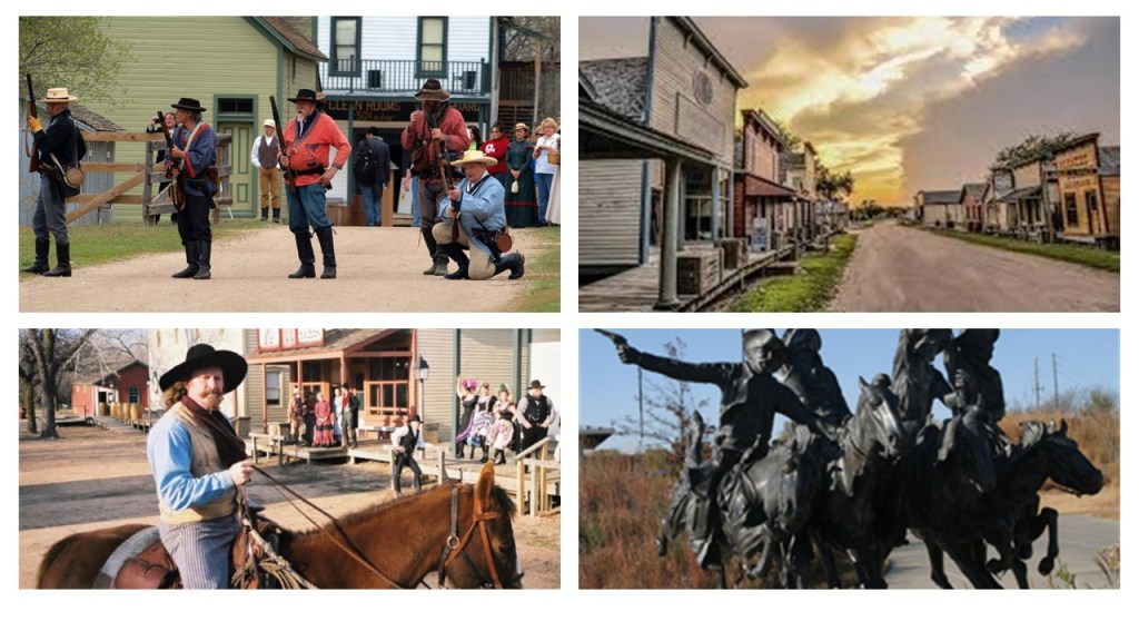
The next city I am going to look at is Wichita, the largest city in Kansas, and the county seat of Sedgwick County.

We are told the city of Wichita started out life as a trading post on the Chisholm Trail in the 1860s, which was established to drive cattle from ranches in Texas to Kansas railhead and was incorporated as a city in 1870.

The Old Cowtown Museum is located next to the Arkansas River in central Wichita.

Established in 1952, it is one of the oldest open-air history museums in the central United States, with 54 historic and re-created buildings on 23-acres of land on the original Chisholm Trail.

I am going to call this the John Wayne version of history, the false historical narrative that we have been indoctrinated in from cradle-to-grave.

Among many other examples from Hollywood the entertainment industry, famous western movie actors John Wayne and Roy Rogers were Freemasonic Shriners, who shaped the narrative for countless generations of young and old who believe western movies are real history.

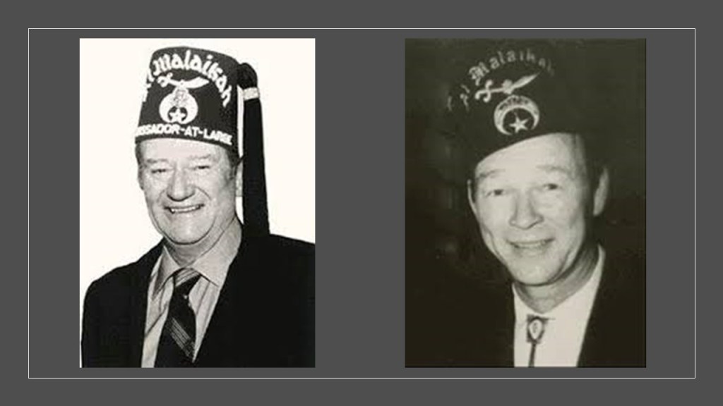
For that matter, so were Franklin Delano Roosevelt and Harry S. Truman, as well as other U. S. Presidents.

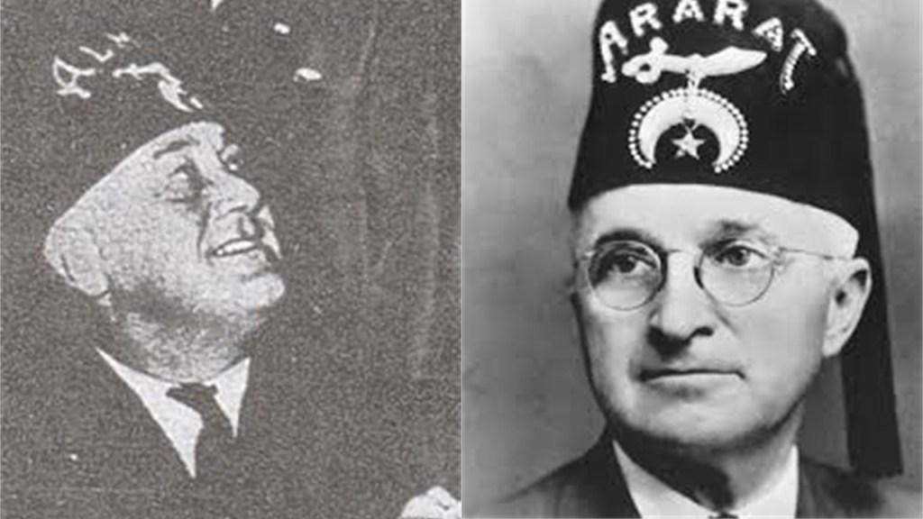
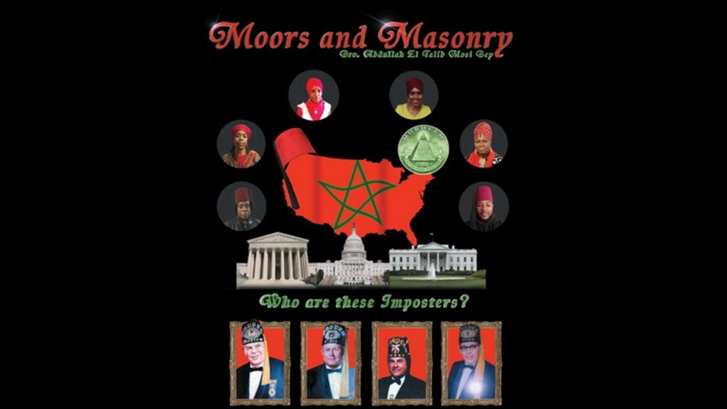
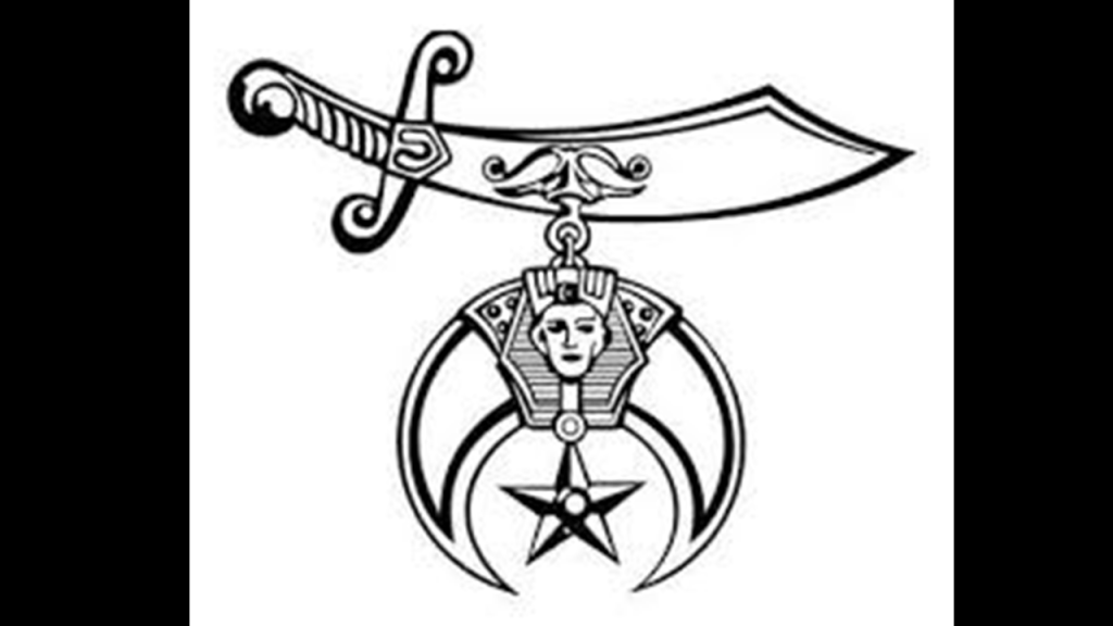
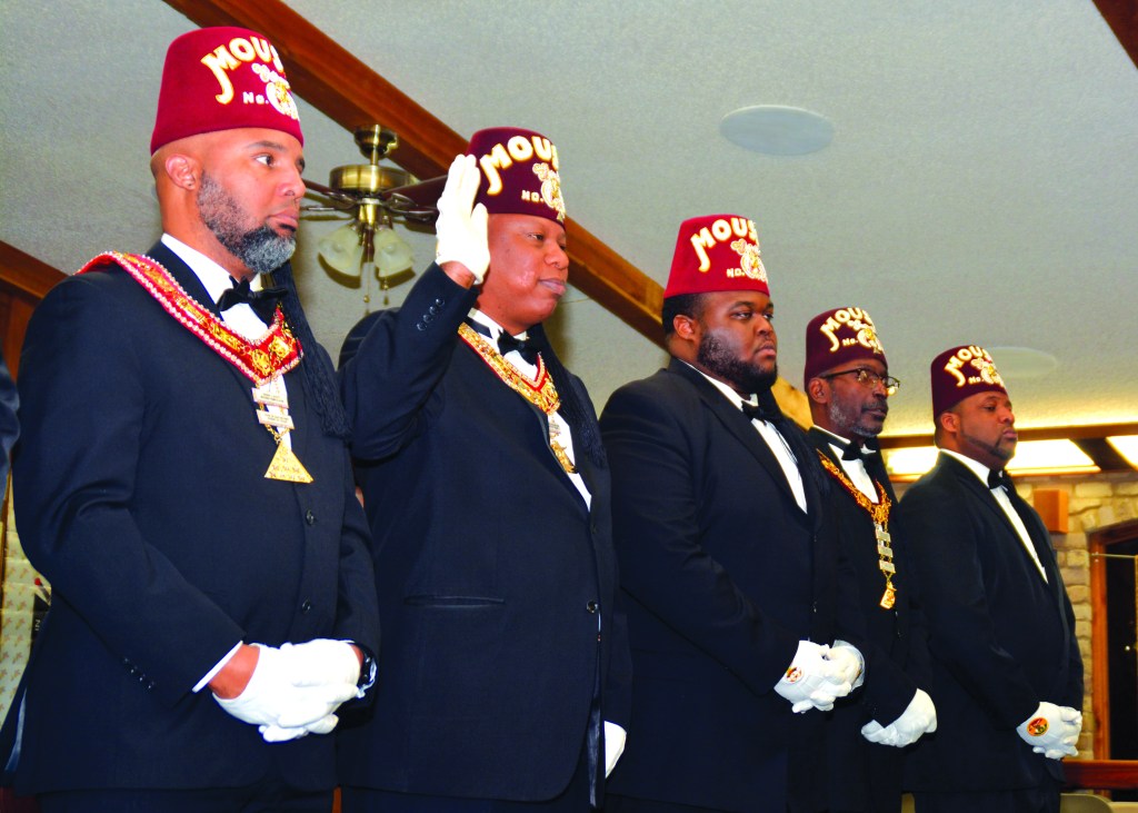
Shriners are comprised of 32nd- and 33rd-degree freemasons, the highest degrees of western freemasonry, also known as the Ancient Arabic Order of the Nobles of the Mystic Shrine, with a logo that appears to be depicting the menacing image of a sword over the head of a Pharaoh.

These are Prince Hall Shriners of the Ancient Egyptian Arabic Order of the Nobles of the Mystic Shrine.

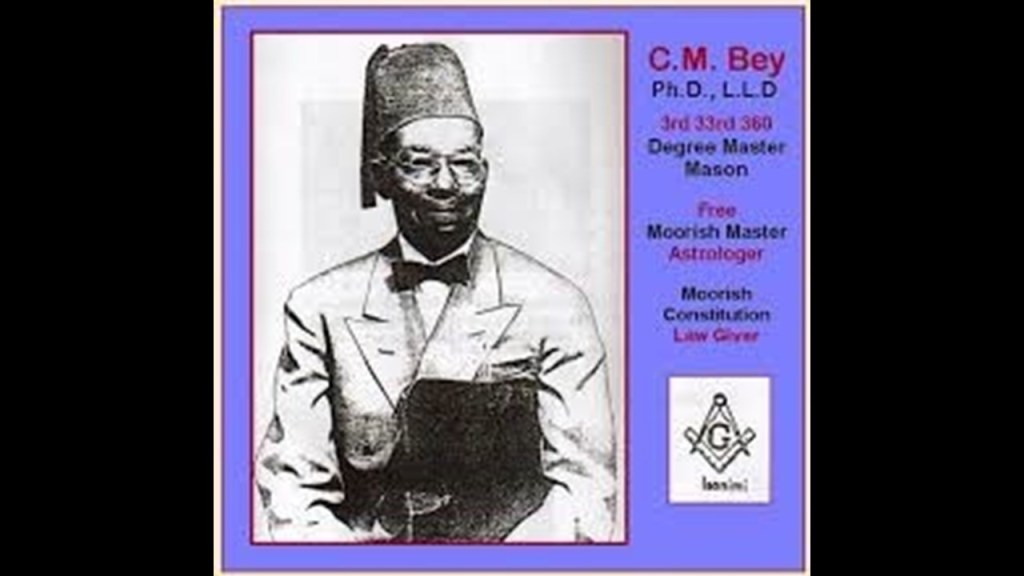
Ancient Moorish Masonry has 360-degrees of initiation…327 more than freemasonry.

Fort Independence in Boston Harbor was the location where Prince Hall, and fourteen other Moorish men were initiated into the British Army Lodge 441 of the Irish Registry, after having been declined admittance into the Boston St. John’s Lodge.

He was the founder of Prince Hall Freemasonry on September 29th of 1784, and the African Grand Lodge of North America.

Until Prince Hall found a way in, Moorish Americans were denied admittance into Freemasonry.

Moorish Masonry is based on Moorish Science, which also includes the study of natural and spiritual laws, natal and judicial astrology, and zodiac masonry.

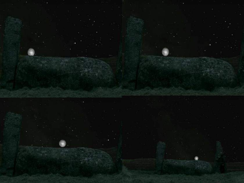
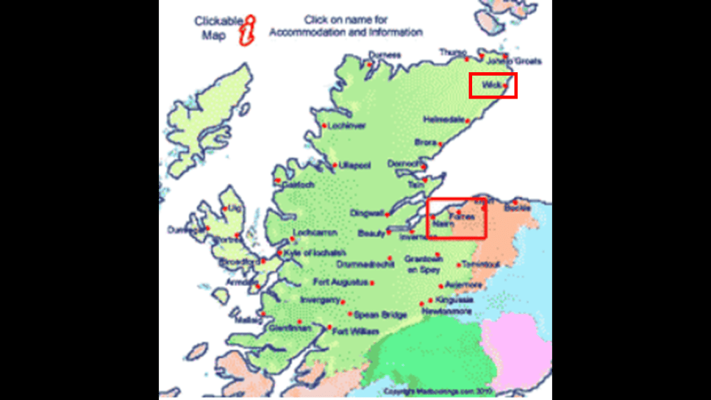
This is where the perfect alignments of infrastructure on earth with the sky comes from – the consummate alignment of earth with heaven that is seen around the world – like the lunar roll along the top of this multi-ton recumbant stone in Crowthie Muir in Forres, Scotland.

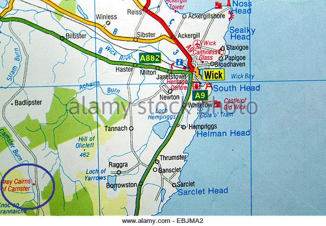
Further north of Crowthie Muir in Forres, near Wick on the northeast tip of Scotland…

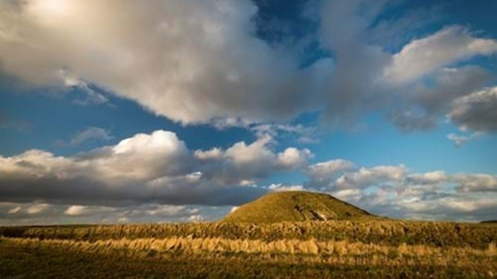
…there is a place called the Grey Cairns of Camster.

This site has two of Scotland’s oldest, and best-preserved, Neolithic chambered cairns, dating back 5,000 years ago, in addition to this big mound.

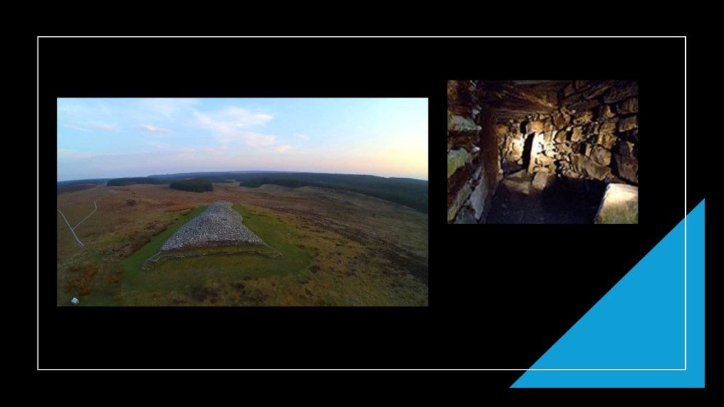
This is Camster Round on the outside and inside, said to have been discovered in 1850, and excavated in 1865.

It is unique as a chambered cairn in Caithness because its main chamber roofing was found intact.

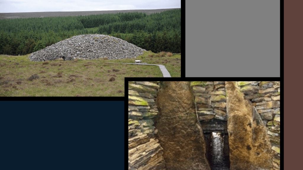
The other chambered cairn is called Camster Long, and depicted on the inside with sunlight shining on the stone at the end of the Chamber.

These two cairns are described as burial chambers, but I believe Neolithic constructions like these chambered cairns have predominantly astronomical functions, and not burial ones.

Like, among other things, being markers of the heavens on earth at the solstices or equinoxes, providing a perfectly aligned avenue in the enclosure for the light to stream into at those times.

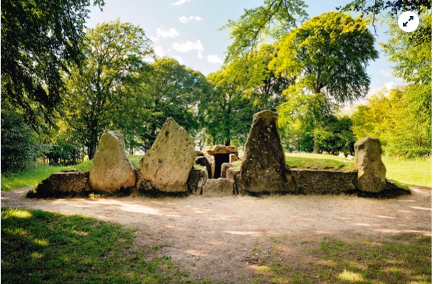
Another example of this is found in the Neolithic Complex of Avebury in Southern England…

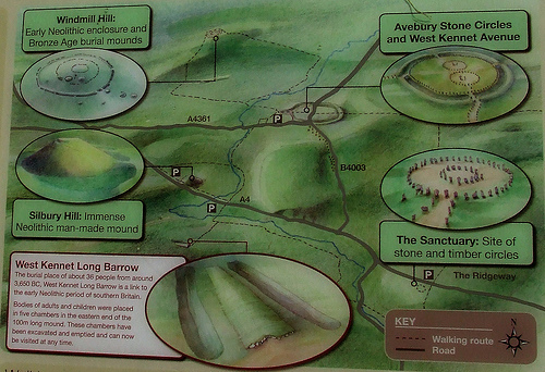
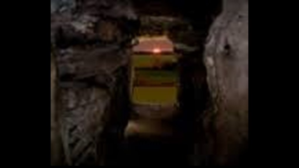
…at the West Kennet Long Barrow. While also called a tomb, it is known to be a solar marker at the equinoxes, as depicted in this photograph of the sun aligned at the entrance of this long barrow.

It is also over 5,000 years old, like the Grey Cairns of Camster.

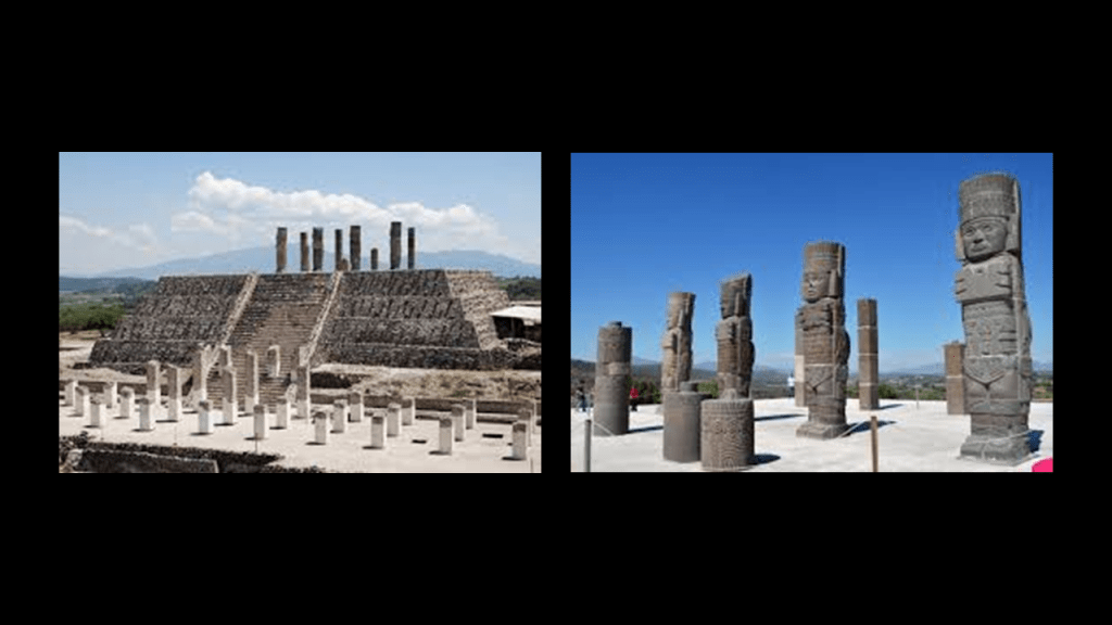
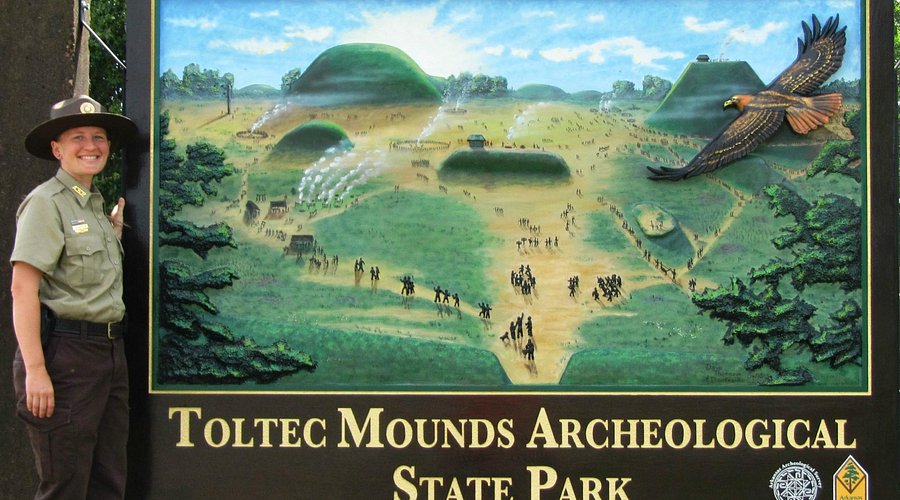
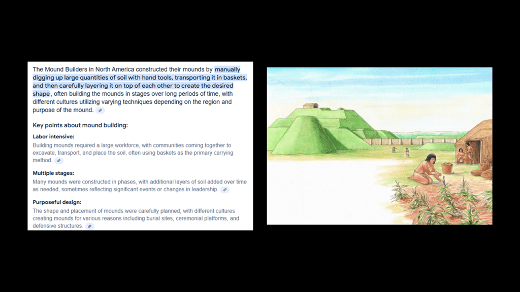
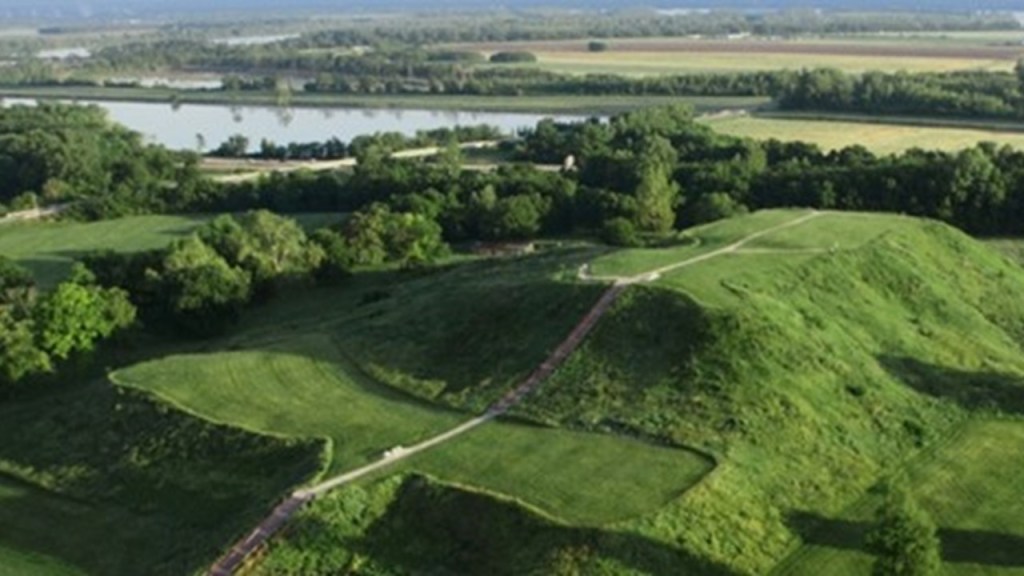
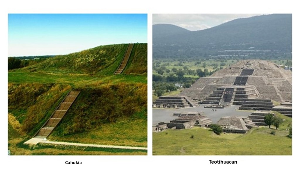
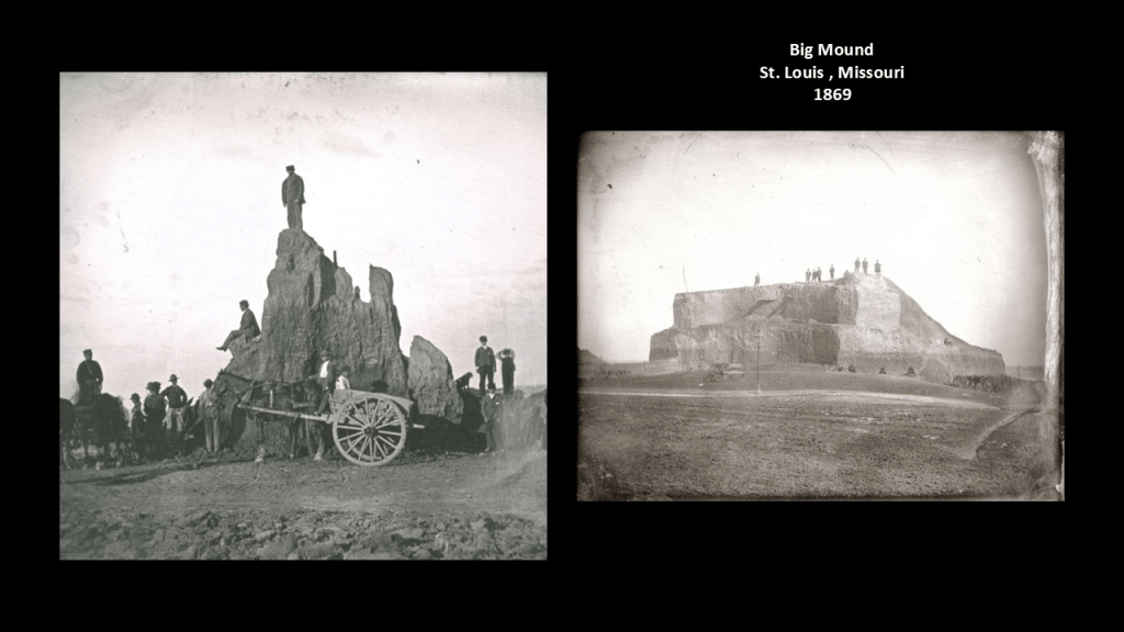
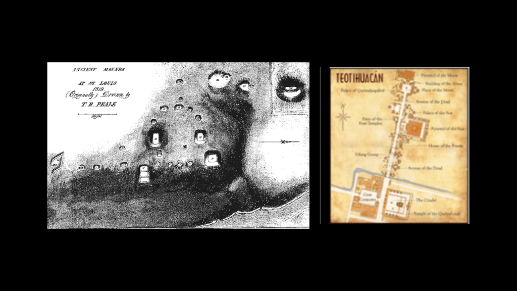
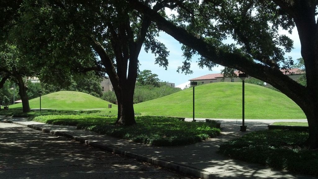
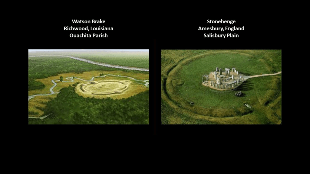
Both the Grey Cairns of Camster and the West Kennet Long Barrow are contemporaries in time with the Watson Brake Mounds, in Richwood, Louisiana, near Monroe and Poverty Point, which you can’t visit because it is on private property.

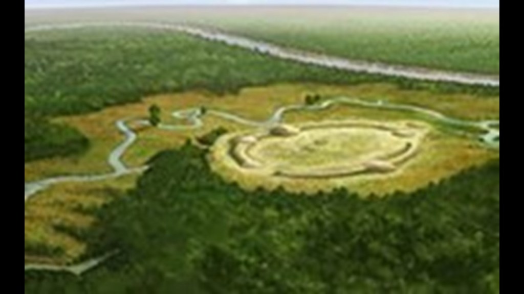
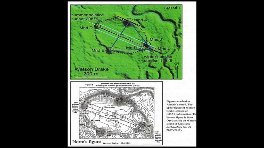
Watson Brake is dated to 5,400 years ago, and is considered the oldest earthwork mound complex in North America. Note the summer and winter solstice alignments depicted here in this diagram of Watson Brake.

There are two ancient mounds at Louisiana State University in Baton Rouge, believed to be more than 5,000 years old, and considered to be part of the oldest mound system in North America, and also an acknowledged part of the Louisiana mound system.

They are on the U. S. National Register of Historic Places.

Stonehenge, located not far from the neolithic complex at Avebury in Southern England, is also believed to date to about 5,100 years ago, and has a similar earthwork to what is seen at Watson Brake in Louisiana encircling the big stones.

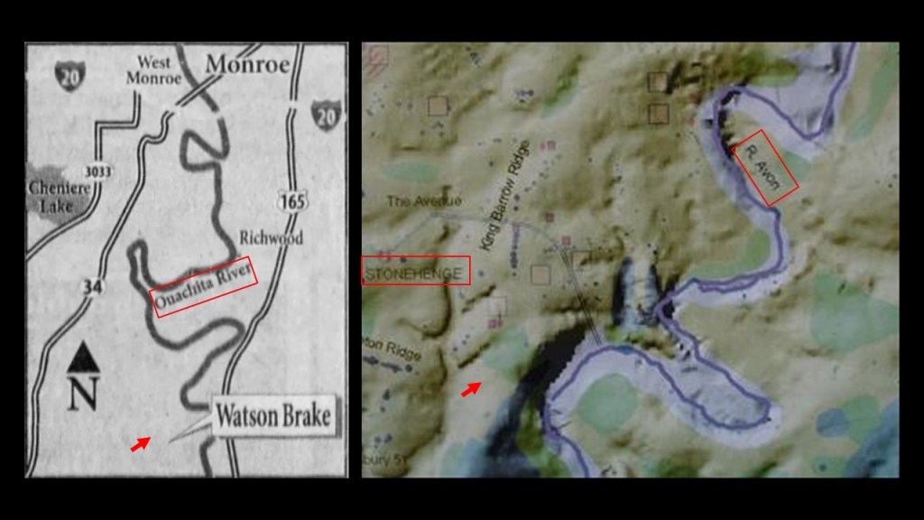
Not only that, the rivers next to both of these places, the Ouachita River at Watson Brake, and the River Avon next to Stonehenge, appear to have what are identically-shaped bends right next to the sites.

So to get back to the cover-up of the Earth’s True History by the John Wayne version of history, I am going to take a look at the “Keeper of the Plains,” a 44-foot, or 13 1/2 meter, high statue, situated where the Big and Little Arkansas Rivers join together in downtown Wichita, where we see more of the snaky, s-shaped river bends.

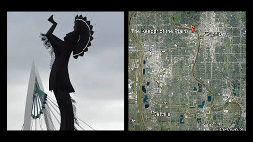
It strikes me that the statue is erected on top of what looks like ancient megalithic masonry to me!

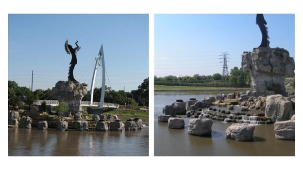
You see the same kind of masonry blocks at Wichita Falls in Texas, even though what we are told was that a flood in 1886 destroyed the original Wichita Falls for which the city was named, and that 100-years later, the city built a 54-foot, or 16-meter, high multi-cascade artificial waterfall to replace the original 5-foot, or 1.5-meter, high waterfall at a bend in the Wichita River where Lucy Park is today.

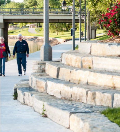
This is a riverwalk along the Arkansas River in downtown Wichita, with megalithic masonry that people walk on by every day without even noticing it for what it is.

I know I didn’t notice it until I tuned it to it, and that was just 10-years ago in my early 50s.

Then I started seeing it everywhere!

I still do!

The Scottish Rite Temple in Wichita was said to have been originally constructed in the Romanesque architectural style for the YMCA in 1887 – 1888, and that it was sold to Scottish Rite Freemasons in 1889.

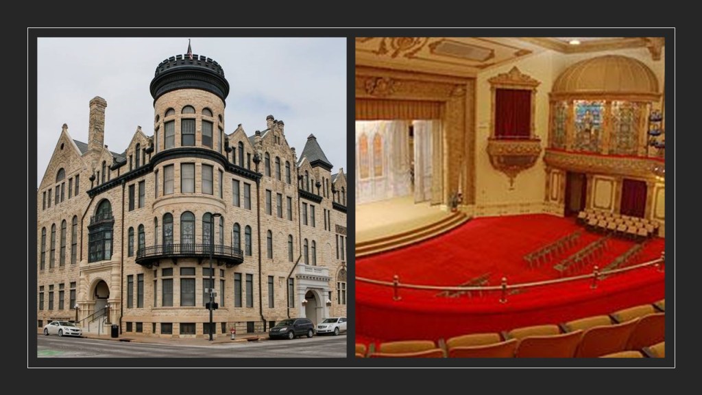
Wichita’s Orpheum Theater, which is still in use today, opened on September 4th of 1922, and was part of the Vaudevillian “Orpheum Circuit,” with well-known vaudeville stars performing there, like Harry Houdini, Eddie Cantor and Fannie Brice.

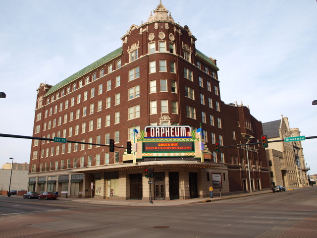
There are Orpheum Theaters still in existence all across the United States, and I even found one on the island Republic of Malta in the town of Gzira near the capital of Valletta.

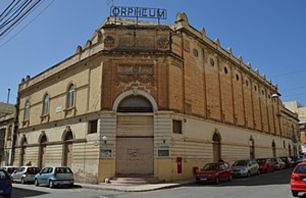
Orpheus was a musician and poet in Ancient Greek legend, said to have had the ability to charm all living things, and even stones, with his music.

What, exactly, caused us to go to sleep, and forget who we are, and what we were?

How has the false information we have been taught all our lives been reinforced?

Why would this be important to whoever was responsible for removing the ancient advanced civilization from our collective awareness to begin with?

We are told that the Wichita lived here historically.

Was the memory of Ancient Washitaw Mu’urs in North America retained in the naming of this place as Wichita, like that of the Moors in Great Britain?

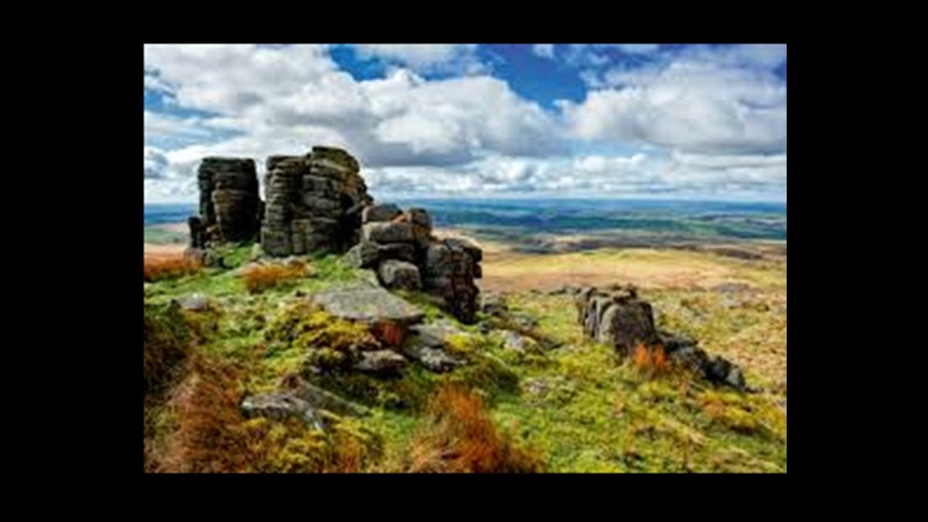
The Moors in Great Britain are defined as “tracts of open, peaty, wasteland, often overgrown with heath, common in high latitudes and altitudes where drainage is poor.”

Yet, they typically contain with the ruins of megalithic stone structures, like what is shown here.

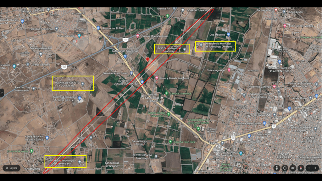
Next, I am going to take a look at Kansas City, the third-largest city in Kansas and otherwise known as KCK.

It is the seat of Wyandotte County.

KCK was first incorporated in 1872, and then again 1886 when the “New” KCK was formed through the consolidation of five municipalities.

KCK was said to have seen explosive growth as a streetcar suburb of Kansas City, Missouri, located right across the Missouri River, and the largest city in Missouri.

Kansas City, Missouri, we are told once had one of the most extensive streetcar systems in North America.

More to come on the Missouri-side of Kansas City.

We are told that horse-powered streetcars were introduced in 1870, and that some early routes were powered by underground cables, like those of San Francisco.

By 1908, all of Kansas City’s streetcar lines except for one was powered by electricity.

The last of its 25 streetcar routes was shut-down in 1957, to be replaced by buses.

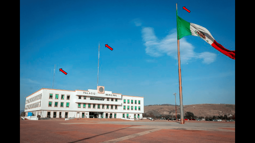
The current Wyandotte County Courthouse in KCK was said to have been built in Neoclassical style between 1925 and 1927 by the Kansas City architectural firm of Wight and Wight…

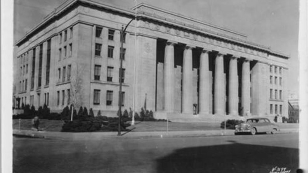
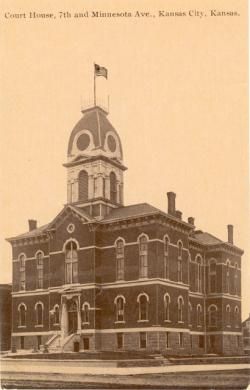
…to replace the county courthouse that was said to have been built in 1882.

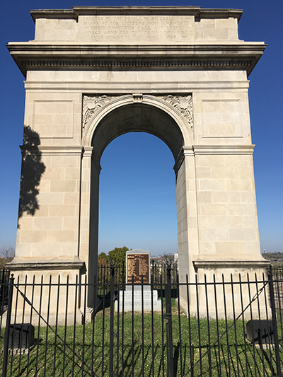
We are told the Rosedale Arch, dedicated in 1924, and said to have been inspired by the Arc de Triomphe in Paris, was erected as a memorial to honor the men of the Rosedale neighborhood of Kansas City who had served in World War I.

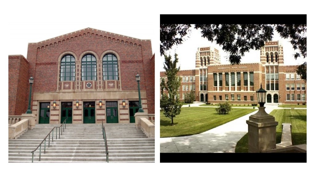
The Wyandotte High School, still in use today, was said to have been built in the 1936 – 1937 time-frame by the New Deal Works Progress Administration and the KCK Board of Education.

Next, I am going to take a look at Liberal, Kansas.

Liberal was incorporated in 1888, and is the county seat of Seward County.

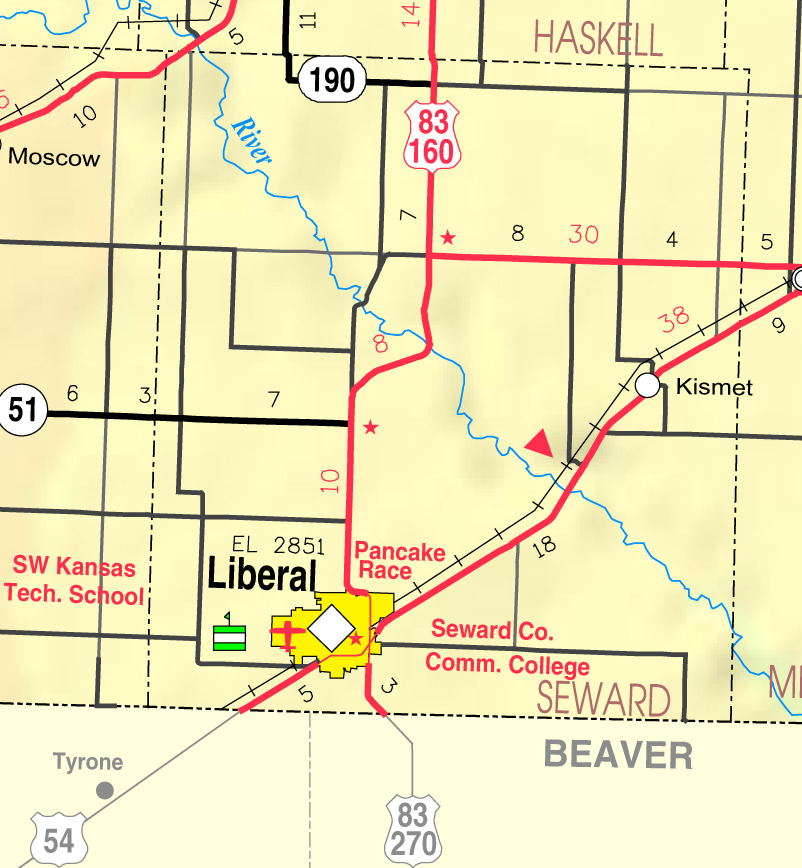
We are told it was incorporated after the railroad came by this small settlement near the Oklahoma state line where S. S. Rogers had built the first house in 1872, and where he built a general store and post office in 1885.

From the arrival of the railroad, so the story goes, the town’s growth began.

The plot on the townsite of Liberal opened on April 13th of 1888.

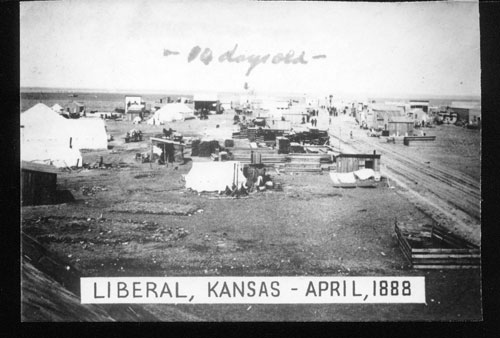
The sale of lots in the next twenty-four hours, we are told, totalled $180,000, and within a week, there were 83 constructed wooden houses, and within a year there was a boom, at which time Liberal was incorporated as a city.

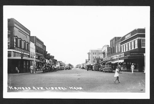
This is a picture of Kansas Avenue in Liberal taken sometime in the years between 1928 and 1938.

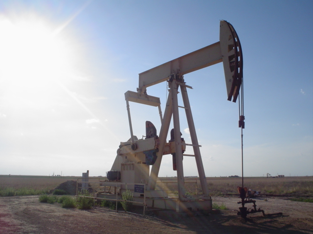
In 1920, natural gas was discovered west of Liberal in what became the huge Panhandle-Hugoton gas field, which contains one of the world’s largest known natural gas fields…

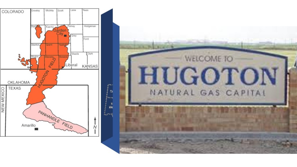
…oil was discovered southwest of town in 1951…

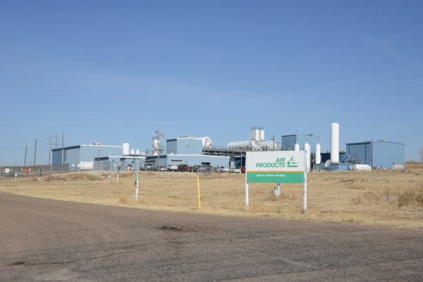
…and in 1963, National Helium opened there, the largest helium plant in the world.

The last place I am going to look at here in the heart of the continental United States is Kansas City, Missouri, or KCMO, because there is a whole lot to unpack here.

When I was looking around for information on the early history of KCMO, the following information and photos stood out.

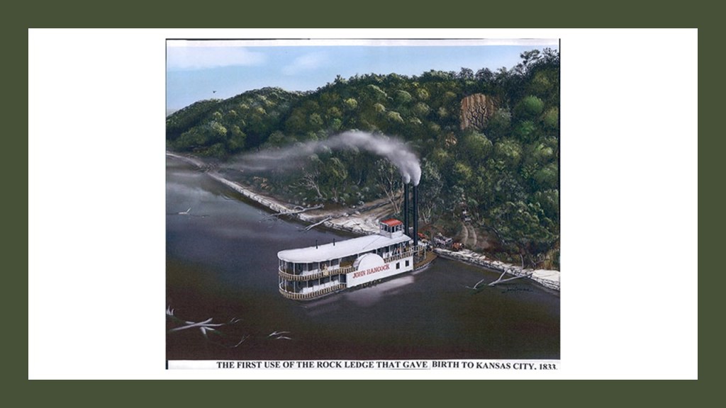
A Rock Ledge became the landing place for riverboats and wagon trains starting in 1833, on the southside of the Missouri River at what became KCMO.

And all of these strata of limestone are underneath the surface where the rock ledge was located.

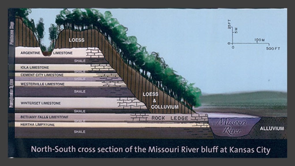
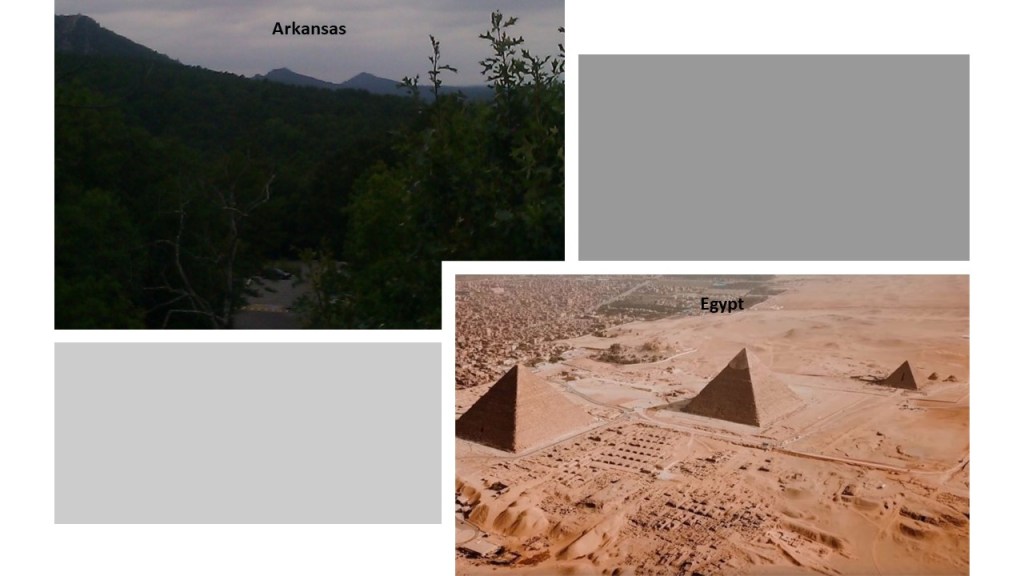
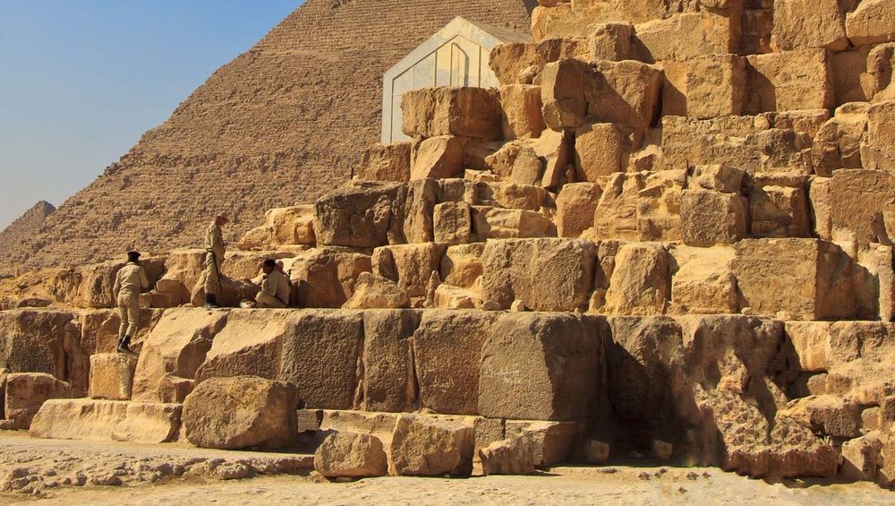
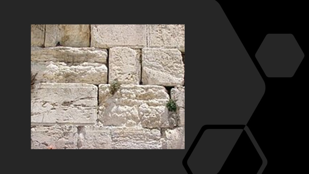
I just want to point out that limestone was a common building material in the ancient world, and used in constructions like the Pyramids of Giza…

…and the Western Wall, also known as the “Wailing Wall,” an ancient limestone wall in the old city of Jerusalem.

And places that are officially identified as canals have rock ledges.

KCMO was incorporated as a town on June 1st of 1850, and as a city on March 28th of 1853.

The territory around the confluence of the Missouri and Kansas Rivers was deemed by the founders as a “good place to build settlements.”

Noteworthy architecture on the Missouri of Kansas City side includes:

The Liberty Memorial, the National World War I Memorial and Museum, said to have been built in 1926, after a group of 40 prominent Kansas businessmen decided to form an association to create a memorial to those who had served in the war.

Construction on the Union Station in KCMO was said to have started in the early 1900s, and that it opened in 1914, operating as a train station until 1985.

Today it features exhibits, movies, restaurants, and a science center.

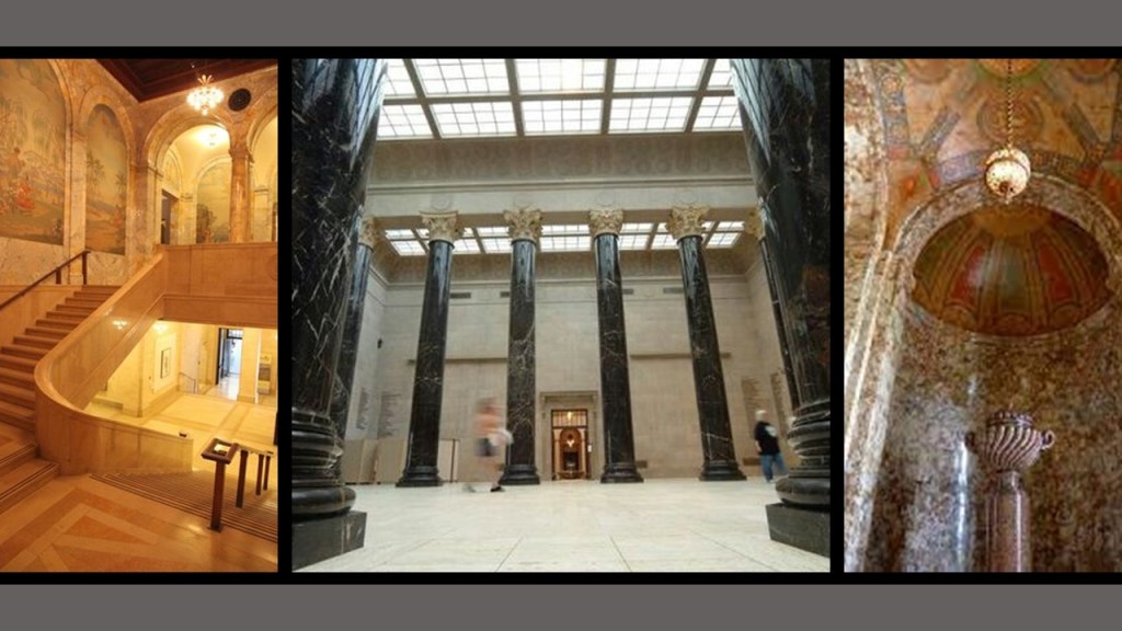
Like the current Wyandotte County Courthouse in KCK, the Nelson-Atkins Museum of Art was said to have been designed by the architectural firm of Wight and Wight, with groundbreaking for the building occurring in July of 1930, and the museum opening to the public in December of 1933, in the middle of the Great Depression.

Inside this magnificent building, there are marble floors, staircases, columns, and ornate marble alcoves and hallways.

The United States Courthouse and post office, still standing today, was said to have been built in the late 1930s as one of the last of Franklin Roosevelt’s New Deal programs.

What we are told was the new courthouse replaced the Old Post Office and Customhouse, on the top left, that once stood at 8th and Grand Boulevard on the bottom right in Kansas City, Missouri.

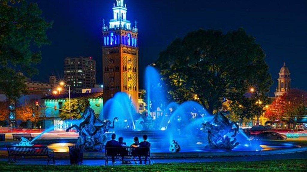
KCMO is called the City of Fountains, and is reputed to have more fountains than Rome!

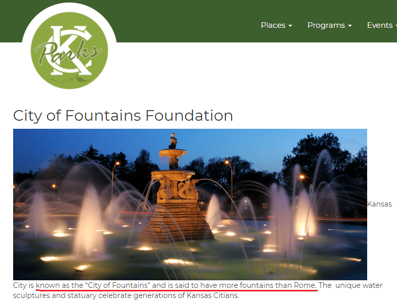
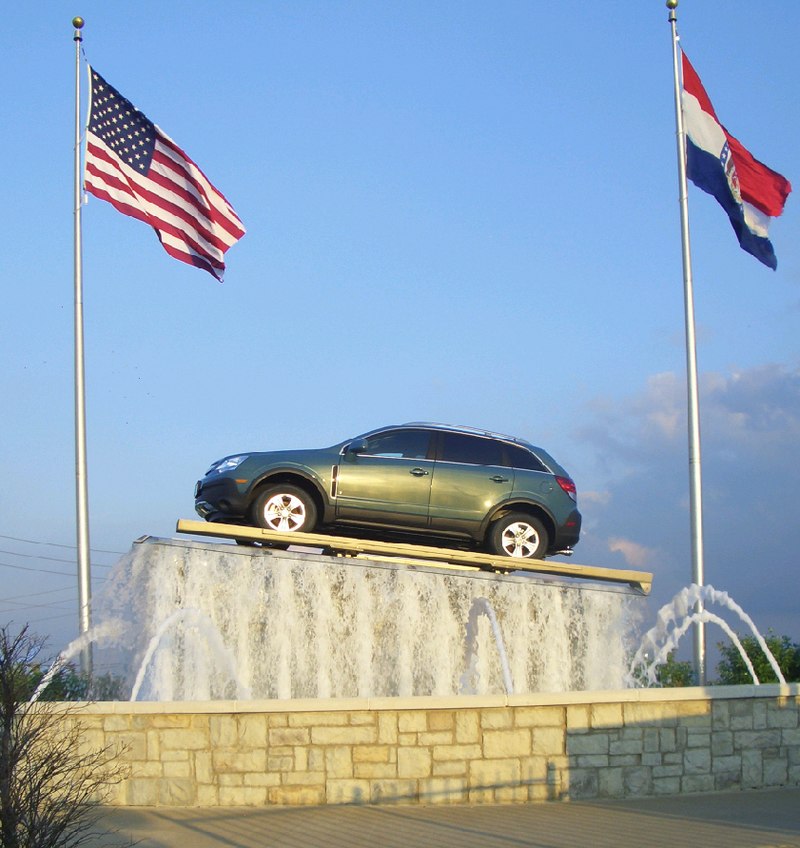
There are 200 officially-registered fountains in the Greater Kansas City Metro area.

That number does not include fountains at corporation and sub-division entrances; office atriums; and private gardens and homes; or like this one at a Kansas City Auto Dealership.

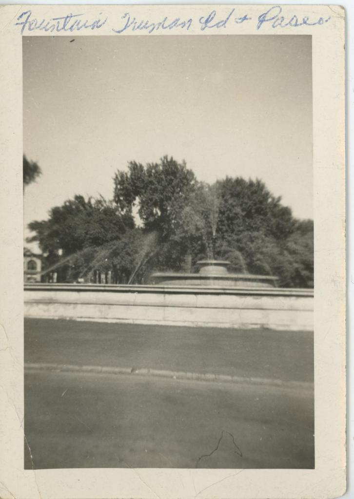
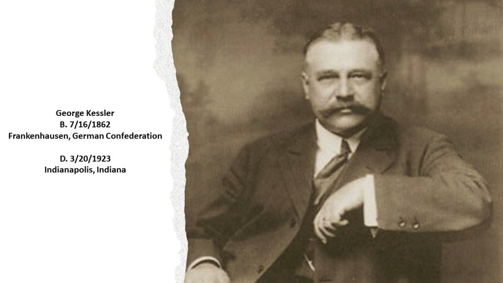
The first fountain built was said to have been designed by George Kessler and built in Kansas City in 1898 at 15th (now Truman Road) and the Paseo, though it was destroyed in 1941, with no reason given.

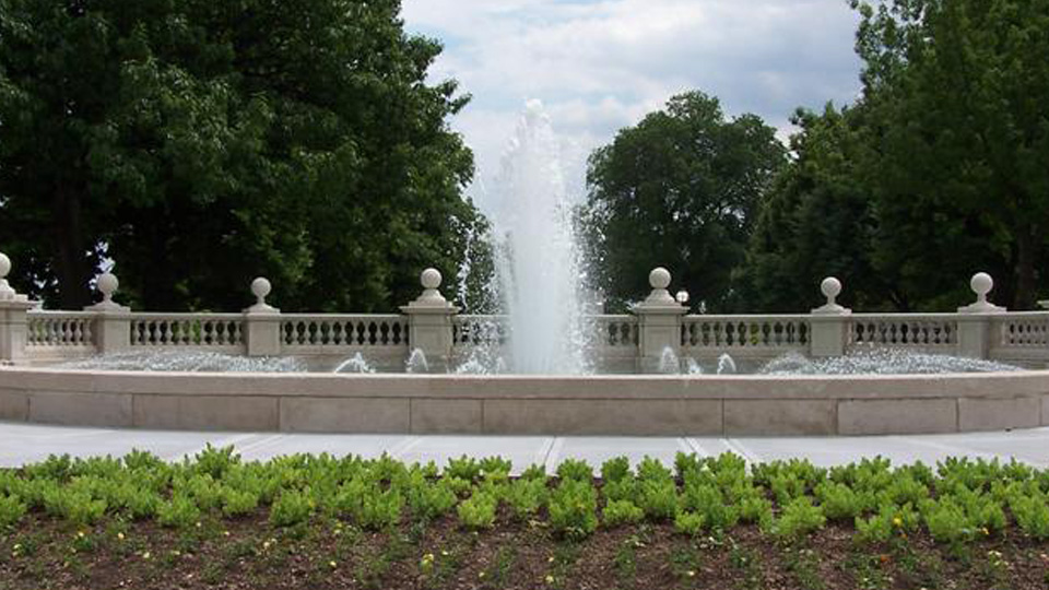
But the second-fountain said to have been designed and built originally in Kansas City in 1899 by George Kessler, along with John Van Brunt, is still in operation today, and known as the “Women’s Leadership Fountain.”

George Kessler was a German-born American city-planner and landscape architect, and in the course of his 41-year-career, was said to have completed over 200 projects, and prepared plans for 26 communities; 26 park and boulevard systems; 49 parks; 46 estates and residences; and 26 schools, which can be found in 23 states; and 100 cities, including Shanghai, New York, and Mexico City.

Interesting to note that George Kessler was also mentioned as being a 32nd-degree Freemason.

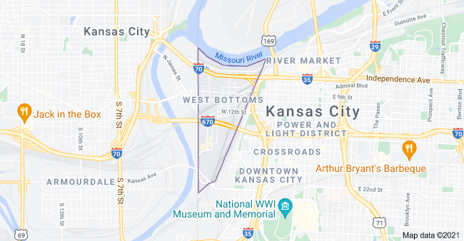
KCMO has an area called West Bottoms that is always hit harder when it floods there than other parts of the city.

And no wonder, considering that West Bottoms is located on land that is situated between the confluence of the Missouri and Kansas Rivers, and was also the original Central Industrial District of Kansas City, and is one of the oldest areas of the city.

The first Hannibal Bridge, the oldest bridge crossing the Missouri River, was said to have been completed in 1869, after its construction started in 1867, two-years after the end of the American Civil War, and was the first permanent rail crossing of the Missouri River.

It established Kansas City as a major city and rail center.

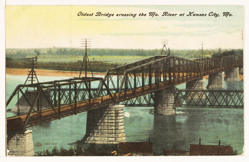
After the completion of the Hannibal Bridge, we are told the need for the Kansas City Union Depot arose.

After all, soon after the Hannibal Bridge opened, it carried eight railroads shipping freight to major trade centers in the east, like St. Louis, Chicago, and New York.

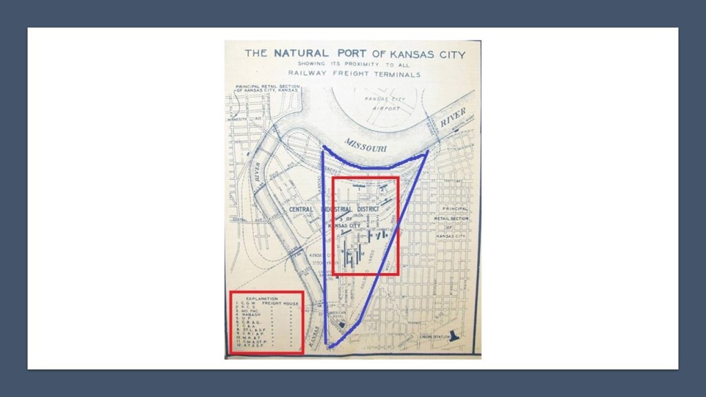
This is a historical map of what was called the “Natural Port of Kansas City,” with the West Bottoms District highlighted in blue, and the freight houses of 12 different railroads are listed by number in the red square on the left-hand-side, and the locations by number of each freight house in the red square that is contained completely within the West Bottoms District.

The first Kansas City Union Depot opened in 1878, and said to be the largest building west of New York of the time, and located near the stockyards.

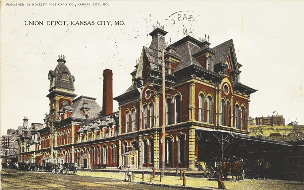
The first Union Depot train station was razed to the ground in 1915, after only 32-years of use, after the Kansas City’s second main train station, Union Station opened in 1914, the same year that World War I began.

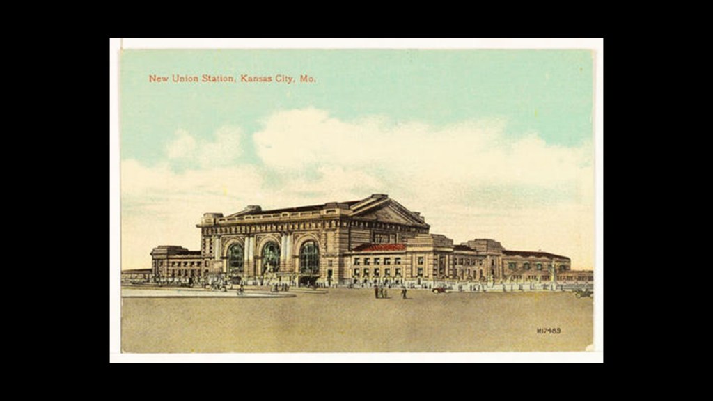
The New Union Station is still in use by Amtrak as a train station today, in addition to housing museums, theaters, restaurants and shops.

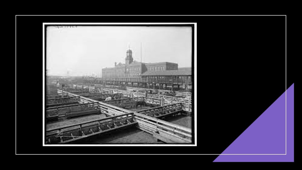
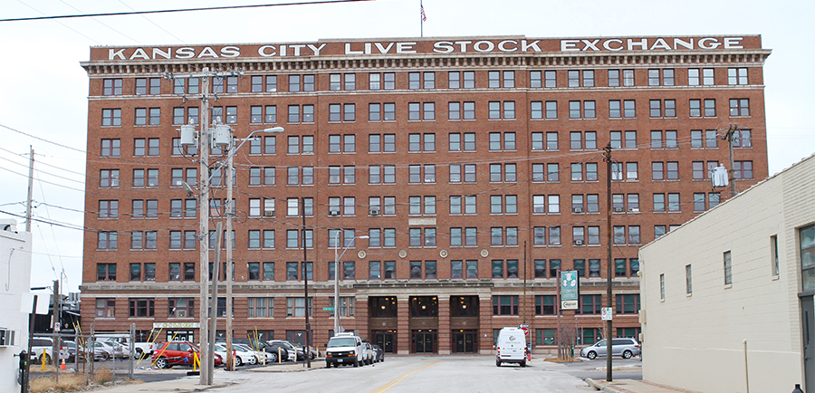
The Kansas City Livestock Exchange and Stockyards in West Bottoms were established in 1871, and at its peak, only the stockyards in Chicago were larger, of which this is a photo circa 1909.

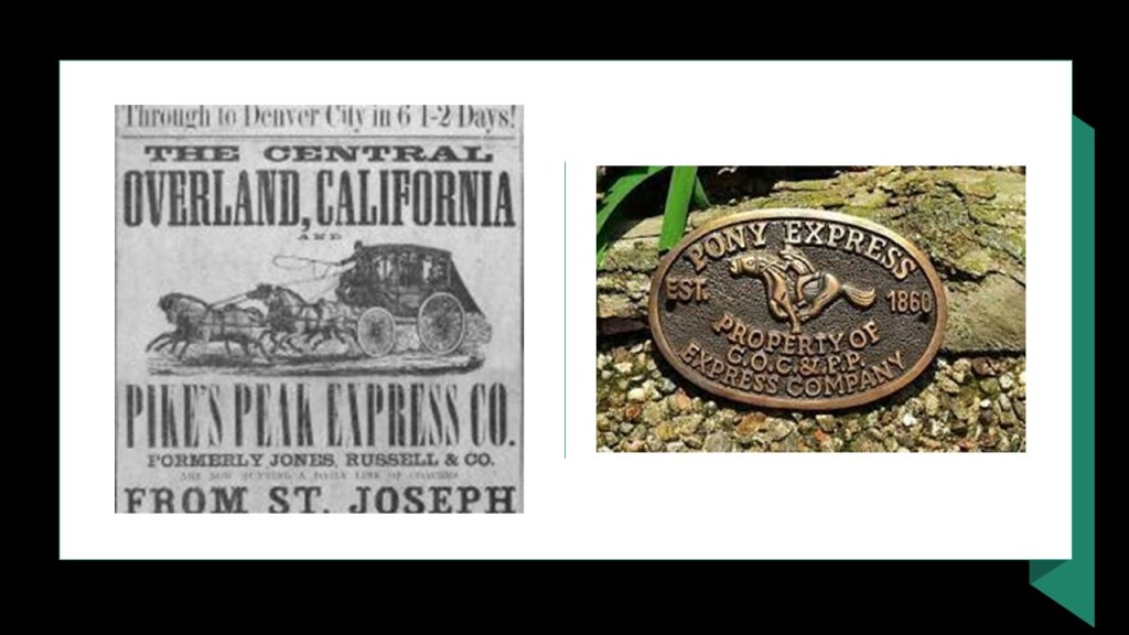
We are told the Kansas City Livestock Exchange and Stockyards was built around the facilities of the Central Overland California and Pike’s Peak Express Company.

The Central Overland California and Pike’s Peak Express Company was a subsidiary of a freighting company that operated as a stagecoach line starting in 1859, and was the parent company of the Pony Express that ran from April of 1860 to October of 1861.

The stagecoach line went out of business in 1862.

The Kansas City Livestock Exchange and Stockyards, along with the whole of West Bottoms, has had major floods over the years, like in 1903…
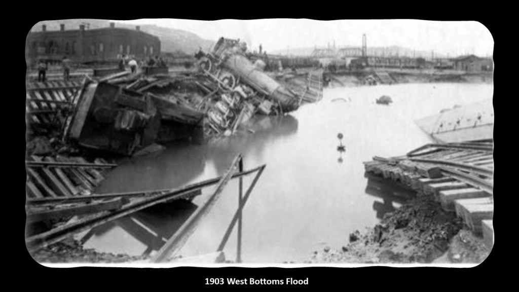
…in 1908…

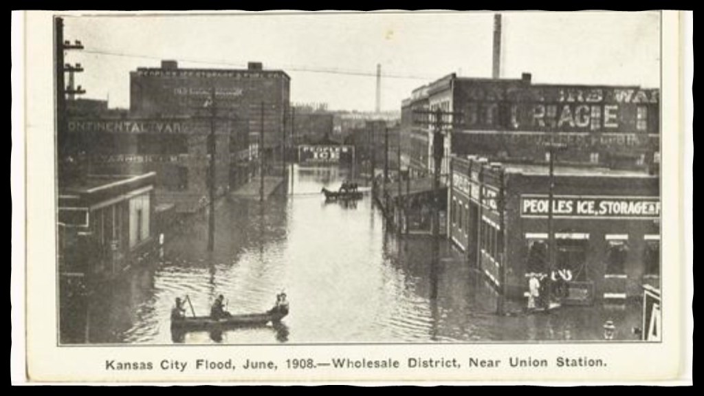
…and after the 1951 flood, the Kansas City Livestock Exchange and Stockyards and associated businesses were devastated, and it closed its doors for good in 1991.

The Livestock Exchange building, said to have been completed in 1911, was renovated and today is commercial business space…

…as are many of the old buildings in West Bottoms, known for its art galleries, restaurants, antique stores…

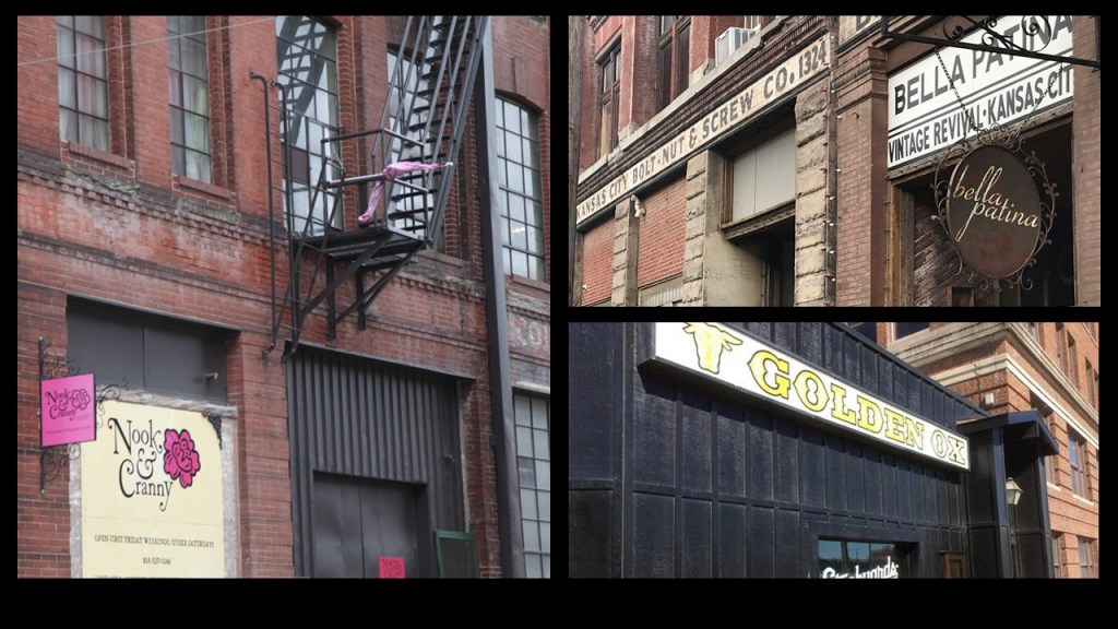
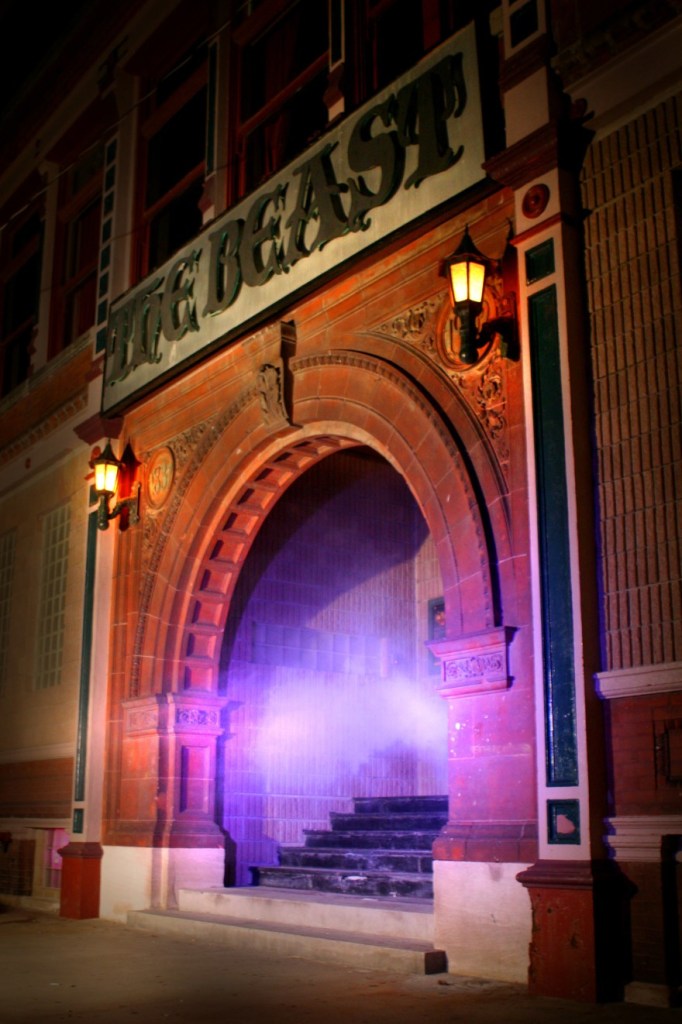
…and haunted houses.

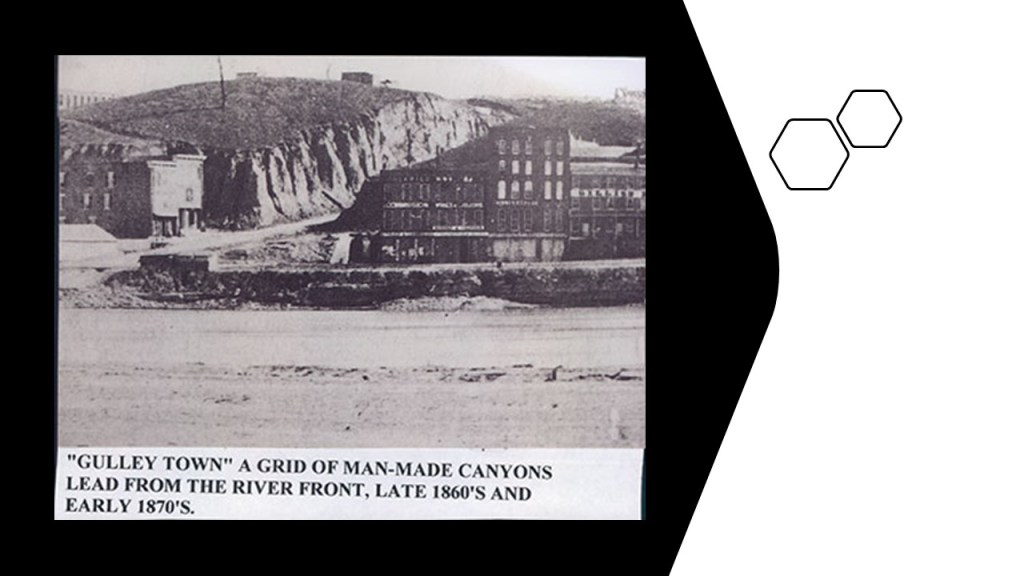
Other historic pictures that I would like to include of KCMO that are very interesting, and tell a completely different story than what our historical narrative tellus about this time period in our history include this one of when it was called “Gulley Town” in the 1860s and 1870s, where it looks like it was buried and needed to be dug out.

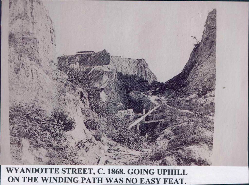
I also found these views of Wyandotte Street as it looked in 1868…
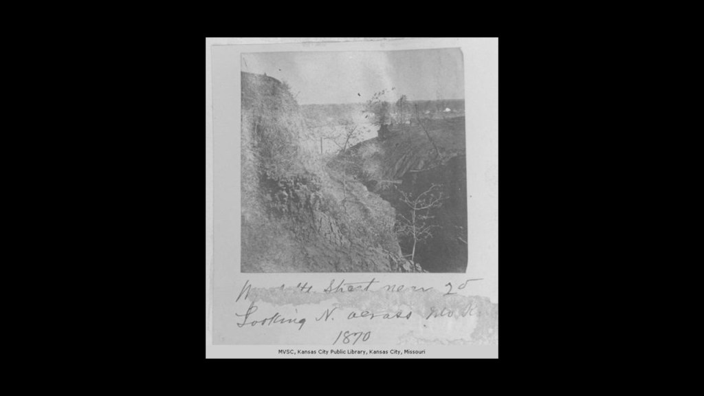
…in 1870…

…in 1871…

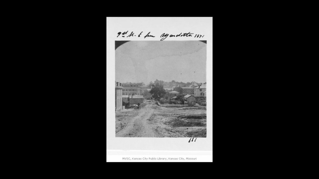
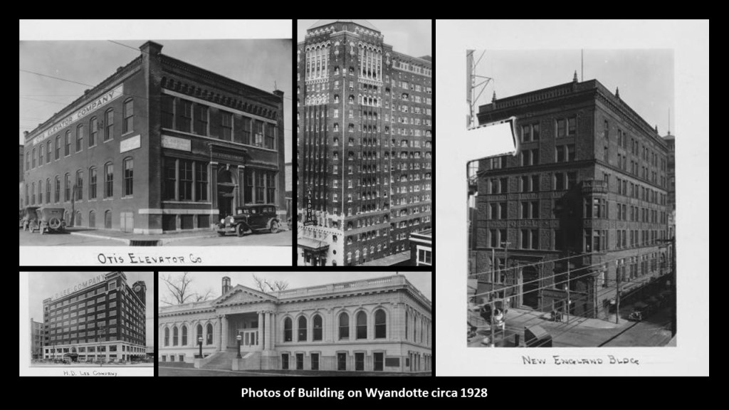
…and here are historic photos of some of the buildings on Wyandotte Street circa 1928.

I will end this post with these words.

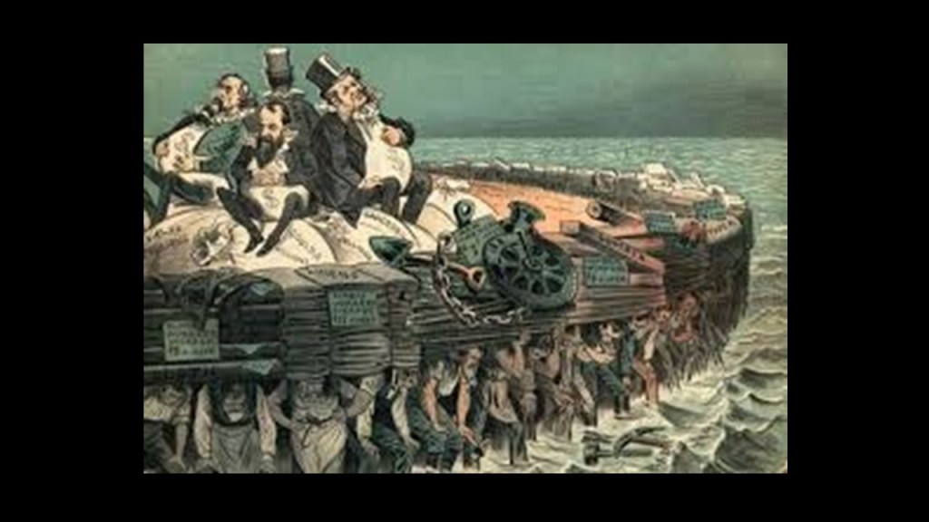
I am passionate about trying to find out how we got to the craziness of the world we live in today from what was originally a very advanced, integrated, and harmonious world civilization…when it was the Old World Order and not the New World Order.

Hopefully I have been able to shine some light on this vast subject of what might have taken place here through these historical examples, people and events in and around Kansas, the geographic center of the continental United States, that in some way, shape, and form provides us with more information about not only what came before, but how this advanced civilization was destroyed and covered up right in front of our eyes, and also how we came to be in the Orwellian World we find ourselves living in today, and that it did not happen randomly but has been planned for us in great detail by those who have their best interests at heart and not ours.

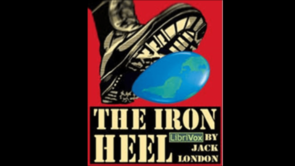
The famous American author, Jack London, one of the major writers who shaped our narrative as required reading in school, was also a Socialist.

He published a book in 1908 called “The Iron Heel,” about the rise of an oligarchic tyranny in the United States.

An oligarchy is a form of power structure in which power rests with a small number of people.

The story-line emphasized future changes in society and politics, and not technological changes.

It is called a dystopian novel, meaning characterized by mass poverty, public mistrust and suspicion, a police state or oppression.

They have actually been telling us their plans in a disguised way all along because they are required to tell us what they are doing so they always lie to us, and tell us without telling us they are telling us in order to gain our consent because of our Free Will…

…so they had to managed to convince us that handing over our freedom was our own idea.

They have been working on getting us to this place for a very long time, but they have lost control of the narrative, no matter how hard they try to get it back!

Pyramid Alignments on the Earth’s Grid and What They Reveal – Teotihuacan to Giza Part 1: Mexico

In this blog post, I will be looking at exactly what is found on an alignment between the Quetzelcoatl Pyramid at Teotihuacan in Mexico and the Great Pyramid of Giza in Cairo, Egypt.

My friend Aaron plotted the alignment between two pyramids in these locations on Google Earth and forwarded me the alignment information to look at.

He decided to plot the alignment on Google Earth after watching this video “From Giza to Teotihuacan: The 6666 Nautical Mile Mystery on the Ancient Explorer YouTube Channel.”

The Temple of Quetzelcoatl, or Temple of the Feathered Serpent, is the third-largest pyramid at the Teotihuacan Pyramid Complex outside of Mexico City.

There were large quantities of mercury found in three chambers underneath the Quetzelcoatl (Feathered Serpent) pyramid at Teotihuacan in Mexico.

What we are told in our historical narrative was that Quetzelcoatl, also known as the Feathered Serpent, was a Deity found in many Mesoamerican religions, connected with things like the Creation of the World and Humanity, and compared to a mix of bird and serpent.

Interestingly, the symbol of a bird and a serpent for Quetzelcoatl in Mesoamerica is identical to the symbol for Wadjet, the Egyptian Goddess depicted as a Winged Serpent and closely associated with the Eye of Ra and Eye of Horus.

And both of these symbols reflect the same imagery used to depict Kundalini energy, or “Serpent Energy,” which is represented as a serpent coiled at the base of the spine.

The original advanced civilization on earth was learning how to raise Kundalini energy from the base of the spine, up to the pineal gland, and in so doing, re-connect with their Divine natures, represented by the the wings and the disk at the top of the head, or crown chakra.

Also known as the Third Eye, when activated, the pineal gland opens the door to psychic abilities and is our connection to the Divine.

Much has been done to keep the Third Eye of people from opening, including the use of fluoride in toothpaste and water which causes the calcification of the pineal gland.

And Teotihuacan was also known as the “place where men became gods.”

I am going to follow the alignment from section to section from the Google Earth screenshots sent to me by Aaron, beginning with the one showing the starting point of the journey at the Quetzelcoatl Pyramid at the vast Teotihuacan Pyramid complex northeast of Mexico City.

I have marked places of interest along the way that stand-out to me as points of interest in what I believe was an ancient pyramid energy grid.

So in this slide, I have circled the places marked “Toltec Energies” and “Aerodrome” shown here on the alignment.

On the next slide, Aaron noted that Mexico Federal Highway Route 132 follows the alignment from the Pyramid of Quetzelcoatl for almost 50-miles.

I have circled in the bottom left-hand corner of this slide two places.

One is the Felipe Angeles International Airport and the other is San Luis Tecuautitlan. in the middle of the screenshot I have circled some places that I am wondering what we are looking at there.

The Felipe Angeles International Airport is 10.5 miles or 17 kilometers northwest of Teotihucan.

It was originally the Santa Lucia Air Force Base and established in 1952.

It became an international airport in 2022, and is set to become Mexico’s largest air cargo hub.

The other place I circled is San Luis Tecuautitlan and Cerro Gordo-Tonantépetl

The town of San Luis Tecuautitlan is located in altitude at 2,450-meters, or 8,038-feet on Cerro Gordo-Tonantépetl. Cerro Gordo means “Fat Hill” and is an inactive volcano.

It also has a giant tree stump-looking appearance.

Mexico Federal Highway 132 connects Ecatepec de Morelos and Tulancingo shown in this map.

I found this map when I typed in “San Luis Tecuautitlan” to look for information on it.

It was in a link about the magnetic declination there.

“Magnetic Declination,’ also known as “Magnetic Variation,” is the angle between true north and magnetic north at a specific location on Earth.

This is important because it is needed to determine true north and affects the accuracy of navigational tools.

At this point in my research I think it is highly likely that ancient giant trees and the root system emanating from them were an integral part of the Earth’s energy grid and leyline system.

The original rail-lines and canals would have been providing power for the free-energy system, and the original architecture and infrastructure would have provided the antiquitech to process and utilize the free energy throughout the worldwide system.

The Earth’s original free-energy grid system was based on exact and precise geometric alignments of cities and places.

The Controllers have worked very hard not only to remove gigantic trees from our awareness, but they have also removed the Earth’s grid system from our collective awareness.

I have been compiling evidence to support the idea that giant tree “roots,” are today’s highway “routes” and recreational trails.

So in this example, in the top left-hand corner, I have a Mexican Railway map circa 1912 and in the bottom right-hand corner, the map I just showed of Mexican Federal Route 132 for comparison of the locations highlighted in the blue box, between San Luis Tecuautitlan, Huauchinango and Pachuca.

It is hard to find an exact match, but the comparison shows that there were historic railroad lines in the same geographic area.

The next slide shows a highway intersection that is  very close to the alignment, which is common.

In this next slide, I have highlighted three businesses near or on the alignment – Start Fitness; MAGNO GAS Nopaltopec; and Productora Porcina Nopaltopec.

So as we go along this alignment we’ll consistently be seeing these kinds of places, and many other kinds of places as well, appearing on what I believe was at one time part of an ancient free-energy grid utilizing pyramid-power for the benefit of all that has been reverse-engineered to harvest and process energy for the benefit of a very few.

“Start Fitness” got my attention because I think these fitness centers somehow harvest our physical energy.

This thought first came to me because I had a gym membership at a place where the equipment I liked to use would flash a message at the end of my work-out saying something to the effect that “You have generated enough electricity to power “x” and at the time I thought it was really strange that it would tell me “that” information.

Next, the Natural Gas Service Company MAGNO GAS Nopaltepec is in the vicinity, another energy company, like the previously seen “Toltec Energies” on the alignment near Teotihuacan.

And also “Productora Porcina Nopaltopec,” a place to acquire pure-breed and crossbred pigs for pork production, and again, we’ll see animal husbandry like this for breeding, which is one of the many types of agriculture we will see along this alignment.

As a matter of fact, the agriculatural activities on this alignment brought to mind another alignment that I have studied in-depth in the past, which was between the Bell Tower at Iowa State University in Ames, Iowa, and the Iowa State Capitol Building in Des Moines.

When I looked at the Iowa alikgnment, I found a large number of biotech- engineered agricultural locations along the way, like “Power Pollen” in Ankeny, Iowa.

Power Pollen’s mission statement is to preserve and enhance crop productivity by enabling superior pollination systems.

Well, that sounds great, but when I was looking for information on Power Pollen, I encountered the information that in 2021, Power Pollen announced a commercial license agreement with Bayer Pharmaceuticals designed to help corn seed production.

And what’s wrong with that picture?

Monsanto was acquired by the German multinational Bayer Pharmaceutics and Life Sciences Company after gaining United States and EU regulatory approvals on June 7th of 2018 for $66-billion in cash, and Monsanto’s name is no longer used.

The Monsanto Chemical Company was first established in St. Louis, Missouri, in 1901.

The first product the Monsanto Chemical Company manufactured was saccharine, and here is the dirty dozen list of their chemical creations.

It is interesting to note that the Mexican President Avila Camacho, elected in 1940, wanted to augment Mexico’s industrialization and economic growth, and the U. S. Vice-President Henry Wallace, who saw this as beneficial to the interests of the United States, persuaded the Rockefeller Foundation to work with the Mexican government in agricultural development.

They in turn contacted leading agronomists who proposed the Office of Special Studies within the Mexican Government to be directed by the Rockefeller Foundation, and staffed by Mexican and American scientists focusing on soil development; maize and wheat production and plant pathology.

Respected plant biologist Dr. Normal Borlaug, who was from Iowa, was tapped to be the head of the newly established Cooperative Wheat Research and Production Program in Mexico, a position which he took over as a geneticist and plant pathologist after he finished his wartime service with DuPont in 1944.

In 1964, he was made the Director of the International Wheat Improvement Program at El Batan on the outskirts of Mexico City, as part of the Consultative Group on International Agricultural Research’s International Maize and Wheat Improvement Center (or CIMMYT), the funding for which was provided by the Rockefeller and Ford Foundations, and the Mexican Government.

I don’t know if this was the El Batan where the wheat was grown, because today it is called Parque El Batan, and there is no mention of whether or not it was in history I could find on it, but it is interesting to note that it is on this same alignment to the southwest of Teotihuacan.

Today it is an ecological park, with athletic facilities, a playground, dinosaur exhibit and features the last monumental art work of the famous Mexican Communist artist and muralist, Diego Rivera.

The CIMMYT World Headquarters is located to just to the southeast of Teotihuacan, not far from Popocatepetl, an active stratovolcano in the Trans-Mexican Volcanic Belt, and Matlalcueyatl, an inactive volcano.

As I alluded to earlier at the inactive volcano Cerro Gordo-Tonantepetl on the alignment outside of Teotihuacan, I strongly suspect that what are called volcanoes in today’s world were ancient giant trees in the Old World, and were an integral part of the Earth’s energy grid system.

The World Food Prize is awarded in Des Moines, Iowa, in October of every year and the World Food Prize Foundation is endowed by the Rockefeller Foundation.

In my journey of being educated about this advanced civilization that is missing from our collective awareness, I learned about work done by John Burke and Kaj Halberg in their book “Seed of Knowledge, Stone of Plenty: Understanding the Lost Technology of the Megalith Builders” in a Megalithomania presentation several years before I started doing my own research along Earth’s grid lines.

They presented scientific evidence about how the ancients constructed temples, mounds and megaliths to increase the fertility of crops.

Judging by what I have seen thus far along these alignments, I would venture to say that not only were the builders of the older megalithic civilization found around the world doing this, they were the same builders of what would be considered modern architecture and infrastructure using their advanced technologies for the purpose of increasing crop yields and enhancing life along the Earth’s electromagnetic, geometrically-aligned, ley-lines, and it definitely appears that the Earth’s Controllers usurped and inverted these technologies for their own agendas.

The next place we come to on the alignment is the town of Santiago Tepeyahualco in Hidalgo State.

This is the town center, or “Centro Santiago Tepeyahualco.”

Circled directly to the northwest of the alignment in this slide is the town center.

“Tepeyahualco” is said to translate from the Nahuatl language of the region as “Place of the Round Hill,” and I have circled the “round hill” on the screenshot that is directly below the park, on the other side of the alignment.

I have circled an elementary school and a secondary school directly to the southeast of it, and we will see a lot of these on this alignment.

The “Tembleque Aqueduct” runs through Santiago Tepeyahualco , which was said to have been planned and directed by a Fransciscan missionary named Father Tembleque after he arrived from Spain in 1542 in order to bring water to the people of the arid and dry region, and built between 1555 and 1572.

The entire aqueduct is 30-miles, or 48-kilometers, in length, taking water from springs on the slopes of “El Tacajete Hill,” described as a hill of volcanic origin in Zempoala in Hidalgo State, to the the city of Otumba in Mexico State, and is a hydraulic system consisting of arcaded aqueduct bridges, water catchment areas, canals, and distribution tanks that became a UNESCO World Heritage Site in 2015.

It has the highest, single-level arcade ever built in an aqueduct.

This massive and highly- sophisticated hydrologic hydraulic engineering project attributed to Father Tembleque, a Franciscan missionary, was on par with the arcaded bridges of the Aqueduct of Segovia in Spain that we are told were built by the ancient Romans.

While we are told in our narrative that the Moors were the rulers of what was called Moorish Spain between 711 AD and 1492 AD, there was no historical Roman presence ever spoken of in Mexico.

Yet, it is the same engineering-style and function, with the variation of one-arched bridges in the example in Mexico and two-arched bridges in the famous example of the aqueduct in Segovia.

We are told in our historical narrative that the Franciscans were members of related-religious orders that were founded by St. Francis of Assisi in 1209.

According to what we have been taught, Christopher Columbus set-sail on his first voyage in 1492, which was the same year as the Fall of Grenada, which took place on January 2nd of 1492, and which effectively ended Moorish rule in Spain when Muhammad XII surrendered the Emirate of Grenada to King Ferdinand of Aragon and Queen Isabella of Castile.

The following year of 1493 was the year that Pope Alexander VI authorized the land-grab of the Americas in the “Inter Cetera” papal bull.

This papal bull became a major document in the development of subsequent legal doctrines regarding claims of empire in the “New World” and assigned to Castile in Spain the exclusive right to acquire territory, to trade in, or even approach the lands laying west of the meridian situated one-hundred leagues west of the Azores and Cape Verde Islands, except for any lands actually possessed by any other Christian prince beyond this meridian prior to Christmas, 1492.

A papal bull is an official papal letter or document, named after the leaden seal, or bulla, used to authenticate it.

They figure prominently in the effort to authenticate what has taken place on earth in the historical narrative we have been taught.

Three Franciscan missionaries were said to have accompanied Christopher Columbus in his second expedition in 1493, and were sent by a special commission of the Franciscan order in response from royal instructions from the Spanish Crown aimed at bringing the indigenous people of the Americas to Catholicism.

The Franciscans were at the vanguard of missionary activity in the New World, and in 1502, seventeen more Franciscans arrived.

The Spanish Conquest of the Aztec Empire of Central Mexico took place in 1521 in the historical narrative we have been given, at which time we are told that a small number of conquistadors under the leadership of Hernan Cortes, with superior Spanish weaponry, alliances with indigenous groups who disliked the Aztecs, and the devastating impact of diseases like small-pox, ultimately defeated the powerful Aztec Empire and the Spanish came in and took-over absolutely everything.

In terms of governance of the Spanish Empire, “the Indies” was the designation for all of its overseas territories, and the Viceroyalty of New Spain was established by the Crown in 1535.

The Spanish West Indies and East Indies were administered by the Council of the Indies, and the crown of Spain held absolute power over the Indies, and the Trading House was the agency which managed expeditions to the New World on behalf of the Spanish crown from the 16th- to the 18th-centuries, organized by Queen Isabella in 1503.

The Trading House became an instrument of the Spanish Crown’s policy of centralization and imperial control.

The Council of the Indies began the Archives of the Indies, which contains priceless documents that provide a key to the history of Spain’s relationships with its overseas colonies in the Americas, which is housed in what is called the Ancient Merchants Exchange of Seville.

The year of 1542 given for Father Tembleque’s arrival in New Spain is noteworthy as being contemporaneous with firstly Pope Paul III issuing a papal bull forming the Jesuit Order in 1540, a missionary order that included a special vow of obedience to the Pope in matters of mission direction and assignment.

I see the Franciscan Order serving a similar kind of role as the Jesuit Order in advancing the agenda of those behind the New World Order.

Only two-years later after the Jesuits were formed, the same Pope Paul III established the Holy Office in 1542, which was also known to history as the Inquisition.

Father Tembleque’s arrival in New Spain in today’s Mexico was also in the same time-frame as the Spanish conquistadors arriving in New Mexico in 1541, under the leadership of Francisco Vasquez de Coronado, in an expedition starting in Mexico that was organized with the stated goal of finding the “Seven Golden Cities of Cibola.”

The Coronado expedition was said to have led to numerous battles with the indigenous people of New Mexico, including the Tiguex War in the winter of 1540 and 1541.

Devastating to the Tiwa Pueblos, the Tiguex War was said to be the first named war between Europeans and Native Americans in what became the United States, against numerous pueblos in what was known as Tiguex Province, north and south of present-day Bernalillo, New Mexico.

The Spanish Conquistador Hernando de Soto reached the Mississippi River In 1541, where he was said to have died in 1542, and the surviving men in his expedition eventually returned to Mexico.

And then lastly for this example, in 1542, explorer Juan Rodriguez Cabrillo landed in San Diego Bay on behalf of the Spanish Empire.

We are told that Cabrillo became the first European to set foot in California when he explored the California coast upon landing there.

So our narrative wants us to believe that during the same period of time that the Franciscans werere busy building massive and sophisticated aqueducts to bring water to the indigenous people of the region, the Conquistadors are conquering and exploring the place.

From Santiago Tepeyahualco, the next place we come to on the alignment is a the little town of El Barrio Casas Coloradas, with a population of 400 inhabitants.

What I have circled on the alignment is a restaurant called the “Cocina Economica El Piolin” or in English, the “El Piolin Economic Kitchen;” a store called “Tienda Los Peques, ” or “Little Peoples’ Shop;” and “Campo Deportivo el Barrio,” which is a sports’ field.

Here is a street view from Google Earth of the two businesses sitting side-by-side along Highway 88, with views of the electrical utility poles and wires running alongside the highway, and what appears to be a microwave tower situated between the two businesses.

El Barrio Casas Coloradas is part of the Municipality of Zempoala in the State of Hidalgo, and is just a short-distance south of the previously-mentioned Federal Highway 132 that Aaron noted followed the alignment for 50-miles, or 80-kilometers.

We also saw the city of Zempoala earlier because it is adjacent to the beginning of the Tembleque Aqueduct at “El Tecajete Hill.”

We are told that Zempoala was an important place in the prehispanic culture, and is designated as a “Magical Town” of Mexico, which are towns that are recognized for their cultural preservation and other qualities.

Another city designated as a “Magical Town” is Cholula in Mexico’s Puebla State.

Cholula is the location of a pyramid that is said to have the largest pyramid by volume to exist in the world today.

Like our starting point in Teotihuacan on this alignment, the Cholula Pyramid was also associated with Quetzelcoatl.

Cholula is a straight-line distance of 56-miles, or 90-kilometers, southeast of Teotihuacan and a straight-line-distance of 96-miles, or 155-kilometers southeast of another pyramid location in Tula de Allende in Hidalgo State, with all three of these sites in linear alignment with each other.

We are told in our historical narrative that Tula was an important regional center of the Toltec Empire, and its capital in the years between the “Fall of Teotihuacan” somewhere around 550 AD, with no identified builders and collapsing from unknown causes, and the rise of Tenochtitlan in the 1300s as the capital of the Aztec Empire and today’s Mexico City.

Interesting to note that one of the possible causes identified as to why Teotihuacan collapsed was what shows up in our official narrative as “the Volcanic Winter of 536.”

It was called the most severe and protracted episode of climactic cooling in the northern hemisphere in the last 2,000-years, and was believed to have been caused by at least three simultaneous eruptions of uncertain origin with worldwide effects for several years.

We’ve already seen the active stratovolcano Popocatepetl and other volcanoes in the vicinity of Teotihuacan, which are part of the Trans-Mexican Volcanic Belt, also known as the Sierra Nevada Mountains of Mexico.

This finding is interesting to me because like I mentioned previously, I strongly suspect that what are called volcanoes in the New World were ancient giant trees in the Old World, and were an integral part of the Earth’s energy grid system, and I believe that the deliberate destruction of this energy grid system caused incredible destruction to the surface of the Earth, and created what we see as volcanoes, and we know nothing about the ancient giant trees because they no longer look like trees and we have been told nothing about them.

I have no problem questioning the “536 AD” year we are given for this “Volcanic Winter” occurrence.

I also have extensively researched our timeline through the course of all my research, and have come to the conclusion that we have been given a false historical timeline, and one of the places I have compiled evidence for this is my blog post “Evidence for the Manipulation of Our Perception of Space and Time & the Creation of a New Timeline for the Earth.”

Back to Tula.

The main ceremonial site in Tula is called “Tula Grande,” where the main attraction is the “Pyramid of Quetzelcoatl,” our third within 96-miles, or 155-kilometers , from each other, which is topped by four gigantic basalt statues that are 13-feet, or 4-meters, -high basalt, said to be carved in the shape of Toltec Warriors and known as “Atlantes.”

Hmmm. “Atlantes” as in “Atlanteans?”

Interesting to note that there is also an archeological site outside of Scott, Arkansas, that used to be called “Toltec mounds” near Little Rock, the State Capital.

The name of the site was changed to Plum Bayou Mounds Archaeological State Park, named for a nearby stream, in November of 2022, saying that calling the site “Toltec Mounds” was a misnomer because of course there weren’t any Toltecs here.

There are eighteen mounds in this location, with corresponding astronomical alignments.

We are seriously told in our official historical narrative that the Mound Builders of North America were indians in loin cloths and hunter-gatherers who built the mounds by digging up soil with hand-tools, transported it to the desired locations, creating the shapes and sizes of the mounds one basketful of dirt at a time.

They really don’t want us to know who the real Mound Builders were.

They really don’t!

But why?

Why tell us lies that don’t hold up under scrutiny?

The Plum Bayou Mounds Archeological Site is 16-miles, or 27-kilometers to the southeast of Little Rock.

Almost the same distance to the northwest of Little Rock is Pinnacle Mountain State Park in Roland, Arkansas, at 18-miles, or 29-kilometers.

The Bill and Hillary Clinton National Airport is in-between as well, and I include this because airports are found all along the Teotihuacan to Giza alignments, and also other alignments that I am aware of.

This is a picture of Pinnacle Mountain, which is only viewable like this from the Education Pond at Pinnacle Mountain State Park.

There are two more of what appear to be pyramids next to Pinnacle Mountain, and this view is only obtainable from the Visitor Center Observation Deck on a relatively clear day, which I was lucky enough to photograph.

Otherwise, access to all other views is completely cut off by private property and fences, and these are certainly not advertised as pyramids.

Here is a comparison of what is seen from the Pinnacle Mountain Visitor Center Observation deck on the top left, and the pyramids on the Giza Plateau in Egypt on the bottom right, in which they all seem to be facing in the same direction.

Another place that I would like to bring to your attention is the area around St. Louis in Missouri, which was also a hub of the original Advanced Civilization, with Cahokia Mounds still there today, right across the Mississippi River from St. Louis in today’s Illinois.

For purposes of comparison, this is a photo of a tree- and soil-covered mound at Teotihuacan, outside of Mexico City, that was taken in 1832.

These two photos were taken of Teotihuacan in 1905, a few years prior to the beginning of the first major excavations of the site.

Now, here’s a comparison on the left of Monk’s Mound at Cahokia on the left and the Pyramid of the Sun at Teotihuacan on the right with all of the ground cover removed, with similar stairways and directional orientation.

There were also numerous major earthworks inside the St. Louis City boundaries, which was nicknamed “The Mound City,” that were mostly destroyed during the city’s development.

These photos document the destruction what was called “Big Mound” in St. Louis in 1869.

In an 1819 land survey pictured on the left, Army engineers counted twenty-five mounds from Biddle Street north to Mound Street, east of Broadway, and north of LaClede’s Landing, so this would provide supporting evidence that there was a vast complex on the scale of Teotihuacan on the right in today’s St. Louis.

And the pyramid complex of Teotihuacan has been identified as having planetary astronomical correlations.

So back in Mexico, along with the gigantic statues of the Atlantes in Tula, there are the gigantic heads of the Olmecs to think about.

We are told that the Olmecs flourished in the modern-day Mexican States of Veracruz and Tabasco, and were the earliest known major Mesoamerican civilization.

Xalapa is the capital of Mexican state of Veracruz where we are told the Olmec civilization flourished once-upon-a-time.

Xalapa is 96-miles, or 155-kilometers from Cholula, which is exactly the same distance that Cholula is from Tula.

Tula and Xalapa are separated by a linear distance of 162-miles, or 261-kilometers.

These three locations form the geometric shape of an isoceles triangle when connected together, where two sides of the triangle are equal in length.

While I have encountered many triangulated places in my research like these three locations, the one that comes to mind to share specifically is the Research Triangle in North Carolina because of what I have talked about with regards to GMO agriculture earlier in this post.

The “Research Triangle” refers to a metropolitan area in North Carolina which is anchored by three-major research universities:

North Carolina State University in Raleigh; Duke University in Durham; and the University of North Carolina in Chapel Hill; with the Research Triangle Headquarters centrally-located, which is where numerous tech companies and enterprises are located near the research facilities of these Universities.

The Research Triangle name came about in the 1950s when the Research Triangle Park was created between the three anchor points.

It is the largest research park in the United States.

The Research Triangle Park is home to a number of high-tech companies like these.

Of those companies as a whole, there is a high concentration of Agricultural Technology Companies, like Bayer.

So just like the Controllers are trying to seed harm and suffering on the Earth’s grid system, and I can give countless examples of this from tracking ley-lines all over the Earth besides the ones I am finding here, they are also seeking to harness powerful places on the Earth Grid to bioengineer agricultural products.

I found this out about the Research Triangle, when I was doing research between the Bermuda Triangle and Lake Itasca in Minnesota for my post “Trekking the Serpent Ley.”

The “Serpent Lei” was one of many major leylines identified by gaiagrapher Peter Champoux, and you can find out more about his work on his website http://www.geometryofplace.com.

When I was “Trekking the Serpent Ley” through North Carolina, I also found what is called the Piedmont Triad, between High Point, Winston-Salem and Greensboro, and which is in relatively close proximity to the Research Triangle.

The Piedmont Triad is one of the primary manufacturing and transportation hubs of the Southeastern United States.

Back in Mexico, these are some of the colossal Olmec Heads I was talking about.

There are approximately 17 known existing colossal heads made from a single block of basalt that range in weight somewhere between 20 and 40 tons. 

And our official narrative is inadquate to explain their existence.

Not only that, they are so life-like in appearance, with details right down to the facial creases seen on this one, it makes me wonder if we are looking at a petrified giant’s head and and not actually sculpture of a giant head.

After all, giant-sized body parts do show up in different places from time-to-time.

This is the Parque de los Tecajetes in Xalapa, with its stunning hydrology and design features, just like what we saw with the Tembleque Aqueduct attributed to a Franciscan missionary

And the same concept of the stair-step water flow into the fountain in the park pictured in the last slide, pictured on the top left, is found within the city of Xalapa itself, as well as the elegant steps pictured here, on the bottom right.

Further east of Xalapa, across the Gulf of Mexico to Mexico’s Yucatan Peninsula is Chichen Itza, location of another Quetzelcoatl-type pyramid.

It is called the “Pyramid of Kukulkan,” which we are told was the name of the Feathered Serpent Deity of the Yucatec Maya.

The Kukulkan Pyramid was elected as one of the Seven New Wonders of the World in 2007.

Every year, at the time of the Spring and Fall Equinox, on both sides of the north stairway of what is also called “El Castillo,” or “The Castle” of Chichen Itza, there is a solar projection of a Serpent of Light, consisting of seven inverted triangles of light.  There are two serpent heads carved into the bottom of the stairway, completing the serpent imagery.

Merida, Mexico - Chichen Itza

The Caracol Observatory is part of this temple complex. 

Twenty sight lines of 29 astronomical events (equinoxes, solstices, eclipses, etc)  can be found here, and that is what is known about since a portion of the observatory is missing.

Merida, Mexico - Chichen Itza Observatory

When this observatory was being excavated, advanced design features were discovered that incorporated sophisticated knowledge about how to align the central observatory with the cosmos.

For example, designed into the outer terrace are two slots that follow the curvature of the tower, and which could have supported a viewing apparatus of some sort.

I am going to continue along this alignment to where it leaves Mexico to see what else shows up on it, and then I will share my thoughts on we are seeing here.

On this next section of the alignment after leaving El Barrio Casas Coloradas in this part of the Municipality of Zempoala in the State of Hidalgo, there is not much going on other than roadways and junctions/intersections.

I have circled a Barbeque place in the center of the screenshot on the alignment.

I have also circled a butcher shop to the southeast of the alignment in the lower-left-hand corner.

This is where the alignment crosses Mexican Federal Highway 132, at its junction with an identified local road, still in Zempoala.

This seemingly unbusy, sleepy location is close to some noteworthy places, in particular, nearby haciendas, like the Ex-Hacienda Guadalupe Arcos, Mexico’s first coffee plantation; and the Haciendas San Alfonso Tochatlaco and Tecajete produced the alcoholic drink Pulque from the fermented sap of the Maguey agave plant in the 19th and 20th centuries.

The Hacienda Tecajete was located right next to the previously seen El Tecajete Hill where the springs for the previously seen Tembleque Aqueduct are found.

I found this reference looking for information on the Hacienda Tecajete, which talks about the southern plains of Hidalgo State being covered with ruined and abandoned Haciendas, and the references to Moorish influences in the architectural styles of these places.

There are three things I would like to mention here.

Firstly, Haciendas historically were large estates and plantations found in Spanish-speaking countries.

The word “plantation” has negative connotations from its historical association with slavery, as plantations were the center of large-scale enslaved labor operations with the primary focus of producing cash crops.

Secondly, the word plantation comes up again on United States leg of this alignment repeatedly, especially in the southwestern part of Georgia, southwest of Albany on this alignment.

These are owned by very wealthy Americans, the most well-known I saw being Ted Turner, and what we are told is that they are primarily used today for things like small game hunting, particularly quail.

I will go into more detail about these findings in the next video.

And thirdly, from examples in my research along the Mississippi and Ohio Rivers, I found loads of of breweries and distilleries being set up in the 19th-century in beautiful, old-style massive architecture, like these examples in New Orleans.

The mass production of alcohol began in earnest in the 19th-century because the Controllers wanted Human consciousness and health to remain at an extremely low-level, and in the process got rich from selling these addictive and intoxicating beverages.

Now moving along to the next section, the alignment crosses Highway 115.

What I have circled is the word “Escamoles,” not directly on, but close to the alignment.

I didn’t know what that was, so I had to look it up.

It turns out that “escamoles” are an edible ant larvae and pupae that are a delicacy in Mexico, and some times called “Mexican Caviar.”

They are harvested from nests deep underground in the spring, and often found among the roots of mezcal and tequila plants.

I don’t know if that was part of the Controllers’ Sustainability Agenda to have us eat bugs, but you never know!

Highway 115 goes right past “El Tecajete Hill,” where the Tembleque Aqueduct beings, which has the classification of an extinct volcano in the Trans-Mexican Volcanic Belt, also known as the Sierra Nevadas of Mexico as mentioned preivously.

I am having trouble finding specific information about highways in Mexico, much less past railroad lines, but just going to leave this here to show the proximity of the highway to the extinct volcano.

In this slide, I have highlighted another athletic activitiy location of a Soccer/Football field; two schools – an elementary school and a Preschool; and an auditorium.

Again, I consistently find these kinds of places near alignments I have tracked.

In this next slide, I have highlighted a car dealership; two hospitals and a telecommunications center near the alignment.

This next slide is showing places in Tulancingo, the second-largest city in Hidalgo State.

I have highlighted another school, in this case a Technical University; the Mexican Social Security office; an Asphalt and concrete plant; and the government buildings of the Municipal President of Tulancingo.

Here is a photo of the Palacio Municipal in Tulancingo, with two telecom towers and a flag pole/flag, which I think were also part of the original energy grid.

Tulancingo is the location of the most important wool textile producers in the country, Novalan, which was established in 1983, but is vertically-integrated with San Ildefonso, a company that was first established in the United States in 1847, around the 1850 time-frame where so much was happening and we’ll see more examples of this shortly.

This goes along with finding the Haciendas previously on this alignment, where there would have likely been some kind of physical slavery.

I have found industrial mills like these textile mills all along alignments I have tracked in the past, like the Serpent Lei I mentioned previously.

Textile mills are notorious for wage slavery, where workers get paid low wages that they have to make do with.

This wage-slavery and physical slavery-based economic system was introduced by the Controllers worldwide, in which available resources and people were harvested, and resources then converted into a product to sell and make a profit.

Only the wealthiest class prospered in this new labor-oriented economic system, which was powered by different types of human slavery.

There is also a Railway History Museum in Tulancingo.

It is housed in what used to be the train station and which displays the rich railroad history of the region that was in use for less than 100-years, with the railroad arriving here in 1892 and the museum opening in 1993.

Does that even make sense?

This story is repeated everywhere ~ all the effort it would take to build the rail infrastructure, and then only using it for a short period of time.

Today from what was vast rail infrastrucutre all over everywhere, what remains is needed for freight transport.

There is some passenger service, but not very much compared to what there used to be.

The next places we come to on the alignment are the small community of Zototlan, and the neighboring larger community of Napateco.

I have highlighted an Elementary School and health clinic near the alignment in Zototlan.

It’s not showing on this screenshot, but the Polytechnic University of Tulancingo is just west of the elementary school.

These two communities are situated close to two Mexican Federal Highways – 130 and 132 – and also next to Cerro Jaguey Chico and Cerro Napateco, two of seven named mountains in what are called the Tulancingo de Bravo Mountains.

The archeological site of Huapalcalco is also on this alignment at the base of Cerro Jaguey Chico, right in the middle of the two highways.

Huapalcalpo is the location of another pyramid, described as depicting Teotihuacan influence and built by the Olmeca-Xicalanca, and part of the Toltec Empire.

It is only 50-miles, or 80-kilometers from Teotihuacan, on the same pyramid alignment with Giza, yet it was said not to have been built by the same builders.

It is considered the oldest occupation site in the State of Hidalgo.

Huapalcalco (Pyramid) Archaeological Site / Zona Arqueologica. The site was established during the Toltec period of meso-America (100-650 CE). Archaeologists say it was influenced by, but not designed by the contemporary builders of Teotihuacan Valley of the Sun pyramids – fifty miles away.

It was another vast pyramic complex on the same scale as Teotihuacan, as 28-mounds covering smaller pyramids have been identified that haven’t been excavated.

This location was likely a map of the heavens like the other places like the examples we have seen in Teotihuacan and Toltec Mounds in Arkansas.

Huapalcalpo was also associated with a Quetzelcoatl, in this case Topiltzin Quetzelcoatl, who we are told shows up as a Toltec ruler in the 10th-century in 16th-century Nahua/Aztec historical accounts.

Now in the remaining slides continuing northeast on the alignment, I am just going to highlight more of the same kinds of places I am finding along the way.

The alignment crosses through Santa Ana Hueytlalpan, and I have highlighted the Empacadora Association of Agriculture right on the alignment, and just to the east of Highway 51, which the alignment crosses over

I have also highlighted a Football/Soccer field/pitch next to the alignment, just to the west of Highway 51.

This next segment is in Tonalixco , and we have crossed into Puebla State from Hidalgo State.

I have highlighted near the alignment an Elementary School; Catholic Mission Pharmacy; Community Health Center; and Distance Education Program (Telesecondaria).

This next slide shows El Lindero with the alignment going right through it.

El Lindero is an Elementary School.

Next, we come to the municipality of Pantepec.

In proximity to the alignment, I have highlighted a pharmacy; Multicel Pantepec, which is a telephone company; and the Municipal Offices and Palace of Pantepec

This is the Municipal Palace of Pantepec, and like the one in Tulancingo, has the telecom tower and dishes and flag and flagpole, as well as the electrical utility wires and poles.

These are common findings in our world, not only on government buildings, but of course everywhere because they are necessities in our world. Why else would they be there?!

But what if there was something hidden from us going on with harvesting the Earth’s original energy grid that is having a negative impact on us?

After all, if you break down the meaning of the word “government” from the Latin words, it translates “to control” “the Mind.”

And that and I think a whole lot more is going on with harvesting energy from this pyramid energy grid that has been removed from our collective awareness.

This next place on the alignment is the small town of Buena Vista in Puebla State.

There is very little information that I can find about, but it looks like it has something to do with groves, so again, agriculture, and we are entering a citrus-growing area.

And the alignment goes right through the place I have circled whatever it is.

I am also having difficulty identifying the name of this next town on the alignment from Buena Vista, but what I have been able to identify is the Conference General de la Iglesia de Dios, which is a Church of God; a Sports Complex; and a National Preparatory School.

Here is a good place to mention that when I track the United States leg of this alignment in the next part of this series, we will see a lot of churches and cemeteries along this alignment.

I think there’s a lot more to this story, but all I can do here is share the correlation of these kinds of places with this alignment.

The next place on the alignment that we come to is the town of Francisco Lujan Adame, or Dos Pasos, which is in the Veracruz State.

I have highlighted here a preschool/kindergarten; elementary school; multiple-use auditorium; and a sports’ field

Next we come to Cerro Dulce, where I have highlighted a football/soccer field; fruit and vegetable stand; automotive repair shop; and cemetery.

Next, the alignment crosses over the S-Shaped bends of the Pantepec River in Santa Rosalia.

I have highlighted a sports’ field and the location of Gold Citrus, which is a major exporter of citrus products around the world.

The alignment also crosses Mexican Highway 180D, which is a Toll Highway.

The next place we come to on the alignment is Cruz Naranjos, or Orange Cross, which has a population of under 1,000 people.

I have highlighted a football/soccer field; Internet Cafe; Recording Studio; and Grocery Store.

Both Santa Rosalia and Cruz Naranjos are close to Tuxpan de Rodriguez Cano on the Gulf of Mexico.

Tuxpan de Rodriguez Cano is situated on an S-shaped bend of the Tuxpan River, and officially named after a politician in 1955, but interestingly I can’t find any information about him.

Tuxpan is a major transportation hub, with an international airport, like the one we saw near Teotihuacan at the beginning of this alignment…

…and is the nearest deepwater port to Mexico City, so it is important commercially for imports and exports from Mexico, primarily grains like soybeans and maize, but it also services the off-shore petroleum industry in the Gulf of Mexico.

Tuxpan was also connected to the Central Railway of Mexico.

The Mexican Central Railway was incorporated in Massachusetts in 1880 and opened the main-line from Mexico City to Juarez in 1884.

The National Railway of Mexico was incorporated in Colorado in 1880, the same year as the Mexican Central Railway, and headed up by General William Jackson Palmer, a Civil War Veteran, of the Denver and Rio Grande Railroad, and the main-line of that one was opened between Mexico City and Nuevo Laredo in 1888, after it was reorganized asthe Mexican National Railroad in 1887.

Even earlier, the Imperial Mexican Railway was incorporated in London in 1864, and the main-line from Mexico City to Veracruz was dedicated in 1873.

So with these three examples, interests outside of Mexico were behind the incorporation of these railroads.

Interesting to note the proximity of the railway to the volcanoes we have been looking is clearly indicated on this 1877 map of the Imperial Mexican Railroad.

Like I have already said, I think the volcanoes were originally giant trees that were integrally connected to the ley-line system, as were the railroads that were built by the original civilization and not by the people that took credit for building them in our historical narrative – they just got them up-and running again until they were by-and-large, no longer needed for their agenda.

Today, Mexico has a freight railway system that is government-owned, but operated by various entities under concessions granted by the government, like the multinational Canadian Pacific Kansas City, which operates alongside the Mexican railroad operator Ferromex, as the major freight providers in the country connecting Mexico to the United States rail network.

I was able to identify another pyramid location close to the alignment in this location in Veracruz State.

It is called the “Castillo de Teayo.”

The Castillo de Teayo is on one-hand called a prehispanic pyramid of Toltec origin, but that it also belonged to the Huastec culture of the region and inhabited between the 10th- and 12th-centuries.

The Huastec are considered another distinct indigenous people of the region.

I found another Franciscan when I was looking into the Huastec people, Fray Andres de Olmos, who was responsible in our narrative for the first grammatical and lexical description of the Huastec language accessible to Europeans, along with the Nahuatl and Totonac languages,

He arrived in New Spain in 1528, and published his indigenous language books in the 1540s and 1550s.

Like I said earlier in this post, I think the Franciscans played a similar role to the Jesuits in advancing the New World Order agendas.

Now I would like to compare my findings on this Pyramid alignment so far with my findings from an alignment I tracked almost two years ago, in January of 2022, after a viewer from Iowa drew my attention to an alignment between the Ames Belltower at Iowa State University, also called the Campanile, and the Iowa State Capitol building, and said he found a number of churches there.

So I checked out the alignment he suggested on Google Earth for myself, and made some interesting discoveries, in addition to the number of churches, which I tracked it like I have done here in Mexico, and found the same kinds of places on both alignments.

On the alignment in Iowa, I found along the way fifteen schools, ranging from elementary school to institutes of higher education; seven places related in some way to agriculture; seven parks; twelve sporting and aquatic venues; ten churches; and the seat of Iowa’s government; and one train station.

Similarly, thus far along this alignment in Mexico alone, I have identified at least: three airports; thirteen schools of all kinds; six agriculture-related locations; four telecom-related locations; five health-related locations; eight sports venues; one church-related locations ; three government sites; and rail history, including a train station.

This doesn’t include what I missed along the way because of the different- language challenge.

My working hypothesis is that the Earth’s original free energy grid system was intentionally-abused and misused, and turned into instead the matrix of control we have been living under without realizing it.

The definition of Statistical Significance is a determination that a relationship between two or more variables is caused by something other than chance.

The definition of random includes, among others, “lacking a definite plan, purpose, or pattern.’

Our historical narrative leads us to believe that all of the Earth’s infrastructure came into existence as a result of random factors, like some guy in the past bought the land upon which _________________ eventually became a large city.

There is no mystery in my mind as to who and what we are looking at.

I believe that the Master Builders of this ancient Advanced worldwide civilization were Moorish Masons, originally Mu’urs, pertaining to Mu, or Lemuria, and that it was exactly the same civilization that we have come to know as Atlantean civilization.

I don’t believe we are looking at aliens or robotic machines building the beautiful and functional architecture of the past.

I believe there was one long-lasting, advanced Moorish civilization, that built all our infrastructure from ancient to modern, and that nothing was placed randomly on this energy grid.

Ley-lines are powerful carriers of electromagnetic energy that were once utilized for the benefit of all life everywhere by the original ancient advanced Moorish-Atlantean civilization.

It is through my awareness and understanding of the Moorish Paradigm that I have interpreted all my findings from the time I first started blogging and making videos in June of 2018, and this still remains the case. Nothing has changed this, and if anything, I have become more convinced of it than ever in the course of six-years of extensive research with no end of research in sight.

According to George G. M. James, in his book “Stolen Legacy,” the Moors were the custodians of the Ancient Egyptian mysteries.

What I see consistently after years of researching these leyline is that everything had a function and purpose on the energy grid, that was perfectly geometrically-aligned between locations on Earth and correspondinglocations in the Heavens.

I first encountered the work of the mathematician and Archeocryptographer Carl Munck in 2010, in a series of YouTube videos based on his book “The Code.”

Carl deciphered a shared mathematical code, related to the pyramids of Giza, in the dimensions of the architecture of sacred sites all over the Earth, one which encodes longitude & latitude of each that cross-reference other sites.

He demonstrates that this pyramid code is clearly sophisticated and intentional, and perfectly aligned over long-distances.

The Prime Meridian is the zero-line of longitude.

Longitude fixes the location of a place on Earth east or west of a North-South zero-line of longitude called the Prime Meridian, given as an angular measurement that ranges from 0-degrees at the Prime Meridian to +180-degrees westward and -180-degrees eastward.

Prior to 1851, the great pyramid of Giza was the Prime Meridian, located at the center of the Earth’s landmass.

In 1851, the same year as the Crystal Palace Exposition in London, Sir George Biddell Airy established a new prime meridian for the Earth.

Sir George Biddell Airy, an English mathematician and astronomer, was the seventh Astronomer Royal from 1835 to 1881.

In that year, he moved the Prime Meridian from Giza to the Royal Observatory of Greenwich in London, and by 1884, over two-thirds of all ships and tonnage used it as the reference meridian on their charts and maps.

The amazing Moorish Legacy that existed from Ancient Times to relatively recently in Modern Times, was stolen and taken credit for by western Freemasonry, the upper degrees of which were major players in the reset of our historical narrative, a narrative which starts to fall apart when you take a close look it at because it makes no sense when compared with what we were said to have been capable of at the time in the exact same narrative.

I believe this highly-advanced and sophisticated civilization was destroyed by a deliberately-caused cataclysm that targeted the Earth’s energy grid system, and that this cataclysm happened relatively recently in time by negative Beings seeking to control and dominate the Earth and all it’s forms of life.

The story of the Masonic Keystone has the letters “HTWSSTKS” engraved on it, said to mean “Hiram The Widows Son Sent To King Solomon,” referring to Hiram Abiff.

Hiram Abiff is the main character in an allegory presented to all 3rd-degree Freemasonry candidates as the main architect of Solomon’s Temple. 

Hiram Abiff was murdered inside the temple with a mason’s tool by three fellow-craft masons from the workforce, or “ruffians,” after he wouldn’t give them his Master Mason secrets, which were lost with his death. 

I found an article on the masonicworld.com website awhile back when I was looking for information on Hiram Abiff that is no longer available on-line.

In it, the writer talks about “Operative Masonry” and the beginning of “Speculative Masonry” in 1717, with the founding of the Premier Grand Lodge of England.”

The writer indicates in the article that while some believed that operative masons were also in possession of the tragic story of Hiram Abiff, there was no mention ot Hiram Abiff in the existing records of Operative Masonry from before that time; that there was no third, or Master Mason Degree as a rite until the Premier Grand Lodge was established in 1717; and that it was likely that the legend of Hiram Abiff was introduced at the time Freemasonry became a speculative organization.

To me this provides supporting evidence that the ritual of the recital of the death of Hiram Abiff is actually an allegory for what happened to the Moors themselves and their advanced civilization by the unworthy craftsman that has been enshrined in one of their main initiation rites.

It is my understanding that only those initiated into the highest degree of western Freemasonry know directly about the Moors.

And it is no secret within Modern Freemasonry that it is “speculative,” meaning based on conjecture rather than knowledge, as opposed to “operative,” meaning those who actually worked with stone.

To repeat, the New World’s Controllers stole the identity and legacy of the operative masons, and took us from the “Moorish Divine Movement of the World,” from Antiquity, with the eye on top of the pyramid signifying our pineal gland and our connection to the Creator, to it symbolizing “Big Brother,” and the control of the 13 Bloodline families.

Key figures in the reset were Freemasons, like, for example, Nathan Rothschild, who was a member of the Premier Grand Lodge of England.

It certainly seems like the Controllers are trying to seed harm and suffering on the Earth’s grid system, and I can give countless examples of this from tracking ley-lines all over the Earth besides the ones I am finding here, where it would appear they are also seeking to harness powerful places on the Earth Grid for their own agenda, including, but not limited to, bioengineering agricultural products.

And I don’t think it is coincidental that we find the examples of plantations, animal breeding and animal butchering locations along the alignment, and we will see more examples of this when we go across the U. S. leg of the alignment.

So, were the surviving original indigenous people enslaved in their own lands?

That would certainly seem to be the case.

The Spanish forced the indigenous people who survived the cataclysm to work under the Encomienda system, a labor system that rewarded conquerors with the labor of particular groups of subject people, and which was applied on a large-scale during the Spanish colonization of the Americas and Philippines, and the harsh conditions of the repressive colonial subjugation, along with infectious diseases, wiped-out large numbers of the indigenous people within a short-period of time .

What about repopulation efforts by the controllers?

I have researched the United States for what happened there.

There’s a lot more to this subject, but this is it in a nutshell.

We are told orphanages hardly existed until urbanization and immigration intensified in the 1830s, and There were an estimated 10,000 to 30,000 homeless children in New York City by 1850, which was said to have a population at the time of 500,000 people.

Twenty-three private orphan asylums opened up, and by 1850 New York alone had twenty-seven public and private orphanages.

Some examples of such places were on New York City’s Randall’s Island.

This 1849 illustrated print depicts the Nursery Establishment complex on Randall’s Island, with huge buildings like we saw with the breweries established in New Orleans.

The Randall’s Island Nursery was a public almshouse established in 1848 for young children without parents for whatever reason – abandoned, orphaned, parents without means for care.

We are told the age range of the nursery establishment was said to typically be between 3- and 12-years-of-age, where they were kept separate from the adult almshouse, and older children were typically hired-out as either indentured-servants or apprentices.

Charles Loring Brace established the Children’s Aid Society in 1853.

It was during this time that the American West was opening up for settlement, and we are told Brace’s vision was to emigrate children to live with western farming families.

A movement going in this direction was widely supported by wealthy New York families, like Charlotte Augusta Gibbes, the wife of John Jacob Astor III, who was the wealthiest Astor family member of his generation.

The Astors were one of the previously-mentioned thirteen Bloodline families, , as well as the Rockefellers and the Rothschilds.

After a year of dispatching children individually to farms in nearby Connecticut, Pennsylvania and rural New York, the Children’s Aid Society undertook its first large-scale operation with that orphan train to Dowigiac, Michigan in 1854 that started the whole orphan train “placing-out” movement, which last for the next 75-years of orphan trains taking something like 200,000 children across the continent…to uncertain destinations and uncertain futures with strangers.

Also, around the same time period of the 1850s, were the beginnings of compulsory education, and the previously mentioned establishment of the San Ildefonso wool textile company in the United States in 1847 that we saw back in Tulancingo.

The following screenshots are from a page entitled “The Origin of Compulsory Schooling” on Foster Gamble’s Thrive website.

As I recall, it was from Foster Gamble’s movie “Thrive” that I first learned that the Rockefellers were the originators of the American Educational System.

When John D. Rockefeller established the General Education Board, it says the interest was in organizing children, and creating reliable, predictable, and obedient citizens, and not in producing critical thinkers.

Massachussetts passed the First Mandatory Attendance Law in 1852, which lines up with everything else that was happening in this new timeline as well as mandating teaching generations of children their new version of history.

Even as early as 1914, the National Education Association expressed alarm at the activity of the Carnegie and Rockefeller Foundations, and their efforts to control the policies of State educational institutions, and everything related to the educational system.

Among many other things, both the Rockefeller and Carnegie Foundations have been heavily involved in the American Educational System…

…from the need for education to train the future workforce….

…to the insidious “Woke” currriculum of today that is taught in American public school classrooms.

I am going to end this post here at the Gulf of Mexico coast around Tuxpan de Rodriguez Cano.

In the second part of this series on “Pyramid Alignments on the Earth’s Grid and What They Reveal – Teotihuacan to Giza,” we will be leaving the Mexican leg of the alignment and crossing the Gulf of Mexico to where the alignment enters the United States at Panama City Beach in western Florida.