In this new series, I am going to highlight some of the places, concepts, and historical events that people have mentioned in the comments section of my blog and YouTube Channel.
The first part of the series is focused on physical locations that have been suggested by readers and viewers.
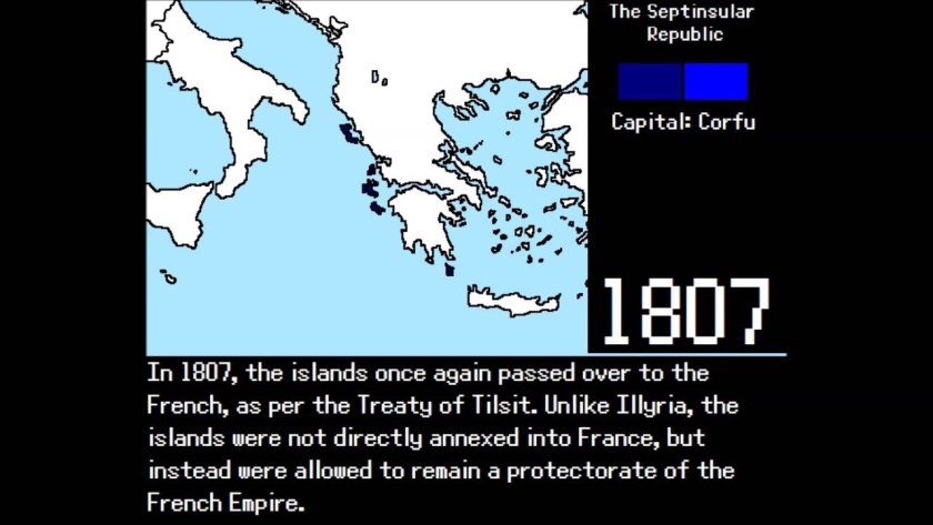
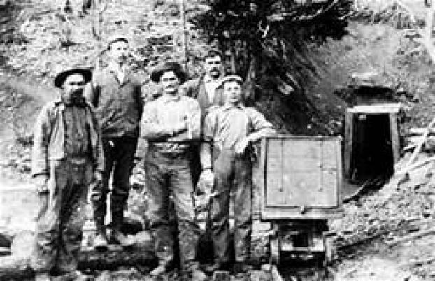
More and more what I am finding in my research is pointing to the Victorian Era as the start of the new historical reset timeline, following what I believe was a mud flood cataclysm that was deliberately caused by negative beings who sought absolute power and control over Humanity and the Earth.
After the mud flood, they dug enough infrastructure out of the mud with which to restart civilization, according to a plan these beings already had in mind.
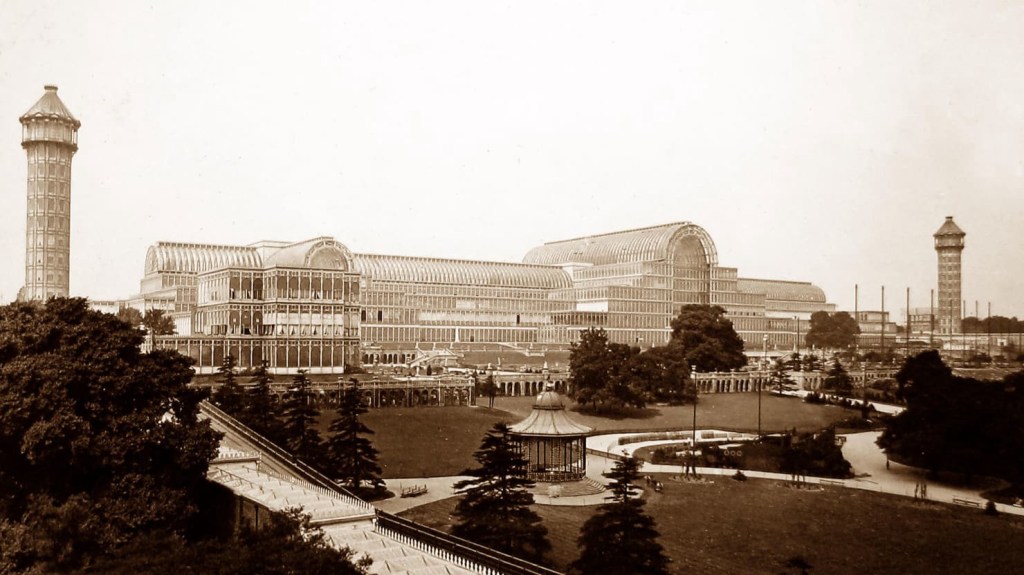
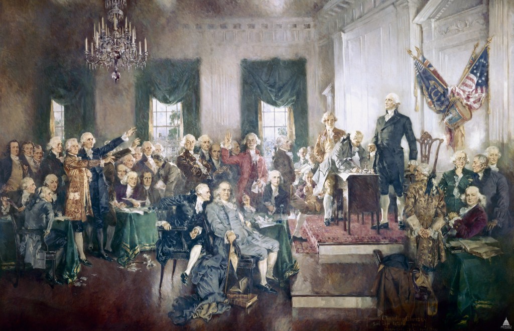
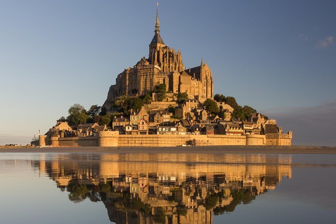
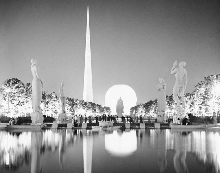
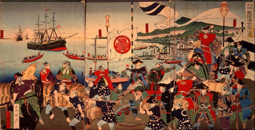
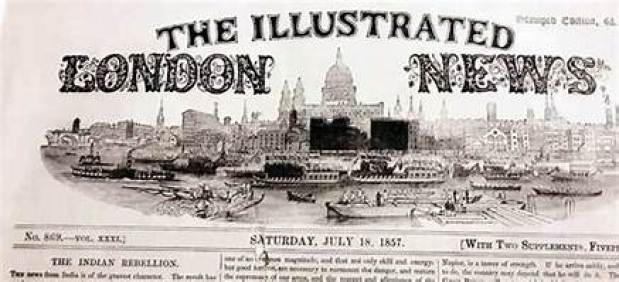
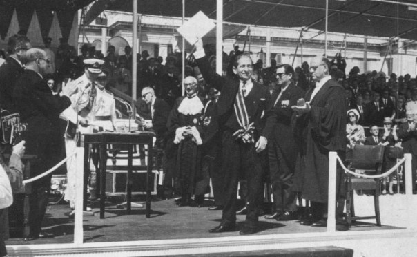
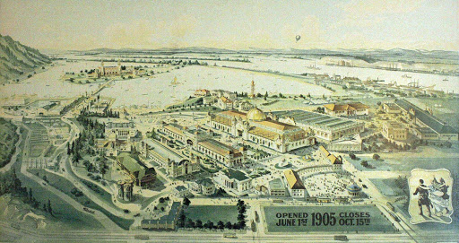
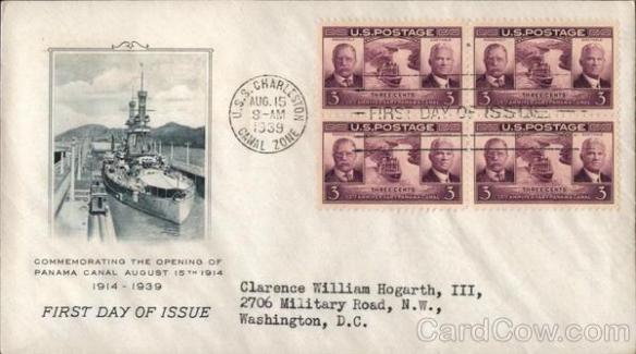
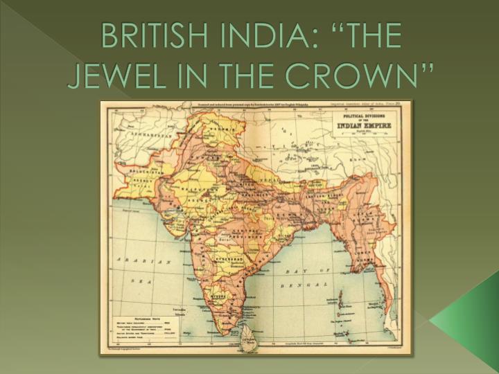
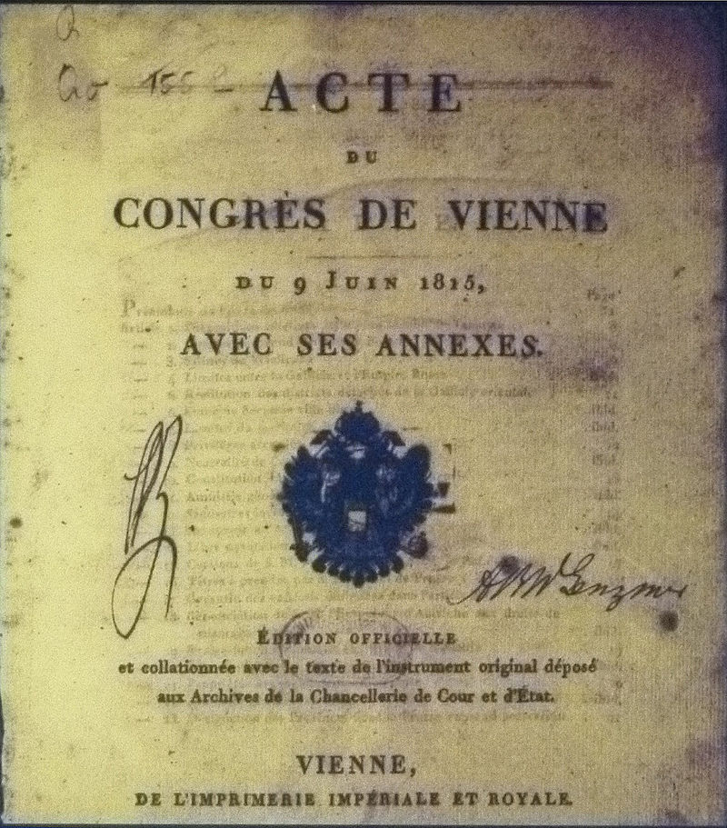
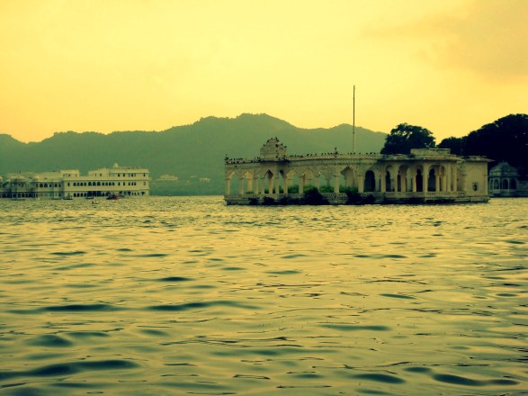
I have already spoken of my belief in past posts that the Great Exhibition of the Works of Industry of All Nations was the official kick-off of the New World Order timeline…
…and held in the Crystal Palace in London, between May 1st and October 15th of 1851.
We are told that it took only 9-months to develop the Great Exhibition, from plans and organization, including the construction of the Crystal Palace itself to house the Exhibition.
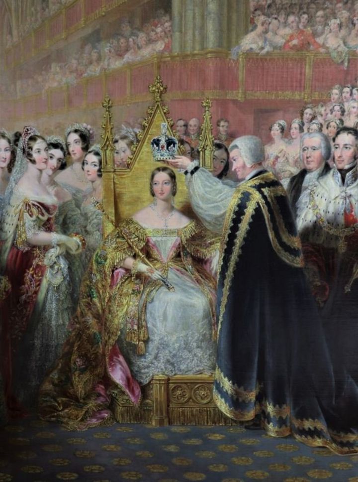
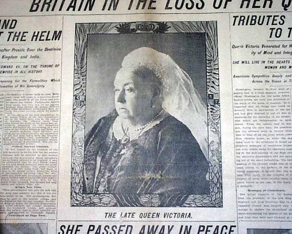
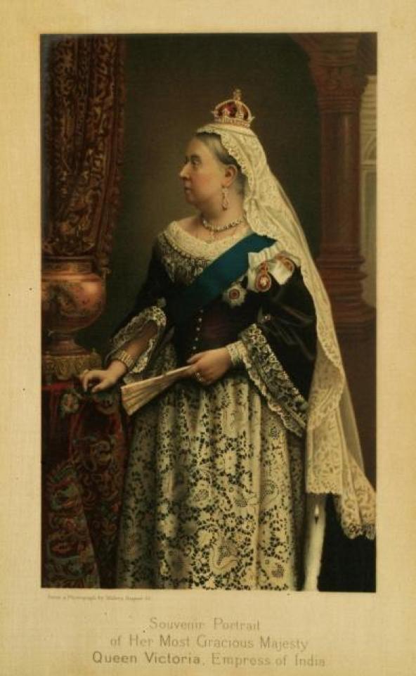
Opened by Queen Victoria, the Great Exhibition of 1851 in the Crystal Palace has been characterized as a celebration of modern industrial technology and design.
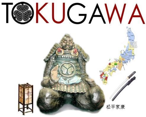
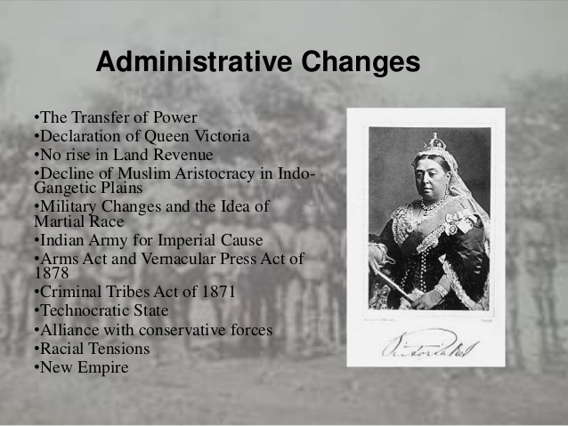
It is important to note that Queen Victoria’s reign began on June 20th of 1837, and her reign has been described as a period of cultural, industrial, political, scientific, and military change within the United Kingdom, marked by a great expansion of the British Empire…
…lasting for almost 64-years,until her death on January 22nd of 1901.
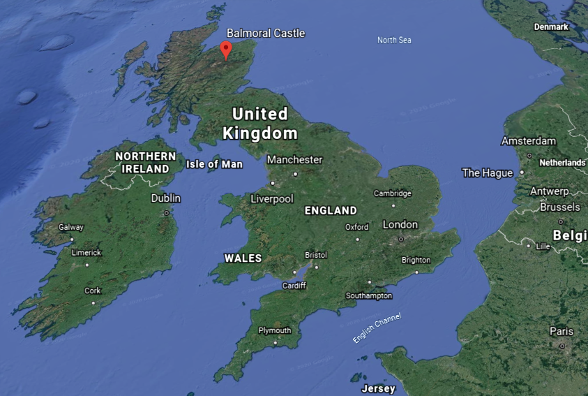
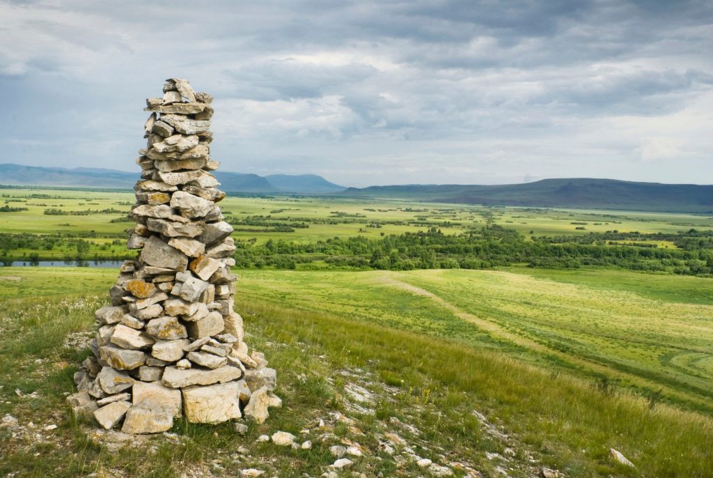
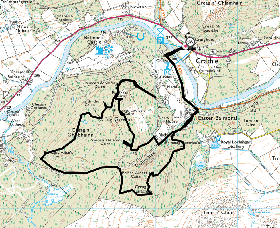
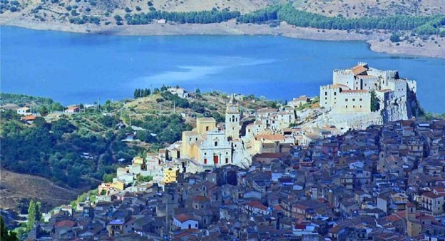
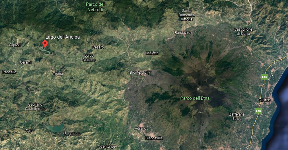
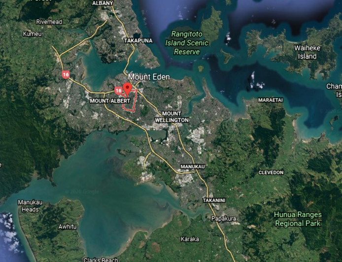
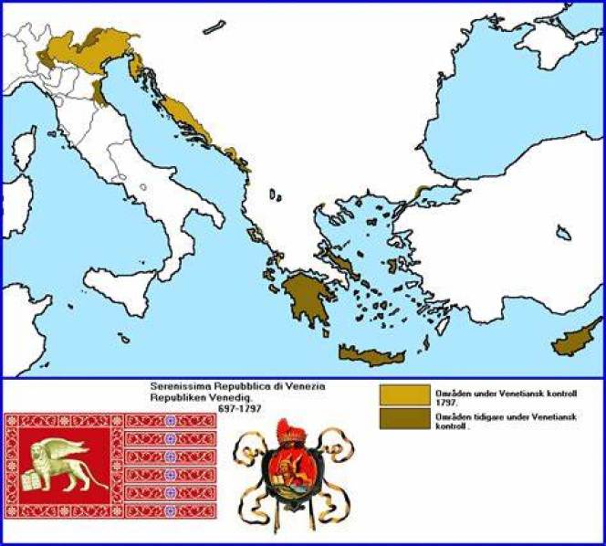
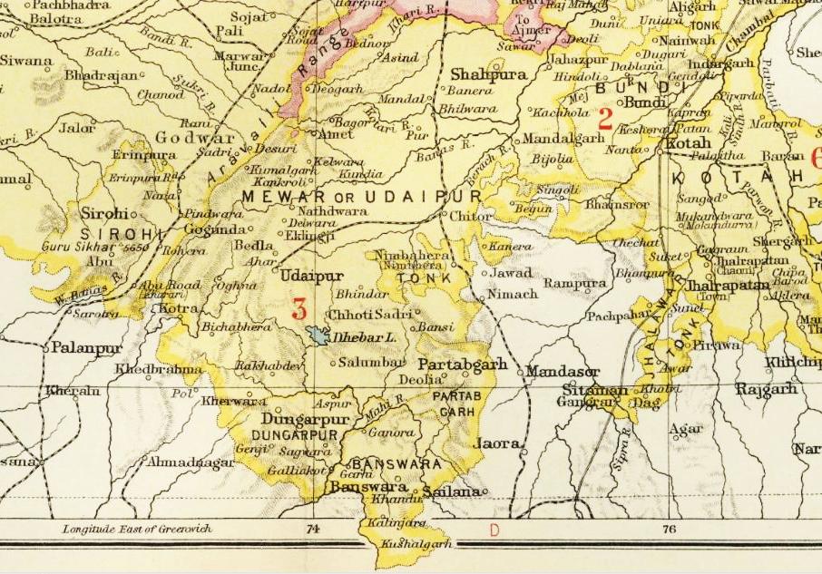
So I chose the recommendation of the Balmoral Cairns in Scotland as my starting point for this post.
The Balmoral Castle on the Balmoral Estate has been one of the residences of the British Royal Family since 1852, at which time the castle and estate was purchased from the Farquason family by Prince Albert, Queen Victoria’s husband.
There are eleven, what are called “stone cairns,” erected on the Balmoral Estate to commemorate members of the British Royal Family and events in their lives, the majority of which were said to have been erected by Queen Victoria.
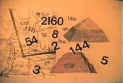
At this point, it is really important to get the definition of “cairn” and “pyramid” before I look at some of the “Balmoral Cairns” in Scotland.
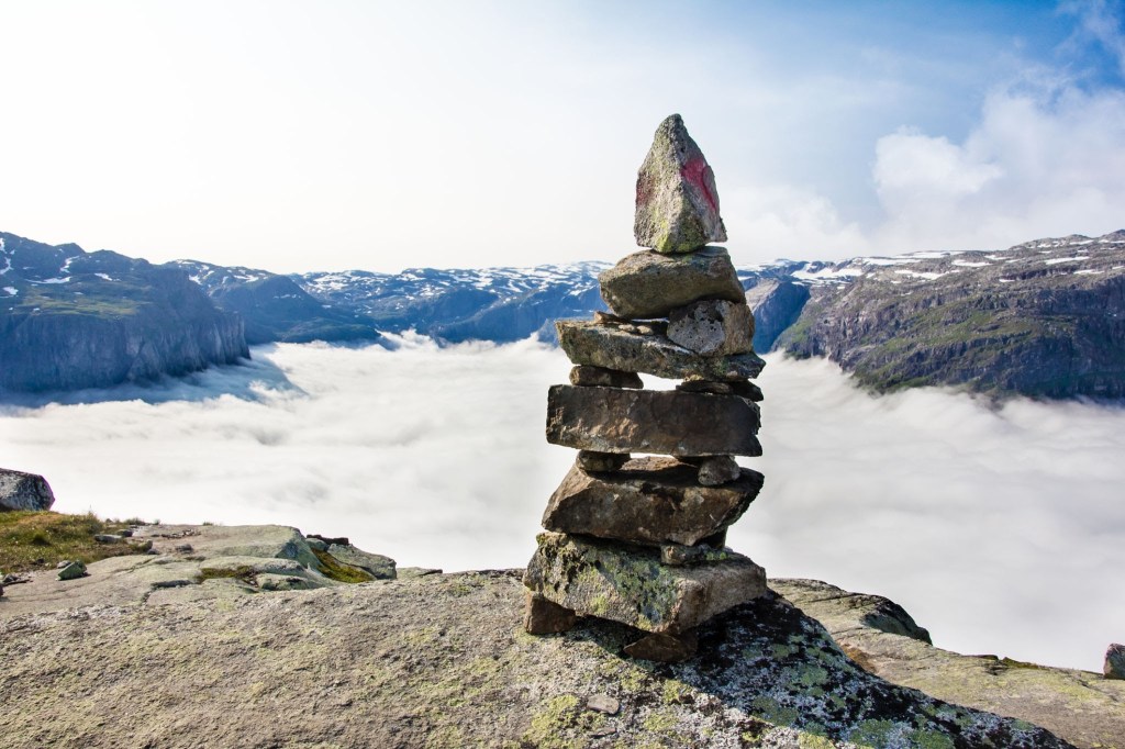
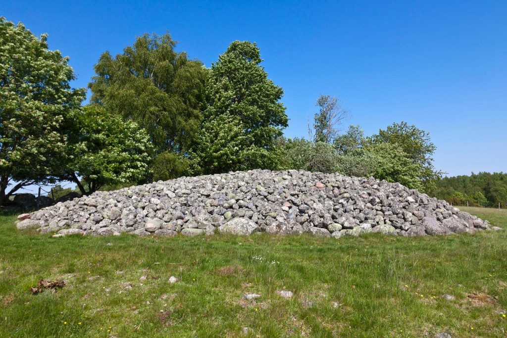
A cairn is defined as a “mound or heap of rough stones built as a memorial or landmark on a hilltop or skyline.”
The following examples are identified as cairns:
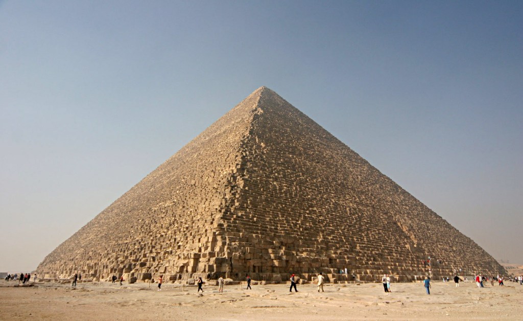
The definition of a pyramid according to the Merriam-Webster Dictionary (established in 1828) is:
“an ancient massive structure found especially in Egypt having typically a square ground plan, outside walls in the form of four triangles that meet in a point at the top, and inner sepuchral chambers.
“A structure or object of similar form”
“A polyhedron having for its base a polygon, and for faces, triangles with a common vertex.
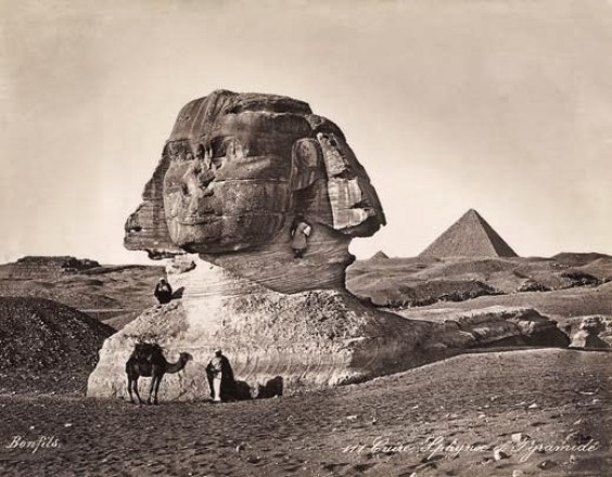
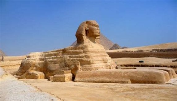
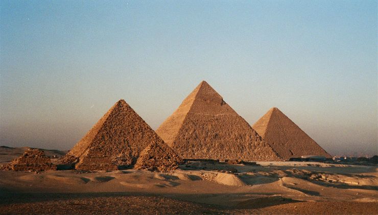
This is a photo of the Great Pyramid of Giza in Egypt.
Now back to the “Balmoral Cairns.”
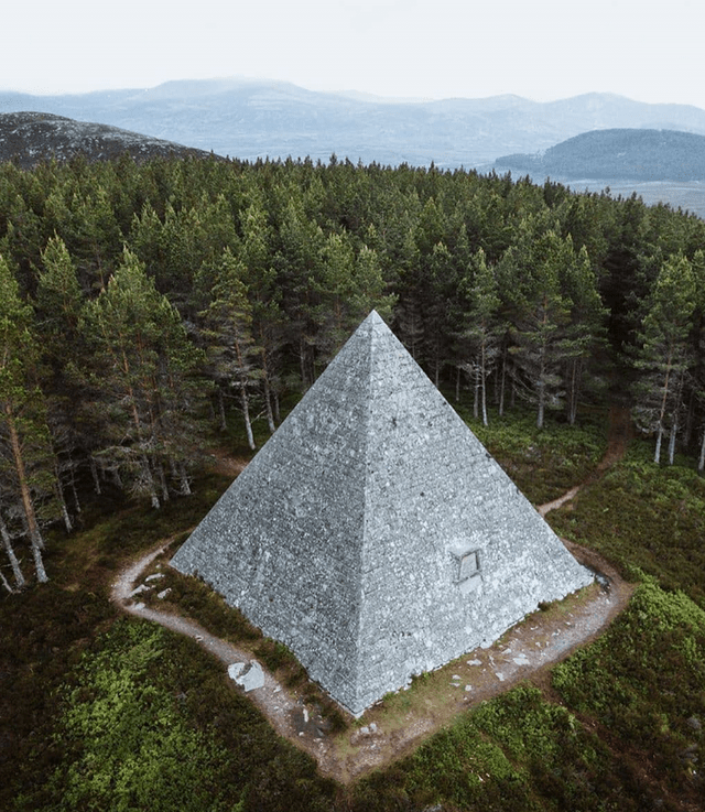
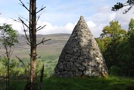
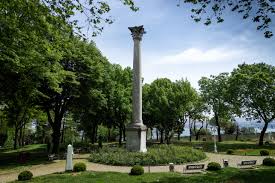
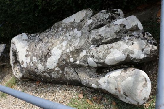
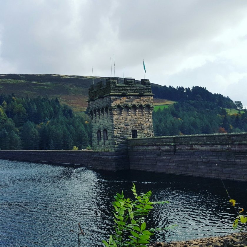
We are told that the largest of the “Balmoral Cairns,” shown here, was erected in memory of Queen Victoria’s husband, Prince Albert, after his death on December 14th of 1861.
It certainly looks like the definition of a pyramid!
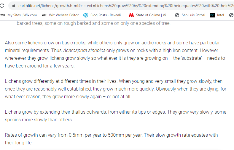
Look at the all the lichen growing on Prince Albert’s Cairn!
Somewhere in the past I remember hearing that lichen grows very slowly, so I looked it up to be certain.
Other cairns on the Balmoral Estate include:
Princess Helena’s cairn, the fifth child of Victoria and Albert, said to have been erected to commemorate her marriage to the Marquis of Lorne in 1871…
…the cairn of Prince Leopold, the eighth child and youngest son of Victoria and Albert, erected in 1882 to commemorate his marriage.
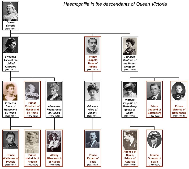
Born in April of 1853, Prince Leopold was a hemophiliac who died in March of 1884, at the young age of 30.
While considered relatively rare in the general population, hemophilia is an inherited bleeding disorder in which the blood does not clot properly, and is prevalent in Europe’s royal families, thereby gaining the nickname “the royal disease,” with the hemophilia gene said to have passed from Queen Victoria to the ruling families of Russia, Spain, and Germany.
The presence of the hemophilia gene in Queen Victoria was said to have been caused by a spontaneous mutation, as she is considered the source of the disease in modern cases of hemophilia among her descendents.
This is Prince Arthur’s cairn, the seventh-child of Victoria and Albert, said to have been erected to mark his marriage in 1870.
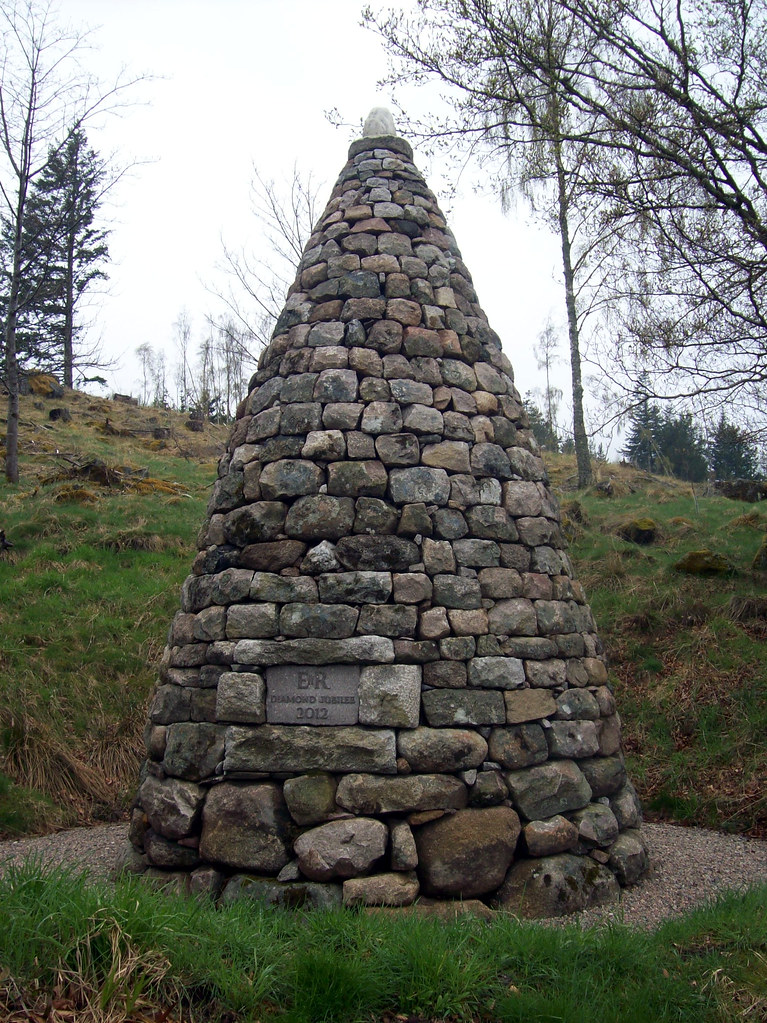
In addition to other cairns marking events in the lives of Queen Victoria’s family, we are told that a cairn was constructed in 2012 on the Balmoral Estate to mark the Diamond Jubilee of Queen Elizabeth II in 2012.
While these last four of the “Balmoral Cairns” seem to have more of the appearance of what are called cairns than what can also be called Prince Albert’s Pyramid, the question becomes this:
Were the “Balmoral Cairns” built when they were said to have been built by who was said to have built them?
Or were they built by an ancient, advanced civilization of Master Builders missing from our collective awareness for purposes unknown to us in the present-day?
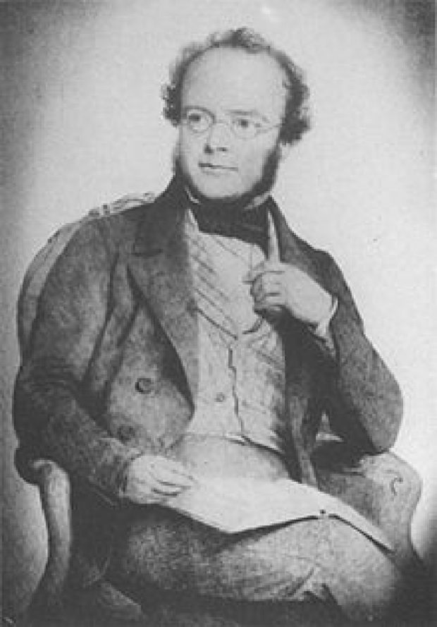
I am seeing notation of obelisks as well on the map I just showed of the Balmoral Estates, and one of them is another monument to Queen Victoria’s husband, the Prince-Consort Albert, said to have been erected in 1862, and photographed by George Washington Wilson…
2160360
…a pioneering Scottish photographer, who got his start as a portrait miniaturist in 1849, and switched to portrait photography in 1852, and received the contract to photograph the Royal Family of Queen Victoria and Prince Albert.
What role do photographers and artists play in programming our perception away from what is actually in the environment into seeing only the preferred narrative?
From what I am seeing, photographers and artists play a substantial role in this process of reinventing history.
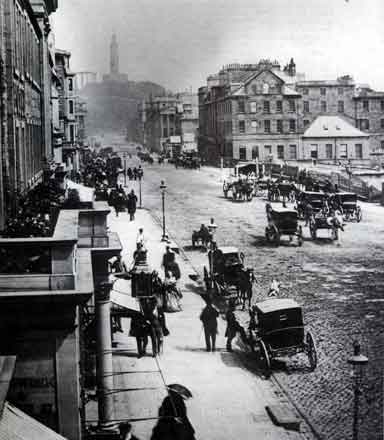
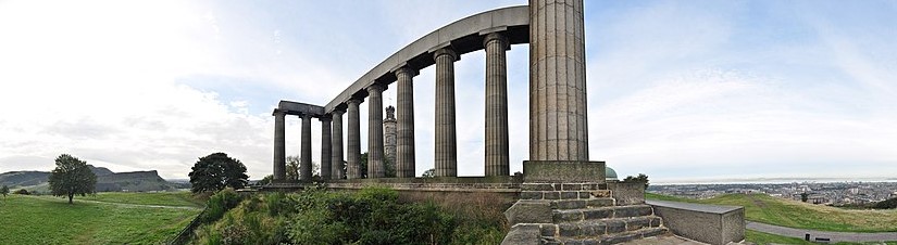
This is a photo of George Washington Wilson’s of Prince’s Street in Edinburgh, circa 1860, with the contrast of massive, stately columned architecture, cobbled streets and horse-and-buggies in the foreground, and Calton Hill in the background…
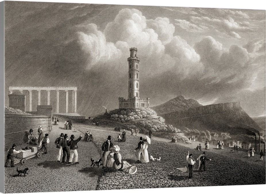
…with a view of what is called the Nelson Monument and the National Monument of Scotland.
The Nelson Monument was said to have been built on the highest point on Calton Hill between 1807 to 1816 to commemorate the British Vice-Admiral Horatio Nelson’s victory over the French and Spanish fleets at the Battle of Trafalgar in 1805.
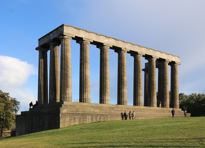
The National Monument of Scotland is a national memorial to the Scottish soldiers and sailors who died fighting in the Napoleonic Wars, which took place between 1803 and 1815.
With a design by Charles Robert Cockerell and William Henry Playfair based on the Parthenon in Athens, construction was said to have started in 1826, and that it was left unfinished in 1829 due to lack of funds.
It is interesting to note that in this view of Calton Hill, you see the Nelson Monument perfectly-framed through the center of the front colonnade of the National Monument.
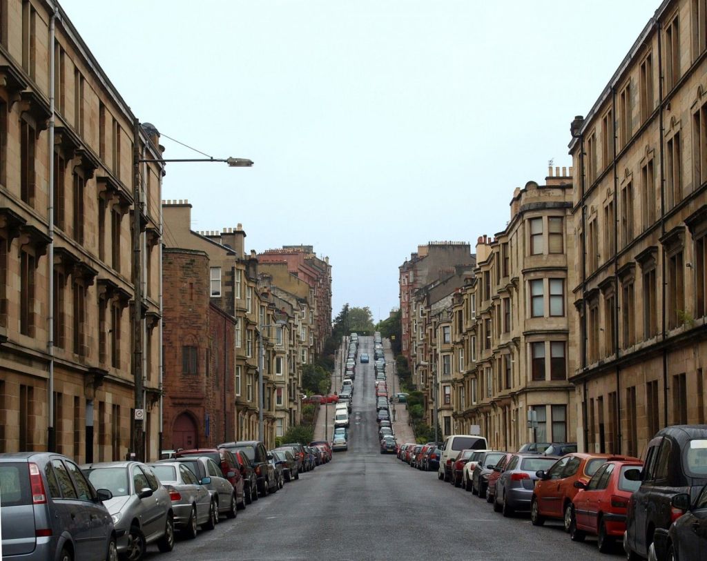
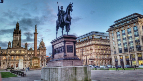
Another commenter from Scotland mentioned Glasgow in particular.
Glasgow called itself the second city of the British Empire, passing Edinburgh in population by 1821, and that in the 1830s it started to become a major industrial center.
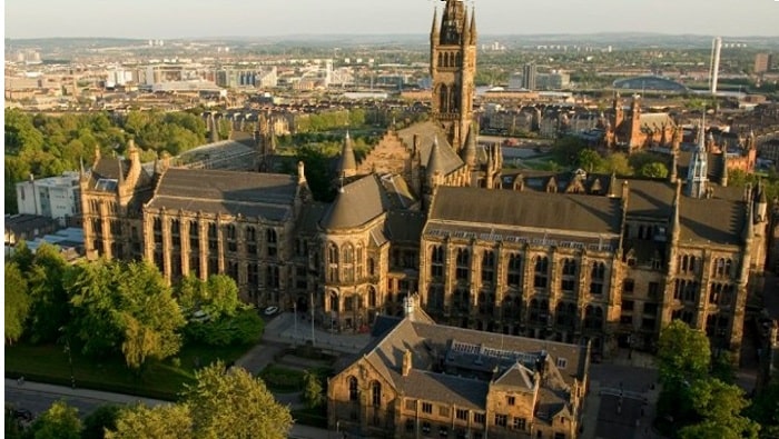
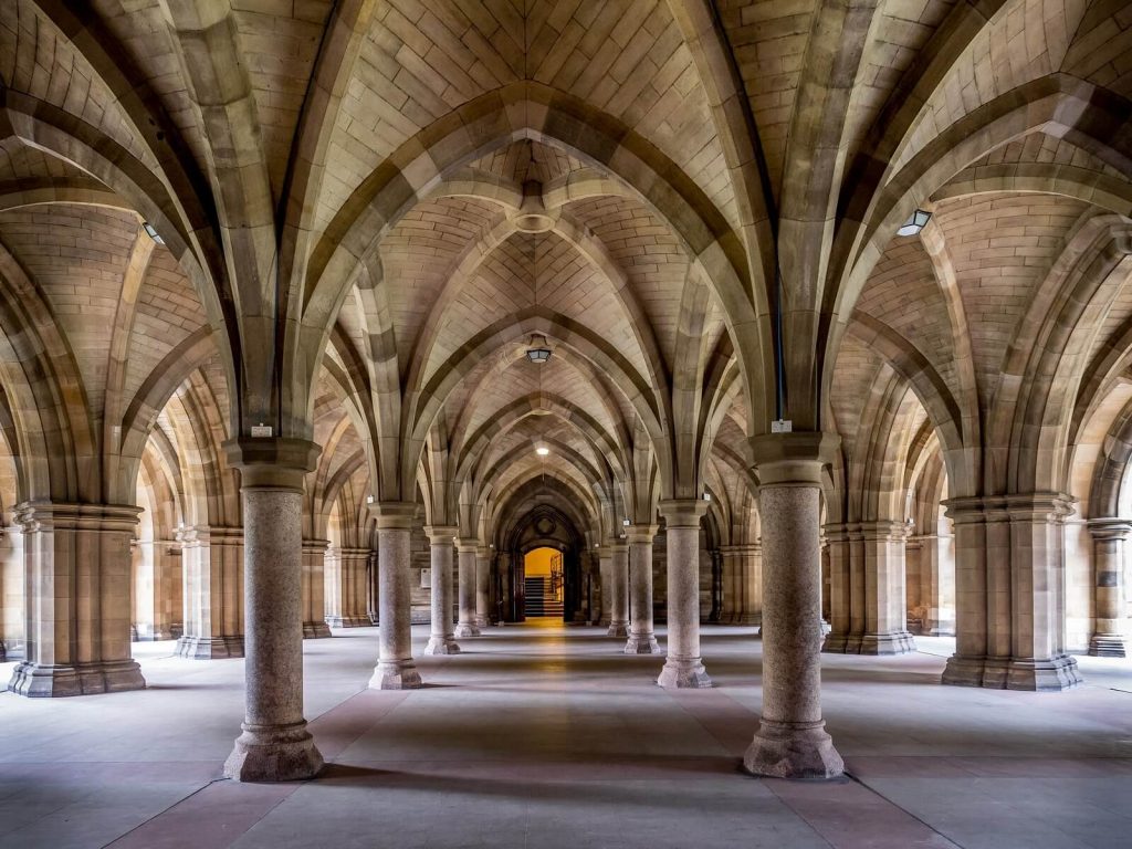
The University of Glasgow, established in 1451, is one of Scotland’s four Ancient Universities, along with Edinburgh, Aberdeen, and St. Andrews.
Universities that receive the designation “Ancient Universities” in Great Britain were founded before the year 1600, and considered among the oldest existing universities in the world.
For some reason, I have consistently found that the word “Ancient” is used to describe places that are not associated with “the far distant past” that the word ancient is defined as.
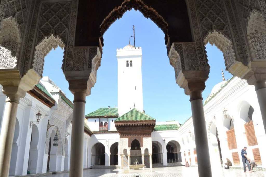
The oldest, currently functional, universities in the world are in North Africa.
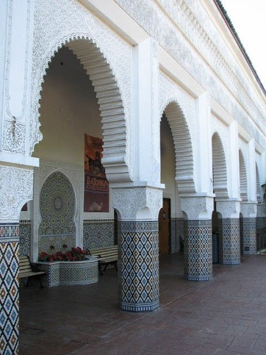
The Al-Karaouine University in Fez, Morocco, dates to 859 AD.
Interesting to note that the archway shown here at the University in Fez on the left frames the larger building in much the same way that the archway does here at the University of Oxford in England on the right.
The University of Oxford was established in 1096, and is the oldest of the Ancient Universities of Great Britain.
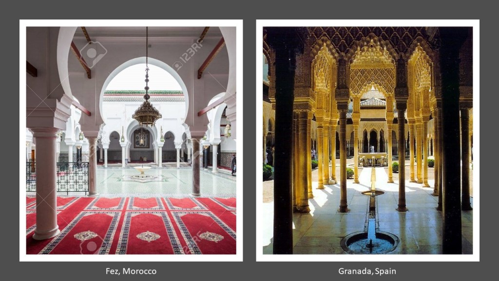
Also, the colonnaded courtyard at the University in Fez in Morocco on the left looks very similar in appearance to the courtyard in the Alhambra in Granada, Spain on the right, which is architecture that the Moors are actually given credit for.
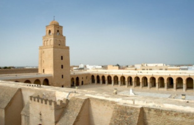
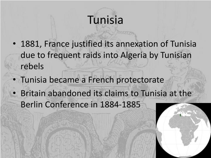
Tunisia’s still-functioning University in Kairouan is said to date from between 800 AD and 909 AD.
Back to the University of Glasgow.
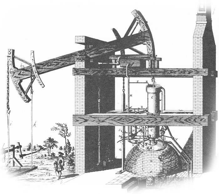
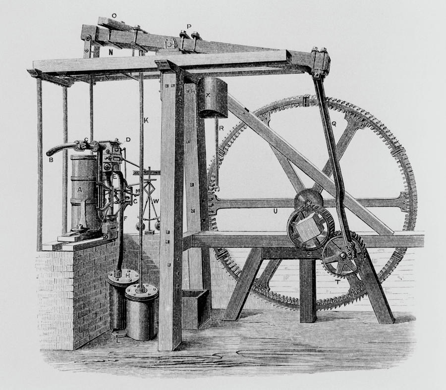
James Watt was a mathematical instrument-maker at the University of Glasgow before he became interested in the technology of steam engines.
His improvement of the steam engine invented by Thomas Newcomen in 1712…
…with his Watt steam engine in 1776 was said to have been crucial to the changes brought by the Industrial Revolution in Great Britain and the rest of the world.
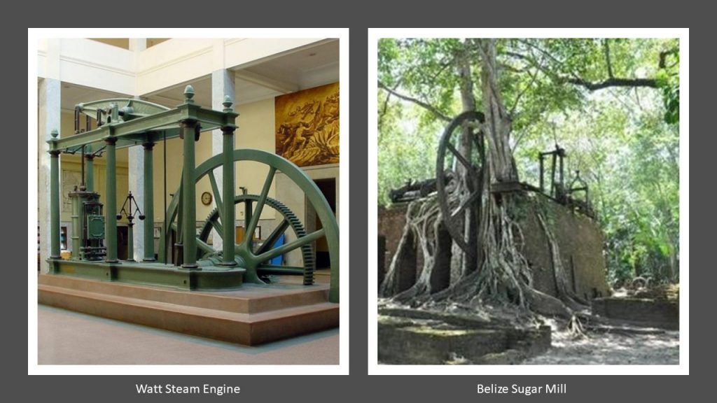
You know, I can’t help but wonder about the origin of steam engine technology when I see examples of the big gear-wheel showing on the right, compared with the Watt Steam Engine on the left, at what is called a sugar mill in Belize with what appears to be an ancient tree firmly rooted inside the structure.
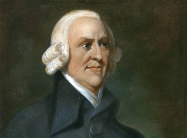
Adam Smith was a student at the University of Glasgow.
He was a key figure of the Scottish Enlightenment, a period during the late 18th- and early 19th-centuries during which time there was an outpouring of Scottish intellectual and scientific accomplishments.
Known as “The Father of Capitalism” and “The Father of Economics,” Adam Smith is best known for his famous work on modern economics, the title of which is commonly abbreviated to “The Wealth of Nations.”
“The Wealth of Nations” was first published in 1776, the same year that James Watt brought forward his improved steam engine and the American Colonies declared their independence.
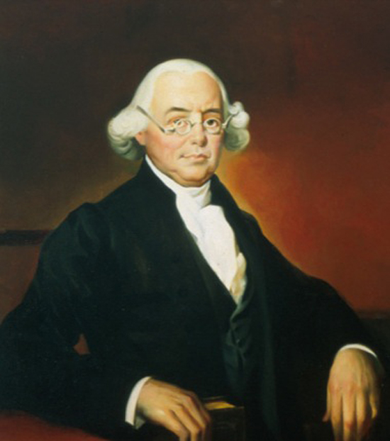
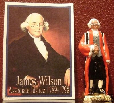
There was even a student who studied Scottish Enlightenment thinkers at the Universities of Glasgow, Edinburgh, and Aberdeen without graduating from college in Scotland, who was a signatory of the American Declaration of Independence, and a major force in drafting the United States Constitution.
His name was James Wilson, a Scotsman who moved to Philadelphia in 1765 when it was still British America.
Upon his arrival in Philadelphia, he petitioned for, and received, his Master of Arts degree where he was tutoring, then teaching, at the Academy and College of Philadelphia, and later received the honorary doctor of law degree of LL.D from the same institution.
He was elected to the Continental College, and was a delegate to the 1787 Philadelphia Convention.
There, he served as one of five-members of the “Committee of Detail,” which produced the first draft of the U. S. Constitution.
In 1789, he became one of the first Justices of the U. S. Supreme Court, and in August of 1798, became the first Supreme Court Justice to die after suffering a stroke.
Two more things about Glasgow before I move on.
The development of places in Glasgow like George Square, named after King George III, was said to have started in the 1820s…
…and we are told that by the 1880s, fine classical buildings, described as statements of power, wealth and confidence, started appearing along fine new streets.
Also, in the same time period in contrast with the proud classical buildings that started to appear in Glasgow, there was a population explosion from natural increase, migration, and boundary extensions as surrounding “burghs” were annexed to Glasgow.
This led to a problem with urban squalor in Glasgow, and public health crises with epidemics of cholera, typhus, and typhoid.
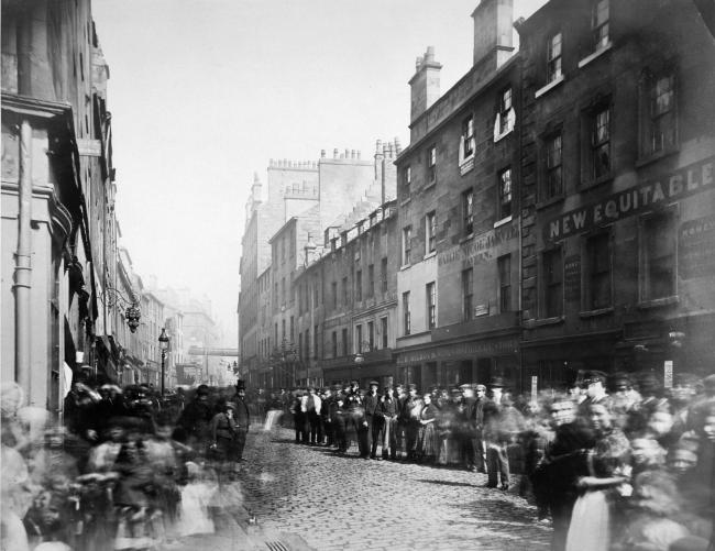
This picture was taken by Thomas Annan in Glasgow’s Saltmarket in 1868.
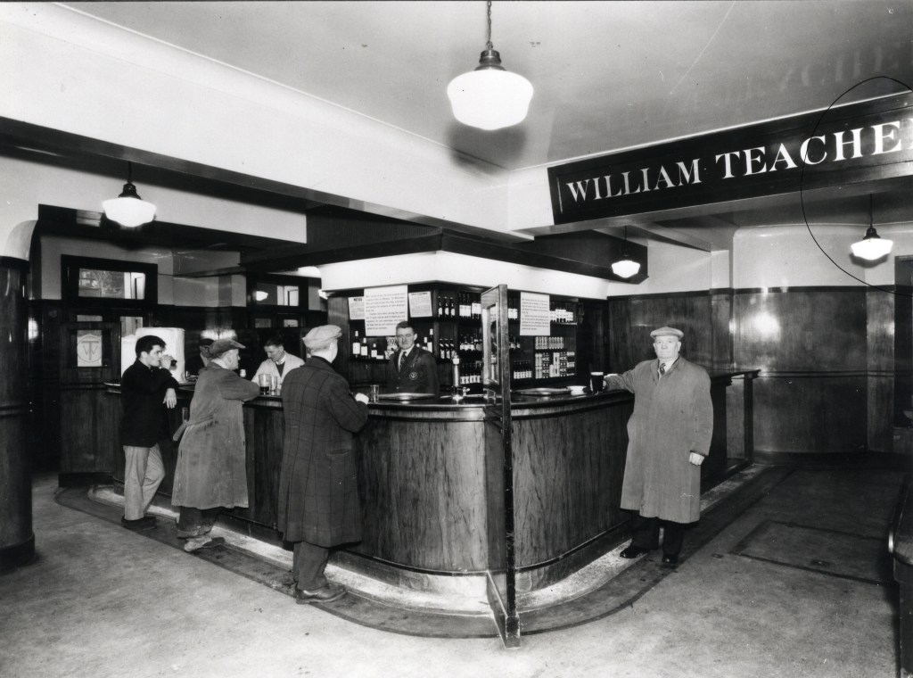
The last thing I want to bring your attention to that I found in Glasgow is Teacher’s Scotch Whiskey.
William Teacher established his whiskey product in 1830, and by the 1850s, began to open public houses known as “dram shops,” in which customers could drink whiskey.
The main attraction of the “dram shops” was their reputation for providing customers with high quality whiskey.
Jack Daniel’s is a brand of Tennessee Whiskey, and the top-selling American whiskey in the world.
Jack Daniel was said to have been born either in 1849 or 1850, and in the course of the events of his life, he opened his whiskey distillery in Lynchburg, Tennessee, in 1884.
Alcohol is classified as a Central Nervous System depressant, meaning that it slows down brain function and neural activity.
Alcohol proof is the measure of the content of ethanol in an alcoholic beverage.
We’re talking 70-proof and over for the different products made by the Jack Daniel’s Distillery.
There are many other examples of the heavy promotion of drinking alcohol and the use of other addictive substances, like smoking opium in opium dens, that were taking place during this same time period.
I have definitely come to believe that the focus was primarily on the intentional creation and promotion of addictions to keep Humanity stuck in a lower, diminished-level of consciousness, and one way of keeping people from waking up to what has actually taken place here.
An addiction is a compulsive, chronic, physiological or psychological need for a habit-forming substance, behavior, or activity having harmful effects.
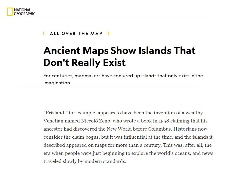
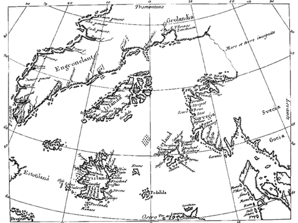
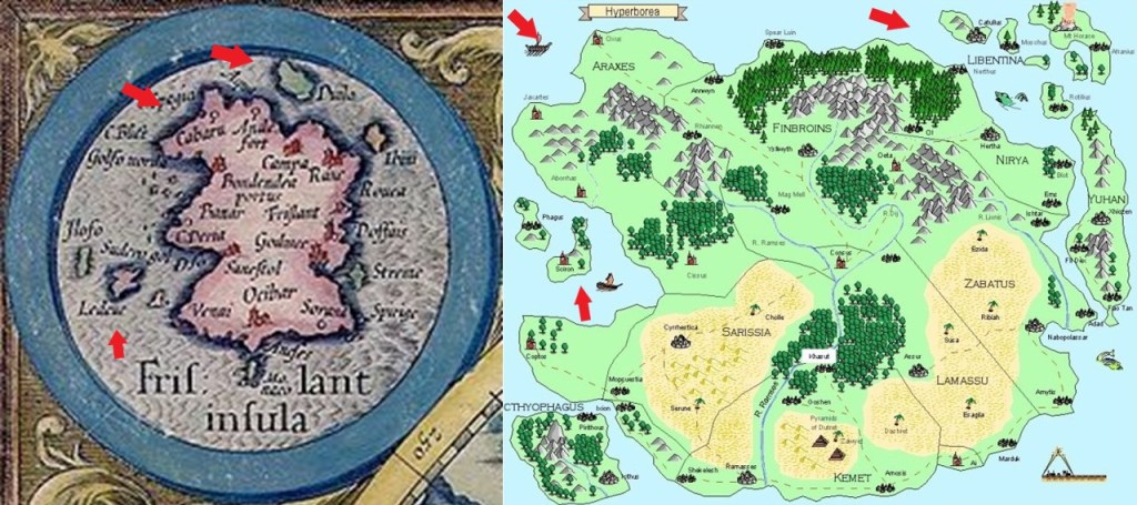
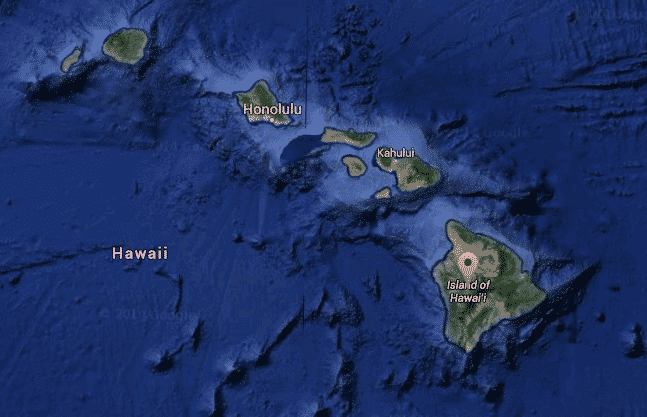
The next place I am going to look into from a comment is the isle of Frisland, also known as Frislant, the specific awareness of which is new to me.
The isle of Frisland appeared on virtually all maps of the North Atlantic between the 1560s through the 1660s.
Nonetheless, it has come down to our historical time period as a “phantom island,” meaning that it was removed from later maps as it was proven not to exist.
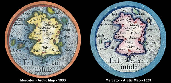
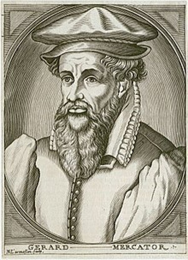
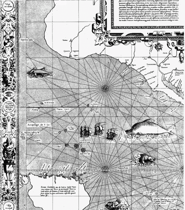
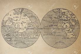
This is Gerardus Mercator’s depiction of Frisland that a appears on a map that was published in 1606 by Jocodus Hondius, a few years after his death in 1594, in the lower left corner between Iceland to the northeast, and Greenland to the northwest…
…which I found on the National Geographic website seriously doubting Frisland’s existence.
The Zeno map that the article is referring to was said to have been first published in a book 1558, after having been found in the family home, by a direct descendent of the Zeno Brothers, Nicolo and Antonio Zeno, Venetian noblemen famous during the Renaissance for exploring the Arctic in the 1390s with an explorer-prince named Zichmni, a Lord of the islands off the southern coast of Frisland.
We are told that the existence of the isle of Frisland as identified by the Zeno Brothers was given credibility by in manuscript maps in the 1560s by the Genoan Maggiolo family, and accepted by leading cartographers and publishers of the 1500s and 1600s, Mercator and Hondius, even though the charting of Frisland on the Zeno map was later deemed incorrect.
I have my suspicions from my research about the role of cartographers, like Gerardus Mercator, in altering our perception of how we view the world in which we live as contrasted with how the Ancients viewed the world.
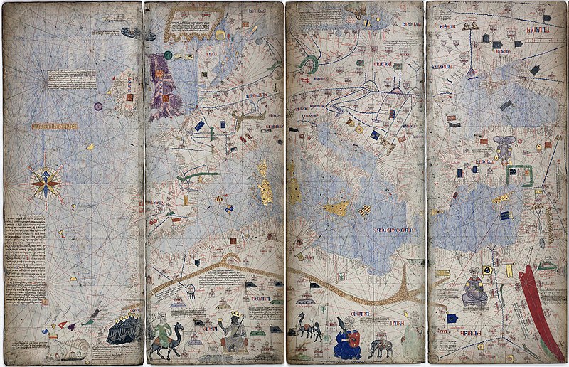
This is the Catalan Atlas, which is said to date from 1375, and considered the height of Medieval map work and the most important map of the medieval period in the Catalan language.
Each section of the atlas includes the mapping of the geometric lines and shapes that you see depicted here.
It would seem that the Earth’s grid-lines started to disappear from maps in the 1500s, as Gerardus Mercator, a Flemish geographer, cartographer and cosmographer…
…published a world map in 1569 that is considered to be the first where sailing courses on the sphere were mapped to the plane map, allowing for a “correction of the chart to be more useful for sailors.”
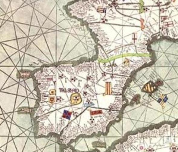
Here is a close-up section of the 1569 map showing the depiction of straight ley-lines in the seas…
…but not on land and sea as were present on the flat projections of the Catalan Atlas.
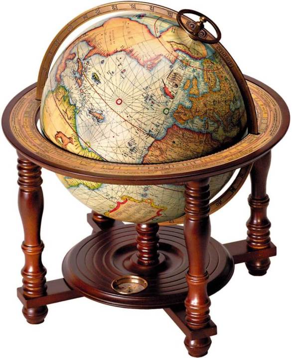
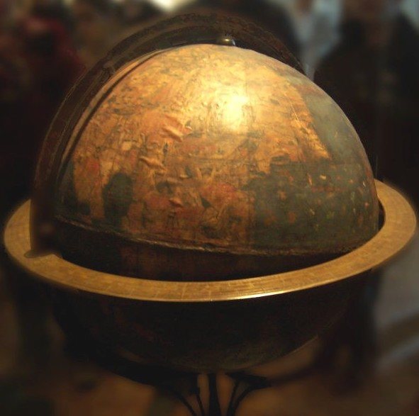
Not only that, Mercator was also a globe-maker, like this one from 1541.
So Mercator was said to have made a revolutionary flat projection map that corrected the chart for sailors…and the earth as a globe as well?
I have to ask the question – is this information telling us something about what was actually going on here?
While the focus of my research is not about proving or disproving flat earth versus planet, nor am I directed by it, I do find this information about older maps on flat planes with ley-lines to be extremely interesting and noteworthy.
Back to the isle of Frisland.
The isle of Frisland has been identifed with a lost ancient land named Hyberborea by the Greeks, considered to have been in the general vicinity of Greenland; identified as Atland by the Frisians, a Germanic ethnic group indigenous to coastal parts of the Netherlands and northwestern Germany; and, and again, identifed as “Frisland” by Mercator.
In Greek mythology, Hyperborea was a fabulous world of eternal spring located in the far north, beyond the home of the north wind.
Hyperboreans were giants, with blessed and long lives untouched by war, hard work, old age and disease.
At any rate, there are some interesting similarities between the coastline of the now-called phantom isle of Frisland in Mercator’s depiction on the left, and this depiction I found of the island of Hyperborea on the right.
The Oera Linda Bok, or Book, is a manuscript that is written in Old Frisian, and said to provide historical, mythological, and religious themes of remote antiquity.
Like the doubt about the isle of Frisland itself, the Oera Linda Book is widely considered a hoax.
The manuscript first came into public awareness, we are told, in the 1860s.
The book is still occasionally brought up in esotericism and Atlantis literature.
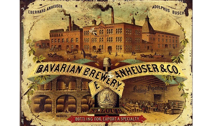
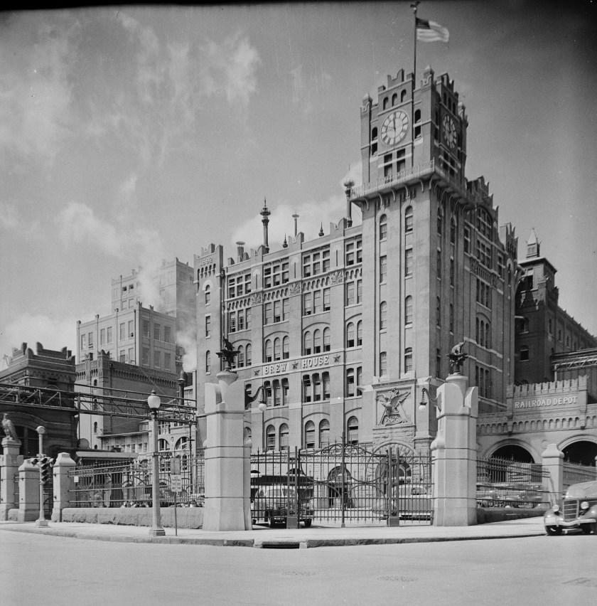
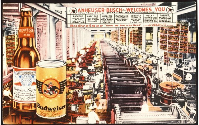
I received a comment from someone who lives in St. Louis, where there are industries for beer, like the castle-looking Anheuser-Busch Brewery…
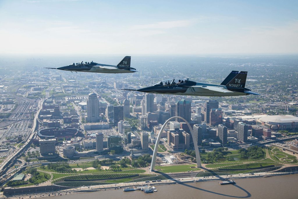
…the Aerospace industry, like Boeing…
…and starting in 1942, St. Louis was an integral part of the Manhattan Project, for which Mallinckrodt Chemical Works processed a majority of the uranium needed for the first atomic bomb in their plant north of downtown St. Louis…
…and which continued to process uranium until 1957.
When the chemical company ran out of space to store its nuclear waste on-site, nuclear waste was dumped in places like a site near the St. Louis airport…
…and the West Lake Landfill, a Superfund clean-up site.
Needless to say, St. Louis has a nuclear waste problem.
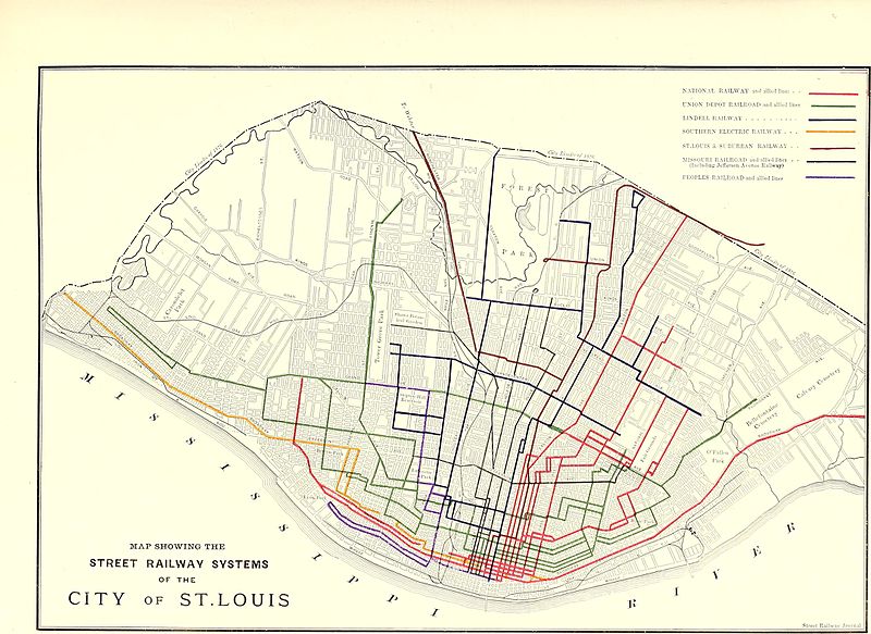
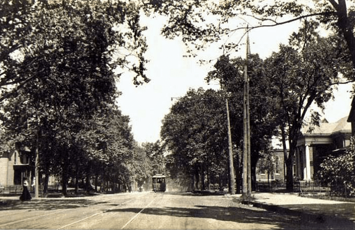
There was an electric streetcar system in St. Louis that ran from the mid-1800s through the early 1960s, starting with horse-drawn streetcars in the late 1850s.
This is a map depicting the streetcar lines in St. Louis by 1884.
…with the first cable-driven streetcars in 1886, and the first electrified streetcars came to St. Louis in 1889.
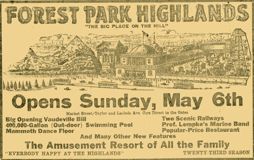
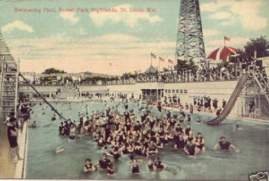
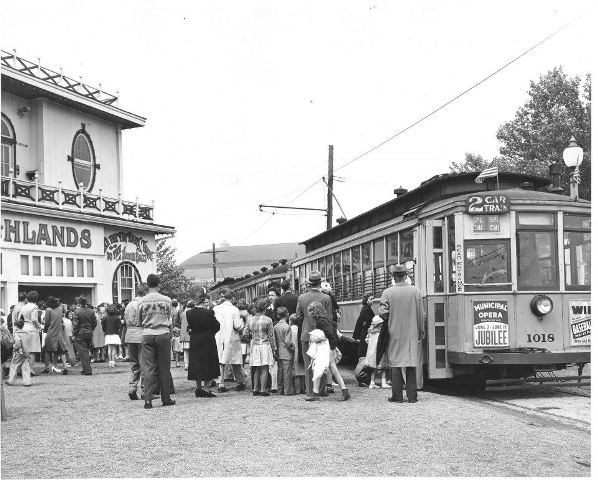
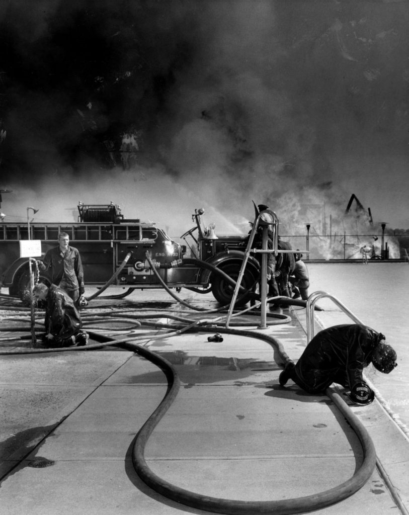
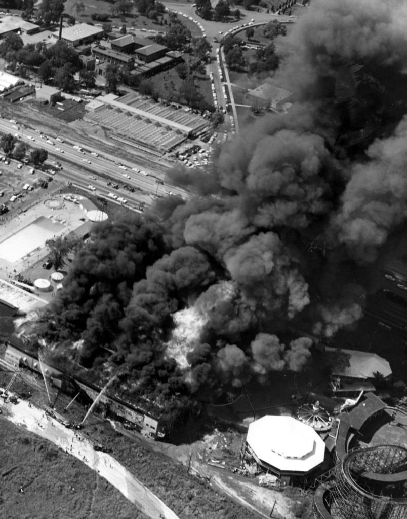
The Forest Park Highlands Amusement Park opened as a beer garden in St. Louis in 1896.
…and was on a trolley line.
On July 19th of 1963, all of the Forest Park Highlands Amusement Park was destroyed by fire except for the swimming pool and the frame of the roller coaster.
With regards to streetcars, starting in the early 1930s through the 1960s, the St. Louis Public Service ended all streetcar service, as well as other regional streetcar operators.
The last day of St. Louis streetcar operation was May 21st of 1966.
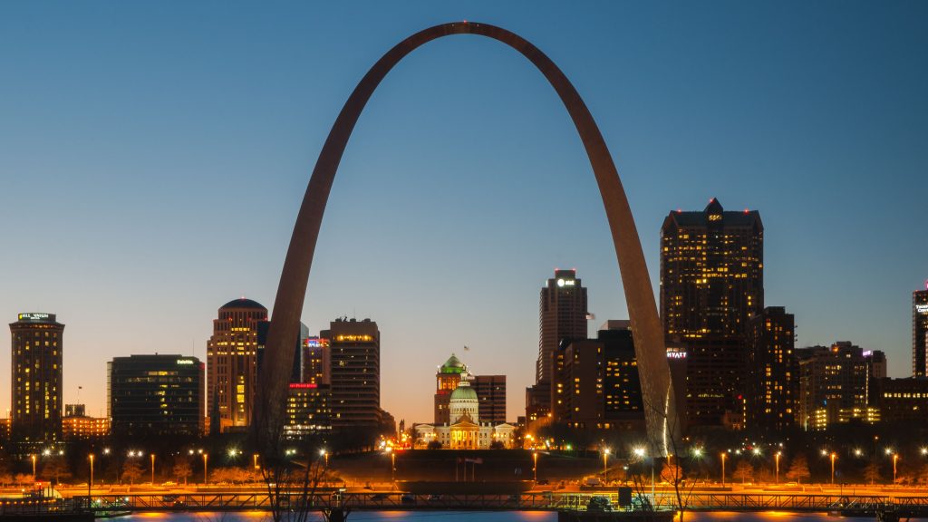
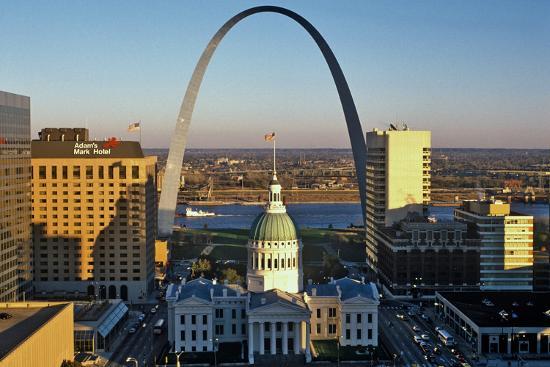
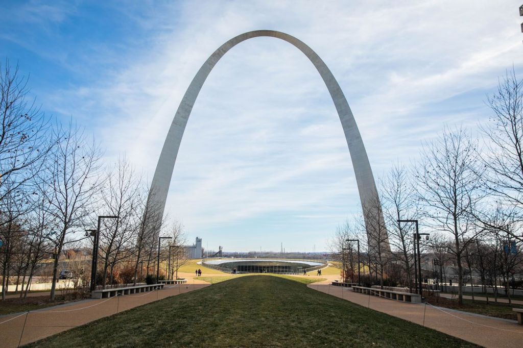
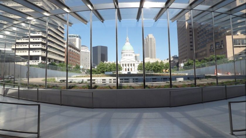
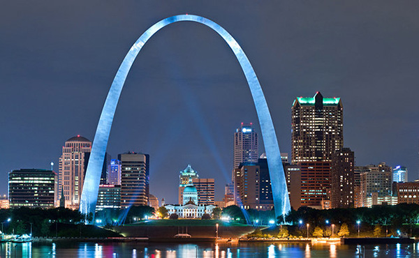
I will end this post with the Gateway Arch & National Park in St. Louis, the world’s tallest arch at 630-feet, or 192-meters, high, which from one direction very neatly frames…
…the Old St. Louis Courthouse, said to have been built as a Federal-style courthouse, with its construction starting in 1816 and ending in 1864 (which would have been during the American Civil War).
The Old Courthouse is part of the Gateway Arch National Park today.
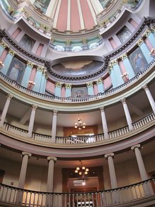
This is a view of the rotunda inside the courthouse.
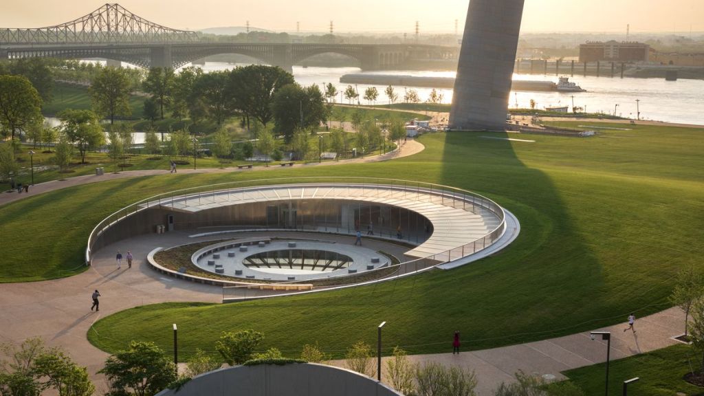
From the other direction, the Gateway Arch frames…
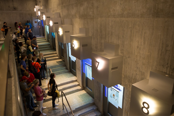
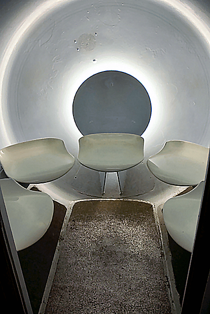
…its underground Visitors’ Center…
…which houses offices, mechanical rooms, and waiting areas for the Arch Trams…
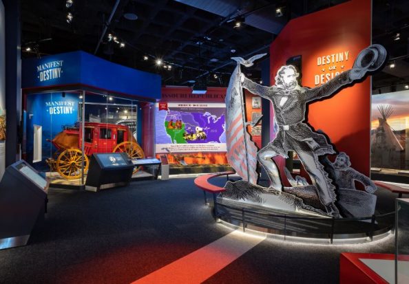
…and the Museum of Westward Expansion.
I remember learning about “Manifest Destiny” in secondary school history (I don’t remember if it was Junior High or High School).
Manifest Destiny was a widely held, what is described as “imperialist cultural belief” in the U. S. in the 19th-century that American settlers were destined to expand across North America.
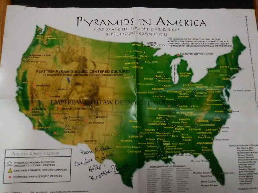
What we are not taught about was the highly advanced, ancient civilization that had already existed in North America.
We are told the Gateway Arch was constructed between 1963 and 1965, at a cost of $13 million at the time, which equalled the value of $80.6 million in 2018, after a history of fundraising difficulties, delays, and lawsuits.
I wonder about the truth about a lot of things that we are told in this historical narrative.
In my next post, I will continue to look into places that have been suggested by commenters.
I already have a long list of places to look into, so if you have places you want to suggest to me, it may have to go on a waiting list for a future post. It just depends. My project to-do list is growing :).
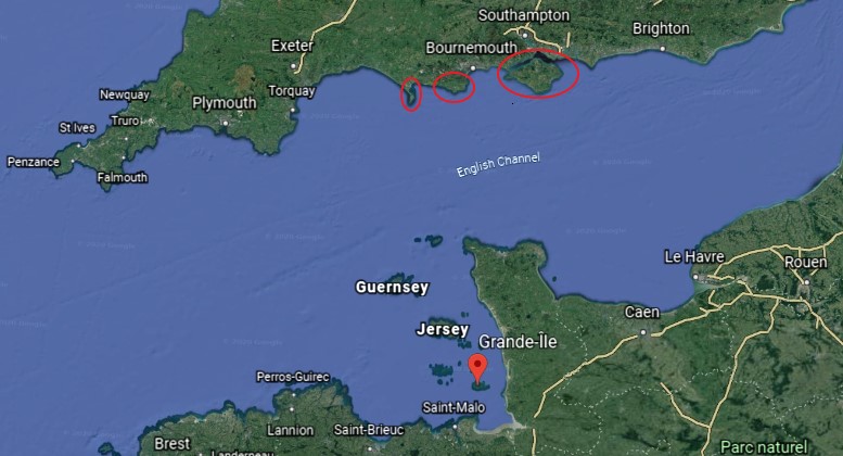
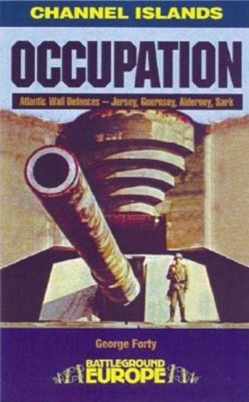
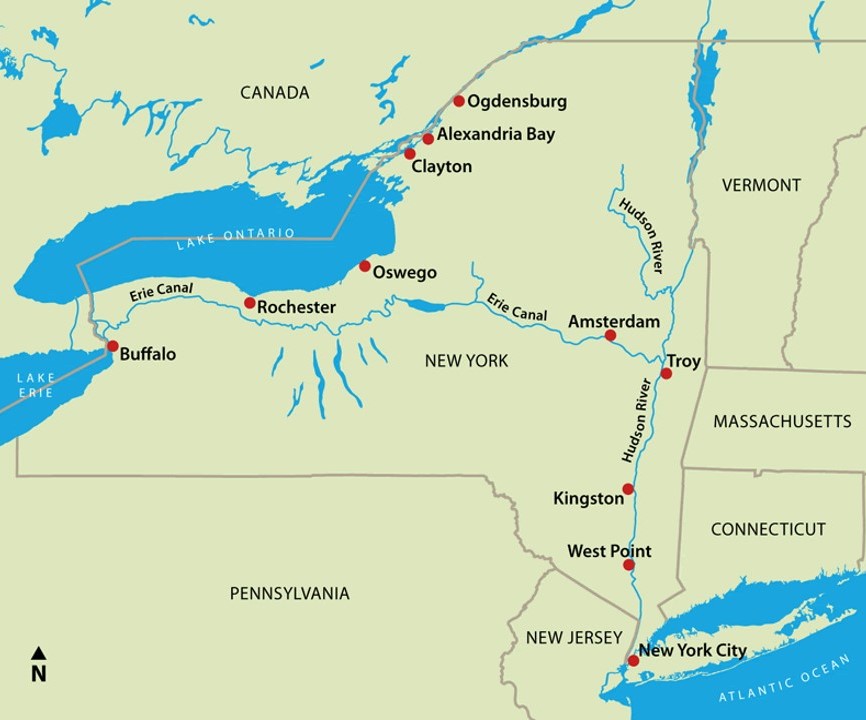
This is the last part of a three-part series on the islands of the English Channel.
In the first-part of the series, I took a close look at the features and history of Alderney Island in the Channel Islands, which are British Crown Dependencies.
In the second-part of the series, I looked at the same on the other main Channel Islands of Jersey, Guernsey, Herm, and Sark.
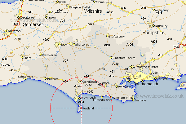
In this part of the series, I am visiting the Isle of Portland, the Isle of Wight, and the French Iles Chausey in the English Channel, all of which are considered separate from the Channel Islands I just mentioned.
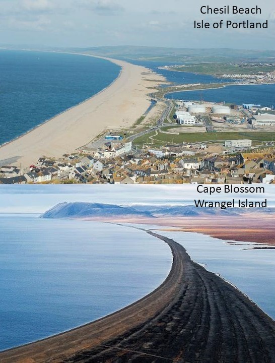
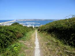
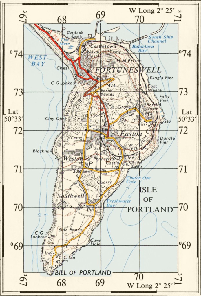
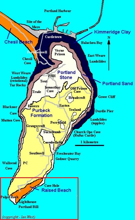
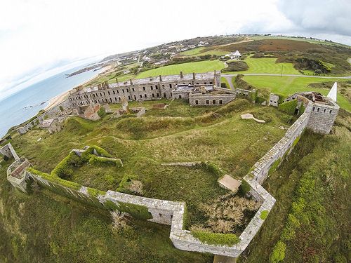
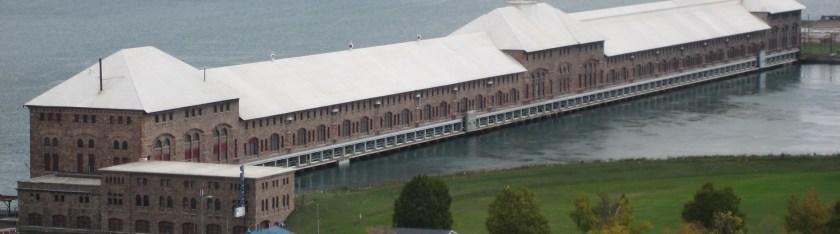
The Isle of Portland is what is called a tied-island in the English Channel, forming the southernmost point in England’s Dorset County.
It is 5-miles, or 8-kilometers, south of the resort town of Weymouth.
A barrier beach called Chesil Beach connects it to the mainland of England.
I found a similar-looking place when I was researching an circle alignment that begins, and ends, in Merida, Mexico, that goes through Wrangel Island that is located in the Arctic Sea between the Siberian Sea and the Chukchi Sea off the coast of northern Russia.
It is called Cape Blossom on Wrangel Island.
They tell us this is natural, but I really wonder about that!
There are similar, shaped-shorelines all over the Earth!
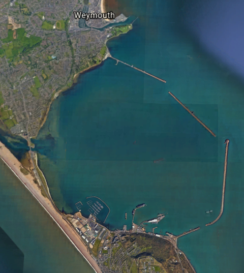
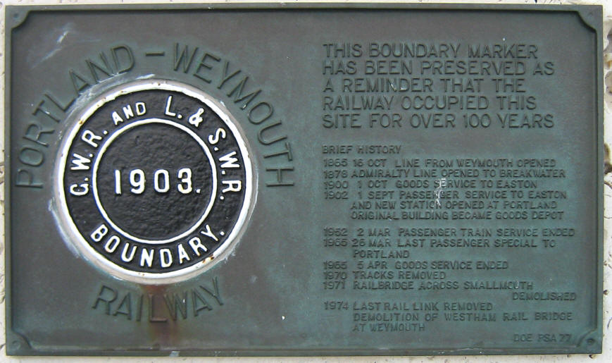
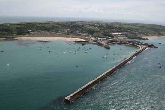
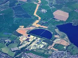
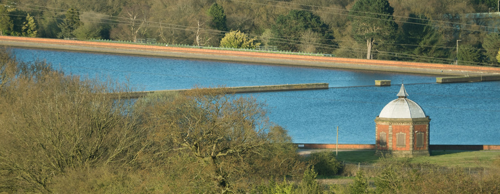
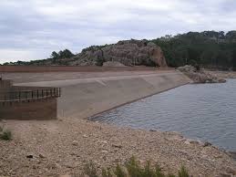
Portland Harbor, located between the Isle of Portland and Weymouth, is considered one of the largest man-made harbors in the world.
We are told that the Admiralty constructed the harbor, as a facility for the Royal Navy, starting in 1849 and completing it in 1872.
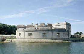
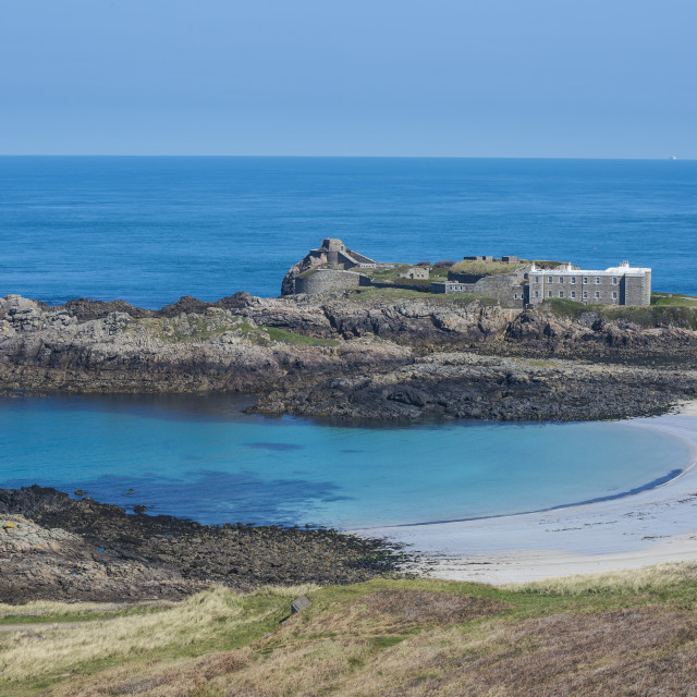
We are told that prior to the construction of the Harbor, in the 16th-century, King Henry VIII built Portland Castle on the Isle of Portland between 1539 and 1541…
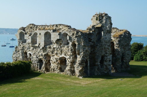
…and Sandsfoot Castle in Weymouth to defend the original harbor here against French and Spanish invaders, and which had been used as an anchorage for ships for centuries.
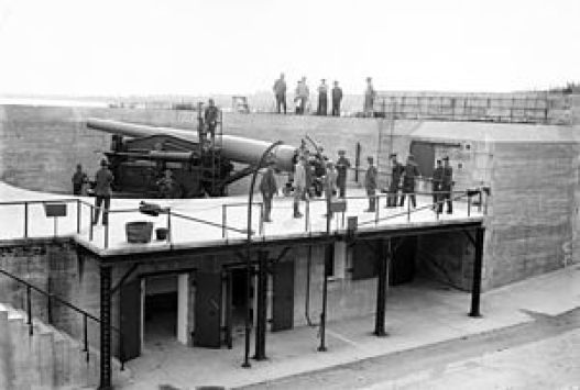
We are told construction of the breakwaters of Portland Harbor started in 1849, with Prince Albert, husband of Queen Victoria, laying the foundation stone on June 25th of that year, and were completed in 1872.
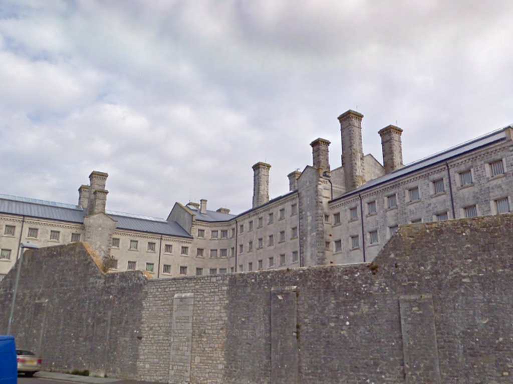
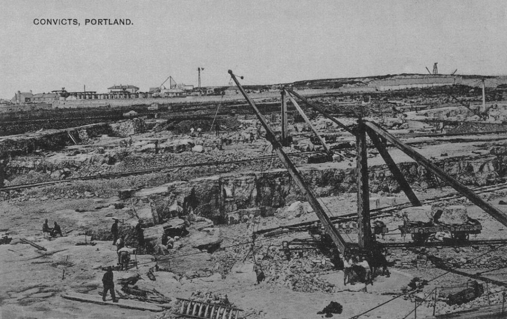
Still functioning today as a prison, HM Prison Portland was said to have been established in 1848 to provide convict labor to quarry the stone needed to construct the breakwaters and harbor defenses.
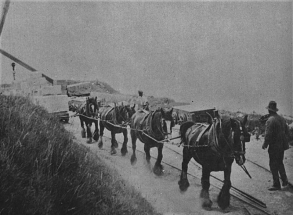
We are told that the tremendous amount of stone needed for all of this construction was quarried by convicts starting in 1849 in the Admiralty Quarry…
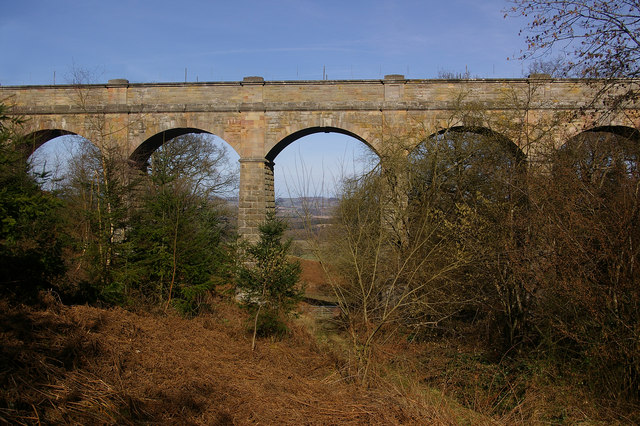
…and that railways were built to accommodate the stone-quarrying process.
We are told the Admiralty Incline Railway was built in 1848 and 1849 in order to transport stone from the quarries to the harbor for the construction activity, but when the Admiralty Quarries completely closed in 1936, the incline railway’s tracks were removed, and the incline railway was turned into a road leading into the naval dockyard, known today as Incline Road.
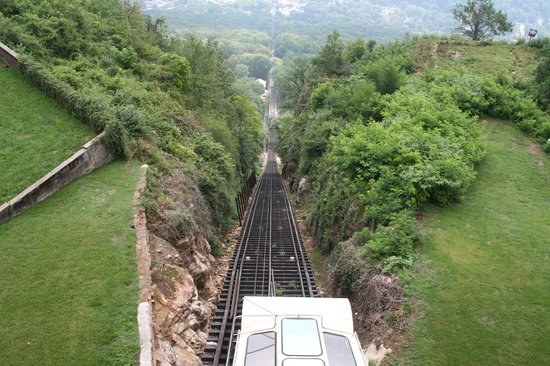
Before the Admiralty Incline Railway’s removal, it would have looked like the currently-operating Lookout Mountain Incline Railway in Chattanooga, Tennessee.
Also known as a funicular railway, it is a transportation system that uses cable-driven cars to connect points along a steep incline, using two counterbalanced cars connected to opposite ends of the same cable.
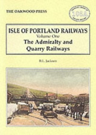
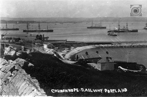
As a matter of fact, the small isle of Portland has quite a history with its railways…all of which no longer exist.
The Merchant’s Railway, known at the time as the Portland Railway, was said to be the earliest railway in Dorset, opening in 1826 as a horse-drawn first tramway, then incline railway, in order to transport heavy, quarried stone from the northern region of Tophill to Castletown on Portland Harbor, which is the location of Henry VIII’s Portland Castle.
In 1860, we are told, the horses were replaced with cables.
The rails of the Merchant’s Railway were finally removed for scrap in 1956, after the railway had fallen into disuse in 1939 with the increasing use of modern transport methods.
The Portland Branch Railway consisted of two railways, operated by different companies although working as a continuous line.
The Weymouth and Portland Railway was said to have been constructed between 1862 and 1864, and opening in 1865, connecting Weymouth and Easton on Portland.
We are told the construction of the Easton and Church Hope Railway started in 1888, and opened to passenger traffic in September of 1902.
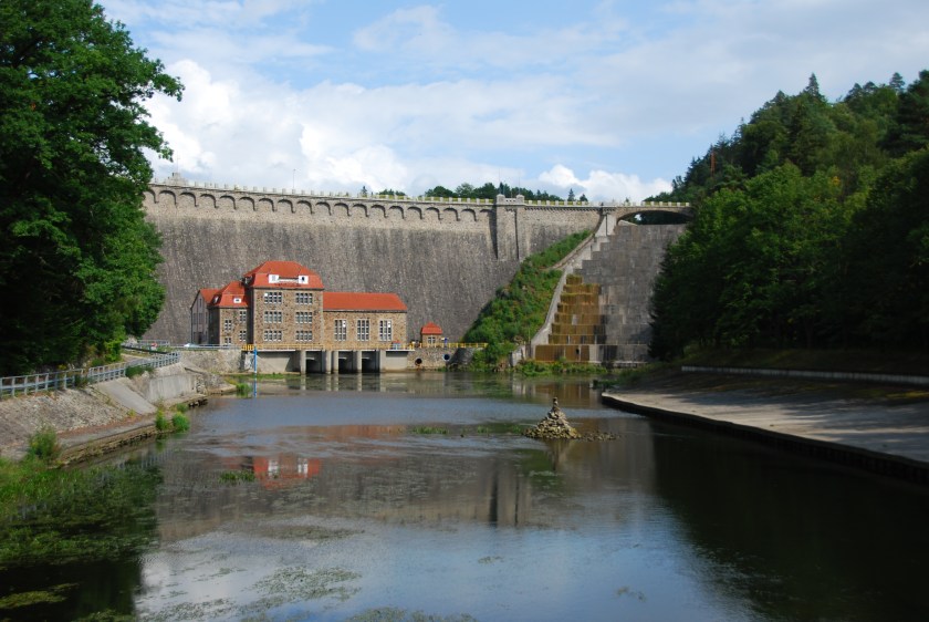
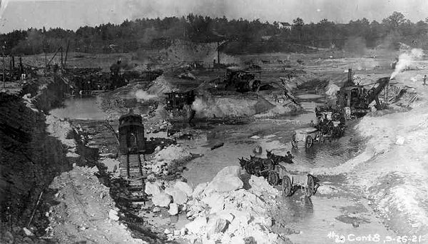
The Isle of Portland is a really good example of what I believe happened as I have put forth in past posts: the ancient, advanced Moorish civilization engineered all of the Earth’s rail infrastructure; it was wiped out by a deliberately-caused cataclysm involving a flood of mud; the negative beings responsible for creating the cataclysm managed to dig out enough infrastructure to re-start civilization, officially kicked-off at London’s Crystal Palace Exhibition in 1851 and presided over by Queen Victoria; horses and mules were used to pull trains and streetcars until a replacement technology was available to power them; and most public, passenger-rail, street-car systems, at one time were worldwide, were retired and removed themselves after the development of gasoline-powered private and mass transit vehicles, which subsequently generated massive wealth concentrated in the hands of a very few.
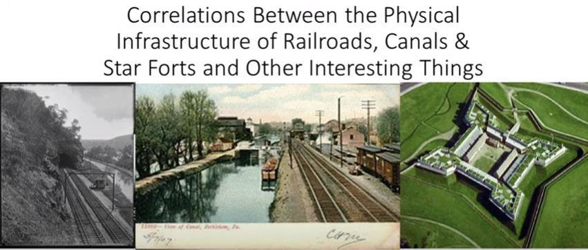
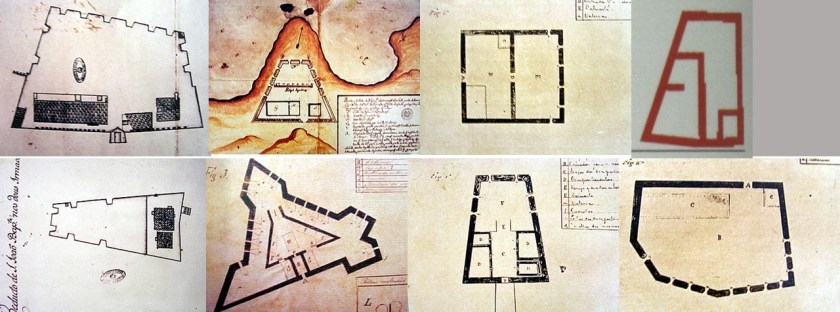
I have done a considerable amount of research on correlations between the physical infrastructure of railroads, canals & star forts found all over the world.
You can find more detailed information about this subject in one place is my blog post of the same name.
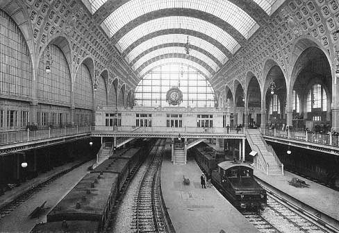
At the end of this blog post, I talk about this photo, which had the caption of “Electric trains operating in the Gare d’Orsay, circa 1900.”
The Gare d’Orsay railroad terminal was said to have opened in Paris in 1900.
This led me to look up the definition of terminal, for which there are two nouns:
The end of a railroad or other transportation route, or a station at such a point
A point of connection for closing an electric circuit
I have come the conclusion through my research that the Master Builders of the Ancient & Advanced Civilization built the physical infrastructure of the planetary grid system, including all transportation systems, which generated and used the free energy that powered this civilization worldwide.
I am talking about a sophisticated electrical circuitry system, of which star forts were a big part of as well.
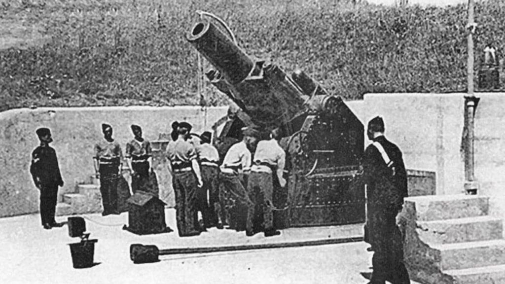
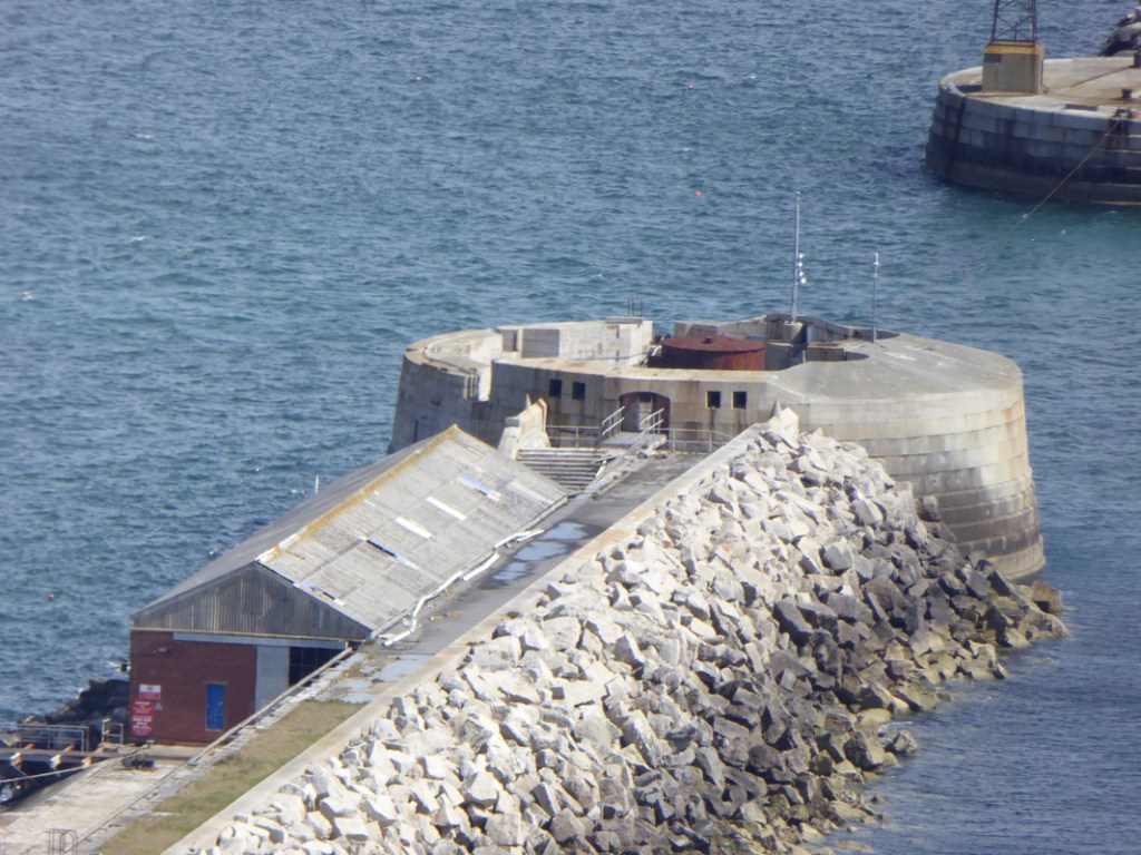
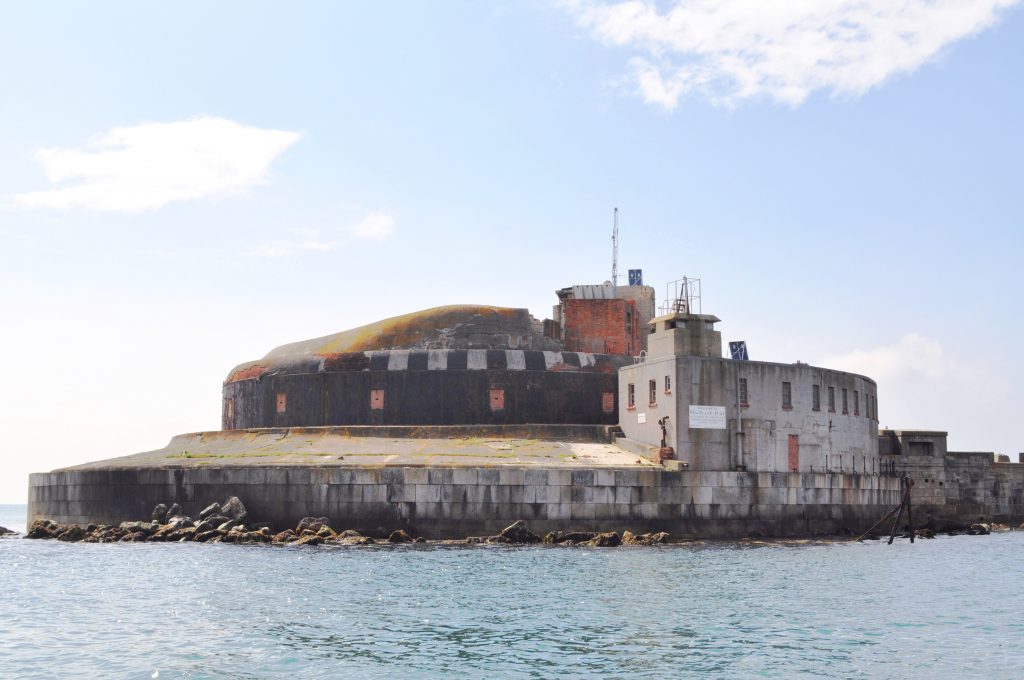
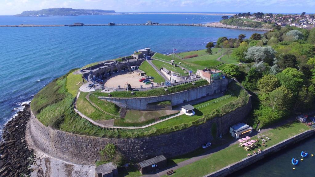
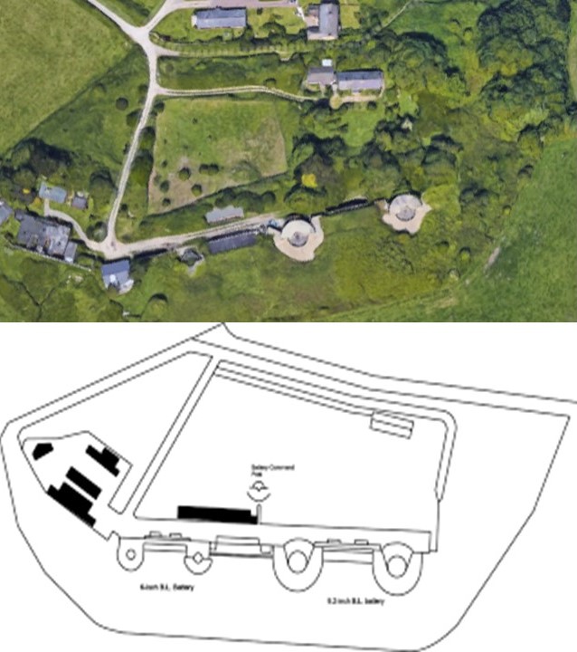
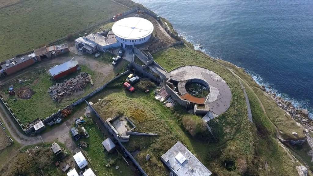
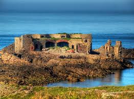
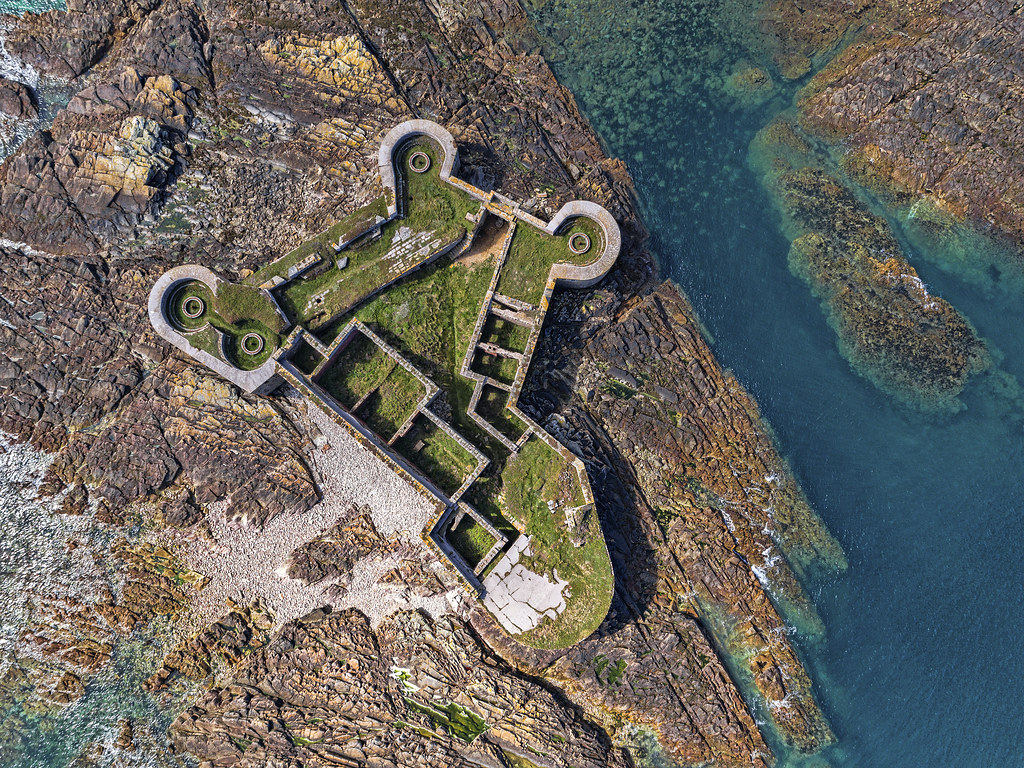
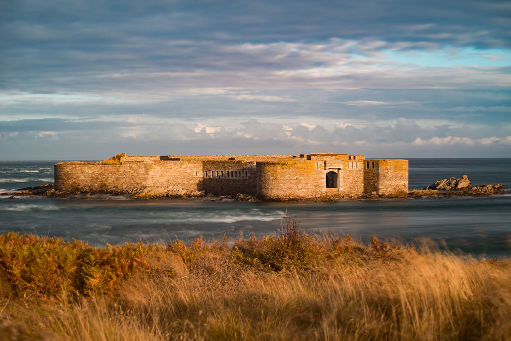
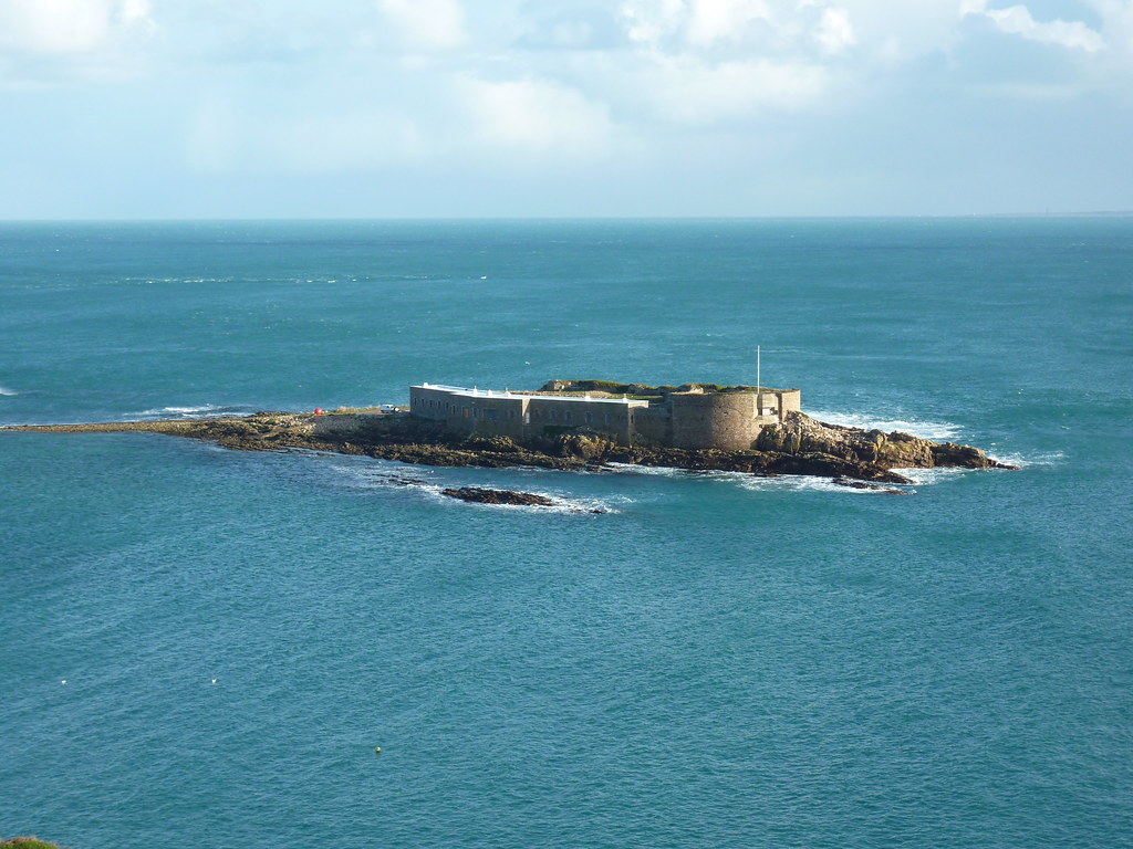
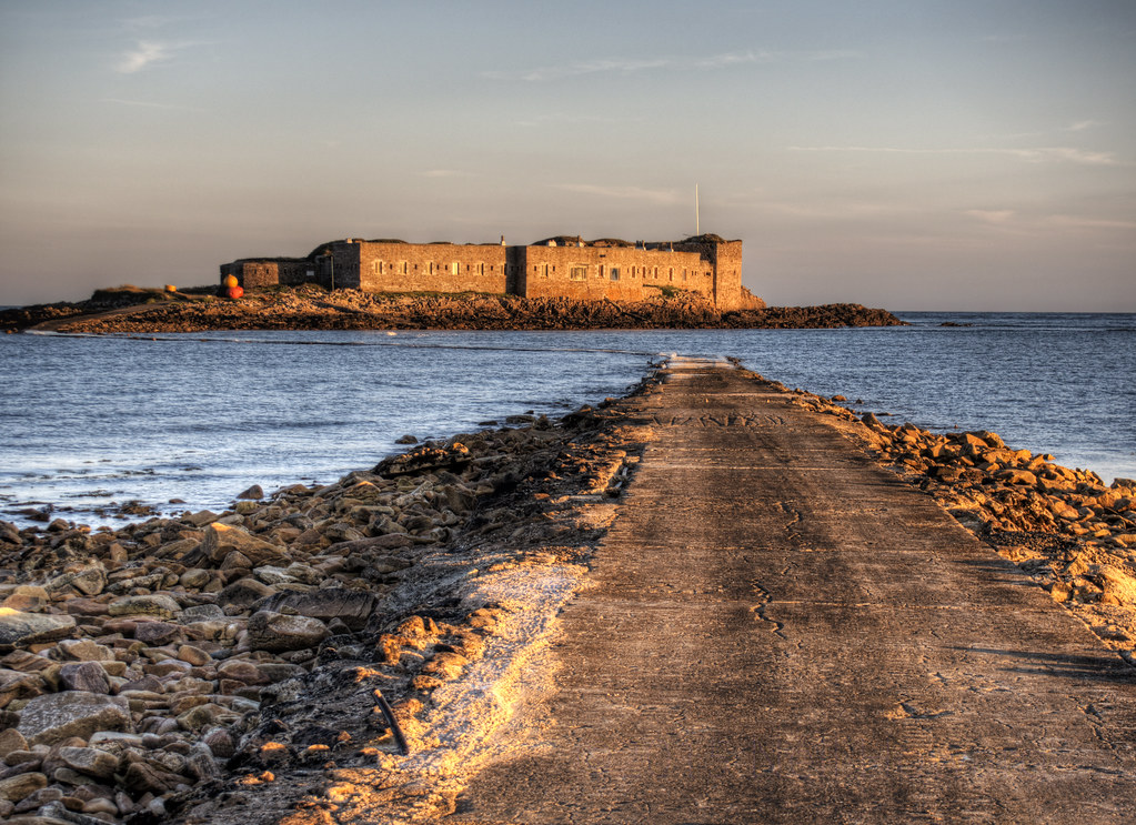
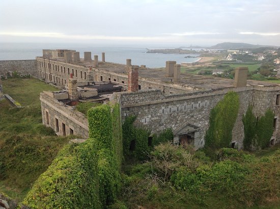
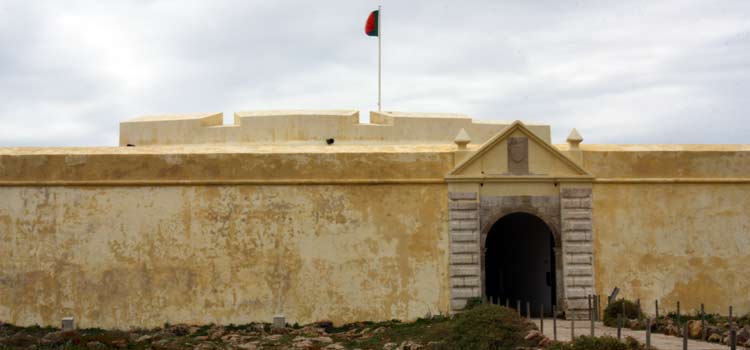
Along those lines, there are a number star forts on the Isle of Portland as well, like Verne Citadel, located on the highest point in Portland, was said to have been built as Portland’s main defensive fortification between 1857 and 1861.
In 1949, the citadel was turned into a prison, and continues to be used in that capacity today.
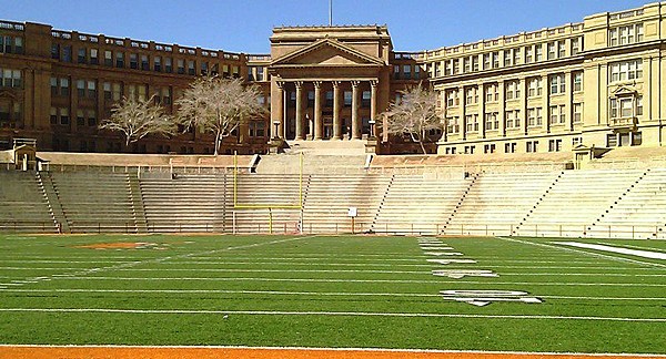
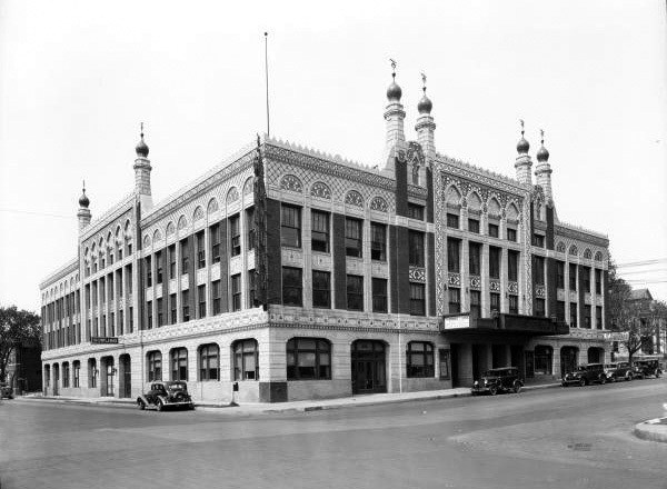
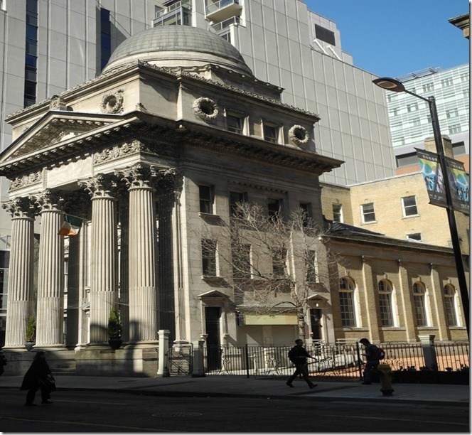
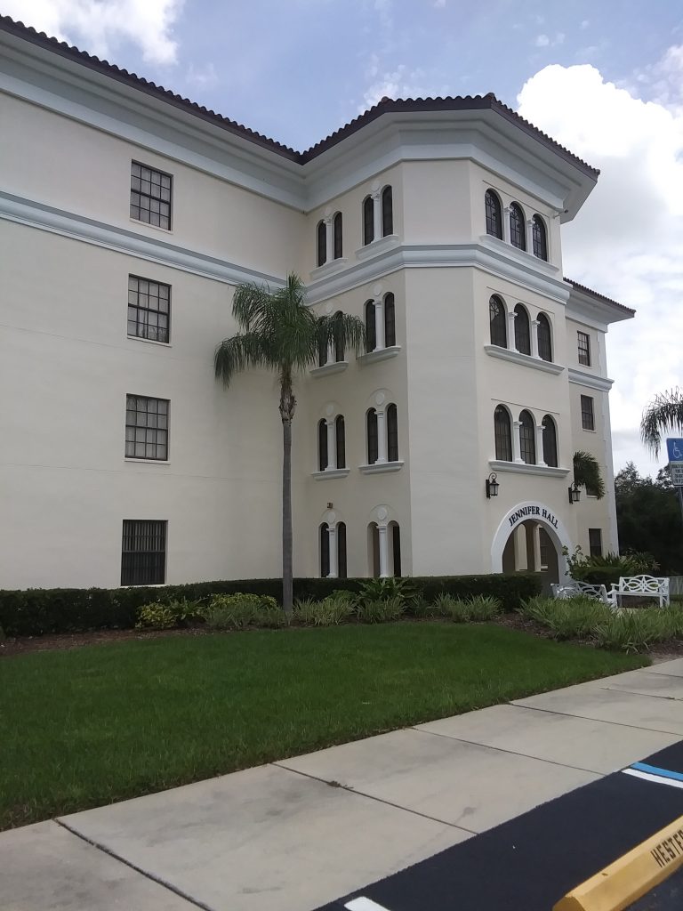
With examples like “HM Prison The Verne,” I have come to believe that the infrastructure of the original advanced civilization which was engineered to benefit life was reverse-engineered into human control structures, including, but not limited to, schools like El Paso High School in Texas…
…theaters, like the old Akdar Movie Theater in Tulsa, Oklahoma, said to have been built around 1922 and demolished in the 1970s…
…and banks, like the Old Bank of Toronto.
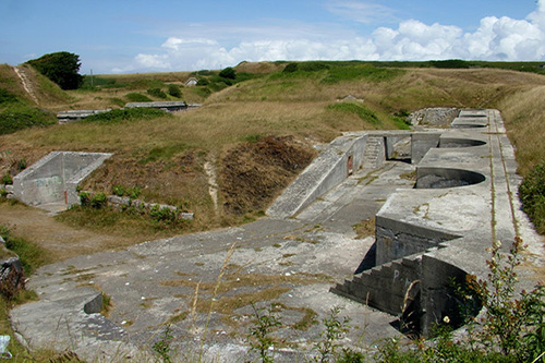
Located close to Verne Citadel, the Verne High Angle Battery was said to have been built in 1892 to protect Portland Harbor, and a scheduled monument, which is a nationally important archeological site or historic building given protection against unauthorized change, and is protected under the Ancient Monuments and Archeological Areas Act of 1979.
A so-called Victorian era construction protected under an act pertaining to ancient monuments and archeological sites?
My understanding is that the word ancient pertains to the very distant past and not something that would have been built less than 200 years ago.
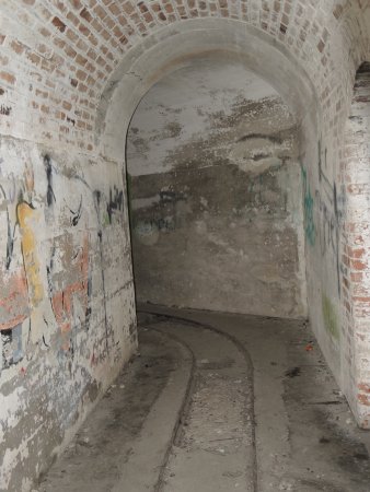
The tracks seen at the battery were said to have been installed to move missiles.
This battery has become a tourist attraction.
Interestingly, there is a tunnel system at the Verne High Angle Battery that also has tracks for rails.
It was said to have been decommissioned as an artillery battery in 1906, only 14-years after it was constructed, due to the advent of smaller craft like torpedo boats.
Apparently, the “high angle” at which the guns were placed were only effective with larger naval ships.
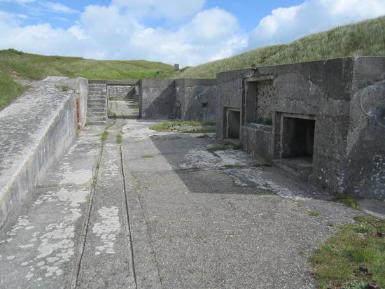
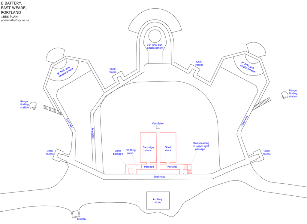
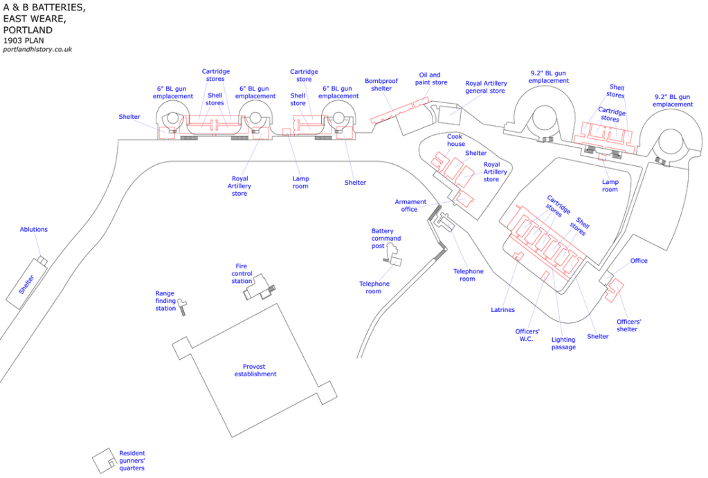
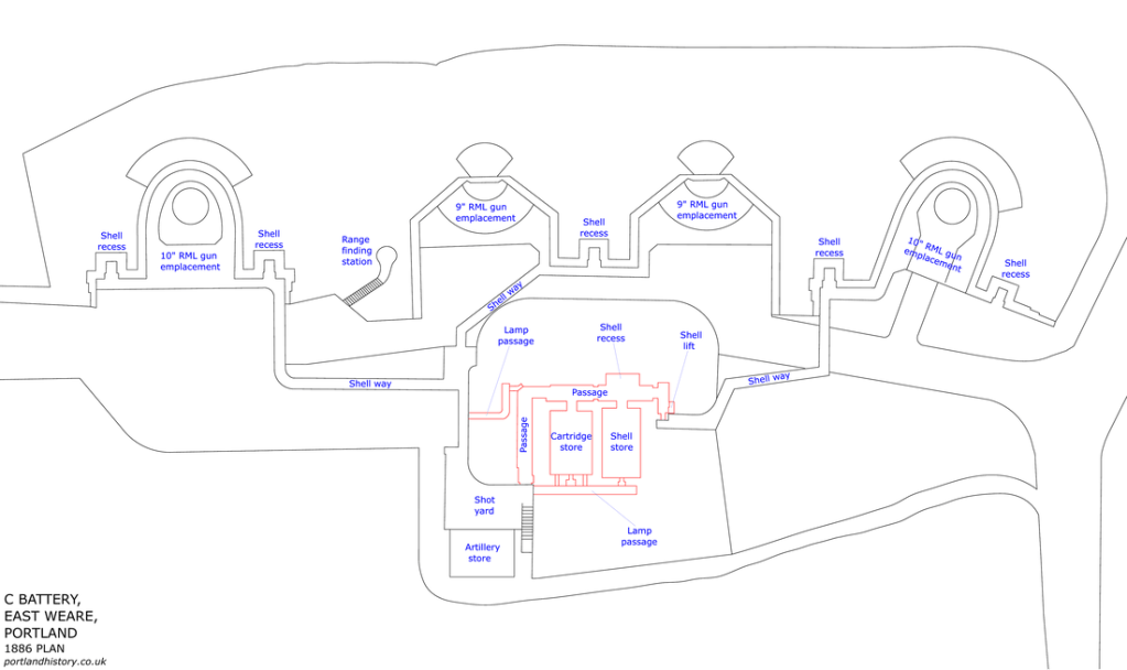
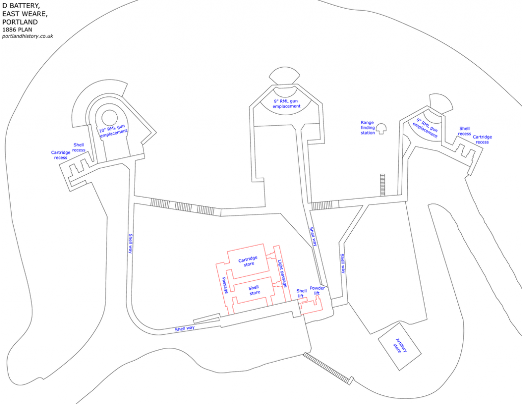
The East Weare Batteries are called five former gun batteries said to have been constructed starting in 1864, designated by letters A – E, and, we are told, built to protect Portland Harbor.
Yet E Battery became a scheduled monument in 1973…
…and like the Verne High Angle Battery, is protected under the Ancient Monuments and Archeological Areas Act of 1979.
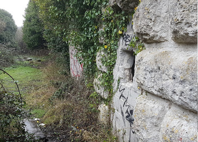
The East Weare batteries of A & B are referred to by locals and urban explorers as the “Forbidden City.”
Then there is Battery C…
…and Battery D.
There is officially no public access to any of the East Weare batteries.
What is the definition of the word “battery”?
One definition is a device that produces electricity that may have several primary or secondary cells arranged in parallel or series, as well as a battery source of energy which provides a push, or a voltage, of energy to get the current flowing in a circuit…
…and that this is the reason there are so many batteries and star forts that are paired together, or even the reason clusters of them are found in the same location.
The second meaning of the word battery is the heavy fire of artillery to saturate an area rather than hit a specific target.
All of these so-called artillery batteries originally functioned as circuitry and batteries for the purpose of producing electricity and/or some form of free energy to power the planetary grid system and the original ancient, advanced civilization.
There is a third definition of battery, which is an assault in which the assailant makes physical contact.
Does the third definition apply here?
I think so, in the sense that a major assault has been committed against the Human Race by all that has taken place here without our knowledge and consent, and removing all of this critical information from our awareness about the True History of Humanity, and so, so much more.
Other so-called military forts on the Isle of Portland include:
The Inner Pierhead Fort, located on the end of the inner breakwater next to the former dockyard of the naval base that was here, and said to have been built between 1859 and 1862…
…the Portland Breakwater Fort, said to have been built between 1868 and 1875, on the outer breakwater…
…Nothe Fort in Weymouth, said to have been built as a coastal defense between 1860 and 1872…
…Upton Battery on the outskirts of Weymouth and northeast of Portland Harbor, described as a coastal artillery battery said to have been built between 1901 and 1903, and decommissioned in 1956…
…and Blacknor Fort, located on the western end of Portland overlooking Lyme Bay, and said to have been built between 1900 and 1902, and also decommissioned in 1956.
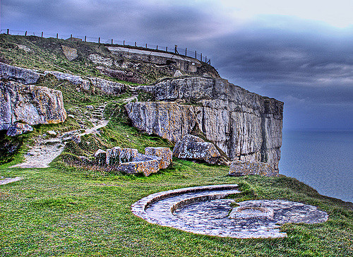
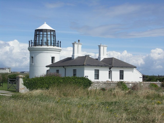
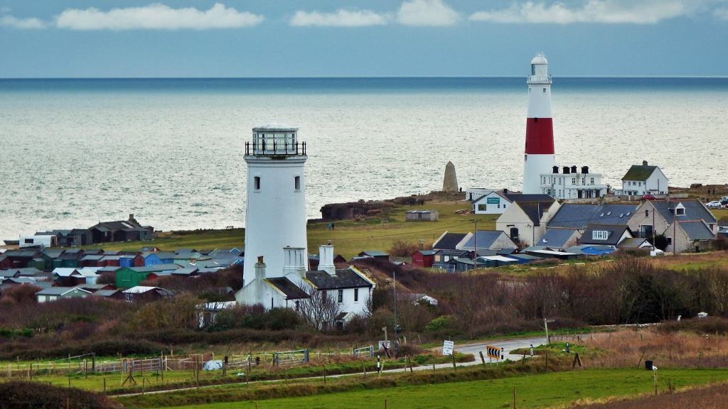
The last place on the Isle of Portland that I would like to visit is called the Portland Bill.
The Portland Bill is the southernmost point of England’s Dorset County, and is a narrow promontory at the southern end of the Isle of Portland.
Features of the Portland Bill include:
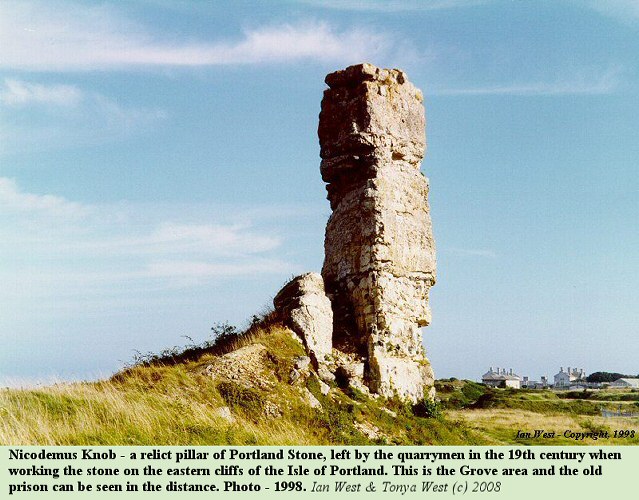
Pulpit Rock, so-named for the appearance of a bible leaning on a pulpit, which to me looks like very ancient masonry, especially with the rectangular- shape and straight-edges of the “bible” among other things I see here.
We are told that as a “quarrying relic,” Pulpit Rock is similar to Nicodemus Knob, a pillar within the former Admiralty Quarries, mentioned earlier as the quarry we are told that 6 million tons of stone were removed between 1849 and 1872 to build the breakwaters and harbor defenses for Portland Harbor.
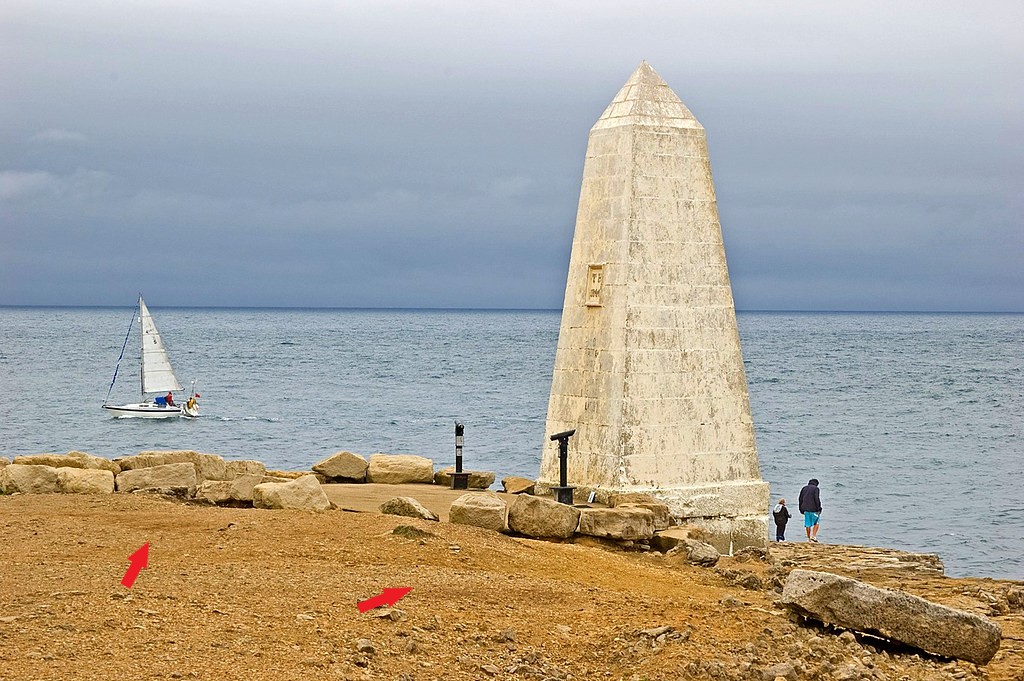
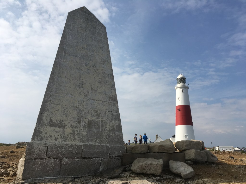
The 22-foot, or 7-meter, high Trinity Hill Obelisk was said to have been constructed in 1844 as a daymark, a daytime navigational marker to warn ships off the coast of Portland Bill.
Note the presence of old masonry blocks beside the obelisk.
We are not taught about the advanced, ancient civilization, so we don’t see these stones as anything other than natural when in actuality they have been worked and shaped.
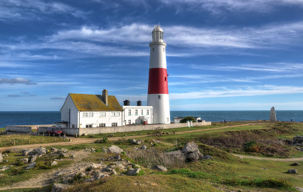
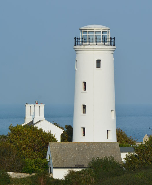
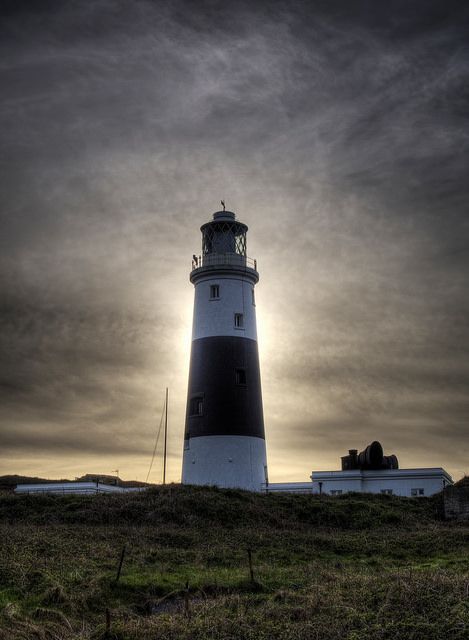
The Portland Bill Lighthouse is located right next to the Trinity House Obelisk.
The Portland Bill Lighthouse was said to have been built between 1903 and 1905…
…to replace two earlier lighthouses on Portland Bill – the Old Higher Lighthouse…
…and the Old Lower Lighthouse, both said to have been originally built in 1716, re-built in 1869…
…and decommissioned after the Portland Bill Lighthouse became operational after it was completed in 1905.
Like always, there is much more to find on the Isle of Portland, but next I am going to visit the Isle of Wight.
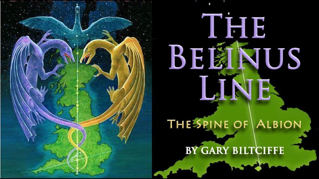
I first learned about the Isle of Wight several years ago, before I started doing my own research, in a book I read in 2013 by Gary Biltcliffe called the “The Belinus Line – The Spine of Albion.”
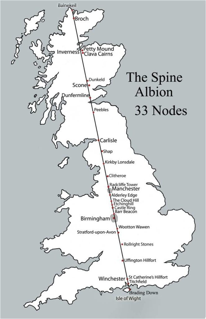
He and his partner Carolyn uncovered a North-South line that connected seats of power, running from the Isle of Wight at the bottom of England to Faraid Head at the tip of Scotland.
Over the whole length of the Belinus Line, which is also in alignment with the Cygnus constellation, they dowsed the Belinus (male) and Elen (female) dragon lines of energy that criss-crossed 33 nodal points along the way, the same number as that of the number of vertebrae in the human spine.
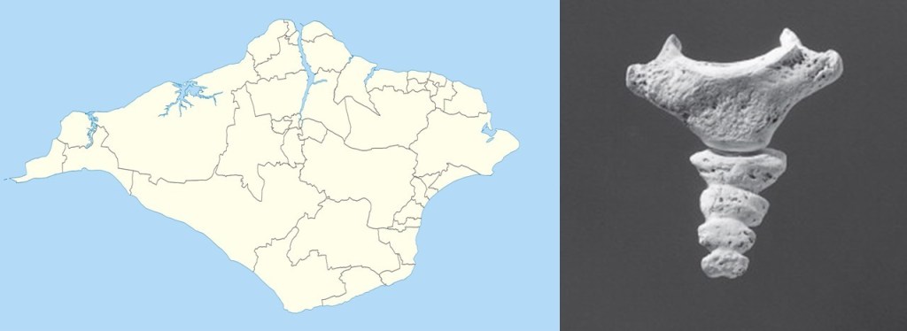
And…as Gary pointed out in the book…the Isle of Wight roughly has a the shape of the spine’s coccyx bone.
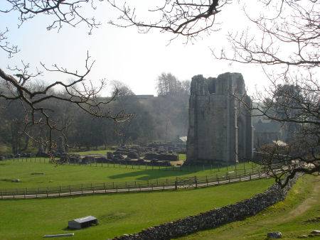
The book contained a picture of Shap Abbey in Shap, England, which immediately brought back a memory of seeing the same place when I drove past it on a trip to England in 2010.
I subsequently realized that I had travelled up the Spine of Albion synchronistically on my trip, visiting places on the alignment and dragon lines mentioned in the book, unbeknownst to myself.
One of the many reasons I feel deeply connected to all of the information I am researching and sharing.
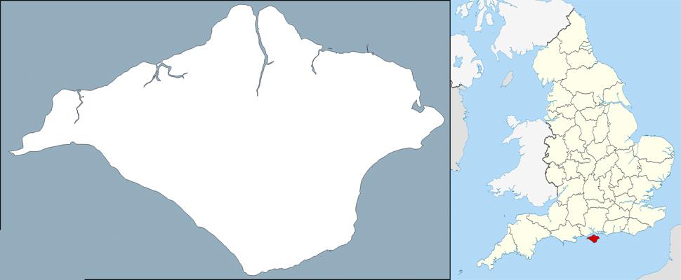
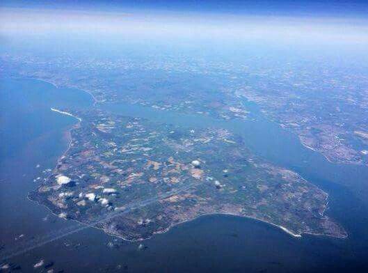
The Isle of Wight is the largest island in England, and its own ceremonial county.
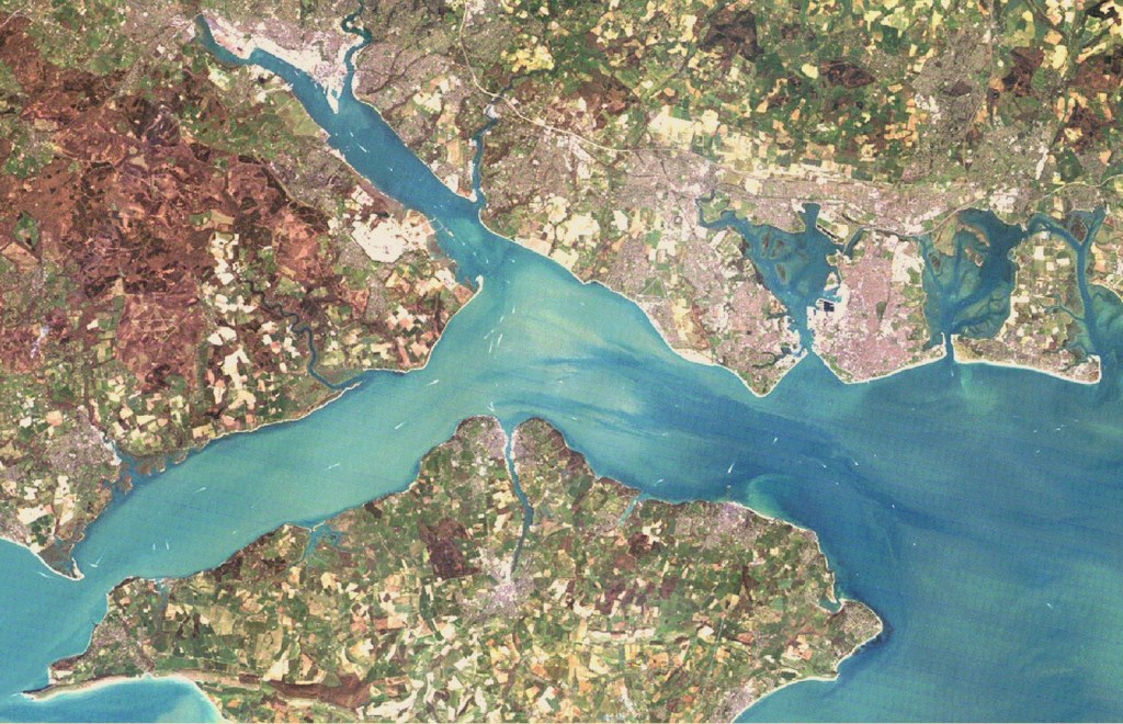
It is separated from the English mainland by a 20-mile, or 32-kilometer, long strait known as the Solent.
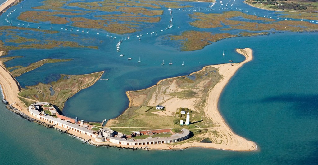
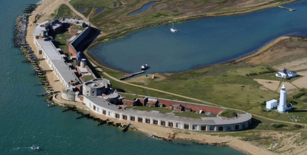
The Hurst Spit projects into the Solent Narrows, and is the location of…
…the Hurst Castle.
Like Portland Castle, the Hurst Castle was said to have been built by King Henry VIII in the 16th-century, during the years between 1541 and 1544.
It was said to have been part of a coastal protection program against invasion from France, Spain, and the Holy Roman Empire.
We are told that the Palmerston Forts on the Isle of Wight were a group of forts and associated structures that were built during the Victorian Era in response to a perceived threat of French invasion.
They are called the Palmerston Forts due to their association with Lord Palmerston, the Prime Minister during that time who was said to have promoted the idea.
There were approximately 20 of these Palmerston structures along the west and east coast of the Isle of Wight.
I am going to just look into a few of them.
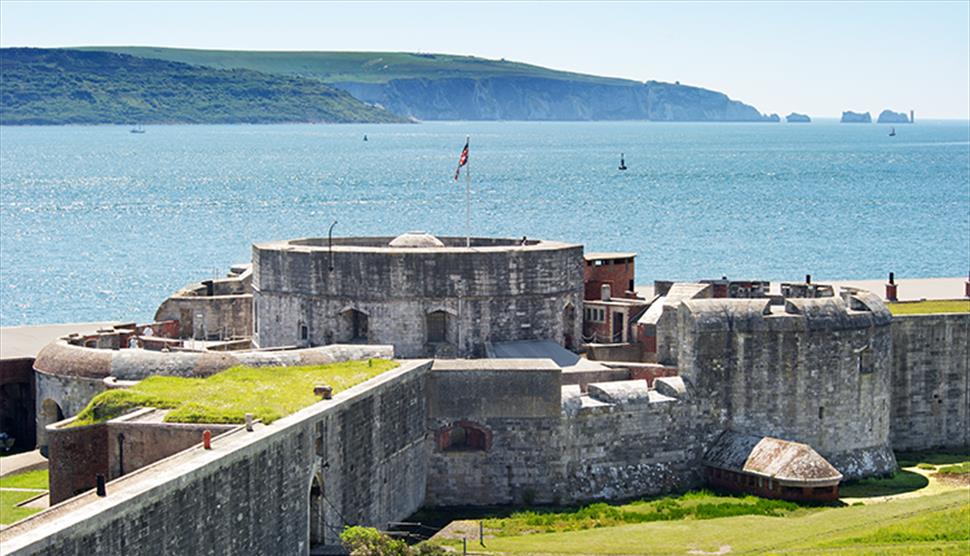
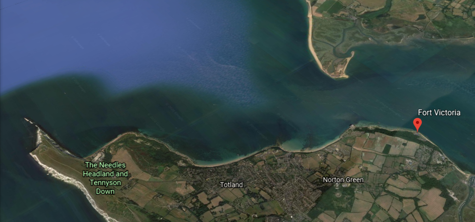
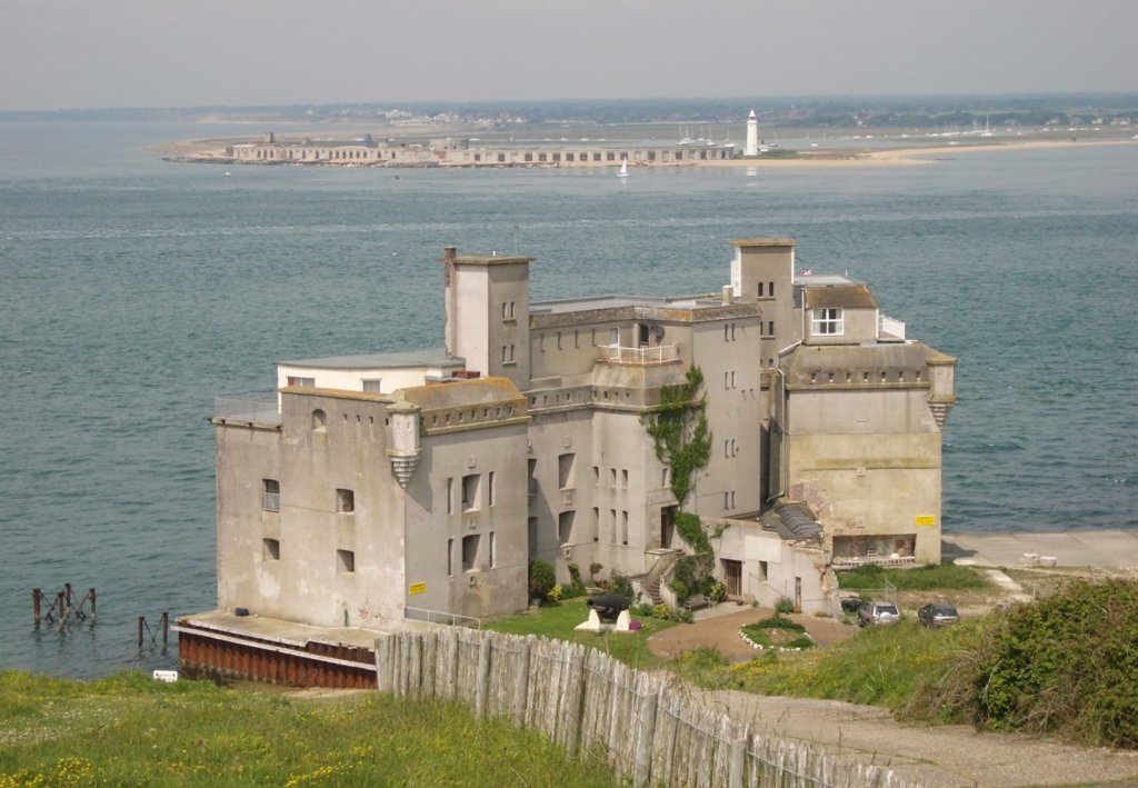
Fort Victoria was said to have been built in the 1850s to guard the Solent.
It is located on the Isle of Wight in a position opposite from Hurst Castle on the mainland’s Hurst Spit…
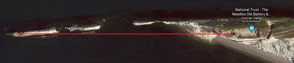
…and overlooks the whole of the Needles Passage, the most westerly point of the Isle of Wight.
More on The Needles shortly.
We are told that Fort Victoria’s military use came to an end in 1962, after having been a landing and storage point during both World Wars, and that the rear barracks blocks were demolished in 1969 to provide material for things like sea defenses.
Today, the fort is part of Fort Victoria Country Park.
Fort Albert was said to have been constructed between 1853 and 1856 to defend Needles Passage from the possibility of French attack coming from Emperor Napoleon III.
Fort Albert was said to have been rendered obsolete only two years later, in 1858, with the development of armored ships.
Today it is a privately-owned luxury apartment complex.
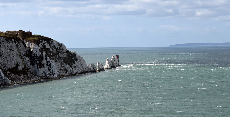
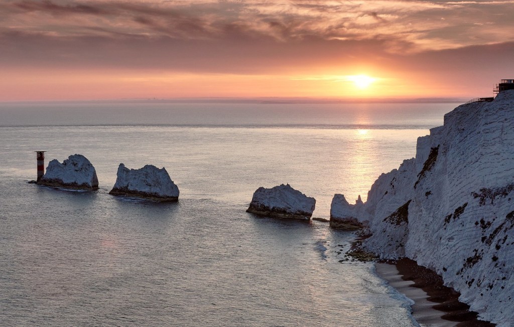
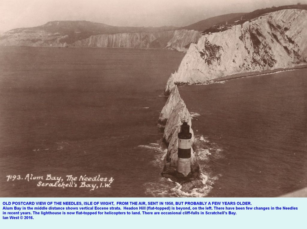
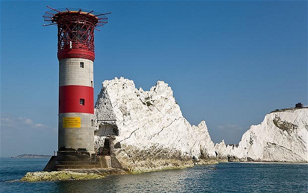
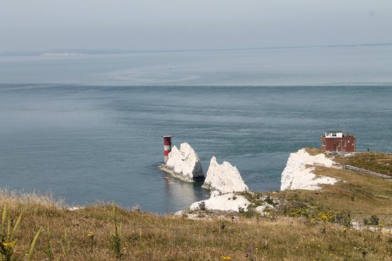
The Needles are described as a row of three chalk stacks off the Isle of Wight’s western extremity…
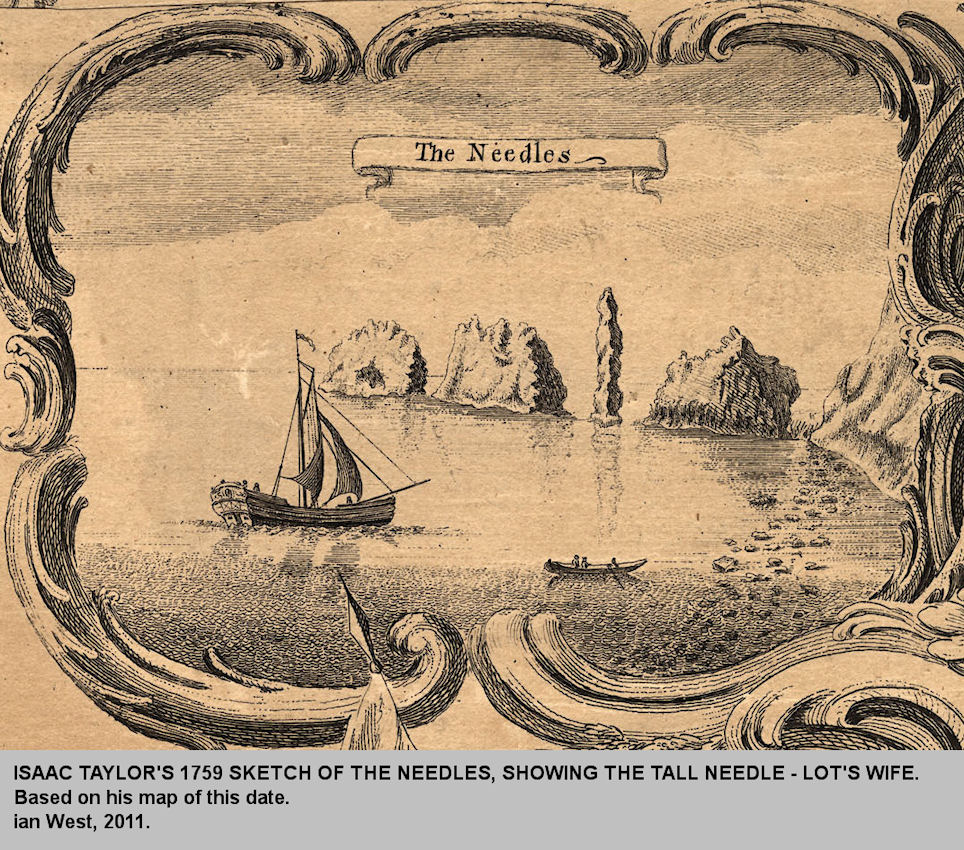
…and so-named because of the former Needle-like pillar called “Lot’s Wife,” which was said to have collapsed in a storm in 1764.
This is an illustration of the Needles which includes “Lot’s Wife” circa 1759.
The Needles Lighthouse, standing 109-feet, or 33-meters, tall on the outermost of the Chalk Pillars, was said to have been built out of granite blocks in 1859 for Trinity House, the official authority for lighthouses England, Wales, the Channel Islands, and Gibraltar.
I find it interesting that the description in this photo says that the lighthouse “is now flat-topped for helicopters to land.”
It’s an active lighthouse, and apparently needed under-pinning work in 2010 to keep it from falling into the sea.
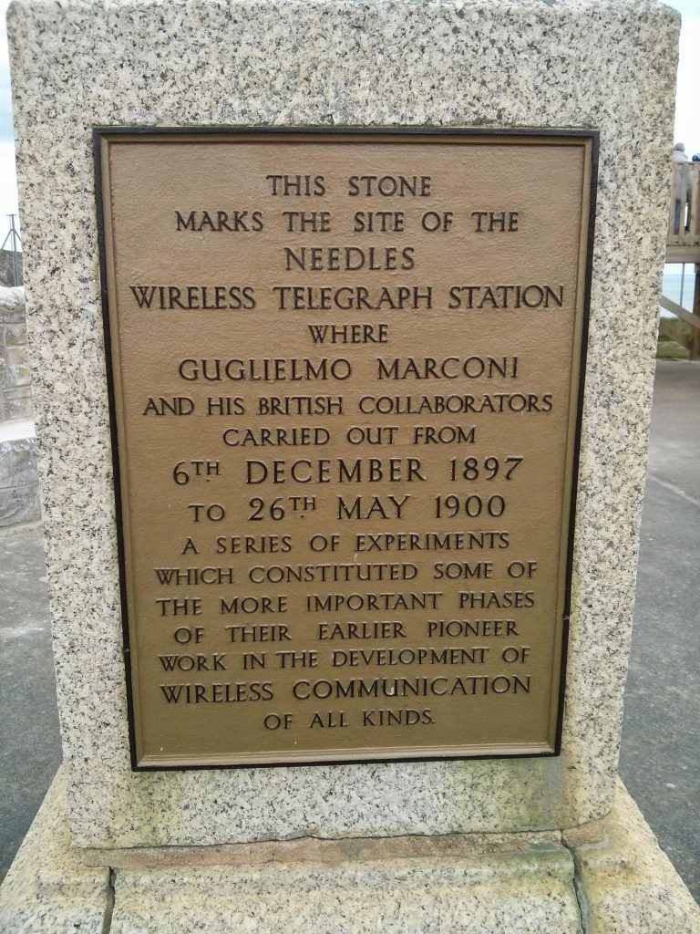
What is described as the world’s first long-distance radio signal was sent by Marconi from Alum Bay beside the Needles in the year 1897.
I wonder what it was about this location that influenced his decision to do his work on wireless communication here.
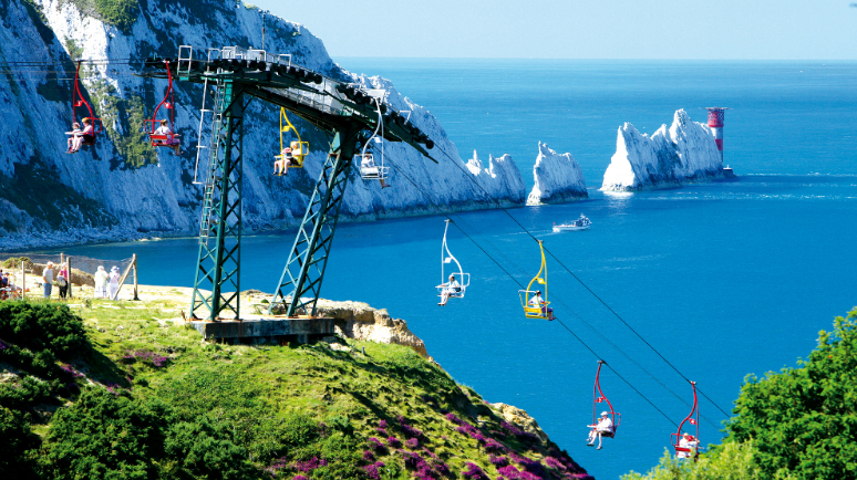
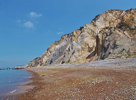
There is also a popular attraction called the Needles Chairlift, running from the top of the Alum Cliffs to the beach of Alum Bay below, with a great view of the Needles in the distance.
I just found one answer to my question about what influenced Marconi’s decision to do his wireless communication work here – Alum Bay sand includes extremely pure white silica, an important component for enhancing radio frequency transmission.
There are two so-called Palmerston Forts at the Needles.
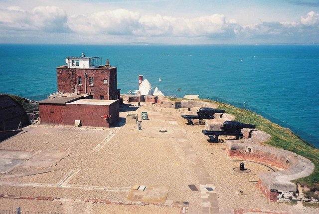
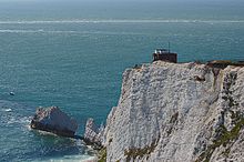
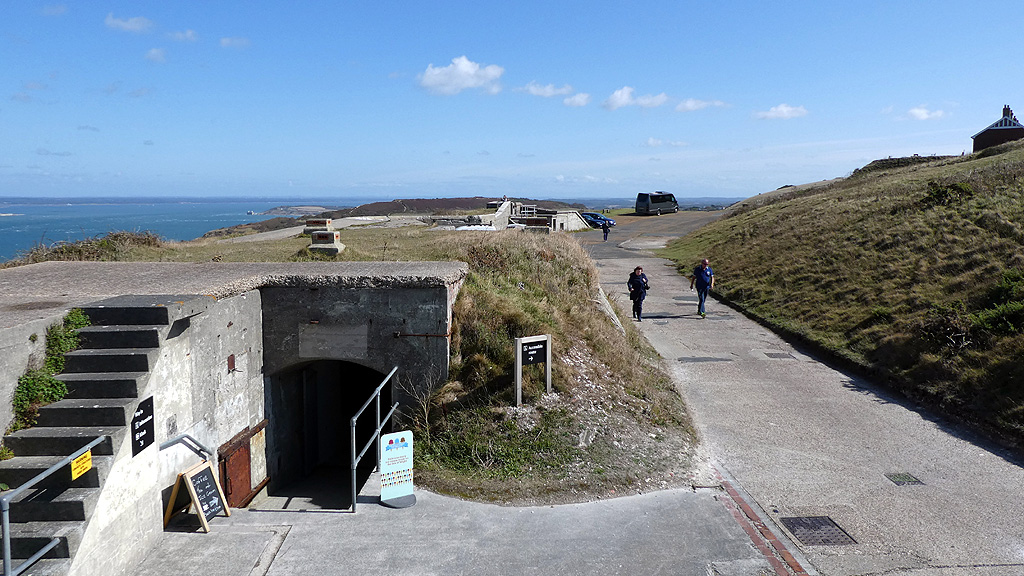
The Old Needles Battery is situated on a chalk cliff located right above the chalk pillars.
It was said to have been built between 1861 and 1863 as a coastal defense against French Invasion.
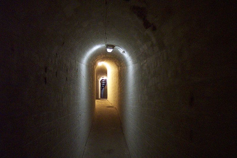
The Old Needles Battery has a tunnel leading to…
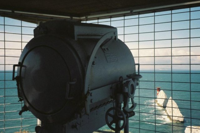
…its searchlight emplacement…
…in linear alignment with the Needles Lighthouse.
I would love to know exactly how they functioned together in the Earth’s original grid system!
All the Earth’s new controllers needed to do was stick a plaque on what looks to be an old searchlight naming contemporary builders, and what I believe to have been a common practice on infrastructure all over the Earth to hide Earth’s True History.
The Needles New Battery was said to have been completed in 1895, higher up on the same cliff, and said to have been constructed because of concerns about subsidence problems with the old battery and concussion from firing the batteries guns causing the cliffs to crumble.
I would like to briefly mention an isle I was not previously aware of until I started researching the Isle of Wight for this blog post.
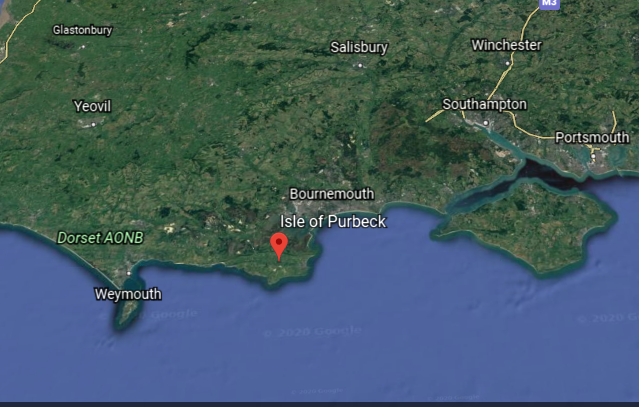
The Isle of Purbeck is located between the Isle of Portland and the Isle of Wight.
Though named an isle, it is called a peninsula as it is bordered by water on three sides.
The Isle of Purbeck has significant deposits of what is known as Purbeck Ball Clay.
Ball clay has extensive industrial uses, from tableware, to wall-and-floor tiles, to spark plugs, to hoses, to pharmaceuticals, to kilns.
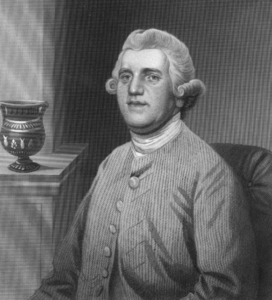
Large-scale commercial extractions of the ball clay was said to have begun in the middle of the 18th-century, with large quantities ordered in 1771 by Josiah Wedgwood, the English potter and founder of the Wedgwood pottery company who became the world’s first tycoon…
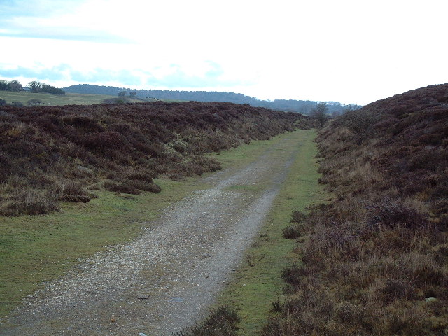
…leading to the construction, we are told, of Dorset’s first railroad in 1806, known as the Middlebere Plateway, and described as a horse-drawn tramway.
This is where the Middlebere Plateway was once-upon-a-time, where it cut across Hartland Moor.
As I find in many places, the memory of the original Moorish people is retained here in the name of the place.
The etiology of the word Moor goes back to Ancient Mu. Mu’ur = Moor, and the ancient, advanced Moorish civilization was world-wide and comprised of many Empires within One Civilization – Tartaria, Barbaria, Washitaw, Mughal, to name a few.
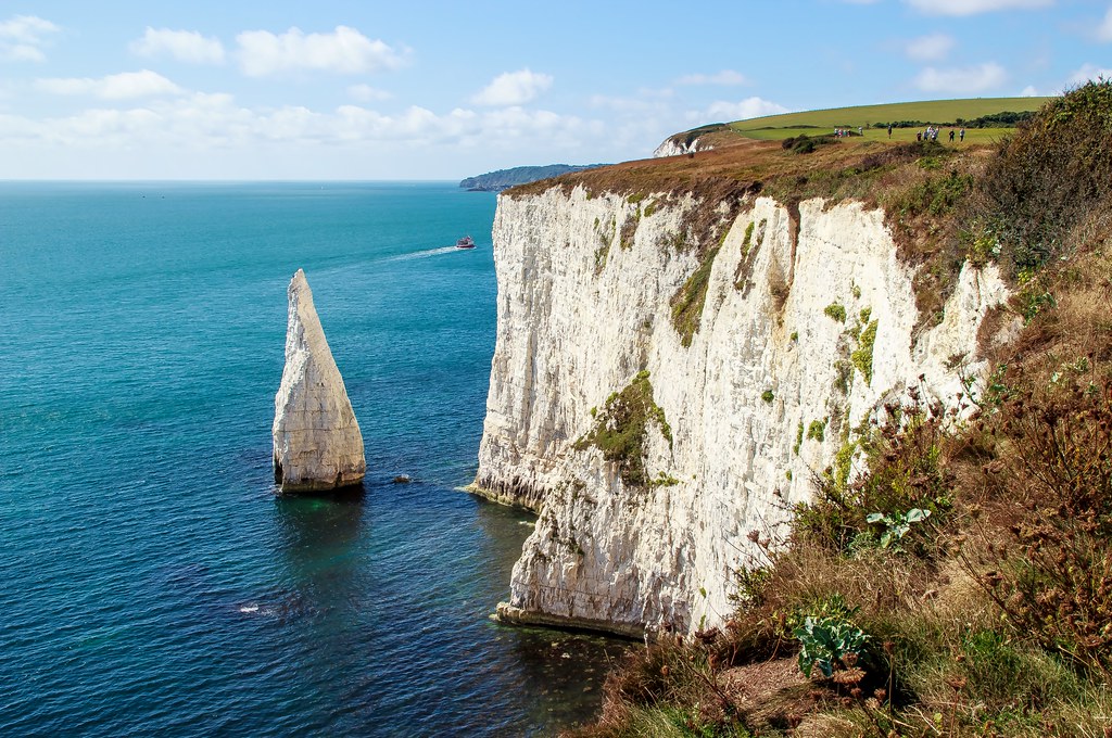
The cliffs on the Isle of Purbeck are considered among the most spectacular in England…
…and its landforms include the Durdle Door, which interestingly aligns with the solstice.
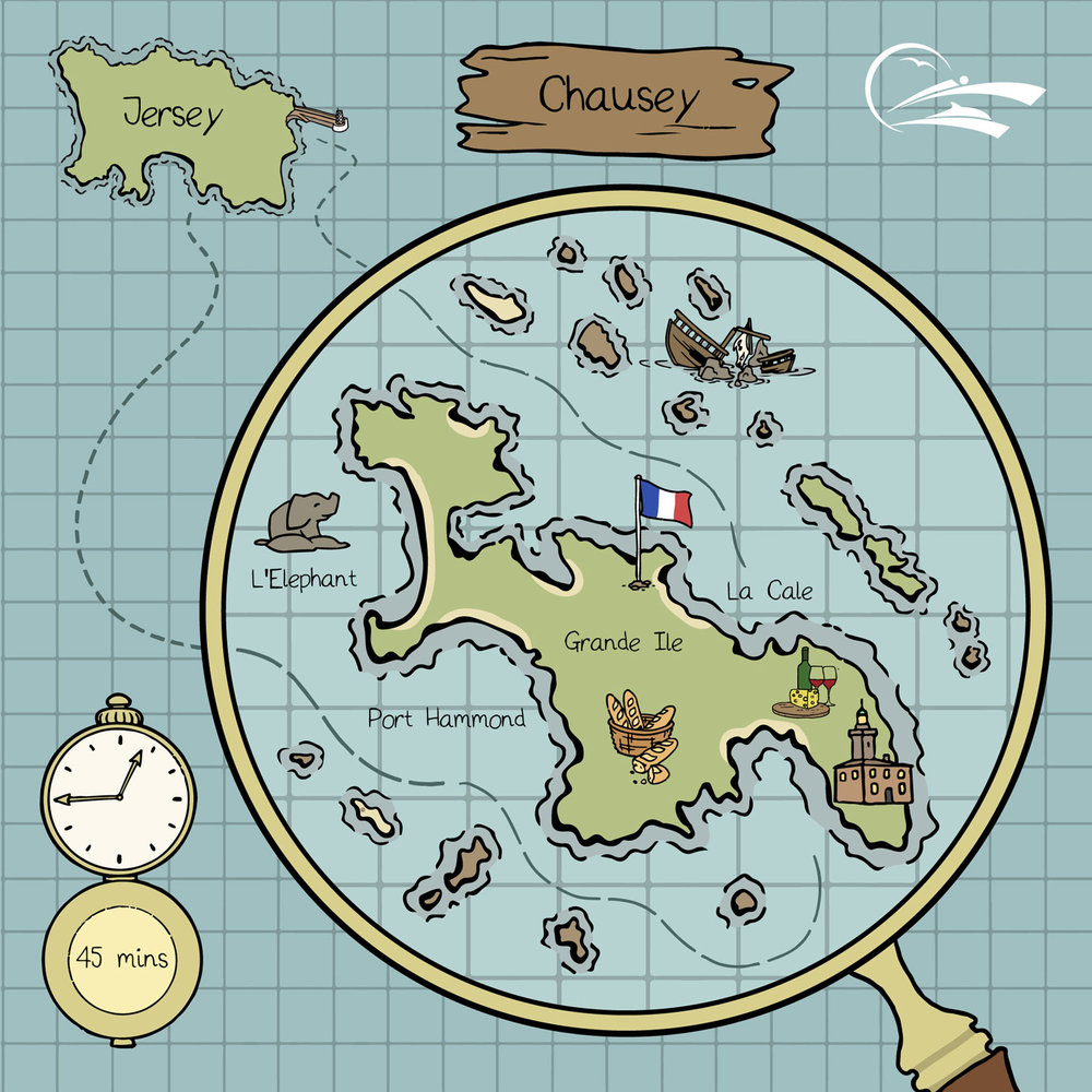
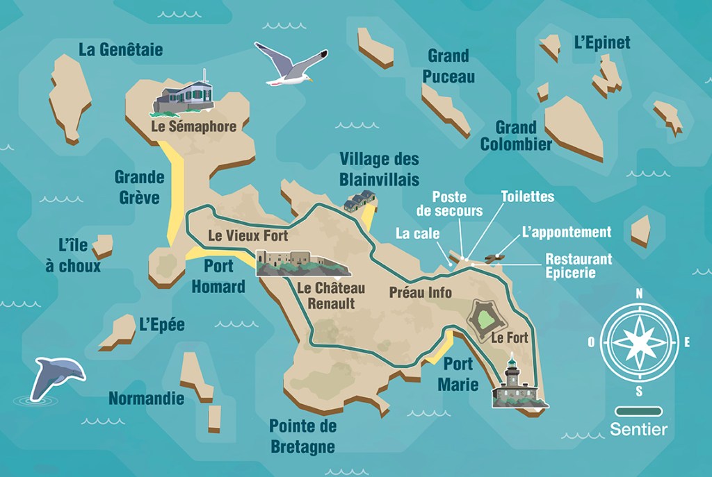
The last place I am going to look at are the French Iles Chausey, the largest island group in Europe.
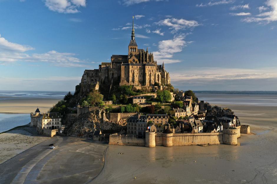
The Iles Chausey are located in the Bay of Mont Michel, and like with many places I have looked at in this series, experiences a high-range between high-tide and low-tide every day…
…with Mont St. Michel being a tidal island, which I have found throughout the Channel Island.
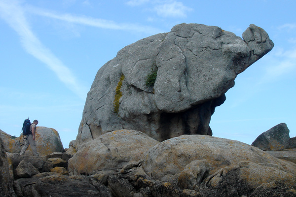
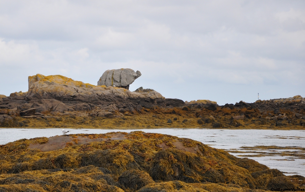
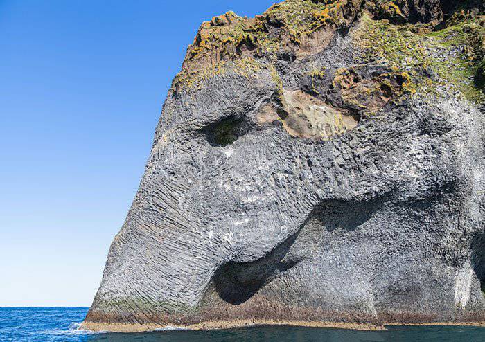
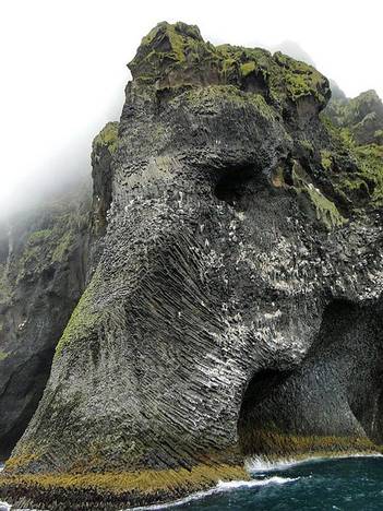
The Iles Chausey are known for rocky protuberances that resemble something, like Elephant Rock…
In case you might think this resemblance is a work of nature…
…Check out this Elephant Rock on one of Iceland’s small islands.
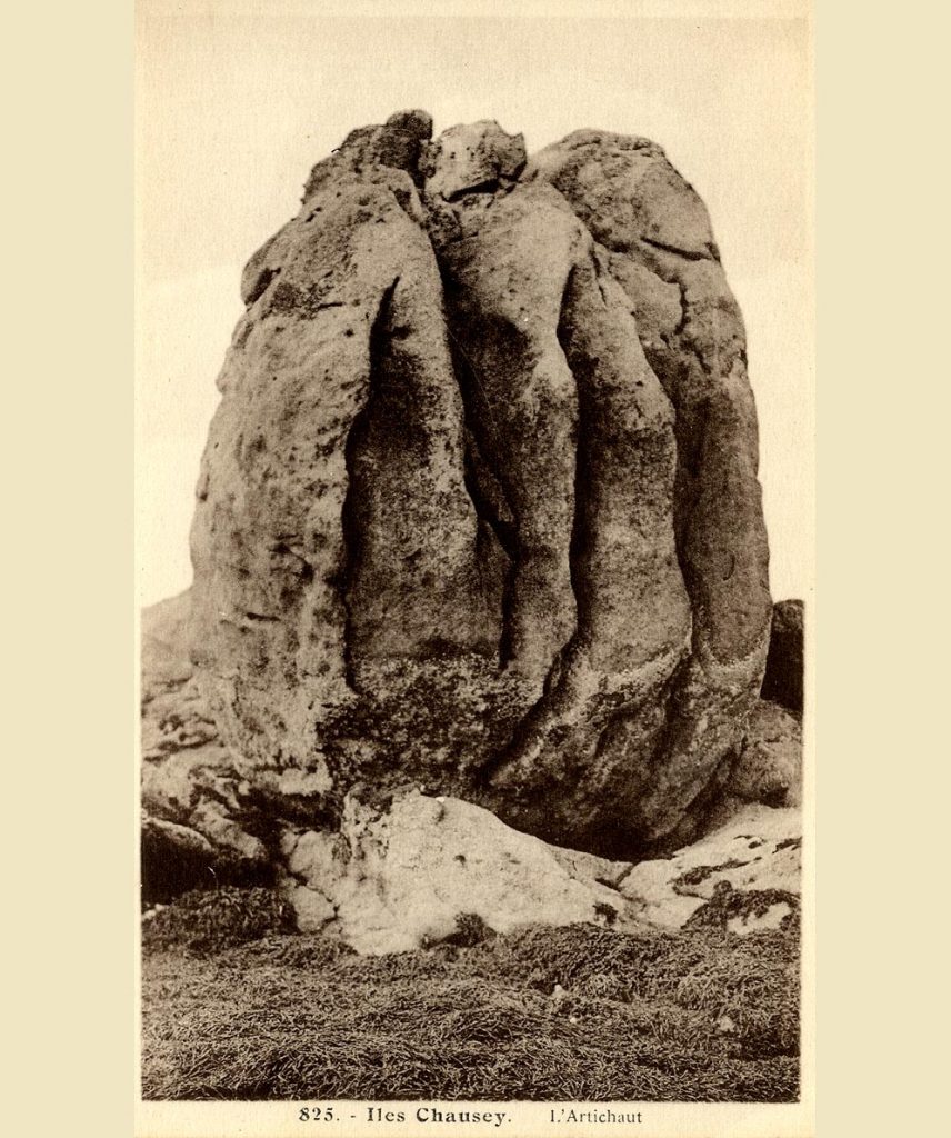
Other named rocky protuberances in the Iles Chausey include “The Monks”…
…and “The Artichoke.”
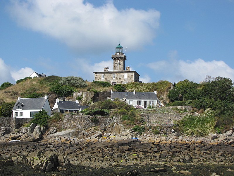
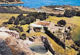
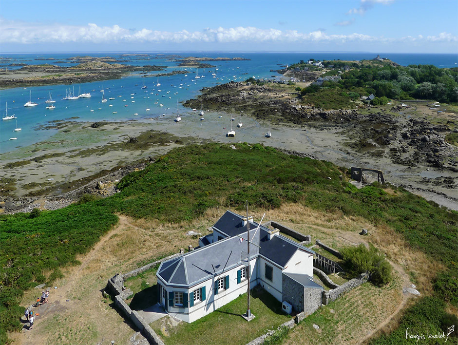
Grande Ile is the largest of the Iles Chausey, at about 1-mile, or 1.5-kilometers, long, and less than a half-mile, or .5-kilometers wide, and the only inhabited island…
…where we find the Grand Ile lighthouse, said to have been built in 1847…
…with the nearby Forteresse des Matignon, said to have been constructed in 1559 as a quadrangular fort, with cellars, bakery, and a cattle shed.
Another fort is Le Chateau Renault, the present fort of which was said to have been constructed in 1859 on the order of French Emperor Napoleon III, and completed in 1866.
It became known as the Chateau Renault after the automobile engineer Louis Renault purchased it 1922 and restored it by 1924.
La Semaphore of Grand Ile is a lighthouse on the highest point of Grand Ile, and said to have been built in 1867 and closed down in 1939.
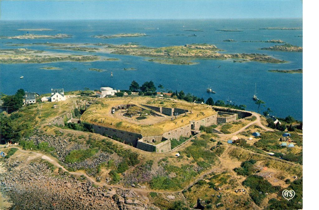
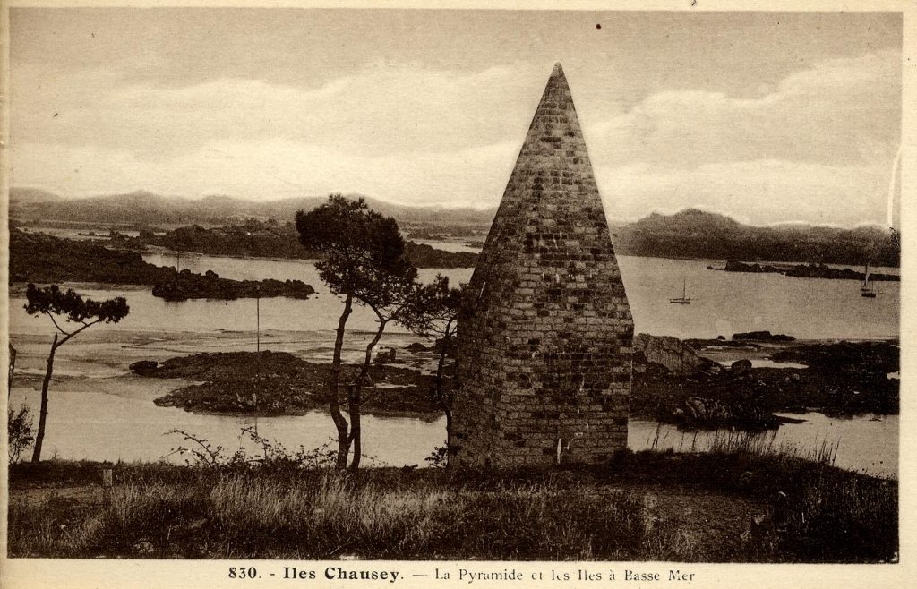
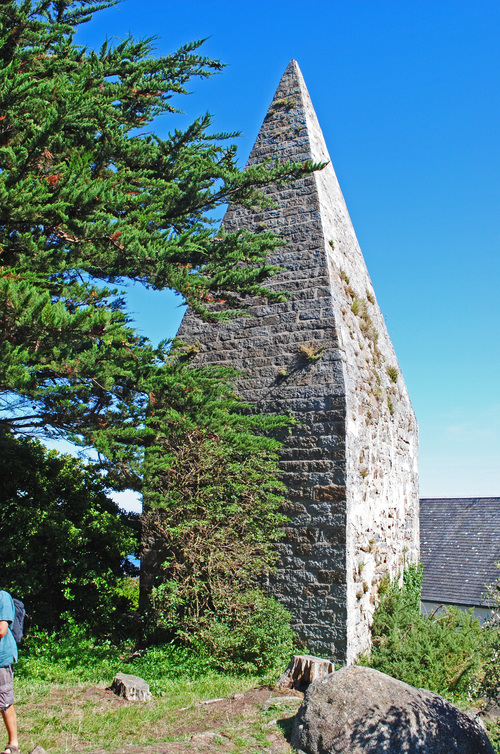
This is called La Pyramide on Grand Ile…
…and it still stands today.
I am going to end this series here.
It is clear to me that the islands of the English Channel were a very powerful and significant place on the Earth’s grid system with all of the physical infrastructure found on these small islands.
I was drawn into looking at this part of the world because I saw a picture of the small Alderney Island in the Channel Islands having a large number of star forts.
And when I look around this region, I find all of the components of the original ancient advanced civilization, as well as the means by which its existence was covered up by the construction of a new false historical narrative and in many cases the active deconstruction of the original infrastructure.
In my next post, I am going to be researching interesting places around the world that people have left me comments about with which to tie into the bigger picture about what I am talking about with regards to the Ancient, Advanced Moorish Civilization, the original timeline of Humanity’s very positive evolutionary course before our timeline was hijacked by beings with a negative agenda for Humanity.
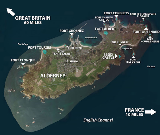
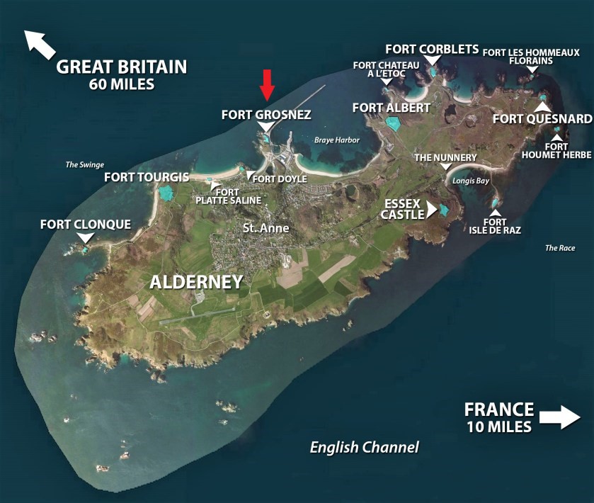
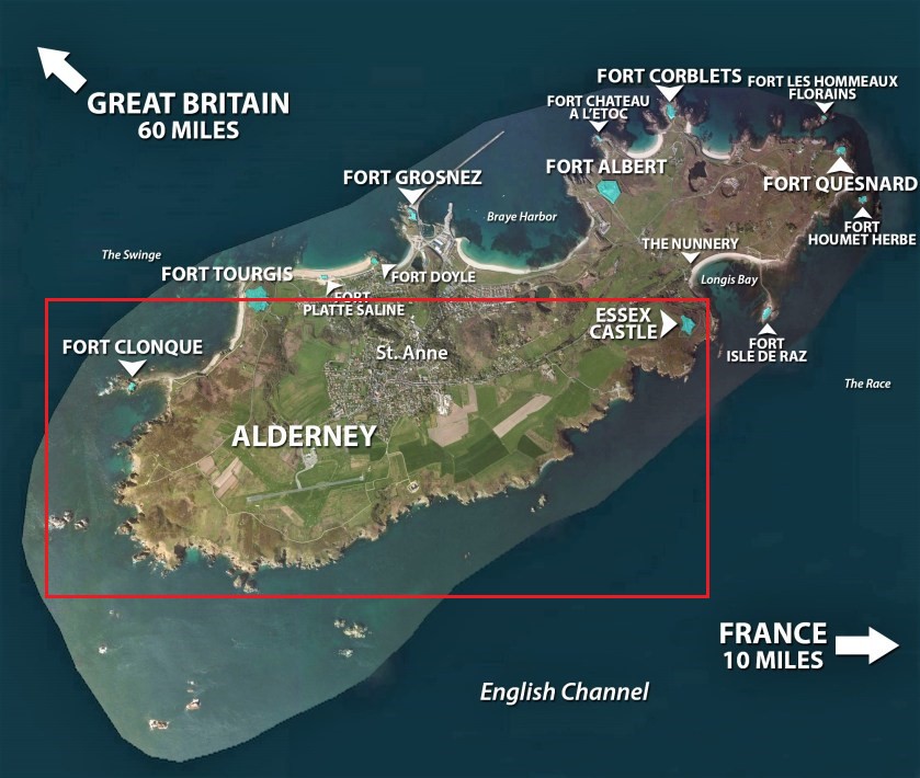
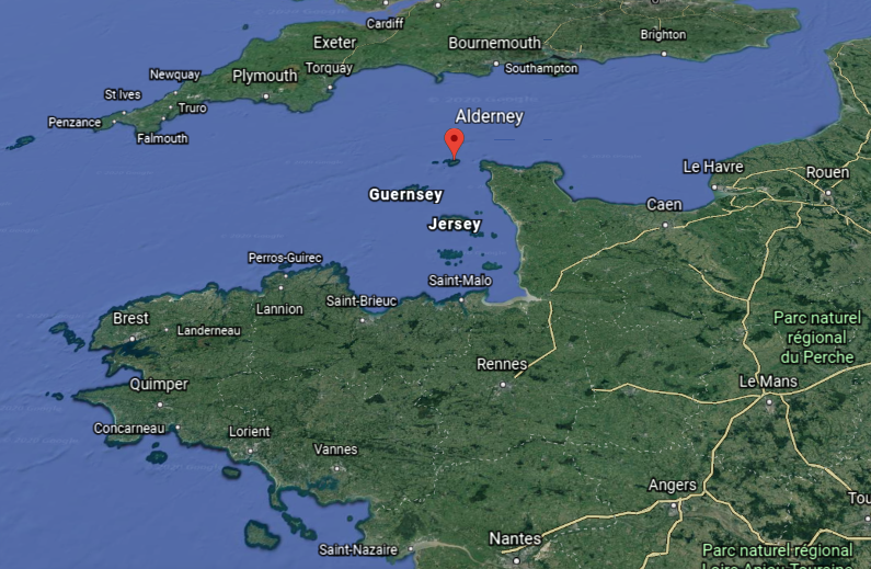
This is the first-part of a three-part series on the Channel Islands of the English Channel between southern England and northern France.
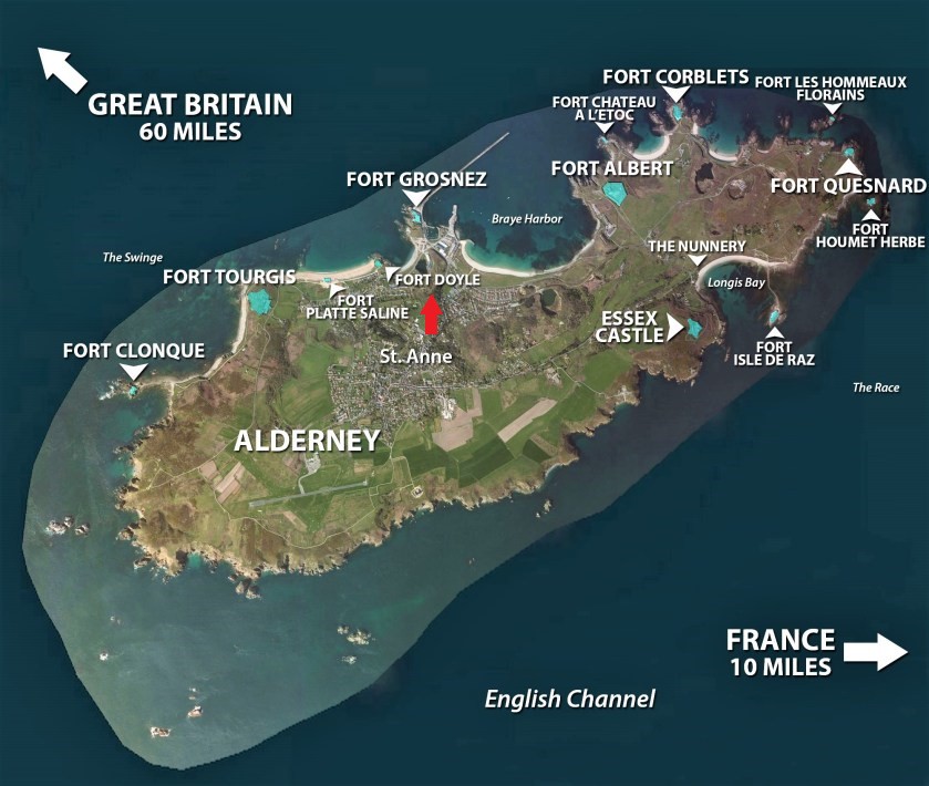
I have been intrigued by the Channel Islands since I saw this map of Alderney Island and all of the “forts” on this little island, which is 3-miles, or 5-kilometers, long, and 1 1/2-miles, or 2.4-kilometers, long.
This is what we are told about Alderney.
It is the northernmost of the inhabited Channel Islands.
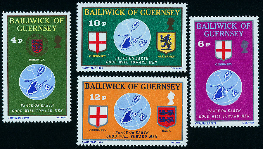
Alderney is part of the Crown Dependency of the Bailiwick of Guernsey, along with the Channel Islands of Guernsey and Sark.
A bailiwick is the area of a jurisdiction of a Bailiff, the chief justice of the bailiwick.
Alderney is the closest of the Channel Islands to both England and France, and is separated from the Cap de la Hague in France’s Normandy region by the Alderney Race, described as a dangerous passage because of the strong currents that run through it.
From this particular map, it certainly looks like there is more of Alderney Island below the water than above it.
Before I start looking at what’s found on Alderney, I want to share a comparison for similarity of appearance of what Alderney in the English Channel looks like from above on the left, with Shemya in the Bering Sea, one of the Near Islands, along with Attu and Agattu, the westernmost of the Aleutian Islands, which I found on a circle alignment I was tracking which originated and ended in Merida, Mexico.
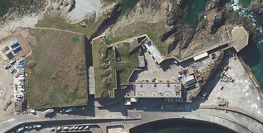
I am going to start on Alderney at Fort Grosnez, located on the north, central shore of the island.
Fort Grosnez was said to be the first Victorian fort completed on Alderney…
…constructed by 1853 to defend the harbor breakwater works, with 28 guns in 7 batteries.
We are told that it was the French Coup d’état in 1851 followed by the crowning of Prince Louis-Napoleon Bonaparte, the nephew of Emperor Napoleon I, as Emperor Napoleon III in 1852, and subsequently the establishment of the Second French Empire, that prompted the start of the defensive works.
It was during the time of the Second French Empire, we are told, that the grand railway network came together in France, centering on Paris, and the time when Paris was rebuilt with broad boulevards, striking public buildings, and very attractive residential districts for upscale Parisians.
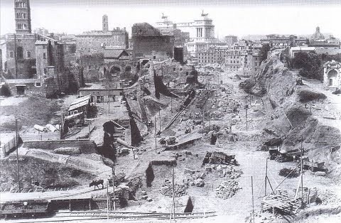
Georges-Eugene Haussmann was the Prefect of the Seine, and was credited with the renovation of Paris by a vast public works program between 1853 and 1870, commissioned by Napoleon III.
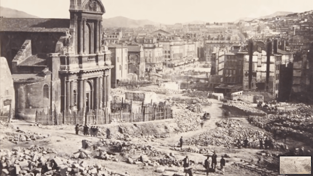
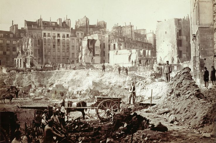
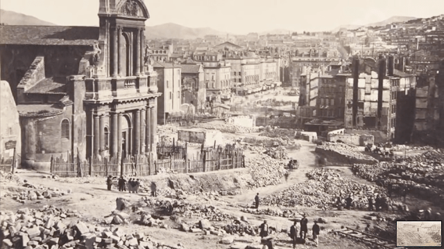
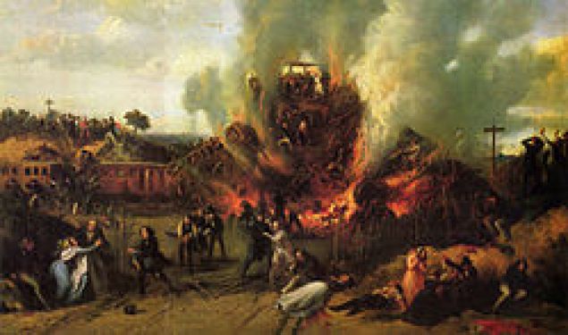
This photo is labelled as “the Destruction of Paris during the implementation of the Haussmann plan” so this was said to be Paris before the public works plan…looks pretty rough!
…and Paris after the Haussmann Plan.
The Second French Empire ended with the defeat of Napoleon III military forces in 1870 to the Germans in the Franco-Prussian War.
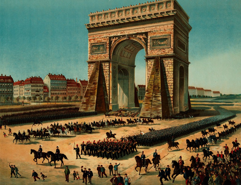
This is said to be an illustration of Prussian troops marching past the Arc de Triomphe in Paris during the Franco-Prussian War.
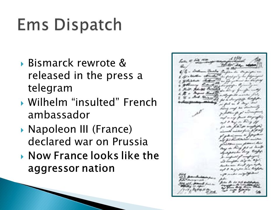
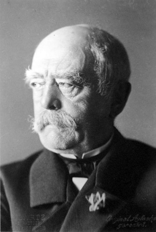
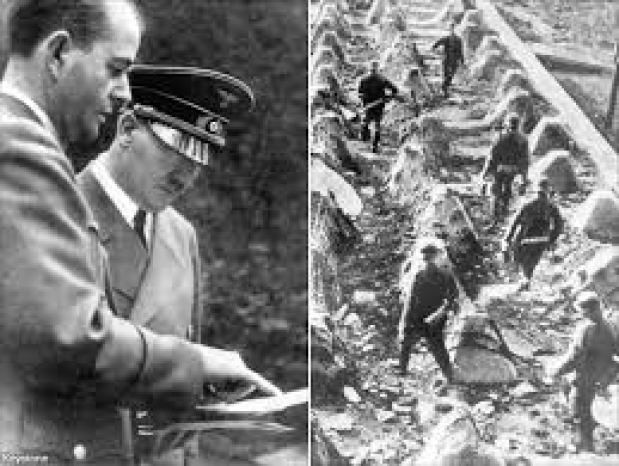
It was said that the German Chancellor Otto von Bismarck manipulated the situation by dispatching the Ems Telegram on July 14th of 1870, inciting the Second French Empire to declare war on the Kingdom of Prussia on July 19th of 1870.
I thought it was important to include this information about the Second French Empire as what appears to be a connection to the mud flood reset, and how it was covered up in our historical narrative to explain the existence of the old world architecture of heavy masonry.
Now back to Alderney Island.
Going east along the north coast of Alderney, we come to Braye Harbor, the main harbor on the north side of the island.
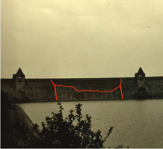
The massive masonry breakwater of Braye Harbor was said to have been built between 1847 and 1864 to protect the Royal Navy ships in the harbor in the 19th-century.
Just east of, and overlooking, Braye Harbor is Fort Albert, said to have been built between 1856 and 1859, and named Fort Albert after Prince Albert’s death in 1861.
It was said to have been intended to be the strongest coastal defense work, and to have acted as the main citadel if the island was ever overrun by enemy forces.
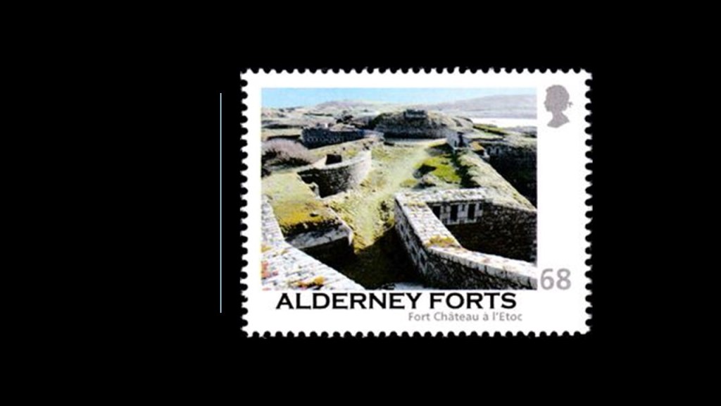
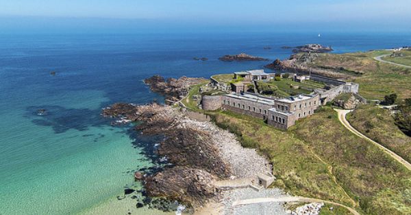
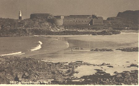
East of Fort Albert, we come to Fort Chateau a l’Etoc, described as the Victorian fort on the most northerly point on Alderney.
It was said to have been completed by 1855 for the protection of the eastern arm of a breakwater that was never built, and designed for 23 guns with accommodation for 128 men.
Now it is privately-owned, and used to host part of the Arts Festival on Alderney.
Next, we come to Fort Corblets…
…now described as a highly-rated Victorian fortress that has self-catering accommodations on-site, where people cook their own meals.
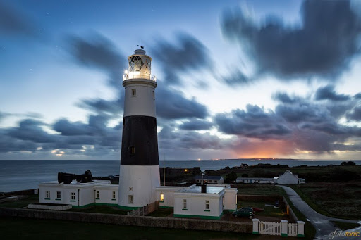
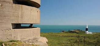
The Alderney Lighthouse, also known as the Mannez and the Quesnard Lighthouse, is adjacent to Fort Corblets.
The Alderney Lighthouse was said to have been built out of granite in 1912 to protect shipping from the dangerous waters of the Alderney Race and the many rocks surrounding Alderney.
Here is a picture of the sun coming up behind the Alderney Lighthouse, in direct alignment with it.
This a good place to mention that I have found such alignments with lighthouses in other locations.
While I do believe that lighthouses served to guide ships through maritime passages for the original advanced civilization, I also think they were serving multiple purposes on the Earth’s grid system, including, but not limited to, astronomical alignments.
Unlike Fort Corblets, which was converted into a vacation accommodation, Fort Les Hommeaux Florains, the next place we come to on the coast, is in ruins.
It was said to have been completed in 1859, and designed for 67 officers and men, and seven guns.
We are told it was the first fort to be abandoned because of its difficult location.
Fort Quesnard is next on the coastline on the left, and when I saw it, I was immediately reminded of Fort Massachusetts, located on Ship Island in Mississippi, part of the Gulf Island National Seashore of the Gulf of Mexico.
Fort Quesnard was said to have been built and completed in 1855 as a defense against an attack from France, and Fort Massachusetts constructed between 1859 and 1866, following the War of 1812, as a coastal defense for New Orleans and the Gulf Coast.
Fort Houmet Herbe is next on the coast, and is located on a tidal island that is accessible by a causeway at low-tide.
Even though are no steps at the entrance to get into this fortification, we are told at one time was said to have five guns on four towers.
Here’s a view with Fort Houmet Herbe in the foreground in a geometric, triangulated relationship with Fort Quesnard, the ruins of Fort Les Hommeaux Florains, and the Alderney Lighthouse.
Now we come to what is called The Nunnery, located on Longis Bay on the southeast part of Alderney Island.
The Nunnery is said to be the best-preserved small Roman fort in Britain, said to be the first evidence of military construction on Alderney.
We are told that it was originally built in the 4th-century AD to defend Longis Bay and the nearby Roman settlement, now an archeological site on what is called Longis Common.
Archeologists explain the deep ground covering the ancient stonework by saying that sand could have buried the island’s first main settlement after its occupants’ moved to the main settlement of St. Anne, and sand blew in and buried everything under 3 to 4-feet, or 1 to 1.22-meters of sand.
Hmmm. I wonder if there is another explanation…? Like evidence of some kind of mud flood event?
Fort Ile de Raz is on an island in Longis Bay, across from the Nunnery on the shore of the bay…
…which is accessible by a causeway at low-tide.
We are told 10 men manned 64 guns at this fort starting in 1859.
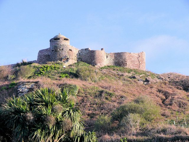
Essex Castle was said to have originally been constructed by King Henry VIII between 1549 and 1554.
Said to have been unfinished because the work on the construction of it was stopped by Queen Mary, and turned into a private residence for awhile, it was said to have been partially demolished in the 1840s, and turned into a Victorian fortification.
So here is where I find something interesting.
If there was so much concern about fortifying this tiny little island, then why aren’t there any fortifications to be found on the south-western end of the island, between Essex Castle and Fort Clonque?
The island’s main settlement, St. Anne, is completely exposed on this side. All that any prospective invaders needed to do would be to land here.
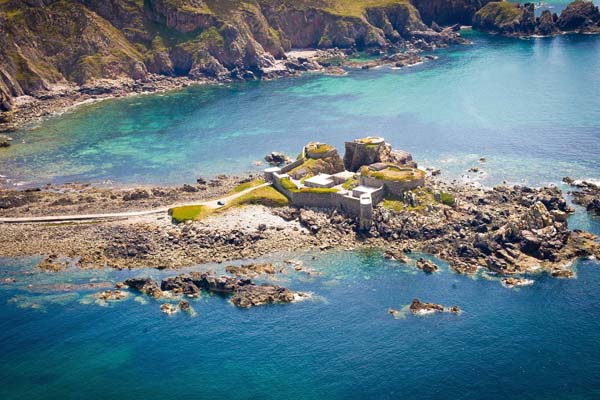
Fort Clonque also was said to have been completed in 1855…
…and is also at the end of a causeway that floods at high tide, like Fort Ile de Raz and Fort Houmet Herbe.
So what is it with all of these tidal islands?
A tidal island’s existence depends on tidal action.
It is connected to the mainland by a causeway that is exposed at low-tide, and submerged a high-tide.
Famous examples of tidal islands include St. Michael’s Mount in Mount’s Bay in Cornwall, England…
…and Mont St. Michel, a tidal island and mainland commune in France’s Normandy region.
Both St. Michael’s Mount and Mont St. Michel are named for the Archangel Michael.
I would love to know what the true significance was of these tidal islands. There are many more examples than the ones I have shared here.
One last thing about Fort Clonque I would like to mention before I move onto Fort Tourgis is that like Fort Corblets, today Fort Clonque is a self-serving accommodation for up to 13 people.
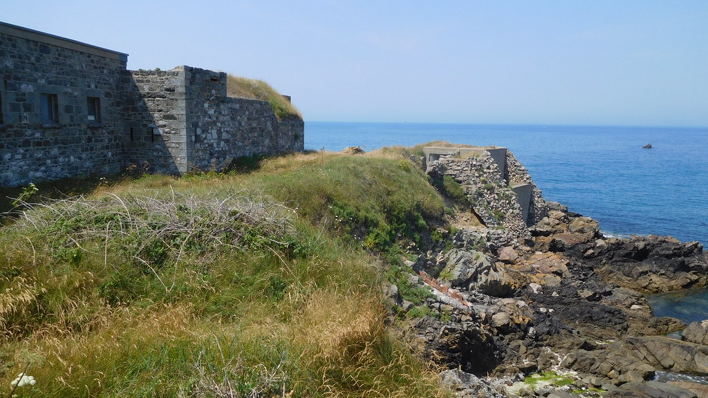
Now we come to Fort Tourgis, also said to have been completed in 1855 to accommodate 346 men and 33 guns in 5 batteries.
The Cambridge Battery and Battery 3, part of the northern defenses of Fort Tourgis, was opened to the public in recent years, and were adapted for use by the German Forces during World War II.
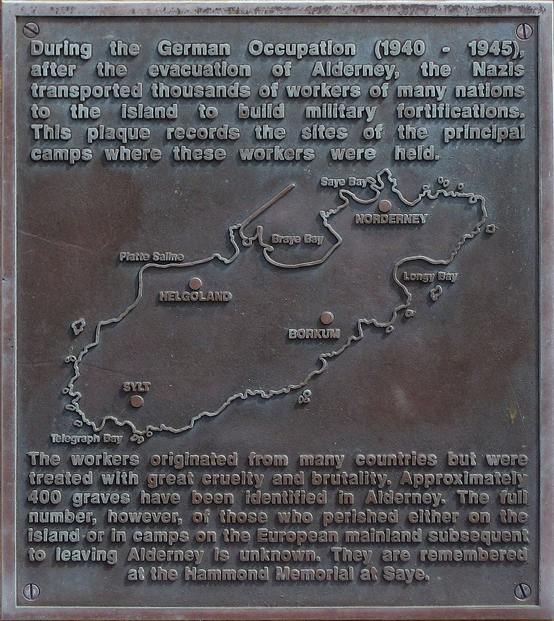
During that time, Alderney became one of the most heavily fortified sections of Hitler’s Atlantic Wall, one of the largest building works of the 20th-century, fortifications built between 1942 and 1944, envisioned to make an Allied invasion of the Western European mainland from the sea impossible.
The Atlantic Wall was said to have been an extensive system of coastal defenses built along the coast of continental Europe and Scandinavia.
The Channel Islands were occupied by the German Armed Forces during the war, from June 30th of 1940 to May 9th of 1945, and were the only part of the British Isles occupied by Germany.
Alderney was the only Channel Island to be evacuated during World War II, with all of the islanders forced to evacuate in June of 1940.
With Alderney emptied of inhabitants, the Germans proceeded to build four work camps.
The Germans surrendered Alderney on May 16th of 1945, eight days after the Allies accepted the unconditional surrender of the Armed Forces of Nazi Germany, and seven days after the liberation of the Channel Islands of Guernsey and Jersey.
The people of Alderney were able to return to the island in December of 1945 after the extensive clean-up needed after the German Occupation and all that entailed.
Even with clean-up, Alderney was said to have been found in rough shape, with houses derelict, forts damaged, and wooden structures that had been burned as fuel.
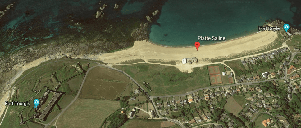
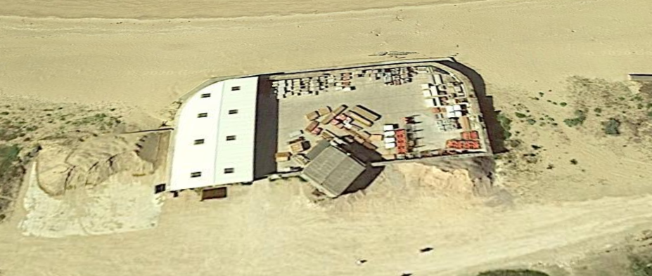
Fort Platte Saline is shown on the Alderney star fort map between Fort Tourgis and Fort Doyle, but it doesn’t appear to be there physically any more, with its memory retained in the name of this beach.
This is a close-up on Google Earth of the lone structure on the Platte Saline beach, and it could have been the star fort at one time, but it looks like it has been re-purposed into something like a storage or parking area.
Fort Doyle is the last fort on my star fort tour of Alderney, near my starting point of Fort Grosnez.
As is the case with Fort Platte Saline, I can’t find much information about Fort Doyle either, but at least it is still standing.
Alderney is not the only small island I have encountered with a high concentration of star forts.
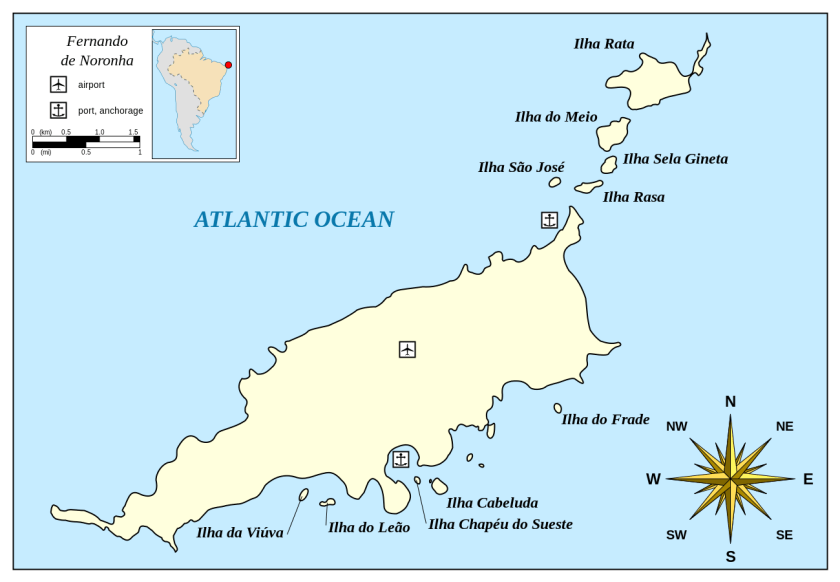
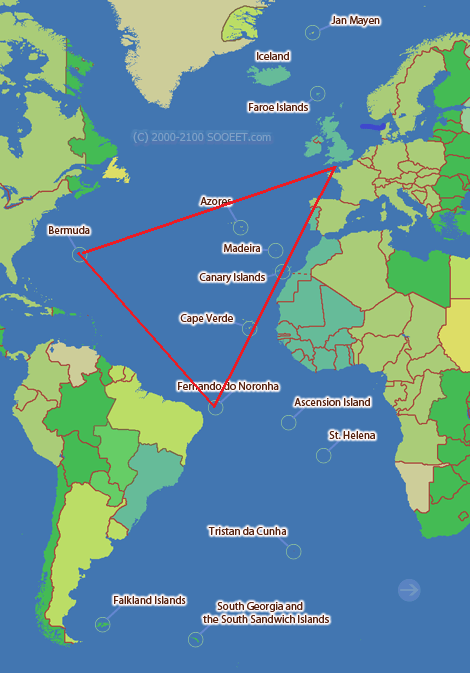
Fernando de Noronha, the name of the main island and its archipelago, is off the coast of Brazil near the city of Natal.
The main island has an area of 7.1 square miles, or 18.4 kilometers-squared, and the archipelago’s total area is 10 square miles, or 26 kilometers-squared.
So what I found out that is really interesting about Fernando de Noronha is that in its relatively small area, there were at least eight star forts here at one time.
Bermuda is another island that comes to mind that was chock-full of star forts.
This is a 1624 map of Bermuda, attributed to Captain John Smith of Jamestown, Virginia-fame.
I found that both Fernando de Noronha and Bermuda figure prominently on earth’s grid lines.
I used this Google Earth screenshot to orient myself to Alderney’s location with respect to England and France…
…in order to match up Alderney’s location with this map, and to show what appears to be a triangulated relationship between these three places with a high-concentration of star forts for their small sizes.
There are other places/regions with a high-concentration of them, like they are some kind of energy nodal points on the Earth’s grid system.
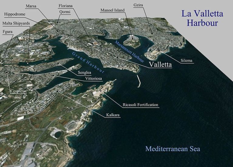
And interestingly, places like Valletta in Malta, where there is a high concentration of star forts, were heavily bombed during World War II…
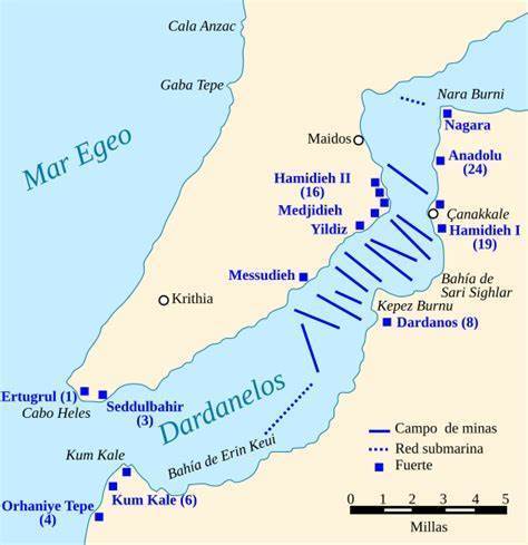
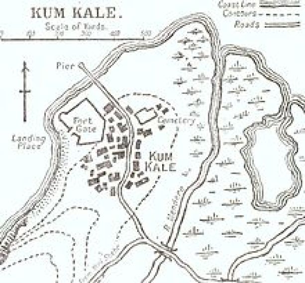
…and it was the same scenario with the attacks on star forts in the Strait of Dardenelles in Turkey during the Gallipoli campaign of World War I.
Were these wars a cover for the intentional destruction of the infrastructure of the original ancient, advanced Moorish civilization?
And why is an area of military operations in war-time called a “theater?”
Are they telling us something without telling us they are telling us?
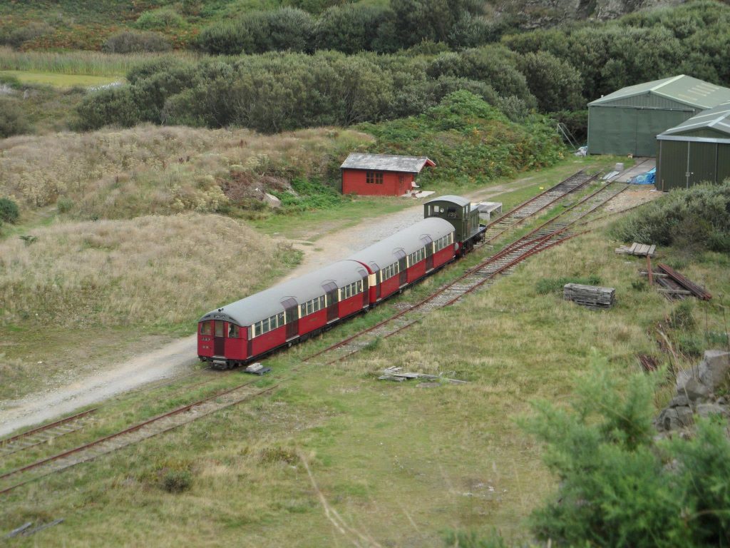
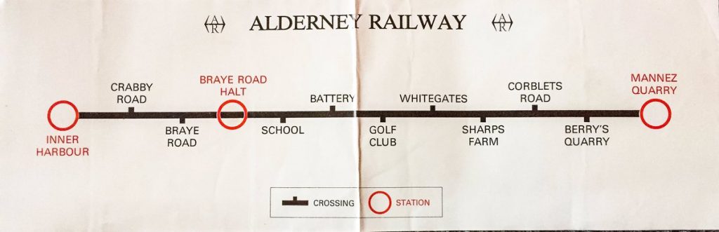
One more thing I would like to bring up about Alderney is that it is home to the only working railway in the Channel Islands.
Working railway?
On a 3-square-mile, or 8-kilometer-squared, island?
The railway was said to have been built by the British Government in the 1840s, and first opened in 1847.
Its original purpose, we are told, was to carry stone from Mannez Quarry, at the eastern end of the island, to build the breakwater in Braye Harbor and the Victorian-era forts.
It runs for two-miles, or 3.2-kilometers, following a coastal route from Mannez Quarry to Braye Harbor…
…manned by volunteers for operation on summer week-ends and bank holidays.
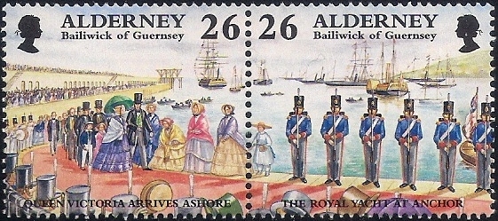
There were three Royal visits to Alderney by Queen Victoria and Prince Albert inAugust of 1854…
…and the Royal couple was said to have ridden on an Alderney Railway car under a striped silk canopy, pulled by two black horses to the quarry before returning.
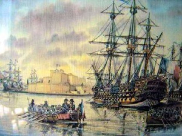
Three-years earlier, in May of 1851, Queen Victoria opened the The Great Exhibition of the Works of Industry of All Nations, held in the Crystal Palace in London.
I believe this was the official kick-off of the New World Order timeline, and that this one, and subsequent Exhibitions, Expositions, and World Fairs were showcasing the technology and architectural wonders of the original civilization before being hidden away or forever destroyed.
All of this so-called Victorian construction of massive fortifications on Alderney is attributed to this time-frame starting in the 1840s on through the 1850s.
I definitely think all of this is connected to the reset timeline and new historical narrative.
Another point I would like to make is that through the course of my research, I have definitely found an integrated connection between all rail infrastructure, canals, and star forts that I believe were built by the ancient advanced civilization, and were an integral part of the Earth’s grid system, and not built by who we are told when we are told.
I am going to end this post here, and in the second part of this series, I am going to take a look at the other Channel Islands of Jersey, Guernsey, Sark, and Herm.
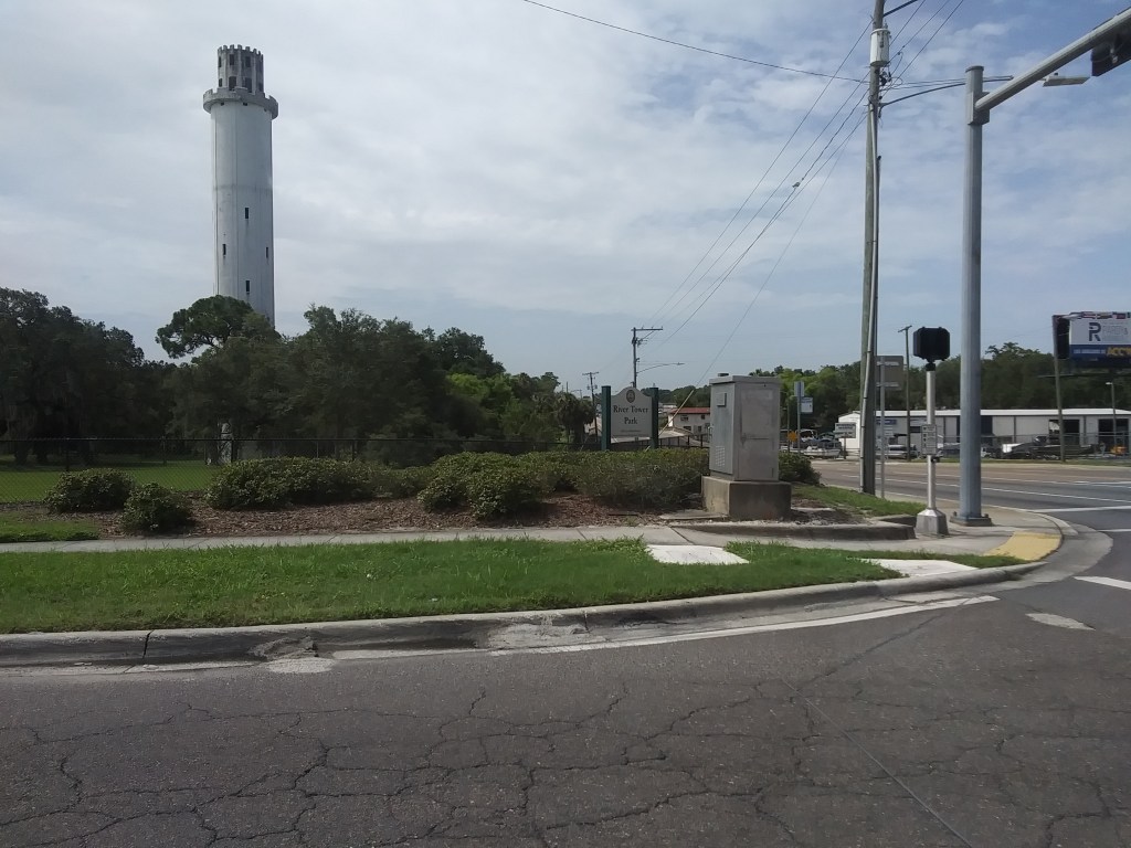
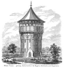
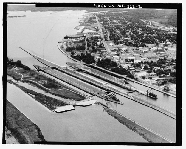
In this post, I am going to be sharing how I came into awareness of what is called the Sulphur Springs Water Tower, and what I found when I recently visited it and what is in its vicinity in Tampa, Florida.
Four years ago, in June of 2016, was the last time I had been in Florida – to take my mom to a family reunion – prior to my latest trip there in July of 2020 to place my mom in an assisted living facility in her hometown in Central Florida.
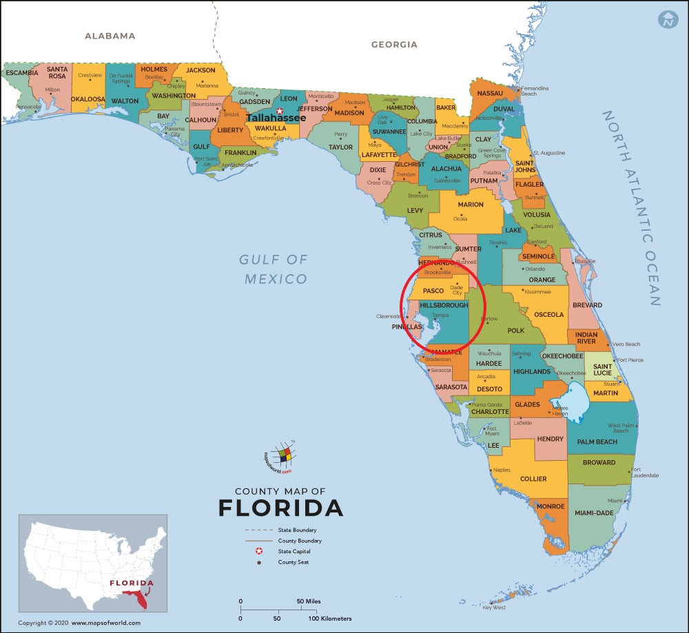
Tampa International Airport is the closest airport to her hometown in Pasco County, Florida, the neighboring county to Tampa’s Hillsborough County.
I had just started to really wake up to the ancient advanced civilization hidden in the landscape all around us in 2016.
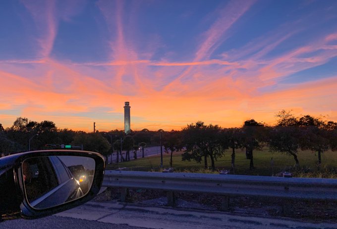
So in 2016, when I spotted this landmark heading north on I-275, right next to the highway, shortly after leaving the Tampa International Airport, it really stuck in my memory as something noteworthy.
I didn’t know the name of it until an acquaintance urged me to check out places to explore on my trip to Florida, from which I just returned.
At that time, I looked up “Tampa Lighthouse” because that is what it looked like to me, and I found out that the towering landmark I remembered was called the “Sulphur Springs Water Tower.”
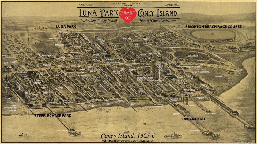
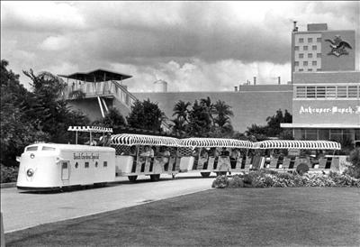
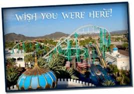
I also saw historic pictures like this one, describing Sulphur Springs as “Florida’s Coney Island.”
At this point, my curiosity was further piqued because now there was a tie-in into my research on the relationships between early amusement parks and trolleys, most of which are long-gone, either destroyed by things like fire…or demolished for so-called modern urban development.
I made sure that I left time at the end of my trip to spend time spend looking around there, which I was able to do on the day before I left Florida, which was on Wednesday, July 29th.
I had already looked at the area on Google Earth in order to get an idea about where to look and what to look into because I am not familiar with the area.
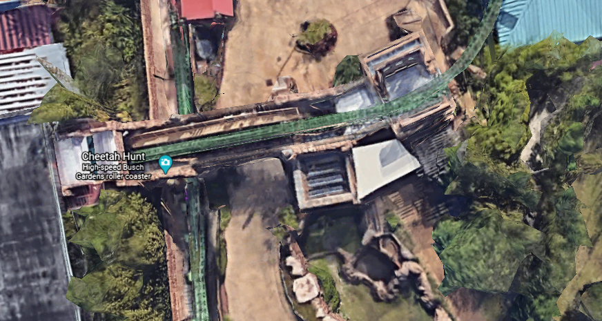
I reserved a room on Busch Boulevard near Busch Gardens for the last night of my trip, in the middle of the part of Tampa I wanted to explore.
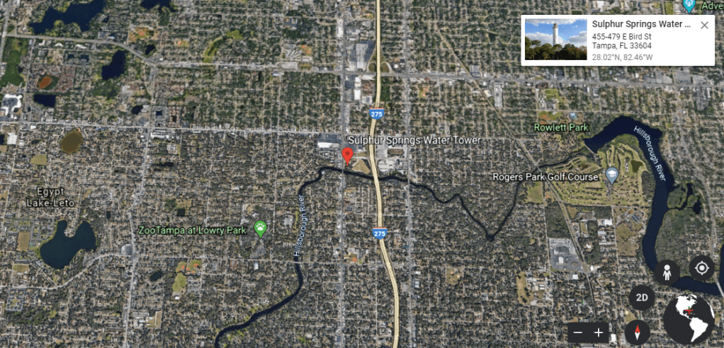
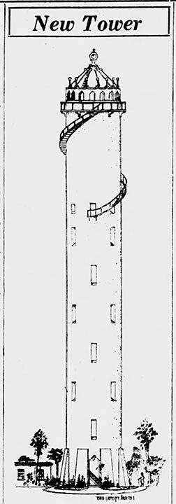
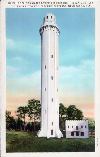
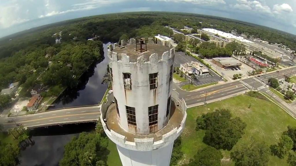
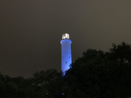
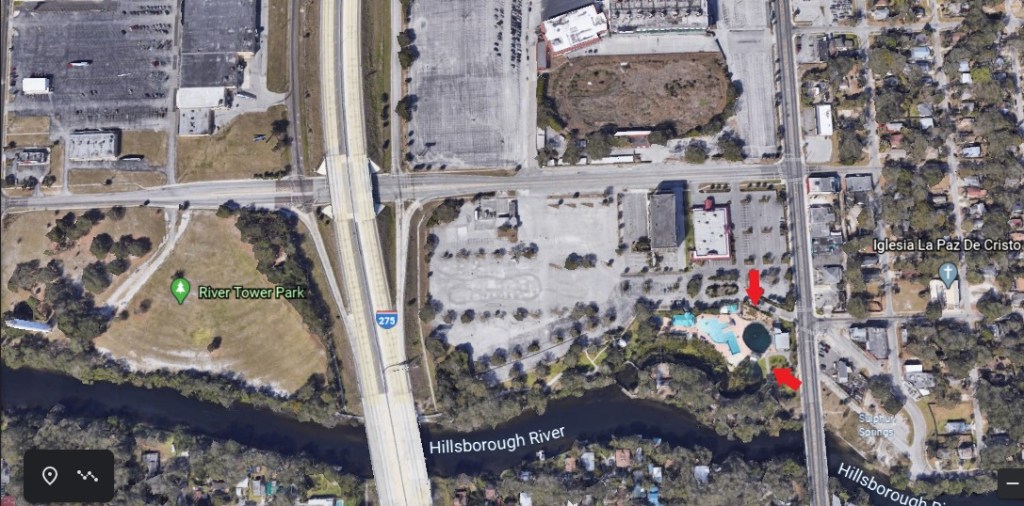
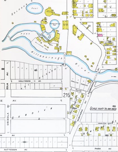
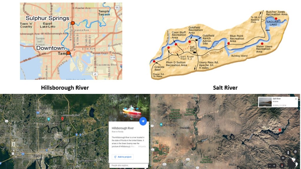
My starting point for this exploration is the Sulphur Springs Water Tower, which is located at the corner of East Bird Street and North Florida Avenue, also known as Business Highway 41.
It is 214-feet, or 65-meters, tall, and its foundation is said to be 45-feet, or 14-meters, deep.
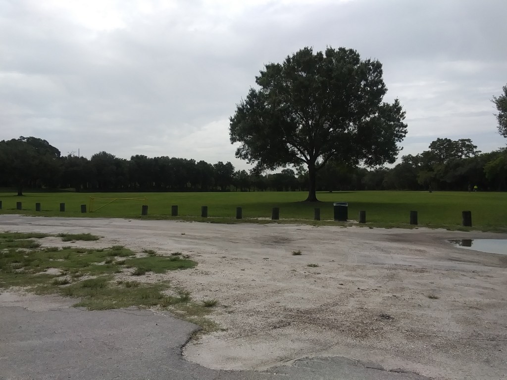
It is located in what is called “River Tower Park,” adjacent to the Hillsborough River in the Sulphur Springs District.
Here is a historic depiction of the Water Tower and its grounds…
…and this is what the grounds look like today.
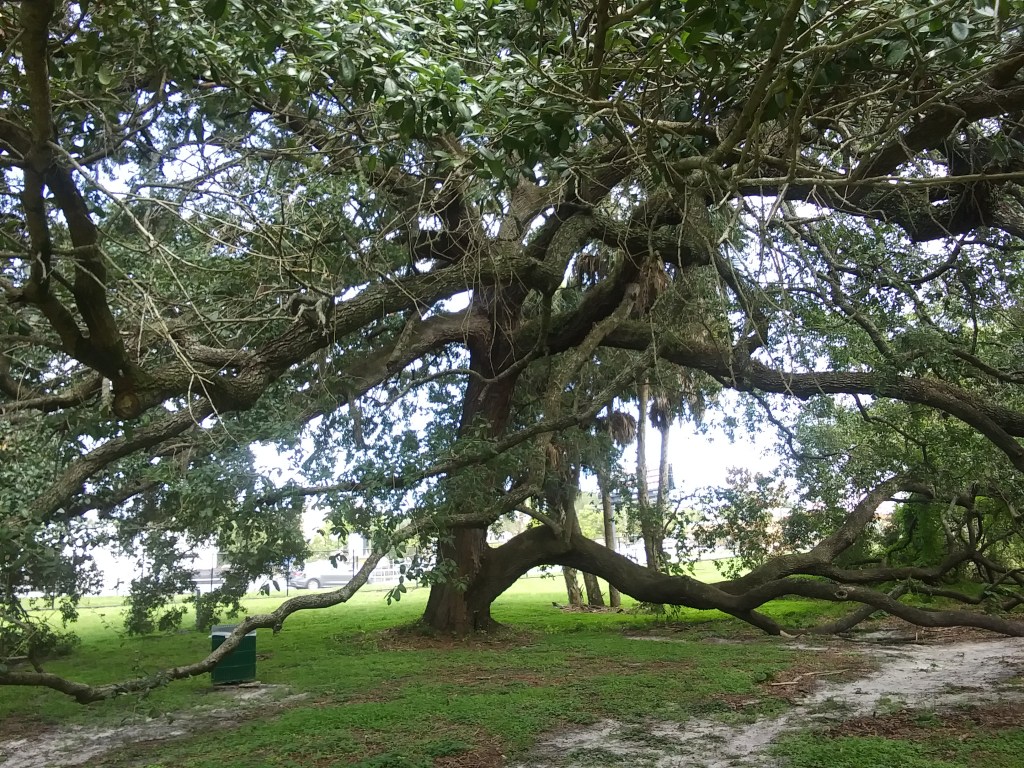
With the exception of some stately old oaks…
…the location felt neglected, and while I was there, I had the “River Tower Park” all to myself.
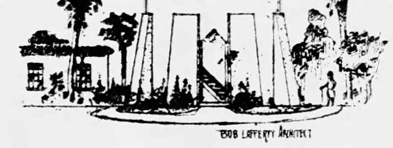
An architect by the name of Bob Lafferty was said to have designed the water tower…
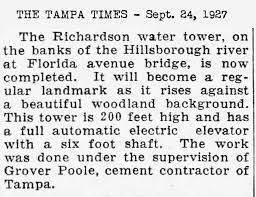
…and a cement contractor named Grover Poole was said to have built the water tower in 1927 for developer and realtor Josiah Richardson.
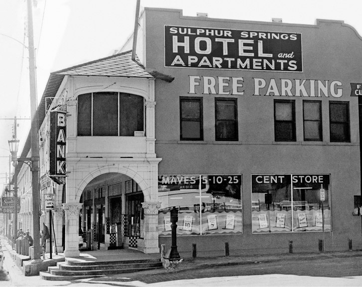
It was said to have been built to ensure an adequate water pressure to supply the building which housed the Sulphur Springs Hotel and Apartments on the second floor, and Mave’s Arcade on the first-floor…
…called the first shopping mall in Florida.
We are told Josiah Richardson mortgaged all of his assets in Sulphur Springs to finance the Water Tower, which was said to have cost him $180,000 to guarantee the water supply to his properties.
When it was operational, it was said to have stored 136,000 gallons of water pumped from an artesian well, with the water tank occupying the upper quarter of the tower, while 7-floors occupy its lower three-quarters, and somewhere in there was said to have an electric elevator as well going up to the top.
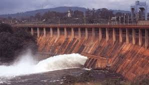
Alas, Josiah Richardson lost his Sulphur Springs properties in 1933, when the Tampa Electric Company dam collapsed, and flooding ripped through downtown Tampa.
From its construction in 1927 until 1971, the Water Tower provided artesian well-water to both businesses and residences in the immediate vicinity, at which time the City of Tampa was said to have forced the end of its water-piping operations.
Water flows from an artesian well under natural pressure without pumping, providing an endless water supply.
City water utilities charge for water use.
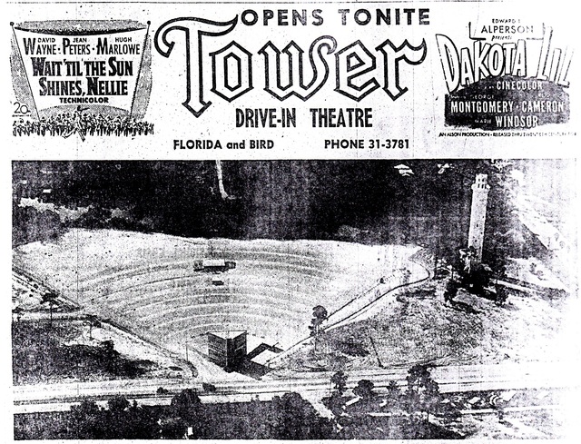
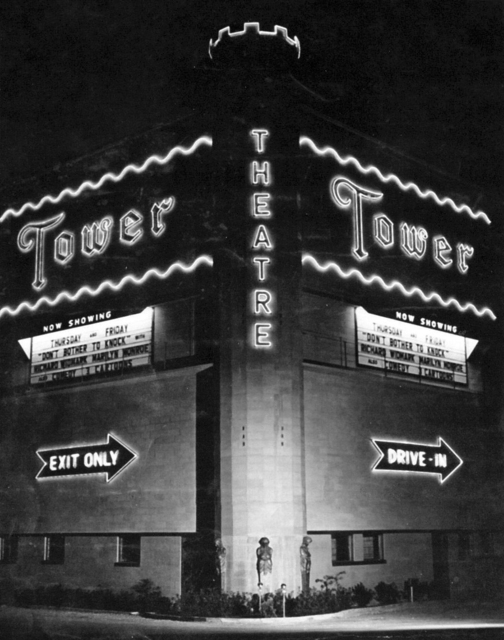
It is interesting to note that the Tower Drive-in Theater opened on property next to the Water Tower in 1951.
The drive-in theater was levelled in 1985 in order to make-way for an apartment complex that was never built.
The grounds of River Tower Park has survived interest in developing it into high-end apartments in the 1980s, as well a large-chain drugstore that wanted to develop it in 2002.
In 2005, the City of Tampa installed lights for night-time illumination of the water tower.
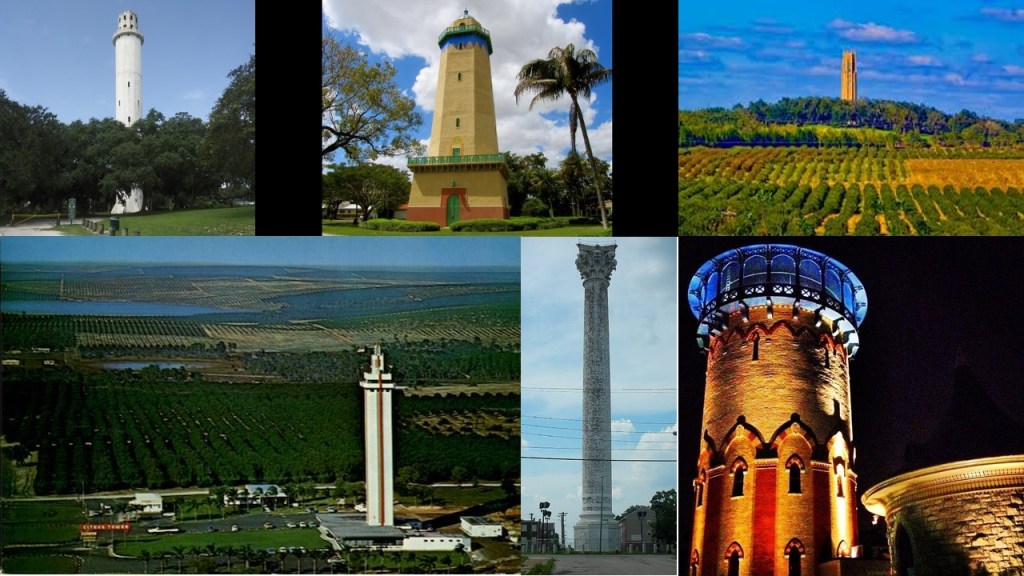
I have received comments from viewers mentioning other similar towers.
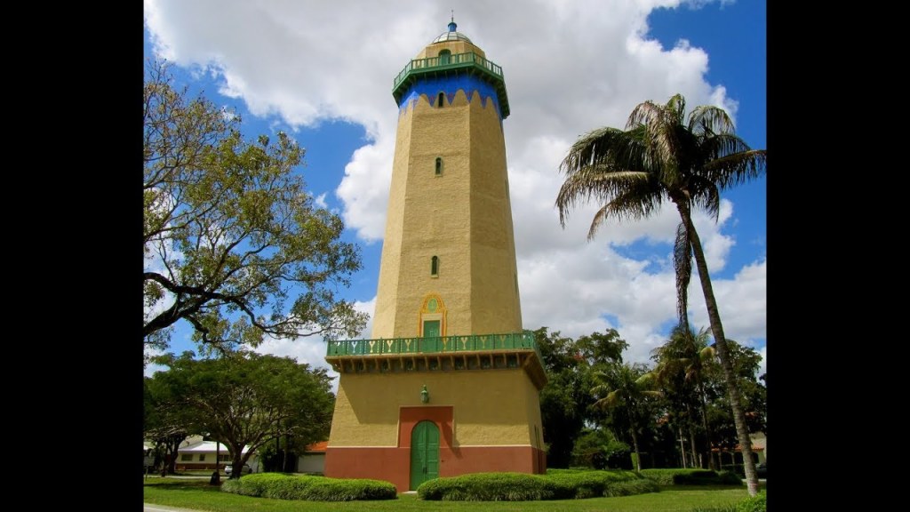
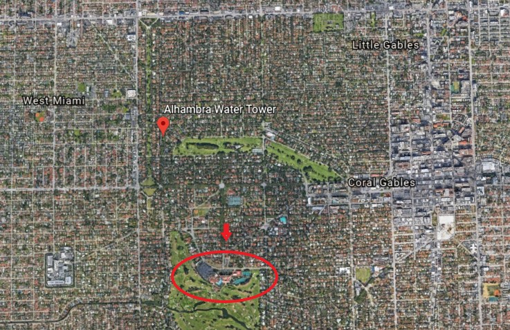
One is the Alhambra Tower in Coral Gables, Florida, near Miami.
It was said to have been built in 1924, and was part of the city of Coral Gables domestic water supply system until 1931 when it was disconnected from the system and abandoned after the water company started buying water from the City of Miami.
It was saved from demolition and purchased by the city of Coral Gables for what was described as a token sum in 1958, and said to have been restored in 1993 from old photographs.
Firstly, does it make any sense to built something massive and solid like this, and use it for only 7 years?
Was the Alhambra Water Tower also built over an artesian well, like the Sulphur Springs Water Tower in Tampa?
Were endless natural sources of water being shut-down in favor of metered water and control of this essential for life resource?
There were other artesian wells in Coral Gables, as evidenced by the Venetian Pool, said to have been completed in Coral Gables in 1924
It is in a shallow quarry which brings in fresh water from artesian wells.
Secondly, I wonder how these water towers and lighthouses are connected, since that’s what they look like.
Lighthouses figure prominently on the Earth’s alignments I have been tracking, along with star forts and rail transportation infrastructure.
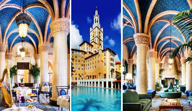
The Alhambra Water Tower is not far from the Miami Biltmore Hotel…
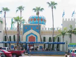
…said to have been built in 1926 through land developer George Merrick, who is given the historical credit for developing Coral Gables during the Florida Land Boom of the 1920s, and Biltmore Hotel magnate John McEntee Bowman…
…and said to have been inspired by the Giralda, the bell-tower of the cathedral of Seville which has an acknowledged Moorish history.
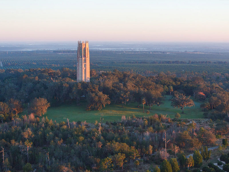
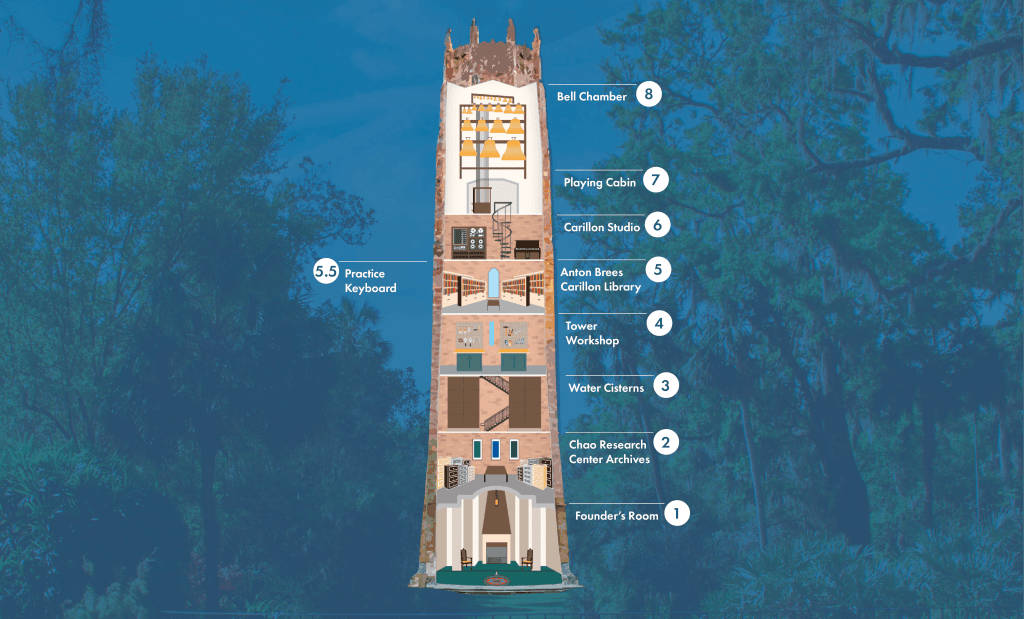
The Bok Tower in the gardens at Lake Wales came up in comments from several people.
It is located on what is called Iron Mountain, called one of the highest points on the Florida Peninsula.
The Bok Tower is also a bell-tower like the Giralda Tower in Spain, and is also known as the “Singing” Tower.
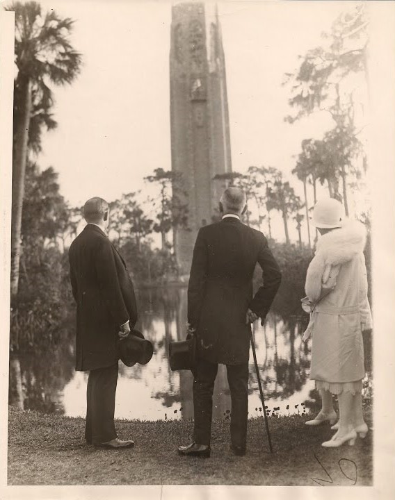
It was said to have been commissioned by Dutch immigrant and “Ladies Home Journal” magazine editor at one time, Edward Bok, and said to have been built between 1927 and 1929, when it was dedicated by President Calvin Coolidge.
Edward Bok died in 1930, the year after the completion of his bell-tower.
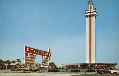
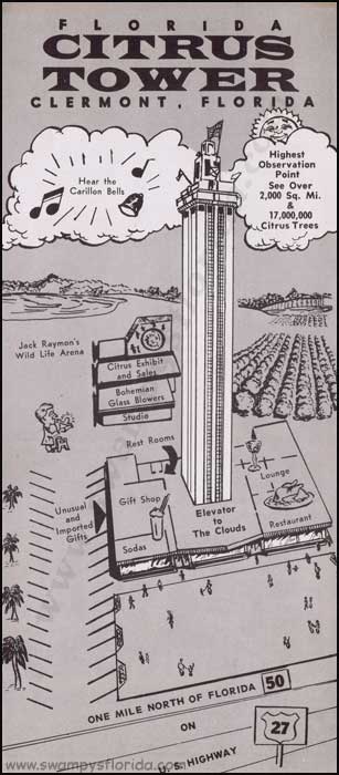
The Citrus Tower in Clermont, Florida, near Orlando, was said to have opened in 1956, and was a big, pre-Disney World, tourist attraction in its hey-day.
It is another massive Florida tower with an electric elevator, like the Sulphur Springs Water Tower…
…and is also a bell-tower like the Bok Tower.
What was the purpose of these massive bell-towers reaching up to the clouds for the original civilization?
Were they musical generators of healing and harmonious frequencies for the benefit and balance of all of Creation?
Just a few more examples of water towers mentioned in viewers’ comments before I move on to looking at the Tampa neighborhood of Sulphur Springs itself.
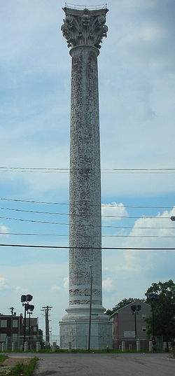
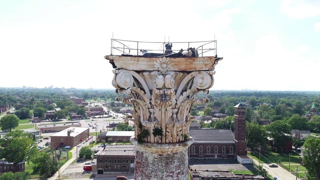
The Grand Avenue Water Tower is said to be the oldest of the three water towers in St. Louis that are still standing today.
Said to have been built by architect George Barnett in 1871, it is the tallest, free-standing, Corinthian column in the world.
Taller than Pompey’s Pillar, a free-standing Corinthian column in Alexandria, Egypt, said to have been erected between 298 and 302 AD…
…and the Column of the Goths in Istanbul, Turkey, said to have been erected sometime between 200 and 400 AD.
The last water tower I am going to look at is the Riverside Water Tower in Chicago, now an art gallery and museum.
Like the Grand Avenue Water Tower in St. Louis, the Riverview Water Tower was said to have been built in 1871, only by this one was said to have been designed by architect William LeBaron Jenney…
…and like the Sulphur Springs Water Tower, it was said to have had a free-standing elevator shaft erected inside the tower.
So what’s the real story here with all of these towers?
We are clearly seeing massive, advanced infrastructure with these examples that do not fit the stories we are told about them.
Back to Tampa.
We are told the history of modern Tampa begins with the founding of Fort Brooke at the mouth of the Hillsborough River, in what would today be downtown Tampa.
The town of Tampa was first incorporated in 1855, which lines up with what I believe was the official beginning of the new historical reset timeline in 1851.
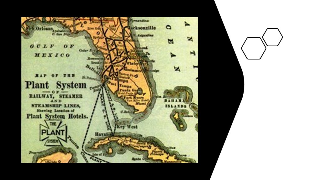
Henry B. Plant was said to have laid the first railroad tracks in the area in the 1880s, which was said to have brought in the cigar and phosphate industries.
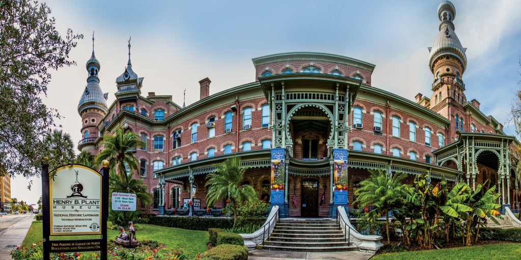
The Henry B. Plant Museum is housed in what was once the 1891 Tampa Bay Hotel, described as a Victorian railroad resort.
It is in the south-wing of Plant Hall on the campus of the University of Tampa.
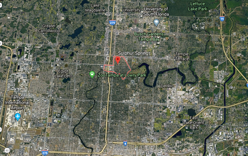
Sulphur Springs is located six-miles north of downtown Tampa.
It’s southern boundary is the Hillsborough River; the northern boundary is Busch Boulevard; Florida Avenue, Nebraska Avenue, and the CSX Railroad line forms boundaries on the west and the east.
We are told that Native Americans drank from the springs the area is named for, who benefited from the medicinal benefits of the natural mineral water.
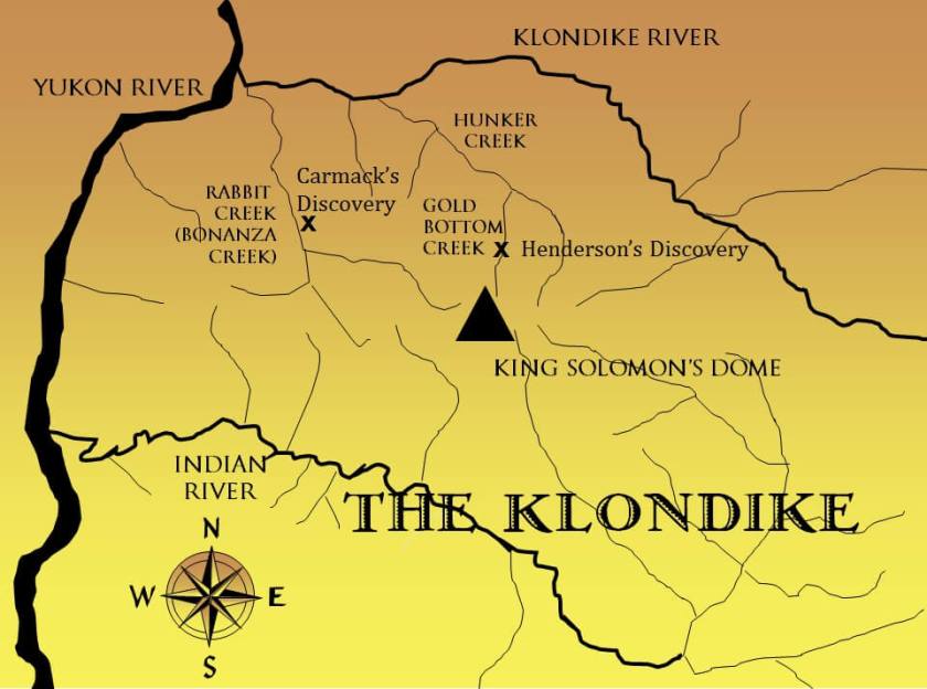
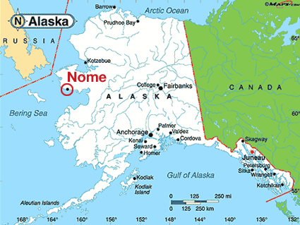
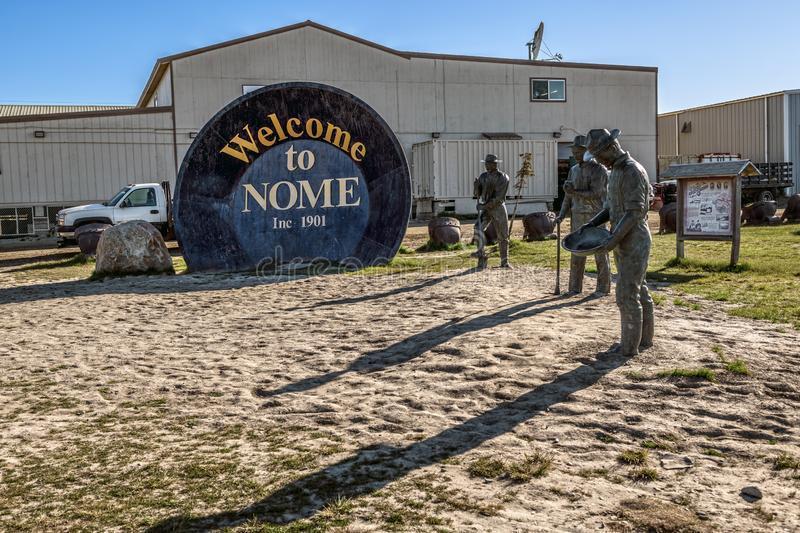
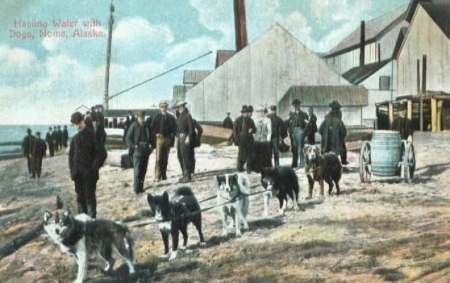
I noticed the Far North street names in the Sunshine State when I was driving around Sulphur Springs, like Alaska, Juneau, Sitka, Nome, Skagway, Yukon, Klondyke, Eskimo, and Seward, the name of the U.S. Secretary of State who signed the treaty for the purchase of Alaska from the Russians in 1867.
This seems odd to me. Like removing to a faraway place the actual identity of the people who lived here.
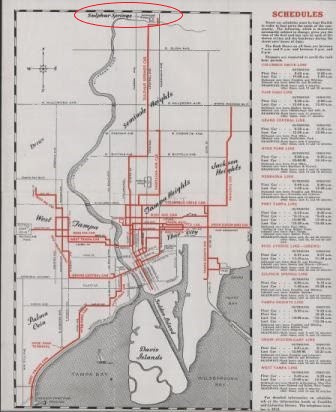
I have gotten a screenshot of Google Earth of where I primarily looked around in Sulphur Springs.
This is what I found at this first location marked by an “x.”
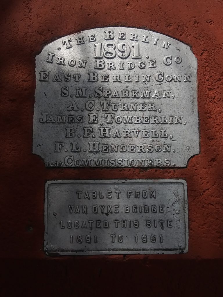
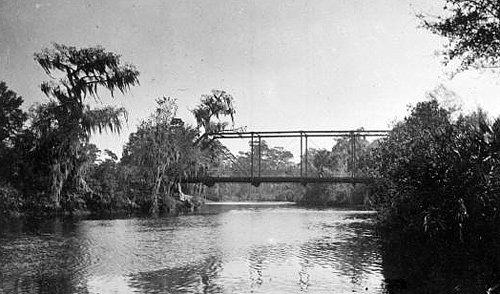
I looked around this side of the Hillsborough river, and found this tablet referencing this spot at the former location of the Van Dyke Bridge.
The Van Dyke Bridge connected Sulphur Springs with the Old Seminole Heights neighborhood of Tampa, the largest of three distinct city neighborhoods within the Seminole Heights District.
It existed there until 1961, and I can’t find information to explain what happened to it.
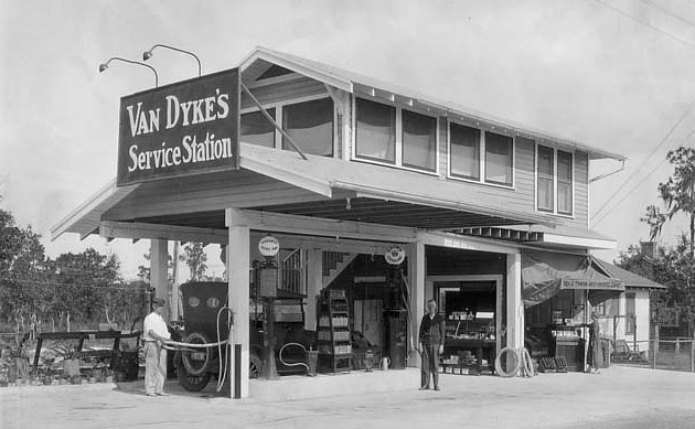
We are told Van Dyke Place was named for the man who owned a service station there in the 1920s.
But who were the Seminole? What about them?
Why would this piece of land in Sulphur Springs be forever named for some guy who was a service station owner who was only there temporarily?
That’s like the magnificent mound-building civilization of North America being named the Hopewell Culture, also in 1891, after a family who owned the land that the Hopewell Mound Group earthworks were located on in Ross County, Ohio, and not having any connection made in the name with the indigneous people of this continent.
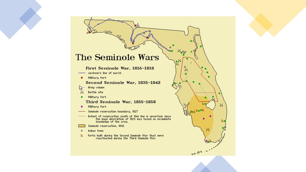
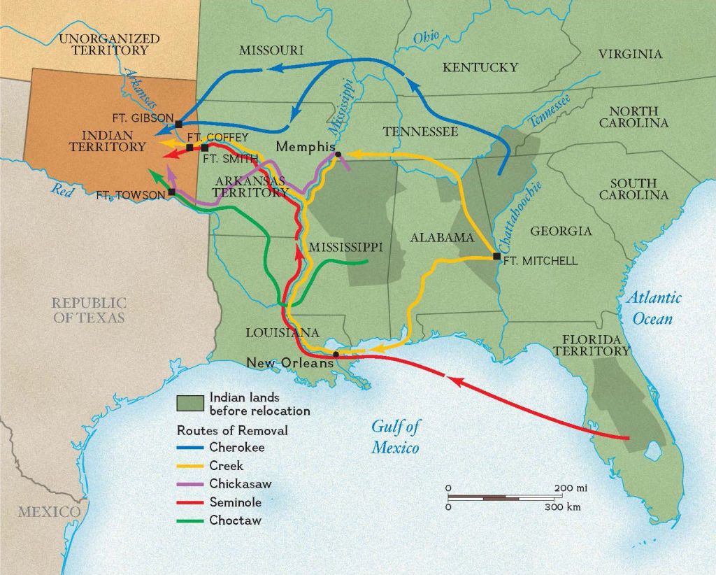
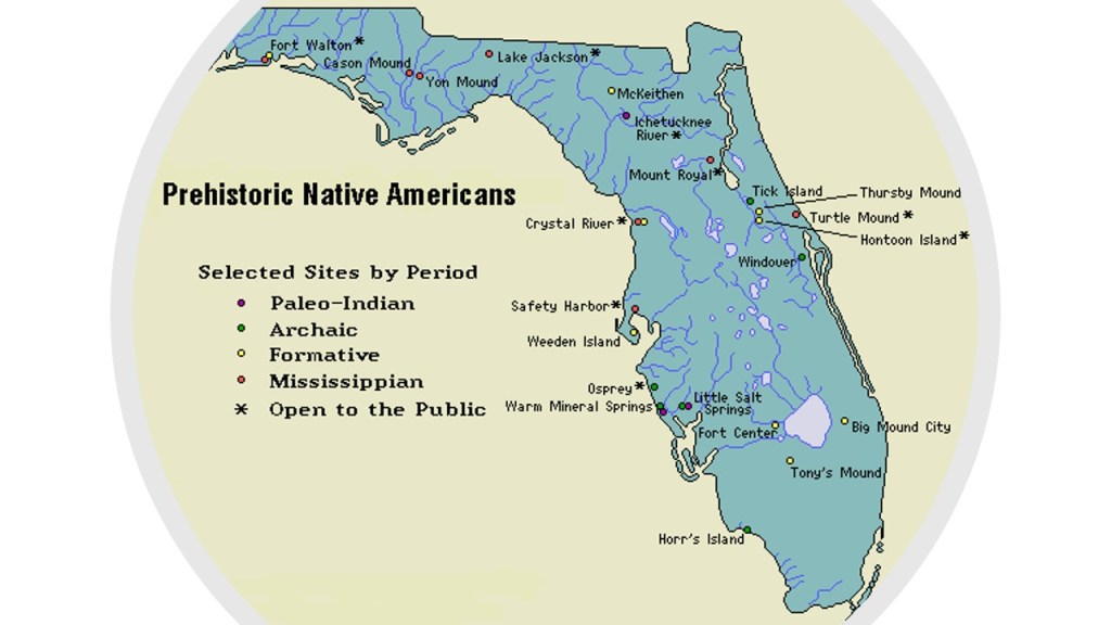
The Seminole of what is now Florida were considered one of the “Five Civilized Tribes,” indigenous peoples of the Americas who lived in the Southeastern United States, and described as part of the mound-building Mississippian Culture, along with the Cherokee, Choctaw, Chickasaw and Creek.
The Seminole Wars were on-going between 1816 and 1858.
By 1842, most Seminoles had been removed to what was called the Indian Territory of Oklahoma, which was also by-and-large the fate of the other four civilized tribes…
…and six Seminole reservations were established in Florida for the those remaining.
The Seminole never signed a Peace Treaty with the United States Government.
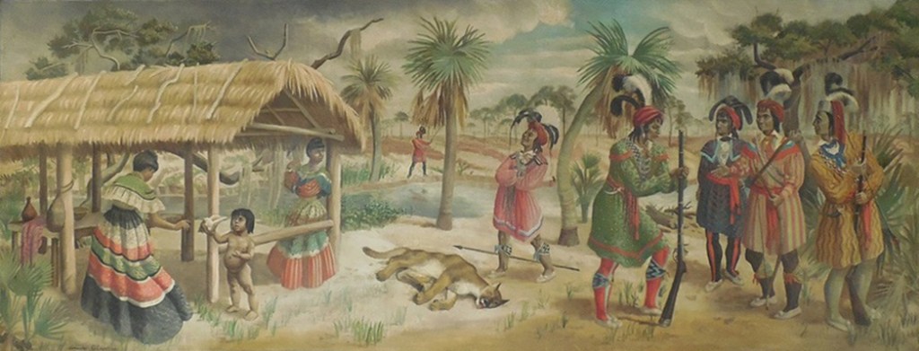
The Seminole, like the other indigenous people of North America, are typically portrayed primarily as hunter-gatherers, with huts being constructed from readily available materials.
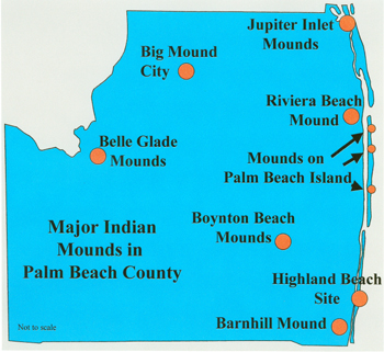
There are acknowledged mound sites in Florida…
…so they were certainly part of the ancient mound-building civilization.
What else did the Seminole build?
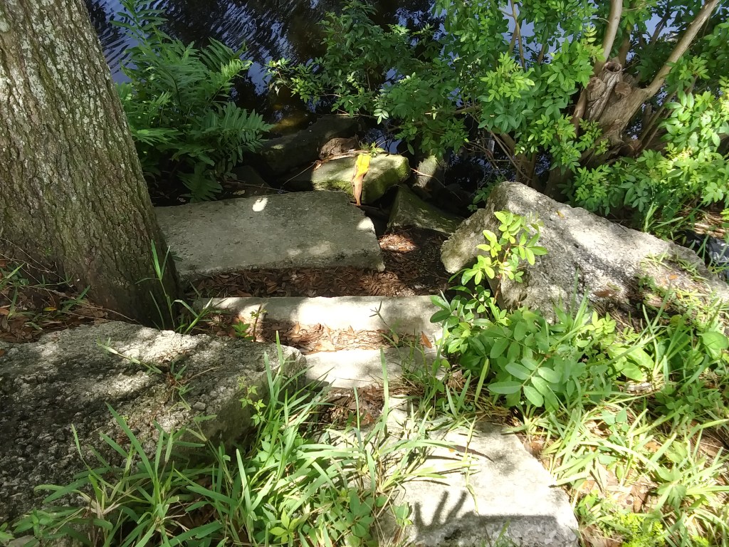
Well, right next to the tablet memorializing the Van Dyke Bridge, I found these cut-and-shaped stones lying around in the overgrowth beside the Hillsborough River.
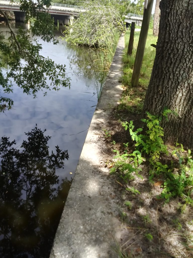
I noted the masonry banks of the river at this location, and will show other examples at different places.
There is also a clear view of the Sulphur Springs Water Tower from Van Dyke Place.
In my driving around, I found the location of the Sulphur Springs Pool and Park.
This is the outside of the present-day pool facility…
It was located next to the Sulphur Springs Park, which has an old-world looking, domed-columned-arched pavilion, to which all access is blocked.
There is a nice view of the water tower from the park’s parking lot…
…and a view of more masonry banks further on down the Hillsborough River, a little ways from Van Dyke Place.
I became even more intrigued about this place the night I first found out the name of the water tower a couple of weeks ago, and the park’s history as the “Coney Island of Florida.”
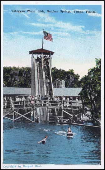
Here is a historic depiction of the circular pool at Sulphur Springs with the waterfall…
…which looks like it still has a presence on the grounds of the Sulphur Springs pool in the present-day, according to Google Earth.
The historical Toboggan Water Slide of Sulphur Springs, however, is no where to be found.
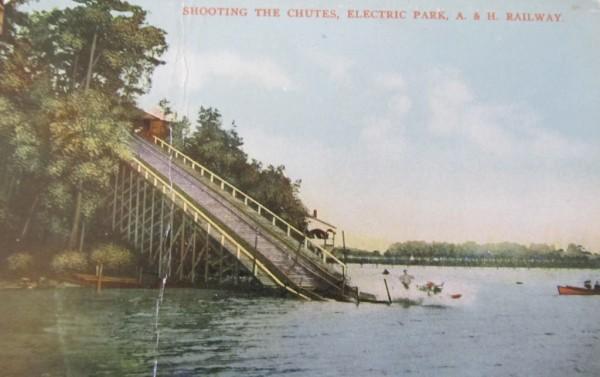
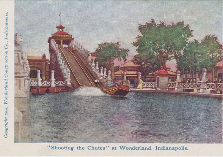
…which looked to me like what was usually called the “Shooting the Chutes” ride at various Trolley-Park-Amusement-Parks across the United States, like the one at the Hudson River Valley’s Electric Park on Kinderhook Lake…
…and the one at the Wonderland Amusement Park in Indianapolis, Indiana.
Trolley parks were said to have started in the United States in the 19th-century as picnic and recreation areas at the ends of street car lines, and were precursors to amusement parks. By 1919, there were estimated to be between 1,500 and 2,000 such parks. For example, Luna Park at Coney Island in Brooklyn was a trolley park.
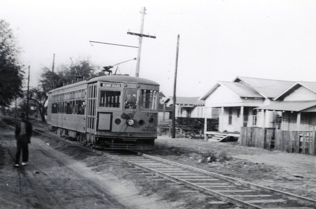
So, I was not at all surprised when I found out that Sulphur Springs was the end of a trolley line at one time.
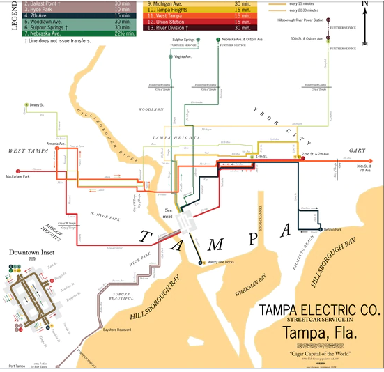
Tampa was said by to have a steam-powered trolley system by 1885 carrying passengers between Tampa and Ybor City, and that in 1893, the Tampa Street Railway and Power Company converted its trolley system to electric-power from steam.
Sulphur Springs became the northernmost terminus of what was known as the Tampa Streetcar line, which TECO (Tampa Electric Company) took control of in 1899.
By the late 1930s, trolleys were in use in many cities, and by the end of World War II in 1945, Tampa and St. Petersburg were the only Florida cities with trolleys.
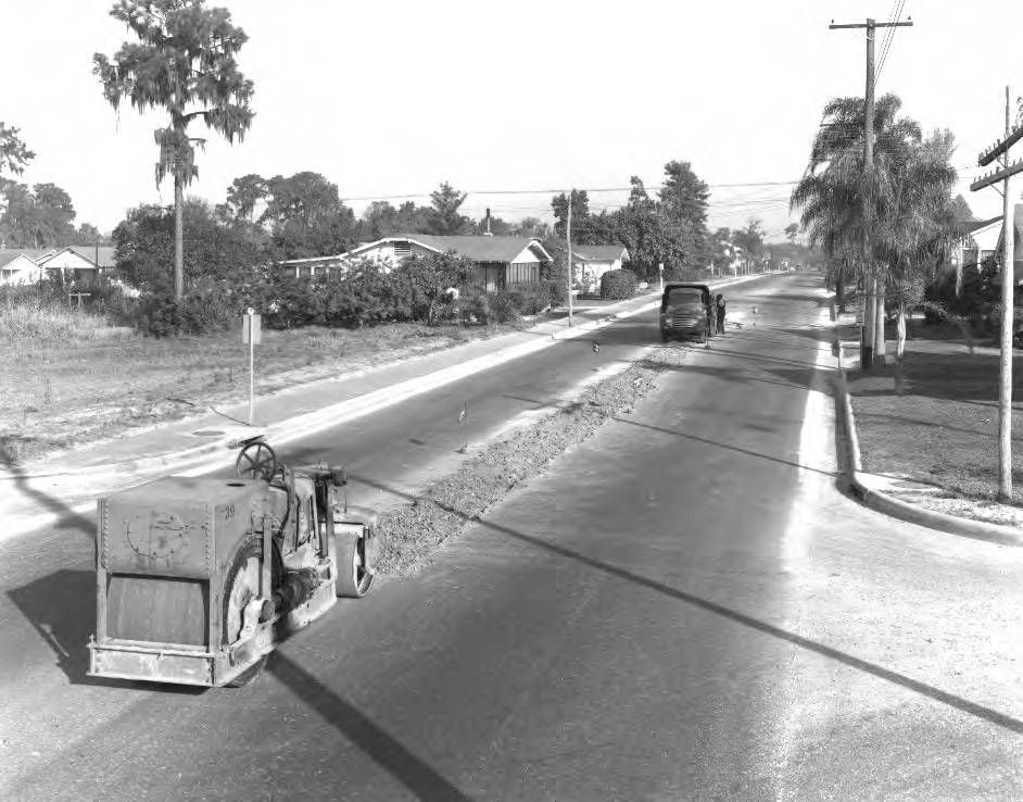
Then on August 4th of 1946, the last Tampa electric trolley was retired. The overhead wires were eventually taken down, and the rails paved over.
Today, TECO operates a 2.7-mile trolley line in downtown Tampa between the city’s Channel District and Ybor City…
…the only remnant of what was once an extensive trolley system here.
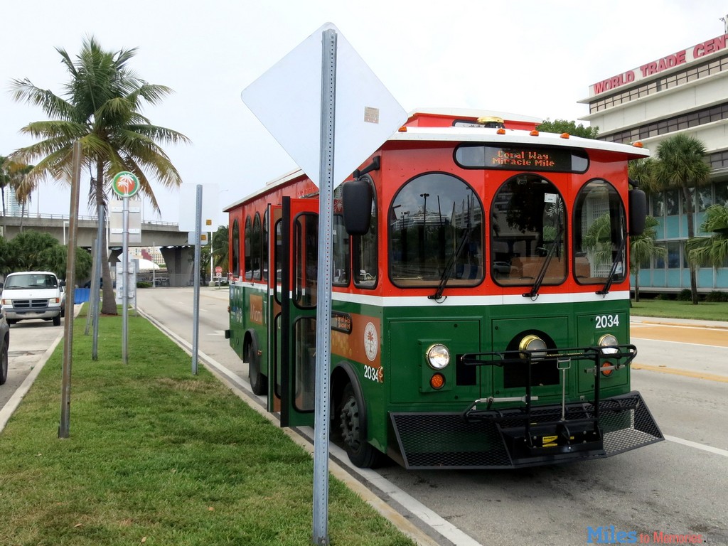
Other Florida cities had electric trolley systems at one time, like Miami between 1909 and 1940…
…and in more recent years, had the trolley return for public transportation in the form of a bus service.
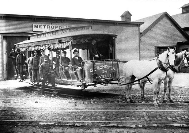
Early photos of trolley cars show them being drawn by mules, like this one in Boston, Massachusetts.
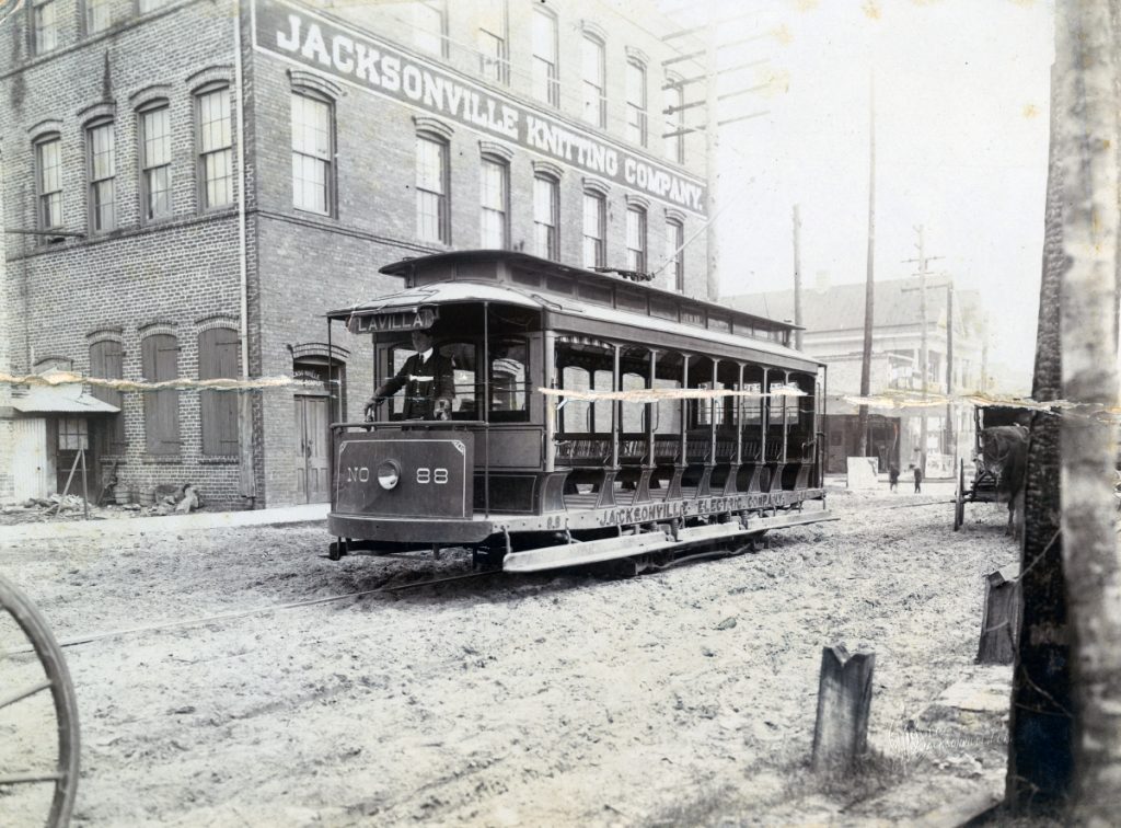
Then, here is an historic photo of an electric trolley in Jacksonville, Florida, running on tracks in a dirt-covered street, side-by-side with a mule-drawn buggy.
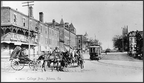
Same idea in Athens, Georgia.
How do we reconcile having the technology to build an electric trolley system and at the same time be dependent on mules for propulsion?
And why did the trolleys and the trolley parks go away?
I mean, it sure seems like the electric trolleys were made to get up and running until cars and buses could replace the electric trolley systems as the primary mode of transportation, and then they were mostly gotten rid of as quickly as possible.
Was this in order to make an exorbitant amount of money from the oil and gasoline needed to run cars and buses, instead of the electricity-efficient and extensive trolley car systems which were in place everywhere around the world?
And what happened to all the trolley parks?
With the example of Sulphur Springs, outside of the one circular pool and waterfall in the current Sulphur Springs pool set-up, there is nothing left to show there was once anything like an amusement park venue and trolley line once here.
This is said to be a 1922 fire insurance map of Sulphur Springs Park.
I don’t know about the one in Sulphur Springs, but many historical trolley parks were destroyed by fire a long time ago, like the Exposition Park that was destroyed by fire in 1908 at Conneaut Lake in Pennsylvania, as one of countless examples.
I tend to think there was a major connection between the advanced, ancient Moorish civilization which built all of this rail and amusement park infrastructure as part of the Earth’s grid system that the Earth’s new controllers mostly deliberately destroyed.
This is an historic photo of Luna Park in Sydney, Australia, circa 1935…
…and Luna Park in Sydney today, with a completely different face at the entrance.
This brings me to the Busch Gardens in Tampa, located just slightly to the northwest of Sulphur Springs.
The “Busch Gardens” name was first used in reference to gardens developed near Pasadena between by Adolphus Busch, the co-founder of Anheuser-Busch with his father-in-law Eberhard Anheuser…
…where we find interesting-looking mounds, also known as earthworks.
They were said to have been open to the public between 1906 and 1937.
The Busch Gardens amusement parks were developed initially as marketing vehicles for Anheuser-Busch, and Busch Gardens in Tampa opened on March 31st of 1959 as a hospitality-facility for an Anheuser-Busch brewery which provided visitors with the opportunity to taste beer.
It is known for the African theme of the park.
There was no charge for admission at that time.
We are told there initially was a bird-garden and an escalator called “Stairway to the Stars,” which took visitors to the roof of the brewery where the tour began.
Rides and attractions were added, developing into a full-theme park while still promoting Anheuser-Busch beer.
I really see this development of associating beer with amusement parks as a “bread and circuses” approach by those behind the concept of the New World Order to facilitate lowering our level of consciousness by introducting the consumption of beer, and facilitating its association with fun and rides.
And I absolutely believe that the locations of amusement parks were important places on the Earth’s grid system, as electricity-generators, -receivers, or both, with the amount of electricity needed to operate all of the rides and everything associated with them.
Just a few things to mention about Busch Gardens as it relates to my recent trip.
I took note from outside the park of the Moorish architecture of what is called the “Moroccan Palace Theater,” an entertainment venue, next to the wall separating the park from Busch Boulevard.
And here are some pictures of what it looks inside the park.
On Google Earth, I checked out the part of the park I was curious from what was showing above the wall, but I couldn’t tell exactly what it was.
Like the roof of what I think was this structure…
…and when I was looking around this part of the park on Google Earth, I came across this view of what looks like an old wall, with arches and triple windows…
…which appears to be part of the Cheetah Hunt coaster.
I travelled east along Busch Boulevard where it goes through unincorporated city of Temple Terrace, as I was heading towards a place where I could get a view of the canal I spotted on the east-side of Tampa on Google Earth.
It is known as the C-135, or Tampa By-Pass Canal, a 14-mile, or 23-kilometer, waterway that connects the Lower Hillsborough Wilderness Preserve with McKay Bay, said to have been built in the 1960s and 1970s as a flood control project.
It also functions as a source of drinking water for Tampa.
One of the reasons I made it a point to see this canal is because of the Arizona Canal, which I took note passing by it on I-17 going through Phoenix because it has an amusement park called “Castles and Coasters” right next to it…
…which has Moorish-looking attractions at the park.
Another similarity in the landscape between what is found in Tampa and Phoenix is this comparison between the Hillsborough River in Tampa and the Salt River in Arizona, which actually goes through Phoenix but is mostly dried up where it runs through the city.
I believe these so-called natural rivers are man-made waterways, and there are countless examples on the Earth of the same snaky, s-shaped riverbends, like the Ouachita River where it flows through Monroe in Louisiana…
…the Mississippi River, as seen here in Vicksburg, Mississippi…
…the Nile River in Sudan in Africa…
…and the Thames River as it flows through London as seen here.
Here’s an s-shaped bend of the Hillsborough River where it goes through the Lowry Park Zoo, which is in Old Seminole Heights near Sulphur Springs, with its masonry banks…
…and here are views of the Hillsborough River on Sligh Avenue near the Lowry Park Zoo entrance, like the masonry banks I showed earlier in Sulphur Springs.
On my way back through Temple Terrace on Busch Boulevard after visiting the C-135 Canal, I stopped at Florida College to take pictures because of the Moorish architecture I saw there on my way to the canal.
As I went around this building called “College Hall,” I started noticing classic mud flood evidence of ground-level windows and underground levels.
I saw the same idea at the Stulgis-Akin Hall on Campus…
…with uneven masonry along the base of the building, going across it from right…
…to left.
Here is Jennifer Hall on campus…
…and remember the triple windows I showed you at the Cheetah Hunt coaster ride in Busch Gardens?
Triple and double windows are signatures of Moorish architecture.
Who do I think really built everything?
Master Moorish Masons of the Ancient Ones.
I believe the Moorish Legacy was stolen…
…when the Earth’s positive timeline was hijacked by what I believe was a deliberately caused cataclysm, creating a flood of mud which wiped out the original civilization.
…and that the new historical reset timeline officially started in 1851.
We have been indoctrinated in a false historical narrative from cradle-to-grave ever since then.
The first Freemasonic Grand Lodge – the Premier Grand Lodge of England – was founded in London, on June 24th, 1717…
…the exact mid-year point between 1492 and 1942, which I believe are the most significant years of the new New World Order timeline that was created from the original Old World Order.
Was freemasonry so named because all of the Old World infrastructure was “free for the taking?”
Freemasons weren’t the only players involved in deconstructing the Old World and creating the New, but they have been significantly involved in what has taken place.
Fittingly for my brief stay in Tampa, I noticed there was a Masonic & Fraternal Supply store right across the street from my motel on Busch Boulevard.
While I could go on and on, I will go ahead and end here.
In my next post, I will be looking at the islands of the English Channel, which was going to be my next post last time until this one from my trip came up.
In my post “An Explanation for What Happened to the Positive Timeline of Humanity and Associated Historical Events & Anomalies,” and “My Take on the Mud Flood & Historical Reset Timeline,” I shared things like an extremely cold weather event in the historical record in Ireland between 1740 – 1741, as well as my thoughts about how an artificial time-loop could have been created between 1492 – 1942, with 1717 as the mid-point year between the two.
I decided to pull together in this video what I have found that was taking place during the 1800s in the course of my research, starting at the tail-end of the 1700s and through to the early 1900s, as there are overlapping events happening on either side of the 19th-century.
I am providing the following recap for those who may be new to my work – this information will be familiar to those who have been following my work.
First, on the extreme cold weather in Ireland, Irish Historian David Dickson talks about this little-known event in his book “Arctic Ireland.”
I have explored the idea that this event was related to the hijack of the original timeline.
The Irish population endured 21-months of bizarre weather without known precedent that defied conventional explanation. The cause is not known.
Shortly after I learned about the cold-weather event in Ireland, I was connected by someone to the mud flood community.
I learned about the fantastic research that is being done by people looking at their own communities and other places, around the world, at strong evidence that there was a cataclysmic event involving a massive flood of mud, within the last couple of hundred years.
It is being called a reset event, and photographic evidence exists that buildings, canals, rail-lines, tunnels, among other things, were purposefully dug out after the event to the point where they could be used.
Over the years, I have filled my head with information about megaliths. Long before I became aware of the information I am sharing, I learned about such places as the Sphinx in Egypt having been dug out…
…as well as the famous heads of Easter Island…
…that were found to have bodies too!
The explanation of a mud flood makes a lot of sense to me based on what I am finding and seeing.
A sudden cataclysmic liquefaction event creating a flood of mud accounts for how a highly advanced worldwide civilization of giants…
…could have been wiped from the face of the Earth and erased from our collective memory.
I have speculated that the Philadelphia Experiment, which took place halfway through World War II, on July 22nd of 1942, actually transported the USS Eldridge back to the time of the Great Frost of Ireland in 1740 and 1741 , creating a rip in the fabric of space-time and was a causal factor for the liquefaction event creating the mud flood.
These slides give an overview of the Philadelphia Experiment.
If this was actually the case, it would have taken the beings involved in the cataclysm a little over 100-years to dig enough of the original infrastructure out of the mud flow to re-start civilization and create the new, false historical narrative superimposed onto this infrastructure.
There is plenty of underground infrastructure around the world where people could have lived until the Earth’s surface became habitable once-again.
There are 450 years in between 1492 and 1942, and the midpoint, at 225-years, is 1717.
Next, I will provide the findings of my research of the historical record around the year of 1717.
Based on what I found when I started looking at historical events from around 1717 to 1942, I believe the extremely cold weather event in Ireland was deliberately caused, and is connected to the Mud Flood and the historical reset.
King George I of the German House of Hanover became King of Great Britain and Ireland in 1714.
This marked the end of the rule of the House of Stuart, which originated in Scotland.
On January 4th, 1717, Great Britain, France, and the Dutch Republic signed the Triple Alliance in an attempt to maintain the Treaty of Utrecht, which was signed in April of 1713, in which in order to become King of Spain, Philip had to renounce his concurrent claim to the French throne.
This prevented the thrones of Spain and France from merging together, and ultimately paved the way for the maritime, commercial, and financial supremacy of Great Britain.
In February of 1717, James Francis Edward Stuart of the House of Stuart, called the Pretender, who at one time was claimant to the throne, left where he was living in France, after the Triple Alliance was signed in January, to seek exile with Pope Clement XI in Rome. He died in Rome in 1766.
This is believed to be a portrait of James Francis Edward Stuart that was painted when he lived in France on the left, and the typical portrait of him on the right.
On June 24th, 1717, the Premier Grand Lodge of England – the first Free-Mason Grand Lodge – was founded in London.
I find it highly significant that this event shows up at the exact mid-point year between 1492 and 1942.
And then on 7/17/1717, an interesting date from a numerological perspective, the premiere of George Frideric Handel’s “Water Music” took place for King George I on a barge on the Thames.
In 1727, George Frideric Handel became a British citizen.
Then I was guided through a psychic friend who came to visit me to look at Ireland in 1742 in my research.
She had received an image from my guides to communicate to me of Ireland before 1742 as cold and frozen, and 1742 and after as green and sunny.
So I plugged the year “1742” for an internet search, and only two things came up.
The first was that Dublin, Ireland, was the location for the premiere of George Frideric Handel’s Messiah on April 13th, 1742.
And the other thing that came up was the extraordinary cold weather event in Ireland between 1740 – 1741.
Handel’s Messiah premieres in Dublin right after the extremely cold, lethal weather event???!!!
So, who else shows up during this same time period?
Mayer Amschel Rothschild was born in Frankfurt, Germany, in 1744. He established his banking business there in the 1760s, which became the start of an international banking family.
His third-born son, Nathan Mayer Rothschild, was sent to England from Frankfurt in 1798, and after becoming a citizen, established a bank in the City of London in 1804.
Then on February 6th, 1748, Bavarian Illuminati-founder Adam Weishaupt was born in Ingolstadt, Bavaria, Germany. He went to a Jesuit school at the age of 7, and was initiated into Freemasonry in 1777.
The parasitic and multi-dimensionally aware beings behind all of this want us to believe that suffering, sickness, misery, destruction, death was and is our normal state of being, and not question what we have been taught about who we are.
They are the only ones who benefit because they energetically feed on Humanity’s negative emotional states, at the same time they have sucked up all the wealth of the Earth for themselves.
Additionally, they have manipulated Human beings to become the perpetrators of negativity and depravity against fellow Human beings.
What I am going to share in this video is the information that I have found in the course of my research which supports this notion of a historical reset occurring in the mid-1800s, and that all of the history we have been taught has been grafted onto the original infrastructure and falsely attributed.
I have come to believe that the Great Exhibition of the Works of All Nations of 1851 in London, also known as the Crystal Palace Exhibition in reference to where it was held, was the official kick-off for the New World Order timeline…
…and that, in the hundred or so years following, Exhibitions, Expositions, and World Fairs were showcasing the technology and architectural wonders of the original civilization before being hidden away or forever destroyed.
This was a scene at the New York World Fair of 1939 to 1940, almost 100 years later, where we still see incredibly big, what appear to be luminescent structures in the background, and in the foreground, statues much bigger than the size of the people standing near them.
While I will be mentioning several European countries in the historical narrative I reference in this post, please note in particular the German and British thread running through what I am about to share because it believe it to be of significance in terms of the physical origins of what has taken place here, keeping in mind all that we have seen thus for with the accession of the German House of Hanover to the British throne in 1714, and the births of Mayer Amschel Rothschild and Adam Weishaupt in the 1740s, shortly after the occurrence of the Great Frost of Ireland.
I am going to start with the historical happenings I found during the years 1797 to 1820.
The Ionian Islands, also known as the Heptanese, is a group of seven main islands in the Ionian Sea off the western coast of Greece.
The Treaty of Campoformio was signed by Napoleon Bonaparte and Count Philipp von Cobenzi, as representatives of the French Republic and the Austrian Monarchy respectively, in 1797…
…disbanding and partitioning the Most Serene Republic of Venice, La Serenissima, by the French and the Austrians, of which the Ionian Islands were said to have been a part of since 1500 AD…
…and the Ionian Islands were awarded to France.
At that time, the Ionian Islands became the short-lived French Department of Ithaque, as it fell to the Russians in 1798, and was officially ended in 1802.
Between the years of 1800 and 1807, the Ionian Islands were known as the Septinsular Republic under Russian and Ottoman rule after the Russian/Ottoman fleet defeated Napoleon Bonaparte.
Then in 1807, Napoleon signed two agreements in the town of Tilsit in what was Prussia in East Germany, one between Emperor Alexander I of Russia, and the second treaty was signed with Prussia, and the Ionian Islands were returned to France, becoming a French Protectorate.
Then, in 1809, the British blockaded the Ionian Islands as part of the war against Napoleon, and, in September of that year, hoisted the British flag on the island of Zakynthos, with Kefalonia and Ithaca soon surrendering. The British installed provisional governments here.
The Treaty of Paris of 1815 recognized the United States of the Ionian Islands, and established them as a British Protectorate.
Then, Napoleon led the French invasion of Malta in 1798, which was part of the Mediterranean Campaign in the War of the Second Coalition of the French Revolutionary Wars.
The Order of the Knights Hospitallers, the rulers of Malta since 1530, surrendered to Napoleon when the French landed there.
We are told that during the short time Napoleon was in Valletta, the capital city of Malta, between June 12th and 18th of 1798, he did such things as reforming, among other things, national administration with the creation of a Government Commission and twelve municipalities; creating a public finance administration, and the organization of public education, and providing for primary and secondary education, all before sailing for Egypt, and leaving a substantial garrison in Malta.
What?
All this in a week? Why?
After the British Royal Navy destroyed the French Mediterranean fleet at the Battle of the Nile in Egypt on August 1st, 1798, the British were able to initiate a blockade of Malta, assisted by an uprising of the native Maltese against French rule. The blockade effectively ended the French Occupation of Malta in 1800, and replaced it with British Protectorate, returning control of the central Mediterranean to Great Britain.
In the 1814 Treaty of Paris, Malta officially became part of the British Empire and was used as a shipping way-station and fleet headquarters.
Napoleon was still very much in the picture, proclaiming himself Emperor of France in 1804.
Apparently he was very interested in the part of Calabria, the region in the toe of the boot of Italy, that is across from Messina in Sicily in the Strait of Messina…
…as he made his older brother, Joseph-Napoleon, the King of Naples and Sicily between 1806 and 1808, who we are told, implemented administrative reforms in 1806 that abolished the ruling system that was in place there, and the Lordship of Fiumara disappeared.
Then further north, we are told the Union of the Kingdom of Denmark-Norway, also known as the Oldenburg Monarchy, existed as a dual monarchy between 1537 and 1814, with Copenhagen as its capital.
The Oldenburg Monarchy had long-remained neutral in the Napoleonic Wars.
Britain was said to have feared that Napoleon would attempt to conquer the Danish-Norwegian naval fleet, and used that as a pretext to attack Copenhagen in what became known as the Siege of Copenhagen in August of 1807, and Britain seized the naval fleet in September of 1807.
This also assured the use of the sea lanes in the North Sea and Baltic Sea for the British merchant fleet.
The “fleet robbery” drew Denmark-Norway into the war on the side of Napoleon.
Then in 1814, during the Napoleonic Wars, the Treaty of Kiel, between the United Kingdom and Sweden on the anti-French-side, and Norway and Denmark on the French-side, dissolved the Oldenburg Monarchy by transferring Norway to the King of Sweden.
The King of Denmark retained the Faroe Islands, Greenland, and Iceland.
Alexander von Humboldt was a German from the historically prominent state of Prussia.
A geographer, naturalist and explorer, he travelled extensively in the Americas between 1799 and 1804, said to have explored them from a modern, scientific point-of-view, including the Canary Islands, Venezuela, Cuba, the Andes Mountains, Mexico, and the United States.
He is known for a multi-volume work entitled “Kosmos,” in which he was said to have sought to unify diverse branches of scientific knowledge and culture.
It was published in five volumes between 1845 and 1862.
The German geologist and paleontologist Leopold von Buch visited the Canary Islands in 1815, where he primarily studied the production and activities of volcanoes.
He studied with Alexander von Humboldt at the Freiburg School of Mining, and is considered a founder of modern geology.
The Barbary Wars were a series of conflicts culminating in two main wars fought between the United States, Sweden, and the Barbary States of the Ottoman Empire in the late 18th- and early 19th-century.
We are told that Barbary pirates demanded tribute from American vessels in the Mediterranean Sea, and in 1801, President Thomas Jefferson refused to pay, sending a U. S. Naval fleet to the Mediterranean in May of that year, and the First Barbary War lasted until 1805.
We are told the naval fleet commenced bombarding various fortified “pirate” cities in present-day Libya, Tunisia, and Algeria, over the next three years until concessions of fair passage were extracted from their rulers, which were most likely the Deys of Tripoli, Tunis, and Algiers, in the First Barbary War.
The second Barbary War took place in 1815 between the United States and the Barbary States, and we are told, brought to an end the American practice of paying tribute to the “pirate” states and marked the beginning of the end of piracy in that region.
The Congress of Vienna was said to be one of the most important international conferences in European history.
It was a meeting of ambassadors of European states held in Vienna in Austria between 1814 and 1815 in order to remake Europe after the downfall of Napoleon.
The stated goal was to re-size the main powers so they could balance each other and in this way remain at peace, and not simply to restore old boundaries.
As a result of the Congress of Vienna, France lost all of its recent conquests, while Prussia, Austria, and Russia made major territorial gains.
Most of the discussions took place in informal, face-to-face sessions among the ambassadors of Austria, Britain, France, Russia, and sometimes Prussia, with limited or no participation by other delegates.
As such, the so-called Congress of Vienna never met in plenary session, which means a session in which all members of all parties are able to attend.
In 1815, the Kingdom of Kandy, the last remaining independent kingdom in Ceylon, known today as Sri Lanka, succumbed to British colonial rule when the kingdom was absorbed into the British Empire as a protectorate via the Kandyan Convention of 1815, an agreement signed between the British and members of the King’s court which ceded the kingdom’s territory to British rule, and its last king was imprisoned.
Ceylon was a British Protectorate until its independence in 1948.
Next are some of the happenings in our current historical narrative that I found from 1821 to 1850.
The Rothschilds purchased Jerusalem in 1829, and subsequently acquired considerable land in Palestine in the 1800s and early 1900s.
Between 1822 and 1843, several countries were involved in major expeditions to the southern oceans to collect scientific and strategic information, like Jules Dumont d’Urville for France…
…who claimed land on January 21st of 1840 on Antarctica for France, considered his most significant achievement.
He was promoted to Rear Admiral upon his return, and he wrote a report of the expedition entitled “Voyage au Pole Sud et dans L’Oceanie sur les Corvettes Astrolabe et la Zelee 1837 – 1840,” which was published between 1841 and 1854 in 24 volumes.
The U. S. Exploring Expedition was another exploring and surveying expedition of the Pacific Ocean and the surrounding lands, conducted by the United States between 1838 and 1842.
The expedition was described as of major importance to the growth of science in the United States, and that during the events of its occurrence, armed conflict between Pacific Islanders and the expedition was common, and dozens of natives were killed, as well as a few Americans.
It involved a squadron of four ships, with specialists on each including naturalists, botanists, a mineralogist, a taxidermist, and a philologist, which is someone who studies written and oral histories.
It is sometimes referred to as the “U. S. Ex. Ex.” or “Wilkes Expedition,” after the commanding officer, Navy Lt. Charles Wilkes.
The routes of the Wilkes Expedition went something like this – all over the place.
…and which, just five days prior to Dumont d’Urville of France, “discovered” Antarctica on January 16th of 1840.
Then there were the three voyages of the HMS Beagle starting in 1826 with the surveying of the southern tip of South America…
…to the second voyage of the HMS Beagle, between 1831 and 1832, which was joined by naturalist Charles Darwin, on another trip to South America, and then around the world.
Charles Darwin kept a diary of his experiences, and rewrote this as a book titled “Journal and Remarks,” becoming published in 1839 as “The Voyage of the Beagle.”
It was in “The Voyage of the Beagle” that Darwin developed his theories of evolution through common descent and natural selection.
The third voyage of the HMS Beagle took place between 1837 and 1843, and was a surveying voyage to Australia.
In 1845, the HMS Beagle was refitted as a Coast Guard watch vessel in Essex, in the navigable waters beyond the Thames Estuary, until it was removed in 1851.
The First Anglo-Afghan War was fought for three years between the British East India Company and the Emirate of Afghanistan starting in 1839, after the British had successfully captured Kabul, and they capitalized on a succession dispute between a current and former Emir there, at which time the British exiled the Emir at the time, Dost Mohammed, and installed the former Emir, Shah Shujah.
When the main British forces occupying Kabul retreated in January of 1842, they were almost completely annihilated by Afghani tribesmen. In retaliation, the British sent what was called an “Army of Retribution” to Kabul to avenge their defeat, and demolished parts of the city, recovered prisoners, and left Afghanistan, with the exiled Emir Dost Mohammed returning from India to Kabul.
Destruction that was done in retaliation for people who were defending their own land from invading foreigners who wanted to take it.
The First Anglo-Afghan War is called one of the first major conflicts of what was called “The Great Game,” the 19th-century competition for power and influence in central Asia between Britain and Russia.
The Treaty of Nanking, or Nanjing, between the British Empire and China, was signed after China’s defeat after the First Opium War in 1842.
The First Opium War was fought between Qing Dynasty of China and Britain between 1839 and 1842, a military engagement that started when the Chinese seized opium stocks at Canton in order to stop the opium trade, which was banned.
The British government insisted upon free trade and equality among nations and backed the merchants’ demands.
From 1757 to 1842, the Canton System served as a means for China to control trade with the west by focusing all trade in the southern port of Canton.
To counter this, the British East India Company began to grow opium in Bengal, in present-day Bangladesh, and allowed private British merchants to sell opium to Chinese smugglers for illegal sale in China.
As a result of these events in history, opium dens, establishments where opium was sold and smoked, became prevalent in many parts of the world throughout the 19th-century.
In 1839, John D. Rockefeller, Sr. was born in the United States, the progenitor of the wealthy Rockefeller family and considered to be the wealthiest American of all time.
The Cruquius, now a museum, was an old steam-pumping station in The Netherlands, named after one of its promoters, Nicolaus Samuel Cruquius.
It was one of three steam-driven pump stations built around the Harlemermeer, described as a “polder,” or low-lying piece of land reclaimed from water, located near Amsterdam.
This is said to be a map of the Haarlemmermeer before reclamation.
The lakes of the Haarlemmermeer were said to have been formed into one by successive floods, in which villages disappeared in the process, and said to have become a threat to Amsterdam.
Long story short, King William I of the Netherlands appointed a commission of inquiry, and the commission’s plan to build the three steam-driven pump stations around the Haarlemmermeer were approved, with construction commencing in 1840.
This is the first 20-years of the timeline we are given for the construction of the steam-driven-pumping system of the Haarlemmermeer, and the dates line-up around this mid-century historical narrative reset.
The Cruquius is described as the largest Watt-design reciprocal stroke steam-engine ever built.
We are told pumping began in 1848 and the lake was dry by July 1st of 1852.
In the historical narrative we are given, Auckland was first settled by Europeans in the form of the British in 1840.
With the signing of the Treaty of Waitangi in 1840 between representatives of the British Crown and 500 Maori Chieftains, we are told, Britain gained sovereignty over what became known as New Zealand.
We are also told that starting in 1848, and for the next fifteen years, there was a chronic water shortage, with Auckland’s wells affected by severe pollution.
The Chapada Diamantina National Park is located in the center of Brazil’s Bahia State, and considered one of the ten best national parks in the world.
We are told this region was deserted until the discovery of gold and diamonds here in 1844, which then was said to have triggered a rush of gold and diamond seekers wanting to make their fortunes.
California’s mother-lode country, an historic region in northern part California, is on the western slope of the Sierra Nevadas.
It was famed for mineral deposits and gold mines said to have attracted waves of immigrants starting in 1849, known to history as 49ers.
We are told that California’s gold rush was sparked by James Marshall’s discovery in 1848 of placer gold at Sutter’s Mill near Coloma.
We are also told San Francisco grew from a small settlement of about 200 residents to a boom town of about 36,000 by 1852, the year this map was said to have been made.
This was said to be an early daguerrotype, an early form of photography, of Portsmouth Square in San Francisco from 1851, some time before June of 1851.
The city of Colon in Panama is a sea port on the Caribbean Sea…
…and was said to have been founded in 1850 as the Atlantic Terminal of the Panama Railroad, which was said to have been under rush construction to meet the demand for a fast way to get to California for the Gold Rush.
This is a historical photo of the massive and ornate office buildings of the Panama Railroad Atlantic Terminal.
Lumber Baron William Carson was said to have arrived in San Francisco in 1849, from New Brunswick in Canada, with a group of other woodsmen.
In 1850, he and Jerry Whitmore were said to have felled a tree, the first for commercial purposes on Humboldt Bay in present-day Eureka, California, and was soon in the business of shipping Redwood timber to San Francisco.
We are told that Swedish industrialism started in 1849 in Sundsvall in Sweden when the Tunadal Sawmill brought in a steam-engine-driven saw.
Sundsvall is still a center of the Swedish forestry industry.
In the 1840s, Brazil’s Emperor Pedro II was said to have issued an imperial decree ordering the construction of a settlement to be formed at Petropolis with the arrival of German immigrants…
…as well as for the construction of his summer palace there, with the cornerstone said to have been laid in 1845, and that it was built by 1847.
Ottawa, the capital city of Canada, is on the south bank of the Ottawa River on Ontario’s border with Quebec, with Gatineau on the other side of the river in Quebec.
We are told that it was founded as Bytown in 1826, which was marked by a sod-turning, and a letter from Governor-General Dalhousie which authorized Lt. Col. John By to divide up the town into lots.
We are told Bytown came about as a direct result of the construction of the Rideau Canal, which was said to have been built by Lt. Col. By, and opened in 1832…
…and Bytown was said to have grown because of the Ottawa River timber trade.
Bytown was incorporated as a town on January 1st of 1850, and this was superseded by the incorporation of the city of Ottawa on January 1st of 1855.
This is a depiction of Lower Town in Ottawa in 1855, said to be the oldest part of the city.
In the Sudbury region of Ontario, we are told a large tract of land, including what is now Sudbury, was signed over to the British Crown in 1850, by the local chiefs, as part of the Robinson-Huron Treaty.
In return, the Crown pledged to pay an annuity to these First Nations people, originally set at $1.60 per treaty member, and it was last increased to $4 in 1874, where it is fixed to this day.
Reservations were also established as result of this Treaty.
Here is a example of the ancient, indigenous inhabitants having their land taken from them, and getting very little in return, in what is clearly a rigged exchange!
Next are things that took place in our historical narrative between 1851 to 1870.
The Girgam is the royal history of the the line of kings of the the Kanem-Bornu Empire in what is now Chad and Nigeria.
In 1851, a copy of the Girgam was given by a local associated with the Seyfawa Dynasty of the Kanem-Bornu Empire to Heinrich Barth, an Arabic-speaking German explorer of Africa, and he published a translation of it in 1852.
He travelled extensively throughout Africa between 1850 and 1855, establishing friendships with rulers and scholars, and carefully documenting the details of the cultures he visited.
In 1852, George Schneider founded the Bavarian Brewery in St. Louis, but financial problems forced him to sell the brewery to various owners during the late 1850s, one of which Eberhard Anheuser, a prosperous German-American soap and candle-maker, and the brewery’s name became E. Anheuser & Company in 1860.
A wholesaler who had immigrated from Germany to St. Louis in 1857, Adolphus Busch, became Eberhard Anheuser’s son-in-law in 1861 and later president of the company.
Commodore Matthew Perry played a leading role in the Opening of Japan, starting on July 8th, 1853, when he led four U. S. Navy ships ordered by President Millard Fillmore to Tokyo Bay with the mission of forcing the opening of Japanese ports to American trade by any means necessary.
After threatening to burn Tokyo to the ground, he was allowed to land and deliver a letter with United States demands to the Tokugawa Shogun, Ieyoshi.
The Shogun Ieyoshi died a short time after Perry’s departure in July of 1853, leaving effective administration in the hands of the Council of Elders, though nominally to his sickly son, Iesada, who was the Tokugawa Shogun from 1853 to 1858.
The Tokugawa Shogunate was called the last feudal Japanese Military Government.
Perry returned again with eight naval vessels in February of 1854, and on March 31st of 1854, the Japanese Emperor Komei signed the “Japan and United States Treaty of Peace and Amity” at the Convention of Kanagawa under threat of force…
… if the Japanese government did not open the ports of Shimoda…
…and Hakodate to American vessels.
Samuel Kier established America’s first oil refinery for making lamp oil in Pittsburgh in 1854.
The petroleum industry in the United States began in earnest in 1859 when Edwin Drake found oil on a piece of leased-land near Titusville, Pennsylvania, in what is now called Oil Creek State Park.
For this reason, Titusville is called the Birthplace of the Oil Industry, and for a number of years this part of Pennsylvania was the leading oil-producing region in the world.
Our history tells us that on New Year’s Eve of 1857, Queen Victoria was presented with the responsibility of choosing the location for the permanent capital of Canada, with Ottawa being described as a small, frontier town.
The Parliament buildings were said to have been constructed between 1859 and 1866, in an architectural style called Gothic Revival.
This a view of Parliament Hill from the Rideau Canal.
In the same year that Queen Victoria chose the location of Ottawa as Canada’s capital, Persia was compelled by the Treaty of Paris of 1857 not to challenge the British for Herat and other parts of what is today Afghanistan.
Britain supported the Afghans to protect their East India Company.
Herat in Afghanistan was separated from Persia by British in the Anglo-Persian War of 1856 – 1857, and the Persians were unable to defeat the British to take back Herat.
Also in that same time period, between 1857 and 1859, a major uprising took place in northern India against the rule of the British East India Company, which functioned as a sovereign power on behalf of the British Crown.
The British East India Company had ruled over parts of the Indian Subcontinent between 1757 and 1858, commencing after the 1757 Battle of Plassey, called a decisive victory over the Nawab of Bengal, Mir Jafar, after which time the Nawab started ceding revenues to the what was called the “Company.”
One of the earliest railways said to have been constructed in India was the Solani Aqueduct Railway in 1851, which we are told was built for…
…the purposes of tranporting construction materials for the Solani River Aqueduct.
Proby Cautley, an English engineer and paleontologist, and an officer in the British East India Company, was given the historical credit not only for the building of the Solani Aqueduct…
…as well as the 350-mile, or 563-kilometer Ganges Canal between 1843 and 1854,which the aqueduct crosses, said to have had the greatest discharge of any irrigation canal in the world at the time of its construction, and described as an engineering marvel.
The last Mughal Emperor in India, Bahadur Shah Zafar, was deposed by the British East India Company in 1858, and exiled.
Through the Government of India Act of 1858, the British Crown assumed direct control of the British East India Company-held territories in India in the form of the new British Raj.
I have also found that winners of architecture contests, like Cuthbert Broderick for one of many examples, a 29-year-old architect who was said to have won a design contest in 1852 for the…
…Leeds Town Hall, said to have been opened by Queen Victoria in 1858.
The Bey of Tunis from 1855 to 1859, Muhammad, was forced by the British and French to sign the 1857 Fundamental Pact, which increased freedoms for non-Tunisians.
Then, we are told, in 1861, Tunisia enacted the first constitution in what was called the Arab world, but a move toward a modernizing republic was said to have been hampered by a poor economy and political unrest.
Regardless of the new Constitution, when the Tunisian government couldn’t manage the loans made by foreigners to the government, it declared bankruptcy in 1869.
When the Suez Canal opened in 1869, Malta was considered an important stop on the way to India, a central trade route for the British, because it was half-way between the Strait of Gibraltar and Egypt.
Malta didn’t gain its independence from Britain until 1964.
John D. Rockefeller, along with Henry Flagler, an American Industrialist and major developer in the state of Florida, founded the Standard Oil Company in 1870…
…becoming an American oil producing, transporting, refining, marketing company…and monopoly, which exists when a specific person or enterprise is the only supplier of a particular commodity.
This is what I found happening between the years of 1871 to 1890.
This statement of Albert Pike, a prominent American Freemason of the 19th-century, was attributed to him in 1871.
And, by the way, how did he know about a first and second World War?
Britain and France cooperated between 1871 and 1878 to prevent Italy from acquiring Tunisia as a colony having investment, and subsequently Britain supported the French interest in Tunisia in exchange for dominion over Cyprus.
Otto von Bismarck was the mastermind behind the unification of Germany in 1871, and served as its first chancellor until 1890.
While on one hand, Bismarck was said to have skillfully used balance-of-power diplomacy to maintain Germany’s position for 20-years in a peaceful Europe, at the same time the way he unified Germany was by provoking three short, decisive wars with Denmark, Austria, and France, and by abolishing the supra-national German Confederation, an association of 39 German-speaking states in Central Europe that was created by the Congress of Vienna to replace the former Holy Roman Empire, and formed the German Empire, which excluded Austria, which was a major beef of the Austrian Adolf Hitler.
Bismarck also annexed Alsace-Lorraine on the border with Germany, which was part of France, as a result of the Franco-Prussian War of 1870 – 1871.
We are told that France’s determination to regain Alsace-Lorraine, and fear of another Franco-German war, as well as British apprehension about the balance-of-power, became factors in the causes of World War I.
So by not including the Austria in the German Confederation, and annexing France’s Alsace-Lorraine, Otto von Bismarck set the stage for World War I and World War II.
The Criminal Tribes Act was enacted by the British in India on October 12th of 1871, and wasn’t ended until 1949.
The Criminal Tribes Act of 1871 criminalized entire communities by designating them as habitual criminals, and restrictions on their movements were imposed, including men having to report to the police once per week.
In 1876, Queen Victoria assumed the title of Empress of India.
King-Emperor and Queen-Empress were the titles used by the British monarchs in India between 1876 and 1948.
During the 1870s, Adolphus Busch was said to have toured Europe to study changes in brewing methods at the time.
In particular he was interested in the pilsner beer of the town of Budweis, located in what is now the Czech Republic, and in 1876, he introduced Budweiser…
…and 1876 was the same year he introduced refrigerated railroad cars to transport beer.
By 1877, the company owned a fleet of 40 refrigerated railroad cars.
Expanding the company’s distribution range led to increased demand for their products, and the company expanded its facilities in St. Louis during the 1870s.
Busch implemented pasteurization in 1878 as a way to keep beer fresh for a longer period of time.
He established the St. Louis Refrigerator Car Company in 1878, and by 1888, the company owned 850 cars.
In addition to refrigeration and pasteurization, Busch adopted vertical integration as a business practice, in which he bought all the components of his business, from bottling factories to ice-manufacturing plants to buying the rights from Rudolf Diesel to manufacture all diesel engines in America.
He also founded the Manufacturers Railway Company in 1887.
In 1881, using the pretext of a Tunisian invasion into Algeria, the French invaded Tunisia with an army of 36,000, which quickly advanced to, and occupied, its capital Tunis, which was also the historic location of ancient Carthage.
Then, the French forced the new Bey of Tunis, Muhammad III as-Sadiq, to make terms in the form of the 1881 Treaty of Bardo, which gave France control of Tunisian governance and making it a de facto French Protectorate.
The French progressively assumed more of the important administrative positions, and by 1884 they supervised all Tunisian government bureaus dealing with finance, post, education, telegraph, public works, and agriculture.
Thomson-Houston Electric was formed in 1882, when Charles Coffin led a group of Lynn, Massachusetts investors bought out Elihu Thomson’s and Edwin Houston’s American Electric Company from their New Britain, Connecticut investors in 1882.
The Thomson-Houston Electric Company moved their operations to a building on Western Street in Lynn, Massachusetts.
We are told that in 1888, Thomson-Houston Electric implemented the electrification of streetcars in Lynn…
…which was part of the Lynn and Boston Street Railway, in service since 1854, when it had been powered by mules.
In 1882, Billings, Montana was founded as a railroad town.
It was nicknamed the “Magic City” for its rapid growth in a short period of time.
We are told the city of Billings went from three buildings to over 2,000 within months of its founding!
Billings was named after the Northern Pacific Railway president Frederick H. Billings, and we are told the railroad formed the city as a western railhead for its further westward expansion.
In October of 1884, the United States hosted the International Meridian Conference, attended by twenty-five countries, in order to determine the Prime Meridian for international use.
Twenty-two of the twenty-five countries in attendance voted to adopt the longitude of the Royal Observatory in Greenwich as the zero-reference line.
The International Meridian Conference was held right before the Otto von Bismarck-organized Berlin Conference, which was convened in November of 1884 and lasted until February of 1885…
…during which time the entire continent of Africa was carved up between the European powers.
In 1886, Minot was founded in North Dakota during the construction of James J. Hill’s Great Northern Railway.
James J. Hill was said to be a Canadian-American railroad executive who came from an impoverished childhood…
…to eventually become the founder and driving force of the Great Northern Railway Company.
Like Billings, Minot was also known as the “Magic City” for what was called its remarkable growth over a short period of time.
The DeBeers Group, an international corporation that specializes in all aspects of the diamond industry, was founded in 1888 by British businessman, Cecil Rhodes, who received funding from the Rothschilds for his diamond business expansion in South Africa.
Things I found in my research between 1891 and 1917 included:
The Lumiere Brothers premiered ten short films in Paris on December 28th, 1895, considered the breakthrough of projected cinematography, meaning pertaining to the art or technique of motion picture photography.
Shortly thereafter, film production companies and studios were established all over the world.
After Spain’s defeat in the Spanish-American War in 1898, the islands of Palau were sold to Imperial Germany in 1899 under the terms of the German-Spanish Treaty.
The other islands purchased by Germany as a result of this treaty were the Caroline Islands and the Mariana Islands.
They were all part of German New Guinea, which was part of the German Colonial empire that existed from 1884 to 1919.
German New Guinea ceased to exist after World War I and the Treaty of Versailles.
Gold rushes were still happening during this time period as well.
The Klondike Gold Rush, a migration by an estimated 100,000 prospectors to the Klondike region of northern Yukon between 1896 and 1899.
As soon as word about the discovery of gold in the Klondike reached Seattle and San Francisco, it triggered a stampede of prospectors, immortalized in photos like this of the long-line waiting to cross the Chilkoot Pass, a high-mountain pass between the Boundary Ranges of the Coast Mountains between Alaska and British Columbia.
Then, there was the gold found in Nome, Alaska.
The most populous city in Alaska at one time, Nome was incorporated in April of 1901…
…shortly after gold was discovered on Anvil Creek there in 1898 by “three lucky Swedes.”
News of the discovery was said to have reached the outside world that winter, and that by 1899, had a population of 10,000 people.
The area was first organized as the “Nome Mining District.”
Also in 1899, gold was found in the beach sands for dozens of miles along the coast at Nome, spurring the stampede to new heights.
In 1899, Charles D. Lane founded the Wild Goose Mining and Trading Company…
…for which he was said to have built the Wild Goose Railroad, which ran from Nome to Dexter Discovery, and by 1908 to the village of Shelton.
Charles D. Lane, a millionaire mine owner, was recognized as a founder of Nome.
He was born in Palmyra, Missouri, in 1840, and moved to California with his father in 1852.
He had gotten involved in the mining industry, developing successful mines in Idaho, California, and Arizona, before hearing of the first gold strike in Nome in 1898.
In the area of mass transportation during the early 1900s, Henry Ford and the the Ford Motor Company would lead the world in the expansion and refinement of the assembly line concept between 1904 and 1914, leading to the mass production of automobiles…
..and, during the same time-period, in 1911, the United States Supreme Court ruled that Standard Oil was an illegal monopoly, ending its history as one of the world’s first and largest multinational corporations.
Rockefeller’s wealth had soared as kerosene and gasoline grew in importance.
At his peak, Rockefeller controlled 90% of all oil.
There is mounting evidence that there had already been a worldwide free energy system in existence from the original civilization, including electric streetcar systems all over the Earth, like this one in the middle of the Amazon Rainforest in Manaus, Brazil, once upon a time…
…systems which even included residential routes, as seen in this historic photograph in a Charlotte, North Carolina neighborhood…
…and that whole electric streetcar systems were retired as soon as they could be replaced by cars and buses, like, for example, the “Lightning Route” in Montgomery, Alabama, said to have been in operation for only 50-years, between 1886 and 1936.
In 1917, the Balfour Declaration was issued by the British government, during the first World War, announcing the support for the establishment of a national home for the Jewish people, written by the Foreign Secretary Arthur Balfour to Lord Rothschild, a leader of the British Jewish community.
The powers that were didn’t rewrite history from scratch – they rewrote the historical narrative to fit their agenda.
And starting from the new official historical reset year of 1851, we have been required to learn their version of history via compulsory education from a very young age.
This information is from Foster Gamble’s “Thrive” website.
We don’t see the copious evidence for the original ancient, advanced civilization in the environment around us because it is not supposed to be there.
While there is always more to add about what was going on in the 1800s, I have put together this timeline from research that I pulled together from other blog posts that I have done in order to share with you what I have found all together in one place.
In my next post, I will be looking at the islands of the English Channel.
In Part 1 of this two-part series, I looked at reservoirs and hydroelectric projects in Canada and the United States, among other things, to bring forward their characteristics of advanced engineering which does not fit our historical narrative, like those projects of Hydro-Quebec in northern Quebec; the Churchill Falls Generating Station in the Province of Labrador; in Sault-Ste-Marie, also known as “The Soo,” divided between Ontario and Michigan; the Columbia Basin Project in Washington State; hydroelectric dam systems along the Columbia River between Washington and Oregon; reservoirs in Portland; the Hoover Dam between Nevada and Arizona; the Scituate Reservoir in Rhode Island; the Jacqueline Kennedy Onassis Reservoir in Central Park, which is connected to the Old Croton Aqueduct; the Upper Roxborough Aqueduct outside of Philadelpha; and the Lake Roland Dam and Reservoir in Baltimore County, north of Baltimore City.
I have one more place to share in the United States before I jump over, as promised, to the reservoir and dam systems in Europe, where I will start in Great Britain.
Someone left a comment about Ohio dams.
So I looked in Ohio and this is just a little of what I found:
One example is the Hoover Dam in Westerville, Ohio, near Columbus.
The construction dates we are given are between 1953 and 1955, and that it was named for two brothers, Charles P. Hoover and Clarence P. Hoover, to honor their careers with the City of Columbus Waterworks.
Then I stumbled across the Ohio River Mainstem Navigation System, a system of locks and dams which begins at the confluence of the Allegheny and Monongahela Rivers at The Point in Pittsburgh, Pennsylvania, and ends at the conflucence of the Ohio and Mississippi River near Cairo, Illinois.
The entire Ohio River Navigation System is operated by the U. S. Army Corps of Engineers.
What we are told was that in the early days of steamboat navigation on the Ohio River, the major physical hurdle that delayed travel were the Falls of the Ohio near Louisville, Ohio…
…and that this made steamboat travel very challenging when the water was low.
Thus, it was determined that a canal and lock system was needed to circumvent the Falls of the Ohio.
The construction of the first one, the Louisville & Portland Canal, was said to have started in 1825 and completed in 1830.
We are seriously told the privately-financed canal was constructed by hand-tools, with the help of animal-drawn scrappers and carts.
Next came the Davis Island Lock and Dam site in Avalon, Pennsylvania, said to have been designed by William Emery Merrill, an American soldier and military engineer who graduated first in his class at West Point in 1859, as well as the US Army Corp of Engineers.
Said to have been the first dam constructed on the Ohio River, it officially opened on October 7th of 1885…and was dismantled in 1922…
…when it was said to have been replaced by the Emsworth Locks less than a mile downstream from the original site.
I am very curious about finding the presence of railroad tracks at these hydroelectric and reservoir sites I have been looking at.
I really believe they were built by the original advanced Moorish Civilization that has been removed from our awareness, and that “building” the railroad, and the other infrastructure here that I am researching, actually involved digging them out from the mud flood, making them viable once again and figuring out how to re-start their use.
Let’s see what we find elsewhere. On to Great Britain!
I am going to start with the three Derwent River Dams and Reservoirs, located in the Peak District National Park in the north of England between Sheffield and Manchester…
…with the source of the River Derwent being “Howden Moor.”
As in the case of many places in different parts of the world, the memory of the people is retained in the name, and is a subtle way of hiding the Truth in plain sight.
The Howden Reservoir and Dam is the first of three that are consecutively located on the River Derwent…
…below which the water from the Howden Dam flows…
…immediately into the Derwent Reservoir.
The Derwent Dam and Reservoir is the middle of the three reservoirs in the Upper Derwent Valley in this part of England’s northeast Derbyshire.
This another perspective of the size and masonry of the dam from its base.
Both the Derwent and Howden Dams and Reservoirs were said to have been built between 1902 and 1914, and filled with water between 1914 – 1916.
We are told the Bamford and Howden Railway was constructed between 1901 and 1903, from the village of Bamford to the south of the reservoir to Howden, to carry the many tons of stone required for the construction of the two dams.
We are told these are the remains of the old railway at Derwent Reservoir…
…and that the Bole Hill Quarry in Grindleford supplied well over a million tons of stone needed for the construction of the two dams, and was closed in September of 1914, with the end of the railway following soon afterwards.
Both the Howden and Derwent Reservoirs were used by the pilots of the RAF 617 Squadron for practicing low-level flights needed for Operation Chastise (commonly known as the “Dam-Busters” raids) during World War II.
We are told they were used for flight practice due to their similarity to German Dams.
The narrow twists and turns of the upper Derwent were said to have been like those of the Ruhr River, a tributary of the Rhine, and that even the dams were very similar in their design and shape to those of the Mohne, Eder and Sorpe.
So for one example of the German dams, this is the dam and reservoir today of Mohne, near Dortmund, Germany…
…said to have been built between 1908 and 1913, it was breached by a “bouncing bomb”…
…in a bombing raid on the night of May 16th and 17th in 1943…
…and repaired quickly, we are told, via the Organization Todt…
…a civil and military engineering organization in Nazi Germany between 1933 and 1945, that administered the forced labor supply from concentration camps for construction projects, like the repair patch of the Mohne Dam said to be pictured here.
Is what we are seeing of the breach, and subsequent repair, of the Mohne Dam historically true?
I certainly can’t say for sure one way or the other, but the history of photo manipulation goes back to the beginning of photography in the historical narrative we have been given.
I am just saying that manipulated photos during World War II, in this example, is not outside the realm of possibility. At this point in my research, absolutely nothing would surprise me!
In its role of rebuilding the Mohne Dam, Organization Todt was said to have utilized the labor of 7,000 men taken from the construction of the Atlantic Wall…
…one of the largest building works of the 20th-century, fortifications built between 1942 and 1944, envisioned to make an Allied invasion of the Western European mainland from the Sea impossible.
“Todt” means “dead” in German.
Back to England.
Ladybower is the lowest of the three consecutive dams and reservoirs in the Upper Derwent Valley.
It was said to have been built between 1935 and 1943 by the Derwent Water Board as a supplement to the other two reservoirs in supplying the needs of the East Midlands.
Said to be made out of clay-cored earth embankment, and not solid masonry like the other two I have mentioned in the Upper Derwent Valley, notable features include two totally enclosed bellmouth overflows, locally named the “plug-holes,” which are made of stone.
The Reservoir was said to have been formally opened on September 25th of 1945 by King George VI and his wife, Queen Elizabeth.
The Hodron Edge Stone Circle is located above the east arm of the Ladybower Reservoir.
For the next place in England to check out, I was drawn first to what appears to be an interconnected cluster of reservoirs and suggested water transfer locations, some of them from Wales to England.
I want to see what the mechanism for that would be.
I am starting with the Farmoor Reservoir in Oxfordshire, primarily because of the “moor” sound in the name.
It was said to have been built in two stages, with the first stage having been completed in 1967, and the second in 1976.
It is near the city of Oxford on the left bank of the River Thames, and is used for fishing, dinghy sailing, and windsurfing, as well as bird-watching and walking.
This is called an an old Control Building of Farmoor Reservoir, in the northern third of it, where fishing is not allowed.
A wall divides the reservoir into the northern third, and southern two-thirds.
The Craig Goch Dam is located in the Elan Valley in Wales.
Also called the Top Dam, it is a masonry dam said to have been built between 1897 and 1904…
…and is the upper-most of the Elan Valley Reservoirs in Wales.
These reservoirs were said to have been built by the Birmingham Corporation Water Department to provide clean water for Birmingham in England’s West Midlands.
Water from the reservoirs is carried by gravity to the Frankley Reservoir in Birmingham…
…construction of which was said to have been authorized by the Birmingham Corporation Water Act of 1892, and built in 1904…
…via the Elan Aqueduct…
…construction of which was said to have started in 1896 by the Birmingham Corporation Water Department, and first opened in 1906.
From what I am seeing, there have been proposals floated to transfer water from the Craig Goch Reservoir to the River Thames amidst concerns of potential water shortages.
One of the places suggested as a water-transfer point is Culham, which is adjacent to the Farmoor Reservoir in Oxfordshire, and the location of a lock on the River Thames, cut to the north of the mainstream.
It was said to have been built by the Thames River Commission in 1809.
Something tells me there is a lot more to find in Culham, but I better not dig any more, or I will never leave and get seriously-off topic.
This a map of dams with reservoirs on rivers in Europe.
There are so many to choose from that to keep this as simple as possible, I am going to look at the three places on the map with the fewest number of dots – Poland, Sicily, and Corsica.
The largest dam in Poland is the Solina Dam, in southeastern Poland…
…near the country’s borders with Slovakia to the southeast, and Ukraine to the southwest.
We are told the first plans for a dam in the region came in 1921, but that plans were put on hold with the start of World War II.
After the war, work on a smaller dam in the region began in 1953, and the Solina Dam was said to have been constructed between 1960 and 1969, and its construction was said to have created the artificial lake, which became the reservoir.
I find the large, slightly-rounded, pyramidal shape next to the Solina Dam to be noteworthy.
In case you are wondering about that, an example of a type of pyramid with a modified, somewhat rounded-shape from the typical description of a pyramid of four triangles which meet at the top…
…is the Pyramid of Sneferu, also known as the Bent Pyramid, in the Al Giza desert, located approximately 25-miles, or 40-kilometers, south of Giza.
Well, come to find out the four or five points on Poland on the map of Europe I showed previously of places with reservoirs and dams is misleading…
… because this is the list of reservoirs and dams that comes up for Poland:
So, just a quick peak at another dam and reservoir in Poland.
This the Pilchowice Dam and Reservoir on Poland’s Bobr River.
I could find surprisingly little information about the construction of the Pilchowice Dam in an internet search, but I did find these dates attributed to when it was said to have been constructed, between 1904 and 1912…
…and its spillway on the top left looks similar to the spillway of the Robert Bourassa Dam in Quebec on the bottom right.
I am finding the same situation in Sicily that I found in Poland with regards to the number of dots showing dams and reservoirs there, in this case one dot, as I am finding more than that.
Examples include the Diga Rosamarina, a dam across the San Leonardo River, near Palermo, said to have been built in 1993.
It is located in Caccamo, a town and commune located on the Tyrrhenian Sea coast of Sicily in the metropolitan city of Palermo.
Apparently a medieval stone bridge which linked Caccamo with Palermo was submerged by Lake Rosamarina.
Here is a comparison photo between the Diga Rosamarina in Sicily on the left, and the Hoover Dam in the United States on the right, said to have been built during the Great Depression, between 1931 and 1935.
This is the Diga Ancipa, also in Sicily.
It is located near Mount Etna in the Messina Province.
This is all Wikipedia has to say about Lago dell’Ancipa, the lake that forms the Diga Ancipa’s reservoir.
…and the only reason I found the dam in the first place was because I found a reference to it in Wikimedia.
Let’s see what Corsica has to offer, an island in the Mediterranean Sea and one of France’s 18 regions.
Well, there are a lot more dams in Corsica as well than one dot would indicate.
Here is a list of dams in South Corsica…
…and the list of dams in North Corsica.
Here are some examples of what we find in South Corsica:
The Tolla Dam in the Prunelli Gorge was said to have been built between 1958 and 1960.
It is a concrete, curved gravity, and hydroelectric dam.
It impounds the Prunelli River.
There is also the L’Ospedale Dam, which supplies drinking water to the very southern part of Corsica.
Here is L’Ospedale Lake, with its submerged tree stumps…
…all part of L’Ospedale Massif…
…where we find waterfalls…
…that looks like what we see on the Hawaiian Island of Molokai…
…the island of Agattu, one of the westernmost islands in the Aleutians…
…and the Mandhab Kunda waterfall, one of the highest in Bangladesh.
There is also at least one balanced rock found at the L’Ospedale Massif, examples of which are found all over the Earth.
One more dam in southern Corsica to share is the Barrage du Rizzanese…
This is the flag of Corsica, portraying a Moor’s head.
Why exactly a Moor’s head?
Same idea with the flag of Sardinia, a region of Italy located directly south of Corsica in the Mediterranean Sea, only it has not one, but four Moors on it.
One more place I would like to take a look at before leaving Europe is the Cruquius, which someone left me a comment about regarding my last post.
The comment read “It pumped out water for the Dutch ‘Drymaking.’ I tell my Dutch fiance that it is the mudflood museum.”
That was enough for me to want to take a look into it :).
The Cruquius, which is now a museum, was an old steam-pumping station in The Netherlands, named after one of its promoters, Nicolaus Samuel Cruquius, said to have been born in 1678, who was a Dutch land surveyor, hydraulic engineer, cartographer, and astronomer, and considered one of the founders of meteorology. He died in 1754.
One of the things Nicolaus Cruquius is known for is this diagram attributed to him showing the distance of the planets to the Earth in 1732, also showing a complete lunar eclipse and a partial solar eclipse in that year.
Almost 100-years after the death of Cruquius, there were three steam-driven pump stations, one of which was named after him, built around the Harlemermeer, described as a “polder,” or low-lying piece of land reclaimed from water, located near Amsterdam.
This is said to be a map of the Haarlemmermeer before reclamation.
The lakes of the Haarlemmermeer were said to have been formed into one by successive floods, in which villages disappeared in the process, and said to have become a threat to Amsterdam.
Long story short, King William I of the Netherlands appointed a commission of inquiry, and the commission’s plan to build the three steam-driven pump stations around the Haarlemmermeer were approved, with construction commencing in 1840.
This is the first 20-years of the timeline we are given for the construction of the steam-driven-pumping system of the Haarlemmermeer, and the dates line-up around the date of 1851, the year of the Crystal Palace Exhibition, which I believe was the kick-off of a new historical timeline following digging out enough infrastructure from a deliberately-caused mud liquefaction cataclysm to re-start civilization.
The Cruquius is described as the largest Watt-design reciprocal stroke steam-engine ever built.
We are told pumping began in 1848 and the lake was dry by July 1st of 1852.
This is a topographical map of the reclaimed land of the Haarlemmermeer in 2015.
Next, on to dams and reservoirs on the continent of Africa.
The Aswan High Dam is built across the Nile River in Egypt, and is considered the world’s largest embankment dam, built between 1960 and 1970.
The building of it was seen as pivotal to Egypt’s planned industrialization after the Egyptian Revolution of 1952, also known as the Coup d’Etat, at which time King Farouk I of Egypt and Sudan…
…was overthrown by the Free Officers Movement, led by Gamal Abdel Nasser and Mohamed Naguib.
King Farouk was forced to abdicate in 1952 in favor of his infant son, Fuad II, and his son was deposed in 1953, at which time Mohamed Naguib became the first president of Egypt…
…who was only president for a year because he was forced from power by Gamal Abdel Nasser, who became the second president of Egypt in 1954.
The British were credited in history with building the Aswan Low Dam across the Nile between 1898 and 1902.
Then after the 1952 Egyptian Revolution, we are told, the priority became storing the Nile waters in Egypt for political reasons, and after a lot of diplomatic backs-and-forths between interested nations, the construction of the Aswan High Dam was said to have begun in 1960 and on July 21st of 1970 it was completed.
In 1976, the reservoir was said to have reached capacity.
Many archeological sites were submerged, while others were relocated.
One of the more interesting relocations from the Aswan High Dam flood zone that I have encountered is in Madrid in Spain.
What is described as is an ancient Egyptian temple, the Temple of Debod was dismantled at Abu Simbel due to the construction of the Aswan High Dam, and donated to Spain as a gift for helping to save it. It was consequently said to be rebuilt in the Parque del Oeste in Madrid, Spain between 1970 and 1972.
I am just wondering how a megalithic temple complex like this could have been transported. Those stones would be heavy. Arrows are pointing to what appears to be single-block stones.
I also find it noteworthy that this said re-building of an Egyptian megalithic structure would have taken place at the tail-end of Franco’s rule in Spain, which ended in 1975.
The Cahora Bassa Dam in Mozambique…
…is one of the three major dams on the Zambezi River system.
The Cahora Bassa Dam was said to have been built between 1969 and 1974, and is the largest hydroelectric power plant in Southern Africa, and the most efficient power-generating station in Mozambique.
It is jointly owned by Mozambique and Portugal, and from 1975 to 2007, 82% of the dam and lake was owned by the Portuguese, and then in 2007, Portugal sold its share down to 15%.
Mozambique was a Portuguese colony, we are told, between 1498 and 1975.
The other two major dams on the Zambezi River are the Kariba Dam, a double-curvature, concrete arch dam…
…in the Kariba Gorge of the Zambezi River basin between Zambia and Zimbabwe…
…said to have been built between 1955 and 1959, and which supplies electricity to parts of Zimbabwe, and the part of northern Zambia known as the “Copper Belt”…
…and the third major dam in the Zambezi River system is the Itezhi-Tezhi Dam and Reservoir, said to have been built between 1974 and 1977…
…on the Kafue River in west-central Zambia at the Itezhi-Tezhi Gap.
In Asia, I am just going to look at the Three Gorges Dam is over the Yangtze River at Sandouping in China’s Hubei Province.
Said to have been built between 1994 and 2003, it is considered to be the world’s largest power station in terms of installed capacity since 2012.
The total electric-generating capacity of the dam is 22,500 MW.
As I near the end of this post, I just want to close by taking a peak at some of the dams in Australia and New Zealand in the South Pacific.
There are countless dams in Australia.
Just in the Australian State of New South Wales alone, there are 2,250 dams, weirs, catchments, and barrages, and of those 135 are considered major dams.
So I am going to show you a few of the dams and reservoirs in the Snowy Mountains…
…like the Lake Eucumbene Dam…
…described as a major, gated, earthfill embankment dam, with an overflow ski-jump and bucket spillway, with two vertical-lift-gates.
Its construction was said to have started in May of 1956 and completed in May of 1958, two-years to the month later.
Its main purpose was for the generation of hydro-power, and one of the 16 major dams that comprise the Snowy Mountains Scheme, constructed between 1949 and 1974 and run by Snowy Hydro, we are told.
The largest reservoir and storage lake in the Snowy Mountains Scheme is Lake Eucumbene.
The Tooma Dam is to the west of Lake Eucumbene, and it is described as a major ungated concrete embankment dam, opened in 1961, with the main purpose of power generation, across the Tooma River, and also in the Snowy Mountains in New South Wales.
This is the spillway of the Tooma Dam.
The Tantangara Dam and Reservoir is directly to the North of Lake Eucumbene.
It is a major ungated, concrete gravity dam with a concrete chute spillway, and also part of the Snowy Mountains Scheme.
Much of the impounded headwaters of the Tantangara Reservoir are diverted to Lake Eucumbene.
There is more to share here, but this is more than enough to give you an idea of what Australia’s hydro-electric prowess looks like.
One more stop. New Zealand.
New Zealand is an island country in the southwestern Pacific Ocean, consisting of two main, large islands – North Island and South Island – and around 600 smaller islands, covering an area of 103,483-square-miles, or 268,021 kilometers-square.
I am going to be looking at dam systems around Auckland on the North Island, New Zealand’s largest city.
But first, I am going to look a little bit into the history of the Auckland region because of 1) the dates in question; and 2) the conditions that were described as being here in the historical narrative we are given, because both speak to the historical reset and the possibility of a mud flood.
In the historical narrative we are given, Auckland was first settled by Europeans in the form of the British in 1840.
With the signing of the Treaty of Waitangi in 1840 between representatives of the British Crown and 500 Maori Chieftains, we are told, Britain gained sovereignty over what became known as New Zealand.
We are also told that between the years 1848 to 1863, there was a chronic water shortage, with Auckland’s wells affected by severe pollution, to which the city council responded by digging more wells.
Then, in 1865, we are told, water was piped in from springs and ponds on the Auckland Domain Volcano, which is Auckland’s oldest park in the central suburb of Grafton.
In 1871, Auckland was promoted from Borough to city, and Seecombe’s Well provided the new city with a steady supply of water from an aquifer below Mount Eden.
Fast forward to 1946, when we are told the work commenced on the first of the Hunua Reservoirs, Cossey’s Dam and Reservoir, said to have been completed in 1955.
This is the bellmouth spillway of Cossey’s Dam, leading to a spillway tunnel discharging to a lined channel downstream of the dam.
The Cossey Dam and Reservoir was said to have provided Auckland, for the first time in years, and adequate water supply.
But, Auckland was continuing to grow!
It was decided to maximize the capacity of the Cossey Reservoir by expanding the water supply options, so in 1956 the Wairoa Tunnel from the Hunua to the Otau Valley was completed, and the Wairoa Dam was completed in 1975.
The Mangatani Dam in the Hunuas was said to have been commissioned in 1965, and is the largest of Auckland’s upland catchments.
It was said to have been constructed between 1972 and 1977.
There’s a lot more to see in New Zealand’s Auckland region, but I am going to go ahead and stop here.
Do I think all of these dams, reservoirs, and hydrological projects were actually constructed when we are told they were?
No.
Do I think they could have been brought back into functional use when are told they were?
Yes.
This is a photo I came across labelled: “City Councillors visit the Waitekere Dam in 1907.”
Was the technology that could only provide tiny, mule-drawn rail cars for the city councillors in 1907 capable of constructing the Waitakere Dam west of Auckland by 1910?
As with the rest of the world’s massive engineering projects, including canals, rail-systems of all kinds, etc, I believe these major hydrological projects were an integrated part of the infrastructure of the original ancient advanced Moorish civilization, and were used in harmony and balance with the environment for the needs of the civilization.
In my next post, I am going to be pulling all of my research together to show what we are told was happening in the world throughout the 1800s, with an emphasis on all the things that were happening in the mid-1800s.
I have always found reservoirs and dams/hydroelectric projects to be very interesting in my research, as I have found many in the process of tracking the Earth’s grid-lines.
As a matter of fact, they are go-to places for me when they surface at a place I am looking into on a particular alignment.
In this post, I am going to share with you why I find them such a noteworthy topic for investigation into the ancient advanced civilization that has been removed from our collective awareness.
I am going to start my investigation into this topic with the northern part of the Province of Quebec in Canada.
Lake Manicouagan is described as an annular, or ring, lake, covering an area of 750-square-miles, or 1,942-kilometers-squared, in Central Quebec.
Rene-Lavesseur Island in the center of the lake is classified as the world’s second-largest lake-island.
We are told that Lake Manicouagan is an impact crater formed by a meteor.
The crater is described as a multiple-ringed structure, about 60-miles, or 100-km, across, with the Manicouagan Reservoir at its 40-mile, or 70-kilometer inner ring being its most prominent feature.
We are also told the creation of the Daniel-Johnson Dam, with its construction starting in 1959, created the Manicouagan Reservoir as it presently exists, and part of the Manicouagan, or Manic, series of hydroelectric projects undertaken by Hydro-Quebec, the provincial electrical utility.
The reservoir, acting as a giant headpond for the Manicouagan River, feeds the Jean-Lesage generating system, which opened in 1967…
…and the Rene Levesque generating station, which opened in 1976…
…and is an underground hydroelectric power plant with six power-generating units.
The Wembo-Nyama Ring Structure in the Democratic Republic of the Congo is similar in appearance to Lake Manicouagan…
…and is also described as a circular meteor impact crater, which the Unia River flows around, with many tributaries, like Lake Manicouagan.
Another so-called impact crater on northern Quebec’s Ungava Peninsula in Pingualuit National Park…
…is the Pingualuit crater.
Another meteor-impact forming a perfect circle in the landscape?
Only this time, we find that Pingualuit is one of the deepest lakes in North America, said to be 876 feet, or 267 meters, deep, and holds some of the purest fresh water in the world.
Compare Pingualuit with the Bacalar Cenote Azul, on the Yucatan Peninsula, not far from Chetumal, Mexico, said to be 295-feet, or 90-meters, deep.
My understanding about the planetary grid system is that it was intentionally created in accordance with sacred geometry, and that everything on it has meaning. When I realized that both of these deep circular wells are on peninsulas, on the same alignment I was tracking off of Algeria, I was guided to connect them with Algiers on the world map.
While Algiers may not be the third point of what could be an equilateral triangle relationship in the middle of the Atlantic Ocean, there does appear to be an isosceles triangle relationship, one where two sides are of equal length, between these three points.
One of the largest hydroelectric systems in the world, the James Bay Project is a series of hydroelectric power stations on the LeGrande River in northwestern Quebec.
The red-dots on the map show where the James Bay Project’s power-generating stations are located.
Not without controversy, particularly regarding First Nations’ land claims in the region, we are told that by 1986, the largest power-stations and reservoirs were mostly completed, including the Robert Bourassa Generating Station, said to have been built between 1974 and 1981…
…named for the Premier of Quebec who gave the vital political impetus to the James Bay Project.
Some interesting things to note about the Robert Bourassa Generating Station.
It uses the reservoir and dam system of the Robert Bourassa Reservoir to generate electricity…
…It is Canada’s largest hydroelectric power station, and is the world’s largest underground power station…
…and the spillway is near the north-end of the main dam, and part of Dyke D-4, which is part of a section of dykes known as the “Staircase of the Giants,” .and notable for the spillway flowing down a 4,900-foot, or 1,500-meter, rock-cut channel, with ten steps ranging from 30- to 40-feet, or 9.1 – to 12.2-meters, in height, and 417- to 656-feet, or 127- to 200-meters in length.
This is said to be a circa 1907 photograph of the Shawinigan Water & Power Company, which played a major role in the history of hydroelectricity in Canada.
At the end of the 19th-century, American engineers considered the Shawinigan Falls to be among the best hydroelectric sites in North America.
One of its founders in 1898 was the American businessman John Edward Aldred, who was born in 1864…
…and a Director of the United Railways and Electric Company…
…a President of Baltimore’s Consolidated Gas, Electric Light & Power…
…the Pennsylvania Water & Power Company…
…and a Chairman of the Gillette Safety Razor Company.
Another founder of the Shawinigan Water & Power Company was Andrew Frederick Gault, an Irish-born Canadian merchant, industrialist, and philanthropist born in 1833, and known to history as the Cotton King of Canada.
Andrew Gault was born in 1833, and emigrated with his family to Montreal in 1842. His father was said to have died of cholera 9-months later, and his mother returned to Ireland.
He and his brothers stayed in Montreal, and starting in 1853, Andrew Gault entered into a partnership in wholesale textiles with a man named Stephenson, and ultimately went into partnership with his brother, Robert, forming “Gault Brothers & Company.”
Now the “Hotel Gault,” this building was said to have been the location of the “Gault Brothers & Company Store” and warehouse building, built, we are told, in 1871.
Then in the early 1870’s, he went into business with his brother, Matthew, investing in cotton textiles, and they invested in a cotton mill in Cornwall, Ontario, known as the Stormont Manufacturing Works.
Gault also had investments in beet root sugar manufacturing; silk manufacturing; woollen mill companies; the Citizens’ Gas company in Montreal; manufacturing companies; and electric light and tramway company’s.
This was Gault’s home called Rokeby on Sherbrooke Street in Montreal, circa 1885.
I am bringing up these two founders of the Shawinigan Water & Power Company to show you how wealth, power, and control of utilities and amenities was consolidated into the hands of a few individuals early on in the new historical narrative we were given, of which the official start I have come to believe was the 1851 Exhibition of the Works of All Nations, held in the Crystal Palace in London.
All of this was part of the process of re-starting the existing infrastructure of the original ancient civilization in order to create the world we are living in today, where power and control were consolidated in the hands of a few, and upon whom, like in this example, we are required to pay for things like razor blades and cotton fabric for clothing, as well as electricity and water.
The people with the money had their hands in all of the action!
The Churchill Falls Generating Station is in the Province of Labrador, and is an underground hydroelectric power station.
It is the 10th-largest in the world, and the second-largest in Canada, after the Robert-Bourassa Generating Station in Quebec.
Rather than a single large dam, the plant’s Smallwood Reservoir is contained by 88-dykes, totaling 40-miles, or 64-kilometers, in length.
The Smallwood Reservoir has a catchment area that is larger than the Republic of Ireland, at 27,000-square-miles, or 72,000-kilometers-squared, that drops over 1,000-feet, or 305-meters, to the location of the plant’s 11 turbines.
The plant’s powerhouse was hewn from solid granite, 984-feet, or 300-meters, underground.
We are told construction began in 1967, and was completed in 1974, costing almost a billion Canadian dollars to build.
We are also told that the region opened up for this kind of development because of the completion of the Quebec North Shore and Labrador Railway, said to have been built between 1951 and 1954, and owned by the Iron Ore Company of Canada (IOC).
In 1958, the IOC opened the Wabash Ore Body near Labrador City, and that one and other iron ore reserve locations were developed through the region.
A good bridge between Canada and the United States on this subject is literally and figuratively Sault Ste. Marie, also referred to as “The Soo.”
Sault Ste. Marie was one city until the border between the United States and Canada was established at the St. Mary’s River in a treaty after the War of 1812, creating Sault Ste. Marie in Michigan, and Sault Ste. Marie in Ontario, on both sides of the St. Mary’s River.
In Sault Ste. Marie, Michigan, the Edison Sault Electric Company Canal, also known as the Edison Sault Power Canal, supplies the St. Mary’s Falls Hydropower Plant, an 18-MW, with capacity up to 30-MW, hydroelectric generating plant.
Made from sandstone masonry, it was said to have been built under the supervision of the U. S. Army Corps of Engineers, starting in 1898, with operation starting in 1902, and is one of the oldest, continuously-operating power plants in North America. Just want to point out the doors in the middle of the building, above ground level. Seems to be an odd location for a full-size set of doors.
The water velocity of the power canal varies at times but can be up to 7-mph, or 11-kph, with the entrance being controlled by four steel headgates.
The first locks were said to have been built here in 1855, and operated by the State of Michigan until transferred to the U. S. Army Corps of Engineers in 1881, who owns and maintains and operates the St. Mary’s Falls Canal, within which the locks are located.
There are two hydroelectric powerhouses next to the Soo Locks, together generating 18.4-MW for the Soo Locks complex.
The Sault Ste. Marie International Bridge runs between the United States and Canada, which permits vehicular traffic to pass over the locks.
It is the northern terminus of I-75, which goes all the way to Miami, Florida.
The Sault Ste. Marie International Railroad bridge runs adjacent to the International Bridge, and was said to have been built in 1887. It has a vertical lift bridge and swing bridge features as well.
Really sophisticated engineering feats for the times!
Next are the St. Mary’s Falls, of which the International boundary goes through the middle.
In the right foreground of this photo, in front of the International Bridges, are what are known as the Compensating Works.
They consist of 17 piers and concrete aprons bearing on sandstone bedrock. Piers 1 – 9 are in Canada, and Piers 10 – 17 are in the United States. These were said to have been constructed between 1913 and 1919 (with World War I occurring between 1914 and 1918), and has an extremely sophisticated sluice gate and gate machinery system.
On the Ontario side of Sault Ste. Marie, is the Great Lakes Power Canal.
Great Lakes Power was established in the early 1900s by Francis H. Clergue.
He was another one of those early businessmen in on all of the action.
Francis H. Clergue was the leading industrialist of Sault Ste. Marie, Ontario, in the late 1800s and early 1900s.
In addition to Great Lakes Power, he established the Sault Ste. Marie Pulp and Paper Company in 1895…
…the Algoma Steel Factory, which is said to have opened in 1902, at which time the factory was said to have produced its first rail-tracks, and where it specialized in rails for Canadian Railways as its primary product for the next twenty-years, we are told.
Clergue was also credited with the development of the Algoma Central Railway, connecting it to the Transcontinental artery of Canada.
He was said to have initially owned it, and needed a way to transport logs from the Algoma District in northeastern Ontario for his pulp mill, and iron ore for the steel factory, and that it was chartered on August 11th, 1899. It was said to have been completed to Hearst, Ontario, in 1914.
This is the Algoma Central & Hudson Bay Railway Terminal Station in Sault Ste. Marie, Ontario, said to have been built in 1912.
Entering into the United States, I will start with several places on the West Coast.
In Washington State in the United States, the Grand Coulee High Dam was said to have been built between 1935 and 1942, during the administration of President Franklin D. Roosevelt.
Keep in mind, this would have been during the middle of the Great Depression and half-way through World War II.
By its maximum capacity, it is the largest power station in the United States.
It is a concrete gravity dam on the Columbia River…
…and the centerpiece of the Columbia Basin Project, the irrigation network that the Grand Coulee Dam makes possible.
The Columbia Basin Project is the largest water reclamation project in the United States, supplying water to over 670,000 acres, or 2,700-kilometers-squared, of the 1.1 million acres, or 4,500-kilometers-squared, large project area, all of which was originally intended to be supplied.
We are told the proposal to build the dam was the focus of a bitter debate during the 1920s between two groups.
One group wanted to irrigate the ancient Grand Coulee with a gravity canal, while the other pursued a high-dam and pumping scheme.
The dam supporters were said to have won, and in August of 1934, FDR endorsed the “high dam” design.
The Grand Coulee is described as an ancient river bed.
A coulee, in the northwestern United States, is defined as a large, steep-walled, trench-like trough, which commonly are spillways and flood channels incised into the basalt plateau.
This was said to be an 1853 lithograph of the ancient Ground Coulee.
It stretches for about 60-miles, or 100-kilometers southwest from the Grand Coulee Dam to Soap Lake, being bisected by Dry Falls in to the Upper and Lower Grand Coulee, and part of the “Channeled Scablands” region of Washington State.
Dry Falls, a scalloped precipice with four major alcoves on the opposite side of the Upper Grand Coulee from the Columbia River, is described as one of the largest waterfalls ever known.
Estimates are that the falls were five times the width of Niagara Falls, with ten-times the flow of all the current rivers in the world combined…
…and which brings to my mind in appearance the King George Falls in the Kimberley region in Australia.
One of the theories about the formation of the “Channeled Scablands” from the 1920’s was that they were created by immense, but short, floods…for which the theorist, J. Harlan Bretz, had no explanation.
I can’t help but wonder what story we are not being told about this region.
The Chief Joseph Dam is further west along the Columbia River at Bridgeport, Washington, from where the Grand Coulee Dam is located…
…and is a concrete gravity dam, with construction said to have begun in 1950 and completed in 1961.
Operated by the U. S. Army Corps of Engineers for the Bonneville Power Administration, it is the third-largest hydroelectric power producer in the United States.
As a run-of-the-river dam, which is not able to store large amounts of water, water flowing to the Chief Joseph Dam from the Grand Coulee Dam must be passed onto Wells Dam.
Wells Dam is a hydroelectric dam on the Columbia River, downstream from the confluence of the Okanagon, Methow, and Columbia Rivers.
It has been open and producing electricity since August of 1967.
Lake Pateros is the reservoir for the Wells Dam.
The aerial picture seen here is of Chelan, Washington, which is located on Lake Pateros.
Of particular note is the shaped shoreline seen here.
While the lake is not deep, a high-volume of water moves through it.
The John Day Dam spans the Columbia River where it forms the border between the states of Washington and Oregon.
It was said to have been built between 1968 and 1971.
It is a concrete run-of-the river dam, featuring a navigation lock and fish-ladders on both sides.
The John Day navigational lock has the highest lift, at 110-feet or 34-meters, of any lock in the United States.
Lake Umatilla was said to have been created in 1971 with the construction of the John Day Dam, and is its reservoir.
The John Day Dam is located 28-miles, or 45-kilometers, east of the city of The Dalles in Oregon, where another dam is located.
The Dalles Dam is also a concrete, run-of-the-river dam spanning the Columbia River, said to have been built by the U. S. Army Corps of Engineers between 1952 and 1957.
The city of the Dalles was said to be a major Native American trading center for at least 10,000 years, and that the general area is one of North America’s most significant archeological regions.
The rising water filling The Dalles Dam submerged the Celilo Falls, and the village of Celilo, in 1957…
…the economic and cultural hub of Native Americans in the region, and said to be the oldest continuously inhabited settlement in North America.
We are told that 40 petroglyph panels were removed with jackhammers before the land was inundated with water, and placed in storage before being installed in the nearby Columbia Hills State Park in the 2000s.
I have long-suspected that the fate of Celilo was the fate of many ancient sites, and was among the first a-ha’s of this particular journey for me, when I was living in Oklahoma between 2012 and 2016.
The very first place I went to in-person to test my idea that man-made lakes covered up ancient infrastructure was Lake Thunderbird outside of Norman. I knew what to look for, and was not surprised when I found it.
What my research is leading me to conclude now is that the hydrological-engineering technology was pre-existing too, and the “construction” was just re-started for present-day use, in the creation of a water supply, and the cover-up of ancient infrastructure.
At any rate, Lewis and Clark of westward expedition fame were said to have camped for three nights near Celilo, at the Rock Fort Campsite, described as a natural fortification, in late October of 1805.
As a matter-of-fact, the historic Granada Theater in downtown The Dalles…
…is on the Lewis and Clark Trail, and still in use as a theater today.
It was said to have been built in the Moorish Revival style, between 1929 and its opening in 1930, and is famous for having been the first theater west of the Mississippi to show a “talkie.”
Various fur trading companies were said to have become active in the region around present-day The Dalles starting around 1810, and this continued on with growth of trading networks, like that of the Hudson Bay Company, starting in the 1820s through the 1840s
This is the full Hudson Bay Company mural in The Dalles.
We are told that in 1850, the United States Army founded a small post at the site of an old mission that was here…
…and a post office established within the city’s current boundaries in 1851.
The Dalles was incorporated as a city in 1857.
A neighborhood in southeast Portland is named Mount Tabor, which is also the name given to an extinct volcanic vent, and park, located there.
Portland is said to be one of six cities in the United States to have an extinct volcano within its boundaries.
It was said to have been named after Mount Tabor in Israel, the biblical site of the Transfiguration of Jesus.
We are told that the land making up the Mount Tabor volcanic butte were identified as an ideal site for reservoirs in the 1880s due to its ideal location as a water distribution system.
The Mount Tabor reservoirs were said to have been built between 1894 and 1911.
We are told the reservoirs and their gatehouses were artistically constructed, incorporated using extensive reinforced concrete that was designed to “look like” stonework, two early patented techniques by engineer Ernest Ransome.
We are told that John Charles Olmsted, stepson and nephew of famed landscape architect Frederick Law Olmsted, was in Portland in 1903 to help design the 1905 Lewis and Clark World Exposition, said to have been held to celebrate the centennial of the Lewis and Clark Expedition…
…for which all the buildings were said to have been designed for the exposition, after its site was selected in September of 1902 at Willamette Heights, which was described as a “grove of trees, of pasture, and waist-high stagnant water at the site’s center.”
…and during the time John Charles Olmsted was in Portland, he was asked to create a grand plan of parks in Portland, which would come to include in time Mt. Tabor Park.
Before I head over to the East Coast of the United States to look at noteworthy reservoirs and dams, I would be remiss if I did not stop at the Hoover Dam to take a look.
Hoover Dam is a concrete, arch-gravity dam…
…said to have been constructed between 1931 and 1935 during the Great Depression, and which caused the deaths of over a hundred workers.
We are told many of the workers on the dam had been unemployed due to the Depression, as a great number of unemployed men and their families were said to have converged on southern Nevada, creating squatters’ camps there during the time of its construction.
It is located in the Black Canyon of the Colorado River on the border between the states of Nevada and Arizona.
The Hoover Dam’s Reservoir is Lake Mead, the largest reservoir in the United States by volume when it is full.
There are two details I would like to point out about the Hoover Dam.
The first is that the timeline for Ames Shovels includes helping to build the Hoover Dam.
I am curious as to exactly where all those shovels came into play building the Hoover Dam, with all of the hard rock, water, and massive infrastructure seen here.
What were they digging?
The other thing I would like to point out is the star map at the Hoover Dam Memorial on the Nevada side of the complex…
…said to have been created by Oskar J. W. Hansen, a Norwegian-born, naturalized American citizen.
In-laid into a terrazzo floor, which consists of chips of marble, quartz, granite, glass poured together with a binder, is a star chart, said to preserve for future generations the date on which FDR dedicated Hoover Dam on September 30th of 1935.
In this celestial map, the bodies of the solar system are said to be placed so exactly that those versed in astronomy could calculate the precession of the pole star for approximately the next 14,000 years.
There is even an inlaid marking showing that Thuban was the pole star for the ancient Egyptians at the time of the Great Pyramids.
I just find all of this about the star map being inlaid into the Hoover Dam complex to memorialize the building of it for future generations to be able to tell when it was built in precessional time, which measures an approximately 26,000-year cycle of time, to be very…maybe the words I am looking for are “out-of-place.”
It just seems very strange to me to be coming from people in our relative day and age who aren’t oriented to astronomy and measuring the cycles of time…which the Ancients very much were into doing.
This is the ancient Mayan observatory at Chichen Itza.
The Ancient Ones faithfully tracked the stars over incredibly long cycles of time.
Here are some notable places I have identified from my research on the East Coast.
The first I would like to bring up is the Scituate Reservoir in Rhode Island.
The Scituate watershed and reservoir system has six tributary reservoirs, which provide the drinking water for 60% of the state’s population.
This massive public works construction project was said to have gotten underway in about 1915, and completed by 1925.
Interesting to see the low-tech-looking equipment for the project pictured here in 1921, according to the date at the bottom right…
…that we are told was being used to build this…
…this…
…and this. On top of that, World War I was happening at the beginning of that time period.
The next place I am going to take a look at is the Jacqueline Kennedy Onassis Reservoir in Manhattan’s Central Park, a decommissioned reservoir that was said to have been built between 1852 and 1862 (with the Civil War taking place between 1861 – 1865)…
…to receive water from the Old Croton Aqueduct.
The Old Croton Aqueduct, said to have been built between 1837 and 1842, originates in Croton in Westchester County, and is 41-miles, or 227- kilometers, long.
This is the High Bridge of the Croton Aqueduct, which crosses over the Harlem River, on its way to Central Park…
…which reminded me of the Ribblehead Viaduct in the Yorkshire Dales National Park in northern England, said to have been built for the railroad between 1869 and 1874.
How could they have accomplished these kind of engineering feats in a time period we are taught was low technology?
The Upper Roxborough Reservoir is an abandoned watershed project in northwest Philadelphia. These stately structures are described as filters of the reservoir.
It brought to mind the fort the Portuguese are said to have built on Hormuz Island after they captured the island between today’s United Arab Emirates and Iran in 1507 – the interestingly named Fort of Our Lady of the Conception (for a military fort?)…
…compared with a pedestrian underground associated with the long-gone Crystal Palace in London.
Jones Falls is described as an 18-mile, or 29 kilometer, major North-South stream that runs from the North through Baltimore City before it empties into the Inner Harbor.
This is the Lake Roland Dam and Reservoir in Baltimore County, north of Baltimore City, and said to have been built between 1854 and 1861.
The Jones Falls flow into, and out from, Lake Roland.
Lake Roland is described as having been a defunct reservoir since 1915.
They sure put an enormous amount of effort into building something that wasn’t used for very long, like not even 60 years?
I have many more examples I could bring forward in North America, but the examples I have given are more than enough to make my point about the similar, and advanced, nature of the engineering and architecture of reservoirs and hydroelectric projects in North America, as well as the anomalies and inconsistencies in the explanation we are given about them, that do not make sense within the context of our historical narrative.
In the second part of this two-part series, I am going to be looking at reservoirs and hydroelectric projects in Europe, Africa, and Asia.
The subject matter I am going to bring forward in this post is largely about, but not limited to, “The Age of Discovery,” described as the period of European history in which extensive overseas exploration occurred from the beginning of the 1400’s to the middle of the 1600’s.
Overseas exploration emerged as a powerful factor in European culture and was the beginning of globalization.
I will also be looking at the various scientific expeditions of the 1800s.
I think it is important to begin this post with some information about how concepts of space and time are viewed in the present-day versus how they were viewed in the past.
The study of geodesy is the science of accurately measuring and understanding the Earth’s shape, orientation in space, and gravitational field.
A geographic coordinate system enables every location on Earth to be specified by a set of numbers, letters and symbols.
The coordinates are often chosen such as that one of the numbers represents a vertical position, which would derive from the North-South lines of latitude on this map projection of the Earth, and the horizontal position, from the East-West lines of longitude.
We are told that in cartography, the science of map-making, a map projection is the way of flattening the globe’s surface into a plane in order to make it into a map, which requires a systematic transformation of the latitudes and longitudes of locations from the surface of the globe into locations on a plane.
This is a 1482 engraving by Johannes Schnitzer of the “Ecumene,” an ancient Greek word for the inhabited world, and used in cartography to describe a type of world map used in late antiquity and the Middle Ages.
He was said to have constructed it from the coordinates in Claudius Ptolemy’s “Geography,” an atlas, and treatise of geography, from 150 AD said to compile the geographical knowledge of the 2nd-century Roman Empire, and a revision of the now-lost atlas of Marinus of Tyre, a Phoenician cartographer and mathematician who was said to have founded mathematical geography, and who introduced improvements to the construction of maps and developed a system of nautical charts.
Longitude fixes the location of a place on Earth east or west of a North-South line of latitude called the Prime Meridian, given as an angular measurement that ranges from 0-degrees at the Prime Meridian to +180-degrees westward and -180-degrees eastward.
In 1851, Sir George Airy established the new prime meridian of the Earth, a geographical reference line at the Royal Observatory of Greenwich in London, and by 1884, over two-thirds of all ships and tonnage used it as the reference meridian on their charts and maps.
Previous to that, the great pyramid of Giza, located at the exact center of the Earth’s landmass, was the Prime Meridian.
Carl Munck deciphers a shared mathematical code in his book “The Code,” related to the Great Pyramid, in the dimensions of the architecture of sacred sites all over the Earth, one which encodes longitude & latitude of each that cross-reference other sites.
He shows that this pyramid code is clearly sophisticated and intentional, and perfectly aligned over long-distances.
In October of 1884, the United States hosted the International Meridian Conference, attended by twenty-five countries, in order to determine the Prime Meridian for international use.
Twenty-two of the twenty-five countries in attendance voted to adopt the longitude of the Royal Observatory in Greenwich as the zero-reference line.
The International Meridian Conference was held right before the Otto von Bismarck-organized Berlin Conference, which was convened in November of 1884 and lasted until February of 1885, during which time the entire continent of Africa was carved up between the European powers.
Interestingly, in earlier maps, ley-lines were depicted, and not latitude and longitude.
The Catalan Atlas of the Majorcan Cartographic School is considered the most important map of the Medieval period in the Catalan language, dated to 1375.
I encountered another old map depicting ley-lines when I was researching for information on Fernando de Noronha, an island group just off the coast of Brazil.
The Cantino Planisphere was said to have been completed by an anonymous Portuguese cartographer some time before 1502.
A planisphere is defined as a map formed by the projection of a sphere or part of a sphere on a plane.
Were there deliberate manipulations of Space and Time introduced in the 1500s?
The following are examples of why I think there was a deliberate manipulation of how we viewed the Earth, and our perception of Space and Time.
It would seem that the Earth’s grid-lines started to disappear from maps in the 1500s, as Gerardus Mercator, a Flemish geographer, cartographer and cosmographer…
…published a world map in 1569 that is considered to be the first where sailing courses on the sphere were mapped to the plane map, allowing for a “correction of the chart to be more useful for sailors.”
Here is a close-up section of the 1569 map showing the depiction of straight ley-lines in the seas…
…but not on land and sea as were present on the flat projections of the Cantino Planisphere and the Catalan Atlas.
Not only that, Mercator was also a globe-maker, like this one from 1541.
And this is the cover of Mercator’s 1578 publication of “Tabulae Geographicae,” along with the globe, and Ptolemy said to depicted on the left, and Marinus of Tyre on the right.
Notice the difference between the lines on the globe at the top of the engraving, and the globe at the bottom, and while he is pointing down to the globe at the bottom…
…and Ptolemy is holding up a geometric shape that looks like the lines on the globe at the top on the left, which looks remarkably like the shape the sacred hoops formed in the Native American Hoop Dance on the right.
The Erdapfel, which translates from the German as “Earth apple,” was a terrestrial globe produced by Martin Baheim, a German textile merchant and cartographer, between 1490 and 1492.
This engraving of him was said to have been done in 1886.
The Erdapfel is the oldest surviving terrestrial globe.
It is a laminated linen ball, constructed in two-halves, reinforced with wood…
…and overlaid by a map painted by Georg Glockendon, pasted on a layer of parchment around the globe.
The German-English geographer and cartographer, Ernst Georg Ravenstein, who was born in Germany in 1834, but spent most of his adult life in England, wrote a book about Martin Baheim and his Erdapfel in 1908, and, as we shall see, Mr. Ravenstein’s name will come up again in more than one reference.
I have to ask the question – is all of this information telling us something about what was actually going on here to manipulate the true shape of the Earth?
Then, as far as the manipulation of our perception of time goes, only 13-years after Mercator was said to have published his world map, the Gregorian Calendar was introduced by Pope Gregory XIII in October of 1582, for the given reason of correcting the Julian calendar on stopping the drift of the calendar with respect to the equinoxes, and included the addition of leap years.
It took 300 years to implement the calendar in the west, and nowadays used in non-western countries for civil purposes.
The Mayan calendar was involved with the harmonization and synchronization of Human Beings and the development of Human Consciousness with natural cycles of time.
The Mayan calendar consisted of several cycles, or counts, of different lengths.
The 260-day count, or Tzolkin, was combined with a 365-day solar year known as the Haab’, to form a synchronized cycle lasting for 52 Haab’, called the Calendar Round, still in use today by many Mayan groups in the highlands of Guatemala.
The Tzolkin calendar combines twenty day-names and symbols, with thirteen day numbers, which represent different-sounding tones, to produce 260 unique days.
The Mayan Long Count calendar was used to track longer periods of time.
The ancient Egyptian calendar was a solar calendar with a 365-day-year, with three seasons of 120-days each, and 5-6 epagomenal days, also known as an intercalary month, transitional days that were treated as outside of the year proper to make the calendar follow the seasons or moon phases in common years and leap years.
Now on to the main subject of this post.
The primary initiator of the earliest time period of maritime exploration in our historical narrative, known as “The Age of Discovery, was Prince Henry the Navigator, who was said to have been born in 1394.
The fourth child of the Portuguese King John I, he was a central figure in the early days of the Portuguese Empire, and in the 15th-century European maritime discoveries and maritime expansion.
The Portuguese Empire was composed of the overseas colonies and territories government by Portugal, existing from 1415 with the capture of the port of Ceuta, on the Moroccan-side of the Strait of Gibraltar…
…to the handover of Portuguese Macau to China in 1999, the last remaining dependent state in China and the final vestige of European colonialism in the region, we are told, after 442-years of Portuguese rule.
Macau is designated as an autonomous region on the south coast of China, across the Pearl River Delta from Hong Kong…
…where there is Moorish-looking architecture in Macau on the left that looks like what is found in Madrid, Spain, on the right…
…as well as Venice, Italy, in Macau.
The Venetian Resort in Macau on the left is owned by the American Las Vegas Sands Company, which was said to have opened in 2007 after the main hotel tower was completed.
For comparison, the Bell Tower of St. Mark’s Basilica in Venice, said to have been built starting in the early 10th-century, is in the middle, and the Giralda Bell Tower, acknowledged Moorish architecture said to have been first completed in 1198 AD, is on the right.
At any rate, Prince Henry the Navigator, who was involved in the capture of Ceuta, took the lead role in promoting and financing Portuguese maritime exploration until his death in 1460.
He was said to have been responsible for the early development of Portuguese exploration and maritime trade with other continents through the systematic exploration of western Africa, the islands of the Atlantic Ocean, and the search for new routes.
We are told that under Prince Henry’s direction, a new and lighter ship was developed, called the Caravel, to replace the slow and heavy ships of the time that were unsuitable for exploration.
The caravel was independent of prevailing winds, and Portuguese mariners could explore rivers and shallow waters as well as the open ocean.
Prince Henry’s father had appointed him the governor of the Algarve Province in 1419, the southernmost region of Portugal.
He was said to have gathered a school of navigators and map-makers, at his villa on the Sagres peninsula, described as a wind-swept, shelf-like promontory…
…which is the location of the Fortaleza Sagres, said to have been constructed on the orders of Prince Henry to guard the town and harbor of Sagres.
Portuguese navigators were said to have discovered and practiced the “Volta do Mar,” or “Turn of the Sea,” during Prince Henry’s time and after.
This is the dependable pattern of trade winds blowing largely from the East, near the equator, and the returning westerlies in the mid-Atlantic.
The understanding of oceanic wind patterns was a crucial step for Atlantic navigation, enabling the main trade route between the New World and Europe, and future voyages of discovery in other parts of the world, including the East Indies with the aim of finding a sea route to the source of the lucrative spice trade. More on the spice trade later in this post.
One last thing about Prince Henry.
Apparently no one used the nickname “the Navigator” during his lifetime, or in the following three centuries.
We are told the term was coined by two 19th-century German historians – Heinrich Schaefer and Gustave de Veer – and that the nickname was popularized by two British authors in the titles of their biographies of Prince Henry.
One was by Richard Henry Major in 1868…
…and the other was by Raymond Beazley in 1895.
I included this information I found because I found the nationalities of the authors of Prince Henry’s biography to be noteworthy, as well as the time-frame within which they were published, in the period of time after which, I have come believe from my research, the New World Order timeline was officially started in 1851.
Let’s see what else comes up like this.
The next Portuguese explorer to come on the scene was Bartolomeu Dias, a nobleman of the Portuguese royal household.
We are told he sailed around the southernmost tip of Africa, the Cape of Good Hope, in 1488, setting up the route from Europe to Asia later on.
He was also said to be the first European during the “Age of Discovery” to anchor at what is present-day South Africa.
Bartolomeu Dias was the sailing master of the caravel “Sao Cristovao” or “Saint Christopher.”
In 1487, he led a Portuguese exploration expedition down the west coast of Africa
Provisions were picked up on the way down at Sao Jorge de Mina, a fortress said to have been built by the Portuguese in 1482…
…on the Portuguese Gold Coast, a Portuguese colony on the West African Gold Coast, present-day Ghana, known for its gold, petroleum, sweet crude oil, and natural gas.
The Portuguese Gold Coast was the first claim.
The Dutch arrived in 1598 and in 1642, incorporated the Portuguese Territory into the Dutch Gold Coast.
This was said to be a 1675 map of the Dutch Gold Coast, depicting ley-lines instead of lines of longitude and latitude.
Then the Prussians established the Brandenburger Gold Coast in the area in 1682, for less than 50-years, when they sold it to the Dutch in 1742.
The Swedes established settlements on the Swedish Gold Coast starting in 1650, but this state-of-affairs, was said to have only last 13-years…
…because in 1663, Denmark seized the Swedish territory, and incorporated it into the Danish Gold Coast.
Then in 1850, all of the settlements became part of the British Gold Coast…
…which remained in British hands in 1885 after the Berlin Conference.
In the 1487 expedition of Bartolomeu Dias, after the caravel left the Portuguese Gold Coast, the crew sailed to Walvis Bay, the name of the location in modern Namibia.
After encountering violent storms along the way, the ship eventually rounded the Cape of Good Hope, the name it received from King John II of Portugal because it represented an opening of a route to the East.
The expedition ended up not going any further, and set sail back for Portugal, returning to Lisbon, the capital of Portugal, in 1488.
Not only did I find the German-English geographer and cartographer, Ernst Georg Ravenstein, come up in association with a biography of Bartolomeu Dias…
… he also published “A Journal of the First Voyage of Vasco Da Gama” in 1898, the next Portuguese explorer of note, who made it to India in a journey between 1497 and 1499.
Ravenstein was said to have translated what was called the only known copy of a journal believed to have been written on-board ship during Vasco da Gama’s voyage to India.
We are told that Vasco da Gama’s first voyage to India was the first link to Europe and Asia by an ocean route.
He was said to have landed in Calicut on May 20th of 1498.
This is said to be a steel engraving from the 1850s of the meeting between the King of Calicut and Vasco da Gama, which apparently didn’t yield the favorable results the Portuguese explorer desired, as it failed to yield the commercial treaty with Calicut that was da Gama’s principal mission.
Regardless of the failure to secure a commercial treaty with the King of Calicut, Vasco da Gama’s voyage to and from India led to the yearly Portuguese India Armadas, fleets of ships organized by the King of Portugal dispatched on an annual basis from Portugal to India…
…and 6-years after da Gama’s initial arrival in 1498, the Portuguese State of India was founded.
Portugal’s unopposed access to the Indian spice trade routes boosted the economy of its empire, and maintained a commercial monopoly on spice commodities for several decades.
Vasco da Gama’s discovery of the sea route to India, we are told, is what enabled the Portuguese to establish a long-lasting colonial empire in Asia.
It was considered a milestone in world history and the beginning of a sea-based phase of global multiculturalism.
The Treaty of Tordesillas of 1494 divided the newly discovered lands outside Europe between the Portuguese Empire and the Spanish Empire (Crown of Castile), a long a meridian 370 leagues west of the Cape Verde Islands, off the West Coast of Africa.
Then, 35-years later, the Treaty of Zaragoza was signed, which specified the Antimeridian to the line of demarcation specified by the Treaty of Tordesillas, defining the areas of Spanish and Portuguese influence in Asia.
Pedro Alvares Cabral, a Portuguese nobleman, military commander, navigator and explorer, was a contemporary of Vasco da Gama.
He was said to have led a fleet of thirteen ships into western Atlantic Ocean, and made landfall in what we know as Brazil in 1500.
As the new land was in the Portuguese sphere according to the 1494 Treaty of Tordesillas, Cabral claimed it for the Portuguese Crown.
He explored the coast, and realized, we are told, that the large land-mass was most likely a continent, and dispatched a ship to notify the Portuguese King, Manuel I of the new territory.
The land Cabral had claimed for Portugal later became known as Brazil on the continent of South America.
From Brazil, Cabral turned his fleet eastward to sail to India.
He was said to have lost seven of his thirteen ships in a storm in the southern Atlantic Ocean.
The remains of Cabral’s fleet regrouped in the Mozambique Channel, located beween the East African country of Mozambique and the island of Madagascar.
Mozambique had become a Portuguese colony in 1498 as a result of Vasco da Gama’s first voyage, and is known for what is described as its Portuguese colonial architecture.
Here are some examples from Maputo, the capital of Mozambique.
We accept the idea that the colonial Portuguese built infrastructure like this because it is what we have been taught…
…and at the same time we are told that the indigenous people of Mozambique were the San, who were hunter-gatherers.
The San, also known as bushmen, are considered the oldest inhabitants of southern Africa, with a history there said to date back 20,000-years, and are among the oldest peoples in the world.
From the Mozambique Channel, Cabral’s fleet sailed to to Calicut in India, at which time Cabral was said to have been attacked by Hindus and Muslims stirred up by Arab traders who saw the Portuguese venture as a threat to their monopoly.
Cabral was said to have retaliated, with his men looting and burning the Arab fleet at Calicut, and he sailed onto the Kingdom of Cochin, befriended its ruler, founded the first European settlement in India at Kochi, and loaded his ships with coveted spices before returning to Portugal.
After his return, Cabral’s voyage was deemed a success, in spite of the loss of ships and lives, and we are told the extraordinary profits resulting from the sale of the spices he brought back with him helped lay the foundation of the Portuguese Empire.
Interestingly, apparently after that, Cabral slipped into obscurity for 300 years, until the 1840s that is, when the Brazilian Emperor Dom Pedro II…
…sponsored research and publications dealing with Cabral’s life and expedition through the Brazilian Historical and Geographic Institute, which was founded in 1838, and part of the emperor’s plan to foster and strengthen a sense of nationalism among Brazil’s diverse citizenry.
The Spanish explorer, governor, and conquistador, Vasco Nunez de Balboa, is best known for crossing the Isthmus of Panama to the Pacific Ocean in 1513, becoming the first European expedition to have seen the Pacific from the New World.
Wait a minute!
There was already a viable waterway across the Isthmus of Panama?
What was the Panama Canal all about then?
The Panama Canal was said to have been built, starting with the French in 1881…
…and completed and opened by the Americans on August 15th of 1914, about two weeks after the start of World War I on July 28th of 1914.
Ferdinand Magellen was a Portuguese explorer who organized the Spanish expedition, which started in 1519 and ended in 1522, to the Spanish East Indies, a fleet known as the “Armada de Molucca” to reach the Spice Islands, and said to have resulted in the first circumnavigation of the earth.
Magellan was said to have been killed in the Philippines in the Battle of Mactan on April 27th of 1521, and a Basque-Spanish explorer by the name of Juan Sebastian de Elcano was said to have completed the expedition after Magellan’s death, from the Moluccas and back to Spain.
I found a biography about Magellan written by an Austrian novelist, playwright, journalist and biographer named Stefan Zweig, who was born in Vienna in 1881, and died, along with his wife, in Petropolis, Brazil in 1942, of barbituate overdoses, we are told.
Petropolis is the name of a German-colonized mountain town 42-miles, or 68-kilometers, north of Rio de Janeiro.
Called the “Imperial City,” the Emperor Pedro II was said to issue an imperial decree ordering the construction of a settlement to be formed, with the arrival of German immigrants, as well as for the construction of his summer palace there, with the cornerstone said to have been laid in 1845, and that it was built by 1847.
Interesting edifice, and intriguing blue glow of its steeple, in Petropolis.
The first cinema was said to have opened in Petropolis in 1897, showing the Lumiere Brothers first films.
The Lumiere Brothers premiered ten short films in Paris on December 28th, 1895, considered the breakthrough of projected cinematography, meaning pertaining to the art or technique of motion picture photography.
More on the role of movies in the creation of the New World from the Old World later in my conclusions.
Back to the Moluccas.
The Moluccas that Juan Sebastian de Elcano reached and sailed back to Spain from are also known as the Spice Islands, because of the nutmeg, spice, and cloves that were exclusively found there, the presence of which sparked extreme colonial interest from Europe in the 16th-century.
So much so, that the Dutch-Portuguese War between 1601 and 1663 was also known as the Spice War, the commodity at the center of the conflict.
On March 20, 1602, Dutch East India Company was chartered to trade with India and Southeast Asian countries when the Dutch government granted it a 21-year monopoly for the Dutch spice trade. It was an early multinational corporation that existed until 1799.
Beginning in 1602, the conflict was said to have primarily involved the Dutch companies invading Portuguese colonies in the Americas, Africa, India, and the Far East.
The Dutch West India Company was formed on June 3rd of 1621.
It was a chartered company of Dutch merchants as well as foreign investors, with a charter for a trade monopoly in the West Indies.
A charter is a legal document that formally establishes a corporate entity, and stipulates its business purpose.
The Dutch-Portuguese War was said to have served as a way for the Dutch to gain an overseas empire and control trade at the cost of the Portuguese.
The outcome was that Portugal successfully repelled Dutch attempts to secure Brazil and Angola.
The Dutch were the victors in capturing the Cape of Good Hope in South Africa; the East Indias except for Macau; the Malacca in Malaysia; Ceylon (which later became Sri Lanka); the Malabar Coast on India’s west coast where Portuguese India was located; and the Moluccas.
British ambitions benefited from this long-standing rivalry between the Portuguese and the Dutch, beginning in the late 18th-century and early 19th-century, as Malacca, Ceylon, and Malabar became British possessions.
Other notable explorers from the first “Age of Discovery” include:
Giovanni da Verrazzano was said to be a Florentine explorer, in the service of the French King Francis I, and being the credited with first European to explore the Atlantic Coast of North America between Florida and New Brunswick between 1523 and 1524.
This included New York Bay, where the Verrazzano Narrows and bridge forever enshrines his memory, with Fort Hamilton on the Brooklyn side…
…and Fort Wadsworth on the Staten Island side.
He also explored Rhode Island’s Narragansett Bay in 1524…
…and he even gave Rhode Island its name, we are told, when he was said to have likened an island near the mouth of Narragansett Bay to the Island of Rhodes.
Now…what would make him think that…if there wasn’t anything here?
The island of Rhodes is the largest of the Dodecanese Islands in the Aegean Sea pictured here.
This is the City Gate of the Island of Rhodes.
What kinds of things do we find in Rhode Island?
Well, for one, the Narragansett Twin Towers, what is said to be the remnant of the Narraganset Pier Casino said to have been built in the 1880’s.
…and for another at Waterplace Park in downtown Providence, there is the presence of megalithic masonry.
The park was said to have been finished in 1994.
The meaning of megalith is a large stone used in construction, typically associated with Peru and Egypt, but actually found everywhere around the world. Here is another megalithic wall at Waterplace Park.
The Narragansetts are an Algonquin people whose land is now Rhode Island. Here is an historic photo of the Narragansett.
We are told that the book “Verrazano’s Voyage Along the Atlantic Coast of North America, 1524,” was reproduced from an original artifact that was written by Giovanni da Verrazzano himself.
It was published in 1916, with an introduction by Edward Hagaman Hall, a New York State historian who was born in 1858 and died in 1936.
Edward Hagaman Hall also published a book about Jamestown, Virginia in 1902.
What I remember about Jamestown, which I visited with my parents when I was 6-years-old on a trip to Williamsburg in 1969, is that it was supposed to have looked something like this…
…and that when the colonial capital was moved to Williamsburg in 1699, Jamestown was said to have ceased to exist as a settlement.
These brick masonry ruins are in Jamestown…
…even though the attention of tourists is drawn to the living history museum there.
It is interesting to note that when I was doing research on Expositions and World Fairs awhile back, I came across the 1907 Jamestown Exposition, said to have commemorated the 300th-anniversary of the founding of Jamestown in the Virginia Colony.
It was held on Sewell’s Point at Hampton Roads in Norfolk, Virginia.
…which is Norfolk Naval Base today.
Henry Hudson was said to have been an English navigator and explorer during the early 17th-century, best known for his explorations of parts of the northeastern United States and Canada.
Between 1607 and 1611, he was engaged by various trading companies to sail to the Far North to find another way to Asia, via either the Northeast Passage or Northwest Passage.
In 1609, Henry Hudson was chosen by Dutch East India Company merchants to find an easterly passage to Asia.
His attempts to go in an eastward direction were said to have been blocked by ice in northern Norway, so he decided to go west and find a northerly passage through North America.
His ship, the Half Moon, travelled down the coast…
…from LaHave in Nova Scotia; to Cape Cod; to the Chesapeake Bay; to Delaware Bay; then New York Bay…
…and the river which bears his name, New York’s Hudson River.
His voyage was said to have been used to establish Dutch claims to the region, and to the fur trade that prospered there when a trading post was established at Albany in 1614, and with New Amsterdam on Manhattan island becoming the capital of New Netherland in 1625.
Then Henry Hudson received backing from the Virginia Company and British East India Company in 1610, and sailed north to Iceland and Greenland in his new ship, the “Discovery,” and then across the Labrador Sea to what is now the Hudson Strait at the northern tip of Labrador, and through when he entered the Hudson Bay.
Hudson met his death in the James Bay region of the Hudson Bay, when his crew mutinied, and sent him, his son, and 7 crew members adrift in a small boat with limited supplies.
Did Henry Hudson happen to have anything thing published about him in the late 19th-century, early 20th-century?
I found this 1909 publication about Henry Hudson by Thomas Allibone Janvier, described as an American story-writer and historian, who was born in 1849 and died in 1913.
John Harrison was a carpenter and clock-maker who was said to have invented the marine chronometer, a device which solved the problem of calculating longitude while at sea.
The problem of solving longitude was considered so important after a naval disaster in 1707, that the British Parliament passed the 1714 “Longitude Act,” offering a financial reward.
Harrison presented his first design, H1, to the Longitude Board in 1730.
He received the support of the Longitude Board in building and testing his designs.
The second chronometer, H2, was said to have been finished in 1741.
Number 3, H3 was completed, we are told, in 1757…
…and that he produced the marine chronometer that won the Longitude Act prize in 1579, H4, also called the “sea watch.”
I have to wonder about this now, as I have found also found that winners of architecture contests, like Cuthbert Broderick for one example, a 29-year-old architect who was said to have won a design contest in 1852 for the…
…Leeds Town Hall, said to have been opened by Queen Victoria in 1858.
And, according to this picture of what is called the ruins of a “sugar mill” in Belize, someone knew a thing or two about gears a very long time ago.
A new era of scientific maritime exploration commenced in the 1800s.
in August of 1822, Jules Dumont d’Urville set out on an expedition to collect scientific and strategic information, on a ship named originally La Coquille, and sailed to the Falkland Islands; the coasts of Peru and Chile in South America; New Guinea; New Zealand and Australia.
The expedition carried out research in the fields of botany and insects, bringing back thousands of specimens to the Natural History Museum in Paris.
Then, 1826, Dumont d’Urville departed on La Coquille, now called L’Astrolabe, or the Astrolabe, named for a navigational device…
…for a three-year voyage to New Zealand; Fiji; the Loyalty Islands; New Guinea; the Solomon Islands, Caroline Islands, and the Moluccas in eastern Indonesia.
In 1837, Dumont d’Urville set out yet again on the Astrolabe for the South Orkney Islands in the Southern Ocean; the Marquesas Islands; Tasmania; along the coast of Antarctica, at which time he claimed land on January 21st of 1840 for France, considered it his most significant achievement. He named it Adelie Land after his wife Adele.
He then sailed onto New Zealand; the Torres Strait; Reunion Island; and St. Helena island, and returning to France later in 1840.
He was promoted to Rear Admiral upon his return, and he wrote a report of the expedition entitled “Voyage au Pole Sud et dans L’Oceanie sur les Corvettes Astrolabe et la Zelee 1837 – 1840,” which was published between 1841 and 1854 in 24 volumes.
An interesting side-note about Dumont d’Urville’s life was his death – he and his entire family were killed in the first ever rail disaster in France in May of 1842, called the Versailles Rail Accident, in which the train’s locomotive derailed, the wagons rolled, and the coal tender ended up at the front of the train and caught fire. This was said to be a painting of the incident.
The U. S. Exploring Expedition was another exploring and surveying expedition of the Pacific Ocean and the surrounding lands, conducted by the United States between 1838 and 1842.
The expedition was described as of major importance to the growth of science in the United States, and that during the events of its occurrence, armed conflict between Pacific Islanders and the expedition was common, and dozens of natives were killed, as well as a few Americans.
It involved a squadron of four ships, with specialists on each including naturalists, botanists, a mineralogist, a taxidermist, and a philologist, which is someone who studies written and oral histories.
It is sometimes referred to as the “U. S. Ex. Ex.” or “Wilkes Expedition,” after the commanding officer, Navy Lt. Charles Wilkes.
The ships of the Wilkes Expedition was said to have departed from Hampton Roads in Virginia for the first stop the Madeira Islands off the coast of Africa on August 18th, 1838.
The routes of the expedition went something like this – all over the place.
The squadron of ships pretty much sailed together, at different rates of speed, from their first stop at Madeira, to Rio de Janeiro in Brazil; Tierra del Fuego at the southern tip of South America; Valparaiso in Chile; Callao in Peru; the islands of Tahiti, and Samoa, in the South Pacific; Sydney in Australia; Antarctica, which they arrived at and “discovered” on January 16th of 1840, just mere days before the completely different expedition of Dumont d’Urville’s claimed land on Antarctica on January 21st of 1840; and then, by way of Fiji, to the Sandwich Islands (otherwise known as the Hawaiian Islands), before returning to the United States. The ships did break-off into pairs on occasion to explore different places in the same general location.
Then there were the voyages of the HMS Beagle, originally a Cherokee class 10-gun boat of the British Royal Navy, said to have set off from the Royal Dockland of Woolwich at the River Thames on May 11th of 1820.
The HMS Beagle’s first voyage was between 1826 and 1830, accompanying the larger ship, HMS Adventure, on a hydrologic survey of Patagonia and Tierra del Fuego, under the overall command of the Australian Navy Captain, Phillip Parker King.
The second voyage of the HMS Beagle, between 1831 and 1832, was joined by naturalist Charles Darwin, on a second trip to South America, and then around the world.
Charles Darwin kept a diary of his experiences, and rewrote this as a book titled “Journal and Remarks,” becoming published in 1839 as “The Voyage of the Beagle.”
It was in “The Voyage of the Beagle” that Darwin developed his theories of evolution through common descent and natural selection.
The third voyage of the HMS Beagle took place between 1837 and 1843, and was a third surveying voyage to Australia, stopping on the way at Tenerife in the Canary Islands; Salvador on the coast of Brazil in Bahia State; and Cape Town in South Africa. I have found all three of these places on planetary grid alignments.
In Australia, the crew surveyed Western Australia, starting in what is now Perth, to the Fitzroy River; then both shores of the Bass Strait in Australia’s southeast corner; then north to the shores of the Arafura Sea, across from Timor. Again, all of these places figure prominently on grid alignments.
In 1845, the HMS Beagle was refitted as a Coast Guard watch vessel in Essex, in the navigable waters beyond the Thames Estuary, moored in the middle of the River Roach, until oyster companies and traders petitioned to have it removed in 1851, citing the vessel was obstructing the river and its oyster beds.
The Navy List shows that on May 25th of 1851, the Beagle was renamed “Southend ‘W.V. No. 7′” at Paglesham, and sold in 1870 to be broken-up.
All of my conclusions are the result of information from many different sources, plus what I am seeing with my own eyes in following the planetary alignments – that the infrastructure of the world was built by the same advanced civilization up until relatively recently, and that the very positive timeline of Humanity is missing from the collective memory.
I can’t definitively prove what I am saying in that you can’t go to a book and look it up. However, awareness of this information has come up for me synchronistically and intuitively, and I can definitely give you the information which forms the basis for my beliefs.
I have come to the conclusion that beings with a negative agenda for Humanity knocked Humanity off the positive Moorish Timeline in order to control Humanity, using Humans in wars against each other, the Creator and Creation.
I think there is more than one group of negative beings involved in this, including fallen angels.
I think they hijacked the timeline by deliberately creating what I believe to have been a worldwide cataclysm, known as the mud flood, by creating a 3D-time-loop between 1492 and 1942, with 1717 as the midpoint year.
When I started to research the years around 1717 and 1942, this is what I found.
King George I of the German House of Hanover became King of Great Britain and Ireland in 1714.
This marked the end of the rule of the House of Stuart, which originated in Scotland.
On January 4th, 1717, Great Britain, France, and the Dutch Republic sign the Triple Alliance in an attempt to maintain the Treaty of Utrecht, which was signed in April of 1713, in which in order to become King of Spain, Philip had to renounce his concurrent claim to the French throne.
This prevented the thrones of Spain and France from merging together, and ultimately paved the way for the maritime, commercial, and financial supremacy of Great Britain.
In February of 1717, James Francis Edward Stuart of the House of Stuart, called the Pretender, who at one time was claimant to the throne, left where he was living in France, after the Triple Alliance was signed in January, to seek exile with Pope Clement XI in Rome – why he went specifically there, I don’t know, but he died in Rome in 1766.
While most portraits on-line are of a white person, this is believed to be a portrait of James Francis Edward Stuart that was painted when he lived in France.
On June 24th, 1717, the Premier Grand Lodge of England – the first Free-Mason Grand Lodge – was founded in London.
I find it highly significant that this event shows up at the exact mid-point year between 1492 and 1942.
And then on 7/17/1717 – an interesting date from a numerological perspective – the premier of George Frideric Handel’s “Water Music” took place for King George I on a barge on the Thames. Eyes are now on Handel.
In 1727, George Frideric Handel became a British citizen.
I was guided through a psychic friend to look at Ireland in 1742.
So I searched for it on the internet, and only two things came up.
The first was that Dublin, Ireland, was the location for the premier of Georg Frideric Handel’s Messiah on April 13th, 1742.
The second is that between 1740 – 1741, there was an extraordinary weather event in Ireland involving extreme cold.
There is a book out about it entitled “Arctic Ireland.”
During this time in Ireland, there was an almost two-year period of extremely cold, enduring weather in Ireland. The cause is not known and this information is in the historical record, but kept pretty much out of sight.
What if the explanation for it involves a disruption in the fabric of space-time?
So far, during this time period around 1717, we find the new British monarch coming from Germany; the Stuart heir in exiled in Rome; and Handel shows up on the scene from Germany premiering on a numerological date and again right after an extremely severe anomalous weather event in Ireland.
So, who else shows up during this time period?
Well, for one, in 1744 Mayer Amschel Rothschild was born in Frankfurt, Germany. He established his banking business there in the 1760s, which became the start of an international banking family.
His third-born son, Nathan Mayer Rothschild, was sent to England in 1798, and after becoming a citizen, established a bank in the City of London in 1804.
Then on February 6, 1748, Bavarian Order of the Illuminati founder Adam Weishaupt was born in Ingolstadt, Germany.
He went to a Jesuit school at the age of 7.
He was initiated into Freemasonry in 1777.
In 1839, John D. Rockefeller, Sr. was born in the United States, the progenitor of the wealthy Rockefeller family and considered to be the wealthiest American of all time.
So fast forward to the time period of November 20th to November 30th, 1910. A meeting took place at Jekyll Island off the coast of the State of Georgia to lay the foundations for the Federal Reserve.
On April 15th, 1912, the Titanic sank. All the bankers opposed to the creation of the Federal Reserve were on-board, including John Jacob Astor IV, one of the richest people in the world at the time.
Then on December 23rd, 1913, the Federal Reserve Act Passed Congress, signed into law by Woodrow Wilson. It created and established the Federal Reserve System, and created the authority to issue Federal Reserve Notes (commonly known as the US dollar) as legal tender.
World War I started on July 28th, 1914, and ended on November 11th, 1918.
It was one of the largest wars in history, with 70 million military personnel mobilized, and of that number, 60 million were Europeans.
An estimated 9 million combatants died as a direct result of the war, and 7 million civilians.
And many more died as an indirect consequence of this war.
On July 17, 1917, the reigning royal house of the United Kingdom and its Commonwealth, the House of Windsor, was founded after the death of Queen Victoria.
There’s that 17 showing up again.
It is also of German paternal descent.
World War II started on September 1st in 1939, and ended on September 2nd in 1945 – exactly six years later. It is considered the deadliest conflict in human history.
Almost halfway through World War II, on July 22nd, 1942, the strange Philadelphia experiment took place at the Philadelphia Naval Shipyard.
These next slides give an overview of the experiment.
Did the USS Eldridge just become invisible? Or did it go somewhere else? And if it went somewhere else, where might it have gone?
Was the USS Eldridge somehow transported back to the time of the Great Frost of Ireland in 1740 and 1741 , creating a rip in the fabric of space-time?
If this was actually the case, it would have taken the beings involved in the cataclysm a little over 100-years to dig enough of the original infrastructure out of the mud flow to re-start civilization and create the new, false historical narrative superimposed onto this infrastructure.
There is plenty of underground infrastructure around the world where people could have lived until the Earth’s surface became habitable once-again.
I believe the official kick-off of the New World Order timeline was “The Great Exhibition of the Works of Industry of All Nations” in 1851, in the Crystal Palace in London, the first in a series of World’s Fairs, exhibitions of culture and industry that became popular in the 19th-century…
…and I think subsequent Exhibitions, Expositions, and World Fairs, for the next 100 years, were showcasing the technology and architectural wonders of the original civilization before being hidden away or forever destroyed.
So, how did the new historical narrative get inside our heads?
The following screenshots are from a page entitled “The Origin of Compulsory Education” on Foster Gamble’s Thrive website. As I recall, it was from his movie “Thrive” that I first learned that the Rockefellers were the originators of the American Educational System.
When John D. Rockefeller established the General Education Board, it says the interest was in organizing children, and creating reliable, predictable, and obedient citizens, and not in producing critical thinkers.
Massachussetts passed the First Mandatory Attendance Law in 1852, which lines up with what I believe was the beginning of the new historical timeline.
This brings me to the example of a writer and a book that has been in the high school English curriculum in the United States seemingly forever.
Jack London was born in San Francisco on January 12th, 1876. We are told he was one of the first writers to have worldwide fame, and great financial success.
One of his most famous novels is “Call of the Wild.”
It was first published in serialized form in the Saturday Evening Post in 1903.
Basically the story-line of “The Call of the Wild” was about a St. Bernard – Scotch shepherd mix dog named Buck…
…who was stolen from a happy life in California to be sold into service as a sled dog in Alaska, and terribly abused by most of the humans he came into contact with from there on. He ultimately became feral, and answered “The Call of the Wild” by the end of the book.
Not uplifting content at all! Very strange actually that it would have themes of animal theft and extreme animal abuse.
Why are we made to read a book with this kind of subject matter in school?
The “Call of the Wild” was even made into a movie multiple times, starting in 1935…
…and even as recently as February of this year, in 2020.
How was an ancient advanced worldwide civilization erased from our collective awareness so much so that we don’t even see the copious evidence of it in the environment around us?
Literature is a powerful tool with which to form our world view and the accompaniment of movies based on the literature we are required to read in school in, for example, the United States, this information is coming into our conscious-thought processes through different modalities, and into our subliminal processes as well.
We are thoroughly schooled in the new narrative from the moment we are born.
Somewhere along the way I learned that the Druids used the wood of the holly tree to cast spells.
Hence “Hollywood.”
I absolutely believe this name was chosen for this purpose.
In the course of my research, I also found numerous early theaters called “Orpheums,” like this one in Los Angeles, California.
Orpheus was a musician and poet in Ancient Greek legend, said to have had the ability to charm all living things, and even stones, with his music.
These are examples of the many ways we forgot who and what we were, and how the false information we have been taught in school has been reinforced.
The writer Jack London was also an advocate of socialism.
In 1908, he published the book “The Iron Heel,” which refers to the rise of an oligarchic tyranny in the United States.
An oligarchy is a form of power structure in which power rests with a small number of people.
The story-line emphasized future changes in society and politics, and not technological changes. It is called a dystopian novel, meaning characterized by mass poverty, public mistrust and suspicion, a police state or oppression.
The same themes come up in the art world.
Salvador Dali was a surrealist artist, born in Figueres, in the Catalonia region of Spain in 1904, and died there in 1989. He is best-known for his eccentricity.
Surrealism was an artistic and literary movement that started in France and Belgium in 1917, and on the surface, one of its aims, we are told, was to release the creative potential of the unconscious mind by the juxtaposition of irrational images.
Surrealism is also called one of the most influential cultural, artistic, and literary movements of the 20th-century. It impacted art, philosophy, social theory, and political thought and practice.
Beneath the surface, the founder of Surrealism, Andre Breton, was a dedicated Marxist. He got his start in the Dada movement, which was said to have developed in reaction to World War I by artists who rejected the logic, reason, and aestheticism of modern capitalist society, instead expressing nonsense, irrationality, and anti-capitalism protest in their works.
He wrote his first of four Surrealism Manifestos in 1924. The Surrealists sought to overthrow the oppressive rules of modern society by demolishing its backbone of rational thought by tapping into the “superior reality” of the subconscious mind.
The Surrealists hailed Dali’s development of the “Paranoiac-critical” surrealistic technique in the 1930s, in which the artist invokes a paranoid state, said to result in the deconstruction of the concept of identity, allowing subjectivity to become the primary aspect of the artwork.
Surrealism definitely seemed to promote mental illness and the breakdown of society!
The Book of Enoch is an ancient Hebrew text, ascribed by tradition to Enoch, the great-grandfather of Noah.
The Book of Enoch contains unique material on things like the origins of demons and giants, and why some angels fell from Heaven.
The Ethiopian Orthodox Church considers the Book of Enoch to be divinely-inspired, and the most complete Book of Enoch comes from Ethiopian manuscripts…
…said to have been brought back to Europe in 1773 by the Scottish traveller James Bruce.
The Book of Enoch was said to have been excluded from the Bible by the Council of Nicaea in 325 AD.
The Georgia Guidestones, anonymously erected in 1980 in Elberton, Georgia, use positive-sounding verbiage to disguise a negative agenda towards Humanity.
“Maintain Humanity under 500,000,000…” with Earth’s current population said to currently be 7.8 billion?
Say what?!
Like the destruction of the Ancient Civilization, this is another human and social engineering process that has nothing to do with benefiting Humanity.
Problem – Reaction – Solution: The destabilization of Western Civilization by Socialism and radical Islam is going to be restored to order by the New World Order. Or so they planned.
Their activities are being more and more exposed in the alternative media and the Internet. They do destruction, death and deception well, and will say and do anything that serves their purposes, but it is getting harder and harder for them to keep their activities hidden, and high crimes within government and crimes against humanity are being exposed.
II think very soon there will be more public awareness of those of who have committed innumerable crimes being held accountable for their crimes.
In my next post, I am going to be looking at Reservoirs and Hydroelectric Power systems.
European colonialism intentionally created divides over almost the entire landmass of the earth, creating new countries from lands that were taken, as well as divisions and discords between peoples that originally existed in harmony worldwide.
It also diagrams the means by which power and control were consolidated worldwide, mostly starting out as “trading” companies that ended up being very powerful in their respective regions, and after gaining complete control, transferring power and control of the regions to their respective European empires.
This is the first part of a three-part series in which I will be providing numerous examples to illustrate how creating the New World from the Old World was accomplished.
Others means by which power and control were consolidated included partitions, wars, treaties, and conferences.
I will be providing these examples I have found in travelling the cities and places that are in alignment with each other around the Earth, and in many cases what happened involved all of these means.
I will start with trading companies.
The British East India Company held a monopoly granted to it by Queen Elizabeth I of England in 1600 between South Africa’s Cape of Good Hope and Tierra del Fuego’s Cape Horn at the southern tip of South America, until 1834 when the monopoly was lost.
East Indiaman was the general name of any sailing ship operating under charter or license to any of the East India companies of the major European trading powers of the 17th- through 19th-centuries.
The British East India Company ruled over parts of the Indian Subcontinent between 1757 and 1858, commencing after the 1757 Battle of Plassey, called a decisive victory over the Nawab of Bengal, Mir Jafar, after which time the Nawab ceded revenues to the what was called the “Company.”
Mir Jafar was considered the first dependent Nawab of Bengal of the British East India Company, and this was considered to be the start of British Imperialism in India, and a key step in the eventual British domination of vast areas there.
The British East India Company arrived in what came to be known as Madras in 1600, making it their principal settlement, and we are told, constructed Fort St. George in 1644.
The British India Company was said to have come here in order to have a port close to the Malaccan Straits, the main shipping channel between the Indian Ocean and Pacific Ocean, and to secure its trade lines and commercial interests in the spice trade.
It is one of the most important shipping lanes in the world.
They succeeded in their securing their goals, as the British East India Company obtained the Prince of Wales Island in the Malaccan Strait.
Prince of Wales Island is known today as Penang Island, the main constituent island of the Malaysian state of Penang.
Apparently the British East India Company was able to successfully take what they named the Prince of Wales Island from the Kedah Sultanate in 1786, which became the capital of the Straits Settlements, a group of British territories in Southeast Asia established in 1826, including Melaka and Singapore.
The Kedah Sultanate was an historical Muslim dynasty located in the Malay Peninsula, said to have dated as an independent state from 1136 AD.
Its monarchy was abolished with the formation of the Malayan Union in 1909, but restored and added to the Federation of Malaya in 1963.
The Madras Presidency, or the Presidency of Fort St. George, was an administrative subdivision of British India, and established in 1652, and of which Elihu Yale became president in 1684.
Elihu Yale was a British merchant, trader, and a President of the British East India Company settlement at Fort St. George…
…who later became a benefactor of the Collegiate School in the Colony of Connecticut, which in 1718 was renamed Yale College in his honor.
At its greatest extent, the Madras Presidency included most of southern India, including the whole of the states of Tamil Nadu and Andhra Pradesh; parts of Odisha, Kerala, and Karnataka; and the union territory of Lakshadweep, a group of islands off India’s southwestern coast.
The Madras Presidency ended with the advent of Indian independence on August 15th of 1947.
Bareilly, in northern India, was a center of the ultimately unsuccessful Indian Rebellion of 1857.
At this time a major uprising took place in northern India, which lasted between 1857 and 1859 against the rule of the British East India Company, which functioned as a sovereign power on behalf of the British Crown.
The last Mughal Emperor in India, Bahadur Shah Zafar, a devout Sufi, a mystic and practitioner of the inward dimension of Islam, was deposed by the British East India Company in 1858, and exiled to Rangoon in Burma.
Through the Government of India Act of 1858, the British Crown assumed direct control of the British East India Company-held territories in India in the form of the new British Raj…
…and in 1876, Queen Victoria assumed the title of Empress of India.
King-Emperor and Queen-Empress were the titles used by the British monarchs in India between 1876 and 1948.
The tribe of Bhil Minas inhabits all three islands on Dhebar Lake near Udaipur in India.
The Bhils, who speak a subgroup of the western zone of the Indo-Aryan languages, are one of the largest indigenous groups in India, as well as among the most economically deprived peoples of India.
This is interesting to note because they are among the oldest communities in India and were inhabitants of the ancient Indus River Valley civilization.
The Bhil Minas tribe was the ruling tribe before the Kachhawaha clan of Rajputs, otherwise known as the Mewar Kingdom, forced them to hide out in the Aravalli Hills, and they were named a criminal tribe by the British government in 1924 to keep them from regaining power over the Rajputs.
They were subsequently given protection as a Scheduled Tribe after the upliftment in 1949 of the Criminal Tribe Act, which had been enacted on October 12th of 1871.
The Criminal Tribes Act of 1871 criminalized entire communities by designating them as habitual criminals, and restrictions on their movements imposed, including men having to report to the police once per week.
A Scheduled Tribe is recognized by the Indian Constitution, have political representation, and yet they are legally totally or partially excluded from various types of services important for leading a healthy life, and altogether, the Scheduled Tribes of India make-up almost 10% of the population, and are considered India’s poorest people.
India was called the “Jewel in the Crown” of the British Empire. and its largest, and most important, overseas possession.
Much of the British Empire was built around India, in order to provide routes to, or protection for, India.
India was prosperous and rich, in spices, silk, indigo, gold, cotton, and other products and resources.
Trade with, and eventual political dominance of large parts of India, was what provided Britain with large parts of its wealth in the 1700s through 1900s.
On March 20, 1602, Dutch East India Company was chartered to trade with India and Southeast Asian countries when the Dutch government granted it a 21-year monopoly for the Dutch spice trade.
It was a megacorporation, which is defined as a massive conglomerate (usually private) holding near-monopolistic, if not monopolistic, control over multiple markets.
It was chartered to trade with Mughal India, and primarily Mughal Bengal, from where 50% of textiles and 80% of silks were imported.
It has often been labelled a trading or shipping company, but was in fact a proto-conglomerate, diversifying into multiple commercial and industrial activities, such as international trade, ship-building, production and trade of East Indian spices, Indonesian coffee, Formosan (Taiwan) sugar-cane, and South African wine.
The first formally listed public company by widely issuing shares of stock and bonds to the general public in the early 1600s, it was the world’s most valuable company of all-time, with a worth of $7.9-trillion.
It is considered by many to be to have been the forerunner of modern corporations.
I have encountered the Dutch East India Company in tracking earth’s alignments in places like Tristan da Cunha by a Dutch East Indiaman ship in February of 1643, a small island favorably located on the world’s historic shipping lanes between the West and the East, and the Dutch made four more stops there in the next 25-years, making the first rough charts of the islands in 1656.
Tristan da Cunha is on an alignment that goes through Sri Lanka and India, an in the present-day is considered a constituent part of the British Overseas Territory of the South Atlantic.
The islands of Tristan da Cunha were annexed by the United Kingdom in 1816, making them a dependency of the Cape Colony in South Africa, for the stated reasons of preventing the islands’ use as a base for any attempt to free Napoleon Bonaparte from his prison on St. Helena, and for preventing the United States from using the islands as a base for naval cruisers.
While possession was abandoned by the United Kingdom in 1817, a garrison of British marines stayed and formed the nucleus of a permanent population, which gradually grew, and was once a stopping point for lengthy sea voyages until the time of the opening of the Suez Canal in 1869.
I also found the Dutch East India Company in Cape Town, South Africa, established the first European settlement in South Africa there in 1652, called the VOC Cape Colony.
In 1814, it became the British Cape Colony, as it was ceded to the British Crown by the Netherlands after the British successfully invaded and took-over everything from the Dutch starting in 1806.
South Africa is the world’s leading producer of copper, platinum, uranium, and vanadium.
I found the Dutch East India Company in other places, and will be talking about more examples in with regards to colonization in Part 2.
These were two major players of a number of so-called trading companies during that era. Others included:
The French East India Company founded in 1661 to compete with first the British, and later the Dutch East India Companies, in the East Indies, the term given to the lands of South and Southeast Asia.
It was chartered by King Louis XIV for the purpose of trading in the Eastern Hemisphere, and was abolished in 1769 because it was said to have not been able to maintain itself financially.
The Swedish South Company was founded in 1626 to support trade between Sweden and its colony New Sweden.
The company established a settlement at Fort Christina, named after Queen Christina of Sweden, and is present-day Wilmington, Delaware.
Said to have been built in 1638, the first Swedish settlement in North America, and the principal settlement of the New Sweden Colony.
The activities of the Swedish South Company were finally dissolved in 1680, after New Sweden was annexed by New Netherland in 1655.
The Hudson Bay Company was granted a permanent charter by King Charles II of England on May 2nd, 1670, conferred two things on a group of French explorers: 1) A trading monopoly with London merchants over the lucrative North American fur trade; and 2) Gave them effective control over the vast region surrounding the Hudson Bay in Canada.
It is still in operation today as a Canadian retail business group operating department stores in several countries.
The British Northwest Company, a fur-trading business based out of Montreal in Quebec from 1779 to 1821, built their inland headquarters at Grand Portage in Minnesota in 1785, and was active there until 1802.
Grand Portage, along with Fort Niagara, Fort Detroit, and Michilimackinac in the Straits of Mackinac in Michigan, were the four main fur-trading centers of the British Empire in North America.
The Royal Company of the Philippines was established by the royal decree of King Charles III of Spain, and had a monopoly on the trading industry between Spain and the Philippines, and to exploit the natural resources of the islands.
It also opened a large access to goods from the Orient that were imported into the Philippines.
The next subject I would like to introduce is that of “Partition,” and what that actually looked like in real life.
Partition is defined as a change of political borders cutting through at least one territory considered a homeland by some community.
Here are some examples I encountered, all of them along the same alignment I was tracking.
Another one of three presidencies of British India within the British Empire was the Bengal Presidency, which was formed following the dissolution of Mughal Bengal in 1757.
The Bengal Presidency was the economic, cultural, and educational hub of the British Raj, and its governor was concurrently the Viceroy of India for many years.
In 1905, Bengal Proper was partitioned, separating largely Muslim areas eastern areas from largely western Hindu areas.
In 1912, British India was reorganized and the Bengal Presidency was reunited with a single Bengali-speaking province.
Could this first partitioning of Bengal have been a human- and social-engineering project, and a practice run for the 1947 Boundary partition of India, where Bengal – primarily in the form of Bangladesh – and India, into West Pakistan and East Pakistan?
The 1947 Boundary Partition divided what was British India into two independent dominion states – the Union of India and the Dominion of Pakistan. Today they are called the Republic of India and the Islamic Republic of Pakistan.
It involved the division of two provinces – Punjab and Bengal – based on district-wise non-Muslim or Muslim majorities, and resulted in the dissolution of the British Raj.
The Partition of India in 1947 divided British India into the Union of India and the Dominion of Pakistan along religious lines, displacing 10 – 12 million people and creating overwhelming refugee crises in the newly constituted dominions, as well as large-scale violence. This created the conditions for suspicion and hostility between these two countries into the present-day.
After India gained independence in 1947, the Nizam of Hyderabad, Mir Osman Ali Khan, the world’s richest man of his time, declared his intention to remain independent rather than become part of the Indian Union.
The Hyderabad State Congress began to agitate against him, with the support of the Indian National Congress and Communist Party of India, and in 1948, the Indian Army invaded Hyderabad, and he ended up surrendering to the Indian Union, signing a instrument of Accession which made him a Princely Governor of Hyderabad until October 31st of 1956.
Then on November 1st of 1956, Hyderabad was split into three parts, and merged into neighboring states. Eventually, the Telengana State, of which Hyderabad is the capital, was formed on June 2nd of 2014.
The Pashtuns are the primary inhabitants of a region in Pakistan and in Afghanistan, in a region regarded as Pashtunistan, split between two countries since the Durand Line border between the two countries was formed in 1893 after the second Anglo-Afghan War.
The name sake of the line, Sir Henry Mortimer Durand, was a British Diplomat and Civil Servant of the British Raj. We are told that together with the Afghan Emir, Abdur Rahman Khan, it was established to “fix the limit of their respective spheres of influence and improve diplomatic relations and trade.”
Well, that certainly sounds good…but what was really going on here?
The Durand Line cuts through the Pashtunistan and Balochistan regions, politically dividing ethnic Pashtuns and Baloch, who live on both sides of the border.
What was the actual purpose of dividing a people in this fashion?
The Pashtun are a tribal nation of millions of Afghani and Pakistani Muslims who also have a strong oral tradition that they are descendants of lost ten Tribes of Israel, and they refer to themselves as Bani Israel.
Here is an example of a Pashtun textile piece showing the sacred geometric shape of a star tetrahedron in the center, also known as the Star of David…
…and a recognizable symbol of what is called Judaism today, as seen on the flag of Israel.
On the same alignment that I found the Pashtun, I found Khorasan, a province in northeastern Iran from 1906 to 2004, but historically referred to a much larger area comprising the east and northeast of the Persian Empire, including, besides northeastern Iran, parts of Afghanistan and much of Central Asia.
While Khorasan is said to mean “The Eastern Province,”it is also said to mean “The Land of the Sun.”
During the Qajar Dynasty and Empire, of what was then called the Sublime State of Persia between 1789 and 1925, Britain supported the Afghans to protect their East India Company.
Herat in Afghanistan was separated from Persia by British in the Anglo-Persian War of 1856 – 1857, and the Persians were unable to defeat the British to take back Herat.
Persia was compelled by the Treaty of Paris of 1857 not to challenge the British for Herat and other parts of what is today Afghanistan. Khorasan was divided into two parts in 1906, with the eastern part coming under British occupation, and the western section remained part of Persia, shown here.
Another example was the Ottoman Empire, founded at the end of the 13th-century in northwestern Anatolia…
…and existing as a vast empire and center of interactions between east and west until the end of World War I, when it was defeated as an ally of Germany and occupied by Allied forces.
At this time, the Ottoman Empire was partitioned and lost its Middle East holdings, which were divided between the Allied Forces.
Then there is what happened to historical Armenia, much of which today is a part of Turkey.
There was a time when Armenia was considered the center of the world, as depicted in this map.
The Sumerians called Ararat “Arrata,” and they tell of this land of their ancestors in the Armenian Highlands in their epic poem of Gilgamesh.
At the end of World War I, when the victorious powers divided up the Ottoman Empire, the 1920 Treaty of Sevres promised to maintain the existence of the Armenian Republic and to attach the former territories of Ottoman Armenia to it.
Ottoman Armenia was referred to as Wilsonian Armenia because the new borders were to be drawn by U. S. President Woodrow Wilson.
The Treaty of Sevres never came into effect because it was rejected by the Turkish National Movement, which used the occasion to declare itself as the rightful government of Turkey.
Turkish Nationalist Forces invaded Armenia in 1920 from the east, ultimately forcing most of the Armenian military forces to disarm, cede back the former Ottoman lands granted to Armenia by the Treaty, and to give up “Wilsonian Armenia.”
And during the same time frame, the Soviet Eleventh Army invaded Armenia, and ultimately took complete control of the rest of it in 1921.
Thus, the Turkish War of Independence initiated under the leadership of Mustafa Kemal Ataturk against the occupying powers resulted in the abolition of the monarchy in 1922, and the establishment of the Republic of Turkey in 1923.
Ataturk was the first president of the new republic, moving the country’s seat of power from Istanbul to Ankara.
Obviously this region of historical Armenia was highly prized, and its people were persecuted and many were killed.
The next area I am going to look into specifically are wars themselves.
It is noteworthy there are so many military engagements historically that have taken place along these alignments I have been tracking, which include, but aren’t limited to, the Napoleonic Wars, World War I, World War II, Viet Nam, among others.
It makes me wonder what they were really all about with regards to the ancient advanced Moorish Civilization and the earth’s energy grid system.
I find it interesting that General Charles Cornwallis, famous for being defeated at, and surrendering after the Battle of Yorktown in 1781, ending the American Revolutionary War…
…apparently was rewarded with knighthood in 1786, and in the same year became the Governor-General and Commander-in-Chief of the British Colony in India.
He commanded the army that successfully stormed Nandidurg in 1791, an ancient hilltop fortress in Karnataka State that was at one time believed to have been impregnable.
This was during the Third Anglo-Mysore War, a conflict in South India between the British East India Company and the Kingdom of Mysore.
Here are some examples I found from the time of the Napoleonic Wars and empire.
The French invasion of Malta in 1798, led by Napoleon himself, was part of the Mediterranean Campaign in the War of the Second Coalition of the French Revolutionary Wars.
The Order of the Knights Hospitallers, the rulers of Malta since 1530, surrendered to Napoleon when the French landed there.
The island country of Malta is located in the Mediterranean Sea between Sicily and Tunisia.
We are told that during the short time Napoleon was in the capital city, Valletta, between June 12th and 18th of 1798, he reformed, among other things, national administration with the creation of a Government Commission and twelve municipalities; a public finance administration, and the organization of public education, providing for primary and secondary education.
All this before sailing for Egypt, and leaving a substantial garrison in Malta.
Huh?
All this in a week?
And why?
After the British Royal Navy destroyed the French Mediterranean fleet at the Battle of the Nile in Egypt on August 1st, 1798, the British were able to initiate a blockade of Malta, assisted by an uprising of the native Maltese against French rule. The blockade effectively ended the French Occupation of Malta in 1800, and replaced it with British Protectorate, returning control of the central Mediterranean to Great Britain.
In the 1814 Treaty of Paris, Malta officially became part of the British Empire and was used as a shipping way-station and fleet headquarters.
When the Suez Canal opened in 1869, Malta was considered an important stop on the way to India, a central trade route for the British, because it was half-way between the Strait of Gibraltar and Egypt.
Malta gained its independence from Britain in 1964.
Napoleon proclaimed himself emperor of France in 1804.
Apparently he was very interested in the part of Calabria, the region in the toe of the boot of Italy, that is across from Messina in Sicily in the Strait of Messina.
He made his older brother, Joseph-Napoleon, the King of Naples and Sicily between 1806 and 1808, who we are told, implemented administrative reforms in 1806 that abolished the ruling system that was in place there, and the Lordship of Fiumara disappeared.
We are told the Union of the Kingdom of Denmark-Norway, also known as the Oldenburg Monarchy, existed as a dual monarchy between 1537 and 1814, with Copenhagen as its capital.
The Oldenburg Monarchy had long-remained neutral in the Napoleonic Wars.
Britain was said to have feared that Napoleon would attempt to conquer the Danish-Norwegian naval fleet, and used that as a pretext to attack Copenhagen in what became known as the Siege of Copenhagen in August of 1807, and Britain seized the naval fleet in September of 1807.
This also assured the use of the sea lanes in the North Sea and Baltic Sea for the British merchant fleet.
The “fleet robbery” drew Denmark-Norway into the war on the side of Napoleon.
Then in 1814, during the Napoleonic Wars, the Treaty of Kiel, between the United Kingdom and Sweden on the anti-French-side, and Norway and Denmark on the French-side, dissolved the Oldenburg Monarchy by transferring Norway to the King of Sweden.
The King of Denmark retained the Faroe Islands, Greenland, and Iceland.
The Barbary Wars were a series of conflicts culminating in two main wars fought between the United States, Sweden, and the Barbary States of the Ottoman Empire in the late 18th- and early 19th-century.
We are told that Barbary pirates demanded tribute from American vessels in the Mediterranean Sea, and in 1801, President Thomas Jefferson refused to pay, and sent a U. S. Naval fleet to the Mediterranean in May of that year, and which lasted until 1805.
We are told the naval fleet commenced bombarding various fortified “pirate” cities in present-day Libya, Tunisia, and Algeria, over the next three years until concessions of fair passage were extracted from their rulers, which were most likely the Deys of Tripoli, Tunis, and Algiers, in the First Barbary War.
The second Barbary War took place in 1815 between the United States and the Barbary States, and we are told, brought to an end the American practice of paying tribute to the “pirate” states and marked the beginning of the end of piracy in that region.
I would love to know what was really going on here with regards to the Barbary Moors, but that information is nowhere to be found.
The First Anglo-Afghan War was fought for three years between the British East India Company and the Emirate of Afghanistan starting in 1839, after the British had successfully captured Kabul, and they capitalized on a succession dispute between a current and former Emir there, at which time the British exiled the Emir at the time, Dost Mohammed, and installed the former Emir, Shah Shujah.
When the main British forces occupying Kabul retreated in January of 1842, they were almost completely annihilated by Afghani tribesmen. In retaliation, the British sent what was called an “Army of Retribution” to Kabul to avenge their defeat, and demolished parts of the city, recovered prisoners, and left Afghanistan, with the exiled Emir Dost Mohammed returning from India to Kabul.
Destruction that was done in retaliation for people who were defending their own land from invading foreigners who wanted to take it.
The First Anglo-Afghan War is called one of the first major conflicts of what was called “The Great Game,” the 19th-century competition for power and influence in central Asia between Britain and Russia.
During World War I, the Strait of Dardenelles in Turkey was the location of the Gallipoli Campaign, one of the bloodiest battles of the war.
There were at least 24 forts in the Strait of Dardenelles, as they were numbered.
The Gallipoli Campaign took place between April 25, 1915, and January 9, 1916. A joint British and French operation was mounted to capture the Ottoman capital of Constantinople (known as Istanbul since 1923) and secure a sea route to Russia. The Ottomans were victorious at the end of this campaign.
There were direct attacks on the star forts in the Strait of Dardanelles – they were bombarded, and in many cases, completely destroyed.
For example, the Royal Navy bombarded the Sedd-el-Bahr fort on Cape Helles at the entrance to the Straits at the beginning of the joint-British-and-French amphibious invasion, which started on April 25th of 1915…
…and the fort at Kum Kale was on the opposite side of entrance to the Strait of Dardenelles from Cape Helles.
The Battle of Kum Kale was said to have also been fought on April 25th, 1915, between Ottoman defenders and French troops as a diversion from the main landings on the Gallipoli Peninsula.
The fort at Kum Kale was completely destroyed by naval gun fire early in the operations.
These are examples of some of the things that took place during World War II.
Reza Shah Pahlavi was deposed in September of 1941 as a result of the British and Soviet Invasion of Iran during World War II because he was seen as a German ally even though Iran had maintained neutrality in the conflict, which took place purportedly to secure Iran’s oil fields and the railroad used a supply route for war material for the Soviet Union along what was called the “Persian Corridor.”
The 865-mile, or 1,392-kilometer, Trans-Iranian Railroad was opened during the reign of Reza Shah Pahlavi in 1939.
He was replaced as Shah by his young son, Mohammed Reza Pahlavi, the last Shah of Iran, who was overthrown as Head-of-State on February 11th of 1979, after which time the country became the Islamic Republic of Iran.
In Valletta, the capital of Malta, there were many targets of aerial bombardment, starting on the first day Malta became involved in the conflict of World War II, on June 11th of 1940.
These targets included Fort St. Elmo…
…Fort Ricasoli…
…and the Royal Opera House, which took a direct hit in April of 1942 from German Air Force bombers, and was almost completely destroyed.
The Royal Opera Theater was said to have been designed by the English architect Edward Middleton Barry in 1866…
…and this is what it looks like today, which was developed into an open air theater which opened in August of 2013.
On the same alignment as Malta in Tunisia, the Battle of Kasserine Pass took place during the Tunisia Campaign of World War II. It was the first major engagement between American and Axis forces in Africa.
With the Axis German and Italian Forces led by Field Marshall Erwin Rommel, it was an early defeat for Allied forces.
In 1945, in the last months of World War II, the Battle of Manila brought destruction and havoc to the city of Manila and its rail infrastructure.
The Manila Tranvias fleet was damaged beyond repair, and abandoned immediately after the war.
The rails were pulled up from the city streets, and surviving streetcars were hauled away and scrapped.
This was the end of what had previously been considered one of the best street-rail networks in Asia.
The Grand Palais in Hanoi was also completely destroyed by airstrikes in 1945, at the end of World War II.
The reason given was that when the Japanese took over Viet Nam in 1940, they based their military and supply in the palace.
The Grand Palais was said to have been built specifically for the Hanoi Exposition in 1902.
We are told Sweden was successfully able to maintain its policy of neutrality during the entirety of World War II.
Wow! Great, right?
Well, in Sweden’s case, keeping its neutrality translated to allowing the Germans to transport the 163rd Infantry Division in 1941, along with heavy weapons, from Norway to Finland; allowing German soldiers to use the railway when on leave between these two countries; and selling iron ore to Germany throughout the war.
For the Allies, Sweden shared military intelligence, and helped to train soldiers from Norway and Denmark, to enable them to be used for the liberation of their home countries; and allowed the Allies to use Swedish air bases between 1944 and 1945.
It sounds like Sweden’s definition of neutrality was having no problem working for both sides.
How different would World War II have been if Sweden, for example, hadn’t allowed the Nazi Germans access to Finland, and thereby Russia, for troop and weapons transport?
In the years between the Gulf of Tonkin Incident, an international confrontation that led to the United States engaging more directly in the Viet Nam War, in August of 1964 and its end in 1975…
…the neighboring country in Southeast Asia of Laos had its own problems with the Viet Nam war spilling over, with Laos being bombed by American planes starting in 1964, in retaliation we are told, for the shooting down of an American plane by insurgents, and after which bombing runs over Laos intensified, with over 100,000 bombing runs on Laos’ eastern border with North Viet Nam.
The Plain of Jars in Laos…
…was heavily bombed between 1964 and 1973 by the U. S. Air Force operating against the North Vietnamese and Pathet Lao communist forces, and it was said that the Air Force dropped more bombs on the Plain of Jars than it dropped during the entirety of World War II.
These were some unexploded bombs removed from the Plain of Jars from the secret war in Laos.
Why the incessant and excessive bombing of a megalithic archeological site?
Per capita, Laos is the most bombed country in history!
Besides regime change, and acquisition of whole empires, it sure looks to me like wars took place in order to damage and/or destroy, at the very least, the infrastructure of the ancient, advanced Moorish civilization.
The next area of research I would like to get into about how the New World was created from the Old World is the subject of Conferences.
The Congress of Vienna was said to be one of the most important international conferences in European history.
It was a meeting of ambassadors of European states held in Vienna in Austria between 1814 and 1815 in order to remake Europe after the downfall of Napoleon.
The stated goal was to resize the main powers so they could balance each other and in this way remain at peace, and not simply to restore old boundaries.
As a result of the Congress of Vienna, France lost all of its recent conquests, while Prussia, Austria, and Russia made major territorial gains.
Most of the discussions took place in informal, face-to-face sessions among the ambassadors of Austria, Britain, France, Russia, and sometimes Prussia, with limited or no participation by other delegates.
As such, the so-called Congress of Vienna never met in plenary session, which means a session in which all members of all parties are able to attend.
The Berlin Conference of 1884 – 1885 was organized by the German Chancellor Otto von Bismarck in order to regulate European colonization and trade in Africa during the New Imperialism period, and coincided with Germany’s sudden appearance as a imperial power.
The outcome of the “General Act of the Berlin Conference” can be seen as the formalization of the “Scramble for Africa,” also known as the “Partition of Africa” or the “Conquest of Africa,” was the invasion, occupation, and division of African territory by European powers during the New Imperialism period between 1884 and 1914, the year in which World War I started.
The period of history known as New Imperialism is characterized as a period of colonial expansion by European powers, the United States, and Japan during the late 1800s and early 1900s.
Otto von Bismarck was the masterminbd behind the unification of Germany in 1871, and served as its first chancellor until 1890.
While on one hand, he was said to have skillfully used balance-of-power diplomacy to maintain Germany’s position for 20-years in a peaceful Europe, at the same time the way he unified Germany was by provoking three short, decisive wars with Denmark, Austria, and France, and by abolishing the supra-national German Confederation, an association of 39 German-speaking states in Central Europe that was created by the Congress of Vienna to replace the former Holy Roman Empire, and formed the German Empire, which excluded Austria.
He also annexed Alsace-Lorraine on the border with Germany, which was part of France, as a result of the Franco-Prussian War of 1870 – 1871.
We are told that France’s determination to regain Alsace-Lorraine, and fear of another Franco-German war, as well as British apprehension about the balance-of-power, became factors in the causes of World War I.
The last subject of this post are how treaties were used to create the New World from the Old World.
The Treaty of Utrecht, or Peace of Utrecht, was a series of what is described as peace treaties signed between April of 1713 and February of 1715 in the Dutch city of Utrecht by the belligerents in the War of Spanish Succession.
The War of Spanish Succession came about, we are told, when the last Hapsburg King of Spain, Charles II, died childless in 1700, and he named his grand-nephew Philip of France as his successor in his last will, who became King Philip V of Spain in 1700.
Philip was also the grandson of King Louis XIV of France, and also in line for the French throne.
The other major powers in Europe were not willing to tolerate the potential union of these two powerful states.
The Utrecht treaties allowed Philip to take the Spanish throne in return for permanently renouncing his claim to the French throne, and paved the way for the European system based on balance-of-power.
As an extra step, Great Britain, France, and the Dutch Republic sign the Triple Alliance as a way to maintain the Treaties of Utrecht on January 4th, 1717.
So as a result of all of this, in preventing the thrones of Spain and France from merging together, the way was ultimately paved for the maritime, commercial, and financial supremacy of Great Britain.
The Treaty of Nanking, or Nanjing, between the British Empire and China was signed after China’s defeat, after the First Opium War in 1842.
The First Opium War was fought between Qing Dynasty of China and Britain between 1839 and 1842, a military engagement that started when the Chinese seized opium stocks at Canton in order to stop the opium trade, which was banned.
The British government insisted upon free trade and equality among nations and backed the merchants’ demands.
From 1757 to 1842, the Canton System served as a means for China to control trade with the west by focusing all trade in the southern port of Canton.
To counter this, the British East India Company began to grow opium in Bengal, in present-day Bangladesh, and allowed private British merchants to sell opium to Chinese smugglers for illegal sale in China.
As a result from these events in history, opium dens, establishments where opium was sold and smoked, became prevalent in many parts of the world throughout the 19th-century.
Interesting to note that the first British diplomatic mission to China, the Macartney Mission, took place in 1793, only fifty-years before the signing of the Treaty of Nanking.
The goals of the Macartney Mission were to: 1) Open new ports for British trade in China; 2) the establishment of a permanent embassy in what was then called Peking, now Beijing; 3) the cession of a small island off the coast of China for Britain’s use; and 4) the relaxation of trade restrictions on British merchants in Canton in southern China.
While it was said to have failed to achieve its objectives, the Macartney Mission was noted for having brought back extensive cultural, political, and geographical observations that its participants recorded.
Millard Fillmore was the Vice-President to President Zachary Taylor, who was said to have died of problems from something he ate several days after attending a July 4th celebration in 1850. So he became President Millard Fillmore in 1850.
Commodore Matthew Perry played a leading role in the Opening of Japan, starting on July 8th, 1853, when he led four U. S. Navy ships ordered by President Fillmore to Tokyo Bay with the mission of forcing the opening of Japanese ports to American trade by any means necessary.
After threatening to burn Tokyo to the ground, he was allowed to land and deliver a letter with United States demands to the Tokugawa Shogun, Ieyoshi.
The Shogun Ieyoshi died a short time after Perry’s departure in July of 1853, leaving effective administration in the hands of the Council of Elders, though nominally to his sickly son, Iesada, who was the Tokugawa Shogun from 1853 to 1858.
The Tokugawa Shogunate is called the last feudal Japanese Military Government.
Perry returned again with eight naval vessels in February of 1854, and on March 31st of 1854, the Japanese Emperor Komei signed the “Japan and United States Treaty of Peace and Amity” at the Convention of Kanagawa under threat of force if the Japanese government did not open the ports of Shimoda and Hakodate to American vessels.
Then there’s the history we are taught about the Ionian Islands, or Heptanese, a group of seven main islands in the Ionian Sea off the west coast of Greece.
I will start when the Ionian Islands were said to have become part of the Venetian Republic in 1500 A.D., also known as La Serenissima, or Most Serene Republic of Venice, described as a sovereign state and maritime republic.
The Treaty of Campoformio was signed by Napoleon Bonaparte and Count Philipp von Cobenzi, as representatives of the French Republic and the Austrian Monarchy respectively, in 1797.
This treaty disbanded and partitioned the Venetian Republic by the French and the Austrians, and the Ionian Islands were awarded to France.
At that time, the Ionian Islands became the short-lived French Department of Ithaque, as it fell to the Russians in 1798, and was officially ended in 1802.
Between the years of 1800 and 1807, the Ionian Islands were known as the Septinsular Republic under Russian and Ottoman rule after the Russian/Ottoman fleet defeated Napoleon Bonaparte.
Then in 1807, Napoleon signed two agreements in the town of Tilsit in what was the Prussia in East Germany, one between Emperor Alexander I of Russia, and the second treaty was signed with Prussia, and the Ionian Islands were returned to France, becoming a French Protectorate.
Then, in 1809, the British blockaded the Ionian Islands as part of the war against Napoleon, in September of that year, hoisted the British flag on the island of Zakynthos, with Kefalonia and Ithaca soon surrendering. The British installed provisional governments here.
The Treaty of Paris of 1815 recognized the United States of the Ionian Islands, and established them as a British Protectorate.
Then, in 1864, the Ionian Islands were transferred back to Greece to become a full member of the Greek State when the British-backed Prince William of Denmark became King George the I of the Hellenes in 1863.
When King George was nearing the 50th-year of his reign, he was assassinated in 1913 in Thessaloniki, near the White Tower…
…by a Socialist named Alexandros Schinas, who said, when he was arrested, that he killed the king because the king had refused to give him money.
I think the truth of the matter is that all these players were actually working towards the same goal of taking down the Old World Order, taking its wealth, faking the historical narrative to exclude the original civilization, and establishing the conditions for what we have seen happening in the world today.
Earth’s people and grid system was deliberately hijacked by dark beings with a negative agenda, who definitely don’t want us to wake up to our true history and who we really are, and have worked hard, hard, hard to keep this from happening!
I have come to believe through my research that a worldwide liquefaction event was deliberately created, and that the original ancient advanced civilization was wiped out, erased from our collective memory, and a new historical narrative was created, based on the underpinnings of the original civilization, but original meanings and intents were twisted and subverted in order to create a system of control for Humanity.
It is important for me to note that at first I thought with all of the detailed history of India, for example, in the historical narrative we are given, that it wasn’t mud-flooded, and had to be taken down by other means. Then in doing research through India, I found these pictures.
This is a picture of the Qtub Shahi Tombs from the Golconda Fort in Hyderabad, India, circa 1902 or 1903.
And this photo was said to be of Khuldabad Rest House, near the Ellora Caves in India, circa 1890.
In this series, I have to share what the narrative we are given has to say about our history because there is no other written information to explain otherwise.
In the second-part of this series, I am going to be looking at how papal bulls, Jesuits & other religious orders, colonization, and place name changes were employed to create the New World from the Old World.
In the last post, I tracked the alignment from the Ellora Caves in the Aurangabad District of Maharastra, India, and one of the largest, rock-cut, monastery-cave temple complexes in the world, and Khuldabad in Aurangabad, known as the “Valley of the Saints;” to Indore, the largest and most populated city of Madhya Pradesh State.
The next place on the alignment is Udaipur, also known as the “City of the Lakes,” in India’s Rajasthan State.
Another nickname of Udaipur is “Venice of the East.”
It was the historic capital of the Mewar Kingdom…
…said to have been founded in 1558 by Udai Singh II of the Sisodia clan of Rajput…
…after he shifted his capital from Chittorgarh…
…because it was beseiged by the third Mughal Emperor, Akbar, who reigned from 1556 to 1605.
Yet I find this picture of Akbar looking more like a saint, with the light of spiritual illumination surrounding his head, than a depiction of a general who was said to have extended the influence of the Mughal Empire over almost the entire Indian subcontinent because of military, political, cultural, and economic dominance.
Udai Singh II was said to have been crowned by the nobles of Mewar in 1540 in the Kumbhalghar, a Mewar fortress said to have been built in the Aravalli Hills around Udaipur in the 15th-century the Mewar King Rana Kumbha.
It is a UNESCO World Heritage Site included in the Hill Forts of Rajasthan.
Udai Singh II was said to have built his new palace on a location chosen for him by a hermit he came across while looking for a place to build it, called the “City Palace” today.
Minolta DSC
This is the entrance to the Peacock Courtyard at the City Palace, known as the “Mor Chowk.”
This courtyard was used for royal banquets, and has mosaics of peacocks on the walls surrounding the courtyard.
Udai Singh II was also said to have built a 4-mile, or 6-kilometer, long wall, with 7-gates, in order to protect Udaipur from external attacks.
This is one of the wall’s gates…the gate of the City Palace…known as the “Tripolia Pol,” or “Triple Gate.”
The area within this wall is still known as the “Old City” or “Walled City.”
This is a view of the City Palace in the Old City from Lake Pichola.
Lake Pichola is described as an artificial freshwater lake that was said to have been created in 1362 by Picchu Banjara, a gypsy tribesman who transported grain during the reign of Maharana Lakha, the third Maharana of the Mewar Kingdom.
It’s not clear here.
Are we being told one man built this artificial lake?
I looked for other references, but the available historical record consistently came back to the lake having been built by this man…in the 1300s…before Udaipur was said to have even been founded.
In addition, Lake Pichola has four artificial islands.
The Jag Niwas, where the Lake Palace is built.
Now a hotel, it was said to have been built between 1743 and 1746, under the direction of Mewar Maharana Janat Singh II.
Jag Mandir is an island and palace in Lake Pichola…
????????????????????????????????????
…said to have been constructed by three Maharanas some time between 1551 and 1652…
…as well as the island of Mohan Mandir…
…and Arsi Vilas.
So far, the origin stories of Udaipur, contrasted with the magnificence of the architecture and infrastructure, are just not adding up.
Let’s take a look at some other places in Udaipur and see what we find.
The Sajjan Garh fort is a hilltop palatial residence in Udaipur, with a panoramic view of the city’s lakes, palaces, and surrounding countryside…
…and named after Maharana Sajjan Singh, who was said to have built it in 1884.
Also known as the Monsoon Palace, it was said to have been built there in order to watch the monsoon clouds.
Here is a beautiful example of the symmetry, proportion and alignment of archways and openings at Sajjan Ghar…
…that I have found around the world, like the Alhambra, in Grenada, Spain, and a classic example of Moorish architecture…
…the Palace of the Kings of Majorca in Perpignan, in southern France…
…and in Indonesia, at the Baiturraman Grand Mosque in Banda Aceh.
The Sajjan Ghar Fort overlooks Fateh Sagar Lake, another of Udaipur’s artificial lakes.
Fateh Sagar Lake was said to have been built in 1680s, with no details on the builders of it.
Udaipur Solar Observatory is on one of three artificial islands in the lake.
Said to have been built in 1976, it has one of the most powerful solar telescopes in the world.
It was said to follow the model of the solar observatory at Big Bear Lake in Southern California.
Udai Sagar Lake is another one of the lakes of Udaipur, and said to have been constructed as a reservoir for the city in 1559 by Maharana Udai Singh II, the founder of Udaipur.
Dhebar Lake near Udaipur is India’s second-largest artificial lake.
Dhebar Lake was said to have been created in the 17th-century by Rana Jai Singh when he built a marble dam across the Gomati River, resulting in the largest artificial lake in the world at the time.
The tribe of Bhil Minas inhabits all three islands on Dhebar Lake.
The Bhils, who speak a subgroup of the western zone of the Indo-Aryan languages, are one of the largest indigenous groups in India, as well as among the most economically deprived peoples of India.
This is interesting to note because they are among the oldest communities in India and were inhabitants of the ancient Indus River Valley civilization.
As a matter of fact, the ruins of Balathal in the Udaipur District were from what was connected the Ahar-Banas Culture of the Harappans of Indus River Valley, one of at least 90 Ahar Culture sites in the basins of the Ahar and Banas rivers…
…and where the skeletal remains of a 2,700-year-old yogi were found, sitting in a state of what is called “samadhi,” a meditative consciousness in which human consciousness becomes one with cosmic consciousness.
The Bhil Minas tribe was the ruling tribe before the Kachhawaha clan of Rajputs, otherwise known as the Mewar Kingdom, forced them to hide out in the Aravalli Hills, and they were named a criminal tribe by the British government in 1924 to keep them from regaining power over the Rajputs.
They were subsequently given protection as a Scheduled Tribe after the upliftment in 1949 of the Criminal Tribe Act, which had been enacted on October 12th of 1871.
The Criminal Tribes Act of 1871 criminalized entire communities by designating them as habitual criminals, and restrictions on their movements imposed, including men having to report to the police once per week. Hmmm.
A Scheduled Tribe is recognized by the Indian Constitution, have political representation, and yet they are legally totally or partially excluded from various types of services important for leading a healthy life, and altogether, the Scheduled Tribes of India make-up almost 10% of the population, and are considered India’s poorest people.
This is a panoramic view of Udaipur’s Old City, which was said to date back to the city’s founding by the Mewar king, Maharana Udai Singh II, in 1558.
Udaipur is a great case study of the marginalization, and even criminalization, of the earth’s ancient indigenous people, and the re-written history to explain the existence of their masterful infrastructure.
The next place on the alignment is Jodhpur, the second-largest city of India’s Rajasthan state, and historically the capital of the Kingdom of Marwar.
Also known as the Blue City, Jodhpur is dominated by Meheranghar Fort.
Meheranghar Fort is one of the largest forts in India, situated 410-feet, or 125-meters, above the city, and enclosed by thick walls.
It was said to have been by Rao Jodha, the 15th Rathore ruler, starting in 1459, who we are told was the founder of Jodhpur.
Also called the Citadel of the Sun, inside the walls of Meheranghar Fort there are several palaces known for their intricate carvings and expansive courtyards.
The palaces of Mehrangahr Fort constitute one of the finest museums in Rajasthan.
In 2016, Jodhpur, along with Mumbai, made it on the list of the world’s most inspiring cities.
The Umaid Bhawan Palace in Jodhpur is one of the world’s largest private residences.
It was said to have been built starting in 1929 by the Majarana Uwaid Singh as the principal residence of the former Jodhpur royal family, and still owned by the family in the present-day.
We are told the Majarana decided to build the palace to help the farmers of Jodhpur, who had just experienced a severe famine, and that he commissioned the British architect, Henry Vaughan Lanchester, for the design of the palace.
We are told it took 2,000 to 3,000 farmers 14-years to complete the construction project, which took place in 1943 (in the middle of World War II).
A part of the palace is managed by Taj Hotels, and it recently received an award as the world’s best hotel.
The Clock Tower of Rajasthan in Jodhpur, also known as the Ghanta Ghar…
…was said to have been built by Sardar Singh, who was the Maharaja of Jodhpur between 1895 and 1911.
The Jaswant Theda in Jodhpur is a cenotaph, which is defined as an empty tomb or monument erected in honor of a person or group, also said to have been built by Maharaja Sardar Singh, in 1899, in honor of his father, the previous maharaja, Jaswat Singh II.
Jodhpur is situated next to the Thar Desert, also known as the Great Indian Desert, covering about 66,000-square-miles, or 170,000-kilometers-squared.
My question is this: Is there enduring infrastructure underneath all those sand dunes?
The next place I would like to look at is a city on the other side of the Thar Desert from Jodhpur, and which is Bikaner, also in India’s Rajasthan state.
Formerly the capital of the Princely state of Bikaner, it was said to have been founded in 1488 AD by Rao Bika, the son of Rao Jodha, the founder of Jodhpur.
The Gang Canal, also known as Ganga Canal, of Rajasthan was said to have been an irrigation system of canals built between 1925 and 1927 by Maharaja Ganga Singh of Bikaner.
The Indira Gandhi Canal runs near here as well.
It is the longest canal in India, and was said to have been completed in 1983.
It runs 400-miles, or 650-kilometers, from northern India to irrigation facilities in the Thar Desert.
Junaghar Fort in Bikaner was said to have been built between 1589 and 1594.
While it was said in records that in its history, the fort was attacked by enemies in an effort to capture it, the fort complex is also studded with palaces, temples and pavilions.
Lalgarh palace is a palace and heritage hotel in Bikaner, located near the Junaghar Fort.
It has a story somewhat similar to the Umaid Bhawan Palace back in Jodhpur.
It was said to have been commissioned by the British-controlled regency for Maharaja Ganga Singh while he was still in his minority because they considered the existing Junaghar Fort Palace as unsuitable for a modern monarch.
Here is a comparison of the two palace complexes in Bikaner so that you can see…
…they are built in a similar style, and Lalgarh Palace doesn’t appear to have been modernized in comparison of the two.
It’s construction was said to have begun in 1902, with the complex having been designed in Indo-Saracenic style by British architect Sir Samuel Jacob Swinton, and completed in 1926.
Like Umaid Bhawan Palace in Jodhpur, Laxmi Nivas Palace, part of the Lalbagh Palace complex, is leased as a heritage hotel.
The last place on this alignment is Multan, the major cultural and economic center of the southern Punjab Province of Pakistan.
Multan’s history stretches way back into antiquity.
Multan was the location of the ancient Multan Sun Temple, said to date back 5,000 years…
…which would make it contemporaneous with the neolithic complex of Avebury in southern England…
…and the Watson Brake Mounds, in Richwood, Louisiana, near Monroe and Poverty Point.
Watson Brake is dated to 5,400 years ago, and is considered the oldest earthwork mound complex in North America. Note the summer and winter solstice alignments depicted here in this diagram of Watson Brake.
This is the entrance to what is called the Multan Fort is on the left, and for comparison on the right is the Soldiers and Sailors Memorial Arch at Bushnell Park in Hartford, Connecticut.
The ancient Harappan Civilization of this region, also known as the Indus River Valley Civilization, was known for their urban-planning, baked-brick houses, elaborate drainage systems, water-supply systems, clusters of large, non-residential buildings, and metallurgy. I even read where they even had street-lights, and extremely accurate systems of weights and measures.
Multan was one of the most important trading centers of medieval Islamic India, and attracted a multitude of Sufi mystics in the 11th- and 12th-centuries, and is known as the “City of the Saints.”
Multan is renowned for its large number of Sufi shrines from that time…
…as well as the Sufi shrines in the nearby city of Uch…
…of which the original shrines seem to be missing large chunks from the original architecture.
Sufis were mystics, and practitioners of the inward dimension of Islam.
Sufism emphasizes personal experience with the Divine, and concentrating one’s energy on spiritual development rather than focusing on the teachings of human religious scholars.
So here we have been passing through this part of the world, known as a highly spiritual place with people actively pursuing a deep, personal connection with the Divine.
It is interesting to note that we find the Shri Jasnath Ashram in the Thar Desert, in the Nagaur District of Rajasthan, between Jodhpur and Bikaner.
This yogic retreat is in the village of Panchla Siddha, or place of deep meditation, said to have been founded over 500 years ago, and considered a place highly charged with spiritual energy.
In the the Mahabharata, a major Sanskit epic of India, a magical weapon described as an “brahmastra” was said to have been detonated at the end of the 18-day Battle of Kurukshetra.
A “brahmastra” was said to have been “a single projectile charged with all the power in the Universe.”
Any target hit by the “brahmastra” would be utterly destroyed; land would become barren and lifeless; rainfall would cease; and humans and animals would become infertile.
The Pandavas were said to have vanquished their enemy, the Kauravas, with the devastating weapon, but the few surviving Pandavas discovered there was nothing left to occupy, and no one left to rule.
The “brahmastra” had turned the region of present-day Rajasthan to desert.
Well, to support this, evidence exists that exactly this part of the world was devastated by nuclear war at some point in time. Perhaps in ancient times…
…but my research would leave me to believe it could have taken place much more recently in time than what we are told.
More thoughts on what I think is really going on here.
The Pashtun tribal peoples are the primary inhabitants of Pakistan and Afghanistan in a region regarded as Pashtunistan, which became split between the two countries since the formation of the Durand Line border between the two countries in 1893 after the second Anglo-Afghan War.
The name sake of the line, Sir Henry Mortimer Durand, was a British Diplomat and Civil Servant of the British Raj. We are told that together with the Afghan Emir, Abdur Rahman Khan, it was established to “fix the limit of their respective spheres of influence and improve diplomatic relations and trade. Well, that certainly sounds good…but what was really going on here?
The Durand Line cuts through the Pashtunistan and Balochistan regions, politically dividing ethnic Pashtuns and Baloch, who live on both sides of the border.
But, really, why divide a people in this fashion?
The Pashtun are a tribal nation of millions of Afghani and Pakistani Muslims who also have a strong oral tradition that they are descendants of lost ten Tribes of Israel, and they refer to themselves as Bani Israel.
Here is an example of a Pashtun textile piece showing the sacred geometric shape of a star tetrahedron in the center, also known as the Star of David.
So, according to the history we have been taught, how can the Pashtun be Hebrew Israelites and Muslim at the same time?
For many reasons, this is a good opportunity to share why I think there was one original spiritual tradition, and that organized religion came in with the hijack of the original timeline for the purposes of control and serving an agenda not in Humanity’s best interests.
I recently realized that earth’s true history was not about organized religions, which was a stumbling block for me because of what we have been taught.
The controllers didn’t rewrite history from scratch – they rewrote the historical narrative to fit their agenda. And from the new official historical reset year, which I believe was 1850 or 1851, we are immersed in learning their history of what has taken place here from a very young age.
This subjugation allowed for the identity of the True Israelites of the worldwide ancient advanced civilization to be co-opted by the Khazarian Jews and Zionists.
The Rothschilds purchased Jerusalem in 1829, and subsequently acquired considerable land in Palestine in the 1800s and early 1900s.
There is one more stream of information I would like to share before I start tying my thoughts together.
I started to figure this out after recently reading and internalizing the information in Key 2-1-5, Verse 70, of “The Keys of Enoch” transcribed by J. J. Hurtak. This particular key really reached out and grabbed my attention.
The Keys collectively explain how the Divine is extended and manifested through Higher Thought-forms that unfold throughout all realms of life.
One of the places mentioned in this key I am about to share was Lop Nor in China, which I was already familiar with being a nuclear test site because I had found and studied it in my earlier work by connecting the dots, in following the lines I had found, around the world. There are other nuclear tests sites that I know of besides the ones listed below on the earth’s grid system. Novaya Zemlya, a large island in the Arctic Ocean off the northern coast of Russia is one, and another is Reggane, Algeria, where the French did nuclear testing. I am sure there are others as well.
This awareness led me to make the intuitive jump into looking for and compiling the following information from looking up these places on the internet, using among other things the key word “nuclear” or “nuclear test”.
Key 2-1-5, Verse 70:
Accordingly, the twelve energy grid areas for space-time transcription, and areas of proto-communication established by the conversion of each tribe of Israel for the watch and deliverance of the present program from the Treasury of Light, are the areas of:
1) Aral Sea-Kungrad (Uzbekistan)
The shrinking of the Aral Sea, diverted by irrigation projects, has been called one of the planet’s worse environmental disasters, and the region is heavily polluted.
2) Takla Maklan – Lop Nur, Sinkiang
Lop Nur is an ancient salt lake in the Takla Maklan Desert in the Southeastern portion of the Uighur Autonomous Region of Xinjiang in China.
Chinese nuclear weapons test base had four nuclear testing zones from 1959 – with H-bomb detonation in 1967 – until 1996, with 45 nuclear tests conducted.
3) The Philippine Islands
The 1965 Philippine Sea A-4 crash was a “Broken Arrow”* incident in which a USNA-4E Skyhawk attack aircraft carrying a nuclear weapon fell into the sea from the aircraft carrier U.S.S. Ticonderoga. Described as a “Free Fall nuclear weapon on a handling dolly” on 12/5/1965.
A “Broken Arrow” incident is defined as an unexpected event involving nuclear weapons that result in the accidental launching, firing, detonating, theft, or loss of the weapon. To date, six nuclear weapons have been lost and never recovered.
4) The Kwajalein – Marshall Islands
The location of the Pacific Proving Grounds, which was the Name given by the U. S. government to a number of sites in the Marshall islands and a few other sites in the Pacific Ocean between 1946 – 1962. One Hundred five atmospheric and underwater nuclear tests were conducted in the Pacific.
The Marshall Islands composed 80% of tested yields at 210 megatons.
5) The Hawaiian Islands
The location of the Pearl Harbor attack in 1942 which brought the United States into World War II.
Johnston Atoll was controlled by the military for 70 years, and used for testing and as a chemical weapon and Agent Orange storage and disposal site.
Kaho’olawe island was used as a bombing range by the Armed Forces during World War II, and was known as the “Target Isle.”
6) Vancouver Island
A Mark IV nuclear device dumped or exploded off the coast was found on 2/13/1950 similar to the atomic bomb that was dropped on Nagasaki. The American B-36 bomber carrying it crashed en route from Alaska to Texas.
7) From Pueblo, CO, to the Mescalero Apache Reservation of New Mexico
It is important to note that contained within the location described, are both Trinity Site, the first nuclear test detonation site near the Mescalero Apache Indian Reservation; and Los Alamos National Labs, which was established in 1943 as Site Y of the Manhattan Project to design and build the first atomic bomb. Still in use today.
8) From Lexington, Kentucky, to Tennessee
The Oak Ridge National Labs is in Oak Ridge, Tennessee, with a nickname of the Atomic City…it was established in 1943 as part of the Manhattan Project.
It was chosen as a site for a graphite reactor to create plutonium from uranium. Still in use for nuclear research and development.
9) Nova Scotia connecting with the Bermuda Islands
The date of the Halifax Explosion was December 6th of 1917, when a ship collision in the harbor caused a 2.9 kiloton detonation of TNT, killing at least 2,000 people, and injuring 9,000 – the largest manmade explosion prior to the development of nuclear weapons.
10) The Azores
There was a “Broken Arrow” incident on May 22nd of 1968, involving the loss of a nuclear reactor and two W34 nuclear warheads when a U.S. submarine sank from unknown causes, approximately 400 Nautical Miles southwest of the Azores.
11) Lourdes, France
Nothing that I know of.
12) Giza in Egypt
Nothing that I know of.
I find it more than statistically significant that at least ten out of the twelve places listed as being the twelve important energy grid areas for the space-time transcription of each Tribe of Israel had some kind of environmental disaster; nuclear testing facilities and/or test-site locations, nuclear accidents; or some kind of massive explosion.
I see all of this as an extremely hostile takeover of the earth’s grid system and the original advanced ancient human civilization in a war against the Creator and Creation through a Humanity in much lower consciousness than it was before all of this took place.
And what we know today as India went from having fabulous wealth and a high standard-of-living, to the third-world conditions that exist in many places for many people there today.
The same thing can be said about most, if not all, the world’s countries, especially compared with what was actually here before the reset event and new historical timeline.
ISLAM was originally all about: I-Self-Law-Am-Master.
It did not start out as the weaponized belief system we see today that was developed to divide and conquer.
And were the Children of Israel originally called the Children of Asarel?
In the last post, I expressed my belief based on my research that the Nazi obsession with creating a master race was based on re-creating the original Aryans, members of a worldwide advanced civilization known as Arrata which is now recognized as the world’s most ancient, known civilization, dating back to 22,000 BCE, developing in the steppes north of the Black Sea, in modern Ukraine and believed to spread out from there to India, Mesopotamia, Egypt, Western China, and across Europe.
Bharata-Varsha was said to be a name for ancient India, but this illustration depicts much more than the Indian subcontinent.
I tracked the “Ar” sound is contained in many historic place names, like some of the ones I mentioned in the last post – Armenia; Bavaria; Barbaria; Tartaria; Arabia; and Arizona.
These are “ar” sounds I reference in this post alone: Mewar Kingdom; Akbar, the Mughal Emperor; Kumbhalgar Fort; Aravalli Hills; Picchu Banjara; Maharana; Maharaja; Arsi Vilas Lake; Fateh Sagar Lake; Dhebar Lake; Ahar-Banas culture of the Harappan Civilization; Marwar Kingdom; Sardar Singh; Thar Desert; and the Mahabharata.
There are so many “ars” to be found when you start to look.
There is even an “ar” to be found in the spelling of “earth.”
One more thought in closing, not only of this post, but of this particular series.
At first I thought with all of the detailed history of India in the historical narrative we are given that it wasn’t mud-flooded, and had to be taken down by other means. Then in doing research for this part of this series, I found these pictures.
This is a picture of the Qtub Shahi Tombs from the Golconda Fort in Hyderabad, India, circa 1902 or 1903.
And this photo was said to be of Khuldabad Rest House, near the Ellora Caves, circa 1890.
I have come to believe that a worldwide liquefaction event was deliberately created, and that the original ancient advanced civilization was wiped out, erased from our collective memory, and a new historical narrative was created, based on the underpinnings of the original civilization, but original meanings and intents were twisted and subverted in order to create a system of control for Humanity.
I also believe we are living in times of great change.
We are seeing some of what was planned for us by the controllers playing out right now, but I believe we are on the verge of a great change and shift that will change everything for the better…and soon.
Upcoming projects include tracking an alignment for the occurrence of mines and gemstones; a close look at the Channel Islands in the English Channel; and going back through this series, and pulling together some of the information I have found into one place, like information showing how the new world order was superimposed over the original civilization.