The Ancient Advanced Civilization in the Mediterranean Sea from the Strait of Messina to Malta

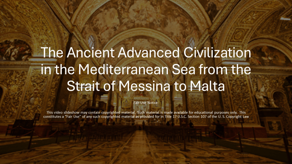
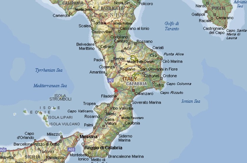
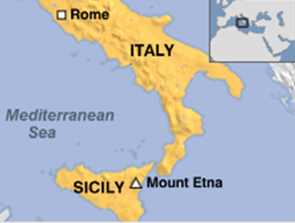
I am going to be taking a close look in this post at the Strait of Messina, particularly the narrowest point between the eastern tip of Sicily, and the western tip of Calabria in Italy; in Sicily, the city of Messina, Mount Etna, one of the most active volcanos in the world; Catania, a city that lies at the foot of Mount Etna on the Sicilian coast; and Valletta, and capital of the island Republic of Malta.

The research in this post came from a 23-part series called “Sacred Geometry, Ley Lines & Places in Alignment” that I did back in 2020 tracking a long-distance alignment of cities and places that started in San Francisco.

I have been showcasing parts of this series in-between work I am doing on another project that is taking me longer to complete.

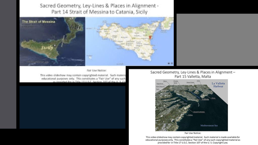
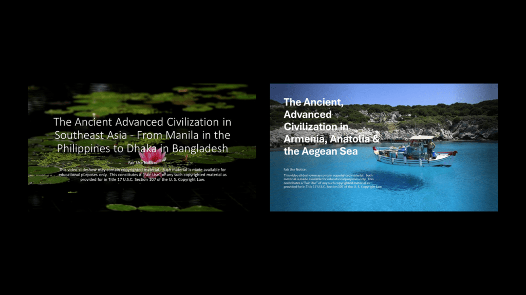
So far from the original 2020 series, I have posted ” The Ancient Advanced Civilization in Southeast Asia – From Manila in the Philippines to Dhaka in Bangladesh” and “The Ancient Advanced Civilization in Armenia, Anatolia & the Aegean Sea.”

From the process of tracking cities and places in several different alignments over the years, I have collected a variety of puzzle pieces about different places that bring a bigger picture into focus that is not immediately apparent on the surface from this type of geographically-focused research.

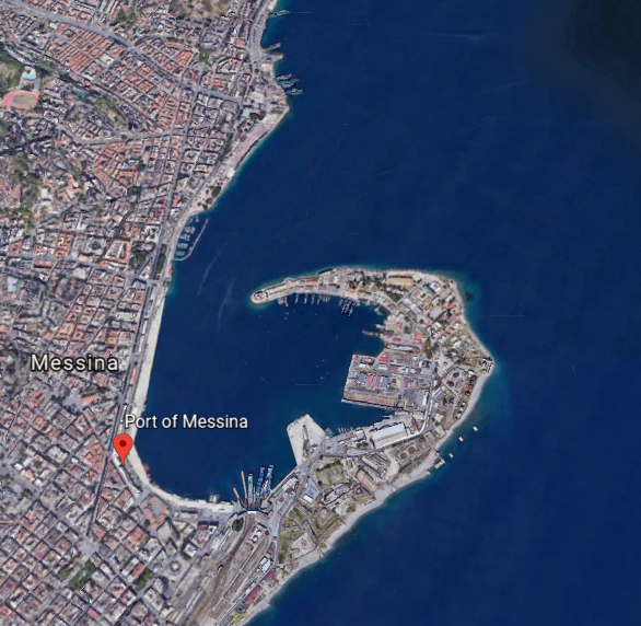
I am starting on the alignment at the Strait of Messina, a narrow strait between the eastern tip of Sicily and the western tip of Calabria in Italy.

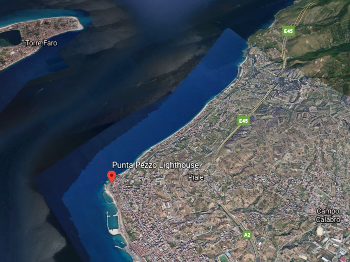
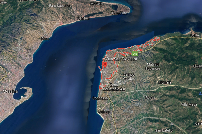
The narrowest point of the Strait of Messina is between the Punta del Faro in Sicily…

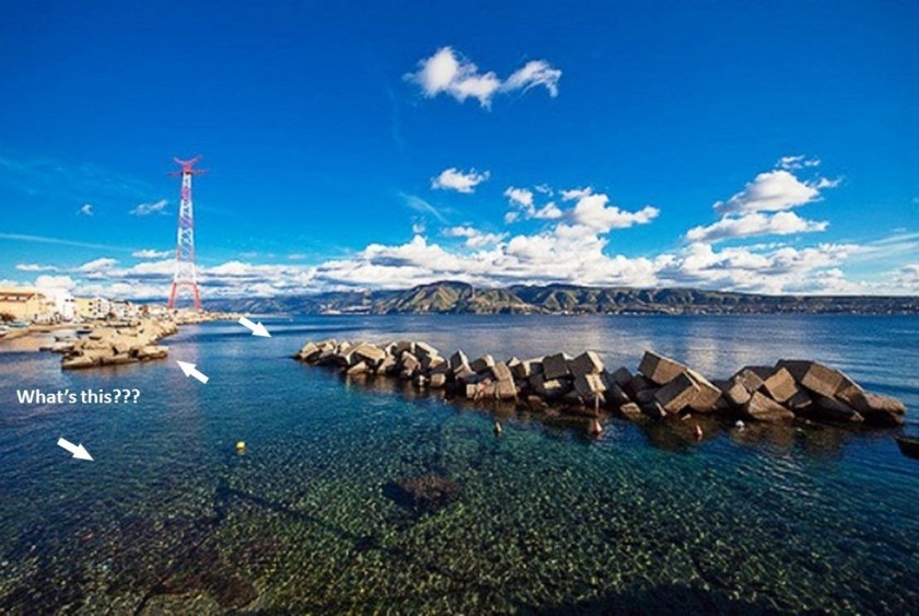
…and the Punta Pezzo in Villa San Giovanni in Italy’s Calabria region.

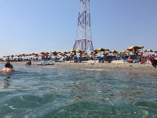
Punta del Faro in Sicily, located northeast of Messina, has a lot going on in a small space.

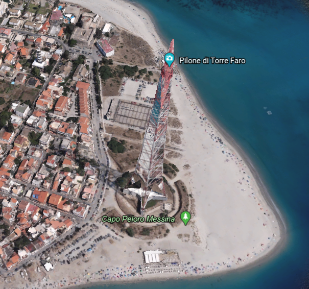
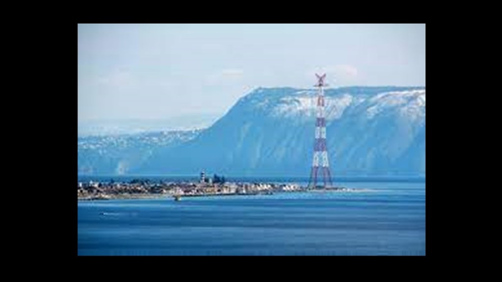
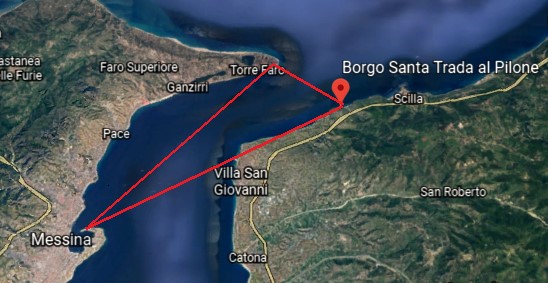
Let’s start with the Torre Faro Pylon.

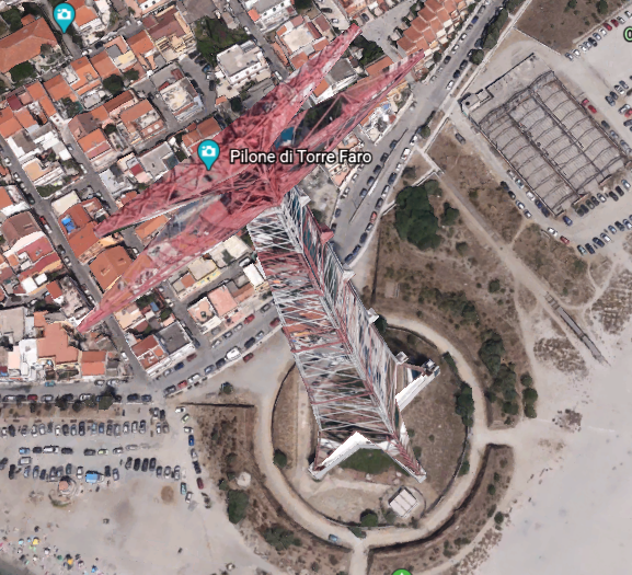
The Torre Faro pylon is one of two free-standing steel towers…

…with the other one, the Santa Trada pylon, being in the Villa San Giovanni across the strait, and standing on top of what looks like one of the more common star fort features.

We are told that they were built in 1955, and used between 1955 and 1994 to carry first 150-kilovolt, and then in 1971, a 220-kilovolt power-line across the Strait of Messina to respective sub-stations on both sides of it.

They were decommissioned in 1993, and the conductors were removed a year later.

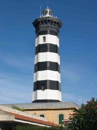
The Faro Point Lighthouse, also known as the Faro di Capo Pelori, is an active lighthouse that is completely automated, powered by mains electricity, or general purpose Alternating Current (AC) electric power supply.

It was said to have been first built in 1853, with periods of disuse in-between. It is operated by the Italian Navy.

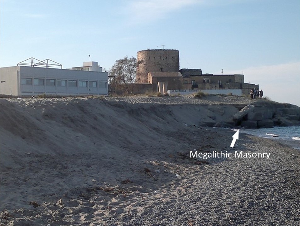
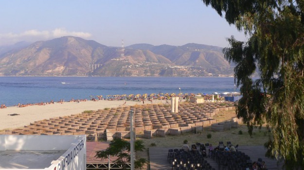
There is what is described as a fortificcation adjacent to the Punta del Faro lighthouse in Sicily…

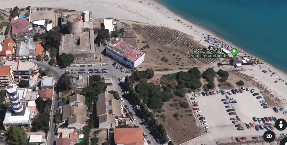
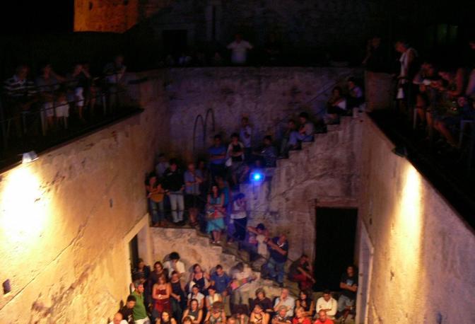
…that is now part of the Lido Horcynus Orca Park.

The fortification gets used for things like cinematographic festivals held here.

Lido Horcynus Orca Park is primarily a beach resort.

Does that look like a beach resort you would like to go to, even if the tower was decommissioned like they tell us?

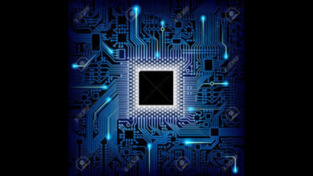
And Lido Horcynus Orca really has some interesting features surrounding the beachfront. Like, what the heck are these squares covering the landscape?

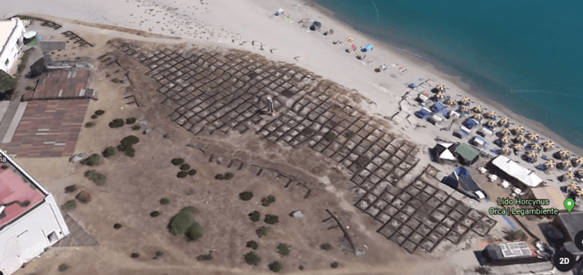
And what are those two white column-looking things?

They brought to mind the square shapes I saw on Google Earth when I was looking at the coast of Iran across from Hormuz Island in the Strait of Hormuz…

…and both lay-outs in the landscape resemble chips on a circuit board.

As the most northeastern point of Sicily, where the Ionian Sea meets the Tyrrhenian Sea…

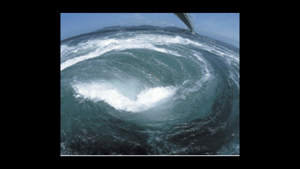
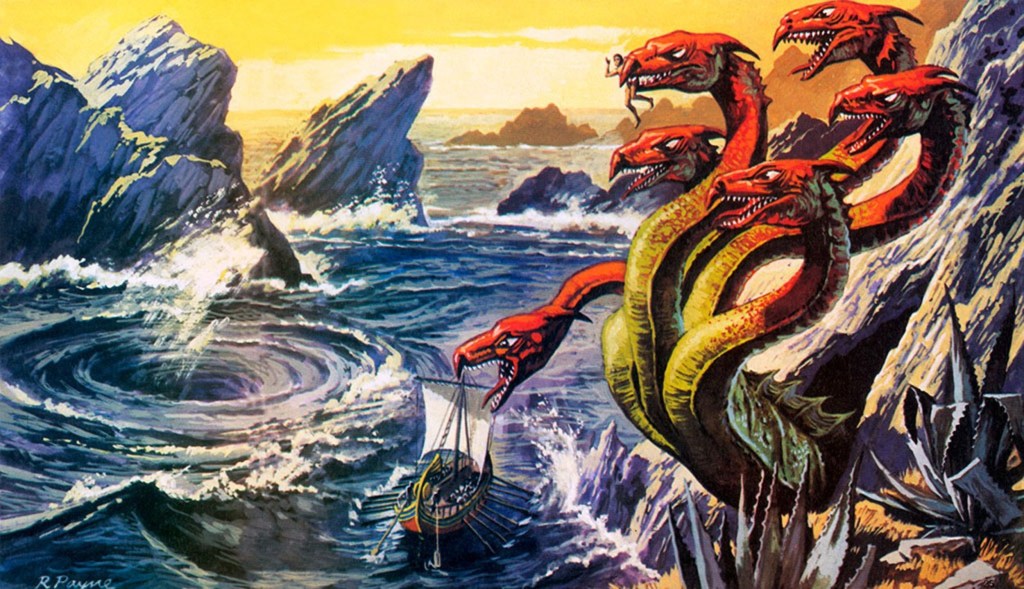
…Capo Peloro or Punta del Faro was supposedly the lair of Charybdis, one of the two beautiful women who had been turned into grotesque monsters by jealous goddesses in Greek mythology.

In one version of the myth, she would partially hide herself beneath a fig tree there, and would frequently leap out into the sea in order to swallow huge quantities of water, creating a whirlpool that would suck down passing ships, and she would belch the water up afterwards.

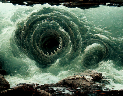
Garofalo, otherwise known to the world as Charybdis, is found in the Strait of Messina. While not technically a whirlpool, it occurs when the winds and tides meet at cross-purposes in the strait, producing rough seas that are hazardous for vessels.

It is also important to note that whirlpools can result from currents running into obstacles beneath the surface of the water.

One more thing before moving across the Strait of Messina to Calabria.

As the ancient Pelorus, Punta del Faro is one of the most celebrated promontories of Sicily, and one of three promontories which were considered to give it the triangular form.

Trinacria, the ancient name of Sicily, was said to derive from an ancient Greek word meaning “three legs” and is synonymous with the sun and said to convey motion.

When I looked up the word “Trinacria,” versions of this image popped up all over the place.

This particular version on the left includes a human head with serpents and wings. similar to the winged disk symbol on the right, most commonly associated with Ancient Egyptian and Mesopotamian cultures…

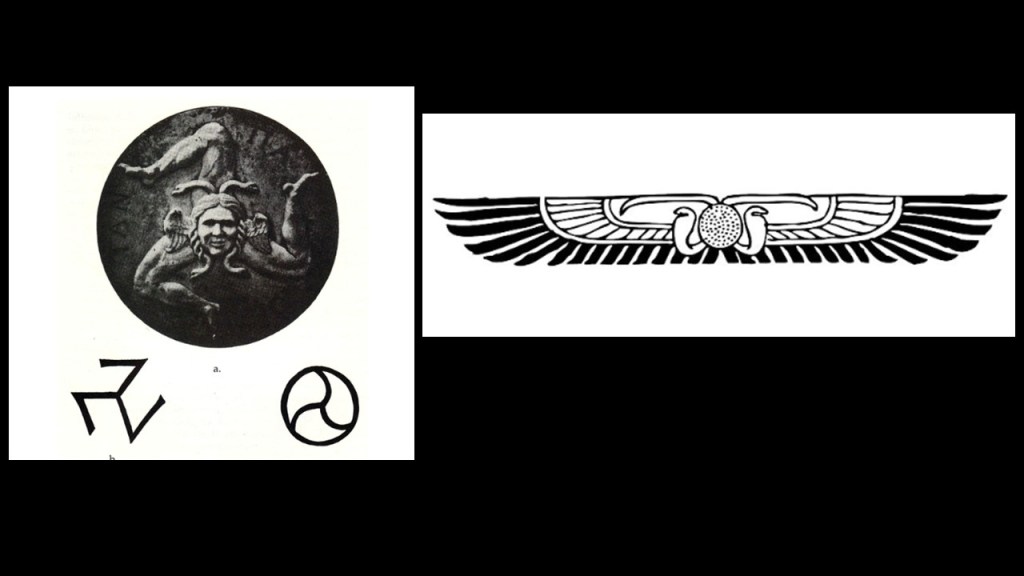
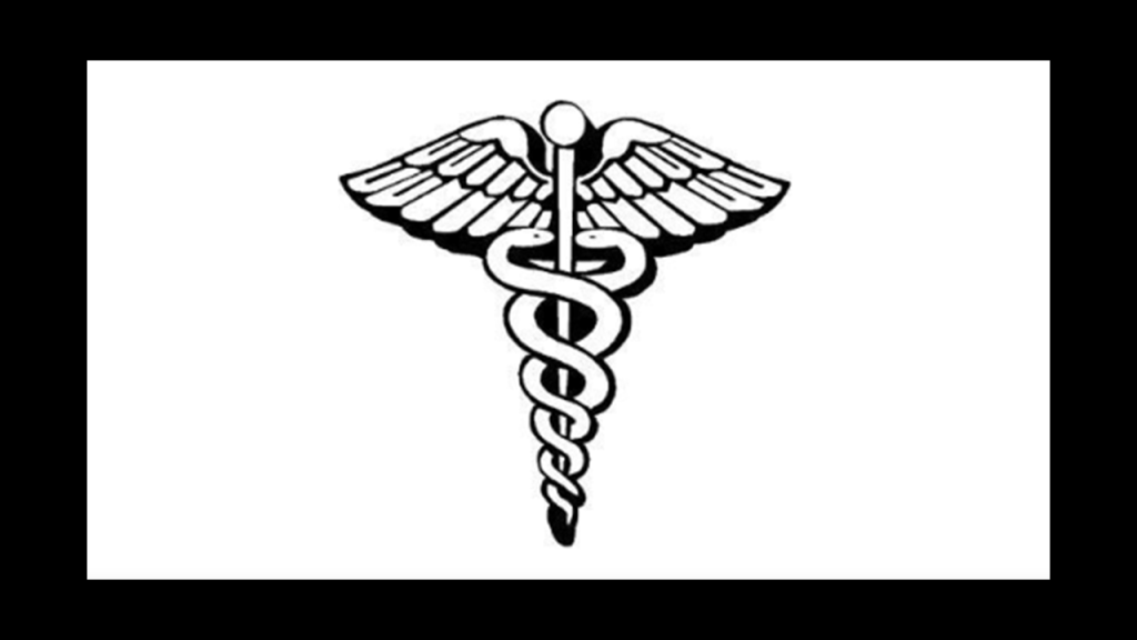
The caduceus, the staff of Hermes in Greek mythology, has the same imagery of serpents and wings, and is an emblem of the medical profession in today’s world.

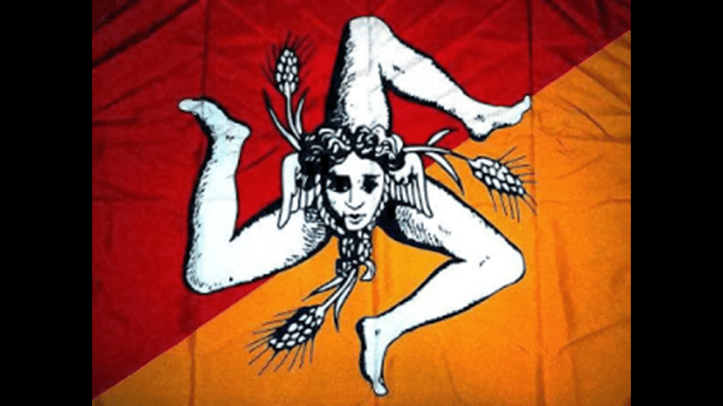
This version of the Trinacria is on the flag of Sicily. The head still has wings, but the serpents aren’t clearly defined as in the first head, kind of looking more like ropes, and the addition of what looks like three ears of wheat.

Why was the image modified?

When I looked more deeply into it, I found out that the Trinacria is a symbolic representation of the zenith of the soul in its present state of existence, and the setting of the spiritual essence in its totality, and that it represents self-realization and ascension.

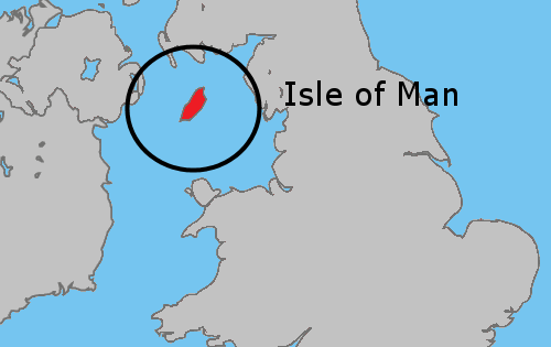
This is the flag of the Isle of Man, with a very similar shape called the Triskelion…

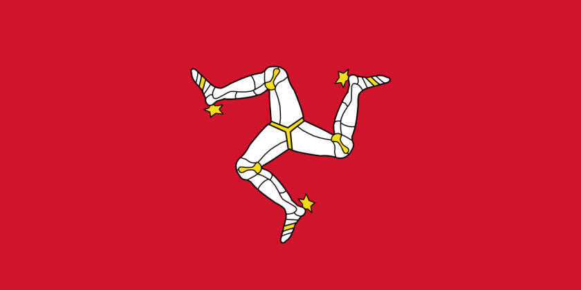
…and the Isle of Man is located in the Irish Sea between Ireland and Great Britain.

Interesting that there is information like this about ancient knowledge to be found in flags, as well as information about the true identity of the missing civilization.

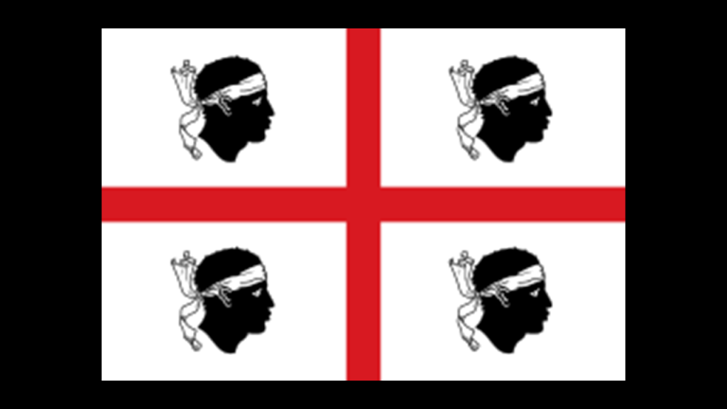
This is the flag of Sardinia, a large island region of Italy in the Mediterranean Sea, northwest of the Strait of Messina.

It is also called the flag of the Four Moors…

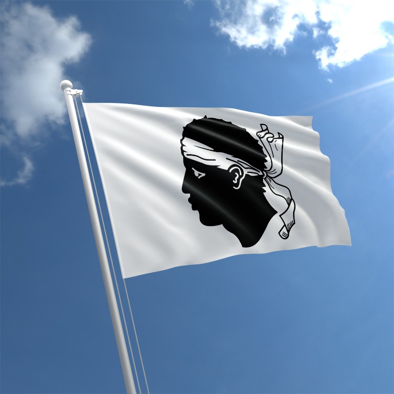
…and this is the flag of Corsica, an island region of France, just north of Sardinia, with only one Moor’s head displayed on it.

Now changing my focus to look at Punta Pezzo, the closest point between Italy’s Calabrian shore in the Villa San Giovanni, and Punta del Faro in Sicily.

The city of Villa San Giovanni faces the city of Messina across the strait.

This part of Calabria was a focal point for Napoleon Bonaparte, after he proclaimed himself emperor of France in 1804.

I most definitely think that Napoleon and the Napoleonic Wars were part of the reset of our history.

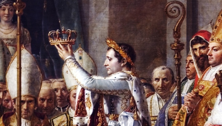
He is, after all, attributed in our historical narrative with making the statement that “History is a set of lies agreed upon.”

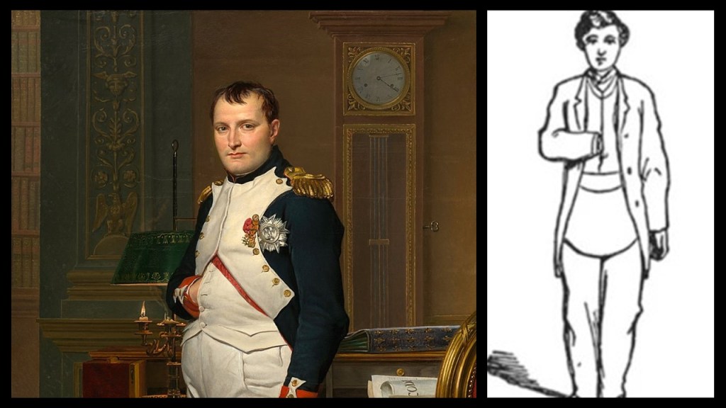
He was also the first historical figure I ever remember seeing early on in my life depicted with the Freemasonic “hidden hand” tucked into his waistcoat, a hand-sign signifying “Master of the Second Veil.”

As a matter of fact, this pose and Napoleon go “hand-in-hand” so to speak!

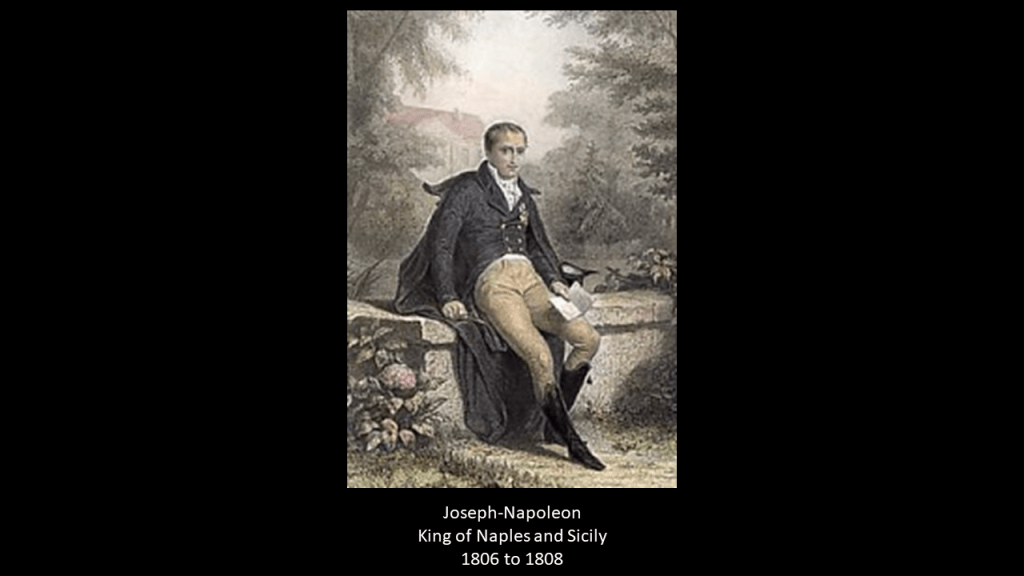
Napoleon made his older brother, Joseph-Napoleon, the King of Naples and Sicily between 1806 and 1808, who we are told, implemented administrative reforms in 1806 that abolished the ruling system that was in place here, and the original Lordship of Fiumara disappeared.

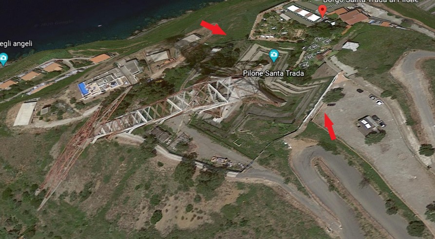
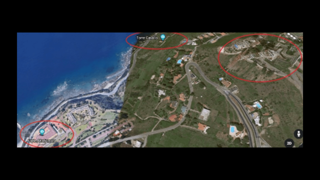
Then, starting in June of 1810, we are told the new King of Naples, Joachim Murat, and also the brother-in-law of Napoleon, ruled the southern Kingdom from the heights of Piale for four months, during which that short period of time he was given the credit for having built the fort of Punta Pezzo, or Piale, with a telegraph tower…
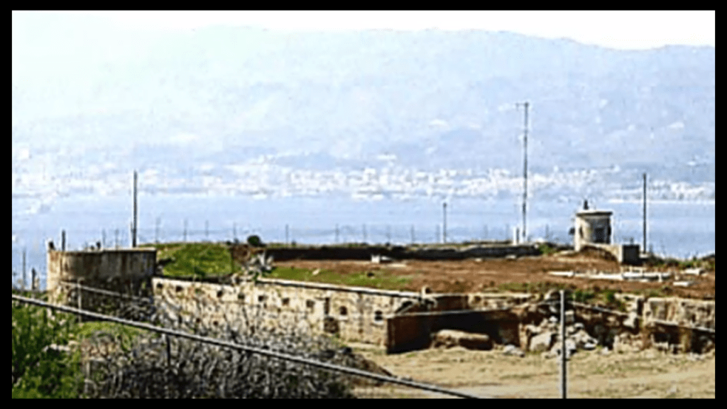
…the Torre Cavallo…

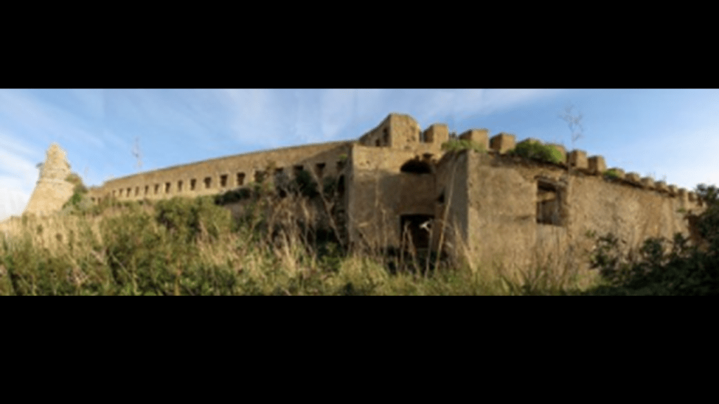
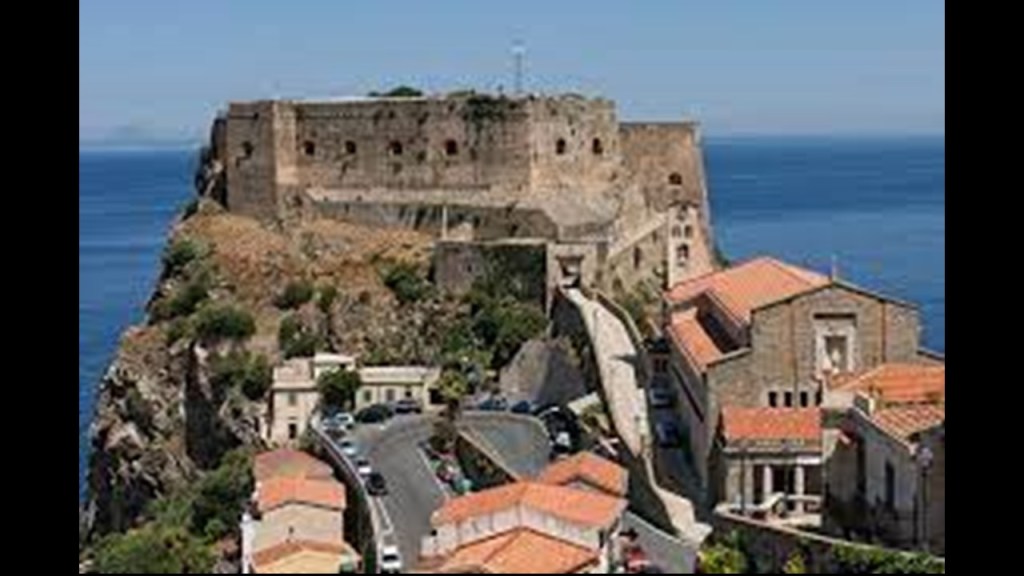
…and the Castello Altafiumara…

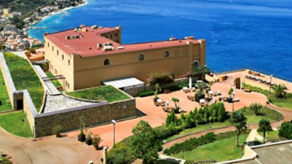
…with the Castello Altafiumara and Torre Cavallo both being in close proximity to the Santa Trada Pylon we saw earlier.

This particular geographic location appears to have been a particularly important place on the Earth’s grid system, similar in scope of what’s here to what I found in Sault Ste. Marie, Michigan and Sault Ste. Marie, Ontario, situated across from each other with the Saint Mary’s River in-between them.

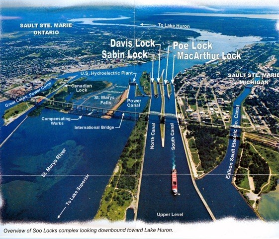
See my blog post “Sault Ste. Marie – A Microcosm of the Advanced & Global Moorish Civilization” for an in-depth analysis of the region nicknamed “The Soo.”

Just a short distance north of Calabria’s Punta Pezzo , we find the Ruffo Castle of Scilla, described as an ancient fortification, and situated on a promontory in the Strait of Messina in the town of Scilla…

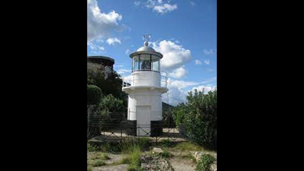
…and which houses the Scilla Lighthouse, also operated by the Italian Navy, like the Faro del Cape Peloro in Sicily.

Scilla is also the traditional site associated with the sea monster Scylla of Greek mythology, with its location right at the entrance to the Strait of Messina.

The linguistic idiom “between Scylla and Charybdis” means having to choose between two similarly dangerous situations, like the more common idiom “between a rock and a hard place.”

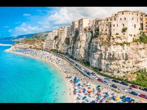
Other places of interest in Calabria, known in antiquity as Bruttium, include Tropea, an ancient seaside town built on top of a cliff, with a legend of having been founded by Hercules when returning from his labors at the Pillars of Hercules (in the Strait of Gibraltar)…

…and Reggio di Calabria, known as Rhegium in ancient times, located on the toe of the boot of the Italian peninsula.

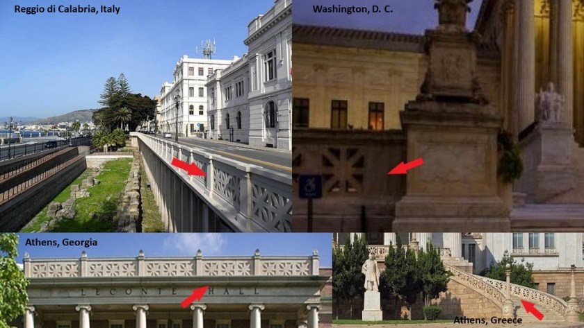
It is interesting to note the presence of the same design pattern in the architecture of Reggio di Calabria that you find at the Supreme Court in Washington, DC; at Leconte Hall at the University of Georgia in Athens, Georgia; and at the National Library of Greece in Athens, Greece.

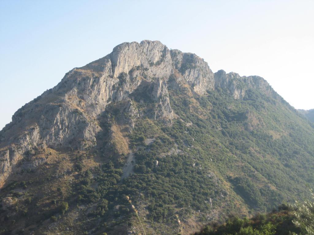
Reggio di Calabria is located on the Aspromonte, a long craggy mountain range that runs up through the center of the region, and described as resembling a giant pyramid.

This is Mount Consolino in the Aspromonte…

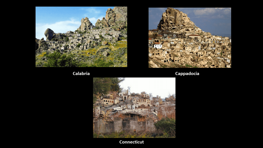
…and within the boundaries of Aspromonte National Park, you find places like the ghost towns of Pentedattilo on the top left, which brought to mind similar-looking places in Cappadocia, and what was Holy Land USA on the bottom, in Waterbury, Connecticut, which we are told was a theme park inspired by passages from the Bible that opened in 1955 and closed and abandoned in 1985…

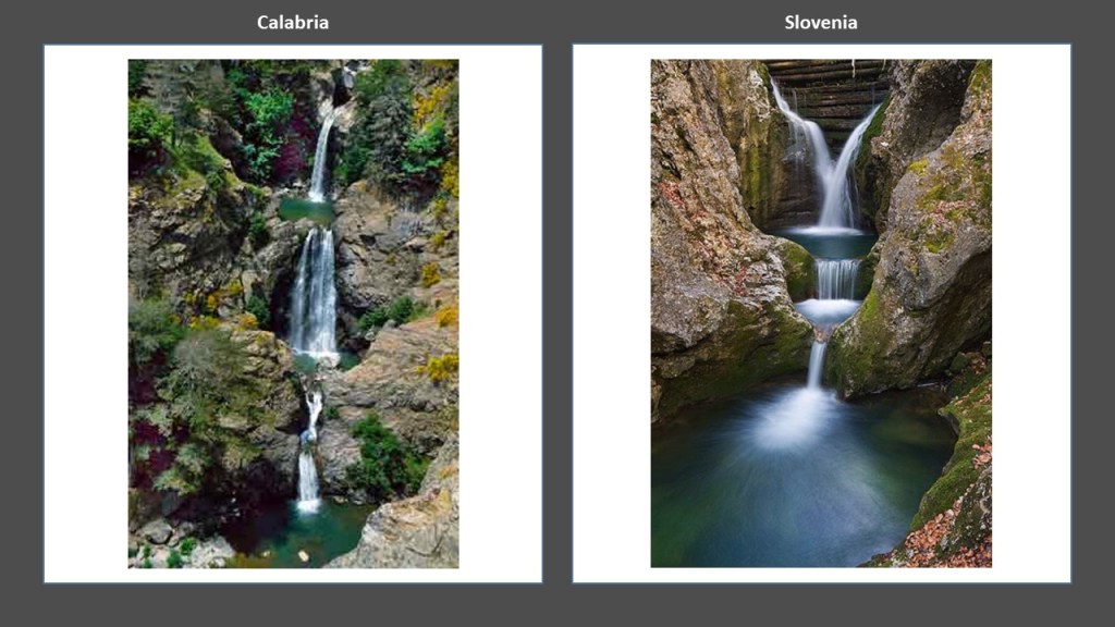
…as well as waterfalls, like the multi-storied Maesano waterfalls on the left, compared with these waterfalls in Slovenia on the right that are also multi-storied

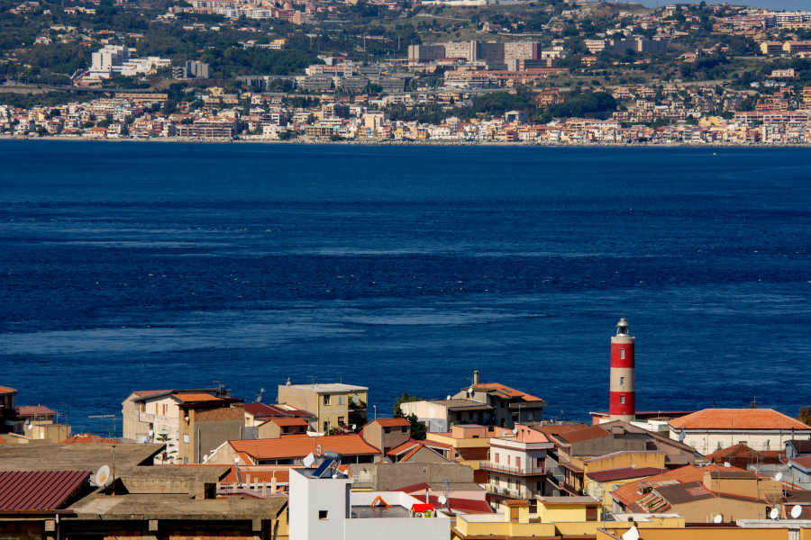
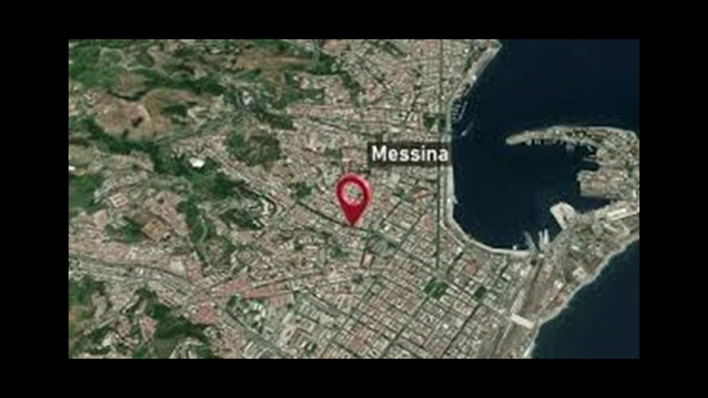
Back across the Strait to take a look at Messina proper, with a population of over 230,000, and the metropolitan area of Messina, which includes Punta del Faro, is around 650,000, making it the third-largest city in Sicily, and the thirteenth largest in Italy.

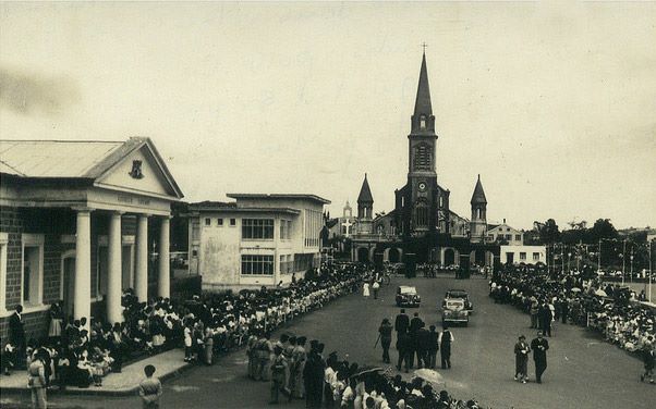
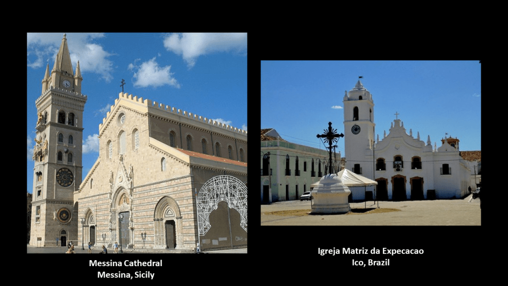
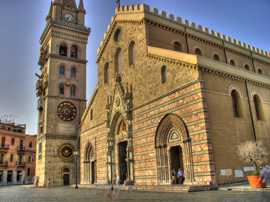
The Messina Cathedral is said to be an example of Norman architecture, built on the orders of the Norman King Ruggero II in 1120 AD.

For comparison in appearance, this is the Igreja Matriz da Expecacao in Ico, Brazil, on the right.

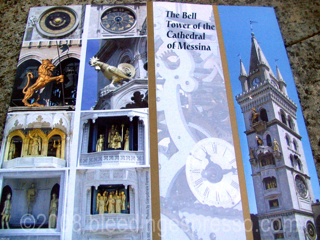
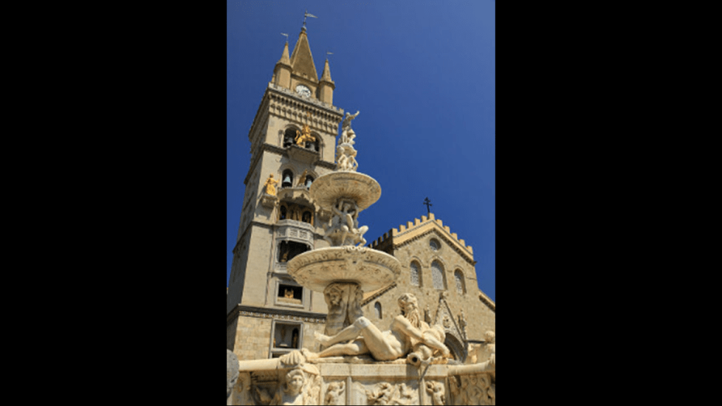
We are told the current Bell-Tower next to the Messina Cathedral was inaugurated in 1933, after having been designed by the firm of Ungerer of Strasbourg, and is famous for having the biggest and most complex astrological clock in the world.

Every day at noon, a complex system of counterweights, leverages, and gears moves gilded bronze statues located in the facade.

The Fountain of Orion is in front of the Messina Cathedral, and said to have been finished in 1553, commemorating both the city’s mythical founder, and the completion of the first aqueduct of Messina in 1547.

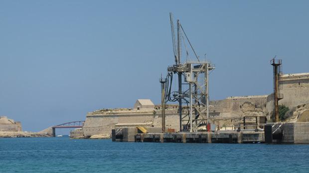
Messina is a major port city.

…and the said-to-be 16th-century Forte del Santissimo Salvatore is located at the port’s entrance.

The Stele of the Madonna Lettera, erected on the fort, was said to have been consecrated and inaugurated in 1934.

I see the Torre Faro pylon in the distance.

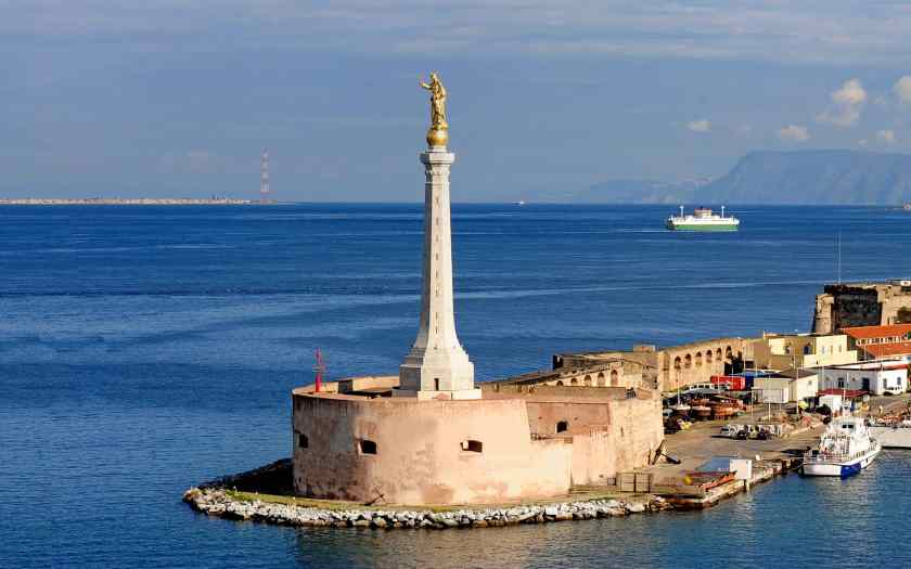
It looks like there could be a triangulated relationship between the Stele, the Torre Faro pylon, and the Santa Trada pylon.

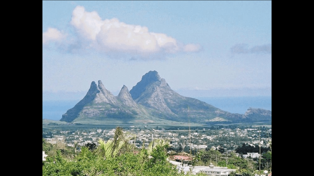
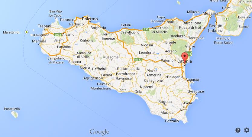
The next place we come to on the alignment is Mount Etna, on the east coast of Sicily, in what is called the Metropolitan City of Catania, formerly the Province of Catania.

It is located between the cities of Messina and Catania.

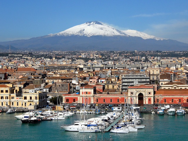
It is a stratovolcano that is one of the most active in the world, and is in an almost constant state of activity.

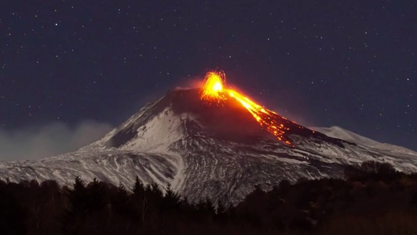
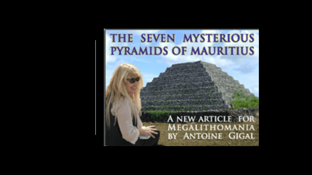
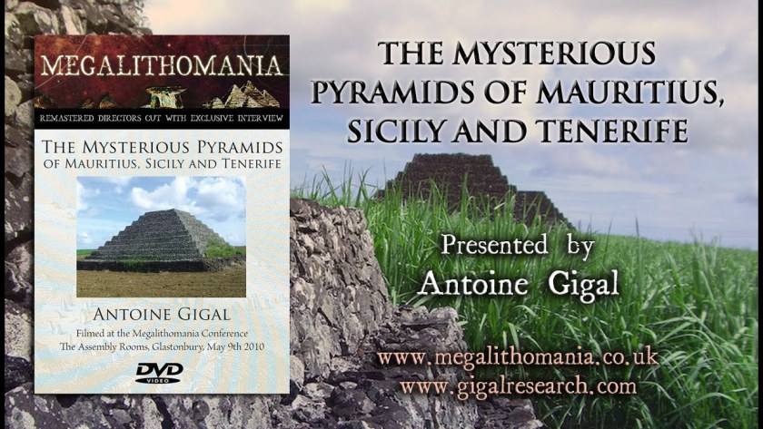
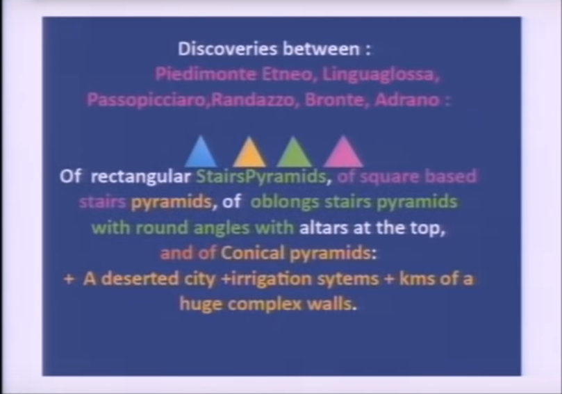
I learned several years ago in a Megalithomania presentation by Antoine Gigal about pyramids around Mount Etna, and I am drawing from her research in the next slides about this obscure subject.

Antoine Gigal is a French writer, researcher and explorer, and the founder of Giza for Humanity who went to Sicily where she heard about 12 pyramids there.

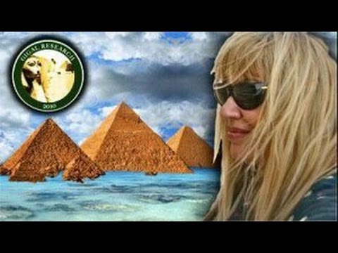
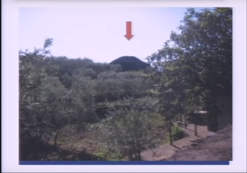
Instead of finding the 12 pyramids she was told about, she found 23 pyramids around Mount Etna, and proceeded to literally do field research, as the pyramids were in the middle of fields.

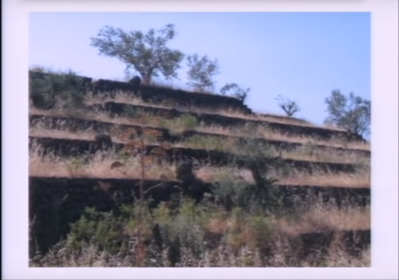
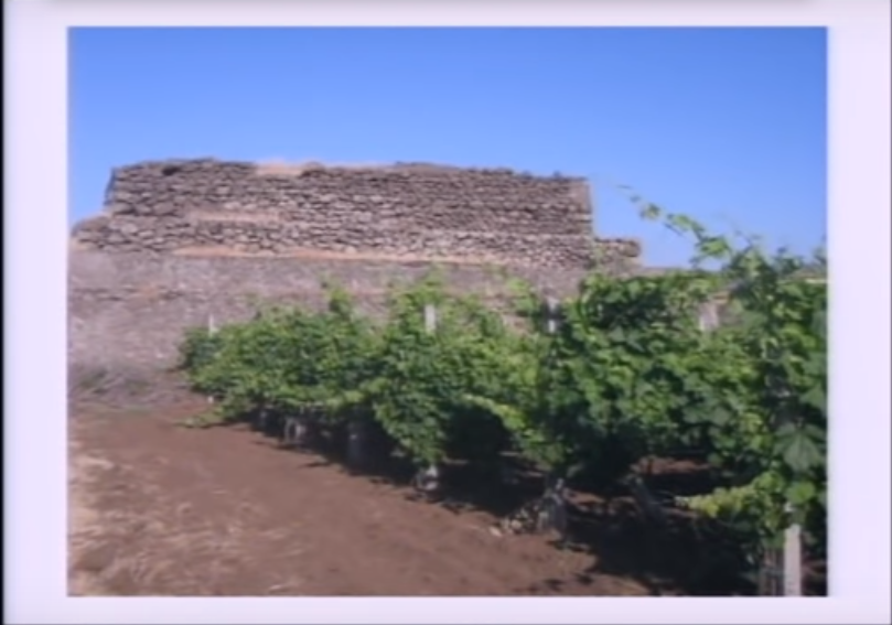
She found pyramids of different shapes and sizes…

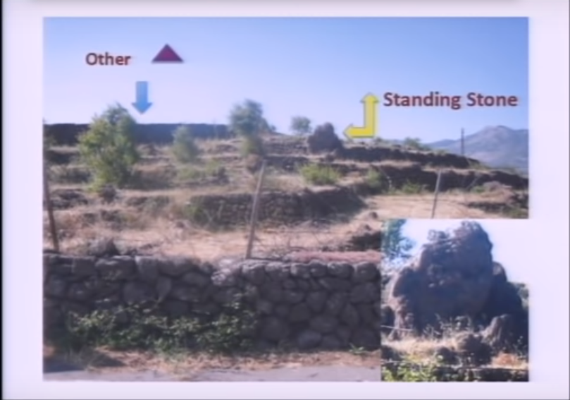
…like an oblong step pyramid between the towns of Passopisciaro and Francavilla…

…which has a standing stone…

…a rectangular pyramid between Linguaglossa and Randazzo…

…and this rectangular pyramid on Mount Etna’s north side.

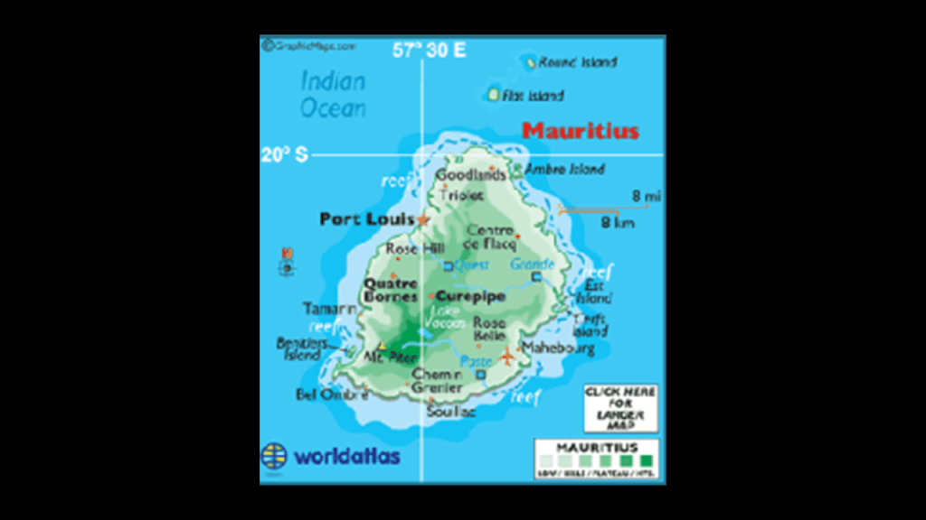
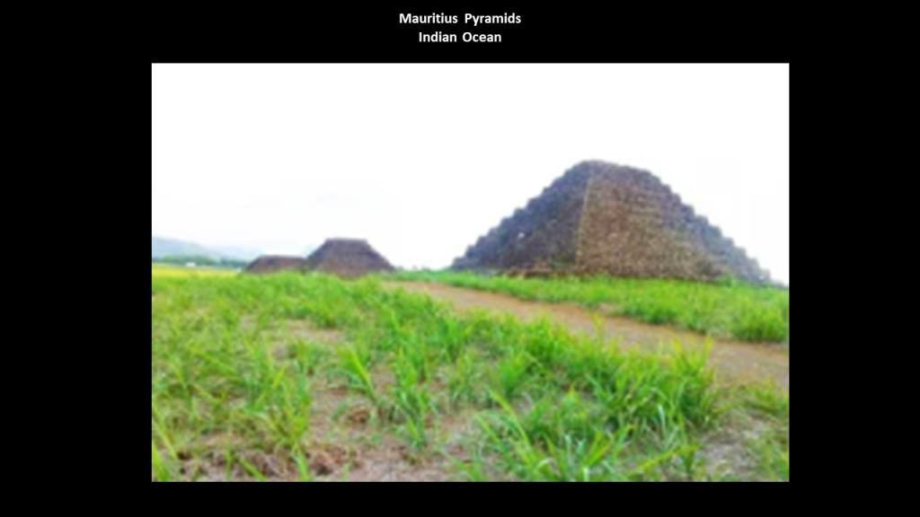
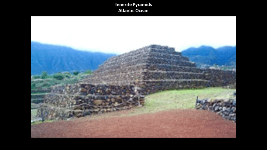
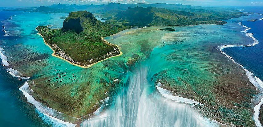
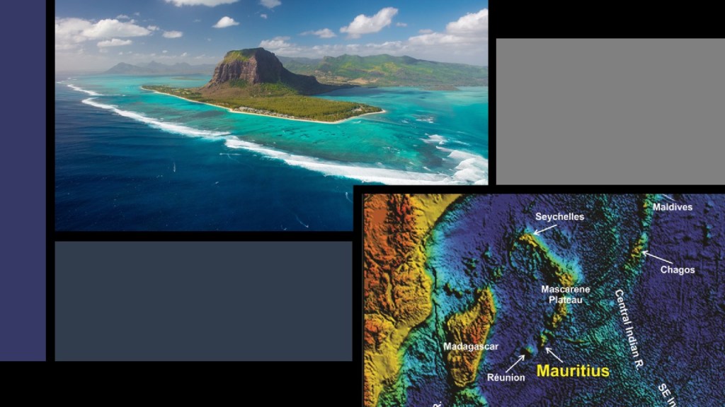
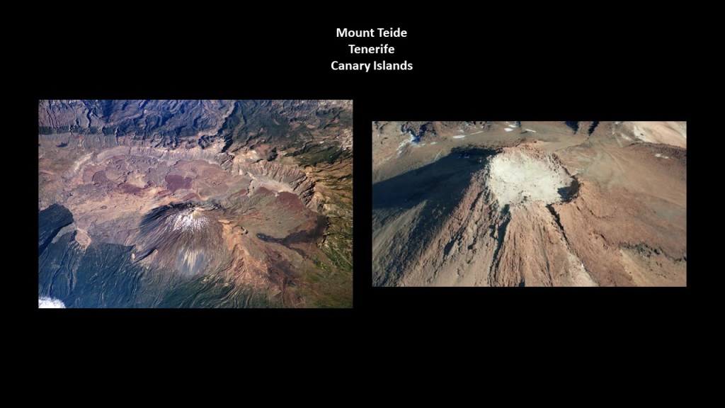
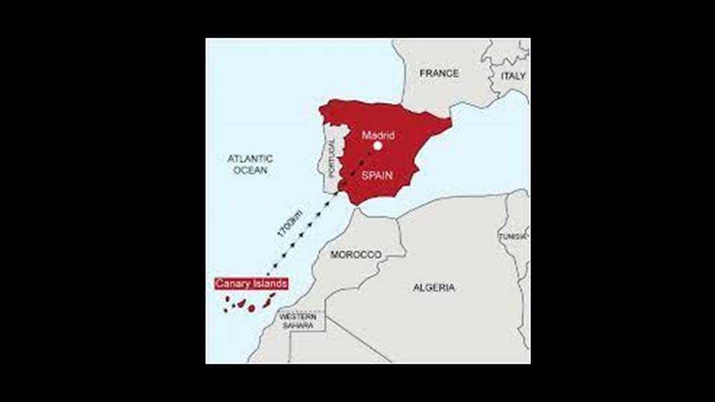
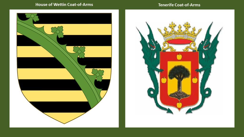
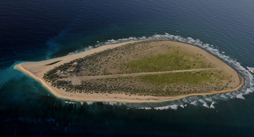
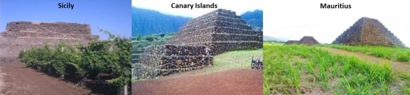
In Antoine Gigal’s presentation, she demonstrates that the construction style of the Sicilian pyramids is like that of the Guimar Pyramids of Tenerife in the Canary Islands in the Atlantic Ocean, and also like that of the pyramids of the island nation of Mauritius in the Indian Ocean.

The last place I am going to be looking at in Sicily is Catania…

…located at the foot of Mount Etna.

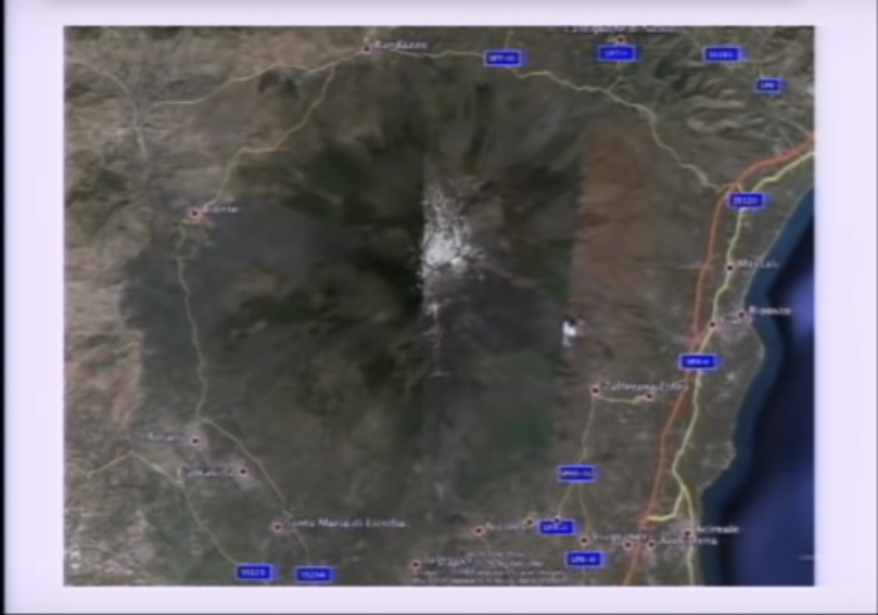
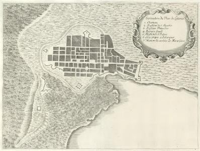
This illustration was said to be of a 1679 eruption of Etna that impacted Catania and also shows what looks to be a star fort around the city or a star city.

This prompted me to look for historic maps of Catania, and I found this old map of the city which confirms the finding.

Beneath the surface-level city of Catania, there are said to be several layers of underground cities…

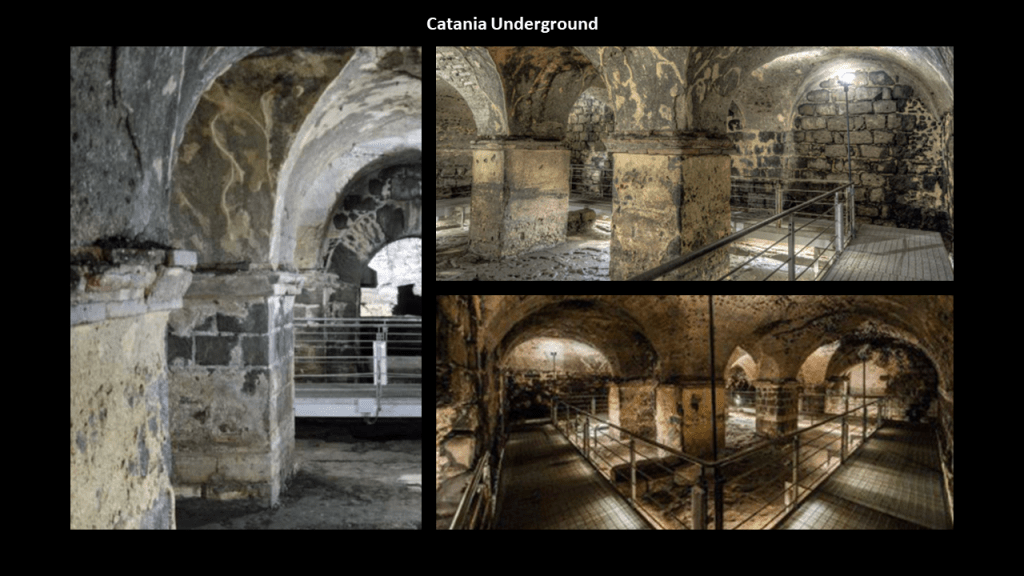
…like what is found in Central Anatolia in Cappadocia, which has been determined to have 40 underground cities, of which 6 are open to the public, like Derinkuyu, an ancient, deep multi-level underground city said to be large enough to shelter 20,000 people together with their livestock and food supply, and opened to visitors in 1969.

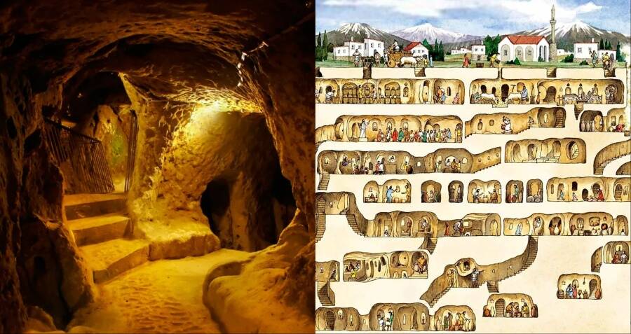
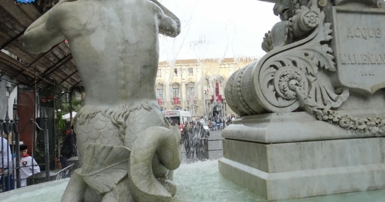
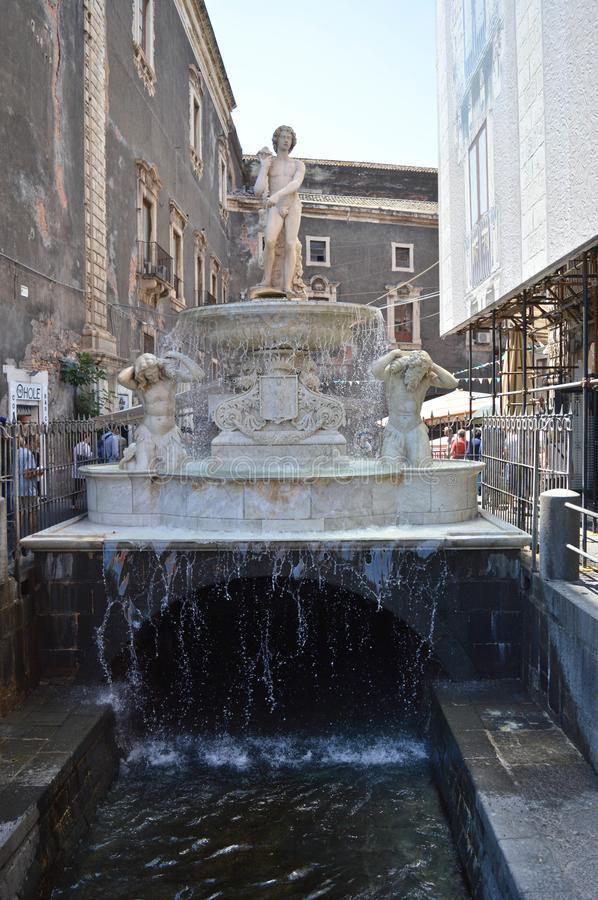
Catania also has an underground river, named Amenano…

…and in the Piazzo del Duomo, the main square of the city, is the Amenano Fountain of the Amenano River, said to have been sculpted in 1867 by Italian sculptor Tito Angelini, with a young man atop the fountain said to represent the Amenano River, holding a cornucopia with water flowing from it in a basin…

…and sculptures of Tritons on either side.

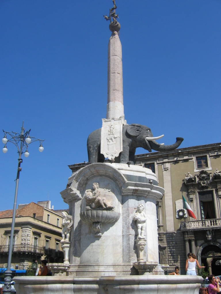
The Catania Town Hall, also known as the “Palace of the Elephants” is also in the Piazzo del Duomo…

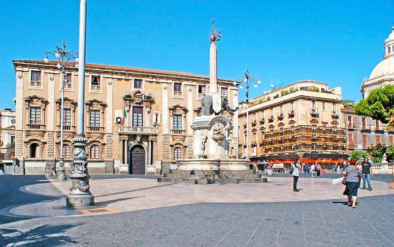
…with the U Liotru fountain, the elephant symbol of Catania, said to have been carved from ancient lava stone and topped by an obelisk from Syene (now called Aswan) in Egypt.

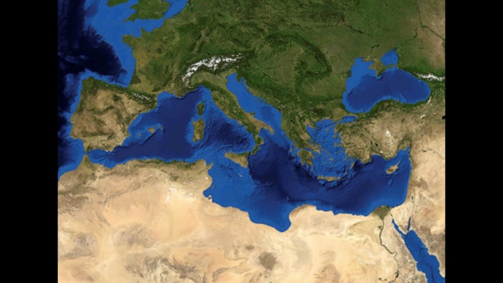
As with everywhere else, there is much more to find in Catania, and Sicily as a whole, but I am going to move along the alignment across the Mediterranean Sea over to Malta.

Before I get to Malta, I would like to take an opportunity to ponder something here that just now struck me.

The literal meaning of “Mediterranean” from the Latin “medius” and “terra,” is “middle” and “earth or land.”

So it would be translated into English along the lines of “Middle Earth” Sea.

Just really wondering if there was more land than water here at one time in Earth’s history, and not the “sea” we see today.

When you search for the term “Middle Earth,” it’s mostly the work of J. R. R. Tolkien that fills up the internet search page.

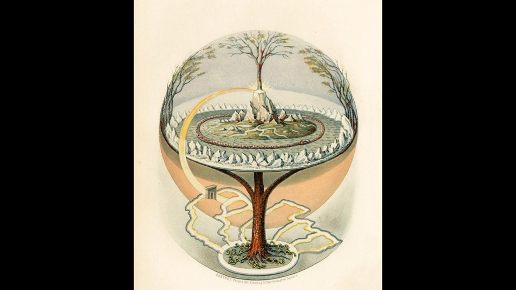
When you plug “Midgard” into the search engine, you get that “Midgard” is the abode of Human Beings in Norse Mythology, and the “middle realm” that is situated in the branches of Yggdrasil, the world tree. that provides the “Axis Mundi,” the “Axis of the Universe” that connects all realms.

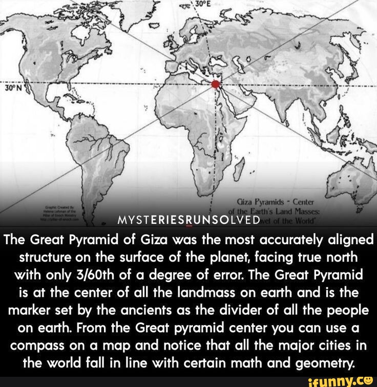
Also, we are told the Great Pyramid of Giza in Egypt, a country on the Mediterranean Coast of North Africa, is in the exact center of the Earth’s landmass.

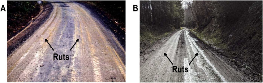
As we head into Malta, it is one place on the Earth that I can think off the top of my head that is known for its mysterious “cart ruts” leading into, and under, the water.

And that’s exactly what they are referred to as. Ruts.

Ruts are defined as “a long, deep track made by the repeated passage of the wheels of vehicles.”

Like the ruts you encounter on unpaved roads.

Just leaving all this here as something to think about, along with everything else.

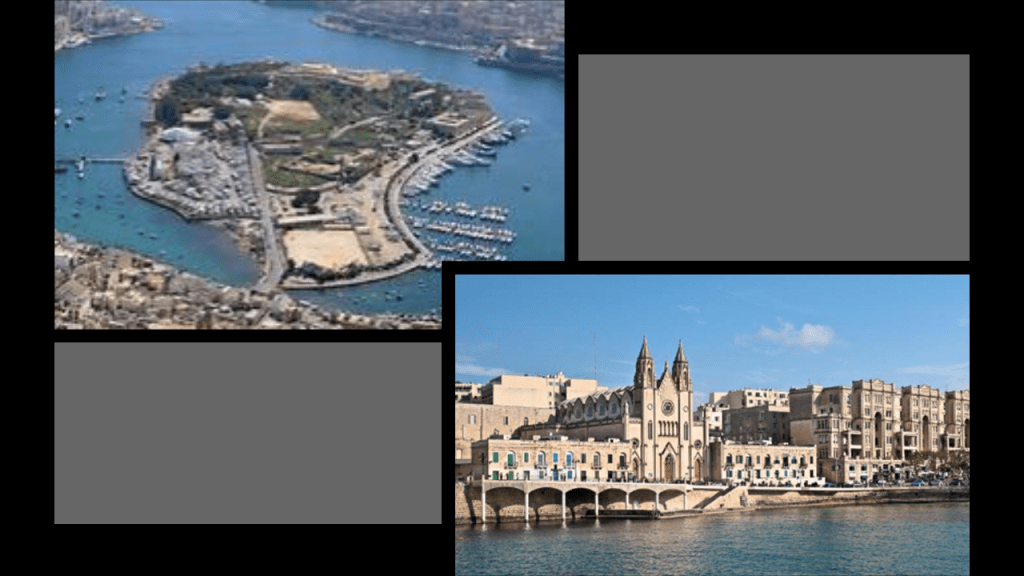
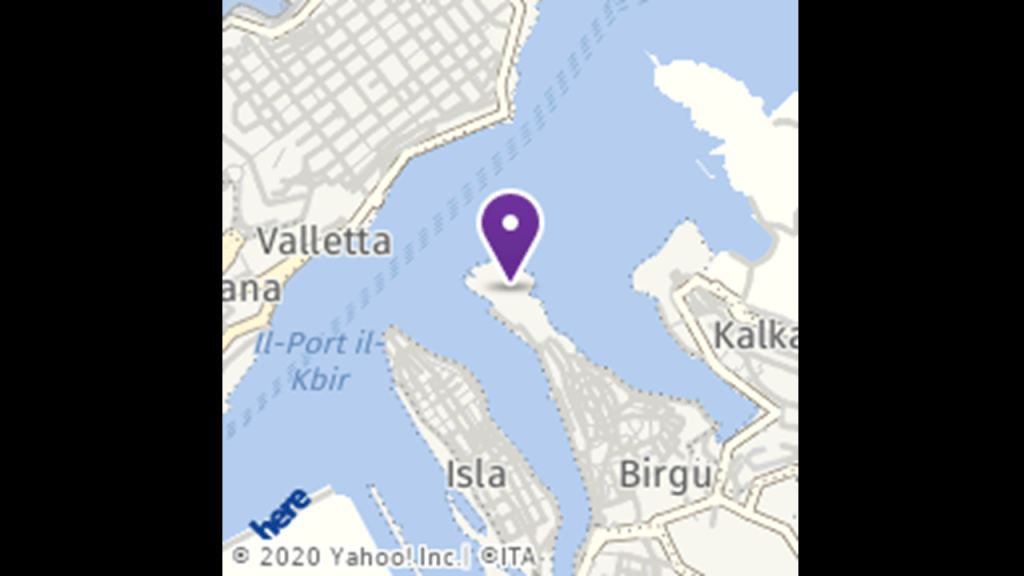
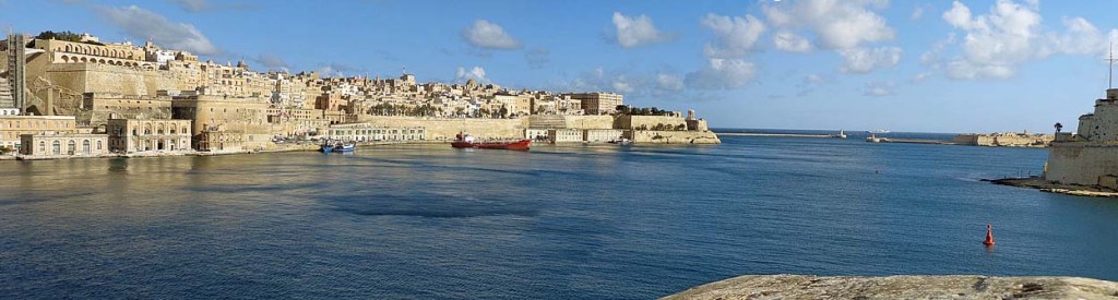
the island Republic of Malta. in the vicinity of its capital, Valletta.

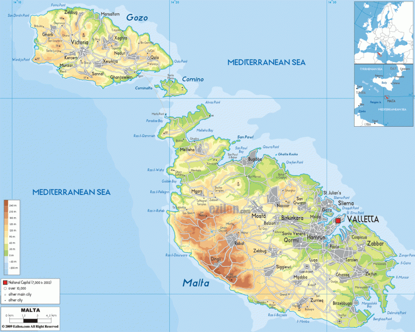
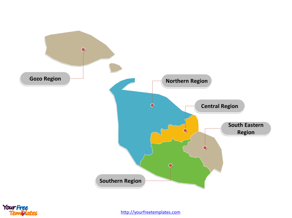
…and located in the Southeastern Region of the main island, one of the five regions of Malta.

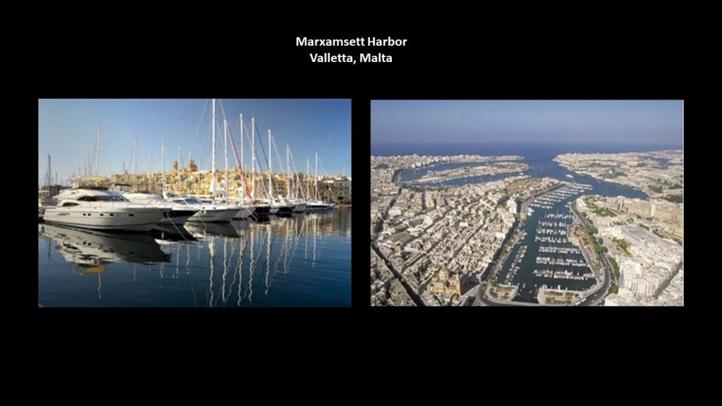
The city of Valletta is situated between the Marsamxett Harbort and the Grand Harbor.

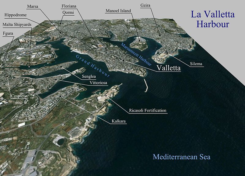
Marsamxett Harbor is described as a natural harbor generally more dedicated to leisure use than the Grand Harbor…

…and is bounded to the north by Dragut Point and Tigne Point…

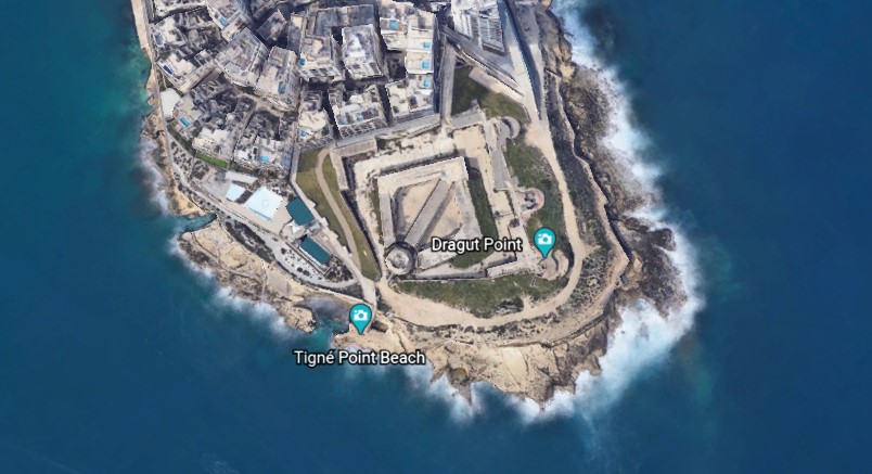
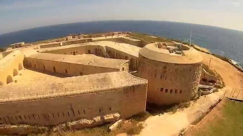
…where we find Fort Tigne…

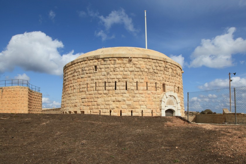
…said to have been built by the Order of the Knights Hospitallers of St. John between 1793 and 1795 and claimed to be one of the oldest polygonal forts in the world.

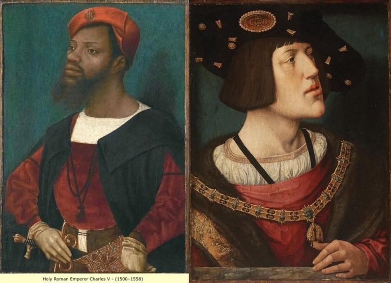
We are told the Order of the Knights Hospitallers of St. John ruled Malta from the time when the Emperor Charles V (who was also King Charles II of Sicily) gave the islands of Malta and Gozo to the Order in 1530, as well as Tripoli in Libya, until the time the Order surrendered to Napoleon when the French landed in Malta in 1798.

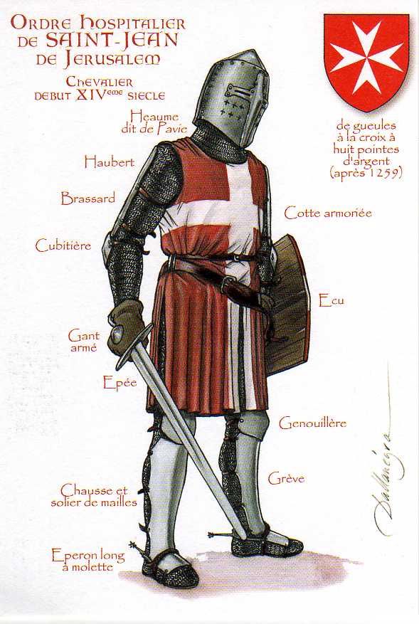
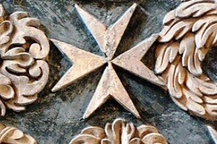
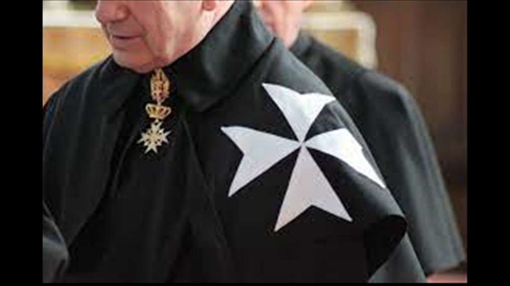
Known usually by the shorter Order of St. John, the Maltese Cross was said to have been officially adopted by the Order in 1126.

And today’s Order of St. John was chartered by Queen Victoria in 1888 as a British Royal Order of Chivalry.

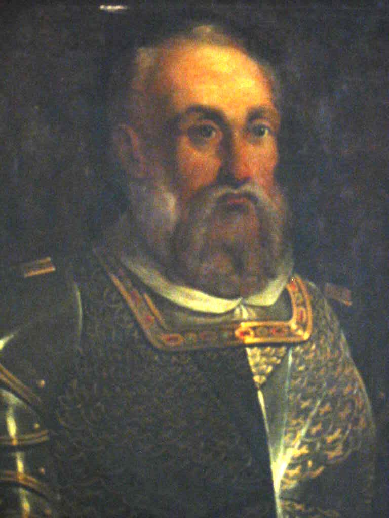
Interesting to note that I have found two different portraits of Charles V, Emperor of the Holy Roman Empire between 1500 and 1558, each having similar facial structure and tilts of the chin, and wearing similar clothing.

Manoel Island is a small island in Marsamxett Harbor, situated close to Tigne Point…

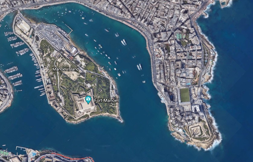
…and the location of Fort Manoel…

…said to have been built in the 1720s by the Portuguese 66th-Grand Master of the Knights of Malta, Antonio Manoel de Vilhena.

We are told the British military took over the fort in 1800, and renamed it HMS Phoenicia, who used it until 1964…relatively recently.

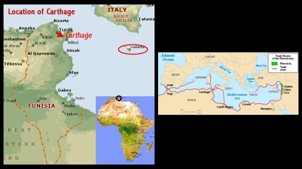
Interesting to note that Malta is geographically quite close to Carthage, and in the middle of the historic location of what was Phoenician, which became the Carthaginian, Empire in our historical narrative.

Manoel Island is connected to the town of Gzira, in Malta’s Central Region, by a bridge…

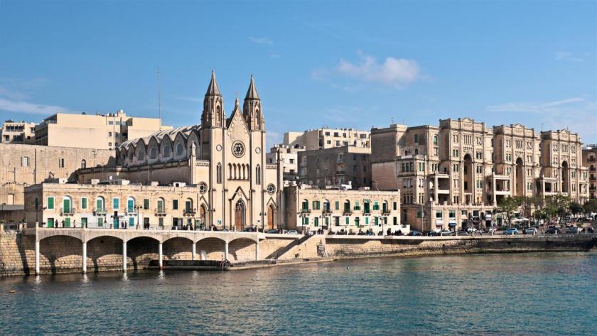
…where we find an Orpheum Theater, said to have been built in 1932.

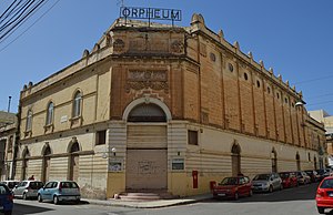
There are two points I would like to make about this finding.

This is the first point.

Orpheus was a musician and poet in Ancient Greek legend, said to have had the ability to charm all living things, and even stones, with his music, and even put them to sleep.

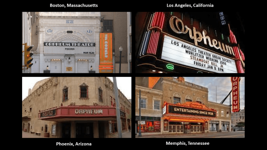
In the course of my research, I found numerous early theaters called “Orpheums,” like the one in Gzira in Malta, including the Orpheum Theater in Boston on the top left; Los Angeles on the top right; Phoenix on the bottom left; and Memphis on the bottom right.

What, exactly, caused us to go to sleep, and forget who we are, and what we were? How has the false information we have been taught in school been reinforced?

Why would this be important to whoever or whatever was responsible for removing the ancient advanced civilization from our collective awareness to begin with?

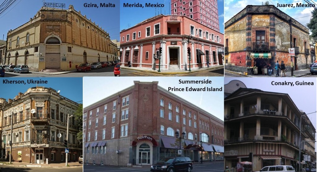
The second point that I would like to make about the Orpheum Theater in Gzira is its street-corner style of architecture…that I have found worldwide, like in Merida, Mexico in the top middle; Juarez, Mexico, on the top right; and on the bottom left, in Kherson, Ukraine; bottom middle, Summerside in Prince Edward Island; and on the bottom right, in Conakry, the capital of the African country of Guinea.

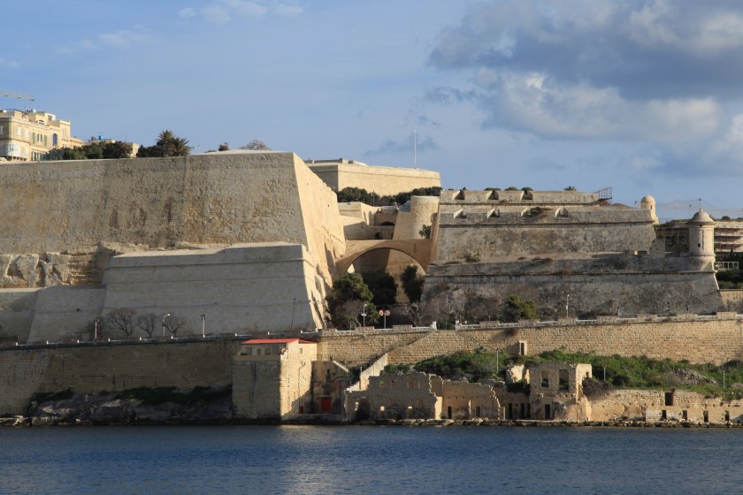
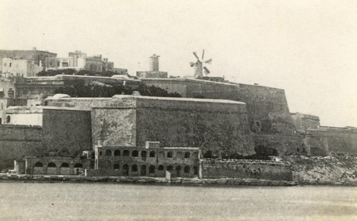
Fort St. Elmo stands on the seaward shore of the peninsula that divides Marsamxett Harbor from the Grand Harbor…

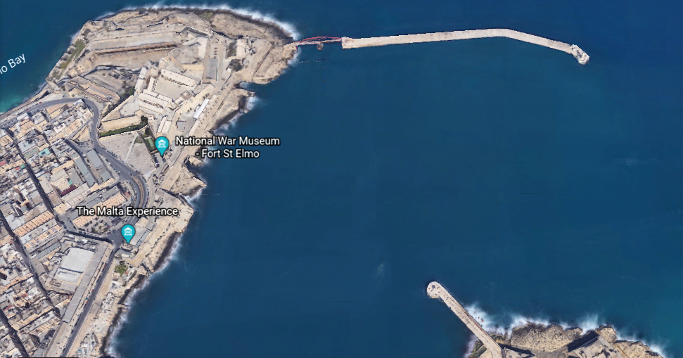
…and said to have been built in its present form as a star fort in the 1550s.

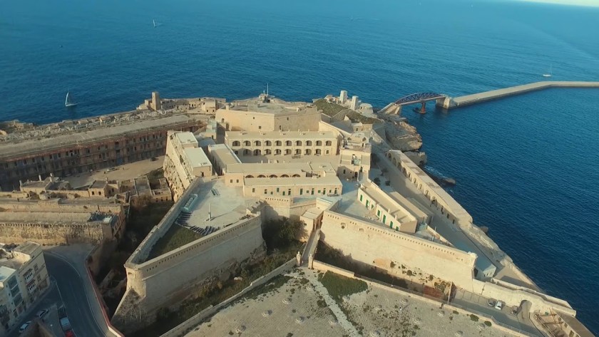
It was the target of aerial bombardment on the first day Malta became involved in the conflict of World War II.

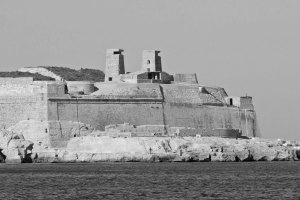
Fort St. Elmo is situated in the middle at the entrance to the two main harbors, between Fort Tigne at the entrance to the Marsamxett Harbor, and Fort Ricasoli at the entrance of the Grand Harbor.

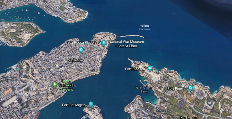
Fort Ricasoli was said to have been built by the Order of St. John between 1670 and 1698.

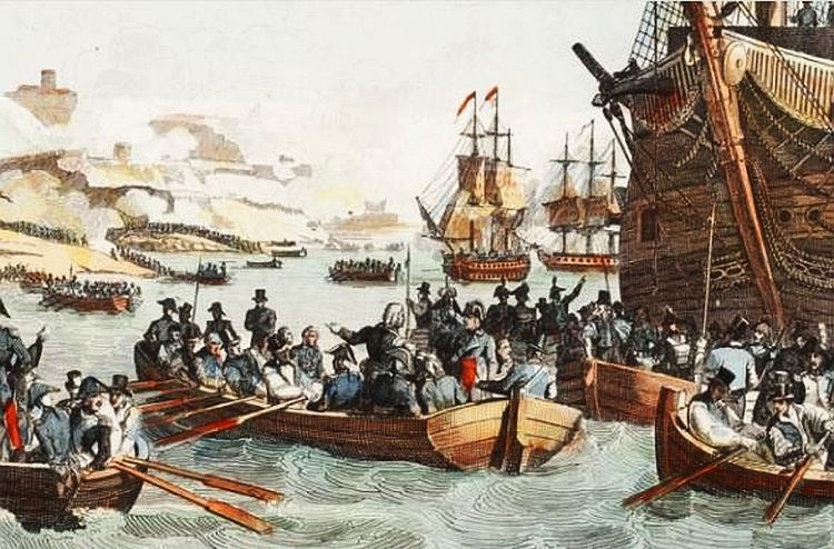
Fort Ricasoli was said to have seen use during the French invasion of Malta, led by Napoleon himself, in 1798, which was part of the Mediterranean Campaign in the War of the Second Coalition of the French Revolutionary Wars.

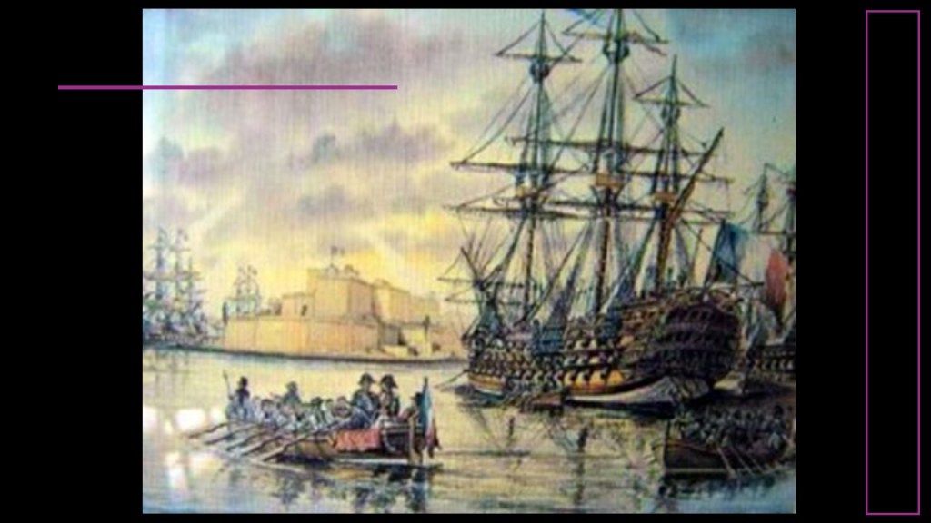
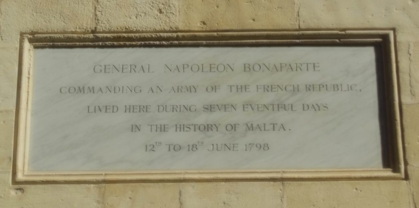
We are told that during the short time Napoleon was in Valletta, the capital city of Malta, between June 12th and 18th of 1798, he did such things as reforming, among other things, national administration with the creation of a Government Commission and twelve municipalities; creating a public finance administration, and the organization of public education, and providing for primary and secondary education, all before sailing for Egypt, and leaving a substantial garrison in Malta.

What?

All this in a week?

Why?

This famous painting of Napoleon Bonaparte before the Great Sphinx of Giza comes down to us as a depiction of him during his Egyptian Campaign, which took place between 1798 – 1799.

The 1886 painting “Bonaparte Before the Sphinx” was credited to the French artist Jean-Leon Gerome, and can be found at the Hearst Castle in San Simeon, California.

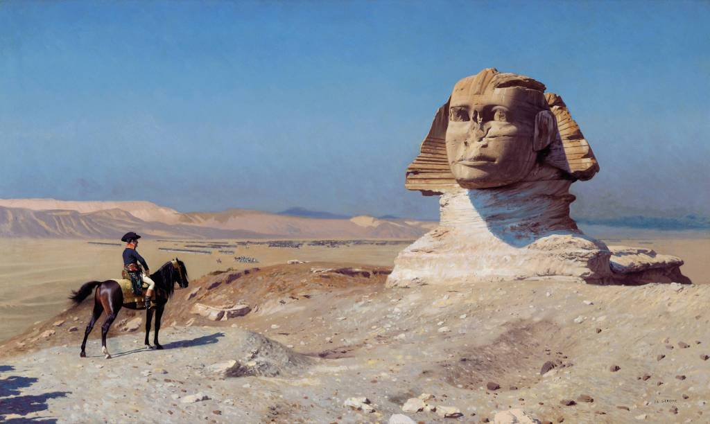
So even the Sphinx needed to be dug out from the sand that covered most of it up!

After the British Royal Navy destroyed the French Mediterranean fleet at the Battle of the Nile on August 1st, 1798, the British were able to initiate a blockade of Malta, assisted by an uprising of the native Maltese against French rule.

The blockade effectively ended the French Occupation of Malta in 1800, and replaced it with British Protectorate, returning control of the central Mediterranean to Great Britain.

Malta held the status of British Protectorate for 164-years, until it gained its independence from Britain in 1964.

Though Fort Ricasoli, like Fort St. Elmo, was bombarded during World War II and parts of it destroyed, today the fort remains largely intact.

It is used as a filming location…and tank-cleaning facility for the Malta Drydocks, treating liquid waste from ships arriving in the Grand Harbor, removing oil and other chemicals prior to releasing the waste into the sea.

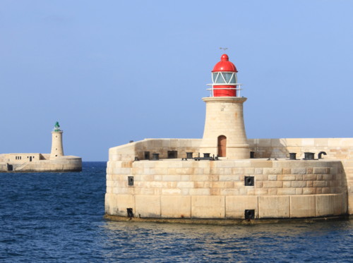
These are the pair of lighthouses, one at Fort St. Elmo and the other at Fort Ricasoli, located on man-made breakwaters at the entrance to the Grand Harbor.

There are two more forts along the shore of the Mediterranean Sea next to Fort Ricasoli.

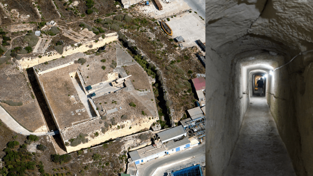
The first is Fort Rinella, described as a Victorian battery.

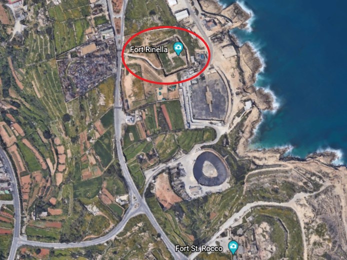
It was said to have been built by the British between 1878 and 1886.

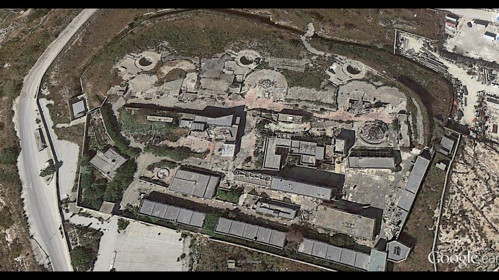
Fort St. Rocco is found just a short distance down the Mediterranean coast from Fort Rinella.

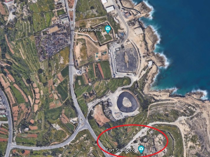
It is described as a polygonal fort, and as part of a complex of shore batteries built by the British to defend the coast east of the mouth of Grand Harbor between the 1870s and 1900.

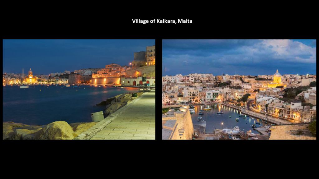
These three forts are part of Kalkara…

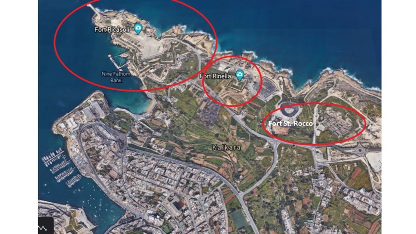
…described as a village on Kalkara Creek, shown here.

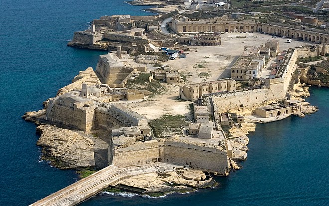
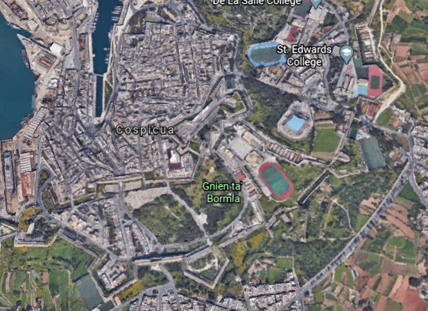
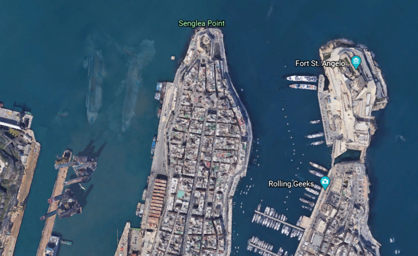
Moving from a short distance west from Kalkara, we come to Birgu, also known as the “Victorious City”…

…and described as the oldest of an area in Malta referred to as “The Three Cities” – three fortified cities in very close proximity to each other, which also includes Senglea and Cospicua.

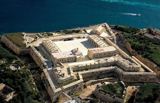
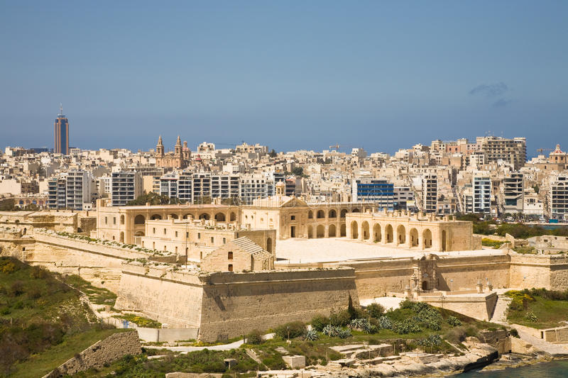
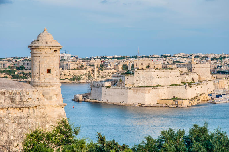
The city occupies a promonory of land in the Grand Harbor, with Fort Saint Angelo at the head…

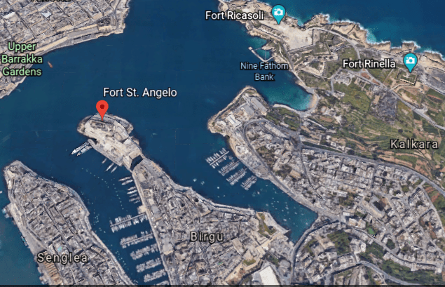
…and the city of Cospicua at the base.

Fort San Angelo served as the base of the Order of St. John, and we are told the de facto capital of Malta between 1530 and 1571…

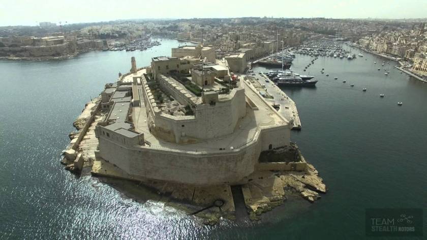
…and the British garrisoned the fort between 1800 and 1979.

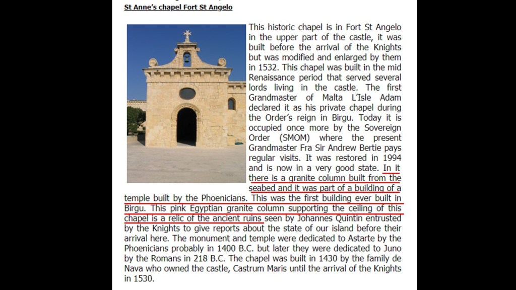
We are told the date of its original construction is unknown, but has large ashlar blocks, the finest stonemasonry unit…

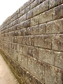
…and an Egyptian pink granite column at the top of the fort inside a chapel.

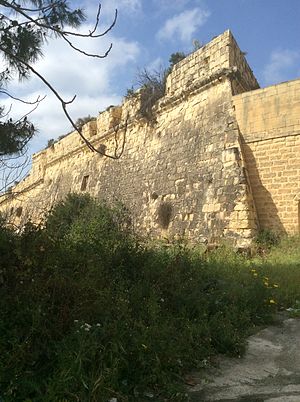
Fort San Salvatore is also in Birgu…

…said to have been built in 1724 on one of the bastions of the Cottonera Lines.

It was said to have been used as a Prisoner-of-War Camp during the Greek War of Independence between 1821 and 1830, as well as during World War I; and during World War II, as a kerosene depot and internment camp, which were used to imprison large groups of people, without charges, or the intent to file charges.

The Cottonera Lines were said to be a line of what are called fortifications in Conspicua and Birgu that were constructed in the 17th- and 18th-centuries to form the outer defenses of the Three Cities…

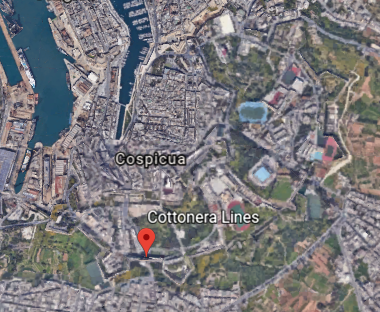
…and built around an earlier line of fortifications known as the Santa Margherita Lines.

Before leaving Birgu for the neighboring city of Senglea, I would like to point a place that caught my attention on Google Earth.

I noticed the Inquisitor’s Palace, and as it turns out, this was the seat of the Inquisition in Malta between 1574 and 1798, which was the first year Napoleon’s forces occupied Malta. It has been the National Museum of Ethnography since 1966, with permanent displays on Malta’s religious traditions as consolidated by the Inquisition.

The arrows are pointing to the building’s windows that are not level with the steep street beside it, which is a classic indicator for mud flood evidence.

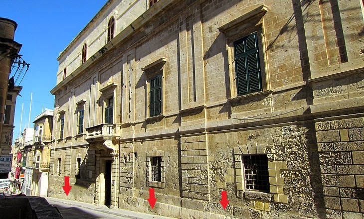
The Inquisitor’s Palace was said to have been originally constructed as a courthouse in the 1530s.

The Inquisition was a group of institutions within the Catholic Church with a stated aim of combating heresy, defined as the formal denial of the orthodox beliefs of the church, which is defined as the adherence to correct or accepted creeds in religion.

We are told it started with the French Inquisition in the 1200s in France, which over a period of about 20-years saw the Cathar Crusade and the genocide of the gnostic Cathars, which had been labelled as an heretical sect.

The Inquisitor’s Palace became the headquarters of the Inquisition in Malta in 1574, serving as tribunal and prison, as well as the palace of the Inquisitor.

So we are taught that all of this is normal and matter of fact in history in school, like there is nothing out of the ordinary or wrong about the Inquisition…which was, by its very nature, violating basic Human Rights and dignity, including torture in the name of Christianity just for having dissenting views?

And the Office of the Inquisition it is still in existence to this day?

Only it is now called the “Congregation for the Doctrine of the Faith.”

The city of Senglea is a fortified city as well, we are told, and is also known as the “Civitas Invicta” or “Unconquered City.”

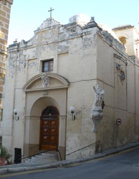
We are told there weren’t any buildings here until 1311, at which time St. Julian’s Church, or Chapel, was built, said to have been the first building constructed on what later became Senglea.

Then in 1552, we are told, the foundation stone was laid for Fort St. Michael, and its construction was said to have been completed in 1553.

Then construction of the walled town of what at the time was known as St. Julian’s Island in the decade following the completion of Fort St. Michael, subsequently became known as Senglea…

…in honor of the Grand Master Claude de la Sengle, of the Order of Malta, for giving St. Julian’s Island its city status.

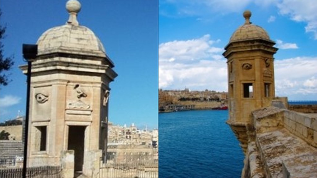
The Gardjola Gardens are located within the bastions of Fort St. Michael, also credited to Claude de la Sengle…

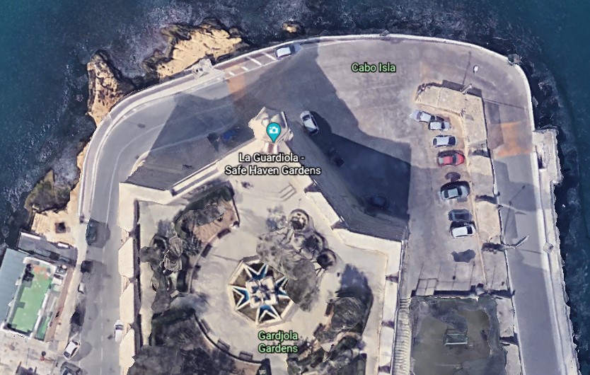
…and named for what is called the “Guard Tower” – “Il-Gardjola” – which has various symbols sculpted on it, such as an eye, ear, and crane bird, said to represent guardianship and observance protecting Maltese shores.

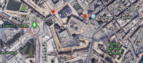
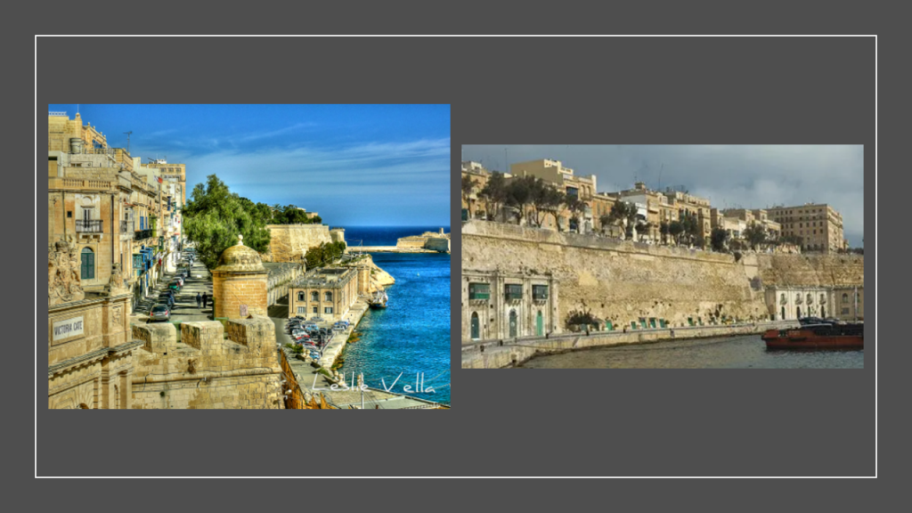
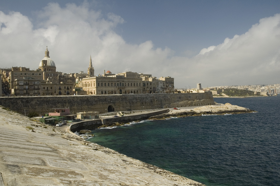
Now I am going to start a walking tour around the walls of Valletta…

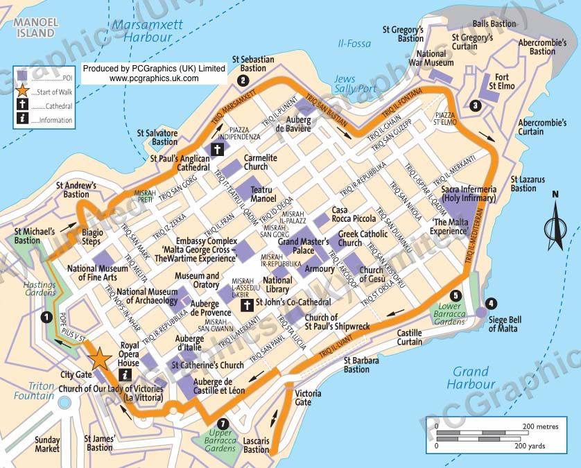
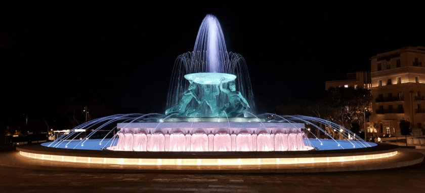
…starting at the Triton Fountain, just outside the main City Gate of Valletta.

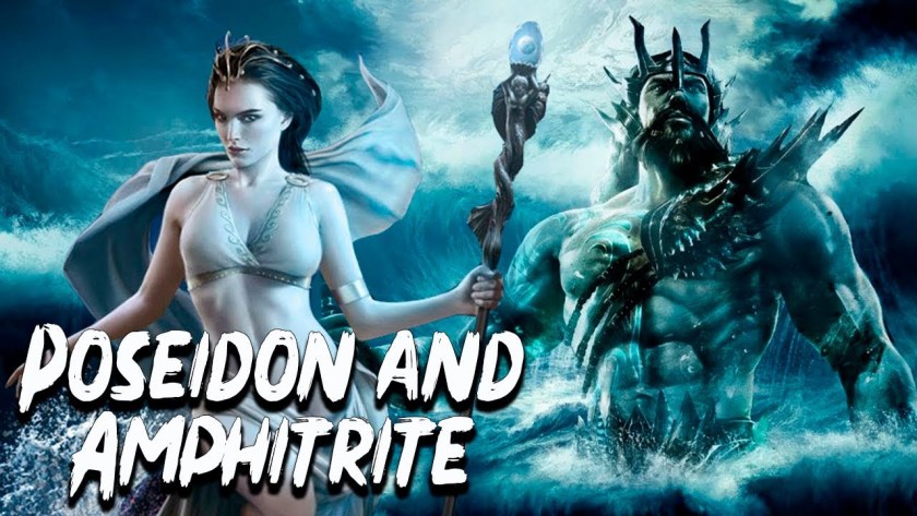
What exactly is a Triton?

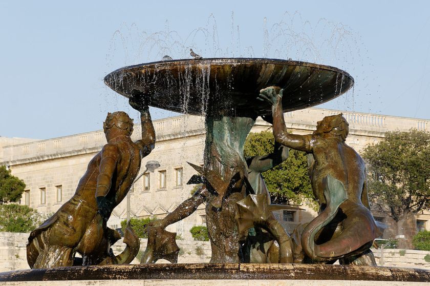
For one, in mythology, Triton was the son of Poseidon, the god of the sea, and Amphitrite, a sea goddess and Queen of the Sea.

Triton’s lower-half was that of a fish, and his top-half was that of a human.

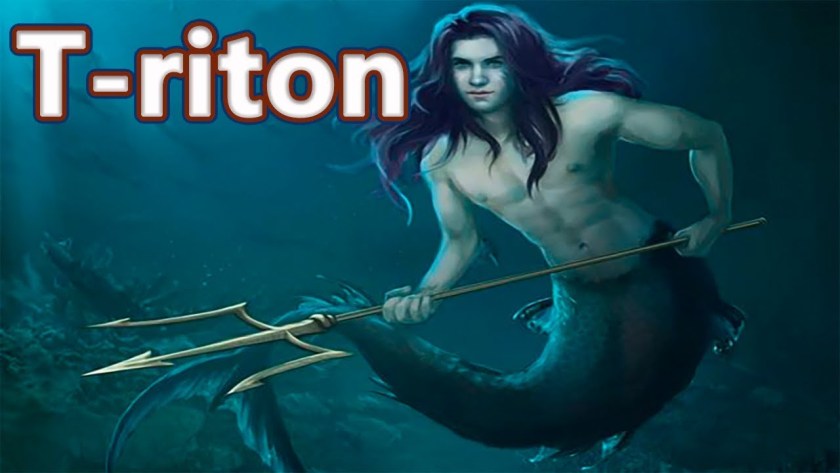
We are told that at some time during the Greek and Roman eras, triton became a generic term for a mer-person in art and literature.

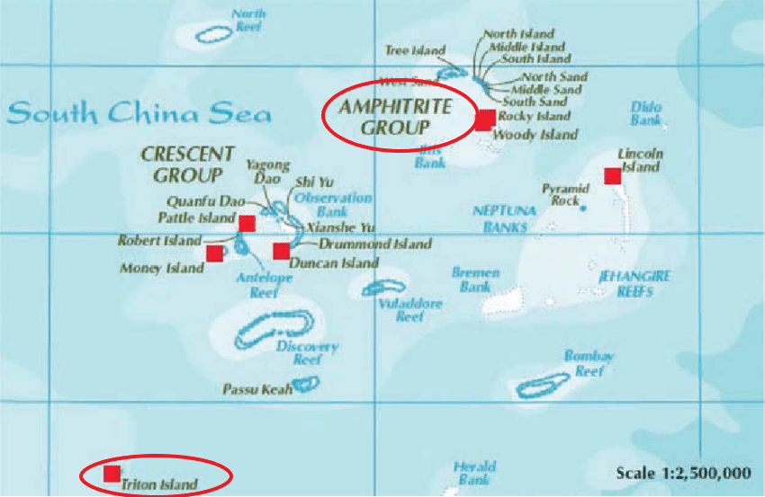
So some connections of interest to me from what I have found in my own research are, first, that in the Paracel Islands in the South China Sea, between the Philippines and south China’s Island of Hainan, we find an Amphitrite Group and a Triton Island…

…and that Poseidon’s Golden Palace was said to have been at Aegae, on the large Greek island of Euboea in the Aegean Sea.

Aegae was said to be located on the west coast of Euboea, north of Chalcis, and said to have been located near the modern town of Politika Kafkala…
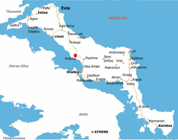
…under the sea.

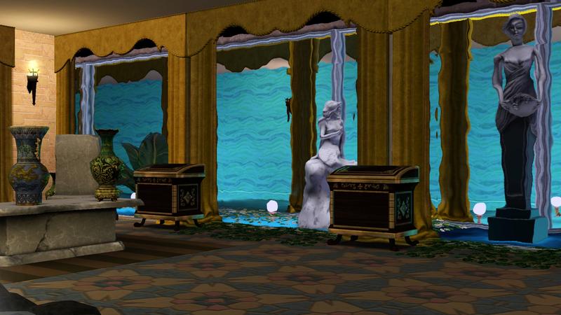
And we just saw sculptures of tritons, or mer-people, in the Amenano Fountain back in Catania in Sicily.

What is the meaning of the tritons?

Could they really have existed at one time?

How are they connected to these places?

Perhaps they still exist today as mer-people, who remain mostly hidden away, and were not mythical as we are taught to believe.

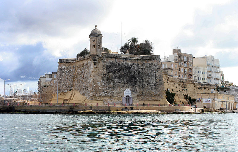
The Triton Fountain is located in front of the main city gate of Valletta.

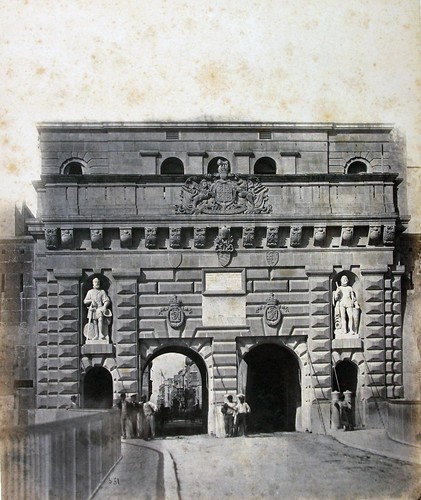
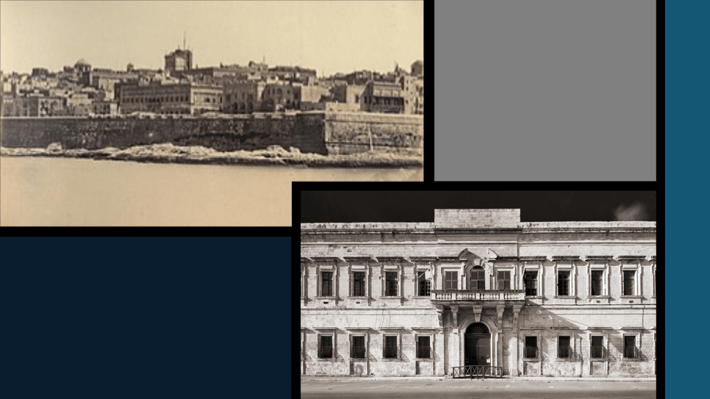
This was the main city gate of Valletta, called the King’s Gate, circa 1871.

It was said to have been designed by Lt. Colonel Francis Ringler Thomson in 1853, and that this gate was demolished in 1964.

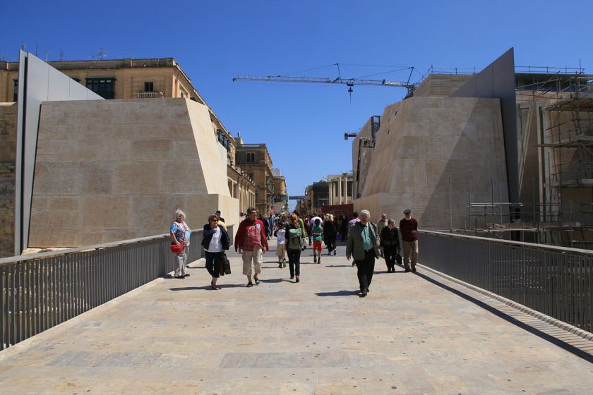
This is what we find at the main city gate today.

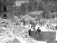
Directly upon entering Valletta, immediately to the right is what remains of the city’s Royal Opera House, though the site was developed into an open air theater which opened in August of 2013.

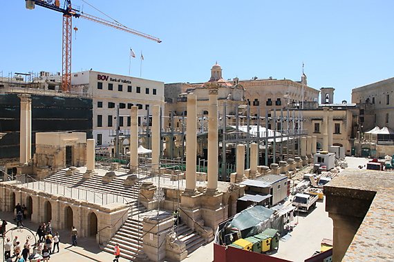
The Royal Opera Theater was said to have been designed by the English architect Edward Middleton Barry in 1866, and with windows and columns that are not level with the sloping street beside it, like what we saw back at the Inquisitor’s Palace.

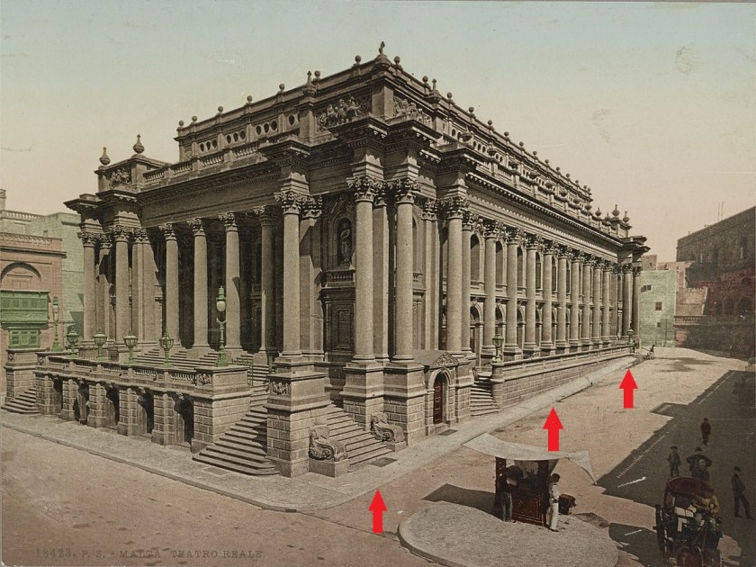
Then, only 76-years later, it took a direct hit in April of 1942 from German Air Force bombers, and was almost completely destroyed.

Making a right turn after entering the city through the gate, onto Pope Pius V Street, we come to the Church of Our Lady of Victories, or La Vittoria, said to have had its foundation stone laid in 1566, and built to commemorate the Victory of the Knights of the Order of St. John and the Maltese over Ottoman invaders in 1565.

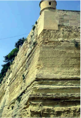
Directly across from La Vittoria Church is the St. James Bastion, where the two places dove-tail with each other in shape.

It was said to be one of the first bulwarks to be completed after the initiation of the construction of the fortified city in 1566.

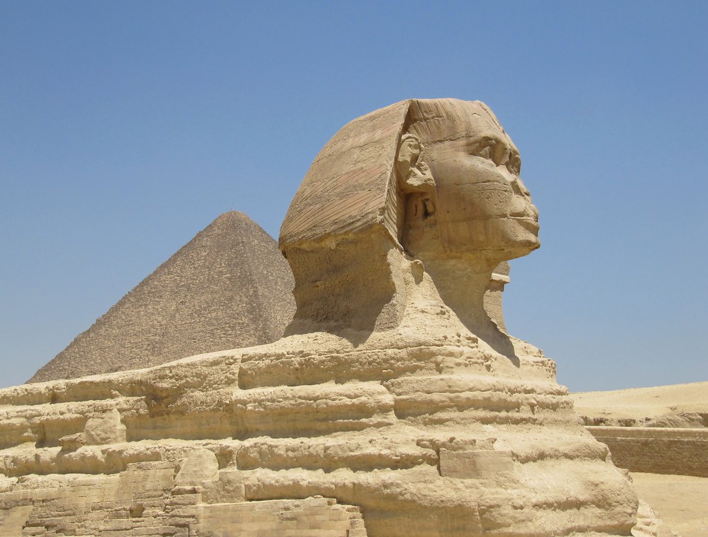
The St. James Bastion forms one of the four important and massive bulwarks, and was carved largely out of bedrock.

The Sphinx on the Giza Plateau of Egypt was also carved from bedrock.

The bastion is said to contain to low “batteries” in its flanks, each protected by a massive rounded orillion, which we are told was an architectural element of a military fortification. 

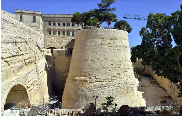
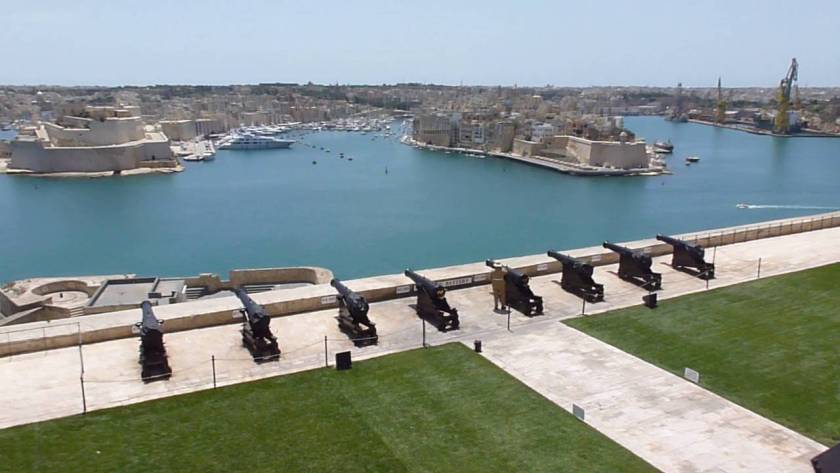
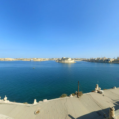
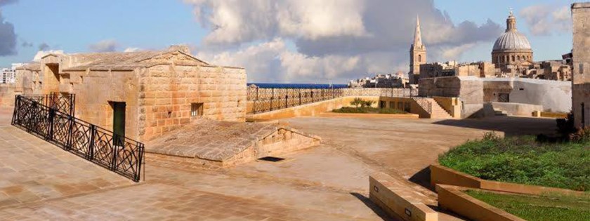
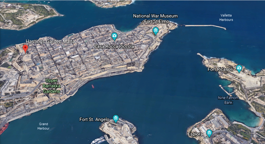
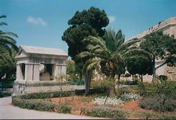
The next place we come to continuing around to the right from the main city gate are the Upper Barrakka Gardens.

Check out the height and depth of the stone work seen here!

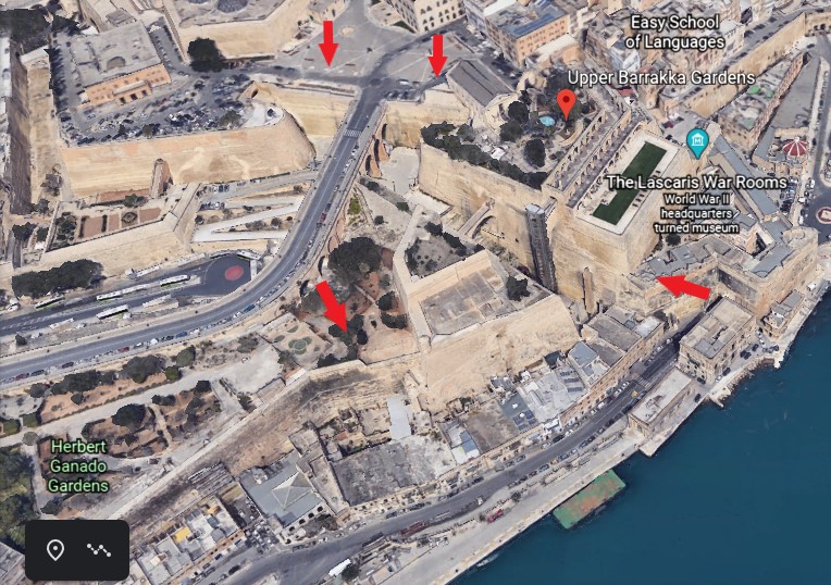
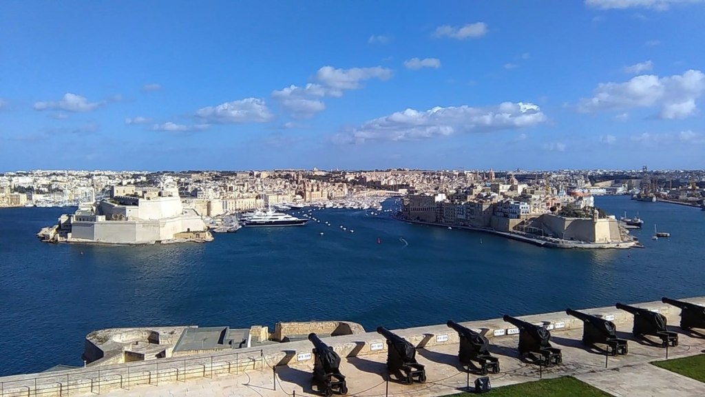
The Upper Barrakka Gardens are located on the upper tier of the St. Peter and Paul Bastion, and are a public garden…

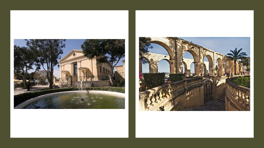
…offering a panoramic view of the Grand Harbor.

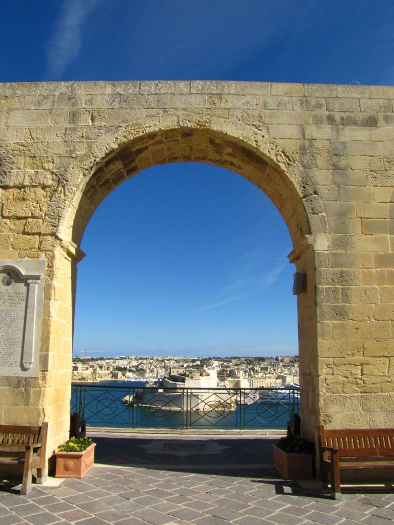
It is the highest point of the city walls.

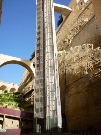
The gardens are linked to the Valletta Ditch and the nearby Lascaris Wharf by the Barrakka Lift, which was said to have first been constructed in 1905, closed in 1973, and dismantled in 1983…

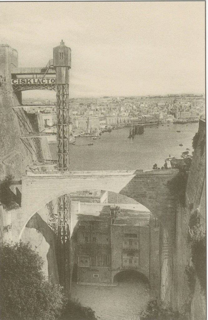
…then we are told a new lift was inaugurated in 2012.

This is the Fort Lacaris Battery, said to have been built by the British in 1854, and connected to the Peter & Paul Bastion that the Upper Barrakka Gardens are located at the top of…

…and this is a view of the Lacaris Bastion Gardjola, or Guard Tower, like what we saw earlier at Fort St. Michael in Senglea.

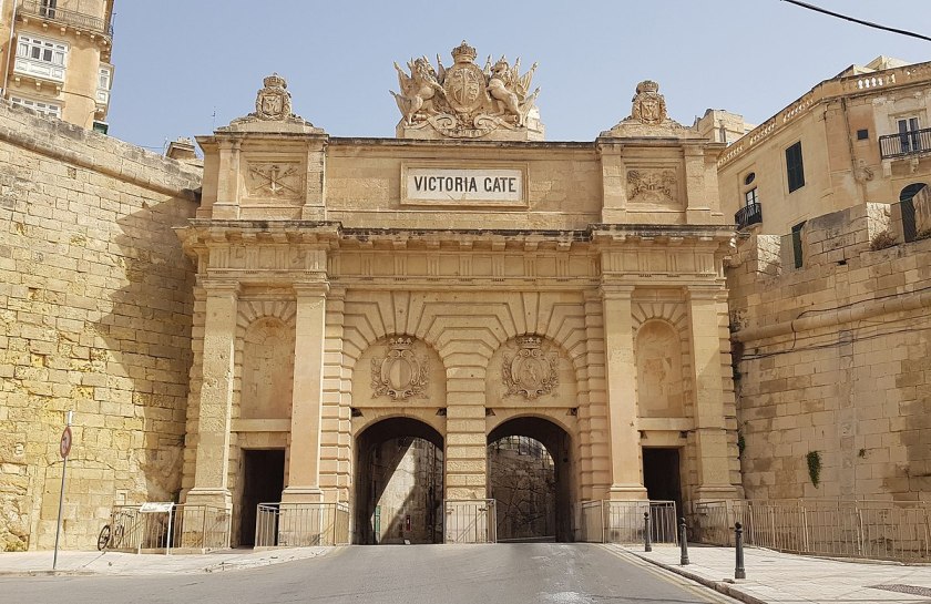
The Victoria Gate is situated next to the Lacaris Bastion, the main entrance to the city from the Grand Harbor area,

It was said to have been built by the British in 1885, and named after Queen Victoria.

It is the only surviving gate within the fortifications of Malta, as all of the other gates, like the main city gate as I mentioned previously, were demolished between the 18th- and 19th-centuries.

The St. Barbara Bastion comes next, and is situated in the historic center of Valletta…

…and boasts of magnificent views of the Grand Harbor and the Three Cities.

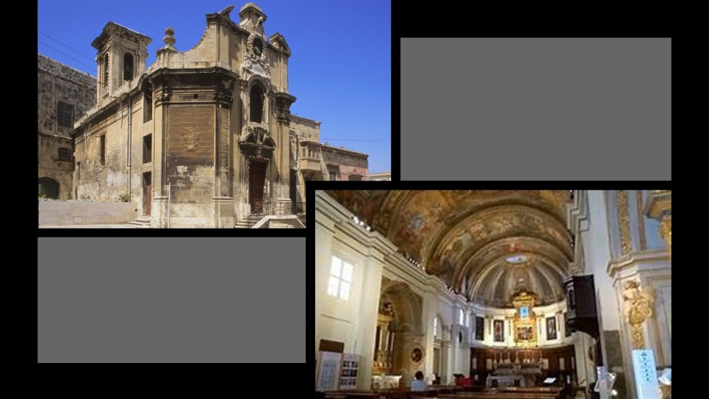
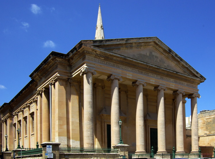
Noteworthy churches near the St. Barbara Bastion are the Church of St. Paul’s Shipwreck, said to have been completed in 1582, is directly across the street from it and said to be one of the oldest churches in Valletta.

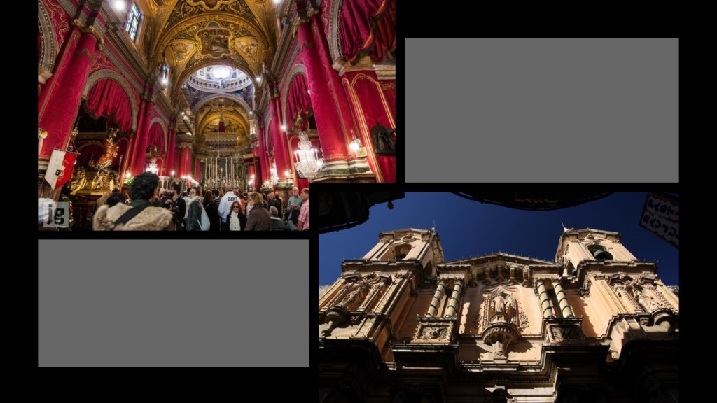
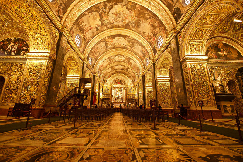
Across the street on the other side of the Church of St. Paul’s Shipwreck, we find St. John’s Co-Cathedral.

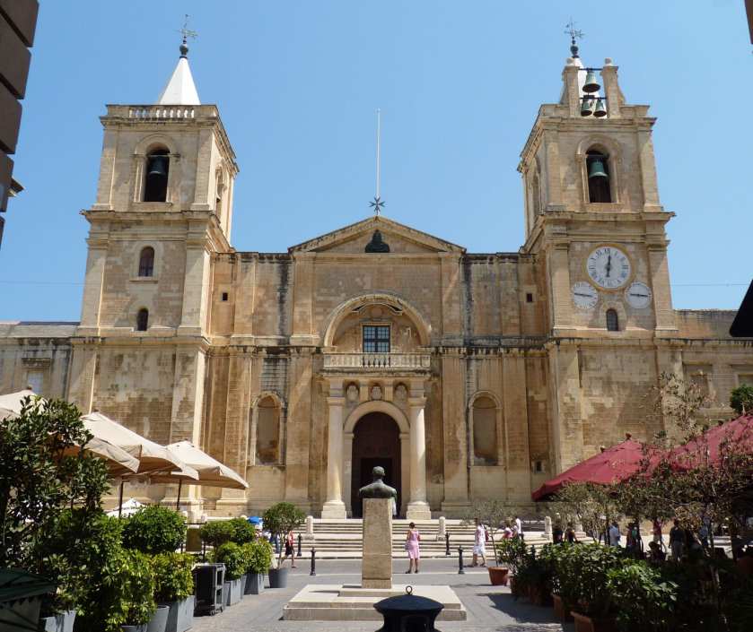
It was said to have been commissioned by the then Grand Master of the Order of St. John, Jean de la Cassiere; built by the Order between 1572 and 1577; and dedicated to St. John the Baptist.

The interior of the church is considered to be one of the finest examples of high Baroque architecture in Europe.

The next place along the City Walls of Valletta, I am going mention is the Abercrombie’s Bastion, which is located at the entrance to the previously mentioned Fort St. Elmo…

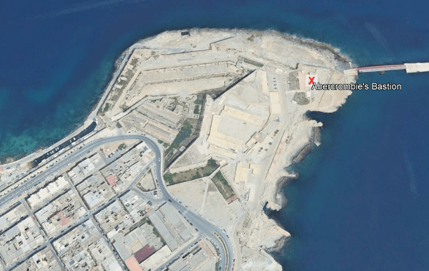
…after which we come to Ball’s Bastion in the upper part of Fort St. Elmo…

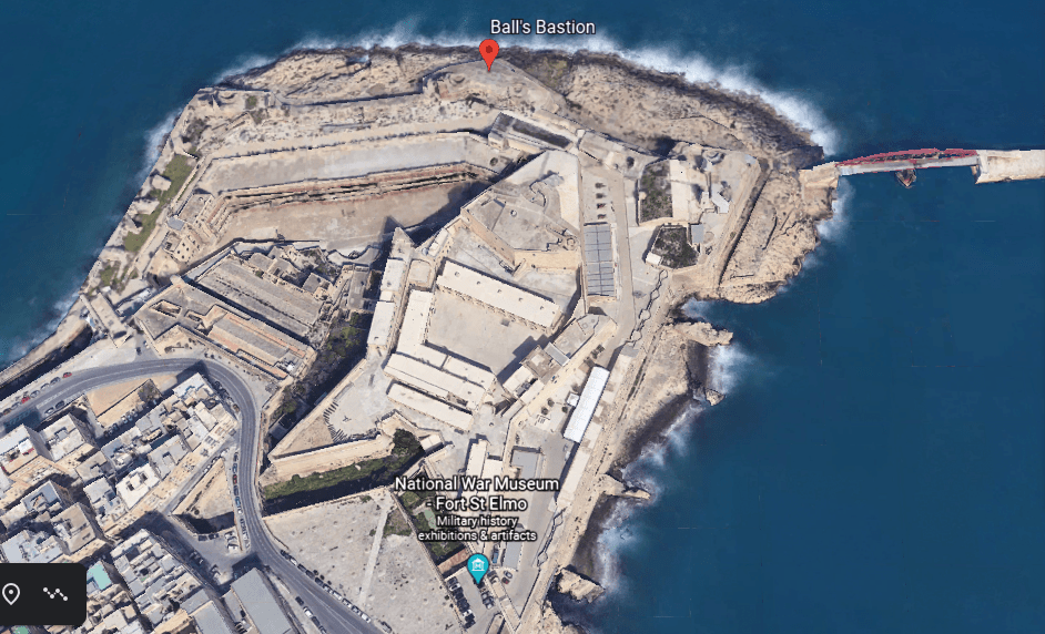
…which is next to St. Gregory’s Bastion.

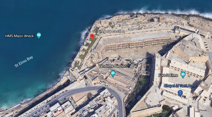
Next we come to the St. Sebastian Bastion…

…which is in close proximity to the Auberg de Baviere.

The Auberge de Bauviere was said to have been built as the Palazzo Carneiro in 1696, and was the residence of the Grand Master Marc’Antonio Zondadari in the early 18th-century.

Next we come to the St. Salvatore Bastion and the nearby St. Paul’s Anglican Cathedral, also known as St. Paul’s Pro-Cathedral, one of three cathedrals of the Anglican Diocese of Gibraltar in Europe, and said to have been built between 1839 and 1844.

Moving along the wall, we come to St. Andrew’s Bastion…

…a popular wedding venue in today’s day and age.

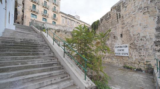
The Biaggio Steps are directly across from St. Andrew’s Bastion, and which are described as run-down.

Next we come to St. Michael’s Bastion…

…where apparently there used to be several windmills overlooking Marsamxett Harbor, but the only reminder of this is a nearby street named “Windmill Street.”

The last place I would like to look at around the city walls of Valletta, before returning to the main city gate, are the Hastings Gardens.

The Hasting Gardens are a public garden on top of St. John’s Bastion and St. Michael’s Bastion, located to the immediate west of the main city gate.

Three more things to look at before departing the relatively small islands of the Republic of Malta in the the Mediterranean Sea.

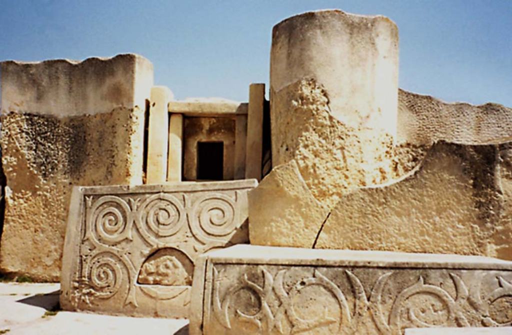
The first is bringing the megalithic Tarxien temples to your attention, located a short distance south of Valletta.

There is a significant megalithic presence in Malta. The Tarxien Temples are just one example of many in Malta.

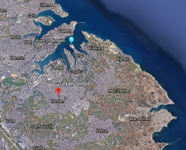
The temples’ large stone blocks were discovered in 1914 by a farmer ploughing a field, and excavation was begun immediately by the director of the National Museum after the report of the finding was made.

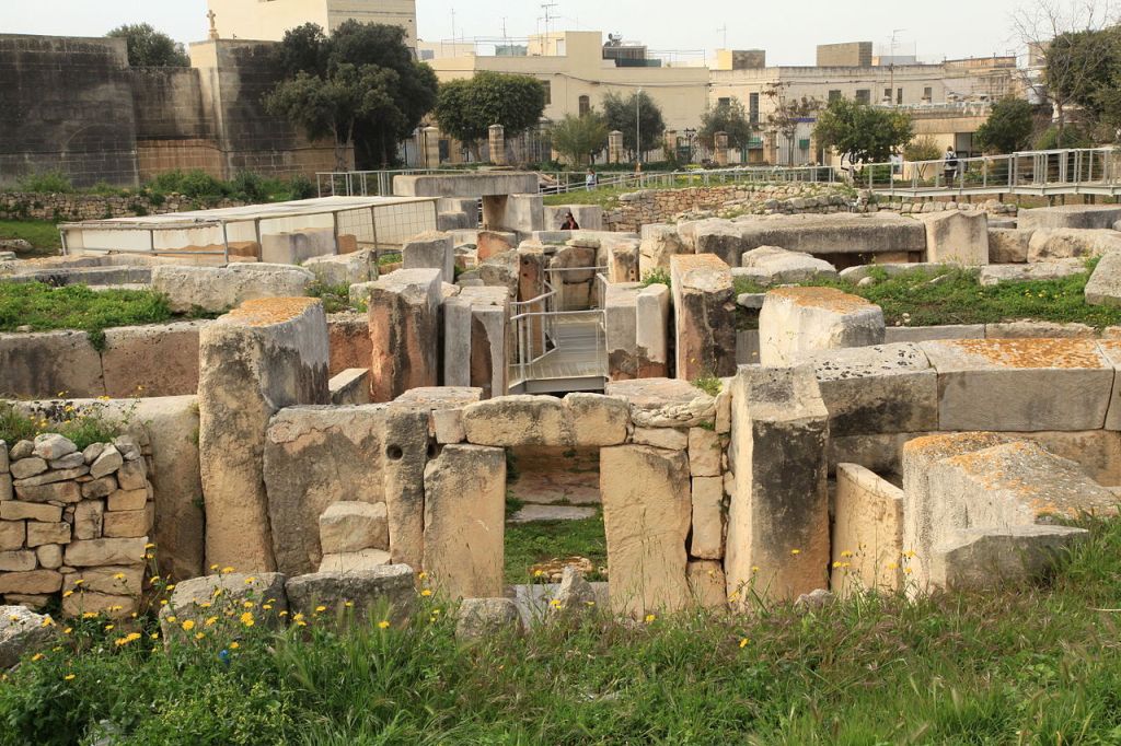
So apparently the temple complex was completely buried underground. We have come to see places being completely buried as a natural occurrence over the passage of time, but was this really the case?

The Tarxien temple complex has rich and intricate stonework decorated with spiral designs and other patterns, and was dated to 3,150 BC.

The second is speculation about the Knights’ Templar themselves.

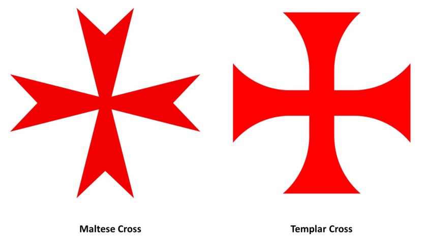
Given that Valletta appears to be a veritable Disney World of stone masonry, and that the Maltese Cross and the Templar Cross are virtually identical, I am thinking that Malta was at the very least a major Templar Center, if not the main headquarters of the Templars.

I do seriously question what we are told about who the original Templars were, also known as the Order of the Temple of Solomon.

We are told it was Catholic military order recognized in 1139 AD by Pope Innocent II’s papal bull Omne Datum Optimum.

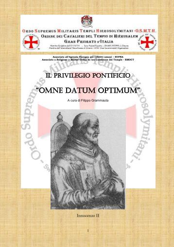
I personally think there is a substantial amount of information missing from the historical record about who the Templars really were, and about what their actual historical association with the Temple of Solomon was.

Like, were the original Templars Moorish Master Masons, and not anything like what we have been taught in our historical narrative?

Whatever the Truth was about the original Templars, information is simply not available in the written historical record to make a connection directly to the Moors, and a connection in turn with the Temple of Solomon and the Lost Tribes of Israel.

Lastly, I have stated in previous posts my belief that I think places on the Earth, like Valletta in this example, with numerous star forts concentrated in close proximity, were significant power centers for the energy system of the planetary grid, and that star forts represented the definition of battery meaning “a device that produces electricity that may have several primary or secondary cells arranged in parallel or series, as well as a battery source of energy which provides a push, or a voltage, of energy to get the current flowing in a circuit…”

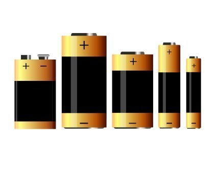
…and were not originally military in nature as we are led to believe in our current historical narrative, like the Lacaris Battery we saw earlier in this post.

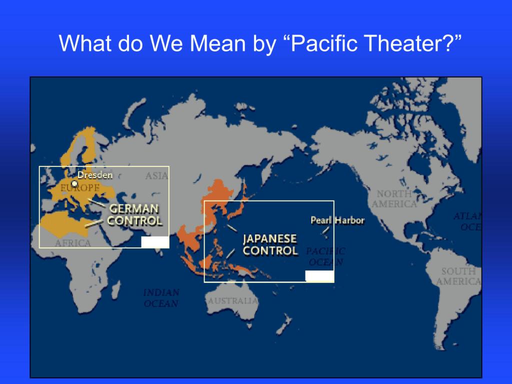
Like the many star forts I found that were bombarded in World War I’s Gallipoli Campaign in the Strait of Dardenelles in Turkey when I was looking at the Aegean Sea, the star-city of Valletta, and its surrounding star forts and star cities, appear to have been deliberately targeted for bombardment during the Siege of Malta between 1940 and 1942 in what was called the “Mediterranean ‘Theater’ of World War II.”

I have often wondered why the word “theater,” defined as a building or area used for dramatic performances, also used as a term to describe an area in which important military events are occurring.

It seems to me like they are actually describing one and the same thing – a dramatic performance – and not what we have been taught to believe in our historical narrative.

I think all wars and regional conflicts were deliberately contrived for the destruction of the original civilization in all ways.

As such, I think wars and conflicts exemplify what known as “Controlled Opposition.”

Controlled Opposition is a strategy in which an individual, organization, or movement is covertly controlled or influenced by a 3rd-party and the controlled entity’s true purpose is something other than its publicly stated purpose.

The controlled entity serves a role of mass deception, surveillance or political/social manipulation.

The controlled party is portrayed as being in opposition to the interests of the controlling party.

Something to consider in the quest to figure out what’s really been going on here without our knowledge or consent.

I am currently about two-thirds done with “On the Trail of Giants, in Appalachia and Beyond – The Cataclysm,” and I hope to be finished with it in the next week or so.

It is the last part of a four-part series in which I bring forward the main themes separately for your consideration that unfolded from my original post “On the Trail of Giants in Appalachia and Beyond.”

There’s a lot of material for it to work through, organize and piece together, and on top of that, invariably I find myself down interesting rabbit holes which can take me awhile to get out of.

When I do go down those rabbit holes and come back up, there’s even more information to bring to light.

Circle Alignment on the Earth Amsterdam Island – Part 1 Amsterdam Island to Berbera, Somaliland

This post involves a circle alignment that I found beginning and ending on Amsterdam Island, a small island in the French Subantarctic Islands.

I am updating the original series from November of 2018 through January of 2019, and have added a considerable amount of new material to what I had in the original eleven-part series called “Circle Alignments on the Planet Amsterdam Island.”

I have removed “Planet” from the title and replaced it with “Earth” because I do believe as a result of what I have encountered in my research over the last five-years-plus, that we have been lied to about the shape of the realm, along with all the other things  we have been lied to about.

This series was one of my earliest efforts in tracking cities and places in alignment over a very long distance, and consistently seeing the same characteristics and hand of design across oceans and continents.

The process of doing the research along this alignment and other alignments has provided extensive evidence for a worldwide, advanced civilization, which has been deliberately suppressed, misattributed and removed from our collective awareness so that we wouldn’t know about its existence.

For comparison of similarity of appearance is the Temple of Khnum in Esna , Egypt, pictured on the left, and the Victoria-era “Temple Mill,” in Leeds, England, on the right.

This advanced civilization that developed on Earth originated in the far distant past in ancient Mu, also known as LeMuria; and that this was the same civilization known as “Atlantis,” which I believe existed up until relatively recent times and represents the missing positive timeline of Humanity.

While this map may not represent the actual extent of the Earth’s landmass at the time of the “Fall of Atlantis,” which I have come to believe took place relatively recently in time as opposed to many-thousands of years ago, it is the closest representation on a map that I could find to a depiction of the continental landmasses being much more connected than what we have been taught to believe in our historical narrative, which doesn’t even officially confirm the actual existence of LeMuria and Atlantis.

Mu and Atlantis are treated more like historical “maybes” – maybe they once-existed, and maybe they didn’t – and typically placed in the elusive “mythical” category by Academia.

From the extensive research I have done thus far, I have reason to believe this ancient global civilization was aligned on Earth and Heaven in a Flower of Life pattern, within which all sacred geometric shapes are contained, and built out on the surface of the Earth according to the principles of Sacred Geometry.

The start- and end-point of this next circle alignment. that I found and am about to share with you in this post, is a tiny dot in the South Indian Ocean.

The dot is Amsterdam Island, one of the French Subantarctic Islands, officially claimed by France in 1892, and known as the territory of the “French Southern and Antarctic Lands,” since 1955, along with “Adelie Land,” the French claim on the Antarctic continent which has been applied to the “Antarctic Treaty System” rules since 1961.

We are told that Amsterdam Island got its name in 1633 from a Dutch sea captain who named it after his ship, Nieuw Amsterdam, which was named after the Dutch settlement of Nieuw Amsterdam (which later became New York City).

This  tiny speck of real estate, for which the only settlement is a seasonal research station, even has its own flag.

The research station studies biology, meteorology, and geomagnetics. 

Here is a photograph of Lee Waves taken on Amsterdam Island.  Lee Waves are atmospheric stationary waves, and are a form of internal gravity waves.   Must be a reason as to why the geomagnetics of this island are studied.

Amsterdam Island is considered the northernmost volcano above the water-line on the Antarctic Plate.

Here is a map of the island circa 1901, showing the island looking rather like a tree stump, with the Cliffs of Entrecasteaux right below what is described as two volcanic calderas.

Here is a photo of the Cliffs of Entrecasteaux below the caldera on the west side of the island.

Chad Williams and and I had a recent conversation for his YouTube Channel “Deeper Conversations with Chad,” and it was called “Giant Trees, the Earth’s Grid, and the New World Order,” where we discussed, among many other things, the apparent volcanic nature of these giant trees and their integral relationship to the Earth’s Grid System, and how this might in turn connect to what might have taken place to render the giant trees as unrecognizable as such.

Our conversation started off with this intriguing illustration that Chad found in his research and had sent along to me at take a look at.

It seems to be showing trees on a grid exploding simultaneously, which would account for why we don’t recognize them as trees any more.

In the course of this same conversation with Chad, we also talked about the consistent pattern of western countries claiming these small islands and island groups in remote locations as their colonies or territories. and upon closer examination, it appears they were making a concerted effort to claim for their own purposes what was left of these giant trees.

Besides the four islands claimed by France in the “French Southern and Antarctic Lands,” of Amsterdam, St. Paul, Kerguelen, and Crozet in this region…

…we find the British in the same region claiming for its empire places like the British Antarctic Territory on the top left; South Georgia and the South Sandwich Islands on the top middle, and Tristan da Cunha, the home of the world’s most isolated settlement, which takes 6-days, each-way, by boat to get to-and-from.

Leaving Amsterdam Island, the next place we come to on the alignment is Port Louis, the capital of Mauritius.

Mauritius is officially the Republic of Mauritius, and in addition to the main island, consists of the islands of Rodrigues, Agalega, and St. Brandon.  These islands are 1,200 miles (2,000 km) southeast of the African continent.

Mauritius was initially colonized by France in 1715, who in turn ceded it to the British in the 1814 Treaty of Paris.

It gained its independence from Britain in 1968, and became a Republic in 1992.

In a comparison of what seems to be the same style of architecture in very different places, this is the Port Louis Natural History Museum on the top left, said to have been constructed in 1880; on the top left is the Iolani Palace in Honolulu, Hawaii, said to have been built in 1879, and was the royal residence of the Kingdom of Hawaii until the monarchy was over thrown under Queen Lili’oukalani in 1893; and the Natural History Museum in Merida, Mexico, on the bottom right, said to have been built between 1909 and 1911.

And for further comparison for similarity of appearance, here are photos of the harbor at Port Louis on Mauritius in the Indian Ocean on the left; Freeport Harbor on Grand Bahama Island in the Atlantic Ocean in the middle; and Honolulu Harbor in Hawaii in the Pacific Ocean on the right.

These are just a few of countless examples of harbors from around the world with man-made shorelines and docks.

I first learned about Mauritius from an amazing French archaeologist named Antoine Gigal, and its massive walls, hydraulic systems and road systems that are all connected with the pyramid complexes there.

Much of her work is in Egypt, but she has ventured to other places in her quest for knowledge and understanding, and she has documented much evidence of the sophisticated technology of the ancient civilization. 

To learn more about her work on Mauritius, check out this link where she talks about the discovery of

http://gigalresearch.com/uk/complexe-ile-maurice.php

I first learned about the seven pyramids of Mauritius several years ago in a 2011 Megalithomania presentation by her.

They are terraced structures made of black volcanic stone. 

Interestingly, there are six terraced pyramids, also made of black volcanic stone, in Guimar on the island of Tenerife in the Canary Islands. 

In both places they are in perfect astrological alignment with the winter and summer solstice.

Besides the same-style of terraced pyramids, Mauritius and Tenerife in the Canary Islands also share a volcanic history as well.

First, Mauritius.

Mauritius itself is called a massive shield volcano, a broadly domed volcano with gently sloping sides formed from fluid, basaltic lava flows, and has a line of craters bisecting the main island as diagrammed here.

One of the craters, Trou aux Cerfs, which interestingly translates from the French to “Deer Hole,” is described as a dormant volcano with a well-defined cone and crater, on the outskirts of Curepipe, the second-largest city of Mauritius.

This is a view from Curepipe of what are called the “Trois Mamelles” and Mount Rempart.

“Trois Mamelles” translates from the French as “Three Breasts.”

Curepipe is the location of some interesting, what is called “colonial,” architecture, like the Saint Therese Church in the background, said to have been built in 1868…

…and the Town Hall which is nearby, said to have been built starting in 1902.

There is what is called a “Step Mountain” on the Le Morne Brabant, a peninsula on the extreme southwestern tip of Mauritius.

This location is a UNESCO World Heritage Site.

The “Le Morne” in the peninula’s name could well-refer to the original people of this land.

The “Maroons”of the Indian Ocean, like the “Maroons” of the Americas, they were described as the descendents of Africans who escaped from slavery, and not as the Moorish original people of these lands which is nowhere to be found in our historical narrative.

Only in the place-names, like “Le Mor-ne” and “Maur-itius.”

The “Brabant” in the name of the peninsula “Le Morne Brabant” came from the Dutch East India ship “Brabant” that ran a-ground here at the end of December of 1783.

Interesting to note, there appears to be an underwater waterfall next to it, though it is described as an optical illusion and not actually a waterfall.

Though Mauritius is being researched possibly as the remnants of a lost continent, and for its strong gravitational pull.

Next, Tenerife.

Mount Teide is a volcano on the island of Tenerife in the Canary Islands, and is the highest point in the islands of the Atlantic Ocean, as well as in Spain.

Now an autonomous community of Spain, the Canary Islands, located off the coast of Western Africa in the vicinity of Morocco and Western Sahara, have been claimed completely by Spain since 1496, after European colonization efforts were said to have started there by France in 1402.

This conquest of the Canary Islands was considered the basic model of European attack on the New World: violent colonization that involved enslavement of the local population; genocide; and the mining of the land’s resources that radically changed the landscape.

The Canary Islands are also said to be of volcanic origin, and have been visited by researchers from the very beginning of the 19th-century, including Alexander von Humboldt in 1799, a Prussian naturalist, mining engineer and explorer, who was said to have climbed the Teide volcano, before heading off to study Venezuela, which has the 2nd-highest gold reserves in the world, as well as Cuba, the Andes, Mexico, and the United States.

Then, in 1815, the same year as the Congress of Vienna which reoragnized Europe after the Napoleonic Wars ended, the German geologist and paleontologist Leopold von Buch visited the Canary Islands, where he primarily studied the production and activities of volcanoes.

Von Buch studied with Alexander von Humboldt at the Freiburg University of Mining and Technology, and was considered a founder of modern geology.

The Freiburg University of Mining and Technology is the oldest school of mining and metallurgy in the world, having been established in 1765 by Francis Xavier of Saxony of the House of Wettin.

Its main purpose was the education of highly skilled miners and scientist in fields connected to mining and metallurgy.

It is interesting that the coat of arms of the German noble House of Wettin has a wyvern tail in the middle of it, and I found this coat of arms of Tenerife, showing a large tree in the center, and wyvern supporters on either side.

I do think these heraldic devices are telling us Truths that have been well-hidden from us.

Wyverns are two-legged, winged creatures that are similar to dragons, but unlike dragons, which can be good or evil, they are unambiguously malicious predators.

Wyverns in heraldry signify war, envy and pestilence.

Primarily through Queen Victoria and Prince Albert, first-cousins and members of the House of Saxe-Coburg and Gotha of the Ernestine branch of the House of Wettin, the original royal houses of Europe were completely replaced by this obscure German Ducal lineage.

Humboldt University in Berlin was named after Alexander von Humboldt and his brother Wilhelm.

It was first opened in 1810, and was regarded as one of the world’s pre-eminent universities in the study of Natural Sciences in the 1800s and 1900s.

Famous faculty and alumni included such luminaries in our current historical narrative as: theoretical physicist Albert Einstein; Karl Marx and Friedrich Engels, c0-collaborators on “The Communist Manifesto; Otto von Bismarck, first Chancellor of the German Empire and the mover behind the 1884 Berlin Conference,which carved up the African Continent between the European powers; Georg Hegel, whose philosophy gave us the “Hegelian Dialectic” of Problem-Reaction-Solution; and the Brothers Grimm, best-known for their fairy tales which has such story-lines as eating people, as in “Little Red Riding Hood and “Hansel and Gretel.”

For one of many examples, the German Benedictines were said to have been quite active in establishing institutions for German immigrants to America during the 1840s and 1850s, like in Atchison, Kansas.

When I saw the view of Atchison, Kansas in the top left photo, I was immediately reminded of the view of the city of Santa Cruz de Tenerife on the island of Tenerife in the Canary islands, on the bottom left, with a shared building-style, directional orientation of the buildings, and placement of the windows in twos, threes, and fours.

Then on the right is a picture of the ancient city of Ouarzazate, Morocco, which I had encountered in my research, and its appearance reminded me exactly of Santa Cruz de Tenerife and Atchison.

And like with Mauritius in the Indian Ocean, it is important to note that the Canary Islands have long been rumored to be the remnants of a lost continent as well.

In the case of the Canary Islands , they have been rumored to the the lost continent of Atlantis.

I first heard that particular rumor many years ago.

Before I leave this part of the Indian Ocean in which we find Mauritius on the alignment, I want to bring to your attention to the nearby inhabited French island of Reunion, home to nearly 1,000,000.

It has been governed as a French region since 1946, and is the outermost region of the European Union.

This is what we are told about the history of Reunion Island.

Reunion Island was uninhabited until French settlers from the French East India Company arrived in the 17th-century, and subsequently established a plantation economy based on sugar and instituted a slavery system with slaves and indentured laborers brought in primarily from Africa and Asia.

St. Denis is the administrative capital of French Overseas Department and Region of Reunion, which the island has been known as since 1793, when it was changed from “Bourbon Island” to erase the name of the Bourbon Dynasty after the “Insurrection of 1792,” a defining event in the French Revolution that led to the abolishing of the French Monarchy and the establishment of the French Republic.

Who were the Bourbons?

I think the actual truth the French Royal House of Bourbon has also been obscured to hide the True History, but what we are told is that it originated in the Kingdom of France as a Royal House in 1272.

Like I mentioned earlier with the clues found in place-names, a clue to the cover-up of the True History is found in the name given to the French Monarchy, attributed from the Middle Ages to 1789, the year that marked the beginning of the French Revolution in our historical narrative.

It was called the “Ancien Regime,” which has been translated to mean the “Old Regime.”

The typical understanding of the meaning of the word “Ancien” or “Ancient” is shown here, belonging to a period of history that is “thousands’ of years in the past, not “hundreds” of years.

The word “old” just doesn’t have the same association with the far distant past that “ancient” does when referring to historical time periods.

The word “old” is even used to refer to yesterday!

At any rate, St. Denis was said to have been founded in 1669 by the first governor of the Island, Etienne Regnault, who named it after the ship of one of his friends which had landed the year prior.

St. Denis eventually became the only colonial capital in 1738, and all the architecture found in St. Denis, and on Reunion Island, has been attributed to the French colonial era.

There are two main volcanoes on Reunion Island.

Piton de la Fornaise, or Piton “of the Furnace,” is described as a very active shield volcano on the southeastern end of the island, one of the most active in the world, along with Kilauea in the Hawaiian Islands; Mount Etna in Sicily and Mount Stromboli on an island off the coast of Sicily; and Mount Erebus in Antarctica.

Piton des Neiges, or Snow Peak, on the northwestern end of Reunion Island is the highest point on the island, as well as considered to be the highest point in the Indian Ocean.

According to what we have been told, unlike its neighbor volcano on the island to the southeast of it, it has not been active for 20,000-years.

I have a long way yet to go on the alignment, but there’s a lot more to find out on Reunion Island just from a cursory look at its history.

I may revisit this location again in future research….Lots going on here for such a remote, out-0f-the-way location, and the French are still holding on tight to it to this day.

France never gave this place away to another country, unlike its neighbor Mauritius!

Next we come to Tromelin Island, located 310-miles north, or 500-kilometers, north of Reunion Island, and 280-miles, or 450-kilometers, east of Madagascar.

Tromelin Island is a small, low, flat island.

Besides being a seabird and sea tortoise sanctuary, the only structure here is a meteorological station used to gather data in order to forecast hurricanes and cyclones.

It is administered as part of the French Southern and Antarctic Lands as a French overseas territory, however, the island nation of Mauritius claims sovereignty over the island.

Next the alignment goes through the Republic of the Seychelles, an archipelago country consisting of 115 islands in the Indian Ocean.

It is almost 1,000-mles, or 1,609-kilometers, off the coast of East Africa, and is a member of the African Union.

Independence from the United Kingdom was established in 1976.

It’s Africa’s smallest country, and least populated sovereign country.

Like Reunion Island, we are told that they Seychelles were uninhabited prior to the arrival of Europeans, that there was no indigenous population to the islands when they arrived.

The British East India Company first landed here in 1609.

The French arrived here in 1770 and claimed the Seychelles as theirs and the British arrived to settle the Seychelles in 1794.

The British and the French had competing interests here until the Seychelles came under full British control in the 18th-century.

______________________________________________

The capital of the Seychelles, Victoria, is on the main island of Mahe.

What became known as Victoria in 1841 after Queen Victoria, was settled by the French in 1778.

The Victoria Clock Tower in the city-center is called the oldest historical landmark in Victoria, and is a replica of, in one reference, a clock that was erected in 1897 near Victoria Station in London, and in another reference it was a replica of Big Ben.

Whatever it was said to be a replica of, it was inaugurated in 1903 by the British administrator of the Seychelles.

The Immaculate Conception Cathedral in Victoria was said to have been built in 1874 in the French Colonial-style of architecture.

This is a beach-head on Mahe in the Seychelles on the top left, compared with Vaja Beach in Korcula, Croatia, on the top right; Myrtos Beach on the Greek island of Kefalonia, on the bottom left; and Grama Bay in Albania on the Bottom right.

These are just a few of countless examples of the same style of beach-head found around the world that I find interesting to note.

These islands are also known as the Granitic Seychelles. 

Here is an assemblage of photos of the interesting-looking rock formations on the coasts of these islands on the left, and on the right are photos of similar-looking rock formations on the Natuna Islands, part of Indonesia, and located in the South China Sea,  off the northwest coast of Borneo.  I found the Natuna Islands on a different alignment which is how I even knew about them.

Next on the alignment is Mogadishu, the capital and largest city of Somalia.  It is located on the coastal Banadir region on the Indian Ocean, and has been an important port city for thousands of years.

This is a historic photo of Mogadishu. 

It was the capital of Italian Somaliland from 1889 to 1936. 

When the Somali Republic became independent from Italy in 1960, it was known as the “White Pearl of the Indian Ocean.”

The Somali Civil War started in the early 1990s, after the ousting of  Siad Barre in 1991, who had been serving as President of the Somali Republic since 1969.

The Somali Civil War has been on-going for years.

The situation started to stabilize in 2011, and in 2012 a new government was formed with a passing of a constitution and election of a president, but it has never ended.

It is estimated that at least 500,000 people have been killed as a result of it.

Somali Civil War

The following photos will show you what happened to the historic buildings of Mogadishu as a result of years of conflict.

This is the Villa Somalia, the presidential residence, before the president was ousted and after as the result of civil warfare.

This is an historic picture of Mogadishu Cathedral on the left and Seville Cathedral on the right. 

Seville was the capital of Moorish Spain. 

In particular, note the same double-window design component of both of the cathedrals’ towers.

This is what remains of Mogadishu Cathedral today.

Gotta wonder if these Civil Wars were/are created to destroy the infrastructure of the original civilization.

Leaving Mogadishu, we head across the eastern region of Ethiopia known as Ogaden, part of the Somali region of Ethiopia.

The majority of its inhabitants are Somali clans.

It is described as a semi-arid to hot desert climate that is part of the “Somali Acacia-Commiphora Bushlands and Thickets Ecoregion” in the Horn of Africa.

It extends along the floor of the East African Rift, where the African Plate is splitting into two plates – the Somali Plate and the Nubian Plate.

The red triangles are showing the location of historically active volcanoes.

The Simien Mountains northwest of this region were said to have formed prior to the Great Rift Valley.

The Ogaden War took place between Ethiopia and Somalia between July of 1977 and March of 1978.

The administration of the British Protectorate of Somaliland had given Ethiopia this land in 1948 as the result of an 1897 Treaty.

The Soviet Union supported Ethiopia after Somalia invaded the region.

Ethiopia won the war with the support of Cuban armed forces, Soviet advisors, and over $1-billion worth of military supplies airlifted by the Soviet Union.

The origins of the Somali Civl War resulted from the demoralization in the Somali Armed Forces and the people of Somalia caused by the loss, eventually leading to the overthrow of President Siad Barre in 1991, who had been a Marxist-Leninist Military Dictator of Somalia since 1969 after the assassination of the President of the Somali Republic, the name given to the Newly independent state of Somalia after its independence from Great Britain.

It is important to note that the overthrow of the Ethiopian Emperor Haile Selassie took place three-years earlier on September 12th of 1974, in a coup also initiated by a Marxist-Leninist faction in the Ethiopian military, and marked the beginning of a 17-year-long Ethiopian Civil War, leaving 1.4 million dead.

The Ethiopian Civil War formally ended in 1991, the same year Siad Barre was overthrown and the Somali Civil War started.

The Solomonic dynasty, also known as the House of Solomon, was the former ruling dynasty of the Ethiopian Empire.

Its members were lineal descendants of King Solomon and the Queen of Sheba through their son Menelik I, the first Emperor of Ethiopia.

Haile Selassie was the last Emperor of Ethiopia from 1930 to 1974.

The full title traditionally of the Emperors of Ethiopia was: “Elect of God, Conquering Lion of the Tribe of Judah and King of Kings of Ethiopia.”

There seems to be a pattern emerging in this part of the world.

Either upon Independence from a European Colonial power, a Marxist-Leninist faction within the military seized power from the Republican form of government that replaced the colonial government; or a dynastic ruler was replaced by a Marxist-Leninist Faction in the military.


The result was the same: dividing countries and people; civil war; territorial war; and some form of Marxist government implemented.

We are heading to Berbera in the region of northern Somalia known as Somaliland today.

Somaliland declared independence from Somalia in 1991 following the ouster of Siad Barre, after a decade of state repression and civil war in the region.

It is a self-governing region, though not recognized as a sovereign state internationally.

As mentioned previously, this region had been a former British Protectorate, from the 1880s and 1960.

Berbera is located on the Gulf of Aden, and was the capital of British Somaliland Protectorate from 1884- 1941.  

It is still the capital of the Sahil Region of Somaliland.

Berbera is strategically on an oil route.

It has a deep harbor, and it it is situated near entrance to the Red Sea.

From antiquity, Somalia been an important commercial center, and likely the location of the ancient land of Punt.

Punt was a trading partner with Egypt, and was a wealthy country that was rich in resources and exotic goods.

There is still a region of Somalia today known as “Puntland,” adjacent to Somaliland.

Berbera was once a powerful and well-built city that has served as a major commercial center and port since antiquity, and has a glorious past in terms of importance to the region.

Berbera is looking quite rough these days. 

These photos are of crumbling historic buildings in Berbera’s Old Town.

I am going to end this post here and pick up the alignment in the Gulf of Aden on the way into Yemen in the next post.

Seeing World History Since 1945 with New Eyes – Part 1 1945 – 1960

I am going to give an overview of modern history in this video series, starting with the three major wartime conferences between the United States, United Kingdom, and Soviet Union – the Big Three of the Allied Powers during World War II – on up through the present-day, and see what comes to the surface that gives us more insight into the patterns that have led to the world we live in today.

I already have a feeling the patterns of what has taken place for Humanity since 1945 are not going to be nice.

The first Big Three wartime conference, the Tehran Conference was actually held in November of 1943, in which the Allies committed to open a second front against Nazi Germany, and two years after the Anglo-Soviet invasion of Iran in August of 1941.

Reza Shah Pahlavi was deposed in September of 1941 as a result of the British and Soviet Invasion of Iran during World War II because he was seen as a German ally even though Iran had maintained neutrality in the conflict, and the invasion took place purportedly to secure Iran’s oil fields and ensure Allied supply lines along the Persian Corridor.

He was replaced as Shah by his young son at the time, Mohammad Reza Pahlavi…the last Shah, or Emperor, of Iran.

The next of the Big Three wartime conferences was the Yalta Conference, which was held between February 4th and 11th of 1945, near Yalta in Crimea, a peninsula on the northern coast of the Black Sea in what was the Soviet Union at the time.

Roosevelt, Churchill, and Stalin met to discuss the post-war reorganization of Germany and Europe.

Much was agreed to by the Big Three at the Yalta Conference, but what I want to highlight is the Declaration of Liberated Europe; the ratification of the agreement of the European Advisory Commission; and the groundwork for the United Nations.

The Declaration of Liberated Europe was created by the leaders of the three nations as a promise to allow the people to create democratic institutions of their own choice, and pledged the earliest possible establishment through elections governments responsive to the will of the people.

So this is what they all said…but what actually happened?  More on this soon.

The European Advisory Commission (EAC) allowed each occupying power full control over its occupying zone, and the subsequent Cold War was reflected in the partition of Germany as each occupying force could develop its zone on its own without influence from any overseeing body.

More on the Cold War shortly.

With regards to the formal establishment of the United Nations in San Francisco in June of 1945…

…all the parties at the Yalta Conference agreed to an American plan concerning voting procedures in the Security Council, which had expanded to five permanent members ~ which were, with the inclusion of France, China, the Soviet Union, the United Kingdom, and the United States.

It was only 6 months after the Japanese surrender that Winston Churchill proclaimed that “an iron curtain had descended across central Europe.”

On the east side of the curtain were the countries connected to or influenced by the Soviet Union, while on the west side were the countries that were NATO members or nominally neutral.

The third Big Three wartime conference was held in Potsdam, Germany between between July 17th and August 2nd in 1945.

They gathered to decide how to administer Germany after its unconditional surrender nine-weeks earlier on the May 8th of 1945.

Franklin Roosevelt’s death occurred on April 12th of 1945, and his Vice-President Harry S. Truman succeed him and represented the U. S. as President at the Potsdam Conference…

…and on July 28th, the new Prime Minister Clement Atlee replaced Winston Churchill as the representative for Great Britain at the Potsdam Conference.

A number of changes had occurred since the Yalta Conference that greatly Big Three relations in Potsdam.

By the time of the Potsdam Conference, the Soviet Union occupied central and eastern Europe – with the Red Army effectively controlling Poland, Hungary, Bulgaria and Romania – claiming this region was a legitimate sphere of Soviet influence as well as a defensive measure against future attacks.

Outcomes of the Potsdam Conference included, but was not limited to: the division of Germany and Austria into four occupation zones, with their capitals of Berlin and Vienna divided into four zones as well; the prevention of Nazi activity and preparation for the reconstruction of Germany into a democratic state; the decision to put Nazi war criminals on trial; war reparations to Allied countries; and the dismantling of Germany’s war industry.

It is important to note that during the same time period as the Potsdam Conference, the United States successfully tested the first atomic bomb on July 16th at Trinity site near Alamogordo, New Mexico.

The Potsdam Declaration was issued on July 26th, an ultimatum calling for the surrender of all Japanese forces or Japan would face prompt and utter destruction.

By August 5th of 1945, the first atomic bomb was dropped on Hiroshima, destroying the city and killing over 70,000 people…

…and the second atomic bomb was dropped on the ship-building center of Nagasaki on August 9th, several days later, killing around the same number of people as Hiroshima.

Japan formally surrendered on August 15th of 1945, with the formal treaty signed on board the U.S.S. Missouri in Tokyo Bay on September 2nd of 1945.

The Potsdam Declaration was intended by the Big Three to be the legal basis for administering Japan after the war, and after Supreme Commander of the Allied Forces in Japan General Douglas MacArthur landed there in September, it served as the legal basis of the occupation’s reforms.

While the Emperor Hirohito was allowed to remain on the imperial throne, the Japanese constitution was completely overhauled, and the Emperor’s powers became strictly limited by law, and a parliamentary democracy was installed as the new form of government.

Also, after the August 15th surrender of Japan in 1945, the Korean peninsula was divided at the 38th-parallel into two zones of occupation, with the Soviets administering the northern half, and Americans the southern half.

In 1948, as a result of Cold War tensions, the occupation zones became two sovereign states – socialist North Korea and capitalist South Korea.

The governments of the two new Korean states both claimed to be the only legitimate Korean government, and neither accepted the border as permanent.

The beginnings of the Cold War are firmly rooted in the events of 1945.

Lasting from the formulation of the Truman Doctrine in 1947 until the dissolution of the Soviet Union in 1991, it was called “cold” because there was no direct fighting between the United States and the Soviet Union, but engaged instead in proxy wars by supporting different sides of major regional conflicts.

Truman was much more suspicious of the Soviets than Roosevelt had been, and saw Soviet actions in central and eastern Europe as aggressive expansionism.

President Truman announced the Truman Doctrine to Congress on March 12th of 1947, where he asked for money to contain the communist uprisings in Greece and Turkey.

It was an American foreign policy which had the stated purpose of containing Soviet geopolitical expansion and generally considered the start of the Cold War.

It led to the formation of NATO in 1949, a military alliance between western nations that still exists today.

The Warsaw Pact was signed in 1955 as a counter-balance to NATO between the Soviet Union and seven other eastern-bloc social republics of Central and Eastern Europe, and created in reaction to the integration of West Germany into NATO.

Aside from nuclear arsenal development under the doctrine of Mutually Assured Destruction, said to have been intended to discourage a pre-emptive attack by either side, and conventional military deployment, the struggle for dominance between the United States and the Soviet Union was expressed by psychological warfare, propaganda campaigns, espionage, rivalry at sporting events, and the Space Race.

The Berlin Blockade, which took place between June 24th of 1948 and May 12th of 1949, was one of the first major international crises of the Cold War.

The Soviet Union blocked the Western Allies power, railway, road, and canal access to the sectors in Berlin under western control during the multi-national occupation of Berlin.

In response the western allies organized the Berlin Airlift, which lasted from June 26th of 1948 to September 30th of 1949, to carry supplies to the people of West Berlin, flying over 200,000 sorties in one year to provide the people of West Berlin food and fuel.

Let’s see what’s going on in other parts of the world in the mid-1940s.

In China, the Chinese Civil War was fought off-and-on between the Nationalist Republic of China and the Chinese Communist Party from 1927 to 1949.

Hostilities were being put on-hold between 1937 and 1945, when the two factions united in the face of the Japanese invasion of China and establishment of its puppet-state Manchukuo.

Generally referred to as the Chinese Communist Revolution, the Communists gained control of mainland China in 1949, forcing the leadership of the Nationalist Republic of China to retreat to the island of Taiwan.

The Partition of India in 1947 divided British India into the Hindu-majority Union of India and the Muslim-majority Dominion of Pakistan…

…displaced 10 – 12 million people in forced mass migrations to the newly-constituted dominions, and created overwhelming refugee crises, as well as large-scale violence, thereby establishing the conditions for suspicion and hostility between these two countries that has existed into the present-day.

This movement of people started after India’s official Independence Day from Great Britain on August 15th of 1947.

So much for the non-violent independence movement Mohandas Gandhi had led for 25-years prior, and Gandhi himself was assassinated on January 30th of 1948.

Now with regards to the creation of the State of Israel.

Great Britain had been granted a colonial mandate for Palestine and Transjordan by the League of Nations on April 25th of 1920, which lasted until the formation of Israel in May of 1948.

A League of Nations Mandate was a legal status for certain territories transferred from the control of one country to another after World War I, in this case territories that were conceded by the Ottoman Empire following the end of World War I in 1918.

Despite growing conflict between Palestinian Arabs and Palestinian Jews, Truman ultimately decided to recognize Israel.

David Ben-Gurion proclaimed the establishment of the modern State of Israel on May 14th of 1948, and President Truman recognized the new nation on the same day.

On the same day the new State of Israel was proclaimed, and the British Army withdrawn, gun-fire broke out between Jews and Arabs, and Egypt had launched an air assault that evening.

The Korean War started in 1950, when North Korea invaded South Korea on June 25th following clashes along the border and insurrections in the South.

North Korea was supported by China and the Soviet Union, and South Korea by the United Nations, principally from the United States.

The United Nations Security Council denounced the North Korean move as an invasion, authorizing the formation of the United Nations Command and forces to Korea, and the decisions to do this were made without the participation of Security Council members China and the Soviet Union.

One of the first major engagements of the war was the Battle of the Pusan Perimeter between the UN Command and North Korean forces, which took place between August 4th to September 18th of 1950, in which UN forces fought of North Korean forces for six-weeks, and ultimately were able to break free from the perimater, a 140-mile, or 230-kilometer, long defensive line around the southeastern tip of South Korea.

Shortly after a UN counter-offensive was launched from Incheon in September of 1950, the Chinese entered the war, triggering a retreat of UN forces, and by December, China was in South Korea.

The Korean War ended in 1953, during which time there was a back-and-forth going on – Seoul was captured numerous times, and communist forces were pushed back to the 38th-parallel numerous times, creating a stalemate in the ground-war.

From the air, North Korea was subject to a massive U. S. bombing campaign, and the Soviets flew in covert missions in defense of their Communist allies.

The Korean Armistice Agreement was signed on July 27th of 1953, ending the fighting; creating the Korean Demilitarized Zone (DMZ) to separate North and South Korea; and allowing for the return of prisoners.

No peace treaty was signed, however, and the two Koreas are still technically at war in a frozen conflict.

The Korean War was one of the most destructive conflicts of modern times, with around 3,000,000 deaths due to the war, and proportionally, a larger civilian death toll than either World War II or the Viet Nam War; caused the destruction of nearly all of Korea’s major cities; and there were thousands of massacres on both sides.

The Geneva Conference was convened in 1954 in Geneva, Switzerland, to settle unresolved issues from the Korean War and the First Indochina War in Viet Nam, and attended by representatives from the United States, France, the United Kingdom, the Soviet Union, and the People’s Republic of China, as well as from Korea and Viet Nam.

The Geneva Conference was held in the Palace of Nations, the home of the United Nations Office in Geneva, said to have been built between 1929 and 1938 to serve as the headquarters of the League of Nations, the forerunner of the United Nations.

While no declarations or proposals were adopted with regards to Korean situation, the Geneva Accords that dealt with the dismantling of French Indochina would have major ramifications.

The French military forces in Viet Nam, formerly part of French Indochina, had been decisively defeated in May 7th of 1954 by the Communist Viet Minh forces under Ho Chi Minh at the Battle of Dien Bien Phu.

The very next day the discussions on French Indochina began at the Geneva Conference, and the western allies did not have a unified position on what the conference was to achieve in relation to French Indochina.

The Geneva Accords establish North and South Vietnam with the 17th parallel as the dividing line, and the French agreed to remove their troops from North Viet Nam.

The agreement also stipulates that elections are to be held within two years to unify Vietnam under a single democratic government.

These elections never happen.

The non-Communist puppet government set up by the French in South Viet Nam refused to sign.

The United States also refused to sign on, with the belief that national elections would result in an overwhelming victory for the communist Ho Chi Minh who had so decisively defeated the French colonialists.

Within a year, the United States helped establish a new, anti-Communist government in South Viet Nam, and began giving it financial and military assistance.

A mass migration took place after Viet Nam was divided.

Estimates of upwards of 3 million people left communist North Viet Nam for South Vietnam, going into refugee status in their own country, and many were assisted by the United States Navy during Operation Passage to Freedom.

An estimated 52,000 people moved from South to North Viet Nam, mostly Viet Minh members and their families.

The Chinese occupation of Tibet started in 1950, when China invaded Tibet and engaged in a military campaign at the Battle of Chamdo to take the Chamdo Region from an independent Tibetan state, one of three traditional provinces of Tibet along with Amdo and U-Tsang.

As a result, Chamdo was captured by the Chinese, and Tibet was eventually annexed when the State Council of the People’s Republic of China dissolved Tibet on March 28th of 1959, and it became known as the Tibetan Autonomous Region of China in 1965.

Since that time, over a million Tibetans have been killed, and monks, nuns, and lay-people who protest ending up as political prisoners who are tortured and held in sub-standard conditions.

China has a policy of resettlement of Chinese citizens to Tibet; Chinese is the official language; and Tibetans have become a minority in their own country.

Tibet’s spiritual and temporal leader, the 14th-Dalai Lama Tenzin Gyatso, and other Tibetan refugees escaped to Dharamsala in India during the 1959 Tibetan Uprising, where he established the Central Tibetan Administration, the Tibetan government in exile which is not recognized by China.

Joseph Stalin passed away in 1953.

The guy who was so chummy with the other leaders at the Big Three wartime conferences was a brutal dictator.

He rose to power in 1924 after Lenin’s death, and became a dictator, ruling by terror with a series of brutal policies which left countless millions of his own citizens dead.

Between 1928 and 1940, Stalin enforced the collectivation of the agricultural sector, by stripping people who owned land and livestock of their holdings, forcing people to join collective farms, and rounding up and executing higher-income farmers, and confiscating their land.

Instead of increasing the food supply, this policy caused food shortages, which in turn led to what was called the Great Famine between 1932 and 1933, with millions of people perishing from starvation.

The height of Stalin’s terror campaign was known as the Great Purge, taking place between 1936 and 1938, during which time an estimated 600,000 Soviet citizens were executed, and millions more were deported, or imprisoned in forced labor camps known as gulags.

Not a nice man.

Neither was Chairman Mao, who was doing much the same kinds of things to his people in China.

For one example, Mao and the Chinese Communist Party launched the Great Leap Forward in 1958 for the citizenry to industrialize China by the mass mobilization of the country’s population into agriculturally-based communes to increase grain supply.

It had the same effect as forced farming collectives had in the Soviet Union, resulting in the Great Chinese Famine, with an estimated number of deaths ranging between 15- and 55-million, the largest in history, not to mention that researchers give of up to 3-million people being tortured to death or executed for violating the policy.

The Cold War-era Nuclear Arms Race was a competition for supremacy in nuclear warfare between the United States, Soviet Union and their respective allies.

The first Soviet atomic bomb was detonated on August 29th of 1949.

A ring of spies in the Manhattan project led by German physicist Klaus Fuchs and American physicist Theodore Hall had kept Stalin well-informed on the American progress, including detailed designs.

Fuchs arrest in 1950 led to the arrest of other suspected Russian spies, including Ethel and Julius Rosenberg, who were convicted of espionage in 1951 and executed in 1953, the first American civilians to be executed for such charges and the first to suffer that penalty during peacetime.

Between 1946 and 1958, the United States conducted 67 nuclear tests in the Marshall Islands, vaporizing whole islands, carving craters into its shallow lagoons, and exiling hundreds of people from their homes.

Novaya Zemlya is a boomerang-shaped island off the northern coast of Russia, where there is a history of nuclear testing by the Russians, including over 224 nuclear detonations at Novaya Zemlya between 1955 and 1990. 

The most powerful nuclear weapon ever, the hydrogen bomb “Tsar Bomba,” was detonated at Novaya Zemlya in 1961.

The Chinese Nuclear Weapons Test Base had four nuclear testing zones at Lop Nur, a former salt lake in China’s Uighur Autonomous Region, starting in 1959 – with H-Bomb detonation in 1967 – until 1996, with 45 nuclear tests conducted.

France had its nuclear testing program in Reggane in Algeria between 1960 – 1961, before Algeria’s independence. They conducted four atmospheric nuclear tests, which contaminated the Sahara Desert with plutonium, negatively impacting those who live here to this day – not only Reggane, but far beyond.

Between 1960 and 1966, a total of 17 nuclear tests were conducted in the Reggane District of Algeria. It is called Africa’s Hiroshima.

The Space Race was a competition to achieve spaceflight firsts, with origins in the ballistic-missile-based nuclear arms race between the United States and the Soviet Union following World War II.

Quickly achieving spaceflight capabilities such as satellites, uncrewed space probes, and human spaceflight in low Earth orbit and to the moon was seen as necessary for national security.

The beginning of the Space Race was seen as the date of August 2nd of 1955, when the United States announced it was going to launch artificial satellites for the International Geophysical Year, and the Soviets responded by saying they were going to launch on in the near future, and they ended up having the first successful launch, with Sputnik I on October 4th of 1947.

The peak of the Space Race was considered to be the what we are told was the United States landing the first humans on the moon on July 20th of 1969 with the Apollo 11 mission.

Senator Joseph McCarthy became the public face of a period of time in which Cold War tensions propelled fears of widespread Communist subversion in the United States.

In 1950, one of the U. S. Senators from Wisconsin, McCarthy said he had the names of 205 Communists working at the State Department, which prompted the Senate to form a special committee to look into the allegations, the outcome of which was said to not find much supporting evidence.

When he became chair of the Senate Permanent Investigations subcommittee in 1952, McCarthy called more than 500 people before the committee for questioning – people in the federal government, universities, the film industry, and elsewhere.

He was ultimately censured by the Senate in 1945 for “conduct unbecoming a senator.”

The definition of McCarthyism is making baseless accusations of subversion or treason without any proper regard for evidence, especially when referring to Communism.

A lot of what we see playing out in our world right now makes me wonder if these claims about communist infiltrators was baseless…or actually based in fact….

The short-lived Hungarian Uprising took place from October 23rd of 1956 to November 10th of 1956 against Soviet control and policies, and was the first major threat to Soviet control since the Red Army drove Nazi Germany from its territory at the end of World War II.

The symbol of it was the Hungarian flag with the communist emblem cut-out.

Starting out as a student protest, the movement turned into a much larger revolt, and the government collapsed, and thousands organized themselves in militias battling the Hungarian army and Soviet troops.

The revolution was ultimately crushed when a large Soviet force invaded Hungary and by January of 1957, a new Soviet-installed government had suppressed all opposition.

The Suez Crisis of 1956 was an invasion of Egypt by Israel followed by the British and French to regain western control of the Suez Canal and remove Egyptian president Gamal Abdel Nasser who had just nationalized the canal, which prior to that was owned primarily by Britain and France.

The invasion was quickly stopped upon political pressure from the United States, the Soviet Union, and the United Nations.

Britain and France were humiliated and Nassar was strengthened.

Fidel Castro came to power in 1959 after overthrowing Cuban President Fulgencio Batista via guerrilla warfare, and subsequently assuming military and political power as Cuba’s Prime Minister.

He was ideologically a Marxist-Leninist and Cuban Nationalist, and under his administration, Cuba became the first one-party Communist state in the western hemisphere.

The United States opposed Castro’s government, and Castro aligned himself with the Soviet Union.

More on Castro’s Cuba in the next part of this series.

The first CERN particle accelerator became operational in Geneva, Switzerland on February 5th of 1960, described as a unique tool for penetrating deeper into the knowledge of matter.

On March 6th of 1960, it was announced that 3,500 American soldiers were going to be sent to Viet Nam for the first time, after North Viet Nam escalated military operations against South Viet Nam.

As seen in this blog post, there are patterns that can be detected when looking at the historical narrative. These patterns seen in the period of time from 1945 to 1960 show how events and people were manipulated for particular outcomes benefiting the world powers at the expense of other countries and their people.   At the same time, they were deceiving us about what was really going on in order to gain our consent, like with the examples of partitioning one country into two, setting up two different political systems, and then instigating them to fight each other, and the inherent brutality against Humanity of communism, to name a few. 

We are conditioned to see all of this as normal, but it’s not! 

Someone or something is benefiting from it all, but not Humanity.