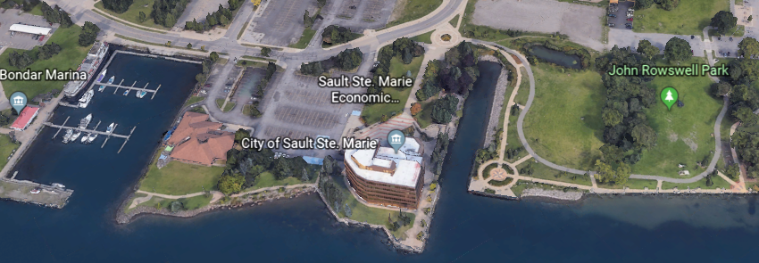
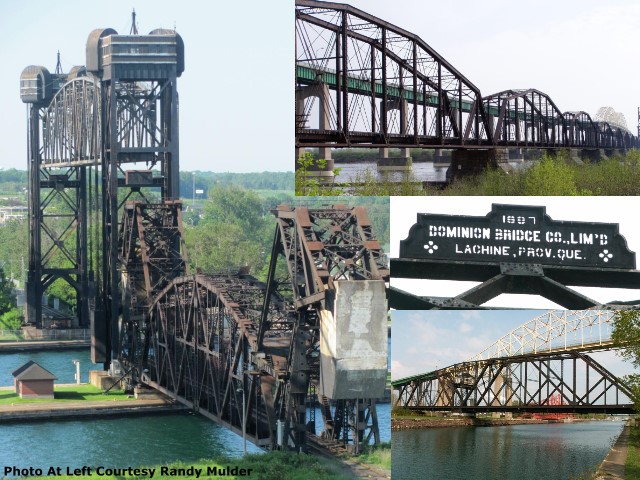
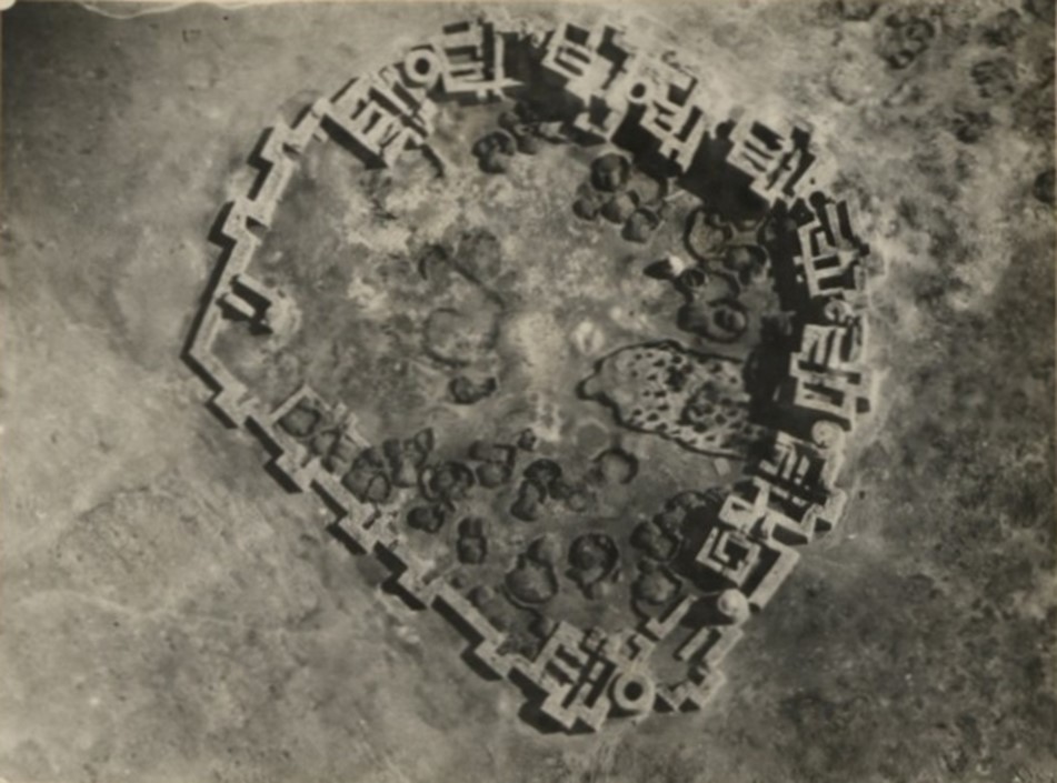
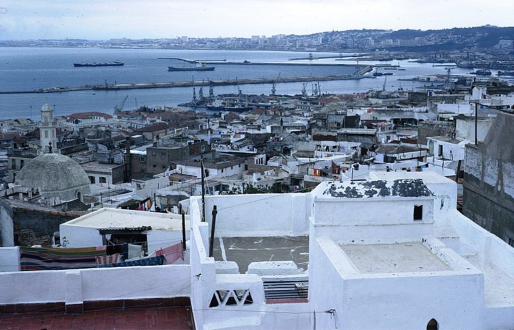
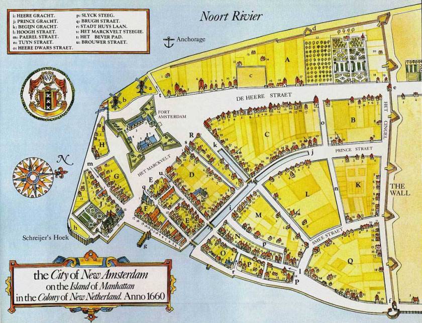
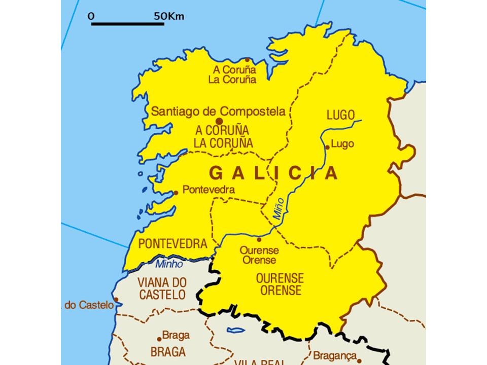
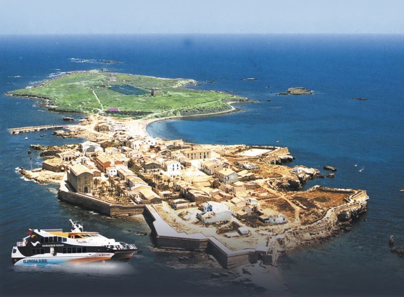
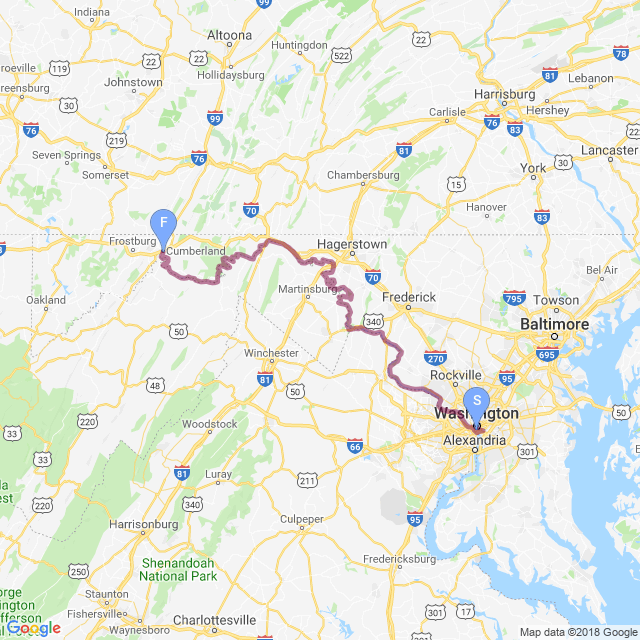
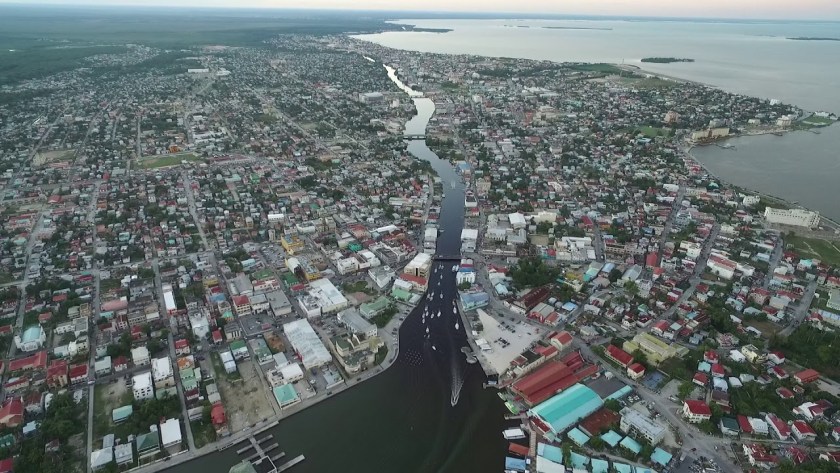
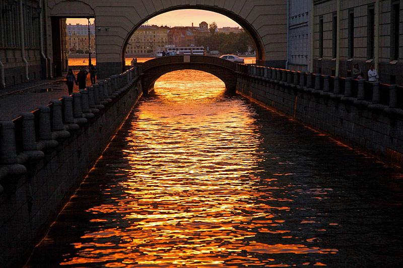
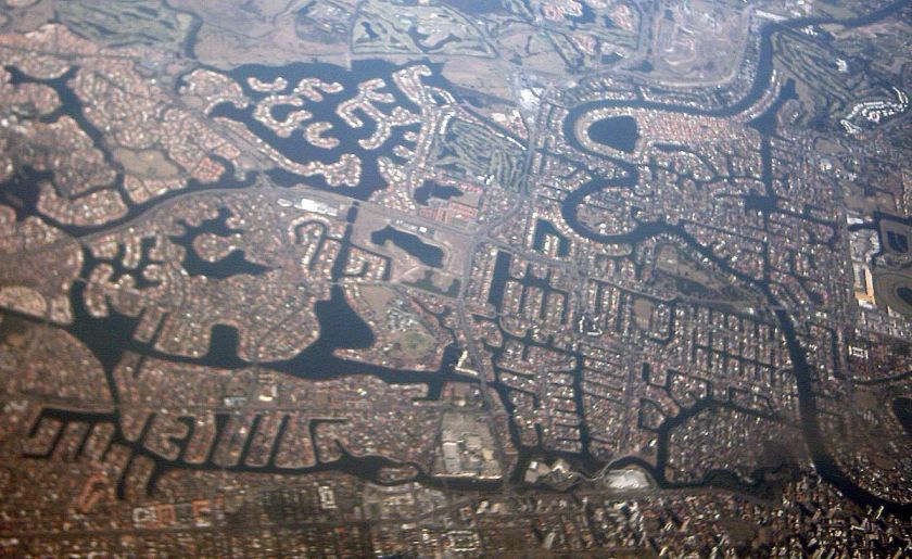
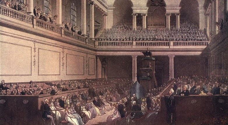
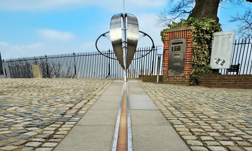
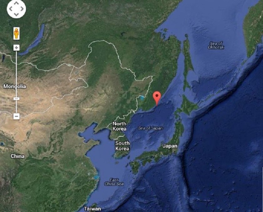
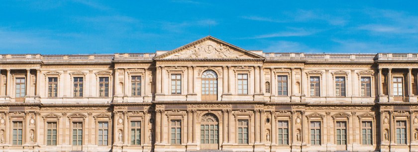
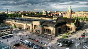
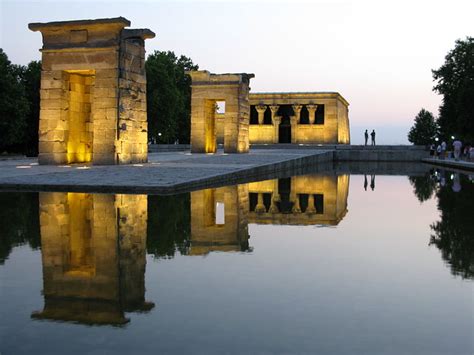
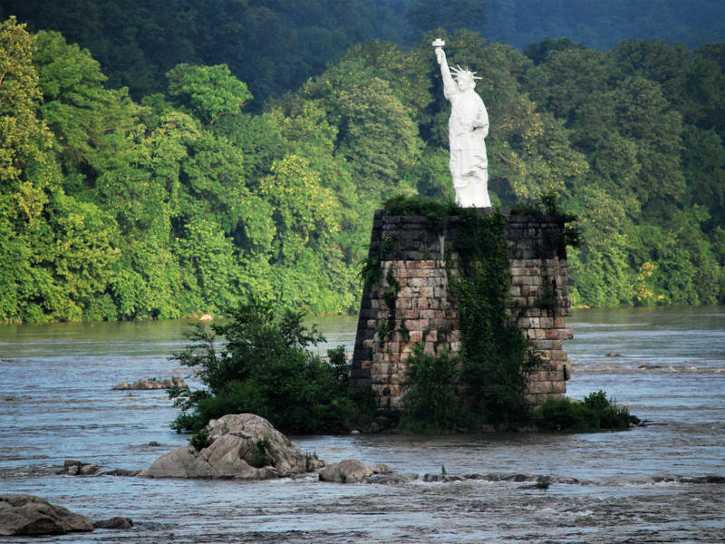
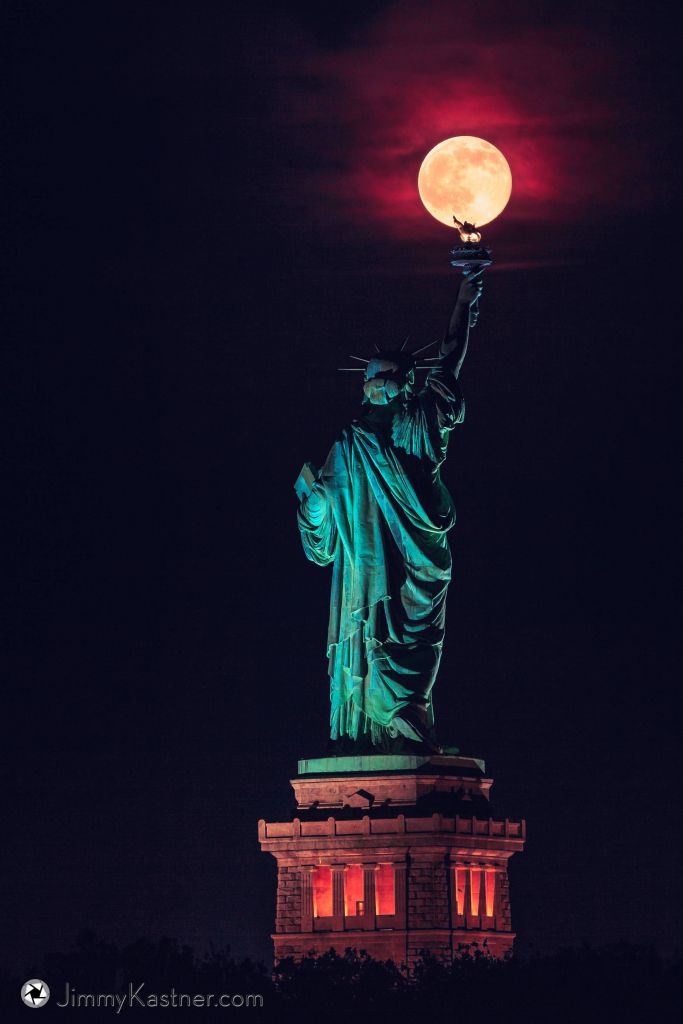
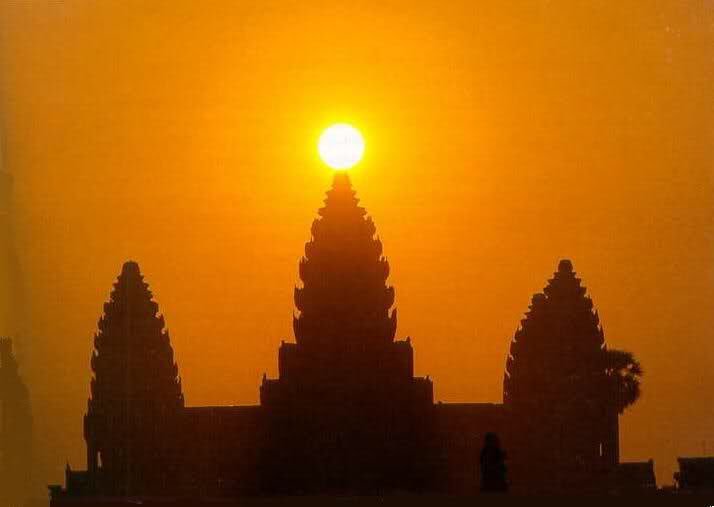
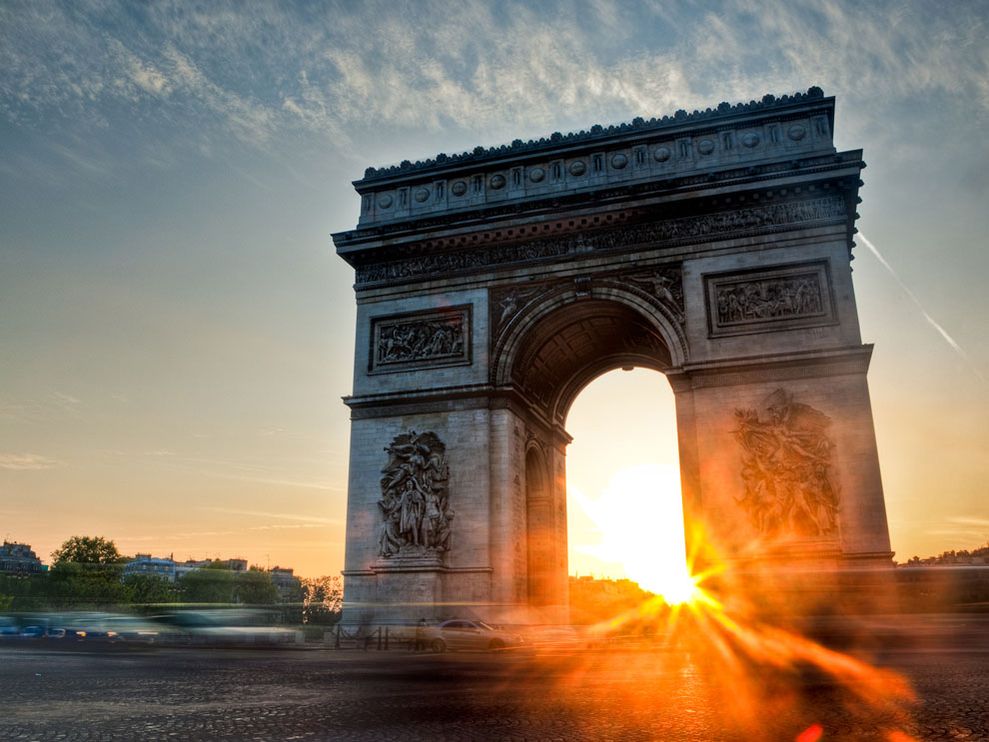
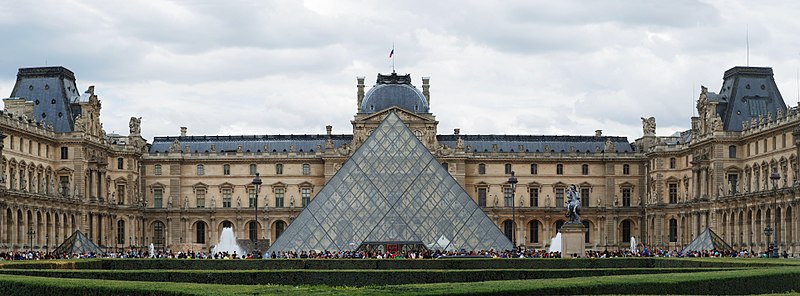
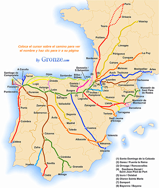
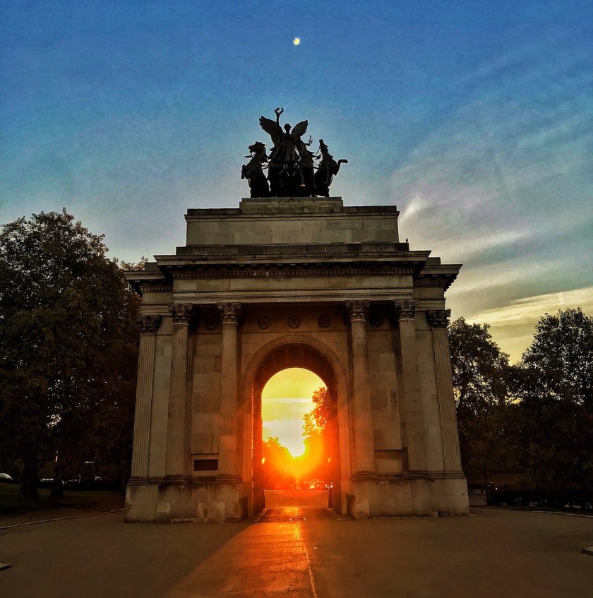
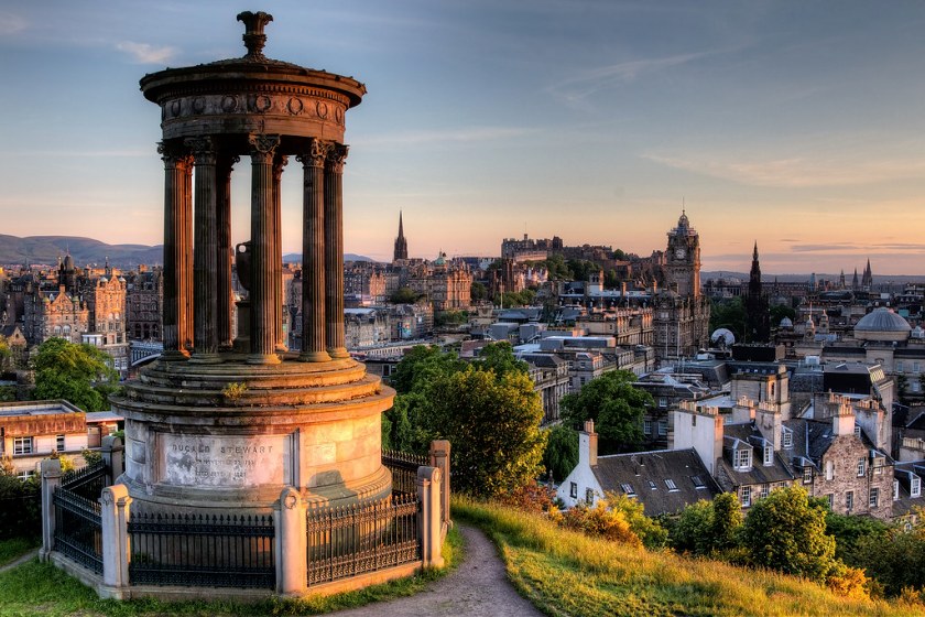
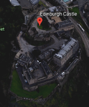
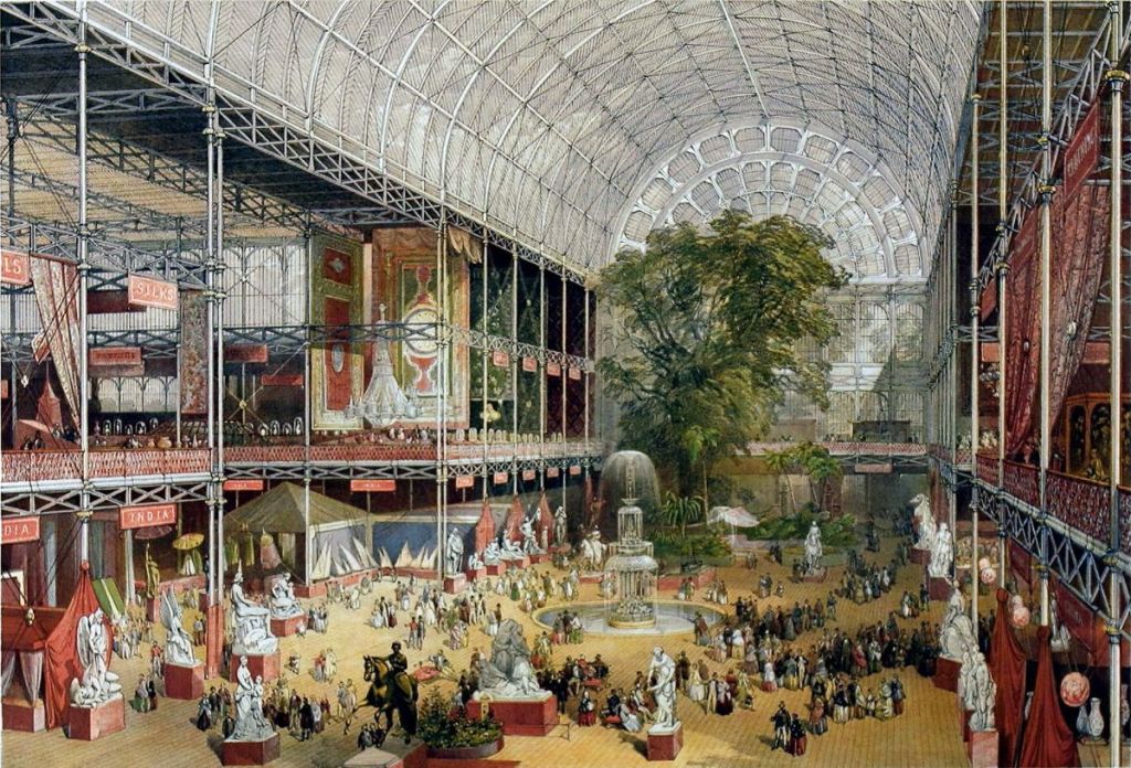
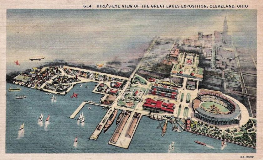
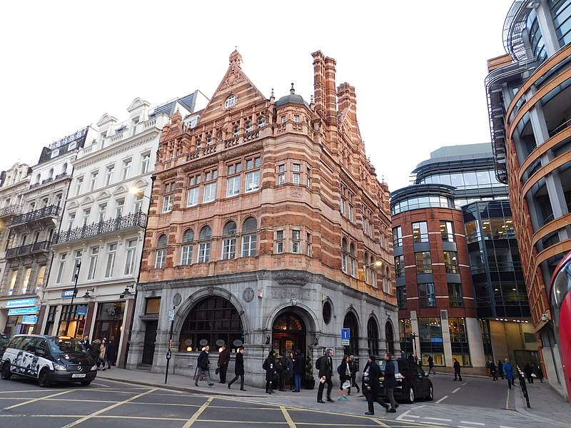
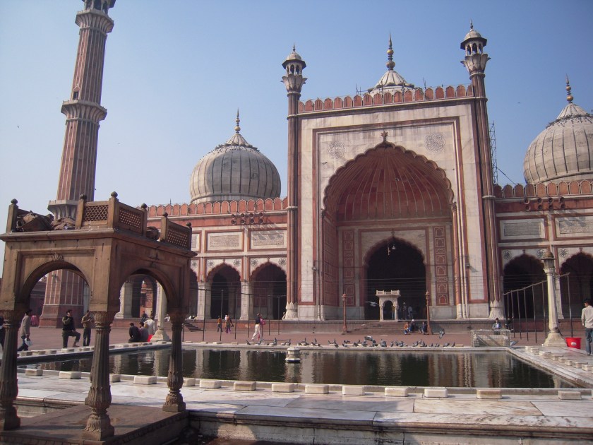
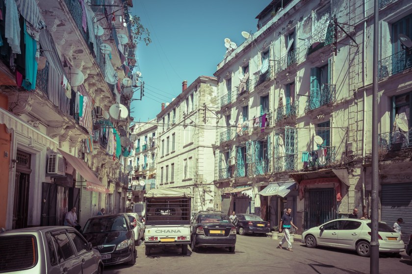
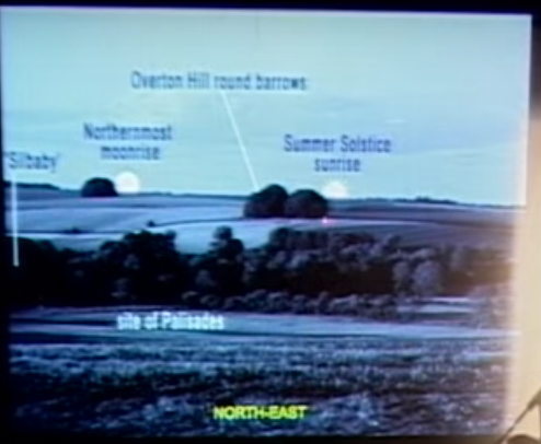
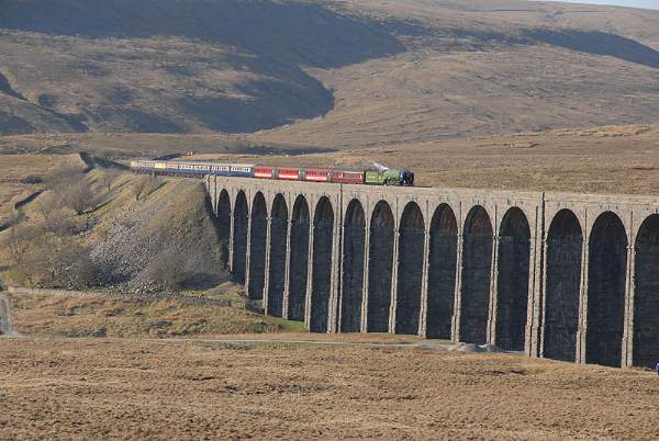
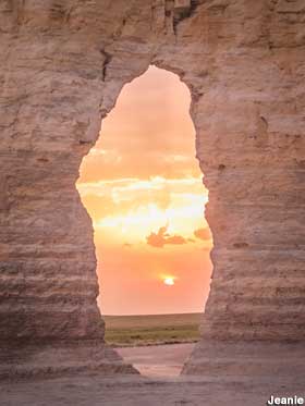
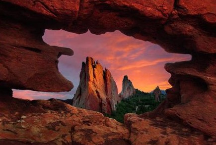
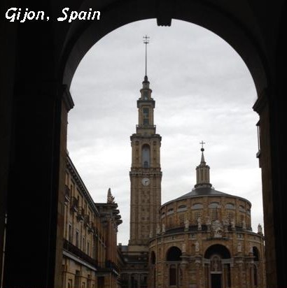
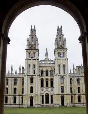
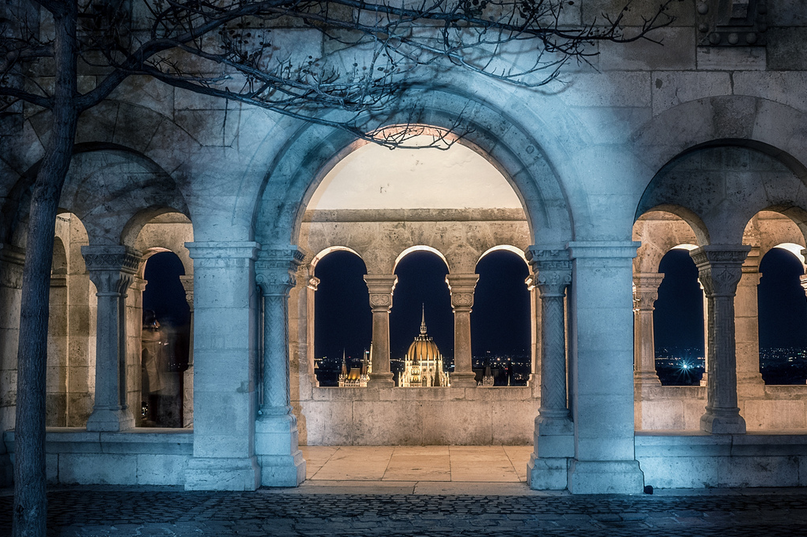
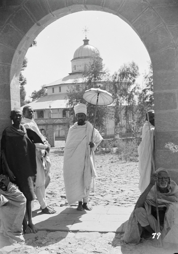
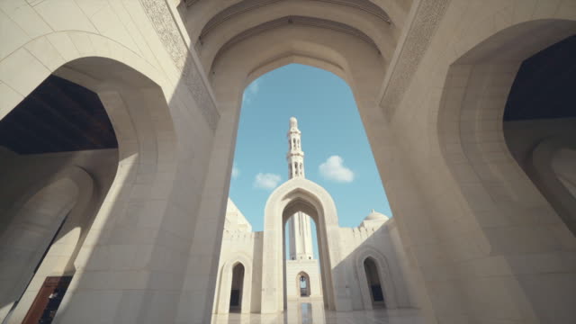
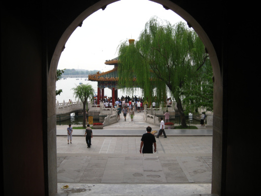
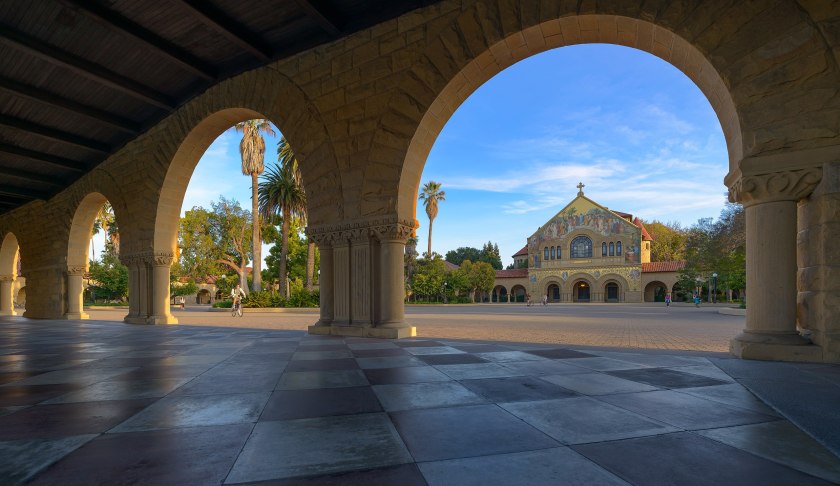
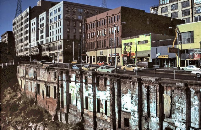
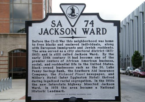
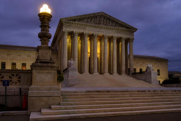
When I was researching “The Manner in which a Global Canal System has been Kept from Our Awareness,” I searched for the Sault Ste. Marie Locks. I already knew they were impressive from earlier research into what is the hidden history of not only North America, but of the World.
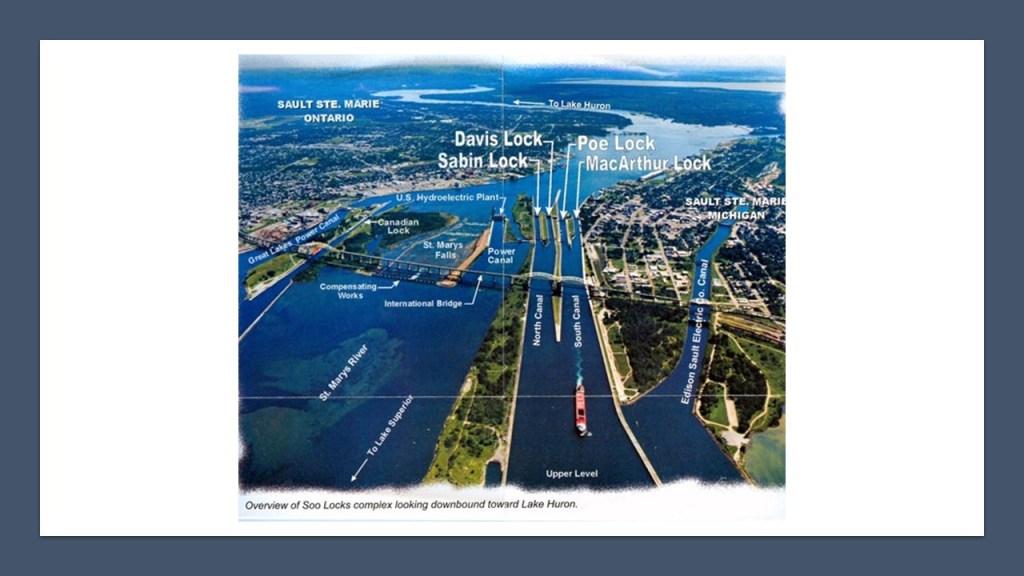
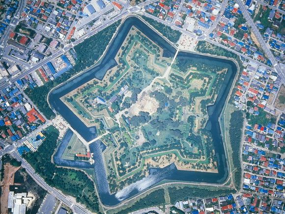
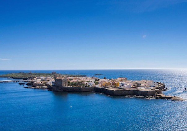
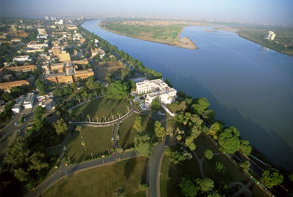
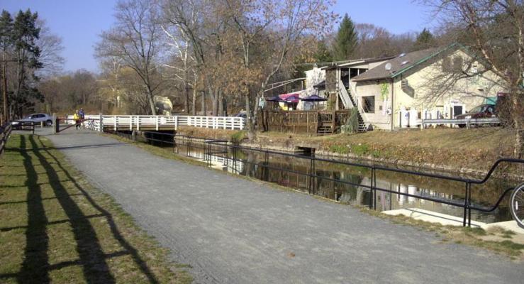
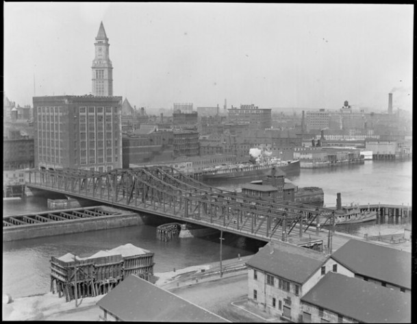
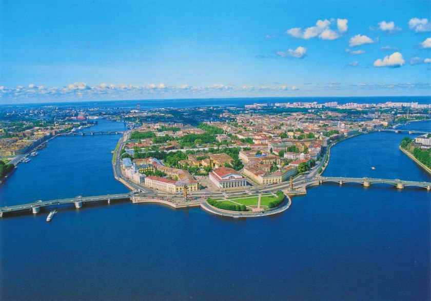
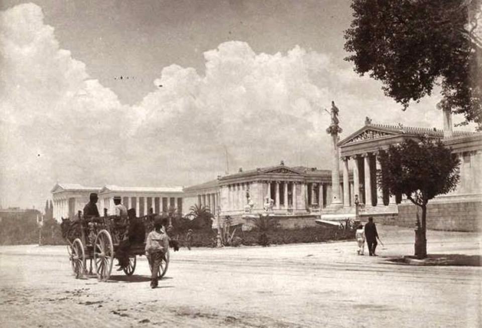
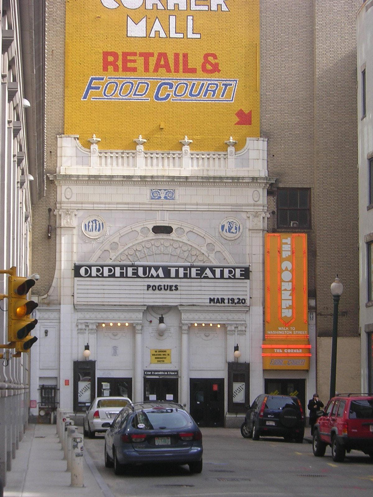
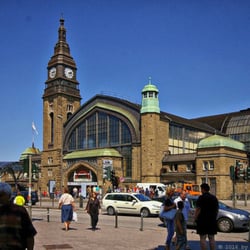
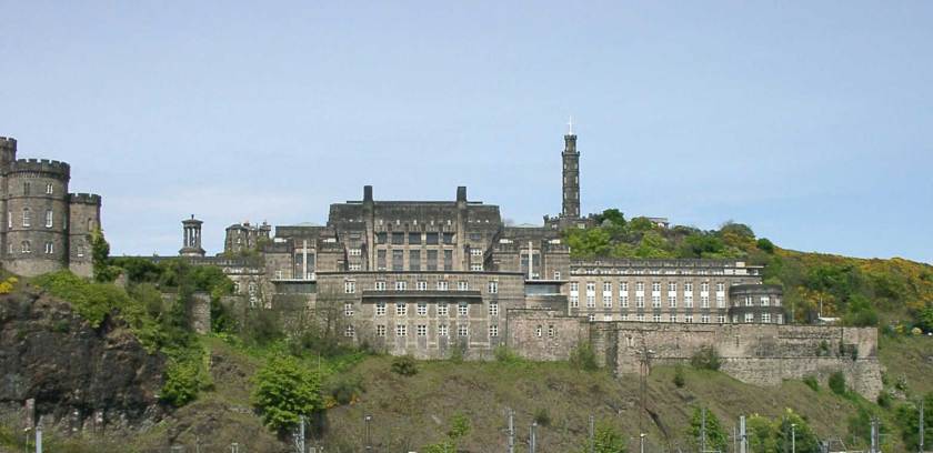
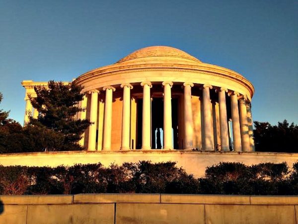
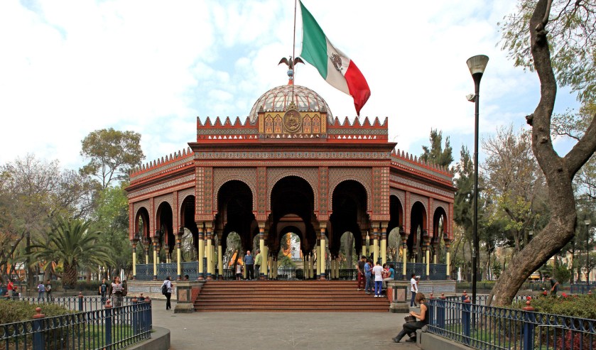
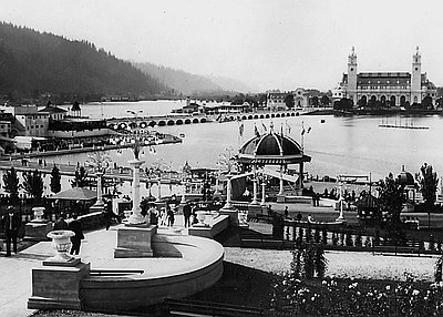
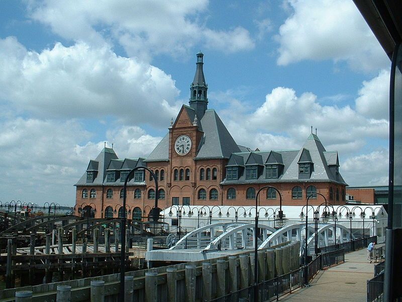
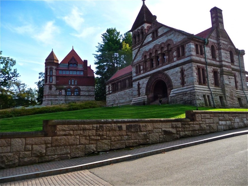
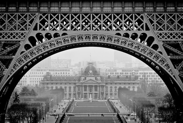
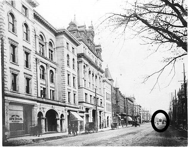
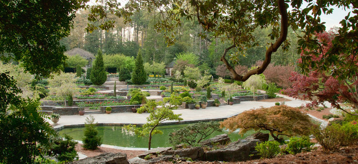
When this photo with detailed information popped up of what are called the “Soo Locks,” I knew I was looking at a significant complex with respect to the hidden Advanced Ancient Civilization, and was instantly interested in taking a closer look at the area. I got a “Ding, ding, ding, Jackpot!” vibe in my head. Even in my initial foray into research here for this post, I found much to reveal. It seems to have everything Moorish rolled into one place!
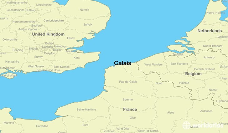
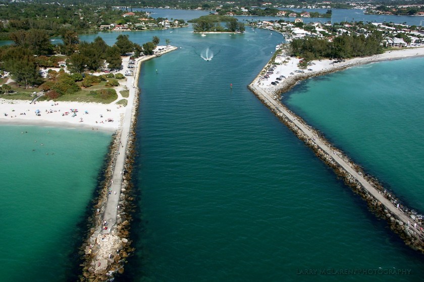
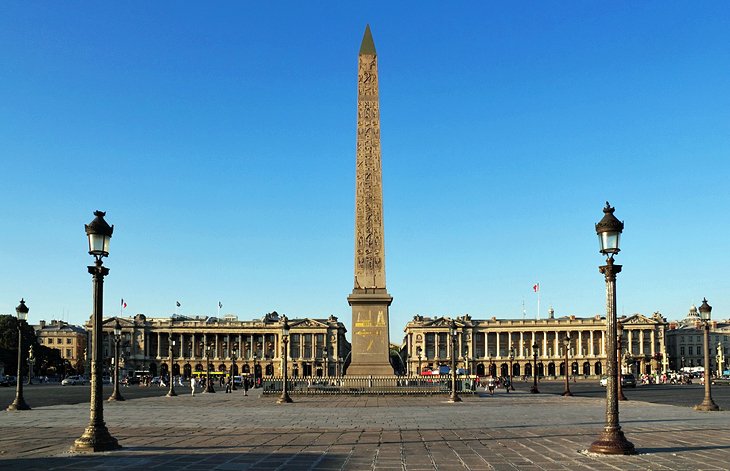
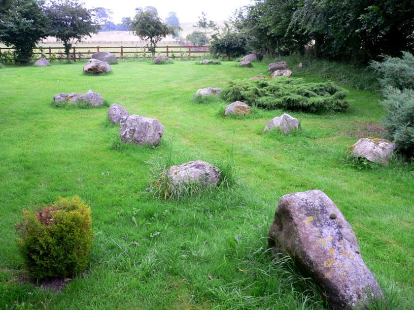
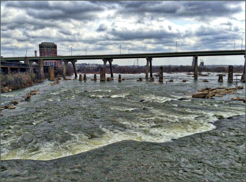
The Soo Locks, the largest waterway traffic system on Earth, are called the “Linchpin of the Great Lakes,” allowing ships to travel between Lake Superior and the lower Great Lakes. Lake Superior meets Lake Huron with a 21-foot drop in elevation.
I am usually not interested in what the historical narrative says, except for the purpose of finding specific physical locations and landmarks for my research, but I think it is important in this case to share a few things about what we are taught in our historical narrative about this location.
The city of Sault Ste. Marie was said to have been founded by the French Jesuit missionary, Father Jacques Marquette, in 1668. It was said to be named for both the “Sault,” the name given to the St. Mary’s River rapids, and the Virgin Mary, and called the first European city in the Great Lakes Region.
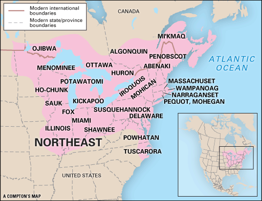
We are told that before the coming of Father Marquette, and “civilization,” this land was inhabited by the Anishinabeg, or Anishinaabe, a name the Ojibwe and Algonquin people use for themselves in their own language, meaning “original people.”
When I searched for a map of where the Algonquin peoples lived in North America, and this is what comes up.
I will be bringing together different strands of this fabric by showing you what is actually here as we go along to weave a different picture of history based on physical evidence, and the inconsistencies in what we are told about it.
Sault Ste. Marie was one city until the border between the United States and Canada was established at the St. Mary’s River in a treaty after the War of 1812, creating Sault Ste. Marie, Michigan, and Sault Ste. Marie Ontario, and on both sides of the river, the area is referred to as the “The Sault” or even “The Soo.”
Sault Ste. Marie is the oldest city in Michigan, and said to be the third-oldest city in the United States.
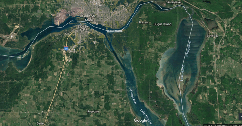
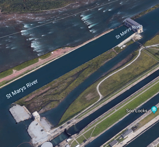
The main course of the St. Mary’s River, starts at Whitefish Bay at the eastern end of Lake Superior, and flows 74.5-miles, or 119.9-kilometers, southeast around Sugar Island into Lake Huron.
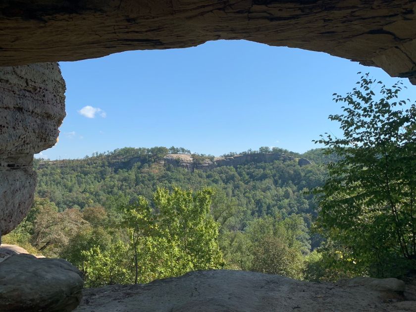
At the River of History Museum in downtown Sault Ste. Marie, Michigan, where we find out that St. Mary’s River is 8,000-years-old, and “born out of the trauma of this land as it buckled and ruptured, and gave way amidst thunderous sound and gigantic force – carved and formed by nature’s relentless sculptor – the glacier. So, let’s take a look like what this violently-formed, nature-carved river looks like.
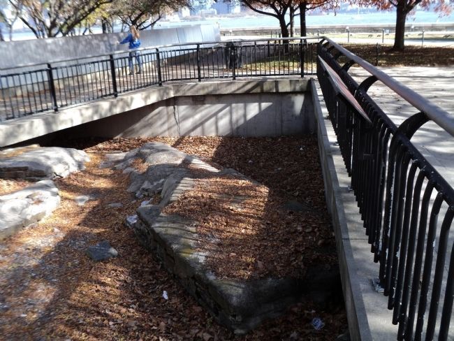
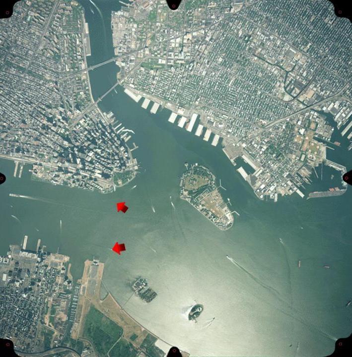
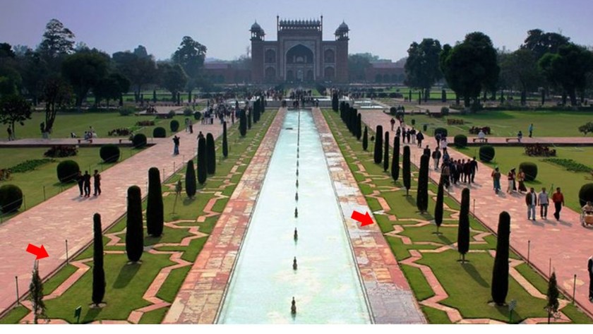
Before the St. Mary’s River even comes to the Lock Systems, from the direction of Lake Superior, this is what the shore-line looks like on the Ontario-side, with points and straight-edges…
…and even another canal going up into the city as pointed out by the arrows, with the last arrow showing where it looks like the canal was cut-off and drained.
The St. Mary’s River also has a so-called branch going into what is called Lake Nicolet on the other side of Sugar Island. Here is a close-up of what it looks like heading in that direction.
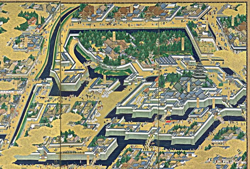
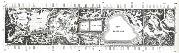
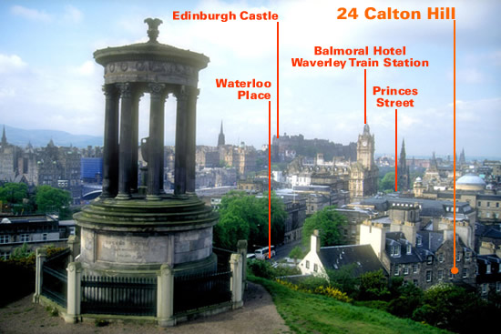
I am going to use the same graphic that I showed at the beginning as a means for organizing the information about this physical location.
I am going to start looking first around Sault Ste. Marie, Michigan on the right side, and work my way across the various features to Sault Ste. Marie, Ontario on the left side.
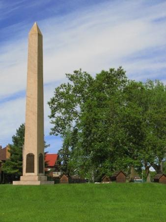
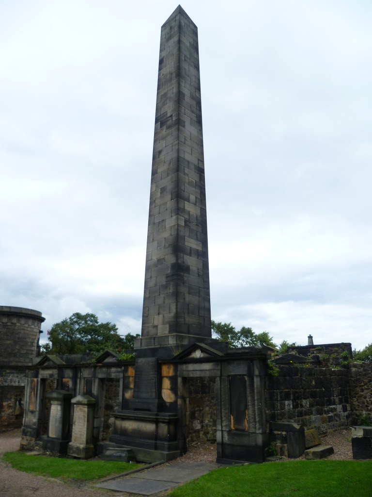
Brady Park is situated to the east of the Soo Locks on the St. Mary’s River waterfront…
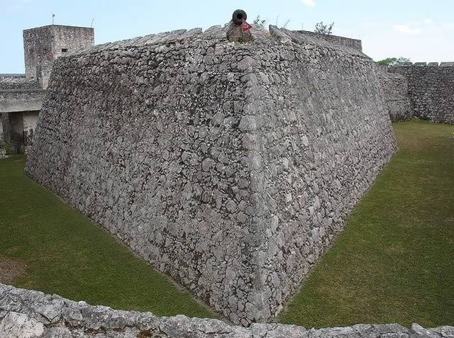
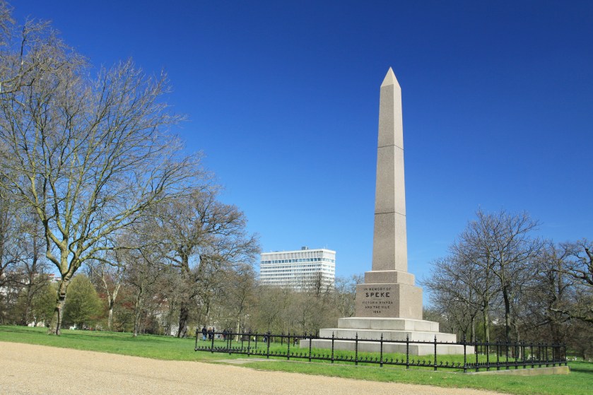
…and were the grounds of the Old Fort Brady. Here we find an obelisk said to have been designed by Charles McKim, of what is called the renowned New York architecture firm McKim, Mead, and White, to commemorate the 50th-Anniversary of the Soo Locks.
This obelisk is situated on top of a triangular-looking earthwork, as seen here from Google Earth.
Here is what it looks like from the street-view.
This colossal stone is on the earthwork as well, near the obelisk, said to commemorate the location of what we are told was the French Fort Repentigny, said to have been established in 1750, and captured by the British in 1760 during the French and Indian War, and burned down and abandoned in 1762.
Old Fort Brady was said to have been built in 1822 to guard against incursions from the British in Canada.
In my research, I have found that words like fort and fortress are code words that covers up infrastructure that had a specific energy function on the planetary grid, called star forts in the present-day, that were re-purposed to appear to have had a solely military function.
I have also consistently found pairs, and even groups, of star forts in my research, like in Lower and Upper New York Bay…
…and Pensacola, Florida, to name a very few.
So I looked to see what was across the River in Ontario, and found the area around the John Rowswell Park looking quite pointed.
I think I can make at least a circumstantial case that there was at least one pair of star forts in Sault Ste. Marie in the area’s history.
In 1893, Fort Brady was moved to higher ground. More on the New Fort Brady’s present-day use shortly.
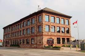
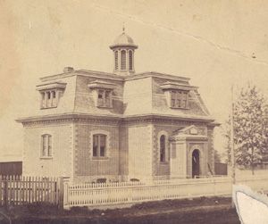
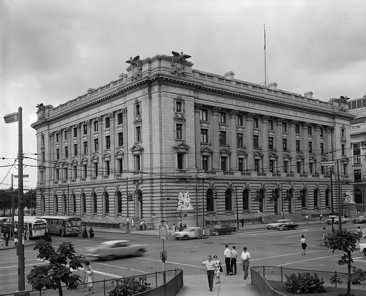
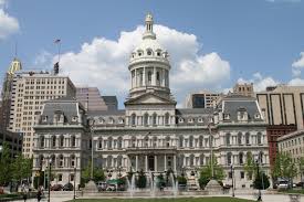
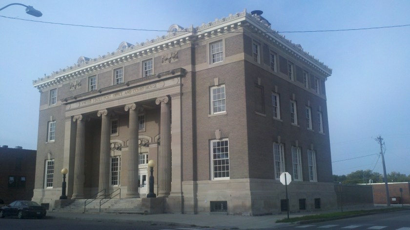
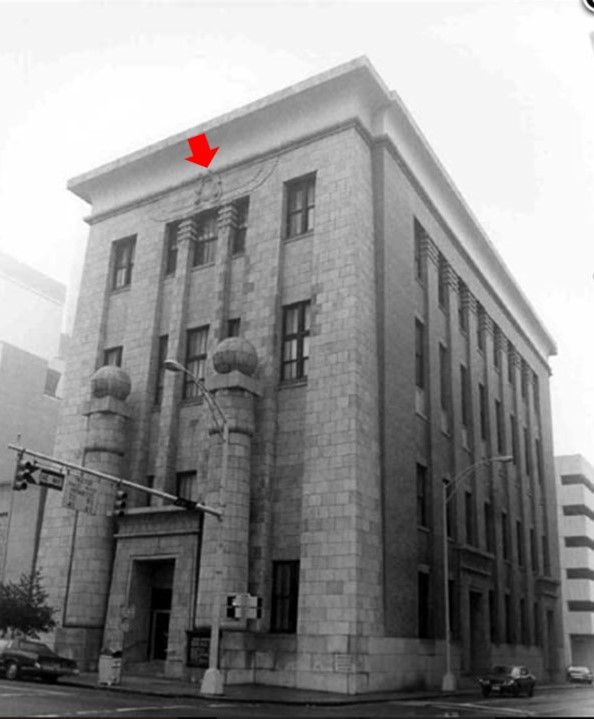
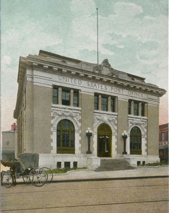
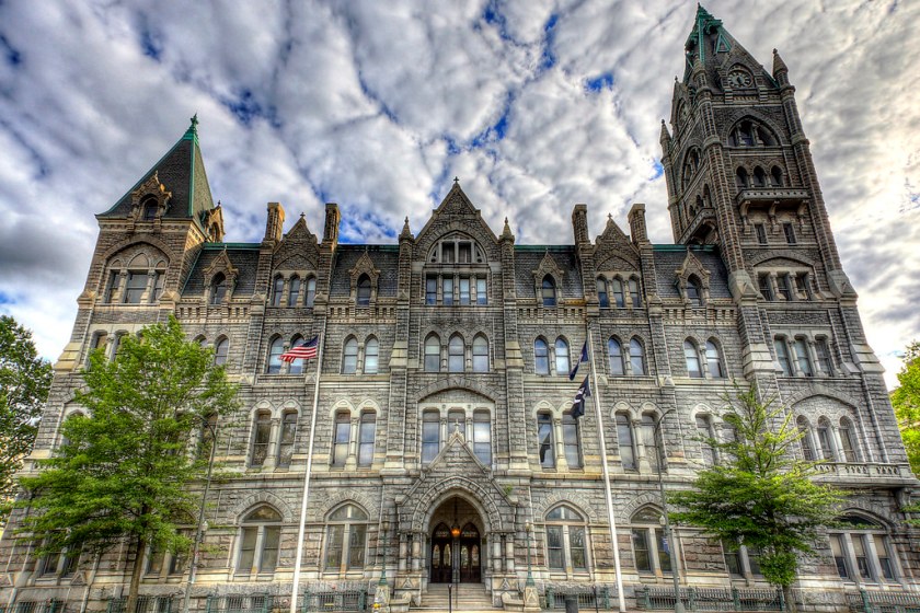
The building now serving as the City Hall for Sault Ste. Marie, Michigan, is the old Federal Building, and is located in the block right across the street from Brady Park.
The Federal Building was said to have been designed by James Knox Taylor, the Supervising Architect of the United States Treasury between 1897 and 1912, and constructed between 1909 and 1910 of limestone from a Bedford, Indiana quarry.
An interesting aside, Bedford, Indiana, was known as the “Limestone Capital of the World” with its large limestone quarries, and said to have also provided the limestone for such noteworthy places as the Empire State Building and the Pentagon. Ever heard of this place before? And…how’d they transport it?
The large stone with the plaque said to be marking the original location of St. Mary’s Church, begun by the Jesuits in 1668, is shown here on the Northwest corner of the City Hall grounds, with the current St. Mary’s Church in the background to the left.
It is now called the St. Mary Proto-Cathedral, and this building was said to have been erected in 1881. This is the third-oldest Roman Catholic parish in the United States after St. Augustine, Florida, and Santa Fe, New Mexico.
An Irish-Canadian architect by the name of Joseph Connelly is given the credit in our historical narrative for the design of it.
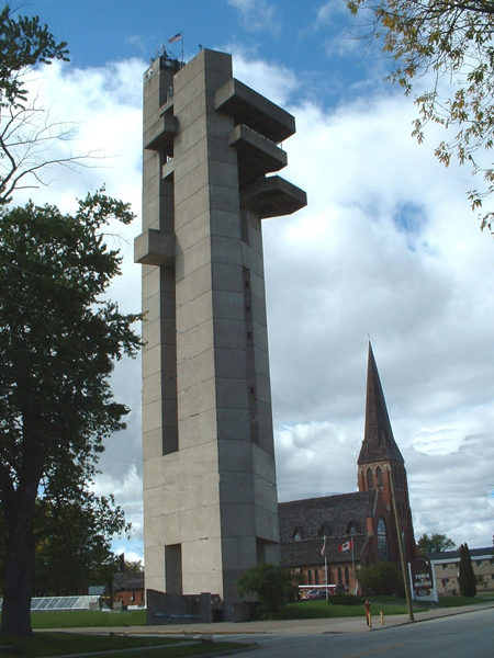
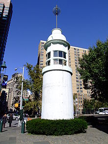
The Tower of History towers over the St. Mary Proto-Cathedral to which it is adjacent. It is 210-feet, or 64-meter, high, with an observation deck at the top, and was said to have been built in 1968 by the Catholic Church as a Shrine of the Missionaries.
Okay. That’s mighty big, for whatever reason it was built.
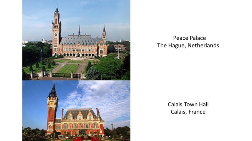
On the left, the Tower of History reminded me of the Tour Perret in Amiens, France in the middle, and the Tour de Guet in Calais, France, on the right.
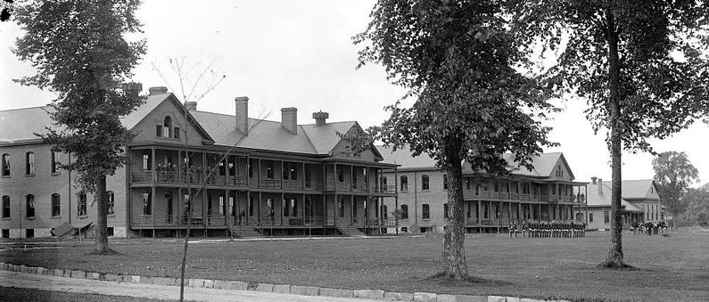
The New Fort Brady site, said to have been established in 1893 to replace Old Fort Brady, and was abandoned in 1944. Today, it is on the campus of Lake Superior State University, with 14 of the original fort buildings re-purposed and in-use.
These include the Officers’ Row houses…
…the now-mens’ dormitory Brady Hall…
…said to have been Fort Brady’s barracks previously…
…the Child Care Center was previously the Fort’s Guard House circa 1893…
…and this was the Commanding Officer’s Quarters.
The ancient advanced civilization most certainly built with bricks like this, and in many cases the camera will pick up magnetic energy signatures from these structures. For example, this is Fort Des Moines in Des Moines, Iowa.
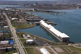
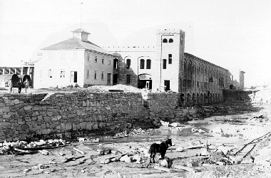
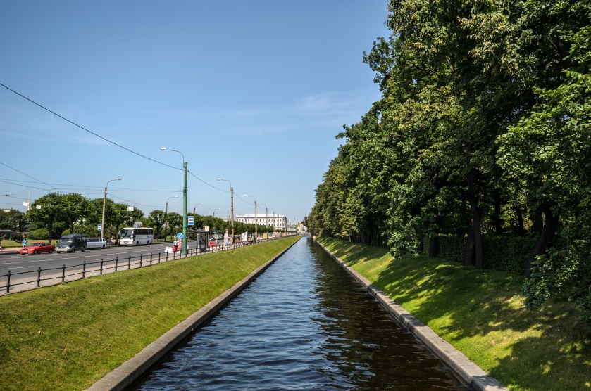
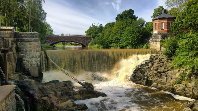
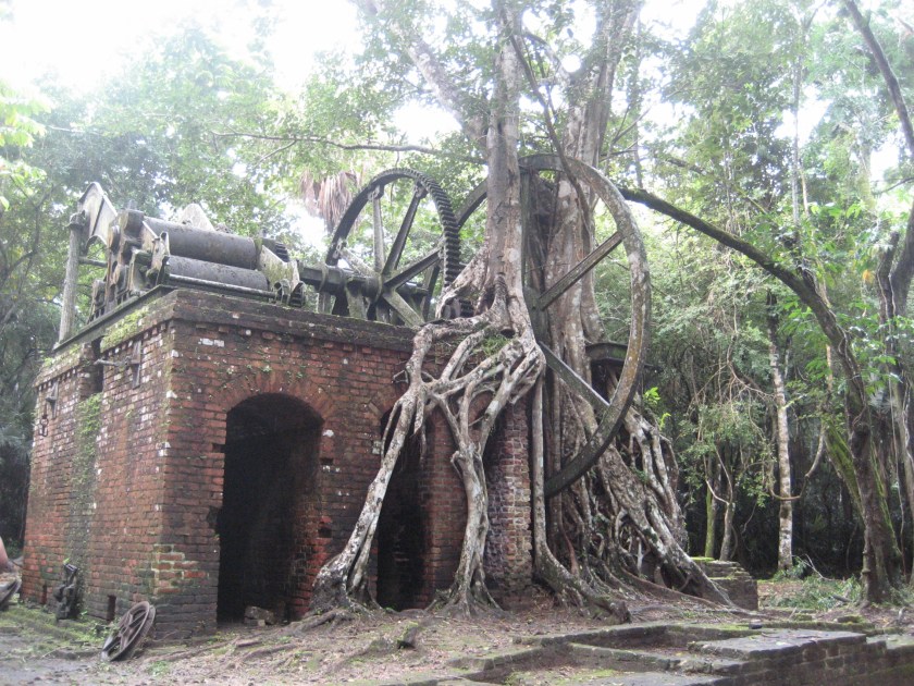
Edison Sault Electric Company Canal, also known as the Edison Sault Power Canal, supplies the St. Mary’s Falls Hydropower Plant, an 18-MW, with capacity up to 30-MW, hydroelectric generating plant.
Made from sandstone masonry, it was said to have been built under the supervision of the U. S. Army Corps of Engineers, starting in 1898, with operation starting in 1902, and is one of the oldest, continuously-operating power plants in North America. Just want to point out the doors in the middle of the building, above ground level. Seems to be an odd location for a full-size set of doors.
The water velocity of the power canal varies at times but can be up to 7-mph, or 11-kph, with the entrance being controlled by four steel headgates.
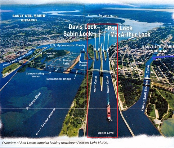
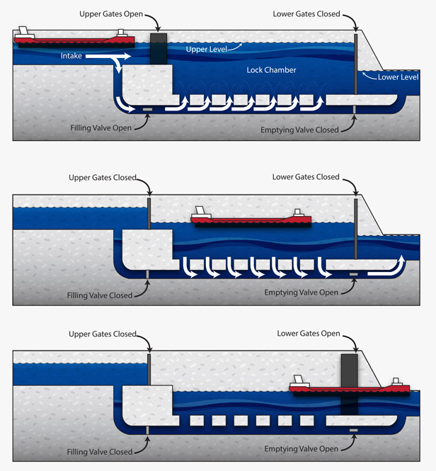
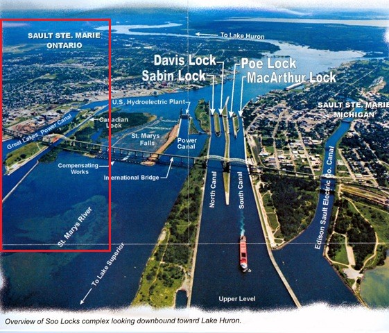
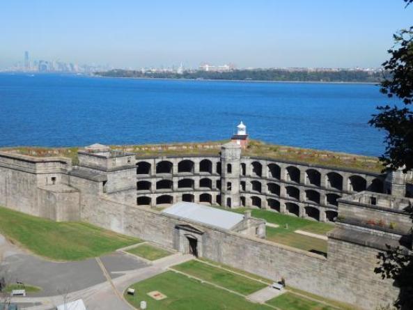
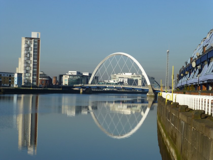
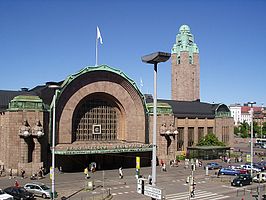
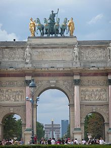
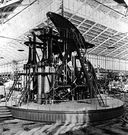
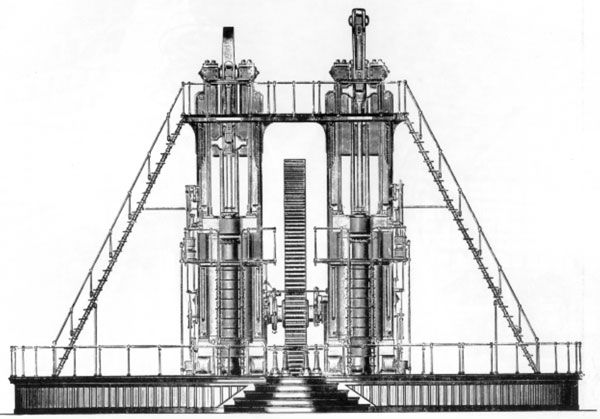
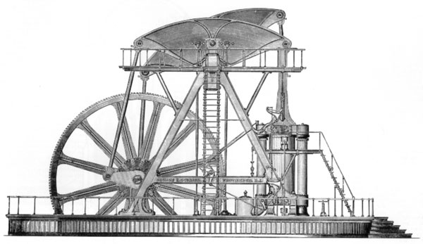
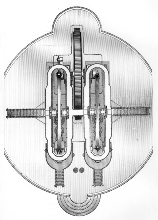
Moving across the graphic, the next place at which to look are the Soo Locks.
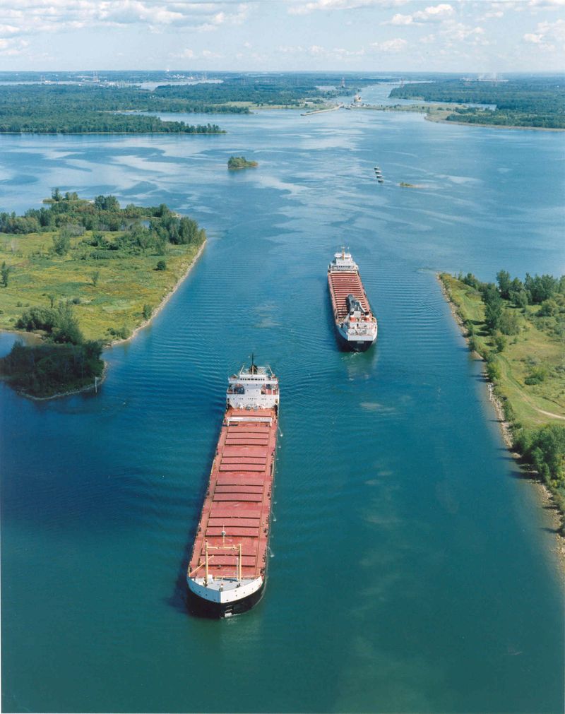
The Soo Locks are considered a wonder of engineering and human ingenuity.
They by-pass the rapids of St. Mary’s River, the river drops 21-feet, or about 6.4-meters, over hard red sandstone in a short 3/4-mile, or 1.2-kilometer, stretch.
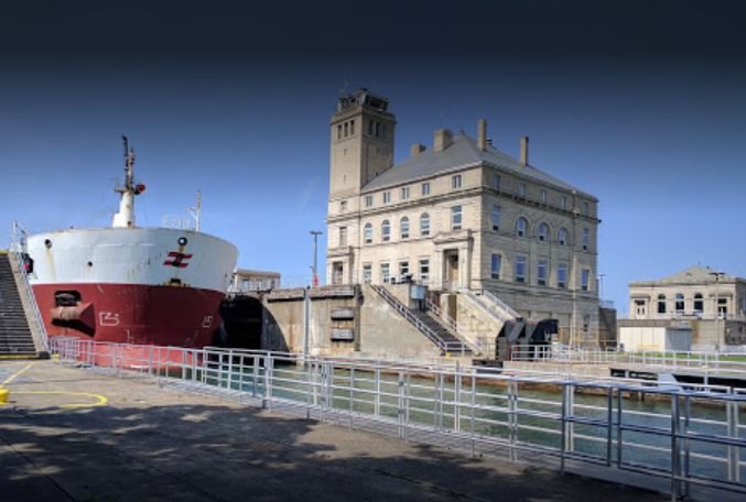
The first locks were said to have been built here in 1855, and operated by the State of Michigan until transferred to the U. S. Army Corps of Engineers in 1881, who owns and maintains and operates the St. Mary’s Falls Canal, within which the locks are located.
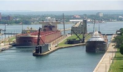
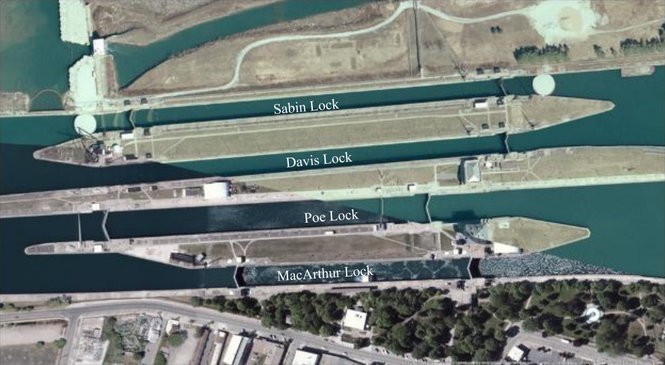
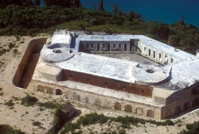
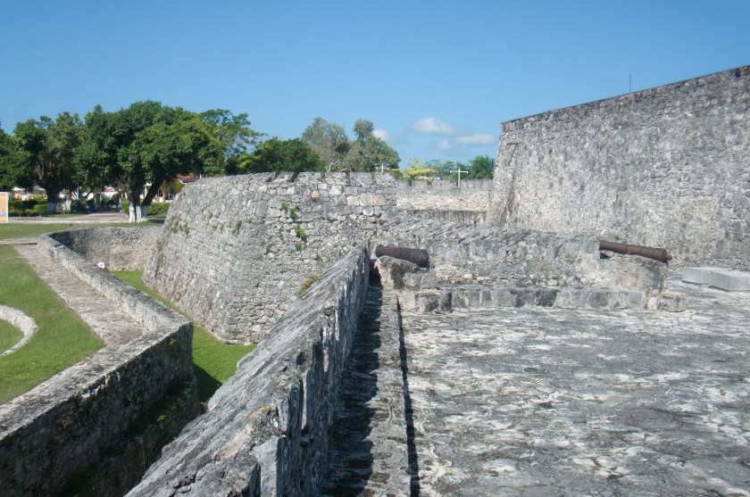
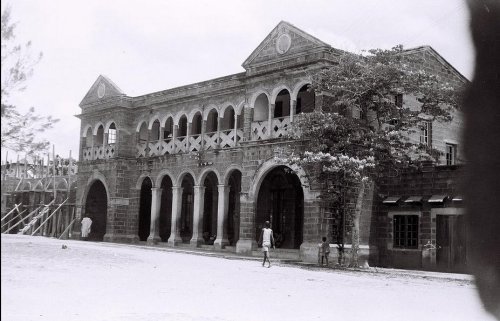
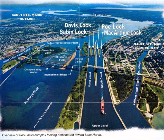
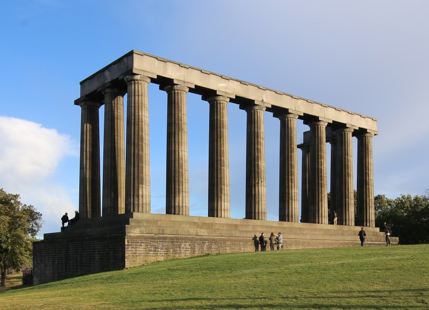
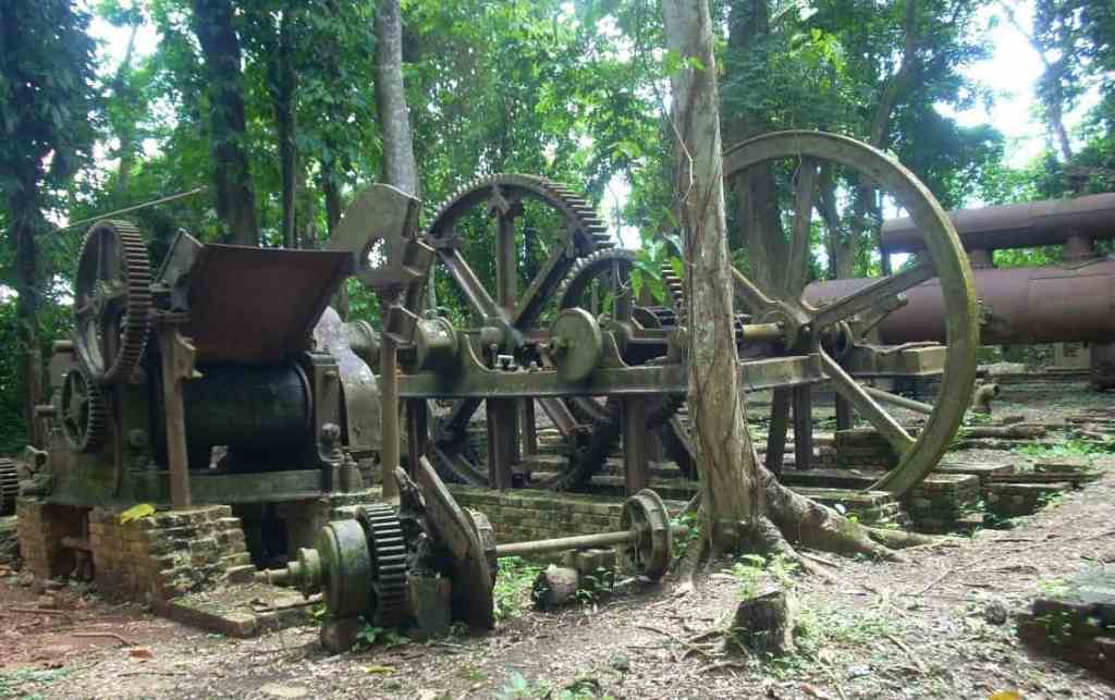
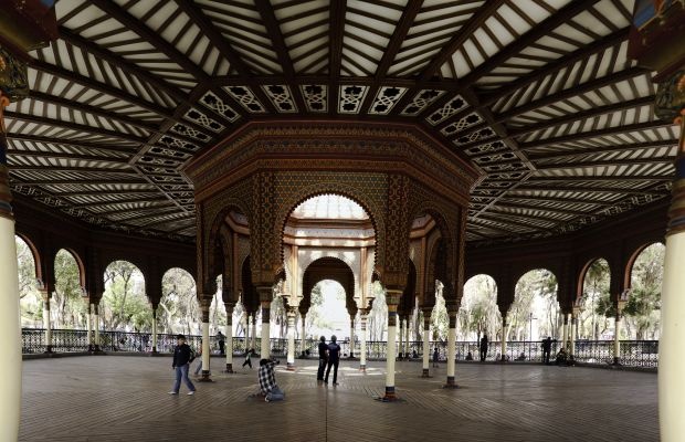
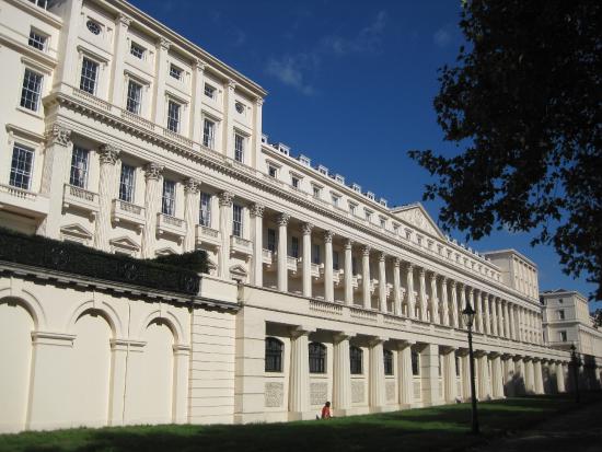
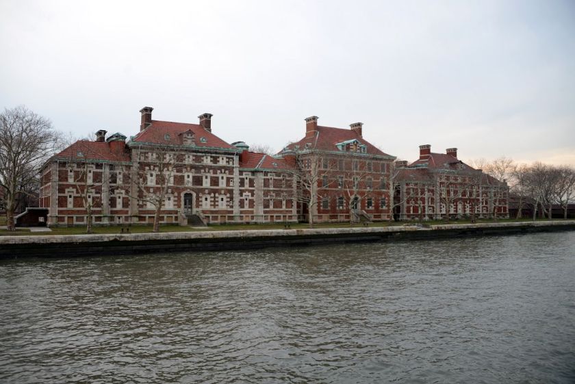
In the South Canal, the smaller MacArthur Lock was said to have been built in 1942, and the wider Poe Lock in 1896.
The two buildings seen here, the larger one beside the MacArthur Lock, and the smaller one beside the Poe lock…
… have all the hallmark features of the heavy masonry architecture of the advanced, ancient Moorish civilization.
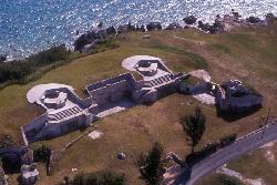
In the North Canal, the Davis Lock, said to have been built in 1919, is used infrequently for light freighters, tour boats, and small craft when the traffic warrants, and the Sabin Lock, said to have been built in 1914, is no longer in use.
There are two hydroelectric powerhouses next to the Soo Locks, together generating 18.4-MW for the Soo Locks complex.
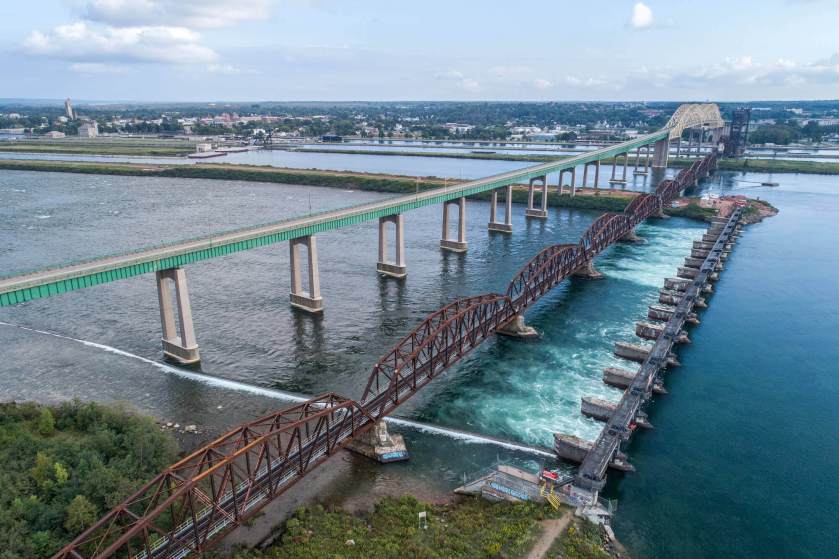
In the next place in the graphic, I will start at the Sault Ste. Marie International Bridge…
…between the United States and Canada, which permits vehicular traffic to pass over the locks.
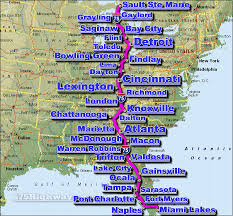
It is the northern terminus of I-75, which goes all the way to Miami, Florida.
The Sault Ste. Marie International Railroad bridge runs adjacent to the International Bridge, and was said to have been built in 1887. It has a vertical lift bridge and swing bridge features as well. Really sophisticated engineering feats!
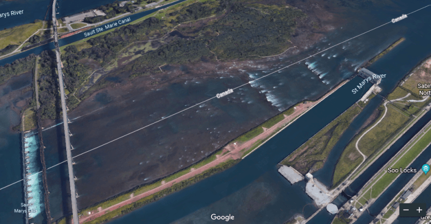
Next are the St. Mary’s Falls, of which the International boundary goes through the middle.
In the right foreground of those photo, in front of the International Bridges, is what are known as the Compensating Works.
They consist of 17 piers and concrete aprons bearing on sandstone bedrock. Piers 1 – 9 are in Canada, and Piers 10 – 17 are in the United States. These were said to have been constructed between 1913 and 1919 (with World War I occurring between 1914 and 1918), and has an extremely sophisticated sluice gate and gate machinery system.
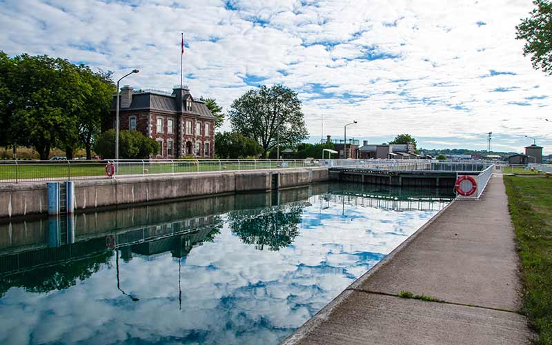
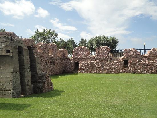
The Sault Ste. Marie Canal is in Canada, on the other side of the St. Mary’s Falls and Compensating Works. It is a National Historic Site, and part of the National Park System of Canada. The date of a lock here is said to go back to 1798, with its destruction in 1814 in an attack by U. S. forces in the War of 1812, and what is here presently was said to have been constructed in 1895.
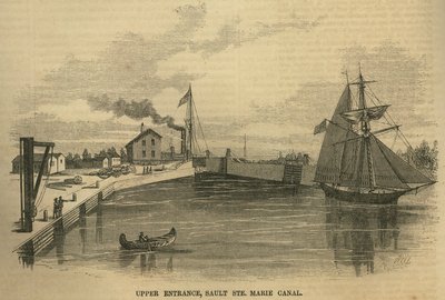
This is said to be depicting the upper entrance to the Sault Ste. Marie canal in 1857.
Next on the graphic is the Great Lakes Power Canal and the Ontario side of Sault Ste. Marie.
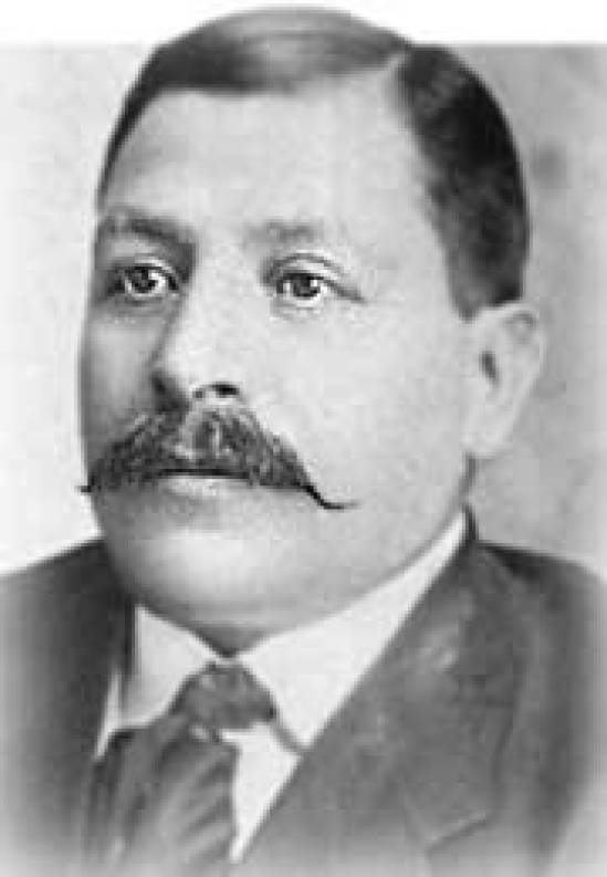
Great Lakes Power was established in the early 1900s by Francis H. Clergue.
Francis H. Clergue was an American businessman from who became the leading industrialist of Sault Ste. Marie, Canada, in the late 1800s and early 1900s.
In addition to Great Lakes Power, he was also credited with establishing other industrial companies, like the Sault Ste. Marie Pulp and Paper Company in 1895.
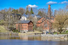
This photo of the Pulp and Paper Mill is interesting. What is it really showing us? A recently built canal and building as they want us to believe? Or far older infrastructure, perhaps after a cataclysm?
We are told Francis Clergue was being the establishment and construction of the Algoma Steel Factory. This February 1901 photo is actually titled “Algoma is Born.” Great contrast of the rudimentary horse-and-buggy shown here, parked right next to rail tracks of some kind…
…with the Algoma Steel Factory, which is said to have opened in 1902, at which time the factory was said to have produced its first rail-tracks, and where it specialized in rails for Canadian Railways as its primary product for the next twenty-years.
The blast furnaces for pig iron manufacture were not said to have been completed until 1904.
This is incredibly high building and industrial technology and expertise for what we are taught we were capable of at the time. Ford’s Model T wasn’t even in production yet ~ it entered the transportation scene in the fall of 1908.
Clergue was also credited with the development of the Algoma Central Railway, connecting it to the Transcontinental artery of Canada. He was said to have initially owned it, and needed a way to transport logs from the Algoma District in northeastern Ontario for his pulp mill, and iron ore for the steel factory, and that it was chartered on August 11th, 1899. It was said to have been completed, in Hearst, Ontario, in 1914. Never made it all the way to Hudson Bay as was planned, we are told.
The details are really sketchy about where the steel for the rails came from since we are told the Algoma Steel Factory didn’t start producing them until 1902.
This is the Algoma Central & Hudson Bay Railway Terminal Station in Sault Ste. Marie, Ontario, said to have been built in 1912.
Other things we find in Sault Ste. Marie, Ontario, include:
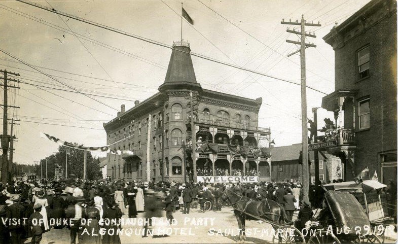
The Algonquin Hotel, circa 1919…
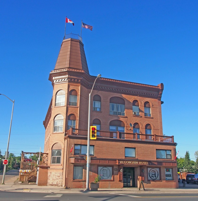
…and the Algonquin Hotel today.
…the International Hotel…
…the Old Post Office…
…and the first Town Hall and Public Library.
Whitefish Island is located between the St. Mary’s Falls and the Sault Ste. Marie Canal in Ontario.
This is a closer view of sights we see on Whitefish Island. This view is facing Sault Ste. Marie, Ontario.
There is plenty more to see here, and I could spend a long time looking around the area. I feel the same way about New York City. There is just a ton of information to be found in places like these.
I am going to end this post with a few words about semantics.
Semantics is the branch of linguistics and logic concerned with meaning, and the relationship between signifiers – like words, phrases, signs, and symbols – and what they stand for in reality.
The pronunciation of the words Sault, Soo, and Sioux are identical.
In the same way, the pronunciation of Washitaw, regarding the ancient, aboriginal Empire Washitaw of North America, and Ouachita, a name given to a variety of places and businesses, is the same as well.
The lands of the Sioux that we are taught about aren’t this far east.
These are the Sioux Falls located in Sioux Falls, South Dakota, where we are taught their lands were.
They are located right next to what we are told are the ruins of the Queen Bee Flour Mill, which was said to have been built between 1879 and 1881, where it had access to all of the city’s five rail-lines…and was destroyed by fire in 1956?
Who were the Sioux, really? I would lay money they were not primarily hunter-gatherers as we have been taught. This fragmentation of the ancient and advanced civilization into a myriad of different tribal nations was done for misdirection about, and deconstruction of, it.
For example, the Menonimee are a federally-recognized tribal nation, with historic territory in Wisconsin, and the Upper Peninsula of Michigan, which is the location of Sault St. Marie.
Images like these come down to us from early painters. This painting is by an artist named Paul Kane, who died in 1871, called “Fishing by Torchlight,” of the Menominee spearfishing at night by torchlight and canoe on the Fox River.
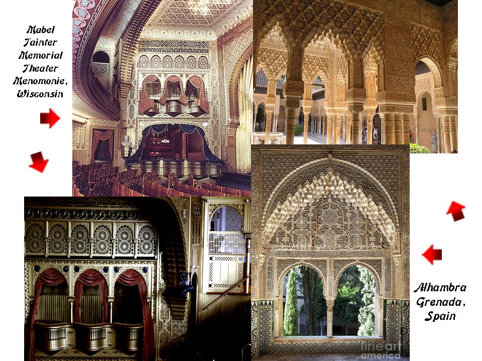
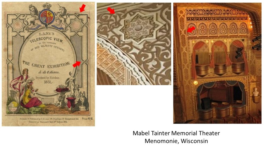
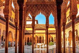
Yet we find architecture of heavy masonry like the Mabel Tainter Memorial Theater in Menomonie, Wisconsin, said to have been built in 1889…
…that looks like the Alhambra in Grenada, Spain, on the inside.
In closing, Sault Ste. Marie is an amazing place, with all of the ancient technologies on display in place up until what we would consider relatively modern times.
It must have been very important as one of the first places the Jesuits came to in North America, after St. Augustine, Florida, and Sante Fe, New Mexico.
I may have to do a study of these two places in the future, but in my next post I think I will be looking at trains. So many subjects to choose from, and I have plenty of material yet to share with you moving forward!
I am going to focus on bringing together the star forts, and other similar infrastructure with names like fortresses, citadels, and castles & palaces that I have found in the course of doing research for all of the circle alignment series I have done thus far.
While most of this information is contained within different parts of these previous series, I have found more star forts on different alignments while researching for this post.
In my initial research for the circle alignments, I wasn’t necessarily looking for in particular star forts – I just found them along the way.
For this post, I went back to some of the places on the circle alignments looking specifically for them, and found some noteworthy things.
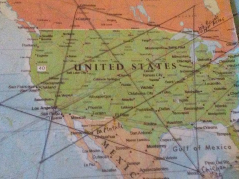
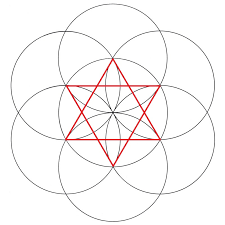
The basis of all of my research comes from a star tetrahedron I found by connecting cities in North America that lined-up in lines.
I believe this is the terminus of the planetary grid system, and that everything about the advanced ancient civilization was based on sacred geometry, including how all of the physical infrastructure of the planet was laid out.
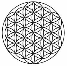
This is the Flower of Life pattern.
It is the creation pattern of the Universe, and all sacred geometric shapes are contained within it, including, but not limited to, the star tetrahedron.
My intuitive understanding of sacred geometry, which I first learned about starting in 2007, is what has guided me in uncovering the information I am bringing forward, and in finding the circle alignments that I am going to focus on in this post.
There are many kinds of alignments, all connected to each other, so what I am about to share is only a snapshot of what is really an overwhelming amount of information.
This is why I have chosen to review places I found on the circle alignments, and this will be a lot of information in and of itself. There is so much to reveal on this vast topic, so please bear with me on the length of this post! I have much to share.
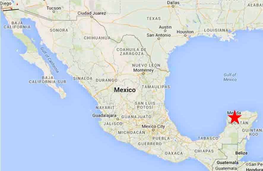
I am going to start with the Circle Alignment beginning, and ending, in Merida, Mexico.
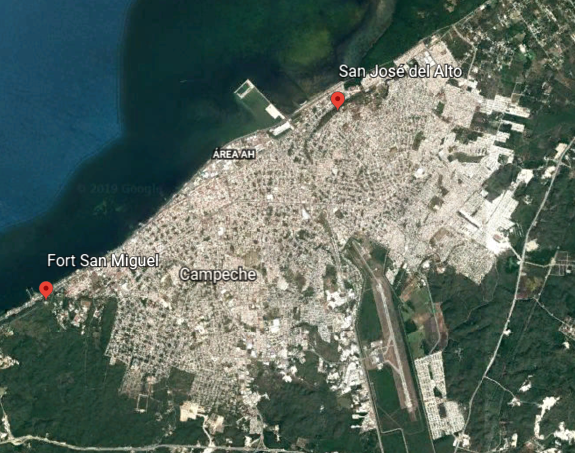
The city of Campeche is located on the coast of the Gulf of Mexico, and a relatively short distance southwest of Merida, Mexico.
There are at least two star forts there.
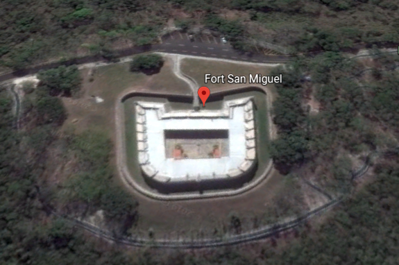
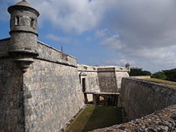
Fort San Miguel is located in Campeche, and was said to have been completed by the Spanish in 1801…
…and is now a Mayan museum.
The other is Fort San Jose el Alto on the other side of town on a bluff overlooking the Bay of Campeche…
…and said to have been built in 1762, and also considered a Spanish colonial fort.
It became a UNESCO World Heritage Site in 1999.
It opened as a Museum of Ships and Weaponry in 1995, and in 2017, its primary focus was changed to being a museum of underwater archeology.
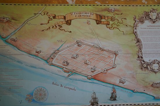
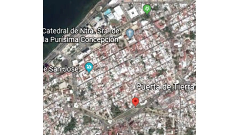
And as I sat here reading about the eight defensive bulwarks that are part of a city wall in the shape of an irregular hexagon, I realized that Campeche was a star city, and searched for an historic map of the city.
This is called the”Puerta de Tierra” or “Land Gate,” with the seven of the eight bulwarks still standing…
…and many of Campeche’s old gates and walls are still intact and well-preserved. These were said to have been built by starting in 1686.
Next on the Merida circle alignment is Key West, Florida, where we find three star forts, including:
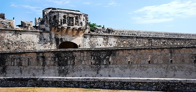
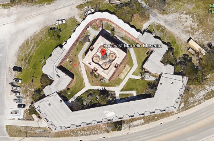
East Fort Martello, which was said to have been built in 1862…
…and called one of the best preserved examples of the Martello-style of military architecture in the country, and is now the Martello Gallery – Key West Art and Historical Museum.
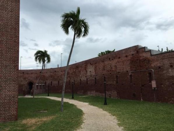
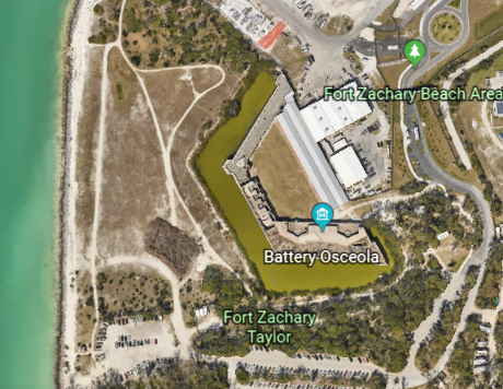
Fort Zachary Taylor is in the city of Key West as well, and was said to have been constructed starting in 1845, and for which Fort East Martello was said to have been a supporting battery.
It was said to have been constructed from oolitic limestone and New England granite.
New England granite? In the furthest west part of the Florida Keys? In 1845?
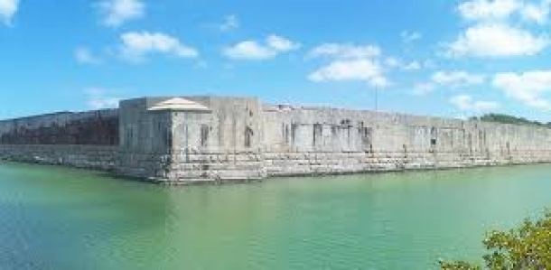
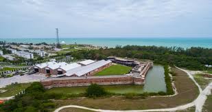
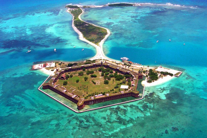
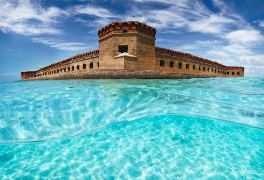
There is a star fort called Ft. Jefferson at Dry Tortugas National Park, on an island which lies 68-miles, 109-kilometers, further west of Key West, and is only accessible by ferry or boat.
It is called a massive, unfinished coastal structure, and the largest brick masonry structure in the United States, made with over 16 million bricks, and its third-largest fort. It was said to have been built between 1845 and 1861.
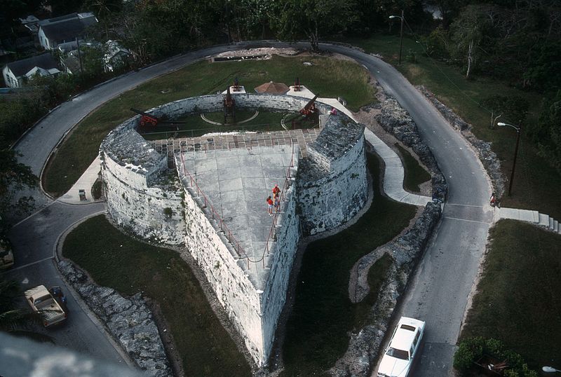
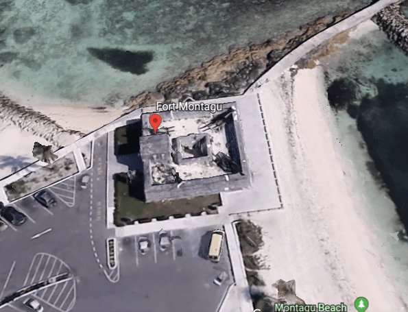
Next, the Merida circle alignment goes through the Bahamas, where in Nassau we find three intact star forts, and one that was located where there is a hotel now.
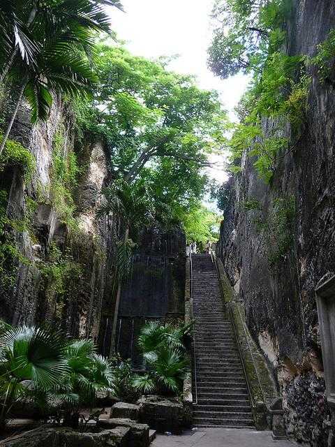
This is Fort Fincastle in Nassau, the capital of the Bahamas, and located on New Providence Island. It was said to have been constructed as a defensive structure from cut limestone 1793 by Lord Dunmore, the royal governor of the Bahamas during this time-frame.
It overlooks the city of Nassau and the Queen’s staircase, 66-steps said to have been carved out of solid limestone rock between 1793 and 1794 around the same time period that Fort Fincastle was built.
Yeah right, I don’t think so!
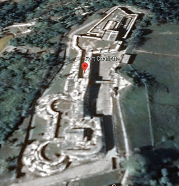
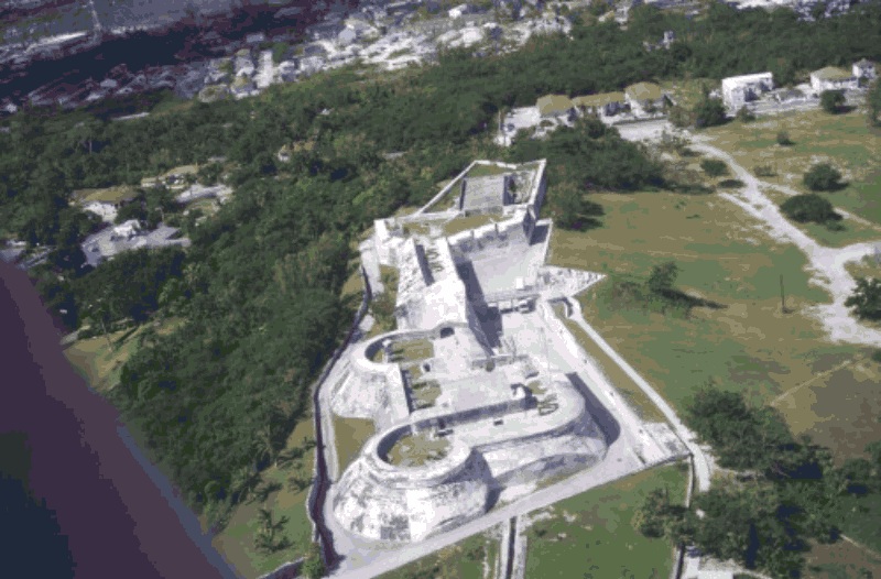
Fort Charlotte is also in Nassau, also said to have been built by Lord Dunmore.
Fort Montagu was said to have been built in 1741, constructed by British military engineer Peter Henry Bruce.
The Bahamas became a British Crown Colony in 1718, we are told when the British were clamping down on piracy. It became an independent Commonwealth Realm of Great Britain in 1973, with its own parliament, and the British monarch as its head of state.
The British Colonial Hilton Hotel is said to be on the grounds of what was the Old Fort of Nassau, described as having been built of stone in the shape of a four-pointed star.
Bermuda is next.
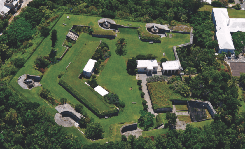
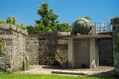
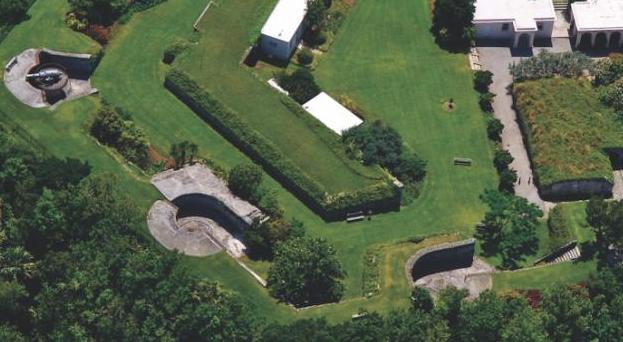
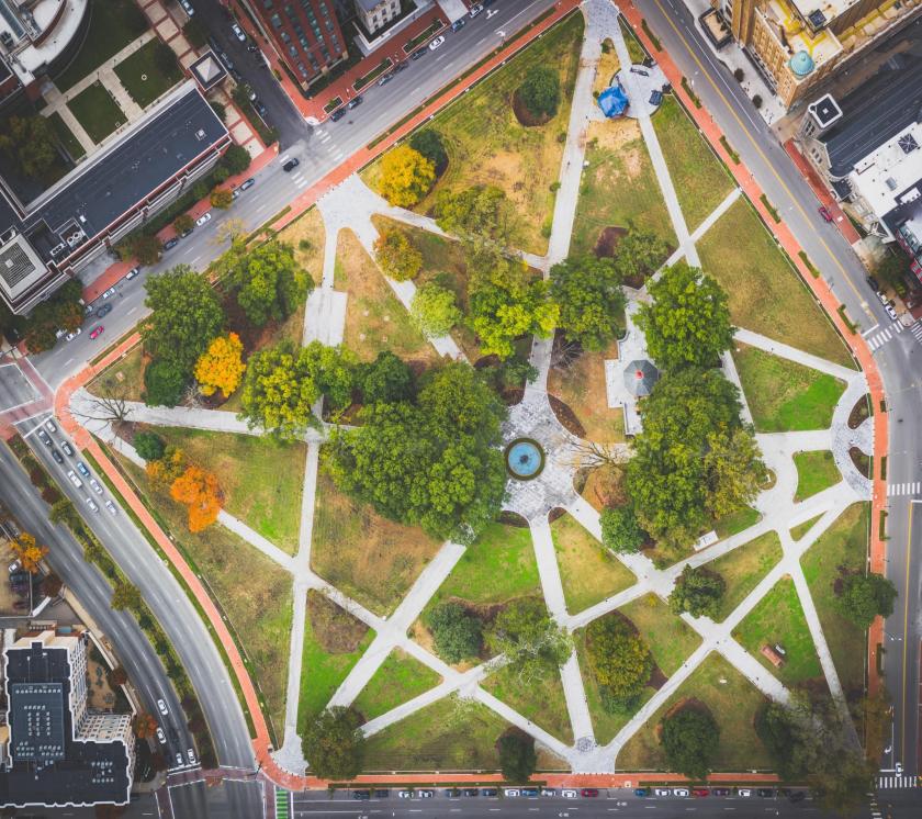
First, let’s take a look at Fort Hamilton in the capital city of Hamilton. It is situated above the city, and is said to have been built in 1870. It is in the shape of a pentagram.
Interestingly they have cannon on platforms at only three of the five main points of the fort’s pentagram shape…
…resting upon what looks to be a more recent concrete platform…
…and nothing in two of the five points.
The fort has beautiful colonnades, seemingly holding up air, and a nice wall in the background about the same height. Don’t know if the area used to be enclosed or not, but sure looks like it could have been!
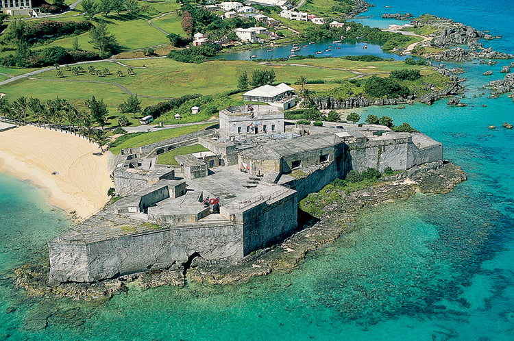
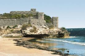
Fort St. Catherine is on the northeast tip of George’s Island in Bermuda. The stone fort here was said to have been built in 1614.
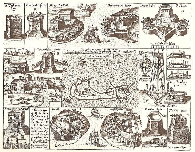
This is a 1624 map of Bermuda, attributed to Captain John Smith of Jamestown, Virginia-fame, with Fort Charlotte depicted on the top left.
Fort Cunningham is located Paget Island in Bermuda’s St. George’s Harbor…
…and this is Alexandra Battery, located about a mile away from Fort St. Catherine, to name a few.
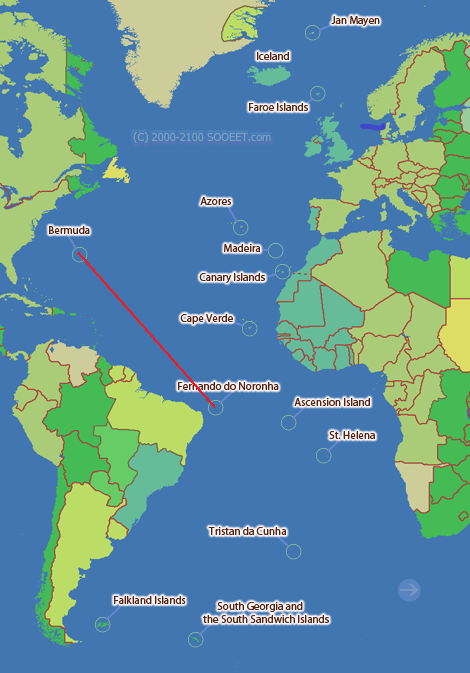
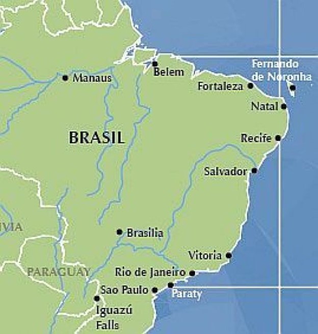
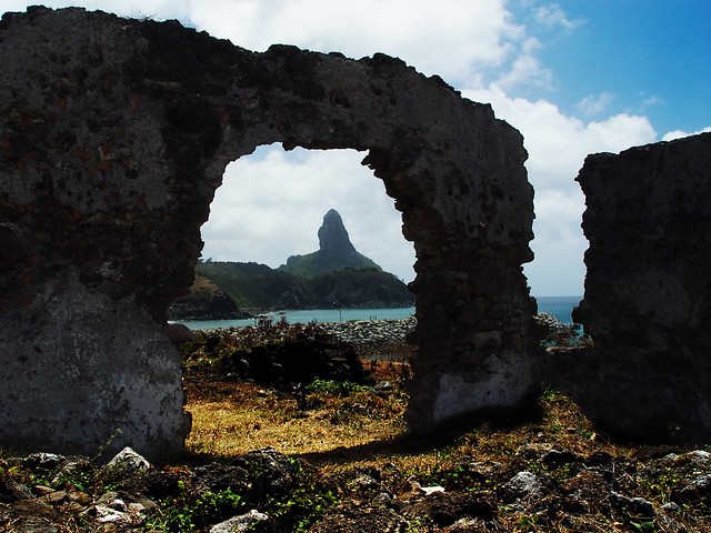
As a matter of fact, there are dozens of old forts on the island of Bermuda, much like Fernando de Noronha off the coast of Brazil. Both are in the Atlantic Ocean, separated by 3,277-miles, or 5,274-kilometers.
I am thinking these two islands were significant power centers for the energy system of the planetary grid. There were possibly more places like this, but I know of at least two places were for sure! More on Fernando de Noronha later in this post.
The Merida Circle alignment goes through Iceland, Greenland, over the North Pole, into Siberia, then into the Pacific Ocean through the Near Islands at the end of the Aleutian Island chain (Attu, Shemya and Agattu), and down on through the Hawaiian Islands.
There I found what is called the Old Russian Fort at Fort Elizabeth State Park on the Hawaiian Island of Kauai. It looks like a very ancient star fort to me.
The alignment goes through all of the Hawaiian Islands, the Revillagigedo Islands, in the Pacific Ocean, before entering Mexico at Colima.
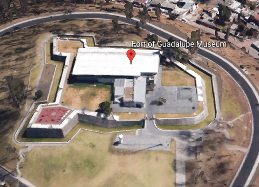
While not directly on the Merida alignment, but very close to it, I found two star forts in Puebla, Mexico, the Fort of Guadalupe…
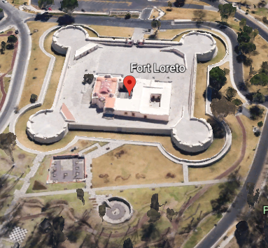
…and the Fort Loreto…
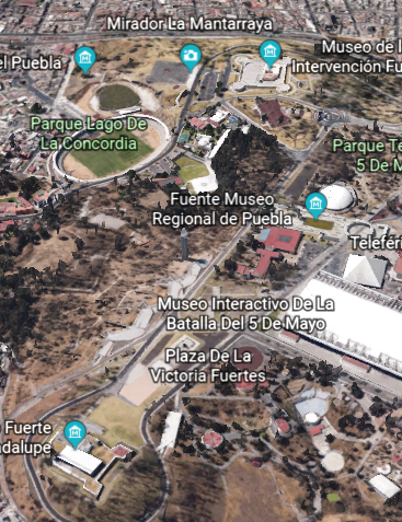
…that are situated relatively close to each other, on a hill not far from the city center of Puebla.
The Battle of Puebla is where the legendary Cinco de Mayo battle took place on May 5, 1862, where poorly-equipped Mexican forces defeated superior French forces.
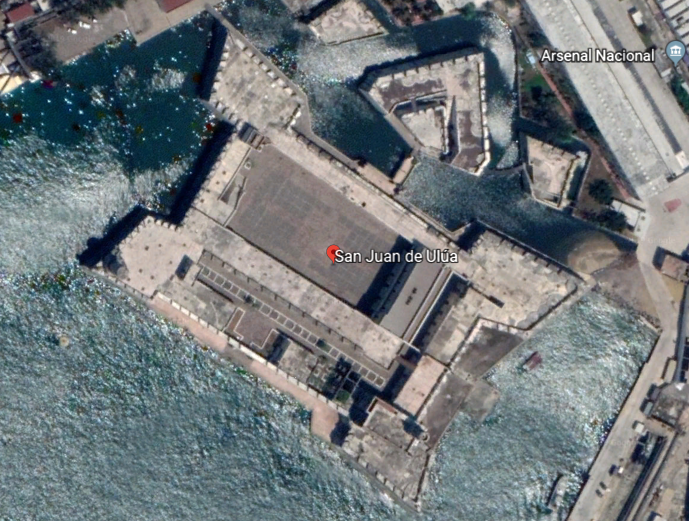
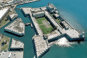
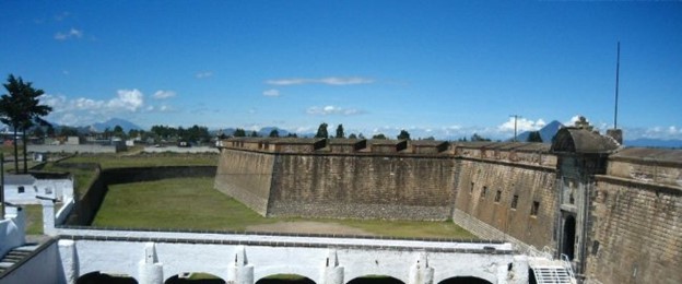
Also not directly on the alignment, but close, and overlooking the Gulf of Mexico, in Veracruz, we find the Castle of Fort San Juan de Ulua.
It’s construction was said to have started in 1565, in the Spanish Colonial New Spain era.
The San Carlos Fortress is also in Veracruz.
It was said to have been built between 1770 and 1776 as a guard post and repository for treasure before its shipment to Spain.
Next, I will take a look at some noteworthy locations I found on the Amsterdam Island circle alignments. I will be showing you a variety of citadels, fortresses, and even temples that could very well serve the same function as the star forts around the world even if they don’t fit the classic look. Fort, fortress, or citadel is a code word that covers up ancient infrastructure that had a specific energy function on the planetary grid.
Amsterdam Island is a tiny dot in the South Indian Ocean, one of the French Subantarctic Islands, also known as the French Southern and Antarctic Lands, officially claimed by France in 1892.
There is a research station there that studies biology, meteorology, and geomagnetics.
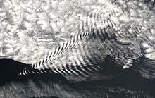
Here is a photograph of Lee Waves taken on Amsterdam Island. Lee Waves are atmospheric stationary waves, and are a form of internal gravity waves. Must be the reason why the geomagnetics of this island are studied.
The Amsterdam Island circle alignment goes through the island of Mauritius in the Indian Ocean, where we find the Citadel Fort Adelaide in Port Louis, the capital of Mauritius.
The alignment goes through Somalia, entering at the capital city of Mogadishu, where we find the Citadel of Gondershe nearby…
…and we find the interesting, almost circuit-looking Taleh Fortress, in Northern Somalia.
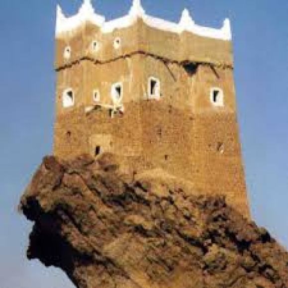
In Mukalla, Yemen, this is the Alguwizi Fortress, called an architectural masterpiece built on the foot of a rock…to protect the city from Bedouin attacks? It sure doesn’t look like it was built to be a defensive structure to me!
Yemen is another one of those places with a missing glorious ancient past.
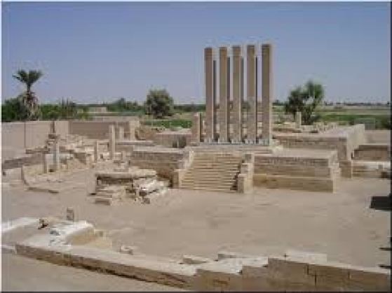
This is the Awwam Temple in Marib, Yemen, also known as the Mahram Bilquis, or the Sanctuary of the Queen of Sheba.
The Sheba Kingdom is one of many ancient kingdoms that reigned in what is now present-day Yemen.
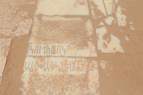
Arash Bilqis, or the Throne of Bilqis, has monolithic stone pillars (meaning single block of stone) more than 26-feet, or 8-meters, high, featuring writing and advanced masonry.
It is interesting to note that the old South Arabian inscriptions seen here…
… have a Norse runic look to them.
You may ponder what this means. I myself would bet money that it does not mean vikings were in ancient Yemen.
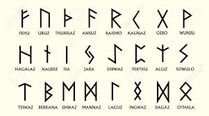
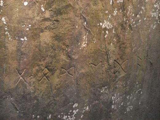
This is exactly what they say about the Heavener Runestone in Heavener, Oklahoma, and the accepted explanation to this day is that there were vikings in Oklahoma.
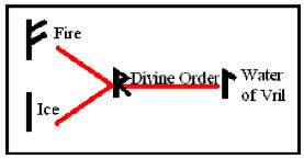
I would put my money on these being symbols of the original language, Vril, connected to the Ancients and their mastery of how to harness natural energy to create amazing things.
Mahram Bilqis was also dedicated to the moon god of the ancient Yemenis, Al-Muqh, and dates back to the fifth- and seventh-centuries B. C.
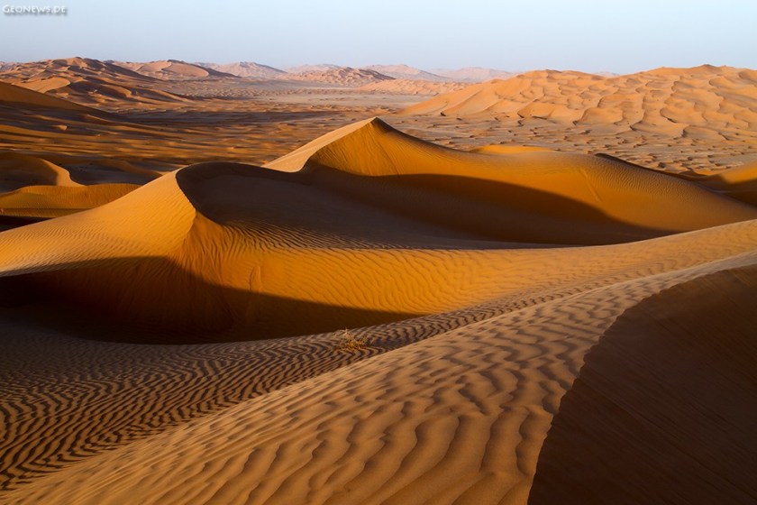
Travelling through Yemen and southern Saudi Arabia, on our way to the United Arab Emirates, we pass through the Rub Al Khali, or the Empty Quarter of the southern-third of the Arabian Peninsula. It’s the largest desert in the world.
A recent Saudi Arabian Minister of Petroleum and Mineral Resources reported that the dunes don’t drift – that while sand blows off the surfaces, their essential shape remains intact. Something tells me there is enduring infrastructure underneath all that sand….
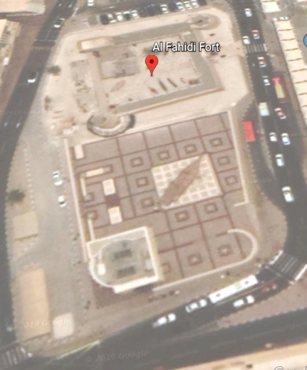
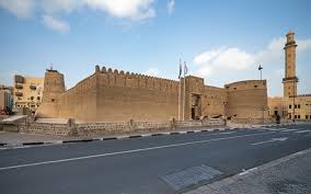
Moving on, this the Al Fahidi Fort, now a museum in Dubai in the United Arab Emirates.
It was said to have been built in 1787, and is said to be the oldest existing building in Dubai.
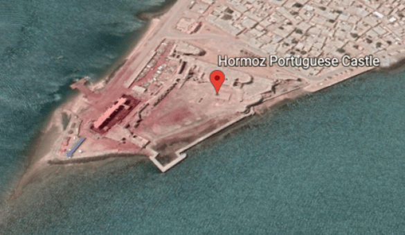
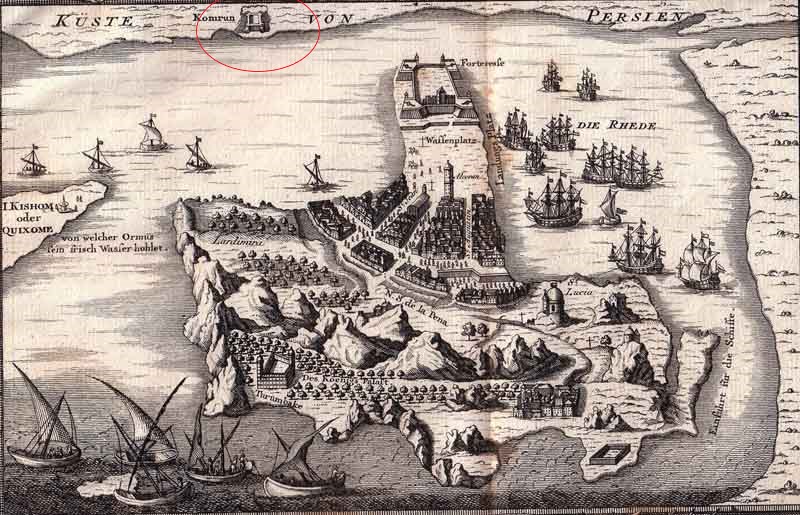
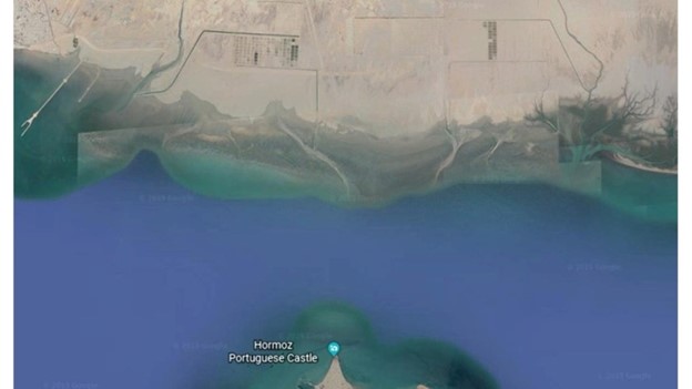
Next on the alignment, we come to the Island of Hormuz in the Strait of Hormuz, part of the Hormozgan Province of southern Iran, where we find the old Portuguese Fort, otherwise known as the Fort of Our Lady of the Conception. It was said to have been built shortly after the Portuguese captured the island in 1507.
The date given for this old map of Hormuz is 1747, showing lots of activity going on here, and what appears to be another star fort shape across the Strait of Hormuz on the coast of what is now southern Iran.
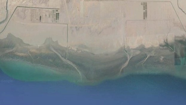
While on Google Earth there no longer appears to be a similar structure across the water in this location…
…there does appear to be an intentional configuration of many square shapes in the desert in that location…
…that are reminiscent of circuitry chips on a circuit board.
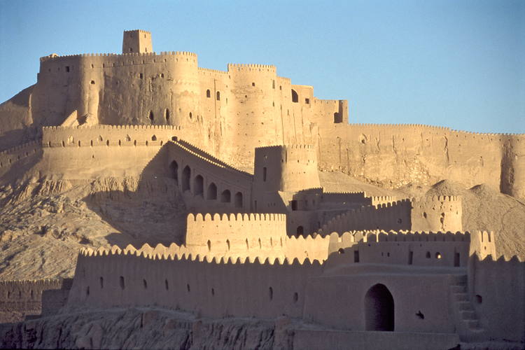
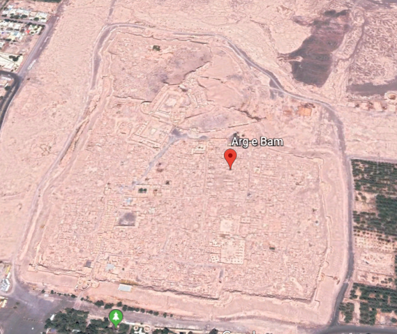
Further up the alignment, the Arg-e-Bam Citadel in Kerman Province in Iran, is considered to be the largest mud brick, or adobe, building in the world.
An earthquake in 2003 destroyed much of it, but you can still get a sense of the size and shapes of the complex from this Google Earth screenshot.
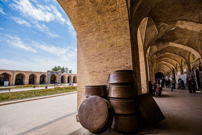
This is the Bazaar-e-Sartasari in the city of Kerman, one of the oldest trading centers in Iran…
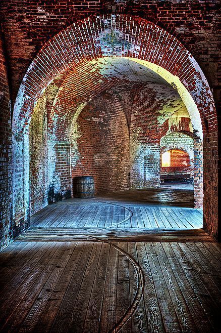
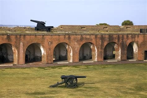
…where you can see shared characteristics, like the vaulted archways, with Fort Pulaski in the U.S. State of Georgia, on Tybee Island near Savannah, Georgia.
…and long buildings with continuous archways.
So, believe me, there is a lot more in this part of the world through Central Asia. I am going to fast-forward through the Amsterdam Circle Alignment to Japan because I have so much more to cover and all of this information belongs together in one post.
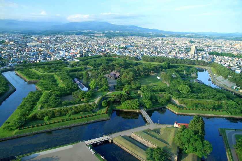
This is the Goryokaku star fort at the port of Hakodate on the southern end of the Japanese Island of Hokkaido.
It was one of two Japanese ports that the United States demanded under threat of force to be open to American vessels in 1853 and 1854.
The alignment goes through Tokyo, where we find the Edo Castle, said to have been built in 1457…
… and today is part of the Tokyo Imperial Palace.
Next, I am going to compile the infrastructure that I uncovered researching the Circle Alignment that begins in Algiers, Algeria. Keep in mind that I am finding that the name citadel and fortress are included in the code words to cover-up highly advanced ancient building technology connected to the energy system of the planetary grid.
The Casbah in Algiers is also called the Ancient City of the Deys.
The five noble titles of the Moors are: El, Bey, Dey, Al, and Ali.
Ancient means something belonging to the very distant past.
Yet we are told that the title of Dey in Algiers (as well as the Deys of Tunis and Tripoli) was given to these rulers under the Ottomon Empire, starting in 1671.
Yet the Casbah is known as the Ancient City of the Deys???!!!
The meaning of Casbah is “Citadel” and refers to the Citadel of Algiers, and the traditional quarter clustered around it.
While there are some parts of the Casbah that have not fared well with Civil War and neglect…
…there is still much beauty to be found…
…and heavy stone masonry here.
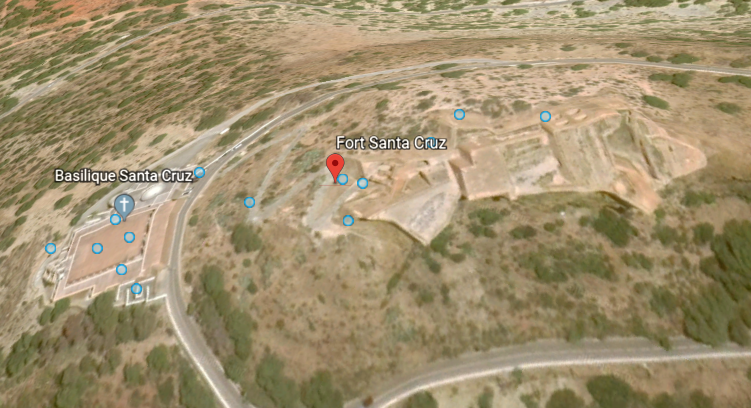
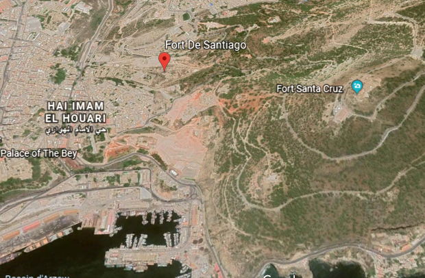
Before moving on from Algeria, I will show you the four star forts that I found in Oran, Algeria, formerly the seat of the Beys, and is west of Algiers on the Mediterranean coast.
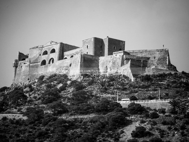
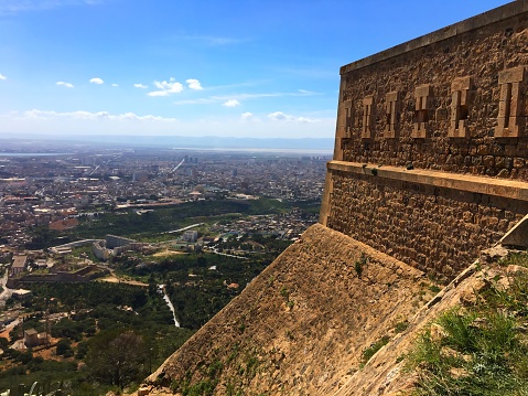
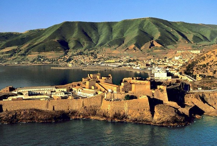
The first I found in Oran was Fort Santa Cruz, said to have been built between 1577 and 1604 by the Spanish.
We are told that in 1831, the French occupied Oran and the fort.
There are subterranean tunnels connecting Fort Santa Cruz with all of the ancient forts of Oran…
…including Fort Lamoune, which is located on the western end of the harbor there…
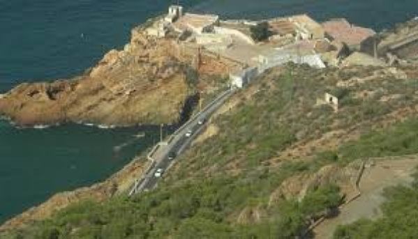
…and commands the road from Oran to…
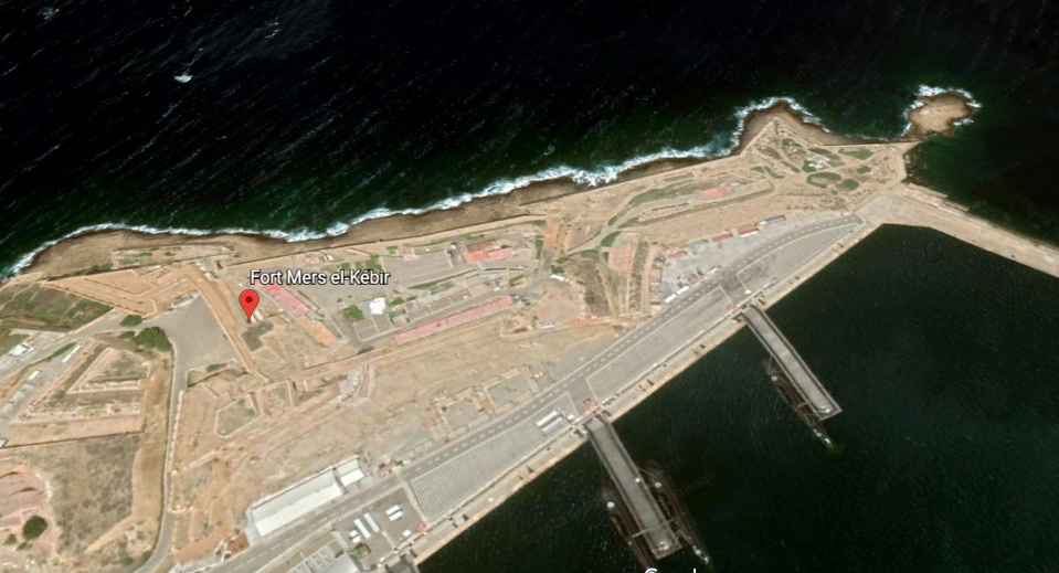
… Mers-el-Kebir, the Great Harbor, and strategic military port of Oran.
It is said to have an ancient history that goes back to Roman times, and was of great strategic importance.
Taking great note of the year, it was said to have become a center of pirate activity in 1492, the year of the Fall of Grenada, the final act in the campaign to drive the Moors out of Spain.
I believe the year 1492 was a key player and clue as to how and when the original Moorish timeline was deliberately hijacked. In order for negative beings to seize control Humanity, the Advanced Humans of Higher Consciousness had to be taken out, and history re-written and falsified.
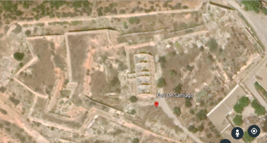
Fort de Santiago is also in Oran, and connected to the others.
It is a short distance west of the Fort Santa Cruz.
While I am most specifically addressing the alignments I have personally found, I want to emphasize that this civilization was laid out geometrically world-wide, and there are many, many other alignments on which these places are located.
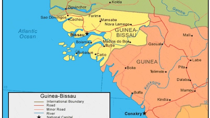
For example, while Guinea-Bissau, formerly French Guinea, is not directly on the Algiers circle alignment, the African country of Guinea to which it is adjacent is, where it goes through Conakry…
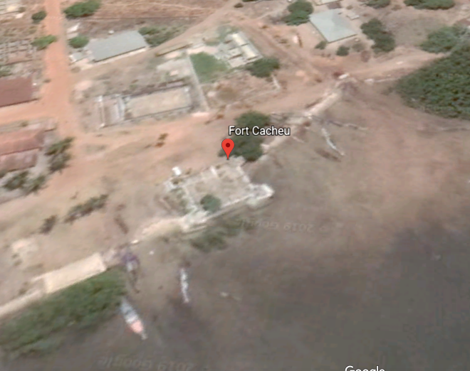
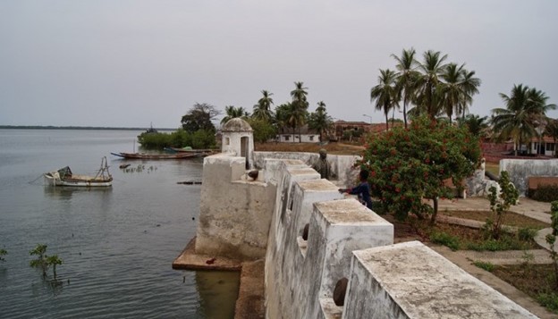
…where we find Fort Cacheu, located on the Cacheu River, near the Atlantic Coast.
It was said to have been built in the 16th-century by the Portuguese.
The Algiers circle alignment leaves Africa in Guinea, and crosses the Atlantic to enter Brazil on the coast in Sao Luis.
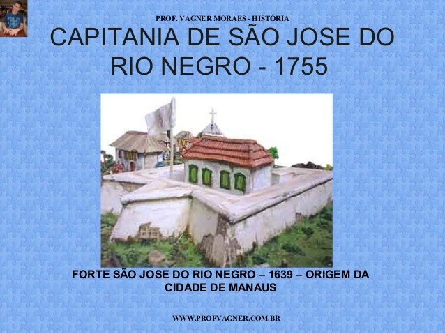
The first star fort I came across in my research in Brazil was the Sao Jose do Rio Negro, at the confluence of the Amazon and Negro Rivers.
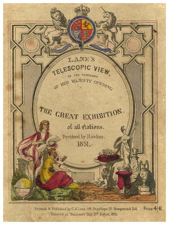
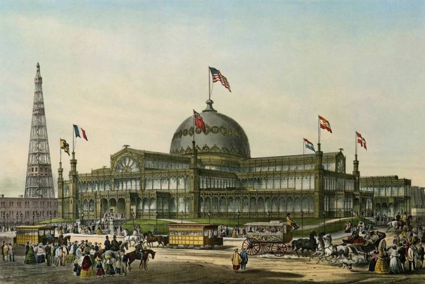
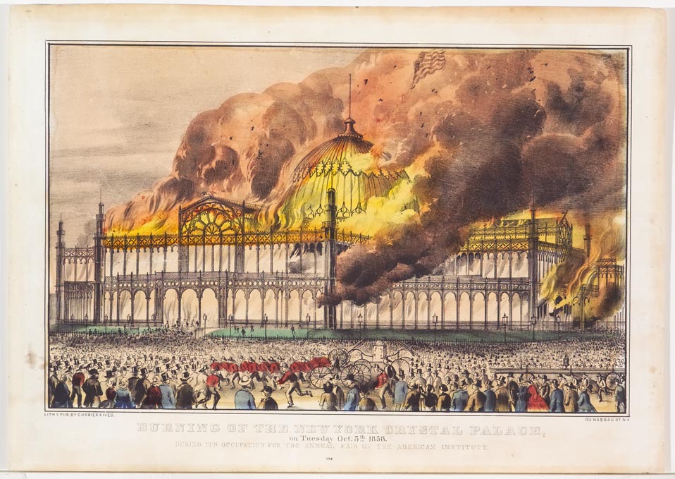
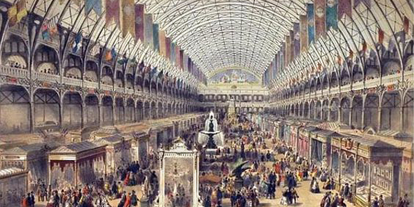
It was renamed Manaus, after the indigenous Manaos people, in 1848 when it was established legally as a city. This was just a few years before the Crystal Palace Exposition in 1851, which I believe was the official start of earth’s new, hijacked timeline.
This is an aerial of Fort San Lorenzo, on the Caribbean coast at the village of Chagres, near Colon.
It is a UNESCO World Heritage Site, said to have been built in 1587.
Henry Morgan, a Welsh pirate, was said to have ordered the destruction of Fort San Lorenzo in 1670…
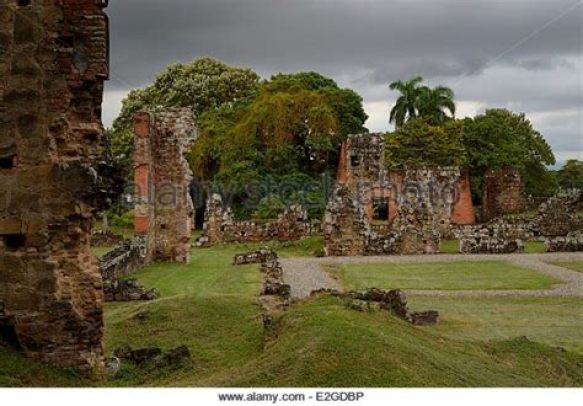
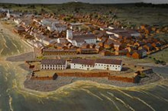
…and then he was said to have invaded Panama City the following year from Fort San Lorenzo, and destroyed what was Old Panama, or Panama Viejo…
…which had a similar star fort of which only ruins remain. This is a diorama of what Panama Viejo would have looked like before its destruction.
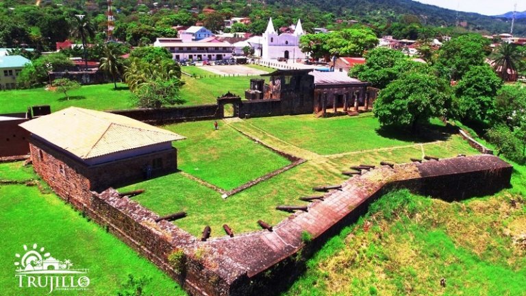
The Algiers Circle alignment goes the Trujillo, Honduras, where we find the Fortaleza de Santa Barbara, said to have been built by the Spanish in around 1550.
Trujillo is where Christopher Columbus landed in 1502, on his fourth and final journey.
This is the Fortress of San Felipe in Bacalar, Mexico.
It is near Chetumal, in Mexico’s southeastern border with the country of Belize.
The Algiers circle alignment also goes through Merida, where Campeche is 97-miles, or 157-kilometers, southwest of Merida.
Then, the Algiers Circle Alignment crosses the Gulf of Mexico, and we come to Baton Rouge.
The history of Baton Rouge is going to take me into new research for this post that uncovered numerous star forts, and connections to a little-known history of North America.
This region was part of French Lower Louisiana, comprising the states of Arkansas, Louisiana, Mississippi, and Alabama, with was established in 1682. More about the former French Louisiana lands later in this post.
In 1762, with the Treaty of Fontainebleau, France secretly ceded Louisiana to Spain.
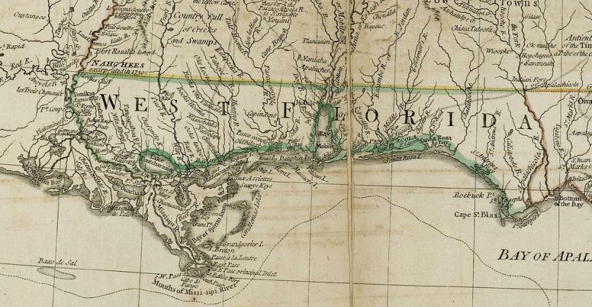
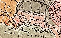
In 1763, Great Britain, who acquired these same lands from France and Spain through the Treaty of Paris at the end of the French and Indian War, established West and East Florida.
Pensacola was the capital of West Florida.
Spain officially entered the American Revolutionary War on May 8th, 1779, with a formal declaration of war by King Charles III, and on July 8th, another declaration followed that authorized colonial subjects to engage in hostilities against the British. That is when the Governor of Spanish Louisiana, Bernardo de Galvez, started to plan operations to take British West Florida in what is known as the Anglo-Spanish War.
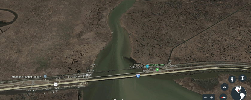
On August 27, 1779, Galvez led an attack force to Fort Bute, a colonial fort that was said to have been built in 1766 by the British to protect the confluence of the Bayou Manchac with the Mississippi River, 115- miles, or 185-kilometers, upriver from New Orleans, on the far western border of British West Florida.
It was described as a decaying relic of the French and Indian War, and was captured after a brief skirmish.
Whatever fort was here in the past at Manchac Bayou, now known as Akers, Louisiana, it is no longer to be found.
The Battle of Baton Rouge was next, a brief siege during the Anglo-Spanish War that was decided on September 21st of 1779, and the second British outpost to fall to the Spanish during Bernardo de Galvez’ march into British West Florida. Baton Rouge was only 15-miles, or 24-kilometers, from Fort Bute.
The British commander, Lt. Colonel Alexander Dickson, was said to have built Fort Richmond in Baton Rouge in July of 1779. He had decided that Fort Bute was indefensible, and placed most of his troops in Baton Rouge.
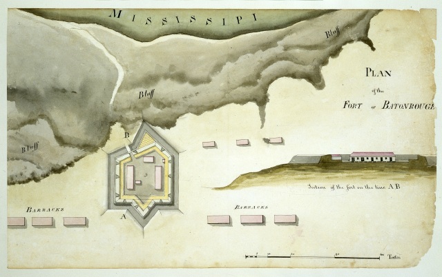
Now, it is unclear as to whether or not Fort Richmond is the same star fort that is depicted in this historic map of Baton Rouge…
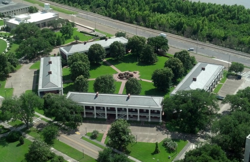
…or whether or not it is a depiction in this map of the Pentagon Barracks, which are still standing as a museum in a prominent part of Baton Rouge. More on this shortly…
…or another star fort entirely. But there it is, at least one star fort depicted on the historic map in Baton Rouge circa 1814.
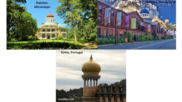
At any rate, the Spanish shelled the British for three-hours in their Baton Rouge fortication, after which time Lt. Colonel Dickson surrendered to the Spanish Commander Galvez, who also required the capitulation of the British Fort Panmure, also known as Fort Rosalie, in Natchez, Mississippi, as part of the terms of surrender. These terms were accepted.
This is a still standing home in Natchez, Mississippi, with a colonnaded onion dome on the top left, compared with the colonnaded onion dome at the Colt Armory in Hartford, Connecticut on the top right, and this one at Sintra, Portugal on the bottom.
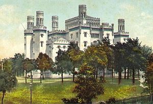
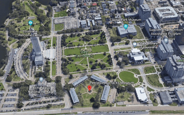
Back to the location of the present-day Pentagon Barracks Museum in Baton Rouge, it is located right next to the grounds and heart of the Louisiana State government, shown here.
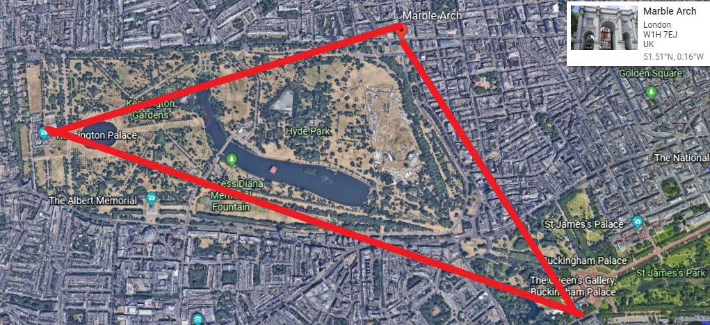
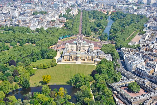
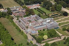
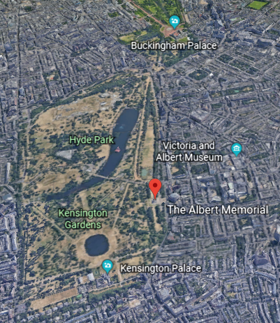
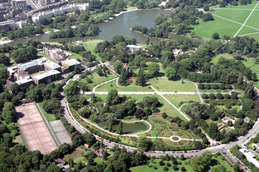
And when you compare the gardens of the Louisiana State Capitol Park here on the top left in Baton Rouge, literally right next to the Pentagon Barracks, you find noteworthy similarities to the geometric lay-out with the Tuileries Gardens in Paris on the top right; the Kensington Gardens and Hyde Park in London on the bottom left, and the Versailles Gardens on the bottom right, located in Versailles and right outside of Paris.
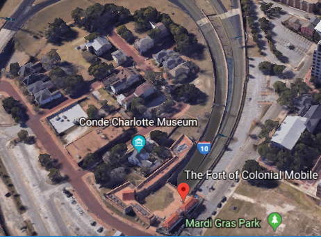
The next battle that Galdez and the Spanish Forces won was the Battle of Fort Charlotte, or Fort Conde, in Mobile, Alabama, after a short less than two-week battle in 1780.
The Siege of Pensacola was fought in 1781, and the culmination of Spain’s conquest of British West Florida during the Gulf Coast campaign.
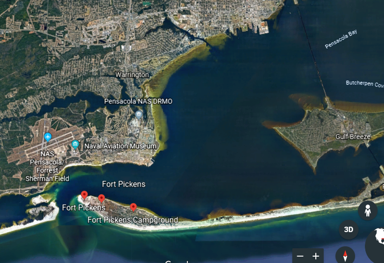
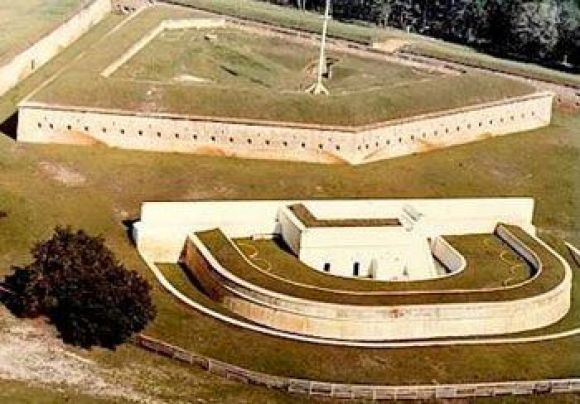
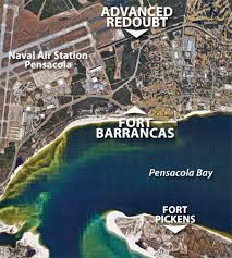
Here is what I found when I looked at Pensacola. These star forts are close together, and intact.
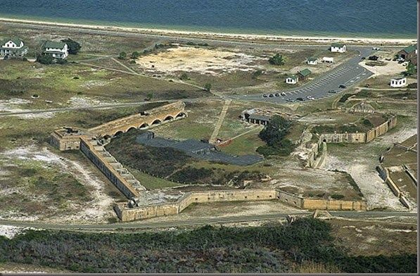
Fort Pickens is on the western end of the Santa Rosa Island…
…where it sits on one side of the channel entering Pensacola Bay from the Gulf of Mexico.
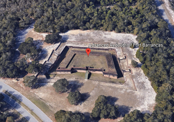
Fort Barrancas is directly across from Fort Pickens on the other side of this channel, and located physically within the Pensacola Naval Air Station…
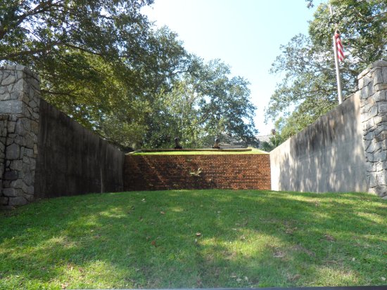
…and what is called the Advanced Redoubt as well.
This is how the relationship between these three star forts looks from above.
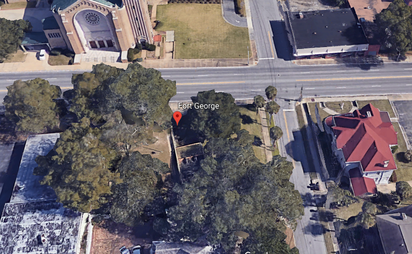
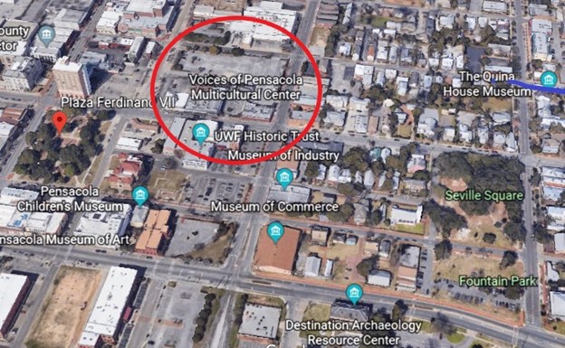
Other star forts in Pensacola included Fort George, of which this is what is left:
There is nothing left of what was the Fort of Pensacola, also known as the Presidio Santa Maria de Galvez.
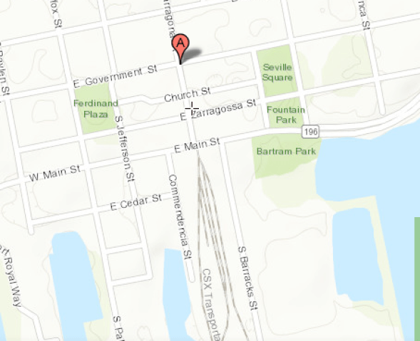
This was its previous location…
…which I found through the coordinates of the former fort on this map.
I find it interesting to note the the head of the CSX Railyards was just one-block due south of where the Fort of Pensacola was located, which happens to look like a circuit board diagram.
I will be delving deeply into railroads in a future post.
Great Britain’s effective control of West Florida ended in 1781 when Spain captured Pensacola, and the land was ceded back to Spain by the Treaty of Paris in 1783, which ended the American Revolutionary War.
Was all of this infrastructure already in place at these locations, and the reason for all of the colonial interest and warfare, or were they structures that were built in the years of history we are taught?
All of this land was part of the Ancient Washitaw Empire, and what was already here, and what really took place, is glaringly absent from the historical record.
So there are four more places in Europe on the Algiers Circle Alignment that I would like to share with you before I move on to the last one.
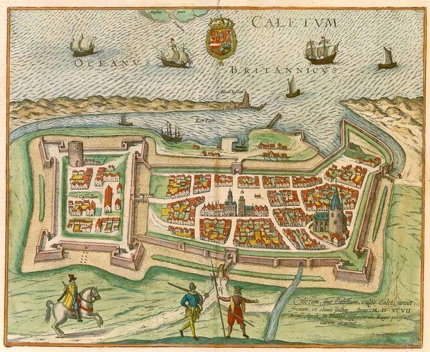
The first is Calais, France, a city and major ferry port in northern France, and situated on the Strait of Dover, the narrowest point in the English Channel across from Dover in England.
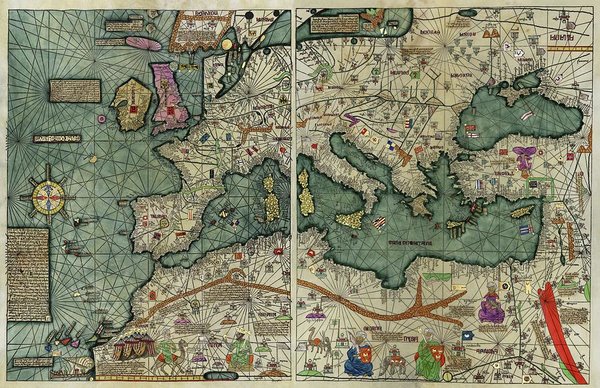
The old part of the town is called Calais-Nord, and is located on what is called an artificial island, on which this antique map shows that either a star city or star fort.
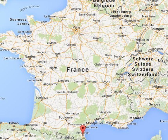
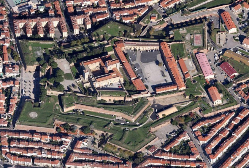
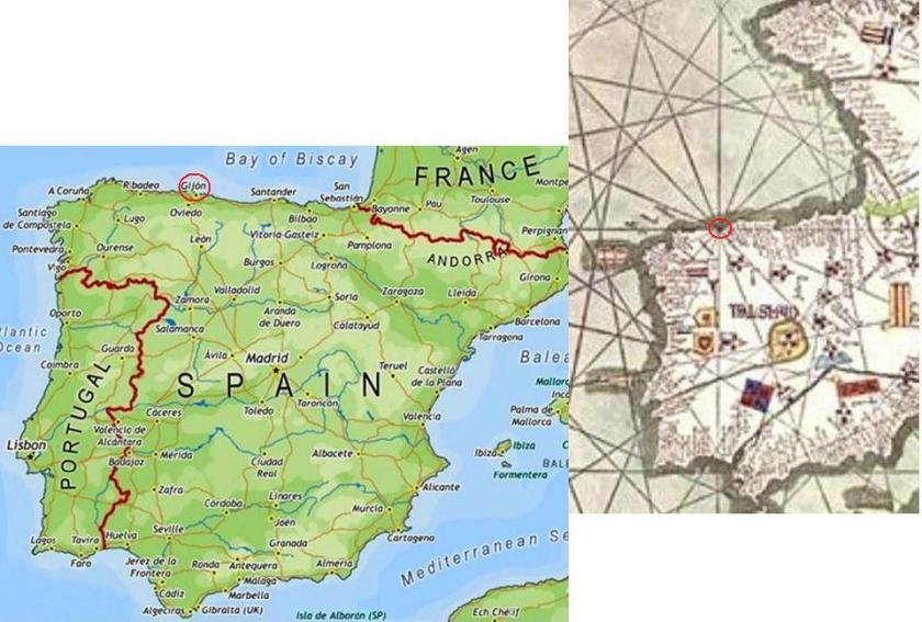
The next place is in Perpignan, the continental capital of the Kingdom of Majorca in the 13th- and 14th-centuries.
Majorca is another kingdom that is glaringly absent from the historical record.
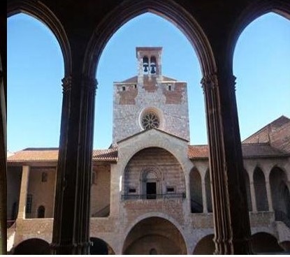
This is the Palace of the Kings of Majorca in Perpignan.
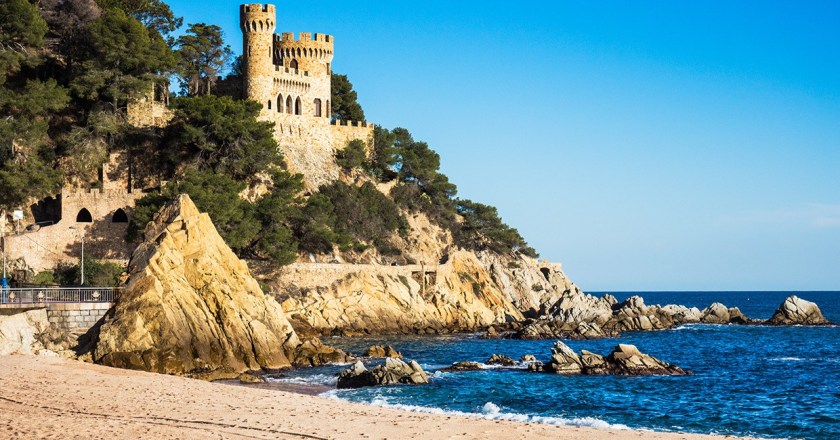
Then on Spain’s Mediterranean coast, between Perpignan and Barcelona, we find Sant Joan’s Castle at Lloret de Mar, on a rocky promontory overlooking the Mediterrean Sea.
It is said to date back to the 1100s, from the age of Lady Sicardis and her sons, who were the Lords of Lloret. Apparently she ordered the construction of the castle…
…and the British Navy is said to have bombarded the castle during the Battle of Trafalgar in 1805, and effectively destroyed the fortified site.
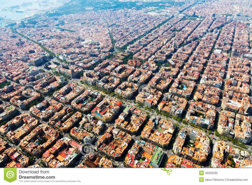
The last thing from the Algiers alignment that I want to point out is this view of Barcelona, Spain from the air. The combination of the city’s lay-out and infrastructure looks to me like both Mayan glyphs and/or some kind of binary code.
At any rate, that is some kind of city planning there. Not one that happened randomly or haphazardly, that’s for sure!
Now on to the final leg of this journey, which is on the circle alignment which beings, and ends, in Washington, DC.
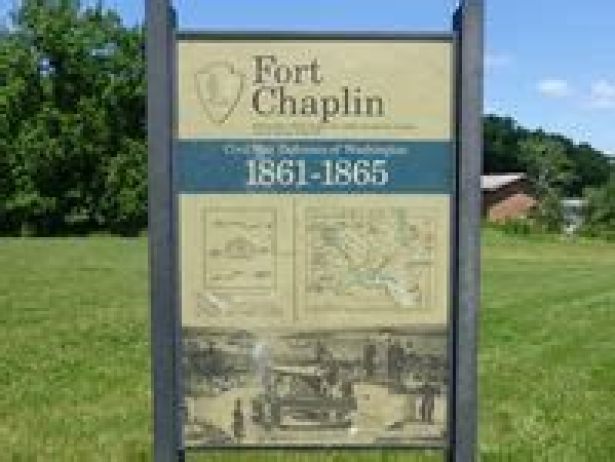
The Washington area had sixty-eight major enclosed forts, so there may have been many star forts in Washington, DC, but we will never know because this is typical of what remains of what was called the Civil War Defenses of Washington, said to have been built between 1861 and 1865.
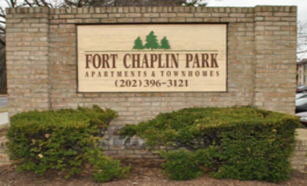
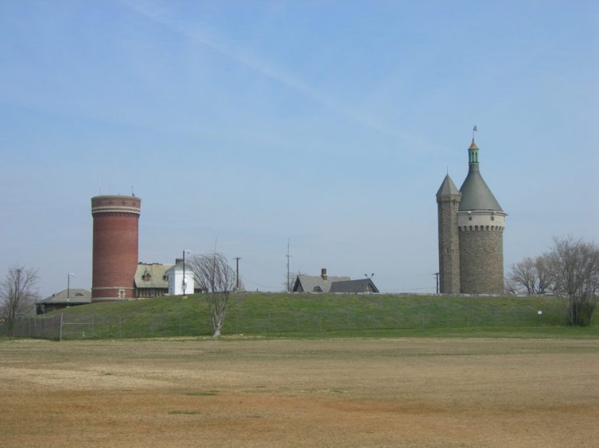
I would like to bring up the still-standing Fort Reno, where it sits on top of an earthwork. It is located on the highest point in Washington, and said to be the site of the only Civil War battle fought in Washington, during the Battle of Fort Stevens in 1864.
It was said to have been built in the winter of 1861, after the defeat of the Union Army at the Battle of Manassas. Does this look like a temporary structure that was hastily built in the middle of winter?
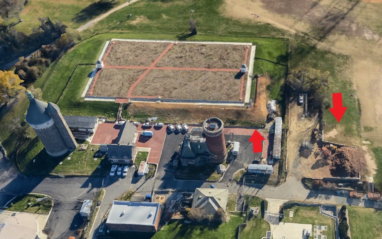
And it is with Fort Reno that I can provide you with an excellent example of the energy harvesting that occurs around these ancient energy sites, with no one the wiser because no one knows about it.
Do you see in this Google Earth snapshot where the top soil is being removed, and dumped nearby?
This is the rule, and not the exception, around the world, and I believe our modern energy industry is utilizing ancient energy technology.
Onward to Baltimore.
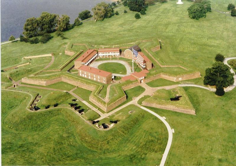
Fort McHenry is the best known star fort in Baltimore. The Star Spangled Banner was said to have been written by Francis Scott Key after he witnessed the bombardment of Fort McHenry during the Battle of Baltimore in 1814, a battle that took place in what is called the War of 1812.
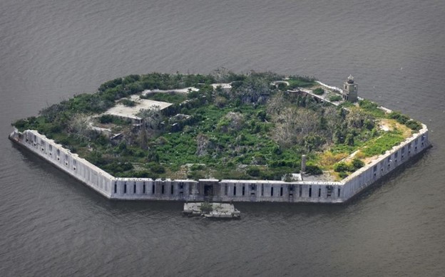
Fort Carroll is in the middle of the Patapsco River, just south of the City of Baltimore, and is described as an artificial island and abandoned hexagonal sea fort.
Wilmington, Delaware was said to have been founded as the Swedish South Company’s Fort Cristina in 1638, the principal settlement of the New Sweden Colony in North America.
Twelve miles south of Wilmington, Fort Delaware is located on Pea Patch Island in the Delaware River. It was said to have been built starting in 1819.
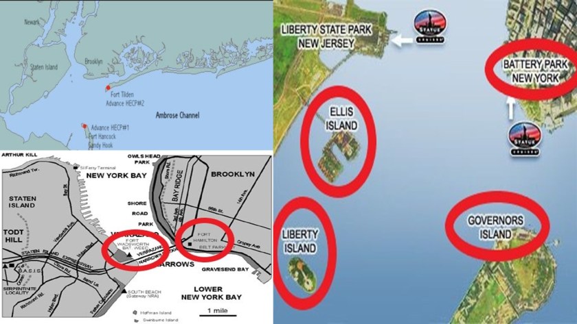
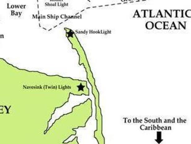
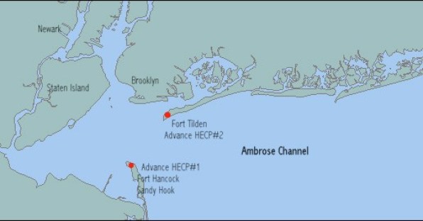
Fort Hancock, and its accompanying Sandy Hook Lighthouse, is located at the northern end of Sandy Hook, a barrier spit in Middletown Township, New Jersey that encloses the southern entrance of the Lower New York Bay.
The construction of the Fort of Sandy Hook was said to have started in 1857 and ended in 1867, without completing the building of the fort under the supervision of then-Captain Robert E. Lee of the Corps of Engineers, and was designed as a five-bastion irregular pentagon built primarily of granite.
Not only was the fort said not to have been completed, it was also said to have had most of its surviving parts taken down by the U. S. Army after World War II.
The batteries of the now designated Fort Hancock were said to have been constructed starting in 1890 as part of the Sandy Hook Proving Ground for the testing of coastal defensive weapons, like Battery Potter.
Battery Potter is described as the prototype for a steam-hydraulic, gun-lift carriages, otherwise known as “disappearing guns.”
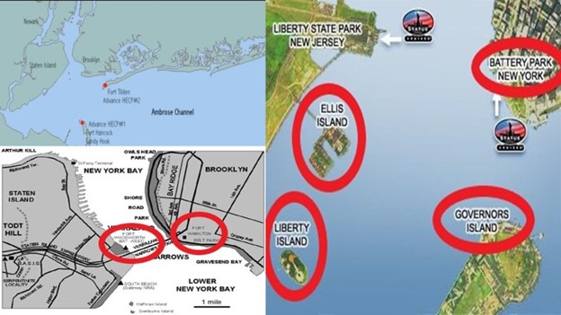
Just north of Sandy Hook is the Ambrose Channel, the main shipping channel in and out of the Port of New York and New Jersey…
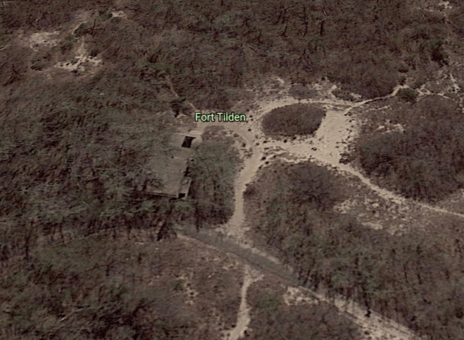
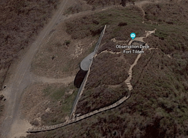
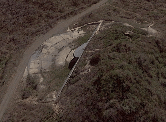
….and Fort Tilden is on the Rockaway Peninsula in the Lower New York Bay, northeast of Fort Hancock and Sandy Hook. It is hard to tell what is here because of the tree cover, but you can make some points out here in this photo.
Here is another location on the Fort Tilden site…
…and a similar feature beside it further up the embankment.
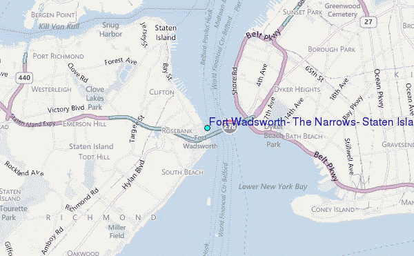
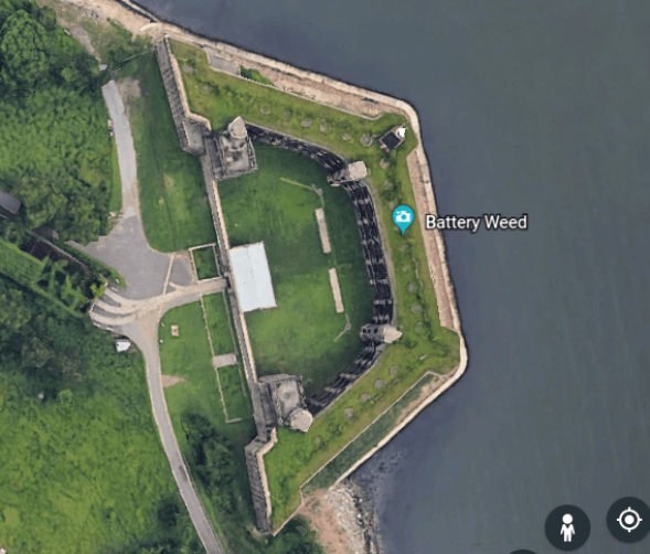
Fort Wadsworth is next to the Staten Island side of the Verrazzano-Narrows Bridge…
…with its four-tiered Battery Weed, is located at what is called The Narrows between the Lower and Upper New York Bays.
Fort Wadsworth was said to have been established before the War of 1812, as well as between 1845- 1861.
On the southern side of the other end of the Verrazzano-Narrows Bridge from Fort Wadsworth on Staten Island is Fort Hamilton in Brooklyn.
Fort Hamilton is an active United States Army installation.
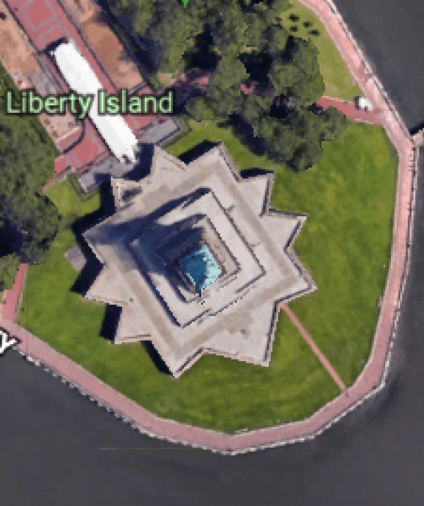
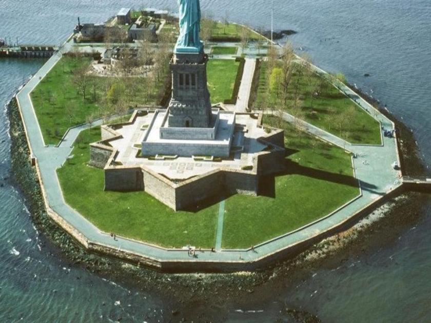
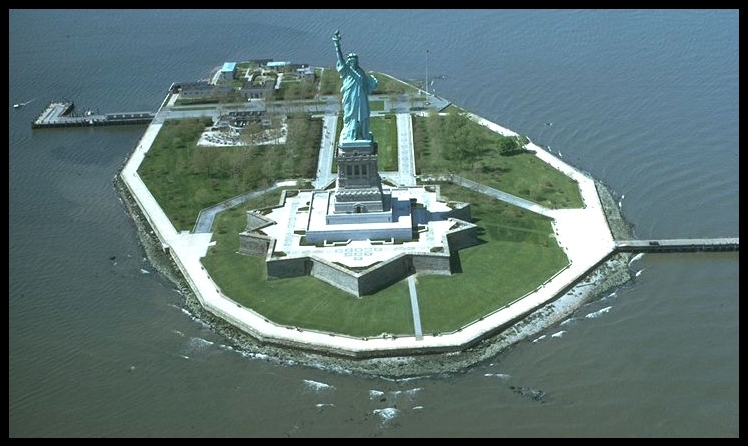
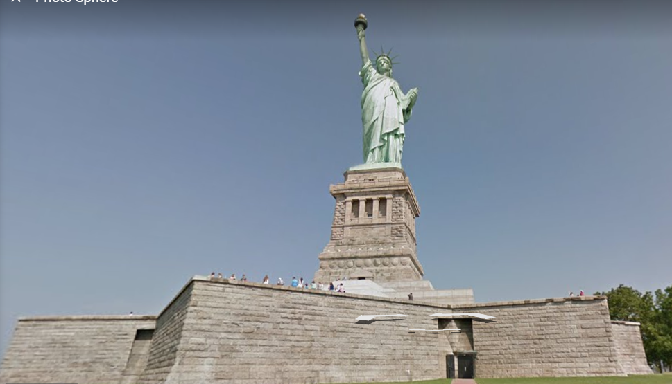
Fort Wood is an eleven-pointed star fort in the Upper New York Bay, located underneath the Statue of Liberty on Liberty Island, and said to have been built between 1806 and 1811…
…on what looks to be an artificial island.
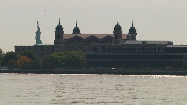
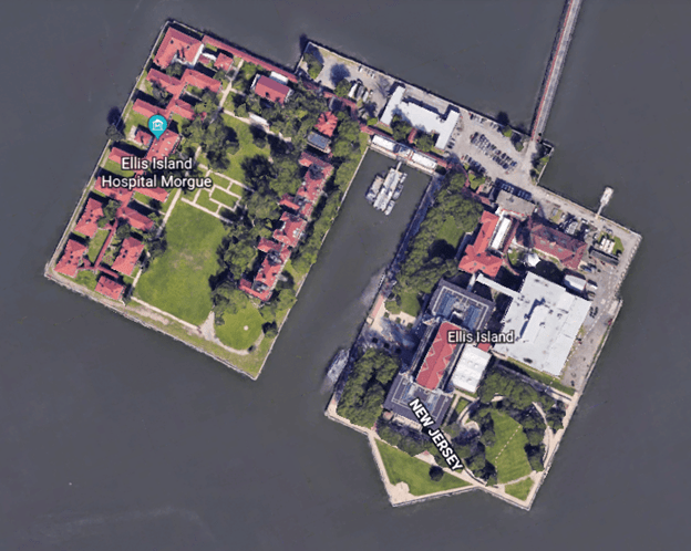
…and it is even more obvious that Ellis Island located right next to it…
…is an artificial island, with its geometric shapes.
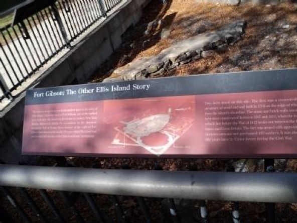
Prior to when the current facilities are said to have been built, Ellis Island was the location of Fort Gibson, one of forty forts said to have been built as part of the the New York Harbor System between 1794 – 1812. This marker commemorates Fort Gibson…
…on what became known as Ellis Island.
Was Fort Gibson a star fort? I think so, but I have a little bit further to go in Upper New York Bay to show you why.
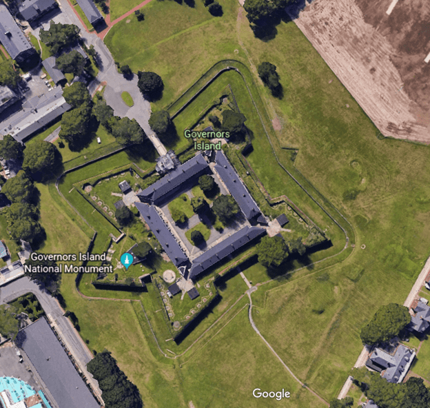
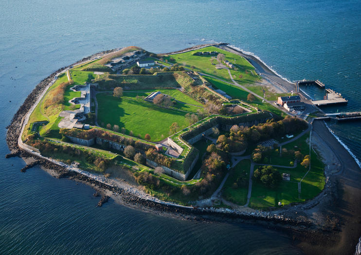
Governors Island is also in the the Upper New York Bay, and situated at the confluence of the East River and the Hudson River.
It is 800 yards, or 732 meters, from the southern tip of Manhattan Island, and separated from Brooklyn by the Buttermilk Channel by approximately 400 yards or 366 meters.
Fort Jay is on Governors Island, named after Supreme Court Chief Justice & Founding Father John Jay, and part of the Governors Island National Monument.
It was said to have been built in 1794 to defend Upper New York Bay, and an active installation until 1997.
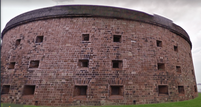
Another feature of the Governors Island National Monument is Castle Williams, part of the New York Harbor System defenses. It is called a circular structure of red sandstone, having been built between 1807 and 1811 under the direction of Lt. Colonel Jonathan Williams of the U. S. Army Corps of Engineers.
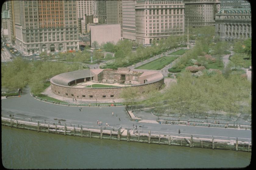
This brings me to Battery Park, at the southern tip of Manhattan, the historical location of another star fort, Fort Amsterdam, said to have been surrendered by the Dutch to the British in 1664.
…and Castle Clinton is in Battery Park, a circular fort said to have been built of red sandstone between 1808 and 1811, and the first immigration center of the United States before Ellis Island, between 1855 and 1890.
Castle Clinton was also known as the “West Battery,” a complement to Castle Williams as the “East Battery” on Governors Island. I almost left these two structures out of this post until I realized they were part of the circuitry.
So I can make a case that there were four pairs of star forts, with each pair situated along various points of the Lower and Upper New York Bays, even though the physical structure of what was called Fort Gibson on Ellis Island is long buried and gone.
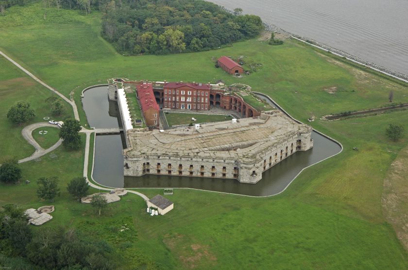
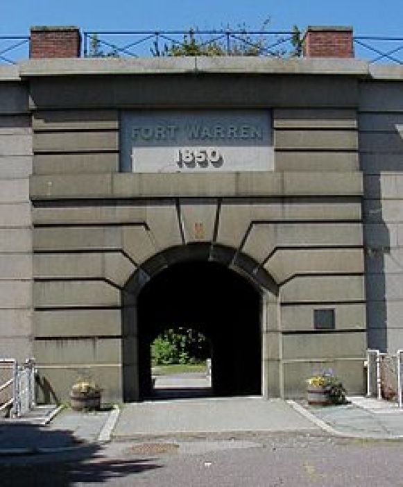
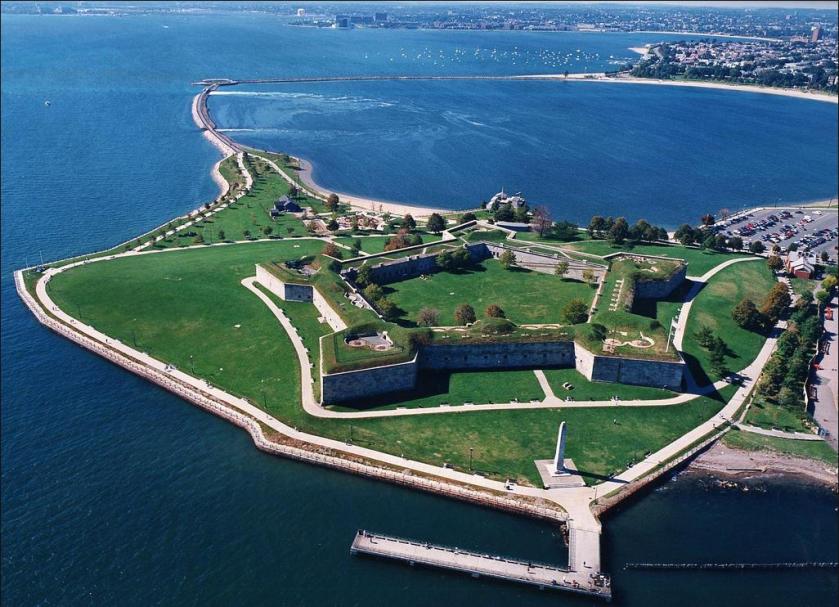
Fort Warren is a star fort on Georges Island in Boston Harbor, named after the Revolutionary War hero Dr. James Warren, said to have been designed by U. S. Army Corps of Engineers Lt. Colonel Sylvanus Thayer, and built between 1834 and 1860.
During the Civil War, it served as a prison for Confederate officers and government officials. This is the Sally Port at Fort Warren, which was the secure and controlled entryway to the prison.
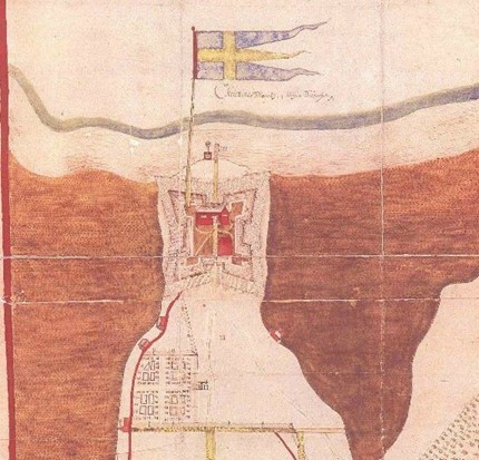
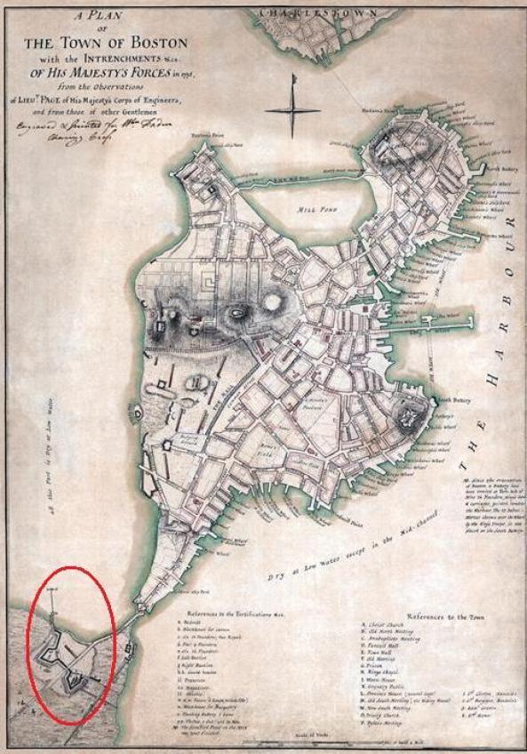
Here is the 1775 map of the Shawmut Peninsula, upon which Boston was built that I showed at the beginning of this post, where there is a star fort depicted on the bottom left.
It is long gone, having been removed in 1869, hill and all, to add more room for business facilities.
Another star fort is nearby in Boston Harbor.
Fort Independence is located on Castle Island, a peninsula in South Boston.
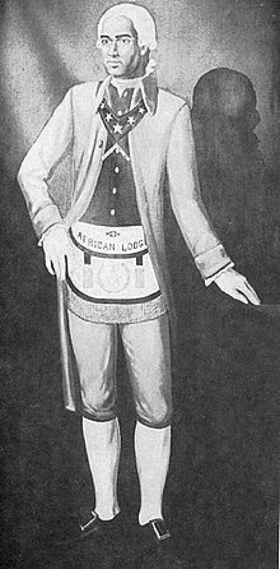
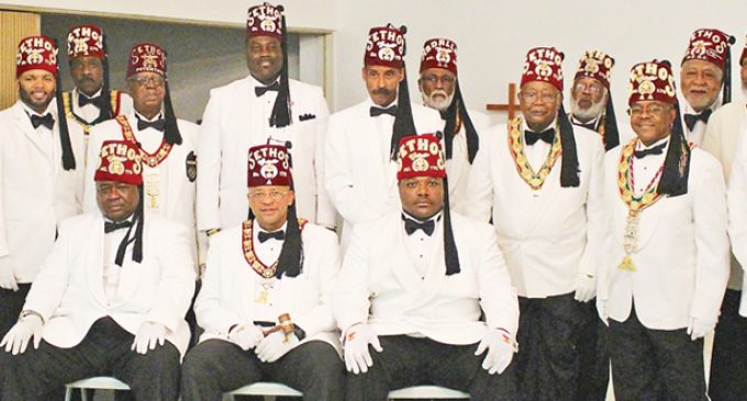
Castle Island and Fort Independence was the location where Prince Hall, and fourteen other men of African-American descent, became Freemasons in their initiation into the British Army Lodge 441 of the Irish Registry, after having been declined admittance into the Boston St. John’s Lodge.
He was the founder of Prince Hall Freemasonry, and the African Grand Lodge of North America.
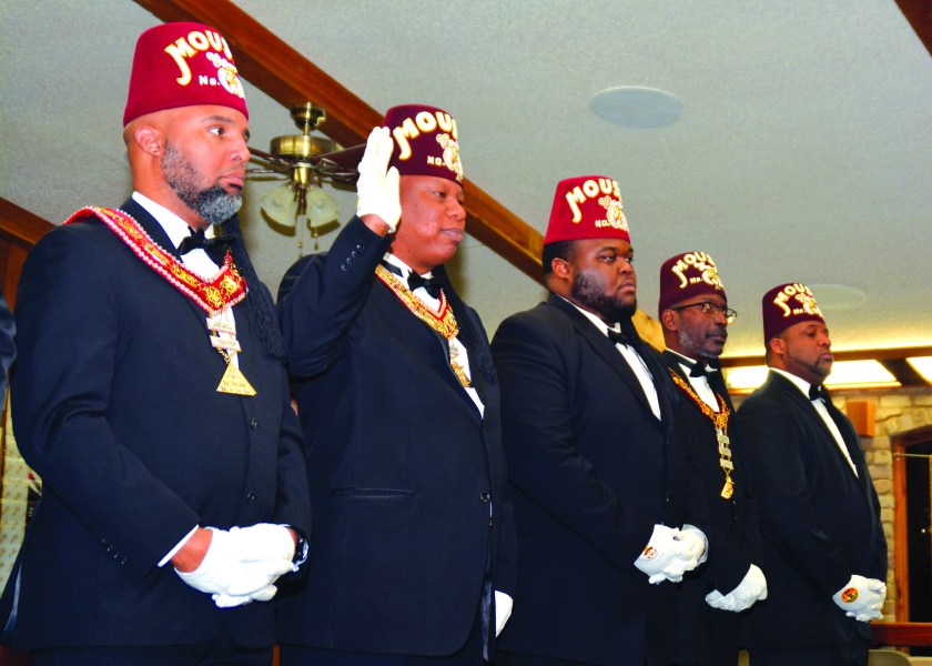
Until Prince Hall found a way in, Moorish Americans were denied admittance into Freemasonry. There are 360-degrees in Moorish Masonry, compared to the 33-degrees of Freemasonry.
Masonry is based on Moorish Science, which also includes the study of natural and spiritual laws, esoteric symbolism, natal and judicial astrology, and zodiac masonry.
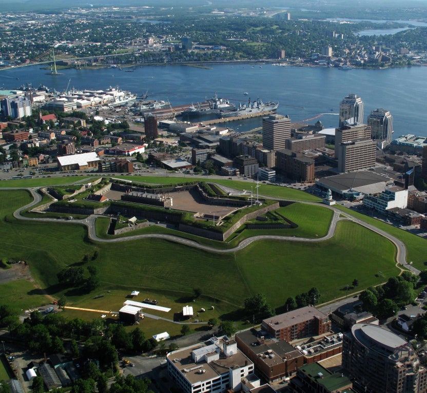
Crossing into Nova Scotia on the alignment, I just want to point out one of the star forts, as there is at least one other, in Halifax, just to put it on the star fort map.
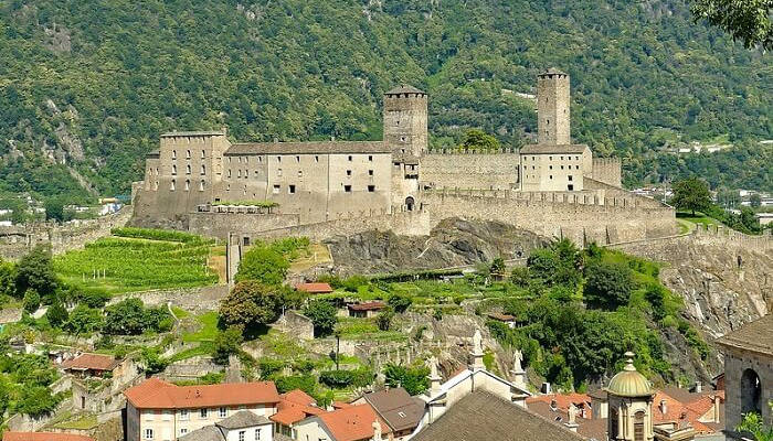
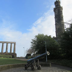
This is the Halifax Citadel, the fortified summit of Citadel Hill.
The present citadel was said to have been built between 1828 and 1856.
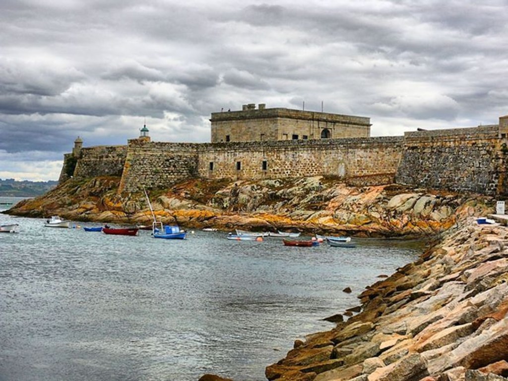
This is Castillo de San Anton, said to have been built as a defensive structure between the 15th- and 16th-centuries.
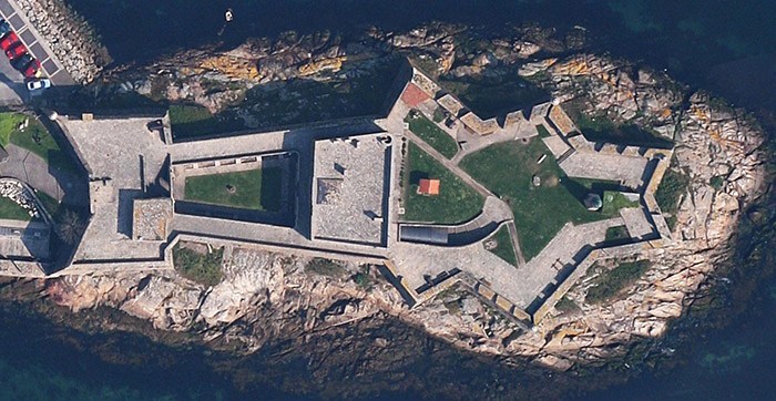
It is in A Coruna, or La Coruna, Spain, on the Atlantic Coast.
This star fort was built on a small island in the Bay of La Coruna.
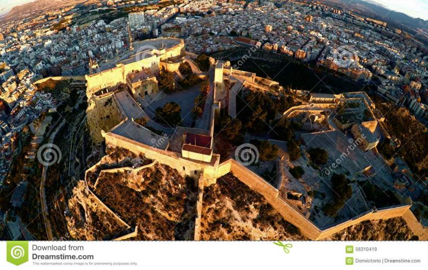
The Castle of Santa Barbara is a major attraction in Alicante, Spain, on the Mediterranean coast. Its origin is said to date back to the 9th-century, at the time of Muslim control of the Iberian Peninsula from 711 to 1296, the year when the castle was said to be captured by the forces of King James II of Aragon.
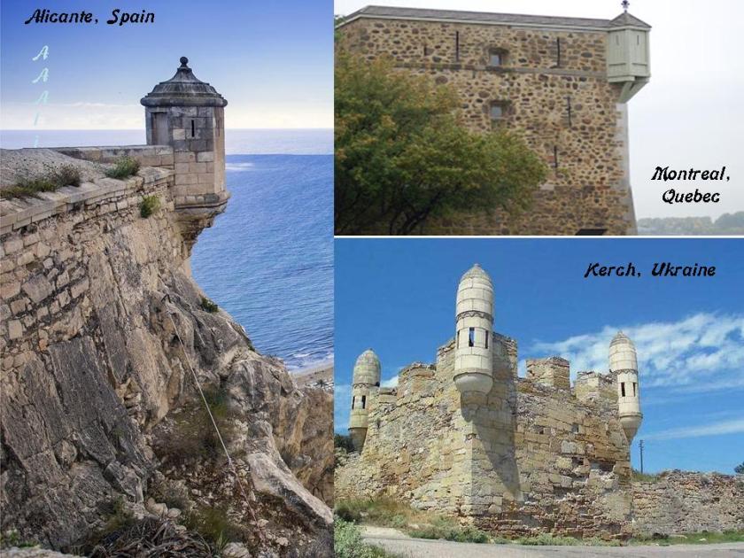
This is a detail of the Castle of Santa Barbara on the left, compared with a detail of Fort Chambly near Montreal on the top right, and the Yenikale Fortress at the city of Kerch on the Crimean Peninsula on the bottom right.
Following the alignment from the Spanish coast from the Alicante area across the Mediterranean Sea towards Algeria, we come to Tabarca Island.
It is the smallest permanently inhabited islet in Spain.
We come back through Algiers, and pass through Niger and Nigeria. I have discussed my findings there in earlier posts, and will just say that much of the glorious civilization of western North Africa is kept from our awareness.
Like in Djanet, Algeria…
…Djado, Niger…
…Bilma, Niger…
…and Abeokuta, Nigeria.
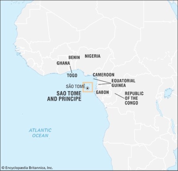
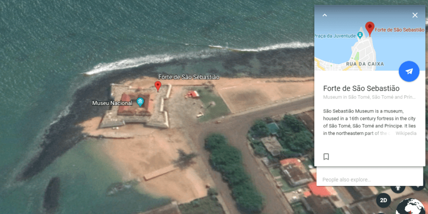
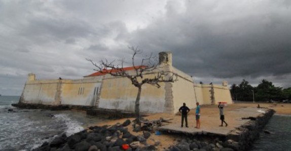
I did find a star fort located on the Sao Tome & Principe, a former Portuguese Colony in the what is now-called Bight of Bonny in the Gulf of Guinea. It used to be called the Bight of Biafra, before Biafra was absorbed into Nigeria in 1970, after the end of the 3-year Nigerian Civil War.
The capital and largest city is Sao Tome, where Sao Sebastiao Fort is located.
It was said to have been built by the Portuguese in 1566.
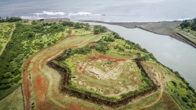
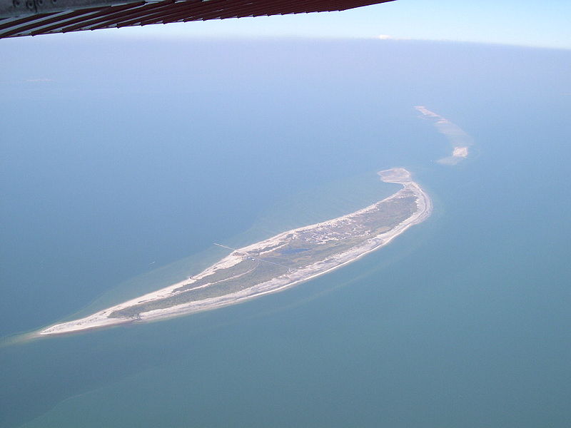
The alignment crosses over Fernando de Noronha, the name of the main island and its archipelago. It is a UNESCO World Heritage Site and on at least one other alignment that I know of. The main island has an area of 7.1 square miles, or 18.4 kilometers-squared, and the archipelago’s total area is 10 square miles, or 26 kilometers-squared.
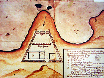
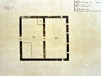
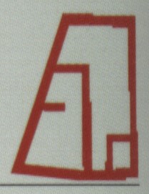
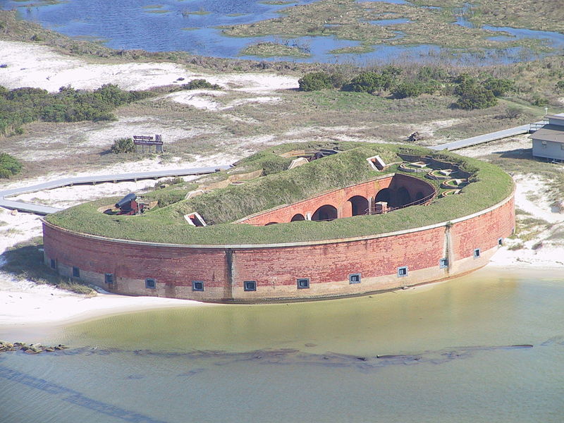
So this is the small island I was talking about in conjunction with Bermuda for it’s small size, there were at least ten star fort-like structures here at one point in time. Some are still standing, and others are in ruins or no longer there. Here are existing diagrams depicting eight of them.
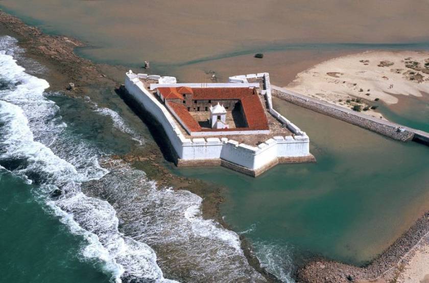
From Fernando de Noronha, the alignment enters Brazil at the city of Natal.
The Portuguese are said to have built the Forte Dos Reis Magos, or the Fort of the Three Wise Men, as the first milestone of the city of Natal.
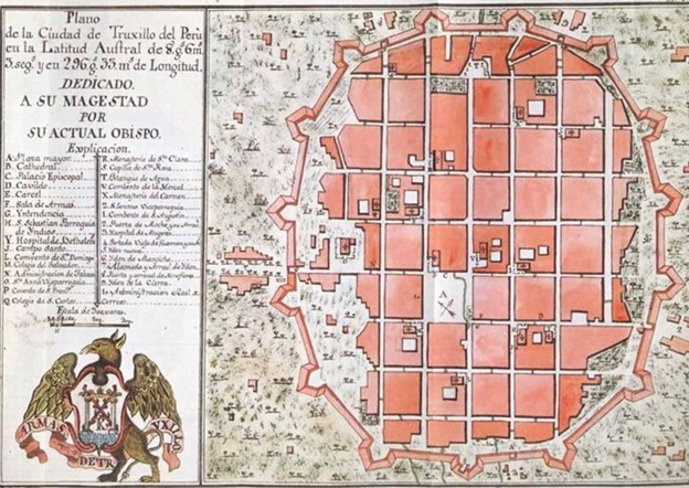
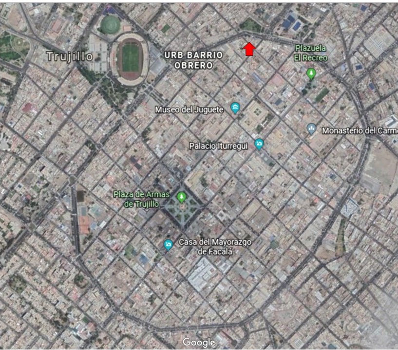
When I tracked the Washington circle alignment through Trujillo, Peru, I encountered an historic map from 1786 that showed Trujillo was at one time a star city.
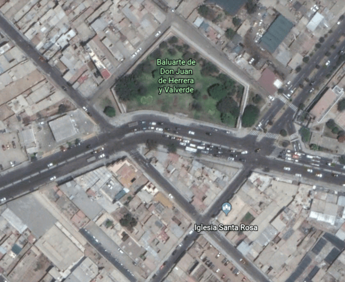
There is one intact point of the original fifteen remaining…
…that I found when I looked at a close up of the oval in the city’s center.
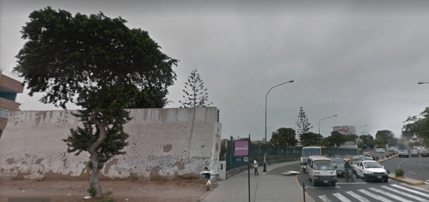
Here is a street view of the wall of the intact point. Note the size of it compared to the people next to it!
Now to come down the home stretch and wrap this up, I will take you back up this alignment to Ship Island, a barrier island off the Gulf Coast of Mississippi near Gulfport and Biloxi, and part of the Gulf Islands National Seashore. It was split into West Ship Island and East Ship Island by Hurricane Camille in 1969.
Fort Massachusetts is on West Ship Island, said to have been built following the War of 1812. Interesting to note that it incorporates both bricks and earthworks.
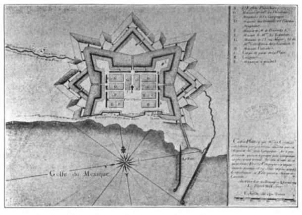
Fort Maurepas, also called Old Biloxi, and was located at present-day Ocean Springs, approximately 2-miles, or 3.2-kilometers, east of Biloxi. It was said to have been developed by the French in 1699, and we are told it burned down around 1722.
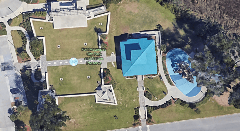
This is Fort Maurepas City Park and Nature Preserve today, which has a pavilion, large green space, playground equipment, and a splash pad.
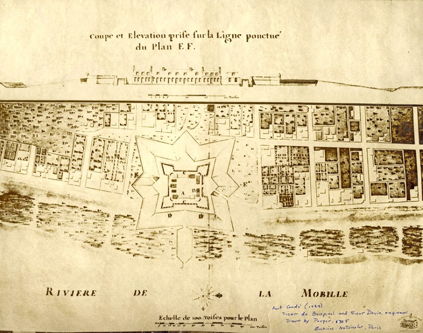
Here is the the Fort of Colonial Mobile, also known as Fort Conde, was said to have been built by the French in 1723. Here is a map depicting it in 1725.
This is what Fort Conde looks like today.
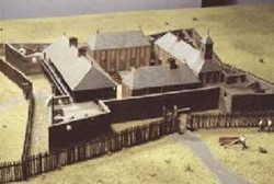
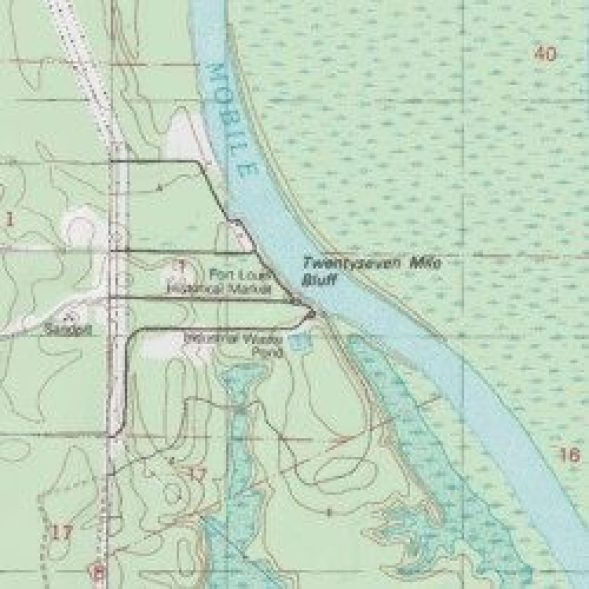
The Old Mobile site was the location of the French settlement La Mobile and the associated Fort Louis de la Louisiane, said to have been built in 1702…
…at a place called Twenty-Seven Mile Bluff on the Mobile River.
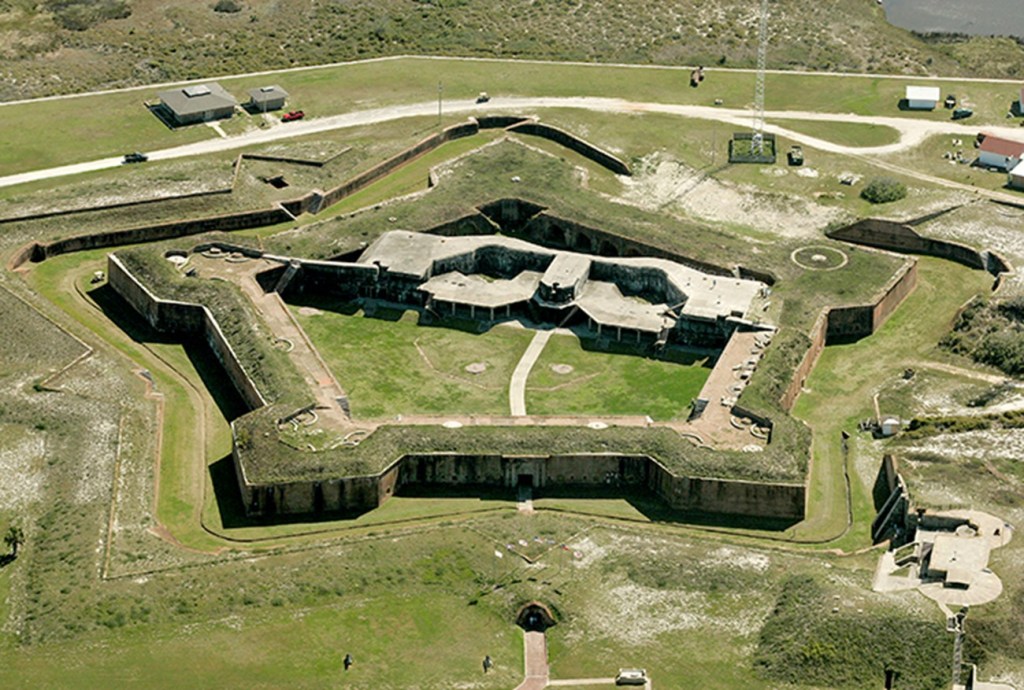
Fort Morgan is on Mobile Point at the entrance of Mobile Bay, and said to have been built between 1819 and 1834.
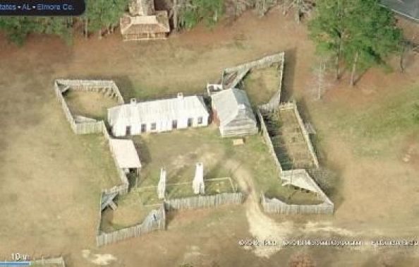
Fort Toulouse is an historic park near Wetumpka, Alabama, and is considered part of the Montgomery Metropolitan area. This is said to be a replica of the original fort.
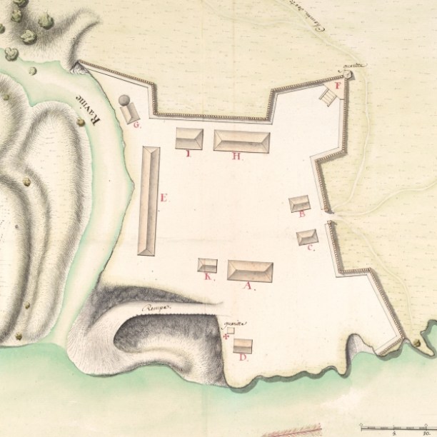
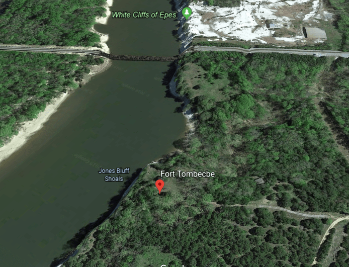
West of Montgomery, at Epes in Sumter County, Alabama, was Fort Tombecbe on the Tombigbee River, said to have been built by the French between 1736 and 1737 as a trading post.
The original structure is pretty much not there anymore.
So this brings me to end of what I found on all these alignments I wanted to share with you in this video.
What is it exactly that I have shown you, and what are we really seeing here?
To find the answer to these questions, I believe it is first necessary to define the word “battery.”
One definition is a device that produces electricity that may have several primary or secondary cells arranged in parallel or series, as well as a battery source of energy which provides a push, or a voltage, of energy to get the current flowing in a circuit.
The second meaning of the word battery is the heavy fire of artillery to saturate an area rather than hit a specific target.
And the third definition is an assault in which the assailant makes physical contact.
The answer to the mystery of star forts lies in what I believe is the first answer – that these star forts, and other infrastructure I have shared with you that don’t feature the classic look of a star fort, functioned as circuitry and batteries for the purpose of producing electricity and/or some form of free energy to power the planetary grid system and the advanced civilization.
And that this is the reason there are so many star forts that are paired together, or even the reason clusters of them are found in the same location.
As we saw, many features on them, or near them, are actually called batteries, even though they were re-purposed in many cases, but not in all, to the second definition applied to them in the new time-line in order for them to appear to have a strictly military function.
Does the third definition apply here?
I think so, in the sense that a major assault has been committed against the Human Race by all that has taken place here without our knowledge and consent, and removing all of this critical information from our awareness about the Moorish Legacy and True History of Humanity, and so, so much more.
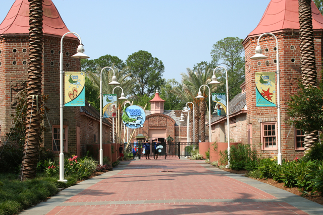
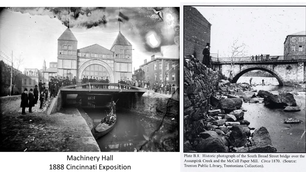
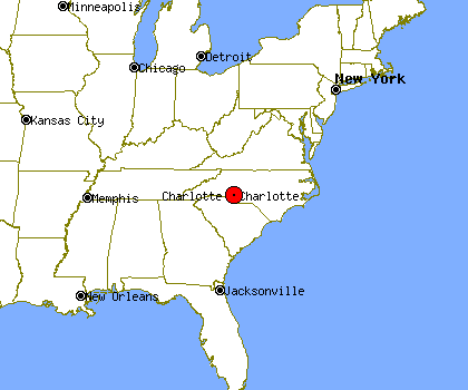
In my next post, I am going to be taking a a bit of a breather, and doing a relatively short piece looking what is found in the area surrounding the Soo Locks, between Sault Saint Marie, Michigan, and Sault Saint Marie, Ontario.
Canals were one of my first “A-ha’s” when I started to become aware that an advanced, ancient maritime civilization flourished around the world until what I believe was relatively recently.
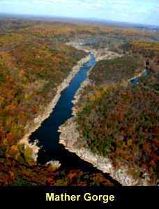
When I first started to intuitively receive and understand information about the Ancient Civilization, I looked up Great Falls of the Potomac between Maryland and Virginia, near where I grew up. This is an aerial image of Mather Gorge at Great Falls The spin is how this could be natural, but look at how straight it is!
And here is how it looks closer to earth.
When I realized that part of the ancient civilization involved canal-building, then it became logical to see this as a canal rather than natural.
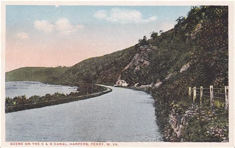
This is a picture of the C & O Canal at Harper’s Ferry. We are taught that this was built in the early 1800s. So, what is wrong with that date of construction? This is a sophisticated engineering project!
As a matter of fact, the C & O Canal parallels the Potomac River for a considerable distance. What technology existed in America in the late 1700s and early 1800s could have built a sophisticated project like this?
I am going to take you on a tour of the canal systems I have discovered in my research on planetary alignments based on the North American Star Tetrahedron that I found by connecting major cities of North America, off of which cities around the world line up in circles, lines, and other geometric configurations.
While not always the case, canals quite frequently are called rivers and creeks, with no hint given that they are anything other than natural, even though I consistently find what are called canals in the same location.
What I am about to share is a sample of examples I have found around the world. There are far too many to include all of them.
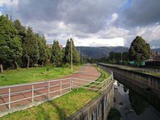
Starting in South America, this canal is in Suba, the northwest part of Bogota, Colombia…
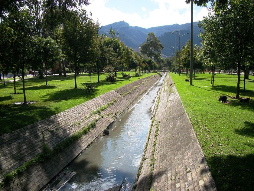
…and this one is in the Parque el Virrey in North Bogota.
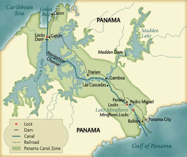
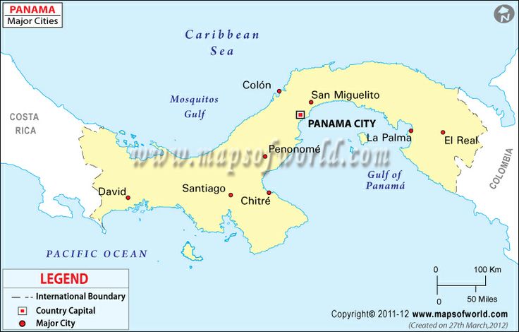
Next, the Panama Canal. This is the Pacific entrance of the Panama Canal, where Panama City is located.
The Panama Canal is an artificial 82-mile, or 51-kilometer, waterway in Panama that connects the Atlantic Ocean and Pacific Ocean via the Isthmus of Panama.
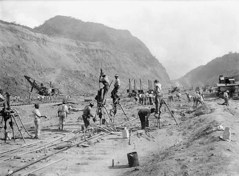
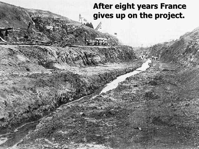
The project of building a canal across the Isthmus of Panama is said to have been started by the French in 1881.
They are said to have been unsuccessful in completing it due to engineering problems and a high worker mortality rate.
Then the Americans are said to have taken on the project starting in 1904.
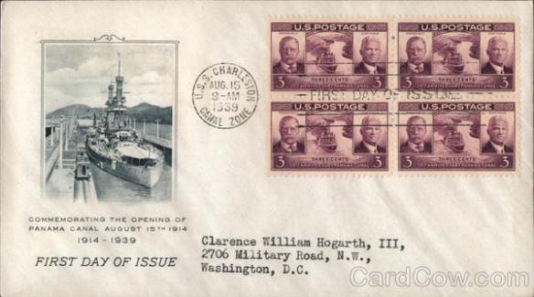
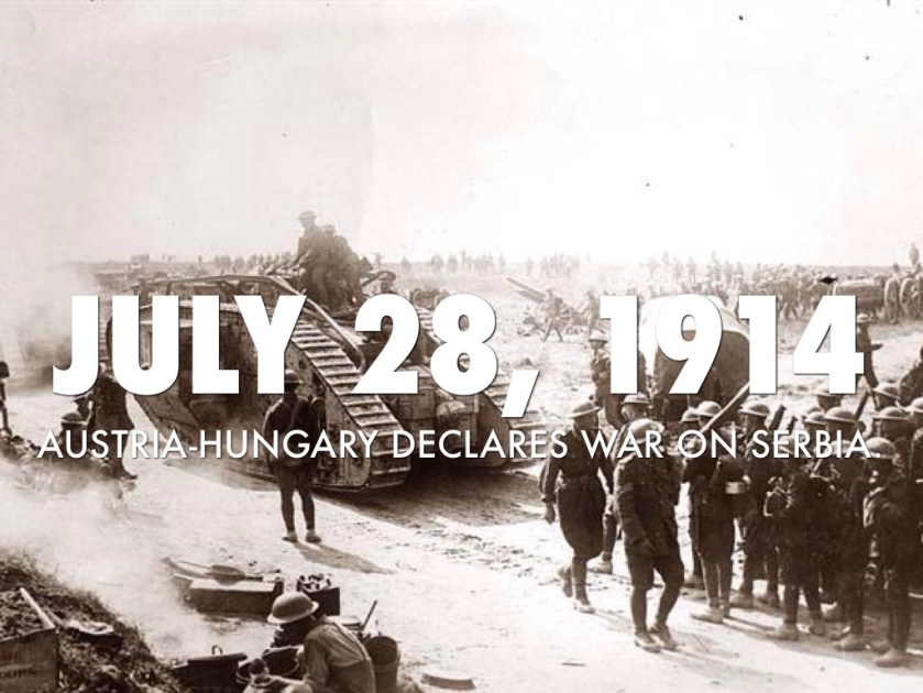
The Panama Canal opened on August 15th, 1914…
…just in time for the beginning of World War I, which started on July 28th, 1914.
Was the Panama Canal a brand new canal, or an existing canal that was excavated from mud?
We have to look no further than what we are told about the Spanish Conquest of Peru to raise a serious challenge to the official historical narrative.
Our history says that Pedro Arias D’Avila established a base of conquest in Panama City for Peru in 1519, on the Pacific side of the Isthmus of Panama.
The coast of Spain is on the Atlantic Ocean and Mediterranean Sea.
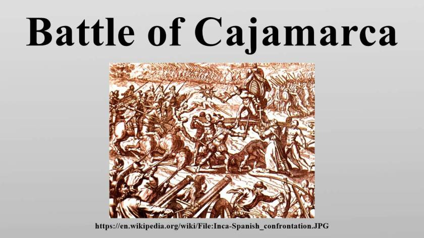
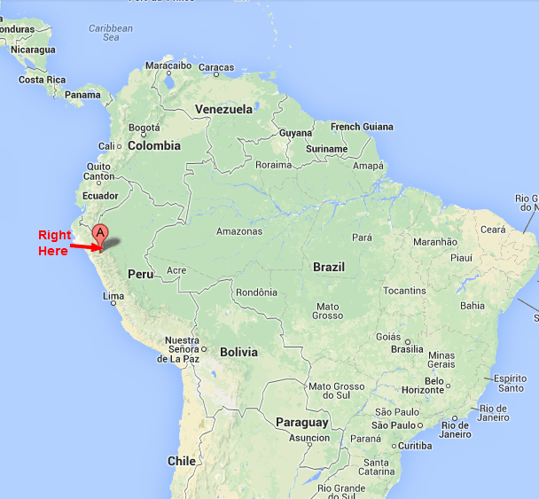
The Conquest of Peru is said to have started in 1532 with the Battle of Cajamarca, a city in Northern Peru.
It is quite a distance from Panama City, by land or sea. It sits at 8,900 feet in elevation, or 2,750 meters. That’s way up there!
Apparently, Pizarro and his 128 men marched to Cajamarca from Piure, on the coast of modern-day Peru.
There must have been some kind of viable waterway in Panama already for the conquistadors to even get to this part of the world!
In the country of Belize, its capital, Belize City, has what is called Haulover Creek running through its center…
…which looks like a canal, and not natural.
Belize City is apparently a city of canals.
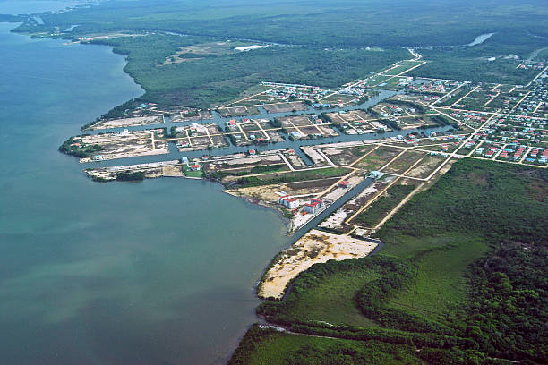
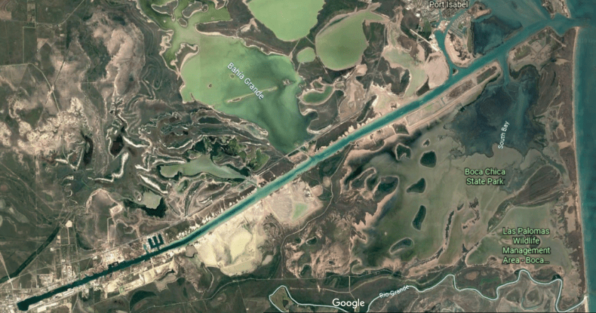
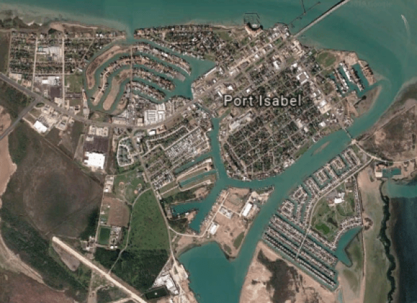
On to the United States, and Port Isabel, which is located on the Texas Gulf Coast near Brownsville, Texas and Matamoros, Mexico.
The Brownsville Ship Channel starts at Port Isabel, and is 17-miles, or 27-kilometers, long.
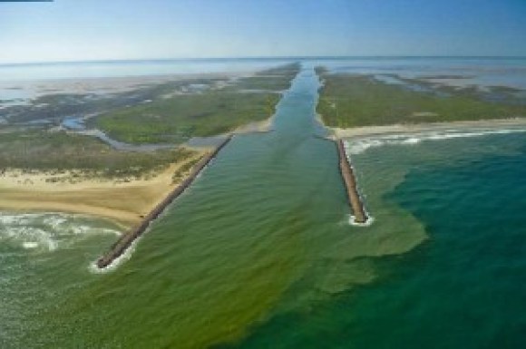
There is another channel at Port Mansfield, just north of Port Isabel.
I find the two jetties at the entrance of the channel leading to Port Mansfield to be of interest, because their appearance…
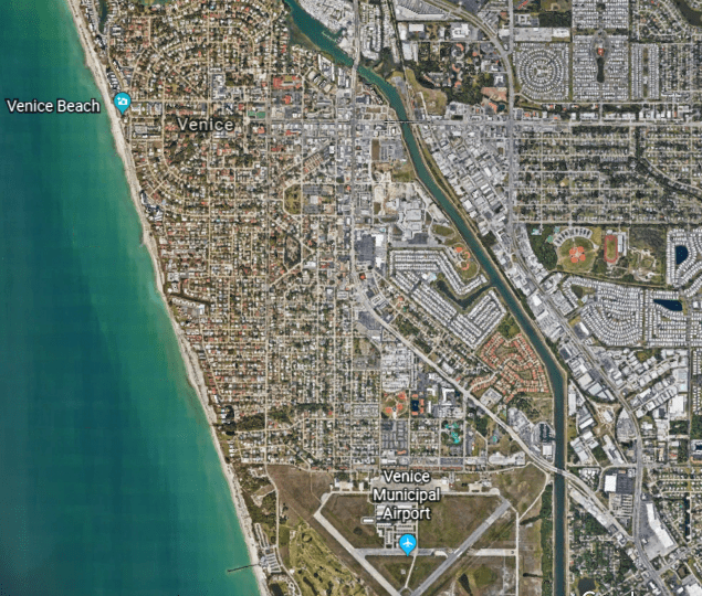
…is reminiscent of these at Venice, Florida…
…and the South Inlet of the Grand Lucayan Waterway at Lucaya, near Freetown, on Grand Bahama Island.
This is a view from Google Earth showing artificially-made channels and canals throughout the city of Port Isabel in Texas.
Still going to use Venice in Florida pictured here on the other side of the Gulf of Mexico for a comparison because these two communities have strikingly similar characteristics, like the residential neighborhoods on artificial islands surrounded by water…
…and a long channel in Venice, Florida, similar to the Brownsville Ship Channel that starts at Port Isabel.
Not only that, Port Isabel, Texas, and Venice, Florida, are practically directly across the Gulf of Mexico from each other. If they are not exactly, it is close.
In Louisiana, here is what looks like a canal in downtown Houma…
…as well as another one between Houma’s Twin Bridges.
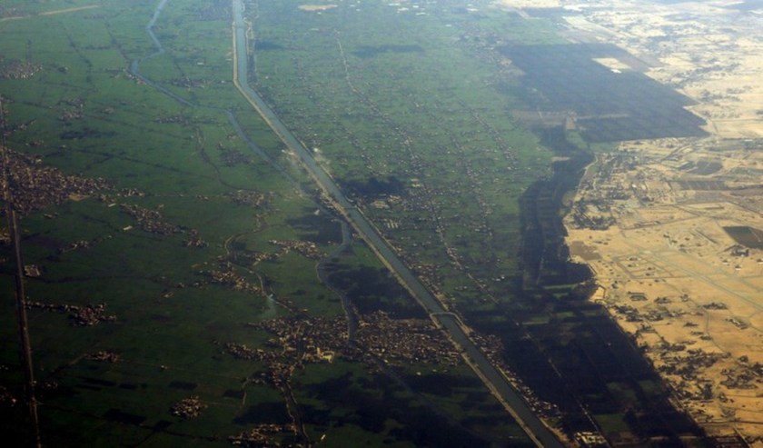
This is an aerial view of the Mississippi Delta, which is on the southeastern coast of Louisiana, showing many geometric and straight channels…
…and the same type of straight, geometric channel is also found in the Nile Delta.
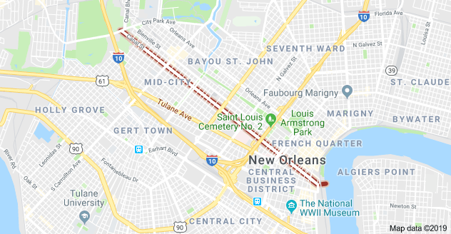
Canal Street is a major thorough-fare in New Orleans, forming the upriver boundary between the city’s oldest neighborhood, the French Quarter, and the Central Business District.
It is interesting to note that while Canal Street was said to be named for a canal that was never built, there are plenty of still-existing canals in New Orleans, as seen in this Google Earth screenshot. No telling how many have been filled-in!
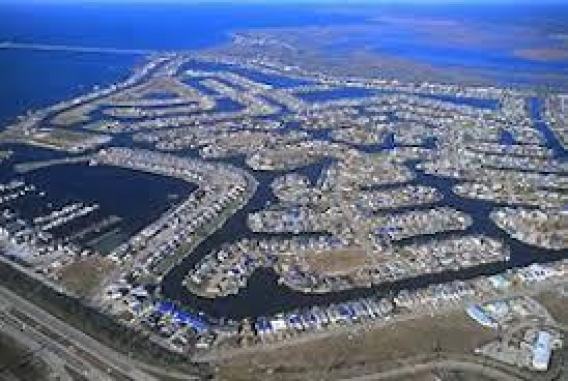
And just northeast of New Orleans, in Slidell, Louisiana, we find Eden Isles, which look like what we saw in Port Isabel in Texas, and Venice in Florida.
In Washington, DC, you find the C & O Canal paralleling the Potomac River.
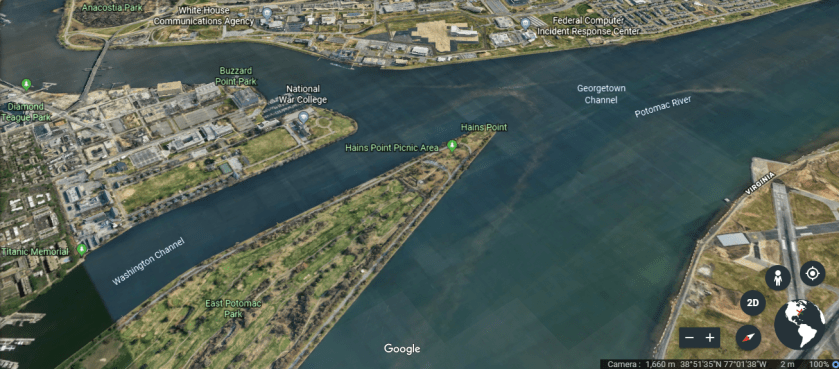
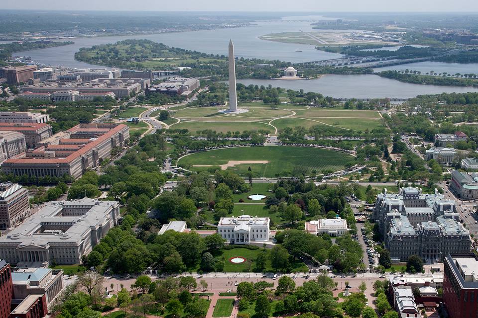
Here is an interesting convergence at Hains Point and East Potomac Park, where you have the very straight Washington Channel converging with the Georgetown Channel in the Center, the Anacostia River to the left, and the Potomac River to the right.
Compare the precise and angular look of Hains Point with what we see where the Missouri and Mississippi Rivers meet near St. Louis, Missouri…
…with the place where the White Nile and Blue Nile meet at Khartoum, the capital of Sudan…
…and where the Des Moines River and Raccoon River meet in Des Moines, Iowa.
Next, Wilmington, Delaware is built-out around what we are told is the confluence of the Christina River…
…and Brandywine Creek.
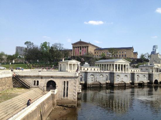
This is the Delaware River on the Philadelphia waterfront, with its nice masonry banks…
…and this view from the Schuylkill River of the Philadelphia Museum of Art looks more like something you would expect to see in Ancient Italy and Ancient Greece than something that would have been built in North America in the last 200 years or so.
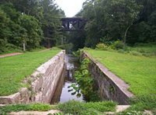
A portion of the Delaware Canal State Park is in Morrisville, Pennsylvania.
The canal that runs through Morrisville was said to have been built in the 1830s between Easton to the North and Bristol to the South…
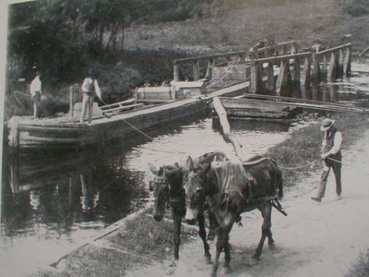
…and a crushed-stone towpath, upon which mules pulled cargo-laden boats.
So, somehow the technology existed in the 1830s to build a sophisticated canal system, and they had the ability to crush stone into tiny, tiny pieces, but that the boats themselves had to be pulled by mules?
Liberty State Park opened in the Bicentennial Year of 1976, and is located at the mouth of the Hudson River on the New Jersey-side in Jersey City.
The northeastern side of Liberty State Park is bordered by both the Little Basin…
…and the Big Basin of the Morris Canal.
The Morris Canal, 107-miles, or 172-kilometers, long, was said to have been completed in 1832 to carry coal across northern New Jersey between the Delaware River and the Hudson River. It was closed in 1924.
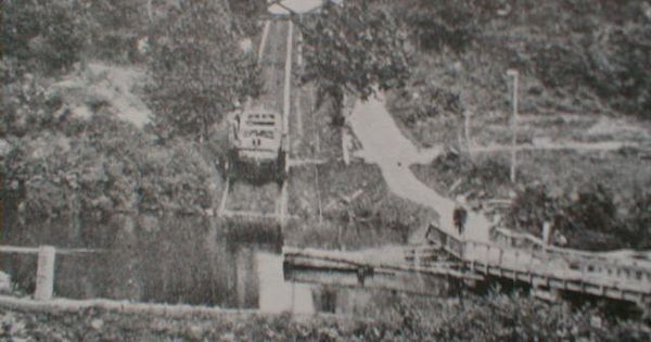
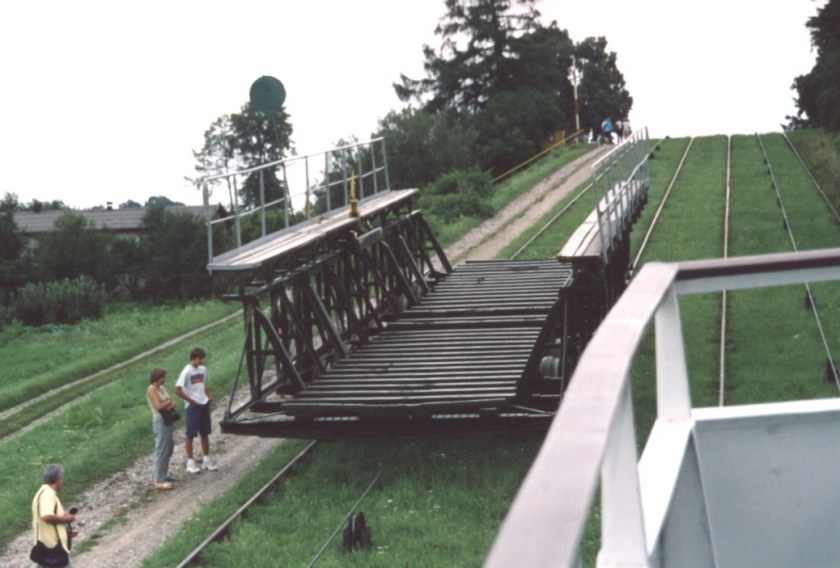
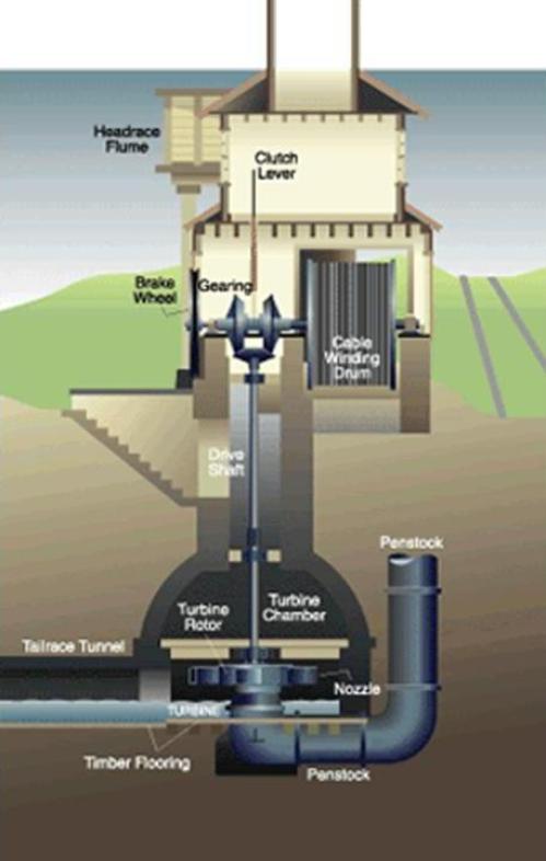
It was hailed as an ingenious, technological marvel for its use of water-driven, inclined planes.
The builders of the Morris Canal used a sophisticated power house technology, pictured here, to power the water turbine that was set in motion to raise or lower cradled boats on the inclined planes by means of a cable.
You mean to tell me all of this extremely sophisticated and advanced canal-engineering technology was being implemented prior to the beginning of the Industrial Age, according to the history we are taught?
And again, mules were still needed to be used to pull the canal boats in places on the Morris Canal in spite of all that technology?
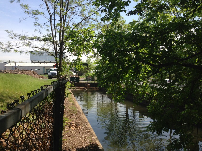
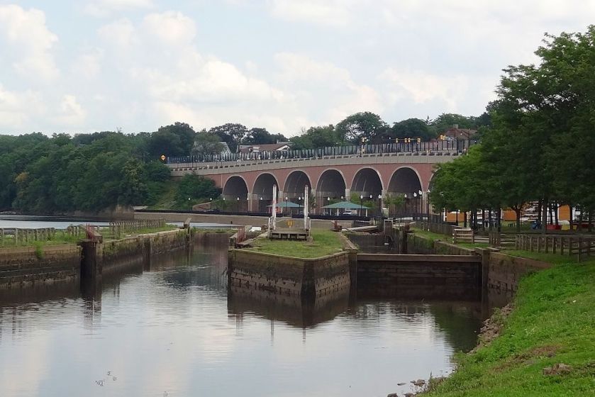
The Delaware and Raritan Canal connects the Delaware River at Bordentown, New Jersey, and the Raritan River at New Brunswick, New Jersey. This a distance of 44-miles, or 71-kilometers.
This canal system was said to have been dug by hand tools wielded by mostly Irish immigrants.
It goes through Trenton, New Jersey…
…on its way to the New Brunswick Terminus. We are told the canal was built between 1830 and 1834. Again, the sophistication of the engineering of these canals does not match the low technology of the times in which they are said to have been built.
Here is one of the locks on the Delaware and Raritan Canal.
Raritan Bay is the northern outlet of the canal, in the southern portion of the Lower New York Bay…
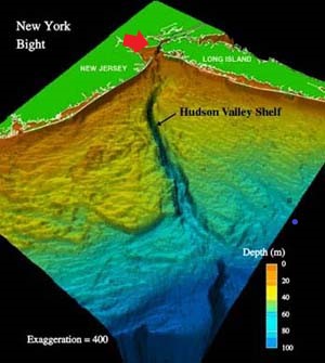
…and is part of the New York Bight, an indentation along the Atlantic Coast, extending northeasterly from Cape May, New Jersey, to Montauk Point on the eastern tip of Long Island.
We are told the bight results from the fact that the Atlantic coast of New Jersey, which runs roughly north-south, and the southern coast of Long Island, which runs roughly east-west, with the point approximately at the mouth of the Hudson River, where the red arrow is pointing.
I am including this because I believe it to be noteworthy, like sunken ancient infrastructure, and what is being called the Hudson Valley Shelf in this depiction could actually be a canal.
This is the mouth of the Hudson River in the Upper New York Bay, also called the New York Harbor.
Upper New York Bay provides passage for the Hudson River via the Anchorage Channel, which is fifty-feet deep, or 15 meters, through the mid-point of the harbor. It is one of the most heavily-used water transportation arteries in the world.
It would stand to reason because of its location and connection to the mouth of the Hudson River that the Anchorage Channel is part of the Hudson Valley Shelf of the New York Bight.
The Gowanus Canal in Brooklyn is connected to the Gowanus Bay of Upper New York Bay. Brooklyn occupies the westernmost part of Long Island. At one time a vital transportation hub, it is now a superfund site due to extensive pollution, with clean-up efforts starting in 2013.
Hartford, the capital of Connecticut, sits on the Connecticut River, with its masonry banks…
…and what is called the longest River in New England at 406 miles (or 653 Kilometers), going from the United States Border with Quebec to Long Island Sound.
This is an aeriel view of the Connecticut River, the border between Vermont on the left, and New Hampshire on the right. Quite a geometric-looking zig-zag going on here with this so-called river!
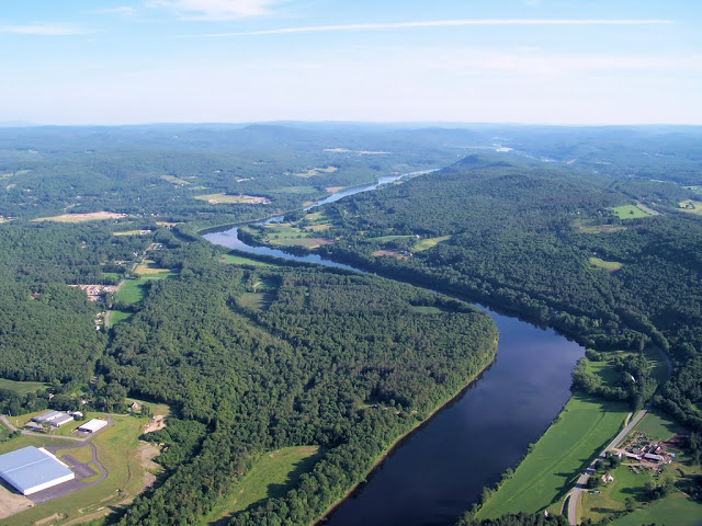
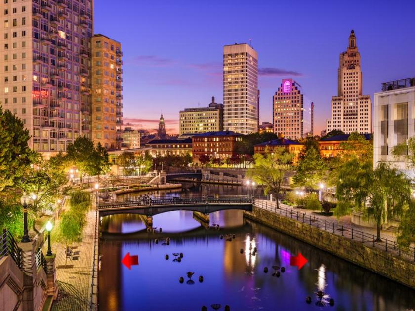
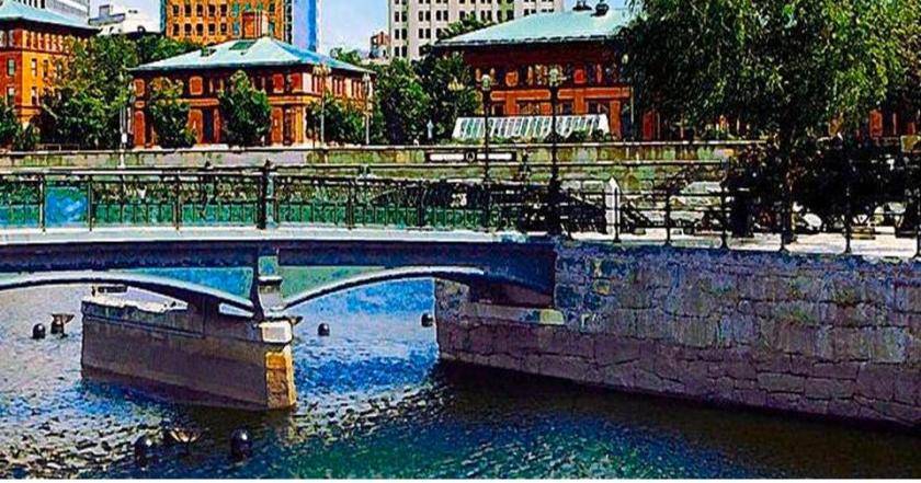
Providence is the capital and largest city of Rhode Island. It is situated in the mouth of the canal-like Providence River…
Waterplace Park is an urban park in downtown Providence, situated on the Woonasquatucket River.
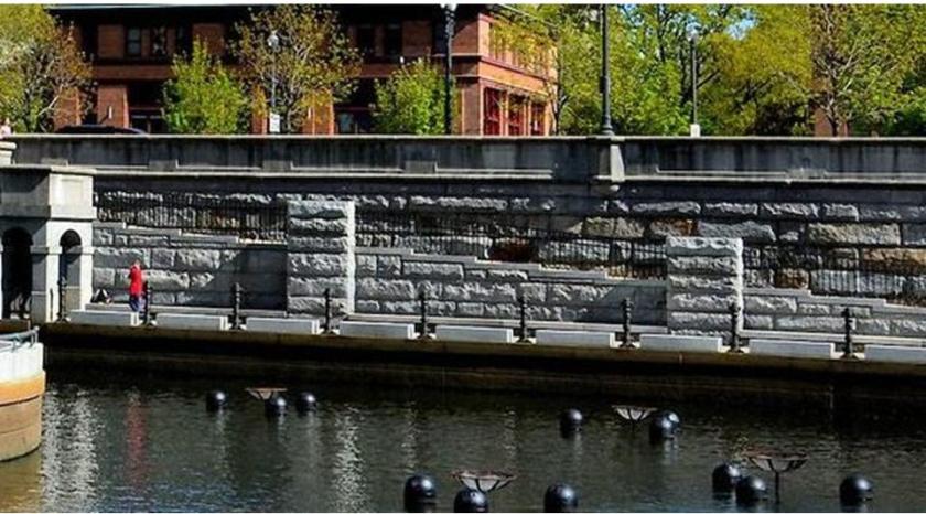
Interesting to note is the presence of megalithic masonry at Waterplace Park, which was said to have been finished in 1994.
The meaning of megalith is a large stone used in construction, typically associated with Peru and Egypt, but actually found everywhere around the world. Here is another megalithic construction at Waterplace Park.
In Boston, there is a neighborhood called Fort Point.
This is an historic photo of the Fort Point neighborhood circa 1930…
…and here is a picture of Fort Point today, with the heavy masonry banks of the Fort Point Channel clearly visible in the foreground.
The Rideau Canal is in Canada’s capital city of Ottawa, which is a UNESCO World Heritage Site, and connects Ottawa with Lake Ontario and the St. Lawrence Seaway. It was said to have been built in 1832.
The St. Lawrence Seaway is a system of locks, canals and channels in Canada and the United States that permits ocean-going vessels to travel from the Atlantic Ocean to the Great Lakes of North America.
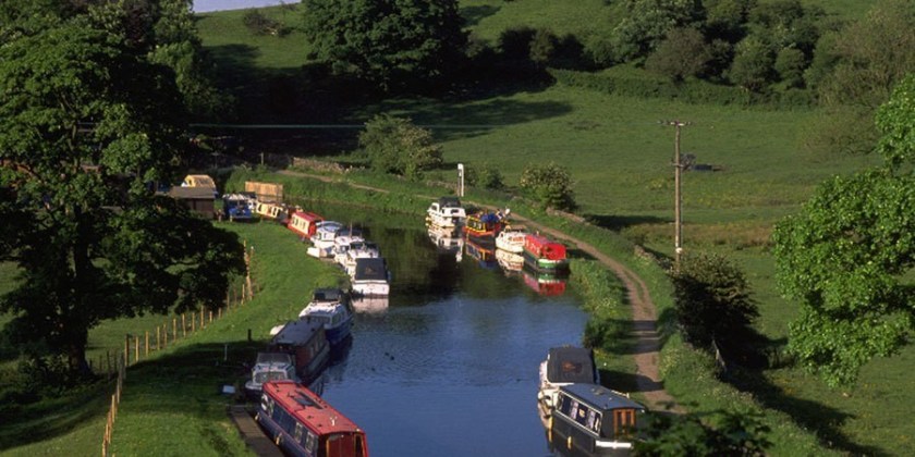
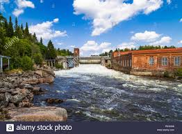
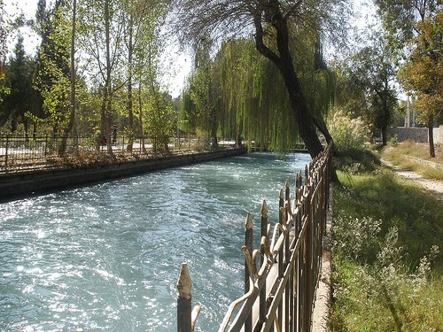
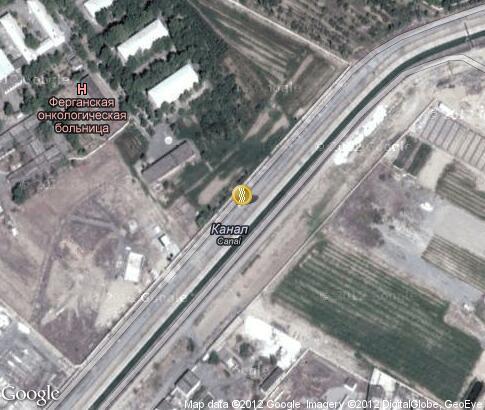
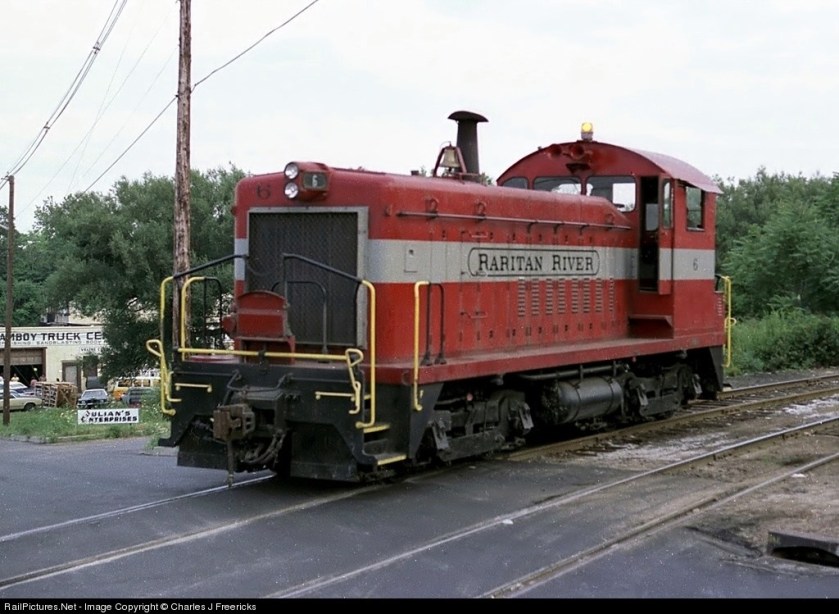
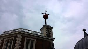
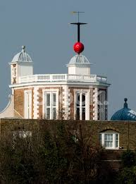
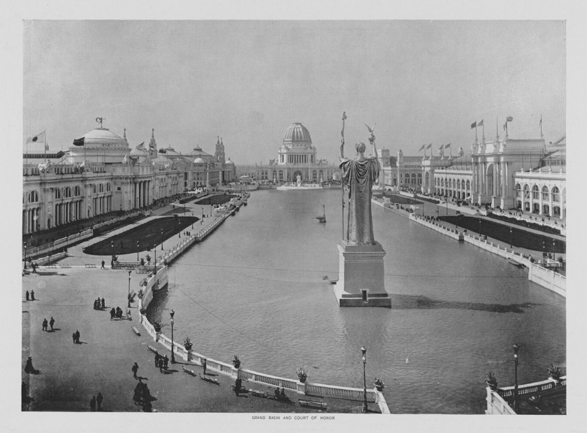
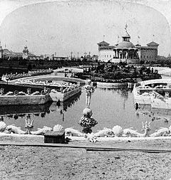
These are the Soo Locks, located on the St. Mary’s River between Lake Superior and Lake Huron, and are operated and maintained by the U. S. Army Corps of Engineers. They were said to have been built in 1855.
Judging from all of the activity going on here, this must be a very special place, and I am going to have to come back to the Soo Locks as its own research project for a future post.
In Europe, again there are many more examples than what I am going to share, but here are several.
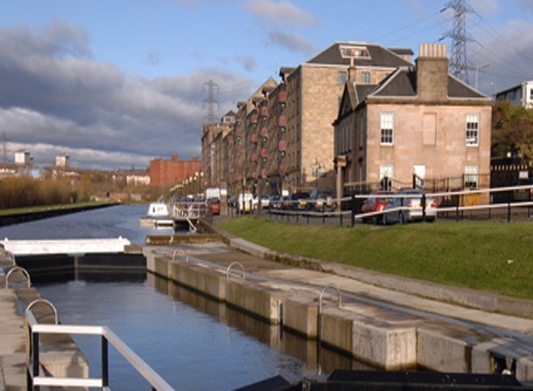
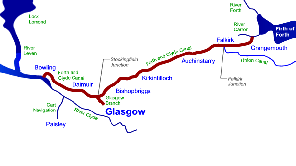
I found masonry associated with water features occurring throughout Scotland, like the so-called natural River Clyde going through Glasgow shown here…
…just like what is called Forth and Clyde Canal, between the Firth of Forth and the River Clyde…
…construction of which is said to have been started in 1768, and opened in 1790. It runs between the Firth of Forth on Scotland’s central-east coast, through Glasgow to the River Clyde.
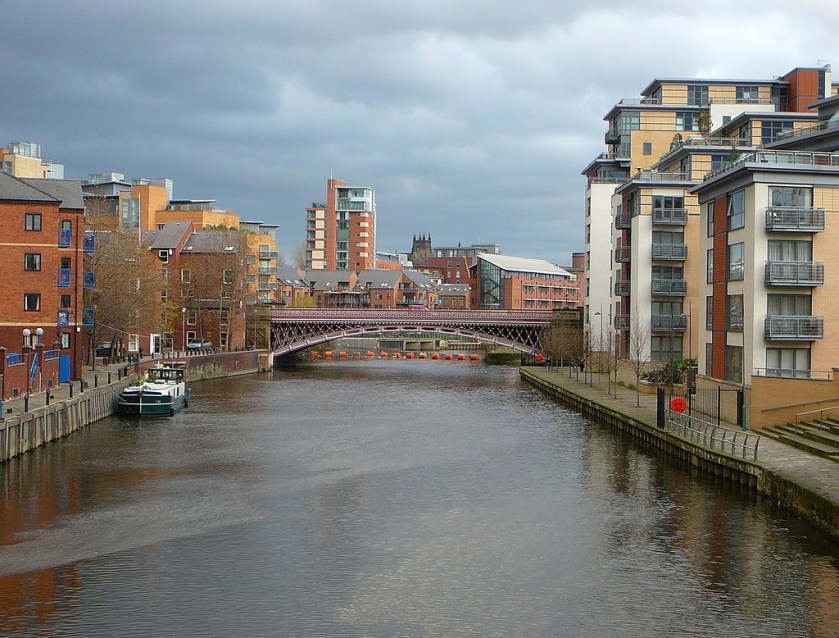
The River Aire in Leeds, England has masonry banks.
And just like Glasgow, there is a canal here as well – the Leeds and Liverpool Canal that links the two cities, construction of which was said to have started around 1770
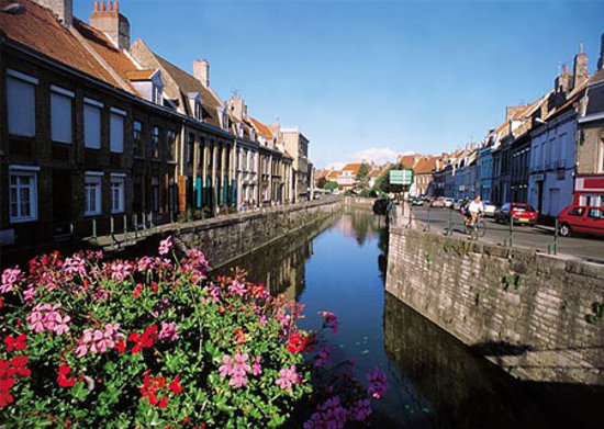
Calais is a city and major ferry port in northern France, situated on the Strait of Dover, the narrowest point in the English Channel across from Dover in England.
The old part of the town is called Calais-Nord, and is surrounded by canals, like the Bergues Canal pictured here.
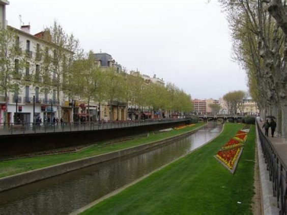
This is the canal-looking River Tet, the longest river in the Pyrenees-Orientales at 72 miles (or 116 kilometers) going through Perpignan in southern France before it ends in the Mediterranean Sea…
…and its tributary, the equally canal-looking River Basse, also in Perpignan.
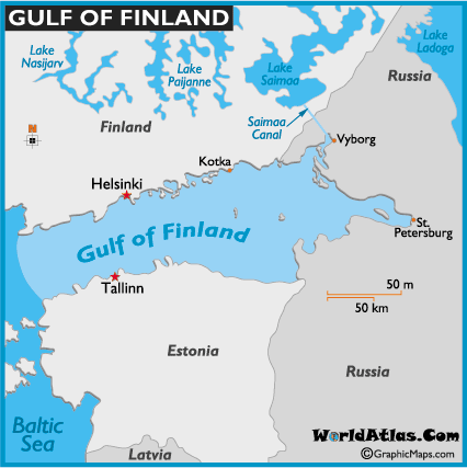
Now I will switch focus to St. Petersburg, Russia, called the “Venice of the North.”
It is tucked away at the eastern end of the Gulf of Finland.
Vasilyevsky Island is an island in St. Petersburg, Russia, and is bordered by the Great Neva River, starting on one side of what is called the Spit of Vasilyevsky Island in the historic city center of St. Petersburg, and the Little Neva River, starting on the other side of the Spit…
…before the Great and Little Neva Rivers join to form the Neva River.
Other rivers and canals of St. Petersburg are:
The Fontanka River…
…the Moyka River…
…the Griboedov Canal…
…the Winter Canal…
…the Swan Canal…
…and the Kryukov Canal.
In the same part of the world as St. Petersburg, the Saimaa Canal connects Vyborg in Russia on the Gulf of Finland, with Lake Saimaa in Finland. It was said to have been built between 1845 and 1856, and opened in 1856.
Kotka is west of the Saimaa Canal in Finland. It is a major port city, with its artifically shaped harbors…
…and is situated on the Kymi River.
This ancient canal is in Kotka as well.
Helsinki, the capital of Finland, is west of Kotka, and is located on the Vantaa River, where it flows into the Gulf of Finland through the Vantaanjoki River Basin.
The Vantaa River flowing through Helsinki has such sights…
…as right-angled waterfalls.
Moving on from the Gulf of Finland to Central Asia, there is a canal system in Quorgonteppa, now officially called Bokhtar, in Tajikistan, a mountainous land-locked country…
…and the Kanali Varnob is in Dushanbe, Tajikistan’s capital.
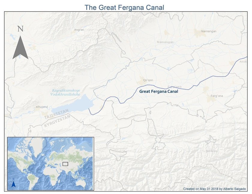
The Great Fergana Canal is located in the Fergana Valley between Tajikistan and Uzbekhistan.
It was said to have been built in 1939, taking only 45-days to complete with conscripted unskilled labor and a high number of fatalities.
And one of the top attractions of Tashkent, the capital of Uzbekhistan, is the Ankhor Canal.
In the Middle East, this is Dubai’s Old Town, the Bur Dubai, in the United Arab Emirates, with a sophisticated canal system as well.
I am going to end this post on Australia’s Gold Coast on the eastern coast of Australia near Brisbane.
It is a popular vacation resort, and has approximately 400 km, or 249 miles, of canals.
Here is another Florida canal system for comparison to the Gold Coast canals, this time Las Olas Isles in Fort Lauderdale on the Atlantic Ocean.
I am just scratching the surface of this vast topic with what I have presented here.
Certainly before the Internet Age, it would have not been possible to make these direct comparisons between different places around the world.
We had to go with what we were told. Back then, who could have imagined we weren’t being told the truth?!
In the next post I am going to be taking a look at the star forts I have found by tracking planetary alignments, and some others I have found along the way as well.
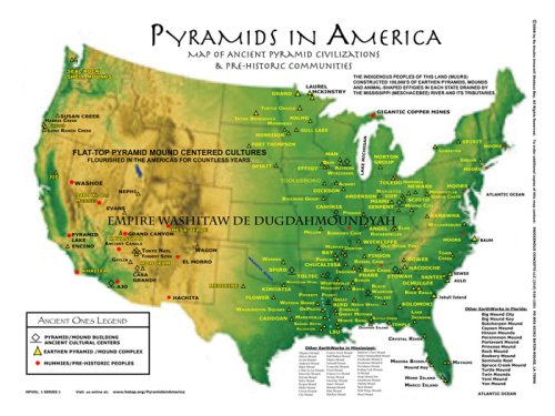
I am seeing that there was an ancient advanced global civilization called the Moorish Empire, instead of the historical narrative we have been taught about who built the world’s infrastructure. Perhaps with different empires within Empire – Washitaw, Phoenician, Tartarian, Ottoman – but one unified, worldwide civilization, with its roots in ancient Mu, or Lemuria, and Atlantis.
Based on my research, I take very seriously the belief among many researchers that there was a relatively recent worldwide mud flood liquefaction event that wiped out this advanced civilization, and then there was a subsequent historical reset of the timeline by those responsible for the cataclysm. I do not believe the mud flood resulted from natural causes.
The Washitaw Mu’urs are an ancient people of North America living in the present day, and the recently deceased Washitaw Empress Verdiacee was presented a Charter by the United Nations in 1993 recognizing the Washitaw as the oldest indigenous civilization on Earth.
Why hasn’t the general public ever heard of them?
Master Moorish Masons of the Ancient Ones were the Master Builders of Civilization, and their handiwork is all over the planet, from ancient to what would be considered relatively modern.
The Moors were and are the custodians of the Ancient Egyptian mysteries
All of their Moorish Science symbolism was taken over by other groups claiming to be them, falsely claiming their works, or piggy-backing on their legacy. Or given a darker meaning by association with certain things that were not the original meaning.
Islam in its original form is about applied Sacred Geometry and Universal Laws. Islam is a word that means “Peace,” and when Moors greet each other, they typically say “Islam” or “Peace” in greeting.
It was nothing like the weaponized form of radical Islam we see today that is playing a divisive and destructive role in the world today and is not in accordance with Humanity’s best interests.
Radical Islam & Sharia Law is what was put in place by European Freemasonry and other secret groups to take down Western Civilization.
Just as Christianity was weaponized against the ancient civilization, including the creation of institutions like the Spanish Inquisition in 1478…
…and orders, including but not limited to, the creation of the Jesuits by Pope Paul III in 1540, that included a special vow of obedience to the Pope in matters of mission direction and assignment.
Like the destruction of the Ancient Civilization, this is another human and social engineering process that has nothing to do with benefiting Humanity. Problem – Reaction – Solution.
In this case, the destabilization of Western Civilization by radical Islam is going to be restored to order by the New World Order. Or so they planned. I personally believe very soon we will be seeing high-level criminals being held accountable for their crimes, and I will continue to believe so. I don’t believe they will get away with the multitude and magnitude of Crimes against Humanity that have been committed.
In yet another example of the appropriation of Moorish symbolism, this is the Great Seal of the Moors…
…compared to this symbol on the back of the U. S. one dollar bill.
In my post “An Explanation for What Happened to the Positive Timeline of Humanity and Associated Historical Events & Anomalies,” I shared an extremely cold weather event in the historical record in Ireland between 1740 – 1741, as well as my thoughts about how an artificial time-loop was created between 1492 – 1942, with 1717 as the mid-point year between the two. More on this after the weather event in Ireland.
First, on the extreme cold weather in Ireland, Irish Historian David Dickson talks about this little-known event in his book “Arctic Ireland.” I explored the idea that this event was related to the hijack of the original timeline, and that this was the point where a new timeline was pinned.
The Irish population endured 21-months of bizarre weather without known precedent that defied conventional explanation. The cause is not known.
Shortly after I learned about the cold-weather event in Ireland, I was connected by someone to the mud flood community.
I learned about the fantastic research that is being done by people looking at their own communities and other places, around the world, at strong evidence that there was a cataclysmic event involving a massive flood of mud, as recently as 200 – 300 years ago.
It is being called a reset event, and that photographic evidence exists that buildings, canals, rail-lines, tunnels, among other things, were purposefully dug out after the event to the point where they could be used.
Over the years, I have filled my head with information about megaliths. Long before I became aware of what I am sharing, I learned about such places as the Sphinx in Egypt having been dug out…
…as well as the famous heads of Easter Island…
…that were found to have bodies too!
The explanation of a mud flood makes a lot of sense to me based on what I am finding and seeing.
A sudden cataclysmic liquefaction event creating a flood of mud accounts for how a highly advanced worldwide civilization of giants…
…could be wiped from the face of the Earth and erased from our collective memory.
This is an historic photo of St. Petersburg, Russia, of vastly smaller, and hardly any, people relative to the size of the city in the background and the foot in the foreground.
We see the same relative emptiness, and the contrast of the massive size of the architecture and the small size of the people, in this historic photo of Paris…
…and this rather empty and rustic-looking photo with virtually no one in it taken at the beginning of the 20th-century of the Trilogy, three major buildings said to have been built in the mid-to-late 1800s, in Athens, Greece.
Next, I will provide the findings of my research of the historical record around the year of 1717.
There are 450 years in between 1492 and 1942, and the midpoint, at 225-years, is 1717.
Based on what I found when I started looking at historical events from around 1717 to 1942, I believe the extremely cold weather event in Ireland was deliberately caused, and is connected to the Mud Flood and the historical reset.
King George I of the German House of Hanover became King of Great Britain and Ireland in 1714.
This marked the end of the rule of the House of Stuart, which originated in Scotland.
On January 4th, 1717, Great Britain, France, and the Dutch Republic sign the Triple Alliance in an attempt to maintain the Treaty of Utrecht, which was signed in April of 1713, in which in order to become King of Spain, Philip had to renounce his concurrent claim to the French throne.
This prevented the thrones of Spain and France from merging together, and ultimately paved the way for the maritime, commercial, and financial supremacy of Great Britain.
In February of 1717, James Francis Edward Stuart of the House of Stuart, called the Pretender, who at one time was claimant to the throne, left where he was living in France, after the Triple Alliance was signed in January, to seek exile with Pope Clement XI in Rome – why he went specifically there, I don’t know, but he died in Rome in 1766.
This is believed to be a portrait of James Francis Edward Stuart that was painted when he lived in France on the left, and the typical portrait of him on the right.
On June 24th, 1717, the Premier Grand Lodge of England – the first Free-Mason Grand Lodge – was founded in London.
I find it highly significant that this event shows up at the exact mid-point year between 1492 and 1942.
And then on 7/17/1717, an interesting date from a numerological perspective, the premier of Georg Friedrich Handel’s “Water Music” took place for King George I on a barge on the Thames. Eyes are now on Handel.
In 1727, Georg Frederic Handel, the German, becomes George Frederick Handel, a British citizen.
Then I was guided through a psychic friend to look at Ireland in 1742 in my research.
So I searched for it on the internet, and only two things came up.
The first was that Dublin, Ireland, was the location for the premier of Georg Friedrich Handel’s Messiah on April 13th, 1742.
And the other thing that came up was the extraordinary cold weather event in Ireland between 1740 – 1741.
Handel’s Messiah premieres in Dublin right after the extremely cold, lethal weather event???!!!
So, who shows up during this same time period?
Well, in 1744 Mayer Rothschild was born in Frankfurt, Germany. He established his banking business there in the 1760s, which became the start of an international banking family.
Then on February 6th, 1748, Bavarian Illuminati-founder Adam Weishaupt was born in Ingolstadt, Bavaria, Germany. He went to a Jesuit school at the age of 7, and was initiated into Freemasonry in 1777.
In 1839, John D. Rockefeller, Sr. was born in the United States, the progenitor of the wealthy Rockefeller family and considered to be the wealthiest American of all time. He founded the Standard Oil Company in 1870.
Fast forward to the time period of November 20th through November 30th in 1910. A meeting took pace at Jekyll Island off the coast of the State of Georgia to lay the foundations of the Federal Reserve.
The sinking of the Titanic took place on April 15th, 1912. All the bankers opposed to the creation of the Federal Reserve were on board, including John Jacob Astor IV, one of the richest people in the world at the time.
Then on December 23rd, 1913, the Federal Reserve Act Passed Congress, signed into law by Woodrow Wilson. It created and established the Federal Reserve System, and created the authority to issue Federal Reserve Notes (commonly known as the US dollar) as legal tender.
On July 17, 1917, the reigning royal house of the United Kingdom and its Commonwealth, the House of Windsor is founded after the death of Queen Victoria. It is also of German paternal descent. There’s that 17 numerology showing up again!
World War II started on September 1st in 1939, and ended on September 2nd in 1945 – exactly six years later. It is considered the deadliest conflict in human history.
Almost halfway through World War II, on July 22nd, 1942, the strange Philadelphia experiment took place at the Philadelphia Naval Shipyard.
Did the USS Eldridge just become invisible?
Or did it go somewhere else?
And if it went somewhere else, where might it have gone?
What was the real purpose of the Philadelphia Experiment?
I think it was a deliberate manipulation of time-space, and how the new artificial time-line/loop I am talking about was somehow inserted. Our new history was grafted on to the existing infrastructure on the planet, and falsely attributed in the new historical narrative.
The world history we have been taught is filled with war and violence, death and destruction, which was not our original evolutionary path.
Now to tie the Mud Flood together with the historical reset timeline together based on my research findings.
If in fact the mud flood event took place in 1740 and 1741, it would have taken awhile to dig infrastructure out and get it to the point where it could be used once again.
Who was responsible for the excavation?
Those who became the ruling class, or their associates, and bankers, oilmen, transportation magnates, manufacturers, etc.
I believe the official start of the Historical Reset Timeline, and the Grand Opening of the New World Order, was The Great Exhibition of the Works of Industry of All Nations of 1851.
Held in the Crystal Palace in Hyde Park in London, it was the first in a series of World’s Fairs, exhibitions, and expositions, that I believe over the next 100 years or so were showcasing the technology and architectural wonders of the original civilization before being hidden away or forever destroyed.
This was a scene at the New York World Fair of 1939 to 1940, almost 100 years later, where we still see incredibly big, what appear to be lumiscent structures in the background, and in the foreground, statues much bigger than the size of the people standing near them.
Also in 1851, the Royal Observatory at Greenwich became the world’s Prime Meridian.
Prior to the time of moving it to Greenwich in England, the Great Pyramid of Egypt was the ancient prime meridian of the Earth.
Commodore Matthew Perry played a leading role in the Opening of Japan, starting on July 8th, 1853, when he led four U. S. Navy ships ordered by President Millard Fillmore to Tokyo Bay with the mission of forcing the opening of Japanese ports to American trade by any means necessary.
After threatening to burn Tokyo to the ground, he was allowed to land and deliver a letter with United States demands to the Tokugawa Shogun, Ieyoshi.
The Shogun Ieyoshi died a short time after Perry’s departure in July of 1853, leaving effective administration in the hands of the Council of Elders, though nominally to his sickly son, Iesada, who was the Tokugawa Shogun from 1853 to 1858.
The Tokugawa Shogunate is called the last feudal Japanese Military Government…
… ruling from 1600 to 1868 from Edo Castle in Tokyo.
Here is a photo of one of the polygonal megalithic walls found on the grounds of Edo Castle…
…compared with this exquisite example of polygonal masonry at the Coricancha in Cusco, Peru. Polygonal masonry is defined as a technique where the visible surfaces of the stone are dressed with straight edges or joints, giving the stone the appearance of a polygon, with minimal clearance between stones, and no mortar.
Perry returned again with eight naval vessels in February of 1854, and on March 31st of 1854, the Japanese Emperor Komei signed the “Japan and United States Treaty of Peace and Amity” at the Convention of Kanagawa under threat of force if the Japanese government…
… did not open the ports of Shimoda…
…and Hakodate to American vessels.
It looks to me like the Japanese Empire was perhaps not taken out by the mud flood, and needed to be acquired by threat of force.
The star fort of Goryokaku at Hakodate on Hokkaido is located on the Tsugaru Strait of the Sea of Japan between the Japanese Islands of Honshu and Hokkaido.
In another part of this series, I will show the numerous star forts, including this one at Hakodate, that I have encountered on planetary alignments. I didn’t know they were there in advance, and found them in my research for these posts when I was tracking various planetary alignments. The information I am sharing with you now comes from “Circle Alignments on the Planet Amsterdam Island – Part 8 Chongjin, North Korea to Yokohama, Japan.”
The Sea of Japan is enclosed between the islands of Japan, Sakhalin Island, the Korean Peninsula, and Russia.
The Strait of Tartary of the Sea of Japan divides Sakhalin Island from southeast Russia, and connecting the Sea of Japan with the Sea of Okhotsk.
The 51st parallel north passes right through here, a circle of latitude that is 51-degrees north of the equatorial plane. The capital cities of London, England, and Astana, Kazakhstan, are at the same latitude as the Strait of Tartary.
It is significant to note that the Sea of Japan was one of the major theaters of operations of the Russo-Japanese War of 1904 and 1905, where these two countries fought over rival imperial ambitions in Manchuria and Korea, and in which Japan defeated Russia.
The vast region depicted on this map in purple was called Chinese Tartary. The regions in yellow were considered independent Tartary. The name of Manchuria was said to have come into use in Europe the 1800s, thus hiding the true identity of this part of the world.
These were early steps in the eventual establishment by the Japanese of the puppet state of Manchukuo, within the historical region of Chinese Tartary, in 1933.
The Last Emperor of China, Puyi, was first installed by the Japanese as the Chief Executive of Manchukuo, and he became its emperor in 1934, a position he held until 1945, when he abdicated as a result of the end of World War II. His life story is very sad, and is told in the movie “The Last Emperor” directed by Bernardo Bertolucci.
I believe all of this was positioning on the part of not only the United States, but ultimately Japan and other powers of the region, to ultimately to take control of the fabulous technology of the Tartarian Empire of northeast Asia, the same advanced technology of which was found worldwide, and which I believe our modern energy system is based on. See my post “Relationship Between the Planetary Grid, Technology of the Ancient Civilization, and the Modern Energy Industry.”
Like I said at the beginning of this post, I believe the Tartarian Empire was part of the Moorish Empire, and not the other way around.
In 1803, the Ames Shovel Works was established in Easton, Massachusetts.
It became nationally known for providing the shovels for the Union Pacific Railroad, which opened the west. It was said to have been the world’s largest supplier of shovels in the 19th-century.
Oliver Ames, Jr, (b. 1807 – d. 1877) was a co-owner of the Ames Shovel Shop. He was also the President of the Union Pacific Railroad from when it met the Central Pacific Railroad in Utah for the completion of the first Transcontinental Railroad in North America.
He was co-owner of the Ames Shovel Shop with his brother, Oakes Ames. Oakes was a member of the U. S. Congress House of Representatives from Massachusetts 2nd District from 1863-1873. He is credited by many as being the most important influence in building the Union Pacific portion of the first Transcontinental Railroad.
He was also noted for his involvement in the Credit-Mobilier Scandal of 1867, regarding the improper sale of stock of the railroad’s construction company.
He was formally censured by Congress in 1873 for this involvement, and he died in the same year.
He was exonerated after his death by the Massachusetts State Legislature on May 10th, 1883, the 10th-Anniversary of the completion of the Transcontinental Railroad.
This is the Ames Monument near Laramie in Wyoming.
This large pyramid was said to have been also designed and built between 1880 and 1882. It was dedicated to the Ames brothers for their role in financing the Union Pacific Railroad.
On the eastern seaboard of the United States, the Raritan River Railroad was a 12-mile short-line railroad operating freight and passenger service in Middlesex County New Jersey, said to have been built in 1888 when the peak of railroad building in the United States was subsiding in the late 1800s.
This the logo for the Raritan River Railroad…
…compared with the logo for Rolls Royce.
The similarity between these two logos tells me these two companies were connected in some way. Besides the fact the logos look virtually identical, it brings to mind what I found when I was looking at Derby, England.
I found Derby near the Algiers’ Circle Alignment as I was tracking it through England. Derby is the geographic center of England, and the Derwent River Valley in Derbyshire is considered the Birthplace of the Industrial Revolution.
Rolls-Royce is a global aerospace, defense, energy, and marine company focused on world-class power and propulsion systems, and its civil aerospace and nuclear divisions are in Derby…
…as well as the Railway Technical Center, the technical headquarters of British Rail, and considered the largest railway research complex in the world…
…and Derby is the location of Bombardier Transportation, the rail equipment division of the Canadian company Bombardier, and for many years the United Kingdom’s only train manufacturer.
There are certainly interconnecting pieces of the puzzle to be found lying around these tidbits of what seems to be otherwise disconnected information.
I think all of the railroad tracks were dug-out, and that locomotives and railroad cars were pre-existing as well. I think it was an electrified railroad system prior to the mud flood, and when the planetary free energy grid was taken down, most energy sources for mass transportation were replaced by oil and coal. I will be doing separate posts on trains, trams, and subways.
Among other things, the new reliance on fossil fuels, etc, was a basis of the fabulous wealth of nouveau riche families.
I am sharing what I have been able to piece together what I found when I looked at the historical record during this time in order to provide a framework for how I came to my conclusions. There is still much to be accounted for because of all of the fabrication and white-washing that has taken place, and who knows exactly what was done to accomplish all of this.
In my next post, I am going to be looking at worldwide canal systems.
I want to share with you the recurring theme of contests and gifts I found cropping up around the subject of explaining how art and infrastructure came into being in the present-day.
The first example I am going to share about is the colossal statue of Orpheus at Ft. McHenry, under the heading of contests, but before I do that I would like to share some examples of colossal statues in history.
The 2nd-century B. C. Greek poet, Antipater, designated the Colossus of Rhodes, a bronze statue of the Greek God Helios, as one of the Seven Wonders of the Ancient World.
It stood 108-feet, or 33-meters, high, the approximate height of the Statue of Liberty in New York Harbor, about which I will be talking about later in this post. Since there is not an actual depiction of the Colossus of Rhodes in existence, all depictions are artists’ renderings of what they think it looked like. However, Helios, the Sun God and personification of it, was often depicted with a radiant crown as shown in this rendition, like the radiant crown of the Statue of Liberty.
The Colossus of Helios was said to have stood at the entrance to the harbor of the Greek Island of Rhodes, taking twelve years to complete by 280 B. C. and destroyed by earthquake after only 54-years, in 226 B. C.
In other parts of the world, colossal statues include the 35-foot, or 11-meter, tall Appenine Colossus, or the Mountain God, on the grounds of the Villa de Pratolina in Florence, Italy.
Said to have been carved by Giambologna in the late 1500s as a symbol of Italy’s rugged Apennine Mountains…
…it has rooms inside of it, said to be for bringing the colossus to life…
…which bring in the ability of water, and smoke, to come from the head of the monster the left hand of the colossus holds.
In Gwalior, an ancient city in Madhya Pradesh state in India, these colossal statues are examples of some of the many Tirthankara Jain sculptures. The sculptures are carved right into the rock ~not an easy or ordinary accomplishment!
All of the Jain sculptures here are believed to date from between the 7th-century A. D. and 15th-century A. D.
Huge statues made by people of average modern-day height? Or huge humans such as the depictions of these skeletons. While documented in historical records, human giants found all around the world, with very few exceptions, like Goliath in the Bible, have been removed from our collective awareness. To the point where giant skeletons, which were prominently displayed in the 1800s, have been hidden away or destroyed.
Now back to the Orpheus Statue at Fort McHenry in Baltimore
This is the statue of Orpheus playing the lyre called “Orpheus Walking” at Fort McHenry, said to be the winning design by Charles Niehaus in a national contest hosted by the Fine Arts Commission in 1916 to come up with a monument to commemorate the centennial of the writing of the “Star Spangled Banner” by Francis Scott Key. It was dedicated in 1922.
It is a 24-foot, or 7-meter, tall bronze statue. The marble base is 15-feet, or 5-meters, tall, making the whole edifice almost 40-feet, or 12-meters, tall.
In 1962, we are told, officials decided that Orpheus needed to be moved because either a new road and parking lot were being added to the fort grounds, or so it “would be more effectively oriented toward other features at the fort.”
Apparently in order to accomplish this, the 15-ton, or 14-metric ton, bronze statue was moved by crane. Fifteen tons = 30,000 pounds, or 13,608 kilograms. Did that crane move this statue? I can’t answer that question, but leaving this picture here for your consideration as to whether or not that seems feasible.
Orpheus was a musician and poet in Ancient Greek legend, said to have had the ability to charm all living things, and even stones, with his music.
In the course of my research, I found numerous early theaters called “Orpheums,” like The Orpheum Theater in Los Angeles…
…the Orpheum Theater in Boston…
…and in Phoenix.
What, exactly, caused us to go to sleep, and forget who we are, and what we were? How has the false information we have been taught in school been reinforced?
Why would this be important to whoever was responsible for removing the ancient advanced civilization from our collective awareness to begin with?
The statue of Orpheus, Master-Charmer, could also be a representation of Apollo, Orpheus’ teacher, and the Greek God of Light, Music & Dance, and Healing, among other things, who was also often depicted as naked, with a lyre and fig leaf.
Why is this noteworthy? There could have been a deliberate change of identity of this massive statue to facilitate a change from light and healing, to one of casting a spell on the population in order to control it. This is not as far out a notion as you might think. Much has been going on along these lines to this day that the general population has no knowledge of.
I selected this last photo of the massive statue at Fort McHenry because of the rays of the sun streaming through the arms. While it may be a random occurrence, I am coming across information that shows it well could have been intentional. More about this subject later in this post.
On to contests and competition in architecture, starting with this one from the 1600s in our historical narrative.
Claude Perrault was said to have won the competition held by Louis XIVth for a design for the eastern façade of the Louvre Palace, which he worked on from 1665 to 1680, and which established his reputation. The colonnade overlooking the Place du Louvre became widely celebrated, and was named in his honor.
Here is the Leeds Town Hall in Leeds, England, one of the first examples I found in my research of the use of contests and competitions to explain how what we would consider relatively modern, monumental architecture came into being. It was said to have been completed in 1858, and opened by Queen Victoria.
This gentleman, Cuthbert Brodrick, was given the credit for designing it, after winning a design competition for it, when he was 29-years-old, in 1852, and is considered his most famous architectural work.
Not bad for a young guy!
In New York City, Central Park was said to have been approved as an urban park project in 1853, and that there was a competition to select the designers.
We are told landscape architects Calvert Vaux on the left, and Frederick Law Olmsted, on the right, won this competition in 1857…
…with what they called the Greensward Plan. Construction of the park was said to have begun that year, and the park’s first areas were open to the public in late 1858.
Interestingly, Frederick Law Olmsted was said to have been inexperienced before his work on Central Park. In his biography, it says he created the profession of landscape architecture by working in a dry goods store; taking a year-long voyage in the China trade; and by studying surveying, engineering, chemistry, and scientific farming. He was not a college graduate.
He was given the credit historically for the design of many other urban park systems, including ones in Atlanta, Boston, and Milwaukee to name just a few.
Next, James Knox Taylor was the Supervisory Architect of the United States Department of the Treasury between 1897 and 1912.
In 1893, a Congressional Bill was introduced, called the Tarnsey Act, and subsequently passed, that allowed the Treasury Department’s Supervisory Architect to hold competitions among private architects for major structures.
Competitions under Taylor’s supervision included the New York U. S. Custom House in Lower Manhattan, said to have been built between 1902 and 1907…
…the James Farley Post Office in New York City, said to have been built in 1912…
…the Old Cleveland Federal Building and Post Office, said to have been built in 1910…
…and the U. S. Customhouse in San Francisco, opening in 1911.
The competitions allowed by the Tarnsey Act were said to have been met with enthusiasm by the community, but also marred by scandal, as when Taylor picked his ex-partner Cass Gilbert for the New York Customs House commission. The Tarnsey Act was repealed in 1913.
The old Pennsylvania Station in New York City was said to have been built in this same time period, and while the design of it was not said to be the product of a competition, it is interesting to note that it opened in 1910, and was demolished in 1963. So this big, beautiful building only got 53-years of use. Does this make any sense?
This was what the inside of Pennsylvania Station in New York looked like. The demolition of this incredible building was not an exception. This has been the fate of many grand old train stations, and grand old buildings in general.
There were other railway stations where their design was said to come about from competitions.
One example is the present-day Helsinki Central Railway Station, said to have come about as the result of a design contest in 1904. The winner of the design contest was Eliel Saarinen, and the new station he designed opened in 1919.
It serves as the hub for Finnish Transport, including buses, the underground metro station, and the Helsinki Tram Network.
And I don’t know who these guys are supposed to represent – there are two pairs on either side of the main entrance – but they certainly look huge, interesting… and out-of-place!
In Hamburg, Germany, it is interesting to note that the first railway line in Hamburg, between Hamburg and Bergedorf, was opened on May 5th, 1842, the exact same day as the “Great Fire” ruined most of the historic city center of Hamburg. This was the Bergedorf Station in Hamburg, used between 1842 and 1846.
When the decision was made to build a Central Station for all the rail-lines in Hamburg, a competition was arranged for architectural designs in 1900. It was said to have been built between 1902 and 1906, and designed by Heinrich Reinhardt and Georg Sussenhuth. It is a centrally-located transportation hub, including rapid mass transit networks, some underground.
The design was said to have been based on the Galerie des Machines of the Paris World’s Fair in 1889.
In Oslo, in 1852, an architectural competition was held for the design of the old Oslo Central Station. Long replaced, it is now a shopping mall, but still part of the current station.
In The Hague, Netherlands, the Peace Palace, an international law administrative building that houses the International Court of Justice, was said to have been opened up to an international competition to find a suitable design. This is a view inside of the Peace Palace at The Hague.
Construction of the Peace Palace shown here on the top was said to have begun in 1907, and completed on July 28th, 1913 – one-year to the day before the beginning of World War I. I find it to look strikingly similar to the Town Hall of Calais, France, on the bottom, said to have been built between 1912 and 1925. A competition for the design of the Calais Town Hall was launched in 1887 we are told, but apparently the original project was abandoned due to its cost.
I can find more examples of contests and competitions, but let’s move on to the topic of gifts as a mechanism for the cover-up of the missing Advanced Civilization.
This is Cleopatra’s Needle in London. It is said to weigh 240 tons, or 480,000 lbs. In metric terms that would be 218 metric tons, or 218,000, kilograms.
It was said to have been given to the government of the United Kingdom in 1819 by the ruler of Egypt and Sudan, Muhammad Ali, to commemorate the British victories over the French in the Battle of the Nile (1798) and the Battle of Alexandria (1801).
We are told the gift was initially declined because expense of shipping it to England.
In 1877, one version of the story about how it got here says that Sir William James Erasmus Wilson, a distinguished anatomist, paid 10,000 pounds for the shipping of it…
…and I found another version of the story saying the British public raised 15,000 pounds to have it shipped in 1877. At any rate, however it was said to have gotten there, we are told it was dug out of the sand where it had been buried for 2,000 years, and a shipping container was made for it specifically – a 92-foot (28-meter) long and 16-foot wide (4.9-meter) iron cylinder which was pulled by tugboat.
It eventually made its way to London where it was re-erected on the banks of the River Thames.
This is the Place de la Concorde, in the center of Paris, with its centerpiece obelisk, the Parisian Cleopatra’s needle. It was said to have marked the entrance of the Luxor Temple, and given to France by Muhammad Ali, the ruler of Egypt and Sudan, in 1828.
It was said to have been transported to the Place de la Concorde in 1833, and placed near the spot where King Louis XVI and Marie Antoinette were guillotined in 1793. We are told on the pedestal there are diagrams explaining the machinery used for its transportation. Keep in mind, we are told the obelisk weighs over 250 tons.
Muhammad Ali of Egypt gave away a third obelisk to the United States in 1879 for remaining a friendly neutral, as the European powers Britain and France maneuvred to gain political control of the Egyptian government.
Say What? After the Egyptian ruler had just given obelisks to the same two countries trying to control Egypt?
At any rate, the third obelisk nicknamed “Cleopatra’s Needle” is located in Central Park behind the Metropolitan Museum of Art in the Greywacke Knoll.
The 71-foot, or 22-meter, and 244-ton, or 221 metric ton, obelisk was said to have been shipped from Egypt to Upper New York Harbor, and that it took 112-days, or almost 4 months, to move the obelisk from the banks of the Hudson River to its present location.
The mode of transportation to get it to Central Park was described as laborers inching the obelisk on parallel beams aided by roll-boxes and a pile-driver engine.
What is harder to believe – obelisks weighing over 200 tons could be shipped via ocean transport to other countries, or, that they were already there?
In another example of this explanation, Egypt was said to give Spain an ancient Egyptian temple, called the Temple of Debod, for Spain’s help in saving it when it was dismantled at Abu Simbel before the construction of the Aswan High Dam.
It was shipped to Spain, and rebuilt in Parque del Oeste in Madrid, Spain, supposedly between 1970 and 1972 at the tail end of the Franco’s rule in Spain.
I am just wondering how a megalithic temple complex like this could have been transported. Those stones would be heavy. Arrows are pointing to what appears to be single-block stones.
So let’s take a look at the most famous gift of them all – the Statue of Liberty.
We are told the Statue of Liberty was a gift from the people of France to the people of the United States, and that it was designed by French Sculptor Frederic Auguste Bartholdi and its metal framework built by Gustave Eiffel. It was dedicated on October 28th, 1886. She is said to be a figure of Libertas, a Roman goddess and the personification of liberty.
The Statue and its pedestal are situated on top of Fort Wood on Liberty Island, an eleven-pointed star fort said to have been built between 1806 and 1811.
The 89-foot, or 27-meter, high pedestal was said to have been designed by Richard Morris Hunt in 1881, and completed in 1886 in time to receive the Statue of Liberty.
Besides several what are called replicas of the Statue of Liberty in the United States, like the oddly located Statue of Liberty in the Dauphin Narrows of the Susquehanna River in Pennsylvania…
…and this one in Oklahoma City, Oklahoma…
…there are so-called replicas in 29 other countries. This is the Statue of Liberty in Paris…
…the Statue of Liberty at the Liberty Hotel in Pristina, Kosovo…
…the Statue of Liberty at Cadaques in Spain…
…in Buenos Aires, Argentina…
…and even two in the country of Pakistan, including this one in Bahria…
…and this one in Islamabad. This is to name just a few of the Statues of Liberty found around the world.
Are they replicas…or do they represent something else entirely?
Not only that, but apparently the Statue of Liberty in New York Harbor has a solstice alignment. This photo was taken on June 21st, 2016…
…and this photo of the Statue of Liberty in alignment with a full moon was taken on July 31st, 2018.
The Ancient Builders of Glastonbury Tor achieved both solar alignments, like on the solstices…
…and lunar alignments as well.
This is ancient Angkor Wat in Cambodia, the location of a perfect alignment with the sun and central tower every year at the solstice.
What is interesting to me is that I am finding astronomical alignments with what would be considered more modern infrastructure, like the Empire State Building…
…the U. S. Capitol Building…
…the Texas State Capitol Building in Austin, Texas…
…and the Faisal Mosque in Islamabad, Pakistan.
I am also finding alignments with obelisks as well, like what happens with the sun on the Washington Monument every year on September 17th…
…and with the Montecitorio Obelisk in Rome, among others.
I believe these solar and lunar effects were created by the Ancient Master Builders of the Ancient Advanced Civilization that is missing from our collective awareness, and that aligned Heaven and Earth worldwide.
The historical narrative we are given to explain it does not match the monumental and precise nature of what is found on close inspection. It is not random, haphazard, or of poor quality as we have been led to believe.
My next post is going to be about “My take on the Mud Flood & Historical Reset Timeline.”
The more I look into all of this, the more direct interconnections I find between all of the subjects I am delving into this new series about the Ancient Advanced Moorish Civilization, a civilization which existed up until relatively recent times, and about the manner in which it has been covered up. Moor, or Mu’ur, pertains to the people of this ancient civilization that originated during the time of Mu, also known as Lemuria.
I have found the subjects under scrutiny in my research for the various planetary and circle alignments I found emanating from the North American Star Tetrahedron, and which I have written about previously in my blog.
The Arc de Triomphe de l’Etoile, the literal meaning of which is the Triumphal Arch of the Star, stands at the western end of the Champs-Elysees at the center of the Place Charles de Gaulle. Construction was said to have begun in 1806 to honor those who fought and died for France during the French Revolution and the Napoleonic Wars.
There appears to be a solar alignment happening in this photograph through the archway of the Triumphal Arch of the Star.
It is situated in formerly named the “Place de l’Etoile” or “Place of the Star” said to be named for the juncture of twelve avenues radiating out from the place where the Triumphal Arch of the Star is located in the center.
Obviously there was a very high-level of city planning going on in Paris, one that was holistic and planned, and not a haphazard or random development process over the different eras of history as expressed by the education we received in our history classes in school.
Let’s see where else evidence of sophisticated and intentional planning shows up as we go along throughout this post.
The Arc de Triomphe du Carrousel was said to have been built in the Corinthian-style of architecture between 1806 and 1808 to commemorate Napolean’s military victories the previous year.
The Arc de Triomphe du Carrousel we are told was built as a gateway to the Tuileries Palace. When the Palace was destroyed in 1871 during Paris Commune, a radical socialist and revolutionary government that ruled Paris from March 18th, 1871 to May 28th, 1871 (sound familiar?), it allowed an unobstructed view west towards the Arc de Triomphe de l’Etoile.
This part of Paris, at which I am going to take a closer look , is part of what is called the Axe Historique, or Historic Axis, of a line of buildings, monuments and thoroughfares that extends from the center of Paris to the West.
The Arc de Triomphe du Carrousel appears to be a central component of this Historic Axis, which follows a straight line through various locations in the thoroughfare. So locations in front of the arch seen in this view from Google Earth pictured here include…
…the Tuileries Garden, a public garden that represents what’s left of the Tuileries Palace grounds…
…to the Place de la Concorde, most famous as location of the Parisian Cleopatra’s Needle, said to be an over 3,000-year-old obelisk from the Temple of Luxor in Egypt.
I will have more to say about this obelisk in the next post on the subject of “Gifts and Contests” for the explanation that we are given as to how they managed to get an ancient, multi-ton obelisk from Egypt to the center of Paris.
Among other things, by the end of this post, I am going to show you there are obelisks literally all over the place – just called, and attributed to, something else.
However, in our present-day collective awareness, obelisks are associated primarily with ancient Egypt.
The obelisk called Cleopatra’s Needle is flanked on either side by the much less well-known…
… Fontaines de la Concorde. One is called the Maritime Fountain, or “Fontaine des Mers,” and is on the side of the Place de la Concorde, closer to the Seine River, and said to represent the Maritime Spirit of France.
The other is similar in appearance to the Maritime Fountain, and is called the “Fountain of the Rivers,” or “Fontaines des Fleuves,” said to represent the Rhone River and the Rhine River.
These fountains are attributed to Jacques Ignace Hirtorff, a German-born French architect who was said to have completed them in 1840, in the reign of King Louis-Phillipe.
In my mind it is quite easy to see these Fountains as having been created by the Moors, with its maritime symbology, pineal glands representing the Human third-eye (and not pine cones as we are led to believe)…
…and what looks strikingly like Tibetan symbols, which are shown here in comparison to the design of the fountain.
There is no mystery to me here because I believe, based on what I am seeing and finding, that all over the world the Ancient Moorish Civilization was one and the same, based on sacred geometry and twelve tribes.
Everything was configured in perfect geometric and harmonious relationship to everything else around the world and in the heavens.
For example, each Tribe of Israel had its own designated precious stones. One of the stones for the Tribe of Dan was turquoise.
There are many points in common between the Tibetan culture, and that of the Native Americans of the Southwest, including the wearing of turquoise. And they recognize each other as being connected to the other.
They also have tradition of often-times masked dancers at certain times of the year to harmonize and balance positive and negative energies, in both Tibetan culture of Asia…
…and in the cultures of the American Southwest, like these Hopi Dancers.
I firmly believe there would be no mysteries in history if we had been taught the True History.
Going in a straight line in the other direction from the Arc de Triomphe du Carrousel, we come to the Inverted Pyramid, which is said to be a skylight designed by the Chinese-American architect I. M. Pei, and completed in 1993 for the…
…Carrousel de Louvre, an underground shopping mall in front of the Louvre Museum.
What if there was already underground city infrastructure, world-wide, already built-out by the Ancient Advanced Civilization?
Next we come to another pyramid, serving as entrance to the main building of the Louvre museum, also attributed to I. M .Pei, with completion in 1989.
Verifiable, you say? Well, maybe so, but as we know, desirable information can easily be added, or removed, from the data base. Who is actually going to question it, and check on it, anyway?
And, if it actually was completed in 1989 as we are told, it was most likely built on top of a known power-spot.
The Louvre Museum, the world’s largest art museum, was said to have been originally built as a fortress in the 12th- and 13th -century under King Phillip II, called the Louvre Castle. The Louvre museum was said to have opened in 1793, right after the end of the French Revolution. There is a nice Templar cross in the courtyard of the main building, seen here.
I do seriously question what we are told about who the original Templars were, also known as the Order of the Temple of Solomon. We are told it was Catholic military order recognized in 1139 AD by Pope Innocent II’s papal bull Omne Datum Optimum.
I personally think there is a lot of information missing from the historical record about who the Templars really were, and about what their actual historical association with the Temple of Solomon was, like maybe being Moorish Master Masons instead of Catholic knights. Whatever the Truth was about the Templars, information is not available in the written historical record to make a connection directly to the Moors.
The back-side of the Louvre is known as the Colonnade de Perrault. I will also be talking more about Monsieur Perrault in the next post on “Gifts and Contests.”
For this post, I just want to show you a comparison of the Colonnade he is famous for having designed on the top, said to have been completed between 1667 and 1670, with the Great Facade of Buckingham Palace, with the design attributed to British Antiquarian draftsman Edward Blore in 1847, and completed in 1850, on the bottom.
The last site I am going to show you on this axis with the Arch de Triomphe du Caroussal is the Tour Saint-Jacques…
…said to be have been built between 1509 and 1523 as the meeting point on the Tours Route of the pilgrimage to Santiago de Compostela in Spain, also known as the Way of Saint James.
One more place to include here is the most famous symbol of the city of Paris, the Eiffel Tower, located on the Champs de Mars in the precise and geometric city plan of Paris.
It is a wrought-iron lattice tower said to have been designed and built by the Gustav Eiffel’s engineering company between 1887 and 1889 as the entrance to the 1889 Paris World’s Fair, a celebration of the centennial of the French Revolution.
Gustave Eiffel famously compared the tower his company was said to be building to the Egyptian pyramids, in response to criticism from the Parisian artistic community during the time it was being erected.
Was this massive and beautiful wrought-iron structure actually built in only two years for the 1889 Paris World’s Fair?
Or was it already there?
Perhaps it was an important antenna for a free energy system…
…and/or wireless transmission technology of the Advanced Ancient Civilization, and falsely attributed to someone for the annals of our history.
Incidently, the Eiffel Tower is used for making radio and television transmissions, beginning in the early 1900s.
Next, on to the British Isles.
First stop, London.
The Marble Arch in London pictured here with both a solar and lunar alignment on 9/26/18, within the summer solstice time period.
And, as seem from Google Earth, there does appear to be a triangular and/or triangulated relationship between the Marble Arch…
…Buckingham Palace, the London residence and administrative headquarters of the monarch of the United Kingdom…
…and Kensington Palace, a royal residence in the Kensington Gardens, where the younger royal families live.
Speke’s Monument is located in the Kensington Gardens, a red granite obelisk dedicated to John Hanning Speke, the explorer who “discovered” Lake Victoria and led expeditions to the source of the Nile.
We are told it was designed by Philip Hardwick, and installed in Kensington Gardens in 1866.
Hardwick was also given credit for the design of the original Euston Station, which was said to have opened in 1837. The station was demolished and rebuilt in in the 1960s.
The original stone was used in 1962 as fill to improve the the Prescott Channel, part of a flood relief scheme for the River Lee Navigation in London’s East End, and where efforts have been made to recover some of the original stone.
The Albert Memorial, also in the Kensington Gardens, was said to have been commissioned by Queen Victoria after Prince Albert’s death in 1861.
Designed in the Gothic Revival style by Sir George Gilbert Scott, taking 10-years to complete, and paid for by public subscription, the Albert Memorial was said to have opened by Queen Victoria in 1872, with the statue of Prince Albert seated in the memorial at the time of the opening.
The Albert Memorial is located close to Hyde Park, which is adjacent to the Kensington Gardens.
Hyde Park is the largest of four royal parks that form a chain from the entrance of Kensington Palace, through Kensington Gardens and Hyde Park, via Hyde Park corner and Green Park past the main entrance to Buckingham Palace.
Next stop, Edinburgh, Scotland.
I quickly found Calton Hill in my research on monuments in Edinburgh, and it is quite noteworthy.
The following places are all located on Calton Hill in Central Edinburgh:
The National Monument of Scotland, a national memorial to the Scottish soldiers and sailors who died fighting in the Napoleonic Wars, which took place between 1803 and 1815.
With a design by Charles Robert Cockerell and William Henry Playfair based on the Parthenon in Athens, construction was said to have started in 1826, and that it was left unfinished in 1829 due to lack of funds.
A foundation stone weighing 6-tons, or 5.5-metric tons, was said to have been laid in 1822 during a visit of King George IV to Scotland.
How did they move a heavy stone weighing 6 tons in 1822 according to the history we have been taught?
In this view of Calton Hill, you see the Nelson Monument perfectly-framed through the center of the front colonnade of the National Monument.
The Nelson Monument was said to have been built on the highest point on Calton Hill between 1807 to 1816 to commemorate the British Vice-Admiral Horatio Nelson’s victory over the French and Spanish fleets at the Battle of Trafalgar in 1805.
It has an pentagonal castellated base…
…and a time-ball at the top, a large ball lowered and raised historically to mark the time for ships anchored in the Firth of Forth to set their chronometers.
It is still raised just before 1 pm, and dropped precisely at 1 pm, every day.
Other famous time-balls include:
The time-ball at the Royal Observatory at Greenwich, the location of the world’s Prime Meridian since 1851, was said to have been first used in 1833.
Every day, the ball rises half-way up the mast at 12:55 pm Greenwich Mean Time, up to the top at 12:58 pm…
…and drops exactly at 1 pm.
Also, there is a time-ball at Sydney Observatory in Sydney Australia, still in operation around 1 pm since 1858…
…the Titanic Memorial Lighthouse and Time-Ball seen in this photo on the roof of the old Seaman’s Church Institute of New York and New Jersey circa 1913…
…to the Titanic Memorial Lighthouse and Time-ball’s present-day location at Fulton and Pearl Streets in Manhattan…
…and the Times Square Time-Ball drop starting at 11:59 pm on December 31st every year to mark the arrival of the New Year.
Were time-balls developed as part of a Modern-day time-keeping system, or the remnants from the traditions from a far older civilization, perhaps involving time-keeping, perhaps not?
So what else is atop of Calton Hill?
The so-called Portuguese Cannon seems out-of-place in the midst of grandeur, which is what makes it interesting. Why is it even here?
Bearing the Coat-of-Arms of the Spanish ruling royal family of Portugal in the 17th-century, it was said to have been captured by the rulers of Burma and taken to Mandalay in 1785. It fell into the hands of British forces in Burma in 1885.
The cannon was taken to Calton Hill after it was exhibited at the 1886 Edinburgh Fair. Hmmm, I wonder what the true significance of this cannon is!
The Dugald Stewart Monument is situated on Calton Hill where it overlooks Edinburgh, and said to have been built as a memorial to the Scottish philosopher Dugald Stewart, and completed in 1831.
Check out some of the alignments noted from the Dugald Stewart Monument.
The City Observatory of Edinburgh, also known as the Calton Hill Observatory, is located on the other side of a green space, which contains the Portuguese cannon, that is across from, and in-between, the Nelson Monument and the Dugald Steward Monument.
Said to have been designed with the appearance of a Greek Temple by William Henry Playfair in 1818…
…and its instrumentation was said to have been completed in 1831 with the delivery of a newest transit telescope of the day.
This is a door on the grounds of Edinburgh’s Observatory on Calton Hill.
In a future dedicated post as part of this series. I will be giving attention to the subject of observatories, going back into time to look at observatories like the Mayan El Caracol at Chichen Itza in Mexico…
…and look for similarities to present-observatories, like with the City Observatory in Edinburgh.
Leaving the top of Calton Hill, and taking the road that goes down the hill, you come to…
…what is now known as the New Parliament, but used to be called the Old Royal High School…
…said to have been constructed between 1826 and 1829 for use as the city’s Royal High School…
…and the Robert Burns Monument right across the street from it, said to have been constructed in 1830 as a Greek-style memorial to Scotland’s national poet, Robert Burns.
On the way down Calton Hill, next we come to St. Andrew’s House, the Headquarters of the Scottish Government.
The next area we come to on Calton Hill contains two places of interest.
One is what is called the Political Martyrs Monument, located in the Old Calton Burial Ground, and said to commemorate five political reformists from the late 18th-, and early 19th-, centuries.
Right next to the so-called Political Martyrs Monument is the old Governor’s House, said to be all that remains of the Calton Jail, once the largest prison in Scotland, that was built between 1815 and 1817.
This view of the Old Governor’s House on Calton Hill reminded me…
…of this view of Edinburgh Castle…
… which prompted me to look at Edinburgh Castle from Google Earth, revealing what looks to be a star fort.
I will make one last stop in the British Isles to look at a few monuments and memorials in Ireland before I head across the Atlantic Ocean.
In Dublin, we find the Wellington Monument, also known as the Wellington Testimonial, in the Phoenix Park, to commemorate the victories of the British general at the time, Arthur Wellesley, 1st Duke of Wellington, over Napoleon in the Battle of Waterloo, which took place in 1815. Construction was said to have started in 1817, and for a variety of reasons given, wasn’t completed until 1861.
Near Maynooth in County Kildare, Conolly’s Folly is an obelisk structure and national monument said to have been built in 1740 to provide employment for the poor of Celbridge during the famine of 1740 to 1741.
Here’s the thing, besides the fact that this is an extremely sophisticated engineering accomplishment, the famine of 1740 to 1741 in Ireland was caused by an almost two-year period of extremely cold, enduring weather in Ireland between 1740 and 1741. It just doesn’t make any sense that something like this could have been built by cold, starving poor people in the middle of a period of extended extreme weather like this.
Hundreds of thousand of people in Ireland perished in the cold snap. To this day, it is the longest period of extreme cold in modern European history.
Near Belfast, the Knockagh Monument is designated as a World War I memorial in County Antrim.
It is the largest war memorial in Northern Ireland, and this obelisk said to have been built in 1922 and 1936 as a smaller replica of the Wellington Monument in Dublin.
I am going to finish up this post with a look at the monuments and geometries of Washington, D. C.
Like we have seen in the other great cities of Paris, London, and Edinburgh, there is a lot happening here at this location in just this one glance, from the monumental importance to the identity of the United States, to the amazing geometries as we will see.
Starting at the Tidal Basin with the Jefferson Memoria in West Potomac Park, the years of 1939 to 1943 are given to us for its construction, which was during the administration of Franklin Delano Roosevelt Administration, and World War II.
The shores of the Tidal Basin look man-made as well!
The Lincoln Memorial was said to have been constructed between 1914 and 1922 in the Greek-Revival-style, and yet another monumental construction taking place during war-time. This time it is during World War I, which started in 1914, and ended in 1918.
It’s a massive building!
The Lincoln Memorial’s interior is divided into three-chambers by two rows of four ionic columns, each 50-ft, or 15-meters, tall, and 5.5 feet, or 1.7-meters, across at their base.
The Washington Monument is a marble, granite, and bluestone gneiss obelisk, with its construction said to have started in 1848, and completed in 1884. It’s completion was delayed, we are told, by lack of funding, and the occurrence of the American Civil War.
It is the world’s tallest obelisk , and tallest predominantly stone structure.
The Washington Monument is situated in the middle of a Vesica Pisces, a mathematical shape formed by the intersection of two disks with the same radius, intersecting in such a way that each disk lies in the perimeter of the other.
The Vesica Pisces is part of the Flower of Life, the creational pattern of sacred geometry, that I believe is the foundation of the Ancient Advanced Civilization and its physical lay-out on the Earth.
This is what you see in this part of Washington, DC from Google Earth – a perfect North-South alignment between the White House, the Ellipse and the Jefferson Memorial, and a perfect East-West alignment between the Lincoln Memorial, World War II Memorial, Washington Monument, and the United States Capitol Building.
This post went in a different direction from what I originally had in mind. So, I will do another post at a later time on the other material I gathered for it on the subject of “Cenotaphs, Obelisks, and War Monuments.”
The next post will be “Regarding the Subject of Gifts and Contests.”
I am going to be focusing on subjects in this series that needed dedicated posts, based on noteworthy information that I found in my research. One of these subjects is Exhibitions, Expositions and World Fairs since 1851.
The Great Exhibition of the Works of Industry of All Nations of 1851, in London, was the first in a series of World’s Fairs, exhibitions of culture and industry that became popular in the 19th-century.
What does that eight-pointed star represent in the above brochure, and the designs on the side?
The following are details from the Mabel Tainter Memorial Theater, a theater of Moorish-appearance, in Menomonie, Wisconsin, on the right compared with the brochure details on the left.
Interesting to note that King Kalakaua on the left has two eight-pointed stars pinned to his jacket in his portrait, and in this portrait of Prince Regent George on the right, his sash is covering a star with at least three-points.
I believe these were symbols and design elements important to the original ancient advanced Moorish civilization.
I think there was a hostile takeover of the planet after a deliberately-caused cataclysm that result in a world-wide flood of mud which wiped out the original civilization.
There was an almost two-year period of extremely cold, enduring weather in Ireland between 1740 and 1741. The cause is not known and this information is in the historical record, but is not common knowledge.
Hundreds of thousand of people in Ireland died in the cold snap, about 1/5th of the population at the time. To this day, it is the longest period of extreme cold in modern European history, and it led to food riots, famine, epidemics, and death.
What if the explanation involves a disruption in the fabric of space-time?
What if it took the beings involved in the cataclysm and take-over around 100-years to dig the original infrastructure out of the mud flow?
What if the timeline we have been taught about in school actually starts in the mid-1800s, with a new, false historical narrative superimposed onto this infrastructure? One which brought cruelty, great suffering, degradation, and division to Humanity?
What if the original order of society was turned upside-down, and we have been the subjects of a vast human and social engineering project, not for our best interest but that of other beings?
What if these Exhibitions, Expositions, and World Fairs, starting in 1851, were showcasing the technology and architectural wonders of the original civilization before being hidden away or forever destroyed?
The purpose of the first Great Exhibition in 1851 was said to be making clear to the world Britain’s role as industrial leader, while at the same time it provided a platform on which other countries from around the world could display their achievements.
It was organized by Sir Henry Cole, British civil servant and inventor, and Prince Albert, husband of Queen Victoria.
We are told that it took only 9-months to develop it, from plans and organization to the Grand Opening with Queen Victoria.
It was also referred to as the Crystal Palace Exhibition, in reference to what was called a temporary structure in which it was held. Let’s take a closer look at this so-called temporary structure.
Also known as “The Great Shalimar” a reference to the Mughal Garden complex in Lahore Pakistan, where you see the eight-pointed star and similar design-patterns that I just showed you on the Great Exhibition brochure, in Wisconsin, and on royalty.
The Shalimar Gardens are located at the Lahore Fort.
The Crystal Palace was said to have been designed by Sir Joseph Paxton, a gardener and greenhouse builder, and built in Hyde Park to house the Exhibition.
Sir Joseph was also said to have been commissioned by Baron Mayer Rothschild in 1850 to design the Mentmore Towers in Buckinghamshire, said to be one of the greatest country houses built during the Victorian area.
The Crystal Palace was described as a massive glass house that was 1,848-feet, or 563-meters, long, by 454-feet, or 138-meters, wide, and constructed from cast-iron frame components and glass. There were statues on the inside, and trees – said to demonstrate man’s triumph over nature.
Between May 1st and October 15th of 1851, six-million people were said to visit the Exhibition, including famous people of the time like Charles Darwin, Samuel Colt, Charlotte Bronte, Charles Dickens, and Alfred Lord Tennyson.
The proceeds generated by the Great Exhibition of 1851 were then said to be used to found the Victoria and Albert Museum in 1852…
…which happens to look very similar to the Natural History Museum in Milan, Italy, which was said to have been founded in 1838.
Proceeds from the Great Exhibition were also used to found the Science Museum in 1857…
…and the Natural History Museum in London in 1881.
What was the fate of the the Crystal Palace itself?
Well, we are told the Crystal Palace was moved and re-erected in 1854 to Sydenham Hill in South London, and was later destroyed by fire in 1936.
How did they manage to move a massive building of plate-glass and cast-iron, said to be three times larger than St. Paul’s Cathedral in London?
Between 1853 and 1854, the Exhibition of the Industry of All Nations was held in New York in Bryant Park in Manhattan New York in the wake of what was considered the highly successful Great Exhibition in London.
It aimed to showcase the new industrial achievements of the world, and to demonstrate the nationalistic pride of a relatively young nation.
The exhibition committee was led by Jacob Westervelt, New York City Mayor, considered to be a renowned and prolific ship-builder, and Admiral Samuel Du Pont, a member of the prominent Du Pont family, was the General Superintendent.
Another Crystal Palace was built here for the Exhibition. We are told it was constructed in 1853, and designed by German Architect Karl Gildemeister and Danish Army Officer Georg Carstensen, and said to have been inspired by the Crystal Palace in London.
The American poet Walt Whitman penned this poem about it, called “The Song of the Exposition”:
… a Palace, Lofter, fairer, ampler than any yet, Earth’s modern wonder, History’s Seven out stripping, High rising tier on tier, with glass and iron facades, Gladdening the sun and sky – enhued in the cheerfulest hues, Bronze, lilac, robin’s-egg, marine and crimson Over whose golden roof shall flaunt, beneath thy banner, Freedom.
Alas, this crystal palace was also destroyed by fire, but much sooner than what we are told for the one in London. It burned down in 1858, apparently with a large audience, according to this engraving. It looks like the fire brigade is being blocked by all the people watching it burn!
Paris hosted the Universal Exposition of the Industry of All the Nations on the Champs d’Elysees, from May 15th to November 15th in 1855, newly under the reign of Napoleon III. His cousin, Prince Napoleon, was the President of the Exposition.
Paris attempted to surpass the London’s Crystal Palace with its own Palais de L’Industrie…
… said to have been constructed for Industrial component of the exposition in 1855.
This Palais de L’Industrie itself was said to have been destroyed in 1897 to make way for the Grand Palais of the 1900 World’s Fair in Paris.
There was also the Palais de Beaux Art, to house the first Fine Arts display for a World Exposition, pictured here.
There was also another building which displayed the crown jewels of France, and another that held machinery and raw materials.
The only building said to still remain standing from the 1855 Exposition is the Theatre de Rond-Point, the location of the National Panorama.
Unlike the British who were said to have had such a surplus of funds that they could fund the opening of three museums, the French were said to have lost a great deal of money on the 1855 Exposition.
The location of the 1876 Centennial Exposition, the first official World’s Fair in the United States, was Fairmount Park in Philadelphia. It was held to celebrate the 100th-Anniversary of the signing of the Declaration of Independence.
The Director-General of the Exposition, Ohio businessman Alfred Goshern, was said to be knighted by Queen Victoria due to the success of the Centennial Exposition.
Herman Schwarzmann, a German architect, was given the credit for designing all the buildings for the Centennial Exposition, starting in 1869.
This is the Memorial Hall in Fairmount Park, said to have been built as the art gallery for the 1876 Centennial Expo…
…and the only major structure from that exhibition to survive to the present day. It is currently called the Please Touch Museum, which focuses on teaching mostly children seven-years-old and younger through interactive exhibits and special events.
This was inside the original Horticultural Hall, no longer standing, that was said to be designed for the 1876 Exposition in the Moresque style of the twelfth-century…
…and looks a lot on the outside on the top, like some Oklahoma High Schools to me, like this historic photo of the original Central High School in Tulsa, on the bottom.
The largest Corliss Steam Engine ever built, with its 1,400-horsepower engine, was on display in, and generated all the energy used in, Machinery Hall during the 1876 Exhibition.
The Corliss Steam Engine was said to have been invented by George Henry Corliss, and patented in 1849. It is a steam engine fitted with rotary valves and variable valve timing, and generally 30% more fuel efficient than conventional steam engines.
This is the front view of the steam engine at the Exhibition…
…the side view…
…and the top view.
Now, for comparison, check out what is found at what is called an old sugar mill in Belize in Central America.
From the looks of this tree growth, very old.
The Southern Exposition was a 5-year series of World Fairs held in Louisville, Kentucky between 1883 and 1887, in what is now the Old Louisville neighborhood.
The Exposition was held for 100 days each of those years, in a location immediately south of Louisville’s Central Park, which was originally a country estate of the Du Pont family, on what was called heavily-forested hunting grounds.
We are told the main Exposition building was meant to be a temporary space.
When a million visitors came to the Expo in its first year in 1883, the Southern Exposition was expanded to run between August and November until 1887.
This was the scene at the opening ceremonies, where President Chester A. Arthur spoke in 1883.
The Southern Exposition was the largest installation of incandescent light bulbs since their invention, we are told, by Thomas A. Edison between 1878 and 1880, allowing for night-time visitation.
In 1890, the Southern Exposition site was turned into the St. James and Belgravia Courts, a now historic housing district…
…and an auditorium was said to have been built with the material salvaged from the main Exposition building.
The Auditorium was said to be part of a large entertainment complex that included a bike-riding park; man-made lagoon; a promenade; and a 10,000-seat outdoor amphitheater.
The Amphitheater Auditorium was said to have razed to the ground in 1905, only 16 years after its completion.
The 1884 World’s Fair was held in New Orleans, and was called the World’s Industrial and Cotton Centennial Exposition.
The main building enclosed 33-acres, or 13-hectares, and was said to be the largest roofed structure constructed up to the time.
This was the Horticultural Hall of the 1884 Exposition…
…and the Octagonal Building of the Mexico Exhibit.
The Octagonal Building of the Mexican Exhibit is said to be the Moorish Kiosk, which is found in Mexico City.
The person who gets the credit for it was a Mexican engineer named Jose Ramon Ibarrola. He is said to have designed it to represent Mexico for the New Orleans Centennial Expo. We are all also told this structure was at the St. Louis Missouri Fair in 1904 as well.
Does this look like a portable structure to you?
And there are design patterns of eight-pointed stars in the Moorish Kiosk, and what I will call a figure 8’s for this example. It is the same idea as what I shared earlier in this post.
The location of the 1884 New Orleans Exposition is now Audubon Park -this is said to be a chunk of iron ore from the Alabama exhibit on the Audubon Golf Course at the park…
…and the Audubon Zoo.
In 1888, Cincinnati, Ohio, was the location of the Centennial Exposition of the Ohio Valley and Central States, also known as the World’s Fair of Cincinnati, and the 100th-Anniversary of Cincinnati’s founding.
The Machinery Hall was situated across the Miami and Erie Canals, and was said to have been transformed into a Venetian delight, with imported gondolas and gondoliers from Venice, and daily races and rides.
What if the gondolas and gondoliers weren’t actually imported from Venice, but instead were already here?
This is outside of the Machinery Hall, and has the look of a staged photo…
…very much like this one in Trenton, New Jersey.
The Music Hall was said to have been built in 1877 at the cost of one-million-dollars for use in some previous industrial expositions in Cincinnati, as well as for being a choral facility.
This was a bridge associated with the Music Hall.
Where is everybody?
The main building was in Washington Park.
Washington Park Hall boasted of one of the largest fountains constructed in the country – 89-feet, or 27-meters, long, and 68-feet, or 21-meters, wide, with a jet that rose 65-feet, or 20-meters, in the air. Nicknamed the “Fairy Fountain,” when the gallery played Strauss Waltzes, the fountain illuminated in time with the music.
There are many more examples along the same lines to which I will give you just a simple introduction :
The Colonial and Indian Exhibition in London in 1886…
…the Piedmont Exposition in Atlanta in 1887…
…the Melbourne Centennial Exhibition in 1888…
…the Universal Exposition in Paris in 1889…
…the World’s Columbian Exposition in Chicago in 1893…
…the California Midwinter Exposition of 1894 in San Francisco…
…the Central American Exposition in Guatemala City, Guatemala, in 1897…
…the International Exposition in Hobart, Tasmania, in 1894 and 1895…
…the Cotton States and International Exposition in Atlanta in 1895…
…the Tennessee Centennial and International Exposition in Nashville in 1897…
…the Trans-Mississippi and International Exposition in Omaha in 1898…
…the Pan-American Exposition in Buffalo, New York, in 1901…
…the Glasgow International Exposition in 1901…
…the South Carolina Inter-State and West Indian Exposition in Charleston in 1901 and 1902…
…the Wolverhampton Exhibition in 1902 in Wolverhampton, England…
…the Hanoi Exhibition in Viet Nam in 1902 and 1903…
…the Louisiana Purchase Exhibition in St. Louis, Missouri, in 1904…
…the Lewis and Clark Exhibition in Portland, Oregon, in 1905…
…the Jamestown Exposition in Norfolk, Virginia in 1907…
…the Alaska-Yukon-Pacific Exposition in Seattle in 1909…
…the Panama-Pacific International Exposition in San Francisco in 1915…
…the Panama California Exposition in San Diego in 1915 and 1916…
…the Sesquicentennial International Exposition in Philadelphia in 1926…
…the Chicago World’s Fair in 1933 and 1934…
…the California Pacific International Exposition in San Diego in 1935 and 1936…
…the Great Lakes Exposition in Cleveland in 1936 and 1937…
…the Texas Centennial International Exposition in Dallas in 1936 and 1937…
…the Golden Gate Internation Exposition in San Francisco in 1939 and 40
…and the New York World’s Fair in 1939 and 1940.
There were other World Fairs and Expositions held around the world after this, but I want to focus on the earlier ones for the purposes of this post and the point I want to make.
In these examples, the sturdy infrastructure you see in these pictures was described as temporary, said to have been built specifically for the Exhibitions, Expositions, and World Fairs, after which time most of it was torn down.
Does this sound feasible or plausible?
I think it makes much more sense to view it from the perspective that Humanity was on a much more advanced timeline than we have been taught.
Most of the beautiful legacy of the Human Race has been destroyed, and we have been kept in the dark about it.
What wasn’t destroyed were turned into government buildings, like the Baltimore City Hall…
…schools, like El Paso High School…
…museums like the Museum of Art in Central Park.
And the list of re-purposed buildings goes on and on.
We don’t question how this monumental architecture could have possibly come into existence in the historical narrative we have been given.
In this new series that started with “Ancient and Modern Evidence for the Perfect Alignment of Heaven and Earth Worldwide,” I am going to be focusing on subjects that I have found in my research that needed their own posts.
I have information like this scattered all over my circle alignment posts that needs to be pulled together in one place for comprehension and clarity about these subjects.
In this post, I am going to be sharing what I found when I started to drill down beneath of the surface of what we are told about the history of the architecture surrounding us, and who we are told was responsible for it.
I will start with Sir Christopher Wren (b. 1632 – d. 1723), one of the most highly acclaimed architects in English history.
On the left side of his portrait, you can see what looks like what could be the window sill…or could be the faint outlines of a building.
Let’s see if anything like this shows up in other portraits. While it could be a cool artistic technique, it could also be some kind of hidden meaning or message.
Sir Christopher Wren was commissioned after the Great Fire of London in 1666 to rebuild 51 replacement churches of 88 that were destroyed in the fire, as well as St. Paul’s Cathedral, located at the highest point in the city of London on Ludgate Hill. It was said to have been completed in 1710.
Compare the appearance of St. Paul’s Cathedral with the United States Capitol building, said to have been completed in 1800, just 17 years after the end of the American Revolutionary War in 1783.
So both of these massive buildings were built before the beginning of the Industrial Revolution? What technology existed at those times, according to the history we have been taught, would have allowed them to build like this?
There are photographs like this taken of Fleet Street, near St. Paul’s Cathedral, seen in the background. Here you have the contrast of stately architecture, horse-drawn carriages, and the very beginning of motorized transport in the early 1900s.
This is the Midland Bank Building on Ludgate Hill. It was attributed to T. F. Colcutt in 1891, for whom I can find no biographical information.
Now, on to the Crimean Peninsula in the Black Sea region, where we are told the Scots Baronial and Moorish Revival styles had been introduced in the 1820s by British architect Edward Blore (b. 1787 – d. 1879)…
…with the Vorontsov Palace in Alupka, Crimea, said to have been built between 1828 and 1846.
Blore was also said to not have any formal training in architecture – his training was in “Antiquarian Draftsmanship.”
Here is a comparison of the architecture at Vorontsov Palace in the Crimea…
…and the Jama Masyid Mosque in Delhi, India, said to have been built by the Mughal Emperor Shah Jahan between 1650 and 1656.
Blore is also credited with completing John Nash’s design of Buckingham Palace in 1847. We are told he designed the Great Facade of Buckingham Palace, and that it was completed in 1850.
While one of the meanings of facade is the front of a building, another meaning is an outward appearance that is maintained to conceal a creditable reality – a pretense, guise, mask, or veil.
By Universal Law, all beings are required to inform beings of what they are doing to establish consent for what is taking place. One of the ways negative beings get around this is by embedding it in double-meanings in our language, causing knowledge to be hidden. They tell us, but don’t tell us they are telling us.
The architect John Nash (b. 1752 – d. 1835) was considered one of the foremost architects of the Regency Era, during the Georgian era from 1714 to 1830.
There is some interesting activity going on in the right quadrant of this portrait.
It is really hard to make out what this is or might signify.
The Regency Era was the period during which the son of King George III became the Prince Regent, Prince George, and ruled as proxy when his father was deemed unfit to rule due to illness, from 1811 until he became King George IV in his own right in 1820. Here is one version of him…
… looking a lot like this portrait of Napoleon.
Here is another version of Prince George…
…that happens to look a lot like this portrait of King Kalakaua of Hawaii.
Which one was the real Prince George?
What is going on here?
I personally think hanky-panky with the original timeline of Humanity and the Earth at the beginning of the Georgian era, involving the British throne, and resulting in what we know as the British Empire.
For in-depth look at what I think took place, see my post entitled “An Explanation for What Happened to the Positive Timeline of Humanity & Associated Historical Events & Anomalies.”
Anyway, back to John Nash. He was given credit for the design of the Royal Pavilion at Brighton Beach. It was said to have been commissioned by the Prince Regent George as a seaside resort, with construction starting in 1787 and completed in 1823.
The style is described as Indo-Saracenic.
Saracen is an older term in England referring to Arabs or Muslims…as well as megalithic stones. These are Saracen, or Sarsen, stones.
Nash is also given credit for the Marble Arch in London, said to have been designed by him in 1827 as the state entrance to the ceremonial courtyard of Buckingham Palace.
An interesting aside to this is that it was said to have been moved in 1851 on the initiative of Decimus Burton (b. 1800 – d. 1881), a pupil of John Nash and urban-planner, from its original location.
Wait! The Marble Arch was moved? Seriously? Look at the size of that thing!
It is also interesting to note that only members of the royal family and the King’s troop are permitted to pass through the arch in ceremonial processions.
Could there be something very special about the Marble Arch that is unknown to the general public?
John Nash and Decimus Burton together are given credit for the Regent’s Park in London…
…and the Carlton House Terrace in London between 1827 and 1832.
The father of Decimus was James Burton (b. 1761 – d. 1837), the era’s most successful property developer and one of John Nash’s principal financiers…
…and his best known collaboration with John Nash is said to be Regent Street, a major shopping street in London’s West End.
Interestingly, I find this same curvy street design all over the place, including Edinburgh, Scotland…
…Stone Street in the Financial District of Manhattan in New York City…
…the Casbah in Old Algiers…
…in Zagreb, Croatia…
…Portland, Maine…
…and Ellicott City, Maryland, to name a few.
Before moving on, this is the tomb of James Burton, known through time as “property developer.”
He was a leading member of London High Society during the Georgian Era, and a member of the Athenaeum Club, a private members’ club founded in 1824 whose clubhouse his company was said to have built, and his son Decimus was said to have designed.
Now let’s take a look at the famous architecture attributed to the local Catalan architect Antoni Gaudi (b. 1852 – d. 1926) in Barcelona, Spain. His nickname is “God’s Architect.”
Seven of the works attributed to him have been declared World Heritage Sites by UNESCO.
One of them is the Basilica of the Sagrada Familia, with construction said to have begun in 1882.
The other World Heritage Sites include:
Parc Guell, said to have been built between 1900 and 1914, and opening in 1926…
…Palau Guell, a mansion Gaudi is said to have designed for the industrial tycoon Eusebi Guell between 1886 and 1888…
…Casa Mila, the last private residence said to have been designed by Gaudi, built between 1906 and 1912…
…the Casa Vicens, said to have been the first house and major architecture designed by Gaudi, right after he graduated from architectural school in 1878. It was said to have been built between 1883 and 1885.
…Casa Batllo, a building in the center of Barcelona that Gaudi is said to have redesigned in 1904…
…and the Cripta Guell, said to be an unfinished work of Gaudi’s…
…and that it was supposed to be a whole church, but the funding ran out.
Next, I want to take a look at Henry Hobson Richardson (b. 1838 – d. 1886)
I first encountered his name following the Washington, DC, circle alignment through the Upper New York Bay in Jersey City, New Jersey, with the Central Railroad of New Jersey Terminal attributed to him.
He was given credit for the design of Albany City Hall, said to have been built between 1880 and 1883.
Richardsonian Romanesque is described as a free revival style, incorporating 11th- and 12th-century southern French, Spanish, Italian Romanesque characteristics.
I would like to tell you a little bit about him before I show you the other architecture attributed to him.
Mr. Richardson is said to have never finished his architecture studies in Paris due to the Civil War. He also is said to have died at the age of 47, after having a prolific career in the design of mind-blowingly sophisticated and ornate buildings of heavy masonry.
Looks like there might be something else going on in the background of his portrait as well. Hard to tell.
Other works attributed to Henry Hobson Richardson include:
Trinity Church in Boston, said to have been built between 1872 and 1877…
…the Oakes Ames Memorial Hall in Easton, Massachusetts, said to have been commissioned by the children of Congressman Oakes Ames as a gift to the town of Easton, and built between 1879 and 1881…
…the Ames Free Library, right next to the Oakes Ames Memorial Hall in Easton, said to have been commissioned by the children of Oliver Ames, Jr, after he left money in his will for the construction of a library. The building we are told took place between 1877 and 1879. The Ames Free Library is right next to the Oakes Ames Memorial Hall in Easton…
…and the Ames Monument all the way out in Wyoming, near Laramie, built between 1880 and 1882, among many others.
It was dedicated to the Ames brothers for their role in financing the Union Pacific Railroad.
Other architecture said to have been influenced by Richardsonian Romanesque include the Greenville City Hall, said to have been built in 1889, and demolished in the early 1970s…
…in the design of the Montgomery Union Station in 1898…
…and the Algiers Courthouse in the Algiers community of New Orleans, said to have been built in 1896 on the Duverje Plantation.
Frederick Law Olmsted also got around like Henry Hobson Richardson, and in some of the same places. They even collaborated on the Buffalo State Asylum for the Insane in Buffalo, New York, with Olmstead credited for helping to design the facility’s grounds. It is now known as the Richardson Olmstead Complex.
Olmstead is called the “Father of Landscape Architecture,” and said to have gotten his start teaming up with Calvert Vaux in the design and creation Central Park in New York City. It is interesting to note that Olmsted was said to have been inexperienced before his work on Central Park.
In his biography, it says Olmsted created the profession of landscape architecture by working in a dry goods store; taking a year-long voyage in the China trade; and by studying surveying, engineering, chemistry, chemistry, and scientific farming. He was not a college graduate. We are told he was about to enter Yale College in 1837, but weakened eyes from sumac poisoning prevented him the usual course of study.
In addition to Central Park in New York City, he was credited with designing the Olmsted Linear Park in the Druid Hills neighborhood of Atlanta…
…Boston’s Emerald Necklace of Parks starting in 1878…
…and the Grand Necklace of Parks in Milwaukee, Wisconsin, also known as the Emerald Necklace, which includes Lake Park…
…and Juneau Park.
James Knox Taylor (b. 1857 – d. 1929) was the Supervising Architect of the United States Department of the Treasury between 1897 and 1912.
The at least thirty buildings he was credited with as Supervising Architect include:
The Denver Mint in 1897…
…the Philadelphia Mint (third building) in 1901…
…the Old Post office in Buffalo, New York, in 1901…
…the post office in Creston, Iowa, in 1901…
…and the Ellis Island Immigrant Hospital in 1908.
The last architect I would like to introduce you to is Refugio Reyes Rivas (b. 1862 – d. 1943), said to be a self-taught architect with no formal training.
After his death was granted the title of architect by the Autonomous University of Aguascalientes. His work is considered part of the historical and architectural heritage of Aguascalientes.
Architecture in Aguascalientes attributed to Rivas, among others, includes:
The Aguascalientes Museum, said to have been built in 1903…
… the Church of the Purismima, or the Church of the Purest Conception, in 1902…
…and the Church of San Antonio, in 1908.
Could it be that one individual, or individuals in some cases, as seen throughout this post, is being given the credit in our historical narrative for the incredible creativity and skill of an ancient advanced civilization of Master Builders that has been removed from our collective awareness?
They have accomplished hiding all of this in plain sight by shaping the false narrative, educating us in it, and reinforcing it with literature, movies, plays, music, etc.
We don’t see it. We don’t even think it because we are conditioned not to think for ourselves.
I know I have talked about some venerated cultural heroes and icons, especially Sir Christopher Wren, Frederick Law Olmsted, Antoni Gaudi, and Refugio Reyes Rivas.
The fact of the matter is that what we have been taught about in our historical narrative does not hold up under the weight of close scrutiny, like this wooden barn structure collapsing under the weight of heavy snow, which is what we have been led to believe was the only material we were capable building for much of our history.
We are faced with having been taught ludicrous fiction as fact. Ludicrous is defined as foolish, unreasonable, or so out of place as to be ridiculous.
In the next post, I will be focusing on World Fairs and Expositions.
I am dedicating this post to feature the many, many examples I have found of symmetry, proportion and alignment around the world between archways and openings, of not only architecture, but what are called natural features as well.
“Framing” in photography refers to using elements of a scene to create a frame with your frame.
So here is an example of using tree branches to perfectly frame the moon in a photograph.
You also see the technique of framing in the capturing of the eagle in between the opening here.
What I am going to be talking about in this post, however, is what else you see here through the opening in this photograph.
I will give you many examples of this framing effect around the world, that would not occur without the existence of a perfect intentional alignment in the first place.
I will be talking about what are called natural features, as well as architecture.
I am going to start where I first learned of amazing man-made alignments in the landscape, in this case the Avebury complex in southern England.
A deep interest in learning more about ancient sacred sites and megaliths is what initially drew me into this whole subject. I was able to visit Avebury on a trip to England in 2010, but didn’t get to spend much time there. I had a travel mate who wasn’t into the same things I was.
I watched many presentations from Megalithomania Conferences, and these provided a lot of background information from other researchers that that helped me get to the level of understanding about the subjects I am sharing with you in my blog posts.
I saw this presentation by Peter Knight for the Glastonbury Megalithomania Conference in 2011…
…several years before I started putting all of this together in 2016. From watching it, I gained an important piece of the puzzle, well before I really understood what it meant.
In Peter Knight’s presentation, his focus was primarily on the West Kennet Long Barrow in the Avebury complex…
…which is a greater sacred landscape that is precise and intricate.
He talks about sight lines in his presentation, which refers to a normally unobstructed line-of-sight between and intended observer and a subject of interest.
So, for example, in this view from Windmill Hill, there is a visual connection between Windmill Hill, Silbury Hill, and the West Kennet Long Barrow seen here.
All of the sites in the complex are perfectly aligned in some manner with each other.
There are abundant solar and lunar markers in the Avebury landscape.
Here is a winter solstice sunset seen in the landscape from the entrance of the West Kennet Long Barrow…
…and is framed in the entrance of the West Kennet Long Barrow as seen from inside the Long Barrow on the solstice, when light streams through to special stones waiting at the end of the chamber.
The East Kennet Long Barrow is also framed by the entrance of the West Kennet Long Barrow.
Peter Knight provided this diagram of the sacred geometry he found contained within the long barrow’s chamber configuration.
There are also abundant astronomical markers inside the long barrow, in the chambers within.
From inside the West Kennet Long Barrow, there are places where you can see things at certain times, like the Equinox moonrise…
…and the Pleiades.
The Avebury complex is believed to be around 5,500-years-old.
The Watson Brake Lunar Mounds, near Monroe, Louisiana, are contemporaneous with Avebury. They are believed to be 5,400-years-old, and are considered the oldest earthwork mound complex in North America.
The Watson Brake mounds are located on privately-owned land, and are not available for public viewing.
Howard Crowhurst has been studying the megalithic alignments at Carnac in Brittany in France for many years, and he has been able to detail the geometric and archeoastronomical lay-out of the sites around this part of Brittany.
This is a lead-in to say that this practice of precise geometric alignments did not just happen at certain places at certain times.
It occurred worldwide-wide, from ancient times until relatively modern times!
This is the Manhattan Bridge in Brooklyn, New York. The Empire State Building is perfectly framed by the bridge foundation…
…and the Soldiers and Sailors Memorial Arch in Hartford, Connecticut’s Bushnell Park, framing what is now utilized as an apartment building.
I will provide compelling physical evidence for why I believe Humanity was on a completely different, advanced time-line until relatively recently, and that time-line was hijacked. Everything we believe to be true was grafted onto the original time-line, and infrastructure falsely attributed or named.
First, let’s take a look at the deeper meanings of archways, which play an important role in the alignment process:
Initiation and ceremonies of renewal;
Sloughing off the old and moving into a new phase of life;
Structures with deep resonance;
Structurally crucial elements, capable of spanning great distances while supporting substantial weight;
And they are thought of as a gateway or threshold, a means of passing from one plane (figuratively or literally) to another.
I am going to begin with so-called natural arches and openings showing some form of solar or lunar alignment going on.
This is Keyhole Rock at Pfeiffer Beach at Big Sur in California.
The light comes through the Keyhole arch perfectly during the winter solstice time-of-year in December and January.
Monument Rocks National Natural Landmark, otherwise known as the Chalk Pyramids, in Gove County, Kansas.
This is Mesa Arch in Canyonlands National Park in Utah…
…and Durdle Door, near Lulworth, England, in Dorset, during the winter solstice period.
It is on what is called the Jurassic Coast, and called a natural limestone formation.
Next are what are called natural arches or openings that perfectly frame other features.
This is at Arches National Park in Utah, where we are told there are over 2,000 natural stone arches…
…what is called the False Kiva in a remote part of Canyonlands National Park in Utah, where there is also a stone circle.
At the Garden of the Gods in Colorado…
…Amaru Muru in Peru…
…Hole in the Wall at Rialto Beach on Washington State’s Olympic National Park…
…Monument Rocks in Kansas…
…and Double Arch Trail in Kentucky.
Here are two more places that I am not sure where the photos were taken.
These examples are what I would consider ancient infrastructure, placed precisely a certain way in the landscape for the alignment heaven and earth, and are not the result of natural and random processes as we have been lead to believe.
This represents an intentional terraforming of the earth from ancient times by Master Builders to create harmony, beauty and balance based on geometric principles.
I am going to segue into the symmetry and proportion of the world’s architecture by starting with the Catalan Atlas of the Majorcan Cartographic School for information.
The Catalan Atlas is considered the most important map of the Medieval period in the Catalan language, dated to 1375. It is attributed to Master Mapmaker Cresques Abraham.
The Catalan Atlas all together has six vellum leaves, each being 26 inches, or 65 centimeters, by 20 inches, or 50 centimeters in size.
Each leaf includes the mapping of the geometric lines and shapes that you see depicted here.
I placed a modern map of Spain on the left when I was doing research for “Circle Alignments on the Planet Washington, DC – Part 13 Madrid, Spain to Albacete, Spain,” with the city of Gijon circled, because the circle with sixteen sections depicted in the Catalan Atlas on the right appears to center on the city of Gijon. It indicates a past importance to Gijon that is no longer recognized. I, for one, had never heard of Gijon before.
The Catalan Atlas is significant for at least two reasons that I can think of off the top of my head.
First, it indicates an awareness of precise planetary alignments and gridlines that has been suppressed, and this knowledge was also lost to modern humanity.
Second, there was an importance to Majorca and this part of the world that has been lost to modern humanity. There was something very special about this part of the world in Spain and France.
Today, Majorca is one of Spain’s Balearic Islands in the Mediterranean Sea and is what is referenced when you look up information about Majorca.
Yet, this is the Palace of the Kings of Majorca in Perpignan in southern France, so I know there is more to the story of Majorca, like the alignments, missing from the history books.
I will organize by country the sample of examples I have found around the world of symmetry, proportion and alignment in architecture.
In Spain, the Universidad Laboral de Gijon…
…in Seville…
…and the Alhambra in Grenada.
In England, Oxford University…
…Eastwell Manor…
…the Tower Bridge in London…
…and the Elizabeth Tower at the Palace of Westminster, the Parliament building in London.
In France, the Eiffel Tower in Paris…
…and through the Eiffel Tower’s archway, the Ecole Militaire.
In Germany, Landshut in Bavaria.
In Hungary, at the Fisherman’s Bastion in Budapest…
…where you can see the Hungarian Parliament building framed perfectly through the archways…
…in various ways.
In Italy, you see St. Peter’s Basilica at Vatican City through this archway…
…and this is at the Villa Accetta on the Ulysses Riviera between Rome and Naples.
In Ethiopia, at the Debre Libanos Monastery…
…and in Jordan, at Petra, an ancient city carved right into the rock.
In Iran, at the Blue Mosque in Isfahan.
In the United Arab Emirates, at the Sheikh Zayed Grand Mosque in Abu Dhabi.
In Oman, at the Sultan Qaboos Grand Mosque in Muscat.
In India, the Taj Mahal in Agra…
…the Sardar Market in Jodhpur…
…the Qutb Minar at the Qutb Minar Complex, in Delhi, India…
…and the Iron Pillar of Delhi at the same complex.
It is famous for the rust-resistant composition of metals used in its construction. It is said to have been made 1,600 years ago.
In the country of Georgia, at the Motsameta Monastery near Kutaisi…
…and in Chechnya, the Akhmad Kadyrov Mosque in the capital city of Grozny.
In China, at the Summer Palace in Beijing…
…and in Indonesia, at the Baiturraman Grand Mosque in Banda Aceh.
Off the coast of Brazil, the Morro do Pico as seen from the arch at the Fort Santo Antonio on the island of Fernando de Noronha…
…and in Mexico, at the Hospicio Cabanas in Guadalajara.
In the United States, the Memorial Church at Stanford University in California…
…in Louisiana, the Jefferson Memorial and the Old Jefferson Parish Courthouse in Gretna…
…and in Florida, at Rollins College in Winter Park.
I don’t know where this picture was taken, but there certainly appears to be a solar alignment occurring in the center of these arches.
The Ancient Advanced Moorish Civilization that is missing from our collective awareness was all about Harmony, Balance, Beauty, Sacred Geometry and Unity with each other and the Universe, and connecting with One’s Higher Self, Source, Universal Self, whatever word you choose.
It was a a civilization where each Being knew it was Sovereign, and yet an integral part of the whole collective. It was all about aligning Heaven and Earth in the fullest expression of Human Potential that there has ever been here on Earth.
I will leave you with this picture of what happens at the Temple of Angkor Wat on the equinox, the time of year when the sun crosses the plane of the Earth’s equator, and day and night are of equal length.
In the last post, I tracked the alignment from Athens, Georgia, the home of the flagship campus of the University of Georgia, through Central, a small railroad town in South Carolina; to Greenville, the largest city in Greenville County, South Carolina, and its county seat.
Next on the alignment is Charlotte,the largest city in North Carolina, and the county seat of Mecklenberg County.
One of its nicknames is “The Queen City.”
Charlotte was named for Princess Charlotte of Mecklenberg-Strelitz, a small north German duchy in the Holy Roman Empire, who had become Queen-Consort of Great Britain and Ireland upon her marriage to King George III in 1761. Both of these portraits of Queen Charlotte can be found on the internet…
…as can these of King George III, with a portrait like the one on the right being far more commonplace.
A historical white wash may be difficult to get one’s head around based on what we have been taught, but evidence is there when you start looking.
Holy Roman Emperor Charles V, who ruled from 1500 to 1558, is another example, with the similar of the facial structure between the two portraits, the tilt of the chins, and the similar clothing.
Why would one portrait become the face of the rulers, and the other fade to obscurity?
Here are some examples of German Coats-of-Arms, with the “Moor” sound in the name.
I personally believe there was a deliberately-caused cataclysm within the last couple of hundred years that resulted in a worldwide mud flood that wiped out an advanced global civilization…
…that was subsequently dug out by those involved, and what we have seen playing out in our world are the results of human and social engineering that have been used to divide Humanity by race and religion for the purposes of power and control.
I did not start out from a mud flood perspective, but in the process of what I am researching, I became connected with the mud flood community of researchers on YouTube.
Now back to Charlotte, North Carolina.
Biddleville, the primary historic center of Charlotte’s so-called African-American community, is west of uptown, and starts at the Johnson C. Smith University campus, extending to the airport. Biddleville was said to have been created in the 1870s for the professors at the Johnson C. Smith University.
This is Biddle Hall on the university campus…
…the Jane M. Smith Memorial Church…
…and the James B. Duke Memorial Library.
I say so-called African-Americans because the Moors were and are indigenous to North America. This was their land.
The Ancient Ones don’t refer to a people that existed a long time ago. It refers to an ancient people that are alive and living in the present day.
The only way that the controllers have had to control our lives is by deceiving Humanity into thinking they have the ability to do that, because they actually do not. Please note that this identification card says: “Natural Born Day” instead of birthday, then it says “Free in Full Life.” This is a significant point of information.
Here are some historic photos of Charlotte.
I don’t know what this building was, or if it is even still standing, but I noticed there was a symbol at the top of the building…
…and here is a close-up of the symbol. I wonder if this is a representation…
…of the ancient symbol of the Winged Sun, an ancient symbol associated with divinity, royalty, and power.
Here’s an historic photo of Charlotte, where you see horse-drawn carriages in the foreground, advanced masonry, and a streetcar way in the background.
Here’s a closer view of a street car in the Charlotte street-car system…
…and here’s another one in a residential neighborhood in Charlotte.
Looks like Charlotte had a well-developed public transportation system from early in its history.
The next city on the alignment is Durham, the county seat of Durham County, North Carolina, and part of the Research Triangle Region, known for its technology companies and scholarly institutions.
The Old Post Office and Federal Building in Durham was said to have been built in 1906. It was demolished in 1936.
Why build a building that looks like it is made to last forever be demolished in thirty years?
This was the Union Station in Durham circa 1910 on the top left; the Furman University Bell Tower in Greenville, South Carolina, in the middle; Sessions House, the Parliament Building in Hamilton, Bermuda, on the top right; a view of the architecture in Santa Cruz de Tenerife on the Island of Tenerife in the Canary Islands, on the bottom left; and the ancient Moroccan city of Ait Benhaddou on the bottom right.
This is the Duke University Chapel in Durham, at the center of the campus.
Here it is from the rear.
This European cathedral looking chapel was said to have been built completed in 1935, only 84 years ago. What do you think?
The Sarah P. Duke Memorial Gardens occupy 55-acres, or 22-hectares, of the grounds of Duke University.
The gardens are named after the wife of Benjamin Duke, one of the University’s benefactors.
The gardens are said to have been developed throughout the 1930s.
Next on the alignment is Richmond, the capital of Virginia. It was incorporated in 1742, and has been an independent city since 1871, meaning it is not a part of any county.
Richmond is on the fall line of the James River, where the are rapids down to its own tidal estuary…
…and is 44-miles, or 71-kilometers, west of Williamsburg, the capital of the Colony and Commonwealth of Virginia from 1699 to 1780…
…66-miles, or 106-kilometers east of Charlottesville, the location of the University of Virginia…
…100-miles, or 160-kilometers, east of Lynchburg, on the banks of the James River, and known as the “City of Seven Hills,” a nickname it shares with Rome in Italy…
…and is 90-miles, or 140-kilometers, south of Washington, DC, where we started this journey, and are about to return.
The planter William Byrd II was said to have commissioned Major William Mayo, a British civil engineer, to lay-out the original town grid. Mayo is said to have named the town after the English town of Richmond, because the view of the James River (this was taken from Libby Hill Park in Richmond)…
…was strikingly similar to the view of the River Thames from Richmond Hill in England.
Richmond became the capital of Virginia in 1780, when it was moved from Williamsburg. This is the Virginia State Capitol Building.
Directly to the north of the Virginia State Capitol building is the Old Richmond City Hall…
…and I am comparing it for similarity with the Moscow State Historical Museum in Russia.
This is inside the Old Richmond City Hall…
…and this is inside the Moscow State Historical Museum.
Jackson Ward, another historically called African-American district in Richmond, is located less than a mile from the Virginia State Capitol building.
The sign references businesses there, such as the St. Luke Penny Savings Bank, which survived the Great Depression when many banks went under, which became Consolidated Bank and Trust, and is still here today.
The sign about Jackson Ward also references the Southern Aid Insurance Company, where it was founded in 1893.
This is the Leigh Street Armory in Jackson Ward, which is now the Black History Museum & Cultural Center of Virginia.
Monroe Park is a 7.5-acre, or 3-hectare, park that is 1-mile, or 1.6-kilometers, northwest of the Virginia State Capitol building. It is pentagonal in shape, and considered to be Richmond’s oldest park.
It is the eastern point of the Fan District, because of the fan shape of the array of the streets that extend west from Belvedere Street on the eastern edge of Monroe Park, westward to the Boulevard.
The Altria Theater is located at the southwest corner of Monroe Park.
We are told that it was built between 1925 and 1927. This is the interior of the Altria Theater.
Formerly known as The Mosque, and the Landmark Theater, it was said to have been built for the Shriners of the Acca Temple Shrine.
Which Shriners, though? These…
…or these?
Because, you see, this is what all of this, every bit of what has taken place, is really all about.
The Moors were and are the custodians of the
Ancient Egyptian mysteries, according to George G. M. James in his book
“Stolen Legacy.”
As we slide back into Washington, DC, and complete this circle alignment series…
I will leave you with a few more images.
The first is about the Moors, and and their true connection to Masonry.
Next is a photo of the Supreme Court building in Washington, with construction said to have begun in 1932 and completed in 1935. It was built in the middle of the Great Depression? Seriously?
Not only that, there is a detail in this photo of the Supreme Court…
…that matches ones at Leconte Hall at the University of Georgia in Athens, Georgia…
…and the National Library of Greece in Athens.
You see the same cross pattern on the Union Jack flag…
…and in the Piazza San Pietro in front of San Peter’s Basilica at the Vatican.
According to Wayne Herschel, it is representative of the Orion Constellation, as seen in his star map of Rome and the Vatican. The Orion Constellation is connected with Osiris, the primeval god of Egypt.
And here is Wayne’s star map of the Washington, DC area.
The ancient and advanced Moorish Civilization was global. I see a beautiful, harmonious and balanced civilization, geometrically aligned with itself, and in perfect alignment with the stars.
I believe when the Moorish Civilization was taken out, their advanced sacred geometry and planetary gridlines based on the Flower of Life, upon which all infrastructure was precisely located and in alignment, as well as being a free energy generation and distribution system, was reconfigured, and much was destroyed. What remained of the advanced technology of the grid system was then reversed, and used to control Humanity.
Having said this, people are waking up, and I believe we are on the verge of incredible changes which will impact Humanity for the better.
I look forward to sharing my next research project on archways with you, which will involve both man-made and what are called natural.