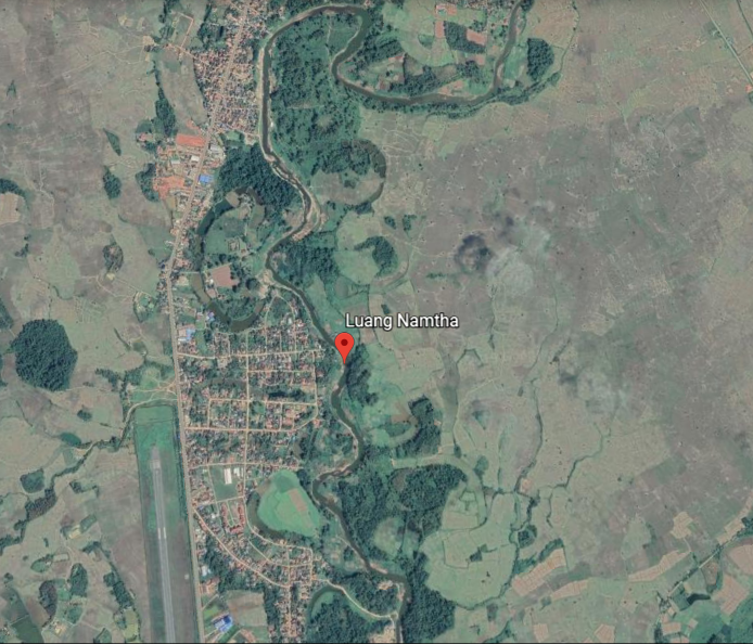
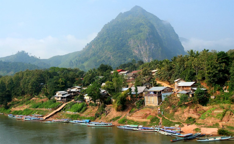
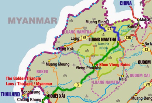
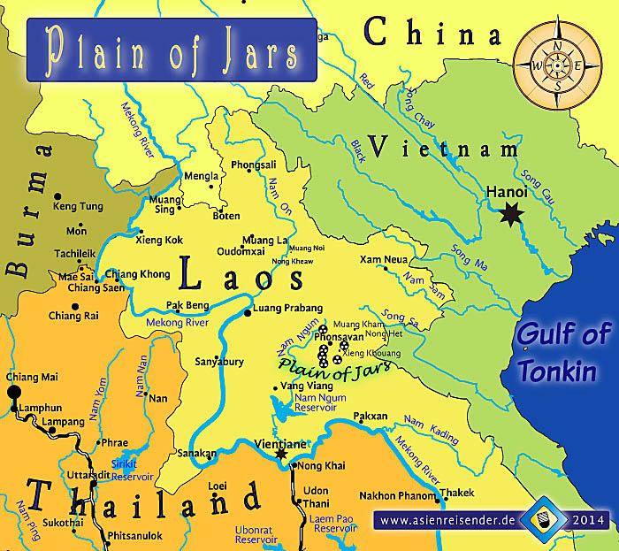
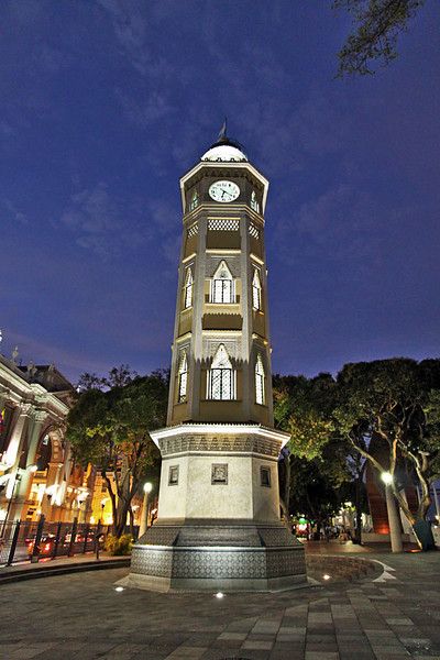
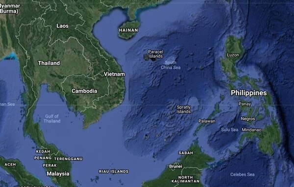
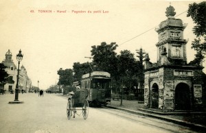
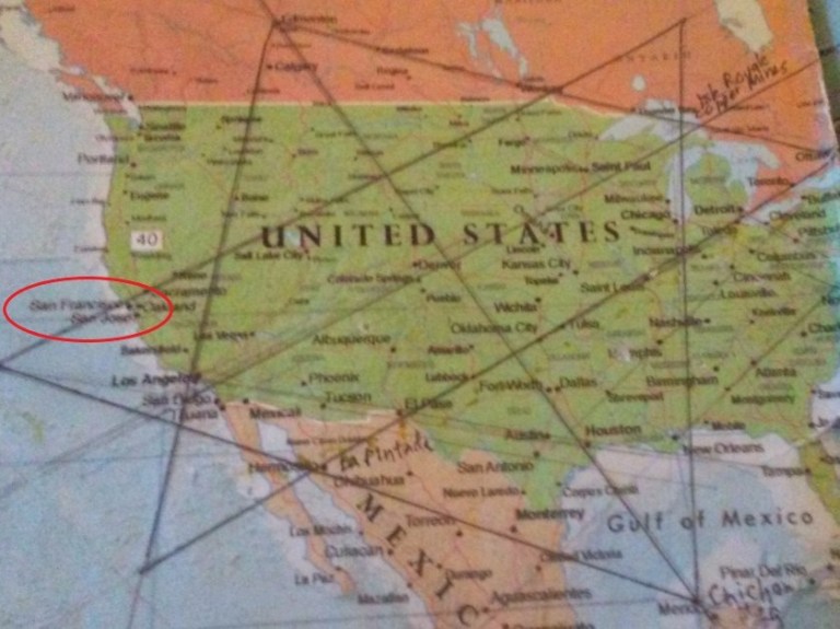
In the last post, I tracked this alignment which started in San Francisco starting at Luang Namtha, the name of a province and city in northern Laos, to Lashio, the capital of Shan State in Myanmar, formerly known as Burma, looking at various places and peoples throughout these regions.
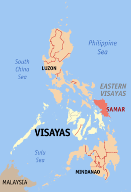
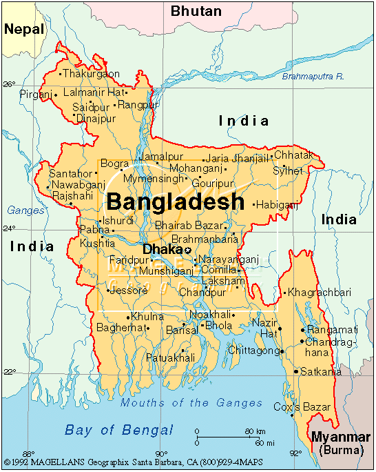
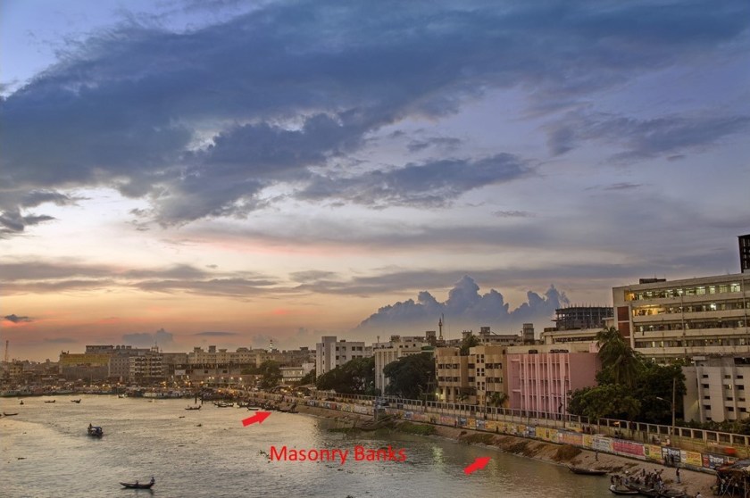
The country of Bangladesh’s placement on the Bay of Bengal is such that it contains much of the Ganges Delta, the largest delta on earth formed by the confluence of the Ganges, Brahmaputra, and Meghna Rivers.
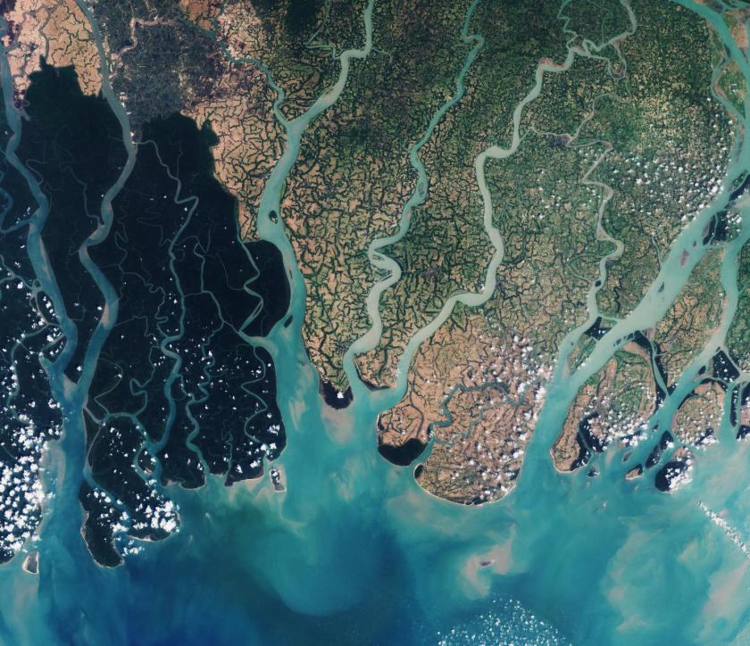
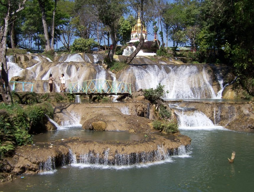
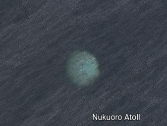
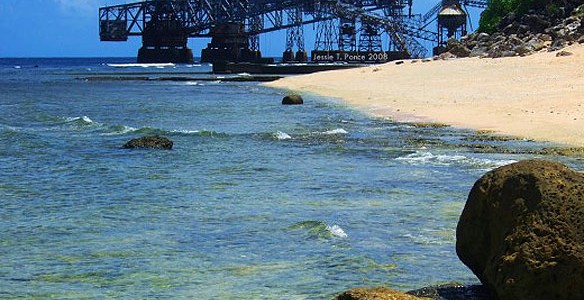
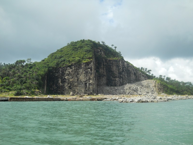
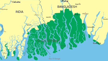
While not directly on this alignment, the Sundarbans are described as consisting of mangrove areas, land for agricultural use, mud flats and barren land, and is intersected by multiple tidal streams and channels.
The Sundarbans National Park in West Bengal, India, is home to the largest population of bengal tigers. The Bengal tiger ranks amongst the biggest wild cats alive today, though it is an endangered species.
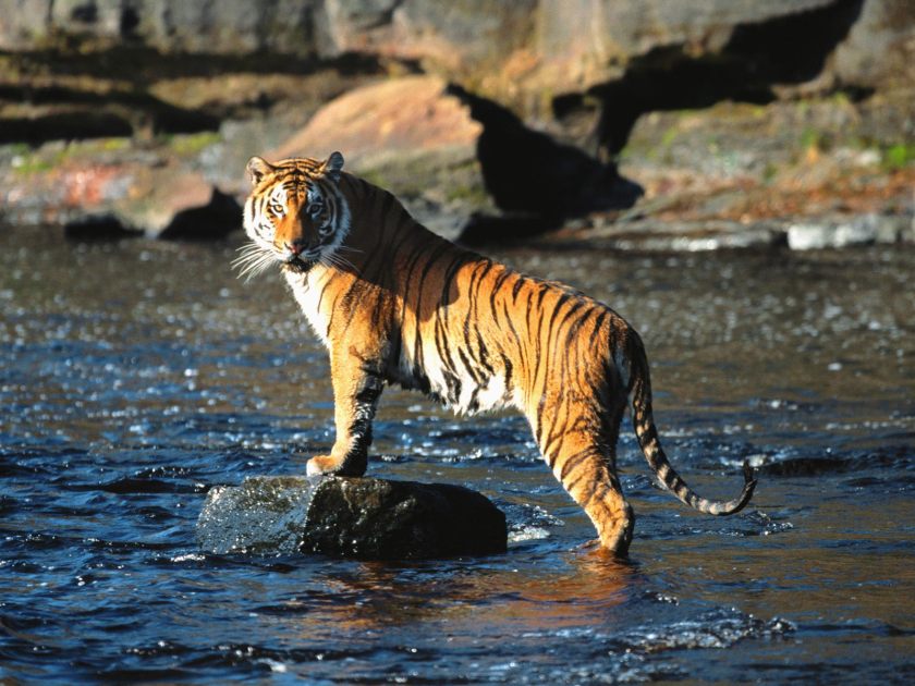
Note the stone with angles this tiger is standing on, and the large, what looks like stone-work, in the background.
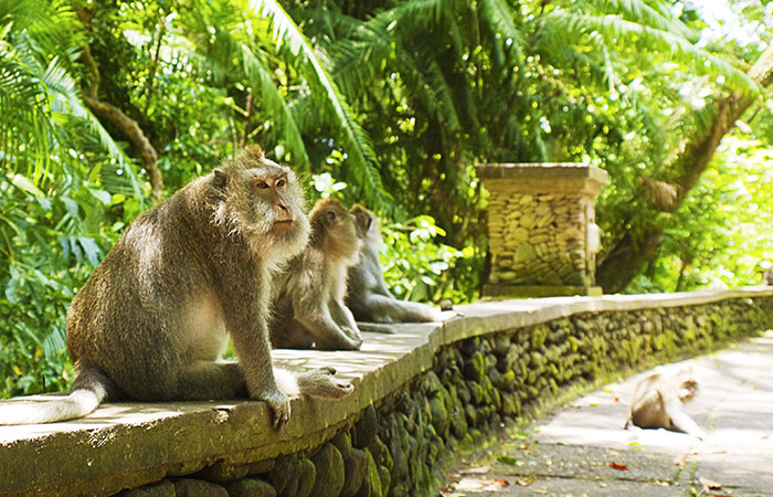
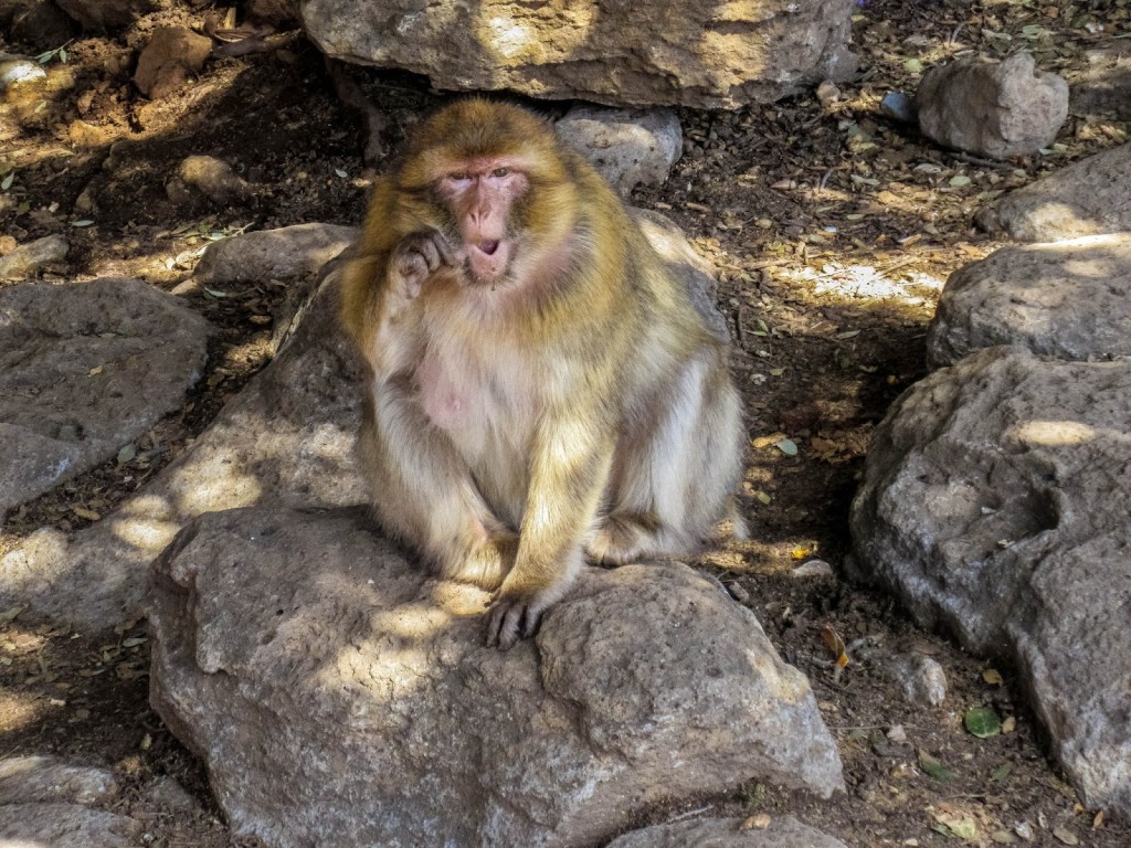
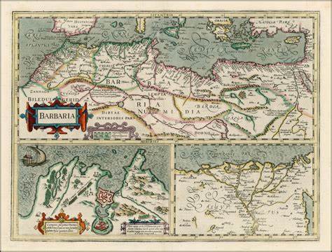
The Bengal tiger was named for a historical place, like the Barbary apes, a species of macaque, of the Atlas Mountains of Algeria and the Rif Mountains of Morocco, and also found in Gibraltar. This guy is also sitting on top of what looks like old stonework.
The Barbary Coast, or Barbaria, was also the name given to a vast region stretching from the Nile River Delta, across Northern Africa, to the Canary Islands.
Memories of places and people is quite frequently retained in the name of something, in this case species of animals indigenous to particular places.
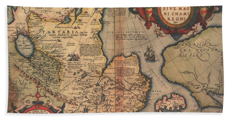
In some cases, the name was changed all together, as was the case with Tartaria in Asia…
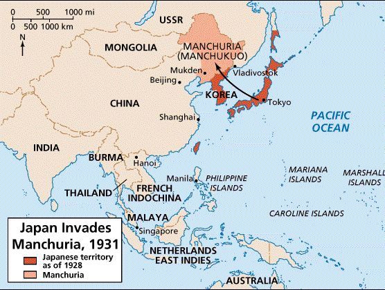
…a large part of which became Manchuria in northeast Asia in the 1800s, and which was were the Japanese were playing for when they invaded Manchuria in 1931, and which was subsequently turned into Manchukuo, a puppet state of Japan, from 1932 to 1945.
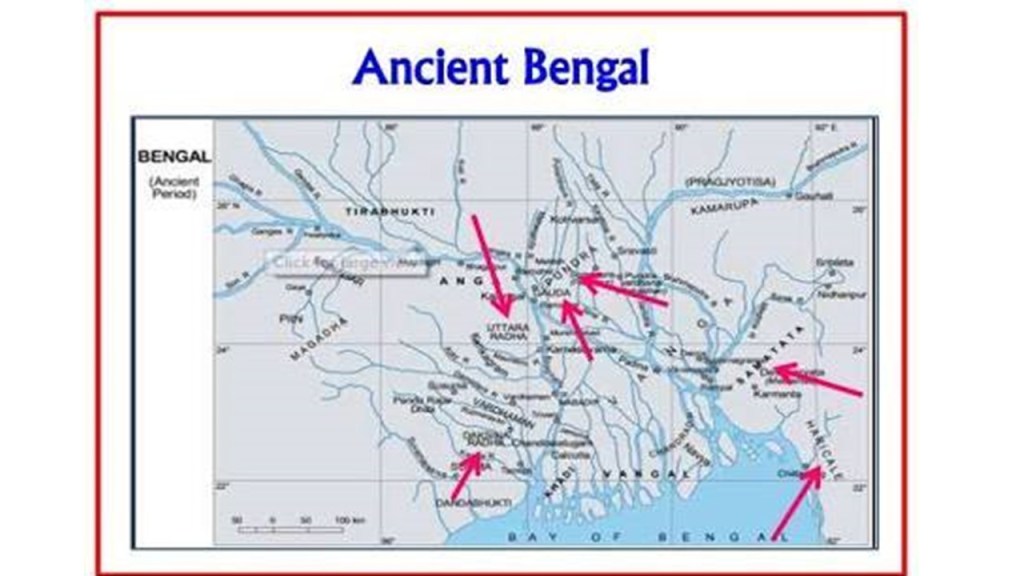
This slight-of-hand name change seems to be what happened with this part of what was the ancient civilization of Bengal. Change and rearrange a few letters, and you have “Bangla.” No one’s the wiser because the region’s true past history is unknown to the general public.

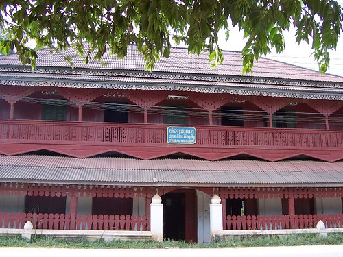
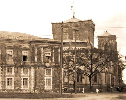
This is Parharpur, described as a Buddhist temple complex in Bangladesh.

It was said to have been excavated in 1879.
I have come to firmly believe all of these places – Barbaria, Tartaria, Bengal, which was part of the Mughal Empire, and others – were empires within one overall, and same, civilization. The advanced Moorish Civilization, with roots in ancient Mu.

The seal on the back of the United States one-dollar bill is taken from the Great Seal of the Moors, not the other way around…

…and “Novum Ordo Seclorum” means “New Order of the Ages” in Latin. Hmmmm. Sound familiar?
What if the concept that we have been taught to believe, that empires historically resulted from military aggression and conquest, was not really the case, and represented something else entirely?
Back to the Sundarbans.
Interesting to note that we told that the proprietary rights to the Sundarbans were sold to the British East India Company in 1757 by the Mughal Emperor Alamgir II, although I also found a reference to the Battle of Plassey occurring that same year in which the British East India Company defeated the Nawab of Bengal and his French allies.

Systematic management of the mangrove forest tracts of the Sundarbans was administered by the British starting in 1860s, apparently to simultaneously protect the forests and remove the resources.
The borders of the country of Bangladesh were the major portion of the historic region of Bengal, an ancient civilization dating back at least 4,000 years.
The borders of modern Bangladesh were established with the separation of Bengal and India in 1947, when the region became East Pakistan of the newly formed State of Pakistan following the Boundary Partition of India, even though it was separated from West Pakistan by 994-miles, or 1,600-kilometers.
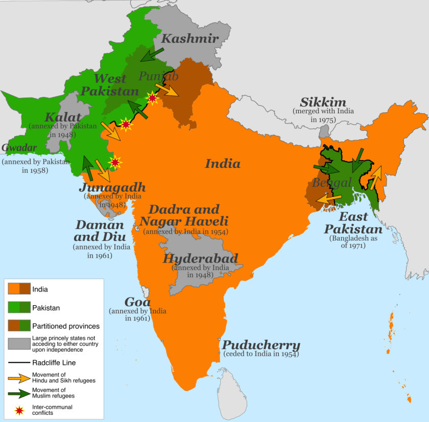
Bangladesh became an independent republic in 1971 after a period of armed conflict. This was the flag of Bangladesh circa 1971.

The only difference in the flag of the country today is that the image of the country is no longer in the circle.
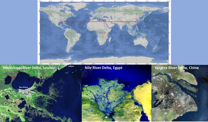
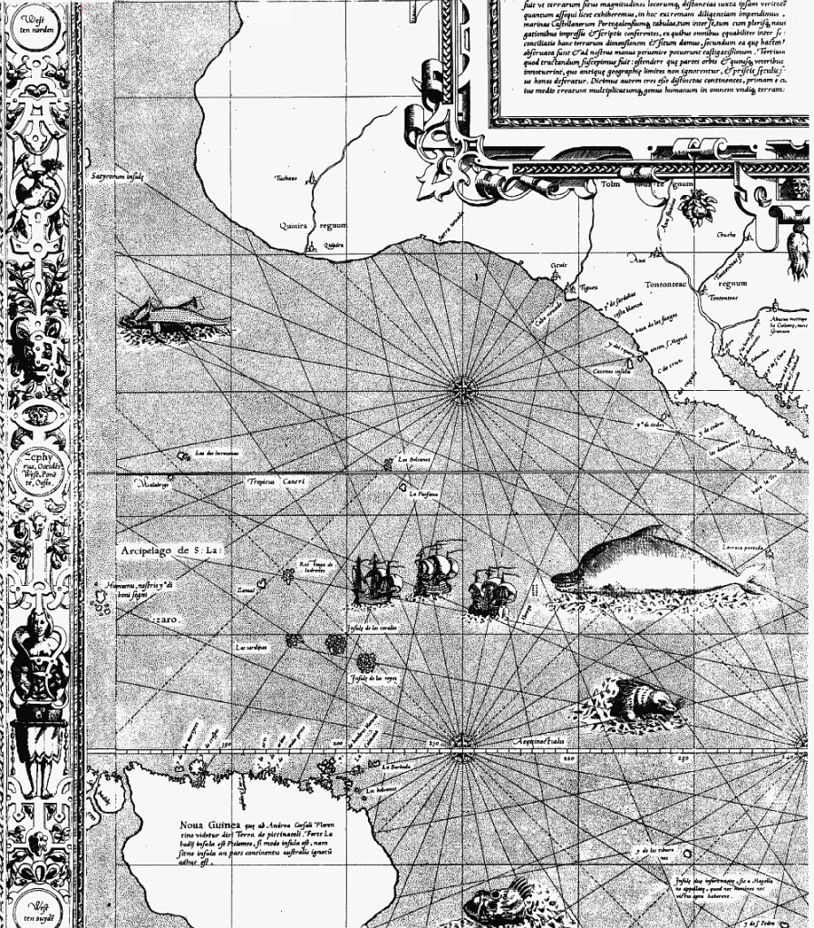
Speaking of river Delta regions, the Mississippi River Delta, Nile River Delta, and Yangtze River Delta are in a straight linear alignment with respect to each other, straight across the 30-degree north parallel.
As I have said in previous posts, the people of the ancient advanced civilization were master hydrologists and engineers who laid out all of the infrastructure of the earth according to sacred geometry and groomed the energies of the earth into corresponding ley-lines.
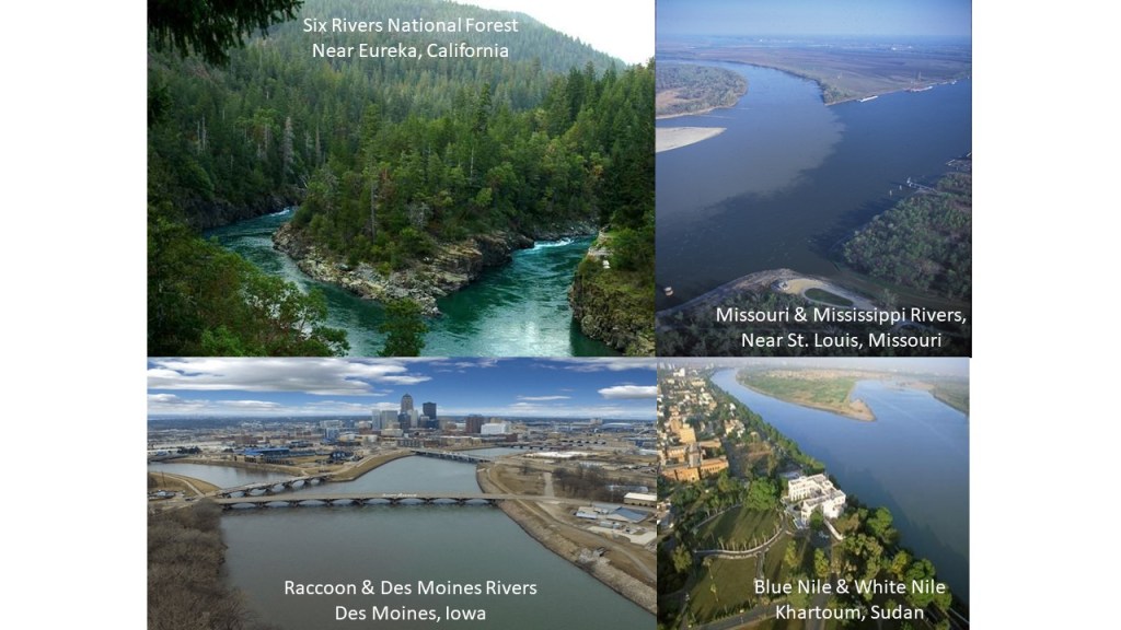
I believe all of so-called river systems are actually canal systems, and I have found extensive evidence all over the world to support this belief.
One example would be the identical appearances of the confluences on the top left of the Raccoon and Des Moines Rivers in Iowa; that of the Missouri and Mississippi Rivers near St. Louis on the right; and where the White Nile and Blue Nile meet at Khartoum in Sudan on the bottom left.

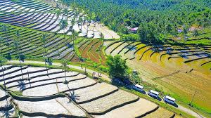
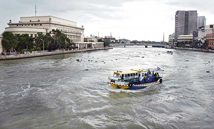
The Meghna River of the Ganges Delta is the one of the most important rivers in Bangladesh, and the widest river to flow completely within the boundaries of Bangladesh. The river is described as almost perfectly straight in its lower reaches towards the Bay of Bengal. More on this subject shortly.

I tracked this alignment through Dhaka, the capital and largest city of Bangladesh, and one of the largest and most densely populated cities in the world, with a population of 20.2 million in the Greater Dhaka area.
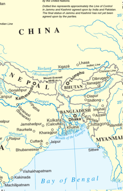
It is the largest city of eastern South Asia, a subregion which besides Bangladesh, also includes the countries of Bhutan, Nepal, and India, and is between the eastern Himalayas and the Bay of Bengal.
We are told the city of Dhaka rose to prominence in the 17th-century in the Mughal Empire in South Asia, and for 75 years was the capital of Mughal Bengal. This is said to be a 1740 map showing the extent of the Mughal Empire, done by the German cartorapher Matthias Seutter, and based on Hondius and Mercator’s 17th-century India Orientalis map of the same region.

Seutter’s map was said to be full of surprising accuracy, gross errors, and outright speculation.
This was the India Orientalis map of Mercator, first published by Hondius in 1606.

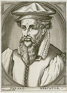
Gerardus Mercator, born in 1512 and died in 1594, was described as a 16th-century geographer, cosmographer, and cartographer from Flanders.
Mercator is best known for a 1569 world map that is considered to be the first where sailing courses on the sphere were mapped to the plane map, allowing for a “correction of the chart to be more useful for sailors.”
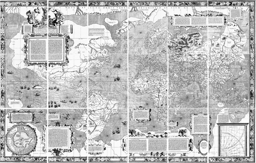
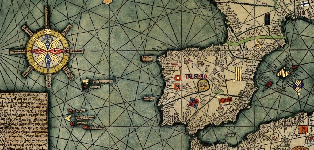
Here is a close-up section of the 1569 map showing the depiction of straight ley-lines, at least in the seas…
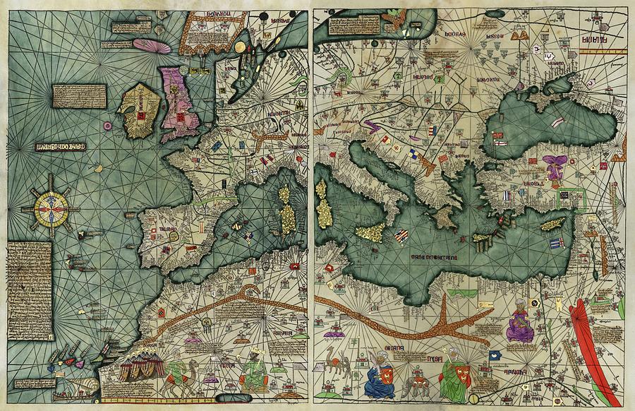
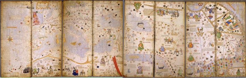
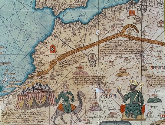
…and the depiction of ley-lines on land and sea were present on the flat projections of the Catalan Atlas of the Majorcan Cartographic school, said to have been made by a cartographer named Abraham Cresques in 1375.
My coming into awareness of all of this was a very intuitive process, at the beginning of which I had no preconceived notions, ideas, or theories about what I was going to find.
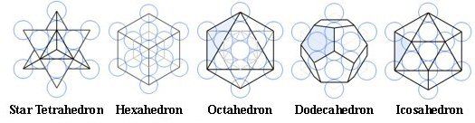
This journey for me really started in earnest for me when I noticed cities lining up in lines in North America, and by connecting the dots of major cities, I found a star tetrahedron. I extended the lines out, and followed-up on the alignments I found by looking at countless hours of drone videos and photos of places on each alignment.

In so doing, I saw that all of the infrastructure of earth carries the same signature and the same hand of design of one unified civilization on earth.
While the focus of my research is not about proving or disproving flat earth versus planet, nor am I directed by it, I do find this information about older maps on flat planes with ley-lines to be extremely interesting and noteworthy. This is where my research has taken me, and I am sharing my findings.
I think both Mercator and Matthias Seutter with the map of the Mughal Empire shown previously were working from older pre-existing maps from an advanced maritime civilization.
As a matter of fact, Mercator was said to not have travelled himself…and he also made globes, like this globe from 1541.
So Mercator was said to have made a revolutionary flat projection map that corrected the chart for sailors…and the earth as a globe as well. Hmmm. I have to ask the question – is this information telling us something about what was actually going on here?
And Christopher Columbus didn’t sail the ocean blue to find a shorter way to get to India, or the Indies, or to prove whether or not the earth was flat or round, as I remember what we are told from childhood.
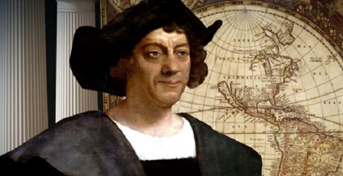
He was an important part of a boots-on-the-ground land grab authorized by the “Inter Cetera” papal bull, issued by Pope Alexander VI in 1493.
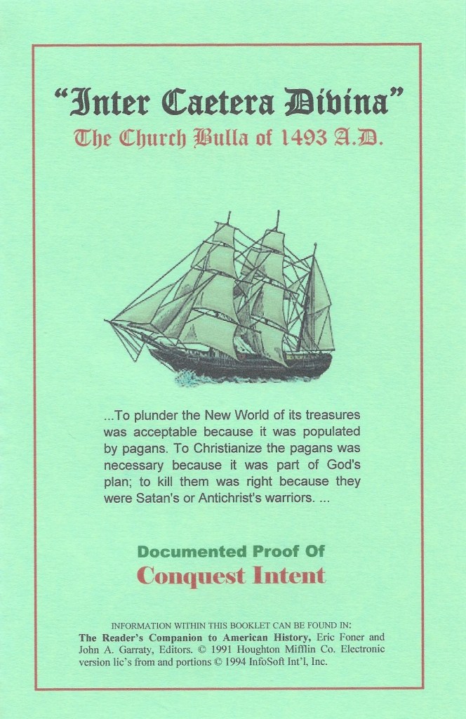
This papal bull became a major document in the development of subsequent legal doctrines regarding claims of empire in the “New World” and assigned to Castile in Spain the exclusive right to acquire territory, to trade in, or even approach the lands laying west of the meridian situated one-hundred leagues west of the Azores and Cape Verde Islands, except for any lands actually possessed by any other Christian prince beyond this meridian prior to Christmas, 1492.
Now back to Dhaka in Bangladesh.
This building is what is called the Pink Palace, or Ahsan Manzil, in Dhaka, and was the official palace and seat of the Nawab of Dhaka, with construction of it said to have started in 1859, and completed in 1872.
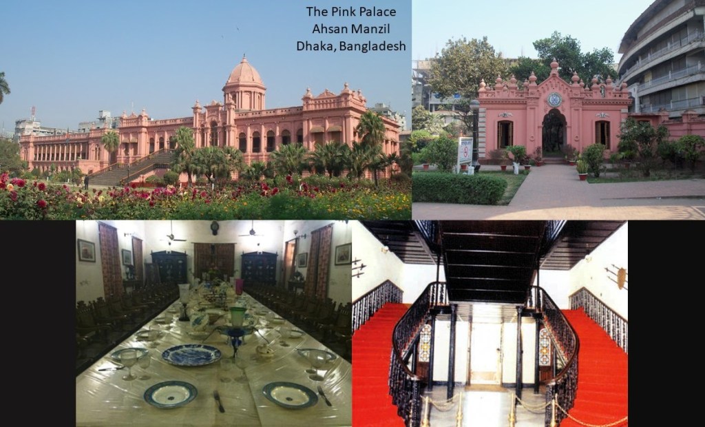
The Pink Palace in Dhaka is described as having been constructed in the Indo-Saracenic Revival architecture style, also known as Indo-Gothic, Mughal-Gothic, and Hindoo Style, and was said to have been utilized by British architects in India in the later 19th-century, especially in public and government buildings.
Here is a comparison on the left of an outdoor spiral, what looks to be iron staircase, at Ahsan Manzil, with the wooden staircase at the Loretto Chapel in Santa Fe, New Mexico on the right.

I remember hearing about miraculous origin of Loretto Chapel staircase from an episode of Unsolved Mysteries back in the 1970s, so I looked it up.
The story was said to have begun in 1850, when the Vicarate of New Mexico was established under the first Bishop of the territory, Jean Baptiste Lamy. He was said to have sent a plea to teaching orders to open a school for girls, and the Sisters of Loretto responded with six sisters to open the Loretto Academy, which they were said to have opened in 1853.
The story that goes with the spiral staircase is that after construction of the chapel started in 1873 by a French architect, he died before access to the choir loft was built.
So the Sisters of Loretto prayed a 9-day novena to the patron saint of carpenters, Saint Joseph, and suddenly a carpenter appeared with only a hammer and carpenter’s square. He was said to have built the “miraculous staircase” with simple tools and wooden pegs, with a wood that was not native to the American Southwest.
And then the carpenter disappeared just as suddenly without thanks or payment.
The wooden staircase of the Loretto Chapel has two 360-degree turns with no center pole for structural support, with the weight of the staircase resting on the bottom stair.
So when I saw the existence of a pink palace in Dhaka, I was reminded of the pink Don CeSar Beach Resort, a massive building located on St. Petersburg Beach in Florida, and which I drove past many times when I lived in neighboring Clearwater, Florida, for a few years (between 2002 and 2006).

The Don CeSar was said to have been developed by Thomas Rowe, with a design by architect Henry H. DuPont, opening in 1928. It was said to have gained renown as a Gulf of Mexico playground for America’s pampered rich at the height of the Jazz Age in the 1920s and 1930s, a has this reputation to this day.
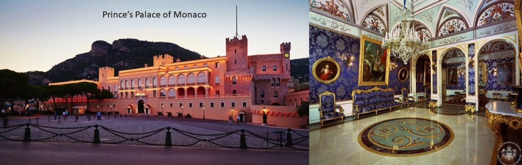
Then there is the pink Prince’s Palace of Monaco, the official residence of the sovereign prince of Monaco, and said to have been built in 1191 as a Genoese fortress, and home of the Grimaldi family since they captured it in 1297.
One more pink place that I would like to share with you is the Patrika Gate, the ninth-gate of Jaipur, a famous monument and tourist attraction in the capital and largest city of the Indian state of Rajasthan India, with its perfectly mirrored reflection in the still water as seen here.
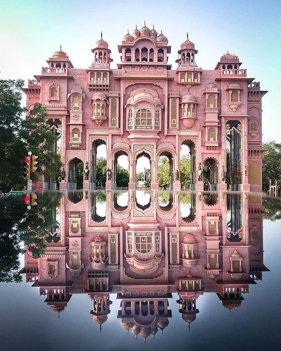
A famous monument and tourist attraction in India, the pink Patrika Gate is said to be one of the most photographed places in India.

It was built in the Jawahar Circle near the Jaipur International Airport…
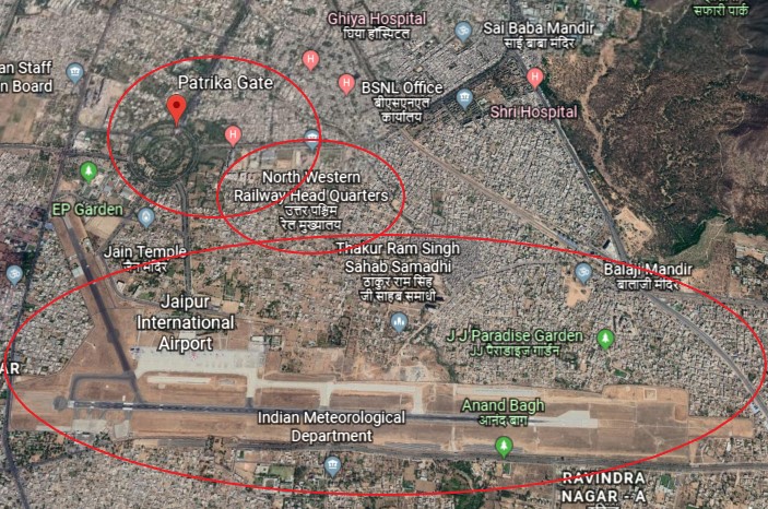
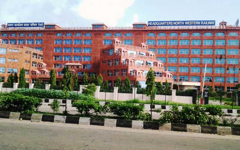
…and apparently the Headquarters of the North Western Railway are near the Patrika Gate in Jaipur as well.
I don’t think this finding is random. The transportation infrastructure of earth is intrinsically connected to the earth’s grid system, which was at one time a free-energy collector and transmitter. Everything was all connected together!
Hatirjheel Lake in Dhaka was said to have been constructed under the Bangladesh Army and Special Works Organization (SWO) in the Center of Dhaka, starting in 2007, which also was said to have built…
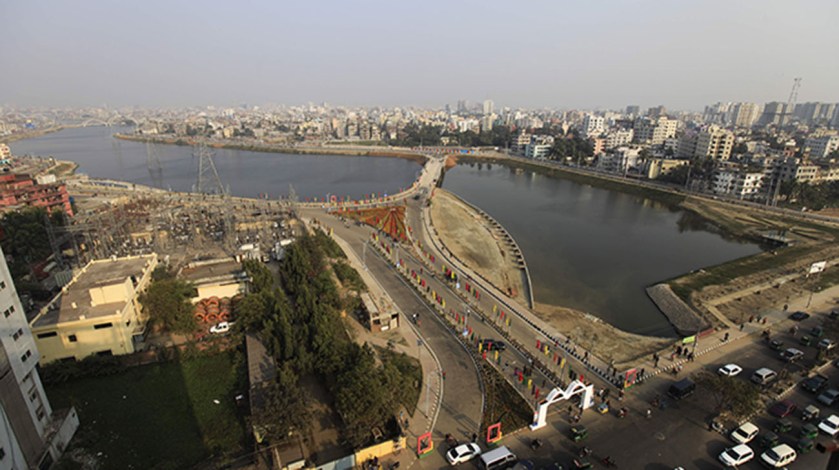
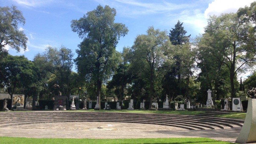
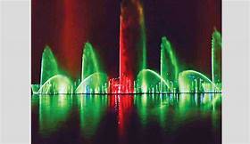
…the Hatirjheel Musical Dancing Fountain, the largest in South Asia, with an amphitheater that seats 2,000 people.

Did they construct it…or get something working that was already built?
I was reminded of the Fountains of Bellagio in Las Vegas.
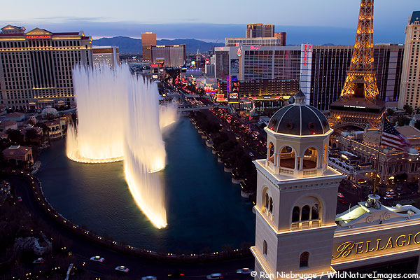
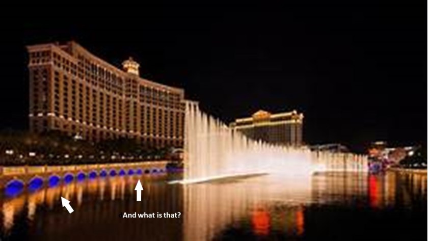
The Caesar’s Palace Hotel is on the right of the Bellagio Hotel in this picture…

…so I had to look it up.
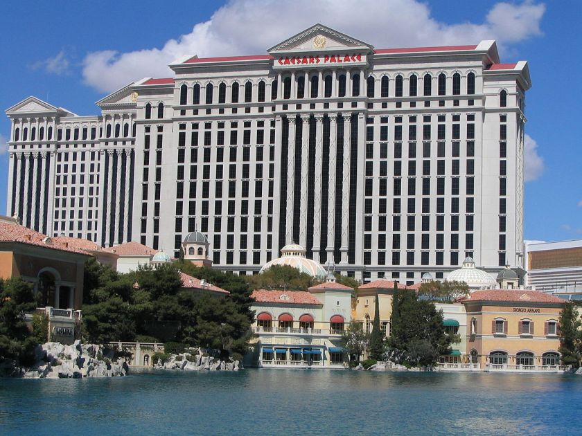
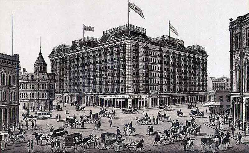
The construction of Caesar’s Palace in Las Vegas was said to have started in 1962, and that it opened in 1966.

They were building massive classical columned and domed architecture like this in the 1960s? For real?
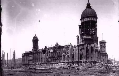
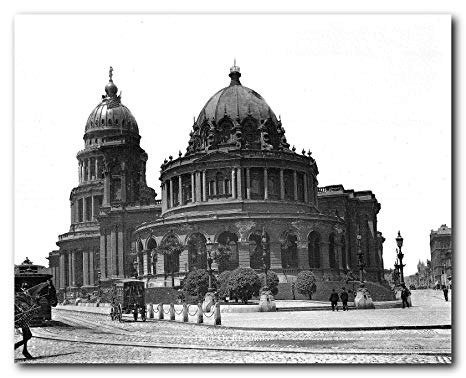
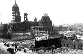
This is the Kamalapur train station in Dhaka, with its gigantic archways. It was also said to have been designed and opened in the 1960s.
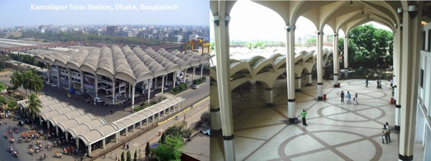
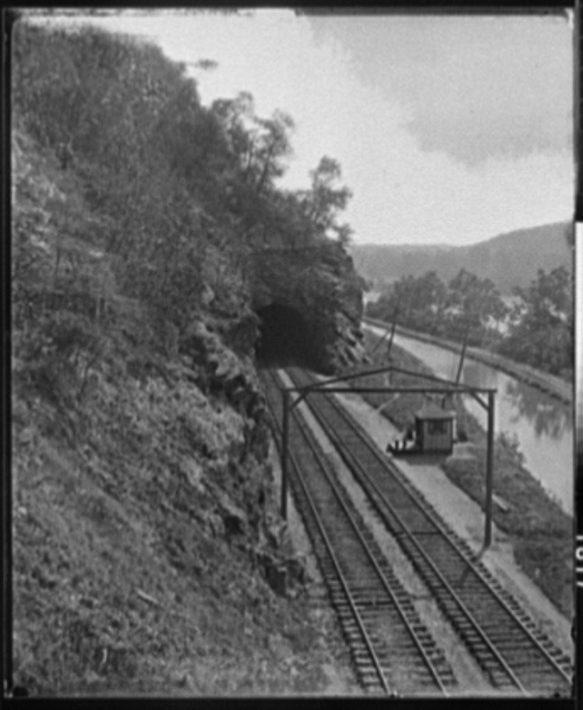
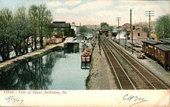
The railroad is an important mode of transportation in Bangladesh.

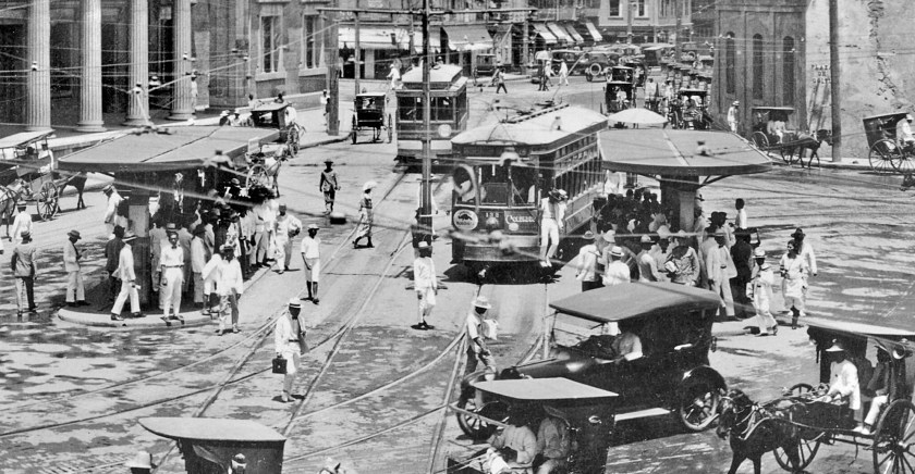
Dhaka was one of several places given the nickname “Venice of the East.”
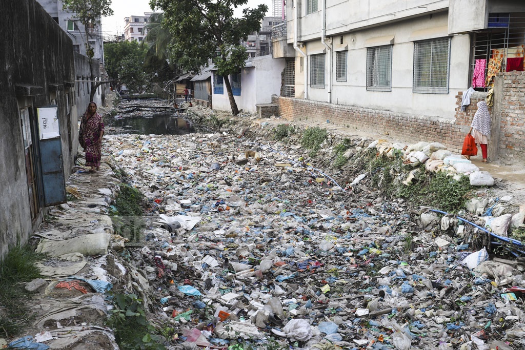
We are told that there are three major canal systems in Bangladesh that drains into the three major rivers around Dhaka – the Turag; the Balu; and the Buriganga rivers.
This is what the Kallyanpur canal looks like today.
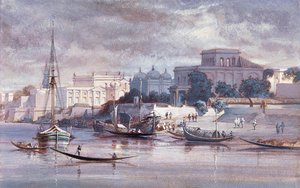
This was a view of Dhaka from across the Buriganga River, said to have been painted in 1861…
…and Dhaka across the Buriganga River today.
This is an historic photo from the 1880s of the Mitford Hospital in Dhaka, which was said to have been established in 1854 after land that was bequeathed by Robert Mitford for public works in Dhaka was made available for that purpose in 1850.

There was a whole lot going on the historical record we have been given around the years on either side of 1850.
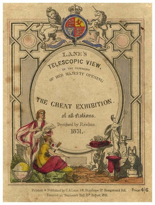
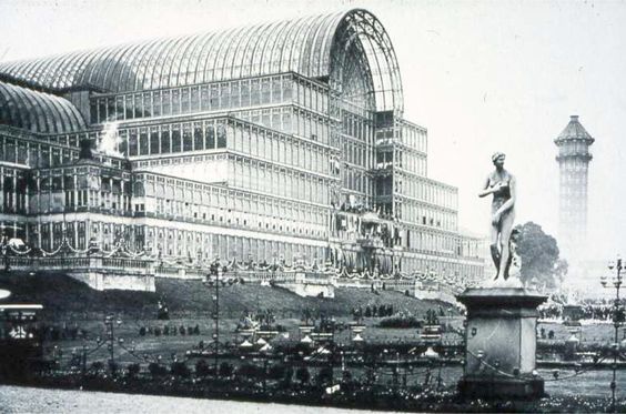
I believe the official kick-off of the new historical reset timeline was the “Great Exhibition of All Nations,” opened by Queen Victoria in 1851…

…in the Crystal Palace in London…

…and 1851 was the same year the Prime Meridian of earth was moved from the Great Pyramid of Giza to Greenwich, London, England, where the Royal Observatory is located.
The parasitic beings who found a way to incarnate into human form engineered a hostile takeover of the planetary grid system, and they invented a new history based to a certain extent on the original civilization, and inserted themselves into the new timeline as royalty, among other things, and objects of worship of veneration.
For one example, this is the Prince Albert Memorial in London’s Kensington Gardens, said to have been unveiled in 1872.

This takeover was not about benefiting Humanity by any stretch of the imagination. Everything that has taken place has been about the degradation and diminishment of Humanity and the beautiful and high civilization that was here up until relatively recently.
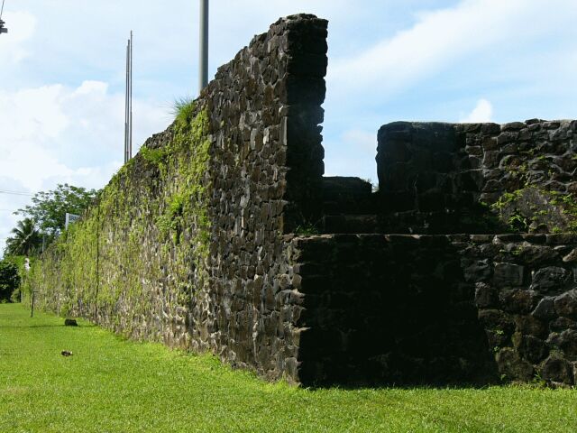
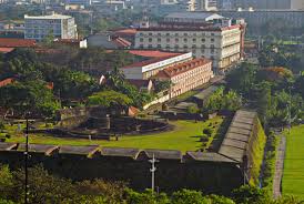
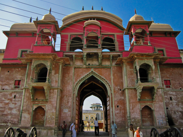
Lalbagh Fort in Dhaka is said to be an incomplete 17th-century fort complex, with work starting on it said to have begun in 1678.

The main buildings of the complex consists of the mosque…
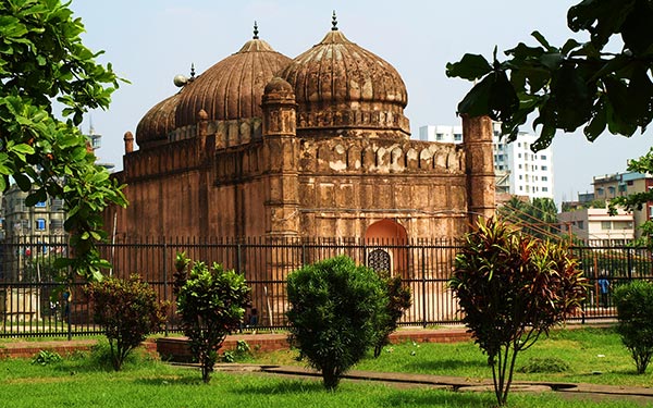
…what is called the Tomb or Mausoleum of Bibi Pari…
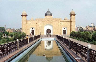
…and the Diwan-i-Aam.

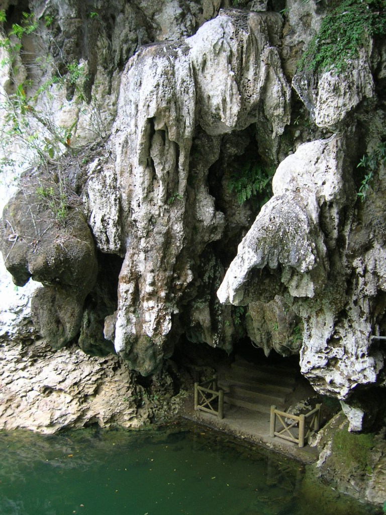
Below the Diwan-i-Aam in this picture, it looks like there might be a megalithic wall, but it is hard to tell for sure and I can’t find a better picture than this of what shows up there.

Here are other sites on the fort complex grounds.
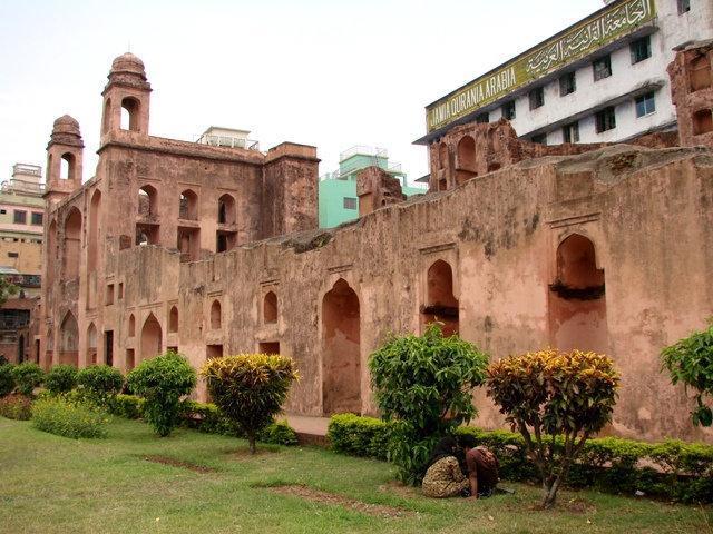
This place doesn’t look incomplete to me. It looks very old!!!
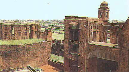
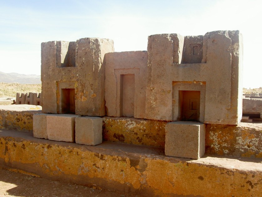
And this site at Fort Lalbagh in Dhaka…
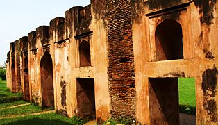
…reminded me of the H-shaped masonry that is found at Puma Punka, and ancient site near Tiwanaku in western Bolivia.
I could stay looking around Dhaka for quite awhile, but I think I will move on to the next place I would like to look at on this alignment in India.
Varanasi, also known as Benares and Kashi, is the holiest of the seven sacred cities in Hinduism, which is called the oldest religion in the world, and the holiest of Jainism, and is a major religious hub in India.
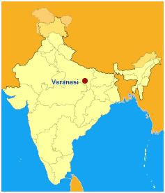
It is located on the banks of the Ganges River in the Uttar Pradesh State of India.
Buddhism was believed to have been founded here around 528 BC when Gautama Buddha gave his first sermon in what is called the deer park in nearby Sarnath…

…and in the 8th-century AD, the worship of Shiva, who was said to have founded Varanasi, was established as an official sect of the city.

Guru Nanak visited Varanasi in 1507 on a trip that was said to have played a role in the founding of Sikhism.

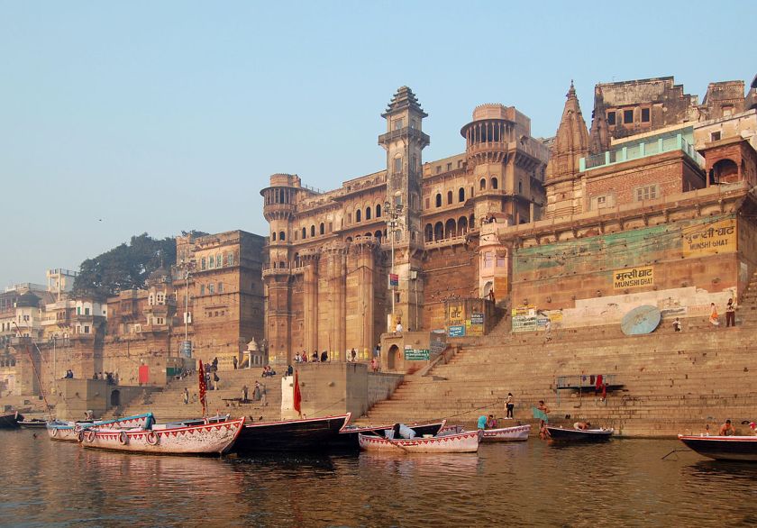
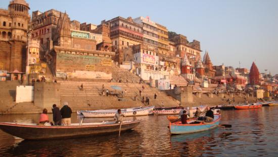
Varanasi is closely associated with the Ganges River, and has been a cultural center of northern India for thousands of years.
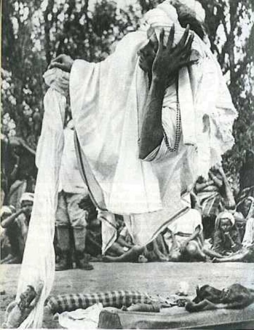
It is a major pilgrimage center because Hindus believe that dying in Varanasi, and getting cremated on the banks of the holy Ganges River here, allows one to break the cycle of rebirth and get free from the cycle of death and rebirth.
There are two ghats, embankments made in steps of stone slabs along the river bank, where cremations occur. One is the Manikarnika Ghat…

…and the other is the Harishchandra Ghat.
With this definition of “ghat” in mind, I am going to take a little side-trip into what I discovered earlier in my research tracking a different alignment through India.
“Ghat” is the name of two mountain ranges forming the eastern and western edges of the Deccan Plateau of peninsular India, as well as parallel to the Bay of Bengal on the eastern side, and the Arabian Sea on the western side.

The Eastern Ghats are described as discontinuous in nature, and dissected by the rivers that drain into the Bay of Bengal.
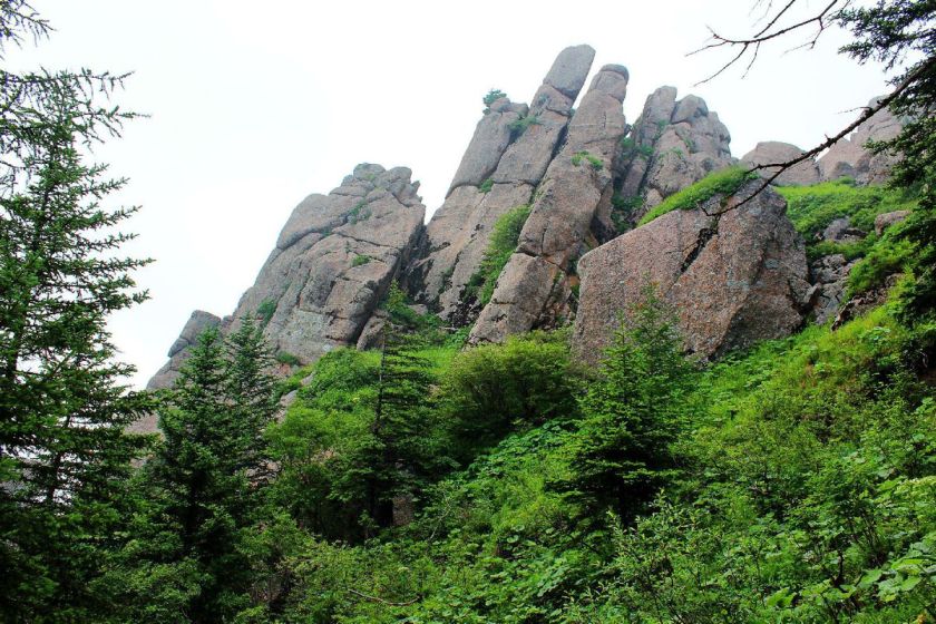
I want to share with you this screenshot from a YouTube video I watched several years ago entitled: “The Eastern Ghats in Journey through India”…

…showing this part of the subcontinent of India looking like Monument Valley, in Arizona near the border with Utah in the American Southwest. I personally think these are some kind of astronomical markers, perhaps for equinoxes or solstices.

The Western Ghats are described as continous without any major breaks.
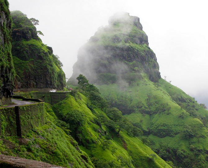

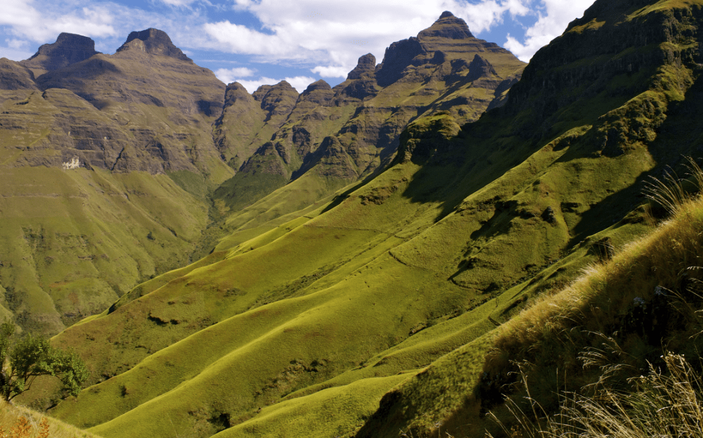
The Deccan Plateau between the Eastern Ghats and the Western Ghats…
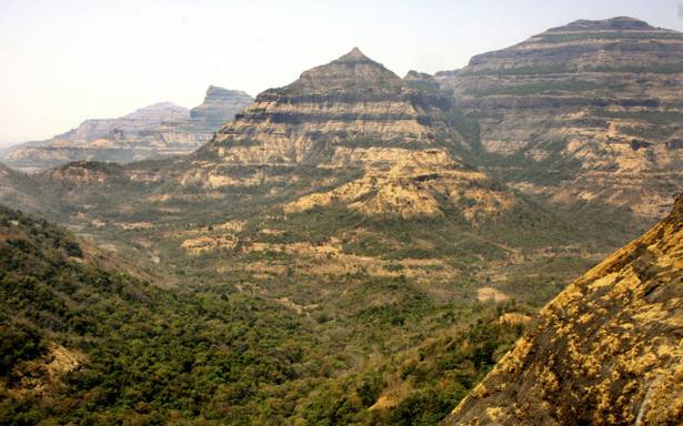
…looks like the Drakensberg in South Africa.
I think these places represent ancient infrastructure of a highly advanced worldwide civilization of Human Master Builders that was deliberately removed from our conscious awareness, and reclassified as having been created by natural forces. These places are so ancient that there is an element of doubt but there are incredible similarities between these places and others on different continents.
Back in Varanasi, the Ramnagar Fort is on the eastern bank of the Ganges River .
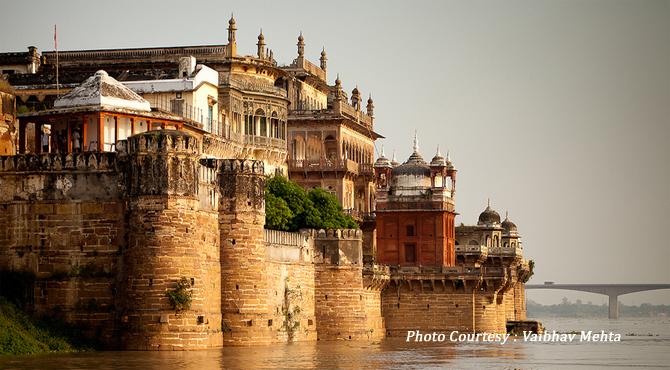
It was said to have been built in the Mughal style of architecture in 1750.
It is the residence of the current Maharaja of Varanasi. Though the title was abolished in 1971, the Kashi Naresh, the titular ruler of the Narayan Dynasty, the ruling family of Benares, is deeply revered by the people of Benares, or what is now called Varanasi. What’s in a name, right?


Like with Dhaka, I could stay here looking around the place for quite awhile, but I think I am going to go ahead and end this post here, and pick up the alignment next in Lucknow, India.