
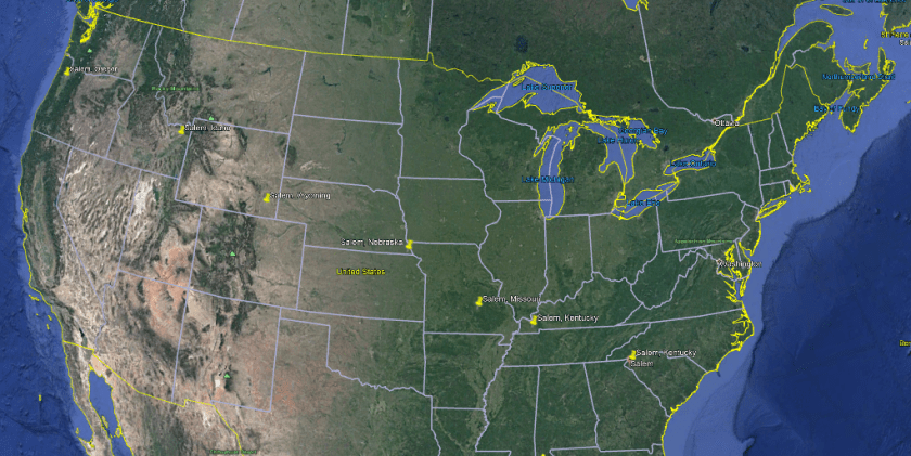
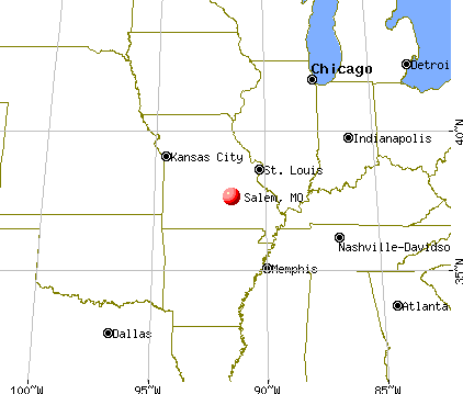
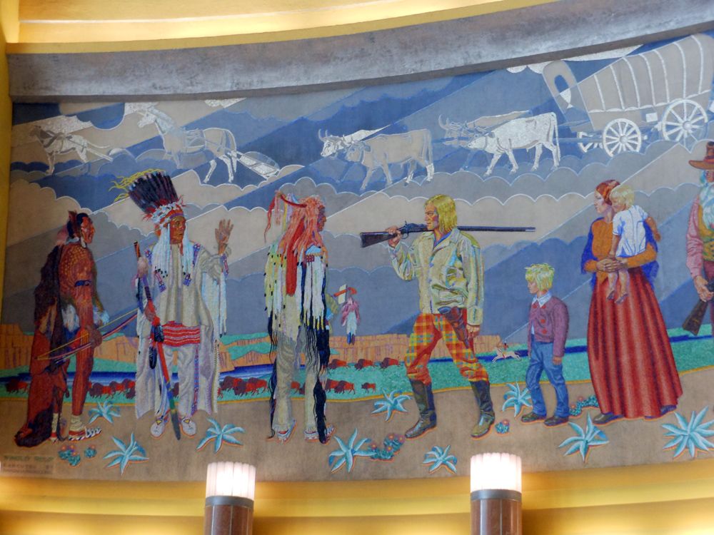
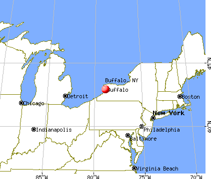
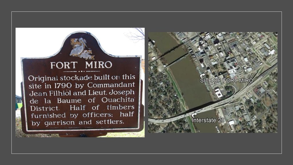
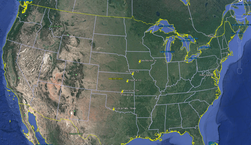
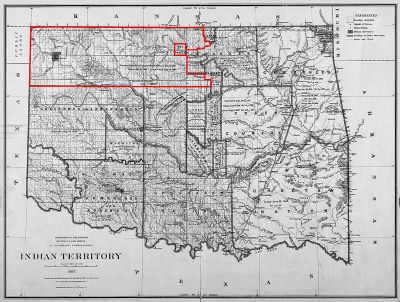
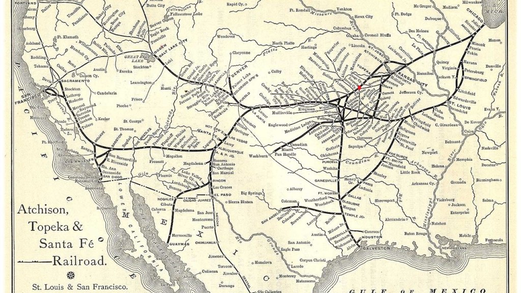
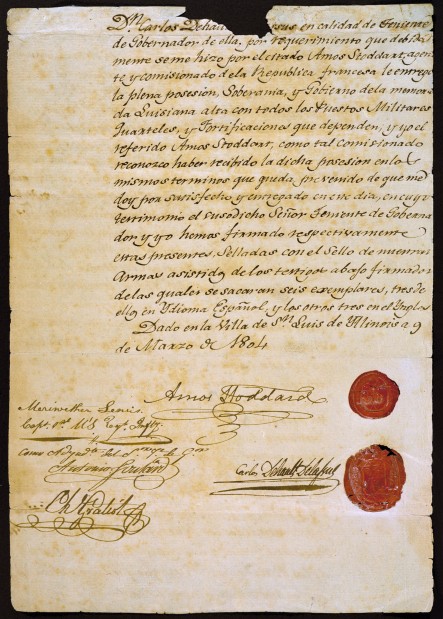
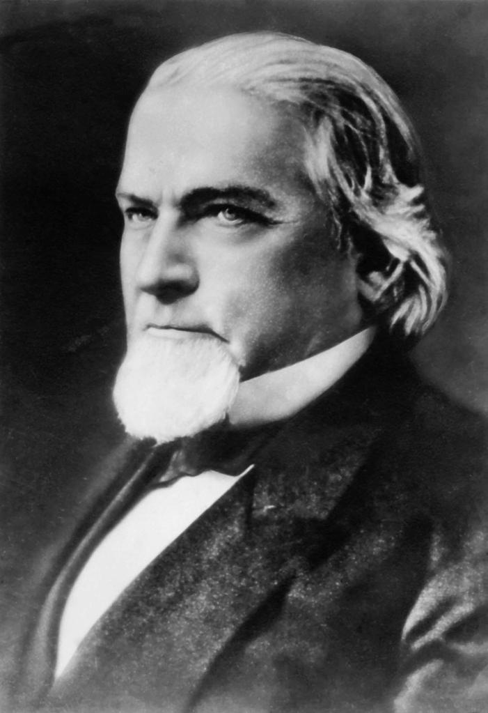
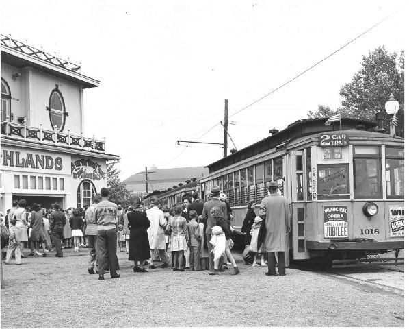
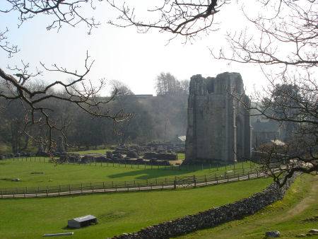
The Seven Salem Eclipse, also known as the North American Eclipse, took place on August 21st of 2017.
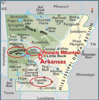
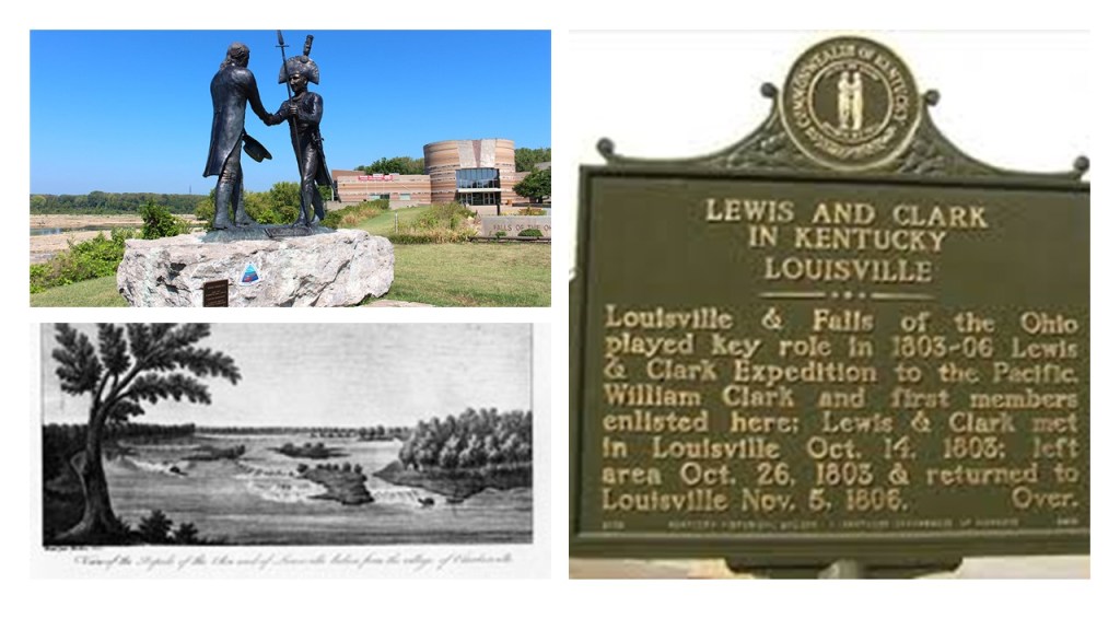
It is known as the Seven Salem Eclipse because its path of totality overshadowed seven cities named Salem as it travelled across North America – in Oregon, Idaho, Wyoming, Nebraska, Missouri, Kentucky, and South Carolina.
Why is the name Salem significant?
Salem or Shalom, in Hebrew, signifies ‘Peace’ and the similar word salaam in Arabic also means peace.
Besides taking a look at the Salems, I will also explore other places that were on the eclipse’s path of totality.
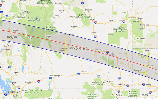
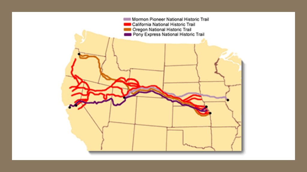
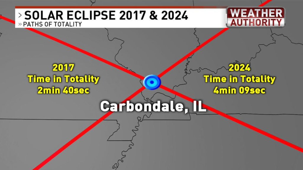
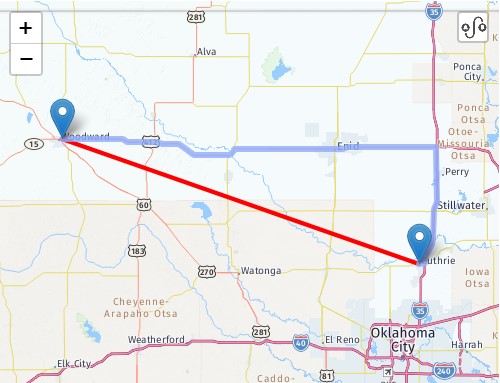
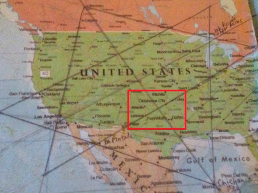
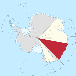
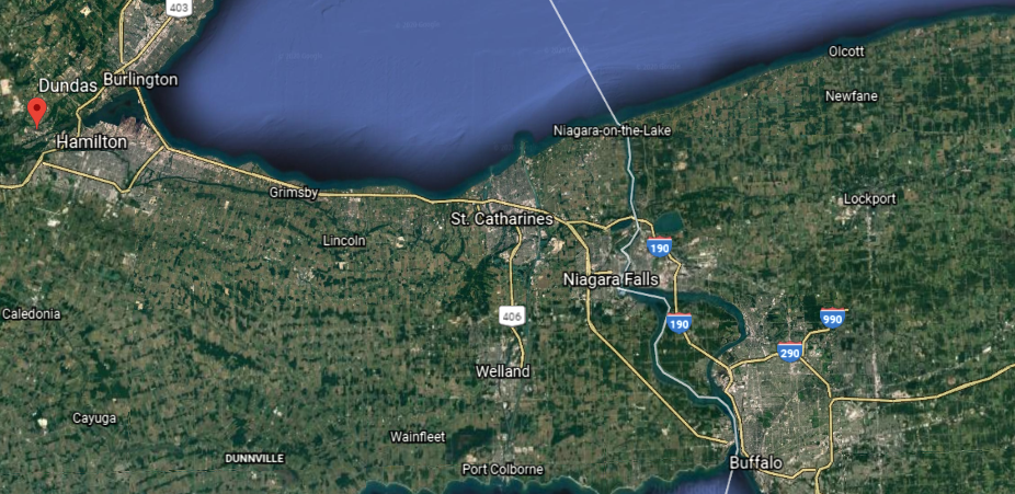
Another total solar eclipse will occur in the U.S. in a seven year time-frame, with the second one occurring on April 8, 2024.
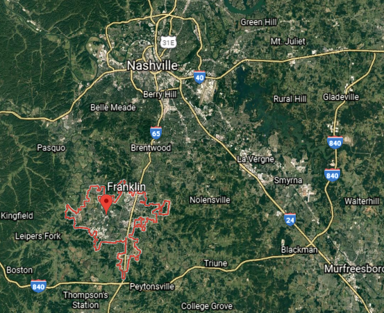
The 2017 eclipse traveled from northwest to southeast and the 2024 eclipse will travel from southwest to northeast.
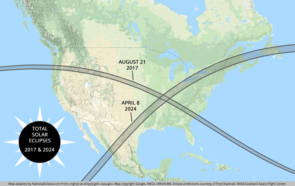
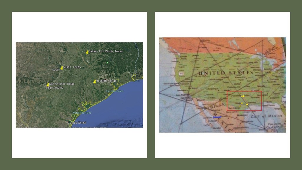
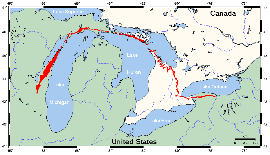
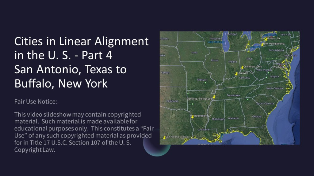
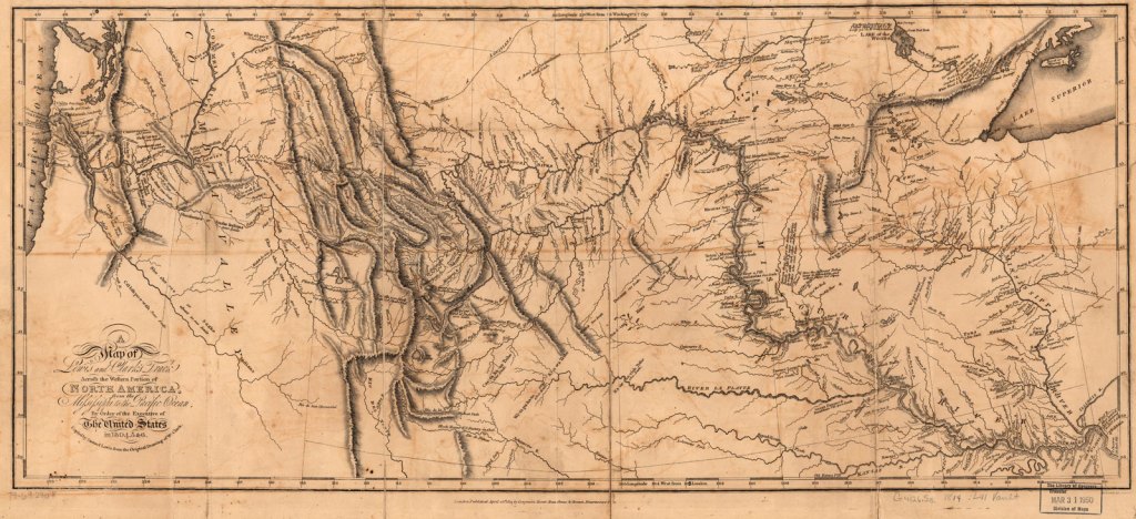
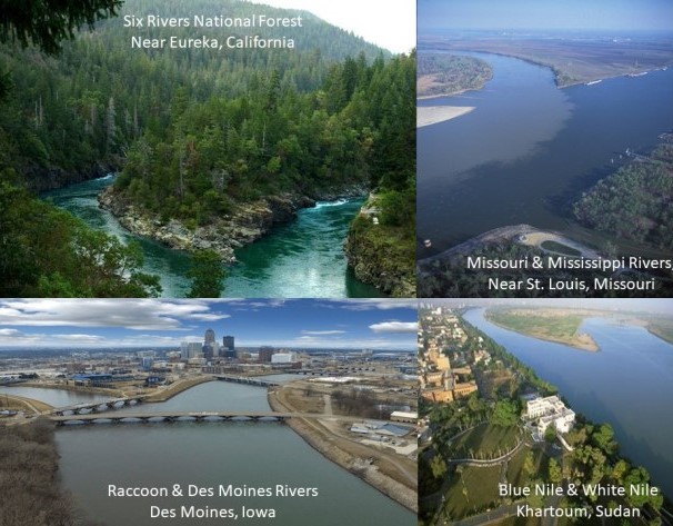
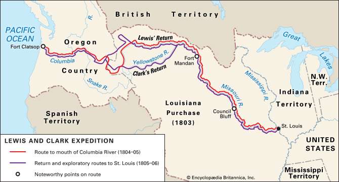
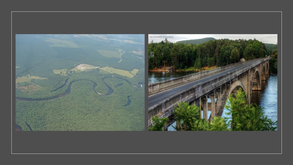
The paths of the two eclipses will cross each other over an area spanning parts of Missouri, Illinois, and Kentucky. For comparison purposes, the map here shows a national and regional view of both paths of totality over the U.S.
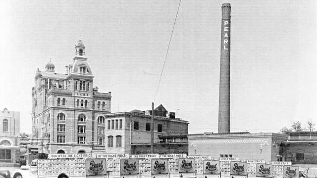
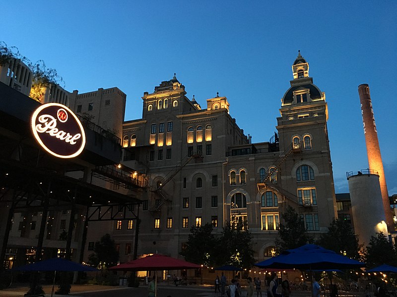
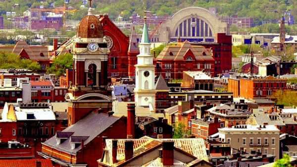
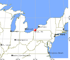
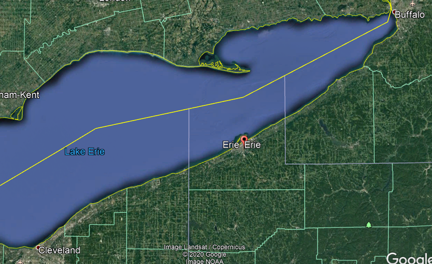
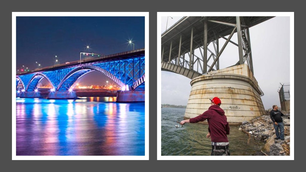
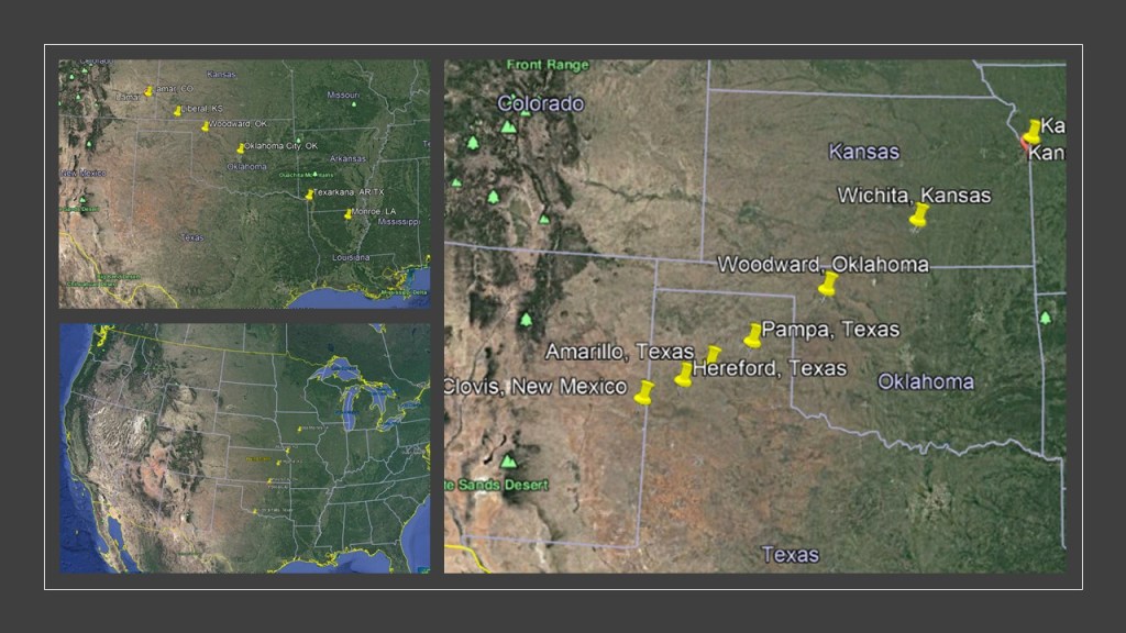
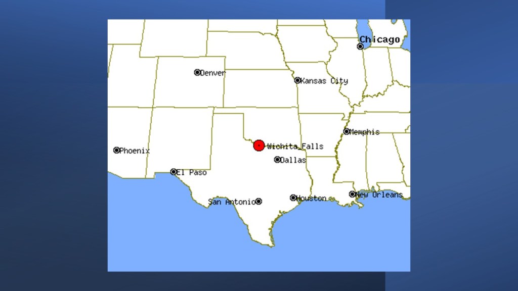
This is an interesting and totally unexpected find for me – I just realized the path of totality for the 2024 crosses over many of the major cities in linear alignment that I was tracking in part 4 of my last series, including cities showing on this map of San Antonio, Texas; Cincinnati, Ohio; Cincinnati, Ohio; Erie, Pennsylvania; and Buffalo, New York.
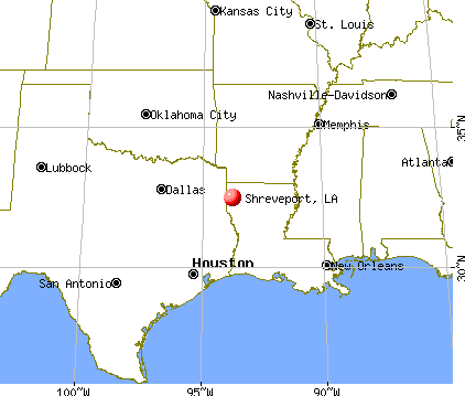
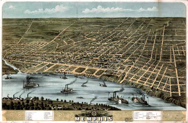
The other cities I had looked at that are not showing on this map, are located very close to the southern boundary – Shreveport, Louisiana; Memphis, Tennessee, and Louisville, Kentucky.
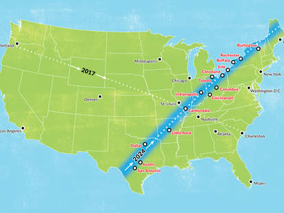
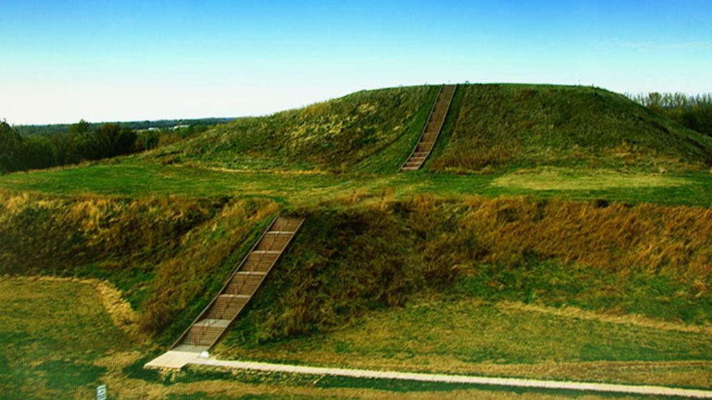
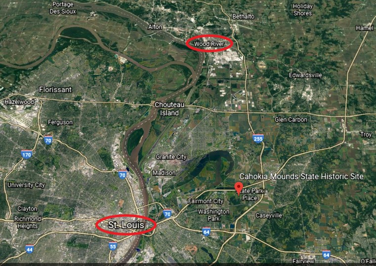
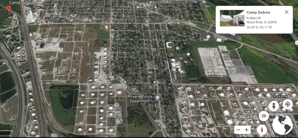
And the city of Carbondale, Illinois, which I will be looking at in this post, is at the exact center of both eclipse paths.
Hmmm. Is all of this coincidental…or intentionally or intentionally done by the original builders of the ancient advanced civilization?
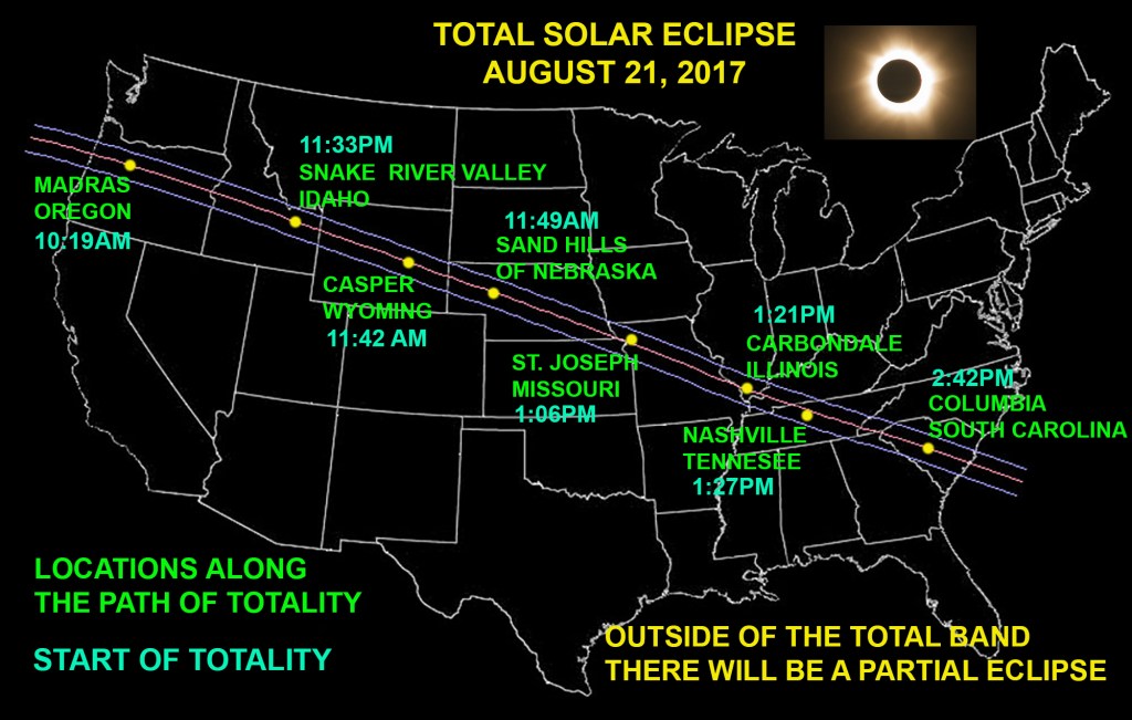
Total solar eclipses occur when the moon completely blocks the view of the sun, and are only visible along a narrow track of the Earth’s surface.

For a few moments during totality, when the moon completely covers the sun, the day becomes night, the horizon displays the colors of sunset, and the heavenly bodies usually seen only at night appear.
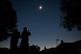
So, let’s take a look at the cities on the path of totality of the Seven Salem solar eclipse of 2017.
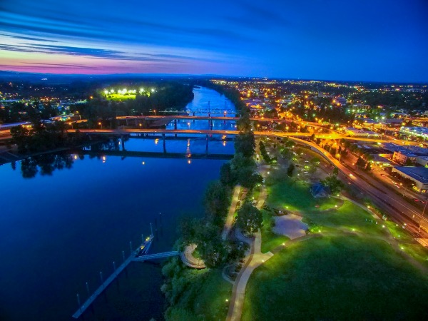
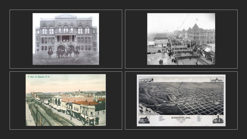
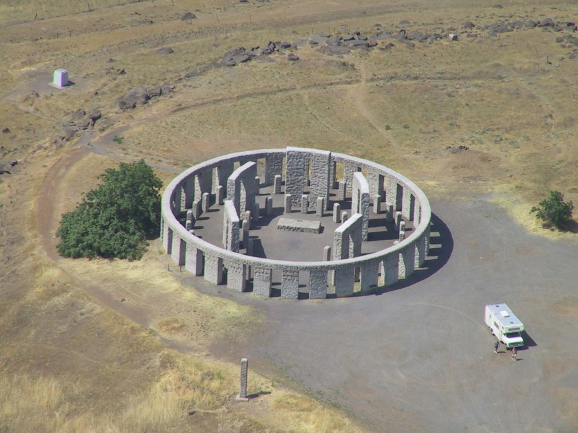
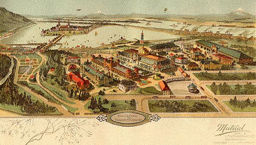
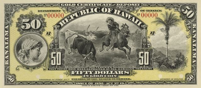
Salem is the capital of the State of Oregon, and the seat of Marion County, in the center of the Willamette Valley…
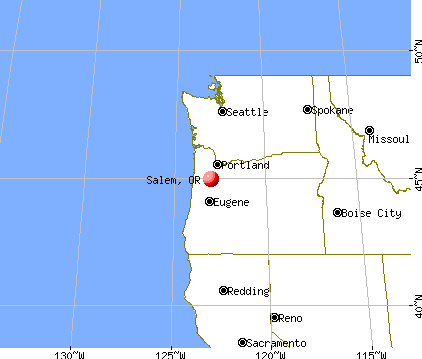
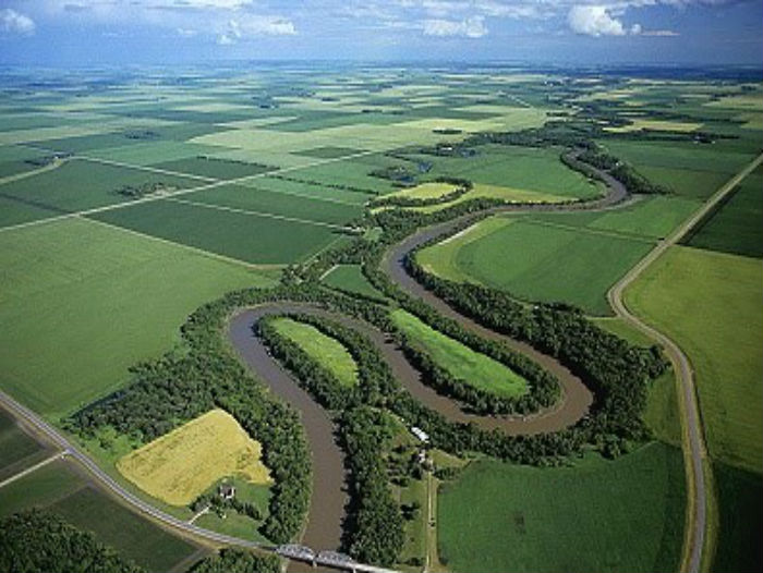
…alongside the Willamette River.
It was said to have been founded by Jason Lee and other Methodist missionaries in 1842, became capital of the Oregon Territory in 1851, and incorporated as a city in 1857.
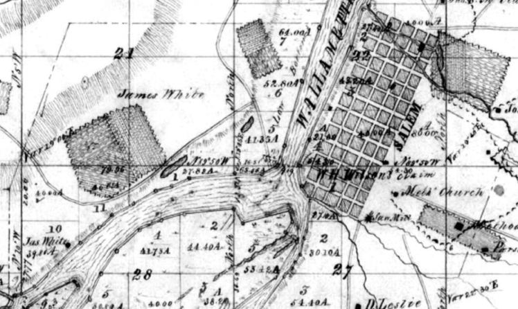
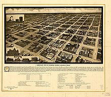
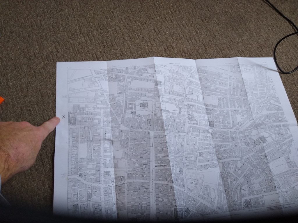
This was notated as a survey map of Salem from 1852.
Jason Lee, called the Father of Salem, established a Methodist Mission here in 1834…
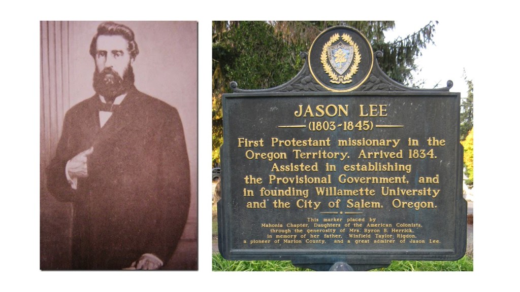
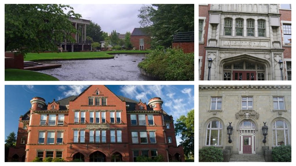
…and Willamette University in 1842, the oldest university in the western United States.
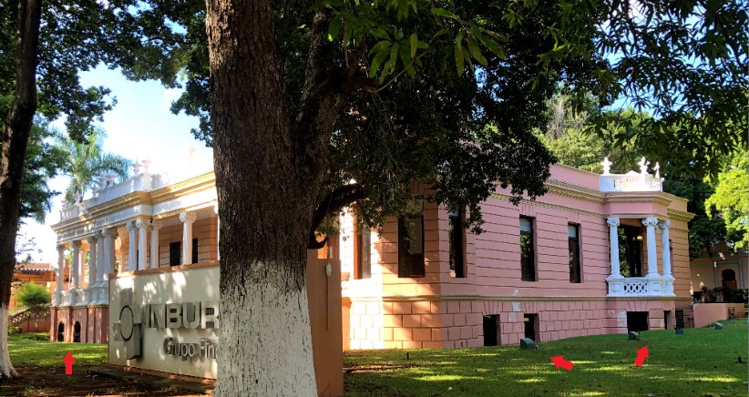
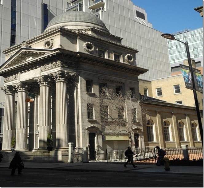
The first financial institution in Salem, the Ladd & Bush Bank, was co-founded in 1867 by William Ladd and Asahel Bush.
The building is known for its elaborate, cast-iron facade.

Construction of the Reed Opera House was said to have commenced in 1869 and was completed in 1870, quickly becoming the center of Salem’s entertainment and social life.

We are told its function as an opera house theater officially ended in 1900, and became a department store shortly thereafter, because of the opening of the nearby Grand Theater, which had more modern amenities and a ground-floor entrance.
Here is a picture of the Grand Theater with its original architecture on the left, and what the building looks like today minus the extended tower at the center of the building.
It currently houses retail businesses, offices, and a ballroom, and other facilities rented for special events.
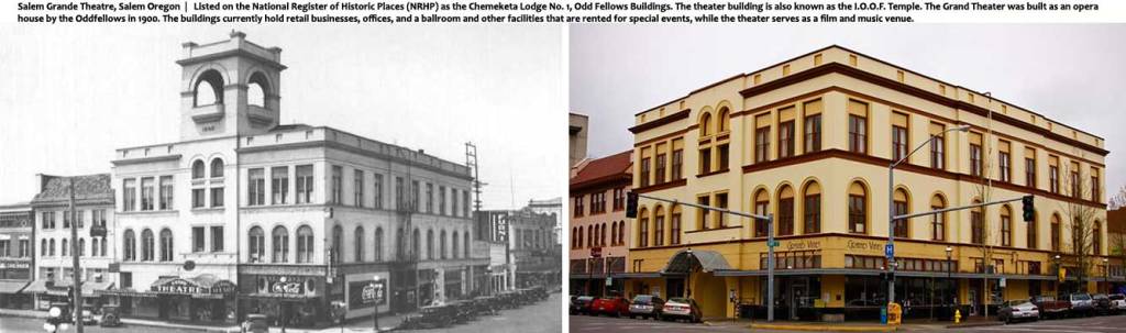
The Independent Order of Odd Fellows (I.O.O.F.) were credited with having built the Grand Theater, and the building later became Odd Fellows Chemeketa Lodge Number 1 and is also known as the I.O.O.F. Temple.
The American lodges formed a governing system separate from the English Order in 1842, and assumed the name Independent Order of Odd Fellows in 1843.

The command of the IOOF is to “visit the sick, relieve the distressed, bury the dead and educate the orphan.”
Would be interesting to know what was really going on here.
It seems…well…odd….
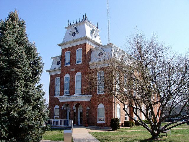
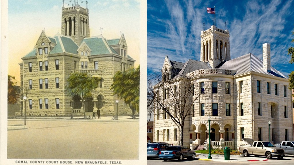
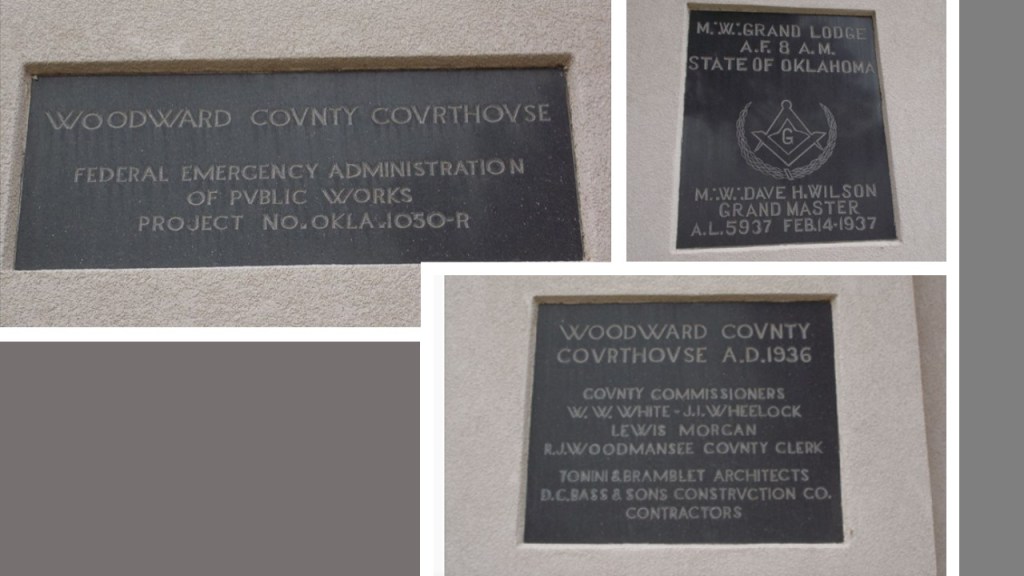
The Marion County Courthouse in Salem was said to have been built in 1872…
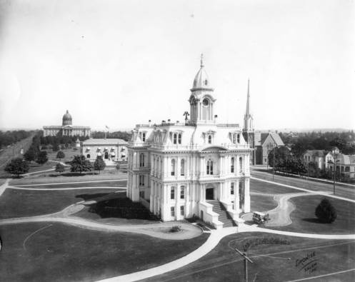
…and demolished in 1952 to make space for the current Marion County Courthouse.

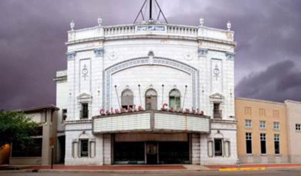
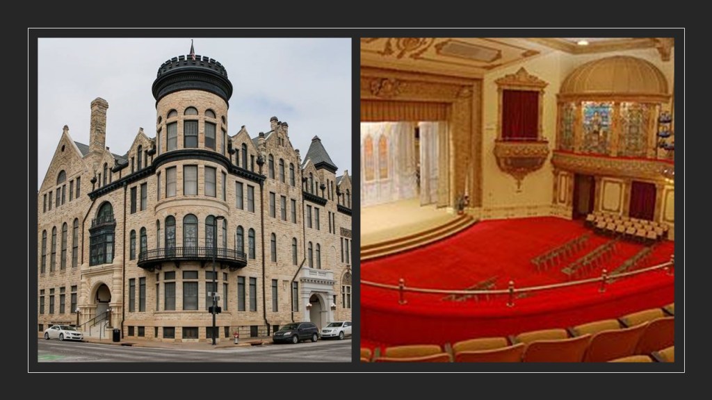
The Elsinore Theater first opened in 1926, with the owner George Guthrie enlisting the architectural firm of Lawrence and Holford to design the building in the Tudor Gothic style meant to resemble the city of Elsinore from Shakespeare’s play “Hamlet.”
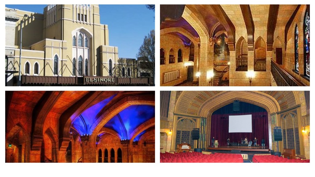
Said to have originally been designed for live performances and silent films, in 1929, the owner leased the theater to Fox West Coast Theaters, and then a year later to Warner Brothers Theaters, which ran it as a movie theater until 1951.
It began a general decline starting in the 1950s into a second-run movie theater, and was set to be demolished in 1980, but was saved by a grass-roots effort.
Over time, massive restoration was undertaken to restore the Elsinore to its former grandeur.
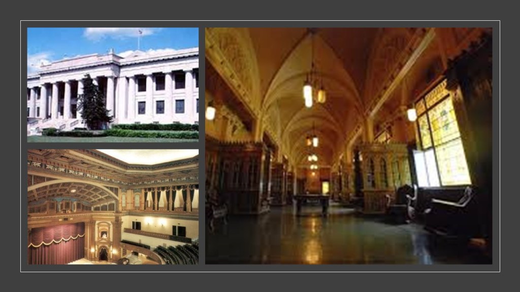
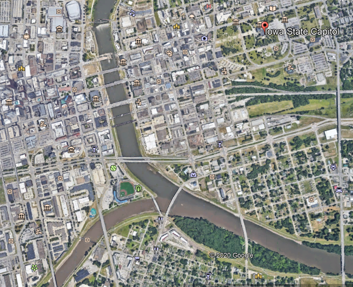
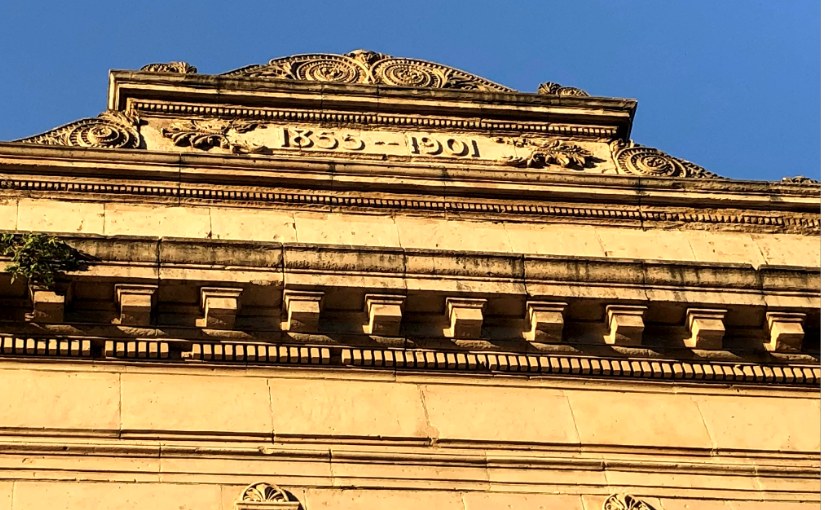
The Oregon State Capitol Building was said to have been constructed between 1936 and 1938, with the first two state capitol buildings having been destroyed by fire, the first in 1855, and the second in 1935.
Marble comprises much of the interior and exterior of the building.
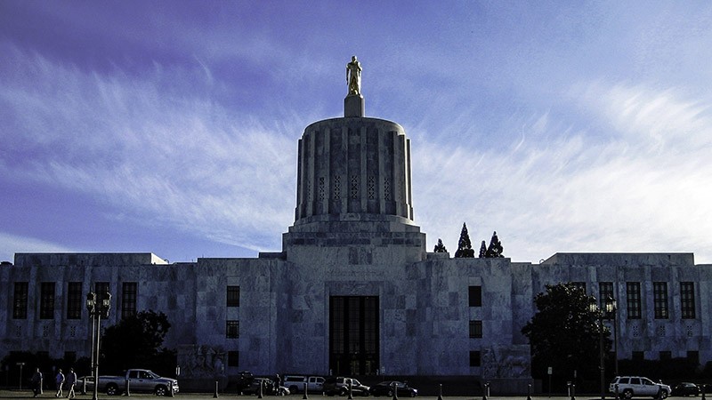
The federal government’s Public Works Administration was said to have partially financed the construction of it during the Great Depression.
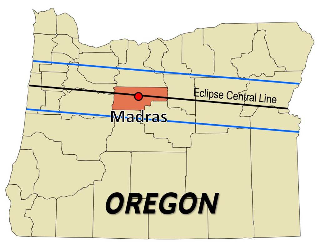
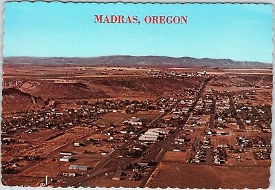
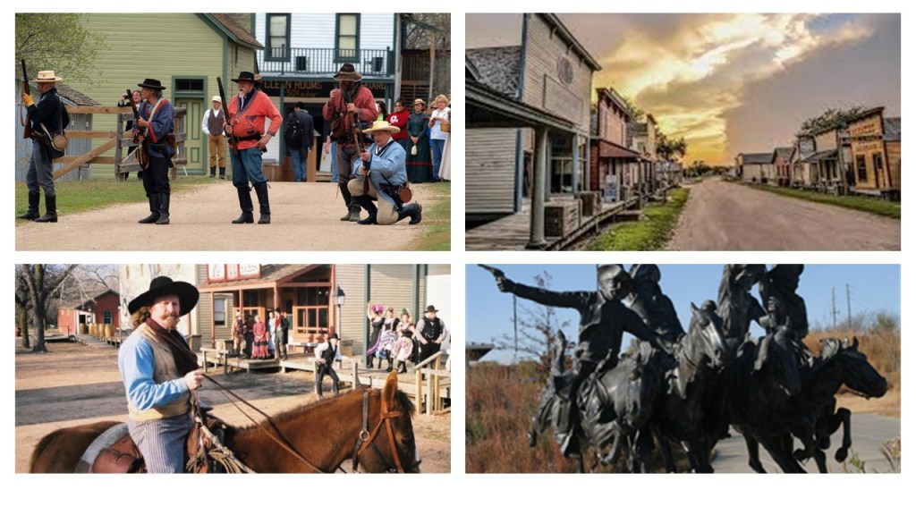
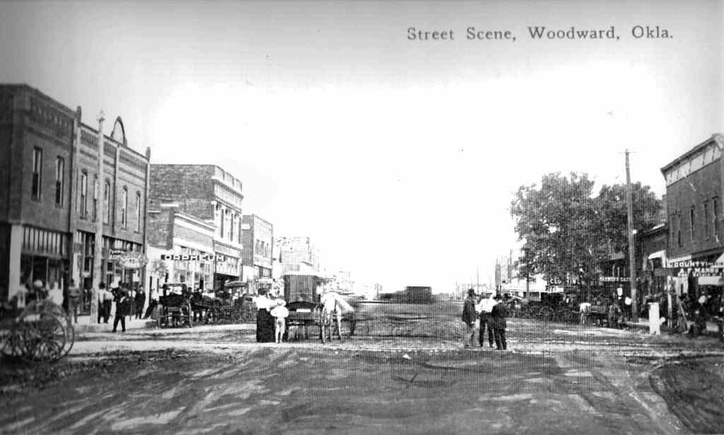
The next place we come to along the eclipse path is Madras, a small town in the high-desert country of Oregon, and the seat of Jefferson County.
It was originally called “The Basin” for the circular valley it is situated in…
…and a local distillery commemorates this nickname.

The town was said to have been named after either the city of Madras in India, or the cotton fabric called “madras” which originated from there in India.

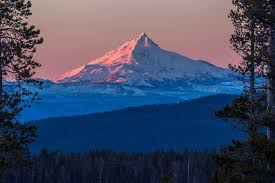
The county was said to have been named after the nearby Mount Jefferson, described as a stratovolcano in the Cascade Volcanic Arc in Oregon’s Cascade Range.
The plat for Madras was filed in 1902, and the town was incorporated in 1911, the same year the railroad arrived there.
Here is an early street scene of Madras looking like a dirty, Hollywood-western movie set…
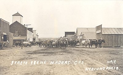
…and another scene where the town looks covered with dirt and mud.
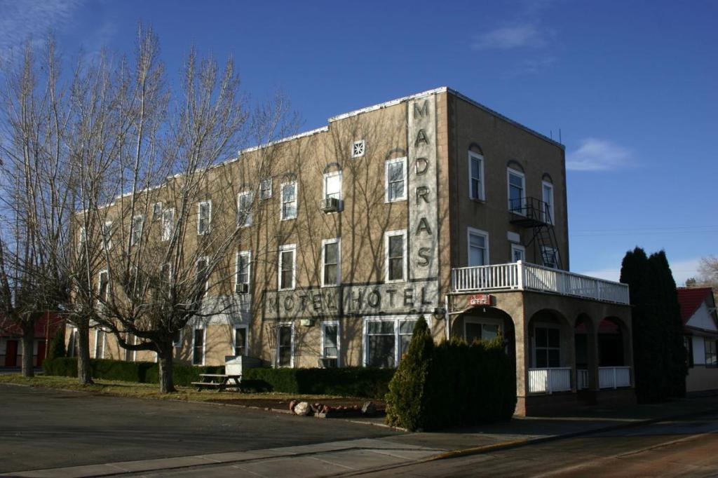
The Madras Hotel, considered to have been the oldest commercial building in Madras at around 100-years-old, mysteriously burned down from unknown causes in 2014, after having been condemned in 2011, and described in an article from the time as the most recent of a long line of historic Madras buildings destroyed by fire over the decades.
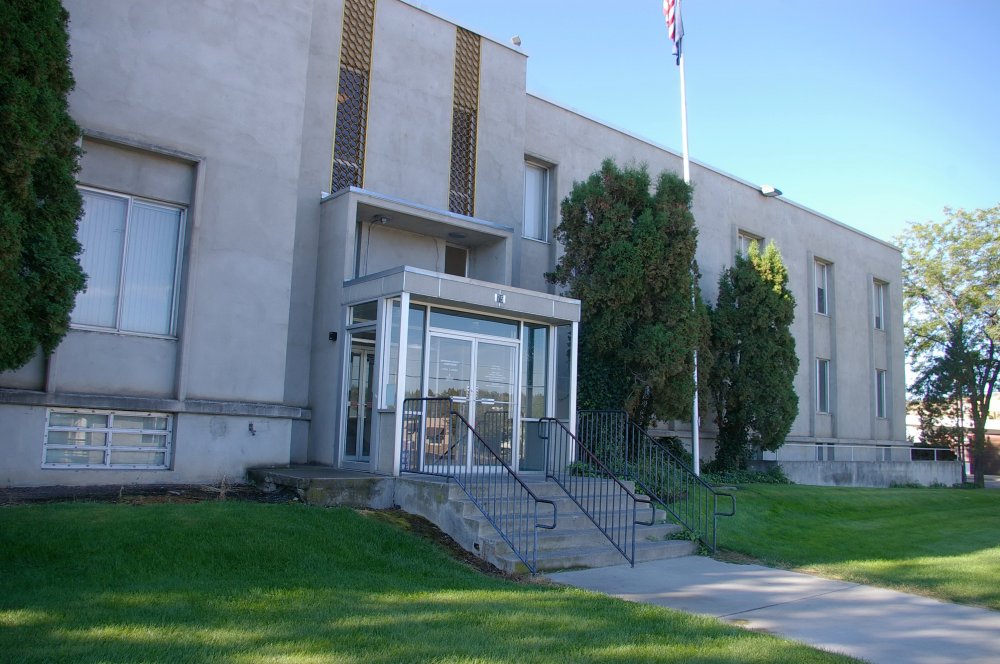
Another historic Madras building, the original combination Jefferson County Courthouse and Madras City Hall was said to have been designed by Oregonian architect Gilbert Brubaker, and built in 1917.
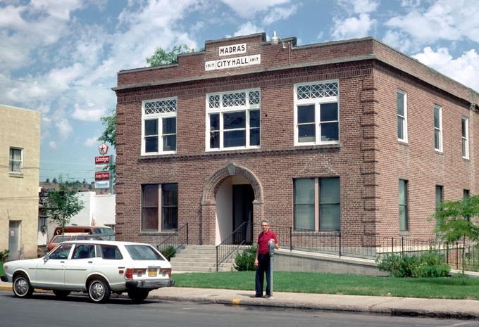
The old building is apparently still standing, as it was saved and renovated for office space starting in 2013, but was replaced by a new Jefferson County courthouse in 1961.
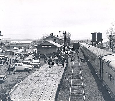
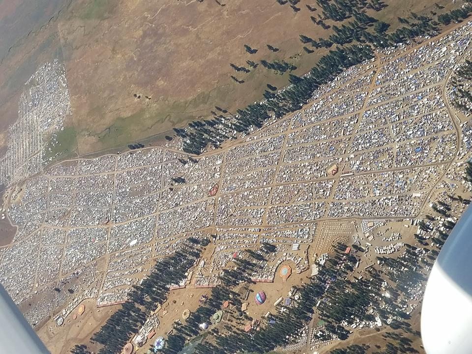
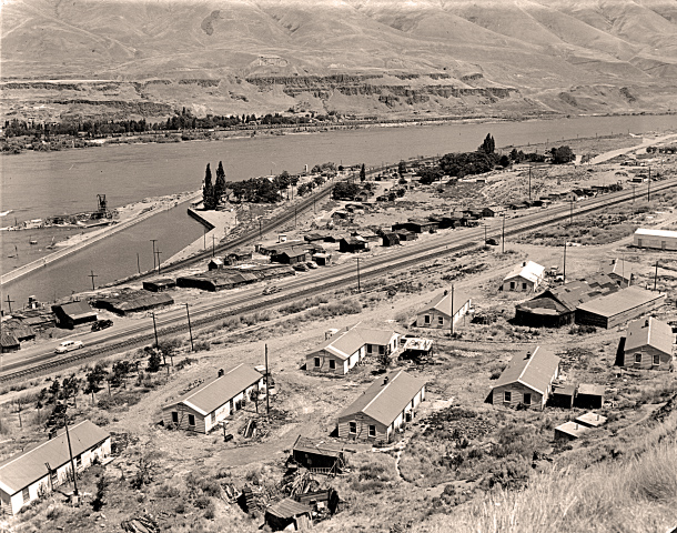
Madras was a prime-viewing 2017 eclipse viewing location because of its high desert environment and consistently clear skies in August, with all of the hotel and motel rooms in the area having been reserved for years.
This was a photo of a camping area in Madras for visiting eclipse-viewers.
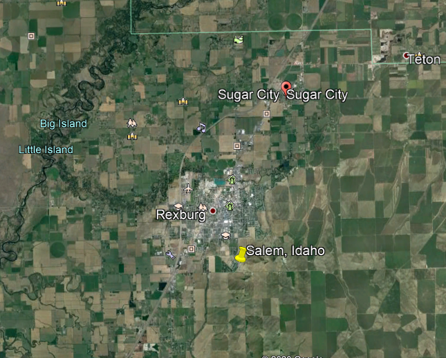
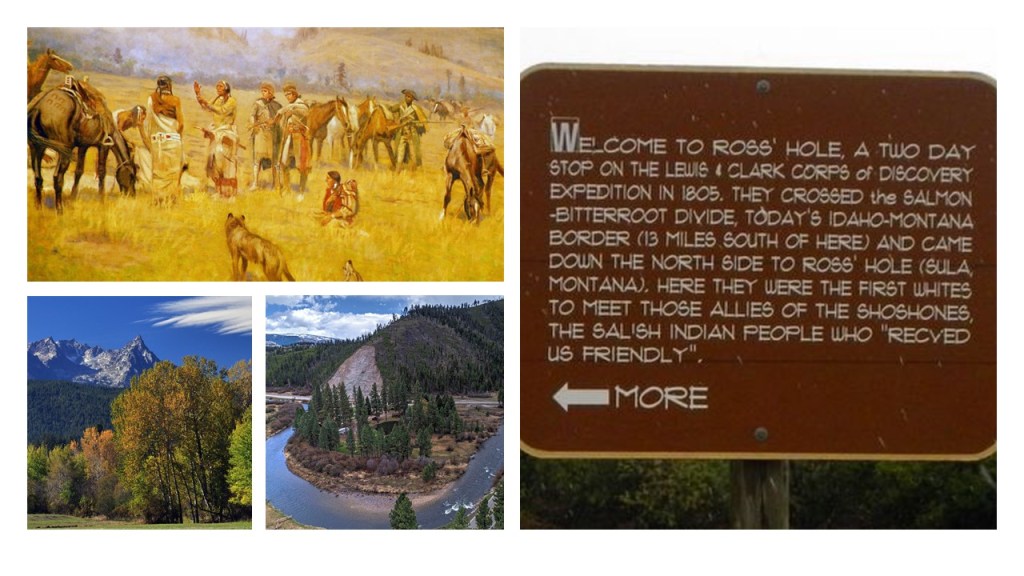
The next place we come to is the historical location of Salem, which was absorbed at some point into the neighboring community city of Rexburg, and the Rexburg Micropolitan Statistical Area, in Idaho’s Madison County…
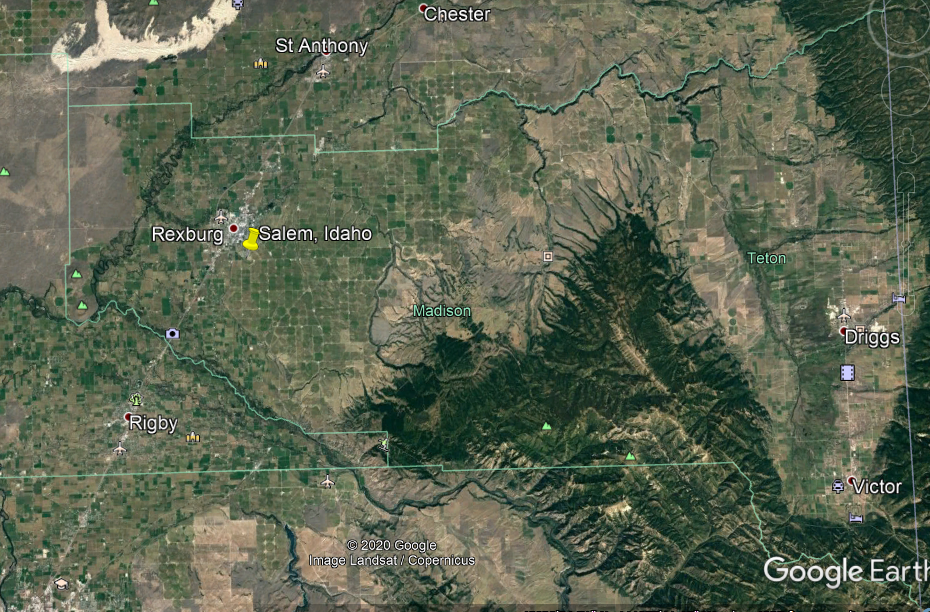
…and part of the Idaho’s Snake River Valley region.
I am not finding much left of Salem in Idaho.
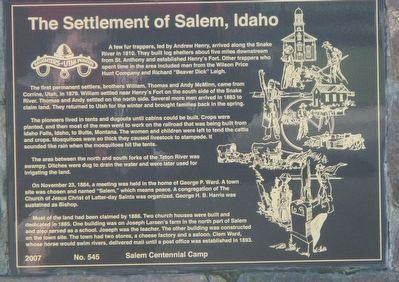
I found this Salem settlement historical marker.
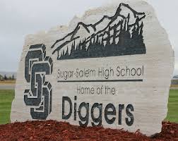
The memory of Salem is retained in the name of the Sugar-Salem High School.
Sugar City was a company town for the Fremont County Sugar Company…
…supporting a sugar beet processing facility said to have been built between 1903 and 1904, and dismantled in 1947.
The location of the Sugar Beet Factory marker is 1.7-miles, or 2.74-kilometers, from the settlement of Salem marker.
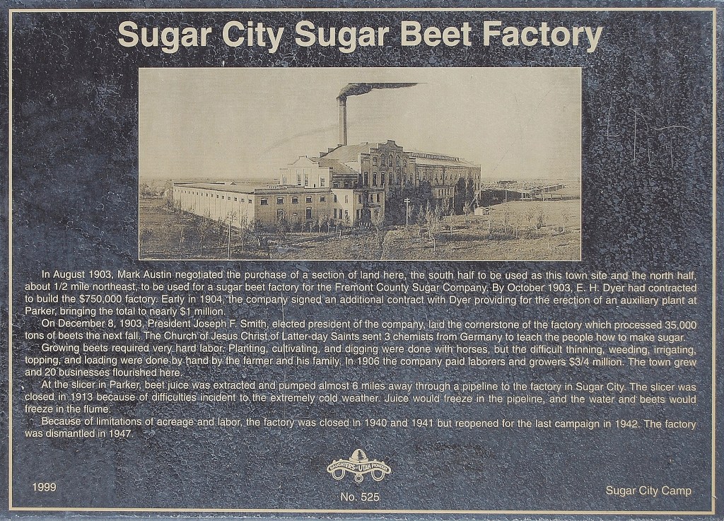
The sign says three chemists from Germany were sent by the Church of Jesus Christ of the Latter-day Saints (also known as Mormons, which I will be referring to them as from here on out) somewhere around 1903, when the cornerstone of the factory was said to have been laid in December of that year.
I wonder if I should read anything into the chemists being German. Let’s see what else we find on the journey along this total solar eclipse path of totality.
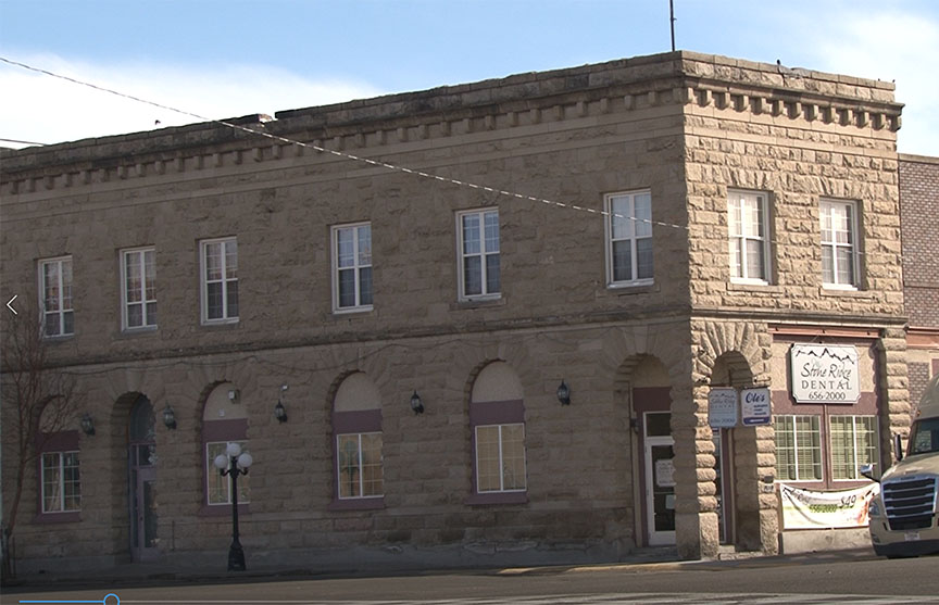
This is the old Fremont County Bank Building in Sugar City, still in use as office space today.
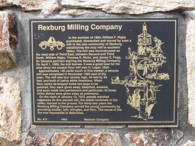
The Rexburg Milling Company Marker is 3.3-miles, or 5.3-kilometers, from the Salem settlement marker.
According to the historical marker, two mills burned down at this location, the first in 1889, and the second in January of 1915.
The Rexburg Tithing Barn Block Marker is also 3.3-miles, or 5.3-kilometers from the settlement of Salem marker.

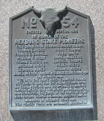
The historical marker honoring the Rexburg Stake Pioneers is 3.4-miles, or 5.47-kilometers from the Salem settlement marker…

…which has “The Pioneer Call” inscribed on it:
“Go into the Snake River Country, found settlements, care for the Indians, stand upon and equal footing, and Co-operate in making improvements…Gain influence among all men, and strengthen the cords of the Stakes of Zion.”
The Rexburg Stake Pioneer marker is located on the grounds of what was the Rexford Stake, also known as Fremont Stake, Tabernacle, which was said to have been built in 1911 and served as a Mormon meeting house for religious services.
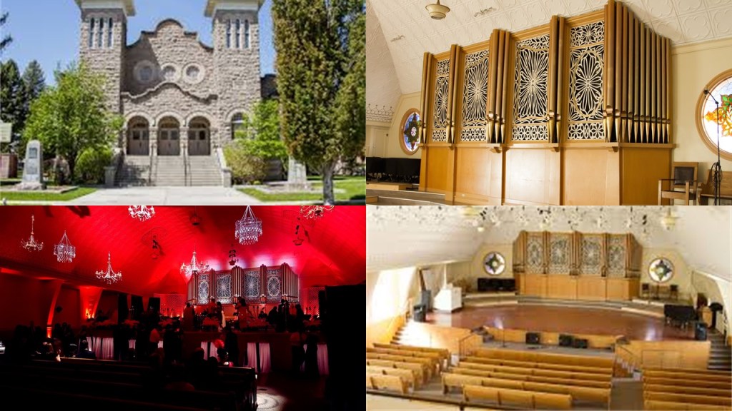
It was purchased by the city of Rexford in 1980, and turned into a community civic center.
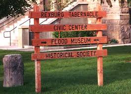
The Rexburg Tabernacle Civic Center also houses the Teton Flood Museum.
The Teton Dam Flood marker is also on the civic center grounds.
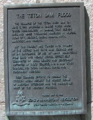
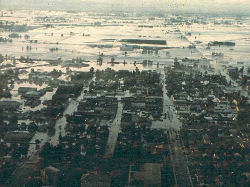
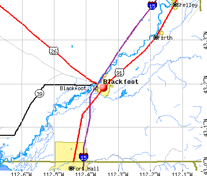
On June 5th of 1976, the Teton Dam unleashed a savage flood which caused $500,000,000 in damages, eleven deaths, and made thousands homeless in the communities of Wilford, Sugar City, Rexburg, Salem, Hibbard, Firth, Blackfoot and Roberts.
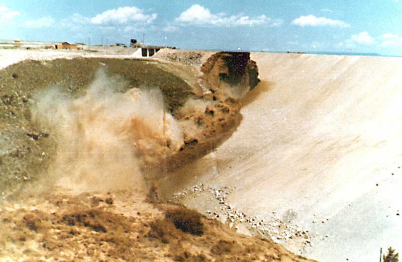
Construction of the dam was said to have been completed by the Bureau of Reclamation in November of 1975, and the dam suffered a catastrophic failure on June 5th, of 1976, with damage to the area estimated to be 80% of existing structures.
Before I move on from Idaho, let’s see what else we see nearby in the Snake River Valley.

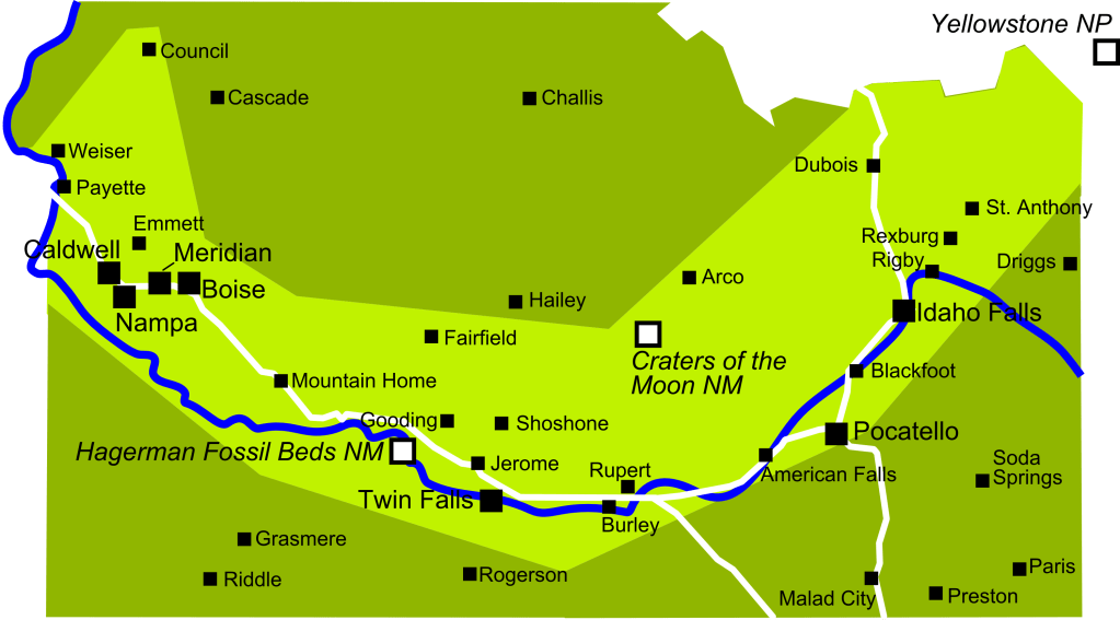
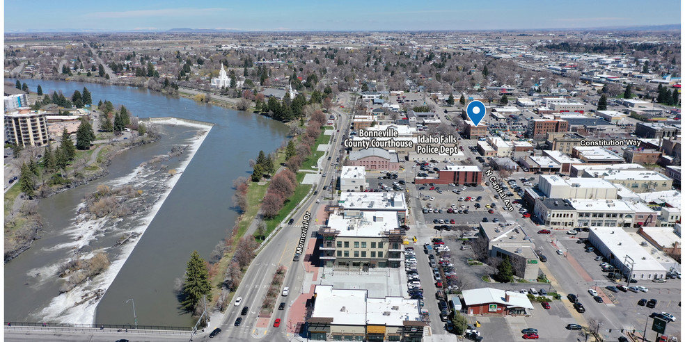
Idaho Falls is 26-miles, or 42-kilometers, southwest of the Rexburg-Sugar City-Salem area on the Snake River.
It is the second-largest city in Idaho outside of the Boise metropolitan area, and the seat of Bonneville County.
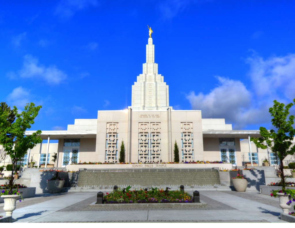
The Idaho Falls Idaho Temple was said to have been the first Mormon temple built in Idaho, and the tenth constructed, and eighth-operating in the world, with a dedication date of September 23rd of 1945.
Blackfoot is located on the Snake River, 15-miles, or 24-kilometers, downriver from Idaho Falls, and is the county seat of Bingham County.
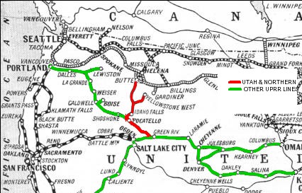
Land claims were filed near present-day Blackfoot in 1866, and by 1880, the makings of a town started to form, especially with the announcement of the Utah Northern Railroad expanding north into Idaho in the 1870s.
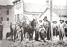
This photo taken of Blackfoot in its early days was notated as “early settlers plow the road for Main Street.”
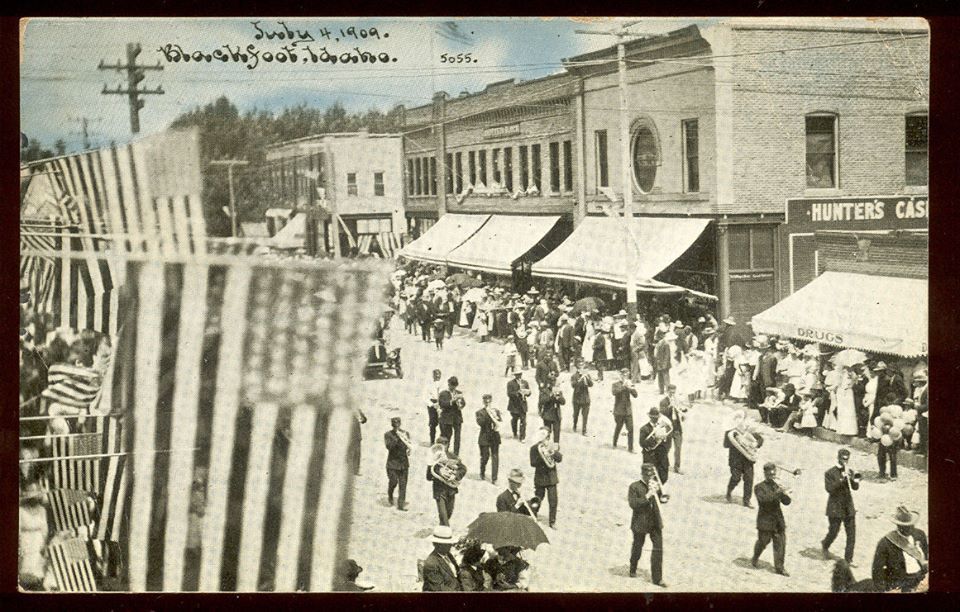
And here is an historic view of Blackfoot’s Main Street by 1909.
The Nuart Theater in Blackfoot first opened in 1930, and was said to have been built by Paul Demordaunt, and one of seven in Idaho opened by Demordaunt and his business partner Hugh Drennan.
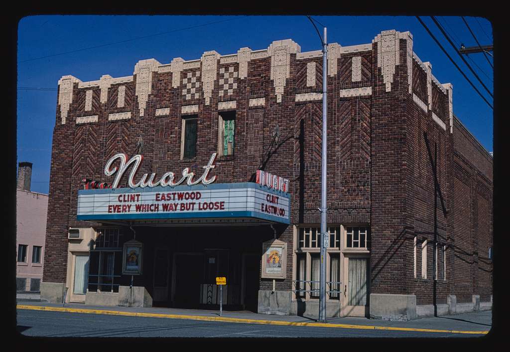
It was said to have been the first theater built in southeastern Idaho, and had superior acoustics from other theaters in that it had been built specifically for the “talking pictures.”
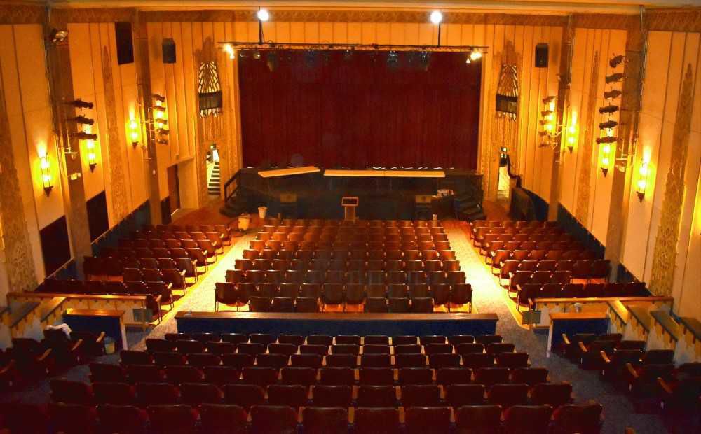
Restoration work on the Nuart Theater started in 1986, and re-opened by about 1988, where the Blackfoot Community Players stage live performances and open the facility for rental as a community center.
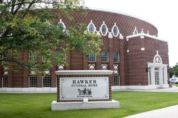
This was the Mormon Tabernacle Civic Auditorium in Blackfoot, said to have been designed by architects Hyrum Pope and Harold W. Burton and completed in 1921.

In 1980, the church sold the building to the city of Blackfoot as a civic auditorium, which it used until the 1990s, and it sat empty until 2003, at which time it was purchased by a local businessman and became the building for the Hawker Funeral Home.
The Blackfoot Municipal Swimming Pool, on the left, was said to have been built in 1973, and officially closed its doors in November of 2018 after a third failed bond election.
On the right is the Gold Dome building in Oklahoma City, which I saw routinely when I lived there between 2012 and 2016.
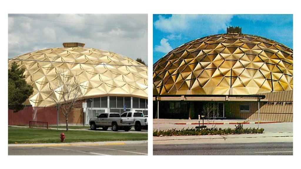
The Gold Dome building in Oklahoma City was said to have been built in 1958 and originally housed a Citizens Bank.
Slated for demolition in 2001, a local group organized to save it, and it is still standing.
As of 2016, the plans were to redevelop the historic Gold Dome building into a Natural Grocers Store, though I am not finding that this project has come to completion yet.
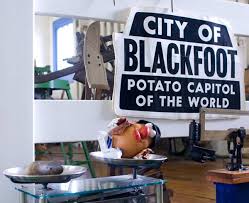
Of all places, Blackfoot boasts the largest potato industry in any one area, and is known as the “Potato Capital of the World.”
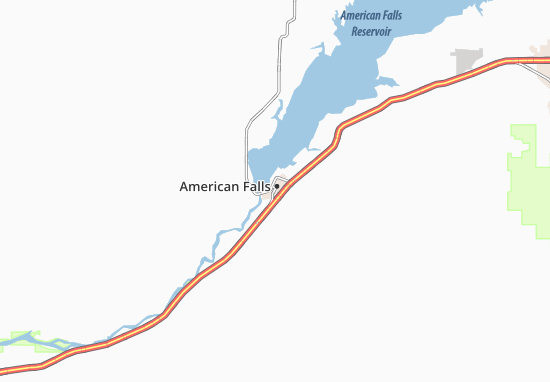
Next along the Snake River, we come to American Falls, the county seat of Idaho’s Power County.
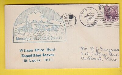
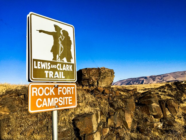
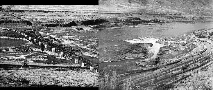
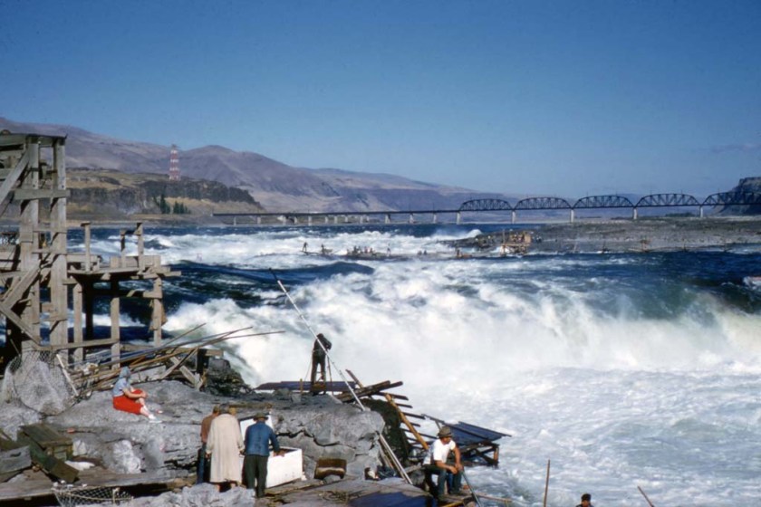
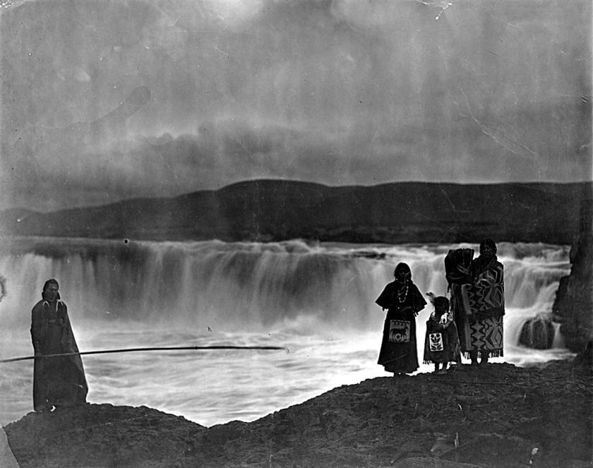
American Falls was a landmark waterfall on the Snake River, where in 1811, the Wilson Price Hunt expedition camped one night.
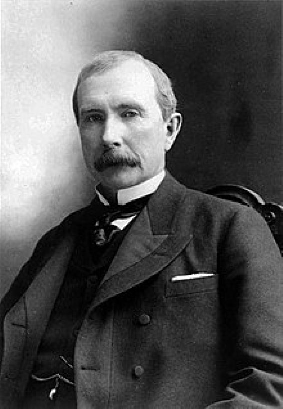
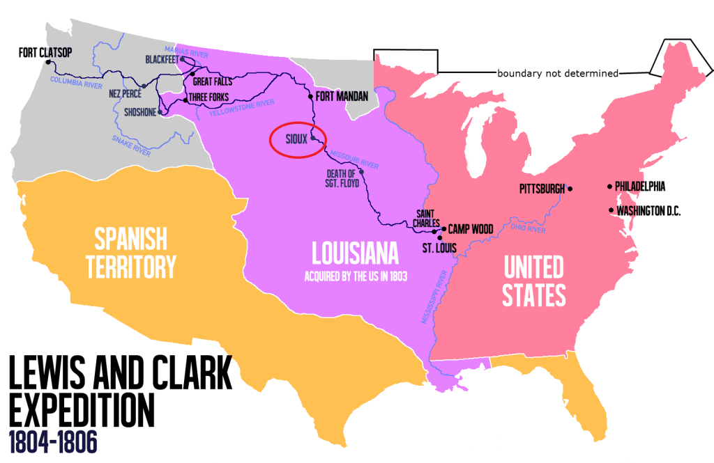
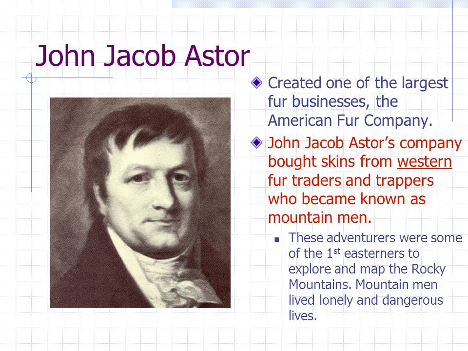
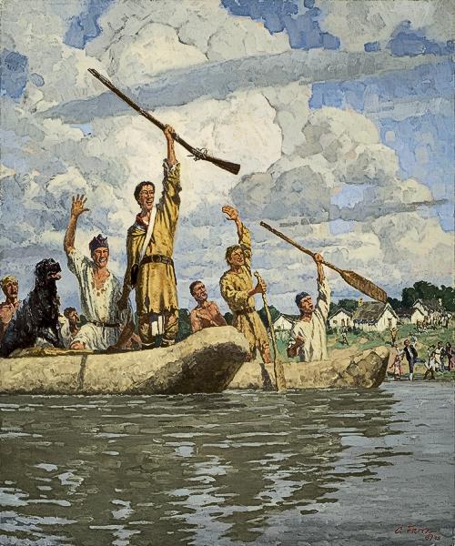
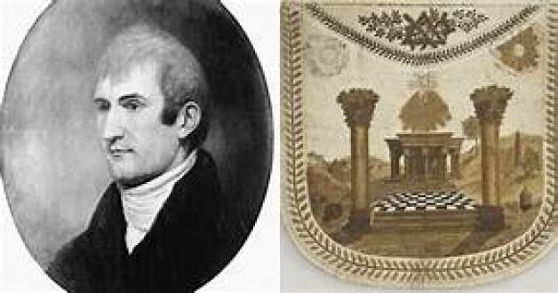
Wilson Price Hunt, an agent in the fur trade under John Jacob Astor, a German-immigrant to the United States and its first multi-millionaire, organized and led the greater part of a group of about 60 men on an expedition to establish a fur-trading outpost at the mouth of the Columbia River.
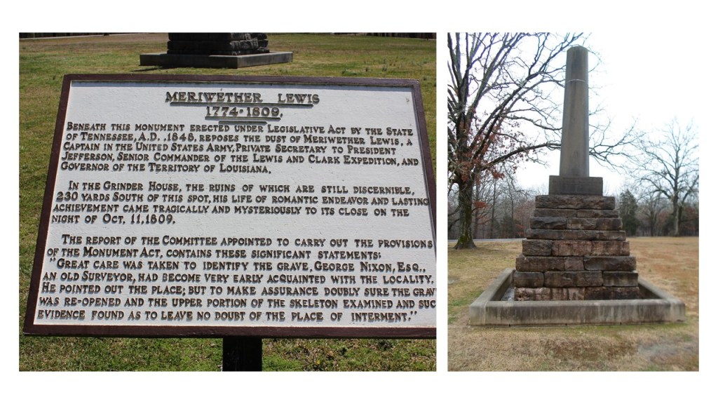
The Astorians, as they have become known, were the first major party to cross to the Pacific after the Lewis and Clark Expedition.
The expedition of John C. Fremont camped at American Falls in 1843.

During the 1840s, Fremont led five expeditions into the western United States, and became known as “The Pathfinder.”
In 1925, the town of American Falls became the first town in the United States to be entirely relocated to facilitate the construction of the nearby American Falls dam.
The old townsite sits at the bottom of the reservoir, northwest of the present city.
This is an old power house, the only remnant left-standing of what is left of the old town site that was here previously.
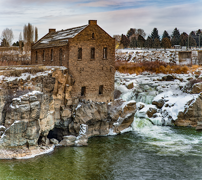
And here is a view of the same old power house with the Union Pacific bridge behind it, which became part of the Oregon Short Line Railroad system following the bankruptcy of Union Pacific in 1897.
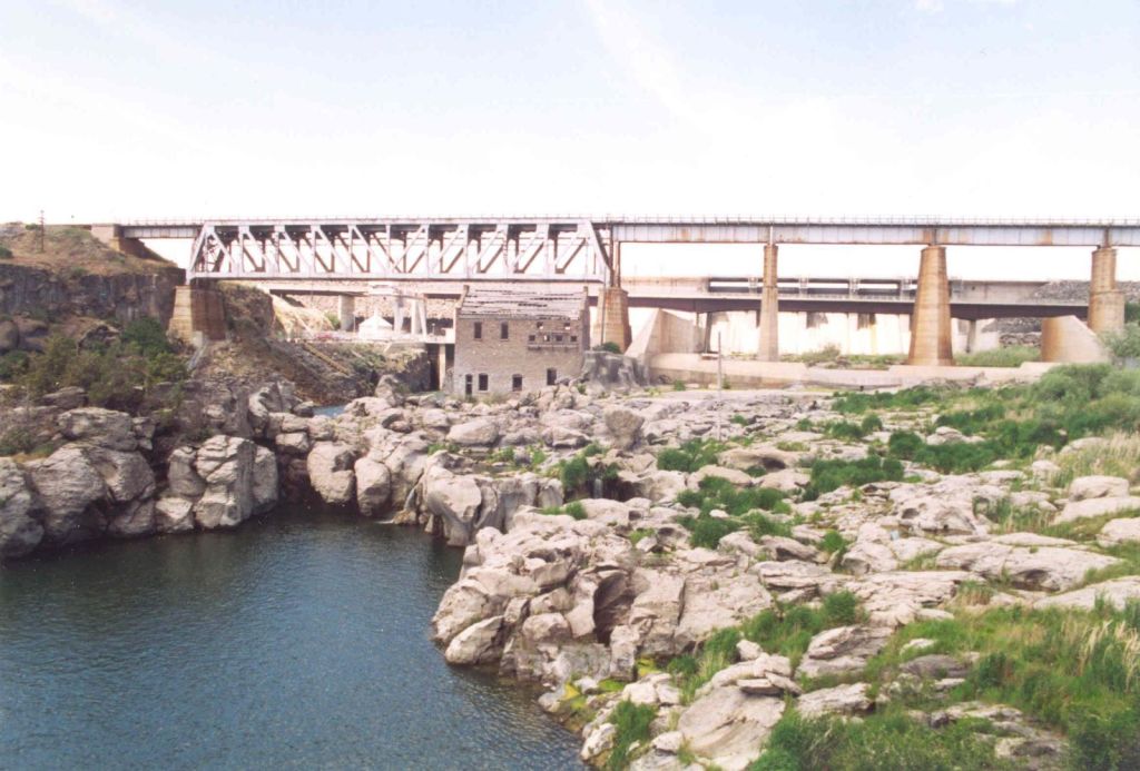
The Oregon Short Line from Pocatello, Idaho, to Huntington, Oregon, was said to have been completed in late 1884.

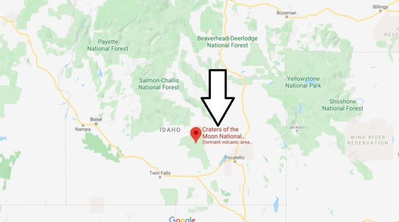
The last place I want to look at before I leave the Snake River Valley in Idaho, and head into Wyoming, is the Craters of the Moon National Monument, which encompasses three major lava fields along the Great Rift of Idaho, and represents one of the best-preserved flood basalt areas in the continental United States.
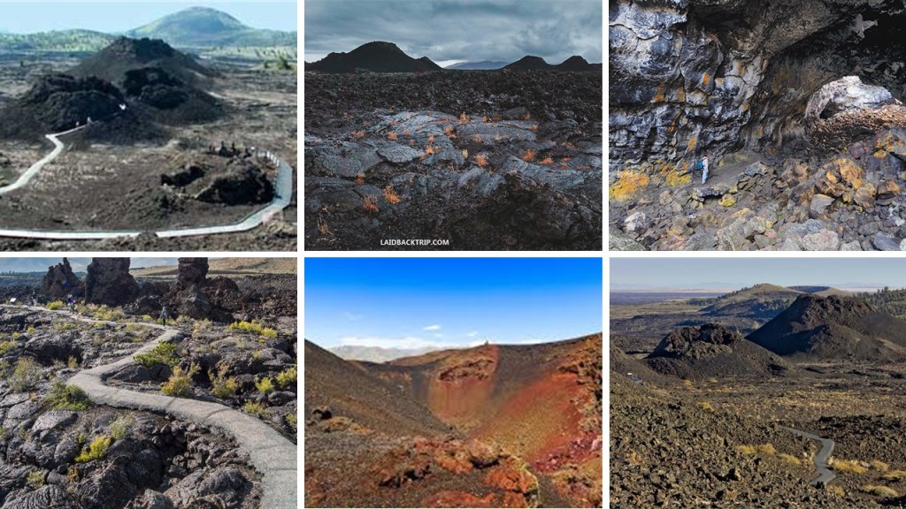
It is located midway between Boise, Idaho, and Yellowstone National Park.
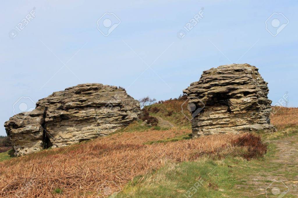
This scene is from the Craters of the Moon National Monument in Idaho on the left, compared with Malham Ash in the Yorkshire Dales National Park in England, which is actually called a limestone pavement on the right.
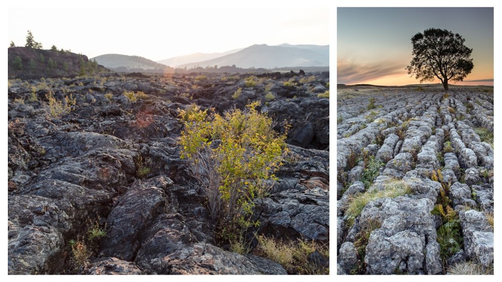
The definition of the word pavement is this: 1) a hard, smooth surface, especially of a public area or thoroughfare, that will bear travel; and 2) the material with which such a surface is made.
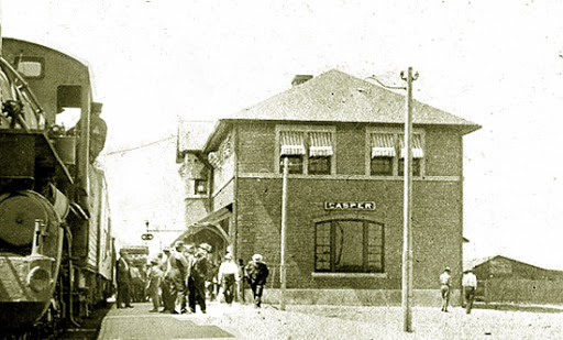
The next place we come to along the path of totality for the 2017 solar eclipse is Casper, the second-largest city in Wyoming, and the seat of Natrona County.
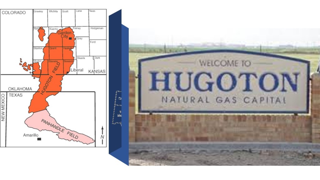
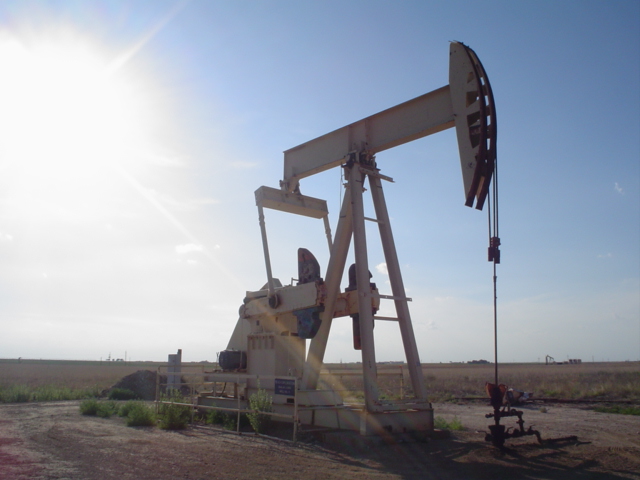
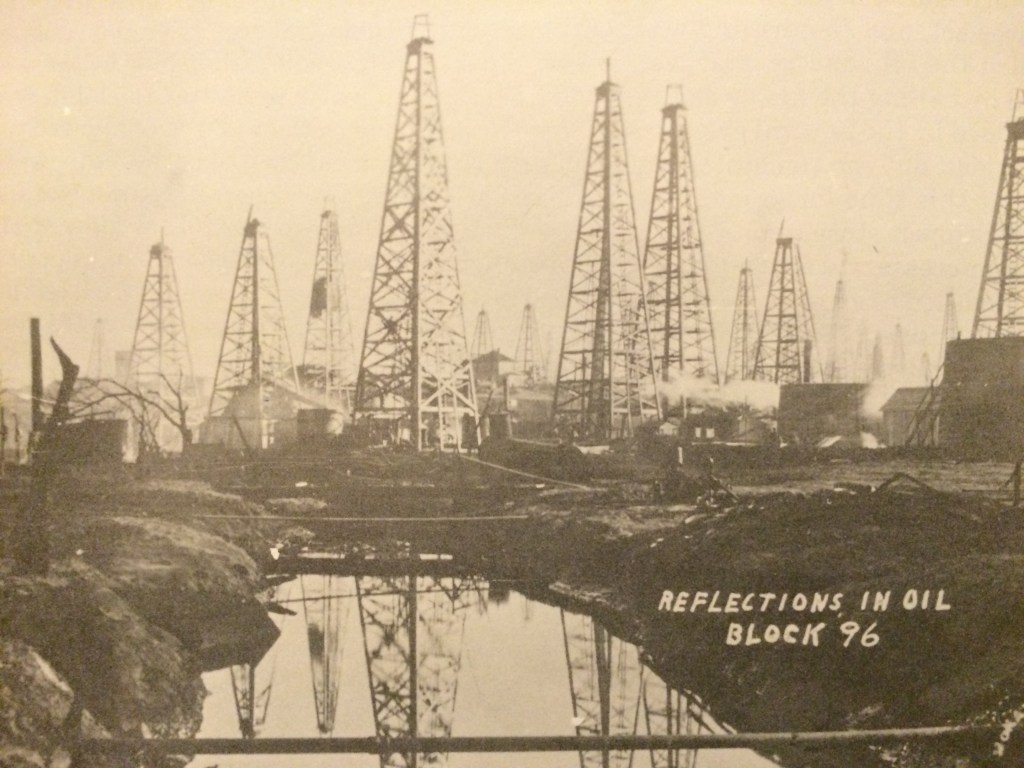
Casper is nicknamed “The Oil City,” which goes back to the development of the Salt Creek Oil Field, which is located 40-miles, or 64-kilometers, north of Casper in Midwest, Wyoming…
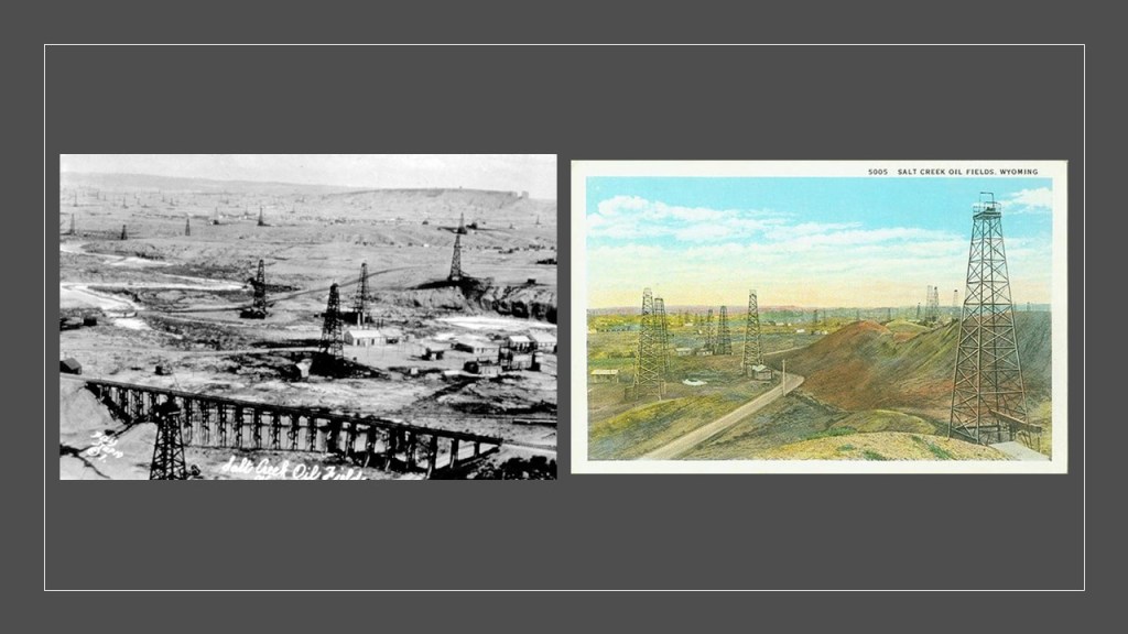
…where the first well to strike oil was drilled in 1889, and by 1970, more oil produced here than any other in the Rocky Mountains region.
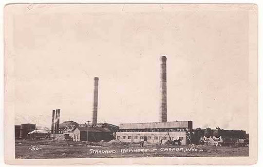
Casper boomed with the oil and refining businesses between 1910 and 1925, and by 1922, Standard Oil of Indiana owned a controlling interest in the Midwest Refinery, which that year was the world’s largest refinery by volume of its gasoline production.
The city of Casper lies at the foot of Casper Mountain in east-central Wyoming…
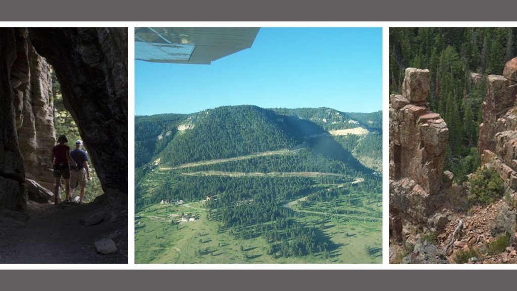
…at the north-end of the Laramie Mountain Range on the eastern edge of the Rocky Mountains…
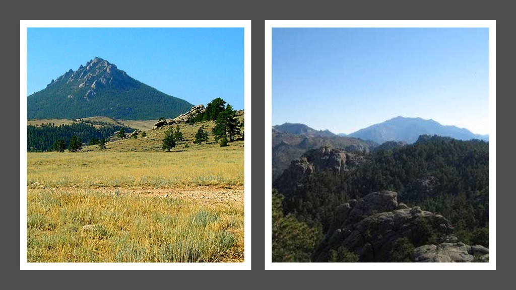
…and on the North Platte River.
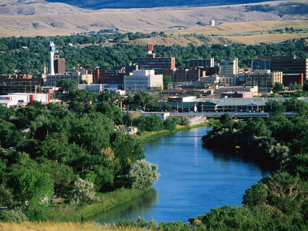
We are told the city was established east of Fort Caspar, built along the mass migration routes of the Oregon, California, and Mormon trails.
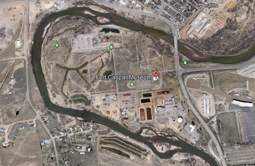
The area was the location of several ferry crossings on the North Platte River in the 1840s, and in 1859, Fort Caspar was said to have been built as a military post of the U. S. Army as a trading post and for a toll bridge on the Oregon Trail.
I can’t find any old maps showing a star fort, but I certainly wonder if there was one here originally.
We are told the city of Casper was founded in June of 1888 by developers as an anticipated stopping point during the expansion of the Wyoming Central Railroad.
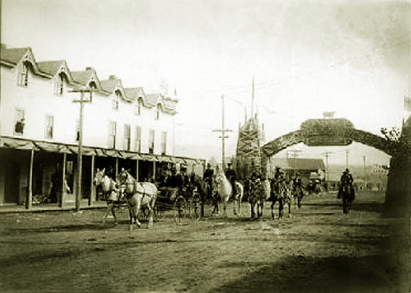
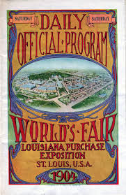
In 1904, the same year as the Louisiana Purchase Exposition in St. Louis, Casper was the site of fourth Industrial Exhibition in Wyoming.
The sign on the double-archway at the entrance of the Exhibition read “Look out for Wyoming, Keep your Eye on Casper.”
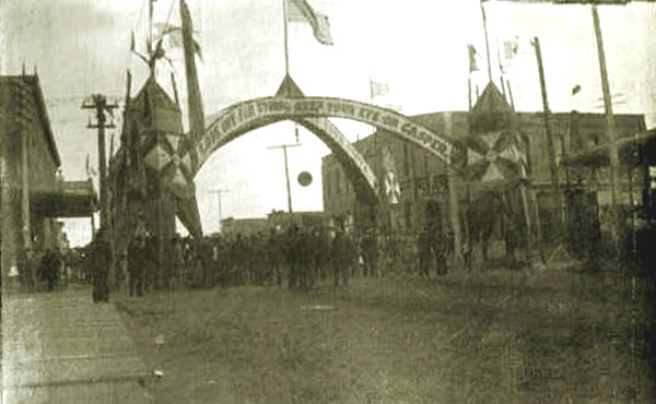
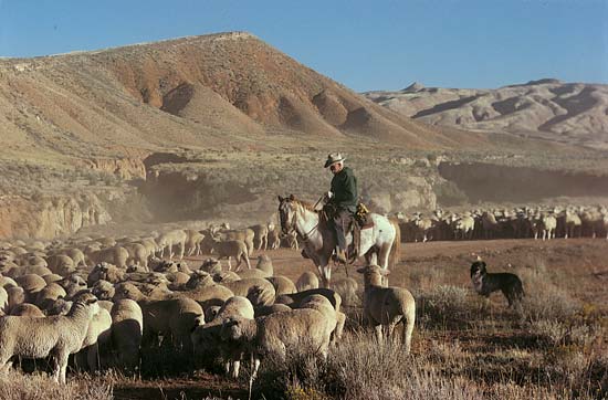
The back of the signage welcomed visitors to the “Land of Wool and Oil.”
Wyoming is still known to this day for sheep ranching.
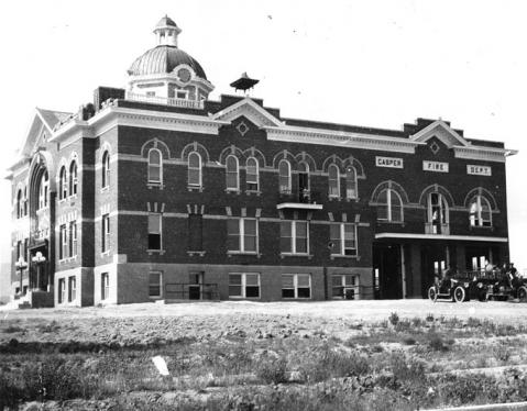
This was Casper’s second City Hall, with a wing for the Fire Department, that opened in 1919.
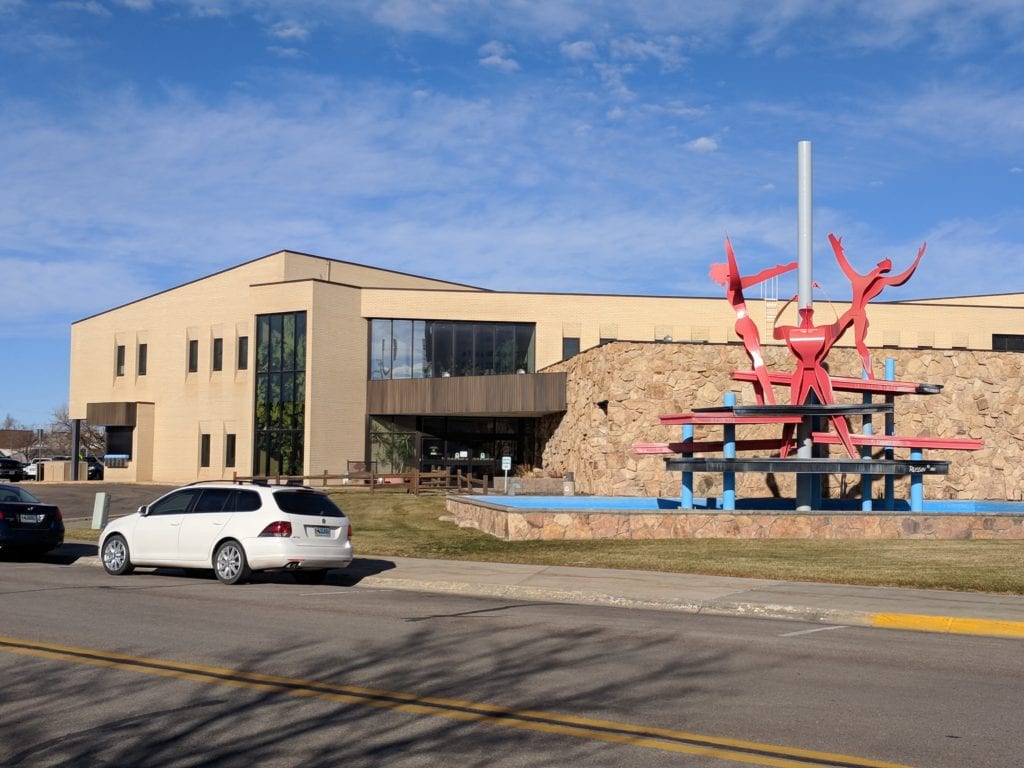
This is today’s Casper City Hall.
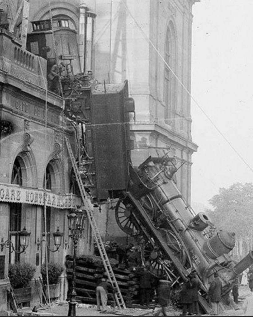
The worst train wreck in Wyoming’s history took place in Casper in September of 1923.
The Chicago, Burlington & Quincy No. 30 passenger train had left Casper for Denver…
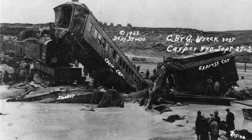
…and crashed into the swollen Cole Creek near its mouth on a rainy night, 16-miles, or 26-kilometers, east of Casper.
The historic Rex Theater in Casper was said to have opened in November of 1925, listed as operating in 1941; closed in 1943; reopened in 1952; and closed-for-good in June of 1956.
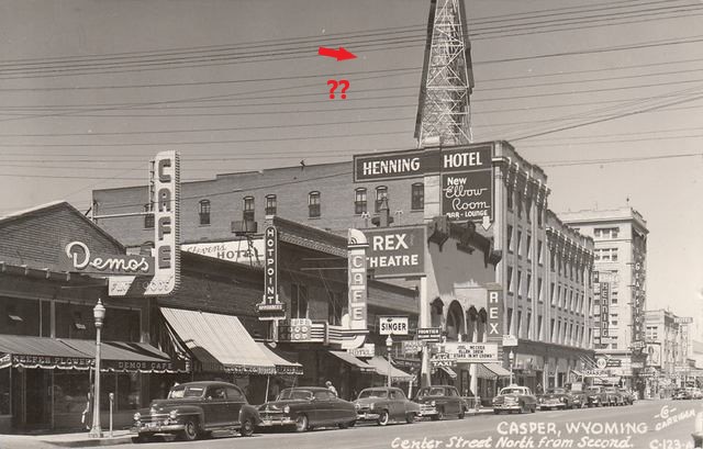
The Rex Theater was demolished in the summer of 1962.
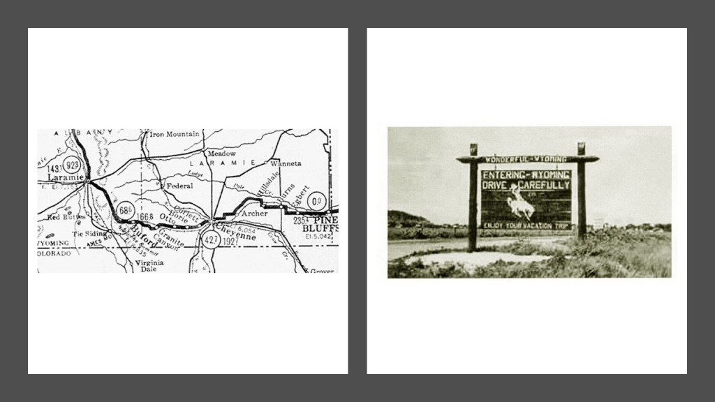
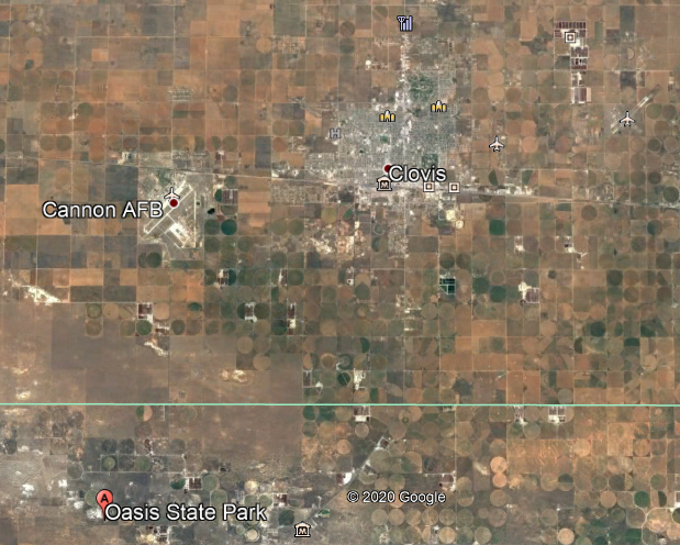
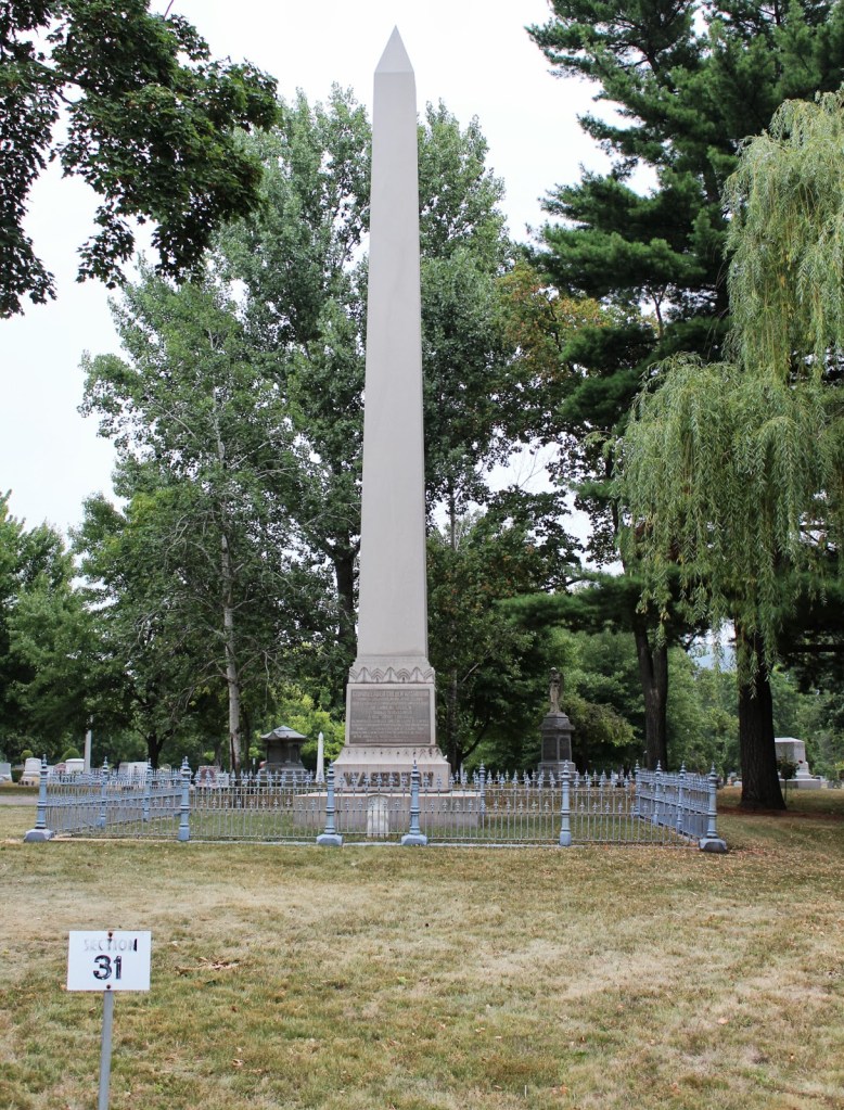
The next place we come to is Salem, in Wyoming’s Laramie County, the remnants of which appear to be the Salem Cemetery, because I am not finding anything else that is physically left of the Salem that was here.
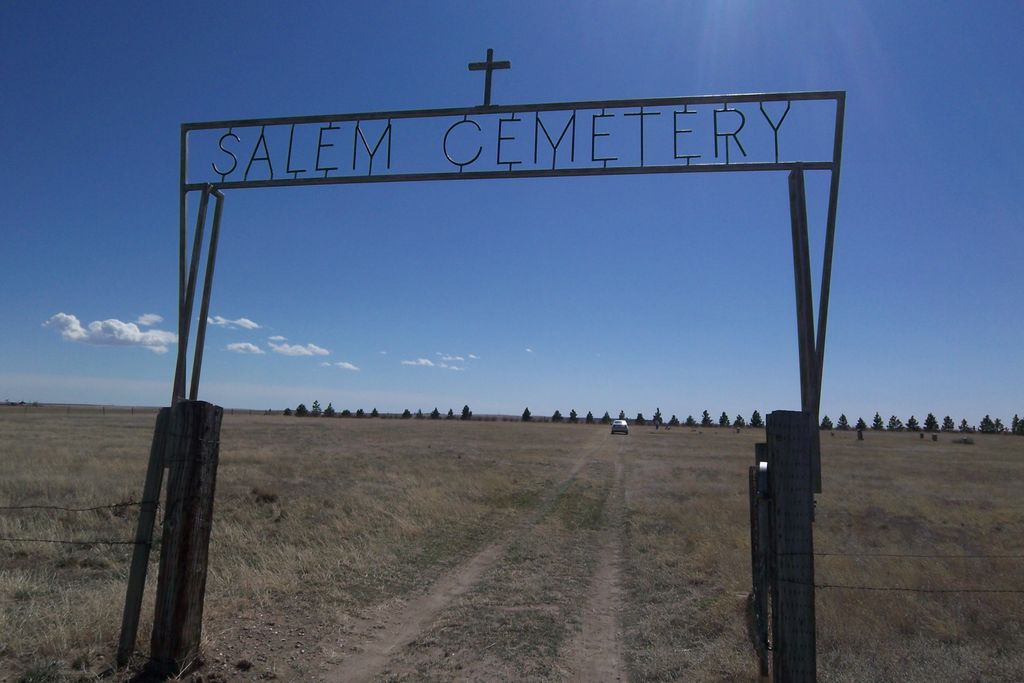
Apparently at some point in time, Salem was renamed Lindbergh, about which there isn’t any information except that the Salem Cemetery is also known as the Lindbergh Cemetery.
Since I can’t find out anything in the present-day about either Salem or Lindbergh, I am going to look around Laramie County to see what I can find.
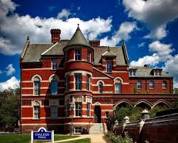
This the Nagle Warren Mansion in Cheyenne, Wyoming’s largest city and state capital, and is the principal city of the Cheyenne Metropolitan Statistical area, which encompasses all of Laramie County, and southwest of the historical location of Salem.
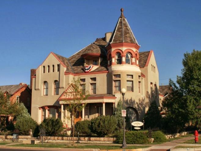
The Nagle Warren Mansion is one of the few residences remaining in Cheyenne that date back to the 1800s, said to have been built by Erasmus Nagle in 1888.
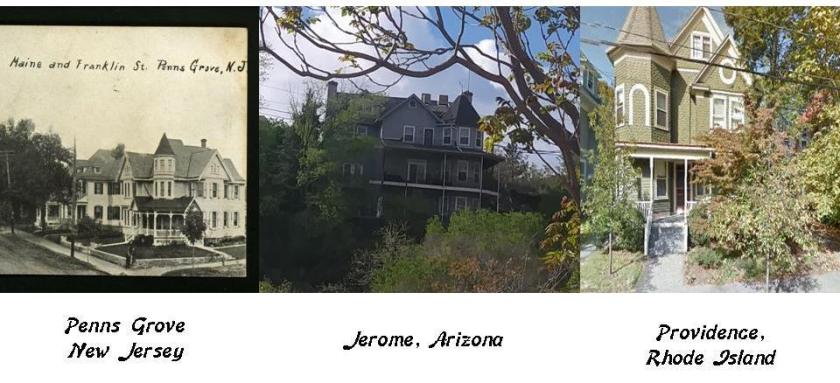
Its architectural style reminds me of these homes in Penns Grove, New Jersey on the left; Jerome in Arizona in the middle; and Providence in Rhode Island on the right.
I have encountered the Ames Monument in previous research, located in the ghost town of Buford in Laramie County.
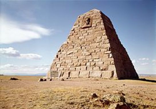
This large pyramid was said to have been designed by Henry Hobson Richardson, the namesake of the Richardsonian Romanesque architectural style and built between 1880 and 1882.
It was dedicated to the Ames brothers for their role in financing the Union Pacific Railroad.
Here’s the back-story on the Ames brothers.
Oliver Ames, Jr. was a co-owner of the Ames Shovel Shop, nationally known for providing the shovels for the Union Pacific Railroad, which opened the west, and the world’s largest supplier of shovels in the 19th-century.
Why would shovels, really only useful for digging, be so crucial for the Union Pacific Railroad and the opening of the West, moreso than other tools?
Oliver was also the President of the Union Pacific Railroad from when it met the Central Pacific Railroad in Utah for the completion of the first Transcontinental Railroad in North America.
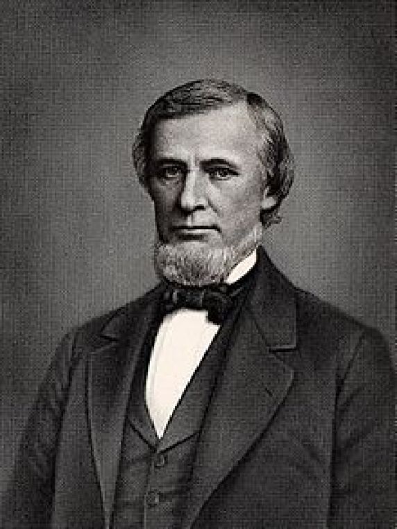
He was co-owner of the Ames Shovel Shop with his brother, Oakes Ames.
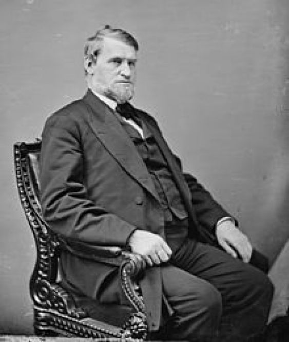
Oakes was a member of the U. S. Congress House of Representatives from Massachusetts 2nd District from 1863-1873.
He was credited by many as being the most important influence in building the Union Pacific portion of the first Transcontinental Railroad.
He was also noted for his involvement in the Credit-Mobilier Scandal of 1867, regarding the improper sale of stock of the railroad’s construction company.
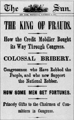
He was formally censured by Congress in 1873 for this involvement, and he died in the same year.
He was exonerated by the Massachusetts State Legislature on May 10th, 1883, the 10th-Anniversary of the completion of the Transcontinental Railroad.
The cities of Ames, Iowa, and Ames, Nebraska, are both said to be named for Oakes Ames, and were stops on the Union Pacific Railroad.
This is the historic high school in Pine Bluffs, Wyoming, closer to the historic location of Salem, in Laramie County near the Nebraska state line, and said to have been built in 1929.

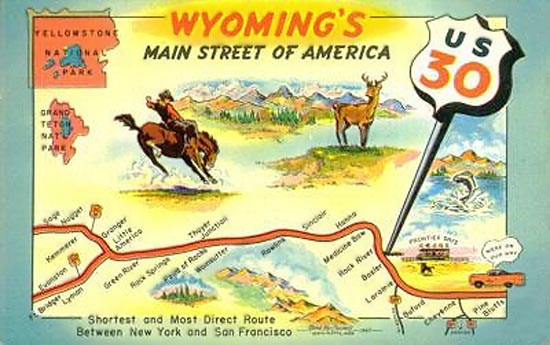
The Lincoln Highway, the first transcontinental road for automobiles, opened in 1913 and entered Wyoming and Laramie County at Pine Bluffs from Nebraska.
…and the Lincoln Highway, designated as U.S. Highway 30, like the later Route 66, was known as the Main Street of America for a period of time.
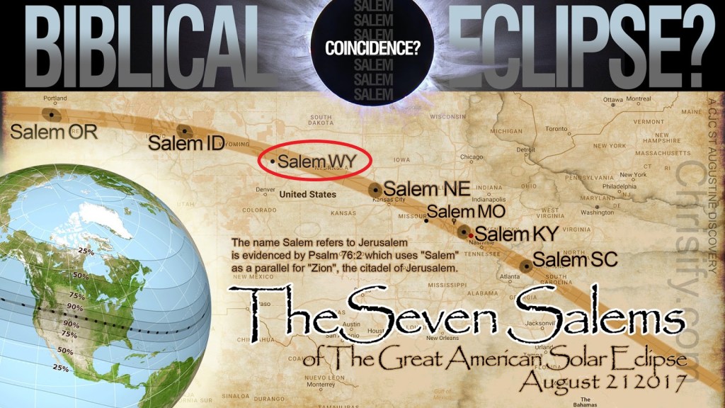
I did find this image about the eclipse, which states that the name Salem refers to Jerusalem as evidenced by Psalm 76:2, which uses “Salem” as a parallel for “Zion,” the citadel of Jerusalem.
I am going to take a deeper dive into what comes up with regards to this information, especially with regards to Salem and Zion.
This is the King James Version of Psalm 76:1-2 referenced in the Salem eclipse graphic:
1In Iudah is God knowen: his name is great in Israel.
2In Salem also is his tabernacle, and his dwelling place in Sion.
This is the New International Version of Psalm 76:1-2:
1God is renowned in Judah; in Israel his name is great.
2 His tent is in Salem, his dwelling place in Zion.
So let’s break down some meanings to explore what else could possibly be referred to here.
I mentioned previously that Salem or Shalom, in Hebrew, signifies ‘Peace’…

…and the similar word salaam in Arabic also means peace.

In the King James Version, “God’s tabernacle is in Salem, and his dwelling place in Sion.”
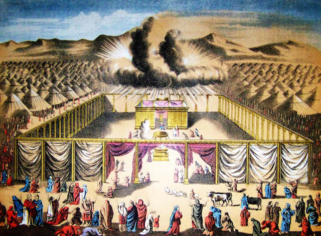
A Tabernacle, or Mishkan, was a portable sanctuary in the wilderness, and the earthly dwelling-place of God.
As a portable sanctuary for use anywhere, and not a fixed location.
The tabernacle was surrounded by a regular fence with a gate, a courtyard, and the “Holy Place” was screened off from the courtyard.
Even deeper, a curtain created a barrier to the “Holy of Holies.”
The true meaning of the word “Sion” is hard to track down, because there is a tendency to make it synonymous with “Zion,” which I don’t believe it is.
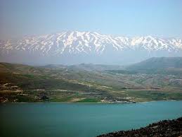
On the surface, we are told that “Sion” is the Greek form of “Zion;” denotes Mt. Hermon in Deuteronomy 4: 48, where Mt. Hermon referred to as Mt. Sirion…
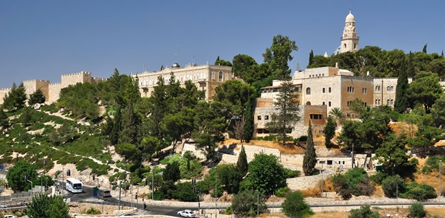
…and a hill where King David captured a stronghold, a temple was later built, and later become synonymous with Jerusalem.
I also found a definition of “Sion” as ‘an imaginary place considered to be perfect or ideal.’

The metaphysical meaning of “Sion” is defined thus, with words describing things like high power, virtue, courage and strength:
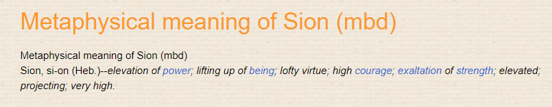
So, what if the King James Version of Psalm 76:2 of “God’s tabernacle is in Salem, and his dwelling place in Sion” actually means something to the effect of:
“God’s portable sanctuary is in Peace, and his dwelling place in the Highest Ideals,” which could also be applied to each individual Human Being as a “portable sanctuary of peace” striving to live life in the highest manner possible.
The word Zion has come to be associated as a placename for Jerusalem, as well as for the Land of Israel as well.
The Rothschilds purchased Jerusalem in 1829, and subsequently acquired considerable land in Palestine in the 1800s and early 1900s.
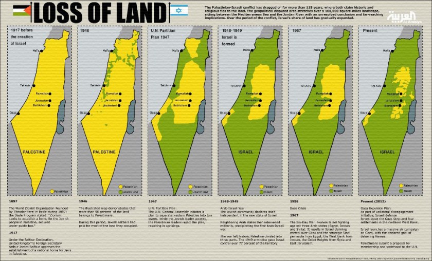
Zionism as a political movement started in 1897, the year the first Zionist Congress was held in Basel, Switzerland, which was convened by Theodore Herzl for the small minority of Jewry in agreement with the implementation of the Zionist goals of creating a national state for the Jewish people in Palestine.
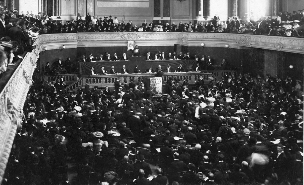
It was after the First Zionist Congress that “The Protocols of the Elders of Zion” was first published in Russia in 1903.
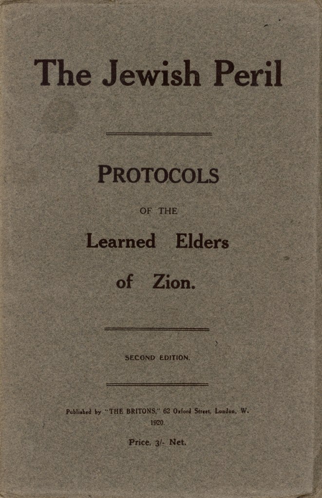
A text describing a Jewish plan for global domination, it has been widely called an anti-semitic forgery.
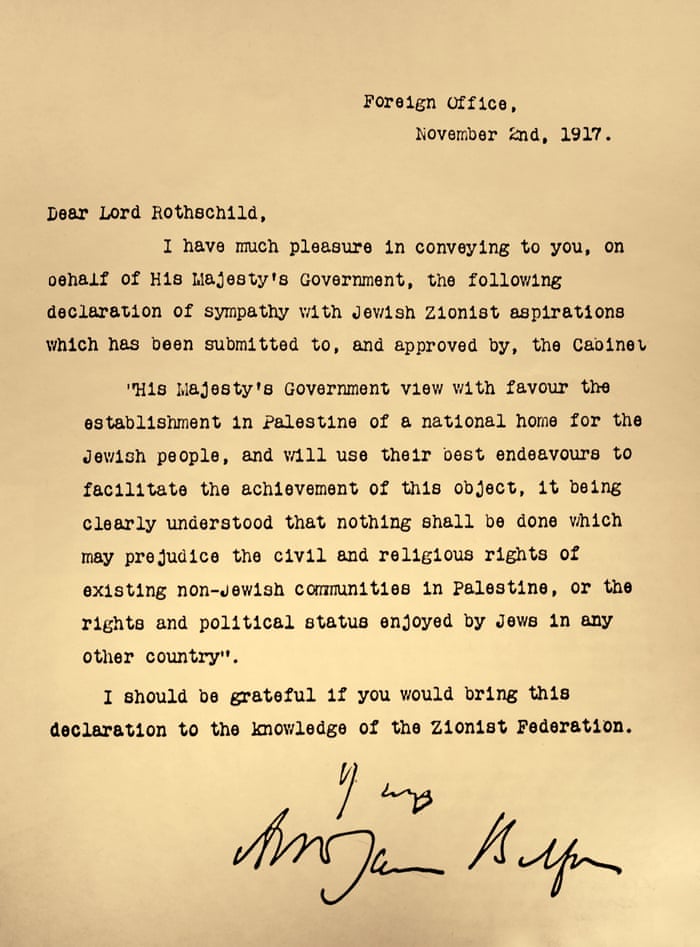
In 1917, the Balfour Declaration was issued by the British government, during the first World War, announcing the support for the establishment of a national home for the Jewish people, written by the Foreign Secretary Arthur Balfour to Lord Rothschild, a leader of the British Jewish community…
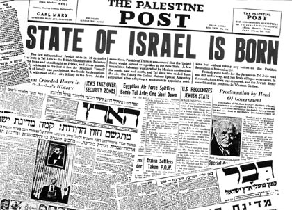
…and in 1948 the State of Israel was formed in the part of the Middle East where Palestine was located.
What if the Twelve Tribes of Israel were not from a specific location on the Earth, but an integral part of the original worldwide civilization?

Now, I want to a look at the significance of Zion to the Mormons.
Among other things in Mormonism, Zion is a metaphor for a unified Society of Latter Day Saints, metaphorically gathered as members of the Church of Christ, and in this sense, any stake of the Church may be referred to as a “Stake of Zion.”
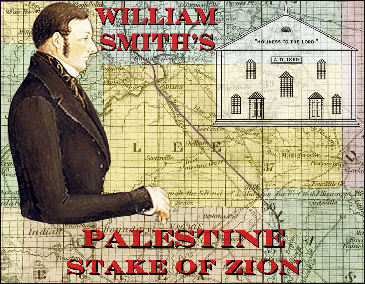
A stake the the name given to administrative units composed of multiple congregations in certain denominations of the Church, like the Palestine Stake of Zion, in Palestine, Illinois.
I want to go back to “The Pioneer Call” on the “Rexburg Stake Pioneers” Marker, where Zion was mentioned…
…in “The Pioneer Call” inscribed on it:
“Go into the Snake River Country, found settlements, care for the Indians, stand upon and equal footing, and Co-operate in making improvements…Gain influence among all men, and strengthen the cords of the Stakes of Zion.”
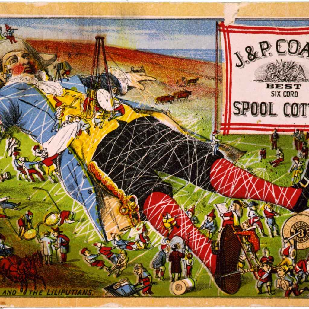
To me the imagery evoked of “strengthen the cords of the Stakes of Zion” is not benevolent.
It evokes to me the image of binding something or someone to stakes of some kind, like the giant Gulliver by the tiny Lilliputians.
Then there was what Joseph Smith, the founder of Mormonism and the Latter Day Saint movement, believed, that the entirety of the Americas was Zion.
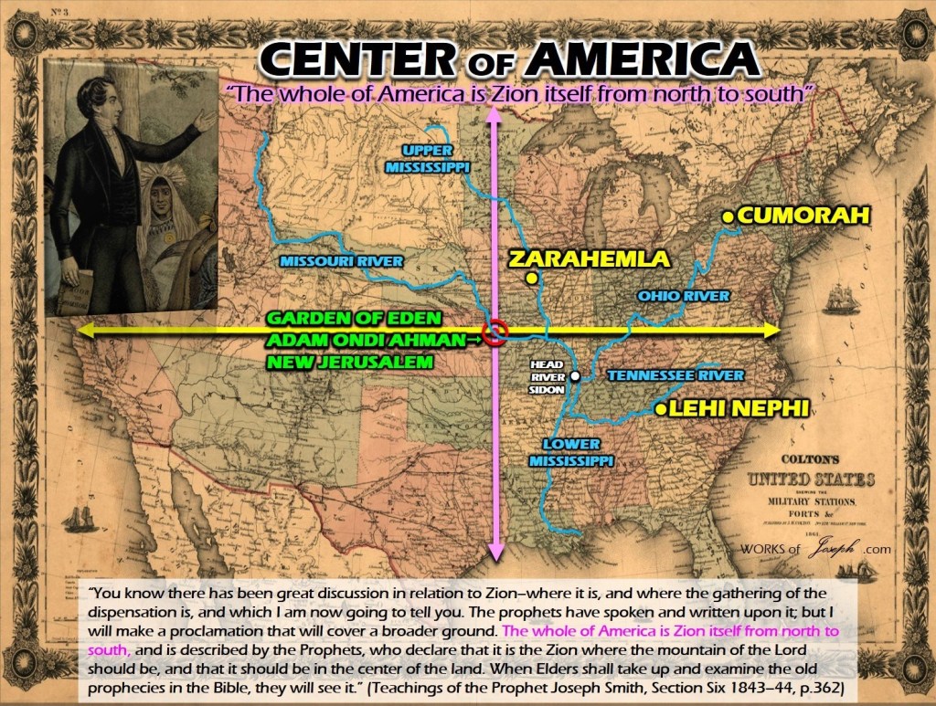
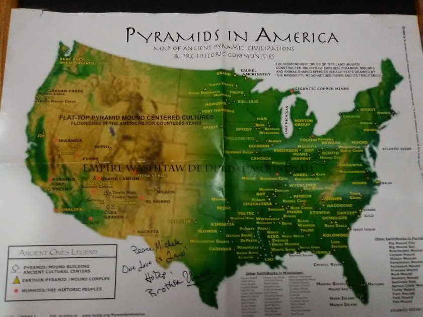
Since there was already an advanced civilization in all of the Americas, what happened to it, especially in North America, where we are taught to believe empty land was available for the taking and the indigenous people were all hunter-gatherers.
Who was responsible for completely re-writing the historical narrative in favor on the newcomers to this land, who took credit themselves for everything that was here before?
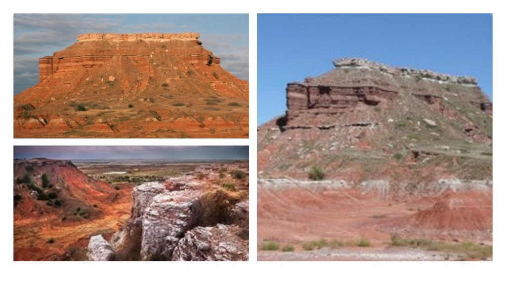
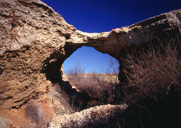
Next along the solar eclipse’s path of totality, we cross into Nebraska, over places like Scotts Bluff National Monument, a National Park Service site that protects over 3,000 acres, or 1,214 hectares, of overland trail remnants, mixed-grass prairie, badlands, and towering bluffs.
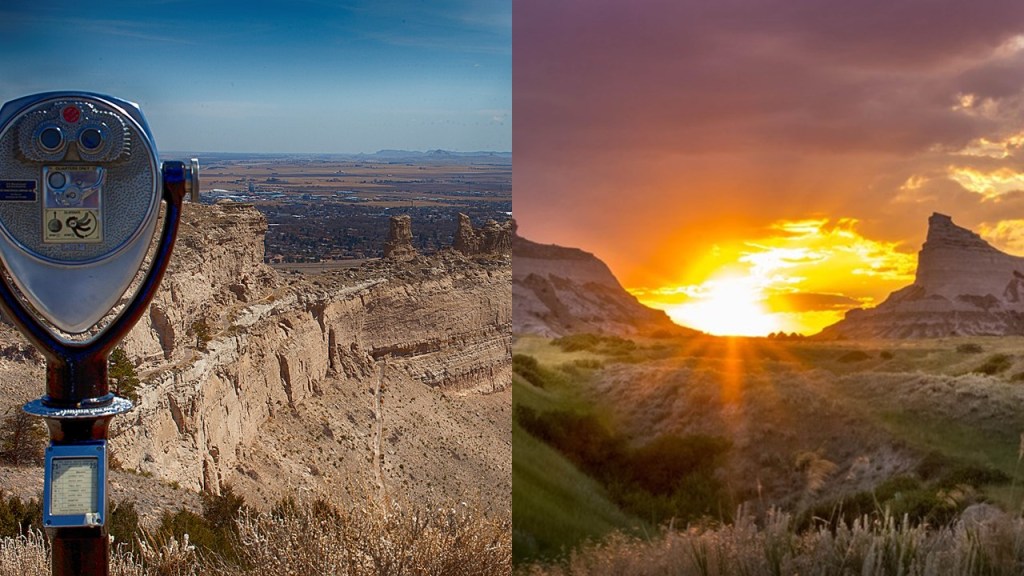
The north bluff was named after Hiram Scott, a clerk for the Rocky Mountain Fur Company who died near the bluff in 1828.
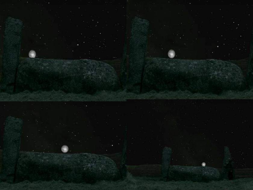
Could the photo of Scotts Bluff on the right be showing us an intentional solar alignment?
It’s not the first time I have seen one between so-called natural features, like the Twins just off-shore of the small island of Fernando de Noronha, located near the mainland Brazil…

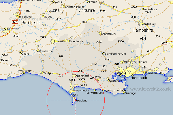
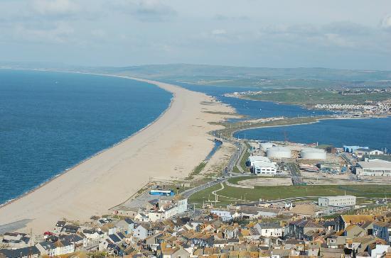
…Durdle Door, near Lulworth, England, in Dorset, during the winter solstice period…

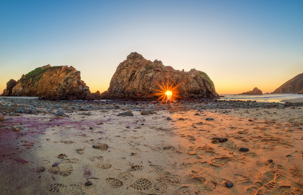
…and Keyhole Rock at Pfeiffer Beach at Big Sur in California, where light comes through the Keyhole arch during the winter solstice as well.
At any rate, Scotts Bluff served as an important landmark on the Oregon Trail, California Trail, Pony Express Trail, and was visible at a distance from the Mormon Trail, with fur traders, missionaries and military expeditions making regular trips past Scotts Bluff starting in the 1830s.
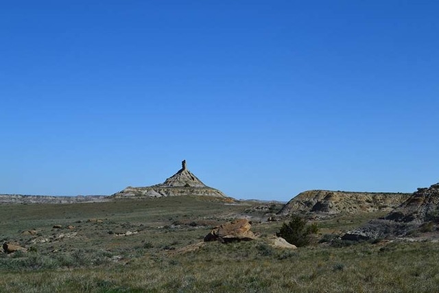
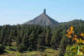
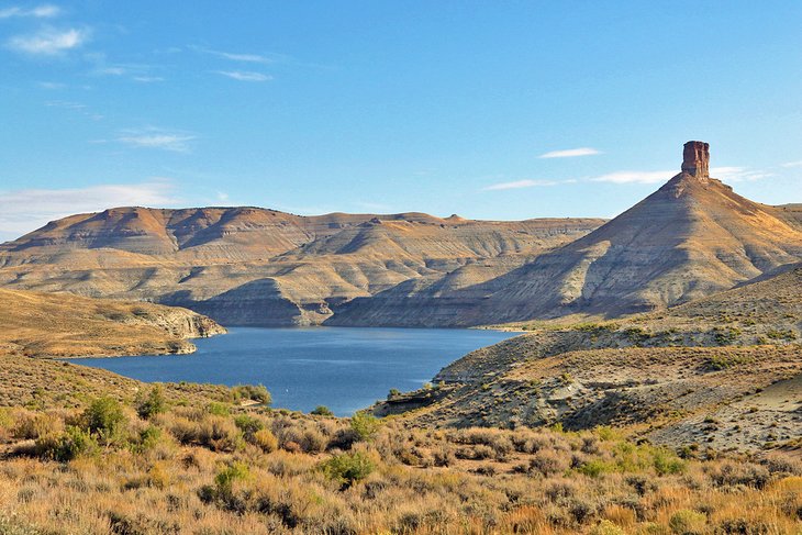
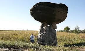
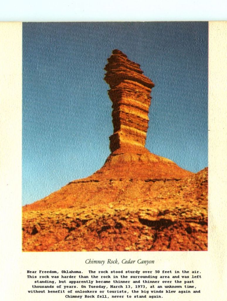
The Eclipse path also passed over what is called Chimney Rock in Nebraska…
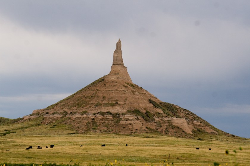
…which looks like the Chimney Rock found in the Terry badlands of eastern Montana…
…the Chimney Rock National Monument in southwest Colorado…
…and the same idea is found at Wyoming’s Flaming Gorge.
They all look like pyramids…with antennas.
Next, we cross the Sand Hills of Nebraska…
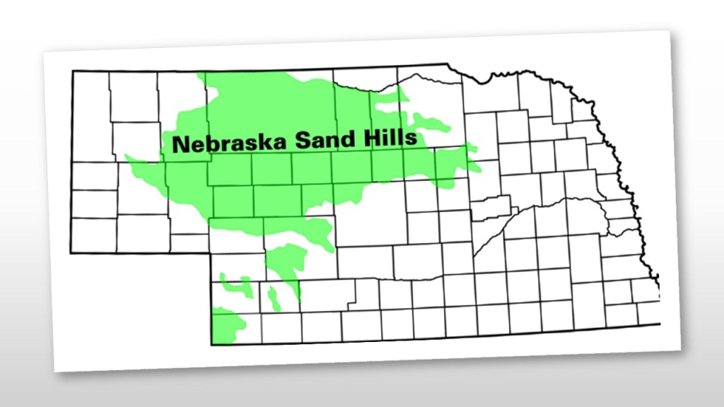
…described as a region of mixed-grass prairie on grass-stabilized sand dunes, covering over a quarter of the state.
The sand hills are on top of the massive Oglalla Aquifer, and shallow lakes are commonly found in low-lying valleys…
…and the region is drained by the Loup River…
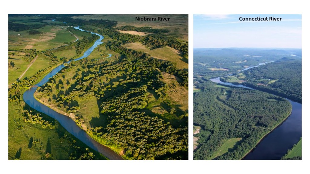
…and the Niobrara River.
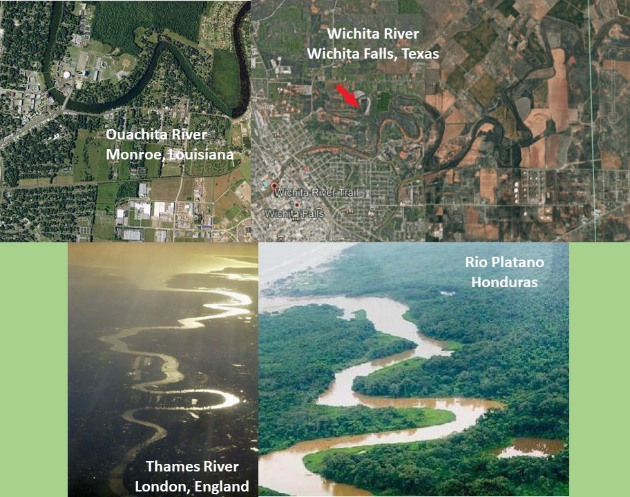
When I saw this view of the Niobrara River, it reminded me of this view of the Connecticut River, which is the state line between Vermont and New Hampshire in this photo on the right.
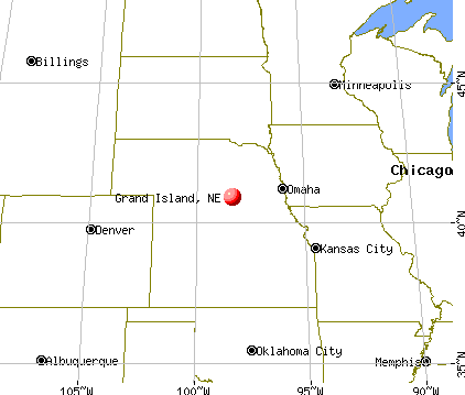
Moving along, Grand Island is directly on the total eclipse path, and is the seat of Nebraska’s Hall County.
Hall County and Grand Island were founded by German Settlers in 1857.

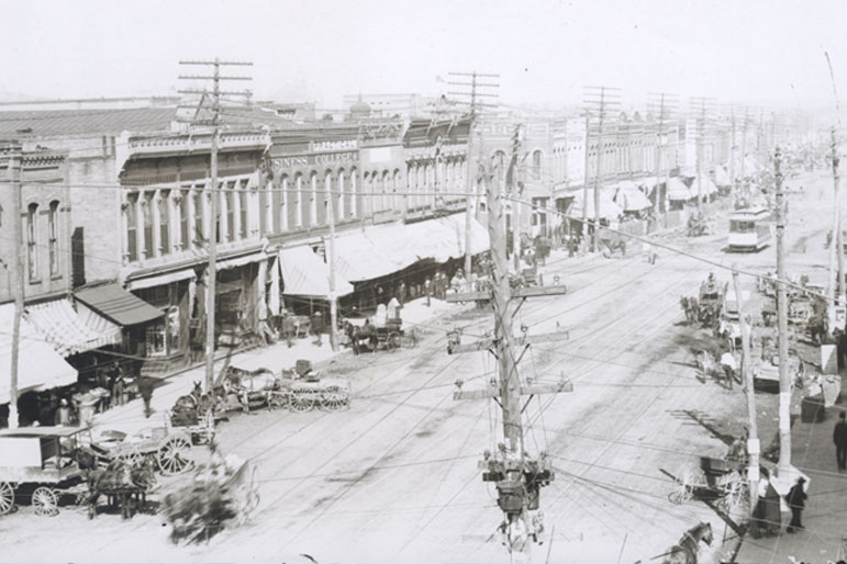
The Grand Island Downtown Historic District is a roughly six-block stretch along West Third Street that has served as the commercial center of town since its development in the 1870s, and was added to the National Register of Historic Places in 2017.
Here is a comparison between Grand Island’s Downtown Historic District way back when, and now.

Does it appear we have progressed since then…or have we regressed?
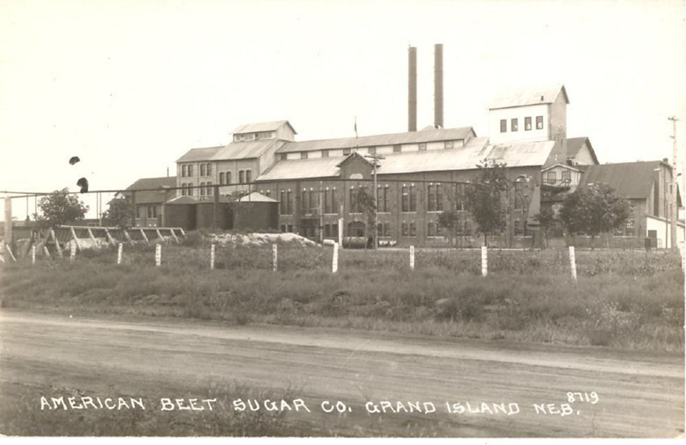
The first successful sugar beet factory in the United States was said to have been in Grand Island, and was in operation between 1890 and 1964.
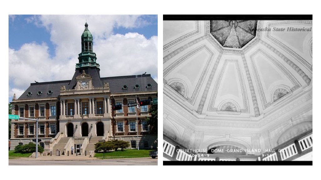
The Hall County Courthouse in Grand Island was said to have been built in 1902, and Thomas Rogers Kimball was the architect.
This is the Federal Building in Grand Island, which now houses the post office, but at one time also housed the United States District Court for the District of Nebraska.
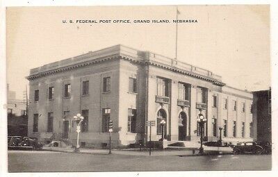
James Knox Taylor authorized the final architectural plans in 1908, and the building was said to have been officially opened in November of 1910.
Taylor was the Supervising Architect of the Treasury between 1897 and 1912, and his name is listed as a result of his position as the supervising architect of hundreds of federal buildings during his tenure with the Treasury Department.
It is interesting to note that there is an office for the United States Comptroller of the Currency (OCC) in Grand Island.

The OCC is an independent bureau of the U. S. Department of the Treasury that charters, regulates, and supervises all national banks, federal savings associations, and federal branches and agencies of foreign banks.
On June 3rd of 1980, Grand Island was hit by a massive supercell which spawned seven tornadoes through the course of the night.
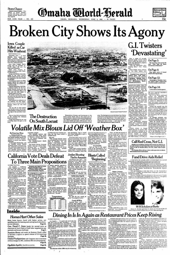
The part of the city that was the hardest hit was the South Locust Business District.

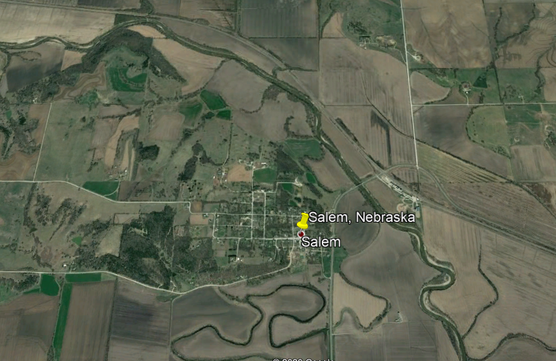
The next place we come to is Salem, a small village in Nebraska’s Richardson County that had a population of 112 in 2010.
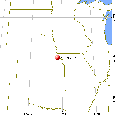
Well, I’ll take a look around and see what I can find in Salem, Nebraska.
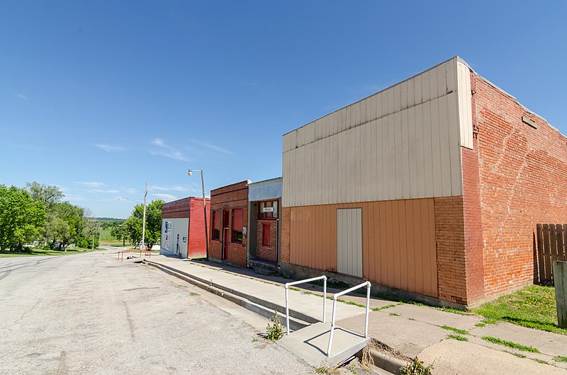
This building used to be, until quite recently, the Big Red Inn Bar and Grill on Main Street, in an old-brick building with a mud-flooded appearance, with the slanted street in the front, and the almost ground-level windows on the side.
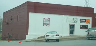
These old buildings are what remain standing from the end opposite what was the bar and grill.
Three men founded Salem in 1854, on land they purchased for $50, and the town was laid out in 1855 on the rise between the Great Nemaha River and its North Fork.
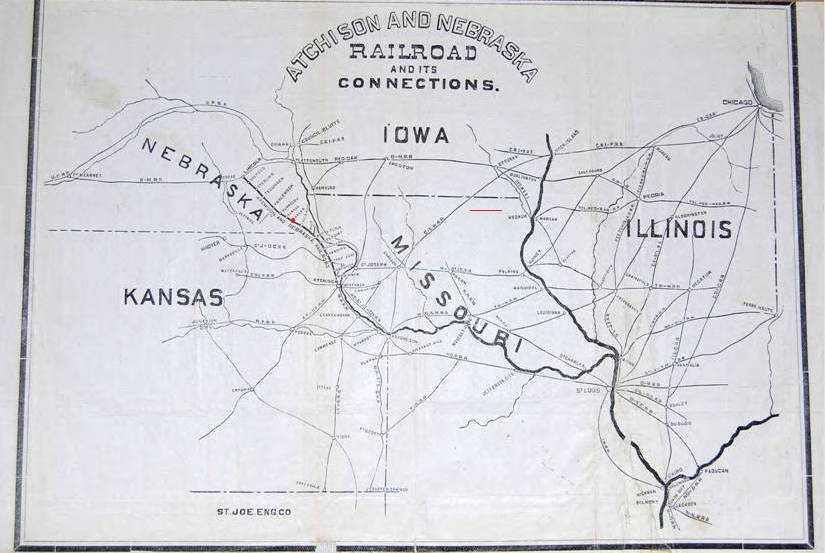
The Atchison and Nebraska Railroad started running trains from Atchison, Kansas, to Salem, Nebraska in 1871, and Salem in 1883 became a rail junction when a second line came in from Nemaha, Nebraska.
In 1910, a fire burned down almost the entire town, and the Salem has been in decline ever since.
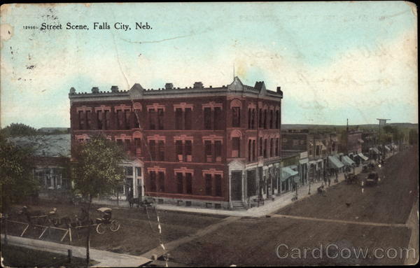
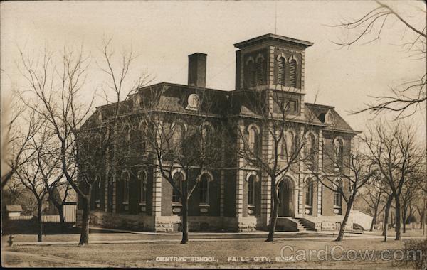
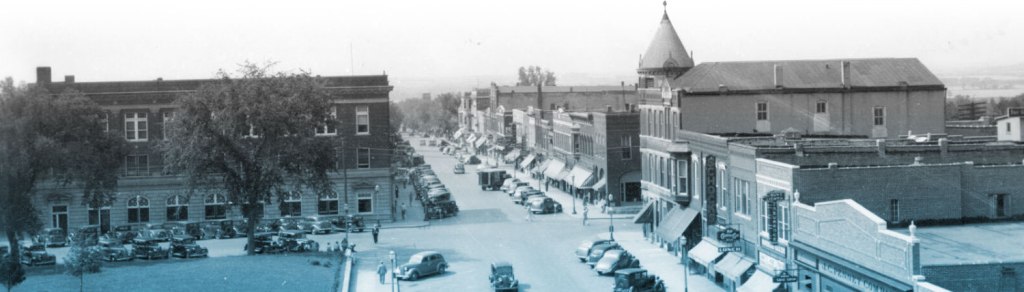
The nearby Falls City, founded in 1857 and the seat of Richardson County…
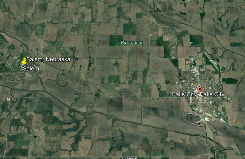
….has much more to find regarding historical architecture.

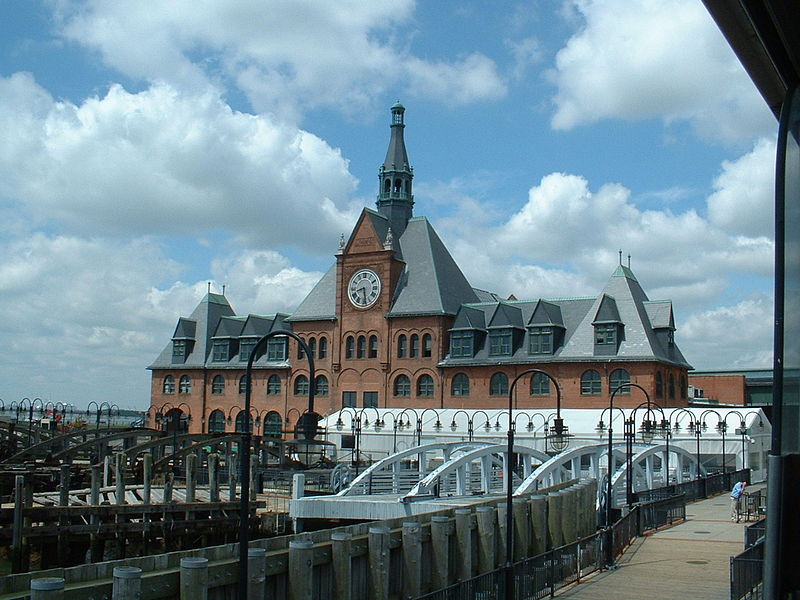
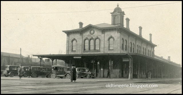
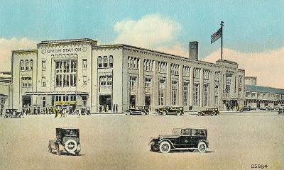
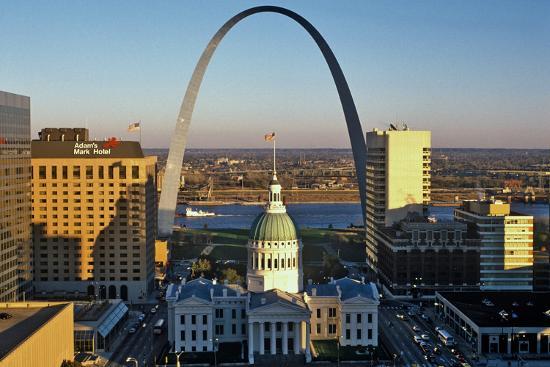
We come to St. Joseph, the seat of Missouri’s Buchanan County, next on the eclipse path.
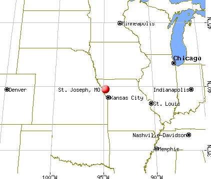
St. Joseph was founded by local fur trader Joseph Robidoux, and the city was incorporated in 1843.

It was the westernmost point in the United States accessible by rail until after the American Civil War…
…and the last supply point and jumping off point on the Missouri River for wagon trains heading westward.

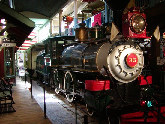
Known as the “Home of where the Pony Express started, and Jesse James ended,” St. Joseph was one of two end-points of the Pony Express, the first fast mail-line across the North American continent, with the other end-point being Sacramento in California.
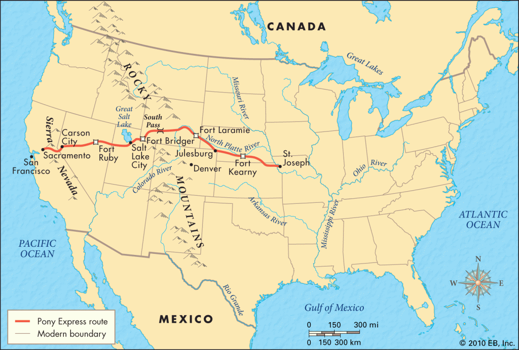
The Pony Express only operated for 18-months, from April of 1860 to October of 1861.
I came across this ad seeking Pony Express riders…interestingly worded!!

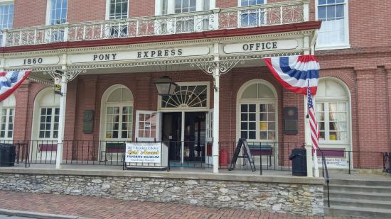
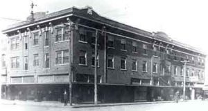
The headquarters of the Pony Express were housed in the Patee House, built by John Patee, the construction of which we are told was completed in 1858, and was a 140-room, luxury hotel.
It was said to have been built as development around the Hannibal and St. Joseph Railroad, the first railroad to cross Missouri, and the construction of the railroad was said to have been started in 1851 and completed in 1859.

The railroad carried the first letter to the Pony Express on April 3rd of 1860.
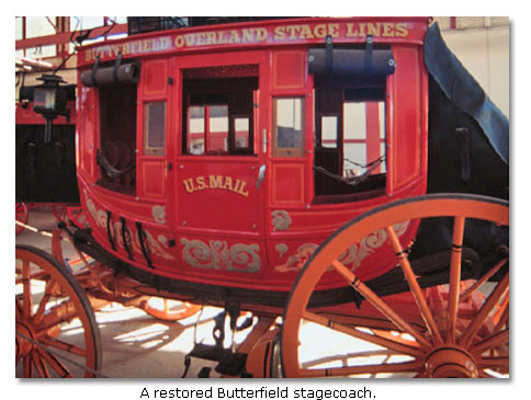
The overland stagecoach replaced the Pony Express in 1861.
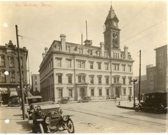
The St. Joseph City Hall was said to have been built in the Italian Renaissance Revival style between 1926 and 1927, and designed by the architectural firm of Eckel and Aldrich.
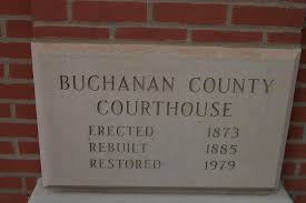
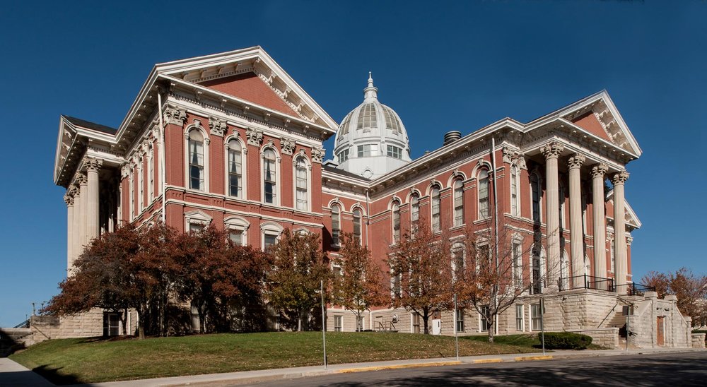
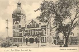
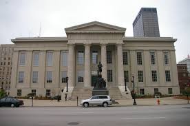
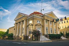
The Buchanan County Courthouse in St. Joseph was said to have been first built in 1873…
…and today is a Renaissance Revival-style brick building featuring pedimented porticos with Corinthian columns, and a central dome made of glass-and-tin.
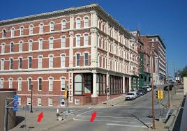
This is a view of the intersection of Francis Street and North 4th Street in downtown St. Louis, with the same mud-flooded appearance of the slanted street in the front, and the ground-level windows on the side that we saw back at the bar-and-grill in Salem, Nebraska…
This picture was notated as having been taken in December of 1914 of the Lyceum Theater and Robidoux Hotel in St. Joseph, also with a mud-flooded appearance going on here.
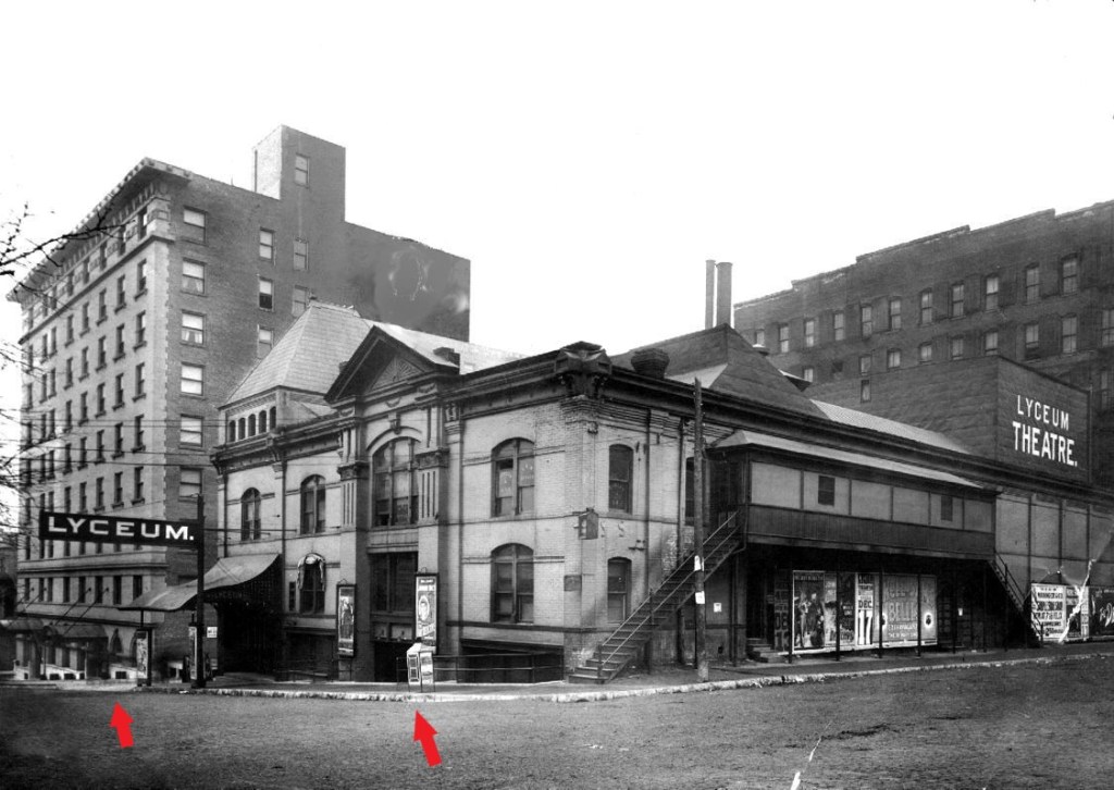
We are told that after the Robidoux Hotel was built, there was a need for hotel parking space, and eventually the Lyceum Theater was converted into a parking garage.
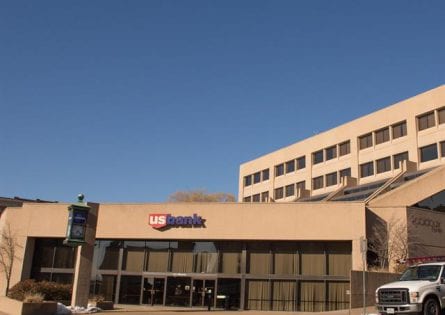
As a result of urban renewal in the downtown core of the city, we are told, both the Lyceum and Robidoux Hotel buildings were demolished, and today the site is the home of a U. S. Bank branch building.
The Missouri Theater building in St. Joseph were said to have been designed by the Boller Brothers of Kansas City, Missouri, in the Atmospheric style, using a combination of Art Deco and Moorish detailing, and completed in 1927.
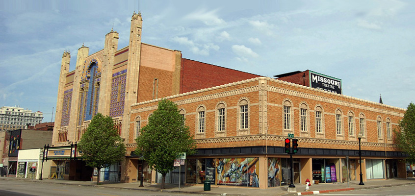
The Boller Brothers, Carl Heinrich and Robert Otto, were credited with the design of almost 100 classic theaters in the midwestern United States in the first-half of the 20th-century.
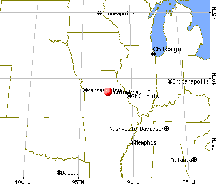
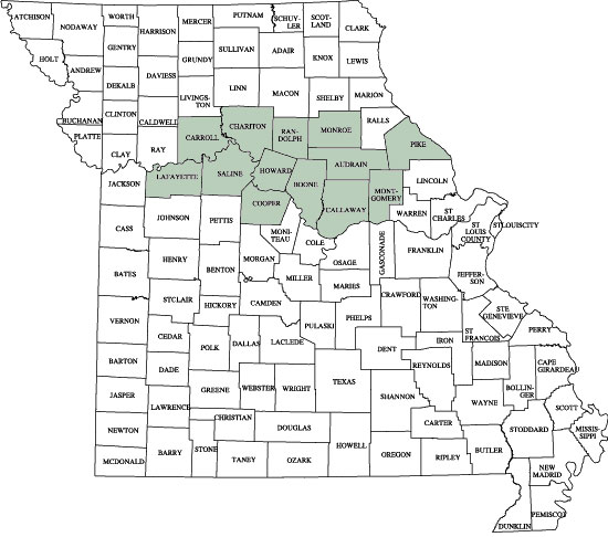
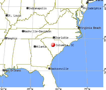
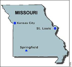
The next stop on the eclipse path is Columbia, the seat of Missouri’s Boone County and fourth-largest city.
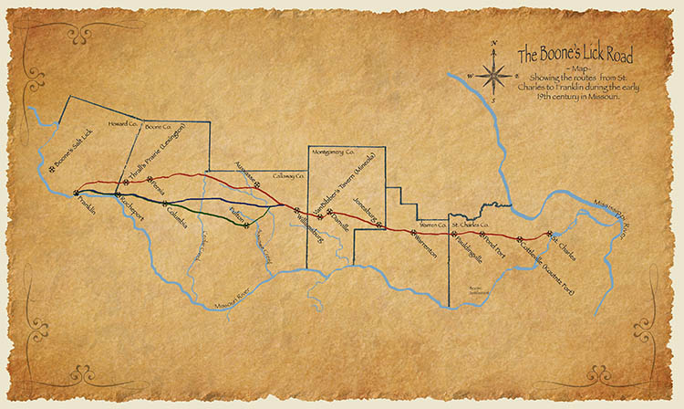
We are told Columbia’s origins begin with the settlement of American pioneers from Kentucky and Virginia in a region known as the Boonslick, or Boone’s Lick Country, in the early 1800s.
It is a cultural region along the Missouri River that was important in the westward expansion of the United States and Missouri’s statehood in the early 19th-century.
The Boone’s Lick Road was the primary thoroughfare for settlers moving westward from St. Louis, and its terminus in Franklin marked the beginning of the Santa Fe Trail, which became a major conduit for trade in the southwestern United States.
It was the earliest precursor to Interstate 70.
Columbia was founded in 1821, and chosen as the seat of Boone County, named after Daniel Boone, and Boone’s Lick Road was re-routed down Broadway.

The Daniel Boone Hotel and Tavern in Columbia was said to have been built on Broadway between Seventh and Eighth Streets in 1917 and was considered the nicest hotel and tavern between Kansas City, Missouri, and St. Louis, Missouri – which Columbia is located half-way between.
The hotel and tavern closed 50-years later, and it burned in the early 1970s.
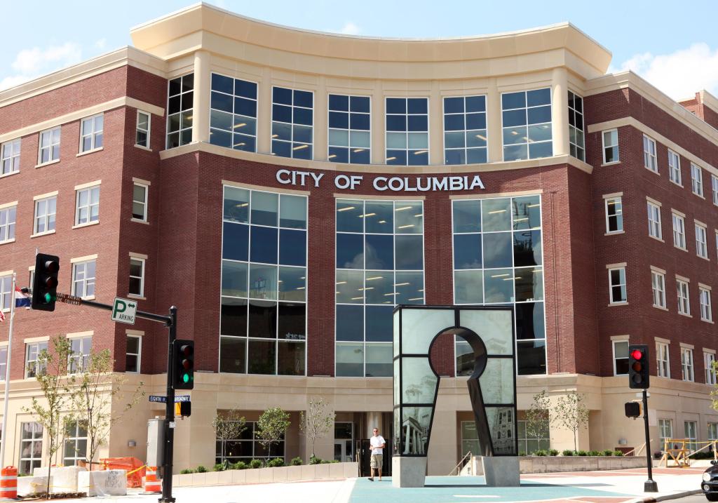
The city and country jointly bought the building in 1972 and converted it into city and county office space and today is part of Columbia’s City Hall…
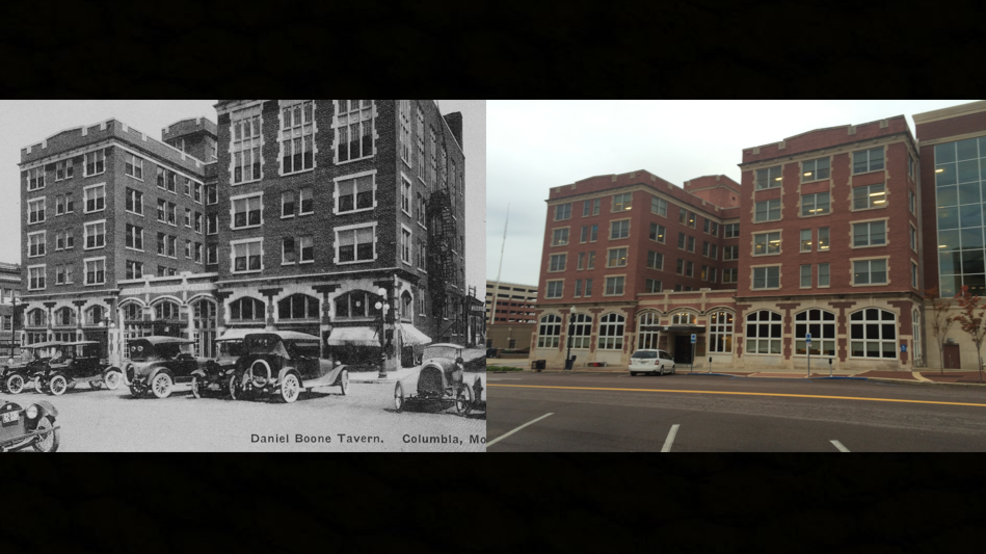
…which had a major addition and restoration that was completed in 2011, along with a matching five-story structure.
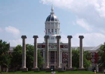
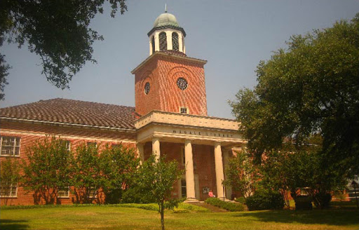
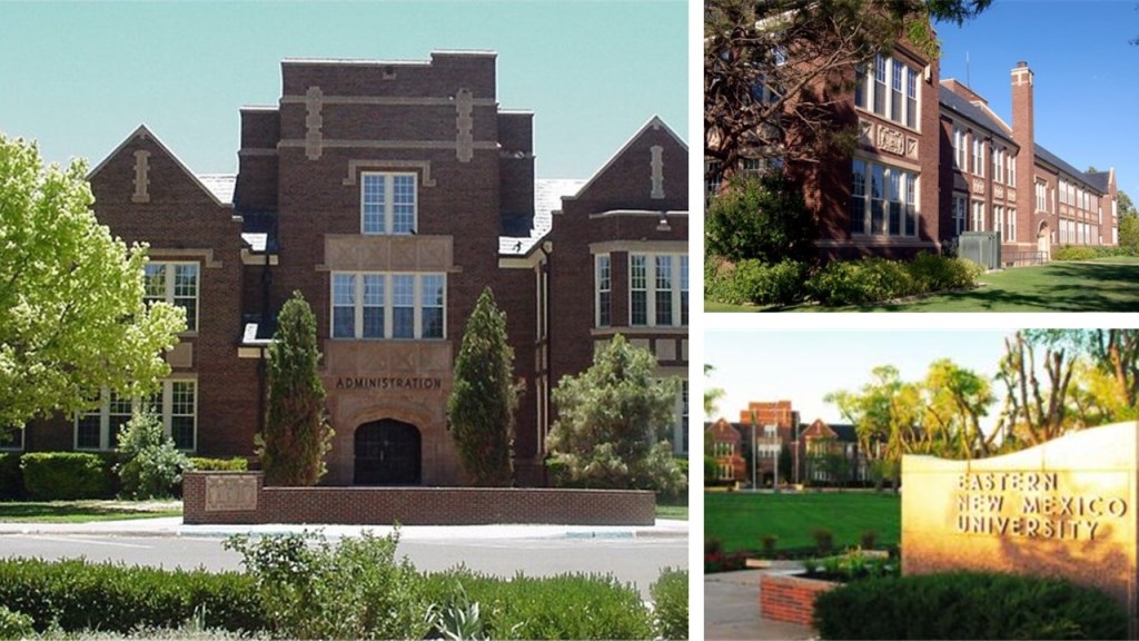
Columbia is home to the University of Missouri, which was founded in 1839 and the first public university west of the Mississippi River.
In the background of this photo is Jesse Hall, its main administration building, said to have been completed in 1895, and in the foreground are what are called “The Columns,” said to be all that remains of Jesse Hall’s predecessor Academic Hall, which burned in 1892.
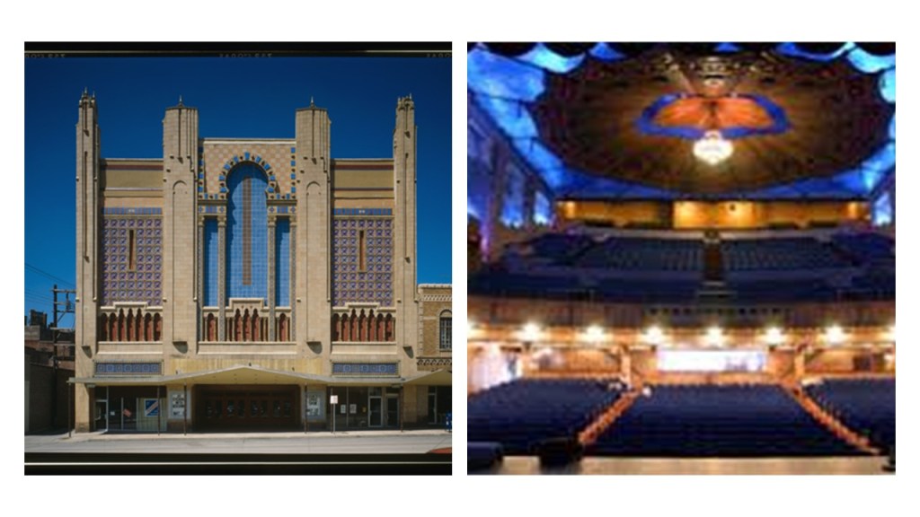
The Missouri Theater in Columbia was also credited to the prolific Boller Brothers, and said to have been built in 1928.
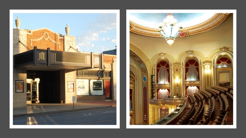
It is Columbia’s only surviving, pre-Depression movie palace and Vaudeville stage, and is the resident home of the Missouri Symphony Orchestra.
As of July 1st of 2014, the University of Missouri took over ownership of the theater, and it is one of the main performance venues for the University of Missouri School of Music.
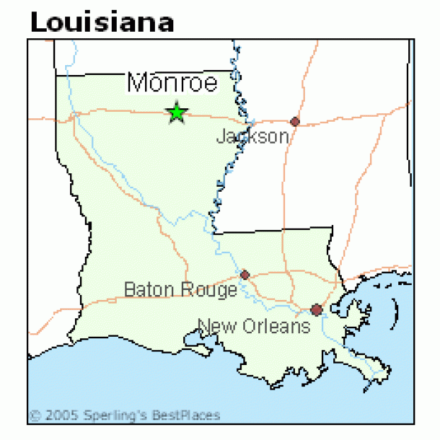
Next we come to Salem, the seat of Missouri’s Dent County, and, unlike the Salems of Idaho, Wyoming, and Nebraska, it is still a functioning city, with a population of almost 5,000 according to the 2010 census.
Salem is located a few miles north of the Ozark Scenic Riverways, a recreational unit of the National Park Service in the Ozark Mountains of southern Missouri.
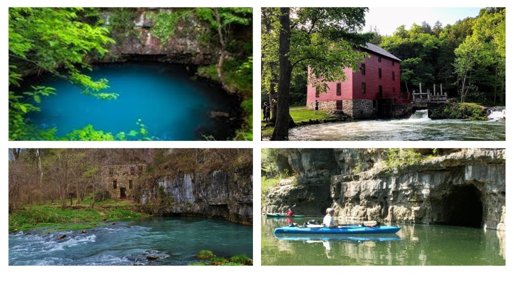
The park was created by an Act of Congress in 1964 to protect the Current and Jacks Fork Rivers.
Salem is also located close to Montauk State Park, which contains the headwaters of the Current River.
The dam and spillway in the hatchery area of the park was said to have been built by Company 1770 of the Civilian Conservation Corps (CCC) as part of a trout hatchery development project…

…and the CCC was also involved in the rehabilitation of an 1896 grist mill, which had replaced an earlier grist mill said to have been built in 1870.
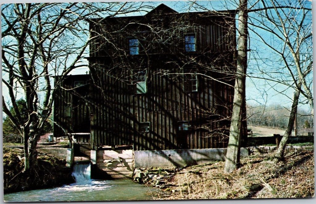
The 1896 grist mill has a gabled roof and a stone foundation.
Dent County was first explored and settled between 1818 and 1829, and in 1851, the Missouri Assembly created Dent County from portions of other counties.
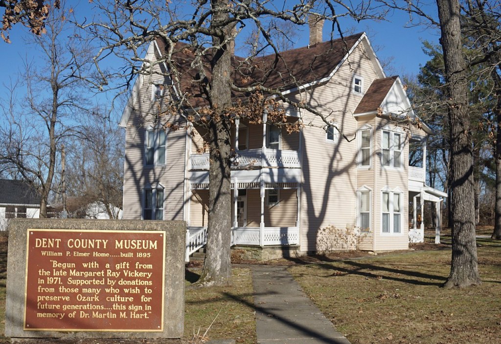
The Dent County Museum is housed in Salem in the former home of William P. Elmer, a one-term U. S. Representative from Missouri in the 1940s.
The Dent County Courthouse in Salem was said to have been completed in 1870 as a Second Empire architectural style brick-building with a hewn-limestone foundation, with an addition constructed in 1897.
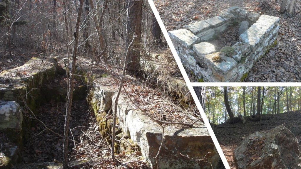
We are told the Nova Scotia furnace in eastern Dent County was the largest charcoal blast furnace in the world when it was built in 1881.
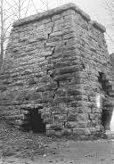
The town of Nova Scotia was home to at least 2,000 people until 1885, at which time it was completely abandoned afer the failure of its iron mine and depletion of the surrounding timber supply.
The location of Nova Scotia was completely consumed by the Mark Twain National Forest, of which we are told only industrial ruins and traces remain.
We are told that in 1872, the voters of Dent County passed a $100,000 bond issue to bring the railroad to Salem, and that by 1873 the railroad was extended to the Simmons Hill iron mine just south of Salem.
Eventually called the St. Louis, Salem, and Little Rock Railroad, it was said to have been conceived by a St. Louis family by the name of Lee who had iron mines in Dent County, and needed a way to transport their iron ore.
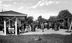
This was the Frisco Railroad Depot on North Grand Street in Salem, circa 1893.
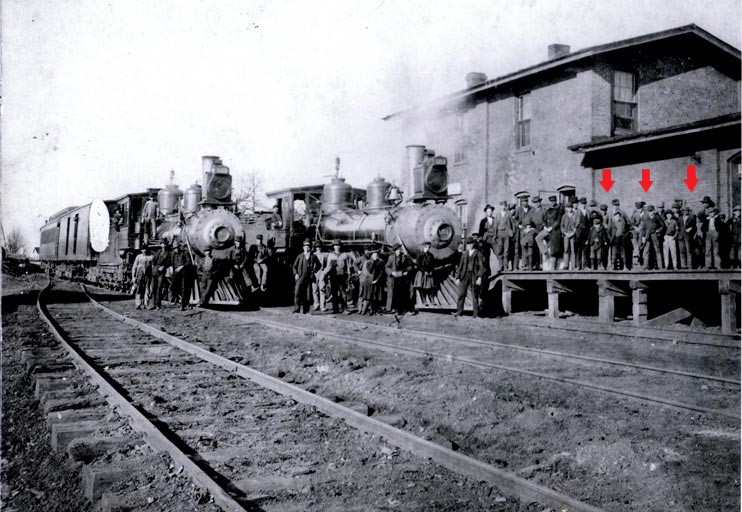
There looks to me to be quite a few young folks in the crowd on the platform….
Electricity came to Salem in 1909 with the formation of the Salem Light & Power Company, and the city continued to prosper.
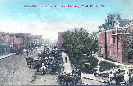
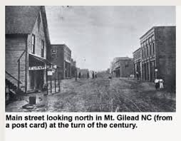
This is a photo of Salem back-in-the-day of Salem’s Main Street looking westward.
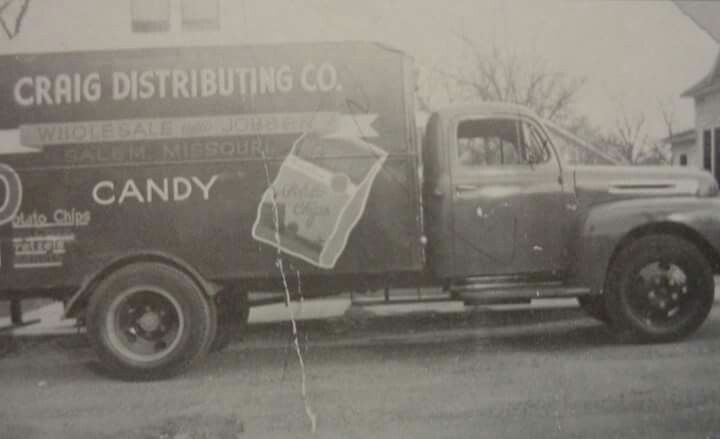
Today’s largest employer in Salem is U. S. Foods…

…which ended up in Salem from a family-owned distribution business known as Craig Distributing after World War II.
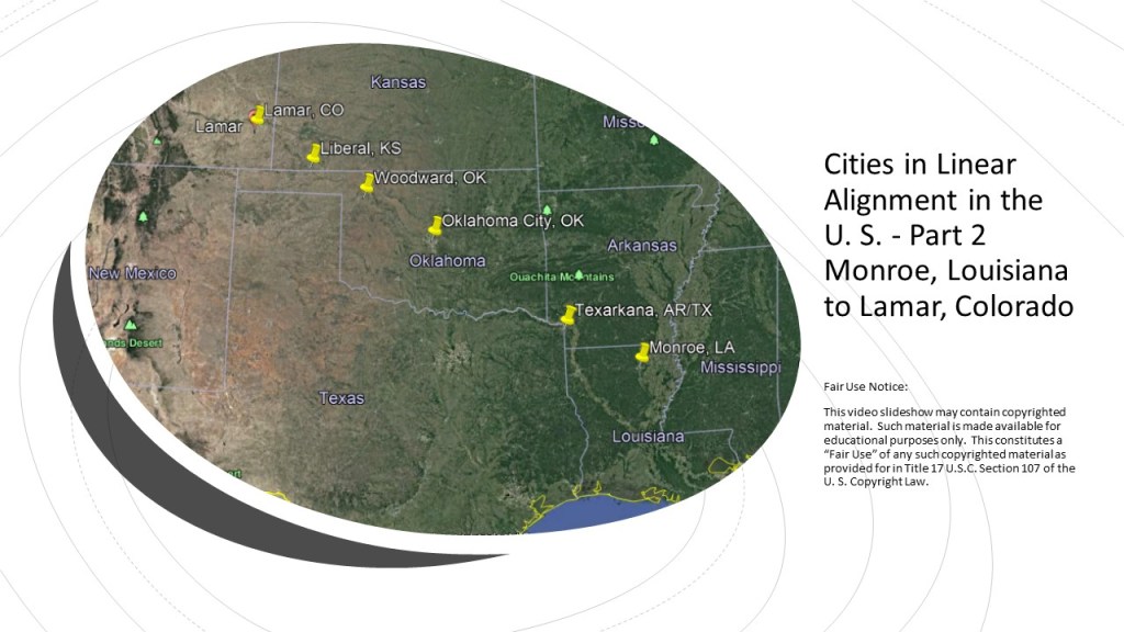
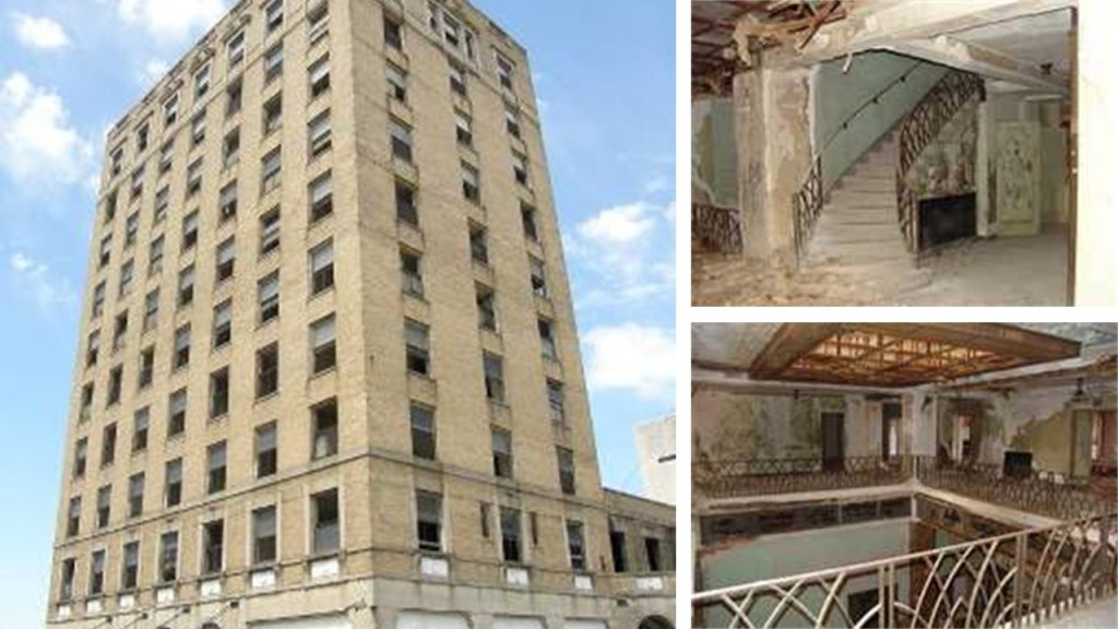
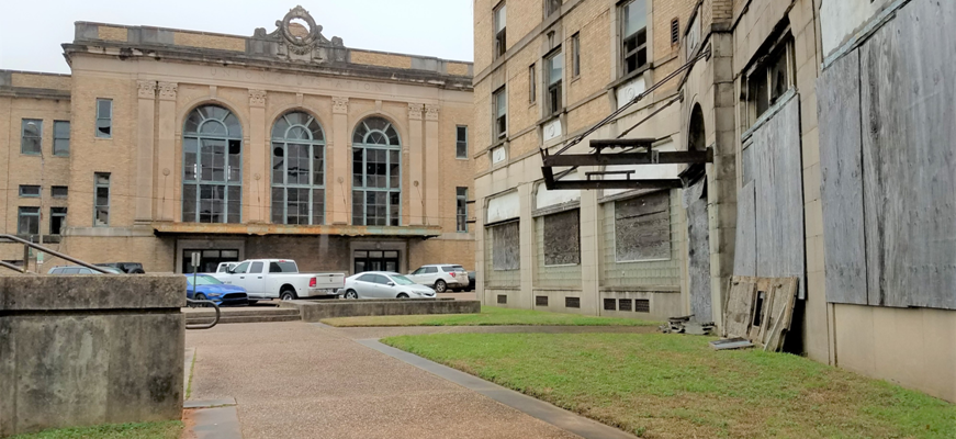
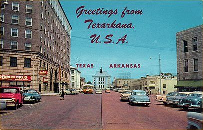
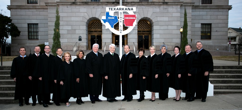
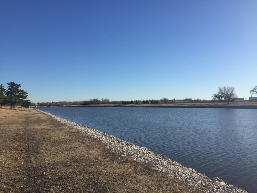
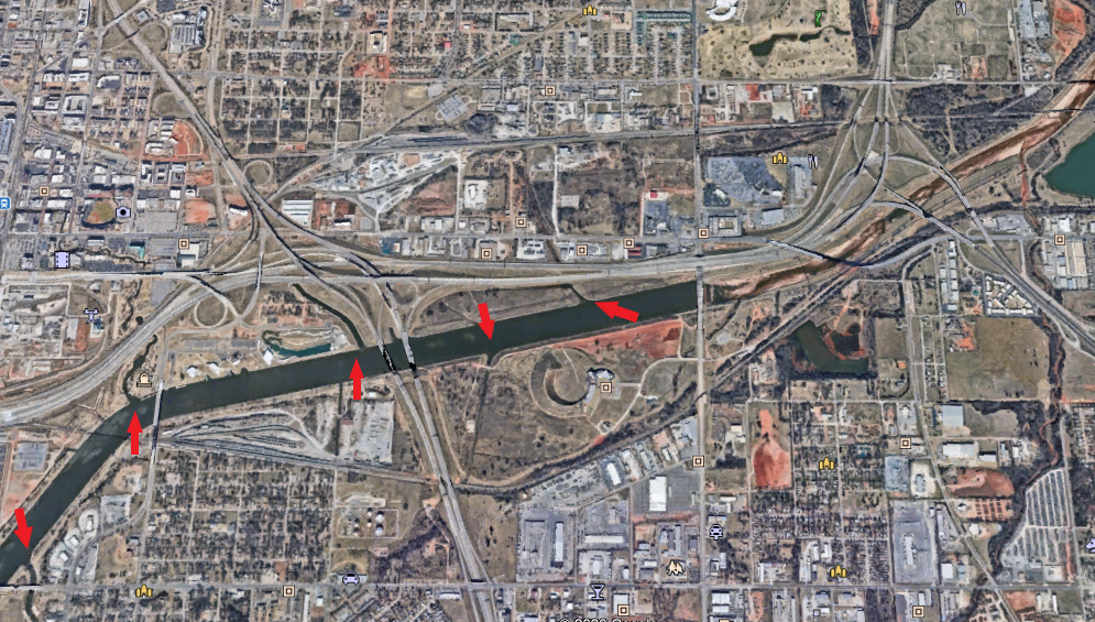
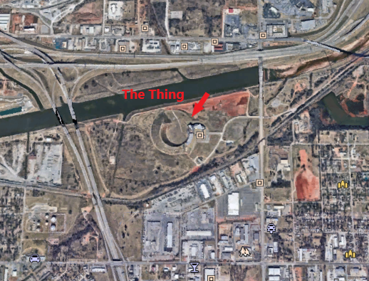
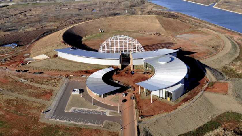
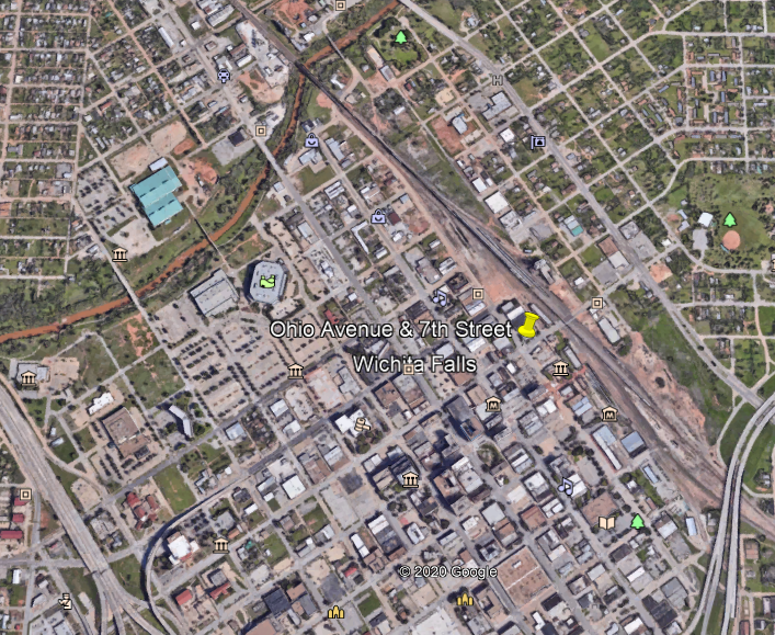
After leaving Salem, Missouri, we come to a location on the eclipse’s path of totality that is noteworthy for a variety of reasons, and not only because it is the exact location where the 2024 solar eclipse path of totality crosses the 2017 path.
I had already found one Salem in Illinois near Carbondale from a commenter who knows the area…
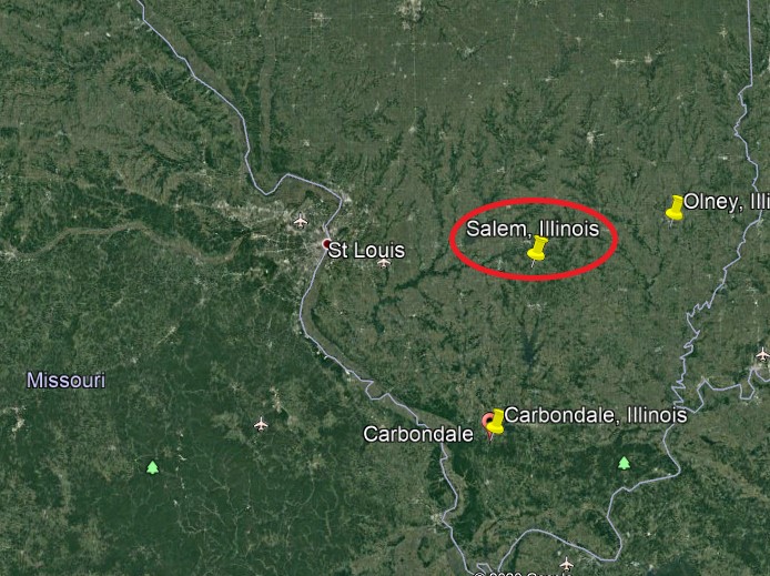
…when another commenter informed me that there are 9 Salems all together along the 2024 solar eclipse path of totality!
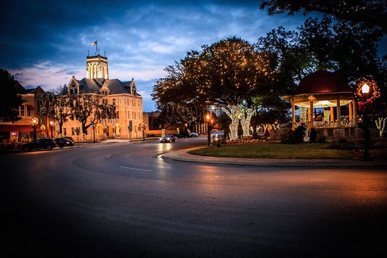
She relayed to me that they were the towns named Salem in Texas, Arkansas, Missouri, Illinois, Kentucky, Indiana, Ohio, New York, Maine, New Brunswick & Newfoundland.
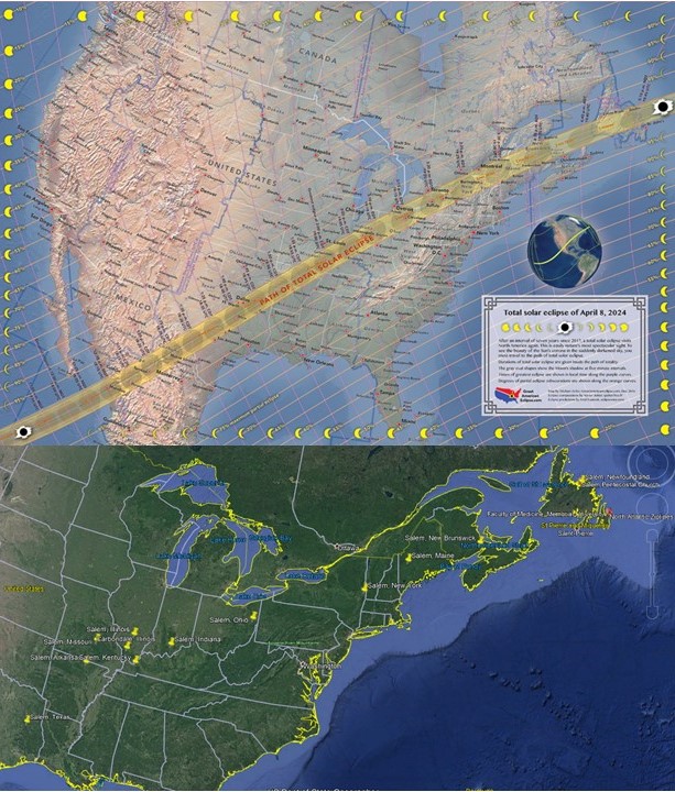
I think it is accurate to say that most of these nine Salems are directly on, and several are near but not directly on, the 2024 eclipses path of totality.
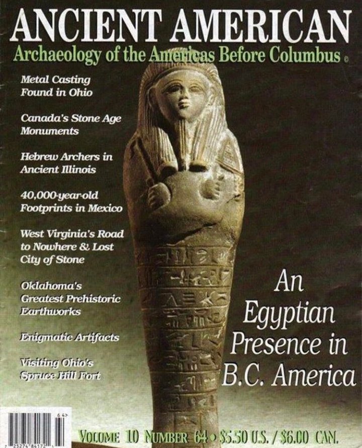
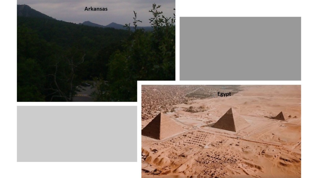
Carbondale, and southern Illinois in general, is known as “Little Egypt.”
Why would that be?
The reasons we are given include this one:
The name arose in the 1830s, when cold weather caused a very poor harvest in the northern part of Illinois, with the winter between 1830 and 1831 being known as “the winter of deep snow.”
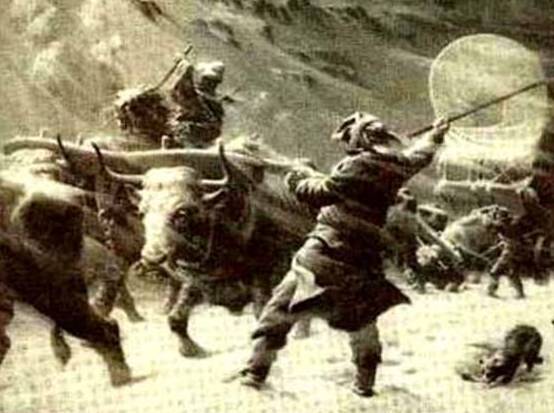
Due to lack of food, droves of people headed to southern Illinois and the Carbondale region, which became known as Little Egypt because the northerners likened themselves to the children of Israel, who in time of famine were forced to head south to Egypt in search of food for their families.
Might there be another reason this area is called “Little Egypt?”
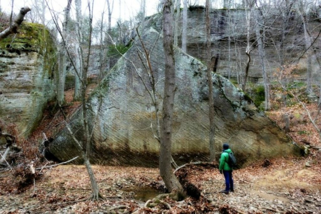
This picture of a massive pyramidal-shaped stone surrounded by what appear to be stone walls was taken at the Bell Smith Springs Recreation area in the Shawnee National Forest in Ozark, Illinois.
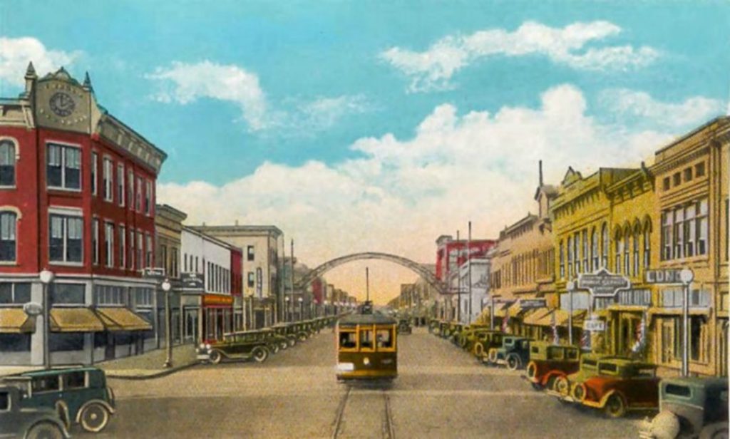
The city of Cairo, Illinois, was located at the southernmost point in Illinois, where the Mississippi and Ohio Rivers meet…
…but today, Cairo is empty and deserted, and considered a ghost town…
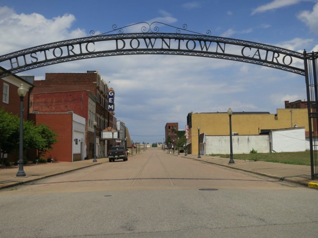
In its heyday, Cairo was an important city along the steamboat routes and railway lines.
There are several other places in Illinois with Egyptian names besides Cairo: Carmi, Karnak, Goshen, Thebes, and Dongola.
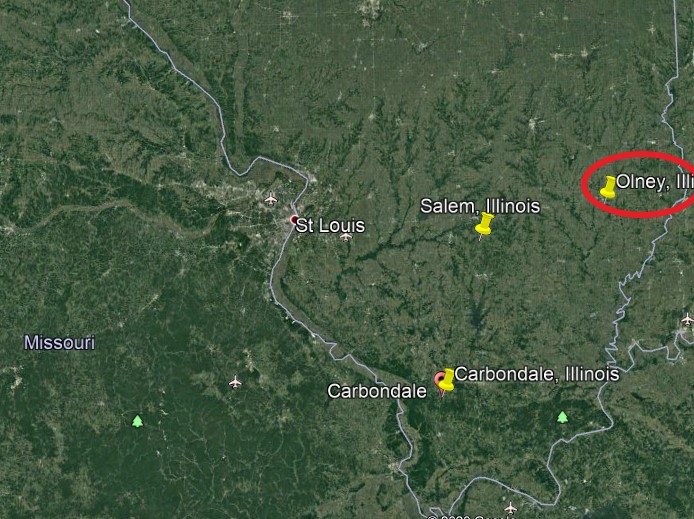
Olney, Illinois is located 128-miles, or 206-kilometers, from Carbondale, which is known to be the geographic location of Burrows Cave.
Burrows Cave was the name given to a cave site that a man named Russell Burrows discovered on a hillside near the Ohio River when he was looking for Civil War-era artifacts.
While he was looking around, he fell into a hole that led him to a cave system containing thirteen crypts…
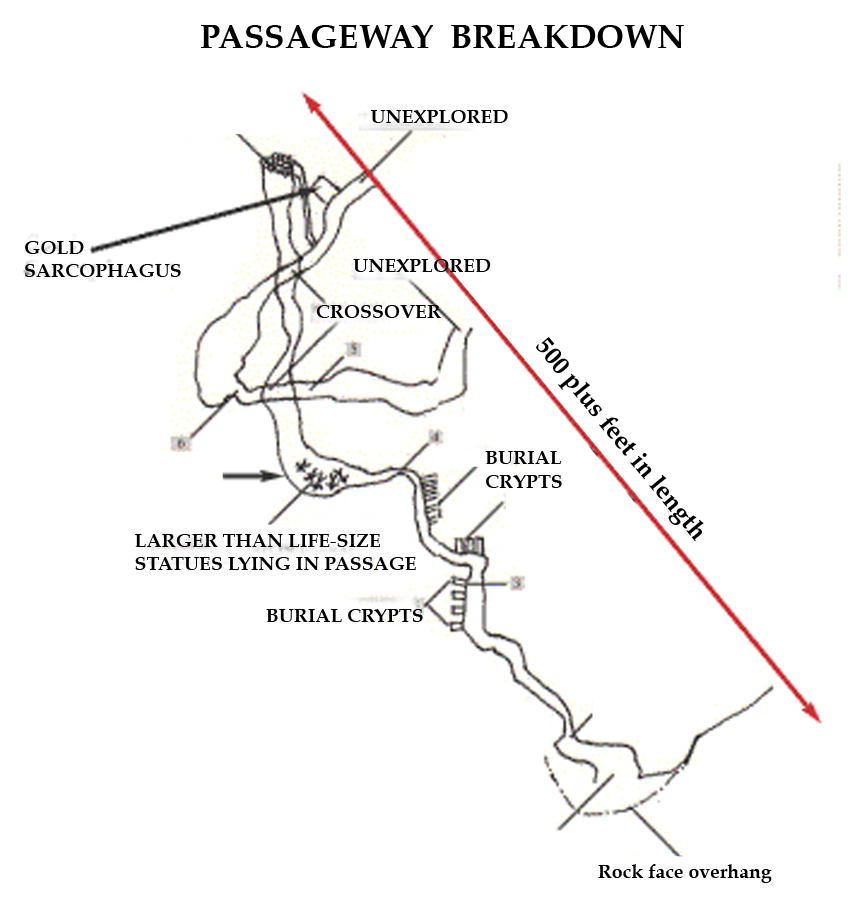
…and filled with ancient artifacts of all kinds.
Burrows kept the cave’s location a secret and took out artifacts for the purpose of selling them.
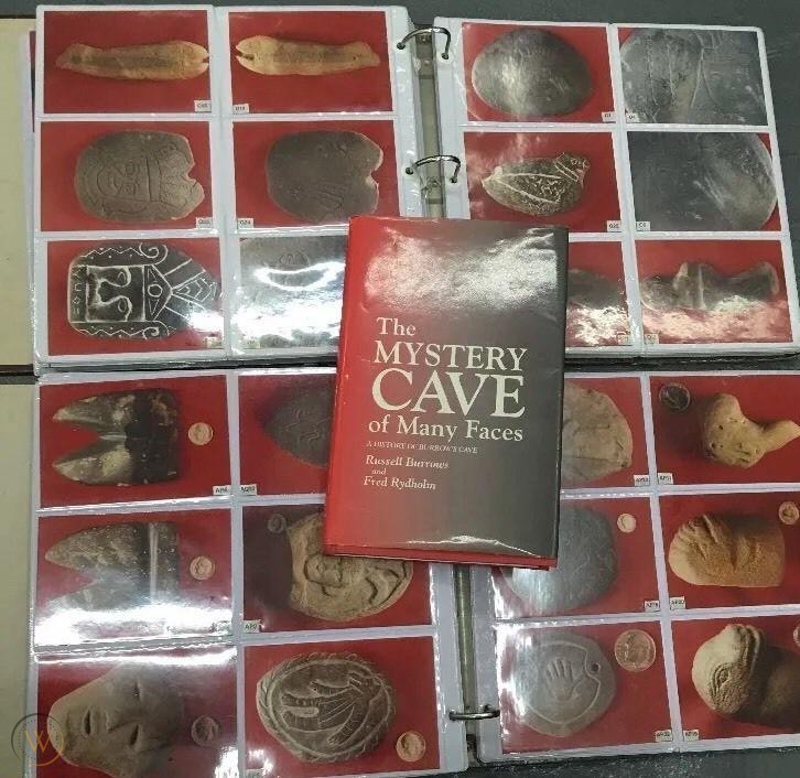
Eventually Russell Burrows blew-up the cave’s entrance, thereby sealing it off permanently.
Burrows Cave is the subject of a book I read a while back by Frank Joseph called “The Lost Treasure of King Juba – the Evidence of Africans in America before Columbus.”

In this book, he explores the idea that the cave was the destination of King Juba II of Mauretania, and his wife Cleopatra Selene and here brother Alexander Helios, the twin children of Cleopatra and Marc Antony, and others, fleeing the Romans with their treasures to rebuild their society in North America.
It was in this book that I first learned of the Washitaw Mu’urs, about which learning more about them, and bringing forward their missing history, has been very much a part of my journey in the work that I am doing.

Was Egypt, and Israel for that matter, in actual fact, already long-established in America, and not imported?
So back to Carbondale on the 2017 eclipse path.
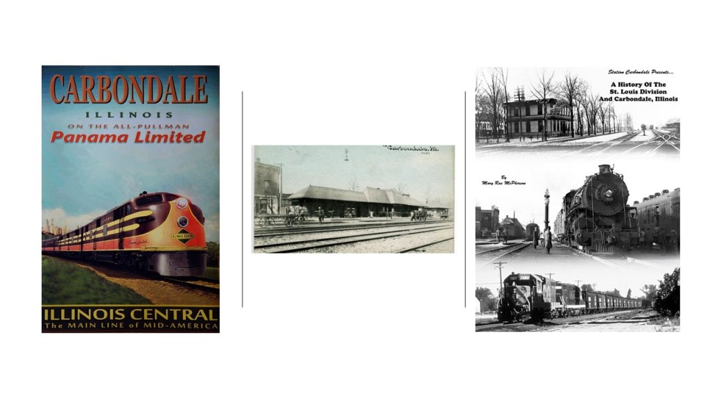
Carbondale was said to have developed starting in 1853 when three men purchased a parcel of land because of railroad construction there, and named for the large coal deposit in the area.
It was incorporated in 1856.
The first train came through Carbondale on July 4th of 1854, travelling north on the main line from Cairo, Illinois.
Southern Illinois University first opened in Carbondale in 1874, and is the flagship campus of the Southern Illinois University system.
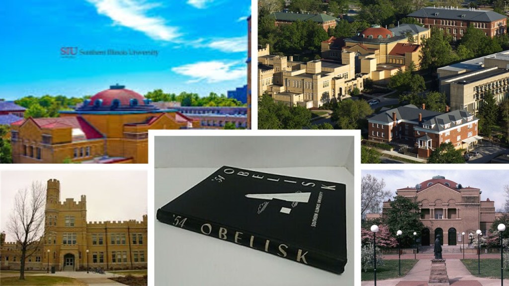
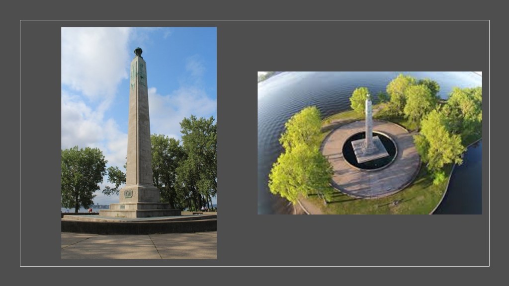
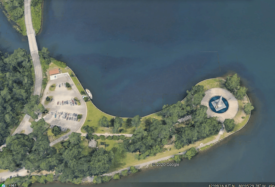
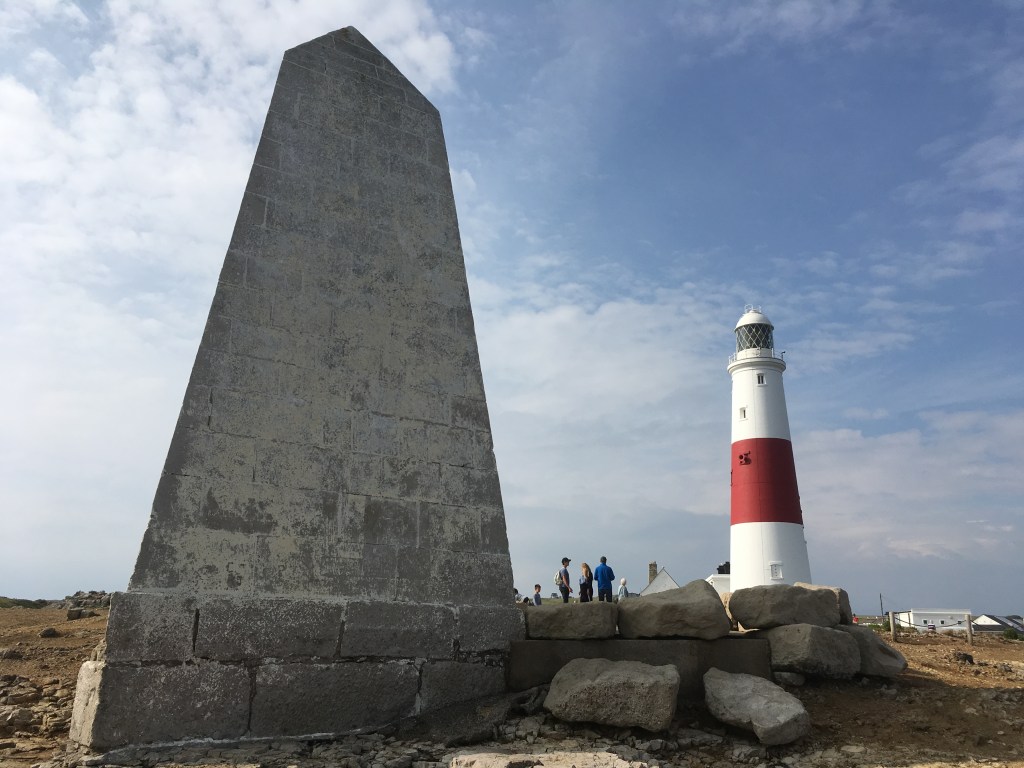
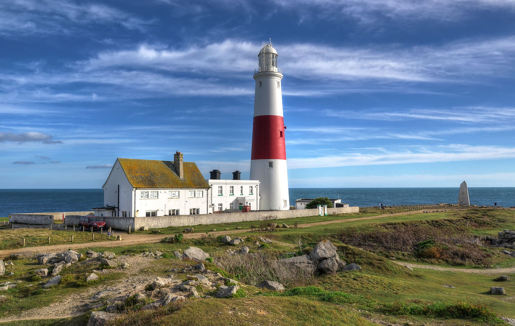
There is a massive obelisk on the scale of the Washington Monument standing next to the African American Museum of Southern Illinois in Carbondale.
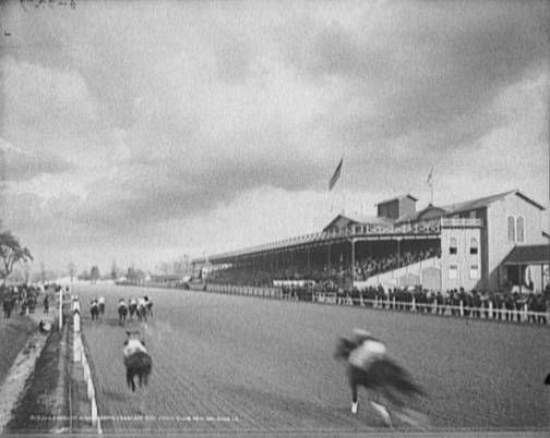
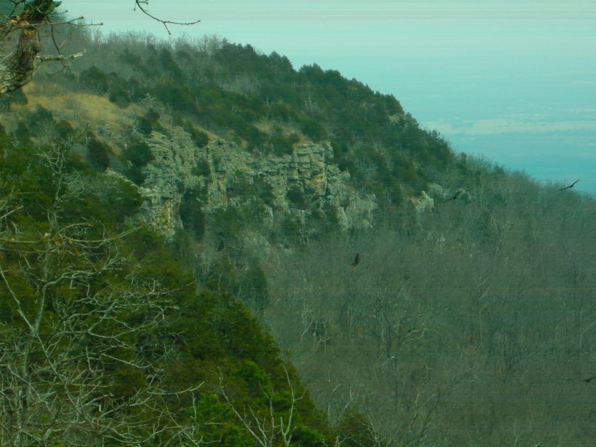
The Giant City State Park, located just south of Carbondale, experienced the longest period of totality during the 2017 eclipse, at 2-minutes, and 40-seconds.
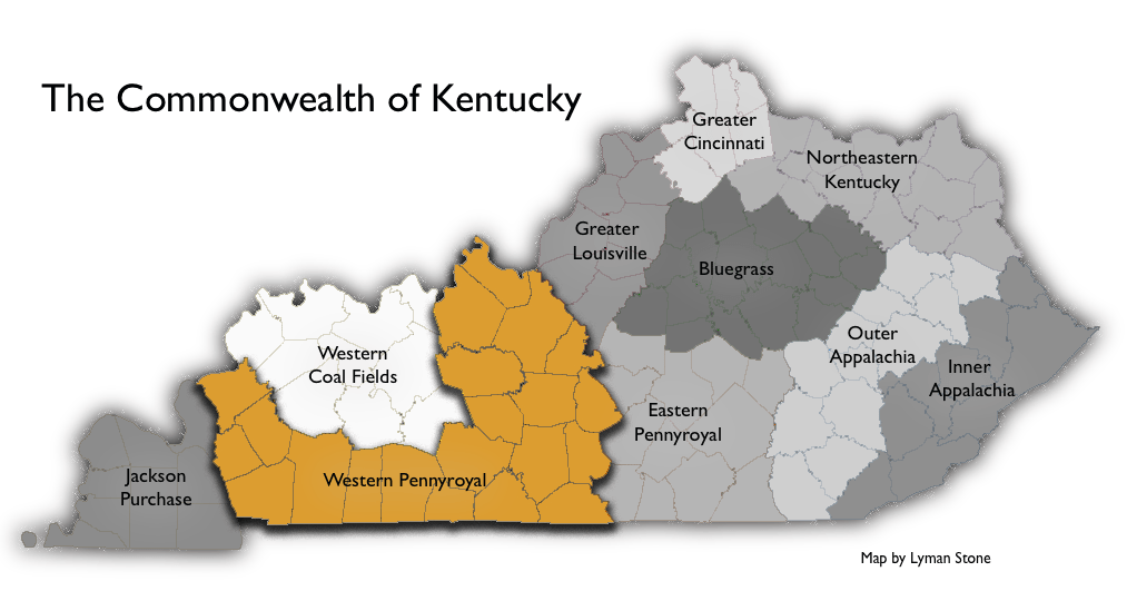
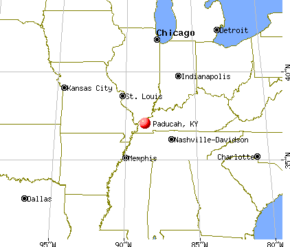
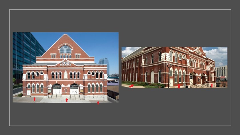
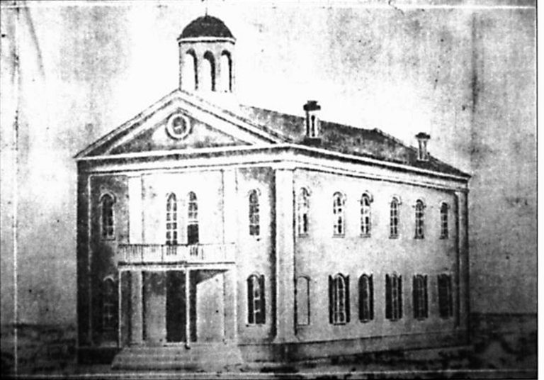
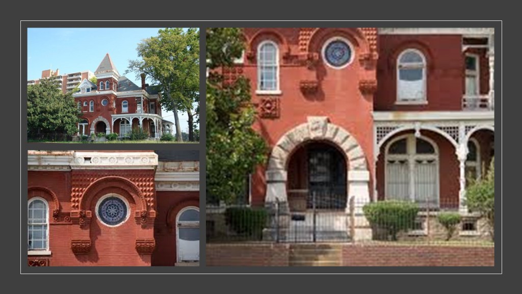
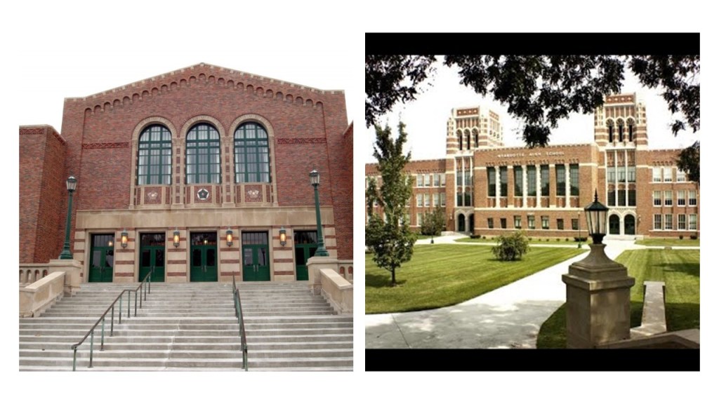
The next place on the 2017 eclipse path is Salem, a home-rule class city in Kentucky’s Livingston County, with a 2010 population of 752.
It is part of the Paducah Micropolitan Area, which is a region consisting of five counties – three in the Jackson Purchase region of Kentucky, one county bordering the Purchase, and one county in southern Illinois, all anchored by the city of Paducah in Kentucky.

I will be taking a closer look at the city of Paducah in a little bit.
The Jackson Purchase, also known as the Purchase, is a region in Kentucky bounded by the Mississippi River to the West; the Ohio River to the North; and the Tennessee River to the East.
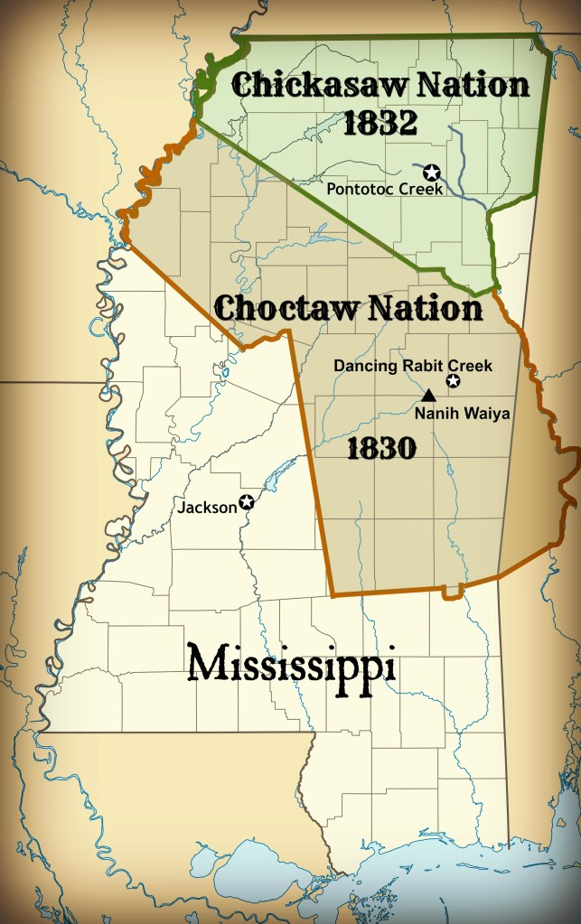
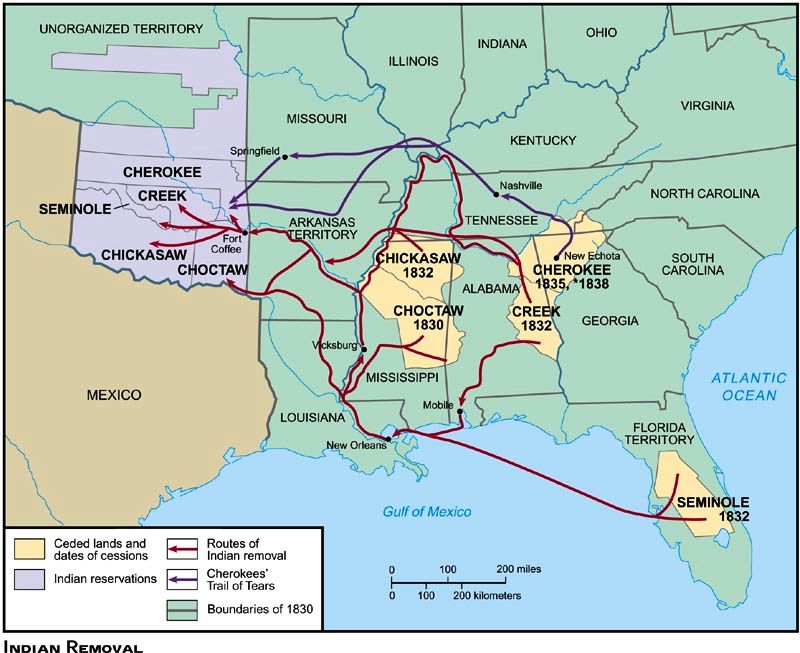
The Purchase land was ceded after prolonged negotiations with the Chickasaw, in which the United States was represented by Andrew Jackson and Isaac Shelby, and the Chickasaw by their chiefs, and on October 19th of 1818, the two sides agreed to the transfer with the signing of the Treaty of Tuscaloosa.

The United States paid the Chickasaw $300,000, at $20,000/year over 15-years, and the Chickasaw gave up their land east of the Mississippi River, and north of the new state of Mississippi border.
Then in 1832, the Chickasaw were pressured into signing the Treaty of Pontotoc Creek in Mississippi, where they ceded the remainder of their homeland in Mississippi, and after which the entire Chickasaw Nation was forced to relocate to the Oklahoma Indian Territory.
Along with the Cherokee, Choctaw, Creek and Seminole, the Chickasaw were considered one of the Five Civilized Tribes of the southeastern United States…
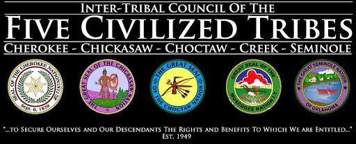
…all of which, in total or in part, were forcibly relocated in the early- to mid-1830s to the Indian Territory in what became Oklahoma.
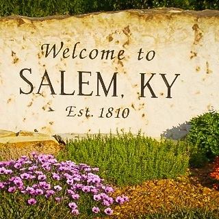
The town of Salem in Kentucky was established in 1810 by settlers from Salem, North Carolina, who were said to have named the town after their former home.
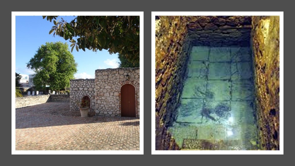
This is the Faith Pool and Baptismal at the Faith Church in Salem.

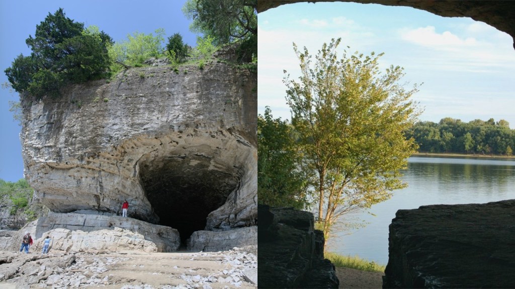
The Cave in Rock Ferry terminal in Marion, Kentucky, is 10-miles, or 16-kilometers, from Salem…
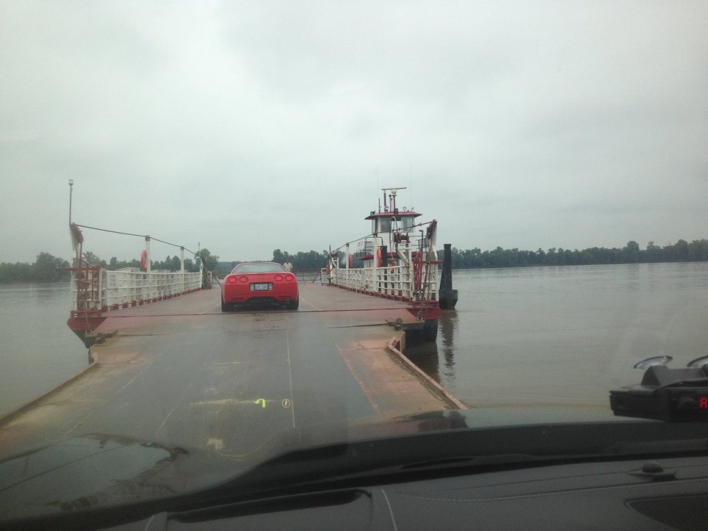
…and crosses the Ohio River to the Cave in Rock State Park at the river’s edge in Illinois.
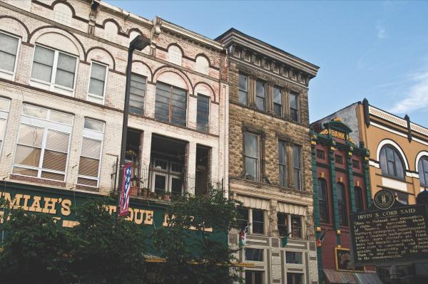
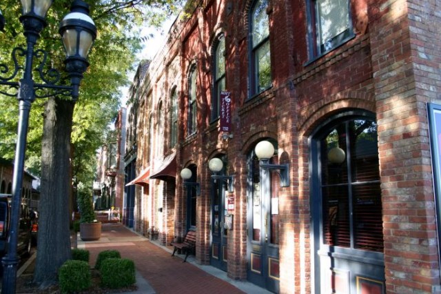
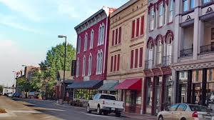
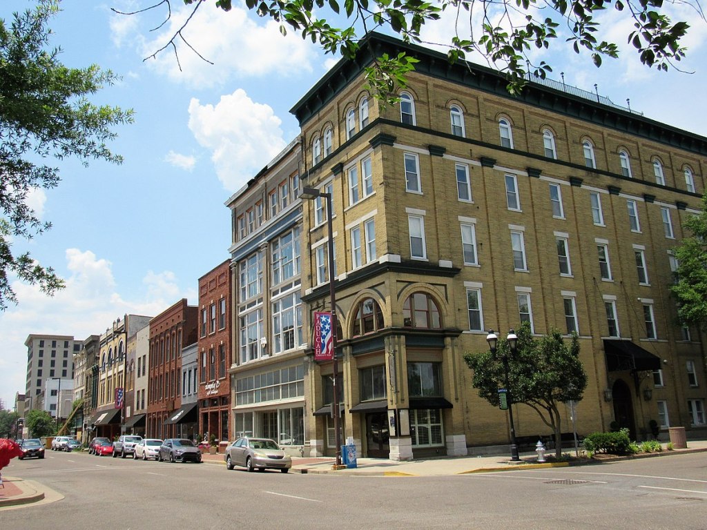
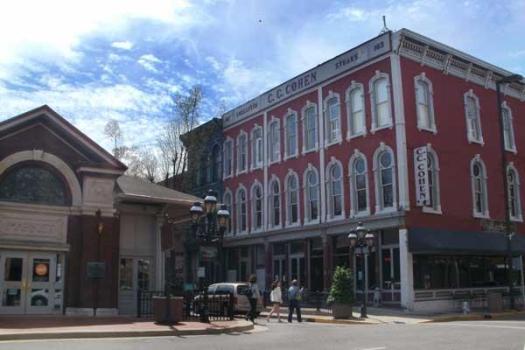
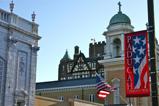
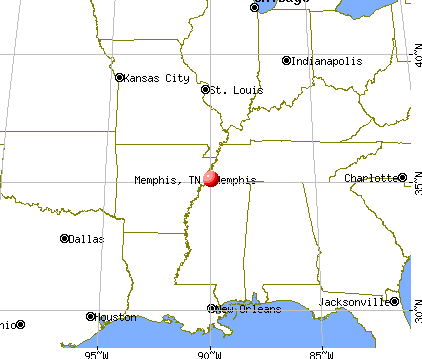
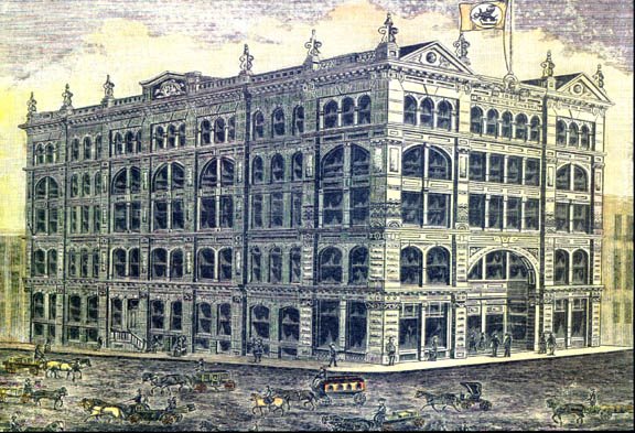
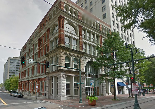
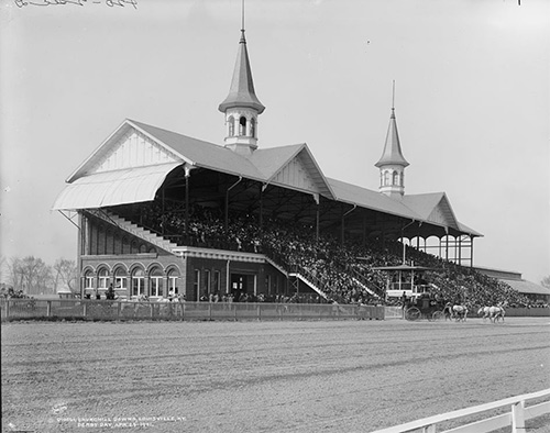
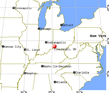
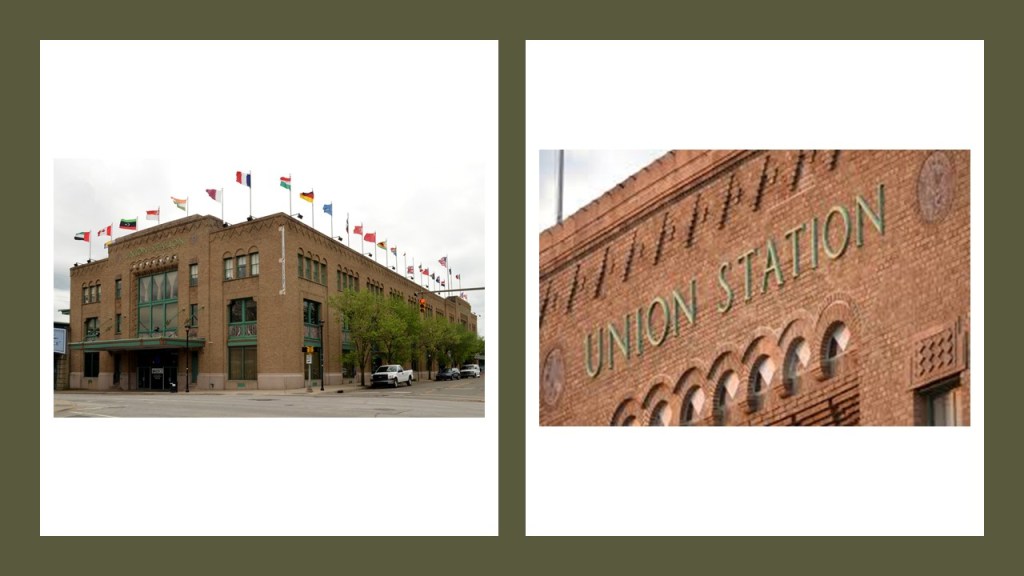
I want to take a quick look at Paducah, Kentucky, the anchor and largest city of the Jackson Purchase region with a population of around 25,000, located at the confluence of the Tennessee and Ohio Rivers, half-way between St. Louis, Missouri, and Nashville, Tennessee.
Twenty blocks of Paducah’s downtown have been designated as a historic district, and listed on the National Register of Historic Places.
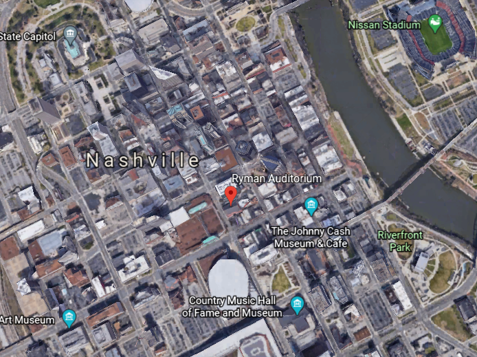
Nashville is the next place we come to on the 2017 eclipse path, the capital and largest city of the state of Tennessee.
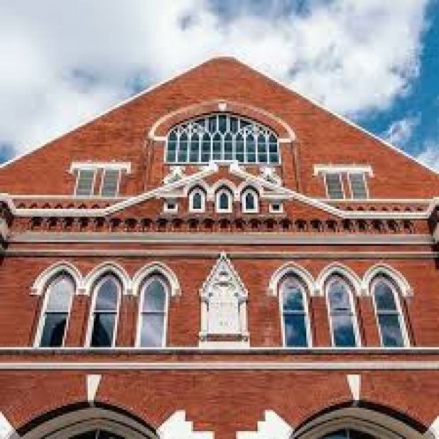
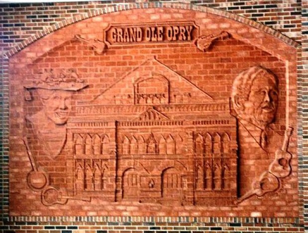
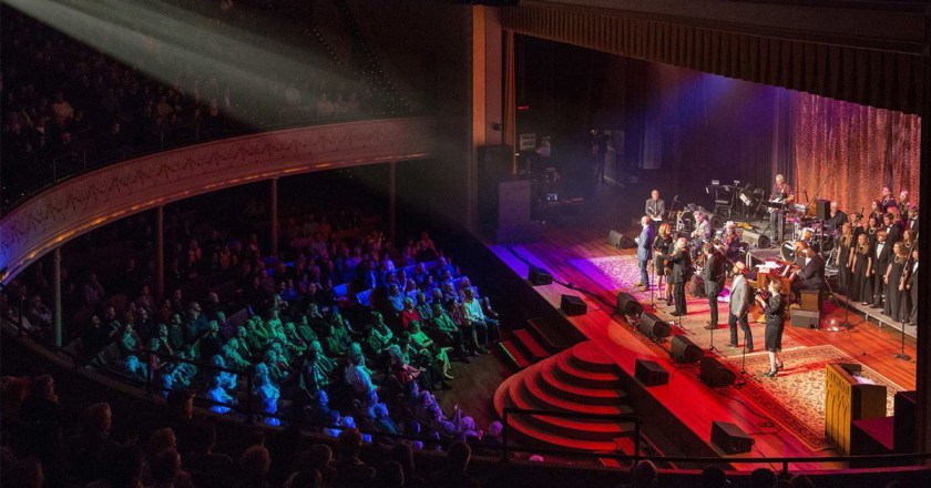
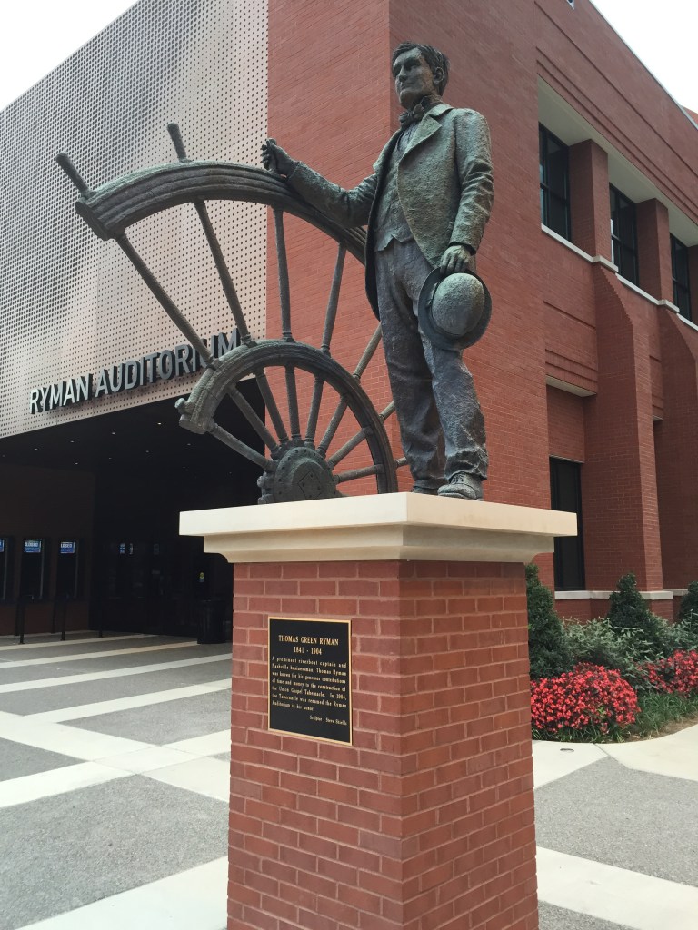
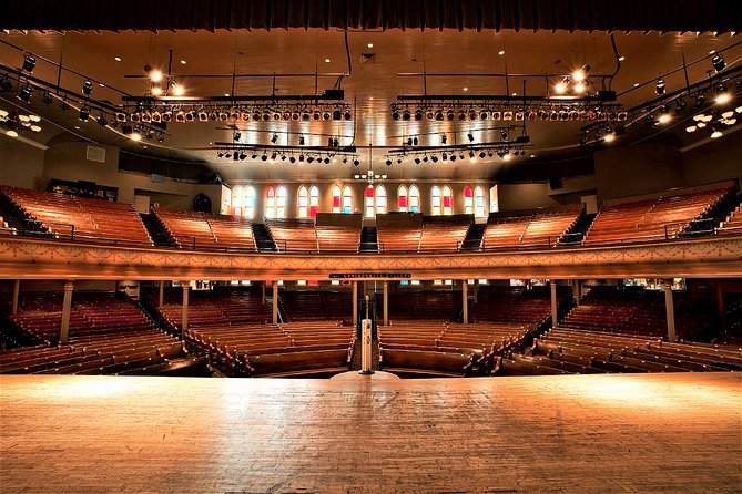
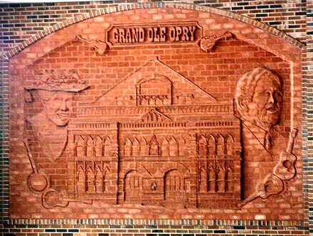
The Ryman Auditorium in downtown Nashville was the home of the Grand Ole Opry from 1943 to 1974.

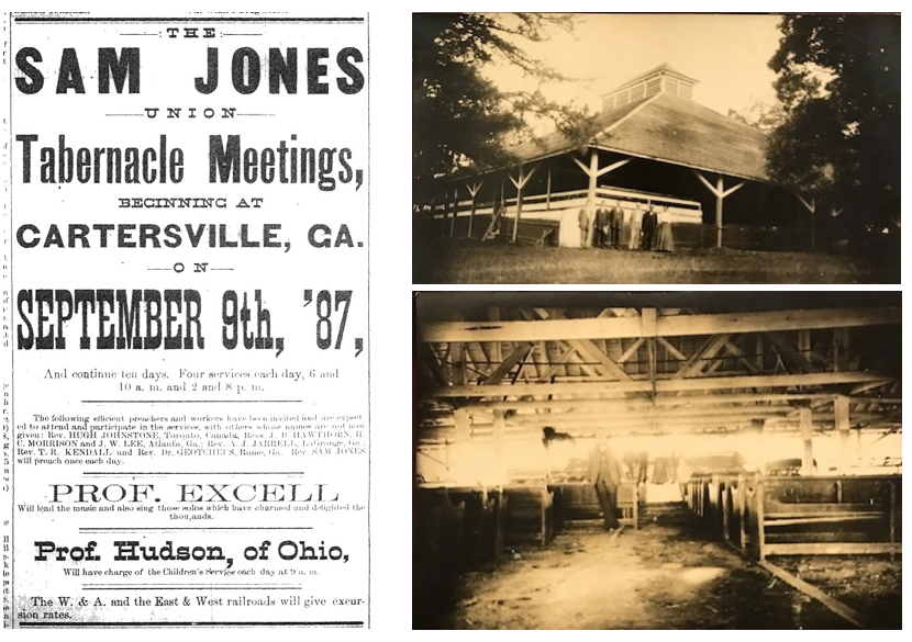
Its construction was said to have been promoted by Thomas Ryman, a Tennessee business man who was a riverboat captain as well as the owner of a riverboat company…

…as an auditorium and tabernacle for Samuel Porter Jones, an influential revivalist of the day, after Ryman was converted to Christianity in 1885 after attending a tent-revival held by Jones.
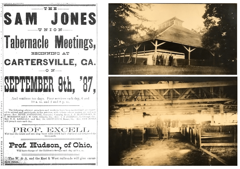
Opening in 1892 as the Union Gospel Tabernacle, it was not only used as a house of worship, it was also rented out as a venue for different types of events, including, but not limited to concerts, speaking engagements, boxing matches.
Here’s another location with the classic mud flood features of the slanted pavement in front of the building, and the ground-level windows on the side of the building that are level with the not-ground-level windows of the front of the building.
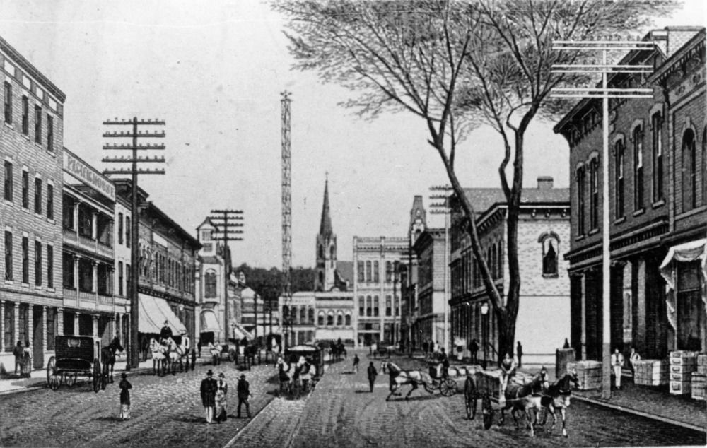
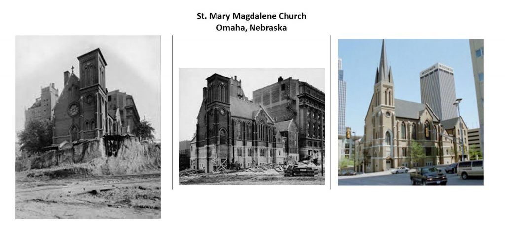
To give a good photographically documented example of this reclamation process, here are two historic photographs of St. Mary Magdalene Church in Omaha, Nebraska, on the left, with the lower part of it having been dug out of the dirt surrounding it, and the same church today on the right with the slanted paved street covering the points at which the lower part of the church had been excavated.

Also known as the “Mother Church of Country Music”…
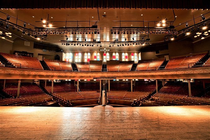
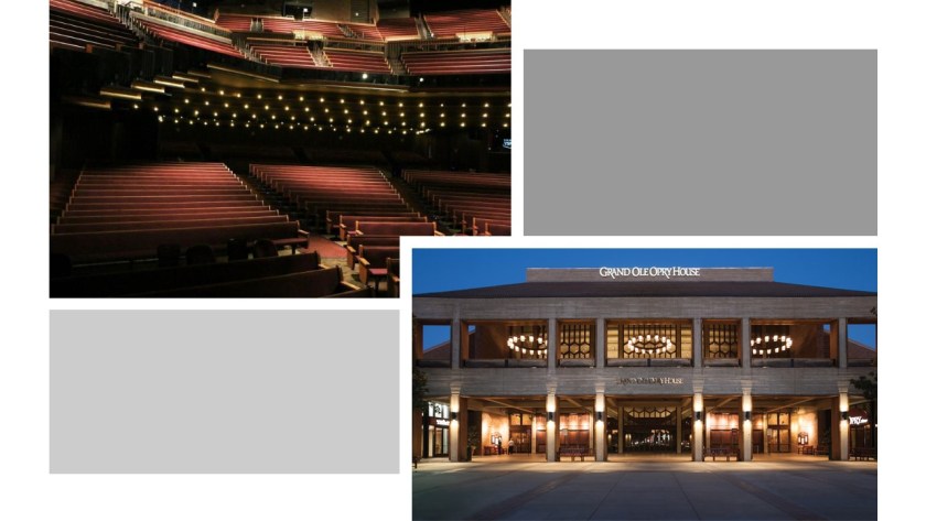
…the Ryman Auditorium became the home of the “Grand Ole Opry” show in 1943 until March 15th of 1974…
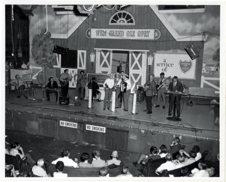
…at which time the “Grand Ole Opry” was moved to its current venue, the massive “Grand Ole Opry House.”
It is interesting to note that the Ryman Auditorium was almost demolished by the owners of the “Grand Ole Opry,” with the reason given that it was in poor condition.
Though it was not demolished because of the outcry against this, the Ryman Auditorium sat dormant until 1989, and has been utilized as an event venue since then.
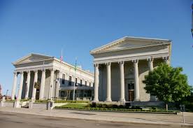
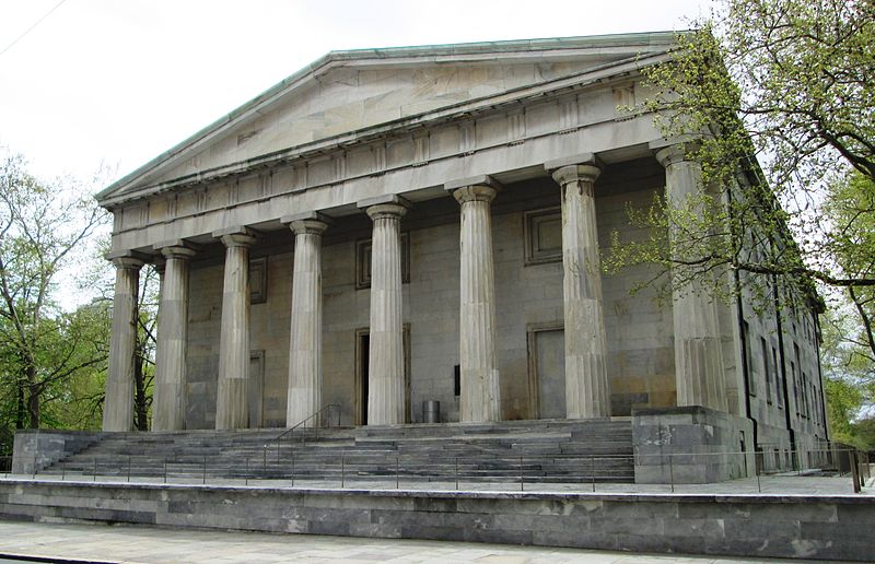
The Tennessee State Capitol building was said to have been designed by architect William Strickland, one of the architects credited with establishing the Greek Revival movement in the United States.
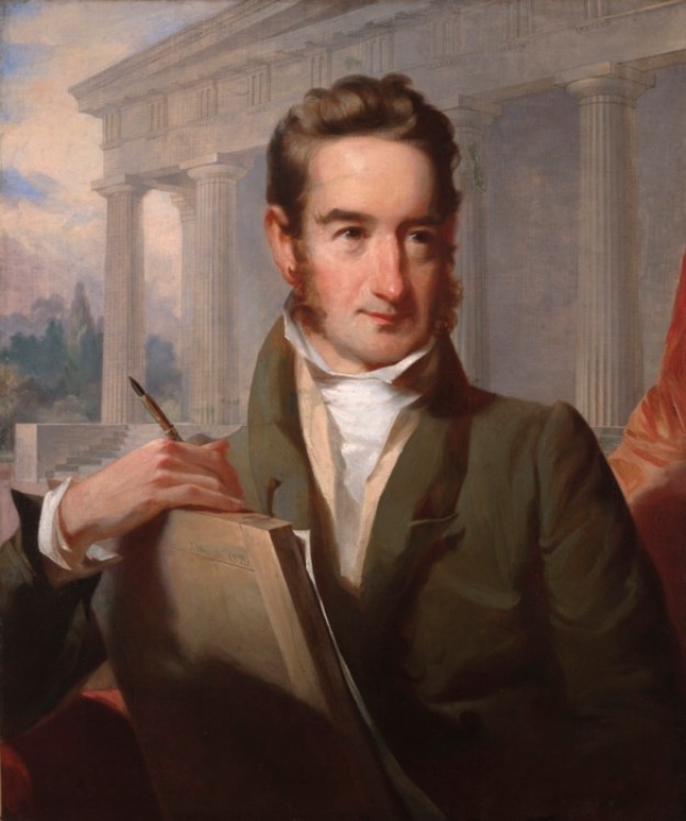
…and built between 1845 and 1859.

It was added to the National Register of Historic Places in 1970, and named a National Historic Landmark in 1971.

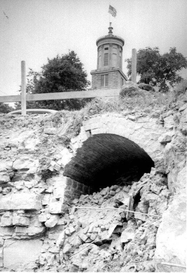
It is interesting to note the entrance to an old tunnel was unearthed near the State Capitol building in 1951, under 6th Street.
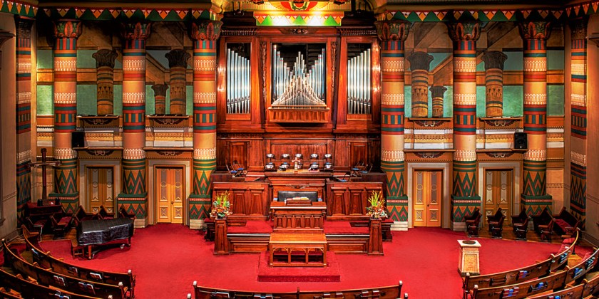
Formerly known as the First Presbyterian Church, the Downtown Church in Nashville was also said to have been designed by William Strickland and completed in 1846.
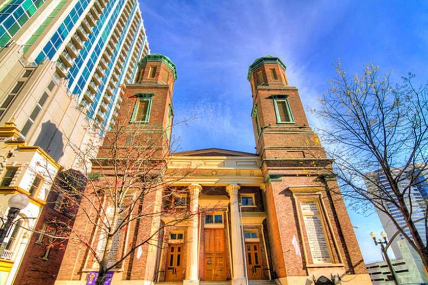
The Downtown Presbyterian Church is considered the best-surviving ecclesiastical example of what is called Egyptian Revival architecture.
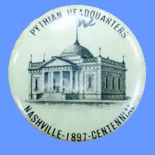
The Nashville Parthenon was said to have been built for the 1897 Tennessee Centennial Exposition.

We are told that Nashville’s nickname of “Athens of the South” influenced the choice of an exact replica of the Parthenon in Athens, Greece, as the centerpiece of the Exposition.
The architect of Nashville’s Parthenon was said to be the former confederate soldier, William Crawford Smith.
It was said to have been originally built as a temporary structure out of plaster, wood, and brick, but it was left standing after the Exposition because of its popularity, and that it was rebuilt with concrete in the 1920s.
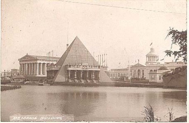
Here is an old photo of the Exposition, with the Memphis Building next to the Parthenon.

…said to be the Memphis, Tennessee -Shelby County construction for the Exposition, modelled after Memphis’ namesake in Egypt.
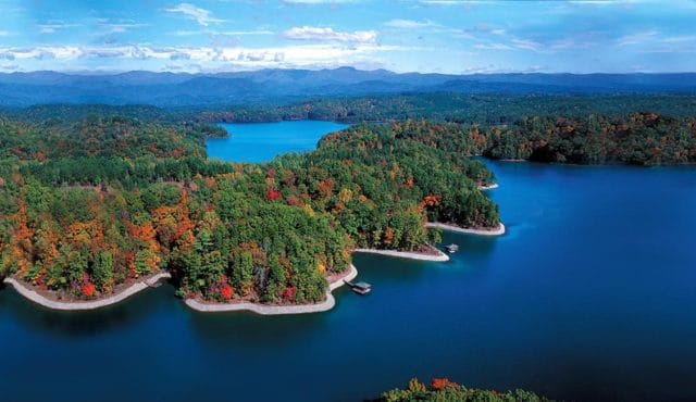
Next we come to the last Salem on this eclipse path, located in a hilly area in the northwestern corner of South Carolina, near the state’s border with North Carolina and Georgia, known as the gateway to the Blue Ridge Mountains.
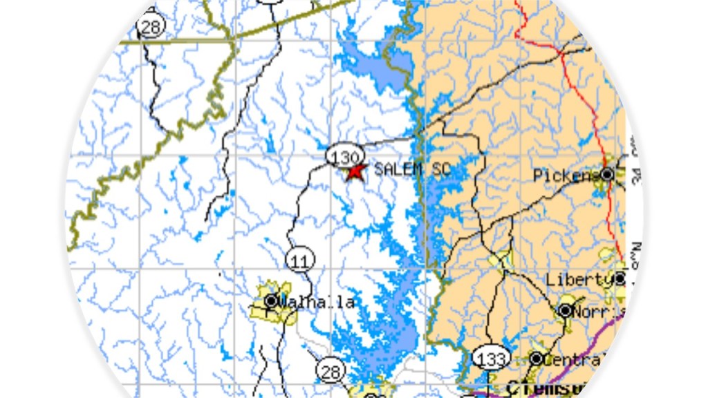
In 2010, its population was 135.
Lake Keowee and Keowee-Toxaway State Park is to the east of Salem.
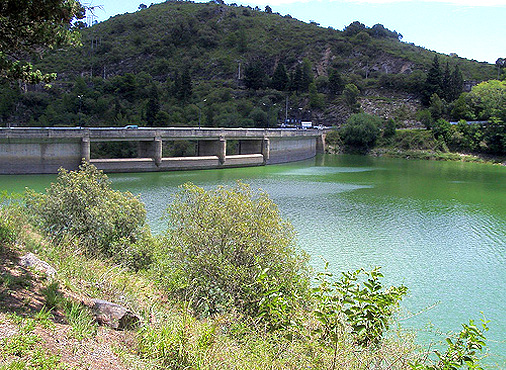
Lake Keowee is a man-made reservoir formed in 1971…
…that we are told was constructed for the needs of Duke Energy, which it uses for things like cooling three nuclear reactors at the Oconee Nuclear Generating Station…
…and for public recreational purposes.
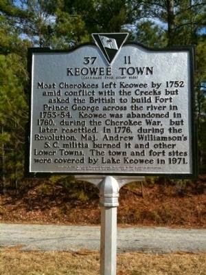
The historic Cherokee Keowee Town had been located on the bank of the Keowee River and was part of what was known as the Lower Town Regions, all of which were inundated by the formation of Lake Keowee, its artifacts and history lost.
The Reserve at Lake Keowee is a private, 3,900-acre, or 1,578-hectare, golf and recreational community on the lakeshore.

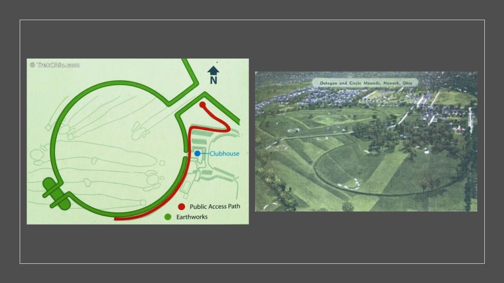
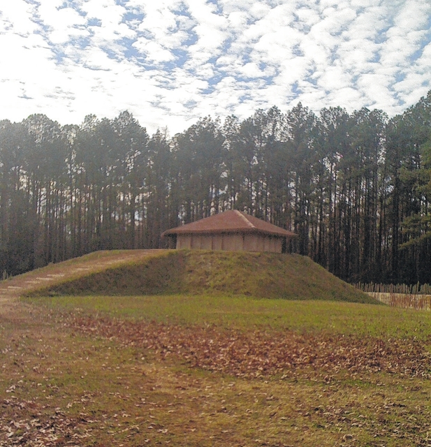
While Jack Nicklaus is given the credit for designing the golf course in 2002, I long ago came to the conclusion – and one of my first “A-ha’s” – that golf courses are pre-existing mounds and earthworks, and the sand-traps are just carved-out of them to create the “course.”
I quickly came to this conclusion after learning things like the Octagon and Circle Mounds in Newark, Ohio, come into play in eleven of the holes at the Moundbuilders Country Club.
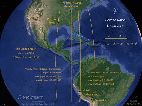
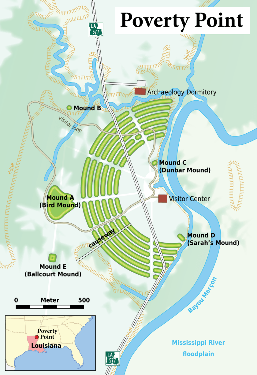
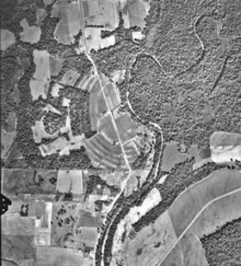
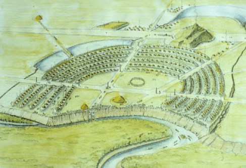
The mounds in Newark, Ohio are located on a Golden Ratio Longitude on the Earth, along with other sites, like Poverty Point in Louisiana, and Chavin and Pachacamac in Peru, and Tiwanaku in Bolivia.
Keowee-Toxaway State Park on Lake Keowee was created from lands previously owned by Duke Power, all part of the historical lands of the Cherokee, one of the five civilized tribes mentioned previously.

There is a feature called Natural Bridge in Keowee-Toxaway State Park.
There are so-called Natural Bridges all over the world, and three alone in Natural Bridges National Monument near the Four Corners boundary of southeast Utah.
They are named the Kachina Natural Bridge…
…the Owachomo Natural Bridge…
…and the Sipapu Natural Bridge.
Another early a-ha in my journey of cracking the code of covering-up Earth’s ancient advanced civilization, besides golf courses, was realizing that man-made infrastructure was called natural, and leaving mention of this ancient civilization completely out of our historical narrative.
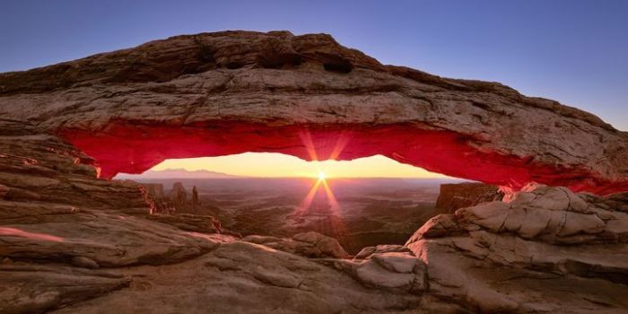
I suspect that many of these bridges and arches had something to do with the consummate alignment of places on the Earth with astronomical events, as I mentioned previously in this post, like the sun being perfectly framed by Mesa Arch in Canyonlands National Park in Utah in this picture.
Lake Jocassee is another man-made lake northeast of Salem.

It was formed in 1973 in a partnership between the state and Duke Power, and also flooded areas where there was pre-existing infrastructure, like the Mt. Carmel Baptist Church Cemetery, which was the setting for a scene in the movie “Deliverance,” which had been filmed there in 1972, and the following year was covered by 130-feet, or 39-meters, of water.
This feature at Lake Jocassee is called “The Wall,” which is only accessible by boat.
These are the Twin Falls in the Jocassee Wilderness Area, flowing over a suspiciously-looking wall-like structure, just like what you find at…
…the Twin Falls in Seneca, New York…
…the Twin Falls in Richland Creek, Arkansas…
…and the Twin Falls in Mullens, West Virginia.
The last place I am going to look at is Columbia, the capital and second-largest city of South Carolina, and the second Columbia on the 2017 eclipse path.
We are told the name “Columbia” is the female personification of the United States…

…and the Americas in general…
…yet somehow her name originated from that of Christopher Columbus?
Columbia is situated around the confluence of the Broad and Saluda Rivers, we are told, which merge to form the Congaree River.
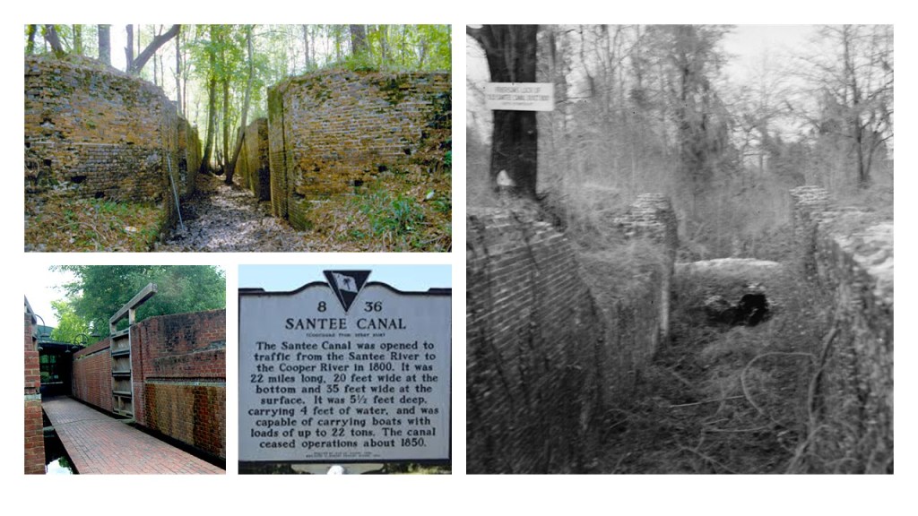
We are told that Columbia received a large stimulus for development when it was connected to Charleston by the 22-mile long Santee Canal, which was said to have first been chartered in 1786 and completed in 1800, making it one of the earliest canals in the United States.
Then we are told that with increased railroad traffic, after all the engineering and construction work required to build it, the Santee Canal ceased operation in 1850, only 50-years later.
The University of South Carolina in Columbia, the largest university, in the state, was first established in 1801.
What is now the McKissick Museum on campus, which started out as a library, was said to have been built in 1940…
…and Preston College, located on the old campus grounds, was said to have been built in 1939, and funded by the New Deal during the Great Depression.
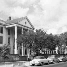
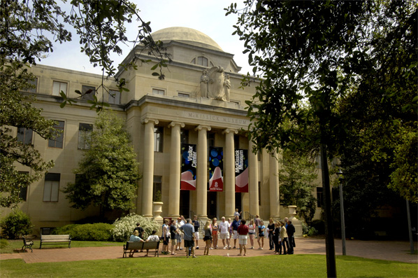
As the state capital, Columbia is also the location of the South Carolina State House, which was said to have opened in 1855…
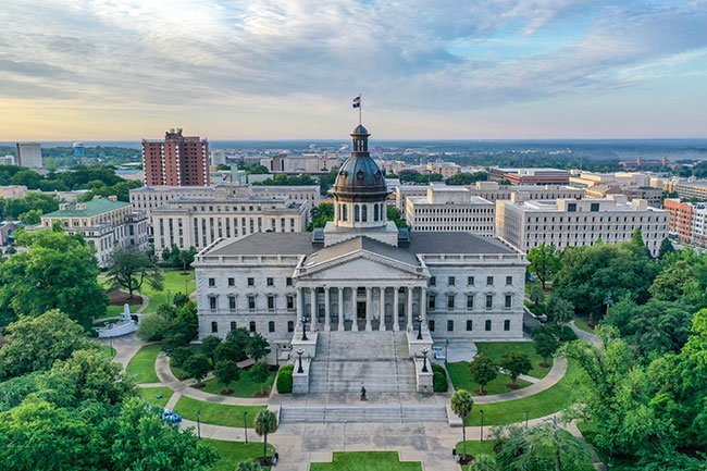
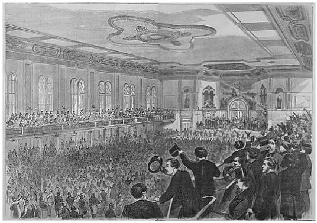
…and was the location of the South Carolina Secession Convention in 1860 in our historical narrative, which marked the departure of the first state from the Union prior to the American Civil War.
Columbia in South Carolina is the end of my journey along the total eclipse path of 2017.
This journey I have taken along the eclipse path has brought forth compelling evidence for the theft, destruction, and misattribution of the legacy of the advanced civilization of Master Builders, Mathematicians and Master Astronomers that originated far back in time in ancient Mu, also known as Lemuria, who knew exactly what they were here for – to align their civilization and themselves with Heaven and Earth, who apparently could align cities with eclipse paths, and, in the primary example in this case, with cities whose name means “Peace” in both Hebrew and Arabic.

People have been divided by race and religion since the original positive timeline of Humanity was hijacked, by what I believe was a deliberately-caused cataclysm that created a world-wide flood of mud, and evidence for that showed-up here in North America.
Like I said earlier in this post the KJV version of Psalms 76:2 reads, referring to God “In Salem also is his tabernacle, and his dwelling place in Sion” and I spectulated that the actual meaning is a spiritual interpretation to the effect of “God’s portable sanctuary is in Peace, and his dwelling place in the Highest Ideals,” and pertains to each individual Human Being as a “portable sanctuary of peace” striving to live life in the highest manner possible.
1In Iudah is God knowen: his name is great in Israel.
2In Salem also is his tabernacle, and his dwelling place in Sion.
This is in contrast to the later NLV translation of Psalms 76:2 of “His tent is in Salem, his dwelling place in Zion,” interpretations of which typically are about putting our focus on a physical location as opposed to spiritual ideals to guide each individual.
1God is renowned in Judah; in Israel his name is great.
2 His tent is in Salem, his dwelling place in Zion.
We have been deceptively manipulated by parasitic beings into reacting in distrust and fear of fellow Humans based on one’s skin color, instead of recognizing each individual Human Being’s direct and integral connection to the Creator and All That Is, including with Each Other, and to keep Us from knowing Our True Identity.

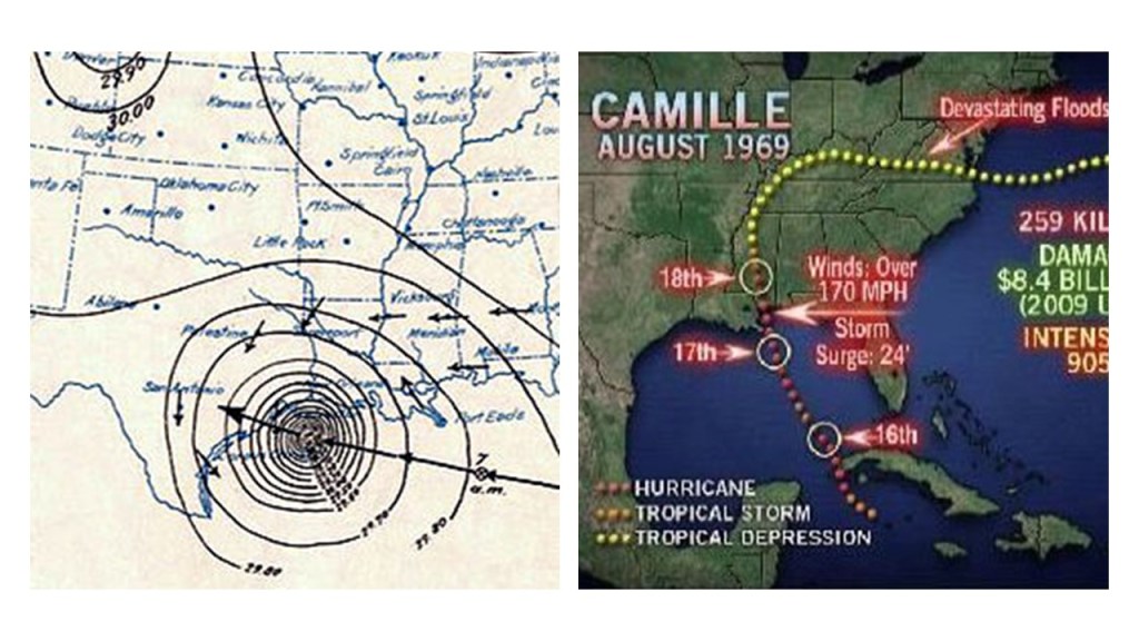
My next post will be on the destructive forces of the 1900 Great Galveston Hurricane & Hurricane Camille in 1969.


