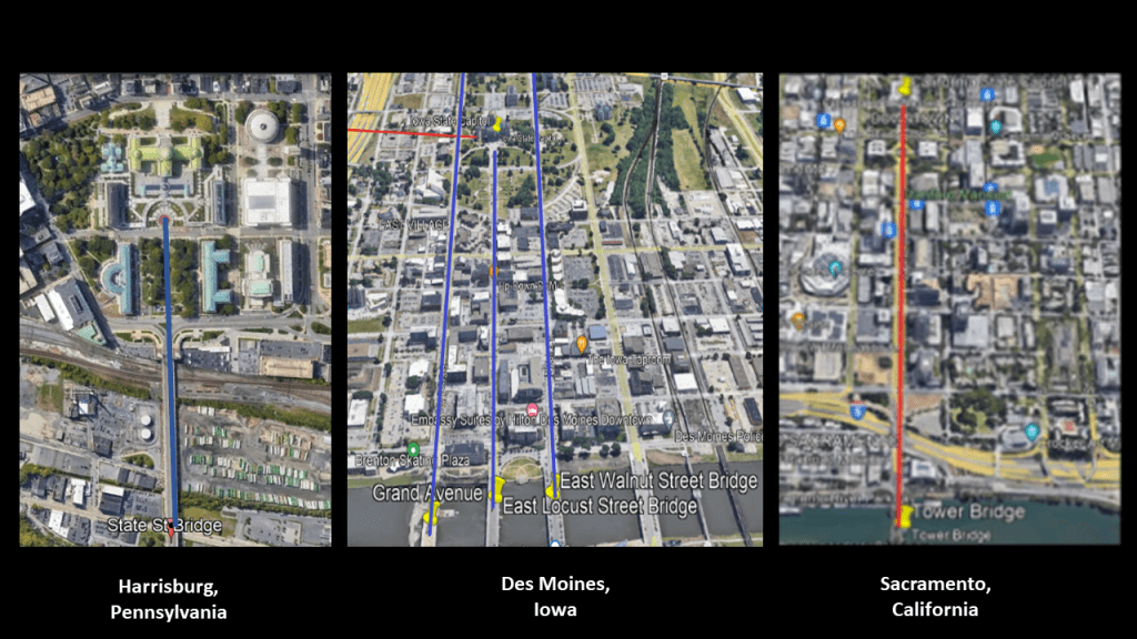
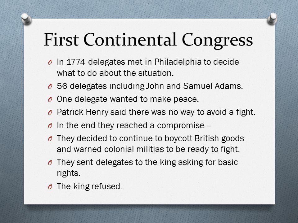
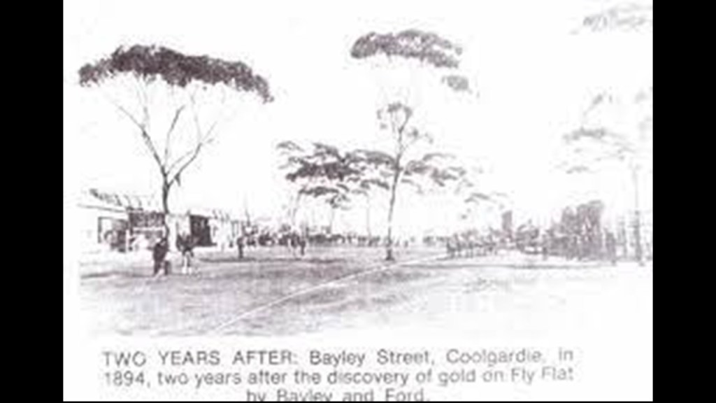
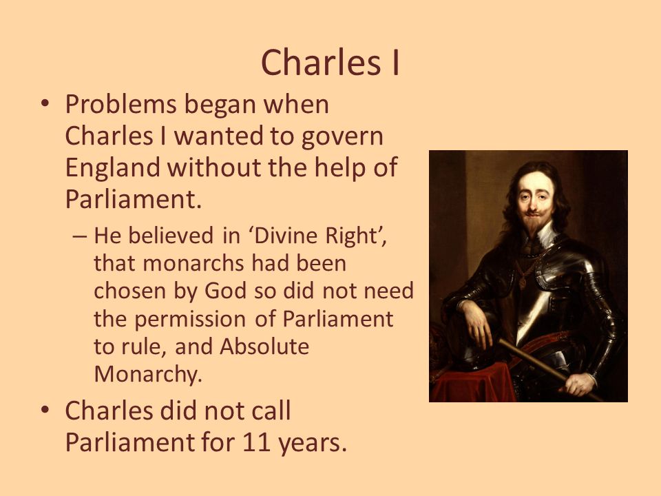
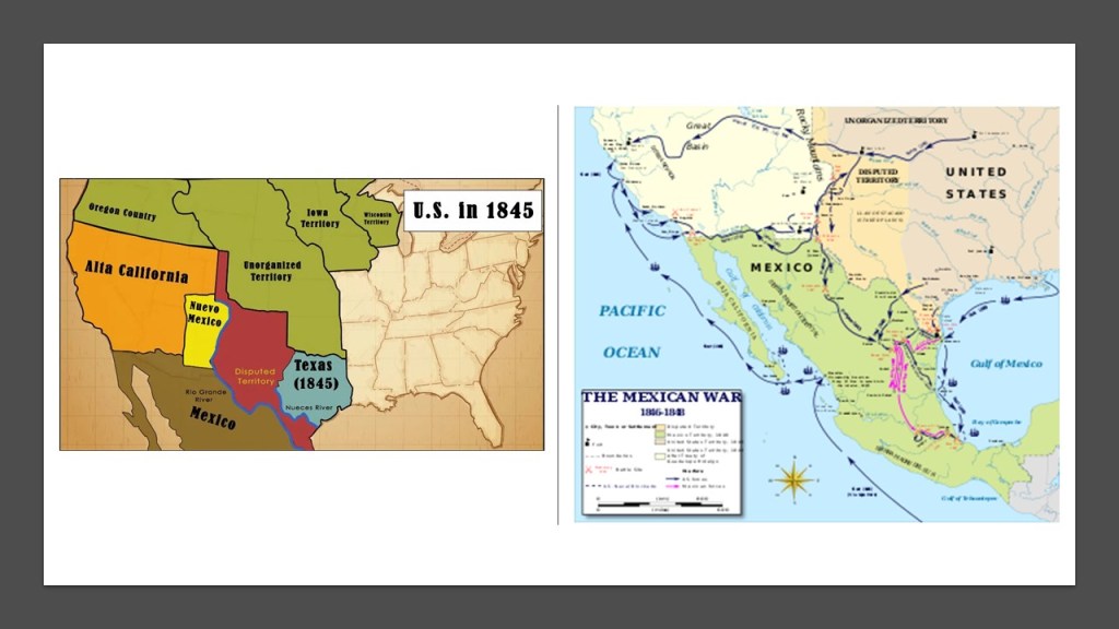
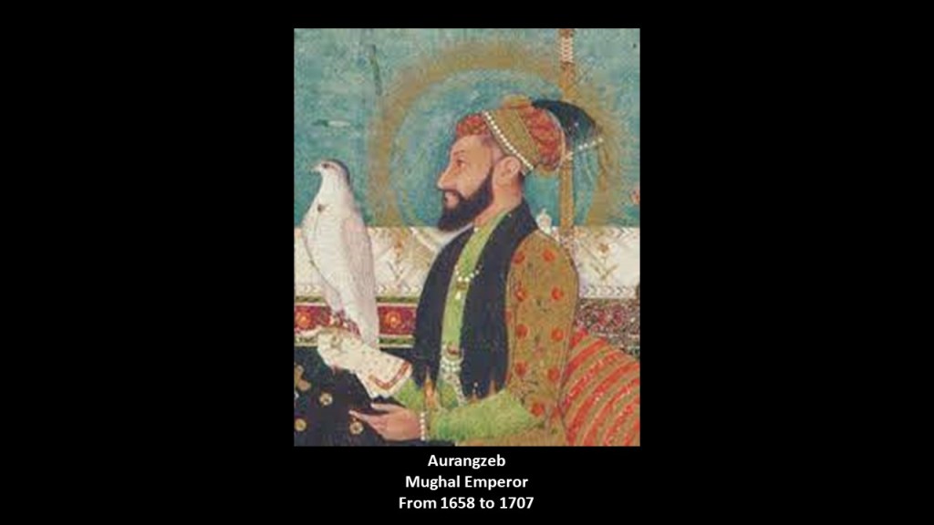
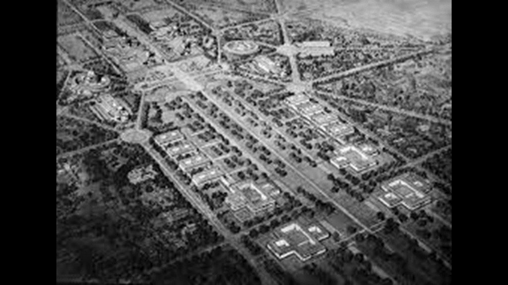
In the course of my research, I have had occasion to look into three State Capitol complexes – that of Harrisburg, Pennsylvania; Des Moines, Iowa; and Sacramento, California.
As we shall see, the locations chosen for modern seats of government would have been very special locations in the original advanced civilization of the Old World.
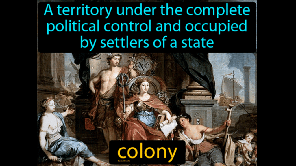
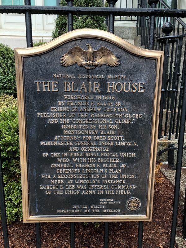
Before I begin, “Capitol,” spelled with an “o” is the building in which a legislature operates., and “Capital,” spelled with an “a” is the seat of government, of states, provinces, or countries.
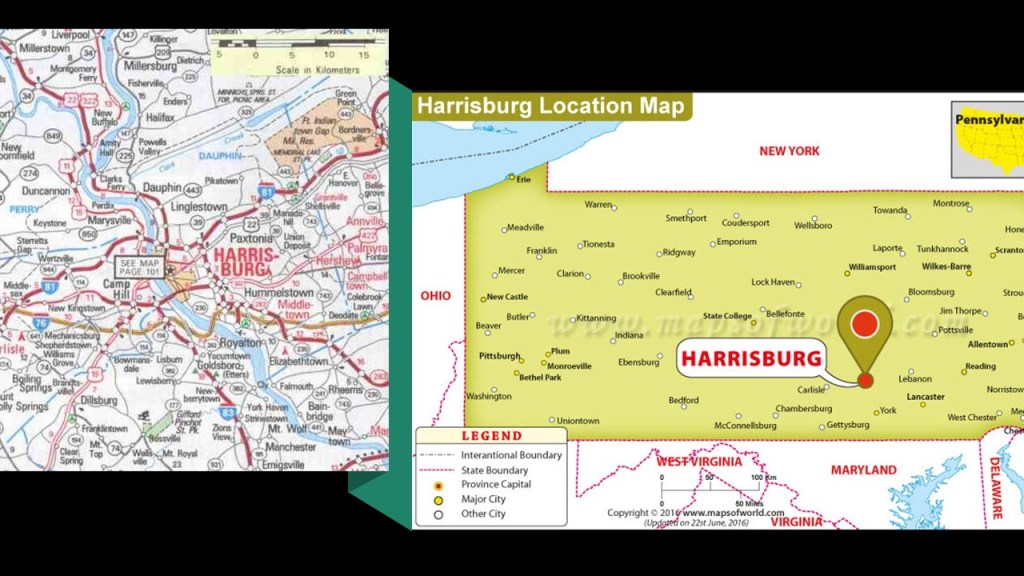
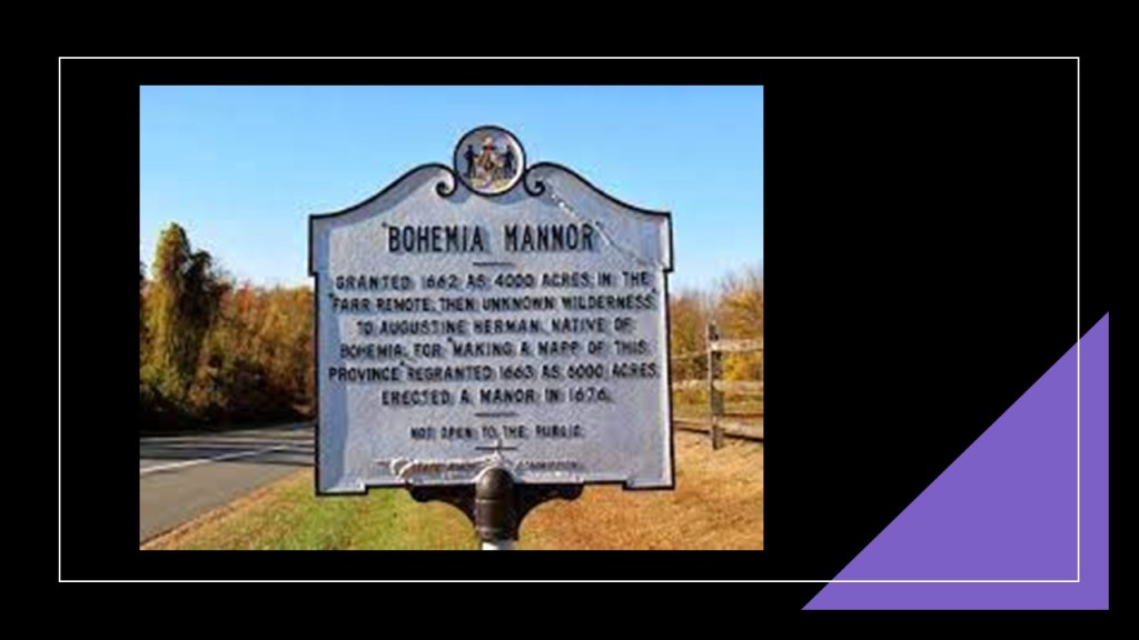
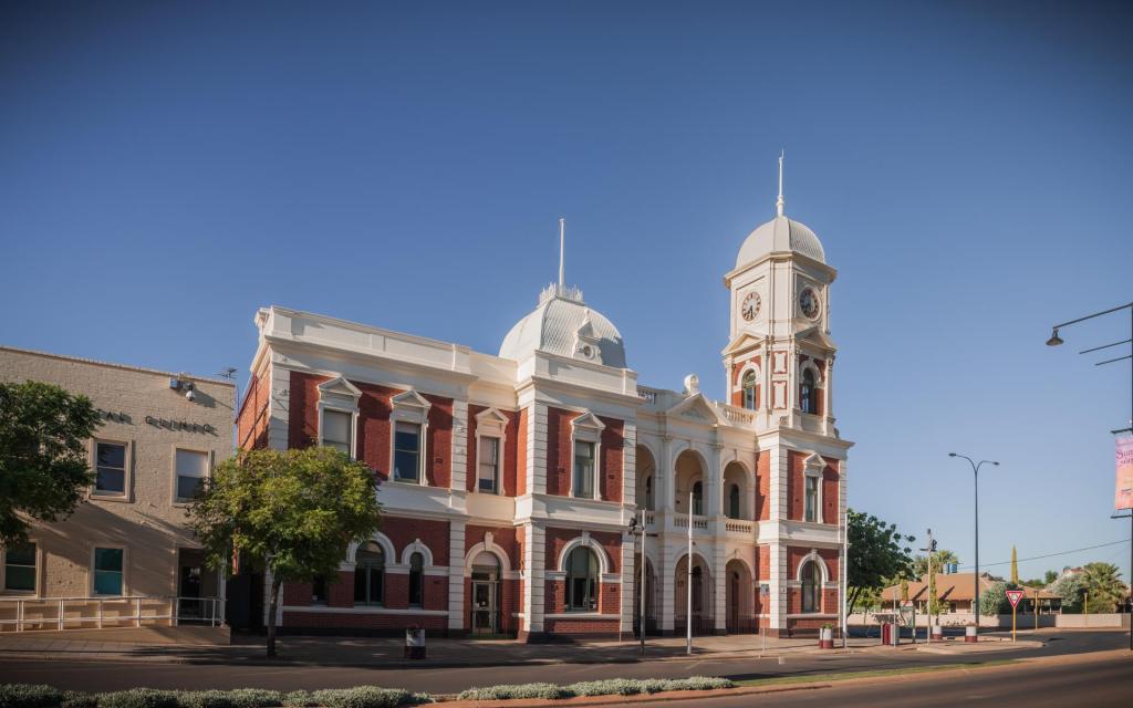
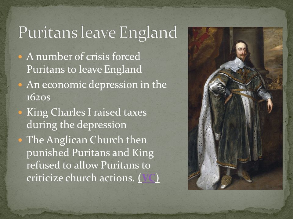
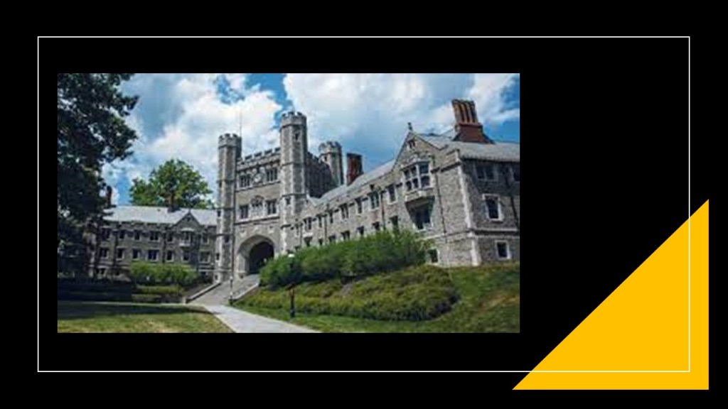
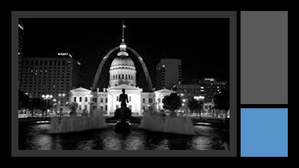
First, Harrisburg, the State Capital of Pennsylvania.
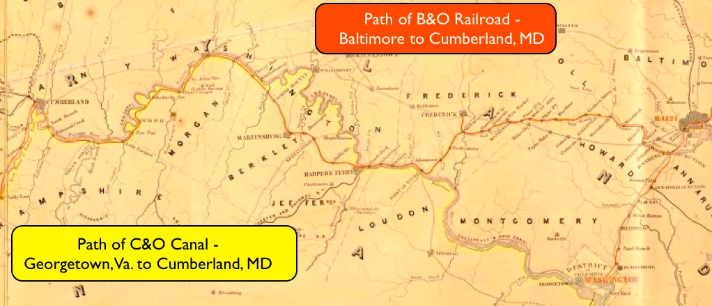
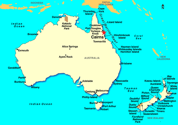
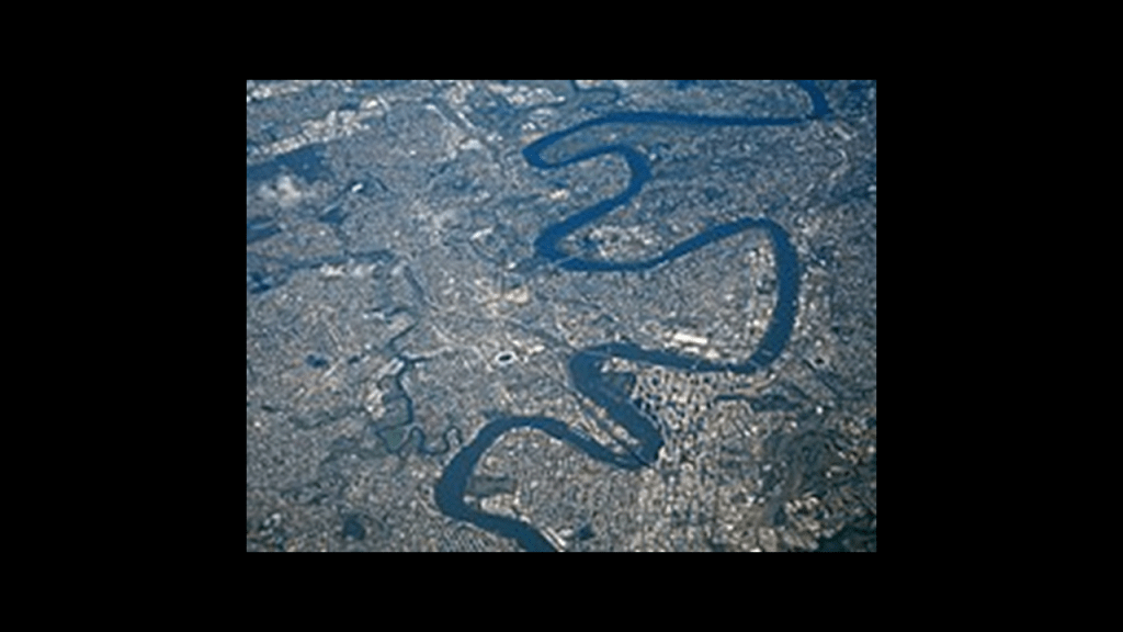
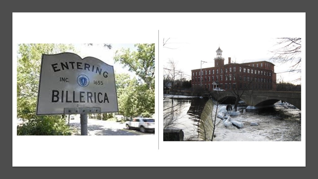
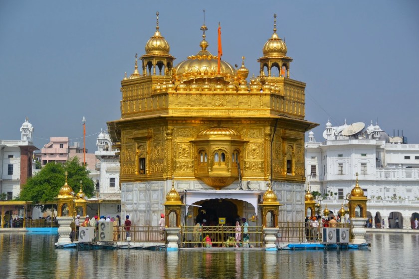
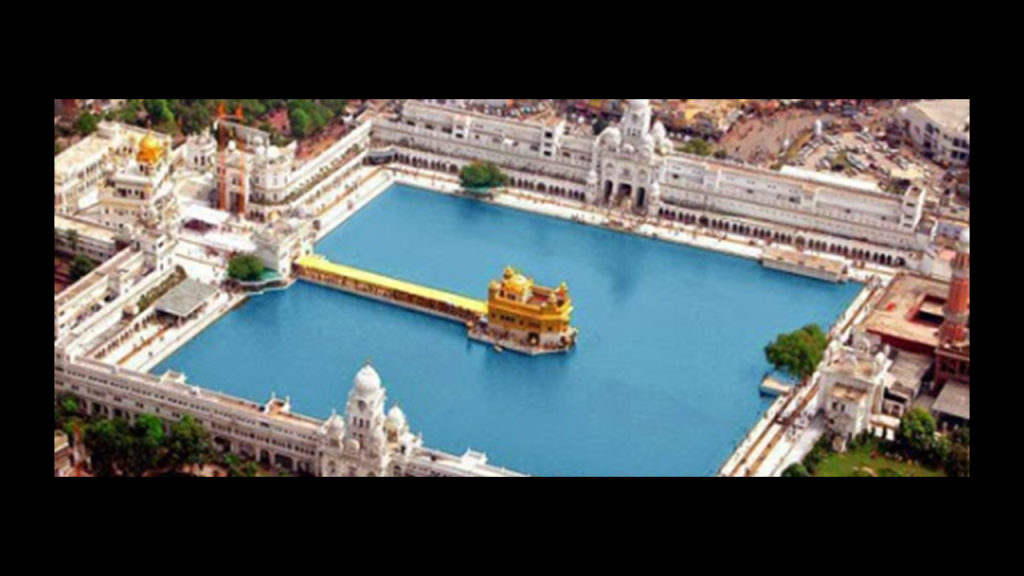
Harrisburg is situated on the east bank of the Susquehanna River, only 107-miles, or 172-kilometers, west of Philadelphia.
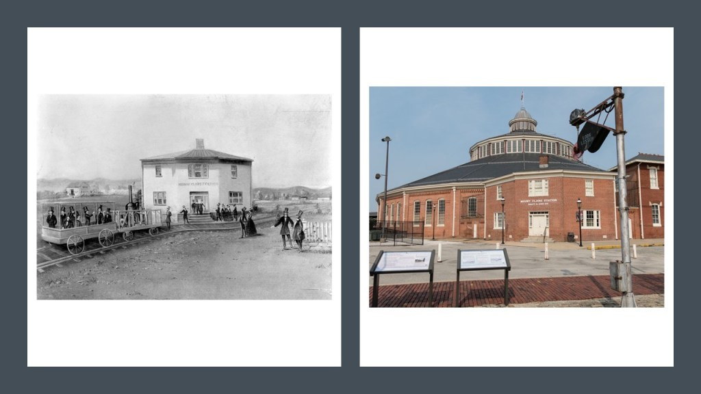
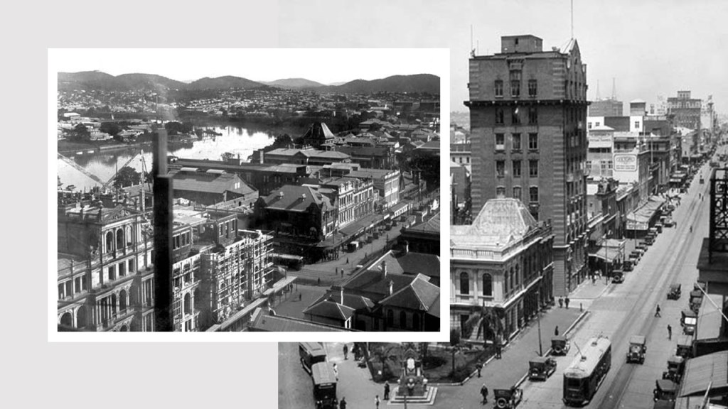
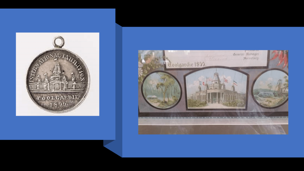
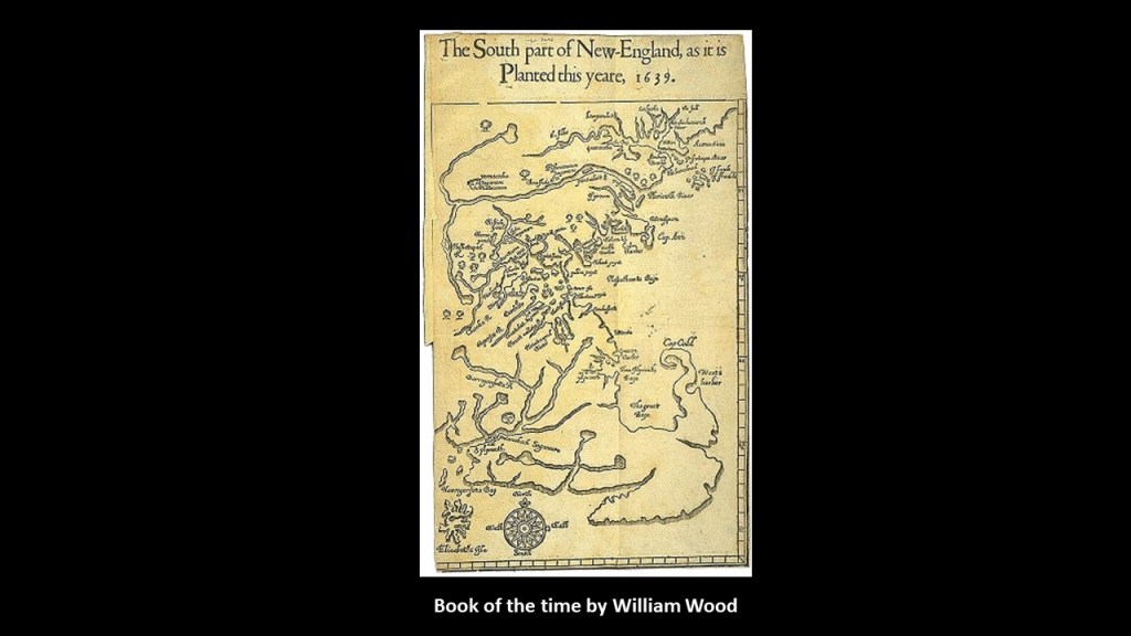
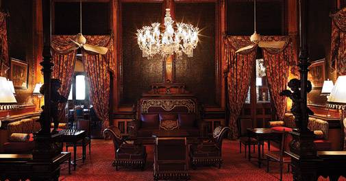
CZ had sent me screenshots of the Capitol District in Harrisburg aawhile back that was the basis for the research I did there.
What we are told is the land that became Harrisburg had been purchased by an English trader named John Harris Sr. in 1719; John Harris Jr. made plans to lay-out a town on his father’s land; and the land was surveyed by William Maclay, John Harris Sr’s son-in-law.
The city of Harrisburg became incorporated in 1791; and named the Pennsylvania State Capital in October of 1812.
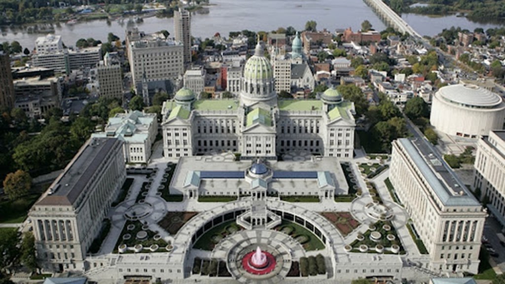
The current State Capitol Building was said to have been designed by architect Joel Miller Huston, and built between 1902 and 1906 in the Beaux-Arts style of architecture.
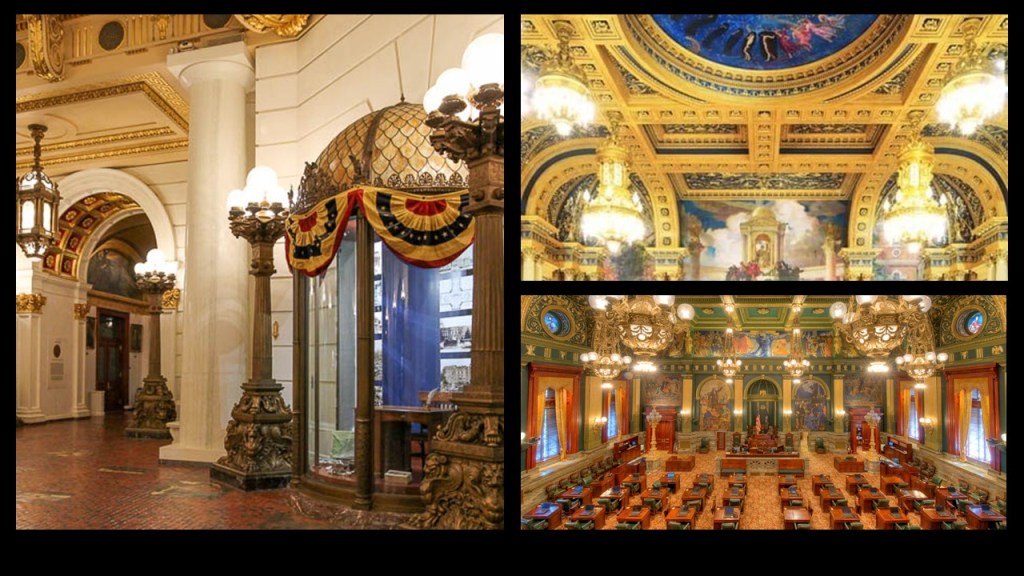
The interior of the Pennsylvania State Capitol is described as having decorative Renaissance themes throughout the building.
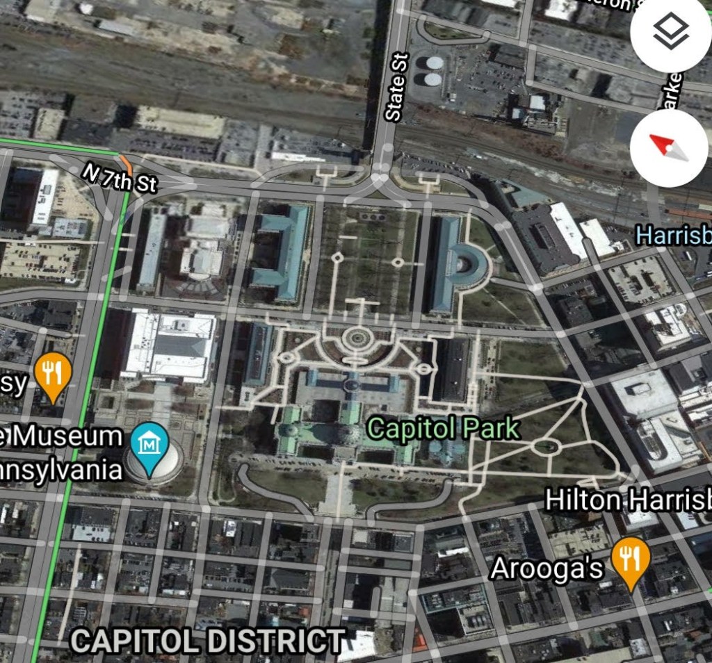
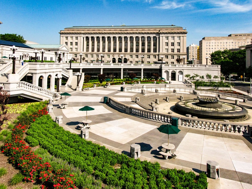
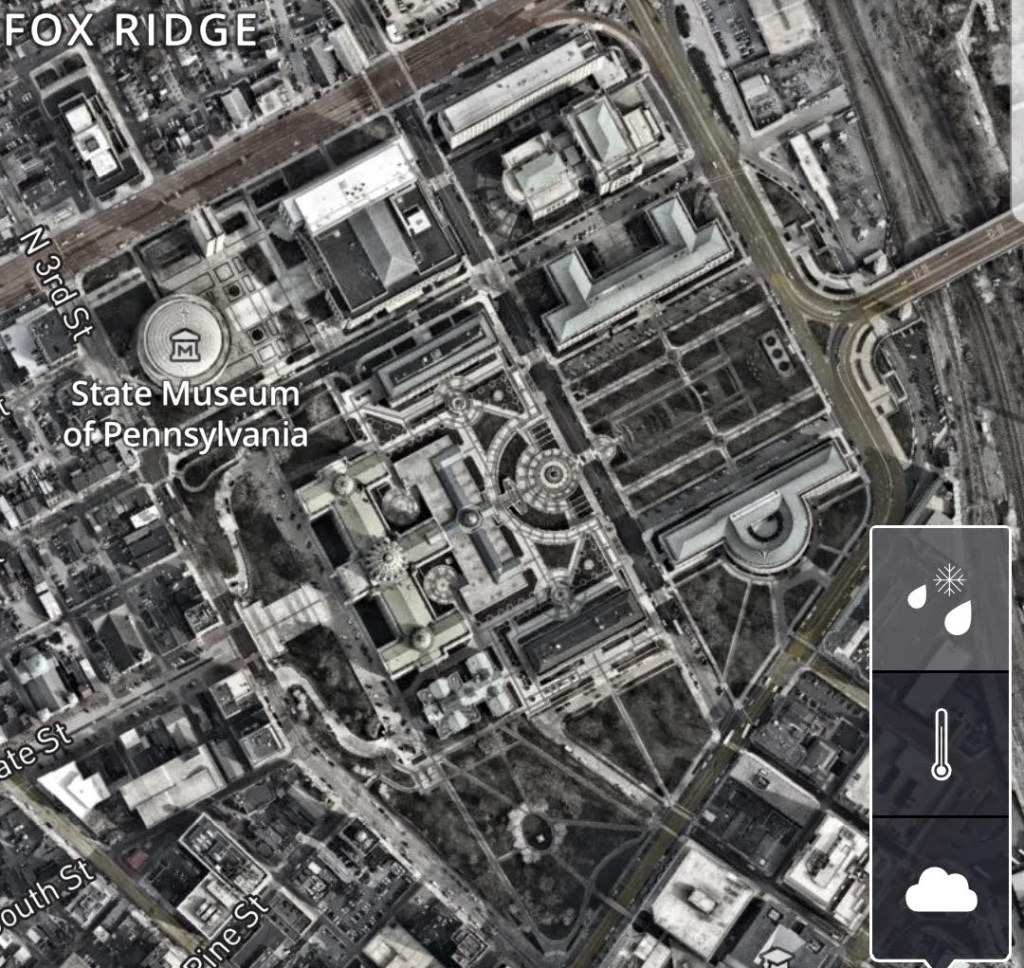
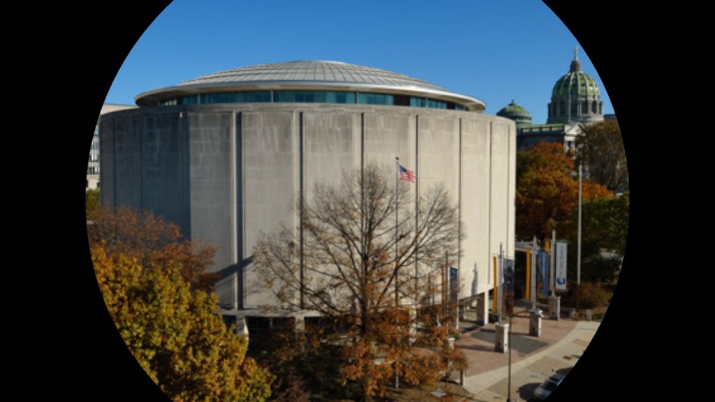
It is part of what is called the Pennsylvania State Capitol Complex.
On the East side of the Capitol building is what is referred to as the East Wing, described as a 1987 extension of the Capitol building.
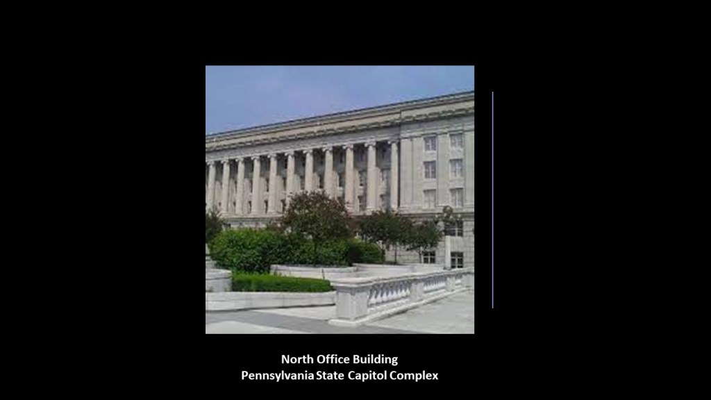
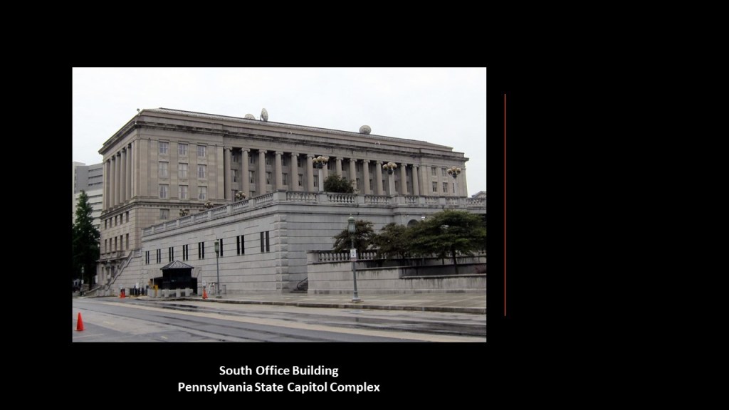
Flanking the East Wing are the North and South Office buildings,
The North Office building was said to have been built in Indiana limestone starting in 1927…
…and the South Office building in Indiana limestone starting in 1919.
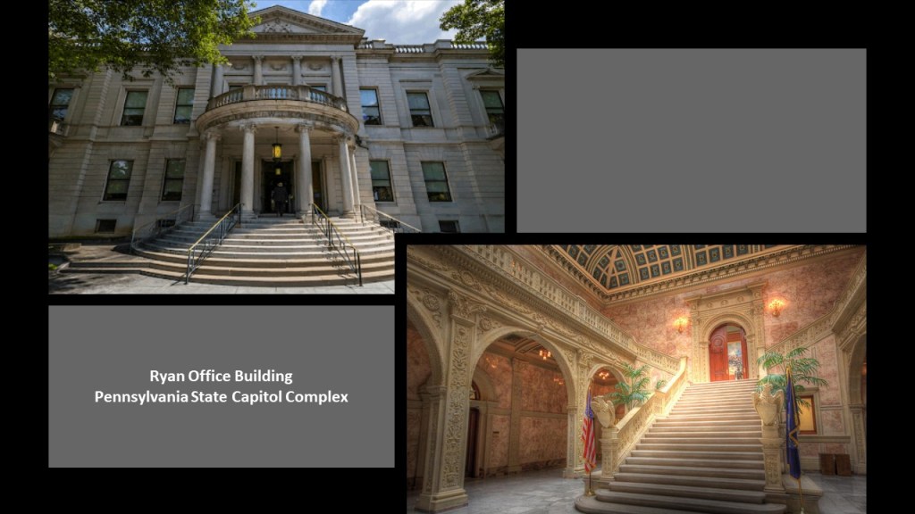
We are told the oldest building of the complex is the Ryan Office building, with a construction completion date of 1894.
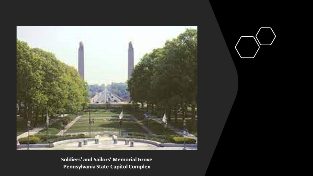
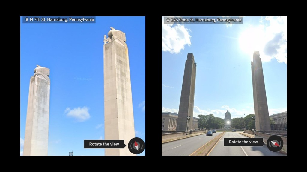
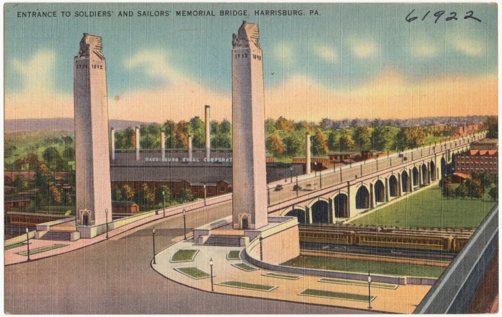
East of the North and South Office buildings, across Commonwealth Avenue, there are a pair of buildings situated across from each other at either end of the “Soldiers’ and Sailors’ Memorial Grove.”
I will be touching more on the Soldiers’ and Sailors’ Memorial Bridge that you can see the pylons of in the background momentarily.
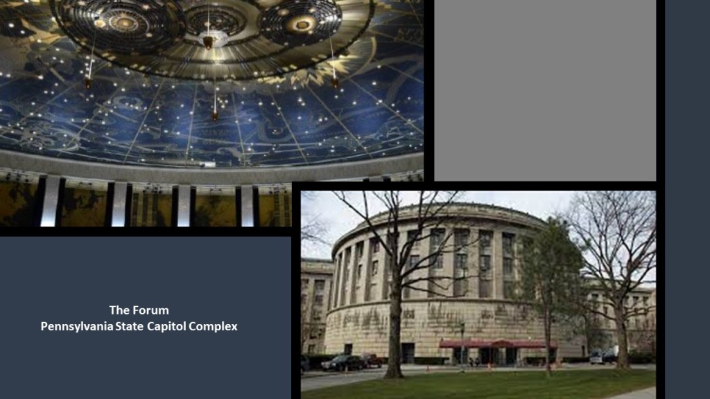
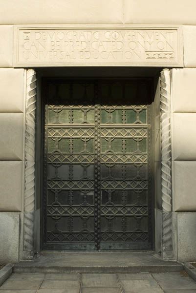
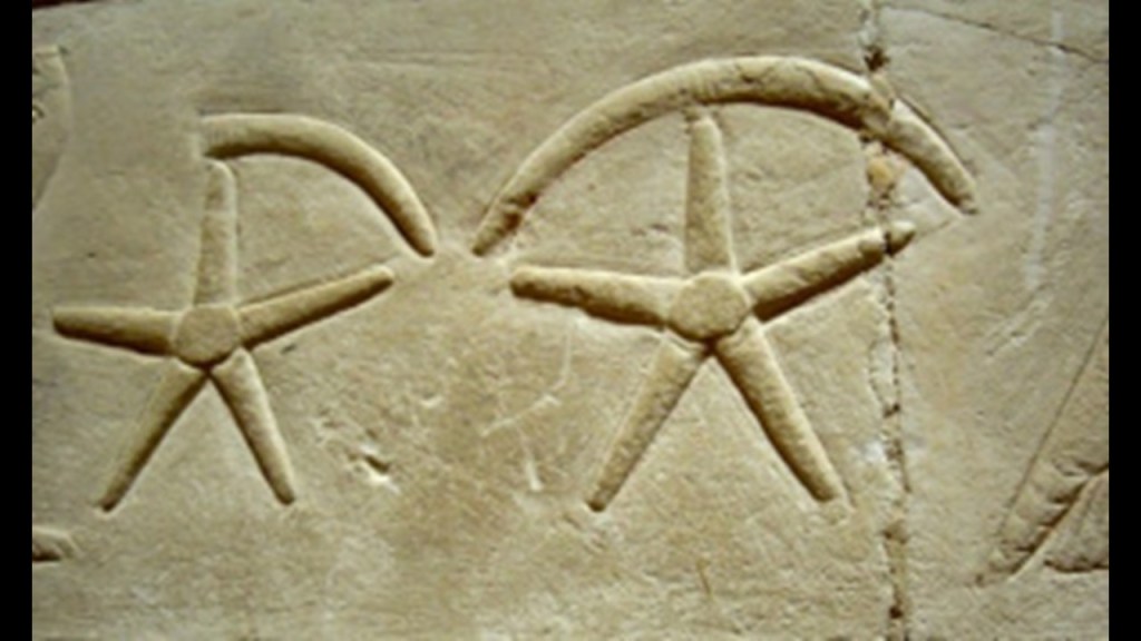
The Forum building is on the south-side of the Memorial Grove, was said to have been built out of grey limestone, and featuring 22 bronze doors, between 1929 and 1931 in the style of an open-air Greek amphitheater, complete with a star map of the night sky depicting the zodiac and other constellations with over 1,000 stars on the ceiling…
…and on the north-side of the Memorial Grove is the Pennsylvania Treasury Building, said to have been a project of the New Deal Era Public Works Administration during the Great Depression built between 1937 and 1940.
The eastern-most portion of the Pennsylvania State Capitol Complex is the “Soldiers’ and Sailors’ Memorial Bridge,”or the “State Street Bridge,” which connects the complex to neighborhoods across the railroad tracks that run east of North 7th Street.
It is a 1,312-foot, or 400-meter, deck-arch bridge said to have been constructed between 1925 and 1930.
The State Museum of Pennyslvania is directly adjacent to the Pennsylvania State Capitol Complex…
…run by the state through the Pennsylvania Historical and Museum Commission to “preserve and interpret the region’s history and culture,” and includes a multi-media planetarium, and four-floors of exhibits covering Pennsylvania history from prehistoric times through today.
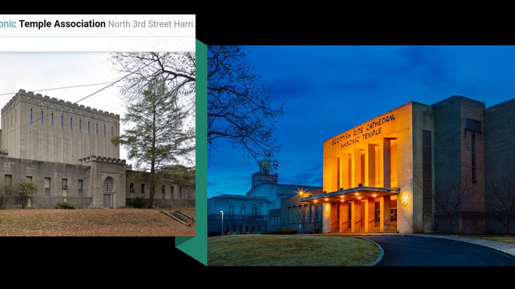
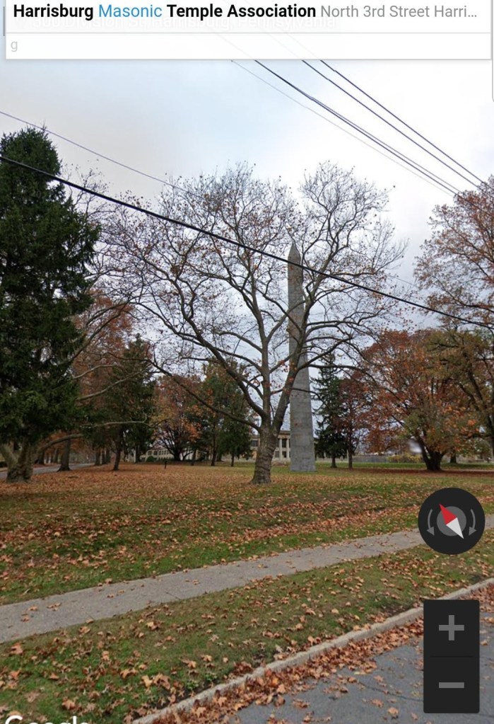
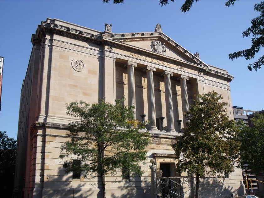
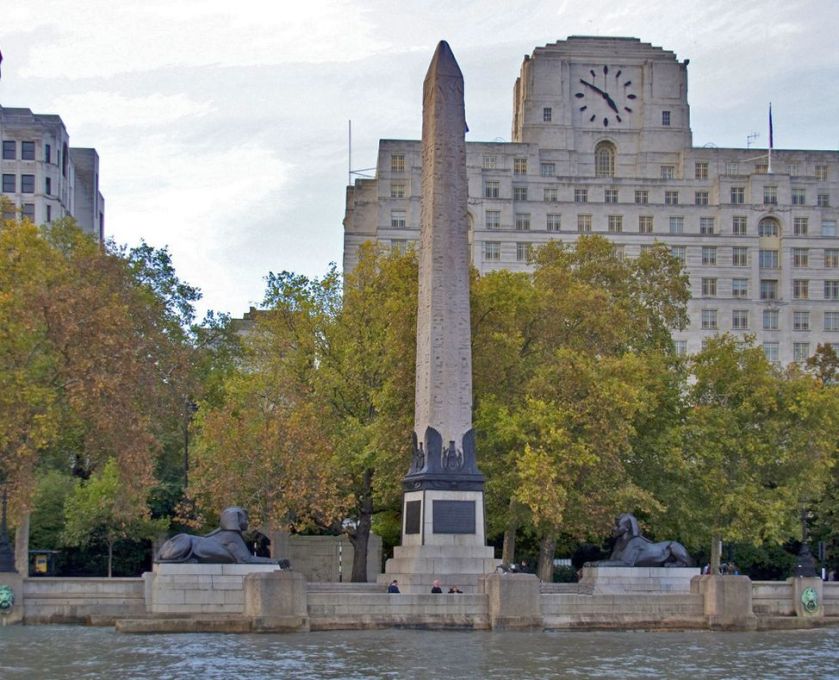
CZ also sent me screenshots of the Scottish Rite Cathedral and Masonic Temple of Harrisburg…
…with a tall obelisk on its grounds.
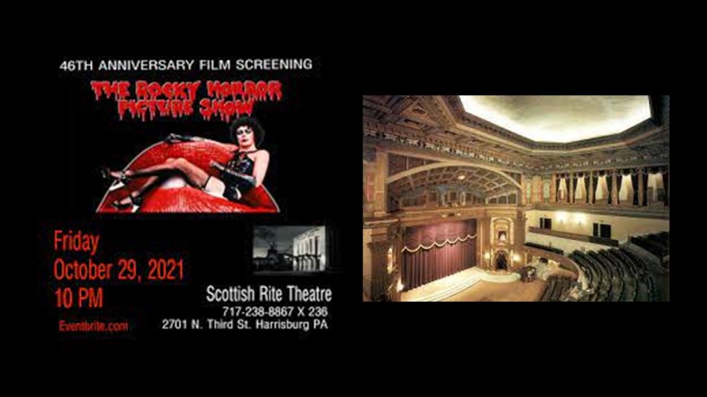
The 1,192-seat Theater and Ballroom at the Scottish Rite Cathedral is a popular community event venue.
And this seems to be the extent of what I am able to find out about it!
Next, I am going to take a look at the State Capitol Complext at Des Moines, the capital city of Iowa.
The Iowa State Capitol Building was said to have been built between 1871 and 1886, and the only 5-domed capitol building in the United States.
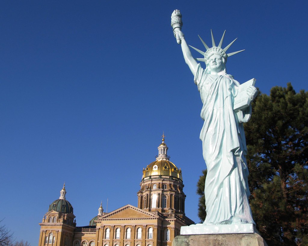
The Iowa Statue of Liberty is located on the capitol grounds.
It is described as a replica of the Statue of Liberty that was a gift in 1950 from the Boy Scouts of America as part of their efforts to “strengthen the arm of liberty.”
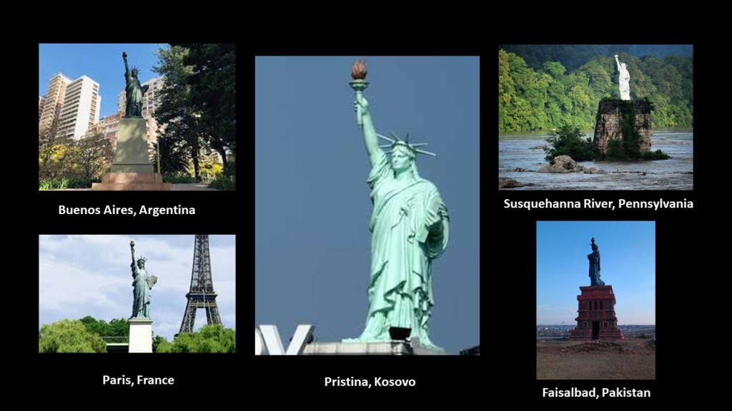
Interesting thing is, there are hundreds of replicas of the Statue of Liberty, said to be a figure of Libertas, a Roman goddess and the personification of liberty, all over the Earth.
Are they replicas…or do they represent something else entirely?
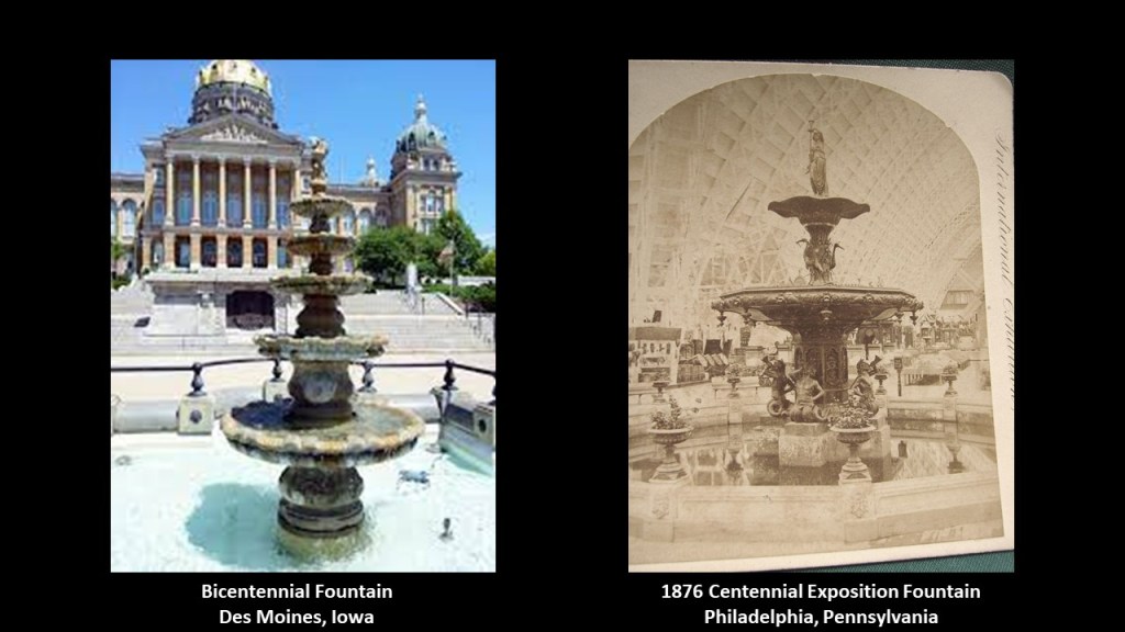
The Bicentennial Fountain is on the west-side of the State Capitol Complex.
What we are told about the Bicentennial Fountain is that it was originally a replica of a fountain that was displayed at the 1876 Centennial Exposition in Philadelphia, and that after years of vandalism and disrepair, it was replaced by a new fountain in 1982.
So there’s another “replica of” to explain something’s existence.
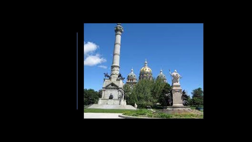
Also in the Iowa State Capitol Complex, to the rear of the State Capitol Building, we find the Soldiers and Sailors Monument, an obelisk-looking monument, in direct alignment with the dome of the Capitol building, which we are told was erected to commemorate Iowans who fought during the Civil War.
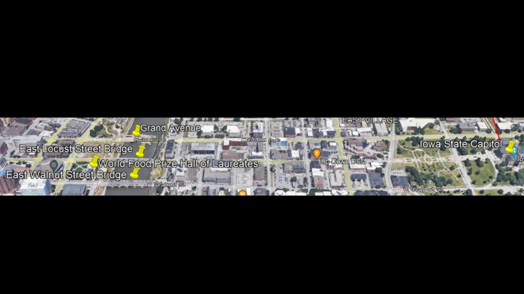
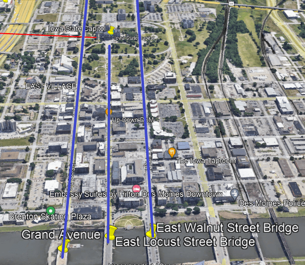
The last place I want to look at in the Iowa State Capitol are the bridges over the Des Moines River on the west-side of the complex.
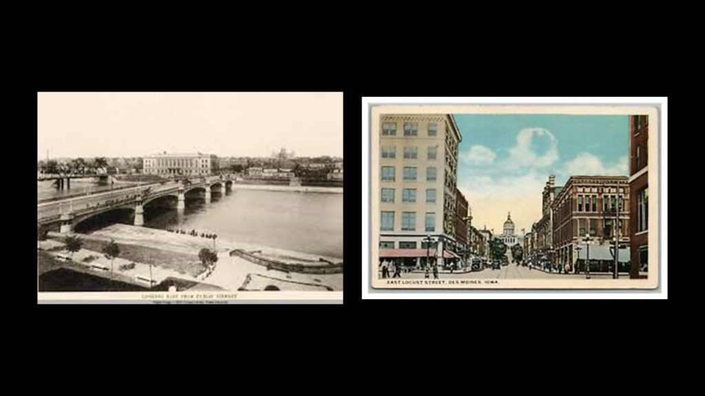
The East Locust Street Bridge is situated between the East Walnut Street Bridge and the Grand Avenue Bridge, and East Locust Street is in direct alignment with the Iowa State Capitol Building.
The other two bridges and streets go on either side of the complex.
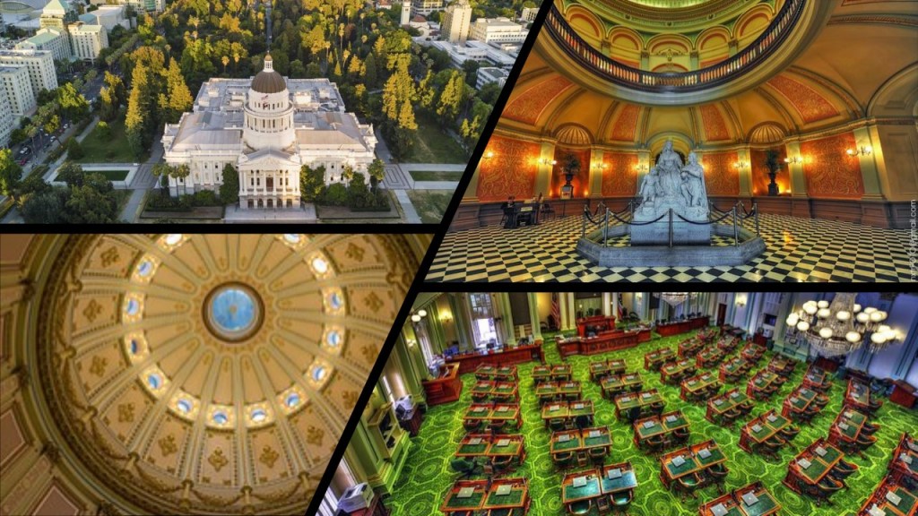
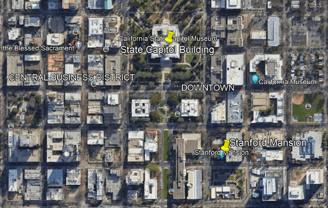
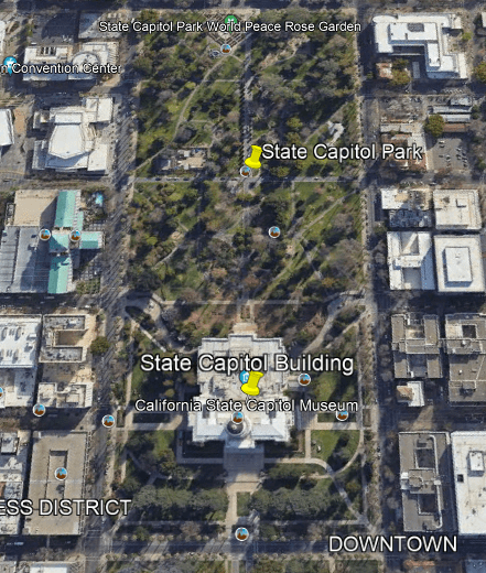
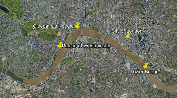
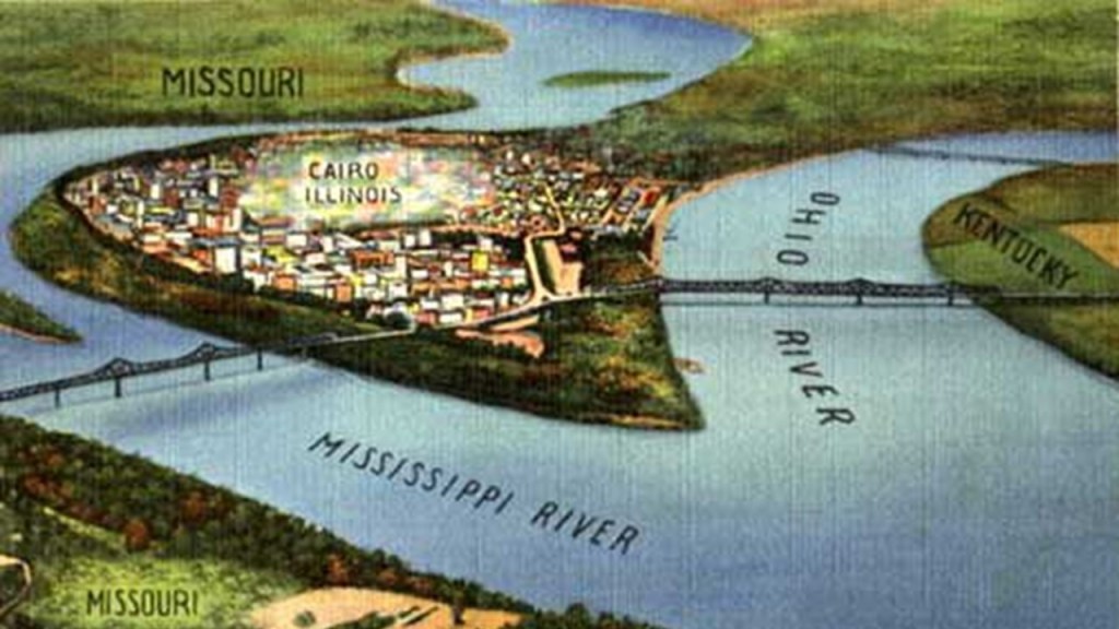
Lastly, the California State Capitol complex in Sacramento.
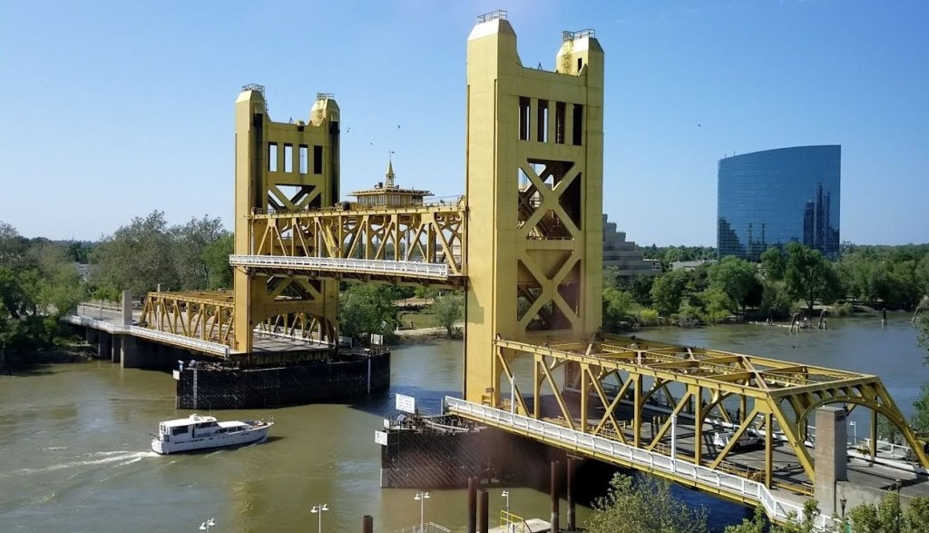
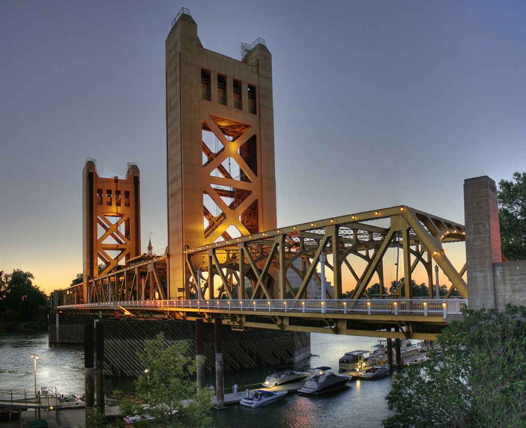
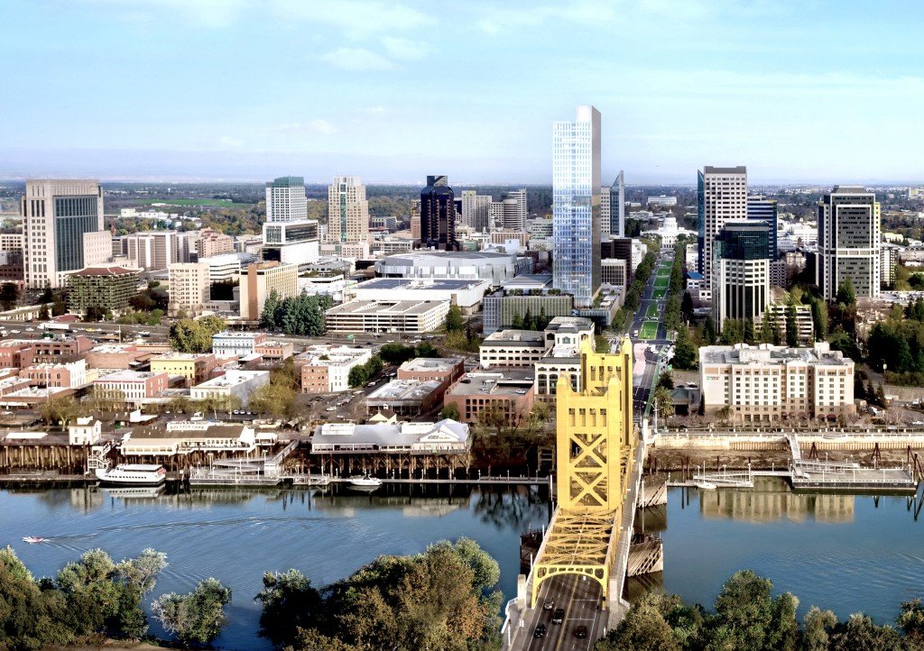
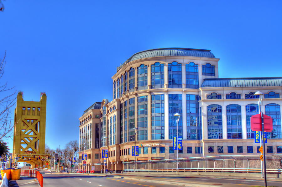
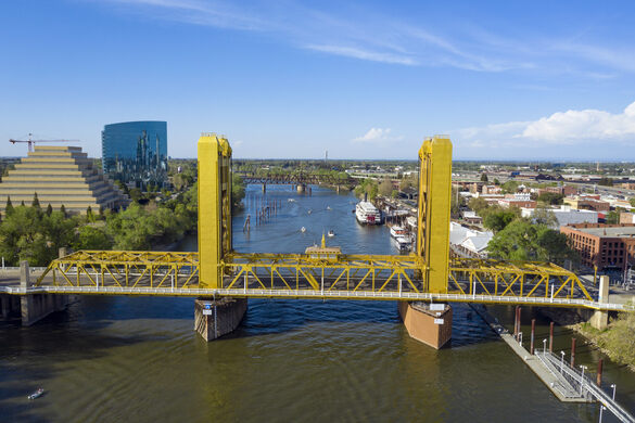
The Tower Bridge crosses the Sacramento River, and leads right in to the Capitol Mall in front of the California State Capitol Building, in the same manner as the precisely laid-out bridges and streets connect to the State Capitol complexes in Harrisburg and Des Moines.
The California State Capital building was said to have been designed in the Neoclassical-style by Reuben S. Clark, and constructed between 1861 and 1874, which would have been completed three-years after the start date of the Iowa State Capitol building’s construction in 1871 according to the historical narrative we have been given.
The Tower Bridge is also a vertical-lift bridge, and connects Sacramento and West Sacramento across the Sacramento River.
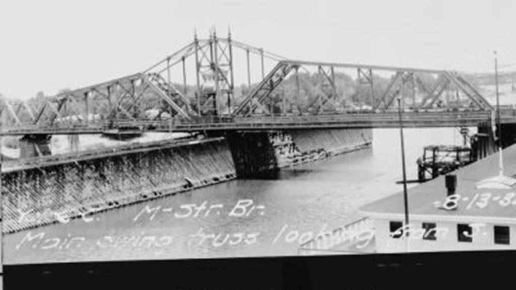
We are told the construction of the Tower Bridge as a replacement bridge for the 1911 M Street bridge was said to have started in 1934 and first opened in 1935.
This would have been around the time of the Great Depression and the beginning of World War II.
The original 1911 bridge was described as a “swing-through truss railroad bridge” that was determined to be inadequate as the result of Sacramento’s population growth doubling between 1910 and 1935, and the city’s concern for needing a better crossing over the Sacramento River in case of war.
Alfred Eichler was credited as the architect of the Tower Bridge, and its architectural-style described as a rare use of “Streamline Moderne,” a style of “Art Deco” that emerged in the 1930s.
The two towers of the bridge alone are 160-feet, or 49-meters, -high.
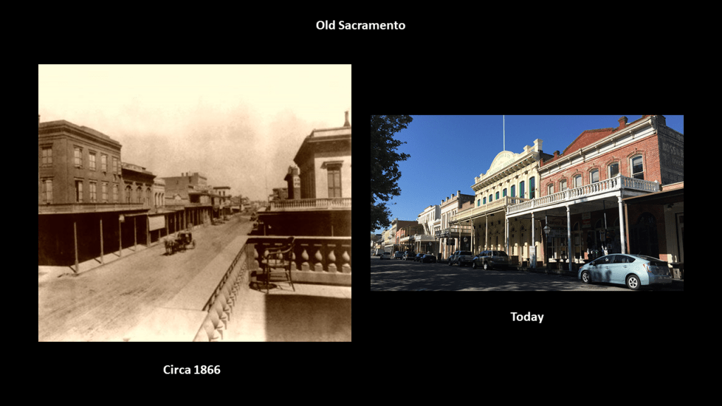
It is located in “Old Sacramento,” the riverfront historic district, with Gold Rush-era buildings attributed to Victorian-era gold miners.
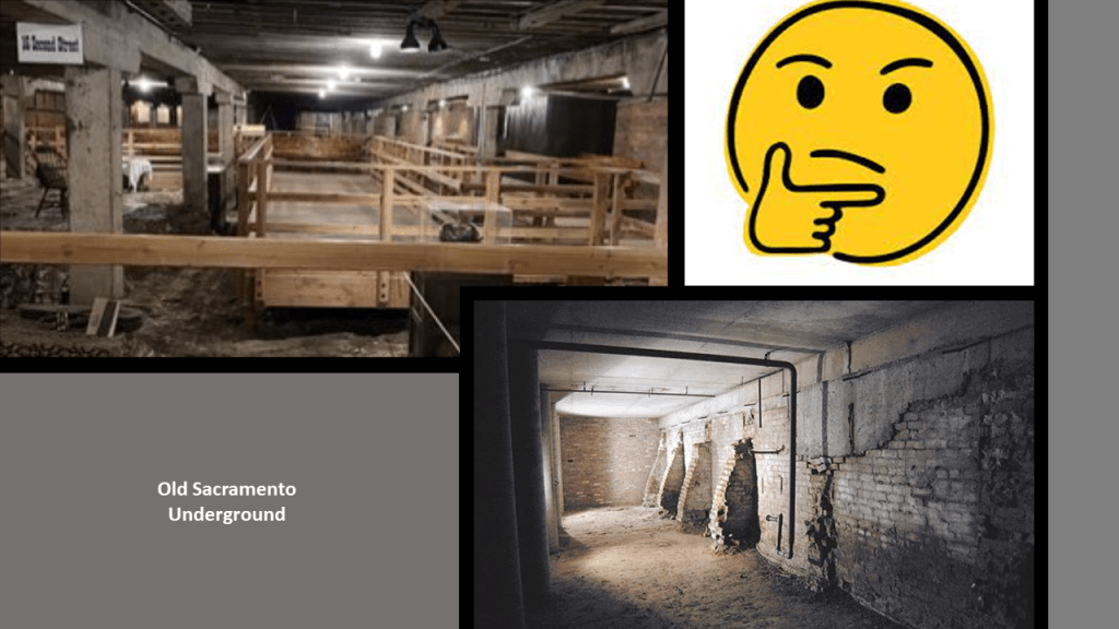
You can go on an “Underground Sacramento” Tour any day of the week, where you will learn how Sacramento lifted itself up out of floodwaters in the 1860s and 1870s by the “jacking” up of buildings to avoid further flooding.
The Tower Bridge is part of State Route 275 which connects West Capitol Avenue and the Tower Bridge Gateway with the Capitol Mall in Sacramento.
The Capitol Mall in Sacramento is described as a major street and landscaped parkway.
The former Drexel University Sacramento Center for Graduate Studies was in a building situated right next to the Tower Bridge at the address of 1 Capital Mall.
It opened in 2009, and started closing in 2015 to allow currently enrolled students to complete their studies.
It was then permanently closed.
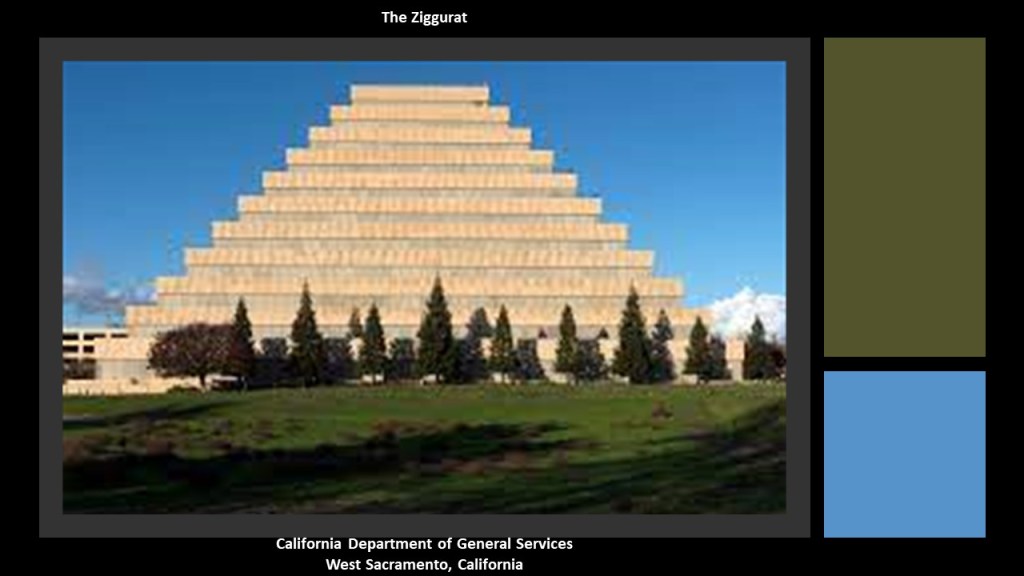
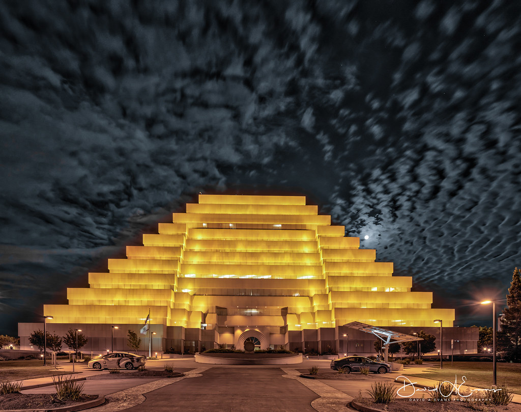
There is a California State Government building called “The Ziggurat” in West Sacramento right next to the Tower Bridge.
The Ziggurat was said to have been designed to resemble ancient Mesopotamian ziggurats and built by The Money Store in 1997.
Since 2001, it has been leased to the state as the headquarters of the California Department of General Services.
The Ziggurat is illuminated at night on special occasions.
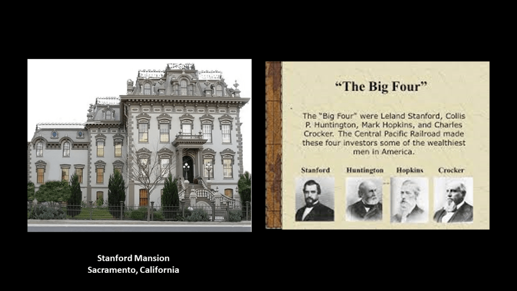
The Stanford Mansion is in the neighborhood of the Capital Mall, a couple of blocks south of the State Capitol Building and serves as the official reception center for the California government.
It was said to have been built in 1856 as a residence for Leland Stanford, a Railroad Baron who was a former California governor, and founder of Stanford University in 1885.
It was donated to the Roman Catholic Diocese of Sacramento in 1900, who operated a children’s home there until 1978.
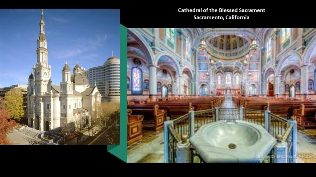
The Cathedral of the Blessed Sacrament, the seat of the Roman Catholic Diocese of Sacramento, and is one of the largest cathedrals west of the Mississippi River.
It was said to have been built between 1887 and 1889 in the Italian Renaissance architectural-style on the outside, and the Victorian architectural-style on the inside.
The cathedral’s designer was said to be Patrick Manogue, a former gold-miner who came to Sacramento through the California Gold Rush, who became a Catholic priest in 1861 after studying in Paris, and then the Bishop of Sacramento in 1886.
He was said to have based the design of his cathedral on a church he was inspired by in Paris, and that it was built on land donated by the State’s first elected governor, Peter Burnett.
The Capitol Park in Sacramento covers 40-acres, or 16-hectares, and I will cover a few examples of what is found on the grounds.
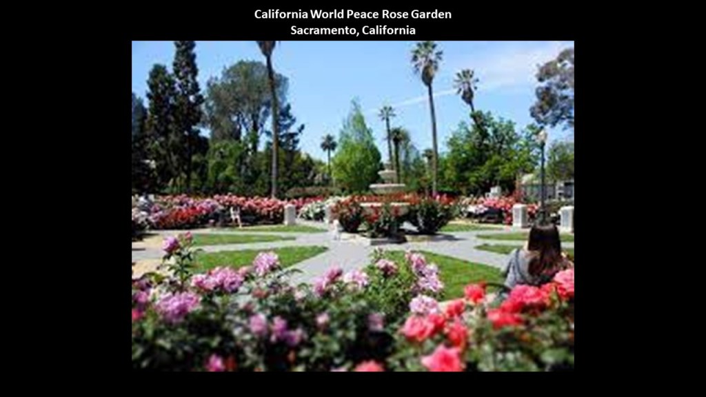
The California State World Peace Rose Garden occupies roughly 5-acres, or 2-hectares of the area it covers, featuring 650 roses with different colors and fragrances.
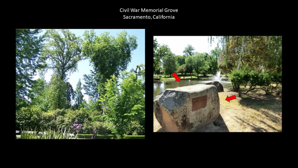
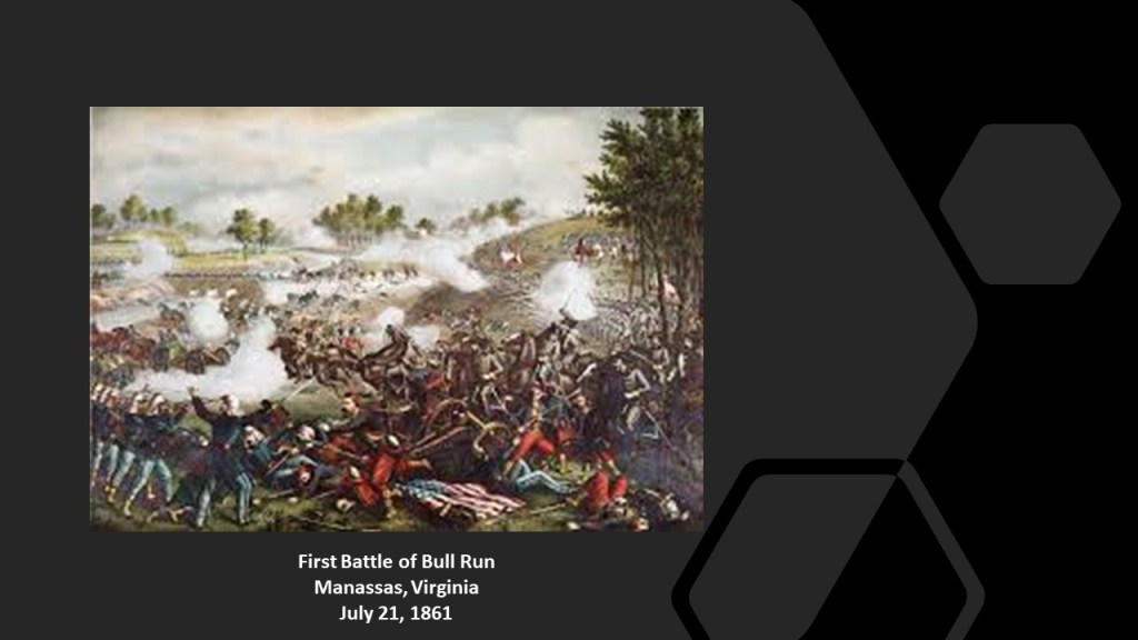
The Civil War Memorial Grove on the Capitol State Park Grounds was said to have been planted in 1897 with saplings from famous Civil War battlefields, like Manassas, Virginia; Harper’s Ferry, West Virginia; and Vicksburg, Mississippi.
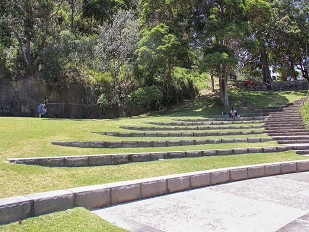
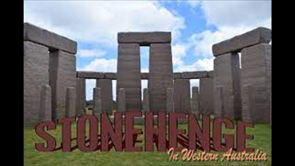
You know, it’s interesting, that we don’t even notice the straight-edges of megalithic stone blocks all around us that get used, like in this case, as a place to put signage.
Instead, a label like “boulder” is put on huge cut-and-shaped stones like this and which covers it up nicely as not being something out-of-the-ordinary that we should be paying attention to.
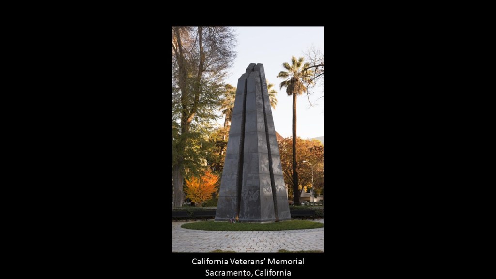
And the California Veterans’ Memorial on the Capitol State Park grounds is an 30-foot, or 9-meter tall, black-granite obelisk that was dedicated in 1998 to California’s veterans who had served in the Armed Forces since statehood in 1850.
These are just a few of the memorials and monuments to be found on the grounds of the park.
This is just a sample of countless examples of the shared characteristics of Capitol building complexes, and a few other locations nearby as well.
A sample is all that is needed to illustrate that they are all have similar characteristics of mind-blowing examples of monumental architecture and precise civil-engineering feats that do not match what we are supposed to have been capable of in our historical narrative, which would have been very low technology in the 19th-century and early 20th-century according to what we have been taught to believe.
The stories we are told don’t match the grandeur of the architecture and the incredible feats of engineering that we see in these places, and I would surmise the same is true of capitals the world over.
Things to consider in regards to how this ancient, advanced worldwide Moorish civilization has been hidden right in front in front of our eyes by those who have sought to keep our True History from our Awareness.
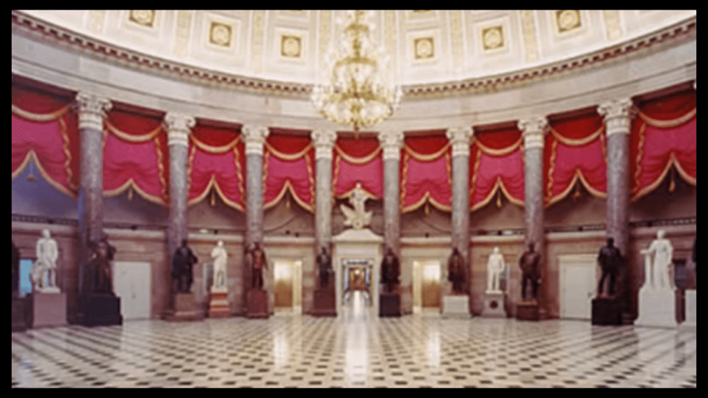
I have been working my way through who is represented in the National Statuary Hall at the U. S. Capitol Building in Washington, DC.
There are two statues representing each state, and I am currently about half-way through the 50-states.
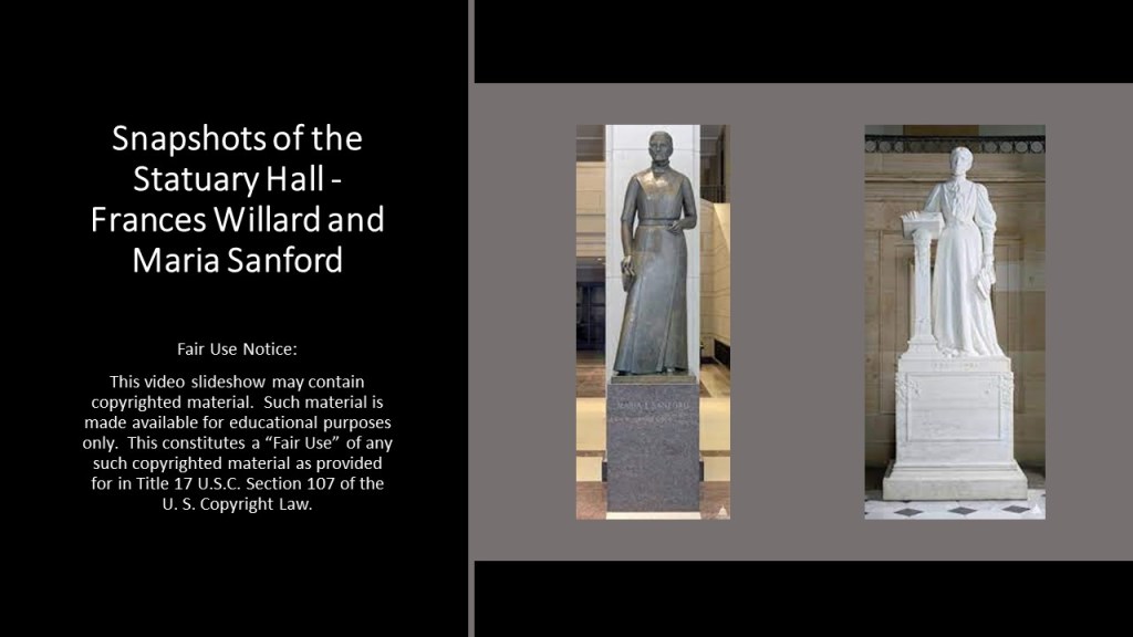
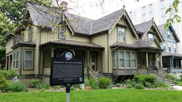
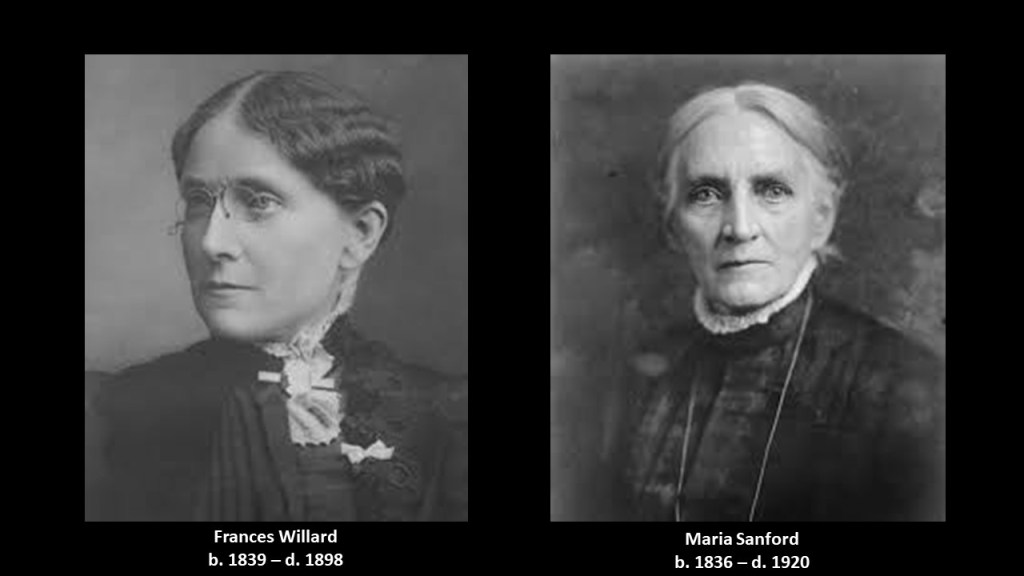
As a way to highlight what I am finding out in the process of doing this research, I am bringing forward unlikely pairs of historical figures represented in the Statuary Hall who have things in common with each other in this separate series called “Snapshots from the National Statuary Hall,” and in this post I am pairing two ladies, Frances Willard and Maria Sanford.
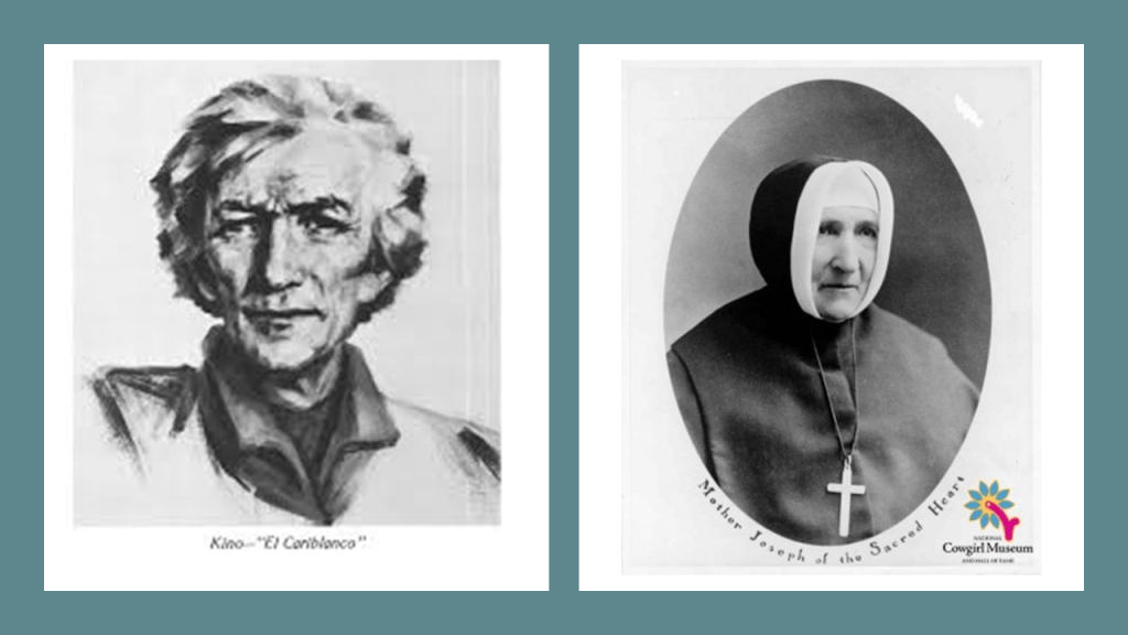
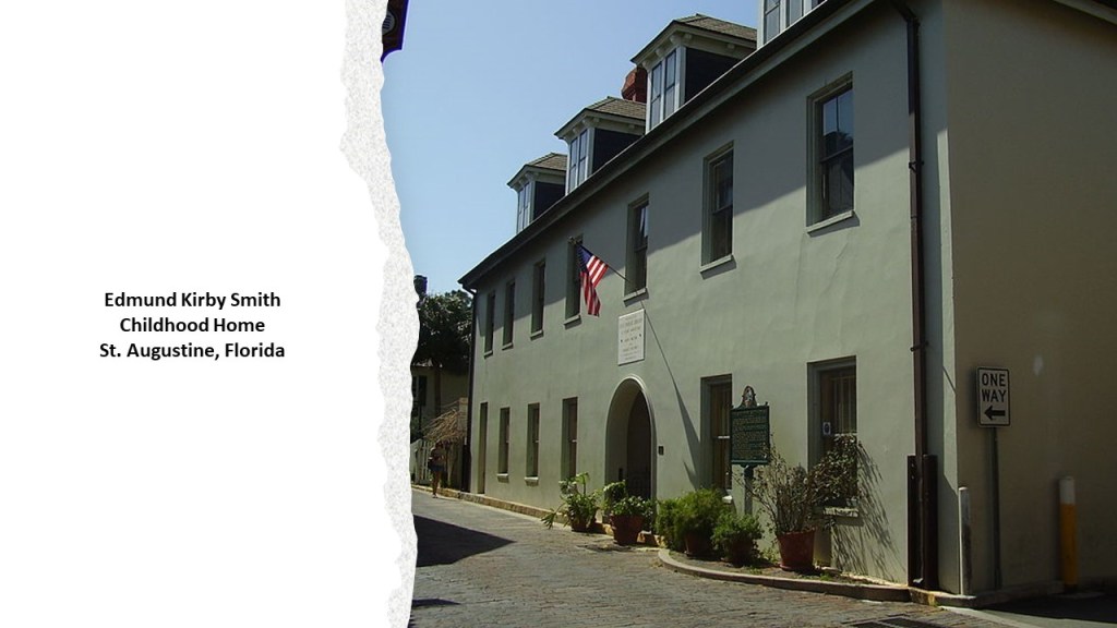
The only reason my attention was drawn here in the first place was because I encountered two historical figures in other research who are represented in the National Statuary Hall – Father Eusebio Kino, a Jesuit Missionary and Cattle rancher, for Arizona, and Mother Joseph Pariseau, a Catholic sister and self-taught architect, for Washington State.
Seeing these two little-known, and on the unusual-side, historical figures represented there got me to wondering who else was chosen by their State to be represented there and what else could possibly be going on here.
Not only am I finding much in common between the pairs featured in each of the nine- installments of the “Snaptshots of the Statuary Hall” series, I am finding, regardless of fame or obscurity, that the National Statuary Hall functions more-or-less as a “Who’s Who” for the New World Order and its Agenda.
I have paired people like Michigan’s Gerald Ford, a former President of the United States, and Mississippi’s Jefferson Davis, the former President of the Confederate States of America, and both men featured on the cover of the “Knight Templar” Magazine; Dr. Norman Borlaug, Ph.D, often called the “Father of the Green Revolution; and Colorado’s Dr. Florence R. Sabin, M.D, a pioneer for women in science, both of whom worked for the Rockefeller Foundations; and Louisiana’s controversial Socialist Governor, Huey P. Long, and Alabama’s Helen Keller, a deaf-blind woman who gained prominence as an author, lecturer, Socialist activist.
As I mentioned, I am pairing two ladies in this post.
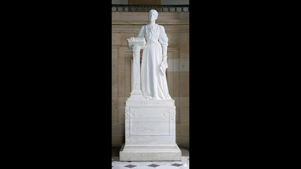
Frances Willard represents the State of llinois, and Maria Sanford represents Minnesota.
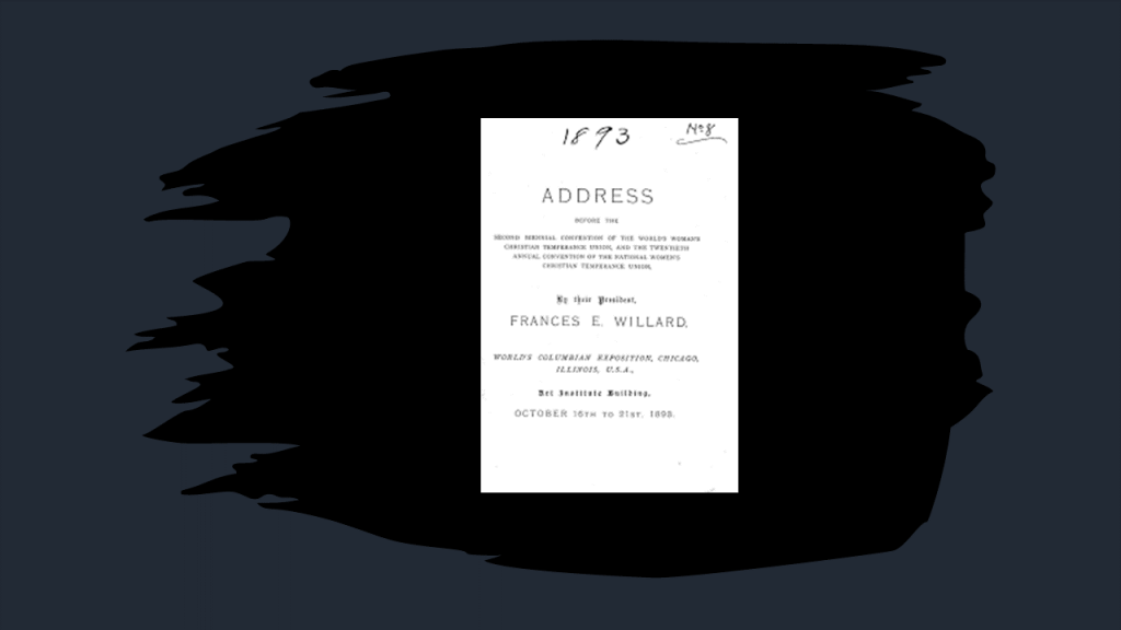
First, Frances Willard.
Frances Willard was an American educator, temperance reformer, and women’s suffragist.
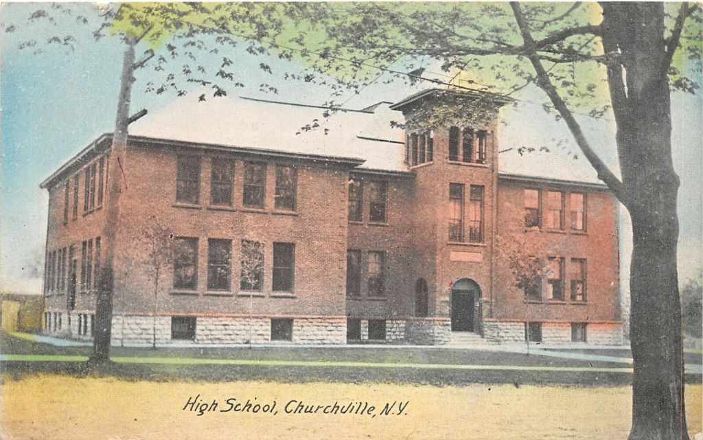
Frances was born in 1839 in Churchville, New York, near Rochester, to Josiah Flint Willard, a farmer, naturalist, legislator & businessman, and Mary Willard.
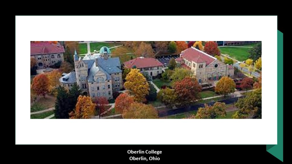
The family moved to Oberlin, Ohio, in 1841, where her parents took classes at Oberlin College.
Oberlin College was established in 1833, and is the oldest coeducational liberal arts college in the United States, and the second-oldest in the world.
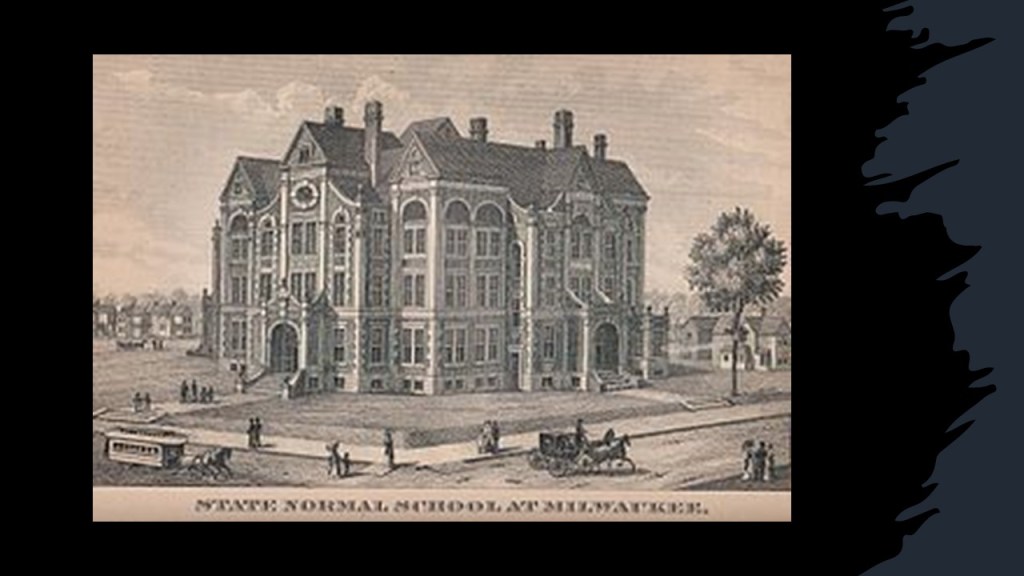
Then in 1846, the family moved to Janesville, Wisconsin, for the given reason of her father Josiah’s health.
There, Frances and her sister Mary were said to have attended the Milwaukee Normal School, where their mother’s sister taught.
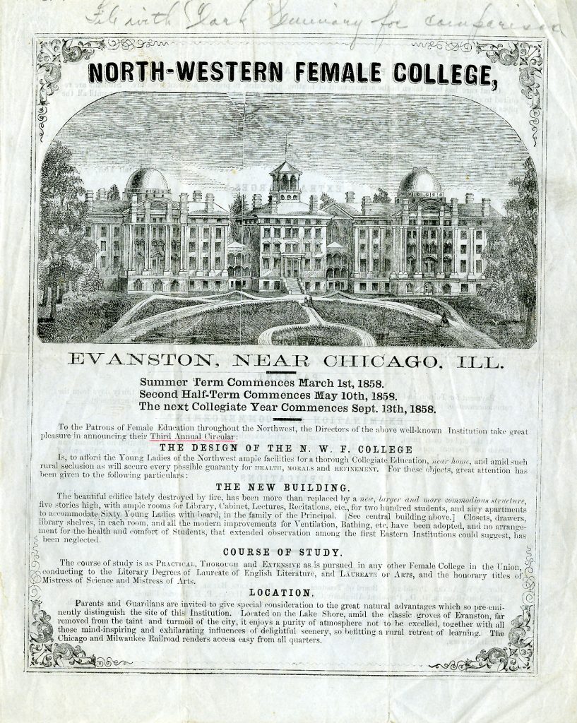
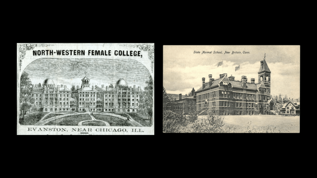
The Willard Family moved to Evanston, Illinois, in 1858, where Josiah Willard became a banker.
Frances and her sister Mary attended the North Western Female College there.
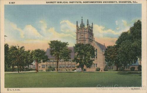
Their brother Oliver attended seminary at the Garrett Biblical Institute in Evanston.
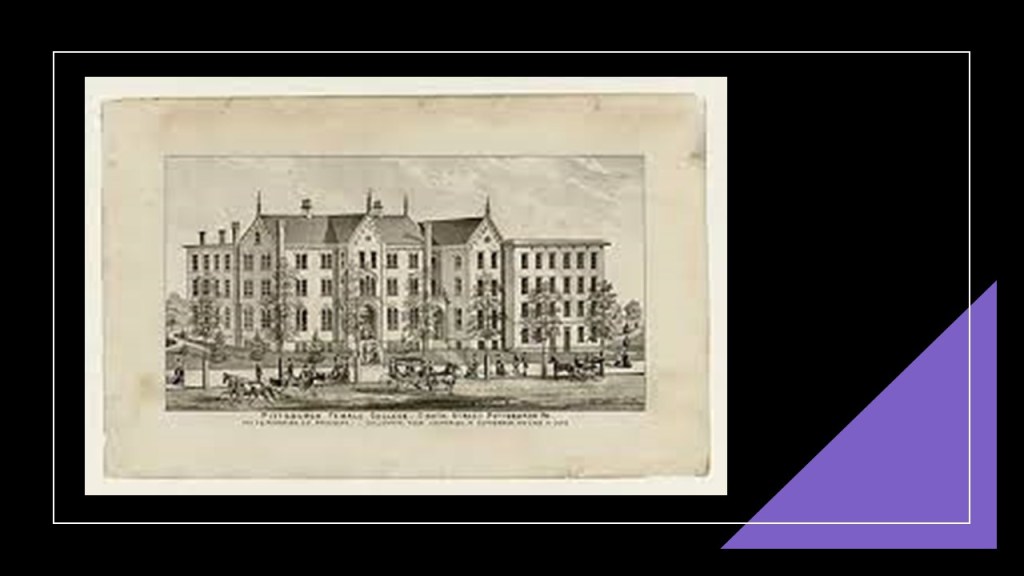
After Frances Willard graduated from the North Western Female College, she worked at the Pittsburgh Female College…
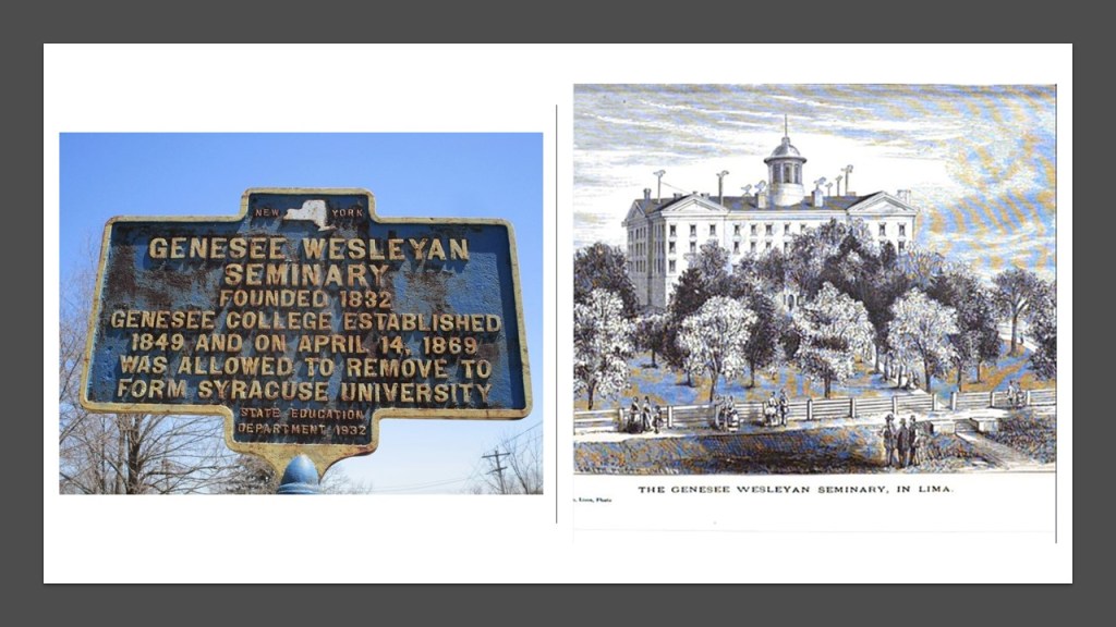
…and also at the Genessee Wesleyan Seminary in New York, which later became Syracuse University.
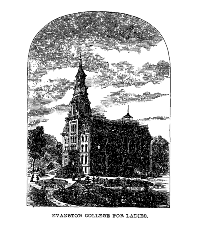
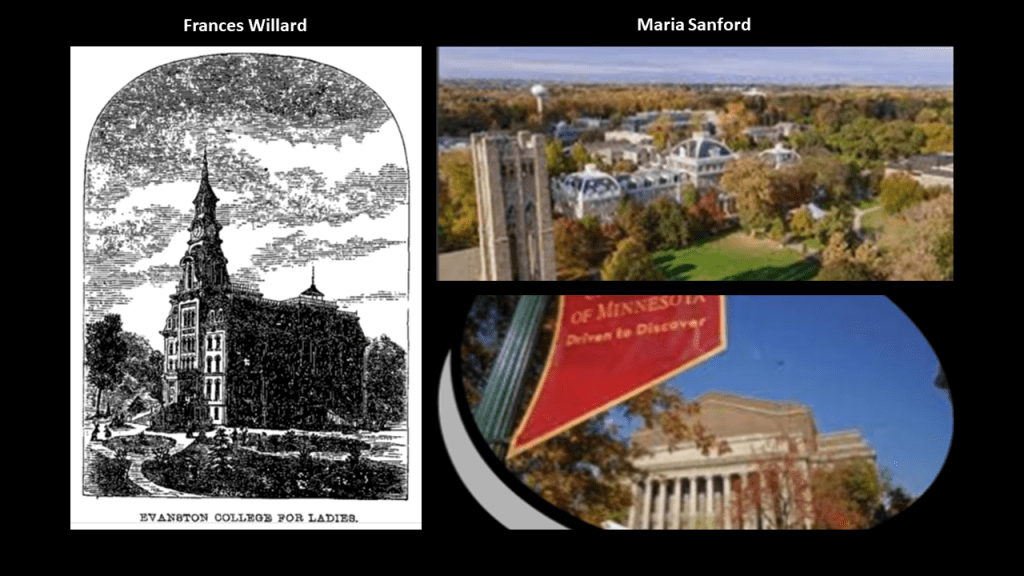
Then in 1871, she was appointed as President of the newly-founded Evanston College for Ladies.
In 1873, she was named as the first Dean of Women when the same school became the Woman’s College of Northwestern University.
This position didn’t last long for her over confrontations in 1874 with the University’ President, Charles Henry Fowler, who had been her fiance.
After this happened, she focused her career energies into the Women’s Temperance Movement, and she was involved in the founding of the Women’s Christian Temperance Union (WCTU), also in 1874, and was elected the first Corresponding Secretary.
The WCTU was among the first organizations of women devoted to social reform, playing an influential role in the Temperance Movement, supporting the 18th Amendment to the Constitution that established Prohibition, and influential in other social reform issues of the Progressive Era.
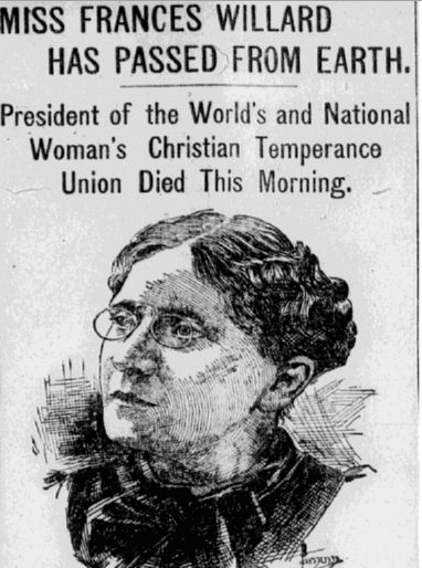
She was elected President of the National WCTU in 1879, and held this post until her death in 1898.
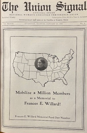
Frances Willard was also editor of the organization’s weekly newspaper, “The Union Signal” from 1892 to 1898.
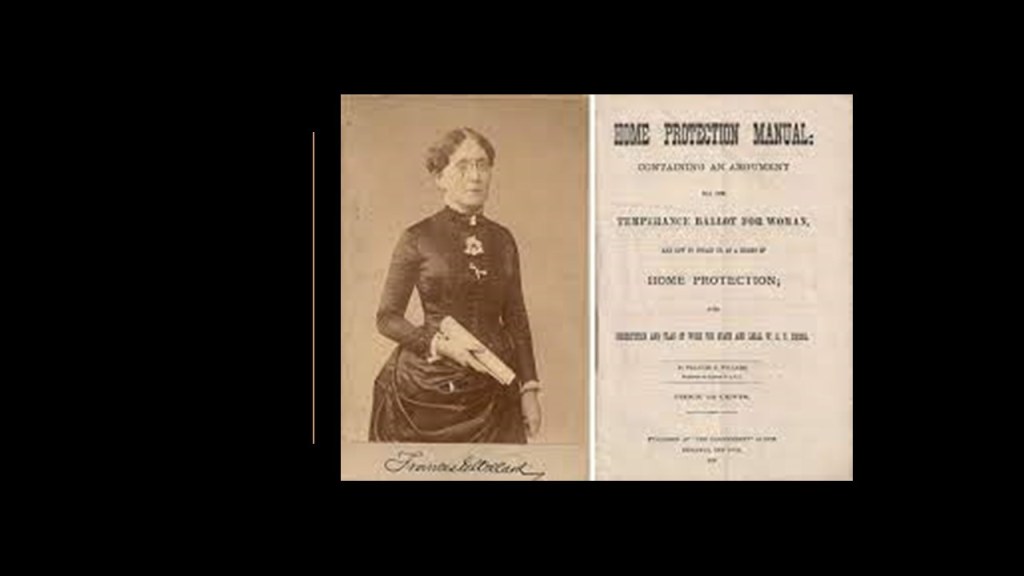
Willard argued for the right for women to vote, based on “Home Protection,” as President of the WCTU, as a part of which she argued that having the right to vote gave women a means of protection in and outside of the home against violent acts caused by intoxicated men.
Frances Willard founded the World WCTU in 1888 and became its first President in 1893.
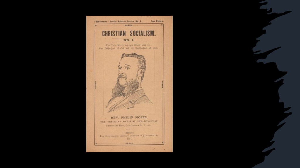
After 1893, Willard became a committed Christian Socialist, having been influenced by the Fabian Society in Great Britain.
The Fabian Society was a British Socialist organization whose purpose was to advance the principles of Democratic Socialism rather than by revolutionary overthrow.
Christian Socialism was established as a religious and social philosophy that blended Christianity and socialism, advocating for left-wing politics and socialist economics from a Biblical perspective.
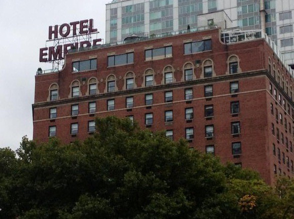
Frances Willard died in her sleep from influenza on February 17th of 1898 where she was staying at the Empire Hotel in New York City just prior to leaving for a European tour…
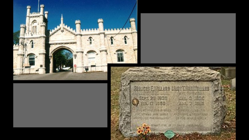
…and was buried in the Rose Hill Cemetery in Chicago, Illinois.
She bequeathed her home in Evanston to the WCTU, and it became her museum and the headquarters for the organization in 1900.
There are a couple things that stand out for me in Frances Willard’s life story.
One is her affiliation with something called “Christian Socialism,” which apparently was based on an organization that was modelled after a British Socialist organization whose stated purpose was to advance the principles of Democratic Socialism rather than by revolutionary overthrow.
So, it sounds like they were finding another way to advance the cause of socialism and communism around the world through the establishment of democratically-run socialist governments, versus by means of the violent overthrow of an existing government.
In other words, they decided to achieve the same outcome of overthrowing the existing government and economic system by vastly different means from straight-out revolutionary overthrow.
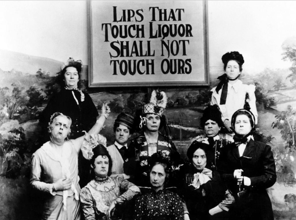
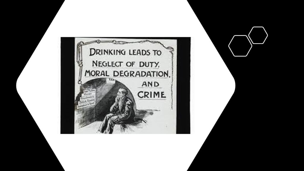
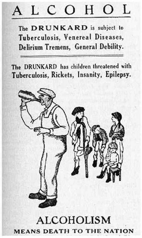
Another thing that I would like to point out is that I find the whole Temperance Movement to be extremely interesting from a social stand-point of those times
On the one hand, the Temperance Movement was called a social movement against the consumption of alcohol, and typically criticized alcohol consumption and emphasized alcohol’s negative effects on people’s health, personalities, and lives, and demanded the complete prohibition of it.
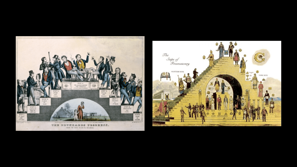
Notice how similar the Temperance Movement cartoon entitled “The Drunkard’s Progress” is on the left to the illustration of “The Steps of Masonry” on the right.
On the other hand, the alcoholic beverage industry was becoming well- established during this time period between 1830 and 1900, creating the juxtaposition of a culture that encouraged the profuse consumption of alcohol, and at the same time there was a counterforce within that same culture that not only criticized alcohol consumption, but that got involved in “charitable institutions” with stated missions of guiding the poor out of the impoverishment and crime coming from the problem of drinking too much alcohol.
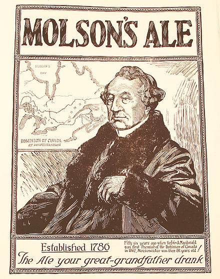
There has been an abundant supply of beer and hard liquor, starting at least as early as the late 18th-century, with people like John Molson in Montreal, whose business quickly grew into one of the larger ones in Lower Canada between 1788 and 1800, having sold 30,000 gallons, or 113,500-liters, of beer by 1791.
John Molson was also appointed the Provincial Grand Master of the District Freemasonic Lodge of Montreal by the Duke of Sussex in 1826, a position he held for five years before resigning in 1831.
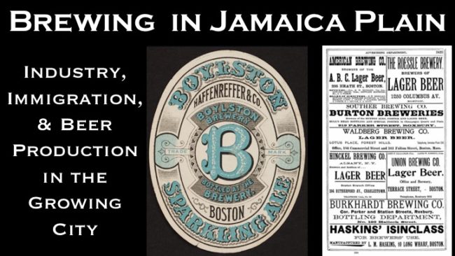
Here is one of countless examples of the ubiquitous brewing business in Jamaica Plain in Boston alone.
Jamaica Plain was the home to most of Boston’s thirty-one breweries prior to the outlawing of alcoholic beverages during the Prohibition Era starting in 1920.
The reasons given for the high number of breweries were: 1) the quality of the water from the local aquifer; 2) the cheap cost of land in the area after merging with Boston in 1868; and 3) the influx of German and Irish immigrants here with a taste for lager and ale.
Yet, invariably the drinking problems have always been squarely placed on individuals and their addictions, instead of the never-ending supply produced by the alcoholic beverage industry.
Heck, even “Alcoholics Anonymous” has a step reference, like “The Drunkard’s Progress” and “The Steps of Masonry,” with its “Twelve-Step Program.”
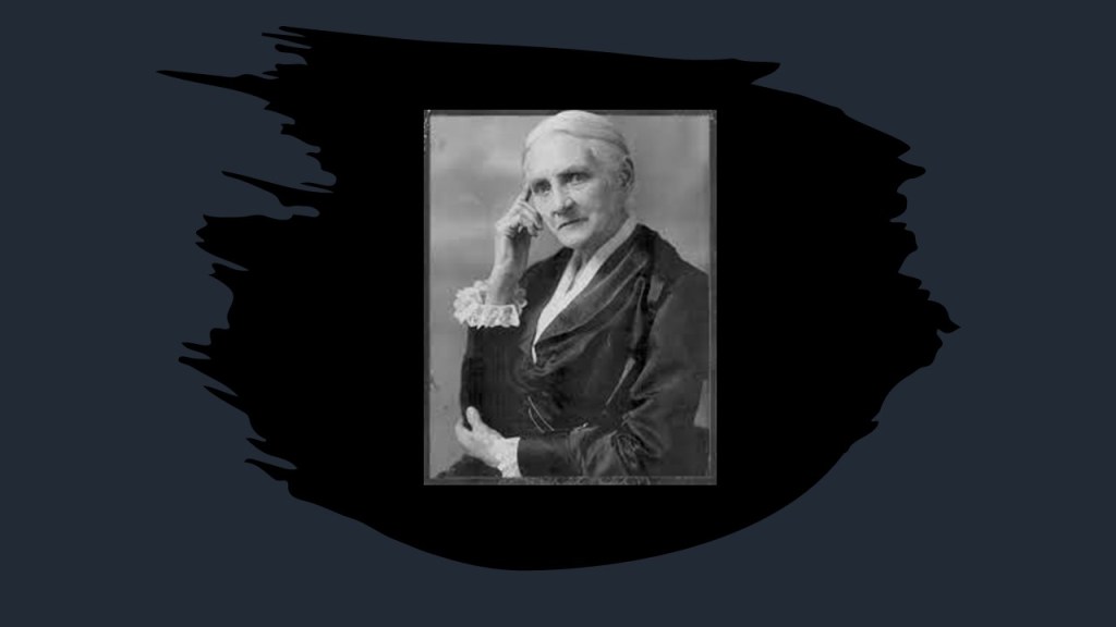
Next, I am going to take a look at Maria Sanford.
She represents Minnesota in the National Statuary Hall.
Maria Sanford was an American educator, and one of the first female professors in the United States.
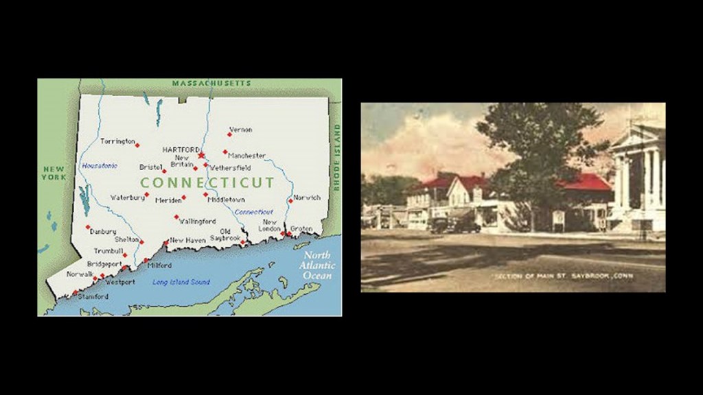
Maria Sanford was born in Saybrook, Connecticut, in December of 1836.
Old Saybrook is located where the Connecticut River meets Long Island Sound.
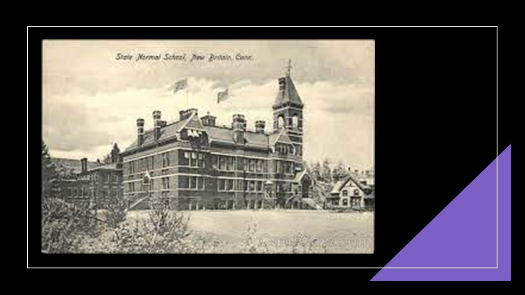
She received her education from the New Britain Normal School, the first training school for teachers in Connecticut, and the sixth in the United States.
Today it is Central Connecticut State University.
After graduating from the New Britain Normal School with honors in 1855, she taught in various schools around Connecticut for the next twelve years.
She moved to Pennsylvania in 1867, and became a principal and superintendent of schools in Chester County.
Known as an innovator, she conducted regular meetings of teachers and demonstrated new teaching methods.
She became a Professor of History and English at Swarthmore College in Pennsylvania from 1871 to 1880.
Swarthmore College was founded by Quakers in 1864, which would have been one year before the end of the American Civil War, and the first classes offered in 1869.
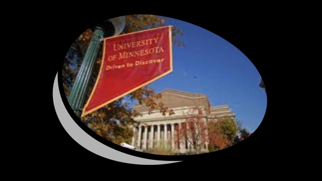
Sanford was invited to become a Professor at the University of Minnesota by its President, Dr. William Watts Folwell, and she joined the faculty there in 1880 as a Professor of Rhetoric and Elocution, where she also lectured in literature and art history, a position she held until her retirement in 1909.
She was a leading voice outside of academia.
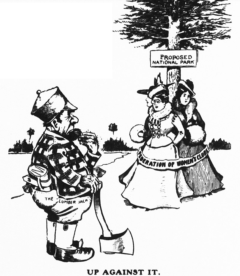
Among other things, she was an advocate for the conservation and beautification of Minnesota for the cause of the Chippewa National Forest from within the Minnesota Federation of Women’s Clubs, along with fellow clubwoman and forest conservationist Florence Bramhall…
Sanford reached out to her community and to the nation with the power of her speeches, travelling throughout the United States delivering more than 1,000 patriotic speeches.
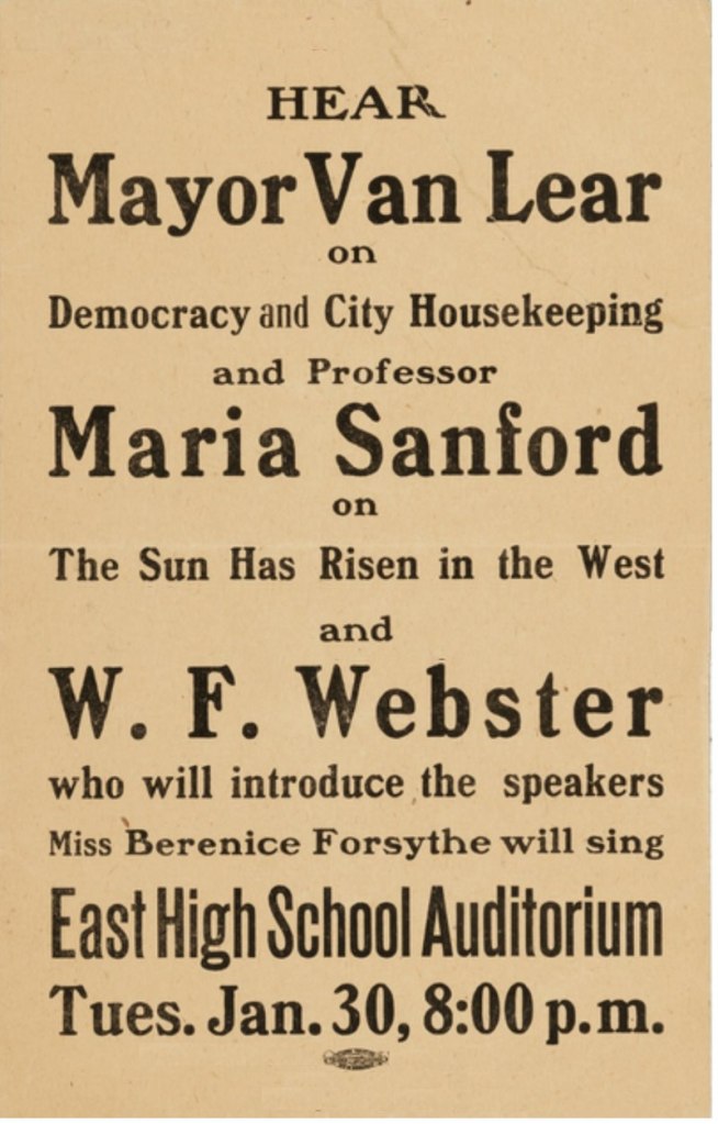
In 1917, she delivered a speech, along with the Mayor of Minneapolis at the time Thomas Van Lear, on good government and women’s suffrage.
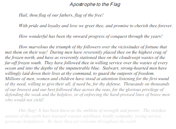
She delivered her most famous speech to the Daughters of the American Revolution Convention in April of 1920, entitled “An Apostrophe to the Flag.”
But not only did she give speeches, she took on a highly active role in the public sector, including, but not limited to, becoming the head director of Northwestern Hospital and serving as president of the Minneapolis Improvement League.
The University of Minnesota was said to have constructed Sanford Hall as a women’s dormitory in 1910 in honor of Maria Sanford.
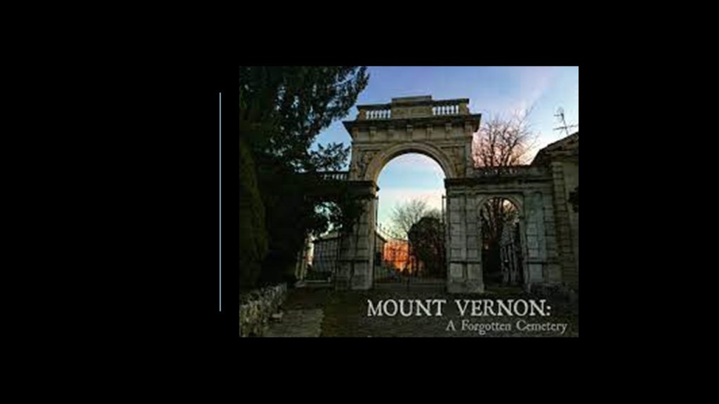
Maria Sanford died on April 21st of 1920 in Washington, DC, and was buried in Philadelphia’s Mount Vernon Cemetery.
We are told that for months after Sanford’s death, she was so beloved in Minnesota that gatherings in her memory were held at the University of Minnesota and her home church Como Congregational.
As mentioned at the beginning of this post, I am bringing forward unlikely pairs of historical figures who are represented in the National Statuary Hall who have things in common with each other.
For one, both women were very well-educated for their day, with both receiving an advanced education, with Frances Willard attending the Milwaukee Normal School & the North Western Female College, and Maria Sanford attending New Britain Normal School, the first training school for teachers in Connecticut.
Both women went into the field of Higher Education, with Frances Willard becoming involved in College Administration at the Evanston College for Ladies, which later became the Women’s College of Northwestern University; and Maria Sanford teaching at the college -level at both Swarthmore College in Pennyslvania and the University of Minnesota.
Just want to make note of the beautiful Old World architecture seen at all the schools these ladies were connected with.
And both women became leading voices outside of academia, with Frances Willard eventually becoming an International leader in the Women’s Christian Temperance Union (WCTU) in 1893, the same year she became a committed Christian Socialist; and Maria Sanford took on the causes of things like state conservation issues, and went on to become a nationally-known speaker praised for her powerful speeches.
These two women apparently were well-known influencers of their time in key areas involving women, social issues and politics.
But they both definitely fall in the category of obscure historical figures.
I myself would never had heard of them had I not been nosing around the National Statuary Hall.
I am going to just keep putting out there what I am finding in the National Statuary Hall at the U. S. Capitol building in Washington, DC, where in many cases, obscure historical figures like these two ladies were honored, but with their lives and times telling a different kind of story than what we normally hear about.
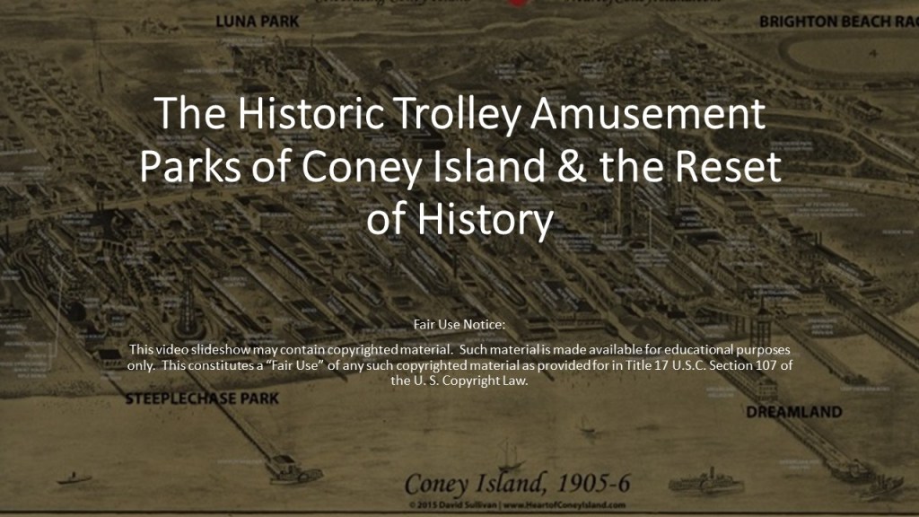
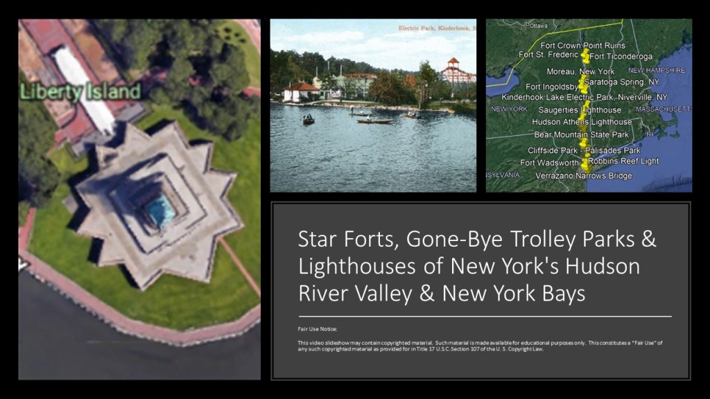
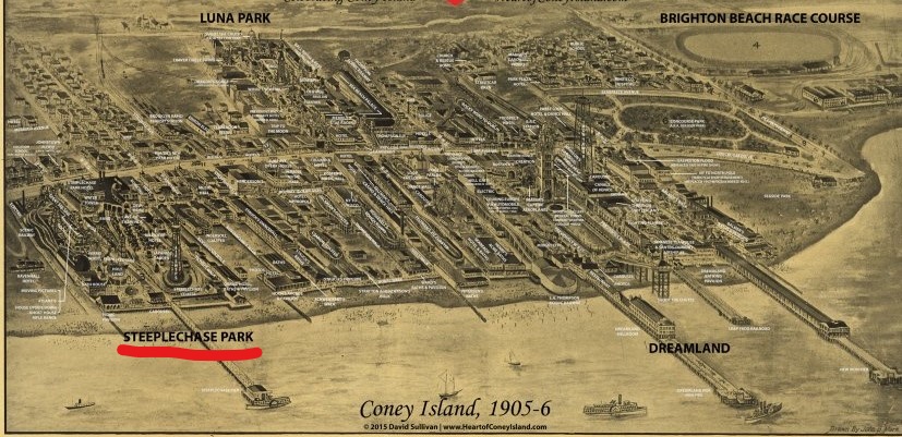
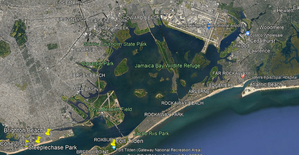
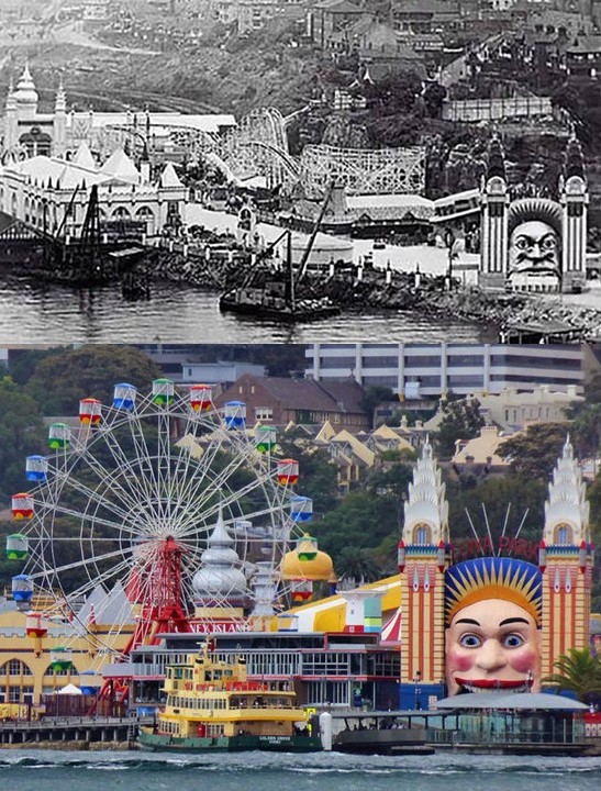
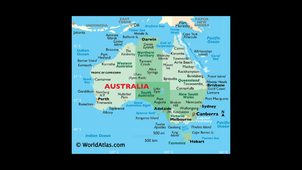
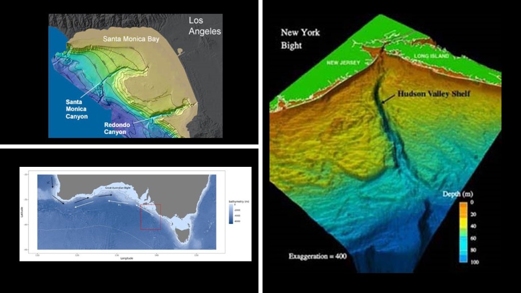
I am going to focus primarily on the historic trolley amusement parks of Brooklyn’s Coney Island in this post because there’s quite a bit of hidden history related to the historical reset to be found in this location.
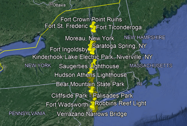
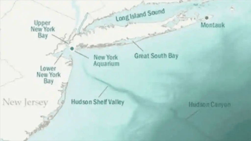
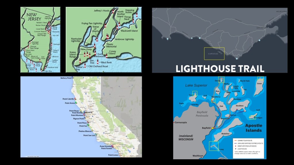
This represents just a small fraction of the historic trolley parks, star forts and lighthouses once found in the Upper and Lower New York Bays and the Hudson River Valley, which I detailed in a previous post called “Star Forts, Gone-Bye Trolley Parks, and Light Houses of New York’s Hudson River Valley & New York Bays.”
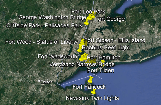
Just in the distance ALONE between the entrance to the lower New York Bay at the Atlantic Ocean to the locations around the George Washington Bridge, I found: eleven star forts that are in pairs and/or clusters; five major historic trolley amusement parks; and eleven lighthouses.
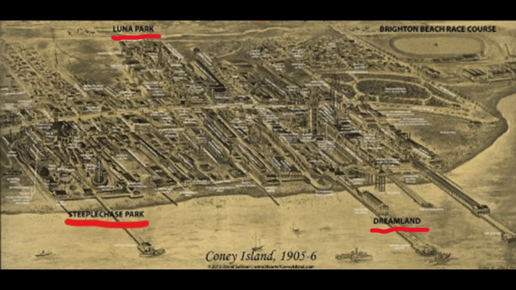
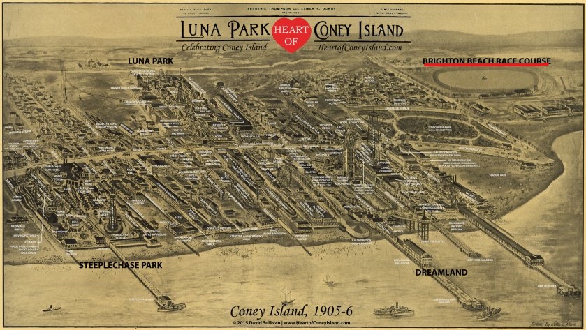
There were three historic trolley amusement parks on Coney Island in the New York City Borough of Brooklyn, located right next to each other – Steeplechase Park, Luna Park and Dreamland.
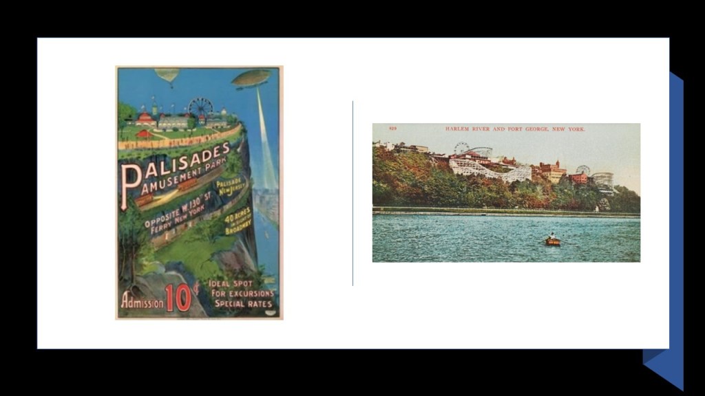
For informational purposes, the other two of the five historic trolley amusement parks in the Upper New York Bay were Palisades Park near Fort Lee, New Jersey, on the Hudson River, and Fort George in Upper Manhattan on the Harlem River.
This is what we are told about the historic trolley amusement parks of Brooklyn’s Coney Island.
First, Steeplechase Park.
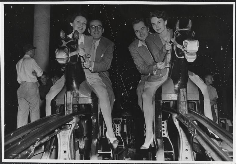
We are told that Steeplechase Park was created by entrepreneur George Tilyou in 1897.
He bought and improved the Steeplechase Horses attraction, which featured mechanical horses pulled along metal tracks.
The owner George Tilyou adopted a “Funny Face” mascot depicting a smiling man with several dozen teeth, nicknamed “the Tilly,” as the icon for his park.
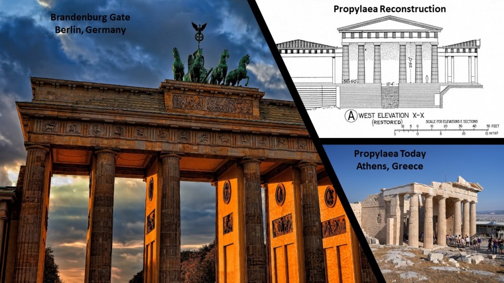
The entrance to Steeplechase Park had a grand archway, on top of which were the statues of four horses.
Interestingly, the famous Brandenburg Gate in Berlin was also topped by four-horses.
Hmmm.
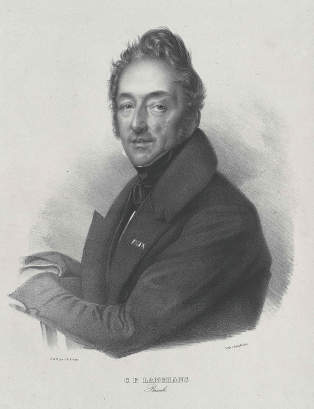
The Brandenburg Gate was said to have been designed by Carl Gotthard Langhans the Elder, who was inspired by the Propylaea of the Acropolis in Athens, and built between 1788 and 1791.
Carl Gotthard Langhans comes down to us in the historical narrative as a Prussian Master Builder and Royal architect in the Neoclassical-style, who was actually not trained as an architect, but instead educated primarily as a lawyer and mathematician.
His best-known work was said to be the Brandenburg Gate, but he was also credited with many churches, palaces, grand houses, interiors, city gates, and theaters.
We are told Carl Gotthard Langhans gained his architectural prowess from studying things like the ancient texts of the Roman architect Vitruvius.
Back to Steeplechase Park on Coney Island.
The park included at one time over 50 attractions on its midway alone…
…and Tilyou was said to have been inspired to build a Ferris Wheel after having seen the one at the 1893 Chicago World’s Fair on his honeymoon.
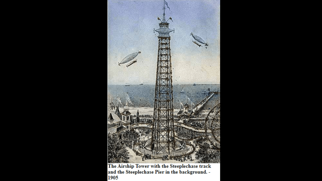
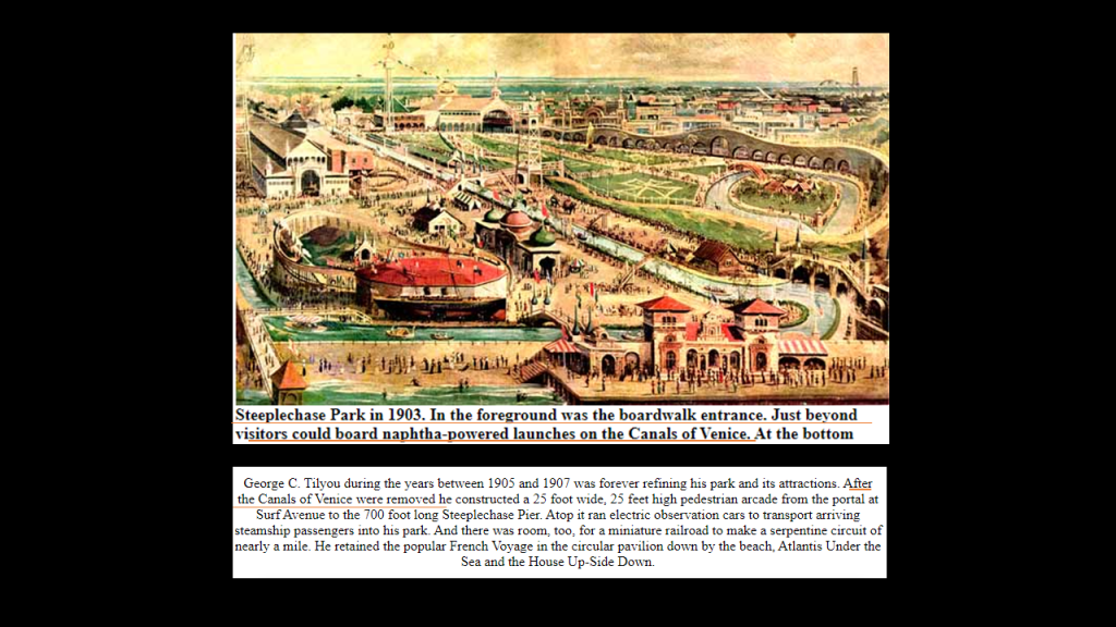
Other early noteworthy Steeplechase Park rides included the revolving Airship Tower, pictured here circa 1905…
…boats powered by naphtha, a liquid petroleum-product used as a fuel, cruising the “Canals of Venice,” a ride which he had removed sometime between 1905 and 1907…
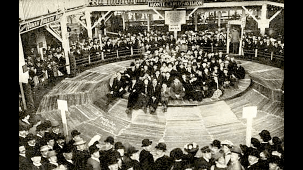
…and the “Human Roulette Wheel,” which featured a giant , polished spinning disc that riders would sit in the middle of and slam into each other as it spun faster-and-faster.
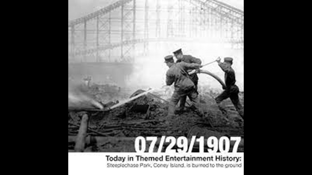
In Steeplechase Park’s history, from its opening in 1897 and its closing in 1964, there were things like fires, rebuilding, rides added, and so on.
Like, for example, the 1907 fire.
This quick-spreading fire was alleged to ahve started from a carelessly-thrown, still-lit cigarrette into a garbage can at the “Cave of the Winds” attraction, and was finally extinguished two-hours later after having destroyed nearly everything within Steeplechase Park.
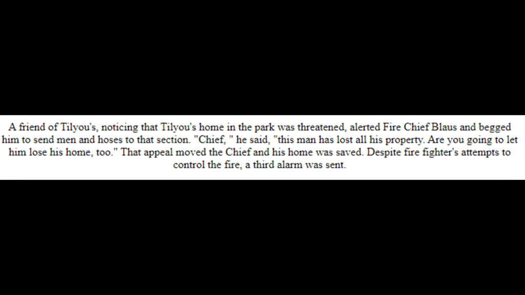
Remarkably, George Tilyou’s home at the corner of Steeplechase Park was spared due to the extra effort of fire-fighters on the scene.
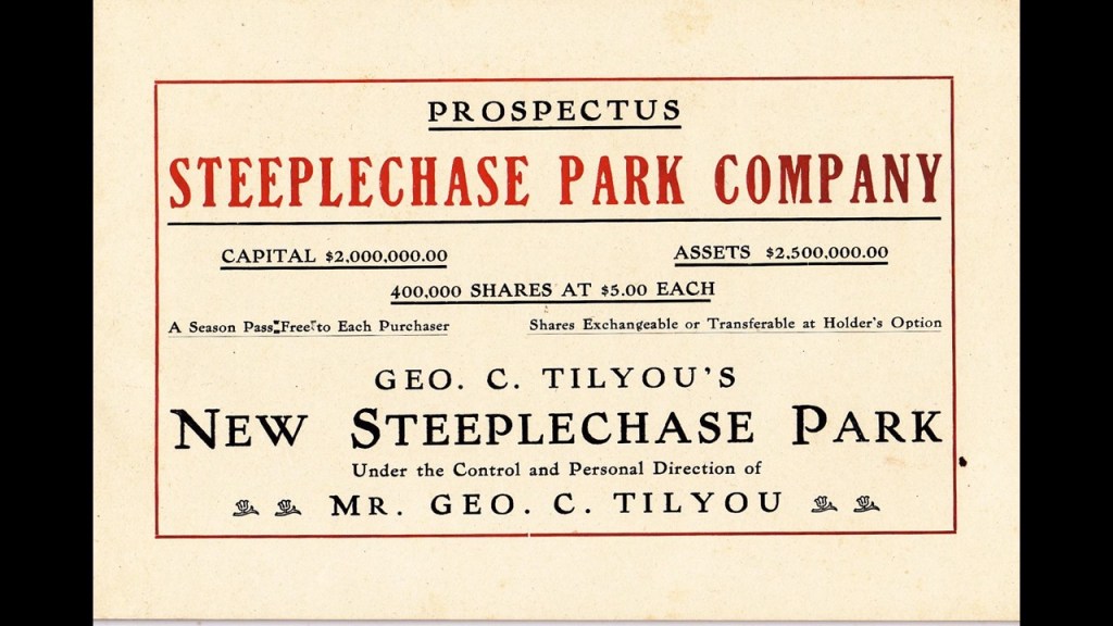
Undaunted, George Tilyou vowed to rebuild Steeplechase Park, and to raise the funds needed to do this, sold 400,000 shares at $5-each, and threw in a season pass for each purchaser on top of that!
We are told the park partially reopened in April of 1908, and the reconstruction was said to be finished by 1909.
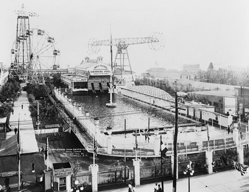
Here is a 1912 photo of Steeplechase Park, with the swimming pool front-and-center.
George Tilyou died in 1914, and Steeplechase Park remained in the Tilyou family until its closure in 1964, and over the years started to go into decline at different times for different reasons, but especially so with the onset of the Great Depression, which started in 1929 and resulted in a significant decline in park attendance.
The land of the former amusement park today is Maimonades Park, the location of a minor league baseball stadium.
The only remaining structure from Steeplechase Park is the defunct, but brightly-lit-up at night even today, Parachute Jump.
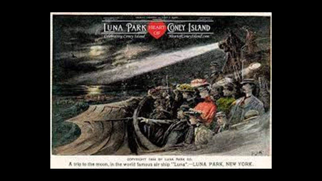
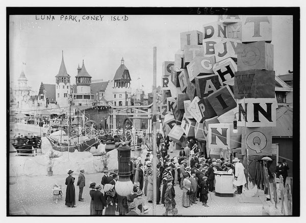
Next, I am going to take a look at Luna Park.
Luna Park at Coney Island opened in 1903.
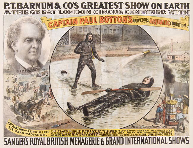
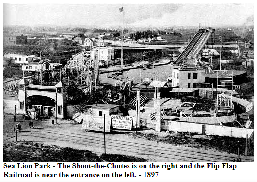
It was said to have replaced Sea Lion Park that was operated by a man named Paul Boyton between 1895 and 1902, the first enclosed and permanent amusement park in North America.
Boyton was credited with being the first person to charge an admission fee to a large enclosed area containing multiple amusement rides and activities.
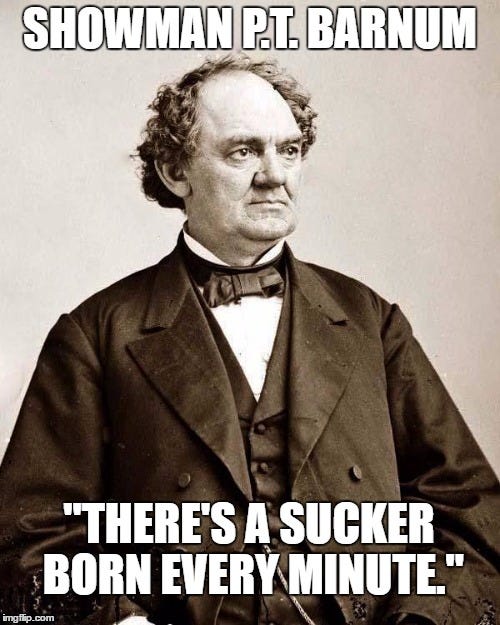
The so-named Captain Paul Boyton was a world-famous back-in-the-day aquatic daredevil and showman who travelled the world’s rivers in an inflatable rubber suit for “P. T. Barnum & Company’s Greatest Show on Earth & the Great London Circus.”
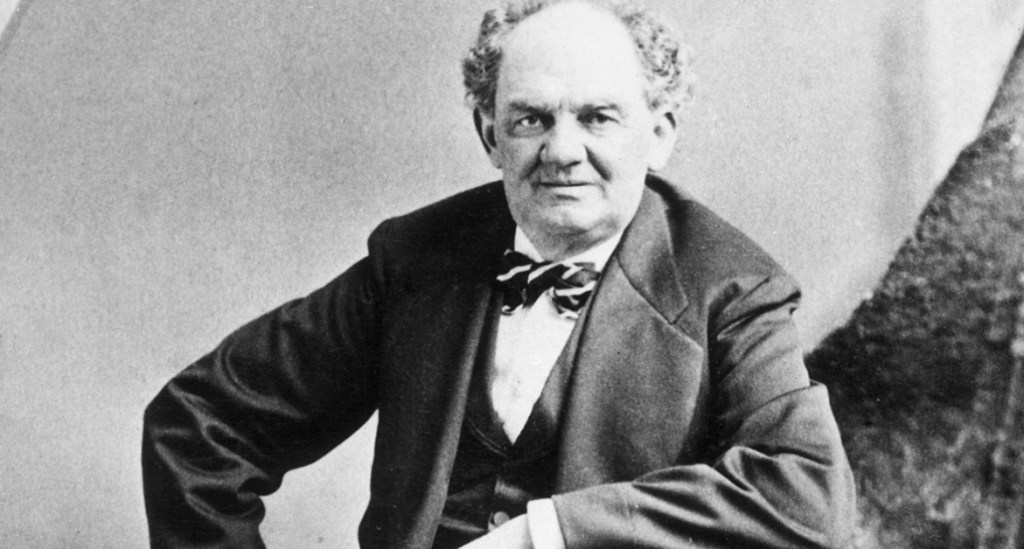
Here are some noteworthy historical side-notes about P. T. Barnum.
He was an early showman, businessman, and politician.
P. T. Barnum got his start in what is now the Financial District of Manhattan in 1841, with “Barnum’s American Museum,” which was known for its strange attractions and performances.
The attractions were a combination of zoo, museum, lecture hall, wax museum, theater, and freak show.
Apparently it became a central location in the development of American popular culture.
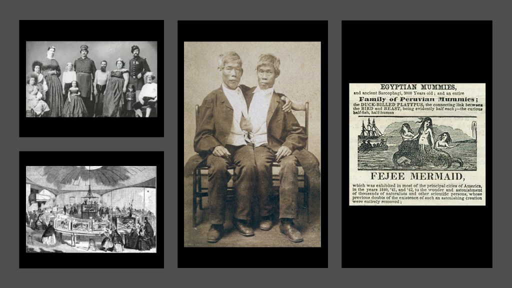
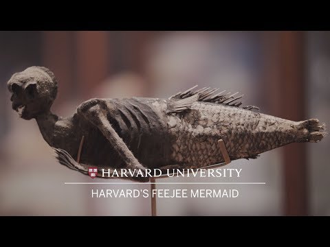
Barnum’s American Museum was filled with things like dioramas; scientific instruments; modern appliances; a flea circus; the “feejee” mermaid; Siamese twins, and other human curiosities.
The same “Feejee Mermaid” is still on display today at Harvard’s Peabody Museum.
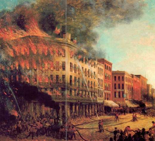
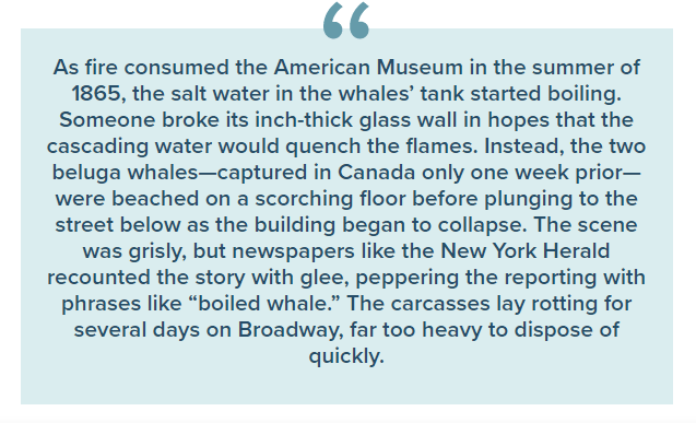
On July 13th of 1865, the building which housed Barnum’s American Museum caught fire and burned to the ground.
Apparently there were not any human deaths, but a number of the live animal exhibits, including two whales imported from the coast of Labrador, were burned alive.
This was the second of five major fires connected to P. T. Barnum.
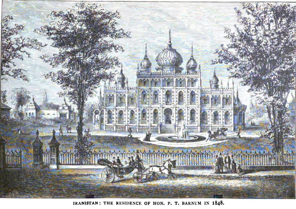
The first major fire associated with P. T. Barnum was the mansion he was said to have had built as his residence in Bridgeport, Connecticut, in 1848, and named “Iranistan.”
It was said to have been set on fire by workmen in 1857 when Barnum had been away for several months.
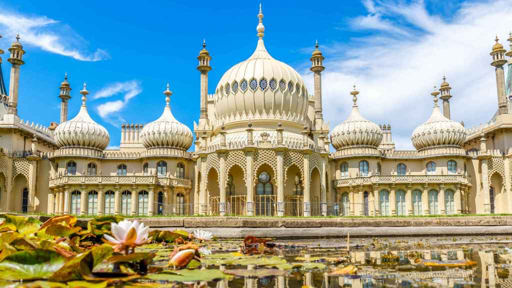
We are told Barnum had hired architect Leopold Eidlitz to design Iranistan as his own version of the Royal Pavilion in Brighton, said to have been constructed in England between 1787 and 1815.
The Royal Pavilion in Brighton was said to have been designed in the architectural-style of “Indo-Saracenic Revival,” as a seaside resort for the Prince Regent George, by British architect John Nash, who was called one of the foremost architects of the neoclassical-style of the “Georgian” and “Regency” eras.
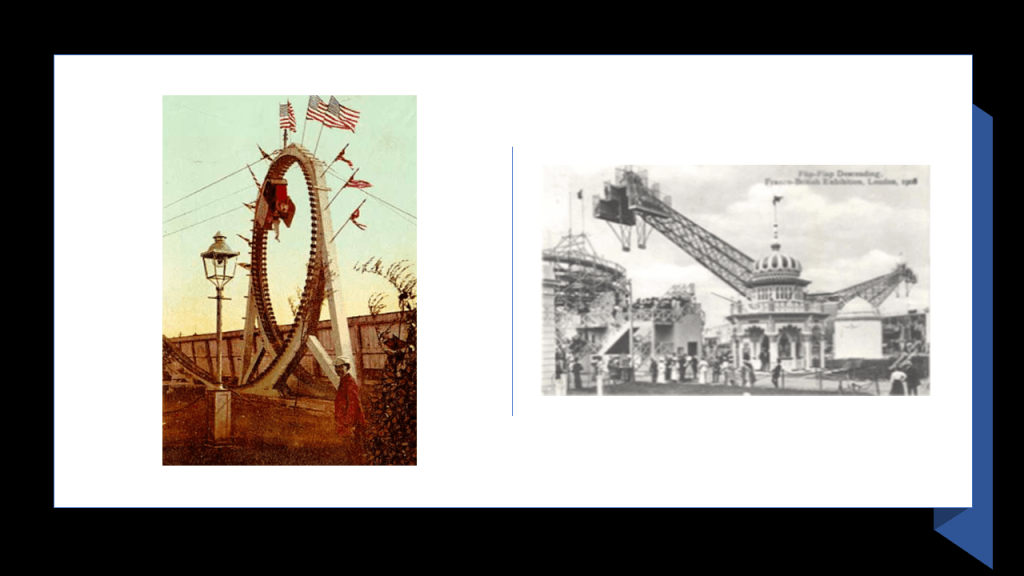
The Flip Flap Railroad mentioned at the bottom of this image of Paul Boyton’s Sea Lion Park…
…was said to be the first looping roller coaster, on the left, and another historic Flip-Flap ride that comes to mind was the one at White City in London in what was called the Elite Gardens at the 1908 Franco-British Exhibition, on the right.
John Belcher was credited with the design of buildings here as the Chief Architect of the 1908 Franco-British Exhibition .
He was an English architect and President of the royal Institute of British Architects.
Paul Boyton’s remaining long-term lease on Coney Island’s Sea Lion Park was bought out starting on October 1st of 1902 by Frederic Thompson and Elmer “Skip” Dundy.
Thompson and Dundy were invited to the Steeplechase Park by George Tilyou for the 1902 Season.
They were known for their ride called “A Trip to the Moon” that was at the 1901 Pan-American Exposition that was held in Buffalo, New York.
The name of the fanciful airship that was the main part of the “A Trip to the Moon” ride was “Luna,” the Latin word for “moon’ for which, we are told, Luna Park in Coney Island was built around.
Well, for one thing, the problem with that story is that there were, and still are, Luna Amusement Parks all over the world, including, but not limited to, Mashhad, Iran, and Ankara, Turkey.
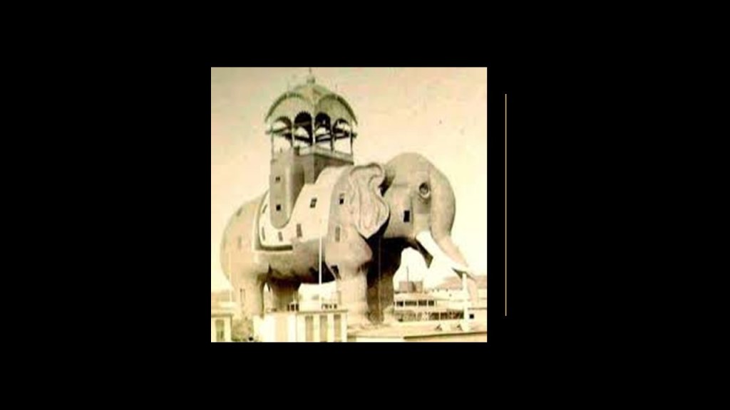
The land Luna Park was on was located next to where the Elephantine Colossus Hotel had been located.
We are told this hotel was a tourist attraction on Coney Island that was an example of novelty architecture, designed by Irish-American inventor James V. Lafferty.
The massive elephantine structure stood above Surf Avenue and West 12th Street from 1885 to 1896, at which time it burned down, giving Thompson and Dundy more land upon which to build Luna Park.
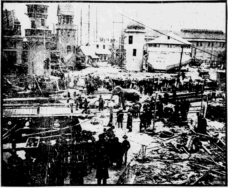
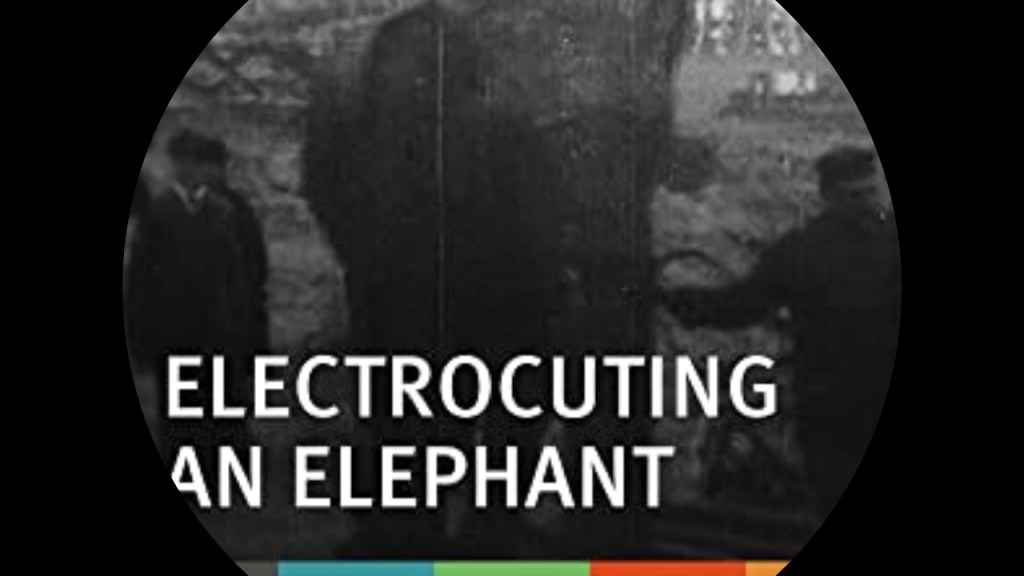
Speaking of elephants, this picture was taken in January of 1903, when Luna Park was said to have been under construction.
It shows Topsy the Elephant before she was executed by electrocution for being a “bad” elephant by Thompson and Dundy as a publicity stunt to advertise the opening of their new park.
This seems hauntingly reminiscent of the building fire associated with showman P. T. Barnum that resulted in the tragic deaths of the large, helpless whales, and other animals, trapped inside.
The invited press that day included the Edison Movie Manufacturing Company, who filmed the event.
It was released to be viewed in coin-operated kinetoscopes under the title of “Electrocuting an Elephant.”
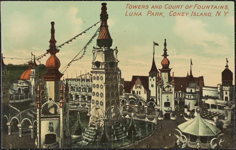
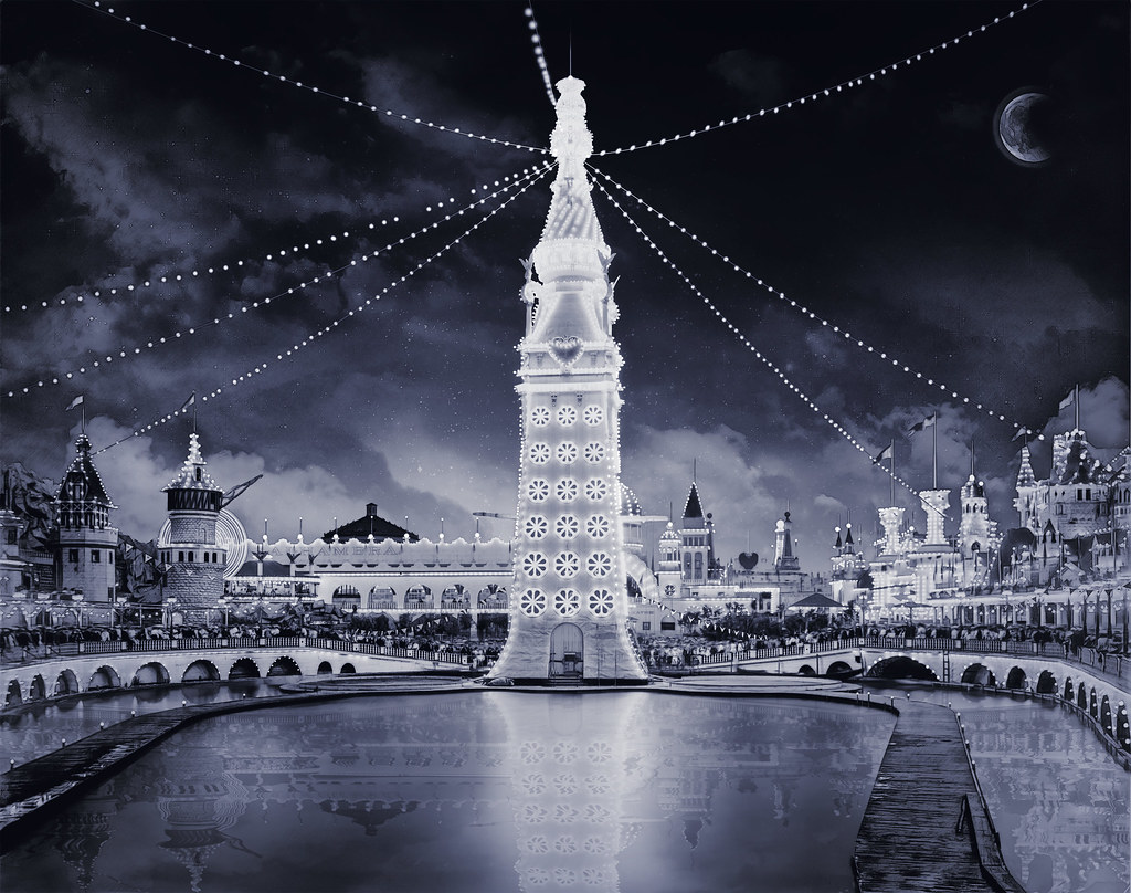
We are told the Luna Park’s architectural style was an oriental theme, with over 1,000 red and white painted spires, minarets, and domes on buildings constructed on a grand scale.
All the domes, spires, and towers were lit-up at night with several 100,000 incandescent lights.
In the middle of the lake at the center of the park was a 200-foot, or 61-meter, tall Electric Tower that was decorated with 20,000 incandescent lamps, said to be a smaller version of the Electric Tower featured in the 1901 Pan American Exposition in Buffalo.
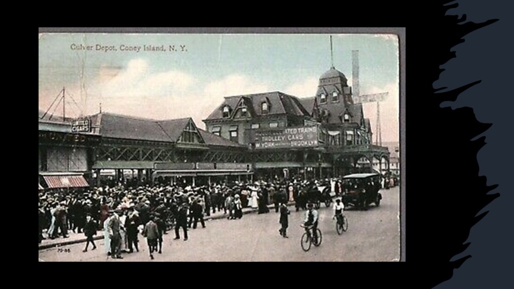
Luna Park was accessible from Culver Depot, the terminals of the West End and Sea Beach Streetcar and Railroad lines.
Besides a multitude of rides, attractions at Luna Park included infant incubators, described as a new type of infant care where infant incubators containing premature babies were displayed in shows called “Infantoriums.
They were touted as “neonatal healthcare,” helping newborn babies with compromised immune systems by providing a sanitary environment to reduce the possibility of getting an infection.
infant incubators for premature babies became widely available at fairs and amusement parks across America, rather than hospitals, which we are told, had nothing to help them.
What we are told is that many parents of premature, at-risk babies pretty much had to bring their infants to a side-show infantorium at an amusement park or fair, and that these infant shows were the main source of healthcare for premature babies for over forty years.
Say what??!!
Over the years, Luna Park would continue under different management, with constant changes.
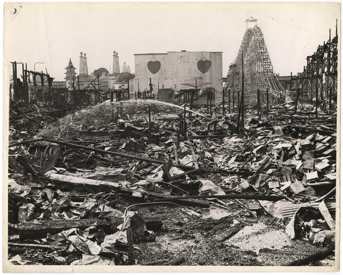
The end of Luna Park came with two fires in 1944, one in August and one in October, which destroyed the park, and in 1946, the whole park was demolished.
There has been a Luna Park operating near the original location since 2010 that has no connection to the 1903 park.
Dreamland was the third and last of the three original parks said to have been built on Coney Island in the early 19th-century.
Dreamland was said to have been founded by successful Brooklyn real estate developer and former State Senator William H. Reynolds as a refined and elegant competitor to the chaotic noise of Luna Park, and opened in May of 1904.
The location of Dreamland was near the West Eighth Street subway station opposite Culver Depot.
Everything at Dreamland was touted to be bigger than Luna Park, including the larger Electric Tower, and four times as many incandescent lights than Luna Park.
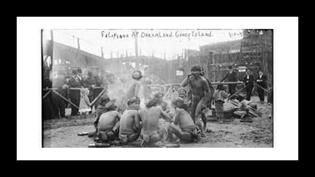
Besides having high-class entertainment, morality plays, and rides, Dreamland had human zoos featuring dwarf inhabitants in what was called “Midget City…”
…a Somali Village…
…and a Filipino Village.
And, like Luna Park, Dreamland also had an infant incubator sideshow attraction.
It was typical for these historic permanent amusement parks and temporary exhibitions like World Fairs to have these infantoriums and human zoos as visitor attractions.
So, as we saw with callous disregard for the lives of the animals in their care, these showmen and entrepreneurs had no regard for the sanctity and dignity of Human life either, except for how it benefited them. A famous saying attributed to P. T. Barnum was “There’s a sucker born every minute!”
Another thing to mention is this, especially with respect to the existence of Human zoos during this time.
Exposition, the name frequently given to these large public exhibits, is a device used to give background information to the audience about the setting and characters of the story.
Exposition is used in television programs, movies, literature, plays and even music.
They were telling the general public the hunter-gatherer, or even head-hunter, narrative through these large expositions and exhibitions that they wanted people to believe and remember about these original people of the world, and not what they actually were as the builders of the original civilization.
Instead, they took credit for their accomplishments and legacy, and kicked the original advanced humans back to the Stone Age by their systemic practices of brutality, inhumane treatment, and marginalization, among many other things including large-scale genocide.
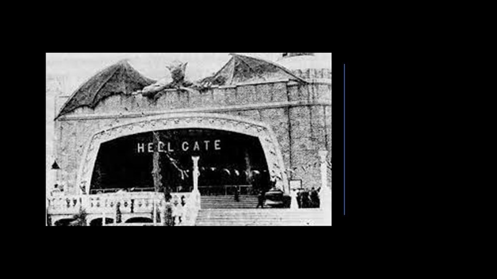
Dreamland’s life on Coney Island was ended only 7-years after opening.
On May 27th of 1911, a fire started at the Hell Gate attraction the night before the season’s opening day, and spread quickly, completely destroying the park by morning.
Brighton Beach is adjacent to the three major historic Coney Island amusement park locations, and shares the same name with the location of the Royal Pavilion of Brighton mentioned previously in this post. If there was an actual connection between these two places in the original civilization, it is long-lost.
The Brighton Beach Race Course was an American thoroughbred horseracing facility shown here opened on June 28th of 1879.
It was instantly successful and drew wealthy patrons from New York City.
The track prospered in 1908, when the New York State Legislature passed the Hart-Agnew Law, banning gambling.
The Brighton Beach Race Track was eventually torn down, and by the 1920s, replaced by residential housing.
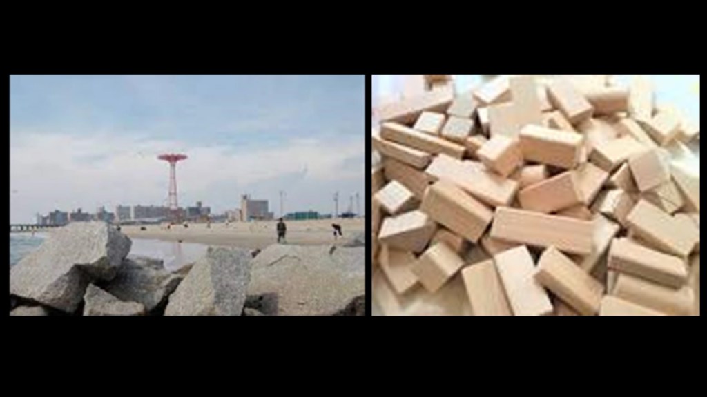
Back around 2015, about three-years before I started blogging and doing my own research in 2018, I remember seeing a video on the New Earth YouTube Channel about megalithic stones strewn about on Coney Island’s Brighton Beach, so I searched for images like this one of Brighton Beach on the left.
What force could possibly cause huge megalithic stone blocks like this to be tossed around like children’s wooden blocks?
And the explanation we are given for faces amongst the rocks was that there was a mystery artist in the 1970s who carved them.
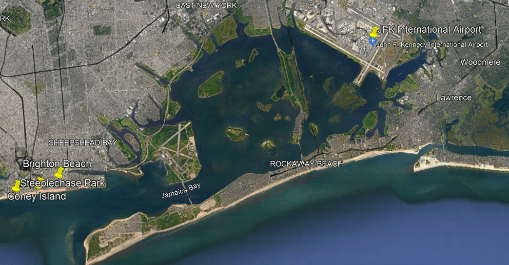
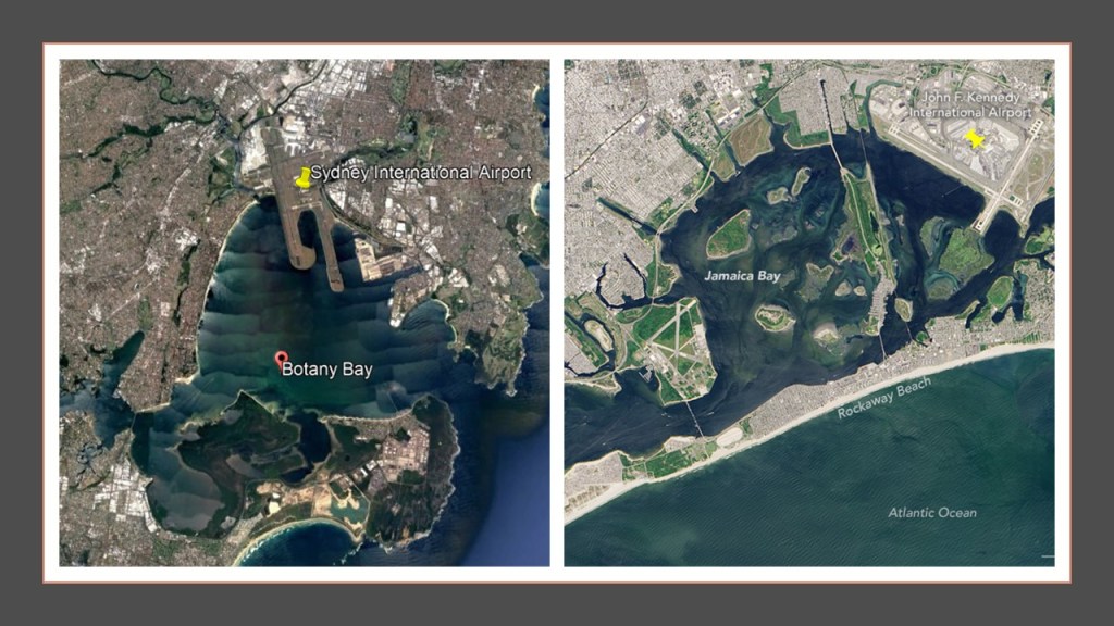
It is important to point out that the landscape looks absolutely ruined here, and Jamaica Bay just to the east of Coney is called a partially man-made and partially-natural estuary, and contains numerous marshy islands.
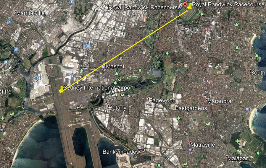
John F. Kennedy International Airport is on the northeast side of Jamaica Bay, and would have been in a short-distance, straight-line alignment with the former Brighton Beach Race Course.
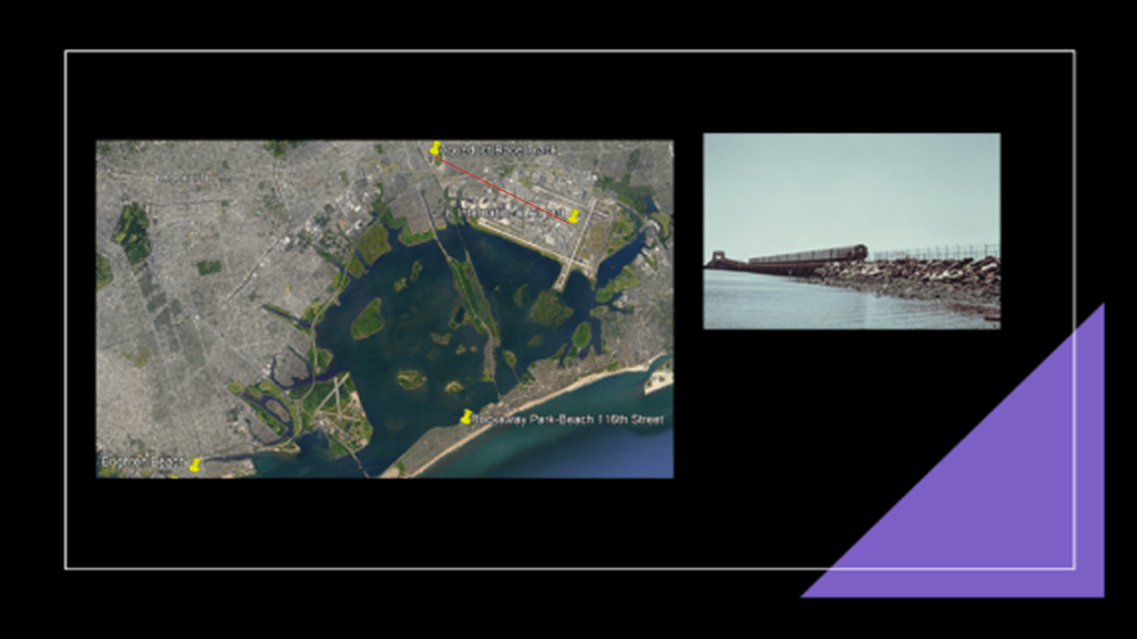
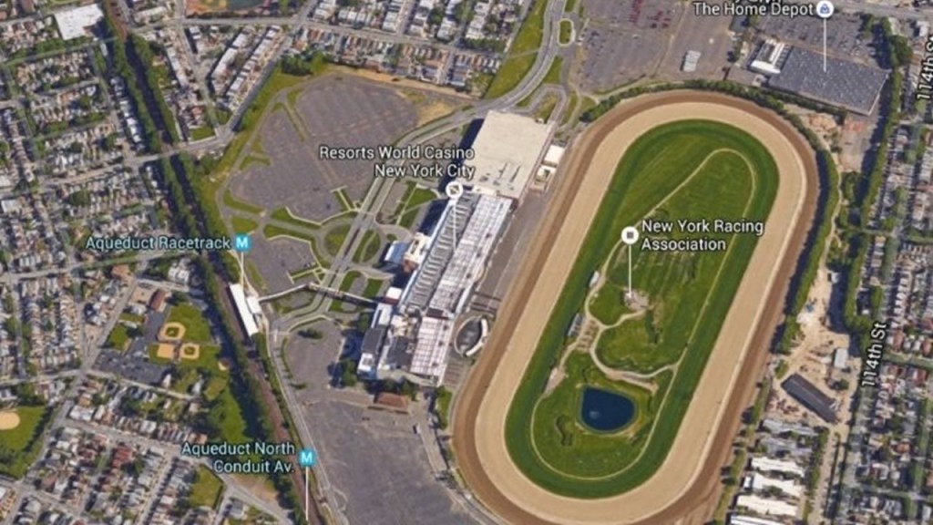
There is a rapid transit line of the New York subway system that operates through the middle of the marshy Jamaica Bay estuary, the IND Rockaway Line that runs between the Aqueduct Racetrack Station terminal, another racetrack a short-distance, straight-line alignment with JFK Airport, and Rockaway Beach.
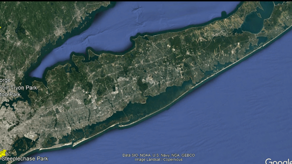
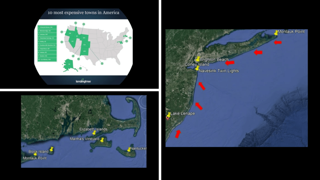
The long and narrow Great South Bay is east of Jamaica Bay on Long Island’s South Shore.
The Great South Bay is described as a lagoon that is 45-miles, or 72-kilometers-, long, and has an average depth of a little over 4-feet, or 1.2-meters, and is 20-feet, or 6-meters, at its deepest.
During the so-called Gilded Age, the Vanderbilts, Roosevelts, Whitneys, Morgans, and Woolworths were said to have built summer mansions on Long Island’ South Shore, and country estates on the North Shore of Long Island.
One definition that I found of “Gilded Age” is that it was a period of gross materialism and blatant political corruption in the United States from the 1870s to 1900.
Why were these wealthy families so interested in this marshy, ruined landscape on Long Island?
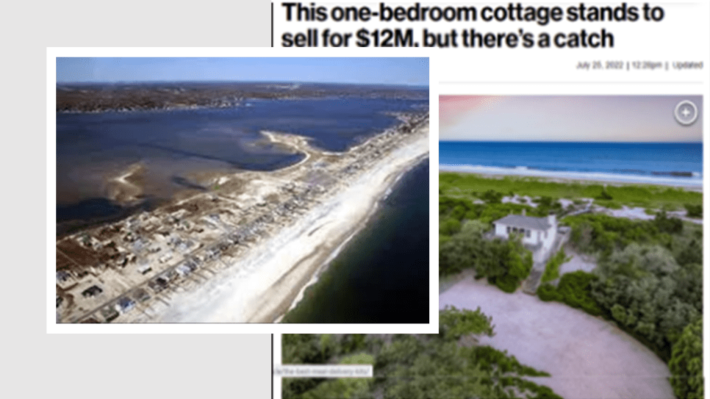
Just as one of many examples, the land on the Westhampton Dunes of Long Island’s South Shore is considered prime real estate.
But it wasn’t only on Long Island.
The Elites claimed the ruined land along the northeast Atlantic coast throughout the New York- New Jersey Estuary system for their special enclaves.
Why?
Clearly this was a very powerful place on the Earth’s grid system with all of the historic star forts, lighthouses, and historic amusement parks all along the Hudson River and New York Bays.
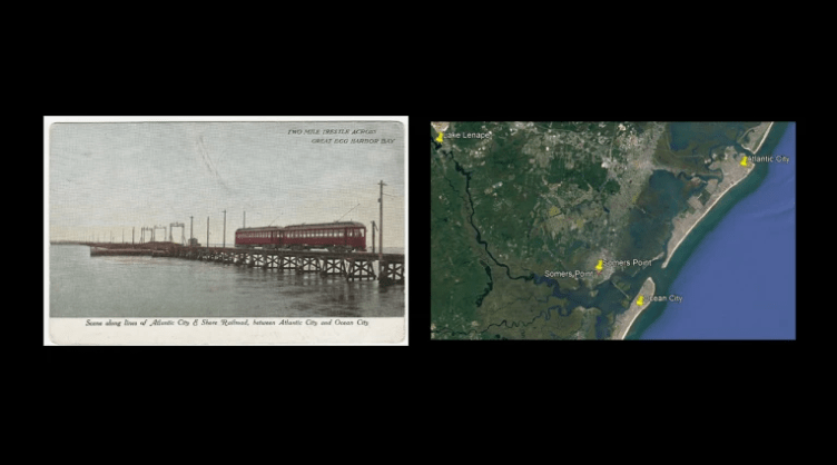
Similar to the still-existing IND Rockaway rapid transit line that runs through the Jamaica Bay Estuary, this is an old postcard showing the Atlantic City and Shore Railroad crossing a two-mile, or 3-kilometer, -long trestle bridge in the Great Egg Harbor Bay estuary, and was part of an interurban trolley system in New Jersey that served Somers Point and several other cities between Atlantic City and Ocean City in the years between 1907 and 1948.
The reason given for the end of its operation was a hurricane damaging the viaduct in 1948, and fixing it was cost prohibitive because of the decline in trolley use.
So those behind the narrative we are educated in, perhaps “indoctrinated” is a better word, definitely want us to believe these rail-lines were built by wealthy railroad barons, who in-turn were responsible for everything we know in our world coming into existence.
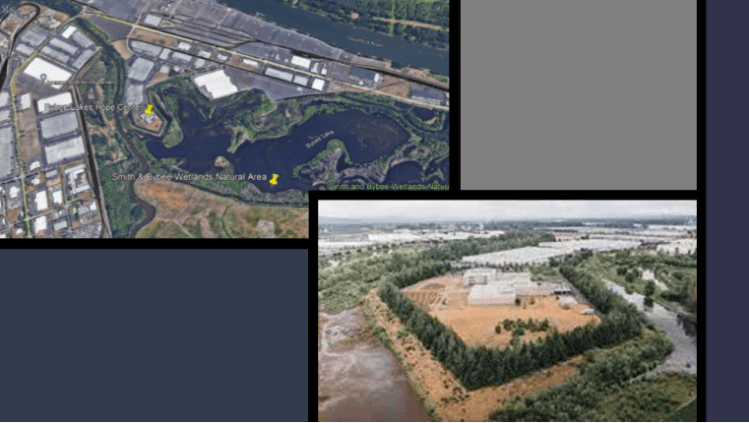
But what really flies in the face of this explanation are the countless examples of rail-lines, or historic rail-lines co-located with sunken, swampy, marshy, and also desert, lands, around the world, like in Portland, Oregon where there is a visible star fort point at the Smith & Bybee Wetlands Natural Area, which is now the location of the Bybee Lakes Hope Center for the Homeless.
This urban wetlands area in Portland is located right next to the still-operating BNSF Ford Railyard.
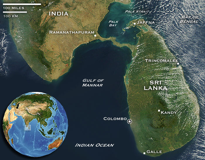
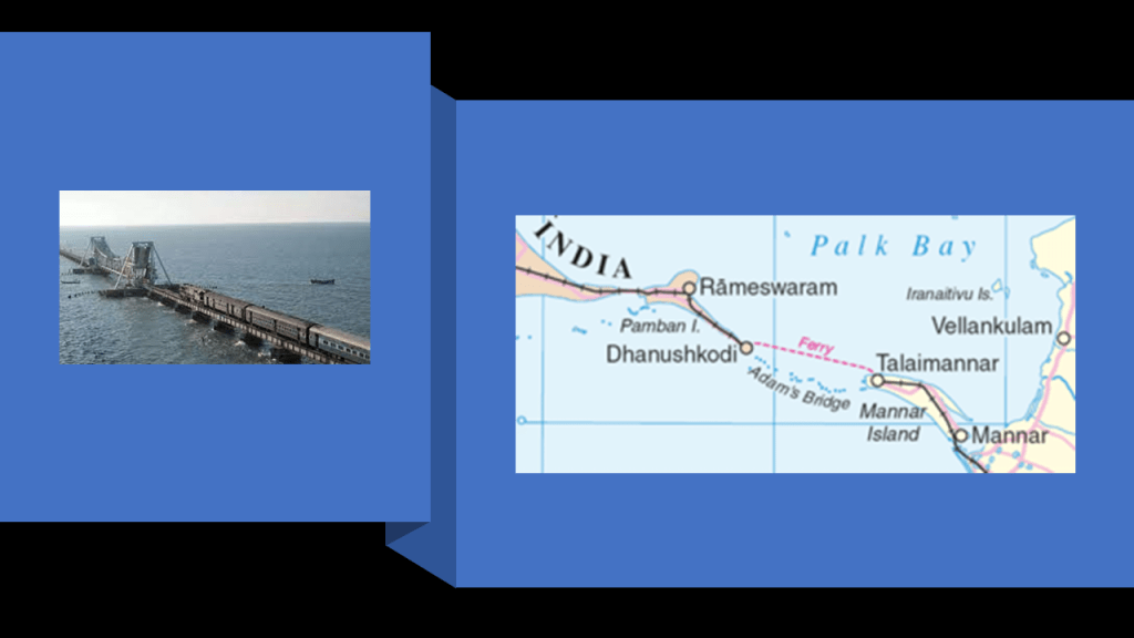
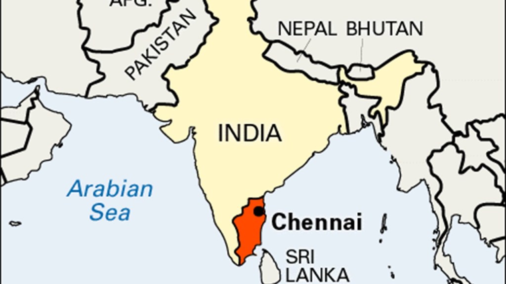
The chain of low islands and reefs called Adam’s Bridge, also known as Rama’s Bridge, or Ramsethu, which separates the southern tip of India from Sri Lanka…
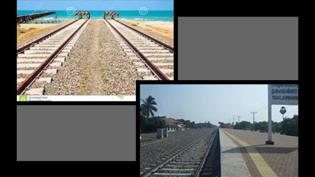
…has a rail-line today that still operates from the town of Mandapam in Tamil Nadu to the Indian side of Adam’s Bridge.
The Pamban Bridge crossing through here is described as a masterpiece of engineering, with a movable section midway that is raised to allow ship and barge traffic to pass through.
Over a mile-long, at 6,776-feet, or 2,065-meters, It was said to have been constructed between 1911 and 1914, which was the year World War I started.
You can take a ferry across, in the same general location as the sunken parts of Adam’s Bridge, to Talaimannar, on Sri Lanka’s Mannar Island, and catch the train on to anywhere you want to go in Sri Lanka.
Sure looks like this part of the world was all-connected together at one time, and not that long ago.
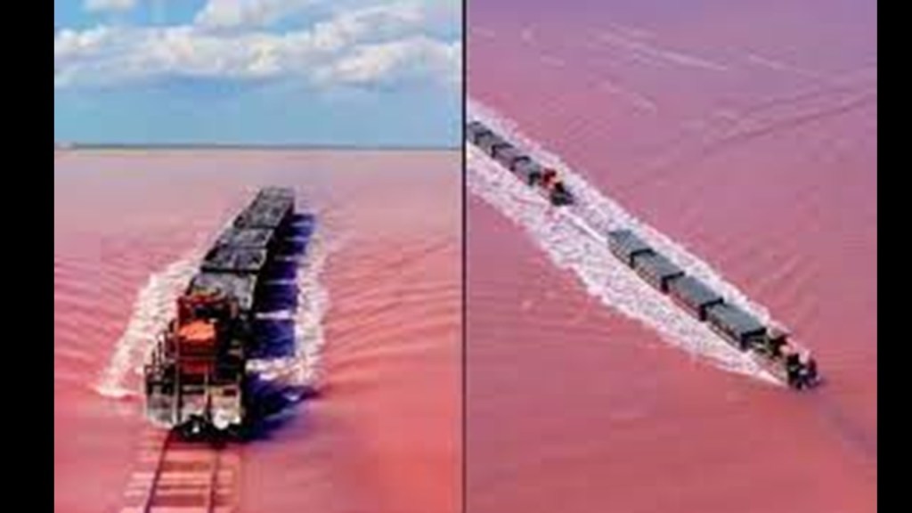
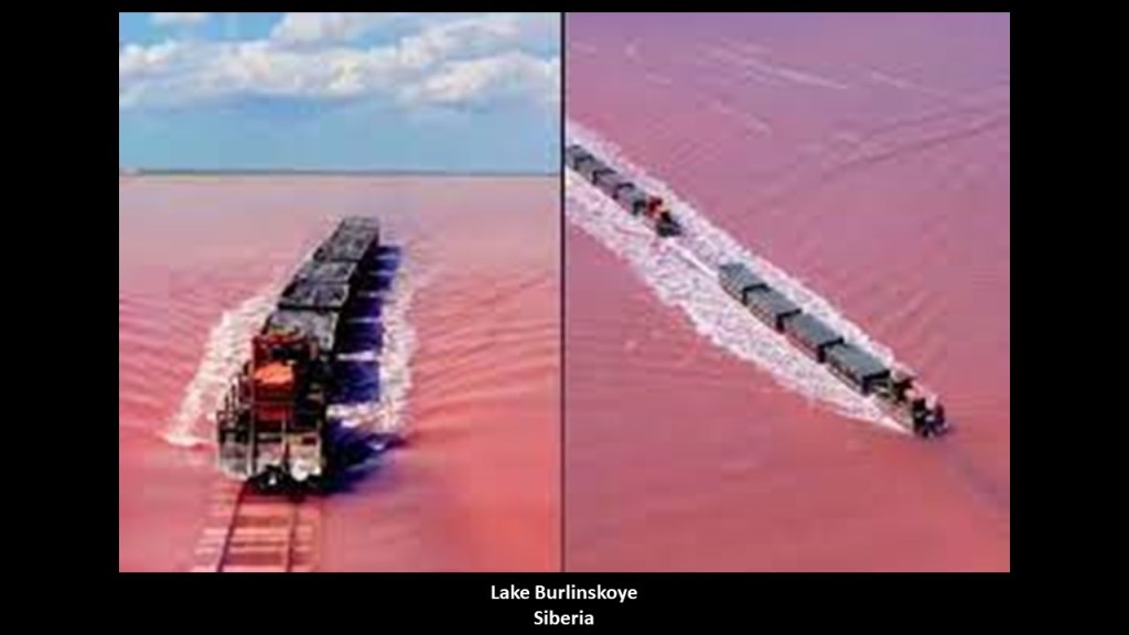
Another example of a rail-line in an anomalous place is at the pink-colored Lake Burlinskoye in Siberia, where the rail-line still operates right through the water.
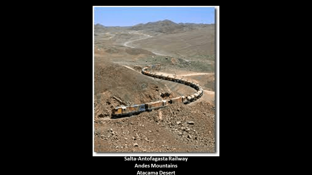
And the Salta-Antofagasta railway links Argentina and Chile through the Atacama Desert across the Andes Mountains.
These are just a few of many examples of railroads in anomalous places, and there are many more rail-lines that have been abandoned or removed all over the world.
I have come to believe through research findings like these, and others, that what has been characterized as the mud-flood was caused primarily by a deliberately-caused act performed by Aleister Crowley, known as the “Wickedest Man in the World,” on the day of the Philadelphia Experiment, that sent a massive energy surge through the Earth’s grid system by way of Montauk Point and Long Island, sending a ripple of energy across the entire surface of the Earth, causing the land itself to ripple, and in some places turn it into swamp, desert, or sink completely into the ocean.
I think the sinking of Atlantis took place much more recently than we have been led to believe in our historical narrative.
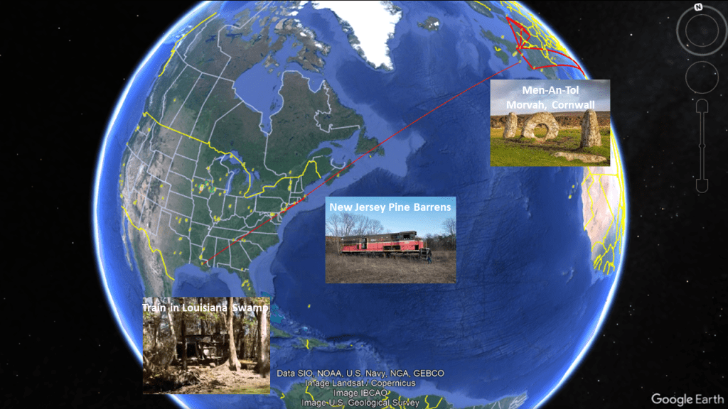
There are still abandoned railcars to this day in the Pine Barrens of New Jersey and the swamps of Louisiana.
There is a full explanation of this theory, with evidence that supports it, in a “Deeper Conversation with Chad” I had recently with Chad Williams and Adam Szecowka, called “The Destruction, Exploitation & Reverse Engineering Of The Earth’s Grid System,” in which we talk in-depth about this, and many other things.
Whatever caused the mud flood is being called a “reset” event, and photographic evidence exists demonstrating that buildings, canals, rail-lines, tunnels, among other things, were purposefully dug out after the event to the point where they could be used.
A sudden cataclysmic event accounts for how a highly advanced worldwide civilization of giants…
…could be wiped from the face of the Earth and erased from our collective memory.
If all this sounds crazy, remember the old saying “Truth is Stranger than Fiction.”
And even if still seems too hard to believe in, the reality of the world we are living in today is pretty strange and crazy, and how did we even get to this upside-down world??
Well, one thing that has gotten us to this place is that we have been taught and told egregious lies by the Establishment from cradle to grave, and we have not been told about an advanced civilization that existed on Earth from the ancient time of Mu, through Atlantis, to relatively recent times.
The parasitic and multi-dimensionally aware beings behind all of this want us to believe that suffering, sickness, misery, destruction, division, and death was and is our normal state of being, and not question what we have been taught about who we are.
They are the only ones who benefit because they energetically feed on Humanity’s negative emotional states, at the same time they have sucked up all the wealth of the Earth for themselves.
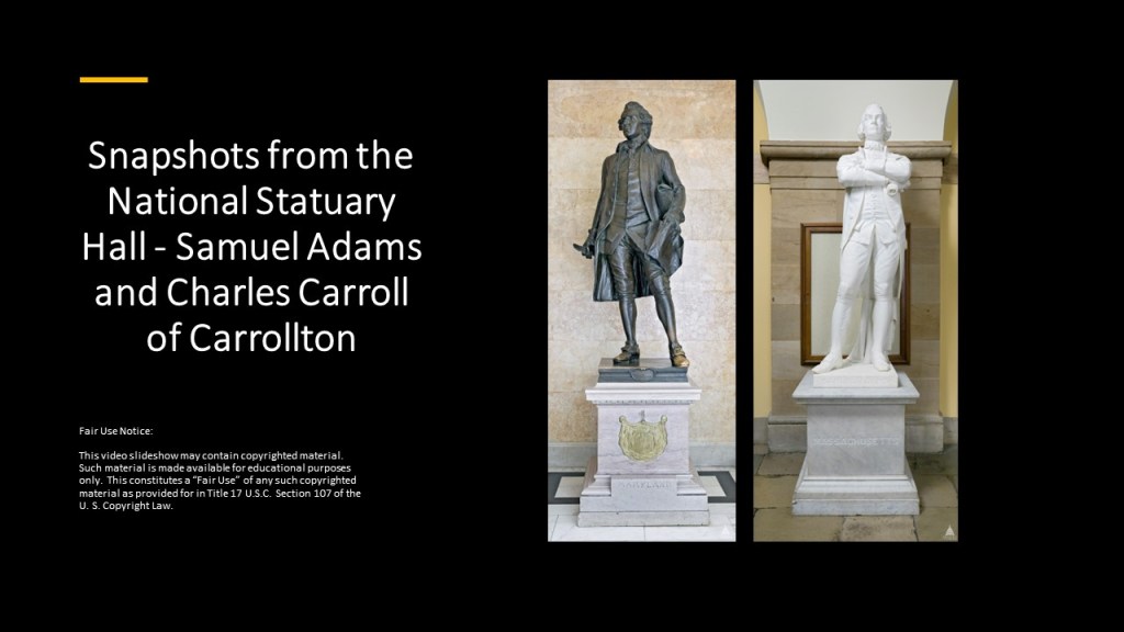
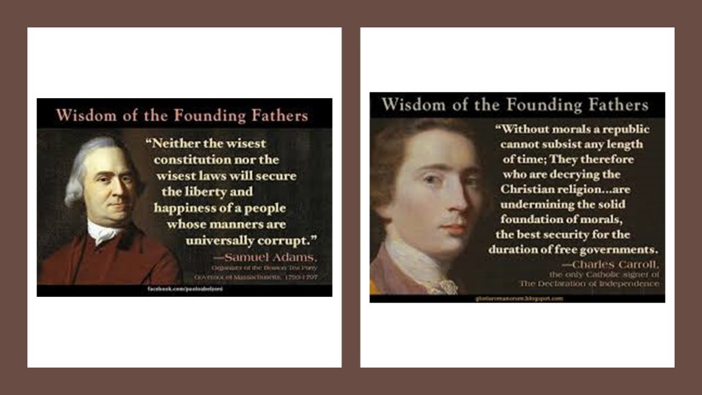
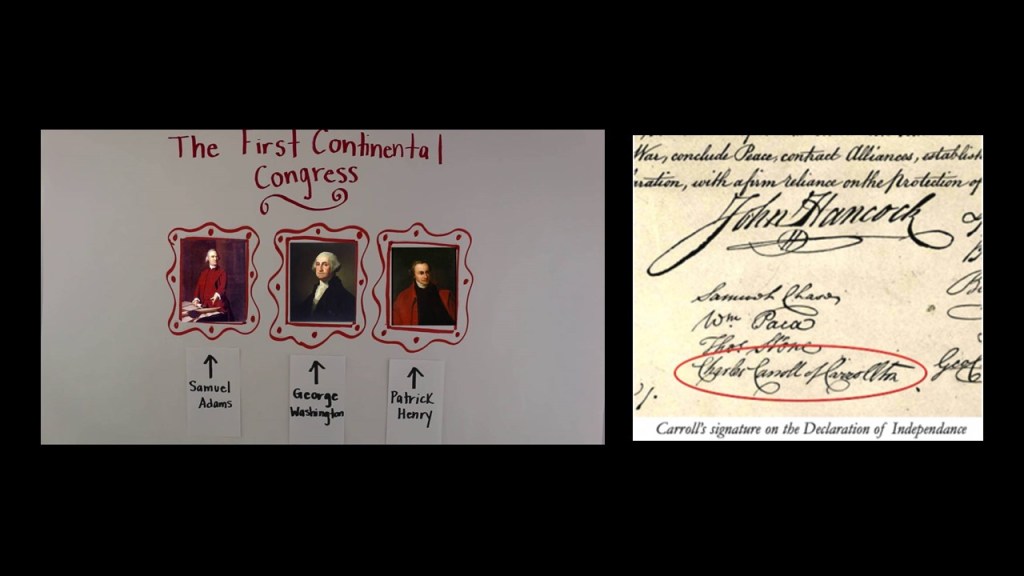
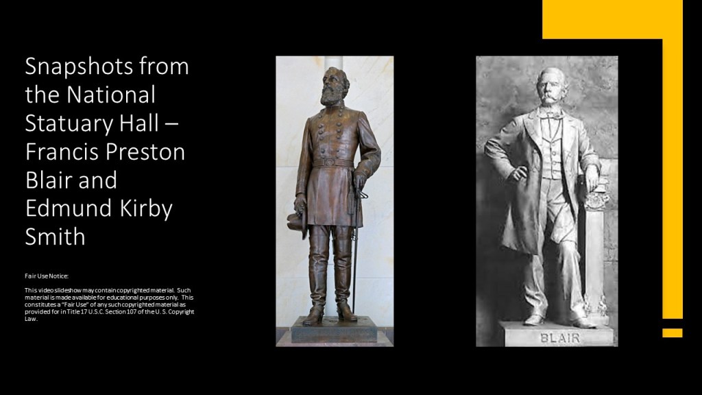
In this series called “Snapshots from the National Statuary Hall,” I am bringing forward unlikely pairs of historical figures represented in the National Statuary Hall at the U. S. Capitol who have things in common with each other .
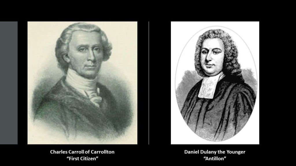
In this post, I am pairing Samuel Adams, who is in the National Statuary Hall for Massachusetts, who was an American statesman, politician, Founding Father of the United States, and Charles Carroll of Carrollton, who represents the State of Maryland, and was an Irish-American politician, planter, the only Catholic signer of the Declaration of Independence, and also considered a Founding Father.
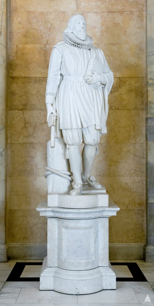
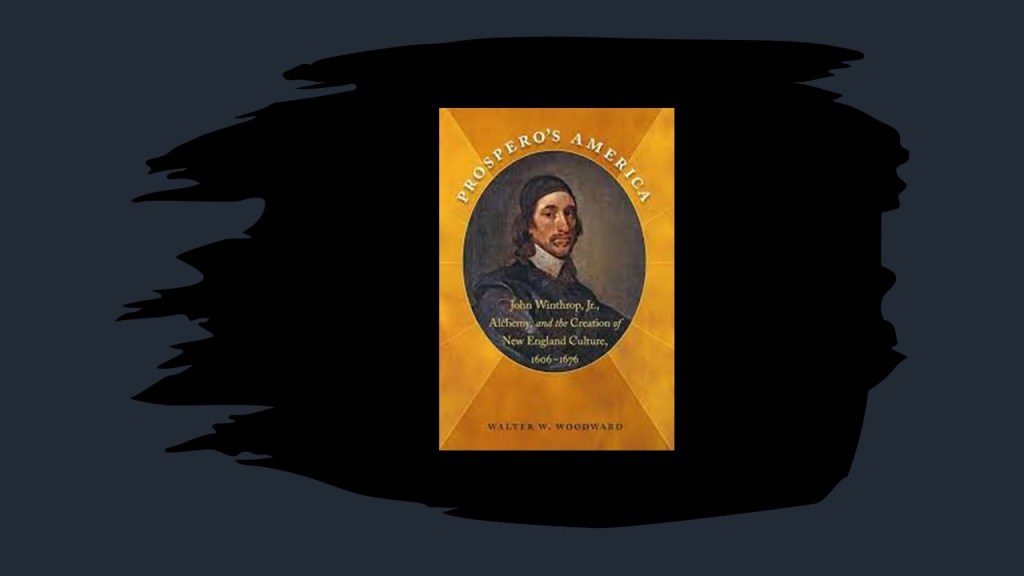
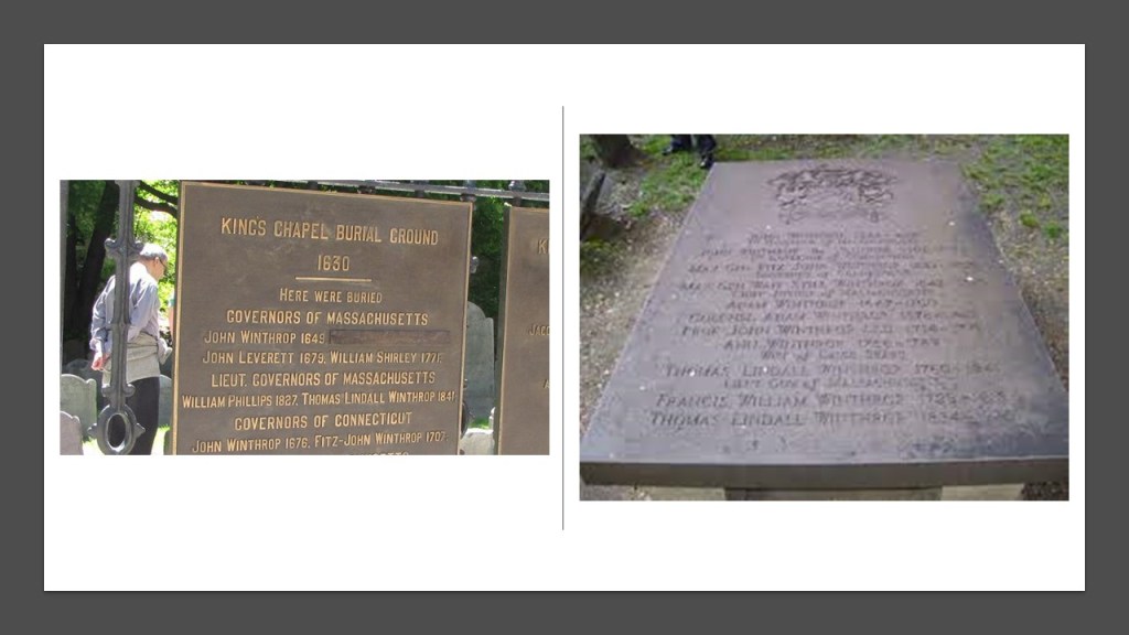
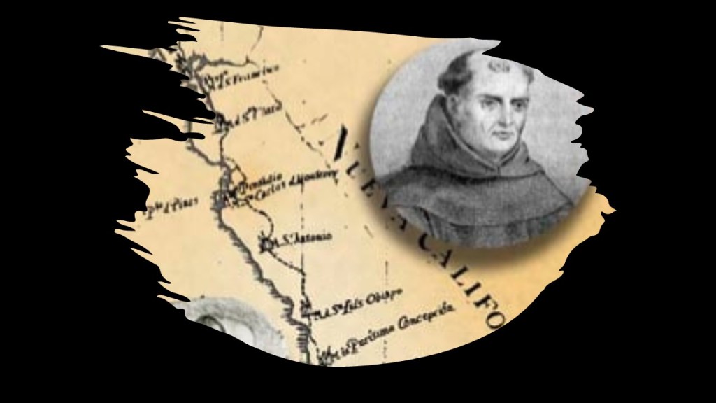
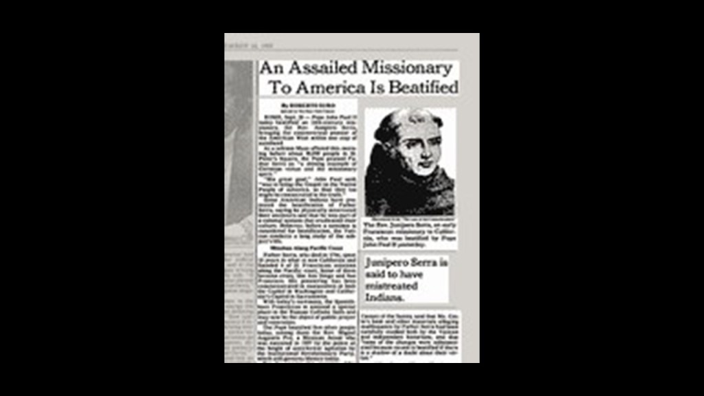
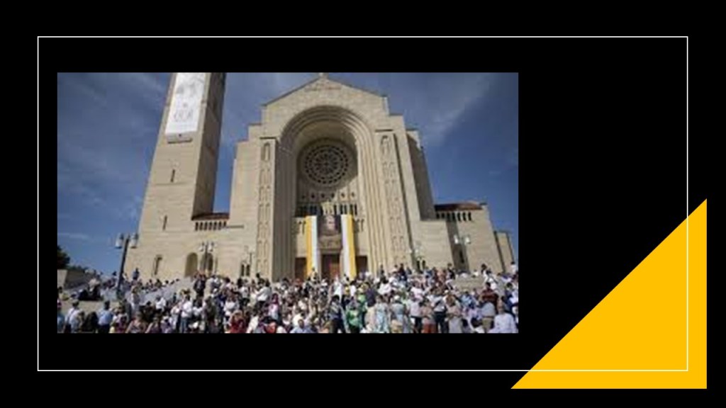
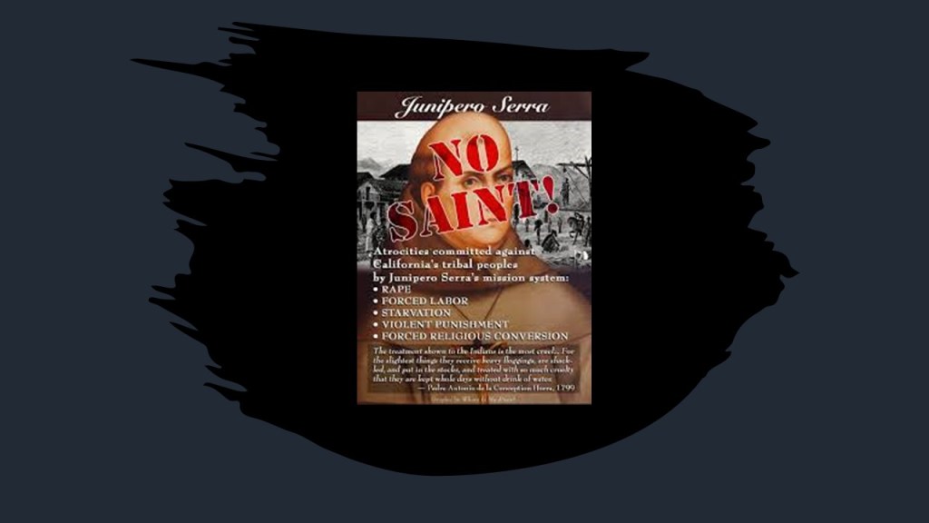
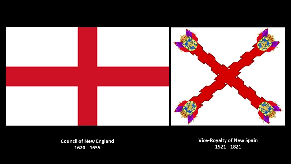
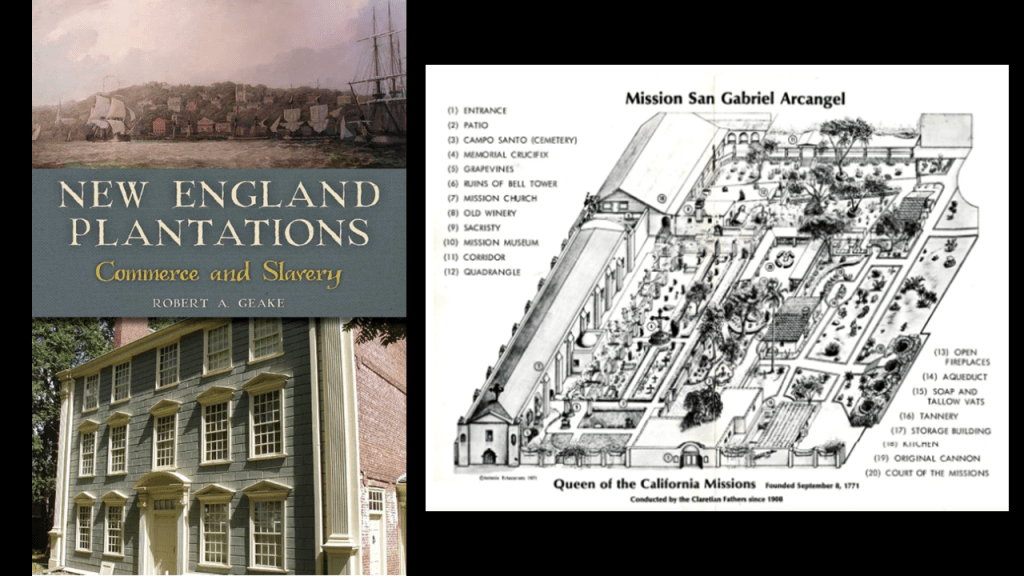
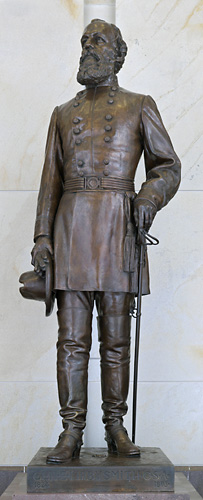
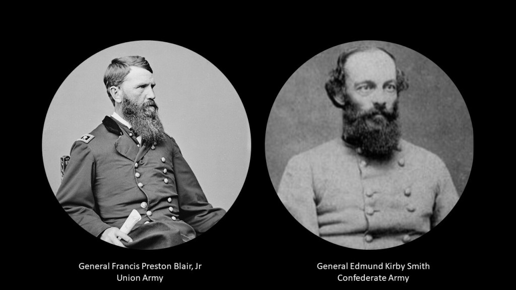
So far in this series, I have paired Michigan’s Gerald Ford, a former President of the United States, and Mississippi’s Jefferson Davis, the former President of the Confederate States of America, and both men featured on the cover of the “Knight Templar” Magazine,; Dr. Norman Borlaug, Ph.D, often called the “Father of the Green Revolution; and Colorado’s Dr. Florence R. Sabin, M.D, a pioneer for women in science, both of whom worked for the Rockefeller Foundations; Louisiana’s controversial Socialist Governor, Huey P. Long, and Alabama’s Helen Keller, a deaf-blind woman who gained prominence as an author, lecturer, Socialist activist; Henry Clay, attorney, plantation owner, and statesman from Kentucky, and Lewis Cass, a military officer who was directly behind Native American Removals, politician and statesman from Michigan, contemporaries who were both Freemasons and unsuccessful candidates for U. S. President.; John Gorrie for Florida, a physician and inventor of mechanical refrigeration and William King for Maine, a merchant and Maine’s first governor, both Freemasons; and Dwight D. Eisenhower, Supreme Commander of the Allied Expeditionary Force in Europe during World War II and former President representing the State of Kansas, and Lew Wallace, Union General and former Governor of New Mexico Territory, representing the State of Indiana, both of whom were involved in the entirety of their major wars, and in the events concerning crimes in the aftermath of their wars; and Francis Preston Blair, Jr, representing Missouri, and Edmund Kirby Smith for Florida, both major players in events of the Mexican-American War and the American Civil War; and John Winthrop, a leader in establishing the Massachusetts Bay Colony in 1630, with St. Junipero Serra, a notorious Franciscan missionary and Roman Catholic priest who established early missions in California.
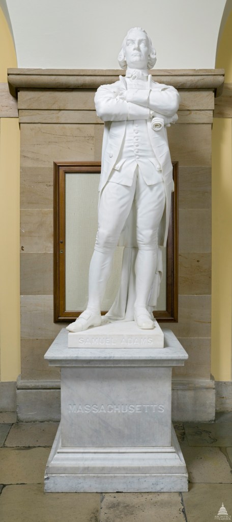
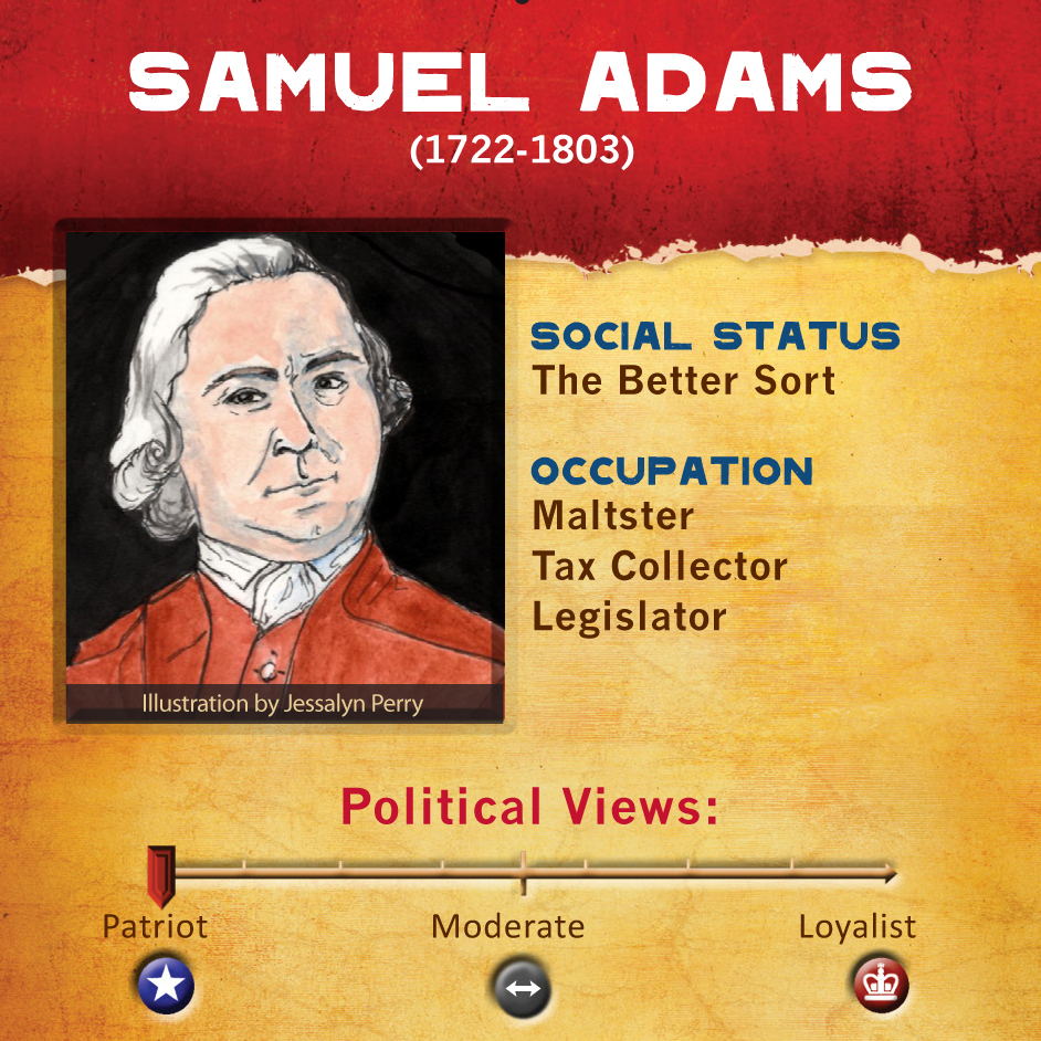
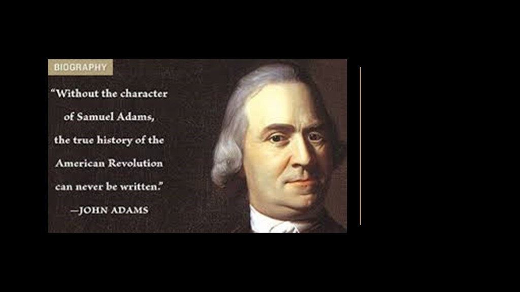
First, Samuel Adams.
Samuel Adams represents the State of Massachusetts in the National Statuary Hall.
Samuel Adams was an American statesman, politician, Founding Father of the United States, and one of the architects of the principles of American Republicanism that shaped the political culture of the United States.
Samuel Adams was born in Boston in the British Colony of Massachusetts in September of 1722, one of three children who survived out of 12 born to his parents, brewer Samuel Adams Sr. and Mary Fifield Adams.
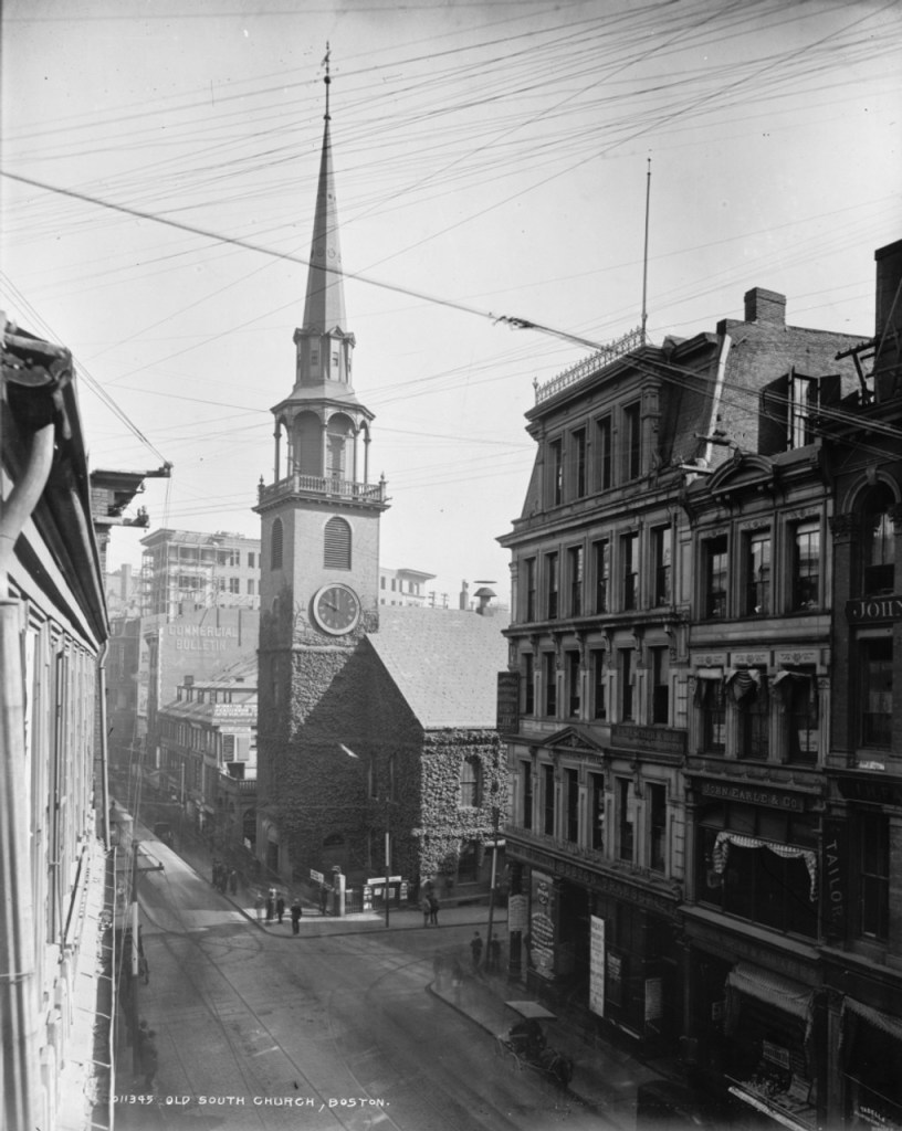
They were Puritans, and members of the Old South Congregational Church, which is famous as the place where the Boston Tea Party was organized.
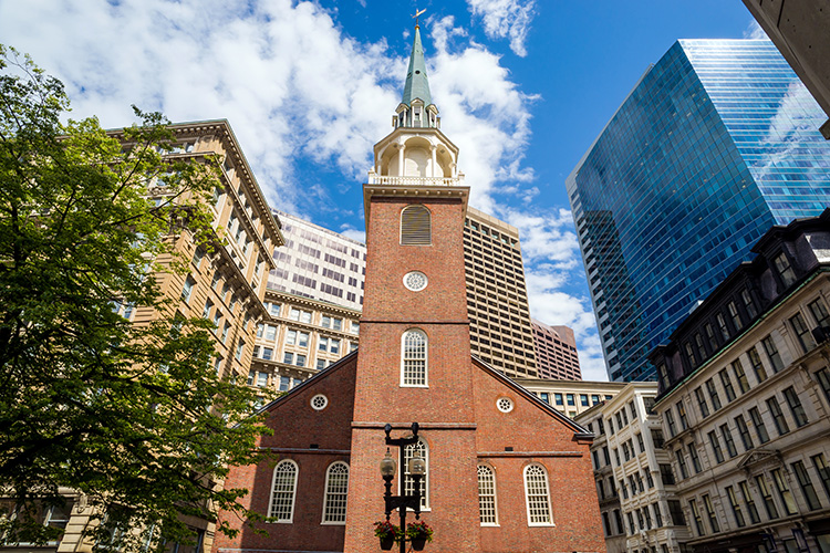
This is a photo of the original Old South Meeting House circa 1900…
…which still stands today at the corner of Milk and Washington Streets in Boston’s Downtown Crossing area.
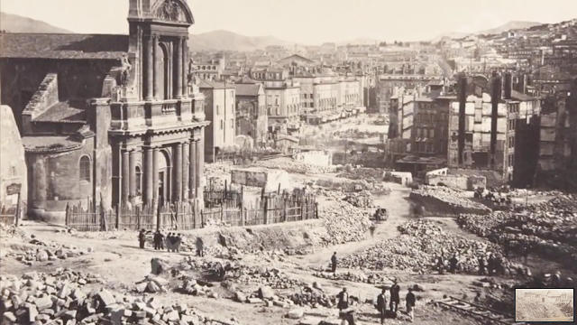
We are told that the present building of the Old South Congregational Church was completed in 1873 after the Old South Meeting House was almost destroyed in the Great Boston Fire of 1872.
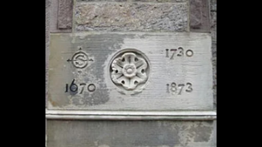
Is it just me, or does the Old South Church’s cornerstone look a little strange?
It looks plastered over, and is not the same material as the stone surrounding it.
And the “16” of the “1670” date sure looks like it was worked with more than once.
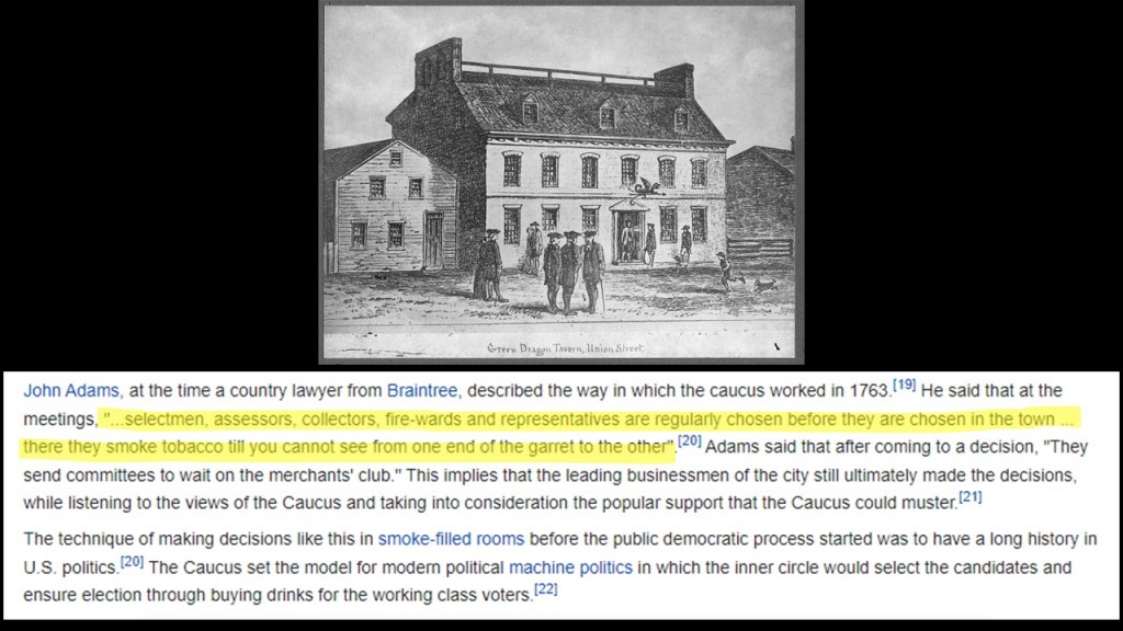
The elder Samuel Adams, a Deacon of the church, entered politics through an informal political organization known to history as the “Boston Caucus,” which he was one of the founders of.
The “Boston Caucus” promoted candidates who supported popular causes in the years before and after the American Revolution, typically meeting in the smoke-filled rooms of taverns or pubs.
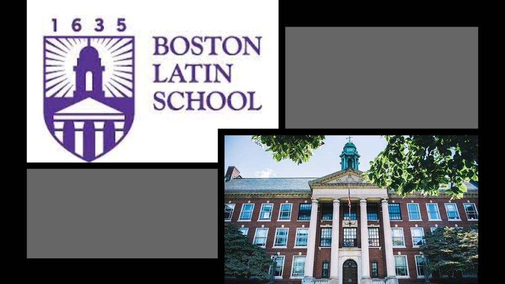
The younger Samuel Adams attended the Boston Latin School, which was established in 1635, and the oldest public school in British America and the oldest existing school in the United States.
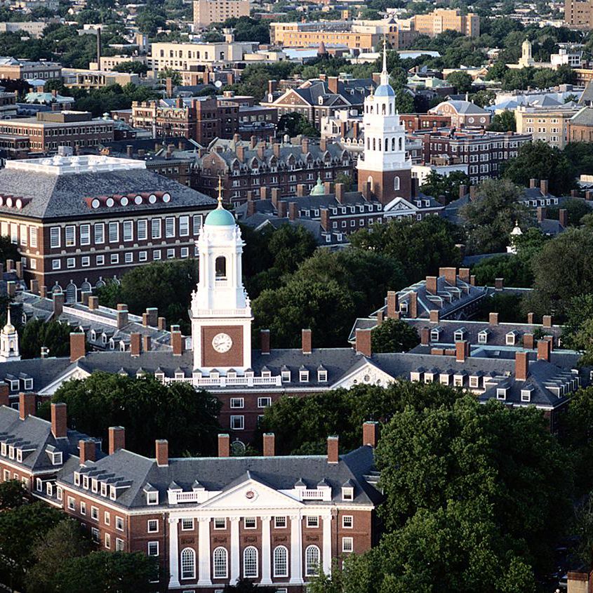
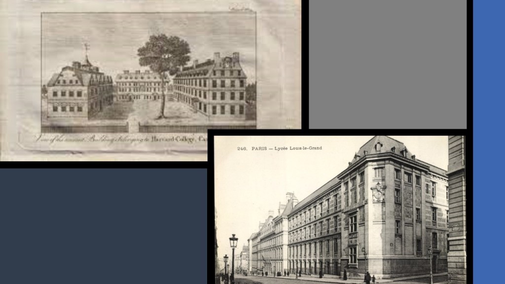
Adams entered Harvard College in 1736 and graduated in 1740.
He continued in his studies, earning a Master’s Degree in 1743.
He was particularly interested in politics and colonial rights.
Founded in 1636, Harvard College, the original school of Harvard University, is the oldest institution of higher learning in the United States.
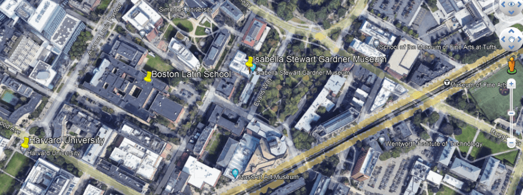
Harvard University is located right across the street from the Boston Latin School, and among many other universities and museums, the Isabella Stewart Gardner Museum is only a short-walking-distance from the Boston Latin School.
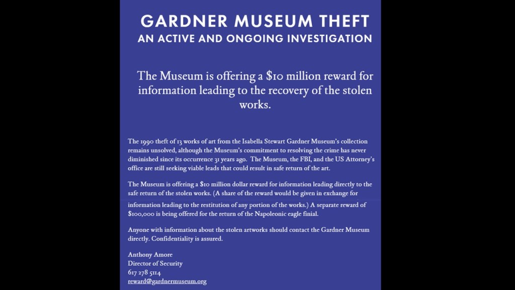
The largest art theft in U. S. history took place on March 18th of 1990, at which time twelve paintings and a Chinese Shang Dynasty vase, all together worth $100 to $300 million, were stolen from Boston’s Isabella Stewart Gardner Art Museum.
There is still a $10 million reward in place today for information leading to the recovery of the art work.
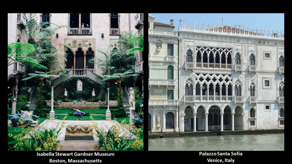
The museum was said to have been built between 1898 and 1901, with the design heavily influenced by art-collector and philanthropist Isabella Stewart Gardner herself on the left, in the style of a 15th-century Venetian Palace, of which the 15th-century Palazzo Santa Sofia in Venice on the right is an example of this type of architecture.
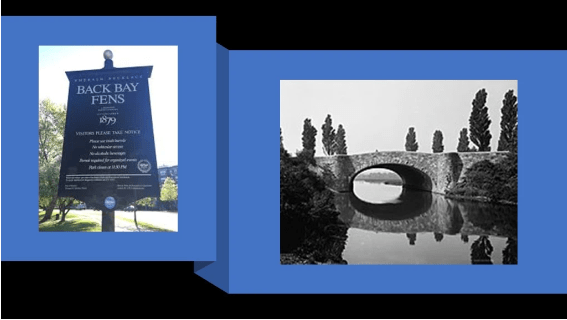
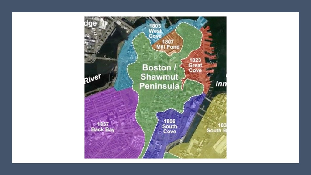
The art museum is located near the Back Bay Fens, one of the areas of Boston that was reclaimed between 1820 and 1900, and said to have been designed by Frederick Law Olmsted as part of Boston’s Emerald Necklace system of parks.
Back to Samuel Adams.
Adams considered going into law after leaving Harvard in 1743, but ended up going into business, working at a counting house until he was let go after a few months because he was too preoccupied with politics.
His father subsequently made him a partner in the family’s malthouse, where the malt necessary for brewing beer was produced.
He was first elected into political office in 1747 as one of the clerks of the Boston Market, and in 1756, he was elected to the position of Tax Collector by the Boston Town Meeting.
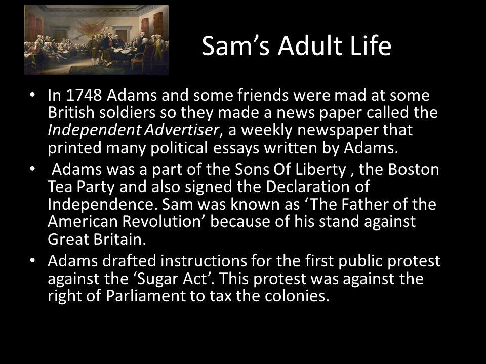
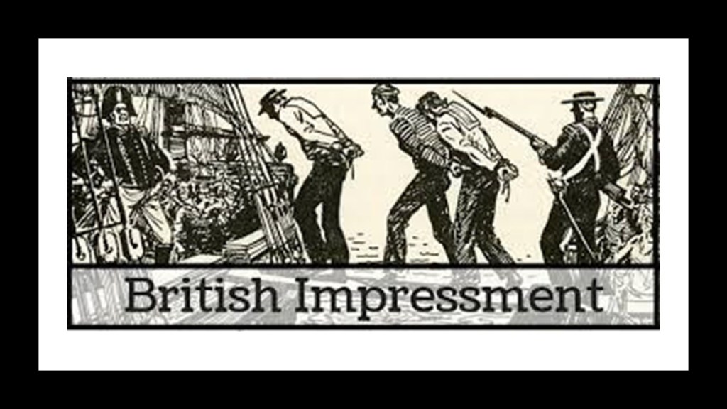
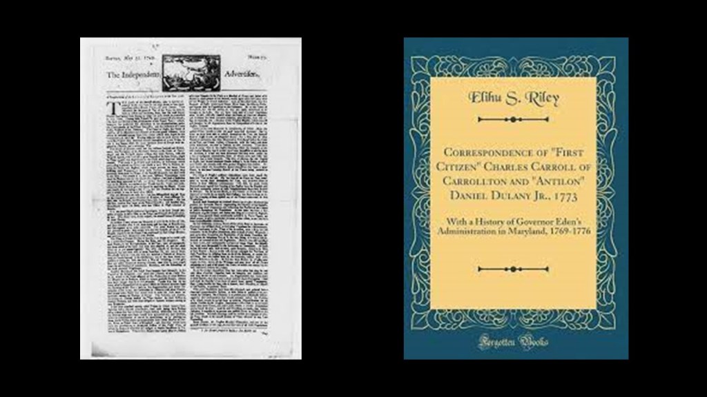
In January of 1748, Samuel Adams and some friends launched “The Independent Advertiser,” which advocated republicanism, liberty and independence from Great Britain, after he and his friends became inflamed by British impressment, where men were forcibly taken into military or naval service.
He went into what can best be described as full-on political activism against Great Britain.
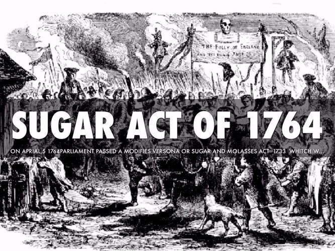
The 1764 Sugar Act passed by the British Parliament was a revenue-raising act for goods which could only be exported to Britain.
It was protested in the colonies for its economic impact, as well as the issue of taxation without representation, by merchants boycotting British goods and Samuel Adams drafted a report on the Sugar Act for the Massachusetts Assembly, in which he called the Sugar Act an infringement of the rights of the colonists as British subjects.
The Sugar Act was repealed in 1766 and replaced with the Revenue Act that same year, which reduced the tax to one penny per gallon on molasses imports.
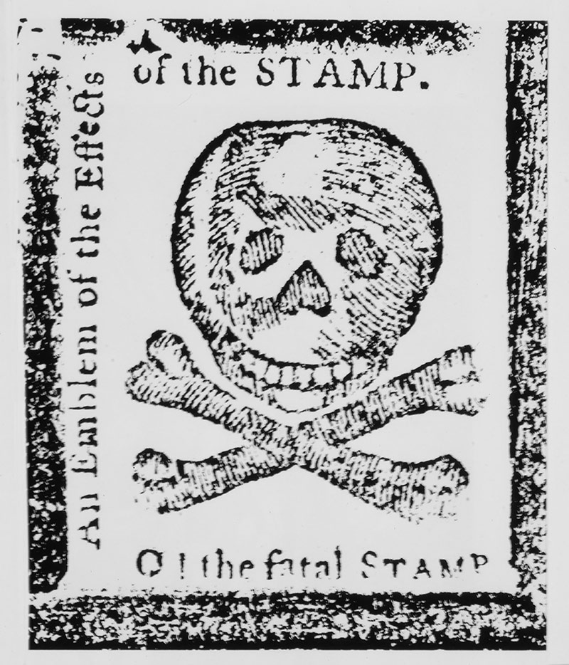
The British Parliament passed the Stamp Act in 1765, which required colonists to pay a new tax on most printed materials.
Adams supported the calls for a boycott of British goods to pressure Parliament to repeal the tax.
Riots from groups like the Loyal Nine, a precursor to the Sons of Liberty, during this time resulted in some homes and businesses being destroyed, and the jury is out on whether or not Adams was directly involved in directing violent agitators in protest.
Adams was appointed to the Boston Town Meeting in September of 1765 to write the instructions for Boston’s delegation to the Massachusetts House of Representatives, and he was selected to become a Representative for Boston later that same month.
Adams was the main author of several House resolutions against the Stamp Act, and he was also said to be one of the first colonial leaders to argue that mankind possessed certain natural rights that governments could not violate.
The Stamp Act did not go into effect when it was supposed on November 1st of 1765 because protestors throughout the colonies had forced stamp distributors to resign and the tax was subsequently repealed in March of 1766.
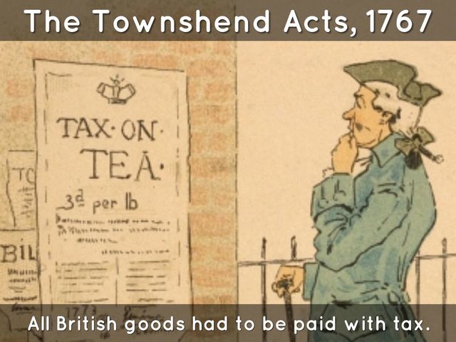
Next came the Townshend Acts.
The Townshend Acts were established by the British Parliament in 1767, establishing new duties on goods imported to the colonies to help pay for the costs of governing the American colonies.
The revenues generated from this were to be used to pay for governors and judges independent of colonial control and compliance enforced by the newly created American Board of Custom Commissioners, headquartered in Boston.
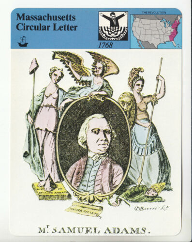
Resistance grew to the Townshend Acts and Samuel Adams organized an economic boycott through the Boston Town Meeting, and called for other towns and colonies to join the boycott.
Samuel Adams wrote what became known as the “Massachusetts Circular Letter,” calling on the colonies to join Massachusetts in resisting the Townshend Acts, which was approved by the Massachusetts House on February 11th of 1768, after having not been approved at first.
Lord Hillsborough, the British Colonial Secretary, instructed colonial governors to dissolve their assemblies if they responded to the letter, and directed the Massachusetts Governor, Francis Bernard, to have the Massachusetts House rescind the letter, which the House refused to do.
Governor Bernard dissolved the legislature after Samuel Adams presented another petition to remove the Governor from office.
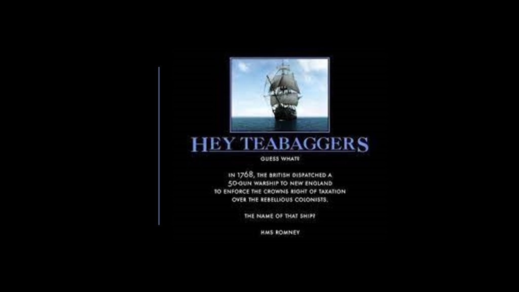
The Commissioners of the Customs Board requested military assistance from Great Britain when they found they could not enforce trade regulations in Boston, and a 50-gun warship arrived in Boston Harbor in May of 1768, the HMS Romney.
Tensions escalated when the captain of the Romney began to forcibly impress local sailors to serve on the HMS Romney.
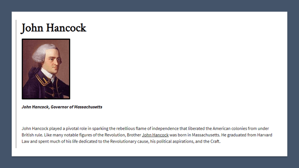
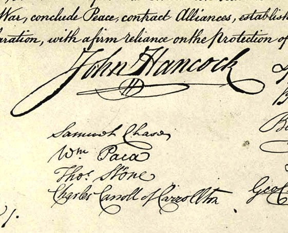
This led to Customs officials seizing a ship belonging to John Hancock named “Liberty” for alleged customs’ violations, and a riot broke out when sailors from the HMS Romney came to tow the “Liberty.”
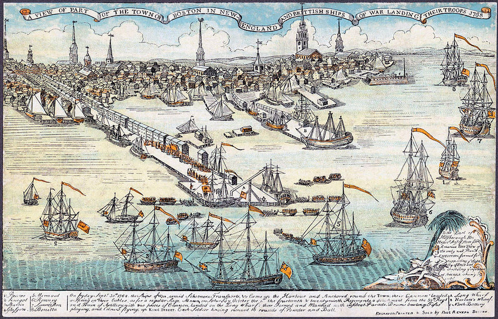
This in turn led to Massachusetts Governor Bernard writing to London in response to this incident and requesting that troops be sent to Boston to restore order, and Lord Hillsborough ordered four regiments of the British Army there, with the first troops arriving in October of 1768.
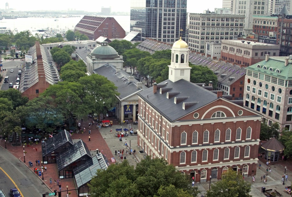
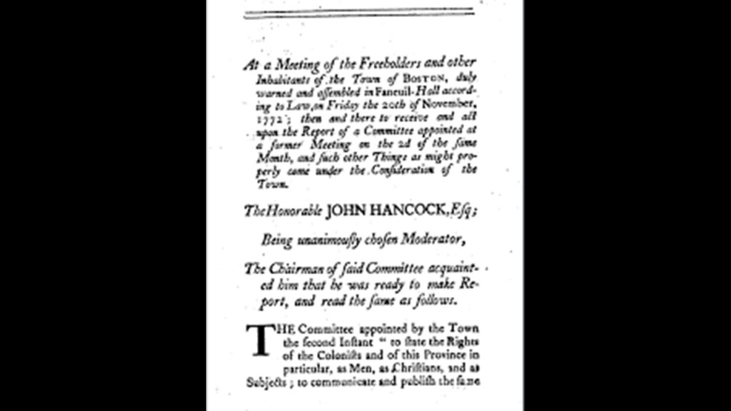
In September of 1768, When Governor Bernard refused the request of the Boston Town Meeting to convene the General Court upon learning about the incoming British troops, the Boston Town Meeting called on other Massachusetts towns to send representatives to meet at Faneuil Hall starting on September 22nd, and one-hundred towns sent delegates to the convention, which issued a letter stating that Boston was a lawful town, and that the pending military occupation would violate the natural, constitutional, and charter rights of the citizens of Boston.
The British occupation of Boston was said to have been a turning point for Samuel Adams according to some accounts, who started working towards American independence and gave up hope for reconciliation with Great Britain.
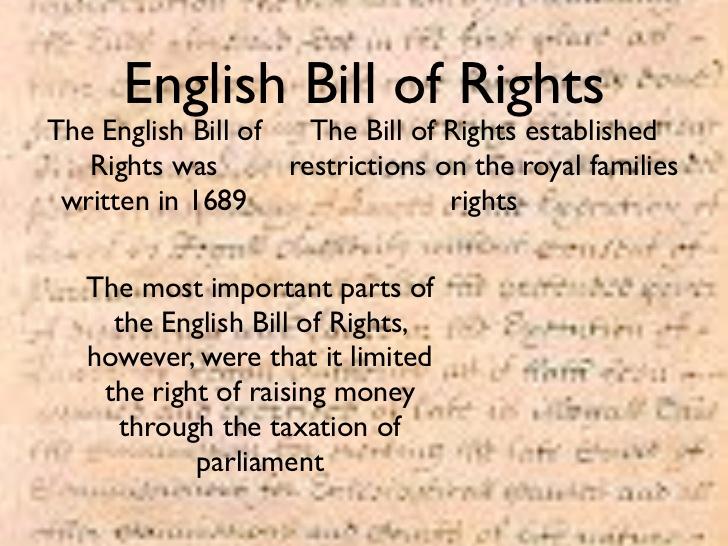
He wrote a number of letters and essays against the occupation, considering it a violation of the 1689 Bill of Rights, which was an act of Parliament seen as a landmark in English Constitutional Law that laid out basic civil rights.
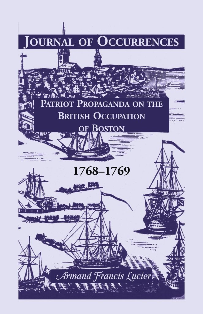
The “Journal of Occurrences” publicized the occupation of Boston throughout the colonies in a series of unsigned articles that may or may not have been written by Adams.
The articles were claimed to be a factual daily account of events in Boston under British occupation, depicting unruly British soldiers assaulting citizens on a regular basis with no consequences to them.
Publication of the “Journal of Occurrences” ended on August 1st of 1769, when Governor Bernard permanently left Massachusetts.
Two British regiments were removed from Boston in 1769, and two remained.
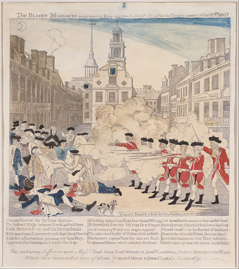
The Boston Massacre took place in March of 1770.
Five civilians were killed by British soldiers in a crowd of several hundred who were said to have been taunting the soldiers.
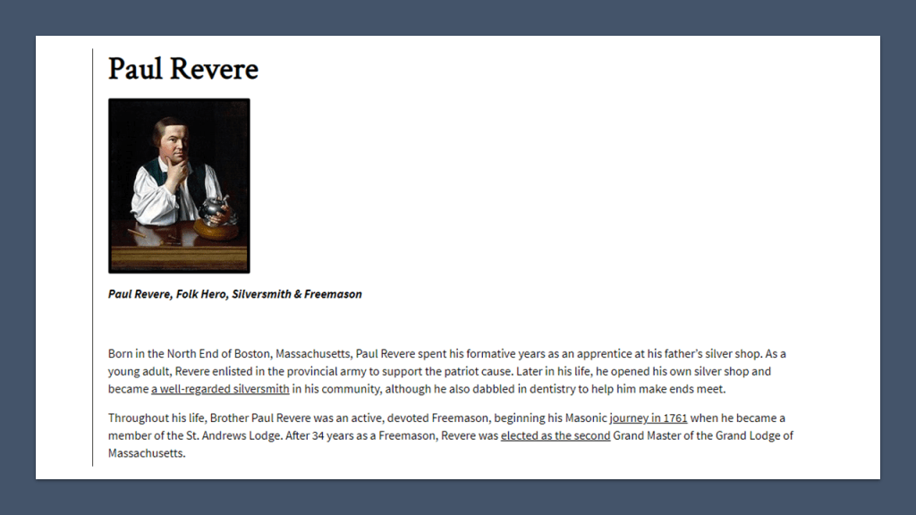
The incident was well-publicized by Samuel Adams and Paul Revere, and was depicted in Revere’s 1770 engraving pictured here.
The situation quieted down somewhat after the Boston Massacre, with Parliament repealing the Townshend Acts in April 1770, with the exception of the tax on tea.
Samuel Adams continued to urge the colonists to boycott British goods, but the boycott faltered because of the improvement of economic conditions.
Adams and his associates came up with a system of “Committees of Correspondence” between towns in Massachusetts in November of 1775, where they would consult with each other on political matters by way of messages sent through these committees that recorded British activities and protested British policies.
These committees of correspondence soon formed in other colonies as well.
The new Massachusetts Governor, businessman and Loyalist politician, Thomas Hutchinson, became concerned that the Committees of Correspondence System was becoming an independence movement.
The Governor addressed the Massachusetts legislature and argued that denying the supremacy of Parliament came dangerously close to rebellion.
Adams and the House responded to him by saying that the Massachusetts Charter did not establish Parliament’s supremacy over the province, so Parliament could not claim that authority.
This exchange was published and publicized in the widely distributed “Boston Pamphlet.”
Samuel Adams was said to have been a leader in the events leading up to the Boston Tea Party that took place in December of 1773 in our historical narrative.
The British Parliament had passed the Tea Act in May of 1773 to help the British East India Company, who had amassed a surplus of tea that it could not sell.
The Tea Act allowed the East India Company to sell the tea directly to the colonies , granting them significant cost advantage over local merchants and reduction in their taxes paid in Great Britain while at the same time keeping the Townshend duty on tea imported in the colonies.
In late 1773, seven ships were sent to the colonies carrying the surplus tea, with four bound for Boston Harbor.
Adams and the Committees of Correspondence promoted opposition to the Tea Act, and with the exception of Massachusetts, every colony was successful in not having the tea delivered.
Governor Hutchinson was determined to hold his ground and have the tea delivered to those designated to receive it.
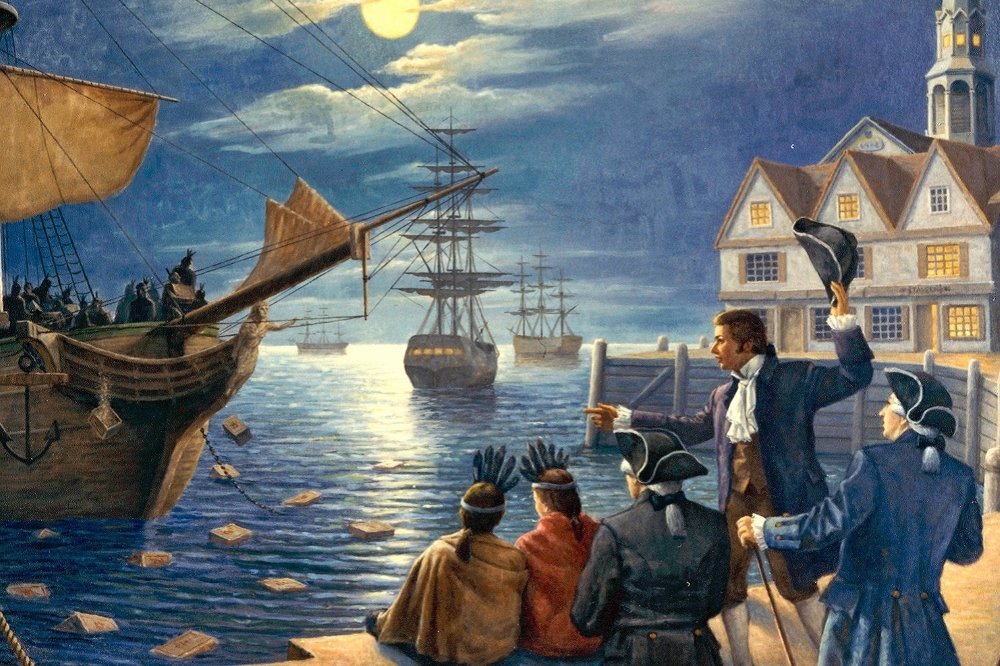
All other efforts to prevent the tea from being unloaded having failed, on the night of December 16th of 1773, approximately 342 chests of tea were dumped overboard in the course of three-hours by a large group of men known as the “Sons of Liberty.”
Samuel Adams publicized the event and defended it, arguing that the Boston Tea Party was not the act of a lawless mob, but the only remaining option left to people to defend their rights.
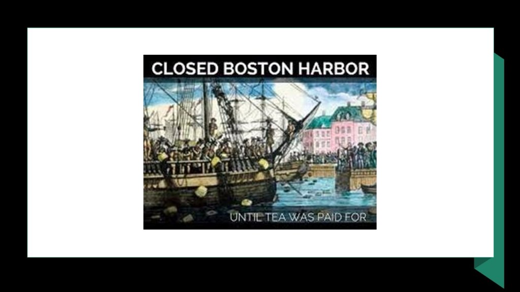
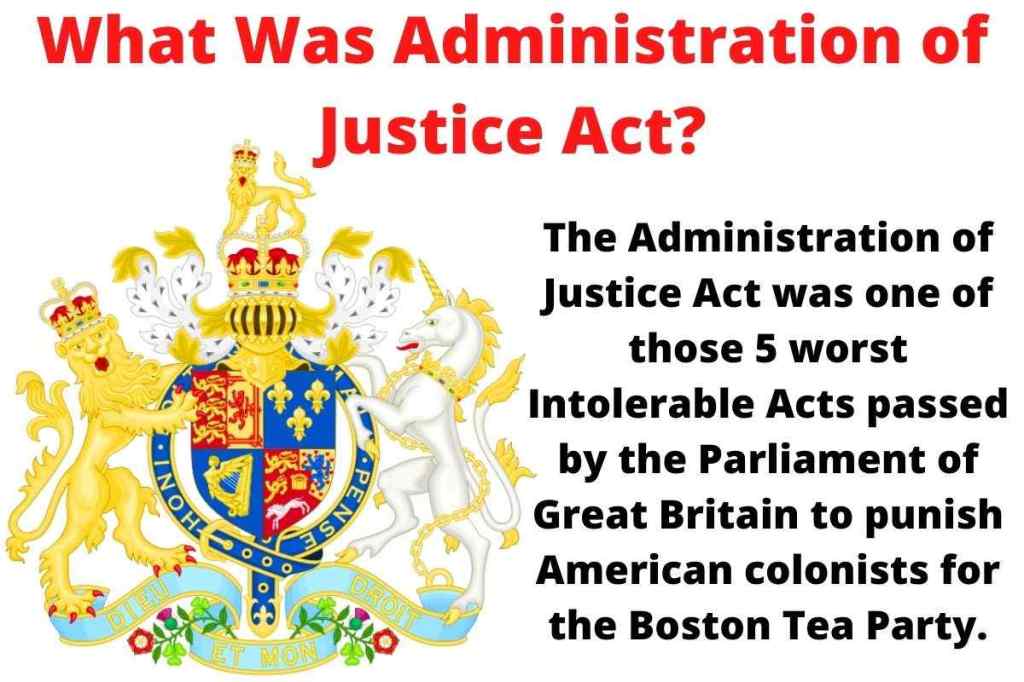
Great Britain’s response to the Boston Tea Party was the introduction of the Coercive, also known as Intolerable, Acts, of which the first was the Boston Port Act, enacted in March of 1774, and effective June 1st, which closed Boston’s commerce until the British East India Company had been repaid for the destroyed tea.
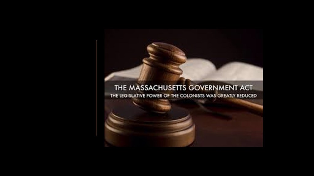
The May of 1774 Massachusetts Government Act rewrote the Massachusetts Charter, making numerous officials royally-appointed as opposed to elected.
Also passed by the British Parliament in May of 1774, the Administration of Justice Act allowed colonists charged with crimes to be transported to another colony or to Great Britain for trial.
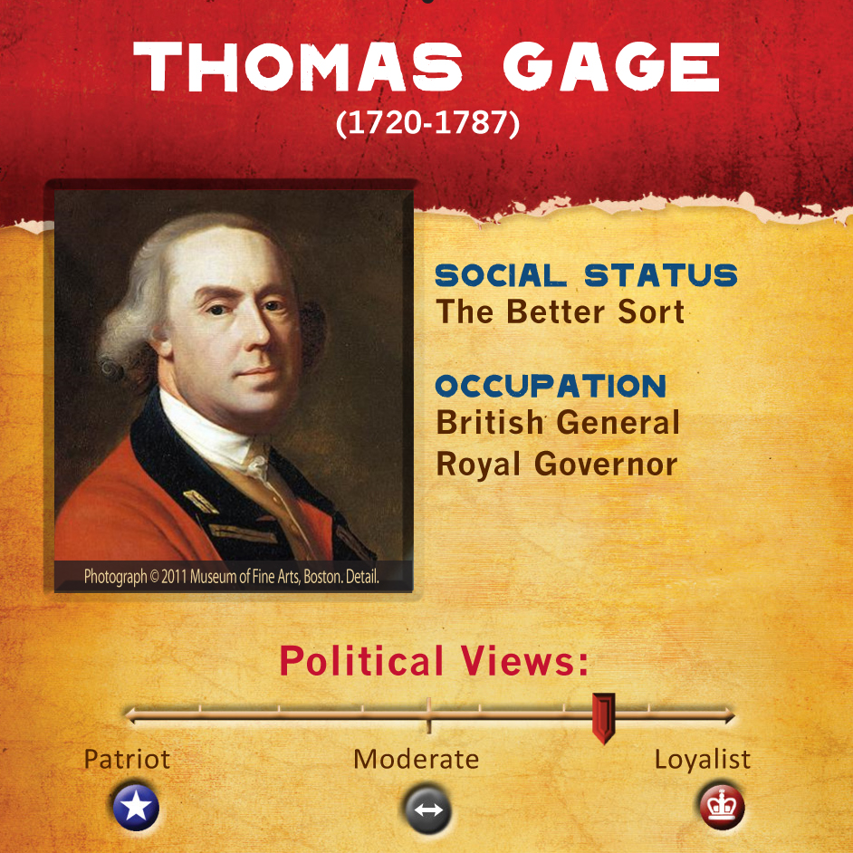
General Thomas Gage was the new Royal Governor of Massachusetts appointed to enforce the Coercive Acts, and he was also the commander of British Military forces in North America.
Samuel Adams worked to coordinate resistance to the Coercive Acts.
In May of 1774, with Adams moderating, the Boston Town Meeting organized a boycott of British goods.
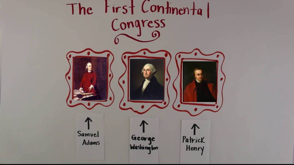
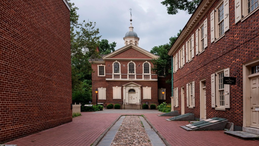
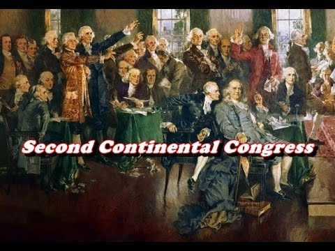
In June of 1774, he chaired a committee in the Massachusetts House behind locked doors which proposed what became the First Continental Congress in Philadelphia, and to which Samuel Adams became one of five delegates from Massachusetts.
The First Continental Congress took place at Carpenters’ Hall in Philadelphia between September 5th and October 26th of 1774.
Delegates from twelve of the thirteen colonies discussed how the colonies could work together in response to the British government’s coercive reactions in Massachusetts.
They agreed on a “Declaration and Resolves,” a statement that outlined colonial objections to the Coercive Acts, and concluded with the plan of the First Continental Congress to enter a boycott of British trade until the grievances were resolved.
They sent a petition to King George III pleading for resolution of their grievances and repeal of the Coercive Acts, which had no effect.
In November of 1774, Adams returned to Massachusetts and served in the Massachusetts Provincial Congress, which created the first Minutemen companies – militia ready to act on a moment’s notice.
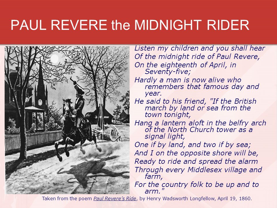
Both selected as delegates to the Second Continental Congress in Philadelphia, which was scheduled to start meeting in May of 1775, Samuel Adams and John Hancock attended the Massachusetts Provincial Congress in Concord, Massachusetts, in April of 1775, and then decided to stay in Hancock’s childhood home in Lexington before heading to Philadelphia after deciding it wasn’t safe to return to Boston.
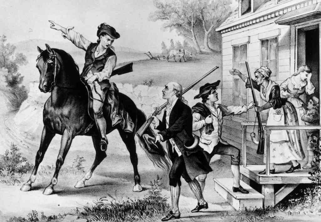
After having received a letter from Lord Dartmouth, British Secretary of State for the Colonies, on April 14th of 1775 advising arrest of the principal people of the Massachusetts Provincial Congress, General Gage, the Massachusetts Governor and commander of British Military forces in North America sent out a detachment of soldiers a few days later, on April 18th, to seize and destroy military supplies that the colonists had stored in Concord, and possibly to arrest Adams and Hancock, though this order is in dispute historically because it wasn’t in his written orders.
Regardless, the Patriots believed otherwise, and Paul Revere was dispatched on horseback from Boston on his famous midnight ride, to both alert the colonial militia that the “British are coming,” and warn Hancock and Adams about their potential arrest.
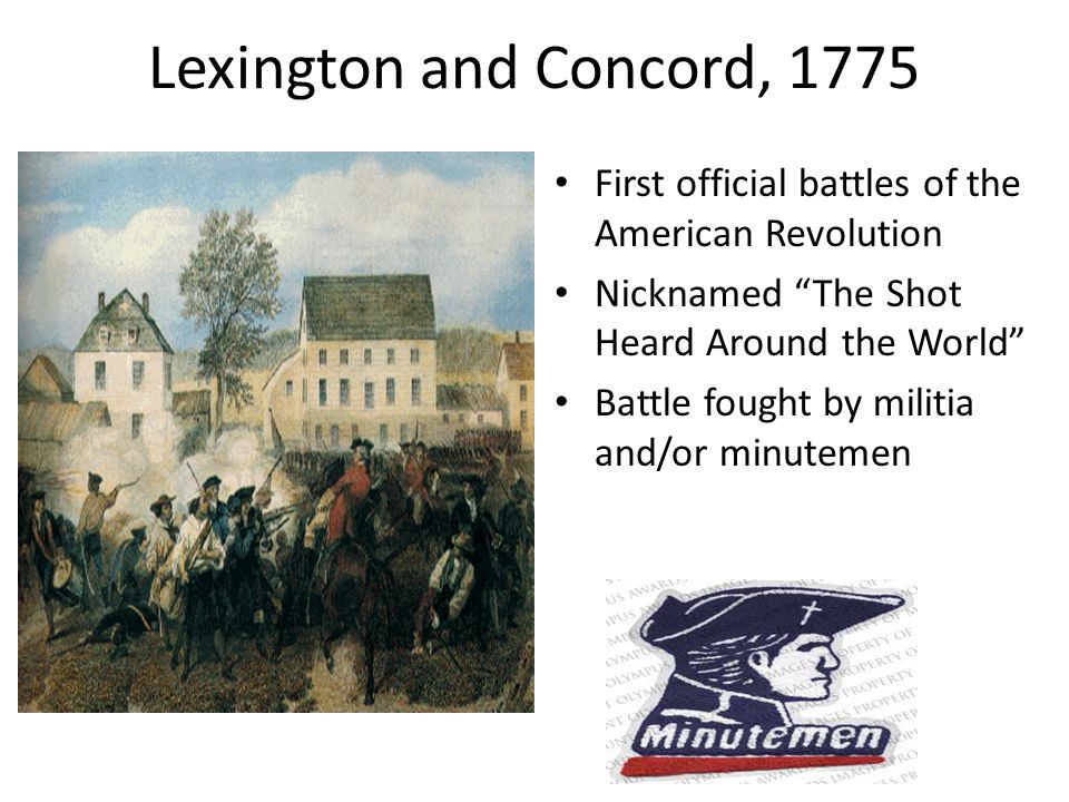
As Hancock and Adams made their escape, the American Revolutionary War began in Lexington and Concord on April 19th of 1775.
The exact role of Samuel Adams in the proceedings of the Second Continental Congress was not known because of its secrecy rule, but he was believed to have been a major influence in steering the Congress toward independence.
He served on numerous committees, including ones dealing with military matters, and it was he who nominated George Washington to be Commander-in-Chief of the Continental Army.
On June 7th of 1776, Samuel Adams’ ally, Richard Henry Lee from Virginia, introduced a three-part resolution calling for the Second Continental Congress to declare independence, create a colonial confederation, and seek foreign aid.
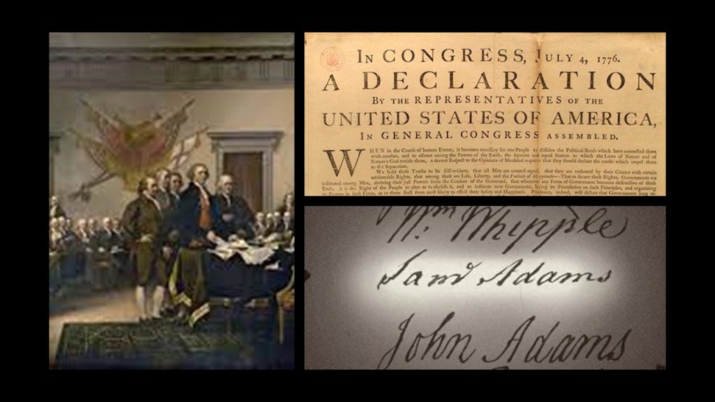
This resulted in the Continental Congress approving the language of the Declaration of Independence and its signing on July 4th of 1776.
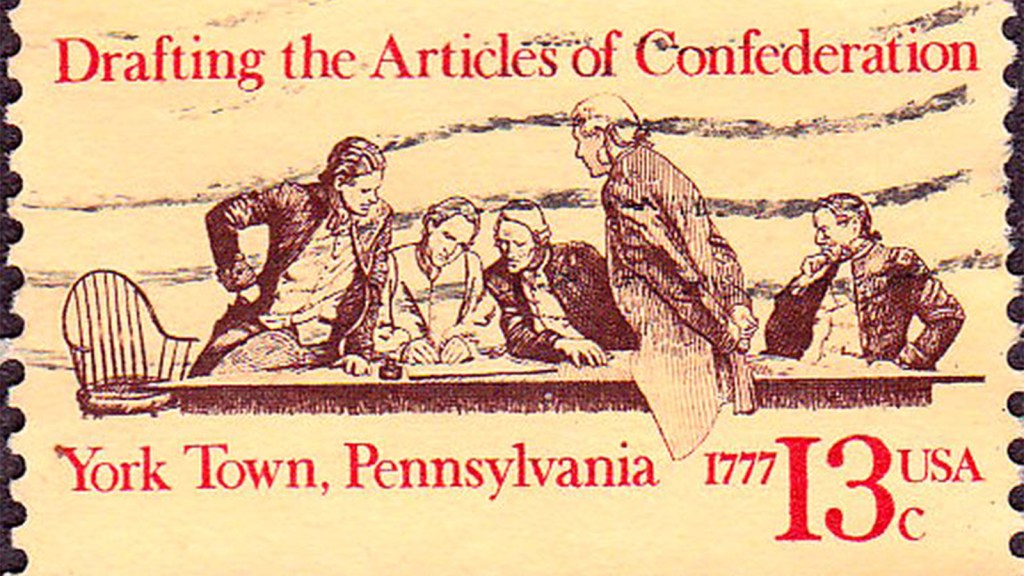
Adams remained active in the Second Continental Congress, also having a hand in drafting the Articles of Confederation in 1777, the plan for colonial confederation, and he continued to serve on various military committees.
He retired completely from the Continental Congress in 1781.
Not bad for a guy who started out his career in the beer-making business!
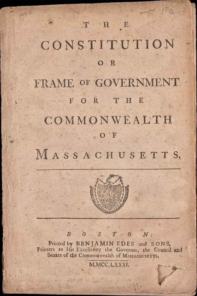
Adams had returned to Boston in 1779 to attend a state constitutional convention, at which time he was appointed to a three-man committee to draft a new state constitution.
The new Massachusetts Constitution was amended by the convention approved by voters in 1780, and is among the oldest functioning constitutions in continuous effect in the world.
Adams continued to remain active in politics after his return to Massachusetts, putting his focus on the promotion of virtue.
He occasionally serving as moderator of the Boston Town Meeting, and he was elected to the State Senate.
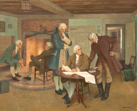
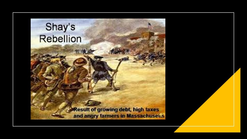
Shays’ Rebellion took place in rural western Massachusetts from August of 1786 to February of 1787, in response to a debt crisis among the people and in opposition to the state government’s increased efforts to collect taxes on individuals and their trades.
Residents in these areas had few assets beyond their land, and bartered with each other for goods and services, as opposed to the market economy of the developed areas of Massachusetts Bay and Connecticut River Valley.
It was led by Revolutionary War veteran Daniel Shays who led 4,000 rebels in protest against economic and civil rights’ injustices.
Interestingly, where Samuel Adams approved of rebellion against an unrepresentative government, he opposed the taking up of arms against a Republican form of government, where problems should be remedied through elections.
He urged the Governor, James Bowdoin, to put down the uprising using military force, so he sent 4,000 militiamen to quell the uprising.
Shay’s Rebellion led to the creation of the United State Constitution, which started at the 1787 Philadelphia Convention, because it contributed to the belief that the 1777 Articles of Confederation needed to be revised.
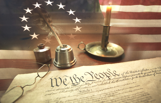
The United States Constitution came into force in 1789 as the supreme law of the United States.
The original Constitution is comprised of seven articles.
Its first three articles embody the doctrine of “Separation of Powers;” its next three articles embody the concepts of “Federalism,” and the rights and responsibilities of state governments; and its last article established the procedure used to by the thirteen original states to ratify it.
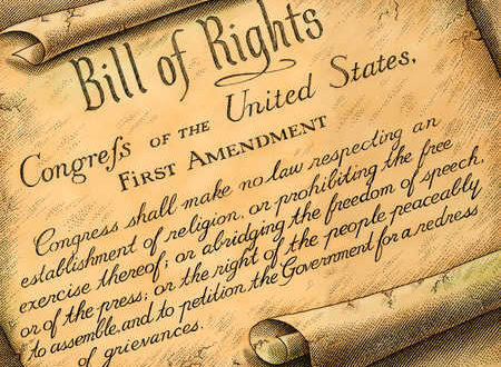
The first ten amendments to the Constitution are known as the “Bill of Rights,” which were ratified by the first U. S. Congress, on December 15th of 1791, offer specific protection for individual liberty and justice, and place restrictions on the power of government.
Samuel Adams was elected Lt. Governor of Massachusetts in 1789, a position in which he served until Governor John Hancock’s death in 1793, at which time he became acting governor.
The following year, Adams was elected as the Massachusetts Governor, a position in which he served between October of 1794 and June of 1797.
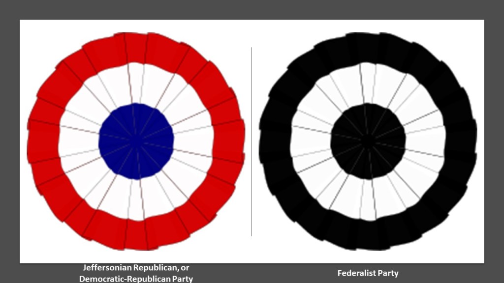
In Massachusetts, Samuel Adams was considered a leader of the Jeffersonian Republicans, also known as the Democratic-Republican Party, a political party founded by Thomas Jefferson and James Madison in the early 1790s that championed things like Republicanism, agrarianism, political equality and expansionism.
This was in opposition to the Federalist Party, a conservative party that was founded in 1789, and the first political party in the United States.
It was led by people like Alexander Hamilton and Samuel’s cousin John Adams, and favored centralization, federalism, modernization, industrialization, and protectionism.
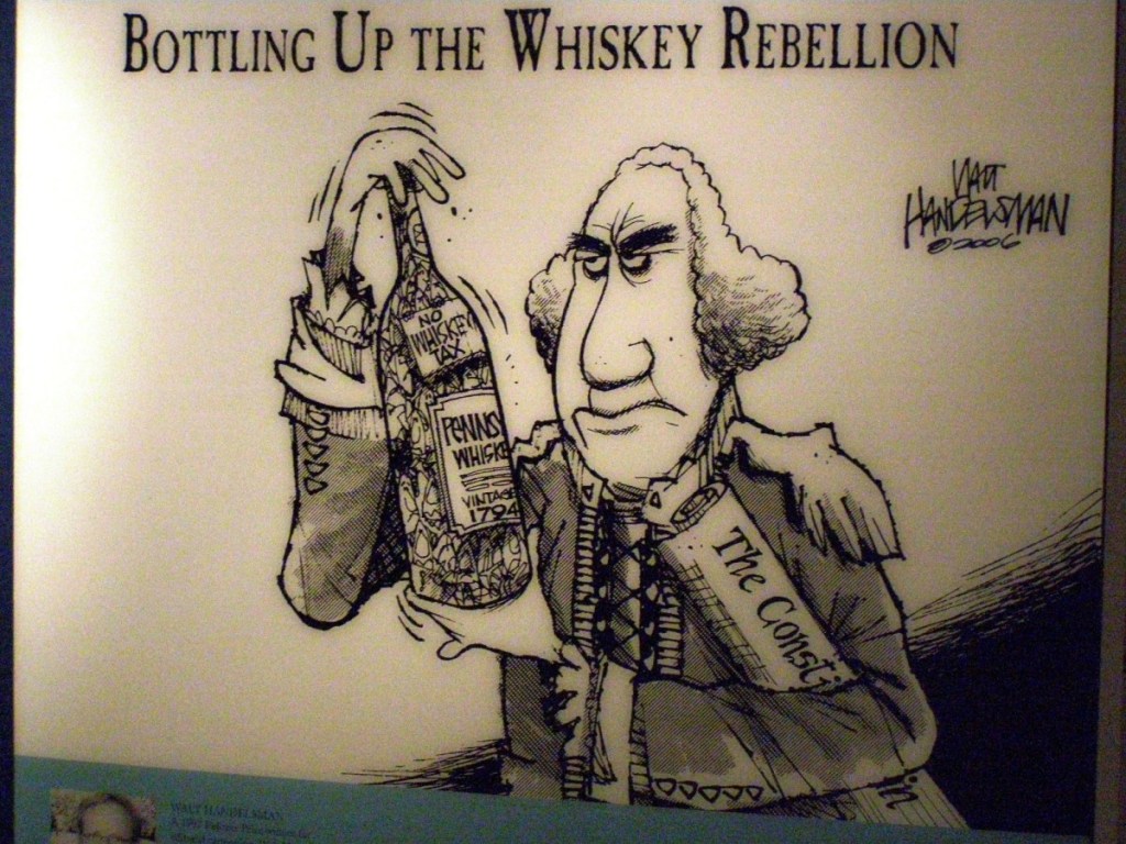
Samuel Adams supported the suppression of the Whiskey Rebellion for the the same reasons he supported the suppression of Shay’s Rebellion.
The Whiskey Tax was the first tax imposed on a domestic product by the newly formed federal government, and was intended to generate revenue for the war debt brought about by the Revolutionary War, and primarily affected people living in rural areas, like farmers in the new country’s western frontier who turned surplus grains into alcohol and where whiskey was used for bartering.
The Whiskey Rebellion was a violent tax protest in the United States that started in 1791 and ended in 1794 during George Washington’s Presidency, and when George Washington himself led 13,000 militiamen provided by Virginia, Maryland, New Jersey, and Pennsylvania, to put down the insurgency, however, all the insurgents left before the army arrived, effectively ending the rebellion, and resulting in a handful of arrests of individuals that were later acquitted or pardoned.
The Whiskey Rebellion demonstrated that the new national government had the will and ability to suppress violent resistance to its laws.
The Whiskey Tax was very difficult to collect, and was finally repealed in the early 1800s under President Thomas Jefferson.
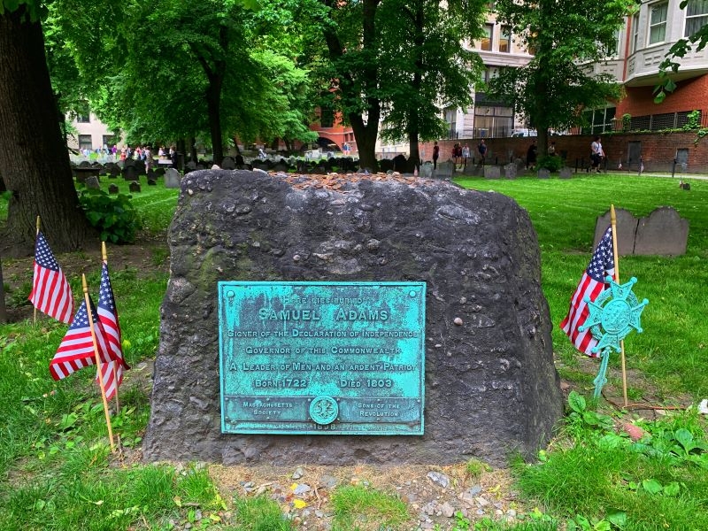
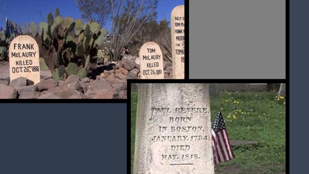
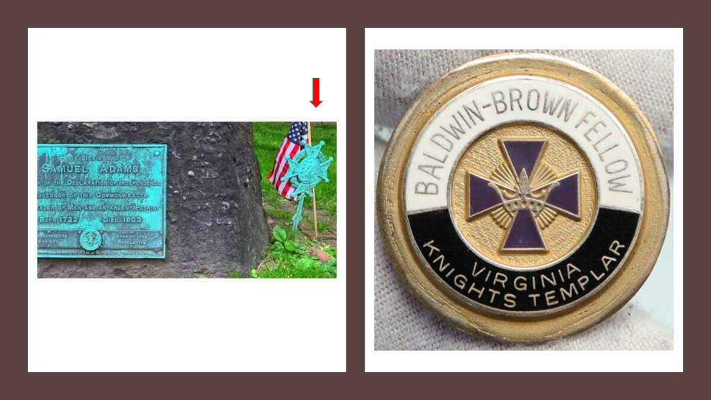
Adams retired from politics after his term as Governor ended in 1797, and he died on October 2nd of 1803, at the age of 81, and was buried in Boston’s Granary Burying Ground…
…and also where Paul Revere was laid to rest.
No mention of his famous midnight ride, or much of anything on his grave-marker.
Paul Revere’s grave-marker reminded me of the simple grave-markers at Boot Hill in Tombstone, Arizona, famous for the “Gunfight at O. K. Corral” between the Earps and the cowboy outlaws.
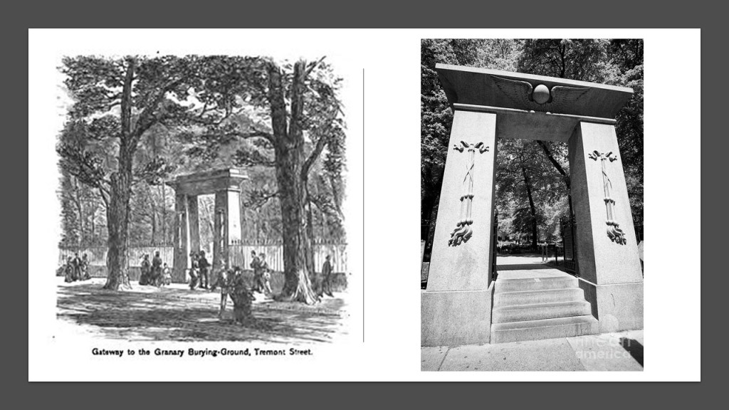
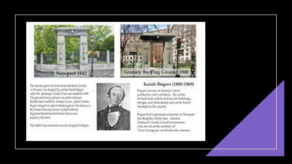
The Granary Burying Ground’s Gate and fence was said to have been designed in Egyptian-Revival-style by Isaiah Rogers in 1840…
…and Isaiah Rogers was said to have designed an identical gateway for Newport, Rhode Island’s Touro Synogogue Cemetery in 1842.
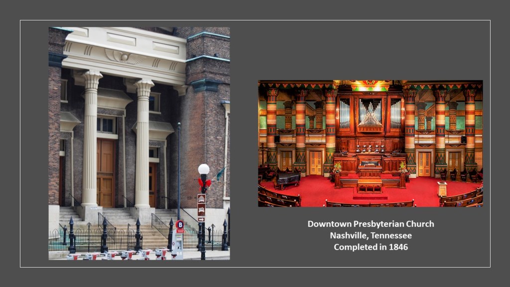
Speaking of Egyptian Revival Style architecture, there’s a stunning example of it at the Downtown Presbyterian Church in Nashville, Tennessee, said to have been designed by architect William Strickland, and completed in 1846.
One more thing before I move on.
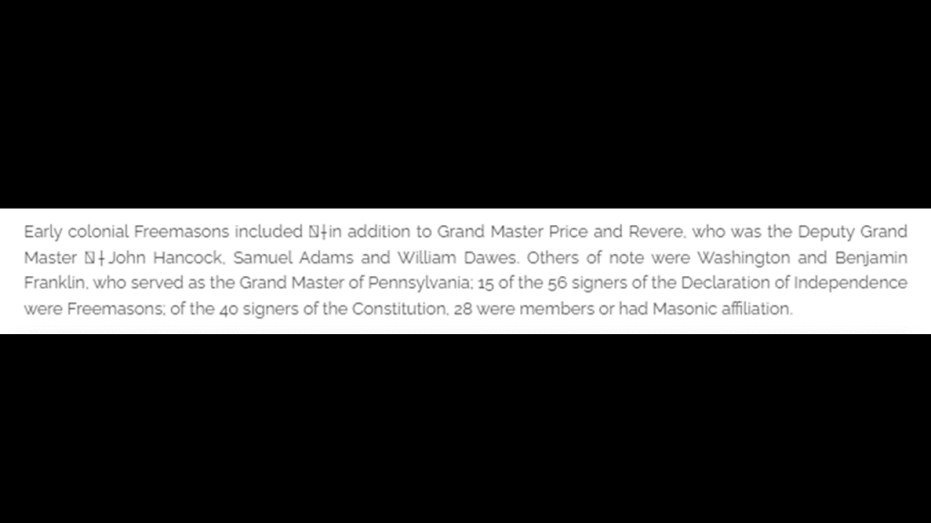
This is what came up when I searched for “Was Samuel Adams a Freemason?”
I found Samuel Adams mentioned as a Freemason in an article from June of 2009 on the antiquesandthearts.com website about the Grand Lodge of Masons in Massachusetts celebrating 275 years of brotherhood.
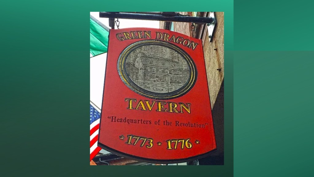
The article mentioned things like the Green Dragon Tavern in Boston being the unofficial Headquarters of the American Revolution…
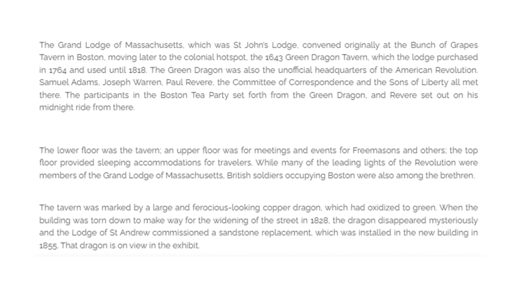
…as well as the meeting place for the Grand Lodge of Massachusetts, which had purchased the Green Dragon Tavern in 1764, and used it as a meeting place until 1818.
Also mentioned in this article is that it was the origin point for the Boston Tea Party participants and Paul Revere’s midnight Ride, as well as mentioning that there were Freemasons among the British soldiers occupying Boston, which are called “Brethren.”
So, who’s their loyalty to? Their countries or each other?
Samuel Adams was mentioned as a Freemason in this article…
…and I wonder if he belonged to the York Rite of Freemasonry, since there is what appears to be a Templar cross next to his gravestone, and “Knights Templar,” the final order joined in the York Rite…
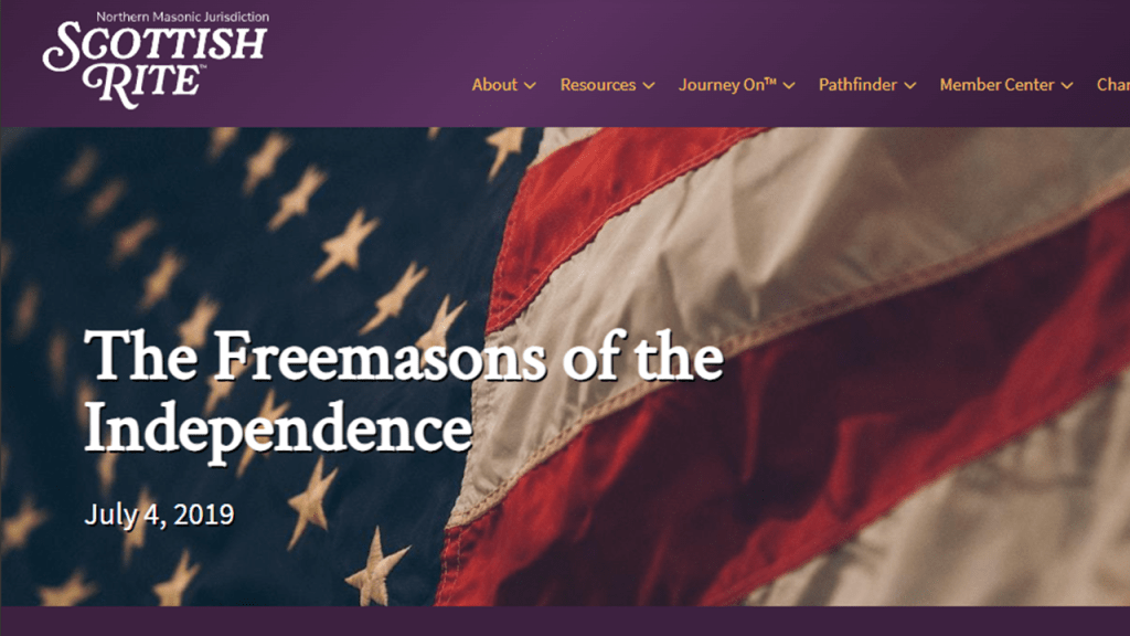
…because Samuel Adams was not mentioned on the “Northern Masonic Jurisdiction of the Scottish Rite” website, but the following men were listed as Freemasons of the Independence.
George Washington.
Well, no surprise there. I knew that about him a long time ago, and it even says in the description that he was one of the most famous Founding Fathers and Freemasons in American History.
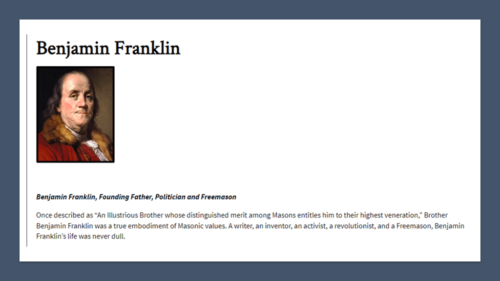
Benjamin Franklin.
No surprise there either, though I don’t think he was as well known to the general public as a Freemason as George Washington was.
The last two mentioned as Freemason on this website page were John Hancock…
…and Paul Revere.
Again, not surprising to find out these men were Freemasons, but it is very interesting to me in terms of what this might represent in the bigger picture of what has been actually been taking place on Earth, especially in light of the role played by other Freemasons in our historical narrative.
Next, Charles Carroll of Carrollton.
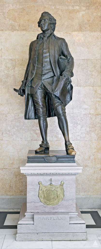
Charles Carroll of Carrollton represents the State of Maryland in the National Statuary Hall.
He was an Irish-American politician, planter, and the only Catholic signer of the Declaration of Independence.
He was considered one of the Founding Fathers of the United States, and was known as the “First Citizen” of the American Colonies.
He received the “First Citizen” designation for the given reason this was his pen name for his articles in the “Maryland Gazette.”
Charles Carroll of Carrollton was born in September of 1737 in Annapolis, Maryland, the son of Charles Carroll of Annapolis, a wealthy Maryland planter and lawyer, and the grandson of Charles Carroll the Settler, an Irishman who secured the position of Attorney General of the young colony of Maryland from George Calvert, First Baron Baltimore and immigrated there in October of 1688.
The Colony of Maryland was established in the 1630s on land granted by a hereditary charter to the Calvert family, and intended as a haven for English Catholics and other religious minorities.
The young Charles Carroll received a Jesuit education, starting at the Jesuit preparatory school at Bohemia Manor in Cecil County on Maryland’s Eastern Shore of the Chesapeake Bay…
…and then starting at the age of 11 was sent to Jesuit schools in France, including the College of St. Omer in northern France…
…and later the Lycee Louis-le-Grand in Paris, from which he graduated in 1755.
For the next 10 years, Carroll studied in Europe, and read law in London before returning to Annapolis in 1765.
He was granted Carrollton Manor, known as D0ughoregan Manor, by his father, which was why he received the name “Charles Carroll of Carrollton.”
Doughoregan Manor is located west of Ellicott City, Maryland, and was designated a National Historic Landmark in 1971.
As a Catholic, Charles Carroll of Carrollton was barred by Maryland Statute from entering politics, practicing law and voting.
This did not stop him from becoming not only one of the wealthiest men in Maryland, but of anywhere in the British Colonies, with his extensive agricultural estates, which besides Doughoregan, included Hockley Forge and Mill, called a collection of colonial-era industrial buildings along the Patapsco River near what is now Elkridge, Maryland, and Carroll provided the capital to finance new enterprises on the Western Shore of the Chesapeake Bay.
In the early 1770s, when the dispute between Great Britain and her colonies in America became more intense, Carroll engaged in a debate via letters that were written anonymously and published in the Maryland Gazette.
Carroll under the pen name of “First Citizen” argued for maintaining the right of the colonies to control their own taxation, becoming a prominent spokesman against the Governor’s proclamation increasing legal fees to state officers and Protestant clergy.
Daniel Dulany the Younger, a noted lawyer and British loyalist politician in Maryland, opposed Carroll in these written debates, writing as “Antillon.”
Carroll’s fame and notoriety began to grow as the identity of the two anonymous debaters became known, and following these written debates, Carroll became a leading opponent of British rule and served on various committees of correspondence, and believed that only the violence of war could break the impasse with Great Britain.
He was a delegate to the Annapolis Convention, the revolutionary government of Maryland before the Declaration of Independence was signed.
Charles Carroll was elected to the Second Continental Congress on July 4th of 1776, arriving too late to vote on it, but he was there to sign it.
At the time, he was the richest man in America.
stone.tif
He remained a delegate of the Second Continental Congress until 1778, and during his term, he served on the War Board and gave considerable financial support to the Revolutionary War.
Carroll returned to Maryland in 1778 to help form the state government there.
He declined re-election to the Continental Congress in 1780, but was elected to the Maryland Senate in 1781, and served there until 1800.
I guess by that time, Catholics were no longer barred y statute from hold political office.
He was also elected to the U. S. Senate during this time by the State Legislature, in which he served from March of 1789 to November of 1792.
He had to resign his U. S. Senate seat, however, because Maryland passed a law barring anyone from serving in state and federal office simultaneously, and he preferred his State Senate job.
After retiring from public life in 1801, Carroll helped established the Baltimore & Ohio Railroad, which was founded in 1827 and broke ground for the construction of its headquarters and America’s first commercial railroad tracks on July 4th of 1828.
This is where aspects of the influential Carroll family of Maryland and Charles Carroll’s life and the history of the B & O Railroad intersect.
Mount Clare is called the oldest Colonial-era structure in Baltimore, Maryland, and was built on a Carroll-family plantation starting in 1763 by Charles Carroll the Barrister, a distant cousin of Charles Carroll of Carrollton.
This is what we are told.
The street grid of the city of Baltimore near Mount Clare began to grow and inch towards the southwest, with the dense development of streets and alleys of different styles of brick row-houses by the 1820s, and there was competitive economic pressure with the opening of the Erie Canal to develop the Port of Baltimore and the accompanying transportation systems like the Baltimore & Ohio Railroad with this new transportation technology from Great Britain and the proposed Chesapeake & Ohio Canal, of which both projects broke ground on the same day – July 4th of 1828 – and that there was an intense rivalry between the two.
The Baltimore & Ohio Railroad Company was formed in 1827, of which Charles Carroll of Carrollton was one of its Directors, and he was the one that had the honor of laying the first stone for the railroad at the ceremony after the celebratory festivities at the July 4th ground-breaking in 1828, near the Mount Clare Mansion.
The Mount Clare Shops, of which this aerial photo is circa 1971, is the oldest railroad manufacturing complex in the United States, located on a portion of the Carroll family’s Mount Clare Estate, and the mansion left the family’s ownership in 1840.
Mount Clare Station was first said to have been erected in the 1830s and the Roundhouse in 1884, with the current Mount Clare Station building having been constructed in 1851.
Today the Baltimore & Ohio Railroad Museum, we are told the original Mount Clare passenger station, the first in the nation, was abandoned, and was located where the parking lot is for the museum is today.
Carroll was elected into the American Antiquarian Society in 1815, a national research library of pre-20th-century American history and culture, and the oldest historical society with a national focus, having been founded in 1812.
Its mission is to collect, preserve, and make available for study all printed records of what is known as the United States of America.
The seal of the American Antiquarian Society translates from the Latin of Ovid’s Metamorphoses, Book 15, Line 872: “Now I have completed my work, which neither sword nor devouring Time will be able to destroy.”
The written word can be manipulated to put out the narrative you want for posterity.
Architecture not so much.
This is the American Antiquarian Society building in Worcester, Massachusetts, said to have been designed by the arciectural firm of Winslow, Bigelow & Wadsworth in Georgian or Colonial-Revival style and completed in 1910.
Carroll died at the age of 95 in November of 1832, the oldest-lived Founding Father.
His funeral took place at the cathedral in Baltimore…
…and he was buried in the Manor Chapel on his estate at Doughoregan.
I am bringing forward unlikely pairs of historical figures who are represented in the National Statuary Hall who have things in common with each other, as mentioned at the beginning of this post.
The main thing that jumps out in this pairing is that both Samuel Adams and Charles Carroll of Carrollton are considered Founding Fathers of the United States.
Both men were well-educated for their day, with Samuel Adams earning a Master’s Degree at Harvard University in 1743, and Charles Carroll attending several prestigious Jesuit schools in France, graduating from the Lycee Louis-le-Grand in Paris, in 1755.
Both men were highly involved in using the written word in their political activism against the British, with the examples of Samuel Adams starting in 1748 in writing articles against British colonial policies for the Independent Advertiser and Charles Carroll’s role as the “First Citizen” in the written debate in the Maryland Gazette with Daniel Dulany the Younger as “Antillon.”
And both men were highly involved on both the local and Continental Congress-levels with events leading up to and during the American Revolutionary War.
These two men in particular fall into the category of key players in the historical narrative in shaping and forming what became the United States moreso than some of the rather obscure historical figures that are also honored there,
But regardless of fame or obscurity, I finding that the National Statuary Hall functions more-or-less as a “Who’s Who” for the New World Order and its Agenda, with the details of their lives and times taht are findable in a search telling a completely different kind of story than what we normally hear about our history.
This particular subject recently took front-and-center stage in my mind after doing research on the earliest Non-Governmental Organization (NGO) in our historical narrative, an organization that eventually became known as “Anti-Slavery International.”
In an effort to at the very least question the narrative about what we are told is the answer to this question, that the Aborigines were hunter-gatherers, I decided to bring together past and present information I have accumulated around the subject to demonstrate that a good case can be made that they were in fact actually the builders of its Civilization, and that they were part of a worldwide civilization that was identical in design from ancient times to relatively modern times.
First, I will start with the origins of “Anti-Slavery International.”
The origins of today’s “Anti-Slavery International” included the “Aborigines Protection Society,” which was formed in 1837, and we are told it was to ensure the “health and well-being, as well as the sovereign, legal, and religious rights of the indigenous peoples while promoting the civilization of the indigenous people who were subjected under colonial powers.”
This book by David Heartsfield looks at the “Aborigines Protection Society” from the perspective of “Humanitarian Imperialism in Australia, New Zealand, Fiji, Canada, South Africa, and the Congo between 1836 and 1909,” and mentioned things like how the policy of native protection turned out to be a reason for the growth of imperial rule, particularly that of the British Empire.
The Aborigines Protection Society published a journal called the “Colonial Intelligencer and Aborigines Friend,” which was comprised of “…interesting intelligence concerning the Aborigines of Various Climes and Articles Upon Colonial Affairs, with Comments Upon the Proceedings of Government and of Colonists toward Native Tribes.”
“Aborigines Friend”….or foe.
The “Aborigines Protection Society” and the “British and Foreign Anti-Slavery Society” merged in 1909, and together they became known as the “Anti-Slavery and Aborigines Protection Society.”
What had become the “British and Foreign Anti-Slavery Society” in 1909 went through several other name-changes over the years, and with the last name-change became “Anti-Slavery International” in 1995.
Here are this organization’s slavery statistics worldwide from 2020.
According to their own statistics, an organization that supposedly exists to working against slavery and other abuses, as recently as 2020, only three-years ago, there were 40.3 million people in slavery total, with at least 10-million of those people being identified directly as children.
Those numbers seem incredibly high for something that isn’t talked about openly in our day and age, and raises the question of what is really going on here.
It also brings up the question of how many different forms of human slavery have existed in the past and present-day, including Australia’s history as a penal colony.
Not only this, but also what could have possibly happened to its original people to kick them back into the Stone Age from a high-state of civilization, and this didn’t just happen in Australia, it happened all over the world when the European colonizers moved in and took everything over.
How could this even have happened to begin with?
No doubt brutal subjugation of the original people is part of the explanation, but there would have been many factors contributing what has taken place here.
By the end of this video, I will have provided a substantial amount of information and examples to demonstrate that there is something seriously amiss with the narrative, which has gaping holes in it from the information missing from it, that has been inadequately explained by those who don’t want us to know our True History and what has taken place here
These are typical of the kinds of paintings of the Australian Aborigines that have come down to us in our historical narrative.
But every once in awhile you can find an aboriginal face in an unexpected place, like this historical photo at the entrance of Luna Park in Sydney, with the huge face and Moorish-looking buildings.
Though still in operation today, Sydney’s Luna Park entrance had a face-lift for some reason.
So let’s take a walkabout Australia and Tasmania and see what we can find out.
The starting point for our walkabout is Darwin.
Darwin is the capital and largest city of the Northern Territory of Australia, which is sparsely populated.
It is also called the Outback Capital of the Northern Territory.
Notably, Darwin was the location of the first bombing in Australia, which occurred in February of 1942, after Australia had officially declared war on Japan on December 9, 1942.
Japanese forces bombed military bases in Darwin in one day.
One of the first hits, and explosions, was a ship loaded with TNT and ammunition.
There were a number of civilian casualties as a result of the bombings, and as a result of the attacks, more than half of the civilian population left permanently.
Interestingly, something very similar happened during World War I in December of 1917 in Halifax Harbor in Nova Scotia, when the high-explosive TNT-laden French cargo ship, the SS Mont-Blanc, collided with the Norwegian ship, the SS Imo, causing the largest, human-made explosion at the time.
Nearly all structures within an 800-meter, or half-mile radius, were obliterated, and the tsunami it caused wiped out the Mi’kmaq First Nation that had lived in the Tufts Cove area for generations.
Here is a picture of Darwin today, on the top left.
Of particular note is the shaped harbor in the foreground, which is a signature of places I have found tracking long-distance alignments of cities and places all over the Earth, like that of Sousse, Tunisia on the bottom left, and Olafsvik, Iceland, on the right.
This is described as a World War II gun emplacement in the Dripstone Cliffs of Darwin Harbor.
And this is a photograph circa 1890 in Darwin of Knight’s Folly in the middle; Fort Hill to the left and Government House to the right.
Fort Hill was said to have been the location of a George Goyder’s surveying camp in 1869; used for storing oil during World War II; and removed in 1945 to make room for an iron-ore loading wharf.
“Knight’s Folly” was another name given to an historic building called “Mud Hut, said to have been constructed in 1883 by John George Knight and built from “Egyptian Bricks.”
It burned down on December 31st of 1933.
And the Government House was said to have been built between 1870 and 1871…
…and to be the oldest European building in the Northern Territory, still in use today as the office and official residence of the Administrator of the Northern Territory.
I don’t know. Maybe it’s just me, but that building looks lop-sided to me!
Howard Springs Nature Park is on the outskirts of Darwin.
We are taught that there was nothing special going on in these places, nothing to see, so we fail to recognize the ancient megalithic masonry laying all around us.
These are cut-and shaped-stones. These are not natural occurrences, contrary to what we have taught to believe by historical omission. These in Australia…
…are like these two photos at Martin Nature Park in North Oklahoma City.
Lying around everywhere with no special attention drawn to them – just there. Taunting us but not telling us.
And only when you start realizing they are there. Because until you notice them, they just blend in to the landscape.
Next from Darwin going clock-wise around the coast, we come to Kakadu National Park, and Arnhem Land.
First Kakadu National Park, which is a UNESCO World Heritage Site.
Kakadu covers an area that is 7,646 square miles (or 19,804 kilometers). Besides its incredible biodiversity, land-forms, and river systems, one of the most productive uranium mines in the world is surrounded by the park, shown in the map as the Ranger Mineral Lease.
According to the narrative, Aboriginal people have occupied this land continuously for 40,000 years, and approximately half of the land of Kakadu is aboriginal.
And this is as good as any place to leave this photo here for your consideration. I personally think there is something to it, that the Australian Aborigines are of the Tribe of Reuben.
This kind of information is well-hidden, so some digging is required to find it. But it is out there on the internet if you start looking for it.
Back to Kakadu National Park.
Here are some pictures of the landscape there.
Kakadu National Park is part of Arnhem Land, one of the five regions of the Northern Territory, and which the alignment crosses over.
While the land is named for the ship of the Dutch East India Company Captain who sailed it into the Gulf of Carpenteria, the population of this region is actually mostly aboriginal, estimated to be around 16,000.
The following photos are of Arnhem Land on the top, and Minab in southern Iran near Old Hormuz on the Strait of Hormuz.
I have no difficulty seeing all of this as ancient infrastructure, as I had a perceptual shift when I realized there is a code of key words that covers up the ancient civilization.
But for most, since we haven’t been taught about this ancient civilization, and have only been taught to believe that it is the result of natural processes, that is how it is perceived.
Continuing around the coast, the Gulf of Carpenteria is in Queensland, Australia.
The Gulf of Carpenteria is described as a shallow sea enclosed on three sides, and bounded on the north by the Arafura Sea (which lies between Australia and New Guinea) .
Here is an aerial view of the Gulf of Carpenteria.
The Pellew Islands are in the southwest corner of the Gulf of Carpentaria.
They are a group of five islands with a total area of 2,100 square kilometers, named in 1802 by Matthew Flinders in honor of a fellow naval officer.
The Wellesley Islands are here, also named by Matthew Flinders, this time for the 1st Marquess of Wellesley, Richard Wellesley, the older brother of Arthur Wellesley, the 1st Duke of Wellington.
The largest island in the group is the interesting-looking Mornington Island, which was also named after Richard Wellesley, who was also the Earl of Mornington.
All traditional aboriginal lands.
On our way to Cairns, from Karumba to Normanton, there are the same world-wide S-Shaped riverbends, seen on the top left, compared with a photo of the river in Inner Mongolia, near Shangdu,the historical location of Xanadu, on the bottom left, and the River Thames in London, England, on the right.
Next we come to the city of Cairns.
Cairns is the 5th largest city in Queensland, and the 14th largest city in Australia.
It was said to have formed in order to serve miners going to the Hodgkinson River goldfield.
Cairns is also considered the gateway to the Great Barrier Reef.
It spans 1,400 miles (2,300 kilometers) off the Queensland coast.
It is the world’s largest coral reef system, with 2,900 individual reefs and 900 islands.
It is visible from space, and has been named a UNESCO World Heritage Site.
It has long been known and used by Aboriginal Australian and Torres Strait Islanders, and is part of their culture and spirituality.
The Torres Strait Islands are a group of at least 274 small islands between Australia’s Cape York and New Guinea.
Green Hill Fort was located on Thursday Island in the Torres Strait near Cairns.
Its complex was said to have been constructed between 1891 and 1893 as part of the Imperial and Colonial whole-of defense of Australia in response to the Russian Scare of 1885 that grew out of Anglo-Russian Rivalry in Afghanistan, also known to history as the “Great Game”and the European colonial expansion into New Guinea and the South Pacific.
Compare the Green Hill Fort for similarity of appearance with the Battery Boutelle on the left, on the north end of the Golden Gate Bridge in San Francisco, said to have been built in 1900 to defend the off-shore minefields against mine sweepers and fast torpedo boats; and the Alexandra Battery, said to have been built in St. George’s Bermuda to protect the north shore and ship’s channel.
I have long-believed that they are telling us the actually function of this infrastructure in the name battery, and that was the energy-related original function these “batteries” and “fortifications” played on the Earth’s grid system and that they were repurposed into having a military function and attribution.
Back to the Torres Strait and Great Barrier Reef.
The Torres Strait Islanders are considered distinct from Australian Aboriginal peoples.
The Great Barrier Reef stretches from the Torres Strait to the North…
…to an unnamed passage between Lady Elliott Island and Fraser Island in the South.
Lady Elliott Island is called a coral cay, has an eco-resort on it, and is a sanctuary for 1,200 species of marine life in the waters surrounding it, including manta rays and turtles and an old lighthouse is there as well.
And this is Fraser Island with its nicely-shaped shoreline, and rocky coast and a place called the Champagne Pools.
So for an example from the Champagne Pools, this highlights the presence of straight lines and edges in the stone at this location.
Why is it said that straight lines don’t occur in nature when there are clearly straight lines in places like this that we are taught are natural?
Food for thought.
Here are two photos of the Great Barrier Reef.
The first looks very much like a river in the water.
The second is an example of a point that I would like to make with the stone in the foreground.
What if the coral and marine life formed on top of sunken ancient infrastructure?
I mean like, coral reefs form on sunken ships, like this one. That’s no secret!
The next place we come to along the coast is Brisbane.
Brisbane is the capital of Queensland in Australia, and its largest city.
The metropolitan area of Brisbane is in the Brisbane River Valley, and goes from Moreton Bay on the coast…
…to the Great Dividing Range, called the third largest mountain range in the world.
Brisbane is situated on the Brisbane River, which has the same S-shaped river-bends seen all over the world as mentioned previously.
The Brisbane Central Business District was said to have been built on the location of a historic European settlement, located inside a peninsula of the Brisbane River, nine miles, or 14-kilometers, from the mouth of Moreton Bay.
Brisbane was said to be one of the oldest cities in Australia, and founded on ancient indigenous lands in 1825.
Here are some historic photos of Brisbane, 100 years later circa 1925 and 1926.
The Great Fire of Brisbane took place in 1864, thirty-nine years after what we are told was the year of the founding of the city. It burned out of control in the city’s Central Business District for several hours, destroying several blocks of businesses and homes.
The Great Flood of Brisbane took place in 1893, sixty-eight years after the city was established.
As a result of eight days and twenty inches, or 508-millimeters of rain, the Brisbane River rose almost 24 feet, or 7-meters.
In addition to the floodwaters sweeping away two bridges, the city itself was severely flooded.
Most importantly to note, the grand architecture with heavy masonry, cupolas, huge arches and huge columns in these historic flood photos was all said to have been built in less than 70 years, according to the historical narrative we have been given.
Fort Bribie on Bribie Island in Moreton Bay was said to have been built from 1939 to 1943 during the World War II time-period, for the defense of southeast Queensland, and to provide artillery training for Australian soldiers heading overseas.
There is an underground complex at the site that was purported to have been a hospital, but then nobody really knows much about it except that a large complex has been determined to lie beneath the sand here.
There’s also Fort Cowan Cowan on Moreton Island, also listed as a World War II fortification, said to have been constructed as a defensive installation in 1937 and operational until 1945, and closed down completely in 1960.
Fort Lytton at the mouth of the Brisbane River was said to have been built between 1880 and 1882 in response to fear that a foreign colonial power such as Russia or France might launch an attack on Brisbane or its port.
It is interesting to note that these three fort locations around Brisbane are in a triangle configuration, something which I have consistently found in different places around the world.
I found this configuration at the entrance to Puget Sound in Washington State, where Fort Worden, Fort Casey and Fort Flagler were said to have been constructed starting in the 1890s to be a “Triangle of Fire” against invasion from the sea…
…on Alderney, one of the Channel Islands, with a view of Fort Houmet Herbe in the foreground in a triangular relationship with Fort Quesnard on the top left, and the ruins of Fort Les Hommeaux Florains on the top right…
… and in the Milford Haven Waterway in Wales, between Stack Rock Fort, the fort on Thorne Island, and the Chapel Bay Fort.
In the Bowen Hills suburb of Brisbane, the Cloudland Funicular ran from the Main Road straight up to the Cloudland Dance Hall.
Funiculars, also known as incline-railways, were two cars are paired at opposite-ends and act as each other’s counterweight.
As such, there is not a need for traction between the wheels and rails, and thereby allowing them to scale steep slopes, unlike traditional rail-cars.
Thing is, there used to be a lot more of them than there are now, and funiculars were once a worldwide thing.
The Cloudland Dance Hall, also known as Luna Park, was a huge thing during the 40’s when the US troops were stationed there.
Cloudland had a great dance floor, where the wood even had a spring to it!
The funicular was demolished in 1967, and the Cloudhall Dance Hall was demolished in the 1980s, and the Cloudland Apartments occupy the former location of this iconic landmark.
Why were these funiculars and spectacular Dance Halls, demolished in the first place?
The same story is found all over the world!
At least Aberwystyth in Wales still has its funicular, the longest electric funicular in the British Isles…
…but the King’s Hall Dance Hall there is long gone, demolished for the given reasons of structural weakness and disrepair, and also replaced by apartment residences like in Brisbane.
They are constantly replacing buildings everywhere that were meant to last forever with buildings of vastly inferior quality!
Australia’s Gold Coast is just south of Brisbane.
The urban area of the Gold Coast sprawls almost 37-miles, or 60-kilometers, joining Brisbane to the north, and the Queensland state border with New South Wales to the South.
This area is the traditional home of the Yugambeh people of what is today southwest Queensland and northern New South Wales, with aboriginal people occupying the area for tens of thousands of years.
The Gold Coast on the left is a popular vacation resort on the south Pacific Ocean, and has approximately 400 km, or 249 miles, of canals. On the right is a south Florida canal system, Las Olas Isles in Fort Lauderdale on the Atlantic Ocean, for comparison of appearance to the Gold Coast canal system.
And Fort Lauderdale is located in what was the traditional lands of the Seminole.
So, where are the chances that both the Australian Aborgines and the Seminoles of Florida – one of what was called the Five Civilized Tribes of what became the United States – identify as the Tribe of Reuben; share the same colors of red, black and yellow for their emblem; and both historically inhabited a part of the world known for its canals; happened randomly?
Or is there a connection between these peoples that has been lost in the re-writing of history, including who they really were?
Oh yeah, and there were historic forts all around the Florida coast, many more than are shown here, just like what we are seeing around the coast of Australia so far.
One more thing.
These are historic photos of Seminole people you can find on an internet search.
Sydney comes next moving down along the east coast of Australia from Brisbane and the Gold Coast.
Sydney is the capital of the New South Wales State and the largest city in Australia.
The Eora, Dharawal, and Darug Aboriginal peoples are the traditional custodians of the land of Sydney.
In 1770, Captain James Cook first charted the eastern coast of Australia, and made landfall at Sydney’s Botany Bay, which interestingly has a shaped shoreline and the location of the Sydney International Airport is there.
Jamaica Bay in New York City has a similar appearance on the right, and JFK International Airport right next to it too.
Jamaica Bay is called a partially man-made and partially natural estuary on the western tip of Long Island, and containing numerous marshy islands.
Interestingly, there is a rapid transit line of the New York subway system that operates through the middle of Jamaica Bay, the IND Rockaway Line that runs between the Aqueduct Racetrack Station terminal, just 3.6-miles, or 5.78-kilometers, to the northwest of the JFK International Airport, to the Rockaway Park-Beach 116th Street Station terminal.
The Aqueduct Racetrack is a Thorough-bred horse-racing track in the Ozone Park and Jamaica neighborhood of Queens, and the only racetrack located within the city-limits of New York City.
The “Resorts World New York City” is co-located with the Aqueduct Racetrack.
In one of the series that I did on researching places viewers made in comments, I discovered airports all over the world having racing tracks in angular relationships short distances away.
One of the places a commenter suggested was the Sydney International Airport and the Royal Randwick Racecourse, which is the short-distance for 4-miles, 6.6-kilometers, northeast of the airport, roughly the same distance that is between the Aqueduct Racetrack and the JFK Airport in New York City.
The Royal Randwick Racecourse is a horse-racing track on Crown Land, a territorial area belonging to the British monarch, that is leased to the Australian Turf Club.
The first race at Randwick was held in 1833, and in the present-day is the host of racing championships with millions of dollars in prize-money.
There are approximately 30 casinos close to the Royal Randwick Racecourse.
I first noticed this relationship between airports and racetracks when I was doing research on the Shepherd’s Bush District of West London based on a commenter’s suggestion.
In the process of doing that, I realized I had seen the same angular relationship between London’s Heathrow Airport, and Shepherd’s Bush on the top left, where there had been a huge track at one time in White City, that had been used for Greyhound racing; and in my own research of the Tampa, Florida, neighborhood of Sulphur Springs a few years ago, when I had noticed that the Tampa International Airport, and the Sulphur Springs neighborhood in Tampa, Florida, where there was a greyhound racing track, had the same angular relationship.
After I made that initial connection, commenters left other examples of the same kind of relationship between airports and racing tracks, past and present, including, but not limited to, places like Montreal, Quebec, Canada, on the top right; Philadelphia, Pennsylvania on the middle left; Toronto, Ontario, Canada, in the middle ; Los Angeles, California on the middle right; and as I mentioned Sydney, Australia, on the bottom.
What are the odds of these similar relationship happening randomly is in diverse places across the world over long periods of time, as we are led to believe?
I have provided the evidence I have found that all the Earth’s infrastructure was precisely placed for a specific purpose and function as circuitry on the Earth’s Energy grid in my “Circuit Board Earth” blog post in June of 2021.
And wouldn’t it stand to reason that those behind the reset when setting up the New World would take advantage of the super science of the different types of circuits in the Earth’s grid system in order to harness their inherent power to enhance performance at sporting events, to make lots of money at highly-charged, prestigious gaming and betting venues?
We are told that in 1788, Arthur Phillip founded Sydney as a Penal Colony and the first European settlement in Australia.
So, what were they going to do with all these convicts?
Did they just ship them out to get them out of British society, or did they have some specific purposes in mind when they brought them here?
Phillip was the leader of the “First Fleet of Convicts,” a fleet of eleven ships consisting of two Royal Navy vessels, three store ships, and six convict transports, that brought the first colonists and convicts to Australia to Botany Bay in January of 1788.
Australia was formally proclaimed a British Colony by now-Governor Arthur Phillip on February 7th of 1788.
Governor Phillip was formally vested with complete control over the inhabitants of the Colony, and the British basically moved in and started the process of taking over absolutely everything, from land to credit for the infrastructure they found there.
The Queen Victoria building is described as a 5-story, late 19th-century building in Sydney’s Central Business District, said to have been designed on the “Scale of a Cathedral” by the architect George McRae, and constructed between 1893 and 1898.
…with its over 20 domes…
…and cathedral-style windows.
During its history, it has had some different uses, but primarily as retail space, which it is today…
…though the Queen Victoria building has been threatened with demolition at various time over the years, starting as early as 1959.
Makes sense, right?
More like make it make sense!
The Sydney Central Railway Station pictured on the left was said to have opened in 1906, and the third terminal railway station in Sydney, with the original station in Sydney having opened in September of 1855, with the railway having initially arrived in New South Wales starting in 1831, and making its way to Sydney in the late 1840s.
The similar-looking North Toronto Canadian Pacific Railroad Station on the right was said to have first opened as the main passenger station for Toronto in 1916.
Historical Forts around Sydney included: The Middle Head Batteries; the Georges Head Battery; and the Bradleys Head Battery.
The Middle Head Military Fortifications, also known as “the Old Fort” are located in the Sydney suburb of Mosman on what is known as the Middle Head of the “Sydney Heads.”
They were said to have been built between 1801 and 1942, with most said to have been constructed between 1871 and 1910 as part of Sydney’s Harbor Defenses.
The “Sydney Heads” is a series of headlands that form the entrance to Sydney harbor.
So something to consider when you look at the origins of a place-name like “Head” or “headland,” is whether or not the origin of the name was an actual “head” at one time.
My friend Wendy Sky from South Australia made some interesting finds in her research on Google Earth, raising the intriguing possibility that there might indeed have not only been actual “heads, but whole colossal statues, through this area at one time.
Other known features located on the “Sydney Heads” include:
The current Macquarie Lighthouse was said to have been designed by the colonial architect for New South Wales, James Barnet, and constructed between 1881 and 1883.
The first actual lighthouse at this location was said to have been constructed in 1818.
At any rate, the Macquarie lighthouse is said to be Australia’s first and longest-serving lighthouse.
Another intriguing find of Wendy’s in the locale of the Sydney Heads below the Macquarie Lighthouse on Google Earth is what appears to a tunnel entrance in the rock, possibly to a tomb, with a pair of carved giraffes’ heads supporting the entrance, and something else carved off to the side.
Whatever Wendy’s findings represent is definitely not to be found in our historical narrative!
Wendy and I talk about these and other of her findings in the video on my channel called “Australian Anomalies with Wendy Sky.”
The Hornby Lighthouse is located on the South Head, and said to have been designed by colonial architect Mortimer Lewis in the 1840s, and construction said to have been completed in 1858.
The Georges Head Battery, like the Macquarie Lighthouse, was said to have been designed by colonial architect James Barnet, and that it was built on what is known as Obelisk Point to defend the entrance to Sydney Harbor during the Napoleonic Wars starting in 1801 by a work gang of 44 convicts hewing it by hand out of solid rock.
The Bradleys Head Fortification complex was said to have been designed by government engineers built between 1840 and 1934 as part of the Sydney Harbor Defenses.
Among other things to find here, there is an amphitheater at this location, available these days for hire for private events…
…and the Bradleys Head Light, said to have been constructed in 1905.
It sits so low on the water that it looks like there might be more of the Bradleys Head Light underneath the surface of it.
It brought to mind the Stony Point Lighthouse on the Hudson River near New York City on the right, called the oldest lighthouse on the Hudson River.
Like everywhere else in the world it seems, trams, also known as streetcars, used to be all over Australia.
Today, Sydney is one of four population centers that has an operating streetcar system -also in Adelaide, the Gold Coast, and Melbourne.
Though, for example Sydney’s once-extensive system, from 1879 to its closure in its entirely in 1961, when it had 181-miles, or 290-kilometers of street mileage in 1923 at its height, making it the second-largest in the world in the British Empire after London…
…a portion of it was revived as a light rail system serving part of Sydney starting in 1997, including Randwick where the thorough-bred horse-racing track is located.
Melbourne is the capital city of Victoria State, and arguably the second-most populous city in Australia, because its population statistics are quite close to those of Sydney.
Melbourne still has its network of 24 tram routes, covering approximately 155-miles, or 250-kilometers, which is the largest in the world, having operated continuously in Melbourne since 1885.
So not sure why Melbourne is one of the few places in the world never to completely lose its tram service, and as a matter of fact, retain much of it, but there you go.
Also, comparing for similarity of appearance, the Flinders Street Station in Melbourne on the top left, said to have been designed in French Renaissance-style architecture by architects James Fawcett and H. P. C. Ashworth, and built between 1905 and 1910; and the Maranouchi Station in Tokyo, Japan on the bottom right, and built between 1908 and 1914.
It was said to have been designed by Japanese architect Tatsuno Kingo as a restrained celebration of Japan’s victory in the 1904 -1905 Russo-Japanese War, and possibly modelled after the Amsterdam Central Station in the Netherlands according to some guidebooks, but obviously it resembles other train stations as well, as in this example.
Before I head over to Tasmania across the Bass Strait from this location, I would like to take a moment longer to show you some things I found in Geelong an Port Campbell several years ago.
First, Geelong is located 40-miles, or 65-kilometers from Melbourne, and is Victoria State’s second-largest city after Melbourne.
I found Geelong initially by tracking a long-distance alignment that started and ended on Amsterdam Island, a tiny island that is part of the “French Southern and Antarctic Lands” in the South Indian Ocean.
This historic building was called the Geelong Exhibit Building and Market Square Clock Tower. The Clock Tower was demolished in 1923, and the remaining buildings were demolished in the early 1980s to make room for a new shopping center.
The Geelong Exhibition Building was said to have been built in 1881, the same year that the the First Presbyterian Church of Santa Ana was first established.
The semi-circular and triple windows of the first church building on the right reminded me of those of the Geelong Exhibition Building.
Here is a historic photo of the Old Geelong Post Office said to have been built between 1890 and 1891, which has actually survived to the present day.
The building is intact, but I wonder what those interesting looking towers were for, in front of the older picture of the building, that are no longer there.
Secondly I want to mention Port Campbell, which is only 142-miles, or 229-kilometers from Melbourne.
It is the location of “The Twelve Apostles.”
They are described as a collection of limestone stacks referred to as “Port Campbell Limestone,” deposited there in the Miocene Age 15- to- 5-million years ago, and that the stacks were formed by erosion from waves and harsh weather conditions over time.
So clearly that is what they want to us to believe about their origins – all the result of natural geologic processes over time.
“The Twelve Apostles” are located in the traditional lands in south-western Victoria State of the Eastern Maar Peoples, a name adopted by a number of Victorian Aboriginal groups that identify as “Maar.”
A word looking and sounding very close to the word “Moor.”
The Twelve Apostles are the main attraction found on the Great Ocean Road between Torquay and Port Fairy along the southern coast of Australia in Victoria State.
There are five lighthouses found all along the Great Ocean Road through here as well.
The Split Point Lighthouse at Airey’s Inlet was said to have been constructed in 1891, and which apparently aligns with the Milky Way.
The Cape Otway Lighthouse on the Victoria coast near the Twelve Apostles, and is said to be the oldest surviving lighthouse in Australia, said to have been built in 1848 also with a nice alignment to the Milky Way.
The two lighthouses at Lady Bay come next, located in the Flagstaff Hill Maritime Museum in Warrnambool, and the Lady Bay Complex was originally built between 1858 and 1859, with something of a convoluted history of being moved from original locations and so forth.
Lastly on the Great Ocean Road, the Port Fairy Lighthouse on Griffiths Island was said to have been built in 1859, shown here with the sun coming up behind it in alignment.
“The Twelve Apostles” in Victoria State came up when I was tracking an alignment that started and ended in Algiers, Algeria, that crossed over “The Apostle Islands” in Wisconsin on the shore of Lake Superior.
The Apostle Island National Lakeshore on Lake Superior is comprised of twelve-miles of mainland shore and twenty-one islands.
It is described as having spectacular nature-carved rock formations…
…and eight lighthouses.
Now, heading on over to Tasmania.
Tasmania is an island state of Australia, located 150-miles, or 240-kilometers, to the south of the Australian mainland, separated from it by the Bass Strait.
This is what we are told about Tasmania.
Tasmania got its present name from the Dutch explorer Abel Tasman, who first sighted the island on November 24th of 1642, when he was exploring in the service of the Dutch East India Company.
Its European first name, however, became Van Diemen’s Land, when Tasman honored his patron Anthony van Diemen, the Governor-General of the Dutch East Indies at that time.
The island was inhabited by aborigines from at least 40,000 years prior to the arrival of Europeans, when they settled the island starting in 1803 as a penal settlement of the British Empire, allegedly to prevent claims to the land by the First French Empire during the Napoleonic Wars.
The aboriginal population of the island was almost completely wiped out within 30-years from the time of European settlement, during a period of conflict in Tasmania between the 1820s and 1832 known as the “Black War,” as well as the spread of infectious diseases.
But what kinds of things do we find in, let’s say, the capital city of Hobart, that the Europeans happily take credit for, and leave us instead with these hunter-gatherer images of the indigenous people of Tasmania, and Australia for that matter.
First, I have known for awhile that there was an International Exhibition held in Hobart, which took place in 1894.
It was said to have been built on 11-acres starting in 1893, for a cost of not more than 10,000 pounds because that was all the money that was available, for the International Exhibition that was held there between 1894 and 1895, and that the builders of it never meant to last, having been built of hardwood…and plaster and concrete to make it look more elegant, and it is long gone!
The Hobart Cenotaph is located on the Queen’s Domain, a hilly-area northeast of the Central Business District.
The Cenotaph is on what was at one time called the Queen’s Battery.
More on Hobart’s historical Batteries in just a moment.
The Hobart Cenotaph today is the main commemorative military monument for Tasmania, and is described as an Art Deco reinterpretation of a traditional Egyptian obelisk.
It was said to have been designed by Hobart architects Hutchison and Walker after the firm won a design competition for it in 1923.
While we are told it was originally designed to memorialize Tasmanians who died during World War I, it was later modified to honor those who died in all military conflicts.
Here is a Google Earth Screenshot showing the location of the Hobart Cenotaph and Queen’s Domain, in relationship to other nearby places.
Battery Point is just across a small harbor from where the Hobart Cenotaph is located, and south of the Central Business District.
It was said to have been named after three batteries of guns established there in 1818 as part of the Hobart Coastal defenses.
These guns were subsequently decommissioned, we are told, after an 1878 review of Hobart’s defenses found its location would draw enemy fire on the surrounding residential neighborhood, so the location was turned over to the Hobart City Council for recreation and amusement.
They were located in what is called “Prince’s Park” today, where there are a few above-ground remnants…
…but mostly underground.
…and reputed to be haunted.
The Alexandra Battery, on a point of land further down from Battery Point and also said to have been built as part of the Hobart Coastal Defenses, still has much of its original structure intact, and is still accessible to visit by the public.
The Kangaroo Bluff Battery was directly across the Derwent River from Battery Point in Hobart.
The first railroad lines on the island were established starting in 1871.
Streetcars were in operation in Tasmania from 1893 to 1960.
Today, there is only freight railroad transport in Tasmania, with the main cargo being cement, and no passenger services in operation.
Again, same story all over the world.
Why would this be the case?
Today, in much of Tasmania, including Hobart, you can only experience the old rail trails by biking or hiking.
There’s a “Walls of Jerusalem National Park” in Tasmania.
“Walls of Jerusalem” In Tasmania?!
We are told the park got its name from geological features resembling the walls of Jerusalem.
Let’s take a tour, starting at Herod’s Gate.
Lake Salome is adjacent to Herod’s Gate.
The Pool of Bethesda is southeast of Lake Salome, between the lake…
…and what is called “The Temple” and “Mount Jerusalem.”
King David’s Peak…
…what is known as Solomon’s Buttress or Throne…
…are on the other side of the West Wall, across from Mount Herod and Lake Salome.
The East Wall runs between Mount Jerusalem and “The Temple,” to mention a few of the features of the Walls of Jerusalem National Park.
For comparison of similarity of appearance, there is a boulderfield on King David’s Peak in the Walls of Jerusalem National Park Tasmania on the left, and a feature actually called “The Boulderfield” in Long’s Peak in Colorado’s Rocky Mountain National Park on the right.
Was there a Jerusalem in more than one place?
It is interesting to note that the Rothschilds purchased Jerusalem, in what became Israel, in 1829, and subsequently acquired considerable land in Palestine in the 1800s and early 1900s.
Just a few things to think about what really might be going on here as opposed to what we have been told.
It is interesting that we find these physical references to Jerusalem in this part of the world, considering one of the reputed locations of the fabled Kingdom of Ophir and the Mines of Solomon is actually the Solomon Islands just up the way so to speak.
The Solomon Islands were a British-protectorate until independence in 1978, yet to this day it is a unitary parliamentary constitutional monarchy, with the British monarch as head-of-state.
We are told the islands were named after the wealthy King Solomon by the Spanish navigator Alvaro de Mendana, who in 1568 came to the islands of the South Pacific looking for the source of King Solomon’s wealth, and also that they were the biblically-mentioned land of Ophir, famous for its wealth and fine gold.
Wonder why he thought that?!
I am just sharing some interesting correlations between the history related in the Bible and this part of world because that’s what I have to go by since the True History has been completely removed from our awareness, and all we have been left are fragments with which to make sense of everything.
Other candidates for Ophir have included the Philippines; India; Sri Lanka; Africa; and Arabia; but to this day its actual physical whereabouts remain shrouded in mystery, with many claimants.
A mystery right up there for us with what happened to the Lost Tribes of Israel!
Deliberate historical obfuscations and smoke-and mirrors kinds of deception, perhaps?
Hard to take in but something to consider given everything else we have been lied to about.
Going back over to the southern coast of Australia, generally considered to be along the Indian Ocean, but also considered part of the Southern, or Antarctic, Ocean, we find the Great Australian Bight.
On the western end of the Great Australian Bight we find the Israelite Bay.
There used to be an “Israelite Plain” around here somewhere, but not anymore.
Might have been re-named the “Nullarbor Plain” seen here.
The Nullarbor Plain roughtly stretches between Israelite Bay on the western end of the Great Australian Bight, and Spencer Gulf on the eastern side of the Bight.
Some interesting things aout the Nullarbor Plain include:
It is the world’s largest single exposure of limestone bedrock…
…it has the longest section of both straight railroad and straight highway in Australia…
…and it was first crossed by European explorer Edward John Eyre in 1840- 1841.
Interestingly, a man named Henry Kingsley was said to have been writing about Eyre’s travels in 1865 when he wrote that the Nullarbor and Great Australian Bight”…was a hideous anomaly, a blot on the face of nature, the sort of place one gets into in bad dreams.”
What today is the Nullarbor Plain is the traditional land of the Yinyila Nation of Mirning Clans, who have strong connections to the whales.
Between 1956 and 1963, the British conducted nuclear tests at nearby Maralinga, the traditional land of the Maralinga Tjarutja People.
They, and other Aboriginal Tribes of the region, were removed from their homeland prior to testing.
The site was left contaminated with nuclear waste, with no clean-up attempted until 4-years later, in 1967.
In 2014, after two clean-up efforts costing millions of dollars, as well as compensation payments to the traditional owners, the last part of land remaining in the prohibited area was opened back up to free access.
Along with the Great Australian Bight, I have found the Southern California Bight on the Pacific Coast and the New York – New Jersey Bight on the northeast Atlantic Coast.
There are underwater canyons and shelves adjacent to the bights in all three places –and numerous canyons off the coast of the Southern California Bight.
The Hudson Canyon on the east coast off the New York – New Jersey Bight is one of the largest underwater canyons in the world, and is comparable to the Grand Canyon in Arizona in size.
Bear in mind, the Grand Canyon in Arizona has formations with Egyptian names, like the Isis Temple, the Osiris Temple, and the Temple of Set, and that these formations and others correlate with stars in the Orion Constellation.
An article appeared in the Arizona Gazette in 1909 that an explorer in the Grand Canyon had stumbled upon Egyptian artifacts, but news about the discovery disappeared from public view shortly after it was published, and it has been called a hoax ever since.
We are actually told is that the four northernmost Channel Islands in the southern California Bight are the remnants of an ancient landmass called Santarosae off the coast of present-day southern California.
We are told that at the end of the last ice age, Santarosae lost 70% of its landmass because the sea rose from melting glaciers, leaving a huge submerged landscape that is currently being explored.
Santarosae is called “California’s Atlantis” by some.
The Mirning speak of their ancestral country being submerged in the Great Australian Bight roughly along the 33rd-degree parallel South, with what they call the “last great sea-level rise.”
The burning question that I have is: Did the last great sea-level rise happen in the distant past as we have been told in our historical narrative…or did it take place relatively recently, which is what I have come to believe as a result of my research.
Let’s drill down into this latter idea!
The English word “bight” even sounds like the English world “bite,” meaning to “grip, cut-off, or tear with, or as if with, the teeth or jaws.
Gotta wonder if they are telling us something without telling us they are telling us!
There is unstable-eroded-looking landscape, as if the land just sheared-off into the ocean like what is shown here at all three bights!
I am not saying the following without having done a great deal of research on places with lighthouses and similar terrain and water features all over the Earth, based on what I am finding and seeing.
The original purpose of lighthouses is not what we are told.
I think “lighthouses” were quite literally referring to “a house for light” for the purposes of precisely distributing the energy generated by this gigantic integrated system that existed all over the Earth that was in perfect alignment with everything on Earth and in heaven.
Even the colossal “Statue of Liberty” was a lighthouse in Upper New York Bay, and utilized as such from November 1st of 1886 until March 1st of 1902 in our historical record.
They certainly ended up at the edge of cliffs and became utilized as navigational aids, but I think that was because the land sheared off and sank right beside where they were located, creating the rocky and dangerous reefs and shallow areas in the waters that the lighthouses became needed for.
We are told that in some places, lighthouses like this one on top of Mohegna Bluff’s on Rhode Island’s Block Island, had to be moved because the ground it was on originally was so eroded and unstable.
The Southeast Lighthouse pictured here, said to have been built in 1874 in the Gothic-Revival architectural-style, was considered one of the most architecturally sophisticated lighthouses built in the United States in the 19th-century, and the tallest lighthouse in New England.
Here is a comparison of lighthouse locations between New Jersey and New York on the top left; southern California on the bottom left; the Lighthouse Trail mentioned previously on the Great Ocean Road along the coastline of southern Australia, where the “12 Apostles” are located just off-shore; and the lighthouses of the similarly-named Apostle Islands on the southern shore of Lake Superior in Wisconsin.
I believe there was a worldwide sinking of land-masses, and the simultaneous creation of estuaries, swamps, deserts, and dunes happened relatively recently as the result of a deliberately-caused cataclysm in a targeting of the Earth’s grid-system by the self-styled global elite class behind the New World Order, with ambitions of world domination and control driving their agenda, and that they occulted the timeline we are currently living on.
Coincidentally (or not), the word “occulting” is used to describe a type of lighthouse light-characteristic pattern.
Let’s take a look at the “Archipelago of the Recherche.”
“The Archipelago of the Recherche” is a group of 105 islands, and over 1,200 obstacles to shipping, that stretch 140-miles, or 230-kilometers, west-to-east from Esperance to Israelite Bay in coastal waters designated as the “Recherche Archipelago Nature Reserve.”
“Recherche” translates to “Research” from the French.
Salisbury Island is one of the southernmost islands in the archipelago, and described as a massive limestone scarp that sits on top of a granite dome located near the edge of the continental shelf.
There are caves above and below water, and numerous man-made artifacts found around the island.
A “continental shelf” is defined as a portion of a continent that is submerged under an area of relatively shallow water.
We are told that in Australia, a long time ago, like in the Pleistocene Ice Age around 18,000 BC, places along the continental shelf were connected by dry land.
I think they are hiding sunken infrastructure in their use of the word “shelf” to describe these shallow underwater land features.
As of 2012, the only place allowed visitor access here is “Middle Island,” via a licensed tour operator.
Lake Hillier on Middle Island is a popular attraction, a saline lake with a distinctive pink color.
I found this reference on the Woody Island Eco Tours website about train tracks being visible next to the lake.
It is interesting to note that not along ago a pink lake in Siberia, Lake Burlinskoye, showed up on my YouTube feed that not only has railroad tracks in the lake, it still has an operating railroad that runs right through the water!
Matthew Flinders, a navigator and mapmaker who was the same explorer of the gulf of Carpenteria in Northeast Australia mentioned at the beginning of this post, was said to have explored the Recherche Archipelago in January of 1802 with botanist Robert Brown to collect flora material.
Flinders Peak on Middle Island, described as a large granite hill was named for him.
Capt. Matthew Flinders led the first in-shore complete navigations around mainland Australia all together between 1801 and 1803, for which he was identified as “Investigator.”
The time period of 1801 to 1803 in which Matthew Flinders was sailing around and exploring Australia was around the time of the Louisiana Purchase in 1803 and the Lewis and Clark Expedition thereof between 1804 – 1806…
…and Alexander von Humboldt, a Prussian naturalist, pioneer of the fields of biogeography and geophysical measurements, was an explorer of the Americas between and 1799 and 1804.
Berlin’s Humboldt University was so-named in his and his brother Wilhelm’s honor.
Humboldt University first opened in 1810, and was regarded as one of the world’s pre-eminent universities in the study of Natural Sciences in the 1800s and 1900s.
Famous faculty and alumni included names like: Einstein; Marx; Engels; Bismarck; Hegel; and the Brothers Grimm.
Humboldt University boasts 57 Nobel laureates, quite a bit more than any other German University.
I think these voyages of exploration, as well as ones that came before like Abel Tasman’s, and ones that came after, like the voyages of the HMS Beagle as well as those of other countries, were post-cataclysm, and among other things the explorers were coming to see and document what they would find, and at that time, or later, claim new lands for their respective European countries.
There is plenty of underground infrastructure worldwide for not only the those that desired a global takeover, but for the original people to live in as well, where places on the Earth’s surface would otherwise have been uninhabitable.
So as an example of what I am talking about, I mentioned the exploratory voyages of the HMS Beagle, of which there were three in total.
The HMS Beagle’s first voyage was between 1826 and 1830, accompanying the larger ship, HMS Adventure, on a hydrologic survey of Patagonia and Tierra del Fuego, under the overall command of the Australian Navy Captain, Phillip Parker King.
The second voyage of the HMS Beagle, between 1831 and 1832, was joined by naturalist Charles Darwin, on a second trip to South America, and then around the world.
Charles Darwin kept a diary of his experiences, and rewrote this as a book titled “Journal and Remarks,” becoming published in 1839 as “The Voyage of the Beagle.”
It was in “The Voyage of the Beagle” that Darwin developed his theories of evolution through common descent and natural selection.
The third voyage of the HMS Beagle took place between 1837 and 1843, and was a third surveying voyage to Australia, stopping on the way at Tenerife in the Canary Islands; Salvador on the coast of Brazil in Bahia State; and Cape Town in South Africa.
In Australia, the crew surveyed Western Australia, starting in what is now Perth, to the Fitzroy River; then both shores of the Bass Strait in Australia’s southeast corner; then north to the shores of the Arafura Sea, across from Timor.
In 1845, the HMS Beagle was refitted as a Coast Guard watch vessel in Essex, in the navigable waters beyond the Thames Estuary, moored in the middle of the River Roach, until oyster companies and traders petitioned to have it removed in 1851, citing the vessel was obstructing the river and its oyster beds.
The Navy List shows that on May 25th of 1851, the once-famed HMS Beagle was renamed “Southend ‘W.V. No. 7′” at Paglesham, and later sold in to be broken-up.
The Crystal Palace Exhibition started on May 1st of 1851 less than a month before..
I believe the Crystal Palace Exhibition was the official kick-off of the New World Order reset timeline.
Now I am going to take a look at first the town of Esperance, and then the Goldfields-Esperance region of Western Australia.
Esperance was first settled in the 1864 by the Dempsters, a rancher family of Scottish descent, when they initially brought in sheep, cattle and horses overland, built a landing, and then started shipping them in.
A telegraph station opened there in 1876, and Esperance became the “Gateway to the Goldfields” in the 1890s with the discovery of significant deposits of alluvial gold in Coolgardie in 1892, and Kalgoorlie in 1893.
More on the Goldfields in this region in a moment.
The Esperance Stonehenge was the first photo icon I clicked on Google Earth when I started to look around Esperance.
Esperance Stonehenge? New one on me!
The Esperance Stonehenge is located on Merivale Road, northeast of the town of Esperance.
So this is what we are told about it.
It is the only full-size replica of the original Stonehenge on the Salisbury Plain in England, appearing as the original would have looked in 1950 BC.
It consists of 137 stones of locally-quarried Esperance Pink Granite.
The ten inner trilithon stones forming a horseshoe-shape weigh 28-50-metric-tonnes, or 31 -55-tons, each.
There is an 18-metric-tonne, or 20-ton, lintel over each pair, reaching a height of 8-meters, or 26-feet.
The altar stone lying at the base of the tallest trilithon stone weighs 9-metric-tonnes, or 10-tons.
There’s a circle of 40 smaller stones called the “Bluestone Circle” outside the Trilithon Horseshoe.
There are thirty Sarsen Stones weighing 28-metric tonnes, or 31-tons, around the perimeter, with only 8-metric-tonne, or 9-ton, lintels lining the top.
The astronomical alignments of the Esperance Stonehenge include: the Summer Solstice; Winter Solstice; and Milky Way.
This is what we are told about the origins of the Esperance Stonehenge.
The stones were quarried and cut for a stonehenge project in Margaret River in 2008 that was funded by a millionaire.
The project fell-through a year later, and here they had all these stones ready for the project, and the Rotary Club of Esperance took an interest in building a stonehenge replica locally.
The owners of a hobby farm across from the quarry decided to take on the project on their own dime, starting in 2011, and it was designed by a local architect.
It opened as a paying tourist attraction in 2017.
Similarly in North America, Lewis and Clark would have passed right by the physical location of the Maryhill Stonehenge, on a bluff on the Washington-side of the Columbia River…
…on their journey to what would become Astoria, Oregon, on the Columbia River near the Pacific Ocean, named after John Jacob Astor, the first American millionaire.
How he made his fortune is not hidden.
As a matter of fact, it is the first thing that comes up in a search.
Astor made his fortune in the fur trade, real estate, and opium.
The Maryhill Stonehenge was not said to have existed until after it had been commissioned in the early 20th-century by the wealthy entrepreneur Sam Hill, and dedicated on July 4th, 1918, as a memorial to the people who died in World War I.
The Maryhill Stonehenge also has solstice alignments…
…and with the Milky Way.
Next, I am going to look at Coolgardie and Kalgoorlie, just up the road so-to-speak from Esperance.
We are now in the heart of the Goldfields-Esperance region of Western Australia.
First Coolgardie.
Today Coolgardie is a tourist town and a mining ghost town.
Coolgardie was established in 1892 after the discovery of gold in what was known as the “Fly Flat” by prospectors Arthur Wellesley Bayley and William Ford
Then, within only ten years of its establishment, Coolgardie was the third-largest town in Western Australia, growing so fast that stone and brick b;uildings were already being built.
The Western Australian School of Mines was first established in Coolgardie in a building that was said to have been erected for the International Mining and Industrial Exhibition of 1899.
By the year of 1903, the Western Australian mining school had moved to Kalgoorlie.
The International Mining and Industrial Exhibition, also known as the “World’s Fair in the Desert,” opened on March 21st of 1899 and closed on July 1st of the same year.
It was a celebration of the goldfields and prosperity they brought to the Colony of Western Australia, and we are told sought to emulate the 1851 Crystal Palace Exhibition in London.
The Coolgardie Wardens Court was said to have been erected in 1898, and today houses the “Goldfields Exhibition Museum.”
The Coolgardie “Marvel Bar Hotel” was also first established in 1898, and operated as a hotel until 1927.
It continues to be in use as the Location of the “Coolgardie RSL,” the Returned and Services League of Australia for people who have served and are serving in the Australian Defense Force.
The Cremorne Hotel is shown in this picture next to the “Marvel Bar Hotel/RSL” Building.
The Cremorne Hotel was said to have come into existence circa 1896.
Today it is an Arts’ Center for the Community.
These are just two examples of Coolgardie’s many historic hotel buildings.
Coolgardie’s population decline started with the decrease of gold in the early 1900s, even prior to World War I, when it went into even more serious decline, at one time with a population that went from thousands to 200.
Today it has a population of approximately 850 people, surviving as a community through tourism.
Next, I am going to look at the urban area of Kalgoorlie-Boulder, which is located just slightly to the northeast of Coolgardie.
Kalgoorlie was first established in 1893, a year after Coolgardie, after a prospector named Patrick “Paddy” Hannan and his two partners found gold here at the foot of Mount Charlotte.
Since 1897, what is known as “Hannan’s Tree” has marked the spot where he first found gold in 1893.
Kalgoorlie quickly became the largest settlement of the “Eastern Goldfields” of the “Western Australia Goldfields,” and even today the mining of gold and other metals remains a major industry.
The Super Pit Gold Mine in Kalgoorlie was Australia’s largest open-cut gold mine for many years until it was surpassed in 2016 by another one in Western Australia in the Newmont-Boddington gold mine.
Kalgoorlie is one of the four main locations in the world where Sylvanite is found, along with Transylvania in Romania; Cripple Creek in Colorado, and Kirkland Lake in Ontario, and identified as the “Sylvanite Triangle” by Stephanie McPeak Petersen in her excellent video on this subject, “The Chymical Wedding of Sylvanite,” in which Stephanie makes interesting connections like this one, and many others as well.
Sylvanite is a compound of gold, silver and tellurium, which makes it a telluride, which is a chemical compound of tellurium with one or more electropositive elements like gold and silver.
The Kalgoorlie Courthouse and Post Office was said to have been completed in 1897, in local pink stone, and designed by the local Public Works Department under the supervision of architect John Harry Grainger.
Kalgoorlie’s Town Hall was said to have been completed in 1908, and that its grand facade and rich interior decoration reflected the immense wealth of Kalgoorlie during the gold boom.
Boulder is a suburb of Kalgoorlie.
Its town hall was also said to have been built in 1908, and demonstrates the architectural style of the gold rush days.
The first meeting of the Kalgoorlie-Boulder Racing Club was in 1896, and it is one of the oldest registered horseracing associations in Western Australia as it is still in operation.
The Kalgoorlie-Boulder Racing Club track is located only a short-distance northeast of the Kalgoorlie-Boulder Airport, just like what we saw with the earlier examples of airports and racetracks in close proximity in this post.
The original people of this region are the Wangkatha, the collective identity and lanaguage group of eight aboriginal groups of people.
Initially, the Wangkatha people of the region were friendly to the European explorers of their country, even showing Paddy Hannan where to find his first gold nugget.
As more settlers came to the area, they became more belligerent to the incursions, and by the early 1900s, they were considered the most “fierce, wild, and untameable” of all the aboriginal peoples of Western Australia.
So what was the solution for the European settlers?
Missionaries were dispatched from New South Wales, who established the Mount Margaret Aboriginal Community in 1921.
It was here that original people of the region were given a western education and learned about Christianity.
Perth is close-by here, so that is the next place I will head over to take a look at.
Perth is the capital and largest city of Western Australia.
Most of Perth is located on the “Swan Coastal Plain,” which holds the Swan River that runs through metropolitan Perth.
The Swan River Estuary is divided into upper and lower regions delineated by the Narrows, where the Narrows Bridge, a dual road and railway bridge. links the city’s northern and southern suburbs.
An “estuary” is defined as a partially-enclosed, coastal body of brackish water, which is water that is salty, dirty & unpleasant, with one or more rivers flowing into it, and a connection to the open sea.
Like the bights of the world, I believe the world’s estuaries also represent sunken land.
And why is this what I believe?
This is a good place to do a comparison of the Swan River Estuary and the previously-mentioned River Thames Estuary in England, where the HMS Beagle ended its last years as a watch vessel in the mid-19th-century before it was sold for scrap.
First the Thames Estuary.
The Thames Estuary is where the River Thames meets the North Sea, and the Greater Thames Estuary refers to the low-lying mud flats and marshlands that border the estuary.
These marshlands were the setting in the first chapter of Charles Dickens’ novel “Great Expectations,” where a young orphan named Pip was living with his sister, and was grabbed in a graveyard by a convict in leg-irons.
A book that was required reading in 9th-Grade English class where I went to high school.
Had to read it, and we analyzed it in class for meanings.
Yet perhaps there were hidden meanings being conveyed in this book about marshlands, orphans and convicts that we have not been consciously aware of about the prevalent conditions of the day.
The eastern end of the Thames Estuary is delineated by the Yantlet Line, which is a line across the estuary that is marked by the London Stone at Yantlet Creek on Grain Island…
…and the Crow Stone at Southend-on-Sea.
Together these two obelisks formed the boundaries which marked the seaward limit of the jurisdiction of the City of London, about 33.5-miles, or 54-kilometers from London Bridge, and were said to have been erected in 1837.
The western end of what is considered the Thames’ Estuary Tideway starts in southwest London at Teddington Lock and Weir, a complex of locks and a low-lying dam called a weir, was said to have been first constructed in timber circa 1810, and later strengthened with stone in 1859.
The Richmond Lock and Weir in southwest London on the Tideway was said to have been built between 1891 and 1894.
There are all together forty-five locks on the River Thames.
Locks are features of canals, which raise or lower the water for boats to travel through the canal.
So how far of a stretch is it to see these so-called river systems as man-made canal systems…
…try as they might to convince us of their origins in nature.
With respect to the obelisk markers at the eastern entrance of the Thames Estuary, it is noteworthy that another name for the River Thames is the River Isis, as mentioned in clipping from a 1777 Oxford newspaper on the left and a 1900 print on the right, also from Oxford.
Come to think of it, there’s another obelisk in London on the River Thames/Isis.
Cleopatra’s Needle is between the Parliament buildings at the Palace of Westminster and the Tower Bridge.
This is what we are told about Cleopatra’s Needle in London.
It is one of three obelisks of the same name that we are told were transported from Egypt – the others are in Paris and New York City.
It is said to weigh 240 tons, or 480,000 lbs, or 218 metric tons, or 218,000, kilograms.
It was said to have been given to the government of the United Kingdom in 1819 by the ruler of Egypt and Sudan, Muhammad Ali, to commemorate the British victories in the Battle of the Nile (1798) and the Battle of Alexandria (1801).
The gift was initially declined because expense of shipping it to England.
In 1877, one version of the story about how it got here says that Sir William James Erasmus Wilson, a distinguished anatomist, paid 10,000 pounds for the shipping of it.
Another version of the story saying the British public raised 15,000 pounds to have it shipped that year.
At any rate, It was said to have been dug out of the sand where it had been buried for 2,000 years, and a shipping container was made for it specifically – a 92-foot (28-meter) long and 16-foot wide (4.9-meter) iron cylinder which was pulled by tugboat.
It eventually made its way across the sea to London where it was re-erected on the banks of the River Thames.
What is harder to believe – obelisks weighing over 200 tons could be shipped via ocean transport to other countries, or, that they were already there?
One more thing in the River Thames Estuary before I go back to look at the Swan River Estuary in Western Australia, and that has to do with oyster beds.
I previously mentioned that the HMS Beagle was refitted as a Coast Guard watch vessel in Essex in 1845 in the navigable waters beyond the Thames Estuary, moored in the middle of the River Roach, until oyster companies and traders petitioned to have it removed in 1851, citing the vessel was obstructing the river and its oyster beds.
I am bringing this up because oyster beds, or reefs, are like coral reefs, and like I mentioned earlier in the Great Barrier Reef off the eastern coast of Australia, they attach themselves to a hard surface in the water to form a bed or reef, giving rise to the possibility there is indeed something hard underneath the surface of the water, like sunken infrastructure.
An oyster reef would be an example of anothe definition of a colony.
In biology, a colony is a homogeneous group of organisms in a community, which is a naturally-occuring group of interacting organisms in a defined area, like a reef community.
Now back to Western Australia and the Swan River Estuary.
The Swan River and its estuary enters this part of Western Australia from the Indian Ocean at Fremantle, where Fremantle Harbor serves as the the port for Perth.
Interesting side-note that Fremantle became the primary destination for convicts, and that the solid masonry Fremantle Prison, said to have been built by convict labor in the 1850s, today is Western Australia’s only World Heritage Site.
If you go to the main website of what is now a tourist destination, this message is the first thing that comes up, in which the Department of Planning, Lands and Heritage acknowledges that the Fremantle Prison is located on the traditional land of the Whadjuk Noongar, the people who have lived in this part of Western Australia for at least 45,000 years.
I will start with the subject of oysters, since that’s the subject upon which I left the Thames Estuary, and sure enough, I found this diagram showing the distribution of different kinds of oysters not only in the location of Swan River, but all around the entire coastline of Australia.
And yes, there were once abundant shellfish reefs here in the Swan-Canning Estuary, and they were systematically dredged for the use of the shells in mortar.
Oyster shells are high in lime content and they were also used in land-reclamation activities.
While this type of large-scale dredging has not taken place for over a century, these particular oyster reefs never recovered from it.
So let’s take a look at land reclamation.
What’s that?
Land reclamation is defined as the process of creating new land from oceans, seas, riverbeds or lakebeds.
Another way of putting this is creating new land by raising the elevation of a watershed or by pumping water out of muddy areas.
Land reclamation is also associated with resource extraction, and the process of restoring damaged land to its original state.
So since we have been talking about all of this marshy land, what about Perth?
Well, come to find out, much of the land between the Perth Business District and the Swan River shoreline was reclaimed from the 1870s until the 1960s.
This is from the “Explore Parks Western Australia” website about the “Swan Canning Riverpark.”
Like what we saw on the website of the “Department of Planning, Lands and Heritage” regarding Fremantle Prison, there is a statement here as well acknowledging the Whadjuk people as the traditional owners of the Riverpark.
So these offical statements are telling us that these original people of Western Australia are recognized by the government as owners of this land, and no one else.
This same web-page goes on to mention the reclamation that took place in Perth between 1870 and 1960.
It mentions that Perth was part of the “Mooro” family lands, a family group that was one of several families known collectively as the “Whadjuk.”
We even see the word “Moor” spelled out in the family name.
Also that Langley Park was on land reclaimed between 1921 and 1935, in the years between World Wars I and II, because of the need for more public open space near the city.
Langley Park is one of the biggest open spaces in Perth, running along Riverside Drive, and has even been used as an airstrip from time to time.
It is in the upper estuary of the Swan river, close to where the Narrows section delineates it from the lower, broader estuaries.
And here is a side-by-side comparison of the looping, narrow upper estuary of the Swan River going through Perth on the left, with the exact same looping of the River Thames going through London on the right.
What about the Swan River as a canal?
Here at the Matagarup Pedestrian Bridge, not far from Langley Park, which connects Burswood and East Perth, there are masonry banks visible.
The only historic canal I can find a reference to on the Swan River was the historic Burswood Canal, which would have been in the vicinity of the Matagarup Bridge.
The Burswood Canal was said to have been one of the earliest public works projects in the 1830s in the Swan River Colony.
The map showing “Improvements to the Swan River Navigation, 1830 to 1840,” says it is showing us canals in red; dykes in blue; islands in 1834 are the red circles; and is also showing an electric tram causeway and railroad bridge.
I did find at least two dams near Perth.
One is the Mundaring Weir and Reservoir, a concrete gravity dam 24-miles or 39-kilometers from Perth.
Called one of the world’s greatest engineering projects, it was said to have been completed in 1903, and impounds the Helena River, a tributary of the Swan.
Here’s a photo of the Helena River at the Mundaring Weir, looking very canal-like wth it masonry banks.
O
Another is the Canning Dam and Reservoir, and a major source of freshwater for Perth.
It was said to have been constructed between 1933 and 1940, so that would have been in the time-frame of the Great Depression, which had world-wide impacts, and the early years of World War II, which started in September of 1939, and when Australia entered the war.
What about obelisks in Perth?
Well, like what we saw at the obelisk in Hobart in Tasmania, Perth’s State War Memorial is also an obelisk, and located in King’s Park.
It was said to have been unveiled in 1929 to commemorate those who died in World War I, and later wars were added.
Perth also has an unusual obelisk called the “Ore Obelisk.”
Also known as the “Harmony of Minerals,” it was erected in 1971 in Stirling Gardens.
Not only, we are told, was it meant to be a symbol of the State’s progress, and a symbol of mineral expansion between 1960 and 1970 and the harmony of mining and the environment, it was also a celebration of the “millionth citizen” of Western Australia.
At the end of the day, I really think everything that has taken place in the New World Order has been all about “Mining,” and other resource extraction and exploitation for the maximization of profits and other uses, and the enslavement of humanity, whether physically, or economically, went hand-in-hand with this whole new system.
A cruel and barbaric system was put in place by the colonizers over the top of the original infrastructure, for things like resource extraction.
Examples of these practices abound, but another one is a relatively short-distance up the coast of Western Australia from Perth, in Ajana and the Ajana Mining District.
Forty-eight lead and copper mines once operated in the Ajana District.
Sir Augustus Charles Gregory discovered the location of the lead outcroppings of what became the first mine there, the Geraldine Mine, in 1848.
Sir Augustus was an English-born explorer and surveyor of Australia.
The Geraldine mine was in operation by 1849.
These are the ruins of what was called the “Lynton Convict Hiring Depot,” which provided the convict labor used to work the mine…
The buildings here were said to include a store, bakery, depot, well, lock-up, hospital, lime kiln and administration block that were said to have begun in 1853, and that no sooner were they finished in 1856 than the depot closed because of the harsh living conditions and transportation problems.
This is a cobblestone floor found at the Geraldine mine, said to have been where the convict miners broke up the ore…
…to pick out the highest-grade galena, which is the primary ore of lead, and contains silver as well.
There’s one last place in The Kimberley that I want to take a look at before I end this post, in the northern part of Western Australia.
I have long been aware of the King George Falls in the Kimberley and Dry Falls in the “Channeled Scablands” Washington State.
I found them early in my research, probably in 2016 or 2017.
I was struck by how similar they look, with the double-fall configuration and flat landscape at the higher elevation.
In the years since then, I have tracked many cities and places in alignment all over the Earth, and I have consistently found waterfalls all along these alignments.
Not only that, I have seen the same style of waterfall in different places around the world, and it looks like they had a selection of models of waterfalls to choose from, from small to large, and believe them to have a significant function on the Earth’s Grid system.
I am going to say in conclusion, after presenting a great deal of comparative information from a variety of places all over the Earth, that I firmly believe Australia’s ancient people were in fact the builders of Australia’s high civilization, and that they were one and the same as the original, ancient people the world over who were the builders of the same high civilization that existed all over the Earth, that goes by many names – Moorish, Atlantean, Aryan, Egyptian, Israelite, Islamic, Tartarian, to name a few.
All names for the same civilization that existed on Earth from ancient times to relatively modern, and their Moorish Science symbolism was taken over and given different meanings that were not the original meaning.
Then, after what I believe was a relatively recent cataclsym that was deliberately caused by an energy manipulation of the Earth’s grid system, causing worldwide devastation and the formation of swamps, marshes, and deserts, and the sinking of entire landmasses, the elitist European colonizers behind all that has taken place here came into this post-cataclysmic world, and imposed a completely new system and control matrix designed to only benefit the few and not the many.
All of this has directly brought us to the strange world we live in today, where everything is turned upside-down and inverted, and what we are told to believe by the Establishment nowadays makes no sense because they don’t care about Humanity in the slightest except for what they can take from us.
I am bringing forward unlikely pairs of historical figures represented in the National Statuary Hall at the U. S. Capitol who have things in common with each other in this series called “Snapshots from the National Statuary Hall.”
In this post, I am pairing John Winthrop, who is in the National Statuary Hall for Massachusetts, who was a leader in establishing the Massachusetts Bay Colony in 1630, with St. Junipero Serra for California, a notorious Franciscan missionary and Roman Catholic priest who established early missions in California.
So far in this series, I have paired Michigan’s Gerald Ford, a former President of the United States, and Mississippi’s Jefferson Davis, the former President of the Confederate States of America, and both men featured on the cover of the “Knight Templar” Magazine,; Dr. Norman Borlaug, Ph.D, often called the “Father of the Green Revolution; and Colorado’s Dr. Florence R. Sabin, M.D, a pioneer for women in science, both of whom worked for the Rockefeller Foundations; Louisiana’s controversial Socialist Governor, Huey P. Long, and Alabama’s Helen Keller, a deaf-blind woman who gained prominence as an author, lecturer, Socialist activist; Henry Clay, attorney, plantation owner, and statesman from Kentucky, and Lewis Cass, a military officer who was directly behind Native American Removals, politician and statesman from Michigan, contemporaries who were both Freemasons and unsuccessful candidates for U. S. President.; John Gorrie for Florida, a physician and inventor of mechanical refrigeration and William King for Maine, a merchant and Maine’s first governor, both Freemasons; and Dwight D. Eisenhower, Supreme Commander of the Allied Expeditionary Force in Europe during World War II and former President representing the State of Kansas, and Lew Wallace, Union General and former Governor of New Mexico Territory, representing the State of Indiana, both of whom were involved in the entirety of their major wars, and in the events concerning crimes in the aftermath of their wars; and Francis Preston Blair, Jr, representing Missouri, and Edmund Kirby Smith for Florida, both major players in events of the Mexican-American War and the American Civil War.
First, John Winthrop, one of the statues representing Massachusetts in the National Statuary Hall.
John Winthrop was an English Puritan lawyer, and led the first wave of colonists from England in 1630 and a leader in establishing the Massachusetts Bay Colony, the second major British Colony after the founding of Plymouth Colony in 1620.
John Winthrop was born in January of either 1587 or 1588 in Suffolk, England.
His father Adam was a prosperous landowner and lawyer, and his mother Annie came from a well-to-do landowning family as well.
The Winthrop family was granted Groton Manor after the Dissolution of the Monasteries, as the Lord of the Manor had previously been the Abbot of the Bury St. Edmunds Abbey, and John’s parents moved in when he was young.
The Dissolution of the Monasteries took place between 1536 and 1541, in which King Henry VIII disbanded the approximately 850 monasteries, convents and friaries in England, and leaving none.
Their income was taken and assets disposed of, and in many cases, like that of Glastonbury Abbey, the buildings on the property were left in ruins.
The Winthrop Coat of Arms was confirmed to John’s uncle by the College of Arms in 1592.
The College of Arms was said to have been first incorporated as a Royal Corporation in March of 1484 under King Richard III, and then re-incorporated in 1555 under Queen Mary I of England.
Heralds are appointed by the British Monarch and delegated to act on behalf of the Crown on all matters of heraldry, besides the granting of new Coats-of-Arms, including genealogical research and the granting of pedigrees.
During King Henry VIII’s reign, it was said that the College of Arms “…at no time since its establishment, was the college in higher estimation, nor in fuller employment, than in this reign.”
In 1530, King Henry VIII conferred the duty of “heraldic visitation” on the College, that of tours of inspection between 1530 and 1688 around England, Wales, and Ireland to register and regulate the Coats of Arms of Nobility, gentry and boroughs, and to record pedigrees.
During the time of the Dissolution of the Monasteries between 1536 and 1541, this duty gained even more importance as the Monasteries were formerly the repositories of local genealogical records, and from then on, the College was responsible for the recording and maintenance of genealogical records.
The College of Arms has been on Queen Victoria Street in the City of London in the shadow of St. Paul’s Cathedral since 1555.
This is the Coat-of-Arms for the College of Arms, with the motto “Diligent and Secret,” which interestingly the heraldry-wiki doesn’t know the meaning of.
Could it possibly mean exactly what it says – diligent and secret?
Like we don’t want you to know something, but we are sure working hard at what we are doing!
This would explain a question I am often asked – how to explain something like a mud flood event and repopulation effort involving lots of orphans when some people have long genealogies in their families, and I am one of them, with long genealogies on all my family lines, including ancestors on the Mayflower on my paternal grandmother’s side.
Yet my husband’s family got the name Gibson from an orphan ancestor that worked on a cattle drive for a man named Gibson, and he took his name.
Another question that comes to my mind is why does the word “arms” refer both to heraldry devices and weapons?
I have had some major questions about King Henry VIII’s role in the historical narrative.
Many star forts were attributed to having been built during his reign, like the Portland Castle on the Isle of Portland between 1539 and 1541…
…and Sandsfoot Castle in neighboring Weymouth, completed in 1542 and that both were meant to defend the original harbor against French and Spanish invaders.
During this same period of time, the Jesuit Order was formed in 1540 by a papal bull issued by Pope Paul III, under the leadership of Ignatius Loyola, and included a special vow of obedience to the Pope in matters of mission direction and assignment.
In 1542, Pope Paul III also established the Holy Office, also known as the Inquisition and the Congregation for the Doctrine of the Faith.
And in May of 1543, Nicolaus Copernicus published “On the Revolutions of the Heavenly Spheres,” offering mathematical arguments for the heliocentric, or sun-centered universe, and denying the geocentric model of the Earth-centered universe of Ptolemy, and the once widely-accepted geocentric model of the Universe was henceforth no longer considered adequate.
Copernicus’ Universe-changing book was published shortly before his death on May 24th of 1543.
Anyway, back to John Winthrop.
Winthrop entered Trinity College at Cambridge University in 1602.
According to the narrative, Trinity College was founded in 1546 by King Henry VIII.
Interesting to note that this architectural-style found at Trinity College looks just like college architecture found all around the world, with examples shown here at Korea University in Seoul, Korea, on the top left; Sydney University in Sydney, Australia, on the top right; Mainz University on Mainz, Germany on the bottom left; and at the University of Oklahoma in Norman, Oklahoma on the bottom right.
John Winthrop left Trinity College in 1605 to get married to Mary Forth, the daughter of a family friend.
In 1613, Winthrop’s father transferred the family holdings in Groton to him, and he became Lord of the Manor at Groton.
Lord of the Manor referred to the landholder of a rural estate, enjoying manorial rights, which was the right to establish and occupy a residence, and seignory, the right to grant or draw benefit from the estate.
Also sometime around 1613, Winthrop enrolled in Gray’s Inn, where he read law but did not advance to the Bar.
Gray’s Inn is one of the four inns of court in London – along with the Lincoln Inn, Inner Temple, and Middle Temple – that educate and train barristers in order to be able to practice law in England and Wales.
The early records of all four inns of court were lost, and the exact dates of their founding is not known.
The records of Gray’s Inn are lost up until the year of 1569, but was believed to date back to around 1370.
Winthrop’s wife Mary died in 1616, and he was remarried to Thomasine Clopton, who also died in 1616, in childbirth in December of that year.
Through his legal connections, he began courting Margaret Tyndal, the daughter of chancery Judge Sir John Tyndal and Anne Egerton, the sister of Stephen Egerton, a leading Puritan preacher of his time.
John Winthrop and Margaret Tyndal were married in April of 1618.
At some point not long after they were married, John acquired a position at the Court of Wards and Liveries and travelled between London and Groton, where his wife and eldest son John from his first marriage managed the manor when he was away.
The Court of Wards and Liveries was established starting in 1540 during the reign of King Henry VIII by two Acts of Parliament – the Court of Wards Act of 1540 and the Wards and Liveries Act of 1541.
It was established around the issues of practical matters relating to the Crown’s right of wardship and livery of young orphaned heirs where their father had been a Tenant-in-Chief of the Crown, including having rights over the deceased’s estate, including income and land, so this special court also administered a system of levying and collecting feudal dues.
Does this mean that there were so many orphaned heirs that they had to establish a special court to handle them?!
And what is Livery?
Well, if you look up the meaning, livery is an identifying design, such as a uniform, ornament, symbol, or insignia that designates ownership or affiliation.
Most often it would indicate the wearer of the livery was a servant, dependent, follower or friend of the owner of the livery.
Apparently the “Office of Liveries” was joined with the “Court of Wards” in 1542.
I find this information about the “Court of Wards and Liveries” very intriguing, and would love to know more about what was going on here that is not found in the historical record.
Perhaps there was more to it than just a way of replenishing the Royal Treasury and controlling wards and the administration of their lands, which is found in the historical record.
But was there a connection between the English words “livery” and “delivery,” where definitions of delivery include 1) the transfer of something from one place or person to another; 2) the process of giving birth; and in law 3) the formal or symbolic handing over of property to a grantee or third-party.
Our historical narrative tells us the religious atmosphere for Puritans to started to change in England in the mid-to-late 1620s, after King Charles I ascended to the throne in 1625, and had married a Roman Catholic.
There was an atmosphere of intolerance towards Puritans and this state-of-affairs led Puritan leaders to consider emigration to the New World as means to escape persecution.
The establishment of Plymouth Colony on the shores of Cape Cod Bay in 1620 was the first successful religious colonization of the New World.
In 1629, a charter was received by Puritan investors that became known as the “Massachusetts Bay Company” to govern a land grant of territory between what became known as the Charles River in eastern Massachusetts and the Merrimack River, which starts in New Hampshire and flows southward into Massachusetts.
Puritan John Endecott led a small group of settlers to the area around this time to prepare the way for a larger migration, and he became the first Governor of the Massachusetts Bay Colony from 1629 to 1630, and served as governor several more times over the years, for a total of sixteen years all together.
The exact connection by which John Winthrop got involved with the Massachusetts Bay Company is not known, but he had connections with individuals associated with the company.
Also in 1629, King Charles I dissolved Parliament, beginning a historical period known as “11 years of rule” without Parliament.
This worried Massachusetts Bay Company principal investors, and John Winthrop as well, who had lost his position with the Court of Wards and Liveries in the crackdown on Puritans that took place with the dissolution of Parliament.
The Governor of the Massachusetts Bay Company proposed the company reorganize and transport its charter and governance to the colony, and as the months went on, John Winthrop became more involved with the company, and a major supporter of emigration there.
John Winthrop was a signatory on the Cambridge Agreement, which was signed on August 29th of 1629 by company shareholders.
Under its terms, those who wanted to emigrate to the New World could purchase shares from those shareholders who didn’t want to leave home.
The Cambridge Agreement also set forth that the Massachusetts Bay Colony would be under local control, and not governed by a London-based corporate board.
The company shareholders met in August of 1629 to enact the agreement.
At this time, John Winthrop was chosen as the new Governor of the Massachusetts Bay Company, and, along with other company officials, set about making all the necessary arrangements for the venture of settling in the New World.
John Winthrop was on one of four ships of the transport fleet that left the Isle of Wight on April 8th of 1630.
All together, there were eleven ships that carried roughly 700 emigrants to the new colony.
John Winthrop, with the charter for the Massachusetts Bay Colony in hand, and the new colonists arrived in Salem, Massachusetts, in June of 1630, and were welcomed by John Endecott.
Winthrop found the Salem area inadequate for the arrival of all the new colonists, so he and his deputy, Thomas Dudley, surveyed the area, and eventually settled on the Shawmut Peninsula, where they founded what became the city of Boston.
They also established settlements along the coast, and banks of the Charles River, we are told, in order to avoid presenting a single point that hostile forces might attack.
So along with Boston, these settlements were Cambridge, Roxbury, Dorchester, Watertown, Medford, and Charlestown.
This map was the illustration that appeared opposite the title page of William Wood’s book from that time entitled: “New Englands Prospect” and called “A true, lively and experimentall description of that part of America commonly called New England; discovering the state of that Countrie, both as it stands to our new-come English Planters; and to the old native inhabitants. Laying down which that which might enrich the knowledge of the mind-travelling reader, or benefit the future voyager.”
This selection from William Wood’s book was of a map showing the plantations along Massachusetts Bay, and the word or name Sagamore is showing in several places.
The word “Sagamore” or “Sachem” apparently denoted a leader of the Algonquin-speaking peoples.
I just want to say that it is extremely difficult to find information about who the Algonquin people really are because the visuals we see are typically like this.
Here is an historic photograph that I came across of the Algonquin Narragansett people of Rhode Island, circa 1925.
We are told that in its early months, the new colony struggled, losing around 200 people to various diseases.
Winthrop worked alongside the laborers and servants in the work of the colony, setting an example for the other colonists to do all the work that needed to be done on the “plantation.”
Interesting to see the word “plantation” used so much even from the very beginnings of the New World.
In the history of colonialism, plantation was a form of colonization where settlers would establish a permanent or semi-permanent settlement in a new region.
Looks like the colonizers were literally “planting” themselves in a new place.
Not only were settlements and settlers being planted in a new region from somewhere else, this plantation system of the colonizers quickly laid the foundation for slavery on large farms owned by “planters” where cash crop goods were produced.
The word plantation first started appearing in the late 1500s to describe the process of colonization, like the Plantations of Ireland in the 16th- and 17th-centuries, during which time we are told the English Crown confiscated land from Irish Catholics and redistributed the land to Protestant settlers from Great Britain…
…creating all kinds of long-term problems.
The British Plantations of Ireland replaced the Irish language, law and customs with those of the British, created sectarian hatred between Protestants and Catholics, and Northern Ireland is still part of Britain to this day.
Back to John Winthrop.
This plaque memorializes John Winthrop’s first house in Boston, said to have been built nearby.
The marker was placed on the old Boston Stock Exchange Building, located at 53 State Street, by the City of Boston in 1930.
The old Boston Stock Exchange Building was said to have been built between 1889 and 1891 from designs by the architectural firm of Peabody & Stearns, and one of the largest office buildings in America back in the day, and in its hey-day housed banks, corporations, safe-deposit vaults, lawyers, and businessmen.
Governor Winthrop was also granted an estate on the southern bank of the Mystic River in Somerville, Massachusetts, by the Massachusetts Bay Colony in September of 1631 that he called “Ten Hills Farm.”
It was so-named for what were called “ten small knolls” on the property, which included orchards and meadows for grazing cattle.
Ten Hills Farm was inherited by his son, John Winthrop, Jr, in 1649, who was the Governor of the Connecticut Colony between 1659 and 1676.
Today Ten Hills is a neighborhood of Somerville.
On the other side of the Mystic River from Ten Hills Farm was a shipyard owned in absentia by Mathew Cradock, one of the original principal investors of the Massachusetts Bay Company, and it was there that one of the colony’s first ships was said to have been built, the 30-ton “Blessing of the Bay,” and first launched on July 4th of 1631.
It was operated by John Winthrop as a trading and packet ship up and down the coast of New England, but only for a short time as the ship “disappeared from view,” possibly wrecked on the capes in 1633 on a voyage to Virginia with a load of fish and furs.
Winthrop was a big regional landowner.
He also owned the land that became the town of Billerica…
…Governor’s Island in Boston Harbor…
…and Prudence Island in Narragansett Bay in Rhode Island.
Winthrop spent a lot of time writing, including his “The History of New England: 1630 – 1649,” also known as “The Journal of John Winthrop,” which was apparently not published until the late 18th-century.
John Winthrop died of natural causes in March of 1649 and was buried in the King’s Chapel Burying Ground, the oldest cemetery in Boston and a site on the Freedom Trail.
The Freedom Trail is a 2.5-mile, or 4-kilometer, -long path through Boston with sixteen locations significant to the history of the United States that was established in 1951.
Next, St. Junipero Serra.
St. Junipero Serra, a Franciscan missionary and Roman Catholic priest, represents California in the National Statuary Hall.
He was credited with establishing the Franciscan Missions in the Sierra Gorda in Mexico, said to have been built between 1750 and 1760 a UNESCO World Heritage Site…
…as well as the first nine of twenty-one missions in California, from San Diego to San Francisco from 1770 to 1782.
The Tongva people were indigenous to the South Channel Islands and the Los Angeles Basin.
The collapse of Tongva society and culture of the region was initiated with Junipero Serra’s founding of the San Gabriel Mission in Los Angeles County in 1771.
The Spanish initiated forced relocation and enslavement of the native Tongva people under the mission system to secure their labor, and some of the nicknames of the San Gabriel Mission in San Gabriel California is the “Queen of the California Missions,” and “Mother of Agriculture in California.”
Junipero Serra was beatified in 1988 by Pope John Paul II over the denunciations of Native American tribes that accused him of heading a brutal colonial subjugation.
Then in 2015, Pope Francis canonized him, and he became Saint Junipero Serra, the first saint to be canonized on U. S. soil at the National Basilica in Washington, D. C.
Serra was nicknamed the “Apostle of California” for his missionary efforts, but before and after his canonization, his reputation and missionary work was condemned for reasons given like mandatory conversions of the native population to Catholicism and atrocities committed against them.
That’s what they say about him anyway!
I am bringing forward unlikely pairs of historical figures who are represented in the National Statuary Hall who have things in common with each other, as mentioned at the beginning of this post.
I think the main thing that jumps out in this pairing of John Wintrhop and the sainted Junipero Serra is that they were engaged in the same kinds of activities setting up new economic slavery systems and infrastructure, with Winthrop on the East Coast for British and Church of England interests, and Serra on the west coast for the Spanish Empire and the Catholic Church .
The Council of New England and the Church of England were busy colonizing and settling New England starting in 1620, almost exactly 100-years after the Vice-Royalty of New Spain and the Catholic Church did the same thing following the Spanish Conquest of the Aztec Empire in 1521.
Central Mexico became the base of expeditions of exploration and conquest, in what became a huge area that comprised the Spanish colonization of the Americas, including California among many other places, in much the same way that New England became a major starting point for the British colonization and exploration of North America.
Along these lines, the Spanish Mission System of California sounded A LOT like the English plantation system of New England.
Just going to keep putting it out there that what I am finding in the National Statuary Hall at the U. S. Capitol building in Washington, DC, seems more often than not a “Who’s Who” for the New World Order and its Agenda, and in many cases honoring obscure historical figures, like these two men, with their lives and times telling a completely different kind of story than what we normally hear about.
A Non-Governmental Organization, also known as “NGO,” is defined as one that was formed independently from government, and perceived by the general public as benevolent and philanthropic organizations with a stated purpose of helping Humanity in a particular area or time of need.
But when you delve into specific Non-Governmental Organizations, invariably there are more questions than answers.
In this post I am going to take a closer look at the origins of the YMCA.
The “Young Men’s Christian Association,” or YMCA, the world’s the oldest and largest youth charity with a stated mission of supporting young people to belong, contribute, and thrive in their communities, started in 1844.
The history of the YMCA goes like this:
George Williams, in seeking to create a supportive community to help young men facing social challenges during England’s Industrial Revolution, founded the Young Men’s Christian Association in 1844.
This is George’s background from our historical narrative:
He was the seventh-, and last-, surviving son of farmers in Dulverton, Somerset, England, and that he started working on the family farm at the age of 13.
Then, he left the family farm in 1841 to become an apprentice to a draper.
The use of Arms went from individuals to corporate bodies starting in 1438 with a Royal Charter of incorporation, and the earliest surviving grant of arms was for the “Worshipful Company of Drapers,” formally known as “The Master and Warden and Brethren and Sisters of the Guild and Fraternity of the Blessed Mary the Virgin of the Mystery of Drapers of the City of London,” and since then have been made continously including, but not limited to, companies & civic bodies.
When I think of the word “draper,” curtains come to mind, I guess because of the word “drapery,” which pertains to curtains.
Come to find out, the word “draper” is defined as a retailer or wholesaler of cloth that was mainly for clothing.
Why all the fanfare and fancy titles for cloth merchants?
Was that the “Mystery of Drapers” referenced in the formal title of the company?
He became a Congregationalist in 1837 from Anglicanism, and at that time joined the Zion Congregational Church.
Congregationalists follow a Calvinist Protestant tradition, and each congregation is independent and autonomous from the others.
He worked as a draper at the Hitchcock-Williams store, where became a department manager in 1844.
In the same year of 1844, George gathered a group of fellow drapers together in the store where he worked, concerned about the appalling conditions in London for working young men, and determined to do something about it by forming the YMCA.
At Queen Victoria’s birthday honors in 1894, he was knighted and became Sir George Williams, and upon his death in 1905, he was buried in a crypt in London’s St. Paul’s Cathedral.
This portrait came up for young George Williams on the World YMCA website.
I find the column slightly showing in the portrait to be significant because it is quite common in portraits of prominent historical figures of this era to have features of classical architecture included in it as well…
…and you even see this example of a beautiful masonry city-scape included in this official portrait from the 1950s of Queen Elizabeth II and Prince-Consort Philip.
This was the very first logo of the YMCA, starting in 1881.
It is described as a round stamp consisting of 5 segments located on a wide strip, representing the five continents of America, Asia, Europe, Oceania and Africa.
The symbols in-between the continents are said to be miniature YMCA monograms made in different languages.
The middle of the logo contains an ancient symbol called the “Chi Rho.”
The Book of John, Chapter 7, Verse 21, referenced in the open bible in the middle of the logo is the organization’s motto: “That they may be one.”
With just a little bit of imagination, you can see the same “Chi Rho” symbol that is in the YMCA logo on the left in the Papal seal on the right…
…and if you at what is called St. Peter’s Square at the Vatican from above, you can find the shape of the “Chi-Rho” in the plaza.
Interesting that the Papal Seal would depict the crossed line in the symbol as keys, and the shape of St. Peter’s Square looks more like a keyhole than a square!
What door does the papacy hold the keys to unlock?
The mainstream accounts of the origins of the Chi-Rho say that it is one of the earliest forms of “Christogram,” forming the name of Jesus Christ, and traditionally used as a symbol in the Christian Church.
The symbol is commonly found on the vestments of Catholic priests.
But, the Chi Rho symbol is found across cultures, and believed have symbolized the body of Osiris, as well as the Constellation of Orion as a depiction in the night sky of Osiris…
…and in Egyptian art, frequently you will find important personages depicted with crossed-arms and/or arms and crook & flail, as seen with King Tut on the left; Akhnaten in the middle; and a bronze statue of Osiris on the right.
Osiris represented the “Third-Eye” in ancient Egyptian spiritual schools, also called “The Eye of Osiris.”
The “Awakening of Osiris” refers to the process of awakening and becoming consciousness itself, which is the full activation of the pineal gland and super-consciousness mind, a process all Human Beings have access to if they know about it and desire to attain it.
The two serpents in this illustration of the “Staff of Osiris” with the pineal gland at the top depict kundalini energy, which represents our life-force energy.
The human pineal gland looks just like a pine cone, so that is what this statue at the Vatican is called – the “pine cone.”
To me, all of this relates to the theft of human life force energy, and our connection to our Divine Selves and to the Heavens by such vehicles as organized religions.
George Williams was called the “Father of the Red Triangle” in reference to his founding of the YMCA.
There is even a stained-glass window honoring Sir George Williams and the YMCA as a World War I memorial in Westminster Abbey, the same place where major events concerning the British royal family take place, including coronations, weddings, and funerals, as well as the burial site of over 3,000 prominent persons in British history.
Here are some more of the versions of the red triangle in YMCA logos through the years, and it is interesting to note that the same red triangle design was also used by the Marland Oil Company which was founded in Ponca City, Oklahoma in 1917 by E. W. Marland, which merged with Continental Oil in 1929 to become Conoco, which has the same logo.
The story is that E. W. Marland, who controlled 10% of the world’s at the height of his company’s success in the 1920s, donated generously to the YMCA, and in return, was allowed to use the same inverted-triangular-shaped logo as payback.
Then, the same logo continued-on after the creation of Conoco, which financer J. P. Morgan was involved with.
I would love to know the hidden occult meaning of the inverted red triangle. I know there is more to the story, I just don’t know what it is.
When I looked to see if I could find out, these things came up.
An inverted red triangle was used by the Nazis to identify political prisoners in concentration camps…
…and in the traffic-signage department, the inverted red triangle is used to signify “dangerous” to notifying drivers there has been an accident…
…and for drivers to yield to other traffic.
So just to be clear. Having personally been a community volunteer and believer in the non-profit community for many years, I continue believe much good is accomplished through organizations like the YMCA that helps the youth they serve, and many good people are involved in their administration and implementation.
That being said, I have come to question many things I used to accept without question, that these kinds of organizations come from a completely benevolent and philanthropic place.
There seems to be a hidden agenda in the YMCA’s own history with honors and symbols that do not fit with the narrative. Like, there are hidden meanings we are not aware of just beneath the surface.
In this series called “Snapshots from the National Statuary Hall,”I am bringing forward unlikely pairs of historical figures represented in the National Statuary Hall at the U. S. Capitol who have things in common with each other.
In this post, I am pairing Francis Preston Blair, Jr, of Missouri, a Union Major General during the Civil War, with Edmund Kirby Smith of Florida, a senior officer of the Confederate States Army.
So far in this series, I have paired Michigan’s Gerald Ford, a former President of the United States, and Mississippi’s Jefferson Davis, the former President of the Confederate States of America, and both men featured on the cover of the “Knight Templar” Magazine,; Dr. Norman Borlaug, Ph.D, often called the “Father of the Green Revolution; and Colorado’s Dr. Florence R. Sabin, M.D, a pioneer for women in science, both of whom worked for the Rockefeller Foundations; Louisiana’s controversial Socialist Governor, Huey P. Long, and Alabama’s Helen Keller, a deaf-blind woman who gained prominence as an author, lecturer, Socialist activist; Henry Clay, attorney and statesman from Kentucky, and Lewis Cass, military officer, politician and statesman from Michigan, contemporaries who were both Freemasons and unsuccessful candidates for U. S. President.; John Gorrie for Florida, a physician and inventor of mechanical refrigeration and William King for Maine, a merchant and Maine’s first governor, both Freemasons; and Dwight D. Eisenhower, Supreme Commander of the Allied Expeditionary Force in Europe during World War II and former President representing the State of Kansas, and Lew Wallace, Union General and former Governor of New Mexico Territory, representing the State of Indiana, both of whom were involved in the entirety of their major wars, and in the events concerning crimes int he aftermath of their wars.
First, Francis Preston Blair, Jr.
He was a U. S. Senator and Congressman for Missouri, and a Union Major General during the Civil War.
Blair was born in Lexington, Kentucky, in February of 1821.
He was the youngest son of politician and newspaper editor Francis Preston Blair, Sr, an early member of the Democrat Party and strong supporter of Andrew Jackson, helping him win Kentucky in the Presidential election of 1828…
…and his brother Montgomery was the Mayor of St. Louis, and Postmaster General under President Lincoln.
Montgomery Blair was also the attorney for Dred Scott.
The Blair House in Washington, DC, is used an official residence, used primarily as a state guest house for visiting dignitaries and other guests of the U. S. President.
Come to think of it there is a high school in Montgomery County, Maryland, where I grew up, and come to find out, it was named in Montgomery Blair’s honor.
Interesting to note the mascot for the school is called “The Blazer,” and not the “Red Devil” that it looks like.
Hmmm, in the past I wouldn’t have thought twice about this not being noteworthy, but now I look at things completely differently as to what it could possibly mean.
Back to Francis Preston Blair Jr.
He received his early education in schools in Washington, DC, then received his higher education at Yale University in New Haven, Connecticut…
…the University of North Carolina in Chapel Hill…
…and he graduated from Princeton University in New Jersey in 1841.
Blair studied law at Transylvania University in Lexington, Kentucky.
Blair was admitted to the bar in Lexington, and first went into law practice in 1842 with his brother Montgomery in St. Louis, and then went to work in the law office of Thomas Hart Benton in St. Louis, between 1842 and 1845.
Blair travelled out west for a buffalo hunt in 1845, and stayed at Bent’s Fort in present-day La Junta on the Santa Fe Trail in eastern Colorado with his cousin, George Bent.
Bent’s Fort was situated in the vicinity of bends in the Arkansas River, in the same manner that Fort Snelling, which we are told was established in Minnesota in 1819, just happens to be situated directly next to the river-bends of the Mississippi River between Minneapolis and St. Paul, and yes I do think there is an energy connection between star forts and river-bends like these.
Blair joined the expedition of Brigadier General Stephen Kearney in Santa Fe after the beginning of the Mexican-American War in April of 1846, which started after the United States annexed Texas in 1845.
Kearney took a force, called the “Army of the West,” consisting of about 2,500 men to Santa Fe, New Mexico, during the Mexican-American War, that was headquartered at Fort Leavenworth, Kansas, the oldest settlement in Kansas, and the second-oldest active army post west of Washington, DC.
After the Mexican-American War, broken up into both the “Department of the Pacific” and the “Department of the West,” both commands of the U. S. Army during the 19th-century.
By the end of June of 1846, Kearney’s “Army of the West” advanced on the Santa Fe Trail.
Kearney and his army moved into present-day New Mexico and seized Santa Fe between August 8th and August 14th of 1846, where he established a military government.
Kearney subsequently appointed Francis P. Blair, Jr, as Attorney-General for the New Mexico Territory, and Blair established an American Code of Law for the region, as well as becoming a judge on a newly-established circuit court.
On September 25th of 1846, Kearney set out from Santa Fe with military forces as part of a concerted military operation involving several units to conquer and take possession of California.
After putting up fierce resistance in a number of battles that took place during this time, the Californians surrendered on January 13th of 1847 to John C. Fremont, and Kearney was the military governor of California in Monterey until May of that year.
Blair returned to St. Louis in the summer of 1847.
He entered the political arena, and served in the Missouri House of Representatives from 1852 to 1856, and was an outspoken “Free Soiler,” a coalition party focused on the issue of opposing the expansion of slavery into the western states.
The Free Soil Party was active from 1848 to 1854, at which time it merged into the Republican Party.
Blair was elected to the U. S. House of Representatives as a Republican in 1856.
Though a slave-owner himself, Blair made major speeches during this time calling slavery as a national problem, proposing to solve it by gradual emancipation, and by acquiring land in Central and South America on which to settle freed slaves.
Over the next few years Blair was in-and-out of the U. S. House of Representatives for a variety of reasons and did not stay put there, including becoming a colonel in the Union Army in July of 1861 after being elected in 1860.
We are told the State of Missouri was a hotly-contested border state during the Civil War years, with a mix of pro-Union and pro-secession.
Missouri sent armies, generals and supplies to both sides, maintained two governments, and went through a bloody neighbor-against-neighbor in-state war within the larger national war.
Missouri’s position at the geographic center of the country and at the edge of the American frontier made it divisive battleground, and when the American Civil War started in 1861, the state became a strategic territory in the Trans-Mississippi Theater, with both sides vying for control of the Mississippi River, and the importance of St. Louis as economic hub.
And…apparently Francis P. Blair Jr was in the thick of it in Missouri.
So, for example, right after South Carolina seceded from the Union in December of 1860, Blair anticipated southern leaders trying to lead Missouri into the secession movement, so he personally organized and equipped a Home Guard of several thousand members from a group called the “Wide Awakes,” a paramilitary youth organization cultivated by the Republican Party during the 1860 election year.
By the middle of the 1860 election campaign, Republicans estimated there were “Wide Awake” Chapters in every northern (free) state, and that there were 500,000 members by President Lincoln’s election.
The groups held social events, promoted comic books, and introduced many young people to political participation.
The standard “Wide Awake” uniform was a full robe or cape; a black-glazed cap; and a torch that was six-feet in length, with a whale-oil container mounted to it.
The “Wide Awakes” also adopted a large eyeball as their standard bearer.
Blair also recruited members of the German gymnastic movement in St. Louis for his Missouri Home Guard.
Called “Turners,” they were members of German-American gymnastic clubs called “Turnvereins.”
They promoted German culture, physical culture, and liberal politics.
The Turner Movement in Germany was started was started by nationalist Friedrich Ludwig Jahn in 1811 when Germany was occupied by Napoleon.
The politically-liberal Turner Movement in Germany was suppressed after the Revolutions of 1848, in which many Turners took part, so many Turners left Germany for the United States, in particular the Ohio Valley Region, Missouri, Wisconsin, and Texas.
Several of these “Forty-Eighters” went on to become Union soldiers and Republican politicians.
Turners were also active in public education and labor movements.
All I can say is “What is this?”
What was really going on here?
So anyway, Blair, and Captain Nathaniel Lyon transferred the arms in the U. S. Arsenal in St. Louis to Alton, Illinois, located across the Mississippi River from St. Louis.
Then, on May 10th of 1861, Lyon, Blair’s Home Guard, and a U. S. Army Company, captured hundreds of secessionist state militia at Camp Jackson who had been positioned to take over the arsenal in an event known as the Camp Jackson Affair…or the Camp Jackson Massacre.
The Massacre took place when the captives were marched into town, and hostile secessionist crowds gathered. From a single gunshot, described as accidental, Lyon’s men fired into the crowd, killing 28 civilians and injuring dozens more.
Several days of rioting followed, which was only stopped with the imposition of martial law.
While Lyon’s actions gave the Union control of St. Louis and the rest of Missouri for the remainder of the Civil War, it deepened the ideological divisions in the state.
After this incident, open warfare between Union troops and followers of the pro-Southern Governor of Missouri, Claiborne Jackson, was about to break-out.
On May 21st, the Union General William S. Harney, Commander of the U. S. Army of the West, agreed to the Price-Harney Agreement with the Missouri State Guard Commander Sterling Price to avoid hostilities.
The Agreement left the Union in control of the arsenal and St. Louis, and left the secessionist, Price, in charge of the Missouri State Guard and most of the rest of the state.
Blair objected to the Harney-Price Agreement, and contacted Republican leaders in Washington, DC.
President Lincoln relieved Harney of command, and Nathaniel Lyon became the Commander of the Department of the West on May 30th of 1861, with an order to keep Missouri in the Union.
Lyon drove Sterling Price and Governor Jackson to the southwestern corner of the state, where Lyon was killed near Springfield, Missouri, in the “Battle of Wilson’s Creek,” the first major battle of the Trans-Mississippi Theater of the American Civil War, and resulted in a Confederate victory.
Though the state stayed in the Union for the remainder of the war, the battle gave Confederates control of southwestern Missouri.
Blair helped organize a new pro-Union state government and John C. Fremont took over command of the U. S. Army Western Department.
Fremont’s mission was to organize, equip, and lead the Union Army down the Mississippi River, reopen commerce, and cut-off the western part of the Confederacy, and his main goal as the Commander of the Western Army was to protect Cairo, Illinois, at all costs.
The city of Cairo, Illinois, was located at the southernmost point in Illinois, at the confluence of the Mississippi and Ohio Rivers.
Southern Illinois where Cairo is referred to as “Little Egypt.”
I say was because today, Cairo is empty and deserted, and considered a ghost town.
In its heyday, Cairo was an important city along the steamboat routes and railway lines.
Blair and Fremont, however, clashed over Fremont’s military operations in Missouri, particularly how money was being spent.
Apparently, Fremont was spending money on equipment and supplies, and that Blair expected money to go to his allies in the business community of St. Louis.
Fremont was discredited in part because of Blair’s influence, and replaced as commander in November of 1861.
In July of 1862, Blair was appointed as a colonel of Missouri Volunteers; promoted to Brigadier General of Volunteers in August of 1862; and Major-General in November of 1862.
His military service during the Civil War consisted of: commanding a brigade consisting of companies from Missouri, Illinois, and Ohio; commanding divisions in Vicksburg, Chattanooga, and protecting rear armies of Sherman’s “March to the Sea.”
After the Civil War, not only was Blair financially ruined because he spent so much of his private fortune in support of the Union, he also became disgruntled with the Republican Party and left it, along with his father and brother, because the Blair family did not like the Congressional Reconstruction policy.
By this time, for the remainder of Blair’s life, his political career was pretty much over for all intents and purposes.
He died on July 8th of 1875 from head injuries he sustained after a fall at the age of 54, while serving as Missouri’s State Superintendent of Insurance, and was buried at Bellefontaine Cemetery in St. Louis.
Next, I am going to feature Edmund Kirby Smith, who represents the State of Florida in the National Statuary Hall.
Edmund Kirby Smith was a senior officer of the Confederate States Army who commanded its Trans-Mississippi Department between 1863 and 1865.
The Trans-Mississippi Department of the Confederate States Army was comprised of Arkansas, Texas, Missouri, western Louisiania, Arizona Territory and Indian Territory.
Edmund Kirby Smith was born in St. Augustine, Florida, in 1834, the youngest child of attorney Joseph Lee and his wife Francis.
Both of his parents were natives of Litchfield, Connecticut before moving to St. Augustine in 1821, where his father was appointed as a Superior Court Judge in the new Florida Territory, of which St. Augustine was the capital between 1822 and 1824.
Litchfield, Connecticut was the location of the Litchfield Law School, the first independent law school established in America for reading law, founded by lawyer, educator and judge Tapping Reeve in the 1770s, and it was a proprietary school that was unaffiliated with any college or university.
I looked up meanings for the unusual name of “Tapping Reeve,” and here is what I found as some possibilities:
Tapping – To exploit or draw a supply from a resource.
Reeve – Administrator, attendant; curator; agent; director; foreman; and the list goes on.
Something to think about.
Edmund Kirby Smith entered West Point in 1841 and graduated in 1845, and by August of 1846 was serving in the 7th U. S. Infantry as a Second Lieutenant.
He served in several battles of the Mexican-American War, which took place between 1846 and 1848 after the United States annexed Texas in 1845, and had obtained the rank of captain by the end of it.
After the Mexican-American War and before the American Civil War, Smith taught mathematics at West Point between 1849 and 1852, as well as pursuing his scientific interest in botany, and was credited with collecting and describing species of plants native to Florida and Tennessee.
Then, he returned to leading troops in 1859 in the Southwest.
Smith was promoted to Major in January of 1861 when Texas seceded from the Union, and he refused to surrender his command at Camp Colorado in what is now Coleman to the Texas State Troops.
Within just a few months, Smith had resigned his commission in the United States Army to join the Confederacy.
He had been promoted to the rank of Brigadier-General in June of 1861, and given a command of a brigade in the Army of the Shenandoah, which he led in the First Battle of Bull Run on July 21st of 1861, the first major battle of the civil war, in which he was severely wounded.
Smith recovered from his injuries, and returned to duty in October of 1861 as a Major-General and division commander of the Army of Northern Virginia for awhile, the primary military force of the Confederate States in the Eastern Theater of the Civil War.
Then in February of 1862, he was sent west to command the eastern division of the Army of Mississippi, cooperating with General Braxton Bragg in what was called the “Invasion of Kentucky,” during which time he was victorious in the Battle of Richmond in Kentucky, called one of the most complete confederate victories in the war, and the first major battle in the Kentucky Campaign.
By October of 1862, Smith was promoted to Lieutenant-General, commanding the 3rd Corps, Army of Tennessee.
Then in January of 1863, Edmund Kirby Smith was transferred to command the Trans-Mississippi Department, and for the rest of the Civil War he remained west of the Mississippi River.
His Trans-Mississippi Department never had more than 30,000 men stationed over a large area and he wasn’t able to concentrate his forces enough to challenge the Union Army or Navy.
After the Union forces captured Vicksburg, Mississippi on July 4th of 1863…
…and Port Hudson in Louisiana, on July 9th of 1863…
…Edmund Kirby Smith’s forces were cut off from the Confederate Capital of Richmond, Virginia.
As a result of being cut-off from Richmond, Smith commanded and administered a nearly independent area of the Confederacy, and the whole region became known as “Kirby Smithdom.”
Ultimately, the Confederate General Edmund Kirby Smith surrendered the Trans-Mississippi Department on May 26th of 1865 on board the U. S. S. Fort Jackson on Galveston Bay in Texas to the Union Major General Edward Canby, approximately eight-weeks after General Robert E. Lee’s surrender to General Ulysses S. Grant in Virginia.
Edmund Kirby Smith was active in the telegraph business as the President of the Atlantic and Pacific Telegraph Company following the Civil War, from 1866 to 1868…
…served as the Chancellor of the University of Nashville from 1870 and 1875…
…and taught mathematics and botany at the University of the South in Sewanee, Tennessee…
…in whose cemetery he was buried after his death from pneumonia in 1893.
I am bringing forward unlikely pairs of historical figures who are represented in the National Statuary Hall who have things in common with each other, as mentioned at the beginning of this post.
In this pairing for things in common with each other, both men were out in what became the western United States, after Texas was annexed in 1845, and heavily involved in the events and activities of the Mexican-American War, which lasted from 1846 to 1848.
Both Blair and Kirby Smith served as General-grade officers during the Civil War, with Blair commanding Union troops, and Kirby Smith commanding Confederate troops.
And both men were closely connected with the Trans-Mississippi Department, with Blair’s home state of Missouri being part of it, and from July of 1863 to May of 1865, Kirby Smith was the commander and administrator of this pretty much independent area of the Confederacy.
Shreveport in Louisiana was the location of one of the two headquarters of the Trans-Mississippi Department of the Confederate Army, the other being in Marshall, Texas.
I first learned about the Trans-Mississippi Department when I was doing some research around Albert Pike, an influential 33rd-degree freemason who was a senior officer of the Confederate Army who commanded the District of Indian Territory in the Trans-Mississippi Theater of the American Civil War, otherwise known as Oklahoma.
Around this same time period, Albert Pike was the Sovereign Grand Commander of the Supreme Council of Scottish Rite’s Southern Jurisdiction, a position which he held from 1859 to 1891.
As a matter of fact, there is an interesting similarity between the decoration for the Trans-Mississippi Department, with the motto of the Confederacy – “Deo Vindice” or something along the lines of “With God, our Defender” – and the decoration of the Order of the Sovereign Grand Inspectors General of the Scottish Rite, which has the Masonic Motto of the 33rd-Degree – “Ordo Ab Chao” and “Deus Meumque Jus” – inscribed on it, which translates to “Order out of Chaos” and “God and My Right.”
These sound a lot like the motto for the University of Wisconsin-Madison – “Numen Lumen” – which can be translated from the Latin as “God, Our Light,” and like “Heaven’s Light Our Guide” that was found on the flags of the various Presidencies in India, like that of the “Madras Presidency,” of the British East India Company.
And the University of Wisconsin-Madison seal looks like the standard of Blair’s “Wide Awake” movement seen earlier in this post.
At any rate, we are told that over 200,000 men were engaged in the Trans-Mississippi Theater of War, and there were all together 7 battles in Arkansas, New Mexico, Missouri and Louisiana between 1862 and 1864.
This was also the heart of the ancient Washitaw Empire, with Monroe, Louisiana being the Imperial Seat.
This was the battle flag of the “Army of the West,” another name for the Trans-Mississippi District of the Confederacy’s Army of the Mississippi.
What would stars and a crescent be doing on a Confederate Army’s battle flag?
The star and crescent symbolism has been identified with Islam, and what we are told is that this happened primarily with the emergence of the Ottoman Turks, and for one example of several national flags, are depicted on the modern Turkish flag.
I also read where the Egyptian hieroglyphs of a star and the crescent moon denote the Venus Cycle from morning star to evening star.
And why is theater, defined as a collaborative form of performing art that uses live performers, usually actors or actresses, to present the experience of a real or imagined event before a live audience in a specific place, like a stage, the word choice for an area or place in which important military events occur or are progressing?
A theater can include the entirety of the air space, land and sea area that is or that may potentially become involved in war operations.
As is so often the case, I am left with more questions than answers about the gaps, no…gaping holes, in our historical narrative about what was really going on here during this period of time.
The National Statuary Hall at the U. S. Capitol building consistently provides us with tantalizing clues in the lives of the historical characters chosen to represent their respective states, almost like a “Who’s Who” of the New World Order’s historical reset activities, many of whom are obscure individuals like Francis Preston Blair, Jr, and Edmund Kirby Smith.
The American Red Cross was founded in 1881 by Clara Barton as a non-profit humanitarian organization that provides emergency assistance, as well as disaster relief and disaster preparedness education.
Clara Barton had been a hospital nurse during the American Civil War.
The International Committee of the Red Cross was founded in Geneva, Switzerland in 1863, with the stated purpose of protecting victims of conflicts and providing them with assistance.
Barton learned of the Red Cross in Switzerland, and went to Europe in 1869 and became involved in its work during the Franco-Prussian War between the Second French Empire under Emperor Napoleon III and the North German Confederation under Chancellor Otto von Bismarck.
The Second French Empire ended with the defeat of Napoleon III military forces to the Germans in the Franco-Prussian War.
Interesting side-note about the Franco-Prussian War is that it was said that the German Chancellor Otto von Bismarck manipulated the situation to cause the war by dispatching the Ems Telegram on July 14th of 1870, inciting the Second French Empire to declare war on the Kingdom of Prussia on July 19th of 1870.
Bismarck also annexed Alsace-Lorraine on the border with Germany, which was part of France, as a result of the Franco-Prussian War of 1870 – 1871.
We are told that France’s determination to regain Alsace-Lorraine, and fear of another Franco-German war, as well as British apprehension about the balance-of-power, became factors in the causes of World War I.
At any rate, Clara Barton returned to the United States determined to start the Red Cross in America.
She had connections in upstate New York, and the American Red Cross was established on May 21st of 1881 in Dansville, New York, and the first local chapter was at the English Evangelical Lutheran Church of Dansville.
Other names involved in the establishment of the American Red Cross included Senator Omar D. Conger, who had a home in Dansville where its founders met…
….even though he was one of the Senator’s for Michigan and had lived and worked in Port Huron, in Michigan’s region known as “The Thumb.”
Ohio Representative William Lawrence was also involved, who was noted for attempting to impeach President Andrew Johnson in 1868 and for his role in creating the Department of Justice in 1870.
John D. Rockefeller was amongst several that donated to create a national headquarters near the White House in Washington, DC, said to have been built between 1915 and 1917.
When I found this photo of John D. Rockefeller, I found this excerpt on a website called “Scientific Dictatorship…”
…and the article it was from called “The American Red Double Cross”can’t be found.
Moving right along…nothing to see here, right? Yeah, right!
The first official disaster relief operation of the American Red Cross was responding to the Michigan Thumb Fire, which started on September 5th of 1881,with hurricane-force winds and hot and dry conditions this was less than four months after the establishment of the American Red Cross with the participation of the Michigan Senator Omar D. Conger who had lived and worked in Port Huron in the “The Thumb” as mentioned previously.
As a matter of fact, around 10-years earlier,there was a fire called the Port Huron Fire on October 8th of 1871, which burned a total of 1.2-million-acres, of Michigan’s Thumb region.
This was the exact same day as the Great Chicago Fire and the Peshtigo Fire in Wisconsin, as well as two other fires in Michigan – in Manistee and Holland.
All coincidences?
Interesting to note the following descriptions that accompanied the 1881 Michigan Thumb Fire.
Soot and ash from the fire caused sunlight to be obscured in places on the U. S. East Coast and in New England, the sky had a yellow appearance, and which caused a strange luminosity in and on buildings and vegetation, and Tuesday, September 6th of 1881, became known as “Yellow Tuesday” because of this unsettling event.
Early false flags?
Problem – Reaction – Solution?
Did they actually create the disasters, and then provide the response to the disasters?
Let’s take a close look at the next major disaster the American Red Cross responded to in this light, which was the Johnstown Flood in Pennsylvania that took place on May 31st of 1889.
The Johnstown Flood was caused by the catastrophic failure of the South Fork Dam.
The South Fork Dam was said to have been an earthwork built between 1838 and 1853 as part of a canal system as a reservoir for a canal basin in Johnstown by the Commonwealth of Pennsylvania.
But then after spending 15-years building the dam, it was abandoned by the Commonwealth, and sold to the Pennsylvania Railroad, who turned around and sold it to private interests.
In 1881, speculators had bought the abandoned reservoir and built a clubhouse called the South Fork Fishing and Hunting Club and cottages, turning it into an exlusive retreat for 61 steel and coal financiers from Pittsburgh, including Andrew Carnegie, Andrew Mellon, Philander Knox, John Leishman, Henry Clay Frick and Daniel Johnson Morrell.
The South Fork Fishing and Hunting Club was a Pennsylvania Corporation and owned the South Fork Dam.
What we are told was that the dam failed after after days of unusually heavy rain, and 14.3-million-tons of water from Lake Conemaugh, which devastated the South Fork Valley, including Johnstown which was 12-miles downstream from the dam, killing an estimated 2,209 people and causing $17-million in damages in 1889, which be $490-million in 2020.
Wow, look at all the electric poles and wires in this photo of the aftermath of the flood in Johnstown!
Though the were years of claims and litigation, the elite and wealthy members of the South Fork Fishing and Hunting Club were never found liable for damages.
In 1904, the South Fork Fishing and Hunting Club corporation was disbanded and assets sold at a public auction by the sheriff, and there were permanent exhibits in many places, like Atlantic City, depicting the horrors of the Johnstown Flood experience for public consumption.
Along with exhibits depicting the Johnstown Flood, exhibits about the Galveston Flood were also to be found, like this one at the 1904, St. Louis World’s Fair , said to have resulted from a Hurricane on September 8th of 1900 in our historical narrative, and which has been described as the deadliest natural disaster in United States history.
Clara Barton was forced out as President of the American Red Cross in 1904.
Mabel Thorp Boardman stepped into the leadership role, and we are told worked with senior government officials; military officers; financiers; and social workers.
Professional social workers made the organization a model of Progressive Era scientific reform, which was described as a period of widespread social activism and political reform from the 1890s to the end of World War I in 1918.
The movement had the stated objectives of addressing social problems created by industrialization; urbanization; immigration; and political corruption.
It was the time of anti-trust laws, women’s suffrage, and during which time the U. S. Food and Drug Administration came into existence in 1906.
It was also the period of time during which the RMS Titanic sank, and for which the New York chapter of the American Red Cross, along with the Charity Organization Society, gave money to survivors and dependents of those who died after, we are told, the Titanic sank as a result of striking an iceberg on April 15th of 1912.
It was also the time period when a meeting took place at Jekyll Island off the coast of the State of Georgia to lay the foundations of the Federal Reserve, between November 20th and November 30th, in 1910.
Then the Titanic sank in 1912.
Prominent people opposed to the creation of the Federal Reserve were on board, including John Jacob Astor IV, Benjamin Guggenheim, and Isidor Strauss.
Then on December 23rd, 1913, the Federal Reserve Act Passed Congress, signed into law by Woodrow Wilson.
It created and established the Federal Reserve System, and created the authority to issue Federal Reserve Notes (commonly known as the US dollar) as legal tender.
When I looked at the names of past Chairpersons of the Board of Governors of the Red Cross, one name really jumped out at me, and that was E. Roland Harriman, who occupied that leadership position from 1950 to 1973.
It jumped out at me because when I was doing research on the life of George Peabody, I encountered the merger of the Brown Brothers & Company with the Harriman Brothers & Company to become the “Brown Brothers Harriman & Company,” one of the oldest and largest private investment banks in the United States.
Founding partners of the “Brown Brothers Harriman & Company” included W. Averill Harriman, the son of railroad baron E. H. Harriman, and Secretary of Commerce under President Harry S. Truman, and brother of E. Roland Harriman.
…and Prescott Bush, American banker and politican, and the father of President George H. W. Bush.
Roland, or “Bunny” as he was nicknamed, attended Yale University, where he was a member of the “Skull and Bones” Society with his friend and classmate… Prescott Bush.
Also along with Prescott Bush, Bunny Harriman was one of the seven directors of the Union Banking Corporation, which financed Fritz Thyssen, a donor to the Nazi Party, and whose assets were seized by the United State government during World War II under the “Trading with the Enemy Act.”
Hmmm, wonder what that was really all about!
Brings to mind the Red Cross-marked boxes of cash that made the rounds on social media a couple of years ago that I happened to see.
I am really getting the impression that the Red Cross doesn’t operate as advertised and is, among other things, a really sophisticated money-laundering scheme, only it didn’t start out as dirty money but as charitable donations!
I am sure there is a lot more I can dig up about the Red Cross, but this is more than enough to give you the idea that something ain’t right!
I have collected a variety of puzzle pieces about different places that bring a bigger picture into focus that is not immediately apparent on the surface over the course of several years of doing extensive research.
I looked at the foreign involvement in the development of Japan’s Military Empire of the late 19th-century to the mid-twentieth-century in our historical narrative, and in its being dismantled, in my last post.
In this post, I am going to be looking into the East India Companies, the theft of India & the legacy of the Mughal Empire.
Most of the research in this post came from a 23-part series called “Sacred Geometry, Ley Lines & Places in Alignment” that I did back in 2020 tracking a long-distance alignment beginning in San Francisco, in which I crossed through this part of the world twice, though I did augment my original findings with new research to illustrate what took place according to our historical narrative.
India was called the “Jewel in the Crown” of the British Empire. and its largest, and most important, overseas possession.
Much of the British Empire was built around India, in order to provide routes to, or protection for, India.
India was prosperous and rich, in spices, silk, indigo, gold, cotton, and other products and resources.
Trade with, and eventual political dominance of large parts of India, was what provided Britain with large parts of its wealth in the 1700s through 1900s.
But how exactly did this happen?
I will be exploring answers to this question in this post.
The historical Mughal Empire occupied what corresponds to the modern countries in South Asia of India, Pakistan, Afghanistan, and Bangladesh.
I am going to begin this post on the theft of India and the legacy of the Mughal Empire with first of the East India Companies of Europe- the British East India Company.
The British East India Company held a monopoly granted to it by Queen Elizabeth I of England in 1600 between South Africa’s Cape of Good Hope and Tierra del Fuego’s Cape Horn at the southern tip of South America, until 1834 when the monopoly was lost.
It was initially formed to trade in the Indian Ocean region with the East Indies, which was the Indian subcontinent and southeast Asia, seized control of large parts of the Indian subcontinent, and ruled the beginnings of the British Empire in India.
Its three Presidency Armies totalled an estimated 260,000 soldiers, twice the size of the British Army at the time.
It ceased operations on June 1st of 1874 when it was dissolved.
The British East India Company ruled over parts of the Indian Subcontinent between 1757 and 1858, commencing after the 1757 Battle of Plassey, called a decisive victory over the Nawab of Bengal, and this was considered to be the start of British Imperialism in India, and a key step in the eventual British domination of vast areas there.
The British East India Company first arrived in India at Madras in 1600, making it their principal settlement, and we are told, constructed Fort St. George in 1644.
Madras has been known as Chennai since 1996.
The British India Company was said to have come here in order to have a port close to the Malaccan Straits, the main shipping channel between the Indian Ocean and Pacific Ocean, and to secure its trade lines and commercial interests in the spice trade.
It is one of the most important shipping lanes in the world.
They succeeded in their securing their goals, as the British East India Company obtained the Prince of Wales Island in the Malaccan Strait.
Prince of Wales Island is known today as Penang Island, the main constituent island of the Malaysian state of Penang.
Apparently the British East India Company was able to successfully take what they named the Prince of Wales Island from the Kedah Sultanate in 1786, which became the capital of the Straits Settlements, a group of British territories in Southeast Asia established in 1826, including Melaka and Singapore.
The Kedah Sultanate was an historical Muslim dynasty located in the Malay Peninsula, said to have dated as an independent state from 1136 AD.
Its monarchy was abolished with the formation of the Malayan Union in 1909, but restored and added to the Federation of Malaya in 1963.
The Madras Presidency, or the Presidency of Fort St. George, was an administrative subdivision of British India, and established in 1652.
At its greatest extent, the Madras Presidency included most of southern India, including the whole of the states of Tamil Nadu and Andhra Pradesh; parts of Odisha, Kerala, and Karnataka; and the union territory of Lakshadweep, a group of islands off India’s southwestern coast, and the northern part of Ceylon, called Sri Lanka since 1972.
The Madras Presidency ended with the advent of Indian independence on August 15th of 1947.
Elihu Yale became President of the Madras Presidency in 1684.
Elihu Yale was a British merchant, trader, and a President of the British East India Company settlement at Fort St. George…
…who later became a benefactor of the Collegiate School in the Colony of Connecticut, which in 1718 was renamed Yale College in his honor.
As a noteworthy aside, the Skull and Bones Society was founded as an undergraduate senior secret student society at Yale in 1832.
The Palk Bay and Palk Strait separating the southern end of the Tamil Nadu State and northern Sri Lanka were named for Sir Robert Palk, an officer in the British East India Company who served as the President of the Madras Presidency between 1755 and 1763.
Under the Provisions of Pitt’s India Act of 1785, which brought the East India Company’s rule in India under the control of the British Government, Madras became one of the three provinces established by the British East India company, whose leader became ”Governor ” instead of “President” because the “Governor-General” in Calcutta, the monarch’s representative, became the superior office of authority.
William Petrie was an officer in the British East India Company in Madras in the 1780s.
An amateur astronomer, he was given the credit for making the first modern astronomical observations outside of Europe in Madras in 1786.
We are told his home observatory and instruments contributed to the first modern observatory outside of Europe, the Madras Observatory, shown here, said to have been built around 1792, with the first observations on the meridian being in 1793, said to have been designed by Michael Topping, the Chief Marine Surveyor of Fort St. George in Madras.
The Madras Observatory was described as having a single room that was 40-feet, or 12-meters, long and 20-feet, or 6-meters, wide, with a 15-foot, or 5-meter, high ceiling, as well as a granite pillar weighing 10-tons, or 9-metric tonnes, in the center of the room.
Seriously, a 10-ton granite Pillar?
Well, the granite pillar still exists in the present-day, with an engraving by those said to have erected it.
Could some kind of sand-blasting technology been used on an already existing granite pillar?
At any rate, this massive granite pillar is found on the grounds of the present-day Regional Meteorological Centre in Chennai, though the original building of the Madras Observatory no longer exists.
Another observatory in South India is the Kodaikanal Solar Observatory…
…located in the Palani Hills, southwest of Vellore in Tamil Nadu State.
Founded in April of 1899, legend has it that the observatory’s 6-inch telescope was said to have been brought on foot by four men who climbed steep valleys and braved the attack of wild animals, carrying the telescope on their shoulders for almost three-months.
It is interesting to note that there are abandoned observatories dotting the landscape of the hills behind Kodaikanal.
Vedic astronomy has ancient roots in India…
…going back at the very least thousands of years.
Yet they want us to believe the British East India Company brought the science of astronomy to India?
Here are some other historical events that were said to have taken place during the time period of the Madras Presidency.
Nandidurg, an ancient hilltop fortress in Karnataka State’s Nandi Hills , was at one time believed to have been impregnable…
…but was successfully stormed by the Army of General Charles Cornwallis in 1791, the 1st Marquess of Cornwallis in the Third Anglo-Mysore War, a conflict in South India between the British East India Company and the Kingdom of Mysore, and the same General Cornwallis famous for being defeated at the Battle of Yorktown in 1781, and being forced to surrender, basically ending the American Revolutionary War.
In spite of his loss and surrender to the Americans in the Revolutionary War, Cornwallis was knighted in 1786, and in the same year became the British Governor-General and Commander-in-Chief in India.
The Nandi Hills later became a resort for British Raj officials during the hot season.
The Kingdom of Mysore was said to have been founded in 1399, and was a princely state from 1799 to 1950, and in direct control by the British starting in 1831.
Mysore was said to be considered among the more developed and urbanized regions of India.
There were all together four Anglo-Mysore Wars between the Kingdom of Mysore, and the British East India’s Madras Presidency and neighboring Kingdoms fighting against Mysore.
After the fourth Anglo-Mysore War in 1799, Mysore was dismantled to the benefit of the British East India Company in the process of taking control of much of the Indian subcontinent.
The first significant rebellion against British rule erupted at Vellore Fort in 1806, known as the Vellore Mutiny, or Vellore Sepoy Mutiny.
While it only lasted one day, it was the first instance of a large-scale and violent mutiny by Indian Sepoys against the British East India Company.
The Sepoys, Indian soldiers fighting under British orders, seized the Vellore Fort, and killed or wounded 200 British soldiers, but the mutiny was subdued by the end of the day by cavalry and artillery from another nearby British unit.
This pillar at Hazrath Makkaan Junction in Vellore commemorates the 1806 Vellore Mutiny.
The Vellore Fort is known for its grand ramparts, wide moat, and robust masonry.
The fort’s ownership was said to have passed from the Karnata Empire to the Bijapur Sultans, to the Marathas, to the Carnatic Nawabs, and finally to the British…who held the fort until India gained independence in 1947.
More about what that “independence” from Great Britain actually looked like later in this post.
The Kingdom of Kandy was said to have been founded in 1469.
This map is described to be that Sri Lanka in the 1520s, known previously as Ceylon.
In 1592, Kandy became the capital city of the last remaining independent kingdom in Ceylon after the coast regions had been conquered by the Portuguese.
From that time, the Kingdom of Kandy kept the Portuguese and Dutch East India Company at bay, but succumbed finally to British colonial rule when the kingdom was absorbed into the British Empire as a protectorate via the Kandyan Convention of 1815, an agreement signed between the British and members of the King’s court which ceded the kingdom’s territory to British rule, and the last king was imprisoned.
Ceylon was a British Protectorate until its independence in 1948, and the name of the country was changed to Sri Lanka when it became a republic in 1972.
The last King of Kandy in Ceylon was Sri Wickrama Rajasinghe.
He hwas arrested by the British in 1815, and in January of 1816, he and his families were sent to the Madras Presidency on the HMS Cornwallis, the same ship on which the Treaty of Nanking, or Nanjing, between the British Empire and China would be signed after China’s defeat, after the First Opium War in 1842.
The Muthu Mandapam, or Pearl Hall, located on the banks of the Palar River in the Tamil Nadu State’s city of Vellore. is the resting place of the last King of Kandy in Ceylon, and a place where Sri Lankans today journey to in order to pay their respects to him.
The Kandyan Convention was signed in the Temple of the Sacred Tooth Relic.
Also known simply as the Temple of the Tooth, it houses the tooth of the Buddha, venerated as the Buddha’s only surviving relic.
It was believed that whoever holds the relic, holds the governance of the country.
The Temple of the Tooth, or Sri Dalada Maligawa, is part of the Royal Palace Complex of the former Kingdom of Kandy, located on a canal…
…extending from Kandy Lake, also known as the Kiri Muhuda, or Sea of Milk…
…an artificial lake, and said to have been built next to the Temple of the Tooth by the last King of Kandy in 1807.
After the kingdom’s downfall, the Royal Palace of Kandy became the residence for the primary British agent, and nowadays is a museum of archeology.
Next, I am going to mention the Dutch East India Company and its connection to Mughal Bengal.
On March 20, 1602, Dutch East India Company was chartered to trade with India and Southeast Asian countries when the Dutch government granted it a 21-year monopoly for the Dutch spice trade.
Also known as the VOC, or Veerenigde Oostindische Compagnie, it was chartered as a company to trade primarily with Mughal Subah, or Mughal Bengal, which includes modern Bangladesh, and the West Bengal state of Modern India.
It has often been labelled a trading or shipping company, but was in fact a proto-conglomerate, diversifying into multiple commercial and industrial activities, such as international trade, ship-building, production and trade of East Indian spices, Indonesian coffee, Formosan (Taiwan) sugar-cane, and South African wine.
The first formally listed public company by widely issuing shares of stock and bonds to the general public in the early 1600s, it was the world’s most valuable company of all-time, with a worth of $7.9-trillion.
It is considered by many to be to have been the forerunner of modern corporations.
Chartered to trade primarily with Mughal Bengal, from where 50% of textiles and 80% of silks were imported, Mughal Bengal was described as a “Paradise of Nations,” and its inhabitants living standards were among the highest in the world at one time…
…and for comparison, a typical photo of the poverty found in Bangladesh today.
The borders of the country of Bangladesh were the major portion of the historic region of Bengal, an ancient civilization dating back at least 4,000 years.
“The Presidency of Fort William,” was first established in Calcutta in 1699.
Calcutta, or Kolkata today, is the capital largest city of what is now the Indian State of West Bengal, and the largest Bengali-speaking city after Dhaka, the capital of Bangladesh.
Interesting to note that Kolkata is the only city in India with a public tram service that is still in operation.
We are told that Tram Transport in India was established in the late 19th-century by the British…and that between the 1930s and 1960s, the other acknowledged electric tram services in Madras, Cawnpore, Delhi, and Bombay were discontinued.
In Dhaka, This building is what is called the Pink Palace, or Ahsan Manzil, in Dhaka, and was the official palace and seat of the Nawab of Dhaka, with construction of it said to have started in 1859, and completed in 1872.
The Pink Palace in Dhaka is described as having been constructed in the Indo-Saracenic Revival architecture style, also known as Indo-Gothic, Mughal-Gothic, and Hindoo Style, and was said to have been utilized by British architects in India in the later 19th-century, especially in public and government buildings.
This is the Kamalapur train station in Dhaka, with its gigantic archways.
It was said to have been designed and opened in the 1960s.
The railroad is an important mode of transportation in Bangladesh.
Dhaka was one of several places given the nickname “Venice of the East.”
This is a painting of Dhaka that was dated as 1861.
We are told that there are three major canal systems in Bangladesh that drain into the three major rivers around Dhaka – the Turag; the Balu; and the Buriganga rivers.
This is what the Kallyanpur canal looks like today.
Lalbagh Fort in Dhaka was said to be an incomplete 17th-century fort complex, with work starting on it said to have begun in 1678.
The main buildings of the complex consist of the mosque…
…what is called the Tomb or Mausoleum of Bibi Pari…
…and the Diwan-i-Aam.
Below the Diwan-i-Aam in this picture, it looks like there might be a megalithic wall, but it is hard to tell for sure and I can’t find a better picture than this of what shows up there.
The Bengal Presidency emerged from trading posts established in Mughal Bengal starting in 1612, in the reign of the Mughal Emperor Jahangir.
This portrait of Jahangir with the radiant halo around his head is not only typical of other portraits of Jahangir, it was typical of other Mughal Emperors as well.
The Mughals were Sufis, facts about both of which have been greatly obscured in the historical narrative.
Who are the Sufis?
Mystics, and practitioners of the inward dimension of Islam.
Sufism emphasizes personal experience with the Divine, and concentrating one’s energy on spiritual development.
Back to Bengal.
During the 18th-century, the Nawabs of Bengal were among the wealthiest rulers in the world, and governed as independent monarchs within the Mughal Empire, though they contributed the largest share of funds to the imperial treasury in Delhi.
Bengal Subah became the base for not only the British & Dutch East India Companies, but for other European trading companies as well – the French East India company; the Danish East India company; the Austrian East India Company; and the Ostend Company.
In 1757, the British East India Company overthrew the hereditary Nawab of Bengal, Siraj-ud-Daulah, in the Battle of Plassey.
The Nawab’s defeat was made possible by the defection of his Commander-in-Chief, Mir Jafar, and several others.
As a reward for his defection, Mir Jafar was installed as the first dependent Nawab of Bengal of the British East India Company, who in-turn ceded revenues to what was called the “Company.”
This marked the beginning of Company-rule in India and its expansion across India, and by the mid-19th-century, the paramount political and military power.
The Bengal Presidency, also known as the “Presidency of Fort William” stretched all the way across northern India at one time…
…where one of the earliest railways said to have been constructed in India was the Solani Aqueduct Railway in 1851, which we are told was built for…
…the purposes of transporting construction materials for the Solani River Aqueduct.
Proby Cautley, an English engineer and paleontologist, and an officer in the British East India Company, was given the historical credit not only for the building of the Solani Aqueduct…
…but also the 350-mile, or 563-kilometer Ganges Canal between 1843 and 1854,which the aqueduct crosses, said to have had the greatest discharge of any irrigation canal in the world at the time of its construction, and described as an engineering marvel.
The Bengal Presidency ultimately became the the economic, cultural, and educational hub of the British Raj, the name given to rule of the British Crown in India between 1858 and 1947, and its governor was concurrently the Viceroy of India for many years.
In 1905, Bengal Proper was partitioned, separating largely Muslim areas eastern areas from largely western Hindu areas.
In 1912, British India was reorganized and the Bengal Presidency was reunited with a single Bengali-speaking province.
This first partitioning of Bengal seems to have been a human- and social-engineering project and a practice run for the 1947 Boundary Partition of India.
The Partition of India in 1947 divided British India into the Union of India and the Dominion of Pakistan along religious lines, displacing 10 – 12 million people and creating overwhelming refugee crises in the newly constituted dominions, as well as large-scale violence.
It involved the division of two provinces – Punjab and Bengal – based on district-wise non-Muslim or Muslim majorities, and resulted in the dissolution of the British Raj.
More on this later.
The third of the three Presidencies in India was the Bombay Presidency.
We are told that Bombay was ceded by Portugal as part of the dowry for Princess Catherine of Braganza upon her marriage King Charles II in 1662, and in 1668 it was transferred to the British East India Company.
In 1674, the part of western India where we find Bombay was part of the Maratha Empire, which was established that year under the leadership of Shivaji when the Marathas ended Mughal Control of the Subcontinent.
The Mughal Emperor at that time, Aurangzeb, was also a Sufi.
The Tomb of Aurangzeb, considered the last of the strong Mughal Emperors, is a short distance from the rock-cut Ellora Cave-Temple Complex in Khuldabad.
His burial site is located on at the complex of the dargah, or shrine, of Sheikh Zainuddin, a Sufi saint of the Dahkan, also known as Deccan, of India, and the spiritual and religious teacher of Aurangzeb.
As a matter of fact, Khuldabad is popularly known as the “Valley of Saints” because several Sufi saints resided there in the 14th-century.
At any rate, the first of three Anglo-Maratha Wars between the British East India Company and the Maratha Empire started in 1775.
Lasting seven years, it was considered a defeat for the British East India Company, and ended with the Treaty of Salbai in May of 1782, with terms favorable to both parties.
After the Treaty of Salbai, there were twenty years of peace between the two.
The five Maratha chiefs, however, were engaged in internal quarrels between themselves, and one of them, Baji Rao II of the Scindia, fled to the British East India Company for protection after the 1802 Battle of Poona where his army was defeated, which was a battle between rival factions of the Scindia and the Holkars within the Maratha Empire.
Baji Rao II signed the Treaty of Bassein with the British East India Company in which he ceded land for the maintenance of a subsidiary force and agreed to make no treaties with any other power.
This solved his immediate problem, but other Maratha chiefs were not happy about the situation, and this led to the start of the Second-Anglo-Maratha War in August of 1803.
British troops captured the walled town of the Pettah of Ahmednagar on August 8th, and the Ahmednagar fort on August 12th.
Arthur Wellesley was one of the British commanders of these troops.
He later became famous as the Duke of Wellington, one of the commanders who defeated Napoleon at Waterloo, ending the Napoleonic wars, and he was Prime Minister of Great Britain twice.
Interesting.
Could Arthur Wellesley and Napoleon have both been Freemasons?
If so, what could this imply?
Perhaps something like they were playing both ends against the middle.
Back to India and the Second Anglo-Maratha War.
British forces continued on victorious in battle with different Maratha clans.
By October of 1803, the British had captured Asigarh Fort near Delhi.
The Maratha clans continued to lose their lands in one treaty after another, with all of them being defeated and losing territory by the end of the Second Anglo-Maratha War in December of 1805.
The Third Anglo-Maratha War from November of 1817 to April of 1819 resulted in the decimation of the Maratha armies .
British victories were swift and by the end of the war, the British East India Company had taken control, in one form or another, including annexation to the Bombay Presidency in some cases, all of the Maratha Territories.
Then there was the Punjab and the Sikhs.
The Punjab is a historical region of South Asia, in the northern part of the Indian subcontinent, and was the cradle of the ancient Indus Valley Civilization, which was largely in modern Pakistan.
Lahore is the capital city of the Punjab Province of Pakistan.
The Walled City of Lahore, also known as the Old City, forms the historic core of Lahore, and was the capital of the Mughal Empire at one time.
Here’s a view of the Walled Imperial City of Lahore on the left showing what looks to be very similar to a star city configuration, like the example of another Imperial City, Hue in Viet Nam, on the right.
The Great Exhibition of the Works of All Nations, held in the Crystal Palace Exhibition in 1851 was also known as “The Great Shalimar,”which was a reference to the Mughal Garden complex in Lahore.
Both places, at the Lahore Mughal Gardens and on the 1851 Great Exhibition brochure, have eight-pointed stars and similar design-patterns.
Lahore Fort passed to British when they annexed the Punjab region following their victory over the Sikhs in the Battle of Gujrat in February of 1849.
The Battle of Gujrat was part of the Second Anglo-Sikh War, a military conflict between the Sikhs and the British East India Company,
The Second Anglo-Sikh War took place between 1848 and 1849.
This is what we are told.
The Sikh Empire had replaced the Mughal Empire in the Punjab when the Sikh Maharaja Ranjit Singh captured Lahore in 1799, and it was the last major region on the Indian subcontinent to be annexed by the British.
The First Anglo-Sikh War was fought between the Sikhs and the British East India company in 1845 and 1846.
The Sikhs lost the war, and as a result ceded “Jammu and Kashmir” to the British as a Princely State as a tributary state to the British.
The Second Anglo-Sikh War resulted in the dissolution of the Sikh Empire into Princely States and into the British Province of Punjab, and eventually a Lieutenant-Governorship was formed in Lahore as a direct representative of the British Crown.
We are told the Indus Valley Civilization flourished in the basins of the Indus River between 3300 and 1300 BC, which originates on the Tibetan Plateau near Mount Kailash, and ultimately flows along the entire length of Pakistan to the Arabian Sea.
The ancient civilization that flourished here was also known as the Harappan Civilization, after Harappa considered the type, or model, site of the civilization.
Harappa was on the Ravi River, southwest of Lahore.
There is said to be a legacy railroad station in the modern village of Harappa, dating from the British Raj…
…on the Lahore-Multan Railway, construction of which was said to have begun in 1855.
The discovery of Harappa, and soon afterwards Mohenjo-Daro, was said to be the culmination of work beginning in 1861, with the founding of the Archeological Survey of India during the British Raj.
Mohenjo-Daro was one of the largest cities of the ancient Harappan civilization of the Indus River Valley, and is a UNESCO World Heritage site, said to have been built starting in 2500 BC and one of the world’s earliest major cities.
Here’s the thing about the cities of the Harappan Civilization.
They were known for their urban-planning, baked-brick houses, elaborate drainage systems, water-supply systems, clusters of large, non-residential buildings, and metallurgy.
I even read where they even had street-lights, and extremely accurate systems of weights and measures.
Between 3300 and 1300 BC?
A major uprising took place in northern India between 1857 and 1859 against the rule of the British East India Company and was ultimately unsuccessful.
The last Mughal Emperor in India, Bahadur Shah Zafar, also devout Sufi, was deposed by the British East India Company in 1858, and exiled to Rangoon in Burma.
Through the Government of India Act of 1858, the British Crown assumed direct control of the British East India Company-held territories in India in the form of the new British Raj.
The Criminal Tribes Act was first passed by the British Colonial Government in 1871.
It criminalized entire communities by designating them as habitual criminals, and restrictions on their movements imposed, including men having to report to the police once per week.
By 1874, the British East India was officially dissolved as a result of the 1873 East India Stock Dividend Redemption Act passed by Parliament, after its liquidation had been set in motion by the 1858 Government of India Act at which time the Company’s governmental responsibilities were formally transferred to the British Crown.
Interesting to note that this 10 ounces of silver commemorating the East India Company that was minted in 2021 on the little British Overseas Territory in the South Atlantic Ocean of the island of Saint Helena has ley-lines showing on it.
Older maps like those of the Catalan Atlas show ley-lines, but they started to go away with the maps and globes of Gerardus Mercator in the mid-to-late 1500s.
In 1876, Queen Victoria assumed the title of Empress of India.
King-Emperor and Queen-Empress were the titles used by the British monarchs in India between 1876 and 1948.
As one example that I know of, the Criminal Tribes Act was used to take-down the ruling tribe of what is Udaipur State in Rajasthan in northern India.
The city of Udaipur, also known as the “City of the Lakes,” also had the nickname of “Venice of the East.”
The Bhil Minas, one of the oldest communities in India and inhabitants of the ancient Indus River Valley civilization, are today among the most economically deprived peoples of India.
As a matter of fact, the ruins of Balathal in the Udaipur District were from what was connected the Ahar-Banas Culture of the Harappans of Indus River Valley, one of at least 90 Ahar Culture sites in the basins of the Ahar and Banas rivers…
…and where the skeletal remains of a 2,700-year-old yogi were found, sitting in a state of what is called “samadhi,” a meditative consciousness in which human consciousness becomes one with cosmic consciousness.
The Bhil Minas tribe was the ruling tribe before the Kachhawaha clan of Rajputs, otherwise known as the Mewar Kingdom, forced them to hide out in the Aravalli Hills surrounding Udaipur, and they were named a criminal tribe by the British government in 1924 to keep them from regaining power over the Rajputs.
They were subsequently given protection as a Scheduled Tribe after the upliftment in 1949 of the Criminal Tribe Act, which had been enacted on October 12th of 1871.
A Scheduled Tribe is recognized by the Indian Constitution, have political representation, and yet they are legally totally or partially excluded from various types of services important for leading a healthy life, and altogether, the Scheduled Tribes of India make-up almost 10% of the population, and are considered India’s poorest people.
Delhi is an ancient city and the seat of the Mughal Empire.
New Delhi was said to have been built by the British between 1911 and 1931, after the laying of the foundation stone by…
…King-Emperor George V of India, during the Delhi Durbar of 1911, an Indian imperial-style mass-assembly organized by the British at Coronation Park to mark his accession as Emperor of India.
The Gateway of India in Mumbai, the former Bombay, was said to have been erected starting in 1913 to commemorate the landing in December 2011 of King-Emperor George V and Queen-Empress Mary at the Apollo Bunder Pier.
Amritsar in India’s Punjab State is only 51-miles, or 31-kilometers, from Lahore.
Amritsar is home to the Harmandir Sahib, or the “Abode of God,” otherwise known as the Golden Temple…
…where it sits on an artificial island in the middle of a perfectly square, definitely manmade-looking, water configuration.
For Sikhs, it is the holiest Gurdwara, a place of assembly and worship, and most important pilgrimage site, with construction initiated in 1581 by Guru Ram Das, the fourth of the ten gurus of Sikhism, and founder of the Holy City of Amritsar in Sikh tradition.
The Jallianwala Bagh in Amritsar, an historic garden and memorial of national importance located in the vicinity of the Golden Temple complex, was the location of the famous massacre in Amritsar in 1919…
…when a British commander ordered troops of the British Indian Army to fire their rifles into a crowd of unarmed civilians during a festival time, killing at least 400 and injuring over 1,000.
Some historians considered the massacre at Jallianwala Bagh a decisive step towards the end of British rule in India.
As previously mentionedt , the Partition of India in 1947 divided British India into the Hindu-majority Union of India and the Muslim-majority Dominion of Pakistan; displaced 10 – 12 million people in forced mass migrations to the newly-constituted dominions; and created overwhelming refugee crises, as well as large-scale violence, thereby establishing the conditions for suspicion and hostility between these two countries that has existed into the present-day.
This movement of people started right after India’s official Independence Day from Great Britain on August 15th of 1947.
So much for the non-violent independence movement Mahatma Gandhi had led for 25-years prior, and Gandhi himself was assassinated on January 30th of 1948.
What was the fate of India’s Princely States that did not initially get absorbed into the new Union of India in the 1947 Partition?
One of those Princely States was Hyderabad on the Deccan Plateau.
This is a view of the Salar Jung Museum in Hyderabad showing masonry banks on the Musi River.
The Salar Jung Museum is described as having the largest collection of antiques belonging to a single person, said to have been sourced from Nawab Mir Yusuf Ali Khan Salar Jung III, former prime minister of the 7th Nizam, the title of the ruler of what was then the princely state of Hyderabad.
The Palace owned by the Nizam of Hyderabad, the Falaknuma Palace, was said to have been built in 1893, and converted into a 5-star hotel in 2010.
As well it houses a large collection of the Nizam of Hyderabad’s treasures, including furniture, paintings, statues, books and manuscripts.
The official residence of the Nizams of Hyderabad was the Chowmahalla Palace, said to have been built starting in 1750.
The Golconda Fort in Hyderabad is described as a 12th-century citadel with four forts, eighty-seven bastions and numerous buildings.
Golconda flourished as a trade center of large diamonds, known as Golconda Diamonds.
It has produced some of the world’s most famous diamonds, including the Koh-i-Noor, one of the largest cut diamonds in the world. This is a glass replica of it…
…because the actual Koh-i-Noor is literally a jewel in the British Crown.
After India gained independence in 1947, the Nizam of Hyderabad, Mir Osman Ali Khan, the world’s richest man of his time, declared his intention to remain independent rather than become part of the Indian Union.
The Hyderabad State Congress began to agitate against him, with the support of the Indian National Congress and Communist Party of India, and in 1948, the Indian Army invaded Hyderabad, and he ended up surrendering to the Indian Union, signing a instrument of Accession which made him a Princely Governor of Hyderabad until October 31st of 1956.
Then on November 1st of 1956, Hyderabad was split into three parts, and merged into neighboring states. Eventually, the Telengana State, of which Hyderabad is the capital, was formed on June 2nd of 2014.
As always, there’s so much more but this gives you the idea.
While I can’t say with certainty that all of this is what actually happened because we have been lied to about everything, I can say with certainty that it is what the historical narrative tells us happened, minus a lot of detail.
The history we have been given filled with details, so many details that it will make your head spin.
It’s almost as if the Controllers are trying to convince us of the validity of their reset narrative by how detailed it is.
The issue is not the number of details.
The issue is that the physical evidence provided by the incredible infrastructure of the ancient advanced Moorish civilization, not only of India but all over the world, tells us a completely different story from what the Controllers have told us to believe about about them bringing in everything in existence.
But I will say that the official narrative does clearly show how the theft of India & the legacy of the Mughal Empire was accomplished, and how its people have been extremely regressed from what they once were.
Lastly, there are two points of information related to the British East India Company and the present-day that I would like bring up.
The first is the flag of the British East India Company on the top left, and its resemblance to the flag of the United States on the bottom right.
The second is that like the British East India Company, the nickname for the CIA is also “the Company.”