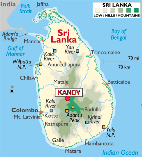
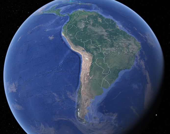
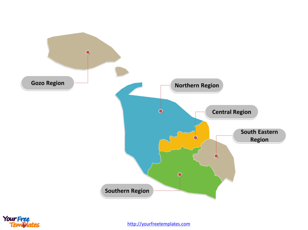
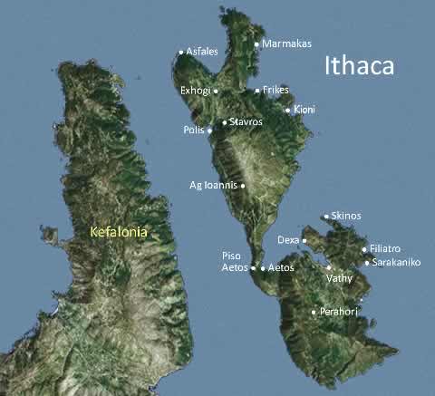
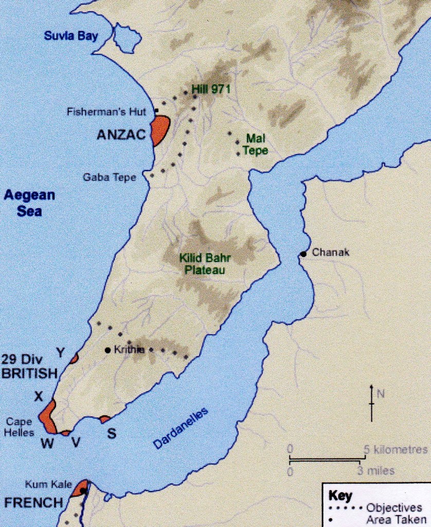
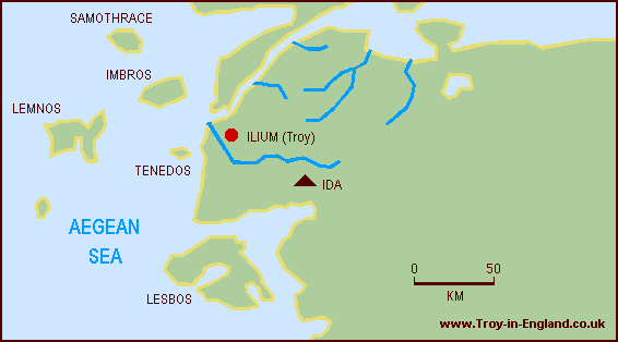
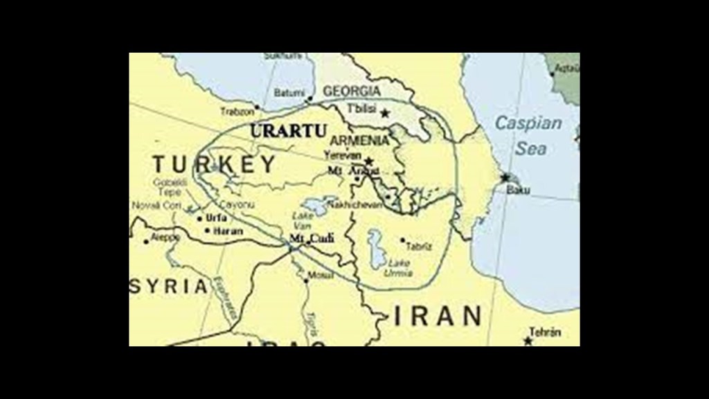
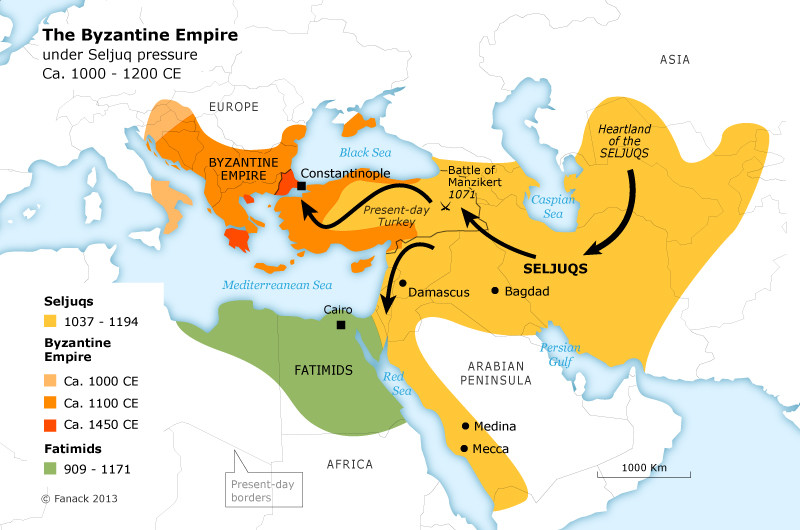
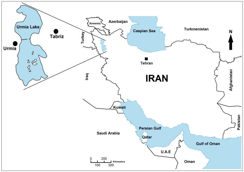
In the last post, I tracked the alignment from the French Southern and Antarctic Lands of the Kerguelen Islands, St. Paul Island, and Amsterdam Island, to Matara, a major city and commercial hub in the Southern Province of Sri Lanka, known historically as Ceylon.
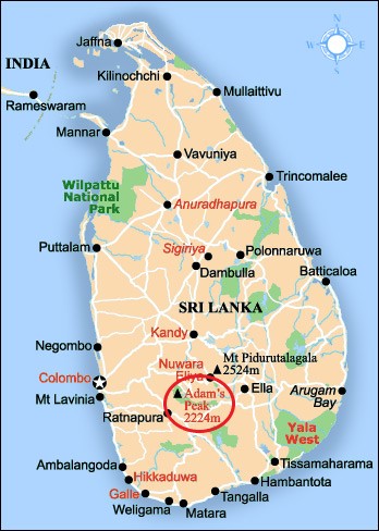
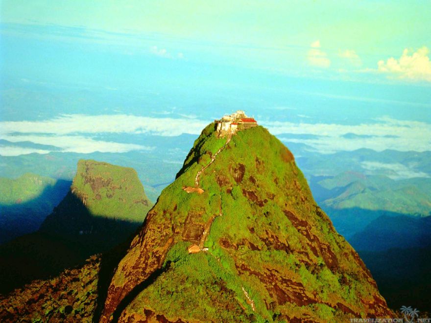
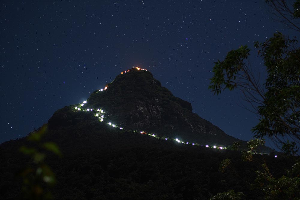
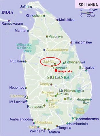
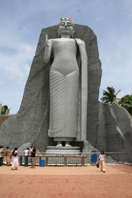
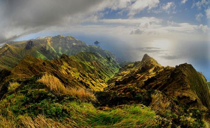
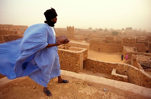
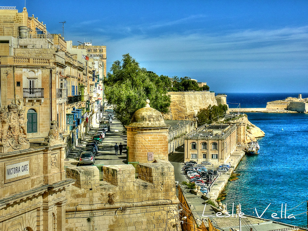
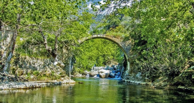
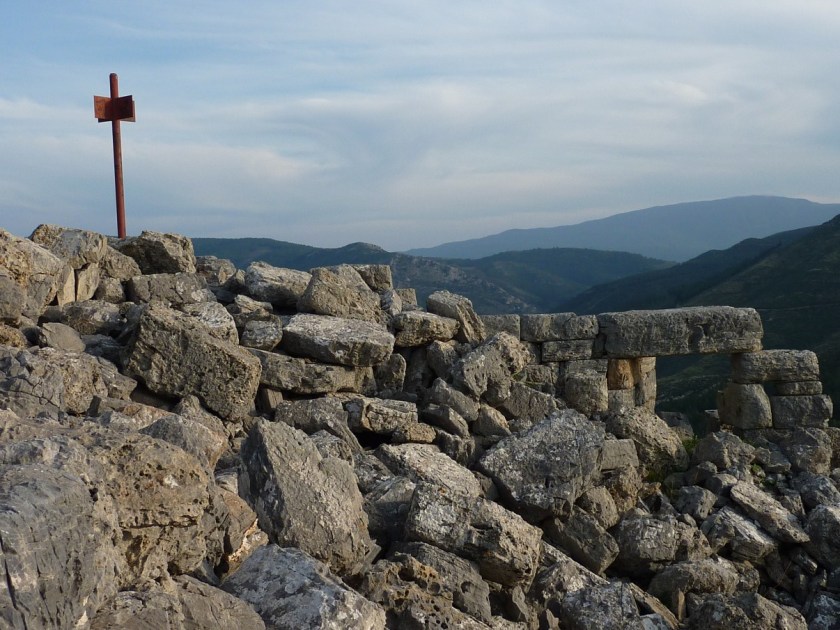
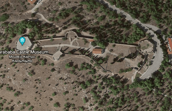
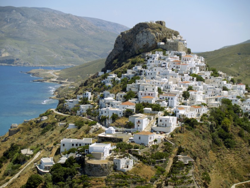
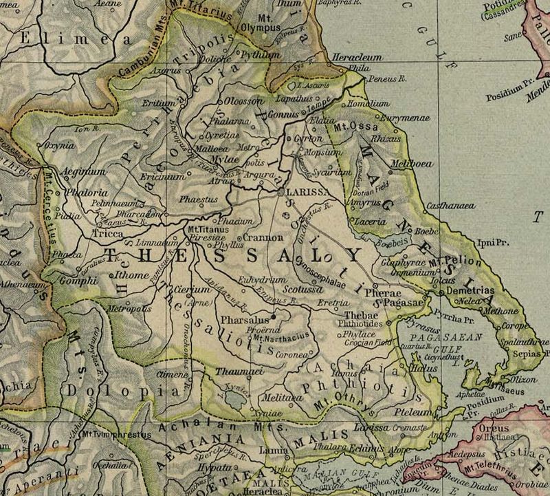
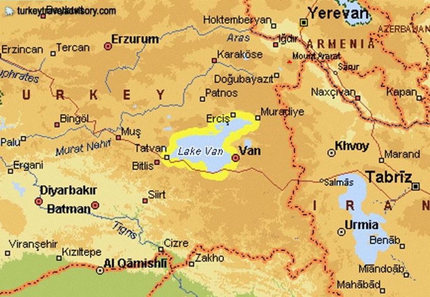
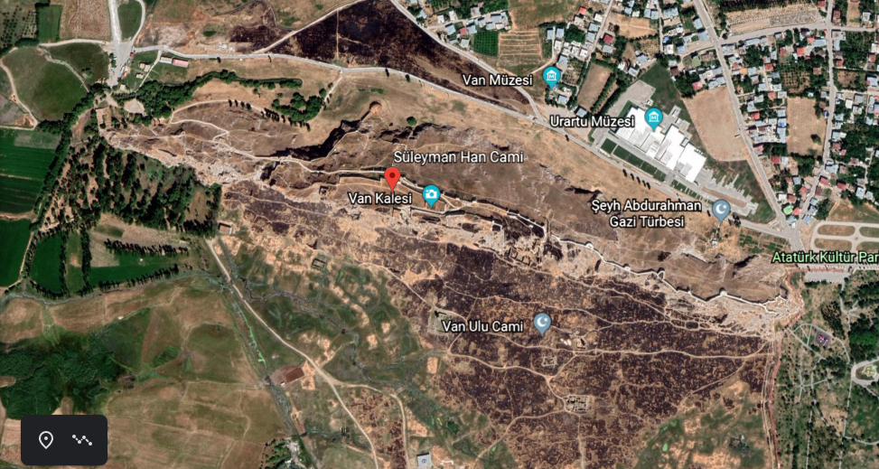
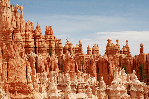
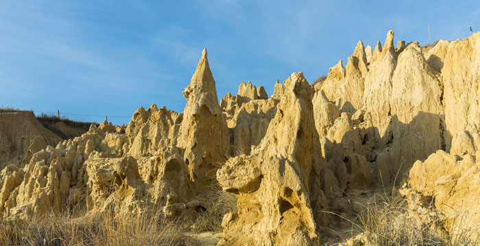
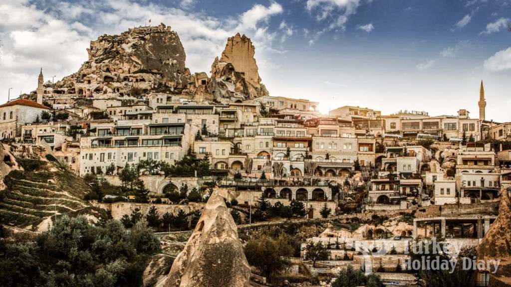
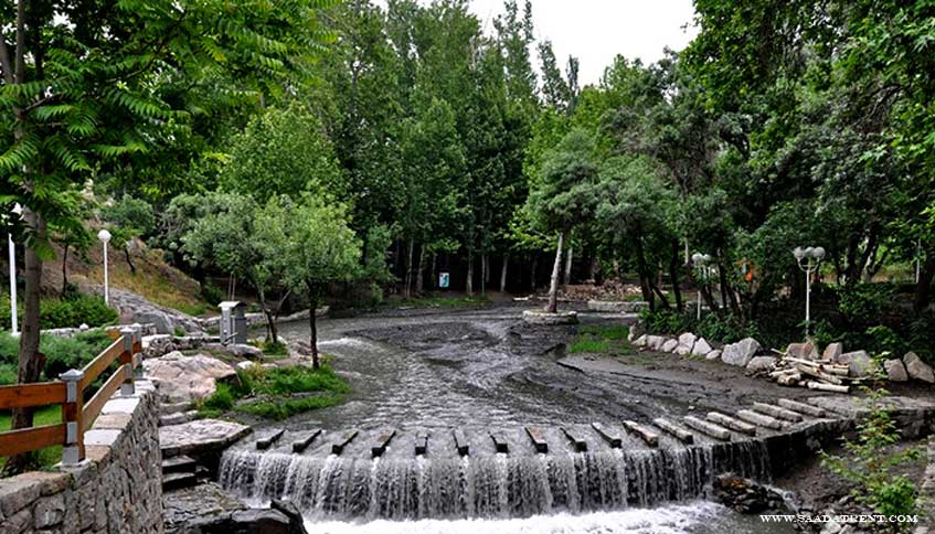
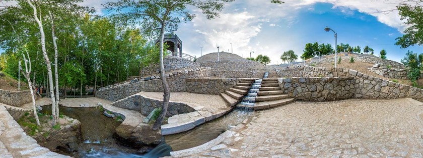
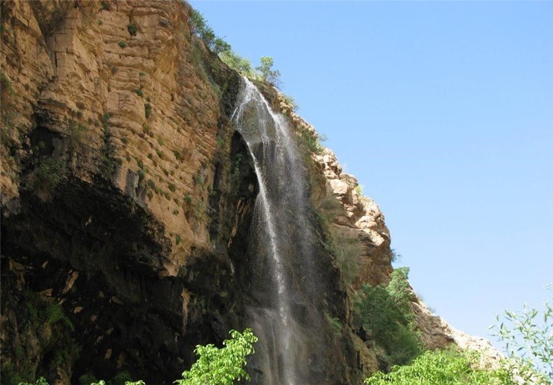
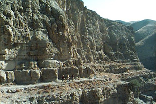
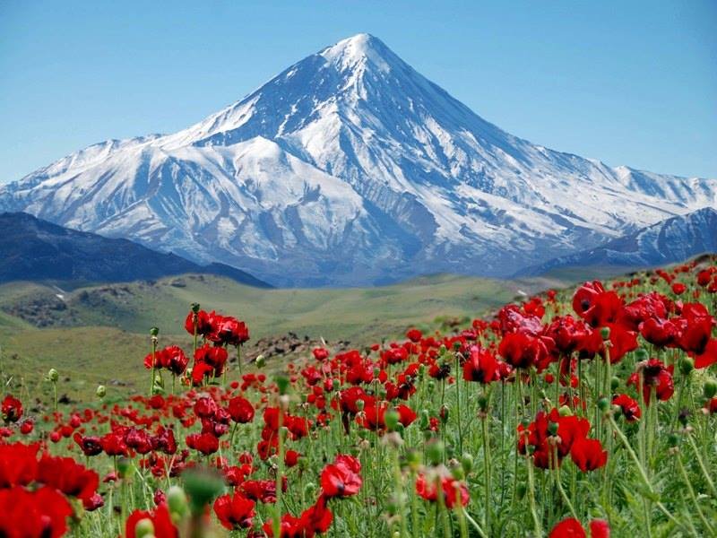
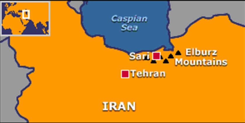
I am picking up the alignment at Adam’s Peak, located in the southern reaches of Sri Lanka’s Central Highlands.
It is described as a tall conical mountain…
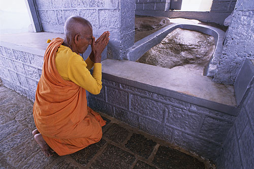
…well known for the Sri Pada, or “Sacred Footprint,” near the summit, revered as a holy site in Buddhist tradition to be the footprint of the Buddha, in Hindu tradition the footprint of Shiva or Hanuman, and in some Christian and Islamic traditions, that of Adam…or St. Thomas.
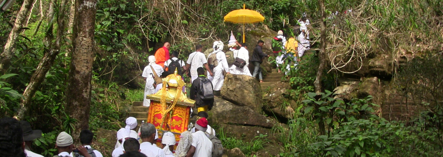
It is an important pilgrimage site.
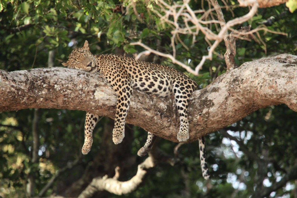
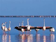
The region along the mountain is a wildlife reserve, home for species like elephants and leopards.
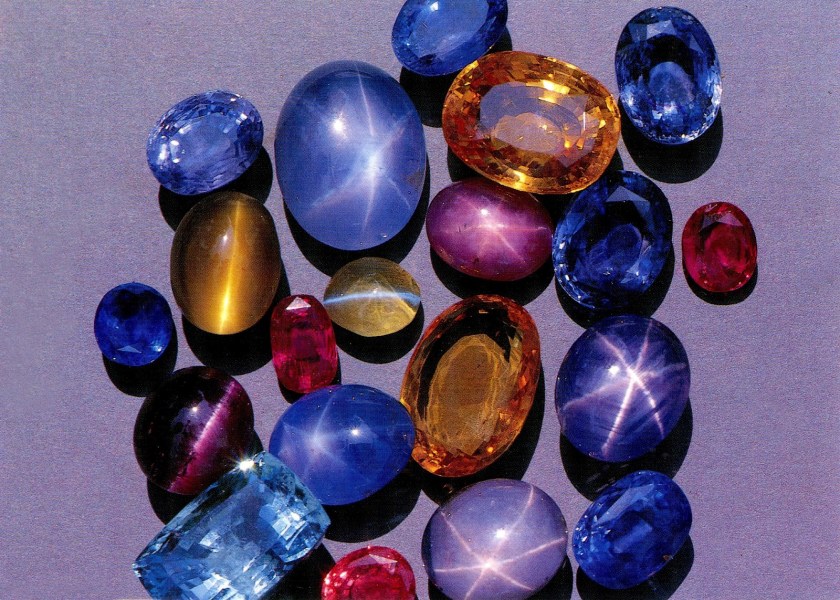
The districts to the south and east of Adam’s Peak yield gemstones, for which the island of Sri Lanka is famous.
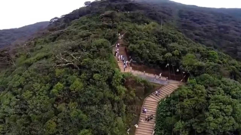
The greater part of the track leading from the base to the summit consists of thousands of steps.
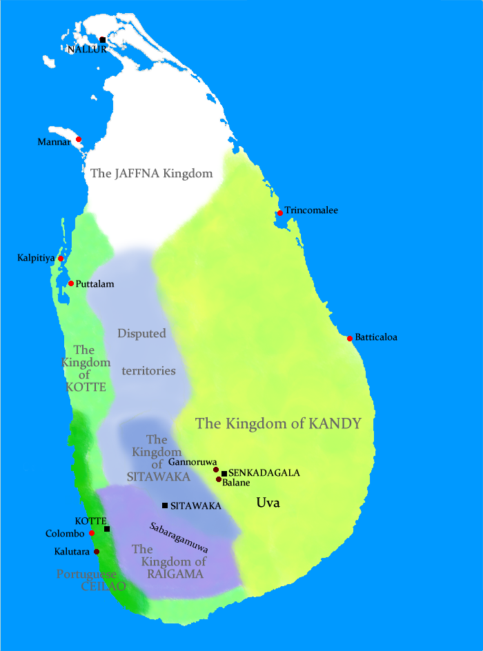
The next place I am going to take a look at on this alignment is Kandy, a major city in Sri Lanka, and the last capital of the ancient Kings’ era of Sri Lanka.
The Kingdom of Kandy was said to have been founded in 1469.
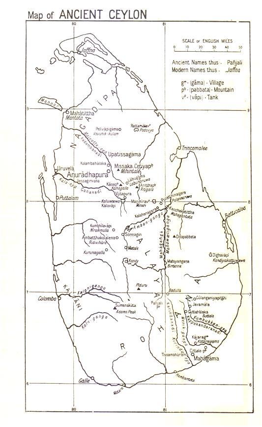
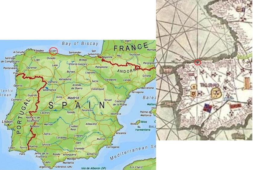
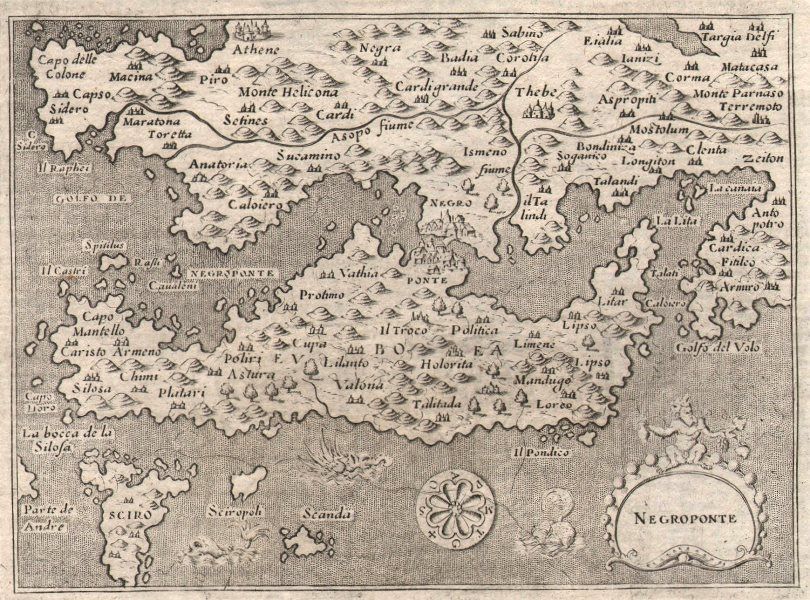
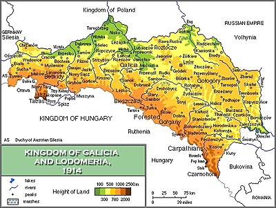
This map is described to be that Sri Lanka in the 1520s, known previously as Ceylon.
In 1592, Kandy became the capital city of the last remaining independent kingdom in Ceylon after the coast regions had been conquered by the Portuguese.
From that time, the Kingdom of Kandy kept the Portuguese and Dutch East India Company at bay, but succumbed finally to British colonial rule when the kingdom was absorbed into the British Empire as a protectorate via the Kandyan Convention of 1815, an agreement signed between the British and members of the King’s court which ceded the kingdom’s territory to British rule, and the last king was imprisoned.
Ceylon was a British Protectorate until its independence in 1948, and the name of the country was changed to Sri Lanka when it became a republic in 1972.
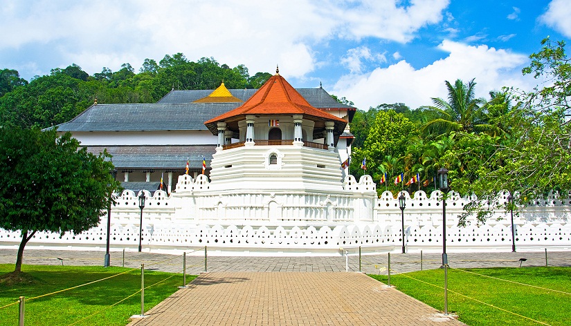
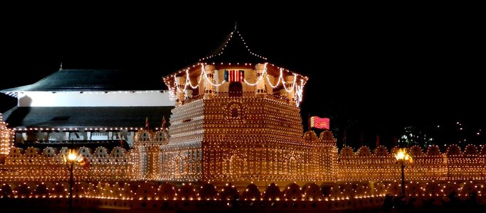
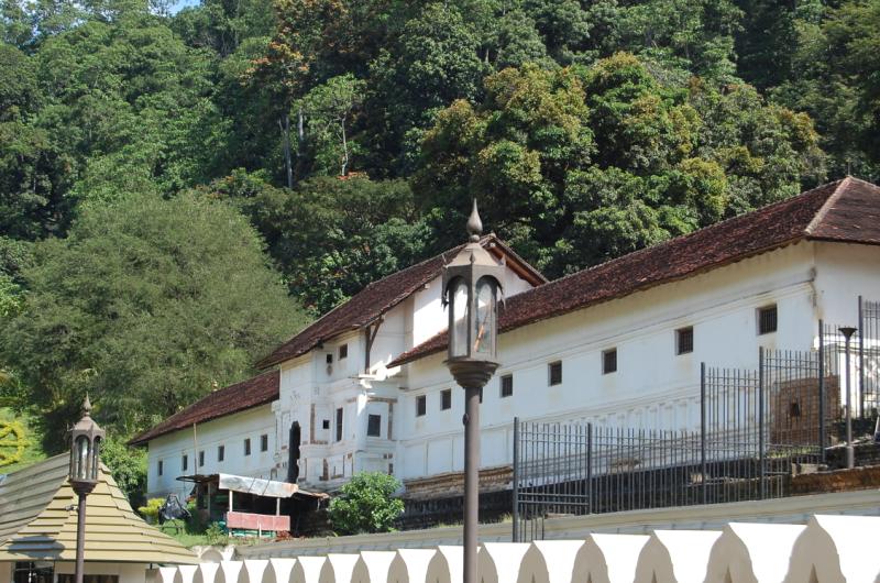
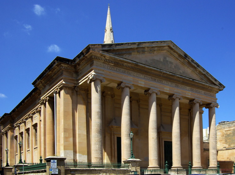
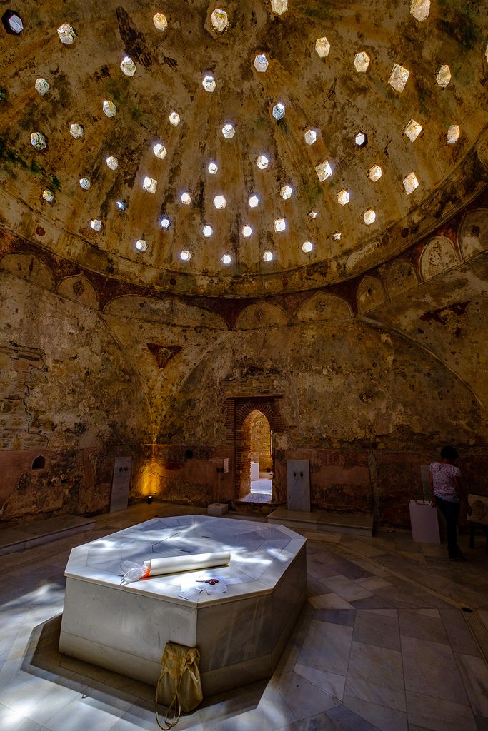
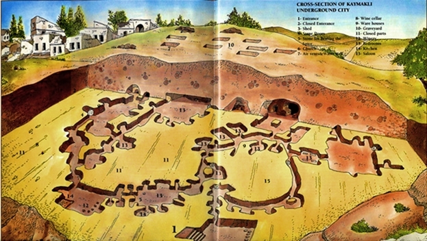
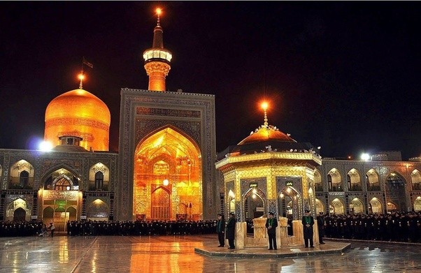
The Kandyan Convention was signed in the Temple of the Sacred Tooth Relic.
Also known simply as the Temple of the Tooth…
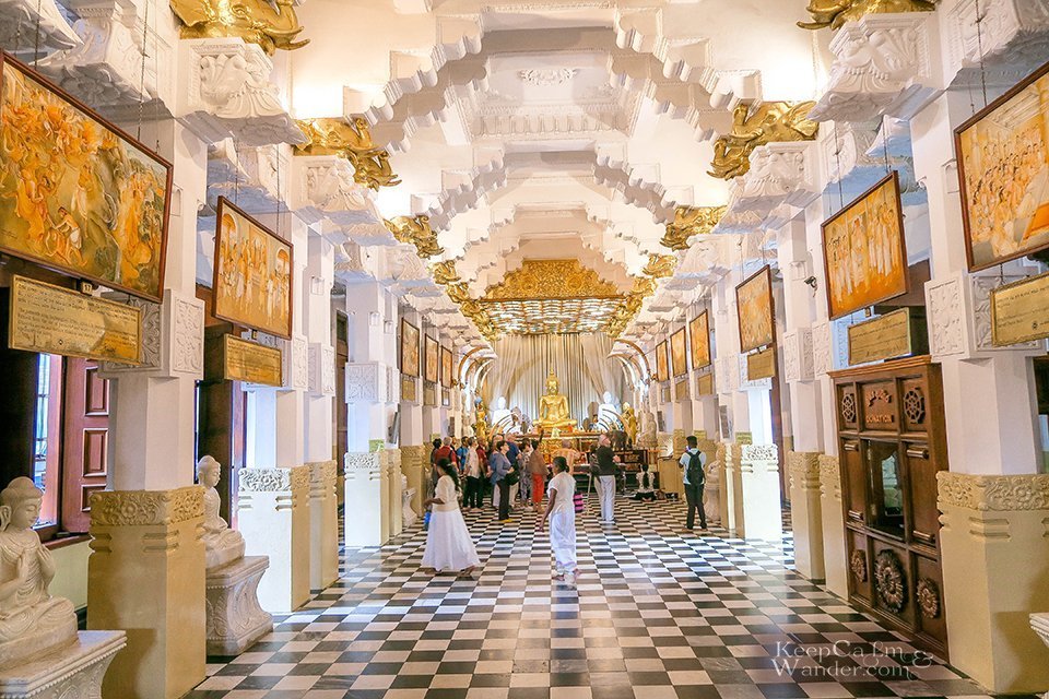
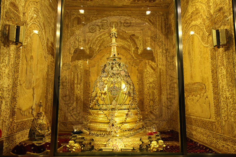
…it houses the tooth of the Buddha, venerated as the Buddha’s only surviving relic.
It is believed that whoever holds the relic, holds the governance of the country.
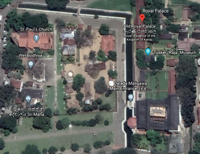
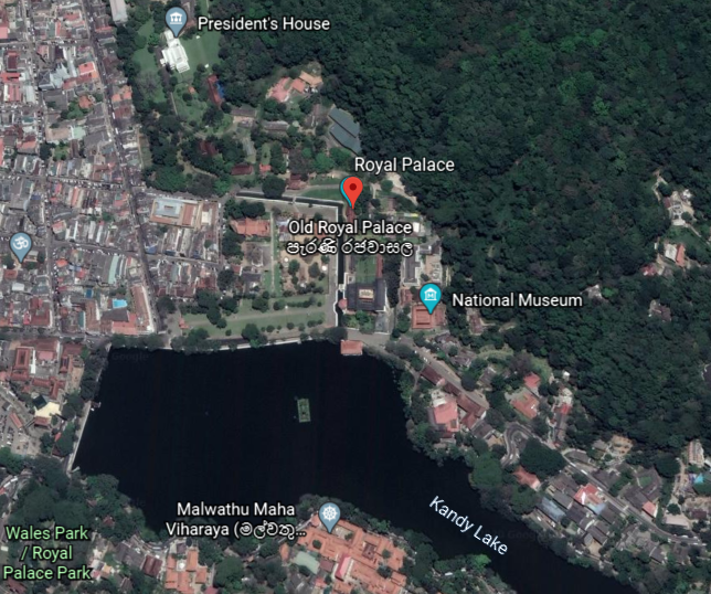
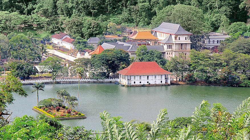
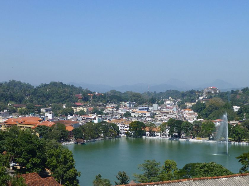
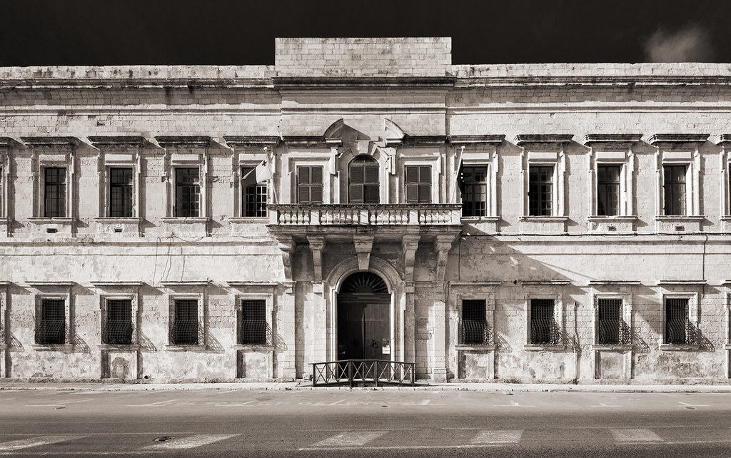
The Temple of the Tooth, or Sri Dalada Maligawa, is part of the Royal Palace Complex of the former Kingdom of Kandy, located on a canal…
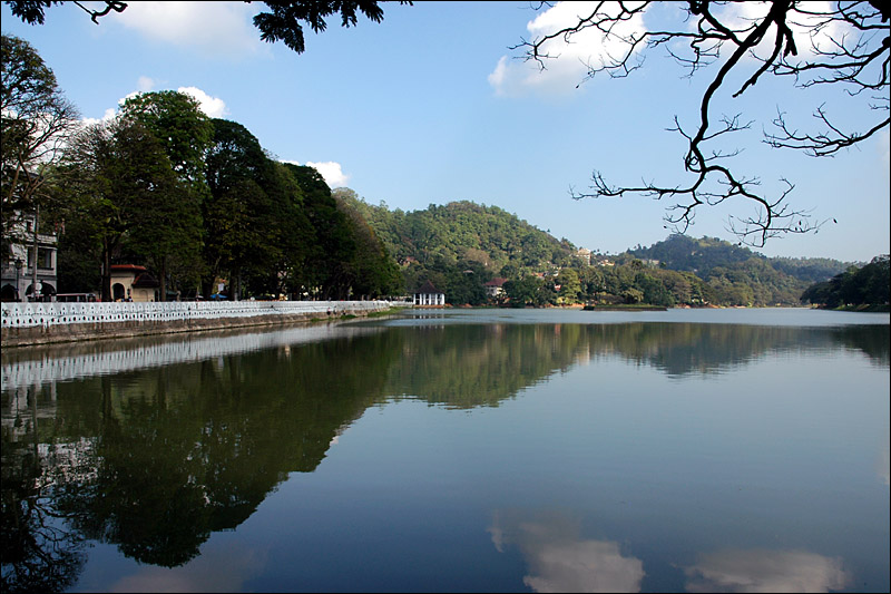
…extending from Kandy Lake, also known as the Kiri Muhuda, or Sea of Milk…
…an artificial lake, and said to have been built next to the Temple of the Tooth by the last King of Kandy in 1807.
After the kingdom’s downfall, the Royal Palace of Kandy became the residence for the primary British agent, and nowadays is a museum of archeology.
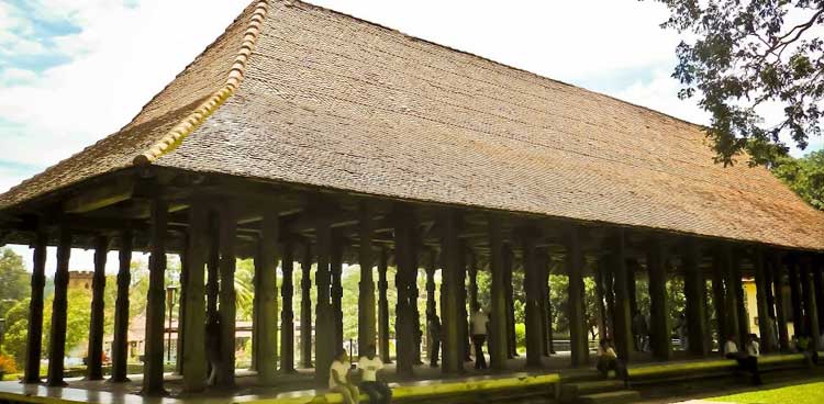
The Royal Audience Hall, or Magul Maduwa, was where the king met his ministers and carried out his daily administrative tasks, as well as being a center of religious and national festivities connected with the Kandyan Court.
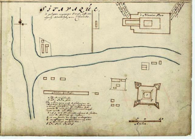
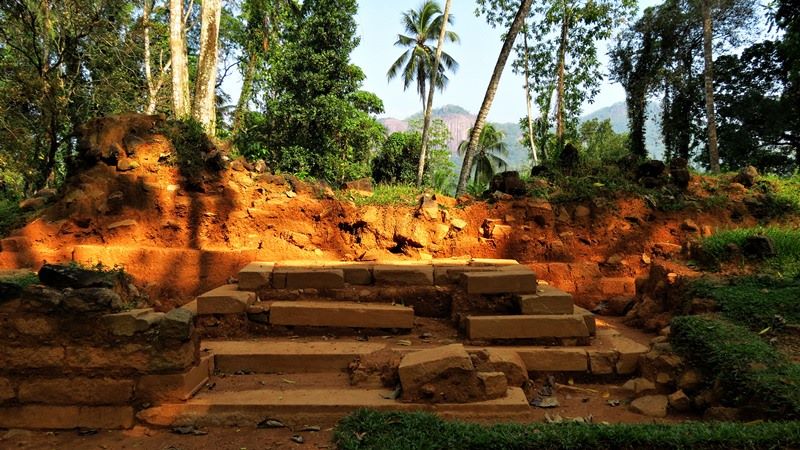
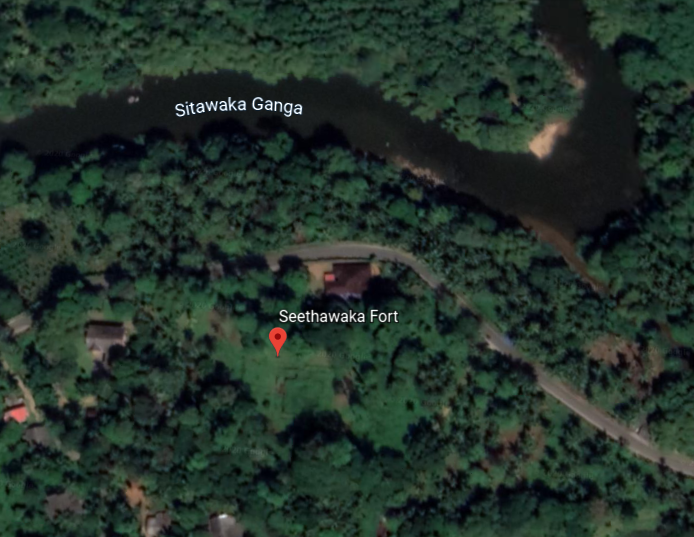
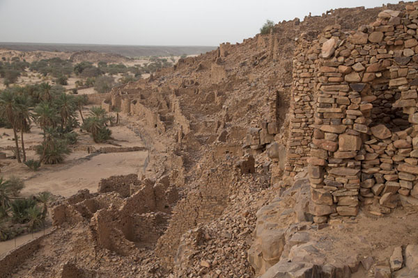
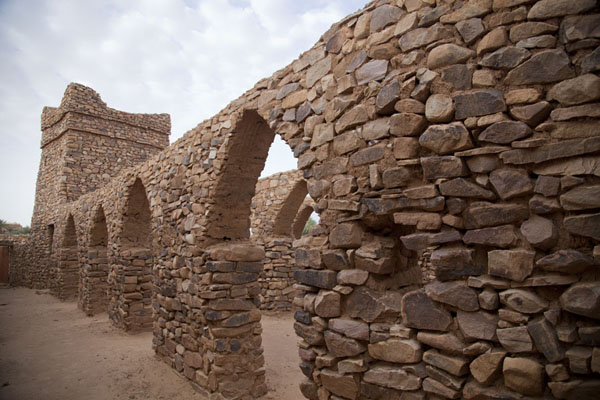
There were at least three star forts in Sri Lanka’s interior region between Kandy and the coast.
One was called the Sinhalese Sitawaka fort, which was adjoined with the palace of the king of Sitawaka.
Both the palace and the fort were destroyed by the Portuguese.
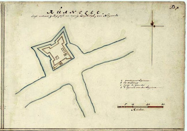
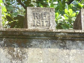
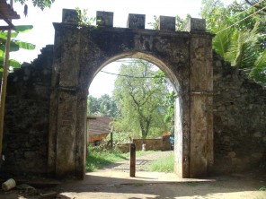
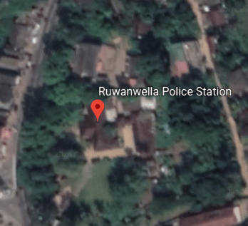
The Ruwenalla fort was said to have been constructed first as a wooden structure by the Dutch around 1665…
…and then the British were said to have erected a stone fort on the site in 1817.
Today it is being used as a police station.
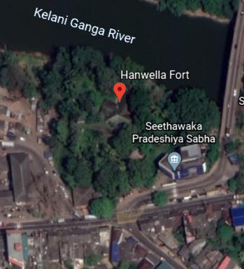
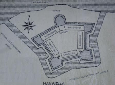
Then there was the Hanwella fort, located at the site of an ancient ferry crossing on the Kelani River.
We are told that the fort was thought to have been originally constructed by King Mayadunne of Sitawaka, who ruled between 1521 and 1581.
Then Portuguese occupied the fort in 1597 and re-built it.
The Dutch were said to have captured it, and constructed a star-shaped fort, completing the work in 1684.
Eventually the fort came under control of the British in 1786, and little evidence of the fort remains with the exception of remnants of the fortifications and the moat.
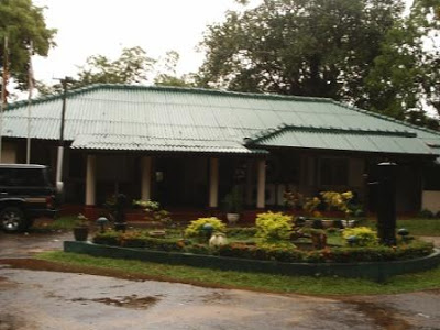
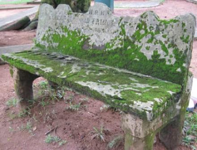
This is a rest house said to have been built by the Dutch where the fort was…
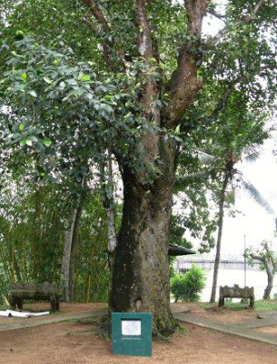
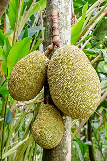
…that was even visited by the Prince of Wales, Albert Edward, in 1875, who, we are told, planted a jackfruit tree on the site to commemorate his visit to Ceylon, and the tree, and two stone seats said to have been constructed for the royal visit, are still on the site.
The jackfruit is the national fruit of Sri Lanka, and is native to that part of South Asia.
One more point I would like to make before moving on to the next place on the alignment.
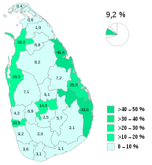
Sri Lanka is one of the few places that I know of to have an acknowledged ethnic minority group called Moors.
They comprise 9.2% of the population, which is approximately a population of 1.9 million Moors in the country, with Kandy being one of their population centers.
They are mainly native speakers of the Tamil language…
…with the influence of Sinhalese…
…and Arabic words.
The Moors of Sri Lanka are predominantly followers of Islam…and are also matrilineal, in which kinship is traced, and great influence is held by, women.
This book is a study about Muslim, Sinhalese, and Tamil households in Sri Lanka.
So…how…did…that…happen according to what we are told in our narrative?!
For one thing, the ancient worldwide Moorish Civilization was matrilineal, and not patriarchal, a civilization which has been left out of the history books.
Yes, the Washitaw, also known as the Ancient Ones, are still very much here with us today..
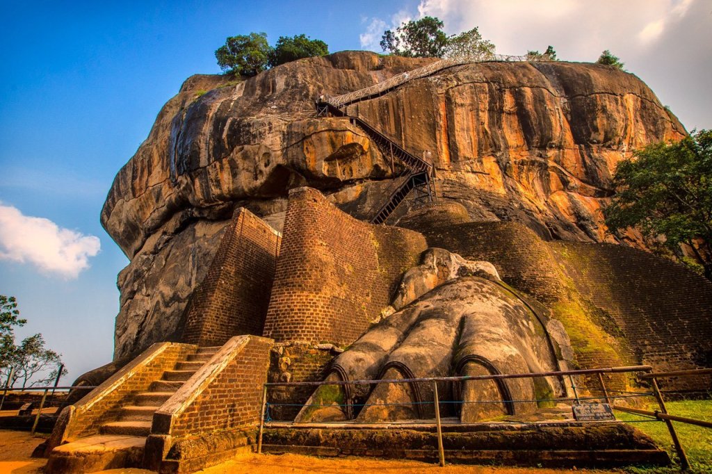
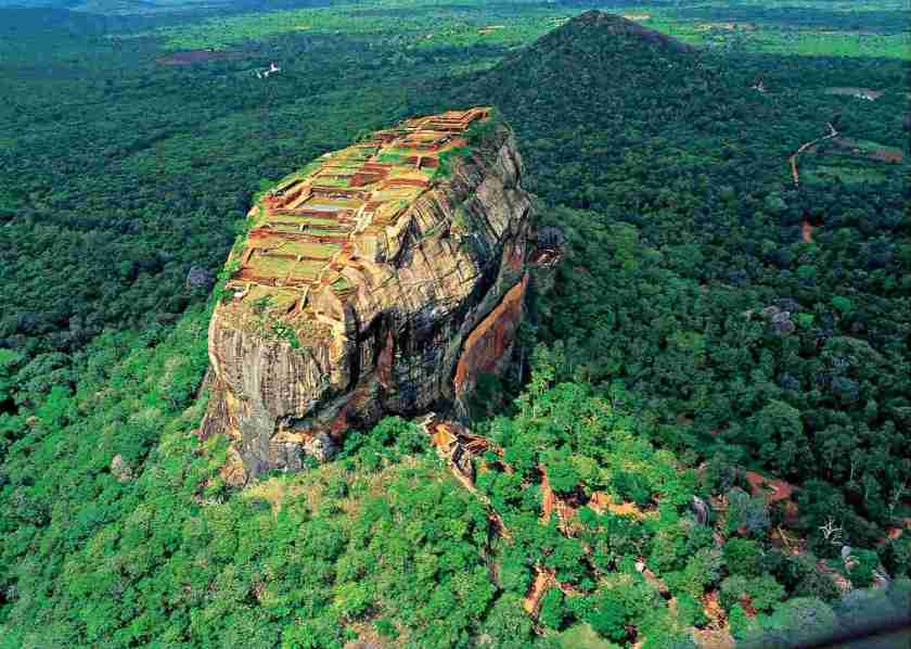
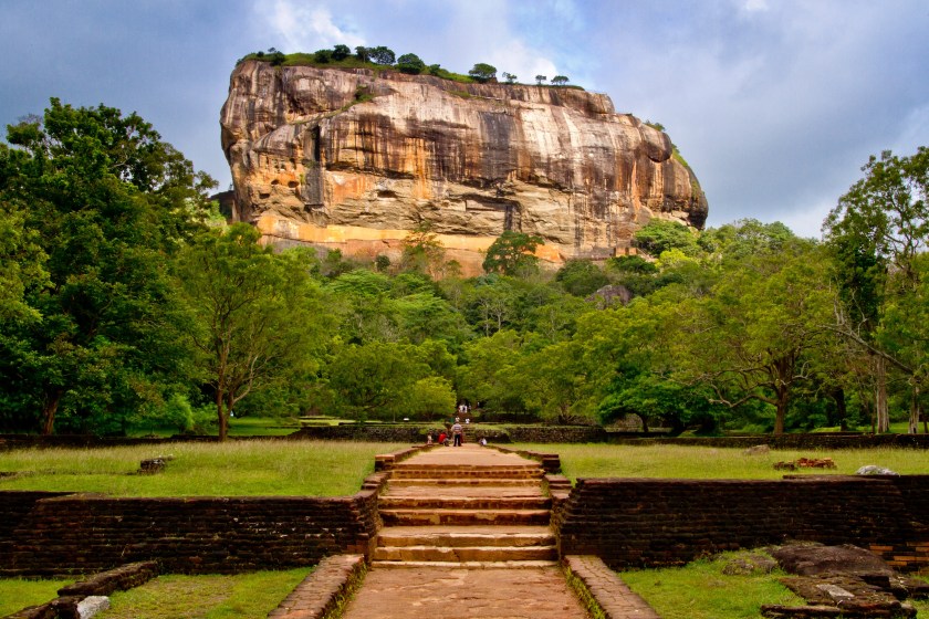
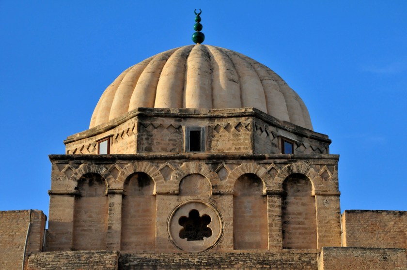
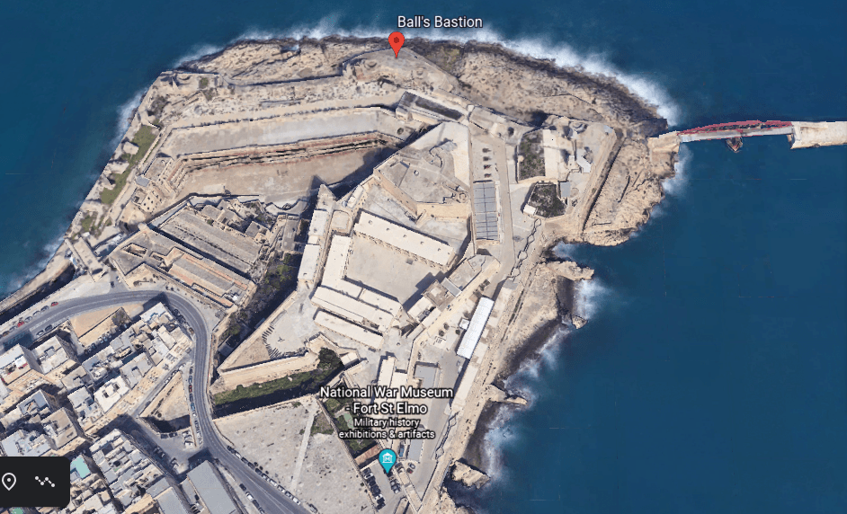
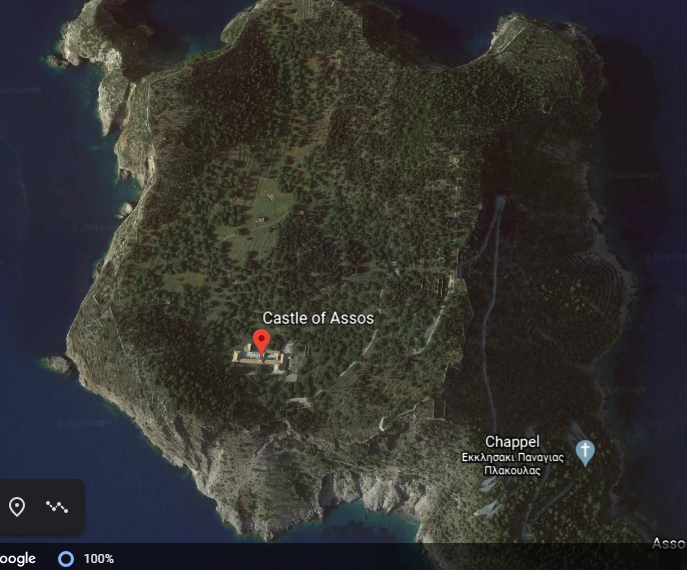
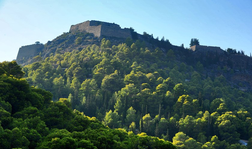
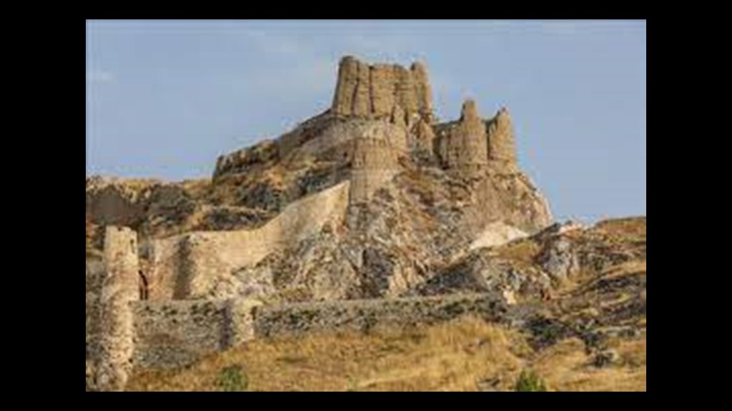
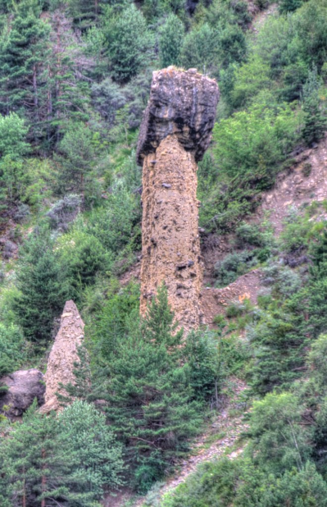
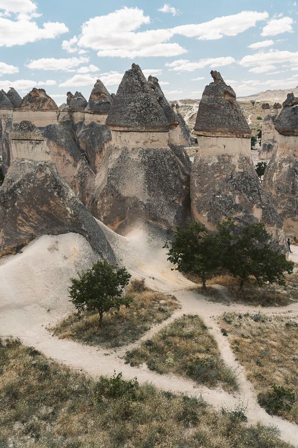
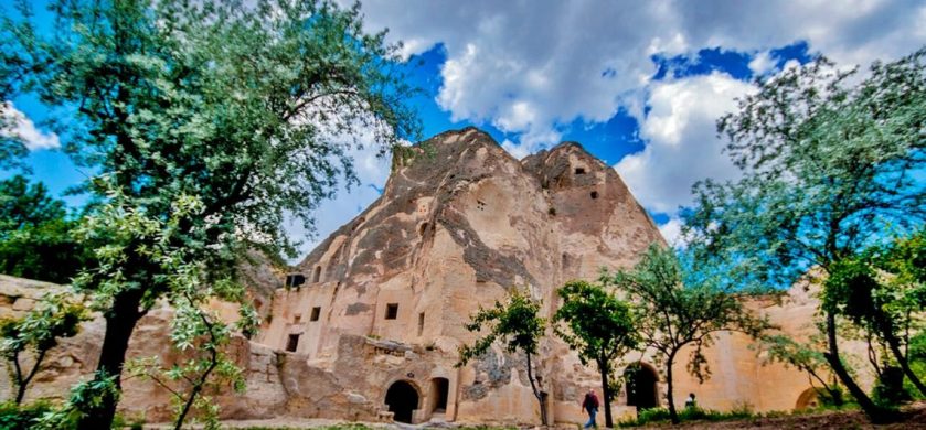
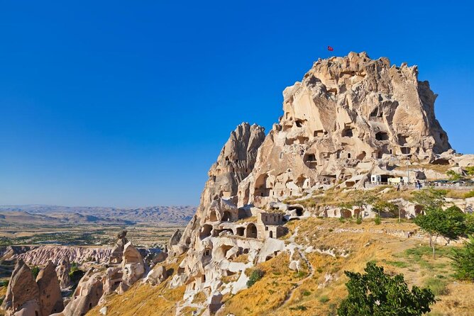
The next place on the alignment that I would like to look at is Sigiriya.
Sigiriya is described as an ancient rock fortress near Dambula in Sri Lanka’s Central Province.
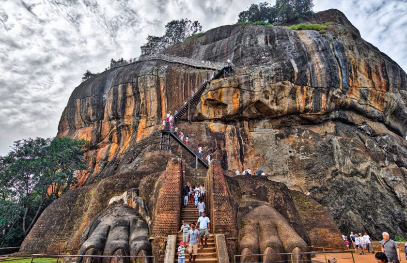
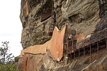
It is dominated by Lion Rock.
King Kashyapa was said to have built his palace between 477 and 495 AD, on top of Lion Rock, which he had decided to make his new capital.
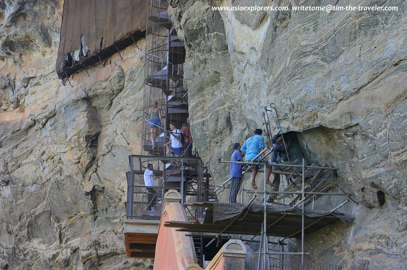
There are 1,200 steps going to the top of Lion Rock, starting from where he built a gateway in the form of enormous lion paws.
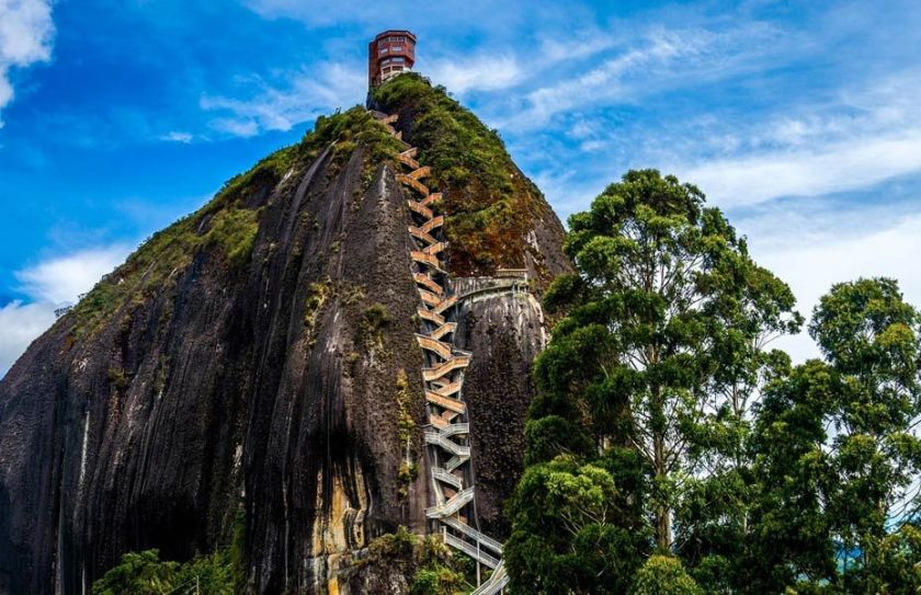
It reminds me visually of the Stone of El Penol, that I found tracking an alignment in Guanape, Colombia.
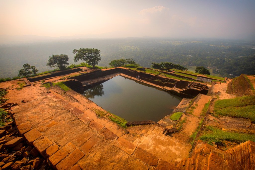
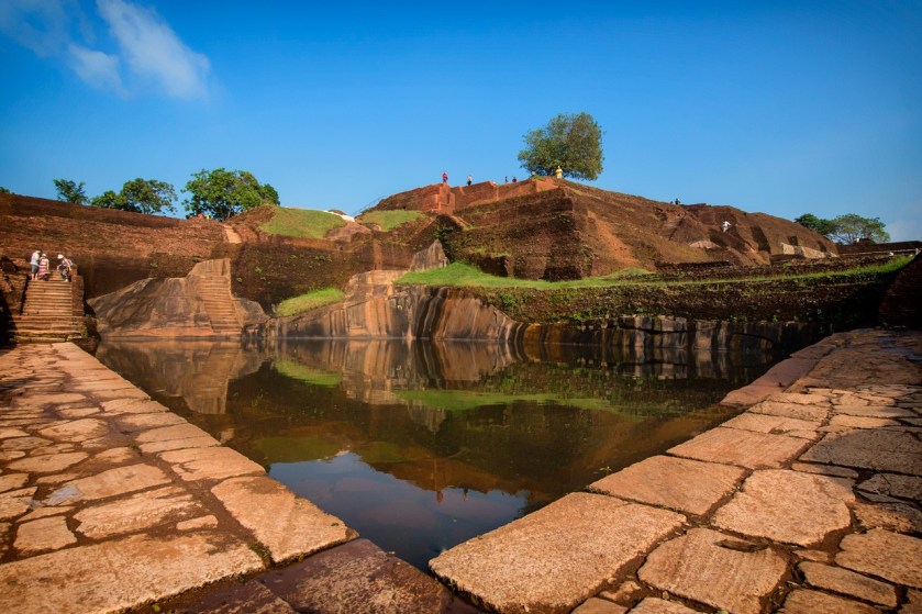
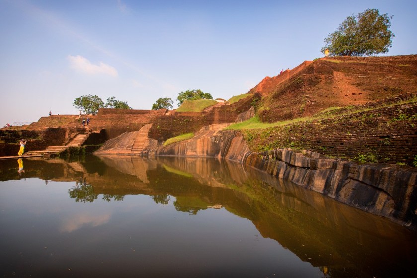
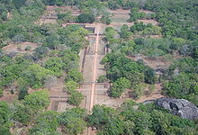
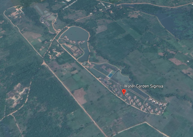
This is a view of the water gardens of Sigiriya from the summit of the rock.
They are built symmetrically on an east-west axis, connected with the outer moat to the west…
….and the large artificial lake to the south of Sigiriya rock.
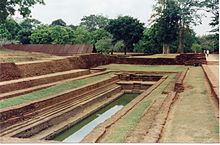
All the pools are interlinked using an underground conduit network fed by the lake, and connected to the moats.
The mirror wall is located in the mid-level terrace where the lions entrance is located, and was said to have been originally so highly polished that the king could see himself while he walked alongside it.
A Spiral staircase at the mirror wall…
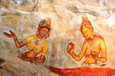
…leads to fresco paintings depicting women that cover most of the western face of the rock, called the largest picture gallery in the world.
After all the work that King Kashyapa put into this place, we are told the capital and royal palace were abandoned after his death, and that it was used as a Buddhist monastery until the 14th-century.
Sigiriya is listed as a UNESCO World Heritage Site, and is considered one of the best-preserved examples of urban planning in the world.
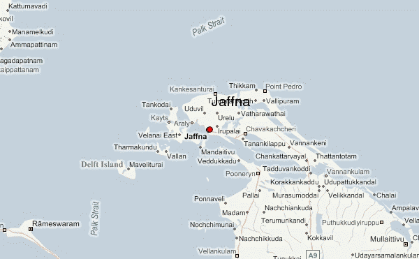
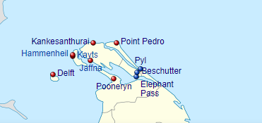
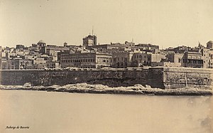
Jaffna is the next place on the alignment, and is the capital city of Sri Lanka’s Northern Province.
It is the administrative headquarters of the Jaffna District, on the Peninsula of the same name.
Jaffna is located 6-miles, or 9.7-kilometers, from Kandarodai, a famous emporium city and capital of Tamil kingdoms in northeastern Ceylon from classical antiquity, and the location of the ancient Buddhist monastery known as Kadurugoda Vihara.
Jaffna and the surrounding region was part Naga Nadu, and inhabited by one of the ancient tribes of Ceylon, the Nagas, generally represented as a class of super humans.
Also called Serpents of Wisdom, nagas were masters of raising serpent-like kundalini energy from the base of the spine to the third-eye. connecting with higher self in physical form…
…and masters of higher human abilities called “Siddhis.”
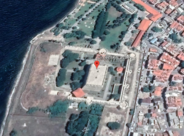
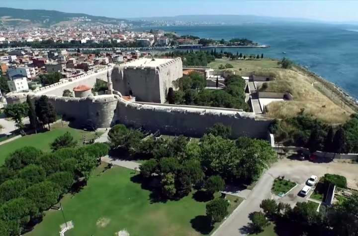
Jaffna was said to have been made into a colonial port town by the Portuguese around 1618, at which time they were said to have built the Jaffna fort…
…Fort Hammenheil, built in 1618, around a small island between the islands of Kayts and Karaitivu on the Jaffna Peninsula…
…the Kayts Island fort in 1629…
…the Delft Island fort is attributed to the Portuguese some time during that time period…
…and the Pooneryn Fort, just adjacent to the Jaffna Peninsula..
The forts on the Jaffna Peninsula at Kankesanthurai, Point Pedro, Pyl, Beschutter, and Elephant Pass were all completely destroyed at some point in time during colonial times.
Then the Portuguese lost Jaffna to the Dutch East India Company in 1658, the world’s most valuable company of all-time, worth $7.9-trillion.
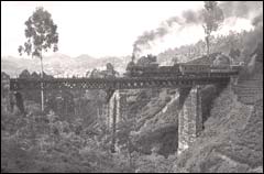
The Dutch were said to have lost their possessions in Sri Lanka in 1796, when they were taken over by the British, after which time the British were said to have built the major roads and railways connecting Jaffna with Kandy, Colombo, and the rest of the country…
…with the Ceylon Government Railway having been founded in 1858…
…and the rail network introduced by the British Colonial government in 1864.
This is said to be a picture circa 1880 of a steam-powered train on the hill-country Colombo – Badulla line.
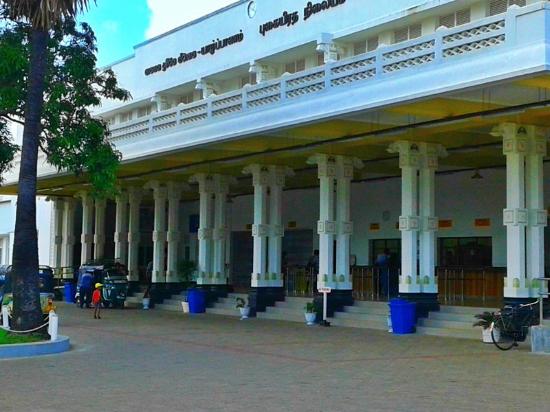
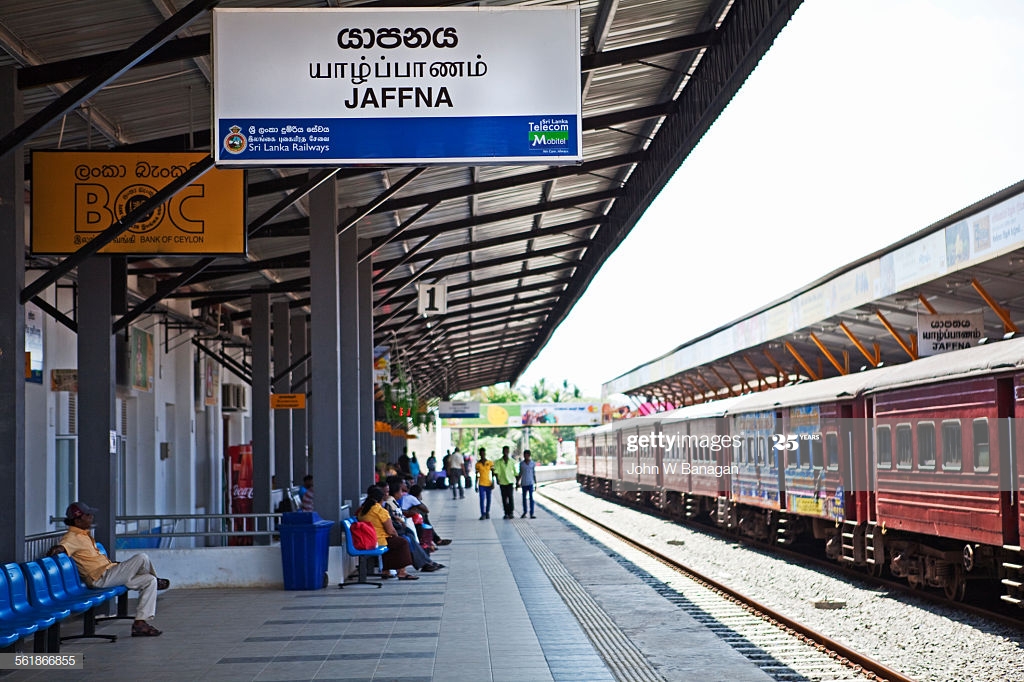
This is the Jaffna Railway Station today, said to have been built originally in 1902, and reconstructed in the time-frame around 2011-2013…
…due to damage it sustained during Sri Lanka’s civil war in the years between 1983 and 1995.
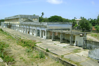
The Jaffna Public Library was said to have originally been built in 1933, and one of the largest libraries in Asia, with over 97,000 books and manuscripts.
Built in what was called an Indo-Saracenic style, we are told it was burned down by an organized mob in 1981.
By 2001, the rehabilitation of the original building into a new structure was complete, and new books received, though its old books and manuscripts were not replaced.
Apparently the books and manuscripts lost in the fire were irreplaceable.
I am going to end this post here, and pick up the alignment in Vellore, located in the south Indian State of Tamil Nadu.
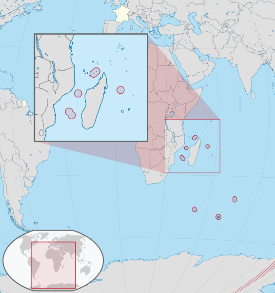
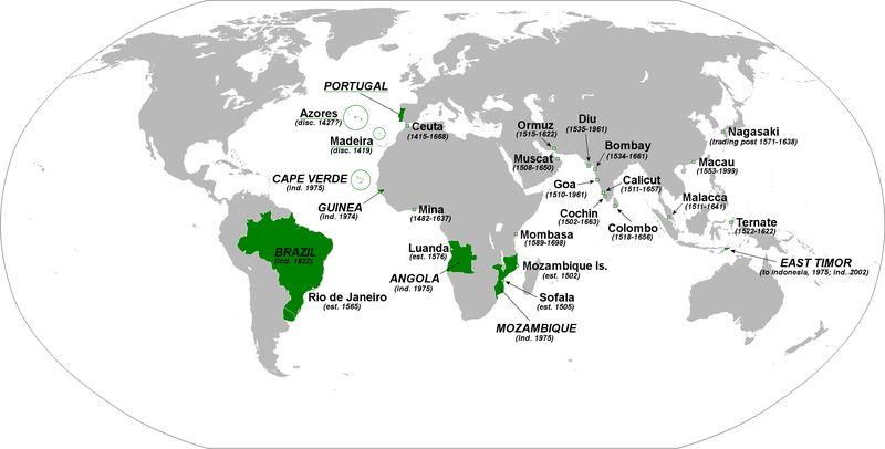
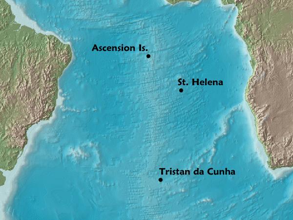
In the last post, I tracked the alignment from the Fernando de Noronha islands of Brazil, just off the coast near Natal, and the location of what were at least ten star forts at one time; to the islands of Trindade and Martin Vaz, also part of Brazil but located 680-miles, or 1,100-kilometers, from the coast; to the islands of Tristan da Cunha, a British Overseas Territory, and the location of the world’s most isolated settlement, with ship or boat being the only way to travel in-or-out.
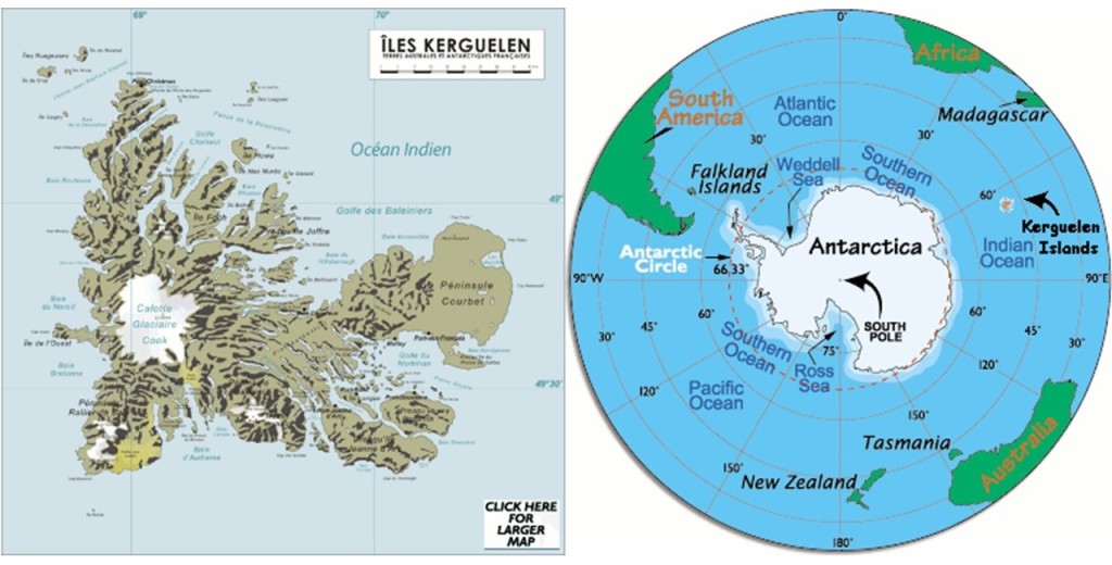
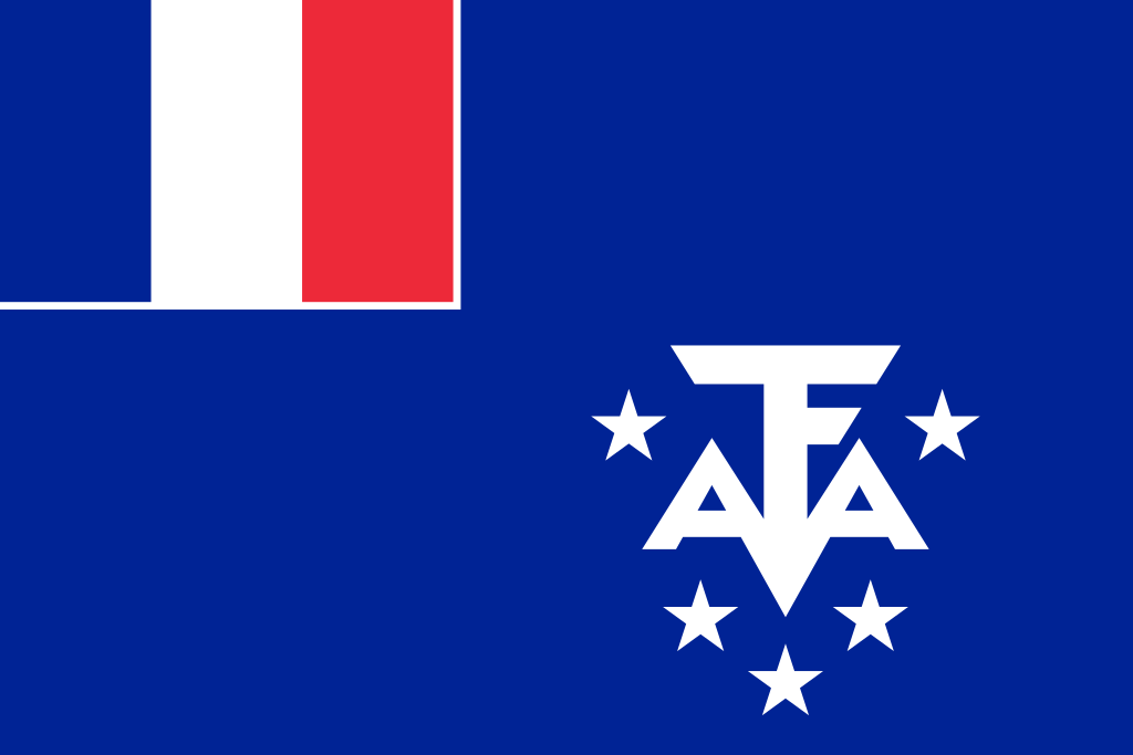
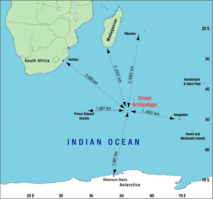
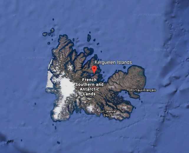
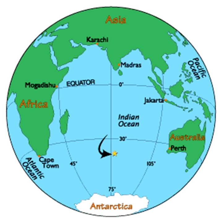
Next on the alignment we come to the Kerguelen Islands, also known as the Desolation Islands, and administered as part of the French Southern and Antarctic Lands, otherwise known as France’s Scattered Islands in the Indian Ocean.
The French Southern and Antarctic Lands have been an overseas territory of France since 1955.
They consist of:
–The Kerguelen Islands, volcanic islands in the southern Indian Ocean, southeast of Africa, approximately equidistant between Africa, Antarctica and Australia;
–St. Paul and Amsterdam Islands, a group to the north of Kerguelen, and we’ll be looking at both in tracking this alignment;
–the Crozet Islands, a group in the southern Indian Ocean, south of Madagascar;
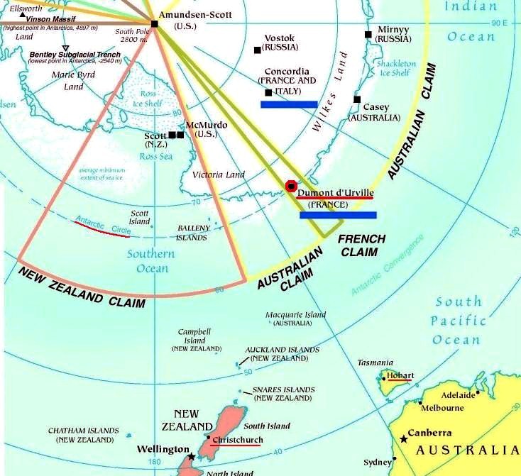
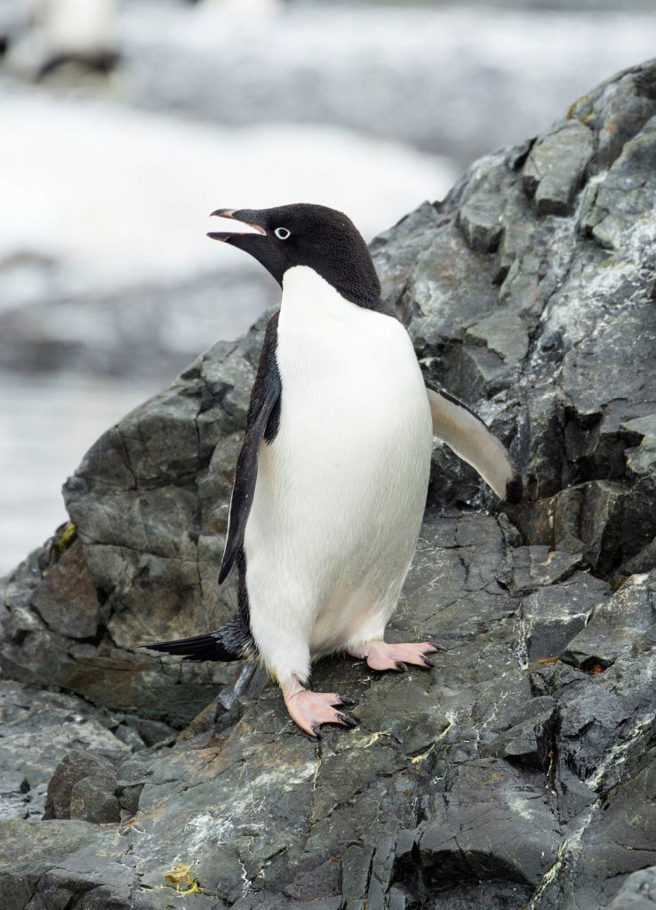
–Adelie Land, the French claim on the continent of Antarctica. Adelie land, and the Adelie penguin for that matter, were named after Adele, the wife of the French explorer and naval officer Jules Dumont d’Urville who explored Antarctica, among other places in the south and west Pacific;
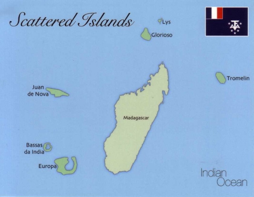
–The Scattered Islands, a group of dispersed islands around the coast of Madagascar, of which the principal station for these islands is on Tromelin Island.
The French Austral Lands and Seas were inscribed as a UNESCO World Heritage Site on July 5th, 2019.
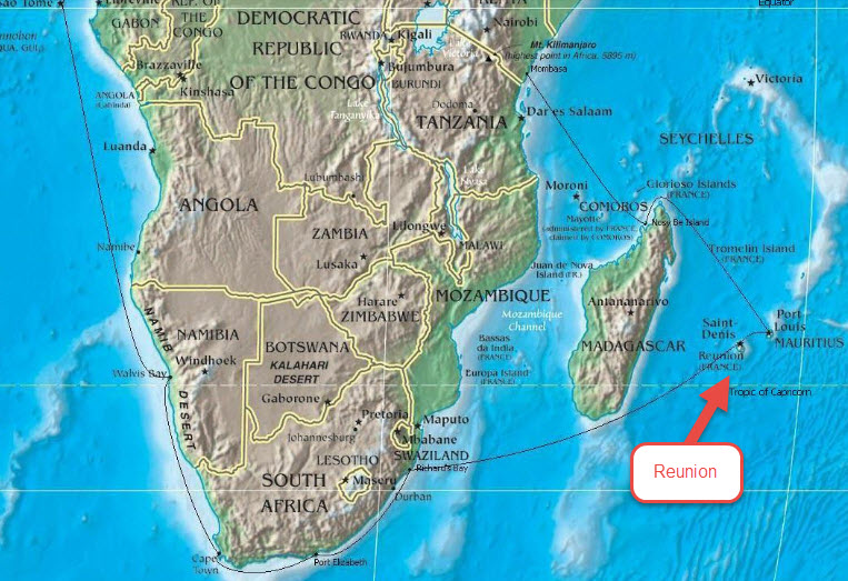
The French Southern and Antarctic Lands are administered by a prefect with headquarters in Saint-Pierre on Reunion Island.
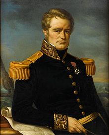
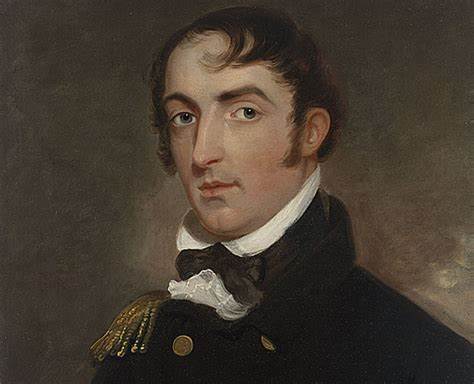
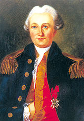
I am going to spend some time looking into the life and voyages of Jules Dumont d’Urville because I believe his story is important to understanding the historical narrative we have been taught.
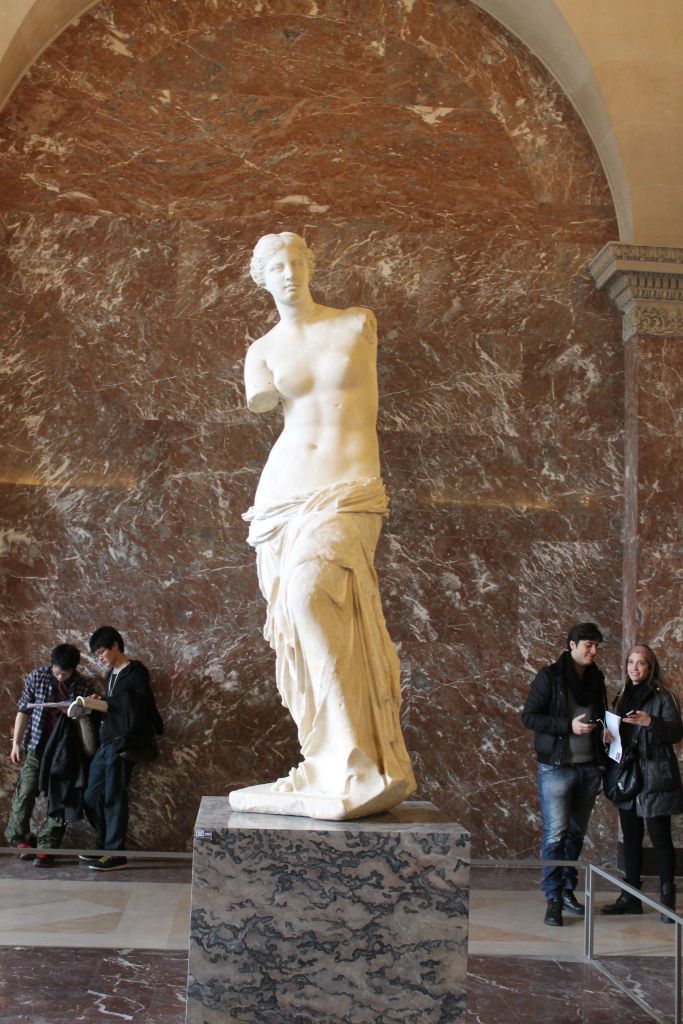
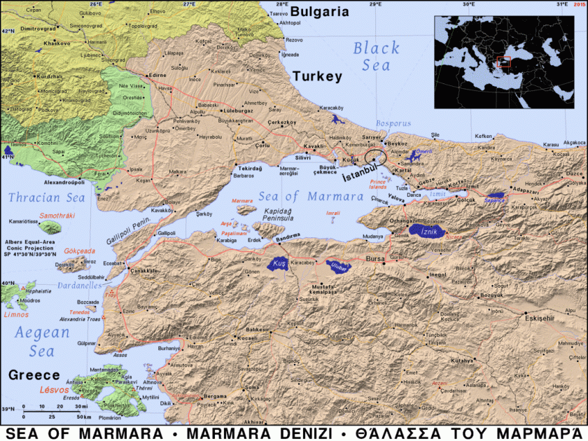
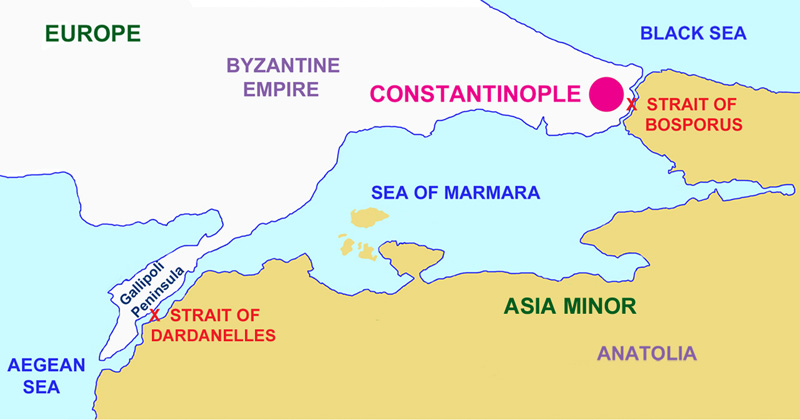
Early in his naval exploration career, as a result of being in the right place at the right time on a naval hydrological survey of the Greek islands in the Aegean Sea, Dumont d’Urville was given the credit, and a knighthood in the Legion of Honor, for ultimately enabling the famous Venus de Milo marble statue to come from the Greek island of Milos to the Louvre in Paris instead of going to Constantinople.
After the Aegean Sea expedition, he planned an expedition, with another naval officer, of the Pacific Ocean, an area France had been forced out of as a result of the Napoleonic Wars.
They set out on their expedition to collect scientific and strategic information in August of 1822, on a ship named originally La Coquille, and sailed to the Falkland Islands; the coasts of Peru and Chile in South America; New Guinea; New Zealand and Australia.
The expedition carried out research in the fields of botany and insects, bringing back thousands of specimens to the Natural History Museum in Paris.
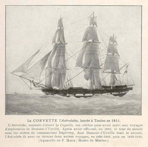
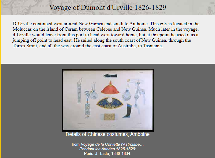
Then Dumont d’Urville departed on La Coquille, now called L’Astrolabe, or the Astrolabe, named for a navigational device, and sailed in 1826 for three-year voyage to New Zealand; Fiji; the Loyalty Islands; New Guinea; the Solomon Islands, Caroline Islands, and the Moluccas in eastern Indonesia.
In 1837, Dumont d’Urville set out yet again on the Astrolabe for the South Orkney Islands in the Southern Ocean; the Marquesas Islands; Tasmania; along the coast of Antarctica, at which time he claimed land on January 21st of 1840 for France, considered it his most significant achievement. He named it Adelie Land after his wife Adele.
He also named the Adelie penguin for his wife.
He then sailed onto New Zealand; the Torres Strait; Reunion Island; and St. Helena island, and returning to France later in 1840.
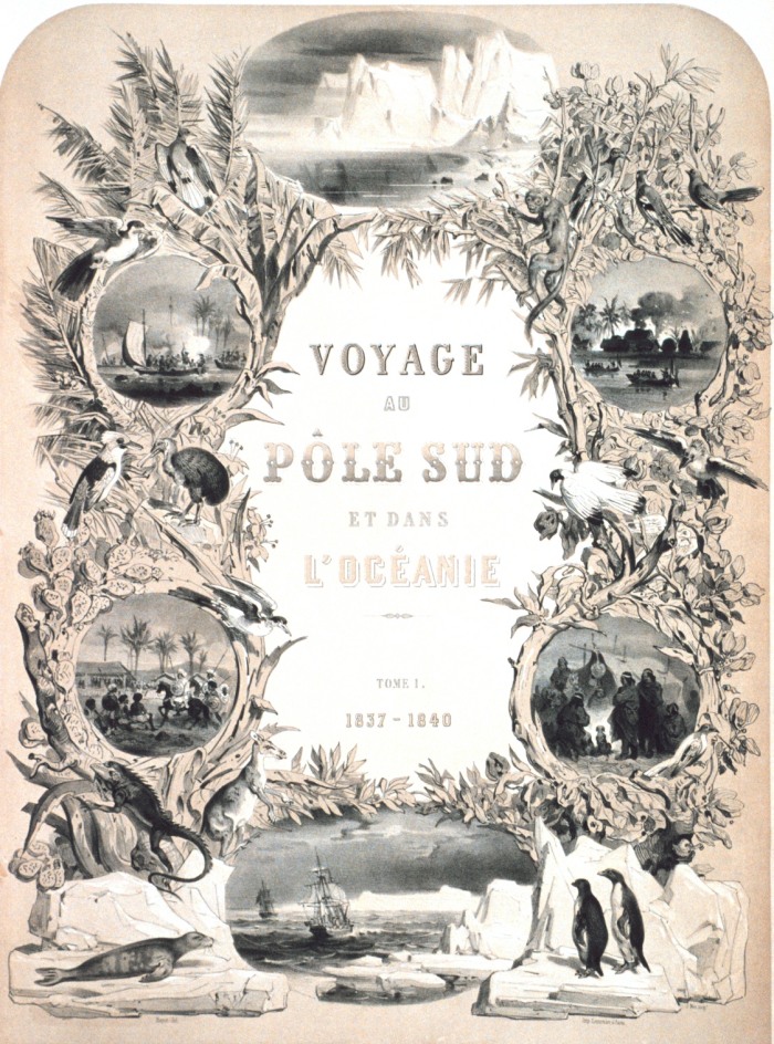
He was promoted to Rear Admiral upon his return, and he wrote a report of the expedition entitled “Voyage au Pole Sud et dans L’Oceanie sur les Corvettes Astrolabe et la Zelee 1837 – 1840,” which was published between 1841 and 1854 in 24 volumes.
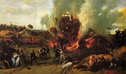
An interesting side-note about Dumont d’Urville’s life was his death – he and his entire family were killed in the first ever rail disaster in France in May of 1842, called the Versailles Rail Accident, in which the train’s locomotive derailed, the wagons rolled, and the coal tender ended up at the front of the train and caught fire. This was said to be a painting of the incident.
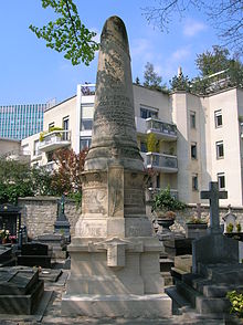
Remains said to have been identified as his by a doctor who had been on-board the Astrolabe with him, and were interred here at the Montparnasse Cemetery in Paris.
Could this be a case of “Dead men tell no tales” as it were?
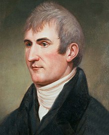
Like, perhaps, explorer Meriwether Lewis, who died of gunshot wounds in 1809?
Meriwether Lewis had returned from the Lewis & Clark Expedition in 1807; was made Governor of Louisiana Territory by Thomas Jefferson; and had made arrangements to publish his Corps of Discovery Journals.
For a point of information, he was initiated into freemasonry between 1796 and 1797, from where he was born and raised in Ablemarle County, Virginia Colony, shortly after he joined the United States Army in 1795.
Being Governor of the Louisiana Territory didn’t work too well for him for a variety of reasons, and he set out for Washington, DC, to address financial issues that had arisen as a result of denied payments of drafts he had drawn against the War Department when he was governor…and he carried with him his journals for delivery to his publisher.
He decided to go overland to Washington instead of via ship by way of New Orleans, and stayed for the night at a place called Grinder’s Stand, southwest of Nashville, Tennessee.
Gunshots were heard in the early morning hours, and he was found with multiple gunshot wounds to the head and gut.
We are told that Thomas Jefferson and some historians generally accepted Lewis’ death as a suicide. His family never accepted that it was suicide, and the matter is still debated. No one was ever charged with his murder.
Just sharing some strange deaths of famous explorers that are out there, and easy to find, in the historical narrative we have been given.
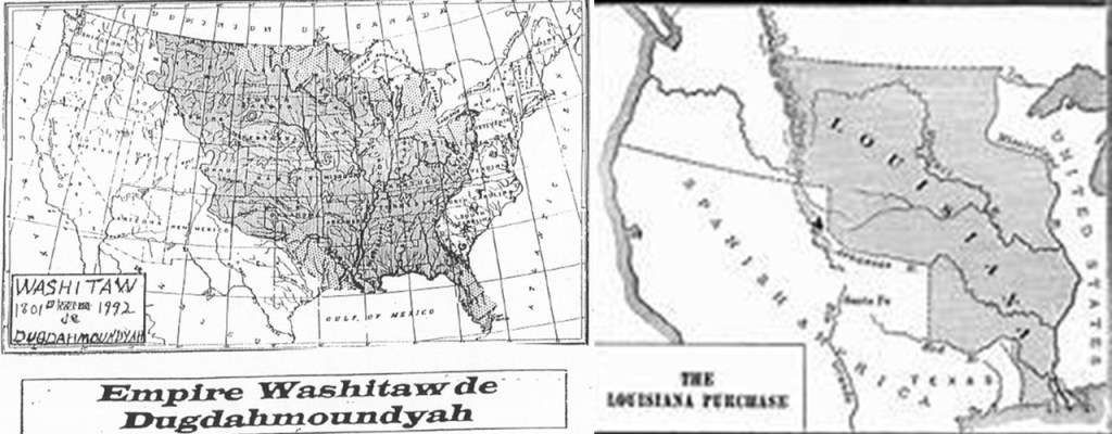
And I am quite certain there was a correlation between the ancient advanced Washitaw Empire of North America and the Louisiana Purchase.
Also, it is interesting to note there were similar naval expeditions by other countries around the same time of those of Dumont d’Urville for France.
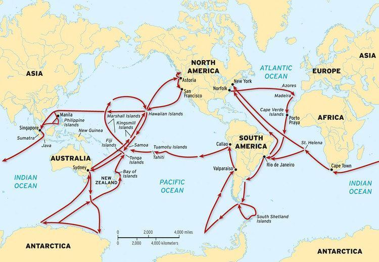
The U. S. Exploring Expedition was an exploring and surveying expedition of the Pacific Ocean and the surrounding lands conducted by the United States between 1838 and 1842.
The expedition was described as of major importance to the growth of science in the United States, and that during the events of its occurrence, armed conflict between Pacific Islanders and the expedition was common, and dozens of natives were killed, as well as a few Americans.
It involved a squadron of four ships, with specialists on each including naturalists, botanists, a mineralogist, a taxidermist, and a philologist, which is someone who studies written and oral histories.
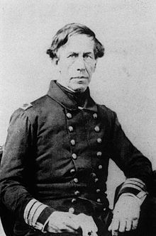
It is sometimes referred to as the “U. S. Ex. Ex.” or “Wilkes Expedition,” after the commanding officer, Navy Lt. Charles Wilkes.
The ships of the Wilkes Expedition departed from Hampton Roads in Virginia for the first stop the Madeira Islands off the coast of Africa on August 18th, 1838.
The routes of the expedition went something like this – all over the place.
The squadron of ships pretty much sailed together, at different rates of speed, from their first stop at Madeira, to Rio de Janeiro in Brazil; Tierra del Fuego at the southern tip of South America; Valparaiso in Chile; Callao in Peru; the islands of Tahiti, and Samoa, in the South Pacific; Sydney in Australia; Antarctica, which they arrived at and “discovered” on January 16th of 1840, just mere days before the completely different expedition (?) of Dumont d’Urville’s claimed land on Antarctica on January 21st of 1840; and then, by way of Fiji, to the Sandwich Islands (otherwise known as the Hawaiian Islands), before returning to the United States. The ships did break-off into pairs on occasion to explore different places in the same general location.
Then there were the voyages of the HMS Beagle, originally a Cherokee class 10-gun boat of the British Royal Navy, said to have set off from the Royal Dockland of Woolwich at the River Thames on May 11th of 1820.
The HMS Beagle’s first voyage was between 1826 and 1830, accompanying the larger ship, HMS Adventure, on a hydrologic survey of Patagonia and Tierra del Fuego, under the overall command of the Australian Navy Captain, Phillip Parker King.
The second voyage of the HMS Beagle, between 1831 and 1832, was joined by naturalist Charles Darwin, on a second trip to South America, and then around the world.
Charles Darwin kept a diary of his experiences, and rewrote this as a book titled “Journal and Remarks,” becoming published in 1839 as “The Voyage of the Beagle.”
The third voyage of the HMS Beagle took place between 1837 and 1843, and was a third surveying voyage to Australia, stopping on the way at Tenerife in the Canary Islands; Salvador on the coast of Brazil in Bahia State; and Cape Town in South Africa. I have found all three of these places on planetary grid alignments.
In Australia, the crew surveyed Western Australia, starting in what is now Perth, to the Fitzroy River; then both shores of the Bass Strait in Australia’s southeast corner; then north to the shores of the Arafura Sea, across from Timor. Again, all of these places figure prominently on grid alignments.
In 1845, the HMS Beagle was refitted as a Coast Guard watch vessel in Essex, in the navigable waters beyond the Thames Estuary, moored in the middle of the River Roach, until oyster companies and traders petitioned to have it removed in 1851, citing the vessel was obstructing the river and its oyster beds.
The Navy List shows that on May 25th of 1851, the Beagle was renamed “Southend ‘W.V. No. 7′” at Paglesham, and sold in 1870 to be broken-up.
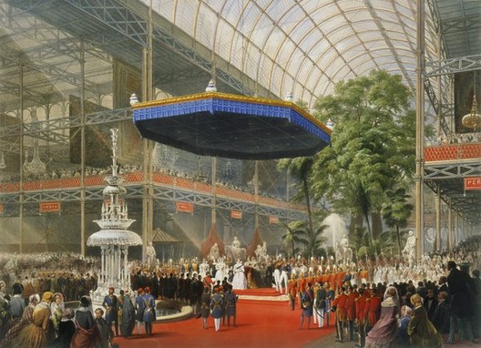
Just for point of reference, the Crystal Palace Exhibition took place in London’s Hyde Park between May 1st of 1851 to October 15th of 1851.
I believe the Crystal Palace Exhibition of 1851 was the official kick-off to the reset timeline of the New World Order.
I believe the history of Earth has been replaced with the history of those that took over and claimed the legacy of the original builders of civilization, and I believe all of these voyages of exploration were part of how they did it.
The earth, and all that was in it, was surveyed after the mud flood event, and before the official start of the new reset timeline in 1851, from which our new history was based on.
Back to the Kerguelen Islands, which started the side-track off into 19th-century exploration history.
The Kerguelen Islands themselves are considered an exposed part of the Kerguelen Plateau, which is considered a large igneous province, or an extremely large accumulation of igneous rocks, mostly submerged by the southern Indian Ocean.
The main island, known as Grande Terre, is 2,577 square-miles, or 6,675 kilometers-squared.
The islands were officially discovered by the French navigator Yves-Joseph de Kerguelen-Tremarec on February 12th of 1772.
Then, apparently the very next day, a member of the expedition named Charles de Boisguehenneuc, landed on the island, and claimed it for the French Crown.
The island was visited regularly by whalers and sealers after its discovery, and between the 18th- and 20th-century, the regions whales and seals were hunted to the point of near extinction.
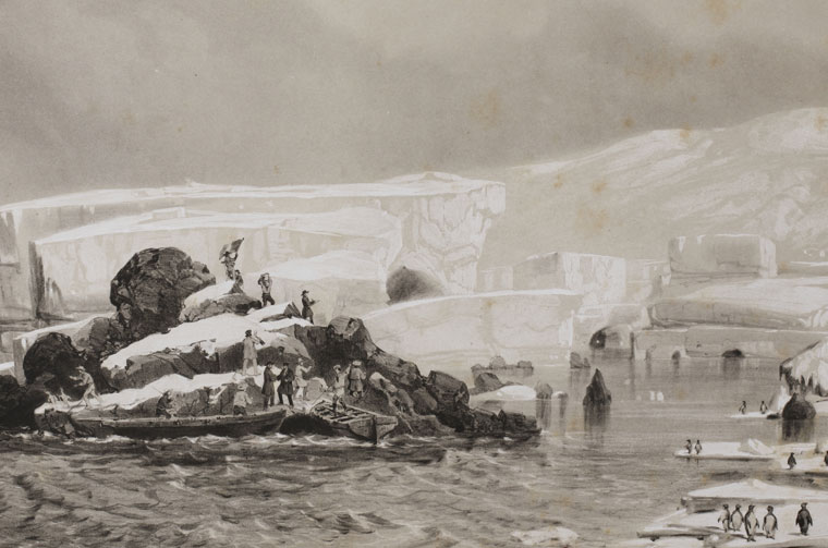
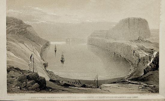
The islands were not completely surveyed until 1840 during the Ross Expedition, a voyage of scientific exploration of the Antarctic between 1839 and 1843.
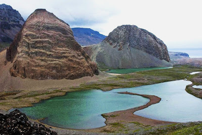
This is said to be an engraving from the Ross Expedition of Christmas Harbor at Kerguelen Island, from an elevation 600-feet, or 183-meters.
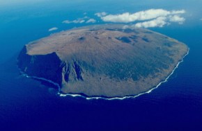
The main base, or so-called capital of the Kerguelen Islands, is at Port-aux-Francais, on the eastern shore of Grande Terre.
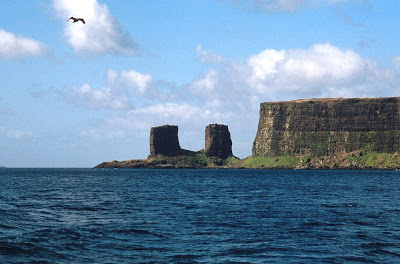
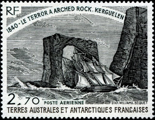
This is the best known feature of the Kerguelen Islands, known as the Arch of Kerguelen at Port Christmas, where there was formerly a geomagnetic station.
Apparently the Arch of Kerguelen actually looked like an arch at one time.
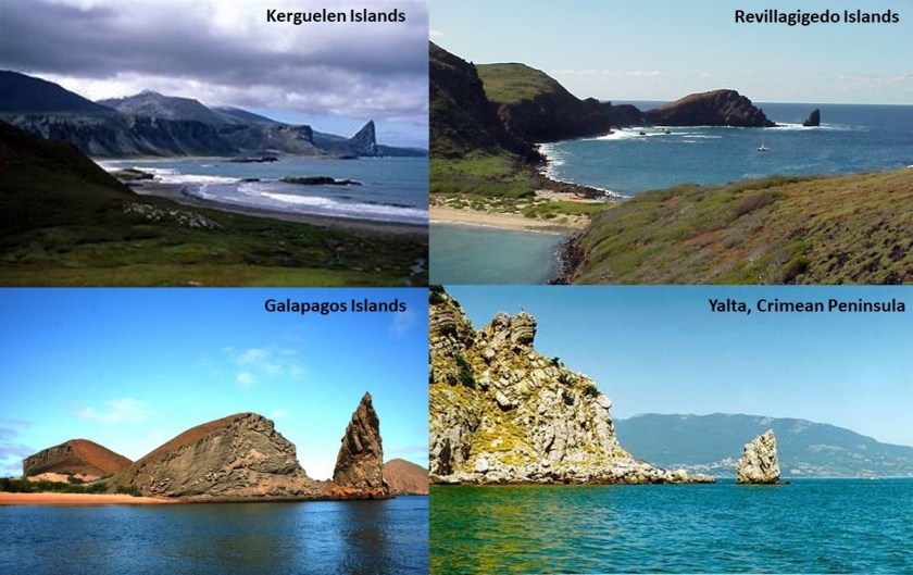
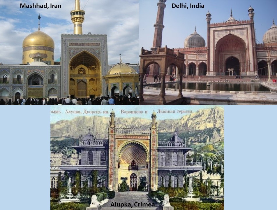
Also, what looks to be a version of the same land feature in the Kerguelen islands, called St. Anne’s Finger on the Gallieni Peninsula in the Baie Larose, on the top left, is found in the Revillagigedo Islands, in the Pacific Ocean near the west coast of Mexico, and part of its Colima Province, on the top right; and on the bottom left, a feature found in the Galapagos Islands, off the coast of Ecuador on the northwestern side of South America; and on the bottom right, one is also found near Yalta on the Crimean Peninsula in the Black Sea.
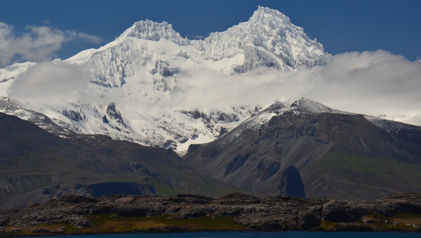
Mount Ross is the highest point of Kerguelen Island, at 6,069-feet, or 1,850- meters, also on the Gallieni Peninsula.
Other land features of Kerguelen Island include Mounts Simoun and Diane.
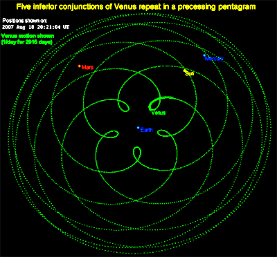
George Biddell Airy, of Great Britain’s Royal Observatory, organized and equipped five expeditions to different parts of the world, of which three were sent to the Kerguelen Islands, to observe the 1874 Transit of Venus.
Between 1874 and 1875, altogether British, German, and United States expeditions visited Kerguelen to observe the Transit of Venus.
The 1874 Transit of Venus took place on December 9th of that year, and was the first of the pair of Venus Transits which took place in the 19th-century, the second one being in 1882.
A transit of Venus takes place across the sun when the planet Venus passes directly between the sun and a superior planet, becoming visible against the solar disk.
Interestingly, this is a diagram of the orbit of Venus as seen from Earth.
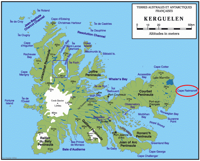
There is a geomagnetic station at Cap Ratmanoff in the present-day, the easternmost point of the Kerguelen Islands.
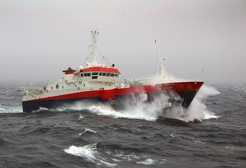
So, even today, the principal activities on the islands focus on scientific research, mostly earth sciences and biology, as well as a French satellite- and rocket-tracking lodging and station near Port-aux-Francais…
…and a small fleet of fishing vessels that are owned out of Reunion Island and licensed to fish in this exclusive economic zone.
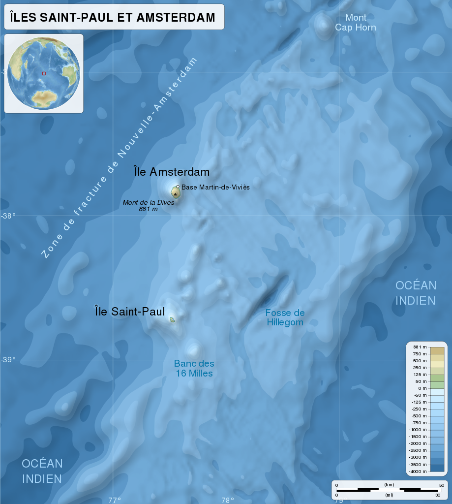
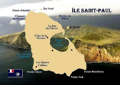
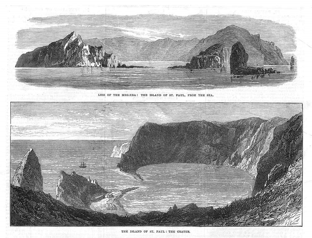
Next on the alignment, we come to Ile St-Paul, or St. Paul Island…
…part of the French Southern and Antarctic Lands mentioned previously.
We are told in 1780, the thin stretch of rock that used to close off the crater active volcano it sits on top of collapsed, admitting water through a 330-foot, or 100-meter, channel. The entrance is shallow, allowing only small ships and boats to enter.
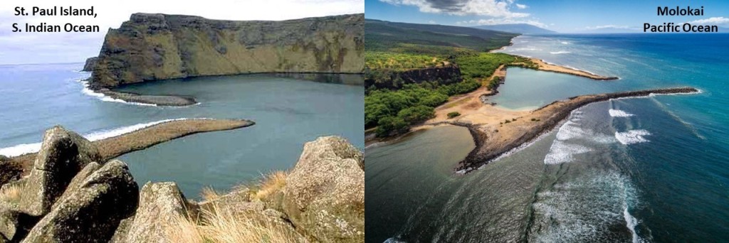
For comparison in appearance, on the left is the entrance to what is called the “Bassin du Cratere” or “Lac Cratere,” or in English “Crater Lake” on Ile Saint-Paul in the South Indian Ocean, compared with what is found on the Hawaiian Island of Molokai, in the middle of the Pacific Ocean.
While the Portuguese were first credited with discovering the island in 1559, and the Dutch with sighting it in 1618, the French laid claim to it in 1842, apparently when a group of fisherman from Reunion Island that were interested in setting-up a fishery on Saint-Paul, pressed the Governor of Reunion to take possession of Saint-Paul, as well as Amsterdam Island, which we will be coming to next on the alignment.
Apparently, he did so, by official decree, on June 8th of 1843.
All fishery activities were abandoned in 1853, however, when the French government renounced its possession of the two islands.
The HMS Megaera, a British troop transport, was wrecked on the Ile Saint-Paul in 1871, and it took approximately 3-months to rescue all 400 persons that were on board.
This is said to be a print of the Ile Saint-Paul from that time period in 1871.
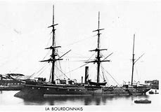
Then, in 1892, the crew of the French ship Bourdonnais again took possession for the French government of Saint-Paul and Amsterdam Islands.
These days, the main human activity on Ile Saint-Paul is a scientific research cabin used for scientific or ecological short campaigns only, and no permanent human population.
Other activity involves its importance as a seabird breeding site.
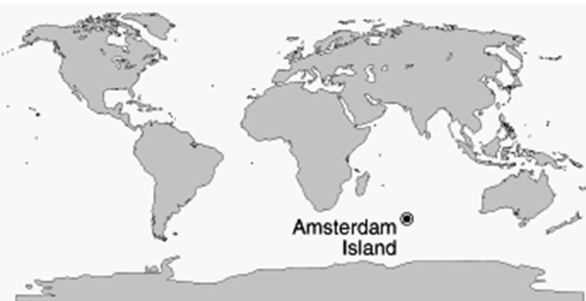
The next place we come to on the alignment I am tracking is the Ile Amsterdam, or Amsterdam Island, another one of the French Southern and Antarctic Lands claimed by France in 1892.
Amsterdam Island is roughly equidistant from the land masses of Madagascar, Australia, and Antarctica.
While a Spanish explorer by the name of Juan Sebastian de Elcano was said to have sighted the island in 1522, when he was completing the first circumnavigation of the world after Magellan’s death in the Phillippines in 1522…
…Amsterdam Island was said to have gotten its name over one-hundred years later…
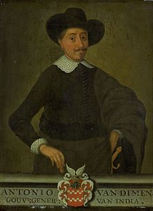
…in 1633, from a Dutch sea captain, Anthony van Diemen who named it after his ship, Nieuw Amsterdam, which was named after the Dutch settlement of Nieuw Amsterdam (which later became New York City).
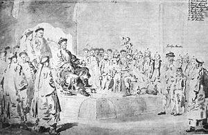
Amsterdam Island was a stop for the Macartney Mission in 1793, the first British diplomatic mission to China.
The goals of the Macartney Mission were to: 1) Open new ports for British trade in China; 2) the establishment of a permanent embassy in what was then called Peking, now Beijing; 3) the cession of a small island off the coast of China for Britain’s use; and 4) the relaxation of trade restrictions on British merchants in Canton in southern China.
While it was said to have failed to achieve its initial objectives, the Macartney Mission was noted for having brought back extensive cultural, political, and geographical observations that its participants recorded.
After having been claimed for France in 1892, the islands were part of the French Colony of Madagascar from 1924 until August 6th of 1955, when the French Southern and Antarctic Lands were formed.
The only settlement on Amsterdam Island is a seasonal research station, which studies biology, meteorology, and geomagnetics.
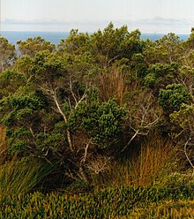
Phylica Arbora trees grow on Amsterdam Island.
It was called the “Great Forest,” covering the lowlands of the island, until most of the trees were cleared by fires set by sealers around 1825.
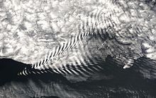
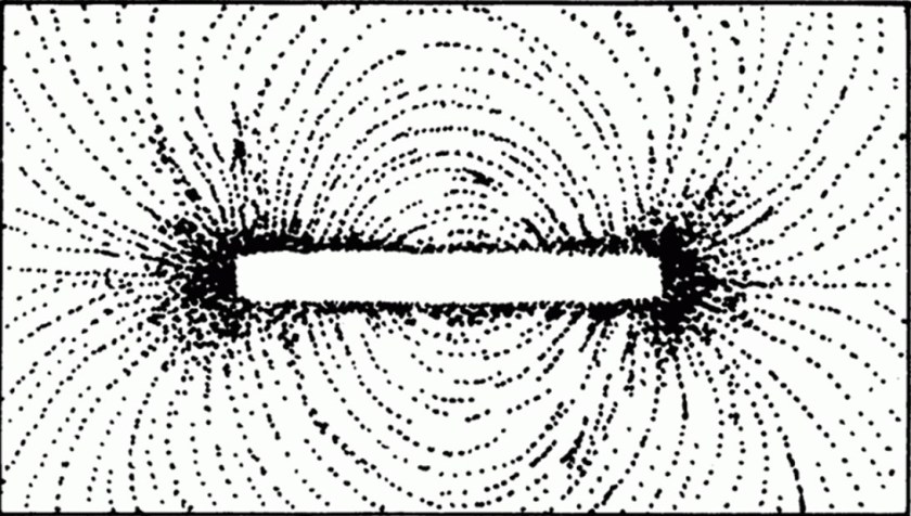
Here is a photograph of Lee Waves taken on Amsterdam Island. Lee Waves are atmospheric stationary waves, and are a form of internal gravity waves.
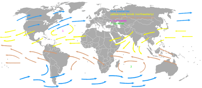
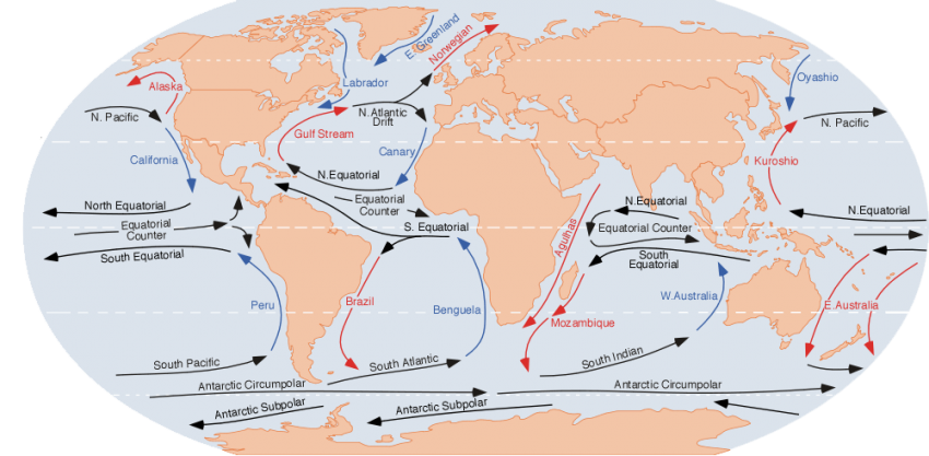
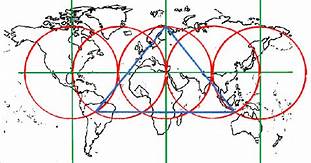
It definitely seems as though the location of the islands I have been tracking in the Atlantic and South Indian Oceans are in a favorable location with regards to: 1) Trade Winds, or the permanent east-to-west prevailing winds that flow in the earth’s equatorial region between 30-degrees north and 30-degrees south, and which allowed trade routes to become established across the Atlantic and Pacific Oceans, making various places on earth easy or difficult to access…
…and 2) on the Earth’s ocean currents, which are like giant conveyor belts flowing through the ocean and moving huge amounts of water all of the time, and which look very similar to the depiction of the direction of the trade winds.
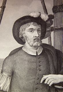
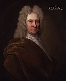
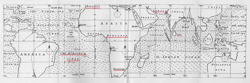
Edmond Halley was not only an astronomer, he was a geophysicist, mathematician, meteorologist and physicist.
This is a map he made in 1686 of the earth’s trade winds.
Note the place-names of his time.
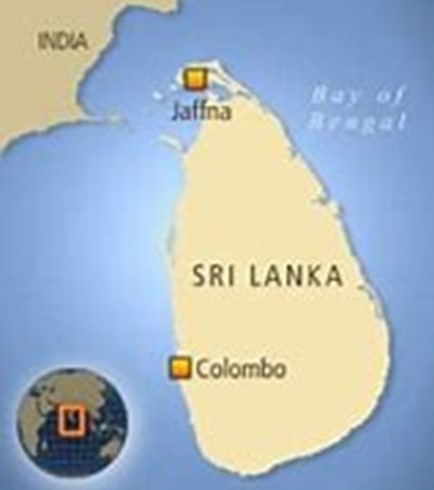
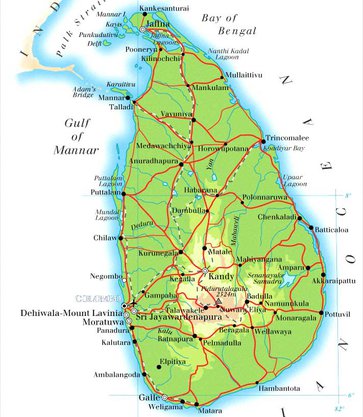
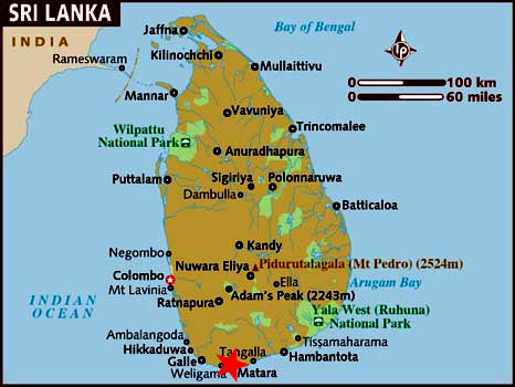
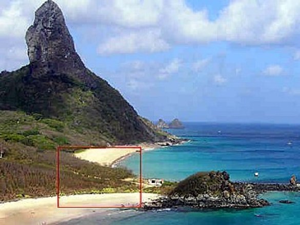
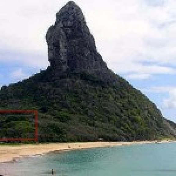
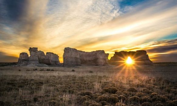
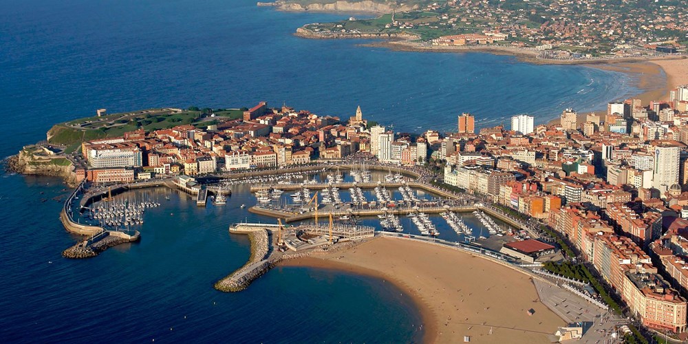
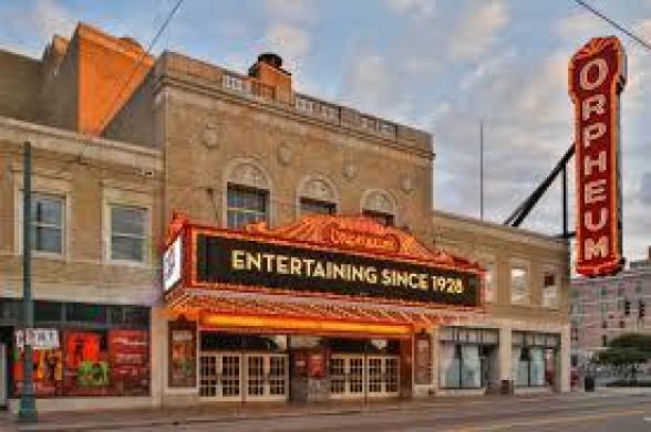
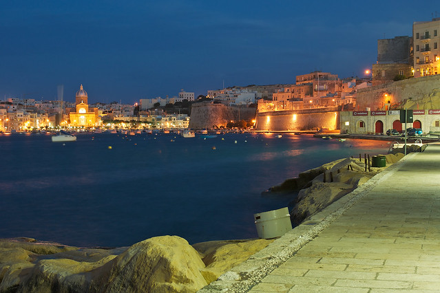
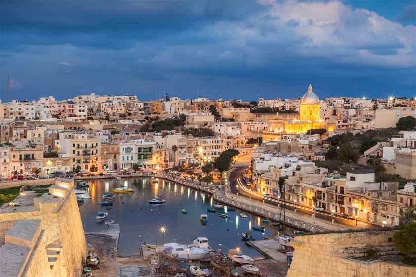
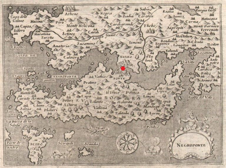
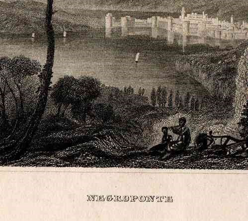
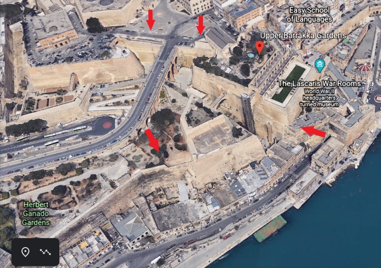
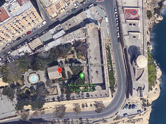
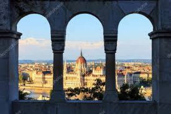
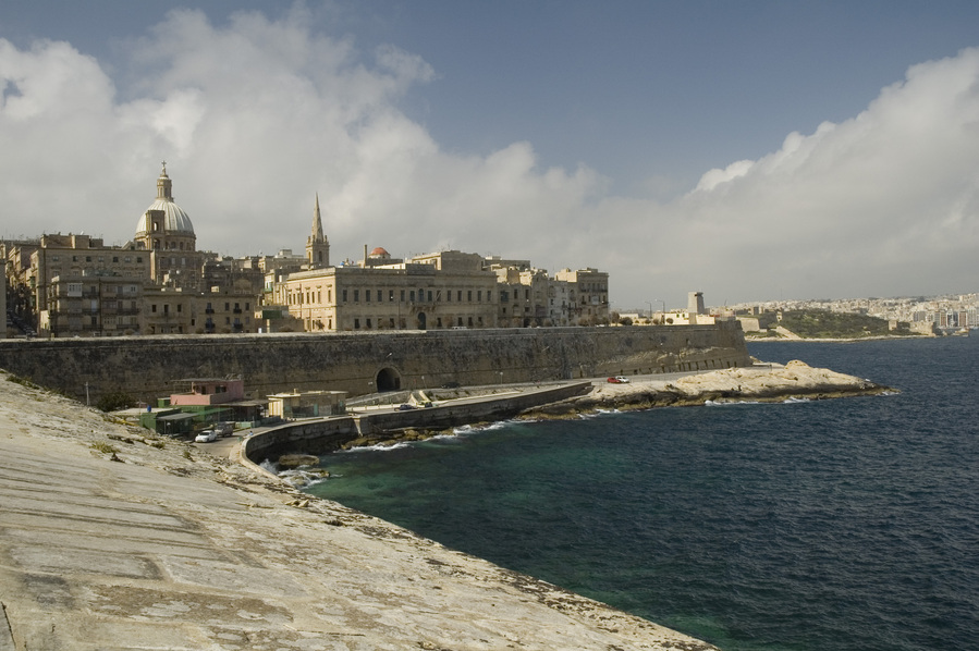
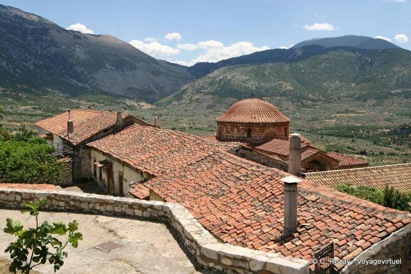
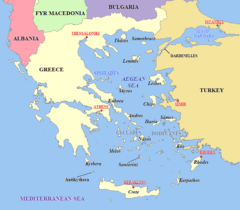
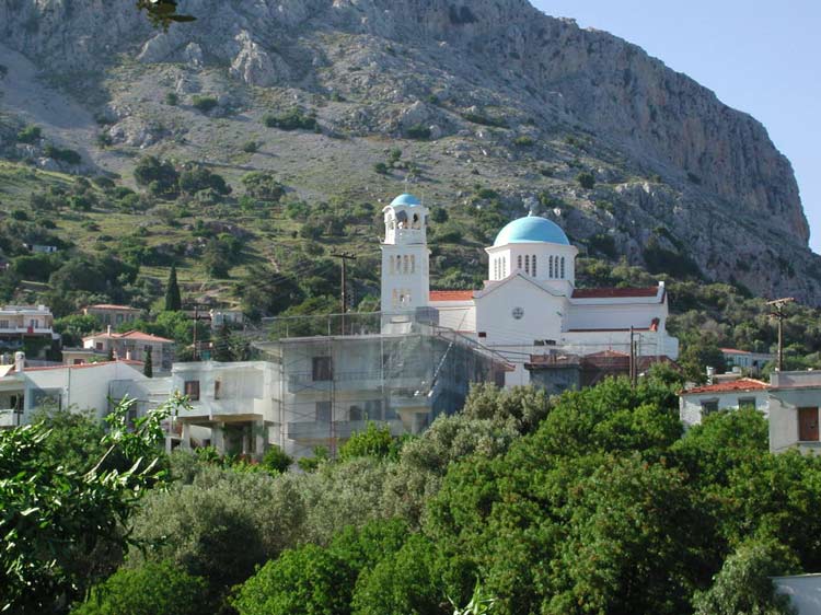
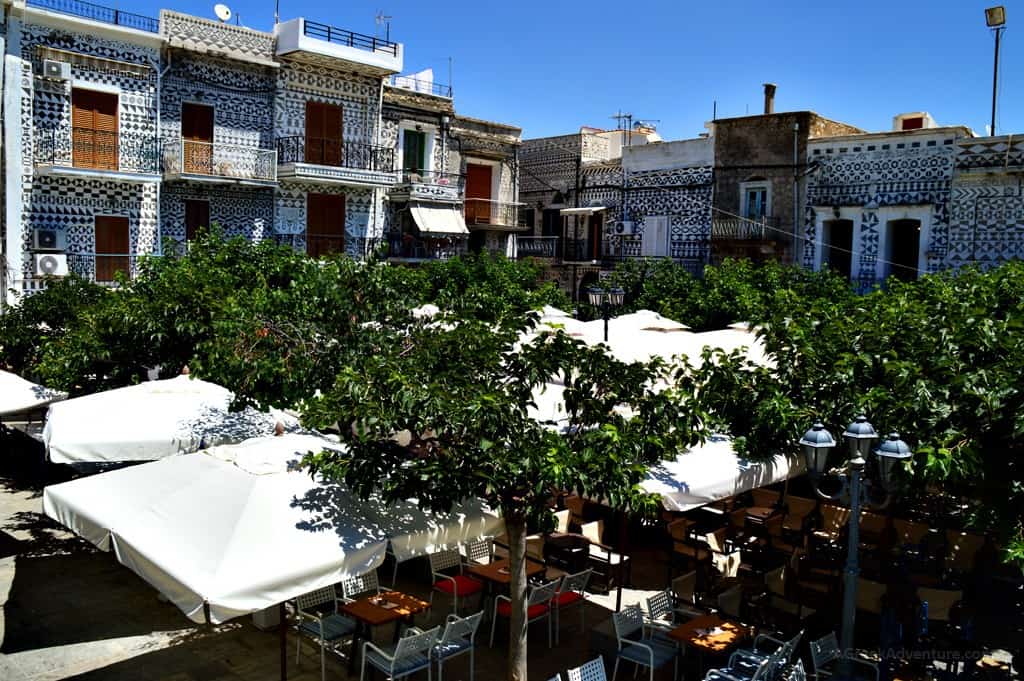
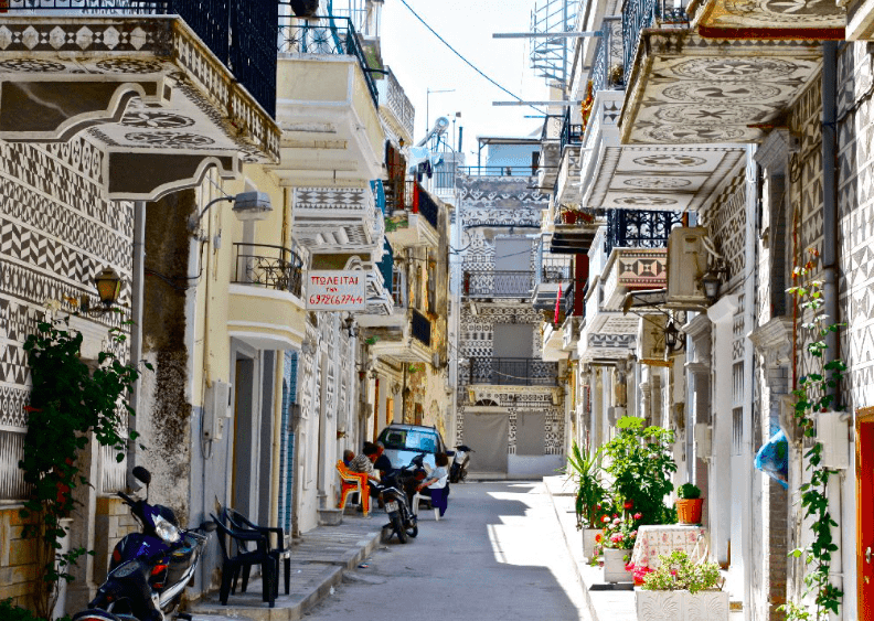
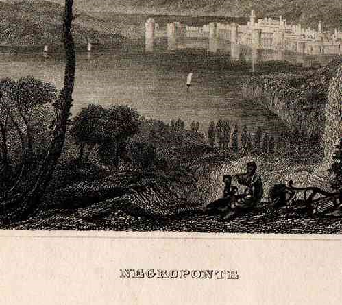
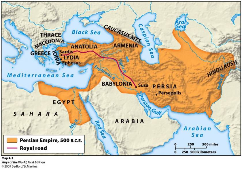
The next stop on the alignment I am tracking is Matara, a major commercial hub and city in Sri Lanka’s Southern Province.
Matara historically is part of an area that was known as the Kingdom, or Principality, of Rohana, or Ruhunu, one of the three kingdoms of what is known in the present-day as Sri Lanka, and known in the past as Ceylon.
The Buddhist temple in the middle of town was built by the ancient kings, and is on the site of a fig tree sacred to, and protected by, the Buddhists who live here.
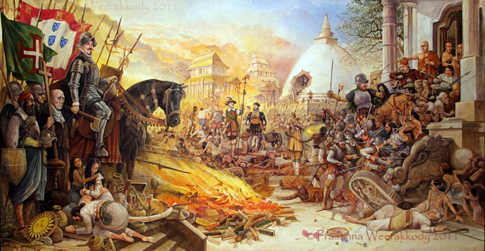
In the 16th- through 18th-centuries, Matara was ruled by the Portuguese, and Dutch, respectively.
The Portuguese rule of Matara was said to have been ruthless, during which time they were said to have plundered and ransacked buildings, store-houses and shrines.
The Dutch were said to have captured Matara from the Portuguese in 1640.
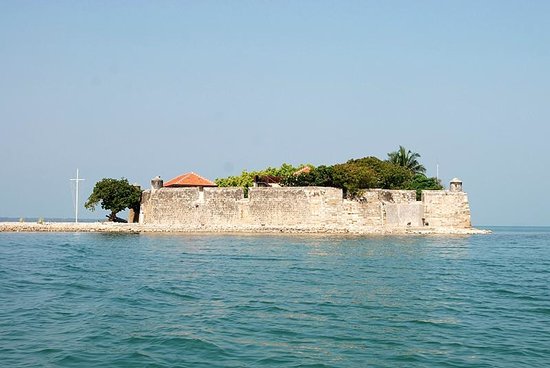
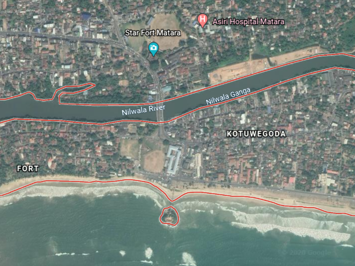
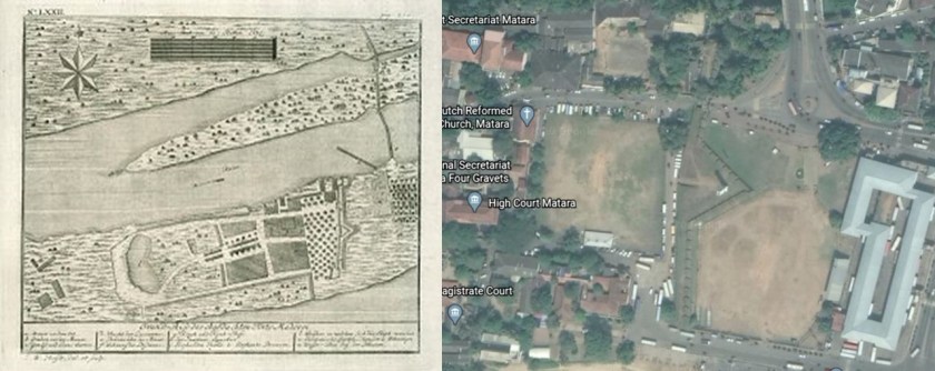
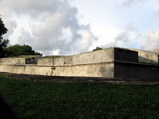
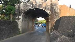
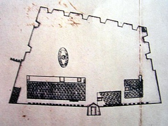
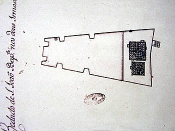
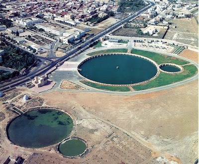
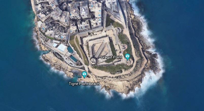
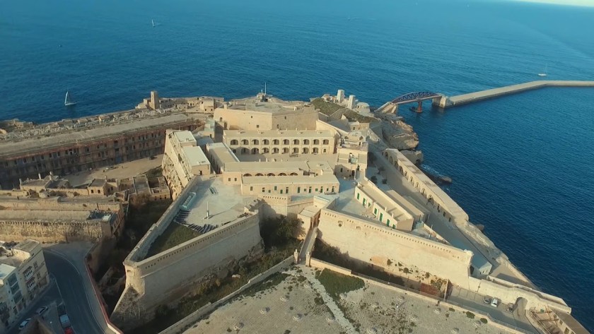
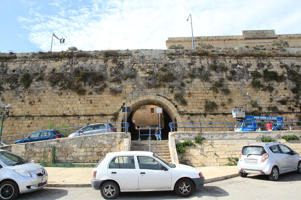
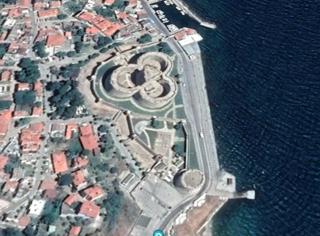
There is a section of Matara called “Fort,” between the ocean and the Nilwala River.
The Matara fort was said to have been built by the Portuguese in 1560, and largely rebuilt by the Dutch in 1640, an illustration of which is pictured on the left, and on the right, is all that remains of the Matara fort today, though it is the location of the administrative center of the entire Matara District.
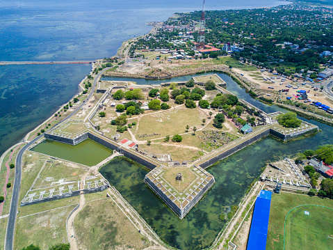
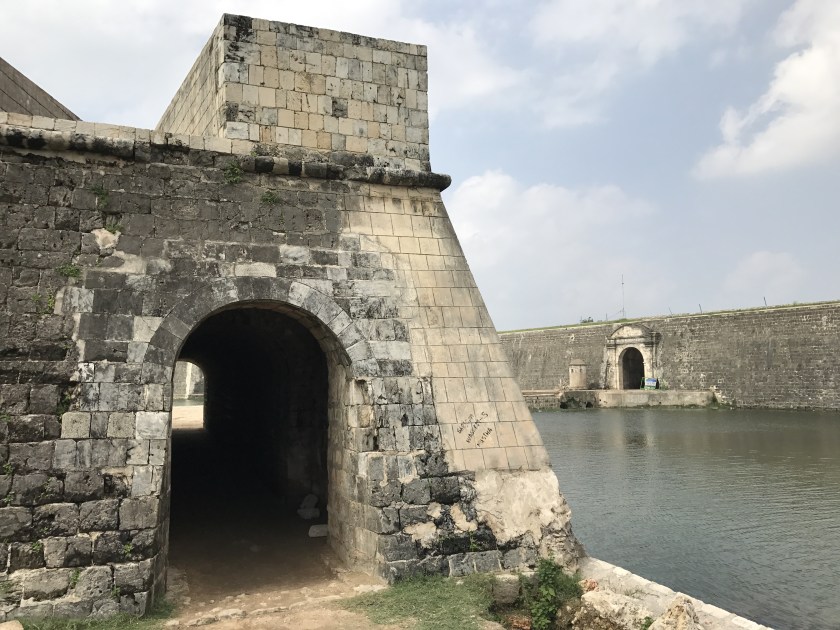
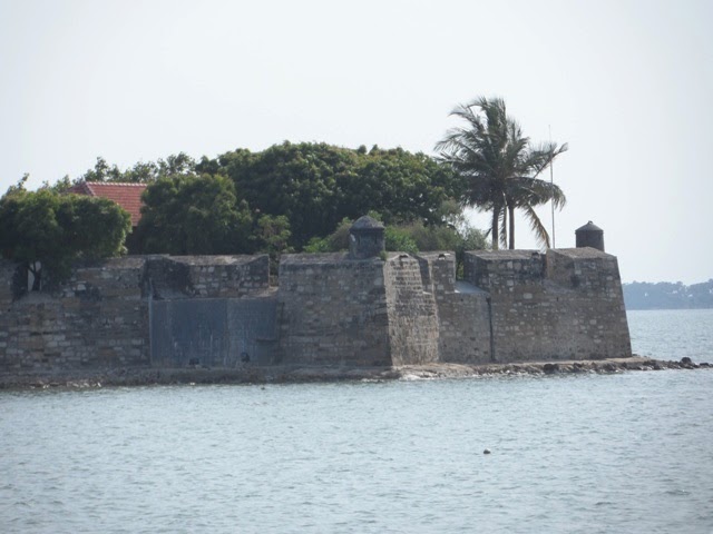
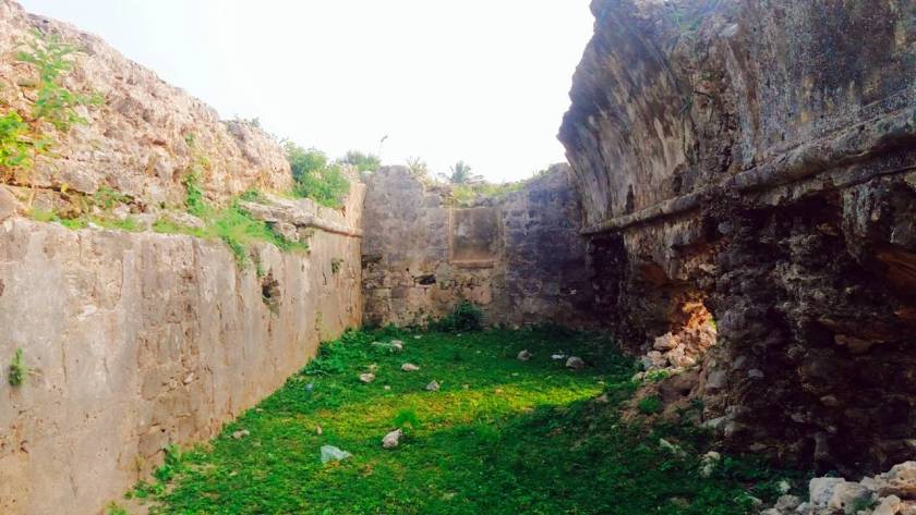
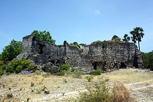
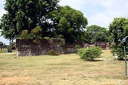
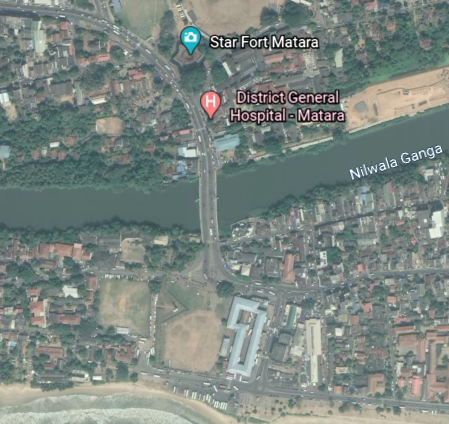
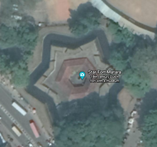
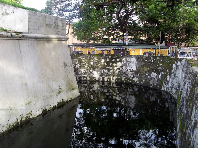
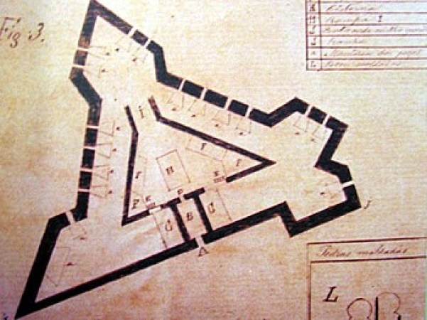
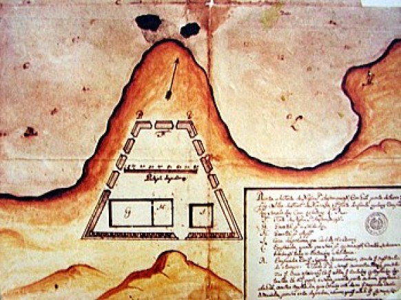
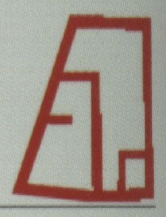
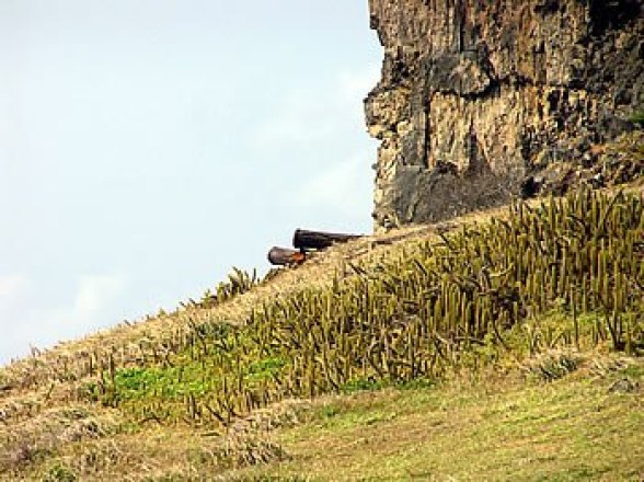
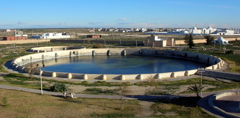
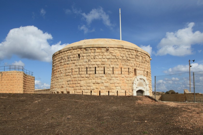
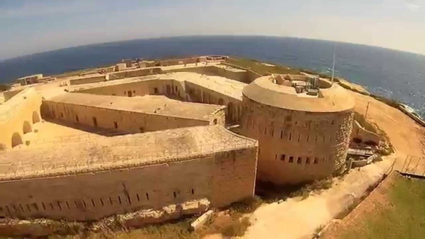
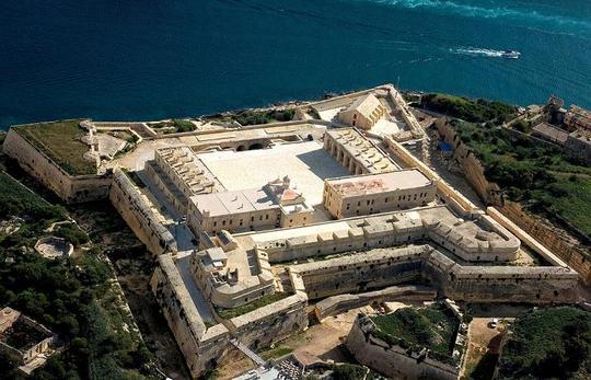
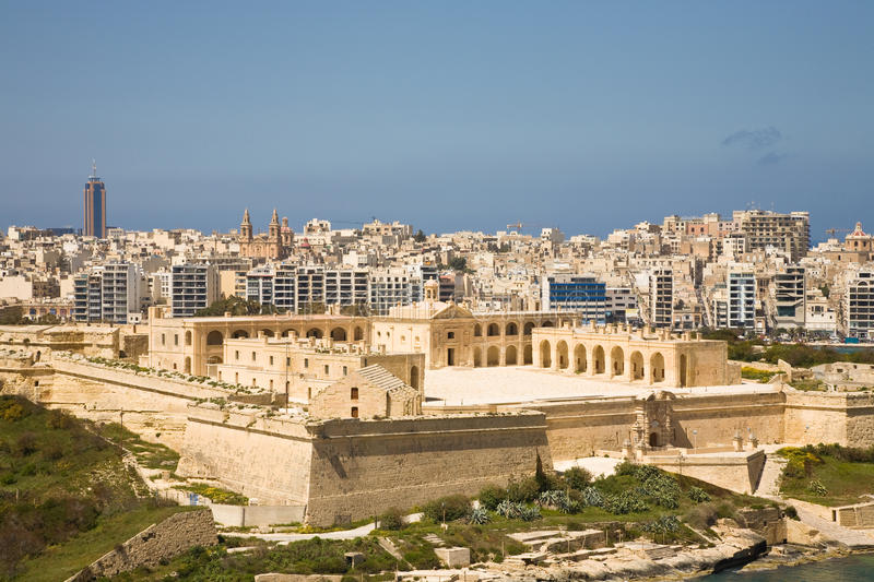
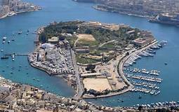
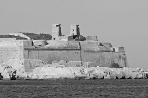
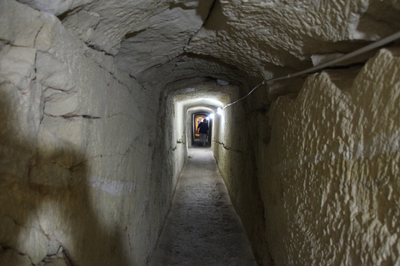
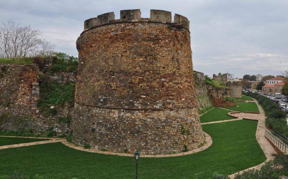
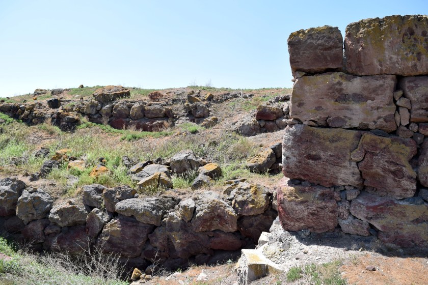
Directly across the Nilwala River from the remains of the Matara Fort is what is actually called “Star Fort Matara.”
The Dutch were said to have built the Star Fort Matara between 1761 and 1765 to protect the main fort from attacks originating from the river.
At the top of the entrance to the star fort, the “VOC” symbol of the Dutch East India Company is prominently and permanently engraved.
It is far easier to add engravings than build a structure of this nature and size.
I typically find star forts in pairs and clusters on alignments all over the Earth, and believe they were not military in nature as we have been taught. I think they functioned as part of the electrical circuitry of the earth’s worldwide grid system.
One of the definitions of the word battery is “a device that produces electricity that may have several primary or secondary cells arranged in parallel or series, as well as a battery source of energy which provides a push, or a voltage, of energy to get the current flowing in a circuit.”
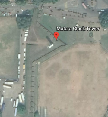
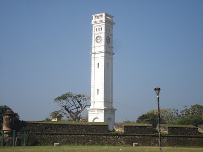
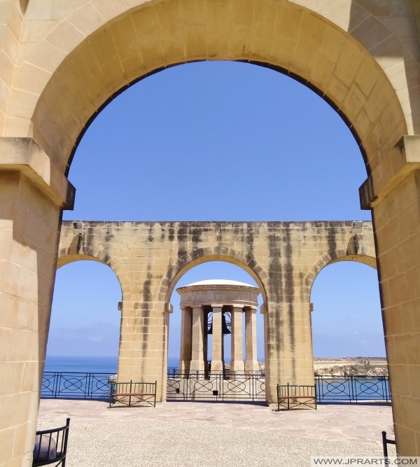
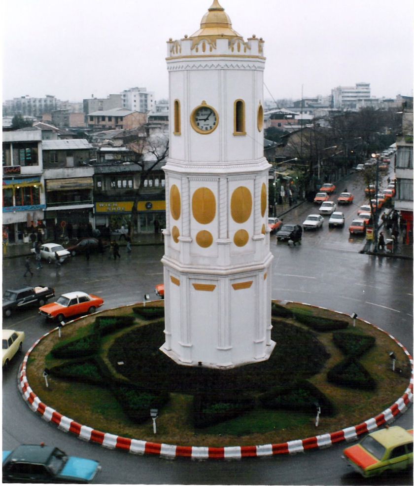
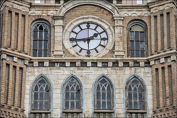
The Matara Clock Tower is situated on the rampart of the Matara Fort in the Fort section of Matara…
…and was said to have been built by the Dutch in 1765.
This is one of the massive gates of the Matara Fort.
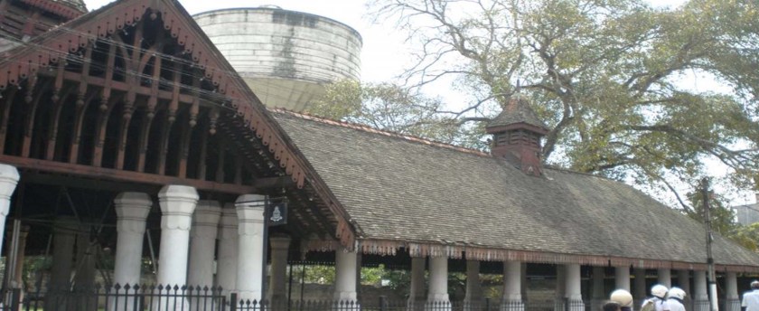
What is called the “Old Nupe Market” or “Old Dutch Market” in Matara was said to have been built by the Dutch in 1784.
Today it is part of the Ruhunu Cultural Center.
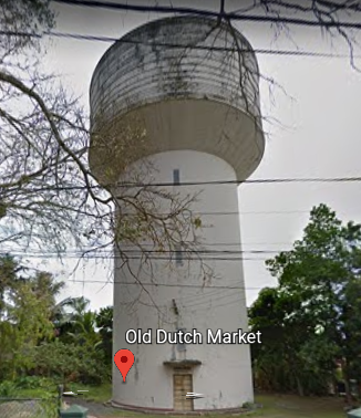
I am interested in what looks like a water tower made of stone pictured behind the front of the market. I am having a hard time finding information about it.
I will just leave this picture here of it from the Google Earth street-view.
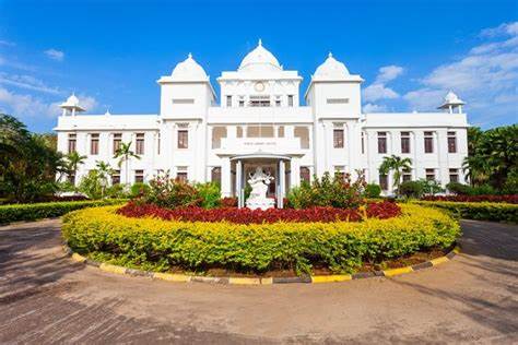
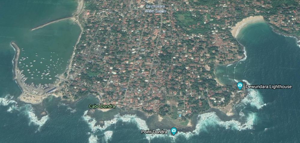
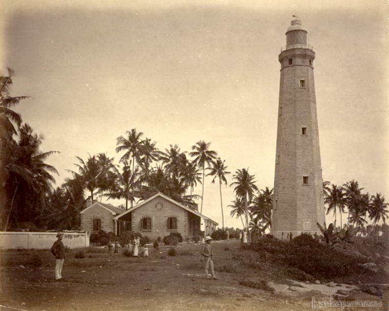
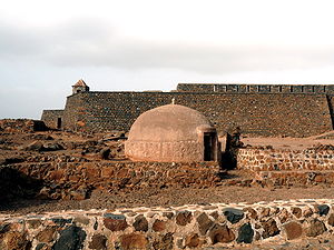
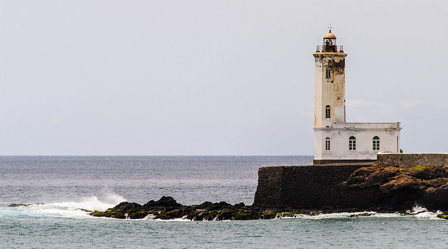
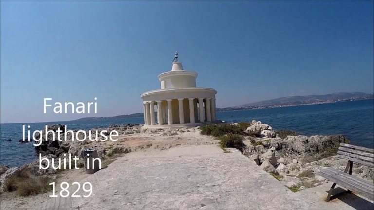
I am drawn to look into in an area right next to Matara, now called Dondra, but was historically called Devinuwara or Dewundara, an historic temple-port town. It is said to mean “Gods City” or “Gods port” in the Sinhalese language
And indeed, one of the most celebrated religious sites of the island, with a thousand Hindu and Buddhist statues at one time, and the ruins of Hindu shrines and a Buddhist temple.
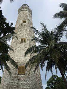
Sri Lanka’s tallest lighthouse is located here.
It is 161-feet, or 49-meters, tall, and said to have been designed and built by two English engineers starting in 1887; first lit in 1889; and opened in 1890.
This picture was said to have been taken circa 1890.
Now, let’s just take a picture of ourselves beside the lighthouse, and no one will know the difference!
Not only that, we are told the granite used in its construction was said to have come from Scotland and Cornwall in England; and the bricks and steel from England.
I am going to end this post here, and pick up the alignment at Adam’s Peak in Sri Lanka in the next post.
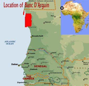
In the last post, I tracked this alignment through Mauretania, including its capital city of Nouakchott and surrounding areas; toured around northcentral Mauretania, taking a look at what is likely the longest train in the world that runs between the iron ore mines of Zouerat in the Sahara Desert and Nouadhibou in northern Mauretania on the coast; uncovering information about the noteworthy ancient cities of Atar, Cinguetti, and Ouaduane, all located in close proximity to the Eye of the Sahara in Central Mauretania; took a quick look at the Banc d’Arguin National Park on the coast; and ended up by checking out some things on the island of Santiago, the largest of the Cape Verde Islands.
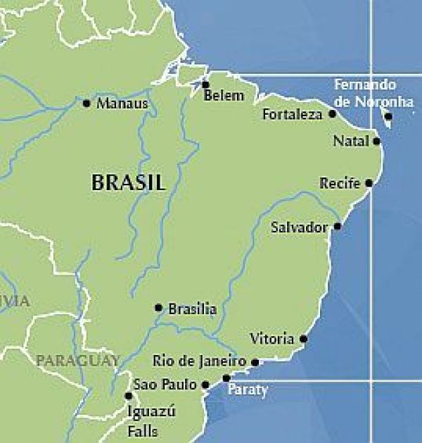
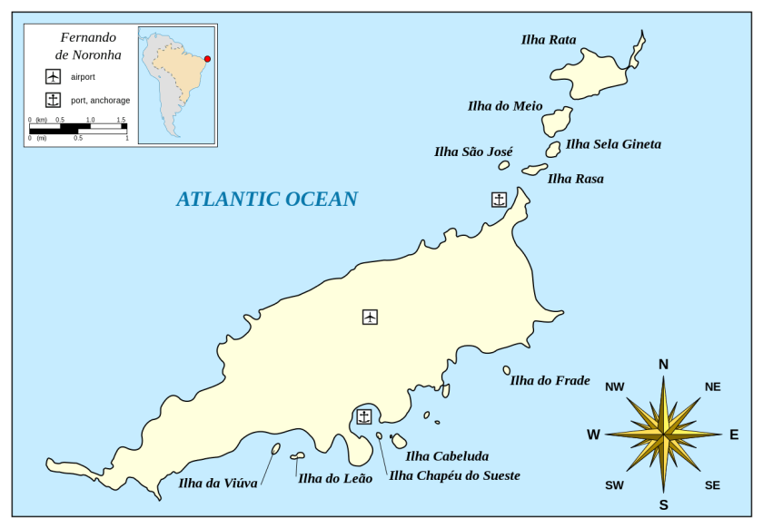
The alignment crosses over Fernando de Noronha, the name of the main island and its archipelago, off the coast of Brazil near the city of Natal.
It is a UNESCO World Heritage Site…and on at least two other alignments that I know of.
The main island has an area of 7.1 square miles, or 18.4 kilometers-squared, and the archipelago’s total area is 10 square miles, or 26 kilometers-squared.
So what I just found out that is really interesting about this place is that in its relatively small area, there were at least ten star forts here at one time.
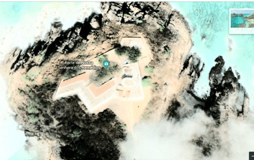
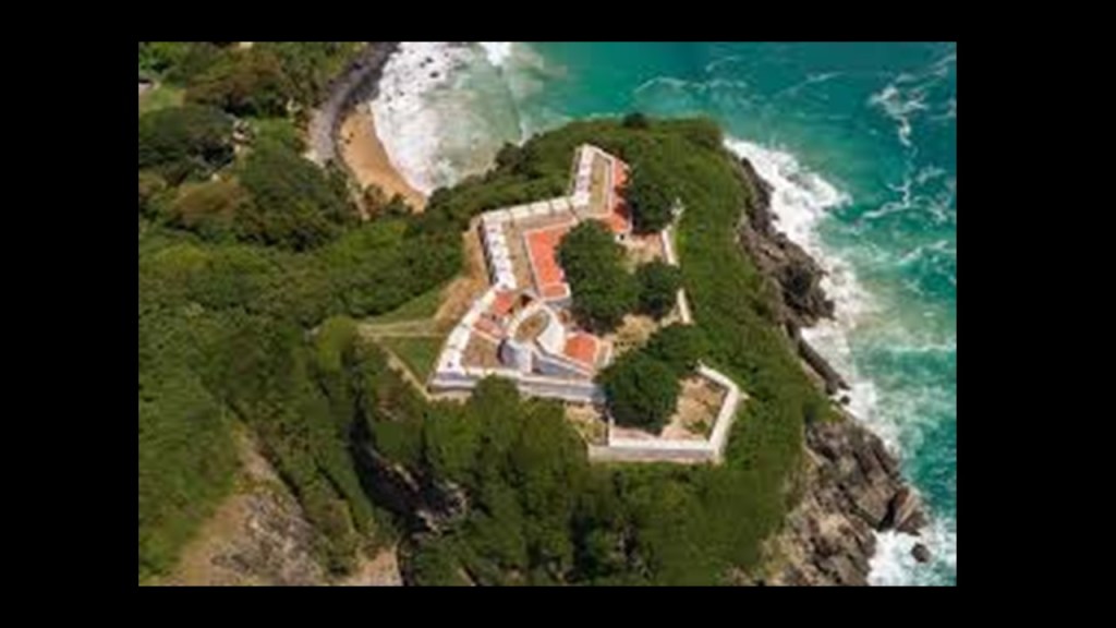
The largest and best-preserved is the Forteleza Nossa Senhora dos Remedios.
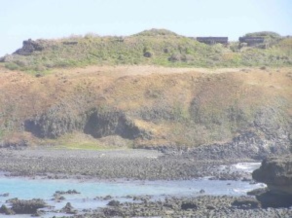
The Forte de Sao Jose do Morro was the only fort built on a secondary island. It still has imposing ruins.
Interesting to note that while the Portuguese word “morro” translates to “hill or mound,” there is definitely a “moor” sound contained within it.
Forte de Santo Antonio construction was an irregular, four-sided, polygon.
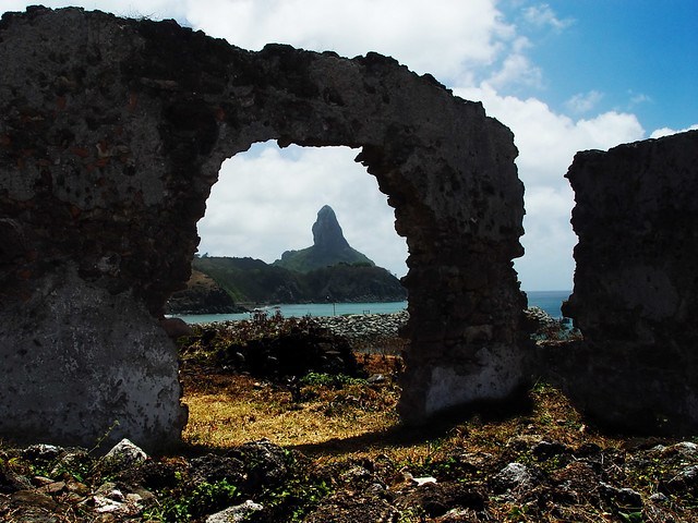
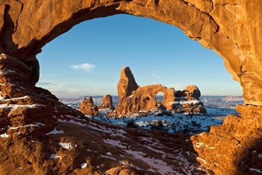
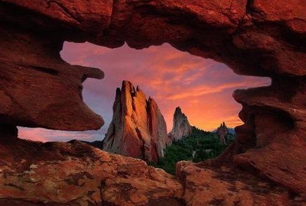
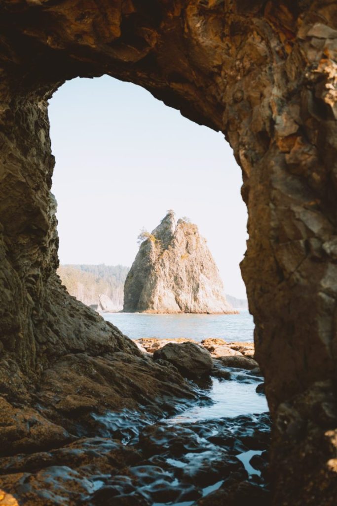
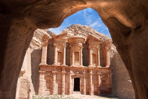
You can see the Morro do Pico framed through this archway at the Forte de Santo Antonio…
…like what you see of the Winter Turret through this arch at Arches National Park in Utah…
…at the Garden of the Gods in Colorado…
…at the Hole-in-the-Wall on Rialto Beach on Washington State’s Olympic Peninsula…
…and at Petra in Jordan.
There is no doubt in my mind that these alignments were intentional and not coincidental.
There will be more examples of what appears to be intentional kinds of things throughout this post, and not the result of natural forces.
The Forte de Sant’ana was situated over the old harbor in the Vila dos Remedios.
Ruins of the Forte de Nossa Senhora da Conceicao are visible in the vegetation.
The Forte de Santa Cruz do Pico was described as a small redoubt, defined as a temporary or supplemental fortification, typically square or polygonal.
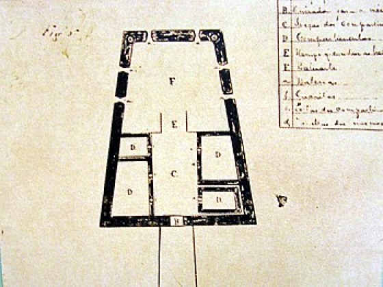
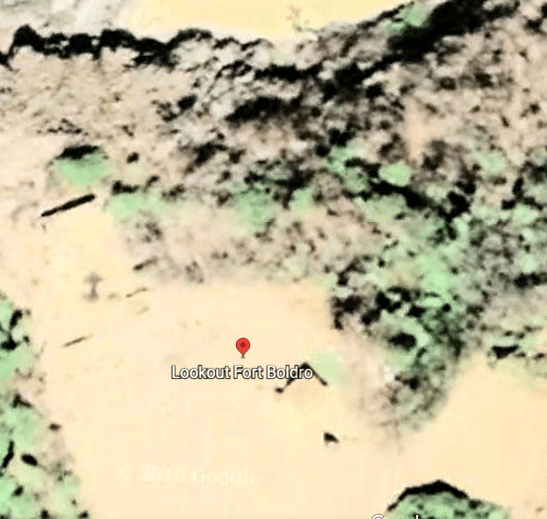
This is an old map of the Forte de Sao Pedro do Boldro.
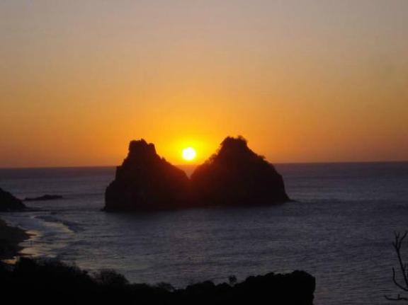
People come to the Fort Boldro look-out for sunsets.
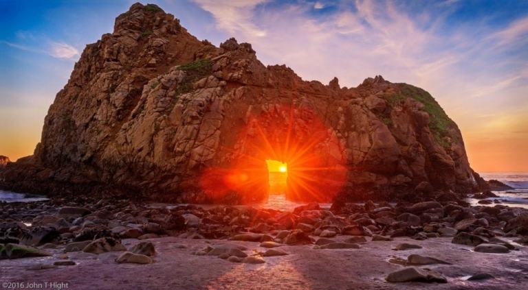
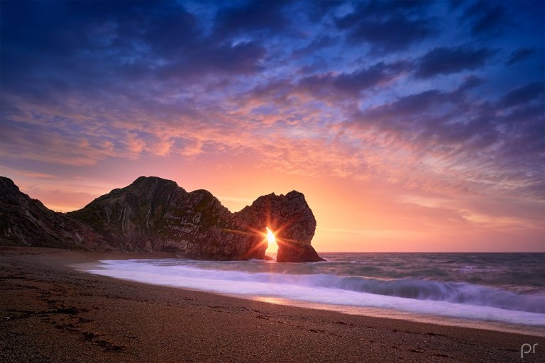
There is a good view from the Lookout Fort Boldro of the Two Brothers Rock, which appears to be in alignment with the sun…
…like Keyhole Rock at Pfeiffer Beach at Big Sur in California, where the light comes through the Keyhole arch perfectly during the winter solstice time-of-year in December and January…
…a solar alignment at Monument Rocks National Natural Landmark, otherwise known as the Chalk Pyramids, in Gove County, Kansas…
…at Mesa Arch in Canyonlands National Park in Utah…
…and at Durdle Door, near Lulworth, England, in Dorset, during the winter solstice period.
Back on Fernando de Noronha, there was also the Forte de Sao Bautista dos dois Irmaios…
…the Forte de San Juaquim do Sueste…
…and lastly the Forte do Bom Jesus do Leao.
We are told the islands were named after a wealthy Portuguese merchant Fernao de Loronha, who was granted the first captaincy of the islands of Sao Joao da Quaresma.
He was the financier and organizer of a private commercial expedition to exploit Brazil wood from new lands to the Crown, and the flagship of the expedition he organized to do this hit a reef near the island in 1503 and had to be salvaged.
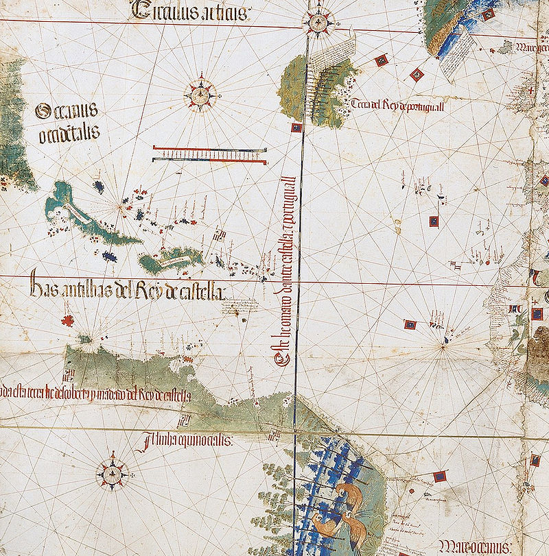
There was an island named Quaresma in the cartographic record, showing up in a map called the Cantino Planisphere, said to have been completed by an anonymous Portuguese cartographer before 1502.
A planisphere is defined as a map formed by the projection of a sphere or part of a sphere on a plane.
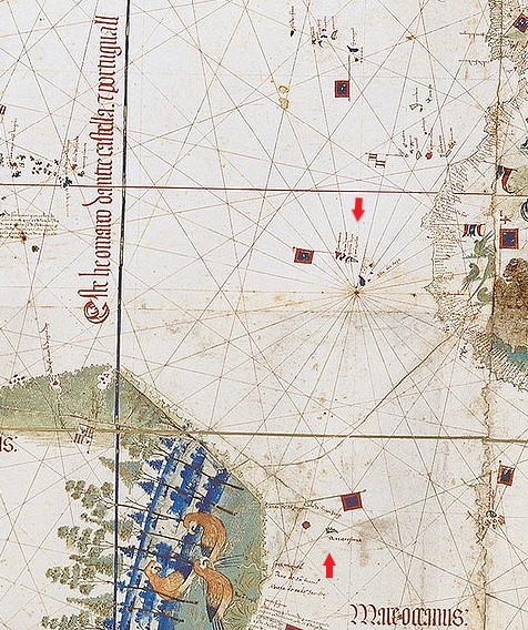
There are a couple of things I would like to point out the Cantino Planisphere.
The first is that the earth’s gridlines appear on it…
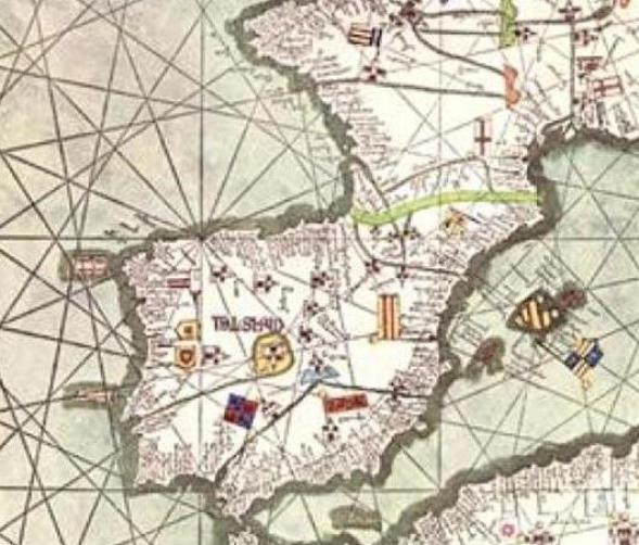
…which also appear on the Catalan Atlas of the Majorcan Cartographic School. The Catalan Atlas is considered the most important map of the Medieval period in the Catalan language, dated to 1375.
This is a depiction of the Iberian Peninsula, with Madrid in its center, in the Catalan Atlas.
The Catalan Atlas all together has six vellum leaves, each being 26 inches, or 65 centimeters, by 20 inches, or 50 centimeters in size. Each leaf includes the mapping of the geometric lines and shapes that you see depicted here.
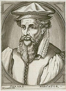
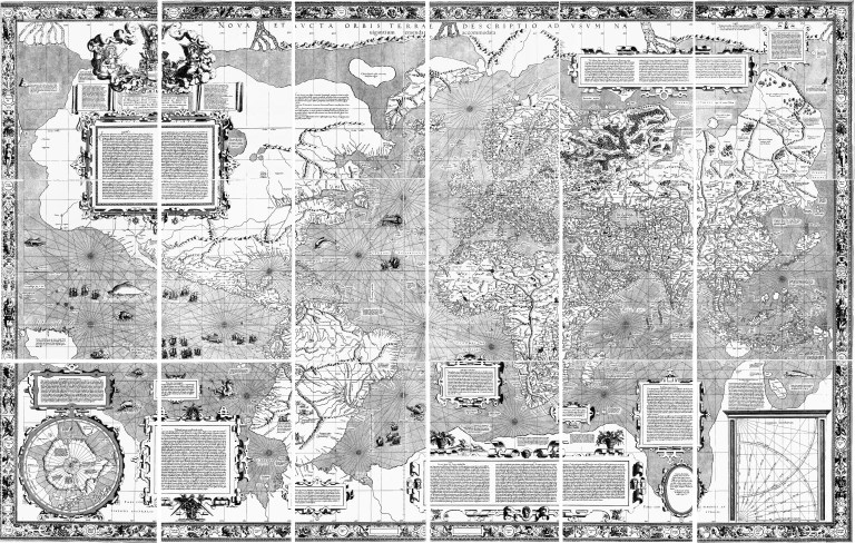
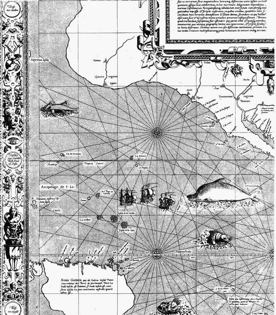
It would seem that the Earth’s grid-lines started to disappear from maps in the 1500s, as Gerardus Mercator, a Flemish geographer, cartographer and cosmographer…
…published a world map in 1569 that is considered to be the first where sailing courses on the sphere were mapped to the plane map, allowing for a “correction of the chart to be more useful for sailors.”
Here is a close-up section of the 1569 map showing the depiction of straight ley-lines in the seas, but not on land and sea as were present on the flat projections of the Cantino Planisphere and the Catalan Atlas.
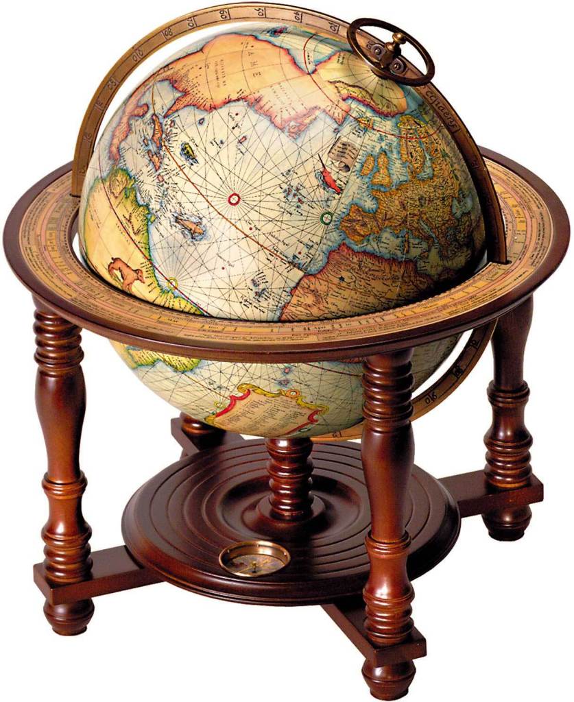
Not only that, Mercator was also a globe-maker, like this one from 1541.
So Mercator was said to have made a revolutionary flat projection map that corrected the chart for sailors…and the earth as a globe as well?
I have to ask the question – is this information telling us something about what was actually going on here?
While the focus of my research is not about proving or disproving flat earth versus planet, nor am I directed by it, I do find this information about older maps on flat planes with ley-lines to be extremely interesting and noteworthy.
This is where my research has taken me, and I am sharing my findings.
Here’s a close-up of the region on the Cantino Planisphere depicting Quaresma off the coast of Brazil, shown by the lower arrow…and the upper arrow points to the Cape Verde Islands at the center of a circle with multiple radial lines and sectors emanating from it.
This would indicate to me that the Cape Verde Islands were an important location on the earth’s geometric grid system.
I found a similar geometric place of importance centered in the city of Gijon, the largest city of Asturias in northern Spain, and port on the Bay of Biscay.
I have placed a modern map of Spain on the left, with the city of Gijon circled, because the circle with sixteen sectors depicted in the Catalan Atlas on the right appears to center on the city of Gijon. It indicates a past importance to Gijon that is no longer recognized.
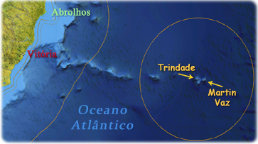
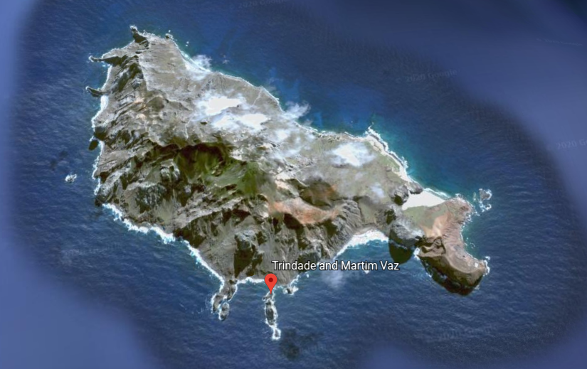
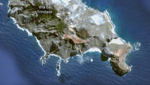
The next location on the alignment I am tracking is the Trinidade and Martin Vaz Archipelago, located in the southern Atlantic Ocean, 680-miles, or 1,100-kilometers, east of the coast of Espirito Santo, Brazil, which it is part of.
This group of islands has a total area of 4-miles, or 10.4-kilometers, and a population of 32 Brazilian Navy personnel.
They were said to have been discovered by the Portuguese in 1502, and, along with Brazil, became part of the Portuguese Empire until 1822, the year Brazil became independent from Portugal.
Trindade, also known as Trinidad, is the largest island.
Many military and scientific expeditions from Europe and North America visited the islands.
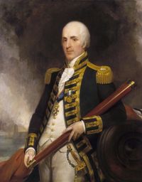
For example, the famous English astronomer, Edmund Halley, for whom Halley’s comet was named, was said to have taken possession of the islands on behalf of the British monarchy in 1700.
At least one visitor to these islands was a fortune-seeker.
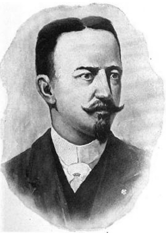
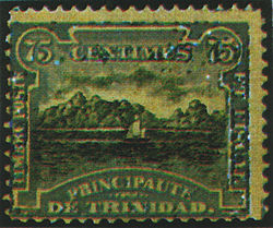
We are told that In 1893, James Harden-Hickey, a French-American newspaper editor, author and adventurer born in San Francisco in 1854, proclaimed himself James I, Prince of Trinidad in the South Atlantic Ocean, known as Trindade Island today.
He started selling Principality of Trinidad government bonds, opened an office in New York City, started making secretarial appointments and he designed postage stamps for it.
Prince James I of Trinidad’s new principality didn’t last long, however, as the British seized Trinidad as a telegraph cable relay station, and he was forced to surrender it to them.
The British occupied what they called South Trinidad in 1895 and 1896 until an agreement was reached with Brazil.
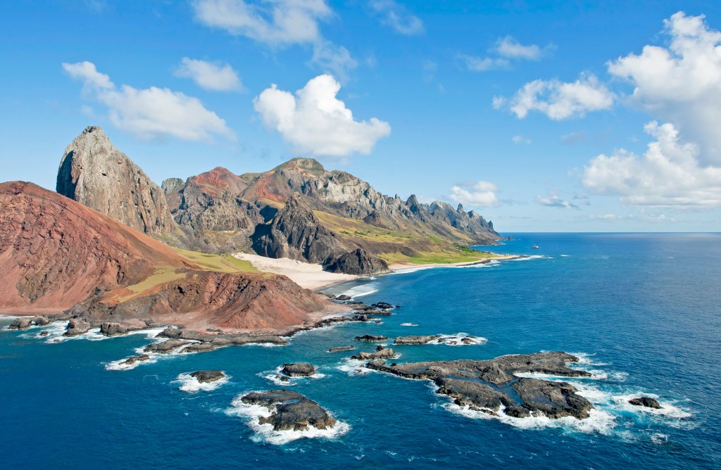
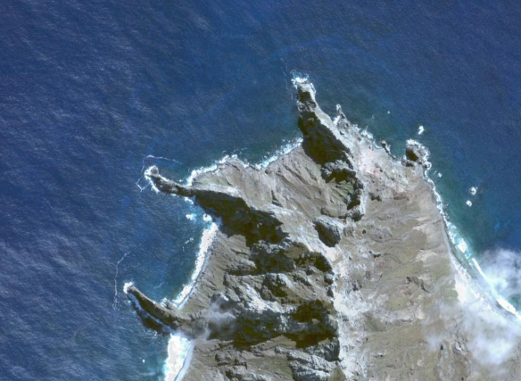
Since there is relatively little in the written historical record about this place, I am going to point out some thing’s about the islands topography that draw my attention.
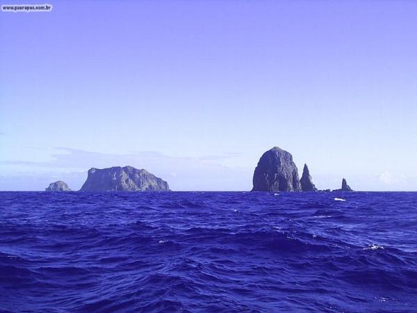
The first are the pyramidal peaks on display in this photo near the island’s shore.
RG Rio de Janeiro (RJ) 16/02/2011 Nos Limites da Amazônia Azul. Ilha de Trindade, no Espírito Santo, Brasil – Esta foto pertence ao acervo pessoal da fotógrafa, sua comercialização é proibida. Email: smarinhofoto@gmail.com – Foto Simone Marinho
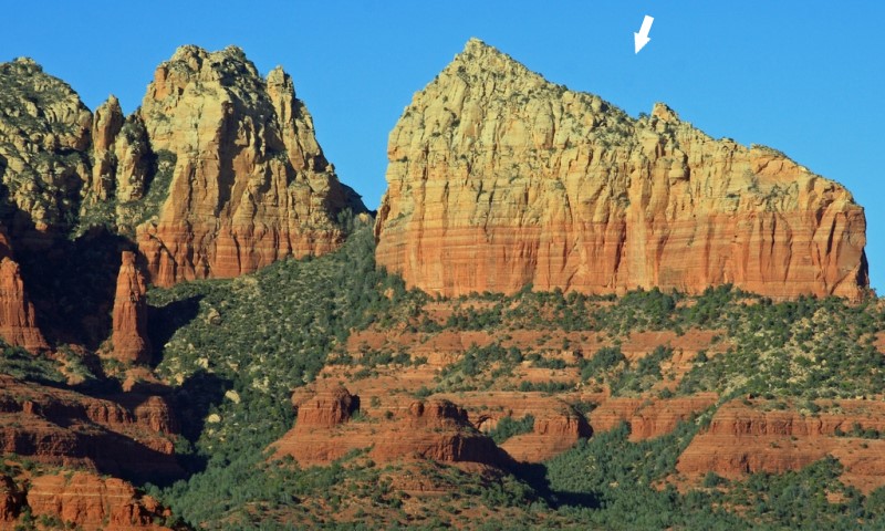
The tall pointed peak in the foreground reminds me of Ship Rock in Sedona, Arizona.
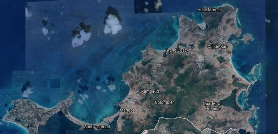
The second are the shapes of the shoreline and coves on the island of Trindade…
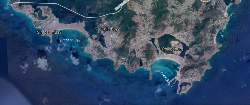
…which are quite similar in appearance to the coastline of an island in the Caribbean – the northern 60% of which is governed as a Collectivity of France called St. Martin…
…and the southern 40% is governed by the Netherlands and called St. Maarten.
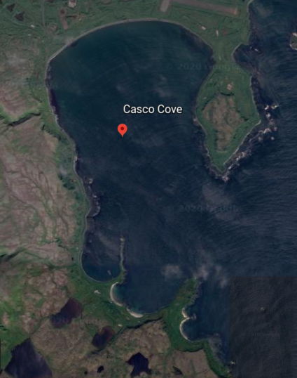
…as well as the that of Casco Cove on the Near Island of Attu, the furthest west of Alaska’s Aleutian Islands in the Bering Sea, and where there was an operational U. S. Naval Station, then Coast Guard Station at Casco Cove on Attu from June of 1943 until August of 2010…
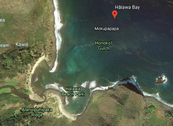
…and the same single and double beach-head configuration can be found at Halawa Bay on the Hawaiian Island of Molokai…
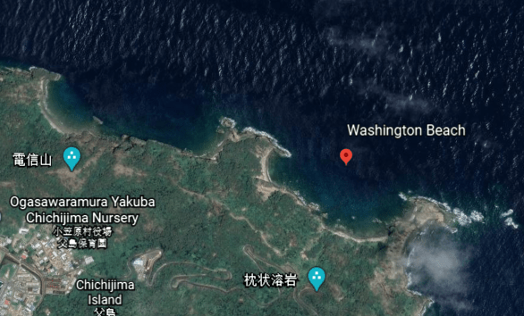
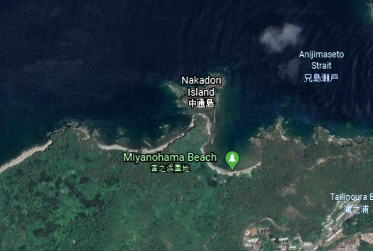
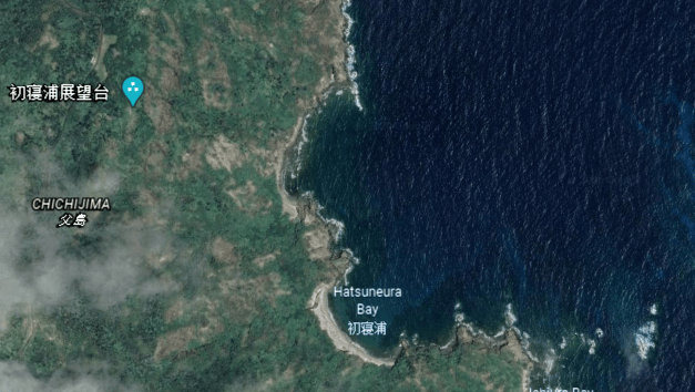
…and there are many on the island of Chichi-jima, one of the Japan’s subtropical Bonin Islands, and part of Tokyo’s Metropolitan administrative area, like Washington Beach…
…Miyanohama Beach…
…and Hatsuneura Bay.
We are also told that until 1850, 85% of this island was covered by a forest of Colubrina Grandulosa trees…
…after which time, the indiscriminate cutting of trees, and the introduction of non-native animals, led to an extinction of the trees that were once there, and causing a heavy erosion throughout the island.
The other islands of this archipelago, the islands of Martin Vaz, consist of four islands ~ North Island; Crack Island; Needle Rock; and South Island.
Have you ever heard of these places?
I sure hadn’t before I started tracking these alignments, and these island groups I am covering in this post typically show up on more than one alignment.
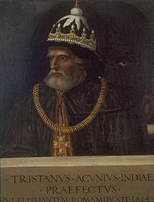
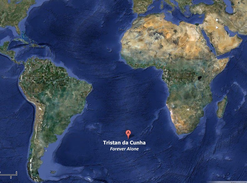
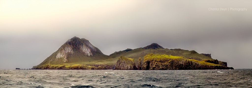
The next island group on this alignment I am tracking is the British Overseas Territory of Tristan da Cunha (UK), which is also a volcanic island named for Portuguese explorer Tristan da Cunha who was credited for its discovery in 1506…
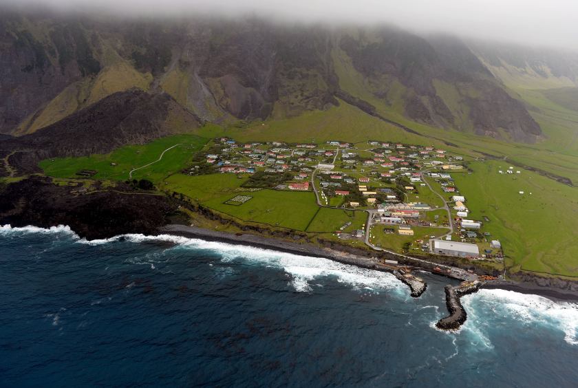
…and home to British citizens living in the world’s most isolated settlement.
There is no airstrip on the main island, so the only way of travelling in-and-out is by boat, a 6-day trip from South Africa.
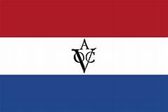
The first undisputed landing was the Dutch East India Company ship, Heemstede, on February 7th of 1643, and the Dutch made four more stops there in the next 25-years, making the first rough charts of the islands in 1656.
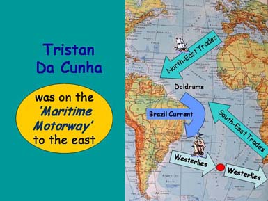
Tristan da Cunha was favorably located on the world’s historic shipping lanes between the West and the East.
The Dutch East India Company was a megacorporation founded by a government-directed amalgamation of several Dutch rival trading companies established on March 20th, 1602. It was the world’s first formally listed public company, and was influential in the rise of corporate-led globalism in the early modern period.
Also known as the VOC, or Veerenigde Oostindische Compagnie, it was chartered as a company to trade primarily with Mughal Subah, or Mughal Bengal, which includes modern Bangladesh, and the West Bengal state of Modern India.
Mughal Bengal was described as a “Paradise of Nations,” and its inhabitants living standards were among the highest in the world at one time…
…and for comparison, a typical photo of the poverty found in Bangladesh today.
Tristan da Cunha in the present-day is considered a constituent part of the British Overseas Territory of the South Atlantic…
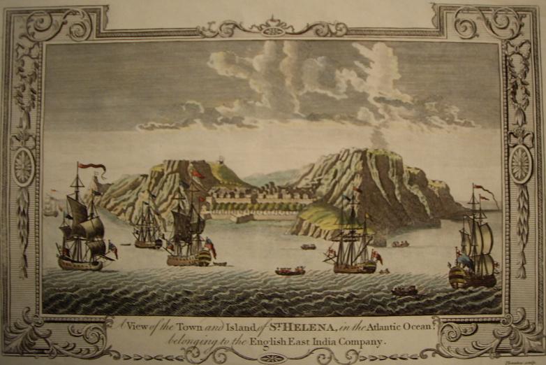
…which also includes the islands of St. Helena, where Napoleon lived in exile from 1815 until his death in 1821…
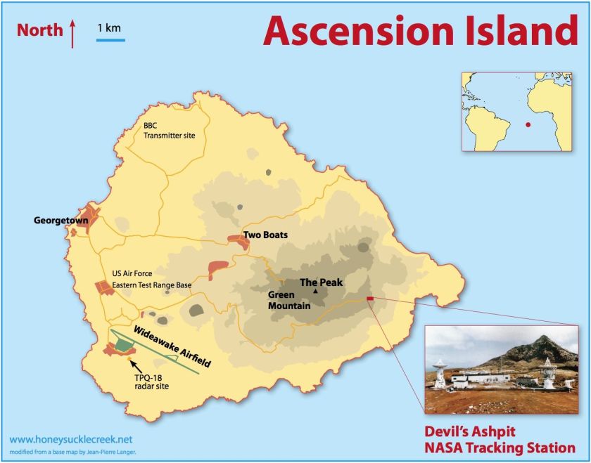
…and Ascension Island, which besides being a British colonial outpost, has a U.S. military airbase, satellite and submarine tracking stations, a BBC transmitter, and a listening post run by GCHQ’s Composite Signals Organization.
Ascension Island’s residents have been squeezed out for over 100 years.
Also, I first found the location of Ascension Island on a major alignment emanating off of the North American Star Tetrahedron…
…where one of the lines extending from Merida, Mexico, crosses right over Ascension Island, a tiny speck of land in this part of the South Atlantic.
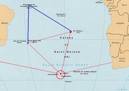
I can also make a circumstantial case that islands I have talked about thus far in this post have an octagonal geometric relationship between each other. I found the map showing the relationship in red of an equilateral triangle between the Trindade & Martin Vaz Islands; Tristan da Cunha; and St. Helena.
I added Fernando de Noronha in blue to Trindade and Martin Vaz, and St. Helena, to form an octagon…with Ascension Island off the right side of the upper triangle.
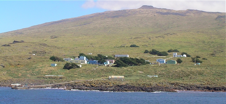
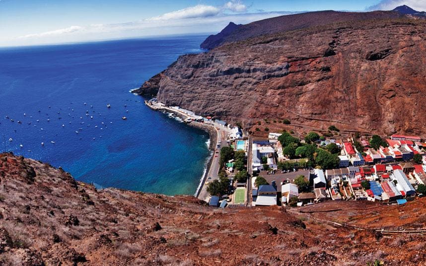
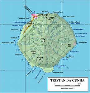
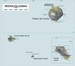
The main settlement of the main island of Tristan da Cunha is Edinburgh of the Seven Seas, and located on the only inhabited island…
…named in 1867 in honor of the visit of Prince Albert, the Duke of Edinburgh, the second son of Queen Victoria. It has approximately 250 permanent inhabitants in the present-day.
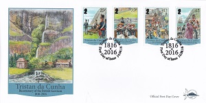
The islands of Tristan da Cunha were annexed by the United Kingdom in 1816, making them a dependency of the Cape Colony in South Africa, for the stated reasons of preventing the islands’ use as a base for any attempt to free Napoleon Bonaparte from his prison on St. Helena, and for preventing the United States from using the islands as a base for naval cruisers.
While possession was abandoned by the United Kingdom in 1817, a garrison of British marines stayed and formed the nucleus of a permanent population, which gradually grew, and was once a stopping point for lengthy sea voyages until the time of the opening of the Suez Canal in 1869.
It eventually became a dependency of the British Crown in October of 1875.
In January of 1938, Britain declared Tristan Da Cunha a dependency of St. Helena, and at that time created the British Crown Colony of St. Helena and Dependencies.
Then shortly afterwards, Tristan da Cunha was commissioned as a stone frigate, meaning a naval establishment on land, and used as a secret signals’ intelligence station to monitor Nazi U-boats and shipping movements in the South Atlantic Ocean.
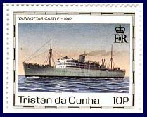
As seen as this stamp for the island, the Dunnottar Castle was an ocean liner said to have has its keel laid down in 1936 for Cape Town Service, launched in 1936, and retired in 2002, operating for 66-years.
In 1942, the Dunnottar Castle was seconded for a special assignment, and was used to sail on the top-secret mission of erecting the meteorological and wireless radio station on Tristan da Cunha used for this secret intelligence collection.
There are several other islands of the Tristan da Cunha archipelago.
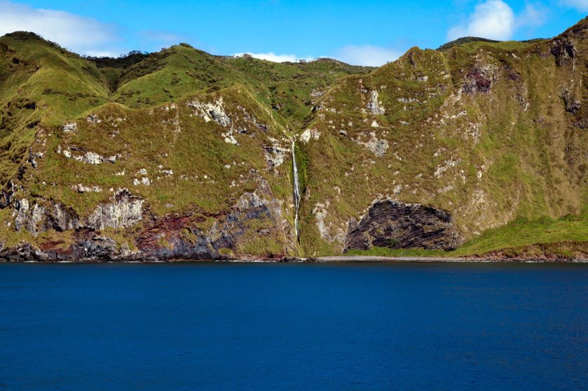
Inaccessible Island, described as an extinct volcano with sheer sea cliffs and very few landings on boulder beaches, together with…
…Gough Island, an island uninhabited except for a South African weather station, a dependency of Tristan da Cunha that is physically located 250-miles, or 400-kilometers southeast of the island, and also on the alignment I am tracking, that make up the UNESCO World Heritage Site of Gough and Inaccessible islands, important bird areas and Alliance for Zero Extinction sites.
Nightingale Island is also part of the Tristan da Cunha archipelago and is described as an active volcanic island.
I am going to end this post here, and pick up the alignment in the next post at the Kerguelen Islands, part of the French Southern and Antarctic Lands.
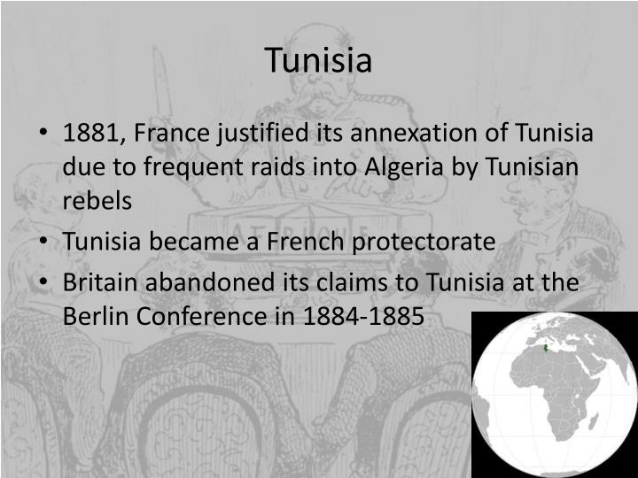
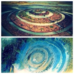
In the last post, I tracked the alignment from Sousse, a port on Tunisia’s Mediterranean Sea coast; through Kairouan, a UNESCO World Heritage Site with the oldest, currently functional University in the world; through Jebel Chambi, which has the highest elevation in Tunisia, above the city of Kasserine, the site of a World War II battle; through El Oued, known as the “City of a Thousand Domes”; Touggourt, a former sultanate until 1854; through Ghardaia, a UNESCO World Heritage site comprised of seven cities in the Mzab River Valley; to the Eye of the Sahara in Central Mauretania, also known as the Blue Eye of the Sahara and the Richat Structure.
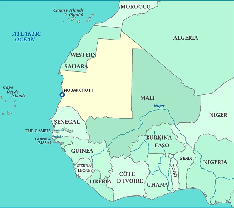
I am picking up the alignment in Nouakchott, the capital and largest city of Mauretania.
It is one of the largest cities of the Sahel, the ecoclimatic and biogeographic zone of transition in Africa between the Sahara to the North, and the Sudanian Savannah to the South.
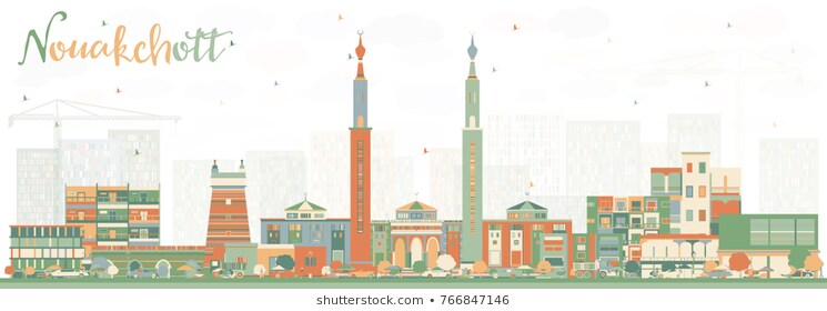
We are told that Nouakchott was a large fortified fishing village in pre-colonial times and under French rule. Why would a fishing village be fortified?
I am unable to find any historic photos of Nouakchott on the internet to see what it might have looked like even around the early 1900s.
I did find this illustration of the skyline of Nouakchott…
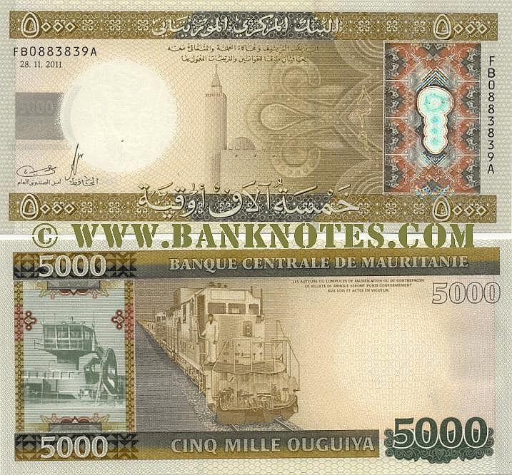
…and this Mauritanian bank note depicting some of the country’s infrastructure.
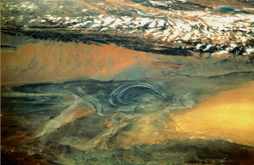
Then I look at the absolutely devastated-looking desert landscape of the whole country from Google Earth, and it makes me wonder about what we are really looking at here.
So I delved into the history of Mauretania to see what I could find out about what we are told in the historical record we have been given.
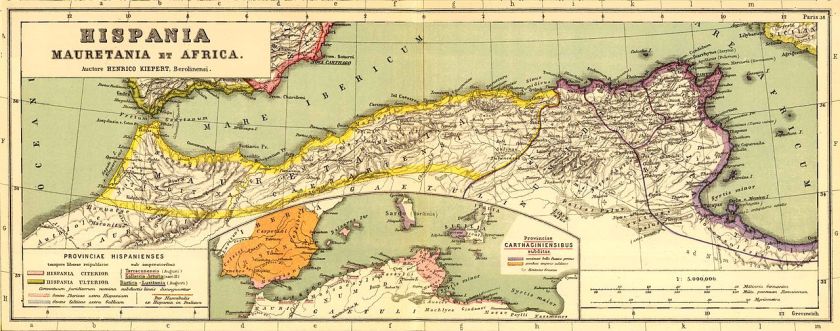
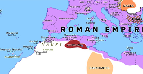
We are told that Mauretania was the Latin name for a region in the ancient Maghreb.
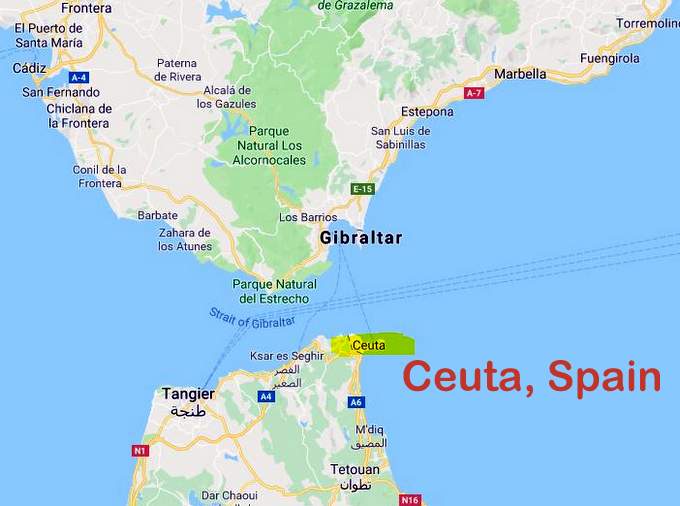
It stretched from central present-day Algeria, westward to the Atlantic, covering northern Morocco, and southward to the Atlas Mountains, and included the cities of Ceuta and Melilla, which are autonomous cities of Spain in North Africa.
Ceuta lies on Strait of Gibraltar, the boundary between the Mediterranean Sea and the Atlantic Ocean…
…and is the location of Jebel Musa, or Mount Moses, considered to be the southern Pillar of Hercules…
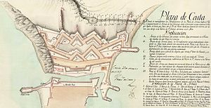
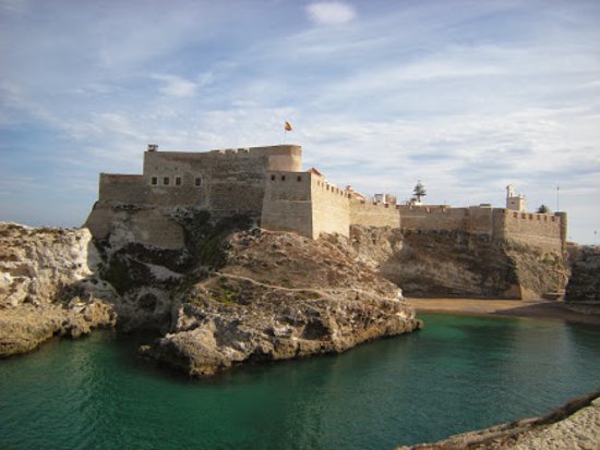
…and the location of the largely intact Royal Walls of Ceuta…
…described as a line of fortifications…
…said to have been built by the Portuguese in the 1540s…
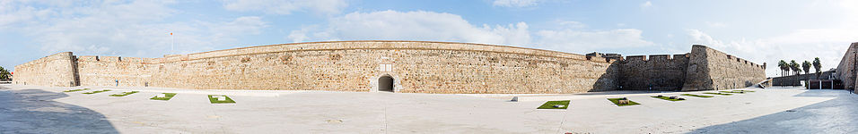
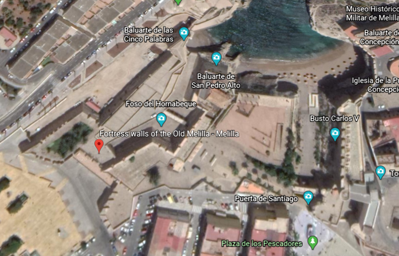
…and Melilla, said to mean the “White One”…
…and which has the fortress walls of Old Melilla, said to have been built in the 16th- and 17th-centuries, after the Spanish conquest of the region in 1496.
Both Ceuta and Melilla are officially claimed by Morocco.
Nevertheless, we are told that the native inhabitants of Mauretania were seminomadic pastoralists of Berber ancestry, and known to the Romans as Mauri…or…Moors.
Berbers are called an ethnic group of several nations, mostly indigenous to Mauritania, Morocco, Tunisia, Algeria, Tunisia, Libya, northern Mali, northern Niger, and a small part of western Egypt.
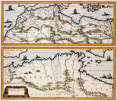
The term Barbary Coast, and Barbaria was said to have been used by Europeans from the 16th-century to the early 19th-century to refer to the regions of North Africa inhabited by the Berber people.
We are taught that the kings of Mauretania became Roman vassals in 27 BC, and that in 44 AD, Mauretania was annexed to Rome as two different provinces – Mauretania Tingitana, or present-day northern Morocco, and Mauretania Caesariensis, or present-day northern Algeria.
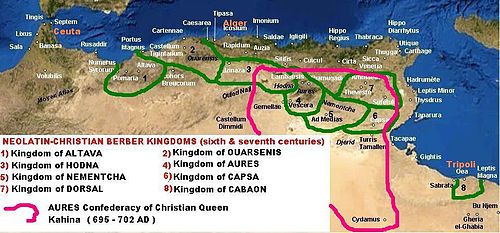
Then, during the Crisis of the Third Century, a period of time when the Roman Empire almost collapsed between 235 and 284 AD, we are told, because of invasions and overall instability within the empire…
…parts of Mauretania were reconquered by Berber tribes, and Romano-Moorish Kingdoms were established during the 6th- and 7th-centuries.
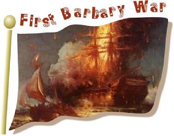
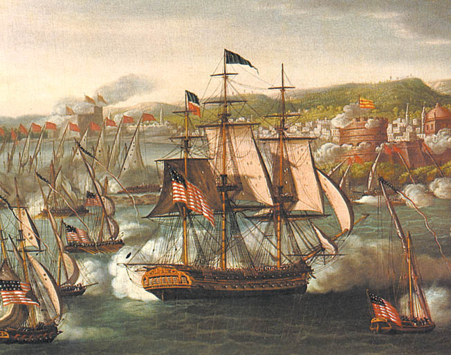
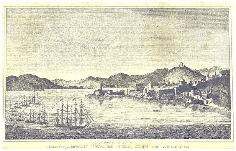
Fast forward through time to the Barbary Wars, a series of conflicts culminating in two main wars fought between the United States, Sweden, and the Barbary States of the Ottoman Empire in the late 18th- and early 19th-century.
We are told that Barbary pirates demanded tribute from American vessels in the Mediterranean Sea, and in 1801, President Thomas Jefferson refused to pay, and sent a U. S. Naval fleet to the Mediterranean in May of that year, and which lasted until 1805.
The naval fleet commenced bombarding various fortified “pirate” cities in present-day Libya, Tunisia, and Algeria, over the next three years until concessions of fair passage were extracted from their rulers, which were most likely the Deys of Tripoli, Tunis, and Algiers, in the First Barbary War.
The second Barbary War took place in 1815 between the United States and the Barbary States, and we are told, brought to an end the American practice of paying tribute to the “pirate” states and marked the beginning of the end of piracy in that region.
I am including what information is available about the Barbary Wars because it is noteworthy.
I would love to know what was really going on here with regards to the Barbary Moors, but that information is nowhere to be found.
Mauretania was administered as a French colony during the first-half of the twentieth-century, achieving independence in 1960, and Nouakchott becoming its capital in 1958, at which time it was described as being a mid-size village of little importance.
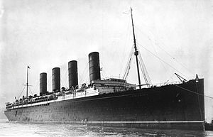
By the way, an interesting side-note is the RMS Mauretania, a passenger ocean liner launched on September 20th of 1906, and said to have been named for the ancient Roman Province of Mauretania, and not the modern country…
…and the sister ship to the RMS Lusitania, named for the Roman province directly to the north of Mauretania, across the Strait of Gibraltar, which is famous in history for having been sunk by a German u-boat in 1915 off the coast of Ireland.
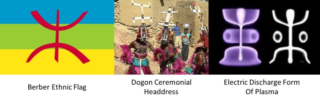
This is a comparison of the Berber ethnic flag on the left, with ceremonial headdresses of the Dogon people, who live on the Bandiagara Escarpment in Mali, and the laboratory electric discharge form of plasma next to a form called the stickman that is found in rock art worldwide.
Think the ancient Peoples of the Earth might know something that we don’t?
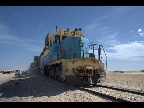
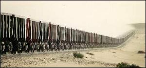
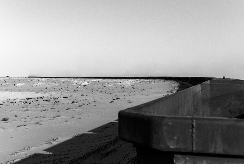
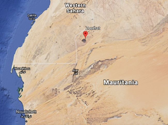
The iron ore trains of Mauretania are some of the longest, if not the longest, in world, at 1.6-miles, or 2.5-kilometers, long…
…hauling iron ore, people and goods, 405-miles, or 652-kilometers between the mining town of Zouerat on the west side of Kediet ej Jill, the highest peak in Mauretania, through the Sahara Desert, to the port city of Nouadhibou on Mauretania’s coast.
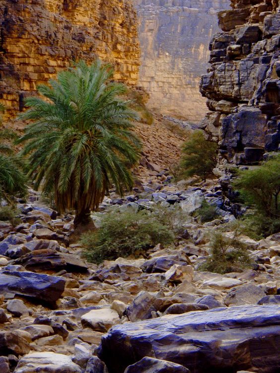
This is a view on the top left in the Amogjar Pass between Atar and Chinguetti in Mauretania, compared with similar-looking ones at Thule, Greenland on the top right; Cutimbo in Peru on the bottom left; and in the Village of Oak Creek, in Sedona, Arizona on the bottom right.
Atar is situated next to the corner of the Eye of the Sahara discussed at the end of the last post…
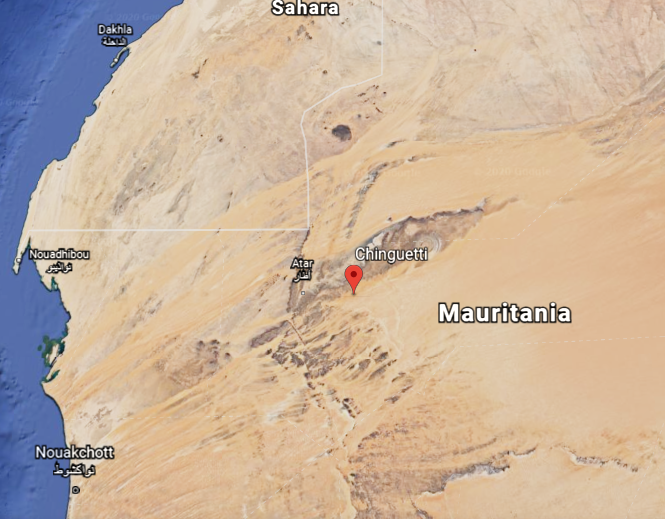
…and Chinguetti is located on the lower lid of the Eye.
Chinguetti is called the Holy City of the Sahara, and venerated as one of the most holy cities of Islam…
…and has some of the world’s oldest surviving copies of Korans and other documents.
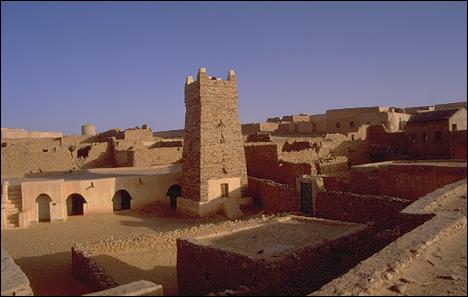
Then there was Ouadane, situated pretty darn close to the eyeball of the Eye of the Sahara.
What was once one of Africa’s key trading posts, and a UNESCO World Heritage site today.
It is largely in ruins, even though there is a settlement of people still living there outside the gates.
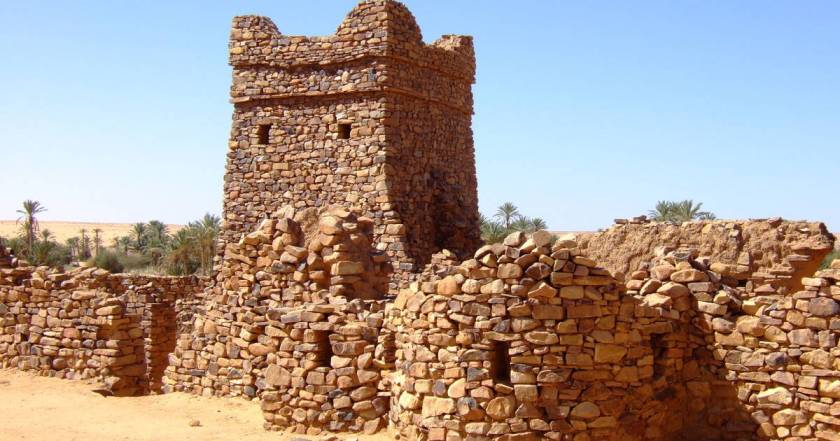
I noticed the Banc d’Arguin National Park on the coast, another UNESCO World Heritage Site located north of Nouakchott, and went there to take a look, as I consistently find that for as much of the ancient civilization as is destroyed, neglected, or incorporated in unprotected places, much is preserved intact in parks.
I must say that to this day, I am never disappointed. I can’t emphasize enough that this Ancient Civilization is everywhere – there is not place in the world that it is not.
The island of Arguin in the Bay of Arguin was first thing I noticed when I looked at Google Earth.
The interesting thing about Arguin, part of the National Park, is that while there is not much going on there now…
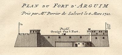
…at one time there was a lot going on there, including a star fort, said to have been built by the Dutch, which doesn’t appear to exist any more.
We are told that starting in 1443, it became a part of the Portuguese Empire; and, at different times over the centuries, it was part of the Dutch Empire; part of the territories and provinces of Prussia; and part of the French overseas empire.
The shallows of the Banc d’Arguin National Park are said to be remnants of a vast river delta from a time when waters flowed from what is now the Sahara Desert…
…and the Banc d’Arguin is a major breeding site for migratory birds, and its surrounding waters are some of the richest fishing waters in western Africa, serving as nesting grounds for the region.
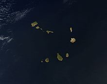
From Nouakchott, the next place we come to on the alignment are the Cape Verde Islands.
The island Republic of Cape Verde is 350-miles, or 570-kilometers, off the coast of western Africa, and consists of 10 islands, divided into two groups.
One group is called the Barlavento, or Windward, islands of Sando Antao; Sao Vicente; Santa Luzia; Sao Nicolau; Sal; and Boavista.
The other group is called the Sotavento, or Leeward, islands of Santiago; Maio; Fogo; and Brava.
They are part of what is called “Macaronesia,” a collection of four archipelagos in the North Atlantic Ocean off the coasts of Africa and Europe, also including the Canary Islands, Madeira, and the Azores.
Santiago is the country’s largest island, and where its capital, Praia, is located.
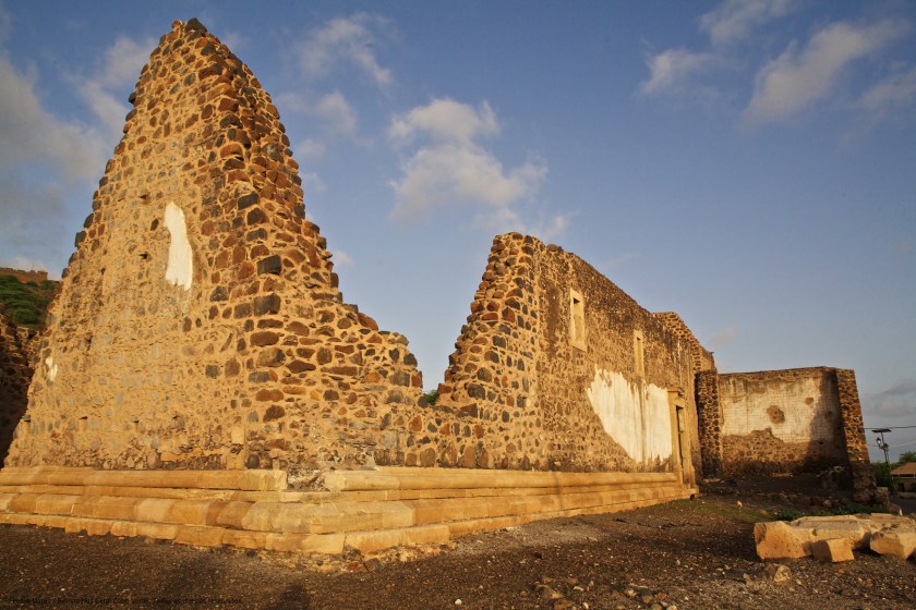
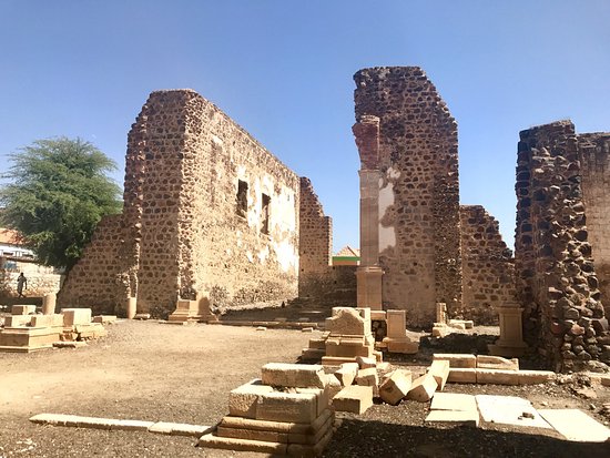
We are told the islands were uninhabited before the arrival of Portuguese and Genoese navigators in 1456, with Portuguese settlers arriving in 1462 and founding a settlement called Ribeira Grande, now called Cidade Velha, the historic center of which is a UNESCO World Heritage Site.
These are what appear to be the very old stone ruins of what is called Se Catedral in Cidade Velha…
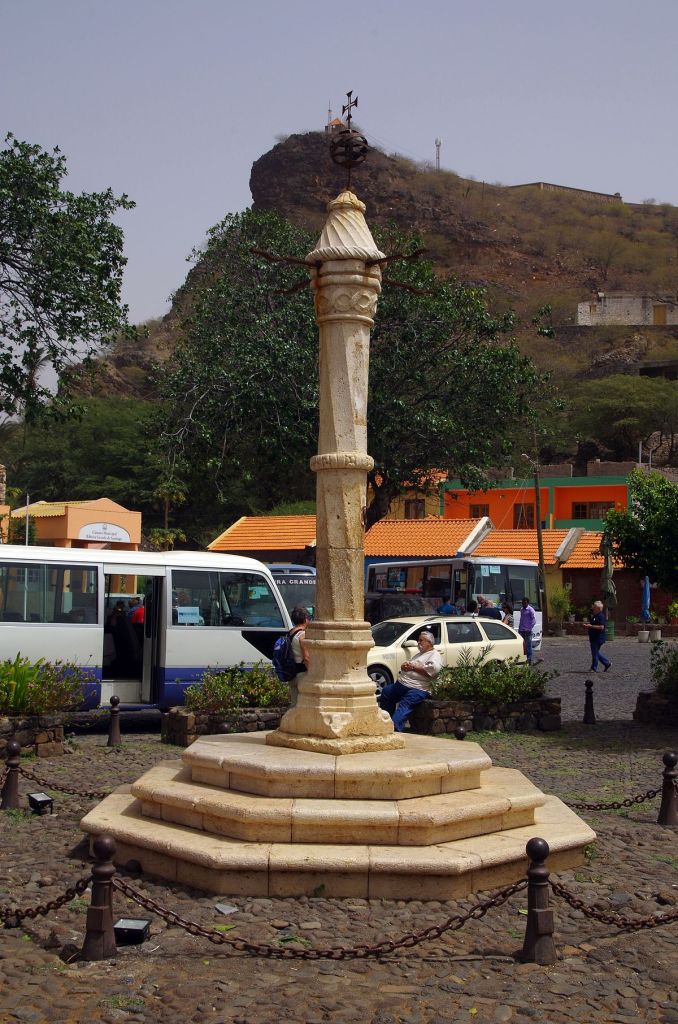
…and a monument called the Pelourinho, said to have been erected in the early 1500s.
Could that have been an antenna at the top of it?
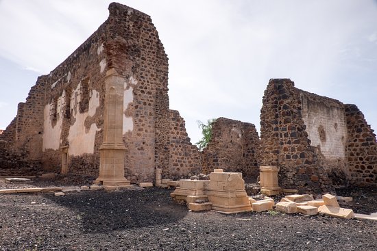
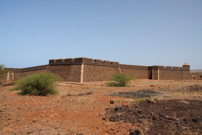
There is also an intact star fort in Cidade Velha, called the Fort Real de Sao Filipe, said to have been built by the Portuguese between 1587 and 1593, and part of a system of defense for the city, which included six smaller forts on the coast and a wall along the port that apparently no longer exists because I can’t find any information about them.
Moving over to look at Praia, the capital city, I see the familiar shape of the harbor there, compared for example, to the harbor back in Sousse, Tunisia, on the other side of Africa.
The red dots mark where lighthouses are located, and I typically find pairs of lighthouses at harbor entrances around the world…
…like at Sousse.
The Farol de Dona Maria Pia is the lighthouse at the southern most point of the island of Santiago at the entrance of Praia Harbor.
Based on what I have found at other locations with a similar harbor configuration, I would expect to find a lighthouse at the head of the opposite jetty.
But there isn’t one.
It looks like something is standing there, but not a lighthouse, and I could find no record of one being there.
Lastly, it is interesting to note that the Cape Verde Islands are specifically mentioned in the Inter Cetera Bull, issued by Pope Alexander VI on May 4th of 1493.
This papal bull essentially authorized the land grab of the lands of the Moorish civilization in the Americas, and became a major document in the development of subsequent legal doctrines regarding claims of empire in the “New World.”
The bull assigned to Castile “the exclusive right to acquire territory, to trade in, or even approach the lands laying west of the meridian situated one hundred leagues west of the Azores and Cape Verde Islands, except for any lands actually possessed by any other Christian prince beyond this meridian prior to Christmas, 1492.”
In the historical narrative we have been given, this papal bull was issued a year after the Fall of Grenada, on January 2nd, 1492, effectively ending Moorish rule in Spain when Muhammad XII surrendered the Emirate of Grenada to King Ferdinand of Aragon and Queen Isabella of Castile.
I am going to end this post here, and pick up the alignment at Fernando de Noronha, a group of islands off the coast of Brazil near Natal in the next post.
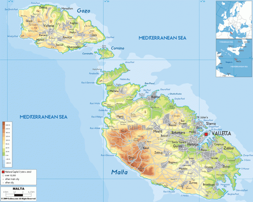
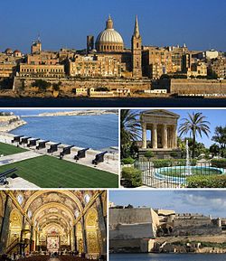
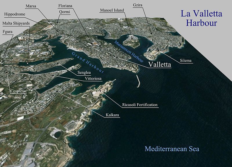
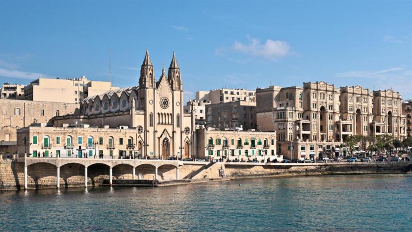
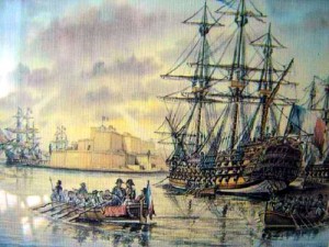
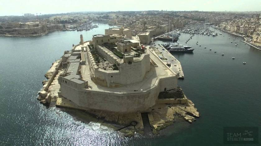
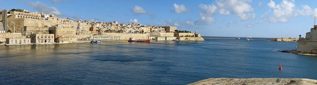
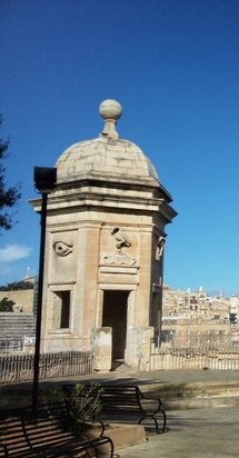
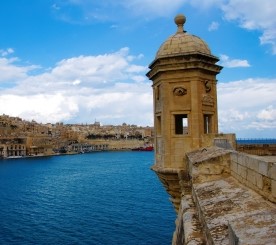
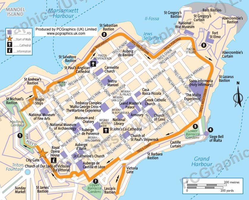
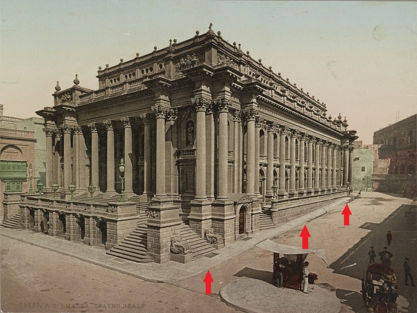
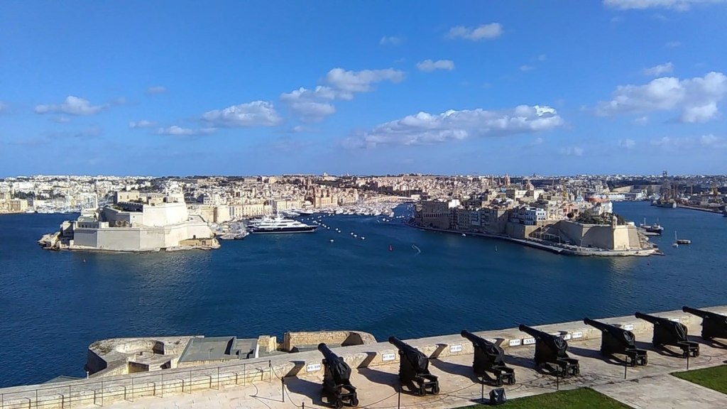
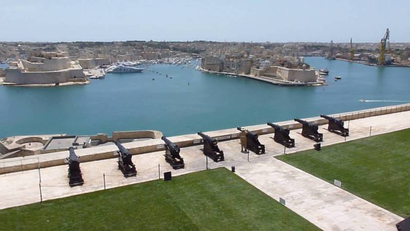
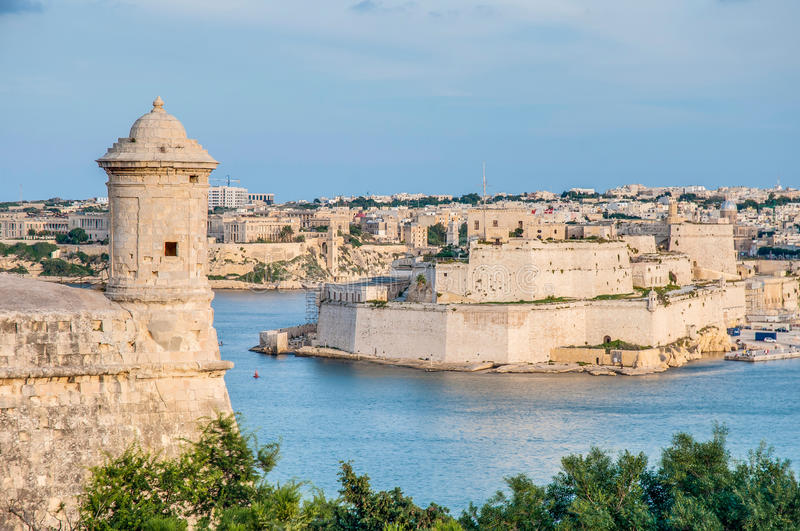
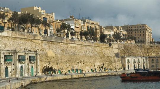
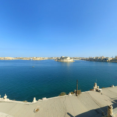
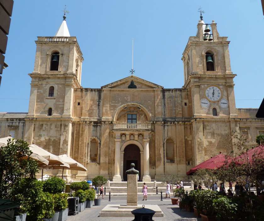
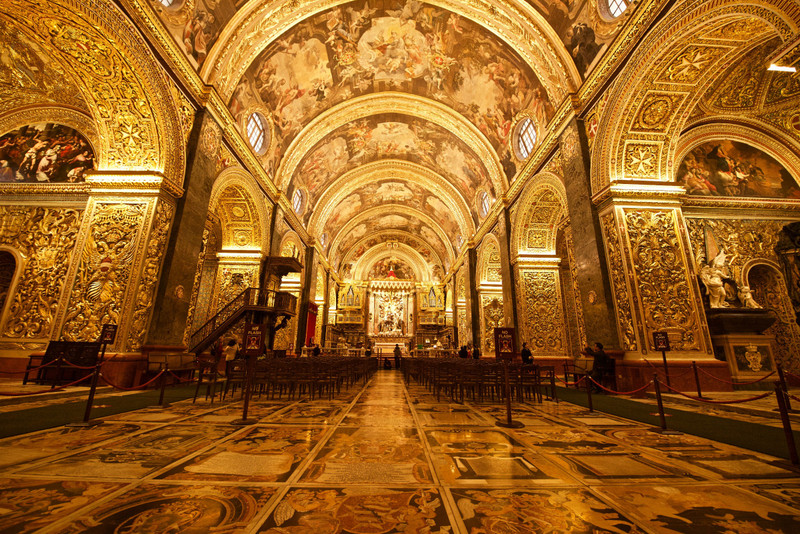
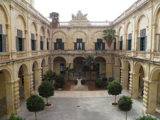
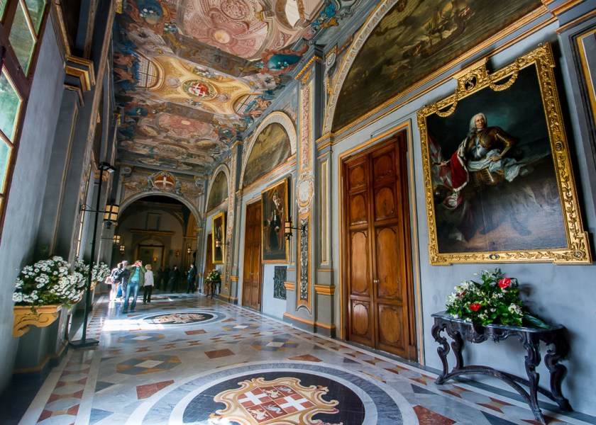
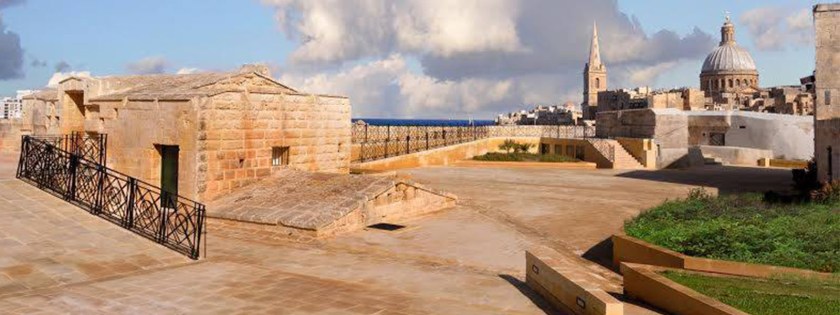
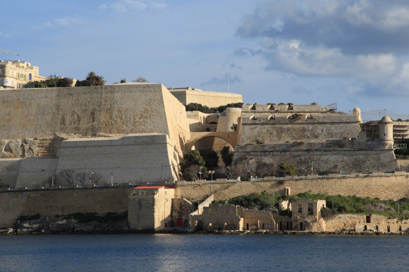
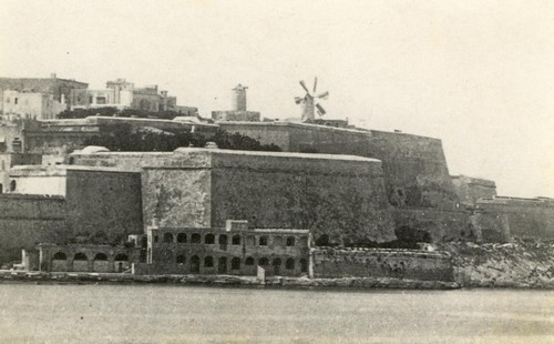
in the last post, I took a tour of the amazing city of Valletta, and capital of the island Republic of Malta. I looked around what is found in the Marsamxett Harbor; around the Grand Harbor; and within the city walls of Valletta.
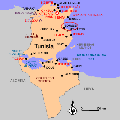
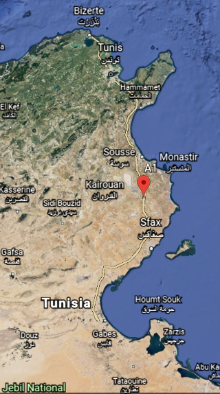
I am picking up the alignment in Sousse, the capital of Tunisia’s Sousse Governorate, one of the 24 governorates of Tunisia, and located 87-miles, or 140-kilometers, south of the nation’s capitol of Tunis.
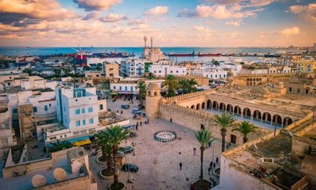
Sousse is considered one of the most beautiful cities in Tunisia, and is located on the Gulf of Hammamet.
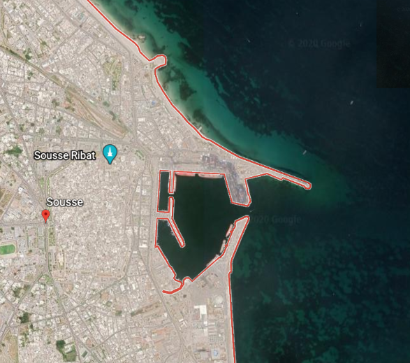
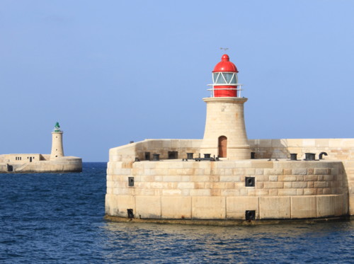
Sousse is a transportation hub. It is a port city…
…where the are two lighthouses at opposite ends of the harbor entrance…
…just like what we saw in Valletta, Malta…
…and even at the Port of Dover, England, in the English Channel.
Sousse is linked by the widest road in the country, the A-1 Motorway, a 153-mile, or 247-kilometer, highway that connects Tunis with Sfax, another port city in southern Tunisia, and conceived of as part of an international project called the Trans-Maghreb Highway.
The Maghreb is another name for northwest Africa, a region which we are told was referred to in English and European sources, in the 16th- through 19th-centuries, as the Barbary Coast.
What we are also told about the Maghreb is that during the era of al-Andalus in Moorish Spain between 711 AD and 1492 AD, the Maghreb’s inhabitants, Muslim Berbers or Maghrebi, were known by the European’s as “Moors”…and that’s about as much as they will give up to us directly about this particular subject.
Sousse is also connected by railway to Tunis, and has roads and railways leading further into the country and towards the neighboring country of Libya.
As we are told about so many other places, the construction of the railway was attributed to the French colonizers, and not to the original inhabitants.
So I took a look at the history of Tunisia to see what else I could find.
At the beginning of the 1800s, Tunisia was described as a quasi-autonomous province of the Ottoman Empire.
Its trade increased dramatically with Europe in the 1800s, with the arrival of western merchants wanting to establish business in the country.
Then, the Bey of Tunis from 1855 to 1859, Muhammad, was forced by the British and French to sign the 1857 Fundamental Pact, which increased freedoms for non-Tunisians.
Here’s another clue we are talking about Moors.
Bey is one of the five noble titles of the Moors, the other four being – Dey, El, Al, and Ali.
We are told that under the Ottoman Empire, Bey was the title of the governor of a province.
Then, we are told, in 1861, Tunisia enacted the first constitution in what was called the Arab world, but a move toward a modernizing republic was said to have been hampered by a poor economy and political unrest.
We are starting to see the use of the world “Arab” replacing that of “Moor.”
Contained within the 1861 Constitution of Tunisia, we find that it was also the first state to establish Islam as its religion.
The world would be in a much better place if we were talking about Moorish Islam, which is about reconnecting with our higher selves and raising our level of consciousness into Higher Consciousness.
I think this marked the beginning of turning formerly Islamic States (i.e. Moorish Islam) into the mechanism for creating a new form of fundamentalist Islam, where it was conceptually altered in order to lead us to what we see now as radical Islam, and its destructive role in today’s world.
Regardless of the new Constitution, when the Tunisian government couldn’t manage the loans made by foreigners to the government, it declared bankruptcy in 1869.
Then Britain and France cooperated between 1871 and 1878 to prevent Italy from acquiring Tunisia as a colony having investment, and subsequently Britain supported the French interest in Tunisia in exchange for dominion over Cyprus.
Using the pretext of a Tunisian invasion into Algeria, the French invaded Tunisia with an army of 36,000, which quickly advanced to Tunis, entering by way of places like Sousse on the coast…
…and subsequently occupying Tunis.
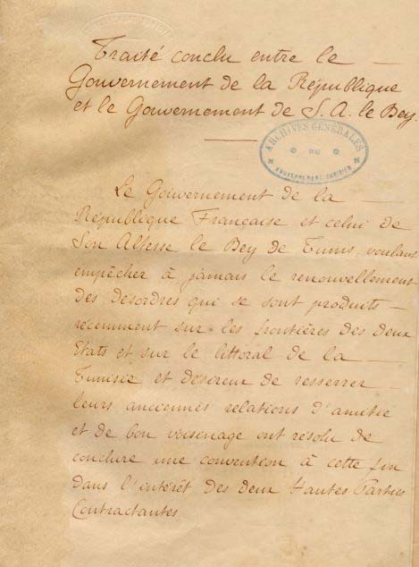
Then, the French forced the new Bey, Muhammad III as-Sadiq, to make terms in the form of the 1881 Treaty of Bardo, which gave France control of Tunisian governance and making it a de facto French Protectorate.
The French progressively assumed more of the important administrative positions, and by 1884 they supervised all Tunisian government bureaus dealing with finance, post, education, telegraph, public works, and agriculture.
French settlements were encouraged, with the number of French settlers said to have grown from 34,000 in 1906, to 144,000 in 1945, and the French administration weakened the local tribes in rural areas.
This was said to depict an urban map of Tunis between 1890 and 1914.
Then, on March 20th, 1956, Tunisia achieved its independence from France with the establishment of a Constitutional Monarchy…
…with the last Bey of Tunis, Muhammed VIII al-Amin Bey, as the King of Tunisia.
This State of Affairs didn’t last long, as the Prime Minister, Habib Bourguiba, abolished the monarchy in 1957, and proclaimed the Republic of Tunisia the same year, and served as its President for the next thirty-one years.
At the same time the constitutional monarchy of Tunisia was abolished, the Beylik of Tunis was terminated as well, described as a largely autonomous Beylik of the Ottoman Empire.
This whole series of events seems to be a template for how the Moorish Empire was taken down in different parts of the world, and after I am done with this series, I am going to put together a comprehensive post with all of the examples I have found about this subject.
If this represents true history in the new historical narrative, I think it is possible that places like Tunisia, and others which were not wiped out by a worldwide flood of mud, were taken down by the Controllers by other means, typical of the events seen in Tunisia.
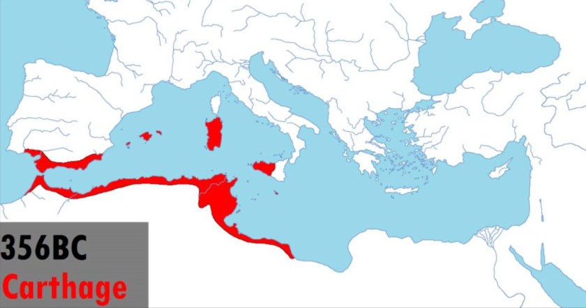
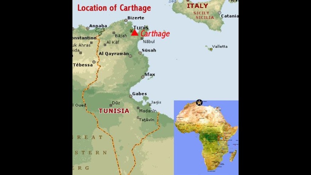
Among other things, it is interesting to note that the Carthaginian Empire was centered in Tunisia…
…and the powerful ancient city of Carthage was located in the vicinity of Tunis.
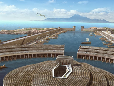
This reconstruction of how Carthage was said to have looked is typical of depictions of it, and its protected harbor called a cothon, which were said to have been generally found in the Phoenician world.
Carthage was said to have been founded by Phoenician settlers from Tyre and Sidon in the modern-day country of Lebanon, and destroyed by Roman forces in 146 BC at the end of the Third Punic War.
I find it very interesting that there is a narrow strip of the National Forest of Tunisia between A1 Motorway and the coast of Hammamet Bay, between Sousse and the resort town of Hammamet to the North, given the overall desertified nature of the place.
We will see more on the desertification of the region as we move into northern Africa’s Sahara Desert.
There are many olive tree groves south of where the strip of National Forest is located, adjacent to the Gulf of Hammamet Bay, in the vicinity of el Kantaoui Port, north of Sousse Proper.
Olives are Tunisia’s most important natural resource, and Sousse is the center of the production and sale of olive oil in Tunisia.
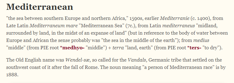
Tunisia, and the coast of North Africa, is the southern boundary of the Mediterranean Sea.
If you break-down the meaning of Mediterranean Sea, you come up with “Middle Earth” Sea.
Interestingly, the Great Pyramid of Giza in Egypt, the northern border of which is on the Mediterranean Sea, has been calculated to be the center of the land mass of the Earth.
Carl Munck in “The Code,” deciphers a shared mathematical code, related to the pyramids of Giza, in the dimensions of the architecture of sacred sites all over the planet, one which encodes longitude & latitude of each that cross-reference other sites.
He shows that this pyramid code is clearly sophisticated and intentional, and perfectly aligned geometrically over long-distances.
The Great Pyramid was the prime meridian of the Earth until the prime meridian was moved to the Royal Observatory in Greenwich, England…in 1851.
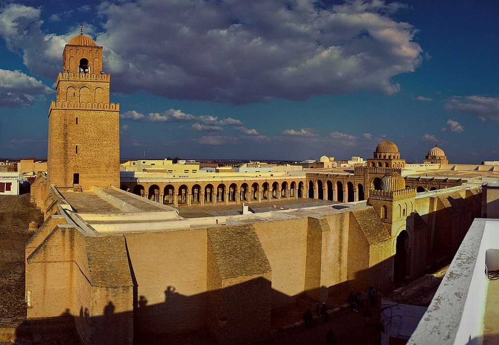
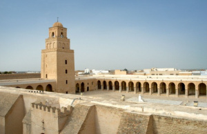
Next on the alignment in Tunisia, we come to Kairouan, the capital of the Kairouan Governate and a UNESCO World Heritage Site.
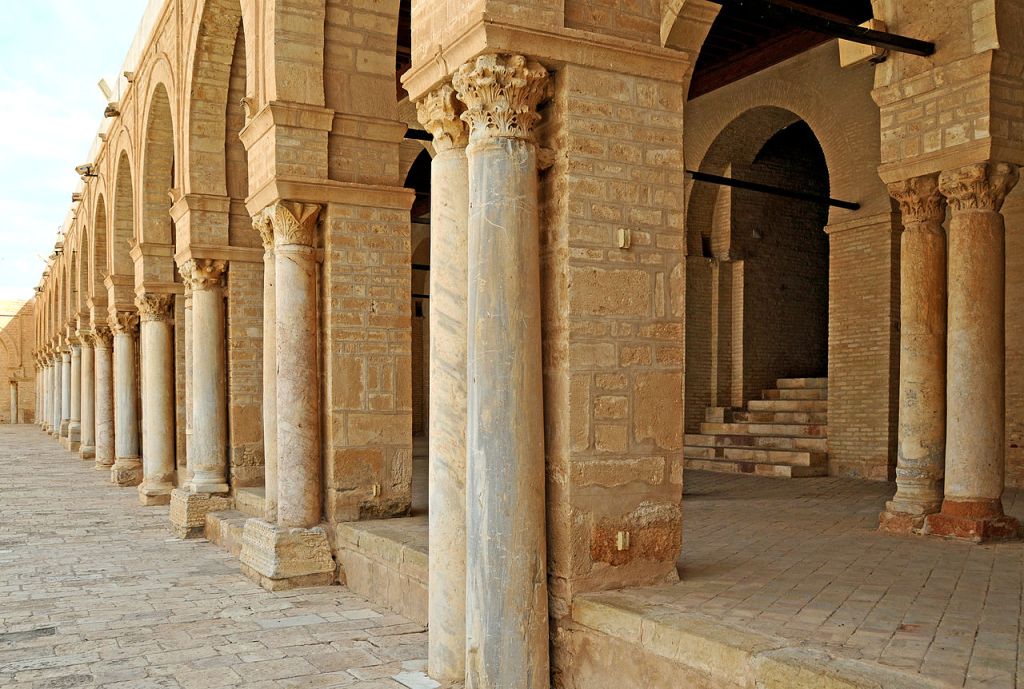
The Great Mosque of Kairouan, also known as the Holy Mosque of Uqba, is considered to be one of the most impressive and largest Islamic monuments in North Africa.
It is one of the oldest places of worship in the Islamic world, said to have been established in 670 AD, and the model for all later mosques in the Maghreb.
We are told during the Aghlabid Dynasty between 800 AD and 909 AD, the ruler of Ifriquiya in today’s North Africa, established a University in Kairouan as part of the Great Mosque complex, and that it became a center of education in both Islamic thought and in the secular sciences.
It is said to be in the Guiness World Book of Records as the oldest, currently functional, university in the world.
The Aghlabids were said to have built palaces, fortifications, and fine waterworks, of which only the pools remain.
For example, these are called the Aghlabid Basins, said to have been built in the 9th-century as water storage for the Aghlabid Palace, which was on the site of a present-day cemetery in Kairouan.
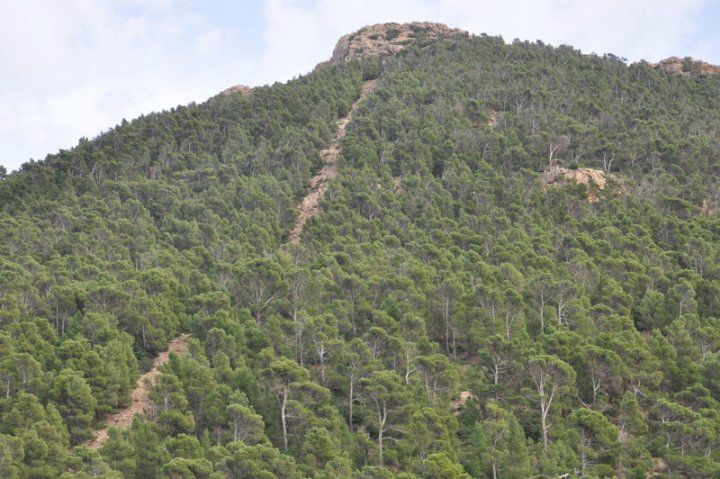
Jebel Chambi is the next place on the alignment, the highest mountain in the country, standing above the city of Kasserine in western central Tunisia.
The summit is covered by a pine forest and is part of Chambi National Park.
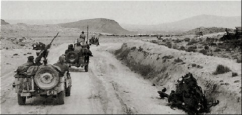
Interestingly, the Battle of Kasserine Pass took place during the Tunisia Campaign of World War II. It was the first major engagement between American and Axis forces in Africa.
With the Axis German and Italian Forces led by Field Marshall Erwin Rommel, it was an early defeat for Allied forces.
Interesting that there are so many military engagements historically that have taken place along these alignments I have been tracking – the Napoleonic Wars, World War I, World War II, among other kinds of wars.
It makes me wonder what they were really all about…like maybe damage to, and in many cases, the complete destruction of, the ancient advanced Moorish Civilization and the earth’s energy grid system.
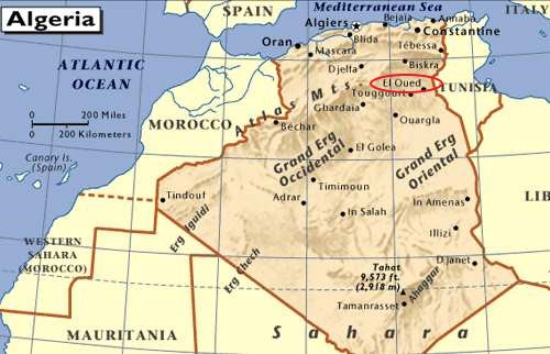
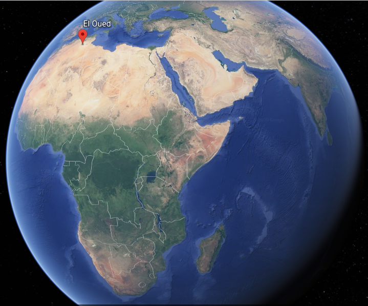
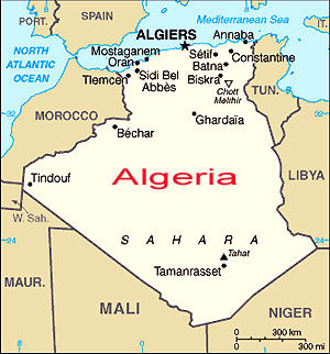
The next place we come to on the alignment is El Oued, the capital of Algeria’s El Oued Province in the Sahara Desert in northeast Algeria.
The oasis town of El Oued is watered by an underground river, which allows for date palm cultivation.
It is also known as the “City of a Thousand Domes” since most rooves are domed.
In El Oued Province itself, we find the Chott Melrhir, an endorheic salt lake (a limited drainage basin with no outflow)…
…and the westernmost of a series of depressions, from the Gulf of Gabes in the Mediterranean Sea into the Sahara.
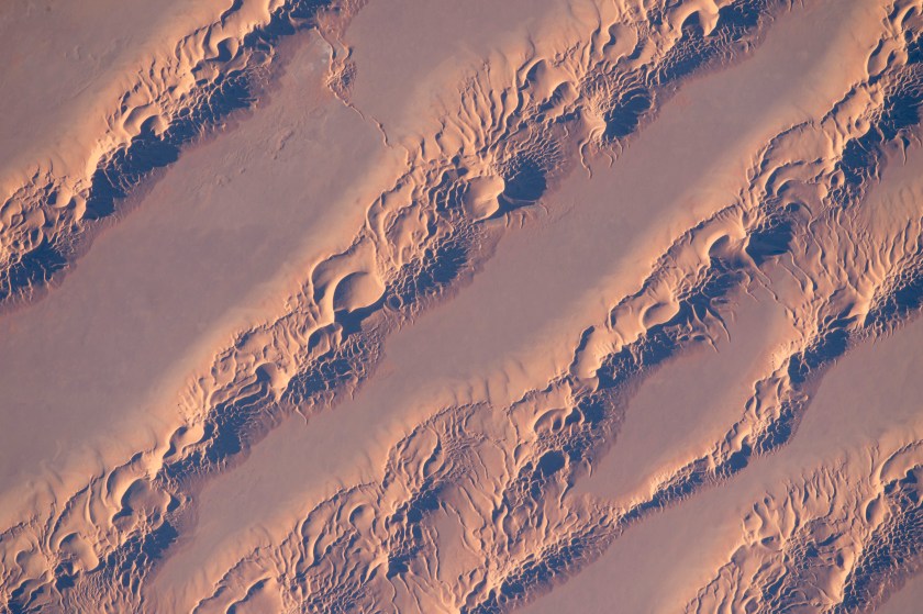
The Grand Erg Oriental, or Great Eastern Sand Sea, is in the southern part of the province, is a field of sand dunes.
Can’t help but wonder if there is enduring infrastructure underneath all that sand!
The Grand Erg Oriental used to be associated with the Wadi Igharghar, described as a dry and mostly buried river with a sizeable number of tributaries (a canal-system?) that flowed north into the Erg from the Ahaggar Mountains to the south of it.
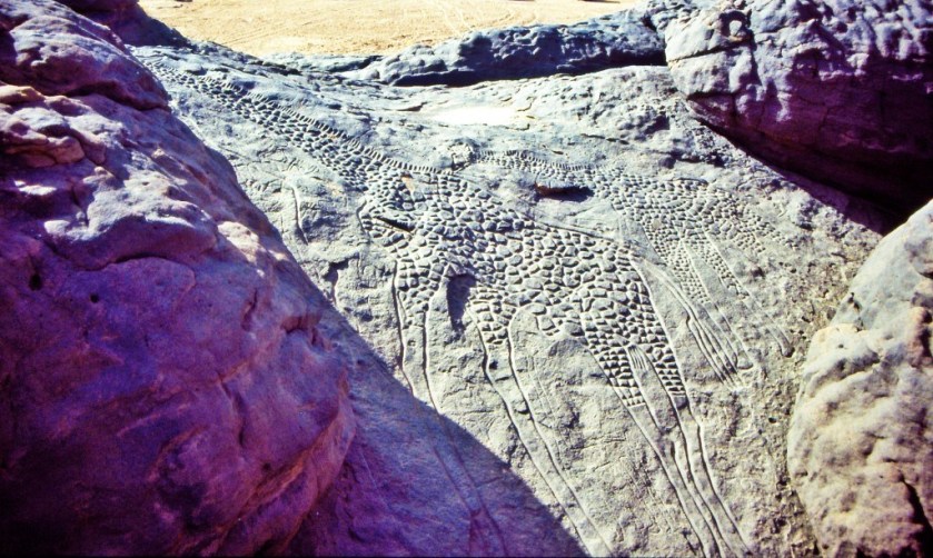
At one time, not only did the Sahara Desert have a fertile, savannah-type ecosystem, supporting a wide-and-varied wildlife population, like these life-sized giraffes carved in rock in the Sahara…
…the region now called the Sahara desert had great forests, including but not limited to, oak, elm, alder, juniper, and pine. As you can see in this picture, we are taught the desertification of this region started happening a long time ago. Maybe. Maybe not. There is so much that we have not been told about.
The silence about the history of this region of the world in the present-day is deafening.
This is a good place to bring up desertification of certain places around the world, like the Sahara Desert.
I mean, is all of the desertification around the world the result of natural processes over time? Or did something happen to cause it all of a sudden?
Next on the alignment from El Oued, we come to the city of Touggourt, the capital of Algeria’s Touggourt Province, and a former Sultanate.
The Sultanate was abolished by French colonial authorities in Algeria in 1854, and after about a 50-year period of time, it became an autonomous administrative district in what was called the Southern Territories of Algeria.
Touggourt is situated next to an extensive system of oases which supports palm plantations and other agriculture in a 31-mile, or 50-kilometer, north to south area. Here is a close-up of place with some kind of agriculture…and where you can see what appears to be what used to be infrastructure in the surrounding desert.
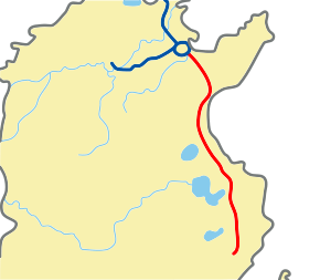
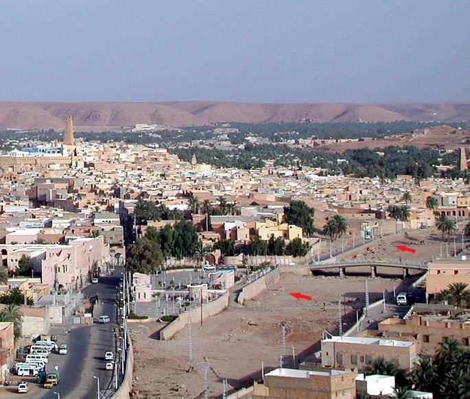
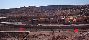
The next place on the alignment is Ghardaia, the capital of Algeria’s Ghardaia Province.
It lies along the west bank of the Wadi Mzab, described as a dry riverbed.
I couldn’t find a picture of the mostly underground Wadi Igharghar back in the Grand Erg Oriental, but it is not hard to find pictures of the Wadi Mzab…showing masonry banks.
The Wadi M’zab Valley in Ghardaia Province has been a UNESCO World Heritage Site since 1982.
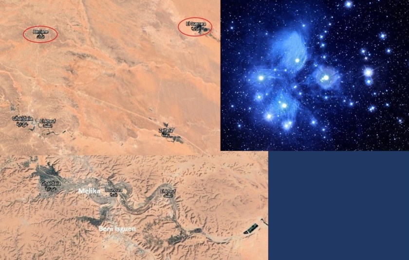
The cities of the Wadi M’zad Valley are seven in number, with five built close together, and two lie further out.
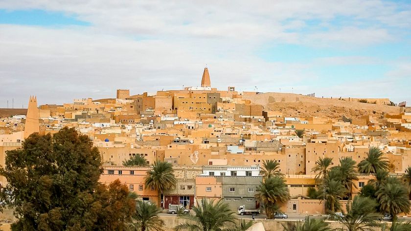
Ghardaia is upstream of the other four cities that form what is called the “pentapole,” and is the commercial capital of the Mzab…
…with its dominating mosque…
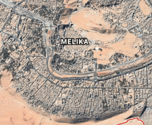
…then next downstream comes Melika…
…with its unique-looking Sheikh Sidi Aissa Cemetery…
…then we come to Beni Isguen…
…the most traditional city of the Mzab Valley, and in which any visitor must be accompanied by an authorized guide or member of the community…
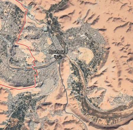
…next we come to Bounoura…
…meaning “the Luminous…”
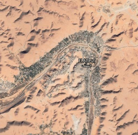
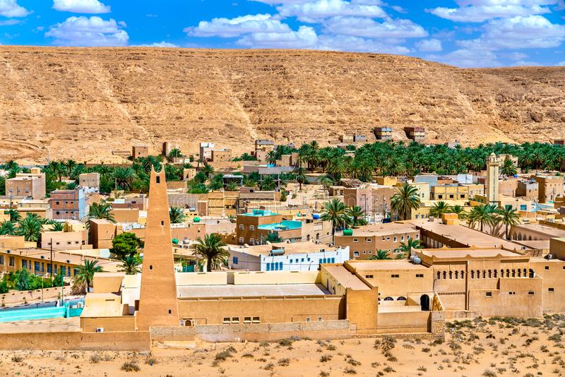
…and El Atteuf…
…which means “The Turn…”
…and all five are close together on the snaky, S-shaped river bends of the Wadi Mzad.
The other two cities of that constitute the seven cities are:
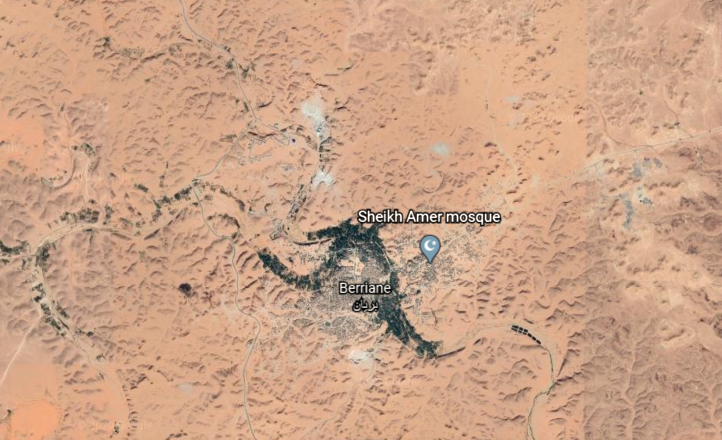
…Berriane, located on National Road 01, one of the country’s important highways…
…and El Guerrara, on the passageway for caravans crossing the Sahara, from east-to-west, and north-to-south…
…and are located further out from the other five.
Taking a look at the Pleiades, I don’t think it is a stretch to say that the seven cities of the UNESCO World Heritage Site of the Wadi M’zad Valley form a star map of the Pleiades, also known as the Seven Sisters.
Before I leave Algeria, and head into Mauretania, there is one more place I would like to bring to your attention.
You can easily find this information if you look for it, as it is not hidden from us like so much else, but most people don’t know about it.
While Reggane is not directly on the alignment I am tracking, it is relatively close to it.
Reggane is the capital of Algeria ‘s Adrar Province.
France began its nuclear testing program in Reggane in 1960 – 1961, before Algeria’s independence.
They conducted four atmospheric nuclear tests, which contaminated the Sahara Desert with plutonium, negatively impacting those who live here to this day – not only Reggane, but far beyond.
Between 1960 and 1966, a total of 17 nuclear tests were conducted in the Reggane District of Algeria. It was called Africa’s Hiroshima.
The last place I am going to highlight on the alignment in this post is the Eye of the Sahara, which is near Ouadane in central Mauretania.
It is visible from space, and has been used by NASA astronauts as a visual landmark.
The Blue Eye of the Sahara, also known as the Richat Structure, is described as a geological formation in the Sahara Desert that resembles an enormous bulls-eye.
It is highly symmetrical, and measures 25-miles, or 40-kilometers in diameter.
Three nested rings dip outwards from the center of the structure, and are all equidistant from the center.
Some have speculated that this configuration matches that of Atlantis as described by Plato.
If it is a man-made structure, and not natural as many want us to believe, why does it look melted?
It resembles Lop Nur, an ancient salt lake in the Takla Maklan Desert in the Southeastern portion of the Uighur Autonomous Region of Xinjiang in China…
…and the location where the Chinese Nuclear Weapons Test Base had four nuclear testing zones, starting in 1959 – with H-Bomb detonation in 1967 – until 1996, with 45 nuclear tests conducted.
In the last post, I took a close look at the Strait of Messina, particularly the narrowest point between the eastern tip of Sicily, and the western tip of Calabria in Italy; the city of Messina, a major port andthe third-largest city in Sicily; then across to Mount Etna, one of the most active volcanos in the world; and ended at Catania, a city on the Sicilian coast that lies at the foot of Mount Etna.
From Sicily, the alignment I am tracking crosses over the island Republic of Malta, in the vicinity of its capital, Valletta…
…and located in the Southeastern Region of the main island…
… one of the five regions of Malta…
…between the Marsamxett Harbort and the Grand Harbor.
Marsamxett Harbor is described as a natural harbor generally more dedicated to leisure use than the Grand Harbor…
…and is bounded to the north by Dragut Point and Tigne Point…
…where we find Fort Tigne…
…said to have been built by the Order of the Knights Hospitallers of St. John between 1793 and 1795 and claimed to be one of the oldest polygonal forts in the world.
We are told the Order of the Knights Hospitallers of St. John ruled Malta from the time when the Emperor Charles V (who was also King Charles II of Sicily) gave the islands of Malta and Gozo to the Order in 1530, as well as Tripoli in Libya, until the time the Order surrendered to Napoleon when the French landed in Malta in 1798.
Known usually by the shorter Order of St. John, the Maltese Cross was said to have been officially adopted by the Order in 1126.
And today’s Order of St. John was chartered by Queen Victoria in 1888 as a British Royal Order of Chivalry.
Interesting to note that I have found two different portraits of Charles V, Emperor of the Holy Roman Empire between 1500 and 1558, each having similar facial structure and tilts of the chin, and wearing similar clothing.
Manoel Island is a small island in Marsamxett Harbor, situated close to Tigne Point…
…and the location of Fort Manoel…
…said to have been built in the 1720s by the Portuguese 66th-Grand Master of the Knights of Malta, Antonio Manoel de Vilhena.
We are told the British military took over the fort in 1800, and renamed it HMS Phoenicia, who used it until 1964…relatively recently.
Manoel Island is connected to the town of Gzira, in Malta’s Central Region, by a bridge…
…where we find an Orpheum Theater, said to have been built in 1932.
There are two points I would like to make about this finding.
This is the first point.
Orpheus was a musician and poet in Ancient Greek legend, said to have had the ability to charm all living things, and even stones, with his music.
In the course of my research, I found numerous early theaters called “Orpheums,” like the one in Gzira in Malta, including the Orpheum Theater in Los Angeles, California…
…the Orpheum Theater in Boston, Massachusetts…
…in Memphis, Tennessee…
…and in Phoenix, Arizona.
What, exactly, caused us to go to sleep, and forget who we are, and what we were? How has the false information we have been taught in school been reinforced?
Why would this be important to whoever was responsible for removing the ancient advanced civilization from our collective awareness to begin with?
The second point that I would like to make about the Orpheum Theater in Gzira is its street-corner style of architecture…that I have found worldwide, like in Merida, Mexico in the top middle; Juarez, Mexico, on the top right; and on the bottom left, in Kherson, Ukraine; bottom middle, Summerside in Prince Edward Island; and on the bottom right, in Conakry, the capital of the African country of Guinea.
Fort St. Elmo stands on the seaward shore of the peninsula that divides Marsamxett Harbor from the Grand Harbor…
…and said to have been built in its present form as a star fort in the 1550s.
It was the target of aerial bombardment on the first day Malta became involved in the conflict of World War II.
Fort St. Elmo is situated in the middle at the entrance to the two main harbors, between Fort Tigne at the entrance to the Marsamxett Harbor, and Fort Ricasoli at the entrance of the Grand Harbor.
Fort Ricasoli was said to have been built by the Order of St. John between 1670 and 1698.
Fort Ricasoli was said to have seen use during the French invasion of Malta, led by Napoleon himself, in 1798, which was part of the Mediterranean Campaign in the War of the Second Coalition of the French Revolutionary Wars.
After the British Royal Navy destroyed the French Mediterranean fleet at the Battle of the Nile on August 1st, 1798, the British were able to initiate a blockade of Malta, assisted by an uprising of the native Maltese against French rule. The blockade effectively ended the French Occupation of Malta in 1800, and replaced it with British Protectorate, returning control of the central Mediterranean to Great Britain.
Malta held the status of British Protectorate for 164-years, until it gained its independence from Britain in 1964.
Though Fort Ricasoli, like Fort St. Elmo, was bombarded during World War II and parts of it destroyed, today the fort remains largely intact.
It is used as a filming location…and tank-cleaning facility for the Malta Drydocks, treating liquid waste from ships arriving in the Grand Harbor, removing oil and other chemicals prior to releasing the waste into the sea.
These are the pair of lighthouses, one at Fort St. Elmo and the other at Fort Ricasoli, located on man-made breakwaters at the entrance to the Grand Harbor.
The Maltese language is spoken in the islands, in addition to English and Italian.
Maltese is related to Arabic, but written in the Latin alphabet.
The Maltese word for a lighthouse is “fanal.”
Back on Kefalonia in the Ionian Islands of western Greece, I found a lighthouse at a place called “Fanari Point.”
I looked up the Arabic word for lighthouse, and apparently it is al-Manarah, similar in sound to Fanari, as well as the same word for minaret in Arabic.
There are two more forts along the shore of the Mediterranean Sea next to Fort Ricasoli.
The first is Fort Rinella, described as a Victorian battery.
It was said to have been built by the British between 1878 and 1886.
Fort St. Rocco is found just a short distance down the Mediterranean coast from Fort Rinella.
It is described as a polygonal fort, and as part of a complex of shore batteries built by the British to defend the coast east of the mouth of Grand Harbor between the 1870s and 1900.
These three forts are part of Kalkara…
…described as a village on Kalkara Creek, which is shown in this photo…
Here’s another view of Kalkara.
We are told that the name Kalkara derives from the Latin word for lime, “Calce,” and that the village developed as a small fishing community around the sheltered inlet of Kalkara Creek.
Some historians believe, we are told, this was one of the first places in Malta to be inhabited by people who came from the nearby island of Sicily.
I can make, at the very least, a circumstantial case here.
I did not include it in the last post, but I read information saying that Catania in Sicily…
…was a colony of Chalchis, and could also be spelled as Kalkis, an ancient city on the Greek Island of Euboea in the Aegean Sea.
At one time, the island of Euboea was known by another name…Negroponte, and I marked the location of Chalchis on what we are told was a 1620 map.
…and part of what was known as the Kingdom, or Realm, of the Morea, which was the official name of the Peloponnese Peninsula of southern Greece…until the 19th-century.
Not only that, we are told the Romans referred to the coastal areas of southern Italy and Sicily as Magna Graecia, or “Great Greece” because these regions were extensively populated by what were called Greek settlers, starting in the 8th-century BC…
…and Malta lies between Sicily and the country of Tunisia in North Africa.
All of these places are relatively close to each other.
How big of a stretch is to see all of these places connected to the same ancient advanced civilization, other than we haven’t been taught about it?
Places and names have been changed and obscured instead of being taught about it. Why?
Let’s see what other secrets Malta has to reveal!
Moving from a short distance west from Kalkara, we come to Birgu, also known as the “Victorious City”…
…and described as the oldest of an area in Malta referred to as “The Three Cities” – three fortified cities in very close proximity to each other, which also includes Senglea and Cospicua.
The city occupies a promonory of land in the Grand Harbor, with Fort Saint Angelo at the head…
…and the city of Cospicua at the base.
Fort San Angelo served as the base of the Order of St. John, and we are told the de facto capital of Malta between 1530 and 1571…
…and the British garrisoned the fort between 1800 and 1979.
We are told the date of its original construction is unknown, but has large ashlar blocks, the finest stonemasonry unit…
…and an Egyptian pink granite column at the top of the fort inside a chapel.
Fort San Salvatore is also in Birgu…
…said to have been built in 1724 on one of the bastions of the Cottonera Lines.
It was said to have been used as a Prisoner-of-War Camp during the Greek War of Independence between 1821 and 1830, as well as during World War I; and during World War II, as a kerosene depot and internment camp, which were used to imprison large groups of people, without charges, or the intent to file charges.
The Cottonera Lines were said to be a line of what are called fortifications in Conspicua and Birgu that were constructed in the 17th- and 18th-centuries to form the outer defenses of the Three Cities…
…and built around an earlier line of fortifications known as the Santa Margherita Lines.
Before leaving Birgu for the neighboring city of Senglea, I would like to point a place that caught my attention on Google Earth.
I noticed the Inquisitor’s Palace, and as it turns out, this was the seat of the Inquisition in Malta between 1574 and 1798, which was the first year Napoleon’s forces occupied Malta. It has been the National Museum of Ethnography since 1966, with permanent displays on Malta’s religious traditions as consolidated by the Inquisition.
The arrows are pointing to the building’s windows that are not level with the steep street beside it, which is a classic indicator for mud flood evidence.
The Inquisitor’s Palace was said to have been originally constructed as a courthouse in the 1530s.
The Inquisition was a group of institutions within the Catholic Church with a stated aim of combating heresy, defined as the formal denial of the orthodox beliefs of the church, which is defined as the adherence to correct or accepted creeds in religion.
It started with the French Inquisition in the 1200s in France, which over a period of about 20-years saw the Cathar Crusade and the genocide of the gnostic Cathars, which had been labelled as an heretical sect.
The Inquisitor’s Palace became the headquarters of the Inquisition in Malta in 1574, serving as tribunal and prison, as well as the palace of the Inquisitor.
So we are taught that all of this is normal and matter of fact in history in school, like there is nothing out of the ordinary or wrong about the Inquisition…which was, by its very nature, violating basic Human Rights and dignity, including torture in the name of Christianity just for having dissenting views?
And the Office of the Inquisition it is still in existence to this day?
Only it is now called the “Congregation for the Doctrine of the Faith.”
The city of Senglea is a fortified city as well, we are told, and is also known as the “Civitas Invicta” or “Unconquered City.”
We are told there weren’t any buildings here until 1311, at which time St. Julian’s Church, or Chapel, was built, said to have been the first building constructed on what later became Senglea.
Then in 1552, we are told, the foundation stone was laid for Fort St. Michael, and its construction was said to have been completed in 1553.
Then construction of the walled town of what at the time was known as St. Julian’s Island in the decade following the completion of Fort St. Michael, subsequently became known as Senglea…
…in honor of the Grand Master Claude de la Sengle, of the Order of Malta, for giving St. Julian’s Island its city status.
The Gardjola Gardens are located within the bastions of Fort St. Michael, also credited to Claude de la Sengle…
…and named for what is called the “Guard Tower” – “Il-Gardjola” – which has various symbols sculpted on it, such as an eye, ear, and crane bird, said to represent guardianship and observance protecting Maltese shores.
Now I am going to start a walking tour around the walls of Valletta…
…starting at the Triton Fountain, just outside the main City Gate of Valletta.
What exactly is a Triton?
For one, in mythology, Triton was the son of Poseidon, the god of the sea, and Amphitrite, a sea goddess and Queen of the Sea.
Triton’s lower-half was that of a fish, and his top-half was that of a human.
We are told that at some time during the Greek and Roman eras, triton became a generic term for a mer-person in art and literature.
So some connections of interest to me from what I have found in my own research are, first, that in the Paracel Islands in the South China Sea, between the Philippines and south China’s Island of Hainan, we find an Amphitrite Group and a Triton Island…
…and that Poseidon’s Golden Palace was said to have been at Aegae, on the large Greek island of Euboea in the Aegean Sea, mentioned previously in this post in relationship to the city of Kalkala on the other side of the Grand Harbor from Valletta.
Aegae was said to be located on the west coast of Euboea, north of Chalcis, and said to have been located near the modern town of Politika Kafkala…
…under the sea.
And there were sculptures of tritons, or mer-people, in the Amenano Fountain back in Catania in Sicily from the last post.
What is the meaning of the tritons?
Could they really have existed at one time?
How are they connected to these places?
Perhaps they still exist today as mer-people, who remain mostly hidden away, and were not mythical as we are taught to believe.
The Triton Fountain is located in front of the main city gate of Valletta.
This was the main city gate of Valletta, called the King’s Gate, circa 1871.
It was said to have been designed by Lt. Colonel Francis Ringler Thomson, about whom I can find no biographical information, in 1853…and this gate was demolished in 1964.
This is what we find at the main city gate today.
Directly upon entering Valletta, immediately to the right is what remains of the city’s Royal Opera House, though the site was developed into an open air theater which opened in August of 2013.
The Royal Opera Theater was said to have been designed by the English architect Edward Middleton Barry in 1866…
…and with windows and columns that are not level with the sloping street beside it, like what we saw back at the Inquisitor’s Palace.
Then, only 76-years later, it took a direct hit in April of 1942 from German Air Force bombers, and was almost completely destroyed.
Making a right turn after entering the city through the gate, onto Pope Pius V Street, we come to the Church of Our Lady of Victories, or La Vittoria…
…said to have had its foundation stone laid in 1566, and built to commemorate the Victory of the Knights of the Order of St. John and the Maltese over Ottoman invaders in 1565.
Directly across from La Vittoria Church is the St. James Bastion, where the two places dove-tail with each other in shape.
It was said to be one of the first bulwarks to be completed after the initiation of the construction of the fortified city in 1566.
The St. James Bastion forms one of the four important and massive bulwarks, and was carved largely out of bedrock.
The Sphinx on the Giza Plateau of Egypt was also carved from bedrock.
The bastion is said to contain to low “batteries” in its flanks, each protected by a massive rounded orillion.
The next place we come to continuing around to the right from the main city gate are the Upper Barrakka Gardens.
Check out the height and depth of the stone work seen here!
The Upper Barrakka Gardens are located on the upper tier of the St. Peter and Paul Bastion, and are a public garden…
…offering a panoramic view of the Grand Harbor.
It is the highest point of the city walls.
The gardens are linked to the Valletta Ditch and the nearby Lascaris Wharf by the Barrakka Lift, which was said to have first been constructed in 1905, closed in 1973, and dismantled in 1983…
…then a new lift was inaugurated in 2012.
This is the Fort Lacaris Battery, said to have been built by the British in 1854, and connected to the Peter & Paul Bastion that the Upper Barrakka Gardens are located at the top of…
…and this is a view of the Lacaris Bastion Gardjola, or Guard Tower, like what we saw earlier at Fort St. Michael in Senglea.
Before I move further along the city’s wall, I would like to show you the Auberge de Castille, which is directly across from the Upper Barrakka Gardens.
It was said to have been built in the 1740s on the highest point in Valletta…
…and has been the Office of the Prime Minister of Malta since 1972.
Getting back to the city’s wall, the Victoria Gate, the main entrance to the city from the Grand Harbor area, is situated next to the Lacaris Bastion.
It was said to have been built by the British in 1885, and named after Queen Victoria.
It is the only surviving gate within the fortifications of Malta, as all of the other gates, like the main city gate as I mentioned previously, were demolished between the 18th- and 19th-centuries.
The St. Barbara Bastion comes next, and is situated in the historic center of Valletta…
…and boasts of magnificent views of the Grand Harbor and the Three Cities.
Noteworthy churches near the St. Barbara Bastion are the Church of St. Paul’s Shipwreck, said to have been completed in 1582, is directly across the street from it and said to be one of the oldest churches in Valletta.
St. Paul the Apostle is considered to be the spiritual father of the Maltese, and his shipwreck is described in the New Testament, in the Book of Acts Chapter 28, verse 1, where St. Luke wrote: “Once safely on shore, we found out the island was called Melita (Malta).”
Across the street on the other side of the Church of St. Paul’s Shipwreck, we find St. John’s Co-Cathedral.
It was said to have been commissioned by the then Grand Master of the Order of St. John, Jean de la Cassiere; built by the Order between 1572 and 1577; and dedicated to St. John the Baptist.
The interior of the church is considered to be one of the finest examples of high Baroque architecture in Europe.
The Grand Master’s Palace in Valletta is located close to the St. John Co-Cathedral…
…and was said to have been built the 16th- and 18th-centuries for the Grand Master of the Order of St. John, who was the ruler of Malta. It currently houses the offices of the President of Malta.
Going back to the city wall, the next place I am going to take a look at are the Lower Barrakka Gardens, which is twinned with the Upper Barrakka Gardens…
…offering a view of the Grand Harbor and its breakwater.
There is what is described as a neoclassical temple in the Lower Barrakka Gardens, said to have been constructed in 1810…
….as a monument to Sir Alexander Ball, a British admiral who was the first Civil Commissioner of Malta.
Located adjacent to the Lower Barrakka Gardens is the Siege Bell of Malta on the St. Christopher Bastion.
This is a view of the Siege Bell War Memorial from the Lower Barrakka Gardens.
This view catches my attention because I find buildings framed perfectly by arches around the world, like this view of St. Peter’s Basilica at the Vatican…
…of the Debre Libanos Monastery in Ethiopia…
…of the Hungarian Parliament from the Fisherman’s Bastion in Budapest, Hungary…
…of the Ecole Militaire through the arches of the Eiffel Tower in Paris, France…
…and at the University of Oxford in Oxford, England.
The Siege Bell War Memorial was said to have been erected in 1992 to honor the 7,000 people who lost their lives in the World War II Siege of Malta between 1940 and 1943.
Between the Siege Bell War Memorial on St. Christopher’s Bastion and St. Lazarus Bastion, we find the Sacra Infermeria.
The Sacra Infermeria, or Holy Infirmary, was said to have been built as a hospital by the Order of St. John, and one of the leading hospitals in Europe until the 18th-century.
Today is the Mediterranean Conference Center, and used for banquets, exhibitions, international conventions, and theatrical shows.
Next along the wall, we come to the St. John, also known as Abercrombie’s, Bastion, the entrance to Fort St. Elmo discussed earlier in this post…
…then we come to Ball’s Bastion in the upper part of Fort St. Elmo…
…and it is next to St. Gregory’s Bastion.
St. Gregory’s Bastion is in close proximity to the Jews’ Sally Port.
We are told the history of the Jews in Malta can be traced back to 62 AD. The Jews’ Sally Port is a gate where free Jews were said to have entered the city.
Next we come to the St. Sebastian Bastion…
…which is in close proximity to the Auberg de Baviere.
The Auberge de Bauviere was said to have been built as the Palazzo Carneiro in 1696, and was the residence of the Grand Master Marc’Antonio Zondadari in the early 18th-century.
Next we come to the St. Salvatore Bastion and the nearby St. Paul’s Anglican Cathedral, also known as St. Paul’s Pro-Cathedral, one of three cathedrals of the Anglican Diocese of Gibraltar in Europe, and said to have been built between 1839 and 1844.
Moving along, we come to St. Andrew’s Bastion…
…a popular wedding venue in today’s day and age.
The Biaggio Steps are directly across from St. Andrew’s Bastion, and which are described as run-down.
Next we come to St. Michael’s Bastion…
…where apparently there used to be several windmills overlooking Marsamxett Harbor, but the only reminder of this is a nearby street named “Windmill Street.”
The place I would like to look at around the city walls of Valletta, before returning to the main city gate, are the Hastings Gardens.
The Hasting Gardens are a public garden on top of St. John’s Bastion and St. Michael’s Bastion, located to the immediate west of the west of the city gate.
Three more things to look at before departing the relatively small islands of the Republic of Malta in the the Mediterranean Sea, before heading out from here.
The first is bringing the megalithic Tarxien temples to your attention, located a short distance south of Valletta.
There is a significant megalithic presence in Malta. The Tarxien Temples are just one example of many in Malta.
The temples’ large stone blocks were discovered in 1914 by a farmer ploughing a field, and excavation was begun immediately by the director of the National Museum after the report of the finding was made.
So apparently the temple complex was completely buried underground. We have come to see places being completely buried as a natural occurrence over the passage of time, but was this really the case?
The Tarxien temple complex has rich and intricate stonework decorated with spiral designs and other patterns, and was dated to 3,150 BC.
The second is speculation about the Knights’ Templar themselves.
Given that Valletta appears to be a veritable Disney World of stone masonry, and that the Maltese Cross and the Templar Cross are virtually identical, I am thinking that Malta was at the very least a major Templar Center, if not the main headquarters of the Templars.
I do seriously question what we are told about who the original Templars were, also known as the Order of the Temple of Solomon.
We are told it was Catholic military order recognized in 1139 AD by Pope Innocent II’s papal bull Omne Datum Optimum.
I personally think there is a lot of information missing from the historical record about who the Templars really were, and about what their actual historical association with the Temple of Solomon was.
Were they actually Moorish Master Masons?
Whatever the Truth was about the original Templars, information is simply not available in the written historical record to make a connection directly to the Moors, and a connection in turn with the Temple of Solomon and the Lost Tribes of Israel.
Lastly, I have stated in previous posts my belief that I think places on the Earth, like Valletta in this example, with numerous star forts concentrated in close proximity, were significant power centers for the energy system of the planetary grid, and that star forts represented the definition of battery meaning “a device that produces electricity that may have several primary or secondary cells arranged in parallel or series, as well as a battery source of energy which provides a push, or a voltage, of energy to get the current flowing in a circuit…”
…and were not originally military in nature as we are led to believe in our current historical narrative, like the Lacaris Battery we saw earlier in this post.
Like the many star forts I found that were bombarded in World War I’s Gallipoli Campaign in the Strait of Dardenelles in Turkey when I was looking at the Aegean Sea, the star-city of Valletta, and its surrounding star forts and star cities, appear to have been deliberately targeted for bombardment during the Siege of Malta between 1940 and 1942 in what was called the “Mediterranean ‘Theater’ of World War II.”
I wonder why the word theater, defined as a building or area used for dramatic performances, also used as a term to describe an area in which important military events are occurring.
In the next post, I am going to be crossing from Valletta in Malta over to Sousse, a city located on Tunisia’s Mediterranean coast in North Africa.
In the last post, I explored the various features of the Aegean Sea, called an elongated bay of the Mediterranean Sea, including the Strait of Dardenelles, which connects the Aegean Sea to the Sea of Marmara, as well as the Black Sea by the Strait of Bosporus; the location of ancient Troy, near the entrance of the Strait of Dardenelles; Crete; the Dodecanese Islands, which includes the islands of Rhodes and Patmos; the Cyclades Islands, which includes Santorini and Delos; the island of Chios; and the island of Euboea and its neighbor Skyros.
Now I am tracking the alignment to Delphi, an important religious, cultural and social center of Ancient Greece…
…the seat of Pythia, depicted here in a sculpture at the Paris Opera attributed to the female Swiss sculptor Martello in 1870, and who was the high priestess of the Temple of Apollo in Delphi, as well as the oracle who was consulted about important decisions throughout the ancient classical world…
…and believed to be the center of the World. This is the Omphalos stone, inside the museum at Delphi, a symbol for Delphi’s status as the navel of the Earth…
…with markings reminiscent of a dorje, the symbol of Vajra in Tibetan Buddhism, a Sanskrit word which is said to mean “thunderbolt,” in a reference to a follower achieving enlightenment in a single lifetime in a thunderbolt flash of indestructible clarity….
…and the Omphalos stone at the Temple of Apollo in Delphi.
Omphalos also had a meaning as a geodetic point of a master grid of electromagnetic energy around the Earth.
In Greek mythology, the King of the Gods, Zeus, was said to have released two eagles at opposite ends of the world, and commanded them to fly across the Earth, and meet at its center. It was at Delphi where the two eagles finally met.
Zeus was the god of sky and thunder…and wielder of the thunderbolt.
So what’s the message being communicated here, with the connection of the thunderbolts to Delphi, Zeus, and the dorje?
It might have something to do with understanding of the Ancients of the Electric Universe and our direct relationship to it…
…studied in-depth in the present day by the Thunderbolts Project…
…and others who have studied the topic of the Electric Universe and the related topic of free energy.
Ancient theaters can be found all over Greece, and Delphi was no exception, where it overlooks the ruins of the Temple of Apollo.
Interestingly, there are similar looking amphitheaters in North America, like the amphitheater on Cameron’s Bluff at Mt. Magazine in Arkansas, which the Works Project Administration of Franklin Roosevelt’s New Deal gets the credit for building in 1939.
There is also what is described as a gravitational aqueduct in Delphi that carries water to Athens.
This stone bridge is located in a town in the vicinity of Delphi in Greece…
…as are these waterfalls.
Out of curiosity, I looked up Delphi, in the State of Indiana, to see what I would find.
Well, for one thing, it’s the home of the Wabash & Erie Canal…
…which was said to have been in use starting in 1840…
…with at least one beautiful old stone bridge crossing it…
…and this is an old post card of the Deer Creek Dam in Delphi, Indiana.
The Assion-Ruffing City Hall in Delphi, Indiana was said to have opened in 1865 (which was the last year of the American Civil War), and about 20-years later, the third-floor of the building was turned into an opera house.
Then we are told the Opera Hall shut down in 1915, and fell into a state of decay…
…until its renovation, and re-opening 100-years later in 2015.
Back to Delphi in Greece, it was the location of one of the four Panhellenic Games, which included both athletic and non-athletic events, and were called the Pythian games.
We are told this was the starting line of the stadium of Delphi…
…which was located northwest of the theater, in the highest part of the city, and called one of the best-preserved monuments of its kind.
I remember first learning about black-figure Greek art in the 6th-grade (1974 for me) when we studied Ancient Greece, where we are taught that the white Greeks had a style called black-figure in their pottery art, said to be reminiscent of silhouettes.
So here’s what this style looks like.
Could this possibly mean something else quite different from an artistic style?
Like, the Ancient Greeks were actually black, and not white as we have been taught?
The ancient city of Delphi, and its modern-counterpart is situated on Mount Parnassus, described as a mountain of limestone.
Limestone is classified as a carbonate sedimentary rock composed primarily of calcite and aragonite.
Is this limestone a natural rock formation…or ancient masonry?
The etymology of the word Parnassus is said to be Luwian, the hieroglyphic language of the Lycians of southwestern Anatolia, derived from a word meaning temple.
The Phaidriades are the pair of cliffs on the lower southern slopes of Mt. Parnassus which rise above Delphi.
There is polygonal masonry at Delphi…
…like what you find in Cuzco in Peru, another place called the navel of the world, at the Coricancha…
…and Sacsayhuaman, just outside of Cuzco…
…as well as at Edo Castle in Tokyo, Japan.
This is also at Edo Castle. Polygonal masonry is defined as a technique wherein the visible surfaces of the stones are dressed with straight edges or joints, giving the block the appearance of a polygon.
I first learned about Amphictonyes – associations of twelve neighboring states or tribes formed around a religious center – from a presentation given by Christine Rhone titled “Twelve Tribe Nations – Sacred Number and the Golden Age” at the 2009 Megalithomania Conference in Glastonbury, England.
She and John Michel co-authored a book of the same name. Among other things, they followed the Apollo – St. Michael alignment across countries and continents all the way to Jerusalem in Israel. They discuss records and traditions of whole nations being divided into twelve tribes and twelve regions, each corresponding to one of the twelve signs of the zodiac and to one of the twelve months of the year. All formed around a sacred center.
It stands to reason that these people would apply the same concepts of Harmony, Balance, Beauty, Sacred Geometry, and aligning heaven and earth, to building their communities and themselves that they applied to building all of the infrastructure of the earth.
The most important amphictonye, we are told, was the Delphic Amphictonye, or Amphictonyic League, centered around the Temple of Apollo in Delphi.
What if we are talking about an arrangement like what you see pictured here of the Twelve Tribes of Israel occurring in a flower of life pattern, from macro to micro, covering the surface of the Earth?
This information about amphictonyes helped to inform my belief that the Twelve Tribes of Israel were the basis for how civilization was laid out all over the Earth, as well as finding information about Lost Tribes of Israel in diverse places, like the South Pacific…
…the Kuki in India…
…the Pashtun of Afghanistan and Pakistan…
…and Madagascar.
There is another place near Delphi I would like to take a look at before I move on.
The Hosios Loukas Monastery is southeast of Delphi, and close to, if not on, the alignment I have been tracking.
Hosios Loukas Monastery is one of three monasteries in Greece listed as UNESCO World Heritage Sites, along with Nea Moni on the island of Chios, which I looked at in the last post, and Daphnion, northwest of Athens.
It is located on the slopes of Mount Helicon…
…the home in Greek myth of the nine muses, the inspirational goddesses of literature, sciences, and the arts.
This vaulting is in the interior of the Hosios Loukas Monastery…
…compared with vaulting in the catacombs under the Paris Opera…
…and the underground vaulting that is found at what is called the old Portuguese fort on Iran’s Hormoz Island in the Strait of Hormoz in the Persian Gulf.
After leaving Delphi, I started to track a circle alignment instead of a linear alignment.
These cities and places in alignment are based upon sacred geometry contained within the Flower of Life pattern as depicted in this overlay…
…and can be found in lines and circles, as all sacred geometric shapes are found within the Flower of Life.
The alignment I am now tracking enters the Ionian Sea and crosses over the islands of Atokos, Ithaca and Kefalonia, which is the largest of…
…the Ionian Islands of western Greece.
The small island of Atokos is privately owned, but visitors are allowed to come here and it is visited frequently by yachters…
…and is located just off the main shipping channel between Brindisi in Italy and Patras in Greece.
Just like I found on the island of Skyros in the Aegean Sea, the water is so crystal clear on Atokos, it looks like the boats are floating on air.
The island of Ithaca comes next. It is a regional unit of the Ionian Islands region, and its population in 2011 was a little over 3,000 people.
Its capital is Vathy, also the main harbor of the island, and which looks to be artificially made…
… with its masonry banks…
…and artificial island.
Modern Ithaca is generally identified as the home of Odysseus, whose ten-year-long adventure in returning to Ithaca after the fall of Troy is the subject of Homer’s “Odyssey.”
Kefalonia, just southwest of Ithaca, is the largest of the ionian Islands and also a regional unit of the Ionian Islands region.
The capital of Kefalonia is Argostoli, which it has been since 1757, and called one of the busiest ports in Greece, with its shaped shoreline…
…and masonry banks, like those of Vathy on Ithaca.
The ancient Greek-temple-looking Fanari Lighthouse, or Lighthouse of Saints Theodore, in Argostoli was said to have been built by the British in 1829…
…and the De Bosset Bridge in Argostoli was said to have been inspired in 1813 by the Swiss engineer Charles de Bosset, who became governor of the island in 1810 when the Republic of the Ionian Islands was under British patronage.
The obelisk on an artificial island beside the bridge was said to have been erected to commemorate the British builders and patrons of the bridge.
The Castle of Saint George is 4-miles, or 7-kilometers, southeast of Argostoli, above the village of Peretata.
It was said to have been built in the 12th-century A.D. by the Byzantines, and improved by the Venetians. Apparently, Peretata as Agios was the capital of Kefalonia until it was moved to Argostoli in 1757.
Assos Castle or fortress is on Kefalonia, and was said to have been built on top of the Assos Peninsula by the Venetians in the 16th-century A.D. to protect Assos village from pirates and/or a naval invasion.
Before I close-out this particular post, I would to share what I found about the history of the Ionian Islands, of which there are seven main islands, in the last few hundred years.
I will start when the Ionian Islands were said to have become part of the Venetian Republic in 1500 A.D., also known as La Serenissima, or Most Serene Republic of Venice, described as a sovereign state and maritime republic.
Then in 1797, the Treaty of Campoformio was signed by Napoleon Bonaparte and Count Philipp von Cobenzi, as representatives of the French Republic and the Austrian Monarchy respectively.
This treaty disbanded and partitioned the Venetian Republic by the French and the Austrians, and the Ionian Islands were awarded to France.
At that time, the Ionian Islands became the short-lived French Department of Ithaque, as it fell to the Russians in 1798, and was officially ended in 1802.
Between the years of 1800 and 1807, the Ionian Islands were known as the Septinsular Republic under Russian and Ottoman rule after the Russian/Ottoman fleet defeated Napoleon Bonaparte.
Then in 1807, Napoleon signed two agreements in the town of Tilsit in what was the Prussia in East Germany, one between Emperor Alexander I of Russia, and the second treaty was signed with Prussia, and the Ionian Islands were returned to France, becoming a French Protectorate.
Then, in 1809, the British blockaded the Ionian Islands as part of the war against Napoleon, in September of that year, hoisted the British flag on the island of Zakynthos, with Kefalonia and Ithaca soon surrendering. The British installed provisional governments here.
The Treaty of Paris of 1815 recognized the United States of the Ionian Islands, and established them as a British Protectorate.
Then, in 1864, the Ionian Islands were transferred back to Greece to become a full member of the Greek State when the British-backed Prince William of Denmark became King George the I of the Hellenes in 1863.
When he was nearing the 50th-year of his reign, he was assassinated in 1913 in Thessaloniki, near the White Tower…
…by a Socialist named Alexandros Schinas, who said, when he was arrested, that he killed the king because the king had refused to give him money.
So, all along the alignment, I have found wars, treaties, partitions, regime changes, and assassinations by individuals of highly questionable mental health, or politically-motivated, in our historical narrative. In a future post, I will be putting all of the information I have found regarding this subject along the way into one post because it illustrates some of the modus operandi by which the old world order was taken down, and replaced with a new one.
In the next post, I am heading for the narrow strait of Messina between the toe of the boot of the Italian Peninsula and the island of Sicily, and the location where Odysseus would have encountered Scylla and Charybdis on his adventurous trip home from Troy.
In the last post, I took the opportunity to venture off the alignment and explore the ancient Anatolian Plateau, from the western Taurus Mountains and the Antalya Province, and the Turkish Riviera; east across the Taurus Mountains to Lake Egirdir, Konya Province, Mount Nemrut, and Sanliurfa Province. Then I looked at the city of Kars, in northeastern Turkey, and situated on the country’s closed border with Armenia; Munzur National Park in north-central Turkey; the capital of modern Turkey since 1923, Ankara; the former imperial capital, Constantinople, known since 1923 as Istanbul; and I ended at the coastal city of Izmir in Western Anatolia, where the alignment leaves Turkey and enters the Aegean Sea.
The Aegean Sea is called an elongated embayment, or bay, of the Mediterranean Sea between the Anatolian and Greek Peninsulas.
In the North, the Aegean is connected to the Sea of Marmara, entirely within the borders of Turkey, and which connects the Black Sea to the Sea of Marmara, and separates Turkey into its European and Asian parts…
…and said to take its name from Marmara Island, from the Greek word for marble, and it is rich in sources of marble…
…between the Straits of Dardenelles and Bosporus.
The Strait of Dardenelles was the location of the Gallipoli Campaign, one of the bloodiest battles of World War I.
The Gallipoli Campaign took place between April 25, 1915, and January 9, 1916. A joint British and French operation was mounted to capture the Ottoman capital of Constantinople (known as Istanbul since 1923) and secure a sea route to Russia.
While the Ottomans were victorious at the end of this campaign, they ultimately lost the war. At the end of World War I, the Ottoman Empire was partitioned and lost its Middle East holdings, which were divided between the Allied Forces.
The first thing I am finding in researching information about the Gallipoli Campaign are the presence of many forts on both sides of the entrance to the Strait of Dardenelles, including, but not limited to the places circled here: Cape Helles and Kilid Bahr on the European side of the Strait; and Kum Kale and Chanak, or Canakkale, on the Asian side.
Fort Sedd-el-Bahr, said to mean “Key of the Sea,” was on Cape Helles at the entrance to the Straits.
This is a view of the Sedd-el-Bahr from the bow of the SS River Clyde, a collier, at the start of the joint-British-and-French amphibious invasion of the Gallipoli Peninsula at Cape Helles on April 25th, 1915.
Its location was designated as “V Beach” of the Gallipoli Campaign.
The Royal Navy bombarded the Sedd-el-Bahr, also known as Fort #3, along with Fort Ertugrul, known as Fort #1 on the other side of “V Beach.”
The Fort at Kum Kale was on the opposite side of entrance to the Strait of Dardenelles from Cape Helles
The Battle of Kum Kale was said to have been fought on April 25th, 1915, between Ottoman defenders and French troops as a diversion from the main landings on the Gallipoli Peninsula.
The fort at Kum Kale was completely destroyed by naval gun fire early in the operations.
Further up, we find the Fort of Kilitbahir and Cimenlik Castle situated across from other on the Strait of Dardenelles.
Kilitbahir, or “Lock of the Sea,” was said to have been built by Sultan Mehmet II in 1463 in the form of a clover…
…and Cimenlik Castle was also said to have been built in the same year as Kalitbahir by Mehmet II to be defenses, we are told, to ensure the protection of the Dardenelles, and to control the maritime traffic to-and-from Constantinople.
I have consistently found star forts paired together, among other things, like here in the Strait of Dardenelles…
…and many other places around the world, like the two star forts in Puebla, Mexico, the Fort of Guadalupe…
…and Fort Loreto…
…that are situated relatively close to each other, on a hill not far from the city center of Puebla.
The Battle of Puebla is where the legendary Cinco de Mayo battle took place on May 5, 1862, where poorly-equipped Mexican forces were said to have defeated superior French forces.
I have also found clusters of star forts in the same location.
As I alluded with the numbering of Fort Sedd-el-Bahr and Fort Ertugrul earlier, there were at least 24 numbered forts in the Strait of Dardenelles…because Fort Anadolu Hamidiye was number 24, said to have been built by the Ottoman Sultan Bayezid I between 1393 and 1394.
I found this map of what are described as the Dardanelles defenses circa 1915, showing the places I have shared with you, and many more, situated in pairs, or clusters in alignment with each other.
Along the same lines, I can make a case that there were four pairs of star forts along the Lower and Upper New York Bay, with each pair situated along various points starting from Fort Hancock on Sandy Hook island in New Jersey and Fort Tilden on the Rockaway Peninsula in New York at the entrance of the Lower New York Bay, up through the pair of Fort Jay on Governors Islands and what was Fort Amsterdam in Battery Park in Lower Manhattan.
The physical structure of what was called Fort Gibson on Ellis Island is long buried and gone, but the Statue of Liberty stands right on top of Fort Wood.
Another shared feature of the Strait of Dardenelles and other places is that there seem to have been certain locations with a high concentration of star forts, like the island nation of Bermuda, which is located in the North Atlantic Ocean, 665-miles, or 1,070-kilometers, east-southeast of Cape Hatteras, North Carolina.
This is a 1624 map depicting numerous star fort looking structures that were found at one time throughout Bermuda, and said to have been made by Captain John Smith of Pocahontas and Virginia fame in our historical narrative.
Another place in the Atlantic Ocean with a high-concentration of star forts is Fernando de Noronha, off the coast of Brazil near the coastal city of Natal. Here are historic drawings of eight of the ten I found out about within an archipelago whose area totals 10-square miles, 26-kilometers squared.
Then I found what appears to have been at least thirteen star forts in the city of Kars at one time, the largest city on Turkey’s closed border with Armenia.
I think places like these were significant power centers for the energy system of the planetary grid, and star forts represented the definition of battery meaning “a device that produces electricity that may have several primary or secondary cells arranged in parallel or series, as well as a battery source of energy which provides a push, or a voltage, of energy to get the current flowing in a circuit…”
…and not the definition of battery meaning “The heavy fire of artillery to saturate an area rather than hit a specific target” that we are led to believe in our current historical narrative.
Before I move on from the Strait of Dardenelles where it meets the Aegean Sea, I would like to point out that ancient Troy, the location of the famous Trojan War between the troops of King Priam of Troy and King Agamemnon of Mycenae, was situated between the mouth of the Strait of Dardenelles…
…and Mount Ida, the location in Homer’s Iliad where the Olympian Gods gathered to watch the progress of the Trojan War.
I found this old stone bridge in the Mount Ida region in Turkey…
…that looks similar to the Rakotz stone bridge in Gablenz, Germany.
And you can’t make this stuff up. One of the first Royal Navy battleships to bombard the Fort Sedd-el-Bahr, and other places in the Strait of Dardenelles, starting in February of 1915, two-months before the official start of the Gallipoli Campaign in April of 1915, was the HMS Agamemnon, the name of the Mycenaean King who victoriously led the attack against Troy as described in Homer’s Iliad…near the actual geographic location of ancient Troy!
It makes me wonder if the reason for World War I was not the assassination of Archduke Franz Ferdinand and a network of interlocking alliances between countries, but another reason entirely: to assist with the destruction and complete takeover of the ancient and advanced Moorish civilization.
There are numerous islands and island groups in the Aegean Sea, including:
…Crete, the largest and most populous of the Aegean Islands, and a place where the Venetians, Genoese, Byzantines, and Turks were all said to have built forts to defend the island from enemies and pirates, with 15 Genoese forts alone, like the one at Rethymnon…
…and Candia was said to have been built by the Venetians, known today as Heraklion, the capital of modern Crete…
…the Dodecanese islands, which includes the Island of Rhodes, which is the place for which the State of Rhode Island was named when Giovanni da Verrazzano likened an island near the mouth of Narragansett Bay to the Island of Rhodes in 1524…
…the island of Patmos, where John the Apostle was given the vision in the Book of Revelations…
…the Cyclades Island group, which includes Santorini, known for having one of the largest volcanic eruptions in history, and by the way, what an interesting lofty, rocky spot to built on top of…
…and Delos, one of the most important mythological, historical and archeological sites in Greece, and once considered a holy sanctuary.
The alignment I have been tracking from San Francisco goes across the island of Chios in the North Aegean Sea. While it is separated only a relatively short distance from Turkey by the Chios Strait, it is part of Greece.
The Nea Moni Monastery on Chios was said to have been constructed during the reign of the Byzantine Emperor Constantine IX Monomachus, starting in 1042 AD, with the main building having been opened in 1049 AD…
…and the complex having been completed in 1055 AD, after Constantine’s death.
Nea Moni was designated as a UNESCO World Heritage Site in 1990, one of 18 in Greece.
Chios is the main population center of the island, and apparently what is called the Chios Castle, called a medieval citadel said to have been built first by the Byzantines, and then finished by the Genoese…
…next to what looks like an artificially made port facility, with its straight lines and angles, and the Chios Citadel contains a portion of the city within its walls…
…and appears to be one of the many shapes a star fort takes.
Not only that, there are Turkish, also known as Ottoman, baths at Chios Castle.
Just north of Chios Town is the town of Vrontados…
…which claims to be the birthplace of Homer, the blind poet of ancient Greece best known for the epic poems of the Iliad, about the Trojan War, and the Odyssey, about Odysseus’ ten-year voyage trying to get back home after the Fall of Troy.
Pyrgi Village is south of Chios, known for the decoration of its houses…
…and as being the traditional seat of the Mastic Villages, where the residents engage in mastic agriculture, farming the resin of the mastic tree, used as a chewing gum, treatment for things like digestive problems, and for making a liqueur and oil.
As of 2018, there were twenty-four Mastic Villages on the island of Chios dedicated to the cultivation and production of mastic.
From the island of Chios, the alignment crosses the Aegean Sea to the island of Euboea, which is administered as part of Central Greece.
Euboea is the second-largest Greek island, after Crete, and separated from Boeotia in mainland Greece by the narrow Euripus Strait.
Euboea’s main city of Chalcis is situated around the narrowest point of the Euripus Strait.
The Karababa Castle is situated on a hilltop right next to this narrow point, and said to have been built by the Ottoman Turks in 1684 to protect the city from Venetians.
And this is the waterfront of Chalcis…with its masonry banks.
…compared with the masonry banks of the Providence River in Providence, Rhode Island.
At one time, the island of Euboea was known by another name…Negroponte…
…and part of what was known as the Kingdom, or Realm, of the Morea.
The island of Euboea is long and narrow, with a mountain range, we are told, traversing the length of it.
The island of Skyros is a regional unit of Euboea, and is the southernmost of the Sporades Islands.
Around 2,000 BC, we are told, Skyros was known as the Island of the Magnetes, identifying their homeland in Thessaly, in a part that is still known as Magnesia.
Well, that information caught my attention because awhile back I remembered reading something about Plato describing Magnesia in “The Republic” as an ideal city and society living in harmony.
There were two prosperous cities in western Anatolia with the name of Magnesia. They were Magnesia-on-the-Maeander…
…and Magnesia ad Sipylum.
Given that I believe the ancient advanced Moorish civilization lived in peace, balance, and harmony, the information that Plato described Magnesia as an ideal society really resonates with me as having existed at one time, and wasn’t just a fictional, idealized society.
I will end this post here, and pick up the alignment in Delphi, Greece.
In the last post, I tracked the alignment from Mashhad, the capital of Iran’s Razavi Khorasan Province, the second-largest city in modern Iran, and at one time a major oasis on the ancient Silk Road; across the Elburz Mountains, and Mount Damavand, the highest peak in Iran; through Sari, capital of Iran’s Mandarazan Province, and situated between the slopes of the Elburz Mountains and the Caspian Sea; to Tabriz, a historical capital of Iran, and capital of the East Azerbaijan Province; and ending at Lake Urmia in Iran, the sixth-largest salt lake on earth.
I am picking up the alignment in Van, the name of a city an province in eastern Turkey, and on the eastern shore of a lake of the same name.
Van has a long history a major city.
It was the capital of the Kingdom of Urartu of ancient Armenia from the 9th-century BC to the 6th-century BC, when it was called Tushpa.
Tushpa was situated on the steep-sided bluff now known as Van Fortress or Castle (Van Kalesi in Turkish)…
…which is similar in appearance and location to the Edinburgh Castle, said to be somewhere around 1,100-years-old in Scotland on top of Castle Rock, which is called the plug of an extinct volcano.
Van Castle was said to have been built in the 9th-century BC by King Sarduri I, the third monarch of Urartu,who was said to have moved the capital of Urartu to Van.
King Sarduri used the title of “King of the Four Corners of the World,” a title of great prestige claimed by powerful monarchs in ancient Mesopotamia.
As a matter of fact, there was a time when Armenia was considered the center of the world, as depicted in this map.
So, in the case of Van Castle, almost 3,000 years ago we were capable of building massive stone fortresses on top of solid rock, not an easily location to built on by any stretch of the imagination…
…and apparently working with huge stone blocks was not a problem!
This is described as a bronze sphinx dated to the 7th-century BC, and said to be from either Tushpa…
…or Toprakkale, southwest of Lake Van.
Some interesting things I found about Toprakkale when I looked it up is that there is a high fortress there as well (and I find the flat landscape surrounding the hill and fortress to be noteworthy)…
…and it is known for being the place where the Toprakkale Shuttle was found, which was taken out of display in Istanbul because some believed it to be a hoax.
Others believed the Toprakkale Shuttle to be over 2,000-years-old.
I think it is important to spend some time looking throughout at the history of this geographical area because it seems to have great importance.
What was this place historically?
Who were the People of Ar?
They identify with that eight-pointed star symbol as well that I keep seeing everywhere…
…including, but far from limited to, the Gumti Monument in Faisalabad, Pakistan…
…and at the Imam Reza Shrine in Mashhad, Iran.
This six-pointed star tetrahedron is found carved throughout Armenia
…also known as the Star of David…
…and the Merkaba, the geometric shape of the Human Lightbody.
Some psychically-gifted people are able to see the Human aura, or energy body, but most are unable to see it without the help of Kirlian photography.
This is because the natural psychic abilities of Humanity have been deliberately deactivated by not teaching us about them, and by active efforts to close down our primary psychic organ, the pineal gland, also known as the third-eye, by doing things fluoridating water supplies, which leads to the calcification of the pineal gland.
Back to the Lake Van region, and historical Armenia.
The Armenian alphabet at one time was hieroglyphic…
…and in 405 AD, the introduction of the Armenian alphabet still in use today was credited to Mesrop Mashtots and Isaac of Armenia.
Isaac? A prominent Old Testament name in Armenia?
We are told that the Armenian alphabet was carved in stone in 2005 by Armenian architect Jim Torosyan in Artashavan, Armenia, on the eastern slope of Mt. Aragats, on the northern end of the Ararat Plain, near Mashtot’s final resting place to celebrate the 1,600th-anniversary of its creation.
Mt. Ararat, the legendary landing place of Noah’s Ark, was located in Urartu, and now it is part of modern Turkey.
The Sumerians called Ararat “Arrata,” and they tell of this land of their ancestors in the Armenian Highlands in their epic poems of Gilgamesh and Arrata, which also both describe a great flood which fell…from the highlands of Armenia.
The ancient metallurgical and astronomical center of Metsamor, near Armenia’s modern-day capital of Yerevan, gives its name to the Metsamor Civilization, believed by some to be the world’s first civilization.
This is Carahunge Stone Circle in southern Armenia, an astronomical observatory marking the movement of the sun, moon and stars.
It is believed to be 7,500-years-old.
Great Britain is much better known for its standing stone circles with archeoastronomical correlations.
The two photographs on the left show Armenian stone crosses, and on the right are two stone crosses found along the River Leith in Edinburgh, Scotland. Not identical, but similar stylizations.
Interestingly, I found this map referencing the Kingdom of Iberia in Armenia’s part of the world, the Transcaucasia, a geographical region in the southern Caucasus Mountains that corresponds to modern Georgia, Armenia, and Azerbaijan.
I knew about Spain and Portugal being called Iberia, and occupying what is called the Iberian Peninsula.
I know there is a province of Galicia in Spain…
…and the region of Galatia in Turkey…
…and there was a Kingdom of Galicia & Lodomeria, located historically between what is now Poland and Ukraine, and which was dissolved in 1918.
This research led me to this map of the Celtic World circa 400 BC.
How and why did the history of this part of the world get so obscured? What are we not being told?
And when was what was historically part of Armenia was absorbed into modern Turkey?
What happened?
This is what we are told about Turkey’s history.
Ancient Asia Minor, or Anatolia, consisted of the majority of modern-day Turkey, which is a country in both Asia and Europe.
What is now modern Turkey was once part of the Byzantine Empire…
…until the Seljuk Turks started coming into Anatolia in the 11th-century.
They defeated the Byzantines in battle in 1071, and reign of the Seljuk Turks is said to symbolize the founding of Turkey.
The Seljuk Turks fell to Mongol invasions, which started in 1241.
The Mongols ruled as the “Ilkhanate” in Anatolia between 1243 and 1335.
Then, we are told the Ottoman Empire was founded at the end of the 13th-century in northwestern Anatolia and existed as a vast empire and center of interactions between east and west until the end of World War I, when it was defeated as an ally of Germany and occupied by Allied forces.
At this time, the Ottoman Empire was partitioned and lost its Middle East holdings, which were divided between the Allied Forces.
Thus, at the end of World War I, the victorious powers sought to divide up the Ottoman Empire, and the 1920 Treaty of Sevres promised to maintain the existence of the Armenian Republic and to attach the former territories of Ottoman Armenia to it.
Ottoman Armenia was referred to as Wilsonian Armenia because the new borders were to be drawn by U. S. President Woodrow Wilson.
The Treaty of Sevres never came into effect because it was rejected by the Turkish National Movement, which used the occasion to declare itself as the rightful government of Turkey.
Turkish Nationalist Forces invaded Armenia in 1920 from the east, ultimately forcing most of the Armenian military forces to disarm, cede back the former Ottoman lands granted to Armenia by the Treaty, and to give up “Wilsonian Armenia.”
And during the same time frame, the Soviet Eleventh Army invaded Armenia, and ultimately took complete control of it in 1921.
Thus, the Turkish War of Independence initiated under the leadership of Mustafa Kemal Ataturk against the occupying powers resulted in the abolition of the monarchy in 1922, and the establishment of the Republic of Turkey in 1923. Ataturk was the first president of the new republic, moving the country’s seat of power from Istanbul to Ankara.
Obviously this region of historical Armenia was highly prized, and its people were persecuted and many were killed.
There’s a lot more to look at here, but I am going to move on to the next place on the alignment.
The next place I am going to look at is what is called “The Valley of the Fairy Chimneys”…
…. in Cappadocia, a historical region of Central Anatolia known for its unique cultural and historical heritage.
These fairy chimneys are in Goreme National Park, part of the Rock Sites of Cappadocia UNESCO World Heritage Site.
I find it noteworthy that shapes like these are found around the world, including what are called “hoodoos” in Bryce Canyon in southwest Utah…
…in Alberta’s Drumheller Badlands in Canada…
…the Torre Torre in Huancayo, Peru…
…in Renon, Italy…
…in Zaragoza, Spain…
…in Euseigne, Switzerland…
…and in the Puy-de-Dome region of central France.
Here are more in the Pasabag Valley of Goreme National Park in Cappadocia.
So we are told that these phallic shapes were all created by natural geologic forces.
Okay. Well, maybe, but I really don’t think so!
Besides so-called fairy chimneys, the region of Cappadocia has been determined to have 40 underground cities, of which 6 are open to the public:
The underground city of Tatlarin, considered one of the most important of Cappadocia’s underground cities, discovered in 1975…
…Derinkuyu, an ancient, deep multi-level underground city said to be large enough to shelter 20,000 people together with their livestock and food supply, and opened to visitors in 1969…
…the underground city of Ozkonak, discovered in 1972, which had a water well, pipe communication system, winery…
…and moving stone doors…
…and there’s Mazi Underground City, opened to visitors in 1995…
…Kaymakli Underground City, opened to the public in 1964…
…and Kaymakli is the widest underground city…
…and the last one that is open to the public is Gaziemir Underground City, which was discovered in 2006.
So not only is all of this massive stone-work going on underneath the surface of Cappadocia, it was also going on above ground.
Cappadocia is known for its cave-homes and cave-hotels…
…and places like the Keslik Monastery in Cappadocia appear to be carved right out of the solid rock…
…or was it built to look like it was?
The tourism center of Urgup is not far from Keslik Monastery, and here are dwellings found there.
And then there is Uchisar, located on the edge of Goreme National Park, with its 197-foot, or 60-meter, high castle-mountain, criss-crossed by passageways and was said to have 1,000 people living inside it at one time, but apparently not anymore.
I am going to end this post here, and pick up the alignment where it crosses the Anatolian Plateau in the next post.
In the last post, I tracked the alignment from Pakistan’s Waziristan region in the Khyber-Pakhtunkwha Province; through Ghazni, an ancient city with a rich heritage in Afghanistan; to Herat, the third-largest city in Afghanistan, and referred to in literature as the “Pearl of the Khorasan.”
Mashhad is the second-most populous city in Iran, and the capital of the Razavi Khorasan Province.
Khorasan was a province in northeastern Iran from 1906 to 2004, but historically referred to a much larger area comprising the east and northeast of the Persian Empire, including, besides northeastern Iran, parts of Afghanistan and much of Central Asia.
While Khorasan is said to mean “The Eastern Province,”it is also said to mean “The Land of the Sun.”
During the Qajar Dynasty and Empire, of what was then called the Sublime State of Persia between 1789 and 1925, Britain supported the Afghans to protect their East India Company.
I have encountered the very active hand of the British East India Company in the take-down of the old empires of this part of the world while tracking this alignment.
So Herat in Afghanistan, which I visited in the last post, was separated from Persia, and the King of Persia, Nasser-al-Din Shah was unable to defeat the British to take back Herat.
Nasser-al-Din Shah was born in 1848 and assassinated in 1896 while in prayer at the Shah Abdol-Azim Shrine in Rey, what is called the oldest existing city in Tehran Province.
Persia was compelled by treaty not to challenge the British for Herat and other parts of what is today Afghanistan. Khorasan was divided into two parts in 1906, with the eastern part coming under British occupation, and the western section remained part of Persia, shown here.
Seems like dividing and partitioning were used as weapons in the dismantling and reorganization of once mighty empires.
Persia historically was part of the vast Persian Empire, which in more ancient times, as we are told, included all of the following present-day countries: Afghanistan, Armenia, Azerbaijan, Bahrain, Egypt, Georgia, Iraq, Israel, Kazakhstan, Kuwait, Lebanon, Oman, Pakistan, Russia, Tajikistan, Turkmenistan, Turkey, and Uzbekistan.
On the Nowruz, or New Year, of 1935, the Shah of Iran, Reza Shah Pahlavi asked foreign delegates to use the term Iran in formal correspondence.
Reza Shah Pahlavi was deposed in September of 1941 as a result of the British and Soviet Invasion of Iran during World War II because he was seen as a German ally even though Iran had maintained neutrality in the conflict, which took place purportedly to secure Iran’s oil fields and ensure Allied supply lines along the Persian Corridor.
This also changed the usage of the country’s national identity from Persian to Iranian.
He was replaced as Shah by his young son at the time, Mohammad Reza Pahlavi…the last Shah, or Emperor of Iran.
Shah Reza Pahlavi was overthrown as Iran’s Head-of-State on February 11, 1979, after which time the country became the Islamic Republic of Iran, with what is called a unitary theocratic-republican authoritarian presidential system subject to a Supreme Leader, or Grand Ayatollah.
So things changed considerably for the people in the Islamic Republic of Iran after 1979. This picture of the citizenry was taken in 2012…
…and these pictures were before the 1979 Islamic Revolution in Iran.
So what has been going on here?
How did Islam in Persia/Iran morph from the Sufi Islam of Rumi, a 13th-century Persian from the Greater Khorasan…
…who was an Islamic jurist, scholar, theologian, mystic and poet…
…into the radical fundamentalist Islam that came into power in Iran?
I think it has something to do with this quote from Albert Pike, described as an American author, poet, orator, jurist, and prominent member of the Freemasons.
And, by the way, how did he know about a first and second World War?
Albert Pike was also a senior officer of the Confederate Army who commanded the District of Indian Territory in the Trans-Mississippi Theater of the American Civil War. Hmmm. I have never heard of this. I will have to look into it.
Regardless of what happened, or how it happened, this is what has been happening on the streets of Iran more recently.
So back to Mashhad. Let’s take a closer look, and see what is found there.
The city of Mashhad in modern Iran was a major oasis along the ancient Silk Road…
…connecting with Merv in present-day Turkmenistan to the East, once a major city in Central Asia, and said to have been one of the largest cities in the world during the 12th- and 13th-centuries.
An ancient city near Mashhad, called Tus, is the location of Ferdowsi’s Tomb, said to have been built in 1934 in time for the millenium of the birth of…
…Abul-Qasem Ferdowsi Tusi, born in 940 AD and died in 1020 AD, and the author of the “Shahnameh,”or “Book of Kings,” the National Epic of Greater Iran and called one of the world’s longest epic poems created by a single poet.
This is a Google Earth screenshot of Mellat Park, the largest park in Mashhad…
…which includes on its grounds what is described as one of the best and most famous amusement parks in Iran, the Mellat Luna Park, and one of several amusement parks in Mashhad.
Interestingly, Luna Park was the name of numerous historical trolley and amusement parks in the United States and around the world.
This is a photo of the original Luna Park in Brooklyn, New York, with Moorish-looking buildings.
It was in operation from 1903 to 1944, at which time it was destroyed by fire.
Some other things I would like to point out in the greater park of Mashhad’s Mellat Park is its amazing hydrological features and beautiful fountains…
…and canals, with fountains included.
This canal is in Torqabeh, a short distance east of Mashhad.
I have found canal systems throughout Asia…and elsewhere…including, but far from limited to, Quorgonteppa in Tajikistan…
…and the Kanali Varzob in Dushanbe, the capital of Tajikistan…
…as well as the Ankhor Canal in Tashkent in Uzbekistan.
These places were all once part of the Greater Khorasan of the Persian Empire as well.
There are beautiful hydrological works at Mashhad’s Vakil Abad Park, like this one…
…and this one.
I have seen a similar hydrological design with the water course built into the steps in Xalapa, Mexico.
Mashhad has been called “Iran’s Spiritual Capital,” and is the location of the Imam Reza Shrine, the largest mosque in the world by area.
This is a comparison of the front of the Imam Reza Shrine on the top left, compared with the Jama Masyid Mosque in Delhi, India on the right, and the front of the Vorontsov Palace in Alupka, Crimea.
We are told the Scots Baronial and Moorish Revival styles had been introduced to the Crimea, located on the Black Sea, with the Vorontsov Palace in the 1820s by British architect Edward Blore. Blore was also said to not have any formal training in architecture – his training was in “Antiquarian Draftsmanship.”
This photo shows the exquisitely-crafted interior of the Imam Reza shrine in Mashhad.
Mashhad is a prominent center of the carpet-weaving industry, having been a major producer of Persian rugs for centuries…
…and it is not hard for me to see the shapes made by a kaleidoscope in this particular rug.
Mashhad has a reputation for creating some of the best items on the market.
And immediately I see a cathedral window pattern in this Mashhad Persian rug.
This is a comparison of the star-shapes found in an antique Mashhad Persian rug on the top left, with a window in the facade of the Central Synagogue of New York in the top middle; and a design found on a wooden partition at the entrance of the Coricancha in Cuzco Peru on the top right; and on the bottom left, notice the design patterns on what appears to be a wooden screen in the background of what was a photograph of Prince Andrew and Queen Elizabeth; a star-design found at the Alhambra in Grenada Spain on the bottom middle; and what is called a Turkish Iznic pattern on the bottom right.
These are just some examples of incredibly similar design patterns that I have found worldwide.
Mashhad is connected to three major rail lines: Tehran – Mashhad running west; Mashhad – Bafgh running south; and Mashhad – Sarakhs running east.
The interesting thing is how inter-connected the railways of Asia are with each other.
I mean, doesn’t that take incredible planning and coordination across all of these different countries?
With regards to Iran, we are told that the first Iranian rail lines were established in 1886 and 1887, albeit on a limited basis.
Then the 865-mile, or 1,392-kilometer, Trans-Iranian Railroad was opened during the reign of Reza Shah Pahlavi in 1939, which would have been two years before he was deposed by Allied British and Soviet forces in 1941, and replaced as Shah by his son.
We are told this railway traverses many mountain ranges, and is full of spirals and steep grades, and that much of the terrain was unmapped when the construction took place in unknown geology. Yet, this rail line was supposedly completed ahead of schedule?
We are told the Trans-Iranian rail line was part of the Persian Corridor during World War II after the Anglo-Soviet Invasion of 1941, and used a supply route for war material for the Soviet Union.
Supposedly completed by the Iranians in 1939, just in time for the start of, and use during, World War II by the Allies?
Like the Panama Canal opening on August 15th, 1914…
…
…just in time for the beginning of World War I, which started on July 28th, 1914.
Just a coincidence? I really wonder about that….
In addition to the above ground rail system in Mashhad…
…there is also an underground system there as well…
…just like underground systems found around the world like in Budapest, Hungary…
…in Hamburg, Germany…
…in St. Petersburg, Russia…
…and Sydney, Australia.
I have found incredible similarities between all rail systems around the world, which are integrated train, streetcar, and subway transportation systems in urban areas, and I find this in places that I would not otherwise expect to find it, like, for instance, subways in Mashhad.
While not identical lay-outs in all these places, there are definite similarities across countries and continents in how rail-lines are laid out, right down to color-coding all of them.
Then when I looked into electric circuitry, I found the same colors, with each having a different function in circuitry. They feature exactly the same colors as the different rail lines of underground systems .
I have speculated that rail systems in general function as electrical circuitry on the planetary grid system. See my post “Going Deep into Underground Railway Systems” for more information on this type of rail system.
I don’t believe for a moment that the people we are told built all of this transportation infrastructure were the actual builders of it. I believe the Master Builders of the original advanced, ancient worldwide Moorish Civilization deserve the credit for all of these massive and integrated transportation engineering projects.
It makes a whole lot more sense to me than miraculous, practically overnight engineering wonders!
Humanity got knocked off the original positive timeline by a cataclysm causing a worldwide flood of mud, I believe deliberately-caused, and someones were shovel-ready to dig out enough infrastructure to restart the “New World” civilization for the “New World Order.”
Heading out of Mashhad towards the Elburz Mountains, the Akhlamad Waterfall is located in the village of Akhlamad, 52-miles, 85-kilometers, from Mashhad in the Razavi Khorasan Province. Nicely cut stone-block there in the foreground.
While we are told the waterfall dates from the late-Jurassic geologic age of roughly 163-million-years ago to 145-million-years ago, this sure looks like an ancient wall to me…
…of which I have seen many waterfalls flowing from what also look like ancient walls, like the Tequendama Falls near Bogota, Columbia…
…the Wentworth Falls in New South Wales, in the Blue Mountains of the Great Dividing Range in Australia…
…and the Twin Falls in Seneca, New York, to name a few of many such examples of what looks like ancient masonry.
These stone walls are found at Akhlamad as well.
Compare the high stone walls at Akhlamad in Iran with these at Virginius Island near Harper’s Ferry, West Virginia…
…and Sungbo’s Eredo, said to be a massive system of defensive walls in Nigeria.
Next, the alignment comes to the Elburz, a mountain range in northern Iran that stretches from its border with Azerbaijan, along the western and entire southern coast of the Caspian Sea, and then runs northeast and merges with the Aladagh mountains in the northern parts of Khorasan.
This picture was taken in the early 1970s of a road-trip across the Elburz Mountains on one of the main road between Tehran and the Caspian Sea.
These are the Elburz Mountains at Salambar Pass on Alamut Road in Northern Iran…
…and this picture was taken at the Kopet Dag in Turkmenistan in the eastern end of the Elburz Mountains.
I see ancient masonry stone blocks in these places, but this is definitely not what we are taught. How could it even be possible? Well, there’s this, and a lot more things we have never been taught about what Humanity was capable of.
Mount Damavand is the highest peak in Iran, located in the Central Elburz Mountains.
We are told it is a stratovolcano, built up of alternate layers of lava and ash, and is the highest volcano in Asia.
It is a popular climbing destination as one of the Seven Volcanic Summits mountaineering challenge, the highest volcanoes on each of the seven continents.
Sari, the capital of Iran’s Mazandaran Province, is on the alignment, between the northern slopes of the Elburz Mountains and the Caspian Sea.
This is what I found looking into Sari.
This is the official logo of the Municipality of Sari City. There is an eight-pointed star contained within this design.
I have found eight-pointed stars in a lot of places, including, but not limited to, the Moorish Kiosk in Mexico City…
…the Mabel Tainter Memorial Theater in Menomonie, Wisconsin…
…and above the chandelier in the abandoned Loew’s Canal Street Theater in Manhattan.
As well, there are eight-pointed stars on the chest of the uniform of King Kalakaua of Hawaii, the last monarch of the Kingdom of Hawaii from February 12th, 1874, until his death on January 20th, 1891, in San Francisco.
Sari’s Clock Tower and Square is one of the notable landmarks of the city…
…and there are clock towers everywhere, like Faisalabad, Pakistan…
…Gisborne, New Zealand…
…and the Apia Clock Tower in Samoa.
Clock towers similar to these are a thing everywhere I look.
They are quite frequently attached to something, and not always in the middle of the street.
For example, the clock tower in Wick, on Scotland’s northeast coast…
…this historic clock tower in Hong Kong…
…and this one in Vyborg, Russia.
Other notable structures in Sari, Iran include the Resket Tower, with a noticeable magnetic energy pattern in the bricks…
…and the Lajeem tower, also with a noticeable magnetic energy pattern.
We are told both of these towers were built as tombs.
Next on the alignment is Tabriz, one of the historical capitals of Iran, and the present-day capital of Iran’s East Azerbaijan Province.
It is the most populated city in northwestern Iran.
It is located on the Quru River.
Is it just me, or does this look like a canal?
This is the Saat Tower in Tabriz, also known as the Tabriz Municipality Palace…
…which not only bears a resemblance to the Victoria Tower at the Houses of Parliament in London…
…the Saat Tower has windows which bear a distinct resemblance to…
…to cathedral windows in the West.
The last place I want to look at on this alignment in this post is Lake Urmia, located between the provinces of East Azerbaijan in Iran and west of the southern portion of the Caspian Sea.
Lake Urmia is described as an endorheic salt lake, or a limited drainage basin with high concentrations of salts and other minerals. It is the sixth-largest saltwater lake on Earth.
There might be a connection with the name of Urmia to the ancient Urartu, also known as the Kingdom of Van, centered around Lake Van in present-day Turkey, but historically part of the Armenian Highlands.
Lake Van in Turkey is where I will be picking up the alignment in the next post.