
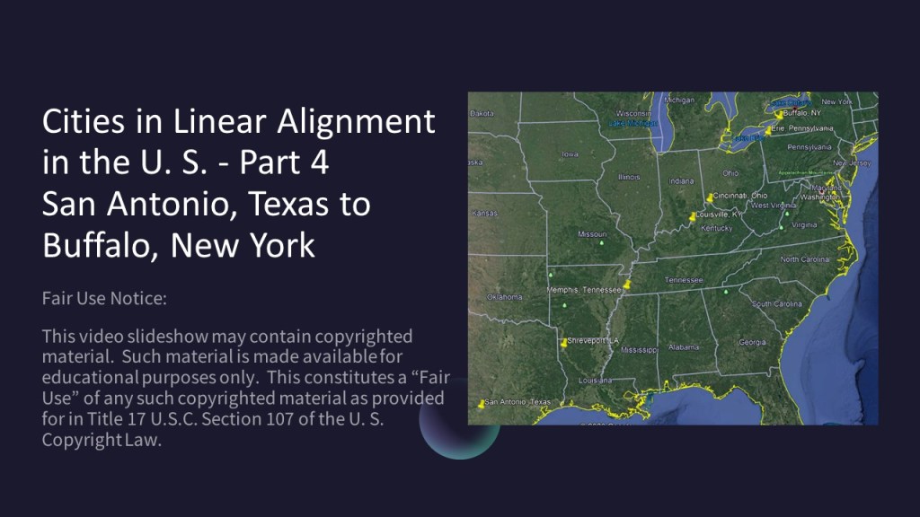
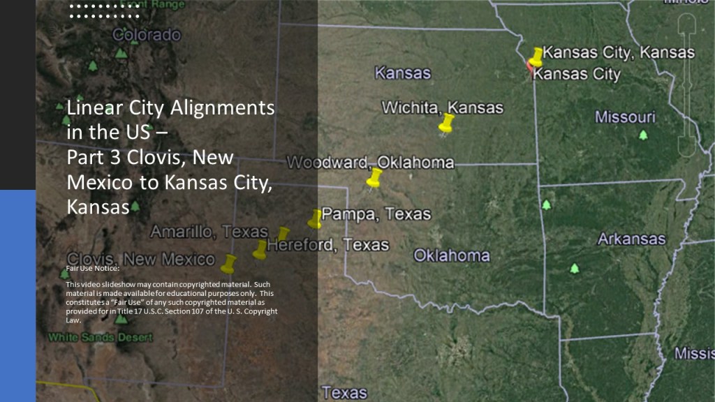
This is the fourth-part of a four-part series on cities that I found in linear alignment in the United States.
I am showcasing linear alignments in the United States in this series.
For the purpose of this series, each part of this series will be a snapshot of whatever longer alignment this represents, and complete in itself.
When I was living in Oklahoma City several years ago, during the time I was waking up to all of this, I identified multiple linear alignments between cities when I was studying the map of North America.
In this post, I am going to look at an alignment I found with larger cities instead of the ones with smaller cities I have looked at in detail in the previous three posts.
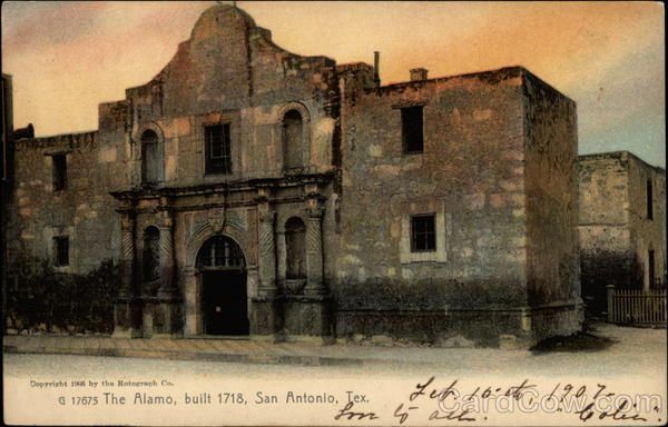
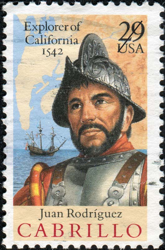
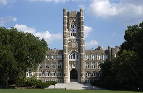
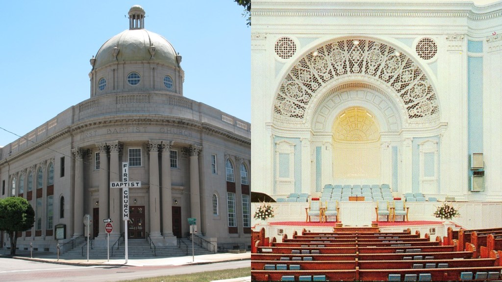
San Antonio is the second largest city in Texas, and the 7th-largest in the United States.
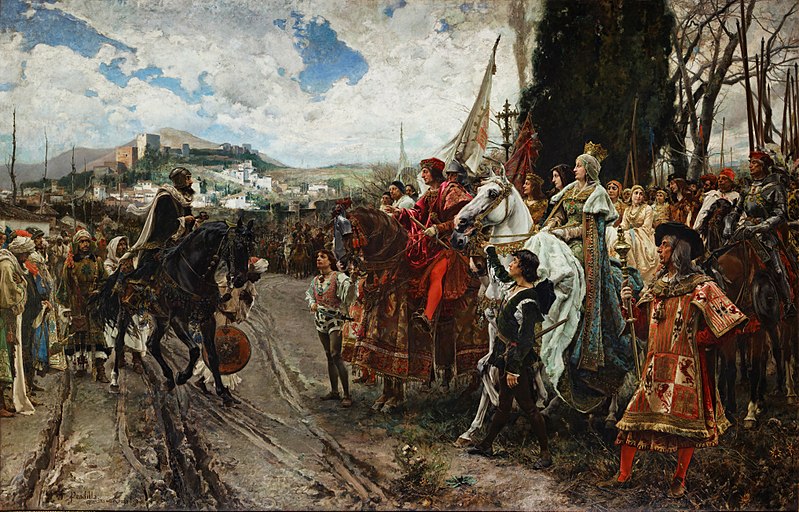
The oldest municipality in Texas, it was said to have been founded as a Spanish mission and colonial outpost in 1718, the same year the Alamo was said to have been built by Roman Catholic missionaries.
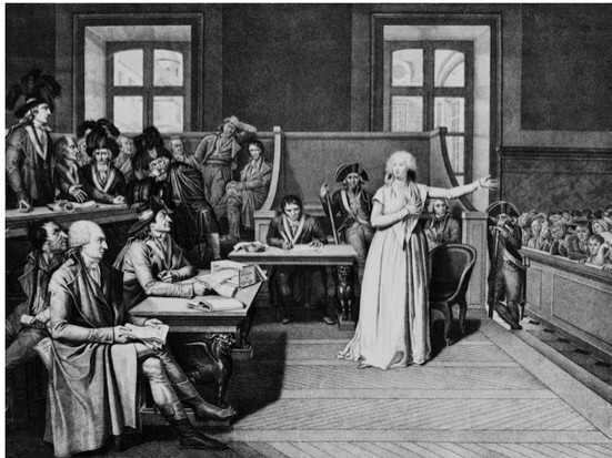
Our history tells us that the Alamo is most famous for the “Battle of the Alamo,” a pivotal event in the Texas Revolution, which we are told was a rebellion of colonists from the United States and and Texas Mexicans putting up an armed resistance to the Mexican Republic.
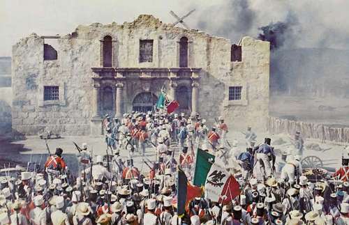
It was a 13-day siege that place in 1836, between February 23rd and March 6th, at which time the President of Mexico, and General, Santa Anna reclaimed the Alamo Mission after killing the Texian, or residents of Mexican Texas, occupiers of the Alamo.
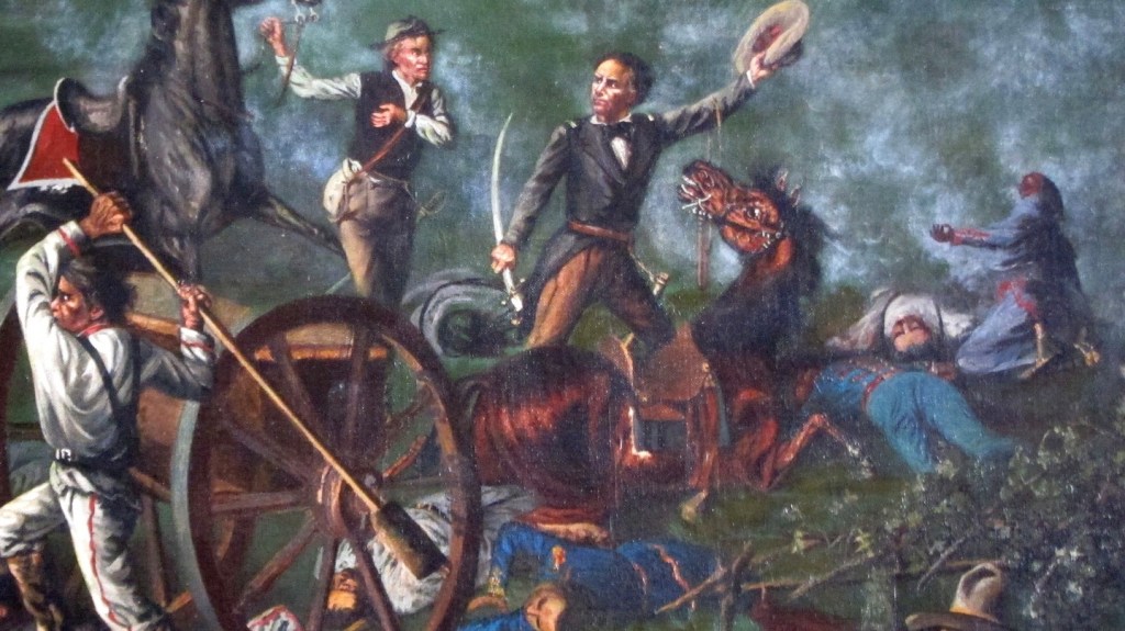
Then, on April 6th of 1836, the Battle of San Jacinto took place, from which the famous cry “Remember the Alamo” comes, in which General Sam Houston led the Texan Army to victory over Santa Anna’s troops in a very short, 18-minutes-long, period of time.
This paved the way for the formation of the Republic of Texas, which was an independent country from 1836 to 1845, the borders of which were based on the Treaties of Velasco between the newly-created Texas Republic and the Mexican President Santa Anna, who had been captured in battle.

The Mexican Congress never recognized the independence of the Republic of Texas, though the U. S. did, and then on December 29th of 1845, it was annexed by the United States and became the 28th state on the same day.
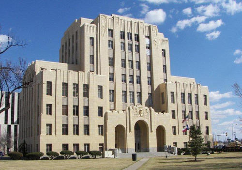
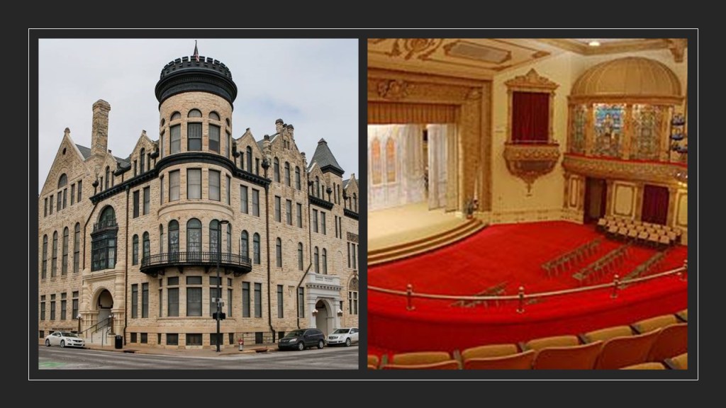
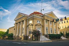
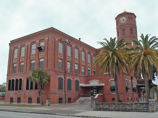
San Antonio is the seat of Bexar County.
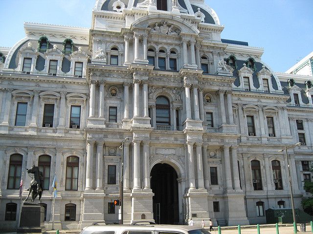
This is the Bexar County courthouse in San Antonio, said to have been designed in Romanesque Revival-style by renowned architect James Riely Gordon, best-known for his 18 landmark county courthouses in Texas, 6 of which have been demolished, and 12 of which remain.
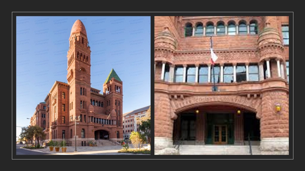
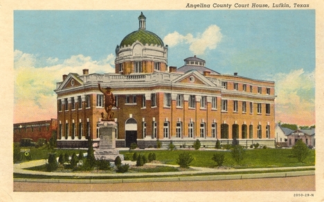
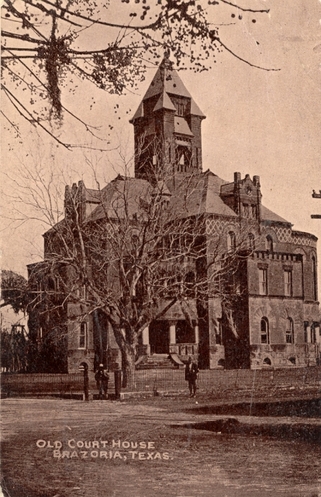
Some of the other courthouses he was given the credit for designing are the:
The 1902 Angelina Courthouse in Lufkin, Texas, which was demolished in 1953…
…the 1894 Brazoria County Courthouse in Brazoria, Texas, which was demolished around 1930…
…the 1897 Ellis County Courthouse in Waxahachie, Texas, which is still in use today…

…and the 1898 Comal County Courthouse in New Braunfels, Texas, also still in use today.
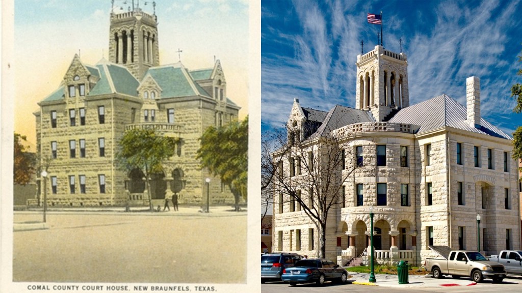
Though in a different county, New Braunfels is part of the San Antonio – New Braunfels metropolitan and statistical area.
New Braunfels is known for its German-Texan heritage.
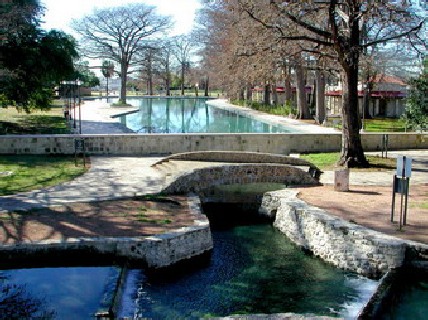
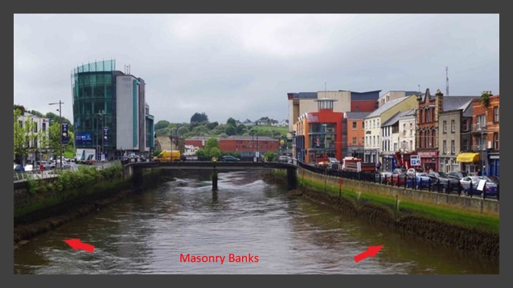
Here are the masonry banks of the Comal “River” in New Braunfels.
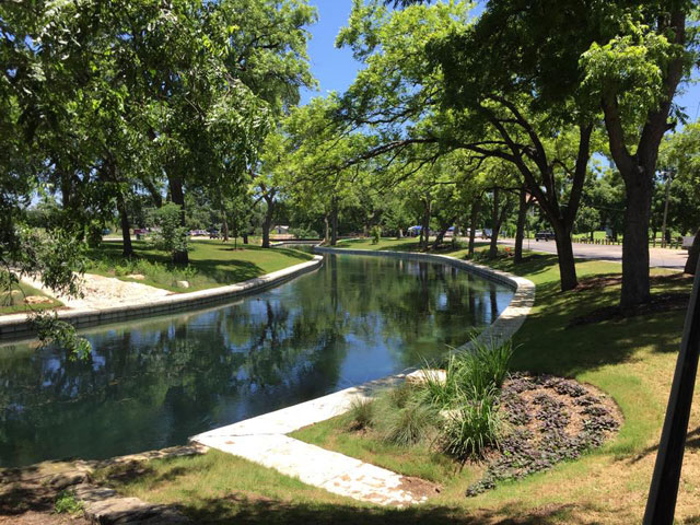
It looks like a canal to me!
New Braunfels was established in 1845 by Prince Carl of Solms-Braunfels, Commissioner-General of the Mainzer Adelsverein, or “Nobility Society of Mainz ” which was organized on April 20th of 1842 as a colonial attempt to establish a new Germany within the borders of Texas through organized mass immigration, and land was purchased via land grants from the Republic of Texas.

Besides New Braunfels, organized German communities in Texas included: Bettina; Castell; Leningen; Meerholz; Schoenberg; Indianola; Fredericksburg; Sisterdale; Tusculum; New Ulm; Gruene; and Schertz.
The Adelsverein was said to have ended its colonization campaign in 1853 due to a large amount of debt.
One of the founding members of the Adelsverein was Ernest II, the Duke of Saxe-Coburg & Gotha, and the older brother of Prince Albert, Queen Victoria’s husband, with the House of Saxe-Coburg & Gotha being the German line of descent of the British Royal House of Windsor.
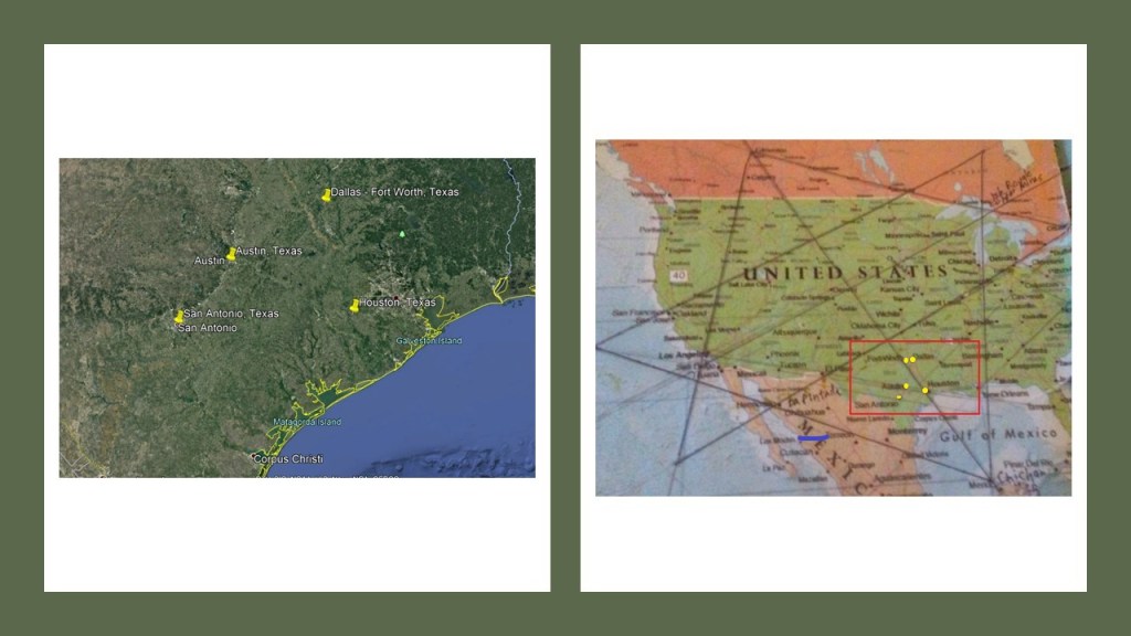
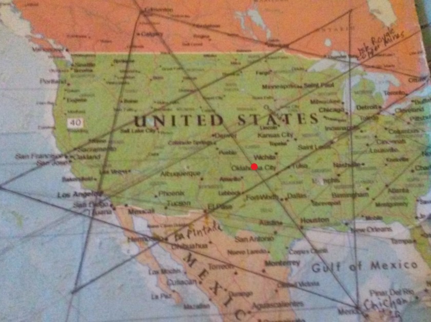
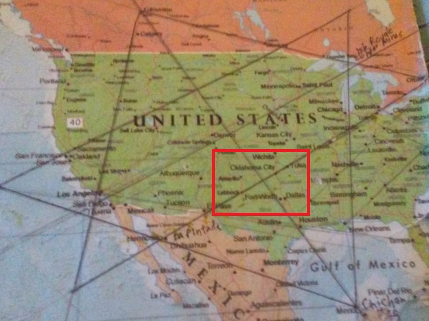
San Antonio is an anchors the southwestern corner of the Texas Triangle, a megaregion which contains four of the state’s largest cities – San Antonio and Austin which are located close to each other; Dallas – Ft. Worth; and Houston.
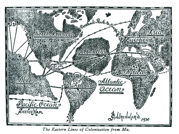
I just wanted to show you where these four cities are with respect to the Star Tetrahedron that I found when I connected cities lining up in lines in North America, and which I believe is the terminus of the Earth’s grid system.
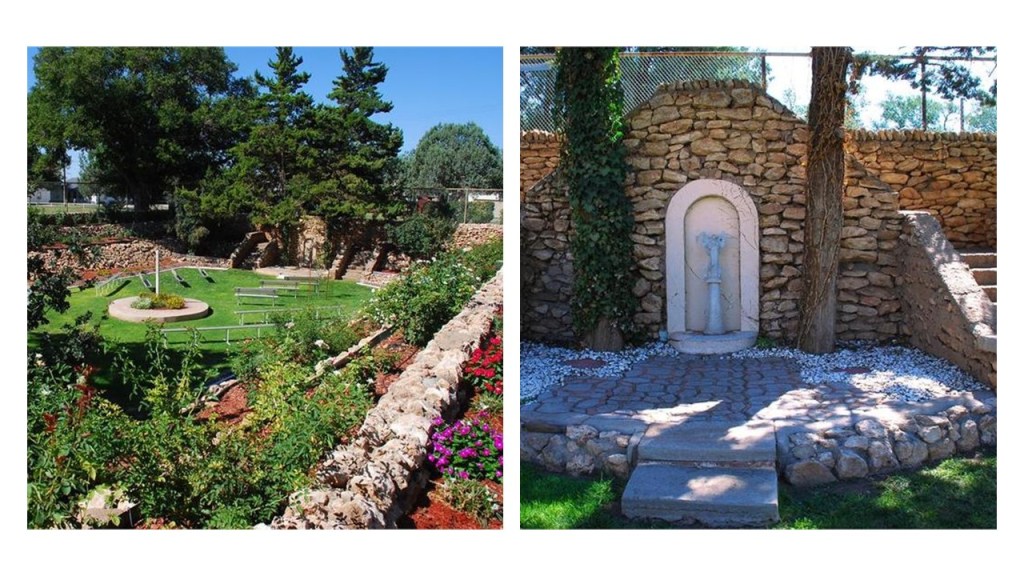
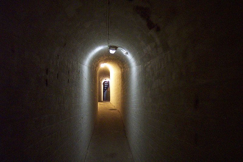
The San Pedro Springs Park is located about 2 miles north of downtown San Antonio.
We are told the first surveyor of San Antonio, Francis Giraud, defined the park’s boundaries in 1851, and the city officially declared it a park in 1852, making it the oldest park in Texas.
By 1856, the U. S. Camel Corps had camel stables in the park.
The U. S. Camel Corps was said to have been an experiment tried by the Army in the 1850s with camels, deemed to be well-suited for the desert conditions of the American Southwest, and procured from overseas locations but was ultimately discontinued for a variety of reasons, seemingly because of Civil War-related issues.

The 1976 movie “Hawmps” was based on the U. S. Camel Corps.

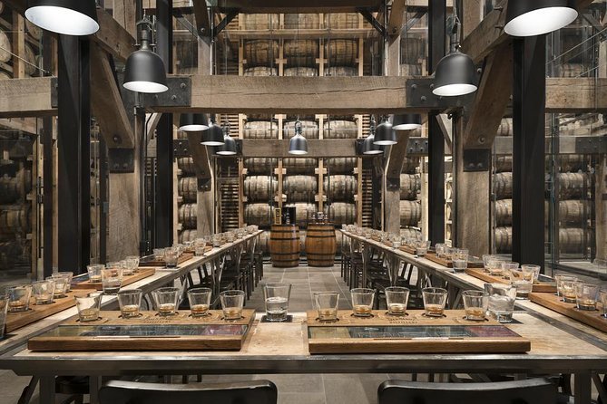
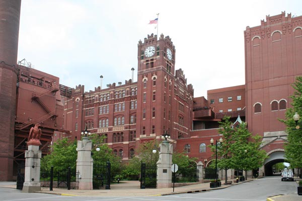
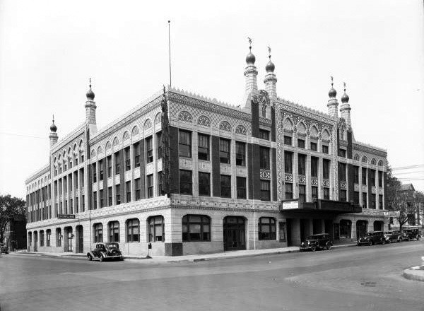
The Lone Star Brewery was the first mechanized brewery in Texas, said to have been built between 1895 and 1904, and founded by Anheuser-Busch magnate Adolphus Busch and a group of San Antonio businessmen, and said to have been designed by the same St. Louis architectural firm, E. Jungenfeld and Company…
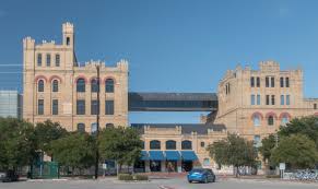
…responsible for building the Anheuser-Busch brewery facilities in St. Louis in the 1870s time-period.
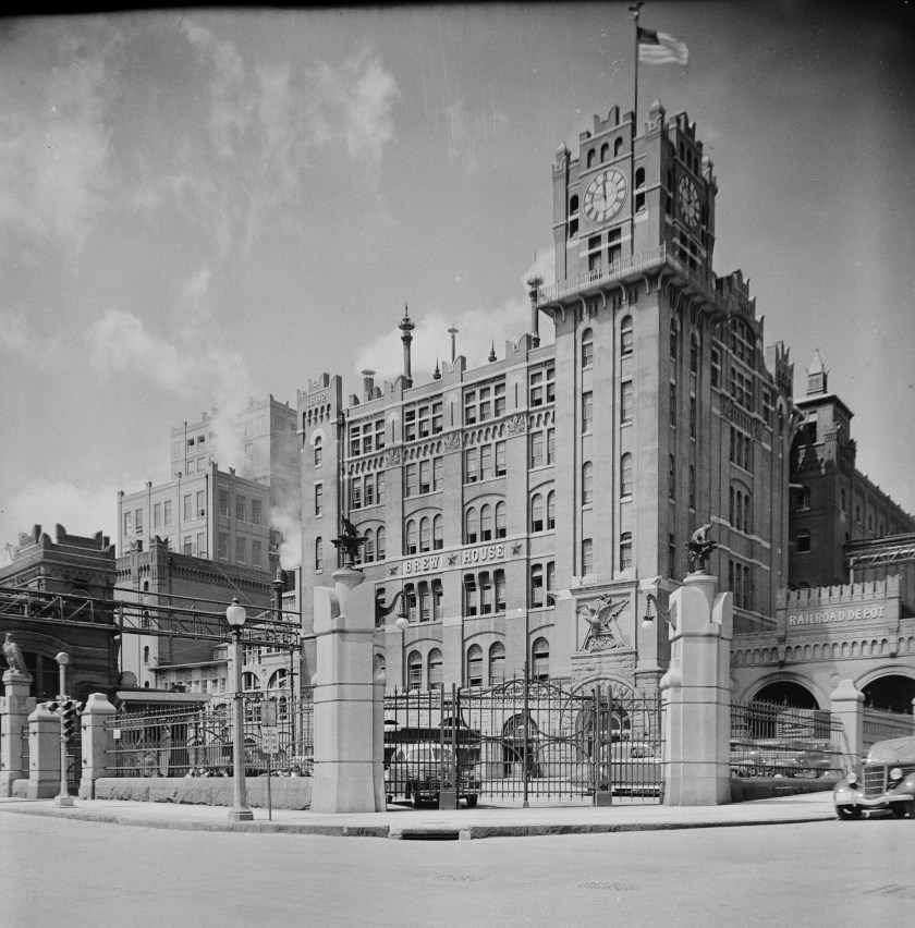
Since the 1970s, the old Lone Star Brewery building has housed the San Antonio Museum of Art.
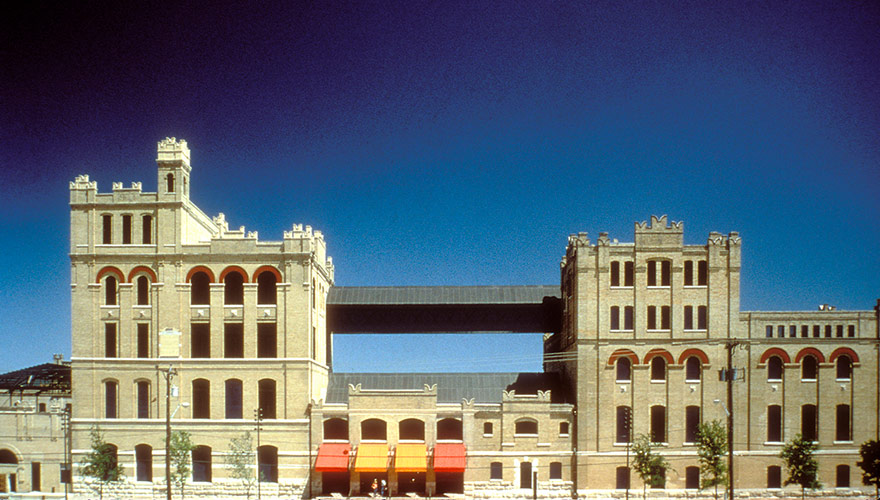
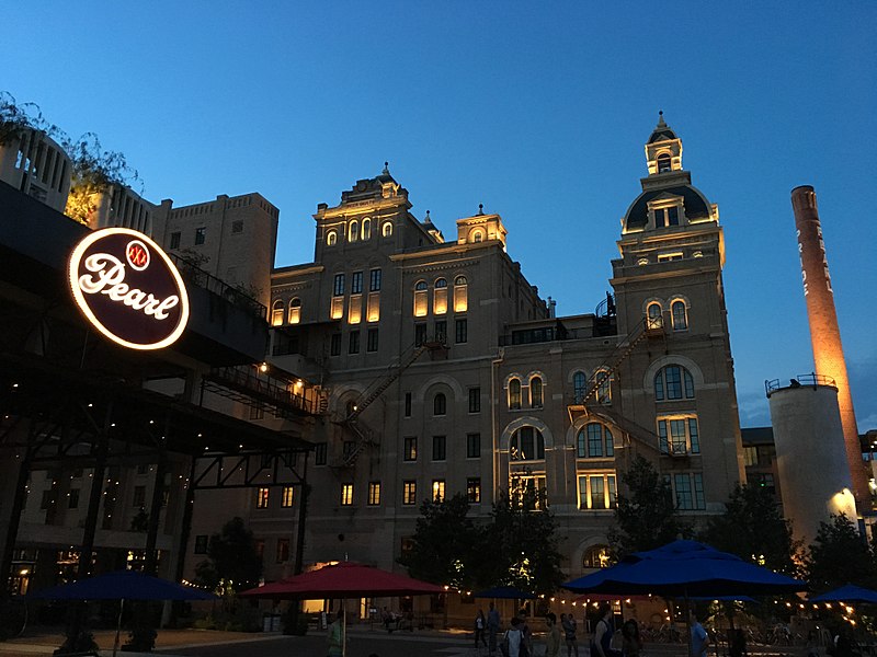
This is the old Pearl Brewery in San Antonio, said to have been built in 1894, and the largest brewery in Texas by 1916.
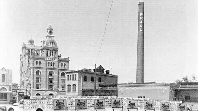
Its last owner as a brewery was Pabst, and when the company moved its brewing operations to Fort Worth in 2001.
At first, the building complex was abandoned but over a period of years, developers revitalized the area into a vibrant central hub of shops, and turning the old brewery into the Hotel Emma, the first name of the Brewery’s president back in the storied history of the Pearl Brewery.
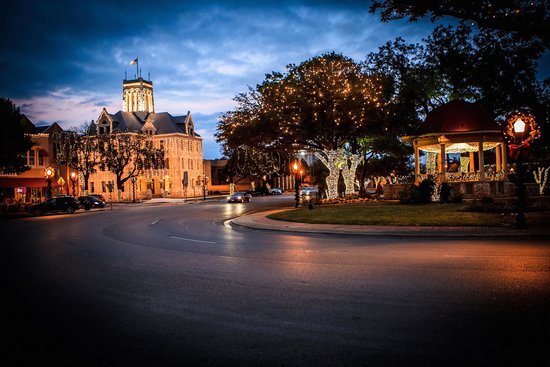
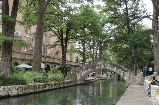
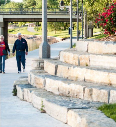
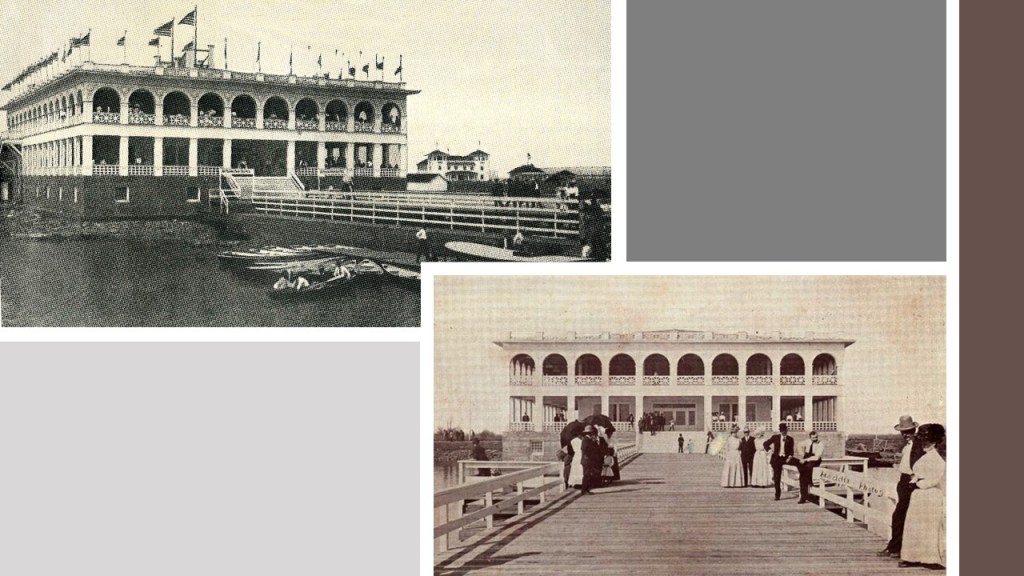
The heart of San Antonio is the River Walk, a city park and network of walkways along the masonry banks of the San Antonio River, one-story beneath the streets of San Antonio.
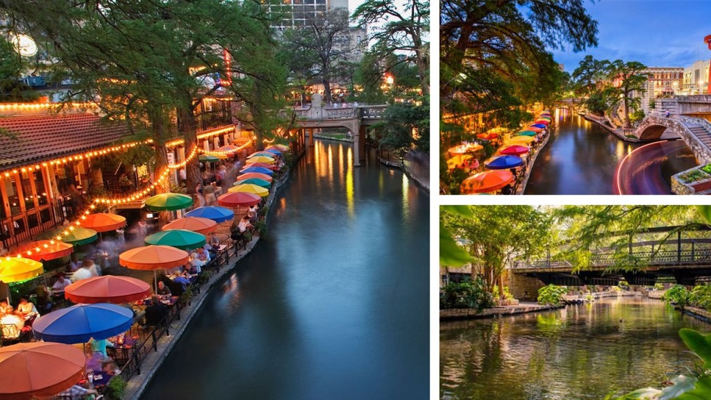
Said to have been designed by local architect Robert Hugman, who was said to have submitted his plans for what would become the River Walk in 1929, and crucial funding for the project came through the the New Deal’s Works Project Administration 1939, which was used for the initial construction of 17,000 feet (or 5,200 meters) of walkways, twenty bridges and extensive plantings of bald cypress trees whose branches stretch up to ten stories are visible from street level.

It is important to note that there are bald cypress trees along the River Walk that are quite old, like the Ben Milam bald cypress, named for a soldier in the Texas Revolution, said to have been killed in 1835 by a Mexican sniper hiding in its branches…
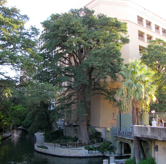
…and the size of its trunk would indicate that it is quite old.
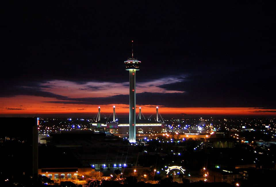
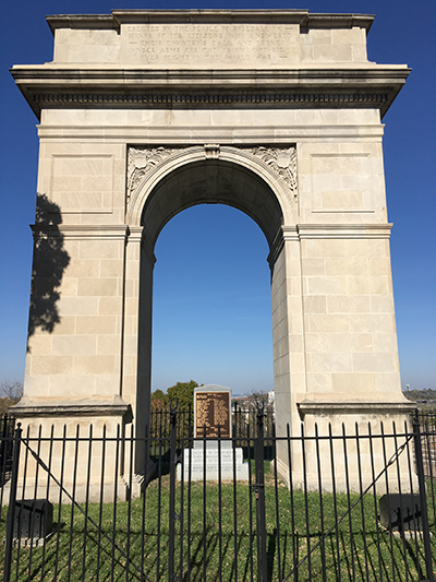
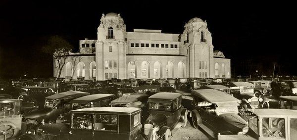
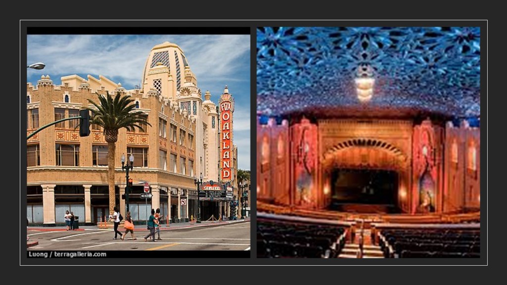
The Tower of the Americas was said to have been built for the 1968 World’s Fair in San Antonio, which was called HemisFair ’68.
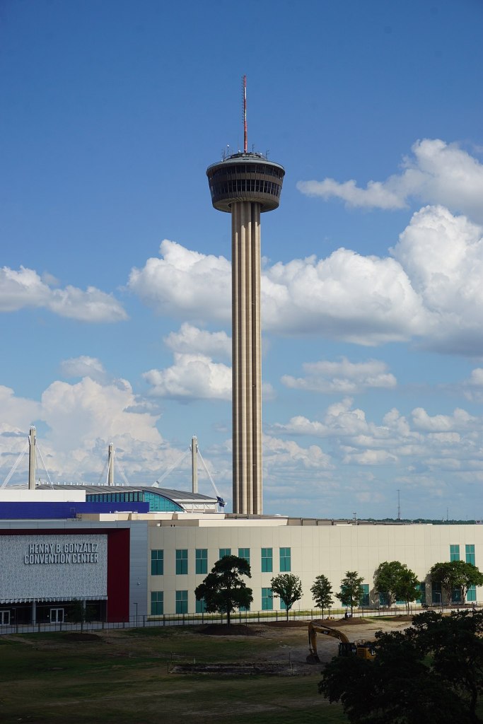
Standing at 750-feet, or 229-meters, tall, the observation tower and restaurant is the tallest building in San Antonio, and also has a steel-mast that is the host for three FM antennas.
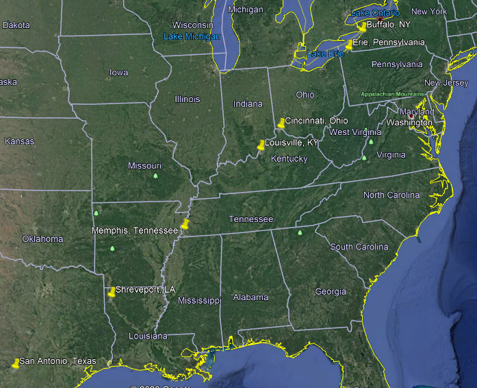
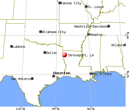
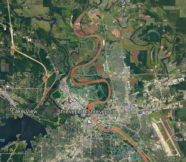
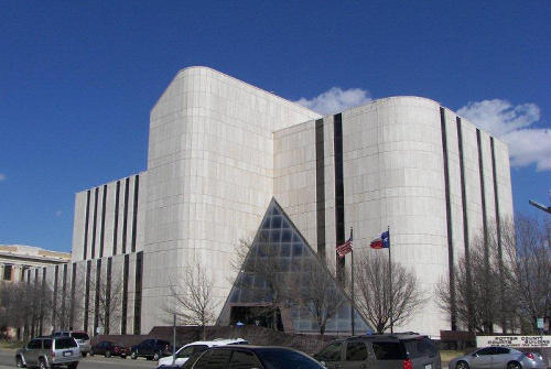
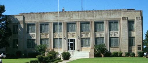
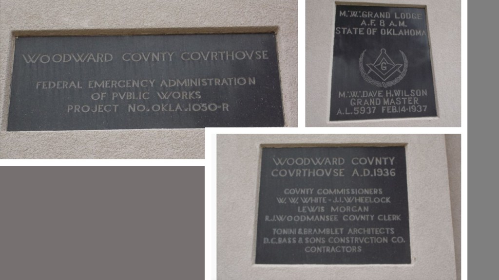
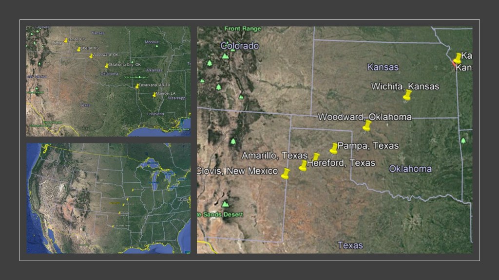
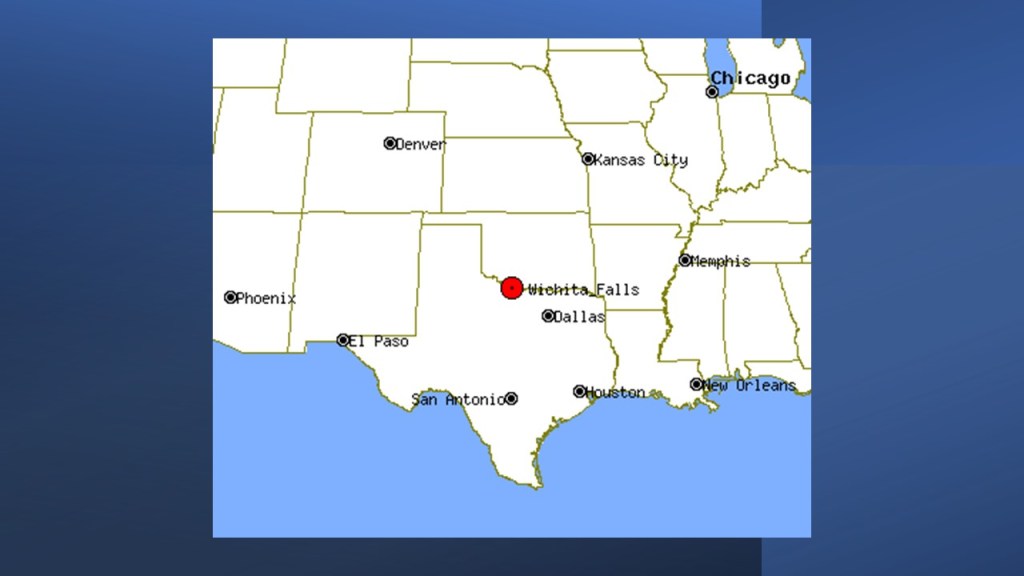
The next place I am going to take a look at on this linear alignment is Shreveport, the parish seat of Caddo Parish and third-largest city in Louisiana.
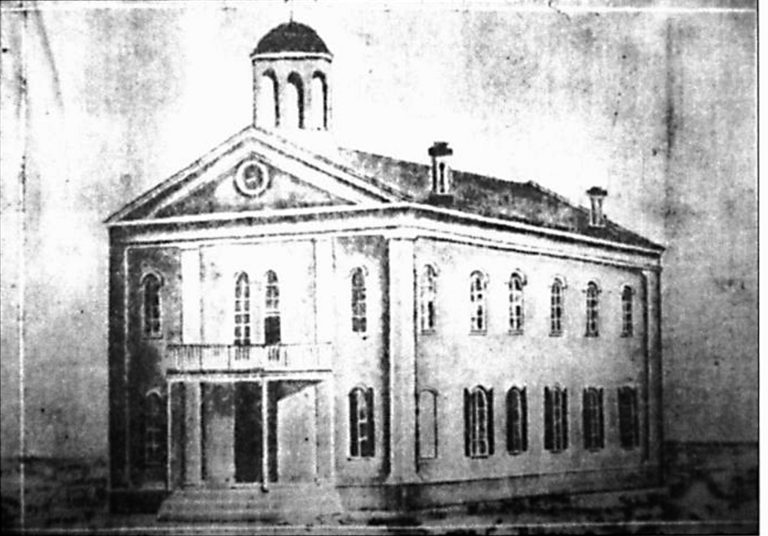
The first Caddo Parish Courthouse in Shreveport was said to have been built in 1859.
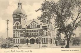
We are told the first courthouse was demolished in order to make room for the second courthouse, which was said to have been built between 1890 and 1891.
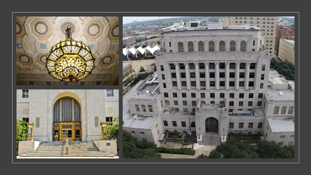
Then…again…the second courthouse was torn down in order to build the current courthouse in 1928.
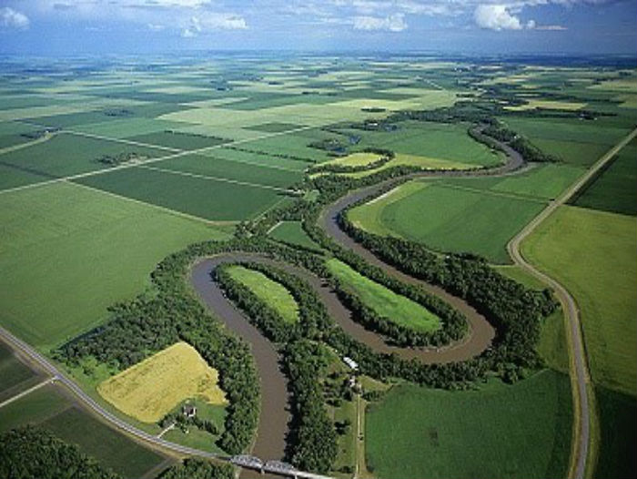
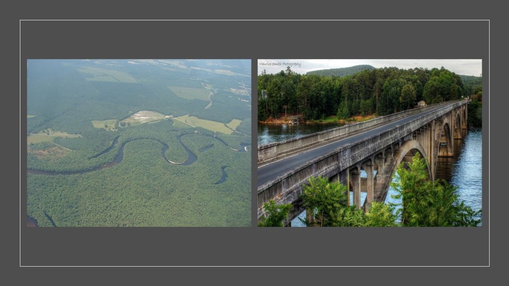
The Shreve Town Company founded Shreveport in 1836, at the junction of the snaky, s-shaped Red River and Texas Trail, an overland route to the newly formed Republic of Texas.
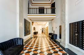
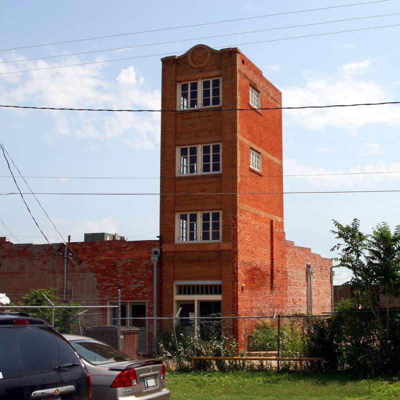
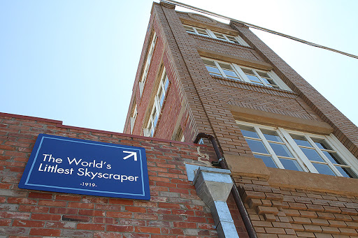
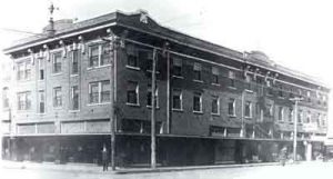
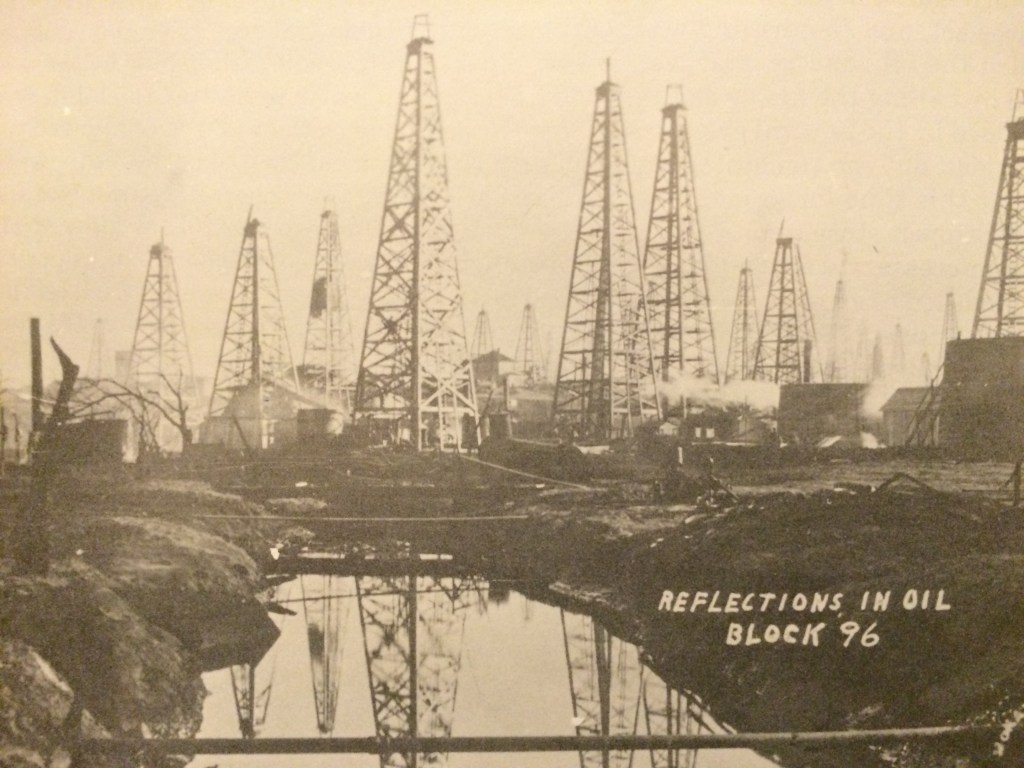
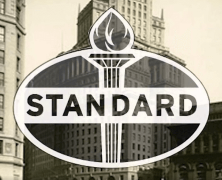
After the discovery of oil in Louisiana, Shreveport became a national center for the oil industry, and the location of the headquarters for Standard Oil of Louisiana, also known as Stanocola from 1909 to 1944, when it was absorbed into its parent company, Standard Oil of New Jersey.
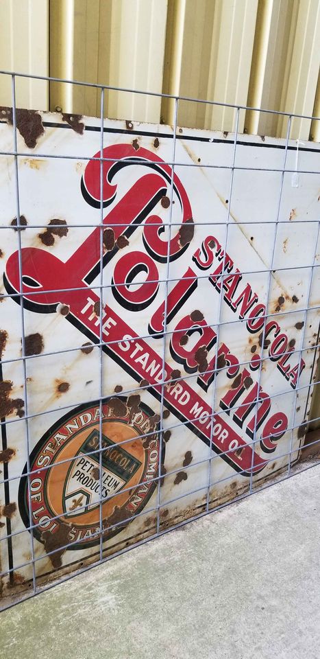
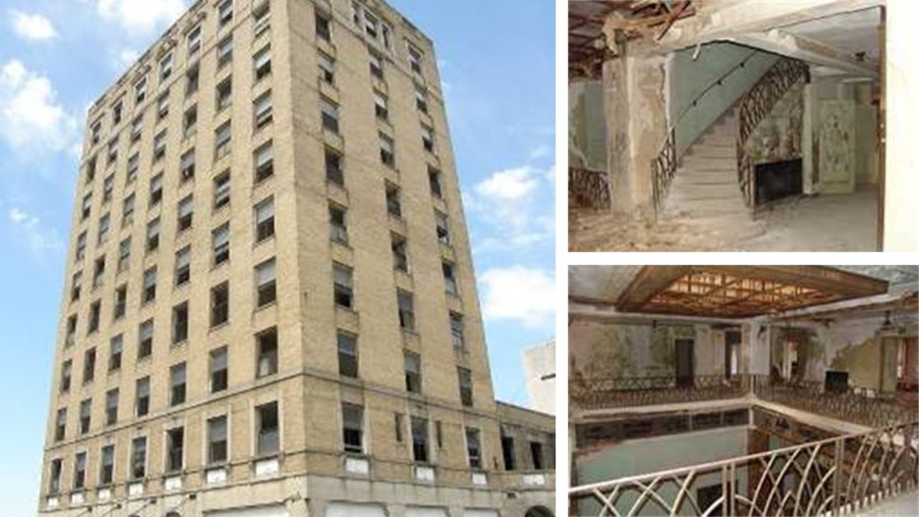
When I did a search looking for the historic headquarters building, I found The Standard Downtown Lofts Apartments in downtown Shreveport, said to have been built in 1910 to house the Commercial National Bank headquarters.
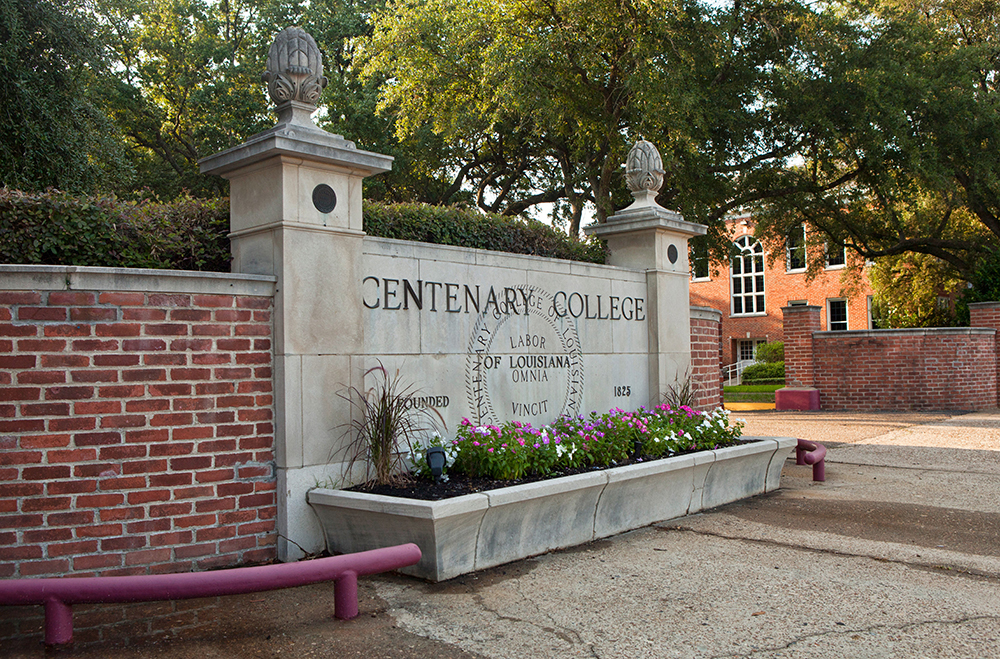
Shreveport is the location of several institutions of higher learning, including Centenary College of Louisiana, which opened in Shreveport in 1908.
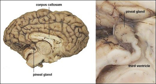
I wonder if those pine cone-looking decorations at the entrance…
…actually represent the pineal gland, also known as the third-eye, which is shaped like a pine cone.
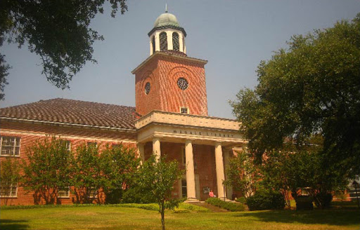
Here is Centenary College’s library…
…with this picture of the columns in front to give you a different perspective on their size…

…and College Hall on campus.
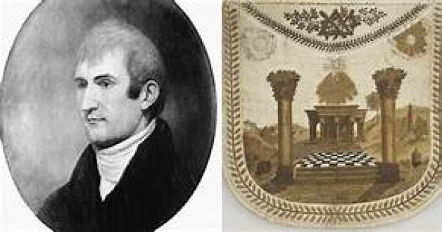
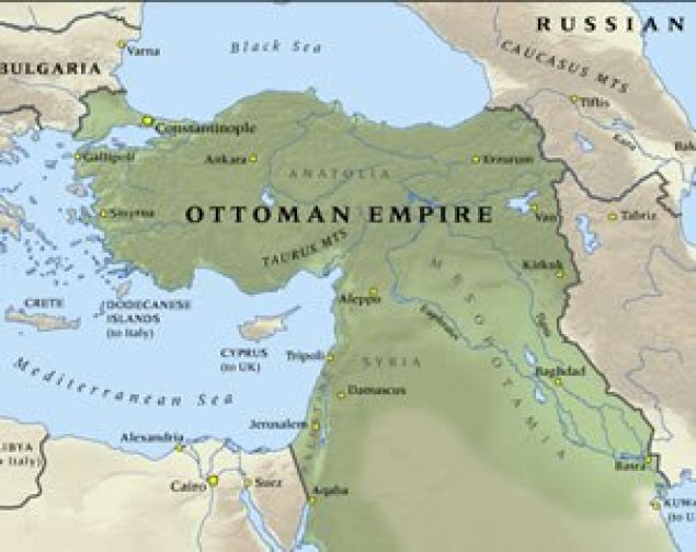
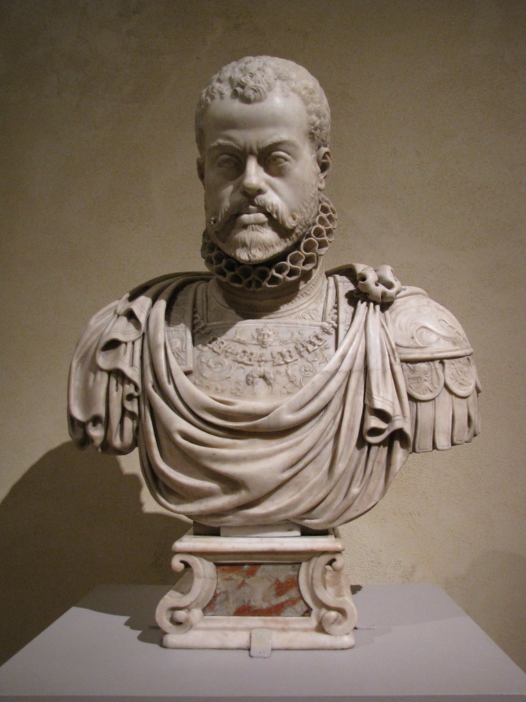
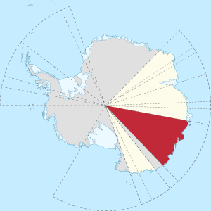
Shreveport was the location of the Trans-Mississippi Department of the Confederate Army, which I first heard about when I was doing some research around Albert Pike, an influential 33rd-degree freemason who was a senior officer of the Confederate Army who commanded the District of Indian Territory in the Trans-Mississippi Theater of the American Civil War, otherwise known as Oklahoma, and makes me wonder what was really going on here.
The Trans-Mississippi Theater of the Civil War covered everything west of the Mississippi River as pictured here.
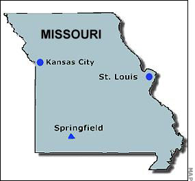
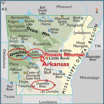
We are told that over 200,000 men were engaged in the Trans-Mississippi Theater of War, and there were all together 7 battles in Arkansas, New Mexico, Missouri and Louisiana between 1862 and 1864.
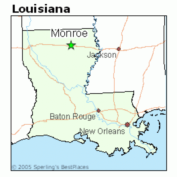
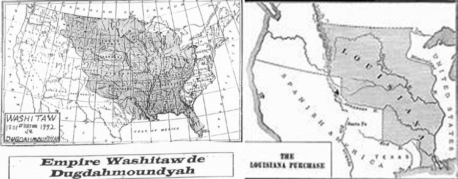
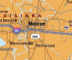
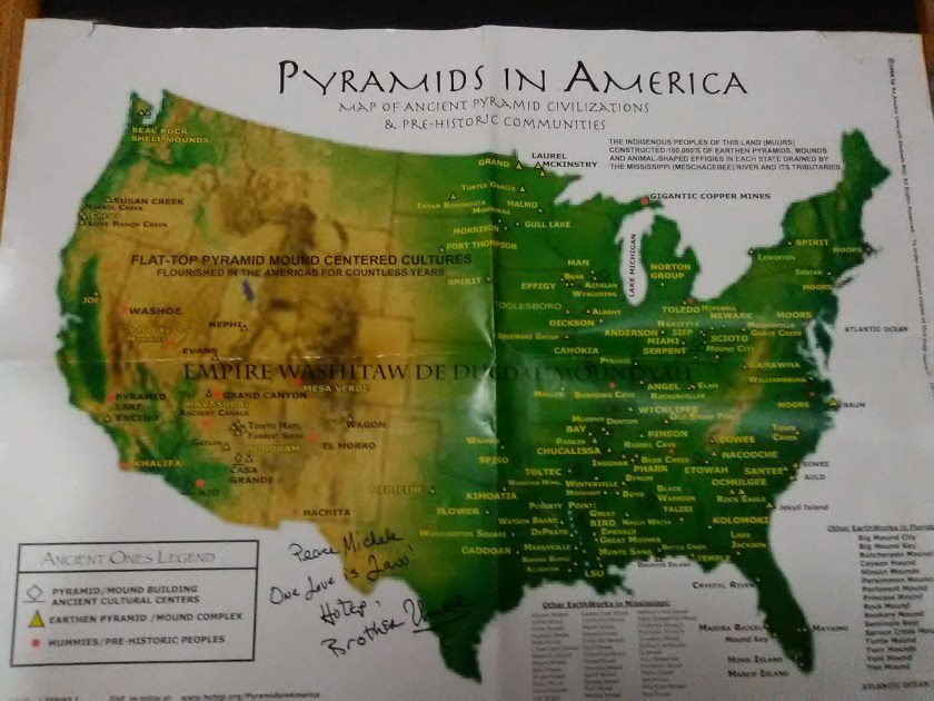
This was also the heart of the ancient Washitaw Empire, with Monroe, Louisiana being the Imperial Seat.
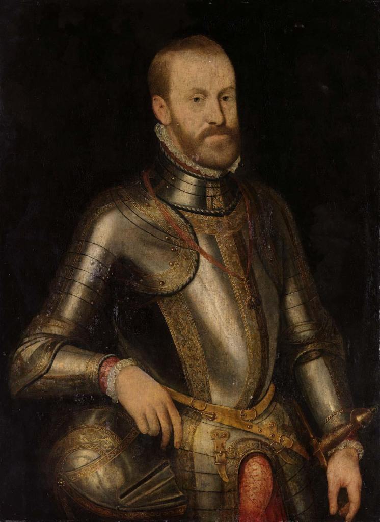
In the Battle of Pea Ridge in Arkansas in March of 1862, the Confederate Army was led by Major General Earl Van Dorn, the great-nephew of Andrew Jackson, who ultimately lost the battle to Union Brigadier General Samuel Curtis.
This was the battle flag of General Van Dorn.

The star and crescent symbolism has been identified with Islam, and what we are told is that this happened primarily with the emergence of the Ottoman Turks, and for one example of several national flags, are depicted on the modern Turkish flag.

I also read where the Egyptian hieroglyphs of a star and the crescent moon denote the Venus Cycle from morning star to evening star.
What would stars and a crescent be on a Confederate general’s battle flag?
And why is theater, defined as a collaborative form of performing art that uses live performers, usually actors or actresses, to present the experience of a real or imagined event before a live audience in a specific place, like a stage, is an interesting word choice for an area or place in which important military events occur or are progressing.

A theater can include the entirety of the air space, land and sea area that is or that may potentially become involved in war operations.
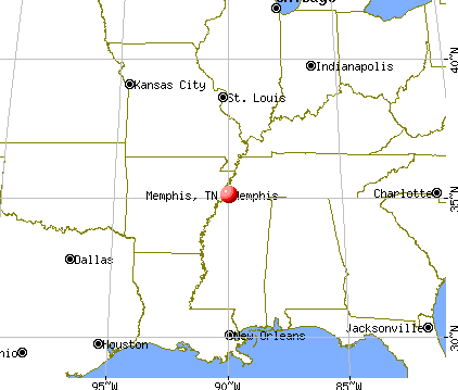
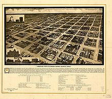
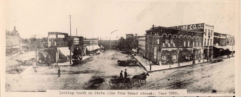
The next place on this linear alignment is Memphis, the second-largest city in Tennessee after Nashville and the largest city on the Mississippi River.
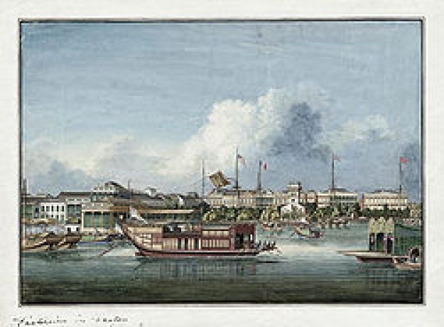
This illustration of Memphis I found was described as an “Air View” in 1870.
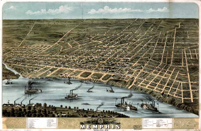
Air view?
What?
How did they get this view of Memphis from the air?
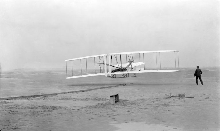
We are told air transport didn’t come around until after the Wright Brothers successful air flight at Kitty Hawk, North Carolina in December of 1903.
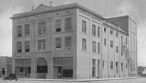
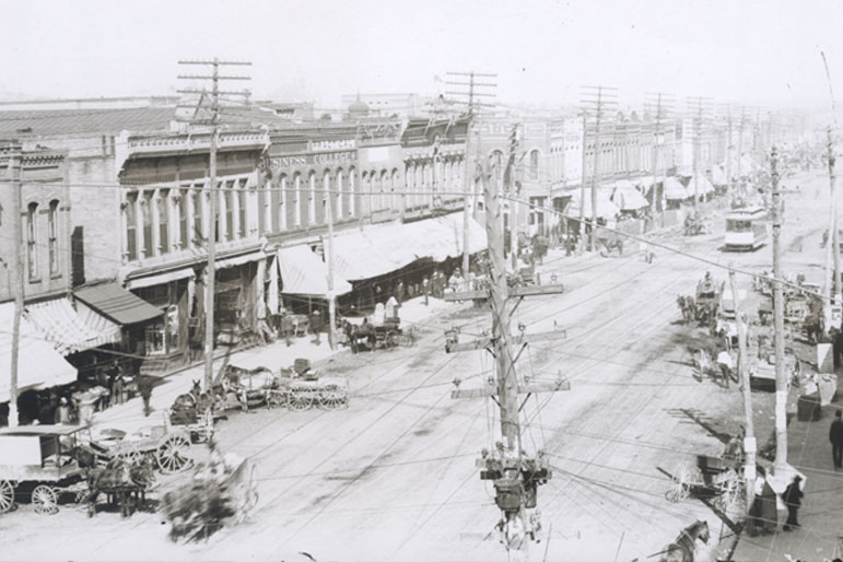
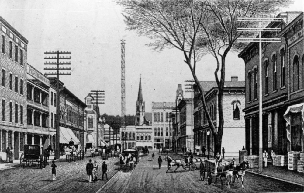
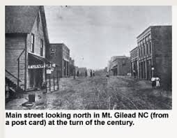
Here is what we find the Main Street of Memphis looking like circa 1910.
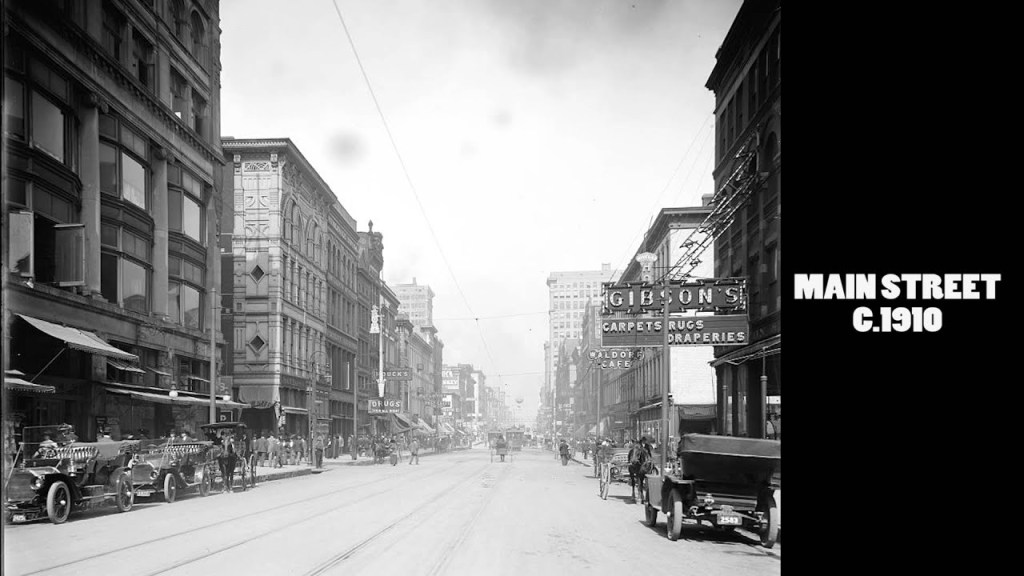
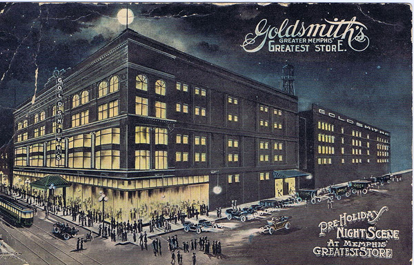
Memphis had several department stores on Main Street.
Many customers perceived Goldsmith’s Department Store on Main as Memphis’ Greatest Store.
With its beginnings at its Beale Street location, in 1870 the German immigrant Goldsmith brothers, Isaac and Jacob, started doing business in Memphis.
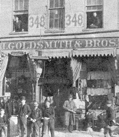
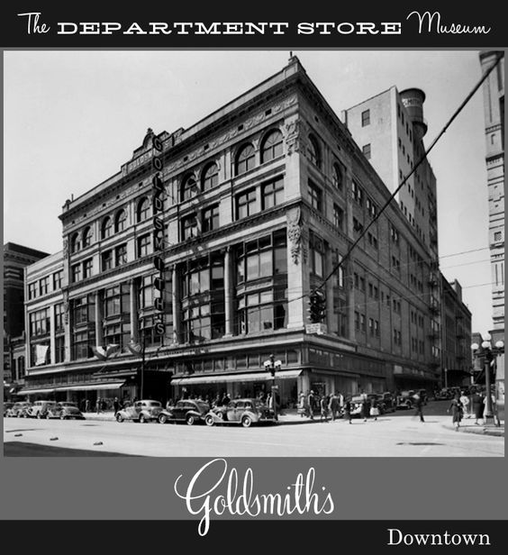
This was the Goldsmith Brothers store on Main Street starting in 1895, and became a true “department store” in 1902, when they arranged merchandise by departments, among the first in the South to do so.
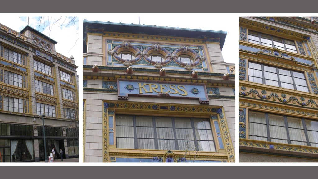
The Kress Department store in Memphis was the first opened in 1896 in what was to become a nationwide chain of five-and-dime stores, and moved to this new location on Main Street, said to have been designed by E. J. T. Hoffman and built in 1927.
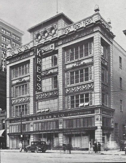
In 1980, the Kress Store became McCrory’s and the store finally closed in 1994.
We are told that due to being conscious of the historical significance of the building, the structure was restored and is now a museum.
Elias Lowenstein immigrated to Memphis from Germany in 1854, where he opened Lowenstein’s Department Store, prominent in Memphis for 125-years.
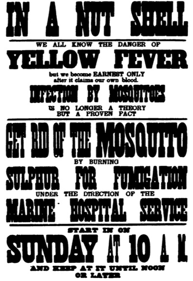
He was a leader in the Memphis Jewish community and contributed liberally, we are told, to rebuilding the city of Memphis after the disastrous yellow fever epidemic in 1878, the worst American outbreak of yellow fever occurring in the Mississippi River Valley that year.
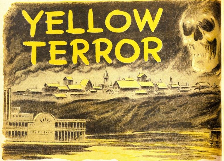
The outbreak originated in New Orleans in the spring and summer of that year, and spread up the Mississippi River and inland.
Yellow fever was so named because of the yellow-ish hue of the skin and eyes it causes, affecting multiple organ systems and causing internal bleeding.

What we are told is that in July of 1878, an outbreak of yellow fever was reported in Vicksburg, just south of Memphis, so Memphis officials stopped travel to the city from the safe.
However, a man from a quarantined steamboat slipped away and went to Kate Bionda’s restaurant in Memphis on August 4th.
He was hospitalized and quarantined the next day and died, and Kate Bionda became Memphis’ first death from yellow fever on August 13th, and from there the yellow-fever infections spread quickly throughout Memphis.
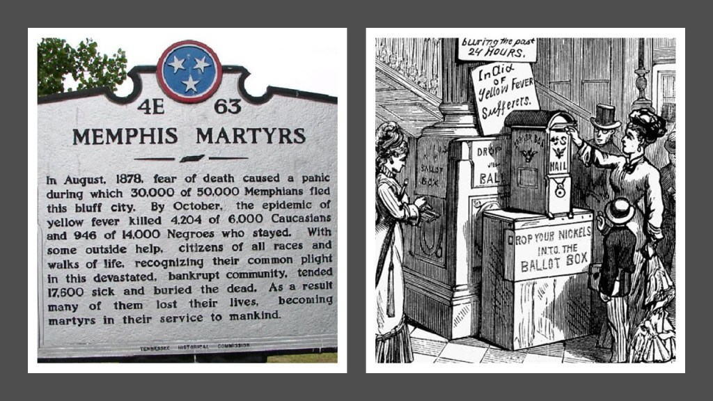
We are told mosquitoes were the carriers of yellow fever.
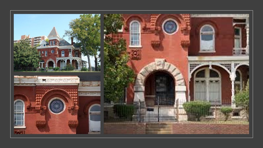
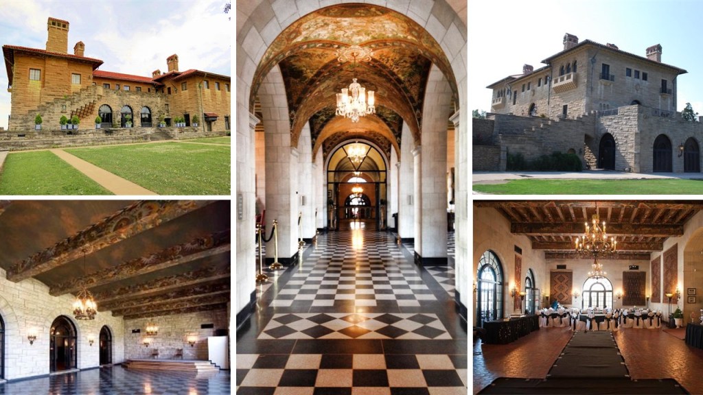
Elias Lowenstein was said to have built his mansion in 1891, called one of the most important Victorian Romanesque mansions in Memphis, and one of the finest of its style in the South.
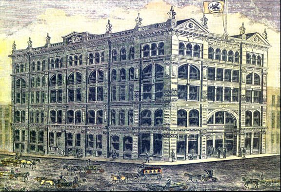
This is an illustration of the original Lowenstein’s Department Store in Memphis, said to have been built in 1886, with its classic mud flood feature of the slanted pavement from the ground-level windows in front of the building, to the not-ground-level windows with the slant of the pavement, and showing dirt covered streets as well.
The original Lowenstein’s Department Store building, vacated by the Lowensteins in the 1920s, was first taken over by a furniture company who eventually moved out in 1980, and the building sat vacant for 30-years. It was saved from demolition and today houses apartment and retail space.
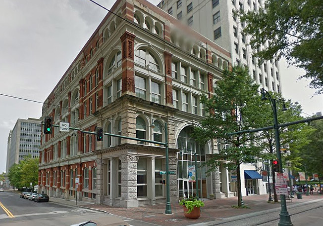
The “new” Lowenstein building, said to have been built and opened in 1924 to replace the original Department Store, and is also still standing today on Main Street in Brinkley Plaza.
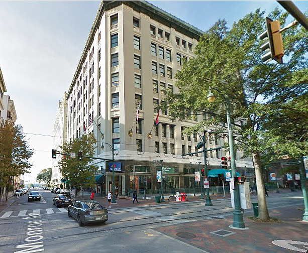
The Bry’s Department store at the corner of Main Street and Jefferson Ave is no longer there.
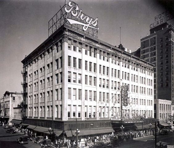
The Renaissance Apartments tower and its parking garage are there now.
The Hotel Claridge building to the right of what used to be Bry’s is still there today and is now a condominium.
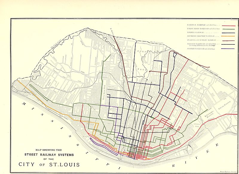
The Memphis Street Railway Company was a privately-owned operator of streetcars and trolleybuses in Memphis on roughly 160-route miles, or 258-kilometers of overhead electrified cable and rails between 1895 and 1960.
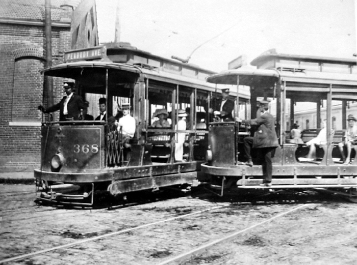
Memphis could be traversed easily by passengers to within blocks of any corner of the city, but for some reason the operations were eventually abandoned in favor of city buses.
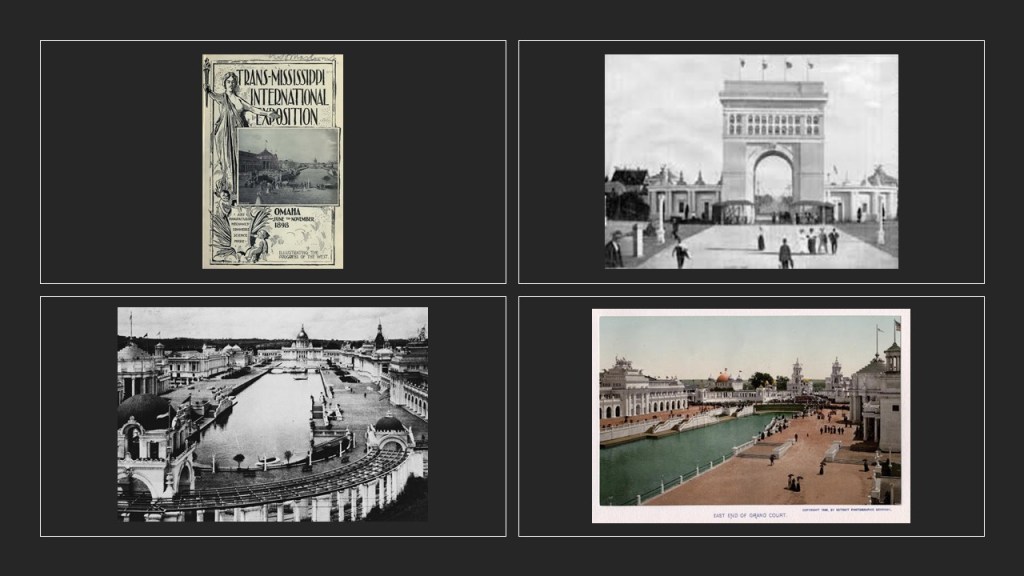
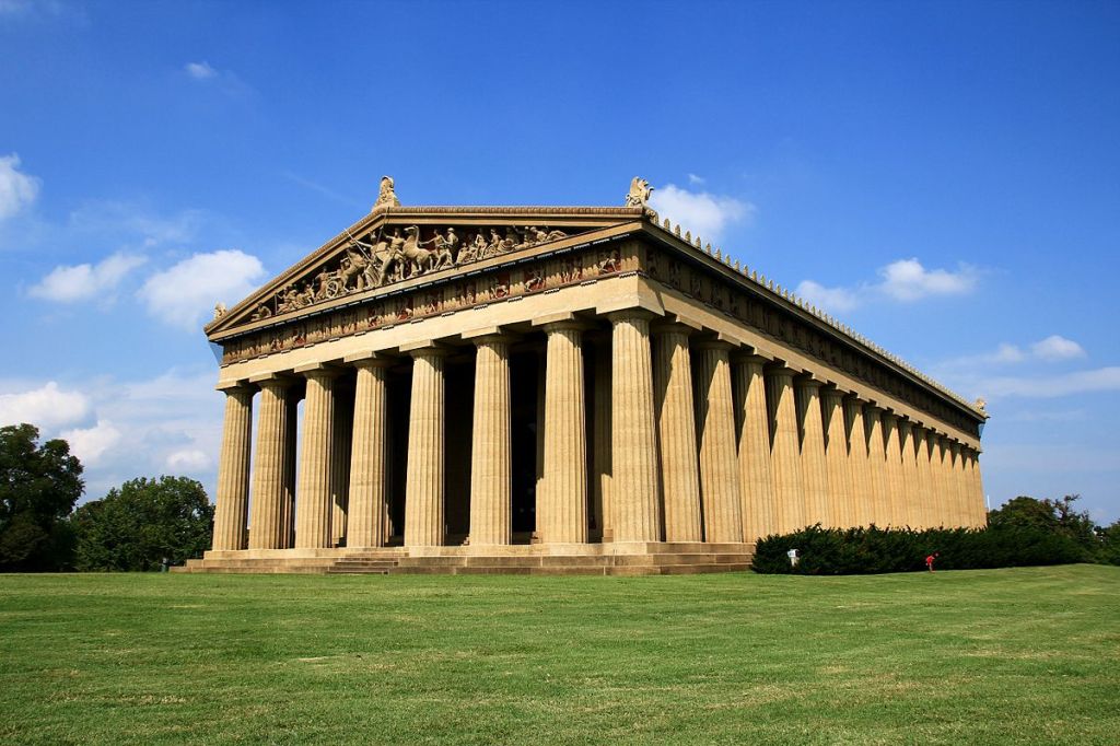
Lastly, before I leave Memphis, here is an old photo of the Exposition, with the Memphis Building next to the Nashville Parthenon.
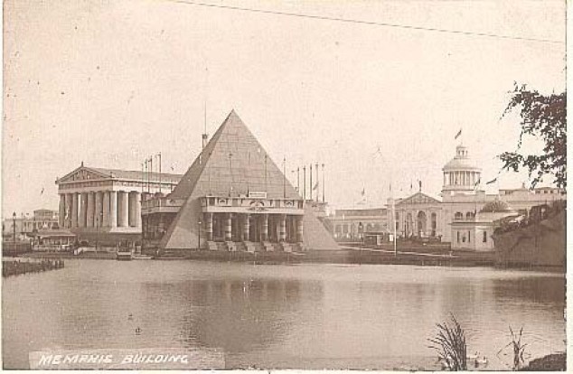
This was said to be the Memphis, Tennessee -Shelby County construction for the 1897 Tennessee Centennial Exposition, said to have been modelled after Memphis’ namesake in Egypt.
It was said to have been built out of temporary materials, like plaster and wood, and was demolished after the Exposition.
Was the Memphis Pyramid in this example really made from temporary materials…or was it already there?
The Nashville Parthenon sitting right next to the Memphis – Shelby County pyramid was also said to have been built for the 1897 Tennessee Centennial Exposition.
The architect of Nashville’s Parthenon was said to be the former confederate soldier, William Crawford Smith.
It was also said to have been originally built as a temporary structure out of plaster, wood, and brick, but it was left standing after the Exposition because of its popularity, and that it was rebuilt with concrete in the 1920s.

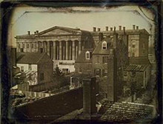
The next place I come to on this alignment is Louisville, the largest city in Kentucky and the seat of Jefferson County on the border with the state of Indiana.
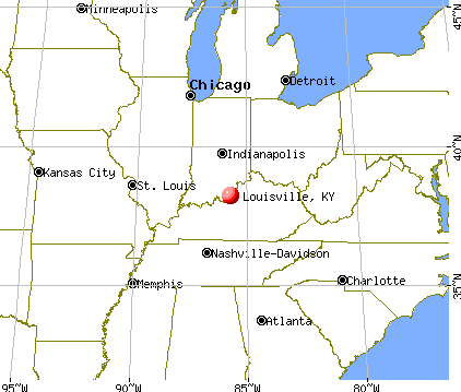
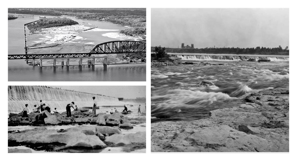
Founded in 1778 on the Ohio River, Louisville is one of the oldest cities west of the Appalachians, and the settlement was said to have grown as a portage site for Ohio River traffic because of the Falls of the Ohio, the only obstruction for river traffic between the upper Ohio River and the Gulf of Mexico.
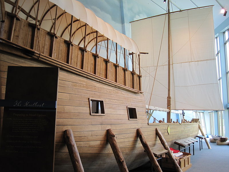
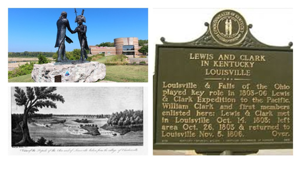
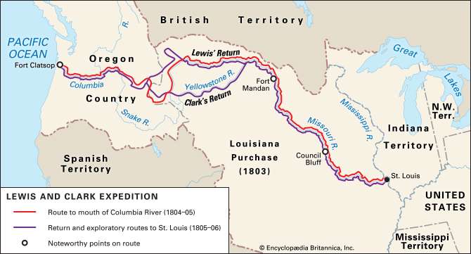
The Falls of the Ohio were also where Lewis and his crew met up with Clark at what is now Clarksville, Indiana in October of 1803, across the river from Louisville, Kentucky…

…after a keelboat for their expedition was said to have been built to Lewis’ specifications near Pittsburgh, Pennsylvania in the summer of 1803.
The earliest settlements around the Falls of the Ohio are shown here:
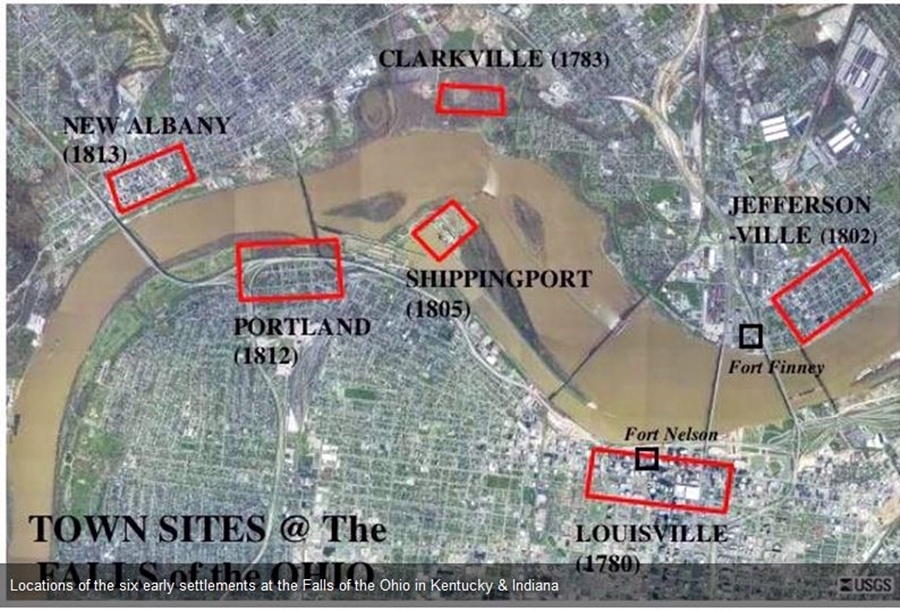
I can’t help but notice the presence of Fort Nelson on the Louisville, Kentucky side of the Ohio River and Fort Finney on the Jeffersonville, Indiana side of it.
I frequently find pairs or clusters of star forts all over the Earth in the research work of done of tracking cities in alignment with each other over long-distances.
Like the example of the four pairs of star forts along the Lower and Upper New York Bay, with each pair situated along various points starting from Fort Hancock on Sandy Hook island in New Jersey and Fort Tilden on the Rockaway Peninsula in New York at the entrance of the Lower New York Bay; the pair of star forts on either side of the Verrazano Narrows Bridge, with Fort Wadsworth on the Staten Island-side of the bridge, and Fort Hamilton on the Brooklyn-side; Fort Wood upon which the Statue of Liberty stands on top of, which was situated across from the no longer standing Fort Gibson on Ellis Island; and the pair of Fort Jay on Governors Islands and what was Fort Amsterdam in Battery Park in Lower Manhattan.
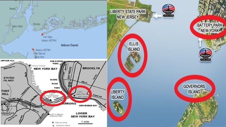
One definition of the word battery is a device that produces electricity that may have several primary or secondary cells arranged in parallel or series, as well as a battery source of energy which provides a push, or a voltage, of energy to get the current flowing in a circuit.

I think this is the reason there are so many star forts that are paired together, or even the reason clusters of them are found in the same location, because they originally functioned as circuitry and batteries for the purpose of producing electricity and/or some form of free energy to power the planetary grid system of the advanced civilization.
At any rate, neither of the star forts situated across from each other next to the Falls of the Ohio are still standing.
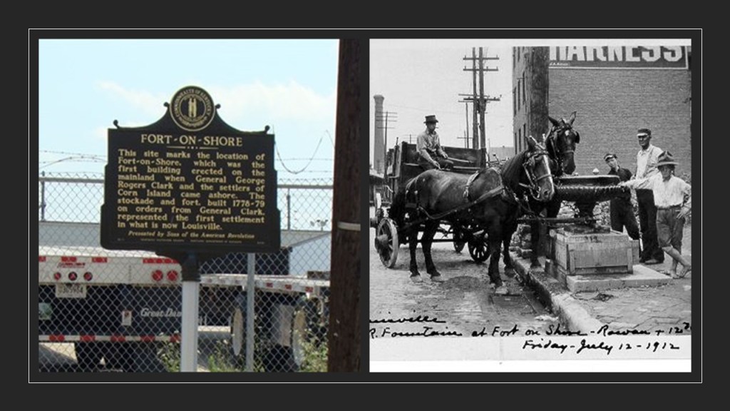
There is now a park in Louisville called Fort Nelson Park.
Fort Nelson itself was said to have been built in 1781 by troops under George Rogers Clark, the brother of William Clark of Lewis and Clark fame, between the River and Main Street, and said to have been used as a courthouse and jail until one was built.
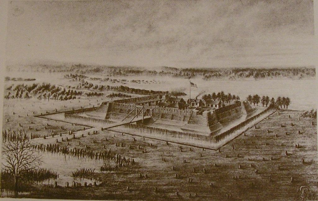
Fort Nelson was actually said to have been the second fort built here under the direction of Clark, with Fort-on-Shore being the first one built in 1781 but said to have been proven insufficient.
Fort Finney, directly across the Ohio River from Fort Nelson, and situated where the Kennedy Bridge is today, was said to have been built in 1786 and abandoned sometime in the 1790s.
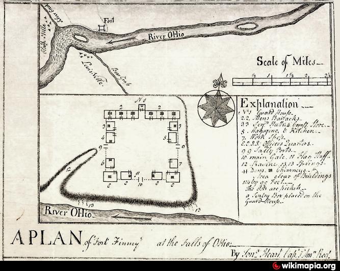
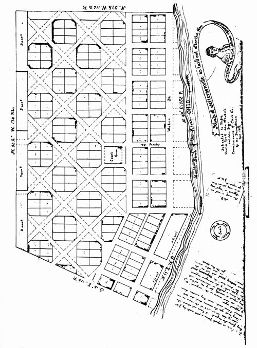
The location of Fort Finney was Jeffersonville, a settlement that was established in 1801, the year Thomas Jefferson took office.
We are told that residents of the new settlement used a grid pattern designed by Thomas Jefferson for the formation of the city starting in 1802.
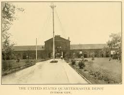
The Jeffersonville Quartermaster Depot was said to have been built starting in 1871 by the U. S. Army with the design of Quartermaster General Montgomery Meigs and Frederick Law Olmsted as an edifice to contain all the individual Quartermaster units that had spread all around Jeffersonville, and was used for the manufacture of military uniforms and supplies.
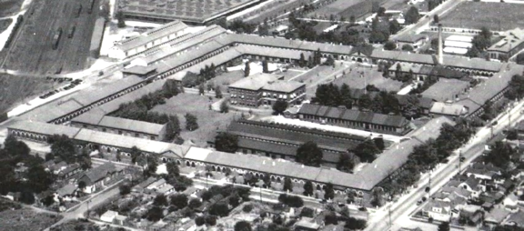
The 100-foot, or 30-meter, high tower in front of the main building of the depot was razed in 1900.
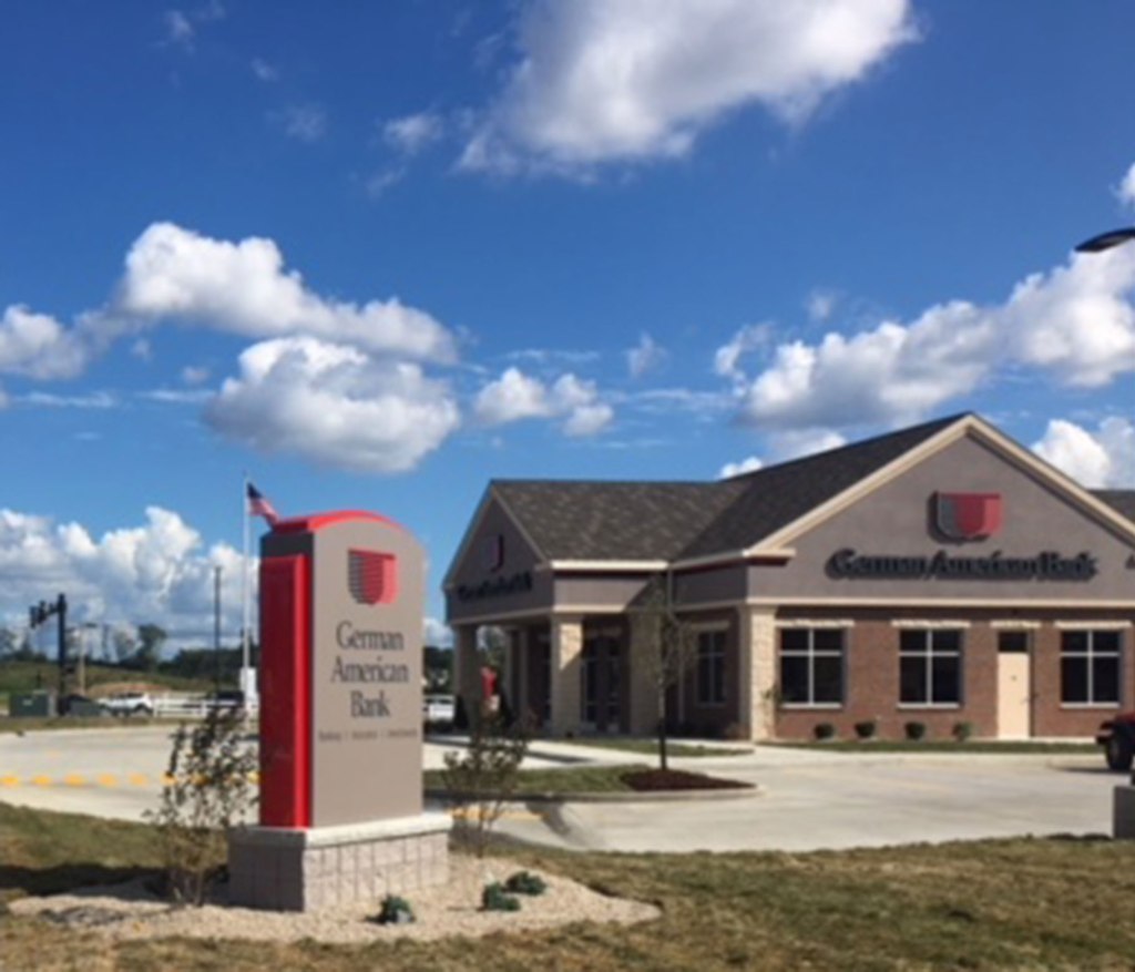
By 1870, seventeen-percent of the citizenry Jeffersonville were foreign-born, mostly from Germany.
This is the German-American bank location in Jeffersonville today.
Back to Louisville.
We are told the construction of the Jefferson County Courthouse started in 1837, and the city of Louisville and Jefferson County started to use it in 1842, though its full construction was said to not have been completed until 1860, which have been the year before the beginning of the American Civil War.
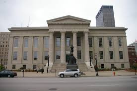
Now called the Louisville Metro Hall, it now primarily houses the offices of the Mayor of Louisville Metro, as well as the offices of the Jefferson County Clerk, the Kentucky Court of Appeals, and the Kentucky Supreme Court Justice for the Louisville District.
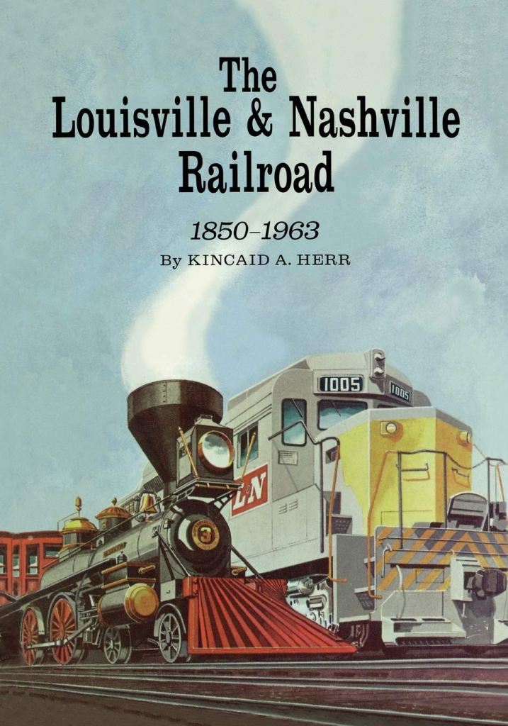
It was the founding city of the Louisville-Nashville Railroad, which grew into a 6,000-mile, or 9,700-kilometer system across 13 states.
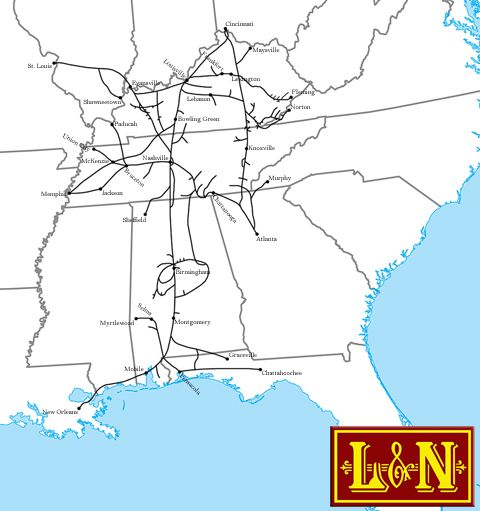
We are told it was first chartered by the Commonwealth of Kentucky in 1850, it grew into one of the great success stories of American business, operating continuously for 133-years under the same name…
…and that its first line extended from just south of Louisville, with the laying of track starting in 1853, and taking until 1859 to reach its second namesake city of Nashville with 180-miles, or 290-kilometers, of track.
The Union Station in Louisville, still standing today, closed as a railway station, but serving as the offices for the Transit Authority of River City.
Construction of the station was said to have begun in 1880, and completed in 1889.
The first Kentucky Derby was held in Louisville on May 17th of 1875 at the Louisville Jockey Club track…
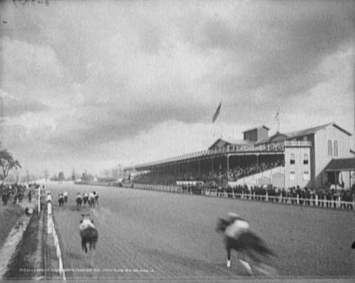
…later renamed Churchill Downs.
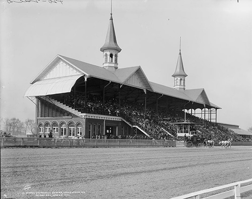
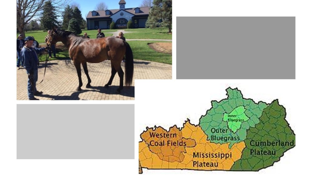
The Inner Bluegrass Region of Kentucky has been a center of breeding high-quality thoroughbred race horses, and other livestock, since the 19th-century.
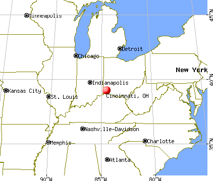
The next place on the alignment I am going to check out is Cincinnati, a major city in Ohio, located across the Ohio River which marks the state line with Kentucky, and is the county seat of Hamilton County.
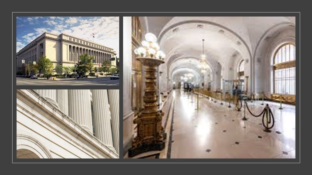
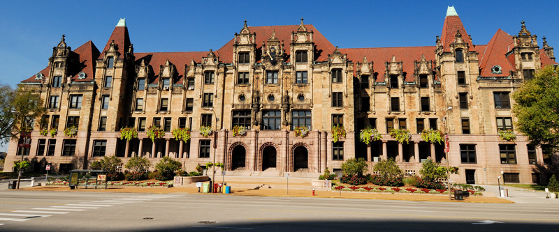
The Cincinnati City Hall was said to have been designed by Samuel Hannaford in Richardsonian Romanesque style, and completed in 1893.
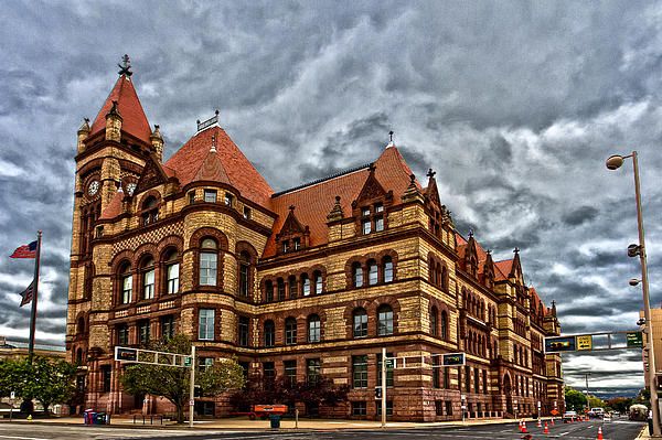
Richardsonian Romanesque was named after 19th-century architect, Henry Hobson Richardson.
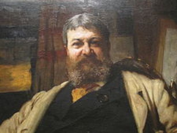
Interestingly, Mr. Richardson is said to have never finished his architecture studies in Paris due to the Civil War.
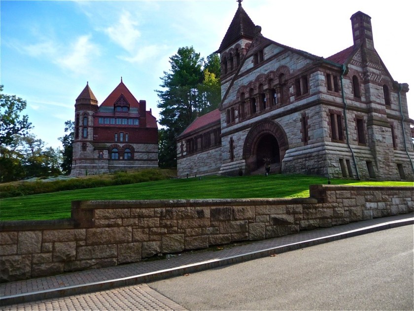
He also was said to have died at the age of 47, after having a prolific career in the design of mind-blowingly sophisticated and ornate buildings of heavy masonry, like the Oakes Ames Memorial Hall on the left and Ames Free Library on the right in North Easton, Massachusetts…
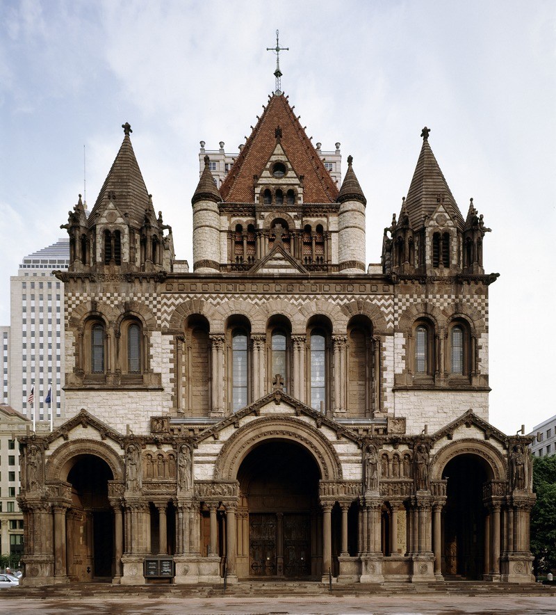
…the Trinity Church in Boston…
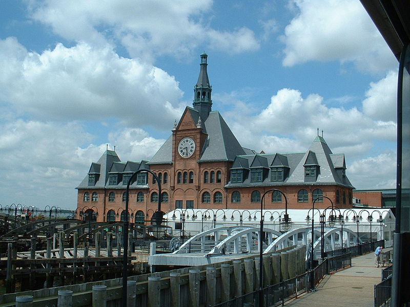
…and the Central Railroad of New Jersey Terminal in Jersey City.
This is the current Hamilton County Courthouse in Cincinnati. It was said to have been built between 1915 and 1919, with construction of it starting during World War I, by the Charles McCaul Company.
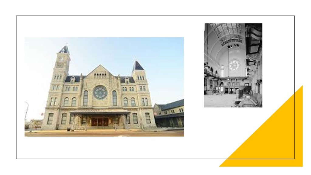
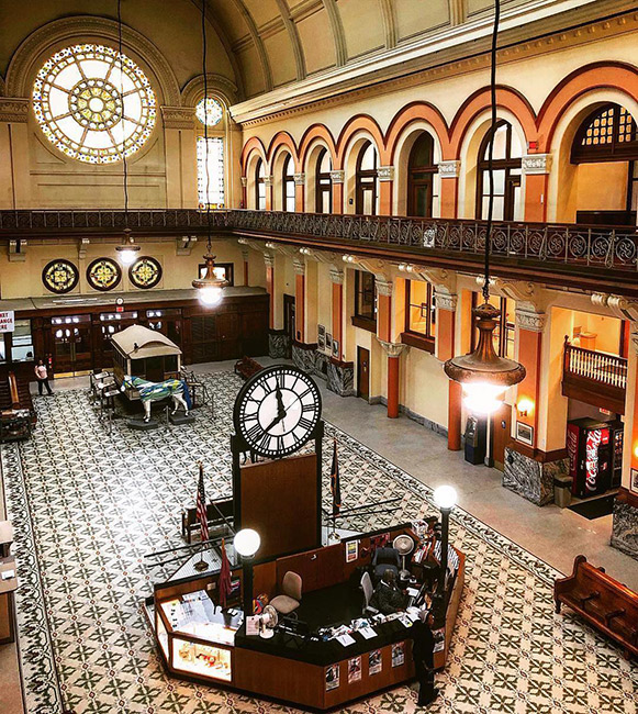
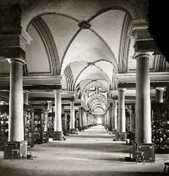
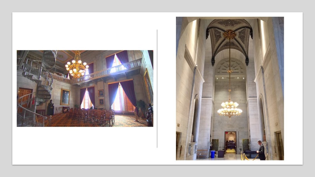
This is the Cincinnati Union Terminal, which has the largest half dome in the western hemisphere.
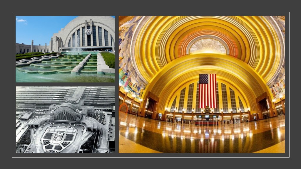
The architectural firm of Fellheimer and Wagner were given the credit for the architectural design of the Terminal, and work on it was said to have started in 1928 and completed in 1933.
It is still in use today as an Amtrak train station, as well as housing different aspects of the Cincinnati Museum Center, which includes three museums, a library, and a theater.
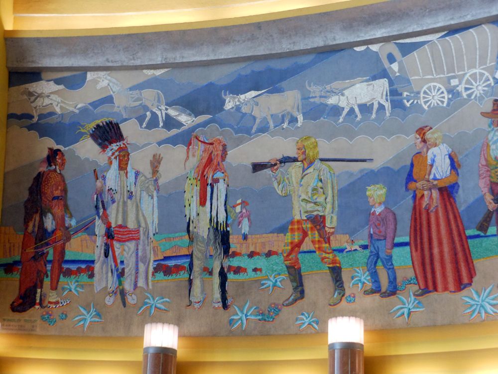
The Rotunda, the building’s main space, has two enormous mosaic murals created by Winhold Reiss from 1931 to 1932, depicting the history of Cincinnati from its settlement to the development to its manufacturing.
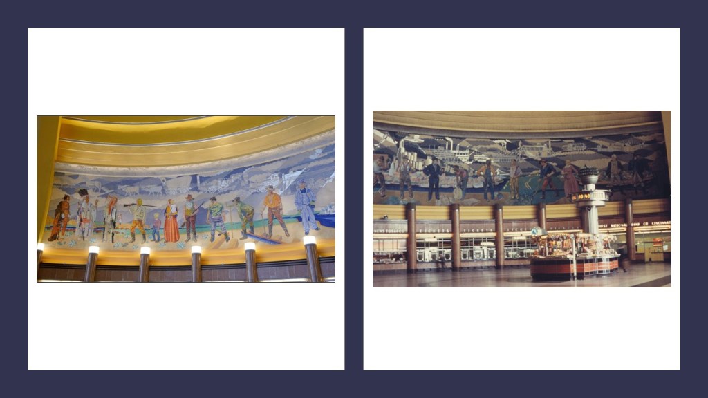
I have come to believe that huge murals like these are programming devices to to reinforce what we have been told about our history, like the settlement of the west via the early settlers meeting the Native Americans in the vast empty plains and wagon train depicted in the background…
…and things that we are not told about so much.
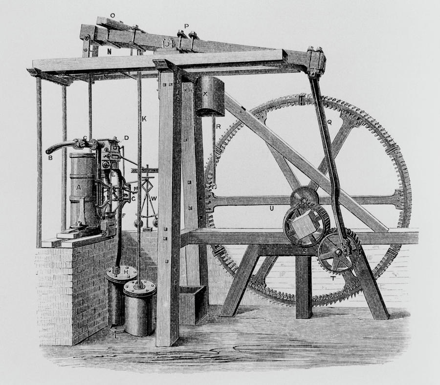
We are told lighter-than-air airships existed, but we are not told they likely had a far greater presence in the history of Earth than we have been told.
I am curious about why the artist depicted the airship seen in the background here of the mural depicting skyscraper construction workers.
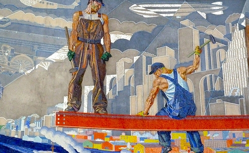
I mean, doesn’t the main shape of the Cincinnati Union Terminal resemble that of an airplane hangar?
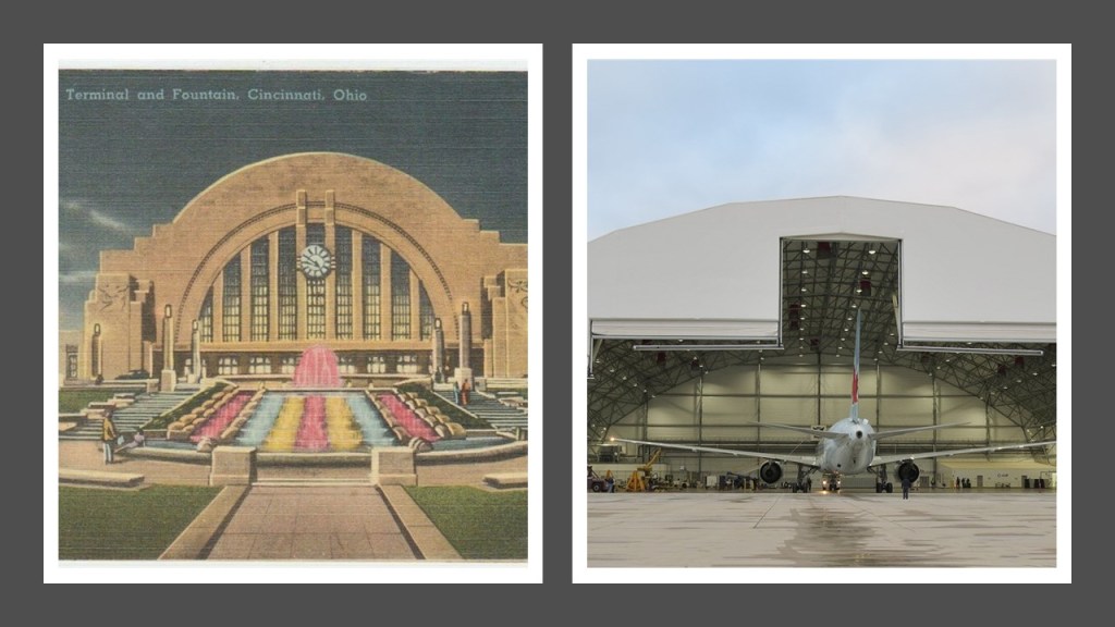
On the backside of the Terminal, what was called “Tower A” is still standing…
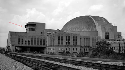
…but Tower B and Tower C are no more.
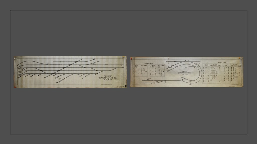
At the time the Cincinnati Union Terminal opened, it served seven railroads, with 216 trains entering or departing the terminal each day.
These towers controlled the track switches, actuated by electro-pneumatic machines utilizing compressed air through valves which were energized by electric signals from the towers, and were described as being similar to the control towers of airports.
This is what we are told about airships in our historical narrative.
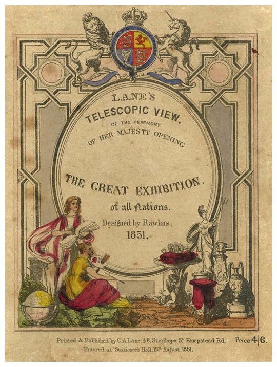
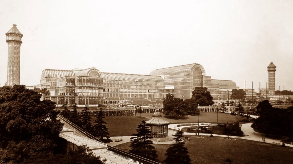
Australian inventor William Bland sent designs for his “Atmotic Airship” to the 1851 Great Exhibition in the Crystal Palace in London where a model was displayed.
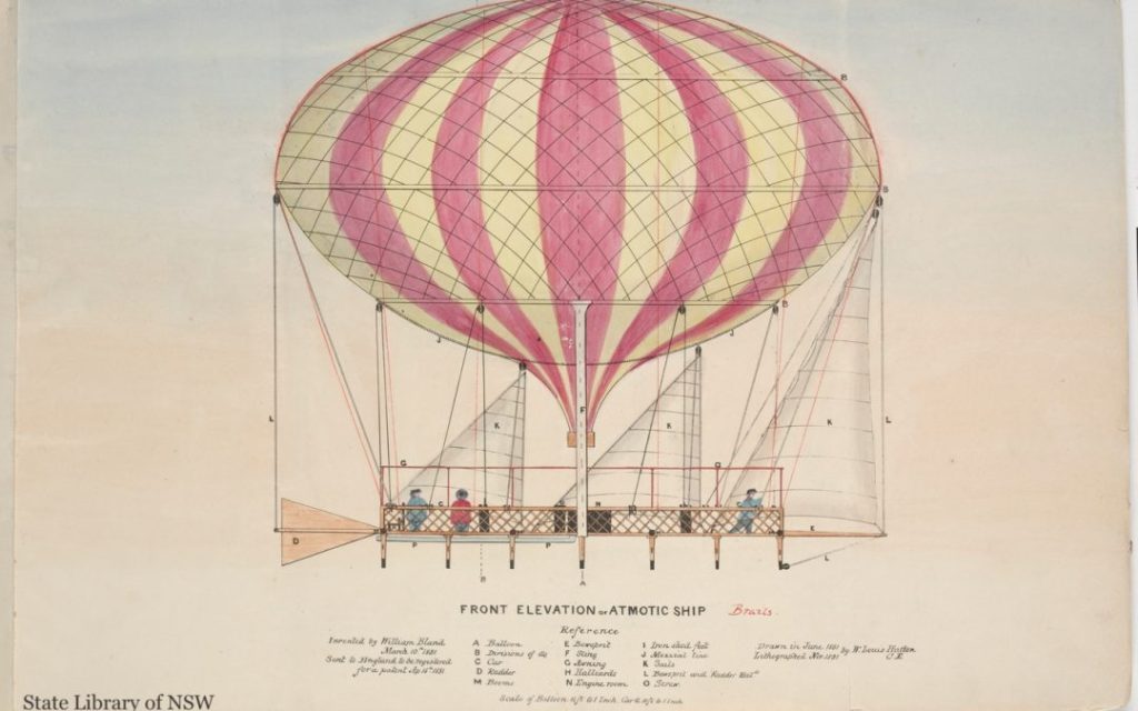
This was an elongated balloon with a steam engine driving twin propellers suspended underneath.
Then, in 1852, Frenchman Henri Giffard was credited as being the first person to make an engine-powered flight when he flew 17-miles, or 27-kilometers, in a steam-powered airship, and airships would develop considerably over the next two decades.

The era of the airships in our historical narrative was somewhere between 1900 and 1940.
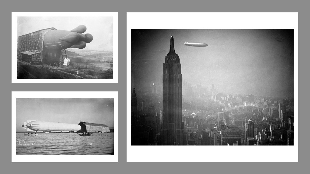
We are told their use decreased as their capabilities were surpassed by those of airplanes.
Sounds like the story we are about the superior capability of trains causing the use of canals for transportation to become obsolete.
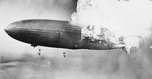
Then, we are told the decline of airships was accelerated by a series of high-profile accidents, including the 1937 burning of the German Hindenburg airship.
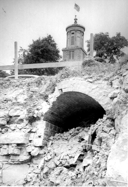
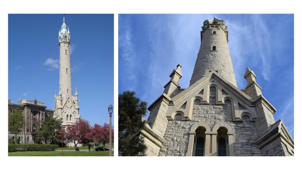
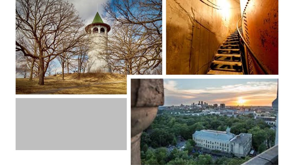
This is the Eden Park Stand Pipe in Cincinnati, said to have been completed in 1894 by the same Samuel Hannaford architectural firm responsible for the City Hall, and was said to have been built to provide sufficient water pressure for the Walnut Hills neighborhood of the city.
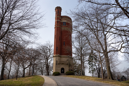
At one time a copper spire adorned the turret, removed in 1943 for a war scrap drive.
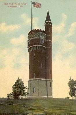
A public observation deck that once operated is no longer accessible to visitors.
Though most likely it served multiple purposes on the Earth’s original energy grid system, how hard is it to envision this structure as an airship docking station?
There are two more places I would like to look at before I leave Cincinnati on this alignment.
The first is the Cincinnati Music Hall, a classical performance hall that is home to the Cincinnati Symphony Orchestra, Ballet, Opera, Pops Orchestra, and May Festival Chorus.
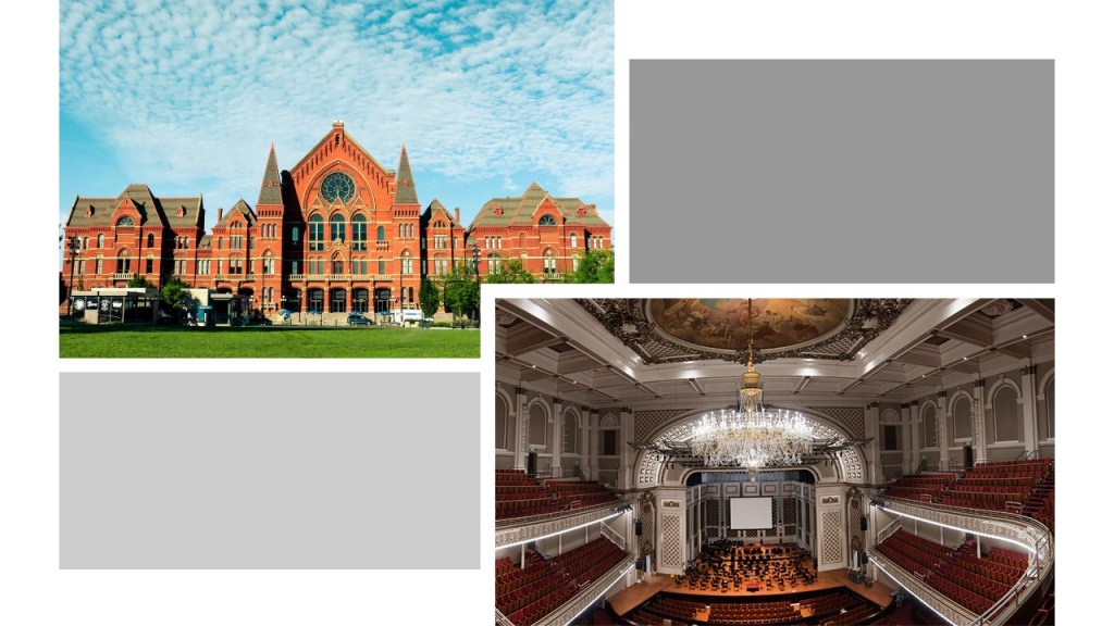
The construction of it in was said to have been completed in 1878.
Said to have been built over a paupers’ cemetery, it has the reputation of being one of the most haunted places in America.
The second is Cincinnati’s Over-the-Rhine neighborhood, which is among the most intact and largest historic districts in the United States.
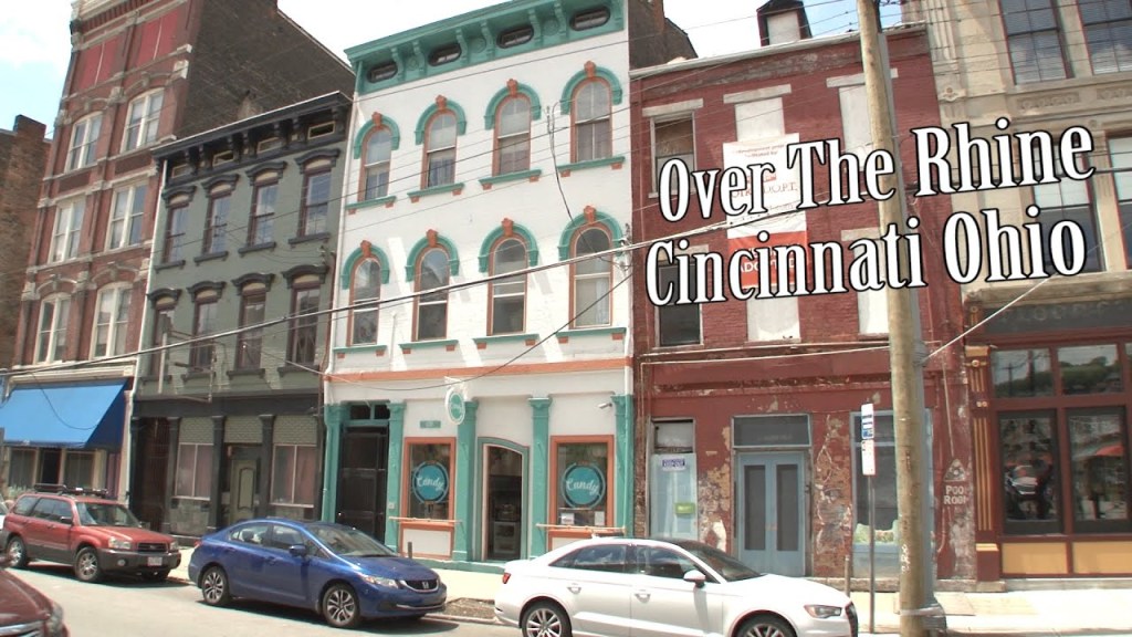
The name of the neighborhood comes from the mostly German immigrants who developed the area, we are told, in the mid-1800s.
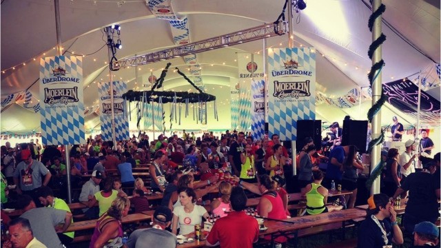
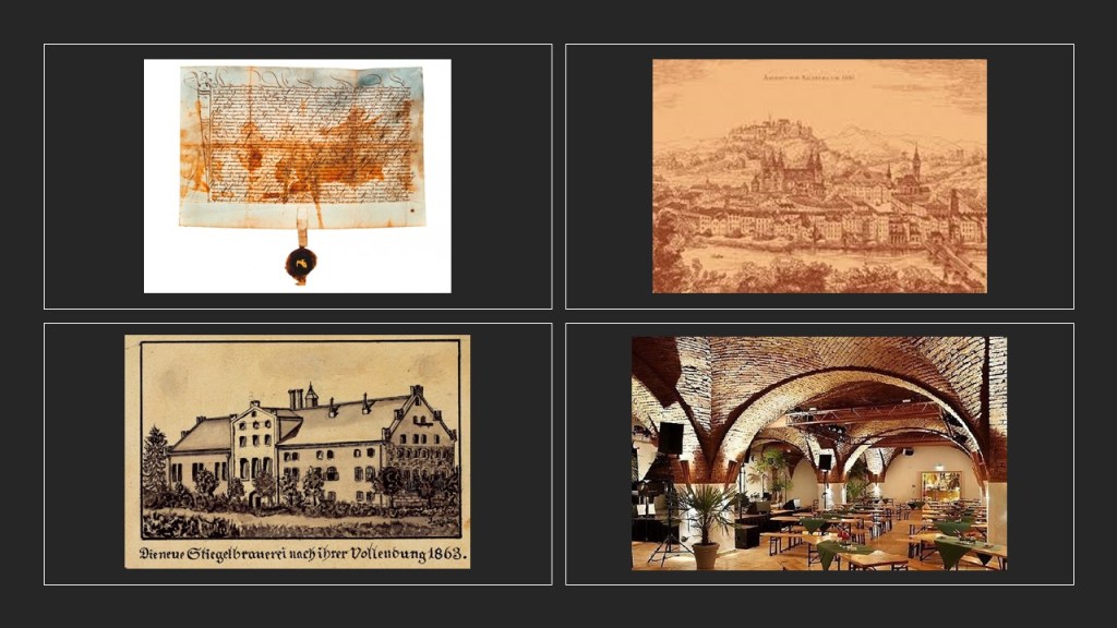
Amongst the districts within the Over-the-Rhein neighborhood is the Brewery District, the heart of Cincinnati’s beer-brewing industry.
Christian Moerlein established his first brewing company there in 1853, the city’s largest brewery developing into a national market.
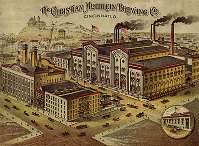
The Germans sure made sure there was plenty of beer to go around right from the get-go, didn’t they?!
We are told Prohibition brought an end to the company in the 1920s, but it was revived as a Cincinnati brewery in 2010.
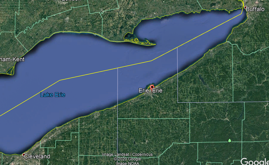
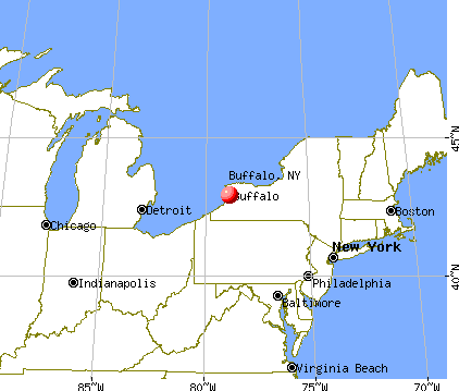
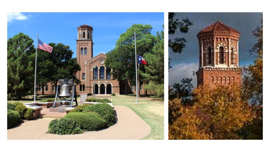
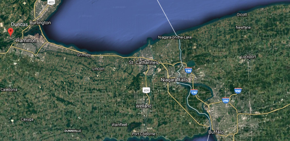
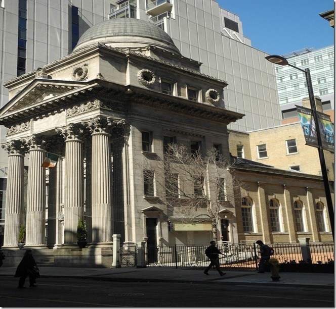
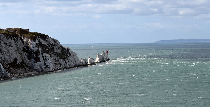
The next place on the alignment is Erie, the largest city in northwestern Pennsylvania, and the seat of Erie County.
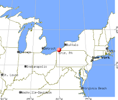
Erie is halfway between Buffalo, New York and Cleveland, Ohio, on the south shore of Lake Erie.
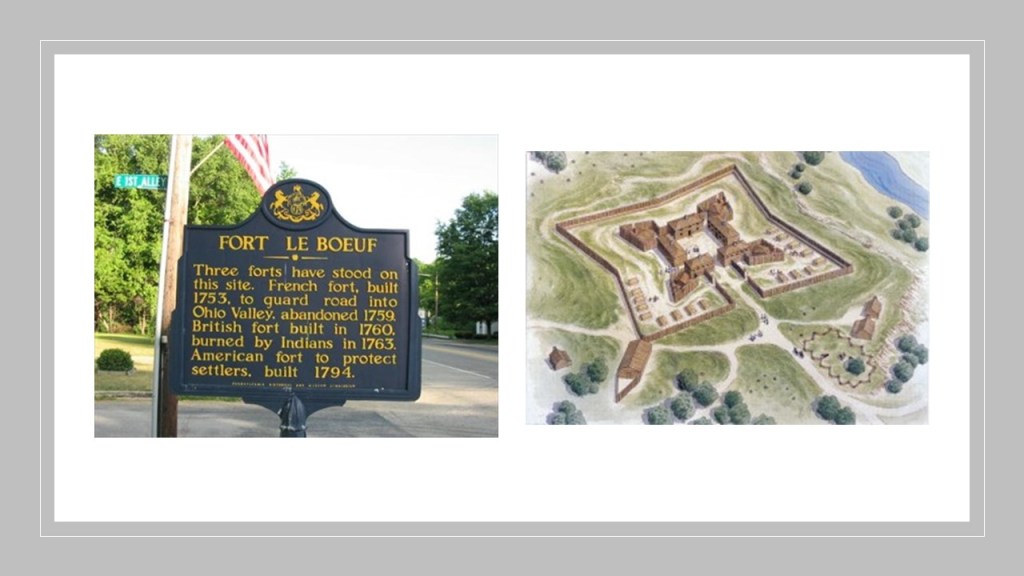
We are told the French were the first Europeans to arrive in the area, which had been inhabited historically by the indigenous Erie people, and that the French were the ones to construct Fort Presque Isle near Erie in 1753 to protect the northern terminus of the Venango Path, the year before the beginning of the French and Indian Wars in 1754, which lasted until 1763.
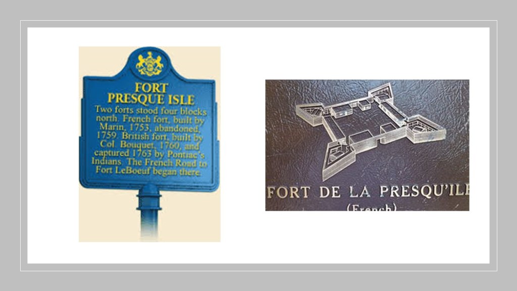
It was abandoned only six-years later.
The Venango Path was a Native American trail…
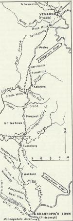
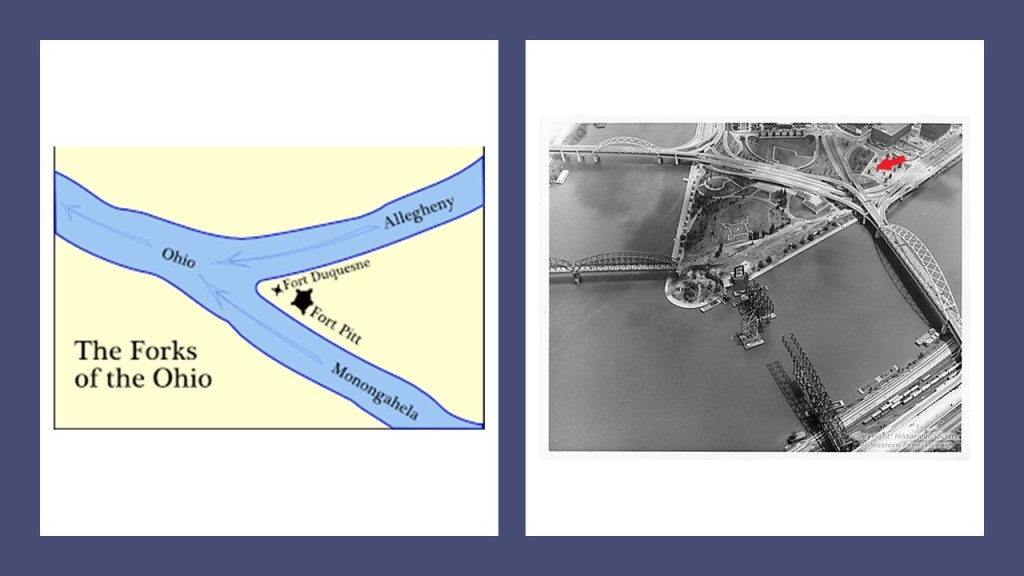
…between the canal-looking Forks of the Ohio at present-day Pittsburgh…
…and Presque Isle at present-day Erie, Pennsylvania.
The French were also said to have built Fort Le Boeuf that same year, with the reason given to guard the road into the Ohio Valley, and it was also abandoned at the same time as Fort Presque Isle.
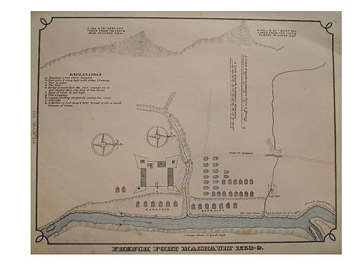
Fort Machault was also included in this line of fortifications the French were said to have built around the same time-period, and also abandoned by the French in 1759.
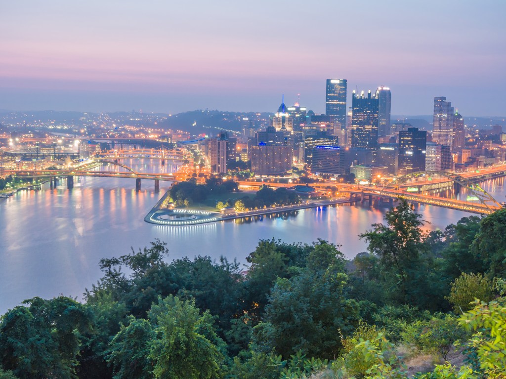
The last fort said to have been built by the French in 1754 in this line of fortifications was Fort Duquesne, situated between the Forks of the Ohio in present-day Pittsburgh.
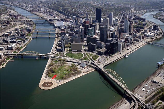
Fort Duquesne was considered strategically important for controlling the Ohio Country for both settlement and trade.
The French were said to have destroyed the fort later in the French and Indian Wars, and the site was taken over by the British, who were said to have built Fort Pitt, eventually taken over by the Americans and the area became known as Pittsburgh.
Back to Erie.
We are told the first railroad station in Erie was established in 1851, and replaced in 1866 by the Romanesque Revival Union Depot, which was demolished in 1925.
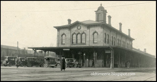
The current Art Deco Union Station was said to have opened in 1927, designed by the Fellheimer and Wagner architectural firm we are told was responsible for the Cincinnati Union Terminal.
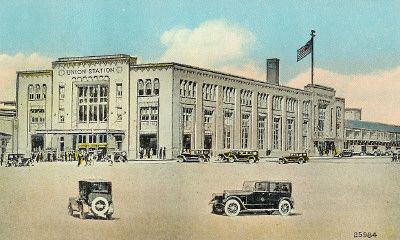
Still in use as part of the Lake Shore Limited route between Boston and the northeastern United States cities of New York and Boston, Erie is the only stop in Pennsylvania.
The station’s ground floor is commercial space today, including a brew pub.

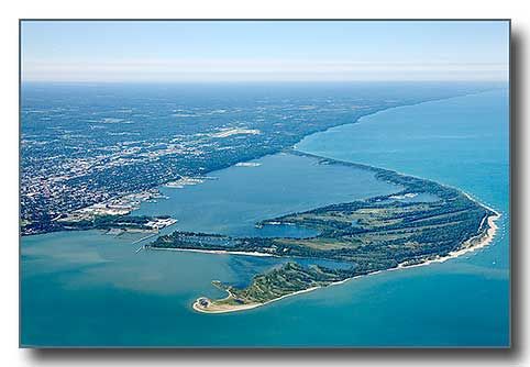
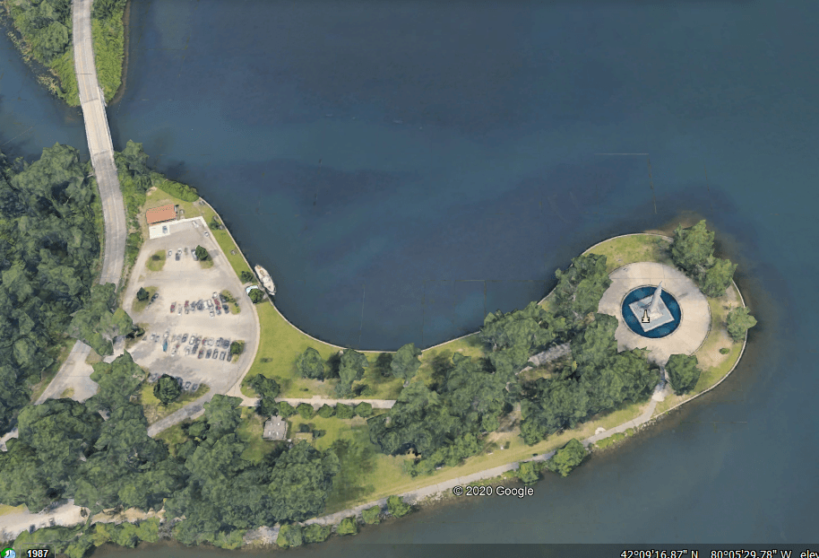
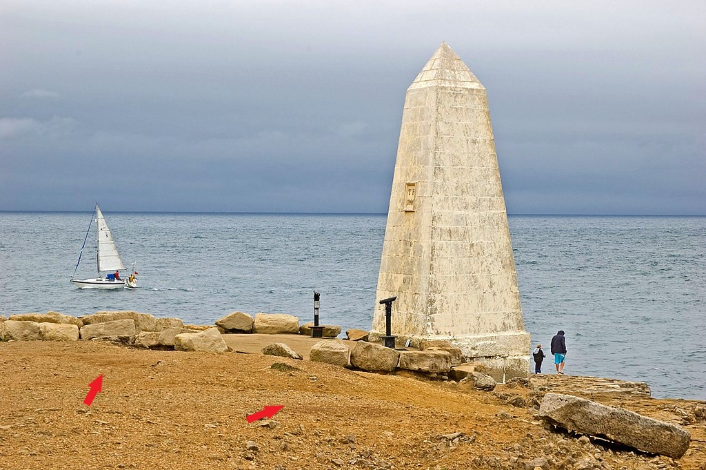
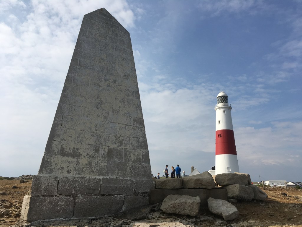
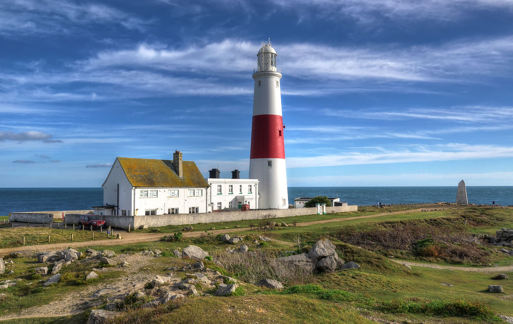
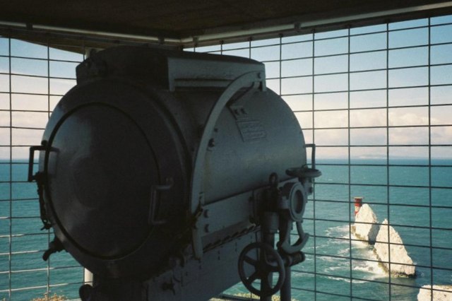
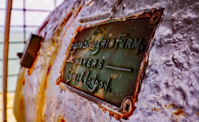
Presque Isle State Park is an arching peninsula that juts into Lake Erie, 4-miles, or 6-kilometers, west of the city of Erie.
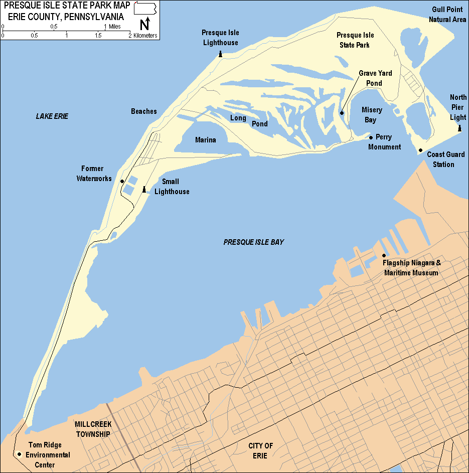
Presque Ile served as a base for Commodore Oliver Perry’s fleet during the War of 1812, and played a part in the victory over the British in the Battle of Lake Erie.
The Perry Monument on one of Presque Isle’s southern tips was so-named to commemorate this victory.
The obelisk is situated on a circular…
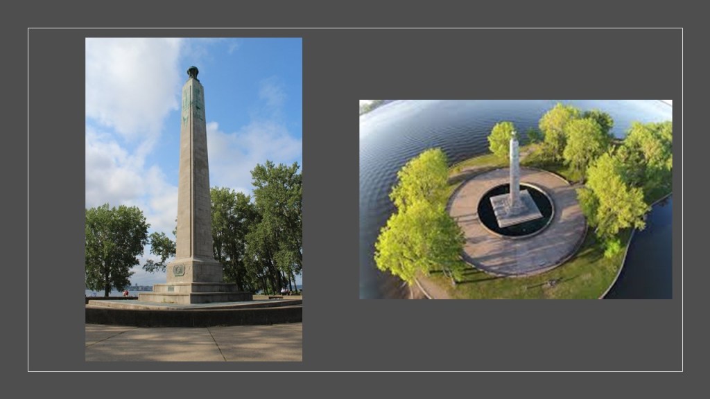
…and what definitely appears to be artificially-shaped land-form.
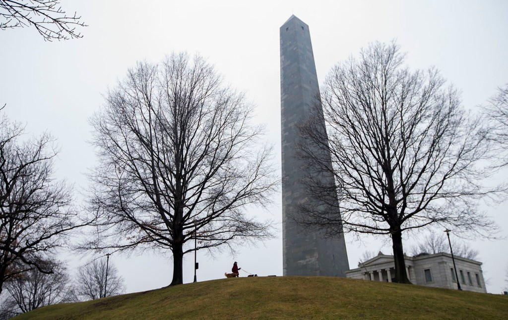
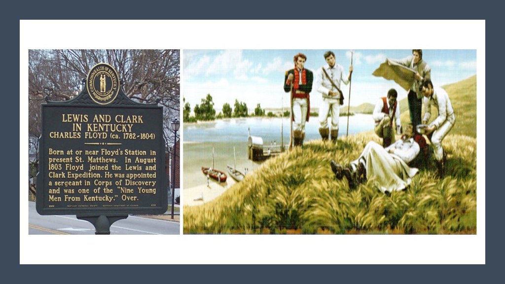
I typically find obelisks as commemorative monuments, like the Bunker Hill Monument in Boston, Massachusetts…
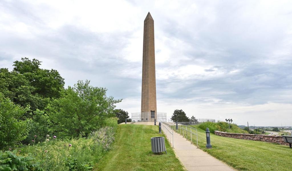
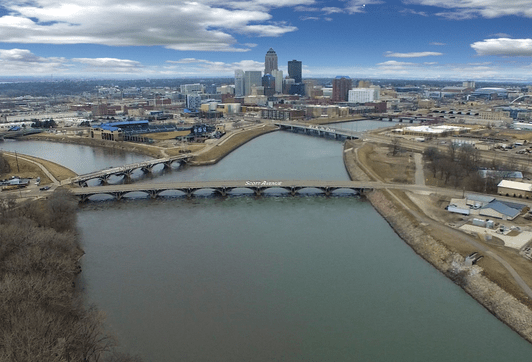
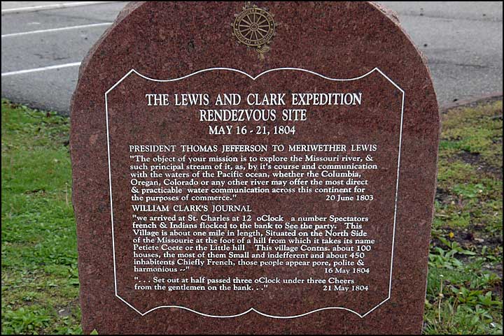
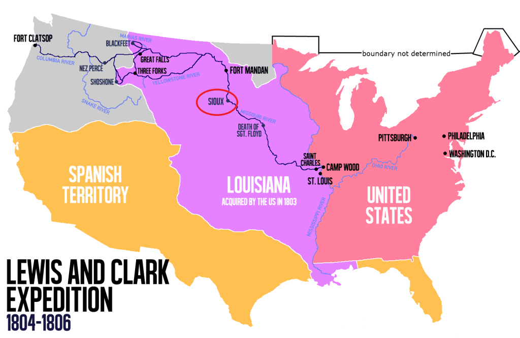
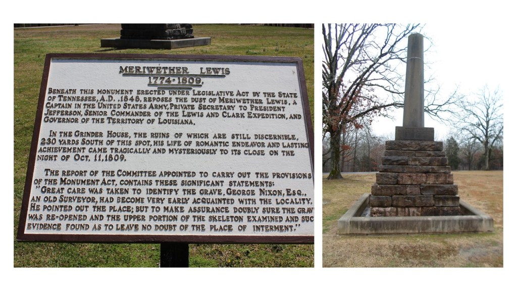
…the Sergeant Floyd Monument in Sioux City Iowa, said to have been erected to commemorate the only death that was said to have occurred during the Lewis and Clark Expedition in 1804…
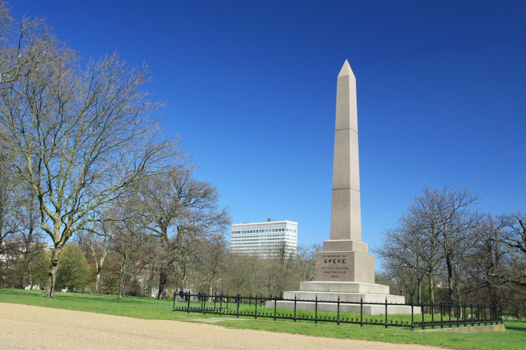
…and Speke’s Monument is located in the Kensington Gardens, a red granite obelisk dedicated to John Hanning Speke, the explorer who “discovered” Lake Victoria and led expeditions to the source of the Nile, to name a few of many such examples.
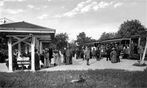
Waldemeer Park at the base of Presque Isle is one of only thirteen trolley parks still operating in the United States.
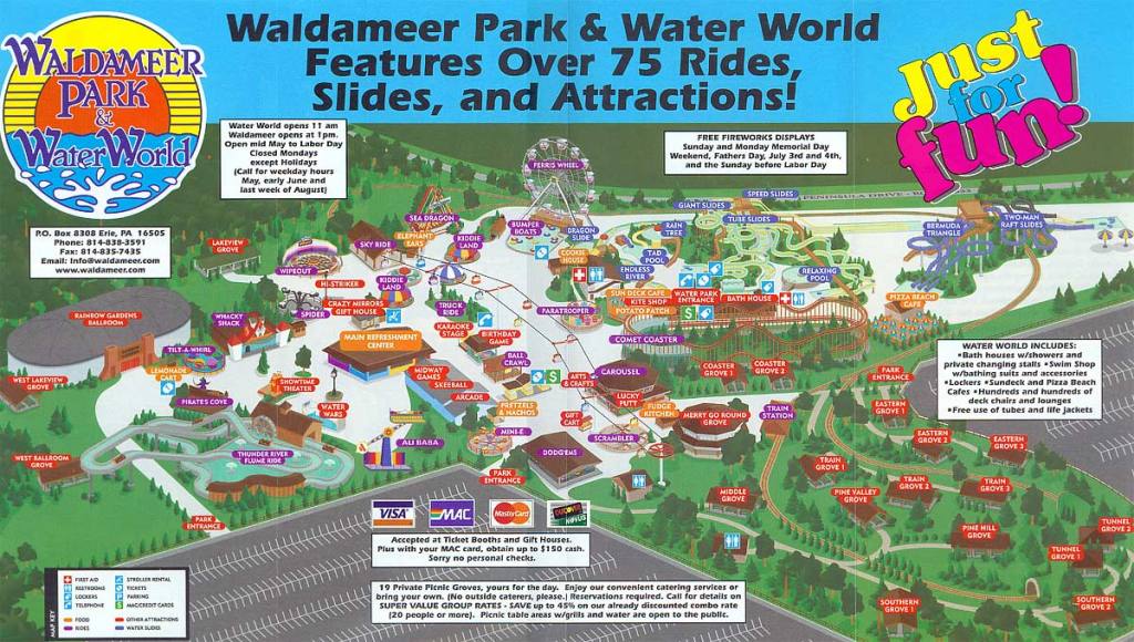
Waldemeer was first leased as a trolley park in 1896 by the Erie Electric Motor Company, and is the fourth-oldest amusement park in Pennsylvania, and the tenth-oldest in the United States.
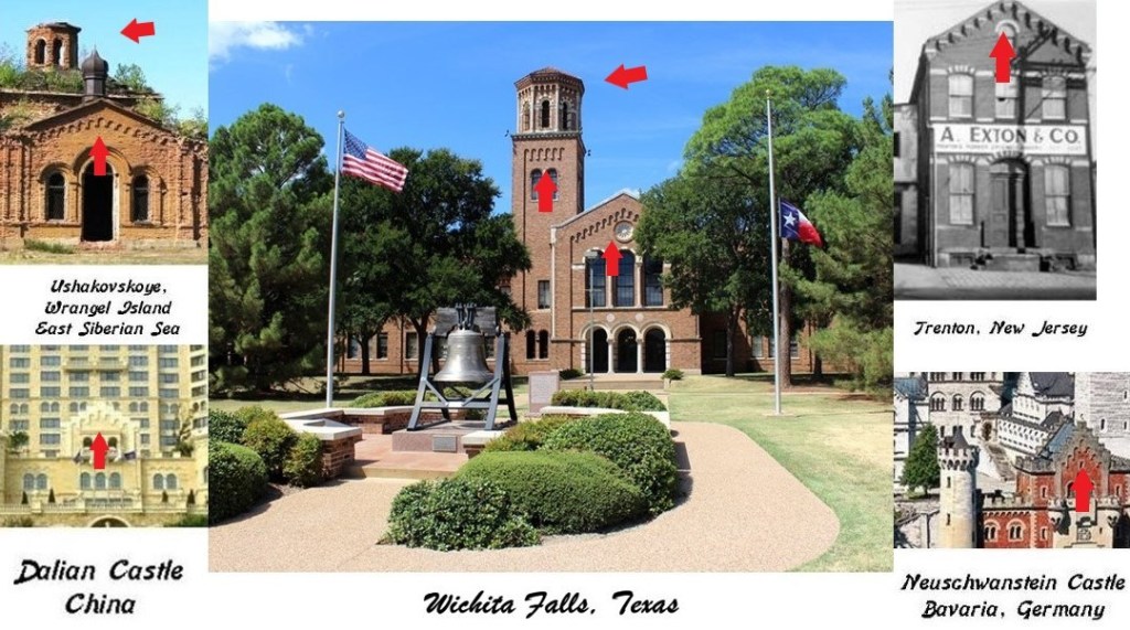
One more place I would like to look at before leaving Erie since it is the county seat is the Erie County Courthouse.
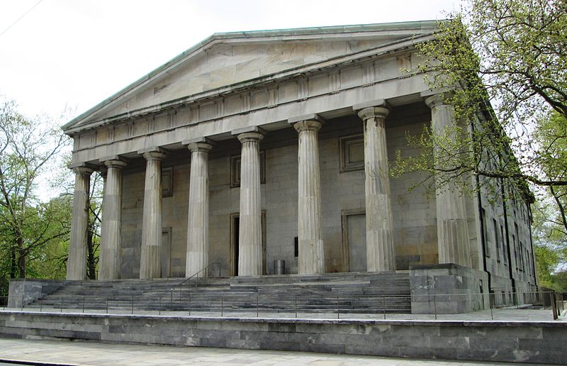
Most of the original building was said to have been built in the Greek Revival style between 1853 and 1855.
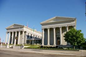
The architect given the credit for designing the court house was Thomas Ustick Walter of Philadelphia, called the Dean of American Architecture in between 1820 with the death of Benjamin Latrobe, the architect primarily given credit for the U. S. Capitol building among other elaborate buildings, and the emergence of Henry Hobson Richardson in the 1870s.

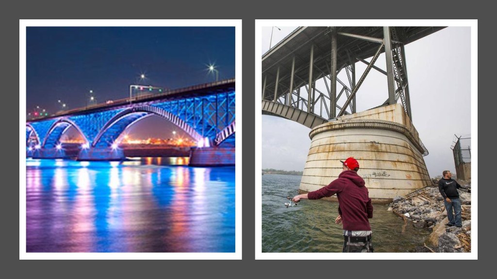
The next and last place I am going to look at on this alignment is Buffalo, New York’s second-largest city, and the county seat of Erie County.
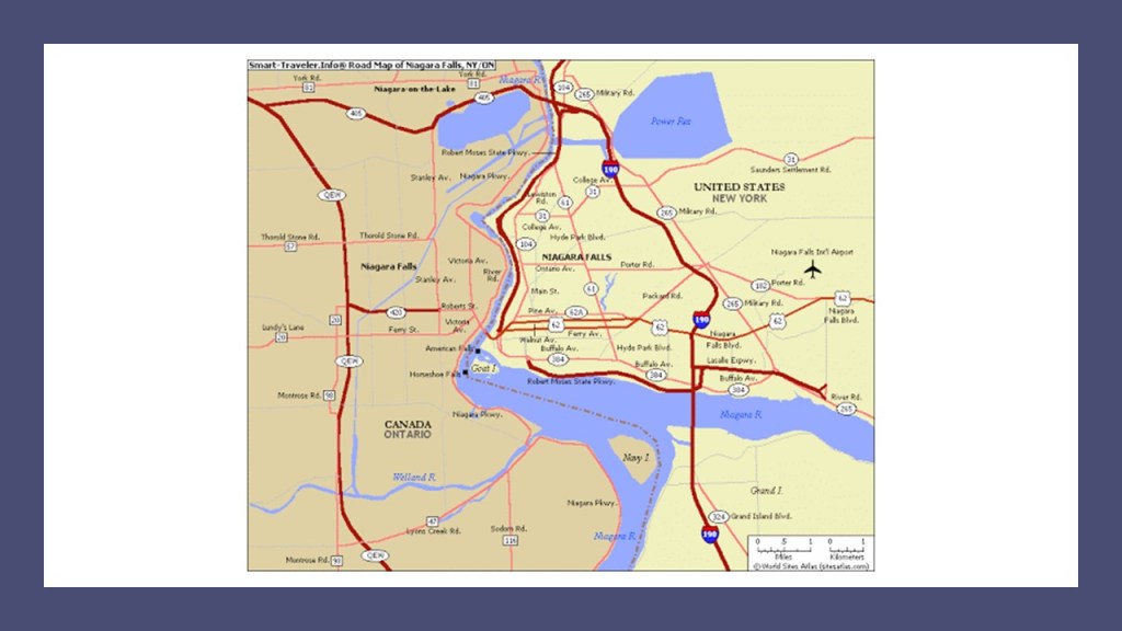
The city serves as a major gateway for travel and commerce across the Canadian border, forming part of the bi-national Buffalo-Niagara Region and Buffalo-Niagara Falls metropolitan area.
Niagara Falls is at the International Boundary between the United States and Canada, with the city of Niagara Falls in New York on one side, and the city of Niagara Falls in Ontario.
We are told Europeans started entering the area in the 17th-century, with Frenchmen Robert de la Salle given the credit for building Fort Conti at the mouth of the Niagara River in 1679, as a base for exploring for the Northwest Passage to Japan and China to extend France’s trade.

He was accompanied by Belgian priest, missionary, and explorer of the North American interior, Franciscan Father Louis Hennepin, said to have been the first European to see the Niagara Falls.

While the Franciscans were members of related-religious orders said to have been founded by the highly-venerated and gentle St. Francis of Assisi in 1209…

…I see the Franciscans playing a similar role to the Jesuits with regards to what took place here in subverting the indigenous peoples and real history of the Americas.
The Franciscans were called the vanguard of missionary activity in the New World.

The city of Buffalo is situated on top of the Niagara Escarpment, which forms the falls over which the Niagara River flows through a 36-mile, or 58-kilometer, channel that connects Lake Erie and Lake Ontario and separates New York from Ontario.

The Niagara Escarpment extends runs predominately east-west from New York through Ontario, Michigan, Wisconsin and Illinois in a remarkably geometric-looking shape when you consider the long-distance it covers.
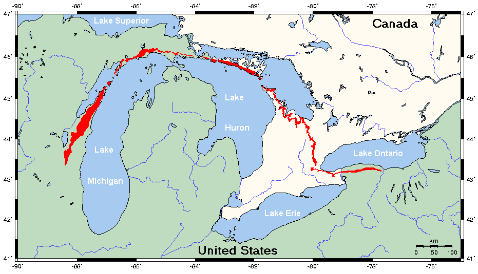
And this is a view of the Niagara Escarpment pictured on the left in comparison with what is called the Endless Wall at the New River Gorge State Park in West Virginia on the right.

Are we talking natural here or more like intentional design?
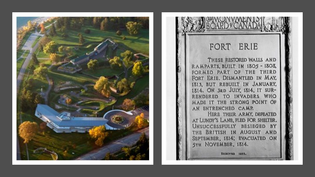
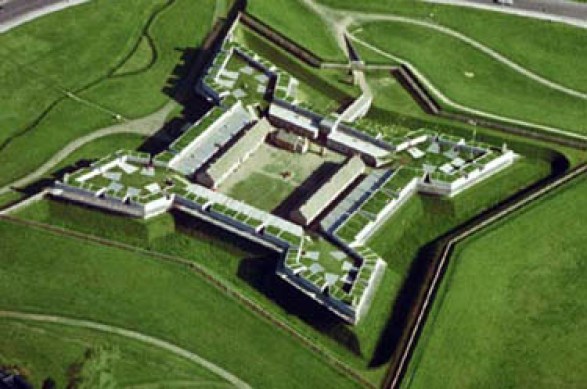
Old Fort Erie, now the Fort Erie National Historic Site of Canada, was said to have been constructed by the British as part of a network of fortifications after the 1763 Treaty of Paris, sign at the end of the French and Indian War, in which France ceded its territories east of the Mississippi River to Great Britain.
The present-fort was said to have been built between 1805 and 1808.
The Peace Bridge is an International Bridge connecting a location near the center of downtown Buffalo and Fort Erie, Ontario.
We are told the idea of a bridge joining the United States and Canada was discussed as early as 1853, though actual construction of the bridge didn’t start until August 17th of 1925, and first opened on June 1st of 1927.
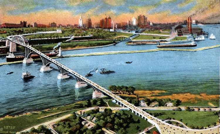
Typically we don’t ask questions about what we are told, because why on Earth would we be lied to, but consider if what we have been told about the construction is consistent with the engineering required to build this massive bridge.
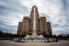
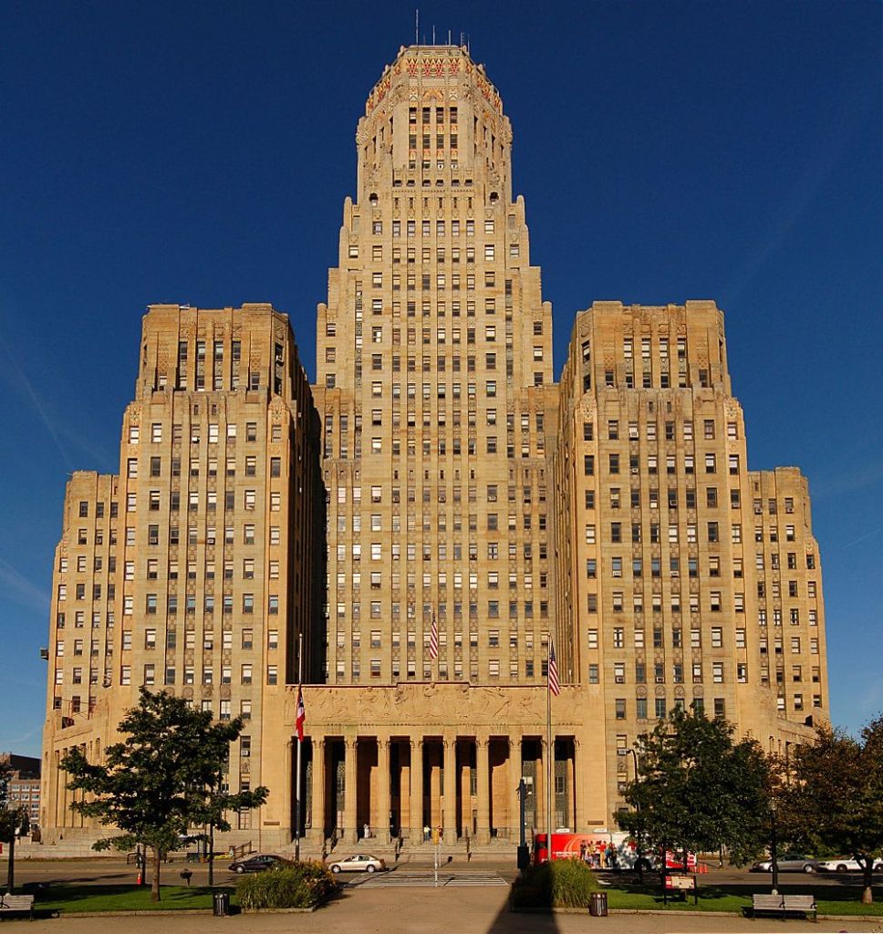
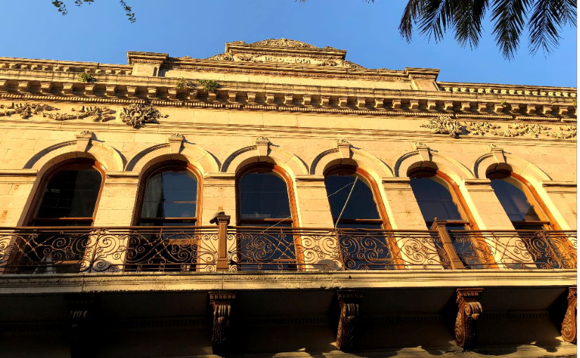
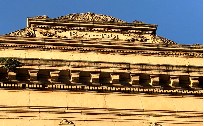
This is the Buffalo City Hall, with the McKinley Monument standing in front of it.
The story that goes along with this particular obelisk is that it was commissioned by the State of New York and dedicated to the memory of the 25th-President of the United States, William McKinley, on September 6th of 1901, who was assassinated while attending the 1901 Pan-American Exposition in Buffalo.
The 32-story Buffalo City Hall itself was said to have been completed sometime around 1931 by the architectural firm of Dietel, Wade, and Jones in Art Deco style.
Now the Hotel Henry Urban Resort Conference Center in Buffalo, this building started out life as the Buffalo State Asylum for the Insane, said to have been built starting in 1870, and to have been designed by the premier architect Henry Hobson Richardson in his namesake style of Richardsonian Romanesque.

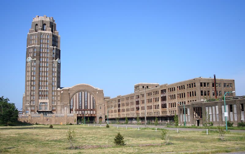
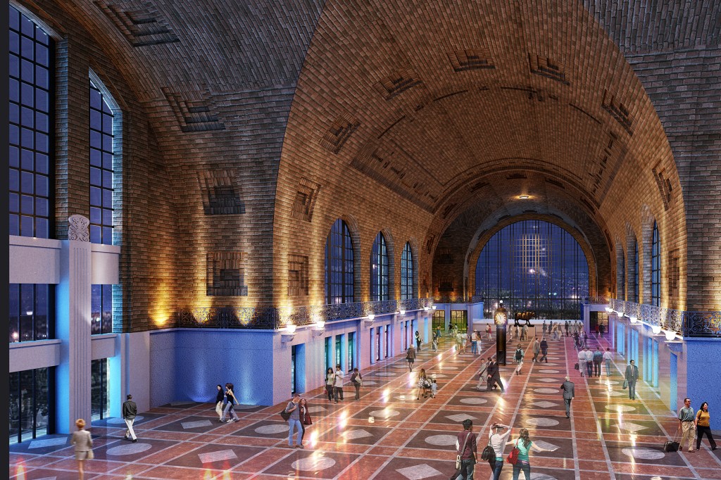
The Buffalo Central Terminal, another building attributed to Fellheimer and Wagner in the historical narrative, with its construction starting in 1925, and operating as an active station from 1929 to 1979.
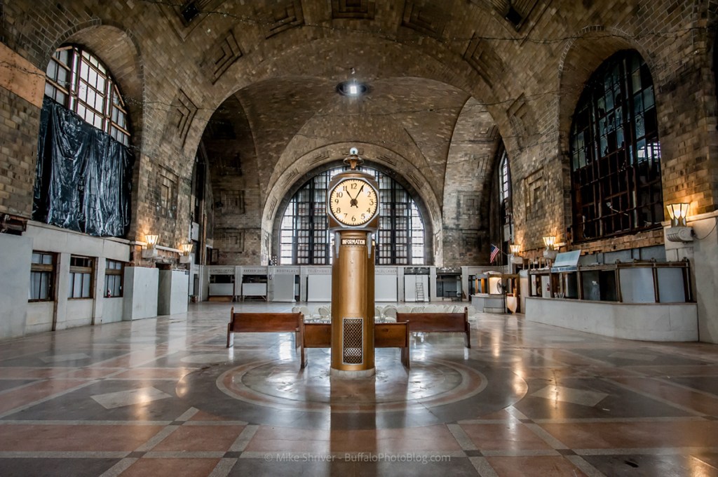
It was abandoned for years, and now owned by a non-profit preservation group working on restoring and repurposing the complex.
This is another train station that brings airships to mind, with its tall main tower and the airplane hangar-appearing structure right next to it.
I highly recommend this video done by Dustin of the Berserker Bear Youtube Channel, in which he does an excellent boots-on-the-ground field research work on the Buffalo Central Terminal.
The Erie Canal was built in the middle of what was called the American Canal Age between 1790 and 1855 in our historical narrative.
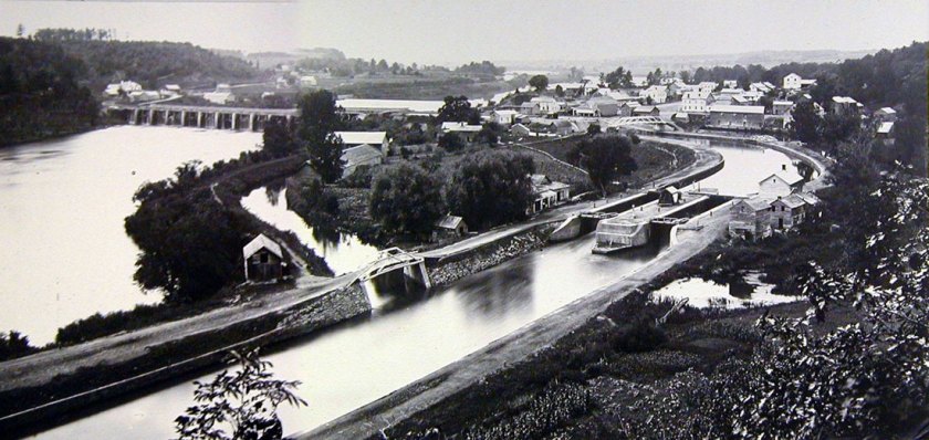
The 363-mile, or 584-kilometer, long Erie Canal, connected the Hudson River in Albany, New York, with Lake Erie in Buffalo, New York, and was first used on May 17th, 1821.
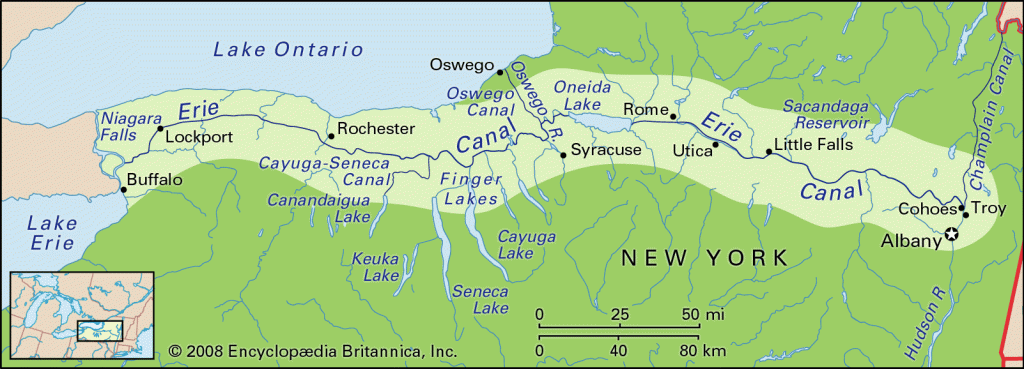
The construction of the Erie Canal was said to have started on July 4th, 1817, in Rome, New York, where Fort Stanwix is located, said to have been built in 1758 by the British.
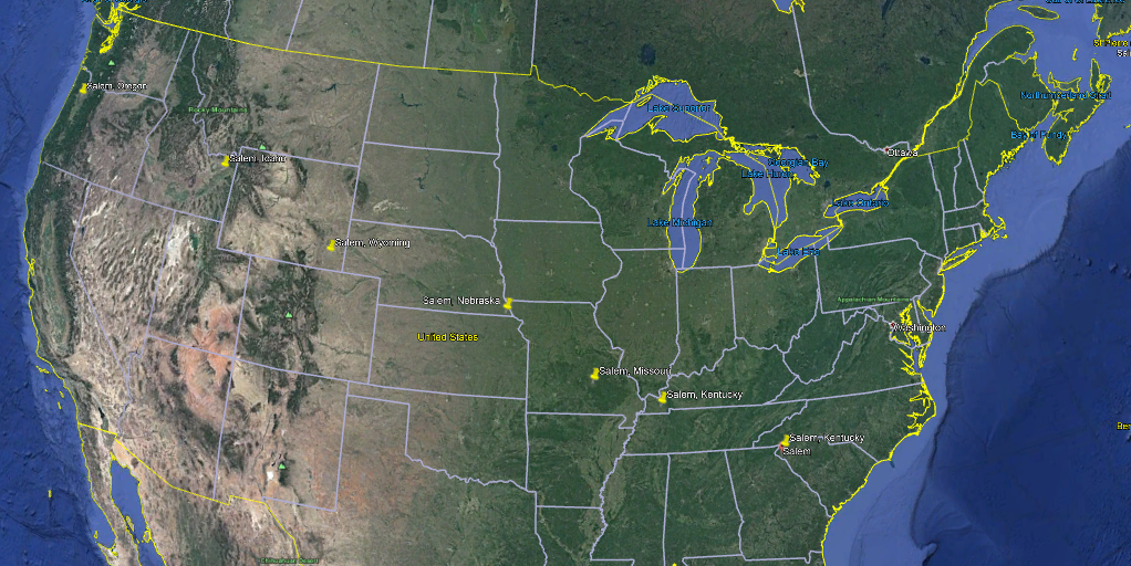
In my next post, I am going to be taking a look into the North American Solar Eclipse in August of 2017, which is also known as the Seven Salem Eclipse because its path of totality overshadowed seven cities named Salem in Oregon, Idaho, Wyoming, Nebraska, Missouri, Kentucky, and South Carolina as it travelled across North America.


