I believe that the circuit board of the Earth’s original free-energy grid system was destroyed in a deliberately-caused cataclysmic event which caused the entire surface of the Earth to undulate and buckle around key infrastructure of the energy grid, and that when when the original energy grid was destroyed, replacement energy sources were then extracted from the original grid to bring everything back on-line as quickly as possible leading directly to the industrialized world we live in that is the only thing we know about.
From what I am seeing and finding, the destruction of the grid created swamps, marshes, bogs, deserts, dunes, and places where it appears land masses sheared-off and submerged under the bodies of water we see today.
I am going to show you exactly why I believe this to be the case in this post.

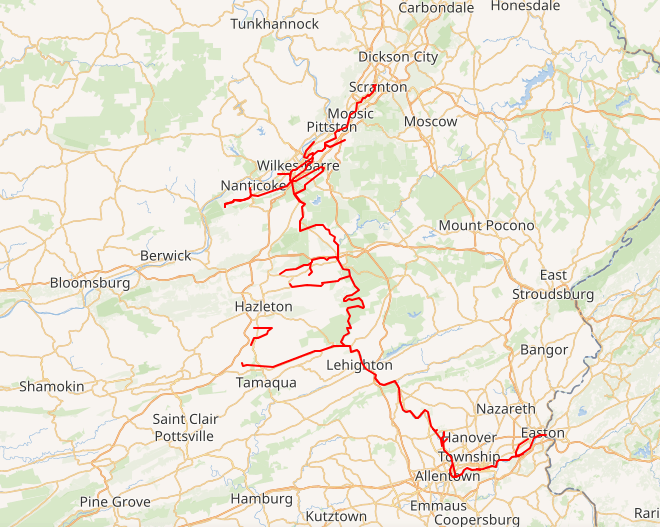
I am going to bring forward my findings from past research on what our narrative tells us about our history in North America, in places like Pennsylvania, Appalachia and the Great Lakes region.
The destruction of the energy grid and the existence of the Old World was covered up by those behind the creation of a New World Order that was built on top of the ruins of the Old World
I think what we think of as modern infrastructure was actually pre-existing infrastructure, including railways, canals, and lighthouses among the many examples available to choose from.
I believe those behind the cataclysm were shovel-ready to dig enough of the original infrastructure out of the ruined Earth so they could be used and civilization restarted, which I think started in earnest in the mid-to-late 1700s and early 1800s.
They only used the pre-existing infrastructure until they developed replacement fuel sources that could be monetized and controlled by them and when what remained of the original infrastructure was no longer useful to them, or inconvenient to their agenda, they had it destroyed, discontinued, or abandoned, typically in a very short time after it was said to have been constructed.
For the purposes of this post, I am going to focus on what was happening in our historical narrative starting in 1765 with the establishment of the Freiburg University of Mining and Technology, the oldest school of mining and metallurgy in the world, by Francis Xavier of Saxony of the House of Wettin.
Its main purpose was the education of highly skilled miners and scientist in fields connected to mining and metallurgy.

The original royal houses of Europe were completely replaced by this obscure German Ducal lineage primarily through Queen Victoria and Prince Albert, first-cousins and members of the House of Saxe-Coburg and Gotha of the Ernestine branch of the House of Wettin.
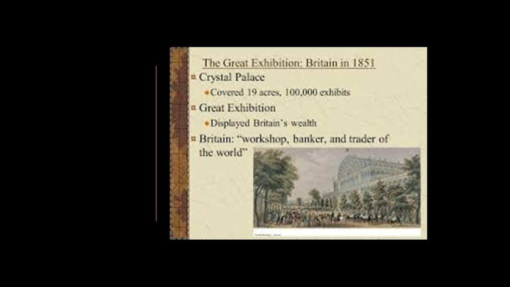
I would like to insert here my belief the Crystal Palace Exhibition in London that took place in 1851 during the reign of Queen Victoria was the official kick-off to the New World Order timeline.
It was also known as the Great Exhibition of the Works of Industry of All Nations.
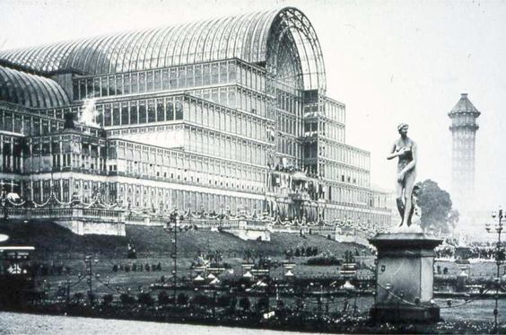
We are told the purpose of this first Great Exhibition in 1851 was to make clear to the world Britain’s role as industrial leader, while at the same time it provided a platform on which other countries from around the world could display their achievements.
From my perspective, one of the main purposes of these Exhibitions, Expositions, and World Fairs, starting in 1851, was the showcasing of the technology and architectural wonders of the original civilization before being hidden away and/or forever destroyed.
In our historical narrative, we are told the Crystal Palace Exhibition was organized by Sir Henry Cole, British civil servant and inventor, and Prince Albert, husband of Queen Victoria.
We are told that it took only 9-months to develop it, from plans and organization to the Grand Opening with Queen Victoria.
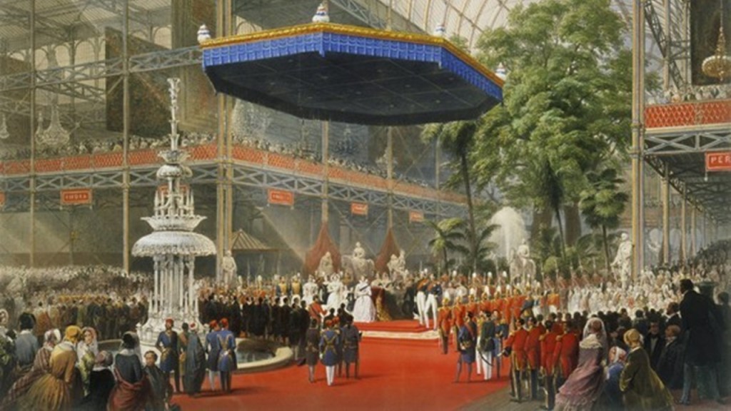
Between May 1st and October 15th of 1851, six-million people were said to visit the Crystal Palace Exhibition, including famous people of the time like evolution theorist Charles Darwin; gun-maker Samuel Colt; writers Charlotte Bronte, Charles Dickens, and Alfred Lord Tennyson; and merchant banker and financier George Peabody.

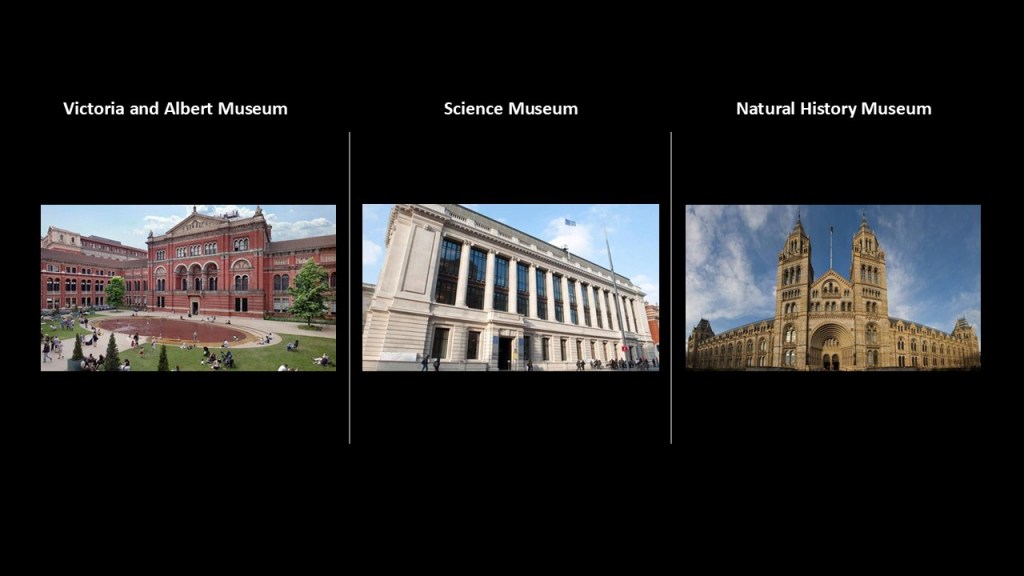
The proceeds generated by the Great Exhibition of 1851 were then said to be used to found the following museums in London:
The Victoria and Albert Museum in 1852 on the left; the Science Museum in 1857 in the middle; and the Natural History Museum in London in 1881.
What was the fate of the Crystal Palace itself?
Well, we are told the magnificent Crystal Palace was moved and re-erected in 1854 to Sydenham Hill in South London, and was later destroyed by fire in 1936.
Among many other questions I have about a lot of things, how did they manage to move a building described as a massive glass house that was 1,848-feet, or 563-meters, long, by 454-feet, or 138-meters, wide, and constructed from cast-iron frame components and glass. of plate-glass and cast-iron, said to be three times larger than St. Paul’s Cathedral in London?
Also, please keep these years like 1851 and 1854 in mind as I go through the timeline of events in our history that I have pieced together from my research related to “The Industrial Rewiring of the New World,” starting with when anthracite coal was first mined in Pennsylvania.

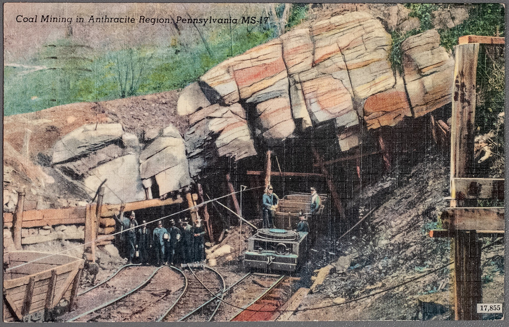
Anthracite coal was first mined in Wilkes-Barre in Pennsylvania in 1775, just ten-years after the establishment of Freiburg University of Mining and Technology, and we are told that it fueled urban development in the region, resulting in a string of towns, industries, mines, roads and rail-lines to the south.
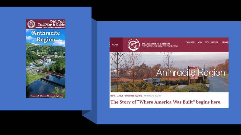
We are told the Delaware and Lehigh National Heritage Corridor preserves the historic pathway that carried coal and iron ore from Wilkes-Barre to Philadelphia as a vital connection to nature, recreation and our nation’s industrial heritage, as well as having a more than $250-million per year economic impact for the region.
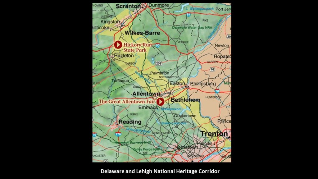
The Delaware and Lehigh National Heritage Corridor was also known as the “Anthracite Region” where the story of “where America was built” began.
It was home at one time to major anthracite coal supplies and the mine-to-market process, with a legacy of intense mining, industrial development and rich mixture of ethnic cultures.
We are told that the demand for anthracite coal increased in the 1820s and 1830s as coal-power replaced water power, and with the growth of the iron industry in Pennsylvania.
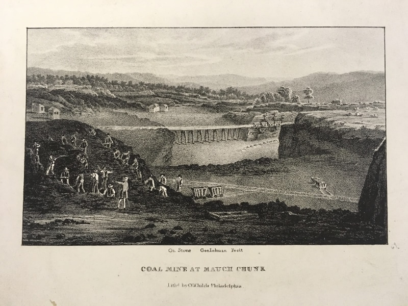
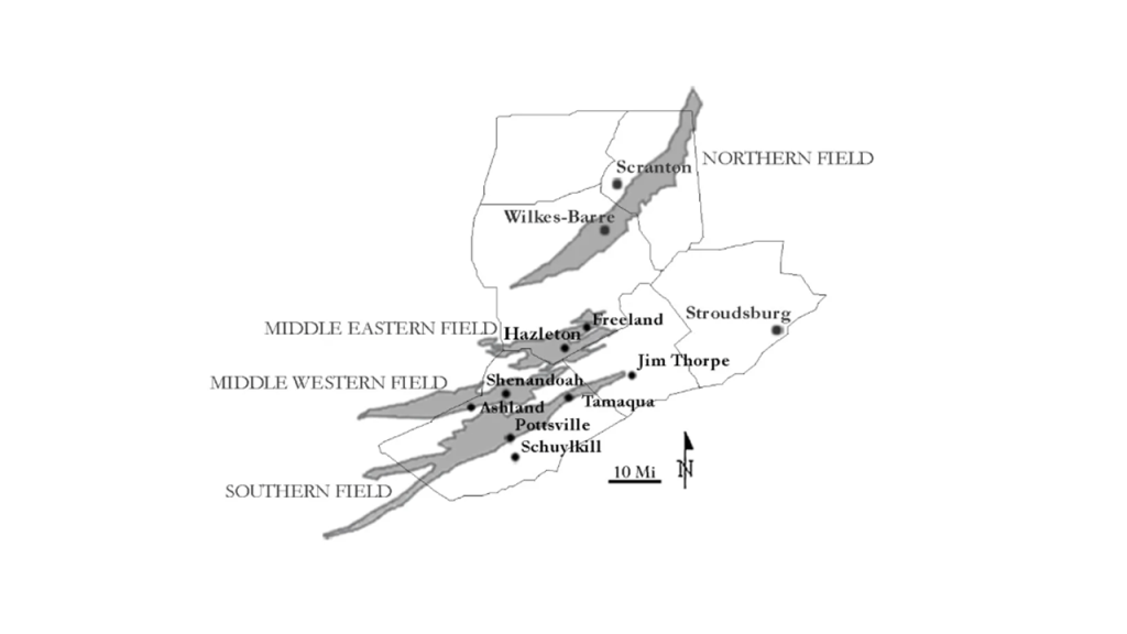
Anthracite coal is the purest form of coal, and this region contains most of the world’s supply of anthracite coal, which was found in alternating layers of rock said to have been folded into mountains and we are told it was created by a geological process called “coalification.”
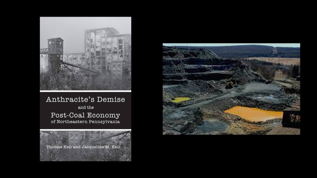
Today, this part of northeastern Pennsylvania is considered one of the largest concentrations of disturbed terrain in the world, with billions of tons of debris found in the landscape of abandoned strip mines and this region has among the highest poverty and unemployment rates in the United States with job loss from the decrease in coal mining and the outmigration of people because of it.
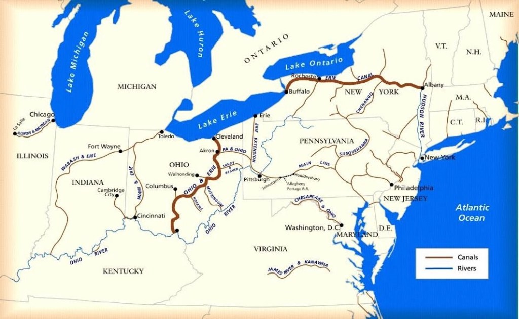
We are told the American Canal Age was between 1790 and 1855, and started in Pennsylvania, where the first legislation surveying canals was passed in 1762.
The “Main Line of Public Works” was passed by the Pennsylvania Legislature in 1826, and funded various transportation systems, including canal, road, and railroad.
The construction of the Union Canal circled in red between Middletown and Reading and was said to have started under the administration of President George Washington in 1792, and completed in 1828, and was touted as the “Golden Link” in providing an early transportation route for shipping anthracite coal and lumber to Philadelphia.
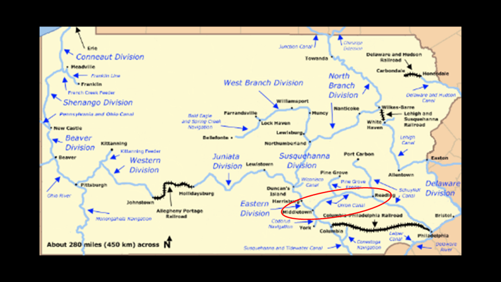
This is a section of the old Union Canal on the “Bear Hole Trail” of Swatara State Park in Central Pennsylvania, and was said to have been closed after the dam holding the reservoir was washed away by a devastating flood in 1862.
We are told the Union Canal was permanently closed to use in 1885 because it could not compete with the “efficiency of the railroad.”

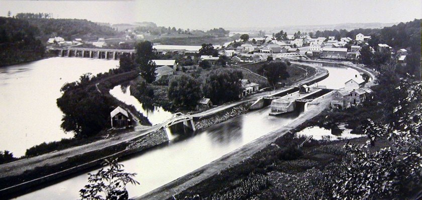
We are told the lower section of the Lehigh Canal was built between Easton, Pennsylvania and Mauch Chunk, now known as Jim Thorpe, Pennsylvania, with construction said to have been started in 1818, and completed in 1838.
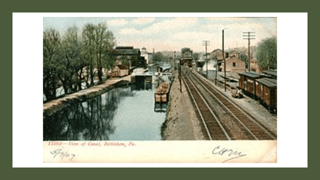
This is a view of the Lehigh Canal at it appeared at one time in our history in Bethlehem, Pennsylvania – located along this section in-between today’s Jim Thorpe and Easton.
In Easton, the Lehigh Canal connected with the Pennsylvania Canal’s Delaware Division and the Morris Canal.
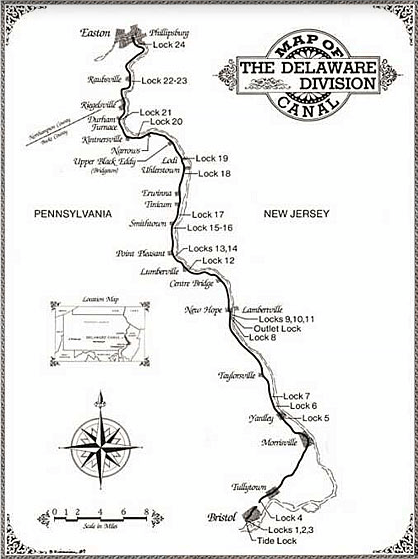
Also known as the Delaware Canal, the Commonwealth of Pennsylvania was said to have built the Delaware Canal to feed anthracite coal to Philadelphia in the years between 1828 and 1834.
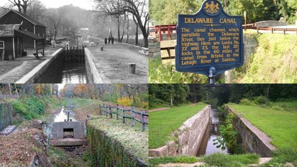
It ran along the right bank of the Delaware River for 60-miles, or 97-kilometers, to Bristol, just north of Philadelphia.
The Morris Canal was 107-miles, or 172-kilometers, -long and said to have been completed in 1832 to carry anthracite coal across northern New Jersey between where it connected to the Delaware Canal in Easton, to what is today Jersey City on the Hudson River.
It was closed in 1924.
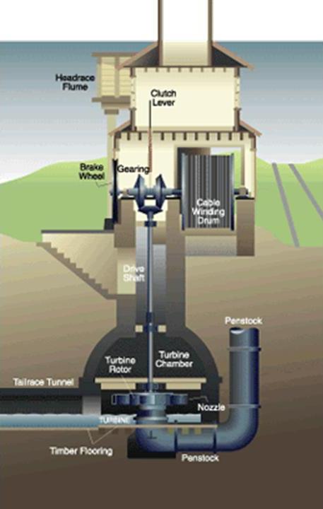
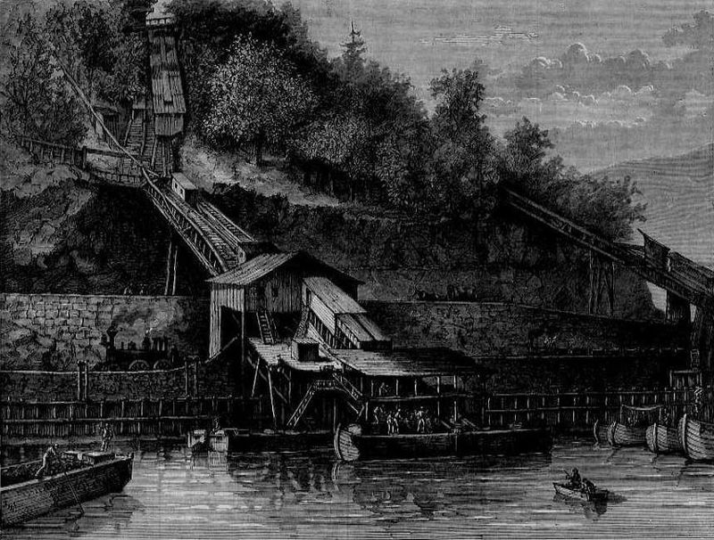
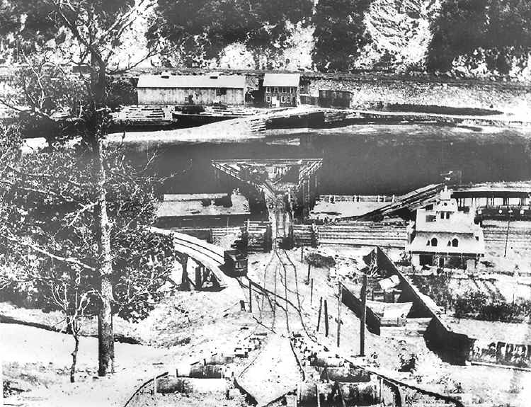
It was hailed as an ingenious, technological marvel for its use of water-driven, inclined planes.
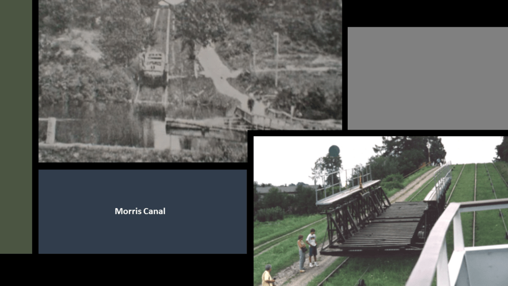
The builders of the Morris Canal used a sophisticated power house technology, pictured here, to power the water turbine that was set in motion to raise or lower cradled boats on the inclined planes by means of a cable.
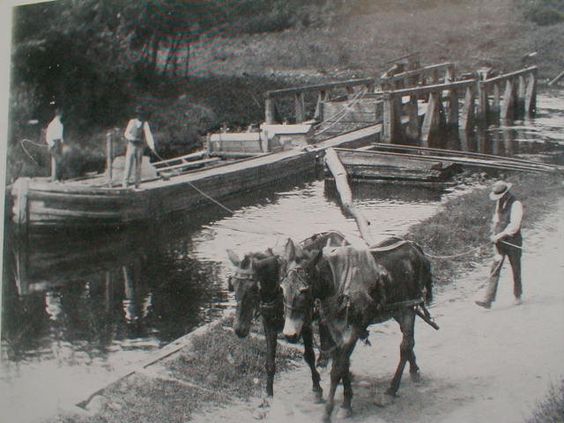
According to the history we are taught, all of this extremely sophisticated and advanced canal-engineering technology was being implemented prior to the beginning of the Industrial Age.
And interestingly, mules were still needed to be used to pull the canal boats in places on the Morris Canal in spite of all that sophisticated technology!
Food for thought about the difference between what we are told, and what does not hold up under scrutiny.
We are told that Mauch Chunk on lower section of the Lehigh Canal between between it and Easton, Pennsylvania, was founded as a company town in 1818 by Josiah White and his partners, who were also founders of the Lehigh Coal and Navigation Company.
It was renamed Jim Thorpe in 1954 for the Native American sports’ legend who was buried here.
The Lehigh Coal and Navigation Company was a mining and transportation company that was headquartered in Mauch Chunk.
It operated from 1818 until it was dissolved in 1964 and was known in our history for having an early and influential role in the American Industrial Revolution.
The Lehigh Coal and Navigation Company was considered to be the first vertically-integrated company in the United States.
Vertical integration is where the supply chain of a company is owned by the company.

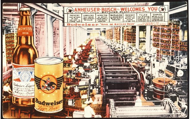
Other examples of the adoption of the business practice of “vertical integration” off the top of my head was by Adolphus Busch as head of Anheuser-Busch Brewing Association.
Busch adopted vertical integration as a business practice, in which he bought all the components of his business, from bottling factories to ice-manufacturing plants to buying the rights from Rudolf Diesel to manufacture all diesel engines in America.
This illustration was of the Bevo Bottling Facility in St. Louis.
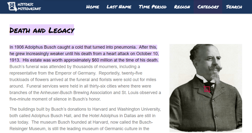
Adolphus Busch died in 1913, with a net worth $60 million in US dollars at the time of his death.
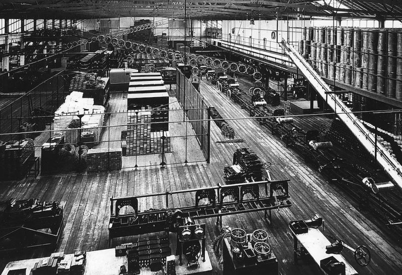
Henry Ford also utilized the practice of “vertical integration” in the Ford Motor Company.
The introduction and refinement of the assembly line facilitated the mass production of new cars, which in turn made the purchase of a new car affordable for most people.
As we go through all the information that will be presented in this post, we will see why this was yet another replacement technology for the original transportation system, which was powered by free energy.
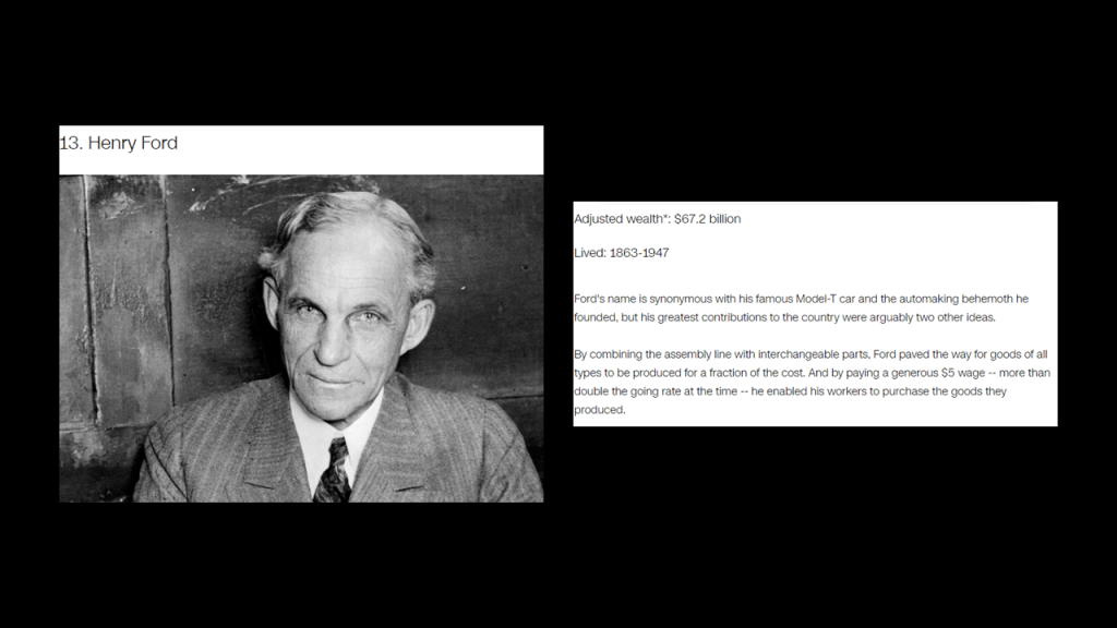
Henry Ford was also the 13th-wealthiest American of all-time according to CNN Business, with an adjusted wealth of $67.2-billion.
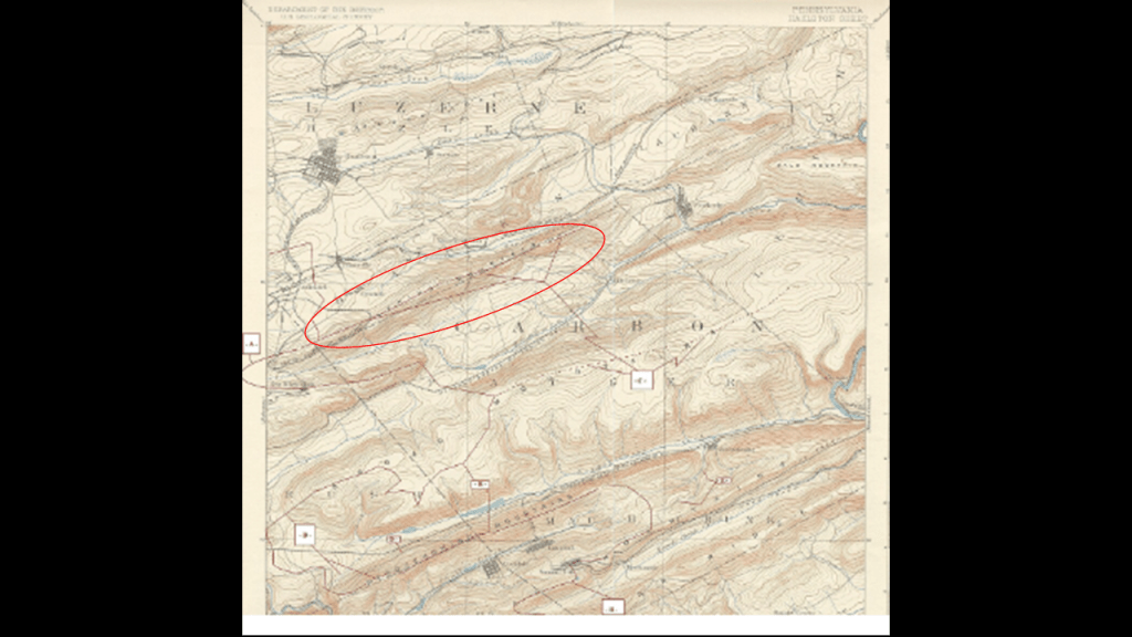
The Lehigh Coal and Navigation Company had its beginnings as the Lehigh Coal Mine Company in 1792, after we are told a hunter named Philip Ginter discovered anthracite coal on Pisgah Mountain near Summit Hill, near the border between Luzern and Carbon Counties.
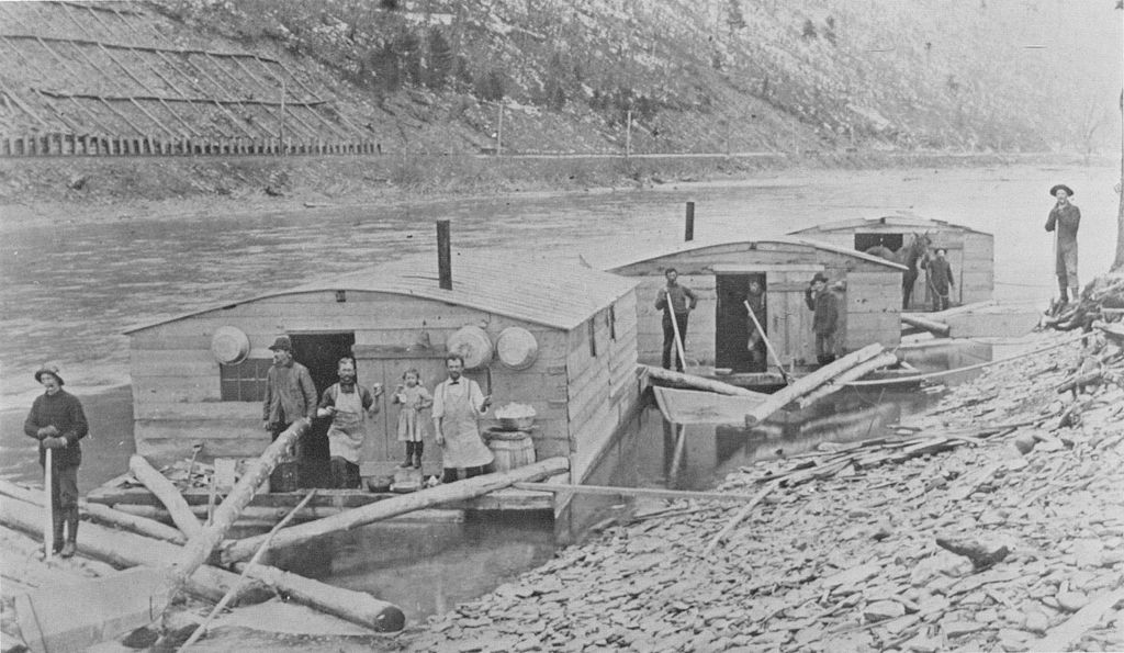
The Lehigh Coal Mine Company was incorporated in 1793 and acquired 10,000- acres, or 4,000-hectares, in and around the Panther Creek Valley and Pisgah Mountain, in order to bring anthracite coal from the large deposits on Pisgah Mountain to Philadelphia via mule-trains and coal arks, or one-time single use boats, on the Lehigh and Delaware Rivers.
We are told that while the original Lehigh Coal Mine Company was able to sell all the coal it could to the available market, it lost a lot of coal to the rough waters of the unimproved Lehigh River, so they sold the original company to Josiah White and his partners in 1818.
In a nutshell, this is what we are told.
In the same year, in 1818, the new owners of the Lehigh Coal Mine Company, began the construction of the Lehigh Canal, and that it became usable in 1820.
The Lehigh Canal enabled the transport of anthracite coal, a primary energy source at the time, to the primary markets in the northeastern United States, and, we are told, inspired the development and connection of other regional canals.
The new owners of the Lehigh Coal Mine Company were said to have been behind of the construction of the Lehigh and Susquehanna Railroad between 1839 and 1841…
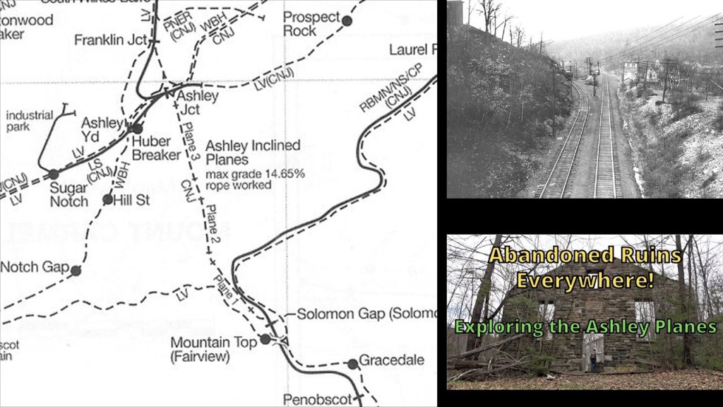
…the Ashley Planes, an historic freight-cable railroad between Ashley and Mountain Top said to have been built between 1837 and 1838 to transport millions of tons of anthracite coal over the Wilkes-Barre Mountain…
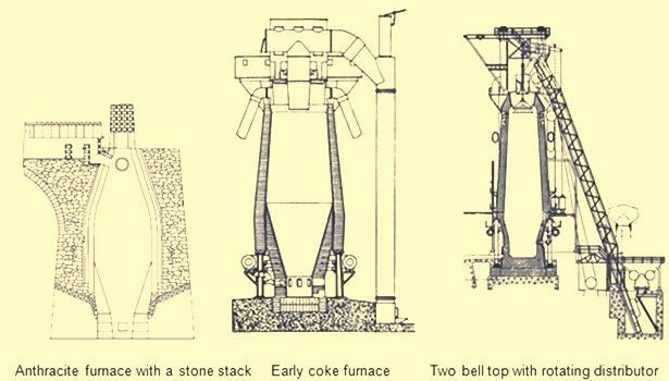
… and brought in blast furnace technology to the Lehigh Valley, a type of metallurgical furnace used for smelting to produce industrial metals.
Smelting is defined as a process by which metal is obtained, either as a single element or compound.
In 1822, the company became the Lehigh Coal and Navigation Company, after which they built the Mauch Chunk and Summit Hill Railroad.
The Mauch Chunk and Summit Hill Railroad, also known as the Mauch Chunk Switchback Railway, was said to have been built in 1827 and operated until 1932.
It was said to be the second permanent railway constructed in the United States, and used to transport coal down Summit Hill to the Lehigh Canal.
We see what became the historical Lehigh Valley Railroad crop-up at Interstate-190, which connects Interstate-90 in Buffalo with the International Border at Lewiston, New York, where it crosses the Lewiston-Queenston Bridge and from there becomes Ontario Highway 405.
Parts of Interstate 190 were built along the Rights-of-Way of the Lehigh Valley Railroad and the Erie Canal.
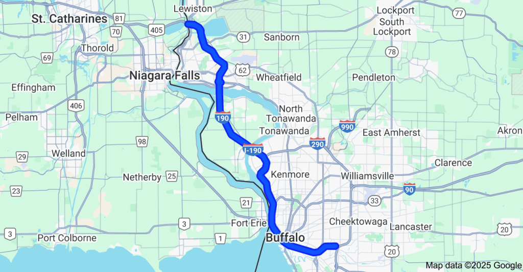
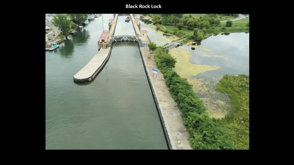
Heading north out of Buffalo, Interstate-190 follows the eastern edge of the Black Rock Channel.
The Black Rock Channel is 3.5-miles, or 5.6-kilometers, -long, and extends from Buffalo Harbor to the Black Rock Lock.
The Black Rock Lock allows vessels to bypass rapids on the Niagara River at the outlet of Lake Erie.
We are told it was the first lock was constructed by the U. S. Army Corps of Engineers in 1833 for the Erie Canal, and that it was enlarged in 1913.
The Erie Canal in New York State runs for 351-miles, or 565-kilometers, between Lake Erie at Buffalo to the Hudson River near Albany.
It was said to have been constructed starting on July 4th of 1817 and first opened on October 26th of 1825.
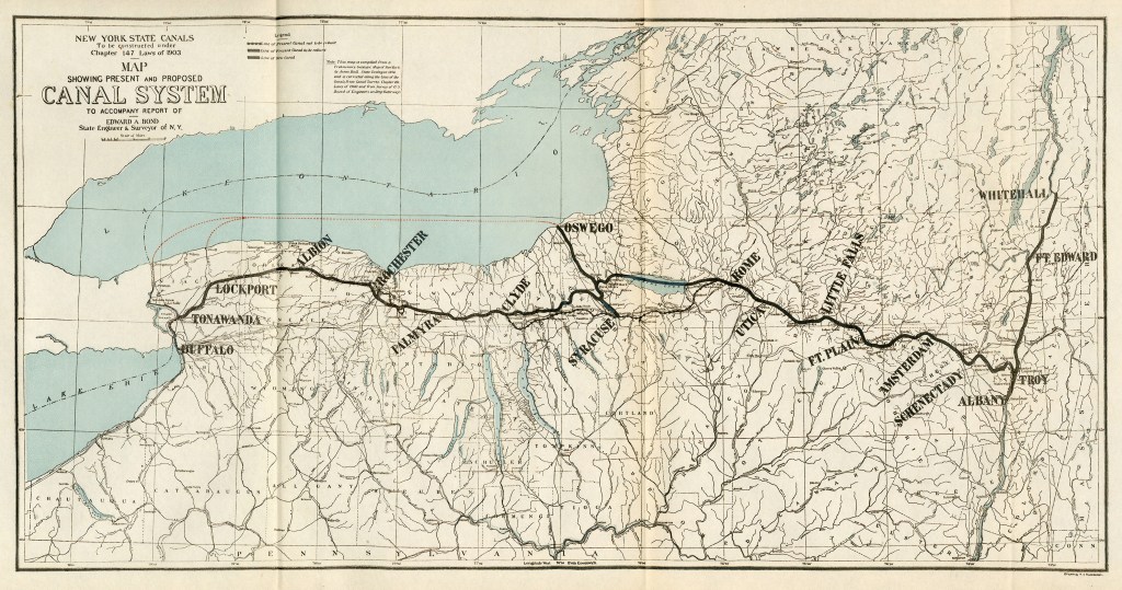
In our historical narrative, the opening of the Erie Canal made it the first navigable waterway connecting the Atlantic region to the Great Lakes, and accelerated the settlement of the Great Lakes region, the westward expansion of the United States as it greatly reduced the cost of transporting people and goods across the Appalachian mountains.
In Part 5 of this series on the New York-side of Lake Ontario, I found the Black Diamond Trail, a rail-trail found at Taughannock Falls State Park that was once part of the Lehigh Valley Railroad route whose Black Diamond Express once ran between Buffalo and New York City.
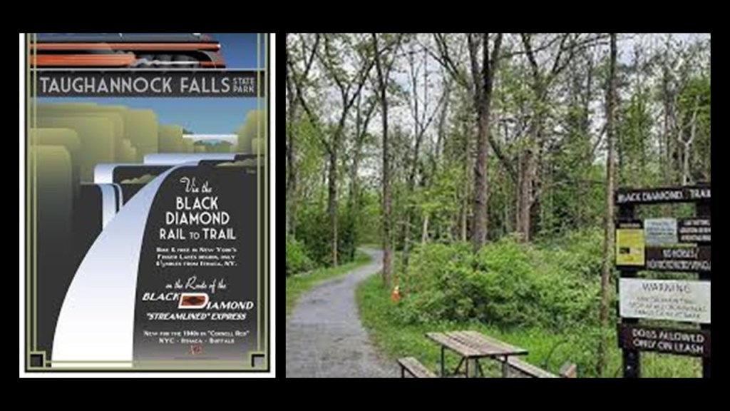
The term “Black Diamond” was a nickname for anthracite coal, which was a high-quality, dense, and hard coal, and a key energy source during the time we know of in our history as the Industrial Revolution.
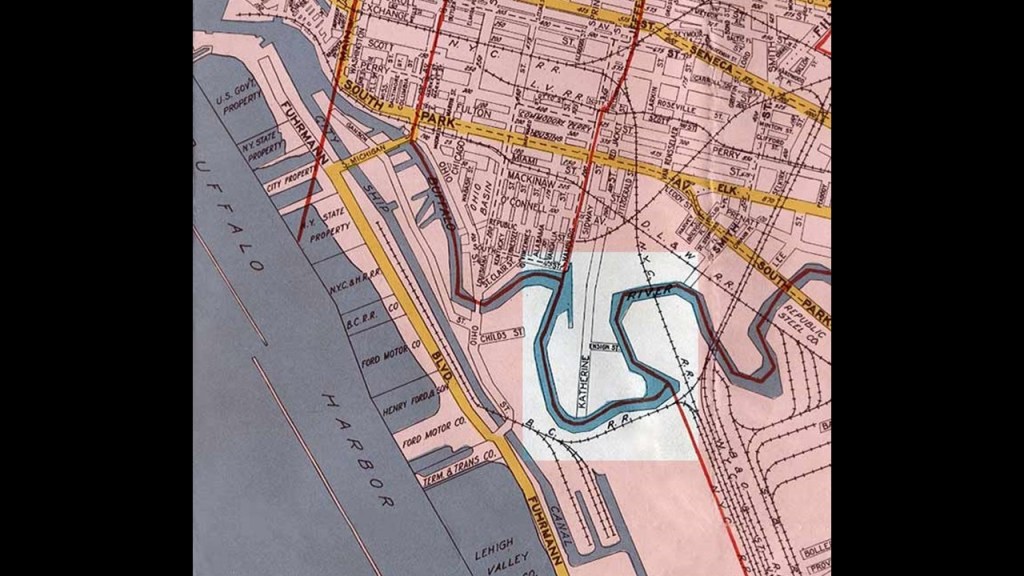
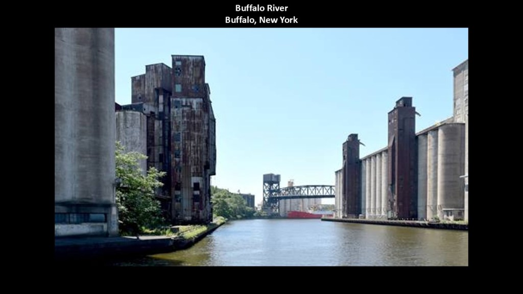
The Buffalo River was the western terminus of the Erie Canal starting in 1825, and later became an industrial use area with things like grain elevators, steel mills and chemical production.
The transportation and industrial uses of the river greatly declined when shipping began to by-pass the Erie Canal in the 1950s, and many adjacent mills and factories were abandoned.
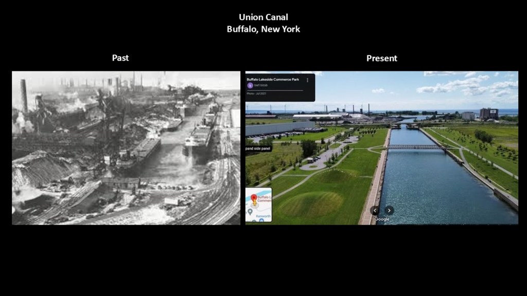
The Union Canal is Buffalo’s boundary with the city of Lackawanna.
It was said to have been dug by the Goodyears in order for lake freighters to access the Susquehanna Iron Company and Pennsylvania Railroad’s Ore Docks.
The Susquehanna Plant changed hands and was owned by Hanna Furnace for quite some time.
Bethlehem Steel operated the short section of dock from New York Route 5 to the Harbor.
The area underwent major rehabilitation and remediation, and today the Union Canal is the centerpiece of the Buffalo Lakeside Commerce Park, and is a popular spot for fishing.
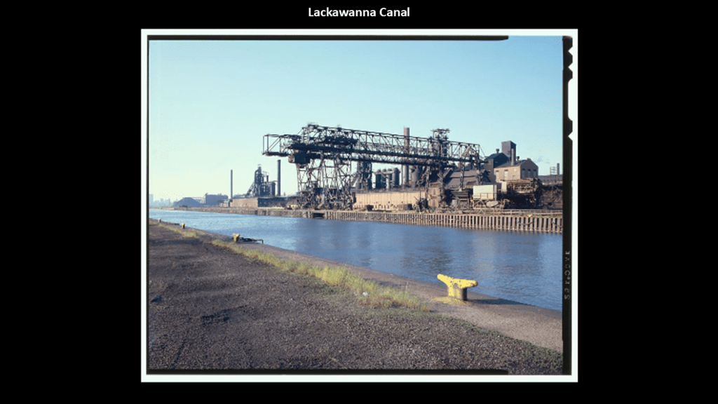
The nearby Lackawanna Canal runs along what used to be the Bethlehem Steel Plant property, and was used as a commercial service canal tied to industrial and port activity.
Today its main role is commercial navigation to support bulk cargo movement into and out of the Port of Buffalo.
The city of Lackawanna was founded in 1909 after the Lackawanna Steel Company moved its steel plant here from Scranton, Pennsylvania.
During the early 20th-century, the Lackawanna Steel Plant was the largest in the world.
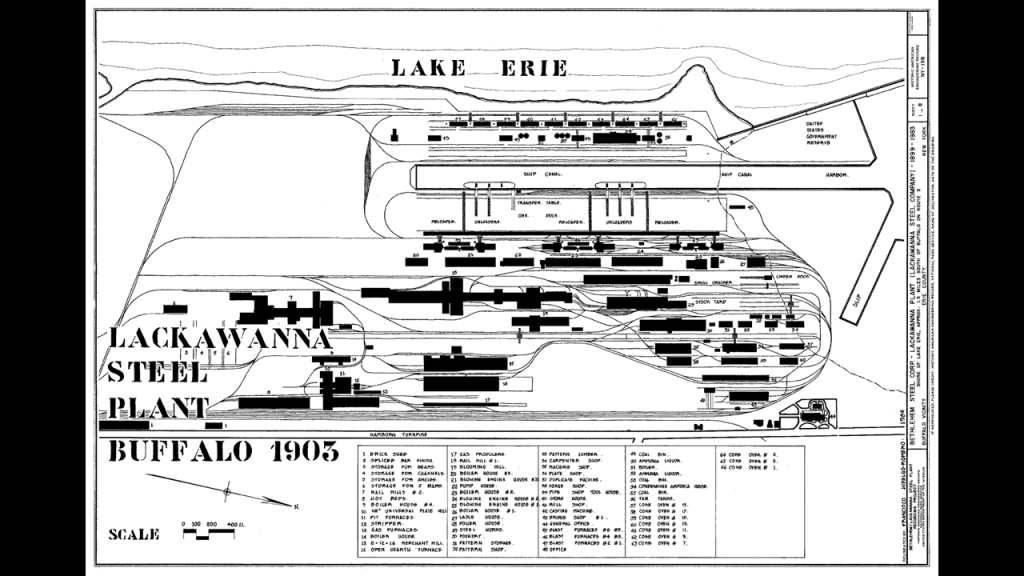
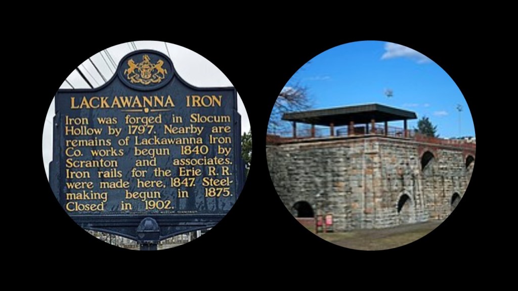
Lackawanna Steel Company was said to have been established in 1840 by the Scranton brothers in the Lackawanna Valley in Pennsylvania, which was rich in anthracite coal and iron ore deposits.
The Scranton brothers were credited with developing the steel-making technology to mass produce the rails needed for railroad construction, and the town of Scranton was said to develop around the company’s original location.
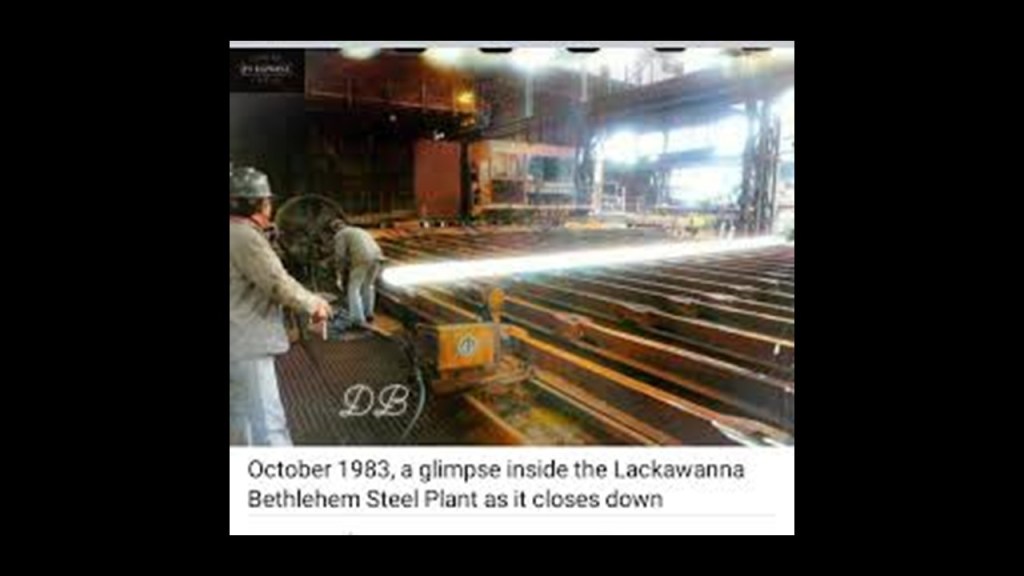
The Bethlehem Steel Company acquired the Lackawanna Steel Company in 1922.
At its peak, the company employed 20,000 people and attracted immigrants from all over the world to come to work there.
In the second-half of the 20th-century, with industrial restructuring and high-city taxes, the steel plant declined in business and eventually closed in 1983.
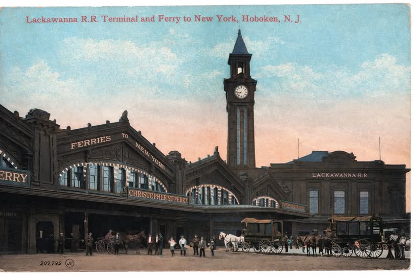
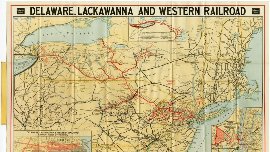
The Delaware, Lackawanna and Western Railroad connected Buffalo with Hoboken, New Jersey, and by ferry with New York City.
One of the New York area’s major transportation hubs, the terminal at Hoboken was said to have been constructed by the Delaware, Lackawanna and Western Railroad in 1907, and combined railroad, ferry, subway, streetcar and pedestrian services.
It is still in use today as a transportation hub for commuter rail, ferry, and bus services.
We are told that numerous electric streetcar lines originated and ended at the station until the completion of “Bustitution” in August of 1949, at which time they were replaced by buses.
This railroad was incorporated in Pennsylvania in 1853 to provide a way to transport anthracite coal from the coal region in northeast Pennsylvania to larger coal markets in New York City and Buffalo.
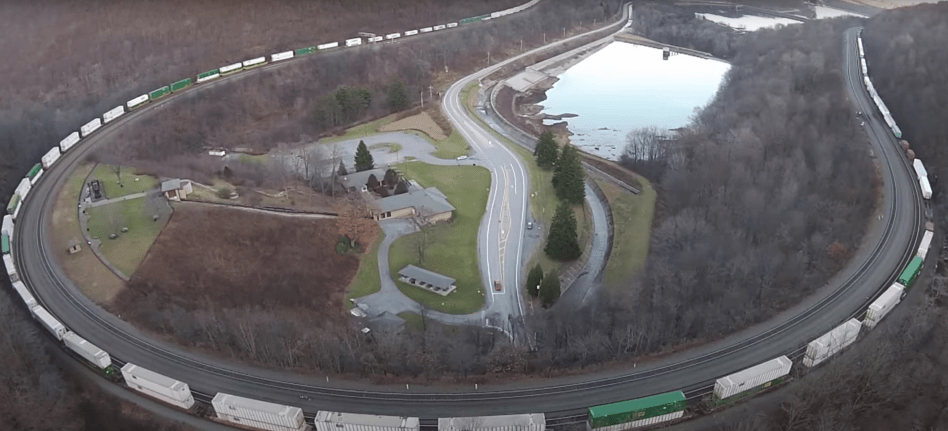
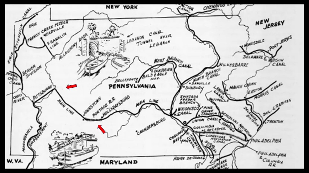
Back in Pennsylvania, the “Horseshoe Curve” is a three-track railroad curve in Altoona that is described as one of the world’s most incredible engineering feats, and that it was accomplished by the Pennsylvania Railroad in 1854.
It was said to have replaced the original Allegheny Portage Railroad, which was said to be the first railroad constructed through the Allegheny Mountains in 1834, and connected to the Pennsylvania Canal, all of which was said to have been built as part of the transportation system by the “Main Line of Public Works” passed by the Pennsylvania Legislature in 1826.
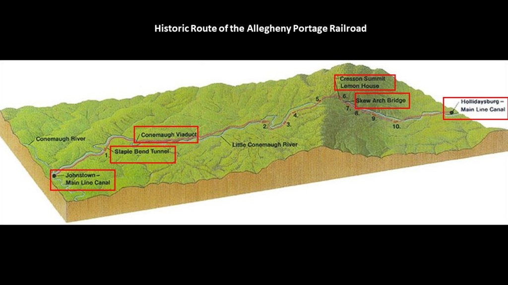
Considered a technological marvel in its day and critical to opening the way to commerce and settlement past the Appalachian Mountains, the original Allegheny Portage Railroad consisted of a series of five inclines on either side of the ridge-line to Cresson Summit alongside what is called the Little Conemaugh River to where it meets the Conemaugh River at Johnstown.
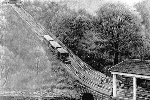
Cresson is at the summit of the Allegheny Portage Railroad’s journey through the Allegheny Mountains on top of the Eastern Continental Divide.
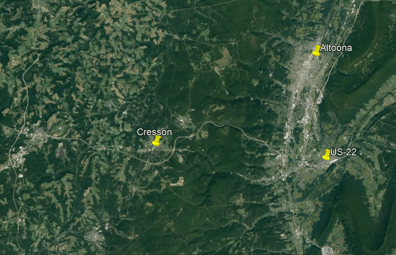
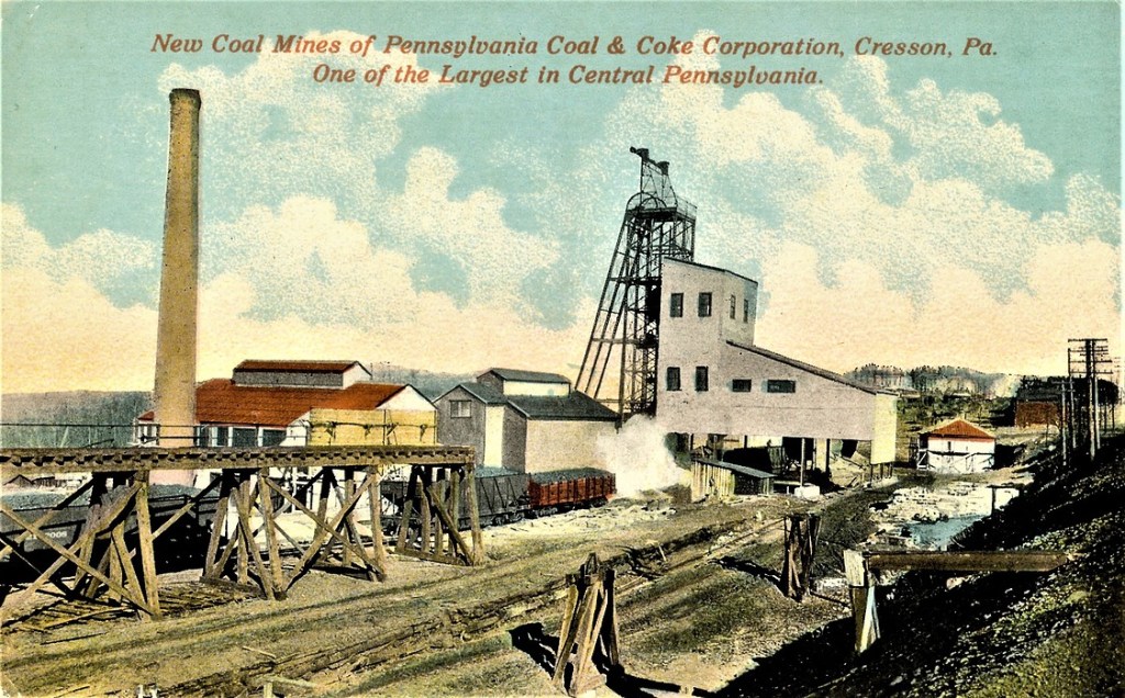
Back in the industrial heyday of the late 19th-century and early 20th-century, there were lumber, coal and coke-yard industries located in Cresson.
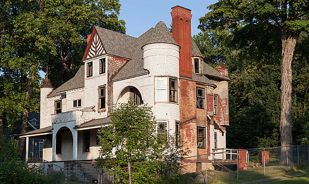
Wealthy Pittsburgh businessmen like Andrew Carnegie, Henry Clay Frick and Charles Schwab, all connected to each other through the steel industry, had summer residences here, like Carnegie’s Braemar Cottage.
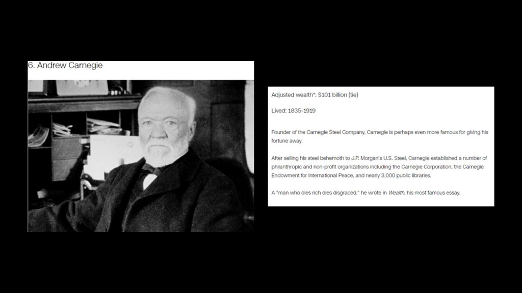
Andrew Carnegie was a Scottish-born immigrant to America, who in our narrative moved to Pittsburgh from Scotland in 1848 from humble beginnings with his parents, and who by the 1860s, had investments in such things as railroads, bridges and oil derricks, and ultimately worked his way into being a major player in Pittsburgh’s steel industry.
Andrew Carnegie was ranked as the 6th-richest American of all-time by CNN Business, with an adjusted wealth of $101-billion.
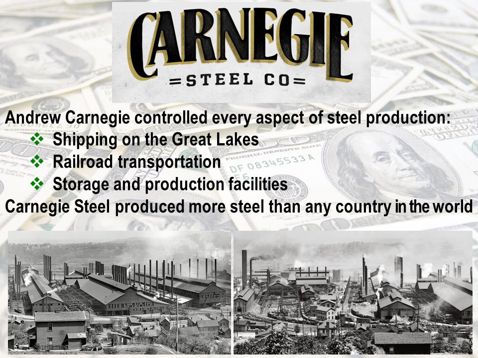
The Edgar Thomson Steel Works was Andrew Carnegie’s first steel mill with his partners, one of whom was Henry Clay Frick, the owner of a coke manufacturing company, a product used in making steel, which was operational by 1874, in Braddock, Pennsylvania.
It was named after the President of the Pennsylvania Railroad from 1852 to 1874.
The Edgar Thomson Steel Works is still operational today, and currently owned by U. S. Steel.

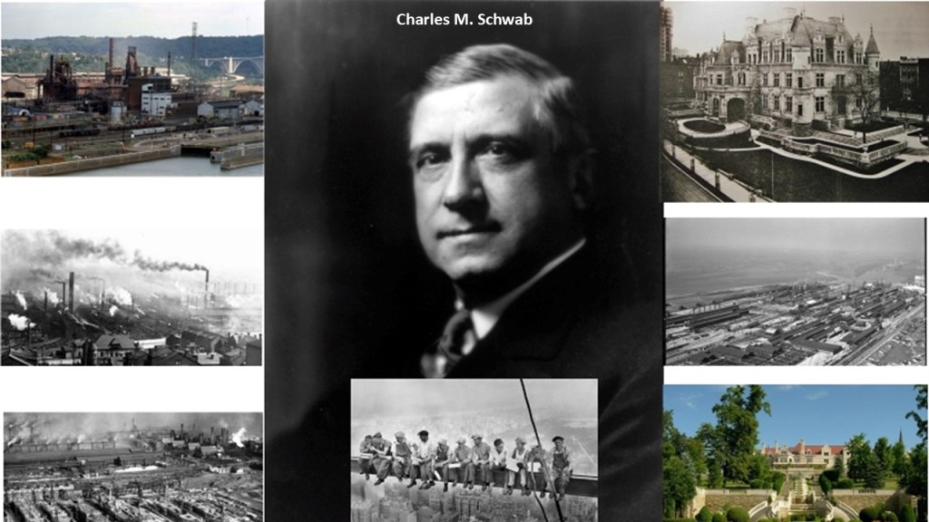
They subsequently acquired other steel mills, and in 1892, the Carnegie Steel Company was formed, of which Henry Clay Frick became chairman. and in 1897, Charles M. Schwab, who had gotten his start as an engineer at the Edgar Thomson Steel Works, became President of the Carnegie Steel Company in 1897.
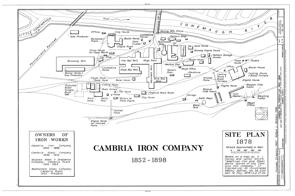
Johnstown was at the other end of the historic Allegheny Portage Railroad.
From 1834 to 1854, Johnstown was a key transfer point on the Pennsylvania Main Line Canal.
At the head of the canal’s western branch, canal boats were transported over the mountains by the Allegheny Portage Railroad to continue the trip by water to Pittsburgh at the “Forks of the Ohio” and on to the Ohio River Valley.
We are told that when the Pennsylvania Railroad became connected to Johnstown in 1854, with the completion of the main-line, the same year we are told the amazing Horseshoe Curve in Altoona came into existence, the Pennsylvania Canal became obsolete, and Johnstown grew rapidly as a major producer of steel via the Cambria Iron Company, and at one time was the country’s leading producer of steel.
It operated under this name until 1898, and was under different management two more times, before it closed permanently in 1992.
Though the Cambria Iron Company’s facilities were said to have been badly damaged during the Johnstown flood, the company was able to reopen on June 6th of 1889, a week after the flood, and continued to operate.
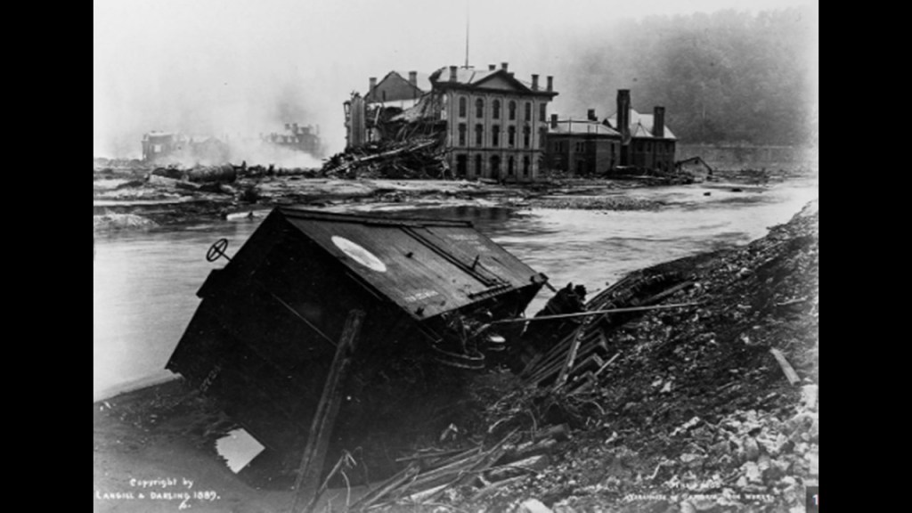
The infamous Johnstown Flood took place on May 31st of 1889, the worst flood in the United States in the 19th-century, and caused by the catastrophic failure of the South Fork Dam.
The South Fork Dam was said to have been an earthwork built between 1838 and 1853 as part of a canal system as a reservoir for a canal basin in Johnstown by the Commonwealth of Pennsylvania.
But then, after spending 15-years building the dam, it was abandoned by the Commonwealth, and sold to the Pennsylvania Railroad, who turned around and sold it to private interests.

In 1881, speculators had bought the abandoned reservoir and built a clubhouse called the South Fork Fishing and Hunting Club and cottages, turning it into an exclusive retreat for 61 steel and coal financiers from Pittsburgh, including Andrew Carnegie, Henry Clay Frick, and Andrew Mellon.
The South Fork Fishing and Hunting Club was a Pennsylvania Corporation that owned the South Fork Dam.
Henry Clay Frick was a founding member of the South Fork Fishing and Hunting Club, and was actually said to have been largely responsible for the alterations to the South Fork Dam that led to its failure.

What we are told is that the South Fork Dam failed after days of unusually heavy rain, and 14.3-million-tons of water from the reservoir of Lake Conemaugh devastated the South Fork Valley, including Johnstown 12-miles, or 19-kilometers, downstream from the dam, killing an estimated 2,209 people and causing $17-million in damages in 1889, which be $490-million in 2020.
Though there were years of claims and litigation, the elite and wealthy members of the South Fork Fishing and Hunting Club were never found liable for damages.

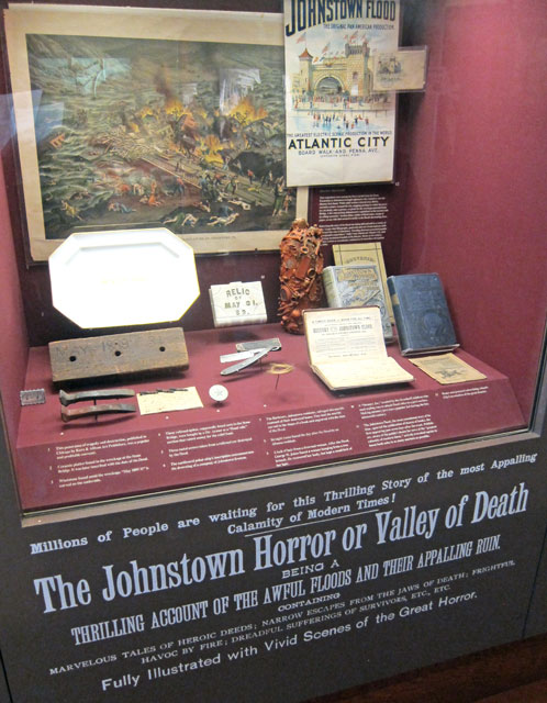
In 1904, the South Fork Fishing and Hunting Club corporation was disbanded and assets sold at a public auction by the sheriff, and there were permanent exhibits in many places, like Atlantic City, depicting the horrors of the Johnstown Flood experience for public consumption, billed as a “Thrilling Account of the awful floods and their appalling ruin.”
The main highway connecting Johnstown to the Pennsylvania Turnpike is US Route 219.
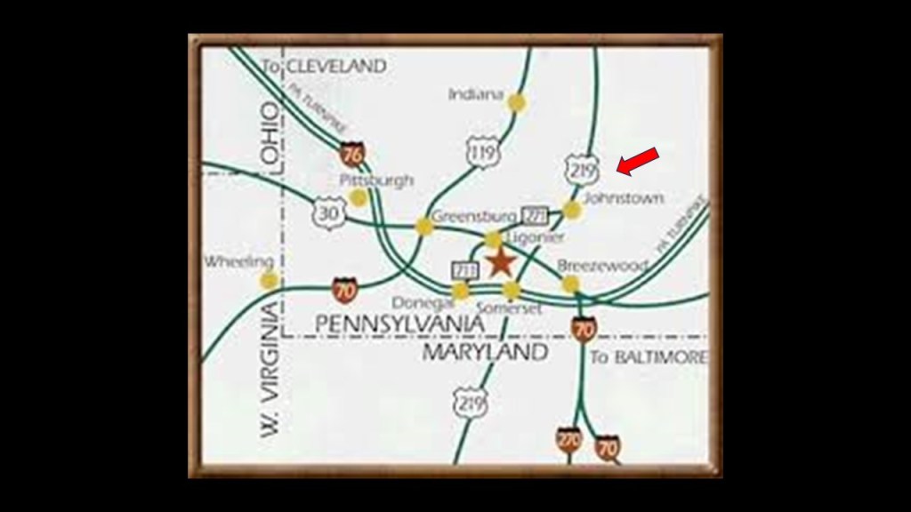
US Route 219 is a spur of US Route 19.
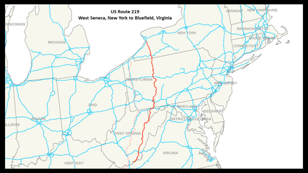
It is 535-miles, or 861-kilometers, -long, and runs from West Seneca, New York, at the eastern end of Lake Erie south of Buffalo, and ends at Bluefield, Virginia, right across the state-line from Bluefield, West Virginia
These two highways meet at Bluefield in Virginia.
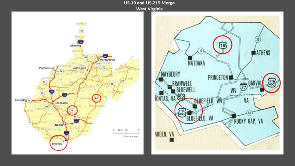
The land beneath the two Bluefields contains the richest deposit of bituminous coal in the world, known as the “Pocahontas Coalfield,” or the “Flat-Top Pocahontas Coalfield,” named after the Flat Top Mountain on US-19 in West Virginia, and Pocahontas, Virginia, where the first coal-seam here was discovered.
The Pocahontas Coalfield started to be mined in 1882.
Bituminous coal is a middle ranking coal that has less carbon than the highly-ranked anthracite coal from Pennsylvania seen earlier, but still widely used for industrial purposes.

We are told that Bluefield in West Virginia, with its great location with respect to the developing Pocahontas Coalfield, was selected as the location of a major Division point on the Norfolk and Western Railway in the late 19th-century, and that the railroad greatly stimulated the town’s growth, so much so that in its hey-day, Bluefield was considered a “Little New York.”

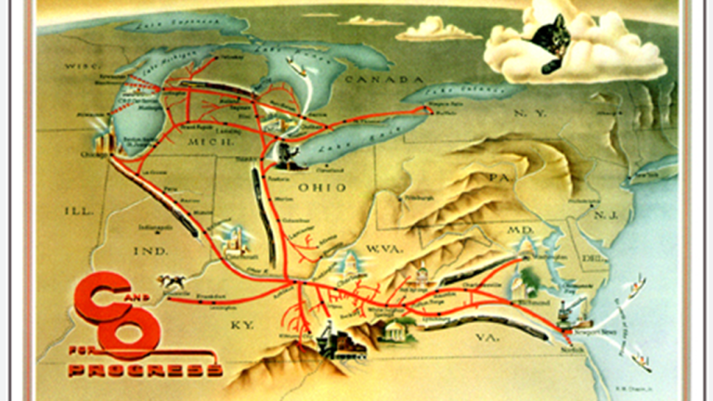
There was also the Chesapeake and Ohio Railway.
It was formed in 1869 from several smaller Virginia Railroads under the guidance of Collis P. Huntington, in order to connect the coal reserves of West Virginia with the new coal piers that were built in Hampton Roads and Newport News, Virginia, and first opened in 1873, forging a rail link to places like Chicago in the Midwest.
Collis P. Huntington was one of the Big Four of western railroading, along with Leland Stanford, Mark Hopkins and Charles Crocker.
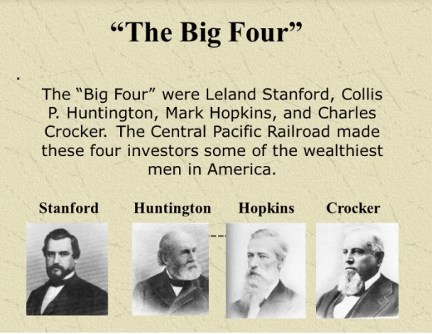
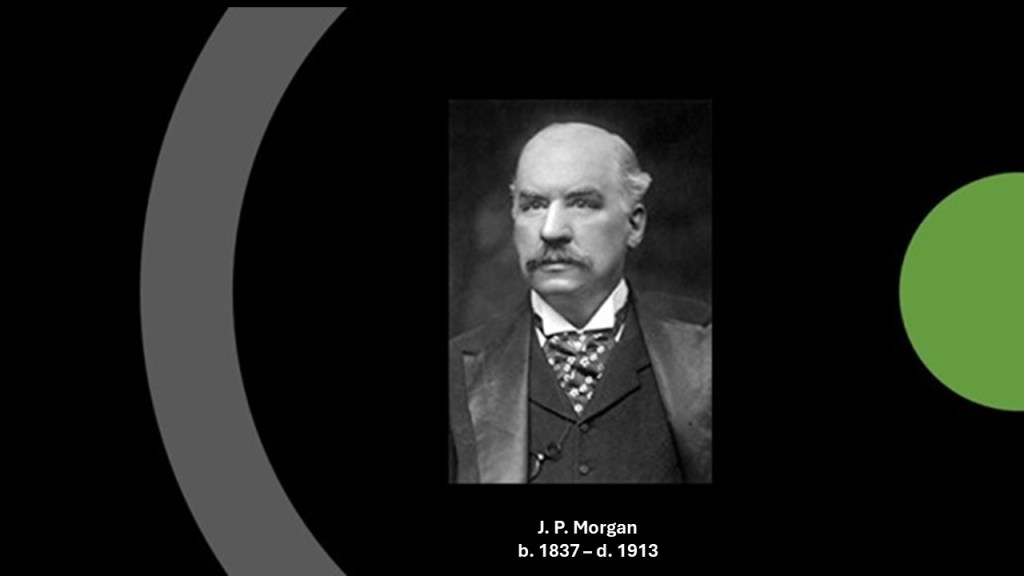
Then in 1888, Huntington lost control of the railroad to J. P. Morgan, an American financier and investment banker, and William K. Vanderbilt, who managed the Vanderbilt family’s railroad investments.
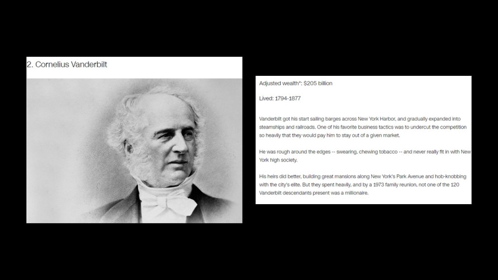
William K. Vanderbilt was was the grandson of Cornelius Vanderbilt, one of the richest Americans in history, who built his family’s fortune in shipping and railroads.
The process continued on for the C & O Railroad to consolidate and merge railroads, and, for example, to gain access to productive coal fields throughout the region, through the 1920s.

Staten Island-born Cornelius Vanderbilt got his start in regional steamboat lines and ocean-going steamships, and from there got into the railroad business.
He bought control of the Hudson River Railroad in 1864; the New York Central Railroad in 1867; the Lake Shore and Michigan Southern Railroad in 1869; and the Canada Southern Railway in 1876.
He consolidated his two key lines into the New York Central and Hudson River Railroad in 1870, becoming one of the first giant corporations in the history of the United States
According to CNN Business, Cornelius Vanderbilt was the second-richest American in history, with an adjusted wealth of $205-billion.
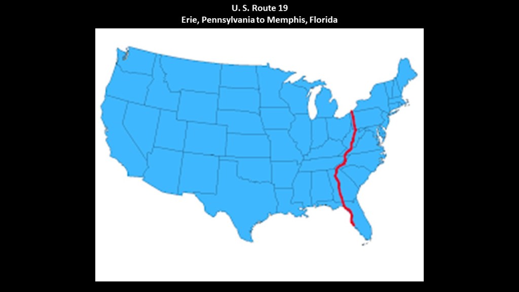
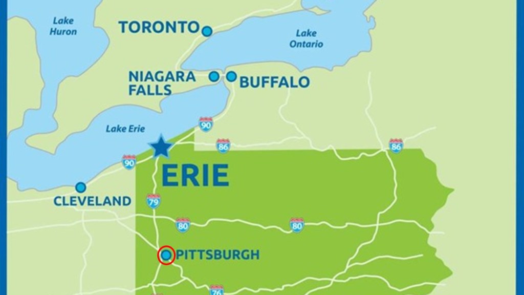
The longer U. S. Route 19, that US-219 is a spur of, runs from its northern terminus at U. S Route 20 at Lake Erie in Erie, Pennsylvania to its southern terminus at an interchange with U. S. 41 in Memphis, Florida, just south of St. Petersburg.
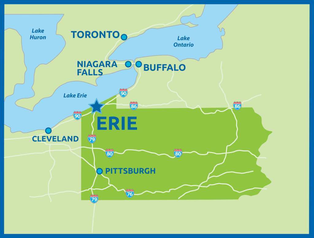
Erie is located just about right in-between Cleveland, Ohio, which is 90-miles, or 140-kilometers, southwest of Erie, and Buffalo, New York, 80-miles, or 130-kilometers, northeast, on the southern shore of Lake Erie.
Erie was an important railroad hub during the mid-19th-century.
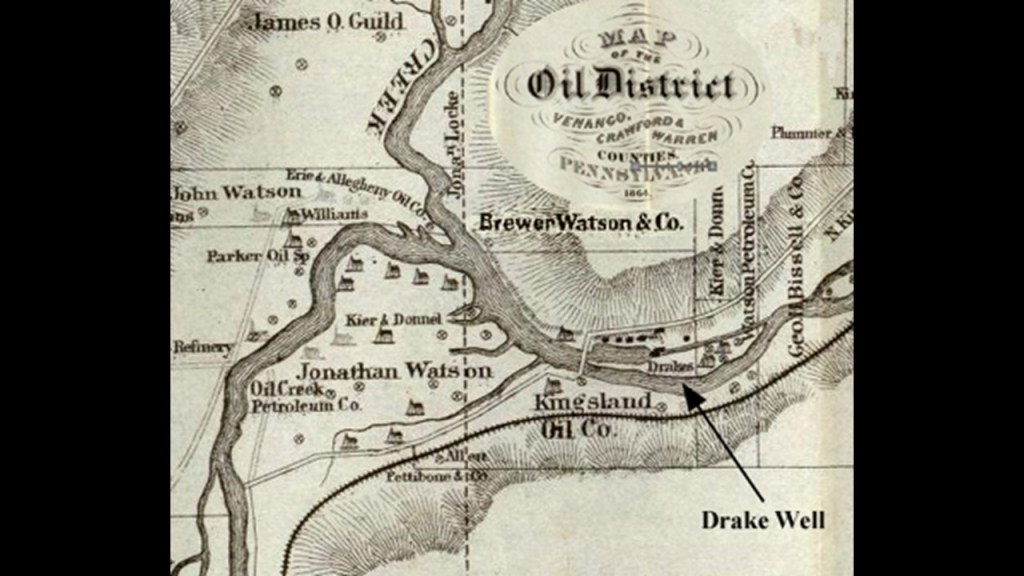
I am going to put this area near Erie and US-19 into the perspective of this new system in our historical narrative with its proximity to Titusville, which we come to going south out of Erie on Pennsylvania State Route 8 that runs relatively close to US-19..
The petroleum industry in the United States began in earnest in 1859 when Edwin Drake found oil on a piece of leased-land near Titusville, Pennsylvania, in what is now called Oil Creek State Park.
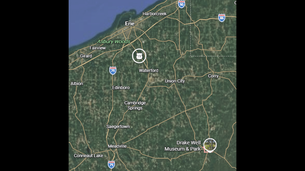
For this reason, Titusville is called the Birthplace of the Oil Industry, and for a number of years this part of Pennsylvania was the leading oil-producing region in the world.
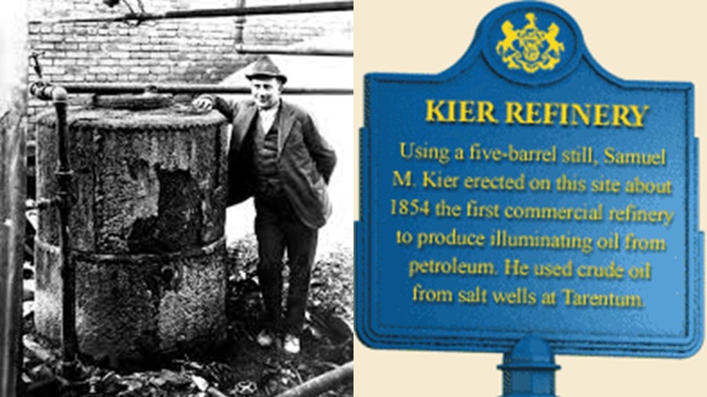
Samuel Kier had established America’s first oil refinery in Pittsburgh in 1854 for making lamp oil, just five-years before oil was “found” in Titusville.
Also, 1854 was the same year as the amazing engineering feat of Altoona’s “Horseshoe Curve” in our historical narrative.
It appears as though the petroleum industry was developed in the 1850s in order to provide a replacement energy technology for the free energy technology of the original civilization.
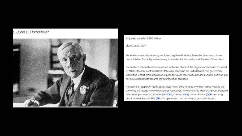
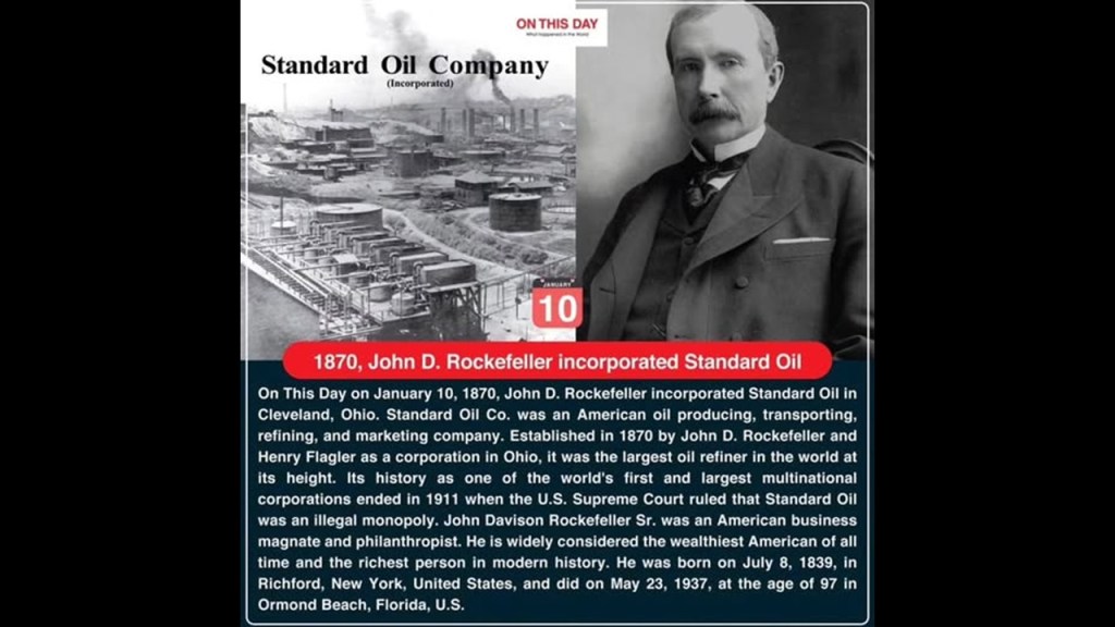
Roughly a decade after the birth of the oil Industry at Titusville, in 1870, John D. Rockefeller, along with Henry Flagler, an American Industrialist and major developer in the state of Florida, founded the Standard Oil Company, an American oil producing, transporting, refining, and marketing company.

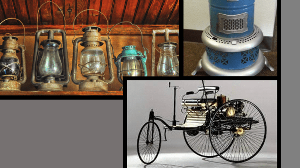
Oil was used in the form of kerosene throughout the country as a light source and heat source until the introduction of electricity, and as a fuel source for the automobile, with the first gas-powered automobile having been patented by Karl Benz in 1886.
John D. Rockefeller, Sr, who was born in the United States in 1839, was the progenitor of the wealthy Rockefeller family.
He was considered to be the wealthiest American of all time, as seen in this ranking by CNN Business.
Rockefeller’s wealth soared as kerosene and gasoline grew in importance.
At his peak, he controlled 90% of all oil.
As quickly as possible, a way was found to replace what remained of the free-energy system with their own coal- and oil-based system, and in the process make money hand over fist from the total control of the new system.
Pittsburgh is 128-miles, or 206-kilometers, south of Erie.
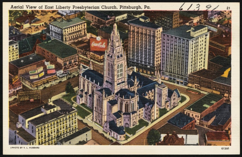
Many leading industrialists of the 19th-century were based in Pittsburgh, and resided in the East Liberty neighborhood in Pittsburgh’s East End, at one time the richest suburb in America, with names including Mellon, Carnegie, Heinz, and Westinghouse living there.
We are told that East Liberty started developing as a commercial area in 1842, when Thomas Mellon, prominent businessman and patriarch of the Mellon family in Pittsburgh, married Sarah Jane Negley, daughter of one of the earliest land-owners in the area, and made East Liberty their home.
We are told that Thomas Mellon made his fortune selling or renting land inherited by his wife, and used the proceeds to finance early industries in Pittsburgh.

In 1870, he and his sons Andrew and Richard established the “T. Mellon & Sons Bank,” and it became the Mellon National Bank In 1902.
It became a force in the mass production revolution in the United States, particularly in the Midwest.
A National Bank is a private bank operating as a commercial bank within the Federal Government’s Regulatory Structure, and under the supervision of the “Office of the Comptroller of the Currency,” rather than a state banking agency.
At one time in our history, National Banks had the authority to print money.

At its height, Mellon Financial Services was one of the world’s largest money management firms.
It merged with the Bank of New York in 2007 to become BNY Mellon.

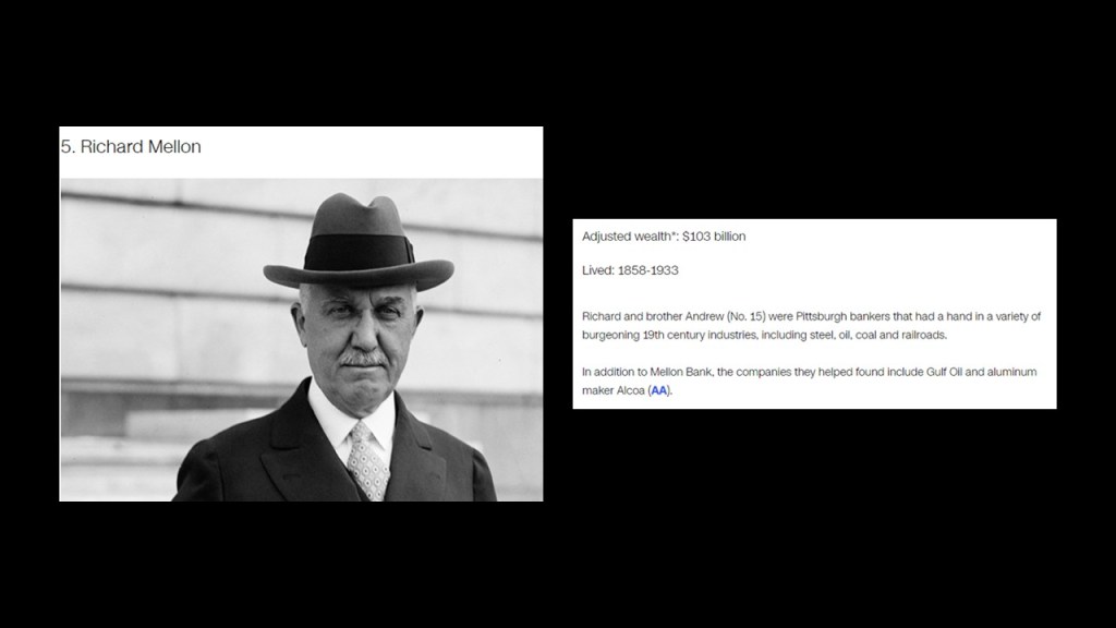
Richard Mellon, with an adjusted wealth of $103-billion, is listed as the 5th wealthiest American of all-time by CNN Business, and a founder of Gulf Oil and Alcoa Aluminum, as well as a number of other big corporations, along with his brother…
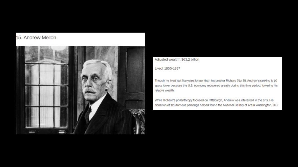
…Andrew Mellon, who is listed as the 15th-wealthiest American of all-time by CNN Business, with an adjusted wealth of $63.2-billion.
Next, starting in 1869, what became the Bessemer and Lake Erie Railroad (BLE) ran from the port of Conneaut, Ohio, to the Pittsburgh suburb of Penn Hills, and in 2004, it came under the ownership of the Canadian National Railway as part of their purchase of the Great Lakes Transportation” holding company.
Today the former railroad runs as their “Bessemer Subdivision,” though it still does business as BLE.
Iron ore that comes from the Iron Ranges in northeastern Minnesota on the western-side of Lake Superior is still shipped via BLE trains to steel mills in the Pittsburgh region, mainly US Steel’s Edgar Thomson Plant in Braddock, one of the last still operating from the earliest days of the American Steel Industry.
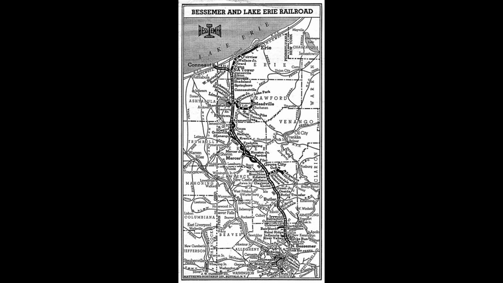
The BLE was formed out of a series of small predecessor railroad companies operating in the area.
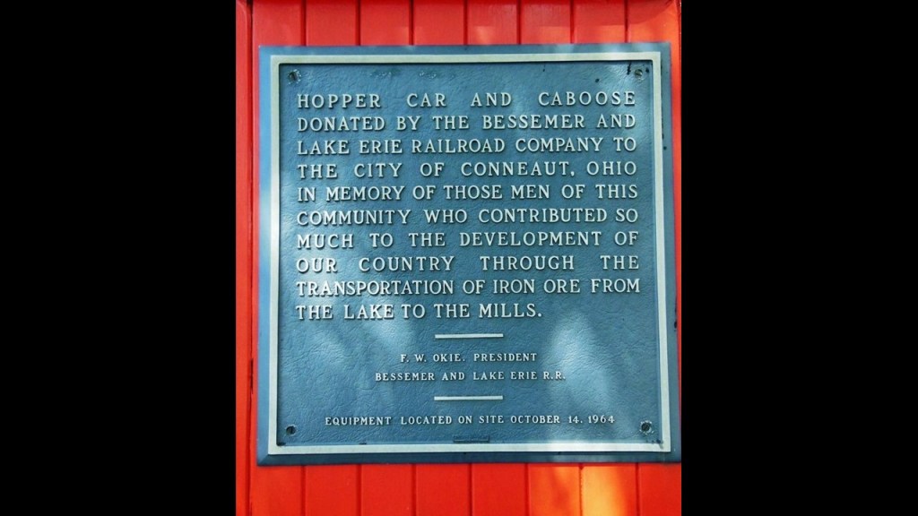
The Pittsburgh, Bessemer and Lake Erie Railroad Company was founded in 1897 by Andrew Carnegie to haul iron ore and other products from Conneaut to Carnegie Steel Company plants in Pittsburgh and the surrounding region, which hauled coal north on the return trip.
Conneaut is the northernmost city in Ohio, and a port at the entrance on Lake Erie of Conneaut Creek.
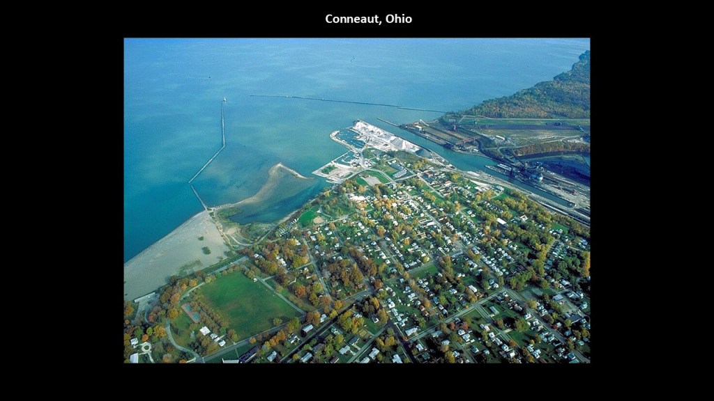
We are told the land was first surveyed by the Connecticut Land Company in 1796, and the first permanent settlement here in Conneaut was in 1798.
The Connecticut Land Company was a land speculation company that formed in the late 18th-century to survey and encourage settlement in the eastern parts of the newly chartered “Connecticut Western Reserve” of the former “Ohio Country,” which was part of the highly-prized “Northwest Territory.”
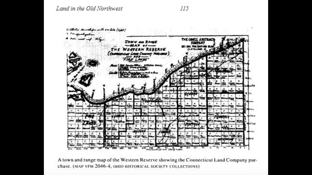
The Connecticut Land Company purchased 3-million-acres, or 12,000-kilometers-squared, of the western reserve in Northeast Ohio, in 1795, and settlers demanded that the land be surveyed prior to settlement per the Land Ordinance of 1785, which was a standardized system by which settlers could purchase title to farmland in the West.
The Northwest Indian War took place in this region between 1786 and 1795 between the United States and the Northwestern Confederacy, consisting of Native Americans of the Great Lakes area.
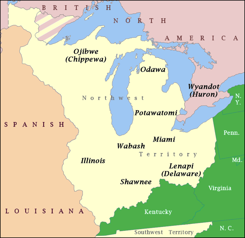
The Territory had been granted to the United States by Great Britain as part of the 1783 Treaty of Paris at the end of the Revolutionary War.
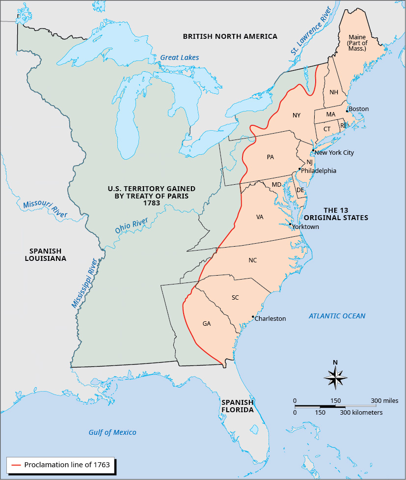
The area had previously been prohibited to new settlements, and was inhabited by numerous Native American peoples.
The British maintained a military presence and supported the Native American military campaign.
While the Northwestern Confederacy had some early victories, they were ultimately defeated.
Outcomes were the 1794 Jay Treaty, named for Supreme Court Chief Justice John Jay, the main negotiator with Great Britain.
As a result, the British withdrew from the Northwest Territory, but it laid the groundwork for later conflicts.

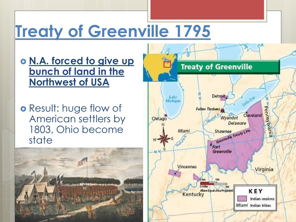
The 1795 Greenville Treaty that followed forced the displacement of Native Americans from most of Ohio, in return for cash and promises of fair treatment, and the land was opened for settlement.
Ashtabula is another port city in Ohio, and like nearby Conneaut, important to iron ore and coal since the late 19th-century, and was integral to the steel-manufacturing that developed around the Great Lakes.
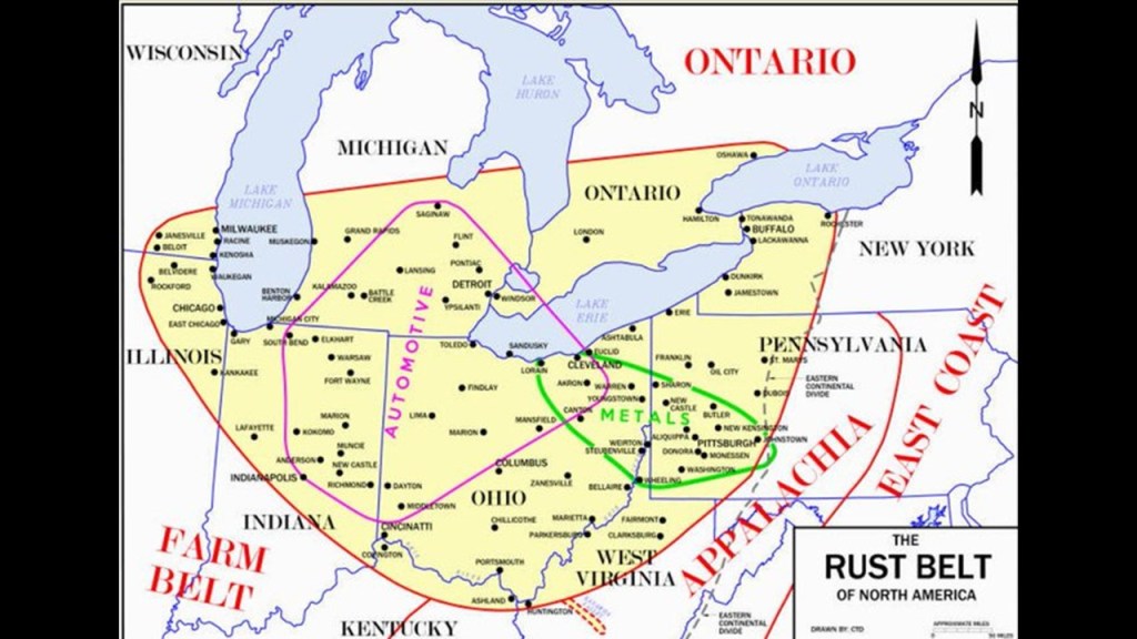
Most of the historic steel manufacturing has moved offshore, and with industrial jobs declining since the 1960s, it is considered part of a large historical manufacturing region called the “Rust Belt.”
While the Port of Ashtabula is still a hub for industrial material shipping on Lake Erie, including coal, the historic Ashtabula coal ramp and pier is no longer in use, with its operations handling bituminous coal ending in 2016.
The related coal-fired Ashtabula Generating Station closed in 2015, and the site is abandoned, with portions slated for demolition.
Cleveland is to the west of Ashtabula and Conneaut on Lake Erie.
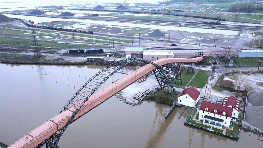
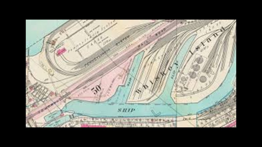
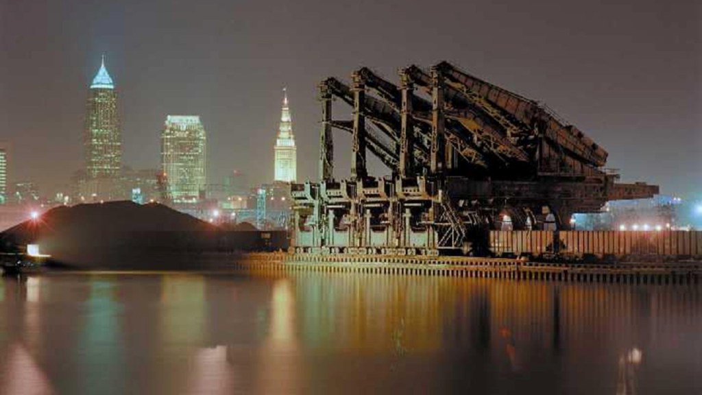
The historic C & P Ore Docks were located on Whiskey Island on the west-side of the entrance to the Cuyahoga River.
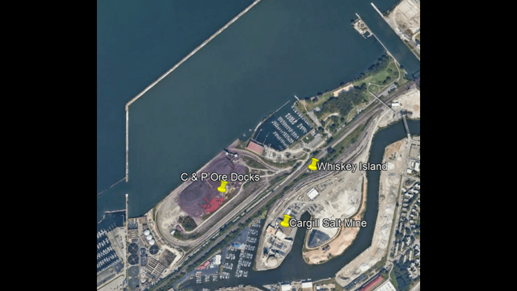
In our historical narrative, Whiskey Island was the first piece of solid land in the swamps that lined the entrance to the Cuyahoga River when Moses Cleaveland surveyed the area in 1796 for the Connecticut Western Reserve.
The first permanent settler of Cleveland, Lorenzo Carter, built his family farm on Whiskey Island, which got its name for a distillery built on the site in the 1830s.
We are told that starting with the construction of the Ohio and Erie Canal in 1825, the area was settled largely by Irish immigrants.
Then in 1831, investors from Buffalo and Brooklyn purchased the Carter farm and divided its 80-acres into allotments along 22 streets, and manufacturing plants and docks were constructed.
We are told the C & P Ore Docks were built by the Cleveland and Pittsburgh Railroad in the late 1800s, and used until they were abandoned in the 1990s.
At their peak, they handled millions of tons of iron ore every year.
The four towering Hulett Iron Ore Unloaders have been removed.
Two were removed and scrapped in 2000, and the remaining two were removed in 2024 and then scrapped.
There are some remnants of ore dock infrastructure that exist and in-use as part of the bulk terminals of the working industrial waterfront.
Whiskey Island is situated next to the entrance of the Cuyahoga River.
The Cuyahoga River was crucial to the industrial development of northeast Ohio, particularly Cleveland and Akron, by transporting raw materials like iron ore and coal, and powering the growth of steel, rubber, and manufacturing industries.
Cleveland became one of America’s key manufacturing centers in the late 18th- and early 19th-centuries.
Where it was located on Lake Erie made it perfect for shipping raw materials like iron ore and coal, and oil-refining and steel- and machinery-manufacturing boomed here.
Cleveland was where John D. Rockefeller established Standard Oil in 1870, which transformed the city into a major oil refining hub.
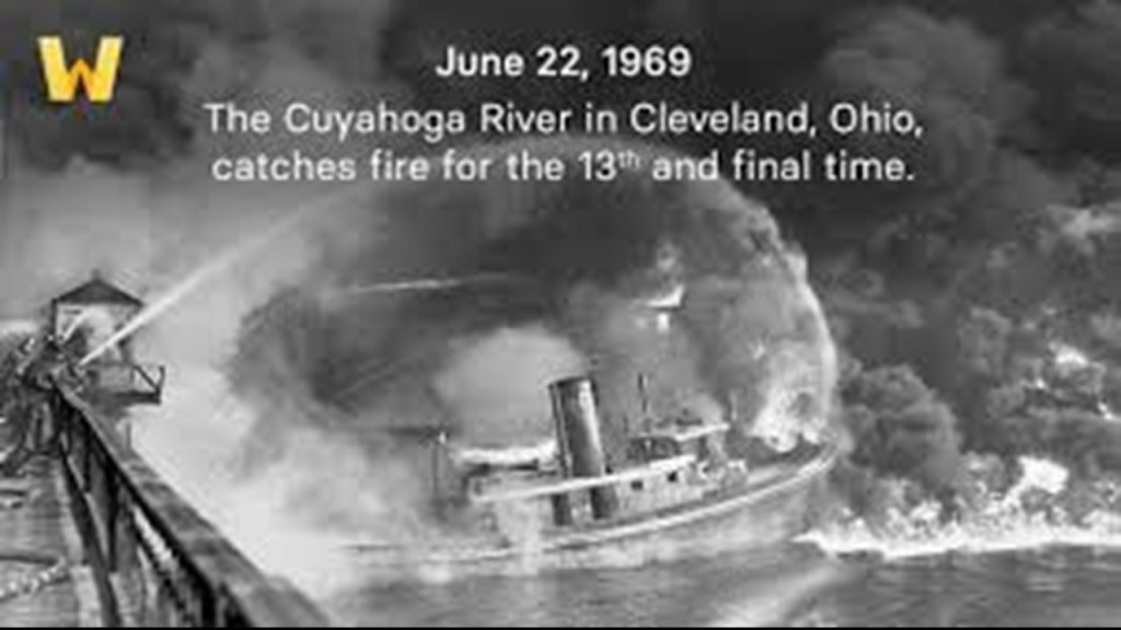
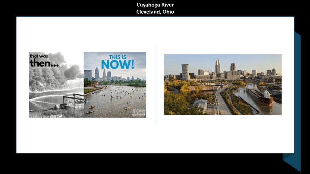
The intense industrial use of the Cuyahoga River caused extreme pollution, and the river caught fire thirteen times in our history between 1868 and 1969.
The 1969 fire on the Cuyahoga River led to the creation of the U. S. Environmental Protection Agency and the passage of the Clean Water Act in 1972 which mandated industrial pollution control and provided investments for modernizing sewage infrastructure.
In today’s world, the Cuyahoga River has shifted to a center for recreation and tourism, though it is still a working waterway for large freighters to transport raw materials to the factories that remain.
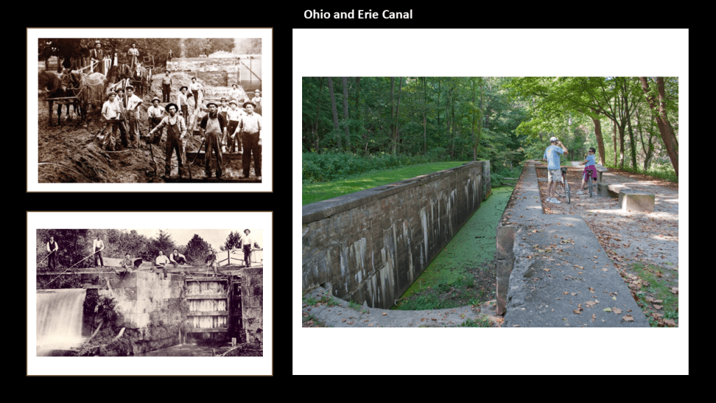
The Ohio and Erie Canal is here in Cleveland as well directly alongside the Cuyahoga River.
The 308-mile, or 496-kilometer, -long canal was said to have been constructed, from 1825 to 1832 to connect Lake Erie at Cleveland with Portsmouth on the Ohio River, and that it only carried freight from 1827 to 1861, when the construction of railroads ended demand.
The year of 1861 was also the first year of the American Civil War, which ended in 1865.
Then from 1862 to 1913, the canal served as a water source for industries and towns.
In 1913, much of the canal system was abandoned after important parts of it were badly flooded.
The canal was said to have been dug manually largely by Irish immigrants, who used picks, shovels, and wheelbarrows, and using horses, oxen and dynamite to clear trees and blast through rock.
In-between the Harvard Avenue Trailhead access to the Ohio & Erie Canal Reservation to the South; the house from the movie “A Christmas Story” to the west; and the Cleveland Velodrome, a bicycle-racing track, to the East, I found places like, but not limited to, Industrial Valley; the CSX Clark Avenue Railyards; the Norfolk Southern Railyards; and the Cleveland Cliffs Cleveland Works, a steel manufacturer, and its railway.
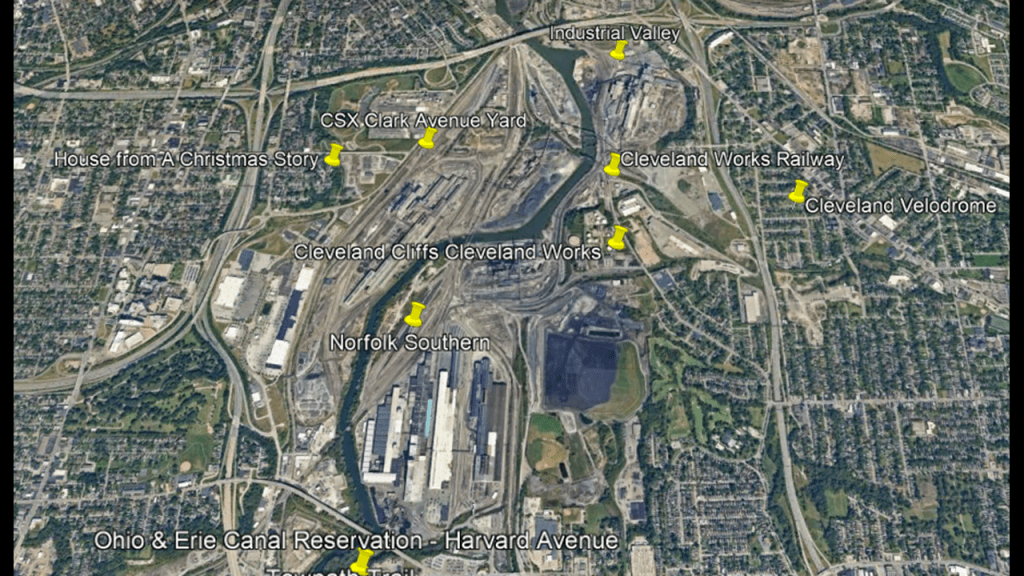
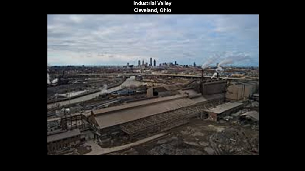
Industrial Valley, often referred to as “The Flats,” or the “Cuyahoga Valley Neighborhood,” is a heavily industrialized district along the banks of the Cuyahoga River south of downtown Cleveland.
It is a hub for heavy industry, which includes, besides the Cleveland Cliffs steel manufacturer, chemical manufacturers, petroleum terminals, and scrap metal recycling centers.
It is also the location where John D. Rockefeller established Standard Oil in 1870, cementing Cleveland’s status as an industrial powerhouse.
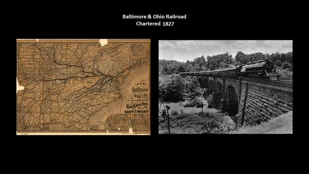
Next, the Baltimore & Ohio (B & O) Railroad and Chesapeake & Ohio (C & O) Canal.
We are told there was an intense rivalry between the B & O Railroad, and the C & O Canal, with each project choosing the same day to break ground – on July 4th, 1828.
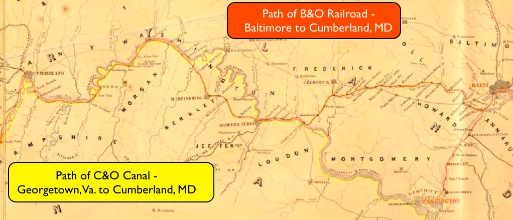
In our historical narrative, both projects were said to be vying for the narrow right-of-way where the Potomac River cuts through a mountain ridge at Point- of-Rocks, Maryland, which ended up in court.
Even though after four-years the case was said to have been ruled in favor of the canal, we are told the C & O Canal had to allow the B & O Railroad to go through there.
We are told that the C & O Canal, and other canals, were made obsolete because the railroad was so much more efficient and canals couldn’t compete with them.
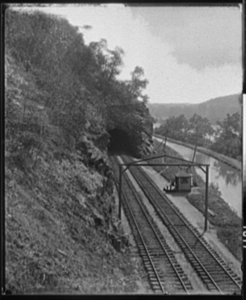
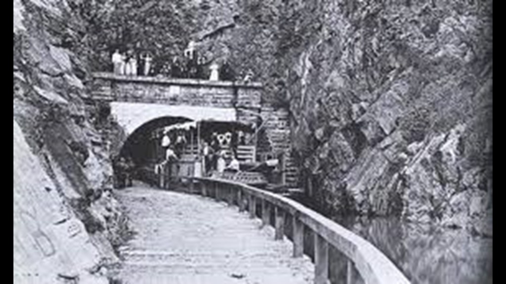
This is what was called the Great Tunnel of the C & O Canal in Allegheny County, Maryland, pictured on the left, and part of the Paw Paw Bends section of the Potomac River as it winds its way through West Virginia and Maryland, pictured on the right.
Built using more than 6,000,000-bricks, this tunnel has been described as the “greatest engineering marvel along the Chesapeake and Ohio Canal National Historical Park.”

The Paw Paw Tunnel was said to have been built between 1836 and 1850 for the C & O Canal to by-pass the bends in the Potomac River near Paw Paw, West Virginia, with no work having been done on it between 1841 and 1847 due to construction and financial problems.
The C & O Canal closed to canal boats in 1924.
The State of Maryland chartered the Baltimore and Ohio Railroad, the first common carrier, and the oldest, railroad in the United States in 1827.
The first section of the B & O Railroad was said to have opened in 1830, and it was said to have reached the Ohio River in 1852, the first eastern seaboard railroad to do so.
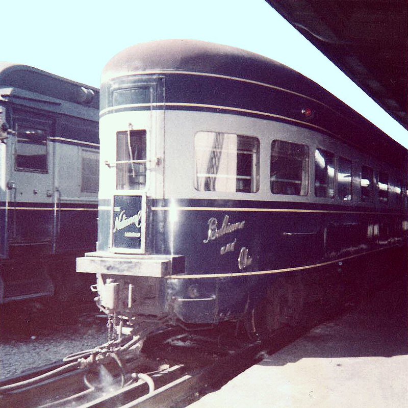
Unfortunately, we are told that with the rise of automobile ownership, ridership declined, and B & O ended its passenger service in 1971, at which time Amtrak took over and passenger service continued for another ten-years.
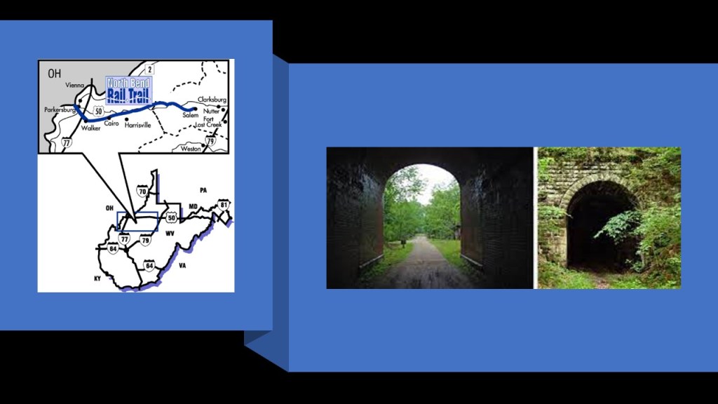
What is now the North Bend Trail was at one time one of the most distinguished railroad lines in United States History because during its prime, it hosted the B & O Railroad’s premiere passenger train, the National Limited, between New York City and St. Louis, Missouri.
It was said to have been constructed between Grafton, West Virginia, and Parkersburg, West Virginia, by the Northwestern Virginia Railroad between 1851 and 1857, at which time it was sold to the Baltimore & Ohio Railroad and became known as the “B & O Parkersburg Branch.”
Eventually the rail-line that was part of the North Bend Rail Trail became freight-only, and the line was abandoned and dismantled in 1988.
The trail was completed between 1991 and 1996, and also has beautiful, red-brick tunnels along the way.
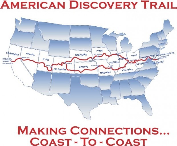
The North Bend Rail Trail is part of the “American Discovery Trail,” that runs from coast-to-coast through 15-states and the District of Columbia, and is the only non-motorized trail that crosses the country.
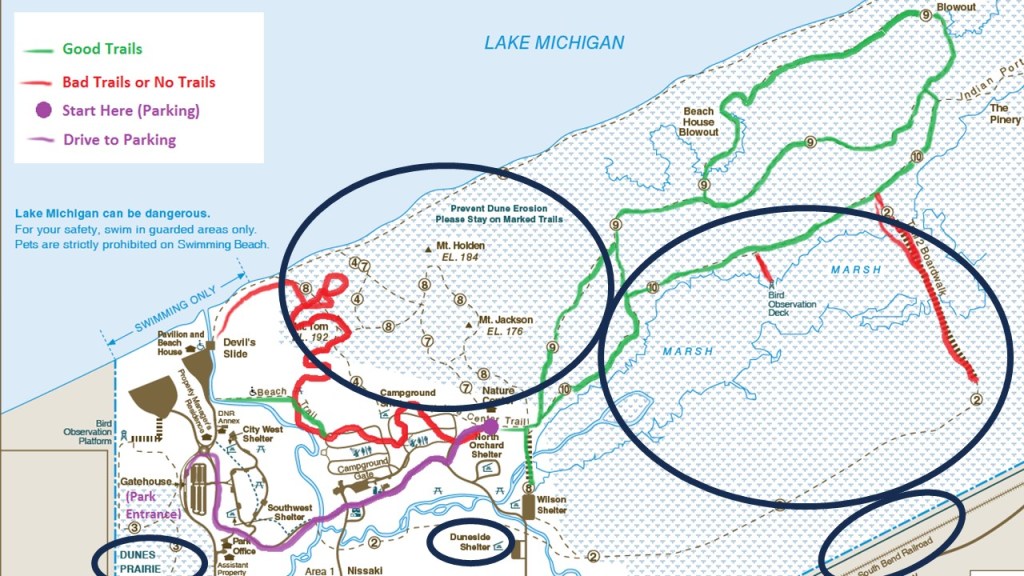
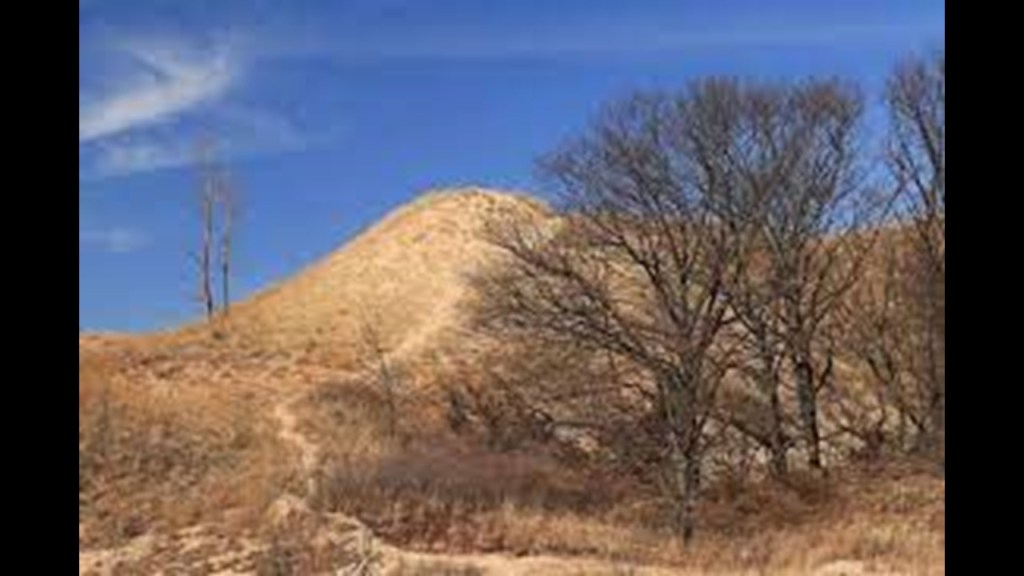
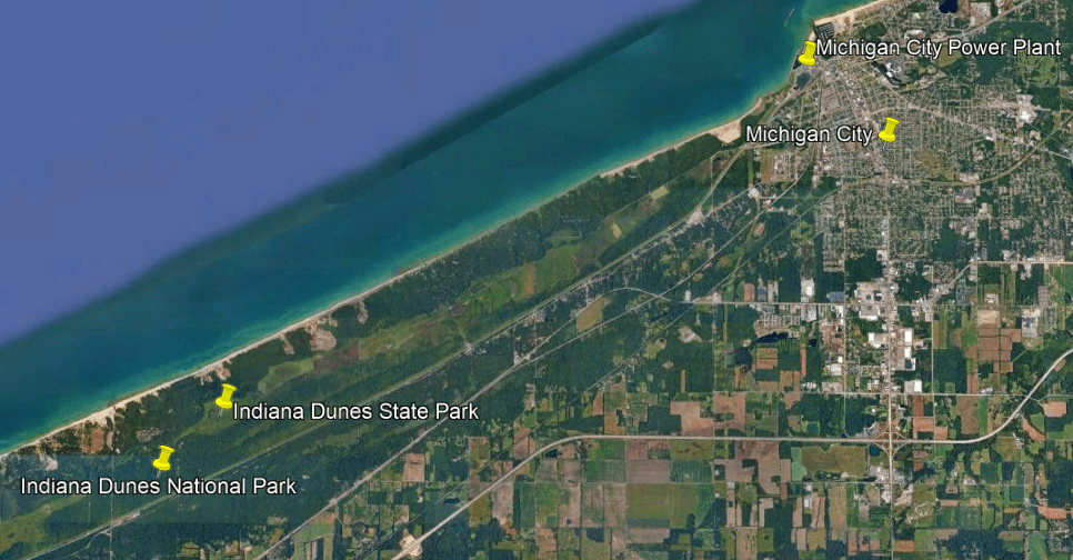
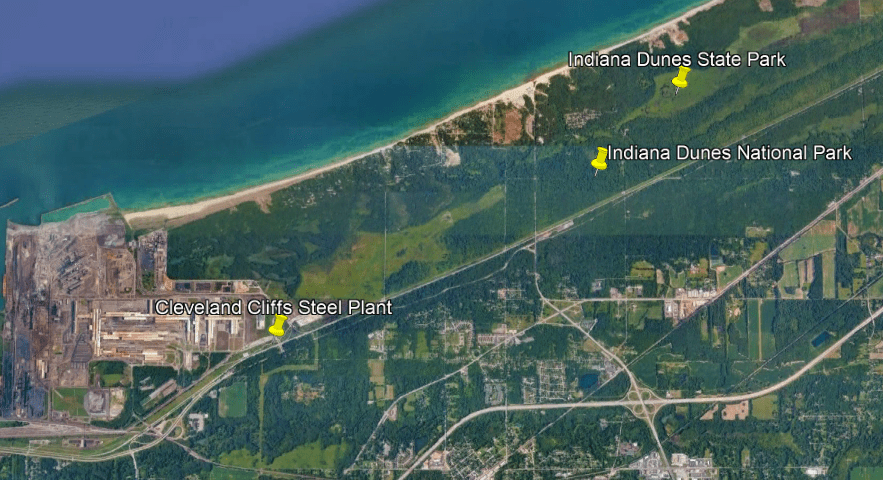
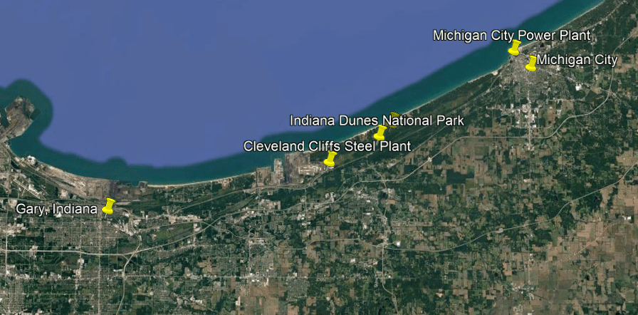
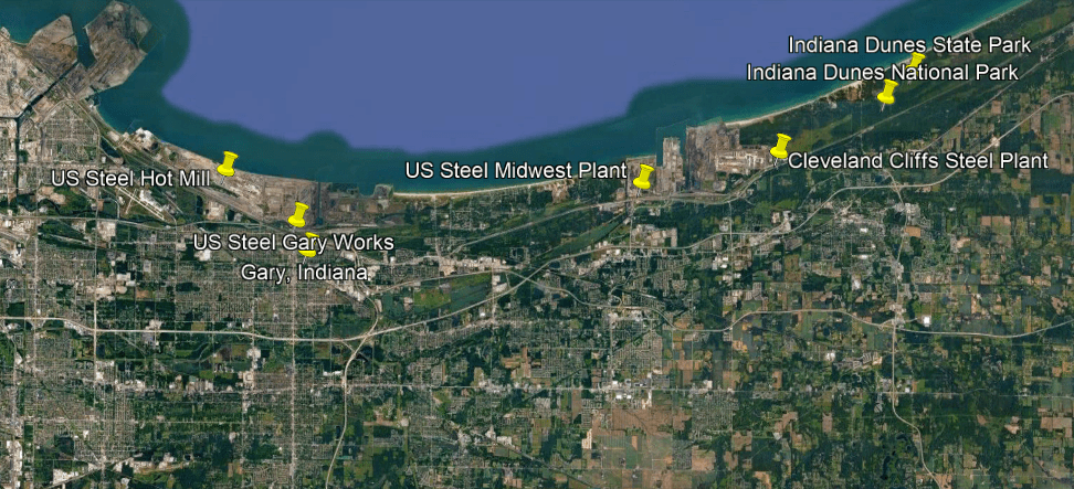
Interestingly, the “American Discovery Trail” includes the Indiana Dunes Discovery Trail on the Southern Shore of Lake Michigan, which is called one of the most biodiverse areas in the United States, and includes sand dunes and wetlands, including bogs, existing right next to each other in the same location, and both are beside railroad tracks, circled on the bottom right.
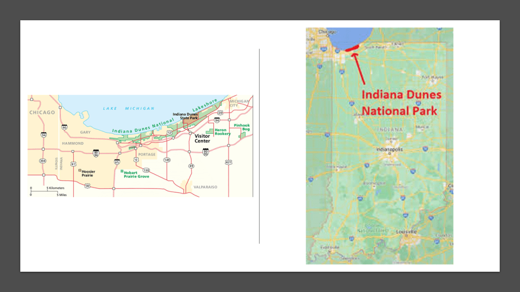
The South Shore Line runs in ths part of Indiana starting in South Bend, and goes between Michigan City just to the east of the Indiana Dunes, to Gary, Indiana, located just to the west of the Indiana Dunes, on its way to Chicago, Illinois.

Designated as the nation’s newest National Park in February of 2019, the Indiana Dunes National Park runs 20-miles, or 32-kilometers, along the southern shore of Lake Michigan.
It had been designated as a National Lakeshore by Congress in 1966.
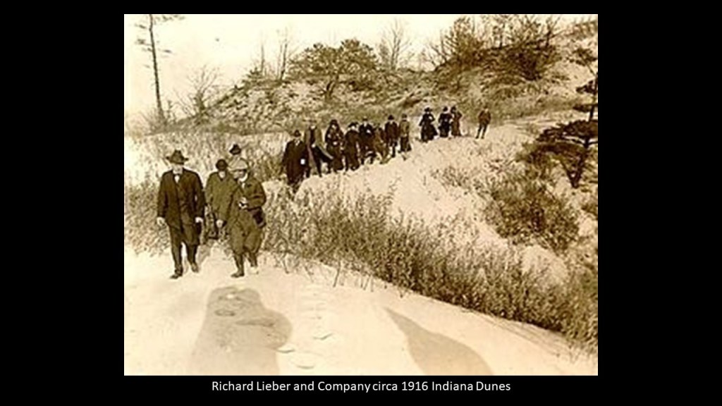
The Indiana Dunes State Park is within the boundaries of the National Park, and was first established in 1925 by Richard Lieber, a German-American businessman/conservationist who was the founder of the Indiana State Park System.
There have been five groups of mounds documented in the Indiana Dunes area.
Michigan City, Indiana, to the east of the Indiana Dunes on Lake Michigan, was the northern terminus of what was originally the Michigan Road.
The Michigan Road was Indiana’s first “super-highway,” and said to have been constructed in the 1830s and 1840s between Madison, Indiana, and Michigan City, Indiana, by way of Indianapolis.
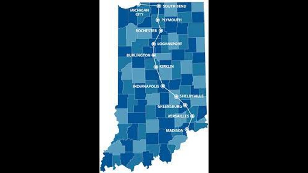
We are told that one of the things that made what became the Michigan Road possible was the concession of land by the Potawatomi in the 1826 Treaty, allowing for a ribbon of land that was 100-feet, or 30-meters, wide, stretching between Madison at the Ohio River and Michigan City on Lake Michigan.
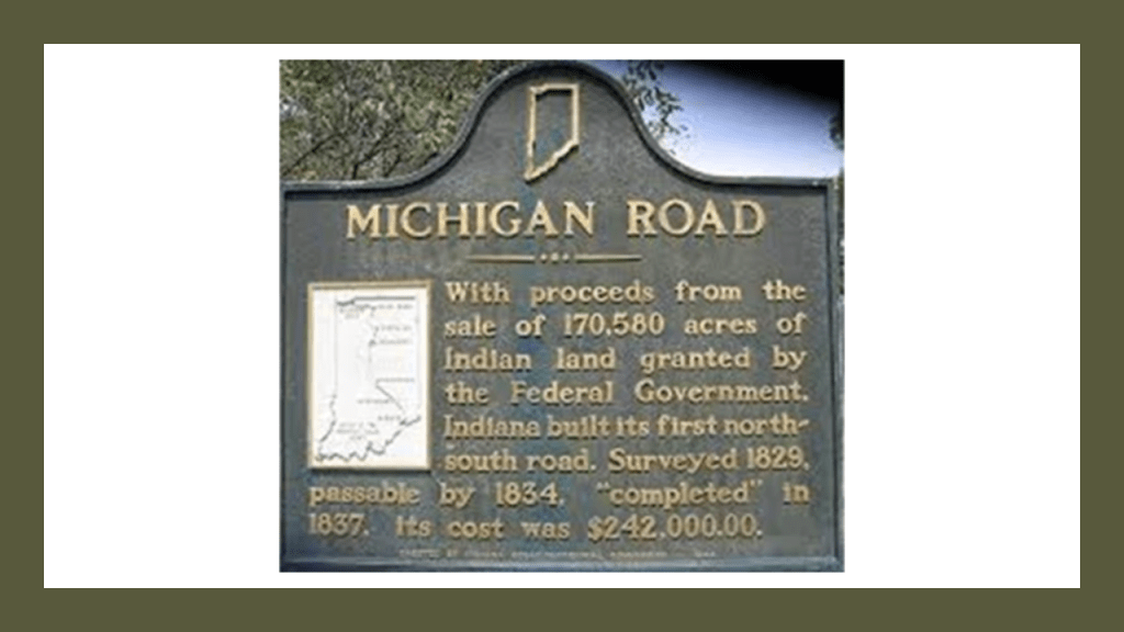
The original Michigan Road pre-dated the “Plank Road Boom” by about 10 years or so.
Here’s what we are told in our narrative about “plank roads.”
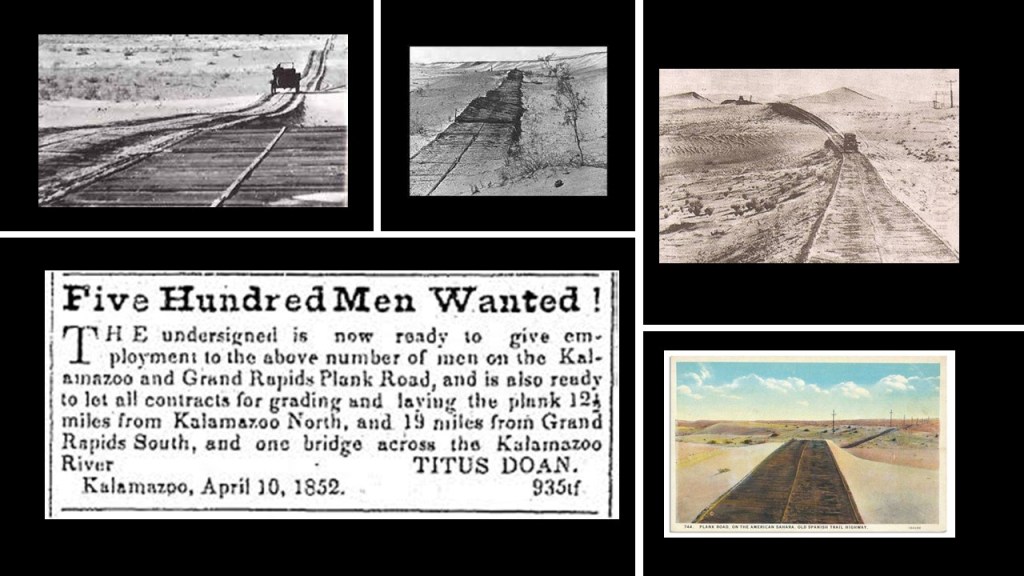
The “Plank Road Boom” lasted in the United States from 1844 to the mid-1850s, with more than 10,000-miles, or 16,000-kilometers, of plank roads built across the country.
Newspapers and Magazines of the time, including the New York Tribune and Scientific American, extolled plank roads as being easy to construct and a way to transform the rural transit trade of the country.
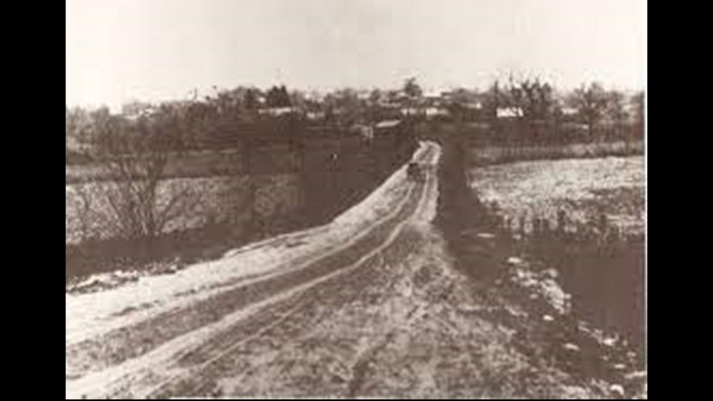
As we see in these photos, plank roads are crossing over landscapes covered in sand and dunes, but I think they were a cover-up explanation for the pre-existing railroad tracks of railroad lines that were part of the energy grid that was deliberately destroyed, creating among many other things, deserts, dunes, swamps and bogs.
I found references to the original Michigan Road being unpaved, and hard to build because of “swampy land” in places.
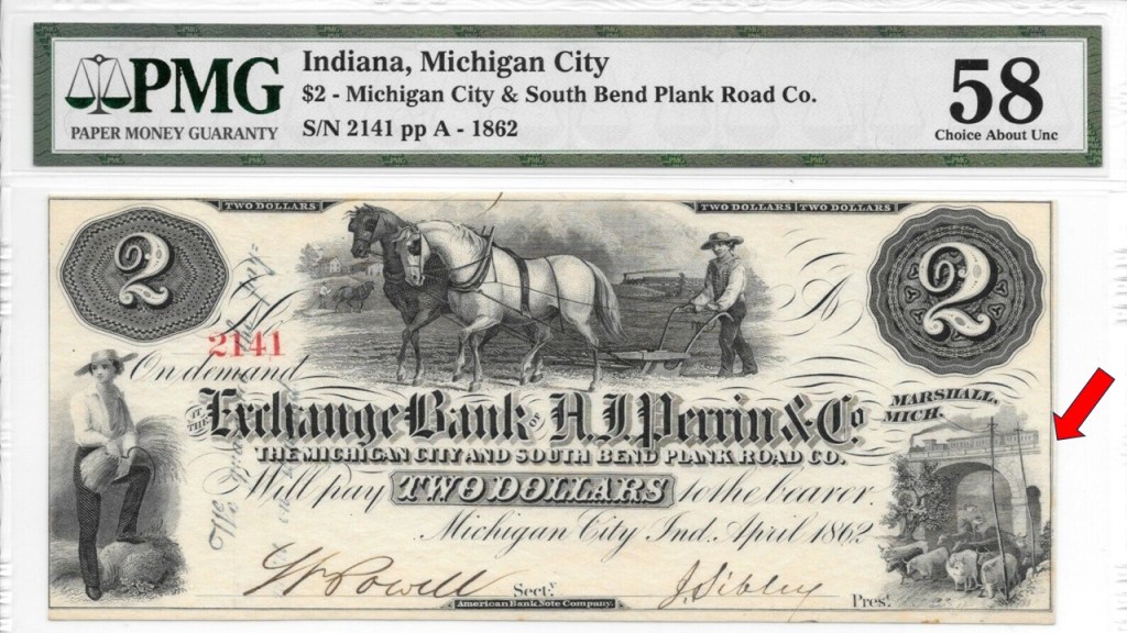
I did find this paper note guaranty from 1862, which would have been during the American Civil War, for a “plank road” connected to Michigan City.
Interesting to see the masonry archway with the herded livestock underneath it in the lower-right-hand corner of the note.
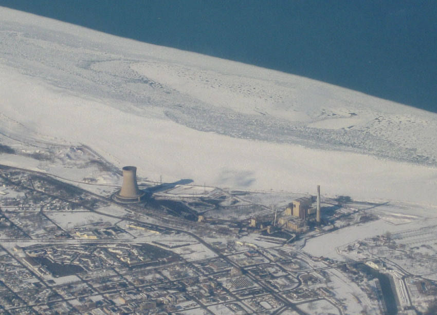
The Michigan City Power Plant is on the lakeshore just to the east of the Indiana Dunes and not far from the city’s downtown area.
It is a coal- and natural gas-fired powerplant, with a power plant operating at this location since 1931.
It is scheduled for retirement between 2026 and 2028 as part of the shift to renewable energy.
The site faces environmental clean-up of coal ash, which has contaminated local groundwater.
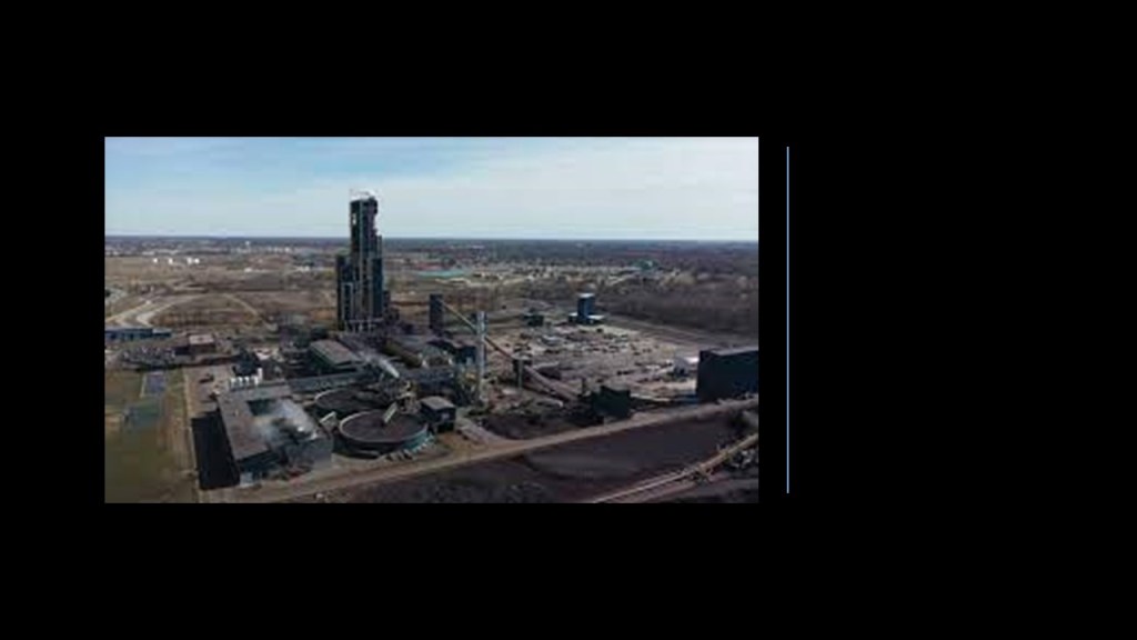
The Cleveland-Cliffs Steel Plant is located on the west side of the Indiana Dunes National Park.
It is operated by Cleveland-Cliffs Inc, the second-largest steel producer in the United States, after the Nucor Corporation based in Charlotte, North Carolina.
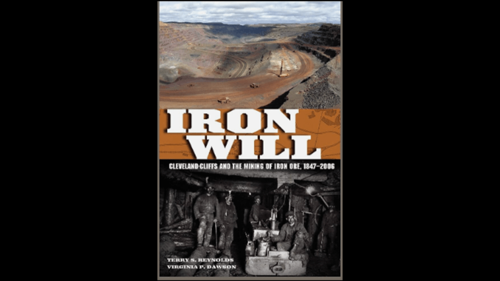
The company’s predecessor was the Cleveland Iron Mining Company, which was first founded in 1847 by Samuel Livingston Mather and several associates, and chartered as a company in Michigan in 1850, after learning of rich iron-ore deposits in Michigan’s Upper Peninsula.
Soon afterwards the Soo Locks opened in 1855, which allowed for the shipping of iron ore from Lake Superior to Lake Michigan.
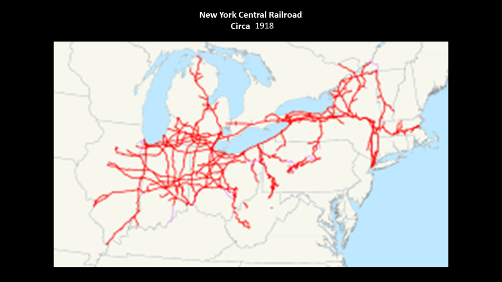
The New York Central Railroad was said to have begun operating in 1853 with the consolidation of earlier independent companies running between Albany and Buffalo.
This graphic depicts the New York Central rail system as of 1918.
We are told extensive trackage existed in the states of New York, Pennsylvania, Ohio, Michigan, Indiana, Illinois, Massachusetts, and West Virginia, plus additional trackage in Ontario and Quebec, and by 1925 operated 26,395-miles, or 42,479-kilometers, of track.
There was a strike by miners in the Upper Peninsula Iron Ore Mines in July of 1865, after the company announced a wage cut since the American Civil War had just ended.
The miners ended up storming the mines and the town of Marquette, Michigan, looting and burning along the way.
The Cleveland Iron Mining Company requested military intervention to end the strike, and a U. S. Navy gunboat, the Michigan, and troops responded.
They were given 24-hours to go back to work, or the camp was going to be shelled.
They acquiesed, but after the Michigan left, they went back on strike.
The Michigan returned and more troops, and the miners’ strike was put down for good.
The Pickands Mather Company was formed in 1883 by James Pickand, Jay C. Morse, and Samuel Livingston Mather, the son of the founder of the Cleveland Iron Mining Company.
Pickands Mather dealt in iron ore, pig iron, and mining iron ore from two mines in the Marquette Iron Range.
The company quickly expanded into coal mining; iron ore and coal shipping; dock ownership, and the manufacture of coke and iron and steel-rolling mills.
After years of leasing and managing the freighters of other companies, Pickands Mather formed the Interlake Company, their own shipping company for lake freighter shipping in 1894.
It once had the second-largest shipping fleet on the Great Lakes in the 1910s and 1920s.
In 1992, Pickands Mather was sold to a private management group, and is still in operation as a private company.
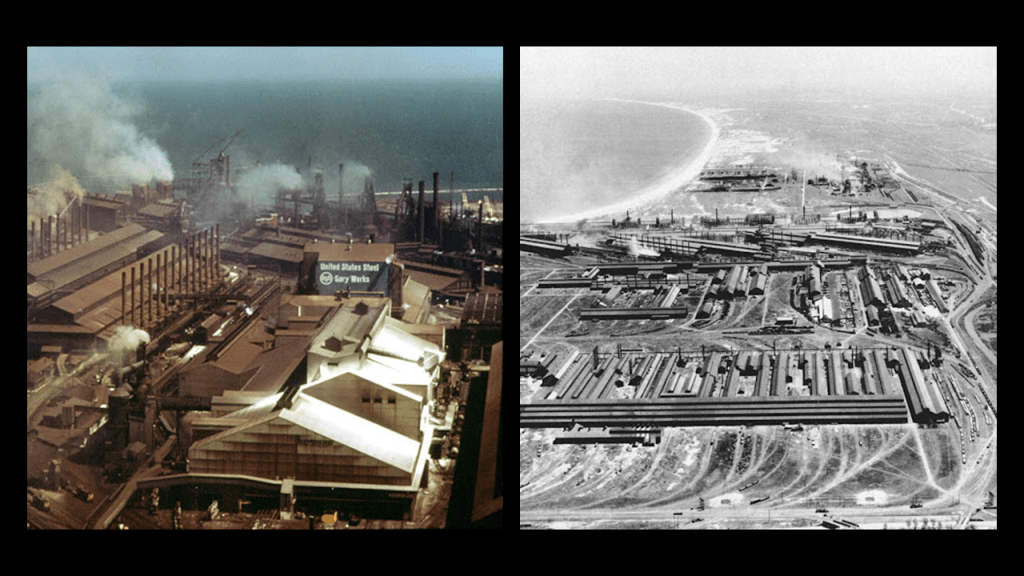
Gary, Indiana, is just to the west of Cleveland-Cliffs and the Indiana Dunes.
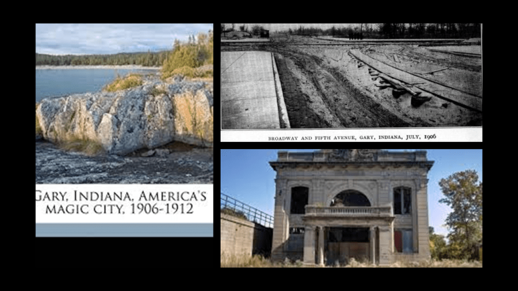
In June of 1906, the location of what became the city of Gary, about 26-miles, or 42-kilometers, east of Chicago, Illinois, was a wasteland of drifting sand and patches of scrub oak.
No one lived there, and there was no agricultural value to the land.
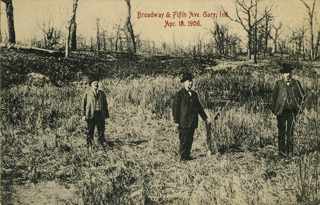
Yet, three or four railroads passed through the area and the Grand Calumet River wound its way around sand dunes to get to Lake Michigan.
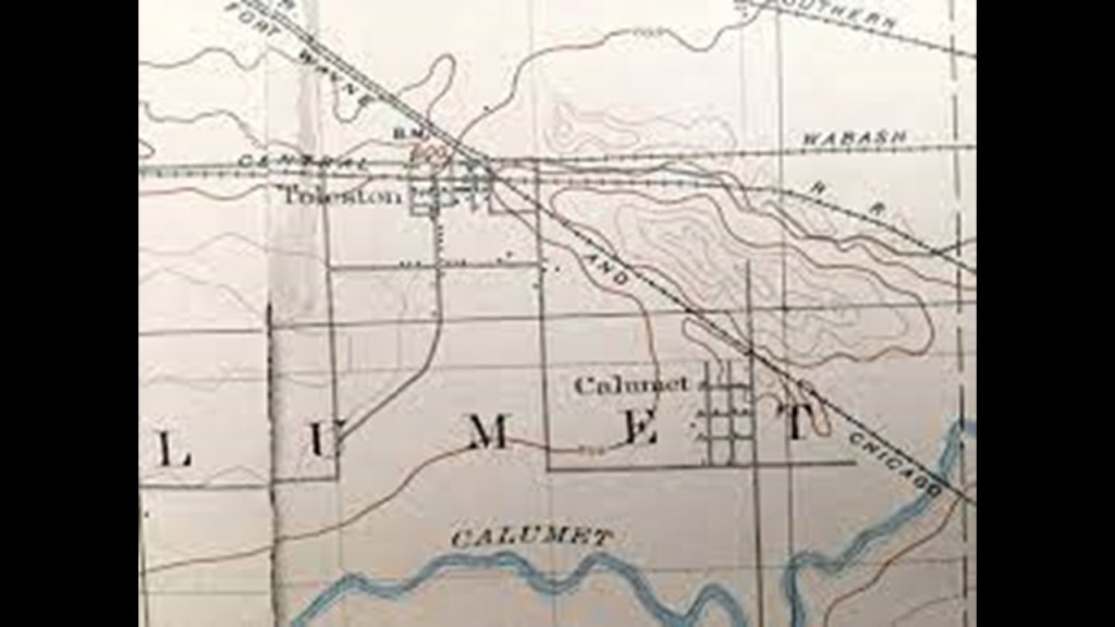
It was in June of 1906 that the first shovelful of sand was turned for the creation of the new steel town of Gary.
Laborers were housed in tents and shacks, and were digging trenches as very little work was being done above-ground.

By 1908, lo-and-behold, the city of Gary had taken on its shape and form!
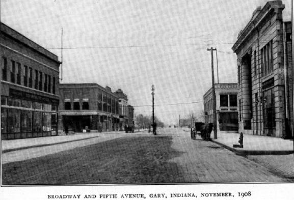
Gary was heralded as a “Magic City,” having been transformed from sand dunes in record time!
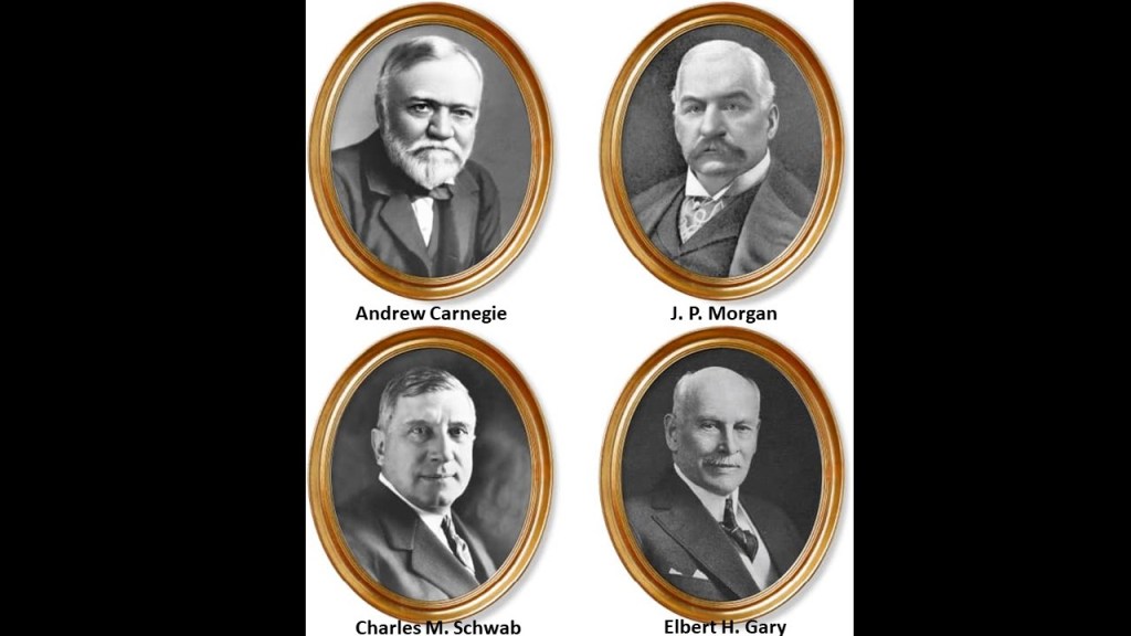
Gary was named after Elbert Henry Gary, a founder of U. S. Steel in 1901, along with J. P. Morgan, Andrew Carnegie, and Charles M. Schwab, and he was the second President of U. S. Steel, from 1903 to 1911.
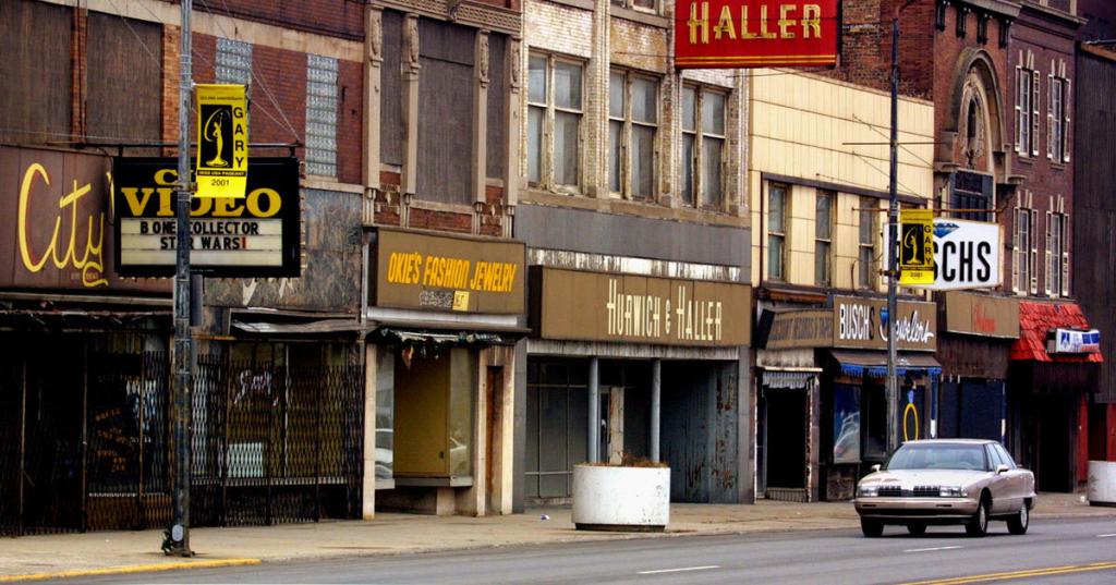
Gary was established to be the “company town” for U. S. Steel, and became home to the largest steel mill complex in the world, with its operation starting in June of 1908, only two-years after the first shovelful of sand was turned at this location.
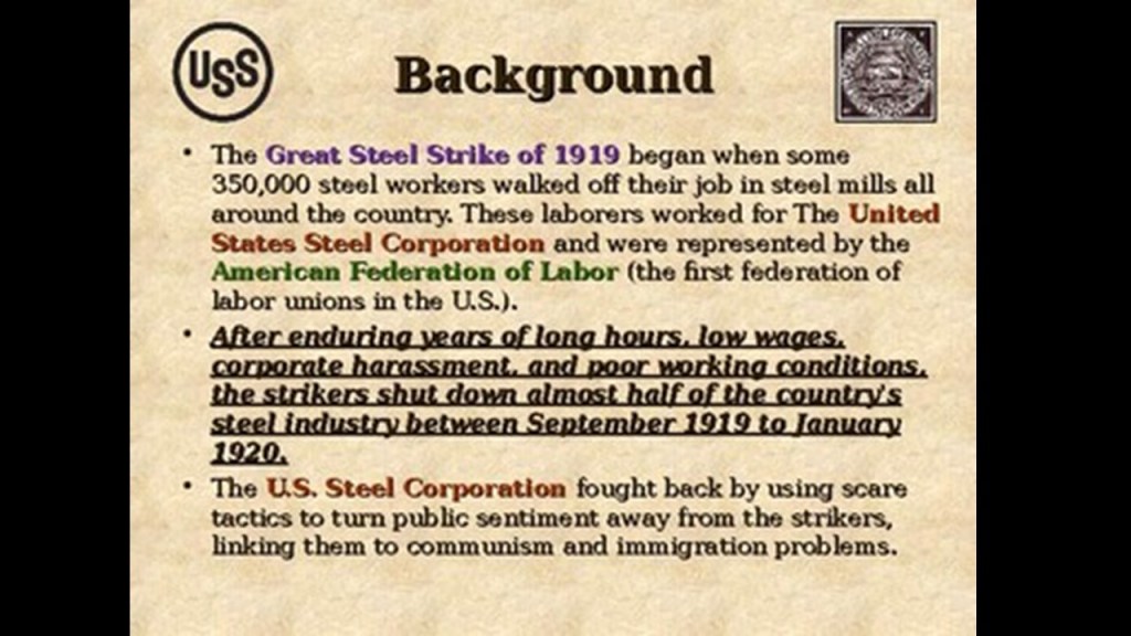
Gary was the site of one of the steel strikes in 1919.
The American Federation of Labor was attempting to organize a labor union in the leading company in the American steel industry, leading to strikes at U. S. Steel locations across the country.
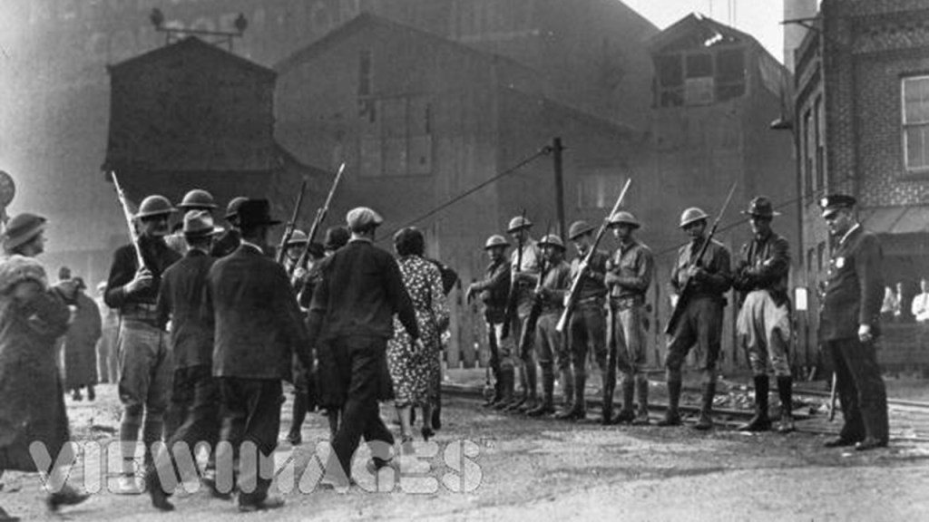
In Gary, a riot broke out on October 4th of 1919 between steel-workers and strike-breakers brought in from the outside.
Several days later, the Indiana Governor declared martial law and brought in 4,000 federal troops commanded by Major-General Leonard Wood to restore order.
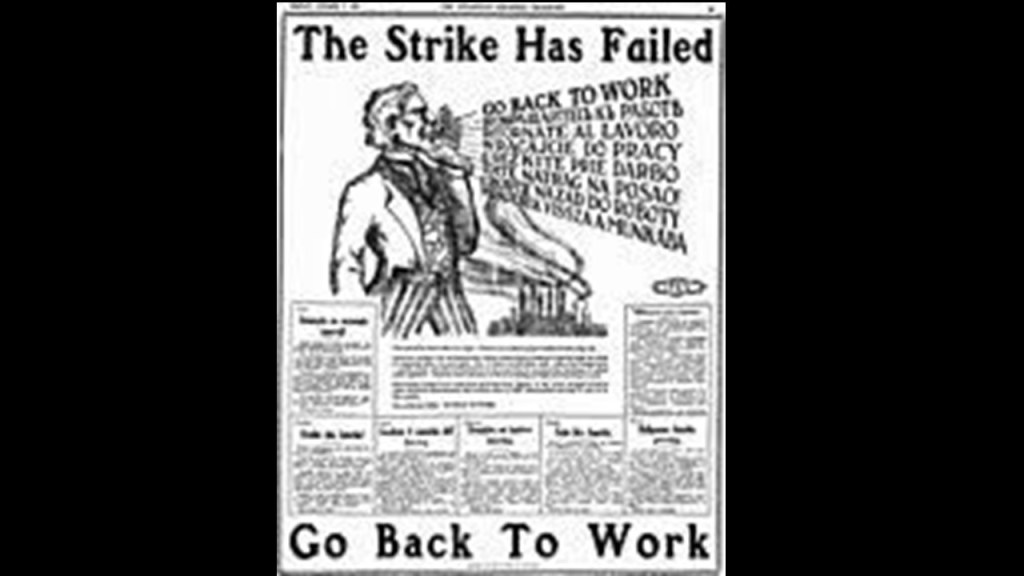
By January of 1920, the strike had collapsed completely, and U. S. Steel having successfully opposed unionization efforts at that time, and it would be many years before unionization efforts in the steel industry resumed.
U. S. Steel is still the largest employer in Gary, and is still a major steel producer, but with a significantly reduced workforce due to the increase in overseas competitiveness in the steel industry over the years.
As a matter of fact, Gary has been in decline for years, with population loss leading to abandonment of much of the city, unemployment and decaying infrastructure.
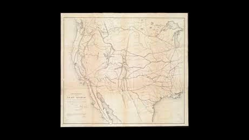
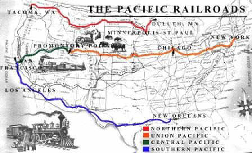
This is a good place to mention the Pacific Railroad Surveys.
The Pacific Railroad Surveys were a series of explorations of the American West between 1853 and 1857 with the stated purpose of finding and documenting possible routes for a transcontinental railroad across North America.
There were five surveys conducted: the Northern Pacific Survey between the 47th-parallel north and the 49th-parallel north from St. Paul, Minnesota, to Puget Sound; the Central Pacific Survey between the 37th-parallel North and the 39th-parallel North from St. Louis, Missouri, to San Francisco, California; the Southern Pacific Survey along the 35th parallel north from Oklahoma to Los Angeles, California; the Southern Pacific Survey across Texas to San Diego, California; and along the Pacific Coast from San Diego, California, to Seattle, Washington.
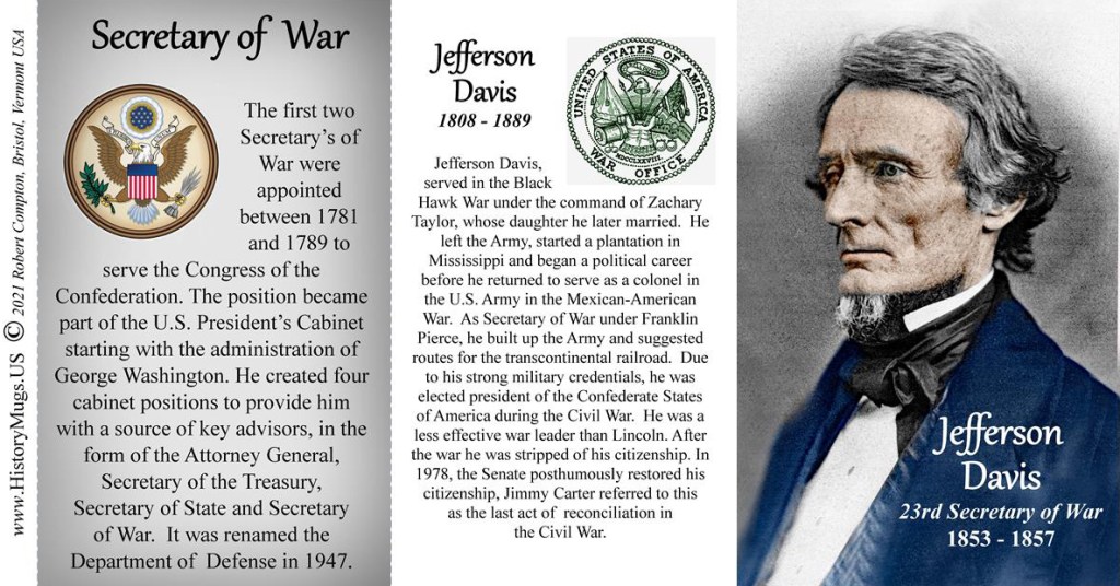
All were carried out under the direction of Secretary of War Jefferson Davis, the future President of the Confederacy.
Jefferson Davis became Secretary of War in President Franklin Pierce’s Administration in March of 1853.
We are told the volumes of information that were produced from these surveys were considered to constitute the singlemost important contemporary source of knowledge on western geography and history, and that their value was greatly enhanced by beautifully-illustrated color plates showing the scenery, native inhabitants & fauna and flora of the West.

Let’s take a look at some of the definitions of survey.
There is the definition of survey regarding civil engineering and the activities involved in the planning and execution of surveys gathering information related to all aspects of engineering projects, which is the definition implied as the driving force behind the Pacific Railroad Surveys.

But what if another definition of survey might be in play here?
Like the definition of a short descriptive summary; the act of looking or seeing or observing; considering in a comprehensive way; holding a review; and a detailed critical inspection, and not the kind of surveying for civil engineering projects seen in the previous slide as we have been led to believe through historical omission.

What if the Pacific Railroad Surveys were undertaken to explore a ruined landscape surveying, as in “looking at and observing,” everything, including pre-existing rail infrastructure in order to restore it to use once again?
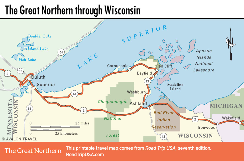
So, for example, the Great Northern Railway was said to have been created in 1889 from several predecessor rail-lines in Minnesota, making it the northernmost transcontinental railroad in the United States, with lines to Duluth, and Superior in Wisconsin, on Lake Superior.
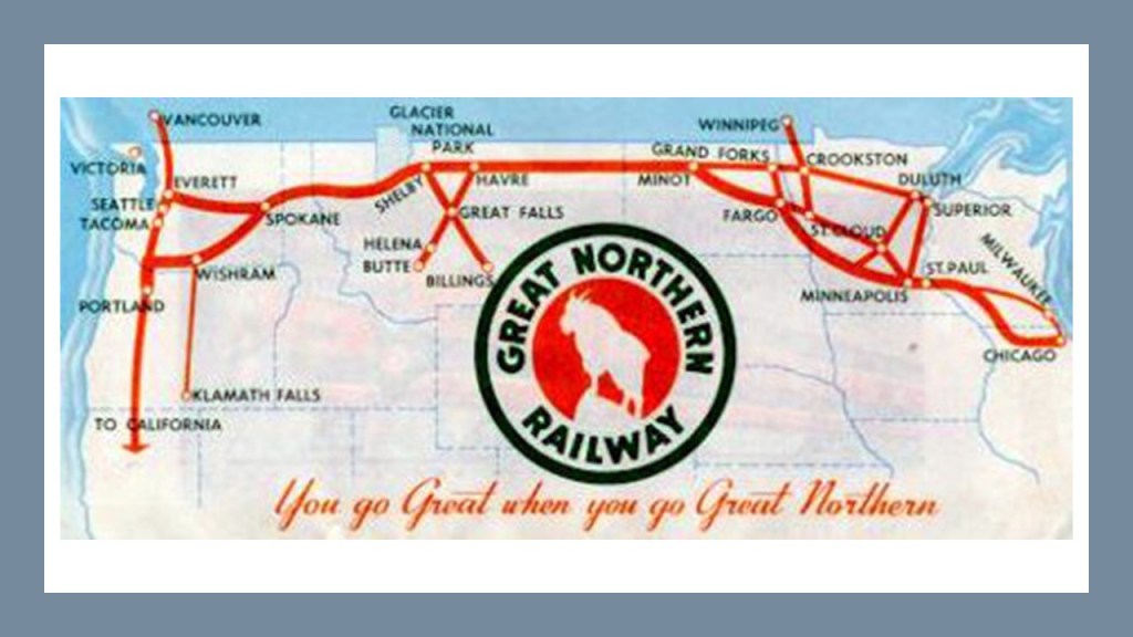
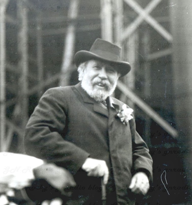
The Great Northern Railway was said to the be the creation of the 19th-Century Canadian-American railroad entrepreneur, James J Hill.
We are told James J. Hill was a railroad executive who came from an impoverished childhood.
In 1898, Hill purchased control of large parts of the Mesabi Iron Range in Minnesota and its rail lines.
The Great Northern Railway began large-scale shipment of iron ore to the Midwest’s steel mills.
The 28.5-mile, or 42.9-kilometer, Dakota Rail-Trail was built on the former track-bed of the Hutchison Spur of the Great Northern Railway between Wayzala and Lester Prairie.
The question is why did they take out all of the former railroad infrastructure and replace it with recreational trails and highways to begin with?
I think the reason has to do removing the rail-lines that were original part of the energy grid when they were no longer needed for mining and/or transportation
They were instead turned into highway routes and recreational trails used for harvesting our energy for the benefit of a few from what was the original free-energy grid system for the benefit of all.
The free-energy grid was destroyed, and the robber barons behind the creation of the New World Order, like John D. Rockefeller, J. P. Morgan, and the other big players we have seen so far, actively sought to bring on-line replacement sources for energy-generation and industry as quickly as possible, which came from the harvesting of the components of the original energy grid, like iron ore, coal, and oil.

Around the same time as the Pacific Railroad Surveys, the 1854 Treaty of LaPointe was signed in Wisconsin between the U. S. Government and representatives of the Ojibwe of Lake Superior and the Mississippi River.
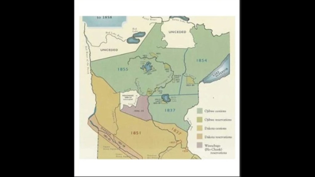
As a result of this treaty, our historical narrative tells us the Ojibwe ceded all of the Lake Superior Ojibwe lands in the Arrowhead Region of Northeastern Minnesota to the United States in exchange for reservations for the Lake Superior Ojibwe in Wisconsin, Michigan, and Minnesota.
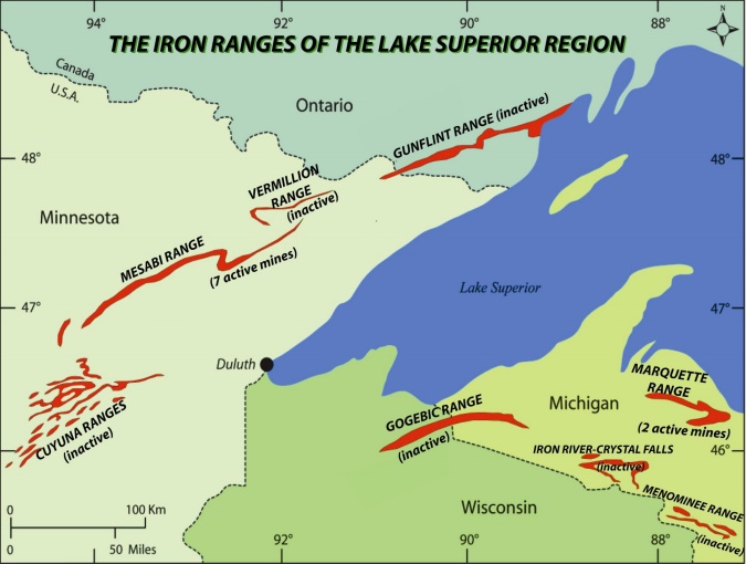
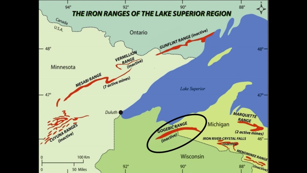
There are four iron ranges around Lake Superior in Minnesota and Ontario: the Vermilion; the Mesabi; the Gunflint; and the Cuyuna.
In Wisconsin and Michigan, there are the Gogebic, Iron River – Crystal Falls, Menominee and Marquette iron ranges.
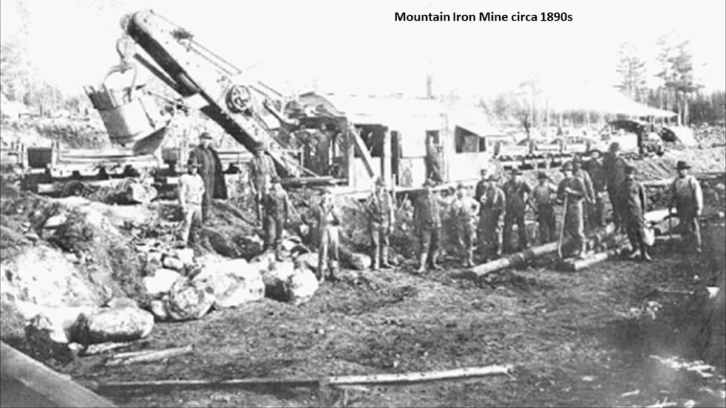
Leonidas Merritt purchased land in the Mesabi Range in northern Minnesota after he surveyed and mapped the surrounding area for iron ore, and opened the Mountain Iron Mine in the early 1890s, which became the largest iron ore deposit ever discovered.
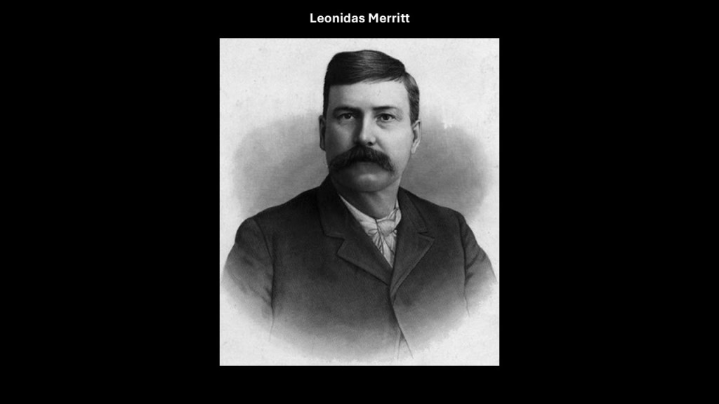
Leonidas was joined by 6 of his brothers, and what became known as the “Seven Iron Brothers” owned the largest iron mine in the world in the 1890s.
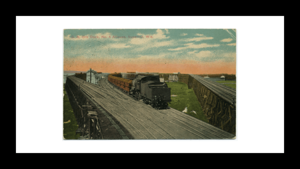
We are told that in 1891, the Merritt family incorporated the Duluth, Missabe, and Northern Railway Company to build a 70-mile, or 113-kilometer-long, railroad from the mine to the port on Lake Superior at Superior, Wisconsin, which was just to the south of Duluth, raising the money needed in exchange for bonds from the railroad company.
Their success attracted the attention of John D. Rockefeller, who wanted to expand into the iron ore business, and the Merritts put their company stock up as collateral to borrow money from Rockefeller in order to fund the railroad.
Long story short, the Merritts ended up being financially ruined, and Rockefeller came to own both the mine and the railroad.
After Rockefeller assumed ownership in 1894, he leased his iron ore properties and the railroad to the Carnegie Steel Company in 1896.
John D. Rockefeller sold the railway to United States Steel in 1901, after it had been formed by the merger of the merger of Andrew Carnegie’s Carnegie Steel Company, Elbert Gary’s Federal Steel Company, and William Henry Moore’s National Steel Company, which was financed by J. P. Morgan.
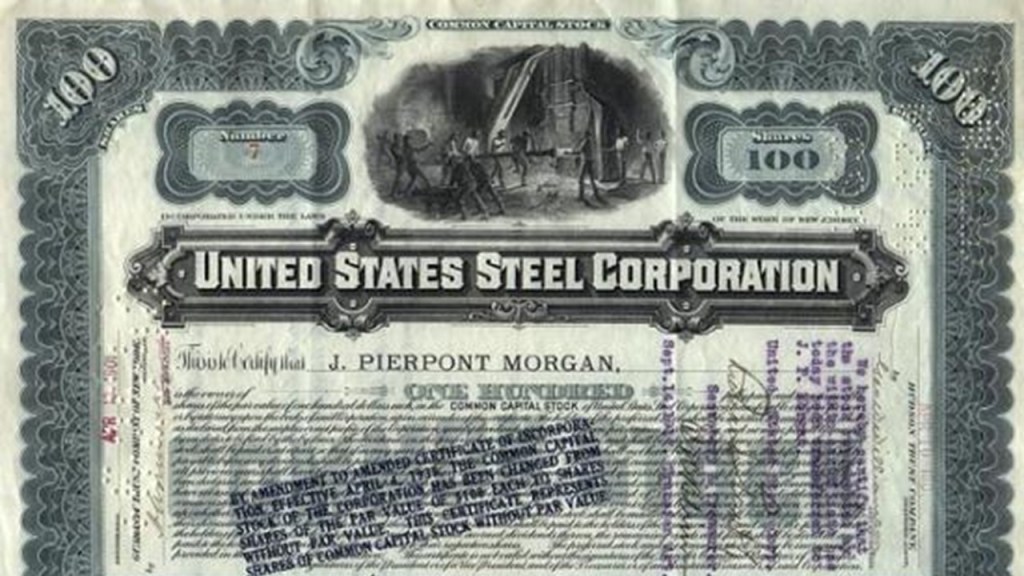
J. P. Morgan was an American financier and banker who dominated corporate finance on Wall Street throughout the period of time called the “Gilded Age,” between the years of 1870 and 1900.
He was a driving force behind the wave of industrial consolidation in the United States in the late 19th- and early 20th-centuries.
Besides his involvement in the formation of the U. S. Steel Corporation, he was also behind the formation of General Electric and International Harvester, among many other mergers.
After the sale of Carnegie Steel, Andrew Carnegie surpassed John D. Rockefeller for awhile as the richest American at the time, and Charles M. Schwab became the first President of the newly minted U. S. Steel Corporation.
Ashland, Wisconsin, is located at the junction of US Highway Route 2 and Wisconsin 13, not far from the port at Superior.
It is the seat of Ashland County, with its city hall said to have been built in 1893 from locally-quarried brownstone.
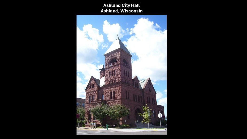
Ashland is located very close to the Gogebic Iron Range, and was the primary shipping port for iron ore from its mines during the late 19th- and early 20th-centuries, and its history is deeply connected to mining and ore docks used to transport iron to steel mills.
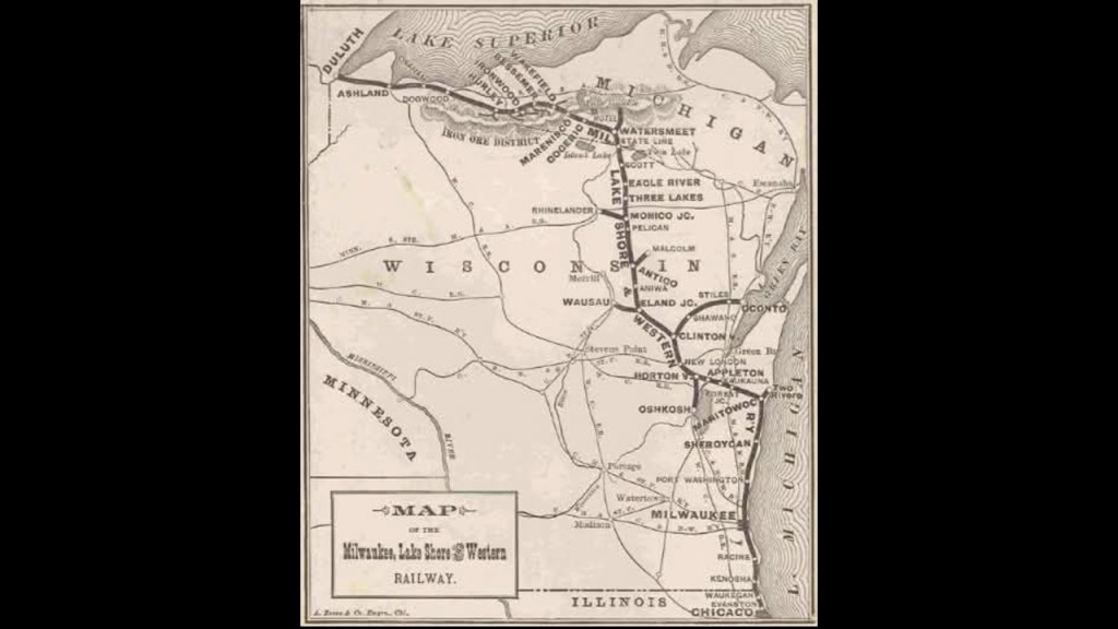
We are told the Milwaukee, Lake Shore, and Western Railway platted the city of Ashland in 1885 as railroad construction moved to the west.
Also known as the “Lake Shore Road,” this railway connected Milwaukee, the Upper Peninsula and northwest Wisconsin, with a connection to Chicago.
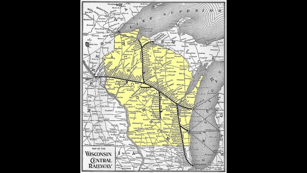
The Wisconsin Central Railway Company also had a presence in Ashland having been created in 1897 from the bankruptcy reorganization of Wisconsin Central Railroad, which existed from 1871 to 1899.
The Wisconsin Central Railway Company was merged into the Soo Line Railroad in 1961.
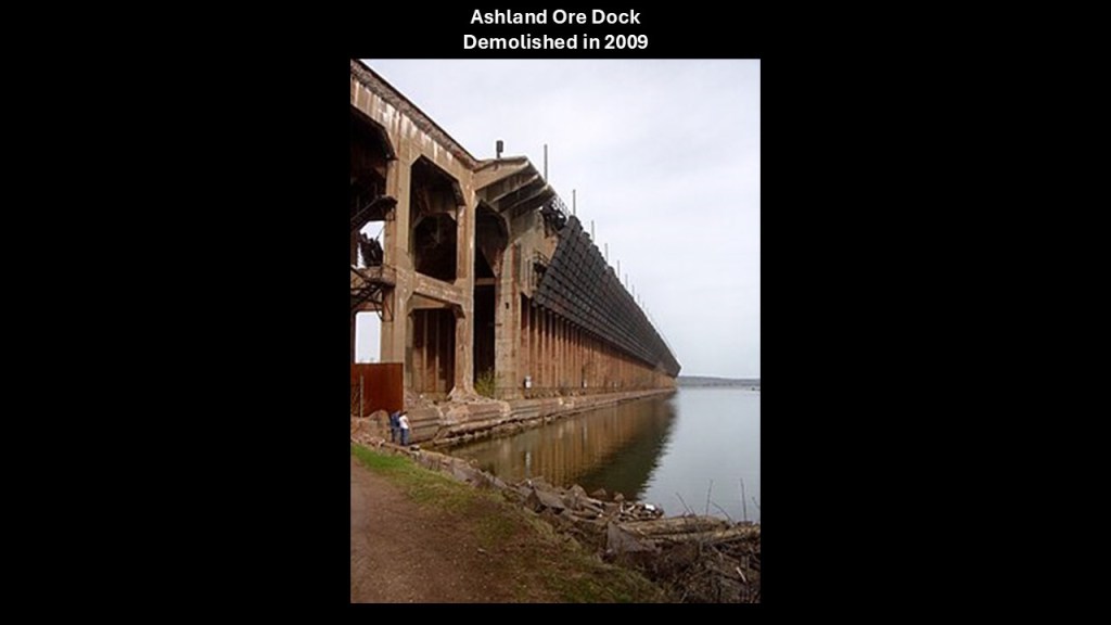
The Wisconsin Central Railway had a massive ore dock in Ashland that was 1,800-feet, or 550-meters, in length.
The ore dock was demolished in 2009, unable to be saved by local preservationists.
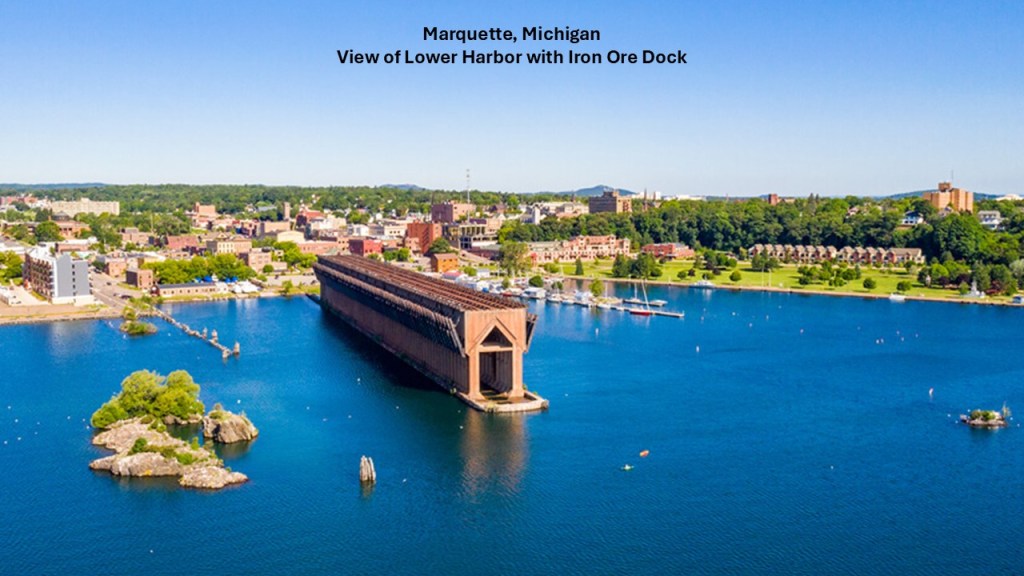
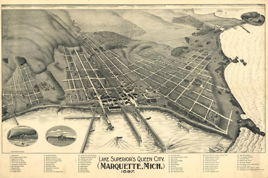
Next, Marquette is the largest city in the Upper Peninsula of Michigan, and is a major port on Lake Superior known primarily for shipping iron ore from the Marquette Iron Range.
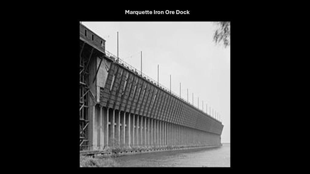
While the iron ore dock in Marquette’s lower harbor is still standing, unlike the one in Ashland, but has not been used as an ore dock since 1971, though there are some plans to revitalize it and possibly turn it into a public park.
These historical ore docks were typically long, high structures with railway tracks on the top, and pockets where ore was unloaded by gravity from the railcars.
Then each pocket had chutes with which to unload the ore into the hold of a cargo ship for transport.
By the 1890s, Michigan was the largest supplier of iron ore in the United States.
This is what we are told about the history of Marquette.
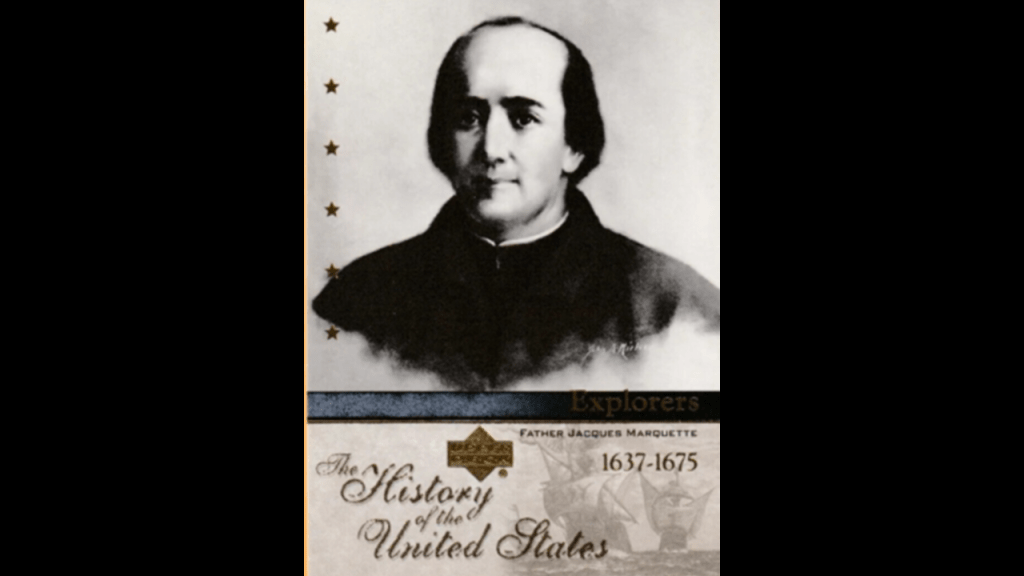
We are told it was named after Father Jacques Marquette, a French Jesuit explorer of the Great Lakes Region and Mississippi River Valley starting around 1668 to his death in 1675.
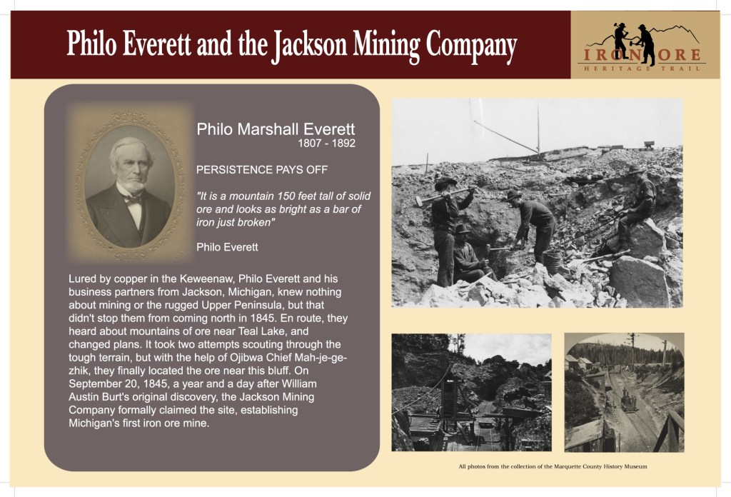
Then in 1844, the area started to be developed after iron deposits were found at Teal Lake west of Marquette.
Subsequently,the Jackson Mining Company was formed in 1845, the first organized mining company in the region.
Then in 1849, a second iron ore-related company was formed, the Marquette Iron Company, which marked the beginning of the Village of Marquette.
This iron company had failed by 1852, but in 1854, the Cleveland Iron Mining company flourished, and had the village platted.
The village was incorporated in 1859 and it was incorporated as a city in 1871.
We are told that in the 1850s, Marquette was linked by rail to numerous mines, and became the leading shipping center of the Upper Peninsula.
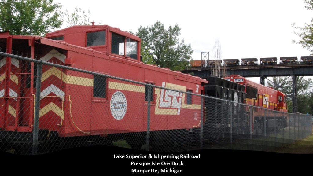
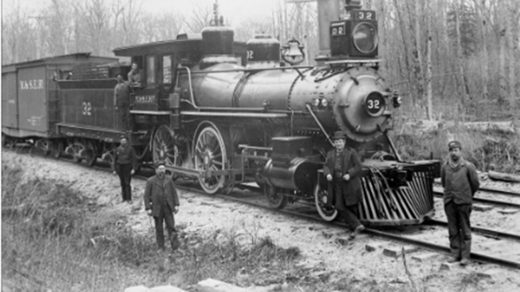
The Lake Superior and Ishpeming (LS & I) Railroad was organized in 1893 as a subsidiary of Cleveland-Cliffs Iron Company, which mined iron ore.
Based out of Marquette, it started operating in 1896 to transport iron ore from the Marquette Iron Range, located west of Marquette, to docks on Lake Superior for it to be shipped to steel mills on the lower Great Lakes.
It continues to operate today as an independent railroad from its headquarters in Marquette.
The LS & I Railroad merged in 1923 with the Munising, Marquette and Southeastern (MM & SE) Railway, a short-line running 40-miles, or 64-kilometers, east to Munising, which ran through thickly-forested pulpwood on Michigan’s Upper Peninsula, which was used for timber operations by Cleveland-Cliffs, an iron ore and timber-extraction conglomerate.
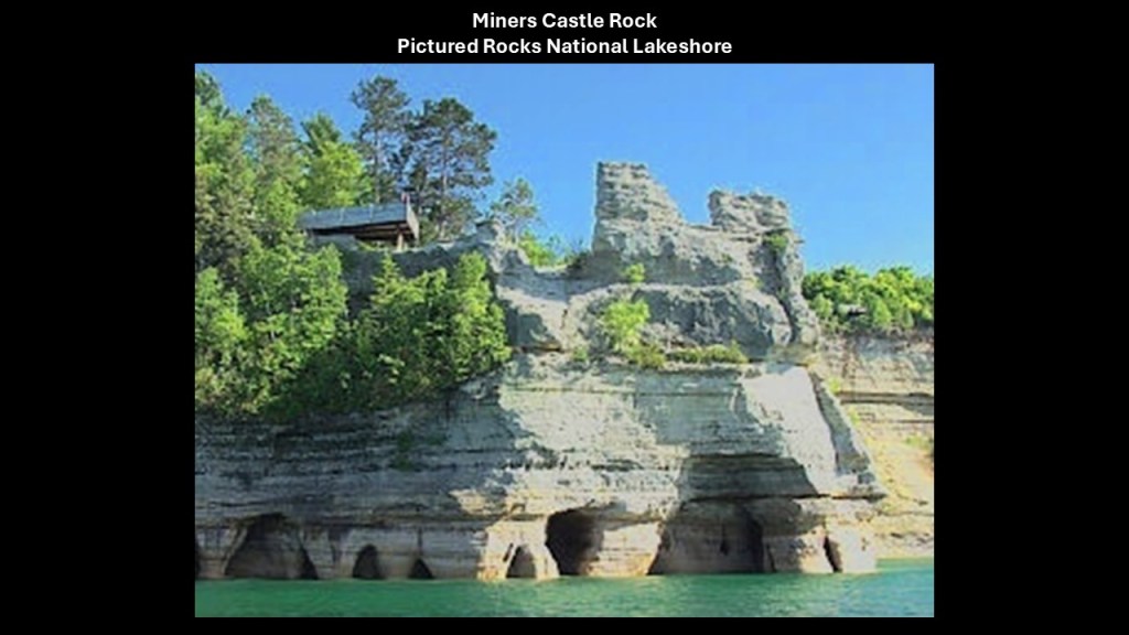
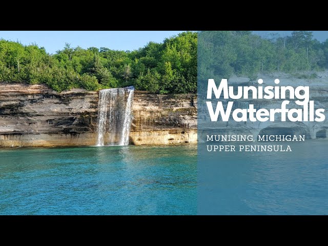
Interesting to note that Munising is probably best known as the western gateway to “Pictured Rocks National Lakeshore.”

The “Pictured Rocks” are described as dramatic, multicolored cliffs with unusual sandstone formations.
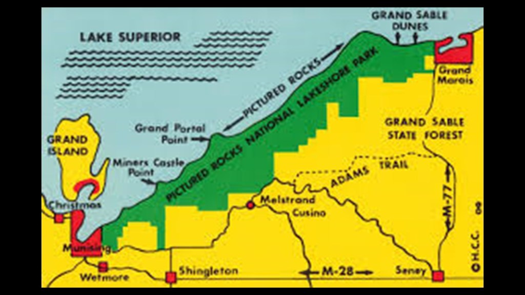
Formations with names like “Miners Castle Rock…”
…and the Grand Portal Rock as seen in this lithograph from 1851…
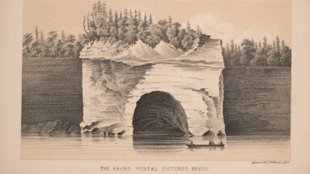
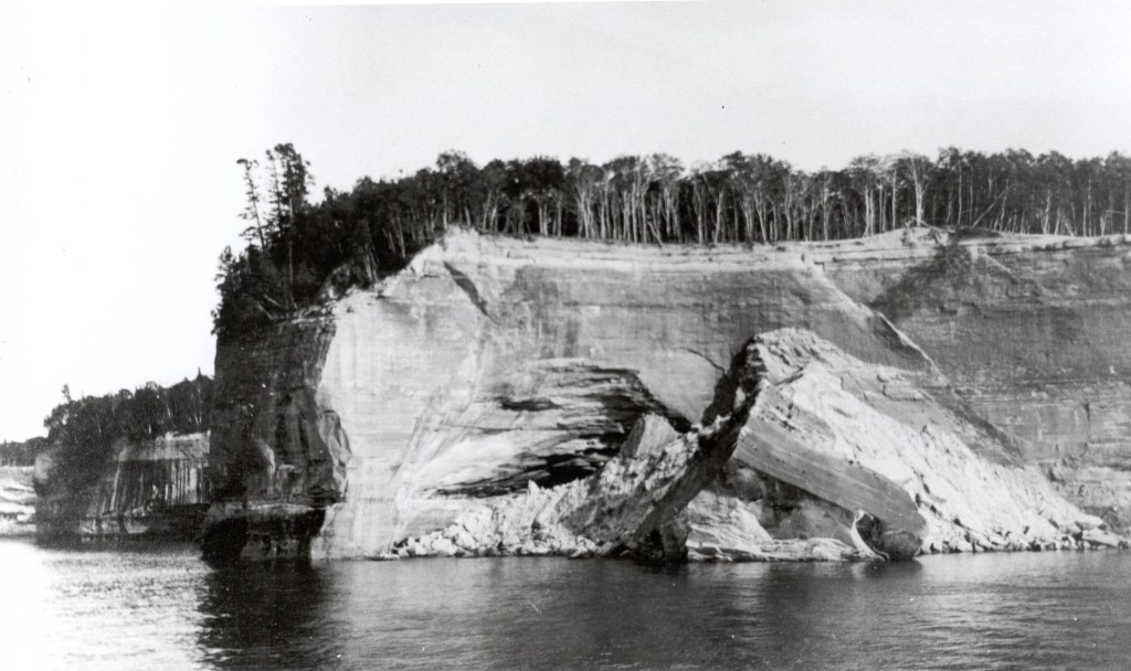
…which mysteriously collapsed in the early 1900s, from the believed cause of erosion but no one really knows what might have caused it.
And no I don’t think these are natural formations, but instead great examples of melted infrastructure that I believe was caused by the destruction of the energy grid, which had multiple effects.
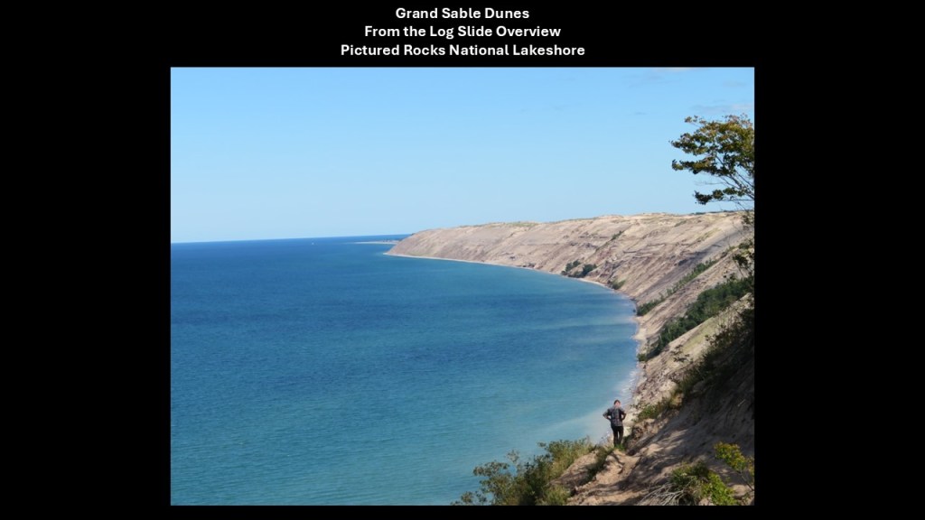
The Grand Sable Dunes run along the northeast end of the Pictured Rocks Lakeshore for 6-miles, or 10-kilometers.
This is the view of them from what is called the “Log Slide Overview,” where in the 19th-century, loggers used them to slide logs from the top of the dunes to the shoreline so they could be transported out.
Other places located at this end of the Pictured Rocks National Lakeshore include Sable Falls, which flow 75-feet, or 23-meters, over what is called Munising and Jacobsville sandstone formations to Lake Superior.
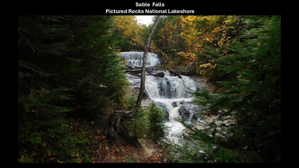
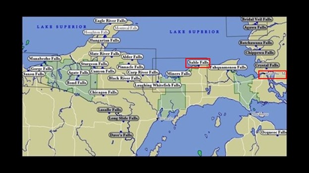
The general area around Munising has many waterfalls.
Others waterfalls in the area include: Alger Falls; Horseshoe Falls; Memorial Falls; Munising Falls; Miners Falls; Scott Falls; Tannery Falls; and Wagner Falls.
It is my belief that waterfalls were an integral part of the original energy grid as well, and believe that the destruction of the grid in this region created the Great Lakes by the outflow of tremendous amounts of water from the waterfalls and the interconnected hydrological system.
I have looked at this subject in-depth most recently throughout my series on North America’s Great Lakes, where I have looked at places all along the shores of Lake Superior, Lake Michigan, Lake Huron, Lake Ontario, and Lake Erie, paying particular attention to lighthouses; railroad and streetcar history; waterfalls; bluffs, wetlands and dunes; major corporate players; mines and mining; and many other things.
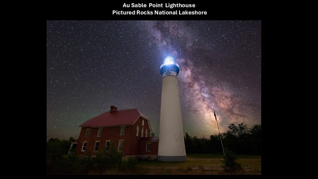
The Au Sable Point Lighthouse is located in the area of the Grand Sable Dunes and Sable Falls, and it is nicknamed the “Beacon of the Shipwreck Coast.”
The lighthouse here was said to have been built between 1873 and 1874, and yet another lighthouse of many I have come across with a perfect alignment to the Milky Way.
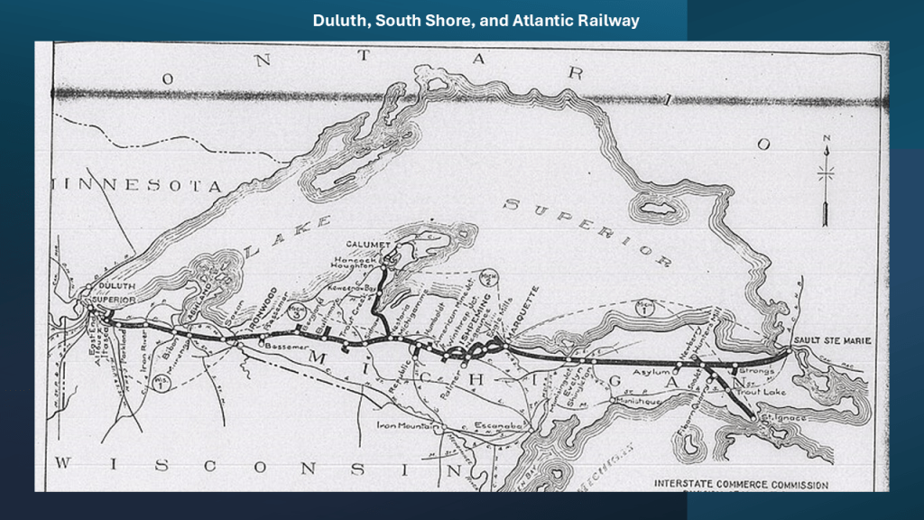
The Duluth, South Shore, and Atlantic Railway was an American railroad that served the Upper Peninsula of Michigan, and the Lake Superior shoreline of Wisconsin, providing service from Sault Ste. Marie, Michigan, and St. Ignace, Michigan, westward through Marquette to Superior, Wisconsin, and Duluth, Minnesota.
The first of this railway line started operating in 1855; then came under the control of the Canadian Pacific Railway in 1888; and was in operation all together from 1855 to 1960 as an independently-named subsidiary of the Canadian Pacific Railway.
What’s left of it was merged to the Soo Line in 1961.
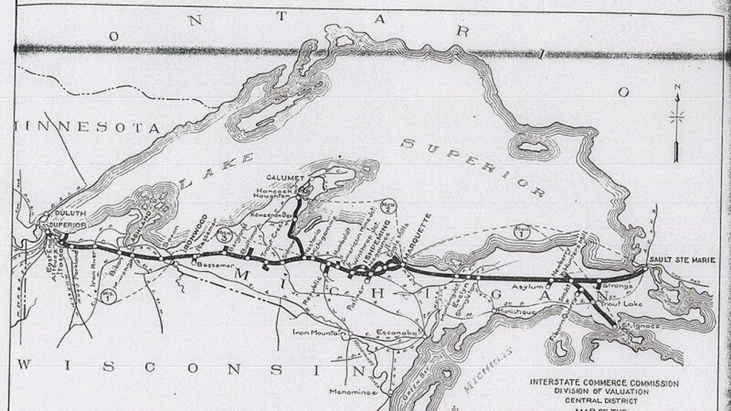
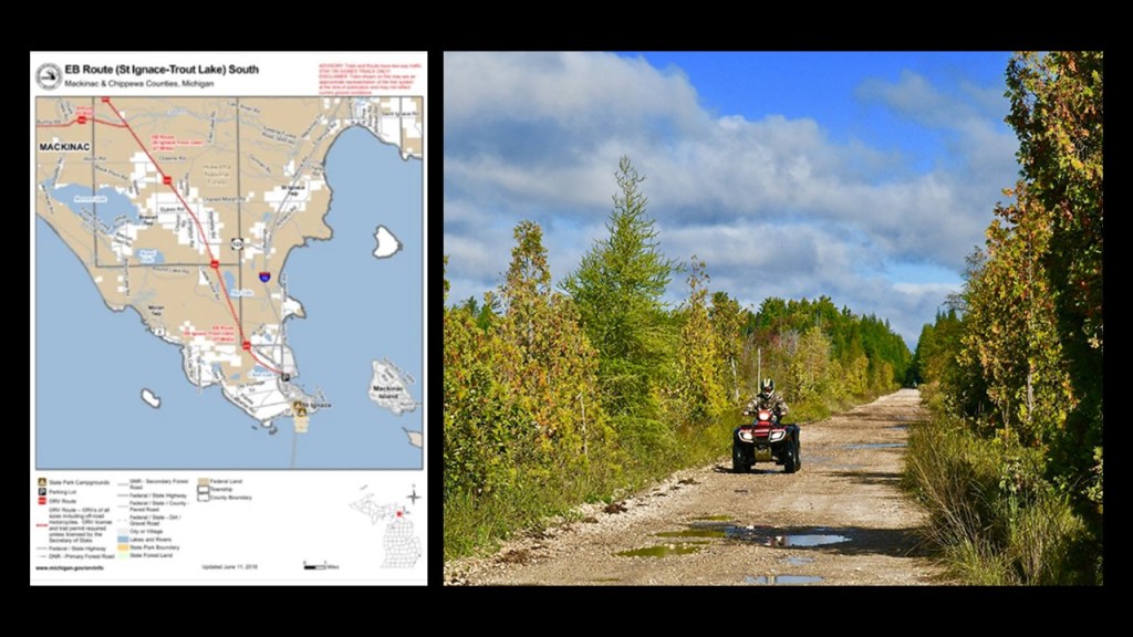
Parts of the Duluth, South Shore, and Atlantic Railway were converted to rail-trails, like the St. Ignace – Trout Lake Trail, which is 26-miles, or 42-kilometers, of multi-use recreational trail in its former railbed.
Across the Upper Peninsula, Michigan Highway 28 passes through forested woodlands, bogs, swamps, urbanized areas, and along the Lake Superior shoreline along its course.
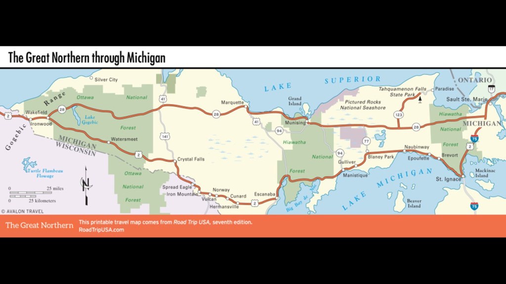
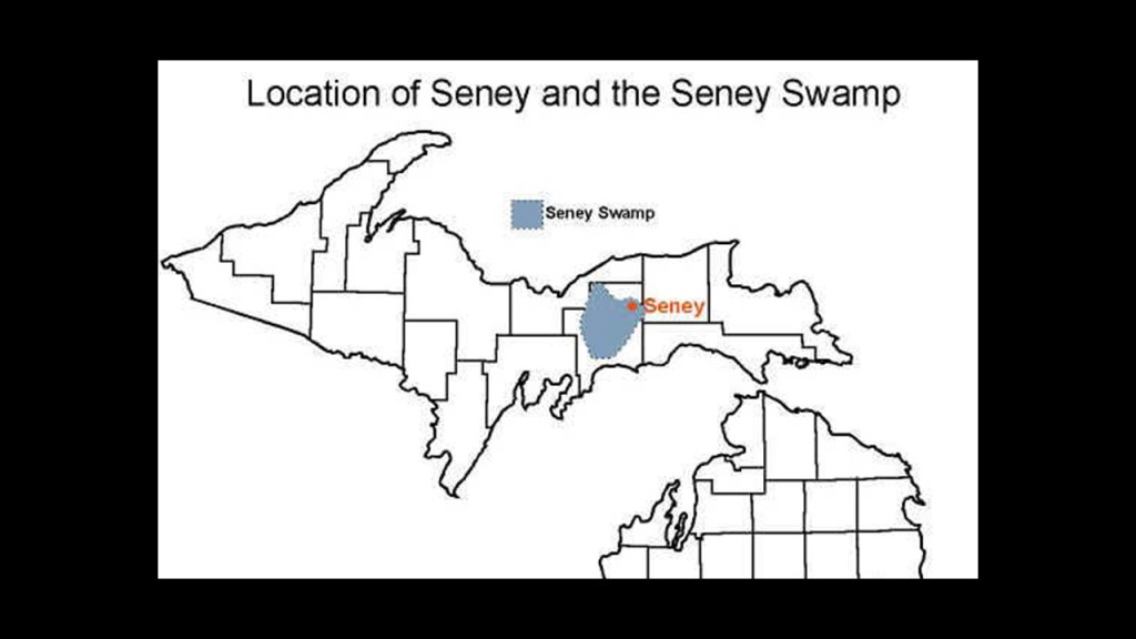
The “Seney Stretch” of Michigan State Highway 28 between Seney and Shingleton, a “straight-as-an-arrow” highway, goes across the “Great Manistique Swamp.”
We are told the road across the swamp was built parallel to the “Duluth, South Shore and Atlantic Railway.”
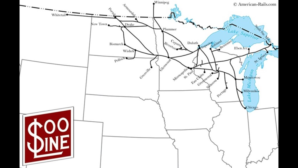
The “Duluth, South Shore and Atlantic Railway” in-turn became what was called the “Soo Line.”
The Soo Line of today was named for the Minneapolis, St. Paul and Sault Ste. Marie Railroad, and was formed by the consolidation of the Duluth, South Shore and Atlantic Railway and the Wisconsin Central Railway.
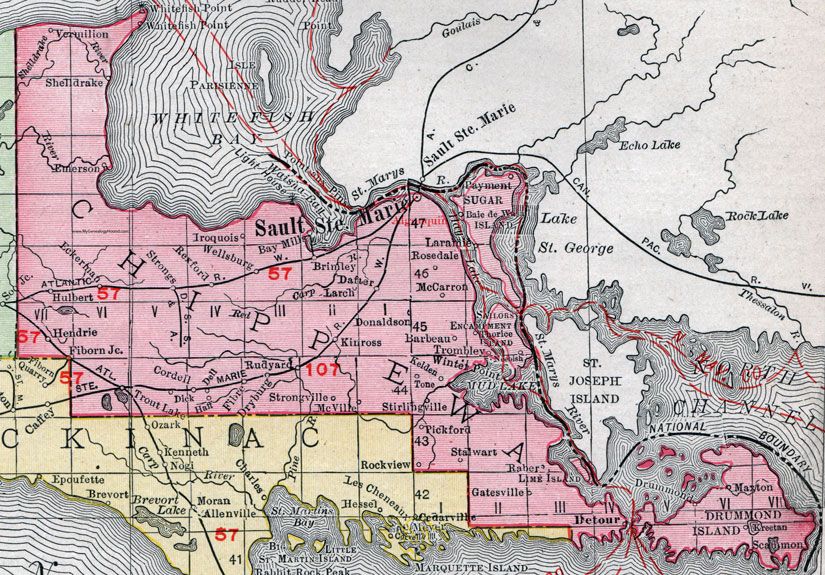
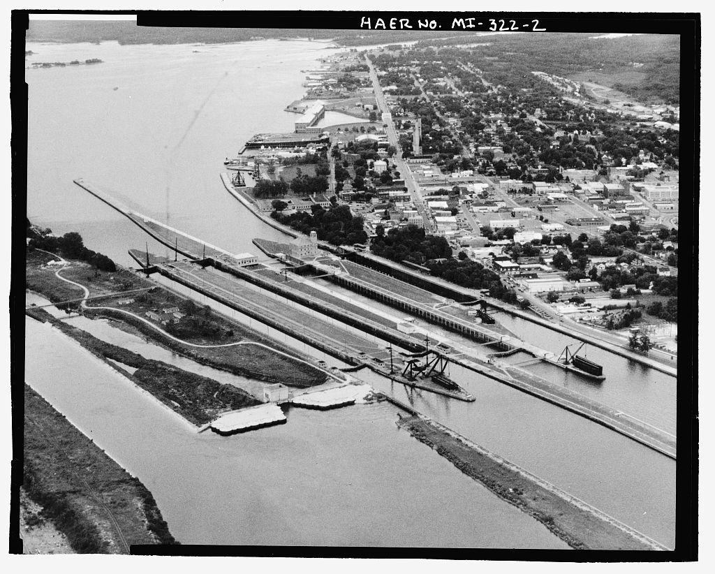
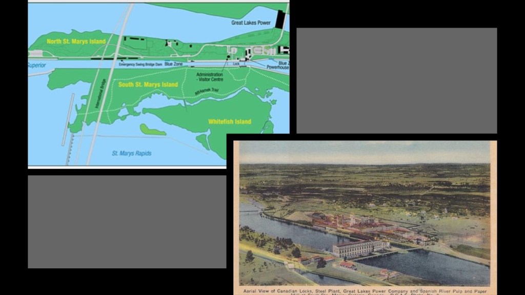
So now I am going to turn my attention to the binational region known collectively as “The Soo,” the nickname given to the Sault Stes. Marie of Michigan and Ontario which are located directly across from each other on the International Border of the St. Mary’s River.
The cities of Sault Ste. Marie was said to have been founded by the French Jesuit missionary, Father Jacques Marquette, in 1668. It was said to be named for both the “Sault,” the name given to the St. Mary’s River rapids, and the Virgin Mary, and called the first European city in the Great Lakes Region.
Sault Ste. Marie was one city until the border between the United States and Canada was established at the St. Mary’s River in a treaty after the War of 1812 in our narrative, creating Sault Ste. Marie, Michigan, and Sault Ste. Marie Ontario, and on both sides of the river, the area is referred to as the “The Sault” or even “The Soo.”
Sault Ste. Marie is the oldest city in Michigan, and said to be the third-oldest city in the United States.
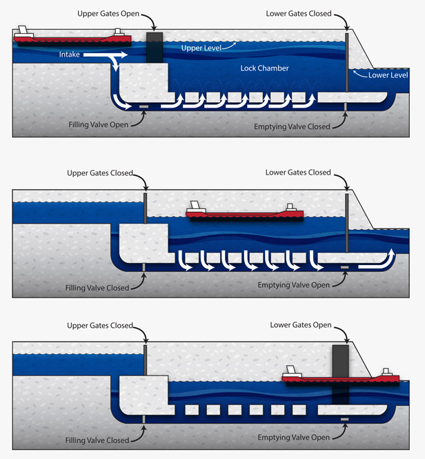
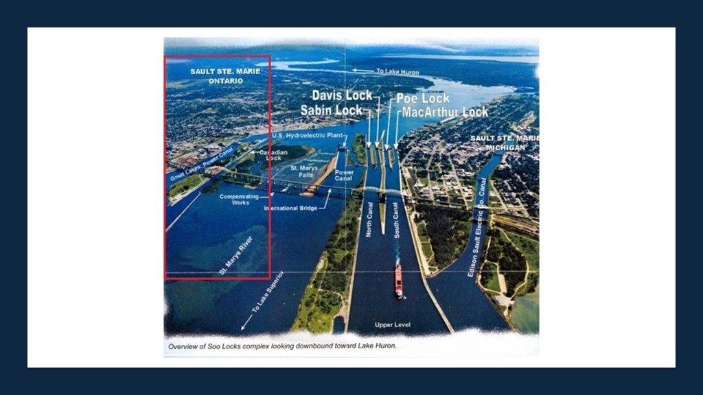
The Soo Locks, the largest waterway traffic system on Earth, are called the “Linchpin of the Great Lakes,” allowing ships to travel between Lake Superior and the lower Great Lakes.
Lake Superior meets Lake Huron with a 21-foot, or 6-meter, drop in elevation.
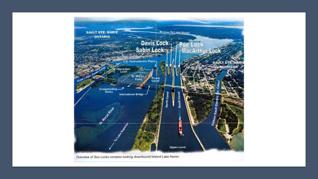
The Soo Locks are considered a wonder of engineering and human ingenuity.
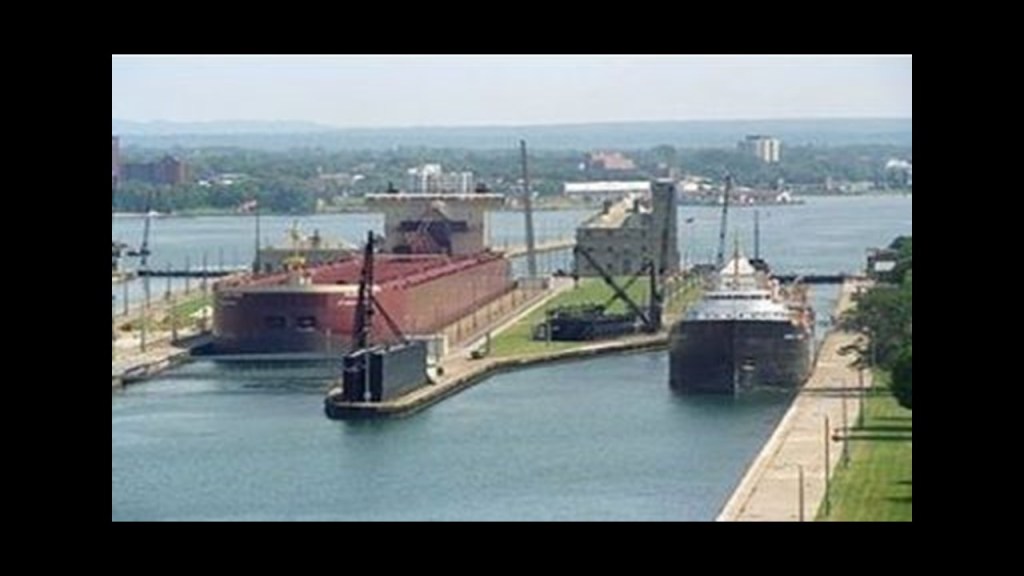
They by-pass the rapids of St. Mary’s River.
The river drops 21-feet, or about 6.4-meters, over hard red sandstone in a short 3/4-mile, or 1.2-kilometer, stretch.
We are told the first locks were built here in 1855, and operated by the State of Michigan until transferred to the U. S. Army Corps of Engineers in 1881, who own, maintain, and operate the St. Mary’s Falls Canal, within which the locks are located.
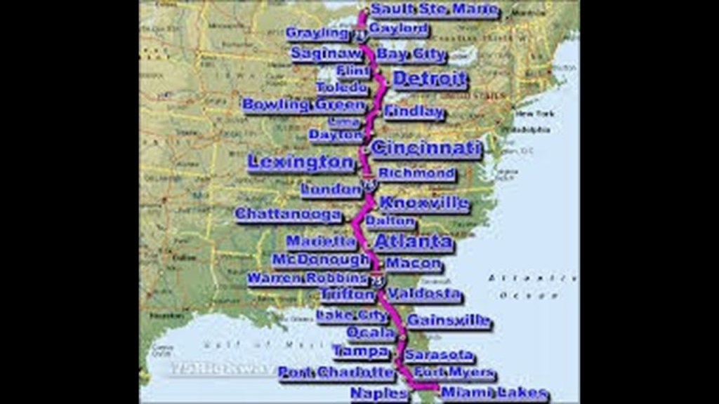
Sault Ste. Marie in Michigan is the northern terminus of Interstate-75, which goes all the way to Miami, Florida.
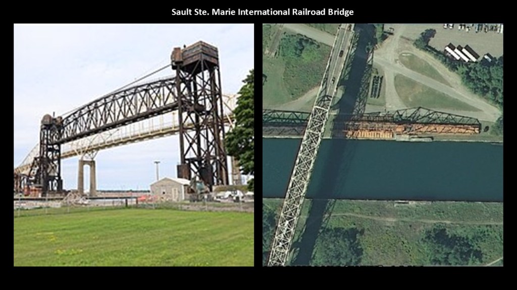
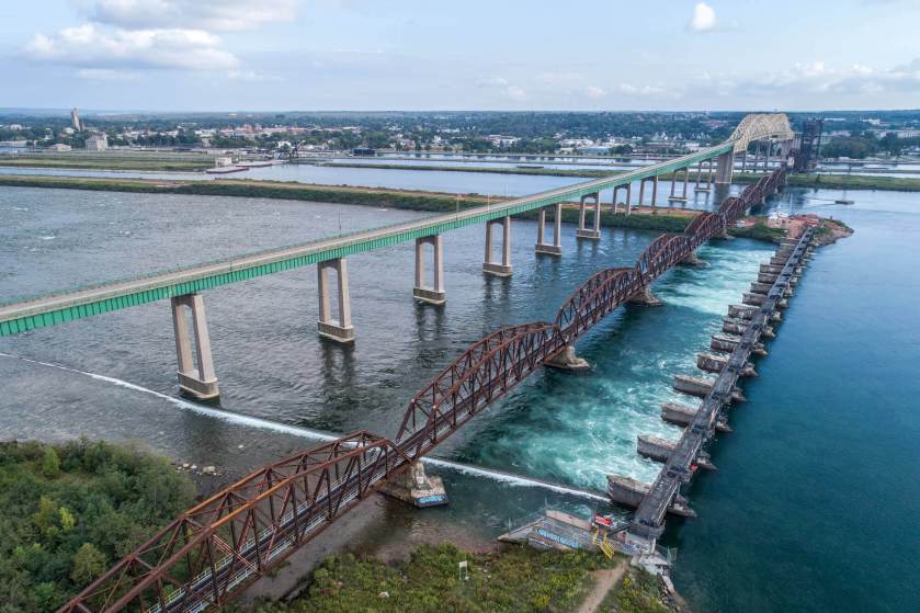
The Sault Ste. Marie International Railroad Bridge runs adjacent to the International Bridge, and was said to have been built in 1887.
It also has both lift and swing bridge features.
Pretty sophisticated engineering technology for 1887!
The next place we come to as we make our way across “The Soo” are the St. Mary’s Falls, of which the International boundary goes through the middle.
What are known as the Compensating Works are in the left foreground of this screenshot, in front of the International Bridges.
They consist of 17 piers and concrete aprons bearing on sandstone bedrock.
Piers 1 – 9 are in Canada, and Piers 10 – 17 are in the United States.
These were said to have been constructed between 1913 and 1919 (with World War I occurring between 1914 and 1918), and have an extremely sophisticated sluice-gate and gate-machinery system.
Next we come to the Great Lakes Power Canal on the Ontario side of Sault Ste. Marie.
Great Lakes Power was established in the early 1900s by Francis H. Clergue.
Francis H. Clergue was an American businessman who became the leading industrialist of Sault Ste. Marie, Canada, in the late 1800s and early 1900s.
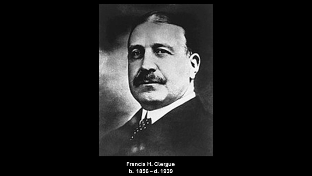
In addition to Great Lakes Power, he was also credited with establishing many other industrial companies,including, but not limited to, the Sault Ste. Marie Pulp and Paper Company in 1895, as we will see going through this region.
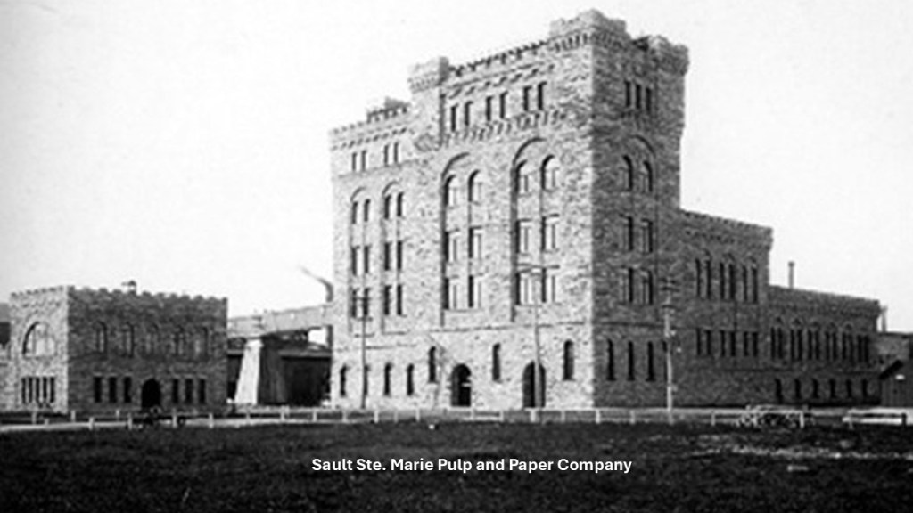
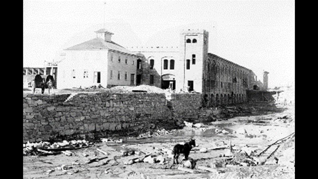
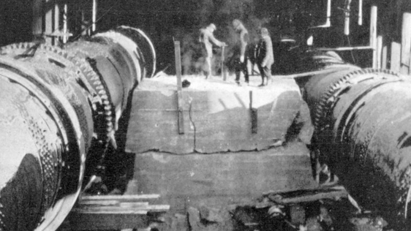
I found this intriguing photo of the Pulp and Paper Mill.
What is it showing us?
A recently built canal and building as they want us to believe?
Or far older infrastructure, perhaps after a cataclysm?
We are told Francis Clergue was behind the establishment and construction of the Algoma Steel Factory, which is said to have first opened for steel production in 1902, at which time the factory was said to have produced its first rail-tracks when the first Bessemer Converter was put into operation using pig iron made from the Helen Mine.
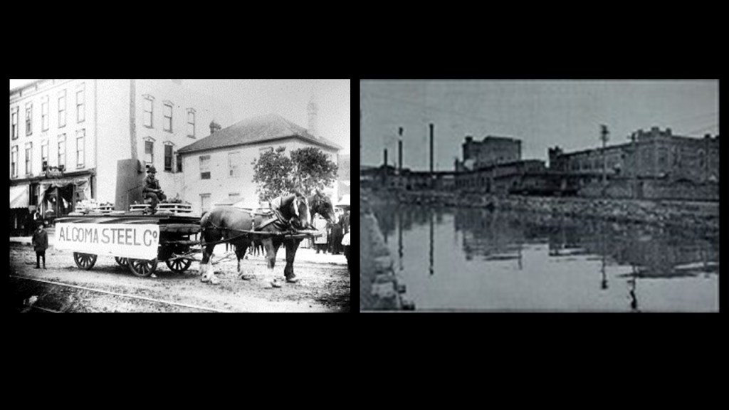
The massive blast furnaces for pig iron manufacture were not said to have been completed at the site until 1904.
This is incredibly high building and industrial technology and expertise for what we are taught we were capable of at the time.
Ford’s Model T wasn’t even in production yet ~ it entered the transportation scene in the fall of 1908.
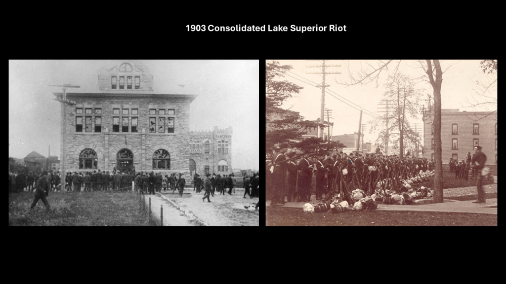
It is interesting to note that we are told during this same time, Clergue’s financial operations suffered reverses and operations were shuttered in 1903, which led to the 1903 Consolidated Lake Superior Riot.
The Consolidated Lake Superior Riot took place from September 28th – 30th of 1903 as a result of lay-offs and unpaid wages.
The riot resulted in the injuries of four protestors and two police officers, and military forces were called in to end the riot – first the local militia, and shortly thereafter, the members of the Royal Canadian Regiment and Mounted Royal Dragoons, and from Toronto, members of the Queen’s Own Rifles, and 48th Highlanders.
Clergue was also credited with the development of the Algoma Central Railway, connecting it to the Transcontinental artery of Canada.
He was said to have initially owned it, and needed a way to transport logs from the Algoma District in northeastern Ontario for his pulp mill, and iron ore for the steel factory, and that it was chartered on August 11th, 1899.
It was said to have been completed to Hearst, Ontario in 1914, and we are told that it never made it all the way to Hudson Bay as was planned
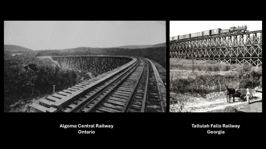
Here is a comparison with a railroad trestle bridge for the Algoma Central Railway on the left, and the one for the Tallulah Railroad at Tallulah Falls in the northeastern corner of Georgia on the right.
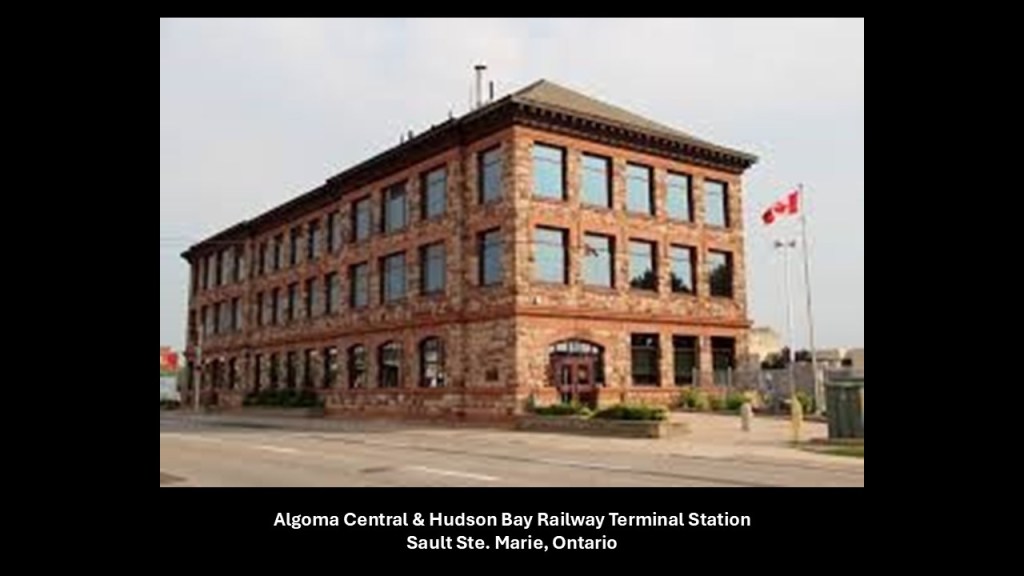
This is the Algoma Central & Hudson Bay Railway Terminal Station in Sault Ste. Marie, Ontario, said to have been built in 1912.
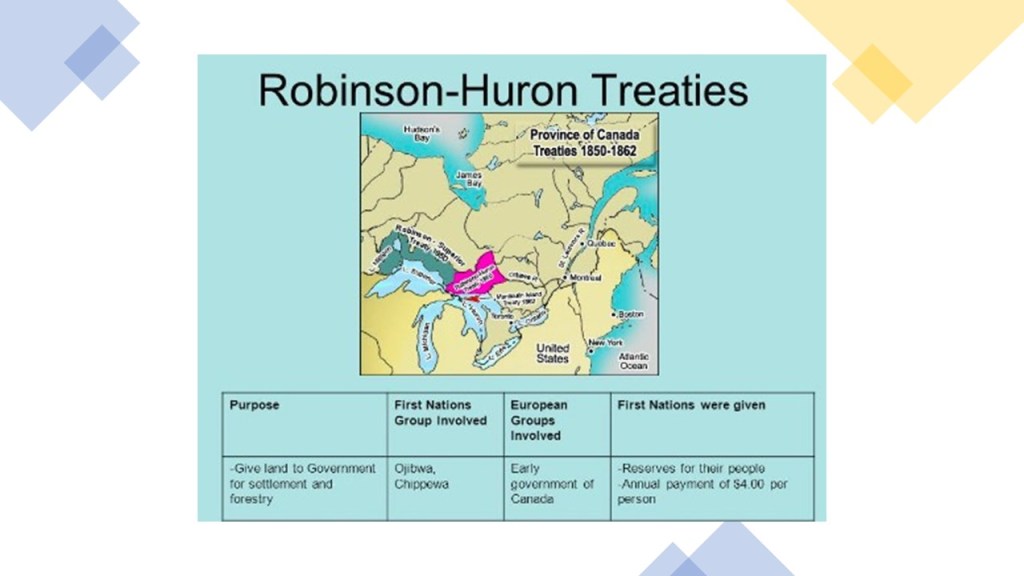
The Ojibwe indigenous to the region were forced to cede their lands to the Canadian government under an 1850 Treaty in exchange for annuities and reservations.
We are told a large tract of land was signed over to the British Crown in 1850 as part of the Robinson Superior Treaty covering the North Shore of Lake Superior.
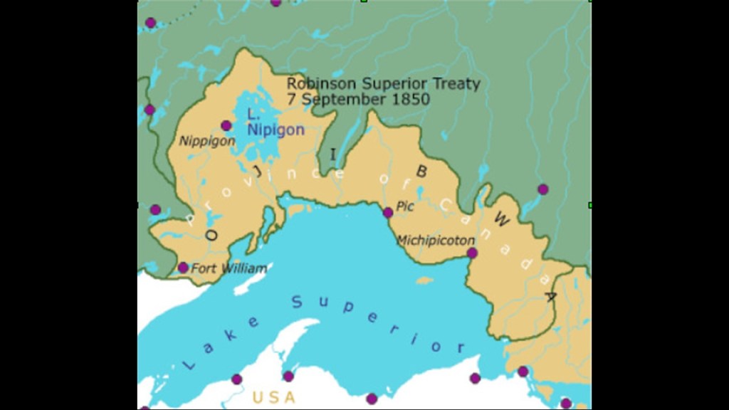
This was two days after the signing of the Robinson-Huron Treaties, which covered the northern eastern shores of Lake Huron, which also established annuities and reservations.
In both cases, the Crown pledged to pay an annuity to these First Nations people, originally set at $1.60 per treaty member, and it was last increased to $4 in 1874, where it is fixed to this day.
Further north of Sault Ste. Marie, Ontario, on the northern shore of Lake Superior, we come to the Township of Wawa, where there are numerous mining concerns, including gold…
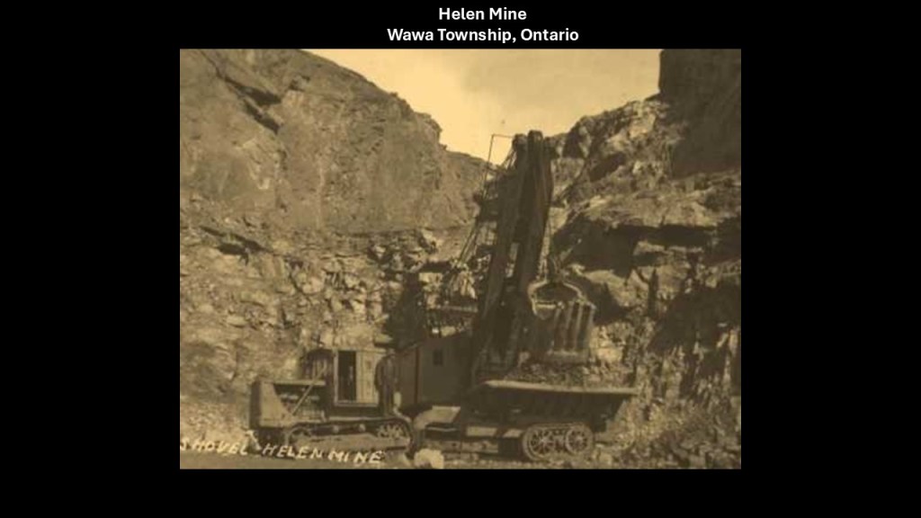
…and historical mining for high-quality iron ore at the defunct Helen Mine and Magpie Mine.
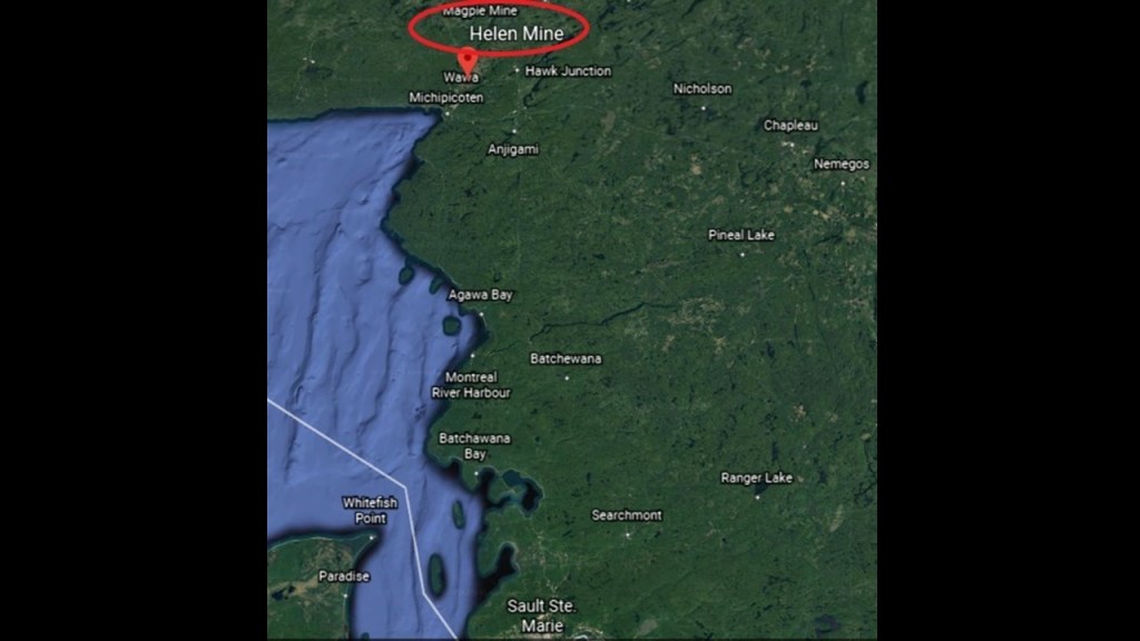
Starting in 1900, the Helen Mine was owned and mined by Francis Clergue.
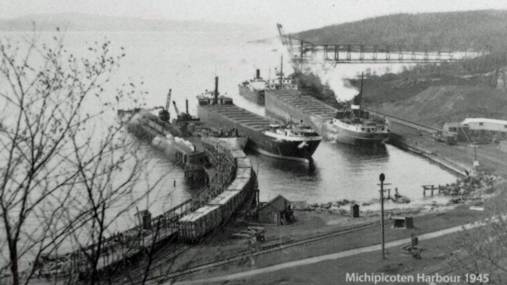
In our historical narrative, Clergue built a railroad from the Helen Mine to Michipicoten Harbor on Lake Superior, which was only 10-miles, or 16-kilometers, away from the mine.
It was here that we are told Clergue had ore docks built in Michipicoten Harbor which facilitated the transfer of the iron ore to the blast furnaces of steel mills.
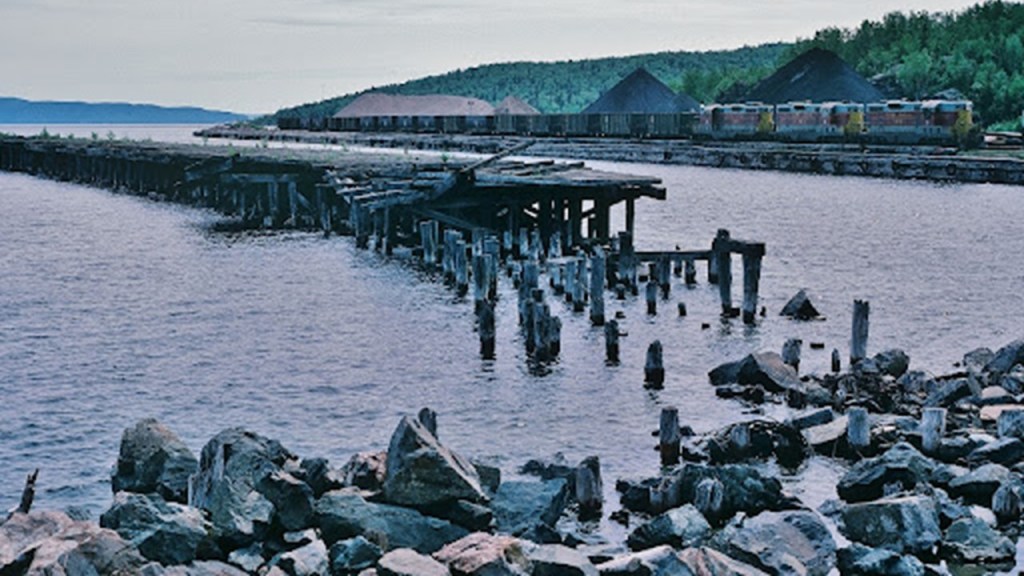
Here’s a view of remnants of infrastructure in Michipicoten Harbor in the present day, left to rot in place, which was not an uncommon thing to do.
We are told that another large iron deposit was discovered north of the Helen Mine in 1909.
The land was purchased by the Algoma Steel Company, and the Magpie Mine was commercially developed, in production between 1914 and 1926.
It is important to bring up information about the shipping routes and infrastructure like lighthouses that made all of this Great Lakes commerce possible.
This is what we are told about the Great Lakes Waterway.
It is a system of natural channels and artificial locks and canals that allow for the navigation between all of the Great Lakes, with the major civil engineering works being the Soo Locks between Lakes Superior and Huron; what are called dredged channels in the St. Mary’s River, the Detroit River, Lake St. Clair, and the St. Clair River between Lakes Huron and Erie; and the Welland Canal between Lakes Ontario and Erie; and the St. Lawrence Waterway that allows ocean-going vessels to travel to and from the Atlantic Ocean.

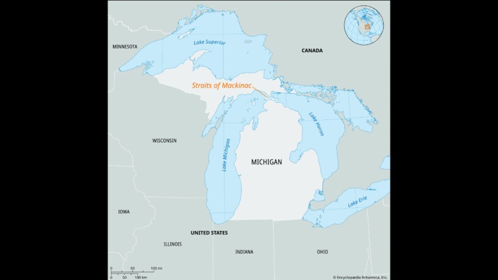
In this part of the world, the Straits of Mackinac between Michigan’s Upper Peninsula and Lower Peninsula hydrologically-connect Lake Huron to Lake Michigan.
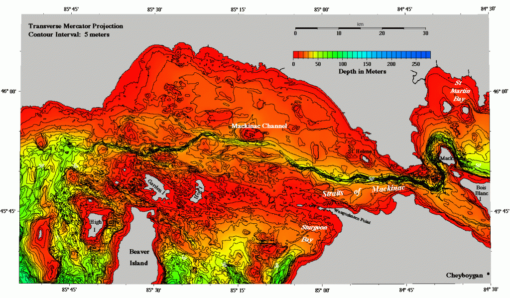
The bathymetry of the Straits of Mackinac and the Mackinac Channel in between Lake Michigan and Lake Huron shows the depth of the water to be quite shallow, ranging in depth from primarily 0- to 50-meters, or 164-feet.
The Round Island Channel is located in a navigable waterway in Lake Huron and a key link in the lake freighter route between Lake Michigan and Lake Superior on which millions of tons of taconite iron ore are shipped annually, and has been an essential element in shipping the iron ores from northern Minnesota since the late 1800s.
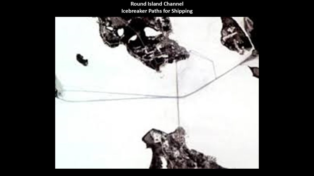
Round Island is a tiny island in-between Mackinac Island and Bois Blanc Island.
The most noteworthy thing about the uninhabited Round Island are its lighthouses – the Round Island Passage Light Station and the Old Round Island Lighthouse.
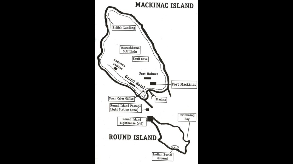
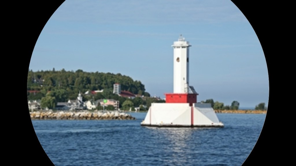
The Round Island Passage Lighthouse was said to have been constructed starting in 1947 and became operational in 1948.
The Old Round Island Lighthouse is located on the west shore of Round Island in the shipping lanes of the Straits of Mackinac, and was said to have been constructed in 1895.
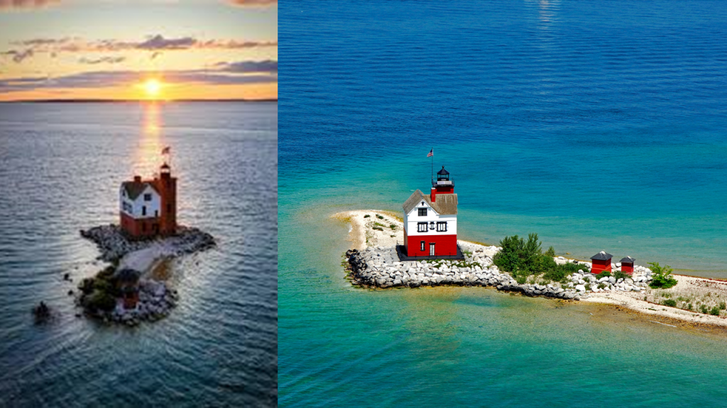
We are told in our historical narrative that Bois Blanc Island was ceded by the Chippewa “as an extra and voluntary gift” to the United States government in the previously-mentioned 1795 Treaty of Greenville between the United States and the indigenous nations of the Northwest Territory for their lands for settlement after their defeat at the end of the Northwest Indian War that took place in this region between 1786 and 1795.
The community of Bois Blanc Township is on the island with a population of 100 in the 2020 Census, and has the smallest school district in terms of student enrollment in the nation, with three students in 2024 – 2025.
The Bois Blanc Lighthouse was said to have been constructed in 1867, two years after the end of the American Civil War.
It is on the northern end of the island, is not in use, and is privately-owned.
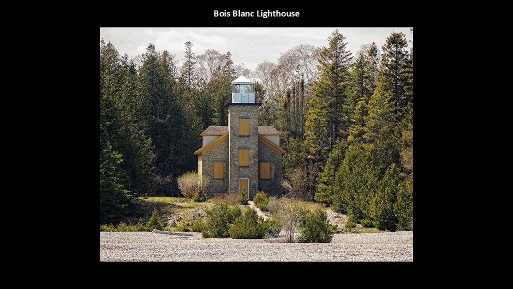
In the part of Lake Huron surrounding these three islands, we find Poe Reef Lighthouse; the Fourteen Foot Lighthouse; the Spectacle Reef Lighthouse; the Martin Reef Lighthouse, and more lighthouses in what is called the De Tour Passage – De Tour Reef Lighthouse; Frying Pan Island and the Pipe Island Light Beacon Station.
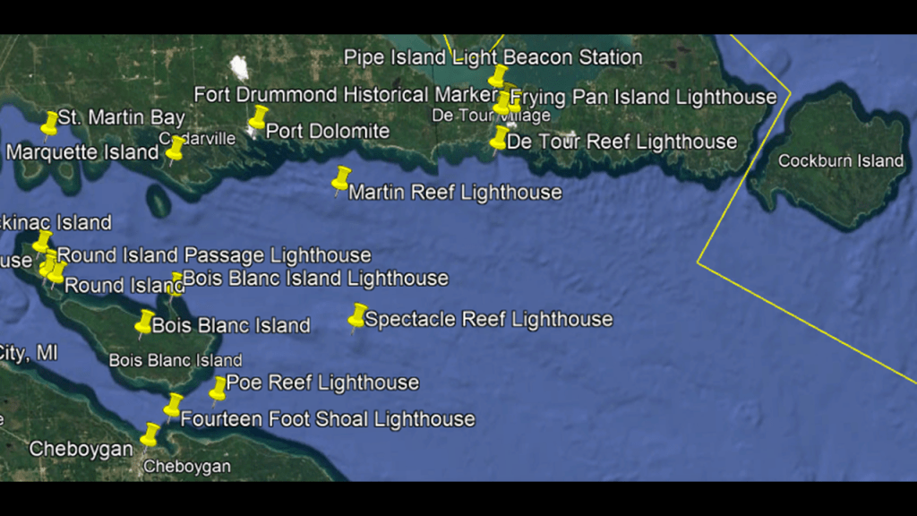
The Poe Reef Lighthouse is between Bois Blanc Island and the mainland of the Lower Peninsula, 6-miles, or 9.7-kilometers, east of Cheboygan.
Poe Reef is a problem for shipping, lying 8-feet, or almost 2.5-meters, below the surface of the water.
The Poe Reef Lighthouse was said to have been built in 1929, and sits on the northern-side of the South Channel, where the water is too shallow for Lake freighters.
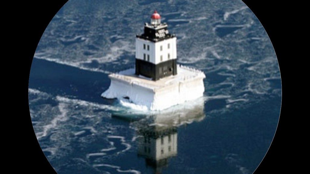
Same story with the Fourteen Foot Shoal Lighthouse on the southern-side of the South Channel, and 3 1/2-miles, or 5.6-kilomters, from the Poe Reef Lighthouse.
It was also said to have been built in 1929 where there was a significant navigational hazard, with the water here being only 14-feet, or almost 4 1/2-meters, -deep.
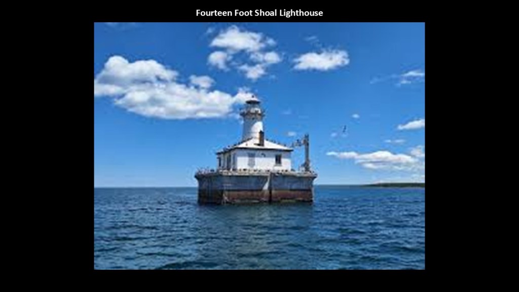
The Spectacle Reef Lighthouse is on the other side of Bois Blanc Island from the Poe Reef and Fourteen Foot Reef Lighthouses.
The Spectacle Reef Lighthouse is 11-miles, or 18-kilometers, east of the Straits of Mackinac.
It was said to have been constructed at great expense between 1870 and 1874, and made of interlocking, hand-cut limestone blocks, and is 86-feet, or 26-kilometers, in height.
The Spectacle Reef Lighthouse is at a location where there are two limestone shoals that resemble a pair of eyeglasses, which constituted the most dreaded navigational hazard on the Great Lakes.
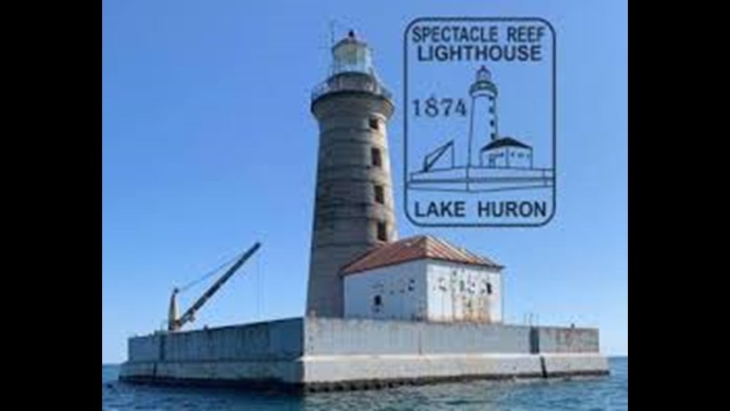
What we are told in our historical narrative is that there was an effort between 1870 and 1910 to build lighthouses where there were isolated reefs, shoals, and islands that were significant navigational hazards.
It is my belief that land sank or became submerged around these lighthouses when the energy grid they were once part of was destroyed, and that if there was any “construction” taking place during that time, it was to get them operational for use as navigational aids since that was what they were now needed for, but was not their original purpose, which I think had something to do with light energy distribution on the original grid system.
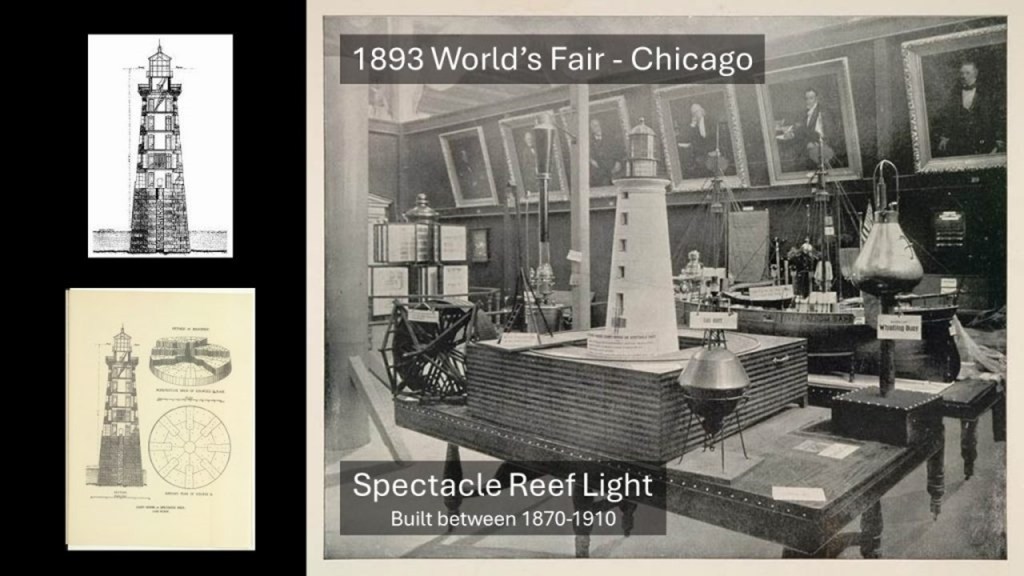
Another example is the Martin Reef Lighthouse, which is at a location where the water of Lake Huron is only a few inches deep in its shallowest area, and another significant hazard.
This lighthouse was said to have been constructed in the summer of 1927.
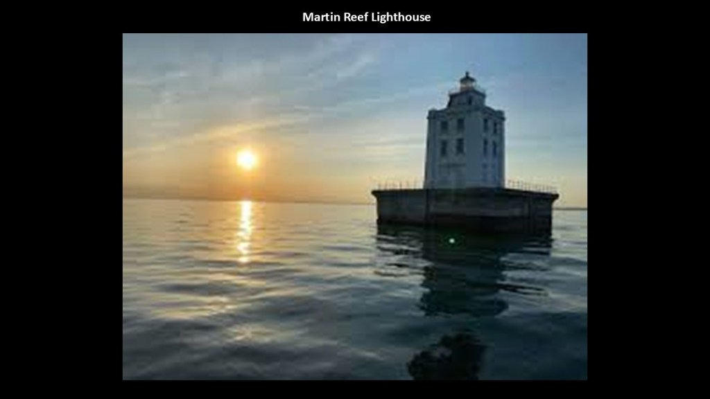
Also, we are told the Imperial Towers of Ontario were six of the earliest lighthouses built between 1855 and 1859, primarily out of stone, on Lake Huron and Georgian Bay.
They were said to have been built was as a result of new trade agreements and the opening of the Soo Locks in 1855, which led to an increase of commercial shipping traffic on the Great Lakes.

In summary, I believe that the circuit board of the Earth’s original free-energy grid system was destroyed in a deliberately-caused cataclysm relatively recently.
This cataclysm caused the entire surface of the Earth to undulate and buckle around key infrastructure of the energy grid, creating what we see on the surface of the Earth today – the swamps, marshes, bogs, deserts, dunes, and places where it appears land masses sheared-off and submerged under the bodies of water we see today.
Those behind the destruction of the Old World were shovel-ready to dig enough of the original infrastructure out of the ruined Earth so they could be used and civilization restarted, which I think started in earnest in the mid-to-late 1700s and early 1800s, and that the Crystal Palace Exhibition in London in 1851 was the official kick-off to the New World Order timeline.
They only used the pre-existing infrastructure until they developed replacement fuel sources that were extracted from the original grid to bring everything back on-line as quickly as possible.
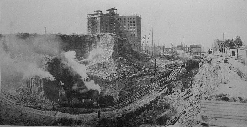
These replacement fuel sources could be monetized and controlled by them and they became incredibly wealthy.
Then, when what remained of the original infrastructure was no longer useful to them, or inconvenient to their agenda, they had it destroyed, discontinued, or abandoned, typically in a very short time after it was said to have been constructed.
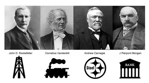
All of this led has to the industrialized world we live in today that is the only thing we know about, and part of a system in which our energy is extracted and manipulated, giving us the illusion of freedom while feeding these artificial and industrial systems without us even being aware of it.