I decided to dust-off research I have done over the last eight years concerning Iran and the surrounding region with the world events taking place right now.
The research I am sharing with you here comes primarily from tracking leylines through here, as well as research I have done on our modern history, including, among many other things, the role the British East India Company played in the history of this part of the world.
What comes to the surface throughout this post is that there is much that we don’t know about Iran, the greater region, and evidence for how it ties into the existence of a worldwide, interconnected civilization that has been completely hidden from our awareness.
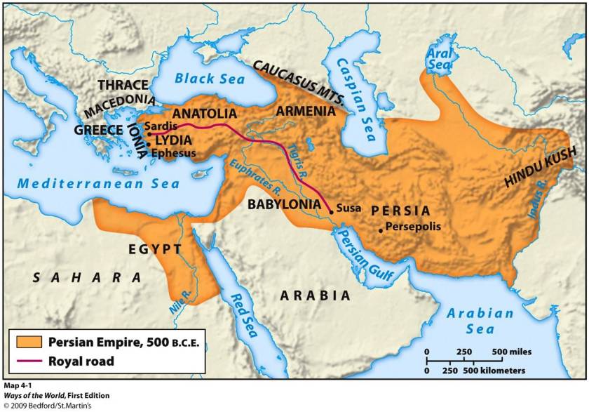
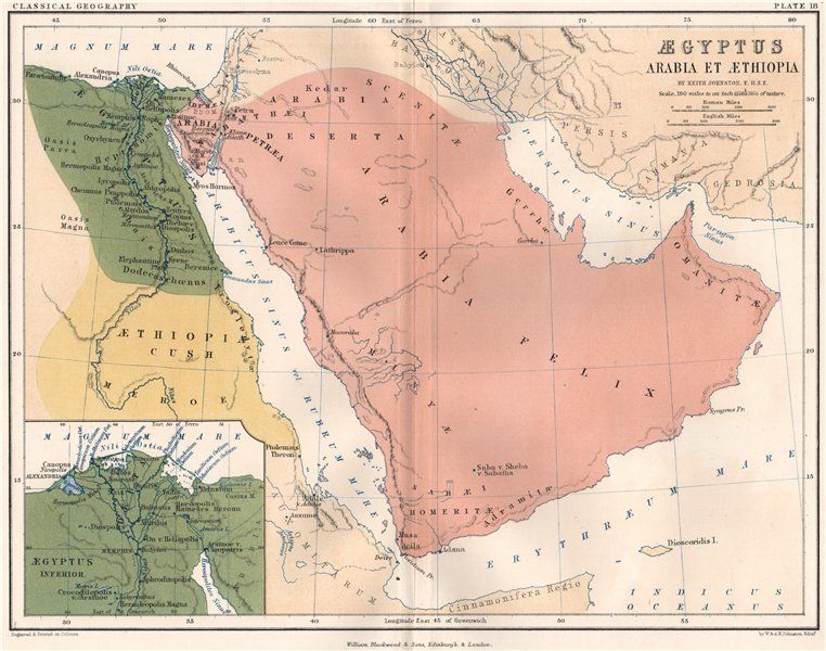
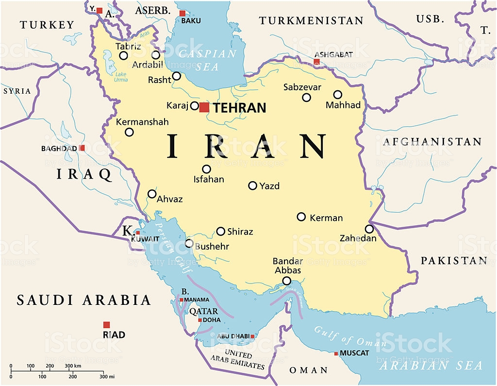
Persia, today’s Iran, historically was part of the vast Persian Empire, which in more ancient times, from what we are told, included all of the following present-day countries: Afghanistan, Armenia, Azerbaijan, Bahrain, Egypt, Georgia, Iraq, Israel, Kazakhstan, Kuwait, Lebanon, Oman, Pakistan, Russia, Tajikistan, Turkmenistan, Turkey, and Uzbekistan.
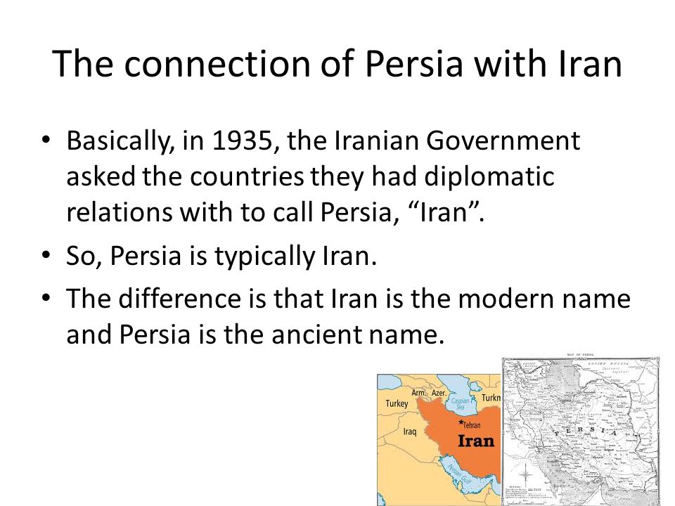
On the Nowruz, or New Year, of 1935, the Shah of Iran at the time, Reza Shah Pahlavi, asked foreign delegates to use the term Iran in formal correspondence.
This also changed the usage of the country’s national identity from Persian to Iranian.
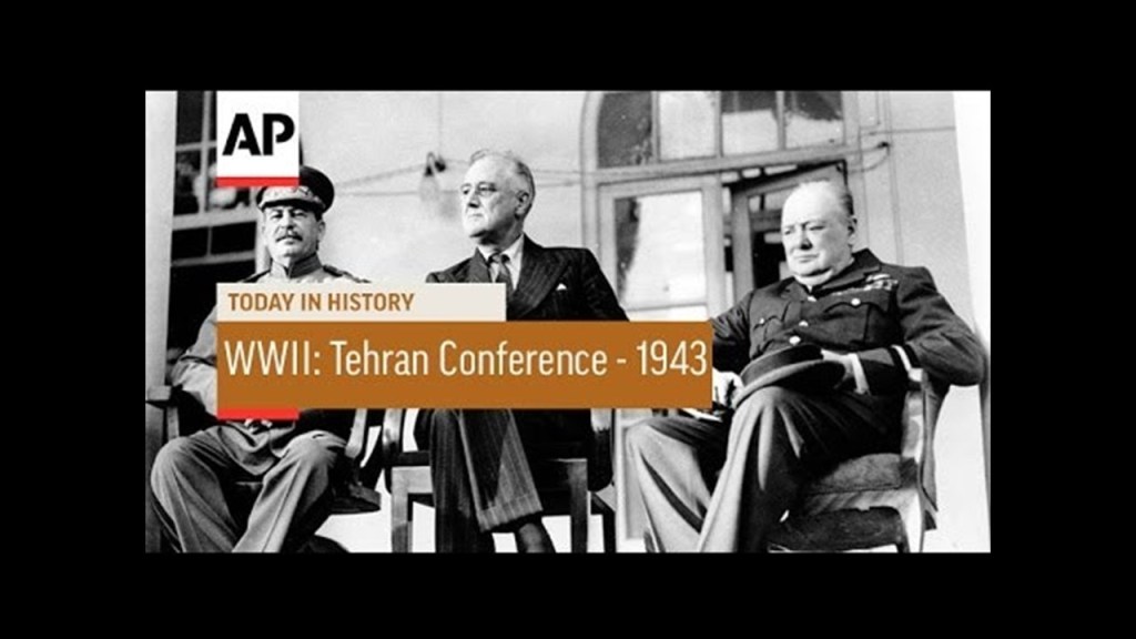
During World War II, which took place between 1939 and 1945, the first Big Three wartime conference, the Tehran Conference was held in November of 1943, in which the Allies committed to open a second front against Nazi Germany, and took place two years after the Anglo-Soviet invasion of Iran in August of 1941.
Reza Shah Pahlavi was deposed in September of 1941 as a result of the British and Soviet Invasion of Iran during World War II because he was seen as a German ally even though Iran had maintained neutrality in the conflict, and the invasion took place purportedly to secure Iran’s oil fields and ensure Allied supply lines along the Persian Corridor.
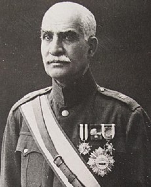
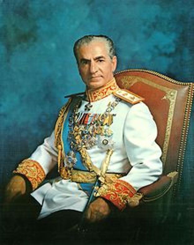
Reza Shah Pahlavi was later replaced as Shah by his son, Mohammad Reza Pahlavi, who was the last Shah, or Emperor, of Iran.
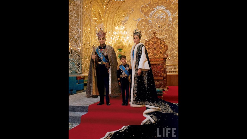
The coronation took place in 1967 at Tehran’s Golestan Palace, where along with the Shah, his wife Farah was crowned Empress, and his son, Reza Pahlavi, was named Crown Prince, at the age of 6.
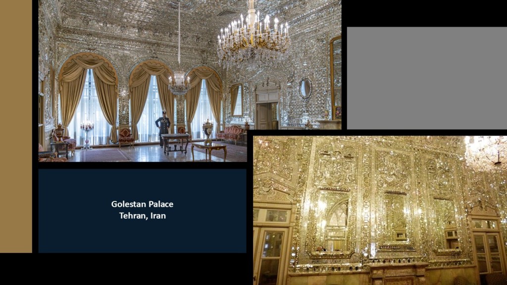
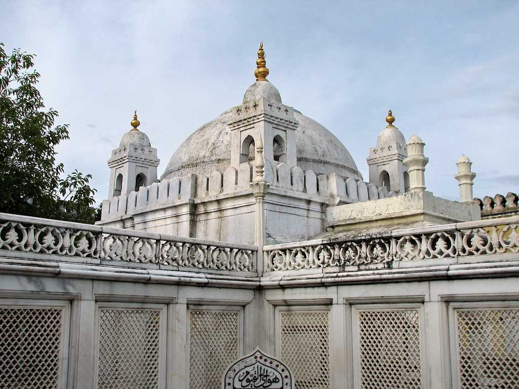
Golestan Palace is the former royal complex, and said to be one of the oldest historic monuments in Tehran.
A UNESCO World Heritage Site since 2013, it is noteworthy for many reasons, including spectacular mirror mosaics and tile-work.
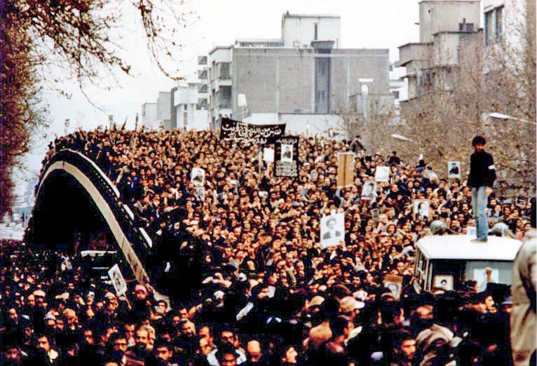
Shah Mohammad Reza Pahlavi was overthrown as Iran’s Head-of-State on February 11, 1979.
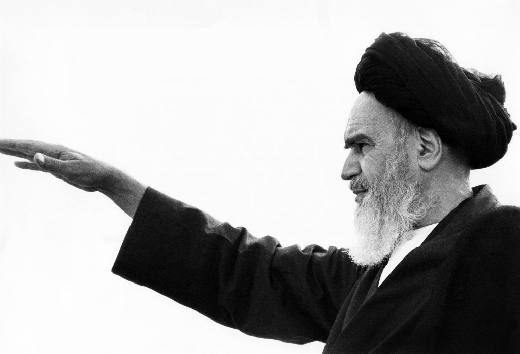
The Iranian Revolution involved a series of events that culminated in the overthrow of the Pahlavi Dynasty and led to the replacement of the Imperial State of Iran by the Islamic Republic of Iran, and what is called a unitary theocratic-republican authoritarian presidential system subject to a Supreme Leader, or Grand Ayatollah, initially by Ayatollah Ruhollah Khomeini, an Islamist who was the leader of one of the rebel factions.
The revolution was supported by various Islamist and leftist organizations, as well as student movements.
One of the events taking place in the aftermath of the Iranian Revolution, which I remember well because I was in 10th-grade at the time, was the Iran Hostage Crisis from 1979 to 1981, in which there were 66 American diplomats and citizens taken captive in Tehran beginning on November 4th of 1979, when Iranian militants and students stormed the U. S. Embassy.
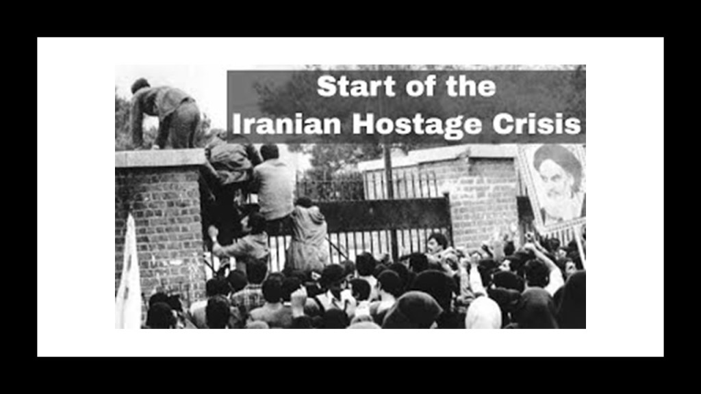
The Iranian Hostage Crisis severely impacted the Presidency of Jimmy Carter, and included a failed rescue attempt known by the cover-name Operation Eagle Claw, in which 8 servicemembers were killed in April of 1980.

On January 19th of 1981, Iran and the United States signed an agreement to release the remaining 52 Iranian hostages after 14-months, or 444-days, of captivity, of which the release took place on the following day, minutes after the inauguration of Ronald Reagan as the 40th President of the United States.

Shah Mohammad Reza Pahlavi died in exile in Egypt in 1980.

Reza Pahlavi and his mother Farah, who have been living in exile throughout this time, are still very much alive today.

Things changed considerably for the people in what became the Islamic Republic of Iran after 1979.
This revolution took place in a country that was experiencing prosperity and produced profound change at great speed, and replaced a pro-western, secular monarchy with an anti-western, Islamic Republic.
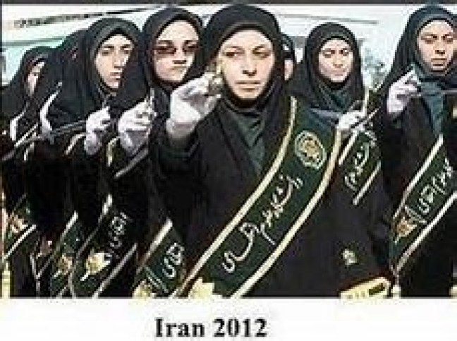
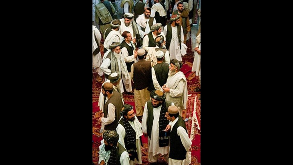
These pictures were before the 1979 Islamic Revolution in Iran…
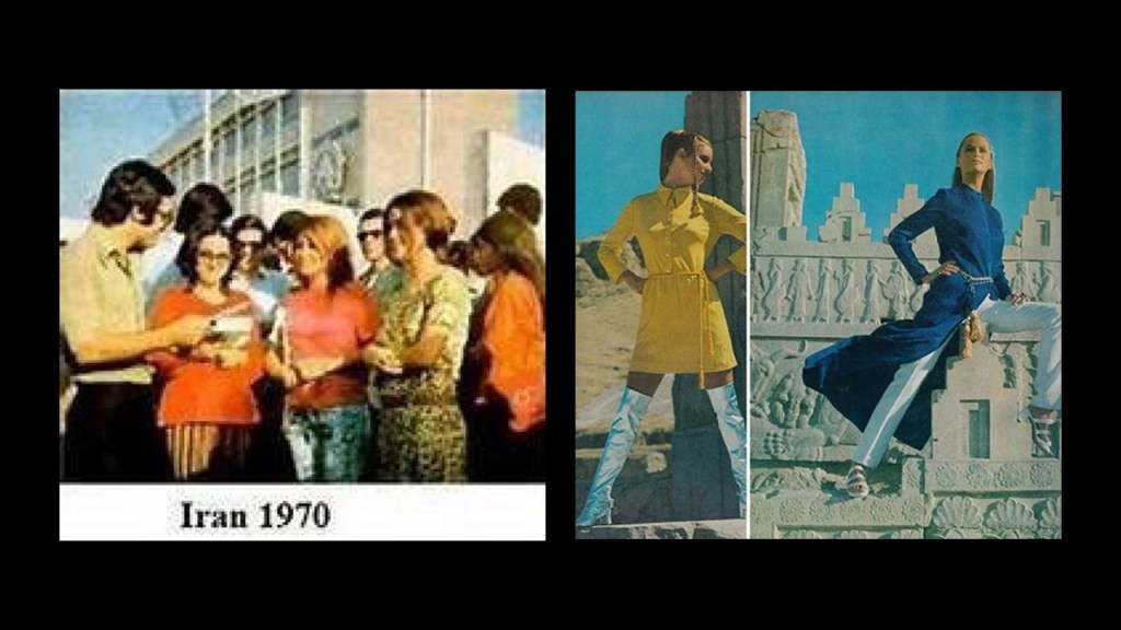
…and this picture of the citizenry was taken in 2012.
So what has been going on here?
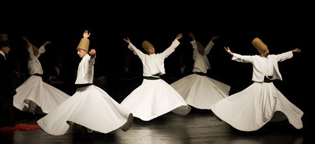
How did Islam in Persia AKA Iran morph from the Sufi Islam of Rumi, a 13th-century Persian…
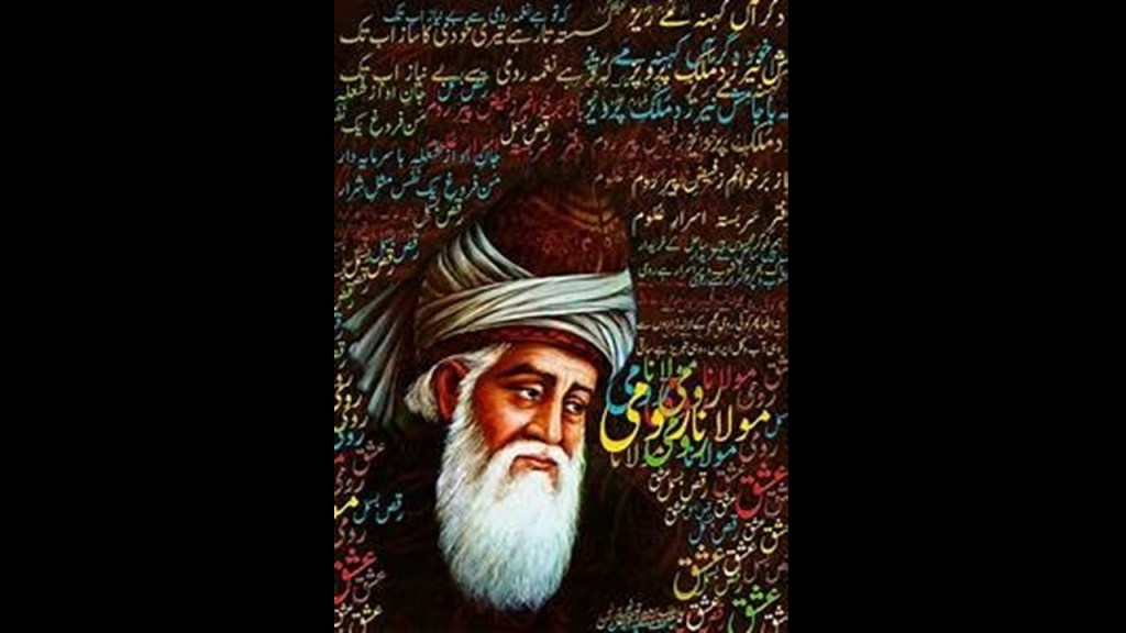
…who was an Islamic, scholar, theologian, mystic and poet.
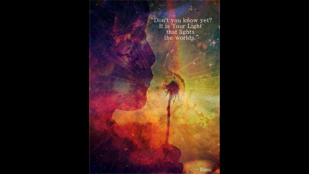
Who were the Sufis?
They were mystics, and practitioners of the inward dimension of Islam.
Sufism emphasizes personal experience with the Divine, and concentrating one’s energy on spiritual development rather than focusing on the teachings of human religious scholars.
Rumi established the Mevlevi Order in Konya, Turkey, otherwise known as Whirling Dervishes, who practice a spinning dance used to connect with the Divine.
How did the Sufi Islam of Rumi morph into the radical fundamentalist Islam that came into power in Iran?
And I think what happened to Iran with the imposition of the Islamic Republic of Iran was the blueprint for the globalist Marxist-Islamist takeover of the western world.

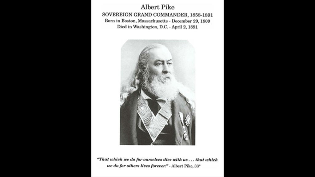
I think it has something to do with this quote from Albert Pike, described as an American author, poet, orator and prominent member of the Freemasons.
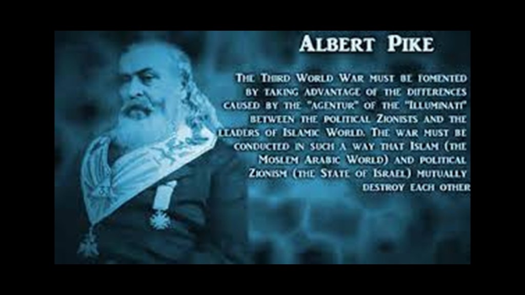
The military blueprint for three world wars were said to have been contained a letter written by Albert Pike, Sovereign Grand Commander of the Scottish Rite for the Southern Jurisdiction of the United States, to the leader of the Bavarian Order of the Illuminati, Giuseppe Mazzini, in 1871.

So let’s go back in time through the history of the region to see what is discoverable, both that which is not readily available to find except through pattern recognition and intuition, and that which is found in the historical narrative we’ve been given.
There is information available to find through pattern recognition, but it ends up being a jumble of puzzle pieces that hint at larger connections but do not present a clear picture.
Like when I found the Tomb of Aurangzeb in Khuldabad in India when tracking a long-distance leyline back in April of 2020.
Aurangzeb was considered the last of the strong Mughal Emperors, and who died in 1707.
Aurangzeb means “Ornament of the Throne” in Persian.
What?! A Persian name for the ruler of the Mughal Empire of the Indian subcontinent?
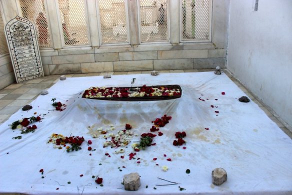
His burial site is located on at the complex of the dargah, or shrine, of Sheikh Zainuddin, a Sufi saint of the Dahkan, also known as Deccan, of India, and the spiritual and religious teacher of Aurangzeb.
As a matter of fact, Khuldabad is popularly known as the “Valley of Saints” because several Sufi saints resided there in the 14th-century.
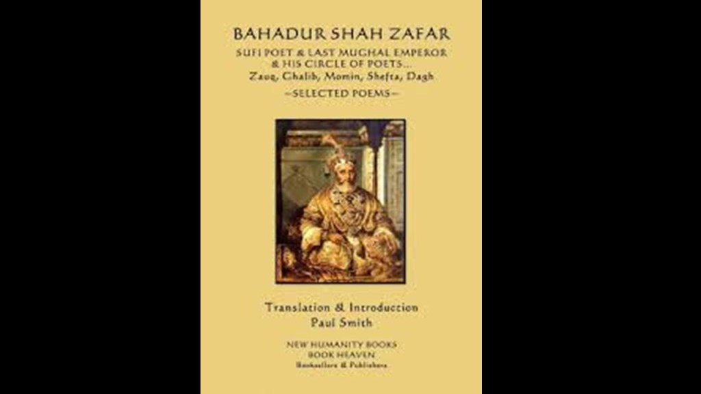
The last Mughal Emperor in India, Bahadur Shah Zafar, also a devout Sufi, was deposed by the British East India Company in 1858, and exiled to Rangoon in Burma.
Through the Government of India Act of 1858, the British Crown assumed direct control of the British East India Company-held territories in India in the form of the new British Raj.

The Criminal Tribes Act was first passed by the British Colonial Government in 1871.
It criminalized entire communities by designating them as habitual criminals, and restrictions on their movements imposed, including men having to report to the police once per week.
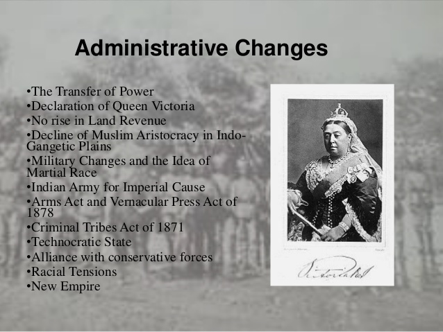
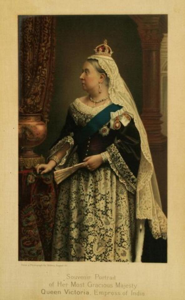
In 1876, Queen Victoria assumed the title of Empress of India.
King-Emperor and Queen-Empress were the titles used by the British monarchs in India between 1876 and 1948.
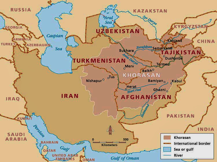
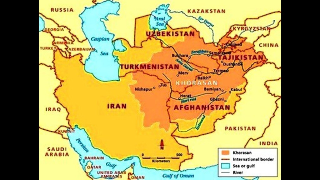
The “Khorasan” was a historical region comprised of land in present-day Iran, Afghanistan, Turkmenistan, Uzbekistan and Tajikstan.
Khorasan is said to mean something along the lines of “Land of the Sun,” or “Where the Sun Arrives from” in Persian.
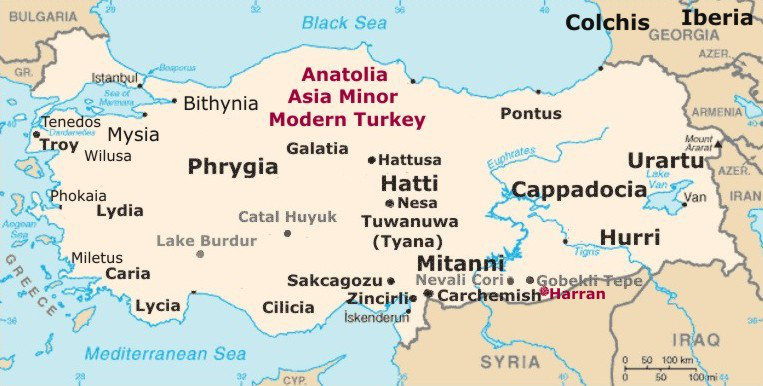
I found the same idea in Turkey, which was known historically as Anatolia.
The meaning of Anatolia is also something along the lines of “Rising Sun” in ancient Greek.
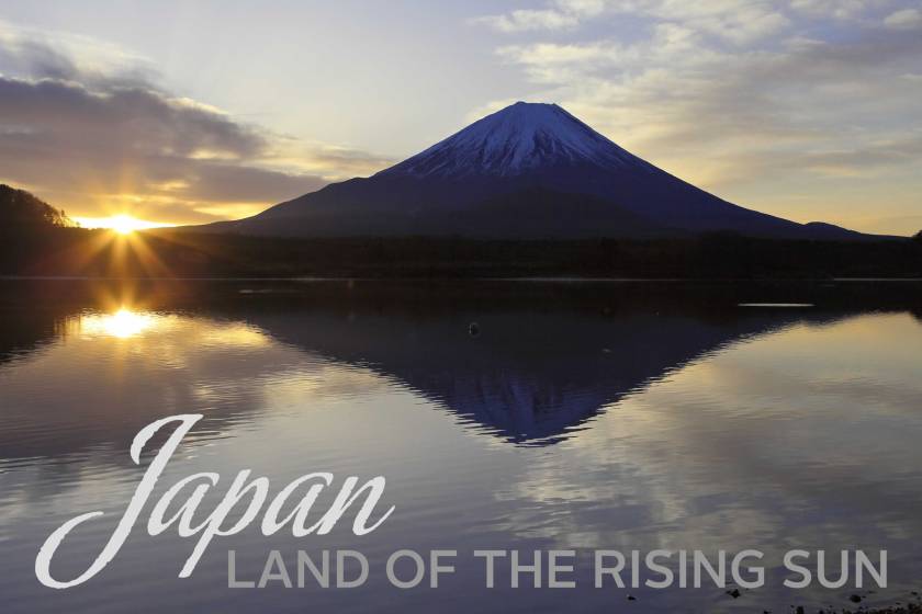
Also, the “Land of the Rising Sun” is a popular nickname for the country of Japan.
So what this tells me is that the whole concept of the sun always rising on the empires of the ancient advanced civilization was embedded in language and collective awareness.
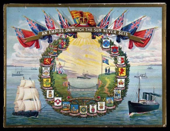
In similar fashion, we learned that the “Sun never set on the British Empire.”
We are told that between the 18th- and 20th-centuries, Britain acquired more and more territories, making it the largest empire in history.
When I saw the Persian name of the Mughal Emperor Aurangzeb, I vaguely recollected something about the Aryans. It rang the bell of a distant memory.
In looking up definitions of Aryan, here is what I am finding:
The Aryans brought Hindu religious thought to India;
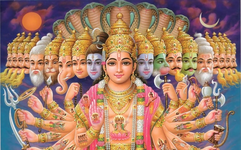
The term was used by the Indo-Aryan people of the Vedic period in Ancient India as a religious label for themselves;
The Iranian people used the term as an ethnic label for themselves in the Avesta scriptures, the religious texts of Zoroastrianism, and the word “Aryan” forms the source of the country name Iran;
The definition of an Aryan, described by the Nazi Germans as a member of the Master Race, was not Jewish and had nordic features.
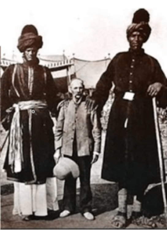
What exactly was the Nazi obsession with creating a Master Race all about anyway?

Was this actually a desire to re-create the original Master Builder Race?
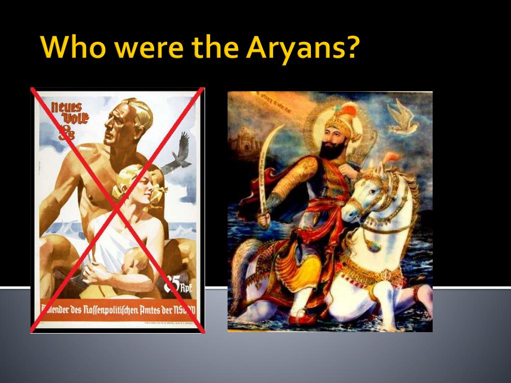
Giant human beings who, among many other things, were capable of carving massive infrastructure right out of rock like it was no big deal?
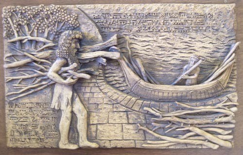
Which brings me to the question: Who were the People of Ar?
Mt. Ararat, the legendary landing place of Noah’s Ark, was located in the historical Armenia, though now is within the boundaries of modern Turkey.
The Sumerians called Ararat “Arrata,” and they tell of this land of their ancestors in the Armenian Highlands in their epic poem of Gilgamesh.
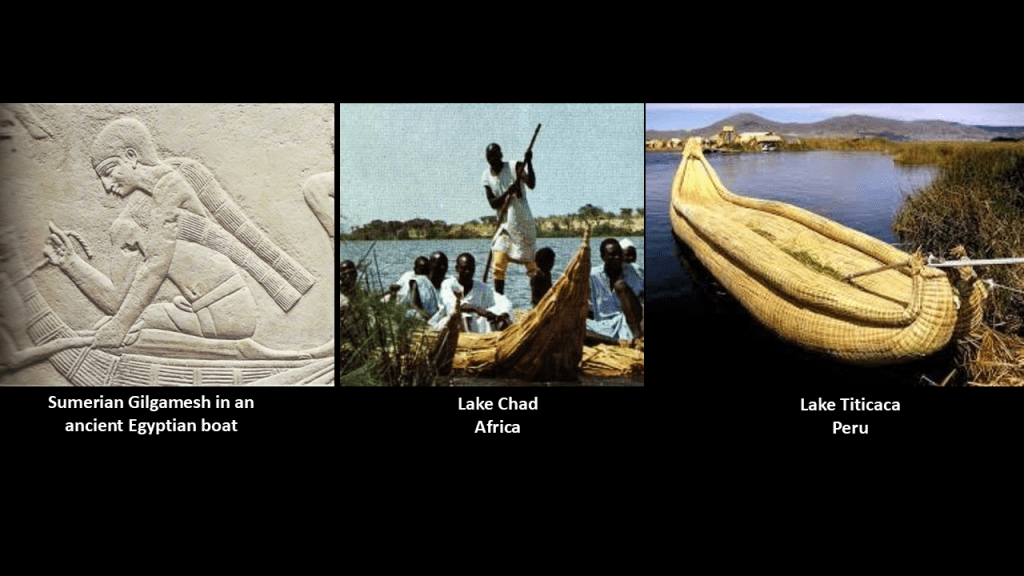
Compare the reed boat pictured here on the left with the Sumerian Gilgamesh with an ancient Egyptian boat, in the middle with a reed boat on Lake Chad in Africa; on the right with a reed boat on Lake Titicaca in Peru.
As a matter of fact, Arrata is said to be now recognized as the world’s most ancient, known civilization, dating back to 22,000 BCE, developing in the steppes north of the Black Sea, in modern Ukraine and believed to spread out from there to India, Mesopotamia, Egypt, Western China, and across Europe.
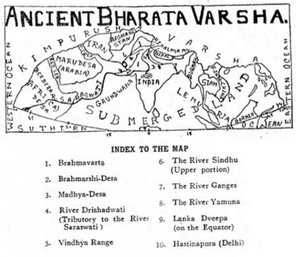
I found out that ancient India was known as Bharata Varsha at one time…or does the term Bharata Varsha refer to the entire earth?
Where else can I find “Ars?”
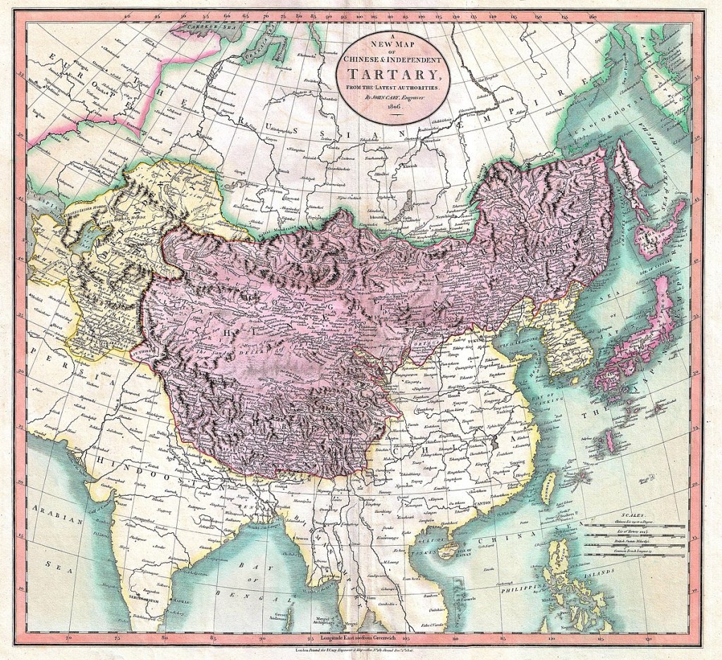
Tartary, or Tartaria, a historical region in northern and Central Asia…
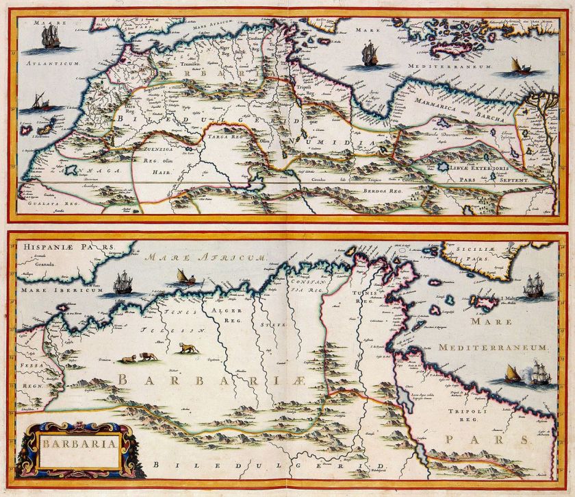
…the Barbary Coast, or Barbaria, the name given to a vast region stretching from the Nile River Delta, across Northern Africa, to the Canary Islands…
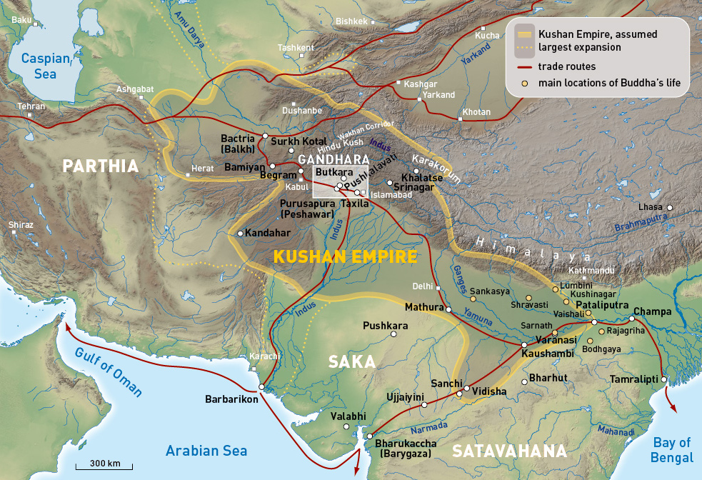
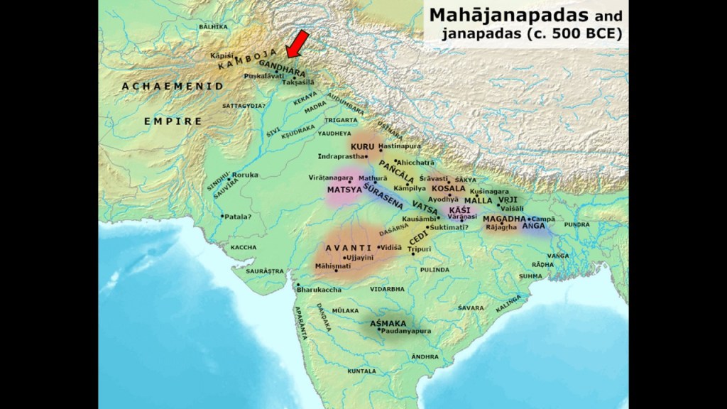
…Gandhara, an ancient Buddhist Kingdom primarily in what is now Pakistan, and part of the Kushan Empire…
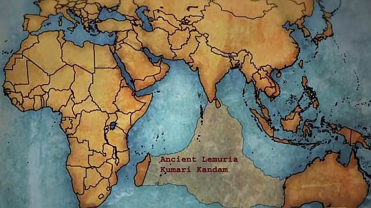
…Kumari Kandam, a lost continent in the Indian Ocean…
…Arabia…
…Arizona in the United States, with its flag on the top, compared with the flag of Tibet on the bottom, both looking very much like sunrays in the background…

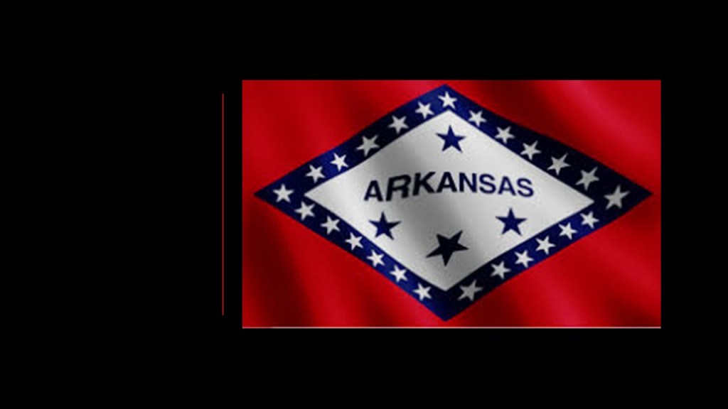
…and Arkansas in the United States.
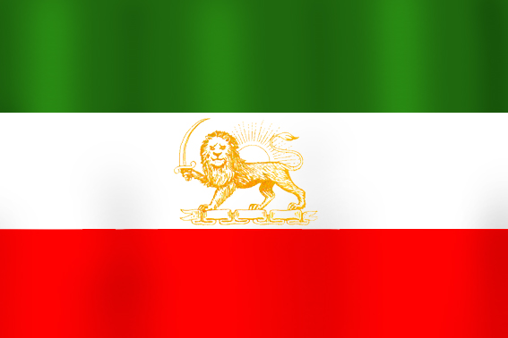
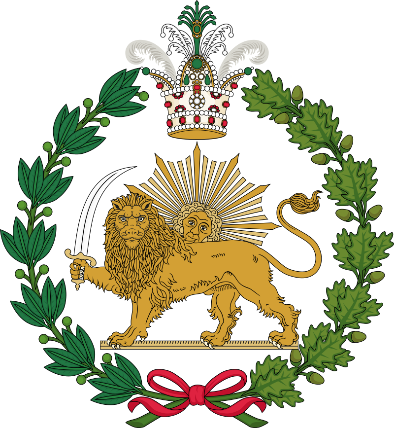
It’s interesting to note that the same winged lion symbolism holding a sword that served as Iran’s official emblem until the 1979 Iranian Revolution…
…is found on the remnants of the former Reynolds-Davis Wholesale Grocery Store in Fort Smith, Arkansas, the building for which was said to have been built in 1882 and the oldest building in the downtown historic district.
It was destroyed by a tornado in 1996.
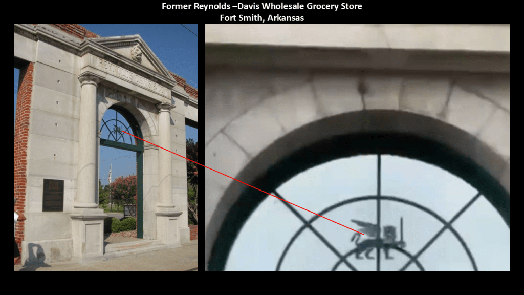
The previously-mentioned Albert Pike made his home in Fort Smith in 1832.
Albert Pike in his day was the most powerful Freemason in the world when he became the Sovereign Grand Commander of the Southern Jurisdiction in 1858, the same year that the Government of India Act enabled the British Crown to assume direct control of the British East India Company-held territories in India.
Along with holding the position of Sovereign Grand Commander of the Southern Jurisdiction, he held the position of Grand Master of the Central Directory in Washington, DC, and Sovereign Pontiff of Universal Freemasonry.
I believe the identity of the Earth’s original people and worldwide energy grid system were deliberately hijacked by dark beings with a negative agenda, who definitely don’t want us to wake up to our true history and who we really are.

Here’s the thing.
By Universal Law, we have to give our consent for what they have done here, and the only way they can accomplish this consent is by outright lies, deception and duplicity because if people knew the true agenda of these controllers, the majority of Humanity would never, ever, ever accept anything that has taken place here.
They wanted to rule over it all, take all wealth for themselves, and control the destiny of Humanity for their own benefit, not ours. And more and more people are waking up to this every day ~ we do not consent…and we never consented!

Now I am going to go back aways in time to see what our historical narrative tells us about this part of the world, with examples from the Strait of Hormuz, the historical Persia, Khorasan and Mughal Empire presented from my past research on leylines through this region.
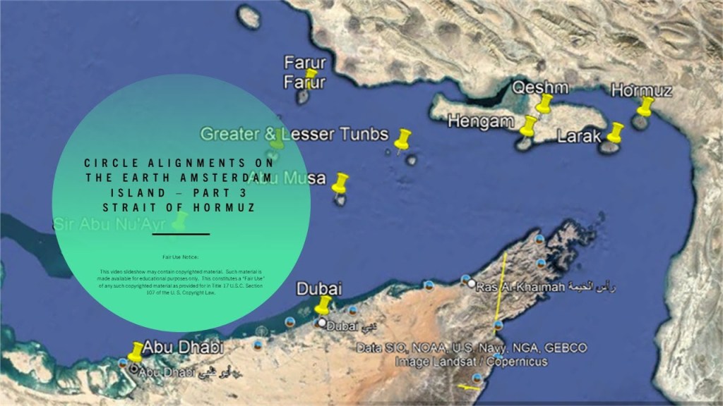
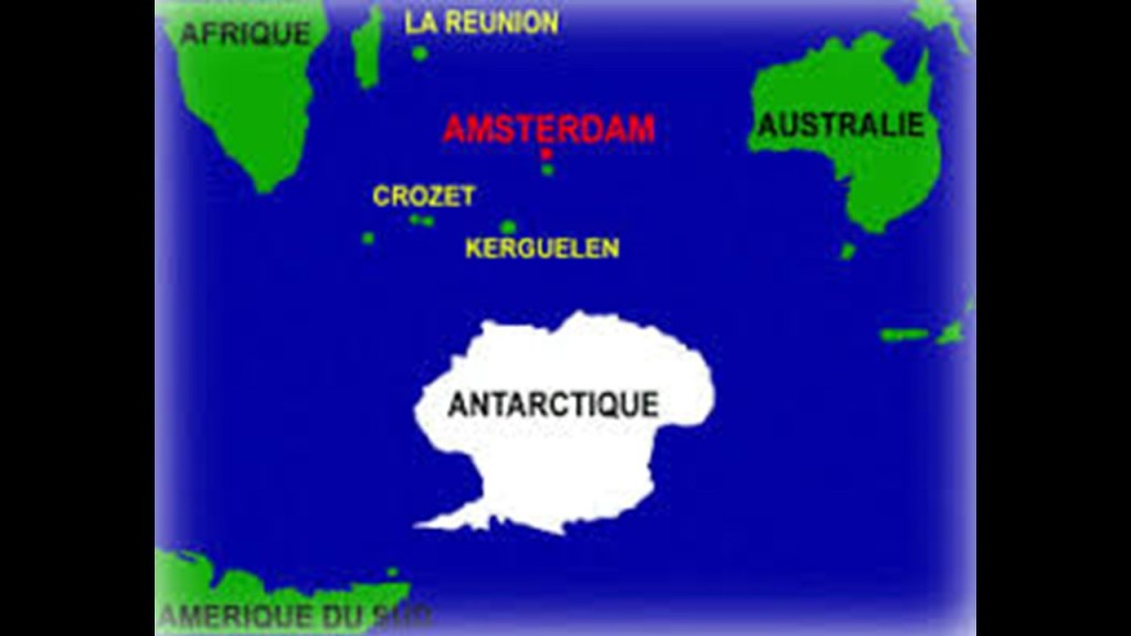
I am going to start at what the historical narrative tells us about the Strait of Hormuz, which I found tracking a long-distance leyline through here from Amsterdam Island.
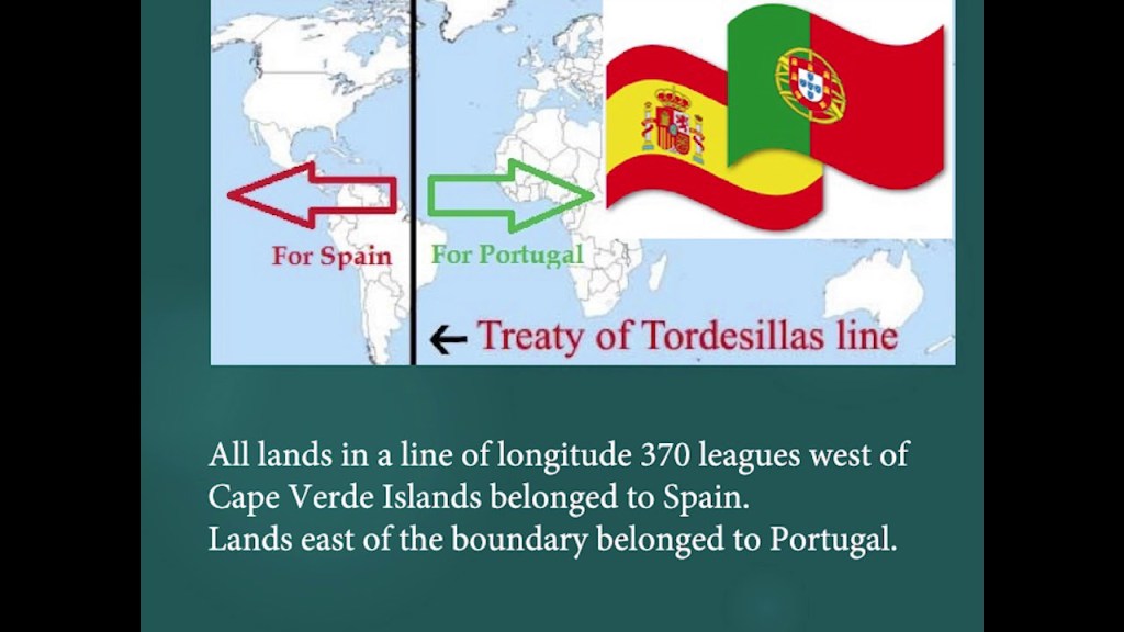
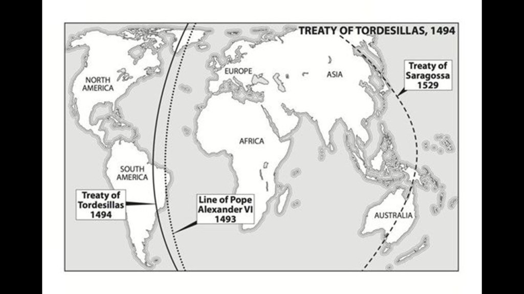
First, thing to mention is the Treaty of Tordesillas of 1494.
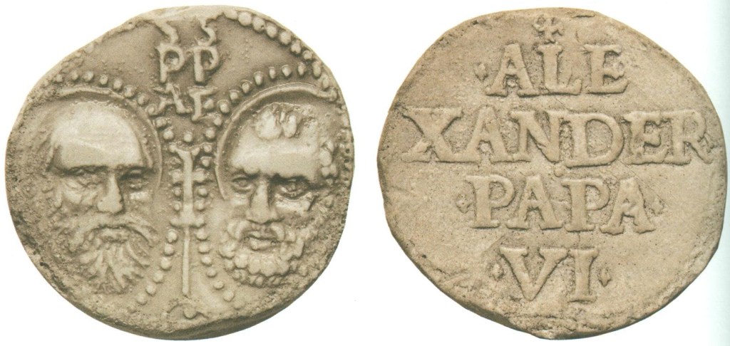
This Treaty divided the newly “discovered” lands outside Europe between the Portuguese Empire and the Spanish Empire (Crown of Castile), along a meridian 370 leagues west of the Cape Verde Islands, off the West Coast of Africa, one year after Pope Alexander VI had issued the Inter Cetera Bull in 1493, which essentially authorized the grab of the lands of the original civilization.
A “Papal Bull” is an official papal letter or document, named after the leaden seal used to authenticate it, and they figure prominently in the historical narrative we have been given.
Thirty-five-years later, the Treaty of Zaragoza was signed, which specified the Antimeridian to the line of demarcation specified by the Treaty of Tordesillas, defining the areas of Spanish and Portuguese influence in Asia, and used as the means to justify the colonization of the world by the Spanish and Portuguese.
We are told that in 1497, Europeans landed in the region for the first time in the form of the Portuguese explorer Vasco de Gama.
I personally have a lot of questions about the veracity of what our historical narrative tells us about the history of this time period because of the number of early Portuguese explorers, for example, that I came across that had their first biographies written by German and English Biographers in the 19th-century.

Whatever the case may be, we are told the European invasion began in 1508, starting with the Portuguese sending seven warships to protect their interests there.
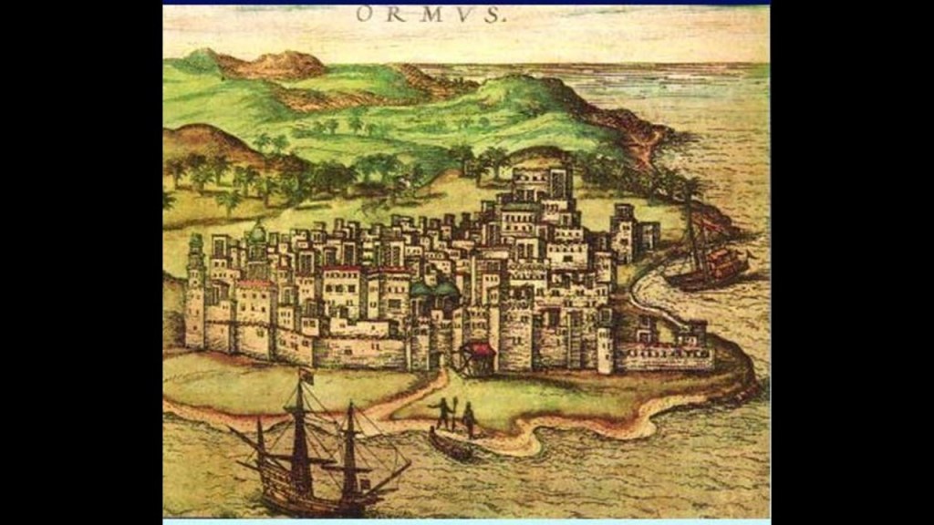
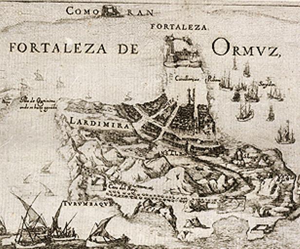
This is an etching showing what Hormuz City looked like in 1522.
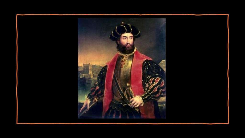
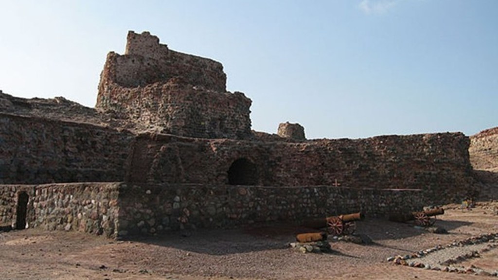
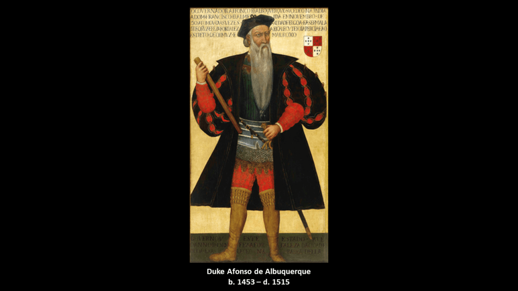
This is said to be the old Portuguese fort on Hormuz Island, and was supposedly built after the Portuguese Duke Afonso de Albuquerque captured the island in 1507, and it became part of the greater Portuguese Empire.
Duke Afonso de Albuquerque has gone down in our history as a great Portuguese general, admiral, and statesman.
He was Viceroy of Portuguese India from 1509 to 1515.
Among other goals of conquest, he sought to secure the spice trade for the Portuguese Empire, which include control of Malacca in the Spice Islands; Goa in India: Hormuz in the Strait of Hormuz; and the port city of Aden in Yemen on the Gulf of Aden near the Red Sea.
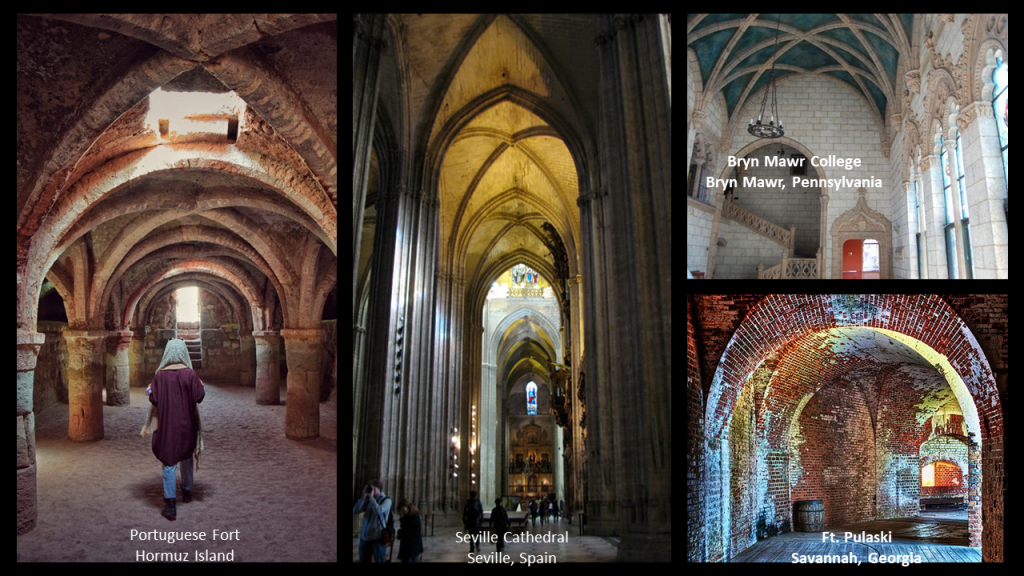
Here is a photo of the vaulted arches of the Portuguese fort on Hormuz Island on the left; compared with the vaulted arches of the Seville Cathedral in the capital of Moorish Spain, in the middle; and on the top right is the “Spanish Gothic” architecture at Bryn Mawr College in Pennsylvania that was torn down about 15-years ago, with its vaulted ceiling, and five-lobed Moorish arches; and the vaulted archways at Ft. Pulaski in Savannah, Georgia, on the bottom right.
While we are taught all of these architectural similarities were occurring at different times across countries and continents during centuries when, according to what we are also taught in history class, transportation was limited and communication was regional.
In 1622, the British helped the Persian Emperor, Shah Abbas, in expelling the Portuguese from Hormuz Island in 1622.
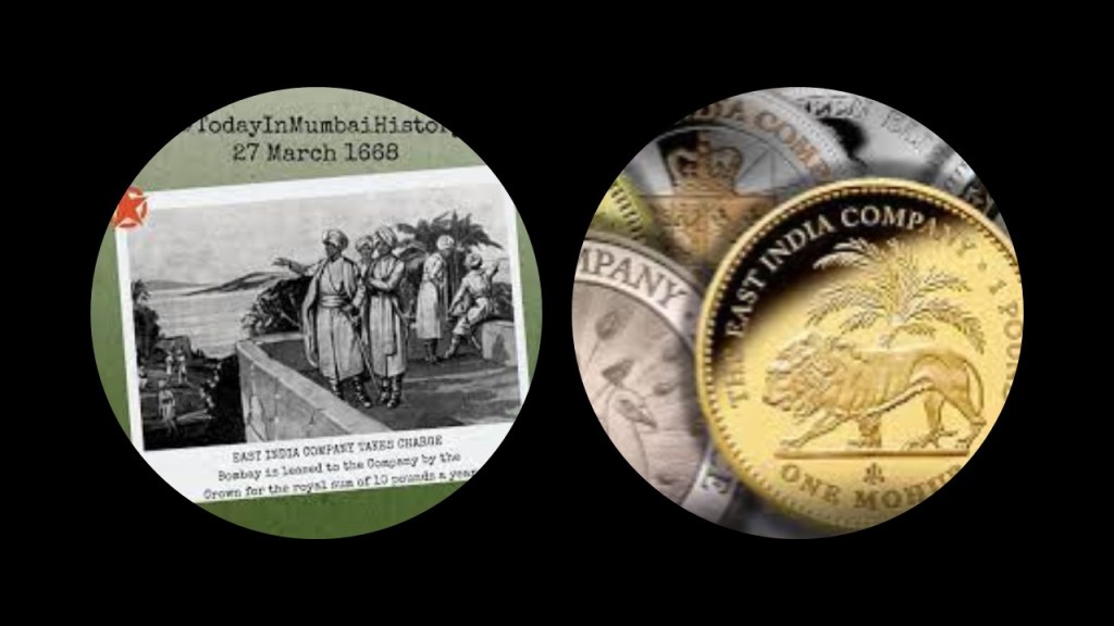
In return, the East India Company was allowed to establish a trading post in Bandar-e-Abbas on the southern coast of what is known as Iran today.
We are told that as a result of a series of Royal Charters granted by King Charles II, starting in 1661, the East India Company was granted the rights to autonomous territorial acquisitions; to mint money; to command fortresses and troops and form alliances; to make war and peace; and to exercise both civil and criminal jurisdiction over the acquired areas.
The British interest in the Persian Gulf increased as India’s importance in the British imperial system increased in the 18th- and 19th-centuries.
The “Persian Gulf Residency” was a sub-division of the British Empire from 1822 to 1971, during which time the United Kingdom maintained varying degrees of economic and political control over several states in the Persian Gulf, including the United Arab Emirates, and at different times, over the southern portions of Persia (Iran), Bahrain, Kuwait, Oman, and Qatar, known collectively as the “Trucial States,” the name given to a group in southeastern Arabia who had signed protective treaties, or “truces” with the British between 1820 and 1892.

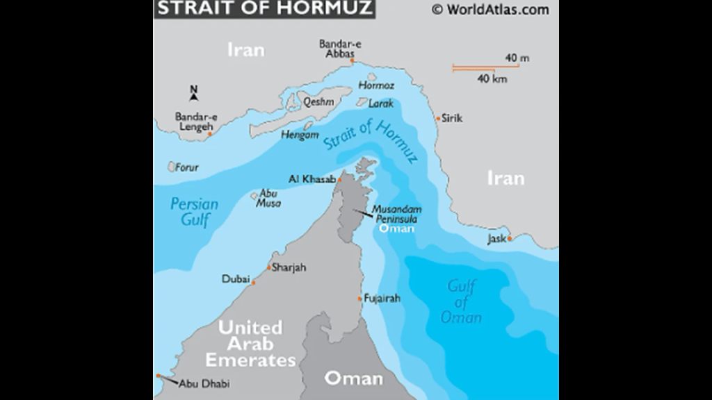
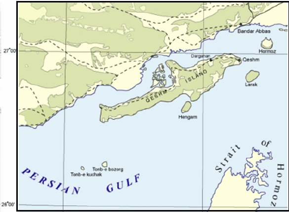
The Strait of Hormuz is the only sea passage from the Persian Gulf to the open Ocean.
The Musandam Peninsula is on the south coast of the Strait of Hormuz, and Iran is on the north coast of it.
The governance of Musandam Peninsula is shared by the countries of the United Arab Emirates and Oman.
The Tell of Kush is an archeological site in the Musandam Peninsula, and situated on an important trade route.
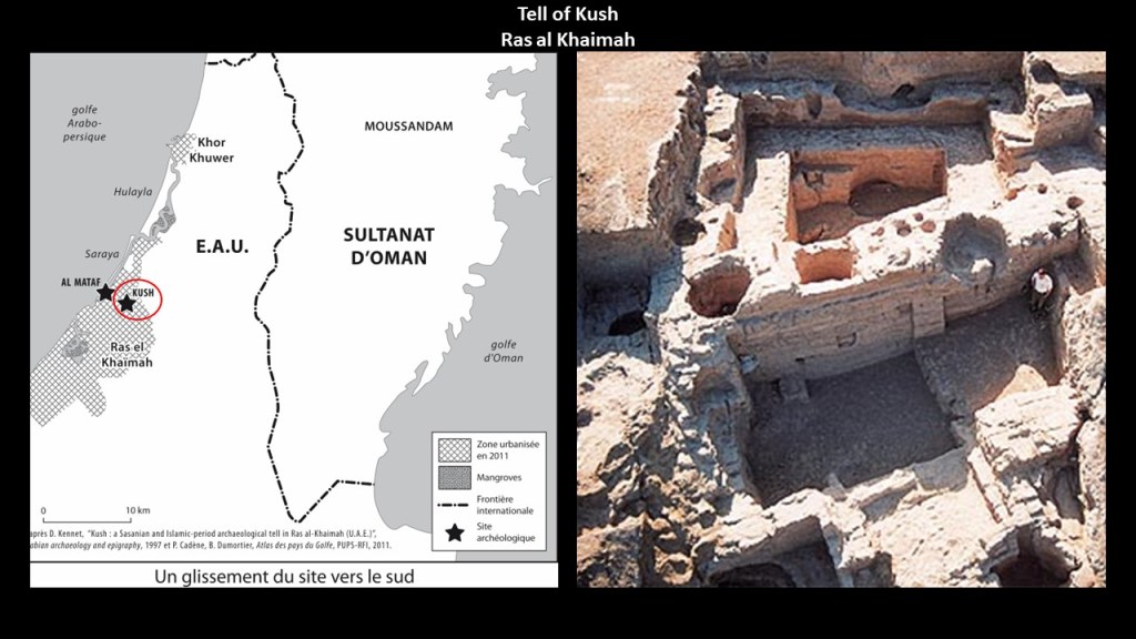
It won’t be the last time was see a “Kush” on these alignments as I go through what I found this part of the world.
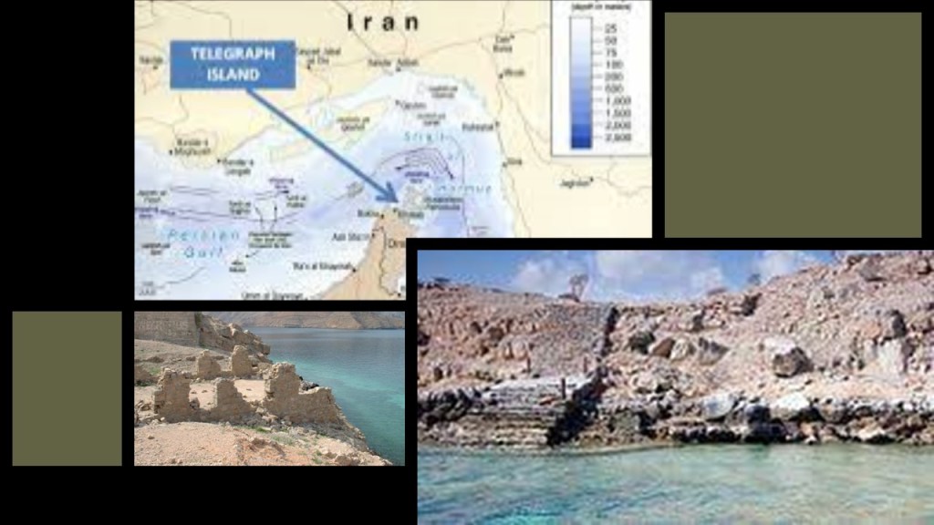
Telegraph Island in the Strait of Hormuz is located in what was named the Elphinstone Inlet for the East India Company’s then-Governor of Bombay, Mountstuart Elphinstone, and was the location of a telegraph repeater station built by the British there in 1864, only to be abandoned in the mid-1870s , and remains deserted to this day.
We are told that the slang term in English “going ’round the bend,” meaning a feeling of exasperation, came from the telegraph workers who were stationed there, with its heat, rocks, and isolated location.
The Strait of Hormuz is the world’s biggest oil transit waterway “chokepoint.”
At least 20% of the world’s petroleum passes through here, and one-third of the world’s liquefied natural gas, and is a highly important strategic location for international trade.
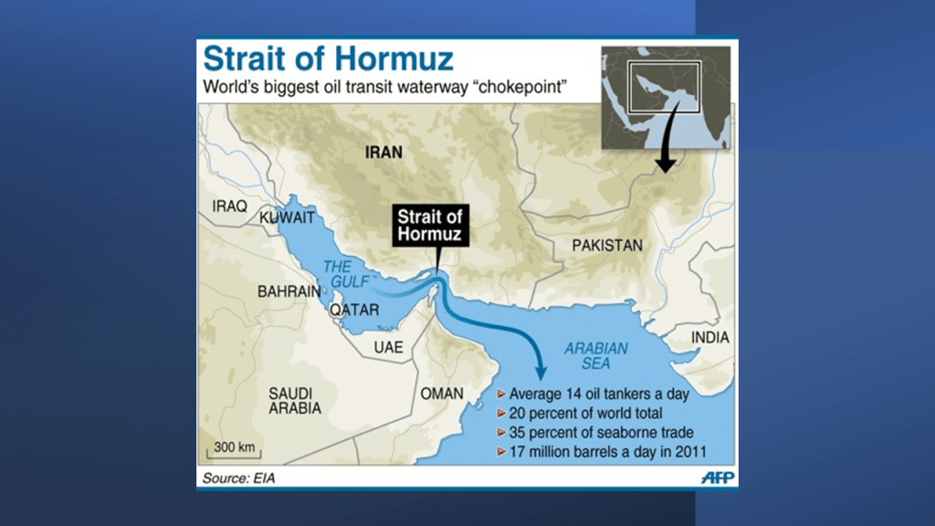
Not surprisingly, this is a tense area, to say the least!
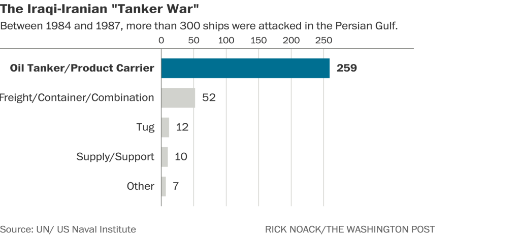
The Strait of Hormuz has been site of many military conflicts and attacks over the years, including but not limited to the 1984 Tanker War that took place during the Iran-Iraq War when Iraq attacked the oil terminals and tankers on Iran’s Kharg Island in the Persian Gulf, said to have been done to provoke Iran into retaliating with extreme measures, and lasted for several years.
The islands of the Strait of Hormuz are windows to a hidden history.
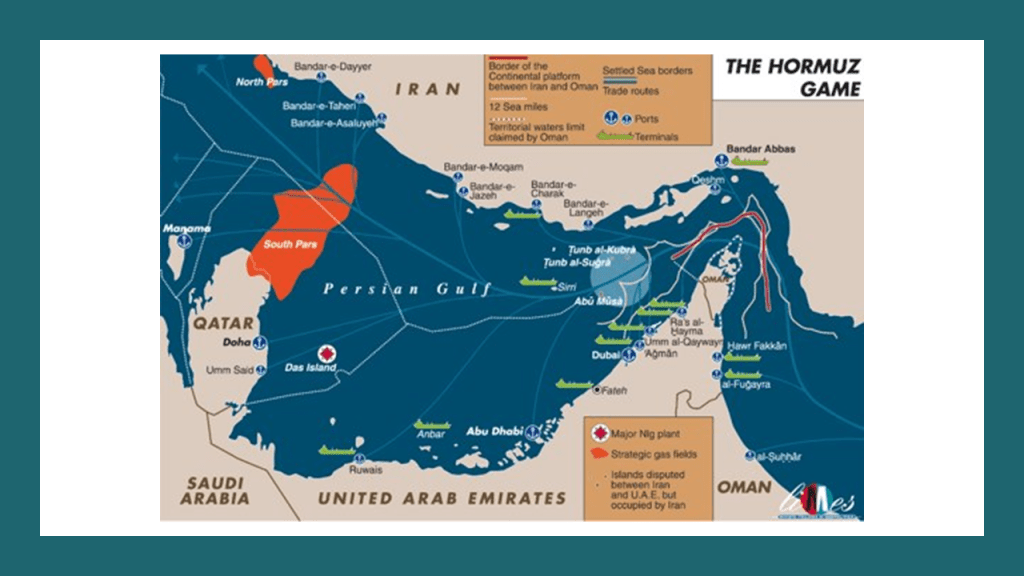
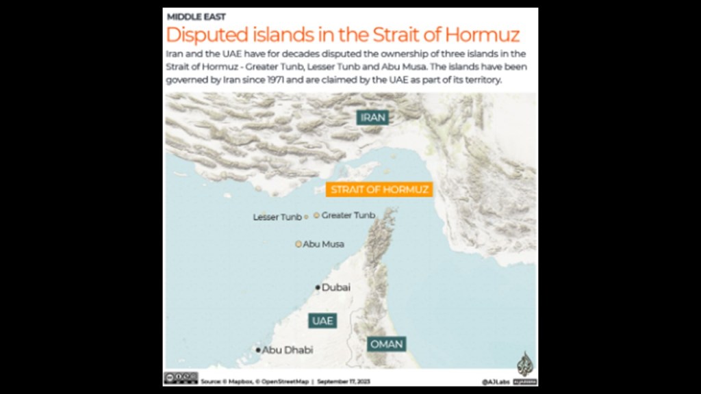
Like the small island of Abu Musa.
The island of Abu Musa is contested between the United Arab Emirates and Iran.
It has been administered by Iran as part of the Hormozgan Province since 1971.
It is the furthest Island from the Iranian coast, and is strategically important as it sits near the entrance to the Strait of Hormuz, and because of sea-depth, ships and oil tankers must pass between Abu Musa and the Greater and Lesser Tunb islands, also administered by Iran, on their way through.
The size of Abu Musa is 4.9-square-miles, or 12.8-kilometers-squared.
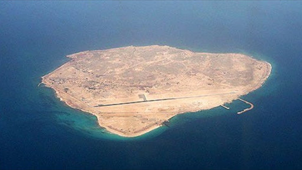
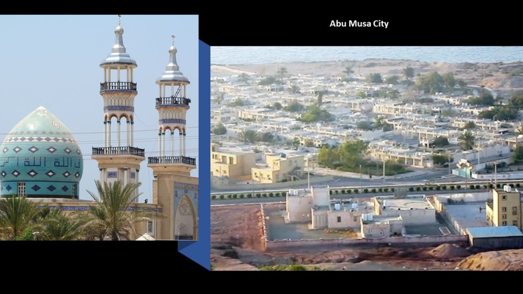
Abu Musa City is the largest settlement on the island, with a population of somewhere around 2,000 people.
Between 1908 and 1968, the British controlled the Abu Musa, along with other islands in the Persian Gulf.
There are iron oxide deposits on Abu Musa.
The British interest in the Persian Gulf had increased as India’s importance in the British imperial system increased in the 18th- and 19th-centuries, and the East India Company became responsible for conducting British foreign policy in the Persian Gulf as the Crown’s regional agent.
The East India Company established their Residency at Bushehr, on the Persian Gulf, and another one later at Basar,
In 1822, the Bushehr and Basar Residencies were combined, and Bushehr became the headquarters for the new “British Resident of the Persian Gulf” of the British Colonial Residency.
A “Chief Political Officer” was the “Chief Executive Officer,” and was subordinate to the “Governor of Bombay until 1873, at which time this position became subordinate to the Governor-General of India until 1947, when India was granted its independence from Great Britain, at which time the responsibility was tranferred to the British Foreign Office.
The British terminated its protectorate and military presence in the Persian Gulf in December of 1971.

Now to apply this history back to the small, disputed island of Abu Musa.
Before 1908, the island had been under the rule of the Sheikh of Sharjah, now one of the United Arab Emirates but which had been one of the British “Trucial States.”
After the Sheikh had cancelled a 1906 mining concession he had awarded to three Arabs, for them to mine the red iron oxide deposits on Abu Musa because they turned around and offered to sell the extracted iron oxide to a German company, the British helped him expel the workers from the island but by 1908, the British came into control of the island.
In 1968, Britain announced it would be ending its military and administrative positions in the Persian Gulf.
Two days before the official establishment of the United Arab Emirates, on November 30th of 1971, the Sheikh of the Emirate of Sharjah signed a Memorandum of Understanding with Iran.
This MOU allowed Sharjah to have a police station on the island, and allowed Iran to station troops there, and divided the island’s energy resources between the two. This was supposed to preventing Iran from invading and taking over Abu Musa like it had the Greater and Lesser Tunb islands, two other disputed islands between the two coutnries.
However, on the same day of November 30th of 1971, a day before the British officially left the region, Iran moved its troops in and took over with the help of the Sheikh’s brother, and the dispute has existed ever since.
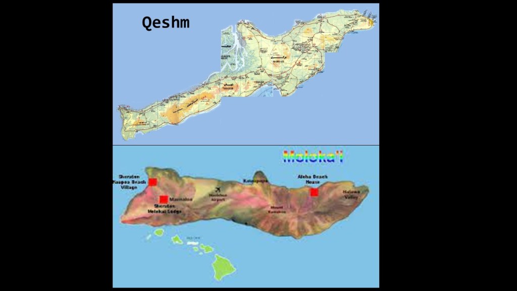
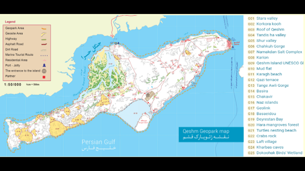
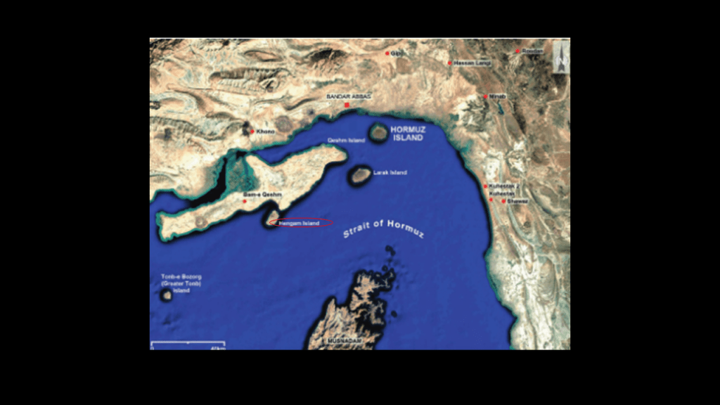
Now, I am going to turn my attention to the large island of Qeshm in the Strait of Hormuz.
It is the largest island in Iran, and one of the largest islands in the world.
An important trading center at one time, it is situated just a short distance off the coast of Iran.
Qeshm Island on the top, like the Hawaiian Island of Molokai pictured below it, looks remarkably like the shape of…well…a dolphin… including land shaped like flukes and flippers.
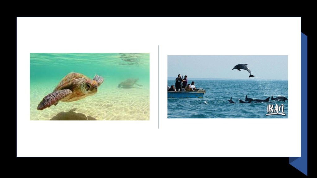
Not only do both of these islands look like dolphins, they both have a large population of sea animals in their waters, including large sea turtles and cetaceans like whales and dolphins.
Well, you might expect that in the Hawaiian Islands, but in Iran?
In the Strait of Hormuz, the world’s biggest oil transit waterway “chokepoint?”
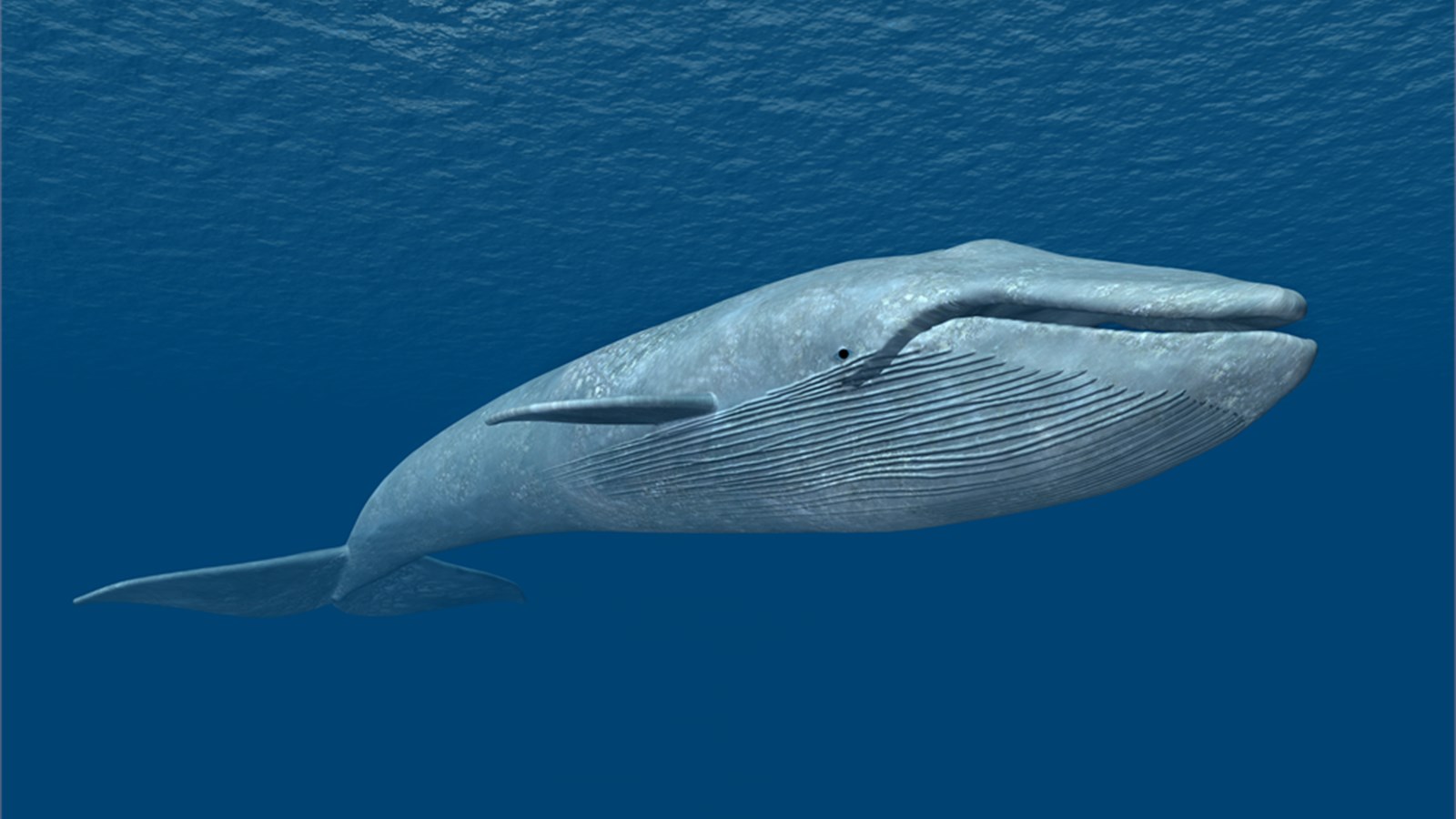
As a matter of fact, Qeshm has the earth’s largest mammal, the blue whale, swimming in its waters…
…as well as sea turtles and pods of dolphins that are also found in the waters around Qeshm.
The whole island of Qeshm was designated as a UNESCO Global Geopark in 2017.

Qeshm is called the Island of Seven Wonders, and some of these wonders include places like…
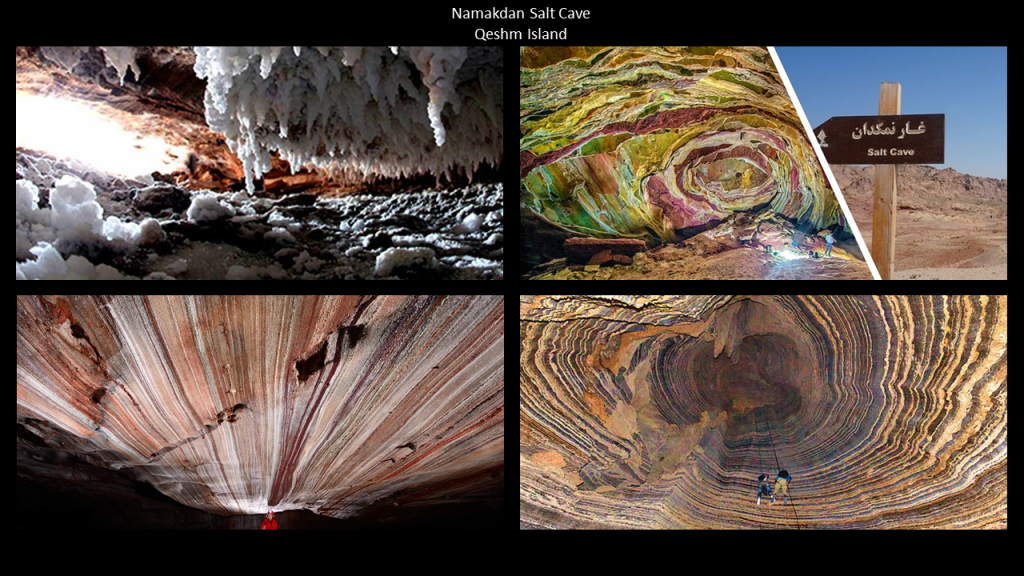
…the Namakdan Salt Cave Complex on Qeshm, considered to be one of the world’s largest salt cave systems, if not the largest.
The cave system is said to be a 4-mile-, or 6.5-kilometer-, -long labyrinth, most of which is closed to the public.
This location is said to be therapeutic for treating asthma and other respiratory ailments.
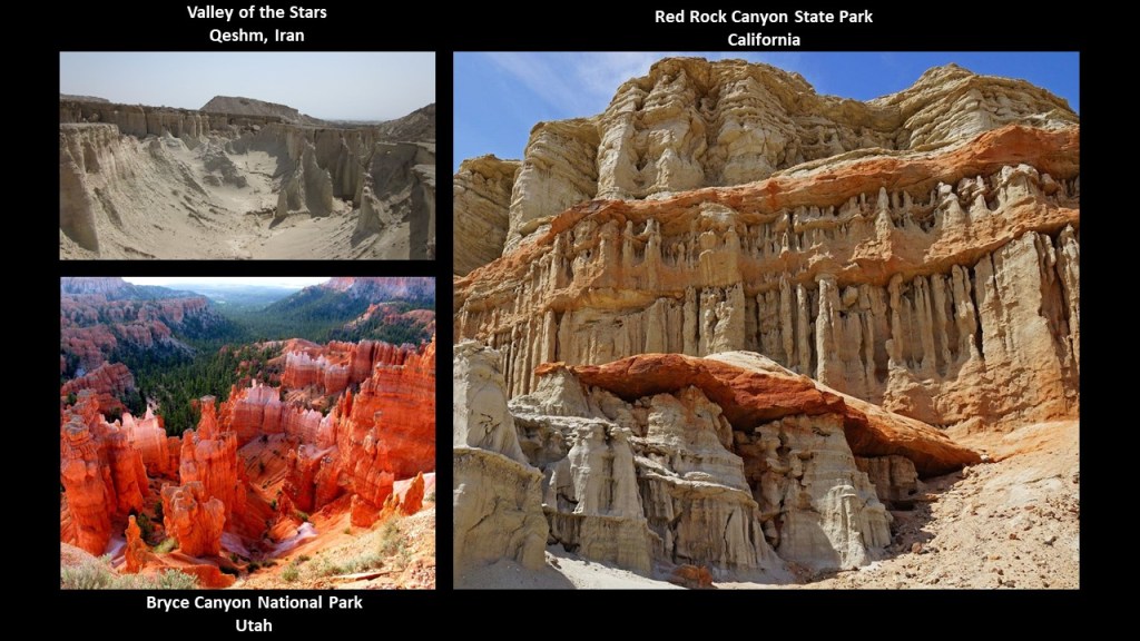
Another wonder on Qeshm is the Valley of the Stars, or Stars Valley, called one of the most amazing natural sites in the world.
But is it natural, or could that possibly be melted ancient masonry?
This view of the Valley of the Stars on Qeshm Island on the top left has a similar appearance to what’s found at Bryce Canyon National Park in Utah on the bottom left, and to Red Rock State Park in California on the right.
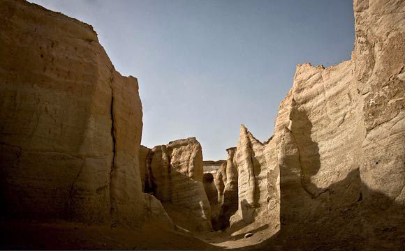
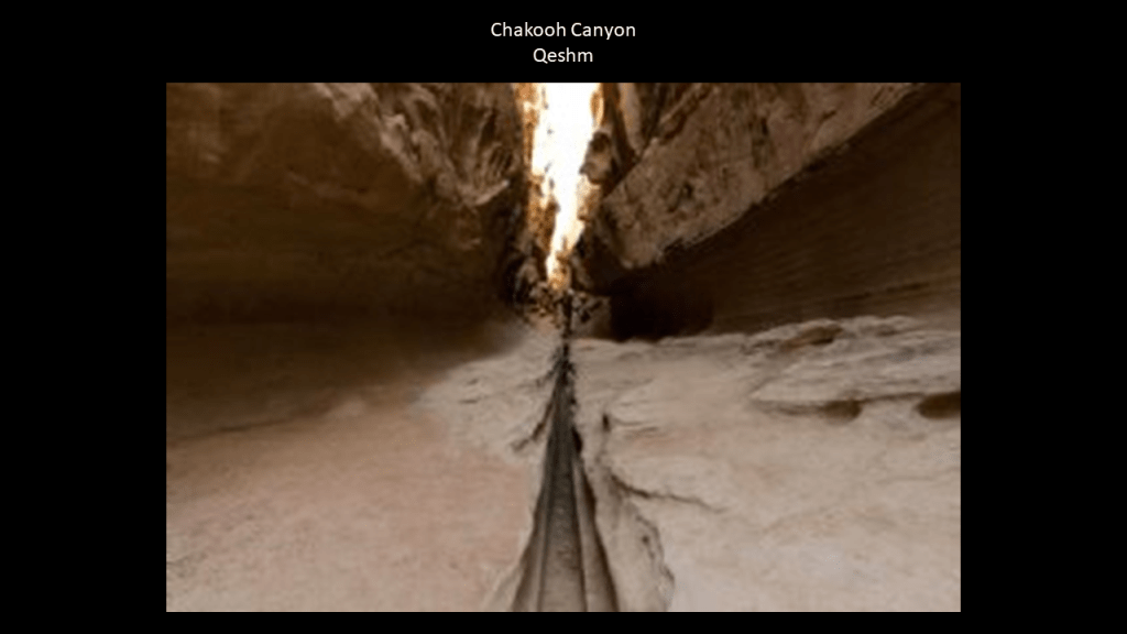
Another of the wonders on Qeshm is found at Chahkooh Canyon.
Here here we find what is described as the intersection of two vertical canyons.
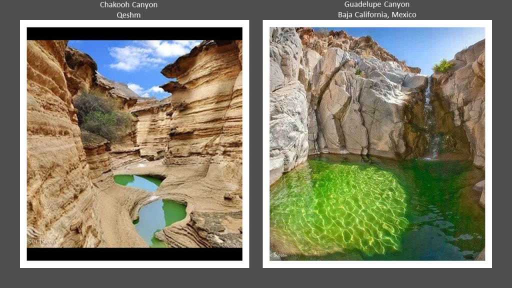
The color of the water in this view of Chakooh Canyon location on Qeshm Island on the left reminded me of the Emerald Pool in Guadelupe Canyon in Baja California, Mexico, on the right, a place that I found tracking a different long-distance alignment.
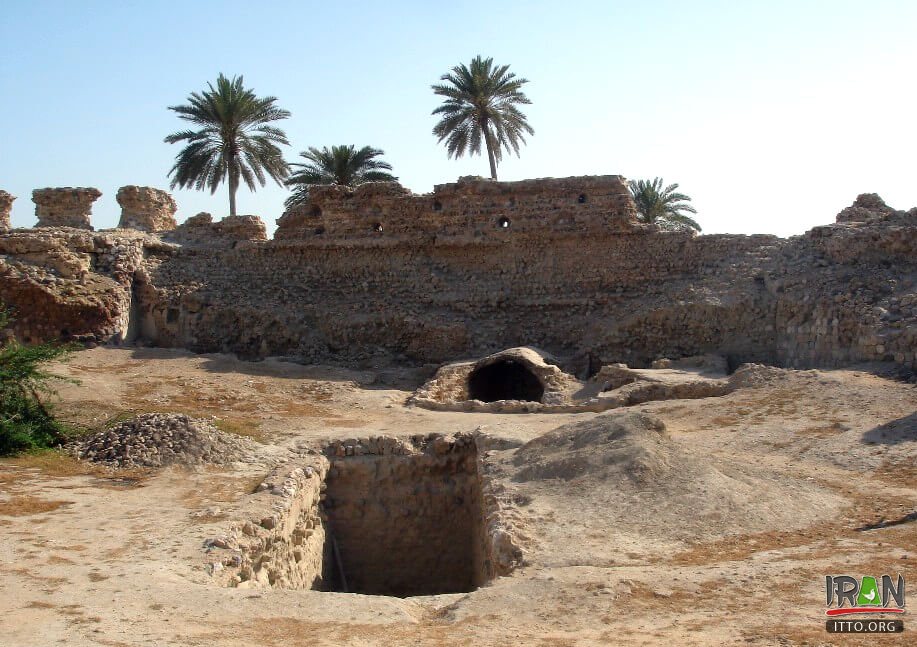
What is called the old Portuguese Castle, or Fort, on Qeshm was also said to have been built by the Portuguese under Afonso de Albuquerque in 1507 in order to manage an unforeseen insurgency by the locals, and mainly used as a warehouse for guns and artillery.
Next, the island of Hengam is located just south of Qeshm, holding the position of what looks like a flipper that broke off from the main body of the dolphin-shaped island.
Hengam is called the “Island (or Home) of the Dolphins.”

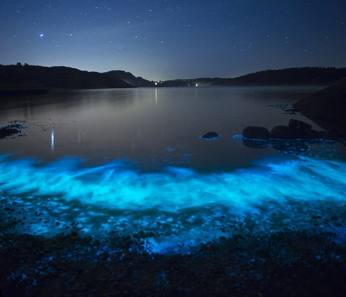
Hengam is also known for its glowing blue sea from phytoplankton at night when the water is calm and windless.
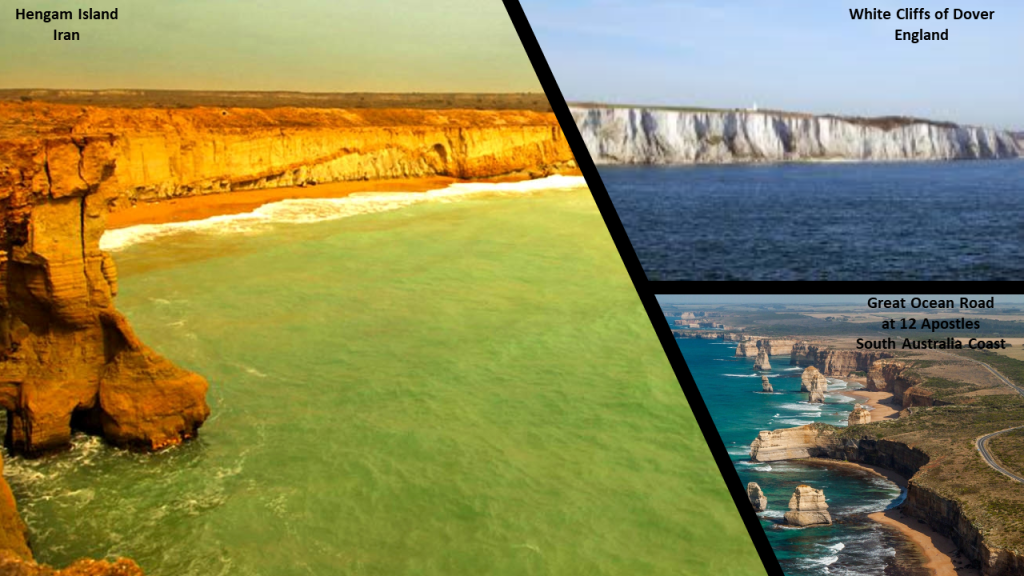
Hengam also has an intriguing-looking coast.
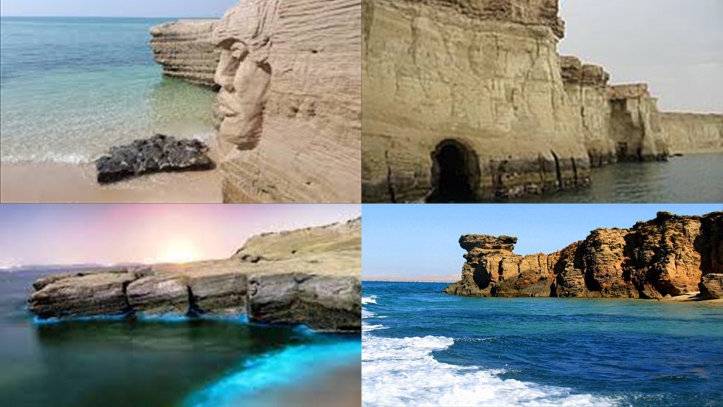
So, for purposes of comparison, here is a view of sheer cliffs along Hengam Island’s coastline on the left, compared for similarity of appearance with the sheer white cliffs of Dover on the coast of southern England on the top right, and the cliffs along the southern coast of Australia in Victoria State where the Great Ocean Road runs for a long distance next to a sheer cliff, and showing the location of the 12 Apostles, then name given to what are called “limestone stacks” in the water off Port Campbell.
When the word “sheer” is used to refer to a cliff, it means a high area of land with a very steep side.

One of the meanings of the word “shear” spelled with an “a” is to break off, or be cut off, sharply.

A synonym of the word for “sheer cliff” is “bluff.”
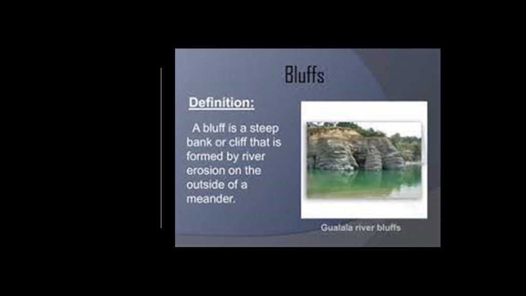
Another meaning of the word “bluff” is a deception, or an attempt to deceive.

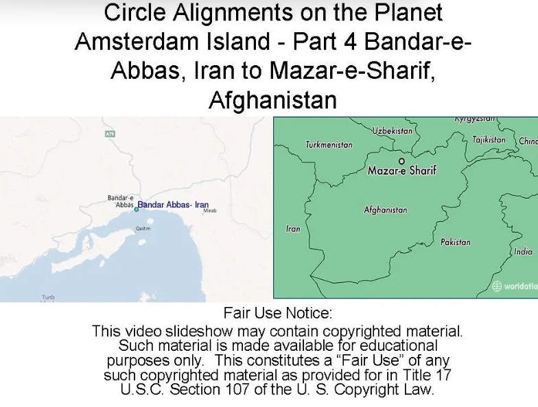
Heading up this same long-distance circle alignment that started at Amsterdam Island, a tiny dot in the South Indian Ocean…
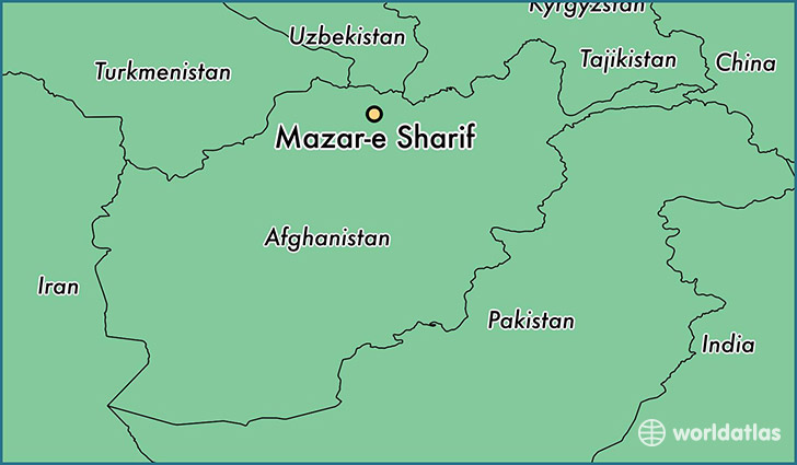
…I looked at what is found along the way from Bandar-e-Abbas in Iran to Mazar-e-Sharif in Afghanistan after I left the Strait of Hormuz, and I did this back in December of 2018.
Hormozgan Province, of which Bandar-e-Abbas is a part, has 13 major cities, and 13 counties.
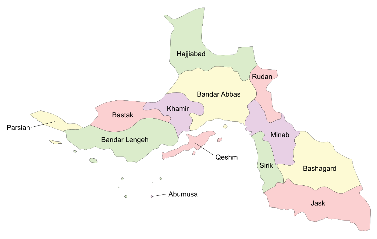
The people of this region are called Bandari.
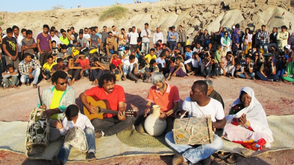
This province is also known as Iran’s Black South.
The flavor of the traditional ceremonies and music in this part of Iran is considered African.
Moving along the circle alignment from Bandar-e-Abbas, we find the city of Kerman, the capital of Iran’s Kerman Province.
It is one of Iran’s oldest cities.
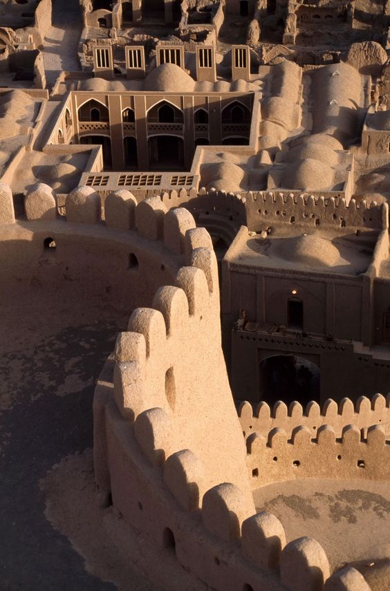
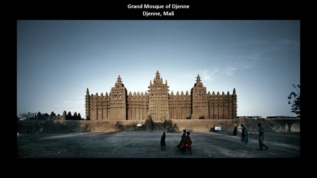
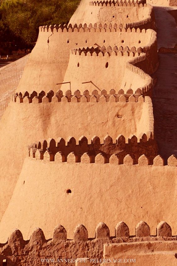
This is the Arg-e-bam Castle, or Bam Citadel, in Kerman Province.
It is called the largest adobe building in the world, and is a UNESCO World Heritage site believed to go back to the 6th-century BC.
An earthquake in 2003 destroyed much of it.
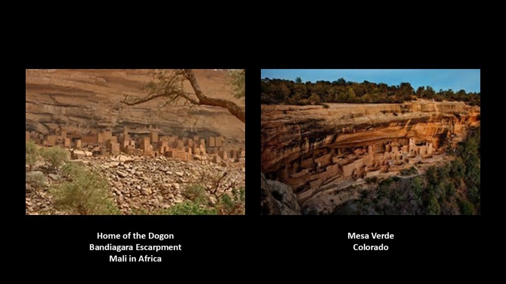
Compare it in style to the Grand Mosque of Djenne, in Mali, also an example of adobe architecture and also one of the world’s largest mud-brick buildings.
Djenne is not far from the home of the Dogon, Bandiagara Escarpment, with its adobe dwelling on the left, which just happens to look a lot like Mesa Verde in Colorado on the right.
This is Itchan Kala, the inner walled town of Khiva in Uzbekistan with its adobe walls..
It has been a World Heritage Site since 1990.
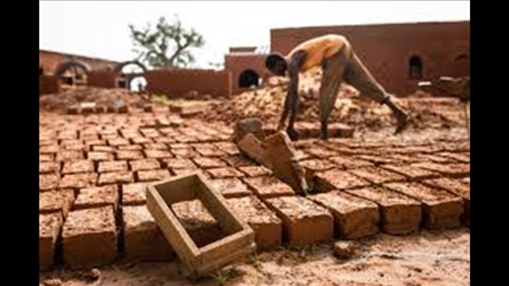
An ancient building material, adobe bricks are made from clay, sand and straw, and molded and sun-dried rather than fired in a kiln.
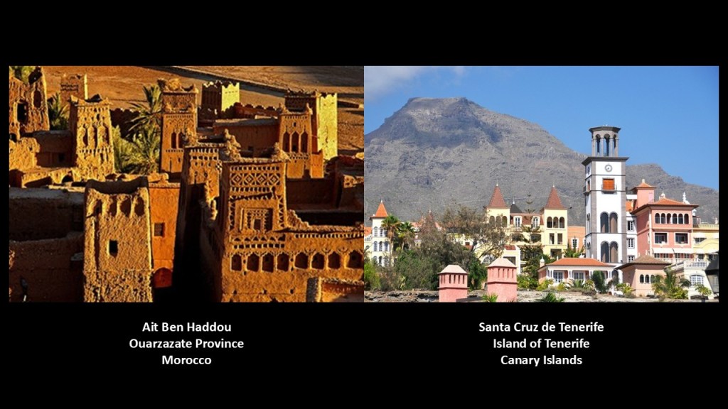
And before I move on from this subject, I just want to share the astonishing similarity in appearance between the adobe buildings of Ait Ben Haddou in Morocco’s Ouarzazate province on the left, and this view of what would be considered more modern constructions in the city of Santa Cruz de Tenerife in the Canary Islands on the right.
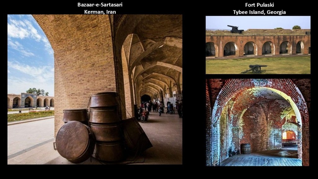
Back in Kerman, this is the Bazaar-e-Sartasari, one of the oldest trading centers in Iran, on the left, with a comparison for similarity of appearance with Fort Pulaski on Tybee Island, one of Georgia’s Sea Islands near Savannah, on the right.
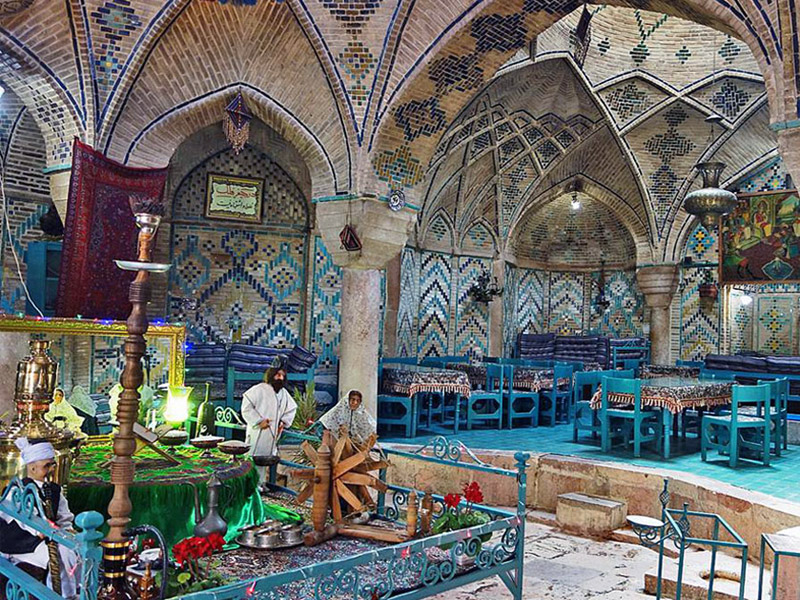
Next in Kerman is the Hammam-e-Ganjali, an historic bathhouse said to have been built in 1631. It is now a museum.
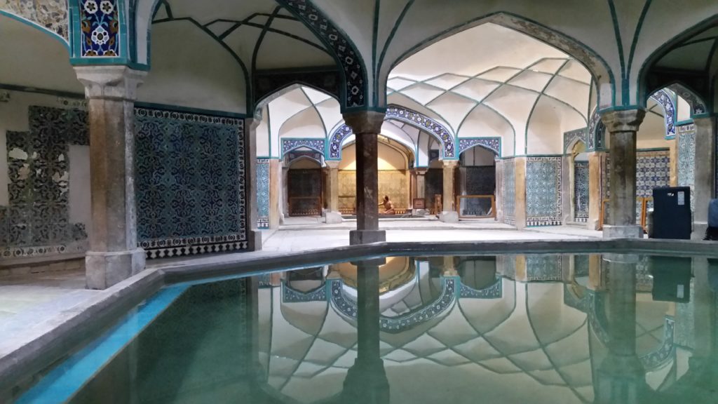
Same idea with the Hammam-e-Vakil, a bath in the same complex, that has been converted into a teahouse.
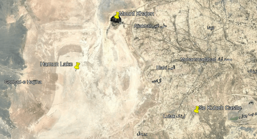
Leaving Kerman, next on the alignment we come to the Lakes of Hamun, which is on the border of Iran and Afghanistan in the Sistan Basin, largely fed by the Helmand River and seasonal meltwater.
They consist of three shallow, interconnected seasonal freshwater lakes and wetlands – Lakes Helmand, Sabari, and Puzak – known collectively as Lake Hamun.
They are not permanent seasonal lakes, but rather considered the largest body of freshwater on the Iranian Plateau that dry up completely during drought periods.
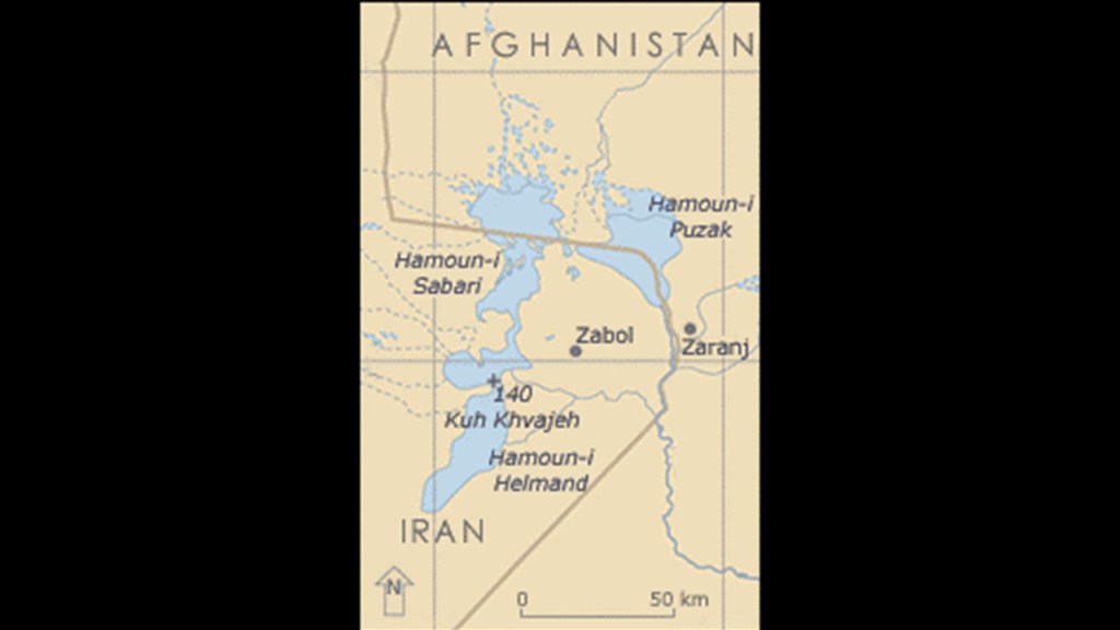
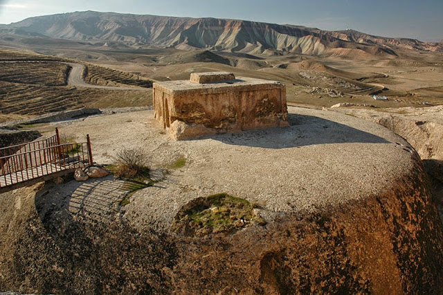
Mount Khajen, or Khajen Mountain, is in the Hamun Lake area on the alignment.
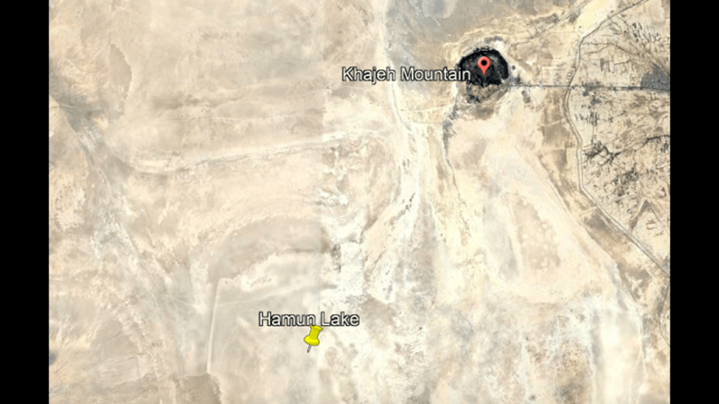
Mount Khajen is described as a flat-topped basalt mountain, but this is a land-form that I would now identify as a giant tree stump.
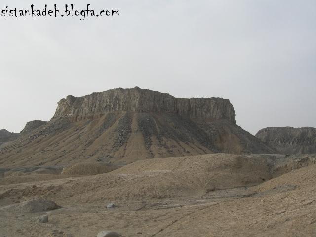
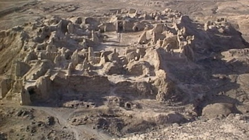
The ruins of a citadel complex, Rostam Castle, is located on Mount Khajen.
It is an important archeological site.
This area was also part of a southern branch of the Great Silk Road, part of an ancient network of trade routes that connected East and West.
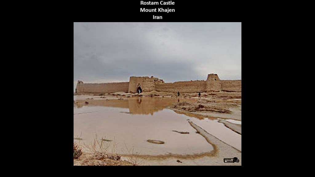
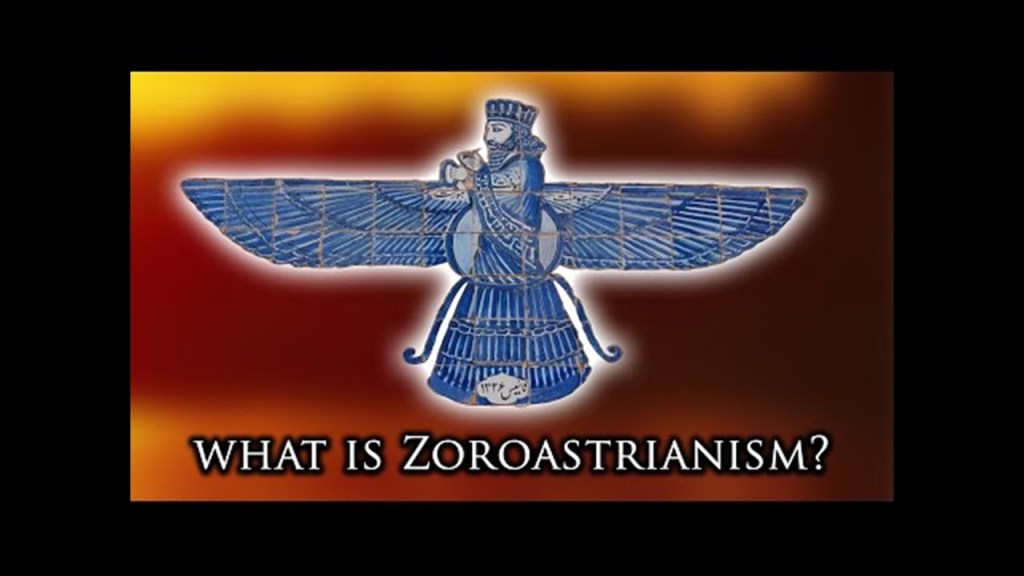
There is a Zoroastrian fire temple within the remnants of the complex.
Not only that, in legend Lake Hamun is considered to be the “Keeper of Zoroaster’s seed.”
This means Zoroastrians believe that when the final renovation of the world is near, maidens will enter the lake, and give birth to the Saoshyans, the saviors of mankind.
In Zoroastrianism, fire is symbolic of Purity and Divine Light.
Zoroastrianism is one of the world’s oldest, continously practiced religions, and believed to have originated around 3,500-years-ago in Persia, and named for its founder, the prophet Zoroaster, also known as Zarathustra.
It is a monotheistic faith that centers on the worship of one Creator God, Ahura Mazda, and the belief that the world is a battleground between Ahura Mazda and the destructive spirit, Angra Mainyu.
Thus, Zoroastrianism emphasizes a dualistic struggle between good and evil, and encourages followers to live by “Good thoughts, good words, good deeds.”
The Se Kuheh Castle is also in nearby Hamun County.
We are currently looking in the Sistan-Balochistan Province of Iran.
It is a massive adobe brick structure described as having two main parts – a citadel and a tower.
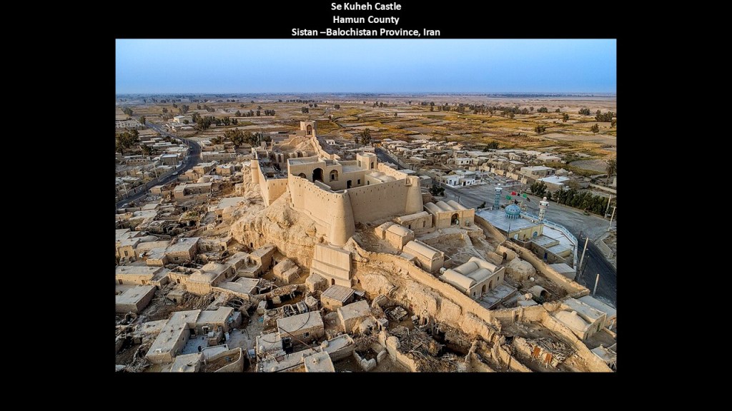
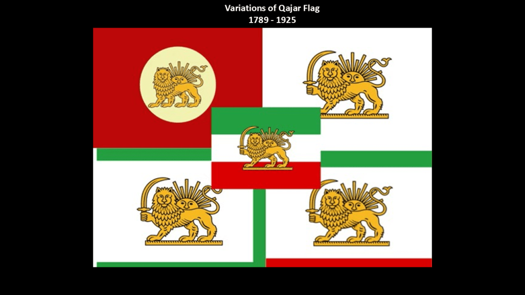
It was said to have been built during the Qajar Dynasty, which ruled between 1789 and 1925.
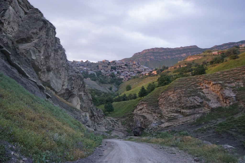
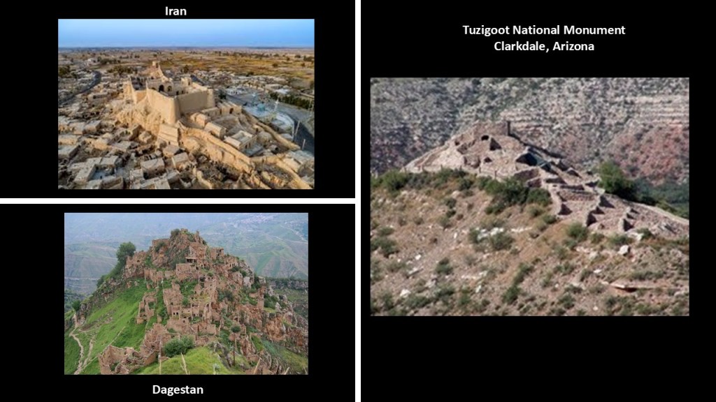
When I look at Se kuheh, it’s appearance reminds me of Gamsutl, pictured on the right.
One of the oldest settlements in Dagestan, it is said to be anywhere between 2,000 to 5,000-years-old, and was inhabited until 2015 when the last remaining resident passed away.
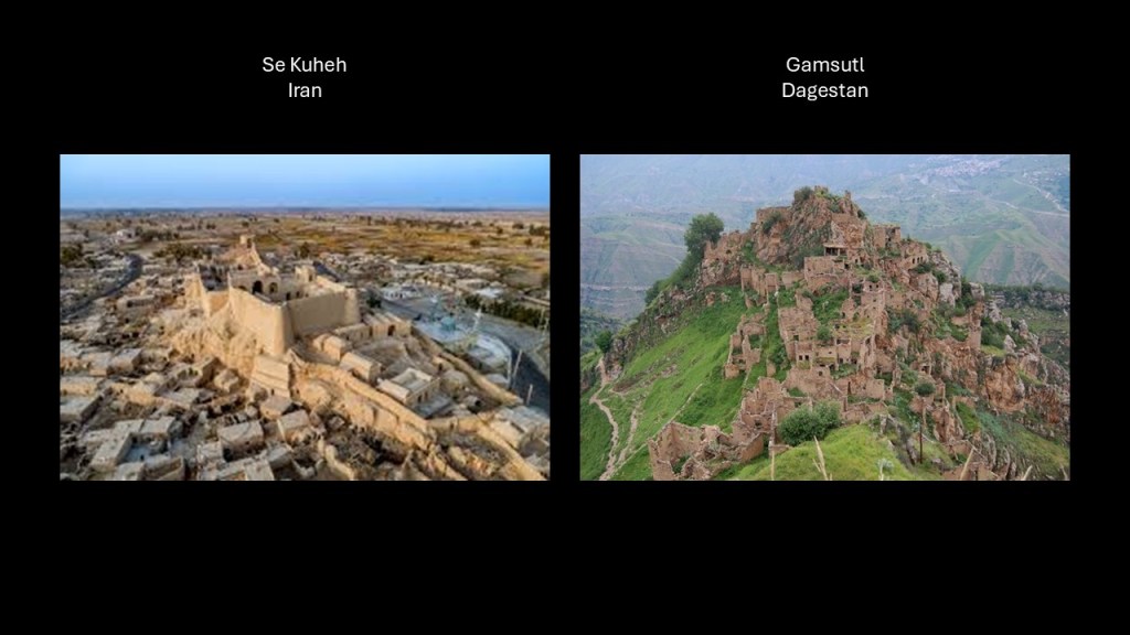
Dagestan is a Republic of Russia in the northern Caucasus Mountains, directly between the Republic of Chechnya to the west and the Caspian Sea to the East.
Dagestan is one of the most linguistically and ethnically diverse places in the world, with fourteen official languages, and with altogether more than 30 ethnic groups living there.
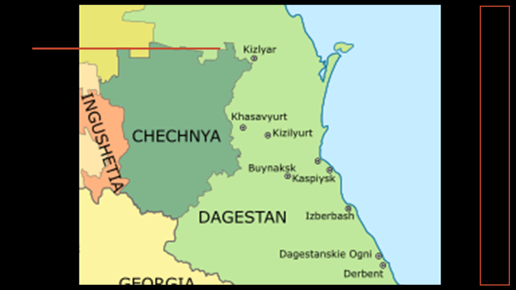
Gamsutl was an Avar village.
The Avars are a Northeast Caucasian ethnic group that forms the largest in Dagestan, and they traditionally live there in villages that are higher up in elevation.
“Avaria” was the historical name of the region of the “Avar Khanate,” which controlled the mountainous parts of Dagestan from the early 13th- to the 19th-centuries, until the Russian Empire annexed the North Caucasus region by ultimately defeating the Azars in the Caucasian War that lasted from 1817 to 1864.
And how close in sound are “Avaria” in the North Caucasus mountains and “Bavaria” in southern Germany?
There is also a similarity in appearance today between Se Kuheh in Iran; the abandoned Azar village of Gamsutl in Dagestan; and the Tuzigoot National Monument in Clarkdale, Arizona, near where I live.
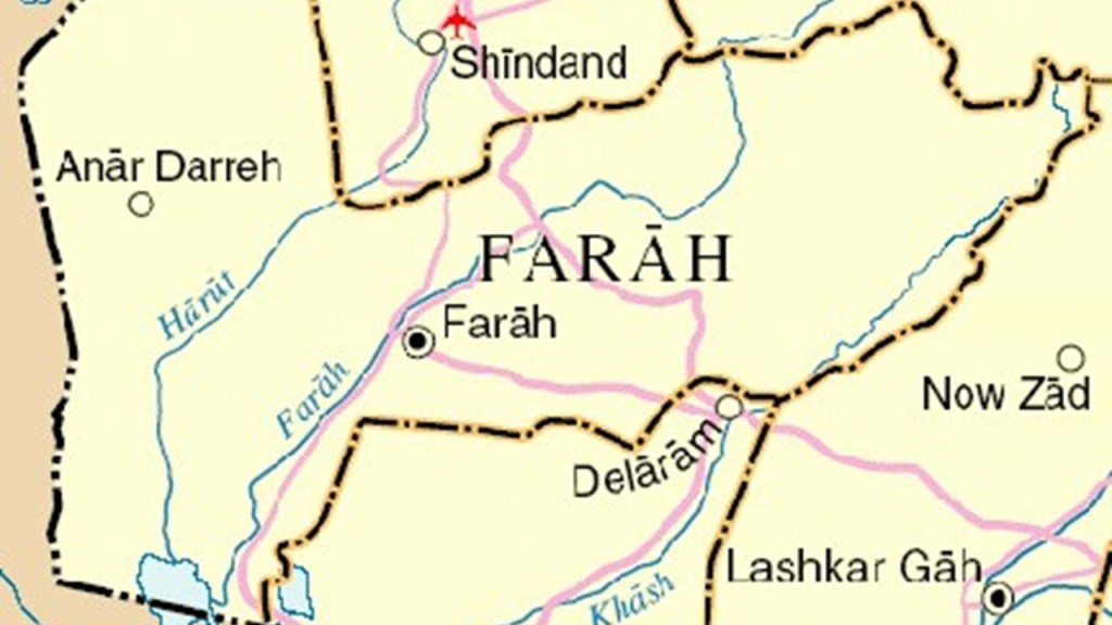
Next on this alignment we come to Farah in Afghanistan.
It is part of the sparsely populated Farah Province, which is mostly comprised of rural tribal groups.
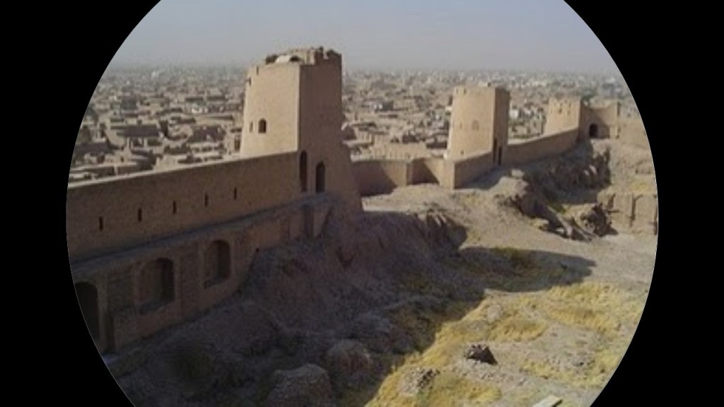
This is the Citadel at Farah, said to have been built as part of a network of fortresses by Alexander the Great when the history books tell us he took possession of the land in 330 B.C.
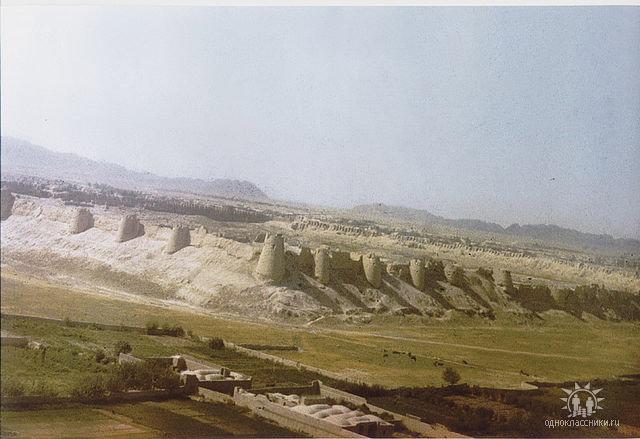
The city of Farah is believed to be over 3,000 years old, and one of the ancient places of the Persian Kings.
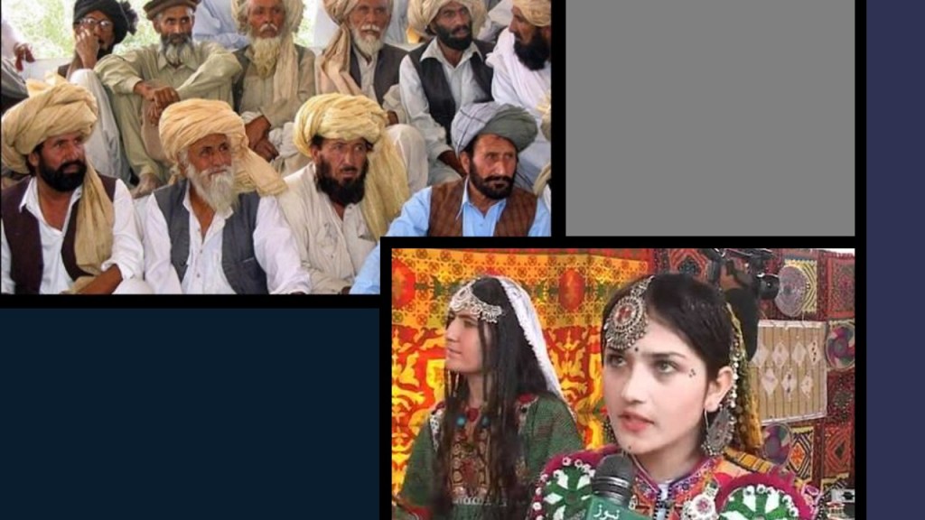
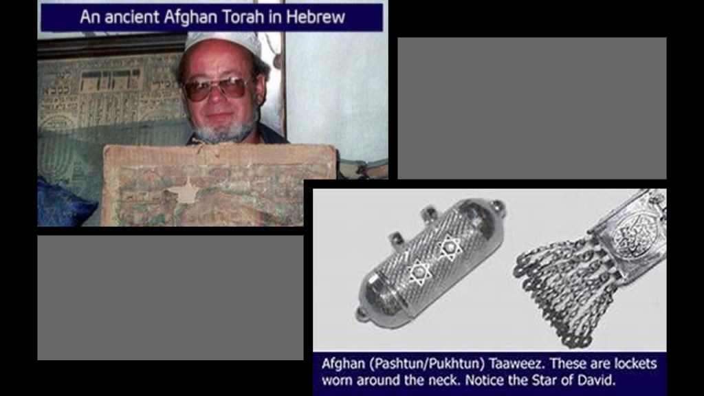
The population of Farah province is predominantly Pashtun.
The Pashtun are a tribal nation of millions of Afghani and Pakistani Muslims who have a strong oral tradition that they are descendants of lost Tribes of Israel, and they refer to themselves as Bani Israel.
More on the Pashtun to come shortly in this post.
Farah also belongs culturally and historically to Sistan Province in Iran, and the Greater Khorasan in the northeast part of the historical Persian Empire.
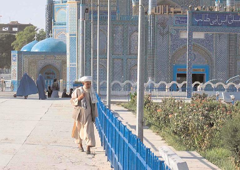
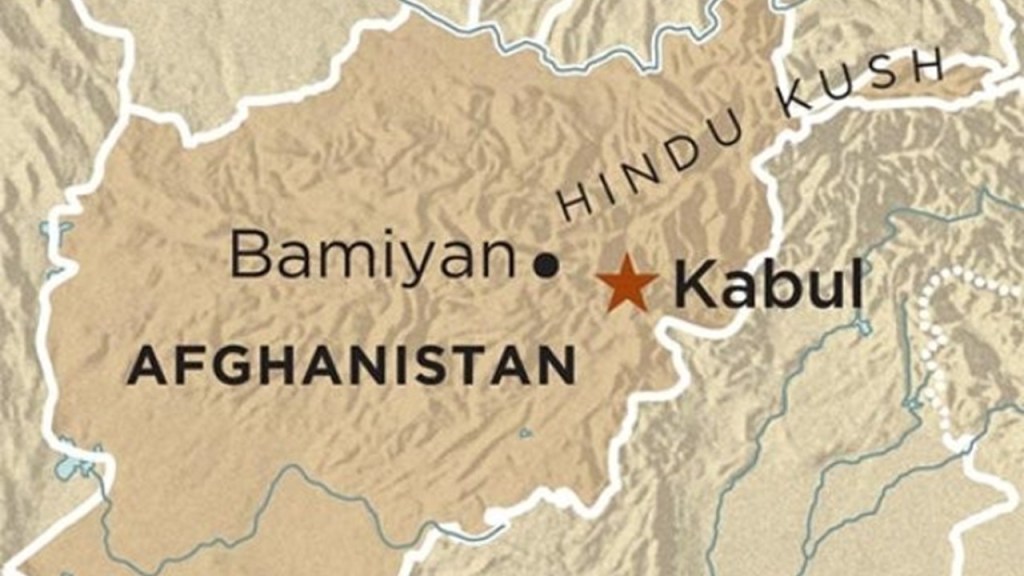
Next on this alignment is Mazar-e-Sharif, Afghanistan.
It is the third largest city in Afghanistan, and the capital of the Balkh Province.
This region is also part of the Greater Khorasan of the historical Persian Empire.
This is the Citadel in the ancient city of Balkh.
Balkh was a major center of Zoroastrianism and Buddhism in northern Afghanistan.
It is a short distance northwest of Mazar-e-Sharif.
It was also known as Bactra, the capital of ancient Bactria.
Our history books convey to us that Alexander the Great captured the city in 330 BC, and the hordes of Genghis Khan completely destroyed it in 1220 AD.
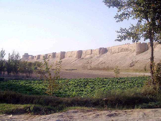
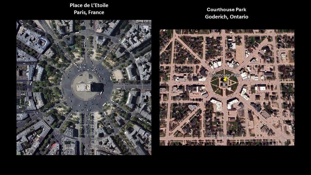
It is interesting to note that modern Balkh is a geometrically perfect circle with streets radiating out from the center of the circle.
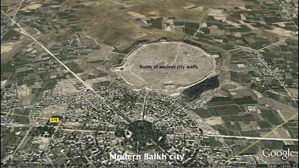
I’ve seen that same kind of perfect geometric lay-out in Paris, France, and Goderich, Ontario, with streets radiating out from a central point.
The Hindu Kush is just south of Balkh.
The Hindu Kush is a 500-mile, or 800-kilometer, -long mountain range in Central and South Asia, in-between Afghanistan and Pakistan.
And there’s a reference to “Kush” again.
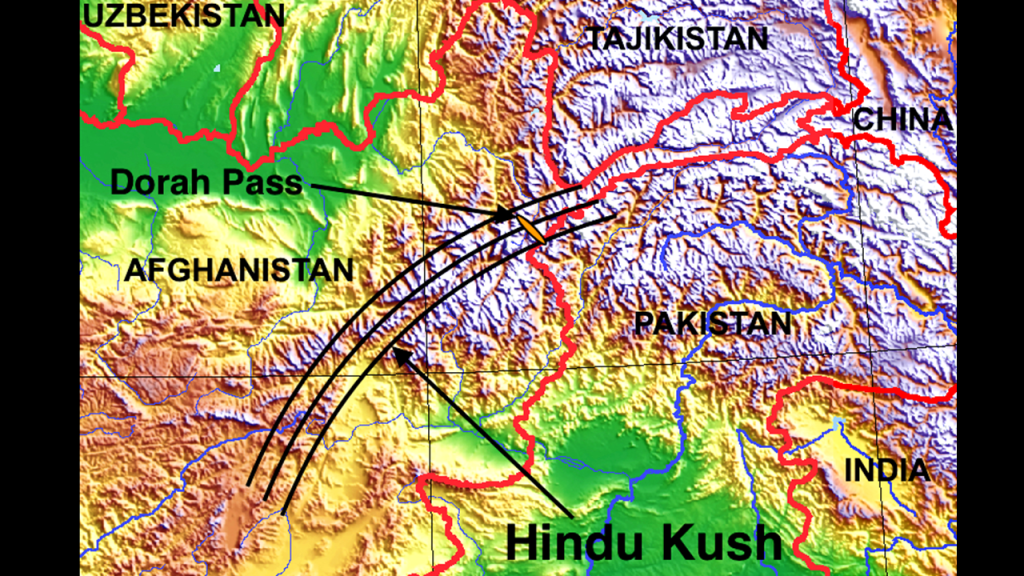
There are many who believe that there is a connection between Balkh, the Hindu Kush, and Shambhala.
Zoroastrians, for example, identified the Hindu Kush as the High Hara, or the geographic center of the universe around which the stars and the planets revolve, and the home of the “Masters of the Heart.”
There is a strong history of Buddhism in this part of the world as well.
In Balkh, there are stupas over the remains of the first lay disciples of the Buddha – Trapusa and Bahalika.
The city of Balkh was said to have derived its name from Bahalika.
This Buddhist stupa near Balkh sits on top of the Takht-e-Rustam, the throne of the hero of the world.
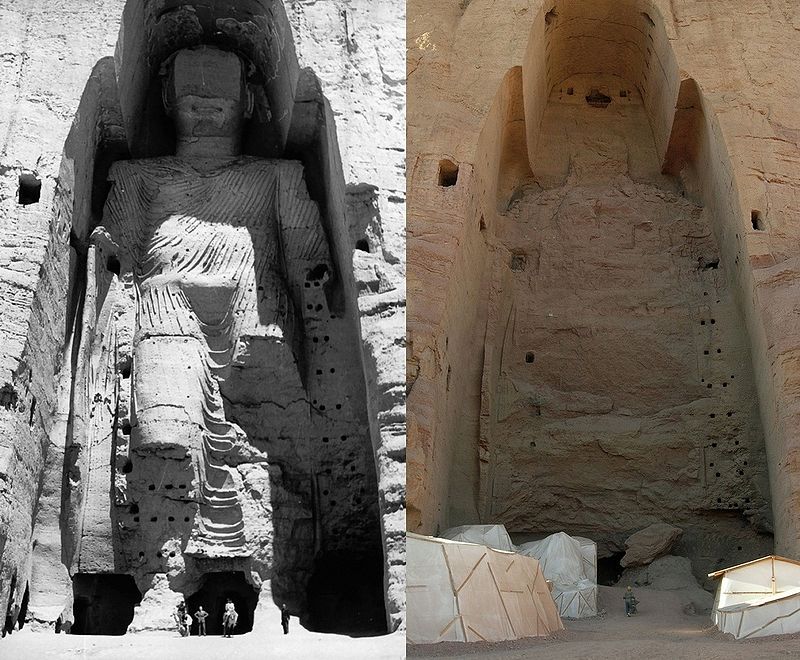
The Bamiyan Valley of Afghanistan is south of Mazar-e-Sharif in Central Afghanistan, not far from Kabul, the country’s capital.
There were two colossal statues of Buddha there, carved into the sandstone.
Both statues were destroyed by the Taliban in 2001.
I firmly believe there would be no mysteries in history if we had been taught the true history, about an ancient advanced worldwide civilization that was all about Harmony, Balance, Beauty, Sacred Geometry and Unity with each other and the Universe, and connecting with One’s Higher Self.
This is one example of many of how dark forces have been hell-bent on physically destroying this civilization, and its memory and legacy.
Now I am going to come into modern Iran from another direction, starting in Lahore, Pakistan.
This research is from “The Relationship Between Sacred Geometry, Ley-lines, and Places in Alignment,” which was a 23-part series I did back in 2019 and 2020, of an alignment that started in San Francisco, California.
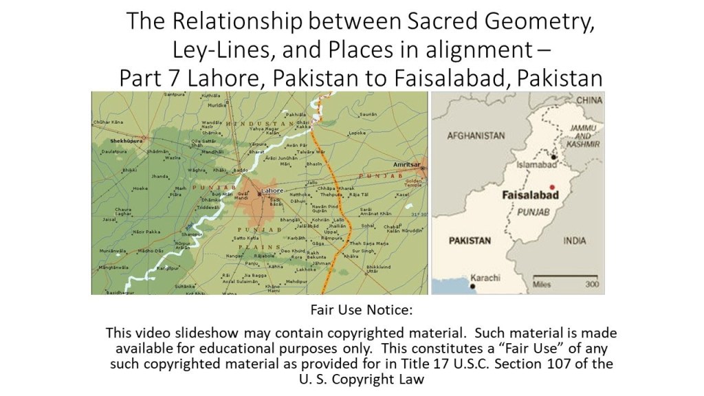
Lahore is the capital city of the Punjab Province of Pakistan.
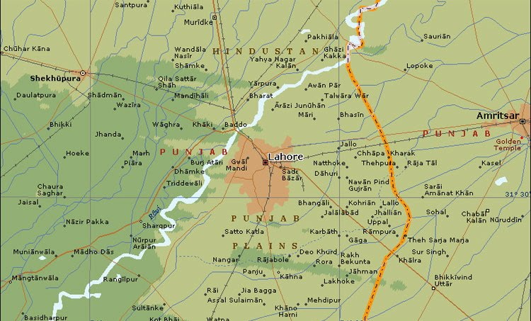
The Punjab is a historical region of South Asia, in the northern part of the Indian subcontinent, and was the cradle of the ancient Indus Valley Civilization, which was largely in modern Pakistan.
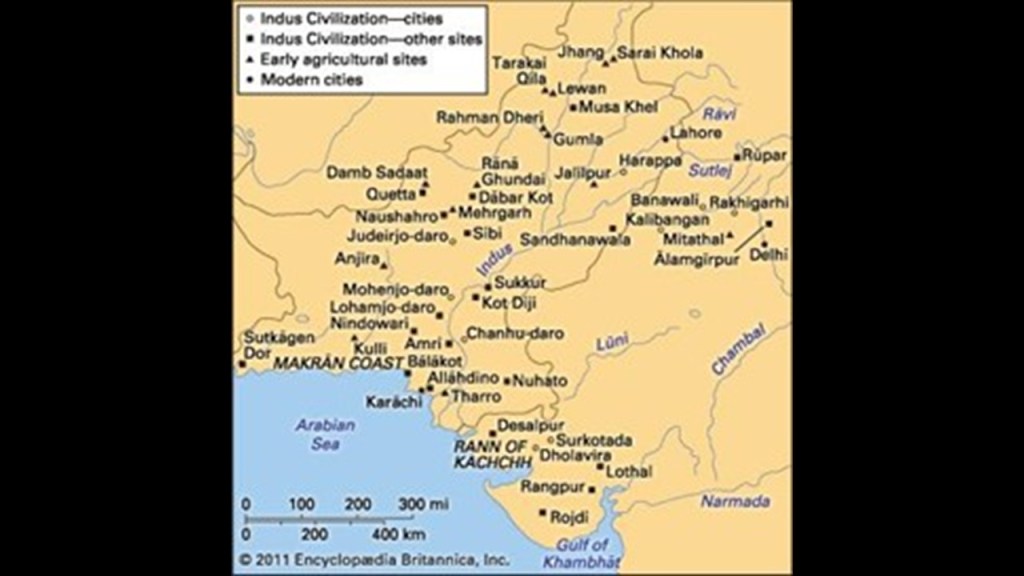
The Indus Valley Civilization flourished in the basins of the Indus River, which originates on the Tibetan Plateau near Mount Kailash, and ultimately flows along the entire length of Pakistan to the Arabian Sea.
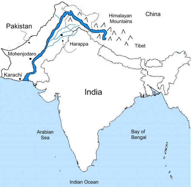
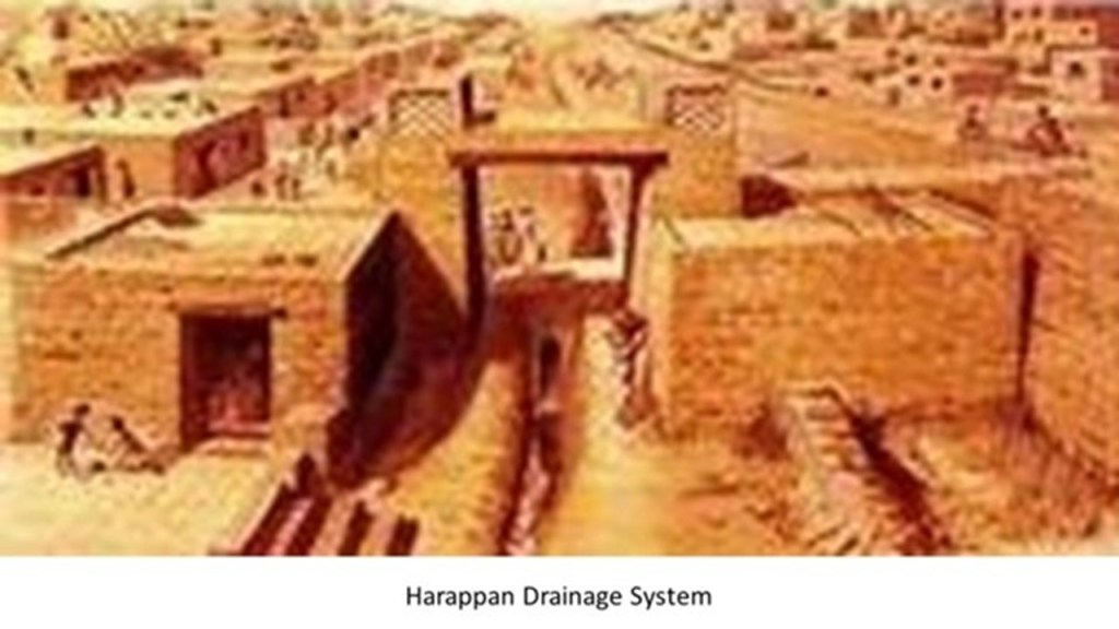
The ancient civilization that flourished here was also known as the Harappan Civilization, after Harappa considered the type, or model, site of the civilization.
Mohenjo-Daro was one of the largest cities of the ancient Harappan civilization of the Indus River Valley, and is a UNESCO World Heritage site, said to have been built starting in 2500 BC and one of the world’s earliest major cities.
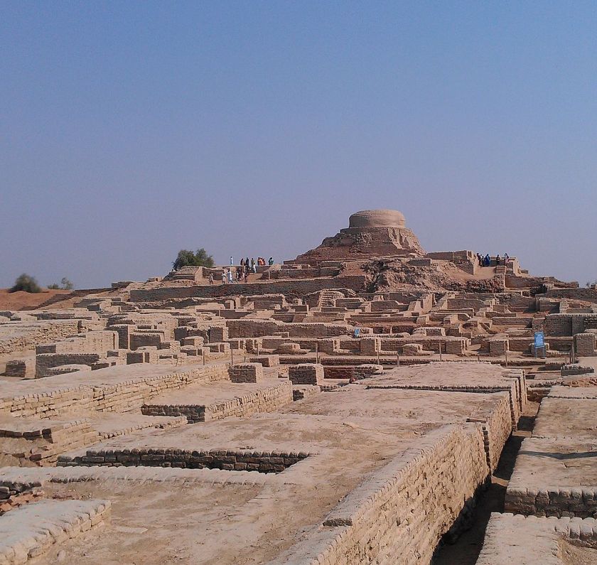
The Harappan Civilization was well-known for its urban-planning, baked-brick houses, elaborate drainage systems, water-supply systems, clusters of large, non-residential buildings, and metallurgy.
I even read where they even had street-lights, and extremely accurate systems of weights and measures.
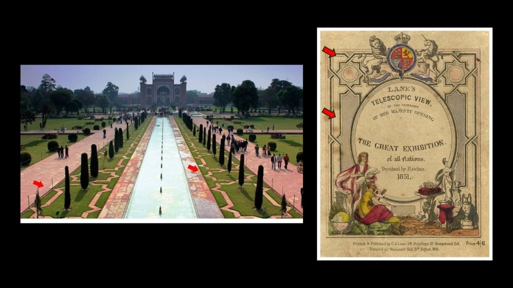
The Great Exhibition of the Works of All Nations, held in the Crystal Palace In London in 1851 was also known as “The Great Shalimar,” which was a reference to the Mughal Garden complex in Lahore, where you see the eight-pointed star and similar design-patterns found at the Lahore Gardens on the left are also on the Great Exhibition brochure on the right.
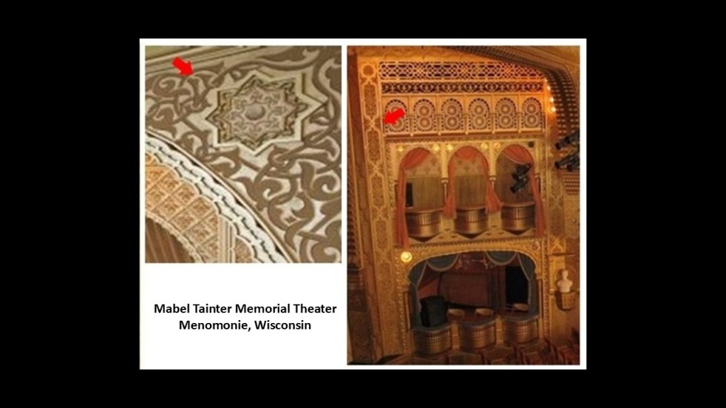
I think these design patterns with eight-pointed stars were a significant symbol for the ancient advanced worldwide civilization, because I find them everywhere, including, but far from being limited to, the Mabel Tainter Memorial Theater in Menomonie, Wisconsin.
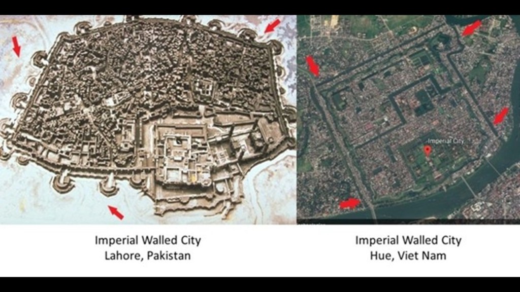
The Walled City of Lahore, also known as the Old City, forms the historic core of Lahore, and was the capital of the Mughal Empire at one time.
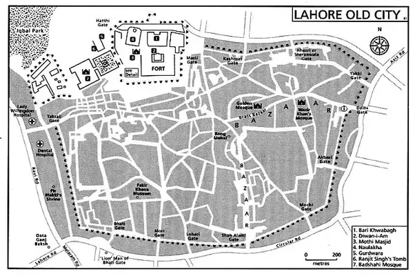
Here’s a view of the Walled City of Lahore on the left showing what looks to be very similar to a star city configuration, like the example of the Imperial City of Hue in Viet Nam on the right.
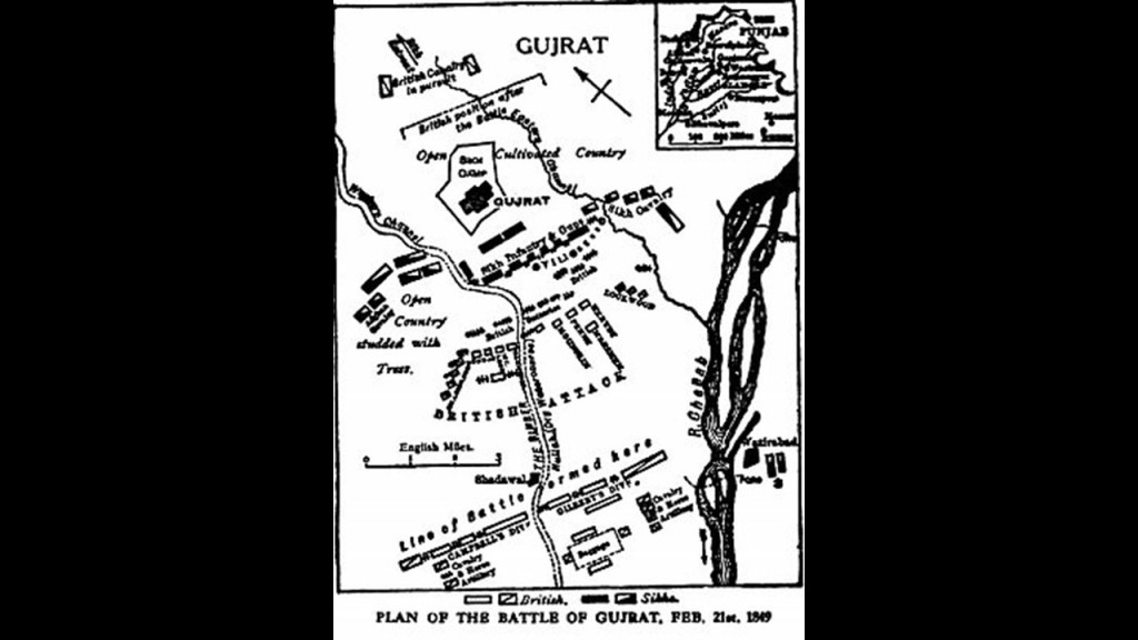
Lahore Fort passed to British Colonialists when they annexed the Punjab region following their victory over the short-lived Sikh Empire, which lasted from 1799 to 1849, and which had replaced the Mughal Empire here, in the Battle of Gujrat in February of 1849.
The Battle of Gujrat was part of the Second Anglo-Sikh War, a military conflict between the Sikhs and the British East India Company that took place in 1848 and 1849.
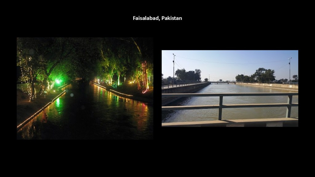
Moving along the alignment, Faisalabad is next, the second-largest city in the Punjab Province of Pakistan, after Lahore.
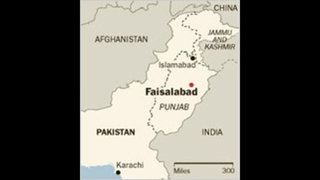
We are told that historically it was one of the first planned cities in British India.
It is a major industrial and distribution center because of its central location in the region, and connecting roads, rail and air transportation, as well as a major center of industry, with major engineering works, like the Faisalabad steam-powered grid station, and mill-works of all kinds.

There are also canals in Faisalabad.
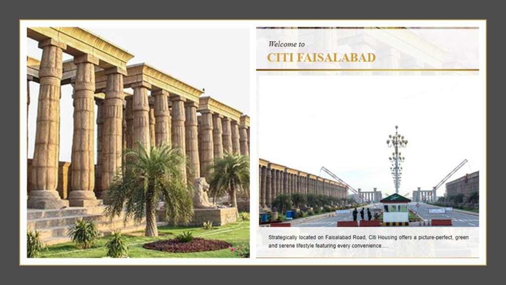
These pictures are associated with Citi Housing of Faisalabad, described as a high-end housing society with a gold standard lifestyle.
They look more like Ancient Egyptian temple ruins and an archeological site than a residential neighborhood.
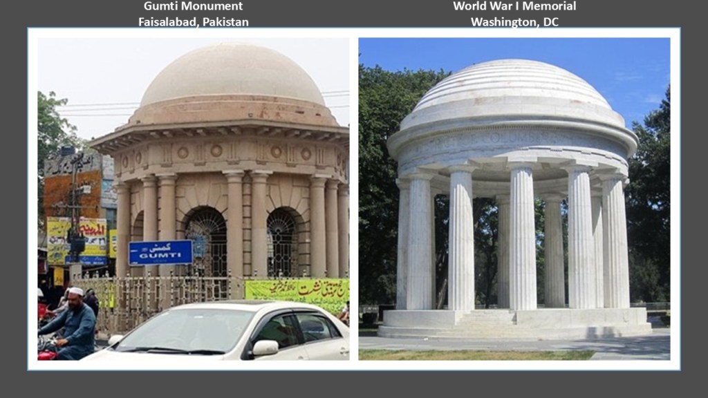
This is called the Gumti Monument in Faisalabad’s Chenab Colony, which has similar characteristics to western infrastructure, like the World War I Memorial said to have been erected in Washington, DC, in 1931, which would have been during the Great Depression.
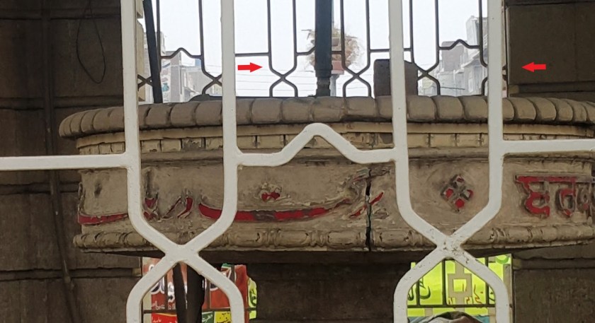
This is a close-up view of the Gumti Memorial, where we find the same two design patterns I highlighted earlier – the eight-pointed star and what I am going to call an infinity pattern for lack of a better description.
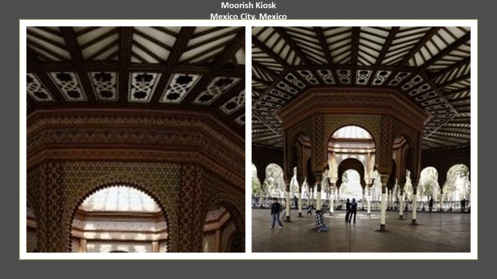
Like I said before, I have found these patterns together in places across countries and continents, like the Moorish Kiosk in Mexico City…
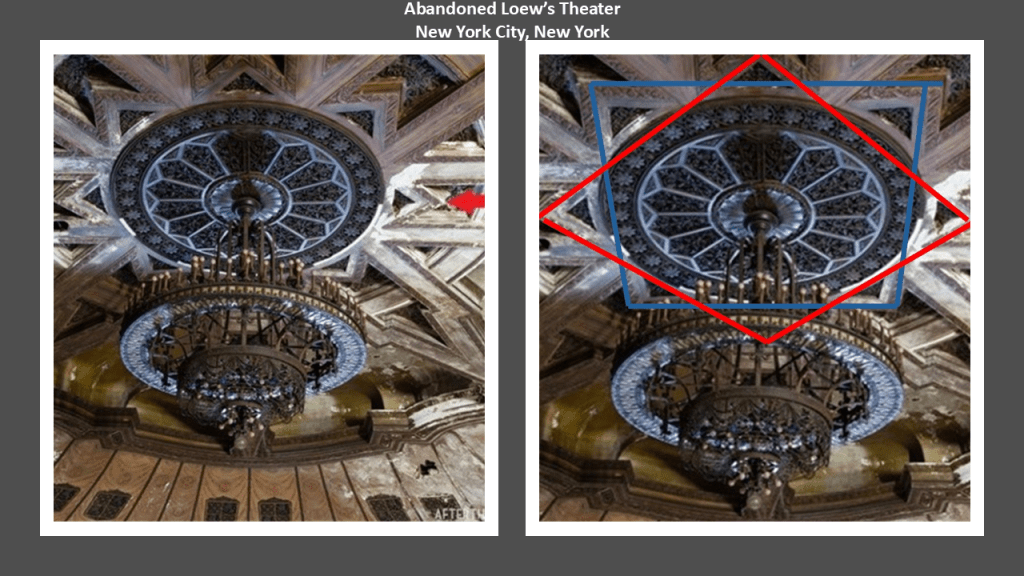
…and an eight-pointed star in the designs of the ceiling above the chandelier of the abandoned Loew’s Theater on Canal Street in Manhattan.
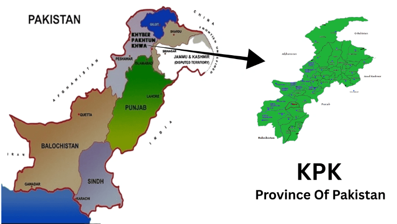
Next on this alignment from Faisalabad, we are coming into the Khyber-Pakhtunkwha Province, which is the location of the Khyber Pass, a mountain pass in the northwest of Pakistan, and was an integral part of the ancient Silk Road.
A translation is “On the Khyber side of the Land of the Pashtuns.”
This is the Bab-e-Khyber, or Khyber Gate. that stands at the entrance to the Khyber Pass that was said to have been constructed in four months and inaugurated in 1963.
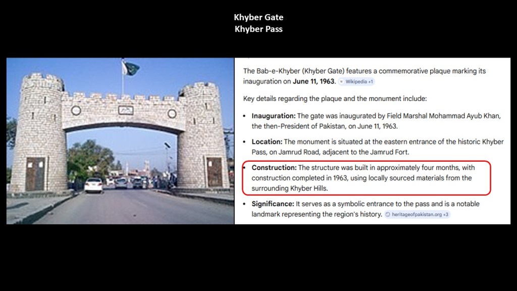
The turreted and crenellated appearance of the Bab-e-Khyber brought to mind the style of architecture seen on this old Merovingian textile from France on the top, and the Cajun flag of Louisiana on the bottom.
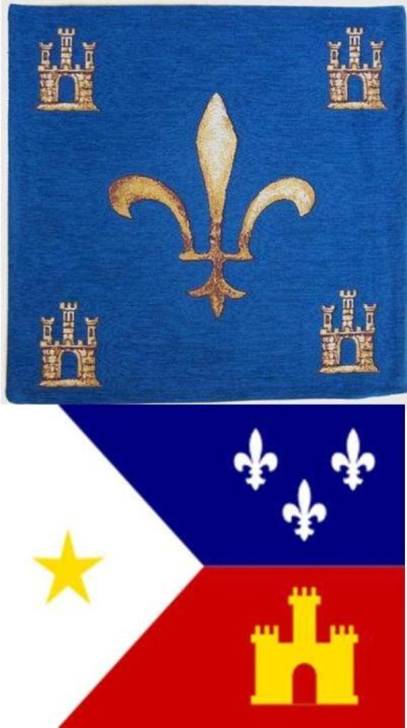
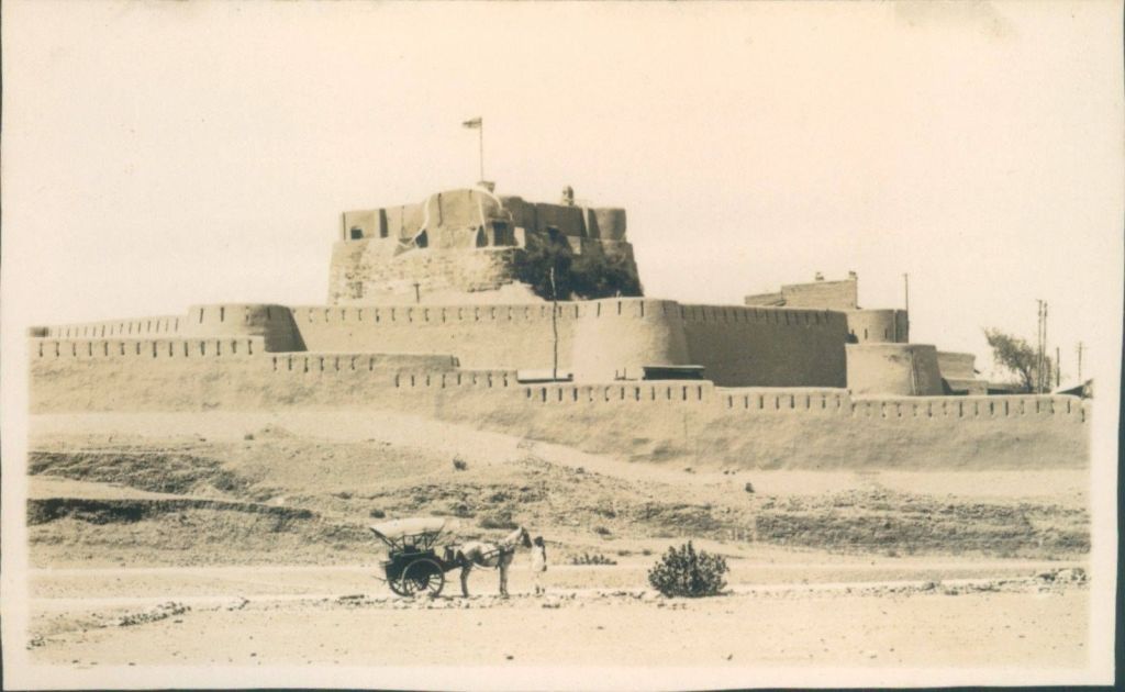
The Jamrud Fort is adjacent to the Bab-e-Khyber.
We are told that the foundation of the fort was laid out by the Sikh General Hari Singh Nalwa on the 18th of December in 1836, and that the fort was completed in 54-days, after Jamrud was lost to the Afghan Durrani Empire and conquered by the Sikh Empire.
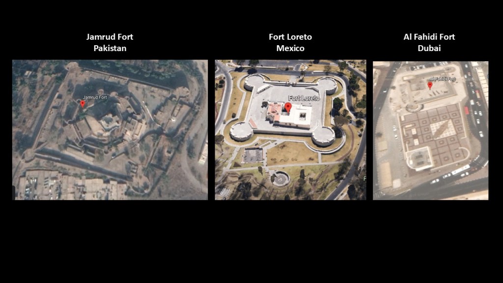
This is a screenshot of the Jamrud Fort on Google Earth, with its rounded bastions, on the left, which we see at Fort Loreto in Puebla, Mexico in the middle, and rounded bastions are seen at Dubai’s Al Fahidi Fort on the right.
While most star forts have more angled configurations, making them look like stars, not all do, and I believe they were originally part of the electrical circuitry of the Earth’s grid system, and not military in nature as we are taught to believe.
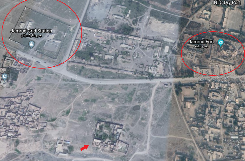
As a matter of fact, the Jamrud Electrical Grid System is located very close to Jamrud Fort, as is at least one other structure with the arrow pointing towards it, and possibly more, that looks like it could be connected to this system.
It is typical to find star forts in clusters of two or more.
Khyber-Pakhtunkwha Province was the historical location of the ancient kingdom of Gandhara, including the ruins considered to be 2,000 years old of its capital city Pushkalavati, near modern-day Charsadda.
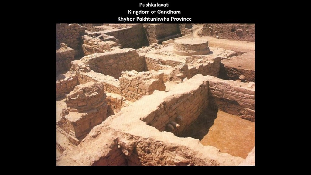
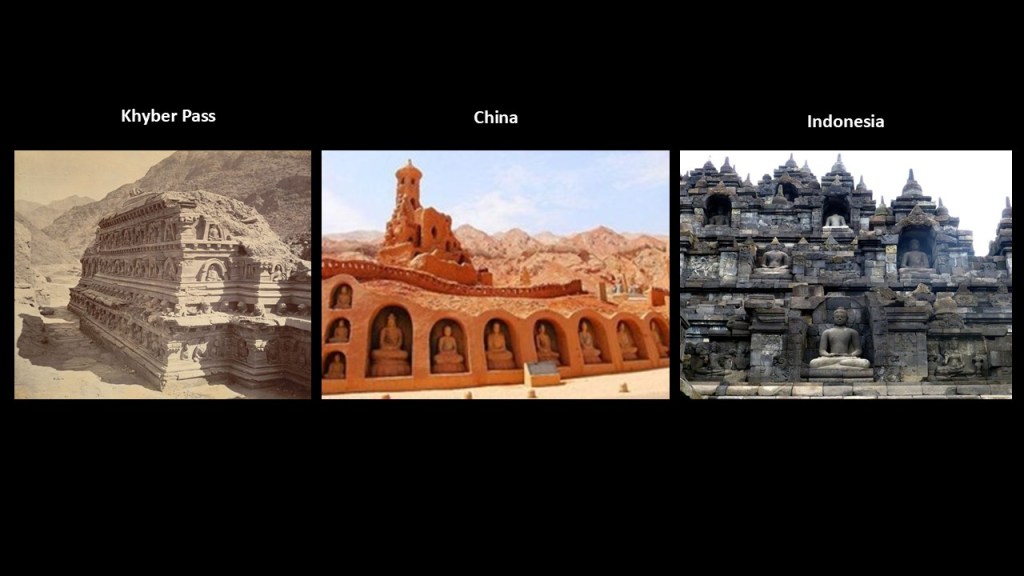
Pushkalavati was originally a stronghold of Buddhism.
These Buddhist ruins are found in the Khyber Pass of Afghanistan, on the left compared in appearance to the Bezeklik Thousand Buddha Caves in Turpan in northern China’s Uyghur Autonomous Region in the middle, and Borobudur on the island of Java in Indonesia on the right.
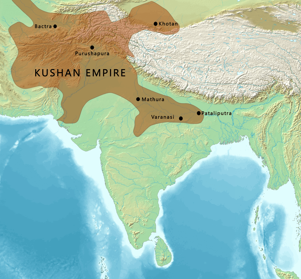
Ancient Gandhara in present-day Pakistan was said to have attained its height from the 1st- to the 5th-centuries AD, flourishing as the “Crossroads of Asia” under the Kushan Empire.
The Kushan Empire encompassed much of what is now Afghanistan, India, Pakistan, western Nepal, Tajikistan and Uzbekistan, and said to have been formed by the Yuezhi, an ancient people described as nomadic pastoralists, who were in the Bactrian territories in the early 1st-century.
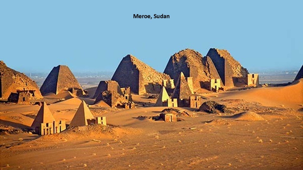
We will never know if it was connected to the Kingdom of Kush of Africa because that is not what our history tells us, but something to consider.
Could there have been a connection between the Kushan Empire, in this region which includes a mountainous region known to this day as the “Hindu Kush,” and the Kushite Empire of northern Africa with its capital of Meroe (also sounds like “Merovingian” mentioned previously in association with the French textile design) in Sudan near the Nile River, pictured here?
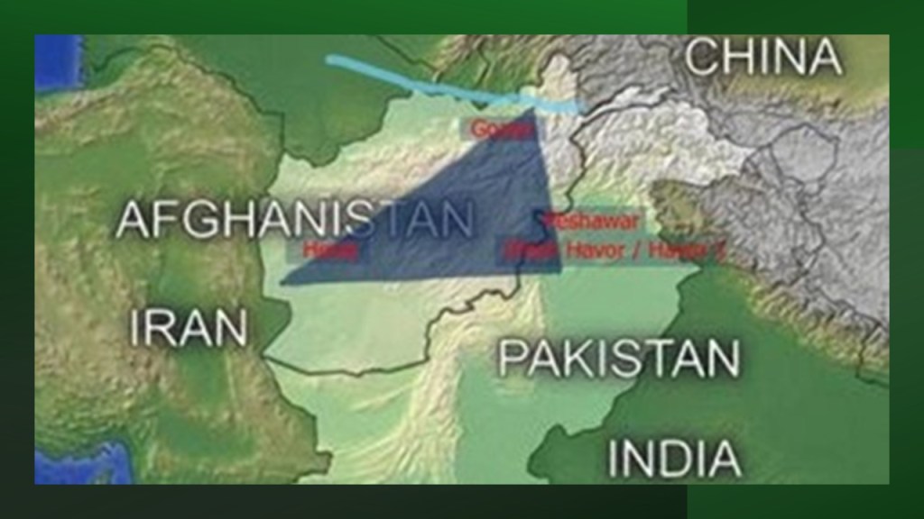
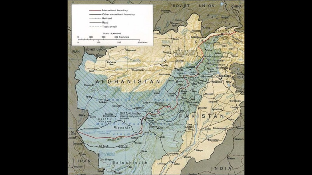
This leads back to the Pashtun tribal peoples, the primary inhabitants of the Khyber-Pakhtunkwha and Balochistan Provinces of Pakistan and Afghanistan, in a region regarded as Pashtunistan, split between two countries since the Durand Line border between the two countries was formed in 1893 after the second Anglo-Afghan War.
The name sake of the line, Sir Henry Mortimer Durand, was a British Diplomat and Civil Servant of the British Raj. We are told that together with the Afghan Emir, Abdur Rahman Khan, it was established to “fix the limit of their respective spheres of influence and improve diplomatic relations and trade.
Well, that certainly sounds good…but what was really going on here?
The Durand Line cuts through the Pashtunistan and Balochistan regions, politically dividing ethnic Pashtuns and Baloch, who live on both sides of the border.
But, really, why divide a people in this fashion?
It has been clear to me travelling through this part of the world how what we know as the European Colonial powers, starting in the 18th-century, just tore up this part of the world through partitioning it.
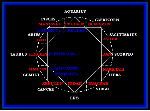
As I mentioned previously in the Farah Province of Afghanistan, the Pashtun are a tribal nation of millions of Afghani and Pakistani Muslims who also have a strong oral tradition that they are descendants of lost Tribes of Israel, and they refer to themselves as Bani Israel.
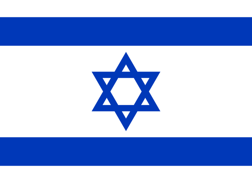
Here is an example of a Pashtun textile piece showing the sacred geometric shape of a star tetrahedron in the center, also known as the Star of David…
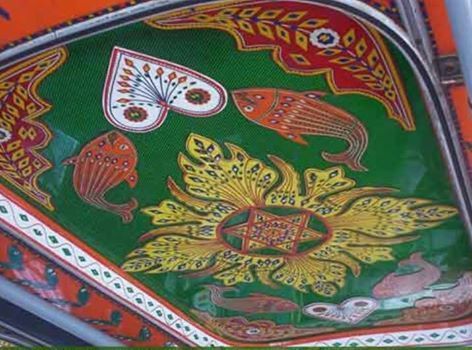
…and a recognizable symbol of what is called Judaism today, as seen on the flag of Israel.
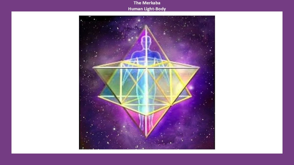
This is also the 2D symbol of the 3D star tetrahedron that is the sacred geometric shape of the Human Lightbody, known as the Merkaba.
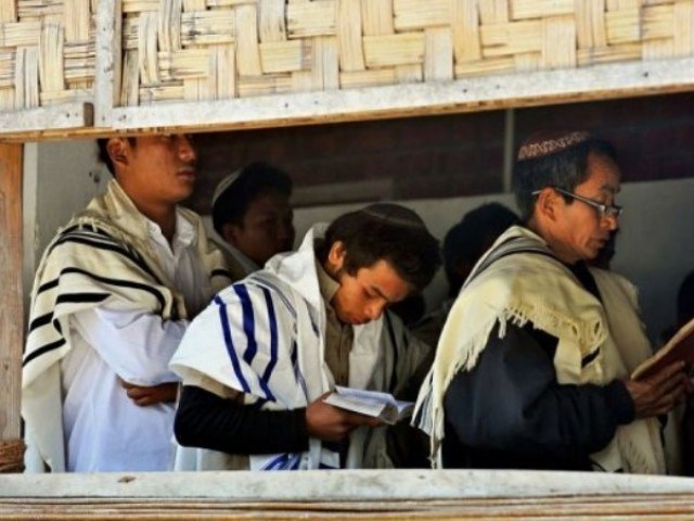
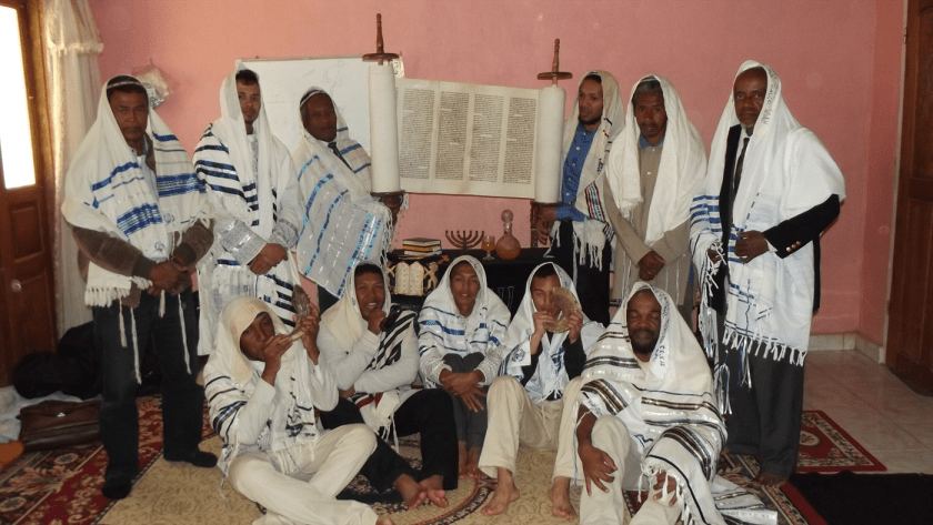
What is intriguing is that there is other evidence that the Pashtun people of this region are connected to the Tribes of Israel.
At first I was puzzled by seeing references to the twelve tribes in different places besides the Pashtun in Pakistan and Afghanistan.
I found the Tribe of Naphtali in the South Pacific…
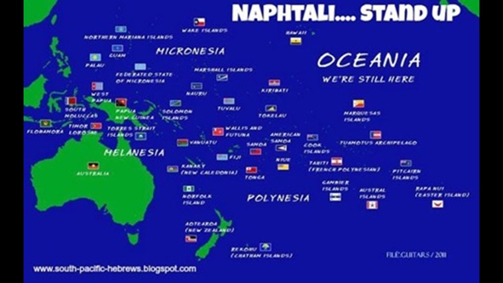
…the Tribe of Reuben in Australia…

…the Kuki of India say they are of the Tribe of Manasseh…
…and on Madagascar, there is a resurgence of what they say the original faith of the island.
The Jesuits were said to have arrived here in 1845, and entrusted with the Prefecture Apostolic of Madagascar in 1850.
I think a good explanation of this finding of the same tribal name in different parts of the world is contained in a Megalithomania presentation by Christine Rhone on “Twelve Tribe Nations – Sacred Number and the Golden Age.”
She co-authored a book with John Michel of the same name.
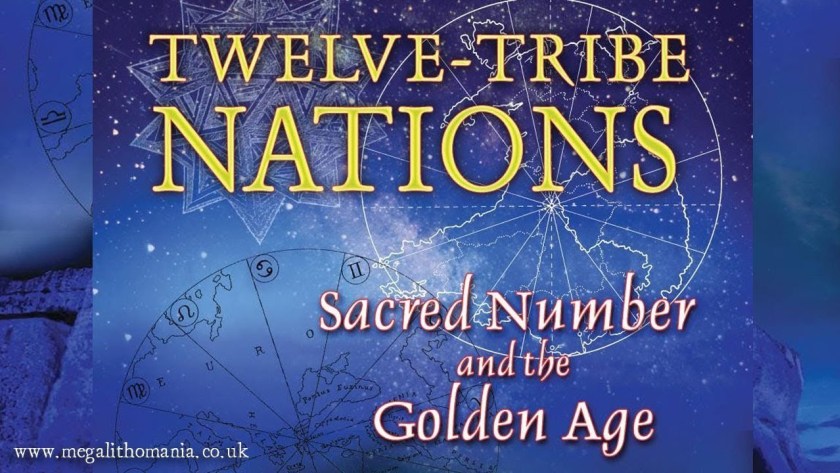
Among other things, they followed the Apollo – St. Michael alignment across countries and continents all the way to Jerusalem in Israel. They discuss records and traditions of whole nations being divided into twelve tribes and twelve regions, each corresponding to one of the twelve signs of the zodiac and to one of the twelve months of the year, all formed around sacred centers.
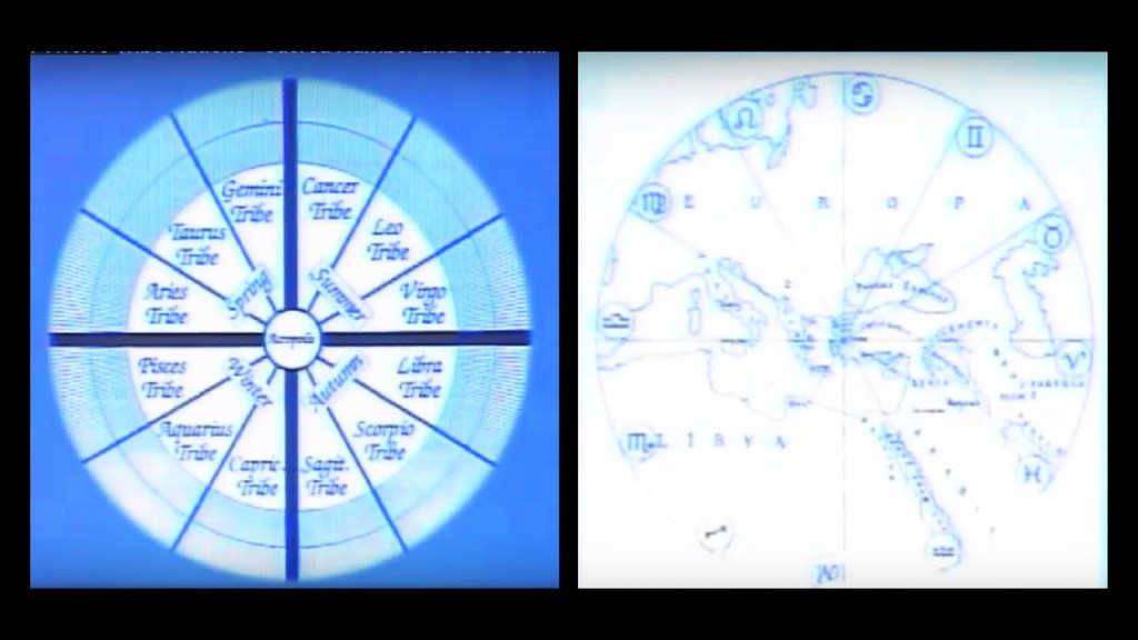
So what if we are talking about a civilization arrangement like what you see pictured here with the 12 Constellations and 12 Tribes of Israel all contained within an 8-pointed star?
And that was the same symbol seen earlier in this post when I asked the question “Who were the People of Ar?”

I realized that earth’s true history was not about organized religions, which is a stumbling block because of what we have always been taught.
The Controllers didn’t rewrite history from scratch – they rewrote the historical narrative to fit their agenda, and from cradle-to-grave, we are immersed in learning their version of history.

There is so much we haven’t been told about the True History of the Earth, including how all organized forms of religion connect back into the Advanced Ancient Civilization, and are not mutually exclusive as we have been taught to believe.

They definitely don’t want us to know who we really are, and try to keep most of Humanity stuck in their lower selves in every way possible, including addictions, distractions, and consumerism that huge corporations are making massive profits from.

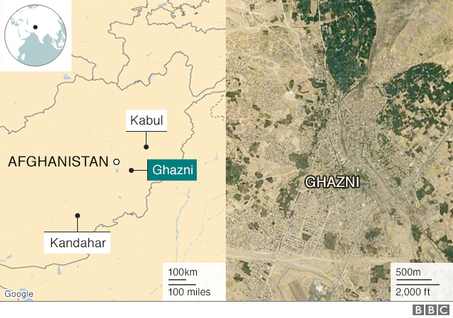
This alignment next enters Ghazni In Afghanistan from Pakistan.
It is stategically located on the main Highway 1 between Kabul and Kandahar, which has served as the main road between those two cities for thousands of years.
Ghazni is an ancient city with a rich heritage.
The Ghazni Citadel was said to have been built in the 13th-century to form a walled city.
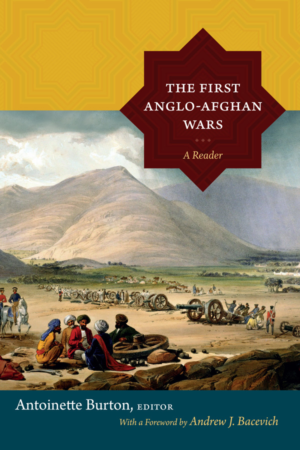
This is a lithograph painting of the Ghazni Citadel in 1839 by James Rattray, a soldier and artist serving in Afghanistan in the 1st Afghan War.
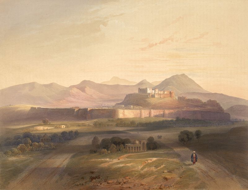
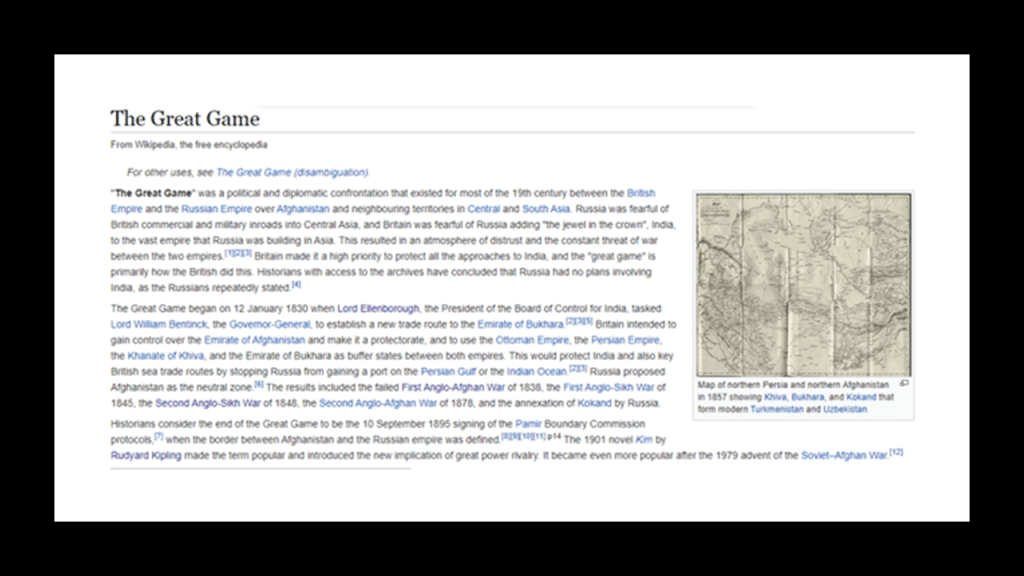
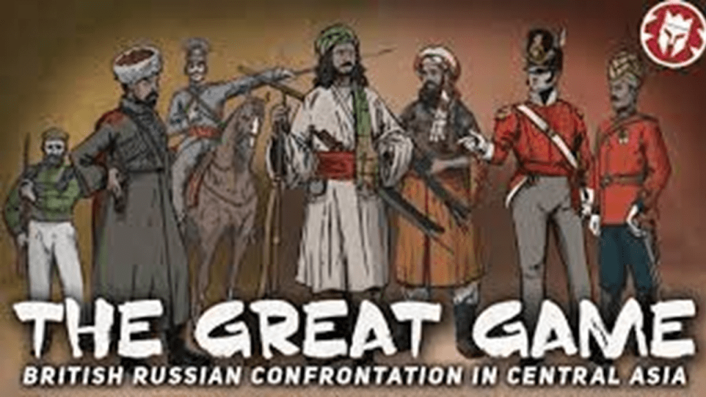
The First Anglo-Afghan War is called one of the first major conflicts of what was called “The Great Game,” the 19th-century competition for power and influence in central Asia between Britain and Russia.
I found reference to “the Great Game” in the Torres Strait Islands, a group of at least 274 small islands in the Torres Strait between Australia’s Cape York and New Guinea.
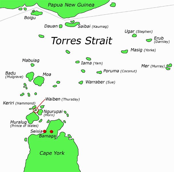
Green Hill Fort was located on Thursday Island in the Torres Strait near Cairns in North Queensland, Australia.
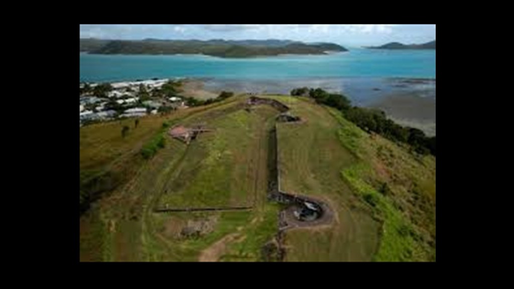
This complex was said to have been constructed between 1891 and 1893 as part of the Imperial and Colonial whole-of defense of Australia in response to the Russian Scare of 1885 that grew out of Anglo-Russian Rivalry in Afghanistan, also known to history as the “Great Game”and the European colonial expansion into New Guinea and the South Pacific.
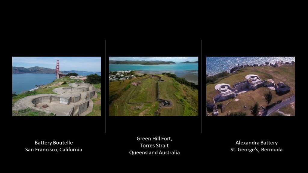
Compare the Green Hill Fort in the middle for similarity of appearance with the Battery Boutelle on the left, on the north end of the Golden Gate Bridge in San Francisco, said to have been built in 1900; and the Alexandra Battery on the right, said to have been built in St. George’s, Bermuda, in the 1860s to protect the north shore and ship’s channel.
The First Anglo-Afghan War was fought for three years between the British East India Company and the Emirate of Afghanistan starting in 1839, after the British had captured Kabul.
There’s that 8-pointed star again on this book cover.
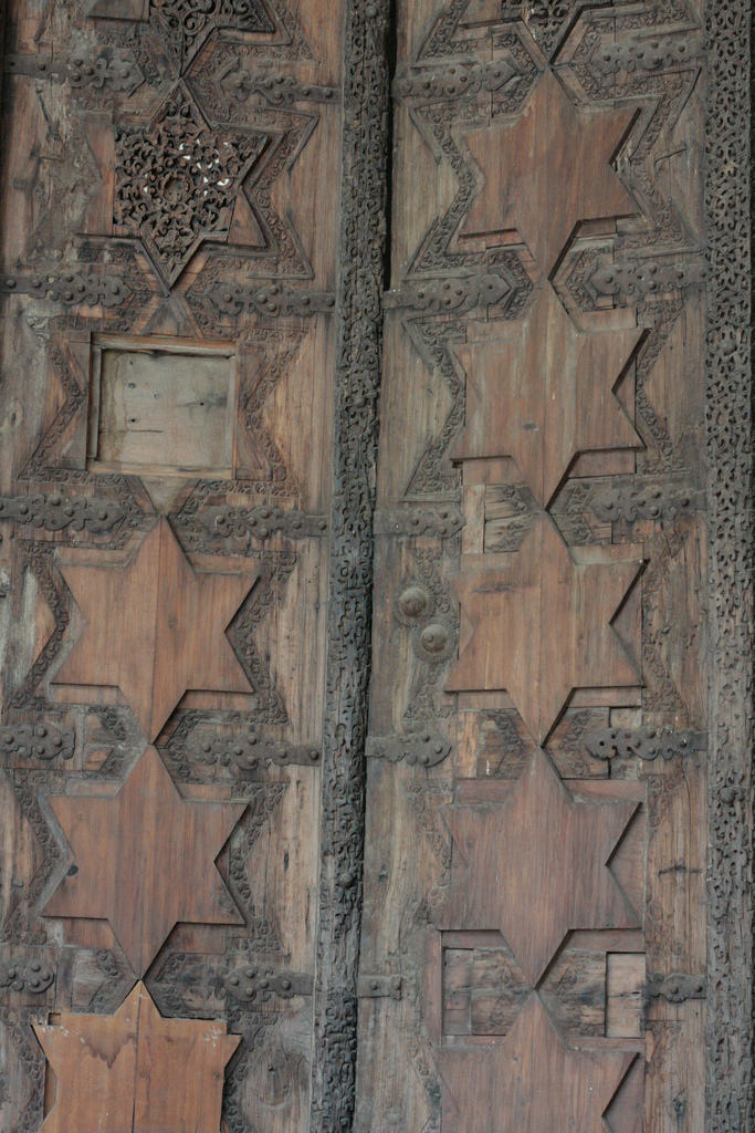
In 1842, Edward Law, the Governor-General of India between 1842 and 1844, issued what was called his famous “Proclamation of the Gates,” in which he ordered the British Army in Afghanistan to return via Ghazni and bring back to India the Sandalwood Gates from the tomb of Mahmud of Ghazni.
They were returned to the Somnath Temple in India, where they had been allegedly taken from by Mahmud 8-centuries previously from Somnath, and for which the British used as justification to the people of India for the destruction of Ghazni .
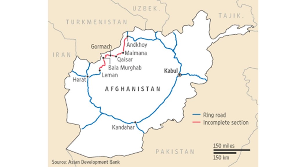
Back in Afghanistan, Herat, the third-largest city in Afghanistan, is linked to Kabul, Ghazni, and Kandahar, and other main cities in Afghanistan, via Highway 1, also known as the “Ring Road.”
It is one of the largest cities in Afghanistan with a population of almost 500,000 people.
It is located in the fertile Hari River Valley, with a history that goes back thousands of years. In some literature it is referred to as the “Diamond of Asia,” as well as the “Pearl of Khorasan.”
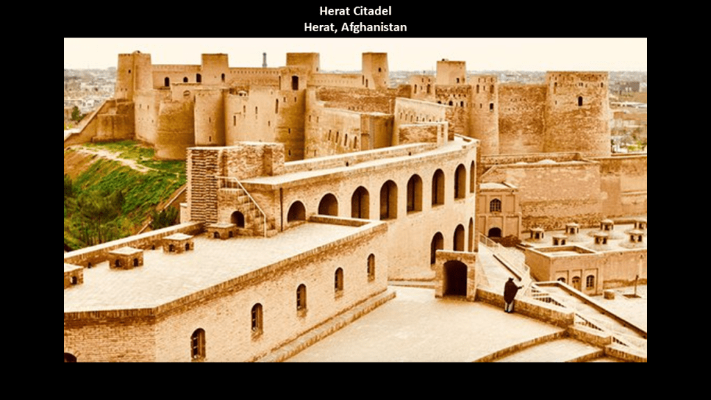
Like so many other places we’ve seen, there is also a citadel in Herat.
It was said to have been built in 330 BC, when Alexander the Great arrived in Herat after the Battle of Gaugamela, which was close to the city of Dohuk in Iraqi Kurdistan.
It was said to have been saved from demolition in the 1950s, and restored by UNESCO between 1976 and 1979.
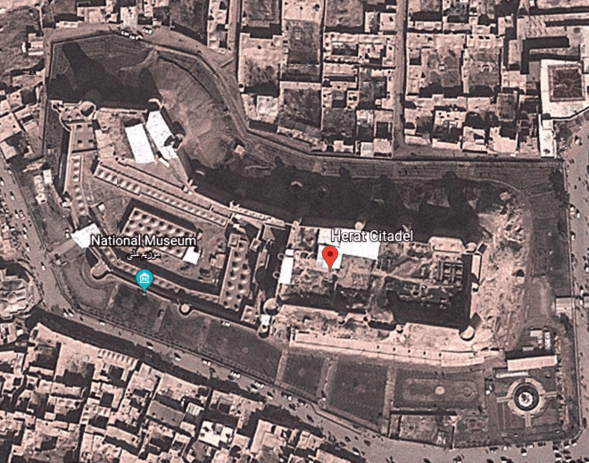
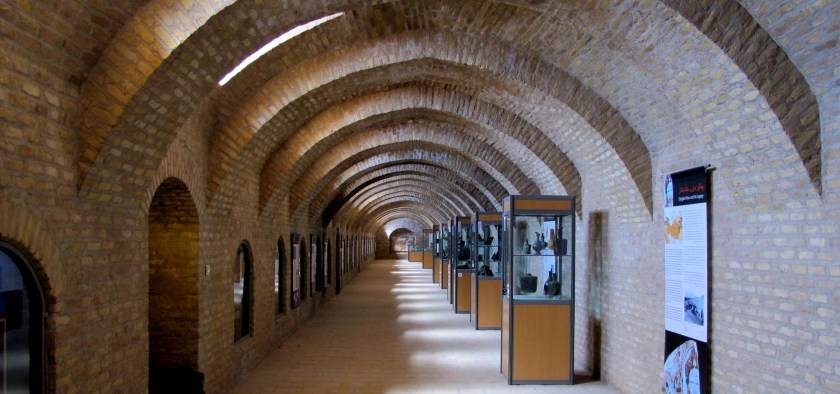
The National Museum of Herat is housed in the lower part of the Citadel.
It was established as a museum in 1925 by order of King Amanullah, one of the kings of modern Afghanistan.
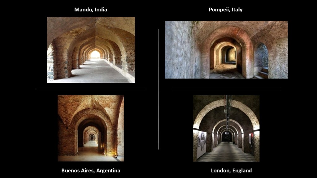
Here are just a few examples of similar brick or stone archways in other places, like in Mandu, India on the top left; Pompeii, Italy on the top right; the Buenos Aires History Museum in Argentina on the bottom left; and the House of Vans Skate Park in London, England, on the bottom right.
Khorasan was a province in northeastern Iran from 1906 to 2004, but as I have previously-mentioned, historically referred to a much larger area comprising the east and northeast of the Persian Empire, including, besides northeastern Iran, parts of Afghanistan and much of Central Asia.
During the Qajar Dynasty of what was then called the Sublime State of Persia between 1789 and 1925, Britain supported the Afghans to protect their East India Company.
So Herat in Afghanistan was separated from Persia, and the King of Persia, Nasser-al-Din Shah was unable to defeat the British to take back Herat.
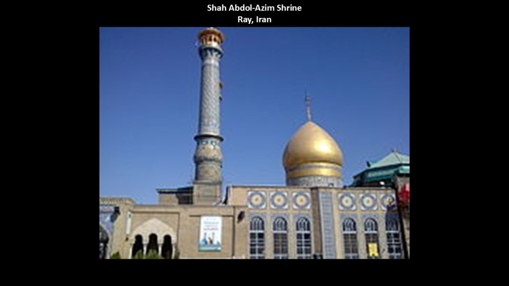
Nasser-al-Din Shah was assassinated in 1896 while in prayer at the Shah Abdol-Azim Shrine in Ray, what is called the oldest existing city in Tehran Province.
Persia was compelled by treaty not to challenge the British for Herat and other parts of what is today Afghanistan.
Khorasan was divided into two parts in 1906, with the eastern part coming under British occupation, and the western section remained part of Persia, shown here.

The city of Mashhad in modern Iran’s Razavi Khorasan Province was a major oasis along the ancient Silk Road.

This is a Google Earth screenshot of Mellat Park, the largest park in Mashhad…

…which includes on its grounds what is described as one of the best and most famous amusement parks in Iran, the Mellat Luna Park, and one of several amusement parks in Mashhad.
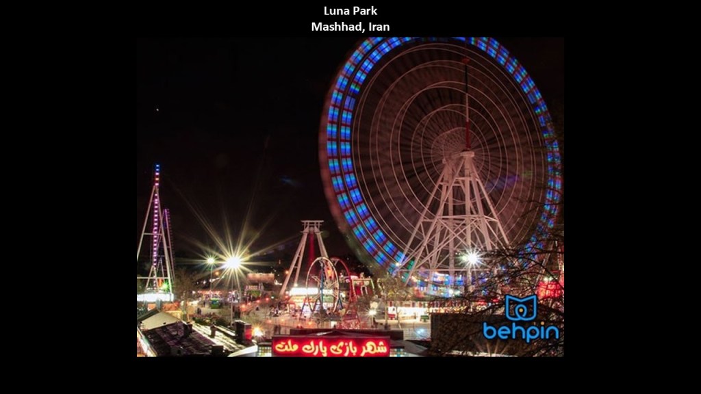
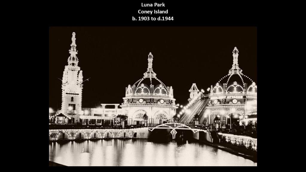
Interestingly, Luna Park was the name of numerous historical trolley and amusement parks in the United States and around the world.
This is a photo of the original Luna Park in Coney Island, New York, with Moorish-looking infrastructure.
This Luna Park was in operation from 1903 to 1944, at which time it was destroyed by fire.
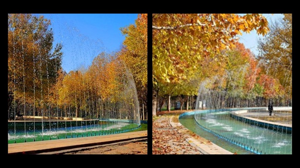
Some other things I would like to point out in the greater park of Mashhad’s Mellat Park is its amazing hydrological features and beautiful fountains…
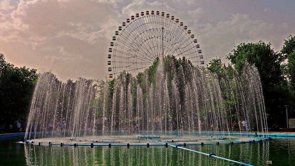
…and canals, with fountains included.
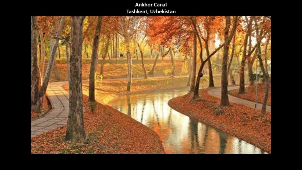
This canal is in Torqabeh, a short distance east of Mashhad.
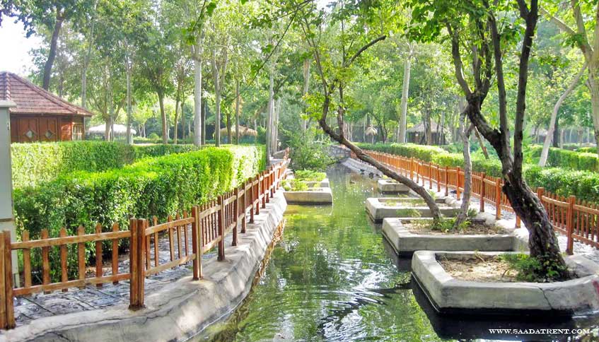
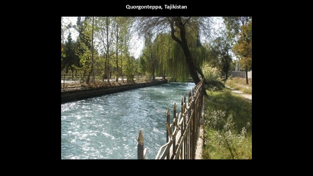
I have found canal systems throughout Asia…and elsewhere…including, but far from limited to, Quorgonteppa in Tajikistan…
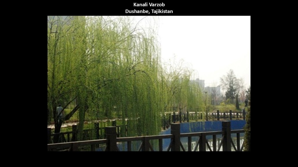
…and the Kanali Varzob in Dushanbe, the capital of Tajikistan…
…as well as the Ankhor Canal in Tashkent in Uzbekistan.
These places were all once part of the Greater Khorasan as well.
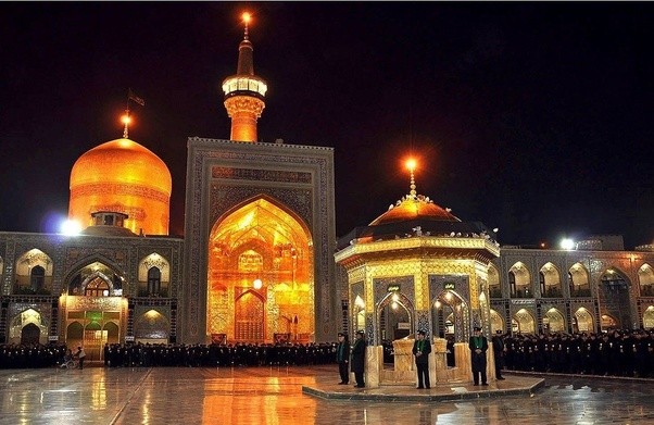
Mashhad has been called “Iran’s Spiritual Capital,” and is the location of the Imam Reza Shrine, the largest mosque in the world by area.
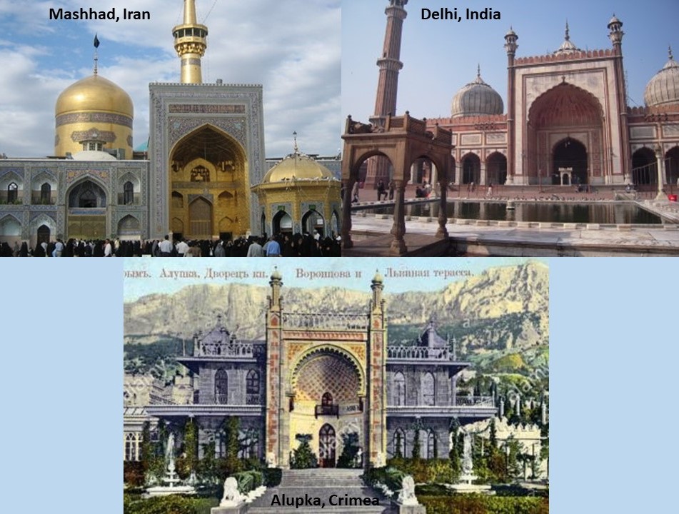
This is a comparison of the front of the Imam Reza Shrine on the top left, compared with the Jama Masyid Mosque in Delhi, India on the right, and the front of the Vorontsov Palace in Alupka, Crimea.
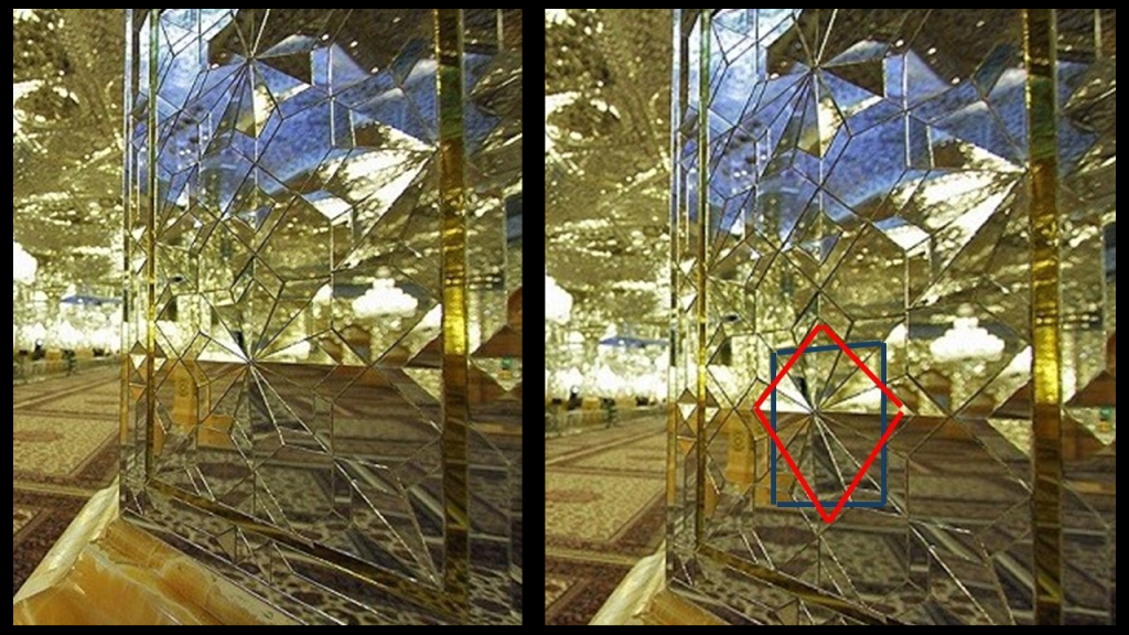
This photo shows the exquisitely-crafted mirror interior of the Imam Reza shrine in Mashhad, like the stunning mirror-work at the Golestan Palace seen earlier in this post.
There is an 8-pointed star found here as well.
Mashhad is a prominent center of the carpet-weaving industry, having been a major producer of Persian rugs for centuries…
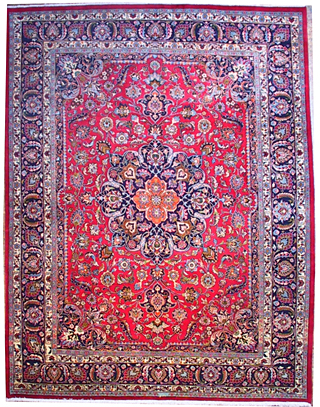
…and it is not hard for me to see the shapes made by a kaleidoscope in this particular rug.

Mashhad has a reputation for creating some of the best items on the market.
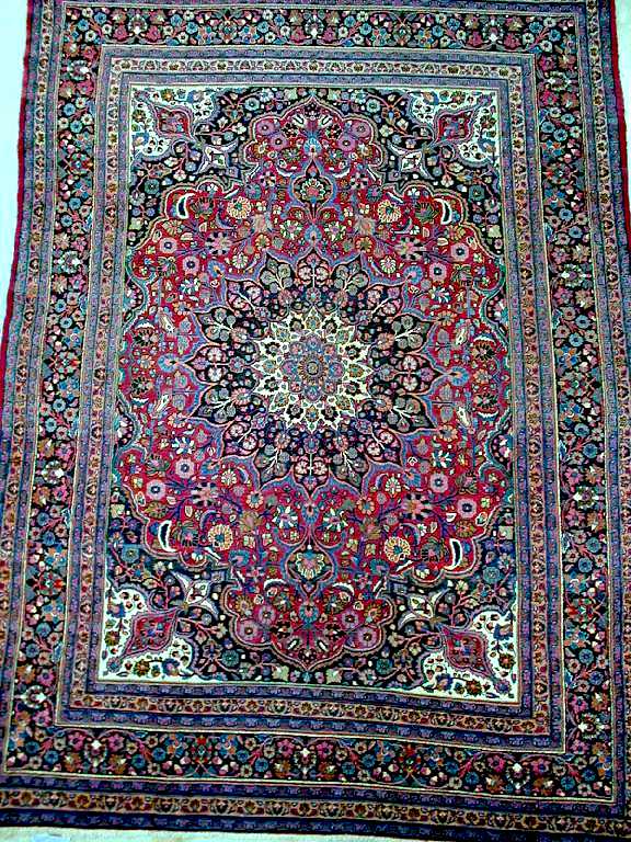
And I see a rose cathedral window pattern in this Mashhad Persian rug.
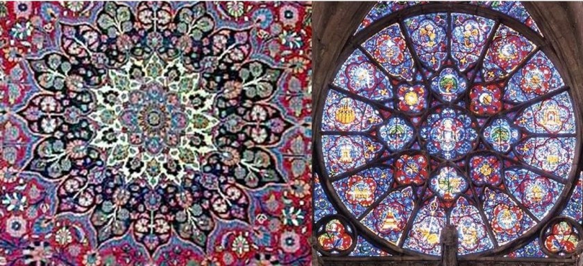
Not only that, Cathedral Rose windows look like the cymatic patterns of musical notes.

With the massive organ pipes surrounding the cathedral rose window, it appears as though this was a musical system designed to generate waves of specific frequencies, like Solfeggio frequencies, through this type of window.
Solfeggio frequencies make-up the ancient six-tone scale used in sacred music, like, for example, Gregorian chants and Tibetan singing bowls.
Each solfeggio tone is a frequency that can be used to balance one’s energy and keep one’s body, mind, and spirit in harmony.

Mashhad is connected to three major rail lines: Tehran – Mashhad running west; Mashhad – Bafgh running south; and Mashhad – Sarakhs running east.

It is interesting to note how inter-connected the railways of Asia are with each other.
Wouldn’t that take incredible planning and coordination across all of these different countries?

With regards to Iran, we are told that the first Iranian rail lines were established in 1886 and 1887, albeit on a limited basis.
Then the 865-mile, or 1,392-kilometer, Trans-Iranian Railroad was opened during the reign of Reza Shah Pahlavi in 1939, which would have been two years before he was deposed by Allied British and Soviet forces in 1941.
We are told this railway traverses many mountain ranges, and is full of spirals and steep grades, and that much of the terrain was unmapped when the construction took place in unknown geology.
Yet we are told this rail line was completed ahead of schedule when it opened in 1939.
In our historical narrative, the Trans-Iranian rail line was part of the Persian Corridor during World War II after the Anglo-Soviet Invasion of 1941, and used as a supply route for war material for the Soviet Union.
So it would have been completed by the Iranians in 1939, just in time for the start of, and use during, World War II by the Allies.
Like the Panama Canal opening on August 15th, 1914…
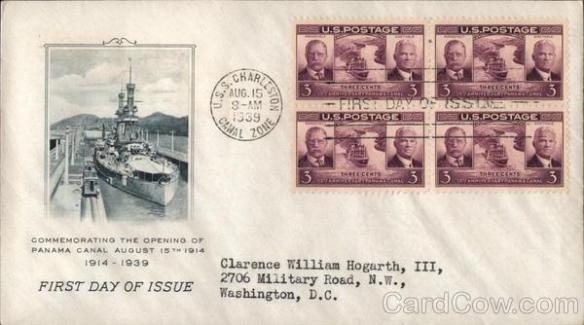
…just in time for the beginning of World War I, which started on July 28th, 1914.
Just a coincidence?
I really wonder about that….

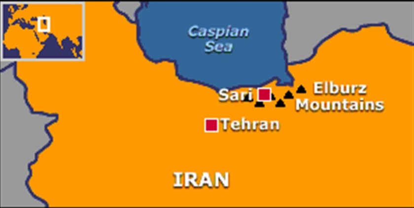
Heading out of Mashhad, we come to the Elburz Mountains, a mountain range in northern Iran that stretches from its border with Azerbaijan, along the western and entire southern coast of the Caspian Sea, and then runs northeast and merges with the Aladagh mountains in the northern parts of Khorasan.

Mount Damavand is the highest peak in Iran at 18,402-feet, or 5,609-meters, in elevation and located in the Central Elburz Mountains.
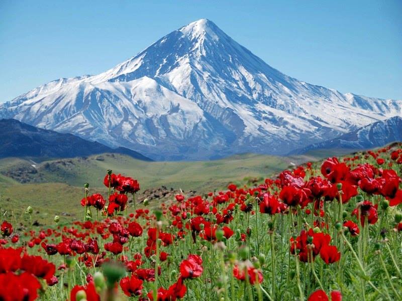
We are told it is a stratovolcano, built up of alternate layers of lava and ash, and is the highest volcano in Asia.

It is a popular climbing destination as one of the Seven Volcanic Summits mountaineering challenge, the highest volcanoes on each of the seven continents.

Sari, the capital of Iran’s Mazandaran Province, is on the alignment, between the northern slopes of the Elburz Mountains and the Caspian Sea.
This is what I found looking into Sari.
This is the official logo of the Municipality of Sari City.
There is an eight-pointed star contained within this design.
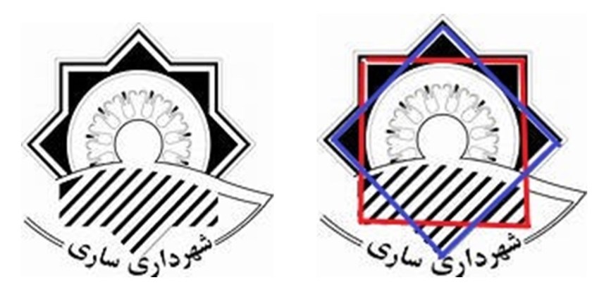
A stylized-version of the same eight-pointed star is found in the logo of the city of Prescott, Arizona, where I live.
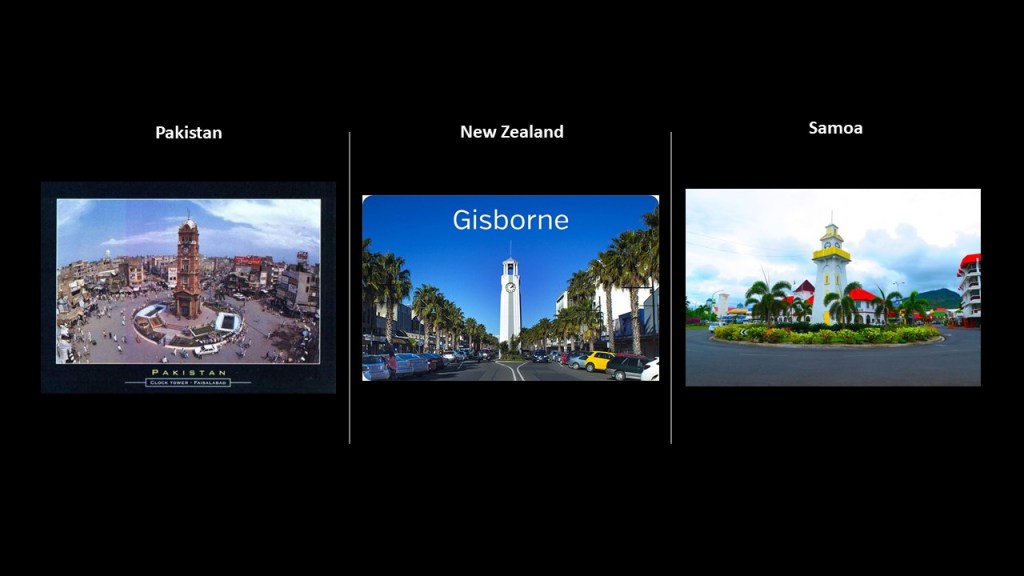
Sari’s Clock Tower and Square is one of the notable landmarks of the city.
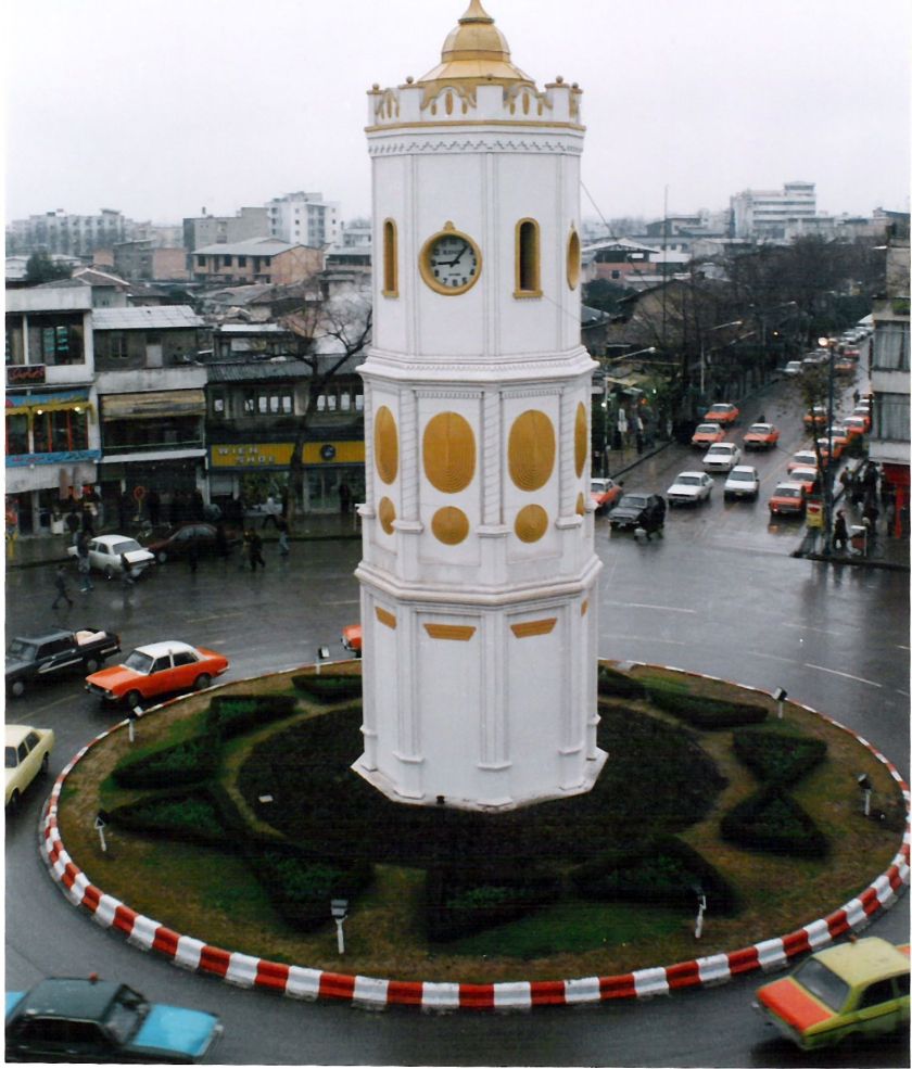
There are clock towers like these everywhere, like in Faisalabad, Pakistan on the left; Gisborne, New Zealand, in the middle; and the Apia Clock Tower in Samoa on the right.
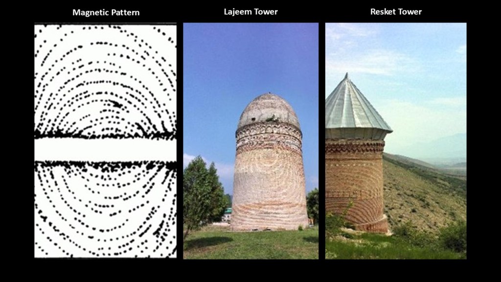
Other notable structures in Sari, Iran include the Lajeem Tower and the Resket Tower, both with a noticeable magnetic pattern in the bricks.
We are told both of these towers were built as tombs.
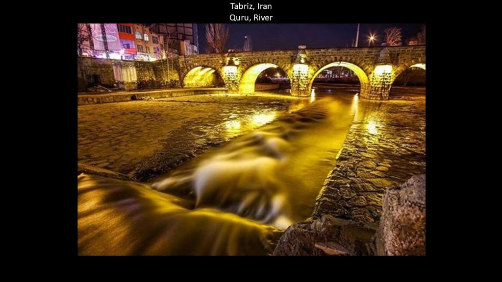
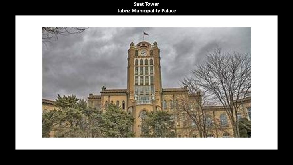
The last place I want to look at on this alignment is Tabriz, one of the historical capitals of Iran, and the present-day capital of Iran’s East Azerbaijan Province.

It is the most populated city in northwestern Iran, located on the Quru River, which appears to be a canal.
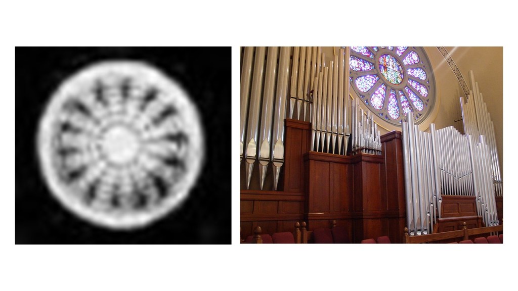
This is the Saat Tower in Tabriz, also known as the Tabriz Municipality Palace.
The Saat Tower has windows which bear a distinct resemblance to cathedral windows on the left, like these on the right.
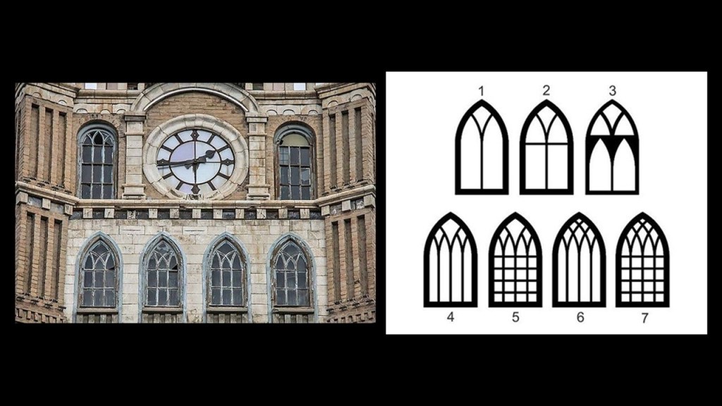
I have reason to believe this type of cathedral window functions as an antenna.
When I was reading an article about “Elliptical Polarization,” I encountered the diagram on the left showing the efficiency in decibels of the axial ratio of two antenna, and the shapes formed in the graph are identical to those of this type of cathedral window in comparison on the right.

I am going to end this here.
There is always much more to find and share, so this is just really a sample of what there is to find.
Much has been removed from our collective awareness but there are still clues available to find that hints at a much larger picture than what our historical narrative teaches us, especially when we are willing to let go of what we have always been taught to believe is true, and open ourselves to receiving new information.
I hope that I have created an opening for people to consider thinking differently about what our True History might have been with the information I have presented in this post, and about how the messy world we live in was heavily manipulated to keep this knowledge from us and to ultimately control us and our destiny.