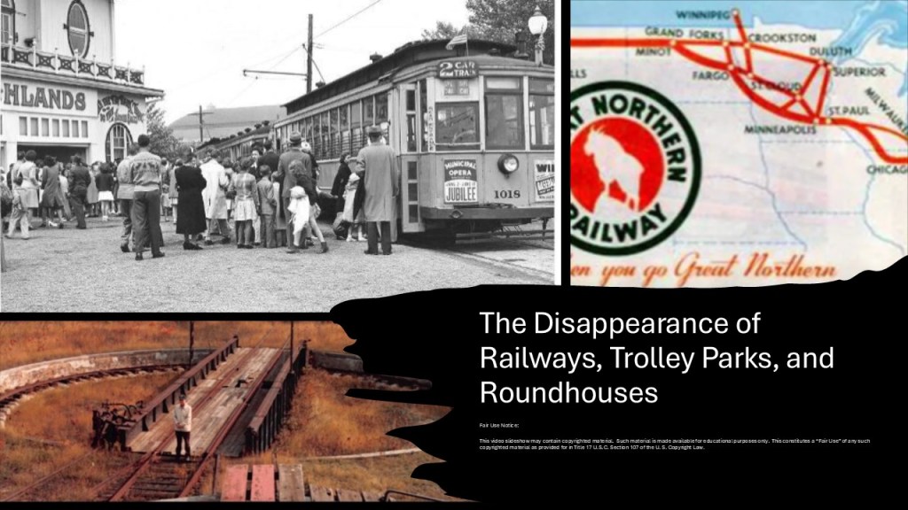
The subject of “The Disappearance of Railways, Trolley Parks, and Roundhouses” “is a vast one, and as we will see in this post, has many interconnected elements, like, for example, how closely associated all of this infrastructure was associated with airports, racetracks, breweries and waterfalls, to name just a few things of many.
I believe that all of this infrastructure was part of the original energy grid, which was deliberately destroyed, and that after enough of the original infrastructure was recovered and brought into working order, and replacement energy sources developed, like coal and gasoline, the infrastructure was only used for as long as it was needed by the Controllers for their agenda, and then removed, repurposed, destroyed or abandoned when it was no longer needed.
I have been researching deeply into my hypothesis that all of the original infrastructure we see on Earth was part of a perfectly-tuned scientific and musical instrument that was laid out geometrically as a circuit board, and wanted to share my findings to support this hypothesis in this post.
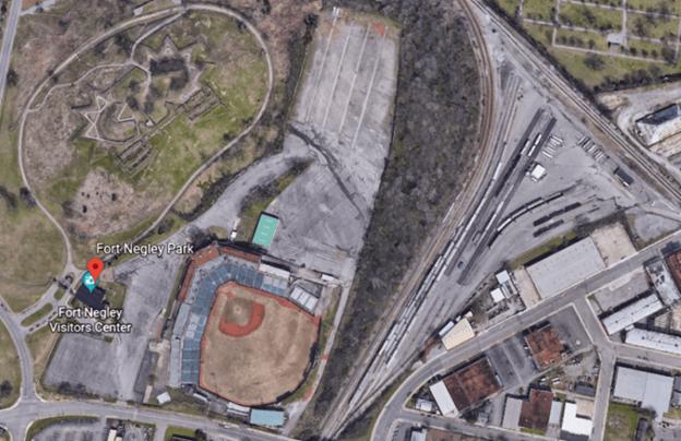
I have wondered about a connection between athletic fields to the Earth’s original energy grid system ever since finding several years back that there was a ball-field sandwiched between a star fort in called Fort Negley and the railroad yards in Nashville.
I also consistently find ellipses, and the other varied shapes of sporting venues, near railways and airports, and believe them all to have been circuitry on the Earth’s electro-magnetic grid system.
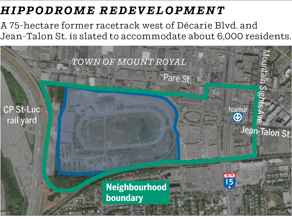
Like the Montreal Hippodrome in Montreal, Quebec, Canada.
It was located 8-miles, or 13-kilometers from the Montreal-Pierre Trudeau-International Airport.
The location of the historical Montreal Hippodrome appears to be situated at a similar angle to the major international airports as seen in Shepherd’s Bush neighborhood in West London and the Sulphur Springs neighborhood in Tampa shown, where both places had had elliptical-shaped race-tracks in their vicinities.

Also known as the Blue Bonnets Raceway, a thoroughbred horseracing track and casino, the Montreal Hippodrome was permanently closed in October of 2009 after 137 years of operation, and the abandoned site was demolished starting in 2018.

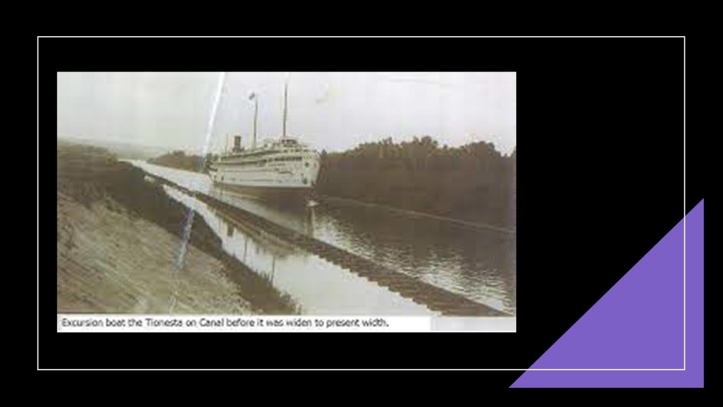
The Hippodrome was located right next to the Canadian Pacific St. Luc Railyards, and it’s interesting to note this array of elliptical shapes on the race track grounds between the main ellipse and the railyards.

It is also interesting to note that the roundhouse at the St. Luc Railyards was said to have been completed in 1950…

…and by 2003, it was reduced to 4 or 5 stalls.
Why was a beautiful structure like this deconstructed after only a half-century of use?
The appearance of the historical St. Luc Roundhouse reminded me of depictions I have seen of the ancient harbor of Carthage in Tunisia, called a cothon, meaning an artificial, protected harbor.
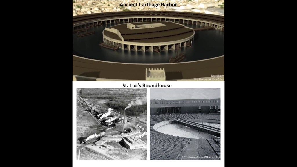
This is a 2017 photo of the former grand 37-stall roundhouse, considered a shining example of the Canadian Pacific Railway when it was built.

Studies and planning have been done to re-develop the hippodrome site into social housing units.
In Toronto, Ontario, Canada, the Billy Bishop Toronto City Airport on Toronto Island has a track located northeast of it in a line that crosses through the real estate containing the CN Tower, Rogers Center, and Roundhouse Park and downtown Toronto.
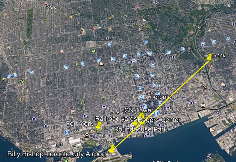
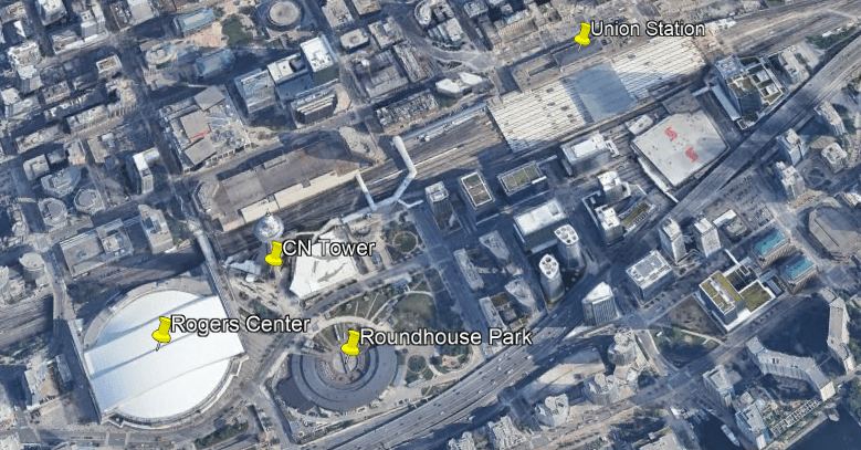
The CN, or Canadian National, Tower is 1,815-feet, or 553-meters, high, a communications and observation tower located on what is known as Railway Lands, a large railway switching yard on the Toronto Waterfront, and said to have been completed in 1976.

Toronto’s Union Station is just to the east of the CN Tower in the Railway Lands.
The Union Station in Toronto was said to have been constructed in the Beaux-Arts-style in 1927, and is considered Canada’s largest and most opulent railway station.
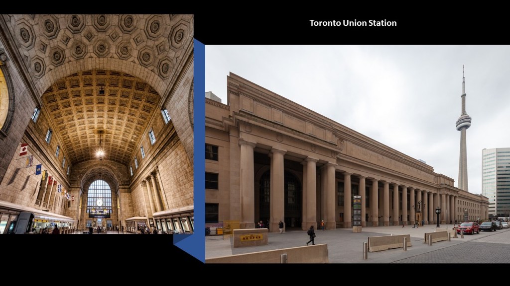
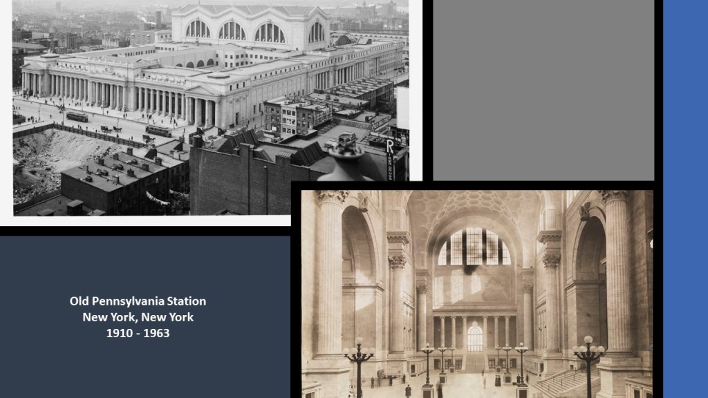
The Toronto Union Station reminds me of the original Pennsylvania Station in New York City, which was said to have been built between 1904 and 1910 and demolished between 1963 and 1968.
Roundhouse Park next to the CN Tower was the location of the John Street Roundhouse, said to have been built in 1929 to maintain Canadian Pacific Railway trains during the Golden Age of Railways, where maintenance teams worked on as many as 32 trains at a time.
The Roundhouse is the last such building in Toronto, and survived the demolition of other railway facilities nearby that took place to make room for the new stadium, the Rogers Center, which opened in June of 1989.
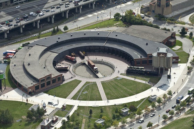
The Rogers Center is the home of Major League Baseball’s Toronto Blue Jays, as well as being a large-event venue.

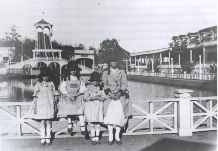
Now I am going to head in the direction of a Toronto neighborhood known as The Beach, or The Beaches, where there were several historical amusement parks.
It is considered part of the old city of Toronto.
I found that the only pictorially documented amusement park here was the Scarboro Beach Park, which was in operation from 1907 until 1925, when apparently the owner of the park, the Toronto Railway Company, locked the gates to the property.
Eventually the Scarboro Beach Park property was sold to a company which removed the rides and buildings, and replaced the land with housing.
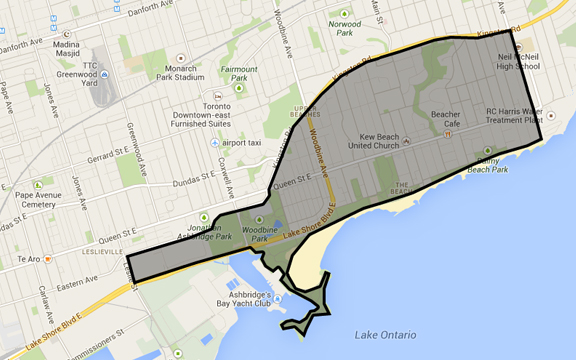
The Victoria Park Amusement Park, said to have been in operation from 1878 to 1906, would have been right about where the “x” is, at the intersection of Queen Street and Victoria Park Avenue, right next to the RC Harris Water Treatment Plant.

This megalithic stone wall runs parallel to Queen Street at the front-boundary of the complex…

…with the Neville Street Loop for the Queen Street streetcar line, the eastern terminus of Toronto’s longest streetcar route, just off the northwest corner of the RC Harris complex.

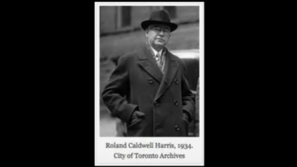
Here is what we are told about the RC Harris Water Treatment Plant.
Its construction started in 1932, and the building became operational on November 1st of 1941 (during World War II, and a little over a month before the bombing of Pearl Harbor).

It was named after the long-time Commissioner of Toronto’s Public Works, RC Harris, overseer of the construction project.
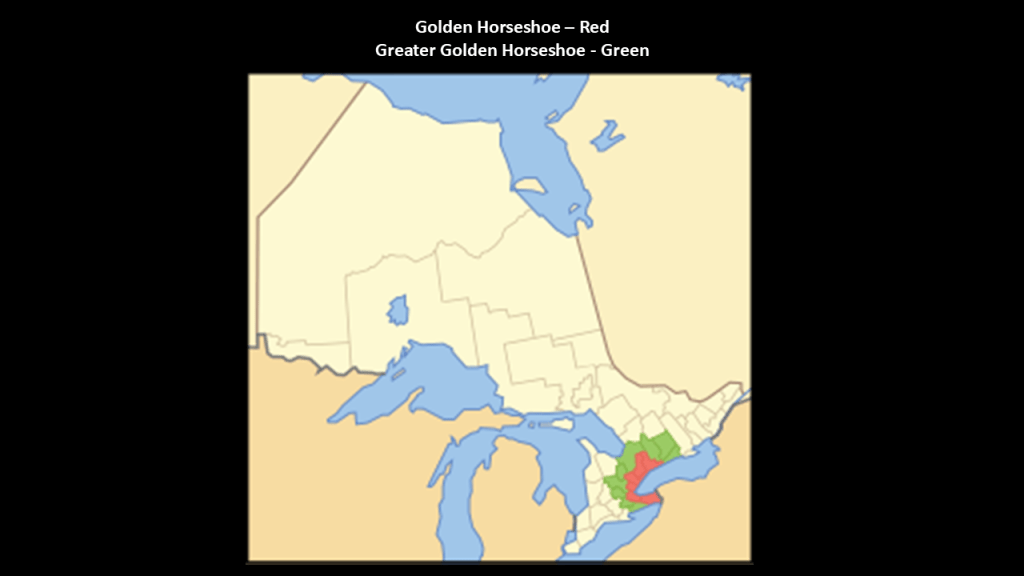
Barrie is 56-miles, or 90-kilometers, north of Toronto, and part of what is called the “Greater Golden Horseshoe,” which is an extended urban area of southern Ontario between Lake Huron’s Georgian Bay; Lake Ontario; and Lake Erie.
This region is the most densely-populated, and most industrialized, in Canada.
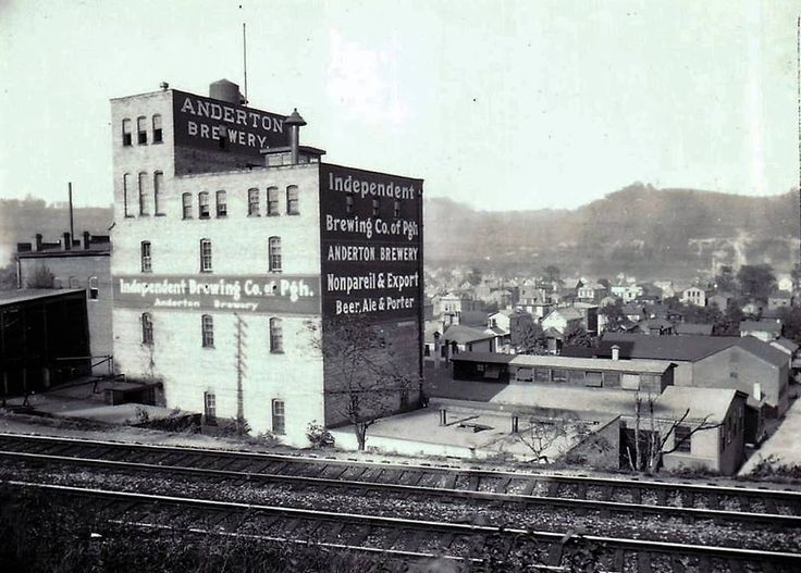
A few of the many things from Barrie’s history to mention was the establishment in 1860 of the Anderton Brewery by the Anderton Brothers James and Joseph.
It was the largest employer in Barrie for years.
We are told that a line of the Northern Railway was opened in Barrie in 1853, and it connected Barrie with Toronto, and other municipalities in Simcoe County and Muskoka.
The Hamilton and North-Western Railway also ran through Barrie, and in June of 1879, these two railways organized into the Northern and North Western Railway.
Then the Grand Trunk Railway purchased the original Northern Railway, and the line serving Barrie became a branch of the Canadian National Railway.
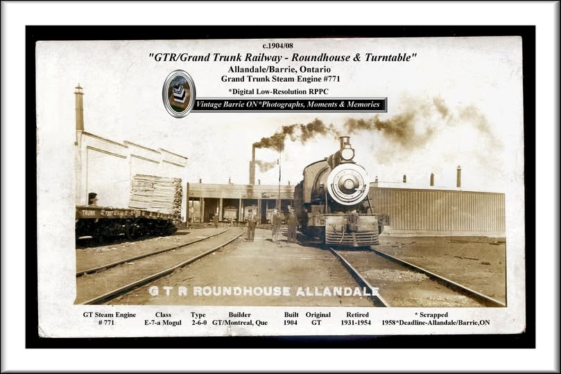
We are told that a roundhouse was built to service steam locomotives in Allandale in 1904, an historic neighborhood that was annexed to Barrie in 1896.
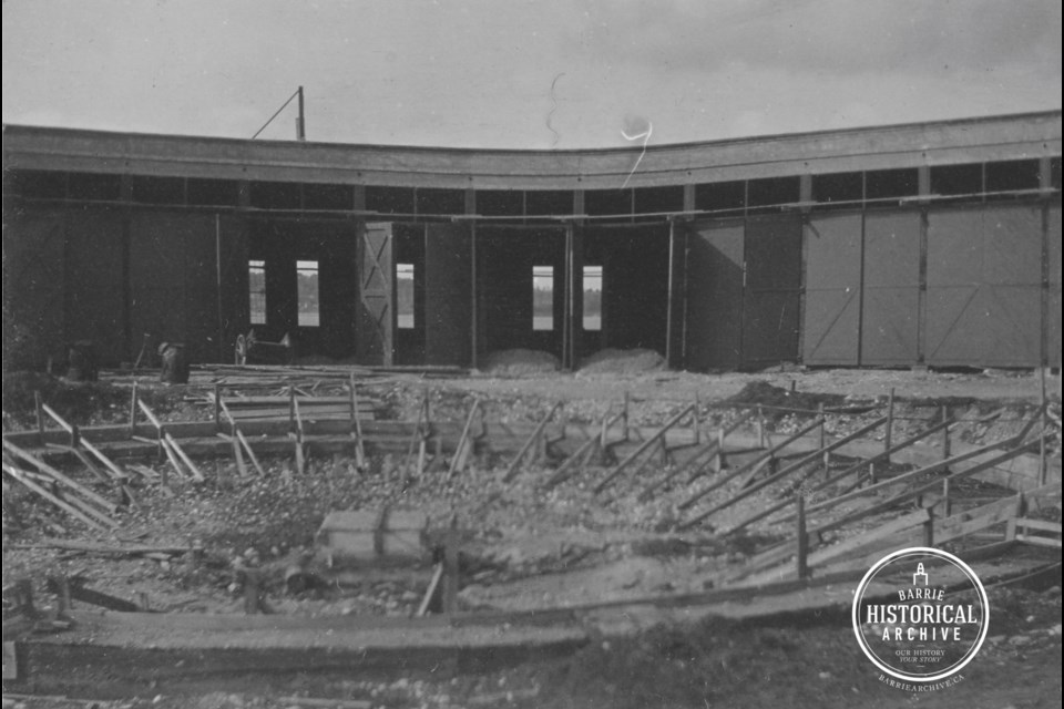
The Allandale Roundhouse was demolished and most of the turntable removed by the 1980s.
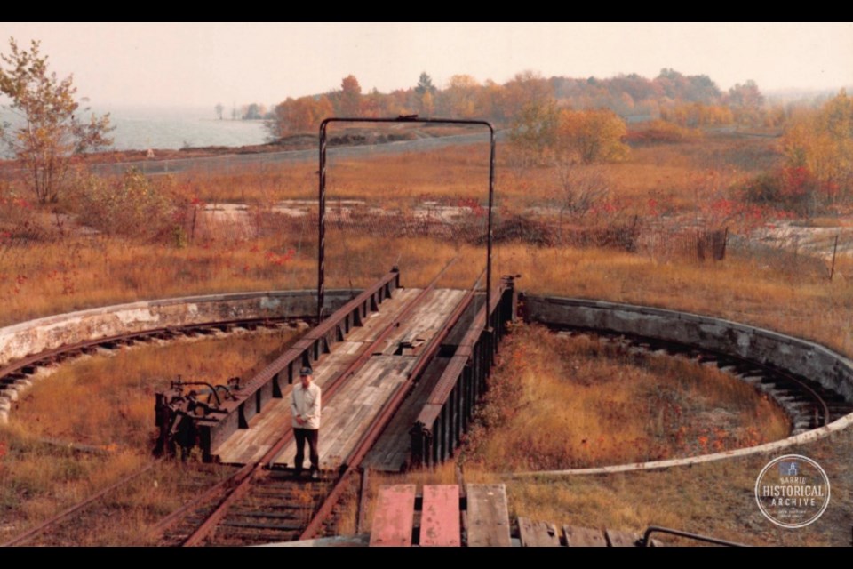
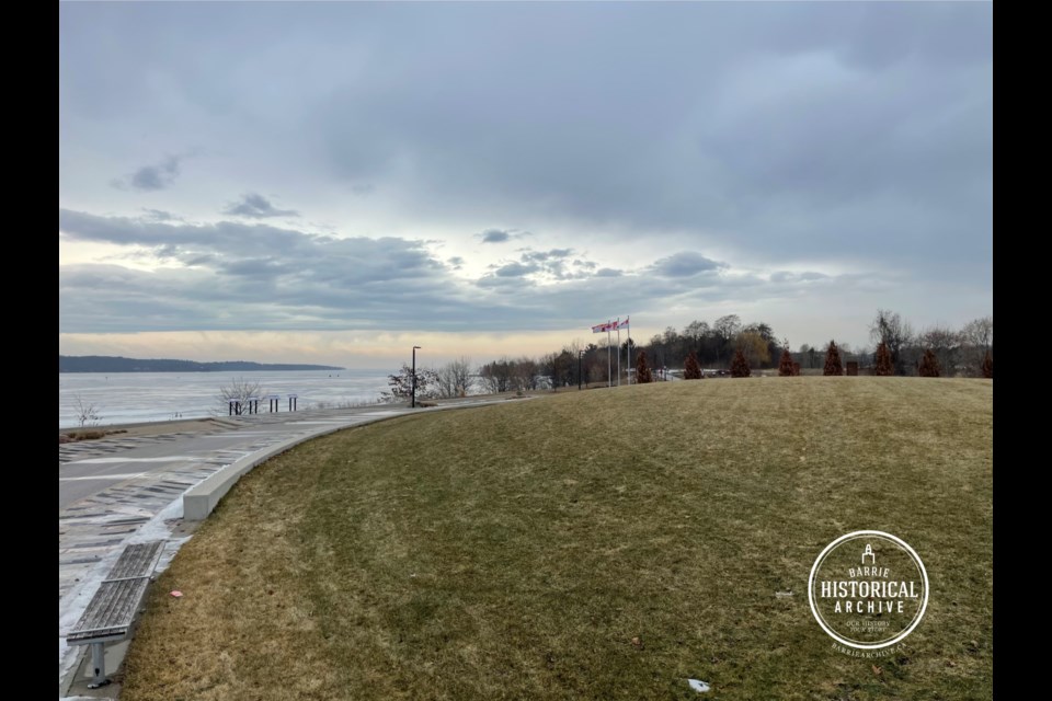
Today, the location of the former roundhouse is Barrie’s Military Heritage Park.
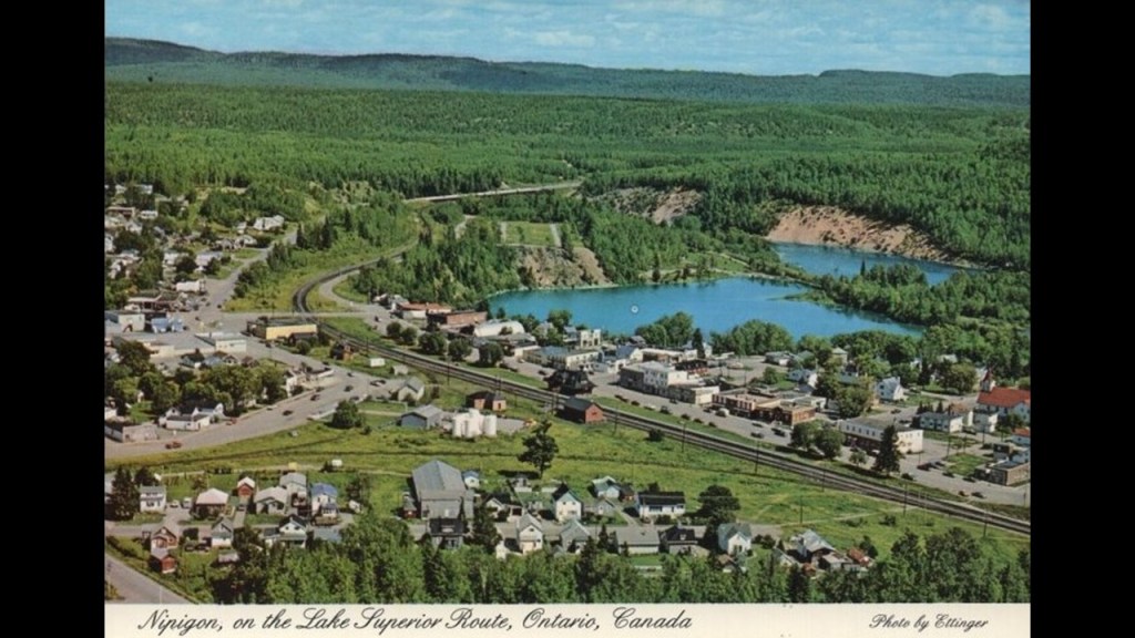
Nipigon in the Thunder Bay District of Northwestern Ontario is the northernmost community on the Great Lakes.
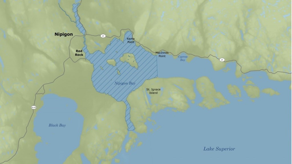
We are told the Canadian Pacific Railway tracks were completed across the North Shore of Lake Superior in 1885, and that starting around 1910, the Canadian Northern Railway was built through the town, and opened for passenger service in 1915.
By 2005, all railroad traffic on the Canadian Northern Railway through town had ended, and the rails were removed in 2010.
We are told the Nipigon River Bridge for the Trans-Canada Highway was built in 1937.
It is considered the most important bridge in Canada because it is the only crossing for east-west traffic in the region for the flow of goods, people, and trains between eastern and western Canada.
It carries both the Trans-Canada Highway, and both the Canadian Pacific and Canadian National Railways.
Next in the United States, I am going to take a look at St. Louis, Missouri.
There was an electric streetcar system in St. Louis that ran from the mid-1800s through the early 1960s, starting with horse-drawn streetcars in the late 1850s.
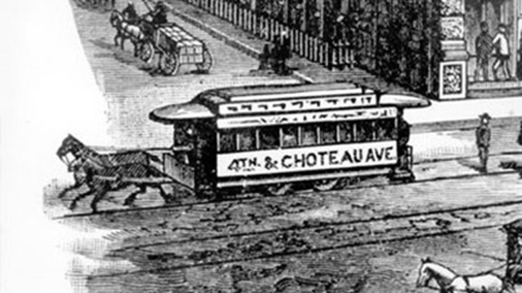
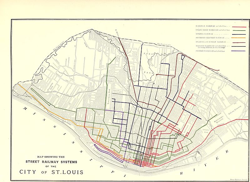
This is a map depicting the streetcar lines in St. Louis by 1884…
…with the first cable-driven streetcars in 1886, and the first electrified streetcars came to St. Louis in 1889.

The Forest Park Highlands Amusement Resort opened in St. Louis in 1896…
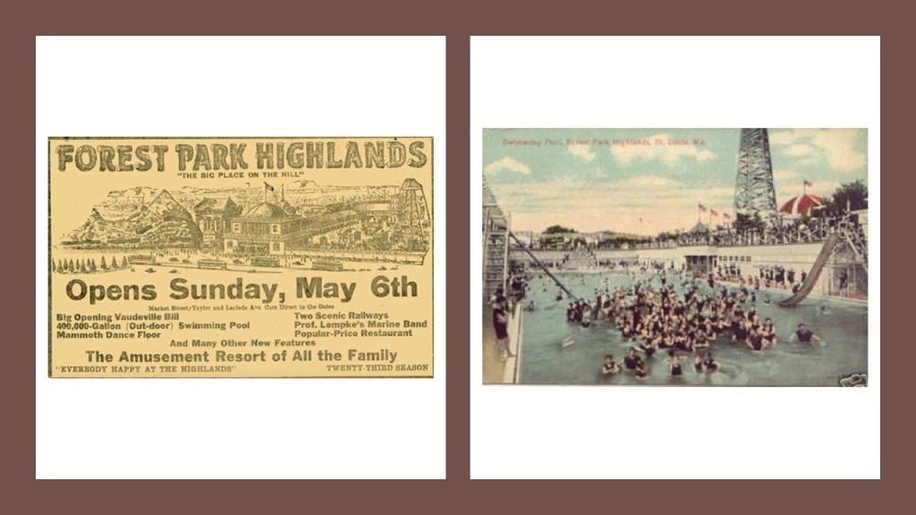
…and was on a trolley line.
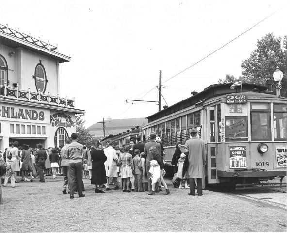
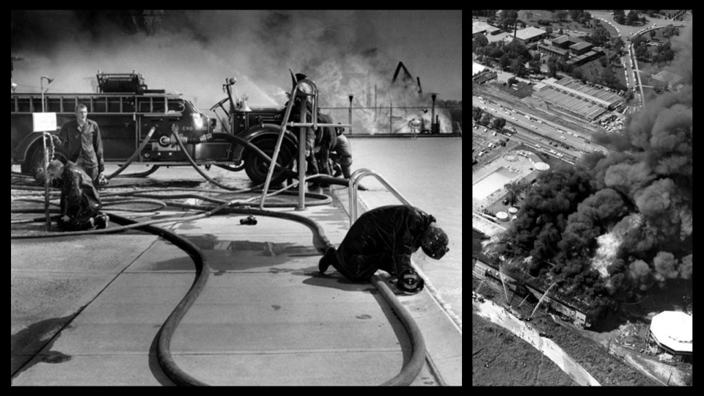
On July 19th of 1963, all of the Forest Park Highlands Amusement Park was destroyed by fire except for the swimming pool and the frame of the roller coaster.
With regards to streetcars, starting in the early 1930s through the 1960s, the St. Louis Public Service ended all streetcar service, as well as other regional streetcar operators.
The last day of St. Louis streetcar operation was May 21st of 1966.

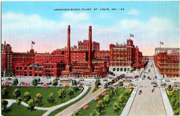
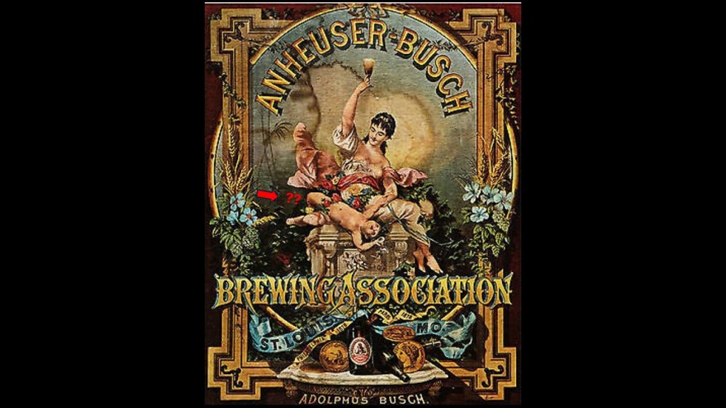
The Anheuser-Busch Brewing Company is headquartered in St. Louis, Missouri.
This is a post card of it from the 1930s.
Today the company employs over 30,000 people, and operates twelve breweries in the United States.
It was founded as the Bavarian Brewery in 1852 by George Schneider, but financial problems forced him to sell the brewery to various owners during the late 1850s, one of which Eberhard Anheuser, a prosperous soap and candle-maker.
The name of the brewery became E. Anheuser & Company in 1860.
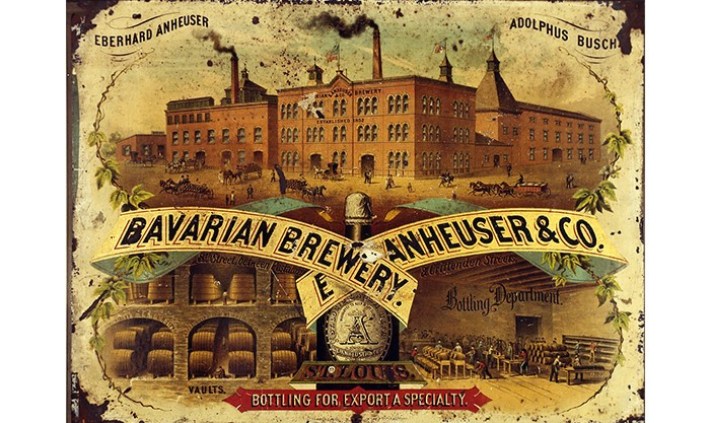
A wholesaler who had immigrated from Germany to St. Louis in 1857, Adolphus Busch, became Eberhard Anheuser’s son-in-law in 1861.
Soon he became a partner, and served as company secretary until his father-in-law died in 1880, at which time he became president of the business.
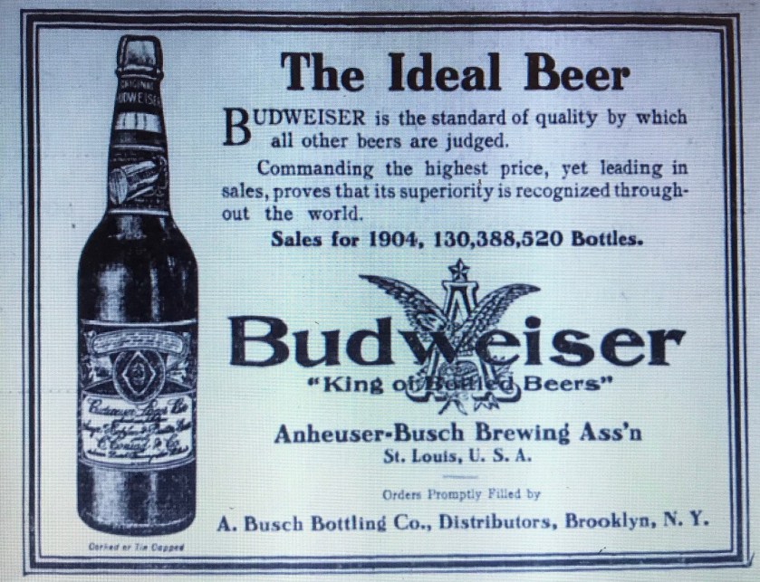
During the 1870s, Adolphus Busch had toured Europe to study changes in brewing methods at the time. In particular he was interested in the pilsner beer of the town of Budweis, located in what is now the Czech Republic.
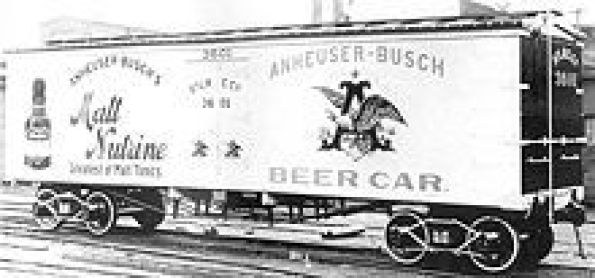
In 1876, he introduced Budweiser…
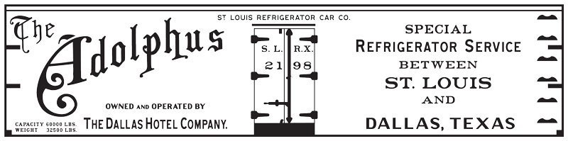
…and 1876 was the same year he introduced refrigerated railroad cars to transport beer.
By 1877, the company owned a fleet of 40 refrigerated railroad cars.
Busch implemented pasteurization in 1878 as a way to keep beer fresh for a longer period of time.
He established the St. Louis Refrigerator Car Company in 1878, and by 1888, the company owned 850 cars.
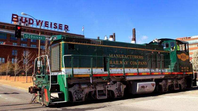
He also founded the Manufacturers Railway Company in 1887, which operated until 2011.
Adolphus Busch died in 1913.
A text-book case of how to accumulate immense wealth, his net worth was $60 million in US dollars at the time of his death.

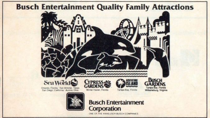
The Busch Entertainment Corporation, which was founded in 1959, became SeaWorld Parks & Entertainment in 2009 with its sale to the Blackstone Group, an American multinational private equity, asset management, and financial services firm based in New York City.
The St. Louis Union Station was said to have been built between 1892 and 1894, the year it first opened as the largest train station in the world
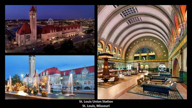
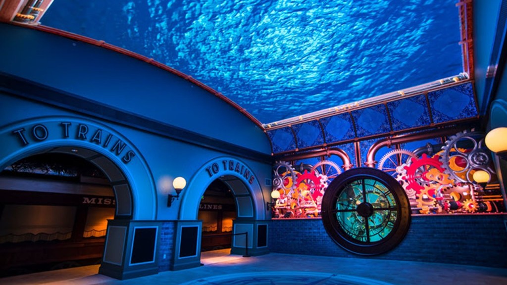
These days the former St. Louis Union Station is a multi-use complex with restaurants, retail stores, a hotel, and the St. Louis Aquarium.
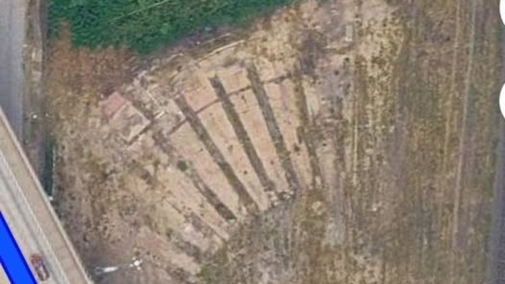
The only remnants of the former roundhouse in East St. Louis located east of the I-70 Mississippi River Crossing are concrete foundations where you can still see the pits where locomotives were once serviced.
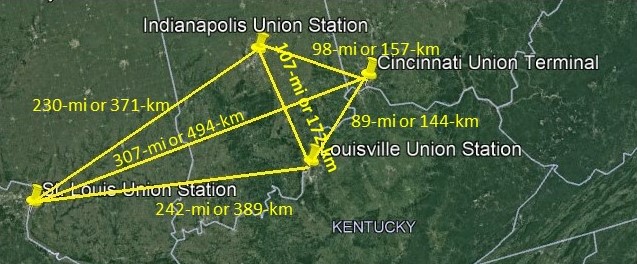
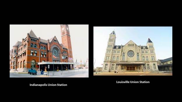
There appears to be a geometric relationship between the Union Stations in St. Louis, Louisville, Kentucky; Cincinnati, Ohio; and Indianapolis, Indiana.
I calculated the distance between them using address-to-address, and the distances between the legs of the triangles between these four major cities with Union Stations are still remarkably close to each other in a geometric configuration, considering what we have been led to believe in our historical narrative was seemingly random settlement and construction.
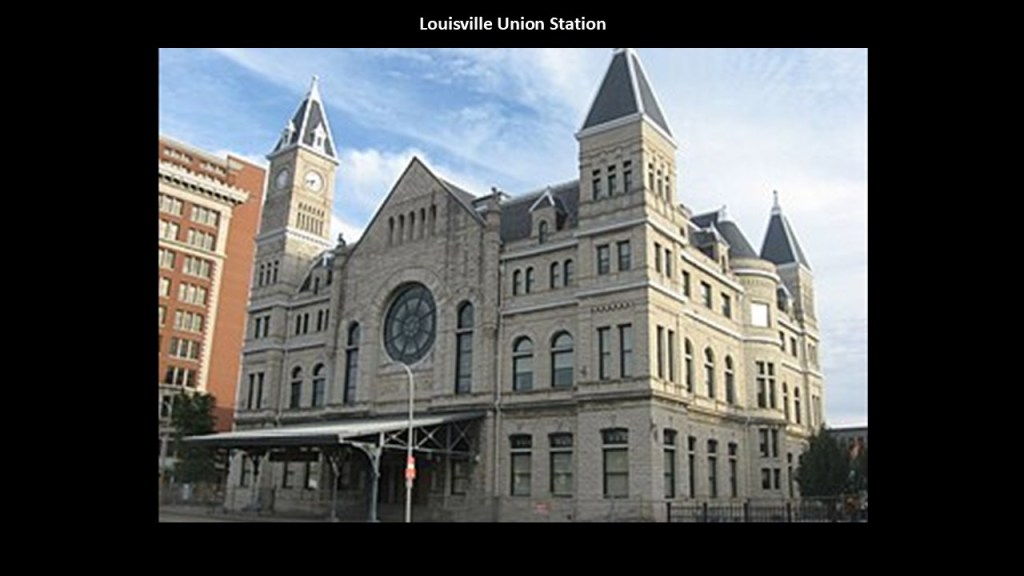
The Louisville Union Station was said to have first opened in 1891.
Today, the historic Union Station is used for the administration of the Transit Authority of River City.
The building is open to the public on weekdays, and there is a market area with a coffee shop and exhibits on the history of public transit in Louisville.
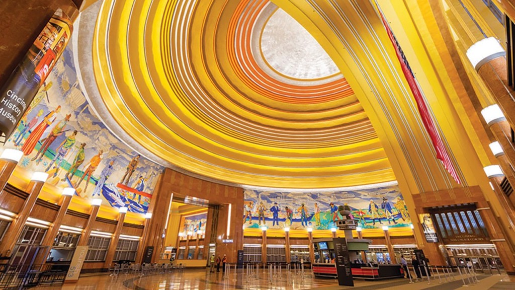
Cincinnati’s Union Station is a wonder to behold, with the largest half-dome in the western hemisphere, and at one time it was the largest half-dome in the world.
It was said to have been built starting in 1930, and opening in 1933, which would have been during the Great Depression.
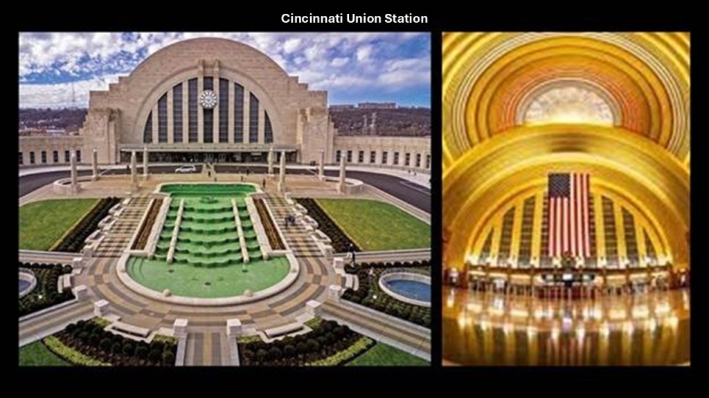
Today the Cincinnati Union Station houses three museums; an OMNIMAX Theater; the Cincinnati History Library and Archives; and it still provides reduced passenger rail service for Amtrak’s Cardinal Line.
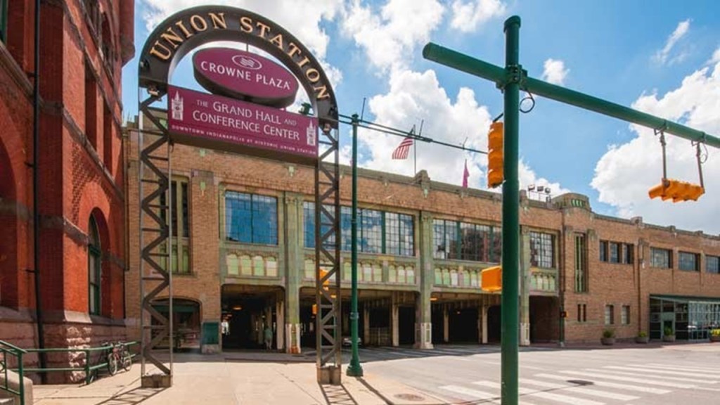
The Indianapolis Union Station was said to have first opened in 1853, and that today’s Richardsonian Romanesque building was built in the same location between 1886 and its opening in 1888.

Today, the Indianapolis Union Station houses a Crowne Plaza Hotel and Conference Center; the Mexican Consulate; and like the Cincinnati Union Station, still provides reduced passenger rail service for Amtrak’s Cardinal Line.
Here is the Indianapolis Union Station on the left compared with the Louisville Union Station in Kentucky on the right.
Why do they look like cathedrals?
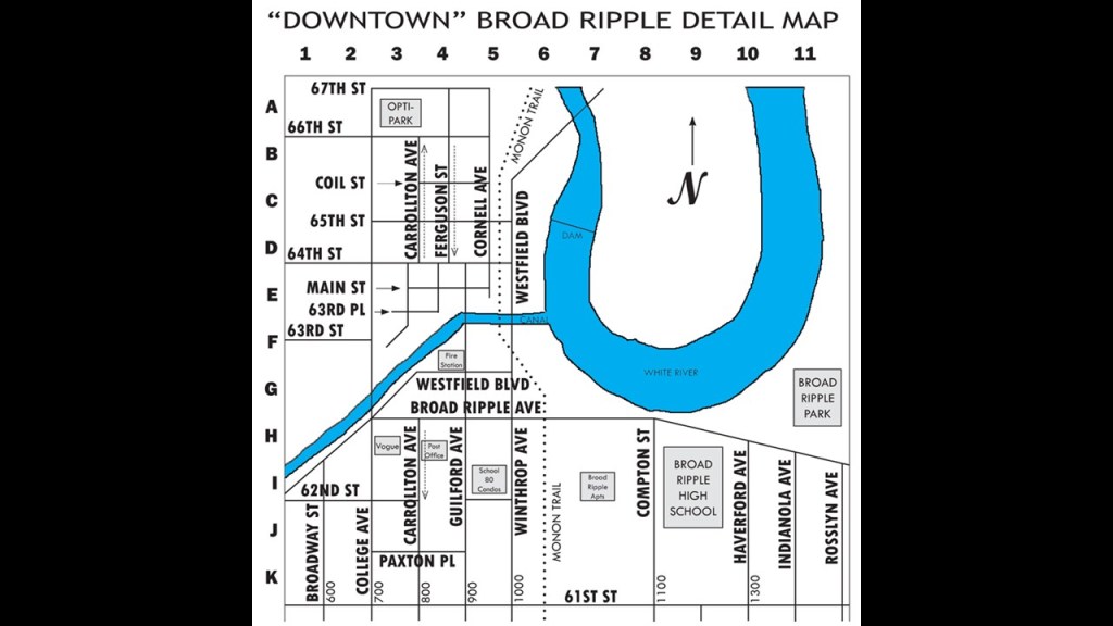
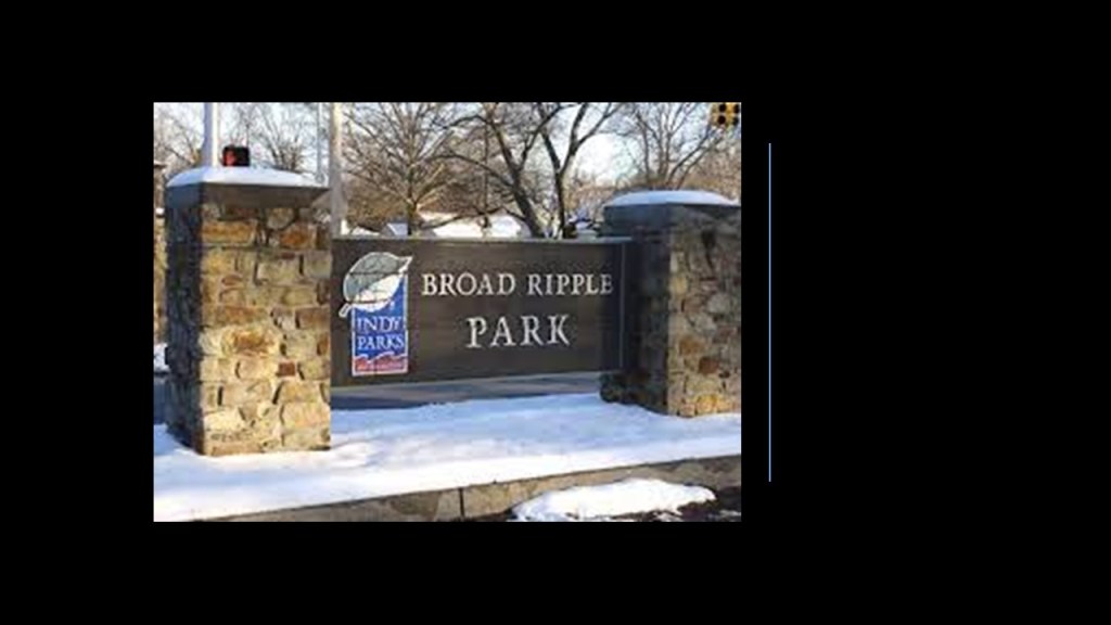
Broad Ripple Village is one of Indianapolis’ seven-designated cultural districts.
Established in 1837, today it is best-known for being a socially, economically, and ethnically-diverse neighborhood, filled with art galleries; specialty shops; restaurants; and night clubs.
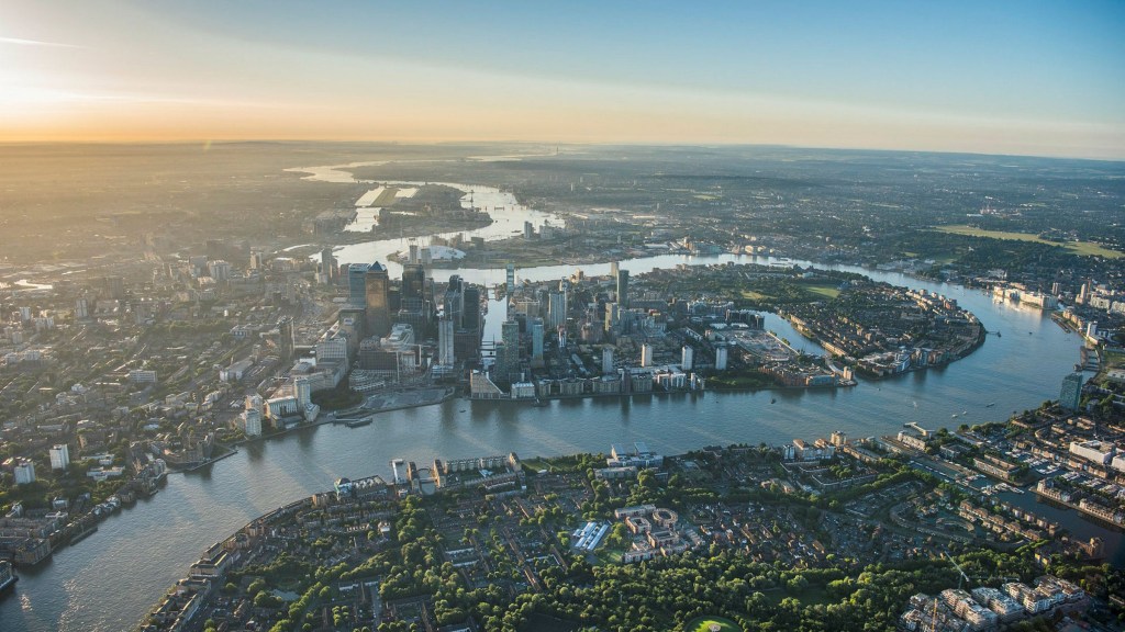
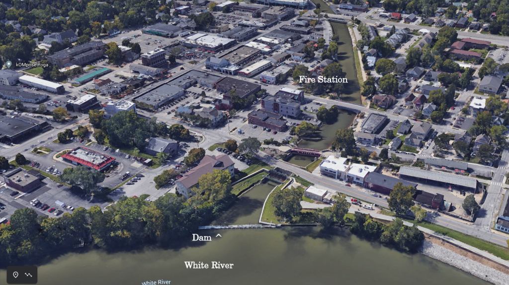
I am very interested in Broad Ripple’s location on a U-shaped bend, known as an “oxbow” of what is known as the White River; its connection to the Central Canal; its connection to the railroad; and the trolley line and amusement park in its history.
We are taught these river shapes are natural occurrences…
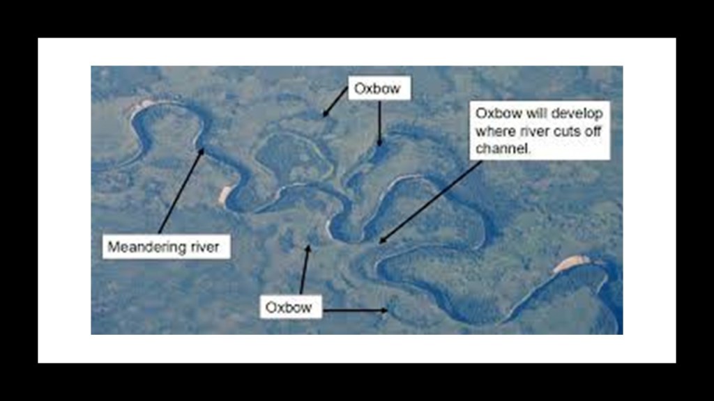
…but these exact same river shapes are found all over the world…including, but far from being limited to, London on the River Thames.
The Central Canal was said to have been constructed in Indianapolis starting in 1836, and that water was first drawn into the Central Canal by the feeder dam on the White River in Broad Ripple starting in 1839.
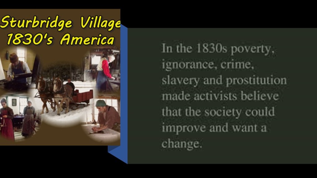
So on the one-hand, we are taught that life in America in the 1830s was largely rustic and full of social ills in need of reform…
…and on the other hand, we are told the North American Canal Age of canal-building was dated from 1790 to 1855.
Same thing with the construction of railroads starting in the same period, and simultaneously the railroads were already making the canals they were constructing obsolete according to the historical narrative.
Only eight-miles of the Central Canal within Indianapolis were completed, starting at Broad Ripple.
We are told it was originally intended to connect the Wabash and Erie Canal with the Ohio River…
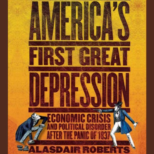
…but construction was said to have stopped in 1839 because of financial difficulties due to the Panic of 1837, which was said to have touched off a major depression which lasted until the mid-1840s.
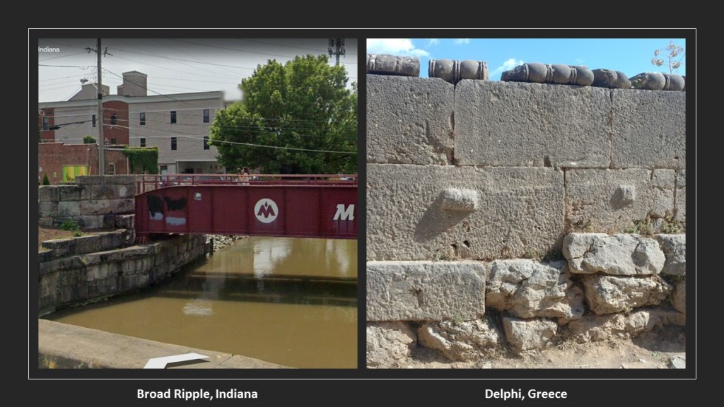
This is a view of the Central Canal, with cut-and-shaped large stones, and the Monon railroad bridge crossing over it, on the left, and on the right is a photo for comparison of an ancient megalithic stone wall in Delphi, Greece.
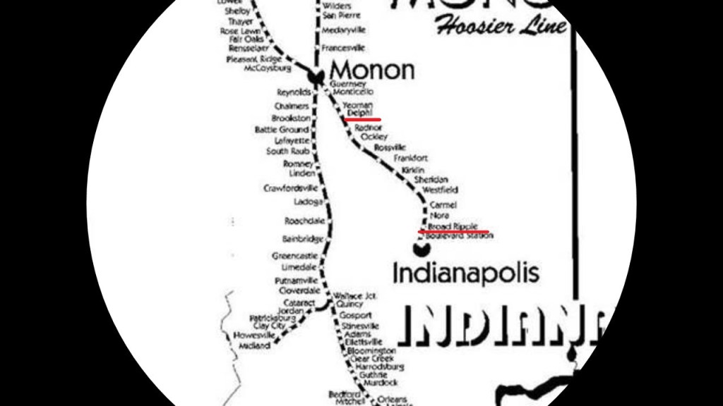
The Monon Trail used to be the Monon rail-line between Indianapolis and Delphi, Indiana, that was abandoned in 1987, and which was part of a larger rail-line that connected Chicago and Indianapolis.
Broad Ripple was a summertime retreat for Indianapolis from 1890 to 1930.
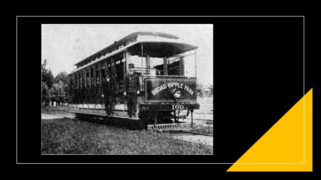
The organizers of the Broad Ripple Transit Company in 1894, what was called the first electric interurban railway to be constructed and put in operation in the United States, created the White City of Indianapolis Company in 1905, with the stated goal of developing an amusement park at the end of the Broad Ripple Transit Company’s College Line.
The White City Amusement Park, said to have been named in honor of Chicago’s 1893 Columbian Exposition, which was also known as the White City, opened officially on May 26th of 1906.
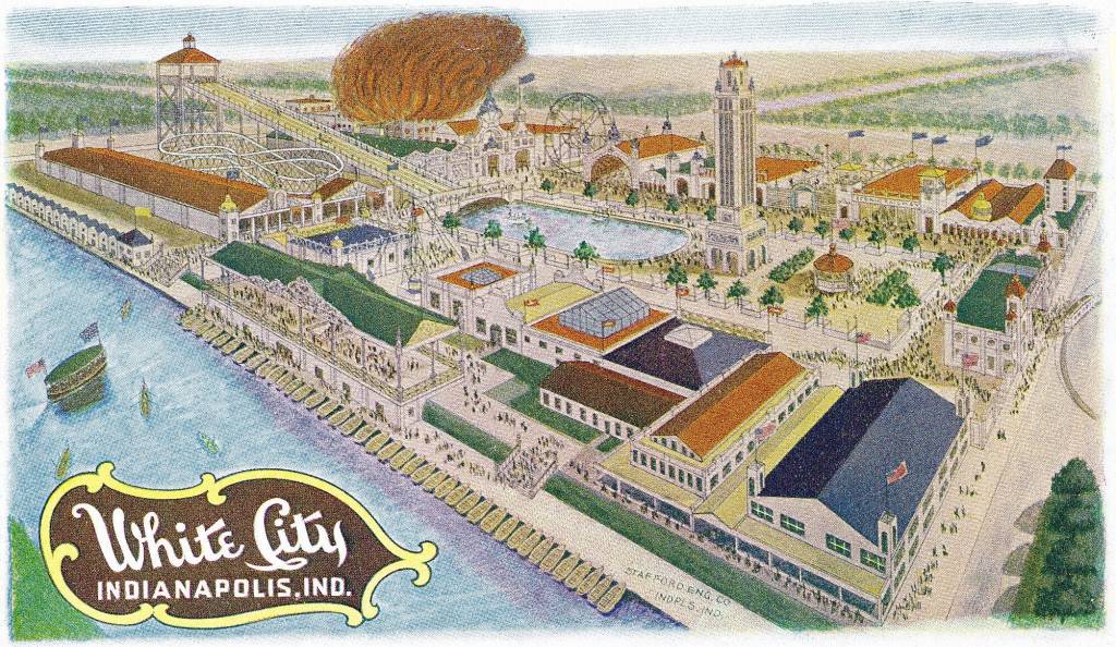
The 4-acre pool was scheduled to open to the public on June 27th of 1908, but on June 26th, 2 years and a month to the day after it opened, nearly the whole amusement park was burned to the ground, allegedly taking less than 10-minutes to engulf the park.
The pool, however, remained unscathed by the fire.
The Union Traction Company purchased the park in 1911, and continued on as the Broad Ripple Amusement park until around 1945…
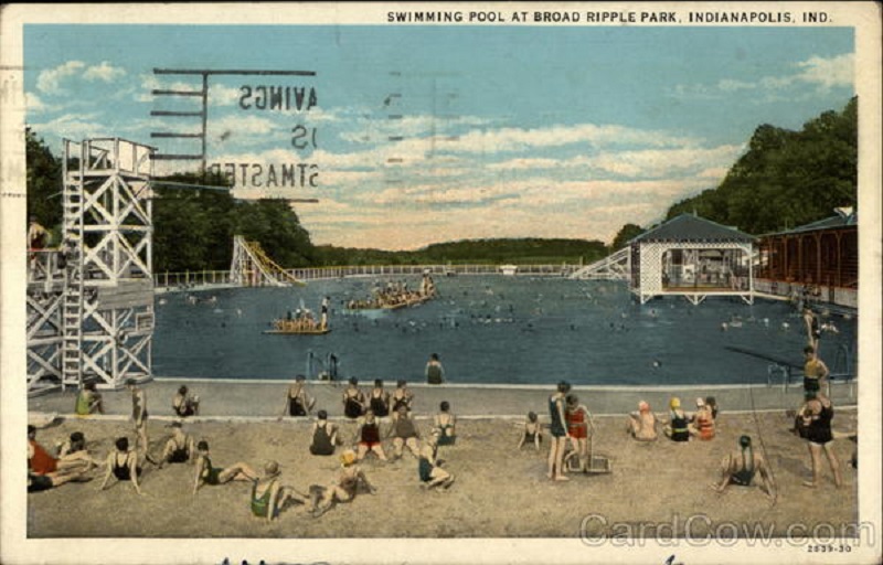
…and the location was Broad Ripple City Park today.
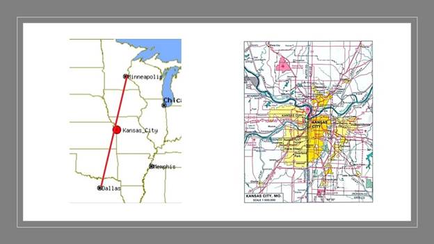
Next, I am going to take a look at Kansas City, Missouri, which is located almost exactly mid-way between Minneapolis, Minnesota, which is 412-miles, or 662-kilometers northeast of Kansas City, and Dallas, Texas, which is 454-miles, or 731-kilometers, southwest of Kansas City, keeping in mind that Kansas City is split between the states of Kansas and Missouri.
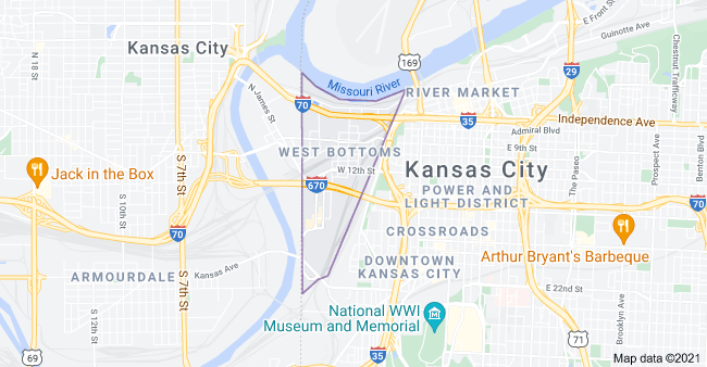
Kansas City in Missouri has an area called West Bottoms, that is always hit harder when it floods in Kansas City than other parts of the city.
And no wonder, considering that West Bottoms is located on land that is situated between the confluence of the Missouri and Kansas Rivers, and was also the original Central Industrial District of Kansas City, and is one of the oldest areas of the city.
The first Hannibal Bridge, the oldest bridge crossing the Missouri River, was said to have been completed in 1869, after its construction started in 1867, just two-years after the end of the American Civil War, and was the first permanent rail crossing of the Missouri River.
It established Kansas City as a major city and rail center.
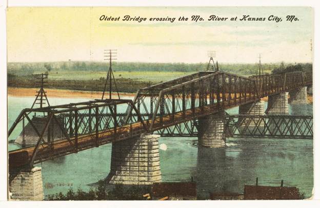
Soon after the Hannibal Bridge opened, it carried eight railroads shipping freight to major trade centers in the east, like St. Louis, Chicago, and New York.
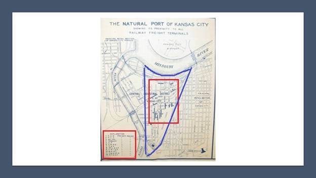
This is a historical map of what was called the “Natural Port of Kansas City,” with the West Bottoms District highlighted in blue, and the freight houses of 12 different railroads are listed by number in the red square on the left-hand-side, and the locations by number of each freight house in the red square that is contained completely within the West Bottoms District.
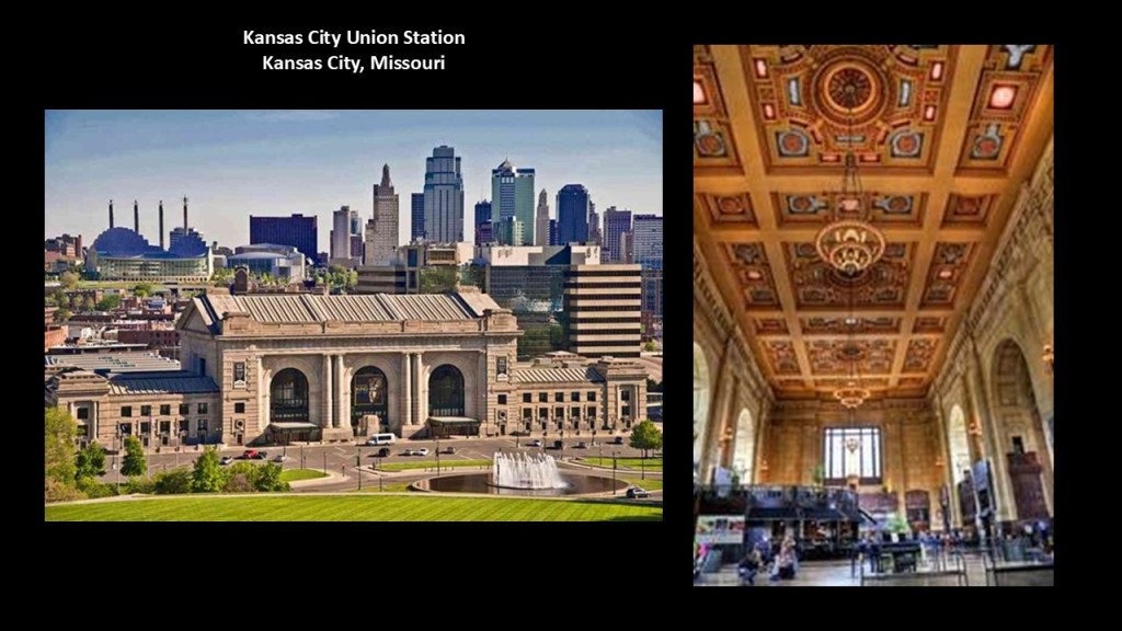
The first Kansas City Union Depot opened in 1878, and said to be the largest building west of New York of the time, and located near the stockyards.
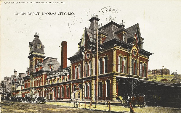
The first Union Depot train station was razed to the ground in 1915, after only 32-years of use, after the Kansas City’s second main train station, Union Station opened in 1914, the same year that World War I began.
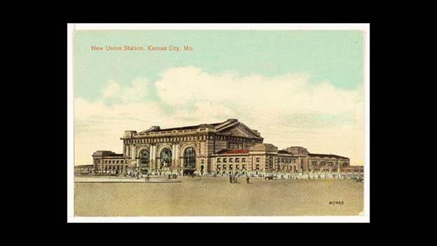
The New Union Station is still in use by Amtrak as a train station today, in addition to housing museums, theaters, restaurants and shops.
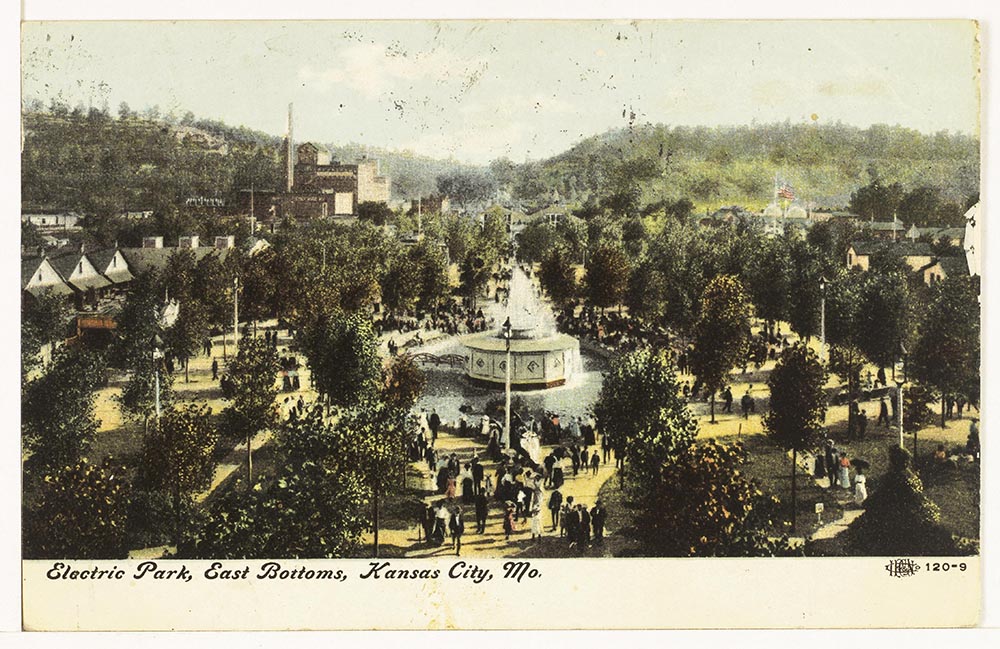
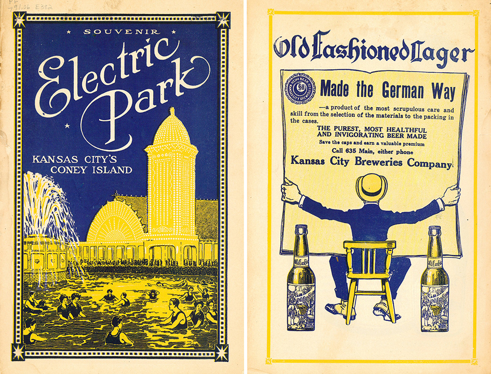
Also in Kansas City, Missouri, Electric Park was the name of two amusement parks said to have been built by the Heim Brothers Ferdinand Jr, Joseph, and Michael.
As brewers, they followed in the footsteps of their father, Ferdinand Sr.
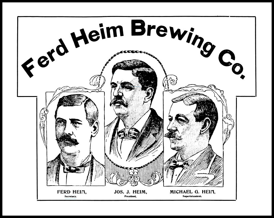
He was said to have come to the United States from Austria in 1854, and he started brewery operations in Manchester, Missouri between 1857 and 1862, and in East St. Louis, Illinois in from 1870 to 1879.
Father and sons jointly purchased the Star Ale Brewery of the East Bottoms in Kansas City in 1884.
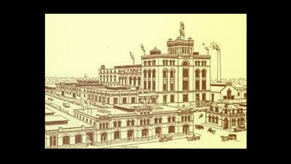
The first Electric Park was said to have been built right next to the brewery in the East Bottoms after the Heim Brothers built a streetcar line to it, and they wanted a way to attract visitors to the streetcar line and to the brewery.
Open from 1899 to 1906, the first Electric Park was an immediate success as one of the world’s first full-time amusement parks.
Among other things, Beer was piped directly from the brewery to the beer garden in the park.
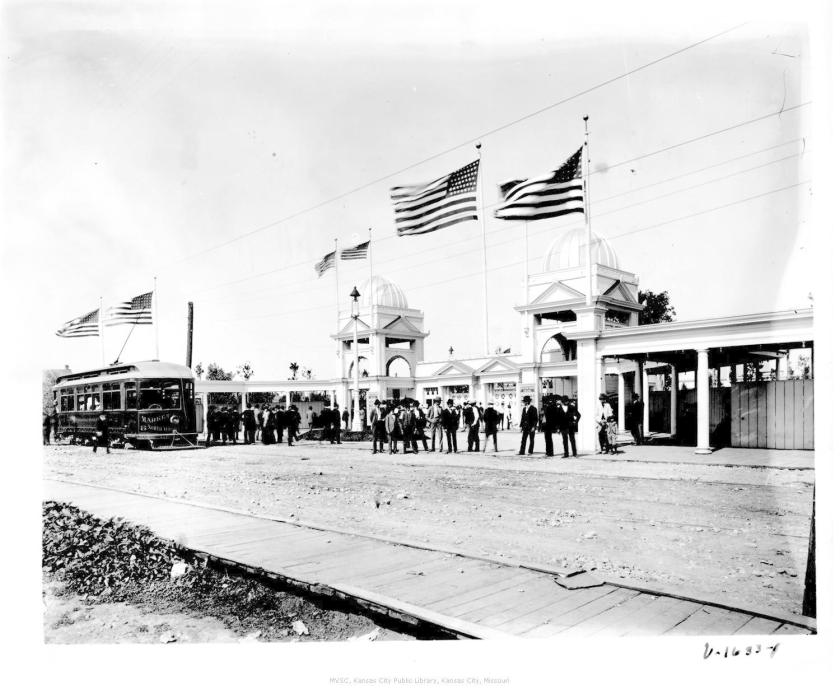
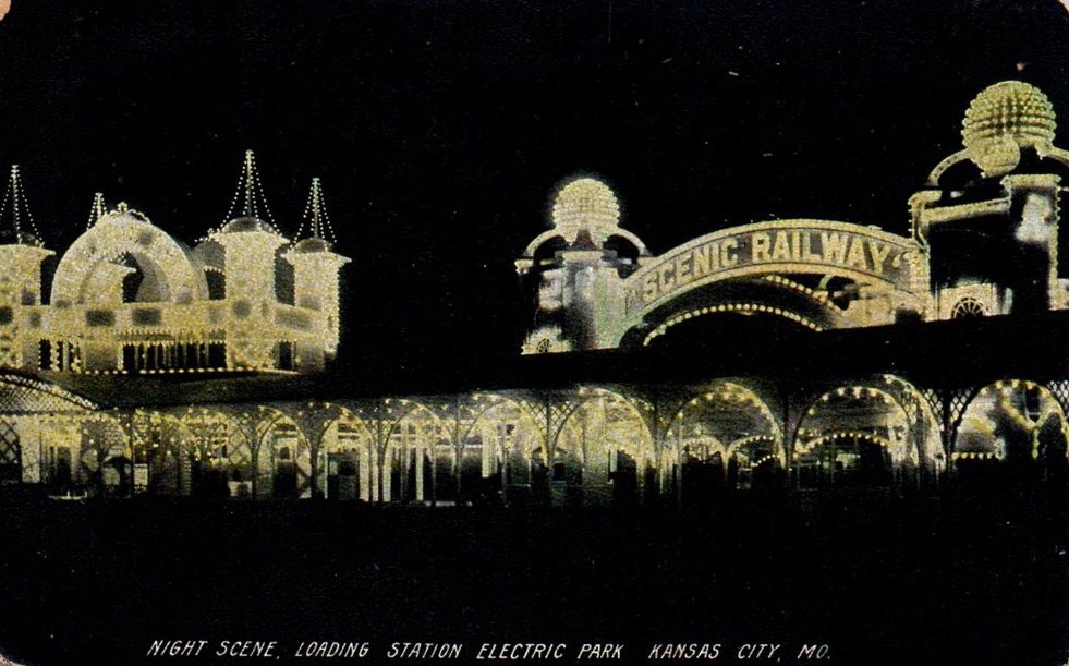
Soon the success of Kansas City’s Electric Park, we are told, necessitated a larger location.
So, the second electric park opened in 1907.
Also on a trolley line, it was said to be the largest to be called Electric Park in the United States.
It opened in 1907.
Most of this grand park, which was said to have inspired young Walt Disney to build his own version of it, burned to the ground in 1925.
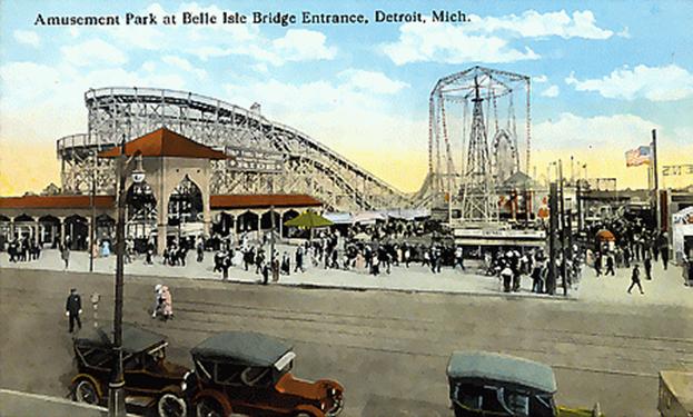
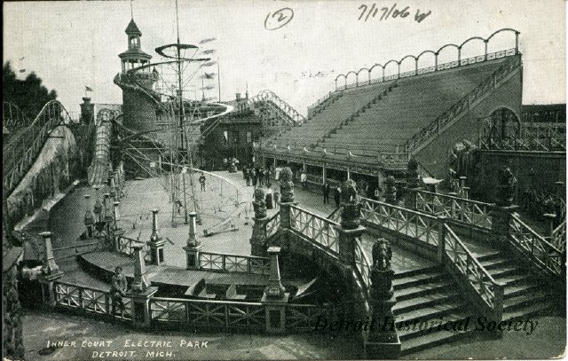
The Electric Park in Detroit, Michigan, was in operation between 1906 and 1928.
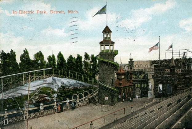
It was located on East Jefferson Drive in Detroit, adjacent to the bridge to Belle Isle.
Originally a trolley park, the Electric Park in Detroit was at the end of three trolley lines, but we are told public transportation shifted to buses by the 1920s as trolleys were already becoming obsolete.
The 1920s saw legal battles not only over the ownership of the park, but also challenging its existence.
In 1927, the city of Detroit condemned many of the park’s structures as a blight, closing the park permanently. Detroit’s Electric Park was levelled the following year, and became a new public park.
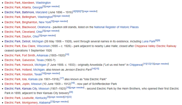
I found this list of over 30 more Electric Parks alone all over the United States. They were constructed as trolley parks and were owned primarily by electric companies and streetcar companies. This does not come even close to listing all of the trolley parks in the United States at one time.
Souvenirs from the Kansas City Electric Park, like this one from 1913, touted it as Kansas City’s Coney Island.
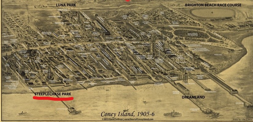
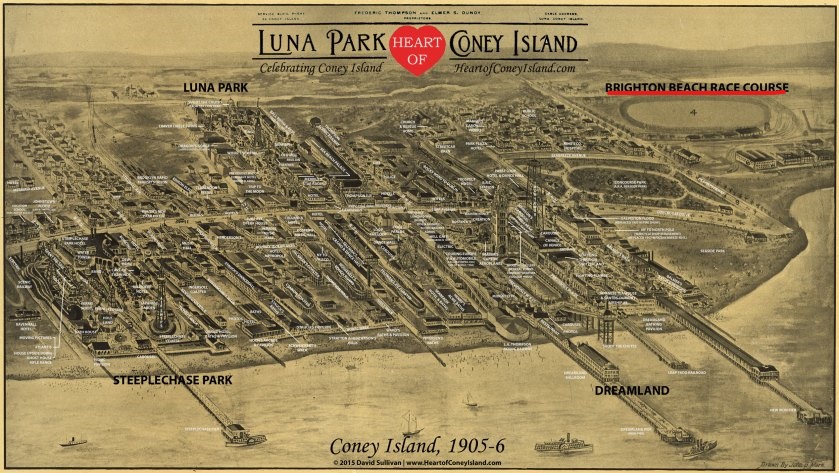
There were three historic trolley amusement parks on Coney Island in the New York City Borough of Brooklyn, located right next to each other – Steeplechase Park, Luna Park and Dreamland – and the Brighton Beach Race Course was located to the east of the three trolley parks.
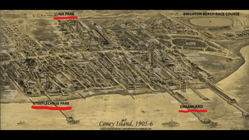
This is what we are told about the historic trolley amusement parks of Brooklyn’s Coney Island.
First, Steeplechase Park.
We are told that Steeplechase Park was created by entrepreneur George Tilyou in 1897.
The park included at one time over 50 attractions on its midway alone.
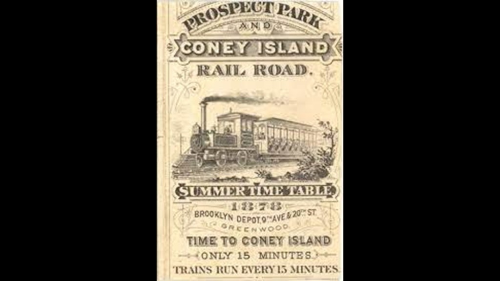
The main trolley line that served Steeplechase Park was the Prospect Park and Coney Island Line along Gravesend Avenue, which started as a steam railroad in 1875; was converted to an electric trolley car line in 1899; and trolley service ended in Brooklyn in 1956
George Tilyou died in 1914, and Steeplechase Park remained in the Tilyou family until its closure in 1964, and over the years started to go into decline at different times for different reasons, but especially so with the onset of the Great Depression, which started in 1929 and resulted in a significant decline in park attendance.
The land of the former amusement park today is Maimonades Park, the location of a minor league baseball stadium.

Next, Luna Park on Coney Island opened in 1903.
It was said to have replaced Sea Lion Park that was operated by a man named Paul Boyton between 1895 and 1902, the first enclosed and permanent amusement park in North America.

We are told that Luna Park’s architectural style was an oriental theme, with over 1,000 red and white painted spires, minarets, and domes on buildings constructed on a grand scale, though Moorish architecture comes to mind when I see this historic post card!
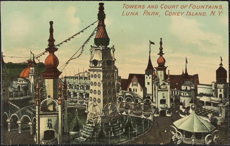
All the domes, spires, and towers were lit-up at night with several 100,000s of incandescent lights.

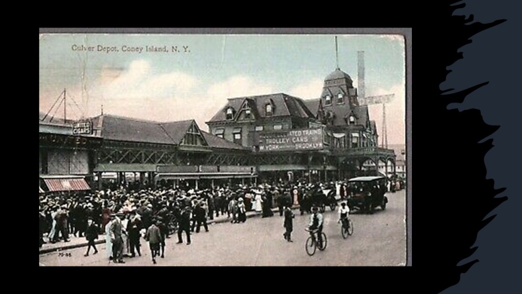
Luna Park was accessible from Culver Depot, the terminals of the West End and Sea Beach Streetcar and Railroad lines.
Over the years, Luna Park would continue under different management, with constant changes.
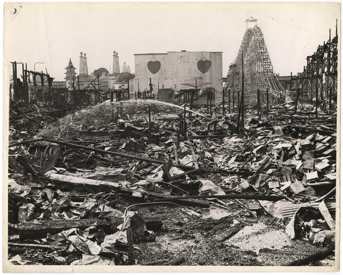
The end of Luna Park came with two fires in 1944, one in August and one in October, which destroyed the park, and in 1946, the whole park was demolished.
There has been a Luna Park operating near the original location since 2010 that has no connection to the 1903 park.

Dreamland was the third and last of the three original parks said to have been built on Coney Island in the early 20th-century.

Dreamland was said to have been founded by successful Brooklyn real estate developer and former State Senator William H. Reynolds as a refined and elegant competitor to the chaotic noise of Luna Park, and opened in May of 1904.
The location of Dreamland was near the West Eighth Street subway station opposite Culver Depot.

Everything at Dreamland was touted to be bigger than Luna Park, including the larger Electric Tower, and four times as many incandescent lights than Luna Park.

Dreamland’s life on Coney Island was ended only 7-years after opening.
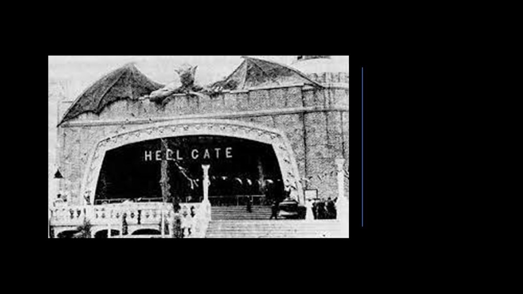
On May 27th of 1911, a fire started at the Hell Gate attraction the night before the season’s opening day, and spread quickly, completely destroying the park by morning.
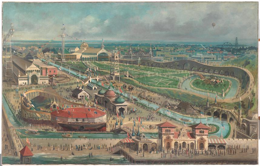
The Brighton Beach Race Course was an American thoroughbred horseracing facility shown here opened on June 28th of 1879.
It was instantly successful and drew wealthy patrons from New York City.
The track prospered in 1908, when the New York State Legislature passed the Hart-Agnew Law, banning gambling.
The Brighton Beach Race Track was eventually torn down, and by the 1920s, replaced by residential housing.

The next places I am going to take a look at are in Ohio.
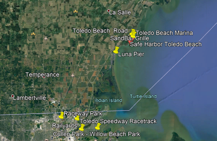
First, the Willow Beach Trolley Park in Toledo was located in the railyards slightly south of the Toledo Speedway Racetrack, where Cullen Park is today.
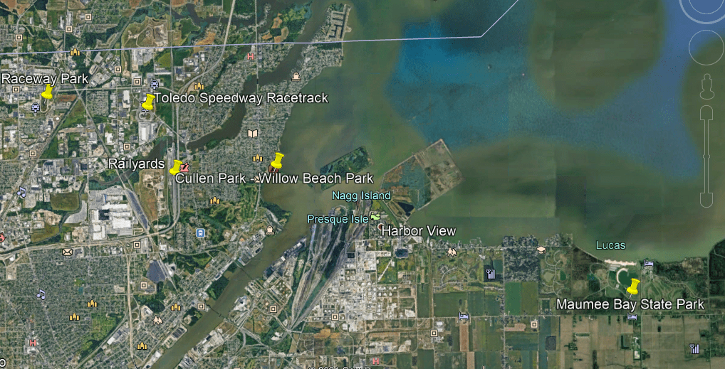
The Willow Beach Trolley Park, which opened in 1929, was a haven for food, games, gambling, rides and entertainment at what was known as Point Place at the time, and permanently closed in 1947.

There was an historic trolley amusement park just a short ways up the coast of Lake Erie from Toledo in Ohio, called Toledo Beach.
Trolley amusement parks were typically located at the end of streetcar lines.
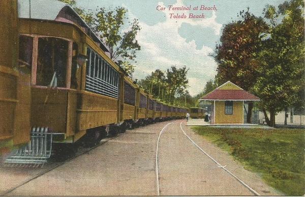
It was located where the Toledo Beach Marina is today.
Another place with a trolley park was in Chippewa Lake, a town in Ohio at the end of a trolley-line that came from Cleveland.

It operated for 100-years, from 1878 to 1978, after which time it was abandoned, with many of the original rides left to deteriorate in place.

The Chippewa Park Dance Hall burned-down in June of 2002.

Next, there is an abandoned Interurban Bridge on the Maumee River in Waterville, Ohio.
It was part of the Lake Shore Line that went to Cleveland.
It was an historic, concrete, multi-arch bridge, that was said to have been built in 1908 to connect Lucas and Wood counties across the Maumee river.

We are told that at the time of its construction, and for some time thereafter, it was the world’s largest earth-filled, reinforced concrete bridge.

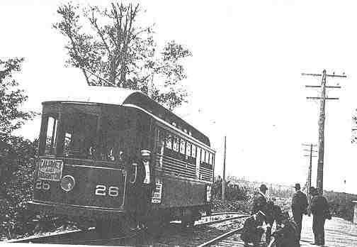
Interurbans were a type of electric railway with self-propelled rail-cars running between cities or towns in North America and Europe.
They were prevalent in North America starting in 1900, and by 1915, interurban railways in the United States were operating along, 15,500-miles, or 24,900-kilometers of track.
It was seen, however, as far more convenient, and cost-efficient to carry cargo by way of truck and other automobiles.
By 1930, most of the interurbans were gone, with a few surviving into the 1950s.
And by 1937, the Interurban bridge across the Maumee River has sat unused to this day.
We are told when the Federal Highway Act was passed in 1916, it marked the beginning of the end of the Interurban systems.
With the construction of paved highways and the mass production of automobiles, we are told that electric rail service decreased in popularity.
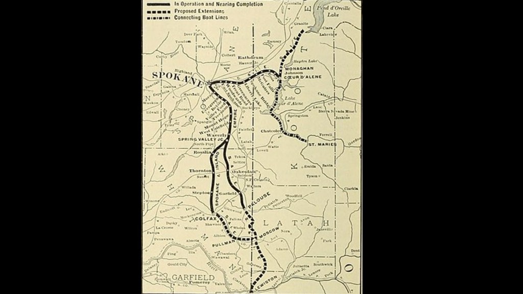
Today’s commuter rail lines pale in comparison to the interurban lines of the past, with electric streetcars going from city-to-city, like the Spokane and Inland Empire Railroad , which extended from Spokane and Colfax in western Washington, into cities in northern and central Idaho.
The Spokane and Inland Empire Railroad Interurban line was folded into the Great Northern Railway in 1929, and as time went on, there was a conversion to bus service ending this interurban, electric rail service for all intents-and-purposes in 1936.
And this fate of these interurban electrified streetcar systems was repeated everywhere.
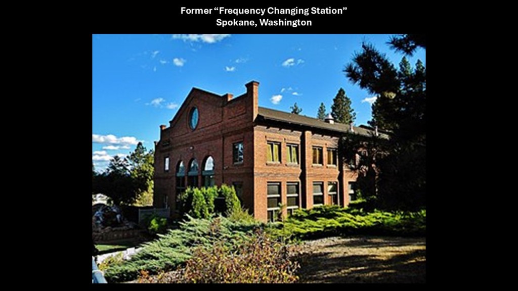
I even found what was called a “Frequency Changing Station” when I was looking into the Spokane and Inland Empire Railroad.
It was said to have been built for this railroad in 1908 to house electrical equipment used by the electric railway, and its power was generated at the Nine Mile Falls Dam and transmitted to the “Frequency Changing Station.”
There were four motor-generator sets at this location, and all together ten transformers – three that were 75-Kilowatt; three 375-kilowatt; and four 1,250-kilowatt – as well as a 550-volt, 275-cell storage battery.
Within the city of Spokane itself, the station provided direct current to the streetcar network.
In the network outside of Spokane, the station provided alternating current to the streetcar network through a series of electrical substations spaced about 15-miles, or 24-kilometers, on the operating line.
The substations converted power back to direct current for the streetcars, and sold power to the communities at 110 AC.
All of this electrical equipment was removed in 1939 when the railroad property was sold by its owner, and since then, the main building was repurposed storage for a boat dealership in the 1970s, and then the building was renovated starting in 1978, and was turned into condominium units, and the meaning and application of its former advanced technology has been forever lost to time.
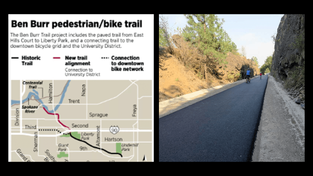
Today several rails-to trails incorporate the Spokane and Inland Empire’s right-of-way, like the Spokane River Centennial Trail, which runs between Spokane and Coeur d’Alene in Idaho…
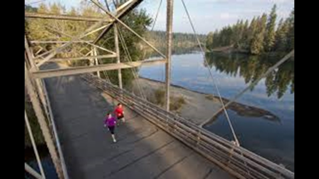
…and the Ben Burr Trail in Spokane.
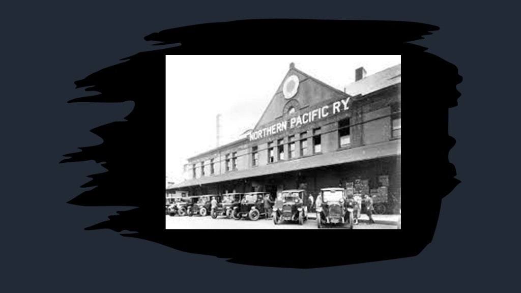
The Northern Pacific Railway first brought settlers to the Spokane area in 1881.
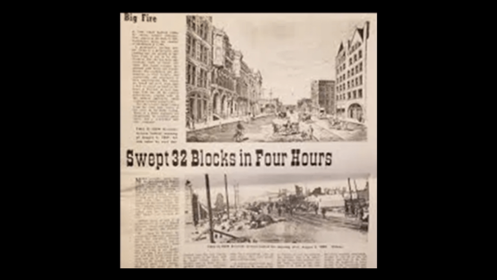
The Northern Pacific Depot in Spokane pictured here was said to have been built in 1890, after the Great Fire of 1889.
The 1889 Great Fire of Spokane was a major fire in August of that year which affected downtown Spokane, destroying the downtown commercial district of the city.
Some of the things that we are told about it was that due to a technical problem with the pump station, there was no water pressure in the city when the fire began, and that firefighters demolished buildings with dynamite in a desparate bid to starve the fire.
Officially opening in 1978, Riverfront Park in Spokane is said to be located on the site of a former railyard.
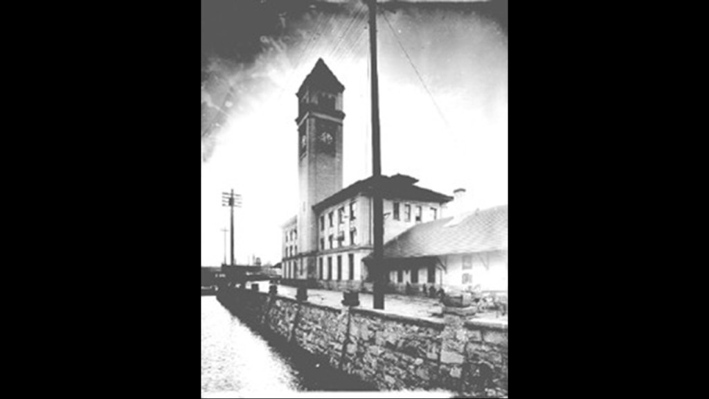
Attractions include the Great Northern Clocktower.

The Clocktower is all that remains of what was the Great Northern Depot, which was levelled to make room for the Expo ’74 that was held in Spokane.
The Great Northern Depot and Clocktower was said to have been built between 1892 and 1902.
The Clocktower was almost levelled too, but was saved by a successful preservation effort.
The Great Northern Railway was said to have been created in 1889, and was the northernmost transcontinental railroad in the United States
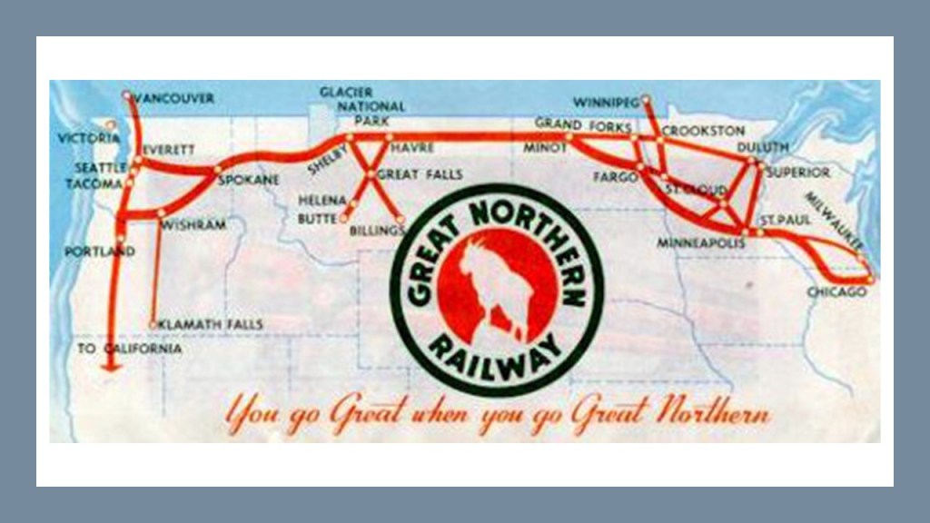
The Great Northern Railway was said to the be the creation of the 19th-Century Canadian-American railroad entrepreneur, James J Hill.
We are told James J. Hill was a railroad executive who came from an impoverished childhood.
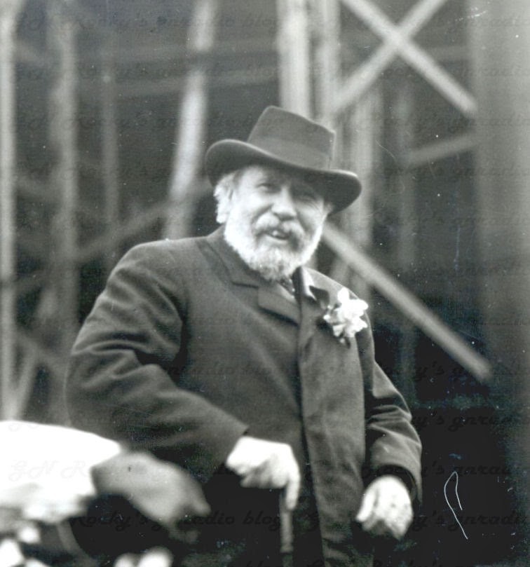
In 1898, Hill purchased control of large parts of the Mesabi Iron Range in Minnesota and its rail lines.
The Great Northern Railway began large-scale shipment of iron ore to the Midwest’s steel mills.
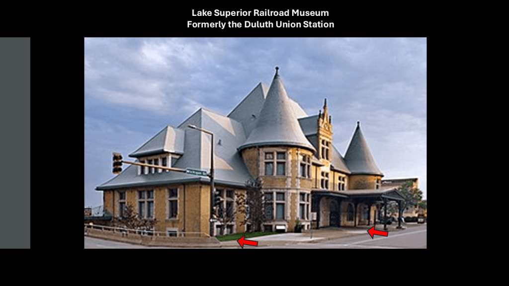
The “North Shore Scenic Railroad” operates out of what was formerly the Duluth Union Station, and now the “Lake Superior Railroad Museum.”
The North Shore Scenic Railroad corridor travelled by the excursion train once was a vital link in the transportation system known as the Lakefront Line for over 100-years, and connected Duluth and the Iron Range Railway with America’s expanding rail network.
Interesting to note the slant of the road and sidewalk in front of this building; ground-level windows; and below-ground floors, which are all classic indicators for what is best-known as the mud-flood, and found all over the world.
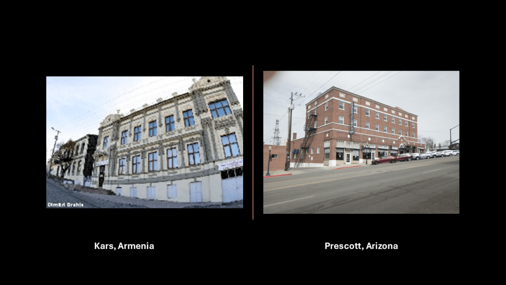
…like these examples of Kars in Armenia on the left and Prescott in Arizona on the right, for just two of countless examples of what I am talking about.
I found this map, circa 1911, of the Duluth Street Railway Company.
I have circled the place where the Aerial Lift Bridge is marked on the map.
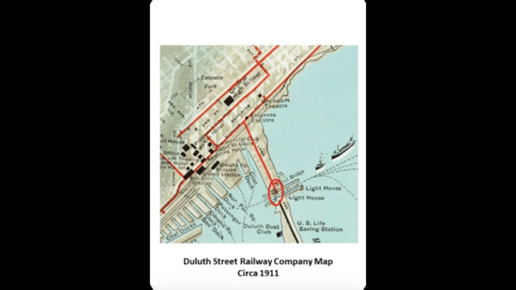
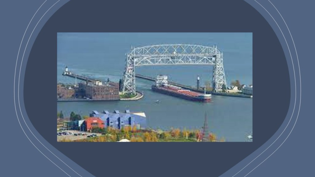
A movable, lift-bridge, it spans the Duluth Ship Canal and Minnesota Point, and said to have been constructed between 1901 and 1905, and modified in 1929.
The Duluth Street Railway Company was said to have been incorporated in 1881, and that the first horse-pulled trolley cars were available for service in 1883…
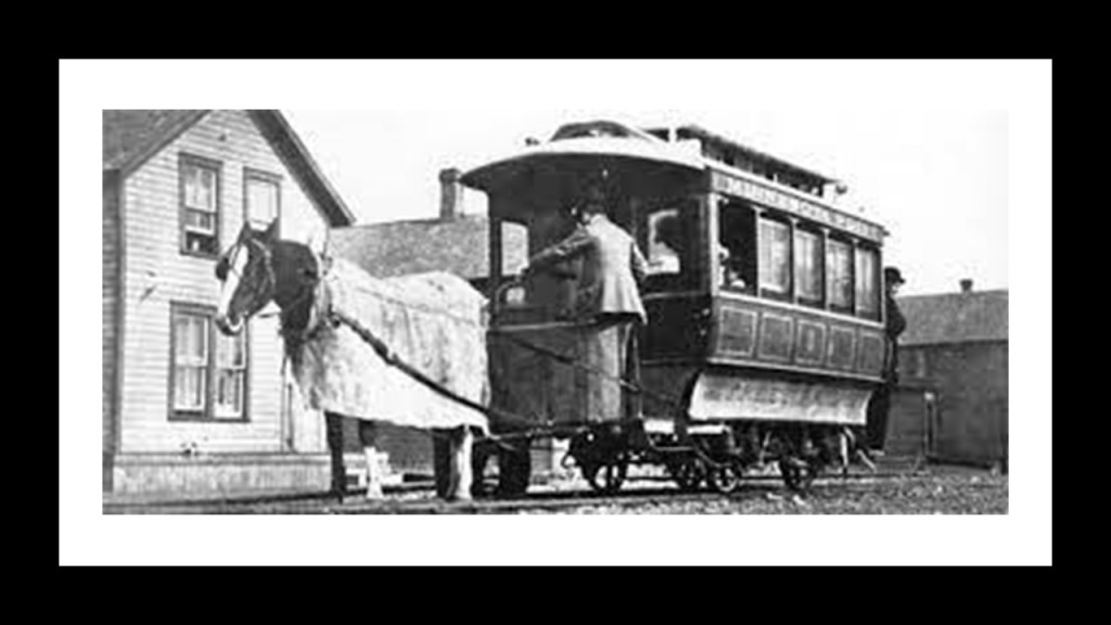
…and that by 1892, the entire line was electrified.
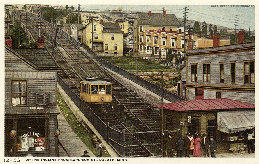
The Highland Park Tramway Line served Duluth Heights via an Incline-Railway from 1892 to 1939, which was the last piece of the electric streetcar system to be dismantled, as the rest started going away in the early 1930s.
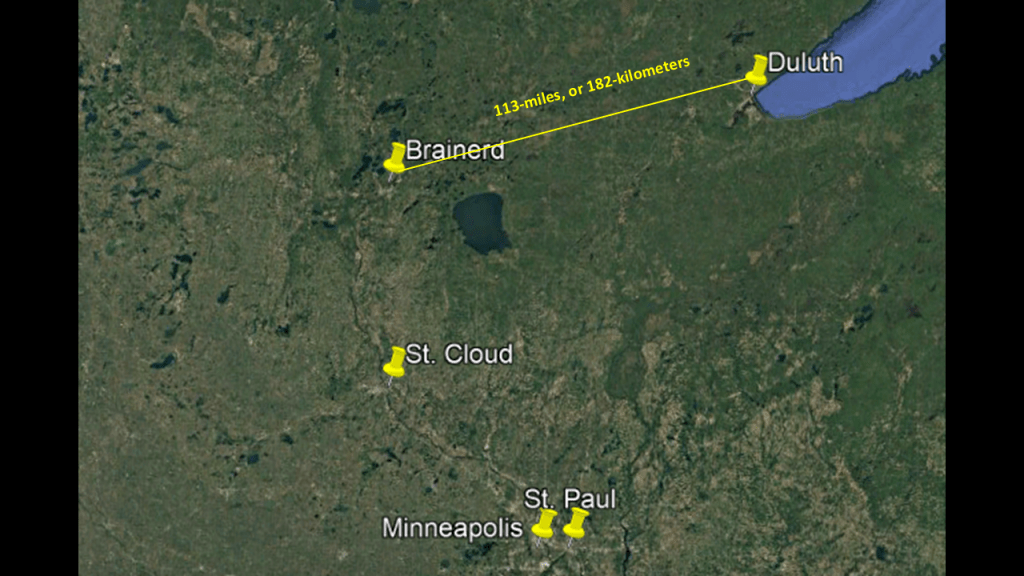
Brainerd in Minnesota is 113-miles, or 182-kilometers, southwest of Duluth.
Brainerd was established by the Northern Pacific Railroad President John Gregory Smith, who named it after his wife’s family, and it was organized as a city in 1873.
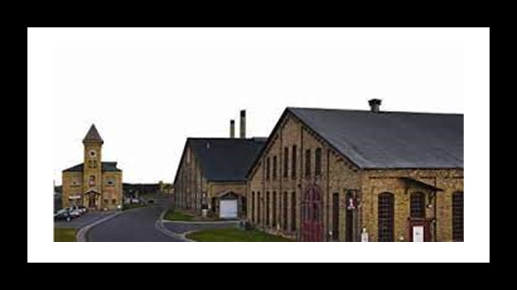
Brainerd was an important location for the Northern Pacific Railroad, where it had a machine and car shop, and round house.
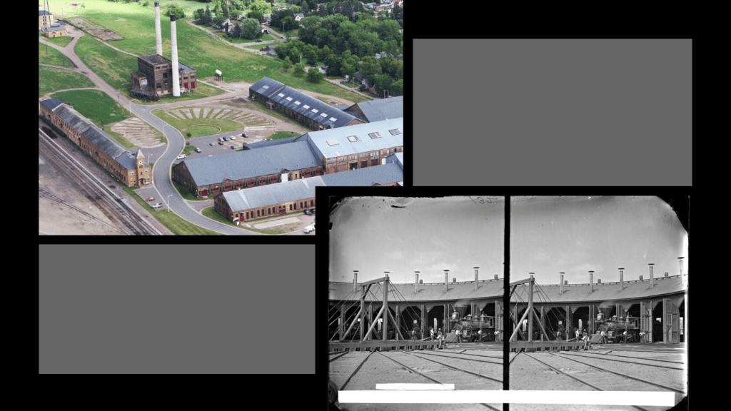
Today the Northern Pacific Center is a 47-acre, or 19-hectare, site that has among other things, wedding venues, a convention center, businesses, offices and a restaurant.
Now moving aways along the southern shoreline of Lake Superior, the Keweenaw Peninsula is part of the land mass of Michigan’s Upper Peninsula.
While the Minnesota/Ontario side of Lake Superior is known for the high-quality iron ore from its Iron Ranges, the Upper Peninsula of Michigan is known for its high-quality copper.
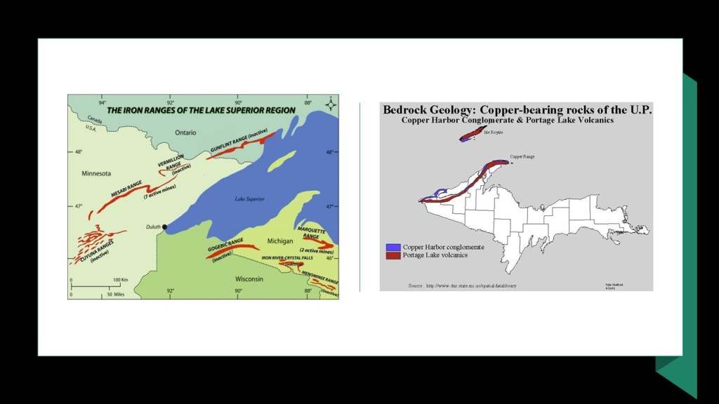
Keweenaw is the northernmost county of the State of Michigan, and it shares the Keweenaw Peninsula with Houghton County.
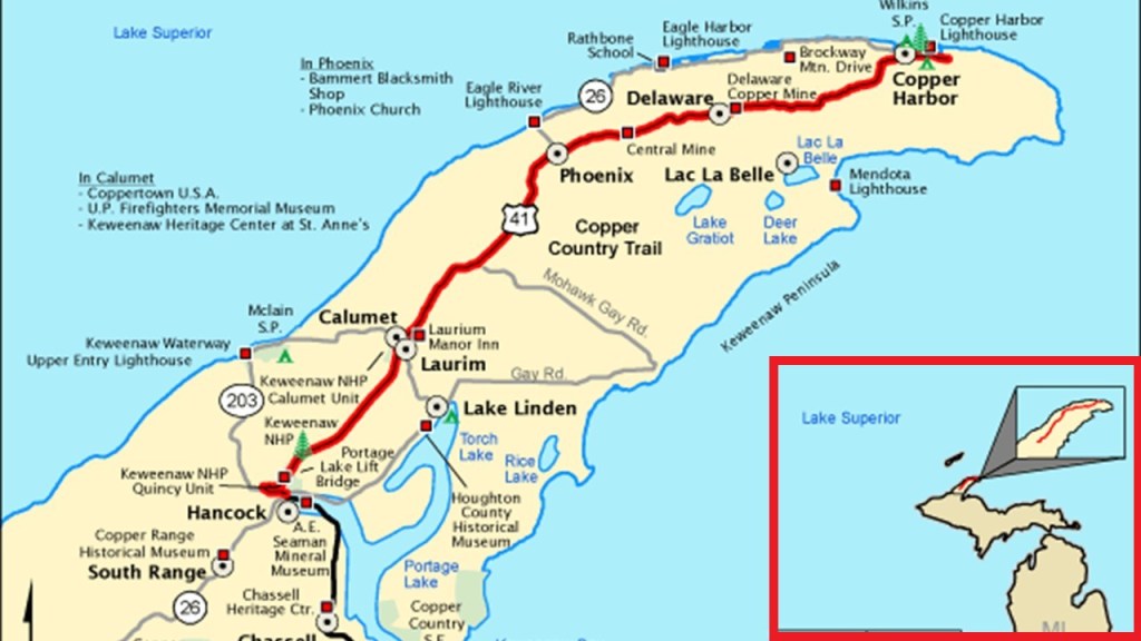
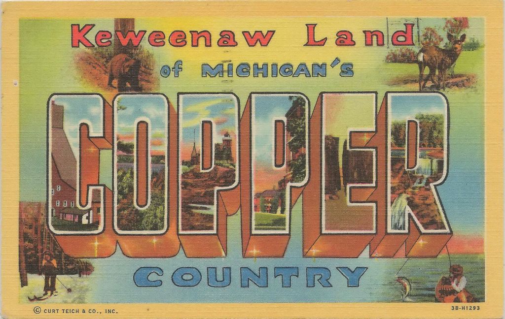
Along with several other adjacent counties in the Upper Peninsula, is collectively called “Copper Country,” and in its hey-day, in the late 19th- and early-20th-century, it was the world’s greatest producer of copper.
There is a lift bridge in Houghton County, like the Duluth Aerial Lift Bridge mentioned earlier in this post.
Known as the “Portage Canal Lift Bridge,” it connects the cities of Houghton and Hancock across Portage Lake, which is part of the waterway which cuts across the Keweenaw Peninsula with a canal linking the five-miles to Lake Superior to the northwest.
The steel swing, or vertical, bridge was said to have first been built in 1895 to replace a damaged wooden swing bridge that was built in that location in 1875, and that the current steel bridge replaced the previous steel bridge in 1959.
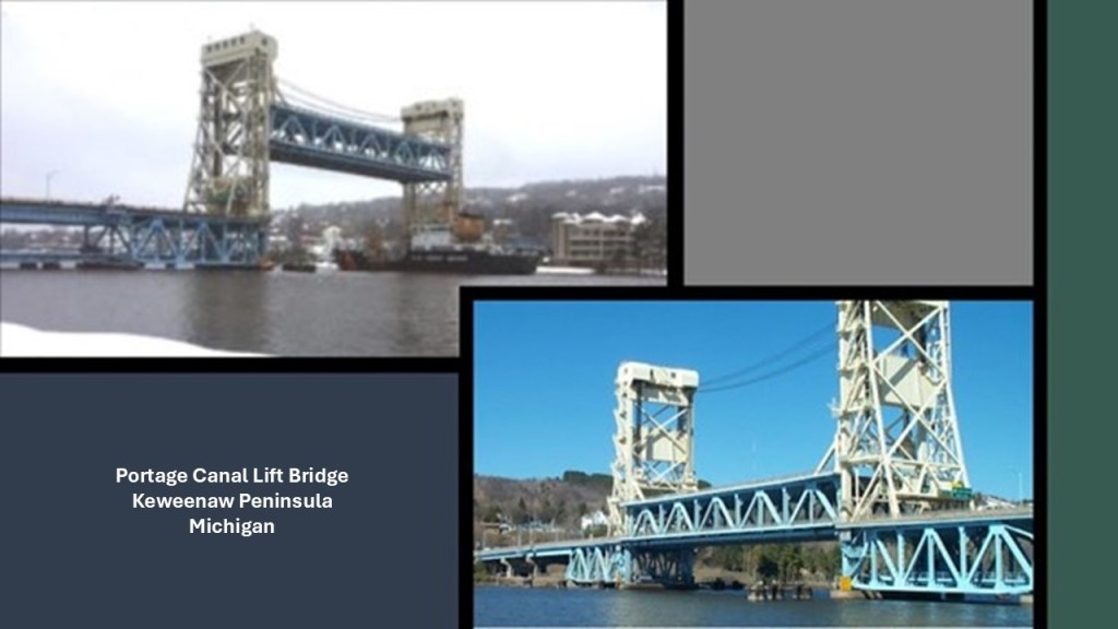
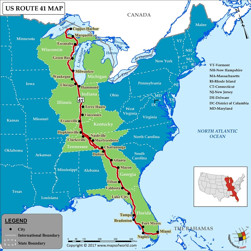
The Portage Canal Lift Bridge is on the only land-route across the waterway, which is U. S. Highway 41, that originates in Miami, Florida.
The building of the Portage Canal was said to have started in 1868, after the legislation authorizing the building of it passed in 1861, and completed in 1874…and widened in 1935.
Interesting to note the straight railroad track and canal running parallel to each other.
There used to be a trolley line here between the cities of Calumet and Houghton…
…as well as many train stations, but all the tracks have been pulled up.
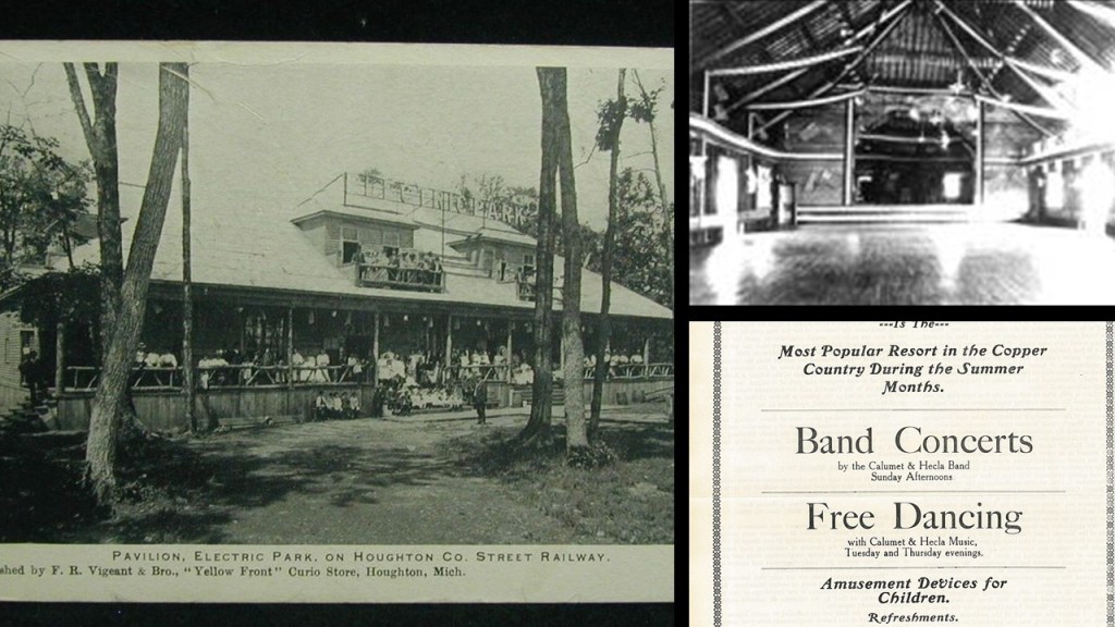
According to this map of the Houghton County Traction Company that operated the trolley line, there even was an “Electric Park” way up here!
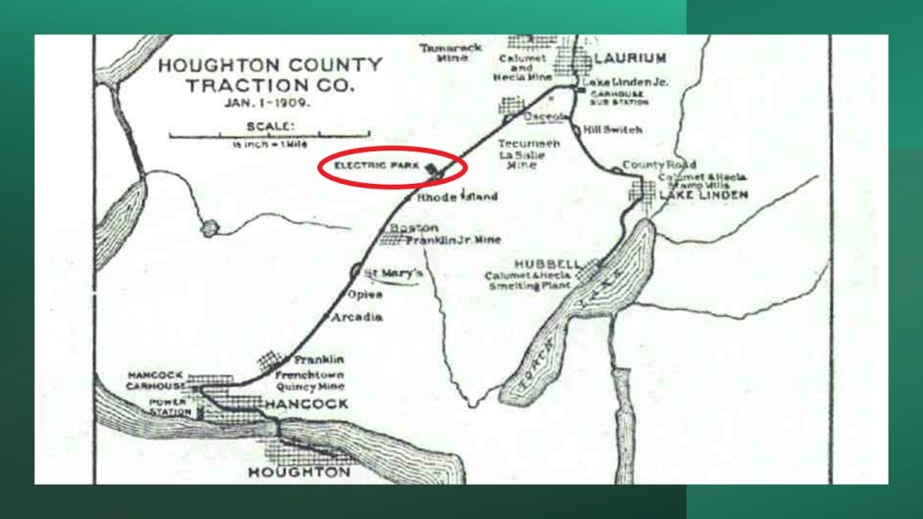
It was a popular recreation destination between 1902 and 1932, which was when all operations of the Houghton County Traction Company ended, and the park disappeared completely from the scene by World War II, we are told, because of the cost of maintenance upkeep, etc, with the main pavilion sold, scrapped and reassembled as a potato barn.
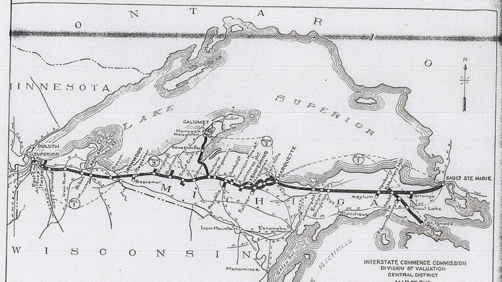
The Duluth, South Shore, and Atlantic Railway was American railroad that served the Upper Peninsula of Michigan, and the Lake Superior shoreline of Wisconsin, providing service from Sault Ste. Marie, Michigan, and St. Ignace, Michigan, westward through Duluth, Minnesota.
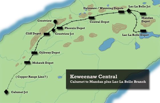
Branchlines of this railroad extended up the Keweenaw Peninsula to the cities of Houghton, Calumet, and Lake Linden.
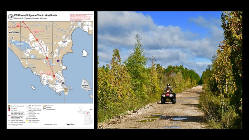
Parts of the Duluth, South Shore, and Atlantic Railway were converted to rail-trails, like the St. Ignace – Trout Lake Trail, which is 26-miles, or 42-kilometers, of multi-use recreational trail in its former railbed.
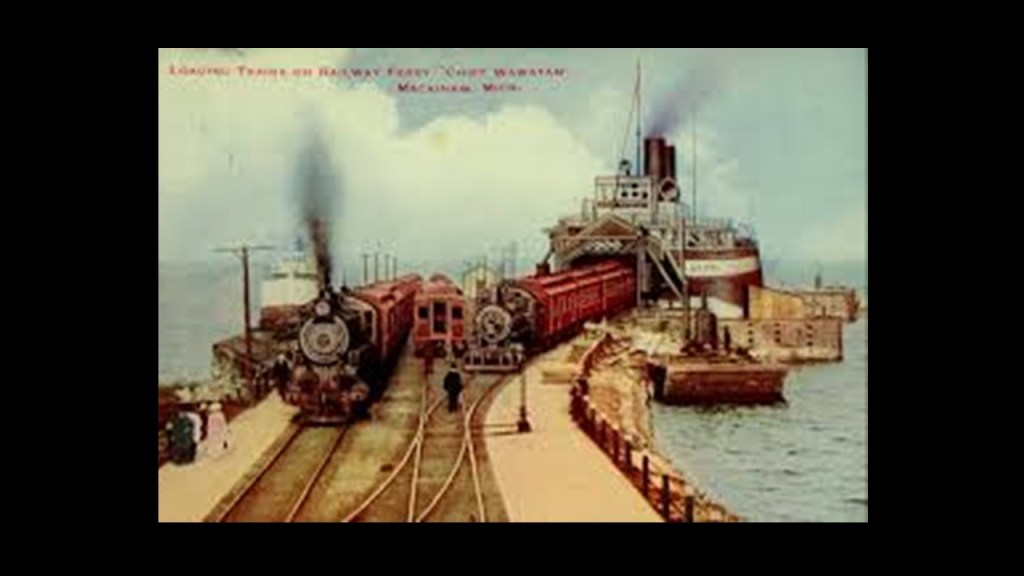
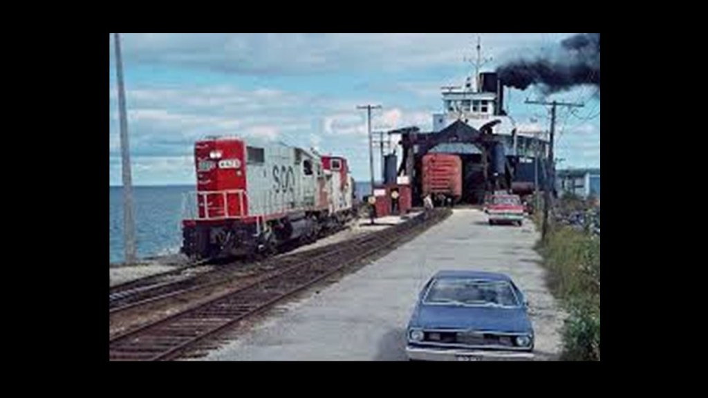
The Chief Wawatam Railroad Ferry was a coal-fired steel ship primarily based in St. Ignace, Michigan, that operated year-round in the Straits of Mackinac between St. Ignace and Mackinaw City between 1911 and 1984, serving in its storied career as a train and passenger ferry and as an icebreaker.
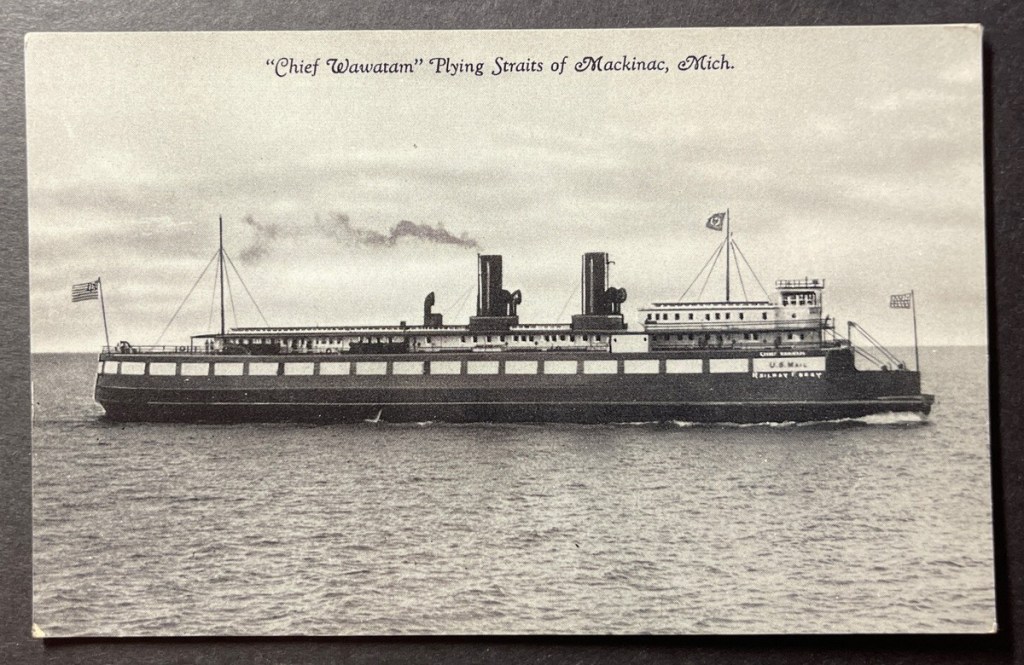
The first part of the Chief Wawatam’s history is that its main purpose was as a train service to carry railroad cars, though it also operated as a passenger and car ferry over the years.
It served as an icebreaker during the winter months until that function was replaced by the U. S. Coast Guard Icebreaker Mackinaw in 1944, and that the ship’s passenger service also dropped off after World War II.
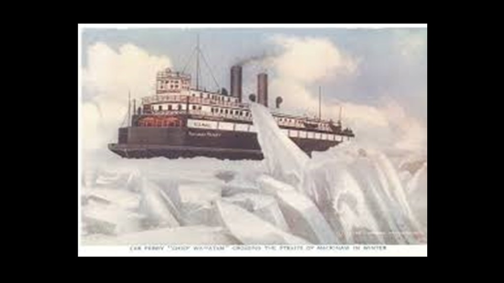
Passenger service ended after the Mackinac Bridge opened in 1957, and it was used exclusively as a railroad ferry until 1985.
The Chief Wawatam railroad ferry was the only railroad connection between the two peninsulas of Michigan, and in the 1950s, transported 30,000 railroad cars per year across the Straits of Mackinac.
It started servicing the Mackinac Transportation Company in 1911, a joint-venture of the Duluth, South Shore, and Atlantic Railway; the Grand Rapids and Indiana Railway; and the Michigan Central Railroad since all three railroads crossed back and forth at the Straits of Mackinac.
With regards to railroad lines to Mackinaw City on the other side of the Straits of Mackinac, we are told that the Michigan Central Railroad came to Mackinaw City from Detroit in 1881, and the Grand Rapids and Indiana Railroad in 1882 connecting Mackinaw City to Traverse City; Grand Rapids; and Fort Wayne in Indiana.
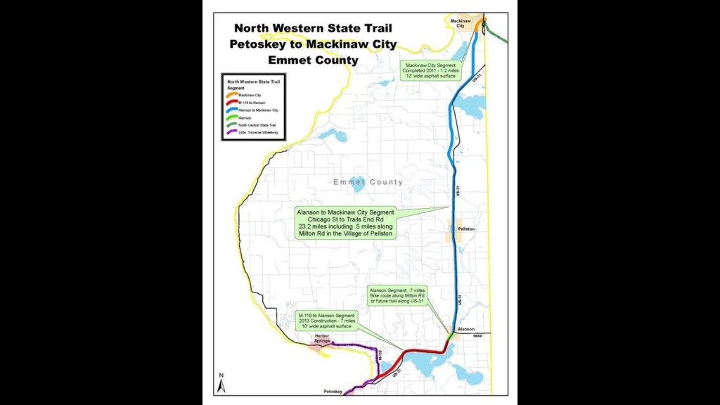
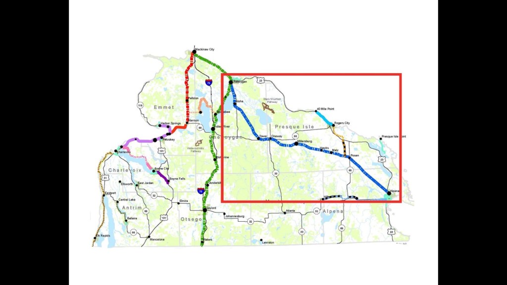
The former rail-lines have been repurposed into Rail-trails, like the North Western State Trail from Petoskey…
…the North Central State Trail from Gaylord…
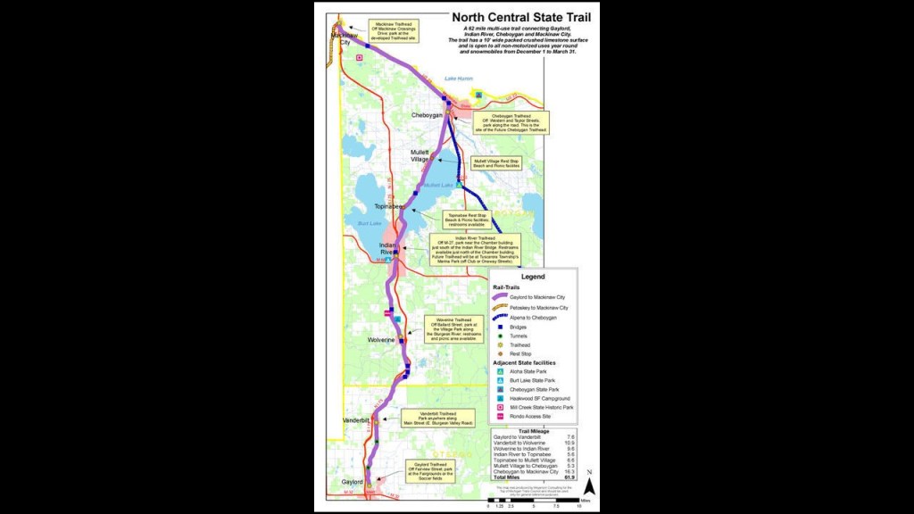
…and the North Eastern State Trail from Alpena.
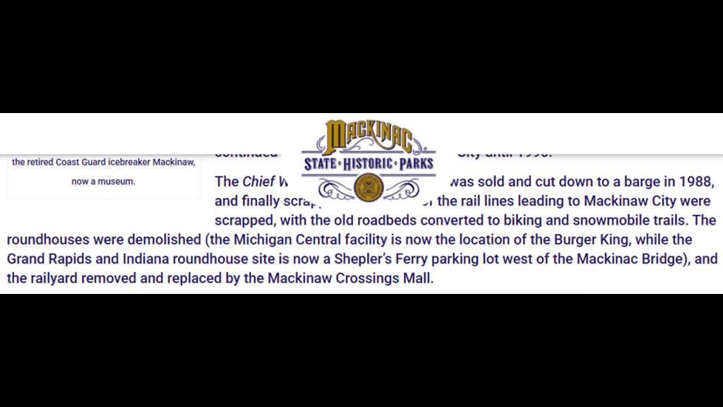
There were two historic roundhouses in Mackinaw City, one for each of the railroads serving the area.
They were both demolished after the rail-lines leading to Mackinaw City were scrapped sometime in the 1980s.
The location of the former Michigan Central Roundhouse is now a Burger King, and the Grand Rapids and Indiana Railroad is a parking lot west of the Mackinac Bridge; and the former railyards a shopping mall.
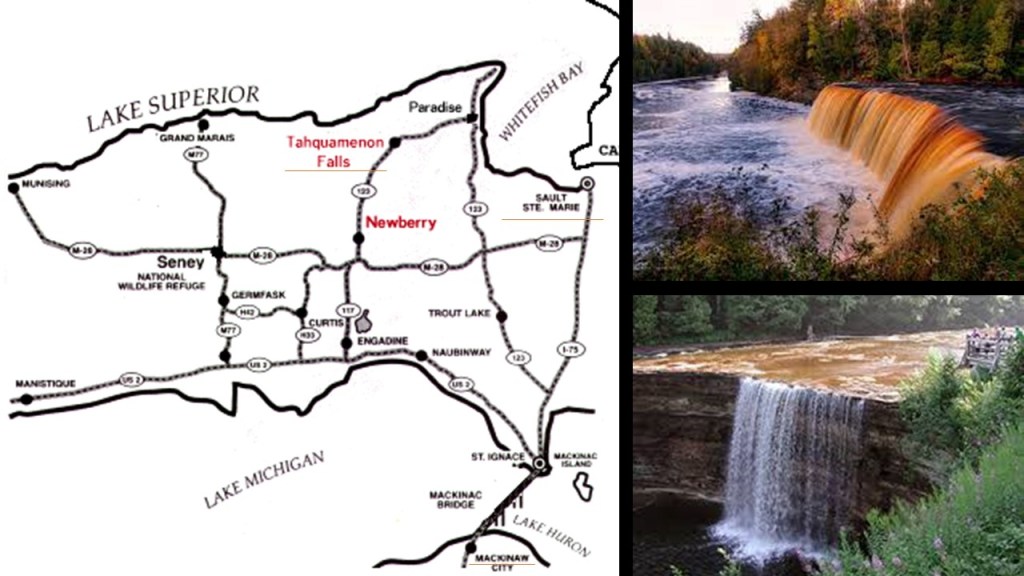
Mackinaw City is not far from the location of the Tahquamenon Falls State Park, where there are a series of waterfalls on the Tahquamenon River before it empties into Lake Superior in the northeastern part of the Upper Peninsula of Michigan, and the Tahquamenon Falls.
The Tahquamenon Falls are on Michigan State Highway 123, and are accessible from Michigan Highway 28.
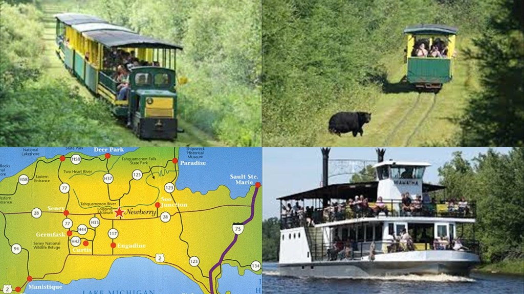
I was able to find an historical rail presence at Tahquamenon Falls when I searched and what came up was the “Tahquamenon Falls Riverboat Tours & Toonerville Trolley.”
It is a 6 1/2-hour wilderness tour that starts at Soo Junction that includes a narrow-gauge train ride and riverboat cruise to the Falls.
Making my way down the west coast of Michigan’s Lower Peninsula, also known as “the Mitten,”on the eastern shore of Lake Michigan, I found several historic trolley parks.
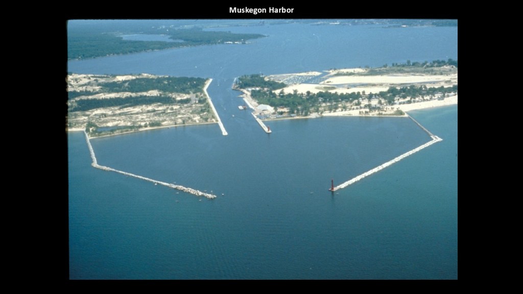
I found one in Muskegon, the largest city on Lake Michigan’s eastern shore.
The city of Muskegon is located on the south-side of Muskegon Lake, which is a harbor of Lake Michigan.
We are told that the earliest Europeans who visited the area were French explorers like the Jesuit Father Marquette and French soldiers under the explorer LaSalle in the late 1670s.
As a matter of fact, Pere Marquette Park is a beach-area that is located just to the south of the south breakwater and pier.
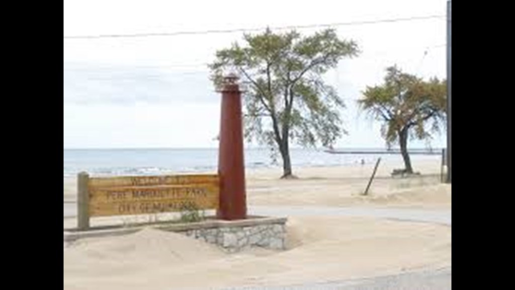
The Pere Marquette quartz-sand beach is bordered by large sand-dunes.

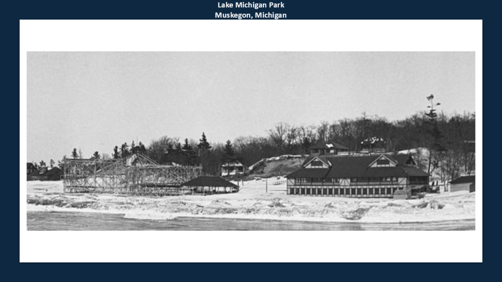
When I was looking for information about Pere Marquette Park, I came across the information that Lake Michigan Park occupied the north end of today’s Pere Marquette Park.
Lake Michigan Park was a trolley park that had a large roller coaster, dance hall, and pavilions where rail service said to have been developed in the late 18th- and early-19th-centuries to encourage local and regional demand.
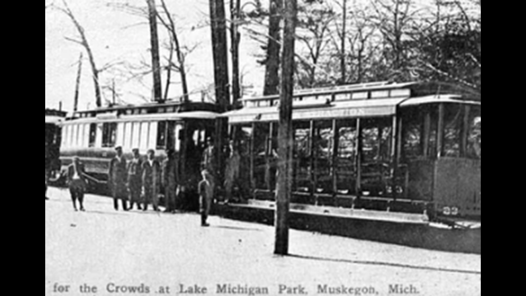
We are told the trolley park’s closure was linked to the decline of the trolley service, and the amusement park was torn down in 1930, and at some point became Pere Marquette Park.
The population and economic growth of Muskegon was due to the lumber industry, which began there in 1837, and the city became known as the “Lumber Queen of the World.”
Muskegon also became a manufacturing hub, including but not limited to bowling pins, Raggedy Ann dolls, boats, beer, engines, pianos, and paper to name a few.
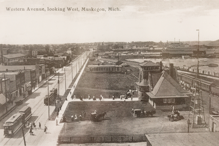
This is an historic photograph of Muskegon, circa 1900.
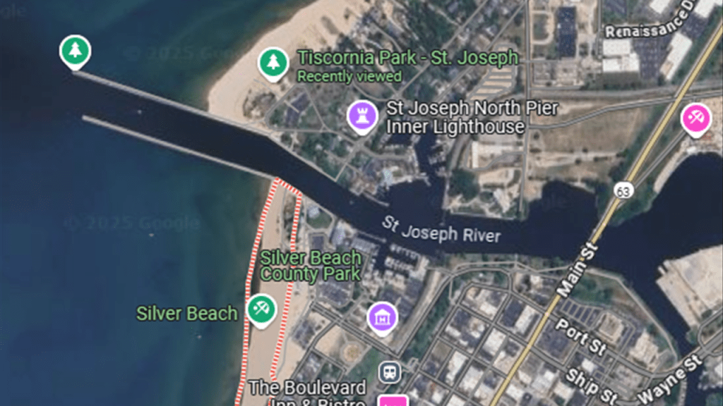
I found the Silver Beach County Park in St. Joseph, Michigan.
St. Joseph was incorporated as a village in 1834 and as a city in 1891.
At one time, Silver Beach was a trolley park and developed as a vacation resort, which first opened in 1891.
The amusement park had a roller coaster, roller skating rink, pipe organ, boxing ring, dance hall and carousel.
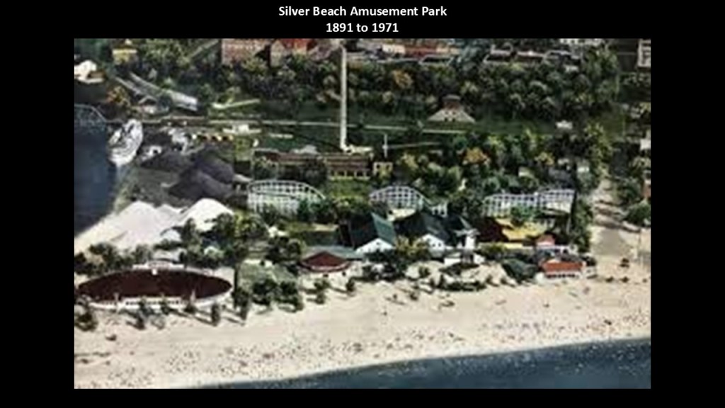
The carousel was restored to its former glory and can be found in the building to the right-side of this photo of the park facing Lake Michigan.
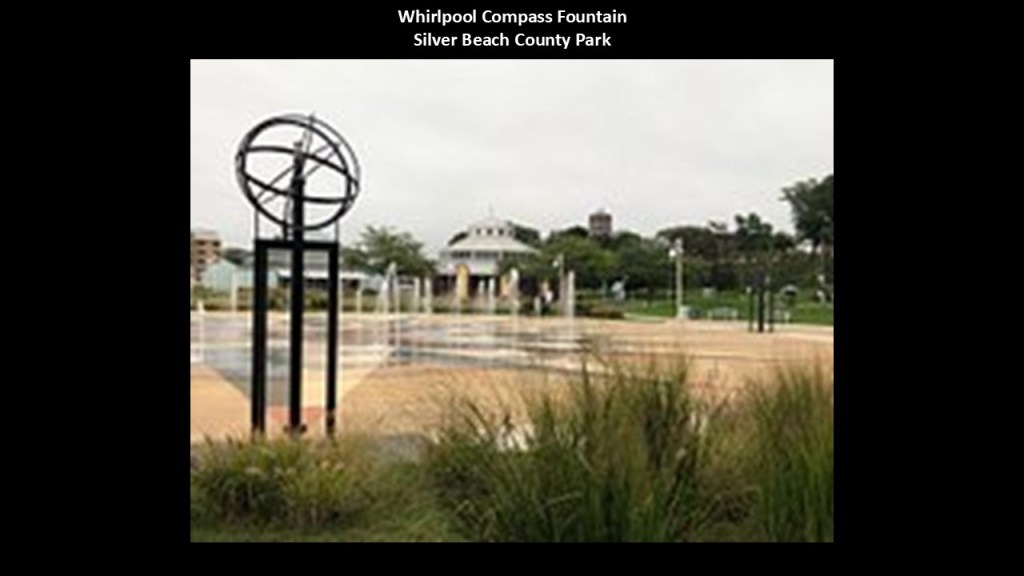
There is a fountain on the left called the Whirlpool Compass Fountain.
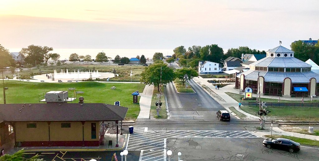
The Whirlpool Compass Fountain is described as a large splash pad with water jets that can be enjoyed in the spring and summer months.
I have no doubt there is more to this story as well.
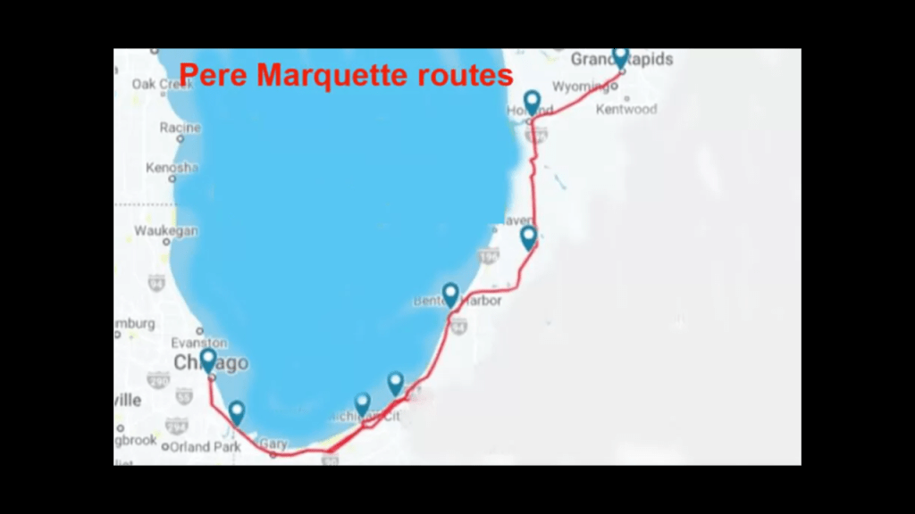
We are told that in January of 1870, the Chicago and Michigan Lake Shore Railroad extended a rail-line from New Buffalo to St. Joseph, connecting it to Grand Rapids, Muskegon, Detroit, and Chicago.
It was reorganized as the Chicago and West Michigan Railway and then incorporated into the Pere Marquette Railroad.
Today it is part of the CSX Grand Rapids Subdivision which runs from Chicago to Grand Rapids, which includes Amtrak’s “Pere Marquette” passenger rail service once per day between the two cities, mostly along the southern shore of Lake Michigan.
I also found Orchard Beach State Park in Manistee, Michigan.
Today, it is a public recreation area situated on a bluff just a short-distance north of Manistee.

Apparently there was an apple orchard here that was planted by George Hart some time around 1887, and that by 1892, Hart had built a boardwalk and theater here to attract more tourists.
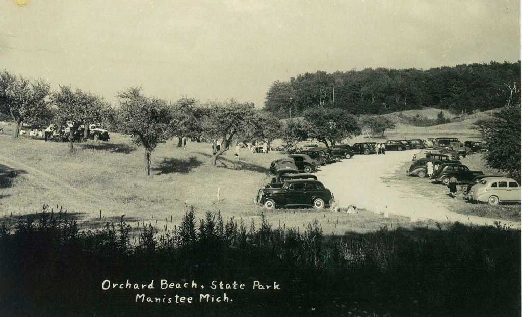
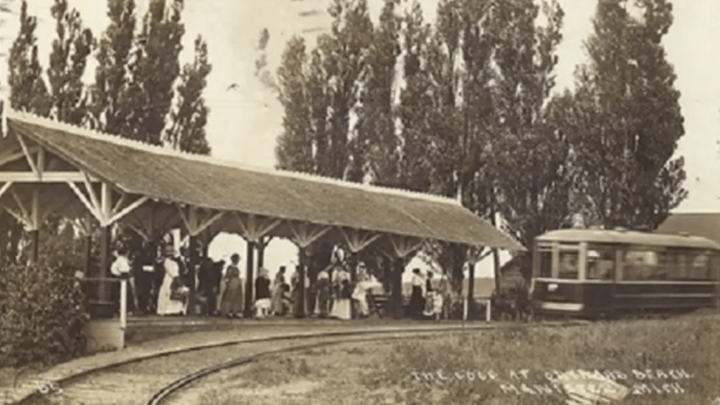
The same year of 1892, trolley service began with the Manistee, Filer, and Eastlake Railway Company and Orchard Beach became a popular beach destination, and that when trolley service was stopped here, the site was purchased by the Manistee Board of Commerce and deeded to the state to become a park in 1921.
Then, we are told the Civilian Conservation Corps (CCC) was here in the 1930s, and built several limestone structures, including a shelter building.
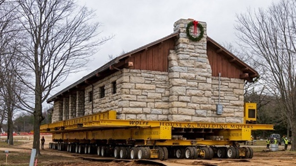
The 850-ton shelter building pictured here…
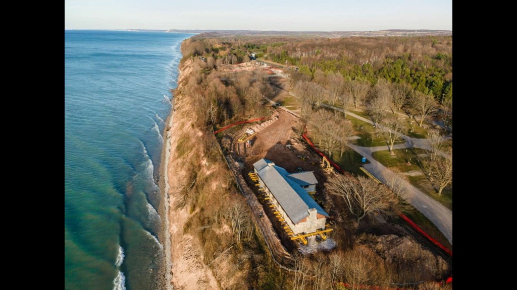
…was moved 1,200-feet, or 366-meters, in December of 2020 because the bluff it sat on top of was eroding and unstable.
Next I am going to take a look at some places on the West Coast of the United States.
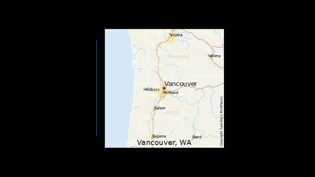
The city of Vancouver in Washington State is located on the north bank of the Columbia River, directly across from Portland, Oregon on the south bank.
Fort Vancouver was established as a fur trading outpost and headquarters for the Hudson Bay Company in the Columbia Department of the Pacific Northwest in 1825, and was a major center for fur-trading in the region.
I am first going to take a look at was in situated around the old Hudson’s Bay Company Fort Vancouver and Fort Vancouver National Historic Site.
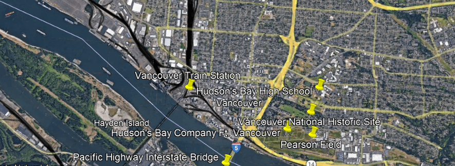
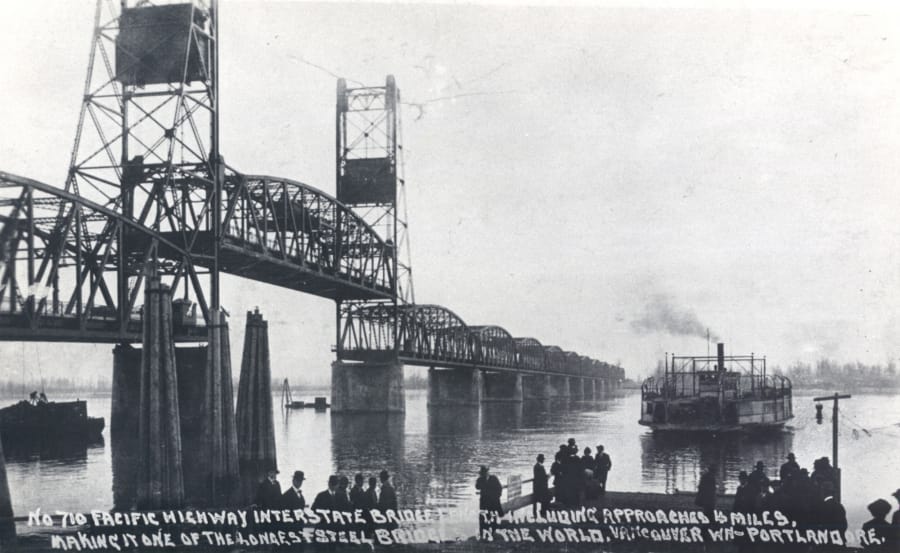
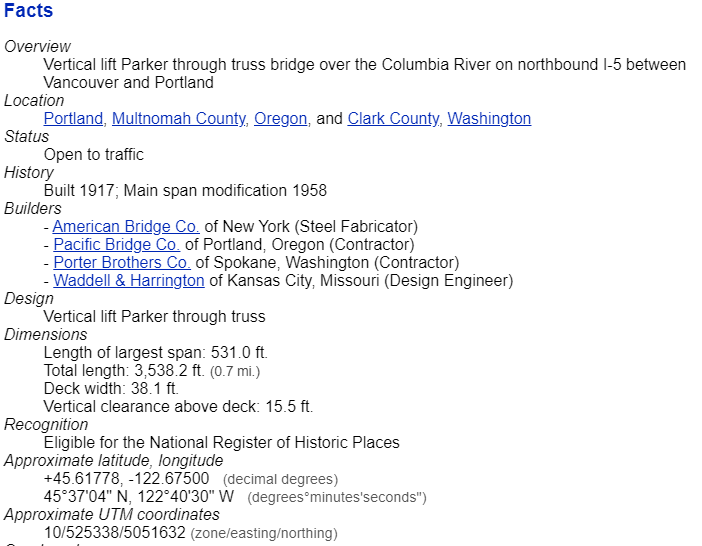
The Hudson’s Bay Company Fort Vancouver is located right next to I-5 and the Pacific Highway Interstate Bridge, a pair of steel, vertical-lift truss bridges that carries the Interstate over the Columbia River between Vancouver and Portland.
The vertical lift spans of the bridge rise vertically while remaining parallel with the deck in order to accommodate shipping lane traffic.
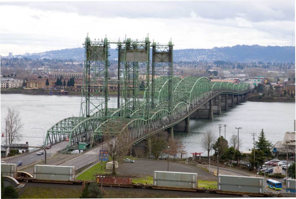
Construction was said to have started in 1915 and opened in 1917 as a single bridge carrying two-way traffic.
I would like to point out that would have been in the middle of World War I, which started in 1914 and ended in 1918.
Plausible?
We are told the second bridge opened in 1958.
I am extremely interested in the extensive rail-trackage, the dark ribbons on this Google Earth screenshot, that I am seeing on both sides of the Columbia River at this location.
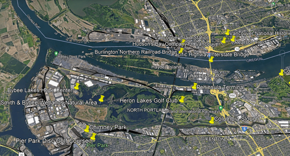
On the Vancouver-side of the Columbia River, there is a lot of rail activity paralleling the I-5 Interstate and the Columbia River.
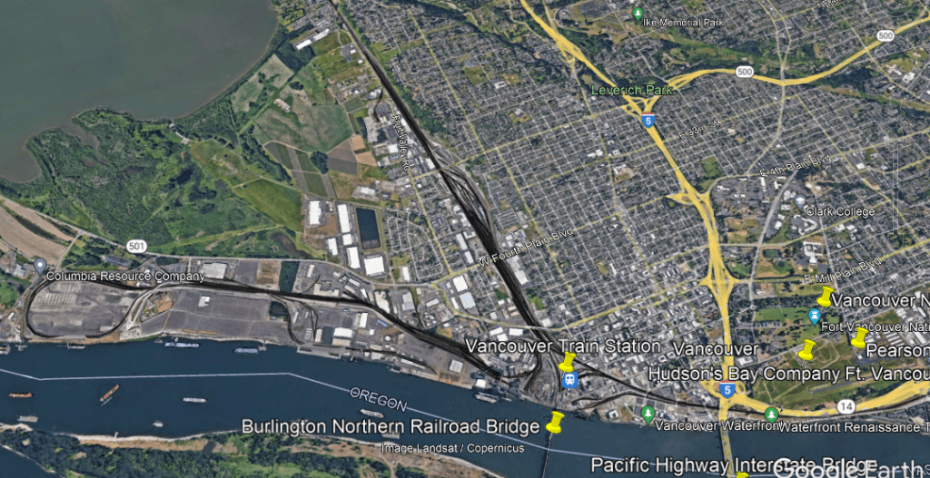
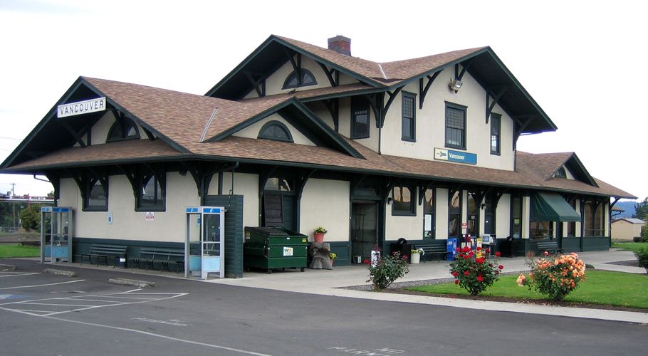
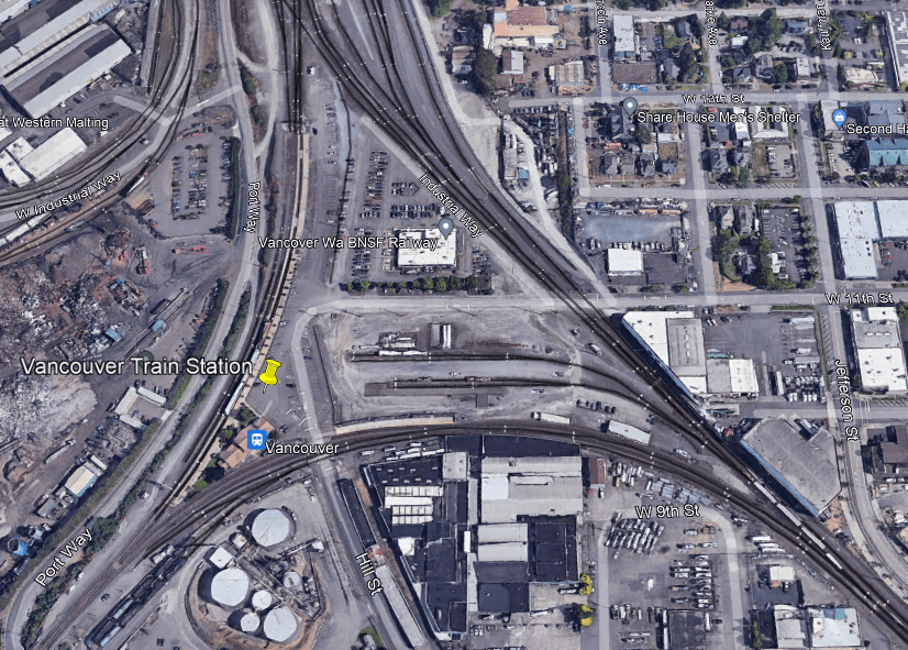
The historic Vancouver Station was said to have been constructed between 1907 and 1908, and is still in use by Amtrak today by three different lines for passenger service.
The Vancouver Station is situated in a triangular junction arrangement of the three rail lines with a railroad switch at each corner, along with BNSF Railway offices, which provides freight services and has major railyards in Vancouver.
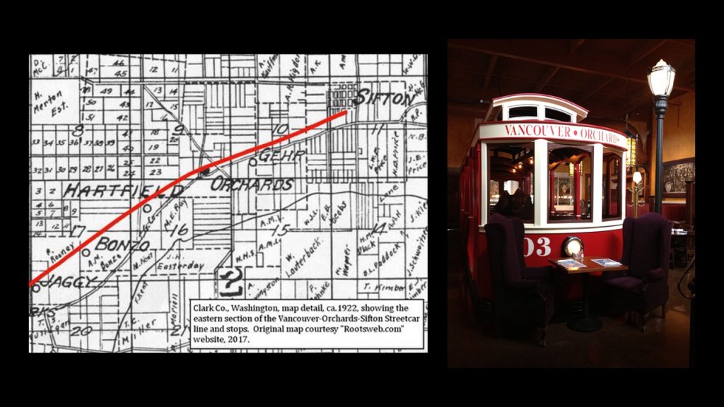
At one time in Vancouver’s history, the neighborhood of Sifton was the terminus of an early electric trolley operated by the North Coast Power Company that also served Orchards from 1910 to 1926, as part of the Orchards-Sifton Route that in part ran along Vancouver’s Main Street.
Like the historical orchard and trolley located together in Manistee, Michigan I definitely think there was a connection between the original energy grid and agriculture.
The Burlington Northern Railroad Bridge 9.6 crosses the Columbia River into Portland just below the triangular junction in Vancouver.
The 2,807-foot, or 856-meter, -long Railroad Bridge 9.6, which was said to have been built between 1906 and 1908, has a swing-span which pivots on its base to let taller ships pass through.
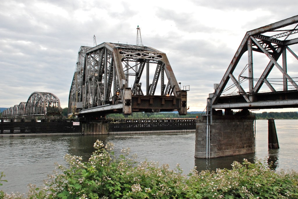
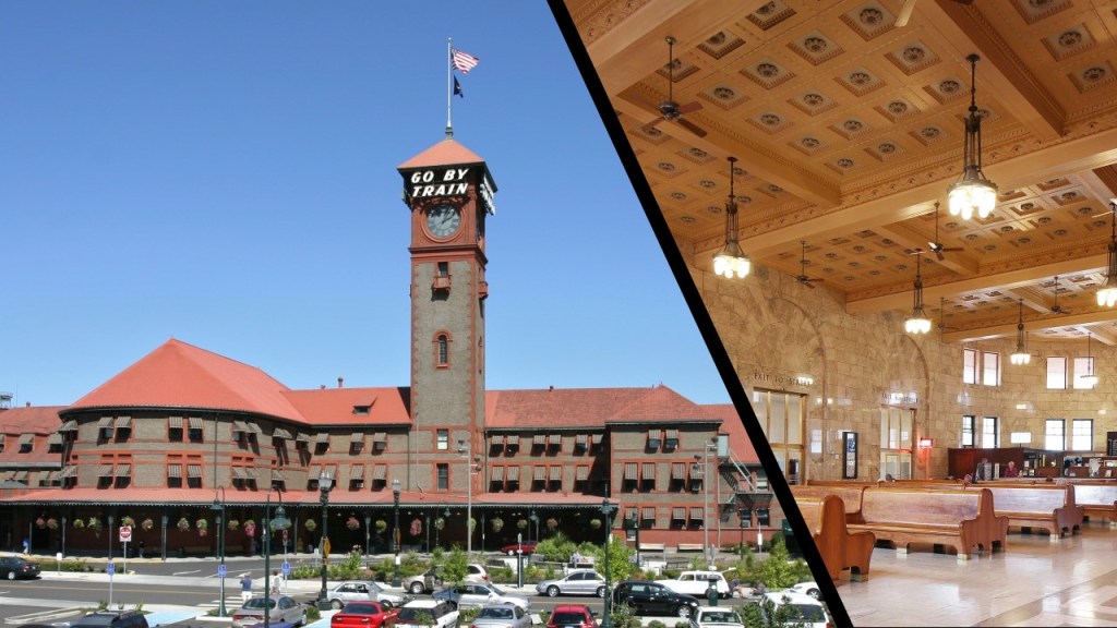
The “9.6” in the bridge’s name refers to the distance between the bridge, and Portland’s Union Station, which was said to have been built between 1890 and 1896 in the Romanesque Revival architectural style.
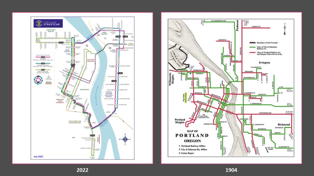
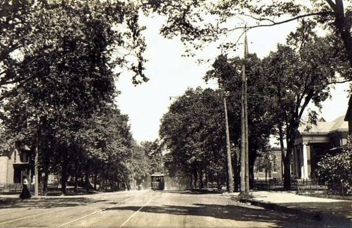
While Portland still has a streetcar system, it is not nearly as extensive as the streetcar system that existed in 1904, the year before Portland hosted the Lewis and Clark Centennial Exposition.
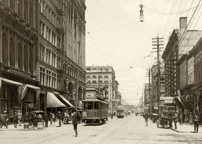
To put this in perspective, this was a view of Portland’s 3rd Avenue in 1904.
Lots of people walking; electric streetcars and electrical lines…and horse-drawn carriages, but no cars yet.
Mass production of cars didn’t come along until 1908, four-years after this photo was taken.
Oh yes, and the massive and ornate heavy-masonry buildings with columns and archways, and much more.
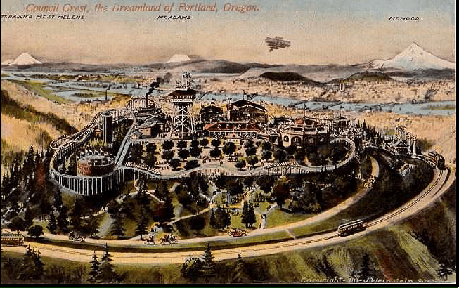
The Council Crest Amusement Park in Portland operated as a trolley park from 1907 to 1929, was said to have closed due to financial insolvency with the beginning of the Great Depression.
Trolley parks were said to have started in the United States in the 19th-century as picnic and recreation areas at the ends of streetcar lines, and were precursors to today’s amusement parks.
By 1919, there were estimated to be between 1,500 and 2,000 such parks.
But like what we have already seen, these magnificent trolley parks went the way of the dinosaur, along with countless electric streetcar lines, canals, and railroad lines.
I have come to believe that they were somehow involved with recharging the Earth’s energy grid for the original civilization in a really fun way, and were only utilized by the bringers-in of the world’s new system for a short time until they were no longer needed, or just plain inconvenient to the new narrative.
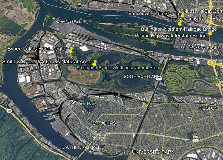
On the Portland-side of the Columbia River, there is also a lot of railway activity showing-up in the western part of North Portland, all around the edges of what is called the Smith and Bybee Wetlands Natural Area.
Along with the rail-lines, the Smith and Bybee Wetlands Natural Area is surrounded by warehouses, port terminals, and commercial areas.
It is one the largest urban freshwater wetlands in the United States.
Wetlands, estuaries, marsh-lands, and the like are all on my radar of things to look for when I do research because I have come to believe they are not as advertised as a natural occurrence.
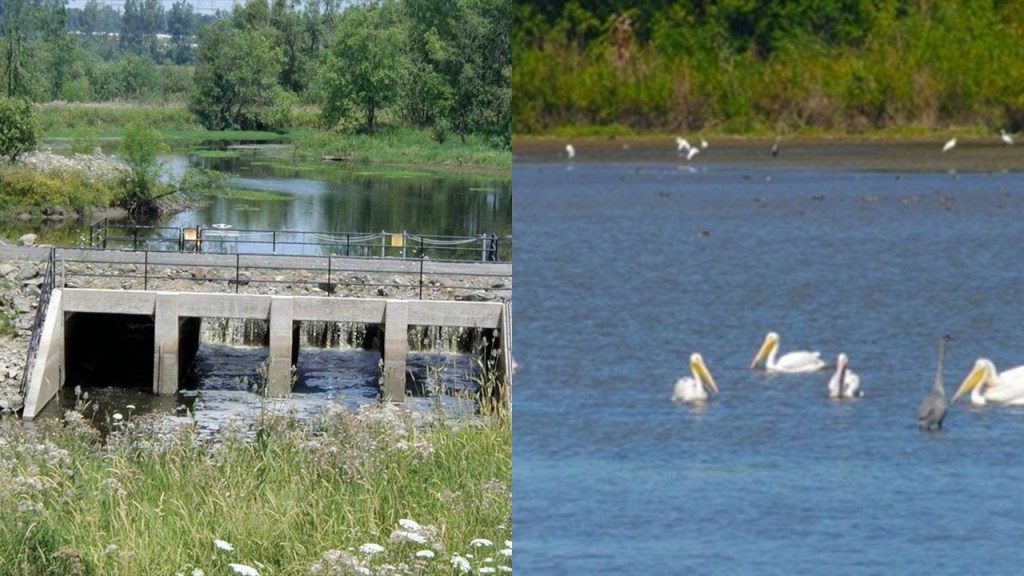
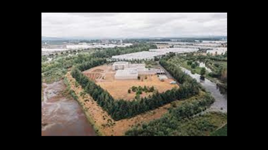
For example, when I took a look around the Smith & Bybee Wetlands Natural Area, I noticed a star fort-point-shape in the landscape.
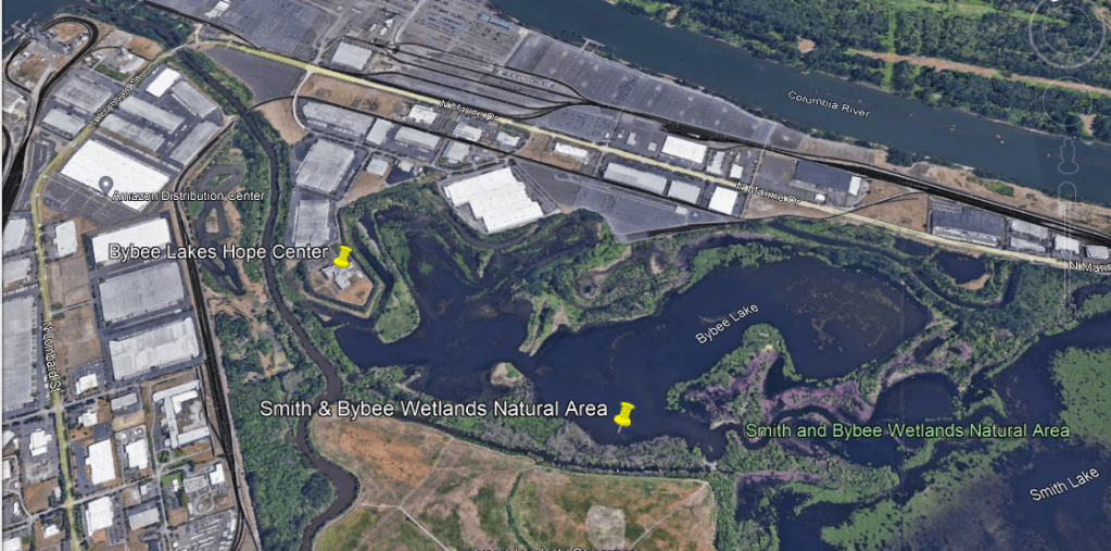
The Bybee Lakes Hope Center is located on top of it, a homeless shelter since October of 2020.
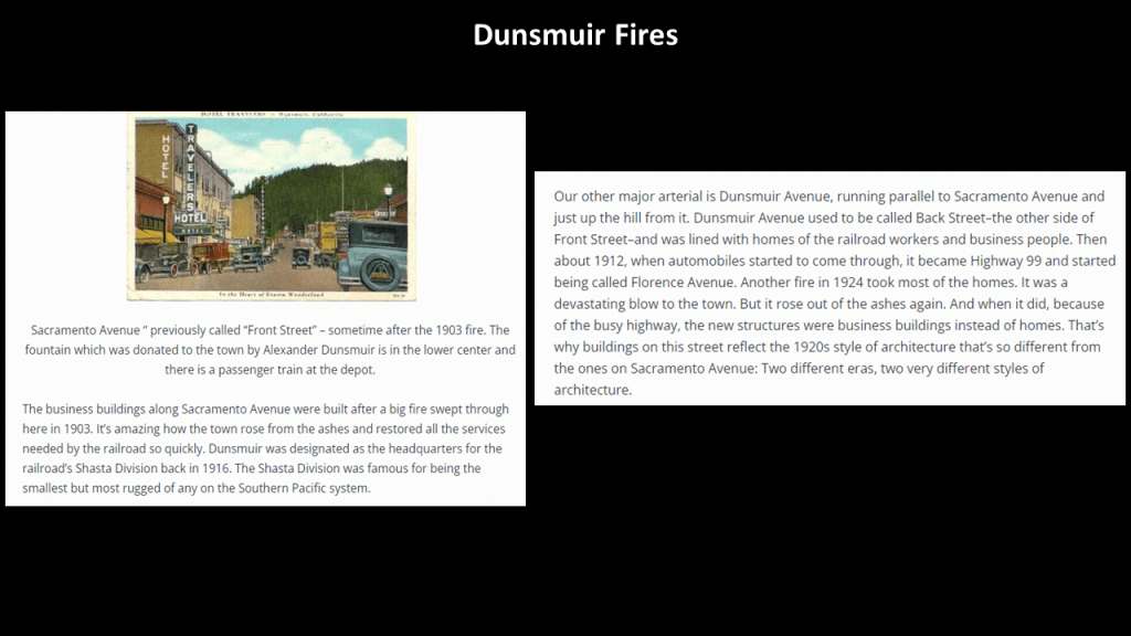
Next, I am going to head down to Dunsmuir in California.
The Railroad Park Resort in Dunsmuir is located at the foot of Castle Crags near Mount Shasta.
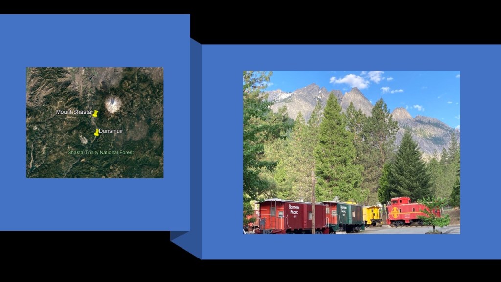
The lodging accommodations consist of 23-renovated cabooses, four cabins, 24 tent campsites…
…and the restaurant is built inside authentic vintage railroad cars.
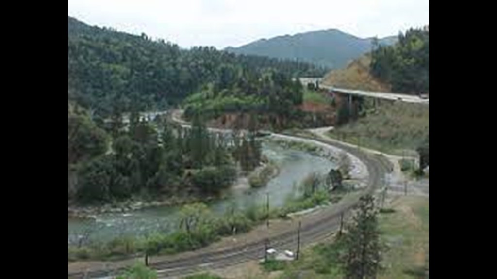
Dunsmuir is a popular tourist destination and important railroad town located on the Upper Sacramento River.
Interstate 5 runs along the Sacramento River Canyon along with the railroad and Upper Sacramento River.
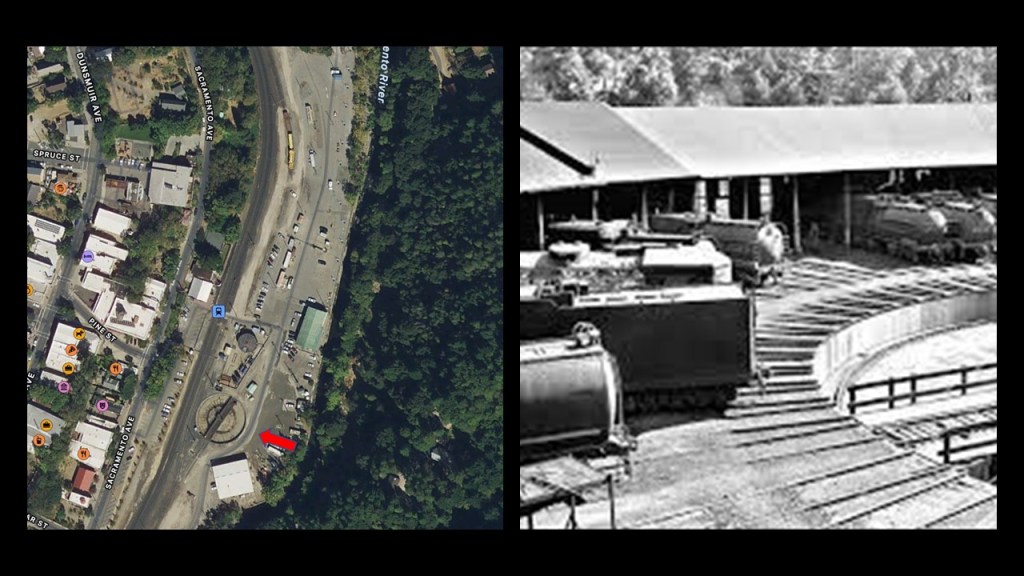
There was an historic roundhouse and turntable here, said to have been built by the Central Pacific Railroad in the 1880s, along with a depot, railyards and machine shops.
By the 1950s, so after only 70-years of existence in the historical narrative, the roundhouse and some of the other rail-related infrastructure was for all intents and purposes torn down.
Dunsmuir also had a fire problem, with big fires there in both 1903 and 1924.
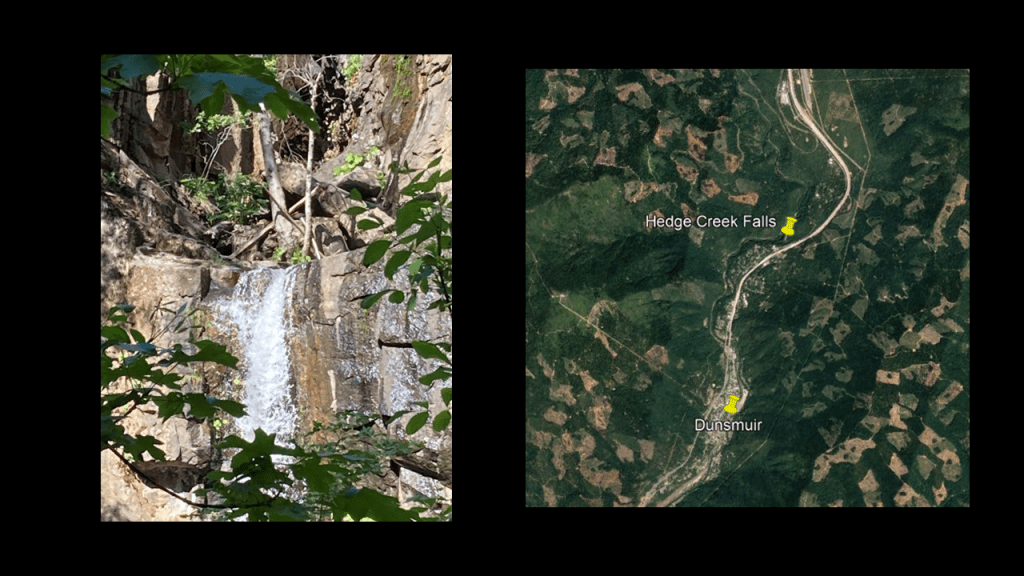
The trip going north from Dunsmuir through the Sacremento River Canyon goes past several waterfalls, and the first one being the Hedge Creek Falls.
The Hedge Creek Falls are a short-walk from I-5 and Dunsmuir Avenue…and the only waterfalls open to the public.
The Mossbrae Falls are next, and not open to the public for the given reasons of 1) They are on Union Pacific Railroad-owned property; and 2) public safety concerns due to the active rail-line that runs alongside the falls.
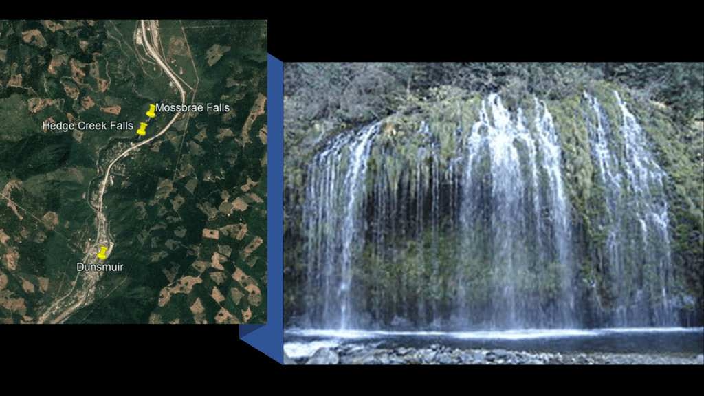
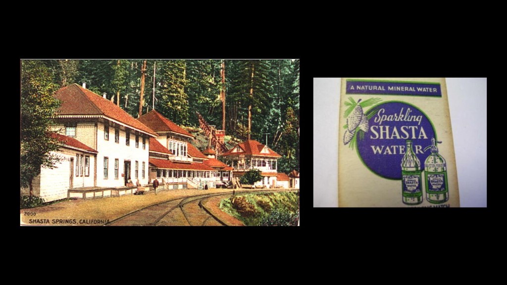
The Mossbrae Falls are just south of the former Shasta Springs Resort, a popular summer resort in the late 19th- and early 20th-centuries, and the springs on the property were the original source of the water and beverages that became known as the Shasta brand of soft-drinks.
The Shasta Springs Resort was sold in the 1950s to the St. Germain Foundation, the current owners of the property and is still in use as use as a major facility by the organization.
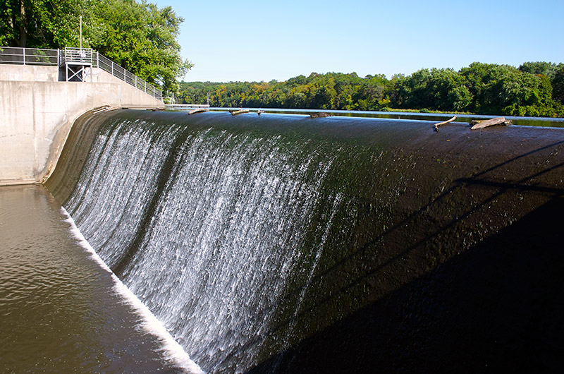
Now I am going to add more data about the correlations of waterfalls, railroads, and race tracks to this configuration, with the idea that these were all connected to the original energy-generating grid system of the Earth.
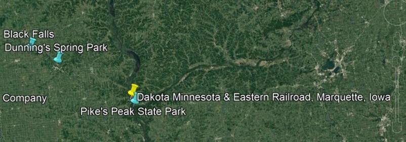
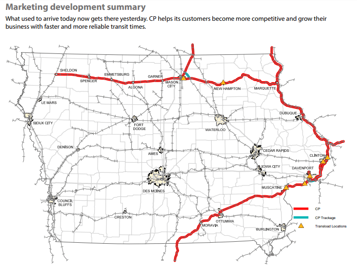
To study this possibility more in-depth, I am going to turn my attention to Iowa, focusing on the upper grouping of correlations between railroads, waterfalls, and racetracks in this screenshot, with the yellow pins being railroad-related infrastructure; the green pins are race tracks; and the blue pins are waterfalls.
There’s obviously more to find here, but this section will give you the idea.
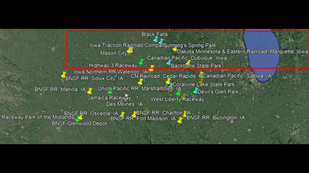
First, I am going to look at the upper section of the previous Google Earth screenshot.
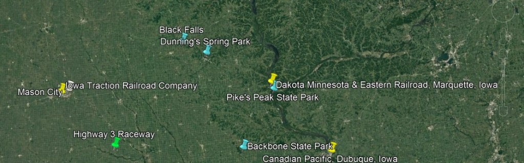
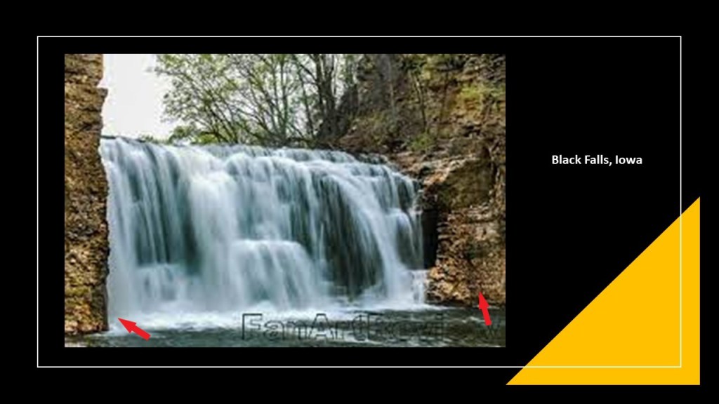
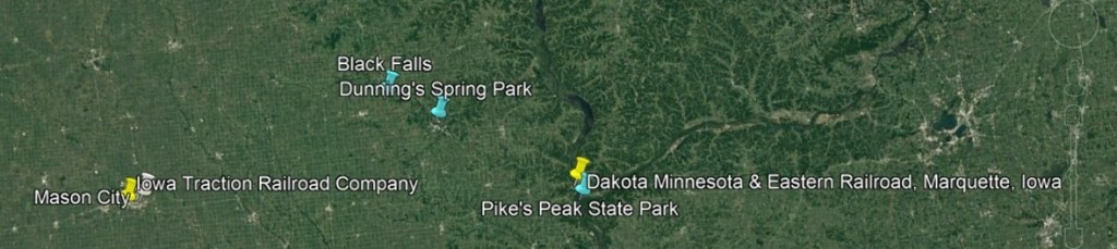
In the top middle is Black Falls and Dunning’s Spring Park.
Black Falls is near Kendallville, Iowa.
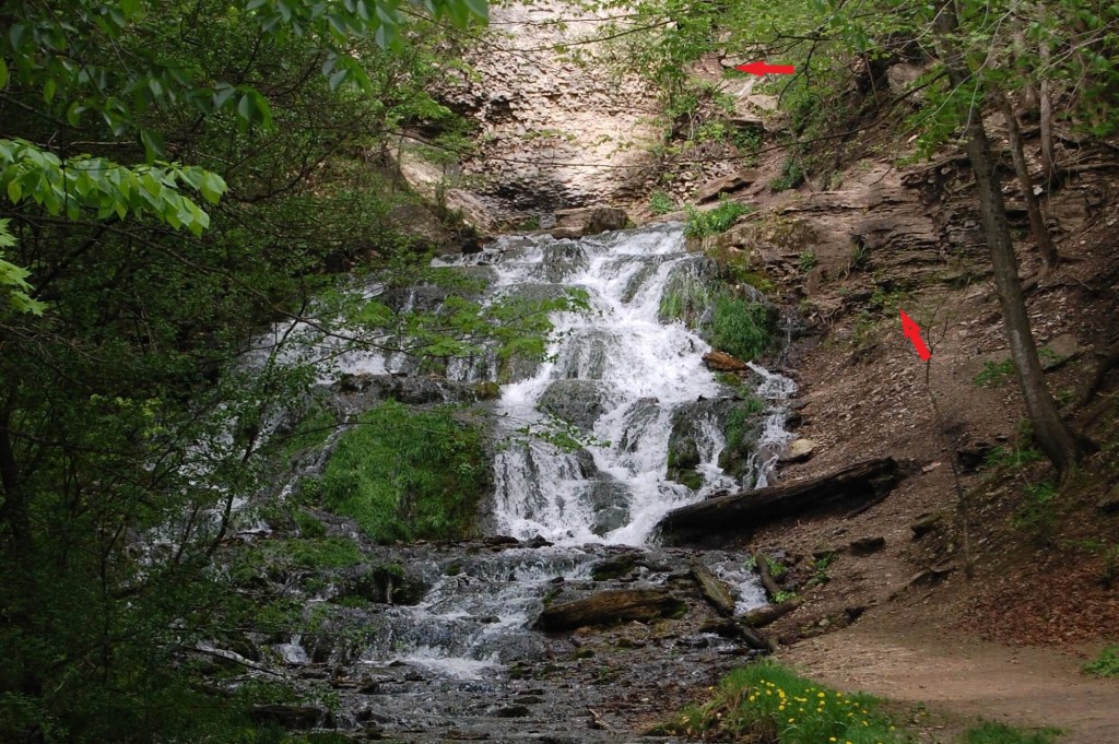
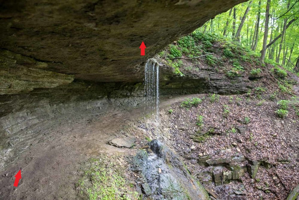
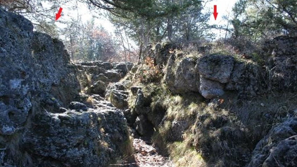
For all of the following waterfalls, I am going to point out with red arrows what looks like an old wall, or old masonry, to me.
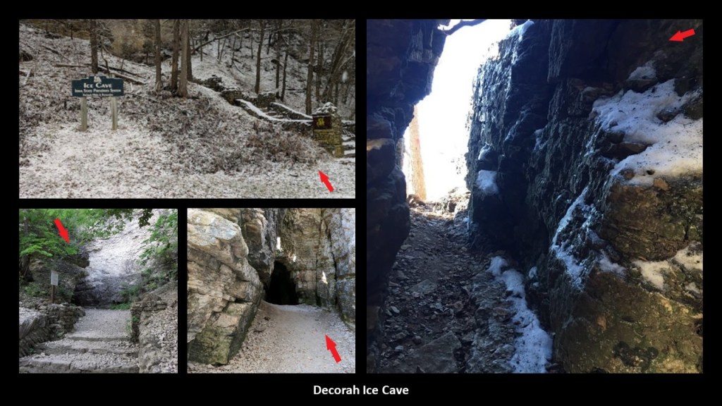
There are three waterfalls at Dunning’s Spring just southeast of Black Falls, near Decorah, Iowa…
…one of which is located near the Decorah Ice Cave, a limestone and dolomite cave that has ice on the inside even during the summer…
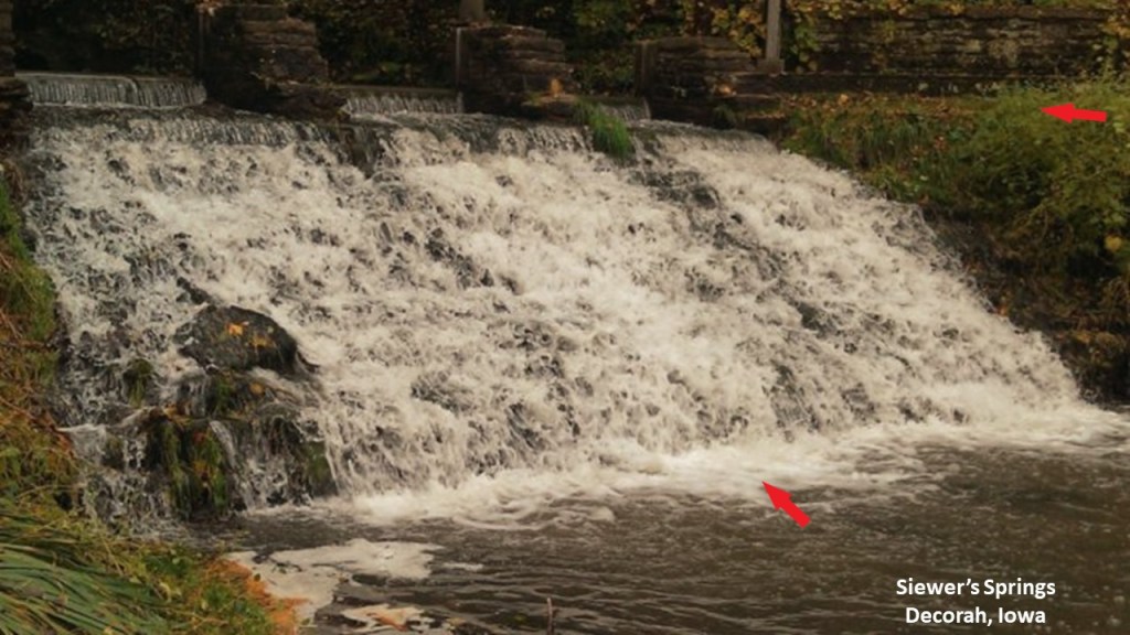
…as well as the falls at Siewer’s Springs near Decorah, described as “technically a spillway, but a gorgeous staircase formation….”
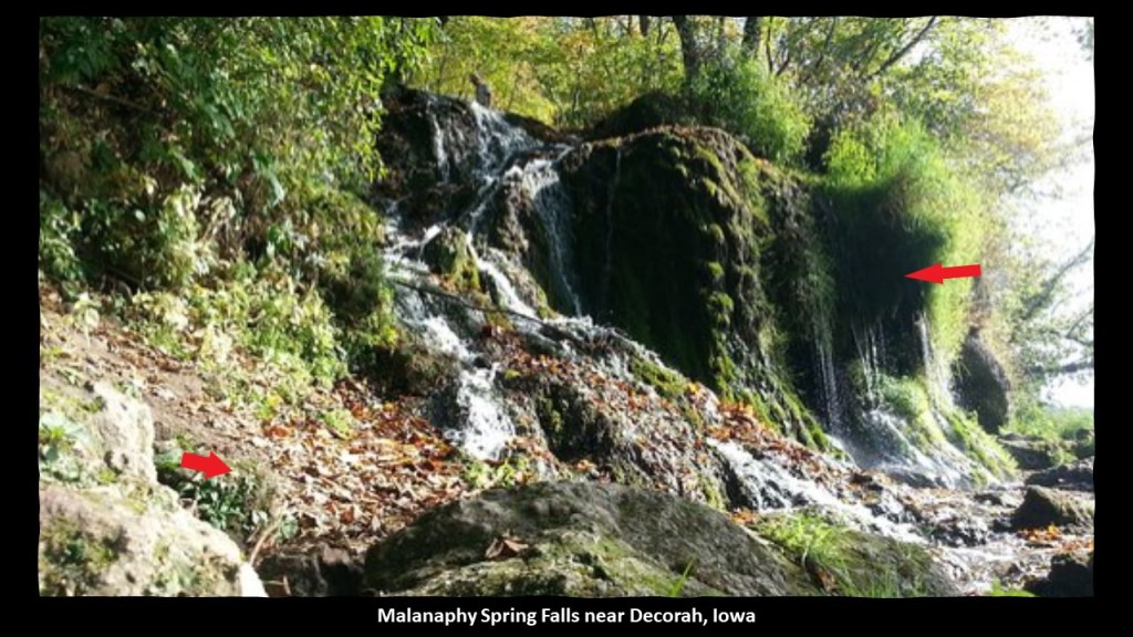
…and the Malanaphy Spring Falls, northwest of Decorah.
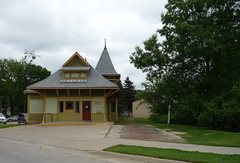
I looked for rail-related infrastructure near Decorah, which now only has Railroad Street and Railroad Avenue, with the Mediacom Communications facility sandwiched between the two…
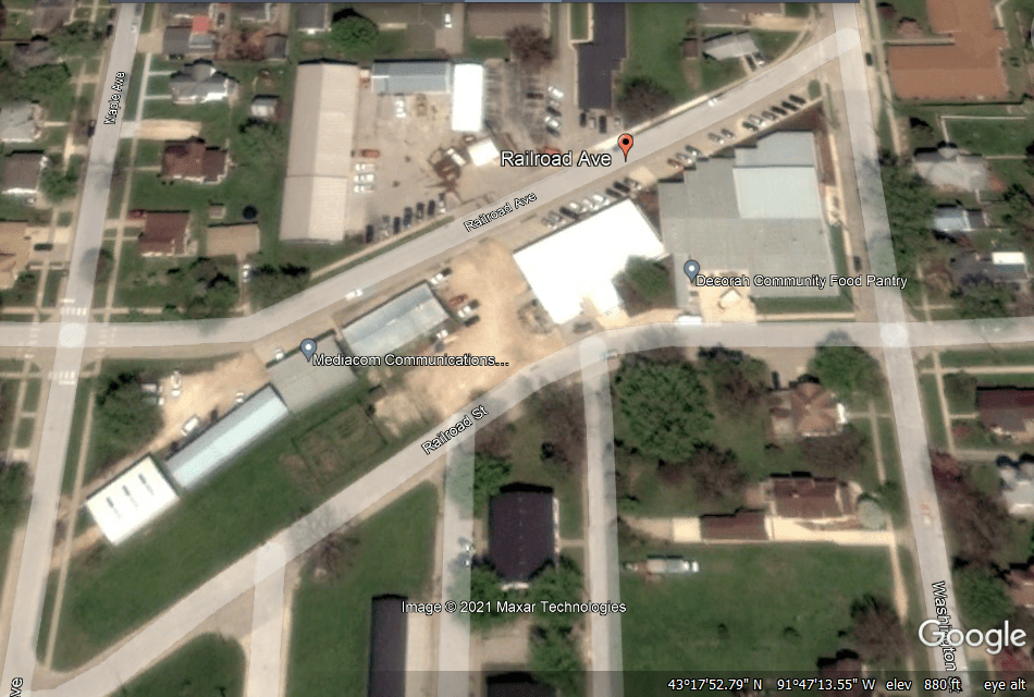
…and what was the Milwaukee and St. Paul Railway Combination Depot in Decorah is now commercial space, and all the railroad tracks through here were removed in 1971.
From where Black Falls and Dunning’s Spring are at the top of the Google Earth screenshot, next I am going to go southeast of there to “Pike’s Peak State Park,” near the Dakota, Minnesota & Eastern Railroad in Marquette, Iowa.
Pike’s Peak State Park in McGregor, Iowa, is situated on a 500-foot, or 150-meter, bluff overlooking the confluence of the Mississippi and Wisconsin Rivers.
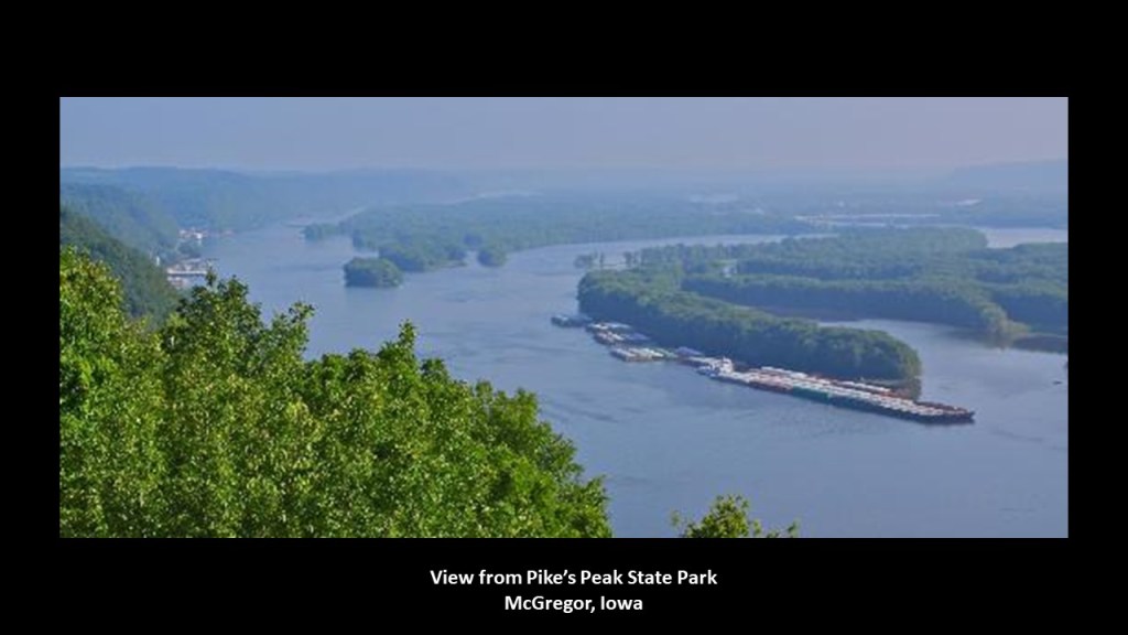
It is a recreational area that is considered one of Iowa’s premier nature destinations…
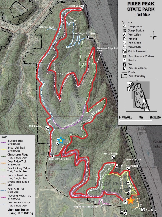
…where one of the places you can hike to is called Bridal Veil Falls.
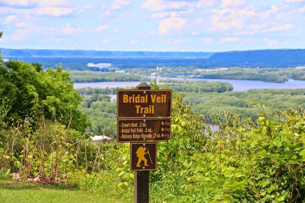
Bridal Veil Falls is described as “a small natural waterfall that flows gracefully out of a horizontal limestone outcropping.”
Pike’s Peak State Park and McGregor, Iowa, are right next to Marquette, Iowa, on the Mississippi River.
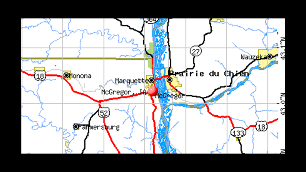
Marquette earlier in history was known as North McGregor, and served as a railroad terminus, becoming a major railroad hub for the region in its hey-day.
Passenger service ended in 1960, and the Marquette Depot Museum and Information Service in Marquette celebrates the town’s railroad history with exhibits of historic railroad artifacts…
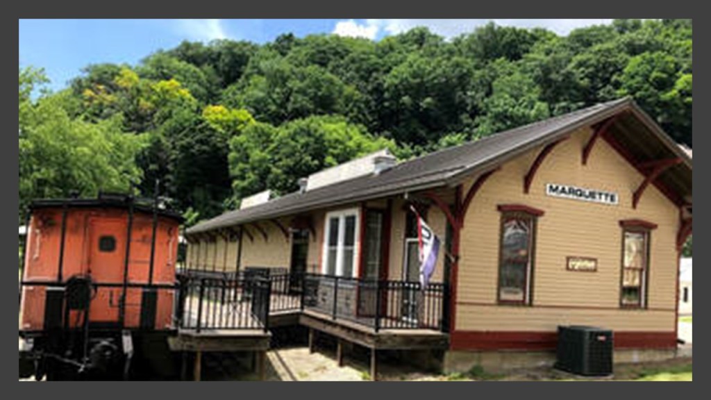
…though the Dakota, Minnesota and Eastern Railroad, a subsidiary of Canadian Pacific Railway, still runs freight on the rail-lines through here.
Next, I am going to go due west from Marquette and McGregor over to Mason City, which is connected by the same Canadian Pacific Rail-line to Marquette.
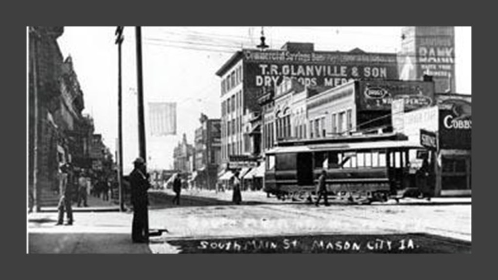
Mason City is located on the Winnebago River, and was originally a settlement that was established here in 1853 called “Shibboleth.”
It was also known as Mason Grove and Masonville, until, we are told, Mason City was adopted in 1855, in honor of a founder’s son, Mason Long.
Interesting to note that the original name for the settlement, Shibboleth, is also a Freemasonic password.

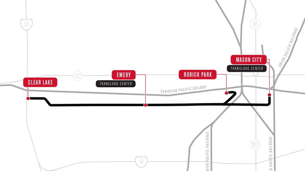
The “Iowa Traction Railroad Company,” headquartered in Emery, west of Mason City, operates a short-line rail-line, that is around 10-miles, or 17-kilometers, -long freight railroad between Mason City and Clear Lake, Iowa, that interchanges in Mason City with the Canadian Pacific Railway and Union Pacific Railway.
It is electrified, which means that an electrification system supplies electric power to the railway, as opposed to an on-board power source or local fuel supply…
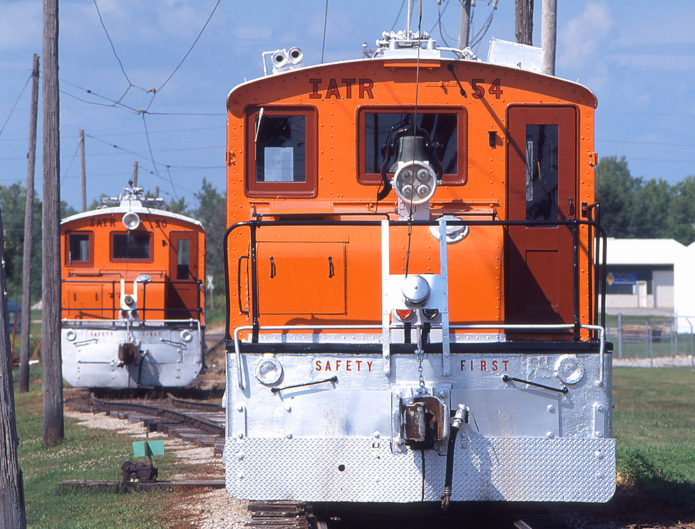
…and at one time was part of the electric trolley and interurban system of the region, with the charter for the trolley system expiring in August of 1936, and replaced by passenger bus service the following January.
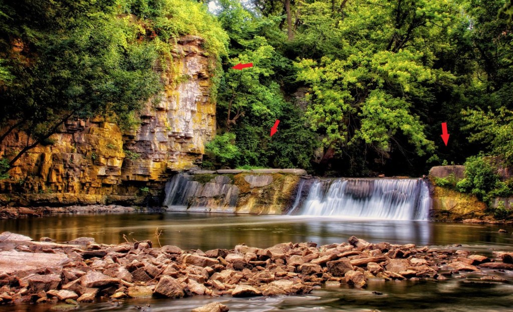
I did find a waterfall in Mason City, though it is on private property and not in a state park.
Called the “Willow Creek Waterfall,” it can be viewed from the State Street Bridge between 1st Street NE and S. Carolina Avenue in Mason City.
The next places I am going to take a look at are the Highway 3 Raceway southeast of Mason City, and Backbone State Park southwest of Pike’s Peak State Park at McGregor.

The Highway 3 Raceway is a half-mile,or almost 1-kilometer, semi-banked clay oval in Allison, Iowa at the Butler County Fairgrounds.
Seeing a Railroad Avenue here too.
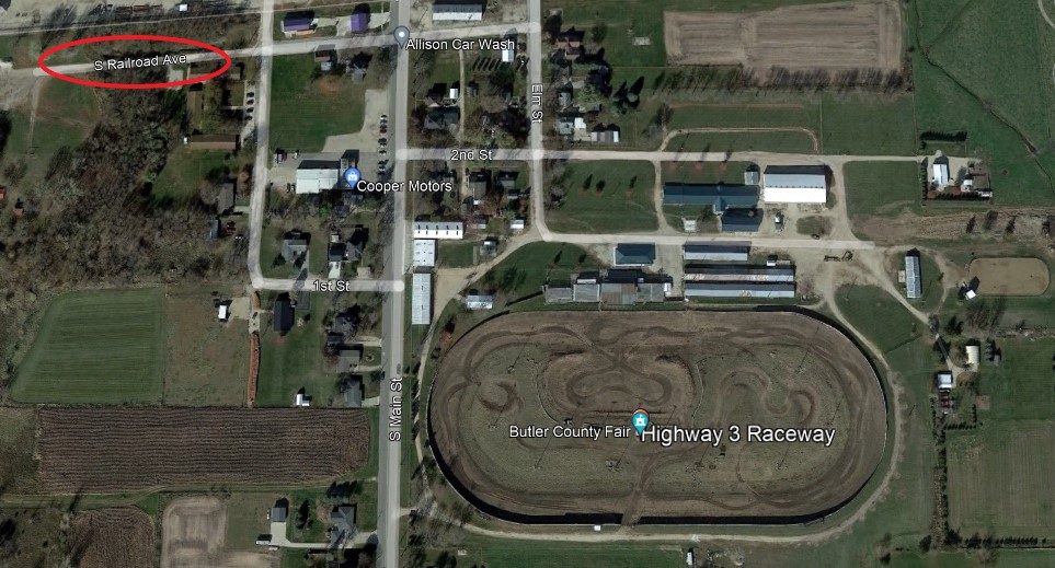
Not a whole lot of information available except that it hosts stock-car races and the like.
I think these racetracks are re-purposed elliptical circuitry on the Earth’s grid system.

Backbone State Park, 45-miles, or 72-kilometers, west of Dubuque, Iowa, is the state’s oldest park, having been dedicated in 1919…
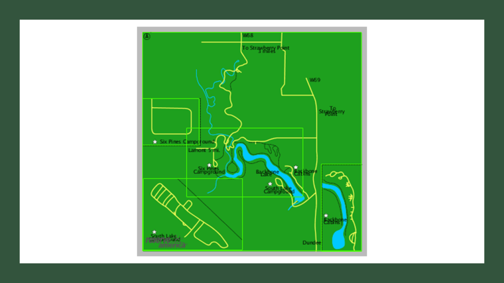
…and named after the limestone ridges found in the park.
A Civilian Conservation Corps (CCC) work-site for otherwise unemployed young men during the Great Depression, were given the credit for building the park’s recreational infrastructure in the 1930s…
…and the spillway dam at the park’s lake.
This is just a small sample of countless examples of the same infrastructure and same stories.
I have focused on examples in Canada and the United States in this post on the “Disappearance of Railways, Trolley Parks and Roundhouses,” but the same infrastructure seen in North America was found in the same configuration worldwide.
Here is just one example from Denmark.
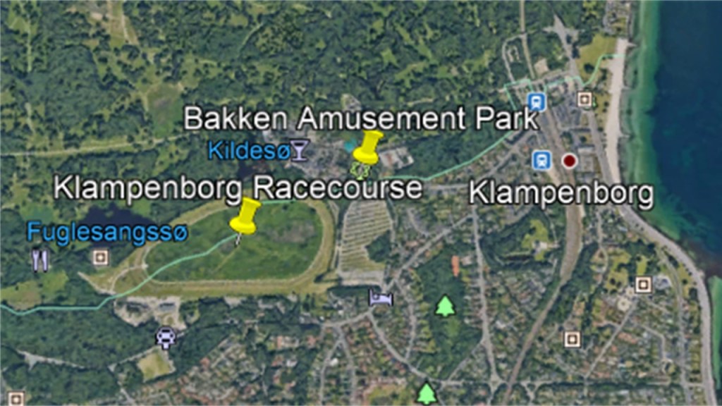
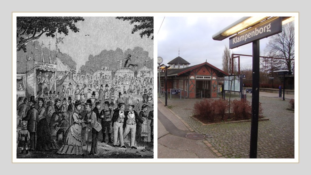
The Kastrup International Airport in Copenhagen Airport is in a linear alignment with several race tracks, incluidng the Klampenborg Racecourse, which is right next to the Bakken Amusement Park.
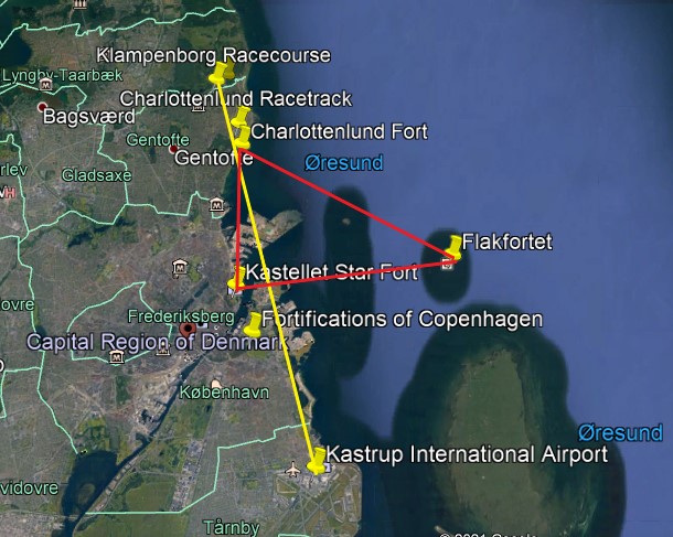
The Klampenborg Racecourse is a flat horse-racing track that first opened in 1910 in this affluent Klampenborg suburb of Copenhagen.

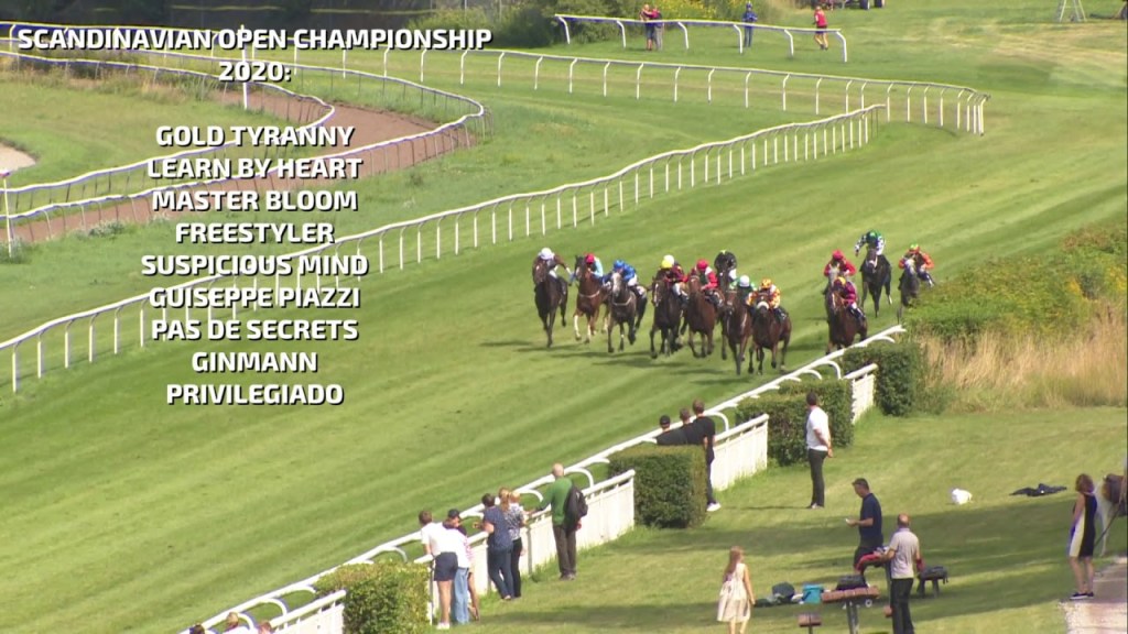
Major races held at the Klampenborg Racecourse include the Scandinavian Open Championship, in which 3-year-old and over thoroughbred horse racing takes place annually in August.
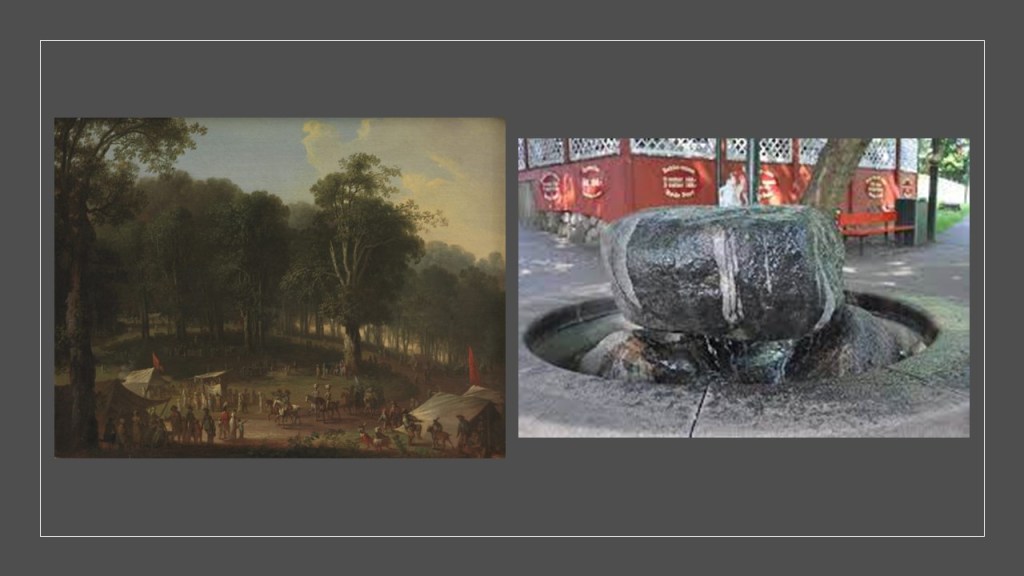
The Bakken Amusement Park right next to the Klampenborg Racecourse was said to have opened in the year of 1583, making it the world’s oldest operating amusement park.
Its origins are related in this way:
In 1583, a natural spring was found in a large forest park here.
Residents of Copenhagen to the south of it were attracted to the spring because of the poor water quality in Copenhagen, and the belief that it had curative powers.
The spring drew large crowds in the warmer months, and the large crowds attracted the entertainers and hawkers which was said to be the origin of the amusement park today.
We are told Bakken continued to grow even throughout the Napoleonic Wars, and became even more popular as time went on, with easy accessibility via steamships, starting in 1820, and railroads starting in 1864.
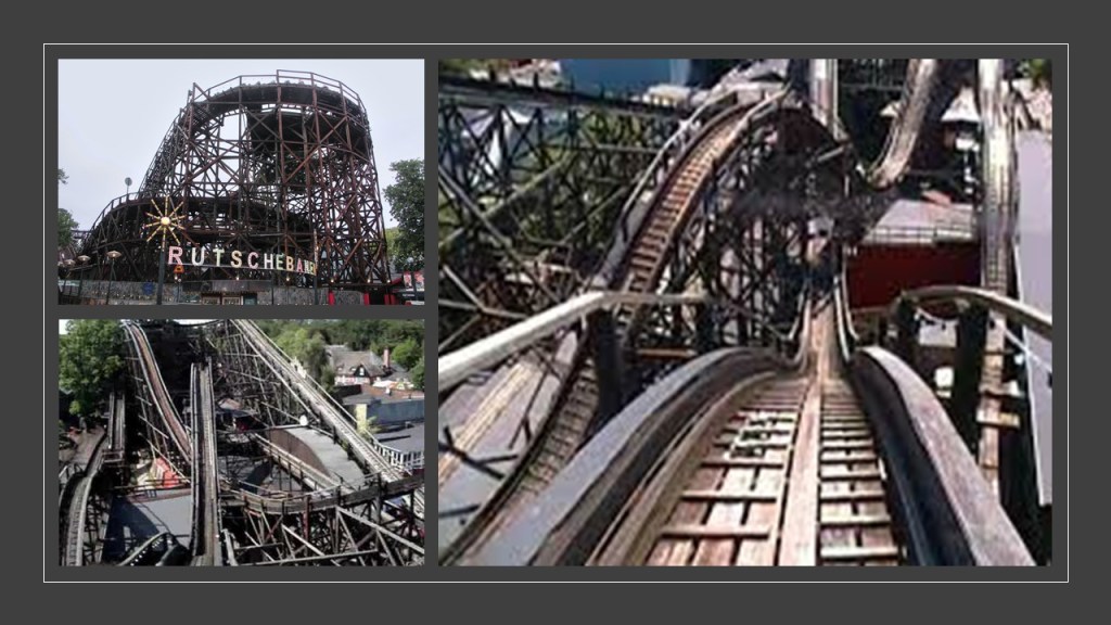
Today the park is filled with rides and amenities, including 5 roller coasters.
The park’s most famous roller coaster is the “Rutschebanen,” a wooden roller coaster that has been open since 1932.
The Tivoli Gardens Amusement Park in Copenhagen opened in 1843, making it the third-oldest operating amusement park in the world, after Bakken in Klampenborg, and the Wurstelprater in Vienna, Austria, which opened to the public in 1766.
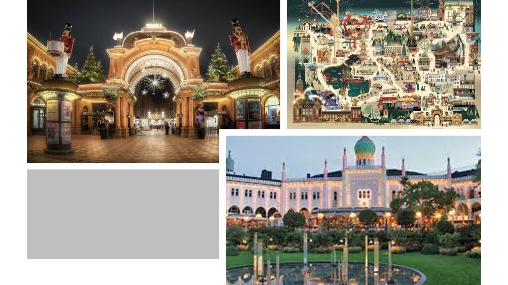
The Tivoli Gardens Amusement Park is located in downtown Copenhagen next to the Central Rail Station…
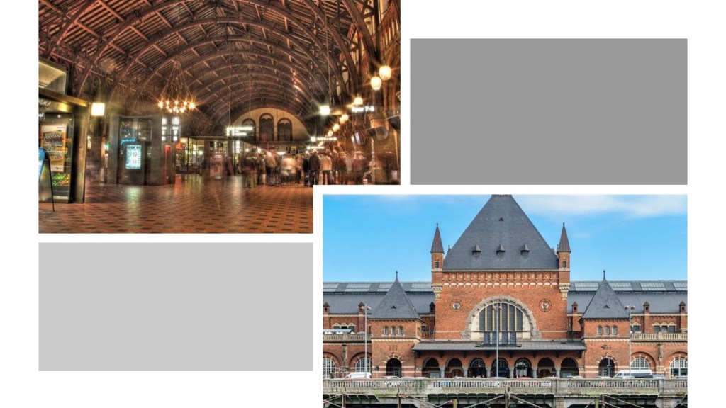
…and the railyards there.

In summary, generally-speaking I think the Controllers’ removed most of original the rail-lines that were a functional part of the energy grid when they were no longer needed for mining and/or their agenda, and only kept what was needed for freight, with keeping some for public transportation where it was critical infrastructure and scaled passenger service way-back from what it once was.
This is an historic photograph of an electric streetcar in a Charlotte, North Carolina neighborhood.
Electric streetcar systems at one time were in existence everywhere, and not just limited to a few places here and there, like what we see today in some of the larger cities around the world.
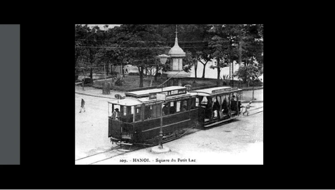
But mostly, the removal of the electric streetcar lines all over the world left us with the chaotic traffice patterns of today, like what we see in Hanoi in Viet Nam in our day and age…
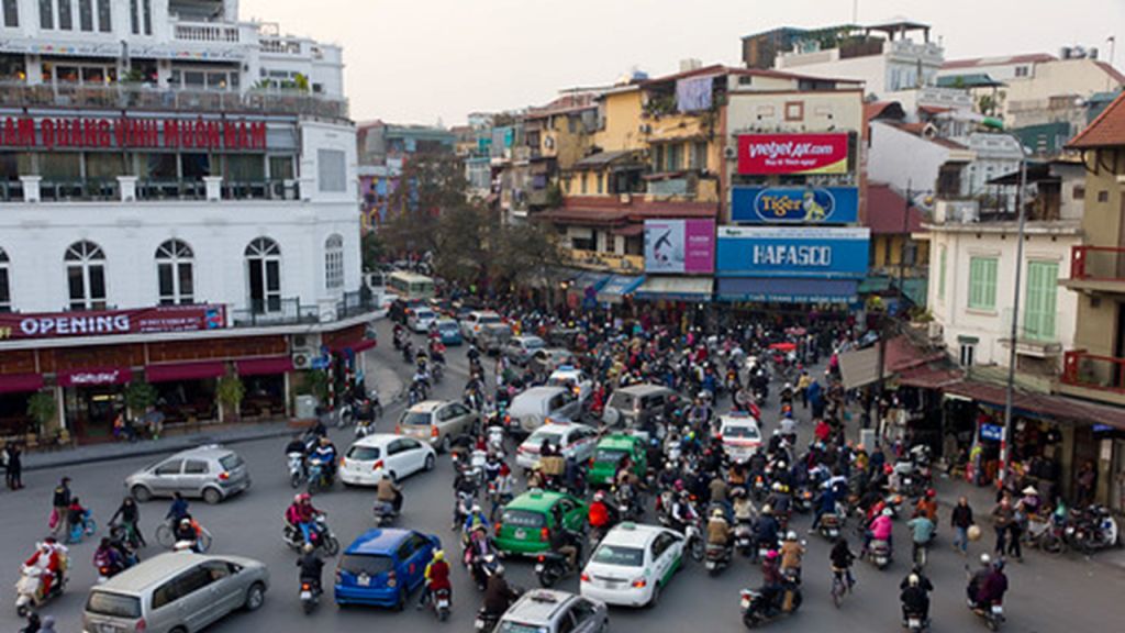
…which at one time in its history had a state-of-the-art electric streetcar system.
Former rail-lines were instead turned into interstates, highways, roadways, and recreational rail-trails. used for harvesting our energy for the benefit of a few from what was the original free-energy grid system for the benefit of all.
They have also been harvesting the original energy grid of its components with the mining industry, as well as all available natural resources, including, but not limited to, the lumber industry.
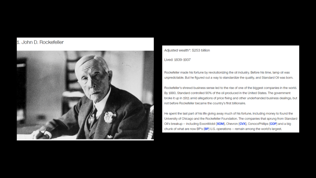
The free-energy grid was destroyed, and the robber barons behind the creation of the New World Order, like John D. Rockefeller, J. P. Morgan, and other big players in our historical narrative, actively sought to bring on-line replacement sources for energy-generation and industry as quickly as possible, and in the process became incredibly wealthy and powerful!
They claimed the very best of everything for themselves.
While the new elite class lived in the lap of luxury, and helped themselves to the best of everything, they had little care for anyone or anything else – not at all.
Those that heretofore have been in control of the world in which we live deviously figured out a way to keep us asleep by this new culture they created, and they have been getting filthy rich at our expense because we have been paying for our own poisoning with our addictions; paying for our own mind control programming with distractions; and keeping us in consumerism mode to enrich corporate interests; and ultimately financing our own destruction.

They have actively facilitated the demise of all the rest of us, who they call “useless eaters,” into the present-day.

The negative beings behind what has taken place here wanted to set up a new god as lord of this world and wanted a proxy vote for their hostile takeover.

A hostile takeover bid occurs when an acquiring company seeks to acquire another company – the target company – but the board of directors from the target company has no desire to be acquired by, or merged with, another company.
The two most common strategies used by acquirers in a hostile takeover are a tender offer or a proxy vote.
The tender offer is an offer to purchase shares at a premium to the market price.
The proxy offer is persuading shareholders of the target company to vote out the existing management.

The only way they can accomplish this acceptance, however, is by outright lies, deception and duplicity because if people knew the true agenda of these controllers, the majority of Humanity would never, ever accept this.

But the problem is in a Free Will Zone like Earth, the Human Beings who live here have to give their consent to choose whether the follow the Light or the Dark.

I bring all this up is because it is important to know this is what has been going on here.
Humans are inherently sovereign beings.
They have gone to all of this trouble because, by Universal Law, they can’t lay a finger on us.
They have tricked us into accepting their sovereignty over our own, and fooled us into enabling their diabolical agenda.

The Controllers have always feared the Great Awakening of Humanity, and thus threw everything they could at us to prevent it from happening and keep us asleep so we would never know what hit us.
But no matter what they do, they can’t keep it from happening.
They have lost control of the narrative, and no matter how hard they try to get it back, they are more exposed than they have ever been for those with eyes to see and ears to hear.