I am bringing forward research I have done in the past, as well as new research, in this series on the Great Lakes region of North America.
So far I have looked in-depth at cities and places all around the shores of Lake Superior, Lake Michigan, and the Michigan- and Ontario-sides of Lake Huron, paying particular attention to lighthouses; railroad and streetcar history; waterfalls, wetlands and dunes; interstates and highways; golf courses, airports and race tracks; major corporate players; mines and mining; labor relations; and many other things.
I am going to be taking a close look at Lake Ontario starting in the fifth-part of this series, and where I expect to see more of the same kinds of things I have been seeing thus far.
In this part of the series I will be looking at places starting in the Niagara River Region, and working my way around the New York-side of Lake Ontario to the entrance of the St. Lawrence Waterway.
As a way of focusing my research, I will be specifically following the location of lighthouses and waterfalls around Lake Ontario as I did in part 4 of this series around the Ontario-side of Lake Huron, as this particular focus has yielded a great deal of information as to what I believe happened here
I believe there was a highly-sophisticated and highly-controlled hydrological and electrical system throughout the Great Lakes Region that was an integral part of the Earth’s original energy grid system, and as we go through the information available to find along the way, I will continue to show you exactly why I believe the Great Lakes were formed by the outflow of the waterfalls of the region after the deliberate destruction of the original energy grid, which subsequently destroyed the surface of the Earth around key infrastructure of the energy grid, which besides waterfalls, included lighthouses, rail infrastructure, and what we know of as “forts,” and turned the landscape we see today into lakes, dunes, deserts, swamps, bogs, or causing the land to shear off and/or become submerged.
Lake Ontario is bounded by the Province of Ontario on the north, west, and southwest, and by the State of New York on the south and east, with the International Border of Canada and the United States spanning across the center of Lake Ontario.
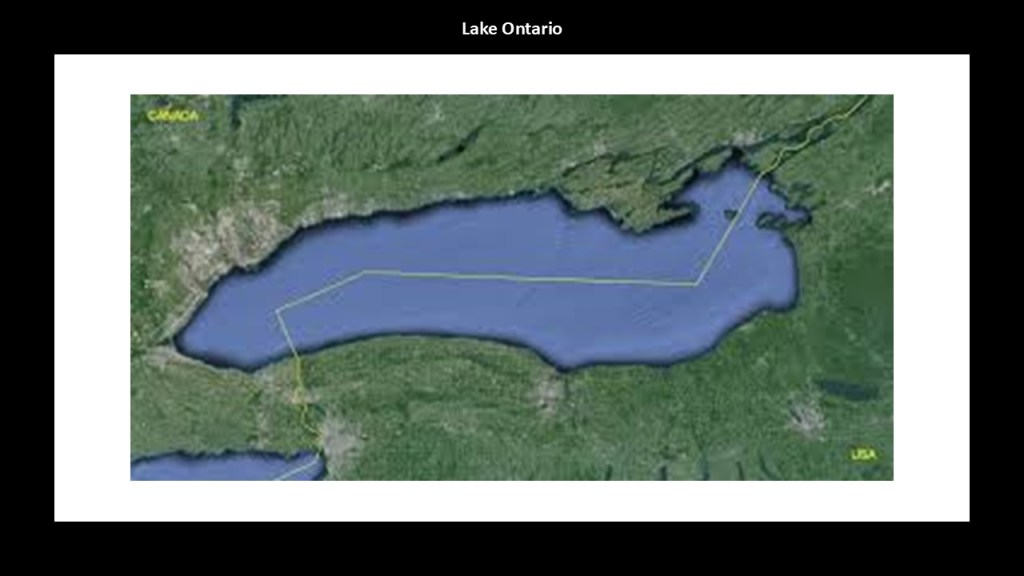
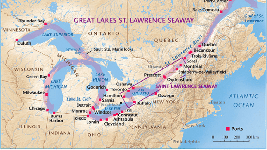
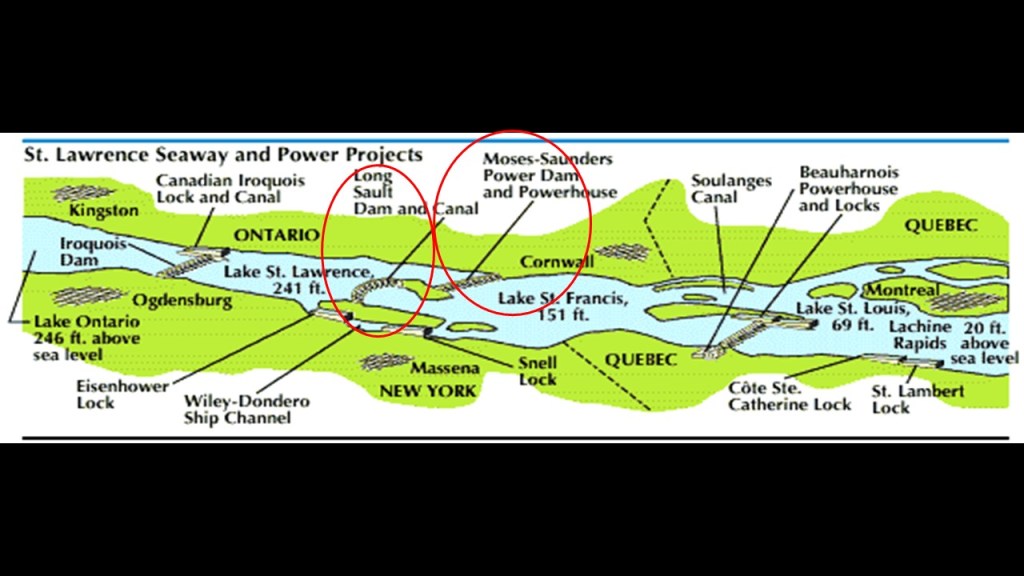
Lake Ontario serves as the outlet of the Great Lakes to the Atlantic Ocean via the St. Lawrence River, which comprises the western end of the St. Lawrence Seaway, and its primary inlet is the Niagara River from Lake Erie.
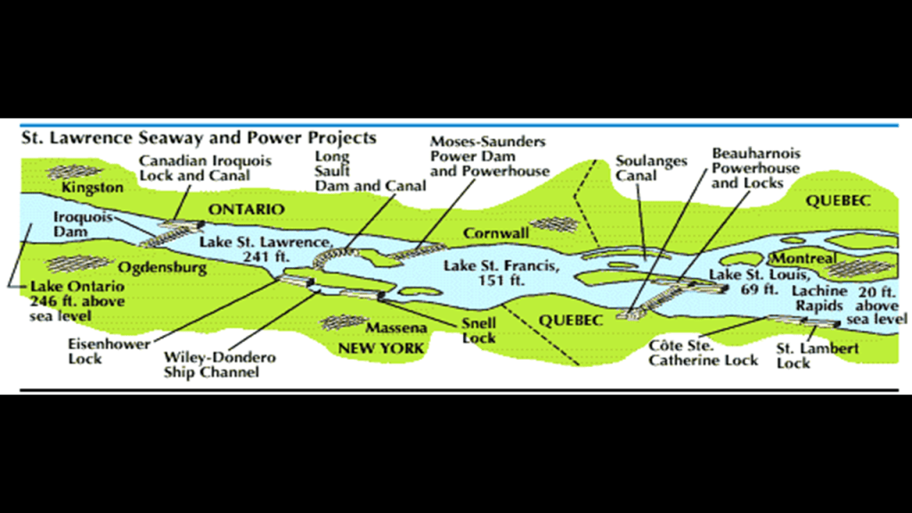
According to the information available, the Long-Sault Control Dam, along with the Moses-Saunders Power Dam, regulates the water-level of the lake.
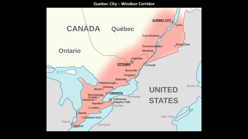
What is called the “Quebec City-Windsor Corridor,” the most densely-populated and industrialized region of Canada, runs along the Canadian-side of the St. Lawrence River, Lake Ontario, and Lake Erie.
With more than 18-million people, it contains roughly half the country’s population and seven of Canada’s twelve largest metropolitan areas.
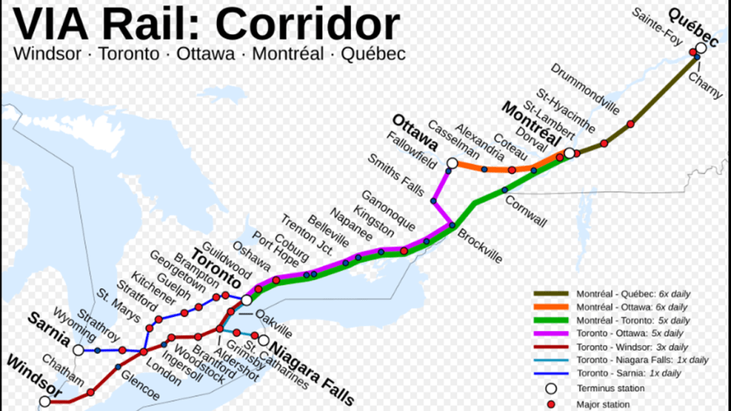
Today, VIA Rail provides the heaviest passenger train service in Canada in Quebec and Ontario in what is nicknamed “The Corridor” on what wwere previously tracks operated by the Canadian National and Canadian Pacific Railways.
The VIA Rail Corridor runs mostly along the north shores of Lake Erie and Lake Ontario, and alongside the St. Lawrence River.
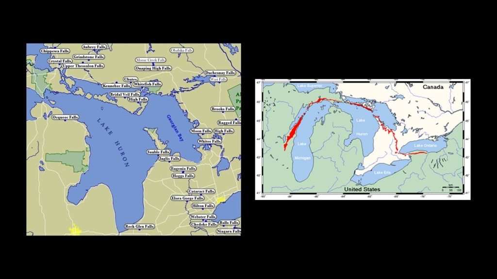
From what I could find out in a search, the Great Lakes have been home to approximately 379 lighthouses, with 200 of them still active, and that Lake Ontario, including the St. Lawrence Seaway has approximately 53 lighthouses around its shores, including lighthouses in Ontario that are not showing on this map that I will be looking at in the next part of this series.
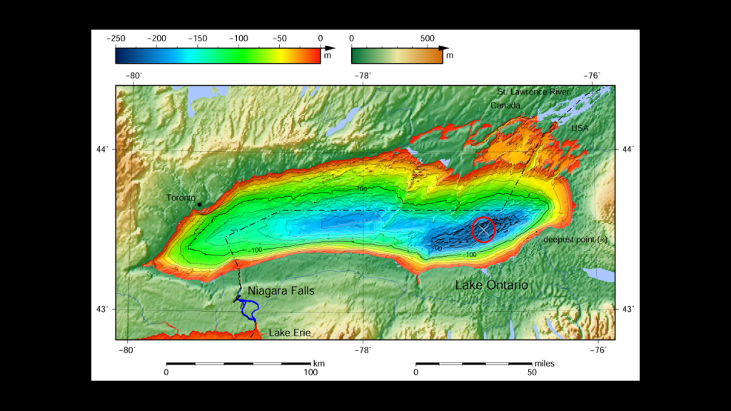
With regards to the bathymetry of Lake Ontario, the water- depth ranges from the shallow depths of 0 to 100-meters, or 328-feet, extending out quite a distance from the shoreline, and from 150- to 200-meters, in deeper parts of the lake, with its deepest point marked by the “x” at 244-meters, or 802-feet.
The average depth of Lake Ontario is 86-meters, or 283-feet.
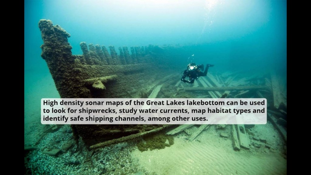
The relatively shallow waters found throughout the Great Lakes are notorious for shipwrecks, with an estimated somewhere between 6,000 to 10,000 ships and somewhere around 30,000 lives lost.
The reasons we are given for the high number of shipwrecks consist of things like severe weather, heavy cargo and navigational challenges.
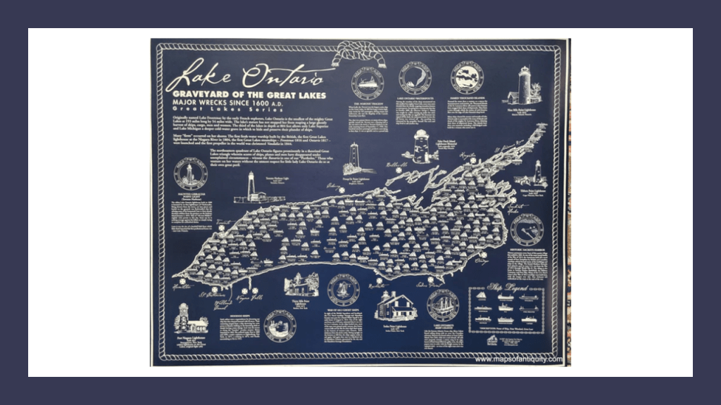
Lake Ontario is no exception to this, where there are estimates ranging between 270 and 500 shipwrecks, though the total number is not known.
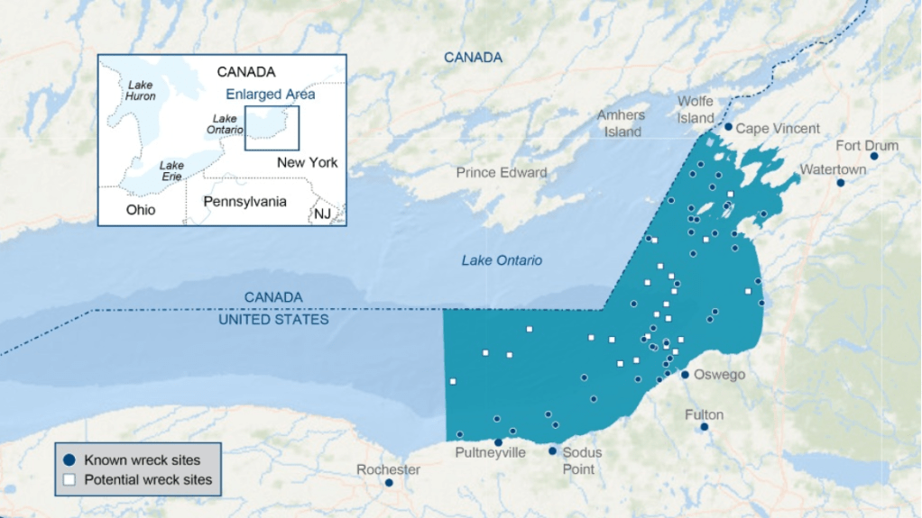
The Lake Ontario National Marine Sanctuary located on the New York-side of Lake Ontario protects 41 known historically-significant shipwrecks, as well as 19 more potential shipwreck sites.
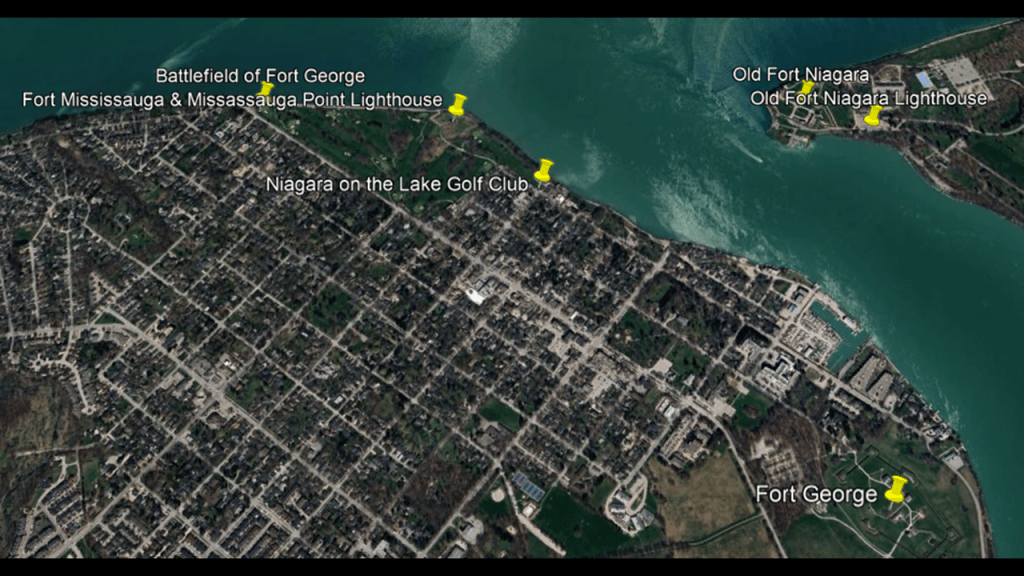
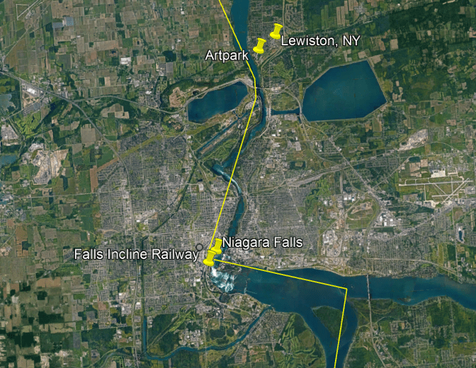
My starting point for Lake Ontario will be Niagara-on-the-Lake in Ontario at the entrance to the Niagara River, which forms part of the International Border between Canada and the United States and from there I will follow the Lake shoreline to the east to Cape Vincent, New York at the entrance of the St. Lawrence River.
In the next part of this series, I will follow the Lake Ontario shoreline west and northeast from St. Catharines, which is just to the west of the Niagara River on the Ontario-side to Kingston at the entrance to the St. Lawrence waterway, and go up the St. Lawrence Seaway and “Thousand Islands” towards Montreal in the Province of Quebec.
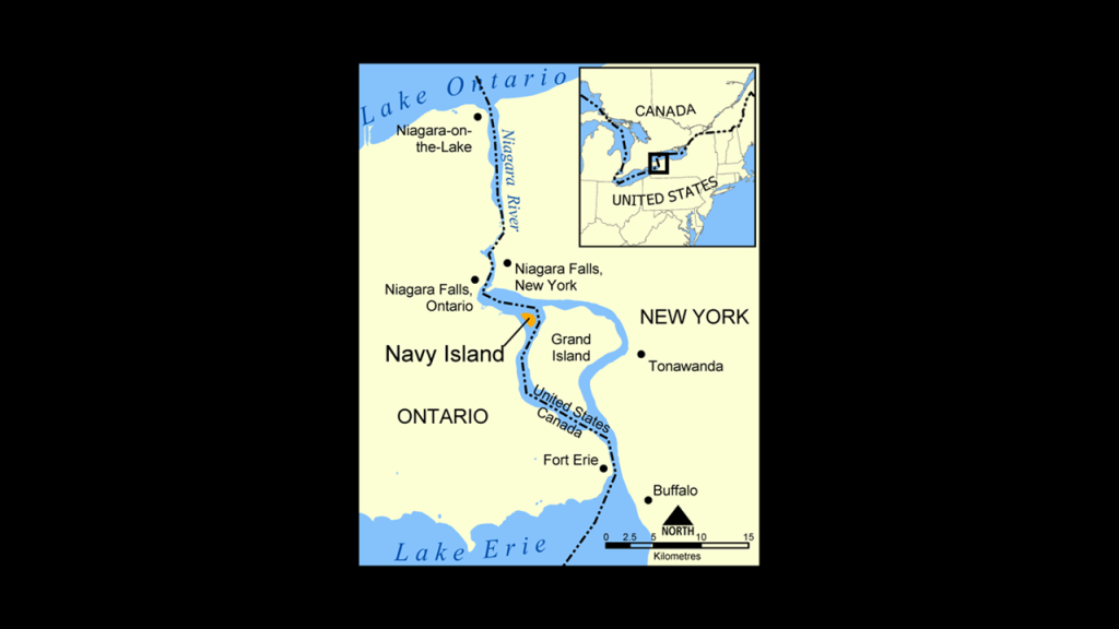
So I will begin this journey around Lake Ontario at Niagara-on-the-Lake at the entrance of the Niagara River.
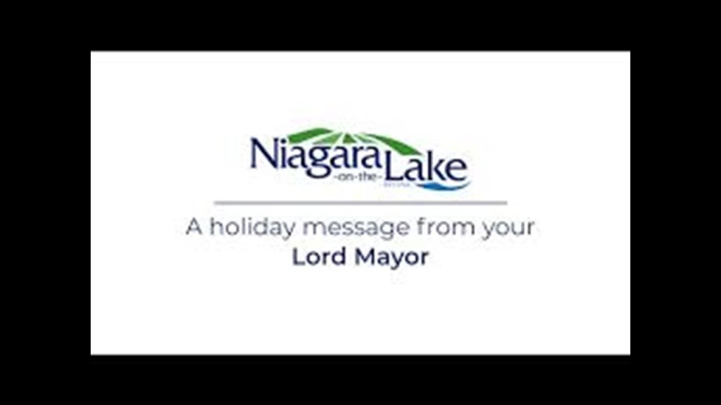
Niagara-on-the Lake is in the Niagara Region of Ontario, and was the first capital of the Province of Upper Canada, the predecessor of Ontario.
It is the only city in Canada that has a traditional Lord Mayor, a title that is bestowed by the British Monarch upon the mayor of a Commonwealth city that is a special recognition.
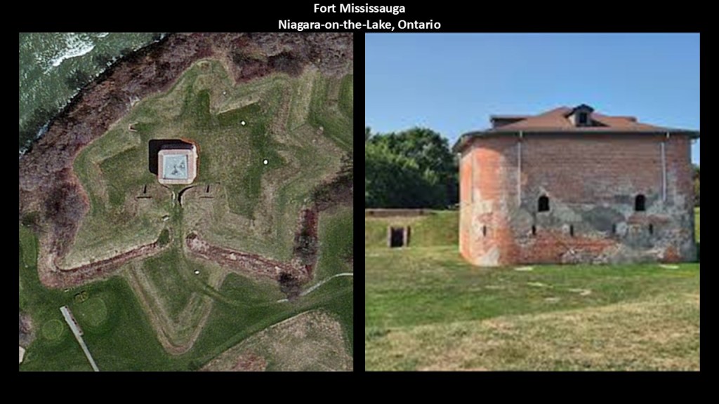
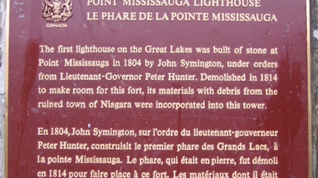
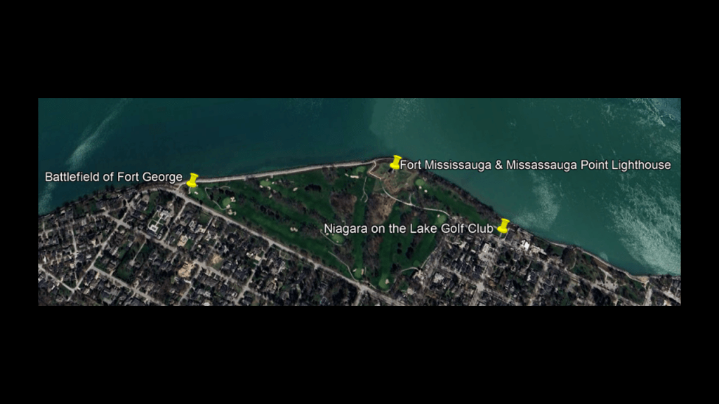
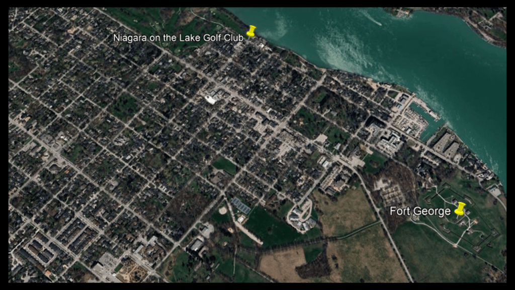
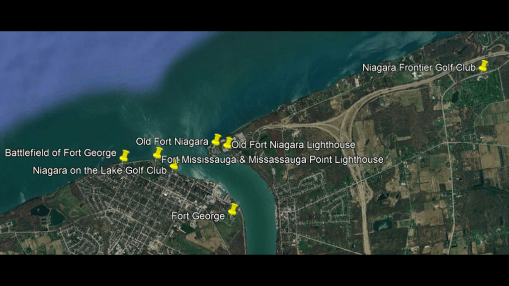
The first place I want to take a look at in Niagara-on-the-Lake is Fort Mississauga and the historical location of the Mississauga Point Lighthouse.
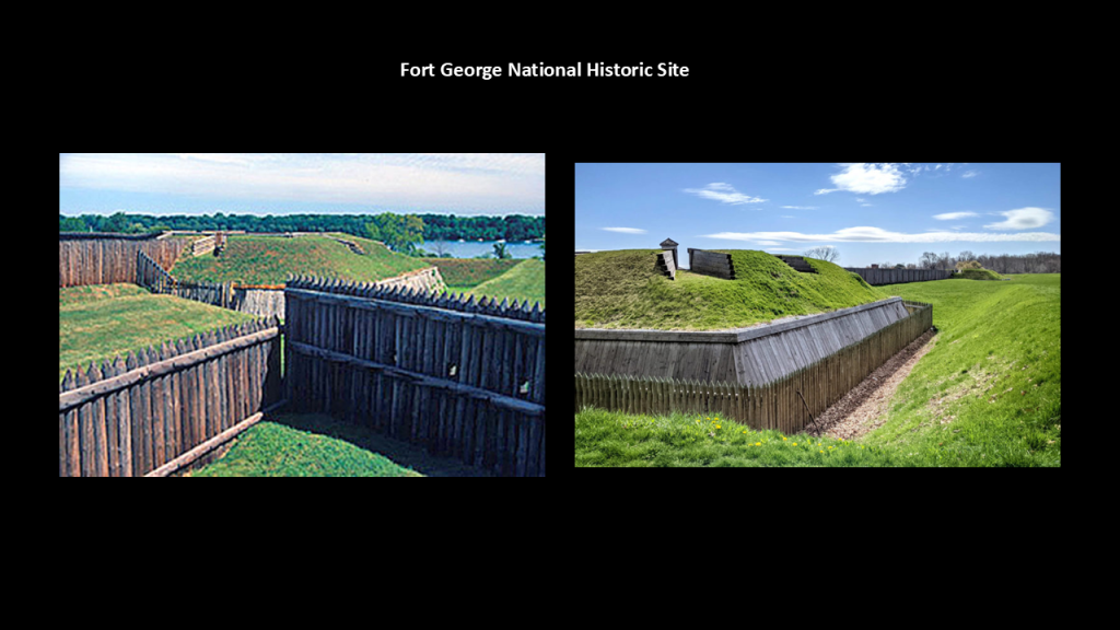
Fort Mississauga was said to have been built from 1814 to 1816 during the War of 1812 to replace nearby Fort George.
The remnants of it today on the shore of Lake Ontario at the entrance to the Niagara River are a box-shaped brick tower and star-shaped earthworks.
It was said to have been constructed from brick and stone that were salvaged from rubble after retreating United States forces burned the settlement there in December of 1813 during the War of 1812.
The Mississauga Point Lighthouse was said to have been constructed here in 1804, and to have been the first formal lighthouse constructed on the Great Lakes.
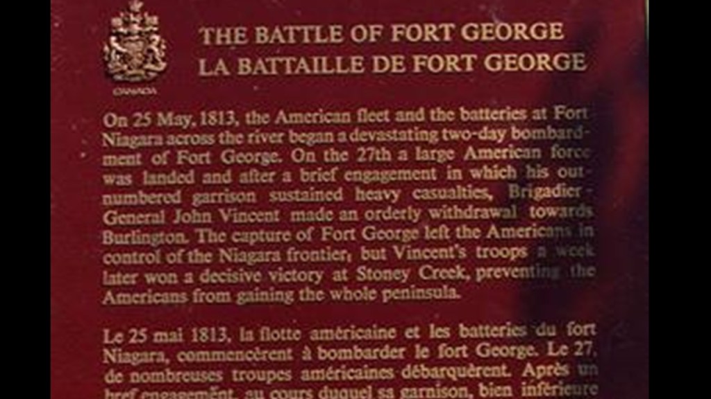
But then, we are told, it was damaged in 1813 in the Battle of Fort George, and then dismantled in 1814 to make room for Fort Mississauga.
Though there is no physical evidence of it remaining, there is a plaque on the grounds of Fort Mississauga acknowledging its significance.
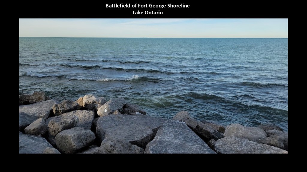
Fort Mississauga and the Battlefield of Fort George are located on the shore of Lake Ontario at the edge of the Niagara on the Lake Golf Club.
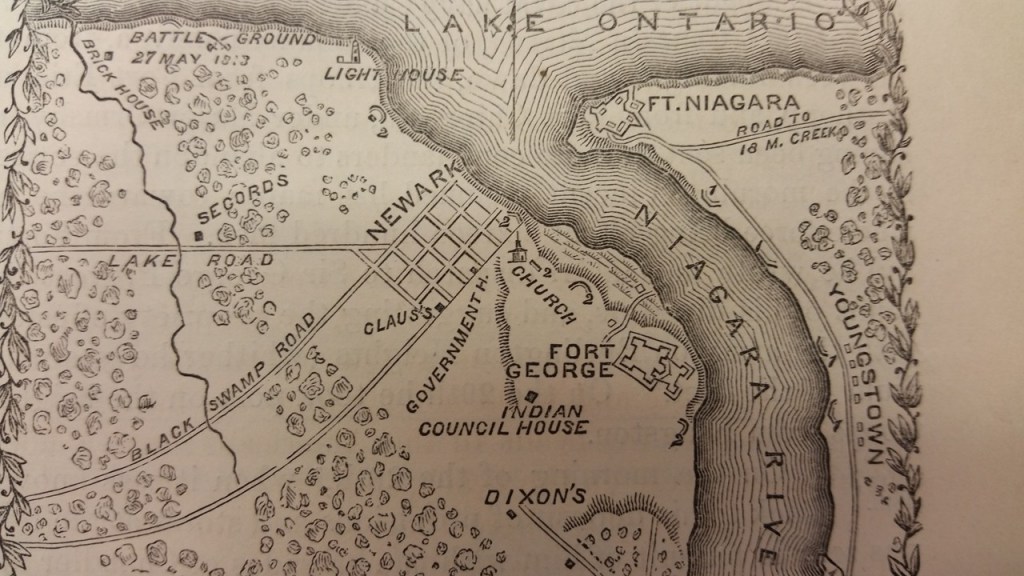
We are told the Battle of Fort George began on May 25th of 1813, and that on May 27th, American forces captured Fort George from the British, giving the Americans control of the entrance to the Niagara River for a short period of time.
In our historical narrative, it was described as one of the fiercest and most important battles of the War of 1812, but there are no remains of the battle in existence.
Interesting there are what appear to be cut-and-shaped megalithic stone blocks along the shoreline of the Battlefield of Fort George.
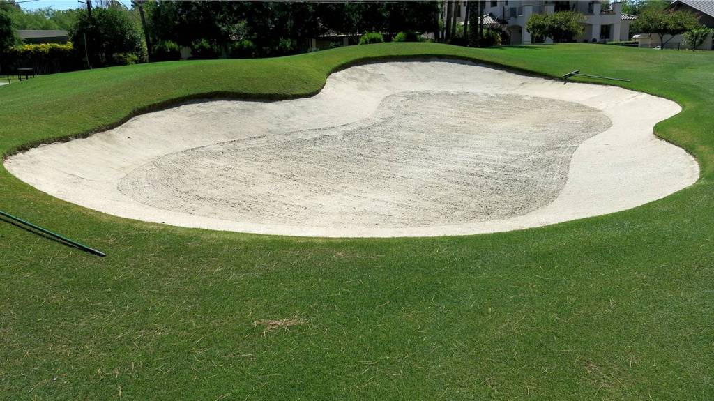
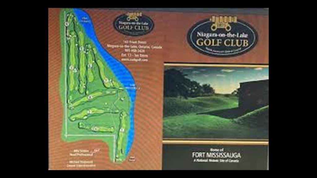
The Niagara-on-the-Lake Golf Club that surrounds the historic battlefield and Fort Mississauga is considered to be the oldest existing golf course in North America.
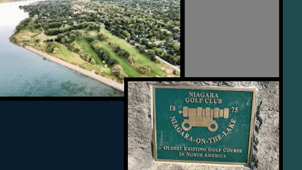
In part 4 of this series on the Ontario-side of Lake Huron, I paid particular attention to golf courses, and found tham all along the shoreline of Lake Huron like the one here in Niagara-on-the-Lake.
These are just a few of many examples of these findings.
Personally, I have believed for quite awhile now that golf courses are repurposed mound sites, and are a cover-up of mound sites.
Just carve out the top of a mound, and voila, you have a bunker.
The term “Links” is another name used for golf courses.
I think this name tells us their actual purpose in the Earth’s grid system, perhaps as “links” or “linkages” of the energy grid components.
The location of the historic Fort George is to the southeast of the Niagara-on-the-Lake Club, Fort Mississauga and the Battlefield named after it.
We are told that Fort George was built between 1796 and 1799, south of the British settlement that was established here in 1781, and that it was mostly destroyed in the War of 1812.
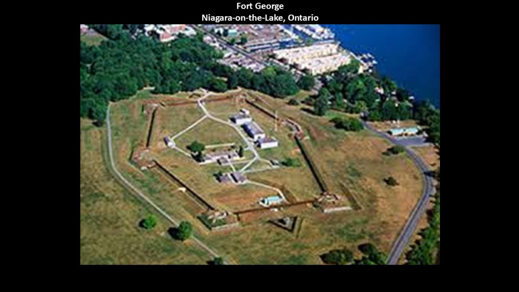
The site of the fort has been a National Historic Site of Canada since 1921, and we are told features a reconstruction of Fort George, which includes wooden palisades along with the original earthworks.
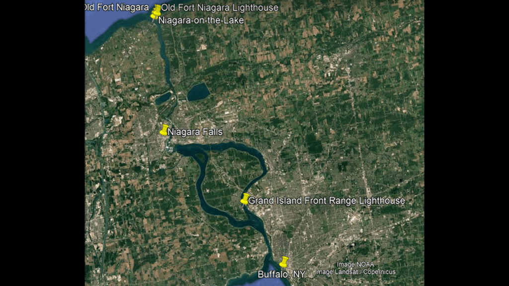
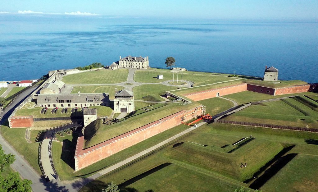
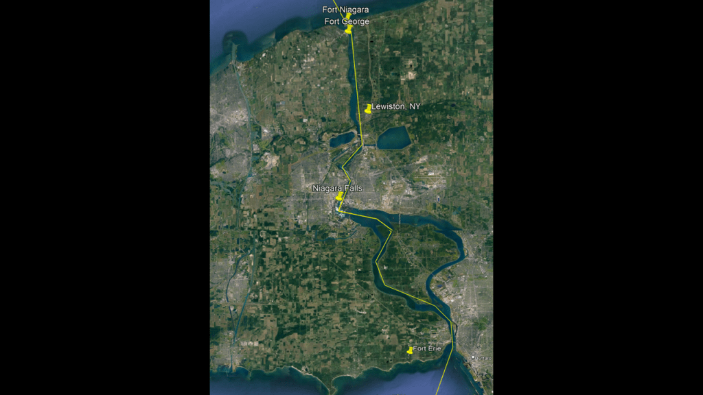
Old Fort Niagara and the Old Fort Niagara Lighthouse are on the other side of the entrance to the Niagara River from Fort Mississauga and Fort George in Youngstown New York
We are told that Old Fort Niagara was a fortification originally built by New France in 1726 to protect its interests in North America and control of access between the Niagara River and Lake Ontario.
Then we are told the British took over the fort in 1759 during the French and Indian War, and stayed until 1796, after the signing of the Jay Treaty that reaffirmed the border with British Canada, Old Fort Niagara was ceded to the United States.
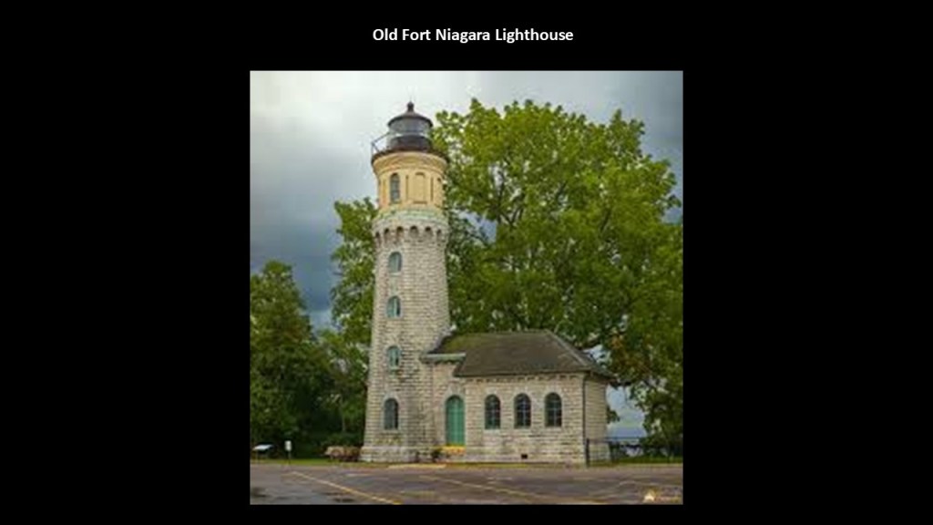
The Old Fort Niagara Lighthouse standing there today was said to have been constructed between 1871 and 1872, replacing earlier lighthouses at this location.
It was decommissioned as an active lighthouse in 1993.
Today it houses a small museum and gift shop.
Though not on the grounds of Old Fort Niagara like we saw at Fort Mississauga, the Niagara Frontier Golf Club is in the vicinity of it on the lakeshore as well.
I have consistently found star forts in pairs and clusters in the same location in the process of tracking cities and places in alignment across the Earth.
I believe that these star forts functioned as batteries on the Earth’s original free energy grid system, and that this is the reason they are found in pairs and clusters.
One definition of a battery is a device that produces electricity that may have several primary or secondary cells arranged in parallel or series, as well as a battery source of energy which provides a push, or a voltage, of energy to get the current flowing in a circuit.
Another meaning of the word battery is the heavy fire of artillery to saturate an area rather than hit a specific target.
Many star forts are actually called batteries, even though they were re-purposed in many cases, but not in all, to the second definition applied to them in the new time-line in order for them to appear to have a strictly military function.
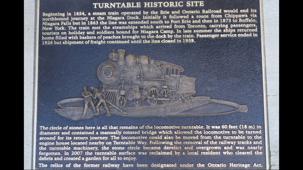
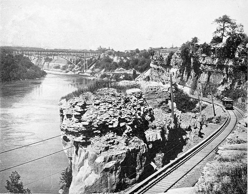
In this graphic of primarily historic Niagara-on-the-Lake, I have circled the outer three previously-mentioned star fort locations, and the inner three circles were the location of historic rail infrastructure.
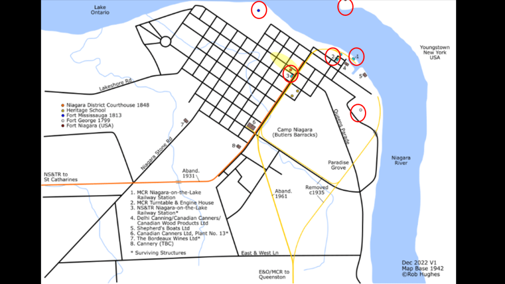
Location #1 next to the Niagara River was the MCR (Michigan Central Railway) Niagara-on-the-Lake Railway Station…
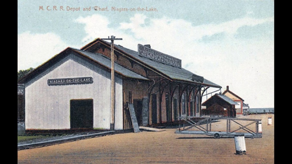
…Location #2 was the MCR Turntable and Engine House…
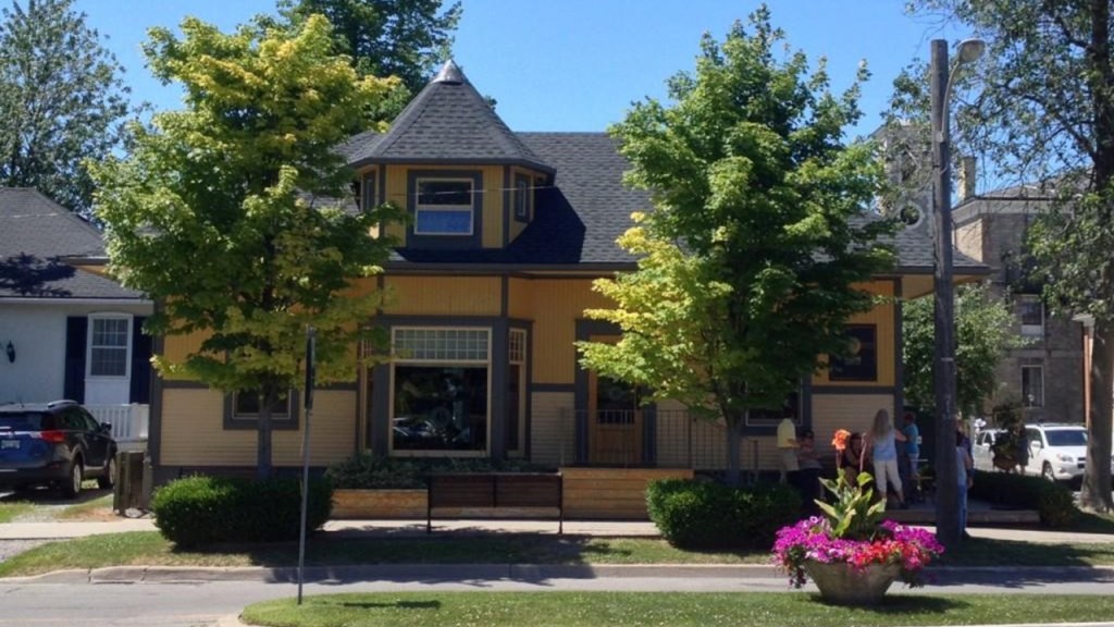
…and Location #3 a couple of blocks from there was the NS & TR (Niagara, St. Catharine’s and Toronto) Niagara-on-the-Lake Railway Station, which is the only one of the three that still survives as a building that has been used for both residential and commercial purposes in the Queen-Picton Conservation Heritage District.
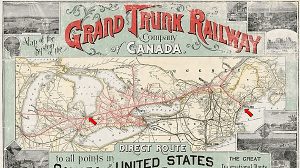
As we head down the Niagara River towards the Niagara Falls, it is important to note that the Niagara Region has had multiple railway lines connected to it, like the Grand Trunk Railway as seen in this 1887 map.
Said to have been constructed starting in 1852, the Grand Trunk Railway was officially opened in 1859 between Sarnia in Ontario and Portland in Maine.
We are told the Grand Trunk Railway was merged into the Canadian National Railway in 1923 because of financial difficulties.
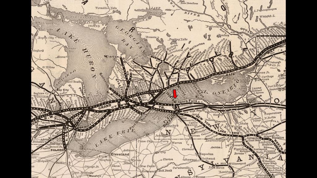
In its hey-day, it operated in Ontario and Quebec in Canada, and in the United States, in Connecticut, Maine, Michigan, Massachusetts, New Hampshire, and Vermont.
We are told the original charter for the Grand Trunk Railway was for a line running from Montreal to Toronto along the north shore of the St. Lawrence River and then it went west to Sarnia and east to Portland.
We are told that the first railway in America was an incline railway built in Lewiston, New York, between 1762 and 1764.
It was called Montresor’s Tramway, and said to have been designed and built by British engineers at the close of the French and Indian War (1756 – 1763) to haul goods up the steep slope at the Niagara River near the Niagara Falls escarpment at Lewiston, New York.
No longer in existence, we are told it was located where the Earl W. Brydges Artpark State Park, otherwise known as the “Artpark,” is today.
Lewiston is described as the first European settlement in western New York, established in 1720.
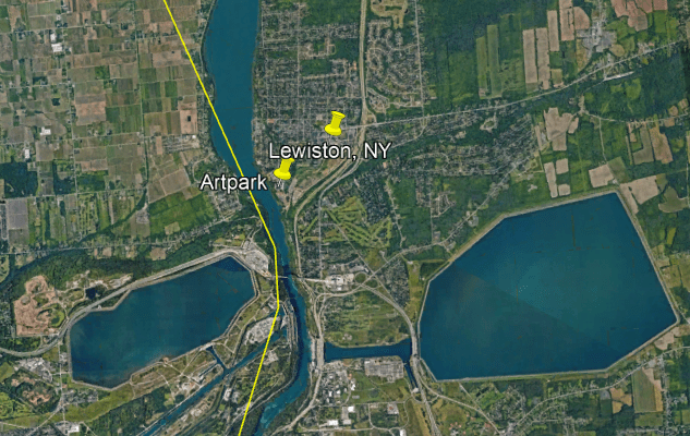
Lewiston lies half-way between Fort Niagara and Fort George, where the Niagara River meets Lake Ontario, and Niagara Falls, a group of three falls that straddle the international border between the United States and Canada.
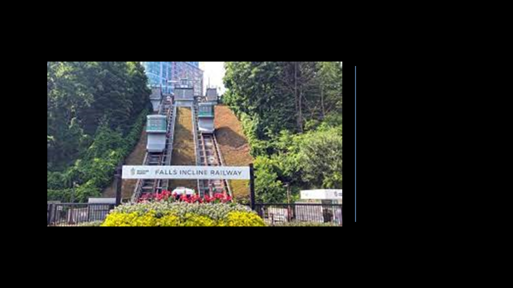
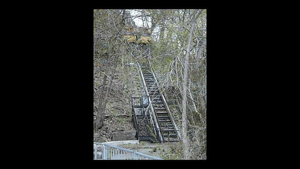
It is interesting to note that there is an incline railway that is still operational today at Niagara Falls in Ontario, approximately 5-miles, or 8-kilometers, south of Lewiston on the Niagara River.
The Falls Incline Railway is located next to Horseshoe Falls and links “Table Rock Center” and “Journey Behind the Falls” on the Niagara Parkway with the “Fallsview Tourist Area.”
We are told it was built for the Niagara Parks Commission by the Swiss Company Von Roll, and began operating in October of 1966.
The other historic Incline Railways of the Niagara Falls region between the United States and Canada included:
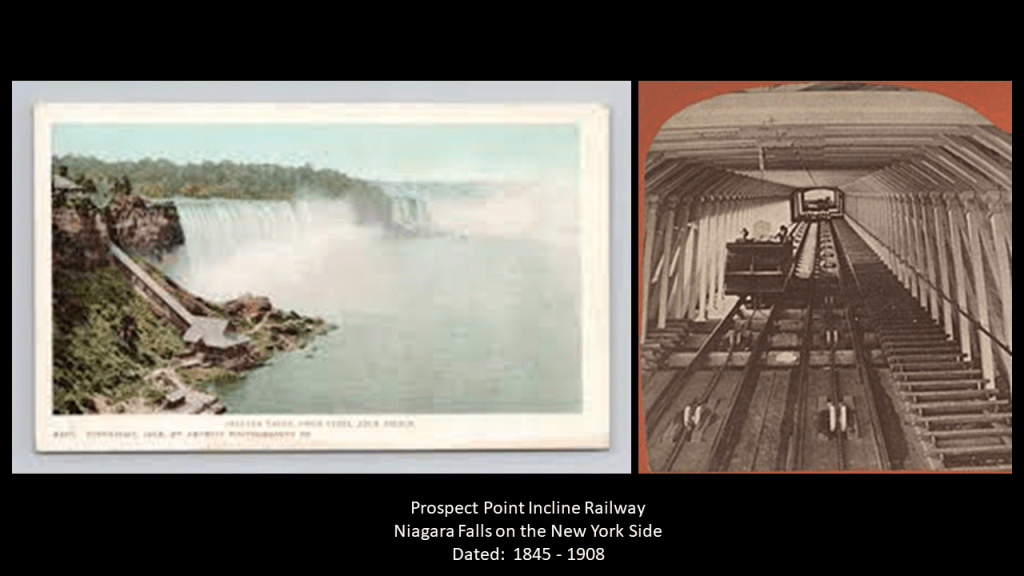
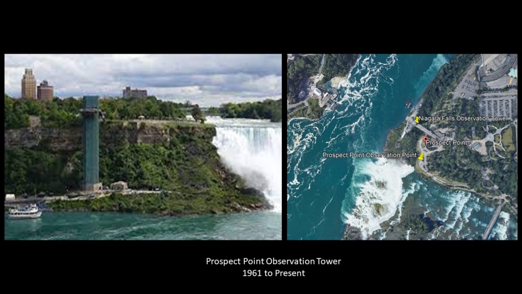
The Prospect Park Incline Railway at Prospect Park in New York, said to have been built in 1845, and completely removed in 1908 after an accident killed someone.
We are told it was then replaced by an elevator that operated between 1910 and 1960 until it closed, and replaced by the current Prospect Point Observation Tower in 1961.
Then in 1869, the Leander Colt Incline Railway was said to have been built on the Canadian-side of the Falls, near the Whirlpool Rapids Bridge, but damaged and abandoned 20-years later in 1889.
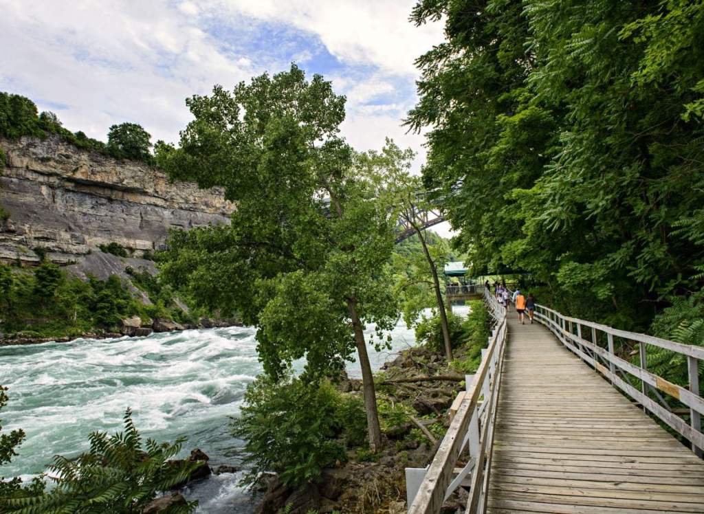
Another Whirlpool Rapids Incline was said to have been built in 1876 near the Leander Colt Incline, but damaged by fire in 1934 and replaced by the “Great Gorge Trip” of the Niagara Belt-Line, a train route around Niagara Falls…

…which later became the “White Water Walk” where you can take a leisurely stroll where the Niagara Belt-Line once was.
Lastly, we are told the Clifton Incline was built in 1894 to serve the Canadian-side of the “Maid of the Mist” boat.
It closed in 1976 and reopened in 1977 as the “Maid of the Mist” Incline, and closed again in 1990.
Almost 30-years-later, in 2019, it was re-opened as the Hornblower Niagara Funicular, and operates today for Hornblower Niagara Cruises.
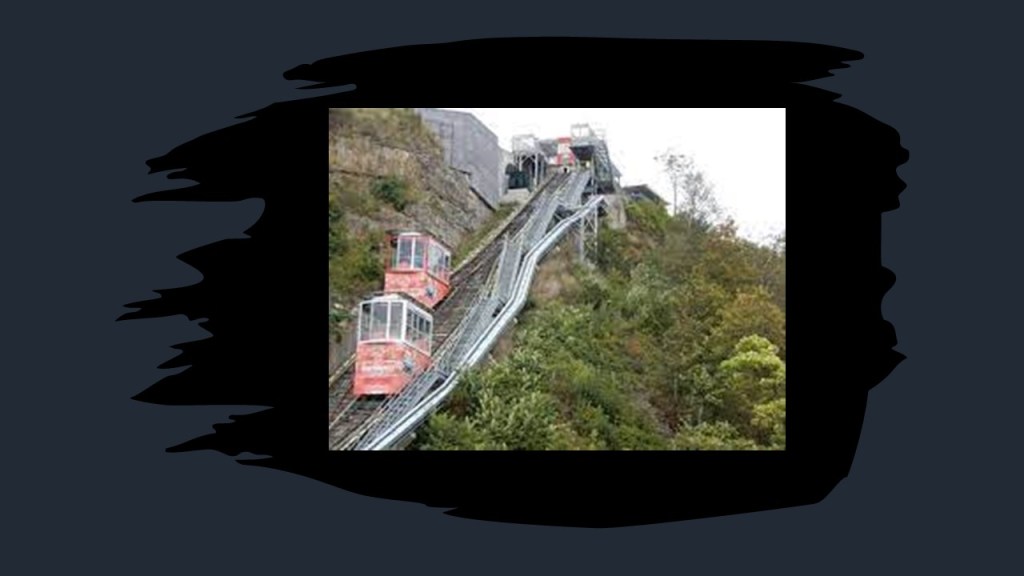
Incline Railways, also known as funiculars, work like an obliquely-angled elevator, in which cables attached to a pulley-system raise- and-lower the cars along the grade.
Two cars are paired at opposite-ends and act as each other’s counterweight. As such, there is not a need for traction between the wheels and rails, and thereby allowing them to scale steep slopes, unlike traditional rail-cars.
Thing is, there used to be a lot more of them than there are now, and incline-railways were a worldwide thing.
It seems like the ones that remain are either tourist attractions, or not removed because they are an important part of a community’s public transportation system.

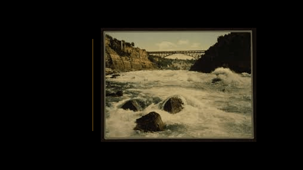
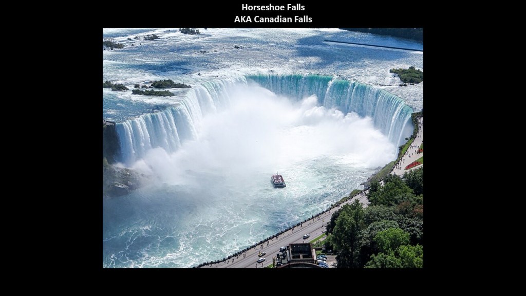
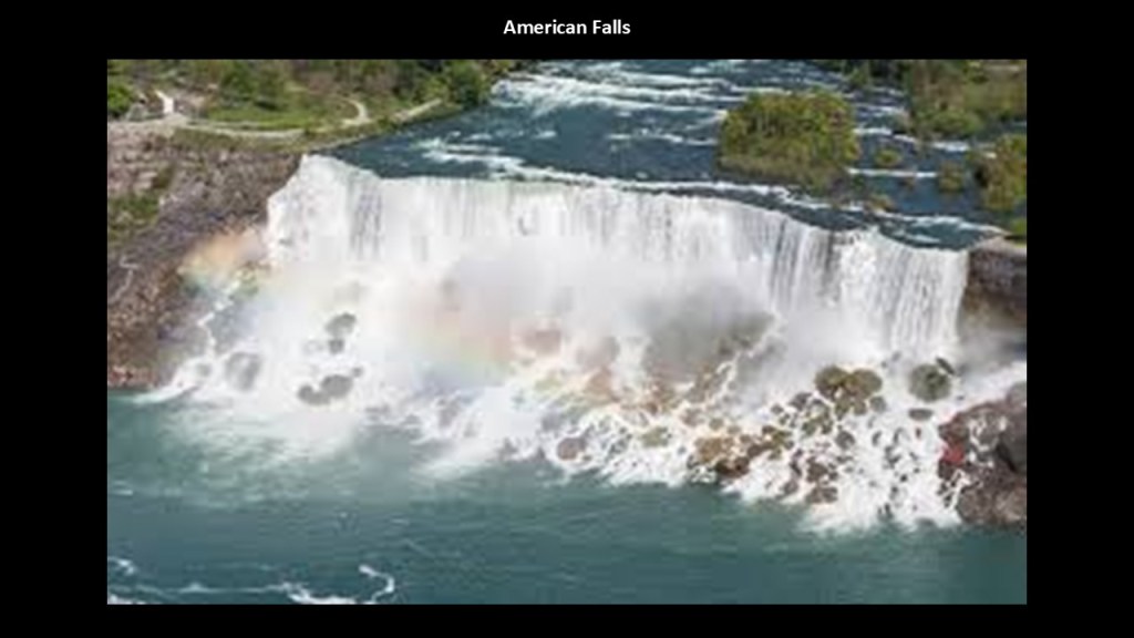
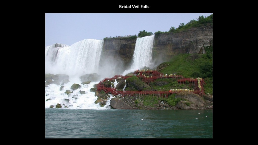
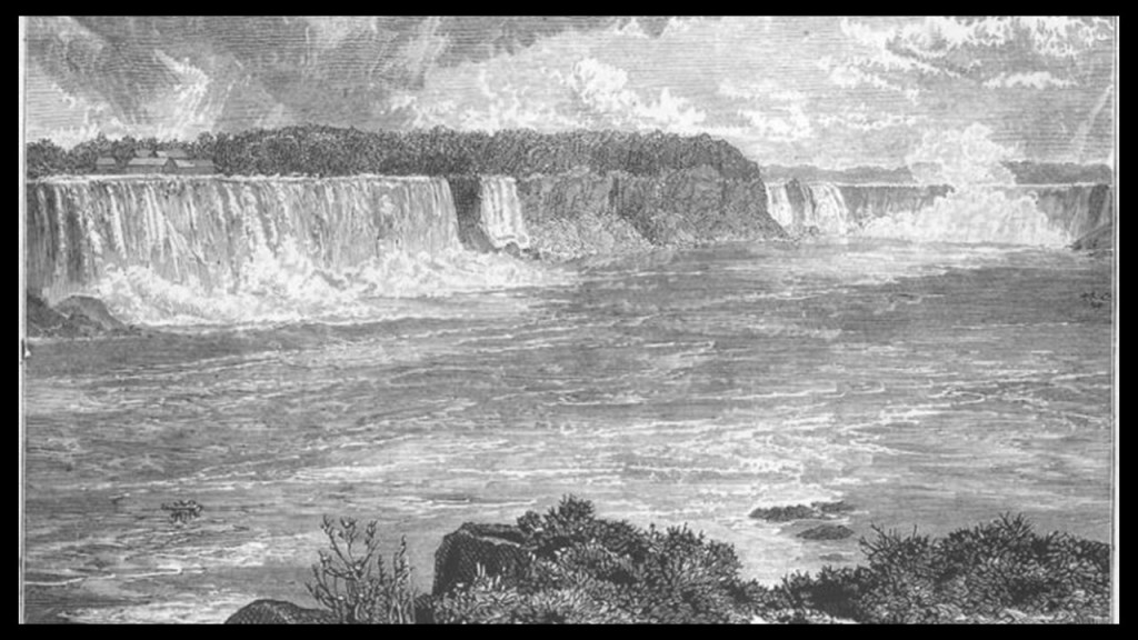
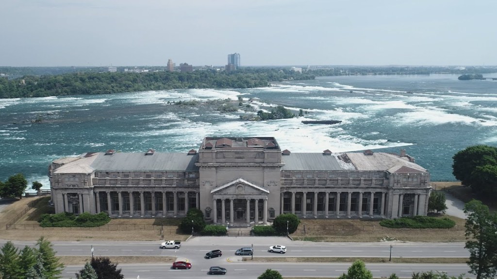
Niagara Falls, the largest waterfall by volume in North America, consists of a group of three waterfalls on the Niagara River spanning the international border between New York and Ontario – Horseshoe Falls in Ontario and Bridal Veil Falls and American Falls in New York.
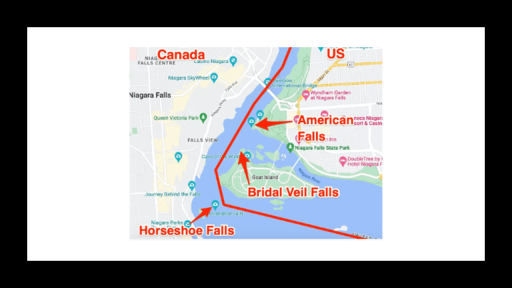
Horseshoe Falls, also known as the Canadian Falls, is the largest of the three, with approximately 90% of the Niagara River flowing over it.
The remaining 10% of the Niagara River flows over the American Falls…
…and the Bridal Veil Falls, the smallest of the three located right next to American Falls.
3,160-tons of water flow over all three of the Niagara Falls every second, with water plunging 32-feet, or 10-meters, every second, hitting the base with 280-tons of force at the American and Bridal Veil Falls, and 2,509-tons of force at the Horseshoe Falls.
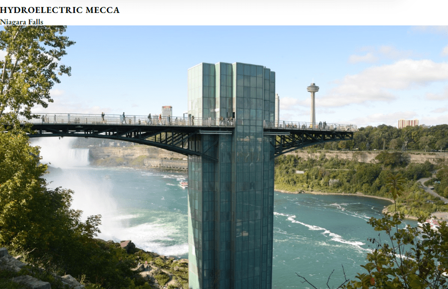
Niagara Falls is capable of producing 4-million kilowatts of electricity, which is shared by the United States and Canada, and is also noteworthy for its present-day and historic hydroelectric and power-generation facilities.
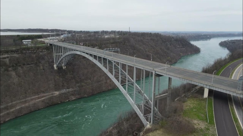
Queenston in Canada and Lewiston in New York are loated at the base of the Niagara Escarpment on either side of the Niagara River.
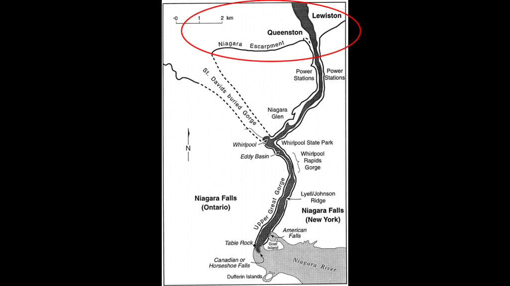
The Lewiston-Queenston International Toll Bridge connects both sides of the Niagara Escarpment just south of the two cities.
The current bridge was said to have been opened on November 1st of 1962, and connects Interstate-190 in Lewiston with Onterio Highway 405 in Queenston.
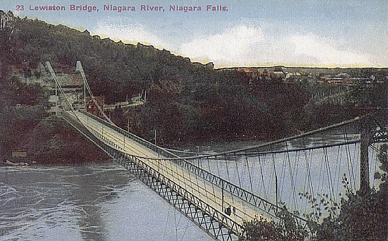
We are told there were two earlier bridges of the same name.
The first one was said to have been built in 1851, and was subsequently wrecked by wind in 1864, and a second suspension bridge was constructed that was dismantled when the current bridge was opened.
This was a postcard of the second bridge circa 1915.
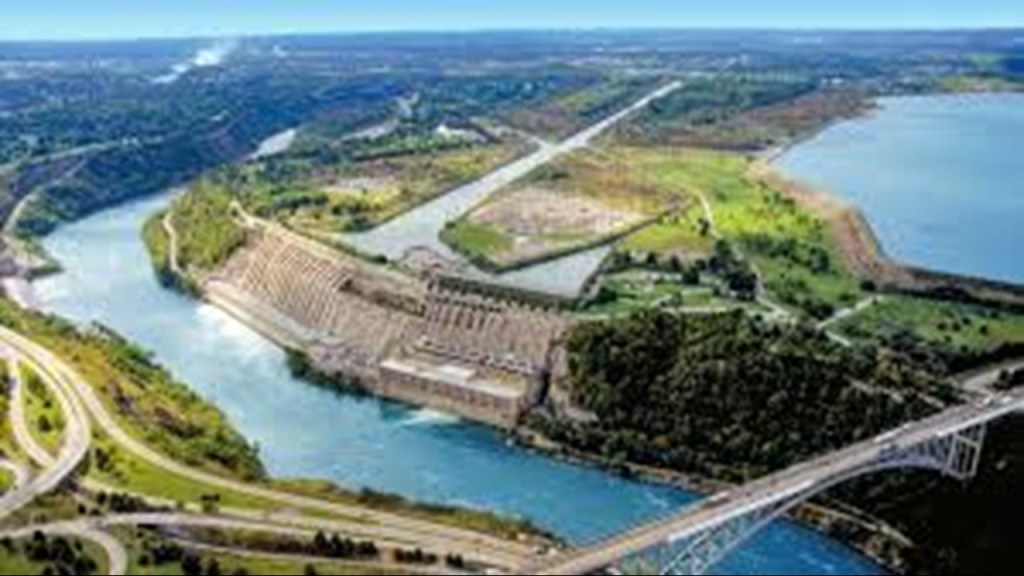
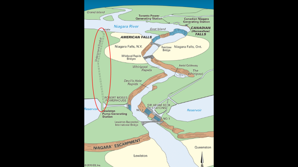
Just below the Lewiston-Queenston Bridge, there are hydroelectric facilities and reservoirs on both sides of the Niagara River.
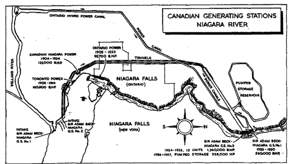
On the Canadian-side, the Sir Adam Beck Generating Stations, Numbers 1 and 2, and on the American-side, the Robert Moses Powerhouse and Lewiston Pump-Generating Station.
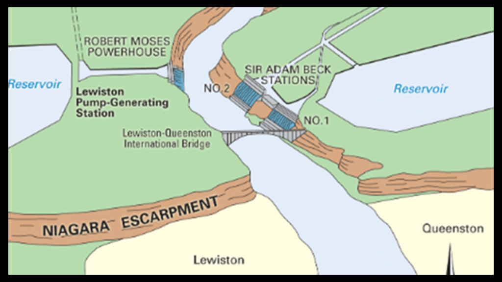
The Sir Adam Beck Generating Stations provide a signficant portion of Ontario’s electricity by diverting water from the Niagara and Welland Rivers.
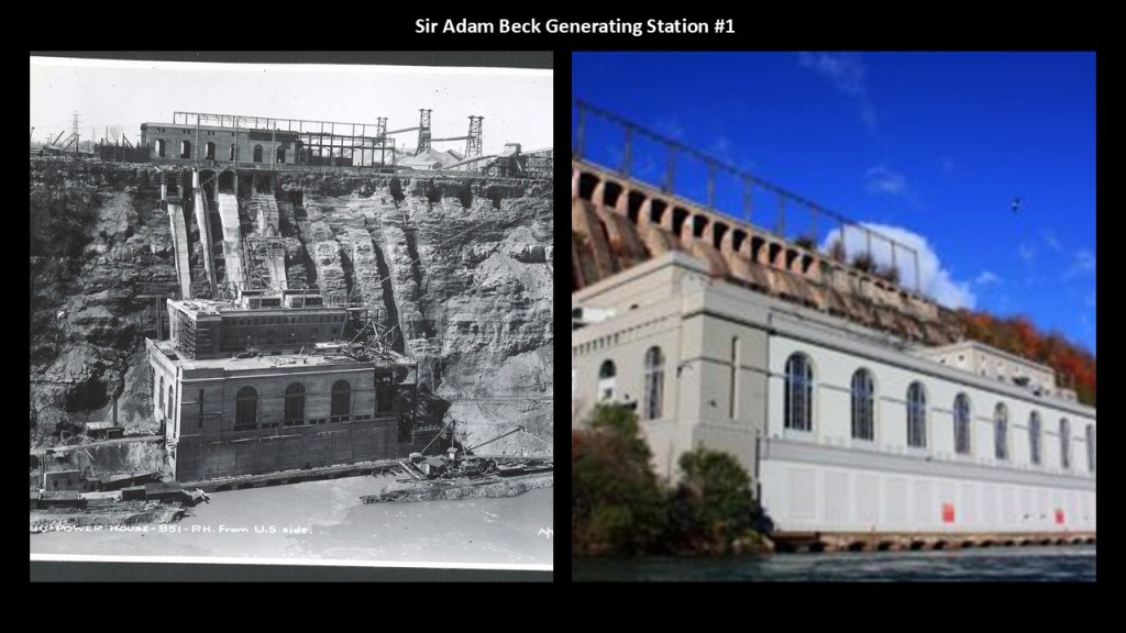
We are told Station #1 first opened in 1922, and was the world’s largest hydroelectric station at the time of its opening, and is still operational today.
The Sir Adam Beck Generating Station #2 was opened in 1954, and is Ontario Power Generation’s largest capacity hydroelectric station.
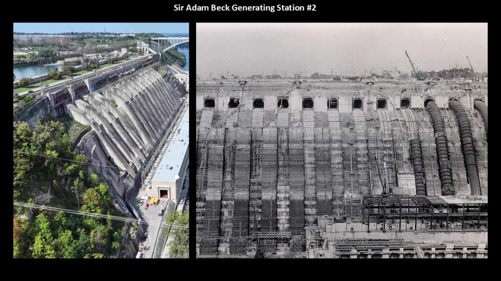
Both stations draw water from the Niagara River above Niagara Falls via a large power canal.
A power canal is a canal used for hydraulic power generation.
On the American-side across the river from the Sir Adam Beck Generating Stations, the current Robert Moses Power Station was said to have been constructed in the late 1950s, and first opened in 1961.
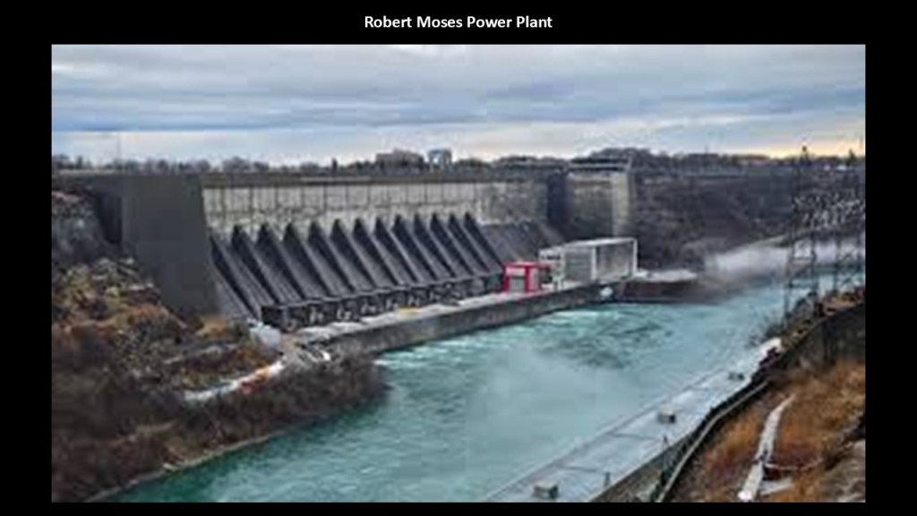
The Lewiston Pump-Generating Plant is in the Lewiston Dam.
We are told the Lewiston Dam was constructed to contain the Upper Lewiston Reservoir, which stores water pumped from the forebay of the Robert Moses Power Station.
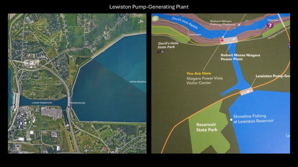
The water in the forebay comes from an underground conduit that goes from the forebay to the Niagara River upstream of the waterfalls.
This latest power station was one in a series of power stations at this location in our historical narrative.
In our historical narrative, we are told that the Niagara River and the American Falls were purchased by the Porter Brothers and their “Porter, Baron & Company” in 1805 at a public auction, which included the water rights from the upper rapids below the falls.
We are told the company portaged goods from Lake Erie to Lewiston on the Niagara River to ship them east to Lake Ontario, but that the opening of the Erie Canal in 1825 made the portage obsolete and the company’s plans for the future were never developed.
Then we are told in 1852, Caleb Smith Woodhall and some associates purchased the land and water rights from the heirs of the Porter Brothers with the intention to build a canal, and formed the “Niagara Falls Hydraulic Company” in 1853, but that the canal they started to construct was never completed because of construction costs and the company went bankrupt.
Then in 1856, Stephen N. Allen bought the company, and renamed it the “Niagara Falls Water Power Company,” which was said to have completed the entrance and river portion of the canal by 1857, and that by 1881, a narrow extension at the south end of the basin was completed.
Then in 1860, Horace Day bought the company, and renamed it the “Niagara Falls Canal Company,” and finally completed the canal in 1861, but that it could not be used because of the American Civil War.
In our narrative, the canal’s first customer came in 1875 with Charles Gaskill’s “Cataract City Milling Company,” which used the water in the canal to power the company’s flour grist mill.
The historical Niagara Falls Mill District on the American-side of Niagara Falls flourished in the late 19th- and early-20th-centuries.
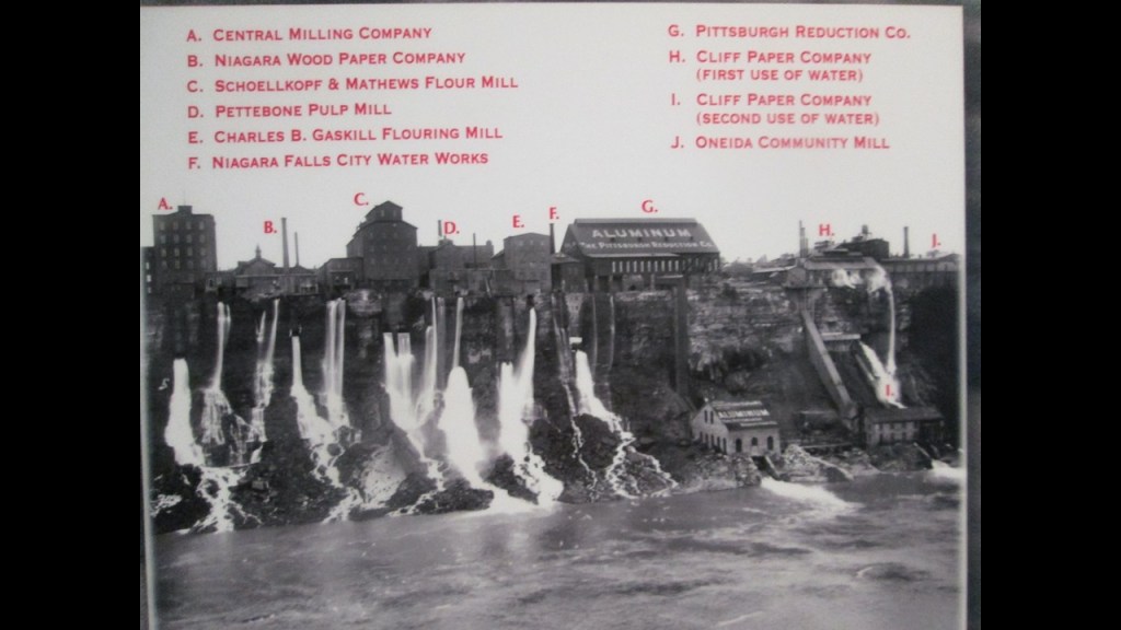
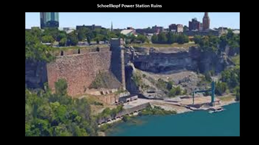
Today the former Mill District is mostly parkland, with historical ruins of the Schoellkopf Power Station, which the Robert Moses Power Station was said to have replaced.
Niagara Falls has been referred to a a “Hydroelectric Mecca.”
There’s a lot more to the story here, but this gives you the idea.
One more thing here on this side of the falls.
We are told the Niagara Gorge Railroad was first organized in 1895, and operated until a rock slide ended its service in September of 1935.
It ran at the bottom of the Niagara Gorge from Niagara Falls, New York, to Lewiston.
I have consistently found railroads in conjunction with rivers and gorges and hydroelectric facilities in my research over the years, and looked at the subject in depth in my post “Of Railroads and Waterfalls, and Other Physical Infrastructure of the Earth’s Grid System.”
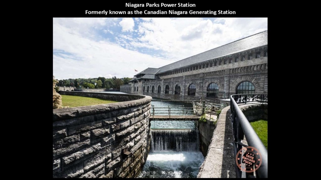
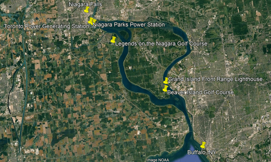
Above the Niagara Falls on the Canadian-side are two former generating stations – the Canadian Niagara Generating Station and the Toronto Power Generating Station.
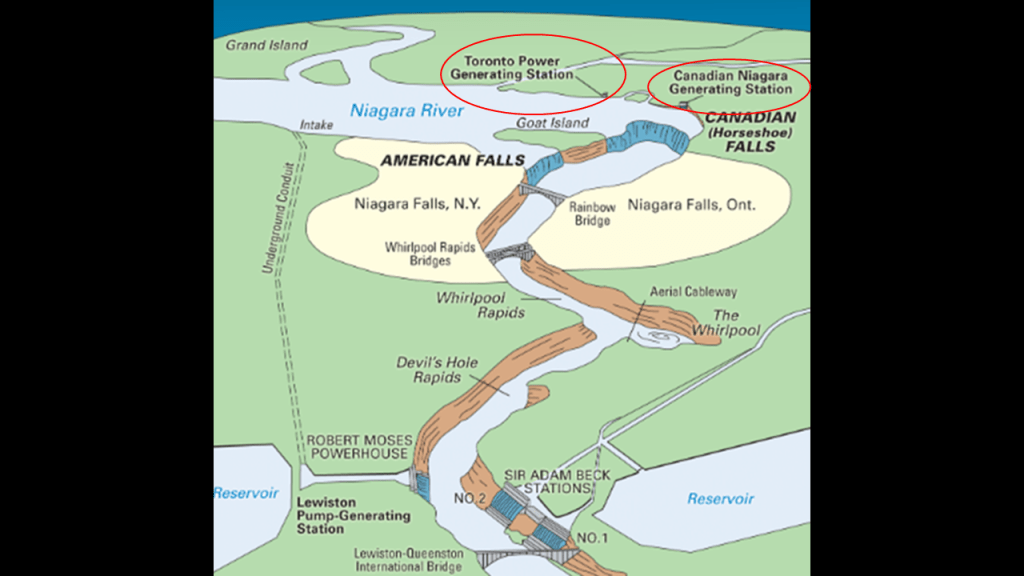
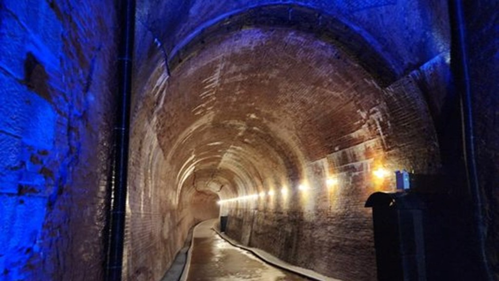
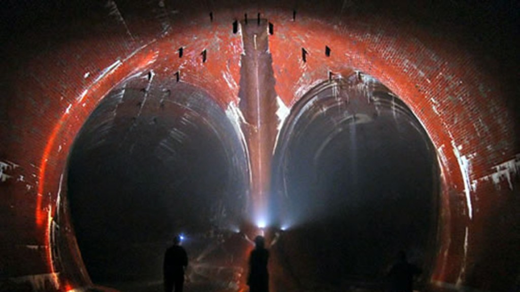
Today, the Canadian Niagara Generating Station is a tourist attraction renamed the “Niagara Parks Power Station and the Tunnel.”
Said to have been built between 1901 and 1905, the year the generators became operational, It was the first major power plant on the Canadian-side of the Niagara River and harnessed the powerful energy of Horseshoe Falls.
It was decommissioned in 2006.
“The Tunnel” is 180-feet, or 55-meters, beneath the main building of the generating-station, and the 2,200-foot, or 671-meter, -long tunnel was said to have been dug with the use of lanterns, rudimentary dynamite, pick-axes, and shovels.
The Toronto Power Generating Station is not far from today’s Niagara Parks Power Station, and it was said to have been constructed around the same time-period, and it was in operation from 1906 until 1974.
Although it is also owned by Niagara Parks Commission, it has sat vacant ever since and has been a destination for urban exploration activities.
The same kind of sophisticated hydroelectric and power-generation infrastructure is found in The Soo region of Michigan and Ontario on the St. Mary’s River which connects Lake Superior and Lake Huron.
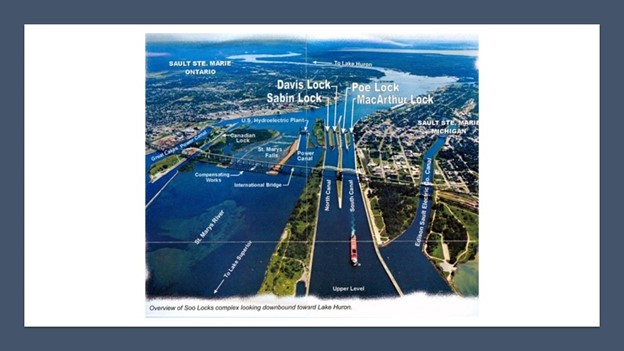
…and we’ll see it again on the St. Lawrence Seaway.
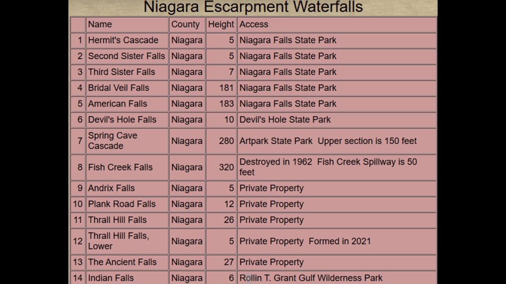
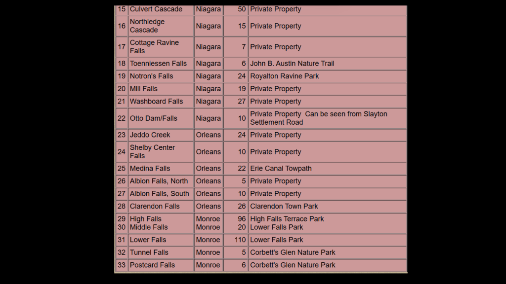
When I saw this map of the region’s waterfalls, it struck me how many there are on the Ontario side of Lake Huron and the Georgian Bay, including a series of waterfalls running along the Niagara Escarpment from Niagara Falls.
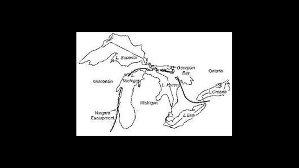
In the course of doing the research for this series on the Great Lakes, I have come to understand deeply that the Georgian Bay of Lake Huron is formed by the Niagara Escarpment.
The Niagara Escarpment runs predominantly east-to-west, from New York, through Ontario, Michigan, Illinois, and Wisconsin, with a nice, half-circle shape, attached to a straight-line, when drawn on a map.
As I continue to go through the exploration of Lake Ontario, I will show why I believe this is a significant finding with regards to the Great Lakes of the region that we see today that we have been taught to believe have always been there but which I now believe are a relatively recent occurrence and weren’t there before, and believe they were created by the outflow of the waterfalls of the region after the deliberate destruction of the original energy grid, which subsequently destroyed the surface of the Earth.
It is interesting to note what we are told about the origin of the Niagara Escarpment.
It is the most prominent of several escarpments in the bedrock running from eastern Wisconsin north through Northern Michigan, curving around southern Ontario through the Bruce Peninsula and Manitoulin Island and other islands in northern Lake Huron, before extending eastwards across the Niagara region between Ontario and New York, and formed over millions of years ago through weather and stream erosion through rocks of different hardnesses.
That’s what they tell us, anyway!!
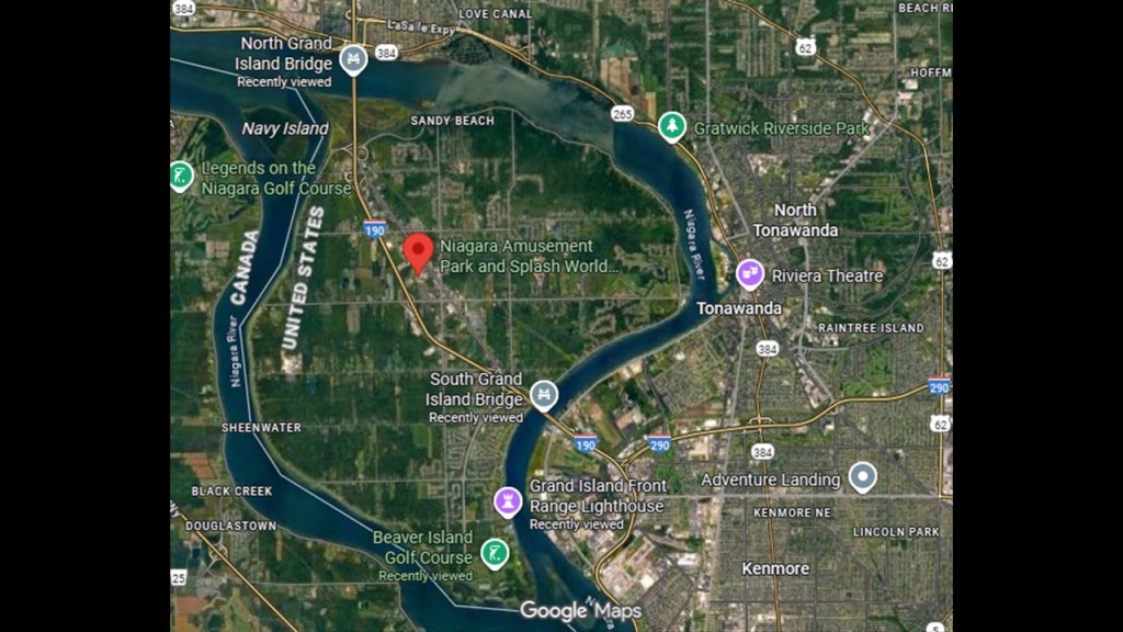
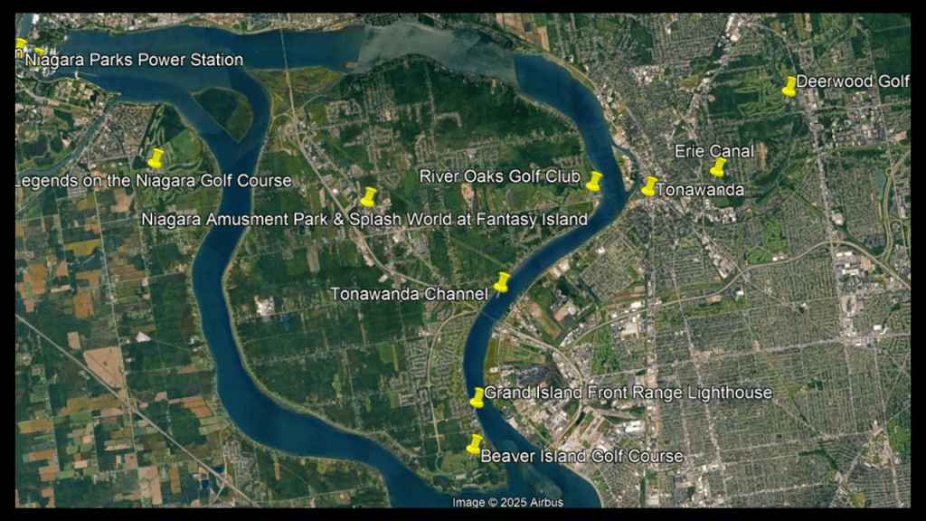
One last area I am going to look at before I start heading east from here, since I will cover the Niagara River where it enters Buffalo, New York, in the Lake Erie part of this series, is what is found looking around Grand Island, including a lighthouse and two golf courses.
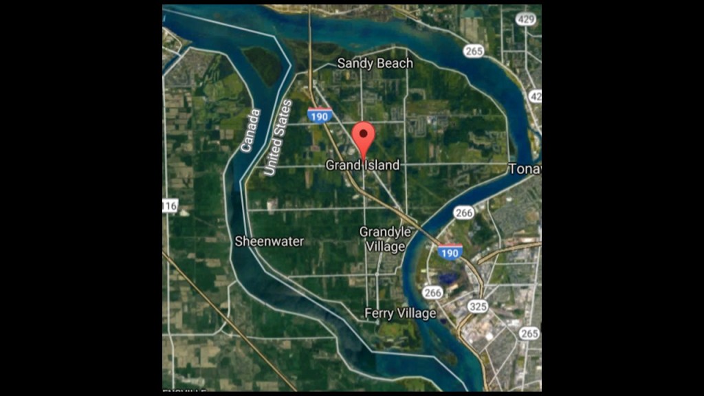
Grand Island is an island town with a population of 21,389 in the 2020 census, and is the third largest island in the State of New York.
It is traversed by Interstate-190, and New York State Route 324.
Interstate 190 connects Interstate 90 in Buffalo with the International Border at Lewiston, where it crosses the Lewiston-Queenston Bridge and from there becomes Ontario Highway 405.
Interesting to note that parts of Interstate 190 were built along the Right-of-Ways of the Lehigh Valley Railroad and the Erie Canal.
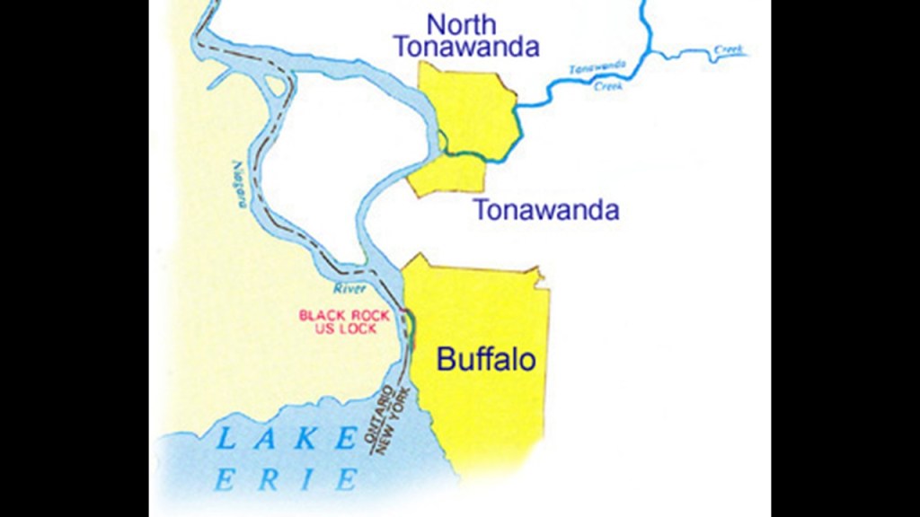
For example, heading north out of Buffalo, Interstate 190 follows the eastern edge of the Black Rock Channel.
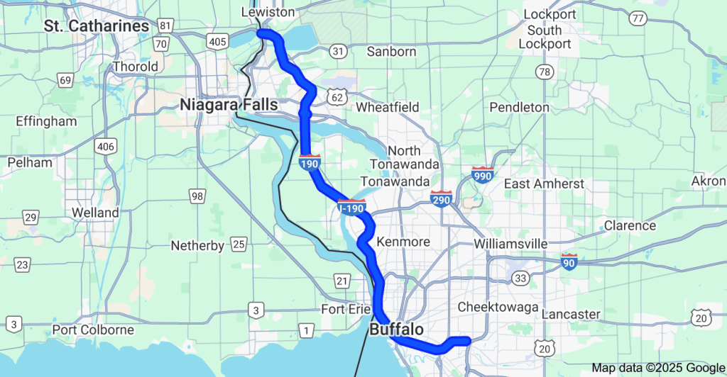
The Black Rock Channel is 3.5-miles, or 5.6-kilometers, -long, and extends from Buffalo Harbor to the Black Rock Lock.
The Black Rock Lock allows vessels to bypass rapids on the Niagara River at the outlet of Lake Erie.
We are told the first lock was constructed by the U. S. Army Corps of Engineers in 1833 for the Erie Canal, and that it was enlarged in 1913.
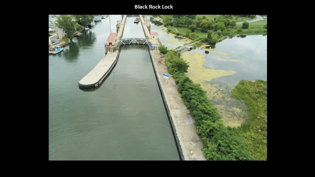
Heading north from Buffalo, Interstate 190 enters Grand Island across the South Grand Island Bridge across the Niagara River between Tonawanda and Grand Island.
The South Grand Island Bridge is a pair of twin, two-lane truss arch bridges.
Each bridge carries one-direction of Interstate 190 and State Route 324.
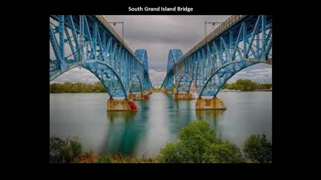
The historic Grand Island Range Front Lighthouse is located in Grandyle Village on the Tonawanda Channel to the south of the twin bridges.
We are told this lighthouse was originally built in 1917 in tandem with a skeletal rear range lighthouse.
The Grand Island Range Front Lighthouse is not operational, not open to the public and is located within a private marina.
The Tonawanda Channel that this lighthouse is on refers to a critical section of the Erie Canal, and is dredged and maintained to allow boat traffic to enter the canal system from the Niagara River or vice versa.
This channel connects the cities of Tonawanda and North Tonawanda, and is the western terminus of the modern Erie Canal.

The Beaver Island Golf Course is just below the location of the lighthouse at the southern tip of Grand Island.
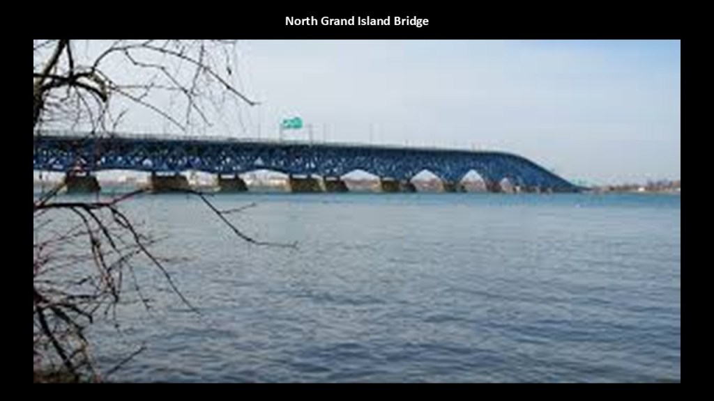
On the northern end of Grand Island, the North Grand Island Bridge is also a pair of twin, two-lane truss arch bridges, and crosses between Grand Island and the city of Niagara Falls, New York.
Each bridge carries one-direction of Interstate 190.
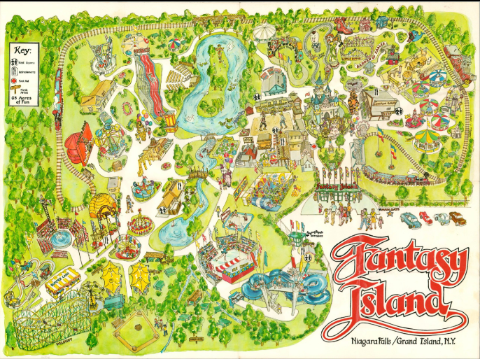
Interstate 190 and State Route 324 provide access to the Niagara Amusement Park and Splash World at Fantasy Island close to the center of Grand Island.
Still operating as an amusement park, in the years since it first opened as “Fantasy Island” in 1961, it has had numerous changes in ownership.
Today it retains its original aspects of being a theme park, and has been expanded over the years with rides and the water park aspects.
Besides the Beaver Island Golf Course at the southern tip, there are several golf courses on and around Grand Island.
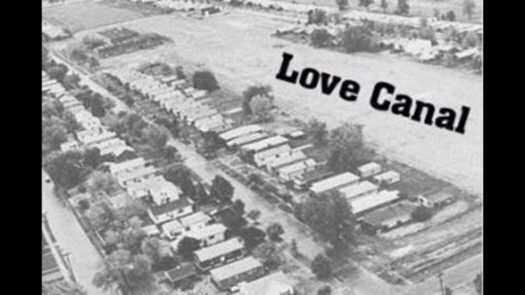
After crossing the North Grand Island Bridge, you immediately come to Love Canal to the east of Interstate 190.
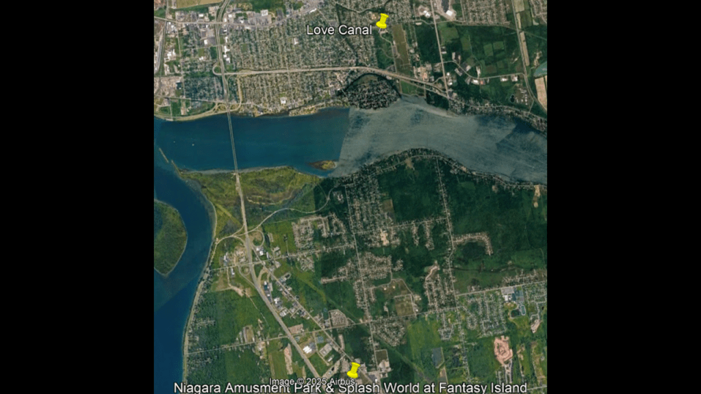
Love Canal, a neighborhood of Niagara Falls, New York, became infamous because of an environmental disaster first reported here in 1977 resulting from a highly toxic landfill.
Decades of dumping toxic chemicals harmed residents, from profound health effects to death.

We are told the area was cleaned up as a Superfund project over a 21-year-period.
Today, some parts of Love Canal are considered a neighborhood but that the area is primarily limited to commercial and industrial use.

We are told in our historical narrative that work began in 1894 to dig a canal here, but that only 1-mile, or 1.6-kilometers, of it was completed, and it instead became a dumping ground, at first as a landfill for city trash, but then it was purchased by the Hooker Chemical Company in the 1940s, which used the site to dump 19,842-tons, or 18,000-metric-tonnes, of chemical by-products from the manufacturing of dyes, perfumes, and solvents for rubber and synthetic resins.
The Niagara Falls International Airport is located just north of the historic and present-day Love Canal neighborhood.
And more golf courses on the American and Canadian-sides of the city of Niagara Falls.
The Niagara Speedway is also in a linear relationship a short-distance away from the Niagara International Airport.
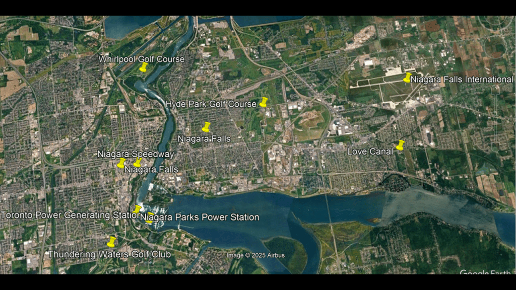
This finding is consistent with airports and present-day or historic racetracks around the world as I have shared previously…
…as well as consistently finding this relationship between airports and oval tracks in part 4 of this series on the Ontario-side of Lake Huron.
Circuit is a word that goes hand-in-hand with the world of racing, and I think that is what they were on the original energy grid before they were turned into sporting and gambling venues.
I believe everything on the original energy grid was a perfectly and precisely-placed component in a circuit board.
I go into great detail and provide many examples about why I believe this in myblog post “Circuit Board Earth,” and we are still using much of the enduring and sophisticated infrastructure of this advanced civilization in the present-day.
Now I am going to start to head east from the Niagara Falls region along the Erie Canal starting at Tonawanda, which for about half of its west-to-east distance roughly parallels the south shore of Lake Ontario, and covers places I want to look at through here on either side of it.
The Erie Canal in New York State runs for 351-miles, or 565-kilomters, between Lake Erie at Buffalo to the Hudson River near Albany.
It was said to have been constructed starting on July 4th of 1817 and first opened on October 26th of 1825.
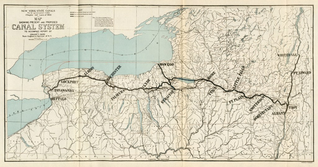
In our historical narrative, the opening of the Erie Canal made it the first navigable waterway connecting the Atlantic region to the Great Lakes, and accelerated the settlement of the Great Lakes region, the westward expansion of the United States as it greatly reduced the cost of transporting people and goods across the Appalachian mountains.
According to what we have been told, the Erie Canal was built during the American Canal Age.
We are told the American Canal Age was between 1790 and 1855, and started in Pennsylvania, where the first legislation surveying canals was passed in 1762.
Other canals said to have been built during this time-period included the Union Canal, which was said to have been built between 1792 and 1828, running from Middletown, Pennsylvania to Reading, Pennsylvania.
We are told it was closed to use in 1885 because it could not compete with the “efficiency of the railroad.”
We still find sections of the old Union Canal on the “Bear Hole Trail” of Swatara State Park in Pennsylvania.
This section of the Union Canal was said to have been closed after the dam holding the reservoir was washed away by a devastating flood in 1862.

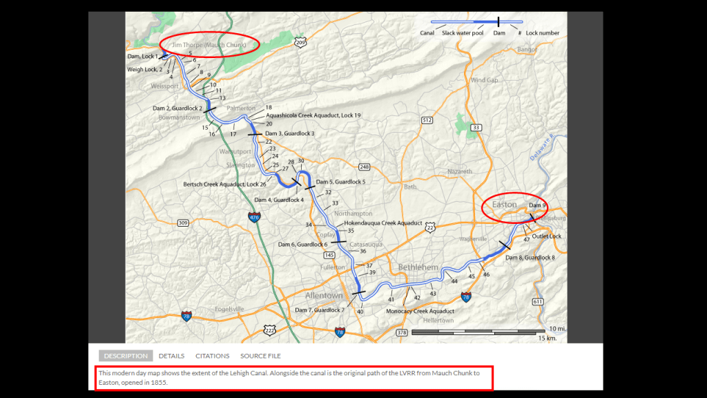
Also, the Lehigh Canal.
We are told the lower section of the Lehigh Canal was built between Easton, Pennsylvania and Mauch Chunk, now known as Jim Thorpe, Pennsylvania, with construction said to have been started in 1818, and completed in 1838.
This map also has a caption at the bottom that says this was the original Lehigh Valley Railroad line as well, which was said to have opened in 1855.
This would be the same Lehigh Valley Railway that I mentioned previously that parts of Interstate 190 were built along the Right-of-Ways for, along with the Erie Canal.
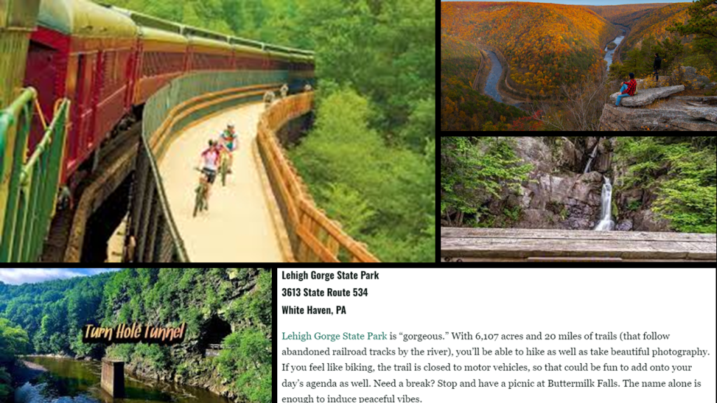
The Lehigh Gorge is part of the historic Lehigh Valley Railway, and what’s left is operates as a Scenic Railway, and today otherwise its abandoned railroad tracks are a recreational rail-trail.
It is another place I can add to my list of places I know of off the top of my head featuring the co-location of S-shaped river bends, railroads, canals, gorges, and waterfalls.
The Lehigh Gorge is described as a “steep-walled gorge carved by a river, thick vegetation, rock-outcroppings, and waterfalls characterize the state park.”
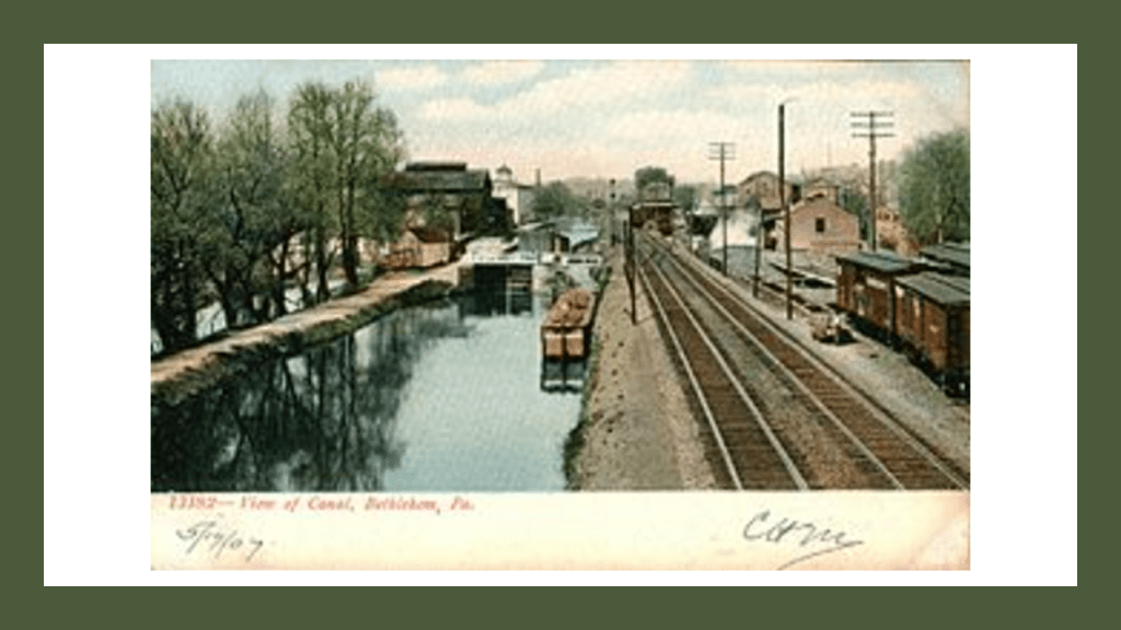
This is a view of the Lehigh Canal as it appeared at one time in our history in Bethlehem, Pennsylvania – located along this section in-between today’s Jim Thorpe and Easton in Pennsylvania.
Of the many inconsistencies we are told about canals, one is that after putting all the time, energy, and effort it would have taken to actually build the canals, they quickly became obsolete shortly after construction with the coming of the more efficient railroad, which were coming on-line concurrently with the canals, and that story is repeated over and over again, all over the country.
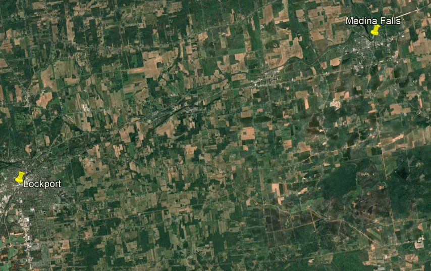
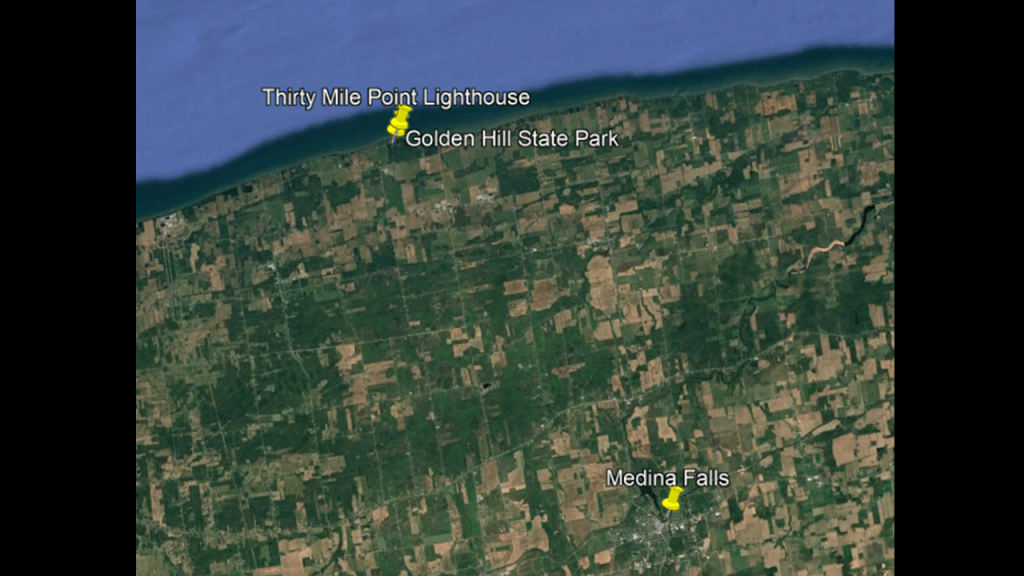
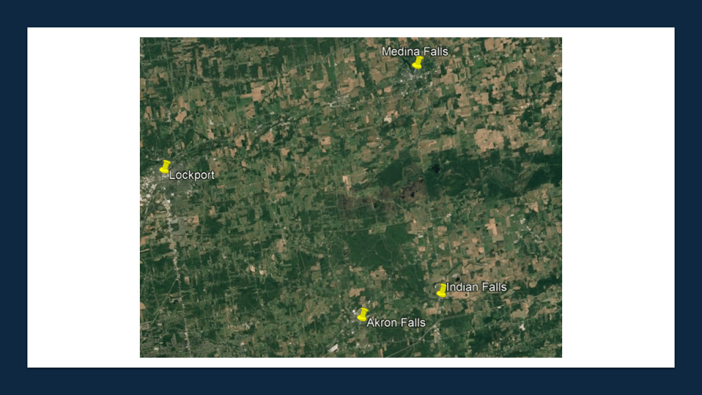
So I am going to start heading east in New York at the Erie Canal in Tonawanda and look around the pinned places here: Lockport; Medina Falls; then northwest up to Thirty-Mile Point Lighthouse, which is located in Golden Hill State Park on the shore of Lake Ontario; and then in a southerly direction to look at Akron Falls and Indian Falls.
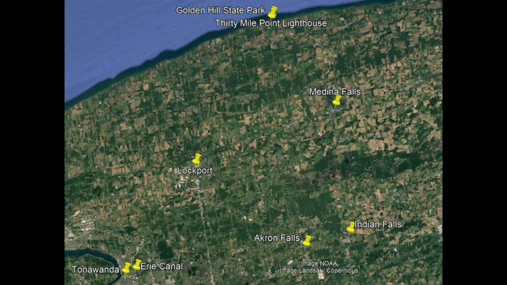
First, Tonawanda.
Tonawanda is at the northern edge of Erie County, south across the Erie Canal (Tonawanda Creek) from North Tonawanda, just east of Grand Island and north of Buffalo, as previously mentioned.
We are told the area was first settled in 1808, and that it grew slowly until the opening of the Erie Canal in 1825, and the Town of Tonawanda was incorporated in 1836.
After the opening of the Erie Canal, the railroads soon followed, and by the end of the 19th-century, both sides of the canal were utilized as part of the lumber-processing industry.
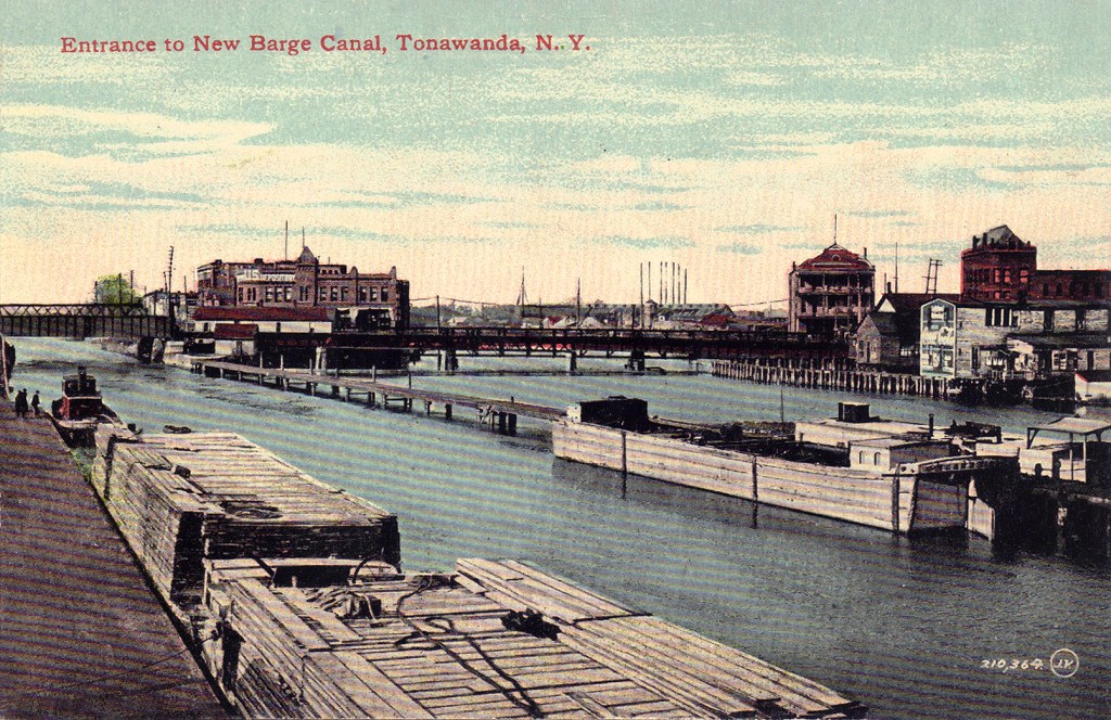
This postcard of the canal entrance in Tonawanda was circa 1910, and we are told the section of the Erie Canal from Tonawanda to Buffalo was filled-in by 1918.
Tonawanda Creek is part of the Erie Canal, which joins the creek southwest of Lockport, and allowed canal traffic to reach the Niagara River.
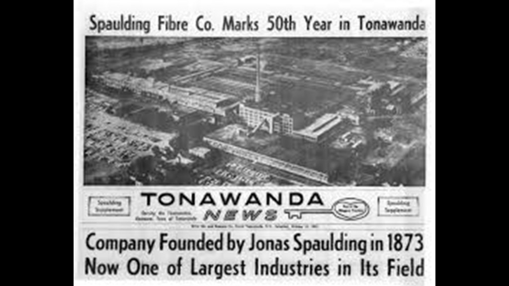
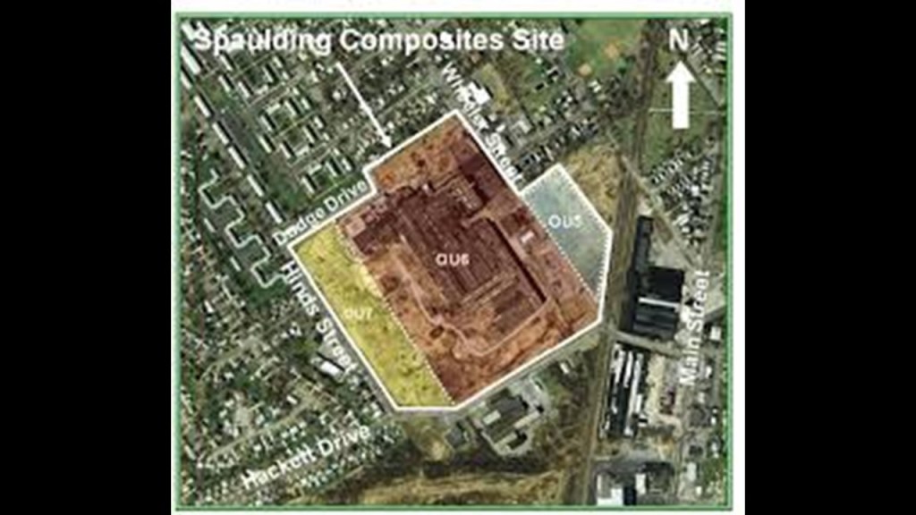
From 1911 to 1992, the Spaulding Fibre Company was a major employer in Tonawanda.
After its closure, it was left derelict and designated as a “brownfield” site because of the waste of industrial processes, and the plant was demolished and the site “cleaned-up” in 2010.
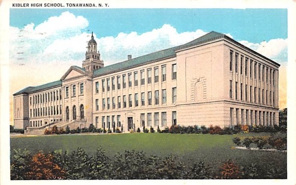
The historical Kibler High School in Tonawanda was said to have been designed and built in 1925 in the Classical Revival Style, and functioned as a school until 1983, and after that it was turned into senior housing in the mid-2000’s.
The city of North Tonawanda is in neighboring Niagara County.
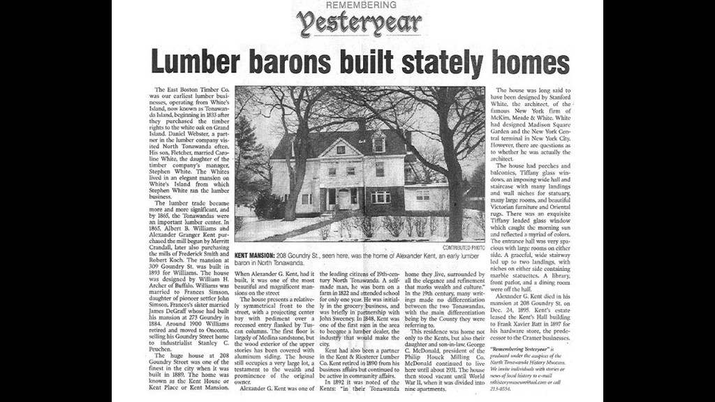
North Tonawanda was once the largest port on the Great Lakes during the height of the Erie Canal around the mid-1850s to the 1880s for commercial tonnage.
There were a number of luxurious mansions on Goundry Street, said to have been built for wealthy bankers and lumber barons who settled here from the earliest days of North Tonawanda.
By the 1940s, however, many were shuttered due to high maintenance costs, and many converted into apartments.
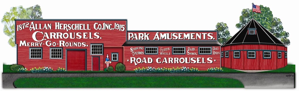
Another claim to fame of North Tonawanda, besides its nickname “The Lumber City,” was “Home of the Carousel.”
North Tonawanda was the birthplace of the Herschell-Spillman/Allan Herschel Company, one of America’s leading carousel manufacturers and today is home of the Herschell Carrousel Factory Museum.
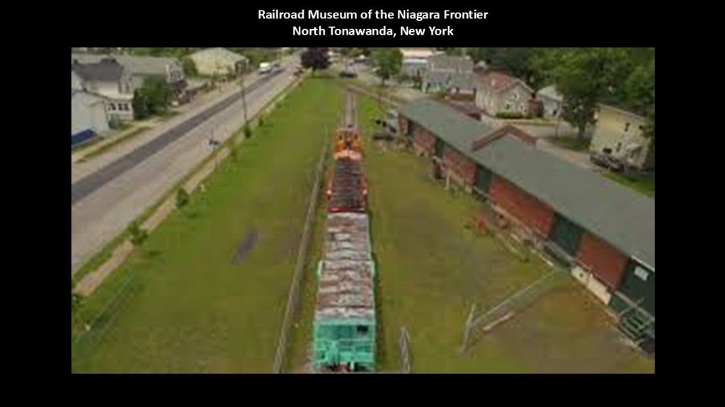
The Railroad Museum of the Niagara Frontier is in North Tonawanda on Oliver Street in what we are told was a 1923 Erie Railroad Station.
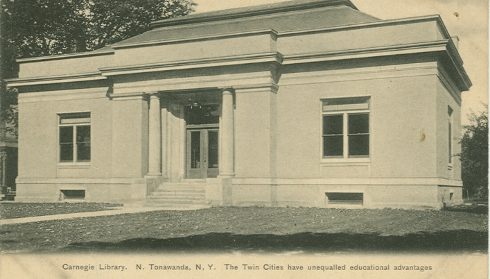
And like we saw in a number of places on the Ontario-side of Lake Huron in the last part of this series, North Tonawanda had a Carnegie Library, which today is the Carnegie Art Center.
The Carnegie Library here was said to have been designed and built in the Classical Revival-style in 1903 with funds provided by Andrew Carnegie.
In our historical narrative, there were over 2,500 Carnegie Libraries built around the world between 1883 and 1929, with most of them being in the United States, but there were Carnegie Libraries in Canada, the United Kingdom, Australia, New Zealand, South Africa, Serbia, Belgium, France, the Caribbean, Mauritius, Malaysia and Fiji as well.
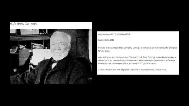
Andrew Carnegie was a Scottish immigrant to America, who came to Pittsburgh in 1848 with his parents at the age of 12, got his start as a telegrapher, and who by the 1860s, had investments in such things as railroads, bridges and oil derricks, and ultimately worked his way into being a major player in Pittsburgh’s steel industry.
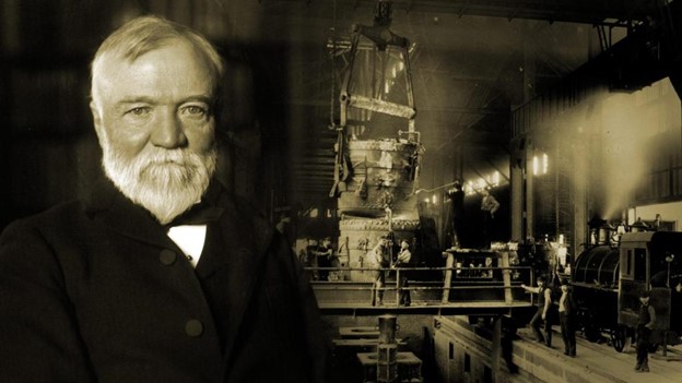
Andrew Carnegie was ranked as the 6th-richest American of all-time by CNN Business, with an adjusted wealth of $101-billion.
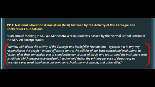
Among many other things, the Carnegie Foundation has been highly involved in the American Educational System, along with the Rockefeller Foundation.

Even as early as 1914, the National Education Association expressed alarm at the activity of the Carnegie and Rockefeller Foundations, and their efforts to control the policies of State educational institutions, and everything related to the educational system.
The next place I am going to look at is the City of Lockport.
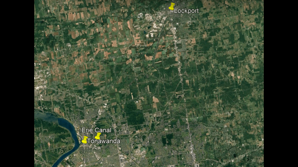
It was named for a set of Erie Canal Locks that allowed canal barges to traverse the 60-foot, or 18-meter, drop of the Niagara Escarpment.
We are told the New York State Legislature authorized the building of the Erie Canal in 1816, and that by 1820, the location of the step locks had been determined in what became Lockport on the proposed route of the canal.
At that time, the area was owned by fifteen men.
Lockport was incorporated as a city in 1865, which would have been the last year of the American Civil War in our historical narrative, and the first official city of Niagara County.
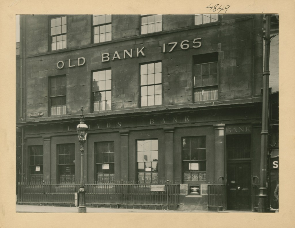
Interesting to note that Quakers were early bankers in our historical narrative.
The origins of Lloyds Bank, the largest retail bank in Great Britain, go back to 1765, when Quaker iron producer and dealer Sampson Lloyd set-up a private banking business in Birmingham with industrialist John Taylor.
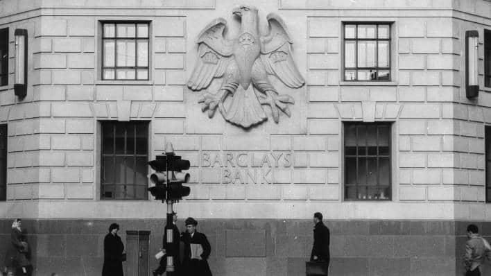
The multinational universal bank Barclays traces its origins to Quaker goldsmiths John Freame, his brother-in-law Thomas Gould, and their apprentice James Barclay in 1690, at a time during which goldsmiths held cash deposits and issued receipts that came to be used as money.
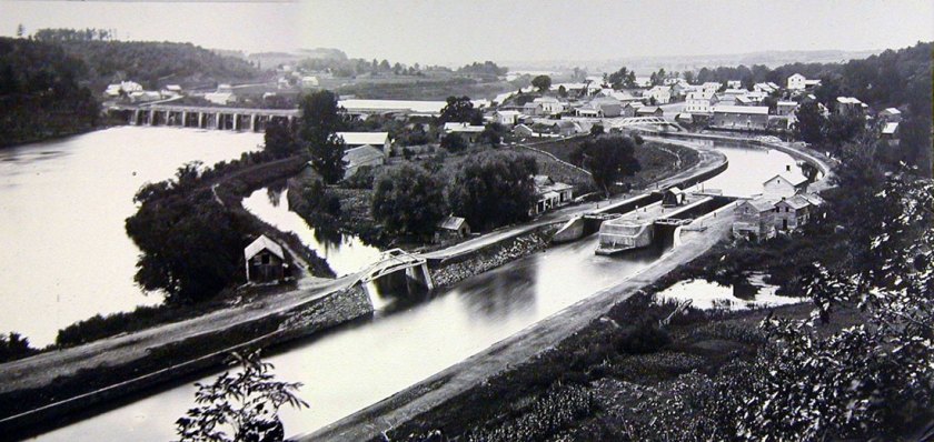
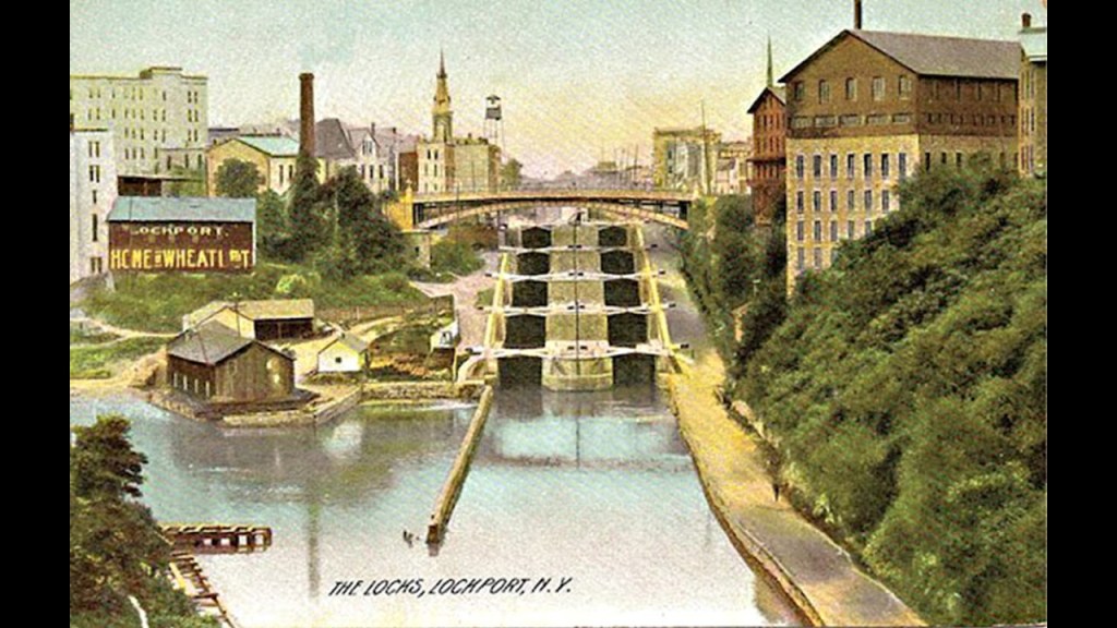
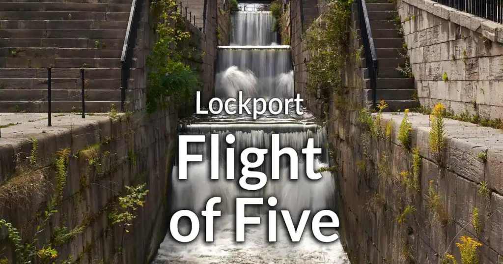
The City of Lockport is famous for the “Flight of Five Locks.”
When the Erie Canal opened, the “Flight of Five Locks” was considered the greatest series of high-lift locks in the shortest distance of any canal in the United States.
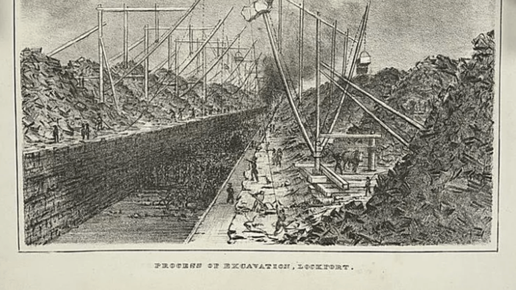
We are told that one of the biggest challenges in the construction of the Erie Canal was the Niagara Escarpment in Lockport, and that thousands of canal builders dug and blasted through rock for several years.
Interesting that the caption of this illustration reads “Process of Excavation, Lockport.”
The word excavation refers to the “act or process of digging, especially when something specific is being removed from the ground.”
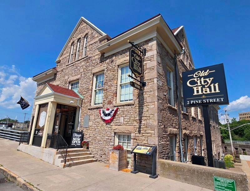
The Old City Hall in Lockport was said to have been built in 1864 as a mill, and then became a water-pumping plant, and in 1893, the City Hall, which it was until 1974.
Today it is home to Lockport’s Urban Winery.
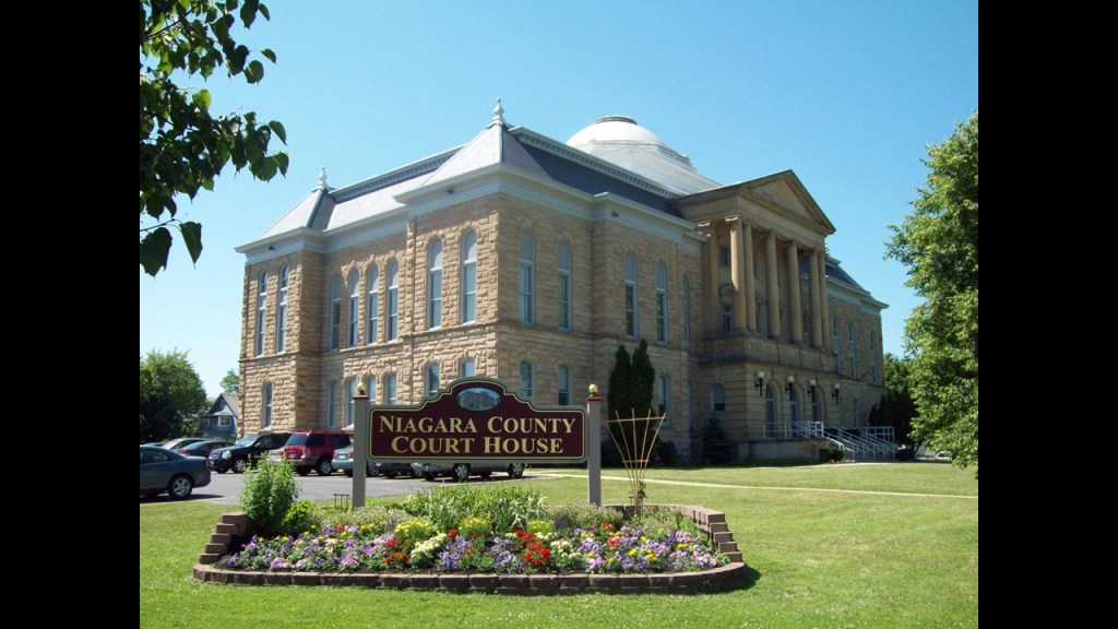
The Niagara County Court House in Lockport was said to have been originally constructed in 1886 in the “Second Empire Architectural-Style,” with additions in 1915 – 1917 and 1955 – 1958.
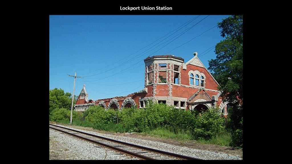
The former Union Station in Lockport is an abandoned building today.
Said to have been constructed in 1889 for the New York Central Railroad in the Romanesque architectural-style.
It served the New York Central’s “Falls Line,” which connected Niagara Falls and Rochester.
The station was closed in 1957 when passenger service ended.
There is active freight service on the tracks beside the Union Station, which are owned by the “Falls Road Railroad” and there has been a limited heritage railroad operation between Lockport and Medina since 2002.
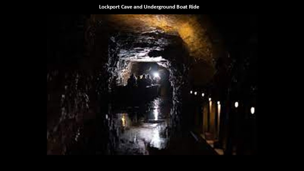
The Lockport Cave can refer to one of two caverns beneath Lockport.
One of the caves was said to have formed naturally, and the other is a hydraulic raceway, or water-tunnel, that was said to have been constructed in the 19th-century.
What is called the natural cave has been sealed since 1886.
The manmade hydraulic raceway, frequently called the “Lockport Caves” by locals, was said to have been constructed between 1858 and 1900.
It has supplied water to local industries for decades, and features an Underground Boat Ride tourist attraction.
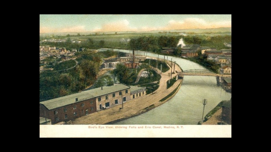
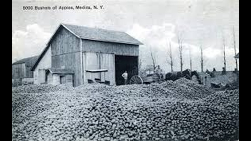
The next place I am going to look at after Lockport is Medina, which is the location of Medina Falls.
Medina Falls on Oak Orchard Creek flow 40-feet, or 12-meters, under the Erie Canal.
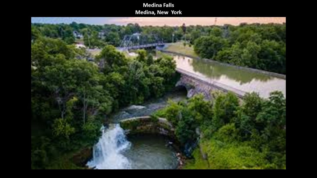
Medina is a village in Orleans County, New York. about 10-miles, or 16-kilometers, south of Lake Ontario.
It is an hour from Buffalo to the west, and an hour from Rochester to the east.
The population was 6,065 in the 2010 census.
At the start of the 20th-century, it was a thriving, industrial town.
It was said to have developed after the construction of the Erie Canal, which bends as it passes through Medina.
This became the center of businesses that served trade and passenger service on the canal boats of the Erie Canal.
Mills went into operation…
…and apples were harvested in orchards on the fertile land in the surrounding area.
The railroad arrived in Medina in 1852 in the form of the “Falls Road Railroad” operated by the Rochester, Lockport, and Niagara Falls Railroad, and the “Rochester, Lockport, and Buffalo Railroad” offered electric streetcar service in Medina.
What’s left to find out about the city’s rail past is found in the Medina Railroad Museum.
There’s actually a lot more to find in this relatively small village today on the Erie Canal, but this gives you the idea.

Next I am going to turn my attention to the Thirty-Mile Point Lighthouse at Golden Hill State Park on the south shore of Lake Ontario, northwest of Medina.
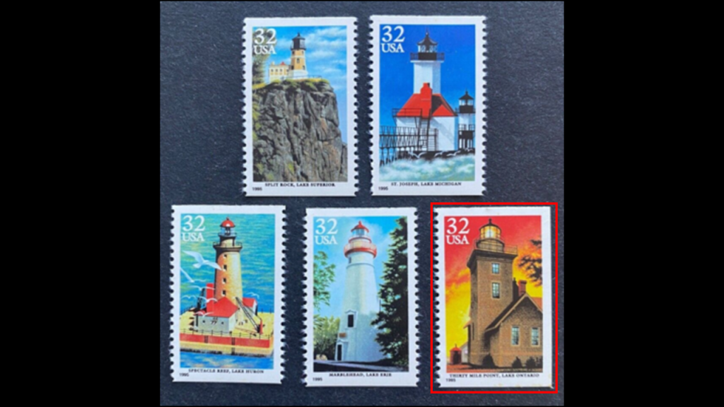
The Thirty-Mile Point Lighthouse was said to have been built in 1875 from hand-carved stone.
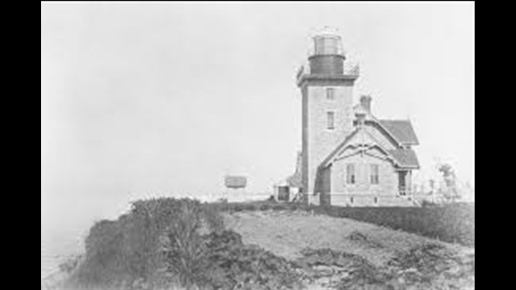
Its name comes from being located 30-miles east of the Niagara River.
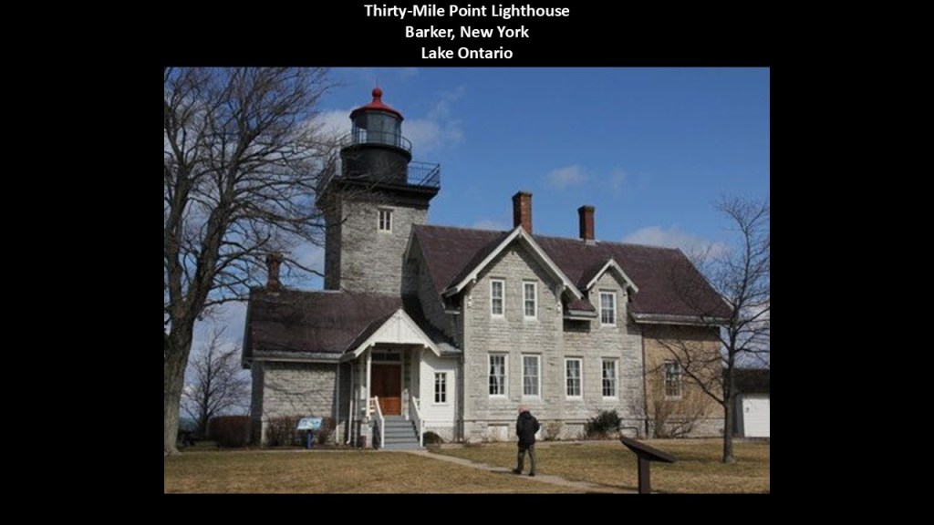
It was one of five lighthouses chosen for the “Lighthouses of the Great Lakes” postage stamp series in 1995, where one lighthouse was chosen for each of the Great Lakes.
The location of the Thirty-Mile Point Lighthouse is in Golden Hill State Park, which is located in the northeast corner of the Town of Somerset.
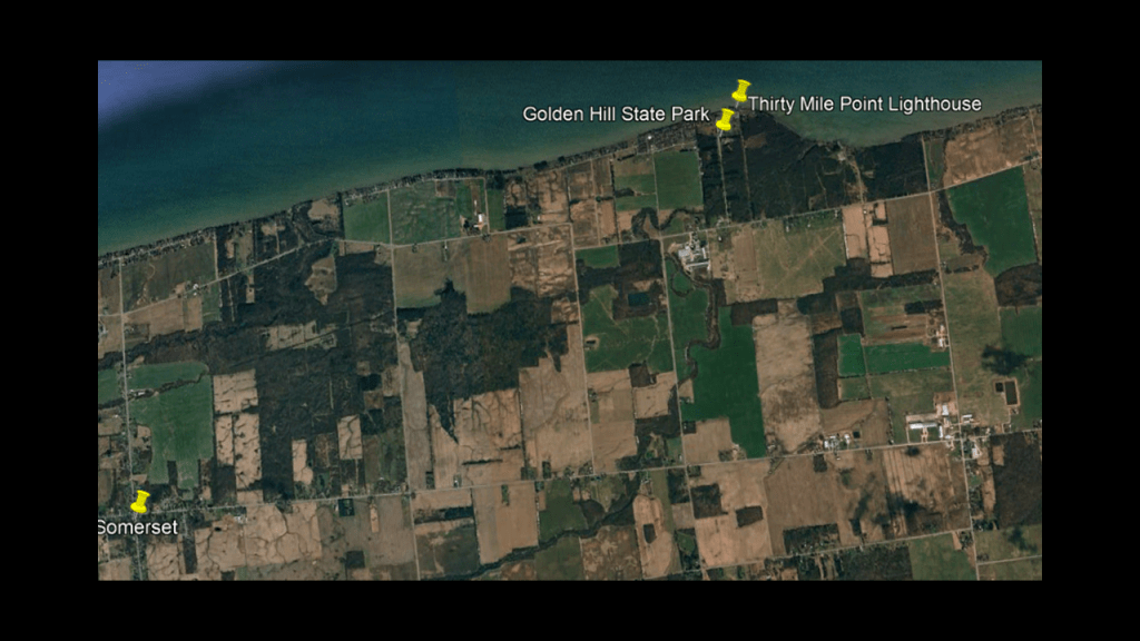
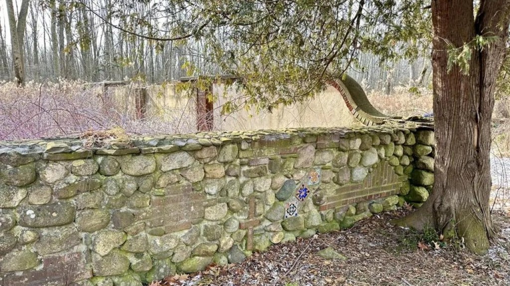
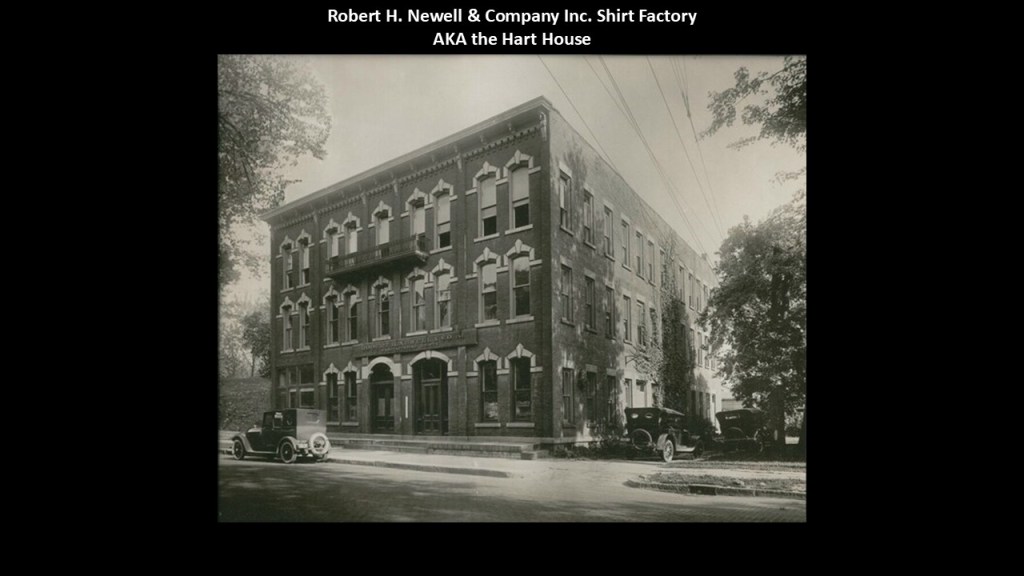
We are told it was established on the former estate of Robert Newell, a local industrialist, and that most of his estate was abandoned after the state purchased it, and not rediscovered until 2017.
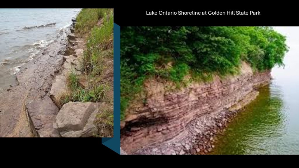
Here are some photos of the shoreline here at Golden Hill State Park, with megalithic-looking stone blocks on the left, and a wall of stone on the right high above the surface of the lake.
We are told that is sedimentary rock, but I suspect that is a term that covers-up built infrastructure from an ancient advanced civilization of Moorish Master Masons that was destroyed relatively recently.
The Robert H. Newell Company manufactured custom-tailored shirts for wealthy and famous customers in Medina for almost 100-years, from 1918 to 2004.
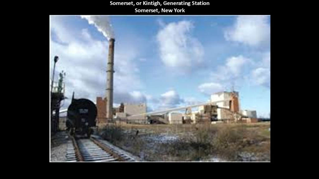
The nearby town of Somerset was the home of the Somerset, or Kintigh Generating Station until it was retired in 2020.
It was a 675-megawatt coal-fired power plant that started operating in 1984, and was the last coal-fired plant in New York.
The Akron Falls and Indian Falls are located to the southeast of Lockport, and south and southwest of Medina Falls in Medina.
First Akron Falls.
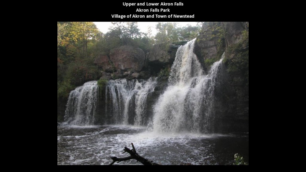
There are two waterfalls on Murder Creek in Akron Falls Park in the village of Akron and Town of Newstead – Upper Akron Falls and Lower Akron Falls, located right next to each other in the park.
Murder Creek is a tributary to Tonawanda Creek which empties into the Niagara River.
The Upper Akron Falls have a drop of roughly 20-feet, or 6-meters, and often divided in two side-by-side drops by a rock-outcropping in the face.
The Lower Akron Falls are about 40-feet, or 12-meters, -high.
There is a U-shaped dam with a 2-foot, or .61-meter, drop at the pond at the western end of the park.
In 1933, there were approximately 90 workers from the Civil Works Administration, one of FDR’s New Deal Programs, sent “to improve the park.”
I have long-believed that President Franklin Roosevelt’s New Deal work programs played a significant role in the historical reset and the cover-up of the ancient civilization.
New Deal Agencies like the CCC and WPA in particular were responsible for creating access and infrastructure for the park and recreation system around the country.
So when people go to these places, they think what they see was created by the CCC & WPA workers.

The Upper and Lower Akron Falls flow over what is called the Onandaga Escarpment.
In western New York State, the Niagara Escarpment runs fro Lewiston and trends easterly for 79-miles, or 127-kilometers, to just beyond Rocheaster.
The Onandaga Escarpment runs for 62-miles, or 100-kilometers, from Buffalo in an easterly direction to just beyond Caledonia.
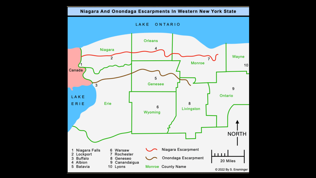
Both escarpments feature numerous waterfalls, in addition to the ones I am highlighting.
I strongly suspect that these escarpments and their waterfalls were intentionally-designed components of the hydroelectric infrastructure of the original energy grid, and were not natural in origin as we have been taught to believe.
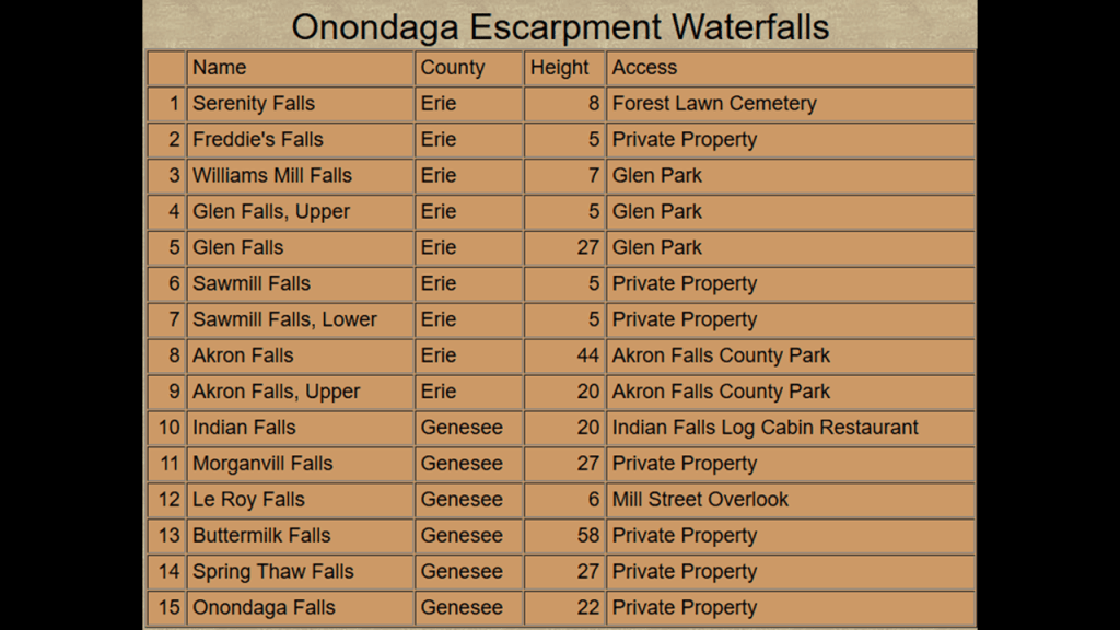
Indian Falls are a short distance to the east of Akron Falls.
Indian Falls are a 20-foot, or 6-meter, cascade on the Tonawanda Creek over the Onondaga Escarpment in the hamlet of Indian Falls, New York, in Genessee County.
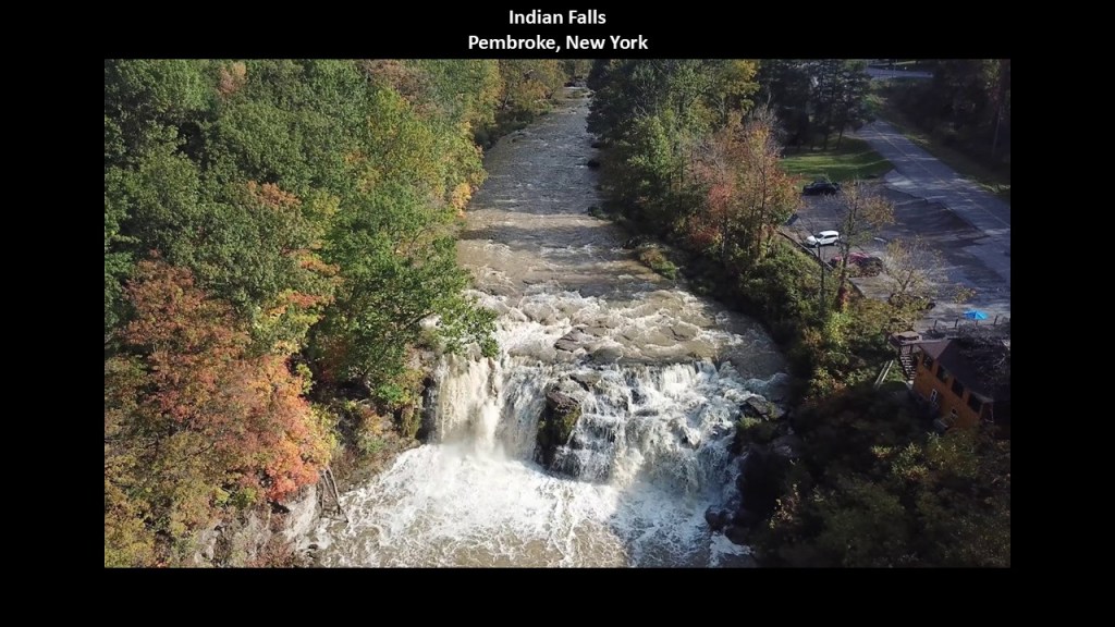
This is the same Tonawanda Creek on the Erie Canal that divides Tonawanda and North Tonawanda before it empties into the Niagara River at Grand Island, upstream from the Niagara Falls.
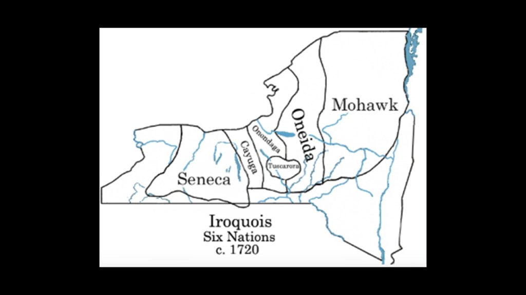
Indian Falls was in the historical lands of the Seneca Nation, the Keeper of the Western Door.

The Seneca were among the first five nations of the Iroquois Confederacy, also known as the Haudenosaunee, along with the Mohawk, Oneida, Onondaga, and Cayuga.
The Haudenosaunee are a Confederacy bound by the Great Law of Peace, a constitution that established a representative government and is still in use today.
The Tuscarora were accepted into the Confederacy in 1722, and became known as the “Six Nations.”
In the 21st-century, more than 10,000 Seneca have three federally-recognized tribes.
Federally-recognized tribes have a government-to-government relationship with the United States government, including tribal sovereignty and eligibility for federal benefits.

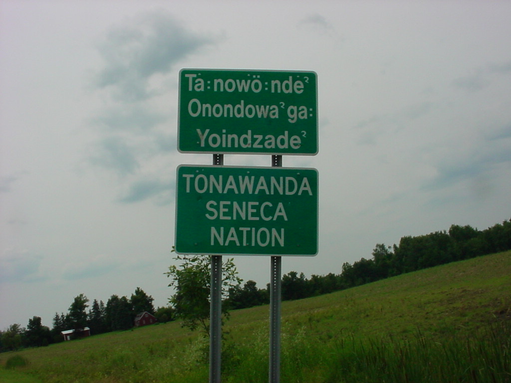
Two of them are in New York State – the Seneca Nation of New York with five territories in western New York near Buffalo…
…and the Tonawanda Seneca Nation.
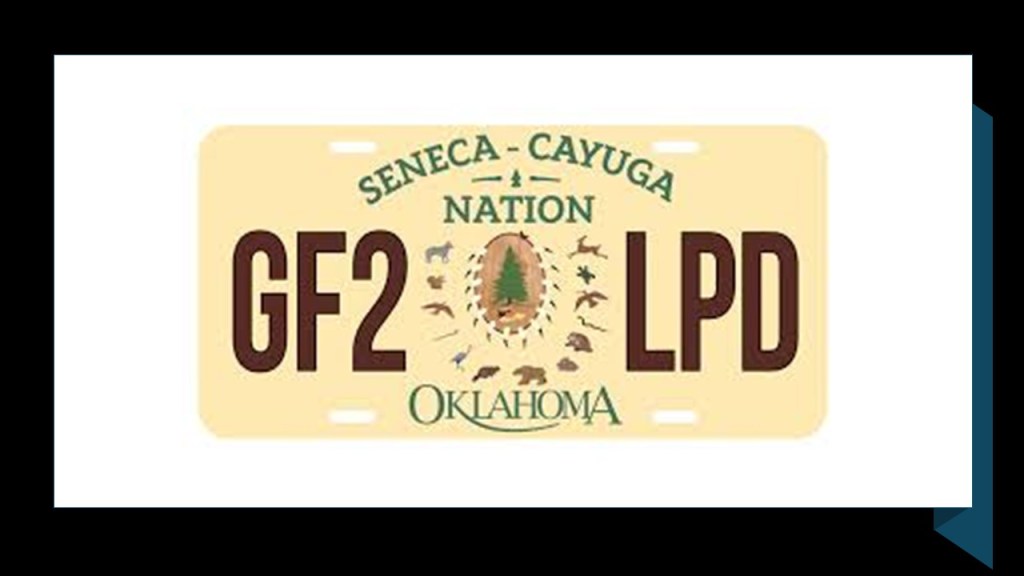
The Seneca-Cayuga Nation is in Oklahoma, where there ancestors were relocated from Ohio during the Indian Removals in our historical narrative in the period of time between 1830 and 1847.
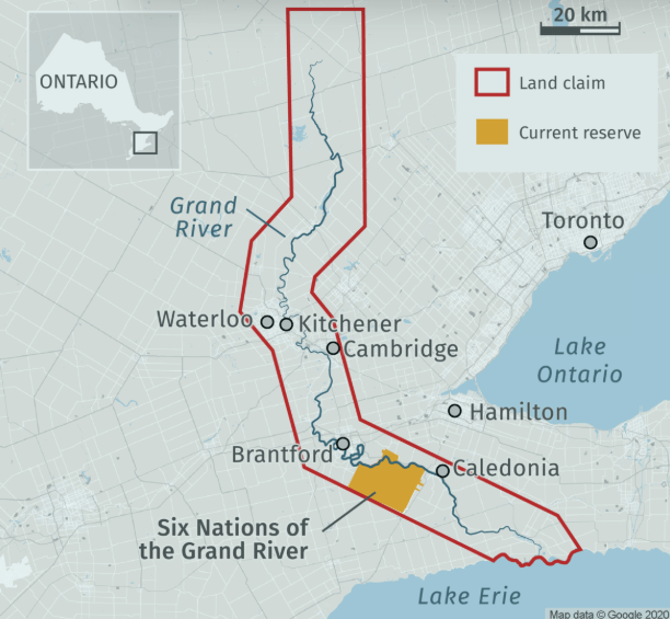
Approximately 1,000 Seneca live in Canada near Brantford, Ontario, at the Six Nations of the Grand River First Nation, which I will be talking about later in this post when I get to that side of Lake Ontario in the next part of this series, and the Grand River also has numerous waterfalls along its course, among other waterfalls in the area on the Niagara Escarpment around Hamilton.
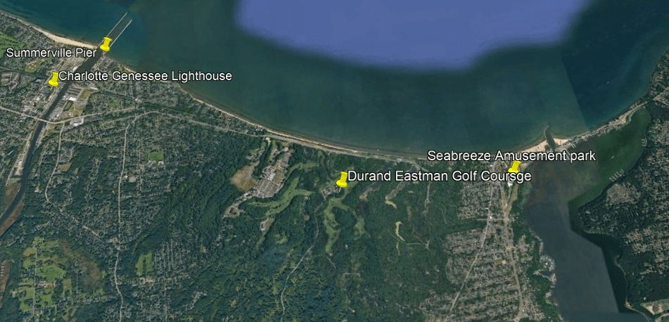
The next places I am going to take a look at are Buttermilk Falls, which are east of Indian Falls on the Onondaga Escarpment, and the city of Rochester and the surrounding area on the shore of Lake Ontario have some places I am going to take a look at to the northeast of Buttermilk Falls, including the Braddock Point Lighthouse, Turtle Rock, the Charlotte-Genessee Lighthouse, Seabreeze Amusement Park, and Lower & High Falls.

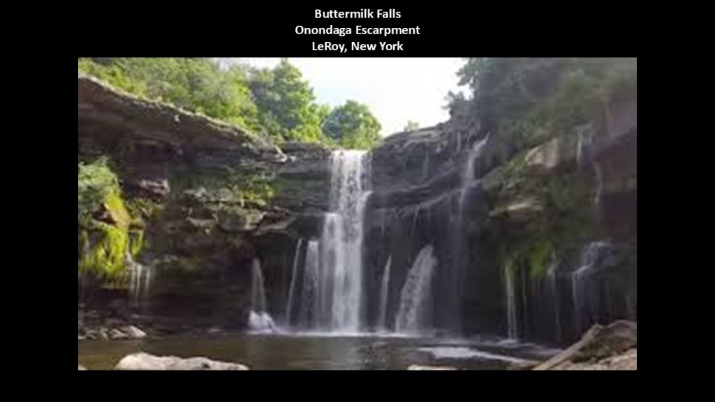
First, Buttermilk Falls.
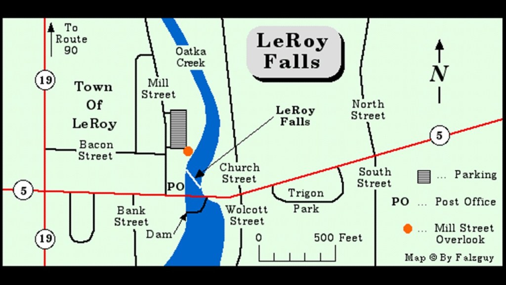
Buttermilk Falls on Oatka Creek in LeRoy, New York, is located on private property and not open to the public.
Oatka Creek empties into the Genessee River northeast of LeRoy, and the Genessee River flows through Rochester and into Lake Ontario.
The unnamed road the Buttermilk Falls are on was at one point a rail-line that was part of the Lehigh Valley Line.
As I was looking around for information on Buttermilk Falls, I found the LeRoy Falls, also on Oatka Creek, on LeRoy’s Mill Street.
Mills powered industry in LeRoy through much of its history.
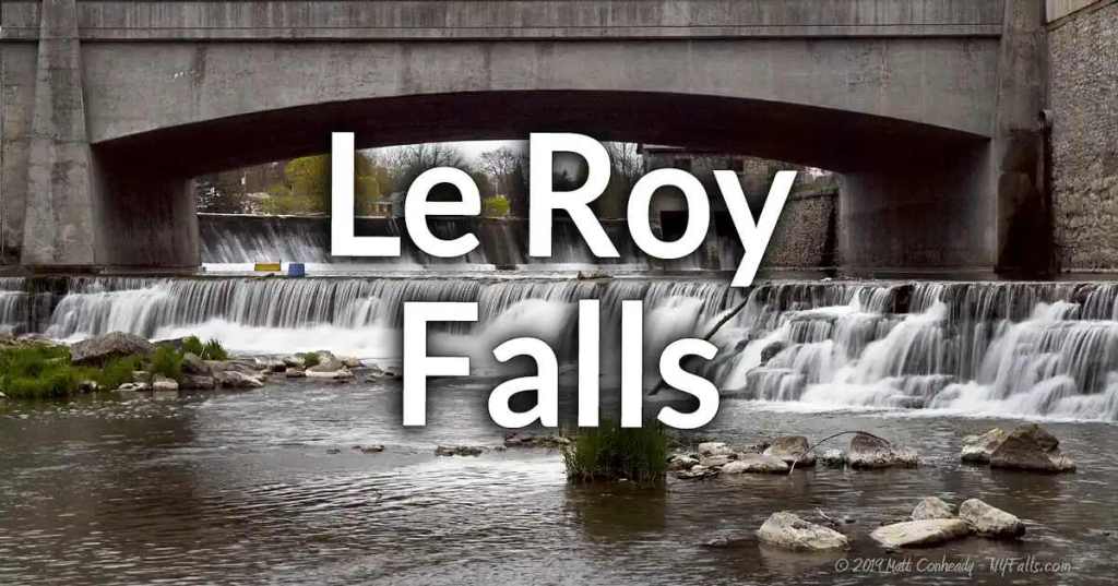
They are described as having a wide natural cascade that is 4-feet, or 1.22-meters, -high.
Above the cascade is a man-made dam that spans the creek.
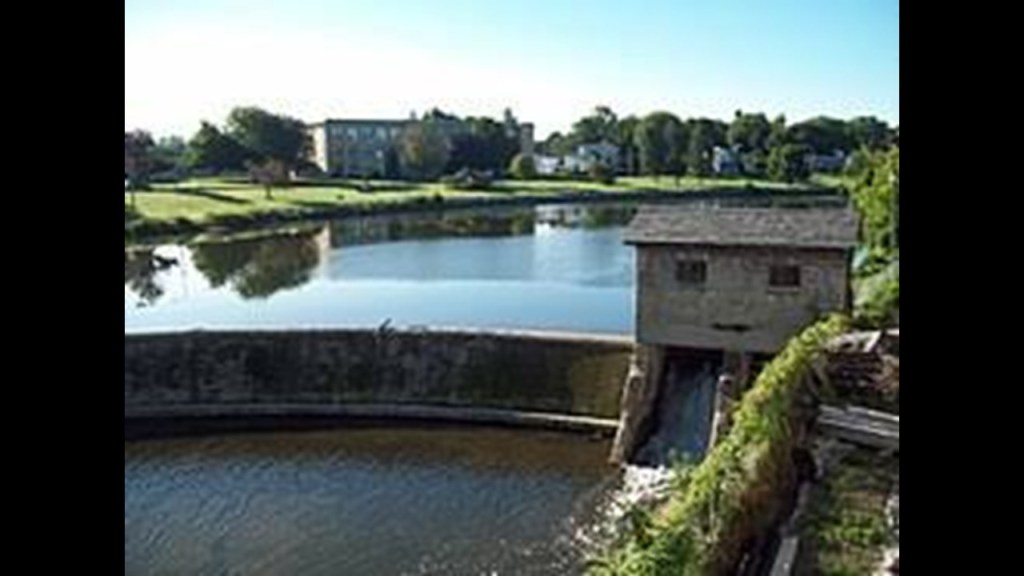
To the south on Oatka Creek in LeRoy is another man-made dam.
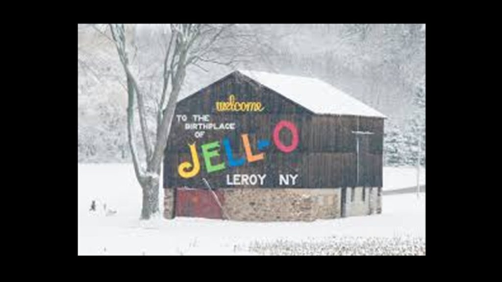
One of LeRoy’s claims-to-fame is being the birthplace of Jell-O in the early 1900s, that was invented by a local carpenter who was said to be experimenting with gelatin to create a home remedy.
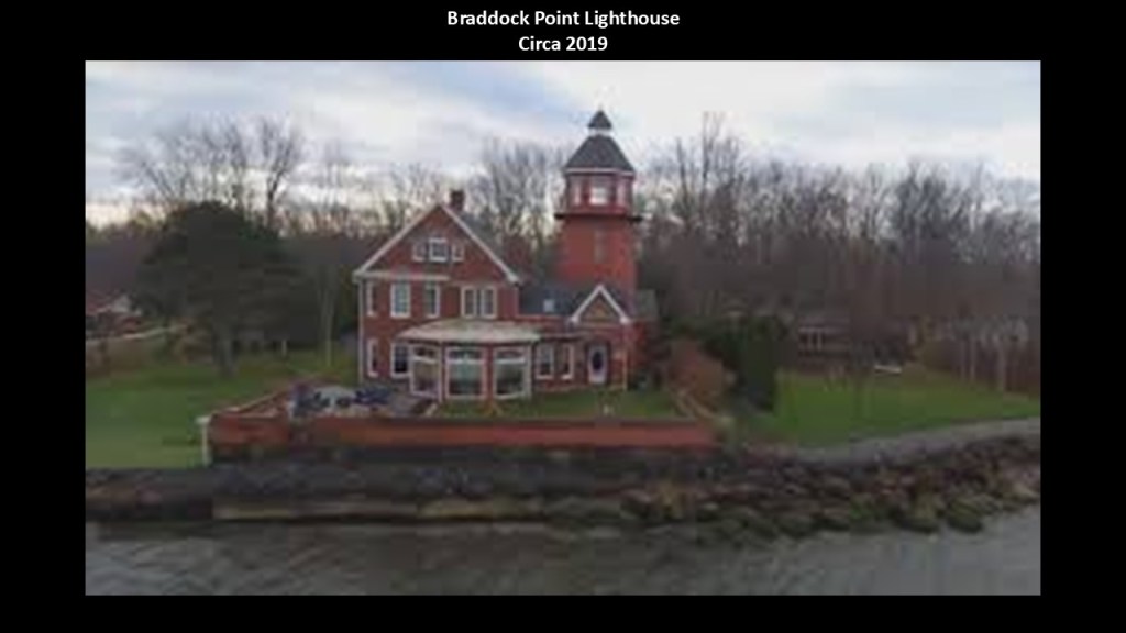
Next, I am going to head on up to the Rochester area on the Genessee River, and take a look around, starting with the Braddock Point Lighthouse on Lake Ontario.
The Braddock Point Lighthouse was said to have been constructed sometime around 1895 and lit in 1896, and at that time looked like this – it was constructed with red brick with an octagonal tower.
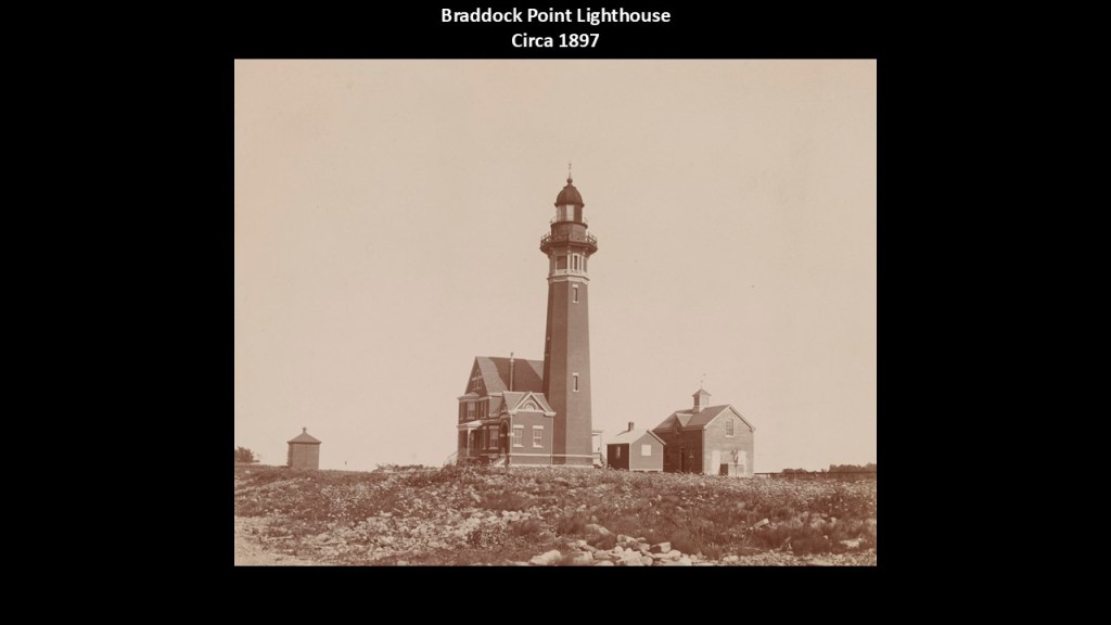
Then we are told the lighthouse was deactivated in 1954, and the U. S. Coast Guard removed the upper two-thirds of the lighthouse due to structural damage.
The Coast Guard reactivated the lighthouse in 1999, and it is still an active lighthouse.
Since that time it has been privately-owned as a residence, and also operated as a bed-and-breakfast.
It recently sold to new owners in May of 2025 for and had been listed for sale on the real estate market for $1.49-million.
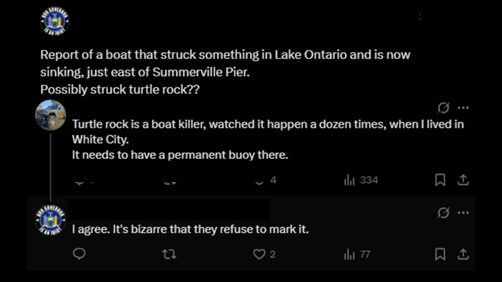
Turtle Rock, east of the Braddock Point Lighthouse, caught my attention when it showed up just offshore on Google Earth because I am interested in these kinds of things as evidence of submerged land.
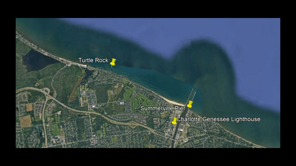
I can’t find much information about it or a picture of it except that it is a known hazard to boats.
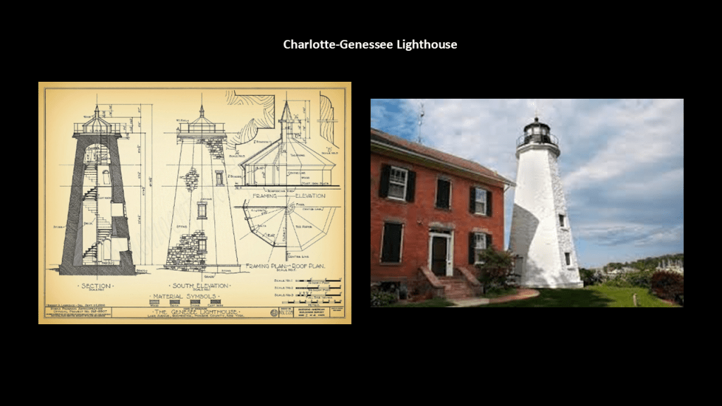
Next, we are told the Charlotte-Genessee Lighthouse is an octagonal lighthouse that was built in 1822, and the light was turned off in 1881.
The 40-foot, or 12-meter, -tall tower is located at the entrance of the Genesee River, and is still an active light as of 2014.
It was going to be demolished in 1965, but a local effort saved it from destruction and is today owned by Monroe County and houses a museum.
The Charlotte-Genessee Lighthouse is part of what is called the “Seaway Trail,” a National Scenic Byway of roads and highways that runs for 518-miles, or 834-kilometers, along Lake Erie, the Niagara River, Lake Ontario, and the St. Lawrence River.
On Lake Erie, attractions along the Seaway Trail in Pennsylvania include Presque Isle State Park and Waldameer Park and Water World, which I will be talking about in the Lake Erie segment of this series.
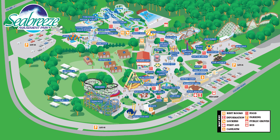
So in the Rochester-area, the presence of the Seabreeze Amusement Park caught my attention, where it is sandwiched between Irondequoit Bay, the Durand Eastman Golf Course, and Lake Ontario, and we’ve already come across the Niagara Amusement Park and Splash World at Fantasy Island close to the center of Grand Island in the Niagara River.
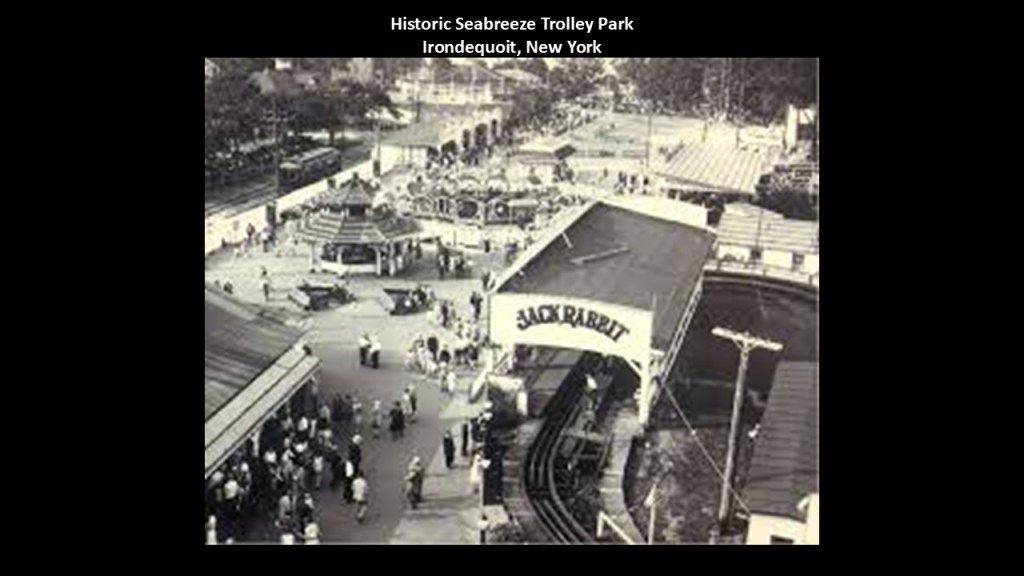
The Seabreeze Amusement Park is an historic family amusement park in the Irondequoit suburb of Rochester that is the fourth-oldest operating amusement park in the United States, and the thirteenth-oldest in the world, having opened in 1879.
We are told that in the 1870s, the shore of Lake Ontario became a destination for tourists coming from Rochester, and that in 1879, the Rochester and Lake Ontario Railroad built a rail-line from Portland Avenue in Rochester to the Sea Breeze neighborhood at the inlet of Irondequoit Bay as its terminus, and subsequently opened a resort for picnics and other summer activities, which opened on August 5th of 1879.
The Rochester and Suburban Railway took over park operations after the Rochester and Lake Ontario Railroad went bankrupt.
The Rochester and Suburban Railway was a streetcar company, and while there continued to be a lot of ownership mergers and changes over the years, the Sea Breeze streetcar line was closed in 1936, because, we are told, of the Great Depression.
The Seabreeze Amusement Park is one of the relatively few trolley parks that managed to survive into the present-day, though minus the trolleys and probably a few other things.
Trolley parks were said to have started in the United States in the 19th-century as picnic and recreation areas at the ends of streetcar lines, and were precursors to today’s amusement parks.
By 1919, there were estimated to be between 1,500 and 2,000 such parks.
But like what we have already seen, these magnificent trolley parks went the way of the dinosaur too, along with countless electric streetcar lines, canals, and railroad lines.
I have come to believe that they were somehow involved with recharging the Earth’s energy grid for the original civilization in a really fun way, as they were located at the end terminals of streetcar lines, and by-and-large were utilized by the bringers-in of the world’s new system for a short time until they were no longer needed, or just plain inconvenient to the new narrative.
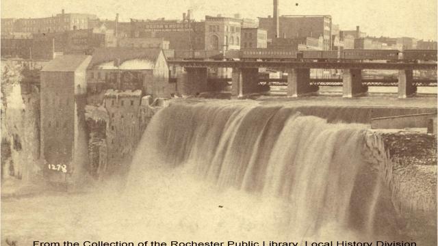
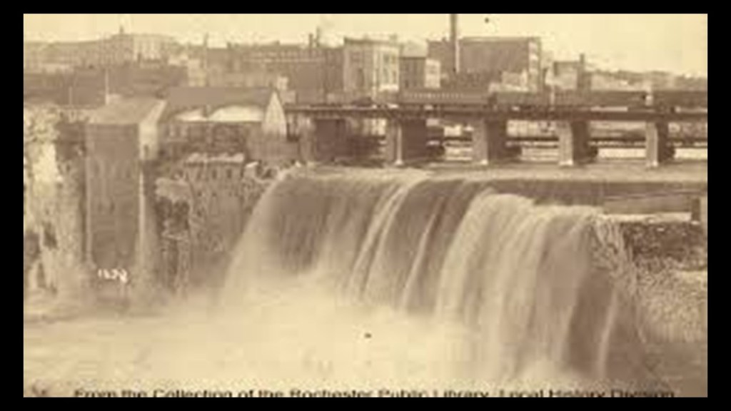
Next the Lower Falls, the Middle Falls, and the High Falls are on the Genessee River in downtown Rochester.

The Lower Falls are a massive 110-foot, or 34-meter, -high cascade in a U-shaped gorge.
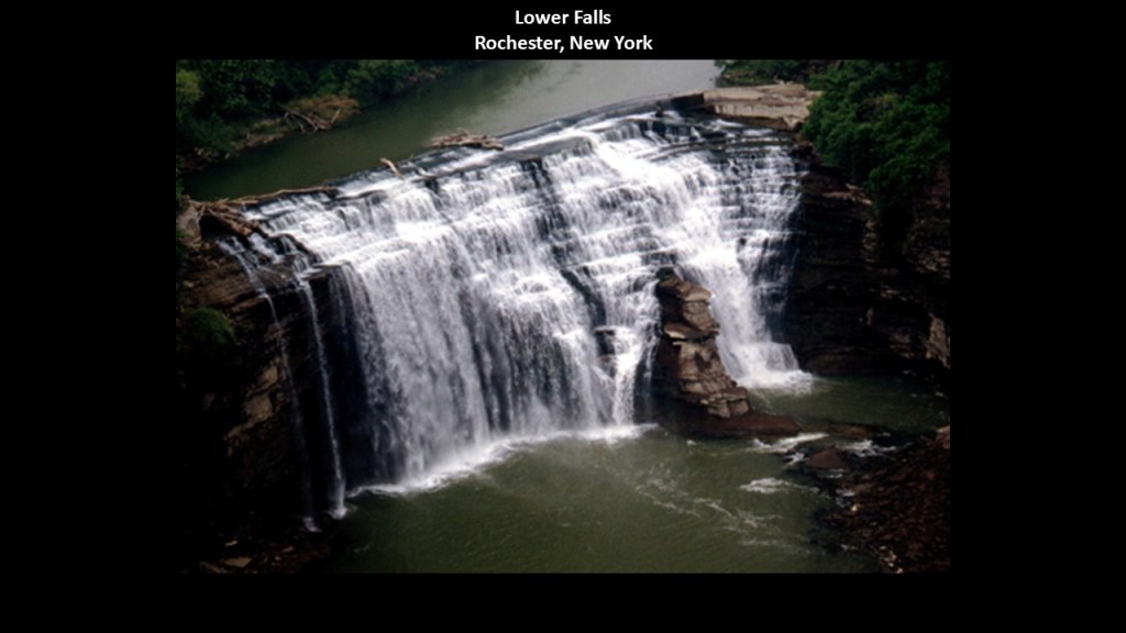
The top of the falls is capped with a small dam to keep the flow to the Rochester Gas & Electric hydroelectric power plant reliable.
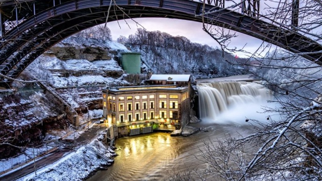
What was once the Middle Falls was capped with a hydroelectric dam.
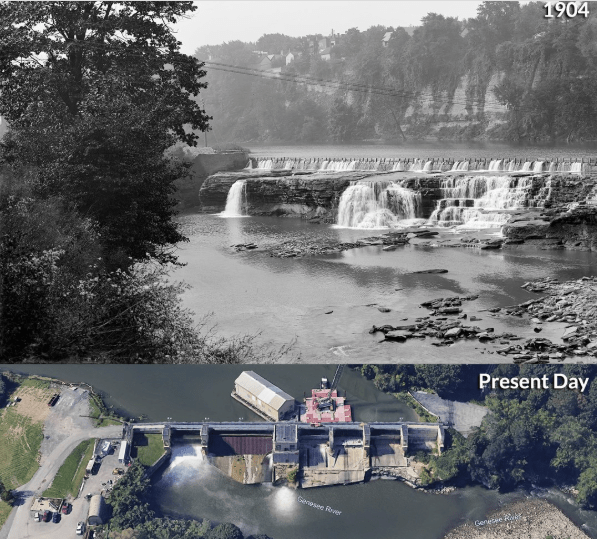
The High Falls, also known as the Upper Falls, are 2-miles, or 3.2-kilometers, upstream on the Genessee River from the other falls.
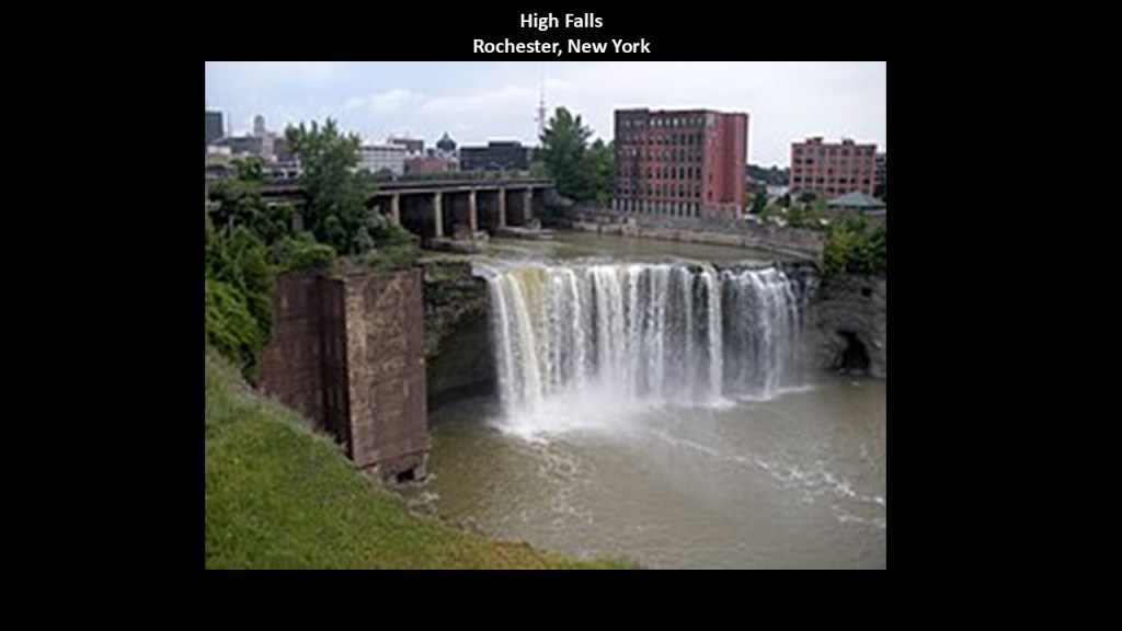
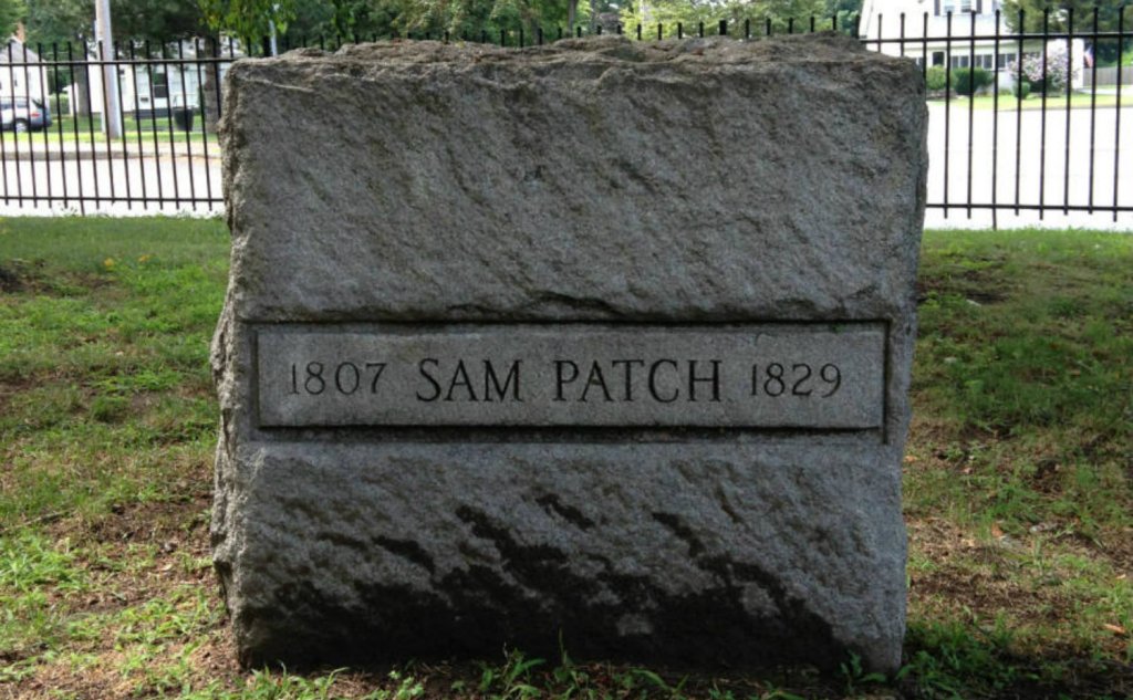
The High Falls was the location of the final jump of Sam Patch.
Sam Patch was the first American daredevil.
Nicknamed among other things the “Yankee Jumper,” he got his start in the jumping business in New Jersey, where he jumped from such places as bridges, factory walls, and ships’ masts.
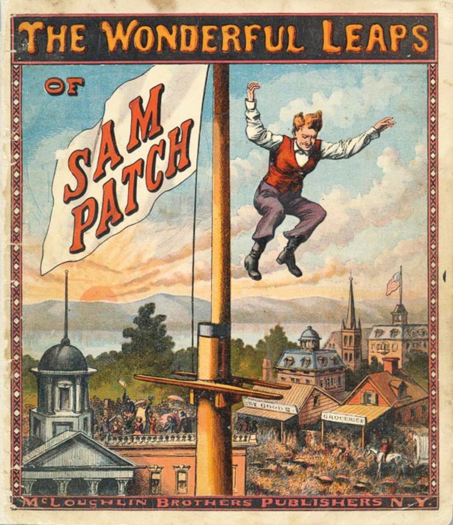
Then, on October 17th of 1829, he successfully jumped from a raised platform into the Niagara River near the base of the Niagara Falls.
Buoyed by his success, his next stunt was to jump into the Genesee River at High Falls in Rochester, New York, on November 6th of 1829, and this jump was successful as well.
Unfortunately for Sam, his luck ran out, and he did not survive his second jump into the Genessee River at High Falls, and was killed by his famed leaping act.
Like we saw back in Niagara Falls, the historic Mill District of Rochester ran along the edge of the Genessee River between the city’s waterfalls.
As one example, Rochester was home to so many flour mills it was nicknamed the “Flour City.”
Frederick Law Olmsted was credited with the design of four parks in Rochester – Highland Park; the Genessee Valley Park; Maplewood Park; and Seneca Park, which is a zoo.
Highland Park was one of the first municipal arboretums in the United States.
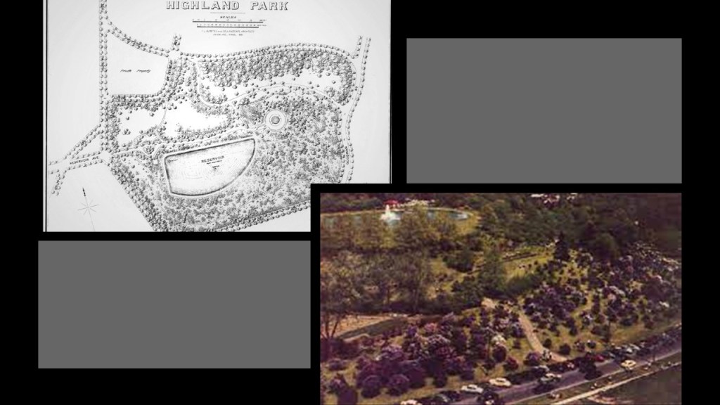
Among many other things, Highland Park shares the location with a water reservoir.
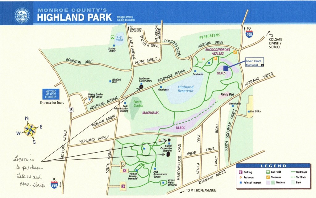
As the story goes, two local nurserymen endowed Rochester with 20-acres, or 8.1-hectares, of land which became Highland Park in 1888.
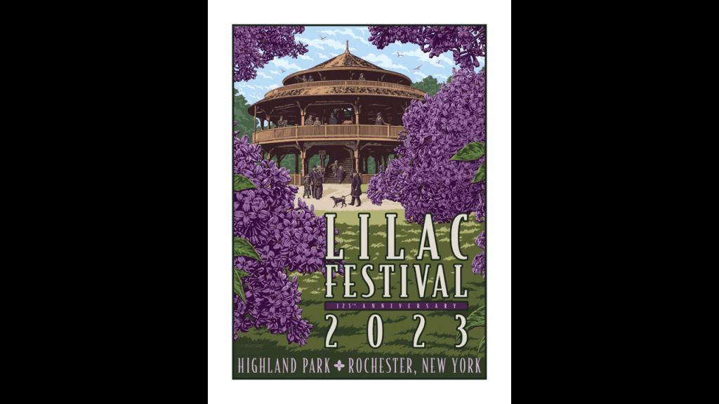
There are extensive lilac varieties on the grounds, and the park hosts a lilac festival every May.
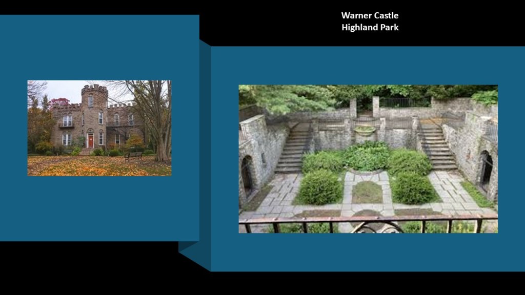
The Rochester Civic Garden Center is housed in what is called the Warner Castle, and offers an extensive horticultural and botanical library to the public.
The Warner Castle was said to have been designed by Horatio Gates Warner, and built as his private residence in 1854.
Warner was a Rochester attorney and newspaper editor.
There is what is called a sunken garden behind the castle that today is a popular location for wedding shoots.
Sunken gardens are defined as gardens that lie below the surrounding ground level that were popular in the Victorian and Edwardian eras.
There’s more at Highland Park, but this gives you the idea.
Olmsted was also credited with the design of the the Genesee Valley Park in 1888, along the shores of the Genessee River.
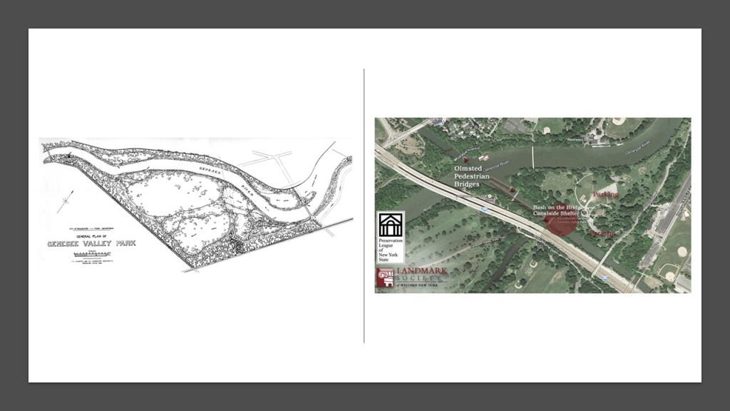
The still in-use portion of the Erie Canal, which is the New York State Barge Canal, crosses the Genessee River in the Park.
There is also a golf course here.
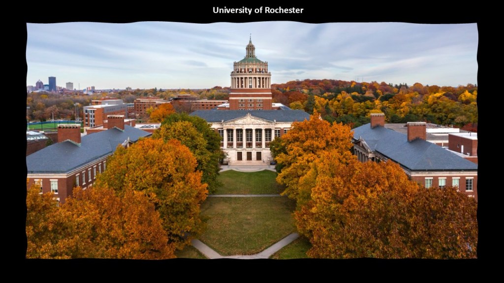
The University of Rochester is located right next to the Genessee Valley Park.
Maplewood Park and Rose Garden, also attributed to Frederick Law Olmsted, is a linear park that follows the Genessee River from the Lower Falls, to just north of Route 104, ending at the pedestrian bridge over the river.
This is where the former Mill District of Rochester was located.
The Rose Gardens are in the Lower Maplewood Park, where you can also see the Lower Falls and Gorge.

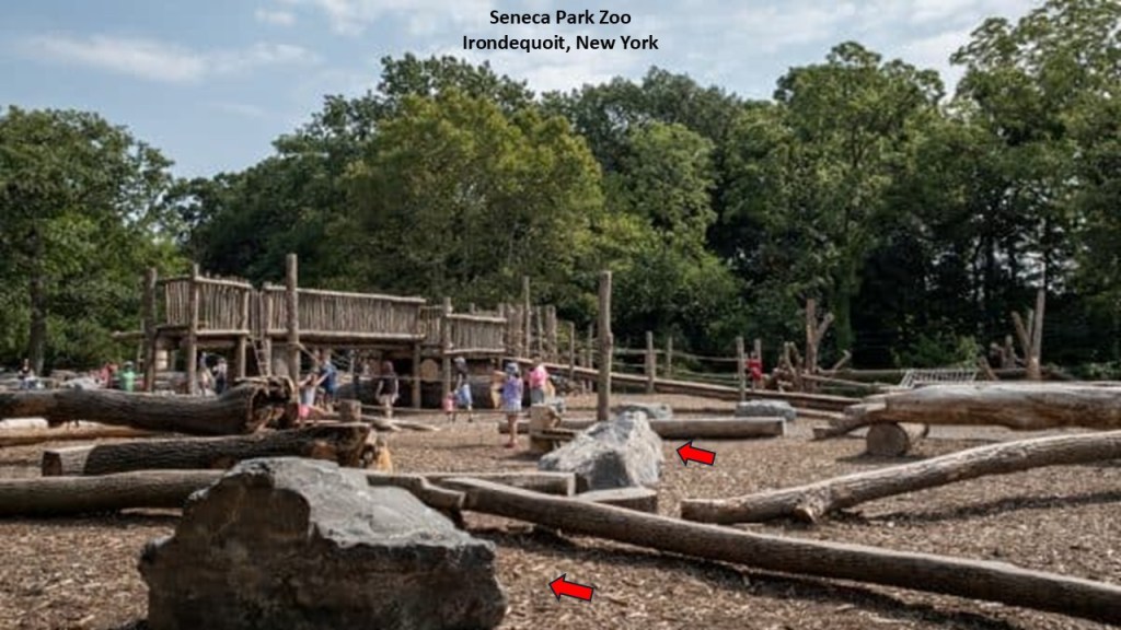
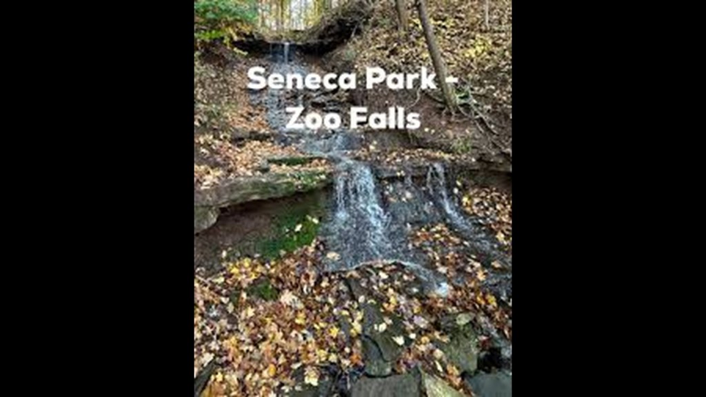
Lastly, Olmsted was credited with the design of Seneca Park, which is the Seneca Park Zoo.
It is located in Irondequoit, where the Seabreeze Amusement Park is located.
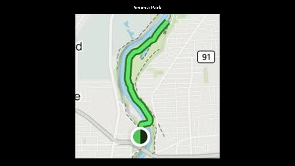
The park was first opened in 1893, and animals displayed there in a zoo setting in 1894.
We tend not to register the megalithic, cut-and-shaped stone blocks in the landscape around us because they are not supposed to be there and assumed to be natural.
But once we notice they are there, they are found everywhere.
And come to find out, there are waterfalls here too, known as “Zoo Falls,” located within the park.
I bring the Frederick Law Olmsted parks up because we’ve already seen his historical presence on Lake Michigan – at the 1893 Chicago World’s Fair and in Milwaukee, Lake Park and Juneau Park in Milwaukee – and I know we are going to see him again in Buffalo on Lake Erie.
In our historical narrative, Frederick Law Olmsted was a journalist before becoming a prolific and celebrated landscape architect, was said to have gotten its start teaming up with Calvert Vaux in the design and creation of Central Park in New York City.
Olmsted and his firm was credited altogether with some 500 design projects, including, but not limited to, 100 public parks, 200 private estates, 50 residential communities, and 40 academic campus designs.
I think that Frederick Law Olmsted was a major player in the creation of the new reset narrative of our history.
I talked about his role in-depth in this post “The Life & Times of Frederick Law Olmsted – A Retrospective of Reset History.”
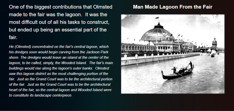
For the 1893 World’s Fair in Chicago, we are told Frederick Law Olmsted collaborated with yet another prolific architect, Chicagoan Daniel Burnham, to adapt Olmsted’s design of a Venetian-inspired pleasure ground, complete with waterways and places for quiet reflection in nature that complemented the grand architecture of the World’s Fair.
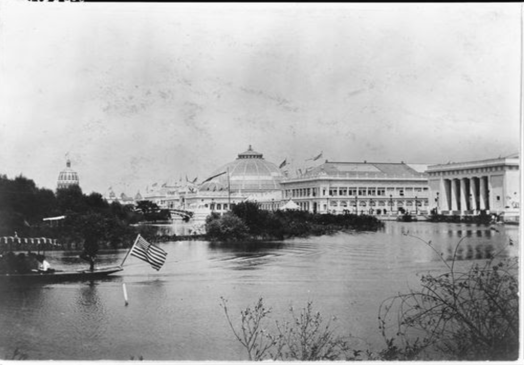
This area was described as a sandy area along Chicago’s lakeshore that looked like a deserted marsh before construction began, but Olmsted saw, we are told, the area’s potential, and that his design included lagoons and what became known as Wood Island since they had not been developed yet.
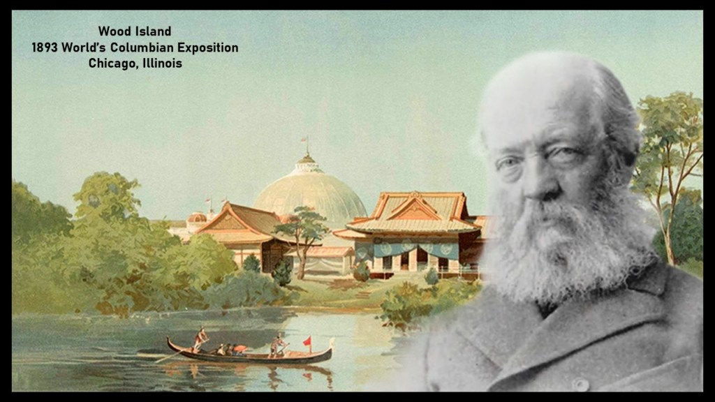
As the person responsible for planning the basic land- and water-shape of the exposition grounds, we are told that Olmsted concluded the marshy areas of Jackson Park could be converted into waterways, and that workers dredged sand out of the marshes to make lagoons of different shapes and sizes.
Two Milwaukee parks were said to have been designed by Frederick Law Olmsted.
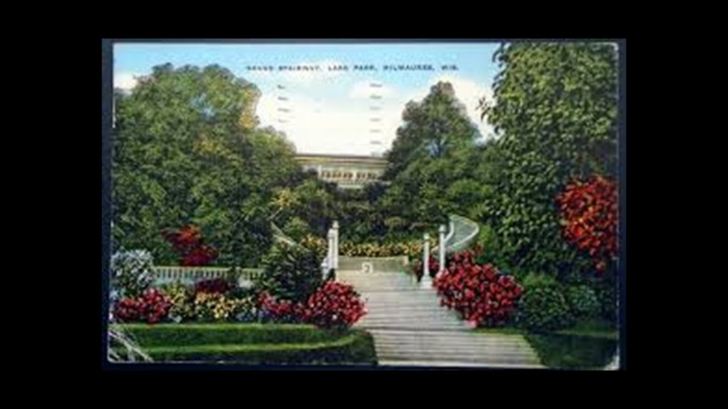
Starting in 1892, Olmsted was credited with the design of Lake Park, the terrain of which included a golf course as well as bluffs and ravines…
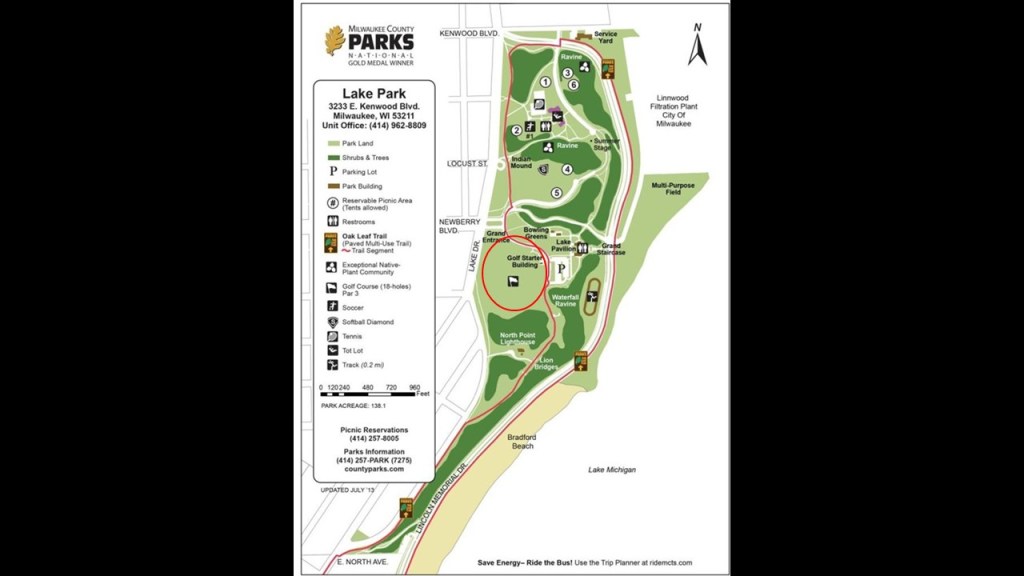
…and the grounds of which, besides the North Point Lighthouse, contain what is called the “Grand Stairway,” said to have been completed in 1908…
…and the “Lion Bridge,” so-named for Eight Stone Lions said to have been placed to guard each end of two bridges that cross the south ravine on either side of the North Point lighthouse.
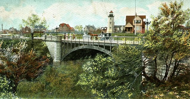
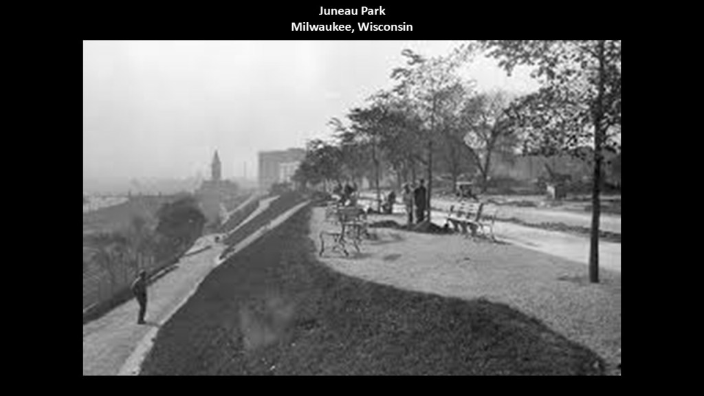
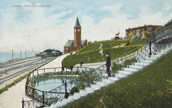
Juneau Park was the other park that Frederick Law Olmsted was credited with the design of in Milwaukee.
Juneau Park is situated on a bluff overlooking Lake Michigan and is a short walking distance to downtown Milwaukee, and named after the city’s first mayor, Solomon Juneau.
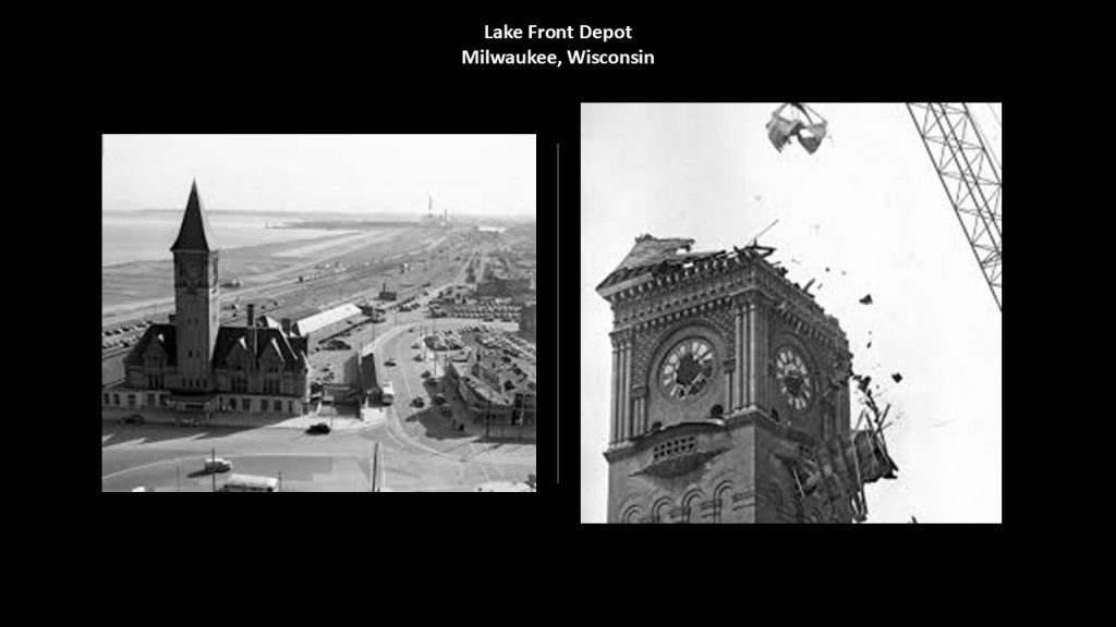
The Lake Front Depot and the railroad tracks can be seen in historic postcards of Juneau Park.
The Lake Front Depot was said to have been constructed between 1889 and 1890 by the Chicago and Northwestern Railway.
The Lake Front Depot was in-use until 1966, and it was torn down two-years later, in April of 1968.
Now I am going to take a look at this location south of Rochester and the historic Erie Canal because we are now entering the Finger Lakes region of New York.
The Finger Lakes as a whole are constituted by eleven long and narrow lakes that are roughly north-to-south, and in our accepted scientific paradigm, are considered to be lakes in “overdeepened glacial valleys.”
Cayuga and Seneca Lakes are among the deepest in the United States.
Their name goes back to the 19th-century in a paper that was published for the United States Geological Survey in 1883 by geologist Thomas Chamberlin, who later founded the Journal of Geology in 1893.
I find it interesting to note the presence of numerous waterfalls through here as well.
I am now going to take a detour and take a look at the Finger Lakes by way of the waterfalls , a region which I find highly intriguing for what we might actually be looking at.
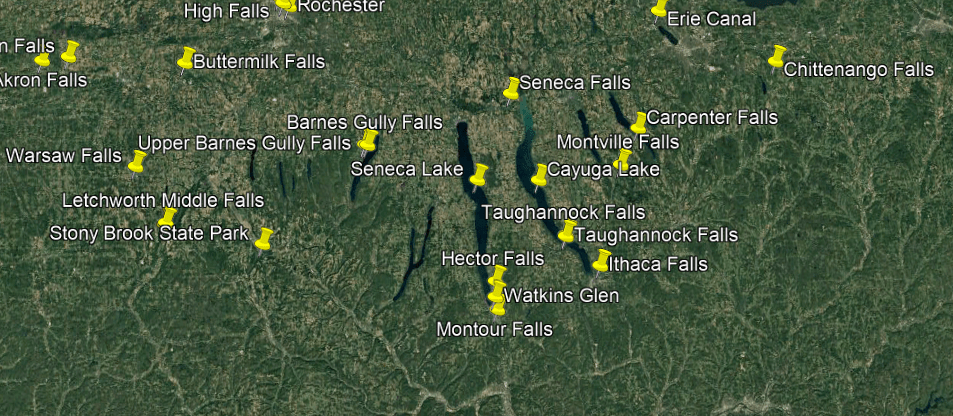
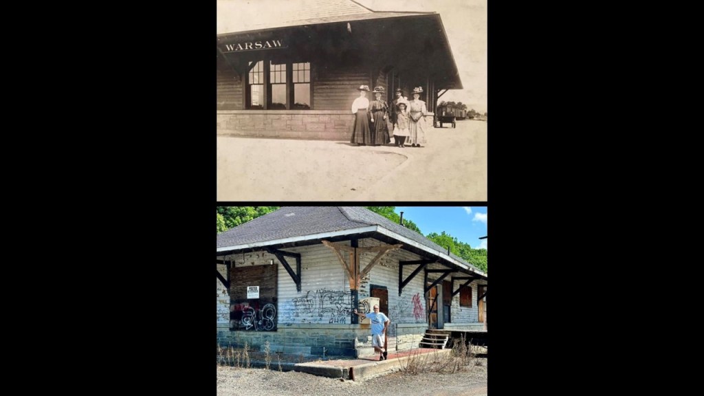
I am going to go from west-to-east, starting at Warsaw Falls.
Warsaw Falls are on Stony Creek in Wyoming County in Warsaw, New York.
There are three large Warsaw Falls, and the one in Warsaw Village Park has an 80-foot, or 24-meter, drop.
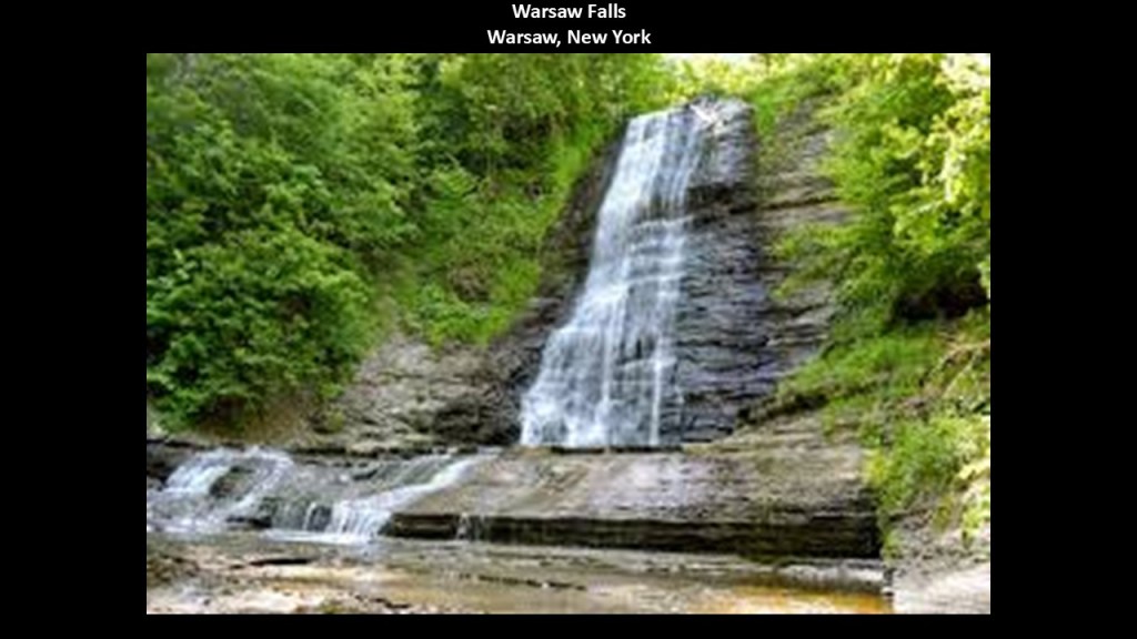
The Stony Creek, which starts at the Attica Reservoir, connects to Oatka Creek, which connects to Genessee Creek, which connects to Lake Ontario.
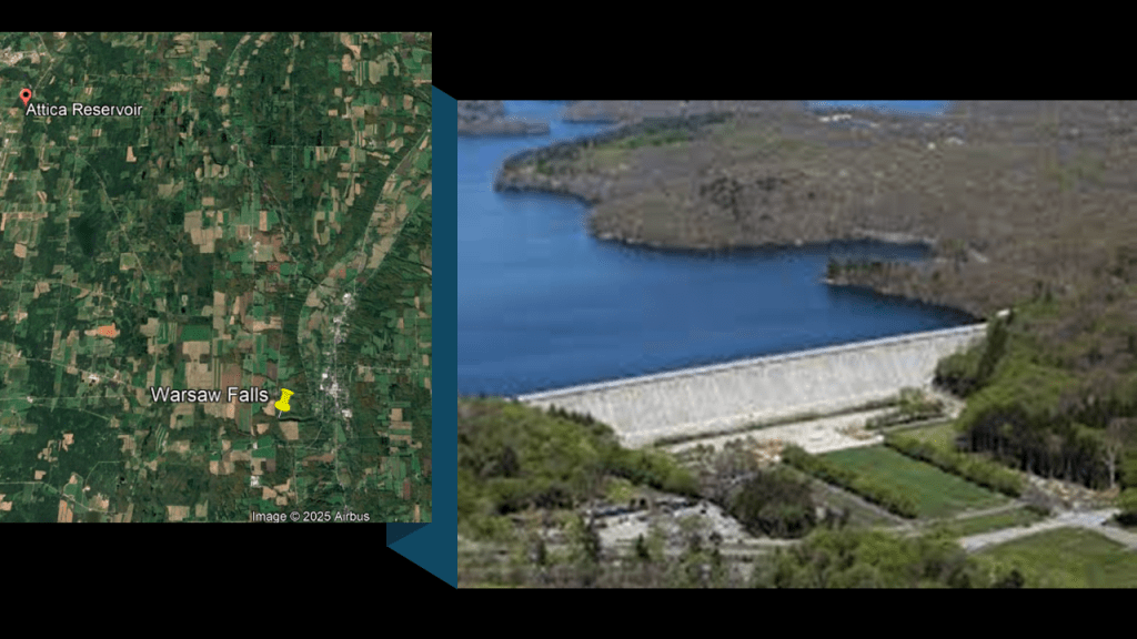
Stony Creek flows through a tunnel under the Erie-Lackawanna Railroad bridge just before reaching the Warsaw Falls.
Warsaw was divided north and south by two major railroads, the Erie on the west, and the Buffalo, Rochester & Pittsburgh (B. R. & P.) Railroad on the east.
The B. R. & P. Railroad station was the only one remaining of the original train stations and facilities in Warsaw – it has been long-abandoned and likely to be demolished if it hasn’t been already.
The town of Warsaw is located 37-miles, or 60-kilometers, to the southeast of Buffalo, and is the same distance southwest of Rochester, and was first settled in 1803.
We are told, as the town became settled, its economic industries included salt, stone quarries, mills and agriculture, and schools and churches were built.
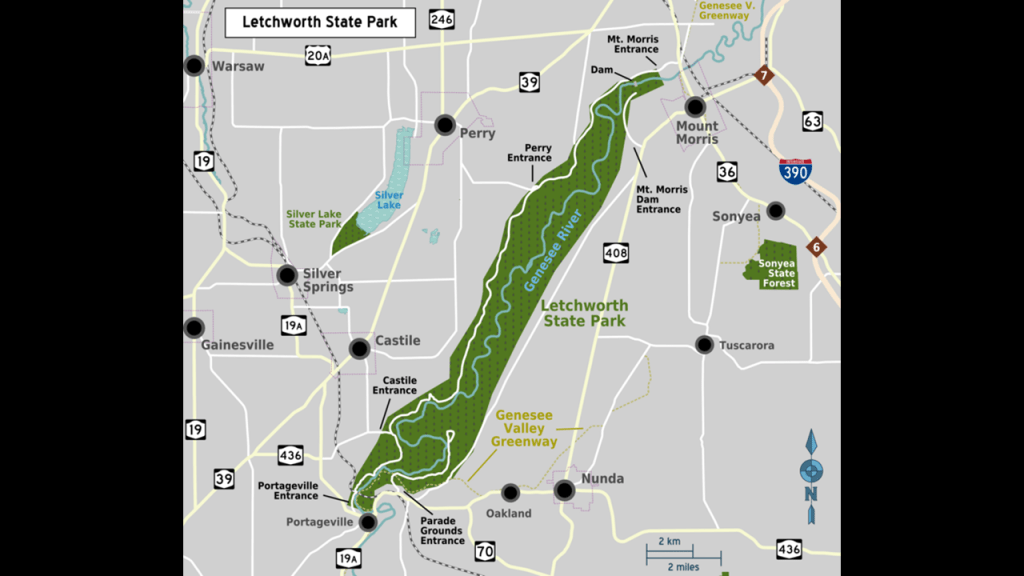
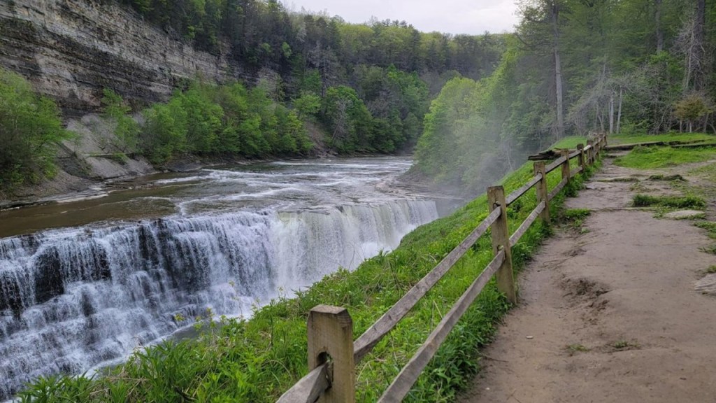
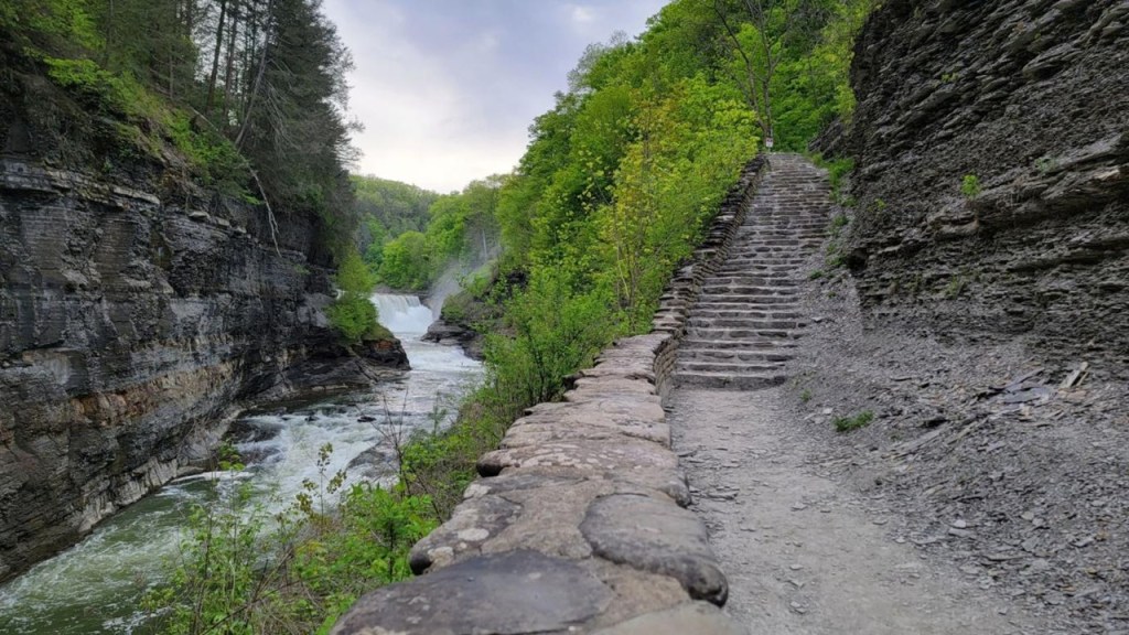
Next, are the Letchworth Falls in Letchworth State Park, which consist of Upper, Middle, and Lower waterfalls on the Genessee River.
Here, the Genessee River flows north through a deep gorge over the waterfalls.
The rock walls of the gorge rise up 550-feet, or 170-meters, in places, prompting the area’s reputation as the “Grand Canyon of the East.”
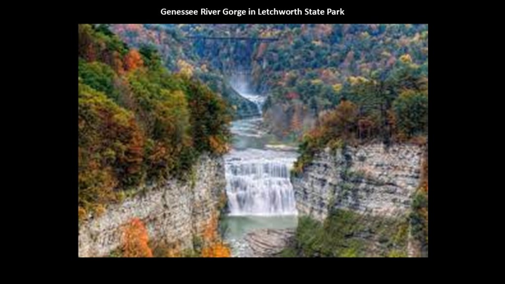
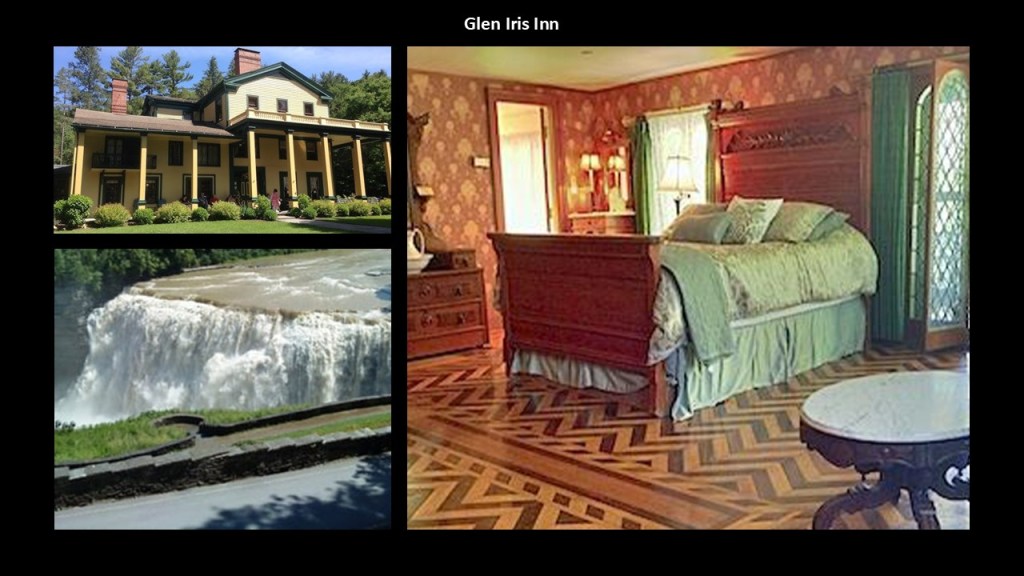
We are told that in 1859, the industrialist William Pryor Letchworth purchased the land near the Middle Falls to build his Glen Iris Estate, which still stands today as the Glen Iris Inn.
Today’ the’s Glen Iris Inn is located on top of a cliff overlooking the Middle Falls.
Then in 1906, Letchworth bequeathed 1,000-acres, or 4 kilometers-squared to New York State, which became the core of the newly-created Letchworth State Park.
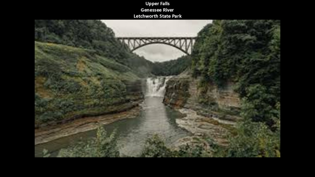
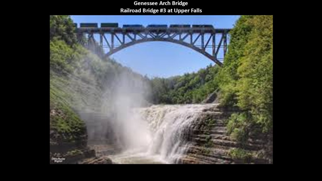
The Genessee Arch Bridge, also known as the Portage Viaduct, an active railroad bridge of the Southern Tier Line of the Norfolk Southern freight railroad, crosses over the Genessee River just above the Upper Falls.
The Upper Falls are horseshoe-shaped, and 70-feet, or 21-meters, -high.
We are told that this is the third railroad bridge in this general location.
The first was a wooden trestle railroad bridge that was said to have been constructed by the Erie Railroad Company starting in 1851 and first opened in 1852, which would have been 9-years before the start of the American Civil War in in 1861.
It was said to be the tallest and longest wooden bridge in the world at the time, but sadly it burned down in tremendous fire on May 6th of 1875.
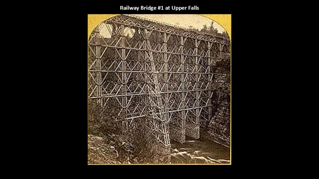
We are then told that immediately after the loss of the first wooden bridge, the Erie Railroad moved quickly to replace the wooden bridge with an iron bridge, with construction starting a month later, on June 8th of 1875, and that the new bridge opened for traffic a little more than a month later , on July 31st of 1875.
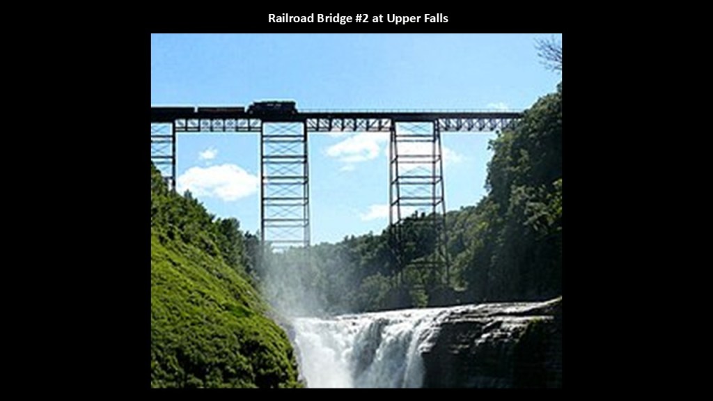
The Genessee Arch Bridge there today was said to have been constructed between 2015 and 2017 to the south of the 1875 bridge in order to replace it.
Like the Upper Falls, the Lower Falls are also 70-feet, or 21-meters, -high.
The Lower Falls can be accessed for a different view of them by way of a 100-step stone staircase that goes to the bottom of the gorge.
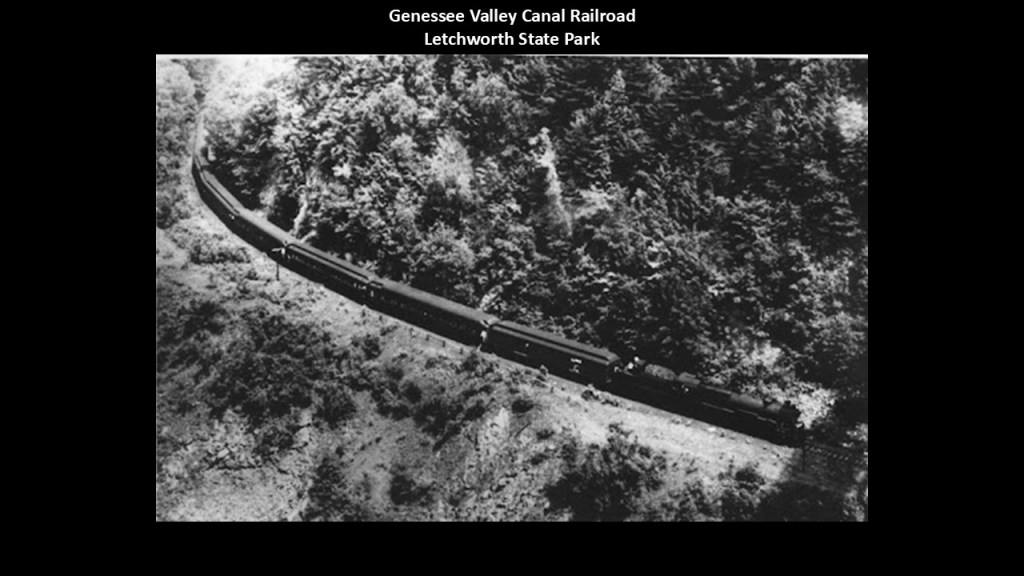
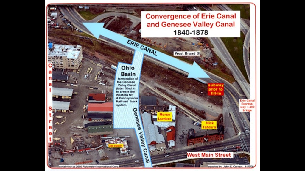
The historic Genessee Valley Canal was located in the vicinity of what is today the Letchworth State Park.
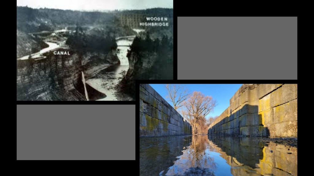
The Genessee Valley Canal operated in western New York between 1840 and 1878.
It was 124-miles, or 200-kilometers, -long, and passed through 106 locks.
We are told it was later used by the Genessee Valley Canal Railroad for a period of time. nb
Today it comprises portions of the Genessee Valley Greenway.
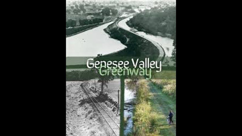
The historic Genessee Valley Canal converged in Rochester with the Erie Canal.
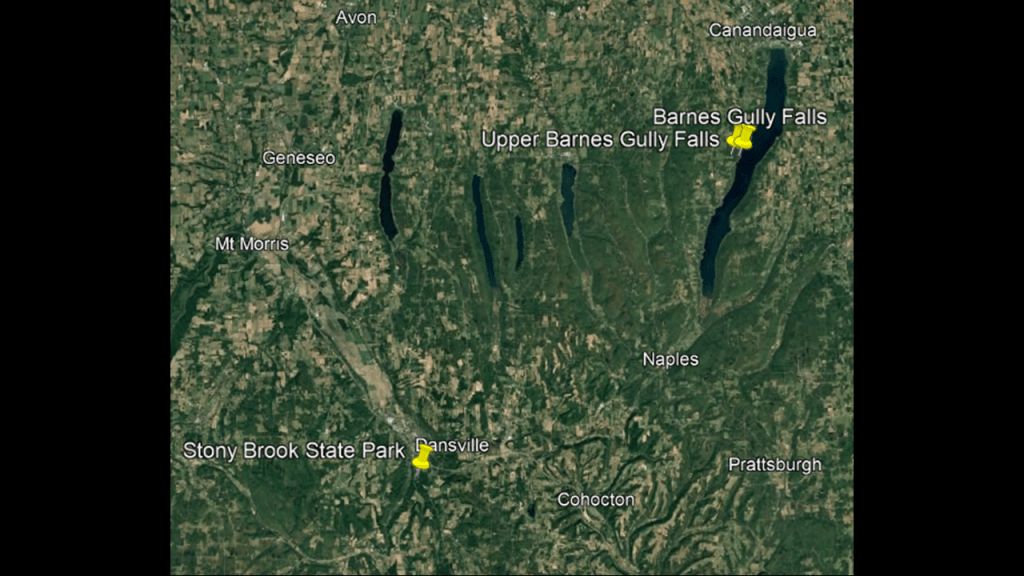
The Letchworth State Park and waterfalls there are located close to the Stony Brook State Park.
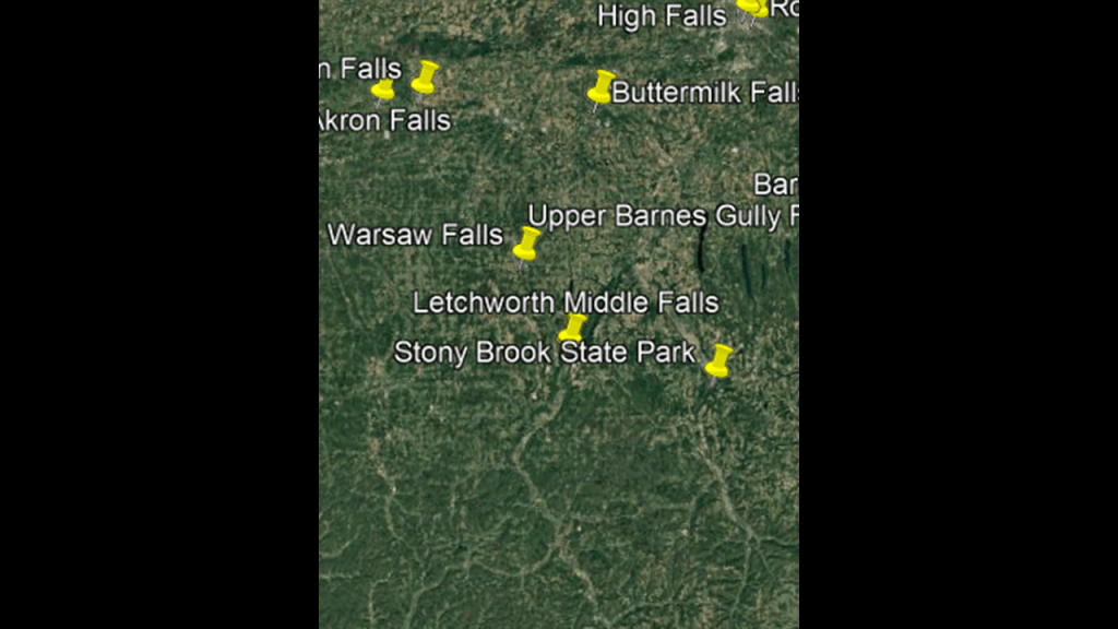
We are told that Stony Brook State Park in Danville, New York, became a summer tourist destination in the late 19th-century following the construction of a railroad in 1883, but that the resort had already fallen into decline by the 1920s, but that the State of New York resurrected the area by acquiring the land and establishing the park in 1928.
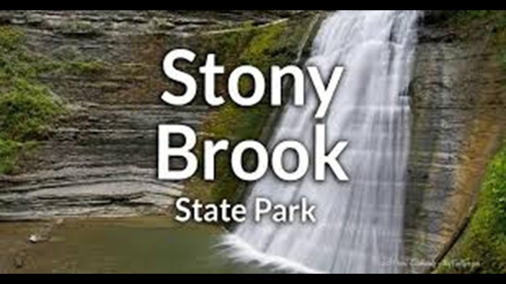
Originally in the traditional lands of the Seneca nation, Stony Brook State Park became popular for its rugged gorge, waterfalls, and recreational activities.
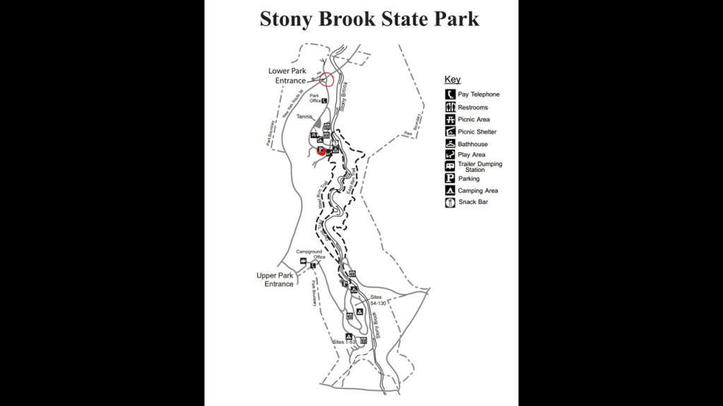
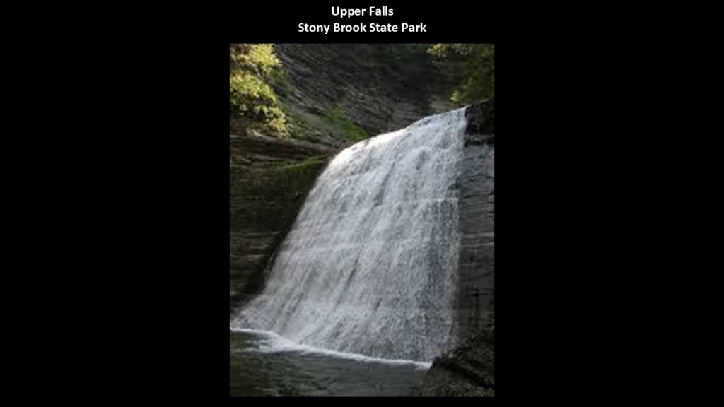
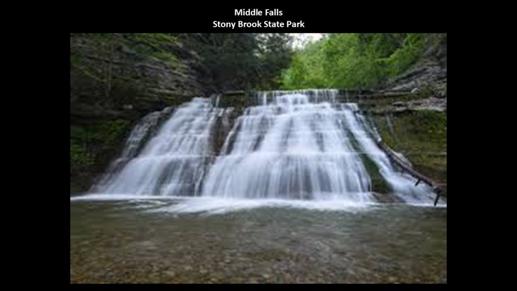
There are three waterfalls in the Stony Brook State Park – the Upper, Middle, and Lower Falls.
The Upper Falls are 45-feet, or 13.8-meters, high.
The Middle Falls at Stony Brook State Park are 20-feet, or 6-meters, -high…
…and the Lower Falls are around 15-feet, or 5-meters, -high.
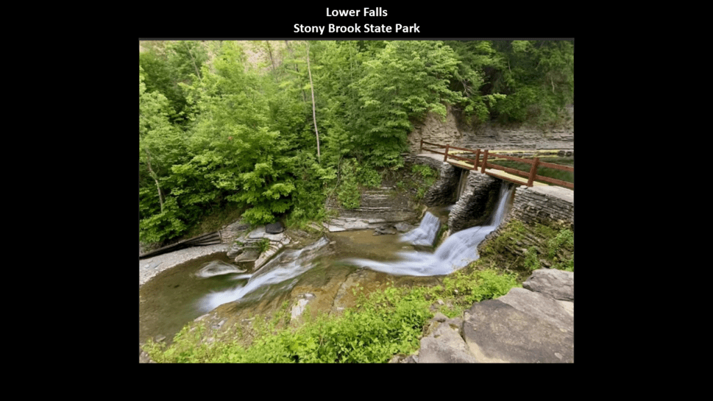
All three are accessible for viewing on the 1.5-mile, or almost 1-kilometer, -long East Rim Trail, also known as the Falls Trail, which goes through the gorge, and also has stone steps on it.
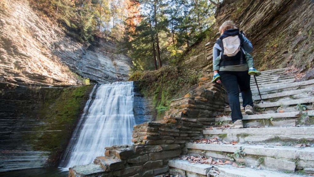
Like the Akron Falls Park on Murder Creek back in the village of Akron and Town of Newstead, we are told that the Stony Brook State Park was enhanced in the 1930s by another one of FDR’s New Deal Programs, in this case, the Civilian Conservation Corps, and Works Progress Administration, who were said to have built the hiking trails, bridges, picnic areas, and buildings.
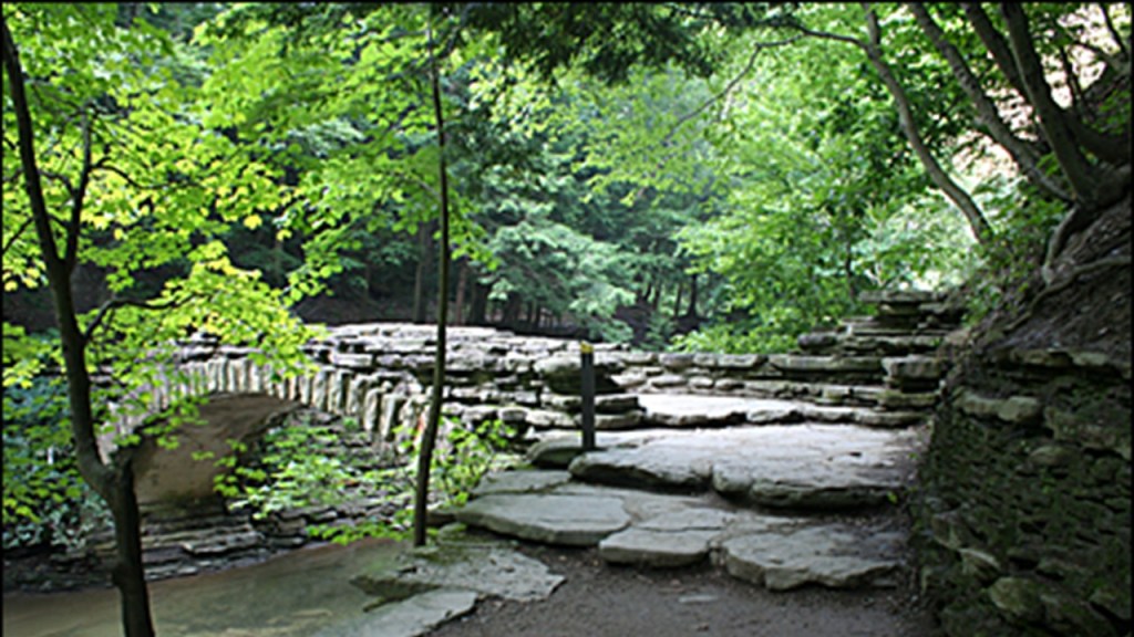
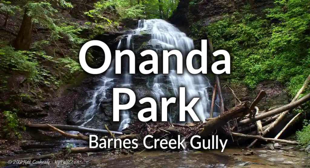
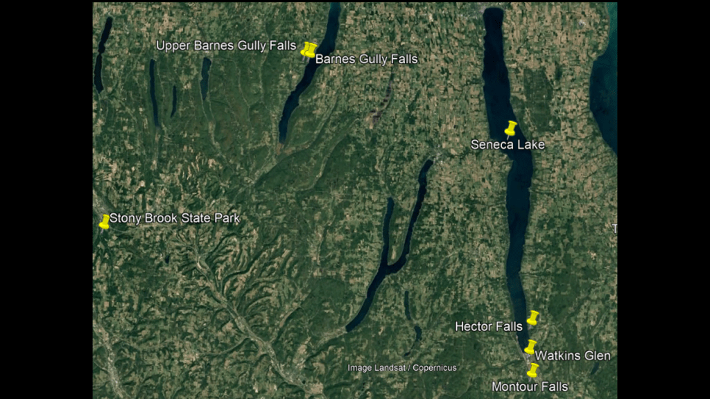
The Barnes Creek Gully Falls are to the northeast of Stony Brook State Park, on the western side of Canandaigua Lake, the westernmost of the major Finger Lakes.
The Barnes Creek Gully Falls are on Barnes Creek.
Like we have been seeing all along the way, there are three waterfalls here.
One of them is in Onanda Park, and there are two in the same vicinity on private property.
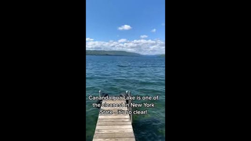
Canandaigua Lake is known for its water quality, and in 2013 and 2017 was voted as the best drinking water for the State of New York.
The lake’s water is well-oxygenated and clear.
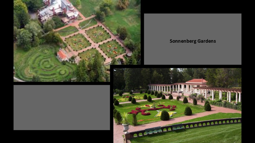
Interesting to note the Sonnenberg Gardens and Mansion State Park at the northern end of the lake in the city of Canandaigua.
We are told the property was once the summer home of Frederick Ferris Thompson and his wife Mary Clark Thompson, whose Clark family was from Canandaigua, including Myron Clark Holley, the Governor of New York State in 1855.
The Thompsons were said to have purchased the Sonnenberg property in 1863, and replaced the farmhouse with a 40-room, Queen Anne-style mansion.
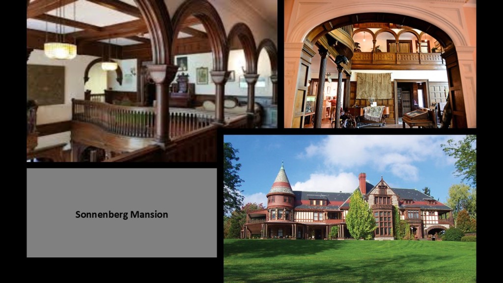
The original property was said to have about 100-acres, or 40-hectares, of farmland that were converted into gardens between 1902 and 1919.
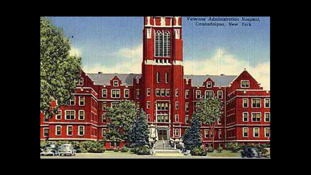
We are told the Thompsons’ died childless, and that their nephew who inherited the property sold it to the federal government in 1931, who built a veteran’s hospital on the adjacent farmland which is still today’s Canandaigua VA Medical Center.
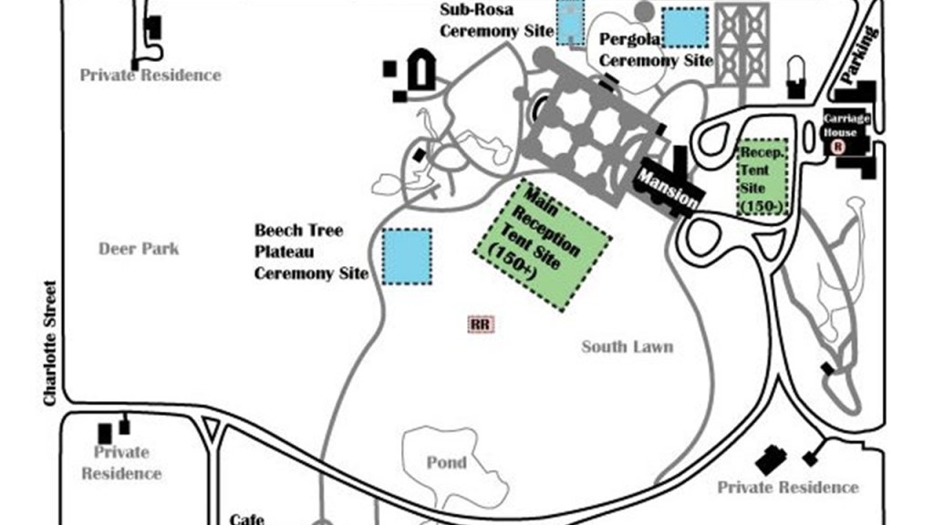
In 1972, by an Act of Congress called the “Sonnenberg Bill,” the land was transferred from the federal government to a local organization formed to restore and reopen the property, which opened to the public in 1973, and is particularly popular as a wedding venue.
The first train arrived in Canandaigua in 1840 as the Rochester-Auburn Railroad.
Continuing to grow as a transportation hub through the 19th-century, at its height it had 36 trains running daily.
The last passenger train ran on May 18th of 1958, and today the Finger Lakes Railroad only runs freight service.
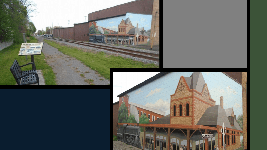
There’s a railroad marker that tells us about the the railroad history here and its importance.
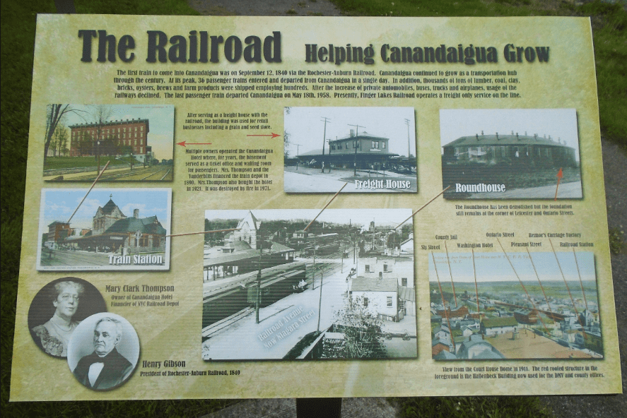
There’s a mural of the historic train depot on a building across the railroad tracks from the marker.
The Canandaigua Street Railroad was chartered as a local streetcar line in Canandaigua from 1887.
It started out first being pulled by horses when it first started operating, but was electrified in 1892.
The conversion to bus operations started in the 1920s, and the streetcar line in Canandaigua was shutdown completely on July 31st of 1930.
There’s a lot more to find here, but this gives you the idea.
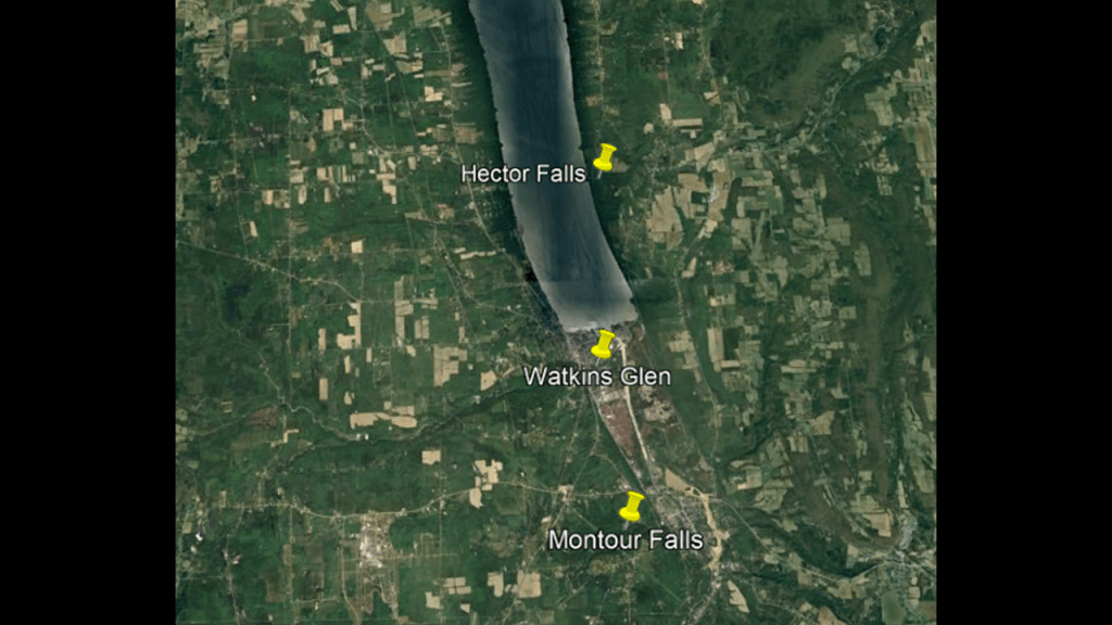
Seneca Lake is to the east of Canandaigua Lake, and at the southern end has Hector Falls and Montour Falls, as well as the village of Watkins Glen.
Seneca Lake is the largest and deepest of the Finger Lakes.
It is 38-miles, or 61-kilometers, -long, and has a maximum depth of over 618-feet, or 188-meters, and holds the most water of the Finger Lakes.
As a result of its depth and that it is easy to get to, the United States Navy uses Seneca Lake to perform test and evaluation of equipment.
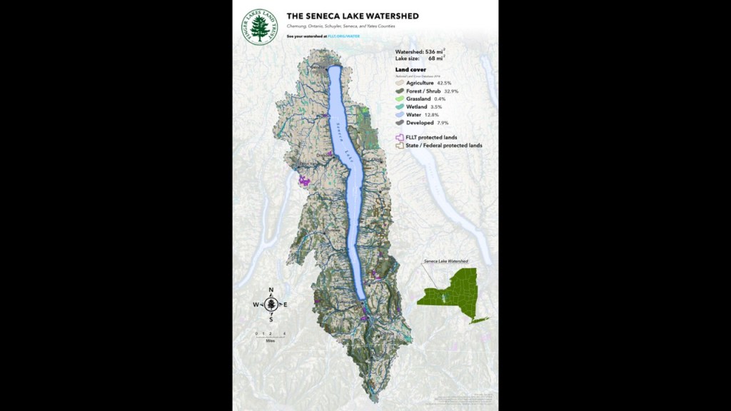
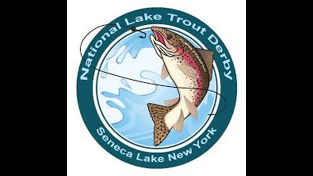
Seneca Lake is promoted as the lake trout capital of the world, and hosts the National Lake Trout Derby every year.
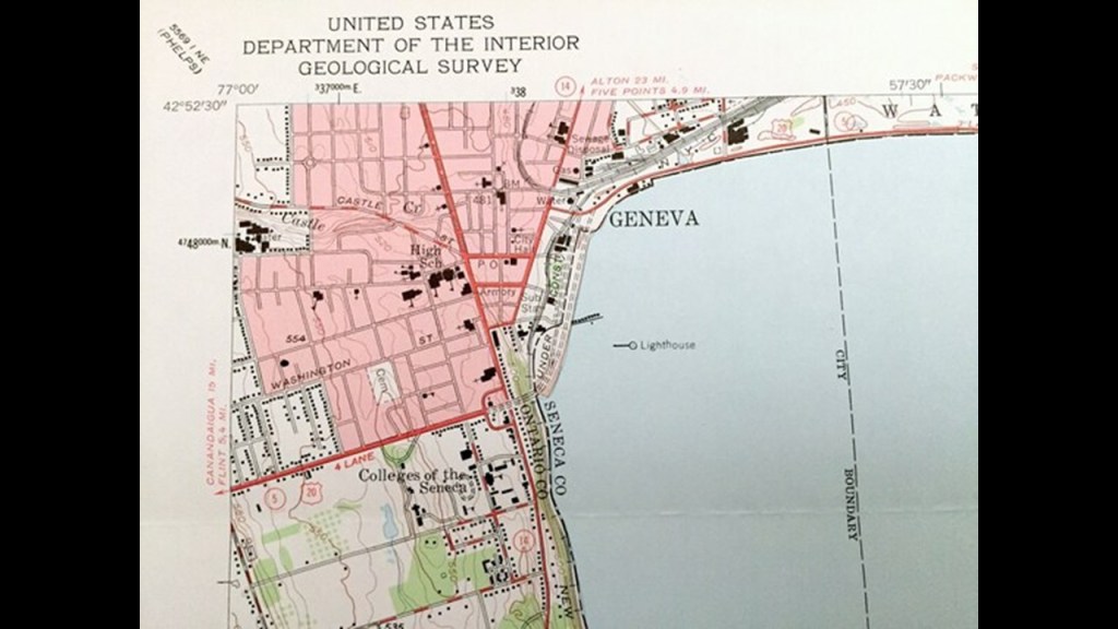
Geneva is at the northern end of Seneca Lake, in an area long-occupied by the Seneca people.
The village of Geneva was first incorporated in 1806, and the city chartered in 1871.
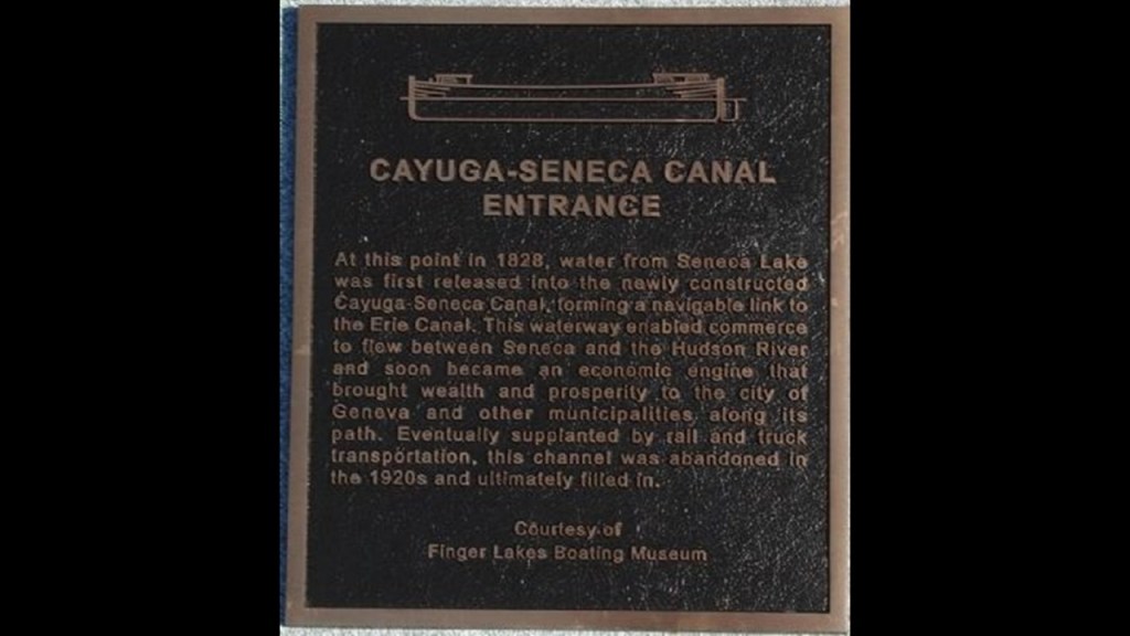
The Cayuga-Seneca Canal connects Seneca Lake and the neighboring Cayuga Lake to the Erie Canal, and is 20-miles, or 32-kilometers-long.
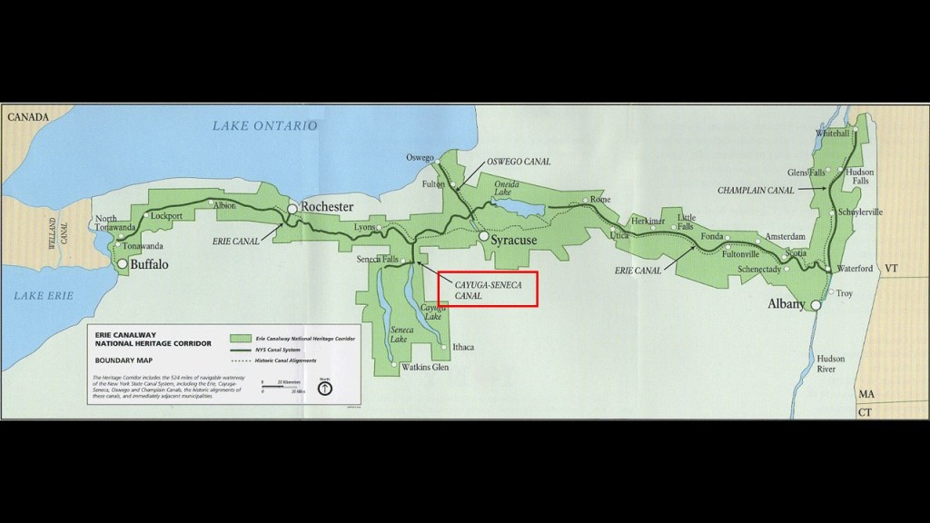
The Cayuga-Seneca Canal flowed north through Geneva.
Its construction was said to have been completed in 1818.
More on this canal to come.
On the southern end of Seneca Lake, we find Hector Falls, Watkins Glen, and Montour Falls.
First Hector Falls.
Hector Falls is on the eastern shore of Seneca Lake just to the northeast of Watkins Glen.
Hector Falls is described as a striking, broad waterfall cascading 250-feet, or 76-meters, over natural stone steps.
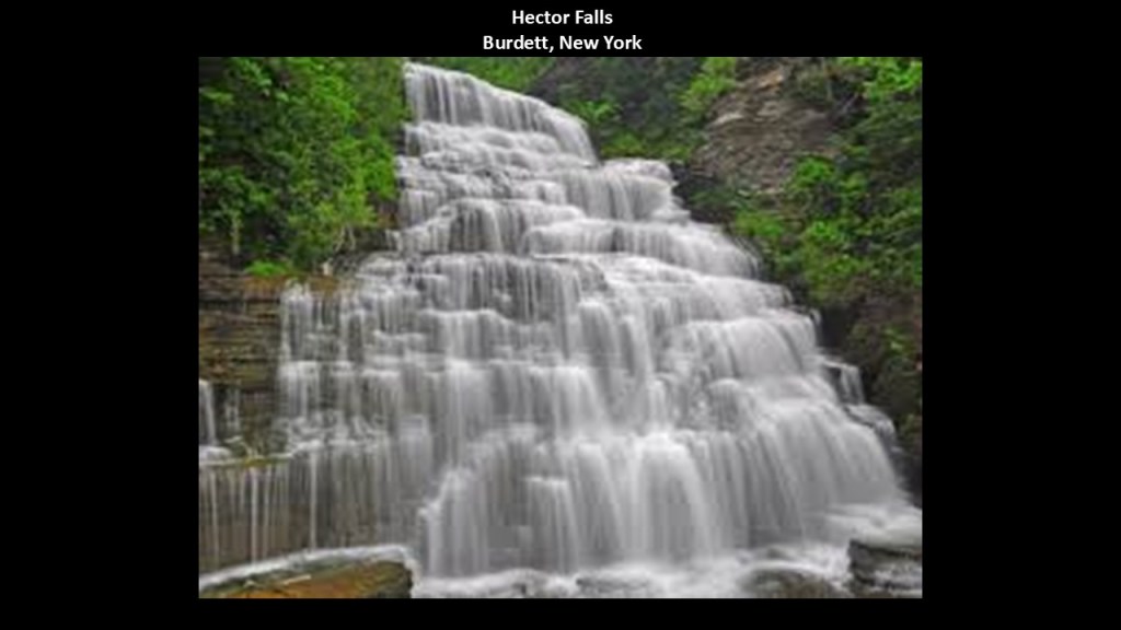
Hector Falls is located along New York State Route 414 heading north from Watkins Glen.
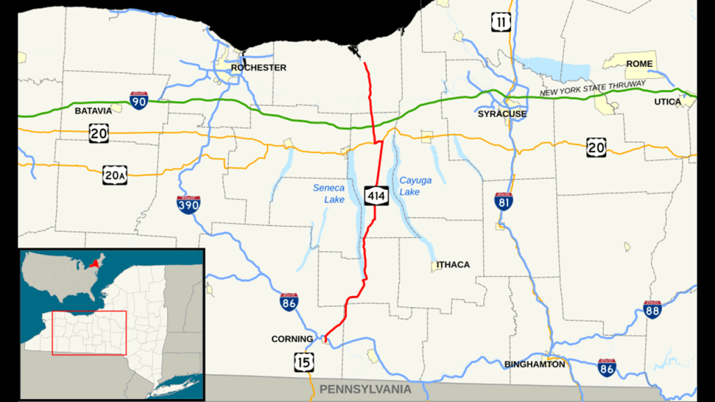
The southern terminus of NY 414 is in Corning and the northern terminus is in Huron, New York, near the southern shore of Lake Ontario, and an area I will be looking a closer look at in this post.
A few interesting things to note about NY-414.
One is that it intersects every major east-west artery in western New York, including the Southern Tier Expressway, which is Interstate 86; the New York State Thruway, which is Interstate 90; and US-20.
Interstate 90 and US-20 run parallel to each other until Rockford, Illinois.
I will be talking more about US-20 in particular in the Lake Erie part of this series.
US-20 is a major east-west highway that runs all the way across the continent, and runs along the southern shores of both Lake Erie and Lake Michigan, starting at Route 2 at Kenmore Square in Boston, Massachusetts, and ending at US 101 in Newport, Oregon.

The southern terminus of NY 414, Corning, was best-known initially for the Corning Glass Works.
What became the Corning Glass Works was founded in 1851 in Massachusetts as the Bay State Glass Company, and the company eventually moved to Corning in 1868.
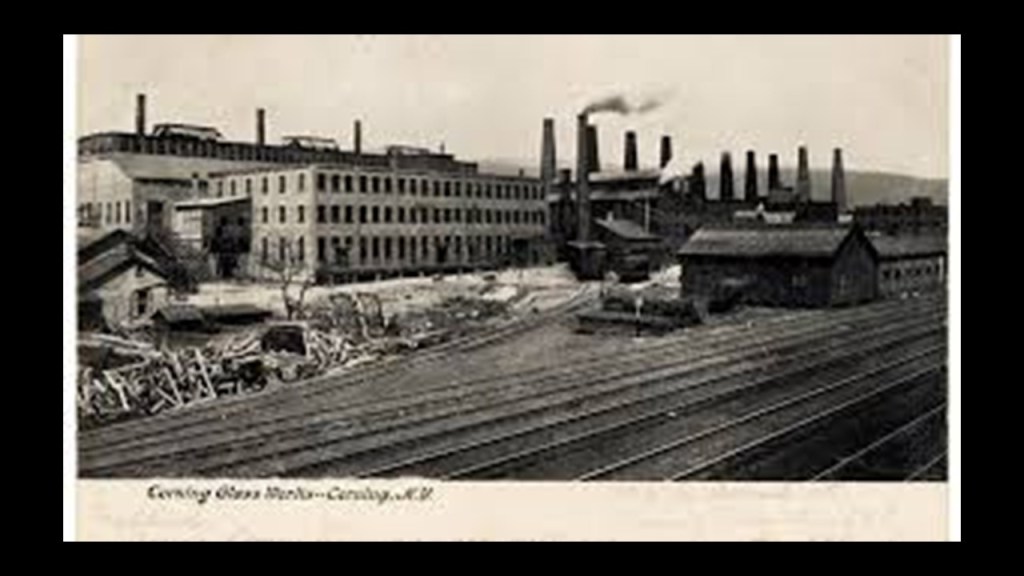
Then in 1915, Corning launched Pyrex, the first cookware with temperature-resistant glass.

Over the years, what is today known as Corning Incorporated continues to specialize in glass and ceramics as well as technologies including advanced optics for industrial and scientific applications.
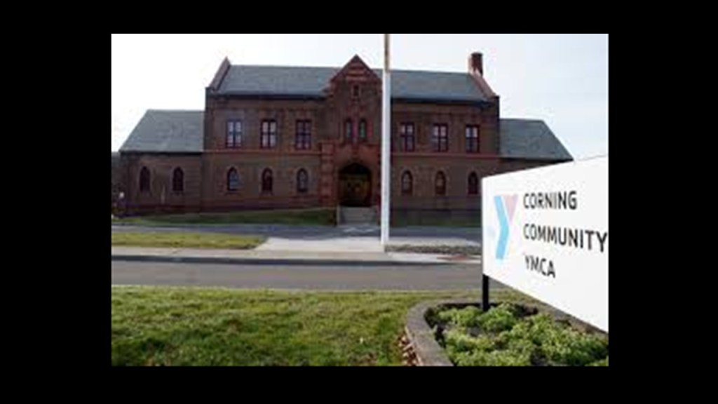
The Armory in Corning was said to have been designed in the Gothic Revival Style and constructed in 1934, which would have been in the middle of the Great Depression.
It has been the local YMCA since 1977.
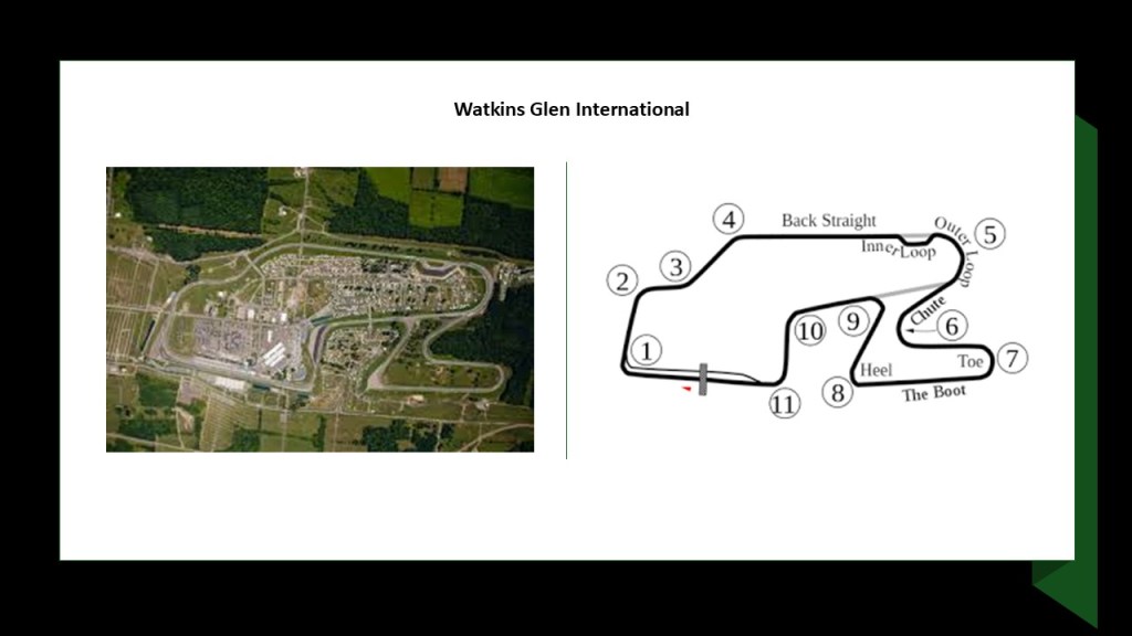
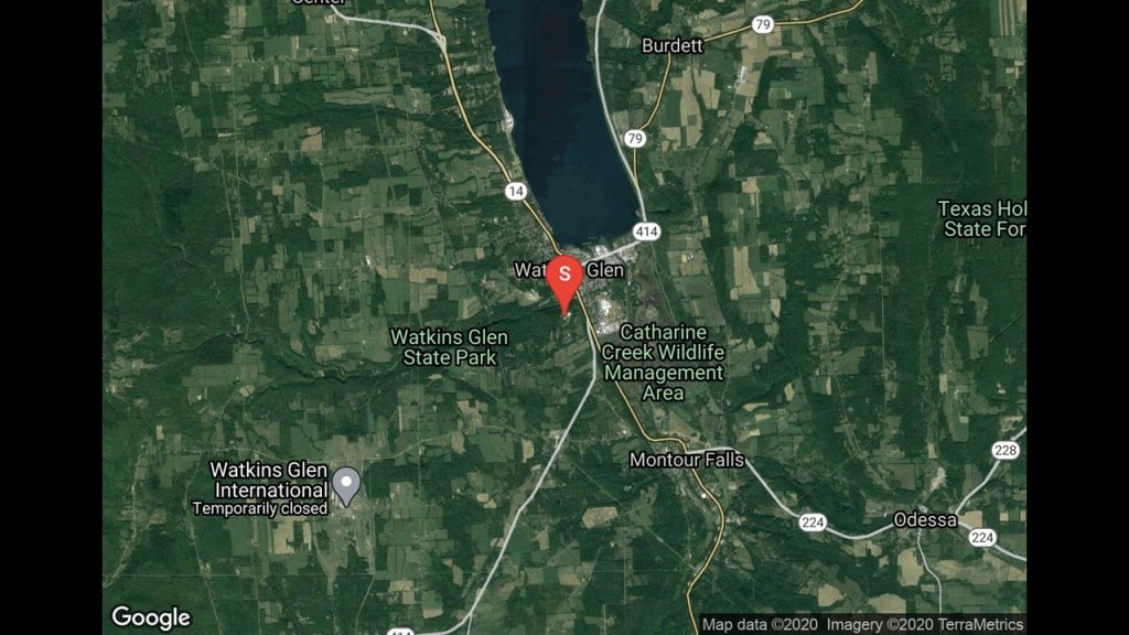
The small village of Watkins Glen, which had a population of 1,829 in the 2020 census, is best-known for the Watkins Glen International race track southwest of the village, which has been the home to car racing of every class, including but not limited to, NASCAR, International Motor Sports Association, and was the former home of the Formula One United States Grand Prix, which it hosted from 1961 to 1980.
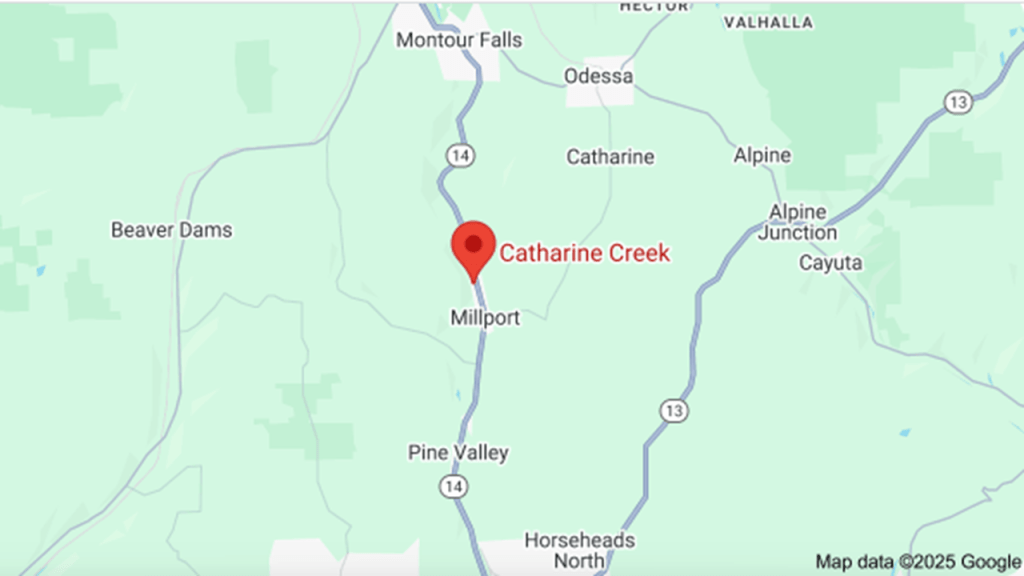
Watkins Glen State Park is also to the southwest, located between the race track and the village, and Montour Falls to the southeast of the village and the park, with the Catharine Creek Wildlife Management Area in-between.
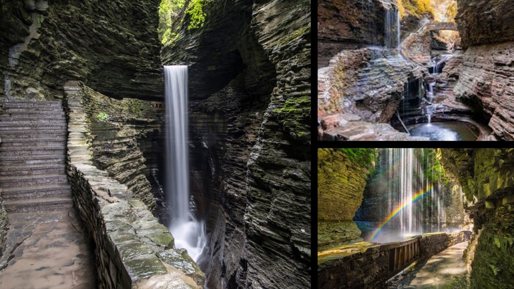
First, Watkins Glen State Park.
Watkins Glen State Park was first opened to the public in 1863, and has been a public park since 1906.
The park has a 400-foot, or 122-meter, -deep gorge, featuring 19 waterfalls in less than 2-miles, or 3-kilometers.
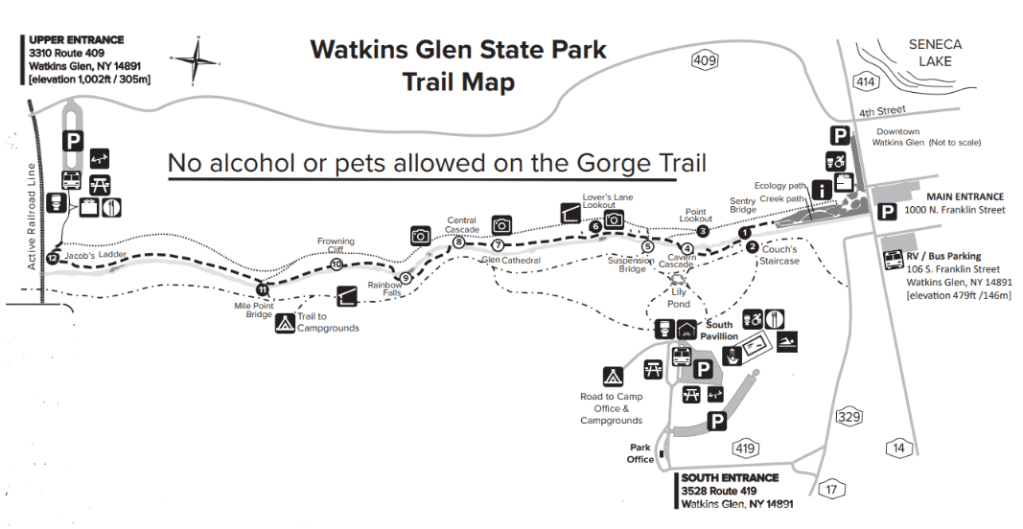
There are manmade stonewalls and bridges throughout the gorge, and the main Gorge Trail has 832 stone steps.
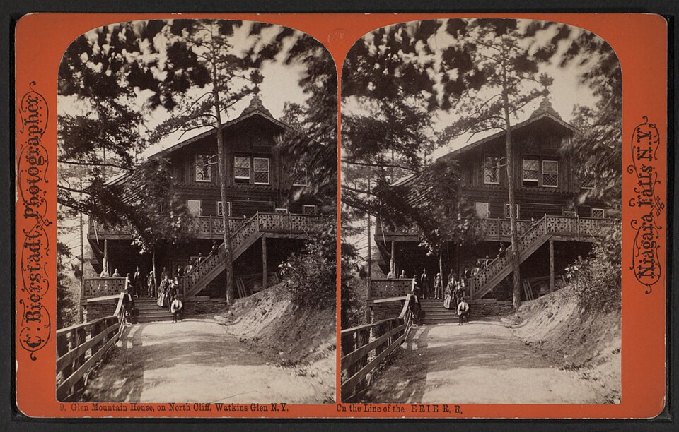
We are told in our historical narrative that John Lytle became the Glen’s proprietor in 1873, and built a hotel called the Glen Mountain House here.
In the years following, this location became a nationally-known resort, and in 1902, the New York Central Railroad began selling excursion tickets here from New York City.
The increasing number of tourists saw more choosing camping to experience the gorge, and the Glen Mountain House was subsequently demolished after a fire in 1903, and the area converted to permanent campgrounds.
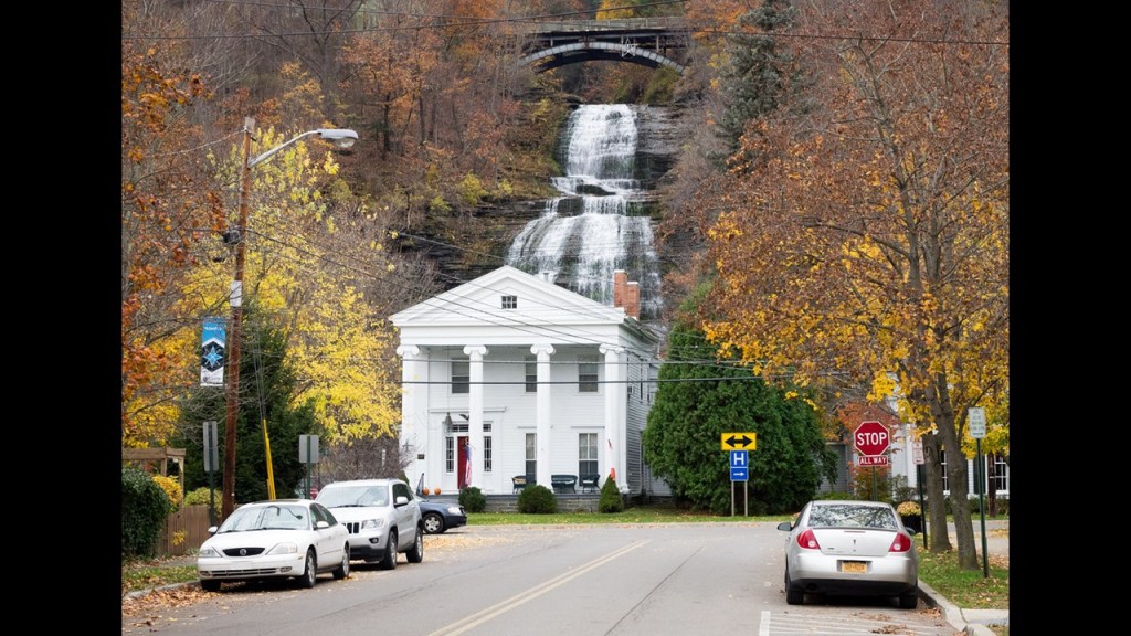
As mentioned, Montour Falls is to the southeast of the general area of Watkins Glen, and like what I’ve already been finding, there’s waterfalls all over the place around here!
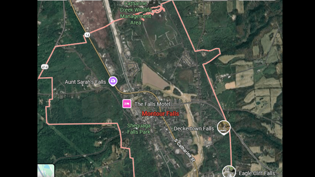
Come to find out, Montour Falls is a village named for Queen Catharine Montour, a prominent Iroquois leader who lived in the area, and for the Shequaga Falls at the end of West Main Street.
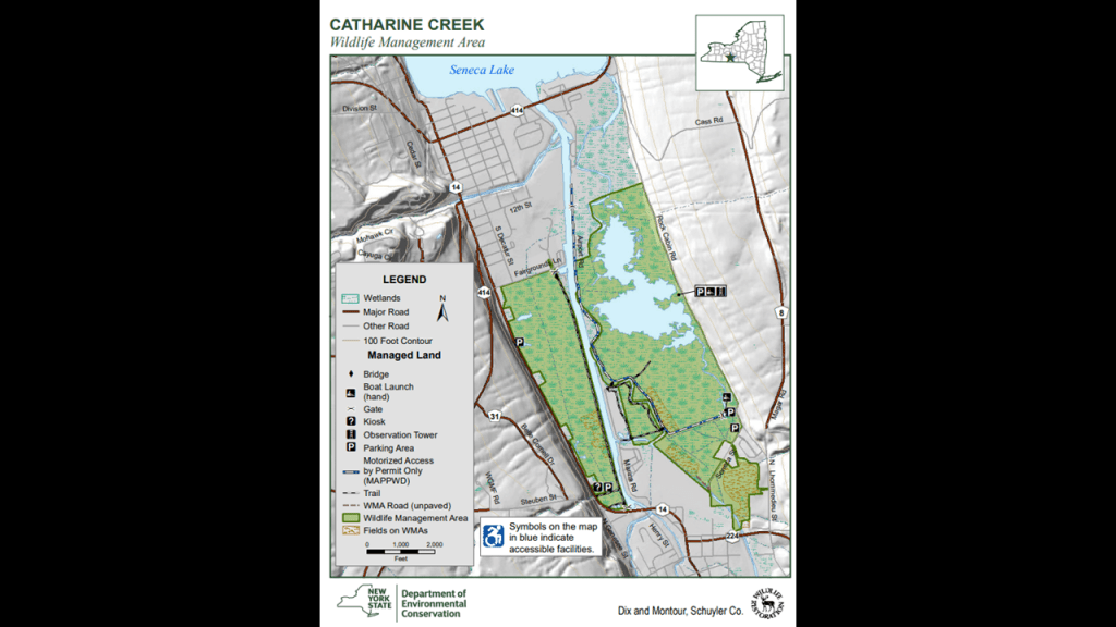
The Catharine’s Creek Wildlife Management Area is in-between Montour Falls and Watkins Glen.
The Catharine’s Creek WMA is described as over 700-acres, or 283-hectares, of protected wetland in a marsh directly south of Watkins Glen.
It has a few miles of hiking trails.
I have been talking throughout this series and in many other places, of my consistent finding of wetlands, as well as estuaries, deserts and dunes, as evidence of destroyed land, which I believe took place when the earth’s original energy grid was deliberately destroyed relatively recently.
Catharine Creek, also named after Queen Catharine Montour, is a 15-mile, or 24-kilometer, -long waterway that is a major tributary to Seneca Lake.
It flows mostly along New York State Route 14, which runs concurrently with NY-414 through Watkins Glen.
We are told that the Chemung Canal was a former canal in New York that ran through the Catharine Creek Valley from Horseheads to Seneca Lake during the mid-19th-century, from 1833 until 1878, and that after the canal closed in 1878, the Pennsylvania Railroad took over much of the canal’s right-of-way.
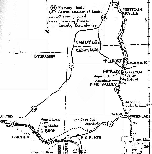
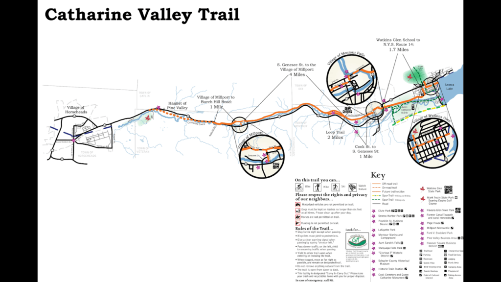
The Catharine Valley Trail is a rails-to-trails project that has been under development since the early 2000s, and follows former railroad beds and canal towpaths near Catharine’s Creek.
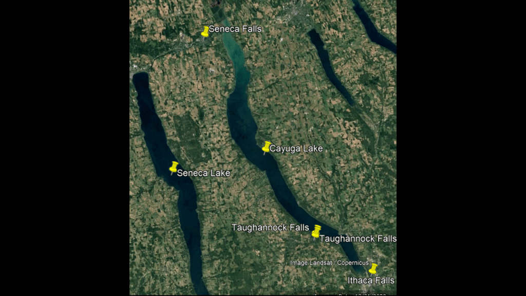
Now I am doing to take a look at the neighboring Cayuga Lake, first by way of Seneca Falls, which connects back to the Cayuga-Seneca Canal mentioned previously, and then work my way down to Taughannock Falls and Ithaca Falls, as well as Ithaca.
First, Seneca Falls.
This is what we are told.
The Seneca River, the main tributary of the Oswego River, flowing 61.6-miles, or 99.1-kilometers through the Finger Lakes Region, begins at Geneva, and flows east past Waterloo and Seneca Falls, and skirts the northern end of Cayuga Lake, and turns north at the Montezuma Marsh National Wildlife Refusge, another protected wetland.
We are told the private Seneca Lock Navigation Company was formed in 1813, and dammed three sets of rapids and installed locks to allow goods to be transported to the Erie Canal, and that the locks at Seneca Falls were completed in 1818, and that by 1821, there were eight stone locks between the two lakes and nearly two-miles or 3-kilometers, of dug canals.
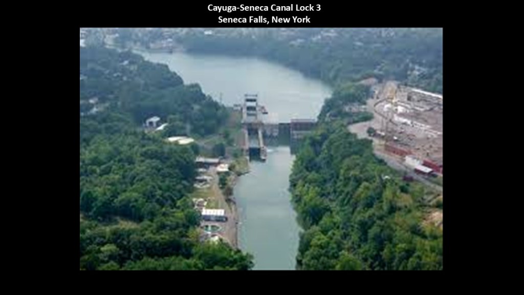
For all intents and purposes in our narrative, the Cayuga-Seneca Canal was first opened in 1828 connecting to the Erie Canal at Montezuma.
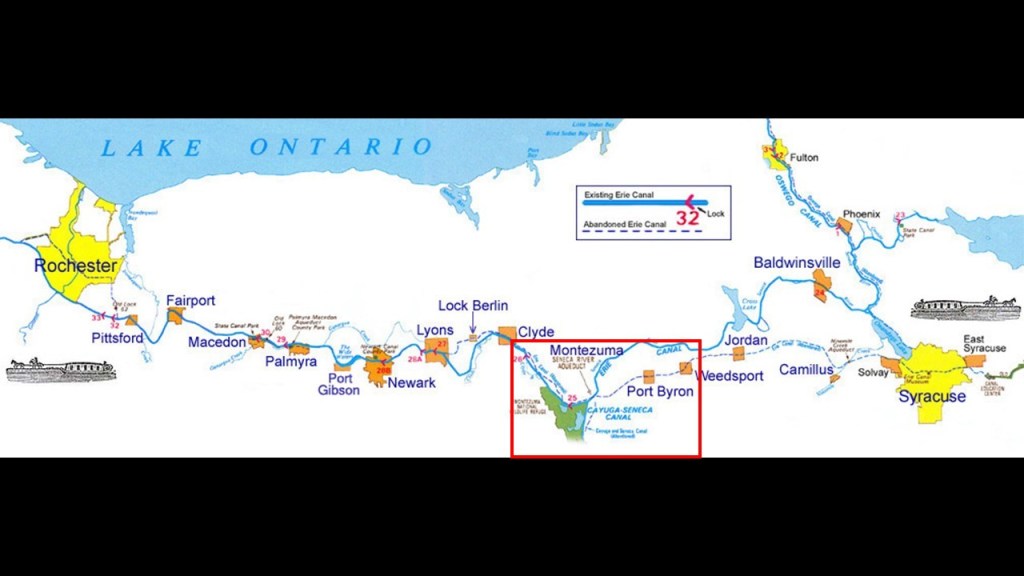
Cayuga Lake is the longest and second largest of the Finger Lakes, after Seneca Lake.

We are told that the water-level of Cayuga Lake is regulated by the Mud Lock at the north-end of the Lake, which is lock 1 of the Cayuga-Seneca Canal.
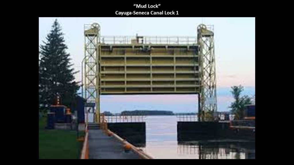
The north-end of Cayuga Lake is dominated by shallow mudflats and wetlands.
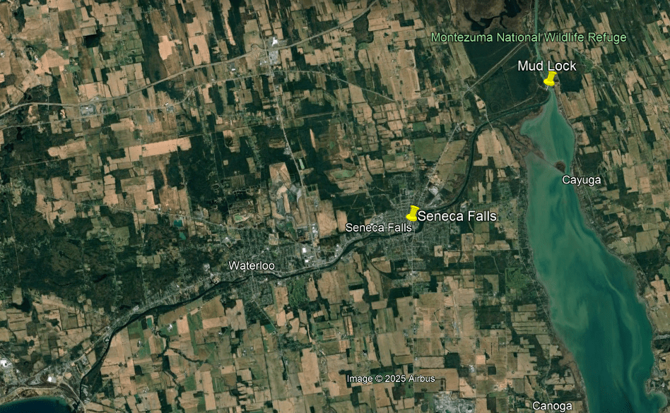
Interestingly, the Finger Lakes Vintage Rail Experience still runs on the north-end of Cayuga Lake across the Cayuga Lake Causeway…
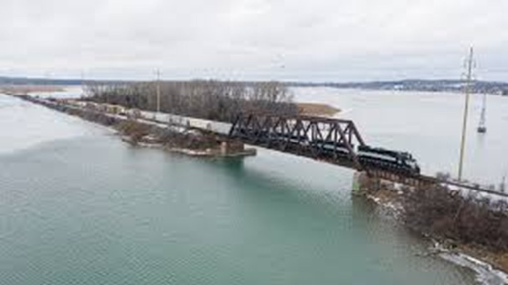
…and throughout the northern end of the Finger Lakes region.
Now I am going to drop on down to the southern end of Cayuga Lake, and take a look at Taughannock Falls, Ithaca Falls, and Ithaca.
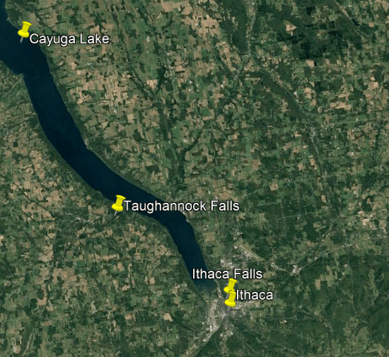
Taughannock Falls, at 215-feet, or 66-meters, -tall, is the tallest, single-drop waterfall in the United States.
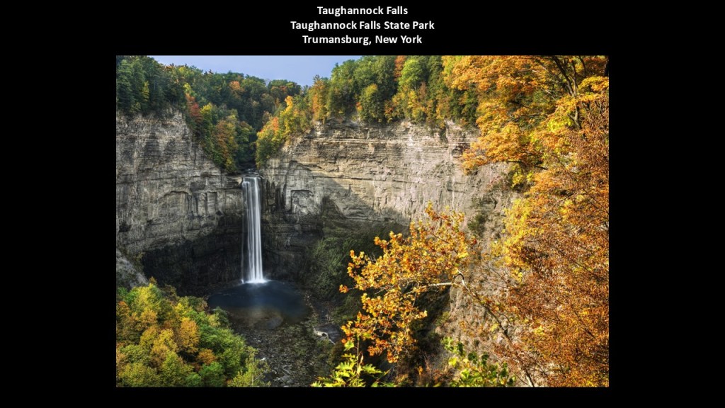
I have long suspected that waterfalls are infrastructure of some kind, and not created by natural forces over a vast periods of geological time as we have always been taught.
Early on in my research years ago, I studied countless images and videos of waterfalls on the Internet, and it appears to me that all of the waterfalls carry the same signature.
These examples shown here for Taughannock Falls in New York State on the left; Slap Sopot in Istria, a region shared between Croatia, Slovenia and Italy, in the middle; and in Davao in the Philippines on the right, just scratch the surface of one type of the many types of waterfalls there are available to find in different places around the world.
As I looked at waterfalls all over the world, it seemed as if they had a selection of models of waterfalls to choose from, from small to large.
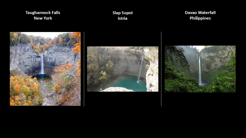
As we have seen throughout this post, there are three waterfalls at this location as well.
In addition to this one, there are two more waterfalls on Taughannock Creek in Taughannock Falls State Park – the Bikini Cascade and the Lower Taughannock Falls.
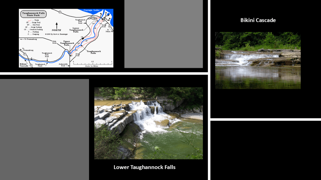
We are told that starting in the mid-1850s, Taughannock Falls became a tourist destination, with railroads, steamboats and hotels serving the region, like the Taughannock House Hotel.

By 1925, tourism was failing and the State of New York acquired the land to form a park that year, and that in the 1930s, the New Deal Works Progress Administration improved the roads and trails at the park.
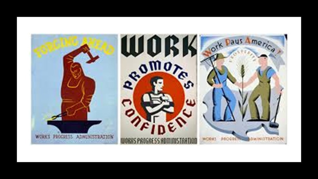
The Black Diamond Trail is a rail-trail found at Taughannock Falls State Park that was once part of the Lehigh Valley Railroad route whose Black Diamond Express once ran between Buffalo and New York City.
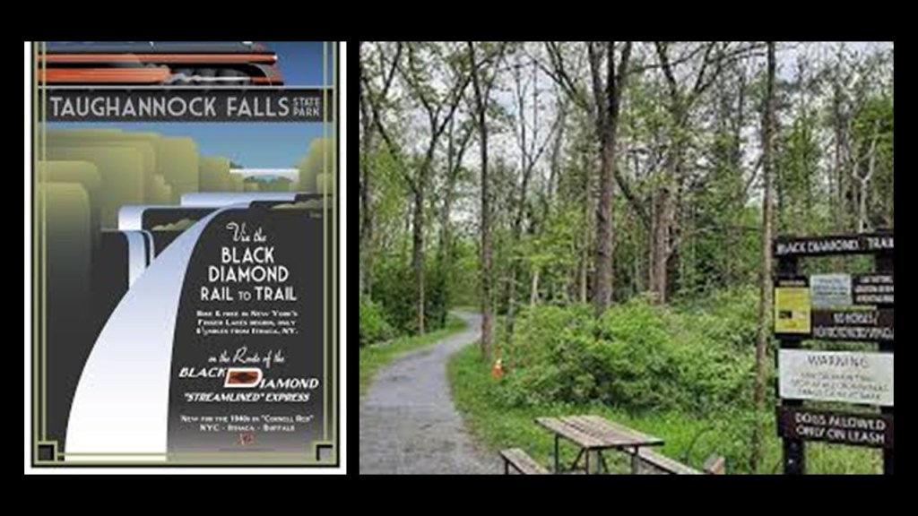
Interesting to note that what became the Taughannock Falls State Park was noteworthy for the uncovering of the petrified body of a 7-foot, or over 2-meter, -tall man when workmen were widening a carriage road near the Taughannock House Hotel in July of 1879.
We are told that over 5,000 people paid a small admission fee to see the 800-pound, or 363-kilogram, giant, but that after a short time, it was revealed to be a hoax perpetrated by the hotel’s owner and two of his associates.
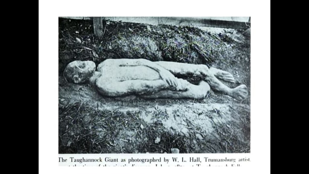
The original giant was said to be damaged and lost, but local artists constructed a replica for the Tompkins Center for History and Culture in 2019.
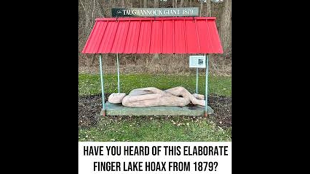
Ithaca is at the southern end of Cayuga Lake, approximately 11-miles, or 17-kilometers, to the southeast of Taughannock Falls State Park.
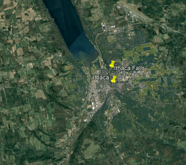
Ithaca is the home of Cornell University, an Ivy League research university founded in 1865, the same year the American Civil War ended…
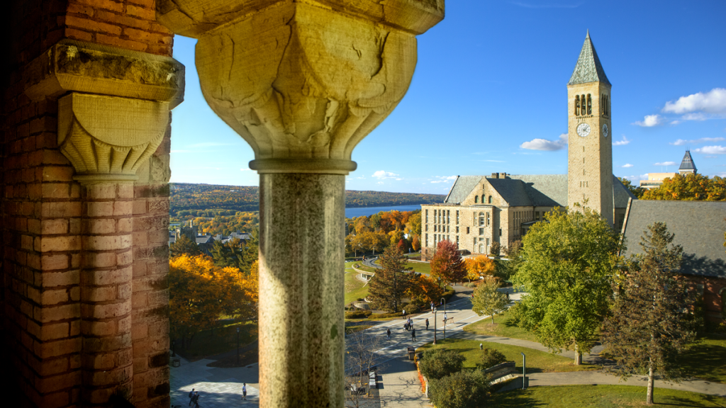
…and Ithaca College, a private liberal arts college founded in 1892 as a conservatory of music, and particularly known for its media-related programs and entertainment programs.
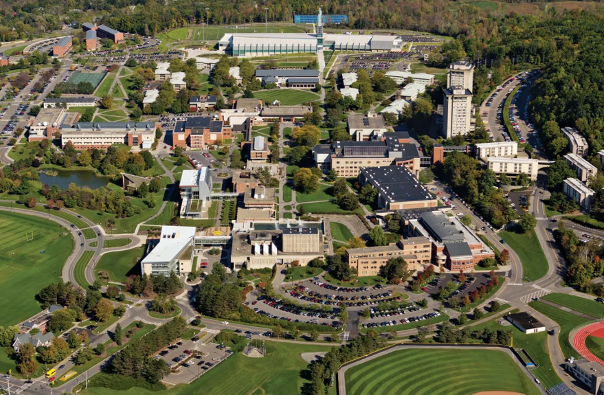
In our historical narrative, European settlement of Ithaca began in 1800, and in the 19th-century, it became a transshipping point for things like salt and gypsum.
The town of Ithaca was organized and incorporated in 1821, and in 1834, the Ithaca and Owego Railroad’s first horse-drawn trains began service.
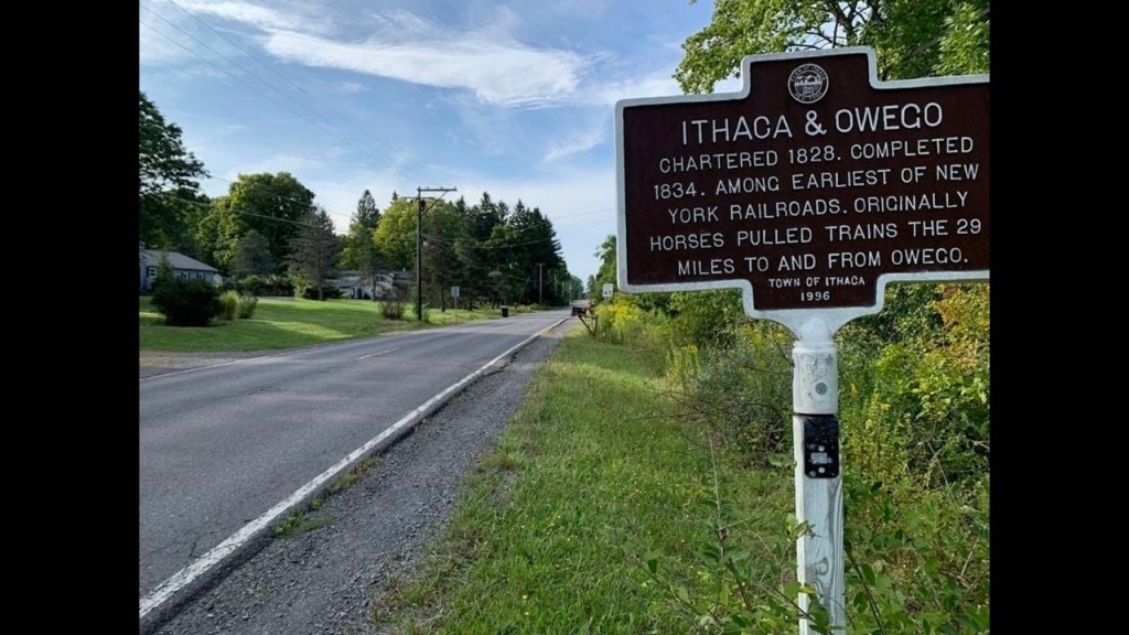
The Ithaca and Owego Railroad was reorganized as the Cayuga and Susquehanna Railroad in 1842.
In 1956, this railroad’s physical right-of-way was completely abandoned, and later incorporated into the South Hill Recreation Way in Ithaca.
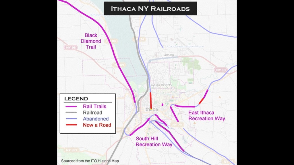
Ithaca Falls is located in downtown Ithaca in a gorge on Fall Creek, and is 150-feet, or 46-meters, -high.
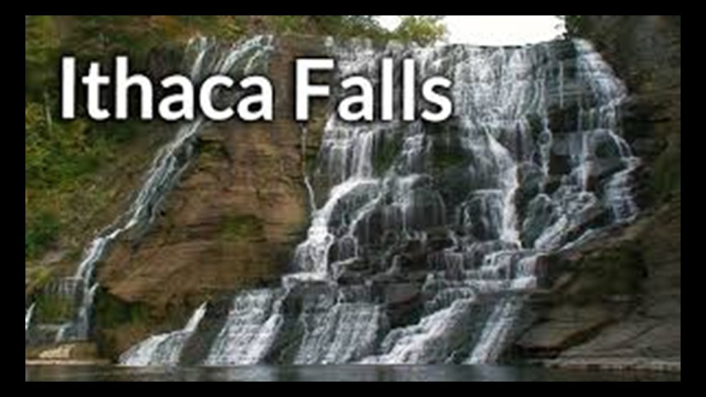
Falls Creek makes its way through the campus of Cornell University.
Beebe Lake and Triphammer Falls are some of its notable features.
Beebe Lake is a reservoir that we are told was on land that was once forested swamp, and needs to be dredged every ten years to keep it from returning to wetlands.
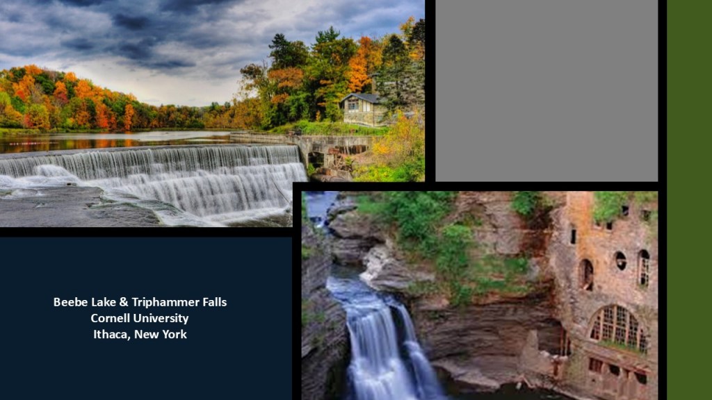
The Finger Lakes Region, especially around Seneca Lake and Cayuga lake, is an American Viticultural Area known for its grape-growing, and accounts for about 80% of New York State’s wine-production.
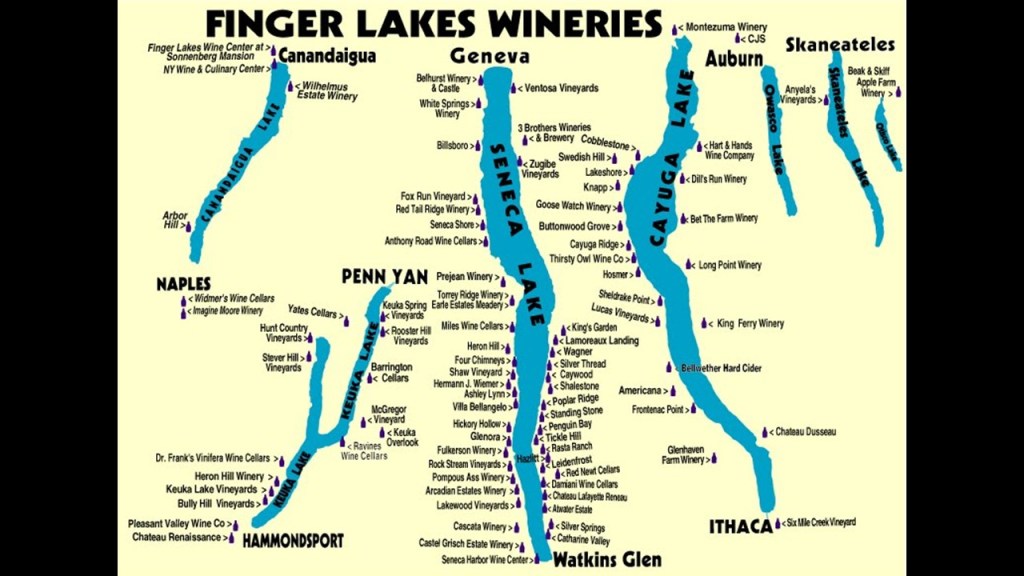
Heading east from Cayuga Lake, we next come to Owasco Lake, with the city of Auburn at the northern end, and Moravia and Montville Falls at the southern end.
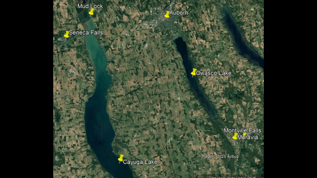
Owasco Lake was a popular vacation spot for the wealthy in the late 19th-century and early 20th-centuries.
Railway service ran along the western side of the lake historically, and was integral to the tourism boom on Owasco Lake, and the railway connected to steamboat services that took people to different resorts around the lake.
The rail infrastructure that was once here is long-gone.
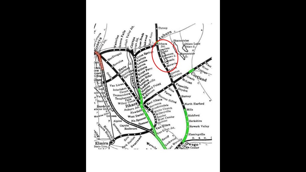
Auburn at the northern end of Owasco Lake was first settled by Europeans in 1793, and was incorporated as a village in 1815 and chartered as a city in 1848, and only a few miles from the Erie Canal, allowing local factories to inexpensively ship goods.
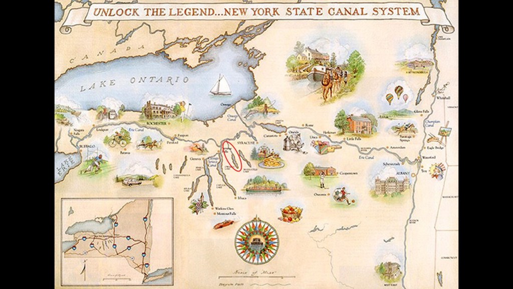
We are told the Southern Central Railroad completed a line through Auburn, financed by the Lehigh Valley Railroad, to carry anthracite coal from Athens, Pennsylvania to Fair Haven, where there were shipping wharves on Lake Ontario.
Anthracite coal was a primary energy source at the time.
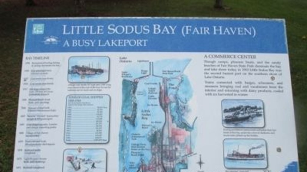
In our historical narrative, the “Anthracite Region” in Pennsylvania was where the story of “where America was built” began.

Anthracite coal is the purest form of coal, and this region contains most of the world’s supply of anthracite coal.
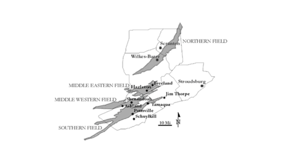
Today, the Anthracite Region in northeastern Pennsylvania is considered one of the largest concentrations of disturbed terrain in the world, with billions of tons of debris found in the landscape of abandoned strip mines and this region has among the highest poverty and unemployment rates in the United States with job loss from the descrease in coal mining and the outmigration of people because of it.
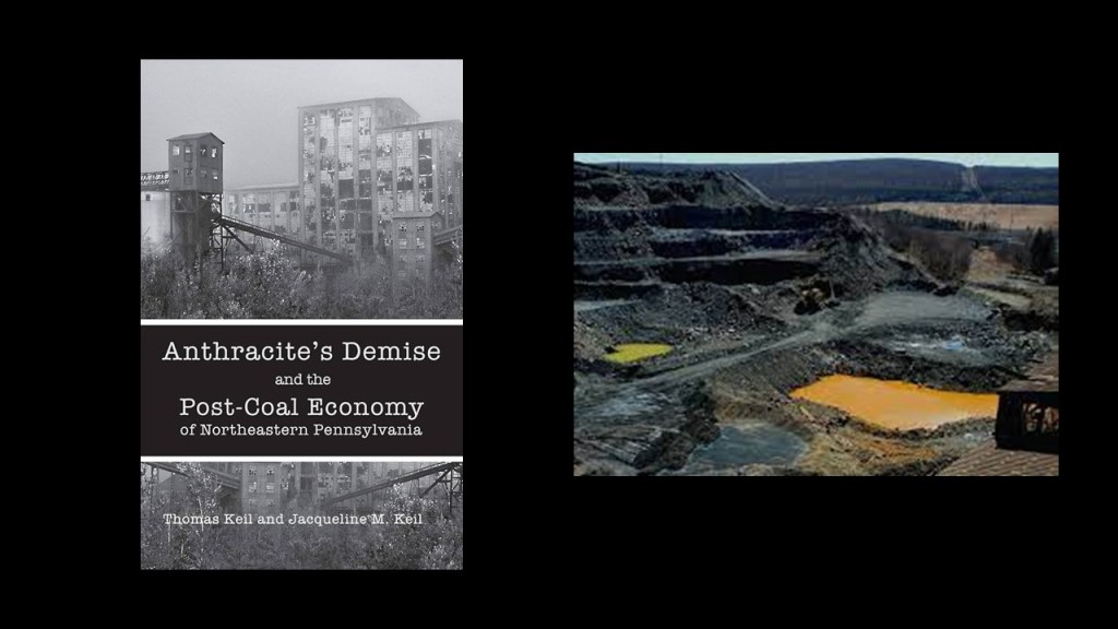
I believe the beings behind the deliberately-caused cataclysm were shovel-ready to dig enough of the original infrastructure out of the ruined Earth so the infrastructure could be used and civilization restarted, which I think started in earnest in the mid-to-late 1700s and early 1800s.
They only used the pre-existing infrastructure until they found replacement fuel sources that could be monetized and controlled by them and when what remained of the original infrastructure was no longer useful to them, or inconvenient to their agenda, they had it destroyed, discontinued, or abandoned, typically in a very short time after it was said to have been constructed.
In the “Old World,” the power supply for the canal and rail-systems would have been the same free-energy generated by the Earth’s worldwide grid system, and in the “New World,” they had to use mule- or horse-power to be able to utilize the original infrastructure initially until they had replacement fuel sources in place to jump-start the systems until they could be upgraded to first electricity, then ultimately replaced by gasoline-powered vehicles.
The Auburn Prison was said to have been constructed between 1816 and 1817, and was the second prison in New York State.
In 1890, it was the site of the first execution by electric chair.
It was also the location of the development of what was called the “Auburn System.”
This was a correctional system in which prisoners were housed in solitary confinement in large rectangular buildings, and forced to participate in silence in penal labor.
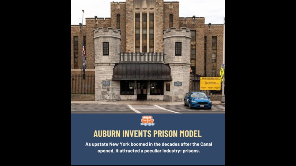
The town of Moravia on the other end of Owasco Lake was the birthplace of President Millard Fillmore and the childhood home of John D. Rockefeller.
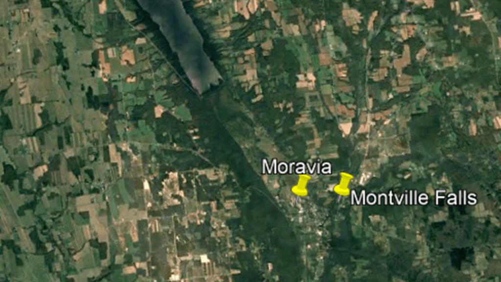
Millard Fillmore was the Vice-President in the administration of President Zachary Taylor.
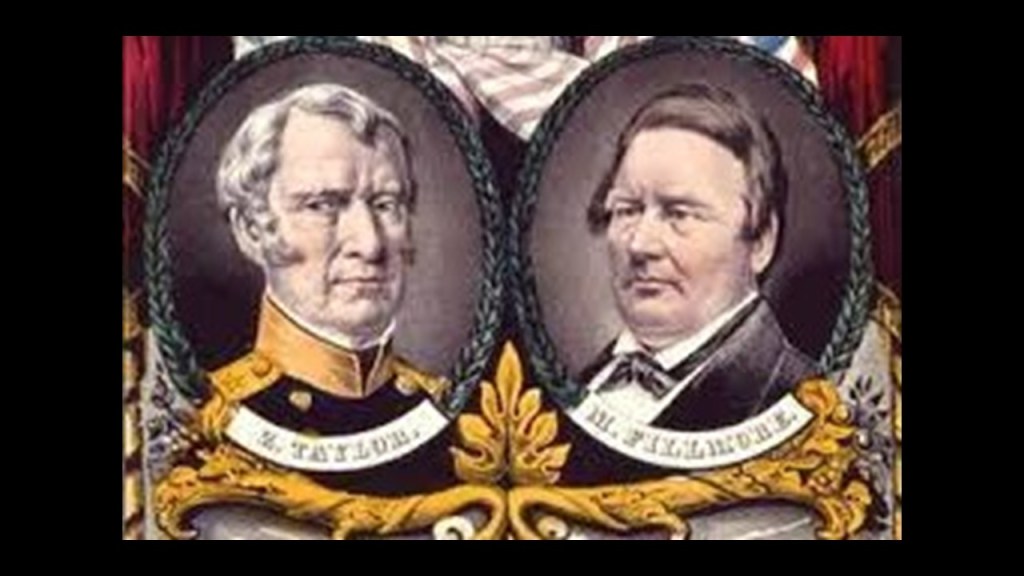
General Zachary Taylor was a key figure in the Mexican-American War, which took place between 1846 and 1848, and was an invasion of Mexico after the United States annexed Texas in 1845, which Mexico had refused to recognize.
Taylor was elected president in 1848, and he died in July of 1850, allegedly after consuming copious amounts of raw fruit and iced milk at a July 4th fundraising event at the Washington Monument, became severely ill with a digestive ailment, and died several days later.

So Millard Fillmore became the 13th President of the United States in 1850.
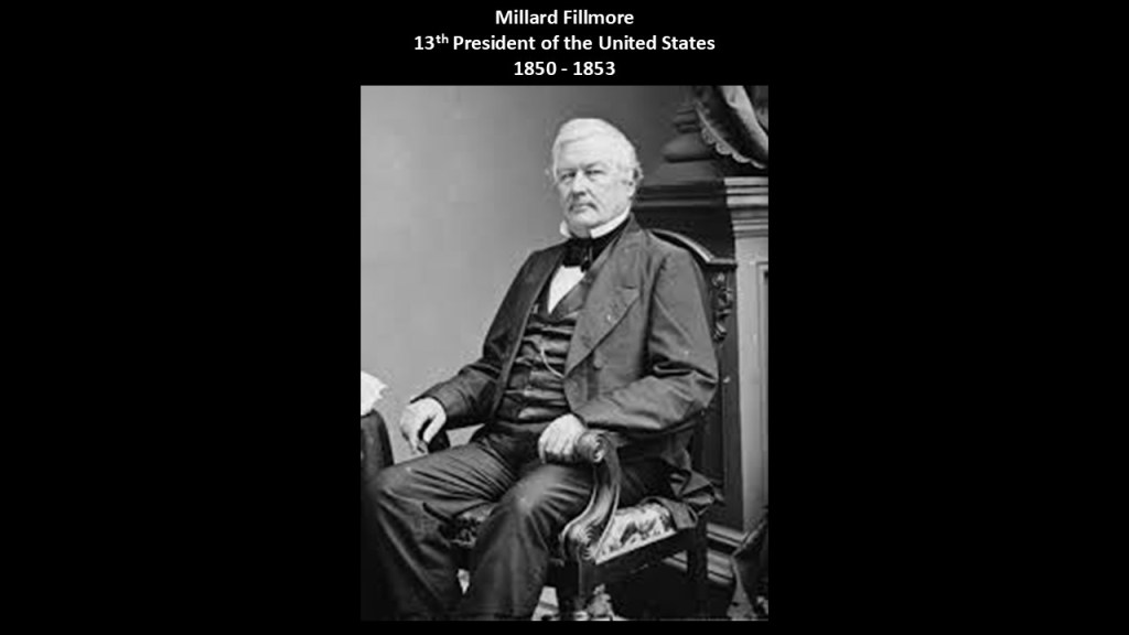
Millard Fillmore was also the President who ordered Commodore Matthew Peary to Japan in 1853 to force the opening of Japanese ports to American trade by any means necessary.
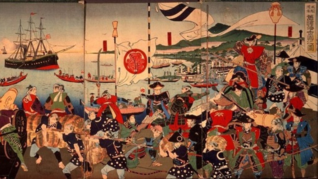
John D. Rockefeller’s boyhood home was in Moravia, though it was said to have burned down in 1924.
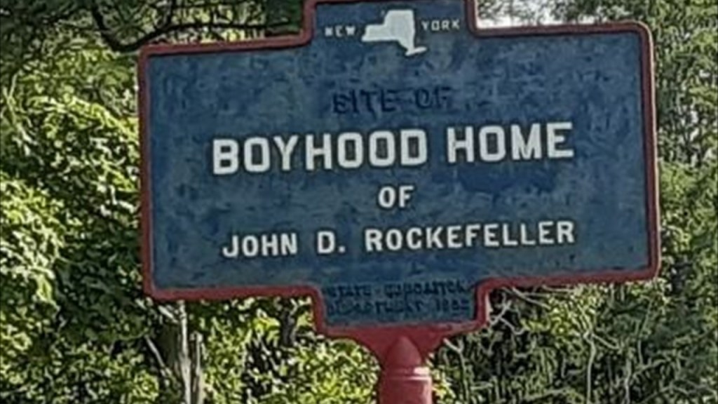
The discovery of oil in Canada in 1858 in Ontario at Oil Springs near Petrolia close to Lake Huron was contemporaneous in time with the discovery of oil in the United States.
The petroleum industry in the United States began in earnest in 1859 when Edwin Drake found oil on a piece of leased-land near Titusville, in what is now called Oil Creek State Park.
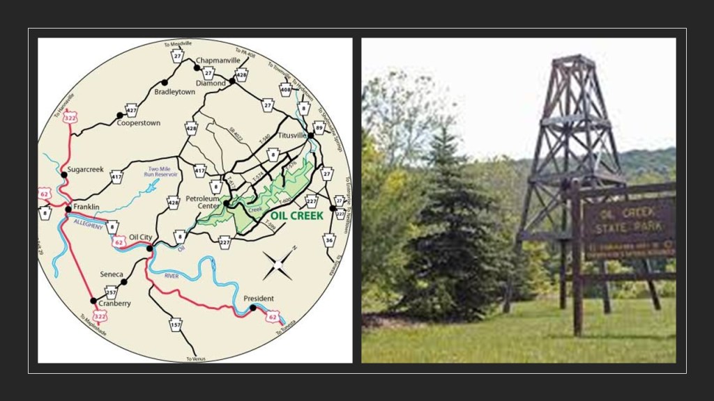
For this reason, Titusville is called the Birthplace of the Oil Industry, and for a number of years this part of Pennsylvania was the leading oil-producing region in the world.
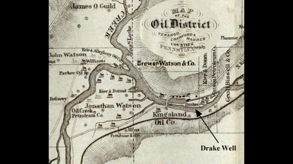
Samuel Kier had established America’s first oil refinery in Pittsburgh in 1854 for making lamp oil, just five-years before oil was “found” in Titusville.
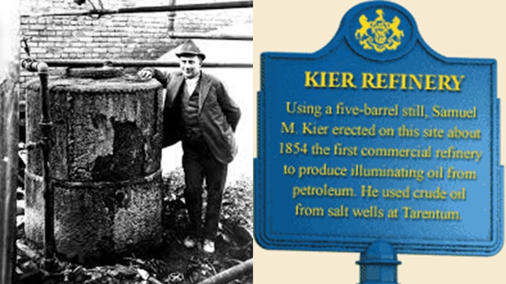
So it certainly appears like the petroleum industry was developed in the 1850s in order to provide a replacement energy technology for the free energy technology of the original civilization.
Roughly a decade after the birth of the oil Industry at Titusville, in 1870, John D. Rockefeller, along with Henry Flagler, an American Industrialist and major developer in the state of Florida, founded the Standard Oil Company, an American oil producing, transporting, refining, and marketing company.

Oil was used in the form of kerosene throughout the country as a light source and heat source until the introduction of electricity, and as a fuel source for the automobile, with the first gas-powered automobile having been patented by Karl Benz in 1886.
John D. Rockefeller, Sr, who was born in 1839, was the progenitor of what became the very wealthy Rockefeller family.
Rockefeller’s wealth soared as kerosene and gasoline grew in importance.
At his peak, he controlled 90% of all oil.
As quickly as possible, a way was found to replace what remained of the free-energy system with their own coal- and oil-based system, and in the process make money hand over fist from the total control of the new system.
He was considered to be the wealthiest American of all time, as seen in this ranking by CNN Business.

Montville Falls and Decker Creek Falls are on private property to the northeast of Moravia, and Fillmore Glen has deep gorges and five waterfalls, and is located to the southeast of Moravia.
Invariably I am finding more waterfalls in a given location than what I was initially looking to find from the information I had available.
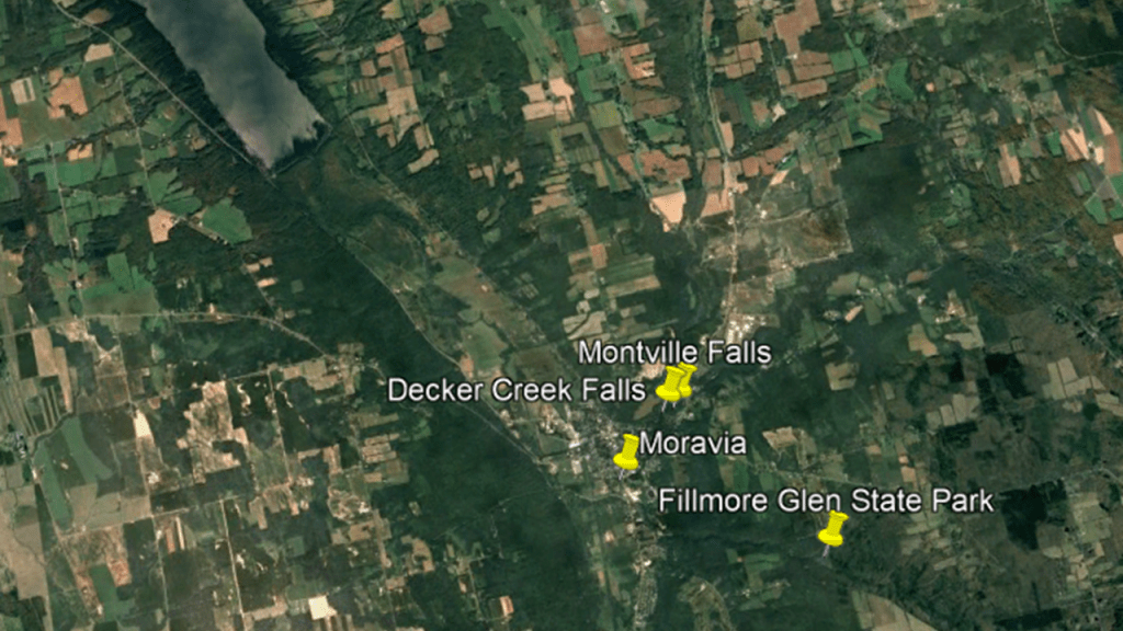
The Decker Creek and Montville Waterfalls are on private property on New York State Route 38, and the landowners do not currently allow access to go see the falls.
The Decker Creek Falls have a 9-foot, or almost 3-meter, cascade, and a 6-foot, or almost 2-meter, cascade, one right after the other.
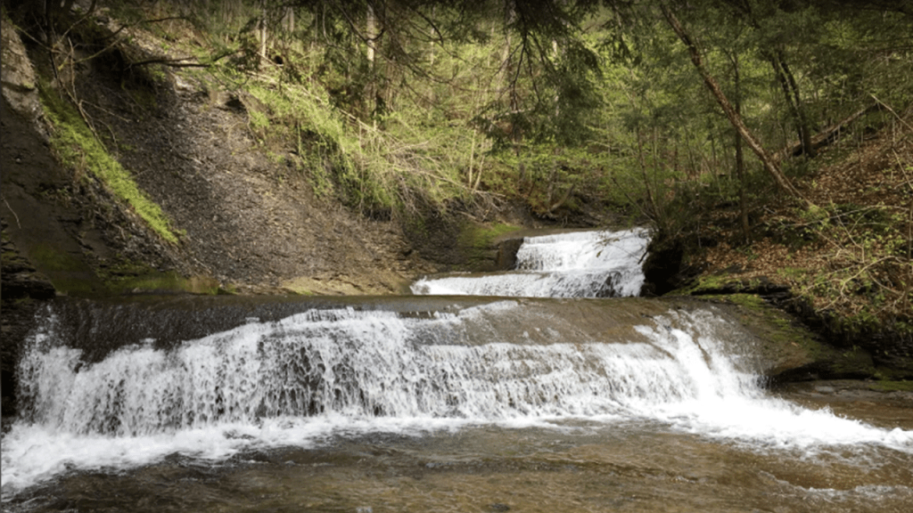
The Montville Falls are on Dresserville Creek, and are 60-feet, or almost 19-meters, high.
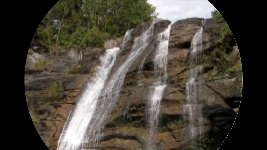
Fillmore Glen State Park, located to the southeast of Moravia, has deep gorges, hiking trails, and five waterfalls.
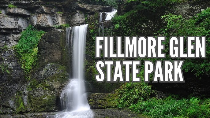
It also has what we are told is a replica of President Millard Fillmore’s boyhood log cabin, as the park is approximately 5-miles, or 8-kilometers, from where he was born.
Also, in our official narrative, the trails and infrastructure of Fillmore Glen were created and enhanced by the Civilian Conservation Corps in the 1930s.
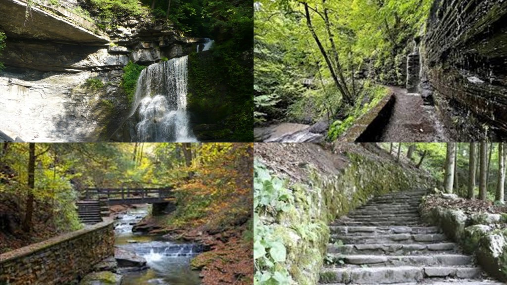
The Fillmore Glen State Park is just to the east of New York State Route 38 and just to the south of its junction with New York State Route 38A in Moravia, where they go around Owasco Lake – NY-38 on the west-side and NY-38A on the east side.
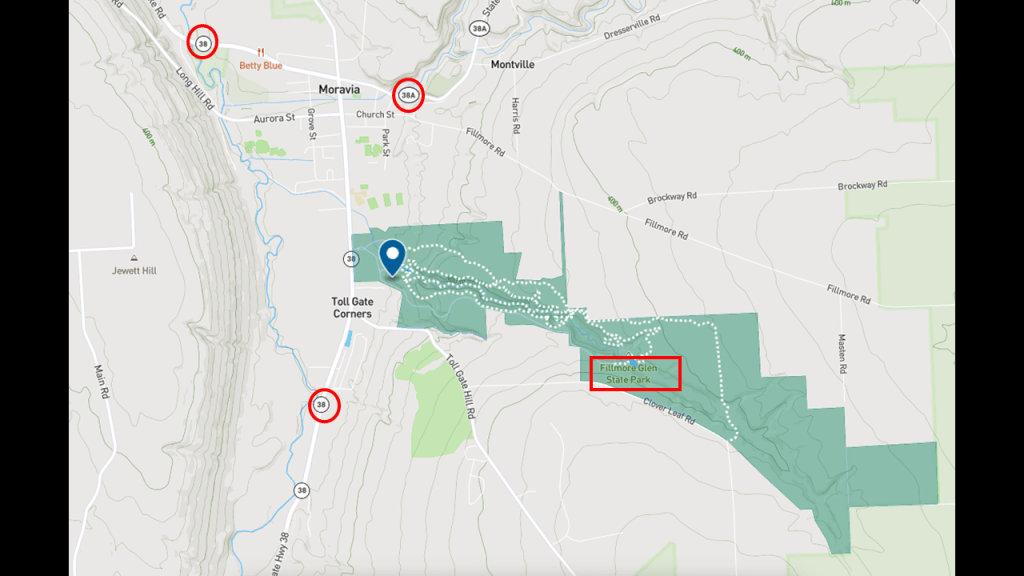
So, New York State Routes 38 and 38A intersect at Moravia.
New York State Route 38 is another North-South highway and starts at Owego near Pennsylvania at the southern end and at Sterling on the northern end, within 4-miles, or 6-kilometers, of Lake Ontario.
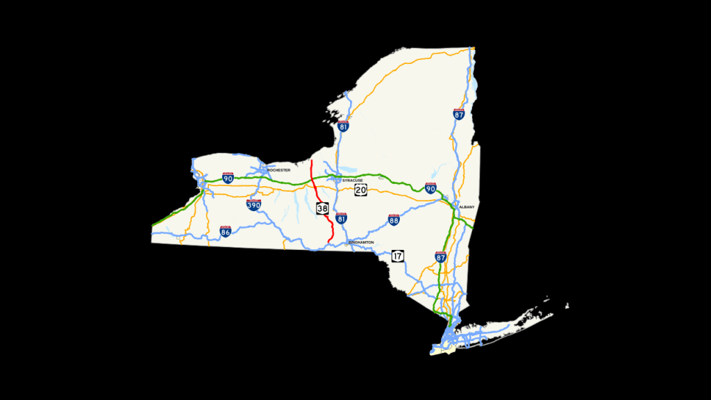
New York State Route 38A connects Moravia at the intersection with NY-38 and downtown Auburn at a junction with US-20 and NY-5.
NY-38A runs between Owasco Lake and Skanaeateles Lake.
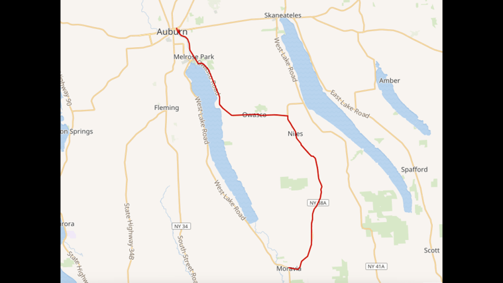
Places of interest on or near NY-38A on this Google Maps screenshot in-between the two lakes are the Dutch Hollow Country Club; the Bahar Preserve and Carpenter’s Falls; the Bear Swamp State Park; the Frozen Ocean State Forest; the Owasco Bluffs Nature Preserve; and the Owasco Flats Preserve Access.
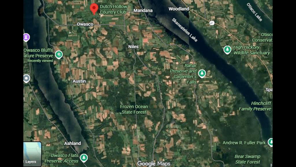
The Dutch Hollow Country Club, right in-between the two lakes, is an 18-hole public country club.
The Bahar Nature Preserve is on 53-acres, or 21-hectares, of hemlock trees and other northern hardwood trees that is part of a larger forest block of old-growth trees that fills the Bear Swamp Creek Gorge.
The Carpenter Falls State Unique Area is adjacent to the Bahar Nature Preserve.
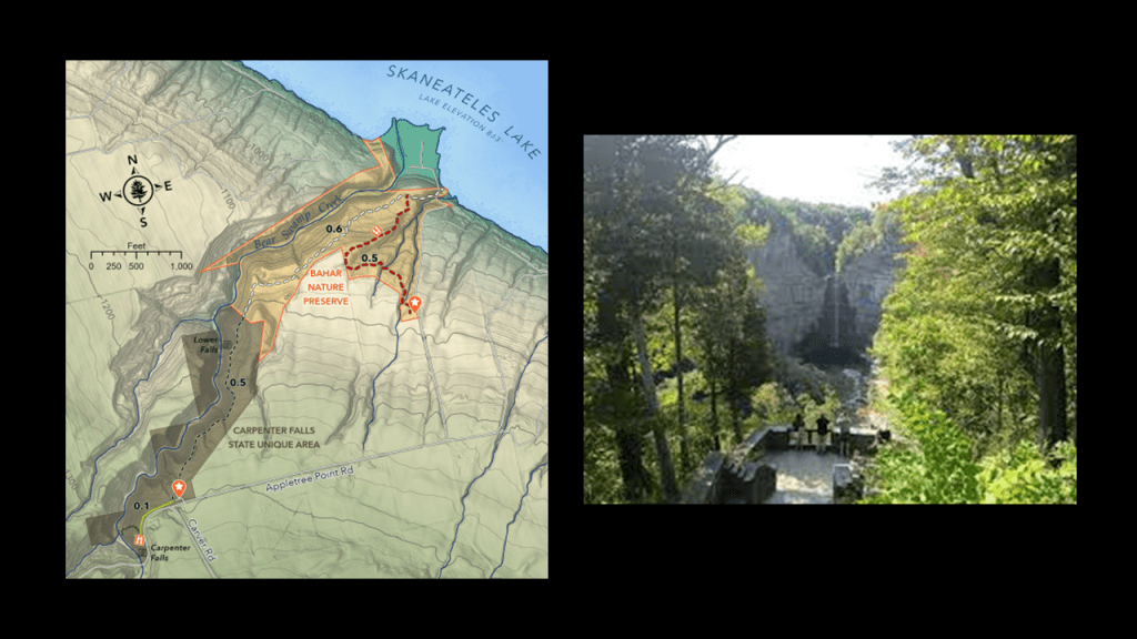
The Carpenter Falls State Unique Area is described as a 37-acre, or 15-hectare, area for recreation and watershed protection.
There are four waterfalls here, and two of them are directly accessible – the Carpenter Falls and Angel Falls.
Carpenter Falls is a 90-foot, or 27-meter, high waterfall.
Angel Falls, also known as the Lower Carpenter Falls, cascade from a 62-foot, or 19-meter, drop.
The Bear Swamp State Forest is almost 4,000-acres, or 1,600-hectares, of forests and wetlands with trails and recreational opportunities.
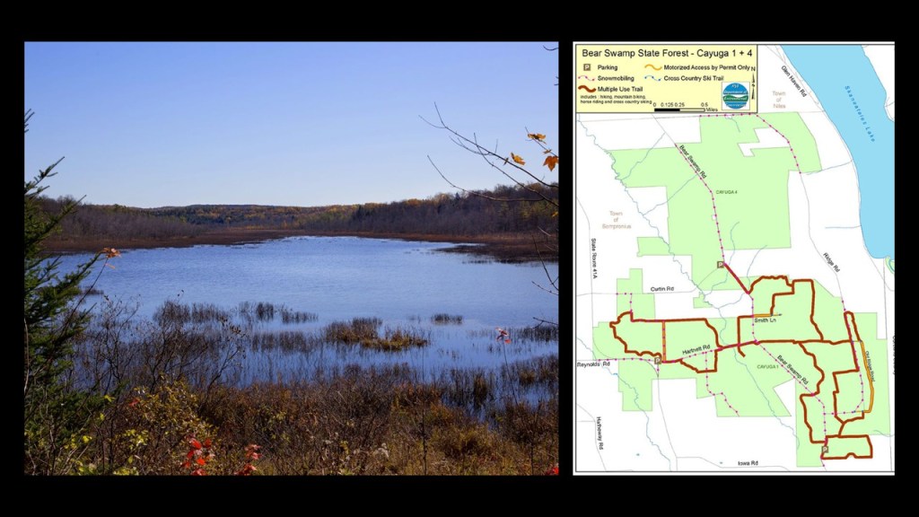
The interestingly-named Frozen Ocean State Forest on NY-38A is said to have received its name because during the winter season, extremely cold winds sweep across the land, turning the woods into frozen forests.
Like Bear Swamp, Frozen Ocean has trails and numerous recreational oppportunities.
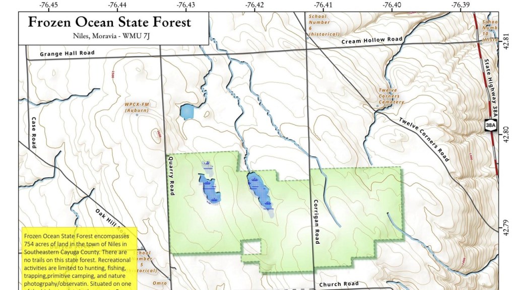
The Owasco Bluffs Nature Preserve is accessible by way of Rockefeller Road.
Rockefeller Road goes up the east-side of Owasco Lake at the junction of NY-38 and NY-38A, and connects again with NY-38A a little over half-way up the lakeshore.
The Owasco Bluffs Nature Preserve features forested bluffs overlooking wetlands, meadows and a rugged gorge, and some hiking trails.
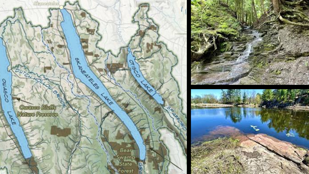
The Owasco Flats Preserve Access is at the southern end of Owasco Lake off of NY-38 that is considered a floodplain and marshland with hiking, birding, fishing, and paddling opportunities.
From what I could find out in information about the Owasco Flats, the Lehigh Valley Railroad came through the area, and as a matter of fact, just up NY-38 is the location of the old Wyckoff Station, almost directly across from the Owasco Bluffs Nature Preserve on the other side of Owasco Lake.
The Wyckoff Station is an abandoned train stop on the Lehigh Valley Railroad that was converted to a boat house.
I will continue to bring forward examples of findings like these as I work my way through the different areas that I look at in this post, but I want to take my leave of the Finger Lakes Region as I head back up to the south shore of Lake Ontario.
Before I do that, I want to share some thoughts about the Finger Lakes, as I think there is something that has been quite hidden from us about them.
Given their long and narrow appearance, it’s not hard to visualize the Finger Lakes, and this whole region for that matter, as once having been giant tree roots.
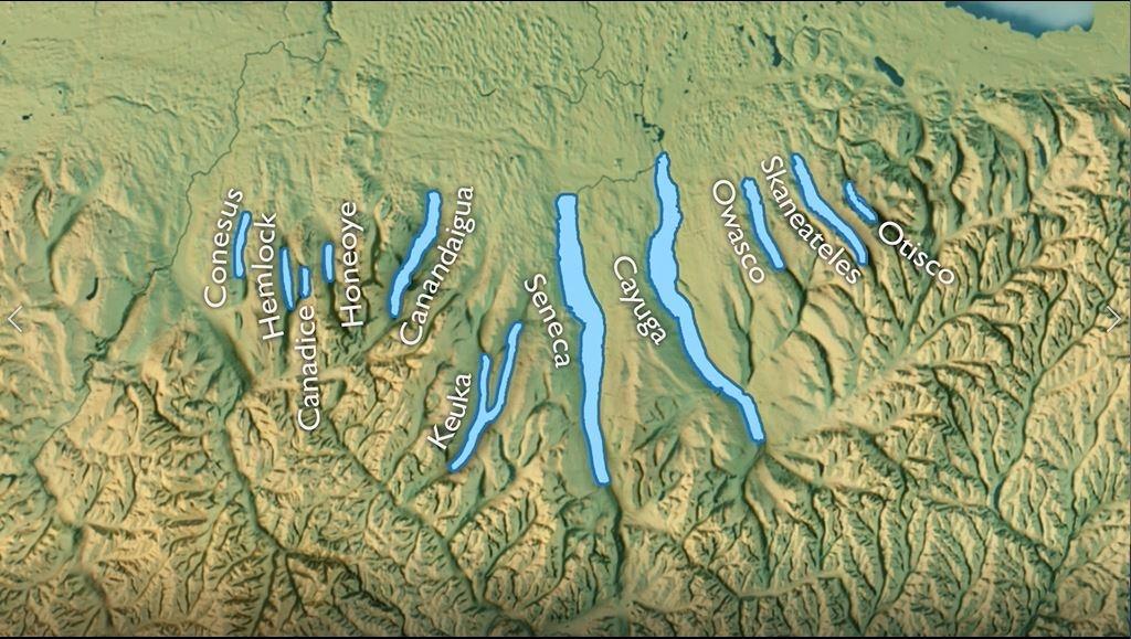
Kawartha Lakes in Ontario on the other side of Lake Ontario have a very similar appearance to the Finger Lakes, which also has a major canal running through this region called the Trent-Severn Waterway.
The Trent-Severn Waterway is a 240-mile, or 386-kilometer, -long canal route that connects Lake Ontario at Trenton to Lake Huron’s Georgian Bay at Port Severn.
It has been called one of the finest, interconnected systems of navigation in the world
We are told that canal construction started in 1833 and it was completed by 1920, when the first complete transit of the waterway took place in July of that year.
I am taking time on this subject right now because I find this region to have a very intriguing appearance that I don’t believe is the result of glacial activity during the last ice age which we have been taught.
The issue is when and how what we see in our world came into existence – slowly and over geologic time vs. suddenly and catastrophically.
Academia supports Uniformitarianism without question as the only explanation for what we see in today’s world, but I believe there is plenty of evidence to support my working belief that what we see in our would today came into existence suddenly catastrophically, and not that long ago, both in what we would call the natural world and in all the things that don’t add up in our historical narrative.
Like for one example that we ahve been consistently seeing, why on Earth would yo go through all the effort of building railroad and streetcar lines, only to abandon and remove them a relatively short-time later?
This makes no sense!
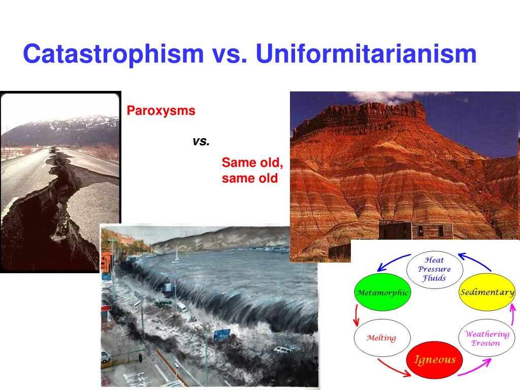
Here is a comparison of the ridge-like appearance of the Appalachian Mountains with the ridge-like appearance of the root system of a large tree on the bottom right.

I had occasion to look at what is found along the same stretch of highway, U. S. Highway Route 219, between the boggy Black Moshannon State Park near State College, Pennsylvania, and the bogs at Cranberry Glades Botanical Area, near White Sulphur Springs in West Virginia when I was doing research last year for “On the Trail of Giants – in Appalachia and Beyond.”
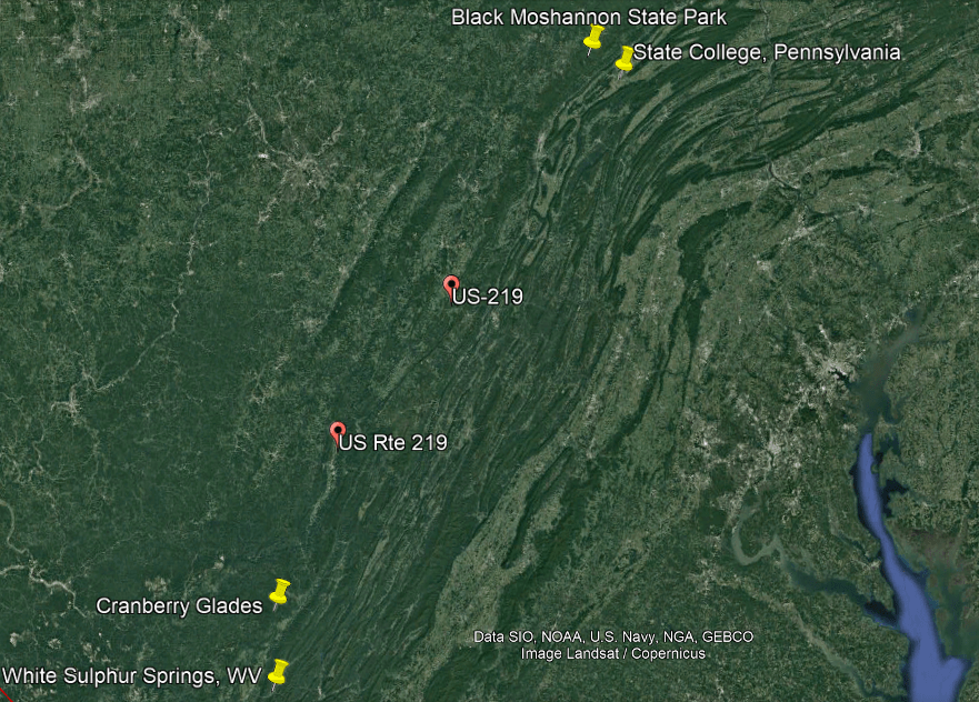
Black Moshannon State Park is the home to the largest reconstituted bog in Pennsylvania, a wetland that accumulates peat as a deposit of dead plant materials, which contains carnivorous plants, orchids, and species typically found further north.
Cranberry Glades, protected in the “Cranberry Glades Botanical Area” area, are a cluster of five, separate boreal-type bogs in southwestern Pocahontas County in West Virginia, and like Black Moshannon State Park, species are found at both these locations that are typically further north.
That both of these boglands have species typically found further north may signify some kind of North-to-South movement of land, through this geographic region in the Appalachian Mountains.
Here is a comparison of the intriguing appearance of the landscape here as seen from Google Earth on the left, compared with photos of mud flows on the right.
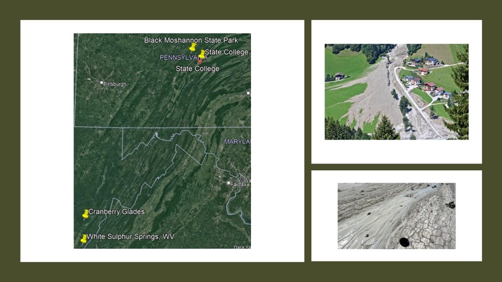
US-219 upon which both of these places are located was said to follow what was known as the “Seneca Trail,” a network of trails of “unknown age” used by indigenous Americans for commerce, trading and communication.
The “Seneca Trail” ran through the Appalachian Valley from what was to become Upper New York State, and went well into Alabama, though they are described to us in our historical narrative strictly as “footpaths.”
What we are told is that by the time the land was settled by Europeans starting in the 18th-century, it was largely abandoned by its previous inhabitants.
There was an on-line article posted on the CNN website in 2019 about what was described as the finding of the root system of the world’s oldest forest of fossilized trees in an abandoned quarry in upper New York State near Cairo, New York.
The Finger Lakes region of New York State is in-between Buffalo to the west of it and Cairo to the East.
The team investigating the site after its discovery hypothesized that the forest was killed in a catastrophic flood, and dated the forest itself back to 385-million-years ago.

At this point from my past and present research, I believe it is highly likely that ancient giant trees and the root system emanating from them were an integral part of the Earth’s energy grid and leyline system.
The original rail-lines and canals would have been providing power for the free-energy system, and the original architecture and infrastructure would have provided the antiquitech to process and utilize the free energy throughout the worldwide system.
The Earth’s original free-energy grid system was based on exact and precise geometric alignments of cities and places.
The Controllers have worked very hard not only to remove gigantic trees from our awareness, but they have also removed the Earth’s grid system from our collective awareness.
I think the giant tree “roots,” are today’s highway “routes” and recreational trails, which has more to do with human energy being harvested from their use instead of infrastructure creating free-energy for the system to use for the benefit of all life everywhere.

Now I would like to turn my attention north of where we have been looking in the Finger Lakes Region back to Lake Ontario’s south shore, where we come to Sodus Bay east of the Rochester-area.
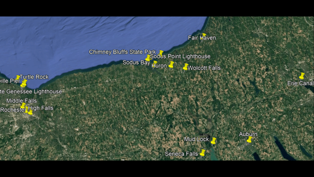
The places I have identified to look at are Sodus Bay; Chimney Bluffs State Park; the Sodus Point and Sodus Outer Lighthouses; Huron, the previously-mentioned northern terminus of NY-414; and Wolcott Falls.
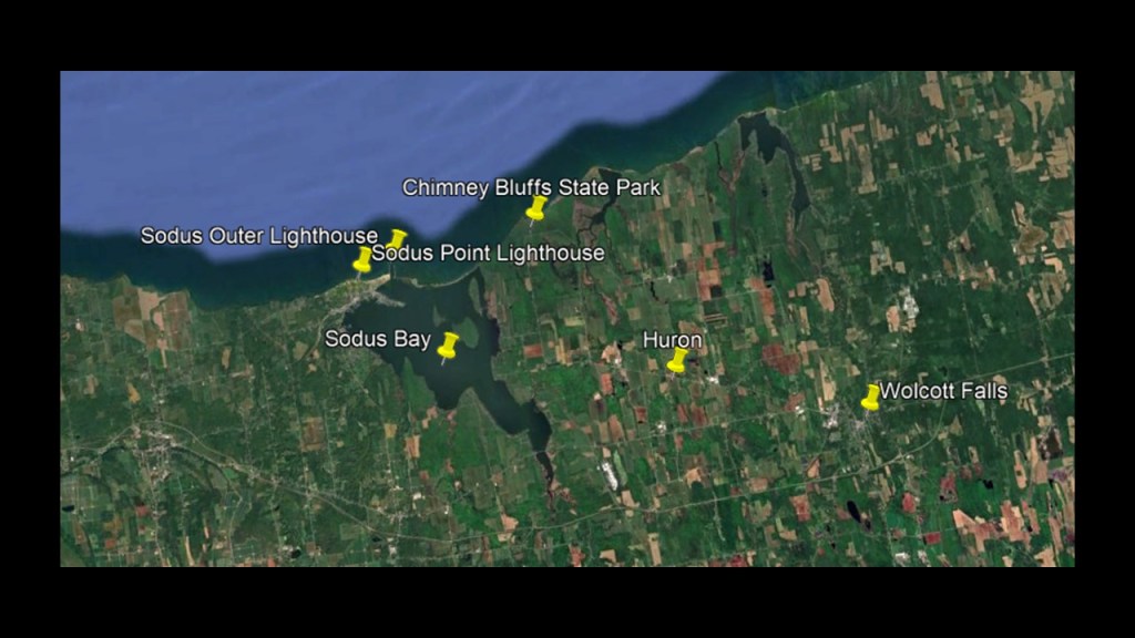
First, Sodus Bay.
Sodus Bay is one of Lake Ontario’s largest embayments, and is separated from the lake by a 7,500-foot, or 2,286-meter, -long, barrier beach.
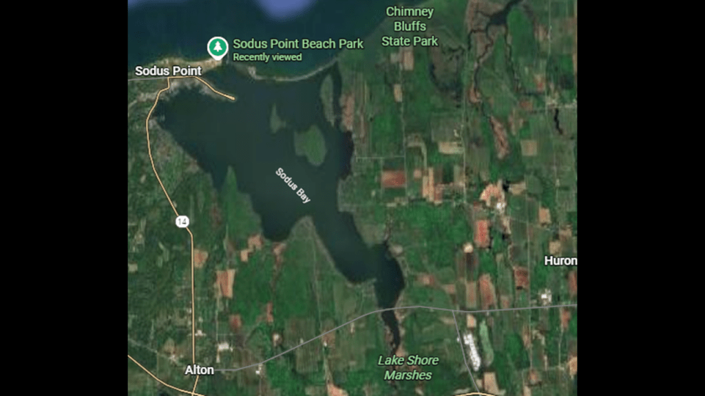
A barrier beach is defined as a long, low-lying strip of sand and dunes that runs parallel to the mainland, separated from it by a lagoon, marsh, or bay.
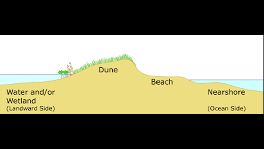
An embayment is defined as a recess in a coastline forming a bay.
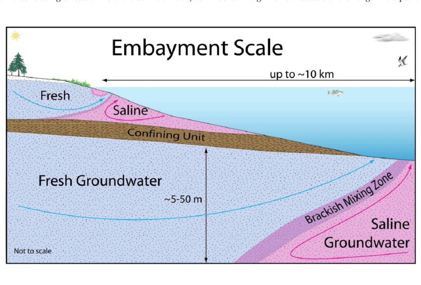
The Lake Shore Marshes are Wildlife Management Areas that spread across this part of Lake Ontario, including the southern end of Sodus Bay.
The focus at these locations are wildlife and habitat management, and wildlife-dependent recreation.
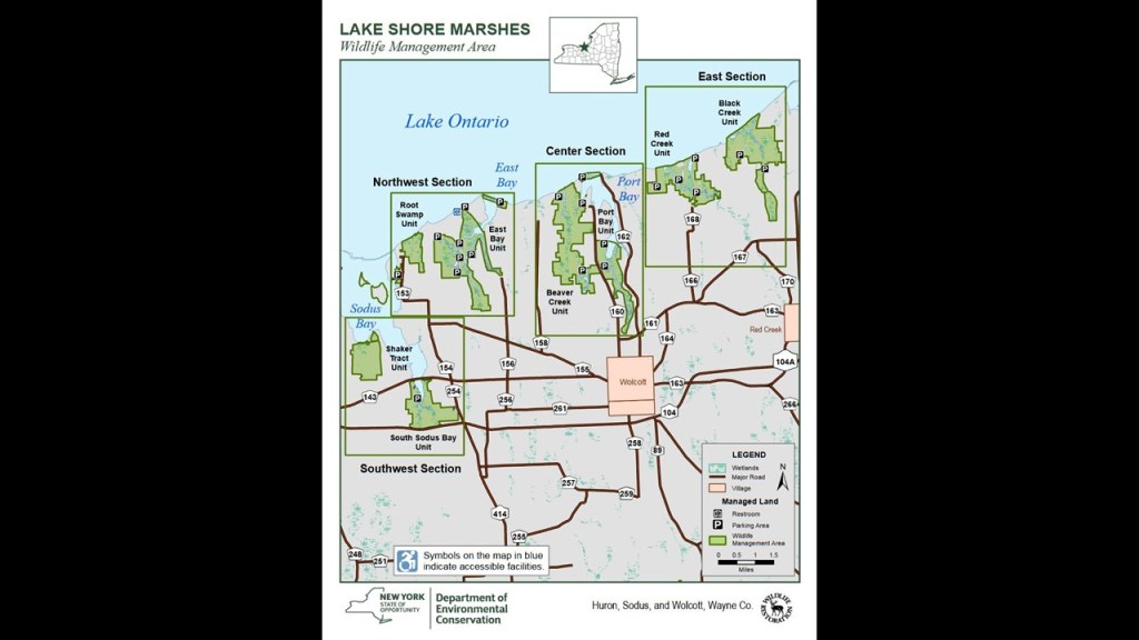
The Chimney Bluffs State Park is in the northeast part of the Sodus Bay-area.
The Chimney Bluffs are described as dramatic rock formations that tower over Lake Ontario in a park with scenic woodland and beach trails, and their formation attributed to glacial sediment that was deposited and shaped by glaciers during the most recent ice age.
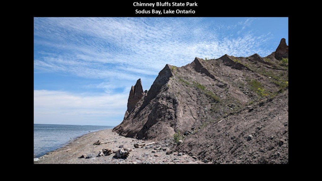
We are told that the area has been a landmark for many years, including during the Prohibition-era when smugglers used it as a landing point when transporting liquor from Canada.
The State of New York acquired the land in 1963.
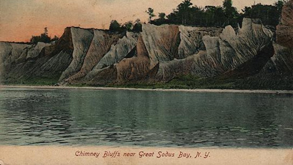
A “bluff” is defined as a steep bank or cliff that is formed by a depositional process.
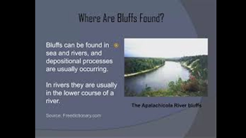
But another meaning of the word “bluff” is a deception, or an attempt to deceive, and it is my belief this is the definition in-play here as cover-up code word for the destruction of the original infrastructure by calling it instead the result of natural forces.

Chimney Bluffs brings to mind the Pictured Rocks National Lakeshore on Lake Superior near Munising, Michigan.
The “Pictured Rocks” are described as dramatic, multicolored cliffs with unusual sandstone formations…
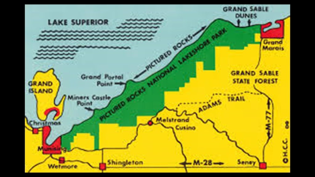
…that look suspiciously like ruined or melted infrastructure, like “Miners Castle Rock.”
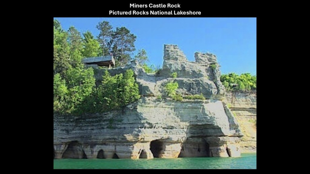
Next at Sodus Bay I am going to look at the Sodus Point and Sodus Outer Lighthouses.
What we are told is that the original Sodus Point Lighthouse tower was constructed out of limestone in 1825, but that the lighthouse was first lit in 1871.
It was deactivated in 1901.
It is owned by the Village of Sodus Point and is a museum today.
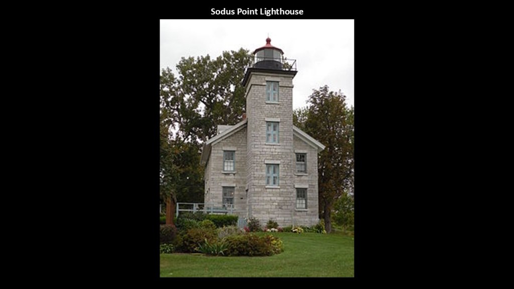
The Sodus Outer Lighthouse is at the end of the westernmost of two piers that define the channel into Sodus Bay.
It was said to have been first established in 1858 with a wooden tower and that the wooden tower was replaced with the current cast-iron structure in 1938, which would have been during the Great Depression.
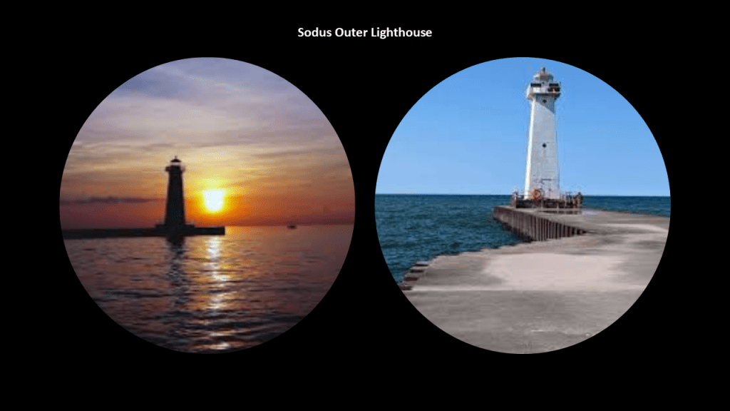
Like the Sodus Outer Lighthouse, I have consistently found lighthouses in the Great Lakes region and around the world as having alignments with what is going on in the heavens above, with the sun…
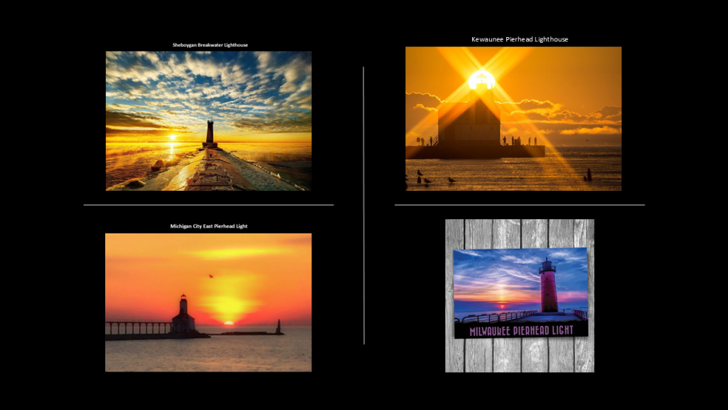
…the moon…
…and the Milky Way.
Huron is near Sodus Bay, the previously-mentioned northern terminus of NY-414.
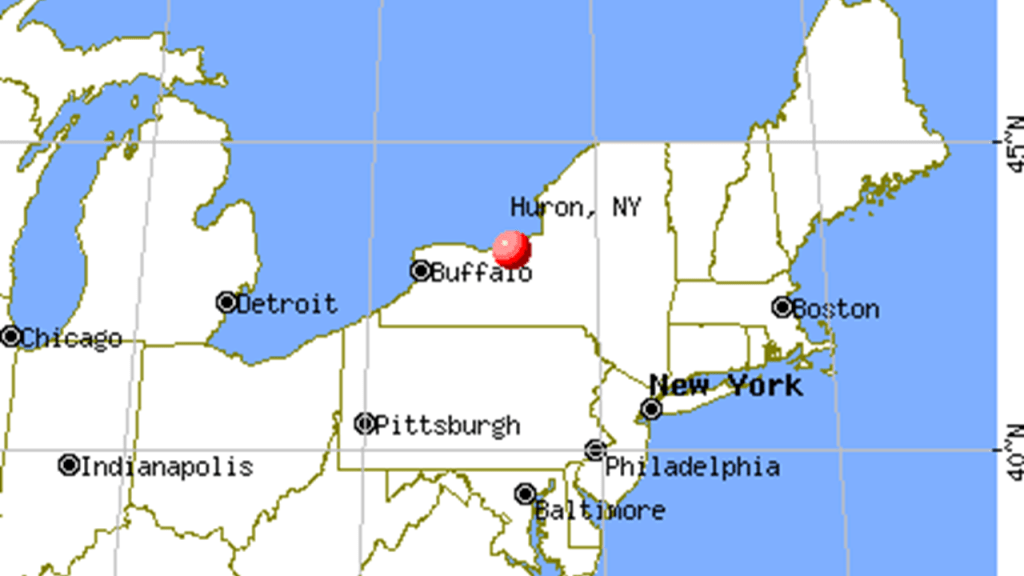
The town of what became Huron was part of the Pulteney Association’s pruchase of a large portion of western New York in 1792 from the “Phelps and Gorham Purchase.”
The “Phelps and Gorham Purchase” took place in 1788, where the State of Massachusetts sold its “preemptive rights” to a large potion of western New York owned by the Seneca Nation also known as the “Genessee Tract” to a syndicate of land developers led by Oliver Phelps and Nathaniel Gorham.
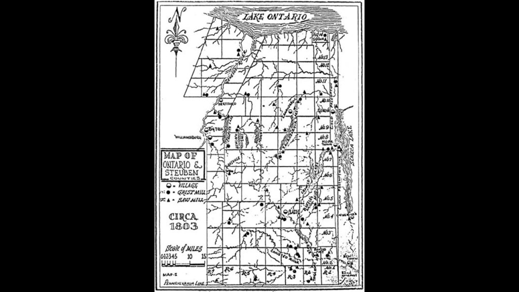
What became the Town of Huron was created from the Town of Wolcott in 1826.
Wolcott was named after American Founding Father and the nineteenth Governor of Connecticut, Oliver Wolcott.
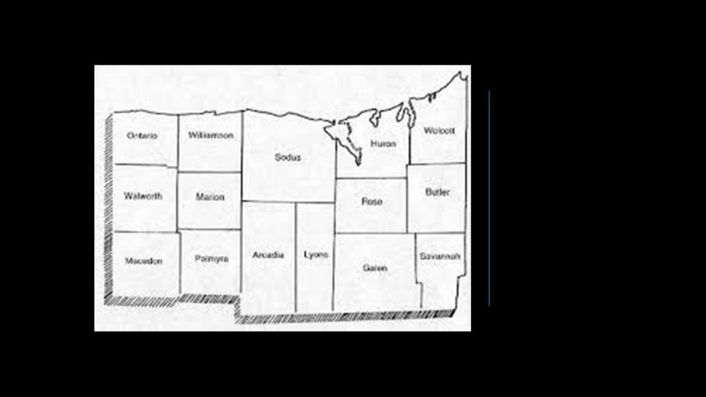
From what I was able to find, there was an iron ore bed in Wolcott that provided the ore for a blast furnace in Wolcott in the first half of the 1800s.
Wolcott Falls are located in the Wolcott Falls Park on Mill Street near the downtown area.
The falls are somewhere in the neighborhood of 50-feet, or 15-meters, -high.
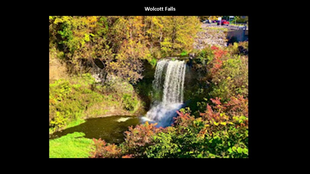
Mill Street in Wolcott was historically significant because it was the location of a sawmill and gristmill complex powered by the waterfalls and a mill pond.
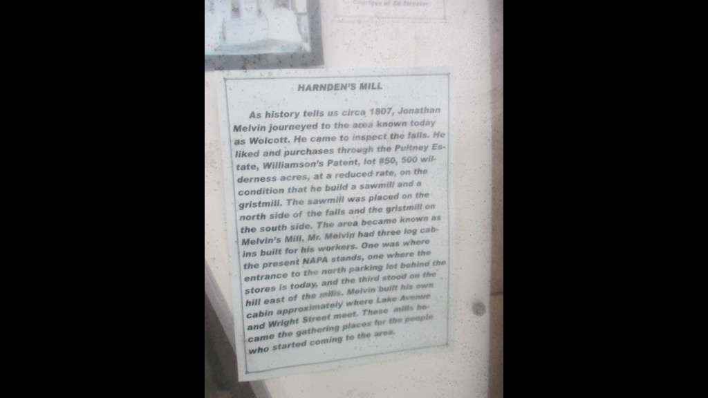
These locations are geographically-close to the previously-mentioned Fair Haven, where we are told the Southern Central Railroad had completed a line through Auburn, financed by the Lehigh Valley Railroad, to carry anthracite coal from Athens, Pennsylvania to Fair Haven, where there were shipping wharves on Lake Ontario.
Fair Haven is on Little Sodus Bay.
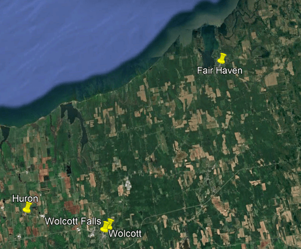
We are told that the sand bars on Little Sodus Bay were widened and protected by jetties in the middle of the 19th-century and improved the shipping capabilities here.
The original Fair Haven Range lighthouses were said to have been built in 1872 and torn down in 1945.
But the lighthouse keeper’s house still stands and is a private residence these days.
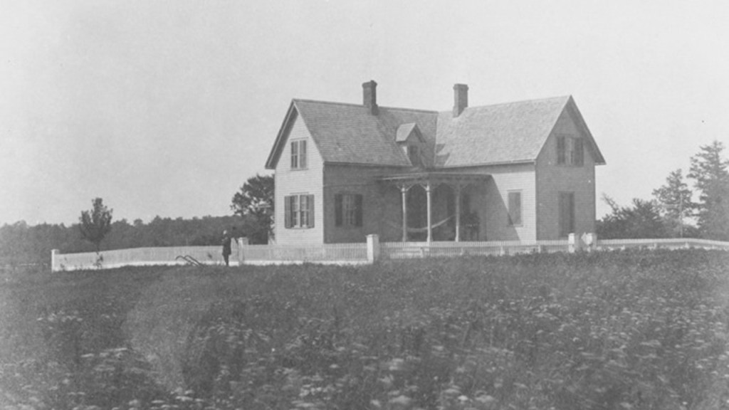
We are told the Southern Central Railroad served Fair Haven from 1872 until 1887, when it was absorbed by the Lehigh Valley Railroad.
Besides the shipment of anthracite coal from Athens, Pennsylvania, to Fair Haven, summer tourists arrived by rail from Auburn to enjoy the waterfront parks and beaches.
Eventually its use as a port waned and the rail service ended, but the State of New York acquired the land for the Fair Haven Beach State Park 1920s, and we are told the park was constructed by the Civilian Conservation Corps in the 1930s.
The park covers shoreline bluffs, sandy beaches, and adjoining forestlands, with recreational facilities…
…and an 18-hole golf course.

The next place we come to as we go up the southern shore of Lake Ontario is the Oswego-area.
Oswego promotes itself as “The Port City of Central New York.”
We are told that the first European settlement here was a British trading post in 1722 at what became Fort Oswego in 1727, but this fort was destroyed in 1756 during the French and Indian War.
Besides Fort Oswego, there were two more historic forts here – Fort Ontario and Fort George.
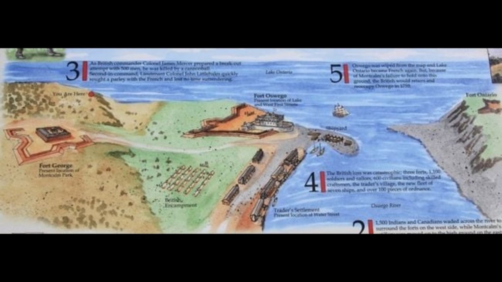
Fort Ontario is on the east-side of the Oswego River, and is preserved in the Fort Ontario State Historic Site, with the current fort said to have been built between 1839 and 1844.
There was said to be a fort at this location since 1755, but that it has been destroyed and rebuilt several times during wars throughout its history, including, but not limited to the French and Indian War and the War of 1812.
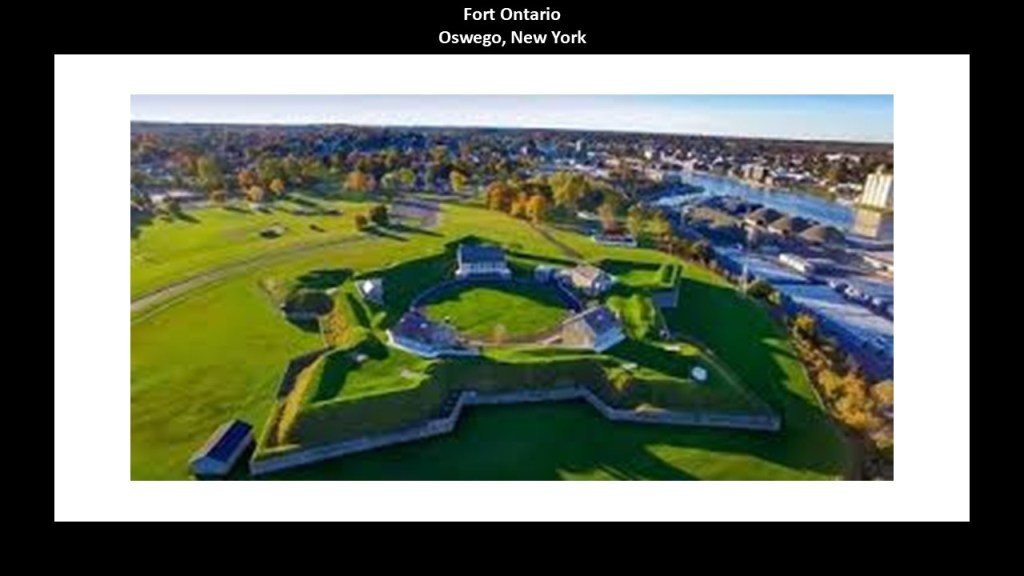
The historic location of Fort George on the west-side of the Oswego River is Montcalm Park.
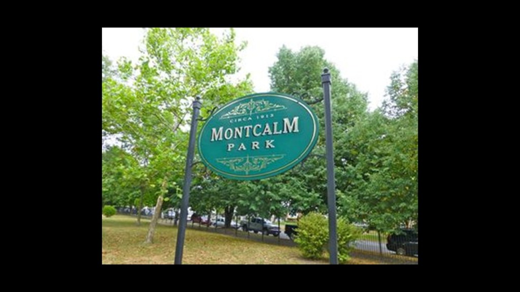
Fort George was said to have been built in 1755 as an outwork of Fort Oswego, and that it was captured and destroyed along with Fort Oswego by French and Indians under the command of the Marquis de Montcalm in August of 1756, and never rebuilt.
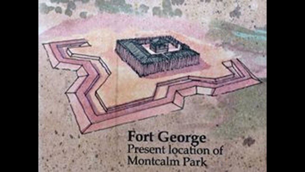
The current Oswego West Pierhead Lighthouse was said to have been built in 1934, which was during the Great Depression, to replace an earlier lighthouse that had been constructed in 1880.
It is the only lighthouse of four in Oswego that is still-standing, and is still an active aid to navigation.
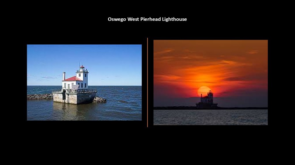
The Oswego Canal connected Lake Ontario at Oswego to the Erie Canal at Three Rivers, and first opened in 1828.
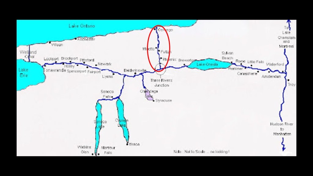
There are a total of seven locks on the Oswego Canal in its total distance of 23.7-miles, or 38.1-kilometers, in length.
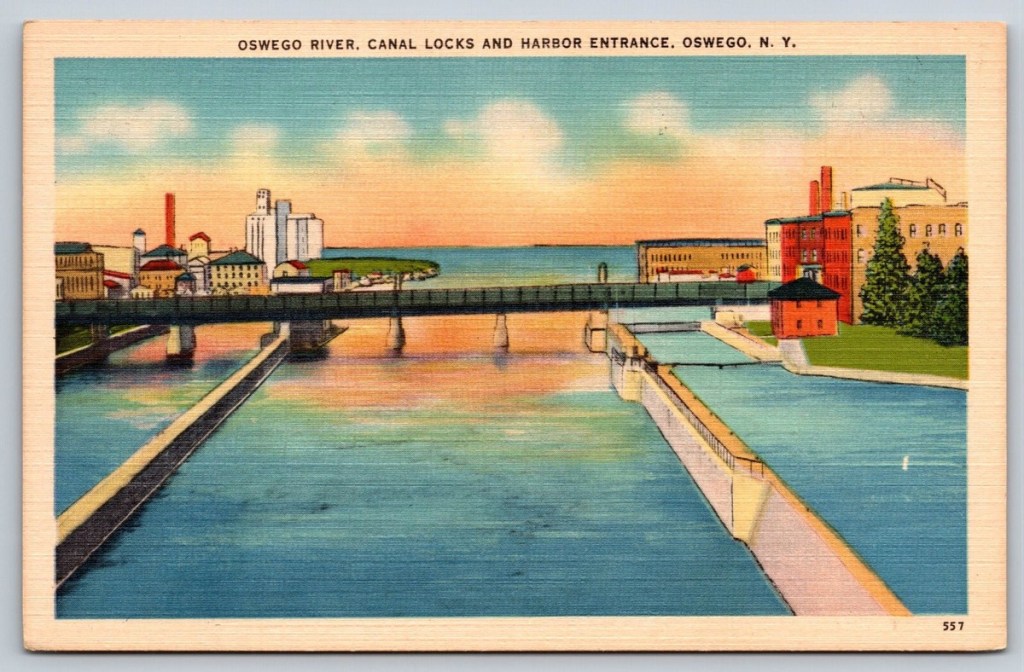
Oswego was once a hub for several major railroads: the New York Central Railroad (NYC); the Delaware, Lackawanna and Western Railroad (DL & W); and the New York, Ontario, and Western Railway (O & W).
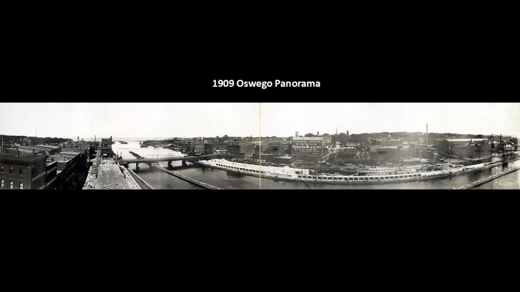
Today, there is only freight rail service through CSX on Oswego’s existing rail infrastructure.
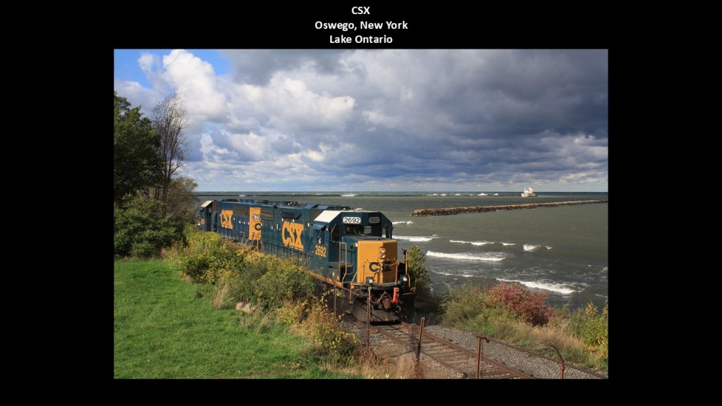
The Oswego Speedway was said to have been established in 1951, and paved with asphalt in 1952, and that prior to that it was a horse-racing track.
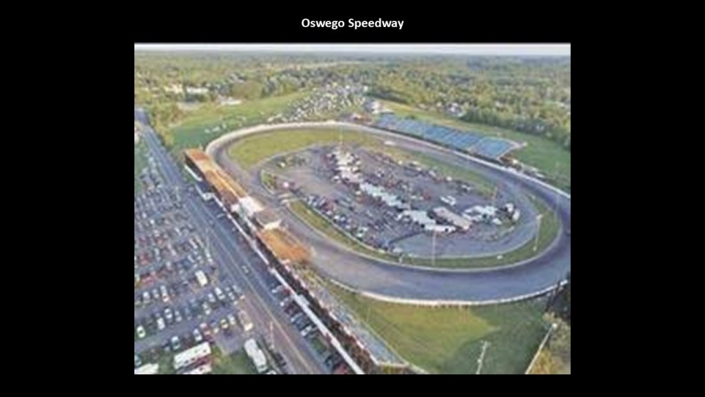
The Oswego Speedway hosts events like NASCAR races, and is the last track in the world to utilize supermodifieds in its weekly programs.
Supermodified racing is for a class of race-cars built for short, paved tracks.
They are light-weight cars, with huge engines and large, adjustable wings to keep them grounded at high speeds.

The Oswego County Airport is located to the southeast of the Oswego Speedway in a linear relationship a relatively short-distance away, a relationship between racetracks and airports found in many places.
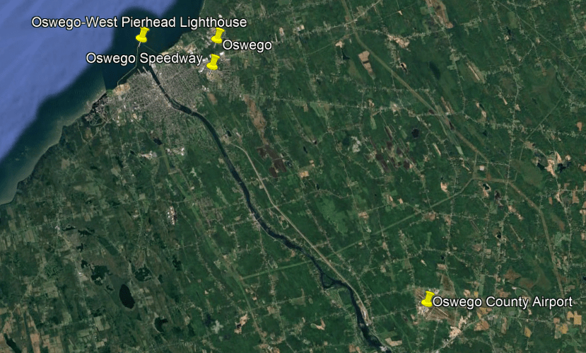
The Nine-Mile Point Nuclear Station is just 5-miles, or 8-kilometers, up the Lake Ontario shore from Oswego, in the town Scriba.
The Nine-Mile Point Nuclear Generating Station and the James A. FitzPatrick Nuclear Power Plant are at this location.
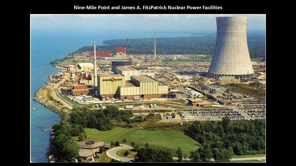
In the last part of this series on the Ontario-side of Lake Huron, I came across the Bruce Power Nuclear Plant near Kincardine and the Point Elgin Beach.
Interesting to find nuclear power plants right on the edge of water, and brings to mind my consistent research findings of nuclear plants in odd locations, including wetlands.
I tend to think nuclear energy was a pre-existing technology too, like everything else I have been talking about that we have always been told came about in modern times.
The next places I am going to take a look at moving up along the southern shore of Lake Ontario are the Selkirk/Salmon River Lighthouse and the Salmon River Falls.

First, the Selkirk/Salmon River Lighthouse.
The Selkirk Lighthouse is located at the mouth of the Salmon River near Pulaski, New York.
It was said to have been constructed in 1838 by local contractors.
It was originally deactivated in 1858, only 20-years after it was said to have been built, because even though commerce was booming when it was built, a planned canal wasn’t built and Selkirk faded in importance, and a lighthouse beacon was no longer justified.
Then in 1989, the Coast Guard installed a solar light in the lantern room, and it was reactivated as a Class II navigation aid.
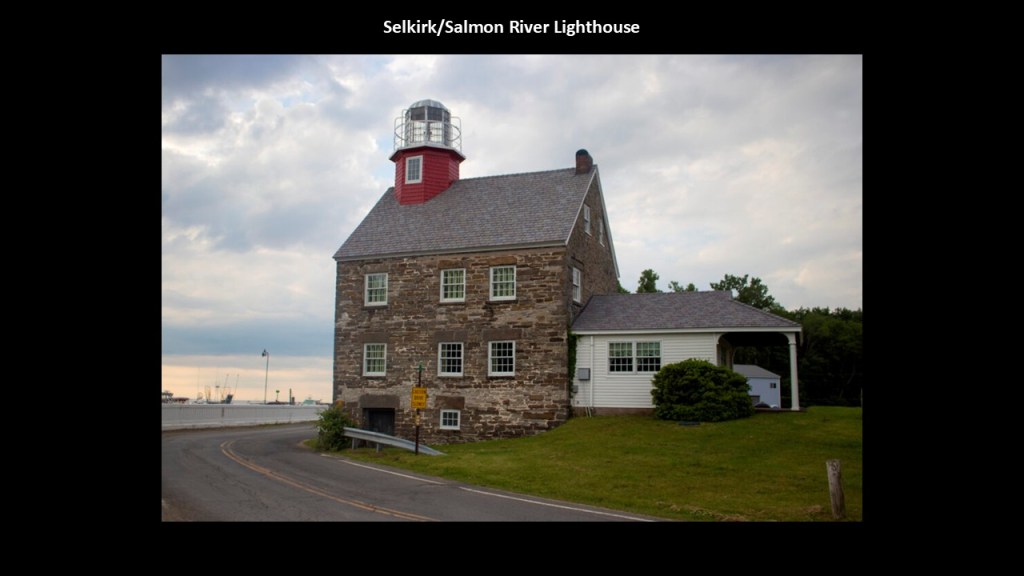
The village of Pulaski is located on US Highway Route 11 and adjacent to Interstate 81.
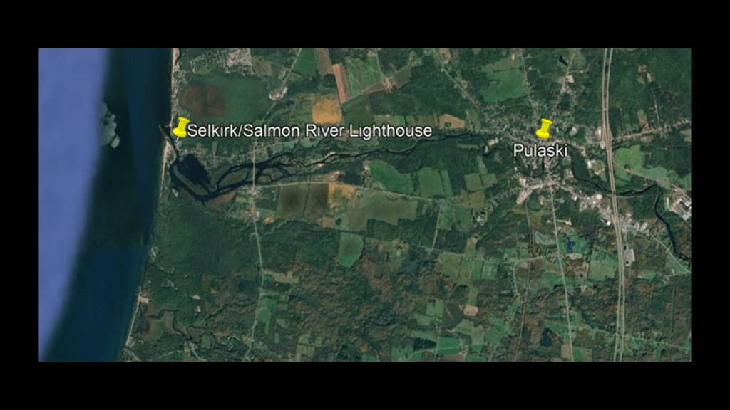
This part of New York State lies in the Snowbelt, which is characterized by heavy, lake-effect snowfalls and long winters, typically between mid-November and mid-April.
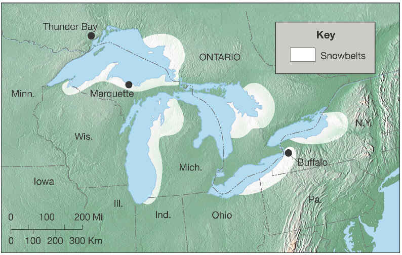
Historically there were a lot of mills and factories in Pulaski, with an estimated 120 that came and went, from wood mills to iron works.
Just a few industrial companies remain today, including Fulton Companies, Healthway and Scholler Technical Paper.
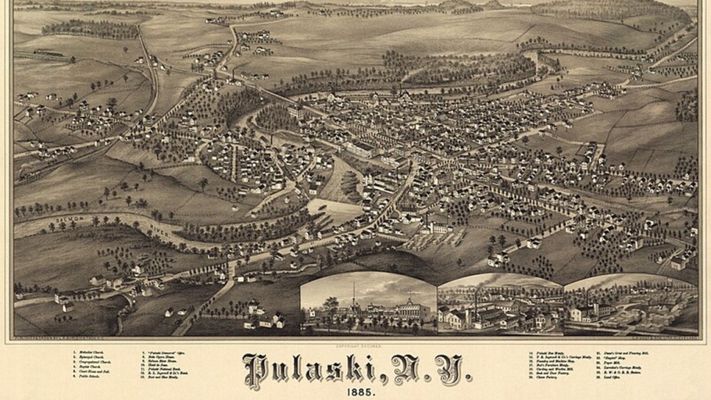
These days, commerce in Pulaski revolves largely around fishing tourism with its location on the Salmon River.
The Salmon River is named for the salmon that return to the river each fall during the salmon run.
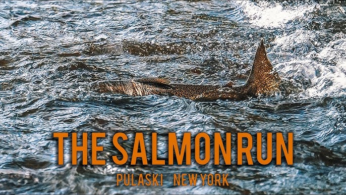
The Salmon River Falls are 15-miles, or 24-kilometers, from the entrance of the Salmon River on Lake Ontario in Orwell, New York.
The Salmon River Falls are 110-feet, or 34-meters, high.
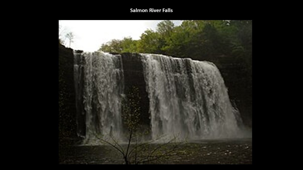
There have been hydroelectric power facilities developed here, like with the Salmon River Reservoir, said to have been created in 1912, which diverts water from the falls through a 10,000-foot, or 3,048-meter, -long pipeline to the power station at Bennett’s Bridge marked by the red balloon.
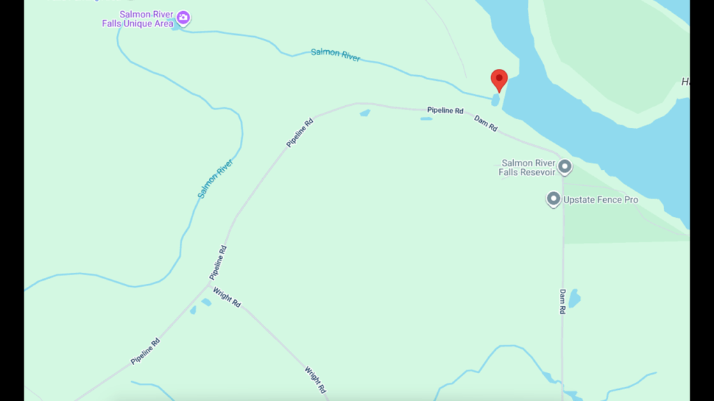
The Deer Creek Marsh Wildlife Management Area is just to the north of the Salmon River.
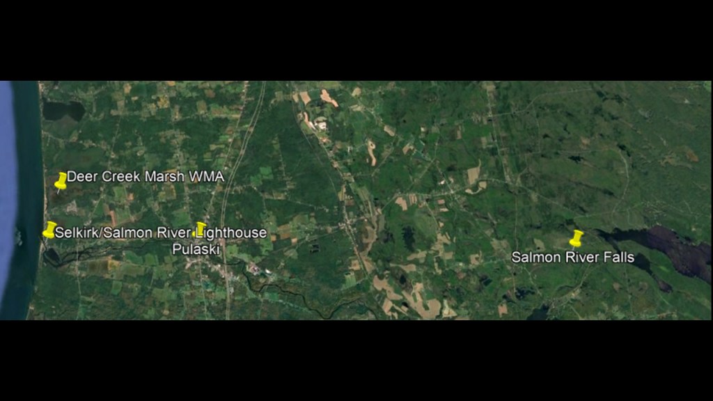
The Deer Creek Marsh Wildlife Management Area is a combination of wetland bogs, and extensive barrier beach, and sand dune system.
Its focus is wildlife management, wildlife habitat management and wildlife-dependent recreation.
As I have said before, I suspect these wetlands, beaches and sand dunes to be ruined land from the cataclysmic event that took place with the destruction of the original energy grid.
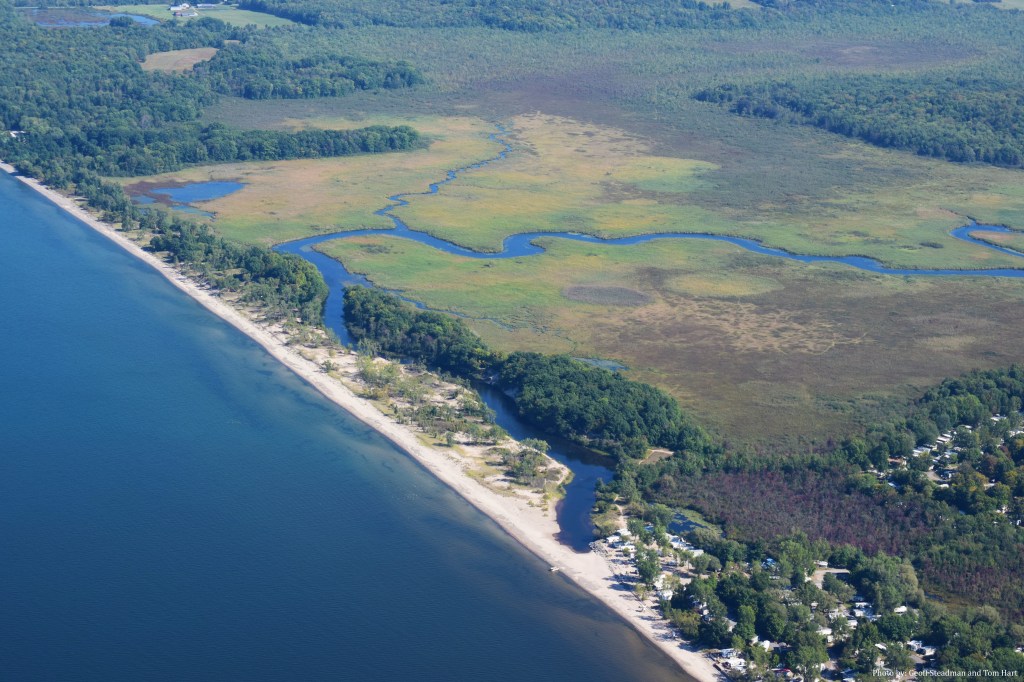
As we head up the final stretch of the Lake Ontario shore, these are the places I would like to highlight: the Stony Point Lighthouse; the Galloo Island Lighthouse; the Horse Island Lighthouse; Talcott Falls; the city of Watertown; and the East Charity Shoal, Tibbetts Point and Cape Vincent Breakwater Lighthouses at the entrance of the St. Lawrence Waterway on the New York-side, where I will be ending this post.
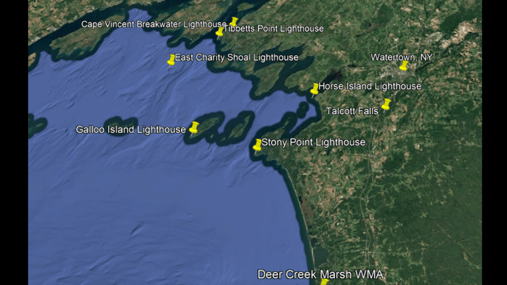
First, the Stony Point Lighthouse.
This particular lighthouse was said to have been constructed sometime around 1869.
Today it is privately-owned and not open to the public, and the light is still maintained by the U. S. Coast Guard.
Stony Point is named for rocky ledges that extend from the point for some distance.
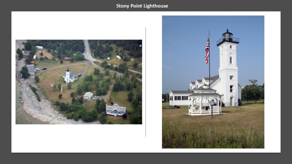
The current Galloo Island Lighthouse was said to have been constructed sometime between 1820 and 1866, and first lit in 1867.
The lighthouse tower was constructed out of gray limestone with a brick-lining.
The Galloo Island lighthouse is part of a larger privately-owned property, however the U. S. Coast Guard has an easement to maintain an active light in the tower and small station.
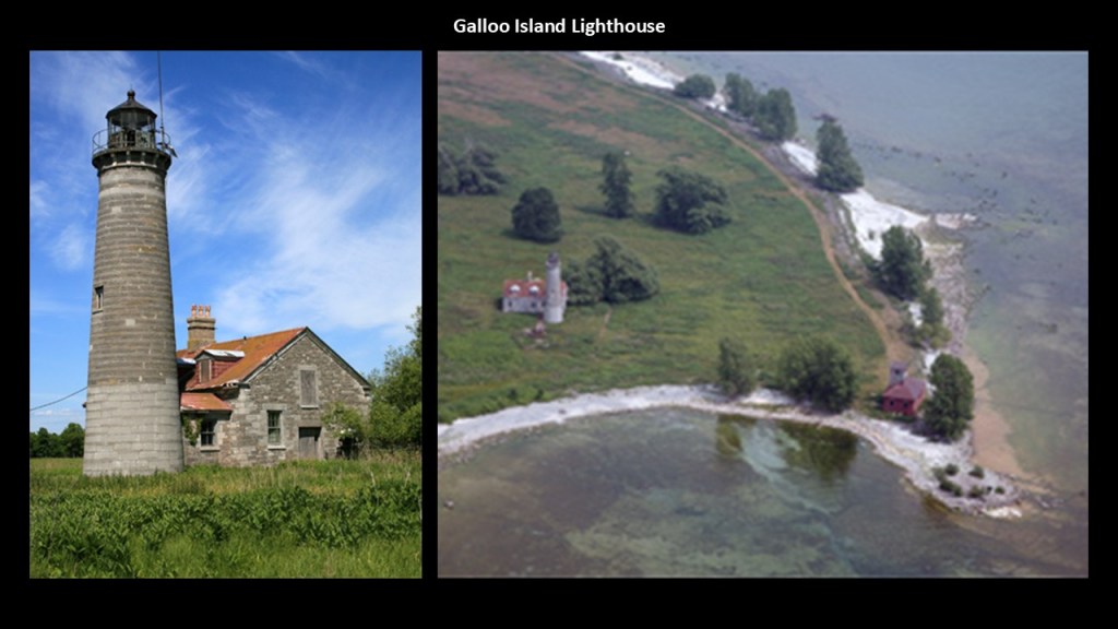
The original Horse Island Lighthouse, also known as the Sacketts Harbor Lighthouse, was said to have been constructed in 1831 out of limestone and brick, and we are told today’s structure was built between 1870 and 1871.
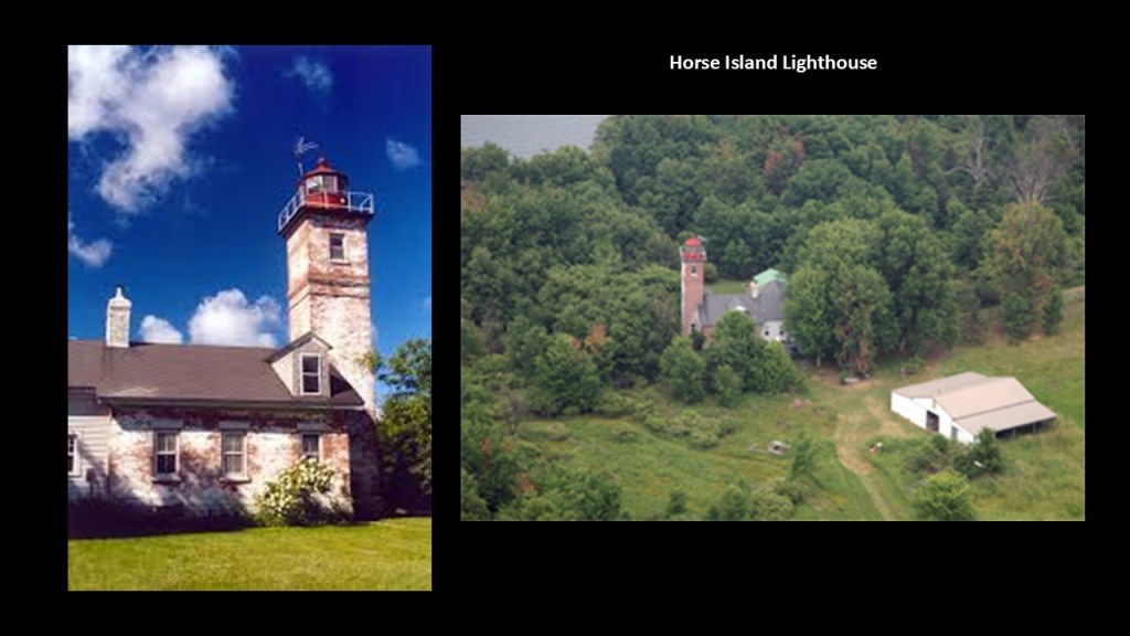
We are told that during the War of 1812, the British used Horse Island as a staging area before the Battle of Sackett’s Harbor, in which the British wanted to capture the town of Sackett’s Harbor, which was the main dockyard for the American Naval Squadron on Lake Ontario.
According to our historical narrative, the British were defeated by American forces, though American warships and naval stores were damaged.
Fort Tompkin at Sackett’s Harbor was said to have been built in 1812 and Fort Pike in 1813 to defend the crucial shipbuilding here at the naval base.
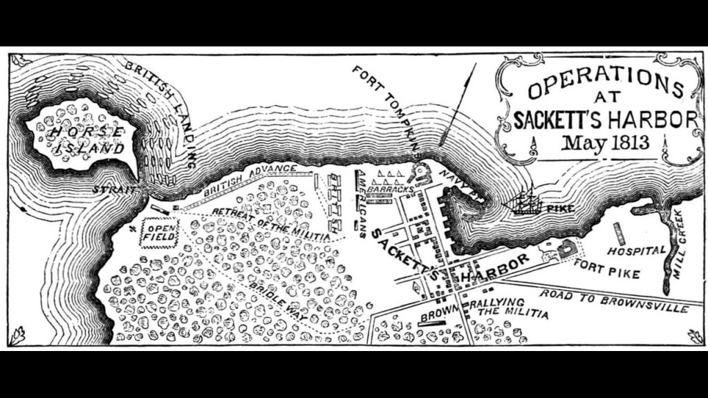
The Sackett’s Harbor Battlefield State Historic Site commemorates the history of this location as the center of American naval and military activity for the Upper St. Lawrence Valley and Lake Ontario during the War of 1812.
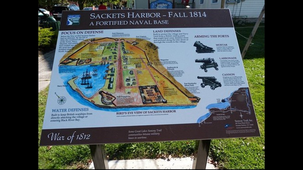
Next, I am going to head over to Talcott Falls and the city of Watertown.
Talcott Falls is just off of New York State Route 11, in Adams, a short distance south of Watertown.
There was an historic sawmill in Adams at one time, like so many places we have seen along the way.
The falls are on private land, but viewable from within the highway right-of-way.
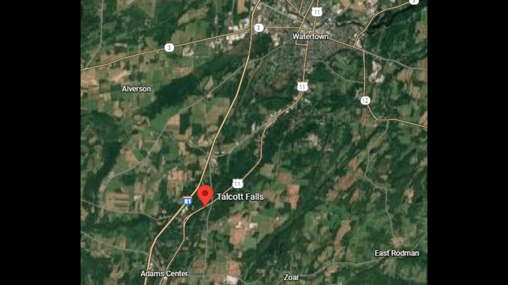
The Talcott Falls are 35-feet, or 11-meters, – high.
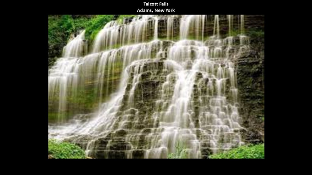
They are on Stony Creek which is a tributary of the Black River.
Watertown is approximately 25-miles, or 40-kilometers, south of the Thousand Islands on the Black River about 5-miles, or 8-kilometers, east of where it flows into Lake Ontario.
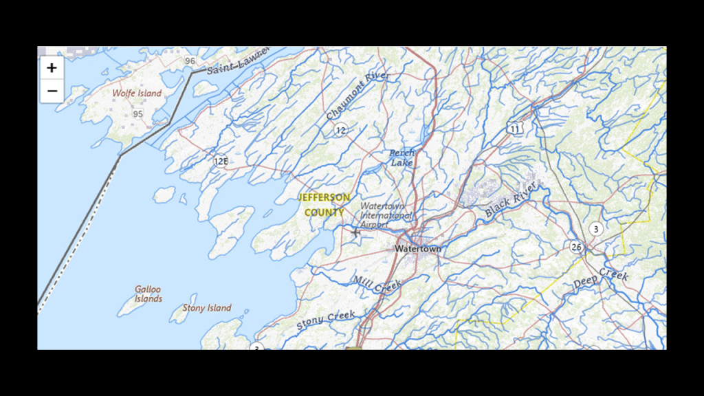
We are told that Watertown was first surveyed in 1795 and that it was settled in 1800 due to the abundant hydropower the Black River provided, like the Great Falls in Watertown.
Also known as the Watertown Falls, you can get there by way of Mill Street from Public Square at the intersection with Main Street.
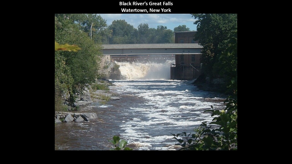
Again like in all the other places we have seen with waterfalls in the 19th-century, Watertown was no exception to having had numerous mills at these locations, to include but not limited to, grist mills and paper mills.
It boomed for many years as an industrial center for upstate New York.
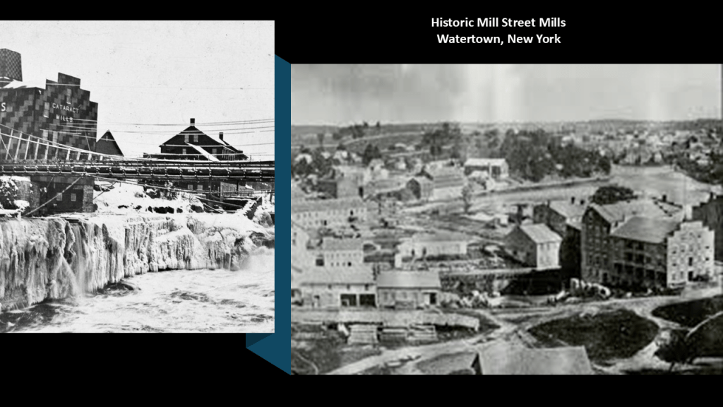
The Paddock Arcade is described as a 19th-century shopping mall in Watertown that was built in 1850 in the Gothic and Italianate-style, and is the oldest continously-operating indoor shopping mall in the United States.
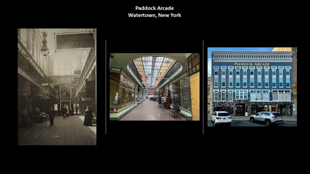
The Roswell P. Flower Memorial Library in Watertown was said to have been built in 1903 and 1904, and opened on January 4th of 1905, and donated as a memorial to the the 30th Governor of New York by his daughter.
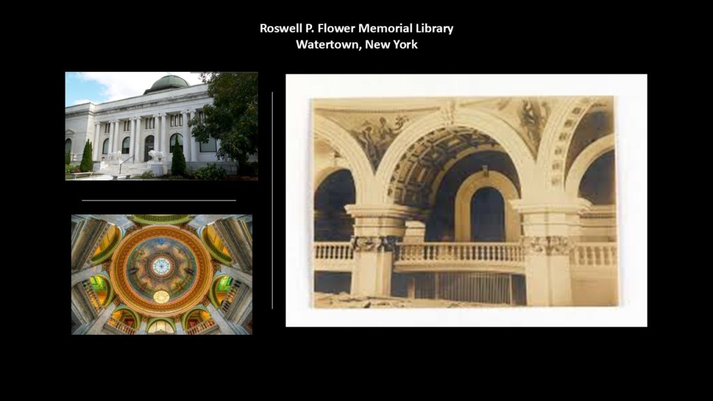
Thompson Park is on a hill on the southeastern-side of Watertown.
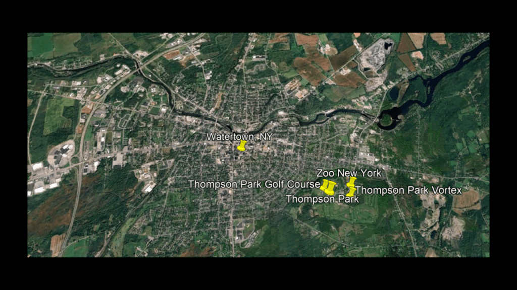
Thompson Park was said to be an Olmsted creation, and in this case, Frederick Law Olmsted’s nephew and adopted son, John Olmsted, and donated to the city by the industrialist John C. Thompson in 1899.
It features things like a golf course…
…a zoo…
…stone pavilions and stone stairways…
…and the Thompson Park Vortex, in-between the golf course and the zoo..
The Thompson Park Vortex is said to be a time vortex that has transported people to another part of the park, or caused them to disappear and reappear later, or where apparitions have been seen or unexplained noises heard.
A viewer sent me this information about Thompson Park awhile back and photos of the stonework around the hill.
She wrote: Around 2009 when I heard about about ley lines I wondered if maybe I lived near one. I googled nearest ley line and found that Thompson park was built on a ley line. This is in Watertown, New York which is very close.. Watertown had more millionaires living there at beginning of the 19th century than any city in the country. The Dulles Brothers: John Foster Dulles, Allen Dulles were born and raised in this area.
Thompson Park is built on a very high hill and is was considered the most haunted area in the world at one time. A vortex of some sort has had people disappear and then reappear after a few weeks thinking they had only been gone a few hours. This occurred in the late 1800’s I believe. I have always thought there was so much more that was there…. like a magnificent castle or something…. The entrance to and the exit from of the park is just to elaborate to have been only a park. The stone pillars pretty much surround the the exit and surround the hill. The little stone houses they say were latrines. The stone work is unreal…. the steps at the entrance ascend to an area which seems to be missing the roof of a building no longer there…remnants of something divine everywhere. Walking around the base of the park, you can hear water flowing inside the hill…. very fascinating.
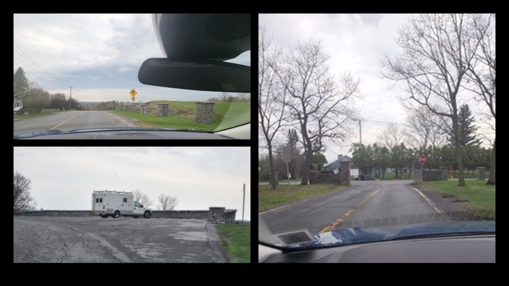
Next, the Watertown International Airport is to the west of the city, and to the north and northeast of the city, there are several raceways and speedways; Fort Drum, and the 10th Combat Aviation Brigade.
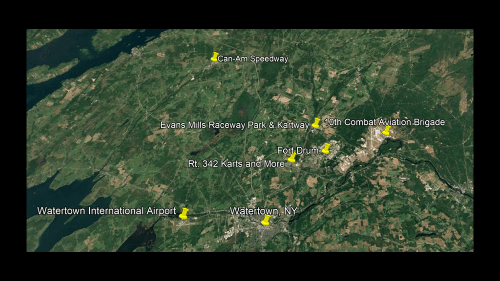
Rt. 342 Karts and More is a recreation site with go-karts and mini-golf.

The Evans Mills Raceway is an asphalt oval raceway located on US Route 11 that hosts auto racing on Saturday nights throughout the summer.
The Can-Am Speedway is a dirt, oval raceway in LaFargeville, New York, on New York State Route 411 near the entrance to the St. Lawrence Waterway and the Thousand Islands, and draws competitors and fans from both sides of the border.
The Can-Am Speedway offers auto racing every Friday night throughout the summer season.
Fort Drum and the 10th Combat Aviation Brigade and its airfield are just to the east of the location of Rt. 342 Karts and Evans Mills Raceway racing tracks.
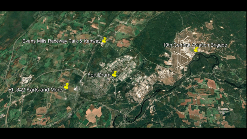
Fort Drum is a United States Army military installation and home to the 10th Mountain Light Infantry Division.
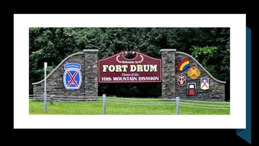
The testing of Agent Orange began on more than 1,000-acres, or 405-hectares, of what was then Camp Drum in 1959.
Several communities, including Fort Drum, near Agent Orange manufacturing and storage sites continue to report dioxin levels above recommended safety standards.

The last places I would like to take a look at here on this side of Lake Ontario are the lighthouses at the mouth of the St. Lawrence Waterway just a short-distance from Watertown – the East Charity Shoal Lighthouse; the Tibbetts Point Lighthouse; and the Cape Vincent Breakwater Lighthouse.

The East Charity Shoal Lighthouse is off-shore near the St. Lawrence Waterway’s entrance to Lake Ontario, south of the city of Kingston in Ontario, and southwest of Wolfe Island, the largest of the Thousand Islands located at the entrance to the waterway.
It is located in Jefferson County, New York, near the border with Canada.
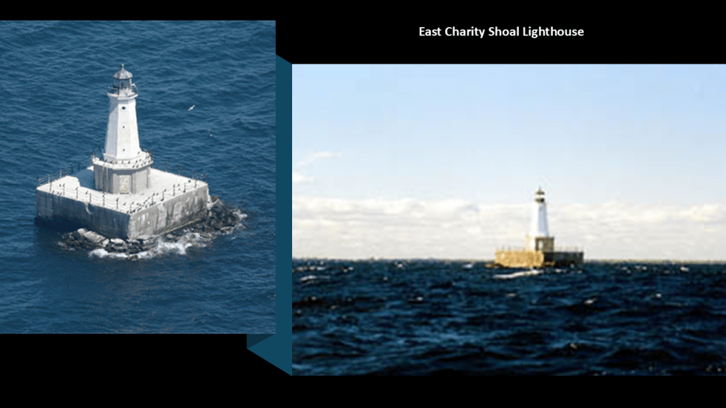
The tower of the lighthouse was said to have been constructed in 1877 from recast cannon after the Battle of Fort Sumter, which would have been the first battle of the American Civil War fought in April of 1861, for the Vermilion Light Station in Ohio on the shores of Lake Erie, but we are told that it was removed after it was damaged in an ice storm, and that a replica of the tower was installed at Vermilion in 1991.
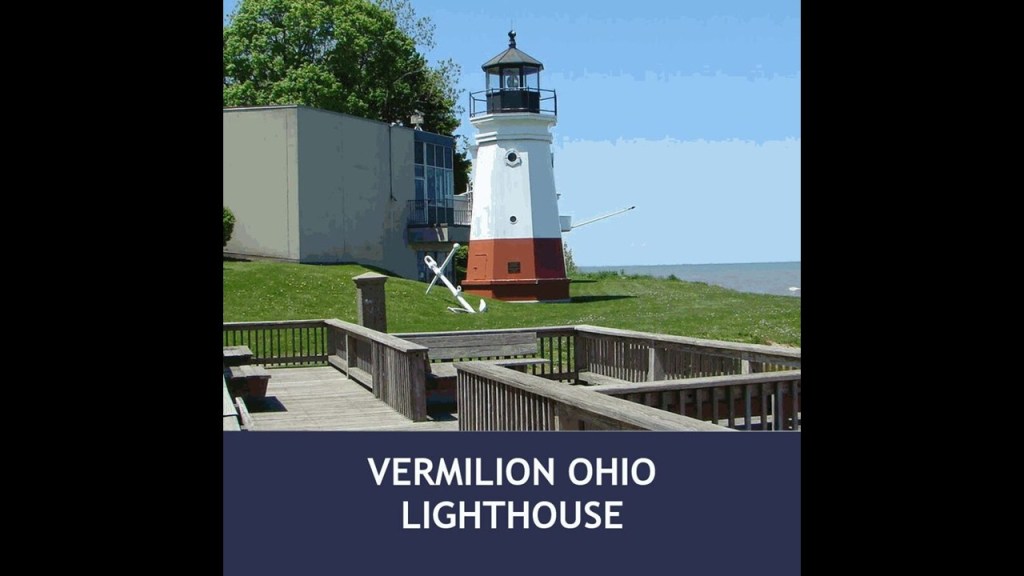
The construction of the concrete pier for what became the East Charity Shoal Lighthouse was said to have taken place in 1934, and the tower installed in 1935, which would have been during the Great Depression.
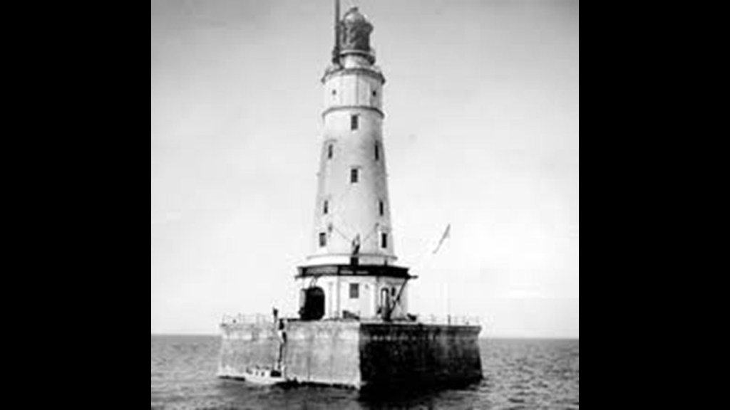
The Tibbetts Point Lighthouse stands at the entrance of the St. Lawrence Waterway in Cape Vincent, New York, and was said to have been constructed in 1854.
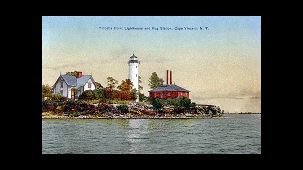
It uses the only classic fresnel lens still in operation on Lake Ontario.
Only 70 such lenses are still operational in the United States, with 16 of them being on the Great Lakes.
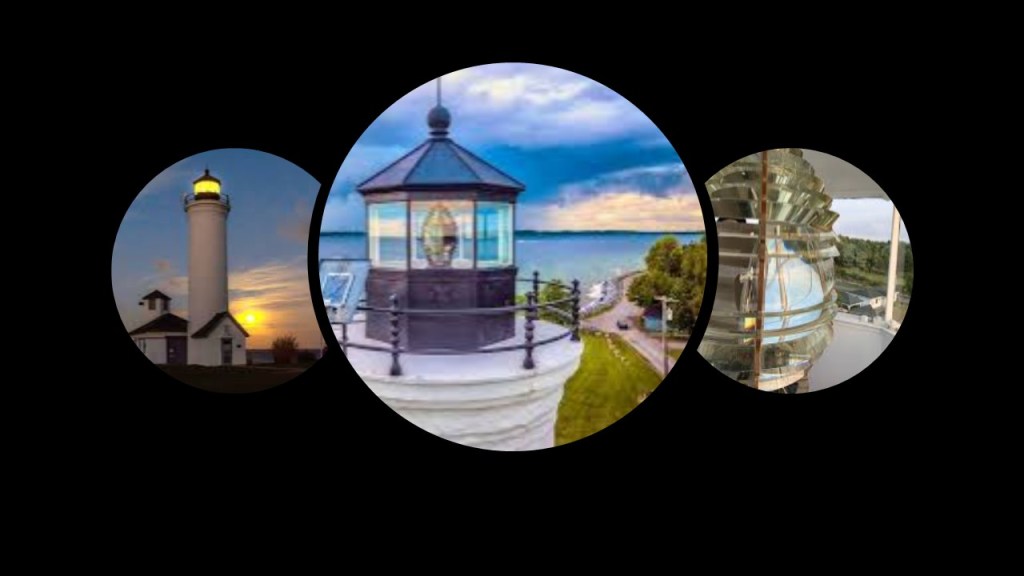
The Tibbetts Point Lighthouse is on the previously-mentioned Great Lakes Seaway Trail, like the Charlotte-Genessee Lighthouse in the Rochester-area, a National Scenic Byway of roads and highways that runs for 518-miles, or 834-kilometers, along Lake Erie, the Niagara River, Lake Ontario, and the St. Lawrence River.
Lastly, the Cape Vincent Breakwater Lighthouse.
There is a Cape Vincent Breakwater Lighthouse today at the Town Highway Department on New York State Route 12E.
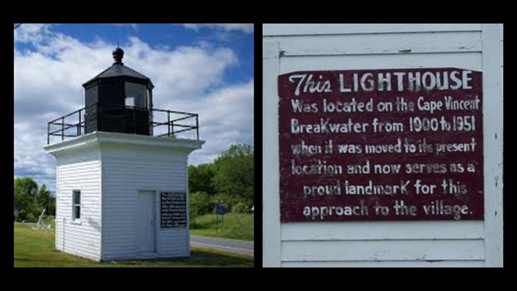
Historically, there were two lighthouses on the breakwater protecting the town of Cape Vincent.
This is a 1911 photo of the breakwater lighthouses.
The breakwater in the foreground is parallel to the railroad wharf in the background.
The breakwater and those lighthouses were said to have been constructed in the time period between 1899 and 1904, and removed from the breakwater in 1951 and replaced with skeletal steel structures.
The one Cape Vincent Breakwater lighthouse landed on New York State Route 12E and the other became a local man’s children’s playhouse before it was demolished after falling into disrepair.
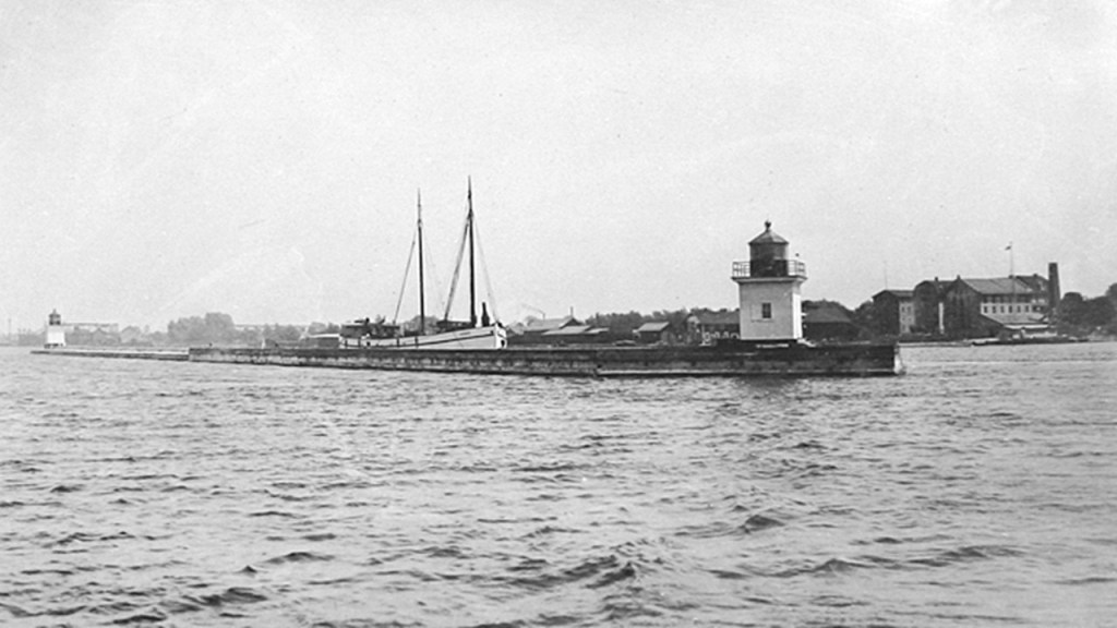
I am going to end this post here, and in “North America’s Great Lakes – Part 6 Lake Ontario from St. Catharine’s up through the St. Lawrence Waterway in Ontario,” I will follow the Lake Ontario shoreline west and northeast from St. Catharine’s, which is just to the west of the Niagara River on the Ontario-side to Kingston at the entrance to the St. Lawrence waterway, and go up the St. Lawrence Seaway and “Thousand Islands” and head towards Montreal in the Province of Quebec.